

Environmental and Social Impact Assessment - Gibe III
Environmental and Social Impact Assessment - Gibe III
Environmental and Social Impact Assessment - Gibe III

Create successful ePaper yourself
Turn your PDF publications into a flip-book with our unique Google optimized e-Paper software.
<strong>Gibe</strong> <strong>III</strong> – <strong>Environmental</strong> <strong>and</strong> <strong>Social</strong> <strong>Impact</strong> <strong>Assessment</strong> 300 ENV R CS 002 C – A9003099<br />
Table of Contents<br />
0 EXECUTIVE SUMMARY.............................................................................................1<br />
0.1 Introduction.......................................................................................................................1<br />
0.2 Project Description ...........................................................................................................1<br />
0.2.1 Project Location................................................................................................................................1<br />
0.2.2 <strong>Gibe</strong> <strong>III</strong> Hydropower Scheme............................................................................................................2<br />
0.2.3 Transmission Line .............................................................................................................................4<br />
0.2.4 Access Roads.....................................................................................................................................4<br />
0.3 Policy, Legal, <strong>and</strong> Administrative Framework.................................................................7<br />
0.3.1 Regulatory Framework of FDRE ......................................................................................................7<br />
0.3.2 African Development Bank Guidelines..............................................................................................7<br />
0.3.3 World Bank........................................................................................................................................7<br />
0.3.4 International Conventions.................................................................................................................8<br />
0.4 Description of the Project Environment ...........................................................................8<br />
0.4.1 Dam <strong>and</strong> Reservoir/upstream............................................................................................................8<br />
0.4.2 Baseline Information: Downstream Area........................................................................................12<br />
0.4.3 Baseline Information: <strong>Gibe</strong> <strong>III</strong>-Sodo Transmission Line ................................................................14<br />
0.5 Project Alternatives.........................................................................................................15<br />
0.6 Potential <strong>Impact</strong>s <strong>and</strong> Benefit Enhancement <strong>and</strong> Mitigation Measures .........................16<br />
0.6.1 Beneficial/ Positive <strong>Impact</strong>s ............................................................................................................16<br />
0.6.2 Adverse <strong>Impact</strong>s <strong>and</strong> Mitigation Measures: Dam <strong>and</strong> Reservoir....................................................17<br />
0.6.3 <strong>Impact</strong>s on Downstream Environment Lower Omo <strong>and</strong> Mitigation Measures ...............................20<br />
0.6.4 Adverse <strong>Impact</strong>s <strong>and</strong> Mitigation Measures: <strong>Gibe</strong> <strong>III</strong>-Sodo Transmission Line...............................21<br />
0.6.5 Adverse <strong>Impact</strong>s <strong>and</strong> Mitigation Measures: Chida-Sodo Road Realignment..................................22<br />
0.6.6 Cumulative <strong>Impact</strong> <strong>Assessment</strong> .......................................................................................................22<br />
0.7 <strong>Environmental</strong> Management <strong>and</strong> Monitoring Program..................................................22<br />
0.7.1 <strong>Environmental</strong> Management ...........................................................................................................22<br />
0.7.2 <strong>Environmental</strong> Monitoring ..............................................................................................................23<br />
0.7.3 Monitoring Framework ...................................................................................................................24<br />
0.8 Public Consultations <strong>and</strong> Disclosure Plan ......................................................................24<br />
0.9 <strong>Environmental</strong> Mitigation, Management, Monitoring <strong>and</strong> Training Costs ....................26<br />
0.10 Contacts ..........................................................................................................................28<br />
1 INTRODUCTION.........................................................................................................29<br />
1.1 Purpose of the study........................................................................................................29<br />
1.2 Background.....................................................................................................................29<br />
1.3 <strong>Impact</strong> assessment responsibility <strong>and</strong> <strong>Assessment</strong> Team ...............................................30<br />
1.4 Complementary Initiatives <strong>and</strong> Associated Reports.......................................................31<br />
1.5 Report Structure..............................................................................................................32<br />
2 POLICY, LEGAL, AND INSTITUTIONAL FRAMEWORK.................................35<br />
2.1 Institutional <strong>and</strong> administrative framework....................................................................35<br />
2.1.1 Federal Democratic Republic of Ethiopia.......................................................................................35<br />
2.1.2 Regional Government......................................................................................................................35<br />
2.1.3 <strong>Environmental</strong> Protection Authority ...............................................................................................36<br />
2.1.4 Ethiopian Electric Power Corporation ...........................................................................................37<br />
2.1.5 EEPCo’s <strong>Environmental</strong> Monitoring Unit ......................................................................................37<br />
2.2 National policies <strong>and</strong> strategies ......................................................................................37<br />
2.2.1 The Constitution ..............................................................................................................................37<br />
2.2.2 Conservation Strategy of Ethiopia ..................................................................................................38<br />
2.2.3 <strong>Environmental</strong> Policy of Ethiopia ...................................................................................................38<br />
2.2.4 Ethiopian Water Resources management Policy.............................................................................39<br />
CESI SpA - Mid-Day International Consulting Engineers Page i
<strong>Gibe</strong> <strong>III</strong> – <strong>Environmental</strong> <strong>and</strong> <strong>Social</strong> <strong>Impact</strong> <strong>Assessment</strong> 300 ENV R CS 002 C – A9003099<br />
2.2.5 Wildlife Policy.................................................................................................................................40<br />
2.2.6 Forest Policy <strong>and</strong> Strategy ..............................................................................................................40<br />
2.2.7 The National Policy on Women.......................................................................................................40<br />
2.2.8 Research <strong>and</strong> conservation of Ethiopian cultural heritage.............................................................40<br />
2.3 <strong>Environmental</strong> Framework Legislation ..........................................................................41<br />
2.3.1 Proclamation on Institutional Arrangement for <strong>Environmental</strong> Protection....................................41<br />
2.3.2 Proclamation on <strong>Environmental</strong> <strong>Impact</strong> <strong>Assessment</strong> ......................................................................41<br />
2.3.3 Proclamation on <strong>Environmental</strong> Pollution Control ........................................................................42<br />
2.3.4 <strong>Environmental</strong> Protection Authority’s ESIA Guideline...................................................................42<br />
2.4 Legal framework for expropriation <strong>and</strong> compensation...................................................43<br />
2.4.1 L<strong>and</strong> Tenure ....................................................................................................................................43<br />
2.4.2 Expropriation ..................................................................................................................................43<br />
2.4.3 Compensation..................................................................................................................................43<br />
2.4.4 Multilateral agreement....................................................................................................................44<br />
3 PROJECT DESCRIPTION .........................................................................................45<br />
3.1 Project location ...............................................................................................................45<br />
3.2 General layout.................................................................................................................47<br />
3.3 Alternative layouts analysis............................................................................................49<br />
3.4 Reservoir.........................................................................................................................50<br />
3.5 Access Roads ..................................................................................................................50<br />
3.6 River Diversion...............................................................................................................51<br />
3.6.1 Layout..............................................................................................................................................51<br />
3.6.2 Diversion tunnels.............................................................................................................................52<br />
3.6.3 Cofferdams ......................................................................................................................................53<br />
3.7 Dam 54<br />
3.7.1 General............................................................................................................................................54<br />
3.7.2 Dam zoning .....................................................................................................................................55<br />
3.8 Spillway ..........................................................................................................................55<br />
3.8.1 General............................................................................................................................................55<br />
3.8.2 Hydraulics .......................................................................................................................................55<br />
3.9 Outlet works....................................................................................................................57<br />
3.9.1 Middle outlets..................................................................................................................................57<br />
3.9.2 Permanent environmental discharge...............................................................................................58<br />
3.9.3 Temporary environmental discharge ..............................................................................................59<br />
3.10 Power Waterways ...........................................................................................................59<br />
3.11 Power House...................................................................................................................60<br />
3.12 Switchyard ......................................................................................................................61<br />
3.13 Electro-Mechanical equipment .......................................................................................62<br />
3.13.1 General............................................................................................................................................62<br />
3.13.2 Turbines...........................................................................................................................................62<br />
3.13.3 Generators.......................................................................................................................................63<br />
3.13.4 Step-up transformers .......................................................................................................................63<br />
3.14 Hydraulic Steel Structures ..............................................................................................64<br />
3.14.1 General............................................................................................................................................64<br />
3.15 Materials / Quarries ........................................................................................................65<br />
3.15.1 General............................................................................................................................................65<br />
3.15.2 Recent (River) alluvium...................................................................................................................67<br />
3.15.3 Basalt...............................................................................................................................................68<br />
3.15.4 Trachyte...........................................................................................................................................68<br />
3.15.5 Pozzolanic materials (ashes, ignimbrite) ........................................................................................69<br />
4 IMPACT ASSESSMENT METHODOLOGY ...........................................................71<br />
4.1 Introduction.....................................................................................................................71<br />
4.2 Bounding <strong>and</strong> Scoping....................................................................................................72<br />
4.3 Public participation.........................................................................................................72<br />
CESI SpA - Mid-Day International Consulting Engineers Page ii
<strong>Gibe</strong> <strong>III</strong> – <strong>Environmental</strong> <strong>and</strong> <strong>Social</strong> <strong>Impact</strong> <strong>Assessment</strong> 300 ENV R CS 002 C – A9003099<br />
4.4 <strong>Assessment</strong>......................................................................................................................73<br />
5 DESCRIPTION OF THE ENVIRONMENT .............................................................75<br />
5.1 Physical Environment.....................................................................................................75<br />
5.1.1 Climate ............................................................................................................................................75<br />
5.1.2 Geology ...........................................................................................................................................78<br />
5.1.3 Seismology.......................................................................................................................................85<br />
5.1.4 Reservoir Slope ...............................................................................................................................86<br />
5.1.5 Hydrogeology..................................................................................................................................87<br />
5.1.6 Soils.................................................................................................................................................91<br />
5.1.7 Hydrology........................................................................................................................................92<br />
5.1.8 Water quality.................................................................................................................................120<br />
5.2 Biological Environment................................................................................................122<br />
5.2.1 L<strong>and</strong> Use <strong>and</strong> L<strong>and</strong> Cover.............................................................................................................122<br />
5.2.2 Natural Vegetation <strong>and</strong> Forest Resources.....................................................................................124<br />
5.2.3 Aquatic Ecology ............................................................................................................................130<br />
5.2.4 Fishery Resources .........................................................................................................................132<br />
5.2.5 Wildlife Resources.........................................................................................................................135<br />
5.2.6 National Parks <strong>and</strong> Other Protected Areas...................................................................................136<br />
5.3 Socio-Economical Environment ...................................................................................136<br />
5.3.1 Population .....................................................................................................................................137<br />
5.3.2 Ethnic Compositions......................................................................................................................140<br />
5.3.3 Religion .........................................................................................................................................140<br />
5.3.4 Gender Issues ................................................................................................................................142<br />
5.3.5 Settlement Pattern <strong>and</strong> Housing Condition...................................................................................143<br />
5.3.6 Agriculture ....................................................................................................................................143<br />
5.3.7 Livestock........................................................................................................................................144<br />
5.3.8 Cultural, Religious, Historical <strong>and</strong> Archaeological Sites .............................................................146<br />
5.3.9 Public Health.................................................................................................................................149<br />
5.3.10 Water Supply .................................................................................................................................154<br />
5.3.11 Other <strong>Social</strong> Service <strong>and</strong> Infrastructures ......................................................................................154<br />
5.3.12 Tourism .........................................................................................................................................154<br />
5.3.13 NGOs working in <strong>and</strong> around the affected Weredas.....................................................................155<br />
5.4 Baseline Information: Downstream Area .....................................................................155<br />
5.4.1 Geology .........................................................................................................................................155<br />
5.4.2 Hydrogeology................................................................................................................................158<br />
5.4.3 L<strong>and</strong> Use/Cover units....................................................................................................................158<br />
5.4.4 Hydrology......................................................................................................................................161<br />
5.4.5 Ethnic Groups of the Lower Omo Valley.......................................................................................164<br />
5.4.6 Livestock........................................................................................................................................175<br />
5.4.7 Fishery...........................................................................................................................................177<br />
5.4.8 National Parks <strong>and</strong> other Protected Areas....................................................................................180<br />
6 PROJECT BENEFITS ...............................................................................................183<br />
6.1 Power generation ..........................................................................................................183<br />
6.2 Avoidance of CO2 emissions ........................................................................................184<br />
6.3 Prospects to Export Power............................................................................................184<br />
6.4 Effective Utilization of the Country’s Water Resource................................................184<br />
6.5 Improvements in Local Access.....................................................................................184<br />
6.6 Job Opportunity ............................................................................................................185<br />
6.7 Gender Issues................................................................................................................185<br />
6.8 Fishery development.....................................................................................................186<br />
6.9 Regulation of the River Flow for Irrigation..................................................................186<br />
6.10 Flood Protection............................................................................................................187<br />
6.11 Tourism Activities ........................................................................................................187<br />
6.12 River Navigation...........................................................................................................187<br />
6.13 Beneficial <strong>Impact</strong>s on Wildlife resource ......................................................................187<br />
CESI SpA - Mid-Day International Consulting Engineers Page iii
<strong>Gibe</strong> <strong>III</strong> – <strong>Environmental</strong> <strong>and</strong> <strong>Social</strong> <strong>Impact</strong> <strong>Assessment</strong> 300 ENV R CS 002 C – A9003099<br />
7 IMPACT ASSESSMENT AND MITIGATION ACTIONS ...................................189<br />
7.1 General..........................................................................................................................189<br />
7.2 <strong>Impact</strong>s on Physical Environment ................................................................................189<br />
7.2.1 Climate ..........................................................................................................................................189<br />
7.2.2 Geothermal activity .......................................................................................................................196<br />
7.2.3 Seismology.....................................................................................................................................196<br />
7.2.4 Hydrogeology................................................................................................................................197<br />
7.2.5 Slope stability ................................................................................................................................198<br />
7.2.6 Hydrology <strong>and</strong> Water quality ........................................................................................................199<br />
7.2.7 L<strong>and</strong>scape......................................................................................................................................201<br />
7.3 <strong>Impact</strong>s on Biological Environment .............................................................................202<br />
7.3.1 Forest <strong>and</strong> Natural Vegetation......................................................................................................202<br />
7.3.2 Wildlife <strong>and</strong> other Terrestrial Fauna ............................................................................................204<br />
7.3.3 Aquatic Ecology ............................................................................................................................209<br />
7.3.4 Fishery Resources .........................................................................................................................210<br />
7.3.5 National Parks <strong>and</strong> other Protected Areas....................................................................................211<br />
7.4 <strong>Impact</strong>s on Socio-Economical Environment ................................................................211<br />
7.4.1 Agriculture ....................................................................................................................................211<br />
7.4.2 Housing <strong>and</strong> Settlements ...............................................................................................................212<br />
7.4.3 Tribal People.................................................................................................................................213<br />
7.4.4 Livestock Resources ......................................................................................................................213<br />
7.4.5 Agro-pastoralists Population ........................................................................................................217<br />
7.4.6 Public Health.................................................................................................................................218<br />
7.4.7 Infrastructure <strong>and</strong> Severance of Access ........................................................................................220<br />
7.4.8 <strong>Impact</strong>s on Other <strong>Social</strong> Service Facilities <strong>and</strong> Economic Activities............................................221<br />
7.4.9 Cultural <strong>and</strong> Historical Sites.........................................................................................................225<br />
7.4.10 Archaeological Sites......................................................................................................................225<br />
7.5 Downstream effects ......................................................................................................226<br />
7.5.1 General..........................................................................................................................................226<br />
7.5.2 Hydraulic regime...........................................................................................................................226<br />
7.5.3 Downstream flows during construction <strong>and</strong> first impoundment....................................................229<br />
7.5.4 Daily Flow Variation Acoustic Warning System...........................................................................229<br />
7.5.5 Sediment transport <strong>and</strong> water quality ...........................................................................................229<br />
7.5.6 Agriculture ....................................................................................................................................230<br />
7.5.7 Grazing resources .........................................................................................................................232<br />
7.5.8 Fishery...........................................................................................................................................233<br />
7.5.9 National Parks...............................................................................................................................234<br />
7.5.10 Dipa Hayk Lake.............................................................................................................................234<br />
7.6 <strong>Impact</strong>s Associated with Ancillary Works ...................................................................234<br />
7.6.1 Quarries <strong>and</strong> Borrow Areas ..........................................................................................................234<br />
7.6.2 Spoil <strong>and</strong> Waste Material Disposal Areas.....................................................................................235<br />
7.7 Cumulative <strong>Impact</strong> <strong>Assessment</strong>....................................................................................236<br />
7.7.1 Background ...................................................................................................................................236<br />
7.7.2 Results of Cumulative <strong>Impact</strong> analysis..........................................................................................240<br />
7.8 Synthesis of Environment <strong>Impact</strong> Matrix.....................................................................242<br />
8 PUBLIC CONSULTATION AND DISCLOSURE..................................................245<br />
8.1 Objective of Public Consultations ................................................................................245<br />
8.2 Consultation Methodologies.........................................................................................245<br />
8.3 Identifying Stakeholders...............................................................................................246<br />
8.4 Results of Dam <strong>and</strong> Reservoir Area Consultation........................................................246<br />
8.4.1 Consultations with Community Focused Groups ..........................................................................246<br />
8.4.2 Views of Individual Households ....................................................................................................247<br />
8.4.3 Consultations with Local Officials ................................................................................................247<br />
8.5 Results of Downstream Areas Consultation .................................................................249<br />
8.5.1 Views of Local Administrations.....................................................................................................249<br />
8.5.2 Views of the Community................................................................................................................250<br />
CESI SpA - Mid-Day International Consulting Engineers Page iv
<strong>Gibe</strong> <strong>III</strong> – <strong>Environmental</strong> <strong>and</strong> <strong>Social</strong> <strong>Impact</strong> <strong>Assessment</strong> 300 ENV R CS 002 C – A9003099<br />
8.6 Consultation for National Parks <strong>and</strong> Protected Areas ..................................................252<br />
8.6.1 Views of the Ministry of Agriculture <strong>and</strong> Rural Development.......................................................252<br />
8.6.2 Views of the Office of National Parks <strong>and</strong> CHA............................................................................252<br />
8.7 Consultation for Historical Sites...................................................................................253<br />
8.7.1 Consultation with ARCCH <strong>and</strong> Information <strong>and</strong> Culture Bureau.................................................253<br />
8.7.2 Consultation with Zonal <strong>and</strong> Wereda Authorities .........................................................................254<br />
8.8 Consultation with NGOs <strong>and</strong> Other Organisations.......................................................254<br />
8.9 Public Disclosure ..........................................................................................................254<br />
9 ENVIRONMENTAL COMPARISON......................................................................257<br />
9.1 Forewords .....................................................................................................................257<br />
9.2 Ranking methodology...................................................................................................257<br />
9.2.1 L<strong>and</strong> lost........................................................................................................................................257<br />
9.2.2 People affected ..............................................................................................................................258<br />
9.2.3 Access............................................................................................................................................258<br />
9.2.4 Cultural heritage...........................................................................................................................258<br />
9.2.5 Downstream effects .......................................................................................................................259<br />
9.2.6 Aquatic ecosystems........................................................................................................................259<br />
9.2.7 The Scheme <strong>Impact</strong> Score..............................................................................................................259<br />
9.3 The <strong>Impact</strong> of <strong>Gibe</strong> <strong>III</strong>..................................................................................................260<br />
10 ENVIRONMENTAL MANAGEMENT PLAN .......................................................263<br />
10.1 General Considerations.................................................................................................263<br />
10.2 Pre-Construction Phase.................................................................................................263<br />
10.3 Construction Phase .......................................................................................................263<br />
10.4 Post-Construction/Operation Phase ..............................................................................264<br />
11 ENVIRONMENTAL MONITORING PLAN..........................................................267<br />
11.1 General Considerations.................................................................................................267<br />
11.2 Construction Phase .......................................................................................................267<br />
11.3 Post-Construction/Operation Phase ..............................................................................268<br />
11.4 Monitoring Framework.................................................................................................270<br />
11.5 Institutional Strengthening <strong>and</strong> Training ......................................................................270<br />
12 ENVIRONMENTAL MITIGATION, MANAGEMENT, MONITORING AND<br />
TRAINING COSTS ....................................................................................................275<br />
12.1 Implementation Cost of ESMP.....................................................................................275<br />
12.2 Funding Mechanism .....................................................................................................278<br />
12.3 Implementation Schedule .............................................................................................278<br />
13 CONCLUSIONS AND RECOMMENDATIONS....................................................285<br />
13.1 Conclusions...................................................................................................................285<br />
13.2 Recommendations.........................................................................................................286<br />
13.2.1 Follow-Up Programmes................................................................................................................286<br />
13.2.2 Public Consultation <strong>and</strong> Disclosure..............................................................................................287<br />
14 REFERENCES............................................................................................................289<br />
15 ANNEXES....................................................................................................................293<br />
CESI SpA - Mid-Day International Consulting Engineers Page v
<strong>Gibe</strong> <strong>III</strong> – <strong>Environmental</strong> <strong>and</strong> <strong>Social</strong> <strong>Impact</strong> <strong>Assessment</strong> 300 ENV R CS 002 C – A9003099<br />
List of Tables<br />
Table 0.1: Summary of Project <strong>Impact</strong> on Household Assets by Wereda <strong>and</strong> Project Component .......... 18<br />
Table 0.2: Summary of estimated environmental mitigation, monitoring <strong>and</strong> training costs.................... 27<br />
Table 3.1: Geometrical characteristics of the diversion tunnels................................................................ 53<br />
Table 3.2: Spillway chute hydraulic analysis ............................................................................................ 57<br />
Table 3.3: Middle Level Outlet – Hydraulic calculations main result....................................................... 58<br />
Table 4.1: Flow chart of the <strong>Environmental</strong> <strong>Impact</strong> <strong>Assessment</strong> of a project........................................... 71<br />
Table 4.2: Synthesis of Environment <strong>Impact</strong> Matrix................................................................................. 74<br />
Table 5.1: Maximum monthly temperatures (°C)...................................................................................... 76<br />
Table 5.2: Minimum monthly temperatures (°C) ...................................................................................... 76<br />
Table 5.3: Mean monthly temperatures (°C) ............................................................................................. 76<br />
Table 5.4: Mean monthly rainfall (mm) .................................................................................................... 77<br />
Table 5.5: Mean monthly ETP (mm)......................................................................................................... 77<br />
Table 5.6: Comparison between Mean monthly rainfall <strong>and</strong> ETP at dam site (mm) ................................ 77<br />
Table 5.7: Description, according to FAO classification, of the soils identified in the reservoir area...... 92<br />
Table 5.8: Physical data of the watersheds................................................................................................ 96<br />
Table 5.9: Rainfall stations of the NMSA <strong>and</strong> periods of observation...................................................... 99<br />
Table 5.10: Mean monthly <strong>and</strong> yearly rainfall for the all the considered gauging stations....................... 100<br />
Table 5.11: Runoff stations of the EWRA <strong>and</strong> periods of observation ..................................................... 102<br />
Table 5.12: Mean runoff estimated at dam site ......................................................................................... 106<br />
Table 5.13: Monthly variability of runoff at Dam Site 5 in m 3 /s............................................................... 107<br />
Table 5.14: Monthly variability of runoff at Dam Site 5 in Mm 3 .............................................................. 107<br />
Table 5.15: Total annual <strong>and</strong> mean monthly runoff at Dam Site 5 in Mm 3 .............................................. 107<br />
Table 5.16: Frequency Analysis – Growth Factors <strong>and</strong> Point Rainfall of <strong>Gibe</strong> <strong>III</strong> ................................... 109<br />
Table 5.17: Point PMP within the project area.......................................................................................... 110<br />
Table 5.18: <strong>Gibe</strong> <strong>III</strong> catchment – Areal Reduction Factors....................................................................... 111<br />
Table 5.19: <strong>Gibe</strong> <strong>III</strong> catchment – Weiss correction factors ....................................................................... 111<br />
Table 5.20: <strong>Gibe</strong> <strong>III</strong> Areal Rainfall Depths ............................................................................................... 112<br />
Table 5.21: <strong>Gibe</strong> <strong>III</strong> Basin – 360 hrs (15 days) Design Hyetographs........................................................ 114<br />
Table 5.22: <strong>Gibe</strong> <strong>III</strong> HMS model – CN values.......................................................................................... 114<br />
Table 5.23: <strong>Gibe</strong> <strong>III</strong> HMS model – Tlag values ........................................................................................ 115<br />
Table 5.24: <strong>Gibe</strong> <strong>III</strong> HMS Model – 10,000 yr Analysis Main Results...................................................... 116<br />
Table 5.25: <strong>Gibe</strong> <strong>III</strong> HMS Model – PMF Analysis Main Results ............................................................. 116<br />
Table 5.26: <strong>Gibe</strong> <strong>III</strong> Dam Site – Extreme Flood Hydrographs.................................................................. 117<br />
Table 5.27: Comparison with Other Hydrologic Studies .......................................................................... 119<br />
Table 5.28: Results of chemical analysis................................................................................................... 121<br />
Table 5.29: Comparison table between two different sampling campain (2004 <strong>and</strong> 2006) at the same place<br />
................................................................................................................................................ 122<br />
Table 5.30: L<strong>and</strong> Cover Distribution in the <strong>Gibe</strong> <strong>III</strong> Reservoir Area........................................................ 124<br />
Table 5.31: The species composition of Terraces <strong>III</strong> <strong>and</strong> IV .................................................................... 129<br />
Table 5.32: Riparian macro-invertebrates at the Omo bridge ................................................................... 130<br />
Table 5.33: Habitat integrity rating for the Omo dam site downstream.................................................... 131<br />
Table 5.34: Habitat integrity rating for the Omo bridge site ..................................................................... 132<br />
Table 5.35: Population of the Affected Weredas <strong>and</strong> Peasant Association (2006) ................................... 139<br />
Table 5.36: Ethnic Composition by Wereda in the Project Area............................................................... 140<br />
Table 5.37: Population of the Weredas by Type of Religion in Percentage.............................................. 140<br />
Table 5.38: Livestock Population of the Affected Weredas...................................................................... 145<br />
Table 5.39: Ten Top Diseases, 2004/05 .................................................................................................... 152<br />
Table 5.40: Health Coverage of the Affected Weredas............................................................................. 153<br />
Table 5.41: Health Institutions <strong>and</strong> Personnel in the Weredas.................................................................. 153<br />
Table 5.42: Water Supply Coverage of the Affected Weredas (in %) ...................................................... 154<br />
Table 5.43: NGOs working in the affected Wereda .................................................................................. 155<br />
CESI SpA - Mid-Day International Consulting Engineers Page vi
<strong>Gibe</strong> <strong>III</strong> – <strong>Environmental</strong> <strong>and</strong> <strong>Social</strong> <strong>Impact</strong> <strong>Assessment</strong> 300 ENV R CS 002 C – A9003099<br />
Table 5.44: Rainfall rates, runoff coefficients <strong>and</strong> flows for the main sub-catchments of the Omo River.<br />
................................................................................................................................................ 162<br />
Table 5.45: Runoff coefficients for the main sub-catchments of the Omo River...................................... 162<br />
Table 5.46: Monthly variability of runoff at Lake Turkana. ..................................................................... 163<br />
Table 5.47: Existing <strong>and</strong> potential small scale irrigation scheme in the Lower Omo area........................ 172<br />
Table 5.48: Livestock Population by Wereda in the Lower Omo Area .................................................... 175<br />
Table 7.1: Loss of Natural Vegetation..................................................................................................... 203<br />
Table 7.2: Households <strong>and</strong> L<strong>and</strong> Affected by Project Component <strong>and</strong> Wereda ..................................... 212<br />
Table 7.3: Number of Residential Houses Affected by Project Component ........................................... 213<br />
Table 7.4: List of Affected Pas by the <strong>Gibe</strong> <strong>III</strong> Reservoir....................................................................... 216<br />
Table 7.5: Loss of Advantages ................................................................................................................ 222<br />
Table 7.6: List of Existing <strong>and</strong> Proposed Hydropower Project ............................................................... 237<br />
Table 7.7: Synthesis of Environment <strong>Impact</strong> Matrix............................................................................... 244<br />
Table 9.1: L<strong>and</strong> lost weight ..................................................................................................................... 257<br />
Table 9.2: <strong>Impact</strong> of l<strong>and</strong> lost (Ha).......................................................................................................... 258<br />
Table 9.3: <strong>Impact</strong> of affected people ....................................................................................................... 258<br />
Table 9.4: <strong>Impact</strong> of access reduction ..................................................................................................... 258<br />
Table 9.5: <strong>Impact</strong> of cultural heritage ..................................................................................................... 258<br />
Table 9.6: <strong>Impact</strong> of downstream effect.................................................................................................. 259<br />
Table 9.7: <strong>Impact</strong> on ecosystems............................................................................................................. 259<br />
Table 9.8: Scheme <strong>Impact</strong> Score ............................................................................................................. 259<br />
Table 9.9: <strong>Impact</strong>s of the <strong>Gibe</strong> <strong>III</strong> HPP ................................................................................................... 260<br />
Table 9.10: <strong>Impact</strong> Score of the <strong>Gibe</strong> <strong>III</strong> HPP........................................................................................... 260<br />
Table 9.11: <strong>Impact</strong> Scores of different schemes considered in EPSEMP, of GG II HEP <strong>and</strong> <strong>Gibe</strong><strong>III</strong>...... 261<br />
Table 9.12: Installed Capacity/ <strong>Impact</strong> Scores of different schemes considered in EPSEMP, of GG II HEP<br />
<strong>and</strong> <strong>Gibe</strong> <strong>III</strong> ............................................................................................................................ 261<br />
Table 10.1: <strong>Environmental</strong> Management Framework............................................................................... 265<br />
Table 11.1: <strong>Environmental</strong> Monitoring Framework.................................................................................. 272<br />
Table 12.1: Summary of estimated environmental mitigation, monitoring, RAP <strong>and</strong> training cost ......... 282<br />
CESI SpA - Mid-Day International Consulting Engineers Page vii
<strong>Gibe</strong> <strong>III</strong> – <strong>Environmental</strong> <strong>and</strong> <strong>Social</strong> <strong>Impact</strong> <strong>Assessment</strong> 300 ENV R CS 002 C – A9003099<br />
List of Figures<br />
Figure 0.1: Location Map of the Project Area .............................................................................................. 2<br />
Figure 0.2: Administration Map around the Reservoir Area ........................................................................ 3<br />
Figure 0.3: General Layout of the Site Installations ..................................................................................... 5<br />
Figure 0.4: Chida - Sodo Road Realignment Change................................................................................... 6<br />
Figure 2.1: The SNNPR Region, Zones <strong>and</strong> Weredas................................................................................ 35<br />
Figure 3.1: <strong>Gibe</strong> <strong>III</strong> project area ................................................................................................................. 45<br />
Figure 3.2: <strong>Gibe</strong> cascade location............................................................................................................... 46<br />
Figure 3.3: Access road to the dam site ...................................................................................................... 51<br />
Figure 3.4: Tunnels rating curve................................................................................................................. 52<br />
Figure 3.5: Spillway rating curve (gates fully open) .................................................................................. 56<br />
Figure 3.6: Water profile <strong>and</strong> velocity on the chute with the PMF............................................................. 57<br />
Figure 3.7: General Quarries Location .......................................................................................................66<br />
Figure 3.8: Detail of the river alluvium <strong>and</strong> basalt quarries ....................................................................... 67<br />
Figure 5.1: Annual Isohyetal map reported in the Omo River Master Plan ............................................... 75<br />
Figure 5.2: River system of the catchment area.......................................................................................... 95<br />
Figure 5.3: <strong>Gibe</strong> <strong>III</strong> basin DTM.................................................................................................................. 96<br />
Figure 5.4: Annual Isohyetal map reported in the Omo River Master Plan ............................................... 98<br />
Figure 5.5: Monthly rainfall at Wolkite station (1985-2004) ................................................................... 101<br />
Figure 5.6: Monthly rainfall at Bonga station (1953-2003)...................................................................... 101<br />
Figure 5.7: Annual runoff for the Shebe station on the Gojeb River........................................................ 104<br />
Figure 5.8: <strong>Gibe</strong> <strong>III</strong> Basin – Regional Areal Rainfall Curves................................................................... 112<br />
Figure 5.9: <strong>Gibe</strong> <strong>III</strong> Basin - HEC HMS Hydrologic model ...................................................................... 113<br />
Figure 5.10: <strong>Gibe</strong> <strong>III</strong> Dam Site – Extreme Flood Hydrographs.................................................................. 118<br />
Figure 5.11: L<strong>and</strong> Cover of the <strong>Gibe</strong> <strong>III</strong> Reservoir Area............................................................................ 123<br />
Figure 5.12: Administration Map around the Reservoir Area .................................................................... 138<br />
Figure 5.13: Ethnic Groups Map in the Omo Valley.................................................................................. 141<br />
Figure 5.14: L<strong>and</strong> Cover along the Lower Omo River............................................................................... 160<br />
Figure 5.15: Average monthly runoffs at <strong>Gibe</strong> <strong>III</strong>, Residual <strong>and</strong> Lake Turkana. ....................................... 163<br />
Figure 5.16: Location of Recessions Agriculture Sites along the Lower Omo River................................. 169<br />
Figure 5.17: Locations of Existing <strong>and</strong> Potential Irrigation Sites along the Lower Omo River................. 173<br />
Figure 5.18: Locations of Fishing Sites along the Lower Omo River ........................................................ 179<br />
Figure 5.19: Locations of National Parks <strong>and</strong> Other Protected Sites along the Omo River ....................... 181<br />
Figure 7.1: Locations of the Proposed Buffer Area .................................................................................. 208<br />
Figure 7.2: Locations of Affected Road Section <strong>and</strong> River Crossing Sites along the Omo River ........... 224<br />
Figure 7.3: Comparison of Monthly flows with <strong>and</strong> without <strong>Gibe</strong> <strong>III</strong>...................................................... 227<br />
Figure 7.4: Monthly flows at Lake Turkana: average 1964-2001 ............................................................ 228<br />
Figure 7.5: Monthly flows at Lake Turkana: dry year 1987 (min flows) ................................................. 228<br />
Figure 7.6: Overall layout of the <strong>Gibe</strong> Hydroelectric scheme .................................................................. 238<br />
Figure 7.7: General Layout of the <strong>Gibe</strong> Cascade...................................................................................... 239<br />
Figure 12.1: Schedule for Implementation of <strong>Environmental</strong> <strong>and</strong> <strong>Social</strong> Mitigation, Management <strong>and</strong><br />
Monitoring Plan ...................................................................................................................... 279<br />
CESI SpA - Mid-Day International Consulting Engineers Page viii
<strong>Gibe</strong> <strong>III</strong> – <strong>Environmental</strong> <strong>and</strong> <strong>Social</strong> <strong>Impact</strong> <strong>Assessment</strong> 300 ENV R CS 002 C – A9003099<br />
List of Pictures<br />
Photo 3.1: The alluvium quarries 2a <strong>and</strong> 2b .............................................................................................. 67<br />
Photo 3.2: Tsida I basalt quarry................................................................................................................. 68<br />
Photo 3.3: Trachyte materials from the diversion tunnels ......................................................................... 69<br />
Photo 3.4: Ignimbrite layer above ashes (left plateau) .............................................................................. 70<br />
Photo 5.1: Woodl<strong>and</strong> vegetation around the dam site ............................................................................. 126<br />
Photo 5.2: The woodl<strong>and</strong> vegetation on fire............................................................................................ 127<br />
Photo 5.3: View of Riparian Forest along the Omo River....................................................................... 128<br />
Photo 5.4: Partial Views of the Wall of Ijajo........................................................................................... 148<br />
Photo 5.5: Partial Views of the Wall of Halala........................................................................................ 149<br />
Photo 5.6: View of Bush l<strong>and</strong> <strong>and</strong> Shrub l<strong>and</strong> Along the Lower Omo River.......................................... 159<br />
Photo 5.7: Typical Grass L<strong>and</strong> in the Lower Omo .................................................................................. 159<br />
Photo 5.8: Typical Recession/ River Bank Cultivation Site at the Lower Omo...................................... 170<br />
Photo 5.9: Recession Cultivation Site at Nyangatom - Sorghum Field................................................... 170<br />
Photo 5.10: Recession Cultivation Site at Dasenech - Tobacco Field....................................................... 171<br />
Photo 5.11: Small scale irrigation Site at Lobet 2 Dasenech wereda ........................................................ 172<br />
Photo 5.12: Small scale pumped irrigation Site......................................................................................... 172<br />
Photo 5.13: Diesel Pump site for a small scale irrigation scheme at Dasenech wereda ............................ 174<br />
Photo 5.14: Existing small scale irrigation scheme at Dasenech wereda .................................................. 174<br />
Photo 5.15: View of Dipa Hayk, Hamer wereda, Korocho kebele............................................................ 175<br />
Photo 5.16: Cattle herding in Hammer wereda.......................................................................................... 176<br />
Photo 5.17: Livestock crossing the Omo river to one of the Isl<strong>and</strong>s ......................................................... 177<br />
Photo 5.18: Typical grazing area for Dasenech people near Lake Turkana .............................................. 177<br />
Photo 5.19: Isl<strong>and</strong>s along the Omo River used for livestock grazing........................................................ 177<br />
Photo 5.20: Typical fishing activities at the mouth of Omo River near Lake Turkana ............................. 178<br />
Photo 7.1: Partial View of Existing Farml<strong>and</strong> in the Reservoir Area...................................................... 212<br />
Photo 7.2: Partial view of the Proposed Site for EEPCo’s Future Permanent Camp Site ....................... 213<br />
Photo 7.3: Recommended EEPCo’s Permanent Camp Site..................................................................... 214<br />
Photo 7.4: View of the Omo Bridge ........................................................................................................ 220<br />
Photo 7.5: Hot Spring Site Located in the Reservoir Area ...................................................................... 222<br />
Photo 7.6: Existing Farmer Demonstration Site at Dasenech Wereda .................................................... 232<br />
Photo 7.7: Forage Demonstration Site at Dasenech Wereda ................................................................... 233<br />
Photo 7.8: Nursery Site at Hammer Wereda Karadus Kebele ................................................................. 233<br />
Photo 8.1: Ose kebele community discussion.......................................................................................... 250<br />
Photo 8.2: Belila kebele community discussion ...................................................................................... 250<br />
Photo 8.3: Consultation with Wolayita zone, Kindo Koyisha Wereda Council ...................................... 251<br />
Photo 8.4: Consultation with Dawro zone Administration Office........................................................... 251<br />
Photo 8.5: Community Consultative Discussions with the Rate <strong>and</strong> Brokonoch People ........................ 251<br />
Photo 8.6: Community Consultative Discussions with the Karadus kebele People ................................ 251<br />
Photo 8.7: Consultation with Individual at Kangatom village................................................................. 251<br />
Photo 8.8: Consultation with South Omo Zone, Dasenech Wereda Council .......................................... 252<br />
Photo 8.9: Consultation with South Omo Zone, Hammer Wereda Council ............................................ 252<br />
List of Annexes<br />
Annex 1: Fish diversity in the Omo - Turkana System.......................................................................... 293<br />
Annex 2: List of some Wildlife <strong>and</strong> Bird species around <strong>Gibe</strong> <strong>III</strong> Reservoir ........................................ 297<br />
Annex 3: List of Persons Contacted <strong>and</strong> Institutions Visited................................................................. 301<br />
Annex 4: Sample Minutes of Public Consultation Meetings ................................................................. 305<br />
Annex 5: EIA Consultant Team............................................................................................................. 345<br />
Annex 6: Water quality analyses............................................................................................................ 347<br />
CESI SpA - Mid-Day International Consulting Engineers Page ix
<strong>Gibe</strong> <strong>III</strong> – <strong>Environmental</strong> <strong>and</strong> <strong>Social</strong> <strong>Impact</strong> <strong>Assessment</strong> 300 ENV R CS 002 C – A9003099<br />
CESI SpA - Mid-Day International Consulting Engineers Page x
<strong>Gibe</strong> <strong>III</strong> – <strong>Environmental</strong> <strong>and</strong> <strong>Social</strong> <strong>Impact</strong> <strong>Assessment</strong> 300 ENV R CS 002 C – A9003099<br />
0 EXECUTIVE SUMMARY<br />
0.1 Introduction<br />
Ethiopian Electric Power Corporation (EEPCO) is currently focusing on developing the country’s<br />
hydroelectric potential <strong>and</strong> the <strong>Gibe</strong> <strong>III</strong> scheme provides generating capacity to meet domestic dem<strong>and</strong> <strong>and</strong><br />
increase exports of electricity <strong>and</strong> make the sector a major foreign currency earner for the country. The direct<br />
benefits of this project will be 1,870 MW of electrical power <strong>and</strong> 6,400 GWh of firm energy per year.<br />
The <strong>Environmental</strong> <strong>and</strong> <strong>Social</strong> <strong>Impact</strong> <strong>Assessment</strong> (ESIA) has been prepared in compliance with Ethiopian<br />
ESIA procedures <strong>and</strong> in accordance with international st<strong>and</strong>ards, as reflected in the policies, safeguard<br />
procedures, <strong>and</strong> guidelines of the African Development Bank <strong>and</strong> the World Bank.<br />
This executive summary includes information drawn from associated reports prepared within the same study<br />
framework, namely:<br />
i) <strong>Environmental</strong> <strong>and</strong> social <strong>Impact</strong> assessment: Dam <strong>and</strong> Reservoir<br />
ii) <strong>Environmental</strong> <strong>and</strong> <strong>Social</strong> <strong>Impact</strong> <strong>Assessment</strong>: Downstream<br />
iii) <strong>Environmental</strong> <strong>and</strong> <strong>Social</strong> Management Plan<br />
iv) Resettlement Action Plan<br />
v) <strong>Environmental</strong> <strong>and</strong> <strong>Social</strong> <strong>Impact</strong> <strong>Assessment</strong>: <strong>Gibe</strong> <strong>III</strong>-Sodo Transmission Line<br />
vi) <strong>Environmental</strong> <strong>and</strong> <strong>Social</strong> <strong>Impact</strong> <strong>Assessment</strong>: Chida-Sodo Road Realignment<br />
CESI of Italy, in association with MDI Consulting Engineers of Ethiopia, was charged with the responsibility<br />
of preparing the ESIA <strong>and</strong> AGRICONSULTING of Italy in association with MDI carried out the additional<br />
study on downstream impact assessment. EEPCO’s EMU prepared the ESIA <strong>and</strong> the RAP for the<br />
Transmission line project.<br />
0.2 Project Description<br />
0.2.1 Project Location<br />
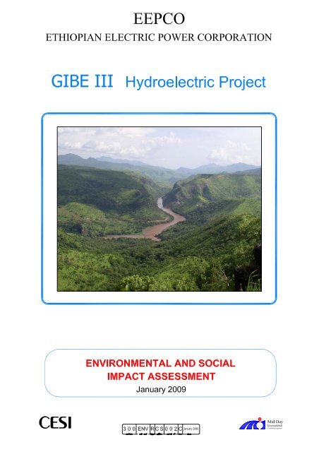
The <strong>Gibe</strong> <strong>III</strong> scheme is located within the <strong>Gibe</strong> - Omo River Basin, in the middle reach of the Omo River<br />
around 450 km by road south of Addis Ababa. The scheme, from the root of its reservoir to its tailrace<br />
outfall, extends over a corridor some 155km long. Administratively, the reservoir stretches over five zones<br />
<strong>and</strong> twelve weredas. The downstream area extends from the dam site upto Lake Turkana. Omo River below<br />
the <strong>Gibe</strong> <strong>III</strong> dam traverses through the four weredas of South Omo Zone.<br />
The approximate centroid of the project area lies at 757,225 North <strong>and</strong> 312,293 East. Figure 01 <strong>and</strong> 02 show<br />
the locations of the project area for the dam <strong>and</strong> reservoir <strong>and</strong> administration map around the reservoir<br />
respectively. The works concerning the construction of the <strong>Gibe</strong> <strong>III</strong> scheme (diversion tunnels, cofferdams,<br />
main dam, Power House, switchyard, etc.) are concentrated in a small area of about 1.6 km 2 .<br />
CESI SpA - Mid-Day International Consulting Engineers Page 1
<strong>Gibe</strong> <strong>III</strong> – <strong>Environmental</strong> <strong>and</strong> <strong>Social</strong> <strong>Impact</strong> <strong>Assessment</strong> 300 ENV R CS 002 C – A9003099<br />
0.2.2 <strong>Gibe</strong> <strong>III</strong> Hydropower Scheme<br />
The <strong>Gibe</strong> <strong>III</strong> Hydropower Project will be the third development in a cascade of water resource schemes<br />
(Gilgel <strong>Gibe</strong>/ <strong>Gibe</strong> I, in operation <strong>and</strong> <strong>Gibe</strong> II under completion) on the main <strong>Gibe</strong>/Omo River. One further<br />
hydropower scheme – known as <strong>Gibe</strong> IV is foreseen downstream on the Omo River.<br />
Figure 0.1: Location Map of the Project Area<br />
CESI SpA - Mid-Day International Consulting Engineers Page 2
<strong>Gibe</strong> <strong>III</strong> – <strong>Environmental</strong> <strong>and</strong> <strong>Social</strong> <strong>Impact</strong> <strong>Assessment</strong> 300 ENV R CS 002 C – A9003099<br />
Figure 0.2: Administration Map around the Reservoir Area<br />
CESI SpA - Mid-Day International Consulting Engineers Page 3
<strong>Gibe</strong> <strong>III</strong> – <strong>Environmental</strong> <strong>and</strong> <strong>Social</strong> <strong>Impact</strong> <strong>Assessment</strong> 300 ENV R CS 002 C – A9003099<br />
Figure 03 shows the overall layout of the <strong>Gibe</strong> <strong>III</strong>, Hydropower scheme <strong>and</strong> comprises a 240m high dam<br />
which will create a huge reservoir with a surface area of some 200 km² <strong>and</strong> a live storage of some 11,750<br />
million m³. It has an underground <strong>and</strong> inclined penstocks, a surface Power House equipped with ten power<br />
generating units <strong>and</strong> switchyards, with the following characteristics:<br />
• Vertical axis Francis N. 10 turbines, 187 MW, 211 m Hn, 95 m3/s Q<br />
• 0.46 Plant load factor (0.46 <strong>Gibe</strong> I; 0.44 <strong>Gibe</strong> II)<br />
• 6,500 GWh Energy produced annually<br />
The electrical power will be available at any time of the day or night to cover both peak <strong>and</strong> off-peak<br />
dem<strong>and</strong> in the Ethiopian interconnected power systems or exported. The so-called specific unit cost of the<br />
<strong>Gibe</strong> <strong>III</strong> scheme, based on the generation component (excluding the transmission component), is some 2.86<br />
Euro cents per kWh indicative of a very attractive hydropower generation scheme.<br />
0.2.3 Transmission Line<br />
The power produced by the 1,870 MW Power House at <strong>Gibe</strong> <strong>III</strong> will be delivered to Interconnected System<br />
(ICS) through a 65 km long four double circuit 400 kV overhead transmission line that connects the <strong>Gibe</strong> <strong>III</strong><br />
to a new substation at Sodo. This line will be 65 km long.<br />
The transmission line towers will be constructed as self-supporting steel lattice structures. The normal<br />
spacing between consecutive towers will be approximately 350m. The footprint of the towers will be<br />
approximately 12m by 12m. A right-of-way, 50m in width <strong>and</strong> approximately in the centre of the wayleave,<br />
is to be kept clear of both vegetation <strong>and</strong> structures. The right-of-way will be used for the footings of the<br />
transmission towers <strong>and</strong> as an access track for construction <strong>and</strong> maintenance of the transmission line. This<br />
l<strong>and</strong> will also remain under the ownership of its present owners. As much as possible the route where<br />
practical, has avoided houses or settlements <strong>and</strong> agricultural areas.<br />
0.2.4 Access Roads<br />
The existing bridge across the Omo River (on the Chida-Sodo Road) will be submerged by the future <strong>Gibe</strong><br />
<strong>III</strong> reservoir <strong>and</strong> a new road bridge will be built downstream of the dam. After reservoir impounding, the<br />
permanent link between the Omo River left <strong>and</strong> right banks will be possible utilising Road (on the right bank<br />
plateau) to the dam site, passage over the d/s toe of the dam <strong>and</strong> a new road on the left plateau from the dam<br />
site to the existing road (or to Kindo Halale).<br />
The proposed relocation road still lies in Wolayita <strong>and</strong> Dawro Zones of SNNPRS <strong>and</strong> serves the same<br />
community. Both the existing road <strong>and</strong> the relocation road are shown in Figure 4. The total length of the road<br />
along the selected alignment is approximately 72 km. The EPC contractor has studied a 47 km road<br />
alignment on the left bank <strong>and</strong> a 24.5 km on the right (see Figure 04). The surfacing will be about 7 m wide<br />
carriage way gravel road. A new bridge will be constructed across the Omo downstream of the <strong>Gibe</strong> <strong>III</strong> dam.<br />
The detailed design of the road is illustrated in the relevant report.<br />
CESI SpA - Mid-Day International Consulting Engineers Page 4
<strong>Gibe</strong> <strong>III</strong> – <strong>Environmental</strong> <strong>and</strong> <strong>Social</strong> <strong>Impact</strong> <strong>Assessment</strong> 300 ENV R CS 002 C - A9003099<br />
Figure 0.3: General Layout of the Site Installations<br />
CESI SpA - Mid-Day International Consulting Engineers Page 5
<strong>Gibe</strong> <strong>III</strong> – <strong>Environmental</strong> <strong>and</strong> <strong>Social</strong> <strong>Impact</strong> <strong>Assessment</strong> 300 ENV R CS 002 C - A9003099<br />
Figure 0.4: Chida - Sodo Road Realignment Change<br />
CESI SpA - Mid-Day International Consulting Engineers Page 6
<strong>Gibe</strong> <strong>III</strong> – <strong>Environmental</strong> <strong>and</strong> <strong>Social</strong> <strong>Impact</strong> <strong>Assessment</strong> 300 ENV R CS 002 C - A9003099<br />
In terms of function, the road is classified as a link road. The suggested formation width for the road is 10 m<br />
<strong>and</strong> it includes 1.5 m wide shoulders on either side. The road has a gravel surfacing. Based on the field<br />
investigations <strong>and</strong> the cross profile, requirement for roadside drainage <strong>and</strong> other protection measures<br />
required are identified. Hence, the proposals include roadside drains (furrow <strong>and</strong> lined), scour checks,<br />
retaining walls, etc. Other provisions mainly include sign, markings <strong>and</strong> road furniture.<br />
0.3 Policy, Legal, <strong>and</strong> Administrative Framework<br />
The ESIA study for the proposed <strong>Gibe</strong> <strong>III</strong> Hydroelectric project has been carried out within the framework of<br />
local, national <strong>and</strong> international environmental regulations. The legislative framework applicable to the<br />
proposed project is governed by the Federal Democratic Republic of Ethiopia (FDRE), Africa Development<br />
Bank (AfDB), World Bank, <strong>and</strong> European Investment Bank (EIB).<br />
0.3.1 Regulatory Framework of FDRE<br />
The Federal Democratic Republic of Ethiopia adopted its Constitution in 1995, which provides the basic <strong>and</strong><br />
comprehensive principles <strong>and</strong> guidelines for environmental protection, <strong>and</strong> management in the country.<br />
Federal <strong>Environmental</strong> Protection Authorities (EPA) administers the EIA process in Ethiopia, as set out in its<br />
establishment proclamation. EEPCO has complied with the EIA <strong>and</strong> procedural <strong>and</strong> documentation<br />
requirements of EPA, with submission of the ESIA, ESMP <strong>and</strong> Resettlement Action Plan reports.<br />
EEPCO <strong>and</strong> the EPC contractor will be responsible for implementing the recommended environmental<br />
mitigation measures <strong>and</strong> management plans in coordination with the Federal EPA <strong>and</strong> the Regional<br />
<strong>Environmental</strong> Protection Offices. The environmental performance of the project will be monitored on a<br />
regular basis through EEPCO’s own set up <strong>and</strong> through external/ third party audits.<br />
0.3.2 African Development Bank Guidelines<br />
According to AfDB screening criteria, <strong>Gibe</strong> <strong>III</strong> project is a category “1” project, for which a full-scale<br />
environmental impact assessment is required. This ESIA report was prepared to fulfil the requirements of<br />
AfDB involved in financing of the project investment.<br />
The following AfDB policies <strong>and</strong> guidelines dealing with environmental <strong>and</strong> social issues related to the<br />
project were taken into consideration for preparation of the ESIA <strong>and</strong> ESMP reports <strong>and</strong> the <strong>Gibe</strong> <strong>III</strong> project<br />
is in compliance with the AfDB polices:<br />
• Environment <strong>and</strong> social assessment procedures <strong>and</strong> guideline<br />
• Guidelines on Involuntary displacement <strong>and</strong> resettlement in development project<br />
0.3.3 World Bank<br />
The WB provides detailed guidelines for the EA process. The <strong>Gibe</strong> <strong>III</strong> hydropower project falls under<br />
Category A as per WB Performance St<strong>and</strong>ards <strong>and</strong> its procedures for project appraisals. The WB policies<br />
<strong>and</strong> guidelines dealing with environmental <strong>and</strong> social issues related to the project were taken into<br />
consideration for preparation of this ESIA.<br />
CESI SpA - Mid-Day International Consulting Engineers Page 7
<strong>Gibe</strong> <strong>III</strong> – <strong>Environmental</strong> <strong>and</strong> <strong>Social</strong> <strong>Impact</strong> <strong>Assessment</strong> 300 ENV R CS 002 C - A9003099<br />
0.3.4 International Conventions<br />
The Federal Democratic Republic of Ethiopia has ratified several international conventions <strong>and</strong> protocols,<br />
<strong>and</strong> some of these have relevance to <strong>Gibe</strong> <strong>III</strong> Hydroelectric Project <strong>and</strong> these include:<br />
Convention on Biodiversity (Rio convention);<br />
Frameone convention of UN on climate change;<br />
African convention on the conservation of Nature <strong>and</strong> natural Resources;<br />
Convention on Wetl<strong>and</strong>s of International importance Especially as waterfowl Habitat (Ramsar);<br />
Convention concerning the protection of world cultural <strong>and</strong> Natural Heritage.<br />
0.4 Description of the Project Environment<br />
Information on existing natural <strong>and</strong> socio-economic resources is of fundamental importance for evaluation of<br />
environmental impacts. The baseline data on the current status of the physical, biological <strong>and</strong> socio-cultural<br />
environments of the project area have been assembled, evaluated <strong>and</strong> presented.<br />
0.4.1 Dam <strong>and</strong> Reservoir/upstream<br />
0.4.1.1 Physical Environment<br />
Climate<br />
The amount of rainfall decreases throughout the Omo-<strong>Gibe</strong> catchments with a decrease in elevation <strong>and</strong><br />
varies from a minimum of 1,200 mm to a maximum of about 1,900 mm. The average annual rainfall<br />
calculated over the whole <strong>Gibe</strong> <strong>III</strong> basin where the dam is located is 1,426 mm. 75 to 80% of the annual<br />
rainfall occurs during a five months period from May to September. The mean annual temperature is 20.4°C.<br />
Geology<br />
The regional geology of southern Ethiopia consists mostly of metamorphic rocks of green schist, amphibolite<br />
<strong>and</strong> granulite facies that represent the southern margins of the Arabian-Nubian shield.<br />
The dam site area is characterized by a deep gorge with sub-vertical walls. The river alluvium is constituted<br />
by fine s<strong>and</strong>s <strong>and</strong> gravel of variable thickness, with a maximum depth up to about 15 meters. From the river<br />
banks start the 30-50 m slopes of a coarse angular colluvium in silty-s<strong>and</strong>y matrices. The slightly weathered<br />
trachyte walls, outcropping are mainly characterized by two sub-vertical joint families, being parallel <strong>and</strong><br />
orthogonal to the river. The walls are affected also by a relevant transverse fault system with NW-SE<br />
orientation.<br />
The left bank is about 200 m high <strong>and</strong> appears almost intact, while the right bank is affected by a NNW-SSE<br />
fault system. The trachyte flow appears in some parts weathered <strong>and</strong> altered by fractures <strong>and</strong> hydrothermal<br />
fluids. At the top of the right bank a main NNW-SSE fault has caused a vertical displacement <strong>and</strong> put basalt<br />
<strong>and</strong> trachyte structures into contact. Near the contact with the colluvium, the rock assumes a more plutonic<br />
look. The ends of the walls are sometimes characterized by basalt columnar flows (two at least) upset by a<br />
structural movement.<br />
CESI SpA - Mid-Day International Consulting Engineers Page 8
<strong>Gibe</strong> <strong>III</strong> – <strong>Environmental</strong> <strong>and</strong> <strong>Social</strong> <strong>Impact</strong> <strong>Assessment</strong> 300 ENV R CS 002 C - A9003099<br />
Seismology<br />
While the <strong>Gibe</strong> <strong>III</strong> dam is located in Ethiopia, in the vicinity (about 70 km) of the eastern branch of the east<br />
African rift system the entire area interested by the project, according to the LEVEL 1 DESIGN Geological<br />
Report, doesn’t show any evidences of present existing seismic activity.<br />
Hydrogeology<br />
Available data concerning the reservoir were collected from boreholes drilled at the dam site, from<br />
documents of the <strong>Gibe</strong> II project, <strong>and</strong> from remote sensing. The stratigraphy <strong>and</strong> structural geology of the<br />
reservoir banks were defined on the basis of the interpretation of ASTER scenes <strong>and</strong> other remote sensing<br />
data. Local permeability values were acquired from boreholes drilled at the dam site. According to the<br />
geological report no relevant filtration couloirs from the reservoir have been observed along the river basin.<br />
Permeability would be of secondary type (i.e. related to fracturing of the rock mass) while primary<br />
permeability (i.e. related to porosity) would be limited to the pyroclastic units interbedded in basalt flows<br />
Hydrology<br />
The Omo River Basin is drained by two major rivers from the highl<strong>and</strong>s, the <strong>Gibe</strong> River flowing southwards<br />
<strong>and</strong> <strong>Gibe</strong> River flowing eastwards. Downstream of their confluence only minor tributaries join, as the river<br />
continues southwards <strong>and</strong> enters the deep gorge where the <strong>Gibe</strong> <strong>III</strong> dam site has been identified. At the dam<br />
site, the catchment area is some 34,150 km 2 that represents 45% of the total catchment area at Lake Turkana<br />
<strong>and</strong> contributes 80.5 % of the basin flow. The Omo River has an average slope of 3.1 m/km. The long term<br />
mean flow at <strong>Gibe</strong> <strong>III</strong> site is estimated to be 435 m 3 /s or 13.5 Billion m 3 per annum. Seasonal variations are<br />
extreme, with monthly mean flow ranging from around 60 m 3 /s in March to more than 1,500 m 3 /s in August.<br />
Water quality<br />
In order to describe water chemical characteristics upstream <strong>and</strong> downstream the dam site, a water sampling<br />
campaign has been done to define the abundance of defined chemical parameters in three stations<br />
(downstream <strong>Gibe</strong> II Power House, at Bele Bridge <strong>and</strong> near the <strong>Gibe</strong> <strong>III</strong> dam site). Considering very low<br />
salinity levels on the usual mineral water scale, the Omo River water can be classified as earthy-brackish,<br />
alkaline, <strong>and</strong> with bicarbonate.<br />
0.4.1.2 Biological Environment<br />
L<strong>and</strong> Use <strong>and</strong> L<strong>and</strong> Cover<br />
L<strong>and</strong> cover assessment was carried out for the <strong>Gibe</strong> <strong>III</strong> reservoir area <strong>and</strong> it was based on satellite images<br />
interpretation, field observations, field data collection <strong>and</strong> analysis. The classification resulted into the<br />
following four classes: The riparian vegetation in the reservoir area was observed along the river sides <strong>and</strong> it<br />
occupied 1,839 ha of l<strong>and</strong> (8.8 %), <strong>and</strong> deciduous woodl<strong>and</strong> covers about 17,158 ha (82.2%) <strong>and</strong> it is<br />
characterized by approximately 2% tree cover <strong>and</strong> 98% grass at the time when the field survey was carried<br />
out. The exposed surface <strong>and</strong> silt/gravel l<strong>and</strong> covers 4.7 % of the reservoir area <strong>and</strong> it mainly occurs along<br />
the lower parts of the river, on steep sides of rivers <strong>and</strong> degraded hillsides <strong>and</strong> rock outcrops. River/ water<br />
body covers 4.3 % of the reservoir area. Farming practices <strong>and</strong> settlement are concentrated in areas (outside<br />
the valley on the highl<strong>and</strong>) which are not affected by the future reservoir.<br />
CESI SpA - Mid-Day International Consulting Engineers Page 9
<strong>Gibe</strong> <strong>III</strong> – <strong>Environmental</strong> <strong>and</strong> <strong>Social</strong> <strong>Impact</strong> <strong>Assessment</strong> 300 ENV R CS 002 C - A9003099<br />
Natural Vegetation <strong>and</strong> Forest Resources<br />
The vegetation on the hill slopes of the valley is characterized by deciduous phenology of the woodl<strong>and</strong><br />
species which shed their leaves during the dry season <strong>and</strong> regain them during the wet season as an adaptive<br />
mechanism for the prolonged dry season. The plant species of the Omo Valley have over time developed<br />
adaptive mechanisms <strong>and</strong> traits that allow them either to survive fire, germinating after the heat shock or to<br />
regenerate after a fire episode. In general, the vegetation which has evolved (around the reservoir area) as<br />
response to the frequent fires is poor in species composition. There is a narrow b<strong>and</strong> of riparian vegetation of<br />
almost similar species composition as the woodl<strong>and</strong> on the hill slopes. Due to ample moisture, trees found at<br />
the edge of the riverbank are not affected by fire as the rest of trees in the upper parts of the study area.<br />
The altitudinal ranges, temperature, humidity <strong>and</strong> the floristic <strong>and</strong> physiognomy composition of the<br />
vegetation in the Omo river basin <strong>and</strong> <strong>Gibe</strong> Basin provide ideal conditions for Tsetse fly infestation.<br />
Wildlife Resources<br />
Based on the assessment, the number of wildlife species in the project area is low <strong>and</strong> does not rate well with<br />
areas in downstream of <strong>Gibe</strong> <strong>III</strong> dam (the Mago <strong>and</strong> Omo National Parks) <strong>and</strong> harbours only limited number<br />
of wildlife. However, the local residents <strong>and</strong> professionals from the offices of Agriculture interviewed during<br />
the field studies reported the presence of wildlife within the project area. The wildlife that have been<br />
recorded for the reservoir area are very common in many parts of the country <strong>and</strong> none of these species are<br />
endangered or threatened.<br />
The vegetations provide good habitat to support diverse wildlife species. However, the wildlife habitats have<br />
always been under threat due to wildfires that are practiced during the dry season <strong>and</strong> it is greatly affecting<br />
the overall ecology <strong>and</strong> resource base. The woodl<strong>and</strong>s, in particular are under high threat from fire.<br />
Fishery Resources<br />
The Omo-<strong>Gibe</strong> river basin is known to contain high diversity of fish species with over 70 species listed. The<br />
fishery in the study area includes: the riverine fishery along the mainstream Omo River, flood plain fishery<br />
(<strong>and</strong> Dipa Hayk), <strong>and</strong> the lacustrine fishery at Lake Turkana (Bubua <strong>and</strong> Toltale).<br />
Studies on the biology of the different fish species have shown that they have different seasonal <strong>and</strong> spatial<br />
distribution for optimal growth – feeding, reproduction <strong>and</strong> survival. The large variety of species found in<br />
the river system is distributed in all sorts of habitat like in the deep open river channel or in pools<br />
(Hetrobranchus longifilis), in the floodplains, in rocky habitats like Labeo cylindricus, demersal areas<br />
(Hyperpisus bebe), etc. Similarly their feeding habit varies enormously among the species covering all<br />
available niches. Some species undergo seasonal migration from the lake feeding grounds to spawn in the<br />
River Omo – like Distichodus niloticus, Labeo horie. Others prepare their own spawning sites (nests) close<br />
to the vegetated shore areas in the lake <strong>and</strong> complete the life cycle (Oreochromis niloticus). There are also<br />
fish species that spawn in the lake <strong>and</strong> also some of the population in the river systems (Hydrocynus<br />
forskalii).<br />
There are few species which are endemic to the Lake Turkana <strong>and</strong> lower delta of the Omo River. However,<br />
none of the reports referred in the studies indicate the occurrence of endangered or threatened fish species in<br />
the Omo-Turkana system. The endemic fish species breed in different locations in or close to the lake - like<br />
CESI SpA - Mid-Day International Consulting Engineers Page 10
<strong>Gibe</strong> <strong>III</strong> – <strong>Environmental</strong> <strong>and</strong> <strong>Social</strong> <strong>Impact</strong> <strong>Assessment</strong> 300 ENV R CS 002 C - A9003099<br />
in the estuarine, littoral <strong>and</strong> pelagic habitats of the lake. These fish species have apparently evolved in the<br />
lake from the riverine ancestors to fill up the niche created in the lacustrine system.<br />
Riverine fishery is not developed partly due to lack of access to suitable fishing grounds <strong>and</strong> also the food<br />
habit or culture of most of the rural community does not favour fish consumption. Fishing is done mainly<br />
with hooks <strong>and</strong> some gill net. Commercial fishing is mainly reported in the lower course of the river far<br />
below the proposed dam site, at Omorate <strong>and</strong> at the Lake Turkana.<br />
Protected Areas<br />
Ethiopia issued a number of regulations aimed to conserve <strong>and</strong> protect the remaining natural ecosystems of<br />
the country in National Parks, Wildlife Sanctuaries, National Priority Forest Areas <strong>and</strong> Controlled Hunting<br />
Areas. However, the reservoir area is neither contiguous with nor in close proximity with any of these<br />
nationally protected areas.<br />
0.4.1.3 Socio-Economic Environment<br />
The socio-economic assessment has been carried out with the objective to provide a comprehensive analysis<br />
of the existing socio-economic conditions of the population in the future reservoir area.<br />
Population <strong>and</strong> Settlement<br />
In 2006, an estimated 253,412 people were living in the 67 Peasant Associations located around the <strong>Gibe</strong> <strong>III</strong><br />
reservoir area of which 49.9% were males <strong>and</strong> 50.1% were females. This population represents 10.8% of the<br />
Wereda population. However, as a result of steep slope <strong>and</strong> Tsetse fly infestation, there is no settlement in<br />
the future reservoir area <strong>and</strong> settlements are concentrated on the highl<strong>and</strong> in areas outside the valley.<br />
Settlement around the project area is also fully rural, <strong>and</strong> the residents are organized into small villages. The<br />
average population density within the Peasant Associations located around the reservoir area is 127.8<br />
persons/km 2 .<br />
More than 13 different ethnic groups live around the future reservoir area <strong>and</strong> the major ethnic groups are -<br />
Hadiya (25.3%), Wolayita (23.0%), Oromo (20.4%), Dawro (6.9%), Kembata (6.7%), Tembaro (5.0%), <strong>and</strong><br />
less than one percent of Amhara, Keffa <strong>and</strong> Sodo Gurage, Silte <strong>and</strong> Sebatbet gurage. The rest of the ethnic<br />
groups constitute less than 3.3 in total.<br />
Major religions practiced in the project Wereda are Christianity (67.7%) <strong>and</strong> Muslims (24.6%). Traditional<br />
religions are practiced by about 5.3% of the population.<br />
Agriculture <strong>and</strong> livestock populations<br />
The main areas of farming are confined to the middle or upper slopes of the hills where the settlements are<br />
situated. The farmers in the project area (mainly on the high l<strong>and</strong>) produce small quantities of a wide range<br />
of crops (15-20 different crops), including cereals, roots, tubers, pulses, spices, coffee <strong>and</strong> fruits. Such use of<br />
the l<strong>and</strong> is very sound, allowing the l<strong>and</strong> to be converted with vegetation throughout most of the year, which<br />
helps to reduce the erosion effects of the heavy rain occurring in July <strong>and</strong> August.<br />
As the result of the less favourable rainfall, Tsetse fly infestation <strong>and</strong> the consequent occurrence of cattle<br />
disease, trypanosomiasis, there is very little farming activity around the Omo valley bottom l<strong>and</strong>s only near<br />
the dam site. The steepness of the slope on either side of the valley appears to be another important factor<br />
which has discouraged the use of the valley for agricultural purposes.<br />
CESI SpA - Mid-Day International Consulting Engineers Page 11
<strong>Gibe</strong> <strong>III</strong> – <strong>Environmental</strong> <strong>and</strong> <strong>Social</strong> <strong>Impact</strong> <strong>Assessment</strong> 300 ENV R CS 002 C - A9003099<br />
The main livestock populations in the project area are cattle, sheep, goats, poultry <strong>and</strong> equines. Few farmers<br />
own oxen, although this varies throughout the project area.<br />
Public Health<br />
The major health problems of the project area are reported to be infectious diseases <strong>and</strong> malnutrition. Most<br />
illnesses are communicable <strong>and</strong> are related, either directly or indirectly, to lack of adequate <strong>and</strong> safe drinking<br />
water supplies <strong>and</strong> sanitation, low living st<strong>and</strong>ards <strong>and</strong> poor nutrition. Waterborne <strong>and</strong> vector borne diseases<br />
are also prevalent in the area. The project areas are highly endemic for malaria with continuous transmission<br />
<strong>and</strong> malaria is by far the most important of the diseases. The presence of several rivers (tributaries to Omo<br />
River) provides ideal breeding habitats for mosquitoes. The health coverage in the affected Weredas ranges<br />
from 34.6% to 83.6% (that is the population living within 10km radius of a health station).<br />
Cultural, Religious, Historical <strong>and</strong> Archaeological Sites<br />
The importance of the <strong>Gibe</strong> <strong>III</strong> reservoir area <strong>and</strong> the immediate surrounding has been investigated in terms<br />
of religious <strong>and</strong> cultural site relics <strong>and</strong> archaeological importance. Based on this investigation the historical<br />
sites known as King Ijajo Kella <strong>and</strong> King Halala Walls were found on both sides of the Omo River. An<br />
additional archaeological impact assessment as well as the elongated stone ramparts in Wolayita <strong>and</strong> Dawro<br />
has been initiated with the Authority for the Research <strong>and</strong> Conservation of Cultural Heritage (ARCCH).<br />
The UNESCO designated heritage site is not in close proximity to the proposed <strong>Gibe</strong> <strong>III</strong> dam <strong>and</strong> reservoir<br />
areas. The lower valley of the Omo River which is designated as a UNESCO World Heritage site is located<br />
far downstream <strong>and</strong> will not be affected by this scheme.<br />
No visible archaeological remains, which have scientific, cultural, public, economic, ethnic <strong>and</strong> historic<br />
significances, have been observed in the area <strong>and</strong> dam sites. The sites have no archaeological importance.<br />
However, a Chance Find protocol has nevertheless been prepared to cover any unexpected finds.<br />
0.4.2 Baseline Information: Downstream Area<br />
Population <strong>and</strong> Settlement<br />
The Lower Omo stretches over Salamago, Hamer, Nyangatom <strong>and</strong> Dasenech weredas <strong>and</strong> is well endowed<br />
with both cultural diversity <strong>and</strong> natural resources. The population within these four weredas of the lower<br />
Omo is estimated to be about 131,831 of which 50.3% were males <strong>and</strong> 49.7% were females in the year 2007.<br />
There are 28,713 households with an average of 4.6 people per household. Of the total population, an<br />
estimated 50% are economically active (age 14-64), 45% are youth (ages 0-14) <strong>and</strong> 2% are elders. The<br />
population is predominantly rural based with nearly 94.8% living in rural areas. The urban population is<br />
estimated to be only about 5.2%.<br />
Agriculture<br />
There are different farming systems in the Lower Omo, which are influenced by agro-climatic <strong>and</strong><br />
socioeconomic constraint, <strong>and</strong> these include cereal-based mixed farming system <strong>and</strong> retreat flood cultivation.<br />
Rainfed agriculture: Rainfed crops are cultivated in three out of the four weredas where flood recession<br />
cropping is also important; Hamer, Salamago <strong>and</strong> Nyangatom, at higher altitudes towards the west <strong>and</strong><br />
eastern margins of the Omo valley. Rainfall at lower altitudes (e.g. in Dasenech Wereda) is insufficient to<br />
support any rainfed cropping. Labour for hoe cultivation <strong>and</strong> weeding is the main input, <strong>and</strong> is generally said<br />
CESI SpA - Mid-Day International Consulting Engineers Page 12
<strong>Gibe</strong> <strong>III</strong> – <strong>Environmental</strong> <strong>and</strong> <strong>Social</strong> <strong>Impact</strong> <strong>Assessment</strong> 300 ENV R CS 002 C - A9003099<br />
to be in short supply due to the dem<strong>and</strong> of livestock herding, low population levels <strong>and</strong> poor general health.<br />
Oxen are very rarely used, partly due to cultural objections <strong>and</strong> also because of losses to disease.<br />
Flood recession agriculture: The Omo River rises during the rainy season <strong>and</strong> overflows its banks to flood<br />
the l<strong>and</strong> on the plains bordering the river, permitting crops to be grown on the residual soil moisture after the<br />
floods recede. Further upstream where the valley slopes are too steep to allow large scale flooding, areas of<br />
recession crops are grown on the river banks, especially where silt has been deposited at bends in the river.<br />
Flood recession cropping is important in the four weredas: Hamer, Salamago, Nyangatom <strong>and</strong> Dasenech,<br />
from the Omo River. Flood recession cropping starts as the topography levels out around latitude 5.15ºN,<br />
some 70km north of Lake Turkana, around Karakorocho in Hamer wereda. The fringes of the ox-bow Lake<br />
Dipa (Dipa Hayk) in the Kara area of Hamer Wereda are also planted as the lake level drops. Peak flooding<br />
normally occurs between August <strong>and</strong> September <strong>and</strong> the water recedes 2-4 weeks later to allow planting<br />
from August to October.<br />
The Wereda officials reported that for most people, the grain produced from recession cultivation was only<br />
sufficient for 3-6 months. Thereafter, they depend on food aid from the government <strong>and</strong> NGOs. The food<br />
insecurity in the lower Omo River is associated with the natural factors <strong>and</strong> the socio-economic base of the<br />
population. Uneven distribution <strong>and</strong> erratic rainfall, floods, l<strong>and</strong>slides, pest infestation, epidemic diseases of<br />
human <strong>and</strong> livestock are all considered natural factors. On the other h<strong>and</strong> small l<strong>and</strong> holding (for flood<br />
recession) lack of drought oxen, less infrastructure <strong>and</strong> inadequate farm inputs are conceived under the<br />
second factor.<br />
Irrigated Agriculture: Irrigation farms <strong>and</strong> schemes are found mainly in the lower reaches of the Omo River,<br />
because the banks of the river upstream are generally too high to permit efficient pumping. Most are small<br />
farms growing high value crops like vegetables <strong>and</strong> fruits, particularly bananas, using either diesel pumps or<br />
windmills to extract water from the river. Overall, the present level of irrigation development is really quite<br />
minimal <strong>and</strong> damage caused by annual flooding, low river levels in the dry season (too low for pumping),<br />
<strong>and</strong> limited market development are probably some of the reasons.<br />
Livestock <strong>and</strong> Grazing Resources<br />
The livestock population of the study area is estimated to be 1.2 million, poultry 71,880 <strong>and</strong> 132,500 bee<br />
colonies. Livestock provide the pastoralists of the Southern Omo Lowl<strong>and</strong>s a number of benefits. The major<br />
ones that relate to their livelihood include milk, meat <strong>and</strong> live animals.<br />
The major sources of feed for livestock in the Lower Omo area are natural pastures, aftermath grazing <strong>and</strong><br />
crop residues. Natural pastures contributed greater proportion followed by crop residues. An important<br />
feature in all the four Weredas is that feed is also obtained because of the recession of the flood from the<br />
Omo River.<br />
A wide range of livestock diseases affect animal in the Lower Omo. Existing veterinary services in the study<br />
area are limited <strong>and</strong> severely h<strong>and</strong>icapped by lack of resources.<br />
The Lower Omo River Basin is under-developed <strong>and</strong> remote. Access <strong>and</strong> other infrastructure (road, market,<br />
etc) are very poor. The types of livestock markets in the area are mainly bush markets, in some Weredas<br />
primary type of markets exist.<br />
CESI SpA - Mid-Day International Consulting Engineers Page 13
<strong>Gibe</strong> <strong>III</strong> – <strong>Environmental</strong> <strong>and</strong> <strong>Social</strong> <strong>Impact</strong> <strong>Assessment</strong> 300 ENV R CS 002 C - A9003099<br />
National Parks <strong>and</strong> other Protected Areas<br />
The Omo, Mago, Mazie <strong>and</strong> Chabara Chorchora National Parks <strong>and</strong> Murele Controlled Hinting Area are<br />
found downstream of the <strong>Gibe</strong> <strong>III</strong> scheme. Of which, Omo <strong>and</strong> Mago NPs are gazetted. It is recommended to<br />
strengthen these parks as they all harbour at least some or all species of the animals <strong>and</strong> birds of the project<br />
area <strong>and</strong> these sites are eventually potential refuge for some of these animals in the project area. According<br />
to the information obtained from Park Wardens, reduction in the flood flow of the Omo downstream will<br />
have no effect on the wildanimals found in the Parks.<br />
Tourism<br />
Tourism in the South Omo Zone is limited <strong>and</strong> based in small groups interested essentially in natural<br />
resources (parks, natural reserves, animals, the Omo River) <strong>and</strong> ethnic attractions. In particular Mago <strong>and</strong><br />
Omo National Parks are the main tourist destinations.<br />
According to the information obtained from both Omo <strong>and</strong> Mago National Park officials, currently there is<br />
an effort to start community tourism by using boat transport from Lake Turkana via Omo gorge to the<br />
upstream National parks (Omo <strong>and</strong> Mago National Parks). Community tourism is expected to help encourage<br />
the tourist to visit the different ethnic groups along the Omo River.<br />
0.4.3 Baseline Information: <strong>Gibe</strong> <strong>III</strong>-Sodo Transmission Line<br />
Natural Environment: The observed l<strong>and</strong> uses along the transmission line route include farml<strong>and</strong>, grazing<br />
l<strong>and</strong>, eucalyptus plantation <strong>and</strong> settlements. It is also observed that a proportion of the l<strong>and</strong> is unused,<br />
especially on the hillsides. Eucalyptus plantations are becoming common in many parts of the project area<br />
especially around the compounds.<br />
Human intervention in the area, consisting of expansion for agriculture <strong>and</strong> grazing practices <strong>and</strong><br />
encroachment for fuelwood <strong>and</strong> construction has significantly affected the vegetation cover in the area.<br />
Hence, it couldn’t provide a good habitat to support diverse wildlife species.<br />
The transmission corridor is neither contiguous with, nor in close proximity with any of the nationally<br />
protected areas like National Parks, Wildlife Reserves or Controlled Hunting Areas.<br />
Settlement pattern <strong>and</strong> housing: Settlement along the proposed Transmission Line (TL) is predominantly<br />
rural organized into small villages. The villages are clustered on hilltops <strong>and</strong> valley slopes. The people along<br />
the TL have traditional tukuls as dwelling unites <strong>and</strong> all dwelling units are one-room structures. The tukuls<br />
are built from local materials with wood plastered with mud <strong>and</strong> have thatched roofs build mostly out of<br />
grass.<br />
Agriculture: The population <strong>and</strong> economy of the region traversed by the transmission line project is almost<br />
totally dependent upon agriculture <strong>and</strong> livestock. The farming system in the project area is well known for its<br />
complexity <strong>and</strong> variety of crops that are grown. High human population density, with extreme levels of l<strong>and</strong><br />
pressure <strong>and</strong> consequently small average farm size, characterized the area. The major crops cultivated in the<br />
area include, teff, wheat, barley <strong>and</strong> ginger. The major perennial crops produced in the three project affected<br />
weredas are coffee, enset, mango, avocado, gishta, koke <strong>and</strong> banana. Coffee, enset <strong>and</strong> banana are the<br />
dominant source of cash income contributors.<br />
CESI SpA - Mid-Day International Consulting Engineers Page 14
<strong>Gibe</strong> <strong>III</strong> – <strong>Environmental</strong> <strong>and</strong> <strong>Social</strong> <strong>Impact</strong> <strong>Assessment</strong> 300 ENV R CS 002 C - A9003099<br />
Historical or archaeological significance: Enquiries to residents along the transmission line route have<br />
indicated that there are no known sites of historical or archaeological significance in the vicinity of the<br />
selected route.<br />
0.5 Project Alternatives<br />
General<br />
Five alternatives to the base-case described above have been considered <strong>and</strong> the implications of each are<br />
described in the sections which follow.<br />
Alternative I: “Do-nothing”: With the “do-nothing” alternative, the potential social <strong>and</strong> socio-economic<br />
benefits to the nation would be foregone, <strong>and</strong> quality of life would remain at a low level for many of those<br />
who live in the country. Long-term development plans for the country would be compromised <strong>and</strong> slowed<br />
down, since a reliable power supply <strong>and</strong> the improved service associated with it are fundamental to achieving<br />
the full benefits of other development initiatives <strong>and</strong> meeting the Millennium Development Goal (MDG).<br />
Therefore, from an environmental viewpoint, the “do-nothing” alternative is not preferable to project<br />
implementation.<br />
Alternative II: Alternative dam types <strong>and</strong> layouts: For the general layout of <strong>Gibe</strong> <strong>III</strong> hydropower project two<br />
main dam alternative solutions were studied: in a first phase, the BF (Bituminous Face) rockfill dam<br />
alternative was analysed as the most promising alternative, then the RCC GD (Roller Compacted Concrete<br />
Gravity Dam) alternative was developed <strong>and</strong> selected; the RCC scheme has been also analysed through three<br />
alternative layouts.<br />
Alternative <strong>III</strong>: Conservation <strong>and</strong> Dem<strong>and</strong> Management: Conservation <strong>and</strong> Dem<strong>and</strong> Management free up<br />
existing energy to be used elsewhere, that postponing the need for new capacity. However, just to keep pace<br />
with the growing population, this electricity generating requirement will grow annually by between 200 <strong>and</strong><br />
300MW, so that over the next decade, the total electricity generating requirement of the ICS could be, at the<br />
very least, some 4,250MW. Although environmentally conservation <strong>and</strong> dem<strong>and</strong> management are preferable<br />
options, the dem<strong>and</strong> forecasts still call for a significant increase in generation capabilities to maintain<br />
economic growth <strong>and</strong> development.<br />
Alternative IV: Thermal Power: The high costs of importing fossil fuels to l<strong>and</strong>-locked Ethiopia preclude<br />
thermal power options that would depend on foreign fuels. Besides replacing capacity <strong>and</strong> energy, the use of<br />
hydropower also leads to a reduction of thermal plant emission (CO2), which is the most important Green<br />
House Gas contributor. Therefore, from an environmental viewpoint, the thermal alternative is not preferable<br />
to hydropower project implementation<br />
Alternative V: Renewable Energies (Wind <strong>and</strong> Solar): The prospects for grid-bound solar <strong>and</strong> wind power<br />
generation are not significantly attractive in Ethiopia. The specific generation cost for these systems are not<br />
competitive for contributions to the national grid. This is not to say that solar <strong>and</strong> wind power have no future.<br />
They may well be of interest for remote small load centres.<br />
Analysis/Evaluation of Alternatives: The <strong>Gibe</strong> <strong>III</strong> Hydropower project will produce electric energy without<br />
burning fossil fuels <strong>and</strong> without stack emissions <strong>and</strong> potential reduction of pollution. Therefore, this scheme<br />
is feasible, indeed exceptionally attractive from the technical, economical <strong>and</strong> environmental viewpoints.<br />
CESI SpA - Mid-Day International Consulting Engineers Page 15
<strong>Gibe</strong> <strong>III</strong> – <strong>Environmental</strong> <strong>and</strong> <strong>Social</strong> <strong>Impact</strong> <strong>Assessment</strong> 300 ENV R CS 002 C - A9003099<br />
Therefore, implementation of such a worthwhile scheme, at the earliest possible date will bring net benefits<br />
to the nation in general <strong>and</strong> the local communities in particular.<br />
0.6 Potential <strong>Impact</strong>s <strong>and</strong> Benefit Enhancement <strong>and</strong> Mitigation Measures<br />
0.6.1 Beneficial/ Positive <strong>Impact</strong>s<br />
Key potentially beneficial impacts associated with implementation of the <strong>Gibe</strong> <strong>III</strong> Project are all related to<br />
the post-construction phase <strong>and</strong> are as follows:<br />
Power Generation: The <strong>Gibe</strong> <strong>III</strong> scheme is designed to supply 1,870 MW of electrical power <strong>and</strong> 6,500<br />
GWh of average energy per year to Ethiopia’s Interconnected system.<br />
Rural Electrification: Under the Power Sector Development Programme, the government plans to increase<br />
electricity coverage from 22% in 2005 to 50% by 2010 <strong>and</strong> the number of customers from, 138,000 to 2.6<br />
million. Establishing new connection to the grid requires that there is an adequate supply of power. The<br />
increase in generating capacity provided by <strong>Gibe</strong> <strong>III</strong>, together with ongoing rural electrification programmes<br />
will facilitate improved access to electricity for the Ethiopian population with associated downstream,<br />
benefits.<br />
Fishery Development: The project will create a reservoir of 20,000 ha in area <strong>and</strong> 240 meter deep at the dam<br />
site. This is a large artificial lake that provides different environmental <strong>and</strong> ecological niches for diverse fish<br />
species, requiring habitats with varying depth from shallow littoral zone to deep demersal <strong>and</strong> pelagic areas.<br />
The reservoir fishery is much more productive than the riverine fishery (which is not utilized at the moment).<br />
This may directly occupy more than 300 families on a along term basis. Thus, it could be taken as an<br />
opportunity in terms of developing a more productive <strong>and</strong> flourishing fishery that helps to improve source of<br />
income in the area <strong>and</strong> to obtain additional benefit for the local fishermen.<br />
Prospects to Export Power: The project will increase the generation capacity of the country <strong>and</strong> will make<br />
the power export programme of the country viable.<br />
Avoidance of CO2 Emission: Hydropower offsets thermal or other types of generation. Besides replacing<br />
capacity <strong>and</strong> energy, the use of hydropower also leads to a reduction of thermal plant emission (about 4.5<br />
million t/y of CO2 emission).<br />
Regulation of the River Flow for Irrigation: According to the expectations of the weredas’ officials, with the<br />
construction of the dam <strong>and</strong> creation of the reservoir the Omo River will come closer to the nearby<br />
settlements <strong>and</strong> the people will have the opportunity to use the river water for small scale irrigation<br />
development. The expansion of irrigation farms would increase crop production per unit area <strong>and</strong> contributes<br />
to higher income <strong>and</strong> increased food security to the community.<br />
Flood Protection: The presence of <strong>Gibe</strong> <strong>III</strong> reservoir will provide flood protection (will reduce floods both in<br />
peak <strong>and</strong> in frequency) to downstream areas. As a result, the damage due to floods like loss of crops,<br />
dwellings <strong>and</strong> the suffering <strong>and</strong> possibly death of affected people will reduce. The measurements carried out<br />
at occurred in August 2006 indicated a peak flood flow in the range of about 3,500-4,000 m 3 /sec, being a<br />
quite frequent flood with a return period of less than 10 years. The 2006’ floods have caused in the area<br />
hundreds people <strong>and</strong> thous<strong>and</strong> animals dead besides 15,000 displaced population, with an estimate of<br />
millions of US$ of works needed to rehabilitate Health, Education, Shelter, Water <strong>and</strong> Sanitation,<br />
CESI SpA - Mid-Day International Consulting Engineers Page 16
<strong>Gibe</strong> <strong>III</strong> – <strong>Environmental</strong> <strong>and</strong> <strong>Social</strong> <strong>Impact</strong> <strong>Assessment</strong> 300 ENV R CS 002 C - A9003099<br />
Agriculture, Livestock, Fishing, Roads, etc facilities washed away. With this regulation, areas prone to<br />
frequent flooding can be used for agricultural purposes.<br />
Tourism Activities: The reservoir offers potential for eco-tourism, environmental education, etc. for bird<br />
watching <strong>and</strong> sport fishing.<br />
Job opportunity during construction: Comparison with other projects of broadly similar type <strong>and</strong> magnitude,<br />
suggests that the total workforce on construction contract comprising the overall project is likely to be more<br />
than 5,000 persons at peak time. The production of more hydropower would allow the expansion of powerrequiring<br />
industries <strong>and</strong> factories in the surrounding urban areas creating more permanent job opportunities<br />
for the displaced <strong>and</strong> other people in the area.<br />
Gender Issues: Women as well as men will benefit equally from the employment opportunities that will be<br />
created <strong>and</strong> from convenient <strong>and</strong> safe access road facility. Women often run shops <strong>and</strong> bars in the area <strong>and</strong><br />
obviously during the construction period, there will likely be more women engaged in income-generating<br />
activities, running restaurants <strong>and</strong> bars, or selling local products to construction camp workers. These<br />
activities will benefit mainly women who are very often the sole supporters of their families. It is also<br />
recommended for the contractor to use his best endeavors to maximise local hire of labour <strong>and</strong> give priority<br />
to women, in so far as this is compatible with his skill requirements, <strong>and</strong> to maximise local procurement of<br />
supplies.<br />
0.6.2 Adverse <strong>Impact</strong>s <strong>and</strong> Mitigation Measures: Dam <strong>and</strong> Reservoir<br />
On the basis of the findings of this ESIA the key environmental impacts during the construction <strong>and</strong><br />
operation <strong>and</strong> maintenance phases of the project have been identified. The potential negative impacts of the<br />
proposed <strong>Gibe</strong> <strong>III</strong> Hydropower Project on the physical, biological <strong>and</strong> socio-economic environment have<br />
been identified <strong>and</strong> benefit enhancement <strong>and</strong> mitigation measures that should be adopted to avoid or<br />
minimise potential adverse impacts are recommended. Of which, some involve good engineering practices<br />
while others viewed from socio-economic as well as humanitarian angle.<br />
There are no confirmed occurrences of geothermal activity in dam area <strong>and</strong> because of its distance from the<br />
major Ethiopia seismic centres, located in the rift valley, any tectonical event will have negligible effects on<br />
the project area.<br />
<strong>Impact</strong>s on Protected Areas: No adverse direct or indirect impacts are anticipated in respect of sensitive<br />
habitat, National Parks, Wildlife Reserves, or National Forest Priority Areas. The reservoir area is neither<br />
contiguous with, nor in close proximity with any of these nationally protected areas like national parks nor<br />
wildlife sanctuaries reserves <strong>and</strong> designated ecologically sensitive areas. There is also no endangerment of<br />
endemic or rare species in the impounded areas.<br />
<strong>Impact</strong>s on Natural Vegetation: The loss of woodl<strong>and</strong> grassl<strong>and</strong> on the hillslopes of the valley <strong>and</strong> narrow<br />
riparian vegetation along the river <strong>and</strong> streams would not bring about marked differences in the carrying<br />
capacity. However, to compensate this loss an estimated 60,000 ha of l<strong>and</strong> around the reservoir will be<br />
developed as buffer area <strong>and</strong> it is expected to support the bio-diversity conservation by enhancing the<br />
biological value of the area.<br />
<strong>Impact</strong>s on Wildlife Resources: The area harbours only limited number of wildlife species <strong>and</strong> does not rate<br />
well with areas in Lower Omo. Therefore, there will only be a minimum opportunity cost loss suffered by<br />
CESI SpA - Mid-Day International Consulting Engineers Page 17
<strong>Gibe</strong> <strong>III</strong> – <strong>Environmental</strong> <strong>and</strong> <strong>Social</strong> <strong>Impact</strong> <strong>Assessment</strong> 300 ENV R CS 002 C - A9003099<br />
the dam construction <strong>and</strong> creation of reservoir. During survey it was observed that on average the human<br />
settlement in the area is limited to an altitude of 1,300 m a.s.l. For the wildlife there are ample sites on both<br />
side of the river (up or down stream) as the maximum water level remains at around 900 m a.s.l. Therefore,<br />
most terrestrial animals can take refuge in the area between these two altitudes (900 <strong>and</strong> 1,100 m a.s.l.).<br />
<strong>Impact</strong>s on Farml<strong>and</strong> <strong>and</strong> other Privately owned Assets: The direct impact of the project in terms of loss of<br />
assets <strong>and</strong> property is summarized in Table 1 below. The project will affect a total of 355 households, about<br />
188.94 hectares of privately owned l<strong>and</strong> of which 138.7 ha is farml<strong>and</strong>, (excluding the TL) 47 residential<br />
housing units, <strong>and</strong> 71,852 perennial crops <strong>and</strong> other trees (see Table 0.1). The impacts of the <strong>Gibe</strong> <strong>III</strong>-Sodo<br />
transmission line include 192 households, 129 ha of farml<strong>and</strong> <strong>and</strong> 26,892 perennial crops <strong>and</strong> other trees.<br />
Table 0.1: Summary of Project <strong>Impact</strong> on Household Assets by Wereda <strong>and</strong> Project Component<br />
Households Private L<strong>and</strong> Affected (ha)<br />
(No) Total L<strong>and</strong> Farml<strong>and</strong><br />
Residential<br />
(No)<br />
Houses<br />
Perennial Crops<br />
<strong>and</strong> Trees (No)<br />
By Wereda<br />
Kindo Didaye 165 81.89 63.62 31 58,388<br />
Kindo Koyisha 69 25.56 19.14 2 613<br />
Loma 121 81.49 55.94 14 12,851<br />
Total 355 188.94 138.7 47 71,852<br />
By Project Component<br />
Reservoir 58 97.55 70.14 0 6,523<br />
EEPCO Camp 47 22.95 14.38 29 51,748<br />
Chida - Sodo Road Realignment 250 68.44 54.18 18 13,581<br />
Total 355 188.94 138.70 47 71,852<br />
<strong>Gibe</strong> <strong>III</strong>-Sodo-Transmission Line<br />
Kindo Koyisha 105 - 70.79 105 7,320<br />
Sodo Zuriya 20 - 30.90 20 1,523<br />
Damot Sore 67 - 27.52 67 18,047<br />
Total 192 - 129.21 192 26,892<br />
As we can see from the figures in Table 0.1, one of the most important points to note is that although the<br />
<strong>Gibe</strong> <strong>III</strong> project is one of the largest hydropower projects ever undertaken in the country, the impact from the<br />
reservoir in terms of population displacement is very small. This is because the impounded water will be<br />
confined within the gorge of the river far from large population settlement areas.<br />
The census survey (for the reservoir, EEPCO camp <strong>and</strong> the realignment road) revealed that all PAPs would<br />
prefer to receive their compensation in the form of cash for loss of farm l<strong>and</strong>, perennial crops <strong>and</strong> other trees<br />
<strong>and</strong> houses <strong>and</strong> other structures. Therefore, given their preferences cash compensation <strong>and</strong> employment<br />
within the project has been recommended.<br />
Due to the acute shortage of resources especially l<strong>and</strong> <strong>and</strong> the low income <strong>and</strong> poverty of the population, it is<br />
believed that the main benefits for PAPs will come from the income restoration <strong>and</strong> social development<br />
programmes. The recommended plan has two components: the income restoration <strong>and</strong> improvement<br />
component, which directly targets PAPs <strong>and</strong> a community or social development components for<br />
communities as well as PAPs to be implemented for project affected kebeles. The communities around the<br />
future reservoir area will also be affected directly as well as indirectly by the project including among others:<br />
• increased human <strong>and</strong> livestick health hazards,<br />
CESI SpA - Mid-Day International Consulting Engineers Page 18
<strong>Gibe</strong> <strong>III</strong> – <strong>Environmental</strong> <strong>and</strong> <strong>Social</strong> <strong>Impact</strong> <strong>Assessment</strong> 300 ENV R CS 002 C - A9003099<br />
• loss of access to natural resources (firewood, grass, lumber, traditional beehives <strong>and</strong> various other<br />
forest products) due to submergence of forest <strong>and</strong> grassl<strong>and</strong> resources,<br />
• loss of hot springs <strong>and</strong> holy waters,<br />
• loss of salty water pond <strong>and</strong> special soil bed used for cattle fattening, <strong>and</strong><br />
• partial flooding cultural sites<br />
The possibilities of establishing the PAPs in individual small-scale business or in small-scale agro-industries<br />
enterprises have proved in other areas valuable alternatives to the agricultural production.<br />
<strong>Impact</strong>s on Tribal People: There are no tribal people or ethnic minorities around the <strong>Gibe</strong> <strong>III</strong> dam <strong>and</strong><br />
reservoir area whose traditional lifestyles could become compromised through the implementation of the<br />
proposed hydropower project. Therefore, no indigenous people development plan will be required.<br />
<strong>Impact</strong>s of Public Health: The predicted annual drawdown levels of approximately 90 m should ensure that<br />
neither snails nor macrophytes would flourish in the new impoundments. Therefore, public health impacts<br />
from various disease vectors species are, at this point, not considered to be a major factor affecting the<br />
implementation of the project. However, to reduce the risk of contracting malaria <strong>and</strong> to contain malaria<br />
cases, it is recommended to implement measures to manage malaria <strong>and</strong> control vectors.<br />
The other serious issue that should be given due attention is the social issue related to the influx of labour<br />
force during the construction period. Particularly the spread of sexually transmitted diseases especially<br />
HIV/AIDS could tremendously increase unless strong control measures are taken. At the construction site, a<br />
quality health services will be provided to the construction employee’s by establishing appropriate health<br />
facility. Awareness campaign on sexually transmitted diseases (STD/HIV/AIDS) <strong>and</strong> their prevention<br />
methods will be organized for the construction workers <strong>and</strong> local communities.<br />
<strong>Impact</strong>s on <strong>Social</strong> Service Facilities <strong>and</strong> Infrastructure: The long stretch of <strong>Gibe</strong> <strong>III</strong> reservoir formation on<br />
the <strong>Gibe</strong>, Gojeb <strong>and</strong> Omo Rivers, will impact upon some social service facilities <strong>and</strong> infrastructures. These<br />
include submergence of Chida-Soda road section <strong>and</strong> the Bridge on the Omo River <strong>and</strong> several river<br />
crossings. It is planned to realign the road section downstream of the proposed dam site. It is also<br />
recommended to establish a boat service at the affected nine locations to provide service to transport people<br />
<strong>and</strong> their goods <strong>and</strong> livestock.<br />
<strong>Impact</strong>s on Historic Sites: The historical sites known as King Ijajo Kella Walls will be partially affected by<br />
the reservoir. The sections that will be flooded are less than 2% of the total lengths <strong>and</strong> those sections are not<br />
unique in type <strong>and</strong> location <strong>and</strong> therefore, this impact is considered to be minor. As a compensation<br />
measures, EEPCO has financially assisted ARCCH to properly study, document <strong>and</strong> register these sites as<br />
parts of Ethiopian heritage <strong>and</strong> to promote <strong>and</strong> publicize this historic sites for both local <strong>and</strong> international<br />
tourists. The result of this study will also assist to prepare a management plan to protect, conserve <strong>and</strong><br />
manage the remaining sites (more than 98% of the existing walls) from manmade <strong>and</strong> natural hazards. The<br />
project will also finance for the construction of access road to the nearest representative sites <strong>and</strong> with<br />
associated tourist services.<br />
Although the UNESCO World Heritage Site is located in the Lower Omo Valley downstream of the <strong>Gibe</strong> <strong>III</strong><br />
dam <strong>and</strong> reservoir site, it will not be affected by the construction <strong>and</strong> operation of the <strong>Gibe</strong> <strong>III</strong> scheme.<br />
CESI SpA - Mid-Day International Consulting Engineers Page 19
<strong>Gibe</strong> <strong>III</strong> – <strong>Environmental</strong> <strong>and</strong> <strong>Social</strong> <strong>Impact</strong> <strong>Assessment</strong> 300 ENV R CS 002 C - A9003099<br />
0.6.3 <strong>Impact</strong>s on Downstream Environment Lower Omo <strong>and</strong> Mitigation Measures<br />
<strong>Impact</strong>s on Recession Agriculture <strong>and</strong> Grazing Resources: Under present ‘average’ flood condition, river<br />
banks are submerged annually along the lower Omo River <strong>and</strong> around the river mouth. The annual flooding<br />
of the l<strong>and</strong> bordering the Omo River soaks the l<strong>and</strong> for traditional recession cultivation <strong>and</strong> dry season<br />
grazing, replenishes lakes <strong>and</strong> swamps on the floodplain <strong>and</strong> favours fish breeding.<br />
The downstream environmental assessment indicates that to satisfy the dem<strong>and</strong> for traditional recession<br />
agriculture, dry season grazing <strong>and</strong> fishery resources, seasonally more water will be released <strong>and</strong> flooding<br />
will be created on the l<strong>and</strong> bordering the Omo River. These controlled floods will allow maintaining the<br />
required environmental flows also during the drought years. The regulating capacity of the reservoir will also<br />
allow controlling the natural floods peak discharges with short durations (n.d.r. which caused the 2006<br />
floodings).<br />
Controlled <strong>Environmental</strong> Floods: The reservoir operation will regulate the flows in the Omo River<br />
downstream of the plant. In broad terms there will be an increase in the flows during the dry season <strong>and</strong> a<br />
reduction of the flows during the rainy season, when the water is retained to fill the reservoir, with a<br />
substantial decrease of peak flood flows. Further downstream, as unregulated flow enter the river system<br />
from tributaries, the effect of the regulation decreases.<br />
The <strong>Gibe</strong> <strong>III</strong> hydropower plant is designed to allow the optimization of the reservoir operation <strong>and</strong> energy<br />
production during the operational life basing on the requirements both of the energy market <strong>and</strong> of the<br />
downstream environment.<br />
The current assessment envisages controlled environmental floods within the following ranges of<br />
characteristics:<br />
• Period : August / September<br />
• Flows : about 1600 m 3 /sec at lake Turkana (1000 - 1300 m3/sec released from <strong>Gibe</strong> <strong>III</strong>)<br />
• Duration : 10 days (with Q = 1600 m3/sec at Turkana)<br />
The design flows will compare approximately with the monthly average inflows at <strong>Gibe</strong> <strong>III</strong> site (38 years<br />
sequence) of September (Q=1,057 m 3 /sec) <strong>and</strong> August (Q=1,520 m 3 /sec). This discharged volume will allow<br />
recreating a flood reasonably similar to a natural yearly “average” flood at Lower Omo with duration of<br />
about 1 week. The wide outlet structures (two middle outlets each Qmax=725 m 3 /sec, spillway with nine bays<br />
each Qmax=2065 m 3 /sec, ecological outlet Qmax=24 m 3 /sec) together with the large reservoir volumes (11,750<br />
Mm 3 live storage) <strong>and</strong> the installed capacity allow a particularly relevant flexibility of the plant operation.<br />
Daily Flow Variation Acoustic Warning System:<br />
The first section of the river downstream <strong>Gibe</strong> <strong>III</strong> dam will experience consistent fluctuation of water levels<br />
within the riverbed in the course of normal (24 hrs) hydroelectric operations. Although, due to local<br />
geomorphology, no permanent human settlement/activities are located in areas interested by the fluctuating<br />
water levels, this does not mean that humans, especially in the proximity of villages, may not approach the<br />
river for different usages or for crossing it.<br />
To this aim, a long-term warning system constituted by sirens will be placed <strong>and</strong> operated in river sections<br />
located in the immediate proximity of nearest villages <strong>and</strong> around major river crossing to signal in advance<br />
CESI SpA - Mid-Day International Consulting Engineers Page 20
<strong>Gibe</strong> <strong>III</strong> – <strong>Environmental</strong> <strong>and</strong> <strong>Social</strong> <strong>Impact</strong> <strong>Assessment</strong> 300 ENV R CS 002 C - A9003099<br />
occurrence of rising waters in a number of priority spots (provisionally estimated in 50-100 locations) along<br />
the Omo river first 200 km downstream <strong>Gibe</strong> <strong>III</strong> Dam.<br />
The sirens will advice differently for Large Water Releases (Controlled Floodings) <strong>and</strong> Ordinary Discharges<br />
occurring daily as a result of Dam operations by mean of distinct warning signals to the underst<strong>and</strong>ing of<br />
which the residing population will be trained beforeh<strong>and</strong>.<br />
The Warning Units will be remotely trigged by the Dam Control Station, on a pre-organised time sequence<br />
according to the river water speed, possibly coupled with water level gauges systems reacting to rising water<br />
levels placed in the immediate proximity of warning units. Sonic Devices <strong>and</strong> water level gauges with<br />
ultrasonic sensors will be operated by solar panels.<br />
Riparian Release/<strong>Environmental</strong> Flow: Although there is no regulation in Ethiopia defining required<br />
minimum flow in the rivers, a minimum flow would have to be maintained naturally to meet the ecological<br />
requirements of the Omo downstream.<br />
From the ecological point of view, the minimum flow in the normal dry season is the most relevant having<br />
little contribution from the tributaries downstream. The recorded natural minimum mean monthly flows is in<br />
the month of March (about 25 m 3 /s) <strong>and</strong> as a priority this value has been recommended as absolute minimum<br />
monthly average compensation flow which must be sustained the under whole operation of the scheme. This<br />
flow preserves the natural regime during the dry season. However, with plant operation because the flow will<br />
be regulated there will be the added environmental benefit of reducing the incidence of extreme low monthly<br />
average flows which have been experienced in the past. During reservoir filling, it is also recommended to<br />
release a compensation flow of about 25m 3 /s.<br />
<strong>Impact</strong>s on Fishery Resources: Concerning impacts on aquatic environment, the creation of additional water<br />
bodies would have a positive effect by significantly increasing a fishery potential in the area.<br />
A number of commercially important species are known to migrate from Lake Turkana into the Omo River<br />
for spawning. However, none of these migrants reach the middle or upper reaches of the system. Therefore,<br />
construction of the proposed <strong>Gibe</strong> <strong>III</strong> dam will not affect the populations of migrant fishes because their<br />
spawning sites are far downstream of the dam site. Endemic fish species of the lake will not be adversely<br />
affected by the project as their spawning <strong>and</strong> feeding grounds are located in connection to the Turkana<br />
lakeshore <strong>and</strong> the river delta areas. There are no fish species listed as threatened or endangered in any of the<br />
study reports of the River Omo basin fish fauna study that could be affected by the dam. However, the<br />
reduction in flood pulse may impact the spawning activities in the lower Omo. Therefore, it is planned to<br />
seasonally release more water to create flooding on the l<strong>and</strong> bordering the Omo River. However, detailed<br />
monitoring is envisaged to determine the discharge mechanism <strong>and</strong> operational program (timing <strong>and</strong> volume<br />
of water discharge) <strong>and</strong> to ascertain how essential these floods are for the breeding success of fish species<br />
with commercial importance.<br />
0.6.4 Adverse <strong>Impact</strong>s <strong>and</strong> Mitigation Measures: <strong>Gibe</strong> <strong>III</strong>-Sodo Transmission Line<br />
The principal potential adverse impacts associated with implementation of the proposed project mostly relate<br />
to the l<strong>and</strong> take requirement to accommodate the transmission line <strong>and</strong> the associate facilities. Many of the<br />
other potential impacts will be short-term <strong>and</strong> reversible in nature <strong>and</strong> stem from ground disturbance,<br />
operation of equipment’s <strong>and</strong> housing of the labour force, but very few that will lead to permanenet change.<br />
CESI SpA - Mid-Day International Consulting Engineers Page 21
<strong>Gibe</strong> <strong>III</strong> – <strong>Environmental</strong> <strong>and</strong> <strong>Social</strong> <strong>Impact</strong> <strong>Assessment</strong> 300 ENV R CS 002 C - A9003099<br />
However, no adverse direct or indirect impacts are anticipated in respect to protected areas (i.e. national<br />
parks, controlled hunting areas, protected forest areas, etc.), sensitive habitat, wildlife or cultural heritage<br />
sites <strong>and</strong> no new access will be created to previously undeveloped areas.<br />
Realization of the proposed <strong>Gibe</strong> <strong>III</strong>-Sodo Transmission Line will have a varying degree of direct impact on<br />
productive farml<strong>and</strong>s belonging to the community in the affected weredas throughout the rout line.<br />
Therefore, the transmission line project will affect a total of 192 households, about 129 hectares of privately<br />
owned farmald, 192 residential housing units, <strong>and</strong> 26,892 perennial crops <strong>and</strong> other trees.<br />
Therefore, it is recommended to payment full <strong>and</strong> fair cash compensation, which leaves those, affected by<br />
relocation at least no worse off than they were previously.<br />
0.6.5 Adverse <strong>Impact</strong>s <strong>and</strong> Mitigation Measures: Chida-Sodo Road Realignment<br />
The principal potentially adverse impact is the l<strong>and</strong> <strong>and</strong> property expropriation associated with this<br />
realignment. Many of the other potential impacts will be short-term <strong>and</strong> reversible in nature <strong>and</strong> stem from<br />
ground disturbance, operation of equipment’s <strong>and</strong> housing of the labour force, but very few that will lead to<br />
permanent change. However, no adverse direct or indirect impacts are anticipated in respect to protect areas<br />
(i.e. national parks, controlled hunting areas, protected forest areas, etc.), sensitive habitat, wildlife or<br />
cultural heritage sites <strong>and</strong> no new access will be created to previously undeveloped areas.<br />
In relation to engineering design, due consideration ahs been given during the detailed design stage to reduce<br />
the need for l<strong>and</strong> <strong>and</strong> property expropriation without significantly compromising the functionality of the<br />
road. However, even with these considerations, although this impact has substantially reduced, the issue of<br />
l<strong>and</strong> <strong>and</strong> property expropriation will still have to be addressed.<br />
Based on the assessment result, the Chida-Sodo road realignment project will affect a total of 250<br />
households, about 54.18 ha of farml<strong>and</strong>, 18 residential housing units, <strong>and</strong> 13,581 perennial crops <strong>and</strong> other<br />
trees. Most houses, however, are small <strong>and</strong> of simple construction, comprising wooden frameworks with<br />
mud plaster. Therefore, it is recommended to pay full <strong>and</strong> fair cash compensation, which leaves those,<br />
affected by realignment at least no worse off than they were previously.<br />
0.6.6 Cumulative <strong>Impact</strong> <strong>Assessment</strong><br />
The <strong>Gibe</strong> <strong>III</strong> hydropower project will be the third development of hydropower schemes (<strong>Gibe</strong> I, in operation<br />
<strong>and</strong> <strong>Gibe</strong> II under completion) on the main <strong>Gibe</strong>/Omo river. One other hydropower scheme-known as – <strong>Gibe</strong><br />
IV is foreseen downstream on the Omo River. As part of this ESIA, a cumulative impact assessment was<br />
undertaken to analyse the combined impacts of these four projects. Their cumulative effects on the natural<br />
<strong>and</strong> social environment appear to be negligible due to their geographic location.<br />
0.7 <strong>Environmental</strong> Management <strong>and</strong> Monitoring Program<br />
0.7.1 <strong>Environmental</strong> Management<br />
The <strong>Environmental</strong> management plan describes the range of environmental issues associated with the project<br />
<strong>and</strong> outlines corresponding management strategies that will be employed to mitigate potential adverse<br />
environmental effects.<br />
CESI SpA - Mid-Day International Consulting Engineers Page 22
<strong>Gibe</strong> <strong>III</strong> – <strong>Environmental</strong> <strong>and</strong> <strong>Social</strong> <strong>Impact</strong> <strong>Assessment</strong> 300 ENV R CS 002 C - A9003099<br />
Most of the project environmental management activities will be carried out during the construction phase,<br />
since this is when most impacts can be expected to arise. These impacts are principally associated with the<br />
construction of the <strong>Gibe</strong> <strong>III</strong> Dam, the tunnels, the power station, work camps, access road <strong>and</strong> the quarries<br />
development <strong>and</strong> spoil disposal areas, <strong>and</strong> the presence of large labour force. There are also impacts linked to<br />
the initial filling of the reservoir <strong>and</strong> subsequent operation of the plant.<br />
The environmental management plan is comprised of a series of management plans. Each plan is under<br />
separate section by environmental components. Each management plan contains specific environmental<br />
mitigation <strong>and</strong> enhancement measures.<br />
The plan identifies <strong>and</strong> recommends protection <strong>and</strong> mitigation measures addressing environmental impacts<br />
created by the construction activities. The recommended plans are listed below:<br />
• Forest/natural vegetation management plan<br />
• Wildlife Resources management <strong>and</strong> protection plan<br />
• Cultural <strong>and</strong> Historical resources management plan<br />
• Erosion <strong>and</strong> sediment control plan<br />
• Spoil disposal <strong>and</strong> waste management plan<br />
• Spill contingency <strong>and</strong> response plan<br />
• Quarries development <strong>and</strong> restoration plan<br />
• Water pollution control<br />
• Air Quality<br />
• Noise <strong>and</strong> vibration<br />
• On-site traffic management plan<br />
• Explosive storage <strong>and</strong> h<strong>and</strong>ling<br />
• Construction camps <strong>and</strong> site installations<br />
In general terms, the EPC contractor is responsible for implementing the majority of the day-to-day,<br />
construction related environmental mitigation measures specified in this report <strong>and</strong> measures specified in the<br />
contract. EEPCO will be fully responsible for implementing the mitigation measures related to downstream<br />
impacts, resettlement action plan <strong>and</strong> buffer area development plan. Upon completion of construction,<br />
EEPCO will also be responsible for implementing environmental management measures associated with<br />
operation of the plant <strong>and</strong> the <strong>Gibe</strong> <strong>III</strong> reservoir.<br />
0.7.2 <strong>Environmental</strong> Monitoring<br />
<strong>Environmental</strong> monitoring program has been recommended <strong>and</strong> will be performed during all stages of the<br />
project (construction, commissioning <strong>and</strong> operation) to ensure that impacts are no greater than predicted, <strong>and</strong><br />
to verify the predictions. For this project, it is recommended to carryout both compliance <strong>and</strong> effects<br />
monitoring. The monitoring has to indicate where changes to construction procedures or operations are<br />
required, in order to reduce impacts on the environment or local population.<br />
The principal fields of interest requiring monitoring include the following <strong>and</strong> will be the responsibility of<br />
EEPCO/EMU.<br />
• Reservoir inflow <strong>and</strong> outflow,<br />
• Reservoir sedimentation,<br />
CESI SpA - Mid-Day International Consulting Engineers Page 23
<strong>Gibe</strong> <strong>III</strong> – <strong>Environmental</strong> <strong>and</strong> <strong>Social</strong> <strong>Impact</strong> <strong>Assessment</strong> 300 ENV R CS 002 C - A9003099<br />
• Air quality <strong>and</strong> noise,<br />
• Waste management<br />
• Water quality in the reservoir <strong>and</strong> downstream of the Power House,<br />
• Aquatic Ecology <strong>and</strong> Fish stock<br />
• Breeding area survey <strong>and</strong> prevalence of vectors in the reservoir,<br />
• Periodic inspection of the reservoir area for water weed proliferation,<br />
• Wildlife resources <strong>and</strong> their habitat<br />
• Public Health <strong>and</strong> safety<br />
• Resettlement compensation <strong>and</strong> livelihood improvement,<br />
• Implementation of watershed management program <strong>and</strong> buffer area development,<br />
• Cultural <strong>and</strong> historical assets, <strong>and</strong><br />
• Construction site restoration.<br />
0.7.3 Monitoring Framework<br />
Effective monitoring of all stages of the project could be managed through an <strong>Environmental</strong> Management<br />
Team. The principal aim of the environmental management team would be advising the project authorities<br />
<strong>and</strong> local administration about the best practicable means for protecting the environment during all stages of<br />
the project’s life span. It would provide the project developers <strong>and</strong> station operation manager with concrete<br />
proposals for monitoring the environment, <strong>and</strong> indicate operational procedures for protecting the<br />
environment.<br />
The primary responsibility of this monitoring plan is of EEPCO who is the project Developer. The <strong>Gibe</strong> <strong>III</strong><br />
<strong>Environmental</strong> monitoring plan will be administered by the <strong>Environmental</strong> Monitoring Unit (EMU) to be<br />
established within EEPCO’s project coordination office. EMU will begin the implementation of the<br />
programme by forming a team of specialists to assist in monitoring the environmental effects during<br />
construction period. Furthermore, independent external environmental monitoring may also be considered by<br />
EPA for the activities that are not under the responsibility of the owner’s engineer.<br />
In addition, there are other agencies that have the responsibility <strong>and</strong> authority to monitor some of the<br />
measures. It is also recommended that EEPCO involves other Agencies (including EPA) <strong>and</strong> subcontractors<br />
as required to form the environmental management team.<br />
During the construction phase, the EPC contractor will designate an <strong>Environmental</strong> Inspector who will be<br />
responsible for environmental monitoring issues regarding the <strong>Gibe</strong> <strong>III</strong> project.<br />
It is recommended to carryout a regular audit of environmental <strong>and</strong> social performance by an independent<br />
body.<br />
0.8 Public Consultations <strong>and</strong> Disclosure Plan<br />
As a continuous activity, the <strong>Gibe</strong> <strong>III</strong> hydropower project has initiated public consultations <strong>and</strong> disclosure<br />
from the outset <strong>and</strong> the project is committed to continue the process throughout the project life. A Public<br />
Consultation was initiated in 2006, 07 <strong>and</strong> 08 during the initial phase of the <strong>Gibe</strong> <strong>III</strong>- Hydroelectric project.<br />
As part of this continuous process, a series of public consultations were carried out with Federal, Regional,<br />
Zonal, Wereda <strong>and</strong> local officials <strong>and</strong> institutions, PAPs, community elders <strong>and</strong> NGOs, level. Consultations<br />
CESI SpA - Mid-Day International Consulting Engineers Page 24
<strong>Gibe</strong> <strong>III</strong> – <strong>Environmental</strong> <strong>and</strong> <strong>Social</strong> <strong>Impact</strong> <strong>Assessment</strong> 300 ENV R CS 002 C - A9003099<br />
were carefully planned <strong>and</strong> conducted to ensure efficiency <strong>and</strong> effectiveness in covering key issues both<br />
from the PAPs <strong>and</strong> communities on the one h<strong>and</strong>, <strong>and</strong> the project interests on the other.<br />
A combination of various consultation methods were used to assess knowledge, perception <strong>and</strong> attitude of<br />
the communities about the proposed project <strong>and</strong> its potential impacts. The methods used include interview<br />
with key informants/people, small group discussion <strong>and</strong> public/community meetings.<br />
The overall number of the consultative participants drown from administrative <strong>and</strong> community level amounts<br />
to more than 1,749, consisting of 203 Zonal <strong>and</strong> Wereda officials, 409 kebele peasant associations council<br />
members, 869 community members were consulted through community discussions <strong>and</strong> 268 individual<br />
household heads were consulted privately.<br />
Discussion <strong>and</strong> interviews conducted with local community <strong>and</strong> their leaders indicated that their attitude<br />
towards the proposed project is positive. They believe such project contributes to the attainment of local,<br />
regional <strong>and</strong> national development goals.<br />
However, they also expressed their fears <strong>and</strong> concerns <strong>and</strong> these are briefly presented below:<br />
Major Findings of Consultation for the Dam <strong>and</strong> Reservoir Area<br />
• Loss of common grazing l<strong>and</strong> along the banks of the River;<br />
• Loss of incense trees, gum <strong>and</strong> other important trees found along the banks of the River;<br />
• Loss of natural forest products such as mitimita, berbere, zinjible, Korerima, etc;<br />
• Loss of forest honey production as the result of flooding;<br />
• Loss of holly/hot springs along Omo River which are used by the local community <strong>and</strong> their cattle;<br />
• Loss of crossing paths on the Omo River <strong>and</strong> disruptions to the social <strong>and</strong> economic relations among<br />
different communities living on both sides of the Omo river;<br />
• Flooding of some parts of King Halala Wall <strong>and</strong> King Ijajo Walls;<br />
• Spread of malaria to the nearby residents due to the creation of large water body;<br />
• Spread of HIV/AIDS to the local people;<br />
• Flooding of wildlife habituate may cause wildlife attack on humans <strong>and</strong> their cattles;<br />
• Extra travelling time <strong>and</strong> cost as the result of shifting the existing Chida-Sodo road bridge to as far<br />
as down strema.<br />
Finding of Consultation on Cultural Resources<br />
• They expressed concern about the potential damage the flooding will cause to the Heritage sites of<br />
King Halala Wall <strong>and</strong> King Ijajo Walls. Requested for the establishment of these sites as heritage<br />
site.<br />
• The local leaders requested ARCCH together with Information <strong>and</strong> Culture Bureau of SNNPR to<br />
carry out research on these walls.<br />
• Full <strong>and</strong> urgent documentation works should be carried out on the sections to be flooded.<br />
• As compensation to this loss they proposed EEPCO to implement a social development plan.<br />
Major Findings of Consultation with Agro-pastoralist Community<br />
• The livelihood of the people is based on agro-pastoralist farming system dominantly livestock<br />
rearing.<br />
CESI SpA - Mid-Day International Consulting Engineers Page 25
<strong>Gibe</strong> <strong>III</strong> – <strong>Environmental</strong> <strong>and</strong> <strong>Social</strong> <strong>Impact</strong> <strong>Assessment</strong> 300 ENV R CS 002 C - A9003099<br />
• They move to different places along the <strong>Gibe</strong>, Gojeb <strong>and</strong> Omo River banks in search of grazing l<strong>and</strong>.<br />
However, they are constantly in conflict over resources use with the indigenous people from these<br />
areas. They often attack, rob of their property <strong>and</strong> set on fire their temporary dwellings.<br />
• The community views the potential flooding of their crossings <strong>and</strong> the possibility of losing their<br />
traditional grazing resources on the other side of the rivers as greatly affecting their major sources of<br />
pasture l<strong>and</strong> for their livestock.<br />
• They expressed the presence of strong trade, cultural, blood <strong>and</strong> marriage ties between communities<br />
on both sides of the river. The people of Hadiya zone particularly Soro <strong>Gibe</strong> <strong>and</strong> Gembor Wereda<br />
make a weekly market with the community of Dawro <strong>and</strong> Jimma zones <strong>and</strong> Konta <strong>and</strong> Yem Special<br />
Weredas.<br />
• As a mitigation measures, the agro-pastoralist community proposed to improve livestock keeping<br />
<strong>and</strong> range amelioration forage area development <strong>and</strong> construction of a bridge across the <strong>Gibe</strong> River.<br />
Major Findings of Consultation at Lower Omo<br />
• The Community stressed the importance of the Omo River for agricultural, livestock <strong>and</strong> fishery<br />
activities both for home consumption as well as for commercial <strong>and</strong> economic aspects.<br />
• In the absence of the Omo flood, there will be a substantial decline in the production of crop from<br />
recession agriculture, dry season grazing resources <strong>and</strong> fishing.<br />
• They proposed as mitigation measures to release artificial floodings to guarantee overflowing of the<br />
river <strong>and</strong> thus continuation of recession agriculture <strong>and</strong> presence of riverine green grazing l<strong>and</strong>s.<br />
• Public Disclosure<br />
It should be emphasized from the out set that the <strong>Gibe</strong> <strong>III</strong> hydropower project involves a multitude of<br />
stakeholders ranging from PAPs to the project developer, Federal <strong>and</strong> regional governments through to<br />
financers, NGOs, <strong>and</strong> environmentalists, etc. It is the responsibility of the project to provide all stakeholders<br />
at all levels to provide them with accurate <strong>and</strong> up-to-date information about its plans <strong>and</strong> operations.<br />
Based on the nature <strong>and</strong> scale of the project, the following methods will be adopted as a public disclosure<br />
exercise:<br />
• National Consultative Workshop: The project will organize a national consultative workshop to<br />
bring all key players together to express their views <strong>and</strong> concerns on the project <strong>and</strong> its impact <strong>and</strong><br />
discuss the contents of the ESIA <strong>and</strong> contribute to its finalization.<br />
• Permanent Project Web Site: The project will design, host <strong>and</strong> maintain a project web site<br />
throughout the life of the project. This electronic medium will serve as a permanent promotion,<br />
information <strong>and</strong> public relations forum for the project making it easier to reach out both national <strong>and</strong><br />
international stakeholders <strong>and</strong> address their concerns in addition to equipping them with accurate <strong>and</strong><br />
up-to-date information about the project its program.<br />
0.9 <strong>Environmental</strong> Mitigation, Management, Monitoring <strong>and</strong> Training Costs<br />
Costs for implementing the environmental Mitigation, environmental management <strong>and</strong> monitoring<br />
programmes <strong>and</strong> training <strong>and</strong> capacity development have been estimated <strong>and</strong> summarised in Table 02 <strong>and</strong> it<br />
amounts to some ETB 445.2 million or about 40.5 million USD. This estimate also includes the costs for<br />
Resettlement Action Plan <strong>and</strong> downstream mitigations measures.<br />
CESI SpA - Mid-Day International Consulting Engineers Page 26
<strong>Gibe</strong> <strong>III</strong> – <strong>Environmental</strong> <strong>and</strong> <strong>Social</strong> <strong>Impact</strong> <strong>Assessment</strong> 300 ENV R CS 002 C - A9003099<br />
Costs of certain items associated with environmental management <strong>and</strong> monitoring is an integral part of<br />
specific items incorporated in overall project construction budgets, <strong>and</strong> no separate budget is necessary to<br />
cover these aspects. Marginal costs of the contractor incurred in complying with environmental protection<br />
clauses in the construction contract are incorporated in unit rates <strong>and</strong> bill items <strong>and</strong> are included in<br />
construction costs. It should be noted that no significant increase in construction costs is expected in<br />
connection with requiring compliance with environmental protection clauses, since these merely require the<br />
EPC contractor <strong>and</strong> his sub-contractors to behave in a responsible manner in relation to the environmental, in<br />
accordance with good construction practice.<br />
The cost of the environmental mitigation plan is considered as a component of the financial requirements of<br />
the project. Marginal benefits from the exploitation of the hydropower development should be set aside for<br />
financing the long term financial needs of the social <strong>and</strong> environmental needs of the area such as<br />
resettlement, agricultural extension, watershed management, development <strong>and</strong> management of buffer zones.<br />
Table 0.2: Summary of estimated environmental mitigation, monitoring <strong>and</strong> training costs<br />
No. Item<br />
Estimated Cost<br />
(Birr)<br />
1 <strong>Environmental</strong> mitigation <strong>and</strong> management cost: Dam <strong>and</strong> Reservoir 21,500,000<br />
2 <strong>Environmental</strong> mitigation <strong>and</strong> management cost: Downstream 245,050,000<br />
3 Resettlement action plan 102,195,000<br />
4 <strong>Environmental</strong> monitoring 6,550,000<br />
5 Capacity building <strong>and</strong> procurement 5,200,000<br />
6 Training <strong>and</strong> study tour 5,100,000<br />
7 <strong>Environmental</strong> audit (annual audit by an independent entity for 5 years) 1,500,000<br />
Total 387,095,000<br />
8 Administration cost (5%) 19,354,750<br />
9 Contingency (10%) 38,709,500<br />
Gr<strong>and</strong> Total 445,159,250<br />
CESI SpA - Mid-Day International Consulting Engineers Page 27
<strong>Gibe</strong> <strong>III</strong> – <strong>Environmental</strong> <strong>and</strong> <strong>Social</strong> <strong>Impact</strong> <strong>Assessment</strong> 300 ENV R CS 002 C - A9003099<br />
0.10 Contacts<br />
For comments or further information, please contact:<br />
Azeb Asnake <strong>Gibe</strong> <strong>III</strong> Hydroelectric Project, P.O.Box 1233 Addis Ababa, Ethiopia<br />
Phone: +251 11 5546830 / Fax: 251 11 5546844<br />
email gibe3hpp_aa@yahoo.com<br />
Giuseppe Paolo Stigliano CESI spa, Via Rubattino, 54 20134 Milano<br />
Phone: +39.02.2125.4621 / Fax: +39.02.2125.4678<br />
email giuseppe.stigliano@cesi.it<br />
Dejène Woldemarian MDI Consulting Engineers, P. O. Box 1453 Addis Ababa, Ethiopia<br />
Phone: +251 11 6639616 / Fax: 251 11 6637778<br />
email dejenewm@ethionet.et<br />
CESI SpA - Mid-Day International Consulting Engineers Page 28
<strong>Gibe</strong> <strong>III</strong> – <strong>Environmental</strong> <strong>and</strong> <strong>Social</strong> <strong>Impact</strong> <strong>Assessment</strong> 300 ENV R CS 002 C - A9003099<br />
1 INTRODUCTION<br />
1.1 Purpose of the study<br />
It is a universal thought that infrastructure development <strong>and</strong> environmental protection should go h<strong>and</strong> in<br />
h<strong>and</strong>. This is inline with the national policy that the development of Hydropower infrastructures as well as<br />
other development activities has to follow the principle of development without destruction <strong>and</strong> measures<br />
must be adopted to have a stress free environment.<br />
Any environmental consequence has to be recognised early <strong>and</strong> taken into account in project design. By<br />
making project designers <strong>and</strong> implementing agencies attentive to environmental issues early, the<br />
<strong>Environmental</strong> <strong>and</strong> <strong>Social</strong> <strong>Impact</strong> <strong>Assessment</strong> (ESIA):<br />
• enables them to take into account environmental issues;<br />
• helps to avoid unnecessary environmental costs in implementation;<br />
• provides a formal mechanism for inter-agency coordination to deal with the concerns of affected<br />
groups;<br />
• can play a major role in building capability in the country for the solution of environmental<br />
problems.<br />
The main purpose of ESIA can be stated as:<br />
• to identify <strong>and</strong> forecast the possible positive <strong>and</strong> negative impacts to the environment resulting from<br />
the proposed project;<br />
• to provide mitigation measures which up on implementation will reduce or offset the negative<br />
impacts of a project resulting in a minimal level of environmental degradation;<br />
• to measure the level of plan implementation <strong>and</strong> the degree of effectiveness of the above<br />
environmental protection provisions.<br />
1.2 Background<br />
Ethiopia has an abundance of rivers that provide the country with the potential for large sustainable energy<br />
resources in the form of hydropower. Recent power planning studies have estimated that Ethiopia’s<br />
hydroelectric potential is in the order of 30,000 MW, a potential greatly in excess of foreseeable domestic<br />
dem<strong>and</strong>. Currently only about the one per cent of the available total quantity is being harnessed for<br />
generating hydroelectric power. Preliminary investigations have indicated that the most promising sites could<br />
be developed at lower costs than other power generation options.<br />
Ethiopia’s 10 year perspective plan for the period 1984 to 1993 recognised the importance of low cost energy<br />
as an incentive to industrial <strong>and</strong> economic development. At the same time, the plan realised that export sales<br />
could provide an attractive long term development opportunity. Neighbouring countries are poorly endowed<br />
with water resources that can be converted to inexpensive energy <strong>and</strong> they face the continuing prospect of<br />
increasing oil imports in order to meet their own domestic dem<strong>and</strong>.<br />
The <strong>Gibe</strong> cascade project is one of the most attractive potential hydroelectric developments in the country.<br />
The hydroelectric plants required to develop the full potential of the <strong>Gibe</strong> Omo River are:<br />
• GIBE I (Gilgel <strong>Gibe</strong>, in operation)<br />
CESI SpA - Mid-Day International Consulting Engineers Page 29
<strong>Gibe</strong> <strong>III</strong> – <strong>Environmental</strong> <strong>and</strong> <strong>Social</strong> <strong>Impact</strong> <strong>Assessment</strong> 300 ENV R CS 002 C - A9003099<br />
• GIBE II (under construction)<br />
• GIBE <strong>III</strong> (under construction)<br />
• GIBE IV (future proposal)<br />
The Gilgel <strong>Gibe</strong> I hydroelectric power plant was inaugurated on 22 nd February 2004. The project involved<br />
307 experts from 32 countries, with a cost of about 256 million Euros. The World Bank Group (IDA)<br />
covered 68% of the total cost <strong>and</strong> the European Investment Bank (EIB) <strong>and</strong> Ethiopian Electric Power<br />
Corporation (EEPCO) financed the rest. EEPCO covering 16%. 12 companies, from Italy, Spain, Germany,<br />
Austria, Bosnia, France <strong>and</strong> Ethiopia were involved in the construction of this plant.<br />
In November 2002 a preliminary idea to exploit the very large geodetical head (i.e. 505 m) existing between<br />
the Gilgel <strong>Gibe</strong> river <strong>and</strong> the Omo river by constructing a 26 km long tunnel, which makes use of the water<br />
regulated by the Gilgel <strong>Gibe</strong> I hydroelectric project, was developed by Salini Costruttori S.p.A. This idea<br />
gave life to a project that had been developed, completed <strong>and</strong> delivered to the Ethiopian Authorities <strong>and</strong><br />
submitted to EEPCO, including all the clarifications, modifications <strong>and</strong> observations requested by the<br />
Employer. During 2004 the <strong>Gibe</strong> II hydroelectric project has been authorized, so permitting the start of the<br />
works in June 2004.<br />
1.3 <strong>Impact</strong> assessment responsibility <strong>and</strong> <strong>Assessment</strong> Team<br />
CESI, with the collaboration of MDI Consulting Engineers of Ethiopia, was charged with the responsibility<br />
of preparing the ESIA <strong>and</strong> to predict the likely environmental consequences of implementing project<br />
activities.<br />
A team was assembled <strong>and</strong> given the responsibility for conducting the ESIA <strong>and</strong> preparing the draft <strong>and</strong> final<br />
reports. The team was comprised of the following members.<br />
CESI<br />
Mr. Stigliano G. Paolo (Geologist, ESIA Team Leader)<br />
Mrs. De Bellis Caterina (<strong>Environmental</strong> L<strong>and</strong> Planning Engineer)<br />
Mr. Vendrame Paolo (Geologist)<br />
MDI Consulting Engineers<br />
Mr. Dejene Woldemariam (<strong>Environmental</strong>ist, Local team Leader)<br />
Mr. Bedilu Amare (<strong>Environmental</strong>ist)<br />
Mr. Bezawork Wondimu (Senior Surveyor)<br />
Mr. Demeke Hailu (Archaeologist)<br />
Mr. Habtamu Denbebo (Socio-Economist)<br />
Mr. Issayas Tadesse (Assistant Forester)<br />
Mr. Leykun Zerihun (Agriculture Expert)<br />
Mr. Mesfin Alemu (Livestock Expert)<br />
Mr. Mignote Zecharias (Gender Specialist/Water Supply Engineer)<br />
CESI SpA - Mid-Day International Consulting Engineers Page 30
<strong>Gibe</strong> <strong>III</strong> – <strong>Environmental</strong> <strong>and</strong> <strong>Social</strong> <strong>Impact</strong> <strong>Assessment</strong> 300 ENV R CS 002 C - A9003099<br />
Mr. Mohammed Abdi (Wildlife Expert)<br />
Mr. Mulugeta Sergawi (Resettlement Planner)<br />
Mr. Samuel Tegodahu (Autocad/GIS Specialist)<br />
Dr. Seyoum Mengistu (Aquatic Ecologist)<br />
Mr. Sisay Nune (Forester, L<strong>and</strong> Use Expert)<br />
Mr. Tamirat Tilahun (L<strong>and</strong> Use Surveyor)<br />
Mr. Temsgen Yimer (Sociologist)<br />
Dr. Tesfaye Wudneh (Fishery Expert)<br />
Mr. Tibebe S. (Agriculture Expert)<br />
Prof. Zerihun Woldu (Terrestrial Ecologist)<br />
1.4 Complementary Initiatives <strong>and</strong> Associated Reports<br />
This <strong>Environmental</strong> <strong>and</strong> <strong>Social</strong> <strong>Impact</strong> <strong>Assessment</strong> is accompanied by the following volumes of reports:<br />
i) <strong>Environmental</strong> <strong>Impact</strong> <strong>Assessment</strong>: Additional Study on downstream <strong>Impact</strong>s<br />
The Downstream <strong>Impact</strong>s associated with the construction <strong>and</strong> operation of <strong>Gibe</strong> <strong>III</strong> scheme are addressed in<br />
a separate report.<br />
ii) <strong>Environmental</strong> <strong>and</strong> <strong>Social</strong> Management Plan<br />
The <strong>Environmental</strong> <strong>and</strong> <strong>Social</strong> Management Plan (ESMP) is also presented in a separate report. The<br />
objective of the ESMP is to ensure effective implementation of mitigation, management <strong>and</strong> monitoring<br />
measures.<br />
iii) Resettlement Action Plan: <strong>Gibe</strong> <strong>III</strong> Hydroelectric Project<br />
The Resettlement Action Plan (RAP) is documented in a separate report. The RAP for the <strong>Gibe</strong> <strong>III</strong><br />
Hydroelectric facilities (dam <strong>and</strong> reservoir, EEPCO permanent camp <strong>and</strong> the Chida-Sodo Road Realignment<br />
Project, etc), details about the resettlement <strong>and</strong> compensation commitments <strong>and</strong> the process by which<br />
resettlement <strong>and</strong> compensation will be implemented are presented in this report.<br />
iv) <strong>Environmental</strong> <strong>and</strong> <strong>Social</strong> <strong>Impact</strong> <strong>Assessment</strong>: <strong>Gibe</strong> <strong>III</strong>-Sodo Transmission Line<br />
A 65 km long 400 kV transmission line is to be constructed between <strong>Gibe</strong> <strong>III</strong> <strong>and</strong> Sodo substation. An ESIA<br />
has been carried out <strong>and</strong> the result presented in this report.<br />
v) Resettlement Action Plan: <strong>Gibe</strong> <strong>III</strong>-Sodo Transmission Line<br />
A 65 km long 400 kV transmission line is to be constructed between <strong>Gibe</strong> <strong>III</strong> <strong>and</strong> Sodo substation will affect<br />
privately owned properties <strong>and</strong> farml<strong>and</strong>. Therefore, EEPCO’s EMU has prepared a st<strong>and</strong>alone RAP report.<br />
vi) <strong>Environmental</strong> <strong>and</strong> <strong>Social</strong> <strong>Impact</strong> <strong>Assessment</strong>: Chida-Sodo Road Realignment<br />
A section of the existing Chida-Sodo road <strong>and</strong> the bridge across the Omo River will be submerged by <strong>Gibe</strong><br />
<strong>III</strong> reservoir. This is a Federal Road <strong>and</strong> a new alignment <strong>and</strong> a sight for a bridge across the Omo<br />
CESI SpA - Mid-Day International Consulting Engineers Page 31
<strong>Gibe</strong> <strong>III</strong> – <strong>Environmental</strong> <strong>and</strong> <strong>Social</strong> <strong>Impact</strong> <strong>Assessment</strong> 300 ENV R CS 002 C - A9003099<br />
(downstream of the dam has been selected) has been proposed. An ESIA has been carried out <strong>and</strong> the finding<br />
presented in this report.<br />
vii) Public consultation <strong>and</strong> Disclosure Plan<br />
Since the middle of 2006 as part of the ESIA study <strong>and</strong> preparation of ESMP <strong>and</strong> RAP several public<br />
consultation have been carried out with local, regional <strong>and</strong> Federal agencies, institutions, potentially affected<br />
people <strong>and</strong> communities, Non-Governmental Organisations (NGOs) etc. to obtain information <strong>and</strong> to seek<br />
views on the design, construction <strong>and</strong> operation of the hydroelectric facilities, including their potential<br />
impacts, <strong>and</strong> means <strong>and</strong> methods of mitigation. The concerns, priorities <strong>and</strong> opinions of the affected<br />
stakeholders related to <strong>Gibe</strong> <strong>III</strong> project were recorded in this report.<br />
1.5 Report Structure<br />
The report has been developed following African Development Bank <strong>and</strong> the World Bank guidelines for<br />
preparing environmental impact assessments (Operational Directive 4.01) <strong>and</strong> it is composed by different<br />
parts describing all the key elements considered in the present study as necessary to assess all the positive<br />
<strong>and</strong> negative effects generated from the realization of the <strong>Gibe</strong> <strong>III</strong> hydroelectric project.<br />
In the following Chapter 2 the study introduces the policy, legal, <strong>and</strong> institutional Framework in force <strong>and</strong><br />
actual territorial national policies <strong>and</strong> strategies, particularly referring to the environmental matters that are<br />
potentially involved by the development of the project.<br />
Chapter 3 describes the proposed technical project <strong>and</strong> locational solution referring to the Basic <strong>and</strong> to the<br />
successive Level 1 Design, also dealing with Roller Compacted Concrete (RCC) dam alternative in<br />
comparison with a BF rockfill dam. It defines the main technological <strong>and</strong> dimensional features of the project<br />
describing all the components <strong>and</strong> actions planned. Work programme, access roads, camps <strong>and</strong> site<br />
installations <strong>and</strong> facilities are also described, besides the definition of potential pollution <strong>and</strong> waste dumping<br />
during construction activities, as well as the related mitigative technical actions to be adopted. An analysis of<br />
project <strong>and</strong> location alternatives has been also developed.<br />
The <strong>Environmental</strong> <strong>Impact</strong> <strong>Assessment</strong> methodology applied in the present study in order to evaluate the<br />
temporary <strong>and</strong> permanent impact of a project on the natural <strong>and</strong> human environment is presented in the<br />
Chapter 4. A matrix that links project activities to the environmental components, considering the impacts<br />
(both positive <strong>and</strong> negative) generated by the project activities during all the different temporal phases of the<br />
project has been developed.<br />
In the Chapter 5 the Physical, Biological <strong>and</strong> Socio-Economical Environment, including the attitudes of the<br />
local communities <strong>and</strong> authorities, are specifically described, in order to give a complete framework of the<br />
environment involved by the construction <strong>and</strong> operational stage of the new hydroelectric power plant,<br />
concerning both upstream <strong>and</strong> downstream environment.<br />
Project benefits resulting from the realization of <strong>Gibe</strong> <strong>III</strong> hydroelectric project are exposed in the Chapter 6,<br />
where, besides the energetic positive consequences represented by power generation <strong>and</strong> the prospects to<br />
export power, also socio-economical benefits such as improvements in local access, job opportunities <strong>and</strong><br />
related gender issues, internal navigation possibility have been presented. Concerning environmental positive<br />
effects, the avoidance of CO2 emission <strong>and</strong> the improvement of fishery resources have been exposed.<br />
CESI SpA - Mid-Day International Consulting Engineers Page 32
<strong>Gibe</strong> <strong>III</strong> – <strong>Environmental</strong> <strong>and</strong> <strong>Social</strong> <strong>Impact</strong> <strong>Assessment</strong> 300 ENV R CS 002 C - A9003099<br />
The key part of the assessment study is Chapter 7, in which all the potential negative effects generated by the<br />
project on Physical, Biological <strong>and</strong> Socio-Economical Environment have been considered in relation with<br />
the impacted area (upstream or downstream the new dam). Mitigation actions, representing the ways to<br />
reduce the impacts on a specified target, allowing to find out ways to guarantee basic health <strong>and</strong> safety<br />
requirements, are indicated.<br />
Chapter 8 reports public consultations <strong>and</strong> participation briefings <strong>and</strong> meetings, carried out since the middle<br />
of 2006 to the issue of this report, which have taken place at the local, regional, <strong>and</strong> federal levels, in order to<br />
give to the people the possibility to full consultation <strong>and</strong> to the expression of their views in the planning <strong>and</strong><br />
implementation of environmental policies <strong>and</strong> projects that affect them directly.<br />
In order to underst<strong>and</strong> the <strong>Environmental</strong> <strong>Impact</strong> <strong>Assessment</strong> of the project in relationship with other<br />
hydroelectric projects in Ethiopia, in Chapter 9 an environmental comparison has been performed between<br />
Gilgel <strong>Gibe</strong> <strong>III</strong> Hydroelectric power project <strong>and</strong> the hydroelectric projects considered in the Ethiopian Power<br />
System Expansion Master Plan (EPSEMP) signed in 1999 between the Ethiopian Electric Power Corporation<br />
(EEPCO) <strong>and</strong> BKS Acres.<br />
In the Chapters 10 <strong>and</strong> 11 describes EMP (<strong>Environmental</strong> Management Plan) <strong>and</strong> EMP (<strong>Environmental</strong><br />
Monitoring Plan) have been outlined referring to <strong>Gibe</strong> <strong>III</strong> hydroelectric project, particularly dealing with<br />
management <strong>and</strong> monitoring of the negative effects on human people.<br />
Chapter 12 consists in the <strong>Environmental</strong> cost evaluation result, considering <strong>and</strong> quantifying all the eventual<br />
environmental costs that can descend from the realization of the project.<br />
Conclusions <strong>and</strong> recommendations about <strong>Gibe</strong> <strong>III</strong> hydroelectric power project are summarized in the Chapter<br />
13, while the Chapter 14 lists the references of the present ESIA study.<br />
CESI SpA - Mid-Day International Consulting Engineers Page 33
<strong>Gibe</strong> <strong>III</strong> – <strong>Environmental</strong> <strong>and</strong> <strong>Social</strong> <strong>Impact</strong> <strong>Assessment</strong> 300 ENV R CS 002 C - A9003099<br />
CESI SpA - Mid-Day International Consulting Engineers Page 34
<strong>Gibe</strong> <strong>III</strong> – <strong>Environmental</strong> <strong>and</strong> <strong>Social</strong> <strong>Impact</strong> <strong>Assessment</strong> 300 ENV R CS 002 C - A9003099<br />
2 POLICY, LEGAL, AND INSTITUTIONAL FRAMEWORK<br />
2.1 Institutional <strong>and</strong> administrative framework<br />
The following paragraphs discuss the institutional <strong>and</strong> administrative framework at the Federal <strong>and</strong> Regional<br />
level <strong>and</strong> organisations responsible for the preparation of environmental policy <strong>and</strong> technical guidelines.<br />
2.1.1 Federal Democratic Republic of Ethiopia<br />
The Federal Democratic Republic of Ethiopia (FDRE) comprises the Federal State <strong>and</strong> nine Regional State<br />
members. The power <strong>and</strong> duties of the Federal, Regional <strong>and</strong> Local governments have been defined by<br />
Proclamations 33 of 1992 <strong>and</strong> 41 of 1993, <strong>and</strong> 4 of 1995. Under these proclamations, duties <strong>and</strong><br />
responsibilities of Regional States include planning, directing <strong>and</strong> developing social <strong>and</strong> economic<br />
development programmes, as well as the protection of natural resources of their respective regions.<br />
2.1.2 Regional Government<br />
The <strong>Gibe</strong> <strong>III</strong> Hydropower Project lies in the Southern Nations <strong>and</strong> Nationalities Peoples Region (SNNPR)<br />
<strong>and</strong> Oromiya Regional States. The largest share of the reservoir area (more than 95%) is within SNNPR.<br />
The SNNPR Regional Government is one of the regional states established by the Federal Government; the<br />
capital of SNNPR is Awasa <strong>and</strong> the region is divided into Zones <strong>and</strong> Weredas (Figure 2.1).<br />
Figure 2.1: The SNNPR Region, Zones <strong>and</strong> Weredas<br />
The basic administration unit is the Wereda <strong>and</strong> each Wereda is sub-divided into Kebele <strong>and</strong> peasant/farmers<br />
associations. Each administrative unit has their own local government elected by the people. Based on the<br />
CESI SpA - Mid-Day International Consulting Engineers Page 35
<strong>Gibe</strong> <strong>III</strong> – <strong>Environmental</strong> <strong>and</strong> <strong>Social</strong> <strong>Impact</strong> <strong>Assessment</strong> 300 ENV R CS 002 C - A9003099<br />
powers <strong>and</strong> responsibilities of the regional governments, the Regional Government has established Sectoral<br />
Bureaus, Commissions <strong>and</strong> Authorities.<br />
2.1.3 <strong>Environmental</strong> Protection Authority<br />
The <strong>Environmental</strong> Protection Authority (EPA) was re-established in October 2002, under Proclamation<br />
295/2002, <strong>and</strong> is an autonomous government body reporting directly to the Prime Minister. It has a broad<br />
m<strong>and</strong>ate covering environmental matters at federal level. The Proclamation sets out the main responsibilities<br />
<strong>and</strong> broad organisational structure of EPA <strong>and</strong> these may be summarised as follows:<br />
• preparation of environmental protection policies <strong>and</strong> laws <strong>and</strong> to ensure that these are implemented;<br />
• preparation of directives <strong>and</strong> implementation of systems necessary for the evaluation of the impact<br />
of projects on the environment;<br />
• preparation of environmental protection st<strong>and</strong>ards <strong>and</strong> implementation of directives concerning soil,<br />
water <strong>and</strong> air;<br />
• the conduct of studies on desertification <strong>and</strong> the co-ordination of efforts to combat it;<br />
• to establish a system for ESIA of projects, policies, strategies, laws <strong>and</strong> programmes;<br />
• to enforce implementation of this ESIA process (i.e. review ESIA reports) <strong>and</strong> the recommendations<br />
which result from it for projects that are subject to Federal licensing, execution or supervision;<br />
• to enter any l<strong>and</strong>, premises or any other places that falls under the Federal jurisdiction, inspect<br />
anything <strong>and</strong> take samples as deemed necessary with a view to ascertaining compliance with<br />
environmental protection requirements;<br />
• to ensure implementation of environmental protection laws;<br />
• preparation of recommendations regarding measures needed to protect the environment;<br />
• enhancement of environmental awareness programmes;<br />
• implementation of international treaties concerning the environment to which Ethiopia is a signatory;<br />
• provision of advice <strong>and</strong> technical support to the regions on environmental matters.<br />
With these powers, EPA has the m<strong>and</strong>ate to involve itself with all environmental issues <strong>and</strong> projects that<br />
have a federal, inter-regional (involving more than one Region) <strong>and</strong> international scope.<br />
In view of the multi-sectoral nature of the EPA <strong>and</strong> the number of government agencies involved in various<br />
aspects of environmental management, overall co-ordination <strong>and</strong> policy review <strong>and</strong> direction is the<br />
responsibility of an <strong>Environmental</strong> Protection Council (EPC) within EPA.<br />
The responsibilities of the council shall include:<br />
• to review proposed environmental policies, strategies <strong>and</strong> laws, <strong>and</strong> issue recommendations to the<br />
Government;<br />
• based on report submitted to it by the Authority, evaluate <strong>and</strong> provide appropriate advise on the<br />
implementation of the environmental policy of Ethiopia; <strong>and</strong><br />
• review <strong>and</strong> approve directives, guidelines <strong>and</strong> environmental st<strong>and</strong>ards prepared by the Authority.<br />
CESI SpA - Mid-Day International Consulting Engineers Page 36
<strong>Gibe</strong> <strong>III</strong> – <strong>Environmental</strong> <strong>and</strong> <strong>Social</strong> <strong>Impact</strong> <strong>Assessment</strong> 300 ENV R CS 002 C - A9003099<br />
2.1.4 Ethiopian Electric Power Corporation<br />
The responsibilities of Ethiopian Electric Power Corporation (EEPCo) cover the areas of power generation,<br />
transmission, distribution <strong>and</strong> sales. EEPCo is also concerned with carrying out the majority of technical<br />
development studies in the power sector.<br />
2.1.5 EEPCo’s <strong>Environmental</strong> Monitoring Unit<br />
EEPCo has established the <strong>Environmental</strong> Monitoring Unit (EMU) within the Corporate Planning<br />
Department to address environmental matters arising from its development programme.<br />
The main responsibilities of the Unit include:<br />
• Facilitating the integration of environmental concerns into electric power projects;<br />
• Conduct or supervise environmental assessment for EEPCo;<br />
• Ensure that mitigation measures, conditions <strong>and</strong> specifications are fully implemented during<br />
construction <strong>and</strong> resolving problems as encountered;<br />
• Supervise restoration of construction area to its natural state that was affected during construction<br />
period of a project;<br />
• Facilitate <strong>and</strong> ensures compensation payment for material damage in the implementation of power<br />
projects;<br />
• Monitoring proper implementation during resettlement <strong>and</strong> post resettlement of communities;<br />
• Submit ESIA <strong>and</strong> other environmental review documents to EPA for review <strong>and</strong> approval <strong>and</strong> make<br />
clarification upon request;<br />
• Conduct <strong>and</strong> supervise community safety program around electric power lines, plants, etc., <strong>and</strong><br />
monitor its implementation<br />
• Conducting periodic environmental monitoring during construction activities (dumping areas, health<br />
<strong>and</strong> safety, discharge of untreated water, dust pollution etc.);<br />
• Advise on environmental <strong>and</strong> social issues for EEPCo;<br />
• Represent EEPCo in water shade management with GO’s <strong>and</strong> NGO’s for hydropower projects <strong>and</strong><br />
hydropower plants;<br />
• Conduct <strong>and</strong> supervise buffer zone management in hydropower projects <strong>and</strong> plants. (Reforestation,<br />
soil conservation, wild life restoration, activities, etc.);<br />
• Controlling Water Hyacinth, Proliferation of aquatic weeds, <strong>and</strong> conduct Water Quality Test, in<br />
hydropower projects <strong>and</strong> plants;<br />
• Monitor reservoir forest clearing operation before impoundment.<br />
2.2 National policies <strong>and</strong> strategies<br />
The following sections discuss the national policies <strong>and</strong> sectoral strategy background regarding<br />
environmental protection <strong>and</strong> ESIA in Ethiopia.<br />
2.2.1 The Constitution<br />
The FDRE Constitution contains a number of articles that are relevant to environmental matters in<br />
connection with development projects, as well as to the environment in general. Article 43 gives the right to<br />
CESI SpA - Mid-Day International Consulting Engineers Page 37
<strong>Gibe</strong> <strong>III</strong> – <strong>Environmental</strong> <strong>and</strong> <strong>Social</strong> <strong>Impact</strong> <strong>Assessment</strong> 300 ENV R CS 002 C - A9003099<br />
people to improve living st<strong>and</strong>ards <strong>and</strong> to sustainable development. Article 92 of Chapter 10 (which sets out<br />
national policy principles <strong>and</strong> objectives), includes the following significant environmental objectives:<br />
• Government shall endeavour to ensure that all Ethiopians live in a clean <strong>and</strong> healthy environment;<br />
• the design <strong>and</strong> implementation of programmes <strong>and</strong> projects of development shall not damage or<br />
destroy the environment;<br />
• people have the right to full consultation <strong>and</strong> to the expression of their views in the planning <strong>and</strong><br />
implementation of environmental policies <strong>and</strong> projects that affect them directly;<br />
• Government <strong>and</strong> citizens shall have the duty to protect the environment.<br />
2.2.2 Conservation Strategy of Ethiopia<br />
Since the early 1990s, the Federal Government has undertaken a number of initiatives to develop regional,<br />
national <strong>and</strong> sectoral strategies for environmental conservation <strong>and</strong> protection. Paramount amongst these was<br />
CSE, approved by the council of ministers, which provided a strategic framework for integrating<br />
environmental planning into new <strong>and</strong> existing policies, programs <strong>and</strong> projects. Although yet to be approved<br />
by the Federal Government, the CSE is an important strategy document which views environmental<br />
management from several perspectives. The CSE itself provides a comprehensive <strong>and</strong> rational approach to<br />
environmental management in a very broad sense, covering national <strong>and</strong> regional strategies, sectoral <strong>and</strong><br />
cross-sectoral strategy, action plans <strong>and</strong> programmes, as well as providing the basis for development of<br />
appropriate institutional <strong>and</strong> legal frameworks for implementation.<br />
The plan comprehensively presented the exiting situation within the country <strong>and</strong> gave a plan of priority<br />
actions on the short <strong>and</strong> medium term. In particular, it recognises the importance of incorporating<br />
environmental factors into development activities from the outset, so that planners may take into account<br />
environmental protection as an essential component of economic, social <strong>and</strong> cultural development.<br />
Following CSE, the Oromiya <strong>and</strong> SNNP Regional Governments have prepared Conservation Strategy<br />
document for their respective Regions. This Regional conservation strategy documents give details about<br />
environmental issues prevalent in the territory, <strong>and</strong> outlining the ways in which environmental problems<br />
were to be addressed.<br />
2.2.3 <strong>Environmental</strong> Policy of Ethiopia<br />
The <strong>Environmental</strong> Policy of Ethiopia (EPE) was approved by the Council of Ministers in April 1997<br />
(EPA/MEDAC 1997). It is based on the CSE which was developed through a consultative process over the<br />
period 1989-1995.<br />
The policy has the broad aim of rectifying previous policy failures <strong>and</strong> deficiencies which, in the past, have<br />
led to serious environmental degradation. It is fully integrated <strong>and</strong> compatible with the overall long-term<br />
economic development strategy of the country, known as Agricultural Development-Led Industrialisation<br />
(ADLI), <strong>and</strong> other key national policies.<br />
The EPE’s overall policy goal may be summarised in terms of the improvement <strong>and</strong> enhancement of the<br />
health <strong>and</strong> quality of life of all Ethiopians, <strong>and</strong> the promotion of sustainable social <strong>and</strong> economic<br />
development through the adoption of sound environmental management principles. Specific policy<br />
objectives <strong>and</strong> key guiding principles are set out clearly in the EPE, <strong>and</strong> exp<strong>and</strong> on various aspects of the<br />
CESI SpA - Mid-Day International Consulting Engineers Page 38
<strong>Gibe</strong> <strong>III</strong> – <strong>Environmental</strong> <strong>and</strong> <strong>Social</strong> <strong>Impact</strong> <strong>Assessment</strong> 300 ENV R CS 002 C - A9003099<br />
overall goal. The policy contains sectoral <strong>and</strong> cross-sectoral policies <strong>and</strong> also has provisions required for the<br />
appropriate implementation of the policy itself.<br />
The section of the EPE concerning ESIA sets out a number of policies, key elements of which may be<br />
summarised as follows:<br />
• recognition of the need for ESIA to address social, socio-economic, political <strong>and</strong> cultural impacts, in<br />
addition to physical <strong>and</strong> biological impacts, <strong>and</strong> for public consultation to be integrated within ESIA<br />
procedures;<br />
• incorporation of impact containment measures within the design process for both public <strong>and</strong> private<br />
sector development projects, <strong>and</strong> for mitigation measures <strong>and</strong> accident contingency plans to be<br />
incorporated within environmental impact statements (EISs);<br />
• creation of a legal framework for the ESIA process, together with a suitable <strong>and</strong> co-ordinated<br />
institutional framework for the execution <strong>and</strong> approval of ESIAs <strong>and</strong> environmental audits;<br />
• development of detailed technical sectoral guidelines for ESIA <strong>and</strong> environmental auditing;<br />
• development of ESIA <strong>and</strong> environmental auditing capacity <strong>and</strong> capabilities within the <strong>Environmental</strong><br />
Protection Authority, sectoral ministries <strong>and</strong> agencies, as well as in the regions.<br />
The thorough <strong>and</strong> holistic approach taken to development of the policy <strong>and</strong>, in particular, recognition of the<br />
importance of addressing cross-sectoral environmental issues, has led to a national approach to<br />
environmental management, which is not only comprehensive, but also provides a sound <strong>and</strong> rational basis<br />
for addressing the environmental problems faced by the country now <strong>and</strong> those which are anticipated over<br />
the next decade.<br />
Implementation of the EPE is still very much in its early stages, but a number of key elements either has<br />
been or are in the process of realisation. Some of these are referred to in the following sections.<br />
2.2.4 Ethiopian Water Resources management Policy<br />
The Ministry of Water Resources has formulated the Federal Water Resource Management Policy (WRMP)<br />
for a comprehensive <strong>and</strong> integrated water resource management. The overall goal of the policy is to enhance<br />
<strong>and</strong> promote all national efforts towards the efficient, equitable <strong>and</strong> optimum utilisation of the available<br />
water resources of the country for significant socio-economic development on sustainable basis. The specific<br />
objectives of the policy include:<br />
• Promote the development of the water resources of the country for economic <strong>and</strong> social benefits of<br />
the people, on equitable <strong>and</strong> sustainable basis;<br />
• Allocate <strong>and</strong> apportion the water, based on comprehensive <strong>and</strong> integrated plans <strong>and</strong> optimum<br />
allocation principles that incorporate efficiency of use, equity of access, <strong>and</strong> sustainability of<br />
resources;<br />
• Manage <strong>and</strong> combat drought as well as other drought associated impacts, <strong>and</strong> disasters through<br />
efficient allocation, redistribution, transfer, storage <strong>and</strong> efficient use of water resources; <strong>and</strong><br />
• Conserve, protect <strong>and</strong> enhance water resources <strong>and</strong> the overall aquatic environment on sustainable<br />
basis.<br />
The policy requires water resources schemes <strong>and</strong> projects to have “<strong>Environmental</strong> <strong>Impact</strong> <strong>Assessment</strong> <strong>and</strong><br />
Evaluation”.<br />
CESI SpA - Mid-Day International Consulting Engineers Page 39
<strong>Gibe</strong> <strong>III</strong> – <strong>Environmental</strong> <strong>and</strong> <strong>Social</strong> <strong>Impact</strong> <strong>Assessment</strong> 300 ENV R CS 002 C - A9003099<br />
2.2.5 Wildlife Policy<br />
The wildlife policy covers a wide range of policies <strong>and</strong> strategies relating, amongst others, to wildlife<br />
conservation <strong>and</strong> protected areas. It is developed by the forms Ministry of Agriculture <strong>and</strong> Rural<br />
Development whose prime objective is the preservation, development <strong>and</strong> sustainable utilization of<br />
Ethiopia’s wildlife resources for social <strong>and</strong> economic development <strong>and</strong> for the integrity of the biosphere.<br />
The newly approved Ethiopian Wildlife Policy <strong>and</strong> Strategy article 1 sub article 1.1 requires the need to<br />
manage, properly administer wildlife <strong>and</strong> habitat even out side protected area (FDRE, 2006). In Art. 1 sub<br />
article 1.3 the policy also suggest wildlife resource must be taken in to consideration when changing their<br />
habitat as a result of their activity.<br />
Based on international criteria, the protected areas of Ethiopia have been divided into four categories, each<br />
having its own laws <strong>and</strong> regulations. The policy document presents the different Categories of Conservation<br />
Managements. The highest ranked are the National Parks, where strict legislation is applicable. These are<br />
followed by Game Reserves, Sanctuaries <strong>and</strong> finally, Controlled Hunting Areas.<br />
The National Biodiversity Conservation <strong>and</strong> Research Policy approved in April, 1998 has put as an objective<br />
among others, to ensure that the genetic resources <strong>and</strong> essential ecosystems of the country are conserved,<br />
developed <strong>and</strong> sustainable used.<br />
2.2.6 Forest Policy <strong>and</strong> Strategy<br />
There is no forest policy statement in place at the federal level. However, draft forest development <strong>and</strong><br />
conservation policy is currently under discussion in the Ministry of Agriculture <strong>and</strong> Rural Development <strong>and</strong><br />
also at regional levels. They are expected to express the determination <strong>and</strong> commitment of the government to<br />
conserve <strong>and</strong> develop <strong>and</strong> rehabilitate the forest resources of the country <strong>and</strong> region.<br />
The most recent legislation is the Proclamation on Conservation, Development <strong>and</strong> Utilization of Forests <strong>and</strong><br />
it was issued in 1994 (Proclamation No. 94/1994) to provide for the Conservation, Development <strong>and</strong><br />
Utilization of Forests. The objective of this Proclamation is to provide the basis for sustainable utilization of<br />
the country’s forest resources. The Proclamation categorizes types of forest ownership (State, Regional <strong>and</strong><br />
Private Forests). And then goes on to give some specific direction for the utilization of State <strong>and</strong> Regional<br />
Forests, <strong>and</strong> lists prohibited activities within protected forests.<br />
2.2.7 The National Policy on Women<br />
This Policy was issued in March 1993 <strong>and</strong> stresses that all economic <strong>and</strong> social programs <strong>and</strong> activities<br />
should ensure equal access of men <strong>and</strong> women to the country’s resources <strong>and</strong> in the decision making process<br />
so that they can benefit equally from all activities carried out by the central <strong>and</strong> regional institutions.<br />
2.2.8 Research <strong>and</strong> conservation of Ethiopian cultural heritage<br />
Article 51/3 of the constitution of the FDRE declares the Federal government 'shall establish <strong>and</strong> implement<br />
national st<strong>and</strong>ards <strong>and</strong> basic policy criteria for public health, education, science, <strong>and</strong> technology as well as<br />
for the protection <strong>and</strong> preservation of cultural <strong>and</strong> historical heritage'.<br />
Based on this, the Council of Ministers of FDRE endorsed the cultural policy of Ethiopia in October 1997<br />
<strong>and</strong> issued the Research <strong>and</strong> Conservation of cultural Heritage proclamation NO.209/2000.<br />
CESI SpA - Mid-Day International Consulting Engineers Page 40
<strong>Gibe</strong> <strong>III</strong> – <strong>Environmental</strong> <strong>and</strong> <strong>Social</strong> <strong>Impact</strong> <strong>Assessment</strong> 300 ENV R CS 002 C - A9003099<br />
The proclamation No.209/2000/annex 1 has regulated Research <strong>and</strong> conservation of Ethiopian cultural<br />
heritage. It has also established the Authority for Research <strong>and</strong> Conservation of Cultural Heritage within the<br />
then Ministry of Information <strong>and</strong> Culture (now Ministry of Culture <strong>and</strong> Tourism).<br />
Protection <strong>and</strong> conservation of cultural heritage from manmade <strong>and</strong> natural hazards is one of the goals of the<br />
Authority for Research <strong>and</strong> conservation of cultural heritage. Article 42 of the same proclamation states<br />
under “Reserved Area” that the Authority has the power of issuing building permission for any work to be<br />
carried out in an area declared reserve by the Council of Ministers. There is also an article states that the<br />
removal of any cultural ruins is to be carried out under strict supervision of the responsible authority,<br />
ARCCH.<br />
2.3 <strong>Environmental</strong> Framework Legislation<br />
The following three Proclamations have been issued by EPA <strong>and</strong> they represent a framework building on the<br />
policies <strong>and</strong> strategies set out in the CSE <strong>and</strong> the EPE, which sets out basic <strong>and</strong> general provisions for the<br />
regulation of environmental matters in a coherent <strong>and</strong> holistic manner, <strong>and</strong> will be supplemented in due<br />
course by more sector-specific legislation.<br />
2.3.1 Proclamation on Institutional Arrangement for <strong>Environmental</strong> Protection<br />
The Proclamation for the Establishment of <strong>Environmental</strong> Protection Organs, No. 295/2002, was issued to<br />
establish a system that fosters coordinated but differentiated responsibilities among environmental protection<br />
agencies at Federal <strong>and</strong> Regional Levels. The proclamation recognizes assigning responsibilities to separate<br />
organisations for environmental development <strong>and</strong> management activities on the one h<strong>and</strong>, <strong>and</strong> environmental<br />
protection, regulations <strong>and</strong> monitoring on the other is instrumental for the sustainable use of environmental<br />
resources, thereby avoiding possible conflicts of interests <strong>and</strong> duplication of efforts. A series of institutional<br />
m<strong>and</strong>ates that would extend the powers <strong>and</strong> duties of the <strong>Environmental</strong> Protection Authority (EPA) <strong>and</strong> the<br />
<strong>Environmental</strong> Protection Council (EPC) beyond those defined in the enabling legislation, which established<br />
these bodies are also included. Powers <strong>and</strong> duties are also proposed in relation to Zonal, Wereda <strong>and</strong><br />
Community <strong>Environmental</strong> Coordinating Committees, which will also be established.<br />
2.3.2 Proclamation on <strong>Environmental</strong> <strong>Impact</strong> <strong>Assessment</strong><br />
The primary aim of the Proclamation on <strong>Environmental</strong> <strong>Impact</strong> <strong>Assessment</strong> (No. 299/2002) is to make ESIA<br />
m<strong>and</strong>atory for specified categories of activities undertaken either by the public or private sectors, <strong>and</strong><br />
possibly, the extension of ESIA to policies, plans <strong>and</strong> programmes in addition to projects.<br />
The provision of the proclamation include:<br />
• Projects will be subject to ESIA <strong>and</strong> execution is subject to an environmental clearance from the<br />
EPA or Regional Government <strong>Environmental</strong> Agency, as applies;<br />
• EPA or the Regional Agency, depending on the magnitude of expected impacts, may waive the<br />
requirement of an ESIA;<br />
• All other licensing agencies shall, prior to issuing of a license, ensure that either EPA or the regional<br />
<strong>Environmental</strong> Agency has authorised implementation of project; <strong>and</strong><br />
• A licensing agency shall either suspend or cancel a license that has already been issued, in the case<br />
that EPA or the Regional environmental agency suspends or cancels the environmental authorisation.<br />
CESI SpA - Mid-Day International Consulting Engineers Page 41
<strong>Gibe</strong> <strong>III</strong> – <strong>Environmental</strong> <strong>and</strong> <strong>Social</strong> <strong>Impact</strong> <strong>Assessment</strong> 300 ENV R CS 002 C - A9003099<br />
Procedures that must be followed in the ESIA process are described in the proclamation:<br />
“A Proponent shall ensure that an environmental impact assessment is conducted <strong>and</strong> an environmental<br />
impact study report prepared by experts that meet the requirements specified under a directive issued by the<br />
Authority.”<br />
The Authority or Regional environmental agency shall, after evaluating an environmental impact study<br />
report by taking into account any public comment <strong>and</strong> expert opinions:<br />
• approve the project without conditions <strong>and</strong> issue authorisation if it is convinced that the project may<br />
not cause negative impacts;<br />
• approve the project <strong>and</strong> issue authorisation with conditions that must be fulfilled in order to reduce<br />
adverse impacts to insignificance; or<br />
• refuse implementation of the project if the negative impact cannot be satisfactorily avoided by<br />
setting conditionality of implementation.<br />
The Authority or the relevant Regional environmental agency shall audit the implementation of an authorised<br />
project in order to ensure compliance with all commitments made by, or obligations imposed on, the<br />
proponent during the approval of an environmental impact study report.<br />
For the support of ESIA studies, existence of st<strong>and</strong>ards is a prerequisite. In the FDRE at the moment ambient<br />
quality objectives do not exist. However, now proclamation on <strong>Environmental</strong> Pollution Control <strong>and</strong><br />
<strong>Environmental</strong> <strong>Impact</strong> <strong>Assessment</strong> are issued <strong>and</strong> other relevant legal documentation is in the process. When<br />
this Law is adopted <strong>and</strong> comes into force, it will become an invaluable legal tool for environmental planning,<br />
management <strong>and</strong> monitoring.<br />
2.3.3 Proclamation on <strong>Environmental</strong> Pollution Control<br />
The Proclamation on <strong>Environmental</strong> Pollution Control (No. 300/2002) is mainly based on the right of each<br />
citizen to a healthy environment, as well as on the obligation to protect the environment of the Country. The<br />
primary objective of the Proclamation on <strong>Environmental</strong> Pollution Control is to provide the basis from which<br />
the relevant ambient environmental st<strong>and</strong>ards applicable to Ethiopia can be developed, <strong>and</strong> to make the<br />
violation of these st<strong>and</strong>ards a punishable act. The Proclamation states that the “polluter pays” principle will<br />
be applied to all persons. Under this Proclamation, the EPA is given the m<strong>and</strong>ate for the creation of the<br />
function of <strong>Environmental</strong> Inspectors. Article 7(1) of this proclamation gives the authority to ensure<br />
implementation <strong>and</strong> enforcement of environmental st<strong>and</strong>ards <strong>and</strong> related requirements to Inspectors (to be<br />
assigned by EPA or regional environmental agencies).<br />
2.3.4 <strong>Environmental</strong> Protection Authority’s ESIA Guideline<br />
In May 2000, as part of the ongoing effort to develop environmental legislation <strong>and</strong> guidelines in Ethiopia,<br />
the EPA released the final draft of its ESIA Guidelines document. This guideline follows the conventional<br />
pattern adopted in many other parts of the world.<br />
The guideline requires all projects to be submitted to an <strong>Environmental</strong> Screening to enable a decision to be<br />
taken as to whether the project is to be submitted to full ESIA (in the case of projects which may have<br />
significant impacts) <strong>and</strong> are defined as falling under Schedule 1, or are of projects such a type or scale which<br />
does not justify full ESIA, <strong>and</strong> therefore fall into Schedule 2. Schedule 3 projects are the ones who have no<br />
CESI SpA - Mid-Day International Consulting Engineers Page 42
<strong>Gibe</strong> <strong>III</strong> – <strong>Environmental</strong> <strong>and</strong> <strong>Social</strong> <strong>Impact</strong> <strong>Assessment</strong> 300 ENV R CS 002 C - A9003099<br />
impact on the environment <strong>and</strong> do not require ESIA. The proposed Gilgel <strong>Gibe</strong> II hydropower project is a<br />
category 1 <strong>and</strong> requires full ESIA.<br />
According to the Guideline, approval of an <strong>Environmental</strong> <strong>Impact</strong> Statement (EIS) is conditional <strong>and</strong> it is on<br />
compliance with environmental quality criteria, or other provisions stated in the EIS, <strong>and</strong> the approving<br />
authority may conduct audit <strong>and</strong> surveillance to ensure compliance during <strong>and</strong> after project implementation.<br />
2.4 Legal framework for expropriation <strong>and</strong> compensation<br />
2.4.1 L<strong>and</strong> Tenure<br />
L<strong>and</strong> in Ethiopia is state owned by proclamation 31/1975 issued to deal with Government ownership of rural<br />
l<strong>and</strong> <strong>and</strong> proclamation 47/1975 issued to cover Government ownership of urban l<strong>and</strong>. Under Article 3(1) of<br />
the first proclamation, all rural l<strong>and</strong> shall be the collective property of the Ethiopian people.<br />
In December 1994 the new constitution was approved. It retains l<strong>and</strong> under the control of the people <strong>and</strong><br />
Government of Ethiopia. Article 40 states that ownership of both urban <strong>and</strong> rural l<strong>and</strong> is vested in the State<br />
<strong>and</strong> the people, <strong>and</strong> is common property which is not subject to sale or other means of exchange. Peasants<br />
have the right to obtain l<strong>and</strong> without payment, <strong>and</strong> are protected against eviction from l<strong>and</strong> in their<br />
possession.<br />
2.4.2 Expropriation<br />
The 1960 Civil Code of Ethiopia contains relevant provisions regarding expropriation of property for public<br />
purposes (Arts.1444-1488). Under this code the owner may be compelled to surrender the ownership of l<strong>and</strong><br />
for public purpose.<br />
According to the constitution of the FDRE, full right to immovable property <strong>and</strong> permanent improvements to<br />
l<strong>and</strong> is vested in individuals who have built the property or made the improvements, but government may<br />
expropriate such property for public purposes, subject to the payment in advance of compensation<br />
commensurate to the value of the property or alternative means of compensation, including relocation with<br />
adequate State assistance.<br />
2.4.3 Compensation<br />
With regards to compensation, Article 7(2) of proclamation 4/1975 states that the government shall pay fair<br />
compensation for property found on the l<strong>and</strong> but that the amount of compensation shall not take the value of<br />
the l<strong>and</strong> into account because l<strong>and</strong> continues to be state owned.<br />
As discussed in Section 1.2.1, the Constitution lays down the basis for the property to be compensated in<br />
case of expropriation as a result of State programs or projects in both rural <strong>and</strong> urban areas. Art. 44.2 clearly<br />
states that “ All persons who have been affected or whose livelihoods have been adversely affected as a<br />
result of state programs have the right to a commensurate monetary or alternative means of compensation,<br />
including relocation with adequate state assistance.” Thus, persons who have lost their l<strong>and</strong> as a result of<br />
acquisition of such l<strong>and</strong> for the purpose of constructing dam <strong>and</strong> creating reservoir are entitled to be<br />
compensated to a similar l<strong>and</strong> plus the related costs arising from relocation; assets such as buildings, crops or<br />
fruit trees that are part of the l<strong>and</strong> etc.<br />
CESI SpA - Mid-Day International Consulting Engineers Page 43
<strong>Gibe</strong> <strong>III</strong> – <strong>Environmental</strong> <strong>and</strong> <strong>Social</strong> <strong>Impact</strong> <strong>Assessment</strong> 300 ENV R CS 002 C - A9003099<br />
Hence, project plans must include an “attractive” <strong>and</strong> sustainable resettlement strategy, offering adequate<br />
compensation <strong>and</strong> incentives to the loss of livelihood.<br />
2.4.4 Multilateral agreement<br />
The Federal Democratic Republic of Ethiopia has ratified several international conventions <strong>and</strong> protocols<br />
<strong>and</strong> these include:<br />
• Vienna Convention on Ozone Layer Protection (1990);<br />
• Montreal Protocol for Substances Depleting the Ozone Layer (1990);<br />
• Convention on Biodiversity (Rio convention) (1997);<br />
• Framework Convention of United Nations on Climate Change (1997);<br />
• Convention on the Control of Transboundary Movement of Hazardous Substance (1987).<br />
• African Convention on the Conservation of Nature <strong>and</strong> Natural Resources<br />
• Convention on Wetl<strong>and</strong>s of International Importance Especially as Waterfowl Habitat (Ramsar)<br />
• Convention to Combat Desertification (CCD)<br />
• Convention concerning the Protection of World Cultural <strong>and</strong> Natural Heritage.<br />
• Convention on International Trade in Endangered Species (CITES).<br />
CESI SpA - Mid-Day International Consulting Engineers Page 44
<strong>Gibe</strong> <strong>III</strong> – <strong>Environmental</strong> <strong>and</strong> <strong>Social</strong> <strong>Impact</strong> <strong>Assessment</strong> 300 ENV R CS 002 C - A9003099<br />
3 PROJECT DESCRIPTION<br />
3.1 Project location<br />
The <strong>Gibe</strong> <strong>III</strong> project area, as shown in the figure here below, is some 400 km South West of Addis Ababa<br />
<strong>and</strong> 50 km East-South-East of Awasa.<br />
The project is located within the jurisdiction of the Mareka Gana Wereda of the Dawro Zone <strong>and</strong> Kindo<br />
Koyisha Wereda of Sodo zone of the Southern Nations <strong>and</strong> Nationalities People Regional State (SNNPRS)<br />
Figure 3.1: <strong>Gibe</strong> <strong>III</strong> project area<br />
CESI SpA - Mid-Day International Consulting Engineers Page 45
<strong>Gibe</strong> <strong>III</strong> – <strong>Environmental</strong> <strong>and</strong> <strong>Social</strong> <strong>Impact</strong> <strong>Assessment</strong> 300 ENV R CS 002 C - A9003099<br />
The <strong>Gibe</strong> <strong>III</strong> hydropower plant is the third plant of the <strong>Gibe</strong> cascade developing the hydroelectric potential of<br />
the <strong>Gibe</strong>-Omo river including:<br />
• Gilgel <strong>Gibe</strong> or <strong>Gibe</strong> I operating since 2004<br />
• <strong>Gibe</strong> II currently under completion<br />
• <strong>Gibe</strong> IV <strong>and</strong> <strong>Gibe</strong> V projects, for hydropower <strong>and</strong> agricultural uses, currently being planned<br />
The figure below shows the location of <strong>Gibe</strong> <strong>III</strong> (coordinates 312,200 E, 757 200 N, dam axis) <strong>and</strong> of the<br />
other plants of the Cascade within the Omo river basin.<br />
Figure 3.2: <strong>Gibe</strong> cascade location<br />
CESI SpA - Mid-Day International Consulting Engineers Page 46
<strong>Gibe</strong> <strong>III</strong> – <strong>Environmental</strong> <strong>and</strong> <strong>Social</strong> <strong>Impact</strong> <strong>Assessment</strong> 300 ENV R CS 002 C - A9003099<br />
3.2 General layout<br />
The <strong>Gibe</strong> <strong>III</strong> hydropower plant includes the following main structures:<br />
• a Roller Compacted Concrete gravity dam with spillway <strong>and</strong> middle outlets<br />
• three hydraulic tunnels <strong>and</strong> two cofferdams for the river diversion<br />
• two hydraulic tunnels, penstocks <strong>and</strong> surge shafts for the power waterways<br />
• an outdoor Power House, equipped with No. 10 Francis turbines, <strong>and</strong> a switchyard<br />
• access roads<br />
The table below summarizes the main characteristics of the project (ref. Level 1 Design, 2008) illustrated in<br />
the following paragraphs.<br />
HYDROLOGY<br />
Catchment area (km 2 ) 34150<br />
Average annual runoff (m 3 /sec) 438.2<br />
(Mm 3 /year) 13820<br />
10,000 years return peak flood (m 3 /sec) 10600<br />
Probable maximum flood (m 3 /sec) 18660<br />
Mean annual sediment yield (Mm 3 /year) 18.3<br />
RESERVOIR<br />
Extreme flood level (PMF level) (m a.s.l.) 892.5<br />
Max/Normal O.L. (max. ret. level) (m a.s.l.) 892<br />
Minimum O.L. (m a.s.l.) 800<br />
Total storage (Mm 3 ) 14700<br />
Live storage (max. regulated capacity) (Mm 3 ) 11750<br />
Surface area at max o.l. (km 2 ) 211<br />
RCC DAM<br />
Crest el. (m a.s.l.) 896<br />
Crest length (m) 610<br />
Max. height above river bed (m) 223<br />
Max. height above foundations (m) 243<br />
Basic triangle opening 0.75<br />
RIVER DIVERSION<br />
Diversion tunnels (No, D) (#, m) 3, 7/13.5<br />
Cofferdam crest el. (m a.s.l.) 720<br />
Design flood (m 3 /sec) 5200<br />
CESI SpA - Mid-Day International Consulting Engineers Page 47
<strong>Gibe</strong> <strong>III</strong> – <strong>Environmental</strong> <strong>and</strong> <strong>Social</strong> <strong>Impact</strong> <strong>Assessment</strong> 300 ENV R CS 002 C - A9003099<br />
SPILLWAY<br />
Type gated (overflow)<br />
Sill (m a.s.l.) 873<br />
Sill length (m) 108<br />
Radial Gates (No, W x H) (#, m) 9, 12x19<br />
Design flood / Safety check flood (m 3 /sec) 10600 / 18660<br />
MIDDLE OUTLETS<br />
Type, Number conduit in dam body, 2<br />
Max. discharge (m 3 /sec) 800<br />
Gates (No, W x H) (#, m) 2+2, 4x5.8<br />
ECOLOGICAL DISCHARGE<br />
Type conduit from the power waterways<br />
Rated Discharge (m 3 /sec) 25<br />
Gates type, number butterfly, No. 2<br />
TEMPORARY ECOLOGICAL DISCHARGE<br />
Type conduit in diversion tunnel plug<br />
Rated Discharge (m 3 /sec) 35<br />
Gates type, number butterfly, No. 2<br />
POWER WATERWAYS<br />
Tunnels (No, D) (#, m) 2, 11<br />
Penstocks (No, D) (#, m) 2, 7.5<br />
Surge shaft (No, D, Top el., H) (#, m, m a.s.l., m) 2, 20, 915, 140<br />
POWER HOUSE<br />
Type outdoor<br />
Dimensions (W x L x H) (m) 250 x 46 x 55<br />
EM EQUIPMENT<br />
Turbines (No, IP) (MW) 10,187<br />
Generators (No., phases, output) (#, #, MVA) 10, 3, 220<br />
CESI SpA - Mid-Day International Consulting Engineers Page 48
<strong>Gibe</strong> <strong>III</strong> – <strong>Environmental</strong> <strong>and</strong> <strong>Social</strong> <strong>Impact</strong> <strong>Assessment</strong> 300 ENV R CS 002 C - A9003099<br />
POWER GENERATION<br />
Plant Load Factor (No, h/day, h/yy) 0.46, 11, 4010<br />
Max. Net Head (m) 211<br />
Average Net head (m) 189<br />
Design flow (m 3 /sec) 950<br />
Installed power (MW) 1870<br />
Average energy production (GWh/year) 6500<br />
Firm energy production (95 %) (GWh/year) 5400<br />
3.3 Alternative layouts analysis<br />
The final layout of the project has been selected basing on the analysis of various alternative solutions.<br />
The investigations <strong>and</strong> the design of several layouts have been carried out during the first project phases<br />
(Preliminary, Basic, Level 1 design) to assess the comparison among the most promising alternatives.<br />
The construction period has been one of the most relevant parameters for the selection of the layout.<br />
The main characteristics of the reservoir (i.e. dam elevations) <strong>and</strong> the installed power of the plant have been<br />
assessed by means of a cost-benefit analysis <strong>and</strong> basing on the preliminary environmental studies.<br />
Since the majority of the materials for the dam construction (rockfill, aggregates, <strong>and</strong> natural pozzolans)<br />
were found on site the analyzed dam types did not show substantial differences for environmental impacts.<br />
In the preliminary phase the design of an arch-gravity structure has been prepared. This layout, while being<br />
technically feasible, has not been maintained because of the risk of delays related to the required<br />
investigations <strong>and</strong> foundation treatments in the right abutment.<br />
Similarly the classical earth rock dam has been found feasible but time constraints due to the zoning of the<br />
embankment (in particular impervious core <strong>and</strong> filters) could not guarantee the respect of the construction<br />
schedule.<br />
Eventually the two most promising alternatives have been investigated <strong>and</strong> designed in detail during the<br />
Basic <strong>and</strong> Level 1 design phases:<br />
• Bituminous Facing Rockfill Dam (BFRD)<br />
• Roller Compacted Concrete gravity dam (RCC)<br />
The majority of the very high dams constructed in the recent years are either rockfill dams (homogeneous<br />
<strong>and</strong> permeable embankment) or RCC gravity dams.<br />
The detailed analysis of the BFRD layout showed that:<br />
• the rockfill embankment is feasible using materials available on site (basalts, trachyte, alluvium);<br />
• some risks of delays due to exceptional floods during construction or reservoir drawdown after the<br />
first impounding cannot be avoided.<br />
Eventually the RCC dam alternative has been selected having the following key positive aspects:<br />
• the gravity structure is extremely safe where an exceptional flood occurs during construction <strong>and</strong> in<br />
all potential extreme conditions as earthquakes, terrorism, etc.;<br />
CESI SpA - Mid-Day International Consulting Engineers Page 49
<strong>Gibe</strong> <strong>III</strong> – <strong>Environmental</strong> <strong>and</strong> <strong>Social</strong> <strong>Impact</strong> <strong>Assessment</strong> 300 ENV R CS 002 C - A9003099<br />
• results of the investigations showed that materials (aggregates <strong>and</strong> natural pozzolans) <strong>and</strong><br />
foundations are suitable for the dam construction;<br />
• the energy production is slightly increased from BFRD because of the better regulation of the<br />
inflows obtained through the spillway controlled by radial gates;<br />
• the construction program can be shortened since no drawdown can be required after the end of the<br />
first impounding.<br />
Therefore this RCC scheme has been developed considering three possible solutions for the appurtenance<br />
structures (spillway, power waterways, Power House, outlet works):<br />
• Alt. 1 Power House at the dam downstream toe<br />
• Alt. 2 Spillway on the right abutment<br />
• Alt. 3: Power House of the river bank<br />
The “Alt 3 - Power House on the river bank” has been selected as illustrated in the following paragraphs.<br />
3.4 Reservoir<br />
The <strong>Gibe</strong> <strong>III</strong> reservoir extends for about 160 kms over the narrow <strong>and</strong> deep Omo river gorge from elevation<br />
670 to 892 m a.s.l.<br />
Starting from the <strong>Gibe</strong> <strong>III</strong> site the reservoir ends about 15 km downstream of <strong>Gibe</strong> II Power House, having a<br />
main direction South-North.<br />
The downstream reach of the Gojeb river is also comprised in the reservoir for about 15 km.<br />
The large live capacity, about 11750 Mm 3 , is in the range of the average annual runoffs, about 13800 Mm 3 ,<br />
allowing therefore the regulation of the runoffs for:<br />
• Continues energy production (firm energy = 5400 GWh / year, guaranteed at 95 %)<br />
• Downstream floods control<br />
• Downstream releases in the dry years<br />
This large capacity allows flexibility to the plant operation adapting the operating rules, during the operation<br />
life of the plant, to the possible variation in the requirements both of the energy market <strong>and</strong> of the<br />
downstream environment.<br />
3.5 Access Roads<br />
The most important town in the project area, Sodo, is connected to Addis Ababa by a federal road<br />
approximately 300 Km long crossing Mojo <strong>and</strong> Sashemene villages.<br />
Starting from Sodo two statal roads unravel, the Chida Sodo Road, passing through Bele <strong>and</strong> Lala villages,<br />
<strong>and</strong> the Sodo-Kindo Halala-Gerera road.<br />
Direct access roads to the dam <strong>and</strong> Power House site are envisaged by means of two new roads on the Right<br />
bank <strong>and</strong> one the Left bank of the Omo River (see Figure 3.3).<br />
Road R1, having total length of about 27 km, starts from the Chida-Sodo Road near the village of Bele,<br />
reaches the SP_1 temporary camp on the plateau, then goes down to the dam site at river level <strong>and</strong> goes up to<br />
the right plateau. This road will be opened for construction purposes only.<br />
CESI SpA - Mid-Day International Consulting Engineers Page 50
<strong>Gibe</strong> <strong>III</strong> – <strong>Environmental</strong> <strong>and</strong> <strong>Social</strong> <strong>Impact</strong> <strong>Assessment</strong> 300 ENV R CS 002 C - A9003099<br />
Part of the Chida-Sodo road from Bele town to Lala area will be relocated since the existing bridge on the<br />
Chida Sodo road, crossing the river Omo at a low level, will be submerged by the reservoir. The foreseen<br />
“relocation road” will be opened for construction purposes <strong>and</strong> will therefore become available for public use<br />
while completing the impounding of the reservoir (see Figure 3.3).<br />
This permanent link will therefore include:<br />
Figure 3.3: Access road to the dam site<br />
• a 24.5 km road on the right bank starting at a small village called Yello nearby Lala;<br />
• the foreseen Omo bridge which crosses the river slightly d/s of the dam;<br />
• a 54.8 km road on the left bank ending about 4 km west of Bele.<br />
3.6 River Diversion<br />
3.6.1 Layout<br />
The diversion scheme is designed to divert floods up to about 5,200 m 3 /s (30 years return period) during the<br />
construction period of the dam <strong>and</strong> the Power House.<br />
The Omo river will be detoured into three hydraulic tunnels along the right abutment by means of two<br />
cofferdams on the river bed.<br />
The river diversion will be achieved in two stages:<br />
• stage 1: river closure – dry season diversion<br />
• stage 2: river diversion<br />
The river closure will divert the flows from the dam site area, during the cofferdams construction period, by<br />
means of the pre-cofferdams on the Omo River <strong>and</strong> the TL diversion tunnel.<br />
CESI SpA - Mid-Day International Consulting Engineers Page 51
<strong>Gibe</strong> <strong>III</strong> – <strong>Environmental</strong> <strong>and</strong> <strong>Social</strong> <strong>Impact</strong> <strong>Assessment</strong> 300 ENV R CS 002 C - A9003099<br />
This scheme (stage 1) will be operating during the dry season while the diversion works are completed.<br />
At the beginning of the wet season the complete river diversion will be achieved by means of the main<br />
cofferdams on the Omo river <strong>and</strong> the three diversion tunnels.<br />
The water levels on the diversion tunnels <strong>and</strong> at the cofferdam are illustrated in the following graph.<br />
3.6.2 Diversion tunnels<br />
Figure 3.4: Tunnels rating curve<br />
The three quite parallel diversion tunnels are located on the right abutment of the dam.<br />
The inlets are located in the Tsida valley, about 350 m from the Omo river junction. The Omo river flows<br />
will be therefore detoured on the inlet canal along the Tsida river bed.<br />
The inlet canal basically includes the natural Tsida estuary for about 300 m <strong>and</strong> an excavated canal,<br />
broadening the natural valley, about 200 m long.<br />
The excavation carried out, varying the width in the range of 20-30 m, improves the feeding conditions of<br />
the three tunnels.<br />
The tunnel inlets are envisaged with a bell-mouth entrance in order to guide the flow until it is contracted to<br />
the dimensions of the tunnel.<br />
CESI SpA - Mid-Day International Consulting Engineers Page 52
<strong>Gibe</strong> <strong>III</strong> – <strong>Environmental</strong> <strong>and</strong> <strong>Social</strong> <strong>Impact</strong> <strong>Assessment</strong> 300 ENV R CS 002 C - A9003099<br />
Stoplogs are foreseen for the temporary closures of the tunnels allowing the bottom outlet works<br />
achievement.<br />
The tunnels, running below the right abutment of the dam, have the geometrical characteristics indicated in<br />
the following table:<br />
TR<br />
TC<br />
TL<br />
Table 3.1: Geometrical characteristics of the diversion tunnels<br />
Tunnel Cross-section<br />
Horse shoe<br />
D1/D2=14/13 m<br />
Horse shoe<br />
D1/D2=14/13 m<br />
Circular<br />
D=7 m<br />
Inlet – outlet<br />
invert level<br />
[m a.s.l.]<br />
Section<br />
S<br />
[m 2 ]<br />
680 - 674 150.4 1’209<br />
680 - 674 150.4 1’029<br />
687 - 681 38.5 968<br />
Length<br />
[m]<br />
The flows will be returned to the Omo river downstream of the Power House site with each tunnel separately<br />
discharging into the river bed through a relevant canal.<br />
3.6.3 Cofferdams<br />
The diversion works include the construction of two cofferdams (in two stages) on the Omo river bed:<br />
• main pre-cofferdam (upstream) 696 m a.s.l. crest elevation stage 1<br />
• main cofferdam 720 m a.s.l. stage 2<br />
• secondary pre-cofferdam (downstream) 680 m a.s.l. stage 1<br />
• secondary cofferdam 691 m a.s.l. stage 2<br />
The two pre-cofferdams (stage 1) will be constructed at the beginning of the dry season.<br />
These are zoned earth-rock embankment with basalts <strong>and</strong> trachytes used for the main body. The impervious<br />
layer is constructed using the silty s<strong>and</strong>s (SM) from quarry 8 integrated with 15 % of high plasticity clay<br />
(CH).<br />
The main cofferdams (stage 2) will be constructed after the river closure.<br />
The cutoff will be built in order to reduce the seepages in the alluvium.<br />
Therefore the embankment construction will be carried out using the materials from the basalts, trachyte <strong>and</strong><br />
alluvium quarries.<br />
The impervious layer of the main cofferdam will be carried out fixing a geo-composite membrane to the<br />
cutoff <strong>and</strong> therefore raising this membrane with geotextile protections at “zig-zag” on the embankment<br />
compacted layers.<br />
The crest <strong>and</strong> the downstream face will be constructed using selected basalt more resistant to any minor<br />
overtopping.<br />
This main cofferdam will reach elevation 720 m a.s.l required for diverting floods with a return period of 30<br />
years using the three diversion tunnels.<br />
CESI SpA - Mid-Day International Consulting Engineers Page 53
<strong>Gibe</strong> <strong>III</strong> – <strong>Environmental</strong> <strong>and</strong> <strong>Social</strong> <strong>Impact</strong> <strong>Assessment</strong> 300 ENV R CS 002 C - A9003099<br />
The downstream cofferdam, raised at el. 691 m a.s.l., will protect the dam foundations area from the<br />
backwater flows.<br />
3.7 Dam<br />
3.7.1 General<br />
The dam is a classical gravity structure to be constructed using the technology of RCC (rolled compacted<br />
concrete).<br />
The dam comprises a central overflow block, including the spillway structure, <strong>and</strong> two lateral emerging<br />
blocks.<br />
The design of the transversal sections is based on the classical basic triangle with vertex at el 893 m a.s.l. <strong>and</strong><br />
a total opening of 0.75 (u/s slope = 0.10, d/s slope = 0.65).<br />
The large spillway, designed for Q= 10.600 m 3 /sec (10.000 yrs return period flood) includes:<br />
• an overflow crest controlled by # 9 radial gates (12x19 m each)<br />
• the chute on the d/s slope, divided into three independent canals, with H = 103 m (largely lower than<br />
the H= 140 m max. suggested by the ER)<br />
• a deflector bucket (ski jump) energy dissipating device (lip el = 790 m a.s.l., lip angle = 20°)<br />
Two middle outlets are foreseen through conduits embedded in the lateral blocks with the intake at el. 755. m<br />
a.s.l. <strong>and</strong> capable of discharging up to 800 m 3 /sec each.<br />
The grouting screen will be carried out from the dam u/s toe, on a vertical plane, reaching a maximum length<br />
of about 80 m below the dam foundations.<br />
The screen will be carried out in subsequent phases (from the primary injections with about 8 m distance up<br />
to the quaternary, where necessary, with an interval of 1 or 2 m) applying the Grouting Intensity Number<br />
(GIN) methodology.<br />
A large drainage system is envisaged to control the seepages both in the dam foundations <strong>and</strong> within the dam<br />
body, comprising:<br />
• the u/s screen in the foundations (D=102 mm, @1.5m, H = 20m) behind the grouting curtain, to<br />
control seepages from the reservoir<br />
• the d/s screen in the foundations (D=102 mm, @1.5m, H = 20m) to control the backwater seepages<br />
from the Power House<br />
• the transversal screens in the foundations, controlling seepages from the abutments<br />
• the drainage curtain in the dam body (D=250 mm @3m) behind the enriched RCC layer, will control<br />
the seepages between the lifts within the dam body<br />
Five longitudinal inspection galleries are located at various elevations, together with the transversal ones.<br />
These galleries will collect <strong>and</strong> remove the seepages controlling the uplift pressures <strong>and</strong> allow the installation<br />
of the internal monitoring instrumentation.<br />
CESI SpA - Mid-Day International Consulting Engineers Page 54
<strong>Gibe</strong> <strong>III</strong> – <strong>Environmental</strong> <strong>and</strong> <strong>Social</strong> <strong>Impact</strong> <strong>Assessment</strong> 300 ENV R CS 002 C - A9003099<br />
3.7.2 Dam zoning<br />
The dam structure is currently foreseen with No. 5 RCC <strong>and</strong> No. 2 concrete types with different requirements<br />
of strength, with RCC mixes having a characteristic strength (cylindrical samples) at 360 days up to 15 Mpa.<br />
The dam facing will foresee a typical Grout Enriched RCC layer with a thickness varying from 0.6 to 2.0 m,<br />
which guarantees the impermeability of the structure.<br />
The spillway crest <strong>and</strong> chute will require a conventional concrete layer with special finishing for high<br />
velocity flows. Structural reinforced concrete will be used for the piers <strong>and</strong> the bridge.<br />
3.8 Spillway<br />
3.8.1 General<br />
The large spillway structure is located on the central block <strong>and</strong> includes:<br />
• an overflow crest (sill el. 873 m a.s.l., L = 108 m) divided into nine bays controlled by radial gates<br />
12x19 m each<br />
• the chute on the d/s slope divided into three canals through the converging walls<br />
• a deflector bucket energy dissipating device (R = 35 m, bottom el = 788 m a.s.l., lip el = 790 m a.s.l.,<br />
lip angle = 20°)<br />
• the scour pool on the river bed<br />
The spillway is designed to discharge the following flows:<br />
• the design flood Q = 10,600 m 3 /sec (10.000 yrs return period)<br />
• the exceptional flood Q = 18,600 m 3 /sec (Probable Maximum Flood)<br />
While discharging the PMF the reservoir level will reach el 893 m a.s.l., still leaving a large 3m freeboard<br />
below the dam crest at el. 896 m a.s.l.<br />
The spillway is subdivided in three sections (L = 41 near the crest, L = 33 m near the bucket) that can be<br />
operated separately allowing therefore a flexibility both for operation <strong>and</strong> for inspection <strong>and</strong> maintenance.<br />
Each section has three radial gates 12 m wide <strong>and</strong> 19 m high (with stoplogs <strong>and</strong> gantry crane) with the<br />
relevant piers with the front shaped in order to limit the flow contraction <strong>and</strong> optimize the hydraulic<br />
efficiency of the spillway.<br />
The spillway structure ends with a flip bucket designed for:<br />
• partly dissipating the energy in air<br />
• impacting the river bed (“scour pool”) between the d/s toe of the dam <strong>and</strong> the Power House<br />
3.8.2 Hydraulics<br />
The spillway rating curve obtained from the hydraulic studies is given in the following figure:<br />
CESI SpA - Mid-Day International Consulting Engineers Page 55
<strong>Gibe</strong> <strong>III</strong> – <strong>Environmental</strong> <strong>and</strong> <strong>Social</strong> <strong>Impact</strong> <strong>Assessment</strong> 300 ENV R CS 002 C - A9003099<br />
reservoir level (m.a.s.l.)<br />
896<br />
895<br />
894<br />
893<br />
892<br />
891<br />
890<br />
889<br />
888<br />
887<br />
886<br />
885<br />
884<br />
883<br />
882<br />
881<br />
880<br />
879<br />
878<br />
877<br />
876<br />
875<br />
crest of dam<br />
maximum / normal operating level<br />
total discharge with 3 gates open<br />
total discharge with 9 gates open<br />
874 spillway sill<br />
873<br />
0<br />
l l<br />
2000 4000 6000 8000 10000 12000 14000 16000 18000 20000 22000 24000<br />
discharge (m 3 /s)<br />
Figure 3.5: Spillway rating curve (gates fully open)<br />
The main hydraulics features of the stream associated to the relevant discharges are given in the following<br />
Table with the figure below illustrating the water profile on the chute for the PMF (approx. 18500 m 3 /s).<br />
CESI SpA - Mid-Day International Consulting Engineers Page 56
<strong>Gibe</strong> <strong>III</strong> – <strong>Environmental</strong> <strong>and</strong> <strong>Social</strong> <strong>Impact</strong> <strong>Assessment</strong> 300 ENV R CS 002 C - A9003099<br />
Z (m a.s.l.)<br />
910<br />
900<br />
890<br />
880<br />
870<br />
860<br />
850<br />
840<br />
830<br />
820<br />
810<br />
800<br />
790<br />
780<br />
770<br />
760<br />
750<br />
740<br />
730<br />
720<br />
710<br />
700<br />
690<br />
680<br />
Table 3.2: Spillway chute hydraulic analysis<br />
CHUTE<br />
Q E u/s H W h max h Mix,max V max V take_off smin<br />
[m 3 /s] [m a.s.l.] [m] [m] [m] [m/s] [m/s] [-]<br />
MIN 900 875.5 2.5 0.4 0.6 27.9 23.5 0.26<br />
mean AUG 1,500 877.0 4.0 0.5 0.9 31.6 29.0 0.21<br />
5 yr 3,400 880.0 7.0 1.0 1.6 36.0 34.7 0.17<br />
100 yr 6,500 883.5 10.5 1.8 2.6 38.3 37.5 0.16<br />
10000 yr 10,600 887.5 14.5 2.7 3.7 39.7 39.1 0.16<br />
PMF 18,500 893.0 20.0 4.7 5.9 40.9 40.4 0.16<br />
670<br />
660<br />
0<br />
-40 -20 0 20 40 60 80 100 120 140 160 180 200 220 240 260 280 300<br />
3.9 Outlet works<br />
3.9.1 Middle outlets<br />
X (from spillway sill) (m)<br />
Energy grade line<br />
Water profile<br />
Chute (Z)<br />
Water <strong>and</strong> air mixture profile<br />
Lateral walls<br />
Flow velocity<br />
Figure 3.6: Water profile <strong>and</strong> velocity on the chute with the PMF<br />
The scope of the two middle outlets is to:<br />
• Control the reservoir impounding<br />
• Safely drawdown the reservoir up to the power tunnel intake elevation 780 m a.s.l.<br />
The middle outlets are included in the lateral blocks of the dam body (non overflow sections), nearby the<br />
spillway.<br />
Each outlet is composed of:<br />
• Shaped inlet, protected by steel grid with very wide mesh<br />
• A steel conduit within the dam body composed of<br />
CESI SpA - Mid-Day International Consulting Engineers Page 57<br />
60<br />
50<br />
40<br />
30<br />
20<br />
10<br />
V (m/s)
<strong>Gibe</strong> <strong>III</strong> – <strong>Environmental</strong> <strong>and</strong> <strong>Social</strong> <strong>Impact</strong> <strong>Assessment</strong> 300 ENV R CS 002 C - A9003099<br />
• a first part with length about 25 m <strong>and</strong> section 6.5 x 4m<br />
• two sliding gates (one working fully closed or opened <strong>and</strong> the second one for emergency) having a<br />
max statical load of about 150 m <strong>and</strong> a max. operating load of about 140 m;<br />
• a second part about 80 m long<br />
The main results of the preliminary hydraulic computation considering max <strong>and</strong> min operating level of the<br />
outlet are listed hereafter.<br />
Table 3.3: Middle Level Outlet – Hydraulic calculations main result<br />
Eu/s Q V1 V2 V1 2 /2g V2 2 /2g SDHlocal DHfrict Ed/s<br />
Res.lev. Q/A1 Q/A2 Hc1 Hc2<br />
m a.s.l. m 3 /s m/s m/s m m m m m a.s.l.<br />
780 315 12.12 19.70 7.49 19.77 4.49 1.74 773.77<br />
892 725 27.92 45.37 39.73 104.92 23.84 9.23 858.92<br />
The detailed hydraulic studies will be completed by means of the physical hydraulic modeling under<br />
construction.<br />
The Mid-Level Outlet rating curve (for one of the two outlet devices) can be defined having expressed the<br />
terms of equation as a product of a constant for Q 2 obtaining:<br />
H w<br />
=<br />
-4 2<br />
4 + 2.61858E Q<br />
being Hw the headwater on the outlet sill (reservoir elevation – sill elevation).<br />
The jet trajectory of the flow discharged by the middle outlet leads to the min distance of impact of about 25<br />
m from the d/s toe of the dam (Q=315 m 3 /s, Res. elev. =780 m a.s.l.) <strong>and</strong> the max distance of 135 m from the<br />
Power House u/s wall (Q=725 m 3 /s, Res. elev. =892 m a.s.l.)<br />
3.9.2 Permanent environmental discharge<br />
The environmental releases will be possible by means of two separate devices:<br />
• a conduit within the PH deriving from the u/s manifold <strong>and</strong> returning flows to the river bed<br />
(permanent device, operating from above el. 800 m a.s.l.)<br />
• conduits discharging the flows into a diversion tunnel (temporary device operating during the first<br />
impounding only up to max. el. 800 m a.s.l.)<br />
The scope of the permanent ecological discharge is to release a minimum vital flow downstream of the plant<br />
when it might be fully inoperative (maintenance, possibly during night operations, etc.).<br />
The main components of this outlet device are:<br />
• a penstock<br />
D = 0.8 m<br />
starting from branch of manifold of unit No. 10 <strong>and</strong><br />
ending to valves at south corner of the PH<br />
• two butterfly valves D = 0.8 m<br />
max design pressure = 2.8 Mpa<br />
This device will allow a rated discharge of about 25 m 3 /sec in order to guarantee, with the lowest normal<br />
reservoir operating levels, a released flow higher than 15 m 3 /sec.<br />
CESI SpA - Mid-Day International Consulting Engineers Page 58
<strong>Gibe</strong> <strong>III</strong> – <strong>Environmental</strong> <strong>and</strong> <strong>Social</strong> <strong>Impact</strong> <strong>Assessment</strong> 300 ENV R CS 002 C - A9003099<br />
It can be noted that, in normal operating conditions, the device will be necessary <strong>and</strong> effective only for the<br />
very first trunk of the reach downstream of the plant.<br />
This since, while going downstream, the lamination effects along the valley will however guarantee a<br />
continues flow during the whole day (n.d.r. in case no energy production will be envisaged during the night<br />
for some periods).<br />
3.9.3 Temporary environmental discharge<br />
The scope of the temporary ecological discharge is twofold:<br />
• to release the required ecological discharge during the first impounding<br />
• to contribute to the controlling of the reservoir impounding during the tunnel closure<br />
The main components of this outlet device are:<br />
• two pipes<br />
D=1.6 m (approx.)<br />
installed through diversion tunnels plugs<br />
embedded in plugging concrete (TL or TR<br />
according to construction program)<br />
• four butterfly valves D = 1.6 m<br />
max design pressure = 2.1 Mpa<br />
This device will allow a rated discharge of about 35 m 3 /sec for each of the two pipes (for the lowest water<br />
levels about el 700 m a.s.l.) progressively increasing up to reaching about 70 m3/sec with the reservoir<br />
impounding.<br />
The required ecological releases during first impounding will vary depending on the downstream flows (i.e.<br />
wet or dry year in the residual basin) on the impounding starting <strong>and</strong> of the inflows sequence of the specific<br />
year.<br />
However the maximum discharges allowed by this outlet device (varying from about 35 to 70 m 3 /sec with<br />
water levels for each pipe) can be compared to the runoffs at <strong>Gibe</strong> <strong>III</strong> during the dry season varying from a<br />
minimum of 25 m 3 /sec in March 1973 to the averages of 61 to 141 m 3 /sec January – May.<br />
This comparison shows that the designed device guarantees a full flexibility, together with the higher middle<br />
outlet works, to the selection of the optimum ecological release during first impounding.<br />
3.10 Power Waterways<br />
The power system, including mainly two power tunnels, two surge tanks, two vertical underground<br />
penstocks <strong>and</strong> above ground Power House, is located in the left abutment.<br />
The inverts of the tunnels have been set at el. 780m a.s.l., that is low enough below the minimum operating<br />
level (800 m a.s.l.) in order to assure at the same time, a good submergence <strong>and</strong> avoid vortices, <strong>and</strong> to reduce<br />
the internal pressure in the tunnels as much as possible.<br />
The trashracks will be installed to protect the EM equipment from possible debris entering the tunnels.<br />
Downstream of the intake structures, a transition section is insuring the transition to the 11.0 m diameter<br />
circular tunnels.<br />
The tunnel bottom is located at el 780 m a.s.l. at the intake <strong>and</strong> at el. 775 m a.s.l. at the base of the shaft.<br />
CESI SpA - Mid-Day International Consulting Engineers Page 59
<strong>Gibe</strong> <strong>III</strong> – <strong>Environmental</strong> <strong>and</strong> <strong>Social</strong> <strong>Impact</strong> <strong>Assessment</strong> 300 ENV R CS 002 C - A9003099<br />
The length of the two power tunnels equal approximately 660 m for the right tunnel <strong>and</strong> 870 m for the left<br />
one with a longitudinal slope of approximately 0.6% <strong>and</strong> 0.75%, respectively.<br />
The flow section of 95 m 2 implies a maximum flow velocity in the power tunnel of about 5 m/s.<br />
The tunnel lining will be executed by a 50 cm thick cast in place concrete with reinforcement bars over the<br />
temporary shortcrete layer.<br />
Two surge shafts, one each line, are required for the <strong>Gibe</strong> <strong>III</strong> Power Plant, in order to mitigate the water<br />
hammer effects in the gallery due to rapid change in the flow caused by turbines maneuvers.<br />
Internal diameter of the shafts is fixed at 20 m <strong>and</strong> an orifice diameter of 5.8 m has been selected. The two<br />
structure have been designed to be almost entirely underground having a total height of 35 m <strong>and</strong> 25 m (for<br />
the left <strong>and</strong> the right tunnel, respectively) above the ground level.<br />
Two penstocks with a diameter of 7.7 meters have been foreseen. The diameter has been selected to maintain<br />
flow speed not much larger than 10 meters per second. At their lower end five plus five wye branches with a<br />
diameter of 3.5 m, intercepted by butterfly valves, feed the generating units. Wye branches have been<br />
designed for smooth hydraulic flow to avoid excessive head losses, vibration <strong>and</strong> cavitations.<br />
3.11 Power House<br />
The power house is located on the Omo river left bank, about 550m downstream of the dam axis.<br />
The Power House building is disposed parallel to a steep (almost vertical) rock front, approximately along<br />
the N-S direction, slightly rotated in respect to the river alignment, in order to reduce the impact angle<br />
between the turbine tailraces <strong>and</strong> the river stream.<br />
This location has been decided taking into account the geomorphology of the river banks, trying to reduce as<br />
much as possible the rock excavations.<br />
The river right bank will be excavated in order to found the Power House structure on sound rock <strong>and</strong> at the<br />
same time to assure the submergence of the turbines draft tubes.<br />
The power house will be a reinforced concrete structure with a total length of about 250m <strong>and</strong> a width of<br />
about 57m.<br />
The main body of the building is about 37m wide; behind the building a 5m wide draft tube <strong>and</strong> a 21m wide<br />
upper transformer deck complete the structure.<br />
Inside the power house are foreseen n.10 Francis turbines each one with an installed power of 187 MW.<br />
The n.2 penstocks excavated inside the rock exit directly at the turbine elevation, behind the Power House,<br />
where n. 2 manifold with 5 branches each is connected to the n.10 turbines.<br />
The main elevations of the structure are the following:<br />
• Upper floor (transformer deck) (el. 702.0 m a.s.l.)<br />
• Machines hall floor (el. 678.7 m a.s.l.)<br />
• Generator floor (el. 674.6 m a.s.l.)<br />
• Turbine floor (el. 670.3 m a.s.l.)<br />
• Spiral case floor (el. 665.5-662.0 m a.s.l.)<br />
CESI SpA - Mid-Day International Consulting Engineers Page 60
<strong>Gibe</strong> <strong>III</strong> – <strong>Environmental</strong> <strong>and</strong> <strong>Social</strong> <strong>Impact</strong> <strong>Assessment</strong> 300 ENV R CS 002 C - A9003099<br />
The turbine axis are at el. 668.00 m a.s.l.<br />
The bottom of the structure, where the draft tubes are embedded, is founded at el. 656.0 m a.s.l.<br />
Here below are recalled the main data relevant to the elevations assumed for the design, given also in the<br />
power house transversal section drawing 361 GEN D SP 306 A:<br />
• Exceptional flood level (Q=10,600 m3/s) 695 m a.s.l.<br />
• Normal Tail Water Level (Q=950 m3/s) 681 m a.s.l.<br />
• Minimum Tail Water Level 677 m a.s.l.<br />
• Invert level draft tube outlet 658 m a.s.l.<br />
3.12 Switchyard<br />
The present paragraph summarises layout of the structures <strong>and</strong> of the line connecting the Power House<br />
transformers to the Switchyard.<br />
The Switchyard is oriented along the NE-SW direction, in order to facilitate as much as possible the entrance<br />
<strong>and</strong> the exit of the lines, <strong>and</strong> to reduce at the same time the volumes of excavation on the top of the hill.<br />
It is located about 650m far from the Power House, on the top of a plateau on the Omo river left bank.<br />
The main characteristics of the switchyard are as follows:<br />
• Yard elevation 1010 m a.s.l.<br />
• Overall dimensions 128 x 418 m<br />
• Control building 55m x 18m<br />
A cable duct is envisaged, in order to allow the passages of the cables, from the Power House <strong>and</strong> developed<br />
underground, connecting the EM equipments among them <strong>and</strong> with the control building.<br />
The 400kV link from the Power House to the switchyard basically comprises:<br />
A cable-duct, coming from the Power House transformers, located in the cable gallery with the following<br />
characteristics:<br />
• Total length about 298 m<br />
• Horizontal gallery length about 140 m<br />
• Horizontal gallery height 4.6 m<br />
• Horizontal gallery width 3.2 m<br />
• Shaft length about 158 m<br />
• Shaft diameter 5 m<br />
• Junction Yard for passage of the lines from XLPE cables to overhead lines. The 400kV cables exit<br />
from the cable-ducts <strong>and</strong> reach the first line of towers of the 400kV overhead line, disposed along<br />
the rock ridge above the dam at el. about 860 m a.s.l.<br />
• Overhead line from junction yard to switchyard. The 400kV overhead line consists of stretches,<br />
divided by intermediate towers, in order to allow the 400kV line to abut on the gantry pylons of the<br />
switchyard area<br />
CESI SpA - Mid-Day International Consulting Engineers Page 61
<strong>Gibe</strong> <strong>III</strong> – <strong>Environmental</strong> <strong>and</strong> <strong>Social</strong> <strong>Impact</strong> <strong>Assessment</strong> 300 ENV R CS 002 C - A9003099<br />
The medium <strong>and</strong> low voltage <strong>and</strong> the control cables between the Power House <strong>and</strong> the Switchyard run in the<br />
same cable-duct of the 400kV line from the Power House to the junction yard. The rest of the connection up<br />
to the switchyard is carried out by means of a dedicated duct.<br />
3.13 Electro-Mechanical equipment<br />
3.13.1 General<br />
The Mechanical <strong>and</strong> Electro-Mechanical equipment is listed here below while the most relevant components<br />
(turbines, generators, transformers) are briefly described in the following paragraphs.<br />
• Turbines <strong>and</strong> Inlet Valves<br />
� No.10 vertical Francis type hydraulic turbines<br />
� No.10 digital frequency governors for the hydraulic turbines<br />
� No.10 inlet butterfly valves for the turbines<br />
• Generator <strong>and</strong> Balance of Plant<br />
� No.10 Generators <strong>and</strong> Excitation System (Power House)<br />
� Power House Auxiliary Electrical Equipment (Power House)<br />
� Protection Control <strong>and</strong> monitoring System (Power House-Switchyard)<br />
� Telecommunication <strong>and</strong> tele-control System (Power House-Switchyard)<br />
� No.15 (+1 to spare) Main Step-Up Transformers (Power House)<br />
� No.5 Links between Step-up Transformers <strong>and</strong> Switchyard (Power House-Switchyard)<br />
� 400kV Switchyard (Switchyard)<br />
� Power House Cooling Water <strong>and</strong> Drainage Systems (Power House)<br />
� Fire Protection System (Power House - Switchyard)<br />
� Ventilation <strong>and</strong> air conditioning System (Power House)<br />
� Power House Travelling Cranes (Power House)<br />
� Dam electrical auxiliary equipment (Switchyard)<br />
� Lighting <strong>and</strong> socket system (Power House - Switchyard)<br />
� Cabling system (Power House - Switchyard)<br />
� Earthing system (Power House - Switchyard)<br />
� Workshop <strong>and</strong> Store equipment (Power House - Switchyard)<br />
The <strong>Gibe</strong> <strong>III</strong> plant has a total installed capacity of 1,870 MW.<br />
3.13.2 Turbines<br />
The plant is equipped with n. 10 vertical shaft Francis turbines, 190 m rated net head, 187 MW capacity,<br />
272.7 rpm, with steel spiral case <strong>and</strong> draft tube steel liners, combined expansion end dismantling joint<br />
between the spiral case <strong>and</strong> the inlet valve.<br />
Each turbine is equipped with electronic frequency governor with pressure oil supply system.<br />
HYDRAULIC DATA<br />
• Intake maximum/normal water level 892 m a.s.l.<br />
• Intake rated operating water level 876 m a.s.l.<br />
CESI SpA - Mid-Day International Consulting Engineers Page 62
<strong>Gibe</strong> <strong>III</strong> – <strong>Environmental</strong> <strong>and</strong> <strong>Social</strong> <strong>Impact</strong> <strong>Assessment</strong> 300 ENV R CS 002 C - A9003099<br />
• Intake minimum normal operating water level 854 m a.s.l.<br />
• Intake minimum exceptional operating water level 800 m a.s.l.<br />
• Tailrace normal water level (10 units) 681 m a.s.l.<br />
• Minimum Tailwater level (one unit at 50% load) 677 m a.s.l.<br />
• Elevation of runner centreline 668 m a.s.l.<br />
• Maximum design pressure<br />
(including max. surge <strong>and</strong> water hammer overpr.) approx 2.7 MPa<br />
OPERATING CONDITIONS:<br />
The operating conditions of the turbine are as follows:<br />
Net Head [m] Max. (1) Rated (2) Min (1) Exc. Min (1)<br />
Capacity [MW] 214 193.5 176 122<br />
Discharge [m 3 /s] (3) 187 183 157 80<br />
Frequency of rotation [rpm] 94 102 97 75<br />
Direction of rotation 272.7<br />
clockwise when seen from above<br />
with the following notes:<br />
(1) One (1) unit operating<br />
(2) Ten (10) units operating<br />
(3) The turbine outputs are limited at maximum Power Output of 187 MW, therefore at the highest<br />
heads the wickets gate opening is limited<br />
3.13.3 Generators<br />
The Plant is equipped with n. 10 synchronous generators, of following characteristics:<br />
Type salient pole, synchronous machine, continuous duty<br />
Number of phases 3<br />
Connection diagram Wye (six terminals)<br />
Rated output 220 MVA<br />
Rated voltage 15 kV ± 5%<br />
Rated power factor (p.u.) 0.85<br />
Rated frequency 50 Hz ± 2%<br />
Number of poles 22<br />
Synchronous speed 272.7 rpm<br />
The generator is of synchronous type, vertical shaft, directly coupled with a Francis turbine.<br />
Each couple of generators is connected by isolated bus ducts <strong>and</strong> through generator circuit breakers with a<br />
bank of three single phase three winding step-up transformers.<br />
The generator is of the totally enclosed type with air-water heat exchangers. The generator is with one<br />
combined thrust <strong>and</strong> guide bearing <strong>and</strong> one guide bearing.<br />
3.13.4 Step-up transformers<br />
The following equipment will be adopted:<br />
• 16 (sixteen) single- phase three winding step-up transformers 15/15/400/√3 kV, 147 MVA.<br />
CESI SpA - Mid-Day International Consulting Engineers Page 63
<strong>Gibe</strong> <strong>III</strong> – <strong>Environmental</strong> <strong>and</strong> <strong>Social</strong> <strong>Impact</strong> <strong>Assessment</strong> 300 ENV R CS 002 C - A9003099<br />
• one hundred <strong>and</strong> ten percent (110%) of the insulating oil necessary for filling the above transformers<br />
(10% intended as spare).<br />
• two (2) sets of spare parts <strong>and</strong> special tools.<br />
The transformers <strong>and</strong> the accessories will have the following main characteristics:<br />
Type single-phase-phase, outdoor<br />
Cooling medium mineral oil<br />
Cooling class ONAN/ONAF<br />
Rated power 73.5/73.5/147 MVA<br />
Rated voltages 15/15/400 kV<br />
Rated frequency 50 Hz<br />
Winding connections of the three-phase bank YN d11 d11<br />
Minimum Guaranteed Efficiency 99.5%<br />
3.14 Hydraulic Steel Structures<br />
3.14.1 General<br />
The main HSS equipment envisaged for the plant is listed here below.<br />
• SPILLWAY<br />
� n. 9 radial gates<br />
� n. 2 set of stoplogs with lifting beam<br />
• INTAKES<br />
� n. 4 bulkhead gates equipped with hoist<br />
� n. 4 roller gates equipped with servomotor<br />
� n. 2 trashracks<br />
� n. 2 steel linings<br />
• POWER TUNNELS<br />
� n. 2 tunnels steel lining<br />
• POWER HOUSE DRAFT TUBES<br />
� n. 20 sliding gates equipped with servomotor <strong>and</strong> monorail<br />
� n. 2+2 stoplogs sets equipped with gantry crane<br />
• MIDDLE OUTLETS<br />
� n. 4 sliding gates equipped with servomotor<br />
� n. 4 wheel gates equipped with servomotor<br />
� n. 2 steel linings<br />
• ECOLOGICAL OUTLET<br />
� n. 2 butterfly valves<br />
� n. 2 penstocks<br />
• TEMPORARY ECOLOGICAL OUTLET<br />
� n. 2+2 butterfly valves<br />
� n. 4 wheel gates equipped with servomotor<br />
� n. 2 steel linings<br />
The HSS equipment design will be refined following the numerical <strong>and</strong> physical modelling tests.<br />
CESI SpA - Mid-Day International Consulting Engineers Page 64
<strong>Gibe</strong> <strong>III</strong> – <strong>Environmental</strong> <strong>and</strong> <strong>Social</strong> <strong>Impact</strong> <strong>Assessment</strong> 300 ENV R CS 002 C - A9003099<br />
3.15 Materials / Quarries<br />
3.15.1 General<br />
The most relevant materials for the <strong>Gibe</strong> <strong>III</strong> construction are found on site <strong>and</strong> include :<br />
• aggregates for concrete ( recent river alluvium, basalts )<br />
• pozzolanic materials ( ignimbrite, natural ashes )<br />
• rockfill for cofferdam embankment ( trachyte, basalt )<br />
The following quarries, illustrated in the figures below, have been identified:<br />
• Recent ( River ) alluvium : Quarries 2 ( left side ) <strong>and</strong> 3 ( right side )<br />
• Basalt : Quarries Tsida I <strong>and</strong> Tsida II<br />
• Trachyte : Quarries on dam abutments<br />
• Ashes : Quarry on left abutment<br />
• Ignimbrite : Quarry on left abutment<br />
CESI SpA - Mid-Day International Consulting Engineers Page 65
<strong>Gibe</strong> <strong>III</strong> – <strong>Environmental</strong> <strong>and</strong> <strong>Social</strong> <strong>Impact</strong> <strong>Assessment</strong> 300 ENV R CS 002 C - A9003099<br />
Figure 3.7: General Quarries Location<br />
Most of these quarries are located upstream of the dam axis <strong>and</strong> below the reservoir operating levels,<br />
therefore will be submerged during reservoir operation.<br />
The figure in the following page illustrates in detail the river alluvium <strong>and</strong> basalt quarries.<br />
CESI SpA - Mid-Day International Consulting Engineers Page 66
<strong>Gibe</strong> <strong>III</strong> – <strong>Environmental</strong> <strong>and</strong> <strong>Social</strong> <strong>Impact</strong> <strong>Assessment</strong> 300 ENV R CS 002 C - A9003099<br />
3.15.2 Recent (River) alluvium<br />
Figure 3.8: Detail of the river alluvium <strong>and</strong> basalt quarries<br />
The most relevant source of aggregates for the concrete including the RCC dam (about 6 million of cubic<br />
meters) will be the recent alluvium found on the river banks upstream of the dam site.<br />
Photo 3.1: The alluvium quarries 2a <strong>and</strong> 2b<br />
CESI SpA - Mid-Day International Consulting Engineers Page 67
<strong>Gibe</strong> <strong>III</strong> – <strong>Environmental</strong> <strong>and</strong> <strong>Social</strong> <strong>Impact</strong> <strong>Assessment</strong> 300 ENV R CS 002 C - A9003099<br />
The alluvium material will constitute more than 70 per cent of the aggregate sources. The above photo 3.1<br />
shows quarry 2a <strong>and</strong> 2b on the left bank of the Omo river at the beginning of the rainy season.<br />
The alluvium can be identified as GP (poorly graded gravel) or sometimes SM (low plasticity silt)<br />
particularly in the river bed terraces.<br />
The petrographic analysis showed the basaltic, sometimes trachytic, origin of the alluvium. The chemical<br />
tests confirmed its suitability for concrete <strong>and</strong> particularly for the RCC dam construction<br />
3.15.3 Basalt<br />
A secondary source of aggregates for concrete is the basalt (columnar, veshicular <strong>and</strong> unweathered) along<br />
the Omo river Valley.<br />
Both chemical <strong>and</strong> petrographical analysis have been performed, including mortar bar tests for alkaliaggregate<br />
reaction, confirming its suitability for the aggregate production. Basalts will be also used for the<br />
cofferdam embankment construction.<br />
The following photo 3.2 shows the Tsida I quarry where the columnar basalts are found.<br />
3.15.4 Trachyte<br />
Photo 3.2: Tsida I basalt quarry<br />
The trachyte materials (i.e. tout venant) coming from the excavation of the diversion tunnels will be used for<br />
the cofferdam construction.<br />
The material is recognized as trachyte of light grey type with occasional presence of dark grey <strong>and</strong> slightly<br />
weathered type.<br />
The following photo 3.3 shows the excavated front just after blasting operations, with excavated trachyte.<br />
CESI SpA - Mid-Day International Consulting Engineers Page 68
<strong>Gibe</strong> <strong>III</strong> – <strong>Environmental</strong> <strong>and</strong> <strong>Social</strong> <strong>Impact</strong> <strong>Assessment</strong> 300 ENV R CS 002 C - A9003099<br />
Photo 3.3: Trachyte materials from the diversion tunnels<br />
3.15.5 Pozzolanic materials (ashes, ignimbrite)<br />
The pozzolanic materials found on site will constitute a relevant portion of the cementitious materials<br />
required for the RCC dam.<br />
Two suitable materials are available: natural ashes <strong>and</strong> ignimbrite.<br />
Tests have been carried to confirm the properties of these materials as RCC cementitious materials. The<br />
results show properties quite similar to these of a commercial fly ash.<br />
Both ignimbrite <strong>and</strong> ashes will be mainly quarried in the left side being the ignimbrite layer on the top just<br />
above ashes layer.<br />
The following photo 3.4 shows the overlapping between ignimbrite <strong>and</strong> ashes in the stratigraphic succession<br />
typical in the area.<br />
The ignimbrite might be possibly used also as an additional aggregate source for the RCC even if in small<br />
quantities.<br />
The sub-horizontal layer permits a regular quarrying without the opening of high fronts. This set up will<br />
facilitate the recovering of natural vegetation once the quarry will be ab<strong>and</strong>oned.<br />
CESI SpA - Mid-Day International Consulting Engineers Page 69
<strong>Gibe</strong> <strong>III</strong> – <strong>Environmental</strong> <strong>and</strong> <strong>Social</strong> <strong>Impact</strong> <strong>Assessment</strong> 300 ENV R CS 002 C - A9003099<br />
Photo 3.4: Ignimbrite layer above ashes (left plateau)<br />
CESI SpA - Mid-Day International Consulting Engineers Page 70
<strong>Gibe</strong> <strong>III</strong> – <strong>Environmental</strong> <strong>and</strong> <strong>Social</strong> <strong>Impact</strong> <strong>Assessment</strong> 300 ENV R CS 002 C - A9003099<br />
4 IMPACT ASSESSMENT METHODOLOGY<br />
4.1 Introduction<br />
The scope of the <strong>Environmental</strong> <strong>Impact</strong> <strong>Assessment</strong> activity is to evaluate the temporary <strong>and</strong> permanent<br />
impact of a project on the natural <strong>and</strong> human environment.<br />
In general terms the methodology of an <strong>Environmental</strong> <strong>Impact</strong> <strong>Assessment</strong> may be well described by the<br />
following flow chart (Table 4.1).<br />
Table 4.1: Flow chart of the <strong>Environmental</strong> <strong>Impact</strong> <strong>Assessment</strong> of a project<br />
SCREENING SCOPING<br />
analysis of the<br />
project<br />
pre/during<br />
construction impacts<br />
short-term<br />
mitigation<br />
measures<br />
definition of temporal<br />
boundaries of data<br />
collection<br />
natural<br />
physical<br />
resources<br />
ENVIRONMENTAL<br />
DIRECT IMPACT<br />
PREDICTION<br />
PROJECT LAYOUT<br />
REVISION<br />
ENVIRONMENTAL<br />
MANAGEMENT PLAN<br />
ENVIRONMENTAL<br />
MONITORING PLAN<br />
Permanent<br />
impacts<br />
analysis of the<br />
environment situation<br />
baseline of data collection<br />
natural<br />
biological<br />
resources<br />
system dynamic<br />
without project<br />
Medium long-term mitigation<br />
measures<br />
definition of spatial<br />
boundaries of data<br />
collection<br />
social <strong>and</strong><br />
economical<br />
resources<br />
environmental<br />
indirect impacts<br />
special<br />
studies<br />
CESI SpA - Mid-Day International Consulting Engineers Page 71
<strong>Gibe</strong> <strong>III</strong> – <strong>Environmental</strong> <strong>and</strong> <strong>Social</strong> <strong>Impact</strong> <strong>Assessment</strong> 300 ENV R CS 002 C - A9003099<br />
In particular, the methodologies employed for assessment <strong>and</strong> evaluation of the impacts of the project at the<br />
feasibility technical level have been:<br />
• personal experience of CESI consultant: they have been in Ethiopia also to prepare the Gilgel <strong>Gibe</strong> I<br />
<strong>and</strong> Gilgel <strong>Gibe</strong> II project’s feasibility report. They gave information about geology, geomorphology<br />
<strong>and</strong> description of the interfered area;<br />
• consultation with people affected by the Project <strong>and</strong> local authorities to obtain supplementary<br />
information on social, socio economic <strong>and</strong> socio-cultural conditions, to identify valid mitigation<br />
measures;<br />
• hydraulic data collections of rivers.<br />
4.2 Bounding <strong>and</strong> Scoping<br />
The sense of scoping procedure is to analyse the environmental situation prior to project construction, in<br />
order to define the temporal <strong>and</strong> spatial boundaries of the baseline data.<br />
The physical boundaries of the ESIA comprises the reservoir area upstream the dam <strong>and</strong> the area<br />
immediately downstream the dam, given the importance of Omo river flow for Turkana Lake, although sited<br />
in Kenya State.<br />
Scoping has included the most important <strong>and</strong> major environmental issues, namely:<br />
• water quantity <strong>and</strong> quality of the <strong>Gibe</strong> River <strong>and</strong> its tributary Gojeb;<br />
• riverine vegetation <strong>and</strong> other vegetation that might be affected by construction activities;<br />
• underground water disturbances;<br />
• terrestrial <strong>and</strong> aquatic fauna;<br />
• people living in the area;<br />
• health aspect of the project;<br />
• dislocation of people;<br />
• employment opportunities;<br />
• agricultural resources;<br />
• economic development;<br />
• gender issues.<br />
The temporal boundaries may be strictly related to construction activity for some environmental aspects of<br />
the project, but for some others aspects may be extended to the project operation activities.<br />
4.3 Public participation<br />
The field investigation included consultation with various Project Affected Person (PAP), local authorities<br />
<strong>and</strong> extensive group discussions with wereda officials <strong>and</strong> focus groups. This was carried out in order to<br />
obtain supplementary information on social, socioeconomic <strong>and</strong> socio-cultural conditions.<br />
The consultation was also supported from the use of other relevant PRA (Participatory Rural Appraisal)<br />
tools.<br />
CESI SpA - Mid-Day International Consulting Engineers Page 72
<strong>Gibe</strong> <strong>III</strong> – <strong>Environmental</strong> <strong>and</strong> <strong>Social</strong> <strong>Impact</strong> <strong>Assessment</strong> 300 ENV R CS 002 C - A9003099<br />
Secondary data on socio economic conditions of the affected weredas <strong>and</strong> kebeles were collected from<br />
wereda administration offices. Furthermore, site-specific data were collected through interviewing <strong>and</strong><br />
discussions with local community members.<br />
4.4 <strong>Assessment</strong><br />
The characteristics of the foreseeable impacts have been identified considering:<br />
• the actions that may produce impact, evaluated in the description of the <strong>Gibe</strong> <strong>III</strong> Hydroelectric<br />
Project;<br />
• basic environmental data obtained from direct field observations;<br />
• information gathered from the available scientific publications <strong>and</strong> information derived by the study<br />
of similar projects.<br />
A matrix that links project activities to the environmental components, considering the impacts (both positive<br />
<strong>and</strong> negative) generated by the project activities during all the different temporal phases of the project has<br />
been proposed. In particular, in Table 4.2 a blank matrix is proposed that contains the aspect whose impact<br />
will be treated in this report, giving for each aspect considered, a different weight in terms of impact.<br />
Weights for each aspect in the different phases are the results of comparisons between the technicians that<br />
have taken part to the ESIA project.<br />
For each phase (during construction activities, <strong>and</strong> during operation stage activities), as made in studies on<br />
other project cases, the impacts are defined considering the main six activities which may have some effect<br />
on the environment:<br />
• the dam erection;<br />
• the relevant reservoir creation;<br />
• the temporary <strong>and</strong> the final roads built for the construction activities <strong>and</strong> for st<strong>and</strong>ard operation<br />
activities;<br />
• the Power House construction;<br />
• the temporary site camps <strong>and</strong> related facilities;<br />
• the substation construction.<br />
This matrix links environmental aspects to project activities in each project phase.<br />
Each cell of the matrix will contain the relevant value, according to the legend as determined during the<br />
Study (See Table 7.7).<br />
CESI SpA - Mid-Day International Consulting Engineers Page 73
<strong>Gibe</strong> <strong>III</strong> – <strong>Environmental</strong> <strong>and</strong> <strong>Social</strong> <strong>Impact</strong> <strong>Assessment</strong> 300 ENV R CS 002 C - A9003099<br />
Table 4.2: Synthesis of Environment <strong>Impact</strong> Matrix<br />
Environment Component<br />
Physical<br />
Geothermal activity<br />
Seismology<br />
Hydrology<br />
Hydrogeology<br />
Water quality<br />
Global<br />
Climate:<br />
Local<br />
L<strong>and</strong>scape<br />
Biological Environment<br />
National parks <strong>and</strong> protected areas<br />
Ecologically sensitive areas<br />
Priority Forest Area<br />
Wildlife <strong>and</strong> wildlife corridor<br />
Fishery Resources<br />
Wetl<strong>and</strong> Ecosystem<br />
Aquatic Ecosystem<br />
Aquatic weeds<br />
Eutrophisation<br />
Socio-Economical Environment<br />
Property residence<br />
Agricultural l<strong>and</strong><br />
Grazing l<strong>and</strong><br />
Disease ecology (malaria, etc.)<br />
Traditional community<br />
Employment opportunity<br />
Cultural Heritage Sites <strong>and</strong> monuments<br />
Local Services<br />
Migrant workers <strong>and</strong> local population<br />
Construction Stage Activity Component Operation Stage Activity Component<br />
Dam Reservoir Roads Power House Substation Site camp Dam Reservoir Roads Power House Substation Site camp<br />
Positive <strong>Impact</strong> A = Very Important B = More Important C = Important D = Fair Important E = Less Important<br />
No <strong>Impact</strong> 0<br />
Negative <strong>Impact</strong> 1 = Very important 2 = More important 3 = Important 4 = Fair important 5 = Less important<br />
CESI SpA - Mid-Day International Consulting Engineers Page 74
<strong>Gibe</strong> <strong>III</strong> – <strong>Environmental</strong> <strong>and</strong> <strong>Social</strong> <strong>Impact</strong> <strong>Assessment</strong> 300 ENV R CS 002 C - A9003099<br />
5 DESCRIPTION OF THE ENVIRONMENT<br />
5.1 Physical Environment<br />
5.1.1 Climate<br />
The climate is classifiable as tropical humid in the highl<strong>and</strong>s that include the areas surrounding Jima <strong>and</strong><br />
around the headwaters of the Gojeb River. For the rest, <strong>and</strong> greatest part, of the watershed the climate is<br />
classifiable as a tropical sub-humid, intermediate between the tropical humid <strong>and</strong> the hot arid climate<br />
characteristic of the southernmost part of the floodplain toward Lake Turkana. The seasonal variation in<br />
climate is associated with the oscillation of the Inter-Tropical Convergence Zone (ITCZ), a low pressure area<br />
of convergence.<br />
33 58 masl<br />
CESI SpA - Mid-Day International Consulting Engineers Page 75<br />
249 5 masl<br />
Figure 5.1: Annual Isohyetal map reported in the Omo River Master Plan<br />
31 77 masl<br />
356 8 masl
<strong>Gibe</strong> <strong>III</strong> – <strong>Environmental</strong> <strong>and</strong> <strong>Social</strong> <strong>Impact</strong> <strong>Assessment</strong> 300 ENV R CS 002 C - A9003099<br />
The ITCZ shifts during the year northwards across southern Ethiopia from September to November <strong>and</strong><br />
southwards from March to May, giving origin to the alternation of a wet (from May to September) <strong>and</strong> a dry<br />
(from December to April) season. During the wet season the area is under the influence of Atlantic equatorial<br />
westerlies <strong>and</strong> southerly winds from the Indian Ocean, producing strong precipitation, mainly due to the<br />
Atlantic moist component. During the dry season the moist air comes from the Gulf of Aden <strong>and</strong> the Indian<br />
Ocean, causing little rains.<br />
As the main source of moist air is from the Atlantic Ocean, from the SW, the eastern parts of the highl<strong>and</strong>s<br />
are more or less rain shadowed. This effect can be seen on the isohyetal map of the area, reported in the Omo<br />
River Master Plan (Figure 5.1). The area of greatest rainfall is to the NW of Jima (outside the <strong>Gibe</strong> Basin).<br />
Rainfall declines sharply in the lower lying southern parts of the basin. According to the isohyetal map of the<br />
OGMP, the rainfall ranges from over 1900 mm/year in the northern <strong>and</strong> western part of the basin, to about<br />
1200 mm/year in the lower part of the project area. Rainfall rates decrease strongly southwards, to less than<br />
300 mm/year near Lake Turkana.<br />
In the project area, the average annual air temperature is 20.4 °C.<br />
Table 5.1, Table 5.2 <strong>and</strong> Table 5.3 show monthly maximum, minimum <strong>and</strong> mean values of temperatures,<br />
recorded at Sekoru, Wolayita Sodo, Gojeb <strong>and</strong> Agaro stations. These stations, referring to dam location, are<br />
sited respectively upstream the reservoir, in the middle between the dam <strong>and</strong> end of the reservoir,<br />
downstream the dam.<br />
Table 5.1: Maximum monthly temperatures (°C)<br />
Jan. Feb Mar. Apr. May June July Aug. Sept. Oct. Nov. Dec.<br />
Agaro 29.3 30.2 30.2 29.9 29.4 27.8 25.9 26.1 27.0 27.8 28.2 28.5<br />
Gojeb 31.6 32.0 32.1 31.2 30.5 28.8 28.0 28.0 28.5 29.6 30.7 31.1<br />
Sekorru 27.3 28.2 28.5 27.5 26.9 24.9 23.1 23.1 24.0 25.8 27.0 27.2<br />
Walyita Sodo 25.9 26.8 26.7 25.5 24.2 22.6 21.5 21.8 23.1 24.2 25.4 25.9<br />
Table 5.2: Minimum monthly temperatures (°C)<br />
Jan. Feb Mar. Apr. May June July Aug. Sept. Oct. Nov. Dec.<br />
Agaro 11.0 12.0 13.0 13.5 13.2 13.2 13.0 13.0 12.6 12.1 11.3 10.8<br />
Gojeb 12.7 14.1 15.4 15.7 16.4 16.1 15.6 15.4 15.4 14.4 13.1 12.7<br />
Sekorru 12.4 13.4 13.9 14.3 14.2 13.4 13.0 13.1 12.8 12.3 12.0 12.1<br />
Walyita Sodo 13.2 14.0 14.5 14.1 13.8 13.2 12.6 13.0 12.9 13.0 13.4 13.2<br />
Table 5.3: Mean monthly temperatures (°C)<br />
Jan. Feb. Mar. Apr. May June July Aug. Sep. Oct. Nov. Dec.<br />
Agaro 20.1 21.1 21.6 21.7 21.3 20.5 19.5 19.6 19.8 20.0 19.8 19.7<br />
Gojeb 22.2 23.6 23.8 23.5 23.5 22.5 21.8 21.7 22.0 22.0 21.9 21.9<br />
Sekorru 19.9 20.8 21.2 20.9 20.6 19.2 18.1 18.1 18.4 19.1 18.0 19.7<br />
Walyita Sodo 19.6 20.4 20.6 19.8 19.0 17.9 17.1 17.4 18.0 18.6 19.4 19.6<br />
The annual rainfall of the <strong>Gibe</strong> catchments area, measured in the same stations, varies from a minimum of<br />
1,230 mm in the Wolayita Sodo station, to a maximum of about 1,640 mm in the Agaro station. Rainfall<br />
decreases throughout the catchments with a decrease in elevation. The average annual rainfall calculated<br />
over the whole <strong>Gibe</strong> <strong>III</strong> basin where the site 5 dam is located is 1,426 mm. Table 5.4 shows monthly mean<br />
CESI SpA - Mid-Day International Consulting Engineers Page 76
<strong>Gibe</strong> <strong>III</strong> – <strong>Environmental</strong> <strong>and</strong> <strong>Social</strong> <strong>Impact</strong> <strong>Assessment</strong> 300 ENV R CS 002 C - A9003099<br />
values of rainfall, recorded at the same stations considered for the evaluation of air temperature. In the table<br />
is reported also the estimation of the monthly rainfall at the selected dam site.<br />
Table 5.4: Mean monthly rainfall (mm)<br />
Jan. Feb. Mar. Apr. May June July Aug. Sep. Oct. Nov. Dec. Year<br />
Agaro 28.5 39.5 102.8 114.2 172.5 253.0 262.2 242.5 196.2 128.9 58.3 37.9 1636.5<br />
Gojeb 42.4 121.8 85.4 128.3 189.9 226.1 203.2 212.0 171.6 93.2 65.8 37.1 1577.1<br />
Sekorru 30.0 38.1 71.0 105.9 149.2 222.6 216.2 324.2 166.0 79.5 17.7 25.8 1446.2<br />
Walyita<br />
Sodo<br />
37.5 39.7 82.2 150.1 162.5 127.8 177.2 173.9 112.3 95.4 41.9 29.0 1229.5<br />
Dam Site 27 40 84 112 152 211 248 243 164 81 33 24 1426<br />
It appears that 71 per cent of the total amount of annual rainfall occurs between May <strong>and</strong> September, 14 per<br />
cent from February to May, <strong>and</strong> 12 per cent between October to January.<br />
The natural evapotranspiration (ETP) is estimated for each considered station using the FAO Penman-<br />
Monteith. The expected ETP in Site 5 watershed (without reservoir) is computed by mean of the Thiessen<br />
polygons.<br />
The mean ETP are reported in the following Errore. L'origine riferimento non è stata trovata..<br />
Table 5.5: Mean monthly ETP (mm)<br />
Jan. Feb. Mar. Apr. May June July Aug. Sep. Oct. Nov. Dec. Year<br />
Agaro 141 140 166 168 169 148 141 143 143 155 143 136 1791<br />
Gojeb 150 146 173 172 172 149 146 148 146 162 152 144 1859<br />
Sekorru 135 134 159 159 158 136 128 129 131 147 137 131 1685<br />
Walyita Sodo 136 132 152 151 147 125 120 123 127 141 132 129 1614<br />
Dam Site 136 135 157 160 159 139 132 134 135 148 137 130 1702<br />
A comparison between the losses due to evapotranspiration (in the area without reservoir) <strong>and</strong> rainfall is<br />
reported in Table 5.6: the ETP should exceed rainfall rates during the rainy season (becoming runoff), while<br />
in the dry season all the rainfall should be lost due to evapotranspiration.<br />
However these are indicative only values since the ETP has been preliminarly estimated (i.e. not measured)<br />
<strong>and</strong> the dynamics of the control of the transformation between rainfall, infiltration <strong>and</strong> evapotranspiration are<br />
not known on a monthly basis.<br />
Table 5.6: Comparison between Mean monthly rainfall <strong>and</strong> ETP at dam site (mm)<br />
Dam site Jan. Feb. Mar. Apr. May June July Aug. Sep. Oct. Nov. Dec. Year<br />
EPT 136 135 157 160 159 139 132 134 135 148 137 130 1702<br />
Rainfall 27 40 84 112 152 211 248 243 164 81 33 24 1426<br />
CESI SpA - Mid-Day International Consulting Engineers Page 77
<strong>Gibe</strong> <strong>III</strong> – <strong>Environmental</strong> <strong>and</strong> <strong>Social</strong> <strong>Impact</strong> <strong>Assessment</strong> 300 ENV R CS 002 C - A9003099<br />
5.1.2 Geology<br />
5.1.2.1 Regional Geology 1<br />
The regional geology of southern Ethiopia consists mostly of metamorphic rocks of green schist, amphibolite<br />
<strong>and</strong> granulite facies that represent the southern margins of the Arabian-Nubian shield.<br />
The Precambrian basement rocks are the result of a complex tectonic <strong>and</strong> metamorphic history during the<br />
Proterozoic times. During the Palaeozoic, the Precambrian rocks were eroded to a vast peneplan, apparently<br />
a continuation of the Kenya -Sudan plains to the South <strong>and</strong> West.<br />
In early Mesozoic times, a major marine incursion from the east deposited the Triassic <strong>and</strong> Jurassic Adigrat<br />
s<strong>and</strong>stones <strong>and</strong> limestones that cover much of the eastern part of Ethiopia <strong>and</strong> Somalia. The central <strong>and</strong><br />
western parts of Ethiopia remained a continental l<strong>and</strong> area throughout the Mesozoic, with a thin unit of<br />
presumed continental sediments being the only record of deposition.<br />
Marine sedimentation was brought to an end by widespread regional uplift starting in the Eocene period,<br />
associated with the initial development of the Red Sea <strong>and</strong> the East African rift systems. This uplift was<br />
accompanied by extensive volcanic activity. At first, this took the form of huge outpourings of basalt lava<br />
(flood basalts) from long fissures that opened along the line of the rifts. These flood basalts erupted for<br />
almost 20 million years <strong>and</strong> accumulated to a total thickness of several thous<strong>and</strong> metres. They now form the<br />
foundation of the Ethiopian Plateau.<br />
However, the details of the geological history between about 30 <strong>and</strong> 15 millions years ago has some<br />
uncertainties, owing to the scarcity of absolute ages for the felsic volcanic rocks, <strong>and</strong> it is likely that basaltic<br />
<strong>and</strong> more acid lavas erupted contemporaneously from different volcanic centres (Davidson 1983) with a<br />
progressive evolution from dominantly basaltic lavas to mainly trachytic <strong>and</strong> rhyolitic lavas.<br />
It is inferred that volcanic activity declined about 20 million years ago, leading to the localised formations of<br />
a series of shallow lakes <strong>and</strong> swamps which developed on top of the flood basalts. This resulted in the<br />
deposited series of shallow-water lacustrine sediments containing carbonaceous shales, lignite <strong>and</strong> coal<br />
deposits.<br />
Around 13 million years ago, the development of the main Ethiopian Rift Valley commenced, reaching<br />
something similar to its present form by the early Pliocene, about 5 million years ago (Davidson, 1983). This<br />
inaugurated a period of felsic volcanism, including rhyolites <strong>and</strong> trachytes, where the available dates indicate<br />
a duration between 10 <strong>and</strong> 3 million years ago; these felsic volcanics extended over much of the central<br />
plateau of Ethiopia.<br />
1 Main data on which the present geological study is referred are:<br />
· 300 GEN R BR 001 Seismic Hazard <strong>Assessment</strong><br />
· 300 GEO R SP 001 Geological Report<br />
· 300 GEO R SP 003 Hydrogeological Report<br />
· 300 GEO R SP 002 Reservoir seepage risk analysis<br />
In particular a large campaign of site investigations has been carried out <strong>and</strong> is presently in progress. The investigations<br />
already completed include:<br />
· Boreholes (also with lugeon tests) > 13000 m, 120 No<br />
· Geophysical Investigations<br />
· Geostructural Surveys > 5000 joints<br />
· Laboratory Tests<br />
· Inspection Adits > 350 m, No. 7<br />
CESI SpA - Mid-Day International Consulting Engineers Page 78
<strong>Gibe</strong> <strong>III</strong> – <strong>Environmental</strong> <strong>and</strong> <strong>Social</strong> <strong>Impact</strong> <strong>Assessment</strong> 300 ENV R CS 002 C - A9003099<br />
Finally, during the Quaternary period, the lower parts of the rift valleys were filled with alluvium poorly<br />
consolidated sediments that now make up the extensive plains of southern Ethiopia <strong>and</strong> the depressions of<br />
Lake Turkana <strong>and</strong> Chew Bahir. Numerous salic intrusions of rhyolite, trachyte, microgranite, <strong>and</strong><br />
microsyenite occur throughout of the project area.<br />
5.1.2.2 Tectonic Setting<br />
According to the geostructural interpretation from L<strong>and</strong>sat imagery described in the L1D Geological Report,<br />
two main structural blocks seem to characterize the region: i) a northern block, situated north of the village<br />
of Sodo, with lineament trends oriented NNE/SSW <strong>and</strong> E-W, <strong>and</strong> ii) a southern block located south of Sodo,<br />
which according to the authors seems affected by a clockwise movement of about 30°; consequently, the two<br />
main fault trends would be reoriented to NE-SW <strong>and</strong> ESE/WNW respectively. Hypoabyssal magmatic<br />
events would occur along the main fault trends. The structural photo-interpretation led to the recognition of 8<br />
lineament sets over the area of interest; of these, the main lineament sets are directed N20°E <strong>and</strong> N120°E<br />
whereas subordinate ones have directions N50°E, N70°E, N135°E <strong>and</strong> N160°E. Two minor sets are directed<br />
N-S <strong>and</strong> E-W anyway they are represented by too few lineaments to be considered significant at the<br />
observation scale. The photo-interpreted lineaments show coherent patterns suggesting that most of them can<br />
be associated to possible regional fault or fracture systems; it must be clear that photo interpretation allows<br />
for the recognition of steep or near-to-vertical discontinuities, whereas sub-horizontal or gently dipping<br />
structures generally escape the interpretation.<br />
An interesting feature is represented by the tectonic control on the local morphology <strong>and</strong> especially on the<br />
<strong>Gibe</strong> river course. In particular, the N20 set, parallel to the MER trend, can be held responsible for the onset<br />
of the regional direction of the <strong>Gibe</strong> course. No regional structures at the scale of the whole riverbed exist.<br />
Rather, the <strong>Gibe</strong> river course set up along a series of minor N20 trending fault or fracture zones. Transversal<br />
discontinuities (e.g.: N70, N110, N135) may originate local deviations of the river course which are clearly<br />
tectonically controlled.<br />
Tentatively, the N20 <strong>and</strong> the N120+N160 sets could be associated to a same regional stress field with<br />
maximum compression axis 1 directed N-S, as the intersection angles are consistent with a conjugate<br />
discontinuity system; in this interpretation, the N120 <strong>and</strong> N160 sets are associated together as the expression<br />
of a same set. Alternatively, a N20 – N70 structural association could be the expression of a regional 1<br />
directed approximately NE-SW (N45°E).<br />
It is opinion of the authors (300 GEO R SP 002 A) that the presence of different lineaments trends might be<br />
associated, at the reservoir scale, to variations in the regional stress field, rather than to the rotation of rigid<br />
basement blocks, as there is no clear evidence of structures allowing for such a rotation. However, field<br />
structural data are necessary to define a structural model coherent with the regional stress state. As one can<br />
see, the mean lineament length is quite low, in the order of 1.000 to 4.000 m; st<strong>and</strong>ard deviations are high<br />
anyway, indicating a high data dispersion around the mean value; maximum interpreted single-lineament<br />
lengths are in the order of 20.000 m or, most frequently, 10.000 m. Considering the alignments of single<br />
elements, an observed persistence in the order of 30-40 Km can be reached, especially for some lineaments<br />
intersecting the <strong>Gibe</strong> Course with NW-SE direction (i.e. N135°E to N160°E).<br />
CESI SpA - Mid-Day International Consulting Engineers Page 79
<strong>Gibe</strong> <strong>III</strong> – <strong>Environmental</strong> <strong>and</strong> <strong>Social</strong> <strong>Impact</strong> <strong>Assessment</strong> 300 ENV R CS 002 C - A9003099<br />
Referred to the project the study area was involved in a progressive positive movement of the plutonic rocks,<br />
trachytic flow <strong>and</strong> part of the older columnar basalts. It seems that the trachyte was extruded in a single<br />
phase episode. The differences found in the petrographic structure between the base <strong>and</strong> the top of the<br />
outcrop in the right bank seems due to magmatic differentiation. At first sight, the left bank seems less<br />
involved in the tertiary pre-rift movements, it appears more massive than the right bank. The trachytic rocks<br />
CESI SpA - Mid-Day International Consulting Engineers Page 80
<strong>Gibe</strong> <strong>III</strong> – <strong>Environmental</strong> <strong>and</strong> <strong>Social</strong> <strong>Impact</strong> <strong>Assessment</strong> 300 ENV R CS 002 C - A9003099<br />
are affected by sets of undulated cooling joints that create a 1-1,5 meter wide <strong>and</strong> >20 meter high vertical<br />
prismatic column. The dip direction of main joints are sub-parallel <strong>and</strong> perpendicular to the river flow while<br />
the dip is subvertical. These regulate the general structure. Toppling features occur along the scarps <strong>and</strong> in<br />
correspondence of the diversion tunnel portal.. In the right bank, a fault with a vertical movement brings<br />
trachyte <strong>and</strong> columnar basalt into contact. In this bank, the sub-vertical joints are cut by a joint trend with a<br />
45-50° dip. An important NNE-SSW fault crosses the entire study area in correspondence of the West end of<br />
the R3 plateau. Such fault divides the trachytes <strong>and</strong> basalts zone within the study area from a series of loose<br />
or semi-loose volcanic materials zone with small embedded flows. This fault seems to belong to an important<br />
NNE-SSW movement that cuts the entire area.<br />
5.1.2.3 Geology of the project area<br />
The main Geological Units present in the area are:<br />
• Tertiary highl<strong>and</strong> Volcanic Units (Jimma Formation Pjb-Pjr, according to Merla, or Felsic volcanics<br />
PNv, according to Omo <strong>Gibe</strong> river Master Plan <strong>and</strong> Davidson.);<br />
• Quaternary-Tertiary Rift sediments & Volcanics with undifferentiated Quaternary cover;<br />
• Salic intrusions.<br />
The river bed crosses the following main units:<br />
• the Tertiary Volcanic Unit named Jimma Volcanics Lower Unit (Pjb),<br />
• the Western part of the overhanging Plateau with Jima Volcanics Upper Unit (PJr), <strong>and</strong><br />
• the Eastern part of the same plateau with one unit of Quaternary-tertiary Volcanics named Nazret<br />
Series (Nn).<br />
According to the L1D Geological Report, the geology of the project is characterized by four major<br />
lithostratigraphic groups; these units are separated by unconformity where faulting has caused tilting <strong>and</strong> the<br />
subsequent erosion of the older rocks, spaced out by pyroclastics events.<br />
1) Tertiary volcanic units (Jima Formation, Eocene to Miocene pre-rift volcanic rocks) including flood<br />
basalts (lower unit, Pjb) <strong>and</strong> rhyolites (upper unit, Pjr).<br />
The Jima Volcanics comprise trachybasalts <strong>and</strong> rhyolites covering most parts of south-western Ethiopia.<br />
They form a thick succession of basaltic <strong>and</strong> felsic rocks with basalt dominating the lower part of most<br />
sections. The basalt flows form a succession up to several hundred meters thick, with felsic lavas intercalated<br />
towards the base of the succession.<br />
The basalts crop out mainly along the main riverbed <strong>and</strong> over a vast area west of it; the rhyolites crop out<br />
mainly along the western overhanging plateau.<br />
2) Tertiary to Quaternary volcanics of the so-called Nazret Series (Nn), cropping out along the eastern<br />
overhanging plateau (Mio-Pliocene, 9 to 3 M.y.).<br />
The Nazret series includes a thick succession of ignimbrites with composition ranging from sub-alkaline<br />
rhyolites <strong>and</strong> trachytes to (rare) peralkaline varieties, characterized by flame textures, pumice <strong>and</strong> ash levels<br />
<strong>and</strong> rhyolite flows <strong>and</strong> domes with rare intercalations of basaltic flows. The Nazret ignimbrites are<br />
considered the product of eruptions from marginal rift centers.<br />
CESI SpA - Mid-Day International Consulting Engineers Page 81
<strong>Gibe</strong> <strong>III</strong> – <strong>Environmental</strong> <strong>and</strong> <strong>Social</strong> <strong>Impact</strong> <strong>Assessment</strong> 300 ENV R CS 002 C - A9003099<br />
3) Tertiary to Quaternary syn- <strong>and</strong> post-rift sediments <strong>and</strong> interlayered volcanics (late Miocene to<br />
Holocene) <strong>and</strong> hypoabyssal intrusive rocks.<br />
The Quaternary units overlying the Nazret Series include:<br />
• the Dino Formation (Qd), formed by ignimbrites <strong>and</strong> associated (locally water-laid) pyroclastics,<br />
occasionally interbedded with lacustrine beds <strong>and</strong> aphyric basalts with a maximum thickness of 50<br />
m.<br />
• Peralkaline (rhyolitic) lavas <strong>and</strong> pyroclastics (Qr) derived from volcanic complexes situated along<br />
the axial zones of the main Ethiopian Rift <strong>and</strong> Afar, characterized by obsidian flows, pumice,<br />
ignimbrite, tuffs <strong>and</strong> scoriaceous basaltic lavas. Most of the basaltic flows have fissural origin from<br />
the late fractures of the Wonji Fault Belt,which is a narrow shear zone along which most of the<br />
deformation <strong>and</strong> magmatism related to the northern Ethiopian Rift is concentrated (Boccaletti et al.<br />
1999).<br />
• Quaternary sediments (Q) including fluvial, lacustrine, eolian, <strong>and</strong> eluvial deposits are widespread<br />
all over the area.<br />
4) A Precambrian basement unit, found in the study area south of the <strong>Gibe</strong> <strong>III</strong> reservoir, is represented by<br />
the Archean Alghe Group (AR1).<br />
The bulk of this unit consists of a relatively homogeneous <strong>and</strong> poorly layered orthogneiss, representing<br />
deformed <strong>and</strong> metamorphosed plutonic rocks of dioritic, quartz-dioritic <strong>and</strong> tonalitic composition.<br />
Orthogneisses are locally interlayered with thin units of mafic schists, quartzo-feldspathic gneisses <strong>and</strong><br />
paragneisses.<br />
According to the L1D Geological Report, the riverbed <strong>and</strong> in general the lower part of the reservoir is<br />
constituted by basalt flows <strong>and</strong> by minor ignimbrite <strong>and</strong> tuff levels, while the upper part of the reservoir<br />
would rest on trachytes, rhyolites, ignimbrites <strong>and</strong> tuffs. Plugs <strong>and</strong> dikes of rhyolite, trachyte, phonolite <strong>and</strong><br />
microgranite are reported along the valley flanks.<br />
5.1.2.4 Geology of the Dam site<br />
The dam site area is characterized by a deep gorge with sub-vertical walls. The river alluvium is constituted<br />
by fine s<strong>and</strong>s <strong>and</strong> gravel of variable thickness, with a maximum depth up to about 15 meters. From the river<br />
banks start the 30-50 m slopes of a coarse angular colluvium in silty-s<strong>and</strong>y matrices. The slightly weathered<br />
trachyte walls, outcropping are mainly characterized by two sub-vertical joint families, being parallel <strong>and</strong><br />
orthogonal to the river. The walls are affected also by a relevant transverse fault system with NW-SE<br />
orientation.<br />
The Left bank is about 200 m high <strong>and</strong> appears almost intact, while the right bank is affected by a NNW-SSE<br />
fault system. The trachyte flow appears in some parts weathered <strong>and</strong> altered by fractures <strong>and</strong> hydrothermal<br />
fluids. At the top of the right bank a main NNW-SSE fault has caused a vertical displacement <strong>and</strong> put basalt<br />
<strong>and</strong> trachyte structures into contact.<br />
Near the contact with the colluvium, the rock assumes a more plutonic look. The ends of the walls are<br />
sometimes characterized by basalt columnar flows (two at least) upset by a structural movement. At the top<br />
of this flows start a columnar basalt <strong>and</strong> vacuolar basalt flows series with horizontal asset interbedded by a<br />
metric series of pyroclastic rocks <strong>and</strong> continental erosional deposits constituted by a etherogenic pebbles.<br />
CESI SpA - Mid-Day International Consulting Engineers Page 82
<strong>Gibe</strong> <strong>III</strong> – <strong>Environmental</strong> <strong>and</strong> <strong>Social</strong> <strong>Impact</strong> <strong>Assessment</strong> 300 ENV R CS 002 C - A9003099<br />
From this point, the geological succession become more acid <strong>and</strong> aerated. This succession is characterized by<br />
horizontal <strong>and</strong> undisturbed ashes ignimbrite <strong>and</strong> volcanic scores.<br />
The most relevant lithological types has encountered.<br />
CESI SpA - Mid-Day International Consulting Engineers Page 83
<strong>Gibe</strong> <strong>III</strong> – <strong>Environmental</strong> <strong>and</strong> <strong>Social</strong> <strong>Impact</strong> <strong>Assessment</strong> 300 ENV R CS 002 C - A9003099<br />
UNWEATHERED TRACHYTE (lower layer)<br />
The lower part (unweathered) of the trachyte body is less altered, or unaltered, as it is constituted by a sub<br />
intrusive body <strong>and</strong> is basically not interested by the fracturation <strong>and</strong>/or alteration phenomena. It is generally<br />
dark <strong>and</strong> hard <strong>and</strong> difficult to access for the atmospheric agents. The plutonic evolution typical of the<br />
magmatic room has produced dark, compact <strong>and</strong> resistant phases. Some few meter thick brecciate “zones”<br />
are met at various depths. It has not yet possible to adequately assess, basing on the available investigations,<br />
their correlation. Decomposed trachyte levels are met at various depths. These are composed by a few meter<br />
thick s<strong>and</strong> clay materials. The most important level is located from el. 680 to 650 m a.s.l.. The tallest level<br />
could interfere with the upstream toe of the dam (see boreholes B1, A3a, C1, A2, A1). The thickness of this<br />
level decreases moving downstream nearly disappearing in the dam axis area. The characteristics of these<br />
levels are probably related to the hydrothermal alteration. For long periods, the stabilized ground water table<br />
has deteriorated the rock by effect of the heat <strong>and</strong> chemism of the water. The river has eroded the upper<br />
softer layer of the weathered trachyte <strong>and</strong>, as of consequence, the riverbed conform with the contact between<br />
the lower harder unweathered layer grey trachyte.<br />
SLIGHTLY WEATHERED TRACHYTE (upper layer)<br />
This zone corresponds to the superficial <strong>and</strong> effusive part of the magmatic body. It shows sub-vertical<br />
cooling joints that have supported the development of the alteration <strong>and</strong> the oxidation like concentric b<strong>and</strong>s.<br />
In the marginal areas along the scarps of the river Omo, or along the Tsida stream, the superficial flow is<br />
subject to the tilting phenomenon, while the phenomenon of oxidation is accentuated <strong>and</strong> the joints result<br />
open <strong>and</strong> often filled by plastic material. The passage from the inferior limit to the unweathered trachyte,<br />
almost always abrupt, especially when the superior layer is thin, shows somewhere the evidence of the<br />
“caterpillar track” phenomena together with the presence of breccia.<br />
BASALT / TRACHYTE CONTACT<br />
The contact is discordant. The basalt is constituted by subsequent flows <strong>and</strong> shows a columnar structure. It<br />
fills the very uneven structure of the Paleo-morphology constituted by the underlying trachyte. The contact<br />
surface in the depression zones is characterised by oxidized levels with the presence of paleosoil <strong>and</strong> also<br />
important levels of conglomerates (ancient alluvium) as in the borehole C5. The trachyte appears altered <strong>and</strong><br />
oxidized (bordeaux colour). In the high contact zones (borehole A9, E5, etc.) the contact can be abrupt, as if<br />
an erosion surface. It may also be intercalated with a 7-8 meter level of pyroclastic rocks characterised by<br />
ignimbrite outcropping (RB <strong>and</strong> LB) or, as in the borehole A6, by pyroclastic s<strong>and</strong>s.<br />
COLUMNAR BASALT<br />
Above the trachyte plug there is the columnar aphanitic basalts (Bac) involved in tertiary tectonic<br />
movements.<br />
COLUMNAR BASALT WITH TRACHYTE HABITUS (i.e. not involved in tertiary tectonic<br />
movements)<br />
There is a subsequent volcanic episode constituted by two or more 18-17m. thick horizontal trachytic<br />
columnar basalts is not involved in the tertiary movements. Two lenticular few meter thick intercalations of<br />
CESI SpA - Mid-Day International Consulting Engineers Page 84
<strong>Gibe</strong> <strong>III</strong> – <strong>Environmental</strong> <strong>and</strong> <strong>Social</strong> <strong>Impact</strong> <strong>Assessment</strong> 300 ENV R CS 002 C - A9003099<br />
continental deposits, constituted by well sorted sub-rounded gravel with s<strong>and</strong> having a silty matrix,<br />
pyroclastic rocks constituted by tuffs, s<strong>and</strong> <strong>and</strong> gravel are present in the upper part of the basalt flows.<br />
RECENT PYROCLASTIC EVENT<br />
The stratigraphy of the area continues with an important horizontal pyroclastic episode constituted by several<br />
types of pyroclastic rocks formed by ash, tuff, agglomerated, about 15m thick pebble gravel. A s<strong>and</strong> bench is<br />
present inside the pyroclastic rocks. This materials is rounded <strong>and</strong> is composed of heterogeneous rocks. The<br />
stratigraphic sequence ends with a thin light grey ignimbrite level with a strongly siliceous composition<br />
(>70%), <strong>and</strong> large amounts of crypto-crystalline quartz. The thickness is approximately 10-12m. The<br />
stratigraphic column of the pyroclastic event illustrates the relationships among the lithological types.<br />
5.1.3 Seismology<br />
The <strong>Gibe</strong> <strong>III</strong> dam is located in Ethiopia, in the vicinity (about 70 km) of the eastern branch of the east<br />
African rift system. It is a region of diffuse seismic activity that suffered strong earthquakes throughout its<br />
history, such as the August 25th 1906 (Ms=6.6 <strong>and</strong> 6.8), September 16th 1913 (Ms=6.2), July 14th 1960<br />
(Ms=6.3) <strong>and</strong> October 25th 1987 (Ms=6.2 <strong>and</strong> Mw=6.2) events.<br />
In order to perform regional seismic hazard diagnosis at the <strong>Gibe</strong> <strong>III</strong> dam site, it has been conducted an<br />
analysis taking into account active faulting as identified on digital elevation models <strong>and</strong> satellite imagery.<br />
Because the reliability of seismic hazard assessment strongly relies on a good underst<strong>and</strong>ing of the<br />
geodynamics of a given region at different scales, the deterministic analysis of seismotectonics <strong>and</strong><br />
Quaternary tectonics of the east African rift region has been performed in several stages, from plate tectonics<br />
to seismic scarp scales. “International Commission on Large Dams” recommendations (1989) have been<br />
followed.<br />
The main results of the seismic hazard diagnosis for the <strong>Gibe</strong> <strong>III</strong> dam are the following:<br />
• Seven seismogenic faults have been considered <strong>and</strong> characterized in terms of location, extension,<br />
associated seismicity, <strong>and</strong> kinematics;<br />
• The magnitudes of the design earthquakes recommended by ICOLD (1989) [Maximum Credible<br />
Earthquake (MCE); Maximum Design Earthquake (950 yr-MDE); Operating Basic Earthquake (145<br />
yr- OBE)] have been derived for each of these critical faults. Moreover, curves of magnitude versus<br />
return periods have been produced for each seismognenic fault;<br />
• Horizontal PGAs associated to design earthquakes have been derived for each critical faults at the<br />
<strong>Gibe</strong> <strong>III</strong> dam site;<br />
• For each design earthquake, the relative significant duration (time interval between 5 <strong>and</strong> 95% of<br />
total areal intensity) was estimated using the equations of Kempton & Stewart (2006).<br />
The detailed seismic assessment has been illustrated in the relevant report [300 GEN R BR 001 A - Seismic<br />
Hazard <strong>Assessment</strong>, February 2007]. Some additional observations are recalled here below. The occurrence<br />
in 1973 of an earthquake centred in the vicinity of the Weyto horst (about 50 km south of the study area) has<br />
been mentioned. Since the turn of the century, nine earthquakes with a magnitude greater than 4, have been<br />
recorded in the area. Three more have occurred in northern Kenya just south of the area, one to the north <strong>and</strong><br />
three close to the northeast, the latter being associated with the Main Ethiopian Rift. Three of these have<br />
been recorded since 1950. Most were in the immediate proximity of the Chew Bahir rift <strong>and</strong> its northern<br />
CESI SpA - Mid-Day International Consulting Engineers Page 85
<strong>Gibe</strong> <strong>III</strong> – <strong>Environmental</strong> <strong>and</strong> <strong>Social</strong> <strong>Impact</strong> <strong>Assessment</strong> 300 ENV R CS 002 C - A9003099<br />
extension. None have been recorded in the area West <strong>and</strong> Northwest of the Omo river, although tremors were<br />
felt at Mizan Teferi in 1971. This information suggests that presently the Chew Bahir rift system is<br />
seismically more active than the Turkana rift system.<br />
The project area (East-North East quaternary trending) does not seem to be active at this time, as illustrated<br />
in detail in the above mentioned report.<br />
Despite the evidences that a certain seismic activity affected the region in historical times, according to the<br />
L1D Geological Report no evidences seem to exist of present seismic activity in the project area.<br />
5.1.4 Reservoir Slope<br />
As illustrated in the report [300 GEO R SP 002 A - Reservoir Seepage Risk Analysis], the possible<br />
occurrence of major l<strong>and</strong>slides or of potential slope instabilities has been inferred on the basis of positive<br />
<strong>and</strong>/or negative l<strong>and</strong>forms potentially related to accumulation <strong>and</strong> detachment areas along the main <strong>and</strong><br />
lateral valley flanks. However it shall be recalled that no evidence of sliding is directly <strong>and</strong> easily extractable<br />
from the ASTER-derived photo-interpretation, as the 15 m ground resolution doesn’t allow for the<br />
individuation of detailed discriminating features; to do this, an extensive aerial photographic survey will be<br />
envisaged in the following design phases. Therefore, the areas already highlighted as potentially coinciding<br />
with major l<strong>and</strong>slides will be furtherly verificated on the basis of aerial photos <strong>and</strong> where necessary of field<br />
surveys.<br />
Along the river courses some areas characterized by high relief energy, i.e. by vertical or near-vertical walls<br />
up to some tens of meters high have been detected. In most cases they probably correspond to massive<br />
volcanite flows or sills. These areas are relatable to the risk of potential rockfalls, depending on the<br />
fracturing state of the rock <strong>and</strong> on the geometric intersection relationships between the main joint sets <strong>and</strong><br />
the topographic surface; instability mechanisms such as toppling or collapse of wall portions might be<br />
produced by saturation of the rock mass consequent to the reservoir filling. The presence of hard, fractured<br />
rocks lying upon weak horizons such as ash levels, interbedded paleosoils or weathered volcanites, may<br />
potentially increase slope instability, in consequence of the reservoir filling <strong>and</strong> saturation of the rock mass<br />
on the valley flanks, provided that appropriate topographic <strong>and</strong> fracturing conditions occur.<br />
As referred in the document 300 GEN R SP 003 B - Main Report, the preliminary analysis of the available<br />
geological mapping <strong>and</strong> photos however has not currently identified major stability problems on the<br />
reservoir slopes.<br />
In the reservoir area, it is possible to meet two types of l<strong>and</strong>slides in relationship with the principal<br />
lithological types. Rock falls <strong>and</strong> toppling occur in Trachyte <strong>and</strong> rhyolite. L<strong>and</strong>slide occured in pyroclastic<br />
rocks (tuff, ash, agglomerate <strong>and</strong> volcanic s<strong>and</strong>).<br />
Below the reservoir operating levels, <strong>and</strong> therefore not relevant for the operation of the plant, some stability<br />
issues might occur. The talus along the stream bed <strong>and</strong> also the presence of incoherent <strong>and</strong> semi coherent<br />
pyroclastic materials might determine sliding.<br />
CESI SpA - Mid-Day International Consulting Engineers Page 86
<strong>Gibe</strong> <strong>III</strong> – <strong>Environmental</strong> <strong>and</strong> <strong>Social</strong> <strong>Impact</strong> <strong>Assessment</strong> 300 ENV R CS 002 C - A9003099<br />
5.1.5 Hydrogeology<br />
5.1.5.1 Hydrogeological reservoir model<br />
The reservoir surface will extend over an area of about 206 Km 2 , with a volume of about 14690 Mm 3 at the<br />
normal operating level, reaching up to 126 km north of the dam. Little information is available on geology,<br />
permeability <strong>and</strong> groundwater circulation features for the reservoir area, mainly owing to the inaccessibility<br />
of most of the area. Available data concerning the reservoir were collected from boreholes drilled at the dam<br />
site, from documents of the <strong>Gibe</strong> II project, <strong>and</strong> from remote sensing. The stratigraphy <strong>and</strong> structural geology<br />
of the reservoir banks were defined on the basis of the interpretation of ASTER scenes <strong>and</strong> other remote<br />
sensing data.<br />
Local permeability values were acquired from boreholes drilled at the dam site. Permeability far from the<br />
dam site was estimated by comparing the information derived from the available geological maps <strong>and</strong> from<br />
records on similar rocks <strong>and</strong> soils gathered from literature. The table below displays the broad permeability<br />
classes used for this study [300 GEO R SP 002 A - Reservoir Seepage Risk Analysis]. High-permeability<br />
sectors (fault zones, weathered zones <strong>and</strong>/or highly fractures zones) are characterized by values ranging<br />
between 10-5 m/s <strong>and</strong> 10-6 m/s, whereas low permeability sectors are characterized by the presence of<br />
bedrock (10-6 m/s <strong>and</strong> 10-7 m/s) <strong>and</strong> regolith (10-7 m/s <strong>and</strong> 10-8 m/s)<br />
According to the geological report no relevant filtration couloirs from the reservoir have been observed along<br />
the river basin. Permeability would be of secondary type (i.e. related to fracturing of the rock mass) while<br />
primary permeability (i.e. related to porosity) would be limited to the pyroclastic units interbedded in basalt<br />
flows<br />
The next figure show changes in the groundwater table along the banks before (on the left) <strong>and</strong> after (on the<br />
right) the reservoir filling:<br />
• before the filling, groundwater flows from the aquifer to the Omo river as observed from<br />
reconstruction of the piezometric surface at the dam site;<br />
• after the filling, the opposite process takes place <strong>and</strong> the reservoir begins to feed the aquifer.<br />
CESI SpA - Mid-Day International Consulting Engineers Page 87
<strong>Gibe</strong> <strong>III</strong> – <strong>Environmental</strong> <strong>and</strong> <strong>Social</strong> <strong>Impact</strong> <strong>Assessment</strong> 300 ENV R CS 002 C - A9003099<br />
5.1.5.2 Hydrogeology at Dam Site<br />
The hydrogeological studies at the dam site area are illustrated in the report:<br />
• 300 GEO R SP 003 a Hydrogeological study whose findings are recalled here below.<br />
Hydrogeological Features of the Formations<br />
The main rock formations mainly present a “secondary” permeability controlled by the density of fracturing;<br />
consistent deposits of recent alluvium can fill the river bed with various thicknesses, <strong>and</strong> ancient alluvial<br />
deposits occupy limited areas on the upper sides of the plateau or they are present as intra-formation.<br />
Analyzing the hydrogeological behaviour <strong>and</strong> the permeability of the formations, the lithologies at dam site<br />
have been divided in five groups. The classification is not a recognized st<strong>and</strong>ard, but mainly point out the<br />
general hydrogeological features of the formations in the area. Some formations with a wide range of<br />
permeability can record a moderate or low infiltration on the basis of the proneness to fracturing, be or not to<br />
be site of suspended aquifer on the basis of the aptitude at decomposition, or being at the same time roof <strong>and</strong><br />
body of a confined aquifer.<br />
In light of the above the permeability degree is not “absolute” but mostly related at the behaviour of the<br />
formations in this area. Clay, laterite <strong>and</strong> silt, pyroclastic s<strong>and</strong> <strong>and</strong> ashes <strong>and</strong> their mixes have been grouped<br />
together with not any type or a very low permeability. According with a characteristic of a low permeability<br />
a second group has been selected. This class put together all the main formations present at dam site such as<br />
trachyte in dark colour, basalt, slightly vesicular basalt, brecciated basalt, tuff <strong>and</strong> silty s<strong>and</strong>. A third class<br />
has a low-moderate permeability <strong>and</strong> is shared between I (porosity) <strong>and</strong> II (fractures) type. Backfilling <strong>and</strong><br />
soil, s<strong>and</strong> <strong>and</strong> colluvium are joined in the first type; conglomerate, slightly weathered “zonated with<br />
concentric b<strong>and</strong>s” trachyte <strong>and</strong> vacuolar basalt are collected together as second type. The fourth group<br />
collects grey ignimbrite, ancient alluvium, breccia, <strong>and</strong> unweathered - weathered light grey trachyte, all of<br />
them classified as moderately permeable. High permeability characterizes the fifth group where recent<br />
alluvium <strong>and</strong> highly weathered <strong>and</strong>/or fragmented trachyte are present. the following figure lists the five<br />
groups of permeability<br />
CESI SpA - Mid-Day International Consulting Engineers Page 88
<strong>Gibe</strong> <strong>III</strong> – <strong>Environmental</strong> <strong>and</strong> <strong>Social</strong> <strong>Impact</strong> <strong>Assessment</strong> 300 ENV R CS 002 C - A9003099<br />
Water Absorption<br />
During the geognostic campaign of investigations at dam site, several Lugeon tests have been performed <strong>and</strong><br />
the results at the dam axis are summarized in the figure here below.<br />
CESI SpA - Mid-Day International Consulting Engineers Page 89
<strong>Gibe</strong> <strong>III</strong> – <strong>Environmental</strong> <strong>and</strong> <strong>Social</strong> <strong>Impact</strong> <strong>Assessment</strong> 300 ENV R CS 002 C - A9003099<br />
CESI SpA - Mid-Day International Consulting Engineers Page 90
<strong>Gibe</strong> <strong>III</strong> – <strong>Environmental</strong> <strong>and</strong> <strong>Social</strong> <strong>Impact</strong> <strong>Assessment</strong> 300 ENV R CS 002 C - A9003099<br />
The absorption areas at dam axis are identified by means of a blue colour range scale; colour grey has been<br />
used where no absorption has been recorded. Representative Lugeon units at the stage are added for each<br />
step or sequence with same value. The absorption areas at the dam axis are classified into two main zones. A<br />
first upper one located immediately below the Omo river rising through the left abutment. A lower second<br />
one lies below 450m a.s.l. Both of them, detected with the same shape upstream or downstream, show a high<br />
water absorption. It can be concluded that the permeability of the sound bedrock behaving as dam<br />
foundation, below an upper layer with a low/moderate absorption, is practically nil.<br />
The Confined Aquifer<br />
During the geognostic campaign at dam site, a confined artesian aquifer has been reached between 90 <strong>and</strong><br />
110 m below the riverbed, whose elevation is 678 m a.s.l. Following the course of the Omo river from<br />
upstream, the roof of the aquifer seems slightly rising, from the pre-cofferdam site (576m a.s.l.) to<br />
downstream reaching the dam toe between 585 <strong>and</strong> 598m a.s.l. The aquifer still lowers before the dam axis<br />
dropping down between 541 <strong>and</strong> 544m a.s.l. Downstream of the dam axis the level of the aquifer rises again<br />
reaching 565m a.s.l. The measured water discharges in the boreholes are very modest giving no evidence of<br />
relevant groundwater circulation, if compared to the Omo river flows.<br />
5.1.5.3 Reservoir Seepage risk assessment<br />
Further to document [300 GEO R SP 002 A - Reservoir Seepage Risk Analysis]:<br />
• no receptive basins at an altitude lower than the reservoir bottom have been located within a distance<br />
of at least 100 Km from the reservoir itself; elevations below 670 m a.s.l. are recorded only<br />
downstream of the dam. The Main Ethiopian Rift east of the <strong>Gibe</strong> <strong>III</strong> reservoir lies at elevations<br />
higher than the reservoir as well. Therefore, seepage from the <strong>Gibe</strong> <strong>III</strong> reservoir towards nearby<br />
catchments can be excluded.<br />
• the structural lineament study led to recognize two main lineament sets directed N20°E (parallel to<br />
the MER) <strong>and</strong> N120°E, <strong>and</strong> subordinate ones with directions N50°E, N70°E, N135°E, N160°E, N-S<br />
<strong>and</strong> E-W. Single lineaments have a length in the order of 1.000 to 4.000 m, whereas major composite<br />
structures have an observable persistence in the order of 30-40 Km. The structural pattern observed<br />
in the study area (no large scale interconnection) allows to exclude the risk that significant<br />
infiltration of water from the reservoir may occur along fault zones. A preferential filtration direction<br />
can be inferred parallel to the N20°E set, i.e. to the main river course, further limiting the possibility<br />
of consistent water loss away from the reservoir area.<br />
• the supposed seepage from the reservoir towards the banks (saturation of the banks) doesn’t<br />
influence negatively the filling time being the filtered volume as much as 11% of the total reservoir<br />
volume. The filling time of the reservoir ranges between 12 <strong>and</strong> 16 months, i.e. 1 to 2 months longer<br />
than the result obtained without considering seepage into the banks.<br />
5.1.6 Soils<br />
The alteration of the geologic basement in the area has led to the appearance of different types of soils, that<br />
can be classified in the following groups.<br />
To a first general soil group belong Eutric Nitosols, Ortic <strong>and</strong> Chromic Luvisols <strong>and</strong> Orthic Acrisols<br />
(according to the FAO classification), all these soils have a significant clay Bt level of dark reddish brown<br />
CESI SpA - Mid-Day International Consulting Engineers Page 91
<strong>Gibe</strong> <strong>III</strong> – <strong>Environmental</strong> <strong>and</strong> <strong>Social</strong> <strong>Impact</strong> <strong>Assessment</strong> 300 ENV R CS 002 C - A9003099<br />
colour. They generally come from the alteration of the basaltic basement <strong>and</strong> are found on the hills <strong>and</strong><br />
ridges. They are deep s<strong>and</strong>y-clay-loam soils, quite draining, but they have a tendency to erosion.<br />
The second ones are faintly stratified, dark reddish brown soils (named Eutric Cambisols according to the<br />
FAO classification). Found in the valleys, these s<strong>and</strong>y-clay soils are composed of colluviums taken on the<br />
near slopes.<br />
The third group of soils that can be found in the area are dark brownish black soils (that belong to the Pellic<br />
Vertisols according to the FAO classification). These clay predominantly soils are generated by the alteration<br />
of tuffs <strong>and</strong> fine ashes deposits.<br />
The main characteristics of this different soil types are summarized in the following Table 5.7.<br />
Table 5.7: Description, according to FAO classification, of the soils identified in the reservoir area<br />
Soil type (FAO classification) Description of soil characteristics<br />
Soils having an argillic B horizon with a clay distribution where the percentage<br />
of clay does not decrease from its maximum amount by as much as 20 percent<br />
Eutric Nitosols<br />
within 150 cm of the surface; lacking plinthite within 125 cm of the surface;<br />
lacking vertic <strong>and</strong> ferric properties<br />
Ortic Luvisols Other soils having an argillic B horizon<br />
Soils having a strong brown to red B horizon (rubbed soil has a hue of 7.5YR<br />
Chromic Luvisols<br />
<strong>and</strong> a chroma of more than 4, or a hue redder than 7.5YR)<br />
Soils having an argillic B horizon; with a base saturation which is less than 50<br />
Orthic Acrisols<br />
percent (by NH4OAc) in at least some part of the B horizon within 125 cm of<br />
the surface<br />
Soils having a cambic B horizon or an umbric A horizon which is more than 25<br />
Eutric Cambisols<br />
cm thick<br />
Soils which, after the upper 20 cm are mixed, have 30 percent or more clay in<br />
all horizons to at least 50 cm from the surface; at some period in most years<br />
have cracks at least 1 cm wide at a depth of 50 cm, unless irrigated, <strong>and</strong> have<br />
one or more of the following characteristics: gilgai microrelief, intersecting<br />
Pellic Vertisols<br />
slickensides or wedge-shaped or parallelepiped structural aggregates at some<br />
depth between 25 <strong>and</strong> 100 cm from the surface. Pellic Vertisols have moist<br />
chromas of less than 1.5 dominant in the soil matrix throughout the upper 30<br />
cm.<br />
It is estimated that Vertisols comprise about 24% of all cropped highl<strong>and</strong> soils (Jutzi <strong>and</strong> Haque, 1985).<br />
Vertisols are potentially among the most productive soils of sub-Saharan Africa, but they are agriculturally<br />
underutilised within the traditional farming practices due to excess soil moisture from waterlogging during<br />
the heavy rains.<br />
5.1.7 Hydrology<br />
EPT 27 40 84 112 152 211 248 243 164 81 33 24 1426<br />
The hydrological elaborations which are reported hereafter are aimed at the study of the mean annual runoff<br />
<strong>and</strong> its monthly variability, <strong>and</strong> the extreme flood runoff, for the basins of the <strong>Gibe</strong>-Omo River with closing<br />
section located at Dam Site 5 as defined in the general plan [200 GEN D SP 007 A]:<br />
The first important aspect is the determination of the mean runoff which is a key issue for the evaluation of<br />
the productivity of the power plant.<br />
As no hydrometric station is located nearby the dam site, the estimation of the mean runoff is carried out<br />
with “indirect” methods which are based on the analysis both of runoff <strong>and</strong> rainfall time series. While a good<br />
CESI SpA - Mid-Day International Consulting Engineers Page 92
<strong>Gibe</strong> <strong>III</strong> – <strong>Environmental</strong> <strong>and</strong> <strong>Social</strong> <strong>Impact</strong> <strong>Assessment</strong> 300 ENV R CS 002 C - A9003099<br />
number of hydrometric stations are present in the upper part of the watershed, no instrumentation is located<br />
in the downstream part. On the contrary rainfall gauges are present all over the catchment area, even if with<br />
lower frequency in the downstream part. This circumstance makes impossible to estimate directly runoff<br />
through the elaboration of runoff series, but implies an indirect estimation by mean of rainfall rates in all or<br />
part of the basin. Due to the uncertainties introduced by this indirect estimation on such a wide area the<br />
determination of runoff was carried out with four different procedures:<br />
1. elaboration of available runoff time series,<br />
2. elaboration of rainfall <strong>and</strong> estimation of the runoff coefficient,<br />
3. mixed use of runoff (on 67% of the basin) <strong>and</strong> rainfall (on the residual 33%),<br />
4. estimation of losses by mean of evapotranspiration.<br />
Finally the monthly variability is evaluated <strong>and</strong> the historical runoff series at Dam Site 5 determined.<br />
All the elaborations were carried out considering the rainfall <strong>and</strong> runoff data provided mainly by gauges of<br />
the Ethiopian National Meteorological Service Agency <strong>and</strong> Ethiopian Water Resources Authority. In<br />
addition external data were used coming only from officially approved documents related to other project in<br />
the same area (listed in the following). All these documents provided very useful information both in terms<br />
of data, <strong>and</strong> in giving elements for comparison with the results obtained in the elaboration. Special attention<br />
was devoted to the “Omo-<strong>Gibe</strong> River Basin Integrated Development Master Plan Study”, Vol. VI - Water<br />
Resources Surveys <strong>and</strong> Inventories, of Dec 1996, which contains a lot of hydrological information for the<br />
entire <strong>Gibe</strong> – Omo River watershed, thus supplying those information lacking in the downstream part of the<br />
basin under investigation.<br />
The extreme flood flows have been calculated by applying a consistent rainfall-runoff model.<br />
5.1.7.1 Physical <strong>and</strong> meteorological features of the area<br />
The physical <strong>and</strong> hydro-meteorological features of the area under investigation are extensively exposed in<br />
the “Omo-<strong>Gibe</strong> River Basin Integrated Development Master Plan Study”, Vol. VI, Water Resources Surveys<br />
<strong>and</strong> Inventories, Dec 1996, carried out by Richard Woodroofe & Associates for the Ministry of Water<br />
Resources of the Federal Democratic Republic of Ethiopia.<br />
The following information are mainly extracted from the mentioned document.<br />
Description of the watershed<br />
The <strong>Gibe</strong> River rises just north of latitude 9°N <strong>and</strong> longitude 37°E of the Ethiopian Plateau, geologically an<br />
area comprised of Tertiary volcanics. The <strong>Gibe</strong> headwaters are at an elevation of about 2200 m asl. Although<br />
there are some important tributaries from different directions, the general direction of flow of the <strong>Gibe</strong> River<br />
is southwards, towards the Omo River/Lake Turkana Trough, a fault feature filled with alluvial <strong>and</strong><br />
lacustrine sediments of recent origin associated with the Great Rift Valley. The northern part of the<br />
catchment has a number of tributaries from the NE, the largest ones being the Walga <strong>and</strong> the Wabi River.<br />
These drain largely cultivated l<strong>and</strong>, much of it with rather impeded drainage. This is an area where erosional<br />
processes are important. The Tunjo <strong>and</strong> Gilgel <strong>Gibe</strong> Rivers are important tributaries, also draining mainly<br />
cultivated l<strong>and</strong>s from the SW. These have a higher proportion of more permeable soils than the Walga <strong>and</strong><br />
Wabi catchments.<br />
CESI SpA - Mid-Day International Consulting Engineers Page 93
<strong>Gibe</strong> <strong>III</strong> – <strong>Environmental</strong> <strong>and</strong> <strong>Social</strong> <strong>Impact</strong> <strong>Assessment</strong> 300 ENV R CS 002 C - A9003099<br />
The cultivated l<strong>and</strong> in the upper catchments is usually found on the upl<strong>and</strong>s. In the valley bottom the l<strong>and</strong> is<br />
mainly classified hydrologically as rangel<strong>and</strong>. Going downstream another important tributary is found from<br />
the west, the Gojeb River. It drains upl<strong>and</strong>s that have been less intensively used for agriculture than the area<br />
around Jima to the NE. The prevailing vegetation of the Gojeb headwaters is wooded shrubl<strong>and</strong>. The <strong>Gibe</strong><br />
River is known as the Omo River in its lower reaches, south-western from the confluence with the Gojeb<br />
River. Downstream the confluence with the Denchiya River, which is anyway outside the area under<br />
investigation, the Omo River changes its character in traversing the flood plain leading to Lake Turkana as a<br />
well-defined me<strong>and</strong>ering river channel.<br />
Many of the rivers rise in plateau areas at an elevation above 2000 m a.s.l <strong>and</strong> parts of the watershed are<br />
higher than 3000 m asl. The <strong>Gibe</strong> itself rises at an elevation of 2000 m a.s.l <strong>and</strong> crosses the 1000 m asl<br />
contour between the Megecha <strong>and</strong> the Gojeb tributaries. To the west of the river basin the watershed reaches<br />
an elevation of 3000 m a.s.l between the Gojeb <strong>and</strong> the Gilgel <strong>Gibe</strong> River.<br />
CESI SpA - Mid-Day International Consulting Engineers Page 94
<strong>Gibe</strong> <strong>III</strong> – <strong>Environmental</strong> <strong>and</strong> <strong>Social</strong> <strong>Impact</strong> <strong>Assessment</strong> 300 ENV R CS 002 C - A9003099<br />
Figure 5.2: River system of the catchment area<br />
Morphological data<br />
For the purpose of the present study the entire <strong>Gibe</strong> <strong>III</strong> Basin has been divided in the following five<br />
contributing catchments:<br />
1. Gilgel <strong>Gibe</strong> River at <strong>Gibe</strong> I Dam site;<br />
2. Graet <strong>Gibe</strong> River at Abelti without <strong>Gibe</strong> I;<br />
3. Wabe River at Wolkite;<br />
4. Gojeb River at OM19 section (the proposed dam site in reference 2 );<br />
2 Federal Government of Ethiopia, Ministry of Water Resources, “Gojeb HPP, Pre-Feasibility Report: Vol. 3 Annex A,<br />
Hydrology”, Howard Humphreys – Coyne et Bellier – Rust Kennedy & Donkin, Oct 1996<br />
CESI SpA - Mid-Day International Consulting Engineers Page 95
<strong>Gibe</strong> <strong>III</strong> – <strong>Environmental</strong> <strong>and</strong> <strong>Social</strong> <strong>Impact</strong> <strong>Assessment</strong> 300 ENV R CS 002 C - A9003099<br />
5. Residual Catchment.<br />
Figure 5.3 is extracted from the DTM of the area. The main watercourse <strong>and</strong> the five watersheds controllino<br />
the flood formation process at <strong>Gibe</strong> <strong>III</strong> site are indicated in the map.<br />
The relevant morphologic parameters required in the runoff analysis are listed in the Table 5.8 below:<br />
Table 5.8: Physical data of the watersheds<br />
GIS DATA Basin Elevation Mean Watercourse Centroid 2<br />
Area 1 Catchment<br />
[km<br />
Max avg min L Slope avg E N<br />
2 ] [m a.s.l.] [m a.s.l.] [m a.s.l.] [km] [%]<br />
Abelti 11516 3268 1890 1084 210 3.6 333873 948794<br />
<strong>Gibe</strong>_1 4230 3340 2022 1629 147 2.8 275904 861370<br />
OM19 5136 3261 1911 1031 188 4.0 197481 827542<br />
Residual 11411 3390 1839 712 224 2.1 339144 832793<br />
Wabe 1866 3611 2450 1677 91 5.7 399880 921647<br />
1 - data from the hydrologic report of the Basic Design 3<br />
2 - centroid of the catchment, UTM coordinates<br />
Figure 5.3: <strong>Gibe</strong> <strong>III</strong> basin DTM<br />
3<br />
EEPCO, “Halele - Werabesa, Feasibility Study Final Report: Chapter 6, Hydrology”, Lahmeyer International, Dec<br />
2004<br />
CESI SpA - Mid-Day International Consulting Engineers Page 96
<strong>Gibe</strong> <strong>III</strong> – <strong>Environmental</strong> <strong>and</strong> <strong>Social</strong> <strong>Impact</strong> <strong>Assessment</strong> 300 ENV R CS 002 C - A9003099<br />
Climate <strong>and</strong> rainfall features<br />
The climate is classifiable as tropical humid in the highl<strong>and</strong>s that include the areas surrounding Jima <strong>and</strong><br />
around the headwaters of the Gojeb River. For the rest, <strong>and</strong> greatest part, of the watershed the climate is<br />
classifiable as a tropical sub-humid, intermediate between the tropical humid <strong>and</strong> the hot arid climate<br />
characteristic of the southernmost part of the floodplain toward Lake Turkana. The seasonal variation in<br />
climate is associated with the oscillation of the Inter-Tropical Convergence Zone (ITCZ), a low pressure area<br />
of convergence. The ITCZ shifts during the year northwards across southern Ethiopia from September to<br />
November <strong>and</strong> southwards from March to May, giving origin to the alternation of a wet (from June to<br />
September) <strong>and</strong> a dry (from December to April) season. During the wet season the area is under the influence<br />
of Atlantic equatorial westerlies <strong>and</strong> southerly winds from the Indian Ocean, producing strong precipitation,<br />
mainly due to the Atlantic moist component. During the dry season the moist air comes from the Gulf of<br />
Aden <strong>and</strong> the Indian Ocean, causing little rains.<br />
As the main source of moist air is from the Atlantic Ocean, from the SW, the eastern parts of the highl<strong>and</strong>s<br />
are more or less rain shadowed. This effect can be seen on the isohyetal map of the area, reported in the Omo<br />
River Master Plan (Figure 5.4). The area of greatest rainfall is to the NW of Jima (outside the <strong>Gibe</strong> Basin).<br />
Rainfall declines sharply in the lower lying southern parts of the basin. According to the isohyetal map of the<br />
OGMP, the rainfall ranges from over 1900 mm/year in the northern <strong>and</strong> western part of the basin, to about<br />
1200 mm/year in the lower part of the project area. Rainfall rates decrease strongly southwards, to less than<br />
300 mm/year near Lake Turkana.<br />
Hydro-meteorological data<br />
The hydrological elaborations reported in the following sections are mainly based on rainfall <strong>and</strong> runoff data<br />
provided mainly by gauges of the Ethiopian National Meteorological Service Agency <strong>and</strong> Ethiopian Water<br />
Resources Authority. In addition external data were used coming only from officially approved documents<br />
related to other project in the same area. These documents are:<br />
1) the already mentioned “Omo-<strong>Gibe</strong> River Basin Integrated Development Master Plan Study”, Vol. VI -<br />
Water Resources Surveys <strong>and</strong> Inventories, Dec 1996, carried out by Richard Woodroofe & Associates<br />
for the Ministry of Water Resources of the Federal Democratic Republic of Ethiopia,<br />
2) the Gilgel <strong>Gibe</strong> Hydroelectric Project, Hydrological Report, Nov 1995, carried out by ELC<br />
Elettroconsult <strong>and</strong> ENEL SpA for the Ministry of Mines <strong>and</strong> Energy - Ethiopian Electric Light <strong>and</strong><br />
Power Authority,<br />
3) the Gojeb Medium Hydropower Project, Pre-Feasibility Study, Vol.1 - Executive Summary, Vol. 3 -<br />
Annex A, Hydrology, Oct 1996, carried out by Howard Humphreys, Coyne et Bellier, Rust Kennedy &<br />
Donkin,<br />
4) the Feasibility Study of Halele-Werabesa Stage II Hydropower Project, Main Report, Dec 2004, carried<br />
out by Lahmeyer International GmbH for the Ethiopian Electric Power Corporation.<br />
CESI SpA - Mid-Day International Consulting Engineers Page 97
<strong>Gibe</strong> <strong>III</strong> – <strong>Environmental</strong> <strong>and</strong> <strong>Social</strong> <strong>Impact</strong> <strong>Assessment</strong> 300 ENV R CS 002 C - A9003099<br />
33 58 masl<br />
CESI SpA - Mid-Day International Consulting Engineers Page 98<br />
249 5 masl<br />
Figure 5.4: Annual Isohyetal map reported in the Omo River Master Plan<br />
Rainfall data<br />
The rainfall data, provided in paper format, have been used in the elaborations (Table 5.9). Only the stations<br />
in or nearby the project basin were considered. There are several rainfall stations in operation, especially in<br />
the upper part of the basin, with quite long time series of observation. Most of them have over 15 years of<br />
observations; some of them have more than 40 years of records (Jima, Agro, Wolayita Sodo) even if<br />
sometime these records are not continuous. In addition the rainfall data for the stations of Nonno <strong>and</strong> Bobu<br />
were derived from the these data are official, as they were derived by the EELPA (Ethiopian Electric Light &<br />
Power Authority) report of January 1984.<br />
For all the 40 stations the mean monthly <strong>and</strong> yearly rainfall rates were derived, as reported in Table 5.10.<br />
According to the considerations of the Omo River Master Plan, previously reported, <strong>and</strong> the isohyetal map of<br />
Figure 5.4, it can be seen that the stations located in the highl<strong>and</strong>s in the northern (<strong>Gibe</strong> river) <strong>and</strong> southwestern<br />
part of the watershed (Little <strong>Gibe</strong> <strong>and</strong> Gojeb river) are characterised by high rainfall rates (1800<br />
mm/year at Babu <strong>and</strong> Cheleke Leki in the <strong>Gibe</strong> river, 1800 mm/year at Wush Wush <strong>and</strong> Bobu, 1750<br />
mm/year at Meteso in the Gojeb basin) while the lowest valleys <strong>and</strong> the eastern part shows a general<br />
decrease (1200 mm/year at Hossana). The monthly variability of rainfall of the north-east part of the basin<br />
31 77 masl<br />
356 8 masl
<strong>Gibe</strong> <strong>III</strong> – <strong>Environmental</strong> <strong>and</strong> <strong>Social</strong> <strong>Impact</strong> <strong>Assessment</strong> 300 ENV R CS 002 C - A9003099<br />
has a marked seasonal nature with July <strong>and</strong> August having particularly high amounts of rainfall. The Wolkite<br />
station is indicative in this sense (Figure 5.5). The western part is characterised by a less extreme behaviour<br />
with a rainfall almost constant from April to September (Figure 5.6).<br />
Table 5.9: Rainfall stations of the NMSA <strong>and</strong> periods of observation<br />
Location Observation<br />
Name<br />
Region Longitude Latitude<br />
Elevation<br />
masl<br />
n. years period<br />
1 BAKO SHEWA 37°05’ 09°07’ 1650 19 1987-2004<br />
2 TIBE SHOA 37°13’ 09°02’ 1680 35 1970-2004<br />
3 EJAJE SHEWA 37°19’ 09°00’ 1900 20 1985-2004<br />
4 GEDO SHEWA 37°27’ 09°02’ 2000 20 1985-2004<br />
5 TIKUR-ENKINI SHOA 37°38’ 8°47’ 2450 25 1980-2004<br />
6 NONNO SHEWA 37°23' 08°30' 1710 5(35)*<br />
7 AMEJA GINDA SHOA 37°45’ 08°34’ 1970 31 1974-2004<br />
8 ATNAGO KEFA 36°52’ 08°19’ 1900 19 1985-2003<br />
9 CHELEKE LEKI KEFA 37°07’ 08°13’ 2000 16 1981-1996<br />
10 BABU KEFA 36°55’ 08°06’ 1690 19 1985-2003<br />
11 KUMBI KEFA 37°30’ 08°05’ 1980 19 1985-2003<br />
12 ABELTI KEFA 37°37' 08°09' 1700 18 1986-2003<br />
13 SAJA KEFA 37°24’ 07°58’ 1900 20 1984-2003<br />
14 SEKORU KEFA 37°24’ 07°55’ 1950 20 1984-2003<br />
15 DENEBA KEFA 37°22’ 07°50’ 1700 6 1972-1984<br />
16 ASENDABO KEFA 37°14’ 07°46’ 1750 20 1984-2003<br />
17 SERBO KEFA 36°58’ 07°43’ 1800 6 1978-1983<br />
18 JIMA KEFA 36°50’ 07°40’ 1725 44 1952-1995<br />
19 BEDO KEFA 36°52’ 07°31’ 2210 18 1987-2004<br />
20 AMBAY SCHOOL 36°54’ 07°58’ 1750 25 1980-2004<br />
21 BOBU KEFA 36°55' 07°49' 1880 11(36)*<br />
22 METESO KEFA 36°53’ 07°26’ 2270 19 1985-2003<br />
23 CHEKORSA 36°44’ 07°37’ 1800 35 1965-1975, 1981-2004<br />
24 SHEBE KEFA 36°31’ 07°31’ 1800 19 1985-2003<br />
25 AGRO KEFA 36°36’ 07°51’ 1650 41 1953-1970, 1982-2004<br />
26 CHIRA KEFA 36°16’ 07°45’ 2050 27 1978-2004<br />
27 GOJEB (Shebe) KEFA 36°23’ 07°25’ 1250 21 1972-1992<br />
28 WUSH WUSH KEFA 36°08’ 07°19’ 1950 34 1954-1966, 1974-1975, 1980-1997, 2000<br />
29 CHIDA KEFA 36°56’ 07°10’ 1700 24 1981-2004<br />
30 OMONADA KEFA 37°15’ 07°38 1800 14 1972-1979, 1998-2004<br />
31 GIBE FARM SHEWA 37°35’ 08°14’ 1100 17 1976-1992<br />
32 WOLKITE KEFA 37°45’ 08°16’ 1900 20 1985-2004<br />
33 WOLLISO KEFA 37°47’ 08°32’ 2000 20 1984-2003<br />
34 DILELA SHEWA 38°03’ 08°07’ 2400 22 1972-1995<br />
35 DIMITU 37°15’ 08°02’ 2400 25 1980-2004<br />
36 WOLLATA SODO SIDAMO 37°44’ 06°52 2000 48 1954-2004<br />
37 HOSSANA SHOA 37°52’ 07°33’ 2200 33 1972-2004<br />
38 SAWULA GAMGOFA 36°53’ 06°19’ 1380 32 1970-1988, 1992-2004<br />
39 CHENCA GAMGOFA 37°34’ 06°15’ 2680 15 1990-2004<br />
40 BONGA KEFA 36°14’ 07°13’ 1750 51 1953-2003<br />
* After infilling of data<br />
CESI SpA - Mid-Day International Consulting Engineers Page 99
<strong>Gibe</strong> <strong>III</strong> – <strong>Environmental</strong> <strong>and</strong> <strong>Social</strong> <strong>Impact</strong> <strong>Assessment</strong> 300 ENV R CS 002 C - A9003099<br />
Table 5.10: Mean monthly <strong>and</strong> yearly rainfall for the all the considered gauging stations<br />
CESI SpA - Mid-Day International Consulting Engineers Page 100
<strong>Gibe</strong> <strong>III</strong> – <strong>Environmental</strong> <strong>and</strong> <strong>Social</strong> <strong>Impact</strong> <strong>Assessment</strong> 300 ENV R CS 002 C - A9003099<br />
Rainfall (mm/month)<br />
Rainfall (mm/month)<br />
300.00<br />
250.00<br />
200.00<br />
150.00<br />
100.00<br />
50.00<br />
0.00<br />
250.00<br />
200.00<br />
150.00<br />
100.00<br />
50.00<br />
0.00<br />
Rainfall at Wolkite<br />
Jan Feb Mar Apr Mag Jun Jul Ago Sep Oct Nov Dec<br />
Figure 5.5: Monthly rainfall at Wolkite station (1985-2004)<br />
Rainfall at Bonga<br />
Jan Feb Mar Apr Mag Jun Jul Ago Sep Oct Nov Dec<br />
Figure 5.6: Monthly rainfall at Bonga station (1953-2003)<br />
CESI SpA - Mid-Day International Consulting Engineers Page 101
<strong>Gibe</strong> <strong>III</strong> – <strong>Environmental</strong> <strong>and</strong> <strong>Social</strong> <strong>Impact</strong> <strong>Assessment</strong> 300 ENV R CS 002 C - A9003099<br />
Runoff data<br />
Another fundamental hydrological parameter was considered in the elaborations reported in the following<br />
paragraphs: runoff. Unfortunately not as many gauging stations as rainfall ones are present in the basin under<br />
investigation, but few of them at located at key sites, thus assuming particular importance. Gauging stations<br />
are mainly maintained by the Hydrology Department of the Ethiopian Water Resources Authority which<br />
processes <strong>and</strong> archives data. The longest record is that of the Abelti station on the <strong>Gibe</strong> River, starting in<br />
1963.<br />
The following table reports the available hydrometric data:<br />
Station<br />
Table 5.11: Runoff stations of the EWRA <strong>and</strong> periods of observation<br />
Region Basin Longitude Latitude<br />
Location Catchment Observation<br />
Elevation<br />
masl<br />
CESI SpA - Mid-Day International Consulting Engineers Page 102<br />
Area<br />
km 2<br />
Mean<br />
elevation m asl<br />
Max<br />
elevation<br />
m asl<br />
1 GIBE nr LIMU<br />
GENET<br />
GIBE 36°56' 08°06' - 533 - - 14 84-04<br />
SEKA GIBE 36°45 07°36' - 280 - - 24 80-03<br />
3 GIBE river nr.<br />
ABELTI<br />
KEFA GIBE 37°35' 08°14' 1100 15746 2030 3386 40 63-04<br />
4 BIDRU AWANA<br />
nr. SEKORU<br />
KEFA GIBE 37°24' 07°55' 1500 41 2262 2536 20 81-03<br />
5 BULBULE nr.<br />
SERBO<br />
KEFA GIBE 37°02' 07°34' 1700 301 1977 2837 8 86-93<br />
6 MEGECHA nr.<br />
GUBRIE<br />
KEFA GIBE 37°28' 08°11' 1500 286 1750 2000 32 67-04<br />
7 GILGEL GIBE nr.<br />
ASENDABO<br />
KEFA GIBE 37°11' 07°45' 1650 2966 2200 3359 27 67-93<br />
8 REBU river nr.<br />
WOLKITIE<br />
SHEWA GIBE 37°47' 08°21' 1500 480 2067 2882 23 67-89<br />
9 WABI nr.<br />
WOLKITIE<br />
SHEWA GIBE 37°46' 08°15' 1700 1866 2487 3719 38 67-04<br />
10 GOGHEB river nr.<br />
ENDIBIR<br />
SHEWA GIBE 37°54' 08°06' - 190 - - 32 67-99<br />
11 GOJEB nr.<br />
SHEBE<br />
GOJEB 36°23' 07°25' 1080 3356 1976 3358 36 70-05<br />
12 GECHA nr.<br />
BONGA<br />
36°13' 07°17' - 175 - - 23 82-04<br />
13 SHETA nr.<br />
BONGA<br />
36°14' 07°17' - 191 - - 25 80-04<br />
It should be noted that for the station of Asendabo the runoff time series was derived from the Gilgel <strong>Gibe</strong><br />
Hydroelectric Project, Hydrological Report, <strong>and</strong> November 1995. Most of the stations show a sufficiently<br />
long period of record. In some cases of particular importance (Abelti <strong>and</strong> Wabi), as will be shown in the<br />
following paragraphs, the infilling of missing data was necessary to obtain 40 years long time series. The<br />
Serbo station, with an 6 years long period of record, was excluded from the elaborations. As it can be seen<br />
the Abelti station on the <strong>Gibe</strong> River has particular importance as it represents alone a considerable<br />
percentage of the entire area under investigation (almost 46%). Most of the gauging stations listed in Tab. 3<br />
are located upstream Abelti. Also the Wolkite station on the Wabi River is of great importance, as it covers<br />
an area, downstream Abelti, of 5% of the total area. The same consideration can be made for the Shebe<br />
gauging station on the Gojeb River (10% of the total area), but to enlarge the area covered by this station the<br />
runoff time series at the Gojeb Dam Site OM19 location was considered (15% of the total area), as reported<br />
in the Gojeb Medium Hydropower Project, Pre-Feasibility Study, Vol.1 - Executive Summary, Vol. 3 -<br />
Annex A, Hydrology, Oct 1996. The data reported for OM19 were suitably infilled for the years following<br />
1996 according to the Shebe runoff, following the deterministic correlation existing between these two sites.<br />
n.<br />
year<br />
Period
<strong>Gibe</strong> <strong>III</strong> – <strong>Environmental</strong> <strong>and</strong> <strong>Social</strong> <strong>Impact</strong> <strong>Assessment</strong> 300 ENV R CS 002 C - A9003099<br />
Unfortunately no hydrometric station is located in the residual part of the basin, downstream the <strong>Gibe</strong> River<br />
at Abelti, Wabi River at Wolkite <strong>and</strong> the Gojeb River (at Shebe or at the dam site). This residual part<br />
represents almost 33% of the total area.<br />
Integration of runoff time series<br />
The integration of data was carried out for the hydrometric stations of Abelti on the <strong>Gibe</strong> River, Wolkite of<br />
the Wabi River <strong>and</strong> Gojeb dam site OM19 on the Gojeb River. These stations, as discussed in the previous<br />
paragraph, are of particular importance in the calculation of the mean runoff of the total project area. For<br />
these three sites 40 years long time series were obtained after infilling.<br />
a) Abelti station on the <strong>Gibe</strong> River<br />
Ideally, the infilling of data should be based on the correlation with other reliable flow records nearby the<br />
considered station. Unfortunately no station is present on the same river reach, with a sufficiently long<br />
record. Abelti is in fact the station with the longest time series with more than 30 years long records (1963-<br />
2004) even if not continuous. At this point the problem was to individuate a suitable station, in terms of<br />
reliability of measurements <strong>and</strong> length of recording period.<br />
After a first unsuccessful attempt with the flow series analysed during the OGMP study of 1995, the Abelt<br />
runoff time series was in filled <strong>and</strong> extended using the runoff data for the Shebe station on the Gojeb river<br />
reported in the mentioned Gojeb Medium Hydropower Project, Pre-Feasibility Study. In that study this series<br />
was integrated <strong>and</strong> extended from the OGMP Shebe record suitably adjusted, obtaining a 40 years long series<br />
(1955-1994). The series was finally completed with the more recent observation (1995-2003) available.<br />
To obtain a full 40 years series the extension was truncated to the last complete year of observation at Shebe<br />
(2001). To account for the two missing data of Jan <strong>and</strong> Feb 1996, which is not clear if they are missing or if<br />
they are nil data (the first hypothesis is more probable), the real data of the first months of 2004 were<br />
included.<br />
In conclusion Tab. 4 <strong>and</strong> Tab. 5 of [200 HYD R SP 001 A - Hydrological report, Vol 1] report the integrated<br />
runoff series for the Abelti station in m 3 /s <strong>and</strong> Mm 3 respectively. In light yellow are reported the infilled<br />
data. The mean runoff is 190.35 m 3 /s (obviously the mean runoff was calculated as a weighted average<br />
according to the number of day in each month). The yearly runoff is almost 6000 Mm 3 . The monthly runoff<br />
follows the typical variability of rainfall with a dry <strong>and</strong> a wet season. The highest runoff is reached in August<br />
with a mean monthly flow of 616.5 m 3 /s.<br />
The mean value of 190 m 3 /s substantially agrees with the value computed in the OGMP, that, as already<br />
noticed, tends to overestimate runoff. The addition in our elaboration of slightly wetter annual record has<br />
balanced the result to 190 m 3 /s. The same cannot be said for the other downstream sections or subcatchments.<br />
In fact the OGMP itself states that “it is believed that the flows upstream Abelti are reasonably<br />
well simulated. However, because of the limited number of gauging stations in the southern part of the basin,<br />
flow there are likely to be less accurate, especially the distribution of flow into sub-catchments.” In Figure8<br />
the annual runoff for the Abelti station is reported. Moreover a five years moving average was added to the<br />
plot. It can be noted a marked trend to relatively larger runoff beginning in 1989. This is probably due, as<br />
already noted by OGMP, to a progressive deforestation which has take place in favour of agriculture in the<br />
highl<strong>and</strong>s of the upper part of the basin.<br />
CESI SpA - Mid-Day International Consulting Engineers Page 103
<strong>Gibe</strong> <strong>III</strong> – <strong>Environmental</strong> <strong>and</strong> <strong>Social</strong> <strong>Impact</strong> <strong>Assessment</strong> 300 ENV R CS 002 C - A9003099<br />
b) Shebe station on the Gojeb River<br />
Particular interest lies in the Shebe station on the Gojeb River as it drains an area not covered by the Abelti<br />
hydrometric station on the <strong>Gibe</strong> River. The data used in the elaborations were those obtained in the Gojeb<br />
Medium Hydropower Project, Pre-Feasibility Study, Vol.1 - Executive Summary, Vol. 3 - Annex A,<br />
Hydrology, Oct 1996. In that study this series was integrated <strong>and</strong> extended from the OGMP Shebe record<br />
suitably adjusted, obtaining a 40 years long series (1955-1994). The series was finally completed with the<br />
more recent observation (1995-2003) available.<br />
The addition of the record from 1995 to 2003 has the effect of slightly increasing the mean runoff as some of<br />
those years were particularly wet. Figure 9 shows the yearly runoff for the total record period. A 5 years<br />
moving average reveals the increasing trend of runoff during for the 1994 upwards with the only exception<br />
of 2002 <strong>and</strong> 2003.<br />
Figure 5.7: Annual runoff for the Shebe station on the Gojeb River<br />
Tab. 6 <strong>and</strong> Tab. 7 of [200 HYD R SP 001 A - Hydrological report, Vol 1] report the runoff series for the<br />
Shebe station in m 3 /s <strong>and</strong> Mm 3 respectively. The mean runoff is 60.05 m 3 /s. The yearly runoff is almost 1894<br />
Mm 3 . Even in this case the monthly runoff follows the typical variability of rainfall with a dry <strong>and</strong> a wet<br />
season, even if the behaviour is smoother than the Abelti’s one for with the increasing <strong>and</strong> decreasing of<br />
runoff is steeper. The highest runoff is reached in August with a mean monthly flow of 147.9 m 3 /s.<br />
c) Dam site OM19 on the Gojeb River<br />
To enlarge the area covered by the Shebe hydrometric station, which drains an extension equal to 10% of the<br />
total project area, the runoff time series at the Dam Site OM19 was considered (15% of the total area).<br />
To obtain this series the data reported in the Gojeb Medium Hydropower Project, Pre-Feasibility Study,<br />
Vol.1 - Executive Summary, Vol. 3 - Annex A, Hydrology, Oct 1996 were considered. The data reported for<br />
CESI SpA - Mid-Day International Consulting Engineers Page 104
<strong>Gibe</strong> <strong>III</strong> – <strong>Environmental</strong> <strong>and</strong> <strong>Social</strong> <strong>Impact</strong> <strong>Assessment</strong> 300 ENV R CS 002 C - A9003099<br />
OM19 were suitably infilled for the years following 1996 according to the Shebe runoff, following the<br />
deterministic correlation existing between these two sites The transposition of the Shebe flow series to the<br />
dam site OM19, adopted in the mentioned report, was based only on catchment areas. The difference in<br />
rainfall ratio (equal to 0.98) was considered negligible. So the conversion factor between Shebe (3356 km 2 )<br />
<strong>and</strong> OM19 Dam site (5136 km 2 ) was the ratio between areas.<br />
Tab. 10 <strong>and</strong> Tab. 11 of the [200 HYD R SP 001 A - Hydrological report, Vol 1] report the runoff series for<br />
the OM19 Dam site location in m 3 /s <strong>and</strong> Mm3 respectively. The mean runoff is 91.66 m 3 /s. The yearly<br />
runoff is almost 2900 Mm 3 . The monthly variability is obviously the same of the Shebe station, due to the<br />
deterministic transposition. The highest runoff is reached in August with a mean monthly flow of 226.3 m 3 /s.<br />
d) Wolkite station on the Wabi River<br />
Also the Wolkite hydrometric station on the river Wabi is of great interest because its catchment lies<br />
downstream the Abelti’s one covering an area of 1866 km 2 equal to 5% of the total project area.<br />
The basin is located in an area with a rainfall regime similar to that of Abelti. The south-eastern part of the<br />
global basin, as discussed in a previous paragraph, is in general characterised by a drier climate. Nonetheless<br />
the Wabi basin, according to the isohyetal map of Figure 5.4, is interested in the upper part by high relieves<br />
which should sensibly increase its rainfall rates.<br />
The hydrological series is quite long, having an average recording period of 35 years even if not continuous.<br />
The average runoff resulting from these data is 30.9 m 3 /s. In order to extend the observation period to a full<br />
40 years record, the integration <strong>and</strong> infilling of the runoff series was carried out by mean of the<br />
contemporary observation of the Abelti station, which lies nearby showing a good correlation, <strong>and</strong> has a long<br />
recording time.<br />
Tables 14 <strong>and</strong> 15 of the [200 HYD R SP 001 A - Hydrological report, Vol 1] reports the integrated data: the<br />
average runoff is 30.35 m 3 /s, substantially confirming the value coming from the non-integrated data set, the<br />
mean annual runoff is 957 Mm 3 .<br />
Estimation of mean runoff<br />
As no hydrometric station is located nearby the dam sites under investigation, the estimation of the mean<br />
runoff is carried out with “indirect” methods which are based on the analysis both of runoff <strong>and</strong> rainfall time<br />
series.<br />
A good number of hydrometric stations are present in the upper part of the watershed covering an extension<br />
of almost 67% of the basin, while no instrumentation is present in the downstream part. On the contrary<br />
rainfall gauges are present all over the catchment area, also in the remaining downstream part even if in a<br />
small number. This circumstance makes impossible to estimate directly runoff through the elaboration of<br />
runoff series, but implies an indirect estimation by mean of runoff in the upper part of the basin or rainfall<br />
rates in all or part of the basin. Due to the uncertainties introduced by this indirect estimation on such a wide<br />
area the determination of runoff was carried out with four different procedures:<br />
1) elaboration of available runoff time series,<br />
2) elaboration of rainfall <strong>and</strong> estimation of the runoff coefficient,<br />
3) direct observation of runoff on 67% of the basin <strong>and</strong> elaboration of rainfall on the residual 33%,<br />
4) estimation of losses by mean of evapotranspiration.<br />
CESI SpA - Mid-Day International Consulting Engineers Page 105
<strong>Gibe</strong> <strong>III</strong> – <strong>Environmental</strong> <strong>and</strong> <strong>Social</strong> <strong>Impact</strong> <strong>Assessment</strong> 300 ENV R CS 002 C - A9003099<br />
1. The first procedure is based only on extrapolation on a wider area of the upstream hydrometric<br />
observations. This methodologies derives the climatic feature of the downstream part only through the<br />
observation of the upstream one. It should be underlined that the exclusive use of the direct measurements of<br />
the parameter of interest, that is runoff, gives to this procedure a certain robustness.<br />
2. The second procedure is mainly based on the elaboration of rainfall rates which are available all over<br />
the basin, even if in the downstream part less accurately due to the smaller number of gauging stations. The<br />
transformation of rainfall into runoff is carried out by mean of the runoff coefficient, which can be estimated<br />
with a good precision only in the upper part of the basin where hydrometric stations are present. It is then<br />
necessary to estimate the runoff coefficient for the residual downstream area. This procedure is robust in the<br />
sense that uses an information spread all over the catchment area (even downstream), but is influenced by the<br />
uncertain intrinsic nature of rainfall (both in terms of measures <strong>and</strong> in terms of spatial interpolation) <strong>and</strong> of<br />
the rainfall-runoff transformation through the runoff coefficient.<br />
3. The third procedure can be considered a mix of the previous two. For the 67% of the basin the direct<br />
measure of runoff is used, while on the remaining 33% the estimation of runoff is carried out through the<br />
elaboration of rainfall <strong>and</strong> the estimation of the rainfall coefficient. This procedure is very robust as it uses,<br />
for the greatest part of the basin, the direct observation of the parameter of interest, <strong>and</strong> for the residual<br />
(smaller) one, the only available information that is rainfall.<br />
4. The fourth procedure is based on the evaluation of hydrological losses on a long time period through<br />
ETP. In fact the total precipitation on a catchment may be considered to consist of precipitation excess <strong>and</strong><br />
abstraction (losses). The precipitation excess is that part of the total precipitation that contributes directly to<br />
runoff. The abstractions are the remaining parts that eventually do not become surface runoff, such as<br />
interception, evaporation, transpiration, depression storage <strong>and</strong> infiltration. Assuming that the time scale of<br />
the hydrological balance is sufficiently long (for ex. 1 year) the only loss factor is evapotranspiration. In<br />
other words the whole rainfall volume, minus the evapotranspiration losses, becomes runoff over one year<br />
time, in different forms: direct runoff <strong>and</strong> base runoff.<br />
The following Table 5.12 shows the mean runoff values estimated.<br />
Table 5.12: Mean runoff estimated at dam site<br />
Approach<br />
Mean runoff<br />
estimated (m 3 /s)<br />
1. analysis of runoff 442,50<br />
2. analysis of rainfall-runoff 435,80<br />
3. mixed used of runoff <strong>and</strong> rainfall 436,10<br />
4. evapotranspiration <strong>and</strong> evaporation 350,00<br />
Concerning the monthly behavior of runoff, the considered time series were those of the <strong>Gibe</strong> River at<br />
Abelti, Wabi at Wolkite, Gojeb at the Dam Site OM19. As already discussed this areas are characterised by<br />
strong regional feature, Abelti <strong>and</strong> Wabi being almost homogeneous with a marked seasonal feature of<br />
rainfall <strong>and</strong> runoff, while Gojeb has a smoother climatic regime. The residual part of the basin downstream<br />
Abelti <strong>and</strong> Wabi belongs to the same climatic region of these ones. So for this part of the basin the monthly<br />
runoff was obtained from the estimated mean annual value attributing the same monthly variability of Wabi.<br />
Little difference would be introduced if the Abelti variability would be considered. The monthly flow at the<br />
Dam Site 5 is obtained adding the runoffs of these 4 components.<br />
CESI SpA - Mid-Day International Consulting Engineers Page 106
<strong>Gibe</strong> <strong>III</strong> – <strong>Environmental</strong> <strong>and</strong> <strong>Social</strong> <strong>Impact</strong> <strong>Assessment</strong> 300 ENV R CS 002 C - A9003099<br />
It is worth underlining the greatest mean runoff occurs in August, reaching the considerable value of 1509<br />
m 3 /s.<br />
Table 5.13: Monthly variability of runoff at Dam Site 5 in m 3 /s<br />
m 3 /s JAN FEB MAR APR MAY JUN JUL AUG SEP OCT NOV DEC Mean<br />
Abelti 41.4 33.1 23.5 28.5 52.0 132.1 364.9 616.5 509.9 294.6 112.7 60.4 190.3<br />
OM19 17.7 14.3 18.2 24.6 54.1 116.8 184.5 226.3 212.9 137.7 58.9 28.0 91.7<br />
Wabi 3.9 4.7 4.1 6.9 7.8 18.3 77.8 132.2 65.0 26.8 8.3 5.3 30.4<br />
Residual 16.2 19.3 16.9 28.5 32.2 76.0 322.2 547.8 269.1 110.8 34.5 21.9 125.7<br />
Total 79.2 71.4 62.6 88.5 146.0 343.3 949.4 1522.9 1056.9 569.8 214.5 115.6 438.1<br />
Table 5.14: Monthly variability of runoff at Dam Site 5 in Mm 3<br />
Mm 3 JAN FEB MAR APR MAY JUN JUL AUG SEP OCT NOV DEC<br />
Abelti 108.1 78.2 62.9 73.8 139.3 342.5 977.5 1651.4 1321.6 789.1 292.1 161.8<br />
OM19 48.6 36.4 48.6 63.8 144.9 310.0 494.1 606.1 551.9 368.7 152.7 74.9<br />
Wabi 10.5 11.3 10.9 17.8 20.8 47.5 208.3 354.2 168.4 71.6 21.6 14.2<br />
Residual 43.5 46.6 45.3 73.9 86.1 197.0 863.0 1467.3 697.5 296.8 89.5 58.7<br />
Total 210.7 172.5 167.8 229.4 391.1 897.0 2542.9 4078.9 2739.4 1526.3 555.9 309.6<br />
Extreme flood runoff<br />
Table 5.15: Total annual <strong>and</strong> mean monthly runoff at Dam Site 5 in Mm 3<br />
Mm 3 Total Mean<br />
Abelti 5998.2 499.8<br />
OM19 2900.7 241.7<br />
Wabi 957.2 79.8<br />
Residual 3965.3 330.4<br />
Total 13821.3 1151.8<br />
The analysis of the extreme flood flows are based on:<br />
• St<strong>and</strong>ard statistics of the precipitation 4 5 6 7 8 ;<br />
• A largely adopted procedure for estimating the PMP 9 10 11 ;<br />
• U.S. Weather Bureau method for transposition of point rainfall data to areal precipitation 12 2 ;<br />
• U.S. SCS rainfall-runoff model 4,5,6,8 ;<br />
• A former flood analysis for the gauged catchments included in the Omo River Basin closing at the<br />
dam site 2 ;<br />
4<br />
USBR, “Design of Small Dams”, United States Department of the Interior – Bureau of Reclamation, 2006<br />
5<br />
Maidment D. R., “H<strong>and</strong>book of Hydrology”, Mc Graw Hill, 1993<br />
6<br />
Chow V. T., “Applied Hydrology”, Mc Graw Hill, 1998<br />
7<br />
Weiss L.L., “Ratio of True to Fixed-Interval Maximum Rainfall”, Proceeding of the American Society of<br />
Civil Engineers, Journal of the Hydraulics Division, Vol.90, n.HY1, 1964<br />
8<br />
Moisello U., “Idrologia Tecnica”, La Goliardica Pavese, 1998<br />
9<br />
Hershfield D. M., “Estimating the Probable Maximum Precipitation”, Proceeding of the American Society<br />
of Civil Engineers, Journal of the Hydraulics Division, Vol.87, n.HY5, 1961<br />
10<br />
Hershfield D. M., “Method for Estimating Probable Maximum Rainfall”, Journal of the American<br />
Waterworks Association, Vol.57, 1965<br />
11<br />
WMO “Manual for estimation of Probable Maximum Precipitation”, Operational Hydrology Report N.1, World<br />
Meteorological Organization n.332, Geneva, Second Edition, 1986<br />
12<br />
Allen R.J., De Gaetano A.T., “Areal Reduction Factors for Two Eastern United States Regions with High Rain-<br />
Gauge Density”, Proceeding of the American Society of Civil Engineers, Journal of the Hydrologic Engineering,<br />
ASCE, July/August 2005<br />
CESI SpA - Mid-Day International Consulting Engineers Page 107
<strong>Gibe</strong> <strong>III</strong> – <strong>Environmental</strong> <strong>and</strong> <strong>Social</strong> <strong>Impact</strong> <strong>Assessment</strong> 300 ENV R CS 002 C - A9003099<br />
2 13 3<br />
• Hydrological studies for other regions comprised in the catchment of interest<br />
• <strong>Gibe</strong> <strong>III</strong> Hydrological Study of the Basic Design 3 .<br />
The transformation of rainfall into runoff has been carried out developing a hydrological model of the whole<br />
watershed by means of HEC HMS 3.1.0 software in order to better control the process of formation of the<br />
flood over the contributing catchments taking into account the routing effect due to the operating upstream<br />
<strong>Gibe</strong> I Dam, the routing effect along the river, <strong>and</strong> the hydrographs combination in correspondence of the<br />
junctions.<br />
Geomorphologic parameters of the single catchment have been derived from a digital terrain model using<br />
GIS tool.<br />
Rainfall analysis<br />
Daily precipitation records have been used to generate 3-, 5-, 7-, 10- <strong>and</strong> 15-day records.<br />
The longest duration of 15 days has been preliminarily chosen as the critical storm duration basing on<br />
experience of catchments of comparable extension (about 35,000 km 2 ) <strong>and</strong> basing on some empirical<br />
expression 2 such as dcrit = (A/100 + 0.5) 0.5 , which provides 18 days for the given area.<br />
Rainfall-runoff analysis for longer durations adopting extrapolated data has shown, indeed, that peak flood<br />
increase after 15 days is practically negligible.<br />
Frequency analysis of extreme precipitation<br />
A brief analysis of the mean of the annual max records shows that this value varies in a narrow range 61.5<br />
mm – 49.2 mm if Gedo with 28.7 mm is excluded. This is likely due to the comparable altitude of the<br />
stations.<br />
Gedo station is located just outside of the <strong>Gibe</strong> <strong>III</strong> catchment <strong>and</strong> its point precipitation is strongly affected<br />
by the highl<strong>and</strong> which bounds the basin. Moreover Gedo is not only out of the boundary but also very close<br />
to Ejaji station, therefore as specified later on, its areal weight in the hydrological elaborations is very<br />
modest.<br />
Consequently all the stations have been considered in the frequency analysis.<br />
A “regional” approach, based on the assumption of the hydrological homogeneity of the sites in the <strong>Gibe</strong> <strong>III</strong><br />
catchment area, has been applied. This approach is considered since no large number of records is available<br />
while a long dataset is m<strong>and</strong>atory for a high return period analysis in a homogeneous region. The method<br />
assumes that the probability distribution of rainfall at different sites within a region is the same except for a<br />
scale parameter, also known as “index storm”, which reflects the rainfall characteristics of the particular site<br />
<strong>and</strong> is usually assumed to be the mean rainfall at the station.<br />
The following table lists the main results 14 of the statistical elaborations for 100-, 1,000- <strong>and</strong> 10,000-year<br />
frequencies.<br />
13<br />
EEPCO, “Gilgel <strong>Gibe</strong> Hydroelectrical Project, Feasibility Study Main Report”, ELC Electroconsult - ENEL, Feb<br />
1998<br />
14<br />
300 HYD R SP 001 EXTREME FLOODS REPORT Jun 07 lc, studio pietrangeli, rome<br />
CESI SpA - Mid-Day International Consulting Engineers Page 108
<strong>Gibe</strong> <strong>III</strong> – <strong>Environmental</strong> <strong>and</strong> <strong>Social</strong> <strong>Impact</strong> <strong>Assessment</strong> 300 ENV R CS 002 C - A9003099<br />
Table 5.16: Frequency Analysis – Growth Factors <strong>and</strong> Point Rainfall of <strong>Gibe</strong> <strong>III</strong><br />
T (years)<br />
Rain Duration (days)<br />
1 3 5 7 10 15<br />
100 1.87 1.73 1.74 1.66 1.67 1.67<br />
1000 2.37 2.15 2.16 2.03 2.05 2.05<br />
10000 2.86 2.57 2.58 2.41 2.43 2.43<br />
Index storm (mm) 54.4 84.0 106.5 128.0 159.2 203.2<br />
100 101.63 145.62 185.13 212.08 265.56 338.84<br />
T (years) 1000 128.71 180.96 230.21 260.30 326.55 416.61<br />
10000 155.75 216.23 275.22 308.43 387.44 494.26<br />
Probable maximum precipitation<br />
The PMP is defined as “the theoretically greatest depth of precipitation for a given duration that is physically<br />
possible over a given size storm area” 11 . In the present chapter the PMP has been evaluated according to the<br />
Hershfield’s Method 9,10,8,11 .<br />
This is a statistical method commonly adopted worldwide where a robust record of meteorological data is not<br />
available <strong>and</strong> it is based on the maximization of the observed rainfall data.<br />
Results of the calculation <strong>and</strong> transposition of the point PMPs to the centroid of the <strong>Gibe</strong> <strong>III</strong> catchment are<br />
summarized in Table 5.17.<br />
CESI SpA - Mid-Day International Consulting Engineers Page 109
<strong>Gibe</strong> <strong>III</strong> – <strong>Environmental</strong> <strong>and</strong> <strong>Social</strong> <strong>Impact</strong> <strong>Assessment</strong> 300 ENV R CS 002 C - A9003099<br />
Table 5.17: Point PMP within the project area<br />
D = 1 day D = 3 day D = 5 day<br />
Station w<br />
m<br />
[mm]<br />
s [mm]<br />
m ad<br />
just<br />
[mm]<br />
s ad<br />
just<br />
[mm]<br />
k<br />
PMP<br />
[mm]<br />
m<br />
[mm]<br />
s<br />
[mm]<br />
m ad just<br />
[mm]<br />
s ad<br />
just<br />
[mm]<br />
k<br />
PMP<br />
[mm]<br />
m<br />
[mm]<br />
s<br />
[mm]<br />
m ad just<br />
[mm]<br />
s ad<br />
just<br />
[mm]<br />
k<br />
PMP<br />
[mm]<br />
ABELTI 0.047 58.5 26.4 57.6 21.4 17.0 423.2 83.6 24.2 85.7 24.1 15.9 468.2 99.6 24.5 103.7 27.5 15.2 522.4<br />
ASENDABO 0.149 52.5 14.8 53.9 15.8 17.2 326.6 78.5 16.9 81.3 18.4 16.1 376.5 98.9 22.7 102.7 26.1 15.2 500.2<br />
ATNAGO 0.042 58.6 19.0 59.8 19.7 17.0 393.3 92.1 21.0 95.3 21.8 15.5 433.1 120.1 25.3 124.9 27.4 14.4 520.7<br />
BABU 0.010 49.2 9.6 51.1 9.7 17.3 220.0 80.6 11.7 84.8 13.6 15.9 302.0 107.8 15.1 113.4 17.5 14.8 372.8<br />
BAKO 0.043 59.2 15.3 61.7 16.8 16.9 344.8 91.9 17.9 97.5 21.8 15.4 433.2 119.3 28.2 125.5 33.0 14.4 600.7<br />
EJAJI 0.057 51.7 10.1 54.0 11.8 17.2 256.8 80.7 18.6 82.9 18.3 16.0 376.1 101.7 26.0 103.8 24.1 15.2 469.7<br />
GEDO 0.012 28.7 8.9 29.4 9.6 18.3 205.0 48.5 14.7 49.5 15.2 17.4 313.2 64.6 21.1 65.8 22.0 16.7 432.9<br />
KUMBI 0.027 61.5 21.3 62.5 21.8 16.8 429.7 98.2 23.2 101.5 24.2 15.3 471.6 121.1 25.8 126.2 29.2 14.4 546.7<br />
LIMU_GENET 0.024 59.5 14.0 61.9 15.8 16.9 328.1 91.5 22.0 95.6 26.1 15.5 500.7 119.3 28.4 124.8 34.0 14.4 616.2<br />
METESO 0.166 55.4 13.1 57.5 14.4 17.1 303.3 93.4 24.5 96.3 26.3 15.5 502.7 115.7 30.9 118.9 31.6 14.6 581.4<br />
SAJA 0.019 51.7 13.9 53.1 14.7 17.2 305.9 79.6 13.9 82.7 14.6 16.0 316.2 101.0 20.4 104.4 20.7 15.2 418.4<br />
SEKORU 0.070 49.5 10.5 51.7 12.4 17.3 265.8 78.0 15.0 80.8 15.3 16.1 326.5 100.8 20.2 104.9 22.8 15.2 450.7<br />
SHEBE 0.144 50.7 11.6 53.1 14.0 17.2 294.4 78.9 16.8 82.0 18.4 16.0 376.9 101.0 20.1 105.3 22.5 15.1 446.2<br />
WOLKITE 0.189 52.9 17.0 54.5 19.7 17.2 393.0 90.5 31.0 90.4 24.7 15.7 478.7 116.6 38.8 118.2 38.4 14.7 681.9<br />
GIBE <strong>III</strong> 330.5 425.5 541.9<br />
Station w<br />
m<br />
[mm]<br />
s [mm]<br />
D = 7 day D = 10 day D = 15 day<br />
m ad<br />
just<br />
[mm]<br />
s ad<br />
just<br />
[mm]<br />
k<br />
PMP<br />
[mm]<br />
m<br />
[mm]<br />
CESI SpA - Mid-Day International Consulting Engineers Page 110<br />
s<br />
[mm]<br />
ABELTI 0.047 122.3 30.3 128.3 36.7 14.3 654.2 152.7 39.9 159.3 46.8 13.3 780.9 191.5 51.8 198.1 55.8 12.1 874.5<br />
ASENDABO 0.149 111.4 23.5 115.7 26.3 14.8 504.5 135.3 26.8 139.8 26.7 13.9 511.9 170.0 34.0 177.2 39.2 12.7 676.2<br />
ATNAGO 0.042 140.6 24.0 147.2 27.1 13.7 518.0 178.1 34.0 186.7 40.1 12.4 686.5 228.5 39.7 239.9 46.5 11.0 752.0<br />
BABU 0.010 133.1 16.1 140.7 19.5 13.9 411.2 172.2 23.2 181.1 26.0 12.6 509.2 224.1 30.8 235.5 34.8 11.1 622.4<br />
BAKO 0.043 143.0 33.6 150.4 39.2 13.6 682.6 172.6 45.4 180.7 52.5 12.6 844.1 212.2 52.6 220.5 52.9 11.5 829.6<br />
EJAJI 0.057 126.0 23.7 129.5 19.3 14.3 404.9 149.2 25.0 155.0 25.4 13.4 495.4 195.6 26.2 204.7 28.9 11.9 549.4<br />
GEDO 0.012 81.6 24.2 83.5 25.8 16.0 495.4 101.6 28.9 104.5 32.0 15.2 589.3 131.4 38.5 134.8 41.5 14.1 719.7<br />
KUMBI 0.027 146.6 24.1 153.5 26.6 13.5 511.8 175.6 33.6 182.7 35.3 12.6 626.7 222.7 55.5 227.3 45.4 11.3 741.2<br />
LIMU_GENET 0.024 144.2 33.9 151.1 41.2 13.5 709.1 179.2 43.9 186.4 50.3 12.5 813.4 231.6 55.4 242.6 67.2 10.9 978.3<br />
METESO 0.166 136.3 33.7 141.8 38.6 13.9 676.4 174.9 44.9 180.8 48.8 12.6 797.0 217.3 51.3 225.2 55.5 11.4 857.4<br />
SAJA 0.019 126.5 20.4 131.9 22.3 14.2 448.1 156.9 25.9 163.1 26.7 13.2 514.3 202.3 31.9 211.9 37.2 11.7 649.1<br />
SEKORU 0.070 121.3 24.6 125.8 26.7 14.4 510.2 151.4 30.3 157.4 33.7 13.3 606.7 190.5 37.7 197.6 40.7 12.1 691.7<br />
SHEBE 0.144 122.1 23.9 127.6 27.4 14.3 519.8 145.0 29.3 151.3 32.9 13.5 596.7 190.4 31.6 200.4 37.7 12.1 654.9<br />
WOLKITE 0.189 138.7 36.4 141.3 32.8 13.9 595.9 168.0 41.5 171.8 38.5 12.9 667.9 222.4 61.1 226.9 59.4 11.3 900.8<br />
GIBE <strong>III</strong> 565.6 652.4 767.4<br />
m ad just<br />
[mm]<br />
s ad<br />
just<br />
[mm]<br />
k<br />
PMP<br />
[mm]<br />
m<br />
[mm]<br />
s<br />
[mm]<br />
m ad just<br />
[mm]<br />
s ad<br />
just<br />
[mm]<br />
k<br />
PMP<br />
[mm]
<strong>Gibe</strong> <strong>III</strong> – <strong>Environmental</strong> <strong>and</strong> <strong>Social</strong> <strong>Impact</strong> <strong>Assessment</strong> 300 ENV R CS 002 C - A9003099<br />
Areal reduction factors<br />
Computation of the areal reduction factor for the <strong>Gibe</strong> <strong>III</strong> catchment at duration of 1-, 3-, 5-, 7-, 10- <strong>and</strong> 15day<br />
has been carried out applying the U.S. Weather Bureau method 12,15 . This estimate is performed<br />
generating a record of areal rainfall for the chosen duration having multiplied each event by the relative<br />
Thiessen weighting factor.<br />
Areal reduction factor is determined dividing the mean of the annual maxima of the areal precipitation over<br />
the entire basin by the mean of the annual maxima of point precipitation at each station for any year.<br />
Years of observation where some station data are missing have been disregarded in the areal reduction<br />
factors definition.<br />
The areal reduction factors so computed are given in the following table:<br />
Table 5.18: <strong>Gibe</strong> <strong>III</strong> catchment – Areal Reduction Factors<br />
Rain Duration (days)<br />
1 3 5 7 10 15<br />
ARF 0.44 0.59 0.65 0.67 0.72 0.79<br />
Areal rainfall curves<br />
Precipitation data are derived from daily rainfall dataset, but daily rainfall is recorded at a conventional time<br />
<strong>and</strong> therefore the dataset is not referred to an unrestricted 24hr period. Consequently results of the<br />
elaborations have been adjusted adopting the corrective factors proposed by Weiss <strong>and</strong> expressed with the<br />
following formula 7,8 :<br />
⎛ t ⎞<br />
R = 1+<br />
0.<br />
13⎜<br />
⎟<br />
⎝ Δt<br />
⎠<br />
where:<br />
−1<br />
t is the given duration;<br />
t Ä is the time step of the original record, that is 1 day.<br />
Must to be noticed that for 1 day duration the depth of rainfall is to be multiplied by 1.13, that means an<br />
increase of 13%. Obviously, for longer durations the errors tends to disappear. Table 5.19 summarizes the<br />
Weiss correction factors.<br />
Table 5.19: <strong>Gibe</strong> <strong>III</strong> catchment – Weiss correction factors<br />
WEISS<br />
FACTORS<br />
Rain Duration (day)<br />
1 3 5 7 10 15<br />
1.13 1.043 1.026 1.019 1.013 1.009<br />
15 Gill T. D., “Transformation of areal rainfall to point rainfall by estimating the area reduction factors, using radar data,<br />
for Texas”, Texas A&M University, May 2005<br />
CESI SpA - Mid-Day International Consulting Engineers Page 111
<strong>Gibe</strong> <strong>III</strong> – <strong>Environmental</strong> <strong>and</strong> <strong>Social</strong> <strong>Impact</strong> <strong>Assessment</strong> 300 ENV R CS 002 C - A9003099<br />
10,000 yrs <strong>and</strong> PMP Rainfall Depths assessed with two different approaches have been therefore adjusted<br />
with the Areal Reduction Factors <strong>and</strong> the Weiss Factors.<br />
The final values are reported in Table 5.20 <strong>and</strong> plotted in a depth – duration chart. The two power law<br />
regressions built in Figure 5.8 will define the regional design rainfall curves to be adopted in the subsequent<br />
rainfall – runoff analysis.<br />
Rainfall-runoff model<br />
Table 5.20: <strong>Gibe</strong> <strong>III</strong> Areal Rainfall Depths<br />
Return Period<br />
1<br />
Rainfall Depth (mm) vs. Duration (day)<br />
3 5 7 10 15<br />
100 51 90 123 145 194 270<br />
1000 64 111 153 178 238 332<br />
10000 77 133 184 211 283 394<br />
PMP 164 259 357 387 477 611<br />
Figure 5.8: <strong>Gibe</strong> <strong>III</strong> Basin – Regional Areal Rainfall Curves<br />
The analysis is aimed to define not only the peak flow for a design rainfall but also the entire hydrograph<br />
entering the section of interest.<br />
As said, the Soil Conservation Service (SCS) method 4,5,6 has been selected to transform extreme precipitation<br />
in design flood. This model is worldwide adopted <strong>and</strong> bases on a large number of observations of basins that<br />
vary in characteristics such as size <strong>and</strong> geographic location.<br />
The analysis is articulated in following steps:<br />
• defining the design hyetograph;<br />
• applying the loss model in order to convert precipitation in excess rainfall;<br />
CESI SpA - Mid-Day International Consulting Engineers Page 112
<strong>Gibe</strong> <strong>III</strong> – <strong>Environmental</strong> <strong>and</strong> <strong>Social</strong> <strong>Impact</strong> <strong>Assessment</strong> 300 ENV R CS 002 C - A9003099<br />
• determining the unit hydrograph;<br />
• defining the routing model through reservoirs <strong>and</strong> water bodies;<br />
• running the convolution <strong>and</strong> deriving the design flood hydrograph.<br />
The hydrological elaborations have been performed through HEC HMS software.<br />
A hydrologic system made of 5 contributing catchments has been created for better modelling the process of<br />
formation of the flood at <strong>Gibe</strong> <strong>III</strong> Dam site taking into consideration the routing effect due to the operating<br />
upstream <strong>Gibe</strong> I Dam <strong>and</strong> along the Omo River, <strong>and</strong> the flood hydrograph combination in correspondence of<br />
the junctions.<br />
The HEC HMS hydrologic scheme is shown in the next figure. As described, <strong>Gibe</strong> I upstream Dam <strong>and</strong> 2<br />
main reaches, respectively u/s <strong>and</strong> d/s of the confluence with the Gojeb River, have been added to simulate<br />
the upstream routing effects.<br />
Figure 5.9: <strong>Gibe</strong> <strong>III</strong> Basin - HEC HMS Hydrologic model<br />
The depth-duration curves estimated in chapter 3.5 have been adopted for selecting the total depth of rainfall<br />
at 15 days.<br />
A total of 55 storms of duration 15 days occurred over the <strong>Gibe</strong> <strong>III</strong> Basin have been extracted from the areal<br />
precipitation records <strong>and</strong> analyzed in order to describe the most probable storm profile for the area of<br />
interest.<br />
The non-dimensional 15-day hyetograph <strong>and</strong> the corresponding 10,000 yrs <strong>and</strong> PMP design hyetographs are<br />
numerically provided in Table 5.21 at 12 hrs time interval for computation purpose.<br />
CESI SpA - Mid-Day International Consulting Engineers Page 113
<strong>Gibe</strong> <strong>III</strong> – <strong>Environmental</strong> <strong>and</strong> <strong>Social</strong> <strong>Impact</strong> <strong>Assessment</strong> 300 ENV R CS 002 C - A9003099<br />
Table 5.21: <strong>Gibe</strong> <strong>III</strong> Basin – 360 hrs (15 days) Design Hyetographs<br />
Time P/Pcumulated P10,000yrs PMP Time P/Pcumulated P10,000yrs PMP<br />
[hrs] [-] [mm] [mm] [hrs] [-] [mm] [mm]<br />
12 0.014 5.076 8.284 192 0.035 12.561 20.500<br />
24 0.017 5.972 9.746 204 0.031 11.304 18.450<br />
36 0.023 8.352 13.632 216 0.030 10.766 17.572<br />
48 0.026 9.280 15.147 228 0.030 10.766 17.572<br />
60 0.032 11.462 18.708 240 0.030 10.766 17.572<br />
72 0.038 13.485 22.010 252 0.029 10.362 16.913<br />
84 0.046 16.679 27.223 264 0.028 9.869 16.107<br />
96 0.049 17.557 28.655 276 0.026 9.420 15.375<br />
108 0.056 20.154 32.894 288 0.025 8.972 14.643<br />
120 0.059 20.994 34.265 300 0.024 8.478 13.838<br />
132 0.060 21.532 35.143 312 0.023 8.075 13.179<br />
144 0.063 22.430 36.608 324 0.021 7.536 12.300<br />
156 0.050 17.800 29.052 336 0.020 7.177 11.714<br />
168 0.040 14.355 23.429 348 0.020 7.177 11.714<br />
180 0.036 13.063 21.320 360 0.020 7.177 11.714<br />
S 1.000 359 585<br />
HEC HMS program internally runs the SCS loss model <strong>and</strong> operates the abstraction calculation cumulating<br />
the design hyetograph, applying<br />
( P()<br />
t −0.<br />
2S<br />
)<br />
2<br />
P =<br />
P()<br />
t + 0.<br />
8S<br />
(4.1)<br />
And finally replicating the hyetograph pattern in order to form the excess hyetograph.<br />
CN values for Abelti, Wabe <strong>and</strong> Gojeb at Shebe catchments have been directly derived from the OGMP<br />
Flood Study 2 which calibrated them on each of these three gauged catchments. The CNs from the OGMP<br />
were already computed considering the sever antecedent moisture condition.<br />
CN value of Abelti <strong>and</strong> Shebe have been respectively attributed to <strong>Gibe</strong> I <strong>and</strong> Gojeb at OM19 while a<br />
weighted average according to the basin extension has been computed in order to come up with the CN value<br />
to be assigned to the Residual catchment.<br />
Table 5.22: <strong>Gibe</strong> <strong>III</strong> HMS model – CN values<br />
Area CN S Ia=0.2S<br />
Catchment [km 2 ] [-] [mm] [mm]<br />
Abelti 11516 74.1* 88.78 17.76<br />
<strong>Gibe</strong> I 4230 74.1 88.78 17.76<br />
Wabe 1866 82.1* 55.38 11.08<br />
OM19 5136 74.3* 87.86 17.57<br />
Residual 11411 74.8 85.57 17.11<br />
* - From the OGMP 2<br />
The synthetic unit hydrograph used by the SCS was developed averaging a large number of individual<br />
dimensionless unit hydrographs. The final product was made dimensionless by considering the ratios of q/qp<br />
(flow/peak flow) on the ordinate axis <strong>and</strong> t/Tp (time/time to peak) on the abscissa, where the units of q <strong>and</strong><br />
CESI SpA - Mid-Day International Consulting Engineers Page 114
<strong>Gibe</strong> <strong>III</strong> – <strong>Environmental</strong> <strong>and</strong> <strong>Social</strong> <strong>Impact</strong> <strong>Assessment</strong> 300 ENV R CS 002 C - A9003099<br />
qp are m 3 /s/mm. Its shape is characterized by a time-to-peak located at approximately 20% of its time base<br />
<strong>and</strong> an inflection point at 1.7 times the time-to-peak.<br />
Concentration time has been here estimated on the basis of the travel time of the main channel (having<br />
conservatively neglected the rather short travel time of the unconcentrated flow). Mean velocity reference<br />
values of the stream flow in natural channels are provided in the most common international references 6 .<br />
The following table provides the lag times estimated for the 5 basins <strong>and</strong> used in the software elaborations.<br />
Table 5.23: <strong>Gibe</strong> <strong>III</strong> HMS model – Tlag values<br />
Catchment<br />
Area<br />
[km<br />
L Slope avg Mean V tC tlag<br />
2 ] [km] [%] [m/s] [hr] [hr] [min]<br />
Abeti w/o <strong>Gibe</strong> I 11516 210 3.6 0.73 79.74 47.85 2871<br />
<strong>Gibe</strong> I 4230 147 2.8 0.57 71.77 43.06 2584<br />
Wabe 1866 91 5.7 1.16 22.09 13.25 795<br />
Gojeb at OM19 5136 188 4.0 0.81 65.04 39.02 2341<br />
Residual 11411 224 2.1 0.43 146.66 88.00 5280<br />
These values are fairly consistent with the estimates contained in the Omo <strong>Gibe</strong> Master Plan 2 .<br />
A time interval of 12 hrs has been adopted for defining the design unit hydrographs. This time step looks<br />
adequately stable for the purpose of the simulation with HMS.<br />
Flood routing effect due to <strong>Gibe</strong> I Dam has been processed in the conservative assumption of complete<br />
filling of the reservoir. In this condition <strong>Gibe</strong> I spillway operates according to the rating curve of the spillway<br />
itself. For these exceptional precipitation all the 4 gates are assumed open. Although many methodologies for<br />
estimating the baseflow of the hydrograph are available, the choice of this parameter is here merely<br />
arbitrarily, since no prediction on the occurrence of such extreme events can be done. According to the usual<br />
operation of hydroelectric plant, the circumstance of having <strong>Gibe</strong> I Reservoir at the maximum operating<br />
level could happen at the end of the wet season but many factors may affect the seasonal regulation <strong>and</strong><br />
refute this logic.<br />
However, in the present analysis a fairly conservative value of baseflow equalling the average monthly of the<br />
wetter period (June – September) has been assigned to each catchment. Monthly flows have been taken from<br />
the hydrological report of the Basic Design 16 . <strong>Gibe</strong> I catchment <strong>and</strong> Abelti without <strong>Gibe</strong> I have been<br />
computed through an area proportion from the Abelti series.<br />
Results<br />
Two scenarios have been investigated in the rainfall – runoff analysis:<br />
1. a 15 day storm of 10,000 yr Return Period;<br />
2. a 15 day storm of PMP (Probable Maximum Precipitation).<br />
This chapter only limits to present the relevant hydrologic parameters of any hydrologic element of the<br />
whole system (Table 5.24 <strong>and</strong> Table 5.25) <strong>and</strong> shows the two flood hydrographs at the <strong>Gibe</strong> <strong>III</strong> dam site<br />
(Table 5.26 <strong>and</strong> Figure 5.10).<br />
16 200 HYD R SP 001 A – Hydrological Report Vol. 1<br />
CESI SpA - Mid-Day International Consulting Engineers Page 115
<strong>Gibe</strong> <strong>III</strong> – <strong>Environmental</strong> <strong>and</strong> <strong>Social</strong> <strong>Impact</strong> <strong>Assessment</strong> 300 ENV R CS 002 C - A9003099<br />
Table 5.24: <strong>Gibe</strong> <strong>III</strong> HMS Model – 10,000 yr Analysis Main Results<br />
Hydrologic Element<br />
Description<br />
u/s Contributing<br />
Area<br />
[km<br />
Peak<br />
Discharge<br />
Time of Peak<br />
TP<br />
Total Runoff<br />
Volume<br />
2 ] [m 3 /s] [hr] [Mm 3 ]<br />
Abeti 11516 4145 192 4038<br />
<strong>Gibe</strong> I 4230 1533 180 1392<br />
<strong>Gibe</strong> I Dam 4230 1295 228 1352<br />
<strong>Gibe</strong> <strong>III</strong> Dam Site 34159 10606 240 12193<br />
Gojeb_Omo Junction 34159 10759 228 12198<br />
OM19 5136 1997 180 1968<br />
Omo d/s Reach 34159 10606 240 12193<br />
Omo u/s Reach 17612 5692 216 6169<br />
Residual 11411 3500 240 4061<br />
Wabe 1866 913 144 786<br />
Wabe_<strong>Gibe</strong> Junction 17612 5916 192 6176<br />
Table 5.25: <strong>Gibe</strong> <strong>III</strong> HMS Model – PMF Analysis Main Results<br />
Hydrologic Element<br />
Description<br />
u/s Contributing<br />
Area<br />
[km<br />
Peak Discharge<br />
Time of Peak<br />
TP<br />
Total Runoff<br />
Volume<br />
2 ] [m 3 /s] [hr] [Mm 3 ]<br />
Abeti 11516 7354 180 6579<br />
<strong>Gibe</strong> I 4230 2744 180 2325<br />
<strong>Gibe</strong> I Dam 4230 2391 216 2285<br />
<strong>Gibe</strong> <strong>III</strong> Dam Site 34159 18661 240 19741<br />
Gojeb_Omo Junction 34159 19039 216 19746<br />
OM19 5136 3486 168 3102<br />
Omo d/s Reach 34159 18661 240 19741<br />
Omo u/s Reach 17612 10175 216 10061<br />
Residual 11411 6122 240 6583<br />
Wabe 1866 1522 144 1204<br />
Wabe_<strong>Gibe</strong> Junction 17612 10582 192 10068<br />
CESI SpA - Mid-Day International Consulting Engineers Page 116
<strong>Gibe</strong> <strong>III</strong> – <strong>Environmental</strong> <strong>and</strong> <strong>Social</strong> <strong>Impact</strong> <strong>Assessment</strong> 300 ENV R CS 002 C - A9003099<br />
Table 5.26: <strong>Gibe</strong> <strong>III</strong> Dam Site – Extreme Flood Hydrographs<br />
Elapsed Time 10000yrs PMF Elapsed Time 10000yrs PMF<br />
[hr] [m 3 /s] [m 3 /s] [hr] [m 3 /s] [m 3 /s]<br />
0 859 859 372 8103 13127<br />
12 859 859 384 7781 12548<br />
24 860 860 396 7374 11831<br />
36 862 867 408 6859 10942<br />
48 870 899 420 6257 9910<br />
60 895 1001 432 5603 8793<br />
72 964 1234 444 4938 7660<br />
84 1115 1666 456 4300 6575<br />
96 1390 2363 468 3716 5582<br />
108 1828 3376 480 3203 4712<br />
120 2455 4721 492 2765 3971<br />
132 3278 6384 504 2401 3355<br />
144 4279 8314 516 2104 2856<br />
156 5418 10426 528 1867 2459<br />
168 6621 12579 540 1679 2146<br />
180 7782 14581 552 1531 1899<br />
192 8794 16255 564 1414 1703<br />
204 9593 17500 576 1322 1549<br />
216 10153 18290 588 1248 1428<br />
228 10481 18653 600 1190 1332<br />
240 10606 18661 612 1143 1256<br />
252 10578 18408 624 1105 1195<br />
264 10445 17990 636 1074 1147<br />
276 10247 17481 648 1050 1108<br />
288 10011 16929 660 1030 1077<br />
300 9756 16366 672 1014 1052<br />
312 9492 15809 684 1000 1031<br />
324 9224 15262 696 990 1015<br />
336 8950 14721 708 981 1001<br />
348 8670 14185 720 973 990<br />
360 8389 13656 732 967 980<br />
Peak flows determined in the two simulations equal respectively 10606 <strong>and</strong> 18661 m 3 /s both occurring after<br />
10 days from the beginning of the storm. The peak of the excess rainfall happens after 6 days <strong>and</strong><br />
consequently the total lag time at <strong>Gibe</strong> <strong>III</strong> is 4 days. The whole flood events lasts about 30 days. After this<br />
period the recession of the hydrograph is very modest.<br />
CESI SpA - Mid-Day International Consulting Engineers Page 117
<strong>Gibe</strong> <strong>III</strong> – <strong>Environmental</strong> <strong>and</strong> <strong>Social</strong> <strong>Impact</strong> <strong>Assessment</strong> 300 ENV R CS 002 C - A9003099<br />
Figure 5.10: <strong>Gibe</strong> <strong>III</strong> Dam Site – Extreme Flood Hydrographs<br />
CESI SpA - Mid-Day International Consulting Engineers Page 118
<strong>Gibe</strong> <strong>III</strong> – <strong>Environmental</strong> <strong>and</strong> <strong>Social</strong> <strong>Impact</strong> <strong>Assessment</strong> 300 ENV R CS 002 C - A9003099<br />
Conclusions<br />
Main results of the hydrological elaborations are summarized here below:<br />
<strong>Gibe</strong> <strong>III</strong> Dam Site<br />
Peak<br />
Discharge<br />
Time of Peak TP Total Runoff Volume<br />
[m 3 /s] [hr] [Mm 3 ]<br />
10000yr 10606 240 12193<br />
PMF 18661 240 19741<br />
The whole flood events lasts about 30 days with a lag time of about 4 days.<br />
Comparison of the results with other studies confirms the consistency of the estimates.<br />
Table 5.27 illustrates the comparison with the results of preceding extreme flood studies for basins within the<br />
<strong>Gibe</strong> <strong>III</strong> catchment, achieved adopting the same procedure illustrated in this report.<br />
10000yr<br />
PMF<br />
Dam/River Site +<br />
Reference<br />
Table 5.27: Comparison with Other Hydrologic Studies<br />
Catchment<br />
Area [km 2 ]<br />
Peak<br />
Discharge<br />
[m 3 /s]<br />
Specific Peak<br />
[m 3 /s/ km 2 ]<br />
Gojeb Shebe [12] 3614 1770 0.490 3.80<br />
Gojeb OM19 [12] 5136 2250 0.438 3.83<br />
Halele [15] 6126 2420 0.395 3.79<br />
<strong>Gibe</strong> <strong>III</strong> 34159 10606 0.310 4.30<br />
Gojeb Shebe [12] 3614 2050 0.567 3.95<br />
GojebOM19[12] 5136 2590 0.504 3.97<br />
Halele [15] 6126 5760 0.940 4.68<br />
<strong>Gibe</strong> <strong>III</strong> 34159 18661 0.546 5.01<br />
Francou-<br />
Rodier’s<br />
Coefficient [-]<br />
The highest values of the Francou-Rodier’s coefficient 17 at <strong>Gibe</strong> <strong>III</strong> dam site prove the precautionary<br />
approach of the analysis.<br />
It’s easy to notice in the table above that specific peak values for the 10000 yr analysis well follow a<br />
decreasing trend as the catchment extension increases.<br />
On the contrary, Gojeb PMF data seem to reject this tendency. The PMF peak for OM19 assessed in the<br />
present study equals 3486 m3/s being about one third higher of the value in Table 5.27.<br />
This discrepancy in the PMF calculation does not surprise if three factors are considered:<br />
1. the adoption in the Gojeb Study of a constant ARF of 0.54 inevitably involves an underestimate of<br />
the areal PMP for longer storm duration such as 15 days (critical duration for <strong>Gibe</strong> <strong>III</strong> Basin);<br />
2. a larger record including more intense precipitation was made available for the latest studies (Halele<br />
<strong>and</strong> <strong>Gibe</strong> <strong>III</strong>);<br />
17<br />
Francou J., Rodier J. A., “Essai de classification des crues maximales observees dans le monde”, Cah. ORSTOM, ser.<br />
Hydrol., vol. IV, n. 3, 1967<br />
CESI SpA - Mid-Day International Consulting Engineers Page 119
<strong>Gibe</strong> <strong>III</strong> – <strong>Environmental</strong> <strong>and</strong> <strong>Social</strong> <strong>Impact</strong> <strong>Assessment</strong> 300 ENV R CS 002 C - A9003099<br />
3. for the present study more conservative procedures have been adopted in the methodology (i.e.,<br />
outliers <strong>and</strong> sample size correction of the parameters in the PMP assessment, Weiss factor<br />
adjustment of the rainfall data).<br />
Flood routing effect of <strong>Gibe</strong> I Reservoir simulated in the analysis is consistent with the reference 18 .<br />
Last comment is to underline that the PMF of 18661 m 3 /s takes place in the mentioned Gumbel frequency<br />
analysis with a return period so large to be considered timeless, further demonstrating the reliability of the<br />
estimate.<br />
5.1.8 Water quality<br />
In order to deeply describe water chemical characteristics upstream <strong>and</strong> downstream the dam site, a water<br />
sampling campaign has been done to define the abundance of defined chemical parameters.<br />
Three stations have been carried out as follows:<br />
• Downstream <strong>Gibe</strong> 2 Power House<br />
• At Bele Bridge<br />
• Near the <strong>Gibe</strong> 3 dam site<br />
The sampling water has been analysed by W.W.D.S.E. (Water Works Design <strong>and</strong> Water Quality) (see<br />
Annex 6).<br />
• Chemical parameters analysed are:<br />
• Dissolved Oxygen (DO)<br />
• Phosphate (PO43-)<br />
• Chloride (Cl-)<br />
• Sulphate (SO42-)<br />
• Nitrate (NO3-)<br />
• Calcium (Ca2+)<br />
• Magnesium (Mg2+)<br />
• Sodium (Na+)<br />
• Potassium (K+)<br />
• Iron (Fe2+)<br />
• TDS (Total Dissolved Solids)<br />
• Other parameters measured are:<br />
• pH (units)<br />
• Electrical Conductivity (μS/cm)<br />
• Turbidity (NTU)<br />
Table 5.28 shows the results of the analyses carried out in the three places of sampling. Quantities are<br />
expressed in mg/l.<br />
18<br />
EEPCO, “Gilgel <strong>Gibe</strong> Hydroelectrical Project, Lot 5 – Dam & Ancillary Works, Construction Design Report”,<br />
ENEL/ELC<br />
CESI SpA - Mid-Day International Consulting Engineers Page 120
<strong>Gibe</strong> <strong>III</strong> – <strong>Environmental</strong> <strong>and</strong> <strong>Social</strong> <strong>Impact</strong> <strong>Assessment</strong> 300 ENV R CS 002 C - A9003099<br />
Table 5.28: Results of chemical analysis<br />
Gilgel <strong>Gibe</strong> 2<br />
Power House (1)<br />
Bele Bridge (2)<br />
Altitude (m a.s.l.) 1.000 900 730<br />
Ionic Chemicals<br />
Ca2+ 10.6 12.3 14.08<br />
Mg2+ 5.94 6.48 4.32<br />
Na+ 4.6 5.4 6.7<br />
K+ 2.9 3.2 3.6<br />
NO3- 1.19 1.6 1.0<br />
Cl- 2.82 1.88 1.88<br />
SO42- 5.3 15.4 4.75<br />
PO43- 0.948 1.58 0.759<br />
Fe2+ 2.04 2.9 0.76<br />
Salinity Nil Nil Nil<br />
The water quality parameter measured are collected in the table below.<br />
Parameter Measurement<br />
Turbidity (NTU) (1) 198 – (2) 218 – (3) 116<br />
Dissolved Organic Content (mg/l) (1) 70 – (2) 78 – (3) 82<br />
Salinity Nil<br />
PH (1) 7.34 – (2) 7.33 – (3) 7.5<br />
Electrical conductivity (μS/cm) (1) 109.9 – (2) 104.7 – (3) 126.1<br />
Gilgel <strong>Gibe</strong> 3<br />
Dam site (3)<br />
Considering very low salinity levels on the usual mineral water scale (Gualtierotti, 1978), the Omo River<br />
water can be classified as earthy-brackish, alkaline, <strong>and</strong> with bicarbonate.<br />
The values comparison carried out in three zones of Omo River, measured at Gilgel <strong>Gibe</strong> 2 Power House,<br />
Bele Bridge <strong>and</strong> Gilgel <strong>Gibe</strong> <strong>III</strong> dam site, shows that the water quality is substantially similar if considered<br />
between the three sampling sites.<br />
The chemical differences may be linked to the different flow rates along the river due to effluent rivers,<br />
living people <strong>and</strong> agricultural activities. Particularly this fact is evident if we consider the chemical<br />
components in the area between Gilgel <strong>Gibe</strong> 2 Power House site <strong>and</strong> Gilgel <strong>Gibe</strong> 3 dam site. The zone,<br />
corresponding to Bele Bridge is fully living, with roads <strong>and</strong> settlements <strong>and</strong> with people living on the<br />
plateau.<br />
Due to this fact, an amount in SO4 2- <strong>and</strong> PO4 3- is real.<br />
After about two years of works for providing Gilgel <strong>Gibe</strong> 2 outlet area, building roads <strong>and</strong> settlements,<br />
setting up disposal areas, it seems to be reasonable to compare chemical data in same places. In fact, during<br />
drawing up of Gilgel <strong>Gibe</strong> 2 <strong>Environmental</strong> <strong>Impact</strong> <strong>Assessment</strong>, a water sampling campaign was done to<br />
collect chemical data in specific sample points, particularly a sample was done at Gilgel <strong>Gibe</strong> 2 out coming<br />
turbined water, that is near Gilgel <strong>Gibe</strong> 2 Power House for present sampling campaign.<br />
The data collected in the two periods are in the table below. The sample water has been analysed within the<br />
same parameters.<br />
CESI SpA - Mid-Day International Consulting Engineers Page 121
<strong>Gibe</strong> <strong>III</strong> – <strong>Environmental</strong> <strong>and</strong> <strong>Social</strong> <strong>Impact</strong> <strong>Assessment</strong> 300 ENV R CS 002 C - A9003099<br />
Table 5.29: Comparison table between two different sampling campain (2004 <strong>and</strong> 2006) at the same<br />
place<br />
Gilgel <strong>Gibe</strong> 2 Power House<br />
(year 2006)<br />
Gilgel <strong>Gibe</strong> 2 outcoming turbined<br />
water (year 2004)<br />
Altitude (m a.s.l.) 1000 1000<br />
Ionic Chemicals Mg/l mg/l<br />
Ca2+ 10.6 2.433<br />
Mg2+ 5.94 1.297<br />
Na+ 4.6 0.776<br />
K+ 2.9 0.513<br />
NO3- 1.19 2.161<br />
Cl- 2.82 3.105<br />
SO42- 5.3 1.357<br />
PO43- 0.948 0.402<br />
Fe2+ 2.04 1.196<br />
Salinity Nil Nil<br />
Since this comparison, based on average of the chemical components analysed, it’s possible to say that some<br />
parameters sensibly increased since last campaign. The last campaign was done before Gilgel <strong>Gibe</strong> 2 project<br />
starting, <strong>and</strong> the present data are to verify the eventual effects of the works on Omo River water quality.<br />
From the comparison table above, the most part of chemical data sampled sensibly increased its value.<br />
Particularly Ca 2+ , Mg 2+ , Na + , K + , SO4 2- , PO4 3- increased their value to a factor of more than 300%. The<br />
causes of this amount can be related to the works <strong>and</strong> the camp sites for Gilgel <strong>Gibe</strong> 2 project. It’s quite<br />
difficult that a so strong amount in some chemical parameters value is only due to enlargement of people<br />
activity (agricultural for example) above the sampled area.<br />
It is strongly recommended that water campaigns are regularly carried out at Gilgel <strong>Gibe</strong> 3 dam site to<br />
monitor the evolution of the chemical parameters.<br />
5.2 Biological Environment<br />
5.2.1 L<strong>and</strong> Use <strong>and</strong> L<strong>and</strong> Cover<br />
L<strong>and</strong> cover assessment was carried out for the <strong>Gibe</strong> <strong>III</strong> reservoir area <strong>and</strong> it was based on satellite images<br />
interpretation, field observations, field data collection <strong>and</strong> analysis. The classification which was based on<br />
GIS software supervised classification systems resulted into the following four classes:<br />
• deciduous woodl<strong>and</strong>;<br />
• riverine forest;<br />
• exposed surface/silt/gravel;<br />
• water body/river.<br />
Farming practices <strong>and</strong> settlement are concentrated in areas (outside the valley on the highl<strong>and</strong>) which are not<br />
affected by the future reservoir. However, farm houses occur in relatively small <strong>and</strong> isolated areas where<br />
people practice crop cultivation <strong>and</strong> livestock keeping <strong>and</strong> this unit was not mapped because this class was<br />
not recognized clearly with patterns <strong>and</strong> reflectance characteristics. The resulting l<strong>and</strong> cover map in the<br />
reservoir area is shown in Figure 5.11. The l<strong>and</strong> use distribution in the reservoir area is shown in Table 5.30.<br />
CESI SpA - Mid-Day International Consulting Engineers Page 122
<strong>Gibe</strong> <strong>III</strong> – <strong>Environmental</strong> <strong>and</strong> <strong>Social</strong> <strong>Impact</strong> <strong>Assessment</strong> 300 ENV R CS 002 C - A9003099<br />
Figure 5.11: L<strong>and</strong> Cover of the <strong>Gibe</strong> <strong>III</strong> Reservoir Area<br />
CESI SpA - Mid-Day International Consulting Engineers Page 123
<strong>Gibe</strong> <strong>III</strong> – <strong>Environmental</strong> <strong>and</strong> <strong>Social</strong> <strong>Impact</strong> <strong>Assessment</strong> 300 ENV R CS 002 C - A9003099<br />
Table 5.30: L<strong>and</strong> Cover Distribution in the <strong>Gibe</strong> <strong>III</strong> Reservoir Area<br />
L<strong>and</strong> Cover Type<br />
ha<br />
Area in<br />
%<br />
Deciduous Woodl<strong>and</strong> 17’158 82.2<br />
Riparian Vegetation 1’839 8.8<br />
Silt/gravel/Exposed Surface 973 4.7<br />
River/ water body 892 4.3<br />
Total 20’862 100<br />
Deciduous woodl<strong>and</strong>: This unit covers about 17’158 ha which is about 82.2% of the reservoir area. It is<br />
characterized by approximately 2% tree cover <strong>and</strong> 98% grass at the time when the field survey was carried<br />
out.<br />
Riparian Vegetation: The riparian vegetation in the reservoir area was observed along the river sides. It<br />
occupied 1’839 ha of l<strong>and</strong> that counts for about 8.8 % of the entire reservoir area.<br />
Exposed surface/ Silt/gravel: The exposed surface <strong>and</strong> silt/gravel l<strong>and</strong> cover occurs mainly along the lower<br />
parts of the river, on steep sides of rivers <strong>and</strong> degraded hillsides <strong>and</strong> rock outcrops. This cover type is also<br />
observed at the river bed. This l<strong>and</strong> cover type covers 4.7 % of the reservoir area.<br />
5.2.2 Natural Vegetation <strong>and</strong> Forest Resources<br />
A survey <strong>and</strong> detailed data collection of the vegetation composition, abundance, cover, physiognomy <strong>and</strong><br />
other relevant ecological information of Omo Valley was conducted at different locations.<br />
There are four distinct terraces (Terraces I to IV) occurring at 1600, 1300, 1000 <strong>and</strong> riverine <strong>and</strong> the<br />
vegetation composition on all these terraces is monotonic except along the river banks.<br />
The forest <strong>and</strong> vegetation assessment was carried out with the following objectives:<br />
1) determine vegetation composition <strong>and</strong> identify community types in the Omo Valley<br />
2) determine if there are endangered plant species or communities that would be affected by the inundation<br />
of the area<br />
3) determine if forest/vegetation based agricultural activities would be affected by the inundation of the part<br />
of the valley<br />
4) propose mitigation options to prevent or minimize the damage that may be caused by the creation of the<br />
reservoir.<br />
The following activities were conducted during the field investigation:<br />
• Extensive survey <strong>and</strong> sampling of the vegetation around the proposed dam <strong>and</strong> reservoir area;<br />
• Formal <strong>and</strong> informal discussions with the local communities living.<br />
• Review of some literature <strong>and</strong> other documents relevant to the purpose<br />
Several stops were made along the road <strong>and</strong> along foot lanes leading to the river valley from different<br />
starting points. A number of stops were made irrespective of whether there is a change in the composition or<br />
diversity of the vegetation. At each stop the vegetation was traversed in different directions to obtain a<br />
complete impression <strong>and</strong> to include as many plant species as possible in the inventory. Plant species were<br />
listed <strong>and</strong> the percent canopy cover of each plant species was determined visually.<br />
CESI SpA - Mid-Day International Consulting Engineers Page 124
<strong>Gibe</strong> <strong>III</strong> – <strong>Environmental</strong> <strong>and</strong> <strong>Social</strong> <strong>Impact</strong> <strong>Assessment</strong> 300 ENV R CS 002 C - A9003099<br />
The biomass of the woodl<strong>and</strong> on the hill slopes at Terraces II <strong>and</strong> <strong>III</strong> was estimated in 20m x 20m (400 m 2 )<br />
at three different sites. Biomass of the forest vegetation in terrace IV was estimated at two different sites.<br />
The geographical coordinate of each stop is recorded as degree decimal <strong>and</strong> UTM using a Garmin GPS.<br />
The presence of terrestrial <strong>and</strong> aquatic animals species i.e. insects, lizards, birds, primates, ungulates,<br />
warthogs, forest hogs, porcupines, various ungulates <strong>and</strong> their predators <strong>and</strong> aquatic animal species such as<br />
fish, crocodiles <strong>and</strong> hippos as well as birds were noted <strong>and</strong> their food web speculated.<br />
Omo Valley is part of the Broad-leaved deciduous woodl<strong>and</strong> of Western Ethiopia described in Pichi-Sermoli<br />
1957. The vegetation on the hill slopes of the valley is characterized by deciduous phenology of the<br />
woodl<strong>and</strong> species which shed their leaves during the dry season <strong>and</strong> regain them during the wet season as an<br />
adaptive mechanism for the prolonged dry season. Important species include Boswellia pirote, Lannea<br />
schimperi, Anogeissus leiocarpus, Terminallia browni, Combretum molle, Tamarindus indica,<br />
Stereospermum kunthianum <strong>and</strong> Gardenia ternifolia. There is also a distinct narrow zone of riparian<br />
vegetation along river <strong>and</strong> stream banks owing to the relatively moist conditions Pichi-Sermoli (1957). The<br />
species composition of the riparian vegetation is similar to that of the hill slopes except that the individual<br />
trees are larger in size.<br />
The altitudinal ranges, temperature, humidity <strong>and</strong> the floristic <strong>and</strong> physiognomy composition of the<br />
vegetation in the Omo river basin along with the system in <strong>Gibe</strong> Basin provide ideal conditions for Tsetse fly<br />
infestation (Getachew, 1983; NMSA, 1996; Reid, R., et al. 1997, Reid et al., 2000).<br />
5.2.2.1 Forest <strong>and</strong> Vegetation Resources<br />
The existing vegetation in the project area is broadly classified into two parts, namely the woodl<strong>and</strong> <strong>and</strong> the<br />
riparian. However, the proposed reservoir area is neither contiguous with, nor in close proximity with any of<br />
the nationally or regionally protected forest areas.<br />
The l<strong>and</strong>scape on either side of the valley had four distinct terraces, terrace I on the plateau (above 2300 m<br />
asl), Terrace II at 1600 m asl, Terrace <strong>III</strong> at 1000 <strong>and</strong> Terrace IV at the river bank.<br />
The dry woodl<strong>and</strong> l<strong>and</strong>scape can be partitioned into three distinct types (Pichi-Semoli, 1957) namely:<br />
• the highl<strong>and</strong> vegetation which is remnant of the vegetation of the plateau referred to as the dry<br />
evergreen mountain forest <strong>and</strong> the associated grassl<strong>and</strong>s at Terrace I;<br />
• the broadleaved deciduous woodl<strong>and</strong> of the low-lying altitude at terrace II <strong>and</strong> <strong>III</strong>; <strong>and</strong><br />
• the riparian vegetation at Terrace IV.<br />
The Highl<strong>and</strong> Vegetation: The highl<strong>and</strong> vegetation could be encountered on the plateau at 2300 m asl <strong>and</strong><br />
above at Wolayita, Waka <strong>and</strong> the vicinity before the dissent to the valley as part of the agroforestry system.<br />
The species include Erythrina brucei, Prunus africana, Podocarpus gracilior, Juniperus procera, Croton<br />
macrostachyus <strong>and</strong> Arunidnaria alpina interspaced in with enset <strong>and</strong> Eucalyptus plantations.<br />
The Lowl<strong>and</strong> Broadleaved Deciduous Woodl<strong>and</strong>: The plant species of the Omo Valley have over time<br />
developed adaptive mechanisms <strong>and</strong> traits that allow them either to survive fire, to germinate after the heat<br />
shock or to regenerate after a fire episode. The selective pressure of fire on the plant communities has<br />
produced plant species, which are fire resistant, or pyrophytes (Kuhnholtz-Lordat, 1938). In the Omo valley,<br />
the bush fires occur between late February <strong>and</strong> early April. The combination of climatic factors such as<br />
CESI SpA - Mid-Day International Consulting Engineers Page 125
<strong>Gibe</strong> <strong>III</strong> – <strong>Environmental</strong> <strong>and</strong> <strong>Social</strong> <strong>Impact</strong> <strong>Assessment</strong> 300 ENV R CS 002 C - A9003099<br />
maximum temperature <strong>and</strong> low humidity contribute to the increase in the probability of fire. Fire has played<br />
an important role over evolutionary, historical, <strong>and</strong> ecological time influencing their composition,<br />
physiognomy <strong>and</strong> fuel availability <strong>and</strong> the relationship between fire <strong>and</strong> the plant <strong>and</strong> the associated animal<br />
communities is the result of mutual compromise. Thus it is possible to suggest that the vegetation provides<br />
certain properties to the ecosystem that condition the fire regime, <strong>and</strong> the fire regime (See Photo 5.1 <strong>and</strong><br />
Photo 5.2) determines in part, the maintenance, regression, or succession of plant <strong>and</strong> animal communities.<br />
The burnt grass <strong>and</strong> herbaceous species restart at their rhizomes, bases <strong>and</strong> bulbs, which are normally<br />
subterranean.<br />
In General vegetation, which has evolved as response to the frequent fires, is poor in species composition<br />
(Packman 1970). The Vegetation on most of the length of the slopes of the Omo River System is mainly<br />
dominated by Combretum molle <strong>and</strong> Terminallia brownii. Only 33 woody species (shrub, small tree <strong>and</strong><br />
trees species) distributed in 16 different Families were encountered. At the time of the study there was only a<br />
new sprout of grass making identification difficult. However, un-burnt pocket harbouring some grass species<br />
indicate that the herbaceous layer is dominated by Hyparrhenia hirta.<br />
Photo 5.1: Woodl<strong>and</strong> vegetation around the dam site<br />
CESI SpA - Mid-Day International Consulting Engineers Page 126
<strong>Gibe</strong> <strong>III</strong> – <strong>Environmental</strong> <strong>and</strong> <strong>Social</strong> <strong>Impact</strong> <strong>Assessment</strong> 300 ENV R CS 002 C - A9003099<br />
Photo 5.2: The woodl<strong>and</strong> vegetation on fire<br />
The Riparian Vegetation: There is a narrow b<strong>and</strong> of riparian vegetation (See Photo 5.3) of almost similar<br />
species composition as the woodl<strong>and</strong> on the hill slopes. Due to ample moisture, trees found at the edge of the<br />
riverbank are not affected by fire as the rest of trees in the upper parts of the study area. The species unique<br />
to the riparian vegetation include Prunus africana, Lepidotrichilia emetica <strong>and</strong> Euphorbia tirucalli <strong>and</strong><br />
Tamarindus indica. Riparian vegetation along the riverbanks may be understood as giving ecosystem<br />
functions such as corridors connecting wet forests, being refugia for some plant species <strong>and</strong> biodiversity<br />
banks for wetter forest elements. They are also refugia for birds, invertebrates, reptiles, amphibians,<br />
ungulates, primates <strong>and</strong> their predators during the peak of bush fire period. The ungulates particularly find<br />
safe haven in the riparian forest until the bush fire culminated <strong>and</strong> the lush of grass sprout.<br />
CESI SpA - Mid-Day International Consulting Engineers Page 127
<strong>Gibe</strong> <strong>III</strong> – <strong>Environmental</strong> <strong>and</strong> <strong>Social</strong> <strong>Impact</strong> <strong>Assessment</strong> 300 ENV R CS 002 C - A9003099<br />
Photo 5.3: View of Riparian Forest along the Omo River<br />
The species composition of the woodl<strong>and</strong> <strong>and</strong> the riparian vegetation compiled after extensive survey is<br />
given in Table 5.31. Botanical nomenclature follows Cufodontis (1953-1972), Hedberg <strong>and</strong> Edwards (1989,<br />
1995), Edwards et al. (1995), <strong>and</strong> Edwards et al. (1997). Voucher specimens have been deposited in the<br />
National Herbarium of Addis Ababa University.<br />
CESI SpA - Mid-Day International Consulting Engineers Page 128
<strong>Gibe</strong> <strong>III</strong> – <strong>Environmental</strong> <strong>and</strong> <strong>Social</strong> <strong>Impact</strong> <strong>Assessment</strong> 300 ENV R CS 002 C - A9003099<br />
Table 5.31: The species composition of Terraces <strong>III</strong> <strong>and</strong> IV<br />
Species Family Growth form<br />
Acacia hockii Fabaceae Small tree<br />
Acacia polyacantha Fabaceae Tree<br />
Acacia seyal Fabaceae Tree<br />
Albizia gummifera Fabaceae Tree<br />
Anogeissus leiocarpus Combretaceae Tree<br />
Boswellia pirottae Burseraceae Small tree<br />
Bridelia micrantha Euphorbiaceae Small tree<br />
Celtis africana Ulmaceae Tree<br />
Combretum molle Combretaceae Small tree<br />
Croton macrocarpa Euphorbiaceae Small tree<br />
Croton macrostachyus Euphorbiaceae Small tree<br />
Dichrostachys cinerea Fabaceae Small tree<br />
Euphorbia tirucalli Euphorbiaceae Tree<br />
Flueggea virosa Euphorbiaceae Shrub<br />
Gardenia ternifolia Rubiaceae Shrub<br />
Grewia bicolor Tiliaceae Small tree<br />
Ficus thonningii Moraceae Small tree<br />
Harisonia abyssinica Simaroubaceae Small tree<br />
Lannnea schimperi Anacardiaceae Tree<br />
Lonchocarpus laxiflorus Fabaceae Small tree<br />
Maytenus polymorpha Celastraceae Small tree<br />
Maytenus senegalensis Celastraceae Shrub<br />
Ozoroa insignis Anacardiaceae Small tree<br />
Pappea capensis Sapindaceae Small tree<br />
Pistasia aethiopica Anacardiaceae Small tree<br />
Pliostigma thoningii Fabaceae Shrub<br />
Sclerocariya berrea Anacardiaceae Tree<br />
Senna singueana Fabaceae shrub<br />
Sterculia africana Sterculiaceae Tree<br />
Stereospermum kuntianum Bignoniaceae Small tree<br />
Sizygium guineense Myrtaceae Tree<br />
Terminalia brownii Combretaceae Tree<br />
Zanthoxylum chalybeum Rutaceae Small tree<br />
5.2.2.2 Wood Biomass of the Vegetation<br />
The biomass of woodl<strong>and</strong> <strong>and</strong> riparian forest vegetation was estimated by determining the density of each<br />
species. Ingenerall, the vegetation is under spocked <strong>and</strong> affected by frequent fire. The number of stems per<br />
hectare recorded within the woodl<strong>and</strong> ranges from 20 to 230 with an average number of 170 trees per<br />
hectare. Similarly, the average volume per hectare is 12.3 cubic meter. The species encountered are shown in<br />
Table 5.31.<br />
On the other h<strong>and</strong>, the number of stems recorded of the riparian forest ranges from 180-500 per hectare<br />
which is more dense than the woodl<strong>and</strong> over the valley side. Similarly the volume per hectare is estimated at<br />
105.5 cubic meters.<br />
Taking the volume estimate of 12.3 per hectare <strong>and</strong> the area estimate for the total woodl<strong>and</strong> in the reservoir<br />
area (17,158 ha), the total volume estimate is at 211,043 cubic meters <strong>and</strong> for the riparian woodl<strong>and</strong> (1,839<br />
ha of the reservoir area), taking the estimate of 105.5 cubic meters per hectar, the total stock estimate is<br />
194,015 cubic meters that gives a total of 405,058 cubic meters that will be submerged by the reservoir.<br />
CESI SpA - Mid-Day International Consulting Engineers Page 129
<strong>Gibe</strong> <strong>III</strong> – <strong>Environmental</strong> <strong>and</strong> <strong>Social</strong> <strong>Impact</strong> <strong>Assessment</strong> 300 ENV R CS 002 C - A9003099<br />
5.2.3 Aquatic Ecology<br />
The consultant has carried out an aquatic ecology assessment <strong>and</strong> the activities include the following:<br />
• Inventoried the composition of the riverine <strong>and</strong> riparian fauna (invertebrates, plankton, benthos, etc)<br />
of the Omo river at three critical points along the future reservoir area - Omo bridge, dam site <strong>and</strong><br />
confluence of Gojeb-<strong>Gibe</strong> rivers;<br />
• Made a comprehensive habitat integrity assessment of the Omo river at two sites;<br />
• Assessed the potential impact of the creation of a reservoir on the riparian <strong>and</strong> riverine fauna, disease<br />
vectors, rare biota, etc.<br />
Available literature was reviewed for previous studies done on aquatic communities of invertebrates in the<br />
Omo basin. The major references consulted were studies conducted at the Gojeb, <strong>Gibe</strong> <strong>and</strong> Omo rivers by<br />
Golubstov <strong>and</strong> Mina (2003) which summarizes the scientific results of the Joint Ethiopian-Russian<br />
Biological Expedition (JERBE) <strong>and</strong> ESIA reports of Gilgel <strong>Gibe</strong> I, <strong>and</strong> Gojeb Hydropower Projects.<br />
Rapid habitat integrity assessment was made at the Omo bridge <strong>and</strong> confluence sites using the criteria<br />
developed for South African rivers by Kleynhams (1996) <strong>and</strong> the Rapid Bioassessment Protocol (RBP) of<br />
EPA (1999). A few criteria were modified to suit the local conditions, such as pollution by dung <strong>and</strong> human<br />
wastes. Weights are assigned to different in-stream <strong>and</strong> riparian characters of the river reach such as flow<br />
modification, exotic macrophytes, bank erosion <strong>and</strong> vegetation cover. The ten most important habitat<br />
components are considered for analysis with each component having a score of 10 points, adding up to a<br />
total of 100 percent. A range of score points describe the habitat integrity status of the river. High scores<br />
describe unimpaired conditions <strong>and</strong> low percentages apply to impacted rivers.<br />
5.2.3.1 Riparian fauna - Omo bridge site<br />
Table 5.32 lists some of the dominant riparian macro-invertebrates identified at the Omo Bridge.<br />
Grasshoppers <strong>and</strong> crickets (Order Orthoptera) made up the most abundant group, in terms of biomass, <strong>and</strong><br />
butterflies in terms of diversity. Butterfly species such as Colotis <strong>and</strong> Odonata such as dragonflies were<br />
noted on the bank. Observations of the riparian fauna indicate the predominance of grasshoppers (Acrididae<br />
<strong>and</strong> Oxydae), damselflies, beetles <strong>and</strong> Hemipteran bugs.<br />
Table 5.32: Riparian macro-invertebrates at the Omo bridge<br />
Common name Scientific names Relative abundance<br />
Meadow grasshoppers<br />
Field crickets<br />
Butterflies<br />
Preying mantis<br />
Forest damselflies<br />
Blue damselfly<br />
Beetles<br />
Unidentified bugs<br />
Acrida sp.<br />
Oxya sp.<br />
Gryllus sp.<br />
Colotis sp.<br />
Pieris sp.<br />
Delais sp.<br />
Belenois sp.<br />
Pareronia sp.<br />
Order Dictoptera<br />
Fam. Platycnemidae<br />
Enallagma sp.<br />
Several species<br />
Several species<br />
Note: + indicates common, ++ very common <strong>and</strong> +++ highly abundant<br />
CESI SpA - Mid-Day International Consulting Engineers Page 130<br />
+++<br />
+++<br />
+++<br />
+++<br />
+<br />
+<br />
+<br />
+<br />
+<br />
+<br />
+<br />
++<br />
+
<strong>Gibe</strong> <strong>III</strong> – <strong>Environmental</strong> <strong>and</strong> <strong>Social</strong> <strong>Impact</strong> <strong>Assessment</strong> 300 ENV R CS 002 C - A9003099<br />
Similar ecological changes are anticipated at all sites of the Omo river - excessive growth of algae <strong>and</strong><br />
macrophytes, establishment of vectors such as mosquitoes <strong>and</strong> snails <strong>and</strong> altered food webs in the st<strong>and</strong>ing<br />
reservoir. Previous ESIA studies done at the Gilgel <strong>Gibe</strong> I <strong>and</strong> II <strong>and</strong> other tributaries upstream document the<br />
presence of benthic communities such as Ephemeroptera (Mayflies such as Afronurus sp., Baetis sp.,<br />
Centroptilium sp., Hydropsyche sp.), chironomid (phantom midges) nymphs <strong>and</strong> Tipulidae (horseflies).<br />
5.2.3.2 Habitat Integrity Rating<br />
Rapid habitat assessment was used at the site <strong>and</strong> the score for each component was assessed out of 10<br />
points. Category <strong>and</strong> interpretation was done according to EPA classification (1999). Table 5.33 <strong>and</strong> Table<br />
5.34 give the criteria <strong>and</strong> the score of the habitat components considered for the ecological integrity<br />
assessment at the dam site <strong>and</strong> at Omo Bridge respectively.<br />
Dam site: The dam site is a largely natural system with very few modifications (mostly due to initiated<br />
project activities at the site). The ecosystem functions are unimpaired at the moment. The damming <strong>and</strong><br />
operation facilities will definitely change this situation in the future.<br />
Table 5.33: Habitat integrity rating for the Omo dam site downstream<br />
Substrate quality <strong>and</strong> quantity<br />
Sediment deposition<br />
Channel alteration (modification)<br />
Bank stability (vegetation protection)<br />
Riparian vegetation zone width<br />
Frequency of riffles/bends<br />
Manure/dung wastes<br />
Nutrient enrichment<br />
Water quality (appearance)<br />
Exotic plants <strong>and</strong> animals introduction<br />
Habitat component (instream <strong>and</strong> riparian) Score (out of 10)<br />
Category <strong>and</strong> Interpretation<br />
Largely natural, few modifications, unchanged ecosystem functions<br />
9<br />
5<br />
9<br />
10<br />
10<br />
10<br />
8<br />
6<br />
4<br />
10<br />
Total habitat score 81%<br />
Omo Bridge: This site appears more impacted than the other upstream <strong>and</strong> downstream sites on the Omo<br />
River. Both these sites are not conducive to human encroachment <strong>and</strong> still, the habitat category indicates that<br />
although some changes of the natural habitats <strong>and</strong> biota may have occurred, the basic ecosystem functions<br />
are still predominantly unchanged. Habitat integrity rating at the Omo bridge site is about 80% (Table 5.34)<br />
<strong>and</strong> this indicates that both sites (Dam site <strong>and</strong> Omo bridge) are relatively un-impacted by human activities at<br />
the moment.<br />
CESI SpA - Mid-Day International Consulting Engineers Page 131<br />
B
<strong>Gibe</strong> <strong>III</strong> – <strong>Environmental</strong> <strong>and</strong> <strong>Social</strong> <strong>Impact</strong> <strong>Assessment</strong> 300 ENV R CS 002 C - A9003099<br />
Table 5.34: Habitat integrity rating for the Omo bridge site<br />
Habitat component (instream <strong>and</strong> riparian) score (out of 10)<br />
Substrate quality <strong>and</strong> quantity<br />
Sediment deposition<br />
Channel alteration (modification)<br />
Bank stability (vegetation protection)<br />
Riparian vegetation zone width<br />
Frequency of riffles/bends<br />
Manure/dung wastes<br />
Nutrient enrichment<br />
Water quality (appearance <strong>and</strong> nutrients)<br />
Exotic plants <strong>and</strong> animals introduction<br />
Category <strong>and</strong> Interpretation<br />
Largely natural, few modifications, unchanged ecosystem functions<br />
5.2.4 Fishery Resources<br />
7<br />
5<br />
9<br />
9<br />
10<br />
10<br />
9<br />
6<br />
5<br />
10<br />
Total habitat score 80 %<br />
The fishery resources assessment was carried out with the following objectives:<br />
• Assess <strong>and</strong> document the current situation with regard to the diversity of the fish fauna in the Omo<br />
River system.<br />
• Evaluate the positive/negative impacts of <strong>Gibe</strong> <strong>III</strong> Hydropower project dam construction across the<br />
River Omo on the fish species diversity <strong>and</strong> fish stocks <strong>and</strong> recommend possible mitigation<br />
measures that may be required.<br />
• Assess <strong>and</strong> recommend the sustainable use, development <strong>and</strong> management of the reservoir fishery<br />
that would be created as a result of the dam construction.<br />
Published papers <strong>and</strong> unpublished reports of fish taxonomy studies in the Rivers <strong>Gibe</strong>, Gojeb <strong>and</strong> Omo were<br />
covered in the literature review. The project area was visited for primary data collection <strong>and</strong> direct<br />
observation. Fish samples were collected by experimental fishing using different mesh size gill nets, where<br />
possible, along the accessible parts of the river in the upper reaches of the proposed dam site. The study sites<br />
were at the bridge close to Bele town, Kindo Koyisha Wereda, at site near Modula town, Timbaro wereda<br />
(upstream from Bele) <strong>and</strong> at the Dam site.<br />
Information regarding fishing activities <strong>and</strong> fish types encountered were collected from government<br />
development offices <strong>and</strong> local communities in the visited areas. Traditional fishermen were interviewed on<br />
the variety <strong>and</strong> abundance of the fish stocks in the river.<br />
5.2.4.1 Description of the Riverine Environment/Fish Habitat<br />
The River Omo is one of Ethiopia’s major perennial rivers in the south–west of the country. The river has<br />
several large tributaries like the Gojeb <strong>and</strong> <strong>Gibe</strong> Rivers in the north. In fact these are the two rivers that<br />
converge <strong>and</strong> form the River Omo at the confluence in the south-western highl<strong>and</strong>s.<br />
The Gojeb River drains the western highl<strong>and</strong>s <strong>and</strong> the <strong>Gibe</strong> River the highl<strong>and</strong>s of the mid-west before they<br />
join to form the River Omo, that carries the huge amount of water southwards, draining into the lake Turkana<br />
<strong>and</strong> contributing over 90% of the river water inflow into the lake with all the allocthonous nutrient supply<br />
(Lake Turkana study, 1975). It also provides the breeding ground for many migratory fish species from the<br />
lake.<br />
CESI SpA - Mid-Day International Consulting Engineers Page 132<br />
B
<strong>Gibe</strong> <strong>III</strong> – <strong>Environmental</strong> <strong>and</strong> <strong>Social</strong> <strong>Impact</strong> <strong>Assessment</strong> 300 ENV R CS 002 C - A9003099<br />
The location of the Dam at an elevation of about 655 m a.s.l is over 500 km far from the estuarine water at<br />
Lake Turkana (Omorate) (350m a.s.l). There is a difference in fish species diversity between the two<br />
locations – being less in number of species at the dam site <strong>and</strong> upstream than below the dam site at the lower<br />
altitude 400 m asl <strong>and</strong> below towards the estuarine area (Golubtsov <strong>and</strong> Mina 2003). The altitude at the<br />
sampling site at the bridge close to Bele town was 743 m asl.<br />
5.2.4.2 Fish species diversity <strong>and</strong> Endemicity<br />
The Omo-<strong>Gibe</strong> river basin is known to contain high diversity of fish species with over 70 species listed<br />
(Baron et al., 1997) which makes it second only to the adjacent Baro-Akobo river basin that is connected to<br />
the White Nile River system in the southwest (Golubtsov <strong>and</strong> Mina, 2003). The list of fish species in the<br />
Omo River is given in Annex 1.<br />
The Omo <strong>Gibe</strong> river basin stretches from the mid-western highl<strong>and</strong>s of over 3.500 m down to the estuary at<br />
Lake Turkana about 350 m elevation. It has been established through researches that the spatial distribution<br />
of fish species follows a pattern of increasing diversity with decreasing elevation (Golubtsov <strong>and</strong> Mina,<br />
2003; Nikolsy, 1963). Thus, the upper reaches of river basins have relatively fewer fish species than the<br />
lower reaches of rivers. This occurrence has also been observed in the Omo basin (Golubtsov <strong>and</strong> Mina,<br />
2003).<br />
About 23 fish species have been described from Gojeb <strong>and</strong> <strong>Gibe</strong> Rivers in the upper reaches of the basin<br />
alone (Dgebuadze et al., 1994; Mina et al., 1997). As the river basin reaches the lower grounds of the Omo<br />
valley the fish diversity increases substantially <strong>and</strong> at the Omorate area, close to the estuary which has below<br />
400 m elevation the very slow wide-bank river bed contains fish that migrate between the riverine <strong>and</strong> lake<br />
system.<br />
During the current survey, the attempt to sample the species using various mesh size gill nets resulted in<br />
limited success. The gill nets set near the Bele Bridge, that was easily accessible, caught few fish that<br />
contained two families the Schilbidae, (Schilbe mystus – 30 cm TL) <strong>and</strong> Mochokidae (Synodontis schall 35-<br />
49 cm TL). The S. schall dominated in the catch of the two different mesh gill nets used. Further attempt to<br />
catch more fish at different sites was in vain as the heavy rain at the time flooded the river <strong>and</strong> damaged the<br />
fishing nets <strong>and</strong> made fishing practically impossible. Anyway the fish species encountered in the present<br />
fishing trial confirm the list described earlier from the area.<br />
The most important literature that could be referred with regard to fish diversity (taxonomy) <strong>and</strong> distribution<br />
in Ethiopia has been the study reports of the Freshwater Biology Group of the Joint Ethio-Russan Biological<br />
Expedition (JERBE), that have widely covered the Ethiopian water bodies, the rivers <strong>and</strong> lakes, describing<br />
the fish species <strong>and</strong> distribution.<br />
Fish species endemic to the Lake Turkana <strong>and</strong> Omo River basin have been described in different<br />
publications <strong>and</strong> reports (Lake Turkana study, 1975; Golubtsov <strong>and</strong> Mina, 2003). Golubtsov <strong>and</strong> Mina have<br />
listed nine fish species vis. The Characids Brycinus ferox, Brycinus minutes, the Cyprinids Barbus turkanae,<br />
<strong>and</strong> Neobola stellae, Aplocheilichthys rudolfianus Lates longispinnis, Thoracochromis macconneli,<br />
Thoracochromis rudolfianus, Thoracochromis turkanae, endemic to the Lake Turkana <strong>and</strong> lower delta of the<br />
Omo River. Most of these fish species have also been listed in earlier study of Lake Turkana (Lake Turkana<br />
study, 1975). The endemic species breed in different locations in or close to the lake, like in the estuarine,<br />
littoral <strong>and</strong> pelagic habitats of the lake. The endemic species have apparently evolved in the lake from the<br />
CESI SpA - Mid-Day International Consulting Engineers Page 133
<strong>Gibe</strong> <strong>III</strong> – <strong>Environmental</strong> <strong>and</strong> <strong>Social</strong> <strong>Impact</strong> <strong>Assessment</strong> 300 ENV R CS 002 C - A9003099<br />
riverine ancestors to fill up the niche created in the lacustrine system. None of the reports referred in this<br />
study indicate the occurrence of endangered or threatened fish species in the Omo River Basin or Lake<br />
Turkana – migratory or non-migratory.<br />
5.2.4.3 Biology of the riverine fish stocks<br />
Many of the riverine fish species including the Cyprinids, Characids, Mormyrids, Clariids, Schilbids,<br />
Mochokids, <strong>and</strong> others described are potamodromous species that perform local migration along the river<br />
course. Many of the species migrate upstream during the flood season for spawning <strong>and</strong> downstream during<br />
the dry season. It is indicated that many of these migrating species could move as far as 80 to 100 km<br />
upstream from Lake Turkana to spawn in the Omo River (Lake Turkana study, 1975).<br />
The large variety of species found in the river system are distributed in all sorts of habitat like in the deep<br />
open river channel or in pools (Hetrobranchus longifilis), in the floodplains, in rocky habitats like Labeo<br />
cylindricus, demersal areas (Hyperpisus bebe), etc. Similarly their feeding habit varies enormously among<br />
the species covering all available niches. They vary from detritus feeders to planktivores to small<br />
invertebrates, crustaceans, molluscs, fish, vegetation debris, plant seeds, etc. Some species change their food<br />
type, as they grow larger, to feeding on fish like Heterobranchus longifilis. Many species are known to show<br />
flexibility in their diet consuming what is available most in the water.<br />
5.2.4.4 Fisheries<br />
Information <strong>and</strong> reports on fish stocks <strong>and</strong> fisheries on the Omo River is very scarce. In general the riverine<br />
fishery is not developed partly due to lack of access to suitable fishing grounds <strong>and</strong> also the food habit or<br />
culture of most of the rural community does not favour fish consumption. The scanty information available<br />
from local government offices <strong>and</strong> from visits to the area indicates very limited commercial fishing activity<br />
only at the lower reaches of the river close to Lake Turkana. During the present survey at the Bele sampling<br />
site we found some fishermen with fishing hooks <strong>and</strong> nets. The Wereda Agriculture office indicated that<br />
there was limited occasional fishing at the river close to <strong>and</strong> around the Bele bridge <strong>and</strong> fish brought to the<br />
town. Fishing is done mainly with hooks <strong>and</strong> some gill net. Few fishermen were encountered who<br />
collaborated to work with the study team in gill net sampling at the river near the bridge. Fishing is not<br />
considered as a source of income. There is no fishery extension offered by the office. Some of the fishermen<br />
we were told had been employed with the dam construction company for a better income.<br />
Fishing was said to be minimal at the Modula site visited. Fish supply to the town was very rare <strong>and</strong><br />
irregular. Apparently the access to the river water was very difficult due to very steep <strong>and</strong> dangerous cliff (as<br />
observed). It takes over two hours reaching the river water from the nearest escarpment. Regarding the fish<br />
stocks <strong>and</strong> diversity, however, the local community said that there was plenty of fish <strong>and</strong> of high diversity,<br />
which has not been utilised. The presence of high crocodiles’ population in the river is also given as a reason<br />
for less fishing activity by the locals.<br />
Commercial fishing was mainly reported in the lower course of the river far below the proposed dam site, at<br />
Omorate <strong>and</strong> at the estuarine waters (Tesfaye et al., 1987). There is no report of fishery activity along the<br />
larger part of the river course. Only seasonal fishing, during the low water <strong>and</strong> fasting period is reported by<br />
local communities at sites where the river passes close to settlements (villages/towns).<br />
CESI SpA - Mid-Day International Consulting Engineers Page 134
<strong>Gibe</strong> <strong>III</strong> – <strong>Environmental</strong> <strong>and</strong> <strong>Social</strong> <strong>Impact</strong> <strong>Assessment</strong> 300 ENV R CS 002 C - A9003099<br />
It is reported, however, that there has been substantial increase in the commercial fishing lately on the river<br />
delta, at Omorate, <strong>and</strong> Lake Turkana, following the depletion of fish in some Rift Valley lakes <strong>and</strong><br />
subsequent shortage of supply in the main market. Fishermen <strong>and</strong> fish traders have migrated to this lower<br />
part of the river to find better catch <strong>and</strong> income from the fishery.<br />
5.2.5 Wildlife Resources<br />
This section examines wildlife resources that occur in <strong>and</strong> around the future reservoir area including the<br />
hillslopes <strong>and</strong> the area downstream of the <strong>Gibe</strong> <strong>III</strong> dam.<br />
The <strong>Gibe</strong> <strong>III</strong> dam <strong>and</strong> reservoir is located in the upper middle section of the Omo-<strong>Gibe</strong> basin. During the<br />
field investigation, distribution pattern of major wildlife resources <strong>and</strong> the major types of agro-ecological<br />
zones, vegetation communities <strong>and</strong> habitats were identified. The ecological importance of these areas from<br />
global <strong>and</strong> national context is described.<br />
5.2.5.1 Wildlife Resources in <strong>and</strong> Around the Reservoir Area<br />
To assess the wildlife resources, secondary data <strong>and</strong> information <strong>and</strong> other documents relevant to the study<br />
have been reviewed. Detailed investigation about the wildlife resources was carried out at several<br />
observation zones/ transects. The wildlife expert <strong>and</strong> his field team have observed animals <strong>and</strong> their signs<br />
(calls, tracks, etc) along these transects.<br />
Information is obtained through formal <strong>and</strong> informal discussions with the local communities living in the<br />
project area. This consultation with the communities based on their daily experience <strong>and</strong> historic observation<br />
had enabled us to know the animals that are occupying the area.<br />
Based on the assessment, the number of wildlife species in the project area is low <strong>and</strong> does not rate well with<br />
areas in downstream of <strong>Gibe</strong> <strong>III</strong> dam. The fact that we encountered no large mammal except a single<br />
common Jacscal, seems that the area harbours only limited number of wildlife. However, the local residents<br />
<strong>and</strong> professionals from the offices of Agriculture interviewed during the field studies reported the presence<br />
of wildlife within the project area. The wildlife species that have been recorded for the area <strong>and</strong> birds<br />
encountered along the observed transects are listed in Annex 2.<br />
Findings of the investigation about the wildlife resources along the four observation zones/ transects are<br />
discussed below:<br />
The Main Bridge area on the Omo river: The site is located at 327067E <strong>and</strong> 763895N UTM. The area<br />
topographically is characterized by a deep river gorge <strong>and</strong> steep slopes along both sides of the river. The<br />
main wildlife species we are told represent the area are Black <strong>and</strong> white Colobus, Anubis baboon, Grevet<br />
monkey, Leopard, Hare, Warthog, Common Bushbuck <strong>and</strong> Hyena.<br />
Cherta: This is an area located at specifically a place called Lala Yalo at 316504E <strong>and</strong> 769407UTM is a<br />
place where the Zao river joins Gojeb which later join Omo River. It is a wide un-inhabited area, on the<br />
South West side of Omo River sides it is open <strong>and</strong> unsettled. The area is a very important habitat for<br />
different kinds of antelopes, Bush buck, <strong>and</strong> Baboons. Birds encountered along the visited river sides are<br />
listed in Annex 2.<br />
GG-<strong>III</strong> Dam Site: Located at 313273N <strong>and</strong> 758597E this area is narrow towards southern end where the river<br />
is constricted by two rocky hills raised up each on both sides of the river. The area further north after about<br />
CESI SpA - Mid-Day International Consulting Engineers Page 135
<strong>Gibe</strong> <strong>III</strong> – <strong>Environmental</strong> <strong>and</strong> <strong>Social</strong> <strong>Impact</strong> <strong>Assessment</strong> 300 ENV R CS 002 C - A9003099<br />
200m, is open <strong>and</strong> wide with some broad leaved vegetation <strong>and</strong> the valley surface is some grass l<strong>and</strong>. This<br />
area is suitable for a considerable species of mammals (both herbivore <strong>and</strong> carnivore), birds <strong>and</strong> some<br />
reptiles. We are told a Rock Python was killed the day before.<br />
Hadero: The site we visited here is Omo river part known as Bombe Farmers Association, a village known as<br />
Sangana Located at 338480E <strong>and</strong> 711200N some 200m from this village is the Omo River gorge is<br />
uninhabited expect some pastoralists visit during season of grazing shortage in their usual dwelling area.<br />
Some a kilometer distance towards the north of the river, one can overlook an area suitable for a considerable<br />
number of species of mammals antelopes, Hippopotamus, carnivores such as Hyena, Leopard <strong>and</strong> Lion.<br />
5.2.5.2 Wildlife- Habitat<br />
Interacting biophysical (elevation, soil type, moisture, flooding, slope), climate <strong>and</strong> anthropogenic factors<br />
(burning, agriculture, fuelwood collection, forest product gathering, etc.) have resulted in the development of<br />
a mosaic of vegetation types in the project area. The habitats in the project area include: broad-leaved<br />
deciduous woodl<strong>and</strong> on the hillslopes of the valley <strong>and</strong> a narrow zone of riparian vegetation along the river<br />
<strong>and</strong> stream banks. These vegetations provide good habitat to support diverse wildlife species.<br />
As explained by the settlers <strong>and</strong> also observed during field investigation, the areas along the river bank <strong>and</strong><br />
the hill slopes are not inhabited. As a result of steep slope <strong>and</strong> Tsetse fly infestation, almost no farming is<br />
practiced. This made these sites good habitat for wildlife <strong>and</strong> birds.<br />
5.2.6 National Parks <strong>and</strong> Other Protected Areas<br />
Ethiopia is making efforts to protect biodiversity, <strong>and</strong> conserve resources through the creation of protected<br />
parks, wildlife reserves, <strong>and</strong> controlled hunting areas. However, the <strong>Gibe</strong> <strong>III</strong> reservoir area is neither<br />
contiguous with, nor in close proximity with any of these protected areas.<br />
There are many birds in the project area (see Annex 2), however, according to Ethiopian wildlife <strong>and</strong> Natural<br />
History Society, there are no Important Bird Areas (IBA) anywhere near the reservoir area.<br />
5.3 Socio-Economical Environment<br />
The socio-economic assessment has been carried out with the objective to provide a comprehensive analysis<br />
of the existing socio-economic conditions of the population in the future reservoir area.<br />
Mixes of methodologies have been used in this socio-economic assessment. These include: collection of<br />
documents, field investigation, extensive group discussions with wereda officials <strong>and</strong> focus groups <strong>and</strong> use<br />
of other relevant PRA (Participatory Rural Appraisal) tools.<br />
Field investigation trip to the project sites was conducted to:<br />
• Study the existing socio-economic conditions,<br />
• Identify the existing socio-economic constraints,<br />
• Assess the potential impacts both positive <strong>and</strong> negative<br />
• Suggest measures to mitigating negative impacts<br />
• Ascertain the expectations <strong>and</strong> attitudes of the local communities towards the project.<br />
CESI SpA - Mid-Day International Consulting Engineers Page 136
<strong>Gibe</strong> <strong>III</strong> – <strong>Environmental</strong> <strong>and</strong> <strong>Social</strong> <strong>Impact</strong> <strong>Assessment</strong> 300 ENV R CS 002 C - A9003099<br />
Secondary data on socio economic conditions of the affected weredas <strong>and</strong> kebeles were collected from<br />
wereda administration offices. Furthermore, site-specific data were collected through interviewing <strong>and</strong><br />
discussions with local community members.<br />
The list of persons contacted <strong>and</strong> institutions visited, <strong>and</strong> the participants for the project affected persons<br />
consultation meeting <strong>and</strong> attitude survey are listed in Annex 3. The sample minutes of meetings with<br />
stakeholders are also annexed.<br />
5.3.1 Population<br />
The reservoir for <strong>Gibe</strong> <strong>III</strong> hydropower is located in SNNP Regional State along the Omo <strong>and</strong> it stretches to<br />
its tributaries the Gojeb <strong>and</strong> <strong>Gibe</strong> Rivers. Within the SNNRS, the reservoir stretches over five zones <strong>and</strong> nine<br />
weredas namely, Kindo Koyisha <strong>and</strong> Boloso Sore wereda of Wolayita Zone, Genna Bossa <strong>and</strong> Loma wereda<br />
of Dawro Zone, Kacha Birra <strong>and</strong> Omo Sheleko wereda in Kembata Timbaro Zone, <strong>and</strong> Soro <strong>and</strong> <strong>Gibe</strong><br />
weredas in Hadiya Zone <strong>and</strong> Yem Special Wereda (See Figure 5.12). In 2006, an estimated 2'337’309 people<br />
were living in these 11 weredas of which 49,7% were males <strong>and</strong> 50,3% of were females (see Table 5.35).<br />
The contribution of Omo Nada wereda of the Jimma zone side is considered relatively very small.<br />
The average household size for all affected Kebeles is about 5.55 <strong>and</strong> it ranges from 3,9 to 7,3 <strong>and</strong> this is<br />
slightly higher than the national average which is 5,0.<br />
The average wereda population density in the project area is estimated to be about 277.8 persons/km 2 (see<br />
Table 5.35). The highest population density (576 persons/km 2 ) is observed at Kacha Birra wereda <strong>and</strong> the<br />
lowest at Loma Wereda (53 persons/km 2 ). Within the project affected PAs, the average population density is<br />
127,8 persons/km 2 <strong>and</strong> this figure ranges from 9,43 persons/km 2 in Mashinga PA to 696,3 persons/km 2 in<br />
Belela PA.<br />
CESI SpA - Mid-Day International Consulting Engineers Page 137
<strong>Gibe</strong> <strong>III</strong> – <strong>Environmental</strong> <strong>and</strong> <strong>Social</strong> <strong>Impact</strong> <strong>Assessment</strong> 300 ENV R CS 002 C - A9003099<br />
Figure 5.12: Administration Map around the Reservoir Area<br />
CESI SpA - Mid-Day International Consulting Engineers Page 138
<strong>Gibe</strong> <strong>III</strong> – <strong>Environmental</strong> <strong>and</strong> <strong>Social</strong> <strong>Impact</strong> <strong>Assessment</strong> 300 ENV R CS 002 C - A9003099<br />
Region Zone Wereda<br />
SNNPR<br />
Wolayita<br />
Dawro<br />
Hadiya<br />
Table 5.35: Population of the Affected Weredas <strong>and</strong> Peasant Association (2006)<br />
Wereda Population Affected PA Population<br />
Male Female Total Male Female Total<br />
HH size of the<br />
Affected PAs<br />
Population of the<br />
Wereda in Affected<br />
PAs (in %)<br />
CESI SpA - Mid-Day International Consulting Engineers Page 139<br />
Population Density by<br />
Wereda<br />
(persons/km 2 )<br />
Kindo Koyisha<br />
<strong>and</strong> Didaye<br />
99,315 100,362 199,677 19174 20021 39195 3.87 19.6 243<br />
Bolaso Sore 164,975 171,535 336,510 13312 12596 25908 6.64 7.7 532<br />
Gena Bossa 35,541 37,406 72,947 15143 15509 30652 5.24 42.0 171<br />
Loma 44,121 45,987 90,108 6975 8319 15294 6.25 17.0 53<br />
Soro 130,916 130,945 261,861 12953 16687 29640 7.29 11.3 203<br />
<strong>Gibe</strong> 191264 191606 382,870 11440 11399 22839 5.48 6.0 318<br />
Kembata- Kacha Birra 85,120 86,400 171,520 3622 3606 7228 5.49 4.2 576<br />
Timbaro Omosheleko 88,667 90,634 179,301 27229 21474 48703 6.06 27.2 413<br />
Yem Yem 43134 43251 86,385 3783 3650 7433 4.5 8.6 115<br />
Oromiya Jimma Omo Nada 129,600 129,135 258,735 12720 12825 25545 4.7 9.9 154<br />
Total 1,012,653 1,027,261 2,039,914 126,351 126,086 252,437 5.55 15.35 277.80
<strong>Gibe</strong> <strong>III</strong> – <strong>Environmental</strong> <strong>and</strong> <strong>Social</strong> <strong>Impact</strong> <strong>Assessment</strong> 300 ENV R CS 002 C - A9003099<br />
5.3.2 Ethnic Compositions<br />
More than 13 different ethnic groups live in the 11 weredas under study (See Figure 5.13). The major ethnic<br />
groups in the project Wereda are - Wolayita (23.0%), Dawro (6.9%), Kembata (6.7%), Tembaro (5.0%),<br />
Oromo (20.4%) <strong>and</strong> Hadiya (25.3%) <strong>and</strong> less than one percent of Amhara, Keffa <strong>and</strong> Sodo Gurage, Silte <strong>and</strong><br />
Sebatbet Gurage. The rest of the ethnic groups constitute less than 3.3 in total. Table 5.36 shows the ethnic<br />
composition in the eight weredas.<br />
Ethnic<br />
Groups<br />
Kindo<br />
Koyisha <strong>and</strong><br />
Didaye<br />
Table 5.36: Ethnic Composition by Wereda in the Project Area<br />
Bolaso<br />
Sore<br />
Gena<br />
Bossa<br />
Loma Soro Kacha<br />
Birra<br />
Omo<br />
Sheleko<br />
Omo<br />
Nada<br />
<strong>Gibe</strong> Yem %<br />
Wolayita 99.46 98.42 0.07 0.56 0.15 2.63 1.81 - 23.0<br />
Kembata 0.01 0.32 0.15 0.06 1.67 84.48 3.08 0.20 6.7<br />
Tembaro - 0.09 0.14 0.49 1.49 - 62.85 0.14 5.0<br />
Hadiya - 0.28 - - 89.57 10.91 13.05 1.32 80.98 0.82 25.3<br />
Amhara 0.30 0.37 1.11 1.14 1.23 0.73 1.03 1.64 0.79 0.56 1.0<br />
Dawro - - 96.56 97.29 - - - 1.09 6.9<br />
Keffa - - - - - - - 0.72 0.2<br />
Yemsa - - - - - - - 3.06 91.87 4.9<br />
Oromo - - 0.21 0.19 0.32 0.25 0.21 91.19 5.60 20.4<br />
Kulo 1.1<br />
Sodo<br />
Gurage<br />
6.15 1.0<br />
Silte 5.27 0.9<br />
Sebat<br />
Gurage<br />
1.96 0.60 0.3<br />
Others 0.23 0.52 1.76 0.27 5.57 1.00 17.97 0.64 4.85 0.55 3.3<br />
5.3.3 Religion<br />
Wilde ranges of religious groups exist in the study area with significant proportion of followers. Major<br />
religions practiced in the project wereda are Christianity (67.7%) <strong>and</strong> Muslims (24.6%). Traditional religions<br />
are practiced by about 5.3% of the population in the weredas with the highest concentration in Gena Bosa<br />
(41.85%) <strong>and</strong> Loma (43%) weredas. The followers of Muslims are concentrated on the right bank of the<br />
<strong>Gibe</strong> River (Omo Nada (95.6%) wereda) whereas Christians are dominant on the rest of the weredas.<br />
Table 5.37: Population of the Weredas by Type of Religion in Percentage<br />
Wereda<br />
Orthodox<br />
Christianity<br />
Protestants Catholic Total<br />
Muslims Traditional Others<br />
Omonada 3.24 1.06 0.01 4.31 95.64 - 0.05<br />
Soro 19.04 60.15 11.39 90.58 0.95 3.96 4.51<br />
Omo Sheleko 24.42 57.64 3.47 85.53 2.73 7.76 3.98<br />
Kacha Bira 14.64 72.12 11.85 98.61 0.25 0.35 0.79<br />
Boloso Sore 60.22 33.20 4.91 98.33 0.39 0.33 0.95<br />
Kindo Koyisha <strong>and</strong> Didaye 32.10 39.74 1.08 72.92 0.31 13.83 12.94<br />
Loma 29.39 25.80 0.47 55.66 0.57 43.02 0.75<br />
Gena Bosa 37.95 19.43 0.01 57.39 0.48 41.85 0.28<br />
<strong>Gibe</strong> 29.68 58.30 3.05 91.03 7.43 0.42 1.12<br />
Yem 71.24 3.48 0.02 74.74 25.14 0.02 0.10<br />
For the Weredas 28.00 36.10 3.70 67.7 24.60 5.30 2.40<br />
CESI SpA - Mid-Day International Consulting Engineers Page 140
<strong>Gibe</strong> <strong>III</strong> – <strong>Environmental</strong> <strong>and</strong> <strong>Social</strong> <strong>Impact</strong> <strong>Assessment</strong> 300 ENV R CS 002 C - A9003099<br />
Figure 5.13: Ethnic Groups Map in the Omo Valley<br />
CESI SpA - Mid-Day International Consulting Engineers Page 141
<strong>Gibe</strong> <strong>III</strong> – <strong>Environmental</strong> <strong>and</strong> <strong>Social</strong> <strong>Impact</strong> <strong>Assessment</strong> 300 ENV R CS 002 C - A9003099<br />
5.3.4 Gender Issues<br />
Like the gender distribution on national level, the proportion of female population is slightly higher (50.3%)<br />
than that of male in the project area. 15.2% of the total households are female headed households.<br />
As in the case of other communities, it was discovered that across the project area many of the constraints<br />
including cultural, social, economic, legal, environmental factors affect both genders. However, the<br />
magnitude of the problems is found to be critical when it comes to women <strong>and</strong> children. Due to the<br />
disproportional division of labour, women are forced to lead hard <strong>and</strong> tedious lives that require them to work<br />
very long hours, usually over 18 hours per day to complete their domestic chores. The study has also<br />
indicated that women are active participants in almost all types of agricultural production activities <strong>and</strong> that<br />
their contribution is crucial, without their work the survival of family <strong>and</strong> the community would be at stake.<br />
It was also discovered that women play a significant role in community management roles mainly on the<br />
social duties.<br />
The share of children is also found to be significant particularly for girls who spend much of their time<br />
assisting their mothers. The fact that agricultural production depends on intensive labour has a direct bearing<br />
on children as they are forced to work hard when they should be attending school.<br />
The disparity between women <strong>and</strong> men is also observed in their literacy rate where more women than men<br />
are illiterate. As the women pointed out, their illiteracy situation has a negative impact on household<br />
management <strong>and</strong> participation in the development activities. Most of the boys <strong>and</strong> girls are brought up<br />
without an opportunity to education with significant difference between girls <strong>and</strong> boys enrolment rate. High<br />
dem<strong>and</strong> for child labour has contributed for the high dropout rates.<br />
Women being over burdened by too many tasks are exposed to enormous consequences with the immediate<br />
effects being physically stressful <strong>and</strong> weak as well as affecting their health. With similar effect reflected on<br />
children. They are also hindered from participation in the development process <strong>and</strong> continue to be further<br />
aggravated by poor living conditions where there are no basic facilities that could alleviate their burden of<br />
work <strong>and</strong> improve their health status.<br />
The tendency of giving greater value for too many children as a source of labour, security <strong>and</strong> prestige for<br />
their family has also aggravated the condition of women <strong>and</strong> children as they are forced to share the meagre<br />
resources among many children which is a serious matter for the community that could not even produce for<br />
bare survival. Such a complex gender issues not only have affected women <strong>and</strong> children negatively but also<br />
have been posing greater implications on the community in particular <strong>and</strong> the country in general. All of these<br />
barriers have increased the vulnerability of women <strong>and</strong> children in food security <strong>and</strong> other disasters.<br />
As gender is a cross cutting-issue, its consideration of targeting disadvantageous groups of women, children<br />
<strong>and</strong> other vulnerable groups has strong advantages on ground of equity in the economic social <strong>and</strong> political<br />
spheres. Obviously, it has also greater linkage with poverty reduction <strong>and</strong> environmental sustainability that is<br />
why gender is being addressed across all programs <strong>and</strong> policy measures.<br />
Some 95% of the energy needs of Ethiopia are covered by biomass, mostly in the form of fuel wood <strong>and</strong><br />
charcoal <strong>and</strong> almost all of it for cooking. The extraction of wood has led to large-scale deforestation. As<br />
deforestation takes place, the distance between settlements <strong>and</strong> nearest forest increases, making it more <strong>and</strong><br />
more cumbersome <strong>and</strong> time consuming to go <strong>and</strong> collect fuel wood. This is a gender issue, as this work is<br />
CESI SpA - Mid-Day International Consulting Engineers Page 142
<strong>Gibe</strong> <strong>III</strong> – <strong>Environmental</strong> <strong>and</strong> <strong>Social</strong> <strong>Impact</strong> <strong>Assessment</strong> 300 ENV R CS 002 C - A9003099<br />
generally done by women. Therefore, implementation of the <strong>Gibe</strong> <strong>III</strong> scheme will contribute to improve the<br />
quality of life for women in particular.<br />
5.3.5 Settlement Pattern <strong>and</strong> Housing Condition<br />
The degree of urbanisation in the project weredas is still negligible with only 4.6% of the weredas population<br />
living in urban centres while 95.6% of the population live in a rural setting.<br />
Settlement in the project area is biased towards the cooler <strong>and</strong> more habitable highl<strong>and</strong>s (above 1,300 m asl)<br />
where almost all of the population live. However, during field investigation few numbers of households<br />
scattered over the flat valley bottoms were observed. Discussion held with elders in the project area also<br />
revealed that, traditionally, either sides of the river gorge had remained unoccupied by humans chiefly for<br />
reasons related to health (malaria <strong>and</strong> tsetse).<br />
Housings in rural areas are mostly tukuls <strong>and</strong> temporary shelters/structures made of twigs, rugs, mud <strong>and</strong><br />
grass. They are without partitioned rooms <strong>and</strong> windows for ventilation <strong>and</strong> daylight. They are often smokefilled<br />
<strong>and</strong> dark inside <strong>and</strong> with earth floors. There are at least 7 persons living in such houses. These<br />
unhealthy dwelling houses are favourable environment for the transmission of communicable diseases like<br />
pulmonary tuberculosis, ARI, louse-borne diseases (typhus <strong>and</strong> relapsing fever), skin infections, etc.<br />
However, recent development in the housing pattern of the project area is that farmers have moved away<br />
from construction of tukuls with thatched roofs to corrugated iron sheets.<br />
However, the Wereda Offices have planned to resettle people from the most densely populated parts of the<br />
Wereda into areas where l<strong>and</strong> pressure is less severe like the Omo valley. Therefore, demographic l<strong>and</strong>scape<br />
of the project area particularly that areas along the <strong>Gibe</strong>, Gojeb <strong>and</strong> Omo River banks will change in the<br />
future.<br />
5.3.6 Agriculture<br />
5.3.6.1 Agro-Ecological Zone<br />
The project area falls into the Kolla agro-ecological zone <strong>and</strong> has one annual growing period during the time<br />
of the summer monsoon (Keremt). The length of the growing period in the project area ranges between 46<br />
<strong>and</strong> 90 days depending on elevation.<br />
5.3.6.2 Agricultural System<br />
The farming system around the project area on the highl<strong>and</strong> is well known for its complexity <strong>and</strong> variety of<br />
crops that are grown. The farmers in the project area (mainly on the high l<strong>and</strong>) produce small quantities of a<br />
wide range of crops (as many as 15-20 different crops), including cereals, roots, tubers, pulses, spices, coffee<br />
<strong>and</strong> fruits. Agronomically, such use of the l<strong>and</strong> is very sound, allowing the l<strong>and</strong> to be converted with<br />
vegetation throughout most of the year, which helps to reduce the erosion effects of the heavy rain which<br />
occurs in the area in July <strong>and</strong> August. Furthermore the use of pulses in the mixed crops also provides some<br />
additional plant nutrients to the non-leguminous crops. Additionally, there is also considerable amount of<br />
animal forage produced in this intensive crop production system. This is important to the farmers’ livestock,<br />
notably cattle which are an integral component of the farming system in the project area.<br />
CESI SpA - Mid-Day International Consulting Engineers Page 143
<strong>Gibe</strong> <strong>III</strong> – <strong>Environmental</strong> <strong>and</strong> <strong>Social</strong> <strong>Impact</strong> <strong>Assessment</strong> 300 ENV R CS 002 C - A9003099<br />
The main areas of farming are confined to the middle or upper slopes of the hills where the settlements are<br />
situated. In these areas, there are much terracing using stones. Rows of enset stabilise the soil. The valley<br />
bottom l<strong>and</strong>s are not cultivated as a result of less favourable rainfall. As the result of the Tsetse fly<br />
infestation <strong>and</strong> the consequent occurrence of cattle disease, trypanosomiasis, there is very little farming<br />
activity especially in the Omo valley. The steepness of the slope on either side of the valley appears to be<br />
another important factor which has discouraged the use of the valley for agricultural purposes.<br />
The highl<strong>and</strong> around the <strong>Gibe</strong> <strong>III</strong> reservoir is characterised by a high human population density, with<br />
extreme levels of l<strong>and</strong> pressure <strong>and</strong> consequently small average farm sizes. The average farm size (on the<br />
highl<strong>and</strong>) for the weredas is about 1.0 ha, but farm sizes as small as 0.2 ha are not unknown. Because of<br />
over-population, the ability of the area to resist natural calamities has become very fragile. The l<strong>and</strong><br />
resources are no longer sufficient to maintain its inhabitants.<br />
In the low l<strong>and</strong> areas, between 800 – 1,500 m asl, the cropping pattern involves fewer crops, as the Belg<br />
rains are less plentiful <strong>and</strong> reliable, <strong>and</strong> the evaporation is considerably higher. In these areas, maize <strong>and</strong><br />
sorghum are the major cereals, with teff, haricot bean <strong>and</strong> sweet potato being the other important crops.<br />
Average yields are relatively low, reflecting the shorter growing season, compared to the production from the<br />
higher altitude areas. Crop failures are fairly common because of failure of the rains <strong>and</strong> currently most of<br />
the project weredas are receiving food aid.<br />
Few farmers own oxen, although this varies throughout the project area. The widespread lack of draught<br />
oxen has meant that a greater proportion of the l<strong>and</strong> preparation has to be done using various types of hoes.<br />
Farm labour dem<strong>and</strong>s are very high. However, a large family facilitates such an intensive use of the l<strong>and</strong>.<br />
The main constraints to the farming system in the project area are summarized below.<br />
• In many of the Weredas there is shortage of arable l<strong>and</strong> on the highl<strong>and</strong>.<br />
• The widespread loss of farm livestock due to animal disease, including draught oxen, has seriously<br />
interfered with the capacity of farmers to cultivate their l<strong>and</strong>.<br />
• Widespread incidence of human diseases, notably of malaria <strong>and</strong> water-borne pathogens, together<br />
with the lack of health facilities <strong>and</strong> medicines.<br />
• The comparatively large losses of cereals crops to field <strong>and</strong> storage pests which occur during the<br />
growing season <strong>and</strong> subsequently during storage. Average losses are between 20 - 40 % of the final<br />
yield.<br />
• Lack of rural infrastructural <strong>and</strong> marketing facilities to improve the possibilities for the rural poor to<br />
diversify their income generating opportunities.<br />
5.3.7 Livestock<br />
The agricultural system is basically mixed crop-livestock traditional peasant agriculture. Hence, livestock<br />
play an important role in that oxen are the main suppliers of draft power for ploughing <strong>and</strong> preparing the<br />
l<strong>and</strong>. In addition, livestock provide income, milk <strong>and</strong> meat as well as produce hides <strong>and</strong> skins, manure <strong>and</strong><br />
are source of prestige <strong>and</strong> wealth. They also serve as an asset, which could fetch cash income in time of<br />
need.<br />
CESI SpA - Mid-Day International Consulting Engineers Page 144
<strong>Gibe</strong> <strong>III</strong> – <strong>Environmental</strong> <strong>and</strong> <strong>Social</strong> <strong>Impact</strong> <strong>Assessment</strong> 300 ENV R CS 002 C - A9003099<br />
5.3.7.1 Livestock Population<br />
The livestock resources of Weredas are composed of cattle, sheep, goats, equines (donkeys, horses <strong>and</strong><br />
mules), poultry <strong>and</strong> beehives. With the exception of few introduced improved poultry breeds as well as<br />
improved beehives almost all the livestock are indigenous. The livestock population within the project<br />
weredas is shown in Table 5.38. As shown in the table, among the different livestock species of the Weredas,<br />
cattle rank first (920,509) followed by poultry (957,258) <strong>and</strong> sheep <strong>and</strong> goats (331,963) population.<br />
However, the number of pack animals (84,848) <strong>and</strong> beehives (75,304) are relatively smaller in the Weredas.<br />
Types of<br />
Animals<br />
Table 5.38: Livestock Population of the Affected Weredas<br />
Kindo<br />
Koyisha <strong>and</strong><br />
Didaye<br />
(Affected<br />
Kebeles)<br />
Gena<br />
Bossa<br />
Loma Soro<br />
Omo<br />
Shelek<br />
o<br />
Boloso<br />
Soro<br />
Kacha<br />
Birra<br />
Misha<br />
(Konteb)<br />
Yeme Omonad<br />
a<br />
Cattle 23,533 49,630 21,060 143400 90284 132678 3394 194276 51386 210868 920,509<br />
Sheep <strong>and</strong> goat 9,120 15,921 9,360 51750 20669 16629 5368 73591 32717 96837 331,962<br />
Pack animals 562 3821 350 10890 3708 2805 2839 30698 3114 26061 84,848<br />
Poultry 15,427 33,821 10,000 235,000 55337 84636 6120 287550 52005 177362 957,258<br />
Beehives 1023 - - - 5202 - 1687 16611 9517 41264 75,304<br />
Though livestock are an integral part <strong>and</strong> play an important role to the mixed crop livestock production<br />
system, the production <strong>and</strong> productivity of the indigenous livestock is very low. In general, low production<br />
<strong>and</strong> productivity of the indigenous livestock is primarily associated to the low genetic potential, poor<br />
nutrition <strong>and</strong> inadequate health, breeding <strong>and</strong> marketing services.<br />
5.3.7.2 Livestock Feed Source<br />
Majors feed sources are primary the communal natural pastures, aftermath grazing <strong>and</strong> crop residue. Small<br />
individual plots of grazing l<strong>and</strong> around homesteads are use for milking cows <strong>and</strong> young calves. Cattle are<br />
usually grazed in herds of about 100 heads representing the cattle of about 20 households.<br />
Generally, in Ethiopia all l<strong>and</strong> belongs to the Government, though using rights of grassl<strong>and</strong>s may be either<br />
under governments, communal or private responsibility. However, in the case of future reservoir area grazing<br />
l<strong>and</strong> is mostly government owned <strong>and</strong> although there are also communally owned. However, there is no<br />
privately owned grazing l<strong>and</strong> within the future reservoir area. In general terms most of these grazing<br />
resources are not in good conditions.<br />
There is wide variation in the availability of different feed types in all the weredas around the reservoir area.<br />
Natural pastures are available for livestock throughout the year <strong>and</strong> communal pastures are grazed for most<br />
parts of the year without rest. The biomass is abundant during the wet season <strong>and</strong> a few months thereafter.<br />
However, in times of feed shortage during the dry months of the year, animals are taken, except milking<br />
cows <strong>and</strong> young calves, to the lower altitude closer to the Omo River where water <strong>and</strong> pasture is available<br />
<strong>and</strong> with the risk of Tsetse infestation. In these areas farmers move their cattle only in times of the lowest<br />
risk into this area. With the beginning of the rain, when the occurrence of trypanosomiasis increases, farmers<br />
take back their livestock from the rivers to their permanent villages.<br />
The other source of livestock feed is obtained from crop residue of various food crops including cereals,<br />
straws, stalks, hauls from pulse crops <strong>and</strong> oil crops. Crop residues are stored <strong>and</strong> fed to animals during the<br />
CESI SpA - Mid-Day International Consulting Engineers Page 145<br />
Total
<strong>Gibe</strong> <strong>III</strong> – <strong>Environmental</strong> <strong>and</strong> <strong>Social</strong> <strong>Impact</strong> <strong>Assessment</strong> 300 ENV R CS 002 C - A9003099<br />
dry months of the year when feed shortage occurs. Additional feed source is also obtained from aftermath<br />
grazing from crops harvested.<br />
5.3.7.3 Livestock Diseases<br />
The prevalence of livestock diseases is a serious concern in the project areas. The major livestock diseases in<br />
terms of economic importance are Trypanosomiasis followed by internal parasites, external parasites <strong>and</strong><br />
infectious diseases.<br />
Trypanosomiasis is one of the major diseases in the project area highly affecting both animal <strong>and</strong> human.<br />
According to study report of the National Tsetse Fly Investigation <strong>and</strong> Control Centre (NTTICC) the entire<br />
project area except the mountain ranges are reported to have trypanosomiasis. At present, because of<br />
adaptation to higher altitudes, tsetse flies infested areas are gradually advancing to adjacent areas. Tsetse<br />
infestation has gradually started to invade even higher altitudes of 2.000 m a.s.l. range.<br />
At present, taking the livestock resources into account, the animal health services rendered in the project area<br />
are not adequate. In general, veterinary personnel <strong>and</strong> facilities are far below the livestock population that<br />
requires the health services <strong>and</strong> requires more attention in terms of providing better services. The only<br />
institution undertaking livestock health service in these areas is the Wereda Office of Agriculture.<br />
5.3.7.4 Livestock Marketing<br />
Livestock <strong>and</strong> livestock products are marketed in small sized open markets where buyers <strong>and</strong> sellers bargain<br />
on specific items. Animals are usually taken to the market when farmers have surplus to their requirement or<br />
when they are in need of cash for home expenditure, such as purchase of agricultural inputs, consumer goods<br />
as well as payment to taxes. In addition, farmers also sell livestock either when prices are attractive or during<br />
severe drought <strong>and</strong> animal disease outbreaks in order to avert <strong>and</strong> minimize their risk.<br />
5.3.8 Cultural, Religious, Historical <strong>and</strong> Archaeological Sites<br />
The importance of the <strong>Gibe</strong> <strong>III</strong> reservoir area <strong>and</strong> the immediate surrounding has been investigated in terms<br />
of religious <strong>and</strong> cultural site relics <strong>and</strong> archaeological importance. Based on this assessment the historical<br />
site known as King Ijajo Kella <strong>and</strong> King Halala Walls were found on both sides of the Omo River. Officials<br />
of the Weredas were interviewed in regards to the historical, cultural <strong>and</strong> archaeological importance of the<br />
reservoir area vis-a-vis the execution of the <strong>Gibe</strong> <strong>III</strong> Hydroelectric Project.<br />
A joint rapid archaeological impact assessment was initiated with the Authority for the Research <strong>and</strong><br />
Conservation of Cultural Heritage (ARCCH) to the elongated stone ramparts in Wolayita <strong>and</strong> Dawro zones,<br />
along the Omo River. The Team conducted a preliminary archaeological survey <strong>and</strong> a rapid impact<br />
assessment along the Omo River, in Wolayita <strong>and</strong> Dawro Zones.<br />
The main objective of this survey was to assess the values of the stone fortifications, which are found in<br />
Wolayita <strong>and</strong> Dawro zones, <strong>and</strong> evaluate the impact of the Gilgel <strong>Gibe</strong> <strong>III</strong> hydroelectric dam construction on<br />
these cultural remains.<br />
Archaeological impact assessment is primarily concerned with the location <strong>and</strong> evaluation of archaeological<br />
resources. In this section endeavours made to describe the archaeological survey results, which are carried<br />
out in Wolayita <strong>and</strong> Dawro Zones along the Omro River.<br />
CESI SpA - Mid-Day International Consulting Engineers Page 146
<strong>Gibe</strong> <strong>III</strong> – <strong>Environmental</strong> <strong>and</strong> <strong>Social</strong> <strong>Impact</strong> <strong>Assessment</strong> 300 ENV R CS 002 C - A9003099<br />
5.3.8.1 Methodology<br />
Secondary data obtained from written historic sources, maps, proposals, Gilgel <strong>Gibe</strong> <strong>III</strong> Project documents<br />
<strong>and</strong> other archival materials are used.<br />
Oral history is collected from Wolayita <strong>and</strong> Dawro elders <strong>and</strong> from people who have local knowledge about<br />
the history <strong>and</strong> culture of the region. Based on the oral history, the location, history <strong>and</strong> culture of the stone<br />
fortifications are documented.<br />
Pedestrian reconnaissance field survey is carried out in areas where the consulting firm <strong>and</strong> the local<br />
authority have identified endangered sections of the stone ramparts. This has helped to locate the parts of the<br />
cultural remains, which will be submerged by the reservoir. This also provided data about the type of the site,<br />
the cultural remains, the topography <strong>and</strong> vegetation of the areas.<br />
The geographic locations <strong>and</strong> elevations of each site are obtained from GPS /Geographic position system/<br />
readings.<br />
The dimensions of stone ramparts are obtained using tape measurements. The height <strong>and</strong> width of the walls<br />
at specific locations are taken. Cultural remains <strong>and</strong> the surrounding l<strong>and</strong>scapes are photographed.<br />
The gathered data are analyzed qualitatively <strong>and</strong> quantitatively. The oral history is discussed scientifically<br />
<strong>and</strong> crosschecked with written historic sources.<br />
5.3.8.2 Ijajo Kella (the Wall of Ijajo), Wolayita<br />
From the Wolayita Zone side the team has surveyed five kebeles of the Kindo Koyisha Wereda, which is the<br />
only Wereda that will be affected by the project. From our survey we observed <strong>and</strong> confirmed the existence<br />
of elongated stone ramparts in those kebeles.<br />
Local people call the stone ramparts Ijajo Kella or the Wall of Ijajo. They are constructed at different rows to<br />
serve as a defensive wall against any enemy who might have crossed the Omo River. Elders claimed that a<br />
person named Ijajo, who was a boarder commissioner (Washi moconaa) during the reign of kawo Aggatoo<br />
(c.1753-1792), constructed the wall. Other stone rampart were also made on the eastern frontiers of<br />
Wolayita, from kucha to Blate River, which is called Amadoo kella (the Wall of King Amado). Local<br />
informants claim that the dimension of the stone rampart is more than 67km, <strong>and</strong> made to protect Wolayita’s<br />
frontiers from outside invaders.<br />
The dimension of the wall is between 1.5 to 2.5m in height <strong>and</strong> 1.0 to 2.5 m in width. The wall of Ijajo was<br />
made with slabs of locally available basaltic stones, carved carefully that no mortar was required to hold<br />
them together (See Photo 5.4). However, there are no observable stone artefacts, potsherds or other<br />
archaeological materials near these sites.<br />
CESI SpA - Mid-Day International Consulting Engineers Page 147
<strong>Gibe</strong> <strong>III</strong> – <strong>Environmental</strong> <strong>and</strong> <strong>Social</strong> <strong>Impact</strong> <strong>Assessment</strong> 300 ENV R CS 002 C - A9003099<br />
5.3.8.3 Halala Kella (the wall of Halala)<br />
Photo 5.4: Partial Views of the Wall of Ijajo<br />
Local officials <strong>and</strong> informants have confirmed the presence of extended stone rampart throughout Dawro<br />
named Halala Kella. They claim that the wall was built during the reign of Kati Halala (c1757-1782) to<br />
protect Dawro’s frontiers from outside invaders. This stone fortification was constructed on the Gofa,<br />
Wolayita, Kembata, <strong>and</strong> Kaffa <strong>and</strong> on the Jima frontiers. Local authorities <strong>and</strong> elders of Dawro also claimed<br />
that the total length of the walls of Halala is about 170km.<br />
During the consultations, local authorities <strong>and</strong> elders have identified specific localities, which appear to be<br />
located near the Omo River, who suspected that the sites will probably submerged by the reservoir of the<br />
Gilgel <strong>Gibe</strong> <strong>III</strong> reservoir. These include Decha Denba, Gereda Bachera, Zaba Dilba, Buri, Beza Shota <strong>and</strong><br />
above all Zimawaruma. All however agreed that among these localities where the Halala Kella found nearer<br />
to the Omo river (at lower elevation) is at Zimawaruma, at a place called Kala.<br />
As observed the stone fortifications of Halala sites were made with basaltic stones. The heights of the walls<br />
vary between 2-3m high depending on the l<strong>and</strong>scape. In Dermesa 2 site we observed <strong>and</strong> measured a stone<br />
ramparts, which has 5m width <strong>and</strong> 3m in height. The stones used for construction of the walls carved to use<br />
for appropriate purpose, without fastening with mortar (See Photo 5.5).<br />
Although it is widely accepted that the kings of Wolayita <strong>and</strong> Dawro constructed these walls to protect their<br />
people from ground-fighters, the history <strong>and</strong> culture of the walls of Ijajo <strong>and</strong> Halala have only been told<br />
orally for centuries in Wolayita <strong>and</strong> Dawro <strong>and</strong> written historic sources are barely mentioned about them.<br />
Thus, the presence of these stone fortifications was not known to the outside region until recently. As a<br />
result, both the walls of Ijajo <strong>and</strong> Halala have not yet been studied, documented <strong>and</strong> registered as parts of<br />
Ethiopian heritage.<br />
CESI SpA - Mid-Day International Consulting Engineers Page 148
<strong>Gibe</strong> <strong>III</strong> – <strong>Environmental</strong> <strong>and</strong> <strong>Social</strong> <strong>Impact</strong> <strong>Assessment</strong> 300 ENV R CS 002 C - A9003099<br />
Photo 5.5: Partial Views of the Wall of Halala<br />
5.3.8.4 UNESCO’s “Heritage Site” <strong>and</strong> other Archaeological Sites<br />
The lower valley of the Omo river (downstream of the <strong>Gibe</strong> <strong>III</strong> dam), was designated a UNESCO World<br />
Heritage Site in 1980, because of geological <strong>and</strong> archaeological importance. The prehistoric site near Lake<br />
Turkana, the lower valley of the Omo is renowned the world over. The discovery of many fossils there,<br />
especially Homo gracilis, has been of fundamental importance in the study of human evolution.<br />
Several hominid fossils <strong>and</strong> archaeological localities, dating to the Pliocene <strong>and</strong> Pleistocene, have been<br />
excavated by French <strong>and</strong> American teams. Fossils belonging to the genera Australopithecine <strong>and</strong> Homo have<br />
been found at several archaeological sites, as well as tools made from quartzite, the oldest of which date back<br />
to about 2.4 million years ago.<br />
Experts believe that for thous<strong>and</strong>s of years the lower valley of the Omo was a crossroads of a wide<br />
assortment of cultures where early humans of many different ethnicities passed as they migrated from <strong>and</strong> to<br />
l<strong>and</strong>s in every direction. To this day, the cultures <strong>and</strong> people of the Lower Valley of the Omo are in fact<br />
studied for their incredible diversity.<br />
According to experts from ARCCH, Regional office of culture <strong>and</strong> Information <strong>and</strong> Wereda Offices, the<br />
proposed dam <strong>and</strong> reservoir area is not in close proximity to the UNESCO designated heritage site <strong>and</strong> The<br />
<strong>Gibe</strong> <strong>III</strong> reservoir area also has no signs of archaeological artefacts which could give such importance as to<br />
hinder the execution of the project.<br />
5.3.9 Public Health<br />
5.3.9.1 Public Health Status<br />
The major health problems of the project area are reported to be infectious diseases <strong>and</strong> malnutrition. Most<br />
illnesses are communicable <strong>and</strong> are related, either directly or indirectly, to lack of adequate <strong>and</strong> safe drinking<br />
water supplies <strong>and</strong> sanitation, low living st<strong>and</strong>ards <strong>and</strong> poor nutrition. Waterborne <strong>and</strong> vector borne diseases<br />
are also prevalent in the area.<br />
The ten top diseases <strong>and</strong> their prevalence in the project area as reported by the Wereda health divisions are<br />
shown in Table 5.39. The prevalent diseases in the project area include malaria, intestinal parasites, upper<br />
CESI SpA - Mid-Day International Consulting Engineers Page 149
<strong>Gibe</strong> <strong>III</strong> – <strong>Environmental</strong> <strong>and</strong> <strong>Social</strong> <strong>Impact</strong> <strong>Assessment</strong> 300 ENV R CS 002 C - A9003099<br />
respiratory tract infection, diarrhoea, etc. Most of these ten-top diseases are not only causes of illness <strong>and</strong><br />
suffering of the people but also cause hospital admission <strong>and</strong> hospital deaths.<br />
The widespread incidence of human diseases, notably of malaria <strong>and</strong> water-borne pathogens, is prevalent<br />
together with the lack of health facilities <strong>and</strong> medicines. The human health factor has a very significant<br />
impact on the ability of members of the rural community to farm their l<strong>and</strong> because of their reduced physical<br />
vigour. This effect is further compounded by an often inadequate level of nutrition, which may occur even in<br />
good years, between the planting of main crops <strong>and</strong> the harvest.<br />
5.3.9.2 Water-related <strong>and</strong> water Borne Diseases<br />
In <strong>and</strong> around the project area, both water related <strong>and</strong> water based diseases are the most significant public<br />
health problems. The environmental factors that may contribute to the changing health situation for vector<br />
borne diseases are altitude, climate, migration <strong>and</strong> seasonal variation. The project area is endemic to the<br />
following vector borne diseases: malaria, trypanosomiasis, schistosomiasis <strong>and</strong> onchocerciasis.<br />
Malaria: The project areas are highly endemic for malaria with continuous transmission. Malaria is by far the<br />
most important of the diseases under consideration (see Table 5.39) <strong>and</strong> it is due to the number of people<br />
annually infected (<strong>and</strong> whose quality of life <strong>and</strong> working capacity are reduced) <strong>and</strong> the death rate from it. As<br />
shown in Table 5.39, a total of 32.753 cases were recorded in 2004/5 <strong>and</strong> the entire population in these<br />
weredas is at risk of malaria. Infants, children under 5 years of age <strong>and</strong> pregnant women are the most at risk<br />
group from malaria infection.<br />
The presence of several rivers (tributaries to Omo River) provides ideal breeding habitats for mosquitoes.<br />
However, there is a considerable seasonal variation (depending on the climatic condition) in Malaria<br />
transmission <strong>and</strong> the highest pick of malaria case are reported towards the end <strong>and</strong> after the rainy season.<br />
Schistosomiasis: Schistosomiasis, often known as bilharziasis, is a parasitic disease <strong>and</strong> prevalent in<br />
Ethiopia. Results of several studies show that the Omo-<strong>Gibe</strong> River basin is conducive for the propagation of<br />
the schistosomiasis parasite. Therefore, the communities around the Omo-<strong>Gibe</strong> River <strong>and</strong> its tributaries are<br />
under a constant threat as they perform daily activities in aquatic environment such as swimming, fishing,<br />
farming, washing <strong>and</strong> bathing.<br />
Two genera of fresh water snails serve as intermediate hosts in Ethiopia: Biomphalaria snails for<br />
schisstosoma mansoni intestinal <strong>and</strong> bulinus snails for schistosoma haematobium (urinary). Biomphaloria<br />
snails like stable slow flowing water <strong>and</strong> are dominant in long-established water bodies. Bulinus snails prefer<br />
unstable, semi-stagnant water <strong>and</strong> colonise newly inundated water bodies.<br />
The disease can spread with the construction of <strong>Gibe</strong> <strong>III</strong> dam <strong>and</strong> creation of reservoir. The prevalence of<br />
schistosomiasis is a reasonable indication of the lack of personal hygiene, proper disposal of faecal materials<br />
<strong>and</strong> lack of safe water supply.<br />
Onchocerciasis: The disease is widespread in Ethiopia, over an area that stretches from the Blue-Nile in the<br />
north to the Omo Valley in the south <strong>and</strong> west toward the Sudan Boarder. Simulidium damnosum <strong>and</strong><br />
simulidium woodi Ethiopians have been identified as the vectors of the disease. The vectors mainly inhabit<br />
fast flowing streams <strong>and</strong> rivers with envisaged development of <strong>Gibe</strong> <strong>III</strong> scheme involving water<br />
impoundment <strong>and</strong> possible in-migration of infected <strong>and</strong> uninfected individuals from other places, the project<br />
area has the potential for spread of the disease.<br />
CESI SpA - Mid-Day International Consulting Engineers Page 150
<strong>Gibe</strong> <strong>III</strong> – <strong>Environmental</strong> <strong>and</strong> <strong>Social</strong> <strong>Impact</strong> <strong>Assessment</strong> 300 ENV R CS 002 C - A9003099<br />
Trypanosomiasis: it is one of the major diseases in the project area highly affecting both animal <strong>and</strong> human.<br />
According to study report of the National Tsetse Fly Investigation <strong>and</strong> control centre the entire project area is<br />
reported to have trypanosomiasis. The disease-causing parasite is Trypanosoma rhodesiense in man <strong>and</strong><br />
Trypanosoma bruci in livestock.<br />
Prevalence of HIV/AIDS<br />
HIV/AIDS has become a national health problem in Ethiopia <strong>and</strong> the disease is availing itself everywhere in<br />
the country; tuberculosis is known to be one of the opportunistic infections of HIV carriers <strong>and</strong> or AIDS<br />
patients. Though it is not among the top ten diseases, HIV cases are also found in the Weredas. Infections<br />
occur among adults between 15 <strong>and</strong> 49 years of age. This age range encompasses the most economically<br />
productive segment of the population; the HIV/AIDS epidemic negatively impacts on labour productivity.<br />
Work-time is lost through frequent absenteeism, <strong>and</strong> decreased capacity to do normal work as the disease<br />
advances. There are also social consequences of the epidemic as care-givers <strong>and</strong> income generating members<br />
of the family die leaving behind orphans <strong>and</strong> other dependants.<br />
5.3.9.3 Health Infrastructure<br />
The Health Bureau is responsible for providing health care in the Region <strong>and</strong> operates a comprehensive<br />
health care network within the limits of the available resources. In addition to the Health Bureau, Non-<br />
Governmental Organizations (NGOs) <strong>and</strong> Other Governmental Agencies (OGAs) are involved in the Region.<br />
The general policy of the Ministry of Health proposes Central referral hospital, Regional hospitals, Rural<br />
hospitals <strong>and</strong> Health care centres to be installed in each Zone in order to allow minimum health services to<br />
be provided to the population.<br />
CESI SpA - Mid-Day International Consulting Engineers Page 151
<strong>Gibe</strong> <strong>III</strong> – <strong>Environmental</strong> <strong>and</strong> <strong>Social</strong> <strong>Impact</strong> <strong>Assessment</strong> 300 ENV R CS 002 C - A9003099<br />
Table 5.39: Ten Top Diseases, 2004/05<br />
Ten Top<br />
Diseases<br />
Kindo Koyisha<br />
Number of<br />
Rank<br />
Cases<br />
Gena Bossa<br />
Number of<br />
Rank<br />
Cases<br />
Loma<br />
Number<br />
Rank<br />
of Cases<br />
Soro<br />
Rank<br />
Kacha Birra Boloso Soro Omo Sheleko<br />
Number<br />
of Cases<br />
Number of<br />
Rank<br />
Cases<br />
Rank<br />
Number<br />
of Cases<br />
Number<br />
Rank<br />
of Cases<br />
Malaria<br />
1 5350 1 2183 1 4818 1<br />
1 4797 1 10097 1 5508<br />
URTI<br />
3 1315 5 441 2 1628 3<br />
- - 6 945 4 1299<br />
Intestinal parasite<br />
2 2028 2 833 3 1461 2<br />
3 2839 4 1905 - -<br />
Diahrrea<br />
- - 3 705 4 781 4<br />
- - - - 7 987<br />
Gastritis<br />
4 819 8 173 5 649 7<br />
7 576 7 466 9 695<br />
Skin infection<br />
6 504 - - 6 408 10<br />
4 1209 5 1120 5 1092<br />
Accidents<br />
- - - - 7 407 -<br />
- - - 431 - -<br />
Rheumatic<br />
- - 7 253 8 318 -<br />
- - - - 10 467<br />
UTI<br />
7 401 - - - - 6<br />
5 1033 9 417 - -<br />
Eye infection/ Conjunctives - - 10 119 9 159 8<br />
9 492 - - 8 838<br />
Malnutrition<br />
- - 4 570 10 109 -<br />
- - - - - -<br />
LRTI<br />
- - 6 392 - - -<br />
- - - - - -<br />
Typhoid<br />
9 278 9 157 - - -<br />
- - - - - -<br />
Anaemia<br />
5 520 - - - - -<br />
- - - - 6 1023<br />
All other infection disease 8 314 - - - - - Data Not - - 22 2211 - -<br />
Otitismedia<br />
10 223 - - - - 5 Available - - - - - -<br />
Infection parasite disease - - - - - - 9<br />
2 3719 3 2140 - -<br />
Acute respiratory infection - - - - - - -<br />
7 524 - - - -<br />
Tonsillitis<br />
- - - - - - -<br />
10 482 - - - -<br />
All types of tuberculoses - - - - - - -<br />
- - 10 - - -<br />
AFI<br />
- - - - - - -<br />
6 860 - - 2 4337<br />
RII<br />
- - - - - - -<br />
- - - - 3 2080<br />
Total Cases 11752 5826 10738 16531 19732 18326<br />
CESI SpA - Mid-Day International Consulting Engineers Page 152
<strong>Gibe</strong> <strong>III</strong> – <strong>Environmental</strong> <strong>and</strong> <strong>Social</strong> <strong>Impact</strong> <strong>Assessment</strong> 300 ENV R CS 002 C - A9003099<br />
The health coverage in the affected Weredas ranges from 39.0% to 83.6% (that is the population living<br />
within 10km radius of a health station). As shown in Table 5.40 Boloso Sore <strong>and</strong> Kacha Birra have better<br />
health coverage compared to others, <strong>and</strong> for the rest the coverage level is very poor.<br />
Table 5.40: Health Coverage of the Affected Weredas<br />
No. Name of Wereda Health Coverage (%)<br />
1 Kindo Koyisha<br />
62.0<br />
2 Genna Bossa<br />
39.0<br />
3 Loma<br />
65.0<br />
4 Omo Sheleko<br />
63.0<br />
5 Boloso Sore<br />
83.6<br />
6 Kacha Birra<br />
81.9<br />
7 Soro<br />
54.0<br />
8 Yem<br />
70.0<br />
Source: wereda offices<br />
The available health institutions <strong>and</strong> health personnel of the affected weredas are presented in Table 5.41. As<br />
shown in the Table, there are 1 hospital, 24 health centres, 12 clinics, 201 health posts <strong>and</strong> 18 drug<br />
stores/pharmacies. Taking the total population of the selected eight weredas as 2,039,914, the number of<br />
people per health stations is estimated at 85,000 far below the st<strong>and</strong>ard of 10.000 per health station set by the<br />
ministry of health. Moreover, most of the health care facilities (including health stations) are located in<br />
towns that may not be within 10km of most people.<br />
Staffing pattern <strong>and</strong> human resources available are very important for the health care of the population in the<br />
project area. According to data obtained from wereda health offices, there were 13 health officers, 198<br />
nurses, 25 health assistants, 10 pharmacists, 17 lab technicians <strong>and</strong> 12 sanitarians.<br />
Descriptions<br />
Health Institution<br />
Hospital<br />
Health Centre<br />
Clinic/Developing HC<br />
Health post<br />
Pharmacy/ drag store<br />
Health Personnel<br />
Doctors<br />
Health officer<br />
Nurses<br />
Health assistants<br />
Health extension agents<br />
Pharmacists<br />
Lab. Technicians<br />
Sanitarians<br />
Table 5.41: Health Institutions <strong>and</strong> Personnel in the Weredas<br />
Kindo<br />
Koyisha <strong>and</strong><br />
Didaye<br />
1<br />
6<br />
2<br />
49<br />
-<br />
-<br />
2<br />
48<br />
4<br />
83<br />
5<br />
3<br />
1<br />
Gena<br />
Bossa<br />
-<br />
3<br />
-<br />
21<br />
-<br />
-<br />
-<br />
6<br />
5<br />
69<br />
-<br />
1<br />
1<br />
Loma Soro Omo Sheleko<br />
Boloso<br />
Soro<br />
Kacha<br />
Birra<br />
More services for the prevention, control <strong>and</strong> cure of infections diseases, particularly vector-borne ones, are<br />
required. Based on preliminary field assessment, it has been possible to identify the following problems<br />
associated with health service system:<br />
CESI SpA - Mid-Day International Consulting Engineers Page 153<br />
-<br />
4<br />
3<br />
33<br />
1<br />
-<br />
2<br />
31<br />
1<br />
-<br />
1<br />
1<br />
-<br />
• health institutions are limited <strong>and</strong> yet most of the existing ones are concentrated in urban centre<br />
<strong>and</strong>/or along main roads neglecting the rural hinterl<strong>and</strong>,<br />
• lack of qualified health staff,<br />
• inadequate supply of drugs <strong>and</strong> equipment, <strong>and</strong><br />
• shortage of budget.<br />
-<br />
3<br />
4<br />
4<br />
5<br />
-<br />
-<br />
19<br />
5<br />
-<br />
3<br />
2<br />
4<br />
-<br />
3<br />
-<br />
29<br />
2<br />
-<br />
7<br />
29<br />
1<br />
-<br />
1<br />
3<br />
1<br />
-<br />
2<br />
2<br />
40<br />
1<br />
-<br />
1<br />
40<br />
5<br />
-<br />
2<br />
2<br />
2<br />
-<br />
3<br />
1<br />
25<br />
9<br />
-<br />
1<br />
25<br />
4<br />
-<br />
2<br />
7<br />
3<br />
Total<br />
1<br />
24<br />
12<br />
201<br />
18<br />
-<br />
13<br />
198<br />
25<br />
152<br />
10<br />
17<br />
12
<strong>Gibe</strong> <strong>III</strong> – <strong>Environmental</strong> <strong>and</strong> <strong>Social</strong> <strong>Impact</strong> <strong>Assessment</strong> 300 ENV R CS 002 C - A9003099<br />
5.3.10 Water Supply<br />
The urban <strong>and</strong> rural water supply coverage of Kindo Koyisha, Gena Bossa, Loma, Soro, Omo Sheleko,<br />
Boloso Soro <strong>and</strong> Kacha Birra weredas are on the lower side <strong>and</strong> therefore significant number of population<br />
of the weredas use unsafe water for drinking (see Table 5.42). As of 2006, only 61.1% of the rural <strong>and</strong> 29.7%<br />
of the urban population of the project area had an adequate <strong>and</strong> safe water supply. This figure ranges from<br />
2.9% in Gena Bossa wereda to 65.2% in Kindo-Koyisha wereda. Most of the available existing water supply<br />
schemes have quality problems. As a result, many people who use unclean sources suffer from water borne<br />
diseases as it is impossible to have a clean <strong>and</strong> sanitary environment without adequate water.<br />
Table 5.42: Water Supply Coverage of the Affected Weredas (in %)<br />
Water supply<br />
Coverage<br />
Kindo<br />
Koyisha<br />
Gena<br />
Bossa<br />
Loma Soro<br />
Omo<br />
Sheleko<br />
Boloso<br />
Soro<br />
Kacha<br />
Birra<br />
Yem<br />
Omo<br />
Nada<br />
Urban 65.0 5.0 23.6 86.0 2.0 35.0 75.0 - 67.9<br />
Rural 65.2 2.9 3.6 27.3 18.0 34.0 27.8 - 5.7<br />
Wereda level 65.2 2.9 3.9 30.8 17.3 34.0 33.4 23.8 7.2<br />
5.3.11 Other <strong>Social</strong> Service <strong>and</strong> Infrastructures<br />
The existing infrastructure that are located in the future reservoir area were investigated <strong>and</strong> these include:<br />
administrative <strong>and</strong> cooperative office, schools, health institutions, local <strong>and</strong> regional markets, water supply<br />
schemes, electric lines, public roads <strong>and</strong> bridges, important footpath connections, etc.<br />
The existing infrastructures were first identified on the 1:50,000 scale topographic map <strong>and</strong> followed by field<br />
investigation. Visits were made to the project area <strong>and</strong> discussions held with key informants to find the<br />
presence of social services.<br />
The only access road that serves the Dawro, Wolayita <strong>and</strong> the other communities in the area is the Chida –<br />
Sodo road. This road connects Wereda capitals with the zonal <strong>and</strong> Regional capitals <strong>and</strong> serves a number of<br />
villages <strong>and</strong> is the only road access to serve the community to get agricultural inputs <strong>and</strong> to take their<br />
products to the market. However, to reach to most kebeles of the weredas people use horse <strong>and</strong> mule back or<br />
foot. The problem of access road within the project area has contributed for the low st<strong>and</strong>ard of living.<br />
Based on the information obtained during the field investigation <strong>and</strong> discussions held with key informants,<br />
no other social service facilities like public buildings <strong>and</strong> cooperative office, schools, health institutions,<br />
local <strong>and</strong> regional markets, water supply schemes <strong>and</strong> electric lines are located within the proposed <strong>Gibe</strong> <strong>III</strong><br />
reservoir area.<br />
On the Western side of the Omo, no wereda towns have access to electricity. However, in rural towns very<br />
few individuals use generators for personal <strong>and</strong> business activities.<br />
5.3.12 Tourism<br />
The Omo Valley is considered to be an important tourist site. The tourist attraction sites include the Omoriver<br />
system with its rich national parks in the lower part of the Omo river. Omo Gorge is used for river<br />
rafting on a stretch of about 500 km.<br />
CESI SpA - Mid-Day International Consulting Engineers Page 154
<strong>Gibe</strong> <strong>III</strong> – <strong>Environmental</strong> <strong>and</strong> <strong>Social</strong> <strong>Impact</strong> <strong>Assessment</strong> 300 ENV R CS 002 C - A9003099<br />
5.3.13 NGOs working in <strong>and</strong> around the affected Weredas<br />
There are few NGOs involved in the affected weredas in the area of rural road construction, soil<br />
conservation, rural water supply, provision of health service <strong>and</strong> other conservation activities. The lists of<br />
NGOs involved in the weredas are shown below.<br />
Table 5.43: NGOs working in the affected Wereda<br />
NGOs available in the affected wereda<br />
Name of NGOs Kindo<br />
Koyisha<br />
Gena<br />
Bossa<br />
Loma Soro<br />
Omo<br />
sheleko<br />
Bolo Soro<br />
Kacha<br />
Birra<br />
Kale Hiwot �<br />
Inter Aid � �<br />
World Food Programme � �<br />
Catholic Mission/church �<br />
Action Aid � � �<br />
Acts of compassion �<br />
African humanitarian action �<br />
World Vision � �<br />
Mekane Eyesus � �<br />
5.4 Baseline Information: Downstream Area<br />
Additional studies on downstream area has been carried out <strong>and</strong> presented in a separate report 19 <strong>and</strong><br />
summarised in this section.<br />
5.4.1 Geology<br />
The lower Omo Basin geology can be divided into two large groups:<br />
• Rock formations crowning the lower Omo basin<br />
• Sediments forming the lower Omo basin<br />
5.4.1.1 Rock formations crowning the lower Omo basin<br />
“Hammar Domain” rocks form the crystalline basement. The domain in the study area underlies the lower<br />
part of eastern Omo river area <strong>and</strong> the northern part of Lake Turkana. This area contains two Precambrian<br />
major rock groups: a complex of older gneiss <strong>and</strong> granulite, which is highly deformed, re-crystallized <strong>and</strong><br />
partly migmatized, as well as a suite of younger plutonic rock not necessarily related to the other <strong>and</strong> far less<br />
or not deformed / re-crystallized.<br />
The geological structure is oriented NNW-SSE <strong>and</strong> develops in subsequent plates whose width varies from 6<br />
to 12km. Subsequently, the structure bends <strong>and</strong> develops northwards encircling the plutonic masses.<br />
The principal faults are oriented ENE-WSW. Traces of faults <strong>and</strong> fractures are also observed in the<br />
sediments that fill the Omo River valley.<br />
On the crystalline basement are the Pre/post-rift sediments/volcanic, characterised by four principal<br />
formations: Main volcanic sequences, basalt, rhyolite, trachyte, tuff, ignimbrite (Eocene, Oligocene), Omo<br />
group (Mursi formation basalt), Shungura formation (Pliocene), Nakwa formation basalt (quaternary). The<br />
Main formation sequence rims the western side of the lower <strong>and</strong> middle Omo valley reaching the Jbai range<br />
19 300 ENV RAG003A Additional Study on Downstream <strong>Impact</strong> – April 2008<br />
CESI SpA - Mid-Day International Consulting Engineers Page 155
<strong>Gibe</strong> <strong>III</strong> – <strong>Environmental</strong> <strong>and</strong> <strong>Social</strong> <strong>Impact</strong> <strong>Assessment</strong> 300 ENV R CS 002 C - A9003099<br />
<strong>and</strong> the inner zone of the eastern part, to the east of the Mursi plain, while the Nakwa formation generates the<br />
Korath ranger located in the lower part of the western Omo, <strong>and</strong> the Mursi formation covers the eastern part<br />
of the mid-Omo valley (Mursi plain).<br />
The undivided part of the pre-rift volcanic succession is separated almost everywhere from the crystalline<br />
basement by the basal residual s<strong>and</strong>stone. Basalt dominates the lower part of most sections, followed by a<br />
thick unit of salic rocks. However, salic flows <strong>and</strong> breccias lie directly on the s<strong>and</strong>stone in some places. The<br />
thickest salic succession lies astride a north-north-east axis along the mid-Omo plain trend. The main<br />
faulting trend is oriented NNE-SSW according to the rift valley orientation.<br />
The Mursi Fm is divided into two units, the lower being sedimentary <strong>and</strong> the upper one formed by flood<br />
basalt. The well-studied lower-sedimentary unit, divided into three members, is exposed at the west side of<br />
the southern part of the Nyalibong range.<br />
It lies uncomfortably on west-tilted pre-rift rhyolite <strong>and</strong> is composed of some 150m of clays, silts <strong>and</strong> s<strong>and</strong><br />
with subordinate tuff <strong>and</strong> pebble beds. These sediments are conformably overlain by flood basalts having a<br />
total thickness probably less than 100m.<br />
The Mursi basalt underlies much, if not all, of the cover of the middle Omo plains, (Mursi people plains) <strong>and</strong><br />
its extension could continue southward beyond the Nyalibong ridge.<br />
The Shungura formation is exposed for about 60m along the west side of the Omo river north of Lake<br />
Turkana, <strong>and</strong> includes 760 m of brown, grey, <strong>and</strong> buff clays, silts, s<strong>and</strong>, gravel, tuffs, marls <strong>and</strong> freshwater<br />
limestone. These sediments are tilted gently to the west <strong>and</strong> are overlain by the shallow unconformity of the<br />
Kibbish formation. The faults develop both parallel <strong>and</strong> oblique to the north with respect to the axis of tilting<br />
<strong>and</strong> have an offset bedding of several metres locally. The sedimentation records fluctuating fluvial <strong>and</strong><br />
lacustrine cycles.<br />
Nakwa Formation (quaternary) Mont Nakwa is located in the middle of a chain of very recent <strong>and</strong> wellpreserved<br />
volcanic cones known as the Korath range which lies 55Km north of the Turkana Lake. These<br />
cones st<strong>and</strong> 400m above the monotonous surrounding plains that are effusive events for volcanic rocks with<br />
basic alkaline affinity. The main lavas are basanites with minor thephirite.<br />
The cones are aligned north northeasterly, i.e. the same trend as the Turkana rift <strong>and</strong> many of the prominent<br />
faults in the region.<br />
5.4.1.2 Sediments forming the lower Omo basin<br />
Local lacustrine, fluvial <strong>and</strong> fluvio-lacustrine sediments divide into five formations which all belong to the<br />
Pleistocene Holocene.<br />
These include Kibish formation; Undivided alluvial, fluviatile, lacustrine sediments; Fluviatile s<strong>and</strong> <strong>and</strong> silt;<br />
Lacustrine silt <strong>and</strong> clay; Alluvium.<br />
A sequence of horizontal sediments, related to the major fluctuations in the ancestral Lake Turkana level, lies<br />
unconformably above the various formations of the Omo Group while dissected, <strong>and</strong> in its turn overlain, by<br />
the late Holocene deposits. The sequence is termed “Kibish” Formation <strong>and</strong> is well exposed where the Omo<br />
river <strong>and</strong> its ephemeral side tributaries have cut through the otherwise flat <strong>and</strong> unravelling plain that<br />
CESI SpA - Mid-Day International Consulting Engineers Page 156
<strong>Gibe</strong> <strong>III</strong> – <strong>Environmental</strong> <strong>and</strong> <strong>Social</strong> <strong>Impact</strong> <strong>Assessment</strong> 300 ENV R CS 002 C - A9003099<br />
apparently marks its top surface. It comprises four members with a measured thickness of 120m, while a<br />
slightly greater thickness is inferred.<br />
The lowest unit, Member I, is at least 31m thick; it has gravelly s<strong>and</strong> at the base, which is followed by a<br />
partly laminated <strong>and</strong> ripple-marked succession of clay, silt <strong>and</strong> s<strong>and</strong>, <strong>and</strong> contains reworked tuff close to<br />
the base. Its top is marked by a soil horizon.<br />
Member II, 22m thick, is composed prevailingly by massive silts, deposits on the basal tuff blanketed<br />
<strong>and</strong> dissected surface of member I.<br />
Member <strong>III</strong>, 46m thick, records two Lake Turkana advance <strong>and</strong> retreat cycles <strong>and</strong> is separated by a<br />
prominent 3m thick subaqueous tuff bed.<br />
Clays, silts <strong>and</strong> s<strong>and</strong>s, form its sediments as well as shell beds associated with the second cycle. Another<br />
erosional interval separating Members <strong>III</strong> <strong>and</strong> IV is marked by a soil horizon <strong>and</strong> the subsequent<br />
dissection.<br />
Member IV is divided into two units: Unit IVa comprises 13,5 m of s<strong>and</strong>, silts <strong>and</strong> clays with a gravelly<br />
base while IVb is formed by 8 m of s<strong>and</strong>s <strong>and</strong> silts with minor tuff. The two sub-members represent the<br />
transgression of Lake Turkana, separated by a regression close to the present lake level.<br />
In the northern part of the mid-Omo Plain, undivided Quaternary alluvium is located adjacent to the northern<br />
limit of the Kibish Formation, as shown on the map that partially overlies the Kibish Fm <strong>and</strong> is therefore<br />
younger than the Kibish sediments. This may also be partially equivalent in age <strong>and</strong> represents the terrestrial<br />
fluviatile <strong>and</strong> alluvial faces.<br />
In the northern lower Omo basin Lacustrine <strong>and</strong> Deltaic sediments were interpreted as belonging to the<br />
Kibish Fm. The interpretation of the surface geomorphic features suggests that it may be younger. At its<br />
highest level, about 80m above the present level, the ancestral Lake Turkana was able to overflow through a<br />
low divide southwest of the Kibish settlement into the Logitipi swamp in north-western Kenya, <strong>and</strong> thence to<br />
the Nile drainage system.<br />
The overflow levels were last reached at the end of the Kibish member IVb time of deposition formation<br />
about 3250 years ago.<br />
Since then, the Lake has retreated <strong>and</strong> risen again perhaps by as much as 40m, which was sufficient to flood<br />
northward along the eastern side of the Turkana depression into the Usno plains (A2c).<br />
The lacustrine sediments originating from this stage are now exposed on the banks of the Omo river south of<br />
the Usno river confluence.<br />
Thence, although interpreted as Holocene, their extrapolated extent is shown in the geological map as Unit<br />
Ql rather than QHl in order to distinguish them from the far more recent alluvial fan (Qha) <strong>and</strong> fluviatile<br />
(QHr) deposits in the region.<br />
The successive formations bear witness to the complicated system of tributaries during the numerous Lake<br />
Turkana ingressions <strong>and</strong> recessions.<br />
CESI SpA - Mid-Day International Consulting Engineers Page 157
<strong>Gibe</strong> <strong>III</strong> – <strong>Environmental</strong> <strong>and</strong> <strong>Social</strong> <strong>Impact</strong> <strong>Assessment</strong> 300 ENV R CS 002 C - A9003099<br />
5.4.2 Hydrogeology<br />
Basement rocks with low permeability are found in the catchment area on the left bank of the Omo river. In<br />
this area the faults system is orthogonal with respect to the river. Here we find Precambrian Metamorphic<br />
<strong>and</strong> Plutonic rocks, <strong>and</strong> Pre rift main volcanic sequences, basalt, rhyolite, trachyte, tuff, ignimbrite (Eocene-<br />
Oligocene).<br />
On the river right bank the rocks are more permeable <strong>and</strong> absorb large quantities of rain water. The quantity<br />
of water absorbed by these rocks highly reduces the surface flow of water. The underground water resources<br />
are dispersed in the infinitesimal voids in between the rocks.<br />
In the Lower Omo area there are primary permeability rocks with intrinsic porosity <strong>and</strong> secondary<br />
permeability depending on the rock faulting. Primary permeability rocks are composed of the sediments<br />
forming the Lower Omo basin while secondary permeability rocks encircle the Lower Omo basin.<br />
5.4.3 L<strong>and</strong> Use/Cover units<br />
The l<strong>and</strong> use/cover units along the Omo River downstream of the <strong>Gibe</strong> <strong>III</strong> dam site are mainly attributed by<br />
major classes of Bush l<strong>and</strong>, Shrub l<strong>and</strong>, Grassl<strong>and</strong> <strong>and</strong> wetl<strong>and</strong>. Further descriptions of these classes are<br />
briefly presented below <strong>and</strong> also shown in Figure 5.14.<br />
Bush l<strong>and</strong>: This unit occurs predominantly between altitudes of 300 m <strong>and</strong> 900 m, but with a strong<br />
emphasis between 300 m <strong>and</strong> 600 m. Climatic conditions in these areas do not support tree growth; normally<br />
this results from inadequate moisture, although in the delta area trees may be suppressed by seasonal<br />
flooding to which the bush l<strong>and</strong> appears more resistant. This category occupies much of the Lower Omo<br />
valley <strong>and</strong> the low hills east of Omo River.<br />
Shrub l<strong>and</strong>: Shrub l<strong>and</strong> is a response to moisture excess; the depression, heavy clay soils of the lower Omo<br />
are generally occupied by shrub vegetation.<br />
Grassl<strong>and</strong>: Grassl<strong>and</strong>s represent the most important grazing resources in the lower Omo <strong>and</strong> extends to about<br />
1,534 million ha. They are typical of Omo National Park, the plains of lower Omo <strong>and</strong> the Mursi Bodi plains.<br />
Species like Cenchrus sp. Digitaria sp., Pennisetum sp, Enteropogon macrostachyus, <strong>and</strong> Elusine sp. were<br />
found in the lower Omo. The saline area of lacustrine pasture near Lake Turkana is very heavily grazed for<br />
much of the year <strong>and</strong> the close swards are composed almost entirely of two grasses: sporobolus spicatus <strong>and</strong><br />
braciara sp. Leptochloa fusca also occurs near the water’s edge. The grassl<strong>and</strong> suffers from seasonal surface<br />
water logging <strong>and</strong> burning. However this site is used as dry season grazing.<br />
Wood l<strong>and</strong>: The open <strong>and</strong> dense reverine woodl<strong>and</strong> classes are much dominated in the Lower Omo area. The<br />
value of woodl<strong>and</strong>s for grazing livestock is frequently limited by tsetse fly. Trees were represented by<br />
Combertum molle, Terminalia sp, Piliostigma thonningii <strong>and</strong> acacia sp. An under storey of Harrisonia<br />
abyssinica, Dichrostachys cinerea, Grewia sp, Acacia mellifera, Baranites aegyptica <strong>and</strong> Acacia tortolis is<br />
also typical.<br />
Marshl<strong>and</strong>: Seasonal swamp/marshl<strong>and</strong>s are used for flood recession cultivation <strong>and</strong> dry season grazing.<br />
Marshl<strong>and</strong>s used for recession cultivation occupies around 11,000 ha, exclusively in the delta area where<br />
they are mixed with marshl<strong>and</strong> used for dry season grazing. Presumably these areas are better drained than<br />
those used for dry season grazing, draining earlier <strong>and</strong> more completely to allow recession cultivation.<br />
However, the whole of the unit is not used for recession cultivation in any one year. The extent <strong>and</strong> location<br />
CESI SpA - Mid-Day International Consulting Engineers Page 158
<strong>Gibe</strong> <strong>III</strong> – <strong>Environmental</strong> <strong>and</strong> <strong>Social</strong> <strong>Impact</strong> <strong>Assessment</strong> 300 ENV R CS 002 C - A9003099<br />
of the cultivation may vary with the extent <strong>and</strong> length of the flood, which may be quite variable from year to<br />
year.<br />
Photo 5.6: View of Bush l<strong>and</strong> <strong>and</strong> Shrub l<strong>and</strong> Along the Lower Omo River<br />
Photo 5.7: Typical Grass L<strong>and</strong> in the Lower Omo<br />
CESI SpA - Mid-Day International Consulting Engineers Page 159
<strong>Gibe</strong> <strong>III</strong> – <strong>Environmental</strong> <strong>and</strong> <strong>Social</strong> <strong>Impact</strong> <strong>Assessment</strong> 300 ENV R CS 002 C - A9003099<br />
Figure 5.14: L<strong>and</strong> Cover along the Lower Omo River<br />
CESI SpA - Mid-Day International Consulting Engineers Page 160
<strong>Gibe</strong> <strong>III</strong> – <strong>Environmental</strong> <strong>and</strong> <strong>Social</strong> <strong>Impact</strong> <strong>Assessment</strong> 300 ENV R CS 002 C - A9003099<br />
5.4.4 Hydrology<br />
Downstream of the dam the Omo river flows “entrenched” for about 200 km <strong>and</strong> through an “incision”,<br />
generally more than 10 m deep, for about 150 km.<br />
Along the reach heading W several small though perennial effluents (Sana, Deme, Zage, Irgene) join the<br />
river draining the highl<strong>and</strong>s from E/S. Average rainfall in these sub-basins ranges from about 1500 mm/year<br />
(south) to 1000 mm/year (east).<br />
Along the reach heading SW the Zinga <strong>and</strong> Mansa tributaries (smaller) <strong>and</strong> the Denchiya <strong>and</strong> Toshi/Sherma<br />
rivers (larger) join the Omo after draining the upper highl<strong>and</strong>s (mainly covered with a vegetation of wooden<br />
shrubl<strong>and</strong>). The average rainfall ranges from about 1600 mm (north) to 900 mm (south).<br />
About 80 km downstream the longitudinal slope of the riverbed flattens <strong>and</strong> gorge opens as the river crosses<br />
a hilly <strong>and</strong> semi-arid l<strong>and</strong>scape.<br />
The river changes in characters with a me<strong>and</strong>ering river channel ending at the river delta area. In this stretch<br />
the river is clearly in an evolutionary process, probably related also to the “shrinking” of the Turkana lake,<br />
where ab<strong>and</strong>oned me<strong>and</strong>ers <strong>and</strong> upcoming ones are clearly visible.<br />
Along this stretch the Aku <strong>and</strong> particularly the Maiki, tapering streams with perennial tributaries, drain the<br />
highl<strong>and</strong>s along the Omo basin boundaries.<br />
Average rainfall in this area ranges from about 1500 mm/year (north-west) to 500 mm/year (south).<br />
The Omo River then flows south across the arid plains <strong>and</strong> the Delta for some 100 kms.<br />
The total catchment of the Omo at the Lake Turkana is about 73500 km 2 .<br />
The average rainfall within the whole Omo River watershed varies from 1900 mm/year (north-west) to less<br />
than 300 mm/year (south).<br />
The mean annual flows of the Omo River at the Lake Turkana have been evaluated 20 by means of an<br />
estimate of the mean flows in the residual basin <strong>Gibe</strong> <strong>III</strong>-Turkana.<br />
Since no robust flow measurements series are available downstream Abelti/Gojeb the analysis has been<br />
carried out by elaborating rainfall data of the residual basin.<br />
The table below shows the rainfall rates, the runoff coefficient <strong>and</strong> the mean flows for the main subcatchments<br />
of the Omo basin: the mean annual rainfall for the residual basin downstream <strong>Gibe</strong> <strong>III</strong> site<br />
(denoted as “Residual 2”) is 870 mm/year.<br />
This value is far below the rainfall rate of the upper part of the basin, characterised by a wetter climate.<br />
20 300 ENV RAG003A Additional Study on Downstream <strong>Impact</strong> – April 2008<br />
CESI SpA - Mid-Day International Consulting Engineers Page 161
<strong>Gibe</strong> <strong>III</strong> – <strong>Environmental</strong> <strong>and</strong> <strong>Social</strong> <strong>Impact</strong> <strong>Assessment</strong> 300 ENV R CS 002 C - A9003099<br />
Table 5.44: Rainfall rates, runoff coefficients <strong>and</strong> flows for the main sub-catchments of the Omo<br />
River.<br />
A H Φ Q<br />
(km2) (mm/year) (m3/s)<br />
<strong>Gibe</strong> nr. Abelti 15853 1450 0.26 190.0<br />
Wabi nr. Wolkite 1869 1430 0.39 33.0<br />
Gojeb dam site 5186 1710 0.32 91.3<br />
Residual 1 11251 1253 0.27 120.7<br />
Dam site 5 34159 1424 0.28 435.0<br />
Residual 2 43847 871 0.19 230.0<br />
Lake Turkana 78006 1113 0.21 663.9<br />
The estimation of the runoff coefficient for the Residual 2 catchment was carried out through the<br />
extrapolation of the values of ETP (Potential EvapoTranspiration) of the upstream catchments.<br />
Table 5.45: Runoff coefficients for the main sub-catchments of the Omo River.<br />
ETP Φ<br />
(mm/year)<br />
<strong>Gibe</strong> nr. Abelti 1124 0.266<br />
Wabi nr. Wolkite 1108 0.360<br />
Gojeb dam site 1101 0.333<br />
Residual 1 1215 0.266<br />
Residual 2 1369 0.19<br />
For the Residual 2 catchment a reasonably conservative value of φ = 0.19 was adopted, well below the values<br />
obtained for the upstream part of the basin.<br />
This assumption leads to a mean flow at Lake Turkana of about 650 m 3 /s.<br />
The monthly variability of natural flows has been assumed to be the same as that reported in the Master Plan,<br />
shifted to the mean value of 650 m 3 /s.<br />
The result put in evidence that the monthly variability at Lake Turkana is smoother than the one at <strong>Gibe</strong> <strong>III</strong>.<br />
This is basically due to the variation of the rainfall pattern of the <strong>Gibe</strong> <strong>III</strong> basin <strong>and</strong> of the southern residual<br />
basin, which, however, produces proportionally less flows.<br />
At <strong>Gibe</strong> <strong>III</strong> the summer peak is higher than at Lake Turkana (the coefficient is equal to 3.5, against the 2.5 at<br />
Lake Turkana). On the contrary the dry season flow is generally higher at Lake Turkana.<br />
While the mean annual flow is higher at Lake Turkana, the summer peak is proportionally less evident <strong>and</strong><br />
the August flow is not much higher than that at <strong>Gibe</strong> <strong>III</strong>. On the contrary high flow rates persist in September<br />
also due to the “ponding” effect of such a wide catchment.<br />
The table below, illustrating the monthly variability of the flow rates at Lake Turkana, indicates that highest<br />
flows are to be found within the months of August / September.<br />
CESI SpA - Mid-Day International Consulting Engineers Page 162
<strong>Gibe</strong> <strong>III</strong> – <strong>Environmental</strong> <strong>and</strong> <strong>Social</strong> <strong>Impact</strong> <strong>Assessment</strong> 300 ENV R CS 002 C - A9003099<br />
Table 5.46: Monthly variability of runoff at Lake Turkana.<br />
Jan<br />
Feb<br />
Mar<br />
Apr<br />
May<br />
Jun<br />
Jul<br />
Aug<br />
Sep<br />
Oct<br />
Nov<br />
Dec<br />
Year<br />
Average flows<br />
The contribution of the residual catchment is particularly relevant, if compared to the upstream basin, in May<br />
(slightly less than 400 m 3 /sec) <strong>and</strong> in the dry season.<br />
During these months a natural regulation of the Omo river flows at the Lake Turkana derives from the<br />
contributions of the residual basin <strong>Gibe</strong> <strong>III</strong> - Turkana.<br />
Figure 5.15: Average monthly runoffs at <strong>Gibe</strong> <strong>III</strong>, Residual <strong>and</strong> Lake Turkana.<br />
CESI SpA - Mid-Day International Consulting Engineers Page 163<br />
m 3 /s<br />
199<br />
165<br />
229<br />
238<br />
525<br />
579<br />
1122<br />
1677<br />
1506<br />
879<br />
444<br />
238<br />
650
<strong>Gibe</strong> <strong>III</strong> – <strong>Environmental</strong> <strong>and</strong> <strong>Social</strong> <strong>Impact</strong> <strong>Assessment</strong> 300 ENV R CS 002 C - A9003099<br />
The annual peak floods discharges some kms before the Turkana section can be estimated, however with a<br />
reasonable confidence range of about +- 25% due to the few recorded data available for a flood estimate<br />
within the residual basin, to be for a 10-, 30- <strong>and</strong> 50-year return period respectively, 4800, 5800 <strong>and</strong> 6300<br />
m 3 /s.<br />
These extreme high peak flows cause a serious threat especially to the Dasenech population having<br />
destructive effects on human <strong>and</strong> animal life, private assets <strong>and</strong> public infrastructure.<br />
The measurements carried out at <strong>Gibe</strong> <strong>III</strong> during the catastrophic inundation occurred in August 2006<br />
indicated a peak flood flow in the range of about 3500-4000 m3/sec, being therefore a quite frequent flood<br />
with a return period of less than 10 years.<br />
Conclusions<br />
On the basis of the studies summarized here above the following comments can be made:<br />
• The hydrological regime of the Omo River has been modified by the deforestation of the watershed<br />
determining higher peak floods flows with sudden variations of the water levels (i.e. from 800 to<br />
2300 m 3 /sec in about 36 hours as recorded in July 2007);<br />
• Quite frequent floods (as for example in 2006 with a return period of less than 10 years) cause<br />
destructive effects on human <strong>and</strong> animal life, private assets <strong>and</strong> public infrastructure in the river<br />
delta;<br />
• Evaporation losses, due to uncontrolled flooding, contribute to the current recession of the Lake<br />
Turkana;<br />
• Extended drought periods (for example 1986-1987 ones) cause famine crisis in the Lower Omo<br />
valleys.<br />
5.4.5 Ethnic Groups of the Lower Omo Valley<br />
The area is rich in both cultural diversity <strong>and</strong> natural resources. Its total population is estimated at nearly half<br />
a million in 2005 (Awoke 2007: 66) belonging to 16 original ethnic groups with widely different<br />
backgrounds. Amongst these, a few are on the verge of disappearance <strong>and</strong> absorption by larger groups. The<br />
ethnic groups are Dasenech (Galeb), Nyangatom (Bume), Murile, Kara(Karo), Hamer, Banna, Arbore (Hor),<br />
Birale (Ongota), Tsemako, Ari, Maale, Mursi, Bodi, Dime, Atse, <strong>and</strong> Kewegu (Bacha,Yidinit, Muguji).<br />
Figure 5.13 shows the location of Ethnic groups in the Lower Omo (Downstream of the <strong>Gibe</strong> <strong>III</strong> Dam).<br />
This section describes the main features of the ethnic groups living in the Lower Omo Valley with special<br />
reference to those inhabiting Salamago, Hamer, Nyangatom <strong>and</strong> Dasenech Weredas. Except the l<strong>and</strong> of the<br />
Dasenech that is only inhabited by that particular ethnic group, more than two ethnic groups inhabit the other<br />
three Weredas. The Kara, Hamer <strong>and</strong> Arebore live in Hamer Wereda, whereas Mursi, Dime, Bodi <strong>and</strong> the<br />
northern section of Kewegu (Bacha) live in Salamago Wereda. The Nyangatom Wereda is inhabited by the<br />
Nyangatom, Murile <strong>and</strong> the southern section of Kewegu (Muguji).<br />
The Mursi inhabit the area between the Mago River <strong>and</strong> the Banna ethnic group on the east, the Omo River<br />
on the south <strong>and</strong> west, the Bodi (Me'en) <strong>and</strong> Ari on the north <strong>and</strong> northeast, respectively. Mursi speak the<br />
Surma language, which belongs to the Nilo-Saharan language sub-family. This ethnic group, as an agropastoral<br />
people of the Lower Omo Valley, subsists both on livestock <strong>and</strong> agricultural products. They mainly<br />
raise cattle, sheep <strong>and</strong> goats. Crops are grown along the Omo riverbanks <strong>and</strong> in the bush belt, in which the<br />
CESI SpA - Mid-Day International Consulting Engineers Page 164
<strong>Gibe</strong> <strong>III</strong> – <strong>Environmental</strong> <strong>and</strong> <strong>Social</strong> <strong>Impact</strong> <strong>Assessment</strong> 300 ENV R CS 002 C - A9003099<br />
latter is a type of rain-fed agriculture. Main crops grown are varieties of Liba (sorghum), Kono (maize),<br />
Oggo (haricot beans), cowpeas, <strong>and</strong> squash. The tribe further engages in fishing, hunting <strong>and</strong> apiculture.<br />
Pastures are mostly located in the Elma valley. Livestock is of crucial cultural, social, <strong>and</strong> economic<br />
importance. In addition, livestock is the source of status, prestige <strong>and</strong> wealth, besides its value as food at<br />
cattle camps <strong>and</strong> in the settlements. Agricultural activities are performed according to their own calendar,<br />
which is based on specific seasonal events.<br />
The settlement pattern of the Mursi is organized according to their lifestyle, namely pastoralism <strong>and</strong><br />
agriculture. However, they have no permanent residence. They move from one locality to another depending<br />
on the seasonal activities they need to perform.<br />
The Kara (meaning fish) is a small ethnic group inhabiting the east bank of the Omo River, within the Hamer<br />
Wereda. The Omo in the west, the Hamer in the east <strong>and</strong> the Banna in the northeast border these people.<br />
Linguistically, the Kara are speakers of the South-Omotic language, one of the dialects spoken by the Banna<br />
<strong>and</strong> Hamer. The means of subsistence of these people are both cultivation on the Omo River banks <strong>and</strong> small<br />
stock herding. On the riverbanks they grow different crops among which Isni (sorghum), Kormosho (maize)<br />
<strong>and</strong> Wahha (beans), whereas small stock husb<strong>and</strong>ry is based on sheep <strong>and</strong> goats. However, they supplement<br />
their livelihoods through fishing, hunting <strong>and</strong> apiculture.<br />
The Dasenech, also known as Galeb live in the former Kuraz <strong>and</strong> the present Dasenech. They are bounded<br />
by Kenya <strong>and</strong> Lake Turkana on the south, the Sudan on the west, the Nyangatom on the northwest, the<br />
Hamer on the north <strong>and</strong> northeast. The Dasenech are speakers of the Cushitic language, which belongs to the<br />
East Cushitic Sub-family. These people are the third largest population in the South Omo Administrative<br />
Zone, after the Ari <strong>and</strong> Hamer ethnic groups.<br />
Similar to the other people in the Lower Omo Valley the Dasenech are agro-pastoral people, basing their<br />
subsistence both on livestock products <strong>and</strong> riverbank cultivation. They raise cattle, sheep, goats <strong>and</strong> donkeys<br />
<strong>and</strong> engage in recession agriculture. Fishing <strong>and</strong> hunting are also important activities in supplementing their<br />
livelihood.<br />
The western bank of the Omo with higher concentration of villages is more habitable than the east bank. The<br />
population sizes in each settlement, including the riverine villages, vary from one season to another. During<br />
the heavy rains period, people return to the settlement <strong>and</strong> more people are found in each village. Again early<br />
in the dry-season, people start to leave their settlements, men to the pasturel<strong>and</strong>, women to the world of<br />
cultivation.<br />
The Bodi call themselves Me'en. They are a group of people living with the Mursi <strong>and</strong> Dime ethnic groups in<br />
the Salamago Wereda of South Omo Administrative Zone. Geographically, they are located east of the Omo<br />
River although there is another group of people known as Me'en (Tishana) inhabiting the opposite bank of<br />
the Omo River. The Bodis’ have more sources of permanent water, in addition to the Omo <strong>and</strong> is therefore<br />
better endowed with resources for both grazing <strong>and</strong> rain-fed agriculture. They depend economically on the<br />
cultivation of millet, though cattle are a central preoccupation of their society.<br />
The Nyangatom or Bume inhabit Nyangatom Wereda. Kangaton, the seat of the Wereda administration,<br />
located on the shore of the Omo River. They are bordered by the Mursi on the northeast, by the Kewegu<br />
(Yidinit), the Kara <strong>and</strong> the Omo River on the east, the Surma on the north, the Dasenech on the southeast,<br />
Kenya <strong>and</strong> Lake Turkana on the south <strong>and</strong> the Sudan on the west. The Nyangatom perform recession<br />
CESI SpA - Mid-Day International Consulting Engineers Page 165
<strong>Gibe</strong> <strong>III</strong> – <strong>Environmental</strong> <strong>and</strong> <strong>Social</strong> <strong>Impact</strong> <strong>Assessment</strong> 300 ENV R CS 002 C - A9003099<br />
agriculture <strong>and</strong> livestock keeping, cultivating crops both along the Omo <strong>and</strong> Kibish Rivers such as sorghum,<br />
maize <strong>and</strong> beans both on the riverbanks <strong>and</strong> in the flood plains. Cattle, sheep, goats <strong>and</strong> donkeys make up<br />
their livestock. In addition, they supplement their livelihoods with hunting <strong>and</strong> beehives.<br />
The Murle (Murule): The Omo Murule used to live on east bank of the Omo North of Shungura <strong>and</strong> South of<br />
Lake Dipa. Under pressure from the Hammer they moved to the West bank <strong>and</strong> sought protection from the<br />
Nyangatom, integrated within that society. The Murule people like that of the Nyangatom <strong>and</strong> the Karo used<br />
the Omo River <strong>and</strong> Lake Dipa for river bank cultivation <strong>and</strong> produce crops like sorghum <strong>and</strong> for fishery<br />
activity. Lake Dipa, after flooded by the Omo, is used for flood retreat cultivation <strong>and</strong> fishing activities <strong>and</strong><br />
has a paramount importance for the local community. Sorghum cultivation on the riverbank, hunting <strong>and</strong><br />
gathering of wild foods <strong>and</strong> collection of honey are important activities for the Murle. Besides, they keep a<br />
small number of goats, sheep <strong>and</strong> chicken.<br />
The Kewegu: The Kwegu live on both banks of the Omo, <strong>and</strong> number some 200. They are riverine dwellers<br />
who subsist on riverbank <strong>and</strong> flood plain cultivation. Their principal crop is sorghum, but they also grow<br />
maize, cow peas, beans <strong>and</strong> tobacco. During the dry season they cultivate small pockets of flood l<strong>and</strong> along<br />
the Omo River bank, <strong>and</strong>, following the first heavy rain in March or April, they plant a second crop in forest<br />
clearings, farther back from the river. They are also experts in hunting <strong>and</strong> fishing. They supplement their<br />
livelihoods with collection of forest honey, <strong>and</strong> wild foods <strong>and</strong> keeping a few sheep <strong>and</strong> goats.<br />
5.4.5.1 Rainfed agriculture<br />
Rainfed cropping takes place at higher altitudes, where rainfall is higher <strong>and</strong> more reliable, <strong>and</strong> will therefore<br />
not be directly concerned with the present study. However, most of the families in the study Weredas who<br />
practice some rainfed cropping, actually rely more on flood recession crops <strong>and</strong> livestock for their<br />
subsistence than they do on rainfed crops <strong>and</strong> the potential loss of recession crop area as well as the loss of<br />
grazing, should planned mitigation actions not properly be carried out, could make the contribution of<br />
rainfed agriculture to household economies more important in future.<br />
Rainfed crops are cultivated in three out of the four Weredas where flood recession cropping is important;<br />
Hamer, Salamago <strong>and</strong> Nyangatom, at higher altitudes towards the west <strong>and</strong> eastern margins of the valley.<br />
Rainfall at lower altitudes, e.g. in Dasenech Wereda, is insufficient to support any rainfed cropping.<br />
Rainfed cropping systems can be broadly identified as: (1). Maize dominated mixed cropping at the middle<br />
to higher altitudes, (2). Sorghum dominated mixed cropping at lower altitudes <strong>and</strong> (3). Small-scale riverbank<br />
mixed cropping, also at lower altitudes. The main crops grown are maize, sorghum, haricot beans, cowpeas,<br />
tobacco <strong>and</strong> occasionally pumpkins. Inter-cropping is the norm <strong>and</strong> low plant populations, due to wide plant<br />
spacing, reflect the little amount of rainfall expected.<br />
Labour for hoe cultivation <strong>and</strong> weeding is the main input, <strong>and</strong> is generally said to be in short supply due to<br />
the dem<strong>and</strong>s of livestock herding, low population levels <strong>and</strong> poor general health. Oxen are very rarely used,<br />
partly due to cultural objections <strong>and</strong> also because of losses to disease. These factors all tend to limit the size<br />
of the cultivated area. No fertiliser use is recorded <strong>and</strong>, in any case could be a wasted expense in view of the<br />
erratic rainfall. Farmers use their own seed of traditional, locally adapted short duration crop varieties.<br />
Livestock dominate the farming systems in all weredas, although less so for the Hamer which are said to be<br />
40% pastoralist <strong>and</strong> 60% agricultural in terms of subsistence dependency. In the other three Weredas, crop<br />
CESI SpA - Mid-Day International Consulting Engineers Page 166
<strong>Gibe</strong> <strong>III</strong> – <strong>Environmental</strong> <strong>and</strong> <strong>Social</strong> <strong>Impact</strong> <strong>Assessment</strong> 300 ENV R CS 002 C - A9003099<br />
products only provide food for 3-6 months of the year <strong>and</strong> most of that is from post-flood recession cropping,<br />
rather than dryl<strong>and</strong> crops. Blood, milk, butter, fish <strong>and</strong> food aid cereals make up the rest of the diet for the<br />
majority.<br />
Crop production is an important source of forage, in the form of crop by-products such as maize <strong>and</strong><br />
sorghum stalks, as well as grazing on field residues. Pastoralists move animals to the plains during the dry<br />
months, except for milking cows <strong>and</strong> calves, to take advantage of the grazing made possible by the annual<br />
flooding of the river. They move back when the rains start <strong>and</strong> the risk of tsetse-fly borne trypanosomiasis<br />
increases in the riverine forests.<br />
Some NGOs are providing improved seed, of short duration crops - maize particularly, <strong>and</strong> trying to<br />
encourage some crop diversification, e.g. with pigeon peas. NGOs active in South Omo, include Farm<br />
Africa, PACT, EPARDA <strong>and</strong> the Catholic Church. Activities tend to be mainly aimed at supporting the<br />
livestock sector <strong>and</strong> include; animal health services, range management, establishing livestock markets,<br />
provision of a few sheep <strong>and</strong> goats to the poorest households who have no livestock, <strong>and</strong> establishing<br />
“resource areas” to extend grazing by creating watering places <strong>and</strong> mineral licks.<br />
Some of the factors limiting rainfed crop production are summarised as follows:<br />
Low <strong>and</strong> unreliable rainfall: Low rainfall results in a short growing season which limits the choice of crop<br />
varieties, to those which have a lower yield potential. It also restricts the farmer to growing one crop per<br />
year. Where rainfall is low it is also likely to be unreliable <strong>and</strong> unevenly distributed during the growing<br />
season, resulting in regular crop failures.<br />
Shortage of good soils: Higher altitude areas where rainfed cropping is practiced are mostly hilly <strong>and</strong> eroded<br />
<strong>and</strong> the amount of good arable l<strong>and</strong> is limited.<br />
Shortage of labour: Labour shortage limits the area that can be cultivated <strong>and</strong> livestock herding takes many<br />
of the men <strong>and</strong> boys away during the cropping season. Compared to flood recession cropping, rainfed<br />
agriculture requires a lot more labour for l<strong>and</strong> preparation, especially where oxen are seldom used.<br />
Low yield potential: Traditional varieties may have the advantage of being tried <strong>and</strong> tested but usually have a<br />
low yield potential. Improved short duration varieties could increase yields under the same conditions.<br />
Limited crop types: Reliance on relatively few crop types, especially maize which is not very tolerant of<br />
drought, is a poor insurance against losses from drought or disease etc. <strong>and</strong> there is a need to promote crop<br />
diversification.<br />
Crop losses to pests: Bird damage to the sorghum crop <strong>and</strong> high post-harvest losses due to insect pests in<br />
storage, also reduce crop production.<br />
5.4.5.2 Flood recession agriculture<br />
The Omo River rises during the rainy season <strong>and</strong> overflows its banks to flood the l<strong>and</strong> on the plains<br />
bordering the river, permitting crops to be grown on the residual soil moisture after the floods recede. Further<br />
upstream where the valley slopes are too steep to allow large scale flooding, areas of recession crops are<br />
grown on the riverbanks, especially where silt has been deposited at bends in the river.<br />
No less than nine ethnic groups practice at least some flood retreat cultivation (See Figure 5.16) <strong>and</strong> flood<br />
recession cropping is important in all four Weredas; Hamer, Salamago, Nyangatom, <strong>and</strong> Dasenech, from the<br />
CESI SpA - Mid-Day International Consulting Engineers Page 167
<strong>Gibe</strong> <strong>III</strong> – <strong>Environmental</strong> <strong>and</strong> <strong>Social</strong> <strong>Impact</strong> <strong>Assessment</strong> 300 ENV R CS 002 C - A9003099<br />
Omo River, roughly between latitudes 4.45ºN to 6.00ºN from the latitude of Hana (HQ of Salamago Wereda)<br />
to Lake Turkana, some 150 km in a straight line, <strong>and</strong> more than double that distance in terms of the river<br />
length. Extensive flood recession cropping, as opposed to limited river bank cultivation, starts as the<br />
topography levels out, around latitude 5.15ºN, some 70km north of Lake Turkana, around Kara Korocho in<br />
Hamer Wereda, which is equivalent to some 200km of river length.<br />
Most recession cropping in Salamago Wereda is along riverbanks, since there are no extensive areas of flat<br />
l<strong>and</strong>, as found further south. In Hamer Wereda the main area of recession cultivation is found around Kara<br />
Korocho <strong>and</strong> Lake Dipa (Dipa Hayk), practiced by the Kara people. In Nyangatom Wereda flood recession<br />
cropping predominates southwards of Kangaten, <strong>and</strong> in low lying marshy areas, further from the river, which<br />
flood in years of particularly high floods. Dasenech Wereda has the largest area of recession cropping,<br />
mainly south of Omorate <strong>and</strong> they are reported to grow flood recession crops in the isl<strong>and</strong>s of the Omo river<br />
delta. Flooding on this very flat plain can extend several kilometres either side of the river.<br />
The growing season for recession crops is dictated by the timing of the annual floods rather than rainfall,<br />
which is insufficient at 300-500 mm/annum. The floods usually peak between July <strong>and</strong> September, receding<br />
after 4 weeks or so to allow planting from August to October. The growing season is only 2-3 months <strong>and</strong><br />
harvest of the main grain sorghum crop takes place from November to January, with green maize harvested<br />
earlier than sorghum. Maize left to mature at lower altitudes tends to suffer from depleted soil moisture <strong>and</strong><br />
high temperatures, producing small-shrivelled cobs as a result.<br />
Taking the cropped area to be around 12,000 ha, food production from flood recession cropping would be<br />
some 5,000 tonnes annually. With 20,000 households (100,000 people) this would provide 250 kg of food<br />
per household per year, which in theory would be enough for a family of five for about 6 months (200-<br />
300gm/person/day).<br />
The factors limiting recession crop production are summarised as follows:<br />
Unreliable floods: The annual river floods may be excessive in some years, causing human <strong>and</strong> livestock<br />
losses <strong>and</strong> too little at other times, limiting the area of crops that can be planted.<br />
Short growing season: The amount of water retained in the soil after flooding is usually only enough for a<br />
growing season of 2-3 months, which limits the choice of crops <strong>and</strong> varieties, to early maturing types, which<br />
have a lower yield potential. It also restricts the farmer to growing one crop per year.<br />
Low Yields: Sorghum dominates the cropping pattern in recession farming, mainly because of its drought<br />
tolerance <strong>and</strong> its ability to produce a mature grain crop with a short growing season. However the yield<br />
potential is 30 to 40% of the better maize varieties, which could be grown if sufficient water was available<br />
for a longer period.<br />
Crop losses to pests: Bird damage to the sorghum crop <strong>and</strong> high post-harvest losses to insect pests in storage,<br />
also reduce crop production. The white seeded sorghum which is favoured by the people on the fertile plains<br />
is not bitter like the red sorghum <strong>and</strong> more palatable to birds as well as humans. Storing sorghum heads on<br />
platforms, in grass-wrapped bundles provides no protection against insects like weevil <strong>and</strong> this damage is<br />
easily observed in such stores.<br />
CESI SpA - Mid-Day International Consulting Engineers Page 168
<strong>Gibe</strong> <strong>III</strong> – <strong>Environmental</strong> <strong>and</strong> <strong>Social</strong> <strong>Impact</strong> <strong>Assessment</strong> 300 ENV R CS 002 C - A9003099<br />
Figure 5.16: Location of Recessions Agriculture Sites along the Lower Omo River<br />
CESI SpA - Mid-Day International Consulting Engineers Page 169
<strong>Gibe</strong> <strong>III</strong> – <strong>Environmental</strong> <strong>and</strong> <strong>Social</strong> <strong>Impact</strong> <strong>Assessment</strong> 300 ENV R CS 002 C - A9003099<br />
Photo 5.8: Typical Recession/ River Bank Cultivation Site at the Lower Omo<br />
Photo 5.9: Recession Cultivation Site at Nyangatom - Sorghum Field<br />
CESI SpA - Mid-Day International Consulting Engineers Page 170
<strong>Gibe</strong> <strong>III</strong> – <strong>Environmental</strong> <strong>and</strong> <strong>Social</strong> <strong>Impact</strong> <strong>Assessment</strong> 300 ENV R CS 002 C - A9003099<br />
5.4.5.3 Irrigated agriculture<br />
Photo 5.10: Recession Cultivation Site at Dasenech - Tobacco Field<br />
Irrigation farms <strong>and</strong> schemes are found mainly in the lower reaches of the Omo River, because the banks of<br />
the river upstream are generally too high to permit efficient pumping. According to the Omo-<strong>Gibe</strong> River<br />
Basin Development Master Plan Study of 1995, there are 1,350 ha under irrigation in the Weredas of Hamer<br />
<strong>and</strong> Dasenech, although during the field investigation for this study there was an evidence only 150-200 ha<br />
in operation.<br />
Most are small farms growing high value crops like vegetables <strong>and</strong> fruits, particularly bananas, using either<br />
diesel pumps or windmills to extract water from the river. There are also a few small, state-owned<br />
demonstration <strong>and</strong> training farms with supervised tenant plots. There are no large commercial irrigated farms<br />
but the (defunct) 10,000 ha State Farm near Omorate (Omo Higher Farm), which was established by the<br />
“Ethio-Korea Joint Agricultural Development Venture Project” some years ago to grow cotton, has recently<br />
been acquired by some investors <strong>and</strong> is apparently being developed to grow oil palm.<br />
The present level of irrigation development is really quite minimal. The damage caused by annual flooding,<br />
low river levels in the dry season (too low for pumping), <strong>and</strong> limited market development are probably some<br />
of the reasons, but another may simply be the traditional, nomadic, pastoralist way of life of the people.<br />
In Dasenech Wereda, windmills are popular for irrigating high value crops such as bananas <strong>and</strong> vegetables.<br />
They are the result of an NGO project <strong>and</strong> Wereda officials estimated that some 20-30ha are irrigated by<br />
windmills. Many of these were seen from Delegnum Kebele, southwards through the delta, on the banks of<br />
the main river as well as the isl<strong>and</strong>s, although precise numbers were not available. Some are also used for<br />
grain milling, supplied under the same project.<br />
In Nyangatom Wereda officials reported that there is one private farm using a diesel pump to irrigate 2-3 ha.<br />
In the Kara area of Hamer Wereda, the Ministry of Agriculture operates an irrigation demonstration/training<br />
area of 15ha, growing maize, sorghum, beans, tomatoes, cabbage <strong>and</strong> onions, as well as bananas.<br />
The list of existing <strong>and</strong> potential small scale irrigation developments in the lower Omo area is given in<br />
Table 5.47 (see Figure 5.17 <strong>and</strong> Photos 5.11 to 5.14).<br />
CESI SpA - Mid-Day International Consulting Engineers Page 171
<strong>Gibe</strong> <strong>III</strong> – <strong>Environmental</strong> <strong>and</strong> <strong>Social</strong> <strong>Impact</strong> <strong>Assessment</strong> 300 ENV R CS 002 C - A9003099<br />
Table 5.47: Existing <strong>and</strong> potential small scale irrigation scheme in the Lower Omo area<br />
Wereda<br />
Small scale Irrigation Schemes<br />
Existing Potential<br />
Large Scale Irrigation Schemes<br />
Existing Potential<br />
Dasenech 267 6,000 - 20,00<br />
Selamago - 1,000 - 34,000<br />
Hamer 250 3,000 - 5,000<br />
Nyangatom 150 100 - 83,900<br />
Total 667 10,100 - 142,900<br />
Source: Respective wereda Agricultural <strong>and</strong> Rural Development Offices<br />
Existing irrigation schemes: There is an estimated 667 ha of existing small-scale irrigable area in the lower<br />
Omo. The main crops grown under irrigation are principally vegetables <strong>and</strong> fruits. Some stable cereals crops<br />
such as maize <strong>and</strong> sorghum are also cultivated using supplementary irrigation each beneficiaries will have<br />
some 0.25 ha. Therefore, the total beneficiaries from 667 ha of existing small-scale irrigation scheme are<br />
about 2,670 households.<br />
Omo higher farm is found in the Lower Omo (originally called the Tringole state farm) <strong>and</strong> was established<br />
by the Ethio-Korea Joint Agriculture Development Venture project. At full development, it was planned to<br />
irrigate an estimated 10,000 ha with cotton, lifting water from the Omo River by electric pumps powered by<br />
diesel generators.<br />
Photo 5.11: Small scale irrigation Site at Lobet<br />
2 Dasenech wereda<br />
Photo 5.12: Small scale pumped irrigation Site<br />
CESI SpA - Mid-Day International Consulting Engineers Page 172
<strong>Gibe</strong> <strong>III</strong> – <strong>Environmental</strong> <strong>and</strong> <strong>Social</strong> <strong>Impact</strong> <strong>Assessment</strong> 300 ENV R CS 002 C - A9003099<br />
Figure 5.17: Locations of Existing <strong>and</strong> Potential Irrigation Sites along the Lower Omo River<br />
CESI SpA - Mid-Day International Consulting Engineers Page 173
<strong>Gibe</strong> <strong>III</strong> – <strong>Environmental</strong> <strong>and</strong> <strong>Social</strong> <strong>Impact</strong> <strong>Assessment</strong> 300 ENV R CS 002 C - A9003099<br />
Photo 5.13: Diesel Pump site for a small scale<br />
irrigation scheme at Dasenech wereda<br />
Photo 5.14: Existing small scale irrigation<br />
scheme at Dasenech wereda<br />
Potential irrigation schemes: There is an estimated 10,100 ha of potential small scale irrigable area <strong>and</strong><br />
142,900 ha large scale irrigable areas in the lower Omo. The list of potential irrigation schemes in the lower<br />
Omo are indicated in Table 5.47 (see also Figure 5.17).<br />
5.4.5.4 The Importance of Omo River for the Lakes along it<br />
Ox-bow lakes such as Lake Dipa in Karo Korocho kebele, Lake Shoshe in Karo Lebuk kebele <strong>and</strong> Lake<br />
Wala of the Hammer wereda, are those lakes found along the Omo River that are used by the Karo people for<br />
flood retreat cultivation, small scale irrigation, fishery, <strong>and</strong> dry season grazing.<br />
The annual flooding of Omo River between July <strong>and</strong> September replenishes Lake Dipa. When the lake level<br />
recedes the local communities start to plant crops like sorghum <strong>and</strong> maize two to three times a years.<br />
According to the study conducted previously, the water in Dipa Hayk has the capacity to irrigate up to 5,000<br />
ha of l<strong>and</strong>.<br />
In addition to the recession cultivation <strong>and</strong> grazing resources, as per the information obtained from the local<br />
community, Dipa Hayk has a good potential for fishery <strong>and</strong> can also support an important commercial<br />
fishery. The Karo tribe are located around Lake Dipa. They rely upon fish for their subsistence <strong>and</strong><br />
supplement their diet with grains through recession cultivation around the Lake <strong>and</strong> the Omo River. Fishing<br />
has increased the income of these people <strong>and</strong> improved the nutritional quality (protein food supply of the<br />
community).<br />
CESI SpA - Mid-Day International Consulting Engineers Page 174
<strong>Gibe</strong> <strong>III</strong> – <strong>Environmental</strong> <strong>and</strong> <strong>Social</strong> <strong>Impact</strong> <strong>Assessment</strong> 300 ENV R CS 002 C - A9003099<br />
5.4.6 Livestock<br />
5.4.6.1 Livestock Resources<br />
Photo 5.15: View of Dipa Hayk, Hamer wereda, Korocho kebele<br />
The arid <strong>and</strong> semi arid parts of the lower Omo is inhabited by different groups of pastoralists <strong>and</strong> agropastoralists.<br />
Livestock are normally reared by the pastoralists for subsistence. The main products of livestock<br />
in this system are milk, meat, blood, cash <strong>and</strong> transport. Livestock also serve as security against natural <strong>and</strong><br />
manmade calamities <strong>and</strong> to pay dowries. Cash from livestock sales is used to purchase grain to supplement<br />
their energy-deficient diet of milk <strong>and</strong> milk products.<br />
According to the information obtained from the south Omo zone Agricultural <strong>and</strong> Rural Development<br />
offices, goat are the principal livestock species followed by cattle, sheep, poultry, <strong>and</strong> equines (See<br />
Table 5.48).<br />
Table 5.48: Livestock Population by Wereda in the Lower Omo Area<br />
Sr.No Wereda Cattle Sheep Goat Camel Equine Poultry Beekeeping<br />
1 Dasenech 219,380 105,405 206,185 256 14,144 5,231 5,000<br />
2 Nyangatom 51,806 48,260 55,100 70 6,343 3,694 1,000<br />
3 Selamago 66,000 18,000 20,500 - 5,000 54,000 27,500<br />
4 Hamer 110,696 84,186 167,670 24 12,126 8,955 90,000<br />
Total 447,882 255,851 449,455 350 37,613 71,880 123,500<br />
Source: South Omo Zone Agricultural <strong>and</strong> Rural development Office<br />
Herd <strong>and</strong> flock distribution in the area is governed by the availability of feed <strong>and</strong> water. Consequently,<br />
livestock graze close to the river (on the floodplain) in the dry season <strong>and</strong> in the wet season disperse away<br />
from watering points.<br />
CESI SpA - Mid-Day International Consulting Engineers Page 175
<strong>Gibe</strong> <strong>III</strong> – <strong>Environmental</strong> <strong>and</strong> <strong>Social</strong> <strong>Impact</strong> <strong>Assessment</strong> 300 ENV R CS 002 C - A9003099<br />
5.4.6.2 Livestock Feed Resources<br />
Photo 5.16: Cattle herding in Hammer wereda<br />
Livestock obtain their feed almost entirely from grazing <strong>and</strong> browsing. From the st<strong>and</strong>point of the type of<br />
range, the south Omo range has been classified into five zones. Three of them, namely Mursi-Bodi<br />
Rangel<strong>and</strong>s, Hamer-Dasenech Rangel<strong>and</strong>s, <strong>and</strong> Mago-Omo Park Rangel<strong>and</strong>s are of major importance to the<br />
ethnic communities around the Omo River <strong>and</strong> Lake Turkana. However, there are an estimated 83,000ha of<br />
arable l<strong>and</strong> from which some aftermath <strong>and</strong> crop residue is obtainable for livestock feeding.<br />
The Mursi Bodi Range is characterized by good grass <strong>and</strong> browse vegetation especially following the rainy<br />
season. Soil fertility <strong>and</strong> abundance of water from Hanna, Mago, <strong>and</strong> Omo River are favourable<br />
characteristics of the rangel<strong>and</strong>s. The Mago-Omo Park Rangel<strong>and</strong>, as its name indicates, is mostly occupied<br />
by the two large national parks, where the wildlife <strong>and</strong> the inhabitants, Benna, Karro <strong>and</strong> the Bodi people coexist.<br />
The range has good water supply from Mago <strong>and</strong> the Omo Rivers. It has a good vegetation cover <strong>and</strong><br />
provides sufficient animal feed supply.<br />
The Hammer-Dasenech Rangel<strong>and</strong> (Lower Omo Valley) is the south most part of the overall rangel<strong>and</strong>s<br />
system. Potential grazing resources that are used especially by Dasenech are those nine isl<strong>and</strong>s found along<br />
the Omo River (See Photo 5.17). According to the wereda experts, when the Omo River floods/inundates<br />
these isl<strong>and</strong>s the grazing resources is palatable <strong>and</strong> good for pastoralists along the Omo river valley<br />
especially for the Dasenech <strong>and</strong> Hamer people.<br />
In the long dry season, which extends up to February, there are feed <strong>and</strong> water shortages. Feed scarcity is<br />
evident at watering points which attracts livestock during the dry season <strong>and</strong> these areas are normally<br />
overgrazed. Areas farther away from the water sources can only be utilized when water is available in the<br />
wet season. Low <strong>and</strong> erratic rainfall makes these lowl<strong>and</strong>s extremely prone to recurring droughts which<br />
causes both heavy livestock mortality <strong>and</strong> human famine.<br />
CESI SpA - Mid-Day International Consulting Engineers Page 176
<strong>Gibe</strong> <strong>III</strong> – <strong>Environmental</strong> <strong>and</strong> <strong>Social</strong> <strong>Impact</strong> <strong>Assessment</strong> 300 ENV R CS 002 C - A9003099<br />
Photo 5.17: Livestock crossing the Omo river to one of the Isl<strong>and</strong>s<br />
Photo 5.18: Typical grazing area for Dasenech<br />
people near Lake Turkana<br />
5.4.7 Fishery<br />
Photo 5.19: Isl<strong>and</strong>s along the Omo River<br />
used for livestock grazing<br />
Fish occur in all major rivers <strong>and</strong> tributaries throughout the Omo River (See Figure 5.18), although numbers<br />
<strong>and</strong> species types would fluctuate during the wet <strong>and</strong> dry seasons, particularly in the smaller tributaries. Fish<br />
resources are fairly evenly distributed along the Omo River course <strong>and</strong> the riverine fish species at Omo rate<br />
are mainly Nile perch, two types of catfish, elephant fish (Mormyrus spp), Distichodus <strong>and</strong> barbs (Bagrus<br />
spp). Catfish reportedly dominate the catches. Tiger fish (Hydrocynus vittatus) were reportedly caught at<br />
most locations along the Omo River. 80% of the fish caught at Lake Turkana is Zilapia <strong>and</strong> the remainder is<br />
catfish (Clarias spp), elephant fish (Heterouts niloticus) Nile perch <strong>and</strong> Distichodus (Distichodus niloticus).<br />
It is reported that the catch rates <strong>and</strong> fish sizes indicate under-exploited fish populations. No riverine fish is<br />
exported out of the lower Omo. The main problem for developing fishing in the middle reaches of the Omo<br />
system is the lack of an appropriate infrastructure.<br />
CESI SpA - Mid-Day International Consulting Engineers Page 177
<strong>Gibe</strong> <strong>III</strong> – <strong>Environmental</strong> <strong>and</strong> <strong>Social</strong> <strong>Impact</strong> <strong>Assessment</strong> 300 ENV R CS 002 C - A9003099<br />
Photo 5.20: Typical fishing activities at the mouth of Omo River near Lake Turkana<br />
The Bacha people are found on the Omo River in the vicinity of Hana <strong>and</strong> they rely almost exclusively upon<br />
fish for their existence. They supplement this diet with grains through rudimentary cultivation along the river<br />
banks during the wet season. They occasionally sell dried fish on the local markets in order to buy items such<br />
as clothes or utensils. The Dasenech people are found at Bubua on the northern shore of Lake Turkana <strong>and</strong><br />
they also rely exclusively upon fish for their subsistence.<br />
In addition to these two ethnic groups, there are few “full-time” fishermen operating on the Omo River<br />
around Omo Rate. There is a small surplus catch which is sold locally in Omo Rate, but the availability of<br />
fresh fish in the town is sporadic <strong>and</strong> fish eating is not widely accepted.<br />
All other people in the lower part of the Omo are agropastoralist or pastoralist cattle herders. These people<br />
do not catch or eat fish <strong>and</strong> consider fishing <strong>and</strong> those who engage in it as inferior <strong>and</strong> primitive.<br />
Commercial fishing activity was initiated by Ethiopian Fish Production <strong>and</strong> Marketing Enterprise <strong>and</strong> by the<br />
Region Pastoral Area Development Coordination Commission within the Lower Omo River including the<br />
part of Lake Turkana, which lies within Ethiopia. The Commission established an association having 100<br />
members from the pastoral community <strong>and</strong> The Ethiopian Fish Production <strong>and</strong> Marketing Enterprise<br />
organized around 15 individual for commercial fishing activities around Lake Turkana. One Investor <strong>and</strong> the<br />
Ethiopian Fish Production <strong>and</strong> Marketing Enterprise collect production from those Fishery associations <strong>and</strong><br />
send to the central Market. On the contrary, the fishing that does occur along the Omo River by various<br />
ethnic groups is limited to basic subsistence fishing.<br />
CESI SpA - Mid-Day International Consulting Engineers Page 178
<strong>Gibe</strong> <strong>III</strong> – <strong>Environmental</strong> <strong>and</strong> <strong>Social</strong> <strong>Impact</strong> <strong>Assessment</strong> 300 ENV R CS 002 C - A9003099<br />
Figure 5.18: Locations of Fishing Sites along the Lower Omo River<br />
CESI SpA - Mid-Day International Consulting Engineers Page 179
<strong>Gibe</strong> <strong>III</strong> – <strong>Environmental</strong> <strong>and</strong> <strong>Social</strong> <strong>Impact</strong> <strong>Assessment</strong> 300 ENV R CS 002 C - A9003099<br />
5.4.8 National Parks <strong>and</strong> other Protected Areas<br />
The SNNPRS, which the conservation <strong>and</strong> sustainable use of the wildlife of the region is vested upon, is<br />
among the most active regions of the country to protect wildlife <strong>and</strong> habitat. The Region has established 5<br />
National Parks <strong>and</strong> some reserves <strong>and</strong> controlled hunting areas, out of which the following are found<br />
downstream of the <strong>Gibe</strong> <strong>III</strong> scheme: Omo, Mago, Mazie <strong>and</strong> Chabara Chorchora National Parks (see<br />
Figure 5.19) <strong>and</strong> two of these are gazetted. Some of the resources of these national parks <strong>and</strong> the status they<br />
are now in is stated below.<br />
Omo National Park<br />
The National Park is found in the lower Omo valley on the west bank of the Omo River. Much of the Park is<br />
around 800m asl but the southern part by the river drops to 450 mm as (SNNPRS, 2000).<br />
The total area of the park being 4,068 km 2 <strong>and</strong> the altitude ranges between 440-1183 m asl. It is located at<br />
N6°10’, E35°50 ’’ . The park encompasses extensive grassl<strong>and</strong> interspersed with various st<strong>and</strong> of wood l<strong>and</strong><br />
species, bush <strong>and</strong> riverine vegetation.<br />
The park is established to conserve the rich wildlife of the area <strong>and</strong> develop the area for tourism.<br />
The total number of mammals recorded to date is 75 mammals. The most notable species are the El<strong>and</strong>,<br />
Elephant, Tiang, Lelwel’s Hartebeeste, Buffalo, Lesser Kudu, Lion, De Brazza’s Monkey <strong>and</strong> Giraffe. There<br />
are reptiles fauna represented by various species of snakes, Lizards, Geckos, Agamas <strong>and</strong> Tortoise (Hillman,<br />
1993). The total number of birds so far recorded for the park is about 320 species of birds.<br />
Although considerable gains have been attained in the conservation of the species <strong>and</strong> the habitat since the<br />
park established, still threats such as deterioration of habitat, poaching <strong>and</strong> competition for grazing between<br />
the park animals <strong>and</strong> domestic animals of the adjacent community exist.<br />
According to the information obtained from both Omo <strong>and</strong> Mago National Park officials, currently there is<br />
an effort to start community tourism through boat transport from Lake Turkana via Omo gorge to the<br />
upstream National parks (Omo <strong>and</strong> Mago National parks). Community tourism is hoped to help encourage<br />
the tourist to visit the various ethnic groups along the Omo River.<br />
Mago National Park<br />
Mago National Park is located on the northern end of small branch of the Great Rift Valley called the Omo<br />
Trough. It has an area of 2162 km 2 . The gently undulating valley floor at 450 m asl, makes the major part of<br />
the Park. The vegetation of the Park can be described as riverine forest along the rivers Mago <strong>and</strong> Neri,<br />
acacia savanna, open grassl<strong>and</strong> <strong>and</strong> small patches of low l<strong>and</strong> forest in the other locations of the park.<br />
So far 74 mammal species are recorded. The most common ones are Lelwel Harebeest, Tiang, Lesser Kudu,<br />
Gerenuk, Anubis Baboons. Topi, Buffalo, Cheetah Leopard, Lion, Elephant etc.<br />
Records for the park show 257 species of birds, out of which 201 species are resident, 4 are endemic, 12 are<br />
intra African migrants <strong>and</strong> 18 are palearctic migrants (Yirmed, 1996)<br />
The threats are the same as Omo National Park <strong>and</strong> includes: deterioration of habitat, poaching <strong>and</strong><br />
competition for grazing between the park animals <strong>and</strong> domestic animals of the adjacent community exist<br />
CESI SpA - Mid-Day International Consulting Engineers Page 180
<strong>Gibe</strong> <strong>III</strong> – <strong>Environmental</strong> <strong>and</strong> <strong>Social</strong> <strong>Impact</strong> <strong>Assessment</strong> 300 ENV R CS 002 C - A9003099<br />
Figure 5.19: Locations of National Parks <strong>and</strong> Other Protected Sites along the Omo River<br />
CESI SpA - Mid-Day International Consulting Engineers Page 181
<strong>Gibe</strong> <strong>III</strong> – <strong>Environmental</strong> <strong>and</strong> <strong>Social</strong> <strong>Impact</strong> <strong>Assessment</strong> 300 ENV R CS 002 C - A9003099<br />
Mazie National Park<br />
The park got its name from the Mazie River which is one of the tributaries of the Omo River. It is found in<br />
Goo-Goo Zone, Gofa area Kucha wereda. It covers about 210km 2 <strong>and</strong> the altitude varies from 800-2000 m<br />
a.s.l. located at N6°30’ 37°40E. It is one of the four gazetted National Park of Ethiopia (Mohammed, Kahsay<br />
2006).<br />
The park is characterized by two types of habitats the grassl<strong>and</strong> with Combretum <strong>and</strong> Balanites woodl<strong>and</strong><br />
<strong>and</strong> in the riverine areas that are covered by forests, the vegetation is composed of Acacia <strong>and</strong> Ficus species.<br />
In general the l<strong>and</strong> cover is included in open combretum- Termindia woodl<strong>and</strong>.<br />
Wild animal species recorded are Swayne’s Hartebeeste, Buffalo, Reed buck, Oribi, water buck, Lion,<br />
Leopard, Primates such as Anubis Baboon, Colobus (Balck <strong>and</strong> white). In general some 29 species of<br />
mammals <strong>and</strong> over 100 species of birds has been recorded in the area.<br />
Chabera Chorchora<br />
The Park has been established from areas that are from Konta special wereda <strong>and</strong> from two weredas of<br />
(Esera <strong>and</strong> Tocha) of the Dawro administrative zone. It is situated between latitudes 06 0 39’N <strong>and</strong> 07°09’N<br />
longitudes 36°32’E <strong>and</strong> 36°45’E. It covers an area of 1,215 km 2 in the central Omo basin that ranges from<br />
600 to 2,000 m asl (SNNPRS, 2000)<br />
The area has high diversity of vegetation cover which varies from grass species of Pennisteum, Andropogen,<br />
Hyperhemia <strong>and</strong> Themeda, woody species of Comberatum <strong>and</strong> Terminalia <strong>and</strong> multi-storied structure of tree<br />
species. The dominant trees include Ficus spp, Juniperus procera podocarpus flactus, Erythrcna brucei,<br />
Tamarindus indica <strong>and</strong> Prunus africana. In the Park so far about 37 larger mammals has been recorded. This<br />
includes Elephants, African Buffalo, Waterbuck, Greater Kudu, Common Bushbuck, Lion, Leopard, Serval<br />
cat, Warthog, Giant Foresthog Jackals, Black <strong>and</strong> white colobus monkey among others.<br />
A considerable number of birds not less than Omo-Mago National Parks exist in the park. Proper recording<br />
has not yet been conducted.<br />
In the SNNRS, apart from the National Park described above, there are parks, wildlife Reserves <strong>and</strong><br />
controlled hunting areas. The conservation measures the region is taking show that the region is highly<br />
concerned to its natural resource.<br />
CESI SpA - Mid-Day International Consulting Engineers Page 182
<strong>Gibe</strong> <strong>III</strong> – <strong>Environmental</strong> <strong>and</strong> <strong>Social</strong> <strong>Impact</strong> <strong>Assessment</strong> 300 ENV R CS 002 C - A9003099<br />
6 PROJECT BENEFITS<br />
A new hydroelectric plant along the <strong>Gibe</strong> River represents a relevant step towards the country<br />
modernization. It will produces advantages for the country in terms of working opportunities, global<br />
economic growth, environment improvement, development in roads construction <strong>and</strong> communications,<br />
growth of new social activities along the main new roads, better health conditions correlated to the social<br />
growth.<br />
Like <strong>Gibe</strong> I <strong>and</strong> <strong>Gibe</strong> II projects, hydro plants contribute to the national grid <strong>and</strong> assist in meeting country’s<br />
dem<strong>and</strong> for electrical energy which is an essential part of economic development. Similar projects, as <strong>Gibe</strong><br />
<strong>III</strong>, allow to the country not only the mitigation of the expenses (in foreign currency) for fuels but also the<br />
complete closure of the running thermal plants with relevant economical <strong>and</strong> environmental benefits.<br />
The surplus of produced energy can be exported to the neighbouring countries with economical <strong>and</strong><br />
environmental benefits for all the region similarly related to the reduction of the energy produced with fossil<br />
fuels.<br />
Other benefits related to the power plant construction are represented by the satisfaction of regional water<br />
needs <strong>and</strong> the control of Omo river annual flows. This control will allow an agricultural development free<br />
from the water flow level variations during the rainy season.<br />
Positive effects generating from <strong>Gibe</strong> <strong>III</strong> hydroelectric project on physical, biological <strong>and</strong> socio-economical<br />
environment have been pointed out in the following paragraphs.<br />
6.1 Power generation<br />
The <strong>Gibe</strong> <strong>III</strong> hydroelectric power plant is designed to supply 1870 MW of electrical power <strong>and</strong> 6400 GWh of<br />
energy per year to Ethiopia’s interconnected system. When it is implemented, electrification of the areas in<br />
the vicinity of the power plant will be possible. This rural electrification project will stimulate the<br />
development of the area.<br />
The project will also contribute to reduce the need for fuel wood that is the main energy source in Ethiopia.<br />
Almost the 95% of the Ethiopian energy needs (mainly used for cooking) are covered by biomass, mostly in<br />
the form of fuel wood <strong>and</strong> charcoal <strong>and</strong> almost all of it for cooking.<br />
The extraction of wood has led to large-scale deforestation. A century ago around 40% of the country was<br />
covered with forest, while now it is only a small percentage of its territory. Deforestation leads to increased<br />
soil erosion, changes in natural habitat <strong>and</strong>, in consequence, loss of bio-diversity. As deforestation takes<br />
place, the distance between settlements <strong>and</strong> nearest forest increases, making it more <strong>and</strong> more cumbersome<br />
<strong>and</strong> time consuming to go <strong>and</strong> collect fuel wood. This is a gender issue, as this work is generally done by<br />
women. The increased erosion washes away the best soils, causing a reduction of soil fertility, <strong>and</strong> silting up<br />
streams <strong>and</strong> reservoirs. Also runoff will become faster, aggravating downstream floods <strong>and</strong> reducing the<br />
groundwater table. The widespread use of fuel wood is one of the foremost problems in Ethiopia.<br />
The project, together with the <strong>Gibe</strong> II, Beles <strong>and</strong> Tekeze hydropower under construction, will allow the<br />
closure of the thermal plants with the relevant economical <strong>and</strong> environmental (i.e. greenhouse gas emissions<br />
reduction) benefits.<br />
CESI SpA - Mid-Day International Consulting Engineers Page 183
<strong>Gibe</strong> <strong>III</strong> – <strong>Environmental</strong> <strong>and</strong> <strong>Social</strong> <strong>Impact</strong> <strong>Assessment</strong> 300 ENV R CS 002 C - A9003099<br />
6.2 Avoidance of CO2 emissions<br />
The energy production process of an hydroelectric power plant doesn’t generate harmful emissions in the<br />
atmosphere because it is based on the use of such a renewable energy source as the water.<br />
The <strong>Gibe</strong> <strong>III</strong> hydroelectric power plant permits to satisfy the energy requirement avoiding the use of fossil<br />
combustibles, that are limitedly available in the underground <strong>and</strong> that, when burned, produce pollutant<br />
emissions, particularly CO2, for the atmosphere.<br />
Generally hydropower offsets thermal or other types of generation. Besides replacing capacity <strong>and</strong> energy,<br />
the use of hydropower also leads to a reduction of thermal plant emission (CO2), which is the most important<br />
Green House Gas contributor. The cost of one tone of saved CO2 to date is about US$ 4 to 5 according to<br />
GEF, but is expected to rise considerably in the future. Although it is too early now, it is possible that when<br />
the project will be operating there will be international trading of CO2 certificates, <strong>and</strong> the project could<br />
become a direct beneficiary.<br />
Voting in support of hydroelectric power generation <strong>and</strong> provision of enough funds for the development of<br />
hydroelectric power schemes by financing organizations may contribute for the reduction of green house gas<br />
emission globally.<br />
6.3 Prospects to Export Power<br />
The project, together with the other hydropower plants under construction, will greatly increase the<br />
generation capacity of the country <strong>and</strong> will also allow the export of the surplus of electricity to the nearby<br />
countries (including Djibouti, Kenya, Sudan <strong>and</strong> Ug<strong>and</strong>a) with relevant economical <strong>and</strong> environmental<br />
benefits for the whole region.<br />
6.4 Effective Utilization of the Country’s Water Resource<br />
Effective <strong>and</strong> efficient utilization of countries water resource for the socio-economic development of the<br />
country will be one of the benefits. It is believed that through the production of electric power the economy<br />
of the country will grow. Availability of sufficient energy would encourage the development of other sectors<br />
such as industry <strong>and</strong> agriculture.<br />
6.5 Improvements in Local Access<br />
In terms of roads <strong>and</strong> settlements <strong>Gibe</strong> <strong>III</strong> Project will require some efforts. New permanent roads will be<br />
constructed in the project area to provide vehicle access to the sites of the project components.<br />
Under this Project two new roads will be constructed one on the right bank (R1) <strong>and</strong> one on the left bank<br />
(L1). Road R1 <strong>and</strong> L1 have a total length of 34 km.<br />
All these roads are temporary <strong>and</strong> open only for construction purposes, anyhow they will greatly improve<br />
transport <strong>and</strong> thereby trade links from the project area to Sodo <strong>and</strong> other major dem<strong>and</strong> centres in the<br />
country. Transportation companies, hotels, small factories <strong>and</strong> other outlets providing goods <strong>and</strong> services<br />
will take advantage by the project, the purchase of goods <strong>and</strong> services will generate income, <strong>and</strong> contribute<br />
to salaries <strong>and</strong> employment during power plant construction. Some of the small entrepreneurs without<br />
aspirations of long term economic growth probably will move in other zones after power plant construction,<br />
but a large portion of the commercial growth will remain.<br />
CESI SpA - Mid-Day International Consulting Engineers Page 184
<strong>Gibe</strong> <strong>III</strong> – <strong>Environmental</strong> <strong>and</strong> <strong>Social</strong> <strong>Impact</strong> <strong>Assessment</strong> 300 ENV R CS 002 C - A9003099<br />
The project includes also the relocation of part of the Chida-Sodo road from Bele town to Lala area because<br />
both the existing bridge on the Chida Sodo road, crossing the river Omo at a low level, <strong>and</strong> the L1 road will<br />
be submerged by the reservoir. The foreseen “relocation road” will be opened for construction purposes <strong>and</strong><br />
will therefore become available for public use while completing the impounding of the reservoir. This<br />
permanent link will have a total length of about 80 km, starting at a small village called Yalo nearby Lala on<br />
the right bank, passing through the foreseen Omo bridge which crosses the river slightly d/s of the dam <strong>and</strong><br />
ending about 4 km west of Bele on the left bank.<br />
6.6 Job Opportunity<br />
In the area, the main economic benefit will be the temporary, but considerable, labour opportunities for the<br />
local population during construction phase.<br />
Comparison with other projects of broadly similar type <strong>and</strong> magnitude, suggests that the total workforce on<br />
construction contract comprising the overall project is likely to be more than 3,000 persons at peak time. In<br />
view of the nature of the works, much of which will be plant-intensive rather than labour-intensive, the<br />
contractors' requirements are likely to be mainly for skilled <strong>and</strong> semi-skilled workers, with around 20-30% of<br />
the total manpower requirement being for unskilled workers. Unskilled workers will be recruited locally,<br />
which will result in the creation of the equivalent of 600-900 full-time jobs on contract for around 4 years.<br />
The creation of regular wage employment in the rural parts of project area is important, even though it will<br />
be on a relatively small scale, at relatively good rates of pay <strong>and</strong> for a limited period, since there are<br />
currently few other opportunities available.<br />
The presence of the workforce, who is likely to be relatively cash-rich compared with the majority of the<br />
rural population, will undoubtedly encourage individuals to set up stalls to supply food <strong>and</strong> other<br />
consumables at worksites. Businesses in the local towns will also benefit financially through supplying<br />
goods <strong>and</strong> services to the workforce when they are on leave, as well as through the contractors purchasing<br />
some of the food requirements of the base camps.<br />
Although labour recruitment is a matter for the contractor, who has the right to determine whom they shall<br />
<strong>and</strong> shall not employ, he should be formally encouraged to hire locally wherever possible, in order to<br />
maximize the benefit distribution <strong>and</strong> social acceptability of the project. Therefore, the contractor will use his<br />
best endeavour to maximize local hire of labour, in so far as this is compatible with his skill requirements,<br />
<strong>and</strong> to maximize local procurement of supplies.<br />
Therefore, the production of more hydropower would allow the expansion of power-requiring industries <strong>and</strong><br />
factories in the surrounding urban areas creating more permanent job opportunities for the displaced <strong>and</strong><br />
other people in the area.<br />
6.7 Gender Issues<br />
Women as well as men will benefit from the employment opportunities <strong>and</strong> from the access road related<br />
facilities. Women often run shops <strong>and</strong> bars in the area <strong>and</strong> obviously they will benefit from the increased<br />
business opportunities that will be derived from the project.<br />
CESI SpA - Mid-Day International Consulting Engineers Page 185
<strong>Gibe</strong> <strong>III</strong> – <strong>Environmental</strong> <strong>and</strong> <strong>Social</strong> <strong>Impact</strong> <strong>Assessment</strong> 300 ENV R CS 002 C - A9003099<br />
During the construction period, there will likely be more women engaged in income generating activities,<br />
running restaurants <strong>and</strong> bars, or selling local products to construction camp workers. These activities will<br />
benefit mainly women who are very often the sole supporters of their families.<br />
Therefore, it is recommended for the contractor to use his best endeavours to maximise local hire of labour<br />
<strong>and</strong> give priority to women, in so far as this is compatible with his skill requirements, <strong>and</strong> to maximise local<br />
procurement of supplies.<br />
6.8 Fishery development<br />
The project aims to construct approximately 230m high dam on the Omo River thereby creating a reservoir<br />
with a total storage of about 12,500 Mm 3 <strong>and</strong> a surface area of about 200 km 2 .<br />
This is a large artificial lake that provides different environmental <strong>and</strong> ecological niches for diverse fish<br />
species, requiring habitats with varying depth from shallow littoral zone to deep demersal <strong>and</strong> pelagic areas.<br />
A number of fish species now inhabiting the river are expected to adapt to the lentic environment of the<br />
reservoir that will be created.<br />
Many of the fish species are also present in the southern Rift Valley Lakes of Chamo <strong>and</strong> Abaya <strong>and</strong> it<br />
would be expected that these <strong>and</strong> related species present in the Omo River could adapt to the new reservoir<br />
to support an important commercial fishery industry that could be created in the future reservoir fishery. The<br />
reservoir fishery is much more productive than the riverine fishery (which is not utilized at the moment) <strong>and</strong><br />
this increases the income of the people <strong>and</strong> improves the nutritional quality (protein food supply) of the<br />
community.<br />
Commercial fishing would also be allowed downstream the dam including in the river delta, based on the<br />
regulation of the flow that will also make the rive navigable all year round. Fishing facilities would all be<br />
protected from the floods annual devastation, which poses serious financial obstacles to the development of<br />
fisheries in the lower valley of the Omo River.<br />
Positive effects on fishing activities would be extended to the Turkana Lake shores, as the worrying deficit<br />
trend in the hydrological balance of the lake would be significantly mitigated if not reversed. In fact, huge<br />
amounts of water are lost by evaporation in the floodplains where uncontrolled water logging inevitably<br />
occurs, due to the extremely high temperatures <strong>and</strong> frequent drought crisis. Much less surface would be<br />
exposed to cause evaporation in the reservoir, <strong>and</strong> climatic conditions there are anyway unlikely to cause<br />
comparable losses. The contribution to restore the original hydrology of the entire Turkana basin is<br />
undeniable, <strong>and</strong> would have as such a clear significance in any international negotiation on equitable sharing<br />
of transboundary water resources. The underground water table would benefit from continuous recharge<br />
from the river, a major improvement from the flash-floods almost useless in this respect, with positive<br />
implications in terms of water supply during the long dry season.<br />
6.9 Regulation of the River Flow for Irrigation<br />
According to the expectations of the weredas’ officials, with the construction of the dam <strong>and</strong> creation of the<br />
reservoir the Omo River will come closer to the nearby settlements <strong>and</strong> the people will have the opportunity<br />
to use the river water for small scale irrigation development.<br />
CESI SpA - Mid-Day International Consulting Engineers Page 186
<strong>Gibe</strong> <strong>III</strong> – <strong>Environmental</strong> <strong>and</strong> <strong>Social</strong> <strong>Impact</strong> <strong>Assessment</strong> 300 ENV R CS 002 C - A9003099<br />
The expansion of irrigation farms would increase crop production per unit area <strong>and</strong> compensate for the loss<br />
of l<strong>and</strong> for the displaced community whose farml<strong>and</strong> areas have been covered under the reservoir. This<br />
contributes to higher income <strong>and</strong> increased food security to the community. The easy availability of water for<br />
domestic use for the surrounding rural community is also another benefit to expect from the impoundment.<br />
6.10 Flood Protection<br />
The presence of <strong>Gibe</strong> <strong>III</strong> reservoir will provide flood protection (will reduce floods both in peak <strong>and</strong> in<br />
frequency) to downstream areas. As a result, the damage due to floods like loss of crops, dwellings <strong>and</strong> the<br />
suffering <strong>and</strong> possibly death of affected people will reduce. With this regulation, areas prone to frequent<br />
flooding can be used for agricultural purposes.<br />
Besides the above, major benefits would be induced by the regulation of the river flow in the downstream<br />
lower Omo River valley in terms of public health (reduction of water logging that would facilitate the control<br />
of malaria, tripanosomiasis <strong>and</strong> other water-borne diseases), safety <strong>and</strong> infrastructure protection from floods<br />
(the 2006’ floods have caused in the area hundreds people <strong>and</strong> thous<strong>and</strong> animals dead besides 15,000<br />
displaced population, with an estimate of over 17 million US$ of works needed to rehabilitate Health,<br />
Education, Shelter, Water <strong>and</strong> Sanitation, Agriculture, Livestock, Fishing, Roads <strong>and</strong> Telecommunication<br />
facilities washed away), permanent availability of water with stable water levels allowing for development of<br />
commercial irrigated agriculture, settled livestock, fishing <strong>and</strong> tourism, as well as reliable water-supply <strong>and</strong><br />
sanitation facilities <strong>and</strong> all-weather road network throughout the year.<br />
6.11 Tourism Activities<br />
Tourism activities will be probably like an economic improvement in the socio economic environment such<br />
as the dam will be as an attraction. The reservoir offers potential for eco-tourism, environmental education,<br />
etc. for bird watching <strong>and</strong> sport fishing.<br />
The Omo River is famous for white water rafting starting from the <strong>Gibe</strong> Bridge on the way to Jima. Another<br />
tourism attraction would be probably connected to lake <strong>and</strong> river navigability respectively upstream <strong>and</strong><br />
downstream of the dam. The regulated flow will make the water flow dependable for white water rafting <strong>and</strong><br />
will maintain Omo’s biggest rapids for the adventurous rafter during low flow season.<br />
Transport by boat is not common in the region but it could be quite attractive in the river especially in the<br />
lower Omo all the way to Lake Turkana in Kenya. This is considered like an interesting tourism activities by<br />
the National Park Authorities, related to foreign or local people spare time.<br />
6.12 River Navigation<br />
Besides its leisure time use, the possibility of a water route could also involve new commercial relationship<br />
between villages <strong>and</strong> inhabited zones currently separated from great distance or difficult connections,<br />
eventually permitting the improvement of the economical life of the interested Weredas. This will be a<br />
shorter <strong>and</strong> most likely cheaper route for export of agricultural product <strong>and</strong> livestock in the region.<br />
6.13 Beneficial <strong>Impact</strong>s on Wildlife resource<br />
The creation of reservoir <strong>and</strong> isl<strong>and</strong>s will be a very comfortable place for a considerable number of water<br />
birds. Resident as well as migrant birds will have a good chance to use the site. The Hippopotamus <strong>and</strong><br />
CESI SpA - Mid-Day International Consulting Engineers Page 187
<strong>Gibe</strong> <strong>III</strong> – <strong>Environmental</strong> <strong>and</strong> <strong>Social</strong> <strong>Impact</strong> <strong>Assessment</strong> 300 ENV R CS 002 C - A9003099<br />
crocodile will enjoy the creation of new habitat (increase in the water level <strong>and</strong> volume). The water volume<br />
<strong>and</strong> depth may make them swim easily, cool themselves, <strong>and</strong> makes them less accessible to their enemies<br />
mainly human.<br />
CESI SpA - Mid-Day International Consulting Engineers Page 188
<strong>Gibe</strong> <strong>III</strong> – <strong>Environmental</strong> <strong>and</strong> <strong>Social</strong> <strong>Impact</strong> <strong>Assessment</strong> 300 ENV R CS 002 C - A9003099<br />
7 IMPACT ASSESSMENT AND MITIGATION ACTIONS<br />
7.1 General<br />
In order to assess the potential environmental impacts caused by the construction <strong>and</strong> operation of <strong>Gibe</strong> <strong>III</strong><br />
scheme have been identified considering:<br />
Physical, biological, socio-economic environmental data obtained form direct field observations;<br />
Information gathered from the available scientific publications <strong>and</strong> information derived by the study of<br />
similar projects; <strong>and</strong><br />
the activities that may produce impact, evaluated in the description of the <strong>Gibe</strong> <strong>III</strong> Hydroelectric Project.<br />
Adverse impacts of project construction <strong>and</strong> operation <strong>and</strong> the mitigation <strong>and</strong> benefit enhancement measures<br />
are discussed below, where also a specific section about downstream effects is presented. Beside potential<br />
effects on environment due to the project, mitigation actions, representing the ways to reduce the impacts on<br />
a specified target, allowing finding out ways to guarantee basic health <strong>and</strong> safety requirements, are<br />
introduced.<br />
7.2 <strong>Impact</strong>s on Physical Environment<br />
7.2.1 Climate<br />
Hydropower plants <strong>and</strong> relevant reservoirs may have significant impacts on global <strong>and</strong> local climate.<br />
7.2.1.1 Global Climate Effects<br />
The present knowledge on the positive or negative effects on global climate changes related to large<br />
reservoirs has not yet reached a detailed conclusion.<br />
In general terms, according to the International Hydropower Association (IHA), we can say that hydropower<br />
has a very low or even positive impact on climate change because reservoirs sequester large amounts of<br />
carbon.<br />
The important question is whether reservoirs are important sinks for anthropogenic carbon. IHA uses an<br />
estimate indicating that reservoirs sequester 2.5% of global CO2 emissions. For several reasons this estimate<br />
gives a misleading indication of the climate impact of reservoirs.<br />
In some cases reservoirs will only be temporary sinks for carbon due to measures to mitigate reservoir<br />
sedimentation <strong>and</strong> dam decommissioning. Where reservoirs are permanent sinks their ability to sequester<br />
carbon will end once their storage capacity is filled with sediments. However because of the very large<br />
reservoir capacity when compared to the sediment transport volumes this risk can be considered very low.<br />
7.2.1.2 Greenhouse Gases Emissions<br />
The major greenhouse gases are carbon dioxide (CO2), methane (CH4) <strong>and</strong> nitrous oxide (N2O). These gases<br />
are emitted from both natural systems <strong>and</strong> from anthropogenic sources.<br />
CESI SpA - Mid-Day International Consulting Engineers Page 189
<strong>Gibe</strong> <strong>III</strong> – <strong>Environmental</strong> <strong>and</strong> <strong>Social</strong> <strong>Impact</strong> <strong>Assessment</strong> 300 ENV R CS 002 C - A9003099<br />
Carbon dioxide from the burning of fossil fuels is the largest single source of greenhouse gas emissions from<br />
human activities. The supply <strong>and</strong> use of fossil fuels accounts for about 80 percent of mankind’s carbon<br />
dioxide (CO2) emissions, one fifth of the methane (CH4), <strong>and</strong> a significant quantity of nitrous oxide (N2O).<br />
It also produces nitrogen oxides (NOx), hydrocarbons (HCs), <strong>and</strong> carbon monoxide (CO), which, though not<br />
greenhouse gases themselves, influence chemical cycles in the atmosphere that creates or destroy other<br />
greenhouse gases, such as tropospheric ozone. Meanwhile, fuel-related releases of sulphate aerosols are<br />
temporarily masking part of the warming effect of greenhouse gases.<br />
Hydropower is a very efficient way to produce electricity, in terms of greenhouse gases (GHGs), showing<br />
emission factors between one <strong>and</strong> two orders of magnitude lower than the thermal alternatives.<br />
Nevertheless, hydroelectric dams can produce significant amounts of carbon dioxide <strong>and</strong> methane. Carbon<br />
emissions vary from dam to dam.<br />
Emissions of GHG are related to the decomposition of flooded “soft” organic matter.<br />
The Production of Carbon Dioxide <strong>and</strong> Methane in the Reservoir Environment<br />
Methane <strong>and</strong> Carbon dioxide are the two major greenhouse gases (GHG’s) associated with hydroelectric<br />
dams. Both affect the global climate, but methane is significantly more powerful than carbon dioxide in<br />
terms of its efficiency in trapping heat. However, methane is shorter lived in the atmosphere, possibly<br />
decreasing its influence on global warming.<br />
The source of the carbon dioxide <strong>and</strong> methane in reservoirs is rotting <strong>and</strong> decaying vegetation. When l<strong>and</strong> is<br />
flooded to create a reservoir, the vegetation dies <strong>and</strong> is no longer able to absorb carbon dioxide from the<br />
atmosphere via photosynthesis. Instead, those plants decay <strong>and</strong> the stored organic carbon is converted into<br />
methane <strong>and</strong> carbon dioxide.<br />
This conversion of the stored organic carbon into methane <strong>and</strong> carbon dioxide occurs by two distinct<br />
mechanisms depending on the oxygen level of the water:<br />
In an oxic environment, more toward the surface of the reservoir, aerobic decomposition of organic matter<br />
produces carbon dioxide <strong>and</strong> methane.<br />
In an anoxic environment, methanogenesis produces carbon dioxide <strong>and</strong> methane. Methanogenesis is the<br />
pathway in which the products carbon dioxide <strong>and</strong> methane are produced by a biological process involving<br />
methanogen bacteria.<br />
In either case, methane <strong>and</strong> carbon dioxide are the product of the decomposition of vegetation in the<br />
reservoir environment.<br />
Once methane <strong>and</strong> carbon dioxide are produced, they are not immediately released into the atmosphere. The<br />
gases are soluble in the water of the reservoir until a chemical event occurs that causes the gases to be<br />
released. There are several ways by which this release can occur, depending on the characteristics of the<br />
reservoir. The gases can be released from the surface of the reservoir by rapid diffusion directly into the<br />
atmosphere, or, the gas can form bubbles at the bottom of the reservoir <strong>and</strong> rise to the surface. These events<br />
are r<strong>and</strong>om <strong>and</strong> unpredictable, however, making them very difficult to predict <strong>and</strong> quantify. In addition, there<br />
is no consistent proportionality between the amount of bubbling <strong>and</strong> the amount of diffusion from a<br />
particular reservoir, making it even more difficult to measure.<br />
CESI SpA - Mid-Day International Consulting Engineers Page 190
<strong>Gibe</strong> <strong>III</strong> – <strong>Environmental</strong> <strong>and</strong> <strong>Social</strong> <strong>Impact</strong> <strong>Assessment</strong> 300 ENV R CS 002 C - A9003099<br />
Nevertheless, diffusion <strong>and</strong> bubbling are two important mechanisms by which carbon dioxide <strong>and</strong> methane<br />
are emitted into the atmosphere.<br />
Bubbling, diffusion <strong>and</strong> above water decomposition are not the only ways by which GHG’s are emitted from<br />
reservoirs. Research shows that a major pathway for GHG emissions is diffusion as a result of reservoir<br />
water moving through the turbines of a dam.<br />
This occurs because the turbines create a sudden change in water pressure <strong>and</strong> temperature, which reduces<br />
the solubility of gaseous methane <strong>and</strong> carbon dioxide in water. Consequently, the majority of the methane<br />
<strong>and</strong> carbon dioxide present in the water, prior to moving through the dam, is released into the atmosphere<br />
within a few seconds of the water emerging from the turbines.<br />
Factors that Influence the Amount of Methane <strong>and</strong> Carbon Dioxide Emitted<br />
There are a variety of factors that influence the amount of methane <strong>and</strong> carbon dioxide emitted from a<br />
reservoir.<br />
The most important factor seems to be the climate of the surrounding environment. Reservoirs in tropical<br />
environments have been found to have significantly larger emissions than reservoirs in boreal <strong>and</strong> temperate<br />
climates. One possible reason for this is that the annual water temperature is much higher in tropical<br />
climates. This means that the rate of decomposition is faster, leading to higher carbon dioxide <strong>and</strong> methane<br />
flux in the water (see below figures from “Tremblay, A., Varfalvy, L., Roehm, C. & Garneau, M. (eds.)<br />
(2004) Greenhouse Gas Emissions: Fluxes <strong>and</strong> Processes. <strong>Environmental</strong> Science Series, 732 pp.<br />
Berlin:Springer-Verlag”).<br />
CESI SpA - Mid-Day International Consulting Engineers Page 191
<strong>Gibe</strong> <strong>III</strong> – <strong>Environmental</strong> <strong>and</strong> <strong>Social</strong> <strong>Impact</strong> <strong>Assessment</strong> 300 ENV R CS 002 C - A9003099<br />
Measuring Emissions: Net vs. Gross Emissions<br />
One thing that appears extremely important in emissions assessments is to differentiate between net <strong>and</strong><br />
gross emissions:<br />
Gross emissions are only those emissions that are measured at the reservoir surface (or from the turbines).<br />
Net emissions take into account the gases emitted from the reservoir as well as the amount of gases that<br />
would have been absorbed by any sinks in the l<strong>and</strong>, <strong>and</strong> the amount of gases that would have been released<br />
from the l<strong>and</strong> before it was flooded.<br />
The formula for calculating net GHG emissions from a reservoir is:<br />
Net reservoir<br />
emissions<br />
=<br />
Emissions from<br />
reservoir<br />
discharged water<br />
<strong>and</strong><br />
+<br />
Pre-dam greenhouse gas sinks<br />
lost due to dam <strong>and</strong> reservoir<br />
creation<br />
CESI SpA - Mid-Day International Consulting Engineers Page 192<br />
- Pre-dam sources of<br />
greenhouse gas lost<br />
The concept of net emissions relies on knowledge of the ecosystem to be flooded <strong>and</strong> its role in the carbon<br />
cycle. For example, prior to the creation of a reservoir, the l<strong>and</strong> to be flooded most likely contains both sinks<br />
<strong>and</strong> sources of GHG’s, including methane <strong>and</strong> CO2:<br />
• A carbon sink is an area that takes in or “sequesters” more carbon than it releases.
<strong>Gibe</strong> <strong>III</strong> – <strong>Environmental</strong> <strong>and</strong> <strong>Social</strong> <strong>Impact</strong> <strong>Assessment</strong> 300 ENV R CS 002 C - A9003099<br />
• A carbon source is an area that releases more carbon into the atmosphere than it absorbs.<br />
Sources <strong>and</strong> sinks of carbon dioxide are crucial to maintaining the carbon cycle of the global environment.<br />
Consequently, a reservoirs overall contribution to global climate change could increase or decrease<br />
depending on the type of ecosystem flooded.<br />
Gross emission from <strong>Gibe</strong> <strong>III</strong> Hydropower plant<br />
The GIBE <strong>III</strong> project shows the main following characteristics:<br />
• Surface: 20,599 ha<br />
• Volume: 15,245 Mm 3<br />
• Water resident time: 6 months<br />
• Energy produced annually: 6,400 GWh<br />
• Flooded area per unit of energy produced annually: 3,22 ha<br />
The evaluations are leads following the GOOD PRACTICE GUIDANCE FOR LAND USE, LAND-USE<br />
CHANGE AND FORESTRY (LULUCF) from Intergovernmental Panel on Climate Change (IPCC). The<br />
Tier 1 is adopted.<br />
The Tier 1 approach provides a simplified approach to estimating greenhouse gas emissions from reservoirs<br />
using default emission data <strong>and</strong> highly aggregated area data. Unless otherwise indicated the area used in Tier<br />
1 calculations is the flooded total surface area, which includes any areas covered with water before the<br />
flooding, because area data minus these previously flooded areas are generally not available.<br />
It is important to consider that the gross emissions overestimate the responsibility of the hydro reservoirs<br />
CO2 emissions<br />
The method to estimate the carbon stock change in aboveground living biomass due to l<strong>and</strong> conversion to<br />
flooded l<strong>and</strong> assumes that all aboveground biomass is converted into CO2 in the first year following the<br />
conversion. In actuality, the part of the above-ground biomass that is left on site before flooding will<br />
decompose more slowly. Decay of soil carbon will also contribute to the emissions <strong>and</strong> a Tier 1 method for<br />
these CO2 emissions is<br />
CO2 emissionsWW flood = P ● E(CO2)diff ● Aflood, total surface<br />
Where:<br />
• CO2 emissionsWW flood = total CO2 emissions from flooded l<strong>and</strong>s, Gg CO2 yr-1<br />
• P = period, days (usually 365 for annual inventory estimates)<br />
• E(CO2)diff = averaged daily diffusive emissions, Gg CO2 ha-1 day-1<br />
• Aflood, total surface = total flooded surface area, including flooded l<strong>and</strong>, flooded lake <strong>and</strong> flooded river<br />
surface area, ha<br />
The CO2 estimation method is simple – the only emission pathway that is estimated under Tier 1 is diffusion<br />
emission during ice-free <strong>and</strong> ice-cover periods. CO2 bubble emissions are not significant. The default<br />
CESI SpA - Mid-Day International Consulting Engineers Page 193
<strong>Gibe</strong> <strong>III</strong> – <strong>Environmental</strong> <strong>and</strong> <strong>Social</strong> <strong>Impact</strong> <strong>Assessment</strong> 300 ENV R CS 002 C - A9003099<br />
assumption is that the CO2 emissions would be limited to approximately 10 years after the flooding took<br />
place.<br />
For GIBE <strong>III</strong> Dam<br />
CO2 emissionsWW flood = 365 ● 11.65 ● 20,599 = 87,592 t<br />
CH4 emissions<br />
The Tier 1 method for estimating CH4 emissions from flooded l<strong>and</strong>s includes the diffusion <strong>and</strong> bubble<br />
pathways:<br />
CH4 emissionsWW flood = P ● E(CH4)diff ● Aflood, total surface + P ● E(CH4)bubble ● Aflood, total surface<br />
Where:<br />
• CH4 emissionsWW flood = total CH4 emissions from flooded l<strong>and</strong>, Gg CH4 yr-1<br />
• P = period, days (usually 365 for annual inventory estimates)<br />
• E(CH4)diff = averaged daily diffusive emissions, Gg CH4 ha-1 day-1<br />
• E(CH4)bubble = averaged bubbles emissions, Gg CH4 ha-1 day-1<br />
• Aflood, total surface = total flooded surface area, including flooded l<strong>and</strong>, flooded lake <strong>and</strong> flooded river<br />
surface area, ha<br />
For GIBE <strong>III</strong> Dam<br />
CH4 emissionsWW flood = 365 ● 0.31 ● 20,599 + 365 ● 1.9 ● 20,599 = 16,616 t<br />
In case of the <strong>Gibe</strong> <strong>III</strong>, in order to consider the initial forest flooded, <strong>and</strong> considering that the vegetable mass<br />
will be decomposed between 20 <strong>and</strong> 50 years, we can estimate a gross CH4 flux from 0.6 to 0.2, respectively,<br />
g/m 2 /d.<br />
This roughly estimation of flux is conservative because it is not considered the storage capacity of the lake<br />
<strong>and</strong> the bacteria oxidation activity.<br />
Conclusions<br />
Estimated GHG emissions from GIBE <strong>III</strong> HPP are lower or comparable to the very large majority of the<br />
hydropower schemes <strong>and</strong> natural lakes.<br />
CESI SpA - Mid-Day International Consulting Engineers Page 194
<strong>Gibe</strong> <strong>III</strong> – <strong>Environmental</strong> <strong>and</strong> <strong>Social</strong> <strong>Impact</strong> <strong>Assessment</strong> 300 ENV R CS 002 C - A9003099<br />
Reservoirs<br />
Production<br />
(TWh)<br />
Inounded surface<br />
(Km 2 )<br />
Émissions<br />
(MtCO2équ. an -1 /TWh an -1 )<br />
GIBE <strong>III</strong> HPP 0.64 206 0.014<br />
Complexe La Gr<strong>and</strong>e 82 13000 0.05 (±0.02)<br />
Churchill/Nelson 14 1400 0.02 (±0.01)<br />
Complexe Manic 20 2645 0.04 (±0.02)<br />
Sainte-Marguerite** 2.77 253 0.02 (±0.01)<br />
Churchills falls 10 6705 0.2 (±0.1)<br />
Tucurui 18 2450 0.2 (±0.05)<br />
Sera de Mesa 10 1100 0.2 (±0.05)<br />
Petit-Saut 0.56 310 2 (±1.25)<br />
Curuá-Una 0.10 72 3 (±1.6)<br />
Balbina 0.97 3147 14 (±7)<br />
Concerning CO2 emissions a comparison can be lead with a thermoelectric power plant:<br />
Plant CO 2 emission t/y Ratio t/GWh<br />
GIBE <strong>III</strong> HPP 87,592 13.69<br />
Average thermal power plant park 4,478,420 699.75<br />
Combine cycle thermal plant 2,710,682 423.54<br />
Carbon thermal plant 5,762,880 900.45<br />
Concerning CH4 emission a comparison can be lead with other existing lakes:<br />
Lake<br />
CH4 Flux<br />
g/m 2 /d<br />
GIBE <strong>III</strong> HPP 0.22<br />
Gatum Lake (Panama) 0.3 - 2<br />
Kivu Lake (central Africa) 0.9 – 1.4<br />
Petit Saut Reservoir (French Guiana) 1.7<br />
Mir<strong>and</strong>a (Brazil) 0.2 – 0,3<br />
Itaipu (Brazil) 0.01<br />
Reference<br />
Kellar, M., <strong>and</strong> Stallard, R.F., 1994 - Journal of Geophysical<br />
Research, v. 99, no. D4, p. 8307-8319<br />
Holger W. Jannasch - Limnology <strong>and</strong> Oceanography, Vol. 20,<br />
No. 5 (Sep., 1975), pp. 860-864<br />
J. F. Dumestre, J. Guézennec, C. Galy-Lacaux, R. Delmas, S.<br />
Richard, <strong>and</strong> L. Labroue1 - Appl Environ Microbiol. 1999<br />
February; 65(2): 534–539<br />
Dos Santos M.A., Pinguelli Rosa L., Sikar B., Sikar E., <strong>and</strong><br />
dos Santos E.O., 2004 – Energy Policy, 34 (2006), p. 481-488.<br />
Dos Santos M.A., Pinguelli Rosa L., Sikar B., Sikar E., <strong>and</strong><br />
dos Santos E.O., 2004 – Energy Policy, 34 (2006), p. 481-488.<br />
Moreover the GIBE <strong>III</strong> Power density is equal to 9 W/m 2 very close to the limit of 10 W/m 2 , figure which<br />
UNESCO considers GHG emission negligeable.<br />
Furthermore recent researches show that methane emission from wet cultivation, particularly rice, are higher<br />
in continually flooded systems, <strong>and</strong> they can be reduced significantly through changes in irrigation <strong>and</strong><br />
fertilizer use: recent experiments suggest that draining a field at specific times during the crop cycle can<br />
reduce methane emissions dramatically without decreasing rice yields.<br />
The downstream water control, consequent to the GIBE <strong>III</strong> presence, will allows a different better way to<br />
irrigate crops.<br />
CESI SpA - Mid-Day International Consulting Engineers Page 195
<strong>Gibe</strong> <strong>III</strong> – <strong>Environmental</strong> <strong>and</strong> <strong>Social</strong> <strong>Impact</strong> <strong>Assessment</strong> 300 ENV R CS 002 C - A9003099<br />
Finally it can be considered that Hydroelectric power plant process allows to avoid the emissions of SO2,<br />
NOX, dusts, <strong>and</strong> wastes usually related to thermal plant.<br />
7.2.1.3 Local Climate Issues<br />
Large bodies of water influence the climate of their surroundings, especially the temperature <strong>and</strong> the<br />
humidity. The most notable effects are cooling in summer, warming in winter <strong>and</strong> reduction of the daily<br />
temperature variations. In the case of <strong>Gibe</strong> <strong>III</strong> reservoir some effects on temperature <strong>and</strong> humidity can be<br />
expected. Nevertheless lakes exhibit a beneficial effect on the local micro-climate.<br />
Evaporation from the surface of the reservoir will replace the present evapotranspiration from the soil of the<br />
area to be covered by the reservoir.<br />
In certain months evapotranspiration from the soil would exceed the evaporation from the reservoir as a<br />
result of heavy rainfall periods when the soil becomes saturated.<br />
In addition, vegetation <strong>and</strong> topographical depressions in the soil create a much greater contact surface with<br />
the air, allowing a greater opportunity for water release than that provided by the surface of the reservoir.<br />
The presence of the reservoir will exp<strong>and</strong> the floodplain microclimate within the buffer zone. Microclimate<br />
changes beyond the buffer zone are not expected to be significant or noticeable except for a certain increase<br />
in fog.<br />
The estimation of the additional evaporation rate, induced by the presence of the reservoir, has been<br />
calculated on the basis of meteorological data in 5 m 3 /s. This value represents 1.1 per cent of the long-period<br />
mean annual flow rate <strong>and</strong> for this reason it is possible to consider the evaporation losses negligible.<br />
The construction of a reservoir with a surface area of approximately 190 km 2 can cause microclimatic<br />
changes over an average area of some km (1-5 km) from the edge of the reservoir.<br />
In some cases minor climatic changes can occur up to a distances 70-80 km away.<br />
At the edge of the reservoir daily temperature ranges could fall by 2 to 4°C, relative humidity could increase<br />
by 10 to 15 per cent; wind speed could increase; <strong>and</strong>, there could be reduced soil evapotranspiration. With<br />
protection of the buffer zone <strong>and</strong> a small amount of management, the area of riparian forest would be greater<br />
after the reservoir fills than under the present conditions.<br />
Due to the fact that the climate variations on the reservoir could not be easily valuable in a short time, no<br />
compensation measures shall be considered.<br />
7.2.2 Geothermal activity<br />
There are no confirmed occurrences of geothermal activity in dam area.<br />
The project does not foresee deep excavations; there are no reasons to think about isolated hot spots in<br />
excess of gradient temperature because the fault areas are exposed <strong>and</strong> now covered by a quite thick amount<br />
of natural soil.<br />
7.2.3 Seismology<br />
The project area is more than 100 km far from the major Ethiopia seismic centres, located in the rift valley.<br />
Due to the far from the generation area of earthquakes that could happen, tectonical events would have small<br />
CESI SpA - Mid-Day International Consulting Engineers Page 196
<strong>Gibe</strong> <strong>III</strong> – <strong>Environmental</strong> <strong>and</strong> <strong>Social</strong> <strong>Impact</strong> <strong>Assessment</strong> 300 ENV R CS 002 C - A9003099<br />
effects <strong>and</strong> therefore nearly negligible impact on the project area. Anyway in case of an important earthquake<br />
in term of magnitude, it’s important to define two different scenarios:<br />
• the construction phase, when the basin is not completely full of water, the lake wouldn’t have<br />
significant impacts, due to the basin extension upstream the dam, even if banks fall down into the<br />
lake, <strong>and</strong><br />
• the working phase, when the basin upstream the dam is full, an eventual fall down of the banks into<br />
the lake could occur waves to any direction, included towards the dam. However due to the very<br />
large capacity of the reservoir this impact would be practically negligible too.<br />
In both conditions the structures, <strong>and</strong> particularly the dam, would not suffer significant damages being<br />
designed for the Maximum Design Earthquake (50 yr return period earthquake) <strong>and</strong> checked also for the<br />
maximum credible earthquake.<br />
Also the water movement in the lake upstream the dam could generate micro-earthquakes, with minor effects<br />
on the banks <strong>and</strong> on the dam; even if the effects could be considered not so important, the expected RIS<br />
(reservoir induced seismic phenomena), that is changes in natural seismicity, is potentially relevant due the<br />
amount of water. The area involved is very large <strong>and</strong> could involve also the top of the plateau.<br />
The RIS is not easily valuable towards people living in the area of the new lake, because lake level, when<br />
this is full capacity, could reach areas where there are people living. The buffer zone is to take into particular<br />
account <strong>and</strong> is considerable the most critical for RIS.<br />
Another element to take in account is the erosion of the reservoir bank due to the continuous wave motion.<br />
Since this one, on the base of the lithological features, more or less wide portions of the reservoir flanks<br />
could be involved in surface l<strong>and</strong>slides phenomena<br />
No relevant differences highlights about the dam features (RCC or BFRD). In fact both dams would have to<br />
be able to tolerate the expected seismic stress in order to respect the safety factor.<br />
7.2.4 Hydrogeology<br />
At the present, the hydrogeological characterization at the dam Site is based on over 9000 meters of<br />
boreholes, on site geological survey, on aerophotogrammetric <strong>and</strong> satellite interpretation. The analysis of the<br />
continental deposits cores checked for the dozen of boreholes crossing the whole basalt formation <strong>and</strong><br />
reaching the contact basalt / trachyte, indicates only local presence of conglomerates <strong>and</strong> paleosoil. The<br />
formations do not show features characterizing underground flowing lines.<br />
The already installed piezometers at the dam site provide evidence of a confined aquifer. While the bottom<br />
depth of the body aquifer is till now unknown, however the measured water discharge in the boreholes are<br />
very modest giving no evidence of relevant groundwater circulation when compared with the Omo river<br />
flow.<br />
About the relationships between aquifer <strong>and</strong> reservoir, as observed from reconstruction of the piezometric<br />
surface at the dam site, during construction phase groundwater flows from the aquifer to the Omo River;<br />
after the filling, during working phase, the opposite process takes place <strong>and</strong> the reservoir begins to feed the<br />
aquifer.<br />
CESI SpA - Mid-Day International Consulting Engineers Page 197
<strong>Gibe</strong> <strong>III</strong> – <strong>Environmental</strong> <strong>and</strong> <strong>Social</strong> <strong>Impact</strong> <strong>Assessment</strong> 300 ENV R CS 002 C - A9003099<br />
In the dam site, even if faults have been relieved, there are no occurrences of springs that could be captured<br />
by the dam works; this means that people on the plateau won’t have problems about water catchments from<br />
their wells.<br />
At the reservoir scale, seepage from the <strong>Gibe</strong> <strong>III</strong> reservoir towards other catchments can be excluded for<br />
topographic reasons; no valley bottoms at an altitude lower than the reservoir exist within 100 Km at least.<br />
The structural pattern observed in the study area (no large scale interconnection) allows to exclude the risk<br />
that significant infiltration of water from the reservoir may occur along fault zones. A preferential filtration<br />
direction can be inferred parallel to the N20°E set, i.e. to the main river course, further reducing the<br />
possibility of consistent water loss away from the reservoir area.<br />
About the underground water circulation, the wide reservoir extension <strong>and</strong> the limited accessibility, make not<br />
easy acquired the necessary detailed level of data in order to have a detailed evaluation of the impact project.<br />
A better accuracy is related to the Dam Site, where the campaign of site investigation, still in progress, has<br />
defined the relationships between Omo river <strong>and</strong> groundwater table, together with an artesian aquifer in the<br />
deep trachytic body.<br />
During construction works, a well capture could happen. In this case, it will be necessary to verify the well<br />
integrity above the dam site, <strong>and</strong> eventually to drill other wells for the populations living above the dam site<br />
area.<br />
7.2.5 Slope stability<br />
The slopes are covered by a thin instable surface of soils, whose stability is not always guaranteed. During<br />
the construction phase before filling the basin (removal vegetation <strong>and</strong> cover) any required removal will be<br />
carefully carried out, to prevent erosion caused by machinery.<br />
Since these unstable soil conditions, reservoir sides will be investigated to prevent relevant rock falls (for the<br />
bedrock) or slumping of the cover material.<br />
After excavation stages geo mechanical characteristics will be duly investigated by geologists <strong>and</strong> eventual<br />
permanent treatment will be immediately applied.<br />
For the final slopes of the excavated areas, all the following measures will be considered by the designer <strong>and</strong><br />
clearly indicated in the construction drawings:<br />
• Rock bolting of the slopes surface. Type of rock bolts (expansion shell, grouted dowels, etc.) <strong>and</strong> the<br />
length of the rock bolts will be defined according to the rock conditions on the spot.<br />
• Application of shotcrete in different thickness<br />
• Application of shotcrete reinforced with welded wire<br />
• Adequate berms with suitable width <strong>and</strong> spacing (distance in elevation between the berms)<br />
• Drainage system protecting the area of the slope from the running rainwater with stone pitching. The<br />
sloped ditches shall be provided with energy dissipaters to avoid fast erosion by the water flow speed<br />
• Identification of the dry retaining structures (gabion walls) at the toe of the slopes.<br />
For the final slopes of disposal areas, in order to mitigate the environment impacts, mitigation measures will<br />
be defined as follows:<br />
CESI SpA - Mid-Day International Consulting Engineers Page 198
<strong>Gibe</strong> <strong>III</strong> – <strong>Environmental</strong> <strong>and</strong> <strong>Social</strong> <strong>Impact</strong> <strong>Assessment</strong> 300 ENV R CS 002 C - A9003099<br />
• Identification of the disposal areas considering the environment. Minimization of the impact related<br />
to the flora<br />
• Definition of proper final slopes according to the nature of the materials to be disposed<br />
• Identification <strong>and</strong> definition of the drainage works to protect the area from the running rainwater<br />
• Identification <strong>and</strong> definition of any retaining structure (gabion walls, concrete retaining walls) at the<br />
toe of the slopes to avoid l<strong>and</strong>slides.<br />
During the working phase the whole monitoring system (i.e. piezometers, inclinometers, extensometer <strong>and</strong> so<br />
on) prepared for the ordinary dam control, will be maintained operative <strong>and</strong> in perfect efficiency. Along the<br />
reservoir banks, is better to plan periodical controls to verify the possible triggering of banks movements<br />
(eventually of wide dimensions) due to the filling <strong>and</strong> partial emptying of the reservoir.<br />
7.2.6 Hydrology <strong>and</strong> Water quality<br />
7.2.6.1 Hydrology<br />
<strong>Gibe</strong> <strong>III</strong> is planned to have a reservoir which is very large <strong>and</strong> the project will regulate the downstream Omo<br />
flow at that location markedly increasing the low flows <strong>and</strong> decreasing the high flows in the river reaches<br />
further downstream.<br />
During the construction phase, the diversion tunnels allow the full passage of the incoming flows.<br />
Downstream the distance between the dam <strong>and</strong> the outlet is very short (less than 800 m) <strong>and</strong> although during<br />
operation the river bed in this stretch will remain dry the construction of the project <strong>and</strong> the change in the<br />
hydrologic regime of the river will not affect fishery <strong>and</strong> other valuable aquatic flora <strong>and</strong> fauna.<br />
However, when the plant is not operating the environmental flow shall be released downstream by means of<br />
one of the several outlet works available. During the first reservoir filling, the two outlet devices will<br />
discharge the release required for environmental uses <strong>and</strong> for impounding control operations. During<br />
reservoir filling, it is also recommended to release the environmental flow.<br />
Construction stage of RCC dam will be extremely safe <strong>and</strong> doesn’t present any potential risk in case of<br />
exceptional flood.<br />
7.2.6.2 Water Quality<br />
Water storage in reservoirs induces physical, chemical <strong>and</strong> biological changes in the stored water all of<br />
which affect water quality. The chemical composition of water within a reservoir can be significantly<br />
different to that of the inflows. The size of the dam, its location in the river system, its geographical location<br />
with respect to altitude <strong>and</strong> latitude, the storage detention time of the water <strong>and</strong> the source(s) of the water all<br />
influence the way that storage detention modifies water quality.<br />
Major biologically induced changes occur within thermally stratified reservoirs. In the surface layer,<br />
phytoplankton often proliferate <strong>and</strong> release oxygen thereby maintaining concentrations at near saturation<br />
levels for most of the year.<br />
Upon dam closure, the lentic system establishes itself rapidly as the reservoir fills. Thereafter, a microbial<br />
population explosion occurs, releasing nutrients from the newly submerged organic matter. This stimulates<br />
an equally rapid development of the phytoplankton, which harnesses solar energy. The enrichment of<br />
CESI SpA - Mid-Day International Consulting Engineers Page 199
<strong>Gibe</strong> <strong>III</strong> – <strong>Environmental</strong> <strong>and</strong> <strong>Social</strong> <strong>Impact</strong> <strong>Assessment</strong> 300 ENV R CS 002 C - A9003099<br />
reservoir water by large amounts of nitrogen <strong>and</strong> phosphorous, as a result of the decay <strong>and</strong> mineralization of<br />
organic matter flooded by the lake, commonly leads to a multiplication of blue-green Algae.<br />
The most important control upon the pattern of primary production within a reservoir is the retention time of<br />
the inflow in relation to the sedimentation of inorganic <strong>and</strong> organic matter. The suspended materials directly<br />
affect light penetration <strong>and</strong> the generation time needed for full development of algal populations (Wetzel,<br />
1973). Short retention times are often associated with high turbulence (<strong>and</strong> hence turbidity), a mixed water<br />
body <strong>and</strong> a lack of thermal stratification. Phytoplankton requires a minimum retention time to allow<br />
development so the quantity of lake plankton tends to be inversely proportional to the speed of water-flow. If<br />
rates of water movement through a reservoir exceed a few millimetres per second, little plankton will<br />
develop (Hynes, 1970).<br />
Eutrophication is the process of accumulation of reservoir nutrients <strong>and</strong> the resultant changes that occur to<br />
the trophic state <strong>and</strong> biological productivity of the reservoir. There are three principal categories:<br />
• oligotrophic - poor nutrient content <strong>and</strong> low biological productivity;<br />
• mesotrophic - intermediate nutrient content <strong>and</strong> average biological productivity;<br />
• eutrophic - high nutrient concentrations <strong>and</strong> high biological productivity.<br />
Eutrophication is an ecosystem response to increasing nutrient availability. The response not only involves<br />
increased autochthonous primary productivity, but also all other aspects of lake ecosystems, biotic <strong>and</strong><br />
abiotic, autotrophic <strong>and</strong> heterotrophic, autochthonous <strong>and</strong> allochthonous. Trophic level energy exchange<br />
operates at a transfer efficiency of approximately 10-15%. Ecological efficiencies are low because the<br />
denominator of the efficiency ratio (predator/prey) contains much organic matter (nonpredatory losses) not<br />
assimilated by predators. But this low efficiency does not reflect true ecosystem energetic efficiency<br />
(predatory/prey-nonpredatory losses). Nonpredatory losses from all trophic levels enter the detrital system<br />
supporting a large biomass of heterotrophic microflora.<br />
Initially the inundation of a reservoir results in a substantial increase in nutrient <strong>and</strong> mineral levels, primarily<br />
due to the decomposition of newly submerged biomass <strong>and</strong> release from sediments. This can lead to<br />
beneficial impacts such as higher biological productivity <strong>and</strong>/or negative impacts such as the proliferation of<br />
algae <strong>and</strong> aquatic plants, <strong>and</strong> reduced water quality (including taste <strong>and</strong> odour problems <strong>and</strong> depletion of<br />
oxygen).<br />
The impact of submerged biomass upon nutrient levels tends to dominate during the early years of the<br />
reservoir's lifetime but in the long term, as the nutrients from this source are utilised <strong>and</strong> stabilisation occurs,<br />
the contribution of inflowing water becomes more important <strong>and</strong> represents the only cause of eutrophication.<br />
Nutrients enter the reservoir from inflowing rivers, from groundwater <strong>and</strong> from the reservoir bottom. The<br />
quantities of available phosphorus <strong>and</strong> nitrogen nutrients are the principal limiting factors in the<br />
eutrophication process. These nutrients enter the reservoir from the decomposition of submerged organic<br />
matter <strong>and</strong> from inflowing waters. Fertiliser, detergents <strong>and</strong> other wastes associated with agricultural, urban<br />
<strong>and</strong> industrial activities are key sources contributing to the nutrient levels in inflowing rivers.<br />
The contribution of nutrients <strong>and</strong> minerals from the decomposition of submerged biomass is difficult to<br />
determine precisely, since it is dependent on many factors. Evidently the quantity of biomass submerged is<br />
important. This can vary considerably: for example a wet tropical forest may contain 300 - 900 t/ha of<br />
biomass whereas temperate forest rarely exceeds 400 t/ha. A useful indicator as to the potential<br />
CESI SpA - Mid-Day International Consulting Engineers Page 200
<strong>Gibe</strong> <strong>III</strong> – <strong>Environmental</strong> <strong>and</strong> <strong>Social</strong> <strong>Impact</strong> <strong>Assessment</strong> 300 ENV R CS 002 C - A9003099<br />
consequences of the flooded biomass (<strong>and</strong> of water quality in general) is the ratio of the surface area flooded<br />
(indicating the volume of biomass) <strong>and</strong> the annual flow discharged (indicating the dilution potential).<br />
Regarding the GIBE <strong>III</strong> HPP, on the basis of the l<strong>and</strong> cover assessment carried out as part of this study, it is<br />
estimated that the <strong>Gibe</strong> <strong>III</strong> reservoir will submerge an estimated 17,158 ha of deciduous woodl<strong>and</strong> <strong>and</strong> 1,839<br />
ha of riparian vegetation.<br />
Although the vegetation is more of woodl<strong>and</strong>, a conservative estimate of the biomass indicates that 211,043<br />
m 3 is woodl<strong>and</strong> biomass <strong>and</strong> 194,015 m 3 of forest biomass would be inundated by the water at full supply<br />
level, with a really low ratio of less then 10t/ha.<br />
The annual volume of water used <strong>and</strong> released downstream is about 11,750 Mm 3 that is in the range of the<br />
average annual runoffs, about 13,800 Mm 3 : so, the annual recharge of the reservoir is important.<br />
Consequently the impact of the submerged biomass, due to the low biomass/area ratio <strong>and</strong> to the rapid<br />
turnover time of the water in the reservoir, on the water quality of the reservoir, can be considered non<br />
significant.<br />
7.2.6.3 Water Pollution<br />
Construction activities may impact water quality <strong>and</strong> the major sources of construction-related impacts on<br />
water quality will be from erosion of disturbed areas required for the construction activities (construction<br />
sites, concrete batch plants, material storage areas, vehicle maintenance areas, spoil disposal areas), from<br />
wastewater discharge at the construction camps, <strong>and</strong> from contaminated water (oil, grease, petrochemicals,<br />
cement, chemicals). All cement-contaminated wastewater from cleaning or mixing is considered toxic, <strong>and</strong><br />
should be prevented from entering any watercourse without proper treatment.<br />
All construction related activates should not pollute water ways, in accordance with applicable st<strong>and</strong>ards.<br />
Therefore, the contractor is required to carryout construction activities as much as possible by methods that<br />
will prevent entrance or accidental spillage of pollutants <strong>and</strong> wastes into flowing <strong>and</strong> dry water courses <strong>and</strong><br />
groundwater resources.<br />
7.2.7 L<strong>and</strong>scape<br />
The impact on l<strong>and</strong>scape due to the project will be significant: a total modification of the middle Omo valley<br />
characteristics is expected.<br />
The main potential adverse impacts on l<strong>and</strong>scape will be related to the construction works:<br />
• the dam (231 m high <strong>and</strong> 580 m long);<br />
• the 40 km long temporary access roads. Both roads R1 <strong>and</strong> L1 will be constructed in steep slopes<br />
areas, therefore the main potential adverse impact associated with the construction of the access<br />
roads will be slope stability, l<strong>and</strong>scape <strong>and</strong> soil erosion;<br />
• the 80 km long permanent relocation road;<br />
• the quarry sites <strong>and</strong> the borrow areas;<br />
• the camps;<br />
• the excavated disposal areas;<br />
• the Power House;<br />
• the substation.<br />
CESI SpA - Mid-Day International Consulting Engineers Page 201
<strong>Gibe</strong> <strong>III</strong> – <strong>Environmental</strong> <strong>and</strong> <strong>Social</strong> <strong>Impact</strong> <strong>Assessment</strong> 300 ENV R CS 002 C - A9003099<br />
Some attention must be paid to reduce the visibility of the project works.<br />
The impacts will be reduced, minimized <strong>and</strong>/or mitigated by properly managing construction activities<br />
(roads, camps, etc..) <strong>and</strong> recovering ab<strong>and</strong>oned construction areas such as quarry sites or controlling (during<br />
waste disposal activities) <strong>and</strong> recuperating (at the end of dumping the excavated material) the waste disposal<br />
areas. The excavated materials must be properly disposed in order to prevent their instability, <strong>and</strong> should be<br />
vegetated for reducing on one side the erosion by wind <strong>and</strong> rain <strong>and</strong> on the other side to reduce the visibility<br />
of the disposal area. The construction roads no more necessary <strong>and</strong> not useful to local population <strong>and</strong> will be<br />
dismantled at the end of the works.<br />
The visual impact of the dam <strong>and</strong> of the reservoir, it is not negligible.<br />
The dam represents a big barrier along the present river course <strong>and</strong> the existing valley l<strong>and</strong>scape. However<br />
its visual impact can be considered slightly negative, considering that its visibility upstream it is of minor<br />
magnitude.<br />
The construction of the BF rockfill dam would determine the excavation of a large amount of material (about<br />
22 millions of m 3 ) <strong>and</strong> the opening of numerous quarries <strong>and</strong> also some disposal areas, while the selected<br />
RCC dam will involve much less material (about 6 million m 3 ) <strong>and</strong> less excavation areas, producing a minor<br />
impact on l<strong>and</strong>scape setting.<br />
The reservoir will have a big l<strong>and</strong>scape impact. The presence of a basin along the Omo valley will<br />
completely change its visual characteristics.<br />
This impact can be considered on one h<strong>and</strong> negative because it will create a man-made scenery in a presently<br />
natural l<strong>and</strong>scape; on the other h<strong>and</strong> something positive, because a lake can be considered a new beautiful<br />
panorama, that can be seen from the surrounding highl<strong>and</strong>s, increasing l<strong>and</strong>scape attractiveness.<br />
7.3 <strong>Impact</strong>s on Biological Environment<br />
7.3.1 Forest <strong>and</strong> Natural Vegetation<br />
There will be impacts on the natural vegetation during the construction phase of the <strong>Gibe</strong> <strong>III</strong> scheme <strong>and</strong><br />
these impacts will be either direct impacts related to the physical clearance, or disturbance <strong>and</strong>/or indirect<br />
impacts resulting from increased population <strong>and</strong> improved access. The major unavoidable direct impacts<br />
which results from implementation of this scheme is the flooding <strong>and</strong> clearing of natural vegetation for the<br />
operation of quarry <strong>and</strong> borrow areas, construction of access roads, construction of temporary campsites,<br />
operators dwelling, etc.<br />
On the basis of the l<strong>and</strong> cover assessment carried out as part of this study, it is estimated that the <strong>Gibe</strong> <strong>III</strong><br />
reservoir will submerge an estimated 17,158 ha of deciduous woodl<strong>and</strong> <strong>and</strong> 1,839 ha of riparian vegetation.<br />
The vegetation that will be impacted as compared to the available resources in the affected Weredas is<br />
indicated in Table 7.1. This loss would not bring about marked differences in the carrying capacity as it<br />
represents only 5.0% <strong>and</strong> 1.0% of the available woodl<strong>and</strong> <strong>and</strong> riparian vegetation in the affected weredas<br />
respectively.<br />
CESI SpA - Mid-Day International Consulting Engineers Page 202
<strong>Gibe</strong> <strong>III</strong> – <strong>Environmental</strong> <strong>and</strong> <strong>Social</strong> <strong>Impact</strong> <strong>Assessment</strong> 300 ENV R CS 002 C - A9003099<br />
L<strong>and</strong> Cover<br />
Table 7.1: Loss of Natural Vegetation<br />
Area in <strong>Impact</strong>ed<br />
Weredas<br />
[ha]<br />
Area lost due to<br />
the project<br />
[ha]<br />
Percentage loss to<br />
the project<br />
[%]<br />
Riverine vegetation 176,720 1,839 1.04<br />
Deciduous woodl<strong>and</strong> 341,075 17,158 5.03<br />
Although the vegetation is more of woodl<strong>and</strong>, a conservative estimate of the biomass indicates that 211,043<br />
m 3 is woodl<strong>and</strong> biomass <strong>and</strong> 194,015 m 3 of forest biomass would be inundated by the water at full supply<br />
level. Although this volume seems attractive, there is no wood product, which can be used for commercial<br />
purpose. However, denser, taller <strong>and</strong> relatively straight trees are found around edge of the riverbank <strong>and</strong><br />
valley bottoms.<br />
A terrestrial vegetation survey that was done in the course of the field investigations confirmed that there are<br />
no designated or protected areas of terrestrial ecological interest that will be affected by the proposed<br />
construction activities. Comparison of the species list of the woodl<strong>and</strong> <strong>and</strong> the riparian <strong>and</strong> the surrounding<br />
vegetation with the list of endangered <strong>and</strong> endemic plant species of Ethiopia (Ensermu et al., 1992) does not<br />
indicate any endangered species in the area.<br />
To mitigate the potential impacts of flooding on the vegetation resources <strong>and</strong> the associated impacts on<br />
reservoir water quality, a combination of the following two measures are recommended:<br />
1. Harvesting by enterprises or individuals: It is recommended to encourage enterprises or individuals<br />
living in the surrounding area harvest the biomass through salvage logging <strong>and</strong> promotion of firewood<br />
collection <strong>and</strong>/or charcoal collection by the people well before the reservoir filling begins.<br />
The informal discussion made with the local people suggested that although a considerable amount of the<br />
biomass would be submerged; salvaging the biomass for use would be very costly in terms of labour<br />
considering the availability of wood in the vicinity for relatively cheaper price. Besides, the wood is not<br />
useful other than for fuel since the tree species in the area are not among those preferred for lumbering.<br />
The availability of abundant eucalyptus biomass both in Wolayita <strong>and</strong> Waka area makes the first option<br />
(harvesting) non-profitable because of the inaccessibility of most parts of the reservoir area <strong>and</strong> as the<br />
result of the steep slope which would make extraction <strong>and</strong> transportation of the biomass very difficult.<br />
However, if not regulated, harvesting may exert a very salient impact on the surrounding. The<br />
community may continue to harvest the vegetation outside the target area <strong>and</strong> it would be required to<br />
adopt protection measures to the surrounding of the future reservoir area from the long term effect of<br />
encouraging the people to use the vegetation in their own way. Therefore, it will be important to<br />
implement a strict regulation <strong>and</strong> policing to stop harvesting <strong>and</strong> protect the rest of the hill slopes ones<br />
the vegetation which will be inundated are fully harvested <strong>and</strong>/or flooded. Therefore, EEPCO/EMU<br />
should inform the SNNP Regional State about the project <strong>and</strong> arrange special policing to protect illegal<br />
timber extraction outside the future reservoir area.<br />
2. Flooding: The proposed plan to harvest as much as possible the available vegetation resources will<br />
reduce the level of this risk <strong>and</strong> the conditions will stabilize in due course. However, the remaining<br />
vegetation could be left to be submerged <strong>and</strong> decompose as it st<strong>and</strong>s. This option would have a relatively<br />
CESI SpA - Mid-Day International Consulting Engineers Page 203
<strong>Gibe</strong> <strong>III</strong> – <strong>Environmental</strong> <strong>and</strong> <strong>Social</strong> <strong>Impact</strong> <strong>Assessment</strong> 300 ENV R CS 002 C - A9003099<br />
minor temporary effect on the quality of the water (see section 7.2.6.2) since the decomposition of the<br />
biomass will contribute to the organic matter content <strong>and</strong> therefore will create anoxic conditions in the<br />
reservoir.<br />
There is also a real possibility of the workforce engaging in illegal timber extraction to the detriment of the<br />
environment if adequate controls are not applied. Policing of the forest from a conservation viewpoint is<br />
probably ineffective as a result of manpower <strong>and</strong> other constraints.<br />
To minimise the destruction of trees <strong>and</strong> natural vegetation <strong>and</strong> replace for the loss due to construction<br />
activities out side the future reservoir area, it is recommended to:<br />
• adhere to principles of environmental conservation during the construction period in order to avoid<br />
excessive destruction of vegetation,<br />
• prepare a plan to remove mature trees in the construction area (i.e. access road, construction camp<br />
sites, quarry areas, etc.) so as to obtain optimal benefits from harvested timber,<br />
• prepare a plan to transplant endemic trees wherever they appear in construction areas,<br />
• avoid damping construction spoils in cliffs <strong>and</strong> dry river beds where rare <strong>and</strong> endemic plants are<br />
available,<br />
• compensate in cash for the loss of privately-owned mature trees,<br />
• rehabilitate the area to an acceptable condition by planting indigenous trees in the ab<strong>and</strong>oned sites<br />
after preparing the sites for establishment of plants. This will involve establishment of nurseries to<br />
prepare the necessary amount of seedlings in the area near a water source. This restoration presents<br />
an opportunity for environmental enhancement. Restoration <strong>and</strong> enhancement proposals should be<br />
discussed <strong>and</strong> agreed with the Kebele Council.<br />
• make the contractor responsible for any fire accident caused by his activities within construction<br />
activities sites,<br />
• make the contractor responsible for the conduct of his workforce in relation to environmental<br />
protection matters <strong>and</strong> to specifically prohibit unnecessary felling of trees.<br />
7.3.2 Wildlife <strong>and</strong> other Terrestrial Fauna<br />
Although the presence of wildlife within the project area is reported <strong>and</strong> confirmed by the local communities,<br />
the area harbours only limited number of wildlife which justifies the minimum opportunity cost lose suffered<br />
by the dam construction <strong>and</strong> creation of reservoir.<br />
Currently, there are no endangered or rare species in the reservoir area. There are also no species with<br />
restrictive habitat preferences. No adverse impacts in respect of sensitive wildlife habitat <strong>and</strong> wildlife<br />
reserves.<br />
However, although minor this flooding <strong>and</strong> construction activities not only shrink the wildlife habitat <strong>and</strong><br />
feeding area, it will also disturb the wildlife which were using the forest for shelter, breeding <strong>and</strong> feeding.<br />
These <strong>and</strong> other potential impacts of the <strong>Gibe</strong> <strong>III</strong> scheme on wildlife resources <strong>and</strong> their habitats have been<br />
identified <strong>and</strong> include the following:<br />
1) The reservoir will require the flooding <strong>and</strong>/or clearance of natural vegetation <strong>and</strong> although minor this<br />
will shrink the wildlife habitat <strong>and</strong> feeding area. This loss would not bring about marked differences in<br />
the available habitat for the limited wildlife. Therefore, there are ample sites on both (up or down<br />
CESI SpA - Mid-Day International Consulting Engineers Page 204
<strong>Gibe</strong> <strong>III</strong> – <strong>Environmental</strong> <strong>and</strong> <strong>Social</strong> <strong>Impact</strong> <strong>Assessment</strong> 300 ENV R CS 002 C - A9003099<br />
stream) locations of the river for the animals that move, provided a satisfactory protection is made by the<br />
regional government or the project. These sites can be a sanctuary for the animals that tend to occupy<br />
them.<br />
2) Although minor, it is inevitable that the flooding will disturb <strong>and</strong> deprive the few wildlife inhabiting the<br />
area <strong>and</strong> their existing habitat <strong>and</strong> they will be pushed to the proposed buffer area. Hence, animals<br />
(especially the browsing animals) search for a new suitable habitat for feed source, shelter, breeding, egg<br />
laying <strong>and</strong> hatching sites. This may make the wildlife vulnerable to poachers, when they leave their usual<br />
dwelling <strong>and</strong> hiding sites.<br />
3) Not all the valley l<strong>and</strong> is topographically uniform; therefore the inundation at some sites may also cause<br />
fragmentation of habitat <strong>and</strong> disrupt the movement of some animals.<br />
4) It is mentioned already that the steep cliffs of the gorge <strong>and</strong> the riverine forest along the river are<br />
important for several groups of birds such as herons <strong>and</strong> egrets, king fishers, barbets, chats <strong>and</strong> thrushes,<br />
wood peckers, pigeons, shrikes, warblers <strong>and</strong> flycatchers, etc. As the reservoir level increases some of<br />
their existing habitats will be flooded. However, because of the availability of wide areas in the River<br />
Basin (upstream <strong>and</strong> downstream of this project site) in which these birds are found, it is unlikely that<br />
the project will significantly affect the survivorship <strong>and</strong> well-being of these species.<br />
5) As reported by settlers at Soro wereda specifically at Gortancho <strong>and</strong> Asawincho kebeles there were lions<br />
which have been turned to man-eating which extensive search have been made by experts from the<br />
Department of wildlife of ministry of Agriculture <strong>and</strong> Rural Development. Although the experts have<br />
found none, they speculated the existence of four such lions. This was later found to be true, <strong>and</strong> as a<br />
protection measure it was possible to hunt two of the lion legally (Kahsay <strong>and</strong> Chere 2007). Furthermore<br />
these authors have indicated that hunting was permitted only to get rid of these lions otherwise no<br />
hunting is allowed in the area.<br />
Although the local communities from the kebeles located close to the reservoir have expressed their concern<br />
that the incidents of wild animals’ attack on humans <strong>and</strong> domestic animals may increase due to flooding their<br />
habitat there is no risk to human <strong>and</strong> wildlife conflict in the area. This is because during the survey it was<br />
observed that due to a very high risk of malaria <strong>and</strong> trypanosomiasis humans <strong>and</strong> livestock do not inhabit the<br />
area close to the future reservoir. However, a wildlife emergency response team has been proposed to deal<br />
with any such unforeseen risks.<br />
The following mitigation measures are recommended to offset these adverse impacts posed by the project:<br />
• Establish Buffer Zone: During our survey we were able to observe that because of the risk of<br />
Malaria <strong>and</strong> Trypanosomiasis humans <strong>and</strong> livestock do not inhabit most of the hill-slope of terraces<br />
<strong>III</strong> <strong>and</strong> IV (altitude below 1,300 m a.s.l). Therefore, it is recommended to establish a buffer zone on<br />
an estimated 50,000 ha of l<strong>and</strong> in the area between altitudes 900 <strong>and</strong> 1,100 m a.s.l (See Figure 7.1)<br />
<strong>and</strong> EEPCO to initiate a discussion with the Regional Governments to secure a protection zone status<br />
to the buffer zone. The buffer area will serve as a refuge for the wildlife to move to the area<br />
downstream or upstream of the reservoir. It will also support the bio-diversity conservation <strong>and</strong><br />
enhance the biological value of the area. Given time there will be the reestablishment of the riparian<br />
zone on the edges of the reservoir from the woodl<strong>and</strong> vegetation at the initial stage since the species<br />
composition of the woodl<strong>and</strong> vegetation <strong>and</strong> riparian vegetation are more or less similar except<br />
differences in size. As the reservoir water level increases relatively slowly, wildlife (animals) that<br />
will be affected will have time to adapt themselves to the new habitat <strong>and</strong> move to the dry place.<br />
CESI SpA - Mid-Day International Consulting Engineers Page 205
<strong>Gibe</strong> <strong>III</strong> – <strong>Environmental</strong> <strong>and</strong> <strong>Social</strong> <strong>Impact</strong> <strong>Assessment</strong> 300 ENV R CS 002 C - A9003099<br />
Those animals which afford to remain within the newly created condition will occupy the habitat.<br />
Those that are not comfortable with the modified situation will use the corridor as temporary refuge<br />
<strong>and</strong> later may move up stream or down stream along the river. However, it will be required to<br />
identify <strong>and</strong> protect corridors that may lead the wildlife to the potential alternative habitats (upstream<br />
or downstream). It is also recommended to erect easily recognizable permanent marks such as<br />
concrete poles at appropriate intervals to mark the buffer zone.<br />
• Establish a Rescue Team: When the reservoir fills, the animals will be displaced <strong>and</strong> can be<br />
vulnerable to poachers when they move upwards. They may also be drowned or str<strong>and</strong>ed in the<br />
isl<strong>and</strong>s formed when higher sites are encircled by water. These necessitate some kind of human<br />
intervention to save the wildlife. In this respect, it is recommended to establish a rescue team. A<br />
rescue team trained by wildlife specialists will have the duty to identify areas that can be safe from<br />
the inundation so that animals are assisted to move to safer areas before the inundation takes place.<br />
When assisted by the rescue team, the wildlife will have ample opportunity to find their most<br />
preferred route to the nearest refugia. During Construction <strong>and</strong> reservoir filling, it is recommended to<br />
assign competent personnel in charge of the team who is knowledgeable with the existing<br />
regulations <strong>and</strong> policy for wildlife of the regions <strong>and</strong> federal government who can assist for<br />
protection of wildlife <strong>and</strong> their habitat. He will organize <strong>and</strong> co-ordinate the management of the<br />
threats, through well organized patrolling plan. He would also involve relevant institutions such as<br />
the police <strong>and</strong> Kebele guards to deal with problems such as those posed by harnessing wildlife by the<br />
movement of people <strong>and</strong> vehicles.<br />
• Organise Awareness Creation Campaign: Rural people usually have limited knowledge about<br />
wildlife <strong>and</strong> their importance. As a result, their cooperation for their conservation may be minimal.<br />
Therefore, for the protection of the wildlife resources it is recommended to conduct a well<br />
coordinated community awareness creation program. The awareness creations will contribute to the<br />
protection of wildlife resources from most human induced problems. This awareness creation<br />
program should be organised in all villages adjacent to the reservoir <strong>and</strong> to the authorities<br />
responsible for the different kebeles. Apart from village level awareness creation, the Contractor for<br />
the project should also be encourage for on-job awareness creation training so that the construction<br />
workers refrain as much as possible from adversely affecting wild animals by avoiding unnecessary<br />
deforestation <strong>and</strong> creation of noise <strong>and</strong> by locating construction camps as much as possible away<br />
from wildlife concentration sites.<br />
• Improve Enforcement Measures along the Buffer Area: During the impoundment of the<br />
reservoir, animals will move upward from sites they were enjoying for a long time <strong>and</strong> will be<br />
exposed to human disturbance. Unless this is coupled by an organized patrol, the existence of the<br />
animal will be at risk. Therefore, this requires the increase in enforcement measures <strong>and</strong> can be done<br />
by assigning game guards along the buffer area at regular intervals. The game guards will carry out<br />
patrolling <strong>and</strong> need to concentrate on such kind of work for example, the abolishing of the use of<br />
firearm in the area <strong>and</strong> the establishment of new settlements etc.<br />
• Strengthening the existing Protected area along the Omo River Basin: The Omo, Mago, Mazie<br />
<strong>and</strong> Chabera- Chorchora national parks which are explained earlier are located downstream of the<br />
dam (See Figure 5.18) <strong>and</strong> therefore, it is recommended to strengthen these parks. They all harbour<br />
at least some or all species of the animals <strong>and</strong> birds of the project area <strong>and</strong> these sites are eventually<br />
potential refuge for some of these animals in the project area.<br />
CESI SpA - Mid-Day International Consulting Engineers Page 206
<strong>Gibe</strong> <strong>III</strong> – <strong>Environmental</strong> <strong>and</strong> <strong>Social</strong> <strong>Impact</strong> <strong>Assessment</strong> 300 ENV R CS 002 C - A9003099<br />
• Establish Cooperation with the Regional Government: From experience, we know that the<br />
history of wildlife conservation of the SNNP State is relatively among the best in the country. This<br />
fact can be witnessed by: i) Strong protection measure implemented to protect the formerly<br />
established protected areas like Omo <strong>and</strong> Mago National Parks. These parks are better protected than<br />
other national park in the country; ii) the establishment of additional national parks such as Mazie<br />
<strong>and</strong> Chabera – Chorchora. Therefore, the project should capitalize on the above fact <strong>and</strong> strengthen<br />
its cooperation with the region to protect the wildlife in the project area.<br />
In addition to the above, the following mitigation measures are recommended to offset the adverse impacts<br />
posed by the construction of the project:-.<br />
• Prepare a rescue plan to take the necessary action before the reservoir filling takes place;<br />
• Make camps in areas away from wildlife sites <strong>and</strong> reduce the number of camp-sites if possible by<br />
constructing in a single area;<br />
• Implement special <strong>and</strong> strong regulation <strong>and</strong> enforcement measures against hunting wildlife that<br />
move in search of alternative shelters;<br />
• Make the contractor responsible for the conduct of his workforce in relation to environmental<br />
protection matters <strong>and</strong> to specifically prohibit unnecessary felling of trees, killing of any wildlife,<br />
etc.<br />
• Periodic monitoring of habitat integrity of the <strong>Gibe</strong> <strong>III</strong> River area to check that these wildlife <strong>and</strong><br />
birds are safe <strong>and</strong> secure; <strong>and</strong><br />
• Provisions of waste disposal facilities (for both human <strong>and</strong> construction wastes) to prevent<br />
transmission of disease to wildlife.<br />
CESI SpA - Mid-Day International Consulting Engineers Page 207
<strong>Gibe</strong> <strong>III</strong> – <strong>Environmental</strong> <strong>and</strong> <strong>Social</strong> <strong>Impact</strong> <strong>Assessment</strong> 300 ENV R CS 002 C - A9003099<br />
Figure 7.1: Locations of the Proposed Buffer Area<br />
CESI SpA - Mid-Day International Consulting Engineers Page 208
<strong>Gibe</strong> <strong>III</strong> – <strong>Environmental</strong> <strong>and</strong> <strong>Social</strong> <strong>Impact</strong> <strong>Assessment</strong> 300 ENV R CS 002 C - A9003099<br />
7.3.3 Aquatic Ecology<br />
The potential impact of construction of the <strong>Gibe</strong> <strong>III</strong> dam <strong>and</strong> creation of the reservoir on the aquatic ecology<br />
include the following:<br />
The change from a lotic to a st<strong>and</strong>ing reservoir system will result in an altered aquatic food web involving<br />
change of dominant functional groups (e.g. plankton become more important at the expense of benthos,<br />
riffle-loving groups such as Simulium will be replaced by stagnant water loving forms) <strong>and</strong> the establishment<br />
of disease vectors such as mosquitoes <strong>and</strong> snails in such systems.<br />
Plankton <strong>and</strong> benthic-feeding fish may increase at the expense of others. For example, plankton feeders such<br />
as Alestes sp (Characidae) may dominate in the reservoir, as this species is already present in the <strong>Gibe</strong> <strong>and</strong><br />
Omo rivers. Similarly, insect feeders such as Clupeids may increase <strong>and</strong> dominate the fishery, as the flooded<br />
vegetation allows for proliferation of macro-invertebrates. Such scenarios have happened in other tropical<br />
impoundments. The deep gorges <strong>and</strong> the rich riparian vegetation that will be flooded appear to be ideal for<br />
such ecological developments.<br />
No floating species was detected in the River. However, there are instances where reservoirs <strong>and</strong> lakes in<br />
Ethiopia have been shown to form favourable habitats for the excessive development of noxious aquatic<br />
weeds. Explosive growth of certain plant species are known to have devastating hydrological<br />
(evapotranspiration loss) ecological (fish kills, anoxia, shading, etc) <strong>and</strong> navigational problems. It may also<br />
seriously threaten the effective use of the reservoir. In addition, these weeds offer ideal habitat for disease<br />
vectors. Therefore, the creation of reservoir conditions may result in dramatic expansion of plants,<br />
particularly along the margins, which in turn can create these unfavourable conditions for use of the<br />
reservoir.<br />
The following mitigation measures are recommended to offset the adverse impacts posed on aquatic ecology:<br />
• Harvesting: In case of observed growth of macrophytes <strong>and</strong> aquatic weeds harvesting could be an<br />
effective method to control the problem. This technique is best applicable during the early infestation<br />
period.<br />
• Chemical control: applying chemicals to the water is also one of the effective methods to control<br />
undesirable growth of aquatic plants. There are several herbicides, which combat marcophyte <strong>and</strong><br />
weed growth. Nevertheless this option should only be used as ultimate solution to fight severe<br />
infestation.<br />
• Biological control (Biomanipulation): Fish is also used to control algae, macrophytes, zooplankton,<br />
phytoplankton <strong>and</strong> aquatic weeds in the reservoirs. However, applying this technique will require<br />
extreme caution due to the required introduction of exotic species in the reservoirs.<br />
During reservoir filling, the change of the flow regime will have significant impact on the aquatic ecology<br />
below <strong>Gibe</strong> <strong>III</strong> reservoir. Although there is no regulation in Ethiopia defining required minimum flow in the<br />
rivers, a minimum flow immediately downstream of the dam would have to be maintained naturally to meet<br />
the ecological requirements (to maintain a river as a suitable habitat for aquatic species) of the river<br />
downstream. From the ecological point of view, the minimum flow in the normal dry season is critical.<br />
During reservoir filling, it is also recommended to release the compensation flow equivalent to the base flow.<br />
This flow preserves the natural regime during the dry season, <strong>and</strong> because it will be regulated, it has the<br />
added environmental benefit of reducing the incidence of extreme low monthly average flows which have<br />
CESI SpA - Mid-Day International Consulting Engineers Page 209
<strong>Gibe</strong> <strong>III</strong> – <strong>Environmental</strong> <strong>and</strong> <strong>Social</strong> <strong>Impact</strong> <strong>Assessment</strong> 300 ENV R CS 002 C - A9003099<br />
been experienced in the past, <strong>and</strong> which may be damaging to the river ecology. During operation shutdown,<br />
water should also be released to benefit the fish stock <strong>and</strong> aquatic ecology below the dam site.<br />
7.3.4 Fishery Resources<br />
Dam construction across rivers is known to affect fish biodiversity by modifying the upstream <strong>and</strong><br />
downstream aquatic environments. As the dam interrupts the continuous flow of the water it would<br />
disconnect or reduce the floodplain area in the lower reaches of the river below the dam. Thus it would have<br />
impact not only on the fish biodiversity but also on the fish stocks <strong>and</strong> fisheries in the process. In the<br />
upstream area above the dam it creates large reservoir, thus creating a lentic environment for the riverine fish<br />
species.<br />
The reservoir is quite large <strong>and</strong> filling will normally take up about 6 to 8 months, depending on the calendar<br />
month the filling starts.<br />
The key potential impacts associated with implementation of the <strong>Gibe</strong> <strong>III</strong> scheme are summarised below:<br />
• As reports indicate many of the fish species present in Omo River would adapt to the lentic<br />
environmental condition created in the reservoir <strong>and</strong> therefore the impact on the fish stock in the<br />
upstream of the <strong>Gibe</strong> <strong>III</strong> dam is less significant. However, it is also possible, as it has been observed<br />
in other areas, that a decline in the number of fish species <strong>and</strong> their populations could occur on<br />
account of changed ecological conditions especially silt deposition at the bottom <strong>and</strong> the<br />
stratification of water column in the reservoir. Change in fish population is common phenomena<br />
expected during the early stage of reservoir development (Crul <strong>and</strong> Roest, 1995). This could be<br />
detected in the follow up monitoring.<br />
• The riverine fish species in the main stream seasonally migrate up <strong>and</strong> down <strong>and</strong> sideways to the<br />
floodplains. The adverse impact of the dam on these downstream fish species would be due to the<br />
reduced flow rather than disruption of migratory route. As a result of the modified flow, the feeding<br />
<strong>and</strong> spawning grounds shrink <strong>and</strong> therefore there would be possible reduction in fish number.<br />
• The dam is located far upstream on the River Omo beyond the limit of the spawning grounds of the<br />
migratory fish species from the Lake Turkana. However, the reduction in water <strong>and</strong> possible loss of<br />
flood pulse could adversely impact the spawning activities unless appropriate mitigation measure is<br />
implemented.<br />
• Endemic fish species of the lake will be adversely affected by the project as their spawning <strong>and</strong><br />
feeding grounds are located along the lakeshore of Turkana <strong>and</strong> the river delta areas.<br />
• There are no fish species listed as threatened or endangered in any of the study reports of the River<br />
Omo basin fish fauna study that could be affected by the proposed <strong>Gibe</strong> <strong>III</strong> scheme.<br />
To offset these potential impacts posed by the project on the fishery resources the following mitigation<br />
measures are recommended:<br />
• During reservoir filling, the change of the flow regime will have significant impact on the riverine<br />
fishery below <strong>Gibe</strong> <strong>III</strong> reservoir. Therefore, during reservoir filling it is recommended to release a<br />
compensation flow equivalent to the base flow. This flow preserves the natural regime during the dry<br />
season, <strong>and</strong> because it will be regulated, it has the added environmental benefit of reducing the<br />
incidence of extreme low monthly average flows which have been experienced in the past, <strong>and</strong><br />
CESI SpA - Mid-Day International Consulting Engineers Page 210
<strong>Gibe</strong> <strong>III</strong> – <strong>Environmental</strong> <strong>and</strong> <strong>Social</strong> <strong>Impact</strong> <strong>Assessment</strong> 300 ENV R CS 002 C - A9003099<br />
which may be damaging to the river ecology. During operation shutdown, water should also be<br />
released to benefit the fish stock below the dam site;<br />
• The riverine fishery has not been considered for commercial fishing development to gain economic<br />
benefit up to now. However, with the reservoir fishery, the situation would be different. It is<br />
expected that many commercially valuale fish species like Nile perch, Lates niloticus, the Bagrus,<br />
Tilapia, Clarias, Barbus, <strong>and</strong> other large fisher species that are currently in the riverine system would<br />
adopt <strong>and</strong> flourish in the reservoir. This would create the opportunity to develop a commercial<br />
fishing industry that would support the local community econommically <strong>and</strong> nutritionally. Once the<br />
reservoir system is stabilised, with regard to its productivity, further study should be undertaken on<br />
the possibility <strong>and</strong>/or the need for stocking more fish species that could fill up open nitches to<br />
enhance productivity of the reservoir without negative impact on the exiting fish fauna.<br />
• Based on the outcome of the monitoring activities, the flow rhythm (of water to be released from the<br />
dam) be regulated <strong>and</strong> synchronised with the biological rhythm of the fish species to enhance or<br />
sustain the regular spawning activity of these migratory downstream fishes; <strong>and</strong><br />
• Protect the brooding stock from being exposed to heavy fishing pressure as they aggregate at the<br />
river mouth <strong>and</strong> become more vulnerable to fishing.<br />
7.3.5 National Parks <strong>and</strong> other Protected Areas<br />
Based on the review of available national <strong>and</strong> regional conservation area maps issued by the Federal<br />
Government of Ethiopia <strong>and</strong> other competent authorities, the Consultant has confirmed that: the project area<br />
is neither contiguous with, nor in close proximity with any of these nationally protected areas like National<br />
Parks, Wildlife Resources, <strong>and</strong> Controlled Hunting Areas. Therefore no direct mitigation measures are<br />
necessary.<br />
The government has classified 58 of the most important high forest areas as Regional Forest Areas (RFA) in<br />
the country. However, none of these RFAs are directly influenced by the <strong>Gibe</strong> <strong>III</strong> reservoir.<br />
There are many birds in the project area. However, none of the nationally designated Important Bird Areas<br />
are found anywhere near the project area. Therefore no direct mitigation measures are necessary.<br />
As discussed above, it is recommended to establish a buffer zone around the future reservoir area for the<br />
wildlife displaced during reservoir filling. This buffer Area will also support the bio-diversity conservation<br />
as it would enhance the biological value of the area.<br />
7.4 <strong>Impact</strong>s on Socio-Economical Environment<br />
7.4.1 Agriculture<br />
Realization of the proposed <strong>Gibe</strong> <strong>III</strong> Scheme (including EEPCO’s permanent camp <strong>and</strong> the Chida-Sodo<br />
Road Realignment) will impact an estimated 138.7 ha of cultivated l<strong>and</strong> belonging to five PAs in two<br />
Weredas (See Table 7.2). This principal construction impact arises from the l<strong>and</strong>-take requirements for the<br />
reservoir (70.4 ha) <strong>and</strong> construction of other facilities associated with <strong>Gibe</strong> <strong>III</strong> hydropower scheme. To<br />
accommodate the future operators dwelling, <strong>and</strong> the Chida-Sodo realignment an estimated 14.38 ha <strong>and</strong><br />
54.18 ha of farml<strong>and</strong> will also be affected respectively. This agricultural l<strong>and</strong> is under annual cropping, most<br />
of which is for family subsistence, with a relatively small surplus being available for sale or trading. The<br />
resettlement/compensation strategies have been presented in the Resettlement Action Plan report.<br />
CESI SpA - Mid-Day International Consulting Engineers Page 211
<strong>Gibe</strong> <strong>III</strong> – <strong>Environmental</strong> <strong>and</strong> <strong>Social</strong> <strong>Impact</strong> <strong>Assessment</strong> 300 ENV R CS 002 C - A9003099<br />
Table 7.2: Households <strong>and</strong> L<strong>and</strong> Affected by Project Component <strong>and</strong> Wereda<br />
Wereda<br />
Household Affected<br />
Main Road<br />
Project Components<br />
Reservoir EEPCO Camp<br />
Total Percent<br />
Kindo Didaye 67 51 47 165 46.5<br />
Kindo Koyisha 69 69 19.4<br />
Loma 114 7 121 34.1<br />
All Weredas 250 58 47 355 100.0<br />
Percent<br />
Total L<strong>and</strong><br />
70.4 16.3 13.3 100<br />
Kindo Didaye 8.89 50.05 22.95 81.99 43.34<br />
Kindo Koyisha 25.56 - - 25.56 13.53<br />
Loma 33.99 47.50 - 81.59 43.13<br />
All Weredas 68.44 97.55 22.95 188.94 100.00<br />
Percent<br />
Farml<strong>and</strong><br />
36.22 51.63 12.15 100.00<br />
Kindo Didaye 7.1 42.14 14.38 63.62 45.9<br />
Kindo Koyisha 19.14 - - 19.14 13.8<br />
Loma 27.94 28.00 - 55.94 40.3<br />
All Weredas 54.18 70.14 14.38 138.7 100.00<br />
Percent 39.06 50.57 10.37 100.00<br />
Photo 7.1: Partial View of Existing Farml<strong>and</strong> in the Reservoir Area<br />
7.4.2 Housing <strong>and</strong> Settlements<br />
According to information obtained during the survey, in spite of the fact that the size of the project area is<br />
large which affects 67 PAs in eleven weredas, no households will lose their residential houses to the<br />
reservoir. This is mainly because settlements are mostly on highl<strong>and</strong> <strong>and</strong> far away from the Omo River <strong>and</strong><br />
the future reservoir.<br />
CESI SpA - Mid-Day International Consulting Engineers Page 212
<strong>Gibe</strong> <strong>III</strong> – <strong>Environmental</strong> <strong>and</strong> <strong>Social</strong> <strong>Impact</strong> <strong>Assessment</strong> 300 ENV R CS 002 C - A9003099<br />
However, only an estimated 47 households will lose their residential houses <strong>and</strong> other assets (i.e. perennial<br />
<strong>and</strong> annual crops <strong>and</strong> trees) around the homesteads due to the l<strong>and</strong> requirement for the construction on<br />
EEPCO’s permanent camp <strong>and</strong> the road (See Table 7.3 <strong>and</strong> Photo 7.2).<br />
The resettlement/compensation strategies for the loss of housing <strong>and</strong> other related structures have been<br />
presented in the Resettlement Action Plan report.<br />
Table 7.3: Number of Residential Houses Affected by Project Component<br />
Project Components Total<br />
Houses by Type of Roof<br />
Material Road<br />
EEPCO<br />
Camp<br />
Reservoir Number Percent<br />
Number of Households 16 29 0 45 NA<br />
Houses with CIS Roof 6 14 0 20 42.6<br />
Houses with Grass Roof 12 15 0 27 57.4<br />
Total 18 29 0 47 100.00<br />
Percent 38.3 61.7 0 100.00<br />
Photo 7.2: Partial view of the Proposed Site for EEPCo’s Future Permanent Camp Site<br />
7.4.3 Tribal People<br />
There are no ethnic minorities or tribal people whose traditional lifestyles could become compromised<br />
through the development of the proposed <strong>Gibe</strong> <strong>III</strong> scheme. Therefore, no indigenous development plan will<br />
be required.<br />
7.4.4 Livestock Resources<br />
Loss of Grazing L<strong>and</strong><br />
As discussed above, there is very little farming <strong>and</strong> grazing activity in the reservoir area due to a less<br />
favourable rainfall <strong>and</strong> the Tsetse fly infestation <strong>and</strong> the consequent occurrence of cattle disease,<br />
trypanosomiasis. The steepness of the slope on either side of the valley appears to be another important<br />
CESI SpA - Mid-Day International Consulting Engineers Page 213
<strong>Gibe</strong> <strong>III</strong> – <strong>Environmental</strong> <strong>and</strong> <strong>Social</strong> <strong>Impact</strong> <strong>Assessment</strong> 300 ENV R CS 002 C - A9003099<br />
factor which has discouraged the use of the valley for agricultural <strong>and</strong> grazing purposes. However, in times<br />
of feed shortage during the dry months of the year, livestock are taken to the lower altitude closer to the Omo<br />
River where water <strong>and</strong> pasture is available <strong>and</strong> with the risk of Tsetse infestation. In these areas farmers<br />
move their cattle only in times of the lowest risk into this area. With the beginning of the rain, when the<br />
occurrence of trypanosomiasis increases, farmers take back their livestock from the rivers to their permanent<br />
villages.<br />
The construction of the dam <strong>and</strong> creation of the reservoir is expected to flood an estimated 17,158 ha (see<br />
Table 5.30) of woodl<strong>and</strong> grassl<strong>and</strong> (See Photo 7.3). This loss would not bring about marked differences in<br />
the carrying capacity for cattle as it represents only 5.0% of the available woodl<strong>and</strong> grassl<strong>and</strong> vegetation in<br />
the affected weredas. The total l<strong>and</strong> area affected by the reservoir is only 7.5% of the affected PA areas <strong>and</strong><br />
its impact per PA is shown in Table 7.4.<br />
Photo 7.3: Recommended EEPCo’s Permanent Camp Site<br />
Although the loss of grazing l<strong>and</strong> will not bring about marked difference in the carrying capacity for cattle,<br />
to offset these potential impacts posed by the project on the livestock feed resources <strong>and</strong> health it is<br />
recommended to implement the following compensation measures:<br />
Feed Resources Improvement: It is recommended to improve the feed resources in replacement of the<br />
flooded grazing resources by integrating improved forages <strong>and</strong> proper range management practices in the<br />
proposed buffer area. The improved forages include annual species of vetch <strong>and</strong> oats <strong>and</strong> from perennial<br />
species sesbania, leucenea <strong>and</strong> elephant grass. In addition, maintenance <strong>and</strong> planting of indigenous fodder<br />
species common to the area will be encouraged. The total amount of money required to compensate for the<br />
loss of grazing l<strong>and</strong> by improving the buffer area to serve as grazing l<strong>and</strong> is estimated at Birr 8 million. This<br />
includes cost of purchase, raising <strong>and</strong> management of annual <strong>and</strong> perennial improved forages <strong>and</strong> indigenous<br />
fodder species around major settlement areas within the affected PAs. This is a one time cost that will be<br />
incurred during the first year of the implementation phase. No other cost will be required thereafter, since<br />
CESI SpA - Mid-Day International Consulting Engineers Page 214
<strong>Gibe</strong> <strong>III</strong> – <strong>Environmental</strong> <strong>and</strong> <strong>Social</strong> <strong>Impact</strong> <strong>Assessment</strong> 300 ENV R CS 002 C - A9003099<br />
multiplication can be done using both cuttings <strong>and</strong> collection of seeds. The type of inputs required after the<br />
introduction of the improved forages would be proper range management <strong>and</strong> feeding practices.<br />
Strengthening the Veterinary Service: The other important aspect that needs due consideration would be the<br />
strengthening of livestock health services. The eleven weredas of the study areas are heavily infested with<br />
trypanosomiasis, internal <strong>and</strong> external parasites. At present, taking the livestock resources into account, the<br />
animal health services rendered in the project area are not adequate. Provision of dependable veterinary<br />
service will improve the health condition <strong>and</strong> increase productivity including the traction output of the oxen.<br />
Therefore, in order to provide better veterinary service to the local the community the veterinary service<br />
should be strengthened at each Wereda level. The required inputs include infrastructure (construction of at<br />
least one veterinary clinic in each affected Wereda), facilities, veterinary equipment <strong>and</strong> drugs. Essential<br />
veterinary drugs will be supplied on revolving fund basis. The Clinics will be centrally located <strong>and</strong> will give<br />
veterinary services to Project Affected PAs, so that farmers do not necessarily have to travel long distances<br />
to Wereda clinics. Alternatively, the existing Wereda clinics will be supplied with necessary veterinary<br />
equipment <strong>and</strong> drugs.<br />
CESI SpA - Mid-Day International Consulting Engineers Page 215
<strong>Gibe</strong> <strong>III</strong> – <strong>Environmental</strong> <strong>and</strong> <strong>Social</strong> <strong>Impact</strong> <strong>Assessment</strong> 300 ENV R CS 002 C - A9003099<br />
Table 7.4: List of Affected Pas by the <strong>Gibe</strong> <strong>III</strong> Reservoir<br />
Zone Wereda Affected PA PA Area (ha) Affected area (ha) % affected<br />
Wolayita<br />
Dawro<br />
Kindo Didaye<br />
Kindo<br />
Koyisha<br />
Boloso Sore<br />
Genna Bossa<br />
Loma<br />
Mogisa 1,194.1 115.7 9.7<br />
Zaro 2,653.8 320.3 12.1<br />
Patata 2,003 76.4 3.8<br />
Gocho 4,968.4 1,199.1 24.1<br />
Sub Total 10,819.3 1,711.5 15.8<br />
Chercha 2,272.2 363.3 16.0<br />
Menera 3,191.2 111.3 3.5<br />
Fujanamata 2,759.5 744.8 27.0<br />
Mundana 3,882.2 401.8 10.3<br />
Kindo Angala 4,384.1 352.3 8.0<br />
Mashenga 6,848 1,640.8 24.0<br />
Sub Total 23,337.2 3,614.3 15.5<br />
Ose 5,262.7 322.3 6.1<br />
Bedaye 5,340 682.6 12.8<br />
Bombe 1,864.3 126.9 6.8<br />
Gadala 2,731.6 216.5 7.9<br />
Sub Total 15,198.6 1,348.3 8.9<br />
Gerada Bachera 2,594.5 622.2 24.0<br />
Dosha Aja 3,590.6 353.7 9.9<br />
Semera Minta 5,020.8 348 6.9<br />
Dita 3,858.8 9.6 0.2<br />
Tulema Koysa 3,720.5 188.6 5.1<br />
Beza Koyisha 2,939.1 134.6 4.6<br />
Buri 6,823.8 1,261.5 18.5<br />
Doche Deneba 2,862.9 600.7 21.0<br />
Gerada Entela 1,478.7 165.7 11.2<br />
Bodola Mamedo 5,272.3 106.7 2.0<br />
Beza Shota 2,913.3 287.9 9.9<br />
Arusi Ocha 4,275.5 111.3 2.6<br />
Milagelda 4,563.8 60.4 1.3<br />
Zabadilba 4,227.6 313.5 7.4<br />
Sub Total 54,142.2 4,564.4 8.4<br />
Addisu Boderi 2,666.9 165.9 6.2<br />
Afa Kisori 1,397.1 211.1 15.1<br />
Zima Waruma 6,316.9 2,232.8 35.3<br />
Tuba Tulema 4,288.6 733 17.1<br />
Doneba Bola 2,917.8 304.3 10.4<br />
Yolo Webiti 1,337.9 183.5 13.7<br />
Sub Total 18,925.2 3,830.6 20.2<br />
CESI SpA - Mid-Day International Consulting Engineers Page 216
<strong>Gibe</strong> <strong>III</strong> – <strong>Environmental</strong> <strong>and</strong> <strong>Social</strong> <strong>Impact</strong> <strong>Assessment</strong> 300 ENV R CS 002 C - A9003099<br />
Zone Wereda Affected PA PA Area (ha) Affected area (ha) % affected<br />
Hadiya<br />
Kembata Tembaro<br />
Soro<br />
<strong>Gibe</strong><br />
Kacha birra<br />
Omo Sheleko<br />
Jimma Omo Nada<br />
Yem Yem<br />
7.4.5 Agro-pastoralists Population<br />
Buryo Lenge 3,951.1 33.7 0.9<br />
Alowicho 7,652.9 126.8 1.7<br />
Orcha 5,428.9 850.6 15.7<br />
Gortancho 3,261.3 363 11.1<br />
Fentachecho 5,446.2 16.1 0.3<br />
Ambe Lenge 8,013.4 334.8 4.2<br />
Ole 10,143.1 75.9 0.7<br />
Sub Total 43,896.9 1,800.9 4.1<br />
Seterena Wegno 4,942.3 13.2 0.3<br />
Gesedan Kodada 2,767.2 27.6 1.0<br />
Awosa 7,094.8 13.8 0.2<br />
Halelech Bero 2,674.6 11 0.4<br />
Sub Total 17,478.9 65.6 0.4<br />
Ajura Mola 2,176.8 114.9 5.3<br />
Sub Total 2,176.8 114.9 5.3<br />
Farsuma 2,326.6 130.8 5.6<br />
Mendeye 1,005.2 15 1.5<br />
Belela 597.3 107.6 18.0<br />
Debube Embukuna 2,085.4 69.4 3.3<br />
War 3,635.2 479.4 13.2<br />
Bachera 2,695.9 174.7 6.5<br />
Bohe 2,295.2 41.5 1.8<br />
Gaecha 4,963.7 441.7 8.9<br />
Sub Total 19,604.5 1,460.1 7.4<br />
Koda 18,570.5 173.1 0.9<br />
Kefersa Bidaru 10,968.6 1,336.5 12.2<br />
Sara Dumecho 5,896 33.1 0.6<br />
Sunamala 3,154.9 144.9 4.6<br />
Omo Duri 4,839.7 97.9 2.0<br />
Haro Segeda 3,454.8 79.6 2.3<br />
Bone Sarad 5,123.6 78 1.5<br />
Boru Sekelga 4,252 65.8 1.5<br />
Sub Total 56,260.1 2,008.9 3.6<br />
Soruna Gone 8,091.7 153.3 1.9<br />
Weyerana Kulz 1,519.2 7.9 0.5<br />
Wgerona Azagna 3,272.2 53.4 1.6<br />
Doyo 1,625.7 12.2 0.8<br />
Sub Total 14,508.8 226.8 1.6<br />
TOTAL 276,384.5 20,746.3 7.5<br />
Several agro-pastoralists belonging to Hadiya community move from place to place along the banks of the<br />
Omo River in search of grazing for their livestock. The movement or transhumance of pastoralists is a<br />
rational <strong>and</strong> efficient response to the exploitation of arid environments. These agro-pastoralist groups move<br />
seasonally to make the best use of available resources. Movement with the livestock occur from the high<br />
CESI SpA - Mid-Day International Consulting Engineers Page 217
<strong>Gibe</strong> <strong>III</strong> – <strong>Environmental</strong> <strong>and</strong> <strong>Social</strong> <strong>Impact</strong> <strong>Assessment</strong> 300 ENV R CS 002 C - A9003099<br />
altitudes to the low altitudes during the dry season <strong>and</strong> from the low altitudes to the high altitudes in the wet<br />
seasons when there is pastor available in the highl<strong>and</strong>s <strong>and</strong> water in the dry rivers.<br />
The agro-pastoralists mostly move in Omo Sheleko, Kacha Bira, Boloso Sore <strong>and</strong> Kindo Koyisha weredas in<br />
search of grazing resources for their livestock. They usually construct temporary residential houses for their<br />
short stay (for about three months).<br />
The loss of grazing l<strong>and</strong> to flooding in these areas used by the agro-pastoralists communities will not bring<br />
about marked differences in the carrying capacity at present <strong>and</strong> also no gradual deterioration <strong>and</strong><br />
undesirable effects could be observed in the future. This loss will not compromise the traditional lifestyle of<br />
these community <strong>and</strong> will not also push them into a more distant <strong>and</strong> marginal l<strong>and</strong>. However, these<br />
communities will benefit from the recommended buffer area (integrated with feed resources) development<br />
plan.<br />
Bridge Across the <strong>Gibe</strong> River to Serve the Agro-pastoralists Community<br />
Along the <strong>Gibe</strong>, Gojeb <strong>and</strong> Omo River, established river crossings used by the agro-pastoral communities<br />
will be submerged by the long stretch of the <strong>Gibe</strong> <strong>III</strong> reservoir. To compensate for the loss of traditional<br />
crossing points it is recommended to construct a bridge across their major crossing point across the <strong>Gibe</strong><br />
River.<br />
EEPCO is responsible to reinstate the cattle crossing at least at one location between Buryo Lenge <strong>and</strong> Ambe<br />
Lenge PAs of the Soro Wereda by financing the construction of a bridge across the <strong>Gibe</strong> River. The cost of<br />
construction is estimated at Birr 15 Million <strong>and</strong> this includes the cost of access road to the bridge site.<br />
7.4.6 Public Health<br />
Damming <strong>and</strong> regulating rivers for hydroelectric project schemes can result in the tropics <strong>and</strong> sub-tropics in<br />
higher frequencies of water related diseases within the human population. The Project will likely increase the<br />
number of breeding sites for vectors through the creation of a reservoir. Current diseases <strong>and</strong> their vectors<br />
that have been identified as important for the project area include: malaria, schistosomiasis, etc.<br />
The potential public health impacts from various disease vectors species are, at this point not considered to<br />
be a major factor affecting the implementation of the project. However, for the control of these vector borne<br />
diseases <strong>and</strong> other communicable diseases it is recommended to adopt the following mitigation measures:<br />
• <strong>Environmental</strong> management by eliminating sources <strong>and</strong> habitat management against eggs, larvae <strong>and</strong><br />
pupae, chemical methods (i.e. insecticides) <strong>and</strong> biological methods (i.e. using insect growth regulator<br />
such as fish or bacteria toxic to mosquito larvae);<br />
• Snails grow well on plants <strong>and</strong> cannot thrive without them <strong>and</strong> therefore, removing the aquatic<br />
vegetation is a simpler way to control snails;<br />
• After the implementation of the project, it is recommended to strengthen the existing health<br />
institutions in each affected weredas <strong>and</strong> start a surveillance program for mosquito breeding areas,<br />
the occurrence of schistosomiasis, onchocerciasis <strong>and</strong> trypanosomiasis vector suitable habitats.<br />
Most people in the project area are not aware of what causes vector borne diseases like malaria <strong>and</strong><br />
shistosomiasis or how they get it. Through the regional <strong>and</strong> wereda health programme, the Project will<br />
support local health institutions in continuing the existing education of the population in prevention/control<br />
of malaria <strong>and</strong> other vector borne diseases. This education programme will also include disseminating<br />
CESI SpA - Mid-Day International Consulting Engineers Page 218
<strong>Gibe</strong> <strong>III</strong> – <strong>Environmental</strong> <strong>and</strong> <strong>Social</strong> <strong>Impact</strong> <strong>Assessment</strong> 300 ENV R CS 002 C - A9003099<br />
information on the prevention of schistosomiasis. Such support <strong>and</strong> reinforcement of local medical facilities<br />
in providing preventive measures has been found to be lacking in schemes elsewhere in the country, <strong>and</strong> is<br />
now considered an essential prerequisite to international funding.<br />
<strong>Impact</strong>s During Construction<br />
Construction is inherently a relatively dangerous industry, <strong>and</strong> has a number of adverse impacts on public<br />
health <strong>and</strong> safety unless appropriate mitigation measures are undertaken. Particular concerns include the risk<br />
of increasing the incidence of social <strong>and</strong> communicable diseases due to the influx of migrant construction<br />
workers, the risk to the workers themselves of contracting malaria, the risk of injury from traffic accidents<br />
<strong>and</strong> blasting activities.<br />
Of the potential adverse social <strong>and</strong> health impacts, some of the most serious are the transmission of sexually<br />
transmitted diseases including HIV/AIDS. Due to the immigration of workforce to the project area, this risk<br />
is expected to increase from time to time.<br />
Many persons will influx to the project area in search of job opportunities, <strong>and</strong> these migrant workforces<br />
may bring non-endemic diseases to the project area. This may aggravate the health situations of the<br />
communities of the project area.<br />
In the project areas, which already have relatively poor resources in terms of medical services, the presence<br />
of contractor's workforce can impose additional strains, reducing their effectiveness as far as the local<br />
population is concerned. It is also reasonable to expect that the contractor should exercise a duty of care<br />
towards his workforce in relation to injuries sustained at work.<br />
To mitigate the potential health risks to the construction workers the following measures are recommended:<br />
• Require the Contractor to provide a quality health services to the construction employee’s by<br />
establishing appropriate health facility with subsidiary treatment posts at the local camp <strong>and</strong> first aid<br />
posts at each construction sites;<br />
• Medical screening <strong>and</strong> treatment of workers coming from outside the project area;<br />
• Utilisation of preventive <strong>and</strong> curative measures to reduce transmission of communicable diseases<br />
between the work force <strong>and</strong> the local population;<br />
• Organise awareness campaign on sexually transmitted diseases <strong>and</strong> their prevention methods for the<br />
construction works. Workers will be sensitized to the risks, particularly of HIV/AIDS;<br />
• The provision of a safe water supply, good drainage <strong>and</strong> appropriate sewage <strong>and</strong> waste disposal <strong>and</strong><br />
treatment facilities on the site;<br />
• Sanitation <strong>and</strong> hygiene education to the workforce <strong>and</strong> the community;<br />
• Institute anti-malaria measures following current accepted practice at campsites <strong>and</strong> facilities<br />
established for the early diagnosis <strong>and</strong> treatment of patients with the disease;<br />
• An active surveillance network to facilitate the detection of fever cases. The efficiency of the<br />
surveillance system <strong>and</strong> the timely examination of blood slides/films <strong>and</strong> treatment are the crucial<br />
components of malaria control programme;<br />
• Require the Contractor to provide to construction camp buildings mosquito proof facilities;<br />
• The prime means of controlling malaria in construction camps is the use of bed nets. Levels of<br />
human infection have dropped dramatically since impregnated bed-nets (IBN) were introduced.<br />
Therefore, provide as much as possible pyrethroid-treated mosquito nets;<br />
CESI SpA - Mid-Day International Consulting Engineers Page 219
<strong>Gibe</strong> <strong>III</strong> – <strong>Environmental</strong> <strong>and</strong> <strong>Social</strong> <strong>Impact</strong> <strong>Assessment</strong> 300 ENV R CS 002 C - A9003099<br />
• Grade borrow pits after use to avoid ponding <strong>and</strong> mosquito breeding;<br />
• Remove discarded items that could contain water <strong>and</strong> keep storm water drains <strong>and</strong> borrow pits free<br />
of water <strong>and</strong> vegetation; <strong>and</strong><br />
• Use insecticide control as a last resort method, <strong>and</strong> only after studies indicate primary locations of<br />
mosquitoes.<br />
Although not a contractual obligation, the Contractor’s Project Staff Health Program shall also provide some<br />
assistance to the nearby communities for emergency matters at no cost if spare resources become<br />
intermittently available. Availability of this health services to local communities is not required to be<br />
guaranteed.<br />
7.4.7 Infrastructure <strong>and</strong> Severance of Access<br />
The long stretch of <strong>Gibe</strong> <strong>III</strong> reservoir formation on the <strong>Gibe</strong>, Gojeb <strong>and</strong> Omo Rivers, will impact upon some<br />
social service facilities <strong>and</strong> infrastructures. These include submergence of chid-soda road section <strong>and</strong> the<br />
Omo Bridge <strong>and</strong> several river crossings. As a result, people residing on both sides of the reservoir will be<br />
separated from each other. These impacts are briefly discussed below:<br />
Submergence of Chida – Sodo Road Section <strong>and</strong> Omo Bridge<br />
Due to the creation of the <strong>Gibe</strong> <strong>III</strong> reservoir the Chida – Sodo road <strong>and</strong> the Omo Bridge (See Photo 7.4) will<br />
be submerged. The road is an all weather road that connects the deep rural village population of the region<br />
with the main Addis – Sodo – Arba Minch highway. The road is located in the densely populated areas <strong>and</strong><br />
has a political, social <strong>and</strong> economic significance. This is an important trade route for the rural population <strong>and</strong><br />
serves a number of villages <strong>and</strong> is the only road access to serve the community to get agricultural inputs <strong>and</strong><br />
to sale their products to the market.<br />
Photo 7.4: View of the Omo Bridge<br />
CESI SpA - Mid-Day International Consulting Engineers Page 220
<strong>Gibe</strong> <strong>III</strong> – <strong>Environmental</strong> <strong>and</strong> <strong>Social</strong> <strong>Impact</strong> <strong>Assessment</strong> 300 ENV R CS 002 C - A9003099<br />
As compensation action, a new bridge across the Omo River will be built downstream of the <strong>Gibe</strong> <strong>III</strong> dam.<br />
After reservoir impounding, the permanent link between the Omo River left <strong>and</strong> right banks will be possible<br />
utilising the new road (on the right bank plateau) to the dam site, passage over the downstream toe of the<br />
dam <strong>and</strong> a new road on the left plateau from the dam site to the existing road (or to Kindo Halale) will be<br />
constructed.<br />
Submergence of footpath crossings on the Omo River<br />
Along the long stretch of the <strong>Gibe</strong> <strong>III</strong> reservoir there are an estimated nine river crossings (See Figure 7.1).<br />
These crossings are mainly used when the river flow is low for transporting goods to market places <strong>and</strong> serve<br />
a significant portion of deep rural community belonging to Dawro, Wolayita, Hadiya, Kembata, Tembaro<br />
<strong>and</strong> Oromo ethnic groups. These people attend weekly markets <strong>and</strong> visit their relatives by crossing the Omo<br />
River using these trails.<br />
The interruption of these crossings will significantly affect the social interactions <strong>and</strong> the socio-economic<br />
values of the people living on both sides of the river. The population density on the left bank is relatively<br />
higher <strong>and</strong> the area is food insecure than the western part of the region where there is food surplus.<br />
Therefore, it was observed that the community in the Eastern part of the <strong>Gibe</strong> <strong>III</strong> reservoir crossed the river<br />
more often to purchase agricultural products. There is also no other well developed alternative road<br />
infrastructure available that could be used to alleviate the problem. Therefore, the impact is considered to be<br />
very significant.<br />
As mitigation action, it is recommended to establish a boat service at the affected nine locations (See Figure<br />
7.2) to provide service to transport people their goods <strong>and</strong> livestock’s. The unit cost for the establishment of<br />
boat service is estimated at 1 million Birr/station. This includes cost of purchase boats <strong>and</strong> related<br />
accessories. In addition, considering the high fluctuation of the water level in the reservoir (upto 90 m)<br />
appropriately designed <strong>and</strong> constructed 9+9 wharfs will be required. This is a one time cost that will be<br />
incurred during the first year of the implementation phase <strong>and</strong> no other cost will be required thereafter, since<br />
co-operatives could be organized to operate <strong>and</strong> maintain the boats as they provide services by charging<br />
passengers. The people who are currently providing the service to cross the rivers could be organised further<br />
to provide similar service in a better way. Therefore, the total amount of money required to establish the boat<br />
service to compensate for the flooding of river crossing points is estimated at 9 million birr.<br />
7.4.8 <strong>Impact</strong>s on Other <strong>Social</strong> Service Facilities <strong>and</strong> Economic Activities<br />
Visits made to the project area <strong>and</strong> discussions held with key informants indicated that <strong>Gibe</strong> <strong>III</strong> reservoir will<br />
have no effect on social service facilities like public buildings, schools, health centres, water supply<br />
facilities, electric <strong>and</strong> telephone lines <strong>and</strong> religious institutions (churches <strong>and</strong> mosques). Therefore, no<br />
mitigation measures will be required.<br />
Loss of Hot spring<br />
One of the potential impacts to the local communities will be the loss of hot springs (located closer to the<br />
Rivers) to flooding. According to the interviewed community members, the hot springs are considered as<br />
holy water <strong>and</strong> people usually go to these springs to take bath (See Photo 7.5) expecting to be cured from<br />
different kinds of diseases such as skin <strong>and</strong> stomach diseases. Of the affected hot springs some are located at<br />
Asawicho PA in Soro wereda, Belela PA in Omo Sheleko wereda, Bombe PA in Boloso Sore wereda <strong>and</strong> in<br />
Gena Bossa wereda. This impact is unavoidable due to the nature <strong>and</strong> location of the resource <strong>and</strong> no direct<br />
CESI SpA - Mid-Day International Consulting Engineers Page 221
<strong>Gibe</strong> <strong>III</strong> – <strong>Environmental</strong> <strong>and</strong> <strong>Social</strong> <strong>Impact</strong> <strong>Assessment</strong> 300 ENV R CS 002 C - A9003099<br />
mitigation is possible. However, it is recommended to locate <strong>and</strong> develop new hot spring sites (if there are<br />
any) <strong>and</strong> improve or provide access roads. This would be done in consultation with the affected communities<br />
<strong>and</strong> their leaders.<br />
Photo 7.5: Hot Spring Site Located in the Reservoir Area<br />
Loss of “Horra”/Salty Water Pond<br />
According to the information from Gena Bossa Wereda Office, a salty water pond known as “Horra” is<br />
located within the proposed reservoir area (near the Omo River). The cattle drink from this salt water <strong>and</strong><br />
farmers do not buy salt for their cattle because they have this “Horra” around. However, with<br />
implementation of the <strong>Gibe</strong> <strong>III</strong> reservoir this salty water pond will be affected. The impact to the local<br />
population is the unavoidable impact due to the nature <strong>and</strong> location of the resources.<br />
Loss of “Bolle”<br />
Bole is a kind of soil material used for fattening cattle <strong>and</strong> this resource (located at Ole kebele of Soro<br />
Wereda) will be submerged by the future reservoir. The impact is unavoidable due to the nature <strong>and</strong> location<br />
of the resources.<br />
<strong>Impact</strong>s on some Economic Advantages<br />
Although relatively minor, the inundation of the area by the reservoir will bring adverse impacts on the<br />
livelihood of the local people who collect forest product for home consumption <strong>and</strong> market in different ways<br />
(See Table 7.5).<br />
Table 7.5: Loss of Advantages<br />
No Types of Losses<br />
1 Fire wood<br />
2 House construction woods<br />
3 Grass for house roofing<br />
4 Forest honey production<br />
5 Hunting of animals for food consumption<br />
6 Wild plant fruits <strong>and</strong> roots for food consumption in worst times<br />
7 Cultural medicine plants <strong>and</strong> roots<br />
Although project affected persons are the ones who bear the main impact, as indicated above other<br />
households <strong>and</strong> communities in the project affected PAs will also be affected directly <strong>and</strong>/or indirectly by the<br />
project. In addition to loss of access to natural resources the impacts by the project include among others:<br />
CESI SpA - Mid-Day International Consulting Engineers Page 222
<strong>Gibe</strong> <strong>III</strong> – <strong>Environmental</strong> <strong>and</strong> <strong>Social</strong> <strong>Impact</strong> <strong>Assessment</strong> 300 ENV R CS 002 C - A9003099<br />
• increased human <strong>and</strong> livestock health hazards,<br />
• submergence of river-crossings points which will disrupt communication <strong>and</strong> exchange between<br />
communities on both sides of the river, <strong>and</strong><br />
• threats <strong>and</strong> damage to historical <strong>and</strong> cultural sites.<br />
These effects require commensurate mitigation, compensation <strong>and</strong> social development measures.<br />
Accordingly, it is recommended EEPCo to implement the following social development project as a<br />
compensation measures:<br />
• public health interventions,<br />
• improving clean water supply <strong>and</strong> rural access roads,<br />
• livestock feed resources <strong>and</strong> veterinary clinics,<br />
• boat services at river crossing points, <strong>and</strong><br />
• protection <strong>and</strong> promotion of historical <strong>and</strong> cultural resources.<br />
In formulating these social development plans, we have taken into account a number of basic principles<br />
including the following:<br />
• The views <strong>and</strong> concerns of PAPs <strong>and</strong> local government officials elicited through public<br />
consultations,<br />
• National <strong>and</strong> International policy, legal, <strong>and</strong> institutional frameworks, guidelines <strong>and</strong> best practices<br />
on compensation, rehabilitation <strong>and</strong> income restoration, <strong>and</strong><br />
• The principle of partnership <strong>and</strong> coordination in implementation, that is, while EEPCO will take the<br />
lead role in terms of funding <strong>and</strong> coordinating the income restoration <strong>and</strong> community development<br />
measures, implementation will be based on partnership with various government agencies, NGOs,<br />
community based organisations <strong>and</strong> PAPs.<br />
CESI SpA - Mid-Day International Consulting Engineers Page 223
<strong>Gibe</strong> <strong>III</strong> – <strong>Environmental</strong> <strong>and</strong> <strong>Social</strong> <strong>Impact</strong> <strong>Assessment</strong> 300 ENV R CS 002 C - A9003099<br />
Figure 7.2: Locations of Affected Road Section <strong>and</strong> River Crossing Sites along the Omo River<br />
CESI SpA - Mid-Day International Consulting Engineers Page 224
<strong>Gibe</strong> <strong>III</strong> – <strong>Environmental</strong> <strong>and</strong> <strong>Social</strong> <strong>Impact</strong> <strong>Assessment</strong> 300 ENV R CS 002 C - A9003099<br />
7.4.9 Cultural <strong>and</strong> Historical Sites<br />
<strong>Impact</strong> on the Walls of King Ijajo <strong>and</strong> King Halala<br />
The walls of kings of Wolayita <strong>and</strong> Dawro constructed to protect their people from ground-fighters <strong>and</strong> warhorses<br />
will be partially flooded by the reservoir. In Wolayita Zone, four sites located at Menera kebele of<br />
Kindo Koyisha Wereda are at very high risk of flooding. According to the survey results part of the walls of<br />
Ijajo, which will be submerged by the reservoir, is less than 2% of the available 67km long wall.<br />
In the Dawro Zone there is a small section of the wall sites that will be submerged by the reservoir. The<br />
Walls of Halala will also be affected by the construction of the realigned Chida-Sodo road. Although this<br />
loss will only be a relatively small section of the available 170km long walls, it is recommended to avoid this<br />
potentially significant impact by preparation of engineering design which avoids (by realigning the road<br />
section) acquisition of l<strong>and</strong> occupied by walls of Halala.<br />
As discussed above, the flooding of relatively small section of the King Ijajo <strong>and</strong> King Halala walls is<br />
considered to be minor. Therefore, to appropriately compensate this loss it is recommended to implement the<br />
following measures:<br />
• Full <strong>and</strong> urgent documentation works should be carried out on the very high-risk sites before the<br />
sites will be submerge by the reservoir. The documentation should include preparation of site plan<br />
<strong>and</strong> mapping, taking measurement, photograph <strong>and</strong> description of the sites with their contexts. This<br />
has already been initiated by EEPCO <strong>and</strong> ARCCH <strong>and</strong> the cost for this research to fully document<br />
the historic site is estimated at 1.5 million birr;<br />
• ARCCH will carry out archaeological <strong>and</strong> historical researches on walls of Ijajo <strong>and</strong> Halala. Based<br />
on this research finding, all responsible bodies together with stakeholders <strong>and</strong> collaborators will<br />
prepare management plans to protect, conserve <strong>and</strong> manage the sites from manmade <strong>and</strong> natural<br />
hazards (animal, human <strong>and</strong> developmental);<br />
• Establishment of a view point for the Ijajo kella of Wolayita <strong>and</strong> the Halala Kella of Dawro sites for<br />
tourists. The unit cost for the establishment of these stations is estimated at 1.0 million Birr per<br />
station. This includes for the construction of access road to the nearest representative sites <strong>and</strong><br />
associated services (catering <strong>and</strong> information desk) to ensure satisfactory st<strong>and</strong>ards to the tourists<br />
visiting the sites. This is a one time cost that will be incurred during the first year of the<br />
implementation phase <strong>and</strong> no other cost will be required thereafter, since Office of Information <strong>and</strong><br />
Culture would operate <strong>and</strong> maintain the site as they provide services by charging domestic <strong>and</strong><br />
international tourists. Therefore, the total amount of money required to establish these stations is<br />
estimated at 2.0 million birr;<br />
• Establishment of the Ijajo kella of Wolayita <strong>and</strong> the Halala Kella of Dawro as a Heritage Site:<br />
Generally, these sites need an urgent attention from the ARCCH, the Information <strong>and</strong> Culture<br />
Bureau of SNNPR <strong>and</strong> other stakeholders <strong>and</strong> researchers. ARCCH, as responsible body will<br />
immediately initiate the process to register these sites as cultural heritage sites.<br />
7.4.10 Archaeological Sites<br />
The UNESCO World Heritage Site is known for its geological <strong>and</strong> archaeological importance <strong>and</strong> is located<br />
downstream of the <strong>Gibe</strong> <strong>III</strong> dam <strong>and</strong> reservoir site in the lower valley of the Omo river. Therefore, the<br />
CESI SpA - Mid-Day International Consulting Engineers Page 225
<strong>Gibe</strong> <strong>III</strong> – <strong>Environmental</strong> <strong>and</strong> <strong>Social</strong> <strong>Impact</strong> <strong>Assessment</strong> 300 ENV R CS 002 C - A9003099<br />
UNESCO World Heritage Site will not be affected by the construction <strong>and</strong> the subsequent flooding <strong>and</strong><br />
operation of the <strong>Gibe</strong> <strong>III</strong> hydroelectric scheme.<br />
There are no known archaeologically important sites in the reservoir area to hinder the implementation of the<br />
<strong>Gibe</strong> <strong>III</strong> hydropower project. The probability of encountering undiscovered sites <strong>and</strong> human remains in the<br />
reservoir area is low. Therefore, no recovery plan will be required.<br />
However, it is recommended that the construction contract should make provision for work to be halted <strong>and</strong><br />
the relevant authorities to be notified, in the event of accidental discovery of archaeological remains.<br />
7.5 Downstream effects<br />
7.5.1 General<br />
These findings of the studies of the benefits <strong>and</strong> impacts of the project downstream of the dam site are<br />
illustrated in detail in the report:<br />
• 300 ENV R AG 003 A <strong>Environmental</strong> <strong>Impact</strong> <strong>Assessment</strong>, Additional study on downstream impact<br />
This chapter briefly recalls the effects on the downstream hydraulic regime following <strong>Gibe</strong> <strong>III</strong> dam<br />
construction.<br />
7.5.2 Hydraulic regime<br />
The operation of the <strong>Gibe</strong> <strong>III</strong> reservoir will regulate the Omo river flows downstream of the dam.<br />
The hydraulic regime at <strong>Gibe</strong> <strong>III</strong> site is illustrated in the following Figure 7.3. where the mean monthly flows<br />
before <strong>and</strong> after dam construction is shown.<br />
Basically the dry season (November-May) discharges will be increased while the wet season (June-October)<br />
average flows will be reduced.<br />
CESI SpA - Mid-Day International Consulting Engineers Page 226
<strong>Gibe</strong> <strong>III</strong> – <strong>Environmental</strong> <strong>and</strong> <strong>Social</strong> <strong>Impact</strong> <strong>Assessment</strong> 300 ENV R CS 002 C - A9003099<br />
Figure 7.3: Comparison of Monthly flows with <strong>and</strong> without <strong>Gibe</strong> <strong>III</strong><br />
The reservoir operation will also allow controlling the downstream peak floods, occurring in<br />
August/September, including the sudden <strong>and</strong> critical ones of wet years (increased in peak because of the<br />
deforestation of the basin) which often causes critical events as in year 2006.<br />
Average floods are however required both for environmental <strong>and</strong> human activities (flood retreat/river bank<br />
cultivation, fishery, grazing resources, etc.).<br />
Therefore a controlled environmental discharge is envisaged from the reservoir in the period August /<br />
September.<br />
This release is intended to limit the downstream flooding to the required extent, in duration <strong>and</strong> in areas,<br />
while reproducing the natural average flooding conditions.<br />
The annual flooding of the river banks of the lower Omo River soaks the l<strong>and</strong> for traditional recession<br />
cultivation <strong>and</strong> dry season grazing, replenishes lakes <strong>and</strong> swamps on the floodplain <strong>and</strong> favours fish<br />
breeding.<br />
Therefore controlled floods during the rainy season are envisaged to recreate for the time necessary the<br />
natural hydrological regime downstream of the plant.<br />
The characteristics of these floods (duration, outflows) are:<br />
• Period : September (or last two weeks of August)<br />
• Flows : 1,000 – 1,200 m 3 /sec (at <strong>Gibe</strong> <strong>III</strong>)<br />
• about 1,600 m 3 /sec (at lake Turkana)<br />
• Duration : 10 days (peak flow)<br />
CESI SpA - Mid-Day International Consulting Engineers Page 227
<strong>Gibe</strong> <strong>III</strong> – <strong>Environmental</strong> <strong>and</strong> <strong>Social</strong> <strong>Impact</strong> <strong>Assessment</strong> 300 ENV R CS 002 C - A9003099<br />
Flows nearby the Lake Turkana will be therefore similar to the monthly average flows of August/September<br />
also during the dry years thus avoiding any critical drought event.<br />
The figures below illustrate the discharges of the Omo River nearby Lake Turkana during an average year<br />
<strong>and</strong> during a particularly dry year (1987).<br />
Figure 7.4: Monthly flows at Lake Turkana: average 1964-2001<br />
Figure 7.5: Monthly flows at Lake Turkana: dry year 1987 (min flows)<br />
CESI SpA - Mid-Day International Consulting Engineers Page 228
<strong>Gibe</strong> <strong>III</strong> – <strong>Environmental</strong> <strong>and</strong> <strong>Social</strong> <strong>Impact</strong> <strong>Assessment</strong> 300 ENV R CS 002 C - A9003099<br />
7.5.3 Downstream flows during construction <strong>and</strong> first impoundment<br />
During all the construction phases, the diversion tunnels allow the full passage of the incoming flows.<br />
A small “routing effect” for the largest floods, obtained by the cofferdam reservoir flood capacity,<br />
immediately allows a reduction in the highest peaks contributing to the protection of the downstream<br />
environment.<br />
During the first filling, the two outlet devices will discharge the releases required for environmental uses <strong>and</strong><br />
for impounding control operations:<br />
• Temporary environmental outlet (No. 2, Q =30…70 m 3 /sec)<br />
• Middle outlet (No. 2, Q_max = 800 m 3 /sec)<br />
The temporary ecological outlet is envisaged through the diversion tunnels to allow the releases during the<br />
first months of the impounding period.<br />
Then when the reservoir reaches 755 m a.s.l. the middle outlet will allow the release of the environmental<br />
controlled flood illustrated in the previous paragraph.<br />
The detailed impounding program must be developed in the Level 2 design phase of the project in order to<br />
guarantee that the middle outlets <strong>and</strong> temporary ecological devices will discharge adequate flows for the<br />
downstream environmental requirements.<br />
7.5.4 Daily Flow Variation Acoustic Warning System<br />
The first section of the river downstream <strong>Gibe</strong> <strong>III</strong> dam will experience consistent fluctuation of water levels<br />
within the riverbed in the course of normal (24 hrs) hydroelectric operations. Although, due to local<br />
geomorphology, no permanent human settlement/activities are located in areas interested by the fluctuating<br />
water levels, this does not mean that humans, especially in the proximity of villages, may not approach the<br />
river for different usages or for crossing it.<br />
To this aim, a long-term warning system constituted by sirens will be placed <strong>and</strong> operated in river sections<br />
located in the immediate proximity of nearest villages <strong>and</strong> around major river crossing to signal in advance<br />
occurrence of rising waters in a number of priority spots (provisionally estimated in 50-100 locations) along<br />
the Omo river first 200 km downstream <strong>Gibe</strong> <strong>III</strong> Dam.<br />
The sirens will advice differently for Large Water Releases (Controlled floodings) <strong>and</strong> Ordinary Discharges<br />
occurring daily as a result of Dam operations by mean of distinct warning signals to the underst<strong>and</strong>ing of<br />
which the residing population will be trained beforeh<strong>and</strong>.<br />
The Warning Units will be remotely trigged by the Dam Control Station, on a pre-organised time sequence<br />
according to the river water speed, possibly coupled with water level gauges systems reacting to rising water<br />
levels placed in the immediate proximity of warning units.<br />
Sonic Devices <strong>and</strong> water level gauges with ultrasonic sensors will be operated by solar panels.<br />
7.5.5 Sediment transport <strong>and</strong> water quality<br />
The northern part of the <strong>Gibe</strong> <strong>III</strong> catchment area has several tributaries, with the most relevant ones from the<br />
NE (Walga <strong>and</strong> the Wabe rivers) draining largely cultivated l<strong>and</strong>.<br />
CESI SpA - Mid-Day International Consulting Engineers Page 229
<strong>Gibe</strong> <strong>III</strong> – <strong>Environmental</strong> <strong>and</strong> <strong>Social</strong> <strong>Impact</strong> <strong>Assessment</strong> 300 ENV R CS 002 C - A9003099<br />
The construction of the dam will determine a reduction in the Omo River total solid transport downstream of<br />
the reservoir.<br />
The coarse fraction of the solid transport (i.e. gravel <strong>and</strong> s<strong>and</strong>), carried from the upstream catchment, will be<br />
trapped into the reservoir.<br />
However in the lower Omo river the sediment yield is substantially made (more than about 70 %) of<br />
extremely fine particles (colloids, clay, fine silt), which will remain in suspension during the annual<br />
operation of the reservoir.<br />
On the base of the first analyses 21 <strong>and</strong> on the results of the previous studies in the river basin (Omo river<br />
basin Master Plan, <strong>Gibe</strong> I, Gojeb <strong>and</strong> Halele Werabesa hydrological studies) it can be assumed that:<br />
• The average total solid transport in the Omo river is composed of a relevant fine fraction (colloids,<br />
clay, silt) totalling about 80 % <strong>and</strong> of a smaller coarser fraction (s<strong>and</strong>, gravel);<br />
• The existing <strong>Gibe</strong> I reservoir, which has similar operating conditions to those planned for <strong>Gibe</strong> <strong>III</strong><br />
reservoir, indicates that :<br />
� Average suspended solid transport (colloids, clay, silt) is not substantially reduced by the reservoir<br />
trapping effect which regulate discharges during the year;<br />
� The most relevant mean water quality parameters (phosphorus, nitrogen, COB, BOD, etc) will<br />
probably not be greatly varied by the reservoir operation.<br />
• Oligotrophic conditions (i.e. quite clear lake with low biological productivity) are likely to develop<br />
in most of the reservoir;<br />
• While the water quality <strong>and</strong> the mean sediment content will not greatly change because of the<br />
reservoir operation, the trapping of the coarser sediments, coupled with the effect of restored<br />
hydrological conditions of the Lake Turkana system on the longitudinal slope of the Lower Omo<br />
River, may cause erosion at places previously characterised by sedimentation activity.<br />
These local phenomena can be negative for the riparian environment <strong>and</strong> will need hence to be detected<br />
through regular monitoring of the suspected critical locations, <strong>and</strong> where necessary prevented by means of<br />
carefully designed river training works.<br />
7.5.6 Agriculture<br />
Under present ‘average’ flood condition, large tracts of floodplain are submerged annually along the lower<br />
Omo River <strong>and</strong> around the river mouth. The annual flooding of the l<strong>and</strong> bordering the Omo River soaks the<br />
l<strong>and</strong> for traditional recession cultivation <strong>and</strong> dry season grazing replenishes lakes <strong>and</strong> swamps on the<br />
floodplain <strong>and</strong> favours fish breeding.<br />
To satisfy the dem<strong>and</strong> for traditional recession agriculture, dry season grazing <strong>and</strong> fishery resources,<br />
seasonally more water will be released <strong>and</strong> flooding will be created on the l<strong>and</strong> bordering the Omo River.<br />
One of the immediate benefits of constructing the <strong>Gibe</strong>-3 dam will be the ability to avoid severe drought<br />
periods <strong>and</strong> to control the large flooding downstream which cause the loss of lives, both human <strong>and</strong> animal,<br />
as well as damage to property <strong>and</strong> infrastructure. However it is recognised that a complete cessation of the<br />
average annual floods would be disastrous for the communities, which practice flood recession agriculture.<br />
21 Downstream <strong>Impact</strong> <strong>Assessment</strong> Report<br />
CESI SpA - Mid-Day International Consulting Engineers Page 230
<strong>Gibe</strong> <strong>III</strong> – <strong>Environmental</strong> <strong>and</strong> <strong>Social</strong> <strong>Impact</strong> <strong>Assessment</strong> 300 ENV R CS 002 C - A9003099<br />
The peak controlled floods releases shall be adjusted during the first years of operations to be adequate in<br />
flow <strong>and</strong> timing to achieve the current natural penetration in the soils <strong>and</strong> for soil moisture to carry the crops<br />
through to maturity while maximising killing of weeds germinated by the water, thereby allowing<br />
continuation of current practices.<br />
Construction of the <strong>Gibe</strong>-3 dam will not have a direct effect on rainfed cropping, which is mainly confined to<br />
the higher l<strong>and</strong>s. It might possibly lead to an increase in rainfed cropping, in an effort to compensate for loss<br />
of recession crop area, which in turn might result in overuse of the limited amount of arable l<strong>and</strong> available<br />
<strong>and</strong> more susceptibility to soil erosion. Controlled flooding after dam construction, to allow the continuation<br />
of flood recession cropping will obviate this potential impact.<br />
The ethnic groups, Dasenech, Karo, Hamer, Mursi, Murle, Mugugi <strong>and</strong> Nyangatom, all rely on flood<br />
recession <strong>and</strong> river delta crops as well as livestock for their subsistence. The potential loss of flood recession<br />
crop area, as well as grazing, would reduce their food supply <strong>and</strong> could possibly lead to conflicts over<br />
grazing areas.<br />
There will be no adverse impact on irrigated agriculture from reduced flooding, only benefits because of the<br />
regulated flow in the river, which will ensure adequate water levels at all times of the year.<br />
The planned release from the reservoir intended to artificially induce flooding of both the river banks <strong>and</strong><br />
floodplains, as well as the provisions for a minimum environmental flow, will mitigate <strong>and</strong> full compensate<br />
all adverse effects.<br />
Nevertheless modern agricultural techniques practices including infrastructure (roads, markets, finance,<br />
irrigation, extension, etc.) will have to be promoted so as to ensure food security by the vertical growth in<br />
agricultural (crop, livestock <strong>and</strong> fishery) productivity <strong>and</strong> improve the income level of the community.<br />
Therefore, in addition to seasonally releasing more water to create flooding on the l<strong>and</strong> bordering the Omo<br />
River the following benefit enhancement measures are also recommended:<br />
• There is large area of unutilized l<strong>and</strong> along the floodplain of the Omo which could be used for<br />
recession cultivation <strong>and</strong>/or small scale irrigated crop production if accessibility <strong>and</strong> the pubic<br />
infrastructure are improved. Therefore, provide assistance to exp<strong>and</strong> cropped area by harnessing<br />
under-utilized (or unutilized) l<strong>and</strong> resources by opening up poorly accessible areas along the Omo<br />
floodplain through the construction of community feeder roads.<br />
• Experience of irrigation schemes in the lower Omo suggests that small scale river diversion <strong>and</strong><br />
small scale irrigation have positive effects <strong>and</strong> is providing a vital contribution to food security <strong>and</strong><br />
self-sufficiency. Therefore, provide assistance to exp<strong>and</strong> irrigated crop production <strong>and</strong> water<br />
harvesting practices;<br />
• Assist the farmers by introducing improved agricultural practices including supplying locally<br />
adopted <strong>and</strong> high yielding varieties; <strong>and</strong><br />
• Creating a suitable settlement environment through development of infrastructure for Dasenech,<br />
Karo, Hamer, Mursi, Murle, Mugugi <strong>and</strong> Nayangtom communities; <strong>and</strong><br />
• Since not only economic opportunities (other than traditional <strong>and</strong> subsistence farming), but also<br />
technical <strong>and</strong> business skills among affected populations are very low, therefore project affected<br />
persons should be supported by the project through training, facilitation <strong>and</strong> capacity building so that<br />
they can set up profitable ventures.<br />
CESI SpA - Mid-Day International Consulting Engineers Page 231
<strong>Gibe</strong> <strong>III</strong> – <strong>Environmental</strong> <strong>and</strong> <strong>Social</strong> <strong>Impact</strong> <strong>Assessment</strong> 300 ENV R CS 002 C - A9003099<br />
Photo 7.6: Existing Farmer Demonstration Site at Dasenech Wereda<br />
The supply of water will never be a constraint on the development of irrigation in the lower Omo: even the<br />
unregulated flows of the Omo River will irrigate more l<strong>and</strong> than is likely to be developed. Therefore,<br />
construction <strong>and</strong> operation as the <strong>Gibe</strong> <strong>III</strong> scheme will have no effect on downstream irrigation schemes.<br />
7.5.7 Grazing resources<br />
The lower Omo floodplain has a potential advantage on the livestock feed resources, for example Hammer-<br />
Dasenech Rangel<strong>and</strong> system which is predominantly on the alluvial sediments of the Omo River is valuable<br />
feed sources. Most of the grazing resources both the grass <strong>and</strong> shrubs are a good source of livestock feed<br />
especially in the period of drought.<br />
Therefore, to satisfy the dem<strong>and</strong> for recession grazing, seasonally more water will be released <strong>and</strong> flooding<br />
would be created on the l<strong>and</strong> bordering the Omo River.<br />
To avoid the loss of floodplain grazing feed resources <strong>and</strong> its associated impacts on livestock resources, <strong>and</strong><br />
to enhance the beneficial impacts from seasonally releasing flood water, development packages in the<br />
following major livestock improvement areas are recommended:<br />
• To introduce high yielding <strong>and</strong> locally adoptable forage <strong>and</strong> feed sources to improve the quantity <strong>and</strong><br />
quality of grazing resources. This would help to overcome feed shortages during the height of the<br />
dry season;<br />
• To improve the feed resources by integrating improved forages <strong>and</strong> proper range management<br />
practices in the area. With the provision of improved forages <strong>and</strong> improvement of the grazing l<strong>and</strong>s<br />
training will be provided for both the farmers <strong>and</strong> the technical staff in the respective Weredas. The<br />
unit cost for the improvement of the grazing l<strong>and</strong> is estimated at 200 Birr/ha. This includes cost of<br />
purchase, raising <strong>and</strong> management of annual <strong>and</strong> perennial improved forages <strong>and</strong> indigenous fodder<br />
species. This is a one time cost that will be incurred during the first year of the implementation<br />
phase. No other cost will be required thereafter, since multiplication can be done using both cuttings<br />
<strong>and</strong> collection of seeds. The type of inputs required after the introduction of the improved forages<br />
CESI SpA - Mid-Day International Consulting Engineers Page 232
<strong>Gibe</strong> <strong>III</strong> – <strong>Environmental</strong> <strong>and</strong> <strong>Social</strong> <strong>Impact</strong> <strong>Assessment</strong> 300 ENV R CS 002 C - A9003099<br />
would be proper range management <strong>and</strong> feeding practices. Therefore, the total amount of money<br />
required to compensate for the loss of grazing l<strong>and</strong> by improving an estimated 10,000 ha floodplain<br />
grazing l<strong>and</strong> is estimated at Birr 2 million;<br />
• To introduce milk processing plant in the weredas located downstream of the <strong>Gibe</strong> <strong>III</strong> scheme. This<br />
would not only insure that the pastoralist <strong>and</strong> agro-pastoralist get attractive prices for the milk they<br />
supply from farm by adding value, but will also introduce the much needed market oriented<br />
diversification in the agricultural system of the area. It could be managed <strong>and</strong> run by farmers who<br />
get specialised trainings;<br />
• To rehabilitate <strong>and</strong> strengthen the existing veterinary services <strong>and</strong> establishing new veterinary<br />
facilities in the affected weredas. The intervention would include strengthening the service with<br />
facilities, equipment, trained staff, drugs, etc. at wereda level;<br />
• To provide training for farmers, development <strong>and</strong> extension workers at wereda <strong>and</strong> community level.<br />
Photo 7.7: Forage Demonstration Site at<br />
Dasenech Wereda<br />
7.5.8 Fishery<br />
Photo 7.8: Nursery Site at Hammer Wereda<br />
Karadus Kebele<br />
Under present ‘average’ flood condition, large tracts of floodplain are submerged annually along the Omo<br />
River <strong>and</strong> around the river mouth. These areas are essential for the breeding success of many species of<br />
commercial importance <strong>and</strong> any reduction in the area flooded or the duration of flooding would have<br />
consequences on the fishery resources.<br />
It is planned to seasonally release more water to create some floodplain condition <strong>and</strong> allow those fish<br />
species to spawn <strong>and</strong> maintain the recruitment level. However, the discharge mechanism <strong>and</strong> operational<br />
program (timing <strong>and</strong> volume of water discharge) should be arranged by considering the impacts on the fish<br />
stocks. To enhance the benefit from the planned release to cause flood pulse <strong>and</strong> avoid any potential impacts<br />
on fishery it is recommended to:<br />
• Assist the wereda agriculture <strong>and</strong> rural development offices to monitor the fishing activity <strong>and</strong><br />
protect the brooding stock from being exposed to heavy fishing pressure as they aggregate at the<br />
river mouth <strong>and</strong> become more vulnerable to fishing;<br />
• Assist for the introduction <strong>and</strong> promotion of modern fishing technologies in the area in order to<br />
increase productivity <strong>and</strong> efficient utilization of the fishery resource; <strong>and</strong><br />
CESI SpA - Mid-Day International Consulting Engineers Page 233
<strong>Gibe</strong> <strong>III</strong> – <strong>Environmental</strong> <strong>and</strong> <strong>Social</strong> <strong>Impact</strong> <strong>Assessment</strong> 300 ENV R CS 002 C - A9003099<br />
• Data on fish species composition <strong>and</strong> fish ecology in this region would be useful for deciding to<br />
regulate the flow <strong>and</strong> synchronise with the biological rhythm of the fish species to enhance or sustain<br />
the regular spawning activity of the fishes. Therefore, it is recommended to study the implications of<br />
various dam operating policies that might be feasible following the implementation of <strong>Gibe</strong> <strong>III</strong><br />
scheme.<br />
7.5.9 National Parks<br />
According to the information obtained from both Omo <strong>and</strong> Mago National Park officials, currently there is<br />
an effort to start community tourism by using boat transport from Lake Turkana via Omo gorge to the<br />
upstream National parks (Omo <strong>and</strong> Mago National parks). Community tourism is expected to help encourage<br />
the tourist to visit the different ethnic groups along the Omo River. Therefore, the following measures are<br />
recommended:<br />
• Adequate flows are essential for river navigation. Therefore, to avoid the potential impacts on the<br />
operation of this service, it is recommended to initiate consultation between the National Parks<br />
management team (for the planned community tourism) <strong>and</strong> the <strong>Gibe</strong> <strong>III</strong> plant operators on their<br />
operation programme (timing <strong>and</strong> volume of water to be discharged).<br />
• Seasonally more water will be released <strong>and</strong> flooding will be created on the l<strong>and</strong> bordering the Omo<br />
River. This will create floodplain condition will also improve grazing resource for browsing animals<br />
in the park area. This will also help the local community not to encroach the national parks in search<br />
of grazing resources because of shortage of feed.<br />
7.5.10 Dipa Hayk Lake<br />
Dipa Hayk is a lake that is used by the Karo community for recession cultivation, grazing resources <strong>and</strong><br />
fishery. During the month of July to September the Omo River floods <strong>and</strong> fills the Dipa Hayk. This creates<br />
the opportunity for the local community to plant crops around the lake using recession cultivation for their<br />
subsistence need <strong>and</strong> they also fish from this lake. Therefore, to avoid the reduction in flood flow to Dipa<br />
Hayk <strong>and</strong> the associated potential impact to the community in terms of reduced crop harvest gain, fishing<br />
<strong>and</strong> availability of grazing for their livestock:<br />
• it is planned that annual flooding would occur to replenish the Dipa <strong>and</strong> other nearby lakes for<br />
recession cultivation, fishing <strong>and</strong> grazing resources;<br />
• construct appropriate structure that helps to divert water from the Omo (if required); <strong>and</strong><br />
• assist for the introduction <strong>and</strong> promotion of modern fishing technologies in the area in order to<br />
increase productivity <strong>and</strong> efficient utilization of the fishery resource.<br />
7.6 <strong>Impact</strong>s Associated with Ancillary Works<br />
7.6.1 Quarries <strong>and</strong> Borrow Areas<br />
The construction of <strong>Gibe</strong> <strong>III</strong> hydropower scheme will require huge quantities of quarry material for various<br />
project uses, such as access road, the main dam <strong>and</strong> diversion dams, spillway, power station, intake structure,<br />
tunnels, etc. The principal environmental concern related to opening a quarry site include: visual impact,<br />
sedimentation of waterways, dust <strong>and</strong> noise nuisance, <strong>and</strong> public safety aspects associated with the storage<br />
<strong>and</strong> use of explosives. However, in this Project Area there is less concern regarding the impacts of quarry<br />
CESI SpA - Mid-Day International Consulting Engineers Page 234
<strong>Gibe</strong> <strong>III</strong> – <strong>Environmental</strong> <strong>and</strong> <strong>Social</strong> <strong>Impact</strong> <strong>Assessment</strong> 300 ENV R CS 002 C - A9003099<br />
development on locations with sensitive habitat <strong>and</strong> wildlife resources. There will also be no effects on<br />
agricultural l<strong>and</strong>s or to settlements.<br />
The following measures are recommended to be taken for the rehabilitation of the quarry areas: reestablishment<br />
of vegetation, restoration of natural water courses, avoidance of flooding of the excavated<br />
areas, achievement of stable slopes, <strong>and</strong> avoidance of features which would otherwise constitute a risk to<br />
health <strong>and</strong> safety or a source of environmental pollution. Quarry faces <strong>and</strong> excavations be made safe <strong>and</strong><br />
buildings, plant, equipment <strong>and</strong> debris <strong>and</strong> stockpiles of material be removed from the areas.<br />
7.6.2 Spoil <strong>and</strong> Waste Material Disposal Areas<br />
The construction of <strong>Gibe</strong> <strong>III</strong> hydropower scheme is expected to generate large quantities of spoil material<br />
<strong>and</strong> these spoils will need to be disposed off. The potential environmental concerns related to the spoil<br />
disposal include loss of productive l<strong>and</strong>, grazing l<strong>and</strong> <strong>and</strong> natural vegetation, interference with natural<br />
drainage, increase in erosion <strong>and</strong> sediment deposition, increase in slope instability <strong>and</strong> visual alternation of<br />
l<strong>and</strong>scapes quality. There is a possibility of soil erosion <strong>and</strong> adverse aesthetic impact if spoils are not<br />
properly placed <strong>and</strong> rehabilitated<br />
Spoil disposal activities should be planned to be executed in a manner which minimizes these potential<br />
damage to environment <strong>and</strong> maintains stability during all stages of placement <strong>and</strong> when the site is in its final<br />
form. For disposal of waste soil <strong>and</strong> rock, both the placement of the materials <strong>and</strong> the rehabilitation methods<br />
are important. Therefore, to mitigate <strong>and</strong> minimize the impacts of spoil disposal on the local environment the<br />
following mitigation measures are recommended:<br />
• Locate spoil disposal sites as much as possible in unproductive l<strong>and</strong> <strong>and</strong> outside flood conveyance<br />
areas with preference being given to backfilling quarry <strong>and</strong> borrow sites which have been developed<br />
by the contracted. However, spoil disposal sites to be located in flood storage areas only in those<br />
cases where the studies have determined that the impact is not significant;<br />
• Locate disposal sites in areas of l<strong>and</strong>, which, prior to the commencement of the construction works,<br />
were not used for agricultural purposes or designated for agricultural purposes;<br />
• For each disposal site incorporate the most appropriate stabilization techniques;<br />
• Placement <strong>and</strong> rehabilitation of spoils <strong>and</strong> waste be executed with sensitivity to topographic <strong>and</strong><br />
visual aspects <strong>and</strong> in such a way that the disposal areas enhance rather than detract visual quality of<br />
the route. After the completion of construction, most of the disturbed areas will require some recontouring<br />
to encourage natural drainage pattern, improve slope stability, <strong>and</strong> mimic the original<br />
shape of the slope. The amount of grading <strong>and</strong> re-contouring will depend heavily on the type of<br />
disturbance <strong>and</strong> the quantity of material deposited. Re-contouring will also consider drainage such<br />
that water neither pools on the site, nor flows through with sufficient velocity to erode soils <strong>and</strong><br />
overburden;<br />
• Adopt restoration measures to reinstate the site for its previous use. For this, soil excavated during<br />
construction be stockpiled separately <strong>and</strong> used for l<strong>and</strong>scaping <strong>and</strong> restoration of work areas. Topsoil<br />
stockpiles are deep ripped to provide for moisture retention <strong>and</strong> re-growth of local trees <strong>and</strong> bushes.<br />
However, it is also recommended to prepare a site environmental management plan for each proposed spoil<br />
disposal sites <strong>and</strong> this plan should include environmental studies <strong>and</strong> consultation to assess the potential<br />
impacts of each proposed spoil disposal sites <strong>and</strong> the recommend site specific management measures. The<br />
CESI SpA - Mid-Day International Consulting Engineers Page 235
<strong>Gibe</strong> <strong>III</strong> – <strong>Environmental</strong> <strong>and</strong> <strong>Social</strong> <strong>Impact</strong> <strong>Assessment</strong> 300 ENV R CS 002 C - A9003099<br />
plan should detail the locations, designs <strong>and</strong> environmental safeguards, etc. The additional investigations<br />
include the following:<br />
• Contoured site plan showing the location, maximum area to be used for spoil disposal area;<br />
• Field inspection of sites <strong>and</strong> geomorphologic studies to determine if any proposed spoil disposal<br />
areas are located in floodway zones of the flood plain;<br />
• L<strong>and</strong> use impact assessment, with attention to those areas of l<strong>and</strong> used <strong>and</strong> designated for<br />
agricultural purposes; <strong>and</strong><br />
• Consultations with the communities, if any, living close to the proposed spoil disposal sites which<br />
may be affected.<br />
The findings <strong>and</strong> results of the above activities are used to prepare a Spoil Disposal <strong>and</strong> Management Plan as<br />
a sub-plan under the Contractor’s Site <strong>Environmental</strong> Management Plan. The Owner shall review the<br />
proposed plan <strong>and</strong> may require modifications to the proposals. Therefore, in accordance with the comments<br />
provided by the Owner, the Contractor shall finalize site selection or design.<br />
7.7 Cumulative <strong>Impact</strong> <strong>Assessment</strong><br />
7.7.1 Background<br />
The Omo-<strong>Gibe</strong> basin is one of the significant surface water resources of Ethiopia. The <strong>Gibe</strong> cascade project<br />
is one of the most attractive potential hydroelectric developments in the country <strong>and</strong> it has been selected by<br />
EEPCO as one of its key hydroelectric development areas.<br />
In subsequent studies various several options were considered for the <strong>Gibe</strong> river development plan <strong>and</strong> as a<br />
result hydro-projects in series along the main <strong>Gibe</strong> river in a cascade style were proposed. The general layout<br />
of the <strong>Gibe</strong> cascade plan is shown in Figure 7.6. These four projects are shown in the longitudinal profile in<br />
Figure 7.7from upstream to downstream.<br />
The <strong>Gibe</strong> <strong>III</strong> hydroelectric project is a third stage of the <strong>Gibe</strong> hydroelectric cascade scheme on the Greater<br />
<strong>Gibe</strong> (Omo) River which includes three other schemes. The <strong>Gibe</strong> <strong>III</strong> scheme is designed to generate 6,400<br />
GWh of electricity with an installed capacity of 1,870 MW. Table 7.6 shows the list of existing <strong>and</strong> planned<br />
hydropower projects.<br />
CESI SpA - Mid-Day International Consulting Engineers Page 236
<strong>Gibe</strong> <strong>III</strong> – <strong>Environmental</strong> <strong>and</strong> <strong>Social</strong> <strong>Impact</strong> <strong>Assessment</strong> 300 ENV R CS 002 C - A9003099<br />
Project<br />
Scheme<br />
Installed<br />
capacity<br />
<strong>Gibe</strong> I 184 MW<br />
<strong>Gibe</strong> II 420 MW<br />
Table 7.6: List of Existing <strong>and</strong> Proposed Hydropower Project<br />
Time Frame<br />
In operation since<br />
2004<br />
Under construction<br />
<strong>and</strong> expected to be<br />
commissioned by<br />
end of 2009<br />
<strong>Gibe</strong> <strong>III</strong> 1870 MW Under construction<br />
<strong>Gibe</strong> IV 2000 MW<br />
Under planning<br />
stage<br />
Distance from<br />
<strong>Gibe</strong> <strong>III</strong> (km)<br />
260 km upstream<br />
<strong>Gibe</strong> <strong>III</strong> <strong>and</strong> 110<br />
km from <strong>Gibe</strong> II<br />
150 km upstream<br />
160 km<br />
downstream of<br />
<strong>Gibe</strong> <strong>III</strong><br />
Cumulative<br />
Resource<br />
Water Resources<br />
Water Quality<br />
Fishery resources<br />
Forestry <strong>and</strong><br />
natural vegetation<br />
wildlife <strong>and</strong><br />
wildlife habitat<br />
Socio-Economics<br />
cultural heritage<br />
sites<br />
Agriculture <strong>and</strong><br />
grazing resources<br />
Remark<br />
A 40 m high dam was sufficient to<br />
obtain a reservoir with a required<br />
storage capacity. This regulates the<br />
Gilgel <strong>Gibe</strong> river with a reservoir of<br />
839 Mm 3 total storage <strong>and</strong> has a<br />
gross head of 240 m.<br />
It exploits the very large geodetic<br />
head (i.e 505 m) existing between<br />
the Gilgel <strong>Gibe</strong> river <strong>and</strong> the Omo<br />
River by constructing a 26 km long<br />
tunnel, which makes use of the<br />
water regulated by the <strong>Gibe</strong> I<br />
hydroelectric scheme<br />
It comprises a 240 m high dam <strong>and</strong><br />
creates a reservoir with a surface<br />
area of some 200 km 2<br />
The <strong>Gibe</strong> IV is the last plant of the<br />
cascade that uses entirely the<br />
hydroelectric potential resources of<br />
the Omo River. It is located 160 km<br />
downstream of the <strong>Gibe</strong> <strong>III</strong> scheme<br />
This section of the ESIA report briefly presents the cumulative impact assessment result. The objective is to<br />
ensure that large-scale <strong>and</strong> potentially significant cumulative impacts if there are any will not be ignored <strong>and</strong><br />
will be addressed in the planning, design <strong>and</strong> operation phases of these projects.<br />
Cumulative impacts are defined in CEQA Guidelines as two or more individual effects that together create a<br />
considerable environmental impact or that compound or increase other impacts. “A cumulative impact<br />
occurs from the change in the environment, which results from the incremental impact of the project when,<br />
added to other closely related past, present, <strong>and</strong> reasonably foreseeable probable future projects. Cumulative<br />
impacts can result from individually minor but collectively significant projects taking place over a period of<br />
time” (guidelines 15355 [b]).<br />
CESI SpA - Mid-Day International Consulting Engineers Page 237
<strong>Gibe</strong> <strong>III</strong> – <strong>Environmental</strong> <strong>and</strong> <strong>Social</strong> <strong>Impact</strong> <strong>Assessment</strong> 300 ENV R CS 002 C - A9003099<br />
Figure 7.6: Overall layout of the <strong>Gibe</strong> Hydroelectric scheme<br />
CESI SpA - Mid-Day International Consulting Engineers Page 238
<strong>Gibe</strong> <strong>III</strong> – <strong>Environmental</strong> <strong>and</strong> <strong>Social</strong> <strong>Impact</strong> <strong>Assessment</strong> 300 ENV R CS 002 C - A9003099<br />
Figure 7.7: General Layout of the <strong>Gibe</strong> Cascade<br />
CESI SpA - Mid-Day International Consulting Engineers Page 239
<strong>Gibe</strong> <strong>III</strong> – <strong>Environmental</strong> <strong>and</strong> <strong>Social</strong> <strong>Impact</strong> <strong>Assessment</strong> 300 ENV R CS 002 C - A9003099<br />
The cumulative impact analysis considered existing <strong>Gibe</strong> I HPP, <strong>Gibe</strong> II <strong>and</strong> <strong>Gibe</strong> <strong>III</strong> which are under<br />
construction <strong>and</strong> the planned <strong>Gibe</strong> IV projects in the Omo-<strong>Gibe</strong> system. It is recognised that other project<br />
may be developed in the future, but there is not available information <strong>and</strong> therefore not considered further in<br />
this analysis.<br />
7.7.2 Results of Cumulative <strong>Impact</strong> analysis<br />
As discussed above, an action must meet any of the following three criteria to be included in the cumulative<br />
impacts analysis:<br />
• <strong>Impact</strong> a resource or region potentially impacted by the proposed project;<br />
• Incur an impact within the region of impact or region of influence; <strong>and</strong><br />
• Produce this impact during the allotted time frame of the proposed project.<br />
In this cumulative impact assessment actions of projects that are expected to potentially affect similar<br />
resources in the region of influence during similar periods or in the “reasonably foreseeable” future are<br />
considered in the cumulative impact analysis. The following resource areas with the potential to be impacted<br />
by these projects have been considered <strong>and</strong> the result briefly presented below:<br />
i) Water Resources<br />
Operational simulations of the Omo-<strong>Gibe</strong> river system were performed as part of the hydrological analysis<br />
for <strong>Gibe</strong> <strong>III</strong> <strong>and</strong> the other schemes. In broader terms during plant operation there will be an increase on the<br />
river flows during the dry season <strong>and</strong> reduction of the flows during the rainy season, when the water is<br />
retained in these reservoirs. Because of the spatial distance <strong>and</strong> temporal separation between projects (see<br />
Table 7.6) the potential cumulative impact due to the influence of initial reservoir filling is avoided. The<br />
impact of these schemes on the water resources is also insignificant in terms of the long term river system.<br />
Therefore, these schemes would not be expected to contribute to cumulative impacts to water resources of<br />
the Omo-<strong>Gibe</strong> system.<br />
ii) Water Quality<br />
Water quality issues were addressed as a component of the respective environmental studies. It was reported<br />
that impoundment could have adverse effects on water quality as a result of the decay of vegetation <strong>and</strong><br />
consequent release of nutrients which might lead to anaerobic conditions. However, the planned removal of<br />
biomass from the future <strong>Gibe</strong> <strong>III</strong> reservoir area will significantly reduce the potential impacts on water<br />
quality. Any residual adverse effect on water quality will be confined to the reservoir itself <strong>and</strong> the river<br />
immediately downstream. Therefore, serious water quality impacts are not expected on a cumulative scale.<br />
iii) Fishery Resources<br />
Fishery in the Omo-<strong>Gibe</strong> Basin include: the riverine fishery <strong>and</strong> floodplain fishery. The river system<br />
supports an abundant population of fish, of various species, which form the basis for a fishing industry. As<br />
reports indicate many of the fish species present in the Omo River would adapt to the lentic environmental<br />
condition created in the reservoir <strong>and</strong> therefore the impact on the fish stock in the upstream of these schemes<br />
is less significant. These schemes are located far upstream on the River Omo beyond the limit of the<br />
spawning grounds of the migratory fish species from the Lake Turkana. There are no fish species listed as<br />
threatened or endangered in the River Omo. Overall, the proposed <strong>Gibe</strong> <strong>III</strong> mitigation measures during<br />
CESI SpA - Mid-Day International Consulting Engineers Page 240
<strong>Gibe</strong> <strong>III</strong> – <strong>Environmental</strong> <strong>and</strong> <strong>Social</strong> <strong>Impact</strong> <strong>Assessment</strong> 300 ENV R CS 002 C - A9003099<br />
operation phase (environmental release <strong>and</strong> artificial flood), combined with mitigation measures associated<br />
with the other projects would minimise any cumulative impacts to fishery <strong>and</strong> other aquatic resources.<br />
iv) Forestry <strong>and</strong> Natural Vegetation<br />
On the basis of the l<strong>and</strong> cover assessment carried out as part of this study, it is estimated that <strong>Gibe</strong> <strong>III</strong><br />
reservoir will submerge an estimated 17,158 ha of deciduous woodl<strong>and</strong> <strong>and</strong> 1,839 ha of riparian vegetation.<br />
The vegetation that will be impacted as compared to the available resources in the affected weredas is only<br />
5.0% <strong>and</strong> 1.0% of the available woodl<strong>and</strong>s <strong>and</strong> riparian vegetation respectively. However, there would be no<br />
overlap in the area impacted by the cascade schemes. Thus, any cumulative impact to natural vegetation<br />
resources associated with <strong>Gibe</strong> <strong>III</strong> scheme in combination with existing <strong>and</strong> other future projects would be<br />
minor. To compensate for the loss of woodl<strong>and</strong> <strong>and</strong> riparian forest it is recommended to develop a buffer<br />
area around the future reservoir area. When implemented, the buffer zone around the future reservoir area<br />
will also support the bio-diversity conservation as it would enhance the biological value of the area.<br />
Therefore, any cumulative impacts would be beneficial<br />
v) Wildlife <strong>and</strong> Wildlife Habitat<br />
Although the presence of wildlife within the project area is reported <strong>and</strong> confirmed by the local communities,<br />
the area harbours only limited number of wildlife which justifies the minimum opportunity cost lose suffered<br />
by the dam construction <strong>and</strong> creation of reservoir. Currently, there are no endangered or rare species with<br />
restrictive habitat preference around any of these schemes. No adverse impacts in respect of sensitive<br />
wildlife habitat <strong>and</strong> wildlife reserves. Because of the spatial distance between the reservoirs of these projects<br />
no cumulative impacts on wildlife resources <strong>and</strong> their habitat is expected due to the construction <strong>and</strong><br />
operation of the <strong>Gibe</strong> <strong>III</strong> Hydroelectric Project.<br />
vi) Socio-Economic <strong>Impact</strong>s<br />
One of the most important points to note is that although the <strong>Gibe</strong> <strong>III</strong> project is one of the largest hydropower<br />
project ever undertaken in the country, the impact from the reservoir in terms of population displacement is<br />
very small (47 households). This is because the impounded water will be confined within the gorge of the<br />
river far from large population settlement areas. Because of the spatial distance between the <strong>Gibe</strong> <strong>III</strong> scheme<br />
<strong>and</strong> the other projects, no cumulative socio-economic impact will result from construction <strong>and</strong> operation of<br />
the proposed <strong>Gibe</strong> <strong>III</strong> scheme. When <strong>Gibe</strong> <strong>III</strong> is implemented it is expected to create significant economic<br />
<strong>and</strong> social benefits, <strong>and</strong> will contribute to the attainment of the country’s priority goals <strong>and</strong> ongoing national<br />
<strong>and</strong> regional efforts to accelerate economic growth <strong>and</strong> alleviate poverty. Therefore, any cumulative impact<br />
would likely be generally beneficial.<br />
vii) Cultural Heritage Sites<br />
Preliminary survey has been carried out for objects <strong>and</strong> sites of physical cultural resources within the project<br />
area. The result of the survey indicated that small section of historical sites known as King Ijajo Kella <strong>and</strong><br />
Halala Walls are located within the future <strong>Gibe</strong> <strong>III</strong> reservoir area. However, no other known protected<br />
cultural or historical sites like local religious facilities, local monuments, holy trees etc. were identified.<br />
Although <strong>Gibe</strong> <strong>III</strong> scheme will impact very small sections of the Historic Walls of Halala <strong>and</strong> Ijajo, the other<br />
cultural heritage sites available in the region would not be directly impacted by construction or operation of<br />
CESI SpA - Mid-Day International Consulting Engineers Page 241
<strong>Gibe</strong> <strong>III</strong> – <strong>Environmental</strong> <strong>and</strong> <strong>Social</strong> <strong>Impact</strong> <strong>Assessment</strong> 300 ENV R CS 002 C - A9003099<br />
any of these schemes. Therefore, the <strong>Gibe</strong> <strong>III</strong> would not contribute to cumulative impacts on any cultural<br />
resources.<br />
viii) Agriculture <strong>and</strong> Grazing Resources<br />
There is very little farming <strong>and</strong> grazing activity in the <strong>Gibe</strong> <strong>III</strong> reservoir area due to less favourable rainfall<br />
<strong>and</strong> Tsetse fly infestation <strong>and</strong> the consequent occurrence of cattle disease, trypanosomiasis. The steepness of<br />
the slope on either side of the valley appears to be another important factor which has discouraged the use of<br />
the valley for agricultural <strong>and</strong> grazing purpose. The loss of l<strong>and</strong> to flooding for <strong>Gibe</strong> <strong>III</strong> reservoir would not<br />
bring about marked differences in the carrying capacity, for cattle as it represents less than 5% of the<br />
available woodl<strong>and</strong> grassl<strong>and</strong> vegetation in the affected weredas. However, the nearby communities will<br />
significantly benefit from the recommended buffer area development plan (which is integrated with<br />
development of livestock feed resources). Therefore, the potential adverse cumulative impacts to the region’s<br />
agriculture <strong>and</strong> grazing l<strong>and</strong> resources are considered negligible.<br />
7.8 Synthesis of Environment <strong>Impact</strong> Matrix<br />
A table summarizing the results of the impact assessment has been compiled from the technicians, in order to<br />
give a comprehensive evaluation of positive <strong>and</strong> negative impacts caused by the new plant.<br />
The table contains the synthesis of the aspect listed below:<br />
• Physical environment<br />
• Geothermal activity<br />
• Seismology<br />
• Hydrology<br />
• Hydrogeology<br />
• Water quality<br />
• Climate<br />
• L<strong>and</strong>scape<br />
• Natural Environment<br />
• National Parks <strong>and</strong> protected areas<br />
• Ecologically sensitive areas<br />
• Priority forest areas<br />
• Wildlife <strong>and</strong> wildlife corridor<br />
• Fishery resources<br />
• Wetl<strong>and</strong> ecosystem<br />
• Aquatic ecosystem<br />
• Aquatic weeds<br />
• Eutrophication<br />
• Socio-Economical Environment<br />
• Property residence<br />
• Agricultural l<strong>and</strong><br />
• Grazing l<strong>and</strong><br />
• Disease ecology<br />
CESI SpA - Mid-Day International Consulting Engineers Page 242
<strong>Gibe</strong> <strong>III</strong> – <strong>Environmental</strong> <strong>and</strong> <strong>Social</strong> <strong>Impact</strong> <strong>Assessment</strong> 300 ENV R CS 002 C - A9003099<br />
• Traditional community<br />
• Employment community<br />
• Cultural Heritage Sites <strong>and</strong> monuments<br />
• Local services<br />
• Migrant workers <strong>and</strong> local population<br />
The analysis of each one of the aspect above, has been done in the impact assessment report. The table is<br />
useful to collect <strong>and</strong> summarize the data to make data better underst<strong>and</strong>able <strong>and</strong> comparable.<br />
The assessment has been carried out through technical meetings among the assessment team experts.<br />
CESI SpA - Mid-Day International Consulting Engineers Page 243
<strong>Gibe</strong> <strong>III</strong> – <strong>Environmental</strong> <strong>and</strong> <strong>Social</strong> <strong>Impact</strong> <strong>Assessment</strong> 300 ENV R CS 002 C - A9003099<br />
Environment Component<br />
Table 7.7: Synthesis of Environment <strong>Impact</strong> Matrix<br />
Construction Stage Activity Component Operation Stage Activity Component<br />
Dam Reservoir Roads<br />
Power<br />
House<br />
Substation Site camp Dam Reservoir Roads Power House<br />
Physical<br />
Geothermal activity 0 0 0 0 0 0 0 0 0 0 0 0<br />
Seismology 0 0 0 0 0 0 5 4 0 0 0 0<br />
Hydrology 5 1 0 0 0 0 C 3 0 0 0 0<br />
Hydrogeology 4 3 5 0 5 3 0 0 0 0 0 0<br />
Water quality 3 3 4 3 3 3 0 2 0 0 0 3<br />
Climate:<br />
Global<br />
Local<br />
0<br />
0<br />
0<br />
0<br />
0<br />
0<br />
0<br />
0<br />
0<br />
0<br />
0<br />
0<br />
0<br />
0<br />
0<br />
C<br />
0<br />
0<br />
B<br />
0<br />
0<br />
0<br />
0<br />
0<br />
L<strong>and</strong>scape 3 3 3 3 3 3 2 3 3 3 3 3<br />
Biological Environment<br />
National parks <strong>and</strong> protected areas 0 0 0 0 0 0 0 0 0 0 0 0<br />
Ecologically sensitive areas 5 3 0 0 0 0 0 4 0 0 0 0<br />
Priority Forest Area 0 0 0 0 0 0 0 0 0 0 0 0<br />
Wildlife <strong>and</strong> wildlife corridor 5 3 5 0 0 0 0 3 0 5 5 0<br />
Fishery Resources 4 B 0 0 0 0 0 B 0 0 0 0<br />
Wetl<strong>and</strong> Ecosystem 0 0 0 0 0 0 0 0 0 0 0 0<br />
Aquatic Ecosystem 4 3 0 0 0 0 0 3 0 0 0 0<br />
Aquatic weeds 0 3 0 0 0 0 0 3 0 0 0 0<br />
Eutrophication<br />
Socio-Economical Environment<br />
0 0 0 0 0 0 0 3 0 0 0 0<br />
Property residence 0 4 3 0 0 0 0 0 0 0 0 0<br />
Agricultural l<strong>and</strong> 0 4 3 0 0 0 0 0 0 0 0 0<br />
Grazing l<strong>and</strong> 0 3 5 0 5 5 0 4 0 0 0 0<br />
Disease ecology (malaria, etc.) 0 2 0 0 0 0 0 2 0 0 0 0<br />
Traditional community 0 4 0 0 0 0 0 3 0 0 0 0<br />
Employment opportunity A 0 C C C C 0 D 0 D D 0<br />
Cultural Heritage Sites <strong>and</strong> monuments 0 3 0 0 0 0 0 0 0 0 0 0<br />
Local Services 5 0 4 0 0 0 0 0 0 0 0 0<br />
Migrant workers <strong>and</strong> local population 3 0 3 4 4 4 0 0 B 0 0 0<br />
Positive <strong>Impact</strong> A = Very Important B = More Important C = Important D = Fair Important E = Less Important<br />
No <strong>Impact</strong> 0<br />
Negative <strong>Impact</strong> 1 = Very important 2 = More important 3 = Important 4 = Fair important 5 = Less important<br />
CESI SpA - Mid-Day International Consulting Engineers Page 244<br />
Substatio<br />
n<br />
Site camp
<strong>Gibe</strong> <strong>III</strong> – <strong>Environmental</strong> <strong>and</strong> <strong>Social</strong> <strong>Impact</strong> <strong>Assessment</strong> 300 ENV R CS 002 C - A9003099<br />
8 PUBLIC CONSULTATION AND DISCLOSURE<br />
8.1 Objective of Public Consultations<br />
The FDRE Constitution contains a number of articles that are relevant to environmental matters in<br />
connection with development projects, as well as to the environment in general. In relation to public<br />
consultation, Article 92 of Chapter 10 (which sets out national policy principles <strong>and</strong> objectives), includes the<br />
following on public consultation:<br />
“….. people have the right to full consultation <strong>and</strong> to the expression of their views in the planning <strong>and</strong><br />
implementation of environmental policies <strong>and</strong> projects that affect them directly”<br />
The <strong>Environmental</strong> Policy of Ethiopia (EPE) recognises the need for an ESIA to address social, socioeconomic,<br />
political <strong>and</strong> cultural impacts, in addition to physical <strong>and</strong> biological impacts, <strong>and</strong> for public<br />
consultation to be integrated within ESIA procedures.<br />
Public consultation plays a key role in enabling the public to participate in the planning of project that affects<br />
the people directly. As of the beginning of this project, there have been several public/stakeholders<br />
consultation <strong>and</strong> participation briefings <strong>and</strong> meetings, which have taken place at the local, regional <strong>and</strong><br />
federal levels.<br />
The public consultation process has been carried out based on the following objectives:<br />
• To identify potential negative <strong>and</strong> positive impacts of the project as well as the associated<br />
appropriate remedial measures that could be identified through the participation of the people;<br />
• To include the attitudes of the community <strong>and</strong> the officials that will be affected by the project so that<br />
their views <strong>and</strong> proposals in the formulation of mitigation <strong>and</strong> benefit enhancement measures; <strong>and</strong><br />
• To increase public awareness <strong>and</strong> underst<strong>and</strong>ing of the project <strong>and</strong> its acceptance.<br />
8.2 Consultation Methodologies<br />
In order to assess knowledge, perception <strong>and</strong> attitude of the communities about the proposed <strong>Gibe</strong> <strong>III</strong> project<br />
<strong>and</strong> its potential impacts, several meetings <strong>and</strong> discussion were held with a number of community members<br />
<strong>and</strong> their leaders from various regional sector offices. A number of household individuals were consulted<br />
privately so that the people were given a chance to express their views freely.<br />
The groups that are chosen for the consultative meetings were selected with great care on the basis of the<br />
location of the project so that their views could represent the entire attitudes of the community as well as the<br />
officials in which the project is located. The sampling groups of the people are taken from the communities<br />
residing with in various villages <strong>and</strong> kebeles, weredas, zones, Federal Offices <strong>and</strong> NGO’s. The people that<br />
can best represent the ideas of the people were selected from the directly affected people <strong>and</strong> from the<br />
administration offices that administer the project areas.<br />
Consecutive field trips were taken to these reservoir <strong>and</strong> the downstream areas in order to collect the views<br />
<strong>and</strong> attitudes of the concerned bodies found with in <strong>and</strong> around the project areas. The field trips to the<br />
reservoir <strong>and</strong> the downstream places were conducted in the year 2006 <strong>and</strong> 2007 respectively.<br />
The consultative meetings were undertaken by the team of experts comprising of economists, sociologists,<br />
environmentalists <strong>and</strong> surveyors having relevant work experience <strong>and</strong> qualifications in the field.<br />
CESI SpA - Mid-Day International Consulting Engineers Page 245
<strong>Gibe</strong> <strong>III</strong> – <strong>Environmental</strong> <strong>and</strong> <strong>Social</strong> <strong>Impact</strong> <strong>Assessment</strong> 300 ENV R CS 002 C - A9003099<br />
Appropriate guidelines <strong>and</strong> related studies were referred before the launching of the consultative meetings<br />
<strong>and</strong> on this basis, the points of discussions were formulated to facilitate the discussion towards the desired<br />
out put.<br />
The consultative meetings were done through an official language of Amharic. However, the community <strong>and</strong><br />
individual based discussions were conducted through an interpreter of the consultative members that can<br />
speak the language.<br />
The main results on public consultations process are described in the present chapter, while in the Annex 4<br />
the complete public consultation report, further demonstrated by the help of different pictures that are taken<br />
from the area in order to illustrate the presentations clearly, is illustrated.<br />
8.3 Identifying Stakeholders<br />
Following scoping of issues <strong>and</strong> review of findings, the following stakeholders were identified for<br />
consultation<br />
• Government officials at Federal, Regional, Zonal, Wereda <strong>and</strong> Kebele level<br />
• Communities <strong>and</strong> people directly affected by the project<br />
• NGO operating in the project area.<br />
The focus community <strong>and</strong> individual groups, development agents, experts, government <strong>and</strong> NGO institutions<br />
have given their opinions, shared experiences <strong>and</strong> discussed critical issues. During this consultation process,<br />
a number of project implementation related issues were identified by the stakeholders <strong>and</strong> these are presented<br />
in this report.<br />
8.4 Results of Dam <strong>and</strong> Reservoir Area Consultation<br />
8.4.1 Consultations with Community Focused Groups<br />
In spite of the fact that there were no official engagements made to present the project to those groups<br />
previously, there were some people who had some limited knowledge of <strong>and</strong> mixed expectation from the<br />
project. For instance, while some members of the community expressed their worries about displacement <strong>and</strong><br />
loss of livelihood due to the project, others voted for the project for they believed that that is the sacrifices<br />
they had to pay to realize national development goals in general <strong>and</strong> creation of new employment<br />
opportunities in particular. Generally speaking, the attitude of the community towards the proposed project<br />
was positive.<br />
The findings <strong>and</strong> recommendations of the local communities are presented as follows:<br />
Positive impacts<br />
The people expect that the implementation of the project will bring positive changes to their life. They also<br />
expect additional income as the result of the opening of more job opportunities. More specifically they<br />
expect improved access <strong>and</strong> construction of bridge on the Omo River, <strong>and</strong> employment opportunity from the<br />
project. Small scale irrigation will be developed <strong>and</strong> this will contribute to higher income <strong>and</strong> increased food<br />
security to the community. When the <strong>Gibe</strong> <strong>III</strong> dam is built, electrification of the areas in the vicinity of the<br />
power plant will be possible. This rural electrification project will stimulate the development of the area.<br />
CESI SpA - Mid-Day International Consulting Engineers Page 246
<strong>Gibe</strong> <strong>III</strong> – <strong>Environmental</strong> <strong>and</strong> <strong>Social</strong> <strong>Impact</strong> <strong>Assessment</strong> 300 ENV R CS 002 C - A9003099<br />
Negative <strong>Impact</strong>s<br />
The result of the discussion revealed that the project will affect the population’s social, economic <strong>and</strong><br />
cultural relations that existed between the left <strong>and</strong> right bank of the river. The anticipated negative impacts of<br />
the project are summarized below.<br />
• The most important adverse impacts perceived by the respondents were loss of dwellings, farml<strong>and</strong><br />
<strong>and</strong> fuelwood, <strong>and</strong> flowering plants that are useful for the production of honey.<br />
• The movements of the pastoralist in search of grazing l<strong>and</strong> will be affected <strong>and</strong> this can affect the<br />
basic livelihood of the pastoralist communities.<br />
• The flooding of the forest resources may expose them to wildlife attacks <strong>and</strong> this can threaten them<br />
<strong>and</strong> their domestic animals.<br />
• The project will flood the natural spring <strong>and</strong> holy water used for healing. In addition to this, the<br />
mineral soil (Bole soil) which is used for cattle feed will also be flooded by the reservoir.<br />
• The project will result in the disruption of social, economic, cultural <strong>and</strong> trade relation between the<br />
people of Soro <strong>and</strong> Dawro, Omo Sheleko wereda <strong>and</strong> Dawro, Soro <strong>and</strong> Omonada, Omo Sheleko <strong>and</strong><br />
other people residing on the opposite side of the river, Boloso Soro <strong>and</strong> other people reside in the<br />
opposite side, Boloso Soro wereda <strong>and</strong> Dawro people.<br />
8.4.2 Views of Individual Households<br />
The discussions made with individuals shows that the project will have both the negative <strong>and</strong> the positive<br />
impacts <strong>and</strong> the most important ones are presented below.<br />
Positive <strong>Impact</strong>s<br />
The individual consultations show that the people associated the project with poverty reduction program<br />
through an introduction of different interventions. The people may get access to development, improved<br />
water facilities, electricity <strong>and</strong> also construction of clinic <strong>and</strong> school as well as manufacturing industries may<br />
take place. Irrigation could be developed <strong>and</strong> job opportunities could be created.<br />
Negative impacts<br />
• The implementation of the project will lead to the displacement of the people living within the<br />
reservoir area <strong>and</strong> this will result in the loss of income <strong>and</strong> other associated problems.<br />
• The project will cause the disruptions of social, economic <strong>and</strong> cultural relation between the people<br />
residing on both banks of the river.<br />
• The project will be a cause for the destruction of spring water found within the project area.<br />
• There will be a loss of beehives, farming <strong>and</strong> grazing l<strong>and</strong>s of the area <strong>and</strong> the absence of forests will<br />
lead to the migration <strong>and</strong> death of wild life. The people could also be attacked by wild animals.<br />
• The implementation of the project will interrupt the existing foot paths <strong>and</strong> this makes<br />
communication among the people residing at different places difficult.<br />
• The prevalence <strong>and</strong> the spread of malaria could be worsened.<br />
8.4.3 Consultations with Local Officials<br />
Discussions were held with wereda administrations <strong>and</strong> several issues were raised during the consultative<br />
meetings <strong>and</strong> the brief summery is presented below.<br />
CESI SpA - Mid-Day International Consulting Engineers Page 247
<strong>Gibe</strong> <strong>III</strong> – <strong>Environmental</strong> <strong>and</strong> <strong>Social</strong> <strong>Impact</strong> <strong>Assessment</strong> 300 ENV R CS 002 C - A9003099<br />
Positive <strong>Impact</strong>s<br />
The lists of the anticipated positive impacts include:<br />
• Construction of new accessible roads that can commonly be used by the project <strong>and</strong> the local<br />
communities. Roads could be constructed that goes to the river <strong>and</strong> the people are expected to be one<br />
of the beneficiaries of these roads.<br />
• There are many jobless people within the weredas <strong>and</strong> the project is expected to create job<br />
opportunities for these people.<br />
• The reservoir will be a good source of fish resources <strong>and</strong> this can improve the food security of the<br />
people. However, the people need to be trained how to conduct modern fishing activities so that they<br />
can satisfy their own needs <strong>and</strong> supply to other consumers found outside their areas.<br />
• Irrigation could be developed along the river Omo.<br />
• The people may get access to electricity since the project may supply electric power to the rural <strong>and</strong><br />
urban towns located around the Project area.<br />
• The development of electric power will benefit the country at large <strong>and</strong> additional foreign exchange<br />
could be earned as the result of the development of this hydroelectric power project.<br />
• The project could lead to the establishment of different factories into the area.<br />
Negative <strong>Impact</strong>s<br />
According to the local Officials, the project is expected to bring the following negative socio-economic <strong>and</strong><br />
environmental impacts:<br />
• People will be displaced from their residential areas.<br />
• The farming <strong>and</strong> grazing l<strong>and</strong>s will be inundated by the reservoir <strong>and</strong> this will cause the loss of<br />
income to the local communities.<br />
• Currently, the people get different kinds of forest products for the purpose of house construction <strong>and</strong><br />
fuel wood requirements <strong>and</strong> the implementation of the project may deprive them from these<br />
privileges.<br />
• Honey production which is taking place on the natural forests grown along the river will be affected<br />
<strong>and</strong> therefore the benefit of the people arising from this activity will be lost.<br />
• The project may interrupt the social <strong>and</strong> trade relations between the people residing on the both<br />
banks of the river.<br />
• Submerges of the Omo Bridge <strong>and</strong> the Chida – Sodo road, <strong>and</strong> if not replaced will cause major<br />
socio-economic problems for the people of Wolayita zone <strong>and</strong> the wereda as well.<br />
• The project may lead to migration of the wildlife inhabiting the area.<br />
• The prevalence of malaria <strong>and</strong> cattle diseases may be worsened <strong>and</strong> other communicable diseases<br />
may be introduced into the area by imported construction workers.<br />
• Mineral water <strong>and</strong> hot springs will be flooded.<br />
• Proposed Mitigation Measures<br />
The wereda officials have forwarded the following different remedial measures to reduce or avoid some of<br />
the negative impacts of the project listed above.<br />
L<strong>and</strong> allocation should be adapted to those people who will lose their l<strong>and</strong>s.<br />
CESI SpA - Mid-Day International Consulting Engineers Page 248
<strong>Gibe</strong> <strong>III</strong> – <strong>Environmental</strong> <strong>and</strong> <strong>Social</strong> <strong>Impact</strong> <strong>Assessment</strong> 300 ENV R CS 002 C - A9003099<br />
• Provision of compensations for those people <strong>and</strong> institutions that will be affected by the project.<br />
• Contribute to improve the health service in the area.<br />
• Construct two bridges that connect the people of Wolayita <strong>and</strong> Dawro are proposed at two different<br />
places i.e. one bridge located on the main road <strong>and</strong> the other one near to the dam site. In addition to<br />
these bridges, other accessible roads that connect the remaining communities living in both banks of<br />
the river should be constructed at different places so that the affected people could retain their social<br />
interactions <strong>and</strong> also maintain their income from trade relations.<br />
• Implementation of h<strong>and</strong> pump small scale irrigation schemes will enable the farming community to<br />
produce more from a small area of l<strong>and</strong> <strong>and</strong> the people will benefit from the introduction of such<br />
irrigation schemes.<br />
• Introduction of modern fishing mechanisms.<br />
• Introduction of Improved cattle feed.<br />
• Introduce boat transportation.<br />
8.5 Results of Downstream Areas Consultation<br />
The downstream part of the project is entirely located within SNNP Regional State. Implementation of the<br />
Project will affect a total of four weredas located within, South Omo zone. Consultation meetings were held<br />
with representatives of the ethnic groups resented in the project area <strong>and</strong> also with the wereda <strong>and</strong> zonal<br />
administration offices.<br />
The view of zonal office was taken from the Agriculture <strong>and</strong> Rural Development office of South Omo zone.<br />
Among the four weredas that will be affected by the project, three of them are included in the sampling of<br />
the consultative meetings <strong>and</strong> this large size sampling provided an exhaustive list of the impacts of the<br />
project <strong>and</strong> their mitigation measures. In the downstream parts of the project, a total of 7 ethnic groups are<br />
consulted.<br />
8.5.1 Views of Local Administrations<br />
Positive <strong>Impact</strong>s<br />
The project makes significant contribution to the development of the country <strong>and</strong> it will enable the areas to<br />
have access for electricity.<br />
Negative <strong>Impact</strong>s<br />
The project will affect socio-economic <strong>and</strong> environment of the wereda <strong>and</strong> particularly livelihood of the<br />
ethnic groups residing on the floodplain of the river. A substantial decline in the production of crop <strong>and</strong><br />
fishing will be encountered <strong>and</strong> this may result in serious shortage of food <strong>and</strong> other related problems,<br />
shortage of grazing l<strong>and</strong> <strong>and</strong> livestock feed are the expected to be negatively affected by the project.<br />
Proposed Mitigation Measures<br />
The expansions of small scale irrigation which can be operated by diesel or wind pump as well as creating an<br />
artificial lake to sustain <strong>and</strong> improve fish production can restore the income that could be lost due to the<br />
implementation of the project.<br />
CESI SpA - Mid-Day International Consulting Engineers Page 249
<strong>Gibe</strong> <strong>III</strong> – <strong>Environmental</strong> <strong>and</strong> <strong>Social</strong> <strong>Impact</strong> <strong>Assessment</strong> 300 ENV R CS 002 C - A9003099<br />
8.5.2 Views of the Community<br />
Positive <strong>Impact</strong>s<br />
The project could accelerate the expansion of small scale irrigation developments in to the area. This<br />
development will improve the st<strong>and</strong>ard of living of the local community.<br />
Negative <strong>Impact</strong>s<br />
A reduction in the flow of the Omo River will exacerbate the socio economic life <strong>and</strong> livelihood problems of<br />
all of the communities depending mainly on farming <strong>and</strong> cattle raising. The project will affect major<br />
economic activities such as crop production <strong>and</strong> fishing. A decrease in the flow of the river will also bring<br />
about a reduction in the size of recession cultivation <strong>and</strong> crop production, as well as decline in fishing<br />
activities. Lack of grazing l<strong>and</strong>s will lead to serious shortage of livestock feed <strong>and</strong> other related problems.<br />
Shortage of livestock feed is a critical problem for all of the communities residing along the river due to the<br />
fact that many of the people own large number of livestock population.<br />
Proposed Mitigation Measures<br />
Developing small scale irrigation schemes that could be operated by diesel pump generators, the construction<br />
of wind mill <strong>and</strong> the introduction of modern method of fishing are proposed to be applied as mitigation<br />
measures of the negative impacts of the project.<br />
Consultation conducted with Community at <strong>Gibe</strong> <strong>III</strong> Reservoir<br />
Photo 8.1: Ose kebele community discussion Photo 8.2: Belila kebele community<br />
discussion<br />
CESI SpA - Mid-Day International Consulting Engineers Page 250
<strong>Gibe</strong> <strong>III</strong> – <strong>Environmental</strong> <strong>and</strong> <strong>Social</strong> <strong>Impact</strong> <strong>Assessment</strong> 300 ENV R CS 002 C - A9003099<br />
Consultation conducted with Authorities at <strong>Gibe</strong> <strong>III</strong> Reservoir<br />
Photo 8.3: Consultation with Wolayita zone,<br />
Kindo Koyisha Wereda Council<br />
Consultation conducted with communities at <strong>Gibe</strong> <strong>III</strong> downstream<br />
Photo 8.5: Community Consultative Discussions<br />
with the Rate <strong>and</strong> Brokonoch People<br />
Photo 8.4: Consultation with Dawro zone<br />
Administration Office<br />
Photo 8.6: Community Consultative<br />
Discussions with the Karadus<br />
kebele People<br />
Photo 8.7: Consultation with Individual at Kangatom village<br />
CESI SpA - Mid-Day International Consulting Engineers Page 251
<strong>Gibe</strong> <strong>III</strong> – <strong>Environmental</strong> <strong>and</strong> <strong>Social</strong> <strong>Impact</strong> <strong>Assessment</strong> 300 ENV R CS 002 C - A9003099<br />
Consultation conducted with Authorities at <strong>Gibe</strong> <strong>III</strong> downstream<br />
Photo 8.8: Consultation with South Omo Zone,<br />
Dasenech Wereda Council<br />
8.6 Consultation for National Parks <strong>and</strong> Protected Areas<br />
Photo 8.9: Consultation with South Omo Zone,<br />
Hammer Wereda Council<br />
8.6.1 Views of the Ministry of Agriculture <strong>and</strong> Rural Development<br />
The Wildlife Conservation Department of the Ministry of Agriculture <strong>and</strong> Rural Development<br />
(MoARD/WCD) which is the responsible governmental body for the Omo <strong>and</strong> Mago national parks was<br />
requested to forward its comments towards the potential negative impacts of the project upon the parks <strong>and</strong><br />
the surrounding areas. These parks are situated on the right <strong>and</strong> left banks of the Omo River downstream of<br />
the hydropower project.<br />
According to the office, there is no wildlife that is entirely dependent on grass grown on floodplain. The<br />
livestock <strong>and</strong> wild animals have abundant grazing l<strong>and</strong>s outside the river courses <strong>and</strong> therefore they will not<br />
be affected by the project.<br />
There will also be no any significant effect upon the aquatic life in the National Park areas.<br />
Currently, a “community tourism“ is initiated <strong>and</strong> this is taking tourists from Lake Turkana to the upstream<br />
of the Omo River through small h<strong>and</strong> operated as well as motorized boats. By this package a tourist will visit<br />
the national parks as well as the indigenous people of the area. Therefore, the fluctuating water levels caused<br />
by operation of the plant (reduction in discharge when no energy is generated from the power station <strong>and</strong> the<br />
increased discharge as the power station begins to operate) may affect the operation of this programme.<br />
8.6.2 Views of the Office of National Parks <strong>and</strong> CHA<br />
The Omo <strong>and</strong> Mago National Park <strong>and</strong> Murule Controlled Hunting Area (CHA) are found within the<br />
downstream of the <strong>Gibe</strong> <strong>III</strong> scheme. The potential impact of the project on these protected areas was assessed<br />
through consultations with the officials from the two parks <strong>and</strong> the CHA. As an introduction, the study team<br />
made brief presentation about the general features of the project. According to the information obtained from<br />
them, currently the parks have started community tourism program by means of boat transport from Lake<br />
Turkana via Omo gorge to the upstream of the parks. The officials’ perceive that the high fluctuation in the<br />
river flow may hinder boat transportation <strong>and</strong> could be a cause for the interruption of the program. Therefore,<br />
the operation of the hydropower scheme could have a significant negative impact on the program.<br />
CESI SpA - Mid-Day International Consulting Engineers Page 252
<strong>Gibe</strong> <strong>III</strong> – <strong>Environmental</strong> <strong>and</strong> <strong>Social</strong> <strong>Impact</strong> <strong>Assessment</strong> 300 ENV R CS 002 C - A9003099<br />
The wildlife around the Park <strong>and</strong> CHA, have ample grazing l<strong>and</strong> resources <strong>and</strong> therefore, the implementation<br />
of the <strong>Gibe</strong> <strong>III</strong> hydropower project will have no significant impact on the wildlife feeding sites.<br />
8.7 Consultation for Historical Sites<br />
The <strong>Gibe</strong> <strong>III</strong> Hydroelectric project, will affect historical places found within the reservoir area. Therefore, in<br />
order to assess the potential impacts of the project on these sites, consultation <strong>and</strong> a rapid field assessment<br />
was made jointly with the experts <strong>and</strong> officials from the Federal Authority for Research <strong>and</strong> Conservation of<br />
Cultural Heritage (ARCCH), Information <strong>and</strong> Culture Bureau of SNNPR, Zonal <strong>and</strong> Wereda Administration<br />
councils. The summary of consultation is presented below.<br />
8.7.1 Consultation with ARCCH <strong>and</strong> Information <strong>and</strong> Culture Bureau<br />
Two Historical places i.e. King Halala wall of the Dawro Zone <strong>and</strong> king Ijajo Kella of the Wolayita zone will<br />
be partially submerged by the implementation of the project. Therefore, in order to verify the possible<br />
impacts <strong>and</strong> to recommend the mitigation measures, the consultation was initiated with the ARCCH <strong>and</strong><br />
Information <strong>and</strong> Culture Bureau of SNNPR. As part of the consultation process, a field trip was arranged <strong>and</strong><br />
conducted along the Omo River, in Wolayita <strong>and</strong> Dawro Zones from January 28 to February 4, 2007.<br />
During this consultation it was confirmed that the project will partially flood the existing historic walls.<br />
Therefore, the team has forwarded the following recommendation:<br />
• Immediate registration of the Ijajo kella of Wolayita <strong>and</strong> the Halala Kella of Dawro as cultural<br />
heritage by ARCCH.<br />
• Full documentation works should be carried out on the very high-risk sites. Further archaeological<br />
survey should be conducted in <strong>and</strong> around Dawro localities, which are parts of the risk zones. After a<br />
full record <strong>and</strong> documentation of those affected section of the wall, it is possible to flood the cultural<br />
remains/historical walls <strong>and</strong> allow the project to go-ahead<br />
• The walls of Ijajo <strong>and</strong> Halala urgently need the attentions of the ARCCH, the Information <strong>and</strong><br />
Culture Bureau of SNNPR, Wolayita <strong>and</strong> Dawro Zones' Information <strong>and</strong> Culture Bureau,<br />
stakeholders <strong>and</strong> researchers.<br />
• In depth archaeological <strong>and</strong> Paleontolgical survey shall be conducted along the northern part of the<br />
Omo Valley between Wolayita to the east <strong>and</strong> Dawro to the west. This survey will help to collect<br />
prehistoric artefacts, hominid, fauna <strong>and</strong> flora fossils before these materials will be out of context by<br />
the alteration of the l<strong>and</strong>scape due to the formation of the reservoir.<br />
• The administration of the Wolayita <strong>and</strong> Dawro Zone <strong>and</strong> its responsible offices should protect the<br />
wall of Ijajo from manmade <strong>and</strong> natural hazards.<br />
• Based on the results of scientific researches all responsible bodies together with stakeholders <strong>and</strong><br />
collaborators should prepare management plans to protect, conserve <strong>and</strong> manage the remaining sites.<br />
• The concerned bodies should also encourage local <strong>and</strong> foreign researchers who are interested to<br />
study the walls of Ijajo <strong>and</strong> Halala in particular <strong>and</strong> the cultures of Wolayita <strong>and</strong> Dawro in general.<br />
• Above all, higher educational <strong>and</strong> research institutions should encourage their students to do<br />
archaeological <strong>and</strong> historical researches in Wolayita <strong>and</strong> Dawro Zones in particular <strong>and</strong> in southern<br />
Ethiopia on the whole.<br />
CESI SpA - Mid-Day International Consulting Engineers Page 253
<strong>Gibe</strong> <strong>III</strong> – <strong>Environmental</strong> <strong>and</strong> <strong>Social</strong> <strong>Impact</strong> <strong>Assessment</strong> 300 ENV R CS 002 C - A9003099<br />
8.7.2 Consultation with Zonal <strong>and</strong> Wereda Authorities<br />
Consultation was conducted with the Dawro zone council, Gena Bossa <strong>and</strong> Loma wereda of the Dawro zone<br />
<strong>and</strong> Kindo Koyisha wereda of the Wolayita zone administration council on the issues related to the impacts<br />
of the project on the historic walls.<br />
Local officials expressed their fear regarding the flooding of the walls. However, after consultation <strong>and</strong> a<br />
joint field visit to some of these sites it was confirmed that only a relatively small portion of the wall will be<br />
flooded.<br />
Therefore, from the consultation process the following were proposed:<br />
• Both Ijajo kella of Wolayita <strong>and</strong> the Halala Kella of Dawro should be registered immediately as<br />
cultural heritage;<br />
• Full documentation works should be carried out on the very high-risk sites before the sites will be<br />
flooded;<br />
• Further information should be collected <strong>and</strong> detailed study should be conducted to enrich the<br />
information regarding the impact of the project on both historical walls;<br />
• For those portions of the wall which will not be submerged by the reservoir, the administration of<br />
Dawro <strong>and</strong> Wolayita Zone <strong>and</strong> its responsible offices should protect the wall of Halala <strong>and</strong> Jiao from<br />
manmade <strong>and</strong> natural hazards (animal, human <strong>and</strong> developmental).<br />
8.8 Consultation with NGOs <strong>and</strong> Other Organisations<br />
Currently Farm Africa, Ethiopian Pastoralist Area Research <strong>and</strong> Development Association (EPARDA),<br />
Catholic Church <strong>and</strong> Refuge Trust are those Non Governmental Organization’s which are actively involved<br />
in the social <strong>and</strong> development activities within the community in the Lower Omo area.<br />
These organizations are engaged in the activities of various socio-economic development sectors like the<br />
health, education, water supply, livestock disease, conflict resolution, food security, natural resource <strong>and</strong><br />
agriculture.<br />
According to them, the implementation of <strong>Gibe</strong> <strong>III</strong> project will have an impact for the community residing<br />
along the lower Omo River on crop production, fish <strong>and</strong> livestock grazing. Therefore, development of small<br />
scale irrigation, forage development, demonstration plots for crop <strong>and</strong> forage, <strong>and</strong> fish marketing are some of<br />
the activities that will mitigate these impacts. During implementation of these measures, adopting such<br />
activities which are currently practiced by other organization has a paramount importance <strong>and</strong> helps to<br />
implement the interventions effectively.<br />
8.9 Public Disclosure<br />
It should be emphasized from the out set that the <strong>Gibe</strong> <strong>III</strong> hydroelectric project involves a multitude of<br />
stakeholders ranging from project affected persons <strong>and</strong> communities to the project developer, regional <strong>and</strong><br />
federal governments through to financiers, environmentalists NGOs, etc. Needless to argue that<br />
infrastructure projects such as <strong>Gibe</strong> <strong>III</strong> usually attract the attention of various stakeholders <strong>and</strong> hence are<br />
often prone to criticism. This is especially true in today’s highly globalized world. It is not the type <strong>and</strong> the<br />
number of criticisms made to an infrastructure project that is important. Rather, more important is the way<br />
how such criticisms, both constructive or otherwise, are h<strong>and</strong>led or entertained <strong>and</strong> taken care of.<br />
CESI SpA - Mid-Day International Consulting Engineers Page 254
<strong>Gibe</strong> <strong>III</strong> – <strong>Environmental</strong> <strong>and</strong> <strong>Social</strong> <strong>Impact</strong> <strong>Assessment</strong> 300 ENV R CS 002 C - A9003099<br />
Depending on the interests of the parties, all arguments in favour or against large infrastructure projects have<br />
several dimensions including constructive <strong>and</strong> destructive, national <strong>and</strong> international, personal <strong>and</strong><br />
institutional, local <strong>and</strong> global. In other words, arguments <strong>and</strong> criticisms on mega projects such as <strong>Gibe</strong> <strong>III</strong><br />
Hydroelectric project may range from a narrow business or other interests to the more genuine <strong>and</strong> broader<br />
social, economic <strong>and</strong> environmental ones. Be that as it may, entertaining the views of all parties from all<br />
sides, angles <strong>and</strong> perspectives is naturally in the best interest of the project. In summary, it is crucially<br />
important for the project to encourage views <strong>and</strong> comments from all players <strong>and</strong> address them properly <strong>and</strong><br />
adequately regardless of their sources, types <strong>and</strong> motives.<br />
Constructive comments about the project are straightforward <strong>and</strong> are relatively easy to deal with. Equally<br />
important, if not more, are the views of those who might st<strong>and</strong> against the realization of the project. The<br />
underlying factors for view holder to take such a st<strong>and</strong> may vary widely. But, one thing is common, lack of<br />
sufficient information about the project including the nature <strong>and</strong> scale of its positive <strong>and</strong> negative impacts at<br />
different levels. If view holders are misinformed or are unable to obtain correct information, then they are<br />
forced to form their opinions on wrong premises such as rumours. This, in turn, leads to counterproductive<br />
arguments. Therefore, it is the responsibility of the project to provide all stakeholders at all levels to provide<br />
them with accurate <strong>and</strong> up-to-date information about its plans <strong>and</strong> operations.<br />
Methods <strong>and</strong> modalities for public disclosure can take different forms depending on who <strong>and</strong> what is<br />
intended to be achieved. The bottom line, however, is the participation of all key players at all levels local,<br />
regional, national as well as international. Based on the nature <strong>and</strong> scale of the project, the following<br />
methods will be adopted the public disclosure exercise.<br />
A) National Consultative Workshop:<br />
Upon completion of preparation of ESIA, ESMP <strong>and</strong> RAP reports, the project will organize a national<br />
consultative workshop to bring all key players together to express their views <strong>and</strong> concerns on the project<br />
<strong>and</strong> its impact <strong>and</strong> discuss the contents of these reports <strong>and</strong> contribute to their finalization. To host the<br />
consultative workshop successfully, the project office will accomplish the following:<br />
• Make reports <strong>and</strong> related documents available;<br />
• Send a Team of professionals to PAPs <strong>and</strong> local officials in the project area to explain contents of<br />
these reports <strong>and</strong> solicit their views <strong>and</strong> concerns in the whole project process;<br />
• Organize a national consultative meeting, collect views <strong>and</strong> comments <strong>and</strong> present the findings;<br />
• Develop project promotional materials (flyers, posters or small publication) <strong>and</strong> distribute it the<br />
wider public;<br />
• Prepare an expert panel of discussion; <strong>and</strong><br />
• Finalize these reports <strong>and</strong> make them available.<br />
B) Permanent Project Web Site:<br />
The project will design, host <strong>and</strong> maintain a project web site throughout the life of the project. This<br />
electronic medium will serve as a permanent promotion, information <strong>and</strong> public relations forum for the<br />
project making it easier to reach out both national <strong>and</strong> international stakeholders <strong>and</strong> address their concerns<br />
in addition to equipping them with accurate <strong>and</strong> up-to-date information about the project <strong>and</strong> its progress. As<br />
<strong>and</strong> when required, the project web site could draw on resources <strong>and</strong> experiences from EEPCO. The project<br />
web site, as an electronic medium, is a crucial communication <strong>and</strong> information medium serving the project<br />
CESI SpA - Mid-Day International Consulting Engineers Page 255
<strong>Gibe</strong> <strong>III</strong> – <strong>Environmental</strong> <strong>and</strong> <strong>Social</strong> <strong>Impact</strong> <strong>Assessment</strong> 300 ENV R CS 002 C - A9003099<br />
<strong>and</strong> its stakeholders as their respiratory organ, (the lung) through which they both can breath in <strong>and</strong> out,<br />
exchange views, experiences <strong>and</strong> information on matters related to the project. The project will complete the<br />
following tasks to make the web site up <strong>and</strong> running:<br />
• Design <strong>and</strong> host an interactive <strong>and</strong> dynamic project web site.<br />
• Populate the web site with project <strong>and</strong> other relevant information classified as ‘public domain’, as<br />
necessary.<br />
• Keep the web site as dynamic, lively <strong>and</strong> interesting as possible <strong>and</strong> maintain it throughout the life of<br />
the project.<br />
CESI SpA - Mid-Day International Consulting Engineers Page 256
<strong>Gibe</strong> <strong>III</strong> – <strong>Environmental</strong> <strong>and</strong> <strong>Social</strong> <strong>Impact</strong> <strong>Assessment</strong> 300 ENV R CS 002 C - A9003099<br />
9 ENVIRONMENTAL COMPARISON<br />
9.1 Forewords<br />
In March 2001 the Ethiopian Power System Expansion Master Plan was published by EEPCo.<br />
In this work several different power generation options are considered <strong>and</strong> a comparison between all is made<br />
with the same ESIA methodology.<br />
At the end a ranking of the options considered is done.<br />
In order to underst<strong>and</strong> the environmental impact assessment of the project in relationship with other<br />
hydroelectric projects in Ethiopia in the following pages a comparison between <strong>Gibe</strong> <strong>III</strong> <strong>and</strong> the other<br />
hydroelectric projects considered in the EPSEMP will be done.<br />
9.2 Ranking methodology<br />
In the EPSEMP seven criteria were selected in order to rank the different schemes in terms of their<br />
environmental impact:<br />
• L<strong>and</strong> lost;<br />
• People affected;<br />
• Access;<br />
• Cultural heritage;<br />
• Downstream effects;<br />
• Aquatic ecosystems.<br />
For each criterion a scoring system was developed to give it the relevant value.<br />
The score for each scheme was normalized by using a weighting system for the criteria.<br />
9.2.1 L<strong>and</strong> lost<br />
L<strong>and</strong>, especially arable <strong>and</strong>/or grazing l<strong>and</strong> is a scarce commodity in Ethiopia where the largest part of the<br />
population is dependent on agriculture <strong>and</strong> on cattle. Furthermore, as the population is mostly dependent on<br />
firewood as a source of energy, the remaining forests are of high value. For this reason the weights reported<br />
in the following Table 9.1 were given to the criterion:<br />
Table 9.1: L<strong>and</strong> lost weight<br />
Loss in l<strong>and</strong> Weight<br />
Forest 5<br />
Agricultural l<strong>and</strong> 15<br />
In the different cases the impact of the l<strong>and</strong> lost was scored as reported in the following Table 9.2.<br />
CESI SpA - Mid-Day International Consulting Engineers Page 257
<strong>Gibe</strong> <strong>III</strong> – <strong>Environmental</strong> <strong>and</strong> <strong>Social</strong> <strong>Impact</strong> <strong>Assessment</strong> 300 ENV R CS 002 C - A9003099<br />
9.2.2 People affected<br />
Table 9.2: <strong>Impact</strong> of l<strong>and</strong> lost (Ha)<br />
L<strong>and</strong> lost (Ha)<br />
Score<br />
Forest Agricultural l<strong>and</strong><br />
1 20.000<br />
In hydroelectric projects the resettlement of people represents one of the major impacts. There are not many<br />
opportunities for people to find employment <strong>and</strong> more people are affected by the project more difficult it<br />
becomes to assimilate them in the surrounding communities. For this reason a weight of 35 has be given to<br />
the criterion <strong>and</strong> the impact will be scored as described in the following Table 9.3.<br />
9.2.3 Access<br />
Table 9.3: <strong>Impact</strong> of affected people<br />
Score People affected (n°)<br />
1 10.000<br />
Most people in the rural areas walk to the neighbouring villages or to markets, while donkeys <strong>and</strong>/or horses<br />
are used to convey their products. A large water body may therefore completely cut them off form the<br />
markets <strong>and</strong> communities on the other side, which previously could be reached. For this reason a weight of<br />
15 will be given to the criterion <strong>and</strong> the impact will be scored as described in the following Table 9.4.<br />
9.2.4 Cultural heritage<br />
Table 9.4: <strong>Impact</strong> of access reduction<br />
Score <strong>Impact</strong><br />
0 None<br />
1 Low<br />
2 Medium<br />
3 High<br />
Cultural impacts may be associated with the loss of churches, mosques, historical monuments,<br />
archaeological sites <strong>and</strong> cultural heritage areas. A weight of 10 will be given to the criterion <strong>and</strong> the impact<br />
will be scored as described in the following Table 9.5.<br />
Table 9.5: <strong>Impact</strong> of cultural heritage<br />
Score Loss of monuments, etc… (n°)<br />
0 None<br />
1 0 - 2<br />
2 2 - 5<br />
3 > 5<br />
CESI SpA - Mid-Day International Consulting Engineers Page 258
<strong>Gibe</strong> <strong>III</strong> – <strong>Environmental</strong> <strong>and</strong> <strong>Social</strong> <strong>Impact</strong> <strong>Assessment</strong> 300 ENV R CS 002 C - A9003099<br />
9.2.5 Downstream effects<br />
Inundation of the river crossings, loss of scenic river areas such as rapids <strong>and</strong> waterfalls, access to the water,<br />
variations of flow during the day due to peak electricity dem<strong>and</strong>s are only some of the possible downstream<br />
effect that will be considered. A weight of 10 will be given to this criterion <strong>and</strong> the impact will be scored as<br />
described in the following Table 9.6.<br />
9.2.6 Aquatic ecosystems<br />
Table 9.6: <strong>Impact</strong> of downstream effect<br />
Score Downstream effects<br />
0 None<br />
1 Low<br />
2 Medium<br />
3 High<br />
A weight of 10 will be given to this criterion <strong>and</strong> the impact will be scored as described in the following<br />
Table 9.7.<br />
Table 9.7: <strong>Impact</strong> on ecosystems<br />
Score Expected Ecosystem modification<br />
0 None<br />
1 Low<br />
2 Medium<br />
3 High<br />
9.2.7 The Scheme <strong>Impact</strong> Score<br />
The weighting <strong>and</strong> the score range for the seven criteria that were selected in order to rank the different<br />
schemes in terms of their environmental impact is summarized in the following Table 9.8.<br />
Table 9.8: Scheme <strong>Impact</strong> Score<br />
Criteria Weight Score Range<br />
L<strong>and</strong> lost: Forest 5 1-5<br />
Agricultural l<strong>and</strong> 15 1-5<br />
People affected 35 1-5<br />
Access 15 0-3<br />
Cultural 10 0-3<br />
Downstream effects 10 0-3<br />
Aquatic ecosystems 10 0-3<br />
TOTAL 100<br />
The maximum score will amount to 100; a higher score means a higher impact.<br />
The score for each scheme will be calculated as follows:<br />
SIS =<br />
∑<br />
Cw*<br />
Cs<br />
Mps<br />
CESI SpA - Mid-Day International Consulting Engineers Page 259
<strong>Gibe</strong> <strong>III</strong> – <strong>Environmental</strong> <strong>and</strong> <strong>Social</strong> <strong>Impact</strong> <strong>Assessment</strong> 300 ENV R CS 002 C - A9003099<br />
where:<br />
• SIS is the Scheme <strong>Impact</strong> Score;<br />
• Cw is the Criterion weight;<br />
• Cs is the Criterion score;<br />
• Mps is the Maximum possible criterion score<br />
9.3 The <strong>Impact</strong> of <strong>Gibe</strong> <strong>III</strong><br />
As described in Chapter 7 the <strong>Gibe</strong> <strong>III</strong> is likely to have important impacts on the main environmental issues<br />
as summarized in the following Table <strong>and</strong> its final environmental impact score is reported in Table 9.10.<br />
Table 9.9: <strong>Impact</strong>s of the <strong>Gibe</strong> <strong>III</strong> HPP<br />
L<strong>and</strong> lost (Ha): Forest > 3,000<br />
Agricultural l<strong>and</strong> (cultivated <strong>and</strong> grazing) 84+17,158<br />
People affected (n°) 329 22<br />
Access Medium 23<br />
Cultural (n° of monuments lost) 1<br />
Downstream effects Medium<br />
Aquatic ecosystems Medium<br />
Table 9.10: <strong>Impact</strong> Score of the <strong>Gibe</strong> <strong>III</strong> HPP<br />
Criteria Weight Score Range Score Weighted score<br />
L<strong>and</strong> lost: Forest 5 1-5 5 5<br />
Agricultural l<strong>and</strong> 15 1-5 4 12<br />
People affected 35 1-5 1 7<br />
Access 15 0-3 2 10<br />
Cultural 5 0-3 1 2<br />
Downstream effects 10 0-3 2 7<br />
Aquatic ecosystems 15 0-3 2 10<br />
TOTAL 100 53<br />
A comparison between the <strong>Gibe</strong> <strong>III</strong> scheme, the GGIIHEP <strong>and</strong> the schemes discussed in the EPSEMP is<br />
reported in the following Table 9.11.<br />
22 The n° of affected households reported is 47, the total affected people are estimated considering 7 persons per<br />
household.<br />
23<br />
Considering mitigation <strong>and</strong> compensation represented by reallocation of the Chida-Sodo road <strong>and</strong> the provided boat<br />
service.<br />
CESI SpA - Mid-Day International Consulting Engineers Page 260
<strong>Gibe</strong> <strong>III</strong> – <strong>Environmental</strong> <strong>and</strong> <strong>Social</strong> <strong>Impact</strong> <strong>Assessment</strong> 300 ENV R CS 002 C - A9003099<br />
Table 9.11: <strong>Impact</strong> Scores of different schemes considered in EPSEMP, of GG II HEP <strong>and</strong> <strong>Gibe</strong><strong>III</strong><br />
Scheme<br />
L<strong>and</strong><br />
lost<br />
People<br />
affected<br />
Access Cultural Downstream<br />
Aquatic<br />
Systems<br />
Beles 0 0 0 0 2 1 12<br />
Geba 1 <strong>and</strong> 2 8 2 1 0 1 1 41<br />
Halele-Werabesa 10 1 1 0 2 2 49<br />
Baro 1 <strong>and</strong> 2 6 2 3 0 1 2 50<br />
Aleltu East 2 3 2 0 1 3 55<br />
Aleltu West 2 3 2 0 1 3 55<br />
Chemoga-Yeda 4 4 3 2 1 3 75<br />
Genale 2 <strong>and</strong> 3 4 5 3 3 3 2 85<br />
Gilgel <strong>Gibe</strong> II 1 0 0 0 1 1 9<br />
GIBE <strong>III</strong> 10 3 2 1 2 3 53<br />
As shown in the above table <strong>Gibe</strong> <strong>III</strong> scheme, compared to all the hydroelectric schemes reported in the<br />
EPSEMP, has a medium-high score mainly due to the area considered as grazing <strong>and</strong> it is related to<br />
downstream <strong>and</strong> aquatic ecosystem effects that may be significant.<br />
In the following Table 9.12 a relationship between the installed capacity (in terms of MW) <strong>and</strong> the score<br />
(calculated according to EPSEMP methodology) of the considered hydroelectric schemes is evaluated<br />
calculating the relevant ratio.<br />
Table 9.12: Installed Capacity/ <strong>Impact</strong> Scores of different schemes considered in EPSEMP, of GG<br />
II HEP <strong>and</strong> <strong>Gibe</strong> <strong>III</strong><br />
Scheme Score<br />
Installed Capacity<br />
(MW)<br />
Ratio Installed<br />
Capacity/Score<br />
Beles 12 460 38.33<br />
Geba 1 <strong>and</strong> 2 41 254 6.20<br />
Halele-Werabesa 49 374 7.63<br />
Baro 1 <strong>and</strong> 2 50 669 13.38<br />
Aleltu East 55 214 3.89<br />
Aleltu West 55 186 3.38<br />
Chemoga-Yeda 75 440 5.87<br />
Genale 2 <strong>and</strong> 3 85 338 3.98<br />
Gilgel <strong>Gibe</strong> II 9 420 46.67<br />
GIBE <strong>III</strong> 53 1870 35,28<br />
The above table shows the relationship of the installed energy with the <strong>Environmental</strong> Score of each scheme<br />
<strong>and</strong> demonstrate that the most attractive plant is Gilgel <strong>Gibe</strong> II, followed by Beles <strong>and</strong> <strong>Gibe</strong> <strong>III</strong>.<br />
It is to be noticed that the hydropower plants have been implemented, by EEPCo, in accordance with the<br />
above <strong>Environmental</strong> <strong>Impact</strong> Score.<br />
CESI SpA - Mid-Day International Consulting Engineers Page 261<br />
Score
<strong>Gibe</strong> <strong>III</strong> – <strong>Environmental</strong> <strong>and</strong> <strong>Social</strong> <strong>Impact</strong> <strong>Assessment</strong> 300 ENV R CS 002 C - A9003099<br />
CESI SpA - Mid-Day International Consulting Engineers Page 262
<strong>Gibe</strong> <strong>III</strong> – <strong>Environmental</strong> <strong>and</strong> <strong>Social</strong> <strong>Impact</strong> <strong>Assessment</strong> 300 ENV R CS 002 C - A9003099<br />
10 ENVIRONMENTAL MANAGEMENT PLAN<br />
10.1 General Considerations<br />
In order to be effective, environmental management must be fully integrated with the overall project<br />
management effort at all levels, which itself should be aimed at providing a high level of quality control,<br />
leading to a project which has been properly designed, constructed working properly <strong>and</strong> efficiently<br />
throughout its life.<br />
An <strong>Environmental</strong> <strong>and</strong> <strong>Social</strong> Management Plan has been prepared <strong>and</strong> presented in a separate report. This<br />
chapter summarise the recommended plan.<br />
10.2 Pre-Construction Phase<br />
Prior to contractor mobilization <strong>and</strong> the commencement of construction, environmental management will be<br />
concerned with the following principal groups of activities (See Table 10.1):<br />
• Ensuring that all government <strong>and</strong> funding agency requirements <strong>and</strong> procedures relating to ESIA are<br />
complied with.<br />
• Implementation of l<strong>and</strong> <strong>and</strong> property acquisition procedures including the payment of compensation.<br />
• Ensuring that the project designs <strong>and</strong> specifications incorporate appropriate measures to minimise<br />
negative impacts <strong>and</strong> to enhance beneficial impacts.<br />
• Ensuring that the appropriate environmental protection clauses have been included in the contract<br />
documents to allow control of actions by the contractor which are potentially damaging to the<br />
environment.<br />
The above activities will have to be carried out as part of the preparation of contract documents for the<br />
project.<br />
EEPCo is responsible for submitting the ESIA to <strong>Environmental</strong> <strong>Impact</strong> statement (ESIA Report) <strong>and</strong> other<br />
competent authorities for evaluation <strong>and</strong> issuing clearance according to the national procedures.<br />
10.3 Construction Phase<br />
Most of the project environmental management activities will be carried out during the construction phase,<br />
since this is when most impacts can be expected to arise. Management will very largely be concerned with<br />
controlling impacts which may result from the actions of the Contractor, through enforcement of the<br />
construction contract clauses related to protection of the environment as a whole <strong>and</strong> of the components<br />
within it. In this respect, it is important to recognize that successful mitigation of construction impacts can<br />
only be achieved if the environmental protection measures, as set out in the construction contract, are<br />
properly enforced.<br />
The overall/primary responsibility for construction supervision <strong>and</strong> contract management, <strong>and</strong> therefore for<br />
environmental management during construction, will lie with the Engineer. The Resident Engineer (RE) will<br />
have executive responsibility for ensuring that all site environmental management <strong>and</strong> monitoring aspects are<br />
dealt with promptly <strong>and</strong> properly. The site supervision staff will be responsible for environmental<br />
management <strong>and</strong> monitoring, <strong>and</strong> their role in the management chain is crucial if effective impact control is<br />
to be achieved.<br />
CESI SpA - Mid-Day International Consulting Engineers Page 263
<strong>Gibe</strong> <strong>III</strong> – <strong>Environmental</strong> <strong>and</strong> <strong>Social</strong> <strong>Impact</strong> <strong>Assessment</strong> 300 ENV R CS 002 C - A9003099<br />
The RE will be responsible for establishing procedures <strong>and</strong> mechanisms for effective environmental<br />
management <strong>and</strong> monitoring <strong>and</strong> will ensure that these are fully incorporated in, <strong>and</strong> integrated with, the<br />
overall construction supervision <strong>and</strong> monitoring framework. This aspect will cover matters such as the<br />
development of checklists of key points which will be monitored on a routine basis during construction <strong>and</strong><br />
reporting mechanisms for ensuring that appropriate remedial action is taken, should monitoring reveal that<br />
this is necessary.<br />
Particular attention will be paid to establishing procedures whereby emergency action can be taken by site<br />
staff in the event of actions which may cause immediate <strong>and</strong> significant environmental damage, for example<br />
problems associated with contamination of l<strong>and</strong>, groundwater or surface water through inappropriate<br />
h<strong>and</strong>ling of contaminating substances.<br />
It is recommended that an <strong>Environmental</strong> Inspector (EI) be appointed as a member of the construction <strong>and</strong><br />
also supervision team. The <strong>Environmental</strong> Specialist would be responsible for reviewing <strong>and</strong> commenting on<br />
environmental aspects of work plans prepared by the Contractor during the mobilization period, as well as in<br />
developing site environmental management procedures etc. in collaboration with the RE. During the<br />
construction period, the EI would provide advice <strong>and</strong> assistance to the RE, as <strong>and</strong> when required, on all<br />
aspects of environmental management. He would also be responsible for periodic overviews of<br />
environmental monitoring during the construction period <strong>and</strong> would report directly to the Engineer.<br />
As a Project Developer, EEPCo has the responsibility to be involved with the construction supervision team<br />
to see the implementation of this <strong>Environmental</strong> Management Plan. Therefore, EEPCo must establish a<br />
Project level <strong>Environmental</strong> Management Unit <strong>and</strong> assign a responsible person to coordinate the<br />
environmental management activities.<br />
10.4 Post-Construction/Operation Phase<br />
Continued enjoyment of the benefits arising from implementation of the project will only be achieved if<br />
effective environmental management is carried out in a timely manner. Table 10.1 sets out, in summary<br />
form, the environmental management measures to be taken with regard to controlling the potential impacts<br />
which might occur during the pre-construction, construction <strong>and</strong> operational phases of the Project. The Table<br />
also indicates the institutional arrangement (who is responsible for taking the recommended actions) for the<br />
execution of the mitigation, management <strong>and</strong> monitoring plan. However, EEPCo, as a Project Developer of<br />
this project, has the overall responsibility for the coordination <strong>and</strong> implementation of this <strong>Environmental</strong><br />
Management Plan. EEPCo is responsible to coordinate environmental management <strong>and</strong> monitoring activities<br />
<strong>and</strong> preparation of regular status reports.<br />
CESI SpA - Mid-Day International Consulting Engineers Page 264
<strong>Gibe</strong> <strong>III</strong> – <strong>Environmental</strong> <strong>and</strong> <strong>Social</strong> <strong>Impact</strong> <strong>Assessment</strong> 300 ENV R CS 002 C - A9003099<br />
Pre-construction phase:<br />
Table 10.1: <strong>Environmental</strong> Management Framework<br />
Action Responsible body Comments<br />
Review <strong>and</strong> submission of ESIA documentation to<br />
EPA for evaluation.<br />
Detailed drawings showing project l<strong>and</strong> acquisition<br />
requirements submitted to EEPCO<br />
L<strong>and</strong> <strong>and</strong> property expropriation surveys,<br />
assessment, payment of compensation <strong>and</strong><br />
implementation of RAP to start.<br />
Construction phase:<br />
Preparation of site environmental checklists,<br />
reporting procedures etc.<br />
EEPCO/Project Developer All reviews <strong>and</strong> revisions should be on time, so that an environmental permit can<br />
be issued.<br />
EPC Contractor Must be submitted as early as possible to allow that EEPCO has sufficient time<br />
for completion of all l<strong>and</strong> acquisition related matters (including implementation<br />
of resettlement <strong>and</strong> compensation).<br />
EEPCO <strong>and</strong> local govt. bodies L<strong>and</strong>/property expropriation process <strong>and</strong> full implementation of RAP must be<br />
completed on time, so that the contractor has unimpeded access to the site.<br />
Supervision Consultants’ RE <strong>and</strong><br />
<strong>Environmental</strong> Specialist<br />
Review of contractor's plans, method statements etc. As above As above<br />
Review of environmental management plan Owner’s Engineer <strong>and</strong> <strong>Environmental</strong><br />
Specialist<br />
Site clearance inspection <strong>and</strong> certification on<br />
completion of the works<br />
Operation phase:<br />
Buffer Area Development <strong>and</strong> Watershed<br />
Management<br />
Must be completed before main construction works commence.<br />
To take place approximately 6 months into the main construction period.<br />
As above Carried out on a rolling basis as each major section of work is completed.<br />
EEPCO with Wereda <strong>and</strong> Zonal Level<br />
Offices of Agriculture<br />
Regularly check the effectiveness of the recommended <strong>and</strong> implemented<br />
watershed management interventions<br />
CESI SpA - Mid-Day International Consulting Engineers Page 265
<strong>Gibe</strong> <strong>III</strong> – <strong>Environmental</strong> <strong>and</strong> <strong>Social</strong> <strong>Impact</strong> <strong>Assessment</strong> 300 ENV R CS 002 C - A9003099<br />
CESI SpA - Mid-Day International Consulting Engineers Page 266
<strong>Gibe</strong> <strong>III</strong> – <strong>Environmental</strong> <strong>and</strong> <strong>Social</strong> <strong>Impact</strong> <strong>Assessment</strong> 300 ENV R CS 002 C - A9003099<br />
11 ENVIRONMENTAL MONITORING PLAN<br />
11.1 General Considerations<br />
<strong>Environmental</strong> monitoring is an essential tool in relation to environmental management as it provides the<br />
basis for rational management decisions regarding impact control. Monitoring should be performed during<br />
all stages of the project (namely: construction, commissioning, <strong>and</strong> operation) to ensure that the impacts are<br />
no greater than predicted, <strong>and</strong> to verify the impact predictions. The monitoring program will indicate where<br />
changes to procedures or operations are required, in order to reduce impacts on the environment or local<br />
population.<br />
The monitoring program for the present project will be undertaken to meet the following objectives:<br />
• to monitor the environmental conditions of the Omo River <strong>and</strong> the reservoir as impacted by the <strong>Gibe</strong><br />
<strong>III</strong> Hydropower Project;<br />
• to check on whether mitigation <strong>and</strong> benefit enhancement measures have actually been adopted, <strong>and</strong><br />
are proving effective in practice;<br />
• to provide a means whereby any impacts which were subject to uncertainty at the time of preparation<br />
of the ESIA, or which were unforeseen, can be identified, <strong>and</strong> to provide a basis for formulating<br />
appropriate additional impact control measures;<br />
• to provide information on the actual nature <strong>and</strong> extent of key impacts <strong>and</strong> the effectiveness of<br />
mitigation <strong>and</strong> benefit enhancement measures which, through a feedback mechanism, can improve<br />
the planning <strong>and</strong> execution of future, similar projects.<br />
There are two basic forms of monitoring:<br />
• Compliance monitoring, which checks whether prescribed actions have been carried out, usually by<br />
means of inspection or enquiries;<br />
• Effects monitoring which records the consequences of activities on one or more environmental<br />
components, <strong>and</strong> usually involves physical measurement of selected parameters or the execution of<br />
surveys to establish the nature <strong>and</strong> extent of induced changes.<br />
It is recommended to carry out both Compliance <strong>and</strong> Effects monitoring. However, during construction<br />
compliance monitoring will play a big role in checking whether recommended impact mitigation <strong>and</strong><br />
management plans have been carried out or not. This is because most impact controls take the form of<br />
measures incorporated in project designs <strong>and</strong> contract documents, <strong>and</strong> the extent to which recommendations<br />
on these matters, as set out in the ESIA, are complied with, plays a major part in determining the overall<br />
environmental performance of the project.<br />
11.2 Construction Phase<br />
<strong>Environmental</strong> monitoring during the construction phase will comprise two principal groups of activities:<br />
• review of the contractor’s plans, method statements, temporary works designs, <strong>and</strong> arrangements so<br />
as to ensure that environmental protection measures specified in the contract documents are adopted,<br />
<strong>and</strong> that the contractor’s proposals provide an acceptable level of impact control<br />
• systematic observation on a day-to-day basis of all site activities <strong>and</strong> the contractor’s offsite facilities<br />
including quarry <strong>and</strong> borrow areas, as a check that the contract requirements relating to<br />
CESI SpA - Mid-Day International Consulting Engineers Page 267
<strong>Gibe</strong> <strong>III</strong> – <strong>Environmental</strong> <strong>and</strong> <strong>Social</strong> <strong>Impact</strong> <strong>Assessment</strong> 300 ENV R CS 002 C - A9003099<br />
environmental matters are in fact being complied with, <strong>and</strong> that no impacts foreseen <strong>and</strong> unforeseen<br />
are occurring.<br />
The majority of monitoring will comprise visual observations, carried out at the same time as the engineering<br />
monitoring activities. Therefore, check monitoring also be carried out on an intermittent basis by the<br />
<strong>Environmental</strong> Inspector.<br />
Site inspections will take place with emphasis on early identification of any environmental problems <strong>and</strong> the<br />
initiation of suitable remedial action. Where remedial actions have been required on the part of the<br />
Contractor, further checks will need to be made to ensure that these are actually being implemented to the<br />
agreed schedule <strong>and</strong> in the required form. Each part of the site where construction is taking place needs to be<br />
formally inspected from an environmental viewpoint on a regular basis.<br />
The RE will decide on the appropriate course of action to be taken in cases where unsatisfactory reports are<br />
received from his field staff regarding environmental matters. In the case of relatively minor matters, advice<br />
to the Contractor on the need for remedial action may suffice, but in all serious cases, the RE should either<br />
recommend an appropriate course of action to the Engineer, or should issue a formal instruction to the<br />
Contractor to take remedial action, depending on the extent of his delegated powers.<br />
In addition to visual observation, it is particularly important that monitoring should also include limited<br />
informal questioning of people <strong>and</strong> local community leaders who live near to the project since they may be<br />
aware of matters which are unsatisfactory, but which may not be readily apparent or recognized during<br />
normal site inspection visits.<br />
The environmental monitoring plan summarised in Table 11.1 describes the particular resources that will be<br />
monitored on a continuing basis through construction <strong>and</strong> operation of the project <strong>and</strong> the types of data that<br />
will be collected to describe each resource.<br />
Monthly reports prepared by the RE should contain a brief section referring to environmental matters, which<br />
summarizes the results of site monitoring, remedial actions which have been initiated, <strong>and</strong> whether or not the<br />
resultant action is having the desired result. The report will also identify any unforeseen environmental<br />
problems <strong>and</strong> will recommend suitable additional actions. Progress meetings with the Contractor will also<br />
include a review of environmental aspects.<br />
EEPCo’s EMU has the responsibility to be involved with the construction supervision team to see the<br />
implementation of this environmental monitoring plan. The EMU must assign a responsible person to coordinate<br />
the environmental monitoring activities on behalf of EEPCo.<br />
11.3 Post-Construction/Operation Phase<br />
Eleven major resource areas have been identified that will be subjects of the <strong>Gibe</strong> <strong>III</strong> Hydropower Project’s<br />
<strong>Environmental</strong> Monitoring Programme. The investigations included under each programme are designed to<br />
directly evaluate the effects of operation of the <strong>Gibe</strong> <strong>III</strong> Hydropower Project on the various resources.<br />
Although EEPCo’s EMU will retain administrative <strong>and</strong> technical direction <strong>and</strong> management responsibilities<br />
for all of the monitoring programmes, as required, certain tasks must be performed by other Agencies.<br />
The principal fields of interest requiring monitoring during operation phase are discussed below.<br />
CESI SpA - Mid-Day International Consulting Engineers Page 268
<strong>Gibe</strong> <strong>III</strong> – <strong>Environmental</strong> <strong>and</strong> <strong>Social</strong> <strong>Impact</strong> <strong>Assessment</strong> 300 ENV R CS 002 C - A9003099<br />
Hydrology: As part of the monitoring process, hydrologic monitoring stations will be established to measure<br />
river inflow, stored water volume, volume of water used, down stream river flow, etc. Once the project<br />
becomes operational, river hydrology will continue to be monitored to enable adjustment of the operation of<br />
the project as required by the uncertainties of the hydrologic regime. Additionally, records of the inflow <strong>and</strong><br />
outflow from the reservoir will be used in conjunction with water quality data. How the project affects other<br />
resources within the Omo River <strong>and</strong> downstream will also be evaluated. This monitoring primarily will be<br />
the responsibility of the Ministry of water Resources <strong>and</strong> EMU will coordinate the activities.<br />
Water Quality Monitoring: This monitoring program is required to establish the seasonal variation of water<br />
quality of the Omo River <strong>and</strong> its major tributaries (<strong>Gibe</strong> <strong>and</strong> Gojeb Rivers) <strong>and</strong> the reservoir. It will be<br />
monitored at a minimum of six locations <strong>and</strong> these include: on the <strong>Gibe</strong> <strong>and</strong> Gojeb Rivers (on both rivers<br />
upstream of the reservoir), at three locations along the reservoir <strong>and</strong> from the outfall. It is recommended that<br />
water quality sampling be undertaken at least two times per year in both high <strong>and</strong> low flow season. It is<br />
recommended to subcontract this activity to Addis Ababa University.<br />
Sediment Monitoring: Sediment transport in the <strong>Gibe</strong>, Gojeb <strong>and</strong> Omo Rivers to address the concern about<br />
accumulation of sediment in the reservoir once the dam is completed <strong>and</strong> the reservoir is impounded. The<br />
information will be used to determine the annual volume of sediment transported into the reservoir <strong>and</strong> if the<br />
predicted rate of accumulation is realized after the project becomes operational. This monitoring primarily<br />
will be the responsibility of Ministry of Water Resources <strong>and</strong> EMU will coordinate the activities.<br />
Aquatic Ecology: The purpose of this programme is to document how the aquatic community responds to<br />
the operation of the <strong>Gibe</strong> <strong>III</strong> scheme. Limnological sampling of microflora, micro fauna, aquatic weeds <strong>and</strong><br />
benthic organisms will be carried out. Periodic inspection of the reservoir <strong>and</strong> the river in the lower Omo will<br />
be carried out. It is recommended to subcontract this activity to Addis Ababa University.<br />
Fish Stock: a regular biological sampling of the fish stock, species diversity, abundance <strong>and</strong> distribution<br />
both in the reservoir <strong>and</strong> the river would be necessary to detect <strong>and</strong> monitor any changes in the fish stock.<br />
Based on the outcome of the monitoring activities, the flow rhythm (of water to be released from the dam) be<br />
regulated <strong>and</strong> synchronised with the biological rhythm of the fish species to enhance or sustain the regular<br />
spawning activity of these downstream fishes. It is recommended to monitor the fishing activity <strong>and</strong> protect<br />
the brooding stock from being exposed to heavy fishing pressure as they aggregate at the river mouth <strong>and</strong><br />
become more vulnerable to fishing.<br />
Terrestrial Ecology: The purpose of this programme is to monitor changes in the terrestrial community<br />
around the Reservoir <strong>and</strong> downstream of the Omo River. It is recommended to subcontract this activity to<br />
Addis Ababa University.<br />
Public Health: The monitoring of public health will focus primarily on the survey <strong>and</strong> prevalence of vectors<br />
in the reservoir <strong>and</strong> control of malaria, schistosomiasis <strong>and</strong> other epidemic diseases that may become<br />
established in the reservoir area. In addition, periodic survey will be conducted once the reservoir is filled to<br />
determine any further remedial measures that may be required to reduce the potential for establishment of<br />
mosquito <strong>and</strong> mollusc population within the reservoir area. It is recommended to jointly carryout this activity<br />
with the Ministry of Health or Health Bureau of the Region.<br />
<strong>Social</strong> status: - as a part of monitoring activity the social status of the community with regard to health,<br />
disease vector, in- <strong>and</strong> out- migration, the function <strong>and</strong> performance of the facilities <strong>and</strong> safeguard measures,<br />
CESI SpA - Mid-Day International Consulting Engineers Page 269
<strong>Gibe</strong> <strong>III</strong> – <strong>Environmental</strong> <strong>and</strong> <strong>Social</strong> <strong>Impact</strong> <strong>Assessment</strong> 300 ENV R CS 002 C - A9003099<br />
effectiveness of environmental requirements in controlling occupational hazards, waste collection facilities,<br />
establishment <strong>and</strong> function of pit latrines, will be considered during operation phase of the project.<br />
Compensation <strong>and</strong> Resettlement: Changes in economic <strong>and</strong> social status of compensated <strong>and</strong> resettled<br />
population including livelihood improvement. It is recommended to jointly carryout this activity with EMU<br />
<strong>and</strong> representatives from Regional <strong>and</strong> Wereda Office.<br />
Buffer Zone Management: As part of the environmental management, implementation of Buffer Zone<br />
Management programme is recommended. The purpose of this programme will be to monitor the<br />
effectiveness of the recommended Buffer Zone management interventions. It is recommended to jointly<br />
carryout this activity with the Ministry of Agriculture <strong>and</strong> Rural Development <strong>and</strong> Bureau of Agriculture <strong>and</strong><br />
Rural Development.<br />
Construction Site Restoration: This programme will be maintained for only a short duration during the<br />
construction period <strong>and</strong> the cleanup of the construction site. The programme will have the responsibility of<br />
ensuring that the construction contractors implement environmental precautions <strong>and</strong> that the required<br />
l<strong>and</strong>scaping <strong>and</strong> re-vegetation programme are implemented as part of the construction demobilisation<br />
process.<br />
11.4 Monitoring Framework<br />
Effective monitoring of all stages of the project could be managed through an environmental management<br />
team. The principal aim of the environmental management team would be advising the project authorities<br />
<strong>and</strong> local administration about the best practicable means for protecting the environment during all stages of<br />
the project's life span it would provide the project developers <strong>and</strong> station operation managers with concrete<br />
proposals for monitoring the environment, <strong>and</strong> defined operational procedures for protecting the<br />
environment.<br />
The primary responsibility of this monitoring plan is of EEPCo. However, it is recommended that EEPCo<br />
involves other Agencies (including EPA) <strong>and</strong> sub-contractors as required to form the environmental<br />
management team.<br />
A public awareness program shall be initiated with emphasis on proper management of soil <strong>and</strong> forests in the<br />
watershed. The goal of education <strong>and</strong> public awareness is to develop the underst<strong>and</strong>ing <strong>and</strong> active<br />
participation of the local community on the program by seeing the direct benefit. It is recommended to<br />
provide all facilities (Office <strong>and</strong> Field) for the EMU staff to promote environmental awareness <strong>and</strong><br />
protection within the river catchments.<br />
11.5 Institutional Strengthening <strong>and</strong> Training<br />
The proclamation for the Establishment of <strong>Environmental</strong> Protection Organs No. 295/2002 requires at the<br />
Federal level each sectoral ministry to establish in-house <strong>Environmental</strong> Protection <strong>and</strong> Management Units<br />
to ensure harmony with respect to implementation of the <strong>Environmental</strong> Proclamations <strong>and</strong> other<br />
environmental protection requirements. This Unit will provide for a lower level inter-sectoral coordination<br />
structure.<br />
The establishment of environmental institutions in Ethiopia is still in the early stages of development.<br />
<strong>Environmental</strong> Monitoring Unit (EMU) within EEPCo which is the implementing agency is also a relatively<br />
CESI SpA - Mid-Day International Consulting Engineers Page 270
<strong>Gibe</strong> <strong>III</strong> – <strong>Environmental</strong> <strong>and</strong> <strong>Social</strong> <strong>Impact</strong> <strong>Assessment</strong> 300 ENV R CS 002 C - A9003099<br />
new office <strong>and</strong> not well organized. Although EMU currently carry out environmental management <strong>and</strong><br />
monitoring programs on hydropower projects, the office has serious limitations in undertaking these<br />
activities mainly due to the insufficient numbers of trained staff, inadequate budgets, office facilities <strong>and</strong><br />
equipment.<br />
In view of the key role the power sector is likely to continue to play in the economic development of<br />
Ethiopia, there is a need for training to strengthen EMU’s capability in the area of environmental<br />
management <strong>and</strong> monitoring of projects in the water resource sector.<br />
It is recommended to carry out capacity building measures <strong>and</strong> this appears to be appropriate in relation to<br />
the current environmental management <strong>and</strong> monitoring capabilities within EEPCo <strong>and</strong> the implementation of<br />
several hydropower projects by EEPCo.<br />
Training courses in this field are provided at different institutes <strong>and</strong> universities; among these are the<br />
<strong>Environmental</strong> <strong>Impact</strong> <strong>Assessment</strong> Centre of the University of Manchester (UK) <strong>and</strong> the Institute for<br />
Housing <strong>and</strong> Urban Development Studies in Rotterdam (the Netherl<strong>and</strong>s). In Nairobi (Kenya), the African<br />
Institute of Technology arranges tailored courses in the field of ESIA.<br />
CESI SpA - Mid-Day International Consulting Engineers Page 271
<strong>Gibe</strong> <strong>III</strong> – <strong>Environmental</strong> <strong>and</strong> <strong>Social</strong> <strong>Impact</strong> <strong>Assessment</strong> 300 ENV R CS 002 C - A9003099<br />
Construction phase:<br />
Action Responsible body<br />
Preparation of site environmental<br />
checklists, reporting procedures etc.<br />
Review of contractor's plans, method<br />
statements etc<br />
Commencement of site monitoring As above<br />
Air Quality As above<br />
Noise <strong>and</strong> Vibration As above<br />
Water Quality<br />
Natural Terrestrial Environment As above<br />
Table 11.1: <strong>Environmental</strong> Monitoring Framework<br />
Comments<br />
RE <strong>and</strong> EMU To be completed within six months after the commencement of construction works.<br />
As above As above<br />
EMU to subcontract this<br />
activity<br />
<strong>Environmental</strong> Inspection by EMU to commence when contractor starts site mobilisation <strong>and</strong> to continue throughout the<br />
construction period.<br />
Dust levels would be spot-checked near settlements to evaluate effectiveness dust control measures <strong>and</strong> provide the basis for<br />
additional measures (as required).<br />
Check noise generated by construction activities in the construction areas.<br />
Undertake a pre-blast survey of any buildings within 300 m of the blast zone prior to blasting to evaluate structural integrity,<br />
potential for damage <strong>and</strong> provide background for damage claims.<br />
The pre-construction water quality monitoring program should continue through the construction period at the proposed<br />
established sampling sites, with the following modifications:<br />
- the monthly sampling regime with its associated list of general water quality parameters should be reduce to quarterly intervals<br />
- the metals sampling program should be undertaken once during the construction phase, within 3 to 6 months of the completion<br />
of construction activities.<br />
Implement 'best management practices' <strong>and</strong> ensuring that disruption to natural resources is minimized.<br />
Maintain casual observations <strong>and</strong> records of wildlife sightings.<br />
Communicable Diseases RE/Contractor/EMU<br />
As part of the construction camp <strong>and</strong> work force establishment process, awareness creation program should be developed for<br />
communicable diseases, including AIDS.<br />
Maintain records of work force health <strong>and</strong> safety status <strong>and</strong> accidents.<br />
Waste Disposal RE/Contractor/EMU Ensure that waste materials generated during the construction process are disposed of in an appropriate manner.<br />
<strong>Social</strong>/Community Monitoring<br />
Review of environmental management<br />
<strong>and</strong> monitoring plan<br />
Site clearance inspection <strong>and</strong><br />
certification on completion of the works<br />
EMU with local<br />
Administration<br />
Evaluate the success of <strong>and</strong> identify areas for improvement related to resettlement plan. The monitoring program will assess<br />
social factors such as: integration of new residents into existing l<strong>and</strong> base <strong>and</strong> communities; potential conflicts relating to<br />
reallocation of l<strong>and</strong> base, etc.<br />
RE <strong>and</strong> the Contractor To take place approximately 6 to 9 months into the main construction period.<br />
RE Carried out on a rolling basis as each major section of work is completed.<br />
CESI SpA - Mid-Day International Consulting Engineers Page 272
<strong>Gibe</strong> <strong>III</strong> – <strong>Environmental</strong> <strong>and</strong> <strong>Social</strong> <strong>Impact</strong> <strong>Assessment</strong> 300 ENV R CS 002 C - A9003099<br />
Action Responsible body Comments<br />
Operation phase: The following parameters are to be monitored during the operational phase of the project<br />
Hydrology<br />
Sediment As above<br />
Water Quality<br />
Aquatic Ecology<br />
Terrestrial Ecology As above<br />
Public Health <strong>and</strong> Water-Related<br />
Disease Vectors<br />
Reservoir Area Resettlement Support<br />
Program<br />
Buffer Zone Management<br />
Ministry of Water<br />
Resources <strong>and</strong> EMU<br />
EMU to subcontract this<br />
activity<br />
EMU to subcontract to<br />
Addis Ababa University<br />
EMU <strong>and</strong> Health<br />
Bureau<br />
EMU with Regional <strong>and</strong><br />
local Administrations<br />
EMU with Wereda <strong>and</strong><br />
Zonal Level Offices of<br />
Agriculture<br />
As part of the monitoring process, hydrologic monitoring stations will be established to measure river inflow, stored water<br />
volume, volume of water used, etc.<br />
Additionally, records of the inflow <strong>and</strong> outflow from the reservoirs will be used in conjunction with water quality data.<br />
Sediment transport in the Omo River <strong>and</strong> its major tributaries (<strong>Gibe</strong> <strong>and</strong> Gojeb) to address the concern about accumulation of<br />
sediment in the reservoirs once the dams are completed <strong>and</strong> the reservoirs impounded.<br />
The monthly water quality sampling program should be repeated at the selected sampling locations when reservoir filling is<br />
complete. The monthly sampling program should continue for a period of 12 months <strong>and</strong> metals should be evaluated once<br />
every 12 months for a minimum of 5 years after reservoir filling to evaluate <strong>and</strong> document water quality changes as a result of<br />
reservoir ageing <strong>and</strong> increased application of fertilizer <strong>and</strong> other agrochemicals within the catchment.<br />
In the event that the decision is made to establish a reservoir fishery, a sampling program would be required to assess fish food<br />
supplies (planktonic <strong>and</strong> benthic organisms <strong>and</strong> forage fish species), reproduction rates, etc. to establish sustainable levels of<br />
harvest of the new resource.<br />
Limnological sampling of micoflora, micro fauna, aquatic weeds <strong>and</strong> benthic organisms will be carried out<br />
The purpose of this programme is to monitor changes in the terrestrial community around the reservoirs <strong>and</strong> downstream of<br />
the dam after the project construction is completed.<br />
A program should be established to monitor the proliferation of vectors in the reservoir.<br />
A detailed monitoring program would be required to evaluate the success of <strong>and</strong> resolve conflicts arising from the reservoir<br />
area resettlement <strong>and</strong> support programs.<br />
The intent of the program would be to verify that as a minimum the pre-project level of income <strong>and</strong> livelihood has been reestablished<br />
<strong>and</strong> is sustainable after project implementation<br />
The purpose of this program will be to monitor the effectiveness of the recommended <strong>and</strong> implemented buffer zone<br />
development plan.<br />
CESI SpA - Mid-Day International Consulting Engineers Page 273
<strong>Gibe</strong> <strong>III</strong> – <strong>Environmental</strong> <strong>and</strong> <strong>Social</strong> <strong>Impact</strong> <strong>Assessment</strong> 300 ENV R CS 002 C - A9003099<br />
CESI SpA - Mid-Day International Consulting Engineers Page 274
<strong>Gibe</strong> <strong>III</strong> – <strong>Environmental</strong> <strong>and</strong> <strong>Social</strong> <strong>Impact</strong> <strong>Assessment</strong> 300 ENV R CS 002 C - A9003099<br />
12 ENVIRONMENTAL MITIGATION, MANAGEMENT, MONITORING<br />
AND TRAINING COSTS<br />
12.1 Implementation Cost of ESMP<br />
The total environmental mitigation, management, monitoring <strong>and</strong> training costs are summarised in Table 12.1<br />
<strong>and</strong> amounts to some ETB 445.2 million. This estimate includes the costs for Resettlement Action Plan <strong>and</strong><br />
downstream mitigations measures. Out of this, approximately ETB 40.5 million will be allocated to cover<br />
implementation of the environmental mitigation, management, monitoring programmes described in Chapter 7,<br />
10 <strong>and</strong> 11 respectively.<br />
It should be noted that no significant increase in construction costs is expected in connection with requiring<br />
compliance with environmental protection clauses, since these merely require the contractor to behave in a<br />
responsible manner in relation to the environment <strong>and</strong> in accordance with good construction practice. Costs<br />
associated with several environmental mitigation <strong>and</strong> management plans are integral part of the construction<br />
contract (incorporated in unit rates <strong>and</strong> bill items), <strong>and</strong> no separate budget is necessary to cover these aspects.<br />
The cost estimate has made adequate provisions for contingencies <strong>and</strong> it has been considered as a component of<br />
the financial requirement of the project.<br />
Brief description of the various cost items are presented below:<br />
1 <strong>Environmental</strong> Mitigation <strong>and</strong> Management Cost: Dam <strong>and</strong> Reservoir<br />
I Buffer area development: This measure is designed to compensate for the loss of natural resources<br />
<strong>and</strong> by developing buffer area <strong>and</strong> restoring the woodl<strong>and</strong> resources over the steep slopes of the<br />
valley through enrichment planting <strong>and</strong> hillside closure by the user communities for multipurpose<br />
uses. The plan also includes creating awareness <strong>and</strong> initiate community participation in<br />
conservation <strong>and</strong> sustainable utilization of these resources through training. The buffer area<br />
development includes compensation for lost grazing area by the community.<br />
II Watershed management: Cost of protecting <strong>and</strong> rehabilitating forest cover in the <strong>Gibe</strong> <strong>III</strong><br />
watershed to assure adequate water discharge with low suspended sediment. It also includes cost of<br />
conservation, maintenance <strong>and</strong> promotion of biological diversity.<br />
<strong>III</strong> Reservoir fish resources development: To create the opportunity for engagement in commercial<br />
fishery. This programme will exp<strong>and</strong> PAPs non-farm income generating opportunity. The cost will<br />
cover key inputs <strong>and</strong> services <strong>and</strong> these include: access to raw materials <strong>and</strong> inputs (wooden planks<br />
fishing boats <strong>and</strong> fish collection boat, gill nets, fish box, etc.,) skill training, capacity building,<br />
access to credit services, etc. Fisheries development by taking into account present <strong>and</strong> future<br />
fishery potential through study <strong>and</strong> this include: a regular biological sampling of the fish stock,<br />
species diversity, abundance <strong>and</strong> distribution both in the reservoir <strong>and</strong> the Omo River<br />
IV Wildlife conservation initiatives: This is to provide financial assistance for wildlife conservation<br />
initiatives around the reservoir <strong>and</strong> to strengthen national parks <strong>and</strong> wildlife reserves located<br />
downstream of the reservoir.<br />
CESI SpA - Mid-Day International Consulting Engineers Page 275
<strong>Gibe</strong> <strong>III</strong> – <strong>Environmental</strong> <strong>and</strong> <strong>Social</strong> <strong>Impact</strong> <strong>Assessment</strong> 300 ENV R CS 002 C - A9003099<br />
2 <strong>Environmental</strong> Mitigation <strong>and</strong> Management Cost: Downstream Area<br />
I Development of flood recession agriculture: Various interventions are proposed to offset possible<br />
negative impacts stemming from possible difficulties in fully implementing designed controlled<br />
floods as planned. Together with this measure, more support actions are proposed for recession<br />
agriculture <strong>and</strong> meant to increase productivity <strong>and</strong> attain self-sufficiency in the lower Omo.<br />
II Irrigated Agriculture: the project would assist the lower Omo population by implementing <strong>and</strong><br />
promoting small scale irrigation schemes.<br />
<strong>III</strong> Livestock production: Rangel<strong>and</strong> development <strong>and</strong> management, forage improvement <strong>and</strong><br />
development, improvement of the veterinary services, <strong>and</strong> improved livestock practices.<br />
IV Fishery development: Exp<strong>and</strong>ing <strong>and</strong> developing the riverine <strong>and</strong> lake fishery to bring more income<br />
<strong>and</strong> improve the livelihood for the community. This requires inputs in terms of improved technical<br />
skill, fishing materials, infrastructure, processing, storage, transport <strong>and</strong> fish market facilities.<br />
V Socio-economic support programme: Since not only economic opportunities (other than traditional<br />
<strong>and</strong> subsistence farming), but also technical <strong>and</strong> business skills among the Lower Omo populations are<br />
very low. Therefore, they will be supported by the project through training, facilitation <strong>and</strong> capacity<br />
building so that they can set up profitable ventures. In addition to capacity building (at community <strong>and</strong><br />
Wereda level), the Project would also finance livelihood economy diversification support programme<br />
<strong>and</strong> agriculture in service training for Farmers Training Centre (FTC). Under this programme,<br />
cooperatives will be established <strong>and</strong> capacity building <strong>and</strong> technical assistance will also be provided.<br />
VI Installation of flow variation acoustic warning system: “alert <strong>and</strong> danger” posts <strong>and</strong> acoustic signals<br />
shall be provided downstream of the dam to alert/inform about abrupt release of waters to the<br />
downstream communities. The cost is estimated to cover 50 -100 locations.<br />
VII Food aid during reservoir filling: The food aid is to compensate for the loss of flood recession<br />
cropping until such time their source of livelihood has been restored. It will be required during<br />
reservoir filling <strong>and</strong> before the start of controlled flooding.<br />
V<strong>III</strong> Establishment of Data Collection <strong>and</strong> Monitoring Station at Omo Rate: This is a facility from which<br />
management, monitoring, technical support <strong>and</strong> training would be coordinated.<br />
3 Resettlement Action Plan<br />
I Compensation for loss of farml<strong>and</strong>, houses <strong>and</strong> other assets: Given their preferences, PAPs will<br />
receive cash compensation <strong>and</strong>/or employment within the project. For loss of productive farml<strong>and</strong><br />
PAPs will accept cash compensation amounting to forgone benefits of 10 years. Cash compensation<br />
for loss of houses <strong>and</strong> other assets will also be paid to PAPs <strong>and</strong> this estimate reflects current<br />
rebuilding costs.<br />
II Income restoration projects for the PAPs: The income restoration <strong>and</strong> improvement plan which<br />
directly targets PAPs incorporates various component activities including: l<strong>and</strong>-agriculture based<br />
strategies (intensification of crop <strong>and</strong> livestock production through various extension packages), nonfarm<br />
income restoration strategies (such as small-scale trade, business enterprises, employment<br />
opportunities in project construction activities), labour-saving technologies for women (e.g. fuel saving<br />
CESI SpA - Mid-Day International Consulting Engineers Page 276
<strong>Gibe</strong> <strong>III</strong> – <strong>Environmental</strong> <strong>and</strong> <strong>Social</strong> <strong>Impact</strong> <strong>Assessment</strong> 300 ENV R CS 002 C - A9003099<br />
stoves <strong>and</strong> grain mills), <strong>and</strong> special assistance measures for vulnerable groups of PAPs (female-headed<br />
households, persons with disability, the elderly, <strong>and</strong> the poorest of the poor).<br />
<strong>III</strong> <strong>Social</strong>-Community Development Project: The communities in the project area will be affected<br />
directly <strong>and</strong> indirectly by the project <strong>and</strong> these effects require commensurate mitigation, compensation<br />
<strong>and</strong> social development measures. These measures include: public health intervention, improving clean<br />
water supply <strong>and</strong> rural access roads, veterinary clinics <strong>and</strong> range development <strong>and</strong> management, etc.<br />
IV Replacement of Affected Infrastructure <strong>and</strong> <strong>Social</strong> Services (Reservoir): The associated cost to<br />
establish a boat service to replace the affected nine river crossings sites has been estimated <strong>and</strong><br />
included in the environment cost. Considering the fluctuation of water level of the reservoir (up to 90<br />
m), a permanent infrastructure (wharf) will also be constructed at each boat service site.<br />
V Construction of a bridge across the <strong>Gibe</strong>: Established river crossing sites (across the <strong>Gibe</strong> <strong>and</strong> Omo<br />
Rivers) used by the agro-pastoral communities from Hadiya will be submerged. Therefore, to<br />
compensate for this loss it is recommended to construct a bridge at one of their major crossing site<br />
across the <strong>Gibe</strong> River <strong>and</strong> the associated cost has been estimated <strong>and</strong> included.<br />
VI Cultural Property Protection <strong>and</strong> Promotion: As a compensation measures for the partial loss of the<br />
historical sites known as King Ijajo Kella of Wolayita <strong>and</strong> King Halala Walls of Dawro, EEPCO will<br />
financially assist ARCCH <strong>and</strong> the Information <strong>and</strong> Culture Bureau of SNNPR to properly study,<br />
document <strong>and</strong> register these sites as parts of Ethiopian cultural heritage sites. The financial assistance<br />
also includes the establishment of view points (at two representative sites) <strong>and</strong> information centres<br />
(with associated services for tourists).<br />
4 Training <strong>and</strong> Study Tour<br />
Cost of training to strengthen EMU’s capability in the area of environmental management <strong>and</strong> monitoring<br />
<strong>and</strong> international study tour to hydroelectric plant sites.<br />
In an effort to strengthen institutional capacity <strong>and</strong> environmental awareness, seminars, workshops <strong>and</strong> study<br />
tours to be organised under this project shall also be open for individuals from concerned ministries <strong>and</strong><br />
agencies such as Federal MWR, EPA, Oromiya’s office of <strong>Environmental</strong> protection, Regional Bureau of<br />
Agriculture <strong>and</strong> Rural Development, Regional <strong>and</strong> Wereda level Environment departments, etc. The<br />
objectives of the seminar-workshops are to ensure environmental awareness, knowledge <strong>and</strong> skill for the<br />
implementation of this ESMP.<br />
5 Capacity Building <strong>and</strong> Procurement<br />
Cost to cover the establishment of a fully furnished <strong>and</strong> equipped monitoring station <strong>and</strong> a mobile laboratory<br />
has been included.<br />
6 <strong>Environmental</strong> Monitoring<br />
To ensure that monitoring is adequately funded, costs to carryout a comprehensive environmental monitoring<br />
plan has been included. This will provide the basis for rational management decisions regarding impact<br />
control.<br />
I Baseline Monitoring: A monitoring regime will begin at the earliest convenience to be established<br />
against which changes during construction, <strong>and</strong> on into operation, can be assessed. EEPCO will set-up<br />
CESI SpA - Mid-Day International Consulting Engineers Page 277
<strong>Gibe</strong> <strong>III</strong> – <strong>Environmental</strong> <strong>and</strong> <strong>Social</strong> <strong>Impact</strong> <strong>Assessment</strong> 300 ENV R CS 002 C - A9003099<br />
an environmental <strong>and</strong> social monitoring system <strong>and</strong> establish a databases as well as support system for<br />
data storage <strong>and</strong> dissemination. Such system will assist for general state of the environment reporting.<br />
II Monitoring during construction: Most of the monitoring will comprise visual observations during site<br />
inspection <strong>and</strong> will be carried out at the same time as the engineering monitoring activities. However,<br />
factors to be monitored include: air quality, noise, water quality, soil erosion, waste management,<br />
natural vegetation, equipment, fuelling <strong>and</strong> maintenance, health <strong>and</strong> safety, cultural <strong>and</strong> historical<br />
assets, social status, wildlife, etc.<br />
<strong>III</strong> Monitoring during operation: The principal fields of interest requiring monitoring (in the river <strong>and</strong><br />
reservoir) during operation include: hydrology, riparian release, reservoir sedimentation (annual<br />
volume of sediment transported into reservoir), water quality (water quality at dam discharge <strong>and</strong> at<br />
various points along the reservoir <strong>and</strong> river), aquatic ecology, fisheries (species, populations. etc.),<br />
wildlife (species, distribution, numbers), public health <strong>and</strong> disease vectors, safety, compensation <strong>and</strong><br />
resettlement, buffer area management, construction site restoration, etc.<br />
7 <strong>Environmental</strong> Audit<br />
The cost of systematic evaluation of the environmental <strong>and</strong> social performance of the project will be covered by<br />
the project.<br />
12.2 Funding Mechanism<br />
The total funding needed for identified activities is presented in Table 12.1.<br />
EEPCO is responsible for providing these resources from the national budget for all activities related to the<br />
implementation of environmental mitigation, management, monitoring <strong>and</strong> training programmes. Therefore,<br />
EEPCO is responsible to set aside marginal benefits from the exploitation of the hydropower development<br />
for financing the long term financial needs of the social <strong>and</strong> environmental needs of the area such as<br />
environmental mitigation <strong>and</strong> management, resettlement, social development projects, development <strong>and</strong><br />
management of buffer zones <strong>and</strong> watershed, environmental monitoring, capacity building <strong>and</strong> training, etc.<br />
With this, EEPCO would demonstrate its commitment to its own environmental policy “to work towards<br />
realizing the objectives of sustainable development <strong>and</strong> continual improvements in its environmental<br />
performance”. It will also decrease its short- <strong>and</strong> long-term liabilities <strong>and</strong> improve its public image by complying<br />
with existing national environmental regulations <strong>and</strong> ensuring that construction work does not adversely affect<br />
the environment <strong>and</strong> social community resources.<br />
12.3 Implementation Schedule<br />
An indicative schedule for implementation of the proposed environmental mitigation, management, monitoring,<br />
RAP, Training <strong>and</strong> study tour, has been prepared <strong>and</strong> presented in Figure 12.1.<br />
CESI SpA - Mid-Day International Consulting Engineers Page 278
<strong>Gibe</strong> <strong>III</strong> – <strong>Environmental</strong> <strong>and</strong> <strong>Social</strong> <strong>Impact</strong> <strong>Assessment</strong> 300 ENV R CS 002 C - A9003099<br />
Figure 12.1: Schedule for Implementation of <strong>Environmental</strong> <strong>and</strong> <strong>Social</strong> Mitigation, Management <strong>and</strong> Monitoring Plan<br />
CESI SpA - Mid-Day International Consulting Engineers Page 279
<strong>Gibe</strong> <strong>III</strong> – <strong>Environmental</strong> <strong>and</strong> <strong>Social</strong> <strong>Impact</strong> <strong>Assessment</strong> 300 ENV R CS 002 C - A9003099<br />
CESI SpA - Mid-Day International Consulting Engineers Page 280
<strong>Gibe</strong> <strong>III</strong> – <strong>Environmental</strong> <strong>and</strong> <strong>Social</strong> <strong>Impact</strong> <strong>Assessment</strong> 300 ENV R CS 002 C - A9003099<br />
CESI SpA - Mid-Day International Consulting Engineers Page 281
<strong>Gibe</strong> <strong>III</strong> – <strong>Environmental</strong> <strong>and</strong> <strong>Social</strong> <strong>Impact</strong> <strong>Assessment</strong> 300 ENV R CS 002 C - A9003099<br />
Table 12.1: Summary of estimated environmental mitigation, monitoring, RAP <strong>and</strong> training cost<br />
CESI SpA - Mid-Day International Consulting Engineers Page 282
<strong>Gibe</strong> <strong>III</strong> – <strong>Environmental</strong> <strong>and</strong> <strong>Social</strong> <strong>Impact</strong> <strong>Assessment</strong> 300 ENV R CS 002 C - A9003099<br />
CESI SpA - Mid-Day International Consulting Engineers Page 283
<strong>Gibe</strong> <strong>III</strong> – <strong>Environmental</strong> <strong>and</strong> <strong>Social</strong> <strong>Impact</strong> <strong>Assessment</strong> 300 ENV R CS 002 C - A9003099<br />
CESI SpA - Mid-Day International Consulting Engineers Page 284
<strong>Gibe</strong> <strong>III</strong> – <strong>Environmental</strong> <strong>and</strong> <strong>Social</strong> <strong>Impact</strong> <strong>Assessment</strong> 300 ENV R CS 002 C - A9003099<br />
13 CONCLUSIONS AND RECOMMENDATIONS<br />
13.1 Conclusions<br />
The key potentially beneficial impacts associated with implementation of the <strong>Gibe</strong> <strong>III</strong> Project are related to<br />
the post-construction phase <strong>and</strong> include: power generation at low CO2- emission rates (i.e. 90.000 t/y<br />
compared with 4.500.000 t/y which an equivalent thermo power plant produces), prospects to export power,<br />
rural electrification, regulation of the river flow for irrigation, <strong>and</strong> local income-generation during<br />
construction, etc. The creation of additional water bodies would also have a positive effect by significantly<br />
increasing the fishery potential in the reservoir area. Besides the above, major benefits would be induced by<br />
the regulation of the river flow in the downstream lower Omo River valley in terms of public health<br />
(reduction of water logging that would facilitate the control of malaria, tripanosomiasis <strong>and</strong> other waterborne<br />
diseases).<br />
The presence of <strong>Gibe</strong> <strong>III</strong> reservoir will provide flood protection (will reduce floods both in peak <strong>and</strong> in<br />
frequency) to downstream areas. As a result, the damage due to floods like loss of crops, dwellings <strong>and</strong> the<br />
suffering <strong>and</strong> possibly death of affected people will reduce. Safety <strong>and</strong> infrastructure protection from floods<br />
(the 2006’ floods have caused in the area hundreds people <strong>and</strong> thous<strong>and</strong> animals dead besides 15,000<br />
displaced population, with an estimate of over 17 million US$ of works needed for rehabilitation). With this<br />
regulation, areas prone to frequent flooding can be used for agricultural purposes.<br />
The regulation of the flow will also make the river navigable all year round. Besides its leisure time use, the<br />
possibility of a water route could also involve new commercial relationship between villages <strong>and</strong> inhabited<br />
zones <strong>and</strong> all the way to Lake Turkana in Kenya which are currently separated from great distance or<br />
difficult connections, eventually permitting the improvement of the economical life of the interested<br />
Weredas. This will be a shorter <strong>and</strong> most likely cheaper route for export of agricultural product <strong>and</strong> livestock<br />
in the region. This is considered like an interesting tourism activities by the National Park Authorities,<br />
related to foreign <strong>and</strong> local people spare time.<br />
Several of the potential adverse environmental impacts will be short-term because they stem from ground<br />
disturbance, operation of equipment <strong>and</strong> housing of the labour force during construction therefore impacts<br />
could be controlled within acceptable limits, provided that appropriate mitigation <strong>and</strong> compensation<br />
measures are adopted. There are, however, a number of unavoidable aspects of project implementation <strong>and</strong><br />
operation, which will have some adverse impacts <strong>and</strong> related to reservoir impounding, l<strong>and</strong> take requirement<br />
to accommodate the different project facilities <strong>and</strong> change in the river flow, i.e.:<br />
• Creation of the reservoir would result in the loss of some 17,158 ha of woodl<strong>and</strong> on the hillslopes of<br />
the valley <strong>and</strong> 1,839 ha of narrow riparian vegetation along the river <strong>and</strong> streams;<br />
• The project (reservoir, EEPCO’s permanent camp <strong>and</strong> the Chida-Sodo road realignment) will affect<br />
a total of 355 households, about 188.94 ha of privately owned l<strong>and</strong> of which 138.7 ha is farml<strong>and</strong>, 47<br />
residential housing units <strong>and</strong> 71,852 perennial crops <strong>and</strong> other trees;<br />
• The historical sites known as King Ijajo Kella <strong>and</strong> King Halala Walls will be partially affected by the<br />
reservoir. The sections that will be flooded are less than 2% of the total lengths <strong>and</strong> those sections<br />
are not unique in type <strong>and</strong> location.<br />
CESI SpA - Mid-Day International Consulting Engineers Page 285
<strong>Gibe</strong> <strong>III</strong> – <strong>Environmental</strong> <strong>and</strong> <strong>Social</strong> <strong>Impact</strong> <strong>Assessment</strong> 300 ENV R CS 002 C - A9003099<br />
The downstream flow regularization, following project implementation, will represent in general terms an<br />
overall long-term environmental <strong>and</strong> human stabilizing <strong>and</strong> developmental factor, the prevailing social<br />
settings <strong>and</strong> traditional cultural context as well as the present pattern of utilization of natural resources in the<br />
Lower Omo would not continue to take place unhindered to the current level <strong>and</strong> with the same (traditional)<br />
modalities if appropriate mitigation measures, as planned, are not deployed <strong>and</strong> secured on a permanent<br />
basis.<br />
In the medium to long-term main positive consequences may be expected from <strong>Gibe</strong> <strong>III</strong> Hydroelectric<br />
Project Development, first of all the annual flow regulation, in the Omo River, will avoid both disastrous<br />
floods <strong>and</strong> drought extremes <strong>and</strong> their consequences on the physical, natural, <strong>and</strong> socio-economic<br />
environment, as well as the stabilization of riverbanks, potentially increases the overall biodiversity values of<br />
fluvial <strong>and</strong> delta natural environments, <strong>and</strong> reduces the waterlogging <strong>and</strong> water-borne diseases downstream<br />
impoundment.<br />
Furthermore, indirect consequences (potentialities) in terms of enhanced rural development opportunities<br />
such as infrastructures <strong>and</strong> electrification, road <strong>and</strong> river transportation, settled irrigation agriculture, modern<br />
fisheries <strong>and</strong> tourism developments may also be expected, representing a unique opportunity to be seized for<br />
sustainable amelioration of local living conditions <strong>and</strong> poverty alleviation.<br />
The foreseen mitigation actions are designed to allow human activities (recession agriculture, animal<br />
husb<strong>and</strong>ry <strong>and</strong> fisheries) to continue on the same scale as at present; a level which, at least in the case of<br />
agriculture, does not however guarantee self sufficiency in production.<br />
In this regard the Project represents a real opportunity to sustainably develop agricultural technologies for<br />
both rainfed <strong>and</strong> irrigated cropping, thus aiming at achieving adequate productivity to meet local dem<strong>and</strong>.<br />
Costs for implementing the environmental mitigation, management <strong>and</strong> monitoring programmes have been<br />
estimated <strong>and</strong> the total costs amount to some ETB 445.2 million or about 40.5 million USD. It should be<br />
noted that no significant increase in construction costs is expected in connection with requiring contractor’s<br />
compliance with environmental protection clauses, since these merely require the contractor to behave in a<br />
responsible manner in relation to the environment <strong>and</strong> in accordance with good construction practice. The<br />
final cost of the environmental mitigation, management <strong>and</strong> monitoring plan will be considered as a<br />
component of the financial requirements of the project.<br />
The <strong>Gibe</strong> <strong>III</strong> Hydropower Project is feasible, indeed exceptionally attractive <strong>and</strong> therefore such a worthwhile<br />
scheme, which will bring net benefits to the nation in general <strong>and</strong> the local communities in particular, should<br />
be implemented.<br />
In the following, a number of recommendations are made as the project has moved towards implementation.<br />
13.2 Recommendations<br />
13.2.1 Follow-Up Programmes<br />
A follow-up programme is recommended to analyse the overall impacts of the project implementation <strong>and</strong><br />
operation. This would serve to verify that prediction of impact put forward in the planning stages are as<br />
expected <strong>and</strong> will detect any unanticipated effects. Hence, corrective measures could be undertaken before<br />
CESI SpA - Mid-Day International Consulting Engineers Page 286
<strong>Gibe</strong> <strong>III</strong> – <strong>Environmental</strong> <strong>and</strong> <strong>Social</strong> <strong>Impact</strong> <strong>Assessment</strong> 300 ENV R CS 002 C - A9003099<br />
irrevocable impacts have occurred. Information gathered from these programmes would also be used as input<br />
to refine future designs.<br />
The proposed programmes would incorporate:<br />
• <strong>Environmental</strong> management plan as presented in Section 9;<br />
• <strong>Environmental</strong> monitoring plan as presented in Section 10;<br />
• Site <strong>Environmental</strong> Management Plans; <strong>and</strong><br />
• Interim reports including: progress reports, Site Inspection Reports, Completion Reports, etc.<br />
13.2.2 Public Consultation <strong>and</strong> Disclosure<br />
Public Consultation <strong>and</strong> Disclosure (PCD) plays a key role in enabling the public to participate in the<br />
planning of the Project. As of the middle of 2006, 2007 <strong>and</strong> 2008, there have been more than 30 public<br />
consultation <strong>and</strong> participation briefings <strong>and</strong> meetings, which have taken place at the local, regional, <strong>and</strong><br />
national levels. Dialogue has been established with stakeholders who are directly or indirectly involved in<br />
the Project. The PCD has been carried out to ensure that stakeholders’ concerns, experiences <strong>and</strong><br />
recommendations, especially from affected persons, are integrated in the design, planning <strong>and</strong><br />
implementation of the Project; <strong>and</strong> increasing public awareness <strong>and</strong> underst<strong>and</strong>ing of the Project; especially<br />
on mitigation measures to reduce impacts <strong>and</strong> improve the livelihood of the affected people. In the<br />
consultations, efforts have been made to include women <strong>and</strong> to encourage their participation.<br />
It is imperative that this process continue <strong>and</strong> that local resident’s feel that they are involved in the project<br />
<strong>and</strong> that their views <strong>and</strong> concerns are being adequately considered as input into the project planning <strong>and</strong><br />
implementation process.<br />
During the construction phase it is recommended that the Contractor discloses information regarding<br />
construction progress to the stakeholders in collaboration with EEPCo <strong>and</strong> local authorities. Grievance<br />
resolution mechanisms should be put in place to ensure that potential problems are addressed promptly <strong>and</strong><br />
efficiently.<br />
CESI SpA - Mid-Day International Consulting Engineers Page 287
<strong>Gibe</strong> <strong>III</strong> – <strong>Environmental</strong> <strong>and</strong> <strong>Social</strong> <strong>Impact</strong> <strong>Assessment</strong> 300 ENV R CS 002 C - A9003099<br />
CESI SpA - Mid-Day International Consulting Engineers Page 288
<strong>Gibe</strong> <strong>III</strong> – <strong>Environmental</strong> <strong>and</strong> <strong>Social</strong> <strong>Impact</strong> <strong>Assessment</strong> 300 ENV R CS 002 C - A9003099<br />
14 REFERENCES<br />
1 Yermed Demeke (1996). Birds of Mago National Park Walia 17<br />
2 Baron et.al 1997. Report on the studies carried out by the Freshwater Biology Group of the Ethio-<br />
Russian Biological Expedition in December 1996 – February 1997.<br />
3 CBD (1994). Convention of Biological Diversity (CBD) Montreal Quebec.<br />
4 Clements, JF (1991) Birds of the world. A checklist <strong>and</strong> supplements.<br />
5 Craig, J.F. Large dams <strong>and</strong> freshwater fish biodiversity. Prepared for thematic review II.1: Dams<br />
ecosystem functions <strong>and</strong> environmental restoration - www/dams.org.<br />
6 Crul, R.C.M. <strong>and</strong> Roest, F.C. 1995. Current status of fisheries <strong>and</strong> fish stocks of the four largest<br />
African reservoirs, Kainji, Kariba, Nasser/Nubia <strong>and</strong> Volta. CIFA Technical Paper, No. 30. Rome,<br />
FAO. 1995 134p.<br />
7 Cufodontis. G. 1953-1972. Enurneranto Plantarum Ethiopia. BulIetin de la Jardin Botanique I 'Etat<br />
des Bruxelles. V ols. 23-42.<br />
8 Dgebuadze Yu Yu, Golubtsov, A.S., Mikheev, V.N. <strong>and</strong> Mina, M.V. 1994. Four fish species new to<br />
the Omo-Turkana basin, with comments on the distribution of Nemacheilus abyssinicus<br />
(Cypriniformes: Balitoridae) in Ethiopia.<br />
9 Edwards, S., Mesfin Taddese <strong>and</strong> Hedberg, I. (eds.). 1995. Flora of Ethiopia <strong>and</strong> Eritrea. Vol. 2 Part<br />
2. Addis Ababa, Ethiopia.<br />
10 Edwards, S., Sebsebe, Demissew <strong>and</strong> Hedberg, I. (eds.). 1997 Flora of Ethiopia <strong>and</strong> Eritrea. Vol. 6.<br />
Addis Ababa, Ethiopia.<br />
11 Ensermu Kelbessa, Sebsebe Demissew, Zerihun Woldu <strong>and</strong> Sue Edwards, 1992. Some threatened<br />
endemic plants of Ethiopia, Botany 2000. NAPRECA Monograph 2:35-55.<br />
12 <strong>Environmental</strong> <strong>Assessment</strong> Source Book, (Volume I, II <strong>and</strong> <strong>III</strong>). World Bank Documents Number<br />
139, 140 <strong>and</strong> 141, World Bank, 1991.<br />
13 <strong>Environmental</strong> <strong>Impact</strong> <strong>Assessment</strong> Guideline: <strong>Environmental</strong> Protection Authority, Addis Ababa,<br />
2000.<br />
14 <strong>Environmental</strong> Policy of Ethiopia: <strong>Environmental</strong> Protection Authority, Addis Ababa, April 1997.<br />
15 EPA (1997). National conservation strategy of Ethiopia <strong>Environmental</strong> Protection Authority Addis<br />
Ababa, Ethiopia.<br />
16 Ethiopian Forestry Action Program, 1993. Draft Final Report, Volume 2- The challenge for<br />
Development, Ministry of Agriculture, Addis Ababa.<br />
17 Ethiopian Wildlife <strong>and</strong> Natural History Society (EWNHS) (1996) Important bird areas of Ethiopia.<br />
A first inventory. 300 pp.<br />
18 EWCO Vol. I, II.<br />
19 EWNHS (1996). Important Bird Area of Ethiopia, Ethiopian wildlife <strong>and</strong> Natural History Society<br />
Addis Ababa, Ethiopia.<br />
20 FDRE (2002). The Federal Democratic Republic of Ethiopia Ethiopian <strong>Environmental</strong> <strong>Impact</strong><br />
<strong>Assessment</strong> Proclamation Number 299/2002 <strong>Environmental</strong> Protection Authority, Addis Ababa.<br />
21 FDRE (2006). Ethiopian Wildlife Policy, Ministry of Agriculture <strong>and</strong> Rural Development, the<br />
Federal Democratic Republic of Ethiopia (FDRE) Addis Ababa.<br />
22 Federal Democratic Republic of Ethiopia. <strong>Environmental</strong> Pollution Control Proclamation.<br />
Proclamation No. 300/2002, Addis Ababa, 2000<br />
23 Federal Democratic Republic of Ethiopia. <strong>Environmental</strong> Protection Authority: <strong>Environmental</strong><br />
<strong>Impact</strong> <strong>Assessment</strong> Proclamation. Proclamation No. 299/2002. Addis Ababa, 2002.<br />
CESI SpA - Mid-Day International Consulting Engineers Page 289
<strong>Gibe</strong> <strong>III</strong> – <strong>Environmental</strong> <strong>and</strong> <strong>Social</strong> <strong>Impact</strong> <strong>Assessment</strong> 300 ENV R CS 002 C - A9003099<br />
24 Getachew Tikubet,1983. Studies on Tsetse Flies in Finchaa Valley, MSC. Thesis, School of<br />
Graduate Studies, Addis Ababa University.<br />
25 Gilgel <strong>Gibe</strong> I Hydroelectric Power Project. <strong>Environmental</strong> <strong>Impact</strong> <strong>Assessment</strong> Report, 1997.<br />
26 Gilgel <strong>Gibe</strong> II hydroelectric project. <strong>Environmental</strong> <strong>Impact</strong> <strong>Assessment</strong> Report, 2004.<br />
27 Golubstov, A.S. <strong>and</strong> Mina, M.V. (2003) Fish species diversity in the main drainage systems of<br />
Ethiopia: Current state of the knowledge <strong>and</strong> research perspectives. Eth. J. Nat. Res. 5(2): 281-318.<br />
28 Golubtsov, A.S. <strong>and</strong> Mina, M.V. (2003). Fish species diversity in the main drainage systems of<br />
Ethiopia: current state of knowledge <strong>and</strong> research perspective. Ethiop. J. Nat. Res. 5: (28) 281-318.<br />
29 Gordon, ND, TA McMahon <strong>and</strong> BI Finlayson (1992) Stream hydrology. An introduction for<br />
ecologists. John Wiley <strong>and</strong> Sons. 529pp.<br />
30 Kloos, H <strong>and</strong> Zein, A. Z. (1993). The Ecology of Health <strong>and</strong> Disease in Ethiopia, Westview Press.<br />
31 Hillman, J.C. (1993). Ethiopia, Compendium of Wildlife Conservation information. The wildlife<br />
conservation Society international, New York, <strong>and</strong> Ethiopian Wildlife Conservation Organization,<br />
Addis Ababa.<br />
32 Hillman, JC (1993) Ethiopia: Compendium of Wildlife Conservation Information.<br />
33 IBC (2004). Institute of Biodiversity Conservation, Biodiversity Strategy Action Plan, Addis Ababa,<br />
Ethiopia, Unpublished.<br />
34 Jackson D. <strong>and</strong> Marmulla G. The Influence of Dams on River Fisheries Prepared for Thematic<br />
Review II.1: Dams ecosystem functions <strong>and</strong> environmental restoration - www/dams.org<br />
35 Kleynhams, CJ (1998) A qualitative procedure for the assessment of the habitat integrity status of<br />
the Luvuvhu River (Limpopo system: South Africa). Journal of Aquatic Ecosystem Health 5: 41-54.<br />
36 Kunholtz-Lordat, G., 1938. La terre incendiée. Essai d’agronomie comparée. La Maison Carrée<br />
Nimes. 361 pp.<br />
37 Mina, M.V., Golubtsov, A.S., Dgebuadze Yu Yu <strong>and</strong> Zemene B. 1997. Report on the studies carried<br />
out by the Freshwater Biology Group of the Ethio-Russian Biological Expedition in January – March<br />
1997.<br />
38 Ministry of Water Resources (1996) Omo River Basin Integrated Development Master Plan Study.<br />
Vol. 1. Richard Woodroof <strong>and</strong> Associates <strong>and</strong> Mascott Ltd. RL<br />
39 Mohammed Abdi <strong>and</strong> Kahsaye W/Tensay (2006). An Inspection Report on Chebera- Chorchora<br />
National Park to the Ministry of Agriculture <strong>and</strong> Rural Development, Wildlife Conservation<br />
Department.<br />
40 National Conservation Strategy Secretariat (1995). NCS. Vol. 1. Addis Ababa.<br />
41 National Meteorological Services Agency, NMSA, 1996. A map showing mean annual rainfall of<br />
Ethiopia averaged over the last five years (unpublished).<br />
42 National Policy <strong>and</strong> Strategy for Plant Genetic Resources Conservation <strong>and</strong> Development,<br />
NPSPGRCD, 1993. The Transitional Government of Ethiopia, Addis Ababa.<br />
43 Nikolsy, G.V. 1963. the ecology of fishes. Academic Press, London <strong>and</strong> New York 352p.<br />
44 Omo-<strong>Gibe</strong> River Basin Master Plan (1995). Ministry of Water Resources.<br />
45 Packman, Dr.R., 1970. Heat transfer above a small ground fire, aust. For. Res. 5:19-24.<br />
46 Pichi-Sermolli, R.C.E.,1957. Una carta geobotanica, dell'Africa Orientale (Eritrea, Etiopia, Somalia).<br />
Webbia 13: 15-132.<br />
47 Proclamation on the Establishment of <strong>Environmental</strong> Protection Organs: <strong>Environmental</strong> Protection<br />
Authority, Proclamation No. 295/2002 Addis Ababa, 2000.<br />
CESI SpA - Mid-Day International Consulting Engineers Page 290
<strong>Gibe</strong> <strong>III</strong> – <strong>Environmental</strong> <strong>and</strong> <strong>Social</strong> <strong>Impact</strong> <strong>Assessment</strong> 300 ENV R CS 002 C - A9003099<br />
48 Putz, K. (1998) The importance of pre-reservoirs for the control of eutrophication of reservoirs. Wat.<br />
Sc. Tech. Vol 37 (2): 317-324.<br />
49 Reid, R., Wilson, C. J., Kruska, R. L. <strong>and</strong> Woudyalew Mulatu, 1997. <strong>Impact</strong>s of tsetse control <strong>and</strong><br />
l<strong>and</strong>-use on vegetative structure <strong>and</strong> tree species composition in south-western Ethiopia. Journal of<br />
applied Ecology 34:731-747.<br />
50 Reid, R.S., Kkruska, R.L., Muthui, N., Andualem Taye, Wattom, S., Wilson, C.J. <strong>and</strong> WoudYalew,<br />
Mulatu, 2000. L<strong>and</strong>-use <strong>and</strong> l<strong>and</strong>-cover dynamics in response to changes in climatic, biological <strong>and</strong><br />
socio-political forces: the case of south-western Ethiopia. L<strong>and</strong>scape Ecology 15:339-355.<br />
51 RWA <strong>and</strong> Associates (1995) A report on the ichthyological survey for fishery development in the<br />
Omo-<strong>Gibe</strong> basin. 41pp.<br />
52 SNNPRS (2000) Southern Nations <strong>and</strong> Nationalities Peoples Regional State Bureau of Natural<br />
Resource Conservation, memeo.<br />
53 Tesfaye Wudneh, Bruk Yemane <strong>and</strong> Wendy Bjoerk, 1987. Omorate Dried Fish Pilot Project<br />
Evaluation Report. RRC/UNICEF<br />
54 Ward, J.V. <strong>and</strong> Tockner, K (2001) Biodiversity: Towards unifying theme for river ecology.<br />
Freshwat. Biol. 46: 807-819.<br />
Web sites<br />
www.fao.org/documents/show<br />
CESI SpA - Mid-Day International Consulting Engineers Page 291
<strong>Gibe</strong> <strong>III</strong> – <strong>Environmental</strong> <strong>and</strong> <strong>Social</strong> <strong>Impact</strong> <strong>Assessment</strong> 300 ENV R CS 002 C - A9003099<br />
CESI SpA - Mid-Day International Consulting Engineers Page 292
<strong>Gibe</strong> <strong>III</strong> – <strong>Environmental</strong> <strong>and</strong> <strong>Social</strong> <strong>Impact</strong> <strong>Assessment</strong> 300 ENV R CS 002 C - A9003099<br />
ANNEXES<br />
ANNEX 1: FISH DIVERSITY IN THE OMO - TURKANA SYSTEM<br />
(within the limits of Ethiopia)<br />
Family Genera Species<br />
1. Polypteridae - bichirs 1 2<br />
2. Osteoglossidae - African bonytongue 1 1<br />
3. Mormyridae - elephant fishes 5 7<br />
4. Gymnarchidae - aba 1 1<br />
5. Characidae - characins 4 9<br />
6. Distichodontidae- purus 2 3<br />
7. Citharinidae - abeel 1 1<br />
8. Cyprinidae - carps 7 23<br />
9. Balitoridae - African stony loach 1 1<br />
10. Bagridae - bagrid catfishes 3 5<br />
11. Schilbeidae - schilbeid catfishes 1 3<br />
12. Amphiliidae - loach catfishes 1 1<br />
13. Clariidae - airbreathing catfishes 2 2<br />
14. Malapteruridae - electric catfishes 1 2<br />
15. Mochokidae - squeakers 3 6<br />
16. Cyprinodontidae - toothcarp, killifishes 2<br />
17. Centopomidae - Nile perch 1 2<br />
18. Cichlidae - cichlids 5 7<br />
19. Teraodontidae - puffer 1 1<br />
Total 42 79<br />
Source: Golubtsov <strong>and</strong> Mina, 2003<br />
Fish species list of the Omo River basin (from Baron et.al 1997)<br />
Characidae<br />
1. Alestes macrolepidotus (Valenciennes, 1849)<br />
2. Alestes dentex<br />
3. Brycinus ferox<br />
4. Brycinus macrolepidotus<br />
5. Brycinus minutus<br />
6. Brycinus nurse<br />
7. Hydrocynus forscalii<br />
8. Micralistes elongatus<br />
Cyprinidae<br />
9. Barbus arambourgi<br />
10. Barbus bynni<br />
11. Barbus intermedius (Ruppell, 1849)<br />
12. Barbus paludinosus (Peters, 1852)<br />
13. Barbus prince<br />
14. Barbus werneri<br />
15. Chelaethiops bibie<br />
16. Raiamas loati (Boulenger, 1901)<br />
17. Labeo forskalii (Ruppell, 1835)<br />
18. L. horie<br />
19. L. coubie<br />
20. L. niloticus<br />
CESI SpA - Mid-Day International Consulting Engineers Page 293
<strong>Gibe</strong> <strong>III</strong> – <strong>Environmental</strong> <strong>and</strong> <strong>Social</strong> <strong>Impact</strong> <strong>Assessment</strong> 300 ENV R CS 002 C - A9003099<br />
21. L. cylindricus (Peters, 1852)<br />
22. Leptocypris niloticus<br />
23. Neobola bottegi<br />
24. Neobola stellae<br />
25. Garra quadrimaculata (Ruppell,1836)<br />
26. G. dembeensis (Ruppell,1836)<br />
Balitoridae<br />
27. Nemacheilus abyssinicus (Boulenger, 1902)<br />
Centropomidae<br />
28. Lates niloticus<br />
29. Lates longispinnis<br />
Schilbidae<br />
30. Schilbe mystus<br />
31. Schilbe intermedius<br />
32. Schilbe uranoscopus<br />
Bagridae<br />
33. Aucheloglanis occidentalis<br />
34. Aucheloglanis biscutatus<br />
35. Chrysichthys auratus<br />
36. Bagrus bajad<br />
37. Bagrus docmak<br />
Mormyridae<br />
38. Hyperopesus bebe<br />
39. Marcusenius cyprinoides<br />
40. Mormyrops anguilloides<br />
41. Mormyrus caschive<br />
42. M. kannume<br />
43. Pollimyrus isidori<br />
44. Pollimyrus petherici<br />
Mochokidae<br />
45. Chilogalnis niloticus<br />
46. Mochokus niloticus<br />
47. Synodontis schall<br />
48. S. serratus<br />
49. S. frontosus<br />
50. S. sorex<br />
Tetraodontidae<br />
51. Tertraodon lineatus<br />
Distichodontidae<br />
52. Distichodus niloticus<br />
53. Nannocharax niloticus<br />
Cichlidae<br />
54. Thoracochromis macconneli<br />
CESI SpA - Mid-Day International Consulting Engineers Page 294
<strong>Gibe</strong> <strong>III</strong> – <strong>Environmental</strong> <strong>and</strong> <strong>Social</strong> <strong>Impact</strong> <strong>Assessment</strong> 300 ENV R CS 002 C - A9003099<br />
55. Thoracochromis rudolfianus<br />
56. Thoracochromis turkanae<br />
57. Hemichromis letourneauxi<br />
58. Oreochromis niloticus<br />
59. Sarotherodon galilaeus<br />
60. Tilapia zillii<br />
Clariidae<br />
61. Heterobranchus longifilis<br />
62. Clarias gariepinus<br />
Malaptureridae<br />
63. Malapterurus electricus<br />
Citharinidae<br />
64. Citharinus citharus<br />
Amphiliidae<br />
65. Andesonia leptura<br />
Cyprinodontidae<br />
66. Aplocheilichthys jeanneli<br />
67. Aplocheilichthys rudolfianus<br />
Polypteridae<br />
68. Polypterus bichir<br />
69. Polypterus senegalus<br />
Gymnarchus<br />
70. Gymnarchus niloticus<br />
Osteoglossidae<br />
71. Heterotis niloticus<br />
CESI SpA - Mid-Day International Consulting Engineers Page 295
<strong>Gibe</strong> <strong>III</strong> – <strong>Environmental</strong> <strong>and</strong> <strong>Social</strong> <strong>Impact</strong> <strong>Assessment</strong> 300 ENV R CS 002 C - A9003099<br />
CESI SpA - Mid-Day International Consulting Engineers Page 296
<strong>Gibe</strong> <strong>III</strong> – <strong>Environmental</strong> <strong>and</strong> <strong>Social</strong> <strong>Impact</strong> <strong>Assessment</strong> 300 ENV R CS 002 C - A9003099<br />
ANNEX 2: LIST OF SOME WILDLIFE AND BIRD SPECIES AROUND GIBE <strong>III</strong><br />
RESERVOIR<br />
Annex 2.1: List of Some Wildlife Species in <strong>and</strong> around <strong>Gibe</strong> <strong>III</strong> Reservoir Area<br />
The Species English<br />
Common Name<br />
The Species Scientific Name Omo<br />
BIridge<br />
The Sample Sites<br />
Cherta Darm Hadero Modula<br />
1 Anabis Baboon Papio anubis � � � � �<br />
2 Black & white Colobus Colobus guereza � � � � �<br />
3 Grevet Monkey Cercopithe cus aethiops � � � � �<br />
4 Common Bush Buck Tragelaphus scriptus � � � � �<br />
5 Leopard Panthera pardus � � � � �<br />
6 Hyaena (Spotted) Crocuta crocuta � � � � �<br />
7 Warthog Phacochoerus aethiopicus � � � � �<br />
8 Duiker Sylvicapra sp. � � � � �<br />
9 Lion Panthera leo � � � � �<br />
10 Hare Lepus spp. � � � � �<br />
11 Hippopotamus Hippopotamus amphibious - - - � �<br />
12 Lesser kudu Tarage laphus imberbis � � � � �<br />
13 Crocodile Crocodylus niloticus � � � � �<br />
14 Greater Kudll Tragelaphus strepsiceros - - - � �<br />
15 Serval Cat Felis serval - - - � �<br />
16 Mongoose Herpestes sp. � � � � �<br />
17 Buffalo Syncerus caffer - - - - �<br />
18 Porcupine Hystrix cristata � � � � �<br />
19 Common Jackal Canis aureus � � � � �<br />
CESI SpA - Mid-Day International Consulting Engineers Page 297
<strong>Gibe</strong> <strong>III</strong> – <strong>Environmental</strong> <strong>and</strong> <strong>Social</strong> <strong>Impact</strong> <strong>Assessment</strong> 300 ENV R CS 002 C - A9003099<br />
Annex 2.2: Common name of some Somali- masai biome <strong>and</strong> some other common birds species of<br />
Omo River<br />
1. Pale Chanting Goshawk<br />
2. Vulturine Guineafowl<br />
3. D’Arnaud’s Barbet<br />
4. Red & Yellow Barbet<br />
5. Red- winged Bush Lark<br />
6. Pink - Breasted Lark<br />
7. Three streaked Tchagra<br />
8. Taita Fiscal<br />
9. Pale Prinia<br />
10. Smaller Black - bellied Sunbird<br />
11. Donaldson Smith’s Sparrow Weaver<br />
12. Magpie Starling<br />
13. Red napped Bush shirike<br />
14. Bare - eyed Thrush<br />
15. Boram Citicola<br />
16. Grey - headed Silver bill<br />
(In dense Undergrowth)<br />
17. Black - ramped Waxbill<br />
18. Quail Plover<br />
19. Brown Babbler<br />
20. Dusky Babbler<br />
21. Violet wood hoopoe<br />
22. Allen’s Grallinule<br />
23. Green - Blacked Heron<br />
24. Egyptian plover<br />
25. Pel’s Fishing owl<br />
26. Snowy - headed Robinchat in revenue forest<br />
27. African crakes (one of the places) in the south of Ethiopia where they have been found<br />
CESI SpA - Mid-Day International Consulting Engineers Page 298
<strong>Gibe</strong> <strong>III</strong> – <strong>Environmental</strong> <strong>and</strong> <strong>Social</strong> <strong>Impact</strong> <strong>Assessment</strong> 300 ENV R CS 002 C - A9003099<br />
List of Birds Encountered in the Study Area<br />
Family English Names Scientific Names<br />
1. Scopidae Hammer kop Scopus umbreta<br />
2. Threskirnithidae Hadada ibis Bostychia hegedash<br />
3. Accepitridae Black Kite Milvus migrans<br />
4. Accepitridae Pale chanting Goshawk Melierax canorous<br />
5. Numididae Helmeted Guinea fowl Numida meleagaris<br />
6. Otididae Black-bellied Bustard Eupodotis melanogaster<br />
7. Solopacidae Common S<strong>and</strong>piper Actitis hypoleucos<br />
8. Columbidae Red-eyed dove Streptopelia Semitorquata<br />
9. Columbidae Loughing Dove Streptopelia senegalensis<br />
10. Columbidae Ring-necked Dove S.capicola<br />
11. Psitacidae Orange-bellied parrot Poicepholus rufiventris<br />
12. Musophagidae White-cheeked Touraco Touraco leucotis<br />
13. Cuculidae African Cuckoo Cuculus gularis<br />
14. Colidae Speckled Mouse Bird Colius striatus<br />
15. Alcedinidae Malachite King Fisher Alcedo cristata<br />
16. Trogonidae Narina Trogon Apaloderma narina<br />
17. Meropidae Little Bee-eater Merops pusiilus<br />
18. Phoeniculidae Red-billed wood Hoopoe Phoeniculus purpureus<br />
19. Bucerotidae Vonder Decken’s Hombill Tockus Deckeni<br />
Silvery- cheeked Bycanistes brevis<br />
20. Picidae Nubian wood pecker Campethera nubica<br />
21. Motacillidae Yellow wagtail Motacilla flava<br />
22. Turdidae West African Thrush Turdus Pelios<br />
23. Turdidae White-crowned Robin chat Cassypha albicapilla<br />
24. Turdidae Spotted Palm Thrush Cichaladusa guttata<br />
25. Monaciildae Paradise Fly catcher Terpsiphone viridis<br />
26. Timalidae Brown Babbler Turdoides piebejus<br />
27. Nectarimidiae Yellow-bellied sun bird Nectarinia venusta<br />
28. Nectarimidiae Beautiful Sunbird N.pulchella<br />
29. Malaconotidae Tchagra sp. ___<br />
30. Makaconotiae Grey – headed Bush Shirke Malaconotus blanchoti<br />
31. Sturnidae Greater Blue- eared starling Lamprotornis chalybaeus<br />
32. Sturnidae Yellow – billed Oxpecker Buphagus africanus<br />
CESI SpA - Mid-Day International Consulting Engineers Page 299
<strong>Gibe</strong> <strong>III</strong> – <strong>Environmental</strong> <strong>and</strong> <strong>Social</strong> <strong>Impact</strong> <strong>Assessment</strong> 300 ENV R CS 002 C - A9003099<br />
CESI SpA - Mid-Day International Consulting Engineers Page 300
<strong>Gibe</strong> <strong>III</strong> – <strong>Environmental</strong> <strong>and</strong> <strong>Social</strong> <strong>Impact</strong> <strong>Assessment</strong> 300 ENV R CS 002 C - A9003099<br />
ANNEX 3: LIST OF PERSONS CONTACTED AND INSTITUTIONS VISITED<br />
List of Persons Contacted <strong>and</strong> Institutions Visited<br />
No Name Organization Responsibility<br />
1 Ato Mesele Fiseha<br />
Basin Development Studies Department<br />
Ministry of Water Resources<br />
3 Ato Solomon Kebede <strong>Environmental</strong> Protection Authority<br />
Head of the Department<br />
Head, <strong>Environmental</strong> <strong>Impact</strong><br />
<strong>Assessment</strong> Service<br />
4 Ato Girma Demissie <strong>Environmental</strong> Monitoring Unit, EEPCo Head of the Department<br />
5 Ato Yohannes Yoseph <strong>Environmental</strong> Monitoring Unit, EEPCo <strong>Environmental</strong>ist<br />
6 Mr. Ettore Romagnol Electro Consult Power <strong>Environmental</strong>ist<br />
7 Mr. Michele Tonioll Electro Consult Civil Works Specialist<br />
8 Mr. Lorenzo Eccher Electro Consult<br />
Hydrology <strong>and</strong> Reservoir Operation<br />
Specialist<br />
9 Mr. Carlo Boldo Electro Consult Civil Works Designer<br />
10 Mr. Philipe De Felix Coine et Bellier Economic <strong>and</strong> Financial Analyst<br />
11 Ato Tekle Demissie Wereda Council, Genna Bossa Wereda Chief administrator<br />
12 Ato Kassahun Ayuba Health desk, Genna Bossa Wereda Desk Head<br />
14 Ato Taybelo Shonko<br />
Office of Agricultural <strong>and</strong> Rural<br />
Development, Genna Bossa Wereda<br />
Head of the office<br />
15 Ato Zekarias Sana<br />
Office of Capacity Building, Genna Bossa<br />
Wereda<br />
Office Head<br />
17 Ato Akalu Dinku Genna Bossa Wereda Justice office Chief<br />
19 Ato Beyene Gezimu<br />
Youth <strong>and</strong> Sport desk, Genna Bossa<br />
Wereda<br />
Desk Head<br />
20 Ato Odocha Kuba Wereda Council, Kindo Koyisha Wereda V/ Chief Administrator<br />
21 Ato Getachew Balcha<br />
Chief administrator office, Kindo Koyisha<br />
Wereda<br />
Head of Chief administrator office<br />
22 Ato Mesele Taye<br />
Office of Agricultural <strong>and</strong> Rural<br />
Development, Kindo Koyisha Wereda<br />
Office Head<br />
23 Ato Lemaro Banga Kindo Koyisha Wereda Administration service head<br />
24 Ato Negatu Getachew<br />
Rural development coordination office,<br />
Kindo Koyisha Wereda<br />
25 Ato Medhin Mamo Wereda Council, Loma Wereda V/administrator<br />
26 Ato Girma Belayneh<br />
Rural development coordination office,<br />
Loma Wereda<br />
27 Ato Lemma Bekele Youth <strong>and</strong> sport office, Loma Wereda<br />
28 Ato Solomon Ayele<br />
Office of Agriculture <strong>and</strong> Rural<br />
development, Loma Wereda<br />
V/head<br />
29 Ato Tadesse Unde Wereda Council, Loma Wereda Information officer<br />
30 Ato Mesele Taye<br />
Office of Agricultural <strong>and</strong> Rural<br />
Development, Kindo Koisha Wereda,<br />
Head of the Agriculture Desk<br />
31 Ato Hailemichael Megabo Modula Town, Timbaro Wereda<br />
32 Mamo L<strong>and</strong>ebo Administration Office, Soro Wereda,<br />
33 Desalegn Dawit<br />
34 Petros Lamenjo<br />
35 Tefera Meskele<br />
Office of Rrual Development Bololso Sore<br />
Wereda<br />
Office of Agriculture <strong>and</strong> Rural<br />
Development, Kacha Bira Wereda<br />
Wereda Administration Office, Bolos Sore<br />
Wereda<br />
Project Evaluation <strong>and</strong> monitoring<br />
expert<br />
Agriculture Expert<br />
Agriculture Expert<br />
Head of the Office<br />
36 Seba Seta Office of Youth <strong>and</strong> Sport Head of the Office<br />
37 Belete Lembebo<br />
38 Selamo Araso<br />
Office of Agriculture <strong>and</strong> Rural<br />
Development<br />
Office of Agriculture <strong>and</strong> Rural<br />
Development<br />
Head of the Office<br />
Agriculture Expert<br />
CESI SpA - Mid-Day International Consulting Engineers Page 301
<strong>Gibe</strong> <strong>III</strong> – <strong>Environmental</strong> <strong>and</strong> <strong>Social</strong> <strong>Impact</strong> <strong>Assessment</strong> 300 ENV R CS 002 C - A9003099<br />
No Name Organization Responsibility<br />
39 Petros Lamejo<br />
Office of Agriculture <strong>and</strong> Rural<br />
Development<br />
Deputy Head<br />
40 Petros Andamo<br />
Office of Agriculture <strong>and</strong> Rural<br />
Development<br />
Head, Agriculture Desk<br />
41 Ashenafi Abore<br />
Wereda Administration Office, Omo<br />
Sheleko Wereda<br />
Administrator<br />
42 Teklu Gintabo<br />
Wereda Administration Office, Omo<br />
Sheleko Wereda<br />
Head of the Office<br />
43 Yohannes Gornalo<br />
Office of Agriculture, Omo Sheleko<br />
Wereda<br />
Head of the Office<br />
44 Tariku Tekle<br />
Office of Agriculture, Omo Sheleko<br />
Wereda<br />
Plant Science Expert<br />
45 Haile Michael Megabo<br />
Office of Agriculture, Omo Sheleko<br />
Wereda<br />
Plant Science Expert<br />
46 Mesfin Mentale<br />
Office of Agriculture, Omo Sheleko<br />
Wereda<br />
Soil <strong>and</strong> Water Conservation Expert<br />
47 Tesema Tadesse Water Resources Desk, Soro Wereda Expert<br />
48 Tamirat Orgeno<br />
Office of Agriculture <strong>and</strong> Rural<br />
Development, Soreo Wereda<br />
Head of the Office<br />
CESI SpA - Mid-Day International Consulting Engineers Page 302
<strong>Gibe</strong> <strong>III</strong> – <strong>Environmental</strong> <strong>and</strong> <strong>Social</strong> <strong>Impact</strong> <strong>Assessment</strong> 300 ENV R CS 002 C - A9003099<br />
List of Participants for the Project Affected Persons Consultation Meeting <strong>and</strong> Attitude Survey<br />
Wereda: Omo Sheleko<br />
Peasant Association: Waro<br />
No. Name of contacted person Occupation<br />
1 Ato Melaya Mamiso Farmer<br />
2 Ato Matiyos Oledo Farmer<br />
3 Ato Tagessa Arechebo Farmer<br />
4 Ato Enderias Ginso Farmer<br />
5 Ato Desta Ashebo Farmer<br />
6 W/ro Bernsh Ayel Farmer<br />
Wereda: Omo Sheleko<br />
Peasant Association: Geacha<br />
No. Name of contacted person Occupation<br />
1 W/ro Welka Ashebo Farmer<br />
2 W/ro Berada Botu Farmer<br />
3 Ato Alemayehu Ashango Farmer<br />
4 Ato Sheferaw Ashango Farmer<br />
5 Ato Decho Chefam Farmer<br />
6 Ato Debena Denta Farmer<br />
Wereda: Omo Sheleko<br />
Peasant Association: Boloso Sora<br />
Wereda: Soro<br />
Peasant Association: Archa<br />
No Name of contacted person Occupation<br />
1 Ato Tefera Miskale Tikamo Farmer<br />
2 Ato Seba Seta Wegaso Farmer<br />
3 Ato Ashenafi Abora Farmer<br />
4 Ato Tekelu Gentiso Farmer<br />
5 Ato Teshoma Patros Farmer<br />
6 Ato Tamerat Orgeno Farmer<br />
7 Ato Temesgen Alefo Farmer<br />
8 Ato Tesema Tadessa Farmer<br />
No. Name of contacted person Occupation<br />
1 Ato Desta Mego Farmer<br />
2 W/ro Etageng Denboka Farmer<br />
3 Ato Tesfay Achama Farmer<br />
4 Ato Esatu Sisay Farmer<br />
Wereda: Soro<br />
Peasant Association: Ole<br />
No. Name of contacted person Occupation<br />
1 Ato Suresa Asheso Farmer<br />
2 Ato Bekele Wangera Farmer<br />
3 Ato Lefam Silaka Farmer<br />
4 Ato W/Meskel Tumiso Farmer<br />
5 Ato Bekele Weliso Farmer<br />
6 Ato Zewedu Deda Farmer<br />
7 Ato Lemengu Abusa Farmer<br />
CESI SpA - Mid-Day International Consulting Engineers Page 303
<strong>Gibe</strong> <strong>III</strong> – <strong>Environmental</strong> <strong>and</strong> <strong>Social</strong> <strong>Impact</strong> <strong>Assessment</strong> 300 ENV R CS 002 C - A9003099<br />
Wereda: Boloso Sora<br />
Peasant Association: Bombe<br />
Wereda: Boloso Sora<br />
Peasant Association: Ose<br />
No. Name of contacted person Occupation<br />
8 Ato Tadessa Sedebo Farmer<br />
Wereda: Gena Bosa<br />
Peasant Association: Boza Shota<br />
No. Name of contacted person Occupation<br />
1 W/ro Senayt Chineso Farmer<br />
2 Ato Negat Gesesa Farmer<br />
3 Ato Miskel Shenko Farmer<br />
4 Ato Chines Sadom Farmer<br />
No. Name of contacted person Occupation<br />
1 Ato Melkamu Lachaw Farmer<br />
2 Ato Ostel Fola Farmer<br />
3 Ato Muna Berata Farmer<br />
4 Ato Selomonn Weysha Farmer<br />
No. Name of contacted person Occupation<br />
1 Ato Boloae Boyena Farmer<br />
2 Ato Fereka Damore Farmer<br />
3 W/t Ehitabeba Degoye Administration Worker<br />
4 Ato Temesgen Demisse Farmer<br />
5 Ato Betela Salato Farmer<br />
Wereda: Kindo Koyisha<br />
Peasant Association: Mundia PA<br />
No. Name of contacted person Occupation<br />
1 Ato Temesgen Tero Farmer<br />
2 Ato Faleha Hateto Farmer<br />
3 Ato Dulo Anjajo Farmer<br />
4 Ato Eyasu Chafa Farmer<br />
5 Ato Alemyehu Gunta Farmer<br />
6 AtoSeta Graype Farmer<br />
7 Ato Admasu Lulae Farmer<br />
CESI SpA - Mid-Day International Consulting Engineers Page 304
<strong>Gibe</strong> <strong>III</strong> – <strong>Environmental</strong> <strong>and</strong> <strong>Social</strong> <strong>Impact</strong> <strong>Assessment</strong> 300 ENV R CS 002 C - A9003099<br />
ANNEX 4: SAMPLE MINUTES OF PUBLIC CONSULTATION MEETINGS<br />
Annex 4.1: Unofficial Translation of the Transcription<br />
Transcription of Zone Officials concerns as registered during the ‘preliminary consultative meeting’ (PCM)<br />
held with experts of the consulting firm (MDI) in connection with ‘<strong>Gibe</strong> <strong>III</strong> Hydro-Electric Power Project’.<br />
Place/Venue of the PCM: In the Zone Office Date: 09/01/08<br />
Zone: Dawro PCM composition: Representatives from different Zone<br />
Offices <strong>and</strong> MDI<br />
Number of participants: 09<br />
The PCM members are composed of various Zone Officials/representatives <strong>and</strong> MDI representatives. The<br />
focus of the PCM is to identify:<br />
• Project benefit;<br />
• Negative effect resulting from the project;<br />
• Relocation places/sites for the households that are going to lose farm l<strong>and</strong>s <strong>and</strong> other assets by the<br />
reservoir; <strong>and</strong><br />
• Who or which of the organisations are pertinent to take part in the event of payment for<br />
compensation.<br />
The following are outcomes of the consultation in the form of summary.<br />
Project Benefit:<br />
• It will provide better opportunity for the promotion of tourism <strong>and</strong> fishery;<br />
• It will enhance income <strong>and</strong> employment opportunity; <strong>and</strong><br />
• It will provide ample opportunities for the expansion of basic infrastructural services.<br />
Negative effect:<br />
• Although there are a number of advantages that are going to be obtained from the project, it will also<br />
result adverse effects <strong>and</strong> these are:<br />
� Displacement of farmers <strong>and</strong> the loss of farm l<strong>and</strong>s <strong>and</strong> other assets.<br />
� Ruin of forests <strong>and</strong> forest resources including organisms sheltering them.<br />
� The reservoir will damage the available crossings to adjacent Weredas <strong>and</strong> existing<br />
communication among communities will be blocked <strong>and</strong> there will be access problem to<br />
markets.<br />
� Devastation of hot springs that have healing effects both for human <strong>and</strong> livestock population.<br />
� Malaria infestation will increase as a result of the reservoir since it will create conductive<br />
environment for the breeding of the vector.<br />
� Increased spread of HIV/AIDS as there will be influx of migrants in search of work from other<br />
areas to the project site, <strong>and</strong><br />
� Decimation of Halala Wall- a historical heritage of the Dawro people.<br />
Relocation sites:<br />
• Some displaced farms could be squeezed in kebeles where there are relatively some spaces to<br />
accommodate them.<br />
• Others who would be interested to engage in trading should be given a sort of business skill training<br />
before they embark on the job.<br />
CESI SpA - Mid-Day International Consulting Engineers Page 305
<strong>Gibe</strong> <strong>III</strong> – <strong>Environmental</strong> <strong>and</strong> <strong>Social</strong> <strong>Impact</strong> <strong>Assessment</strong> 300 ENV R CS 002 C - A9003099<br />
Participants in compensation payment:<br />
The form of compensation may not be limited to financial payment alone. Government sectors that could<br />
provide their services should involve in augmenting the compensation in kind. The Administration Office<br />
being as coordinator, the following representatives from Government Offices should be included in the<br />
compensation <strong>and</strong> rehabilitation activities:<br />
• Agriculture <strong>and</strong> Rural Development;<br />
• Health;<br />
• Justice <strong>and</strong> Security; <strong>and</strong><br />
• Trade <strong>and</strong> Small Scale Enterprise.<br />
Place/Venue of the PCM: Wereda Office Date: 18/01/08<br />
Wereda: Loma PCM composition: Wereda Officials <strong>and</strong> represent.MDI<br />
Number of participants: 11<br />
The PCM members are composed of officials of the wereda who are serving under various capacities <strong>and</strong><br />
MDI representatives <strong>and</strong> the following were main points of the consultative meeting:<br />
• Expected benefits accruing from the project; <strong>and</strong><br />
• The negative effects resulting from it.<br />
Outcomes of the consultation are summarised below.<br />
Advantages of the project:<br />
• It will create employment opportunity for the local residents;<br />
• Fish farming will be introduced <strong>and</strong> communities nearby the reservoir will increase their income<br />
through fishing;<br />
• Electric light <strong>and</strong> power supply capacity of the country in general <strong>and</strong> to the local communities in<br />
particular could be enhanced;<br />
Negative impact of the project:<br />
• Displacement of limited number of farmers will occur;<br />
• Trees where incense <strong>and</strong> Arabic gum are extracted from will be destroyed;<br />
• Forest products which are essential for construction <strong>and</strong> energy sources will be affected;<br />
• Grazing l<strong>and</strong>s will be lost due to the reservoir;<br />
• Potential agricultural areas will be covered by the reservoir water;<br />
• Crossing points will be inundated <strong>and</strong> travel time to markets <strong>and</strong> other social services will increase<br />
<strong>and</strong> so will transportation cost;<br />
• Malaria could be the major source of ill health for people living nearby the reservoir;<br />
CESI SpA - Mid-Day International Consulting Engineers Page 306
<strong>Gibe</strong> <strong>III</strong> – <strong>Environmental</strong> <strong>and</strong> <strong>Social</strong> <strong>Impact</strong> <strong>Assessment</strong> 300 ENV R CS 002 C - A9003099<br />
Place/Venue of the PCM: Wereda Office Date: 29/01/07<br />
Wereda: Kindo Koyi PCM composition: Wereda Officials <strong>and</strong> represent.MDI<br />
Number of participants: 17<br />
The PCM members are Officials who are serving under various capacities in the wereda <strong>and</strong> MDI<br />
representatives <strong>and</strong> the discussion centred more on the need for cooperation from the local government side<br />
in connection with environmental <strong>and</strong> social impact assessment that MDI is conducting. Likewise:<br />
• The officials underst<strong>and</strong> that the economic <strong>and</strong> social benefit that the project would bring about.<br />
• The wereda Officials have learnt that historical artefacts will be lost due to the reservoir.<br />
• They were also informed of some losses to be encountered with regard to the natural resources in the<br />
event of the emerging reservoir, <strong>and</strong><br />
• The Government Offices were willing to assign appropriate staff who could take part <strong>and</strong> facilitate in<br />
the various discussions that are going to be held at various levels in the wereda.<br />
Place/Venue of the PCM: Wereda Office Date: 15/01/08<br />
Wereda: Soro PCM composition: Wereda Officials <strong>and</strong> represent.MDI<br />
Number of participants: 10<br />
The PCM members are composed of officials of the wereda who are serving under various capacities <strong>and</strong><br />
MDI representatives <strong>and</strong> the following were main points of the consultative meeting:<br />
• Expected project benefit;<br />
• Harmful effects that could result from the project/reservoir; <strong>and</strong><br />
• Measures to mitigate the project adverse effects.<br />
The outcomes of the consultation are summarised below.<br />
Project Benefit:<br />
• It will hasten the pace of rural electrification <strong>and</strong> hence exp<strong>and</strong>ing the scope for using power for<br />
social <strong>and</strong> economic activities;<br />
Harmful effects:<br />
• Although no households’ farms <strong>and</strong> assets are lost to the reservoir other communal assets like<br />
accessing to grazing l<strong>and</strong>s will be difficult;<br />
• Hadya livestock farmers of the wereda usually travel across The Ghibe River in search of grazing for<br />
their animals <strong>and</strong> due to loss of cross points this may not be possible;<br />
• The loss of crossing points would also seriously undermine trading between communities;<br />
• Incidence of wildlife attack like lion will increase as the flooding would force to leave their habitats<br />
in the lowl<strong>and</strong>s near the edges of the river <strong>and</strong> would migrate to higher places, nearby to human<br />
settlements, exposing the residents to high risk situation; <strong>and</strong><br />
• Forest resources that are now available will not be any more due to inundation.<br />
CESI SpA - Mid-Day International Consulting Engineers Page 307
<strong>Gibe</strong> <strong>III</strong> – <strong>Environmental</strong> <strong>and</strong> <strong>Social</strong> <strong>Impact</strong> <strong>Assessment</strong> 300 ENV R CS 002 C - A9003099<br />
Mitigating measures:<br />
• Bridges or appropriate accesses that link communities one another should continue doing so ;<br />
• Hadya farmers who cross to the other side for grazing should be given the opportunity for settlement<br />
in Omonada or other places across <strong>Gibe</strong> River;<br />
• Improved varieties of breeds should be introduced to improve the production <strong>and</strong> productivity of<br />
livestock; <strong>and</strong><br />
• Irrigation should be promoted to farmers who reside relatively nearer to the river.<br />
Place/Venue of the PCM: Wereda Aministration Office Date: 10/03/08<br />
Wereda: Omo Sheleko (Tembaro) PCM composition: Wereda Officials <strong>and</strong> represent.MDI<br />
Number of participants: 07<br />
The PCM members are composed of Officials of the wereda who are serving under various capacities <strong>and</strong><br />
MDI representatives <strong>and</strong> the following were the main points of the consultative meeting:<br />
• Harmful effects that could result from the project/reservoir; <strong>and</strong> Measures to mitigate the adverse<br />
effects.<br />
The outcomes of the consultation are summarised below.<br />
The consultation team has learnt that there were no people that could lose their private plots or assets as a<br />
result of inundation. However access to market, facilities <strong>and</strong> communal resources will be impeded by the<br />
emerging reservoir <strong>and</strong> these are:<br />
• Hot springs that have healing effects for human;<br />
• Trees that produce incense <strong>and</strong> Arabic gum;<br />
• Crossing points that serve as a route for trading with other communities will be curtailed;<br />
• Wildlife are going to decimate as a good part of their habitat is going to be claimed by the emerging<br />
reservoir;<br />
• Communally owned trees that are vital to construct houses <strong>and</strong> to make farm implements will be<br />
submerged; <strong>and</strong><br />
• Important herbs <strong>and</strong> different spice plants that are naturally grown will be destroyed.<br />
Finally the participants recommended that bridges or other better access opportunities should be put in place<br />
in order to reverse the project adverse conditions that might have been resulting from the flooding of the<br />
reservoir.<br />
Place/Venue of the FG: In thePremises of Gocho Kebele Date: 26/02/08<br />
Wereda: Kindo Didaye FGD composition: Farming families of Gocho Kebele<br />
Kebele Gocho Number of participants: 40<br />
All FGD members are resident of small scale farmers of Gocho Kebele <strong>and</strong> the following were the main<br />
items of agenda for discussion.<br />
• Benefit that the project would bring to the community;<br />
CESI SpA - Mid-Day International Consulting Engineers Page 308
<strong>Gibe</strong> <strong>III</strong> – <strong>Environmental</strong> <strong>and</strong> <strong>Social</strong> <strong>Impact</strong> <strong>Assessment</strong> 300 ENV R CS 002 C - A9003099<br />
• Undesirable effect of the project; <strong>and</strong><br />
• Measures for mitigating the adverse effects.<br />
The points raised in the discussion are depicted below.<br />
Benefit:<br />
Underst<strong>and</strong>ing about the benefit that the project would provide to the community is not more than skin-deep<br />
although they are well aware of its disadvantages.<br />
Disadvantages:<br />
• As the reservoir is going to claim vast tracts of l<strong>and</strong>, the community not only loses farm l<strong>and</strong>, but<br />
also it will have very limited access to forest resources like wood for house constructions <strong>and</strong> grass<br />
for thatch roofs; including energy sources;<br />
• Beekeeping will be impeded by the decimation of forests <strong>and</strong> resulting in the loss of income to the<br />
households;<br />
• Loss of grazing l<strong>and</strong> <strong>and</strong> browsing areas for domestic animals will take place; as well as the loss of<br />
l<strong>and</strong> with salty soils, locally known as bole, where livestock very much prefer licking; <strong>and</strong><br />
• It will be no more possible to harvest root crops that are found naturally <strong>and</strong> vital sources of food in<br />
times of drought <strong>and</strong> distress.<br />
Measures for offsetting the losses:<br />
• FGD participants finally appealed to appropriate Government units to have exhaustively identify all<br />
those farmers who are going to be displaced <strong>and</strong> then compensate them with a means that<br />
commensurate their losses.<br />
Place/Venue of the FG: In the Compound of Kebele Office Date: 10/03/08<br />
Wereda: Soro FGD composition: Small scale livestock producers<br />
Kebele Gebaba Lange, Bureye Lange <strong>and</strong><br />
Ombo Lange<br />
Number of participants: 28<br />
The FGDs were composed of farmers who predominantly engage in livestock <strong>and</strong> topics of discussions have<br />
mainly revolved around three key areas.<br />
• The benefit they believe that would result from the project;<br />
• Adverse effects due to the project <strong>and</strong>;<br />
• Solutions to be considered by the government.<br />
Outcomes of the discussions are summarised below.<br />
Expected benefit of the project:<br />
• The FGD participants believe that the project is of immense benefit to the country as well as to the<br />
local communities.<br />
Adverse effect of the project:<br />
• Usually livestock producers are constrained by shortages of grazing l<strong>and</strong>. In the face of such<br />
situation, for about nine months, they leave for other places hankering after grazing l<strong>and</strong>s. They<br />
often travel to various weredas across vast expanse of l<strong>and</strong> to the extent of crossing <strong>Gibe</strong> River to the<br />
CESI SpA - Mid-Day International Consulting Engineers Page 309
<strong>Gibe</strong> <strong>III</strong> – <strong>Environmental</strong> <strong>and</strong> <strong>Social</strong> <strong>Impact</strong> <strong>Assessment</strong> 300 ENV R CS 002 C - A9003099<br />
other side of adjacent weredas. When the project is realised, it will aggravate further the shortage of<br />
grazing l<strong>and</strong> in two counts. Firstly, vast areas of l<strong>and</strong> will be inundated by water resulting in loss of<br />
existing grazing l<strong>and</strong>s. Secondly, the movement of farmers from place to place in search of grazing<br />
is going to be severely restricted by the emerging reservoir; <strong>and</strong> thus the combination of these factors<br />
will seriously jeopardise the livelihood system of livestock farmers.<br />
Solutions to be considered:<br />
• As a final remark, the participants requested the appropriate government agency to provide<br />
compensation to those who are going to be displaced. Besides, the compensation should be sufficient<br />
enough to cover their losses. They have also requested the Government to construct bridges that link<br />
their wereda with Yem <strong>and</strong> Omonada-Weredas to serve as important market outlays for the<br />
communities in Soro Wereda.<br />
Place/Venue of the FG: Kebele Office Date: 18/12/07<br />
Wereda: Hamer FGD composition: Kebele leaders <strong>and</strong> members, <strong>and</strong><br />
MDI<br />
Kebele Kara Korcho Number of participants: 25<br />
The PCM members are composed of Kebele leaders <strong>and</strong> members including MDI representatives. The major<br />
theme of the PCM is:<br />
• To learn <strong>and</strong> underst<strong>and</strong> the effects that down stream communities would experience following the<br />
hydro electric dam that is going to be built in the upper stream of Omo River; <strong>and</strong><br />
• To explore appropriate mitigation measures to avert the adverse effects that might have been<br />
encountered by the newly dam to be set up.<br />
Major outcome of the PCM is summarised in the following manner. It was made known to the consultative<br />
group that:<br />
• The Omo River has always been the lifeblood of the community providing essential water source for<br />
their livestock <strong>and</strong> crop production.<br />
• Substantial numbers of community members in Hamer use flood plains to grow various crops both<br />
for consumption <strong>and</strong> for sale.<br />
• They catch fish from the lakes that are filled by flood water for the purpose of household<br />
consumption <strong>and</strong> for marketing.<br />
The absence of flooding will expose the communities to loss of income. Therefore, mitigation measures like<br />
irrigated agriculture should be introduced <strong>and</strong> intensified with the aim of crop <strong>and</strong> fodder production.<br />
CESI SpA - Mid-Day International Consulting Engineers Page 310
<strong>Gibe</strong> <strong>III</strong> – <strong>Environmental</strong> <strong>and</strong> <strong>Social</strong> <strong>Impact</strong> <strong>Assessment</strong> 300 ENV R CS 002 C - A9003099<br />
Place/Venue of the FG: Wereda Administration Office Date: 10/12/07<br />
Wereda: Dasanech FGD composition: Wereda Officials <strong>and</strong> represent.<br />
of MDI<br />
Number of participants: 21<br />
The PCM members are composed of officials of the wereda who are serving under various capacities <strong>and</strong><br />
MDI representatives. The major theme of the PCM is:<br />
• To learn <strong>and</strong> underst<strong>and</strong> the effects of the project on the down stream communities; <strong>and</strong><br />
• To explore appropriate mitigation measures to avert the adverse effects caused by the project.<br />
The identified major issues are summarised in brief below:<br />
• Substantial numbers of pastoralists in downstream communities use flood plains (the river banks) to<br />
grow crops (mostly maize <strong>and</strong> sorghum). Flood plains become available when Omo River<br />
overflows;<br />
• A total of about 6,000 ha of l<strong>and</strong> use for receding cultivation in the wereda;<br />
• Downstream crop productions under such system cover the food needs of the households for about<br />
three to six months;<br />
• Whenever there is no adequate flooding shortfalls of production is augmented by the Government<br />
through food aid;<br />
• About 30 spots of pasture l<strong>and</strong>s or isl<strong>and</strong>s become apparent in the wereda due to the overflow of the<br />
river. The pasturel<strong>and</strong> serve the communities for grazing all year round;<br />
• Quasi lakes are also created by the overflows of the river where down stream communities use for<br />
fishing. They are source of income <strong>and</strong> food for Desanech communities; <strong>and</strong><br />
• The implementation of the project will affected the pasturel<strong>and</strong>s <strong>and</strong> fishing activities of the<br />
downstream communities so that they will not have the indicated sources of income for their<br />
livelihood.<br />
In order to avert these adverse effects the consultative team believe that possible measures should be taken,<br />
among which include:<br />
• Irrigation in the wereda is rudimentary <strong>and</strong> the scope should be exp<strong>and</strong>ed at least to offset the<br />
production losses from the estimated 6,000 ha of cropl<strong>and</strong>s;<br />
• Development of pasturel<strong>and</strong> irrigation for livestock;<br />
• Appropriate marketing services for livestock <strong>and</strong> expansion of basic services; <strong>and</strong><br />
• Adopting various actions that strengthen the livelihood system of the communities.<br />
CESI SpA - Mid-Day International Consulting Engineers Page 311
<strong>Gibe</strong> <strong>III</strong> – <strong>Environmental</strong> <strong>and</strong> <strong>Social</strong> <strong>Impact</strong> <strong>Assessment</strong> 300 ENV R CS 002 C - A9003099<br />
Place/Venue of the FG: Kebele Office Date: 20/12/07<br />
Wereda: Dasanech FGD composition: Kebele leaders <strong>and</strong> members,<br />
<strong>and</strong> MDI<br />
Kebele Lobet Number of participants: 45<br />
The PCM members are composed of Kebele leaders <strong>and</strong> members including MDI representatives. The major<br />
theme of the PCM is:<br />
• To learn <strong>and</strong> underst<strong>and</strong> the effects of the project on the down stream communities; <strong>and</strong><br />
• To explore appropriate mitigation measures to avert the adverse effects caused due to the<br />
construction of the Dam;<br />
The consultative group raised major issues with regard to the possible impacts of the project. The points are<br />
summarized below:<br />
• The Omo River has always been the lifeblood of the community providing essential water source for<br />
their livestock <strong>and</strong> crop production;<br />
• When riverbanks are adequately (not in catastrophic proportion) flooded communities in Desanech<br />
could grow crops primarily for consumption all through the year <strong>and</strong> any surplus obtained is sold or<br />
bartered in the market;<br />
• Pasture l<strong>and</strong>s which are created by the river out flows is the main grazing source for cattle all year<br />
round; <strong>and</strong><br />
• Fishing in the lakes created by the floods is very common <strong>and</strong> the product uses for household<br />
consumption <strong>and</strong> marketing.<br />
The absence of river flood will bring problems on the livelihood of the communities. Thus possible<br />
mitigation measures should be identified <strong>and</strong> implemented. These include:<br />
• The expansion of irrigated agriculture as it is currently underway has proven to be practical while<br />
pastoralist have begun to produce fruits <strong>and</strong> vegetables for markets.<br />
• As grazing plains cease to grow grass with the absence of flood waters, it is important that well<br />
water be installed for human <strong>and</strong> livestock use.<br />
• Improved varieties of fodder should be introduced so that pastoralists will not depend on grazing,<br />
<strong>and</strong><br />
• Improved varieties of vegetable seeds should be distributed in order to promote the development of<br />
cash crops.<br />
CESI SpA - Mid-Day International Consulting Engineers Page 312
<strong>Gibe</strong> <strong>III</strong> – <strong>Environmental</strong> <strong>and</strong> <strong>Social</strong> <strong>Impact</strong> <strong>Assessment</strong> 300 ENV R CS 002 C - A9003099<br />
ANNEX 4.2: SAMPLE MINUTES OF PUBLIC CONSULTATION MEETINGS<br />
CESI SpA - Mid-Day International Consulting Engineers Page 313
<strong>Gibe</strong> <strong>III</strong> – <strong>Environmental</strong> <strong>and</strong> <strong>Social</strong> <strong>Impact</strong> <strong>Assessment</strong> 300 ENV R CS 002 C - A9003099<br />
CESI SpA - Mid-Day International Consulting Engineers Page 314
<strong>Gibe</strong> <strong>III</strong> – <strong>Environmental</strong> <strong>and</strong> <strong>Social</strong> <strong>Impact</strong> <strong>Assessment</strong> 300 ENV R CS 002 C - A9003099<br />
CESI SpA - Mid-Day International Consulting Engineers Page 315
<strong>Gibe</strong> <strong>III</strong> – <strong>Environmental</strong> <strong>and</strong> <strong>Social</strong> <strong>Impact</strong> <strong>Assessment</strong> 300 ENV R CS 002 C - A9003099<br />
CESI SpA - Mid-Day International Consulting Engineers Page 316
<strong>Gibe</strong> <strong>III</strong> – <strong>Environmental</strong> <strong>and</strong> <strong>Social</strong> <strong>Impact</strong> <strong>Assessment</strong> 300 ENV R CS 002 C - A9003099<br />
CESI SpA - Mid-Day International Consulting Engineers Page 317
<strong>Gibe</strong> <strong>III</strong> – <strong>Environmental</strong> <strong>and</strong> <strong>Social</strong> <strong>Impact</strong> <strong>Assessment</strong> 300 ENV R CS 002 C - A9003099<br />
CESI SpA - Mid-Day International Consulting Engineers Page 318
<strong>Gibe</strong> <strong>III</strong> – <strong>Environmental</strong> <strong>and</strong> <strong>Social</strong> <strong>Impact</strong> <strong>Assessment</strong> 300 ENV R CS 002 C - A9003099<br />
CESI SpA - Mid-Day International Consulting Engineers Page 319
<strong>Gibe</strong> <strong>III</strong> – <strong>Environmental</strong> <strong>and</strong> <strong>Social</strong> <strong>Impact</strong> <strong>Assessment</strong> 300 ENV R CS 002 C - A9003099<br />
CESI SpA - Mid-Day International Consulting Engineers Page 320
<strong>Gibe</strong> <strong>III</strong> – <strong>Environmental</strong> <strong>and</strong> <strong>Social</strong> <strong>Impact</strong> <strong>Assessment</strong> 300 ENV R CS 002 C - A9003099<br />
CESI SpA - Mid-Day International Consulting Engineers Page 321
<strong>Gibe</strong> <strong>III</strong> – <strong>Environmental</strong> <strong>and</strong> <strong>Social</strong> <strong>Impact</strong> <strong>Assessment</strong> 300 ENV R CS 002 C - A9003099<br />
CESI SpA - Mid-Day International Consulting Engineers Page 322
<strong>Gibe</strong> <strong>III</strong> – <strong>Environmental</strong> <strong>and</strong> <strong>Social</strong> <strong>Impact</strong> <strong>Assessment</strong> 300 ENV R CS 002 C - A9003099<br />
CESI SpA - Mid-Day International Consulting Engineers Page 323
<strong>Gibe</strong> <strong>III</strong> – <strong>Environmental</strong> <strong>and</strong> <strong>Social</strong> <strong>Impact</strong> <strong>Assessment</strong> 300 ENV R CS 002 C - A9003099<br />
CESI SpA - Mid-Day International Consulting Engineers Page 324
<strong>Gibe</strong> <strong>III</strong> – <strong>Environmental</strong> <strong>and</strong> <strong>Social</strong> <strong>Impact</strong> <strong>Assessment</strong> 300 ENV R CS 002 C - A9003099<br />
CESI SpA - Mid-Day International Consulting Engineers Page 325
<strong>Gibe</strong> <strong>III</strong> – <strong>Environmental</strong> <strong>and</strong> <strong>Social</strong> <strong>Impact</strong> <strong>Assessment</strong> 300 ENV R CS 002 C - A9003099<br />
CESI SpA - Mid-Day International Consulting Engineers Page 326
<strong>Gibe</strong> <strong>III</strong> – <strong>Environmental</strong> <strong>and</strong> <strong>Social</strong> <strong>Impact</strong> <strong>Assessment</strong> 300 ENV R CS 002 C - A9003099<br />
CESI SpA - Mid-Day International Consulting Engineers Page 327
<strong>Gibe</strong> <strong>III</strong> – <strong>Environmental</strong> <strong>and</strong> <strong>Social</strong> <strong>Impact</strong> <strong>Assessment</strong> 300 ENV R CS 002 C - A9003099<br />
CESI SpA - Mid-Day International Consulting Engineers Page 328
<strong>Gibe</strong> <strong>III</strong> – <strong>Environmental</strong> <strong>and</strong> <strong>Social</strong> <strong>Impact</strong> <strong>Assessment</strong> 300 ENV R CS 002 C - A9003099<br />
CESI SpA - Mid-Day International Consulting Engineers Page 329
<strong>Gibe</strong> <strong>III</strong> – <strong>Environmental</strong> <strong>and</strong> <strong>Social</strong> <strong>Impact</strong> <strong>Assessment</strong> 300 ENV R CS 002 C - A9003099<br />
CESI SpA - Mid-Day International Consulting Engineers Page 330
<strong>Gibe</strong> <strong>III</strong> – <strong>Environmental</strong> <strong>and</strong> <strong>Social</strong> <strong>Impact</strong> <strong>Assessment</strong> 300 ENV R CS 002 C - A9003099<br />
CESI SpA - Mid-Day International Consulting Engineers Page 331
<strong>Gibe</strong> <strong>III</strong> – <strong>Environmental</strong> <strong>and</strong> <strong>Social</strong> <strong>Impact</strong> <strong>Assessment</strong> 300 ENV R CS 002 C - A9003099<br />
CESI SpA - Mid-Day International Consulting Engineers Page 332
<strong>Gibe</strong> <strong>III</strong> – <strong>Environmental</strong> <strong>and</strong> <strong>Social</strong> <strong>Impact</strong> <strong>Assessment</strong> 300 ENV R CS 002 C - A9003099<br />
CESI SpA - Mid-Day International Consulting Engineers Page 333
<strong>Gibe</strong> <strong>III</strong> – <strong>Environmental</strong> <strong>and</strong> <strong>Social</strong> <strong>Impact</strong> <strong>Assessment</strong> 300 ENV R CS 002 C - A9003099<br />
CESI SpA - Mid-Day International Consulting Engineers Page 334
<strong>Gibe</strong> <strong>III</strong> – <strong>Environmental</strong> <strong>and</strong> <strong>Social</strong> <strong>Impact</strong> <strong>Assessment</strong> 300 ENV R CS 002 C - A9003099<br />
CESI SpA - Mid-Day International Consulting Engineers Page 335
<strong>Gibe</strong> <strong>III</strong> – <strong>Environmental</strong> <strong>and</strong> <strong>Social</strong> <strong>Impact</strong> <strong>Assessment</strong> 300 ENV R CS 002 C - A9003099<br />
CESI SpA - Mid-Day International Consulting Engineers Page 336
<strong>Gibe</strong> <strong>III</strong> – <strong>Environmental</strong> <strong>and</strong> <strong>Social</strong> <strong>Impact</strong> <strong>Assessment</strong> 300 ENV R CS 002 C - A9003099<br />
CESI SpA - Mid-Day International Consulting Engineers Page 337
<strong>Gibe</strong> <strong>III</strong> – <strong>Environmental</strong> <strong>and</strong> <strong>Social</strong> <strong>Impact</strong> <strong>Assessment</strong> 300 ENV R CS 002 C - A9003099<br />
CESI SpA - Mid-Day International Consulting Engineers Page 338
<strong>Gibe</strong> <strong>III</strong> – <strong>Environmental</strong> <strong>and</strong> <strong>Social</strong> <strong>Impact</strong> <strong>Assessment</strong> 300 ENV R CS 002 C - A9003099<br />
CESI SpA - Mid-Day International Consulting Engineers Page 339
<strong>Gibe</strong> <strong>III</strong> – <strong>Environmental</strong> <strong>and</strong> <strong>Social</strong> <strong>Impact</strong> <strong>Assessment</strong> 300 ENV R CS 002 C - A9003099<br />
CESI SpA - Mid-Day International Consulting Engineers Page 340
<strong>Gibe</strong> <strong>III</strong> – <strong>Environmental</strong> <strong>and</strong> <strong>Social</strong> <strong>Impact</strong> <strong>Assessment</strong> 300 ENV R CS 002 C - A9003099<br />
CESI SpA - Mid-Day International Consulting Engineers Page 341
<strong>Gibe</strong> <strong>III</strong> – <strong>Environmental</strong> <strong>and</strong> <strong>Social</strong> <strong>Impact</strong> <strong>Assessment</strong> 300 ENV R CS 002 C - A9003099<br />
CESI SpA - Mid-Day International Consulting Engineers Page 342
<strong>Gibe</strong> <strong>III</strong> – <strong>Environmental</strong> <strong>and</strong> <strong>Social</strong> <strong>Impact</strong> <strong>Assessment</strong> 300 ENV R CS 002 C - A9003099<br />
CESI SpA - Mid-Day International Consulting Engineers Page 343
<strong>Gibe</strong> <strong>III</strong> – <strong>Environmental</strong> <strong>and</strong> <strong>Social</strong> <strong>Impact</strong> <strong>Assessment</strong> 300 ENV R CS 002 C - A9003099<br />
CESI SpA - Mid-Day International Consulting Engineers Page 344
<strong>Gibe</strong> <strong>III</strong> – <strong>Environmental</strong> <strong>and</strong> <strong>Social</strong> <strong>Impact</strong> <strong>Assessment</strong> 300 ENV R CS 002 C - A9003099<br />
ANNEX 5: EIA CONSULTANT TEAM<br />
The experts that contributed to this EIA Report are as listed below.<br />
Team Member Position/Profession Qualification<br />
CESI<br />
Stigliano G. Paolo Geologist, ESIA Team Leader<br />
De Bellis Caterina <strong>Environmental</strong> L<strong>and</strong> Planning Engineer<br />
Vendrame Paolo<br />
MDI Consulting Engineers<br />
Geologist<br />
Dejene Woldemariam Team Leader/EIA Expert BE, MTech<br />
Seyoum Mengistu (Dr) Aquatic Ecologist BSc MSc PhD<br />
Zerihun Woldu (Prof.) Terrestrial Ecologist BSc MSc PhD<br />
Tesfaye Wudneh (Dr) Fishery Expert BSc MSc PhD<br />
Laluto Sadore Fishery Expert MSc<br />
Bedilu Amare Agriculturalist/ <strong>Environmental</strong>ist BSc MSc<br />
Habtamu Denboba Socio-Economist BA MA<br />
Mulugeta Sergawi Resettlement Planner BA<br />
Temsgen Yimer Sociologist <strong>and</strong> Gender Specialist BA<br />
Demirew Dagne Antropologist BA MA<br />
Hailu Zeleke Archaeologist BA MA<br />
Demeke Hailu Engineering Geologist BSc MSc<br />
Mesfin Alemu Livestock Expert BSc MSc<br />
Million Bekele Forest Management BSc MSc<br />
Sisay Nune L<strong>and</strong> Use Expert BSc MSc<br />
Mohammed Abdi Wildlife Expert BSc MSc<br />
Belay Seyoum GIS/Remote Sensing Expert BSc MSc<br />
Kibret Mammo Data Analyst BSc MSc<br />
Getachew Tadesse Biodiversity/Forester BSc MSc<br />
Mignote Zecharias Water Supply Engineer BSc<br />
Samuel Tegodahu Autocad Expert BSc<br />
Bezawork Wondimu Senior Surveyor Certificate<br />
CESI SpA - Mid-Day International Consulting Engineers Page 345
<strong>Gibe</strong> <strong>III</strong> – <strong>Environmental</strong> <strong>and</strong> <strong>Social</strong> <strong>Impact</strong> <strong>Assessment</strong> 300 ENV R CS 002 C - A9003099<br />
CESI SpA - Mid-Day International Consulting Engineers Page 346
<strong>Gibe</strong> <strong>III</strong> – <strong>Environmental</strong> <strong>and</strong> <strong>Social</strong> <strong>Impact</strong> <strong>Assessment</strong> 300 ENV R CS 002 C - A9003099<br />
ANNEX 6: WATER QUALITY ANALYSES<br />
CESI SpA - Mid-Day International Consulting Engineers Page 347

