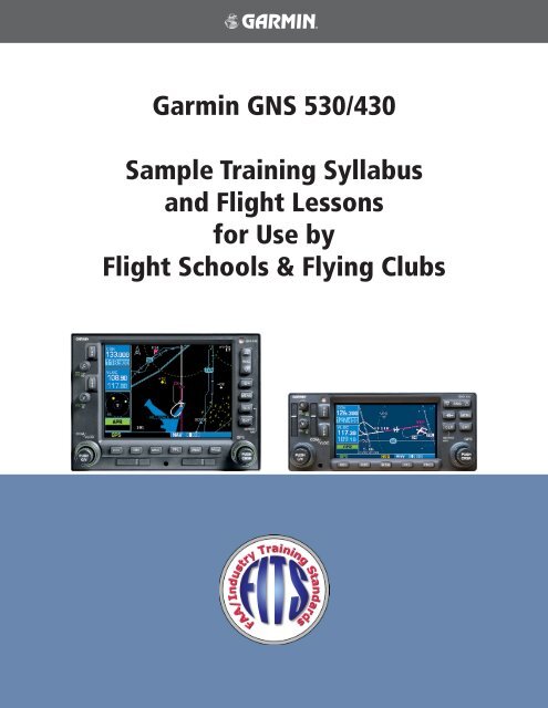
Garmin GNS 530/430 Sample Training Syllabus and Flight Lessons ...
Garmin GNS 530/430 Sample Training Syllabus and Flight Lessons ...
Garmin GNS 530/430 Sample Training Syllabus and Flight Lessons ...
Create successful ePaper yourself
Turn your PDF publications into a flip-book with our unique Google optimized e-Paper software.
<strong>Garmin</strong> <strong>GNS</strong> <strong>530</strong>/<strong>430</strong><br />
<strong>Sample</strong> <strong>Training</strong> <strong>Syllabus</strong><br />
<strong>and</strong> <strong>Flight</strong> <strong>Lessons</strong><br />
for Use by<br />
<strong>Flight</strong> Schools & Flying Clubs
<strong>Garmin</strong> <strong>GNS</strong> <strong>530</strong>/<strong>430</strong> <strong>Sample</strong> <strong>Training</strong> <strong>Syllabus</strong> <strong>and</strong> <strong>Flight</strong> <strong>Lessons</strong> 190-00334-00 Rev. A
© 2003 <strong>Garmin</strong> Ltd. or its subsidiaries. All rights reserved.<br />
<strong>Garmin</strong> International, Inc., 1200 East 151st Street, Olathe, Kansas 66062, U.S.A.<br />
Tel: 913/397.8200 Fax: 913/397.8282<br />
<strong>Garmin</strong> AT, Inc., 2345 Turner Road SE, Salem, Oregon 97302, U.S.A.<br />
Tel: 503.391.3411 Fax 503.364.2138<br />
<strong>Garmin</strong> (Europe) Ltd., Unit 5, The Quadrangle, Abbey Park Industrial Estate, Romsey, Hampshire S051 9DL, U.K.<br />
Tel: 44/1794.519944 Fax: 44/1794.519222<br />
<strong>Garmin</strong> Corporation, No. 68, Jangshu 2nd Road, Shijr, Taipei County, Taiwan<br />
Tel: 886/02.2642.9199 Fax: 886/02.2642.9099<br />
Web Site Address: www.garmin.com<br />
190-00334-00 Rev. A<br />
COPYRIGHT<br />
Except as expressly provided herein, no part of this manual may be reproduced, copied, transmitted, disseminated,<br />
downloaded or stored in any storage medium, for any purpose without the express written permission of <strong>Garmin</strong>. <strong>Garmin</strong><br />
hereby grants permission to download a single copy of this manual <strong>and</strong> of any revision to this manual onto a hard drive<br />
or other electronic storage medium to be viewed for personal use, provided that such electronic or printed copy of this<br />
manual or revision must contain the complete text of this copyright notice <strong>and</strong> provided further that any unauthorized<br />
commercial distribution of this manual or any revision hereto is strictly prohibited.<br />
Information in this document is subject to change without notice. <strong>Garmin</strong> reserves the right to change or improve their<br />
products <strong>and</strong> to make changes in the content of this material without obligation to notify any person or organization of<br />
such changes or improvements.<br />
<strong>Garmin</strong> ® is a registered trademark of <strong>Garmin</strong> Ltd. or its subsidiaries <strong>and</strong> <strong>GNS</strong> is a trademark of <strong>Garmin</strong> Ltd. or its subsidiaries.<br />
These trademarks may not be used without the express permission of <strong>Garmin</strong>.<br />
September 2003 Printed in the U.S.A.<br />
<strong>Garmin</strong> <strong>GNS</strong> <strong>530</strong>/<strong>430</strong> <strong>Sample</strong> <strong>Training</strong> <strong>Syllabus</strong> <strong>and</strong> <strong>Flight</strong> <strong>Lessons</strong><br />
i
Copyright .......................................................................................................................... i<br />
Table of Contents ............................................................................................................ ii<br />
Introduction ..................................................................................................................... 1<br />
Overview<br />
Home Study Worksheets................................................................................................. 2<br />
<strong>GNS</strong> <strong>530</strong>/<strong>430</strong> Home Study 1............................................................................................................3<br />
Worksheet – Use of GPS in lieu of other avionics, regulations<br />
<strong>GNS</strong> <strong>530</strong>/<strong>430</strong> Home Study 2............................................................................................................4<br />
Worksheet – Terminology Review<br />
<strong>GNS</strong> <strong>530</strong>/<strong>430</strong> Home Study 3............................................................................................................5<br />
Worksheet – COM <strong>and</strong> VLOC Operation<br />
<strong>GNS</strong> <strong>530</strong>/<strong>430</strong> Home Study 4............................................................................................................6<br />
Worksheet – Direct-to <strong>and</strong> <strong>Flight</strong> Plan Navigation<br />
TABLE OF CONTENTS<br />
<strong>GNS</strong> <strong>530</strong>/<strong>430</strong> Home Study 5............................................................................................................7<br />
Worksheet – Arrival, Departure <strong>and</strong> Approach Procedure Operation<br />
<strong>GNS</strong> <strong>530</strong>/<strong>430</strong> Home Study 6............................................................................................................8<br />
Worksheet – <strong>GNS</strong> <strong>530</strong>/<strong>430</strong> Series Display Interfaces; TIS<br />
<strong>GNS</strong> <strong>530</strong>/<strong>430</strong> Home Study 7............................................................................................................9<br />
Worksheet – <strong>GNS</strong> <strong>530</strong>/<strong>430</strong> Series Display Interfaces; GDL 49 Weather<br />
<strong>GNS</strong> <strong>530</strong>/<strong>430</strong> Home Study 8..........................................................................................................10<br />
The Role of Avionics in Aeronautical Decision Making <strong>and</strong> Single-Pilot Resource Management<br />
<strong>GNS</strong> <strong>530</strong>/<strong>430</strong> <strong>Flight</strong> Orientation ................................................................................... 12<br />
Lesson 1: <strong>GNS</strong> <strong>530</strong>/<strong>430</strong> Introduction - Cross-Country <strong>Flight</strong> .....................................................13<br />
Lesson 2: Local Operational <strong>Flight</strong> Review.................................................................................14<br />
Lesson 3: <strong>GNS</strong> <strong>530</strong>/<strong>430</strong> Dual Installation Introduction ..............................................................15<br />
Lesson 4: Dual Installation MFD Operations ..............................................................................16<br />
ii <strong>Garmin</strong> <strong>GNS</strong> <strong>530</strong>/<strong>430</strong> <strong>Sample</strong> <strong>Training</strong> <strong>Syllabus</strong> <strong>and</strong> <strong>Flight</strong> <strong>Lessons</strong> 190-00334-00 Rev. A
In flight schools, flying clubs <strong>and</strong> aircraft rental organizations, pilots are often required to learn how to operate the various<br />
types <strong>and</strong> makes of avionics installed in the rental fleet. In most cases, no specific training is provided on this equipment<br />
other than for rudimentary operation <strong>and</strong> minimum functions; in some cases no training is provided at all.<br />
In modern aircraft, a number of new navigation techniques <strong>and</strong> pieces of equipment are available that are designed to<br />
enhance the safety of flight operations in visual <strong>and</strong> instrument meteorological conditions. Advances in navigation technology<br />
can provide the greatest benefits in situational awareness <strong>and</strong> help reduce the cost of flight operations by allowing<br />
more direct routes <strong>and</strong> simplified approach procedures.<br />
Of all of these advances, none of them alone can bring about a major change in the accident rate of general aviation aircraft.<br />
Pilot training <strong>and</strong> periodic evaluation is the key to realizing the safety benefits of new technology <strong>and</strong> reducing accident<br />
rates. The combination of technology <strong>and</strong> pilot training will help increase safety, lower insurance costs <strong>and</strong> improve<br />
the public perception of general aviation.<br />
Overview<br />
The enclosed sample syllabi <strong>and</strong> lesson plans are provided as part of the FAA – Industry <strong>Training</strong> St<strong>and</strong>ards program<br />
(FITS). This information is designed to be incorporated into existing flight training/aircraft checkout/recurrent qualification<br />
programs.<br />
The syllabi <strong>and</strong> lesson plans are valid for both <strong>GNS</strong> <strong>530</strong> <strong>and</strong> <strong>GNS</strong> <strong>430</strong> series <strong>Garmin</strong> avionics. There are 3 main training<br />
types that this material may be used for: home study, flight checkout <strong>and</strong> recurrent.<br />
The home study portion is designed to prepare the pilot for use of the avionics <strong>and</strong> to maximize the flight training segment<br />
that follows. This part of the materials is for use with any pilot who plans to fly aircraft equipped with <strong>GNS</strong> <strong>530</strong>/<strong>430</strong><br />
avionics. It can be incorporated in any stage of pilot training, including private pilot, instrument <strong>and</strong> commercial as well<br />
as aircraft checkouts <strong>and</strong> recurrent training, instrument proficiency checks (IPCs), <strong>and</strong> flight reviews.<br />
The flight training segments emphasize scenario-based training. These flights are designed to be cross-country flights<br />
resembling normal flight operations. The en-route segment is ideal for st<strong>and</strong>ard air work <strong>and</strong> provides an opportunity to<br />
train a pilot in both VFR <strong>and</strong> simulated IFR conditions quickly. It challenges the pilot’s ability to respond to a suddenly<br />
increased workload while testing his or her ability to properly use the avionics systems.<br />
The recurrent training portion uses the same sample enclosed materials for use in conjunction with insurance qualifications,<br />
IPCs, or flight reviews <strong>and</strong> is equally well suited for each. The structure remains the same <strong>and</strong> is based around the<br />
home study review of the avionics in preparation for the flight segment. It encourages use of all system capabilities which,<br />
depending on the pilot’s typical flight operations, may not be used in the normal course of the flight.<br />
These lessons are only sample lesson plans <strong>and</strong> are designed to be used in conjunction with other programs. Suggestions<br />
<strong>and</strong> recommendations are welcome <strong>and</strong> will be taken into consideration in future document revisions. Comments/<br />
suggestions can be sent via e-mail to the <strong>Garmin</strong> FITS Program Manager at: CFI_Tools@garmin.com.<br />
I<br />
190-00334-00 Rev. A<br />
INTRODUCTION<br />
Disclaimer:<br />
These documents are samples only <strong>and</strong> are provided solely as tools to help Certified <strong>Flight</strong> Instructors<br />
develop their own training programs. It is also the sole responsibility of the CFI <strong>and</strong> pilot in training to<br />
ensure that training is completed to an appropriate level of proficiency.<br />
<strong>Garmin</strong> <strong>GNS</strong> <strong>530</strong>/<strong>430</strong> <strong>Sample</strong> <strong>Training</strong> <strong>Syllabus</strong> <strong>and</strong> <strong>Flight</strong> <strong>Lessons</strong><br />
1
2<br />
Objective:<br />
HOME STUDY<br />
Home Study Worksheets<br />
To develop a basic level of knowledge surrounding the operation of <strong>Garmin</strong> <strong>GNS</strong> <strong>530</strong>/<strong>430</strong> avionics prior to the commencement<br />
of actual flight training.<br />
Elements:<br />
• Terminology Review<br />
• Review of requirements for the use of GPS in lieu of other avionics equipment<br />
• Communications radio operation<br />
• VOR/LOC (VLOC) operation<br />
• GPS operation<br />
• Additional interfaces <strong>and</strong> associated operations<br />
• Avionics use as an aid to the aeronautical decision making process<br />
• PC simulator exercises<br />
Schedule:<br />
Each lesson is designed to take approximately 1 to 2 hours.<br />
Equipment:<br />
• <strong>GNS</strong> <strong>530</strong>/<strong>430</strong> Pilot’s Guides <strong>and</strong> Quick References<br />
• <strong>GNS</strong> <strong>530</strong>/<strong>430</strong> Interface Addendum<br />
• <strong>GNS</strong> <strong>530</strong>/<strong>430</strong> PC simulator<br />
• <strong>Lessons</strong><br />
• Worksheets<br />
Student Actions:<br />
Complete all lessons prior to arriving for training/checkout flight(s).<br />
Completion St<strong>and</strong>ards:<br />
Satisfactory completion of all worksheets/lessons prior to flight training as determined by instructor.<br />
<strong>Garmin</strong> <strong>GNS</strong> <strong>530</strong>/<strong>430</strong> <strong>Sample</strong> <strong>Training</strong> <strong>Syllabus</strong> <strong>and</strong> <strong>Flight</strong> <strong>Lessons</strong> 190-00334-00 Rev. A
190-00334-00 Rev. A<br />
<strong>GNS</strong> <strong>530</strong>/<strong>430</strong> Home Study 1<br />
Worksheet – Use of GPS in lieu of other avionics, regulations<br />
After reviewing AIM section 1-1-21 f. (Use of GPS for IFR Oceanic, Domestic En Route, <strong>and</strong> Terminal Area Operations),<br />
answer the following questions:<br />
1. In general, can the <strong>GNS</strong> <strong>430</strong> or <strong>GNS</strong> <strong>530</strong> be used for IFR operations in place of ADF <strong>and</strong>/or DME equipment?<br />
2. Describe the requirements for determining aircraft position over a DME fix using GPS.<br />
3. Describe the requirements for flying a DME arc using GPS.<br />
4. Describe the requirements for holding over an NDB/compass locator using GPS.<br />
5. Must the Jeppesen navigation database be current to fly approaches under IFR?<br />
6. What does the abbreviation RAIM st<strong>and</strong> for?<br />
HOME STUDY<br />
7. For preflight preparation, how can you obtain GPS RAIM information?<br />
8. While flying an approach, what should the pilot do if a RAIM warning is received prior to arrival at the Final<br />
Approach Waypoint?<br />
9. Explain the difference between fly-over <strong>and</strong> fly-by waypoints <strong>and</strong> draw a picture of their approach chart symbols.<br />
10. On some approaches, the heading information portrayed on the GPS is slightly different than the heading shown<br />
on the chart; why does this happen?<br />
<strong>Garmin</strong> <strong>GNS</strong> <strong>530</strong>/<strong>430</strong> <strong>Sample</strong> <strong>Training</strong> <strong>Syllabus</strong> <strong>and</strong> <strong>Flight</strong> <strong>Lessons</strong><br />
3
4<br />
Worksheet – Terminology Review<br />
HOME STUDY<br />
<strong>GNS</strong> <strong>530</strong>/<strong>430</strong> Home Study 2<br />
After reviewing Section 11 of the <strong>GNS</strong> <strong>430</strong> Pilot’s Guide <strong>and</strong> Reference Manual (Section 12 of the <strong>GNS</strong> <strong>530</strong> Pilot’s Guide<br />
<strong>and</strong> Reference Manual), answer the following questions:<br />
1. VLOC refers to what capability in the <strong>GNS</strong> <strong>530</strong>/<strong>430</strong> units?<br />
2. Define DTK, TRK, XTK <strong>and</strong> their relationship to each other.<br />
3. Define CTS.<br />
4. Define <strong>and</strong> describe the relationship between VNAV <strong>and</strong> VSR.<br />
5. What does ESA st<strong>and</strong> for <strong>and</strong> what is its purpose?<br />
6. What does the abbreviation FPL st<strong>and</strong> for?<br />
7. What is the difference between ETA <strong>and</strong> ETE?<br />
8. What is the difference between HDG <strong>and</strong> TRK?<br />
9. What is the difference between MSA <strong>and</strong> ESA?<br />
10. On the satellite status page, the <strong>GNS</strong> <strong>530</strong>/<strong>430</strong> units list EPE <strong>and</strong> DOP. What is the definition of each of these acronyms?<br />
11. What does OBS mean?<br />
12. The term SUA is used as a general reference to what data contained in the Jeppesen aviation database?<br />
13. Define FDE <strong>and</strong> explain in what types of operations it is required to be used.<br />
<strong>Garmin</strong> <strong>GNS</strong> <strong>530</strong>/<strong>430</strong> <strong>Sample</strong> <strong>Training</strong> <strong>Syllabus</strong> <strong>and</strong> <strong>Flight</strong> <strong>Lessons</strong> 190-00334-00 Rev. A
190-00334-00 Rev. A<br />
HOME STUDY<br />
<strong>GNS</strong> <strong>530</strong>/<strong>430</strong> Home Study 3<br />
Worksheet – COM <strong>and</strong> VLOC Operation<br />
After reviewing the <strong>GNS</strong> <strong>430</strong> or <strong>GNS</strong> <strong>530</strong> Pilot’s Guide, complete the following exercises using the <strong>Garmin</strong> 400 or 500<br />
series PC simulation device.<br />
Exercise 1<br />
Use the simulation device to manually tune the COM radio to the CTAF of 122.7 <strong>and</strong> make it the active frequency.<br />
Next, tune the VLOC to the VOR frequency 114.0 <strong>and</strong> make it the active frequency. Also, set the unit so that the external<br />
CDI is tracking the tuned VOR instead of GPS.<br />
Exercise 2<br />
For this exercise, initialize the simulation device position to KMKC (Wheeler Downtown, Kansas City, MO). After the<br />
position is initialized, use the Nav 3 page (400/500 series trainer) to find the ATIS frequency for KMKC <strong>and</strong> automatically<br />
tune the COM radio. Make the ATIS frequency active. Next, tune the Ground frequency in the same manner.<br />
Exercise 3<br />
For this exercise, initialize the simulation device position to KMKC (Wheeler Downtown, Kansas City, MO). After the<br />
position is initialized, locate the Nearest VOR page. From the Nearest VOR page, find ANX (Napoleon) <strong>and</strong> automatically<br />
tune the VLOC receiver to it. Make ANX the active frequency <strong>and</strong> ensure that the external CDI is set to track the VOR.<br />
Exercise 4<br />
Use the simulation device to automatically tune the COM radio to the Tower or CTAF frequency of your home airport,<br />
using the database without using the Nearest page.<br />
<strong>Garmin</strong> <strong>GNS</strong> <strong>530</strong>/<strong>430</strong> <strong>Sample</strong> <strong>Training</strong> <strong>Syllabus</strong> <strong>and</strong> <strong>Flight</strong> <strong>Lessons</strong><br />
5
6<br />
HOME STUDY<br />
<strong>GNS</strong> <strong>530</strong>/<strong>430</strong> Home Study 4<br />
Worksheet – Direct-to <strong>and</strong> <strong>Flight</strong> Plan Navigation<br />
After reviewing the <strong>GNS</strong> <strong>430</strong> or <strong>GNS</strong> <strong>530</strong> Pilot’s Guide, complete the following exercises using the <strong>Garmin</strong> 400 or 500<br />
series PC simulation device.<br />
Exercise 1<br />
Using the simulation device, initialize the simulation device position at KOSH (Oshkosh WI). Once the position is<br />
initialized, enter a Direct-To navigation to KMSN (Madison, WI).<br />
Exercise 2<br />
Using the simulation device, initialize the simulation device position at KOSH (Oshkosh WI). Create a flight plan using<br />
the active flight plan page to go to KALO (Waterloo, IA) via Dells (DLL) VORTAC <strong>and</strong> the Waukon (UKN) VORTAC.<br />
Exercise 3<br />
Using the simulation device, initialize the simulation device position at KAPA (Centennial Airport, Denver, CO). Create<br />
a flight plan to KGJT (Walker, Gr<strong>and</strong> Junction, CO Airport) via the Red Table (DBL) VOR/DME <strong>and</strong> the Rifle (RIL) VOR/<br />
DME. Once over the Red Table VOR/DME, proceed direct to KGJT by highlighting KGJT in the flight plan <strong>and</strong> using the<br />
direct-to key.<br />
Exercise 4<br />
Using the simulation device, initialize the simulation device position at KAPA (Centennial Airport, Denver, CO). Create<br />
a flight plan to KGCN (Gr<strong>and</strong> Canyon National Park, AZ) via Blue Mesa (HBU) VORTAC, Farmington (FMN) VORTAC<br />
<strong>and</strong> the Tuba City (TBC) VORTAC. Once over the Blue Mesa VORTAC, proceed direct to KGCN. While en route to<br />
KGCN, activate <strong>and</strong> join the leg from the Tuba City VORTAC to KGCN.<br />
<strong>Garmin</strong> <strong>GNS</strong> <strong>530</strong>/<strong>430</strong> <strong>Sample</strong> <strong>Training</strong> <strong>Syllabus</strong> <strong>and</strong> <strong>Flight</strong> <strong>Lessons</strong> 190-00334-00 Rev. A
190-00334-00 Rev. A<br />
HOME STUDY<br />
<strong>GNS</strong> <strong>530</strong>/<strong>430</strong> Home Study 5<br />
Worksheet – Arrival, Departure <strong>and</strong> Approach Procedure Operation<br />
After reviewing the <strong>GNS</strong> <strong>430</strong> or <strong>GNS</strong> <strong>530</strong> Pilot’s Guide, complete the following exercises using the <strong>Garmin</strong> 400 or 500<br />
series PC simulation device.<br />
Exercise 1<br />
Using the simulation device, initialize the simulation device position at KPNC (Ponca City, OK). Create a flight plan<br />
going direct to KICT (Wichita Mid-Continent, Wichita, KS). When 40nm outside of Wichita, load <strong>and</strong> activate the ILS 1R<br />
approach into KICT via the JAMEY IAF.<br />
Exercise 2<br />
Using the simulation device, initialize the simulation device position at KMCI (Kansas City International, Kansas City,<br />
MO). Create a flight plan to KSTL the Lakes Four Departure via the Columbia transition (LAKES4.COU). Load <strong>and</strong> activate<br />
the RNAV (GPS) RWY 12L approach into St. Louis International using Vectors-To-Final.<br />
Exercise 3<br />
Using the simulation device, initialize the simulation device position at KICT (Wichita Mid-Continent, Wichita, KS).<br />
Create a flight plan going direct to KMKC (Wheeler Downtown, Kansas City, MO) using the Jayhawk Four Arrival, Emporia<br />
Transition (EMP.JHAWK4). Load <strong>and</strong> activate the GPS RWY 3 using Vectors-To-Final.<br />
Exercise 4<br />
Using the simulation device, initialize the simulation device position at KICT (Wichita Mid-Continent, Wichita, KS).<br />
Create a flight plan going to KIXD (New Century Air Center, Olathe, KS) via the Emporia (EMP) VORTAC. As you approach<br />
New Century, select the RNAV (GPS) 17 approach via the OGUCO IAF.<br />
F<br />
Note: In these exercises be sure to note the difference in Loading an approach <strong>and</strong> Activating an<br />
approach. Also, review the missed approach operations with each lesson, noting the pilot actions that<br />
are required to continue on a missed approach procedure.<br />
<strong>Garmin</strong> <strong>GNS</strong> <strong>530</strong>/<strong>430</strong> <strong>Sample</strong> <strong>Training</strong> <strong>Syllabus</strong> <strong>and</strong> <strong>Flight</strong> <strong>Lessons</strong><br />
7
8<br />
HOME STUDY<br />
<strong>GNS</strong> <strong>530</strong>/<strong>430</strong> Home Study 6<br />
Worksheet – <strong>GNS</strong> <strong>530</strong>/<strong>430</strong> Series Display Interfaces; TIS<br />
F<br />
1. What are the 2 main types of information that may be displayed (when appropriate equipment is installed) on the<br />
<strong>GNS</strong> <strong>530</strong>/<strong>430</strong> series units?<br />
2. What does TIS st<strong>and</strong> for <strong>and</strong> how does it work?<br />
3. At what ranges (distance <strong>and</strong> altitude) will TIS display other aircraft?<br />
4. Can TIS data be used as a sole means of traffic avoidance in IMC (instrument meteorological conditions)?<br />
5. Approximately how old is TIS data when displayed?<br />
6. At what distances <strong>and</strong> altitudes relative to your aircraft will TIS provide a Traffic Advisory?<br />
7. TIS icons on the map page are either open diamonds or solid yellow circles. What is the difference between the<br />
two when deciding which aircraft is a threat?<br />
8. TIS icons have a line protruding from them. What does it st<strong>and</strong> for?<br />
9. What information is displayed next to the TIS traffic icons?<br />
Note: The <strong>GNS</strong> <strong>530</strong>/<strong>430</strong> series units will also display L3 (formerly Goodrich) SKY497 Traffic <strong>and</strong> Ryan<br />
TCAD 9900B <strong>and</strong> 9900BX Traffic. Please refer to the manufacturer’s documentation for the proper use<br />
<strong>and</strong> limitations of this additional equipment.<br />
<strong>Garmin</strong> <strong>GNS</strong> <strong>530</strong>/<strong>430</strong> <strong>Sample</strong> <strong>Training</strong> <strong>Syllabus</strong> <strong>and</strong> <strong>Flight</strong> <strong>Lessons</strong> 190-00334-00 Rev. A
190-00334-00 Rev. A<br />
HOME STUDY<br />
<strong>GNS</strong> <strong>530</strong>/<strong>430</strong> Home Study 7<br />
Worksheet – <strong>GNS</strong> <strong>530</strong>/<strong>430</strong> Series Display Interfaces; GDL 49 Weather<br />
F<br />
1. What types of weather information can be displayed on a <strong>GNS</strong><strong>530</strong>/<strong>430</strong> series units when a GDL 49 data link<br />
receiver is installed?<br />
2. METARs are available in two different formats; what are they?<br />
3. What are the 3 main limitations to using NEXRAD data?<br />
4. There are 2 main views available for NEXRAD data on the dedicated weather page in the Nav page set. What are<br />
they?<br />
5. Can NEXRAD weather be overlaid on the <strong>GNS</strong> <strong>530</strong> EFIS arc Nav page (Nav 1)?<br />
6. Where can you go in the unit to find the symbol decoding for graphical METAR information?<br />
Note: The <strong>GNS</strong> <strong>530</strong>/<strong>430</strong> series units will also display L3 (formerly Goodrich) WX-500 derived lightning<br />
detection. Please refer to the manufacturer’s documentation for proper use of this additional equipment.<br />
<strong>Garmin</strong> <strong>GNS</strong> <strong>530</strong>/<strong>430</strong> <strong>Sample</strong> <strong>Training</strong> <strong>Syllabus</strong> <strong>and</strong> <strong>Flight</strong> <strong>Lessons</strong><br />
9
10<br />
HOME STUDY<br />
<strong>GNS</strong> <strong>530</strong>/<strong>430</strong> Home Study 8<br />
The Role of Avionics in Aeronautical Decision Making <strong>and</strong> Single-Pilot<br />
Resource Management<br />
The advent of new avionics technologies has brought significant gains for pilots in the area of in-flight aeronautical decision-making<br />
(ADM). Traffic Information Service (TIS) over the Mode S data link is one example of the relatively low cost<br />
<strong>and</strong> highly valuable type of data available to the general aviation pilot to help maintain situational awareness in high traffic<br />
environments. Data link weather is another shining example of how technology delivers more information for flight planning<br />
<strong>and</strong> decision making loop at a much lower price of acquisition.<br />
Although such tools offer numerous safety <strong>and</strong> operational advantages, it should be noted that increased technical capabilities<br />
often tempt pilots to operate outside of their personal (or even legal) limits. The availability of GPS <strong>and</strong> moving<br />
map systems, coupled with traffic <strong>and</strong> near real-time weather information in the cockpit, may lead pilots to believe they<br />
are protected from the dangers inherent to “scud running,” or otherwise operating in marginal weather conditions. While<br />
advanced cockpit technologies may mitigate certain risks, it is by no means a substitute for sound ADM. The challenge is<br />
this: How should a pilot use this new information in flight to improve the safety of flight operations? The answer to this<br />
question lies in how well the pilot underst<strong>and</strong>s the information, its limitations <strong>and</strong> how best to integrate this data into the<br />
ADM process.<br />
Items such as TIS provide a strong aid to locating traffic in a VFR environment, yet they should not be a substitute for<br />
“see <strong>and</strong> avoid” technique. A pilot who receives a TIS Traffic Alert should visually identify the other traffic <strong>and</strong> react accordingly.<br />
Waiting until the last minute to use this data then scanning for traffic may very well prove too late depending<br />
on the closure rate. Instead, the pilot should monitor the TIS data continuously in an effort to visually acquire traffic at the<br />
maximum distance.<br />
With readily available data link weather, which provides NEXRAD weather images similar to those found on the Internet,<br />
pilots now have greater weather awareness in the cockpit. While data link weather is a powerful new tool, it is not a<br />
direct replacement for airborne weather radar. Data link weather is not real-time information <strong>and</strong> is not detailed enough<br />
for a pilot to use in an attempt to penetrate a thunderstorm. Instead, we start to pick up a common thread from the above<br />
discussion of TIS: The information is not for last minute use; it should be monitored <strong>and</strong> it is a planning tool. NEXRAD<br />
weather does allow the pilot to develop an idea of the scope of a storm that is not available from airborne weather radar.<br />
NEXRAD weather data, coupled with the METAR reporting capability of most systems, is best used for in-flight planning<br />
<strong>and</strong> deviation strategy development. By continuously monitoring the weather situation in the cockpit, the pilot can<br />
make better choices about diverting to other airports <strong>and</strong>/or changing the route of flight. As the pilot becomes more familiar<br />
with the system(s) <strong>and</strong> is able to correlate the data presentation with the actual weather environment more accurately,<br />
NEXRAD will come to enhance his or her decision making process <strong>and</strong> further the safety of flight.<br />
<strong>Garmin</strong> <strong>GNS</strong> <strong>530</strong>/<strong>430</strong> <strong>Sample</strong> <strong>Training</strong> <strong>Syllabus</strong> <strong>and</strong> <strong>Flight</strong> <strong>Lessons</strong> 190-00334-00 Rev. A
190-00334-00 Rev. A<br />
HOME STUDY<br />
<strong>GNS</strong> <strong>530</strong>/<strong>430</strong> Home Study 8 (cont.)<br />
Last but not least, the use of GPS (particularly that of mapping units) opens up new worlds of possibility in maintaining<br />
situational awareness <strong>and</strong> in helping to reduce the navigational workload when deviating from an established flight<br />
plan. Many pilots focus on the need to enter a waypoint first before they deviate. In reality, pilots should refer to the map<br />
display when possible <strong>and</strong> commence a turn-away from the dangerous situation (eg. thunderstorm) while notifying ATC<br />
of the change of heading. When the workload decreases <strong>and</strong> safety of continued flight is ensured, they should then start to<br />
focus on resuming navigation to the destination <strong>and</strong> entering the needed waypoints. It is also important to note that pilots<br />
should consider having a back-up or secondary means to navigate or communicate in the event of a primary equipment<br />
failure.<br />
As more tools are added to the general aviation cockpit in the form of terrain depictions, TAWS, etc., pilots should learn<br />
the limitations of the tools <strong>and</strong> then integrate the tools’ strengths into their own ADM process. When evaluating the ADM<br />
process, the key is planning as far ahead as possible to maximize the utility of the information at h<strong>and</strong>. This ability to “stay<br />
ahead of the airplane” when referring to managing flight performance is of equal value <strong>and</strong> force in using modern avionics.<br />
As the old saying goes, “follow the six P’s; Proper Prior Planning Prevents Poor Performance.”<br />
<strong>Garmin</strong> <strong>GNS</strong> <strong>530</strong>/<strong>430</strong> <strong>Sample</strong> <strong>Training</strong> <strong>Syllabus</strong> <strong>and</strong> <strong>Flight</strong> <strong>Lessons</strong><br />
11
12<br />
FLIGHT ORIENTATION<br />
<strong>GNS</strong> <strong>530</strong>/<strong>430</strong> <strong>Flight</strong> Orientation<br />
The sample lessons are scenario-based <strong>and</strong> will allow the instructor to maximize the impact of the training with the<br />
student, while combining a number of elements into a single flight. An example of a scenario-based training flight would<br />
start off with an instrument departure then transition to the en-route portion of the flight. During this portion of the<br />
flight, st<strong>and</strong>ard air work maneuvers may be completed, such as stalls, slow flight, performance maneuvers, etc. Once the<br />
air work is completed, the student should transition back to instrument flight <strong>and</strong> complete the remainder of the flight<br />
through the terminal <strong>and</strong> approach phases, as desired.<br />
Below is a sample syllabus encompassing the avionics for the flight portion:<br />
Objective:<br />
a To develop the student’s ability to confidently operate <strong>GNS</strong> <strong>530</strong>/<strong>430</strong> equipment while operating in the National<br />
Airspace System (NAS).<br />
Elements:<br />
a <strong>Flight</strong> Planning<br />
a Communications operation<br />
a Navigation operation<br />
a <strong>Flight</strong> Plan, Direct-To <strong>and</strong> Approach operations<br />
a Unit, MFD data field selection <strong>and</strong> configuration<br />
a Use of additional data (Weather, Traffic) <strong>and</strong> the aeronautical decision making process<br />
Schedule:<br />
a Each lesson is designed to take approximately 2-3 hours.<br />
Equipment:<br />
a <strong>GNS</strong> <strong>530</strong>/<strong>430</strong> Pilot’s Guides <strong>and</strong> Quick References<br />
a <strong>Lessons</strong><br />
a Notepaper<br />
a View limiting device (Note: For the first flight or two, the student may or may not want to have the hood on to<br />
help him/her acclimate to the cockpit environment)<br />
a Headset (optional)<br />
a Aircraft (be sure to get it scheduled!)<br />
Student’s Actions:<br />
a Has completed all ground lessons prior to arriving for training/checkout flight(s).<br />
Completion st<strong>and</strong>ards:<br />
a Satisfactory completion of all flight training as determined by instructor.<br />
<strong>Garmin</strong> <strong>GNS</strong> <strong>530</strong>/<strong>430</strong> <strong>Sample</strong> <strong>Training</strong> <strong>Syllabus</strong> <strong>and</strong> <strong>Flight</strong> <strong>Lessons</strong> 190-00334-00 Rev. A
190-00334-00 Rev. A<br />
FLIGHT ORIENTATION<br />
Lesson 1: <strong>GNS</strong> <strong>530</strong>/<strong>430</strong> Introduction - Cross-Country <strong>Flight</strong><br />
Student: Date:<br />
Objective To develop the student’s ability to use the key features in the <strong>GNS</strong> <strong>530</strong>/<strong>430</strong> in an<br />
IFR environment.<br />
Elements a Planning <strong>and</strong> use of ATIS <strong>and</strong> other airport/weather information<br />
a Unit page/screen navigation<br />
a Communications operation<br />
a <strong>Flight</strong> plan entry <strong>and</strong> manipulation<br />
a Approach selection <strong>and</strong> operation<br />
a Audio panel operation<br />
Schedule a Pre-flight briefing <strong>and</strong> review of student’s preparations – 30 min<br />
a Student practice – duration of flight (approximately 1 hr)<br />
a Post-flight critique – 30 min<br />
a Assignment for further student review – 5 min<br />
Equipment a Airplane<br />
a POH/AFM (<strong>GNS</strong> <strong>530</strong>/<strong>430</strong> Pilot’s Guide)<br />
a Charts appropriate to flight<br />
a Headset<br />
a Note-taking materials<br />
Instructor’s actions<br />
Preflight<br />
a Explain objective<br />
a Assign route of flight<br />
a Describe typical operation flow<br />
a Describe common errors<br />
In-flight<br />
a Coach student performance<br />
Post-flight<br />
a Critique<br />
Student’s actions a Ask questions regarding objective, elements <strong>and</strong> common errors<br />
a Perform operations as directed<br />
a Post-flight – ask pertinent questions<br />
Completion st<strong>and</strong>ards Student should exhibit knowledge of the proper methods for data entry,<br />
communication/navigation frequency selection, flight plan entry, in-flight routing<br />
changes, approach selection <strong>and</strong> activation, indicator annunciation <strong>and</strong> flight<br />
data display configuration for the various phases of IFR flight.<br />
Possible errors to watch for a Not using the “enter” button to select st<strong>and</strong>-by frequencies.<br />
a Failure to use both COM radios (dual installations)<br />
a Loading but not activating an approach<br />
a Improper CDI output selection in <strong>GNS</strong> <strong>530</strong>/<strong>430</strong> (GPS when should be<br />
VLOC <strong>and</strong> vice versa)<br />
a Use of Direct-To navigation when <strong>Flight</strong> Plan is more appropriate for long<br />
route clearances<br />
<strong>Garmin</strong> <strong>GNS</strong> <strong>530</strong>/<strong>430</strong> <strong>Sample</strong> <strong>Training</strong> <strong>Syllabus</strong> <strong>and</strong> <strong>Flight</strong> <strong>Lessons</strong><br />
13
14<br />
Lesson 2: Local Operational <strong>Flight</strong> Review<br />
Student: Date:<br />
Objective To develop the student’s ability to use the key features in the <strong>GNS</strong> <strong>430</strong> in an IFR<br />
environment.<br />
Elements a Planning <strong>and</strong> use of ATIS <strong>and</strong> other airport/weather information<br />
a Unit page/screen navigation<br />
a Communications operation<br />
a <strong>Flight</strong> plan entry <strong>and</strong> manipulation<br />
a Approach selection <strong>and</strong> operation<br />
a Audio panel operation<br />
Schedule a Pre-flight briefing <strong>and</strong> review of student’s preparations – 30 min<br />
a Student practice – 1.5 hrs<br />
a Post-flight critique – 30 min<br />
a Assignment for further student review – 5 min<br />
Equipment a Airplane<br />
a POH/AFM (<strong>GNS</strong> <strong>530</strong>/<strong>430</strong> Pilot’s Guide)<br />
a Charts appropriate to flight<br />
a Headset<br />
a Note-taking materials<br />
Instructor’s actions<br />
Preflight<br />
a Explain objective<br />
a Assign route of flight<br />
a Describe typical operation flow<br />
a Describe common errors<br />
In-flight<br />
a Coach student performance<br />
Post-flight<br />
FLIGHT ORIENTATION<br />
a Critique<br />
Student’s actions a Ask questions regarding objective, elements <strong>and</strong> common errors<br />
a Perform operations as directed<br />
a Post-flight – ask pertinent questions<br />
Completion st<strong>and</strong>ards Student should exhibit a high degree of knowledge of the proper methods for data<br />
entry, communication/navigation frequency selection, flight plan entry, in-flight<br />
routing changes, approach selection <strong>and</strong> activation, indicator annunciation <strong>and</strong><br />
flight data display configuration for the various phases of IFR flight. The instructor<br />
should not have to provide any operational suggestions <strong>and</strong> the student<br />
should be able to quickly <strong>and</strong> confidently make the correct changes to the <strong>GNS</strong><br />
<strong>530</strong>/<strong>430</strong> as required.<br />
Possible errors to watch for a Not using the “enter” button to select st<strong>and</strong>-by frequencies<br />
a Failure to use both COM radios<br />
a Loading but not activating an approach<br />
a Improper CDI output selection in <strong>GNS</strong> <strong>430</strong> (GPS when should be VLOC)<br />
a Use of Direct-To navigation when <strong>Flight</strong> Plan is more appropriate for long<br />
route clearances<br />
<strong>Garmin</strong> <strong>GNS</strong> <strong>530</strong>/<strong>430</strong> <strong>Sample</strong> <strong>Training</strong> <strong>Syllabus</strong> <strong>and</strong> <strong>Flight</strong> <strong>Lessons</strong> 190-00334-00 Rev. A
190-00334-00 Rev. A<br />
FLIGHT ORIENTATION<br />
Lesson 3: <strong>GNS</strong> <strong>530</strong>/<strong>430</strong> Dual Installation Introduction<br />
Student: Date:<br />
Objective To develop the student’s ability to properly manage an integrated dual-installation<br />
of <strong>GNS</strong> <strong>530</strong>/<strong>430</strong> avionics stack in an IFR environment.<br />
Elements a GMA 340 audio panel operations<br />
a <strong>GNS</strong> <strong>530</strong>/<strong>430</strong> configuration <strong>and</strong> operation<br />
a GTX 330 operation <strong>and</strong> TIS data interpretation<br />
a GDL 49 operation <strong>and</strong> WX data interpretation <strong>and</strong> its relation to flight<br />
planning<br />
Schedule a Pre-flight briefing <strong>and</strong> review of student’s preparations – 30 min<br />
a Student practice – 2 hrs<br />
a Post-flight critique – 30 min<br />
a Assignment for further student review – 5 min<br />
Equipment a Airplane<br />
a POH/AFM (appropriate Pilot’s Guide)<br />
a Charts appropriate to flight<br />
a Note-taking materials<br />
Instructor’s actions<br />
Preflight<br />
a Explain objective<br />
a Assign route of flight<br />
a Assign approach types to be completed<br />
a Assign required operations using TIS <strong>and</strong> WX data<br />
a Describe typical operation flow<br />
a Describe common errors<br />
In-flight<br />
a Coach student performance<br />
Post-flight<br />
a Critique<br />
Student’s actions a Ask questions regarding objective, elements <strong>and</strong> common errors<br />
a Perform operations as directed<br />
a Post-flight – ask pertinent questions<br />
Completion st<strong>and</strong>ards Student should be able to complete basic tasks using all available avionics tools<br />
to complete the flight <strong>and</strong> demonstrate function to instructor as requested.<br />
Possible errors to watch for a Not using the “enter” button to select st<strong>and</strong>-by frequencies<br />
a Failure to use both COM radios<br />
a Loading but not activating an approach<br />
a Improper CDI output selection in <strong>GNS</strong> <strong>530</strong>/<strong>430</strong> (GPS when should be<br />
VLOC <strong>and</strong> vice versa)<br />
a Use of Direct-To navigation when <strong>Flight</strong> Plan is more appropriate for long<br />
route clearances<br />
a Choosing wrong request type through GDL 49<br />
a Inability to interpret a graphical METAR request<br />
a Not enabling cross-fill function<br />
a Failure to use VNAV/VSR information to help plan descent<br />
a Not setting up displays to maximize the amount of data presented without<br />
overlapping data<br />
<strong>Garmin</strong> <strong>GNS</strong> <strong>530</strong>/<strong>430</strong> <strong>Sample</strong> <strong>Training</strong> <strong>Syllabus</strong> <strong>and</strong> <strong>Flight</strong> <strong>Lessons</strong><br />
15
16<br />
Lesson 4: Dual Installation MFD Operations<br />
Student: Date:<br />
Objective To develop the student’s ability to properly manage an integrated dual-installation<br />
of <strong>GNS</strong> <strong>530</strong>/<strong>430</strong> avionics stack in an IFR environment.<br />
Elements a Operation <strong>and</strong> configuration of WX interfaces<br />
a Use of WX-500/GDL 49 data as ADM aid<br />
a Operation <strong>and</strong> configuration of traffic interfaces (SKY 497/TCAD 9900B<br />
series/TIS)<br />
a Use of traffic information as ADM <strong>and</strong> awareness aid.<br />
a Proper use of TAWS/Terrain data<br />
Schedule a Pre-flight briefing <strong>and</strong> review of student’s preparations – 30 min<br />
a Student practice – 2 hrs<br />
a Post-flight critique – 30 min<br />
a Assignment for further student review – 5 min<br />
Equipment a Airplane<br />
a POH/AFM (appropriate Pilot’s Guide)<br />
a Charts appropriate to flight<br />
a Note-taking materials<br />
Instructor’s actions<br />
Preflight<br />
a Explain objective<br />
a Assign route of flight<br />
a Assign approach types to be completed<br />
a Describe typical operation flow<br />
a Describe common errors<br />
In-flight<br />
a Coach student performance<br />
Post-flight<br />
FLIGHT ORIENTATION<br />
a Critique<br />
Student’s actions a Ask questions regarding objective, elements <strong>and</strong> common errors<br />
a Perform operations as directed<br />
a Post-flight – ask pertinent questions<br />
Completion st<strong>and</strong>ards Student should be able to properly configure <strong>and</strong> interpret the data that is<br />
displayed via the MFD <strong>and</strong> correctly maneuver the aircraft in response to the<br />
presented information.<br />
Possible errors to watch for a Failure to note the data age for NEXRAD <strong>and</strong> Stormscope data<br />
a Failure to select the appropriate operating mode for WX-500<br />
a Not using the GDL 49 request options from the Nav 2 page <strong>and</strong> always<br />
going to the Aux pages for completing requests<br />
a Configuring overlapping data on both MFDs<br />
a Not incorporating MFD in instrument scan<br />
a Delayed reaction to warning messages for terrain <strong>and</strong> traffic <strong>and</strong> not taking<br />
correct action to avoid dangerous conditions<br />
a Not verifying successful self-test of remote equipment<br />
<strong>Garmin</strong> <strong>GNS</strong> <strong>530</strong>/<strong>430</strong> <strong>Sample</strong> <strong>Training</strong> <strong>Syllabus</strong> <strong>and</strong> <strong>Flight</strong> <strong>Lessons</strong> 190-00334-00 Rev. A
190-00334-00 Rev. A<br />
<strong>Garmin</strong> <strong>GNS</strong> <strong>530</strong>/<strong>430</strong> <strong>Sample</strong> <strong>Training</strong> <strong>Syllabus</strong> <strong>and</strong> <strong>Flight</strong> <strong>Lessons</strong>
© Copyright 2003 <strong>Garmin</strong> Ltd. or its subsidiaries<br />
<strong>Garmin</strong> International, Inc.<br />
1200 East 151 st Street, Olathe, Kansas 66062, U.S.A.<br />
<strong>Garmin</strong> AT, Inc.<br />
2345 Turner Road SE, Salem, Oregon 97302, U.S.A.<br />
<strong>Garmin</strong> (Europe) Ltd.<br />
Unit 5, The Quadrangle, Abbey Park Industrial Estate, Romsey, SO51 9DL, U.K.<br />
<strong>Garmin</strong> Corporation<br />
No. 68, Jangshu 2 nd Road, Shijr, Taipei County, Taiwan<br />
www.garmin.com<br />
Part Number 190-00334-00 Rev. A<br />
<strong>Garmin</strong> <strong>GNS</strong> <strong>530</strong>/<strong>430</strong> <strong>Sample</strong> <strong>Training</strong> <strong>Syllabus</strong> <strong>and</strong> <strong>Flight</strong> <strong>Lessons</strong>


