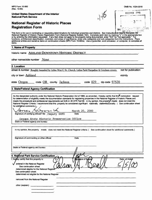
National Register of Historic Places Registration Form
National Register of Historic Places Registration Form
National Register of Historic Places Registration Form

Create successful ePaper yourself
Turn your PDF publications into a flip-book with our unique Google optimized e-Paper software.
NPS <strong>Form</strong> 10-900<br />
(Rev. 10-90)<br />
United States Department <strong>of</strong> the Interior<br />
<strong>National</strong> Park Service<br />
<strong>National</strong> <strong>Register</strong> <strong>of</strong> <strong>Historic</strong> <strong>Places</strong><br />
<strong>Registration</strong> <strong>Form</strong><br />
OMB No. 1024-0018<br />
RECEIVED ?<br />
This form is for use in nominating or requesting determinations for individual properties and districts. See instruction \-'m I low to •Gamptete We' """"<br />
<strong>National</strong> <strong>Register</strong> <strong>of</strong> <strong>Historic</strong> <strong>Places</strong> <strong>Registration</strong> <strong>Form</strong> (<strong>National</strong> <strong>Register</strong> Bulletin 16A). Complete each item by marking "x" in the appropriate box<br />
or by entering the information requested. If any item does not apply to the property being documented, enter "N/A" for "not applicable." For<br />
functions, architectural classification, materials, and areas <strong>of</strong> significance, enter only categories and sub-categories from the instructions. Place<br />
additional entries and narrative items on continuation sheets (NPS <strong>Form</strong> 10-900a). Use a typewriter, word processor, or computer, to complete all<br />
items.<br />
1. Name <strong>of</strong> Property___________________________________________________<br />
historic name ASHLAND DOWNTOWN HISTORIC DISTRICT__________________________.<br />
other names/site number None__________________________________________.<br />
2. Location<br />
Street & number Roughly bounded bv Lithia Wav/C St. Church. Lithia Park/Hargadine & Gresham streets not for publication<br />
city or town Ashland______________________________________ vicinity<br />
state Oregon code OR county Jackson code 029 zip code 97520<br />
3. State/Federal Agency Certification<br />
As the designated authority under the <strong>National</strong> <strong>Historic</strong> Preservation Act <strong>of</strong> 1986, as amended, I hereby certify that this& nomination request<br />
for determination <strong>of</strong> eligibility meets the documentation standards for registering properties in the <strong>National</strong> <strong>Register</strong> <strong>of</strong> <strong>Historic</strong> <strong>Places</strong> and<br />
meets the procedural and pr<strong>of</strong>essional requirements set forth in 36 CFR Part 60. In my opinion, the propertyX meets does not meet the<br />
<strong>National</strong> <strong>Register</strong> Criteria. I recommend that this property be considered significant nationally statewideXlocally. ( See continuation sheet<br />
for additjrfnal comments.),<br />
/ /<br />
March 20, 2000<br />
Signature <strong>of</strong> certifying <strong>of</strong>ficial/Title /Deputy SHPO Date<br />
Oregon State <strong>Historic</strong> Preservation Office<br />
State or Federal agency and bureau<br />
In my opinion, the property meets does not meet the <strong>National</strong> <strong>Register</strong> criteria. ( See continuation sheet for additional comments.)<br />
Signature <strong>of</strong> commenting or other <strong>of</strong>ficial Date<br />
State or Federal agency and bureau<br />
4. <strong>National</strong> Park Service Certification<br />
I, hereby certify that this property is:<br />
\J entered in the <strong>National</strong> <strong>Register</strong><br />
See continuation sheet<br />
determined eligible for the <strong>National</strong> Registe*<br />
See continuation sheet.<br />
determined not eligible for the <strong>National</strong> <strong>Register</strong><br />
removed from the <strong>National</strong> <strong>Register</strong><br />
other (explain):
Ashland Downtown <strong>Historic</strong> District<br />
Name <strong>of</strong> Property<br />
5. Classification<br />
Ownership <strong>of</strong> Property<br />
(Check as many boxes as apply)<br />
0 private<br />
0 public-local<br />
D public-State<br />
D public-Federal<br />
Category <strong>of</strong> Property<br />
(Check only one box)<br />
D building(s)<br />
0 district<br />
D site<br />
D structure<br />
D object<br />
Name <strong>of</strong> related multiple property listing<br />
(Enter "N/A" if property is not part <strong>of</strong> a multiple property listing.)<br />
________N/A_____________<br />
6. Function or Use<br />
<strong>Historic</strong> Functions<br />
(Enter categories from instructions)<br />
Commerce/Trade: Specialty Store [multiple]<br />
Commerce/Trade: Financial Institution. Bank<br />
Commerce/Trade: Restaurant<br />
Government: City Hall_____________<br />
Social: Meeting Hall. Fraternal____________<br />
Religion: Religious Facility: Church_______<br />
Recreation/Culture: Theater_________<br />
7. Description<br />
Architectural Classification<br />
(Enter categories from instructions)<br />
Other: Vernacular_____<br />
Late 19th Century Commercial Style<br />
Modern Movement: Moderne<br />
Jackson County. Oregon<br />
County and State<br />
Number <strong>of</strong> Resources within Property<br />
(Do not include previously listed resources in the count.)<br />
Contributing<br />
55 (Amended 12/04)<br />
Narrative Description<br />
(Describe the historic and current condition <strong>of</strong> the property on one or more continuation sheets.)<br />
61<br />
Noncontributing<br />
26___ buildings<br />
_______ sites<br />
_______ structures<br />
1___ objects<br />
27 Total<br />
Number <strong>of</strong> contributing resources previously<br />
listed in the <strong>National</strong> <strong>Register</strong><br />
_______11 (see attached list]<br />
Current Functions<br />
(Enter categories from instructions)<br />
Commerce/Trade: Specialty Store [multiple]<br />
Commerce/Trade: Restaurant_________.<br />
Government: City Hall__________________<br />
Social: Meeting Hall: Fraternal________.<br />
Religion: Religious Facility: Church______.<br />
Recreation/Culture: Theater__________<br />
Materials<br />
(Enter categories from instructions)<br />
foundation Brick. Concrete<br />
walls Brick. . Concrete. Stucco<br />
Wood:<br />
ro<strong>of</strong> Asphalt___________<br />
other Glass. Stone. Metal:<br />
Please see attached continuation sheets
NPS<strong>Form</strong>19-900A OMB Approval No. 1024-0018 (8-86)<br />
United States Department <strong>of</strong> the Interior<br />
<strong>National</strong> Park Service<br />
<strong>National</strong> <strong>Register</strong> <strong>of</strong> <strong>Historic</strong> <strong>Places</strong><br />
Continuation Sheet<br />
Section Number: OWNERS Page: Ashland Downtown <strong>Historic</strong> District, Ashland, OR<br />
ID# <strong>Historic</strong> Name<br />
1.0 CITY HALL<br />
1.1 CARTER MEM. FOUNTAIN<br />
1 .2 CHATAUQUA WALK<br />
1.3 CHATAUQUA DOME FDTN<br />
1.4 LITHIA WATER FOUNTAIN<br />
1.5 VETERAN'S FLAG POLE & MARKER<br />
1.6 CHAMBER INFO BOOTH<br />
2.0 WESTERN OIL & BURNER<br />
3.0 KELSO REALTY BLDC<br />
4.0 B & C SANDWICH STOP<br />
5.0 PHONE CENTER BLDG<br />
6.0 JACKSON CTY SAVINGS & LOAN<br />
7.0 NININGER'S DRIVE-IN MARKET<br />
8.0 CITY PARKING 1 (C ST)<br />
9.0 MEIKLE BLOCK<br />
10.0 WEBBER, GEORGE E. BLDG<br />
11.0 1st SO. OREGON SPIRITUALIST<br />
12.0 VACANT PARCEL<br />
13.0 SUNDUN BUILDING<br />
14.0 DODGE. J.P. BLDG<br />
15.0 GANIARD OPERA HSE [Portion]<br />
16.0 DODGE, J.P. & SONS FUNERAL H<br />
17.0 CULLEN BUILDING<br />
18.0 CROCKER, JOSEPHINE BLDG<br />
19.0 SABATINO'S RESTAURANT<br />
20.0 WIETZEL'S [PARKVIEW] DEPT ST<br />
21.0 CALLE CUAUNAJUATO N. ENTRY<br />
22.0 BANK OF ASHLAND EXTN BLDG<br />
23.0 BANK OF ASHLAND BLDG<br />
24.0 ASHLAND MASONIC BLDG<br />
25.0 ASHLAND IMPROVEMENT CO BLDG<br />
26.0 MILLS-McCALL BUILDING<br />
27.0 JOHNSON-SIMPSON BLDG<br />
28.0 JOHNSON, AVERY BLDG (SO. HAL<br />
29.0 JOHNSON, AVERY BLDG (NO. HAL<br />
30.0 JUDGE, HENRY BUILDING<br />
31.0 ASHLAND I.O.O.F. BUILDING<br />
32.0 WERTH, LOUIS BUILDING<br />
33.0 STOCK, H.C. BLDC<br />
33.1 SMALL STOREFRONT<br />
34.0 BLUEBIRD PARK<br />
35.0 STAR STEAM LAUNDRY BLDG<br />
36.0 FLATIRON BLDG/CLAYCOMB BLK<br />
37.0 KNOX BUILDING<br />
38.0 PAULSON. P.W. B1LDG<br />
38.1 WHITTLE GARAGE BLDG<br />
39.0 PAULSON-FREEBERG BLDG<br />
40.0 1 st NATIONAL BANK OF OREGON<br />
41.0 LITHIA SPRINGS/MARK ANTONY<br />
42.0 JORDAN ELEC/JOHNSON, O. H. B<br />
43.0 CITY LOT, REAR ASH FLOWER<br />
44.0 CITY PARKING 2 (HARGADINE S<br />
45.0 VARSITY THEATRE<br />
46.0 ASHLAND DAILY TIDINGS BLDG<br />
47.0 McCEE-FORTMILLER BLDG<br />
48.0 MEDICAL ARTS BUILDING<br />
49.0 CHRISTIAN SCIENCE CHURCH<br />
50.0 SELBY CHEVROLET GARAGE<br />
50.1 KAY-SELBY CHEV SHOWROOM<br />
51.0 FIRST NATL BANK BLDG<br />
52.0 VAUPEL STORE/ORE HOTL BLDC<br />
53.0 KAT WOK BLDG<br />
54.0 MACARONI RISTORANTE BLDG<br />
55.0 CAMPS, F.L BLDC<br />
56.0 PIONEER BUILDING<br />
57.0 MEYER STAIRS<br />
Owner Name Owner Address<br />
CITY OF ASHLAND<br />
CITY OF ASHLAND<br />
CITY OF ASHLAND<br />
CITY OF ASHLAND<br />
CITY OF ASHLAND<br />
CITY OF ASHLAND<br />
CITY OF ASHLAND<br />
MARQUEZ FIDENCIO JR TRS<br />
KELSO RONALD E/JUANITA<br />
BAUMGARDNER. GEORGE<br />
GARLAND, GERALD<br />
JACKSON COUNTY FED S/L<br />
GARCIA NANCY BRIGGS<br />
CITY OF ASHLAND<br />
TEITELBAUM ALBERT TRUST<br />
THORNTON RICHARD H/ADLE<br />
AINSWORTH SIDNEY E<br />
SANDLER, ALLAN F, TRUST<br />
BLOOMBAUM MILTON<br />
PATTERSON JUDITH A<br />
THOMPSON BRENT E<br />
SCHWEIGERJOHNC<br />
SPRAGUE DAVID/PATRICIA<br />
SCHAAF NED TRUSTEE<br />
HOLMAN MARGARET<br />
PURDY NORMAN KENNETH<br />
CITY OF ASHLAND<br />
CLOER BARBARA G TRSTE F<br />
CLOER BARBARA G TRSTE F<br />
ASHLAND LODGE #23 AF &<br />
WONG TUNG BALL/SHARON<br />
FREY MATTHEW R<br />
CHADDOCK RONALD E/PAMEL<br />
LEWIS DAVID R<br />
DAW HENRY W/RUTH E<br />
ROTH MACMICHALE ROSENKR<br />
HA1NES LLOYD M<br />
HAINES LLOYD M<br />
MEYER PAULJ/KATHLEEN<br />
MEYER PAULJ/KATHLEEN<br />
CITY OF ASHLAND<br />
HAINES LLOYD M<br />
CLAYCOMB GORDON E TRSTE<br />
MESA ENTERPRISES<br />
STANDING STONE BREWING<br />
STANDING STONE BREWING<br />
CONKLIN JAMES L/VELMA<br />
FIRST INTERSTATE BANK/O<br />
MARK ANTONY HIST PROP L<br />
WILLIAMS CAROLINE A<br />
CITY OF ASHLAND<br />
CITY OF ASHLAND<br />
SCHWEIGERJOHNC<br />
BANKE THEODORE H/LOIS E<br />
FORTMILLERCD<br />
HILL JASON H<br />
OREGON SHAKESPEAREAN<br />
CITY OF ASHLAND<br />
CITY OF ASHLAND<br />
CITY OF ASHLAND<br />
OREGON SHAKESPEAREAN<br />
SANDLER ALLAN F TRUSTEE<br />
SANDLER ALLAN FRANK<br />
OR SHAKESPEAREAN FEST A<br />
SACKS. STEPHEN<br />
CITY OF ASHLAND<br />
20 EAST MAIN ST<br />
20 EAST MAIN ST<br />
20 EAST MAIN ST<br />
20 EAST MAIN ST<br />
20 EAST MAIN ST<br />
20 EAST MAIN ST<br />
20 EAST MAIN ST<br />
15 N FIRST ST<br />
220 PATRICK LN<br />
PO BOX 492<br />
1350 EAST NEVADA<br />
2 E MAIN<br />
217SMODOC<br />
20 EAST MAIN ST<br />
196 WINDEMAR PLACE<br />
490THORTONWAY<br />
515EMAINST<br />
PO BOX 306<br />
1510 WOODLAND DR<br />
5910SWR1VERIDCEL<br />
P O BOX 201<br />
PO BOX 1240<br />
99 N MAIN ST<br />
1 75 NEIL CREEK RD<br />
P O BOX 224<br />
P O BOX 820<br />
20 EAST MAIN ST<br />
1036 PROSPECT<br />
1036 PROSPECT<br />
POBOX81<br />
1147 PARK ST<br />
37 N MAIN ST<br />
PO BOX 538<br />
743 MORTON ST<br />
785 WALKER ST<br />
6950 OLD 99 SOUTH<br />
1257 SISKIYOU BLVD<br />
1257 SISKIYOU #232<br />
1 165 N MAIN ST<br />
1 165 N MAIN ST<br />
20 EAST MAIN ST<br />
1257 SISKIYOU BLVD*<br />
4073 EL BOSQUE DR<br />
633 IOWA ST<br />
101 OAK ST<br />
101 OAK ST<br />
925 BEESON LN<br />
BANK PROP DIVT- 14<br />
4240CLAYTONRD<br />
PO BOX 279<br />
20 EAST MAIN ST<br />
20 EAST MAIN ST<br />
PO BOX 1240<br />
1 50 E MAIN<br />
PO BOX 280<br />
302 BEACH ST<br />
15 S PIONEER ST<br />
20 EAST MAIN ST<br />
20 EAST MAIN ST<br />
20 EAST MAIN ST<br />
19 S PIONEER<br />
POBOX306<br />
1260 PROSPECT<br />
50 E MAIN STREET<br />
38 E MAIN STREET<br />
20 EAST MAIN ST<br />
ASHLAND<br />
ASHLAND<br />
ASHLAND<br />
ASHLAND<br />
ASHLAND<br />
ASHLAND<br />
ASHLAND<br />
ASHLAND<br />
ASHLAND<br />
TALENT<br />
ASHLAND<br />
MEDFORD<br />
MEDFORD<br />
ASHLAND<br />
ASHLAND<br />
ASHLAND<br />
ASHLAND<br />
ASHLAND<br />
ASHLAND<br />
PORTLAND<br />
ASHLAND<br />
ASHLAND<br />
ASHLAND<br />
ASHLAND<br />
ASHLAND<br />
ASHLAND<br />
ASHLAND<br />
ASHLAND<br />
ASHLAND<br />
ASHLAND<br />
ASHLAND<br />
ASHLAND<br />
TALENT<br />
ASHLAND<br />
ASHLAND<br />
ASHLAND<br />
ASHLAND<br />
ASHLAND<br />
ASHLAND<br />
ASHLAND<br />
ASHLAND<br />
ASHLAND<br />
PEBBLE BEACH<br />
ASHLAND<br />
ASHLAND<br />
ASHLAND<br />
TALENT<br />
PORTLAND<br />
ASHLAND<br />
ASHLAND<br />
ASHLAND<br />
ASHLAND<br />
ASHLAND<br />
ASHLAND<br />
ASHLAND<br />
ASHLAND<br />
ASHLAND<br />
ASHLAND<br />
ASHLAND<br />
ASHLAND<br />
ASHLAND<br />
ASHLAND<br />
ASHLAND<br />
ASHLAND<br />
ASHLAND<br />
ASHLAND<br />
OR 97520<br />
OR 97520<br />
OR 97520<br />
OR 97520<br />
OR 97520<br />
OR 97520<br />
OR 97520<br />
OR 97520<br />
OR 97520<br />
OR 97540<br />
OR 97520<br />
OR 97501<br />
OR 97501<br />
OR 97520<br />
OR 97520<br />
OR 97520<br />
OR 97520<br />
OR 97520<br />
OR 97520<br />
OR 97201<br />
OR 97520<br />
OR 97520<br />
OR 97520<br />
OR 97520<br />
OR 97520<br />
£R 97520<br />
OR 97520<br />
OR 97520<br />
OR 97520<br />
OR 97520<br />
OR 97520<br />
OR 97520<br />
OR 97540<br />
OR 97520<br />
OR 97520<br />
OR 97520<br />
OR 97520<br />
OR 97520<br />
OR 97520<br />
OR 97520<br />
OR 97520<br />
OR 97520<br />
CA 93953<br />
OR 97520<br />
OR 97520<br />
OR 97520<br />
OR 97540<br />
OR 97208<br />
OR 97520<br />
OR 97520<br />
OR 97520<br />
OR 97520<br />
OR 97520<br />
OR 97520<br />
OR 97520<br />
OR 97520<br />
OR 97520<br />
OR 97520<br />
OR 97520<br />
OR 97520<br />
OR 97520<br />
OR 97520<br />
OR 97520<br />
OR 97520<br />
OR 97520<br />
OR 97520<br />
NR Evaluation<br />
Primary Contributing<br />
Primary Contributing<br />
Primary Contributing<br />
Primary Contributing<br />
Primary Contributing<br />
Primary Contributing<br />
Non-Compatible, Non-<strong>Historic</strong>, Non-C<br />
Primary Contributing<br />
Non-Compatible, Non-<strong>Historic</strong>, Non-C<br />
Primary Contributing<br />
Non-Compatible, Non-<strong>Historic</strong>, Non-C<br />
Non-Compatible, Non-<strong>Historic</strong>, Non-C<br />
Primary Contributing<br />
Vacant Lot/Parking<br />
<strong>Historic</strong>, Non-Contributing in Curre<br />
Primary Contributing<br />
Primary Contributing<br />
Vacant: Unimproved<br />
Non-Compatible, Non-<strong>Historic</strong>, Non-C<br />
Primary Contributing<br />
<strong>Historic</strong>, Non-Contributing in Curre<br />
Primary Contributing<br />
Primary Contributing<br />
Primary Contributing<br />
Non-Compatible, Non-<strong>Historic</strong>, Non-C<br />
Primary Contributing<br />
Vacant: Park/Recreation<br />
Primary Contributing<br />
Primary Contributing<br />
Primary Contributing [NR-Listed]<br />
Primary Contributing<br />
Primary Contributing<br />
Primary Contributing<br />
Primary Contributing<br />
Primary Contributing<br />
Primary Contributing<br />
Primary Contributing [NR-Listed]<br />
Primary Contributing<br />
Primary Contributing<br />
Compatible, Non-<strong>Historic</strong>, Non-Contr<br />
Vacant: Park/Recreation<br />
Primary Contributing<br />
Primary Contributing<br />
Primary Contributing<br />
Primary Contributing<br />
Primary Contributing [NR-Listed]<br />
Primary Contributing<br />
Non-Compatible, Non-<strong>Historic</strong>, Non-C<br />
Primary Contributing [NR-Listed]<br />
Primary Contributing<br />
Vacant: Improved Parking<br />
Vacant: Improved Parking<br />
Primary Contributing<br />
Primary Contributing<br />
Primary Contributing<br />
<strong>Historic</strong>, Non-Contributing in Curre<br />
Primary Contributing<br />
Primary Contributing<br />
Non-Compatible, Non-<strong>Historic</strong>, Non-C<br />
Primary Contributing [NR-Listed]<br />
Primary Contributing [NR-Listed]<br />
Compatible, Non-<strong>Historic</strong>, Non-Contr<br />
Non-Compatible, Non-<strong>Historic</strong>, Non-C<br />
Primary Contributing<br />
Primary Contributing<br />
Compatible, Non-<strong>Historic</strong>, Non-Contr
NPS <strong>Form</strong> 19-900A OMB Approval No. 1024-0018 (8-86)<br />
United States Department <strong>of</strong> the Interior<br />
<strong>National</strong> Park Service<br />
<strong>National</strong> <strong>Register</strong> <strong>of</strong> <strong>Historic</strong> <strong>Places</strong><br />
Continuation Sheet<br />
Section Number: OWNERS Page: Ashland Downtown <strong>Historic</strong> District, Ashland, OR<br />
ID# <strong>Historic</strong> Name Owner Name<br />
58.0 JIM'S RICHFIELD SERVICE<br />
59.0 LOMBARD OFFICE BLDC<br />
60.0 SHAW-SANDERSON BLDC<br />
61.0 SHAW-SANDERSON ANNEX<br />
62.0 ICENHOWER BLDC<br />
63.0 STEPHENSON-STENNETT BLDC<br />
64.0 RUNDELL BUILDING<br />
65.0 PETERSON-SWENSON BLDC<br />
66.0 SANDERSON, W.C. BILDG<br />
67.0 STONER, S.B. BLDC<br />
68.0 DRUE-MILLER BLDC<br />
69.0 PAULSON-DRUE BLDC<br />
70.0 U S NATIONAL BANK BLDC<br />
71.0 TRINITY EPISCOPAL CHURCH<br />
72.0 BEACH-GOOD HOUSE<br />
72.1 MORGAN REFRIC/BARBER SHOP<br />
73.0 US POST OFFICE [PROVOST BLDG<br />
74.0 CITY-OWNED ALLEY<br />
75.0 SWEDENBURC BLDC<br />
76.0 PETERSON FURN/HERSHEY BLDG<br />
77.0 ASHLAND ELKS LODGE #944<br />
77.1 ASHLAND ELKS PARKING LOT<br />
78.0 CRATER NATL BANK BLDC<br />
79.0 CITIZEN'S BANKING & TRUST [W<br />
79.1 CITIZEN'S BANKING & TRUST [E<br />
80.0 SAVAGE BUILDING<br />
81.1 ENDERS BUILDING<br />
81.2 ENDERS BLDG ANNEX (II TAX LO<br />
81.3 ENDERS BLDC [REAR ALLEY POR]<br />
83.0 LJTHIA SPRINGS GARAGE<br />
84.0 FIRST BAPTIST CHURCH<br />
85.0 ENDERS. H.G HSE<br />
86.0 ROPER. FORDYCE AND JULIA HSE<br />
87.0 FR1DEGER, I.R. HOUSE<br />
88.0 GOLDSBY-BRYAN HSE<br />
89.0 GOLDEN-FIELDS BUILDING<br />
90.0 MODERN OFFICE BLDG<br />
91.0 CITY PARKING 3 (2ND ST)<br />
92.0 OESER FABRICS<br />
93.0 SHOOK, ISSAC BLDG<br />
93.1 GENERAL PETROLEUM STATION<br />
94.0 ASHLAND PUBLIC LIBRARY<br />
94.1 MICKELSON CHAPMAN FOUNTAIN<br />
MARS PAUL A JR<br />
KORN IRVINC L TRUSTEE<br />
MEYER ALBERT C<br />
STEVIED CORPORATION<br />
PROVOST DOM S<br />
PROVOST DOM S<br />
PROVOST DOM S<br />
PROVOST DOM S<br />
PROVOST DOM S<br />
PROVOST DOM S<br />
PROVOST DOM S<br />
PROVOST DOM S<br />
MITTLEMAN PROPERTIES<br />
TRJNTY PARISH/ASHLAND O<br />
TRINTY PARISH/ASHLAND O<br />
TRINTY PARISH/ASHLAND O<br />
PROVOST DOM S JR/JOYCE<br />
CITY OF ASHLAND<br />
PURDY NORMAN KENNETH<br />
WRICHT ROBERT W/JUNE E<br />
ASHLAND LODGE 0944/BPOE<br />
ASHLAND LODGE *944/BPOE<br />
CRATER NATL BANK OF MED<br />
MOUNTAIN PARK DEVEL LLC<br />
TEITELBAUM ALBERT TRUST<br />
LUIZ SUE ELLEN<br />
TEITELBAUM ALBERT TRSTE<br />
DRESHCER ALLEN C TRSTE<br />
OREGON SHAKESPEAREAN<br />
ASHLAND HISTORIC PROPER<br />
ROVIN RICHARD G/JUDITH<br />
RUSSELL MARCIA C<br />
HARRIS CARL G/GRAY ALBE<br />
GRANT DAVID M/ALISON D<br />
GOLDEN-FIELDS PROPERTY<br />
MAIN ST REALTY GRP INC<br />
CITY OF ASHLAND<br />
MATTHEWS ROBERT/SANDRA<br />
SOUTH ANDREW C TRUSTEE<br />
SOUTH ANDREW C TRUSTEE<br />
CITY OF ASHLAND<br />
CITY OF ASHLAND<br />
Owner Address<br />
P O BOX 5969<br />
465 TAYLOR ST<br />
112NUTLEYST<br />
406 IOWA ST<br />
357 E MAIN ST<br />
357 E MAIN ST<br />
357 E MAIN ST<br />
357 E MAIN ST<br />
357 E MAIN ST<br />
357 E MAIN ST<br />
357 E MAIN ST<br />
357 E MAIN ST<br />
111 SWCOLUMBIA<br />
44 NORTH 2ND ST<br />
44 N SECOND ST<br />
44 N SECOND ST<br />
357 E MAIN ST<br />
20 EAST MAIN ST<br />
PO BOX 820<br />
PO BOX 958<br />
PO BOX 569<br />
PO BOX 569<br />
188I06THAVENESUI<br />
4240 CLAYTON ROAD<br />
196 WINDEMAR PLACE<br />
P O BOX 3476<br />
196 WINDEMAR PLACE<br />
P O BOX 760<br />
PO BOX 158<br />
424 COURTNEY ST<br />
150KUAILIMADR<br />
35 S SECOND ST<br />
1015MARYJANEAVE<br />
1135 FERN ST<br />
845 OAK ST<br />
7208 PARK TERRACE DR<br />
20 EAST MAIN ST<br />
3088 LAZY CR DR<br />
4100SWTUALATINAVE<br />
4100 SW TUALATIN AVE<br />
20 EAST MAIN ST<br />
20 EAST MAIN ST<br />
NR Evaluation<br />
PORTLAND OR 97228 Non-Compatible, Non-<strong>Historic</strong>, Non-C<br />
ASHLAND OR 97520 Non-Compatible. Non-<strong>Historic</strong>, Non-C<br />
ASHLAND OR 97520 Primary Contributing<br />
ASHLAND OR 97520 Primary Contributing<br />
ASHLAND OR 97520 <strong>Historic</strong>, Non-Contributing in Curre<br />
ASHLAND OR 97520 <strong>Historic</strong>, Non-Contributing in Curre<br />
ASHLAND OR 97520 Primary Contributing<br />
ASHLAND OR 97520 Primary Contributing<br />
ASHLAND OR 97520 Primary Contributing<br />
ASHLAND OR 97520 Primary Contributing<br />
ASHLAND OR 97520 Primary Contributing<br />
ASHLAND OR 97520 Primary Contributing<br />
PORTLAND OR 97201 Compatible, Non-<strong>Historic</strong>, Non-Contr<br />
ASHLAND OR 97520 Primary Contributing [NR-Listed]<br />
ASHLAND OR 97520 Primary Contributing<br />
ASHLAND OR 97520 Compatible, Non-<strong>Historic</strong>, Non-Contr<br />
ASHLAND OR 97520 Non-Compatible. Non-<strong>Historic</strong>, Non-C<br />
ASHLAND OR 97520 Vacant: Alleyway/Travel<br />
ASHLAND OR 97520 Primary Contributing<br />
ASHLAND OR 97520 Primary Contributing<br />
ASHLAND OR 97520 Primary Contributing<br />
ASHLAND OR 97520 Vacant: Improved Parking<br />
BELLVUE WA 98004 Non-Compatible, Non-<strong>Historic</strong>, Non-C<br />
ASHLAND OR 97520 Primary Contributing [NR-Listed]<br />
ASHLAND OR 97520 Primary Contributing<br />
ASHLAND QR 97520 Compatible, Non-<strong>Historic</strong>, Non-Contr<br />
ASHLAND OR 90292 Primary Contributing [NR-Listed]<br />
ASHLAND OR 97520 Primary Contributing<br />
Primary Contributing<br />
ASHLAND OR 97520 Primary Contributing<br />
ASHLAND OR 97520 Primary Contributing [NR-Listed]<br />
KAILUA HI 96734 Primary Contributing<br />
ASHLAND OR 97520 Primary Contributing [NR-Usted]<br />
ASHLAND OR 97520 Primary Contributing<br />
ASHLAND OR 97520 Primary Contributing<br />
ASHLAND OR 97520 Compatible, Non-<strong>Historic</strong>, Non-Contr<br />
KEIZER OR 97303 Non-Compatible, Non-<strong>Historic</strong>, Non-C<br />
ASHLAND OR 97520 Vacant: Improved Parking<br />
MEDFORD OR 97504 Non-Compatible, Non-<strong>Historic</strong>, Non-C<br />
PORTLAND OR 97201 Primary Contributing<br />
PORTLAND OR 97201 Primary Contributing<br />
ASHLAND OR 97520 Primary Contributing<br />
ASHLAND OR 97520 Primary Contributing
NPS <strong>Form</strong> 10-900-A OMB Approval No. 1024-0018 (8-86)<br />
United States Department <strong>of</strong> the Interior<br />
<strong>National</strong> Park Service<br />
<strong>National</strong> <strong>Register</strong> <strong>of</strong> <strong>Historic</strong> <strong>Places</strong><br />
Continuation Sheet<br />
Section Number: 5 Page: 1 Ashland Downtown <strong>Historic</strong> District, Ashland, OR<br />
Ashland Downtown <strong>Historic</strong> District<br />
RESOURCES PREVIOUSLY LISTED ON THE<br />
NATIONAL REGISTER OF HISTORIC PLACES<br />
ID # Site Name Date Listed/NRIS<br />
24.0 ASHLAND MASONIC LODGE BUILDING 06/04/92,92000663<br />
31.0 ASHLAND IOOF BUILDING 02/17/78, 78002288<br />
79.x CITIZEN'S BANKING & TRUST CO. BUILDING (multp t/lots) 02/28/85, 85000364<br />
81 .x ENDERS BUILDING (multiple tax lots, see Section 7) 10/23/86,86002902<br />
84.0 FIRST BAPTIST CHURCH 03/28/79,79002066<br />
51.0 FIRST NATIONAL BANK BUILDING 02/29/80,80003319<br />
41.0 MARK ANTONY MOTOR LODGE [LITHIA SPRINGS HOTEL] 03/14/78, 78002289<br />
86.0 ROPER, FORDYCE & JULIA HOUSE 12/02/85,85003075<br />
71.0 TRINITY EPISCOPAL CHURCH 04/05/84,84003015<br />
52.0 VAUPEL STORE/OREGON HOTEL BUILDING 02/29/80,80003319<br />
38.1 WHITTLE GARAGE BUILDING 03/03/97,97000142
NPS<strong>Form</strong>10-900-A<br />
United States Department <strong>of</strong> the Interior<br />
<strong>National</strong> Park Service<br />
OMB Appi<br />
<strong>National</strong> <strong>Register</strong> <strong>of</strong> <strong>Historic</strong> <strong>Places</strong><br />
Continuation Sheet AMEN ; DEC 2003<br />
Section Number: 7 Page: 1A Ashland Downtown <strong>Historic</strong> District, Ashland, OR<br />
ID #72 (Survey #252)<br />
Beach-Good House<br />
66 Second Street 1895<br />
391E09BD 3700<br />
Primary Contributing<br />
Following a change in ownership, this house was moved from this site and no longer<br />
remains in the Ashland Downtown <strong>Historic</strong> District. [Please see Ashland Skidmore<br />
Academy <strong>Historic</strong> District, Amendment Sheet Section 7 Page 1A (December 2003)<br />
Resource ID #72. the Beach-Good House, is deleted from the Ashland Downtown<br />
<strong>Historic</strong> District (NRIS #000004461 and the Section 5 resource count is amended to<br />
reflect that change (55 contributing buildings). A corrected and revised form has been<br />
submitted to reflect the accurate number <strong>of</strong> resources as the result <strong>of</strong> this change.<br />
Deputy Oregon State <strong>Historic</strong> Preservation Officer Date:
NPS <strong>Form</strong> 10-900-A OMB Approval No. 1024-0018 (8-86)<br />
United States Department <strong>of</strong> the Interior<br />
<strong>National</strong> Park Service<br />
<strong>National</strong> <strong>Register</strong> <strong>of</strong> <strong>Historic</strong> <strong>Places</strong><br />
Continuation Sheet<br />
Section Number: _7_ Page: J__ Ashland Downtown <strong>Historic</strong> District, Ashland, OR<br />
SETTING:<br />
Since the community <strong>of</strong> Ashland was settled in the mid-19th century, its economic and<br />
civic focus has been firmly centered upon the junction <strong>of</strong> Ashland Creek and the north-<br />
south transportation corridor that began as the "Southern Emigrant Route" or Applegate<br />
Trail, then developed into first the Pacific Highway and, finally, U. S. (now Oregon)<br />
Highway 99. Beginning from the Plaza area, the city's downtown core slowly expanded<br />
eastward, following the roadbed and by WWI had largely acquired its present extent. The<br />
brick and concrete buildings <strong>of</strong> the community, dating from the earliest in 1879 to the end<br />
<strong>of</strong> the historic period in 1955 when the opening <strong>of</strong> the Lithia Way couplet resulted in<br />
downtown's present form, have without interruption continued to serve as Ashland's<br />
primary commercial, civic, and cultural heart.<br />
The Ashland Downtown <strong>Historic</strong> District is located in the Bear Creek portion <strong>of</strong> the Rogue<br />
River Valley, in the southern portion <strong>of</strong> Jackson County, Oregon, about fifteen miles north<br />
<strong>of</strong> the Oregon-California Border. While appearing to be essentially flat, the District drops<br />
more than 50 feet from east to west in altitude. At Gresham, in front <strong>of</strong> the Ashland<br />
Carnegie Library, the elevation is 1,938' while less than four-tenths <strong>of</strong> a mile (1,925') west<br />
at the Plaza the elevation is 1,884 feet.<br />
Roughly in the geographic center <strong>of</strong> the City <strong>of</strong> Ashland, downtown is surrounded by early<br />
residential neighborhoods and Lithia Park. Lining the majority <strong>of</strong> the northern boundary<br />
along Lithia Way and C Street is the Ashland Railroad Addition <strong>Historic</strong> District, a 117<br />
acre area separately listed on the <strong>National</strong> <strong>Register</strong> <strong>of</strong> <strong>Historic</strong> <strong>Places</strong> in 1999. To the<br />
southeast <strong>of</strong> downtown, along Siskiyou Boulevard, is the Siskyiou-Hargadine District, and<br />
to the west is the Skidmore Academy District, both locally designated late 19th and early<br />
20th century residential enclaves that, along with the Railroad District, hold the bulk <strong>of</strong><br />
Ashland's traditional residential neighborhoods. Lithia Park and the foothills that line<br />
Ashland Canyon, leading to 7533 foot high Mount Ashland, form the southwestern<br />
boundary <strong>of</strong> the district, with small residential uses <strong>of</strong> mixed vintage on the south side <strong>of</strong><br />
Hargadine.<br />
Surrounded by early residential uses and set against a visual backdrop <strong>of</strong> Ashland Canyon<br />
and the foothills to the south, with views <strong>of</strong> the rural hillsides across the valley to the<br />
north, Ashland's downtown is a dense commercial core, characterized by vertical masonry<br />
buildings and traditional architecture, set within a small valley that still maintains an overall<br />
rural character.
NPS <strong>Form</strong> 10-900-A OMB Approval No. 1024-0018 (8-86)<br />
United States Department <strong>of</strong> the Interior<br />
<strong>National</strong> Park Service<br />
<strong>National</strong> <strong>Register</strong> <strong>of</strong> <strong>Historic</strong> <strong>Places</strong><br />
Continuation Sheet<br />
Section Number: _7_ Page: _2_ Ashland Downtown <strong>Historic</strong> District, Ashland, OR<br />
ARCHITECTURAL STYLES & USES:<br />
COMMERCIAL<br />
With the majority <strong>of</strong> its resources standing by 1930 and then serially remodeled to meet<br />
changes in public taste, the architecture <strong>of</strong> the Ashland Downtown <strong>Historic</strong> District<br />
represents a harmonious collection <strong>of</strong> the architecture styles and forms common to small<br />
town Western America during that period <strong>of</strong> booming growth and expansion, followed by<br />
the tight-budgeted remodeling efforts <strong>of</strong> the Great Depression and pre-WWII era.<br />
Little "high" style work was found in such communities and, as might be expected, little<br />
was constructed in Ashland. Beginning in 1879, following a major fire and a shift toward<br />
masonry construction, new commercial developments largely followed the vernacular brick<br />
design style that is characterized as "Chicago School" or "Commercial Brick-front."<br />
Typical elements <strong>of</strong> the style include vertical orientation (typically defined by the<br />
underlying property lines) with tali narrow second floor window openings above a wood<br />
and glass storefront. Engaged decorative detailing, including pilasters, corbelling, dentil<br />
bands, stringcourse or other intermediate horizontal divisions followed standard<br />
construction patterns.<br />
Brick-front organization result from the interaction <strong>of</strong> the elements on the grid that<br />
underscored the front. Display space was convention, whether the entrance was on-<br />
or <strong>of</strong>f- center....these stores were narrow and deep, and the windows were a source<br />
<strong>of</strong> light as well as an invitation to inspect the goods. (Gottfried and Jennings,<br />
1988:240-41)<br />
Built in both one and two story examples, typical vernacular "brick fronts" in the District<br />
include most pristinely the Henry Judge Building (ID 30.0) and the Avery Johnson<br />
Buildings, (ID 28.0 and 29.0). The basic vernacular brick-front styles remained hugely<br />
popular for almost 30 years, with the 1880s buildings on the Plaza not being substantially<br />
different in design from structures erected on East Main Street as during the first decade<br />
<strong>of</strong> the 20th century. Typical late examples <strong>of</strong> the brick front include the Meikle Block (Site<br />
(9.0) as originally designed, and the group <strong>of</strong> 1909-period buildings on East Main between<br />
Second and Third streets. (Sites 65.0 through 67.0)<br />
As Ashland's population grew and its merchants prospered, more elaborate interpretations<br />
<strong>of</strong> the brick front were erected. Not substantially different in volume or mass, wealth and<br />
prosperity found expression in the more elaborate use <strong>of</strong> materials and decorative elements<br />
after the turn <strong>of</strong> the century. Multi-colored brick detailing such as at the Bank <strong>of</strong> Ashland<br />
Building (Site 22.0) or the Rundell Building (Site 64.0) was one mechanism for<br />
demonstrating success while elaborate surface detail and cornice and parapet design was
NPS <strong>Form</strong> 10-900-A OMB Approval No. 1024-0018 (8-86)<br />
United States Department <strong>of</strong> the Interior<br />
<strong>National</strong> Park Service<br />
<strong>National</strong> <strong>Register</strong> <strong>of</strong> <strong>Historic</strong> <strong>Places</strong><br />
Continuation Sheet<br />
Section Number: _1__ Page: _3_ Ashland Downtown <strong>Historic</strong> District, Ashland, OR<br />
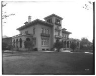
another. (See, for example, the original design <strong>of</strong> the F. L. Camps Building, Site 55.0, as<br />
shown at the extreme left <strong>of</strong> historic photograph 1/121.)<br />
The introduction <strong>of</strong> new materials in the early 20th century, notably concrete and textured<br />
concrete block (also called "Miracle Block") <strong>of</strong>fered new design possibilities to the<br />
common brick-front vertically-oriented commercial volume. Ashland's contractors and<br />
merchants were quick to adopt the new materials and commercial volumes constructed in<br />
downtown from 1910 onward generally favored concrete over the earlier brick. The<br />
earliest example, a portion <strong>of</strong> the NR-Listed "Enders Store (Site 81.x) was reportedly the<br />
first use <strong>of</strong> the material in the city. The larger Elk's Temple (Site 77.0) and finally the<br />
nine-story Lithia Springs Hotel (Site 41.0) firmly established concrete as the material <strong>of</strong><br />
choice. "Miracle Block," almost a transitional material as the standard brick masonry unit<br />
evolved toward poured in place concrete, saw limited use in downtown, with the most<br />
notable example being the decorative H. C. Stock and Louis Werth buildings. (Sites 32.0<br />
and 33.0).<br />
The stucco-coating <strong>of</strong> masonry volumes, both as a part <strong>of</strong> original construction as in the<br />
Elks Building or the Ashland Carnegie Library (Site 94.0) and as a way to "modernize"<br />
earlier masonry volumes, remained a popular element in downtown's design through the<br />
1950s. The facades <strong>of</strong> late 19th century brick volumes such as the Ganiard Opera House,<br />
the Pioneer Building (Sites 15.0 and 56.0), among others were completely covered with<br />
stucco throughout the 20th century, <strong>of</strong>ten accompanied by the removal or complete<br />
encasement <strong>of</strong> original detailing. Often this stucco-coating was then itself covered by later,<br />
non-historic, materials in the 1960s and 1970s. (See, for example, the Meikle Building,<br />
Site (9.0)<br />
Beginning in the 1920s new, higher-style and architect-inspired commercial structures<br />
became more common in Ashland. 1 This reached its epitome in 1924-25 with Portland<br />
architects Tourtellotte and Hummel's design for the Lithia Springs Hotel (Site 41.0). An<br />
eclectic mix <strong>of</strong> Beaux-Arts and Gothic motifs, the scale and elaborate exterior detail <strong>of</strong> the<br />
Lithia Springs have made it downtown's most enduring visual landmark. Perhaps due to its<br />
legendary financial troubles the Lithia Springs did not become a model for any other<br />
commercial construction in the area. More modest structures, particular Frank Clark's<br />
design for the McGee-Fortmiller's Building brought a subtle Colonial Revival influence to<br />
downtown.<br />
1 Architect or skilled designers had worked in Ashland during the late 19th century (L. S. P. Marsh) and many architect-<br />
designed structures were built between 1900 and 1910 by either Frank Chamberlain Clark or W. F. Bowen.<br />
While architect-designed, however, such buildings rarely represented a major break in the traditional vernacular<br />
"Brick-front" commercial form, but were rather more elaborate and better articulated examples <strong>of</strong> the style.
NPS <strong>Form</strong> 10-900-A OMB Approval No. 1024-0018 (8-86)<br />
United States Department <strong>of</strong> the Interior<br />
<strong>National</strong> Park Service<br />
<strong>National</strong> <strong>Register</strong> <strong>of</strong> <strong>Historic</strong> <strong>Places</strong><br />
Continuation Sheet<br />
Section Number: _7_ Page: _4_ Ashland Downtown <strong>Historic</strong> District, Ashland, OR<br />
During the 1930s and extending into the post-war era, stucco-clad buildings in the<br />
Streamlined Art Moderne idiom represented a major new influence in Ashland's<br />
downtown. Most notable are the Varsity Theater (Site 45.0), designed by Robert Keeney,<br />
<strong>of</strong> Clark and Keeney, and the Knox Building (Site 37.0), designed by William Laing. Other<br />
major Art-Moderne influenced structures include the Weitzel's Department Store (Site<br />
20.0) and the Medical Arts Building (Site 48.0), the latter <strong>of</strong> which has been substantially<br />
remodeled and no longer relates its original design.<br />
With the end <strong>of</strong> the historic period, the growing influence <strong>of</strong> International Style and so-<br />
called "modern" architecture was increasingly felt in the downtown. New construction, as<br />
demonstrated by the U. S. <strong>National</strong> Bank Building (Site 70.0) could be done in a<br />
compatible fashion and successfully integrated into the traditional development pattern.<br />
Other examples, most spectacularly the First <strong>National</strong> Bank <strong>of</strong> Portland Building (Site<br />
40.0), built following the demolition <strong>of</strong> the Ashland Hotel, represent dramatic changes to<br />
the character <strong>of</strong> the community.<br />
FRATERNAL, RELIGIOUS AND Civic USES.<br />
Downtown, the core <strong>of</strong> Ashland city government and the focus <strong>of</strong> its community life,<br />
naturally served as the locus for a number <strong>of</strong> public and civic uses. Fraternal and religious<br />
organizations, including the IOOF, Masonic, Elks, and other groups, built large and<br />
substantial buildings, that remain visually important in the area> Generally such buildings<br />
were designed within the popular architectural styles <strong>of</strong> the day, <strong>of</strong>ten including retail<br />
storefronts or other rental spaces as income producing opportunities on the first floor level.<br />
As such, many fraternal buildings demonstrate the same pattern <strong>of</strong> renovation and<br />
remodeling as other "for-pr<strong>of</strong>it" developments.<br />
<strong>Historic</strong>ally, religious institutions logically located in the downtown core and although<br />
several later relocated to large parcels elsewhere in the city, one congregation and several<br />
religious structures remain in the downtown district. Trinity Episcopal Church (Site<br />
71.0), established in 1894 remains the only active religious institution with the downtown<br />
and its high-Gothic wood-frame chapel is a unique architectural expression in the area.<br />
Other church buildings, notably the First Baptist Church, built in the Mission Revival<br />
Style, and the Christian Scientist church, a wood-frame Colonial-Revival form, are<br />
differentiated from the typical commercial volumes as free-standing buildings with modest<br />
landscaped sites that create a more residential character. All the religious structures retain<br />
exuberant and complex ro<strong>of</strong> forms or detailing that adds an additional layer to the<br />
2 See Sites 31.0, 24.0, 77.0, all fraternal organizations. Sites 49.0, 71.0, and 84.0 were or remain churches in the<br />
downtown core area.
NPS <strong>Form</strong> 10-900-A OMB Approval No. 1024-0018 (8-86)<br />
United States Department <strong>of</strong> the Interior<br />
<strong>National</strong> Park Service<br />
<strong>National</strong> <strong>Register</strong> <strong>of</strong> <strong>Historic</strong> <strong>Places</strong><br />
Continuation Sheet<br />
Section Number: _7_ Page: _5_ Ashland Downtown <strong>Historic</strong> District, Ashland, OR<br />
downtown character. Today, as a group, the religious buildings in the downtown retain a<br />
uniformly high degree <strong>of</strong> virtually unaltered integrity.<br />
The major civic use in downtown is the Ashland City Hall, (Site #1.0) constructed in the<br />
1890s and now beginning its second century as the <strong>of</strong>fices <strong>of</strong> the city's elected leaders and<br />
administration. At the opposite end <strong>of</strong> the district the Ashland Carnegie Library (Site<br />
94.0) forms a logical civic-based visual terminus to downtown. Both buildings are simply<br />
designed, with the classical forms <strong>of</strong> the Carnegie creating a more imposing edifice,<br />
bolstered by the elevated site.<br />
Public artwork, <strong>of</strong>ten donated by community groups or philanthropic individuals, has long<br />
been a part <strong>of</strong> Ashland's downtown. The Carter Memorial Fountain (Site 1.1), the<br />
Mickelson-Chapman Fountain (Site 94.1) both are examples <strong>of</strong> pioneer commemoratives.<br />
Local groups have also erected public ceremonial pieces, notably the Veterans Memorial<br />
Flagpole (Site 1.5). Although outside the period <strong>of</strong> significance, artwork located in front <strong>of</strong><br />
the Kay-Selby Chevrolet Building (Site 50.1) continues that trend. More functional works,<br />
from the 19th century Chautauqua Walk (Site 1.2) to the 1970s-era Meyer Memorial Stairs<br />
(Site 57.0) also add to the pedestrian amenities <strong>of</strong> downtown.<br />
INDUSTRIAL AND UTILITARIAN USES:<br />
While the original development <strong>of</strong> Ashland's downtown was centered on Helman's saw<br />
mill and then the flour mill at the head <strong>of</strong> the Plaza, industrial uses were little represented<br />
in downtown by the turn <strong>of</strong> the century. 3 What industrial or utilitarian architecture was<br />
constructed was almost entirely related to the development <strong>of</strong> the automobile and the<br />
Pacific Highway as a major character-defining feature in downtown. Structures specifically<br />
developed in response to the automobile were originally far more prevalent, with several<br />
downtown gas stations remaining Main Street features. Of approximately six documented<br />
gas stations located in downtown during the historic period, including three in this block<br />
alone, only the General Petroleum Super Service Station (Site 93.1) remains.<br />
Auto-repair and sales facilities are still common in downtown, their generally utilitarian<br />
designs being easily adaptable to a number <strong>of</strong> other uses. The Lithia Springs Garage<br />
building (Site 83.0) is perhaps one <strong>of</strong> the more grand examples <strong>of</strong> this type while the<br />
simple Whittle Garage Building (Site 38.1, NRHP) and the serially altered Claycomb<br />
Block (36.0) are more typical <strong>of</strong> the simple falsefront forms that were used to sell and<br />
repair automobiles in downtown during the 1920s to 1940s period.<br />
Industrial uses did remain scattered throughout what is now Lithia Park, the Ashland Woolen Mill stood a short<br />
distance to the north, in what is now the Skidmore Academy area until it burnt in January 1900. At the terminus<br />
<strong>of</strong> the Lithia Way, where the downtown couplet ends and North Main returns to two-way traffic, the huge Bagley<br />
Cannery (later Newbry Cannery) remained in operation into the 1960s-70s.
NPS <strong>Form</strong> 10-900-A OMB Approval No. 1024-0018 (8-86)<br />
United States Department <strong>of</strong> the Interior<br />
<strong>National</strong> Park Service<br />
<strong>National</strong> <strong>Register</strong> <strong>of</strong> <strong>Historic</strong> <strong>Places</strong><br />
Continuation Sheet<br />
Section Number: _7_ Page: _6_ Ashland Downtown <strong>Historic</strong> District, Ashland, OR<br />
RESIDENTIAL<br />
<strong>Historic</strong>ally, residential uses were far more prevalent in the Ashland downtown core area,<br />
with large and imposing wood-frame single family dwellings lining much <strong>of</strong> East Main<br />
Street east <strong>of</strong> the Plaza area. Most notable <strong>of</strong> these early homes was the Lindsay Applegate<br />
house, which stood until 1909 on the present site <strong>of</strong> the Ashland Elks Building, the<br />
dwelling removed for construction <strong>of</strong> Lithia Springs Hotel at the SW corner <strong>of</strong> First and<br />
Main, and the H. G. Enders House (Site 85.0) which was moved to its present location in<br />
1920. The last single family residence on East Main Street, the Anderson House, was<br />
demolished in the early 1970s for construction <strong>of</strong> an <strong>of</strong>fice building (See Site 90.0)<br />
Only a handful <strong>of</strong> Ashland's original downtown residential structures remain. Three are<br />
large dwellings <strong>of</strong> two or more stories associated with significant business owners and their<br />
families, remnants <strong>of</strong> the days when merchants lived within walking distance <strong>of</strong> their<br />
stores. Stylistically these structures all fall within either the Victorian style or Craftsman<br />
styles.4 The smaller Beach-Good House (Site 72.0) and especially the Goldsby-Bryan<br />
House (Site 88.0) are simple one-story dwellings in the vernacular tradition, although the<br />
Beach-Good House does have certain stylistic elements that add a "Queen Anne" character<br />
to its exterior design. All these remaining single-family dwellings in downtown, none <strong>of</strong><br />
which are currently in residential use, nevertheless provide an important counter-point to<br />
the dense commercial development that characterizes the area. 5<br />
4 See Sites 85.0, 86.0 and 87.0.<br />
5 The Beach-Good House is presently vacant with an uncertain future. Of the remaining residential structures one is a<br />
restaurant with apartments above and the rest are all in bed & breakfast or other accommodation-type use.
NPS <strong>Form</strong> 10-900-A OMB Approval No. 1024-0018 (8-86)<br />
United States Department <strong>of</strong> the Interior<br />
<strong>National</strong> Park Service<br />
<strong>National</strong> <strong>Register</strong> <strong>of</strong> <strong>Historic</strong> <strong>Places</strong><br />
Continuation Sheet<br />
Section Number: _7_ Page: _Z_ Ashland Downtown <strong>Historic</strong> District, Ashland, OR<br />
CONSTRUCTION:<br />
Information on the individual resources within the Ashland Downtown <strong>Historic</strong> District<br />
follows. Please refer to the district map for location, keyed by "ID Number." These ID or<br />
site numbers serve as the framework for the nomination's organization and have been<br />
assigned sequentially based upon the Jackson County Assessor's plat map and tax lot<br />
identification numbers. Commonly owned resources on a single tax lot with individual<br />
development histories are cited a general number heading as xx.l, xx.2 etc. and counted as<br />
individual resources under Section 5.<br />
ID# 1.0 Survey #2536<br />
CITY HALL 1891/1913<br />
20 MAINST E 391E09-100<br />
Architect: Schmidt, William J. [Fitch, Frank H., 1913] Builder: Veghte, Charles H. [Lamb, A. U 1913]<br />
Other: Vernacular: American Renaissance Primary Contributing<br />
Built upon land donated by Abel Helman, whose Donation Land Claim contained much <strong>of</strong><br />
what became the original Town <strong>of</strong> Ashland, the Ashland City Hall was designed in 1891 by<br />
William J. Schmidt and built <strong>of</strong> brick by contractor Charles H. Veghte. The two story<br />
volume was substantially remodeled and a one-story rear addition built in 1913 from plans<br />
by F. H. Fitch with A.L. Lamb serving as contractor. (Tidings, 21-Aug-1913, 1:1) In<br />
1997-98, a second floor was added to this rear addition, creating a uniform two-story<br />
exterior. Architect for that project was Gary Afseth.<br />
The Ashland City Hall remains the primary location <strong>of</strong> the city's government, as it has for<br />
more than 100 years. While remodeled and modernized with new ground floor windows<br />
and other modifications, City Hall retains high integrity to its appearance following its<br />
1913 remodel and was included as a contributing element in the Ashland Plaza area,<br />
considered eligible by the Oregon SHPO. 7 The Ashland City Hall retains high integrity<br />
and effectively relates its development history during the period <strong>of</strong> significance.<br />
6 The Ashland Downtown area was first surveyed by local historian Kay Atwood in 1991. That work, forming a portion<br />
<strong>of</strong> the Ashland Cultural Resource Inventory, provides the basis for much <strong>of</strong> the information included in this<br />
document. Generally limited to resources more than fifty years old, survey identification numbers, where<br />
available, are included here as a cross-reference to that earlier work.<br />
7 Following the New Years' Day Flood <strong>of</strong> 1997, Determination <strong>of</strong> Eligibility documentation was completed on the<br />
Ashland Plaza area which included twenty individual resources plus the area plan itself. See Hamrick letter to<br />
Brian Almquist, Ashland City Administrator, 28-Jan-1997.
NPS <strong>Form</strong> 10-900-A OMB Approval No. 1024-0018 (8-86)<br />
United States Department <strong>of</strong> the Interior<br />
<strong>National</strong> Park Service<br />
<strong>National</strong> <strong>Register</strong> <strong>of</strong> <strong>Historic</strong> <strong>Places</strong><br />
Continuation Sheet<br />
Section Number: _7_ Page: _8_ Ashland Downtown <strong>Historic</strong> District, Ashland, OR<br />
ID# 1.100, Survey #255<br />
H.B. and H. H. CARTER MEMORIAL FOUNTAIN ["Pioneer Mike"] 1910<br />
0 MAINST E 39IE09 100<br />
Mott Joseph L. Iron Works<br />
No Style Primary Contributing<br />
A square, cast iron, drinking fountain and statue, the Henry B. and Harriet H. Carter<br />
Fountain was erected in 1910 as a gift to the city by members <strong>of</strong> the Carter Family in<br />
honor <strong>of</strong> their parents, founders <strong>of</strong> the Bank <strong>of</strong> the Ashland and long-time Ashland business<br />
people.<br />
The monument was erected by three brothers and two sisters in memory <strong>of</strong> their<br />
parents...who came to Ashland in spring 1855 from Elkader, Iowa, and spent the<br />
rest <strong>of</strong> their lives here...After considerable correspondence with different<br />
firms...the foundation now known as the Carter Memorial Fountain was purchased<br />
<strong>of</strong> the J. L. Mott Iron Works <strong>of</strong> New York City in 1910... (Tidings, 22-Mar-1927,<br />
3:1)<br />
The formal dedication <strong>of</strong> the fountain was held in June 1911, Ashland Mayor R. P. McNeil<br />
serving as the Master <strong>of</strong> Ceremonies. (Tidings, 2-Nov-1982, 3:6-7) In 1969 the fountain<br />
was in poor condition, ending when the statue precipitously fell from its pedestal and<br />
crashed to the pavement. (Tidings, 9-May-1969, 1:2-5) The figure, affectionately known<br />
as "Pioneer Mike," was extensively restored with funds raised in a public campaign and the<br />
Carter Fountain was formally rededicated in 1982. It remains in excellent condition and<br />
retains high integrity and effectively relates its historic period <strong>of</strong> development. The Carter<br />
Memorial Fountain was evaluated as a contributing element in the Ashland Plaza area,<br />
considered eligible by the Oregon SHPO. (Hamrick, 1997)<br />
ID# 1.200, Survey #256<br />
CHATAUQUA WALK 1898<br />
Between 42 East Main and 50 East Main 391E09 100<br />
No Style Primary Contributing<br />
An approximately 28' wide space between the two adjoining buildings, construction <strong>of</strong> the<br />
75' long Chautauqua Walk followed publication <strong>of</strong> the following statement in the Ashland<br />
Semi-Weekly Tidings, "The lot on Main Street next to the Pioneer Store has been<br />
purchased by the Chautauqua Association and is being cleared and made into a suitable<br />
entrance to the temple." 8 The foundation <strong>of</strong> the Chautauqua Temple provided the basis<br />
for the first Elizabethan Theater <strong>of</strong> the Oregon Shakespeare Festival and today the well-<br />
landscaped Chautauqua Walk leads to the OSFA's "Bowmer Theater" and the brick<br />
courtyard on Pioneer Street. Embedded bronze letters spell out "Chautauqua Park" at the<br />
East Main street entry. The Chautauqua Walk was evaluated as a contributing element in<br />
8 Ashland Semi-Weekly Tidings, 30-June-l 898, 3:4, as quoted in Atwood, 1989.
NPS <strong>Form</strong> 10-900-A OMB Approval No. 1024-0018 (8-86)<br />
United States Department <strong>of</strong> the Interior<br />
<strong>National</strong> Park Service<br />
<strong>National</strong> <strong>Register</strong> <strong>of</strong> <strong>Historic</strong> <strong>Places</strong><br />
Continuation Sheet<br />
Section Number: _7_ Page: _9_ Ashland Downtown <strong>Historic</strong> District, Ashland, OR<br />
the Ashland Plaza area, considered eligible by the Oregon SHPO. It retains high integrity<br />
to its original design and has significant associations with the development <strong>of</strong> the<br />
Chautauqua festival in Ashland.<br />
ID# 1.300, Survey #257<br />
CHAUTAUQUA DOME FOUNDATION 1916<br />
0 PIONEER ST S 391E09 100<br />
No Style Primary Contributing<br />
Built in 1916 as an element in the enlargement and expansion <strong>of</strong> the Chautauqua dome,<br />
these large perimeter concrete walls were all that remained after the City assumed control<br />
<strong>of</strong> the decrepit building in 1925 and the landmark structure was demolished. In 1935<br />
Southern Oregon Normal School pr<strong>of</strong>essor Angus Bowmer used the old dome foundation<br />
as the venue for a production <strong>of</strong> Shakespeare's "Merchant <strong>of</strong> Venice" as a part <strong>of</strong> the city's<br />
Fourth <strong>of</strong> July festivities.<br />
We were here because we had noted a peculiar resemblance between the circular<br />
ro<strong>of</strong>less walls <strong>of</strong> this old structure and the seventeenth century sketch <strong>of</strong><br />
Shakespeare's Globe Theater. (Bowmer, 1975:9)<br />
From these humble beginnings, the Chautauqua foundation evolved into the original<br />
theater site <strong>of</strong> the Oregon Shakespearean Festival and the present Elizabethan stage<br />
designed by Richard Hay in 1959. Partially enclosed in 1997, the present structure is also<br />
known under the name "Alien Pavilion" after the primary donor.<br />
While surely modified by the construction <strong>of</strong> the ro<strong>of</strong>, the massive stucco-clad walls <strong>of</strong> the<br />
Chautauqua Dome themselves retain high integrity and provide a tangible reminder <strong>of</strong> that<br />
original use and its role as the foundation <strong>of</strong> the present building. 9<br />
ID# 1.400, Survey #258<br />
LITHIA WATER FOUNTAIN 1927<br />
0 MAINST E 391E09 100<br />
No Style Primary Contributing<br />
Built as a part <strong>of</strong> the effort to capitalize on Ashland's surrounding mineral springs, the<br />
Lithia Water Fountain was erected on the Plaza in 1927. The Chamber <strong>of</strong> Commerce and<br />
others believed Lithia water should become the focus <strong>of</strong> a Ashland promotional campaign<br />
and proposed the placement <strong>of</strong> a Lithia water fountain in an easily accessible location. The<br />
Parks board, however, was generally opposed, fearing such competition would detract from<br />
Lithia Park itself. (Tidings, l-Feb-1927, 1:8) The business community, however, held<br />
firm.
NPS <strong>Form</strong> 10-900-A OMB Approval No. 1024-0018 (8-86)<br />
United States Department <strong>of</strong> the Interior<br />
<strong>National</strong> Park Service<br />
<strong>National</strong> <strong>Register</strong> <strong>of</strong> <strong>Historic</strong> <strong>Places</strong><br />
Continuation Sheet<br />
Section Number: _7_ Page: 10 Ashland Downtown <strong>Historic</strong> District, Ashland, OR<br />
A. E. Kinney said that Ashland advertises itself as the Lithia City and then when<br />
visitors come here they have a hard time finding Lithia Water. He felt it should be<br />
made more available to tourists and the citizens generally...It was voted as the sense<br />
<strong>of</strong> the gathering that Lithia water should be made available either in the Plaza block<br />
directly opposite the chamber <strong>of</strong> commerce or at the entrance to Lithia Park, a few<br />
feet away. (Tidings, 22-Mar-1927, 1:1)<br />
By Summer 1927 the plan solidified and City Councilman O. T. Bergner, "Chairman <strong>of</strong><br />
the Special Committee" reported that the various type <strong>of</strong> fountains were under<br />
consideration. "Ashland granite and other types <strong>of</strong> building materials are being<br />
considered." (Tidings, 8-Jul-1927, 1:5) While not specifically documented, the Lithia<br />
Fountain (also called the "Root Memorial Fountain") was installed by Fall 1927.<br />
Remaining as the only downtown location where Lithia water is available, the fountain was<br />
awarded landmark status by the American Water Works Association in 1982. (Tidings, 2-<br />
Nov-1982, 3:6-7) Built <strong>of</strong> Ashland granite, the drinking basins have been replaced with<br />
modern ceramic fixtures but otherwise the fountain is as erected. Three bronze plaques,<br />
two identifying the elements <strong>of</strong> Lithia water and a third water-dropped shaped plaque<br />
identifying the site as a Water Works Landmark, are attached. The Lithia Water Fountain<br />
retains high integrity and effectively relates its development history during the period <strong>of</strong><br />
significance.<br />
ID# 1.500<br />
VETERAN'S MEMORIAL FLAG POLE & MARKER 1949<br />
0 MAINST E 391E09100<br />
No Style Primary Contributing<br />
From its earliest history, a large 107' tall wooden flag or "Liberty," pole formed an<br />
important element in the design <strong>of</strong> the Ashland Plaza, a feature lost in 1892 as part <strong>of</strong> an<br />
early Plaza re-design. In 1949 a community fund drive, spearheaded by the Ashland post <strong>of</strong><br />
the American Legion, culminated with the Veteran's Day dedication the present resource,<br />
returning a flag pole to the Plaza. Earl Newbry, Oregon's Secretary <strong>of</strong> State, was joined by<br />
Ashland Mayor Tom Williams and John van Kuhlmann, chairman <strong>of</strong> the flag pole<br />
committee at the ceremony.<br />
Ashland is joining the rest <strong>of</strong> the nation in honoring the dead <strong>of</strong> two wars today in<br />
the 31 st anniversary <strong>of</strong> the end <strong>of</strong> World War I... the day be highlighted here when a<br />
memorial flag pole will be dedicated on Ashland's Plaza...The 80-foot pole has been<br />
9 The Chautauqua Walls are mentioned and presumably included in the NRHP listed "Lithia Park" nomination (NRIS<br />
#82001505) Listed as a separate feature in the Atwood survey <strong>of</strong> downtown, they are accordingly separately<br />
documented within this district nomination as a primary feature.
NPS <strong>Form</strong> 10-900-A<br />
United States Department <strong>of</strong> the Interior<br />
<strong>National</strong> Park Service<br />
<strong>National</strong> <strong>Register</strong> <strong>of</strong> <strong>Historic</strong> <strong>Places</strong><br />
Continuation Sheet<br />
OMB Approval No. 1024-0018 (8-86)<br />
Section Number: _7_ Page: 11 Ashland Downtown <strong>Historic</strong> District, Ashland, OR<br />
erected from funds contributed voluntarily by residents <strong>of</strong> the community...<br />
(Tidings, ll-Nov-1949, 1:7-8)<br />
The base <strong>of</strong> the pole is a 30" square [V-] concrete pyramidal base, with the three-part<br />
steel flag pole that terminated in a round orb. A bronze plaque on the east face <strong>of</strong> the<br />
concrete base reads<br />
This memorial erected by the people <strong>of</strong> Ashland in honor <strong>of</strong> the men and women <strong>of</strong><br />
this community who have served in the ward <strong>of</strong> our nation and in loving memory <strong>of</strong><br />
those who gave their lives defending America's eternal freedoms. Ashland Post No.<br />
14, American Legion. Nov. 11, 1949.<br />
The Veterans Memorial Flag Pole and Marker retains high integrity to its original design<br />
and serves as an important visual element in the Plaza island, a focal point <strong>of</strong> the<br />
Downtown.<br />
ID# 1.600<br />
CHAMBER INFORMATON BOOTH<br />
0 MAINST E<br />
No Style<br />
1971<br />
391E09 100<br />
Non-Compatible, Non-<strong>Historic</strong>, Non-Contributing<br />
A wood-framed, hexagonal shaped structure, with brick veneer and a stepped metal ro<strong>of</strong>,<br />
the Chamber <strong>of</strong> Commerce Information Booth is <strong>of</strong> modern construction and has been<br />
remodeled several times since its original installation on the Plaza in 1971. A bronze<br />
plaque on the SE reads "Plaza Island Beautification Project, Dedicated 1971. A gift to the<br />
community from Richard Reynen.." There is a compatibly designed "Notice Kiosk" located<br />
to the north, also on the Plaza Island.<br />
While both the Information Booth and Notice Kiosk are consistent with the traditional<br />
public uses <strong>of</strong> the Plaza Island, neither are compatible in design, use <strong>of</strong> materials or general<br />
character with the historic development pattern <strong>of</strong> the downtown core.<br />
ID# 2.0 Survey #260<br />
WESTERN OIL & BURNER COMPANY BLDG<br />
15 FIRST ST N<br />
Early Modern: Early Modern<br />
1947<br />
391E09BA 10300<br />
Builder: Sleppy, Jerry<br />
Primary Contributing<br />
This small single-story masonry structure was completed in 1947 as the <strong>of</strong>fices <strong>of</strong> the<br />
Western Oil and Burner Company, a longtime Ashland provider <strong>of</strong> heating oil and fuel.<br />
Construction was started yesterday on a modern <strong>of</strong>fice and showroom building for<br />
the Western Oil and Burner company on the W. D. Jackson property at First and C
NPS <strong>Form</strong> 10-900-A<br />
United States Department <strong>of</strong> the Interior<br />
<strong>National</strong> Park Service<br />
<strong>National</strong> <strong>Register</strong> <strong>of</strong> <strong>Historic</strong> <strong>Places</strong><br />
Continuation Sheet<br />
OMB Approval No. 1024-0018 (8-86)<br />
Section Number: _7_ Page: 12 Ashland Downtown <strong>Historic</strong> District, Ashland, OR<br />
streets...this new building will be 36 x 18 feet and will be on the alley between First<br />
and C streets... (Tidings, 3-Apr-1947, 1:5)<br />
Builder Jerry Sleppy constructed the <strong>of</strong>fices but the designer is unknown. Construction<br />
was completed by mid-Summer.<br />
Work has been completed on the Western Oil and Burner building on First Street<br />
and the show rooms and <strong>of</strong>fice are now open for business...The new pumice brick<br />
building features large windows and is plastered in a textile finish, light green and<br />
cream colored...Workman responsible for this attractive building [include] Jerry<br />
Sleppy, contractor. (Tidings, 28-Jul-1947, 2:1-4)<br />
Western Oil and Burner began in the Rogue Valley in 1928 and opened its first Ashland<br />
<strong>of</strong>fice in 1936. (Tidings, 28-Jul-1947, 2:1-4) The company remained at this location until<br />
1979, relocating to their present <strong>of</strong>fices on Water Street at that time. During the 1980s an<br />
restaurant, "The Immigrant" was located here. In 1997 the present use, also a restaurant,<br />
included a small rear addition to the building. (City Permit Files) Somewhat altered and<br />
obscured by the present canvas awning and other elements, the cast sills and essentially<br />
simple character <strong>of</strong> the Western Oil and Burner Building remains intact, effectively relating<br />
both its postwar construction and the architectural character <strong>of</strong> downtown Ashland during<br />
the latter years <strong>of</strong> the period <strong>of</strong> significance.<br />
ID# 3.0<br />
KELSO REALTY BUILDING<br />
33 FIRST ST N<br />
Architect: Ward Joyce<br />
Modern Period: Commercial<br />
1988<br />
391E09BA 10301<br />
Builder: Greene, Don<br />
Non-Compatible, Non-<strong>Historic</strong>, Non-Contributing<br />
A two story concrete block structure, this building was constructed as the <strong>of</strong>fices <strong>of</strong> Kelso<br />
Realty in 1988. Second floor leased <strong>of</strong>fice space is accessed via the stair tower at the NE<br />
corner <strong>of</strong> the volume. Set back to allow for <strong>of</strong>f-street parking, the Kelso Realty Building is<br />
generically compatible in volume and materials but its siting is at variance with the<br />
traditional development pattern <strong>of</strong> downtown.<br />
ID# 4.0 Survey #261<br />
B & G SANDWICH SHOP<br />
11 FIRST ST N<br />
Early Modern: Early Modern<br />
1949c<br />
391E09BA 10400<br />
Builder: Bessonette, Marshal O. [attributed]<br />
Primary Contributing<br />
This small single-story concrete structure was probably constructed by noted Medford<br />
contractor Marshall Bessonette sometime in late 1948 or early 1949. It is not included in<br />
the 1948 City Directory but does appear on the 1949 updated Sanborn Fire Insurance<br />
Map <strong>of</strong> the area when it was in use as a small restaurant. The property was owned by B &
NPS <strong>Form</strong> 10-900-A<br />
United States Department <strong>of</strong> the Interior<br />
<strong>National</strong> Park Service<br />
<strong>National</strong> <strong>Register</strong> <strong>of</strong> <strong>Historic</strong> <strong>Places</strong><br />
Continuation Sheet<br />
OMB Approval No. 1024-0018 (8-86)<br />
Section Number: _7_ Page: 13 Ashland Downtown <strong>Historic</strong> District, Ashland, OR<br />
G Properties, a holding company owned by Marshall O. and Joy Bessonette and Walter A.<br />
Graff. (JCD 340:15) 10 Bessonette was a prolific Medford building contractor and<br />
developer, noted for his use <strong>of</strong> cast concrete. 11 He and Graff were longtime partners in a<br />
variety <strong>of</strong> ventures. The 1951-52 Medford directory, which then included Ashland listings,<br />
documents this address as the site <strong>of</strong> the "B & G Sandwich Shop," operated by the<br />
building's owners under the management <strong>of</strong> N. Lynn Bessonette. This use remained at<br />
least through 1957.<br />
B & G sold the building to Clarence Bell. Bell was a prominent real estate agent and<br />
remodeled the restaurant building for <strong>of</strong>fice use. By 1959 Bell sold the building to William<br />
P. Wright, who operated the Bill Wright Real Estate company here for many years. (JCD<br />
472:370-2) In 1964 the building provided three <strong>of</strong>fice uses, with both Ashland Sanitary<br />
Service and the Erwin Insurance Agency sharing space with Wright. The real estate use<br />
remained here through the late 1980s after which several small retail stores occupied the<br />
site. In recent years it has housed a series <strong>of</strong> small c<strong>of</strong>fee shops.<br />
As originally constructed, the B & G Sandwich Shop building was set back from the street,<br />
perhaps to allow for outdoor seating. A front extension, undated but perhaps constructed<br />
in the late 1950s as part <strong>of</strong> the <strong>of</strong>fice conversion creates the present exterior configuration.<br />
Later alterations most notably include the removal <strong>of</strong> the once imposing ro<strong>of</strong>-pylon and the<br />
addition <strong>of</strong> the present metal mansard-like ro<strong>of</strong> detailing. Still, the stucco and exterior<br />
brick elements <strong>of</strong> the original design remain and the B & G Sandwich Shop retains<br />
sufficient integrity to relate its historic character as a postwar resource built during the<br />
latter years <strong>of</strong> the period <strong>of</strong> significance.<br />
ID# 5.0 Survey #199<br />
PHONE CENTER BUILDING<br />
199 MAINST E<br />
Architect: Afseth, Jacobs and Schmitz<br />
Modern Period: Highway Commercial/Strip<br />
1977<br />
391E09BA 10500<br />
Builder: Todd Construction [Roseburg]<br />
Non-Compatible, Non-<strong>Historic</strong>, Non-Contributing<br />
This single-story stucco-clad masonry building was completed in 1977 for use by Pacific<br />
Northwest Bell, the area phone provided. .Medford architects Afseth, Jacobs and Schmitz<br />
were the designers and Todd Construction, <strong>of</strong> Roseburg constructed the building (Ashland<br />
Permit 8326) Subsequent uses included various retail spaces and a gallery space by<br />
Dankook University, sister-program to Ashland Southern Oregon University. Present<br />
occupants are a specialized retail space and an ice cream parlor. The Phone Center<br />
Building is set back from the sidewalk by a landscaped path and seating area<br />
10 "JCD" is used throughout as an abbreviation for Jackson County Deed records, cited by Volume:Page.<br />
1 ] Bessonette 's career in the Rogue Valley began with early work on what became Camp White. He later was<br />
responsible for a number <strong>of</strong> downtown Medford buildings including the Fluhrer Bakery Building, the Fluhrer<br />
Pastry Plant, Acme Hardware, the Medford Plaza Apartments and the "Big Y" Shopping Center.
NPS <strong>Form</strong> 10-900-A<br />
United States Department <strong>of</strong> the Interior<br />
<strong>National</strong> Park Service<br />
<strong>National</strong> <strong>Register</strong> <strong>of</strong> <strong>Historic</strong> <strong>Places</strong><br />
Continuation Sheet<br />
OMB Approval No. 1024-0018 (8-86)<br />
Section Number: _7_ Page: 14 Ashland Downtown <strong>Historic</strong> District, Ashland, OR<br />
ID# 6.0<br />
JACKSON COUNTY SAVINGS & LOAN<br />
183 MAINST E<br />
Architects: Edson and Patterson<br />
Modern Period: Highway Commercial/Strip<br />
1969<br />
391E09BA 10600<br />
Builder: Rogue Valley Construction<br />
Non-Compatible, Non-<strong>Historic</strong>, Non-Contributing<br />
A single-story masonry building, Medford architects Edson and Patterson designed this<br />
building as the Ashland branch <strong>of</strong>fice <strong>of</strong> Jackson County Federal Savings and Loan. Built<br />
<strong>of</strong> brick with a large standing seam metal ro<strong>of</strong> and sited so as to allow <strong>of</strong>f-street parking<br />
and through traffic, the building is not consistent with the historic development pattern <strong>of</strong><br />
downtown.<br />
ID# 7.0 Survey #262<br />
NININGERS DRIVE IN MARKET<br />
180 C STREET<br />
Early Modern: Art Moderne/Streamlined<br />
1945<br />
391E09BA 10700<br />
Builder: Smith, E.O.<br />
Primary Contributing<br />
A large poured concrete structure notable for its cast columns and modest Art Moderne<br />
detailing, Nininger's Drive in Market was built by E. O. Smith and opened in May 1945.<br />
The Drive-in Market owned and operated by A. C. Nininger and Gene Hopper<br />
...has been constructed with an eye toward most modern appearance and<br />
convenience and all fixture, color scheme, lighting and other agencies <strong>of</strong> outfitting<br />
will be incorporated into the most modern store in southern Oregon...( Tidings, 16-<br />
May-1945, 1:1)<br />
The market cost an estimated $10,000. A. C. "Poke" Nininger was the longtime owner <strong>of</strong><br />
Nininger's Cafe in Ashland and Gene Hopper was formerly connected with the Medford<br />
grocery. (Tidings, 16-May-3:3) For whatever reason, they soon either sold or leased the<br />
business for by 1948 it was being operated under the name "Hamby's Drive In Market,"<br />
according to city directories, operated by Walter B. Hamby. This use remained at least<br />
through 1964. By 1977 the building housed "The Boar's Head." Later "Jazmin's," a<br />
popular restaurant and music venue was located here. Today a Japanese restaurant<br />
continues the dining/entertainment use <strong>of</strong> the building.<br />
Built in the post-war, auto-influenced era <strong>of</strong> Ashland's downtown development, the<br />
Nininger's Drive-In Market Building reflects the design trends <strong>of</strong> that period. While<br />
modified with the change in use, most notably in the in-fill <strong>of</strong> its original window openings,<br />
the building retains sufficient integrity to relate its historic character during the period <strong>of</strong><br />
significance and remains one <strong>of</strong> the larger post-war developments in the downtown core to<br />
have been constructed during the period <strong>of</strong> significance
NPS <strong>Form</strong> 10-900-A<br />
United States Department <strong>of</strong> the Interior<br />
<strong>National</strong> Park Service<br />
<strong>National</strong> <strong>Register</strong> <strong>of</strong> <strong>Historic</strong> <strong>Places</strong><br />
Continuation Sheet<br />
OMB Approval No. 1024-0018 (8-86)<br />
Section Number: _7_ Page: 15 Ashland Downtown <strong>Historic</strong> District, Ashland, OR<br />
ID# 8.0<br />
CITY PARKING LOT 1 [C STREET]<br />
0 CSTREET<br />
No Style<br />
ID# 9.0<br />
MEIKLE BLOCK<br />
159-171 MAINST E<br />
American L. 19th C: Chicago School<br />
391E09BA 10800<br />
Vacant: Improved Parking<br />
1904/1908<br />
391E09BA 10900<br />
Builder: Payne, R. A.<br />
<strong>Historic</strong>/Non-Contributing in Current Condition<br />
This single story brick volume was constructed in two phases with the first, western<br />
portion, <strong>of</strong> the building constructed in 1904 for Jasper F. Meikle after he bought the<br />
property from the Ralphs.<br />
It is reported that Dr. J. F. Meikle, who this week purchased the Ralph Main street<br />
frontage, contemplates the erection <strong>of</strong> a brick block to cover the entire 98 foot<br />
width <strong>of</strong> the lot, which will make a big addition to the new brick buildings now in<br />
course <strong>of</strong> erection in the same section." (Tidings, 25-August-1904)<br />
Jas. F. Meikle, whose new brick building on south Main street, containing two store<br />
rooms, is approaching completion, has already leased one <strong>of</strong> the rooms to Mr. Mills<br />
<strong>of</strong> McMinnville, who will probably open a dry goods business... (Tidings, 8-Dec-<br />
1904, 2:2)<br />
Sanborn Maps <strong>of</strong> the area show the building in place, with a small rectangular out-building<br />
to the rear. The two storefronts were occupied by grocery and a music store. In 1908 the<br />
Tidings reported that "J. F. Meikle is having plans drawn for a two-store brick to add to his<br />
present building on Main Street." (Tidings, 21-Jan-1908, 3:2) Six months later, the work<br />
was complete.<br />
Contractor R. A. Payne has the new Meikle brick block on Main street about ready<br />
to turn over to the owner. (Tidings, 1 l-Jun-1908, 1:3)<br />
Sanborn Maps for 1911 show the buildings <strong>of</strong> 149-171 East Main Street as containing six<br />
separate storefronts occupied by stores, <strong>of</strong>fice and a restaurant. One, according to the<br />
1910 Polk Directory, was occupied by the building owner. "Meikle and Payne, Real Estate<br />
Agents," list their <strong>of</strong>fice 171 East Main Street. In 1928 the Sanborn Maps document the<br />
building as containing five storefronts, including a tailor, a jeweler and others. Standard<br />
Cleaners moved into 163 East Main in 1937 and undertook substantial alteration, including<br />
building a separate "plant" to the rear. (Tidings, 3-Sept-1931, 6:6) While undocumented,
NFS <strong>Form</strong> 10-900-A OMB Approval No. 1024-0018 (8-86)<br />
United States Department <strong>of</strong> the Interior<br />
<strong>National</strong> Park Service<br />
<strong>National</strong> <strong>Register</strong> <strong>of</strong> <strong>Historic</strong> <strong>Places</strong><br />
Continuation Sheet<br />
Section Number: _7_ Page: 16 Ashland Downtown <strong>Historic</strong> District, Ashland, OR<br />
it was likely during the late 1920s or 1930s that the exterior was first remodeled, creating<br />
a more modern appearance and removing much <strong>of</strong> the early 20th century brick detailing.<br />
After having owned the property for more than forty years, Mary Meikle (Jasper's widow)<br />
sold the building to Wells D. and Anna I. Jackson and Carl and Laura Sears, partners in the<br />
Mountain States Music Company which had been located in the building (149 East Main)<br />
at least since 1942. (JCD 287:495) By 1948, in addition to the music company and the<br />
cleaners, the Meikle Building was occupied by a Western Union <strong>of</strong>fice, the Palace Cafe,<br />
and the Southern Oregon News, a weekly newspaper that had moved to Ashland from<br />
Jacksonville.<br />
During the 1950s the Meikle Block continued as the home <strong>of</strong> a series <strong>of</strong> small uses. The<br />
Palace Cafe, managed by Virgil Jackson, was located in the easternmost storefront<br />
according to City Directories. By 1964 the building was occupied by the Ashland Beauty<br />
Shop (149), the Elhart Music Shop (159), Mack's News Stand (161), Standard Cleaners<br />
(163) and the Palace Cafe. In 1968 the building was sold to Edd Roundtree, editor <strong>of</strong> the<br />
Ashland Daily Tidings and it was apparently in connection with that sale the facades were<br />
remodeled to their present design, with the application <strong>of</strong> a pebble-dash masonry panels<br />
over the original bearing masonry. Gary Afseth served as the architect and Merle Howard<br />
as the contractor to "remodel face <strong>of</strong> old Jackson Building" according to the permit. (City<br />
<strong>of</strong> Ashland Permit 1925, July 1968)<br />
While the upper facade <strong>of</strong> the Meikle Block is presently clad with the non-historic panels<br />
from the 1968 project, the storefronts despite some remodeling and door replacement,<br />
remain essentially intact with recessed entry ways, bulkheads and fixed glazing. Were the<br />
facade panels removed, this building could easily again convey its development during the<br />
period <strong>of</strong> significance which at the moment is evident only along the rear, alley-facing,<br />
elevation.<br />
ID# 10.0 Survey #263<br />
WEBBER GEORGE E. BUILDING 1904<br />
145 MAINST E 391E09BA 11000<br />
Early Modern: Art Moderne/Streamlined Primary Contributing<br />
The George Webber Building was built in 1904, last <strong>of</strong> a group <strong>of</strong> three new business<br />
blocks built adjoining the Opera House between 1904 and 1905.<br />
Geo. E. Webber, <strong>of</strong> this city, has bought the east 40 feet <strong>of</strong> the S. M. Byers<br />
property on Main street...Mr. Webber will erect a two-story brick as soon as he can<br />
get the material, it is announced. (Tidings, 16-Jun-1904, 2:4) 12<br />
12 See JCD 50:132.
NPS <strong>Form</strong> 10-900-A OMB Approval No. 1024-0018 (8-86)<br />
United States Department <strong>of</strong> the Interior<br />
<strong>National</strong> Park Service<br />
<strong>National</strong> <strong>Register</strong> <strong>of</strong> <strong>Historic</strong> <strong>Places</strong><br />
Continuation Sheet<br />
Section Number: _7_ Page: 17 Ashland Downtown <strong>Historic</strong> District, Ashland, OR<br />
A month later, reporting on the localized building boom that included both ID #'s 11.0<br />
and 12.0, the paper reported;<br />
Contracts will soon be let for the construction <strong>of</strong> there new brick business blocks ...<br />
adjoining the Opera House...the third [is] by George Webber. The second story on<br />
Mr. Webber's block will very likely be owned and constructed by one <strong>of</strong> the<br />
fraternal orders <strong>of</strong> this city.... (Tidings, 14-Jul-1904, 3:1)<br />
The second floor was never built and Webber's building was apparently completed by late<br />
1904. In 1907, Sanborn Fire Insurance Maps document the structure as being occupied by<br />
a confectionery and cigar stand, Rose Brothers, long a popular Ashland business.<br />
Established six years ago in its present location at 145 E Main, [Rose Bros.] has<br />
grown to be the leading one in its line in this city...(Ashland Record, Progress<br />
Edition, 5-June-1912)<br />
In 1928 the building was occupied by a stationary store. The present use, Harrison's Auto<br />
Parts, opened in this building in the mid-1930s and has occupied the building since. In<br />
1953 the rear <strong>of</strong> the building was expanded with a concrete addition. (Tidings, 27-Aug-<br />
1953, 1:8)<br />
At some point, probably in the 1930s with the arrival <strong>of</strong> Harrison's, the original brick<br />
facade <strong>of</strong> the Webber Building was modernized to its present modest Art Moderne stucco<br />
appearance. <strong>Historic</strong> photographs show the building as originally designed with a modest<br />
brick facade topped by a dentil band. The present exterior is <strong>of</strong> minimally Moderne style,<br />
retaining a stepped parapet and two engaged pilasters flanking the recessed entryway. The<br />
storefront glazing, redesigned with brick bulkheads and fixed metal-sash display windows<br />
effectively relates the building's remodeled appearance during the latter half <strong>of</strong> the period<br />
<strong>of</strong> significance.<br />
ID# 11.0 Survey #264<br />
FIRST SO.OREGON SPIRITUALIST SOCIETY [MINKLER] BLDG 1905 (1931)<br />
131 MAINST E 391E09BA 11100<br />
Builder: Bamber A. E.<br />
Academic Classicism: American Renaissance Primary Contributing<br />
This impressive two story stucco-clad brick structure was completed in 1905, the middle<br />
building in the row <strong>of</strong> three new business blocks built adjoining the Opera House between<br />
1904 and 1905. The largest <strong>of</strong> the group, the First Southern Oregon Spiritualist building<br />
<strong>of</strong>fered a large second floor hall and <strong>of</strong>fice space for its owners with retail spaces on the<br />
ground level.
NPS <strong>Form</strong> 10-900-A OMB Approval No. 1024-0018 (8-86)<br />
United States Department <strong>of</strong> the Interior<br />
<strong>National</strong> Park Service<br />
<strong>National</strong> <strong>Register</strong> <strong>of</strong> <strong>Historic</strong> <strong>Places</strong><br />
Continuation Sheet<br />
Section Number: _7_ Page: 18 Ashland Downtown <strong>Historic</strong> District, Ashland, OR<br />
The contract for the completion <strong>of</strong> the brick block <strong>of</strong> the First Southern Oregon<br />
Spiritualist Society on Main Street has been let to A. E. Bamber...the foundation is<br />
already completed and the entire cost <strong>of</strong> the building will be about $6000. It will<br />
be two stories, 40 x 100. The lower floor will be devoted to one large store room<br />
and the upper story divided into <strong>of</strong>fices and a hall. (Tidings, 13-Octr-1904, 3:1)<br />
Five years after completing this structure, the Spiritualist Society built a new building on<br />
East Main Street and 131 East Main Street was leased. The first floor was occupied by<br />
David Minkler's notions company, D. L. Minkler and Son. Eventually purchasing the<br />
building, the Minkler's embarked upon a renovation project in the early 1930s<br />
Workman have just about completed repairs on the Minkler Building. The tile<br />
front, which has proved so popular in remodeling work in business district<br />
storefronts, has been effectively used in making the entrance to the two attractive<br />
storerooms which will be occupied this spring... (Tidings, 9-March-1931, 2:1)<br />
As originally constructed, the First Spiritualist Society building had an elaborate brick<br />
exterior with the pilasters <strong>of</strong> the first floor continued above the parapet to form a series <strong>of</strong><br />
projects. These original features, as well as much <strong>of</strong> the 1931 remodeling, were removed<br />
and the exterior assumed its present stucco-clad character.<br />
When completed the store fronts will have been modernized and finished in white<br />
stucco...The old front ... is now the same when the building was constructed nearly<br />
50 years ago. The steeple effect will be squared <strong>of</strong>f with remodeling construction.<br />
(Tidings, 16-Jul-1947, 1:7)<br />
Today, the tile front <strong>of</strong> the first floor presents a typical glazed storefront with large fixed<br />
windows and a recessed entryway. Early-appearing twin wooden doors remain on the east<br />
side. A third occupied level has been created in the basement, where retail spaces open<br />
onto the rear alley [Will Dodge Way). While modified from its original 1905 appearance,<br />
the First Spiritualist Society Building retains very high integrity to the 1947 remodel and,<br />
as such, remains an important element in Ashland's downtown and effective relates its<br />
history <strong>of</strong> development.<br />
ID# 12.0<br />
VACANT LOT 391E09BA 11101<br />
No Style Vacant: Unimproved<br />
In recent years several commercial buildings have been proposed for this long-vacant parcel<br />
but it currently remains undeveloped, one <strong>of</strong> the few dirt parcels in the downtown core<br />
area.
NPS <strong>Form</strong> 10-900-A<br />
United States Department <strong>of</strong> the Interior<br />
<strong>National</strong> Park Service<br />
<strong>National</strong> <strong>Register</strong> <strong>of</strong> <strong>Historic</strong> <strong>Places</strong><br />
Continuation Sheet<br />
OMB Approval No. 1024-0018 (8-86)<br />
Section Number: _7_ Page: 19 Ashland Downtown <strong>Historic</strong> District, Ashland, OR<br />
ID# 13.0<br />
SUNDIN BUILDING<br />
116 C STREET<br />
Architect: Patterson, Philip C.<br />
Modern Period: Commercial<br />
1979<br />
391E09BA 11200<br />
Builder: Taylor, Bob<br />
Non-Compatible, Non-<strong>Historic</strong>, Non-Contributing<br />
This two-story masonry structure was constructed in 1979 for developer Judith A. Sundin.<br />
The building has an open ground floor corridor, creating a mall-type arrangement between<br />
C Street and Will Dodge Way, the alley that bisects this block. Small retail and<br />
pr<strong>of</strong>essional spaces and a c<strong>of</strong>fee shop are the current occupants. While somewhat<br />
compatible volumetrically and in its zero setback, the Sundin Building does not contribute<br />
to the historic character <strong>of</strong> the downtown.<br />
ID# 14.0 Survey #265<br />
DODGE J.P. BUILDING<br />
125 MAINST E<br />
Architect: Clark Frank Chamberlain<br />
Other: Vernacular [Storefront Commercial]<br />
1904<br />
391E09BA 11201<br />
Primary Contributing<br />
Construction <strong>of</strong> J. P. Dodge's new building on East Main began in 1904, the first <strong>of</strong> a group<br />
<strong>of</strong> three new business blocks built adjoining the Opera House between 1904 and 1905.<br />
"Forty feet <strong>of</strong> the S. M. Byers frontage <strong>of</strong> 120 feet on Main street, adjoining the<br />
opera house, has been purchased by J. P. Dodge...[who] contemplates the erection<br />
<strong>of</strong> a brick building on the property at an early date." (Tidings, 13-Jun-1904, 3:3)<br />
Construction <strong>of</strong> the building was largely completed by August at a cost <strong>of</strong> $5,500. John<br />
Page Dodge arrived in Ashland in 1883 and operated a long successful furniture company<br />
in partnership with two sons, Louis and Will. 13 Active in civic affairs, J. P. Dodge served<br />
on the Ashland City Council in 1892-93 and was elected Mayor in 1896. Dodge also is<br />
connected to Site #16, used as a funeral home related to the furniture company. John<br />
Page Dodge died in 1928. His sons continued the business after his death.<br />
According to historic postcard images, the original exterior <strong>of</strong> the J. P. Dodge Building was<br />
<strong>of</strong> exposed red brick with a series <strong>of</strong> corbelled brick arch details lining the multi-part brick<br />
parapet. In 1947, as an element <strong>of</strong> the modernization <strong>of</strong> this area <strong>of</strong> East Main street, the<br />
Dodge building was stucco-clad, obscuring some <strong>of</strong> the original detailing.<br />
Complete remodeling <strong>of</strong> the front <strong>of</strong> the J. P. Dodge and Sons...[building] is<br />
underway. When complete the store fronts will have been modernized and finished<br />
in white stucco, according to Robert Dodge. (Tidings, 16-Jul-1947, 1:7)<br />
13 In the early 1990s the city-owned alley that runs behind the J. P. Dodge Building and the J. P. Dodge and Sons<br />
Funeral Home (Site 16.0) was named "Will Dodge Way" in honor <strong>of</strong> this pioneer Ashland businessman.
NPS <strong>Form</strong> 10-900-A<br />
United States Department <strong>of</strong> the Interior<br />
<strong>National</strong> Park Service<br />
<strong>National</strong> <strong>Register</strong> <strong>of</strong> <strong>Historic</strong> <strong>Places</strong><br />
Continuation Sheet<br />
OMB Approval No. 1024-0018 (8-86)<br />
Section Number: _1__ Page: 20 Ashland Downtown <strong>Historic</strong> District, Ashland, OR<br />
Today, the stucco-covered arched details <strong>of</strong> the simple cornice remain visible and the first<br />
floor storefront, below the transom band, substantially reflects the 1947 remodeled<br />
appearance <strong>of</strong> the Dodge Building although first floor elements <strong>of</strong> the original 1904 design<br />
do remain. The J. P. Dodge retains sufficient integrity to relate its development history<br />
during the period <strong>of</strong> significance.<br />
ID# 15.0 Survey #266<br />
GANIARD OPERA HSE (portion)<br />
105 MAIN ST E<br />
Other: Vernacular [Storefront Commercial]<br />
1889/1912<br />
391E09BA 11300<br />
<strong>Historic</strong>/Non-Contributing in Current Condition<br />
The Ganiard Opera House, erected in 1889 by Oscar Ganiard, an important local land<br />
owner and member <strong>of</strong> a pioneer family, was originally a substantial three-story brick<br />
building. "The Ganiard Block is an old landmark, being one <strong>of</strong> the first brick structures in<br />
Ashland." (Tidings, 8-Aug-1912, 1:3-4) the building had cut sandstone columns at street<br />
level, framing both the corner entry and the primary entrance on Main Street, centered<br />
under a 2Vi story arched stairwell opening that led to large theater and the <strong>of</strong>fice spaces <strong>of</strong><br />
the upper floors. In 1912 the building was seriously damaged in a spectacular fire<br />
Very little was saved from the burning building. The upper floor except for a few<br />
books and instruments <strong>of</strong> Dr. Songer, was a total loss. Harrison Brothers, who<br />
operated a moving picture show in the opera house, estimate their loss at<br />
$1200...W. Stephenson, owner <strong>of</strong> the building...says he will not rebuild, but will<br />
sell the property as it stands... (Tidings, 8-August-1912, 1:3-4)<br />
Following the fire, the severely damaged building was immediately condemned by the<br />
city's Fire and Water Committee. "It is understood the report will recommend that the<br />
upper two stories be torn down, they being considered unsafe by the committee. It will be<br />
remembered that this block was condemned some time ago but the walls were bolstered<br />
up and the building was allowed to be used." (Tidings, 8-August-1912, 1:2) By the end <strong>of</strong><br />
the month, the damaged building was sold to E. E. Estes for $13,500, who announced a<br />
plan to rebuild. "Mr. Estes is today engaged in tearing down the chimneys and other<br />
menacing parts <strong>of</strong> the old structure [in preparation] to the erection on the lot <strong>of</strong> a modern<br />
two-story structure for stores and <strong>of</strong>fices." (Tidings, 29-aug-l:l) For unknown reasons,<br />
Estes' plans failed to materialize and eventually the remaining first floor elements <strong>of</strong> the<br />
Ganiard Opera House were rebuilt and used for various retail and pr<strong>of</strong>essional spaces. In<br />
the late 1940s the site was occupied by the Greyhound bus terminal and an electric shop<br />
and the 1964 Polk City directory lists Western Auto at the corner-facing space. A series <strong>of</strong><br />
financial institutions were located here from the 1970s through the early 1990s when the<br />
building underwent a renovation that opened up the basement area and created a series <strong>of</strong><br />
small storefronts along the Pioneer Street elevation.
NPS <strong>Form</strong> 10-900-A OMB Approval No. 1024-0018 (8-86)<br />
United States Department <strong>of</strong> the Interior<br />
<strong>National</strong> Park Service<br />
<strong>National</strong> <strong>Register</strong> <strong>of</strong> <strong>Historic</strong> <strong>Places</strong><br />
Continuation Sheet<br />
Section Number: _7_ Page: 21 Ashland Downtown <strong>Historic</strong> District, Ashland, OR<br />
Constituting only a portion <strong>of</strong> the original 1889 Opera House volume, the present single-<br />
story building retains some elements <strong>of</strong> its pre-1912 exterior, notably the large sandstone<br />
engaged columns that flank the primary entry way. However other elements <strong>of</strong> the<br />
exterior and much <strong>of</strong> the storefront design, with day-lighted basement windows bear little<br />
connection to the building's original development and obscure its history.<br />
ID# 16.0 Survey #267<br />
DODGE J. P. AND SONS FUNERAL HOME 1923<br />
90 PIONEERS! N 391E09BA 11400<br />
Architect: Clark Frank Chamberlain<br />
<strong>Historic</strong> Period: California Mission Primary Contributing<br />
This single-story masonry volume was erected in 1923-24 as the funeral home <strong>of</strong> J. P.<br />
Dodge and Son's, a longtime furniture dealer in the Ashland. (See Site #14.0) The<br />
building is an example <strong>of</strong> the Spanish Colonial style that became popular during that<br />
period and its design is attributed to the prolific southern Oregon architect Frank<br />
Chamberlain Clark. Construction began in 1923 and the building was opened in early<br />
January 1924. "...J. P. Dodge and Sons' new funeral chapel [is] almost finished and will be<br />
open for inspection on Saturday..." (Tidings, 14-January-1924)<br />
John Page Dodge arrived in Ashland in the late 19th century and in partnership with his<br />
sons Louis and Will established the successful furniture company, located just around the<br />
corner on East Main Street after 1904. In 1909 Will graduated from the Western College<br />
<strong>of</strong> Embalming and assumed control <strong>of</strong> the mortuary portion <strong>of</strong> the business. 14 Likely as a<br />
result <strong>of</strong> the division <strong>of</strong> the company into more separate furniture and funerary operations,<br />
the subject building was erected to the rear <strong>of</strong> the main store. In 1943 Will Dodge sold<br />
the business to the Litwillers although he retained ownership <strong>of</strong> the building. (Who's Who,<br />
1948:155) After Litwiller's relocated the site was long-associated with the Ashland<br />
Hardware company and today it is a group <strong>of</strong> small retail uses facing both Pioneer and<br />
Lithia Way.<br />
Retaining high integrity in its stucco exterior, tiled mansard ro<strong>of</strong>, window detail and trim,<br />
the J. P. Dodge and Sons Funeral Home is an important architectural feature in downtown<br />
and effectively and accurately conveys the associations for which it is significant.<br />
14 <strong>Historic</strong>ally, furniture dealers and manufactures <strong>of</strong>ten saw dual duty as undertakers as the result <strong>of</strong> their role in<br />
building or selling c<strong>of</strong>fins. Morticians as a specialized business typically evolved from this arrangement. See, for<br />
example, the Weeks Brothers company in Medford, which follows a similar pattern.
NPS <strong>Form</strong> 10-900-A OMB Approval No. 1024-0018 (8-86)<br />
United States Department <strong>of</strong> the Interior<br />
<strong>National</strong> Park Service<br />
<strong>National</strong> <strong>Register</strong> <strong>of</strong> <strong>Historic</strong> <strong>Places</strong><br />
Continuation Sheet<br />
Section Number: _7_ Page: 22 Ashland Downtown <strong>Historic</strong> District, Ashland, OR<br />
ID# 17.0 Survey #270<br />
CULLEN BUILDNG 1946c<br />
99 MAINS! N 391E09BB 5600<br />
Other: Vernacular [Storefront Concrete] Primary Contributing<br />
Although not documented, this small single-story masonry building was probably built in<br />
1946, after Frank J. and Neta M. Cullen purchased the site from George S. Reed. (JCD<br />
269:449) Sanborn Fire Insurance Maps show that an earlier building on this site, extending<br />
to the corner, had been replaced or remodeled into the present structure by 1949. 15 In<br />
1948 the building was occupied by the Clayton Motor Company, apparently owned by<br />
Clayton Cullen, who lived at 89 North Main. By 1964, when the Cullen's sold the<br />
property (JCD 568:416) the building was occupied by Murphy's Complete Upholstery<br />
and that use remained at this site for many years. The Cullen Building is now a real estate<br />
<strong>of</strong>fice.<br />
Simply designed and notable for its clipped corner entrance, the Cullen Building retains<br />
sufficient integrity to relate its historic character during the period <strong>of</strong> significance.<br />
ID# 18.0 Survey #271<br />
CROCKER JOSEPHINE BUILDING 1889<br />
89 MAINST N 391E09BB 5700<br />
Other: Vernacular [Storefront Brick] Primary Contributing<br />
An early example <strong>of</strong> a two-story brick commercial volume, the Josephine Crocker Building<br />
opened in early 1889. "Mrs. J. D. Crocker has put up a two-story brick building, the lower<br />
story <strong>of</strong> which is used for a store and the upper story for lodging rooms." {Tidings, 7-Jan-<br />
1889, 4:7) Construction costs were estimated at $4,400. Mrs. Crocker was the principal<br />
<strong>of</strong> the Ashland College, a private educational facility. She apparently constructed this<br />
property as an investment and leased it to various uses until 1903 when R. P. Neil became<br />
the new owner. Sanborn Fire Insurance Maps for October 1890 show the first floor<br />
occupied by a harness maker and a sewing machine company with later maps from the<br />
same source documenting a variety <strong>of</strong> small uses on the site. In 1946 North Main<br />
Hardware opened in the first floor space.<br />
The father and son owners <strong>of</strong> the business...live with their families in two<br />
apartments above the store. A third apartment is occupied by Mr. and Mrs. Clayton<br />
Cullen. The entire building was completely remodeled last spring, with the final<br />
touch being added to day with the hanging <strong>of</strong> a large street sign...( Tidings, 20-<br />
Sept-1946, 1:5)<br />
15 The present structure may well be a portion <strong>of</strong> the earlier building, possibly remodeled as the result <strong>of</strong> road<br />
alignment changes as occurred in other downtown buildings. (See, for example, Site #36.0) This, however, can<br />
not be conclusively documented.
NPS <strong>Form</strong> 10-900-A<br />
United States Department <strong>of</strong> the Interior<br />
<strong>National</strong> Park Service<br />
<strong>National</strong> <strong>Register</strong> <strong>of</strong> <strong>Historic</strong> <strong>Places</strong><br />
Continuation Sheet<br />
OMB Approval No. 1024-0018 (8-86)<br />
Section Number: _7_ Page: 23 Ashland Downtown <strong>Historic</strong> District, Ashland, OR<br />
As originally constructed, the Crocker Building was <strong>of</strong> exposed brick exterior with an<br />
elaborately detailed cornice. Today, the exposed brick <strong>of</strong> the east elevation remains,<br />
however the front elevation has been stuccoed, probably as a part <strong>of</strong> the 1945-46<br />
remodeling. The storefront, while also remodeled and rebuilt with aluminum sash, retains<br />
general compatibility and does not seriously detract from the overall character <strong>of</strong> the<br />
building. A specific element <strong>of</strong> note is the painted wall graphic <strong>of</strong> the east elevation,<br />
"Ashland's Noted Second Hand," probably painted in the late 19th or very early 20th<br />
century.<br />
Occupied by Brother's Restaurant for more than 20 years, the Josephine Crocker Building<br />
retains high integrity and effectively relates its development history during the period <strong>of</strong><br />
significance.<br />
ID# 19.0<br />
SABATINO'S RESTAURANT BLDG<br />
75 MAINST N<br />
Modern Period: Late 20th C <strong>Historic</strong> Period<br />
1970c<br />
391E09BB 6000<br />
Non-Compatible, Non-<strong>Historic</strong>, Non-Contributing<br />
<strong>Historic</strong>ally this prominent corner site was occupied by a brick building similar to the<br />
Josephine Crocker Building, located to the west.<br />
The two-story brick building at the corner <strong>of</strong> Granite and N Main St is being<br />
demolished by the owner, Lloyd Selby...the building known to many Ashlanders as<br />
the "old Dennis McCarthy building" was built in the early 1900s by the first<br />
Southern Pacific engineer to pull a train into Ashland. (Tidings, 17-Aug-1962, 1:5)<br />
This present single story masonry building, designed in a vaguely Pueblo-inspired style with<br />
stepped parapet detailing and projecting "vigas" or rafter tails, was apparently constructed<br />
sometime in the late 1960s or early 1970s and housed a series <strong>of</strong> predominately Italian<br />
restaurants, most notably "Sabatino's" along with "The Vintage Inn," a popular folk music<br />
night club in Ashland during the late 1970s and early 1980s. In the 1990s the building was<br />
divided into its present configuration <strong>of</strong> multiple <strong>of</strong>fice and restaurant spaces. Minimally<br />
compatible with its zero setback, the overall design and use <strong>of</strong> materials <strong>of</strong> the Sabitino's<br />
Restaurant Building is incompatible with the historic architecture <strong>of</strong> the downtown
NPS <strong>Form</strong> 10-900-A OMB Approval No. 1024-0018 (8-86)<br />
United States Department <strong>of</strong> the Interior<br />
<strong>National</strong> Park Service<br />
<strong>National</strong> <strong>Register</strong> <strong>of</strong> <strong>Historic</strong> <strong>Places</strong><br />
Continuation Sheet<br />
Section Number: _7_ Page: 24 Ashland Downtown <strong>Historic</strong> District, Ashland, OR<br />
ID# 20.0 Survey #272<br />
WIETZEL'S [PARKVIEW] DEPT STORE 1947<br />
115 MAINST N (5 North Main) 391E09BB 7600<br />
Architect: Perrin, Howard R. Builder: Borg, C. E.<br />
Early Modern: Art Moderne/Streamlined Primary Contributing<br />
Built on the site <strong>of</strong> Emil Peil's blacksmith and implement shop and the 1906 addition that<br />
was built in connection with the Bank <strong>of</strong> Ashland Extension, 16 the Weitzel/Park View<br />
Department is a two-story concrete volume that opened in June 1947. Designed in the<br />
streamlined Moderne style by noted Klamath Falls architect Howard R. Perrin and built by<br />
Ashland contractor C.E. Borg, Weitzel's was considered Ashland's first "modern"<br />
department store operation. 17 Perrin, born and educated in Rhode Island, graduated from<br />
Brown University and relocated to Klamath Falls in 1922. In Jackson County he designed<br />
the "Yardstick" model home and the Crater Lake Ford [Winetrout] Building in Medford, a<br />
major addition to Lincoln School in Ashland, and worked on the designs <strong>of</strong> Camp White.<br />
Responsible for a majority <strong>of</strong> the commercial buildings in downtown Klamath Falls, his<br />
most notable projects in that county include the Willard Hotel, the Klamath County Jail<br />
and city halls for Doris and Lakeview. (Who's Who, 1942:331)<br />
Corner show windows are finished in rounded plate glass with tranquil green carrara<br />
glass trim, making display space unique and modernistic...Eleven <strong>of</strong> the most<br />
modern apartments in Ashland have been constructed in the second floor <strong>of</strong><br />
Weitzel's Department store...the entrance at 15 Winburn way is attractively<br />
finished in glass brick with [a] wide green linoleum covered stairway trimmed in<br />
chrome. Rounded corners add a modernistic touch to the hall ways. (Tidings, 26-<br />
June-1947, 3:1-5)<br />
By 1955 the operation was renamed the "Park View Department Store," and remained in<br />
operation under that name through the late 1970. Converted to <strong>of</strong>fice and retail use, the<br />
streamlined exterior was wrapped in the present Tudor-inspired surface detail and the<br />
standing seam metal ro<strong>of</strong> was added. Today two recessed storefronts face the Plaza and an<br />
additional two storefronts are located on the south elevation while second floor remains in<br />
apartment use. Although remodeled, the Weitzel Department Store Building retains<br />
essential integrity to its 1947 design beneath these alterations and so adequately relates its<br />
original development during the WWII portion <strong>of</strong> the period <strong>of</strong> significance.<br />
16 See Sites 22.0 and 23.0.<br />
17 See Tidings, 26-June-1947.
NPS <strong>Form</strong> 10-900-A OMB Approval No. 1024-0018 (8-86)<br />
United States Department <strong>of</strong> the Interior<br />
<strong>National</strong> Park Service<br />
<strong>National</strong> <strong>Register</strong> <strong>of</strong> <strong>Historic</strong> <strong>Places</strong><br />
Continuation Sheet<br />
Section Number: _7_ Page: 25 Ashland Downtown <strong>Historic</strong> District, Ashland, OR<br />
ID# 21.0<br />
CALLE GUANAJUATO, NORTH ENTRY<br />
0 MAINST N 391E09BB 7500<br />
No Style Vacant: Park/Recreation<br />
<strong>Historic</strong>ally this tax lot was the site <strong>of</strong> a masonry building but now is a city-owned property<br />
that provides access the alley between the row <strong>of</strong> buildings on the west side <strong>of</strong> the Plaza<br />
and the channel <strong>of</strong> Ashland Creek. Named "Calle Guanajuato" after Ashland's sister city<br />
in Mexico, this corridor serves as both a service access for these Plaza merchants and as<br />
public park, with regularly scheduled festivals, crafts fairs and similar uses. Calle<br />
Guanajuato terminates at the southern end <strong>of</strong> the Plaza, joining the bridge over the Creek<br />
at the entrance to Lithia Park on Winburn Way, behind the Weitzel Department Store<br />
Building. (Site 20.0)<br />
ID# 22.0 Survey #2 73<br />
BANK OF ASHLAND EXTENSION BLDG [North Half] 1906<br />
11-13 MAINST N 391E09BB 7700<br />
Other: Vernacular [Storefront Brick] Builder: Jordan, Frank<br />
Primary Contributing<br />
Built by contractor Frank Jordan in 1906, the Bank <strong>of</strong> Ashland Extension is a two-story<br />
brick volume with elaborate brick and stone detailing on the second floor facade below a<br />
projecting cornice band. The building is the northern half <strong>of</strong> a joint project <strong>of</strong> the Bank and<br />
Emil Peil, an early businessman who owned the building to the south.<br />
The Bank <strong>of</strong> Ashland and Emil Peil are to remodel their present two story buildings<br />
facing the plaza and build a two story structure to fill in the 48-foot lot between<br />
them, making them conform from an architectural point <strong>of</strong> view....(Tidings, 30-<br />
Nov-1905)<br />
Peil expanded his implement business into his half <strong>of</strong> new structure while the Bank <strong>of</strong><br />
Ashland leased outs its portion.. In the land 1940s, in connection with the construction <strong>of</strong><br />
the Weitzel Department Store, the Peil-owned portion <strong>of</strong> the 1906 Bank <strong>of</strong> Ashland<br />
Extension building was demolished and the present building, the northern half <strong>of</strong> the<br />
original volume, remained, (see ID #20.0, above).<br />
In 1948 the subject building was occupied by Marshall-Wells Stores, an appliance dealer.<br />
The Polk City Directory for 1964 lists this space as Coast-to-Coast Hardware.<br />
The first floor storefront <strong>of</strong> this northern half <strong>of</strong> the Bank <strong>of</strong> Ashland Extension has been<br />
periodically remodeled and no longer reflects its initial development period. The upper<br />
floor, however, retains substantially integrity to the original design and use <strong>of</strong> materials and<br />
the overall the building retains sufficient integrity to relate its development history during<br />
the period <strong>of</strong> significance.
NPS <strong>Form</strong> 10-900-A OMB Approval No. 1024-0018 (8-86)<br />
United States Department <strong>of</strong> the Interior<br />
<strong>National</strong> Park Service<br />
<strong>National</strong> <strong>Register</strong> <strong>of</strong> <strong>Historic</strong> <strong>Places</strong><br />
Continuation Sheet<br />
Section Number: _7_ Page: 26 Ashland Downtown <strong>Historic</strong> District, Ashland, OR<br />
ID# 23.0 Survey #274<br />
BANK OF ASHLAND BUILDING 1884/1929<br />
15 MAINST N 391E09BB 7800<br />
Architect: Marsh, L.S.P. [Attributed] Builder: Marsh, L.S.P.<br />
Academic Classicism: Beaux Arts Classicism Primary Contributing<br />
This impressively detailed two-story brick volume was built (and probably designed by)<br />
contractor L.S.P. Marsh in 1884, for the Bank <strong>of</strong> Ashland, one <strong>of</strong> the chief financial<br />
institutions in the community during the period. Marsh, who also built the Jacksonville<br />
Courthouse, served as general contractor while the brick work was done by the firm <strong>of</strong><br />
Byers and Guerin and the foundation was by J. H. Whipp., all <strong>of</strong> whom had also worked<br />
with Marsh on the Jacksonville project. The elaborate exterior was befitting <strong>of</strong> the<br />
successful bank.<br />
The new bank building will be the handsomest business house in Ashland. The front<br />
<strong>of</strong> the first story will consist <strong>of</strong> ironwork and plate glass in large single panes, for the<br />
windows and the doors. The upper story will be nicely ornamented also. {Tidings,<br />
2-Apr-1884)<br />
The completed building cost an estimated $6,800. As constructed, the bank was a two-<br />
story brick volume with highly detailed window surrounds on the three-part second floor<br />
and heavy projecting cornice band and a traditional recessed entryway. <strong>Historic</strong> photos in<br />
the pre-WWI era show the building essentially as built, with a vertically mounted<br />
projecting sign over the door. In 1914 the bank became the U. S. <strong>National</strong> Bank <strong>of</strong><br />
Ashland and in 1939 the operation was consolidated into First <strong>National</strong> <strong>of</strong> Portland and<br />
this location was closed. In 1948 the upper floor was in use as an apartment and the store<br />
front was vacant according to the city directory. <strong>Historic</strong> images show the storefront<br />
modified with large aluminum-framed glazing by the early 1950s. At some later point this<br />
was removed in favor <strong>of</strong> the present split-faced stone and horizontal wood siding <strong>of</strong> the<br />
present storefront design. A series <strong>of</strong> leased uses, such as Laurentide Finance Corporation<br />
in 1964, have occupied the first floor. Today, as for many years, a children's bookstore is<br />
located in the space.<br />
Although the first floor storefront <strong>of</strong> the Bank <strong>of</strong> Ashland Building, as currently configured,<br />
bears little connection to the building's original design, the upper story retains a high<br />
degree <strong>of</strong> integrity in all aspects, relating the building original character and its association<br />
with the prominent Bank <strong>of</strong> Ashland. The Bank <strong>of</strong> Ashland Building retains sufficient<br />
integrity to relate its historic period <strong>of</strong> development and the associations for which it is<br />
significant.
NPS <strong>Form</strong> 10-900-A<br />
United States Department <strong>of</strong> the Interior<br />
<strong>National</strong> Park Service<br />
<strong>National</strong> <strong>Register</strong> <strong>of</strong> <strong>Historic</strong> <strong>Places</strong><br />
Continuation Sheet<br />
OMB Approval No. 1024-0018 (8-86)<br />
Section Number: _7_ Page: 27 Ashland Downtown <strong>Historic</strong> District, Ashland, OR<br />
ID# 24.0 Survey #275,<br />
ASHLAND MASONIC LODGE BUILDING<br />
25 MAINST N<br />
Architect: Clark, Frank Chamberlain<br />
<strong>Historic</strong> Period: Colonial<br />
1879/1929<br />
391E09BB 7900<br />
Builder: Marsh, L. S. P. (Stuart, R. I.)<br />
Primary Contributing [NR-Listed]<br />
The lower two stories <strong>of</strong> this large three-story masonry volume were built following the<br />
major fire <strong>of</strong> March 1879 that destroyed most <strong>of</strong> the Plaza's buildings. In August 1879<br />
noted contractor L.S.P. Marsh (builder <strong>of</strong> the Jacksonville Courthouse), was on hand as the<br />
cornerstone was laid for the new Lodge building, which historic images reveal as an elegant<br />
volume with closely spaced arched windows and storefront openings below a pedimented<br />
cornice. In 1909 a rear addition and substantially remodeling was built by R. I. Stuart from<br />
designs by Frank Chamberlain Clark.<br />
The second floor plans call for a large main lodge room, 58' x 36', with a<br />
commodious banquet room...In addition, more room is provided for anterooms, etc.<br />
The expenditure required under the building plan to carried out cost from $8,000 to<br />
$10,000.. ..(Tidings, ll-Nov-1909, 1:4)<br />
In 1913 the two storefronts were modernized, with large plate glass windows below heavy<br />
prismatic-glass transom bands as twin recesses flanking a central stairwell door that lead to<br />
the upper, lodge-related, use. (Tidings, 25-August-1913) In 1929 the lodge was again<br />
expanded, with the addition <strong>of</strong> a third floor over the original volume. Again designed by<br />
architect Clark, this remodeling unified the facade and in large measure resulted in the<br />
present stucco-clad exterior with rectangular window openings and a modest cornice line.<br />
Construction was completed by late 1928.<br />
In 1928 the storefronts were leased to both the Plaza Cafe and the Ashland branch <strong>of</strong> the<br />
post <strong>of</strong>fice, both long-term tenants in the building. The Plaza Cafe substantially remodeled<br />
its portion at the north <strong>of</strong> the first floor in 1950, installing a large neon sign over the<br />
transom band and installing a coursed stone veneer. (Tidings, 12-May-1950) The post<br />
<strong>of</strong>fice moved from its site on south <strong>of</strong> the first floor in 1954. (See Site ID #73.00) Other<br />
changes to the south bay resulted in the present glass block and stone exterior. The Plaza<br />
Cafe space was remodeled by the present jewelry shop in the late 1990s.<br />
The Ashland Masonic Lodge Building represents a series <strong>of</strong> additions, remodeling and<br />
alteration that effectively mirror <strong>of</strong> the history <strong>of</strong> that fraternal organization. The building<br />
retains high integrity and effectively relates its historic period <strong>of</strong> development. The<br />
Ashland Masonic Lodge Building was individually listed on the <strong>National</strong> <strong>Register</strong> <strong>of</strong><br />
<strong>Historic</strong> <strong>Places</strong> in 1992.
NPS <strong>Form</strong> 10-900-A OMB Approval No. 1024-0018 (8-86)<br />
United States Department <strong>of</strong> the Interior<br />
<strong>National</strong> Park Service<br />
<strong>National</strong> <strong>Register</strong> <strong>of</strong> <strong>Historic</strong> <strong>Places</strong><br />
Continuation Sheet<br />
Section Number: _7_ Page: 28 Ashland Downtown <strong>Historic</strong> District, Ashland, OR<br />
ID# 25.0 Survey #276<br />
ASHLAND IMPROVEMENT COMPANY BUILDING 1904<br />
27-29 MAINST N 391E09BB 8400<br />
Architect: Clark, Frank Chamberlain Builder: Veghte, Charles<br />
<strong>Historic</strong> Period: Classical [Greek & Roman] Primary Contributing<br />
Built by contractor Charles Veghte in 1904 from designs by architect Frank Chamberlain<br />
Clark, the Ashland Improvement Company Building is a two story brick building with<br />
elaborate surface detailing on the second floor facade and a heavy projecting cornice band.<br />
The developer, the Ashland Improvement Company, was headed by successful<br />
businessman and civic leader Gwin S. Butler.<br />
There are rumors <strong>of</strong> a new modern two story brick business block on the Atkinson<br />
estate lots on Main street, to be connected with the Masonic and McCall bricks,<br />
having a frontage <strong>of</strong> 40 feet...the new block will cost in the neighborhood <strong>of</strong><br />
$10,000. (Tidings, 31-March-1904, 3:2)<br />
In June 1904 plans had been finalized by architect Clark and construction was soon<br />
underway. "The architecture <strong>of</strong> the building will be classical and massive, composed <strong>of</strong><br />
pressed brick." (Tidings, 27-June-1904, 3:3) Completed by the years' end, the building<br />
was one <strong>of</strong> the more elaborately detailed commercial structures in the city. Original<br />
occupants <strong>of</strong> the first floor retail spaces were H. L. Whited, a jeweler, and the Patrick and<br />
Mitchell men's store. The upper floor was divided into a series <strong>of</strong> <strong>of</strong>fices, access via a wide<br />
stairwell at the south <strong>of</strong> the storefronts. The building remained in use by small businesses.<br />
A drug store was located here in the 1920s and remained for many years. In 1948 the<br />
building was occupied by McNair Brothers Drugs. Restaurant uses, beginning at least by<br />
1964, continued into the 1990s and today the ground floor <strong>of</strong>fers two retail spaces with<br />
leased space for city <strong>of</strong>fices on the second floor.<br />
While the storefronts <strong>of</strong> the Ashland Improvement Company Building have been serially<br />
altered, the elaborate detailing the second floor exterior remains essentially as it did upon<br />
the building's 1904 completion. The Ashland Improvement Company Building<br />
successfully relates both its original design and the associations for which it is significant.<br />
ID# 26.0 Survey #277<br />
MILLS-McCALL BUILDING [Perrine's] 1904<br />
31-35 MAINST N 391E09BB 8500<br />
Architect: Clark, Frank Chamberlain Builder: Bamber, A. E.<br />
Academic Classicism: American Renaissance Primary Contributing<br />
Built upon the foundation and first floor structure <strong>of</strong> the 1878 McCall Building, the oldest<br />
standing commercial structure in Ashland, the Mills-McCall Building was completed in<br />
1904 with the addition <strong>of</strong> a second floor to the earlier volume.
NPS <strong>Form</strong> 10-900-A OMB Approval No. 1024-0018 (8-86)<br />
United States Department <strong>of</strong> the Interior<br />
<strong>National</strong> Park Service<br />
<strong>National</strong> <strong>Register</strong> <strong>of</strong> <strong>Historic</strong> <strong>Places</strong><br />
Continuation Sheet<br />
Section Number: _7_ Page: 29 Ashland Downtown <strong>Historic</strong> District, Ashland, OR<br />
D. R. Mills and Mrs. M. E. McCall contracted with A. E. Bamber, Frank Potter and<br />
O. E. Hearst for the building <strong>of</strong> the second story <strong>of</strong> the Mills-McCall block....the<br />
addition to cost about $4000. (Ashland Tidings, 27-June-1904, 3:3)<br />
The original 1878 McCall Building was erected by John M. McCall, a prominent Ashland<br />
businessman and one-time mayor and state legislator. In 1904 Mary McCall, John's<br />
widow, joined with Delos Mills, a longtime merchant, and hired architect Clark and<br />
contractor Bamber to expand the building with the addition <strong>of</strong> a second floor. Mills'<br />
opened his dry goods store here, eventually succeeded by the firm Drake and Kinney in<br />
1909. In 1908 the newspaper reported that a new projecting balcony was to be built.<br />
A balcony is being build across the front <strong>of</strong> Beebe & Keeney's big store, which will<br />
add materially to the floor space for the display <strong>of</strong> their large lines <strong>of</strong> clothing for<br />
men and boys. (Tidings, l-Oct-1908, 2:1)<br />
It is not clear if this refers to the exterior balcony or not. In 1921 "Perrine's" another<br />
clothing and dry-goods store, opened here, remaining as a Plaza fixture into the early<br />
1980s.<br />
In the 1940s, the signature projecting balcony and other facade detailing <strong>of</strong> the Mills-<br />
McCall Building were removed as part <strong>of</strong> a modernization program. In the mid-1980s the<br />
building facade was substantially renovated to better reflect its original 1904 exterior<br />
appearance. While including non-historic materials and not entirely consistent with the<br />
original design or detailing, the overall character <strong>of</strong> the Mills-McCall Building remains<br />
sufficient to reflect its original development period.<br />
ID# 27.0 Survey #278<br />
JOHNSON-SIMPSON BUILDING 1886/1928<br />
37 MAINST N 391E09BB 8600<br />
Architect: Clark, Frank Chamberlain (1928)<br />
Other: Vernacular [Storefront Commercial] Primary Contributing<br />
This single-story stuccoed brick storefront was built in 1886 and contains the two<br />
southernmost bays <strong>of</strong> the Avery Johnson building. Johnson developed a total <strong>of</strong> four brick<br />
storefronts facing the Plaza at a total cost <strong>of</strong> $6,000 and soon leased the spaces out to a<br />
variety <strong>of</strong> small retail uses including a hardware store, a grocery, a billiard parlor and a<br />
clothing store. Eddings Hardware, one <strong>of</strong> the original occupants, was purchased by<br />
Thomas Simpson in 1903 and by 1916 Mr. Simpson purchased the adjacent storefront and<br />
opened an interior arch to connect them and enlarge his Simpson Hardware business,<br />
unifying the two spaces into a single store.
NPS <strong>Form</strong> 10-900-A OMB Approval No. 1024-0018 (8-86)<br />
United States Department <strong>of</strong> the Interior<br />
<strong>National</strong> Park Service<br />
<strong>National</strong> <strong>Register</strong> <strong>of</strong> <strong>Historic</strong> <strong>Places</strong><br />
Continuation Sheet<br />
Section Number: _7_ Page: 30 Ashland Downtown <strong>Historic</strong> District, Ashland, OR<br />
In 1928, celebrating twenty-five years at this location, Simpson Hardware again remodeled<br />
the building, including the application <strong>of</strong> the stucco front, under the direction <strong>of</strong> architect<br />
Frank Chamberlain Clark.<br />
The improvements are completed at a cost <strong>of</strong> approximately $4,000, the plans<br />
drawn by F. C. Clark , Medford, architect, embodying ideas for convenience and<br />
service...A stucco front replaces the old brick front <strong>of</strong> the building, the two large<br />
store rooms, formerly connected with an arch, have been made into one large room.<br />
(Tidings, 20-Aug-1928)<br />
Simpson's Hardware remained operation at this location until the mid-1960s, a period <strong>of</strong><br />
more than sixty years. Today the Johnson-Simpson Hardware retains high integrity to its<br />
1928 appearance with the large transom panels framing the twin bays and central recessed<br />
entryway. The Johnson-Simpson Hardware Building retains high integrity and effectively<br />
relates its development history during the period <strong>of</strong> significance.<br />
ID# 28.0 Survey #279<br />
AVERY JOHNSON BUILDING (SOUTH HALF) 1886<br />
41 MAINST N 391E09BB 8800<br />
Other: Vernacular [Storefront Commercial] Primary Contributing<br />
This single-story stuccoed brick storefront was built in 1886 and is a single-bay portion <strong>of</strong><br />
the Avery Johnson building. Johnson developed a total <strong>of</strong> four brick storefronts facing the<br />
Plaza at a total cost <strong>of</strong> $6,000. (See above, Site 27.0). Upon completion he leased the<br />
spaces to a variety <strong>of</strong> small retail uses and a grocery store and billiard parlor were the<br />
original tenants in this half <strong>of</strong> the building, now identified as ID# 28.0 and 29.0. In the<br />
early 1950s the Log Cabin Tavern, previously located on East Main, relocated here and<br />
remained into the early 1990s.<br />
About 1915 the exterior <strong>of</strong> this bay and the one to the north were extensively remodeled<br />
and the original brick exterior was covered with stucco, obscuring the original detailing.<br />
Various subsequent remodeling to the storefront has also occurred however the basic<br />
configuration, with a recessed entry remains. Although somewhat compromised in the<br />
storefront, the overall character <strong>of</strong> the Avery Johnson Building [South Half] remain<br />
consistent with the 1915 exterior and as such the building retains sufficient integrity to<br />
relate its development history during the period <strong>of</strong> significance.<br />
ID# 29.0 Survey #280<br />
AVERY JOHNSON BUILDING (NORTH HALF) 1886<br />
45 MAINST N 391E09BB 8900<br />
Other: Vernacular [Storefront Commercial] Primary Contributing<br />
This single-story stuccoed brick storefront was built in 1886 and is a single-bay portion <strong>of</strong><br />
the Avery Johnson building. Johnson developed a total <strong>of</strong> four brick storefronts facing the
NPS <strong>Form</strong> 10-900-A OMB Approval No. 1024-0018 (8-86)<br />
United States Department <strong>of</strong> the Interior<br />
<strong>National</strong> Park Service<br />
<strong>National</strong> <strong>Register</strong> <strong>of</strong> <strong>Historic</strong> <strong>Places</strong><br />
Continuation Sheet<br />
Section Number: _7_ Page: 31 Ashland Downtown <strong>Historic</strong> District, Ashland, OR<br />
Plaza at a total cost <strong>of</strong> $6,000. (See above, Sites 27.0 and 28.0). Upon completion he<br />
leased the spaces to a variety <strong>of</strong> small retail uses and a grocery store and billiard parlor<br />
were the original tenants in this half <strong>of</strong> the building, now identified as ID# 28.0 and 29.0.<br />
By 1912 this space was occupied by a sporting goods store and in 1948 the space housed a<br />
dry cleaners, a used which remained at least through 1964. In the 1970s one <strong>of</strong> Ashland's<br />
first health food stores occupied this space and more recent tenants have included a yogurt<br />
shop and various other uses.<br />
Like the storefront to the south (ID #28.0) the exterior <strong>of</strong> this portion <strong>of</strong> the Avery<br />
Johnson Building was remodeled in about 1915 and the original brick exterior was covered<br />
in stucco. And while more recent renovation has altered the storefront and entry, here the<br />
early simple-glass transom band remains, effectively relating the early appearance. The<br />
Avery Johnson Building [North Half ] retains sufficient integrity to relate its development<br />
history during the period <strong>of</strong> significance.<br />
ID# 30.0 Survey #281<br />
HENRY JUDGE BUILDING 1886<br />
47 MAINST N 391E09BB 9000<br />
Other: Vernacular [Storefront Brick] Primary Contributing<br />
This single-story brick building with a small cornice and three-part plain panel decoration<br />
above the storefront, was built for Henry Judge, a saddlemaker, in 1886. Judge had first<br />
arrived in southern Oregon in the 1850s and was a prominent resident <strong>of</strong> Jacksonville for<br />
many years before eventually relocating in Ashland. He remained in business here until<br />
1890 when the building was sold to Charles Main. A number <strong>of</strong> uses have occupied the<br />
space over the years, including Thompson's Grocery Store in the late 1940s, a use that<br />
remained as late as 1977 when the building was occupied by the Lithia Grocery. Tommy's<br />
restaurant was a long time occupant in the 1980s and the building remains a restaurant<br />
today.<br />
The exterior <strong>of</strong> the Henry Judge Building retains its brick exterior and decorative cornice<br />
detailing. The storefront, while not original, has been rebuilt in a compatible fashion and<br />
retains the central recessed entry. A full width transom band remains below the present<br />
canvas awnings. One <strong>of</strong> the oldest commercial volumes in Ashland, the Henry Judge<br />
Building retains high integrity and effectively relates its development history during the<br />
period <strong>of</strong> significance.
NPS <strong>Form</strong> 10-900-A<br />
United States Department <strong>of</strong> the Interior<br />
<strong>National</strong> Park Service<br />
<strong>National</strong> <strong>Register</strong> <strong>of</strong> <strong>Historic</strong> <strong>Places</strong><br />
Continuation Sheet<br />
OMB Approval No. 1024-0018 (8-86)<br />
Section Number: _7_ Page: 32 Ashland Downtown <strong>Historic</strong> District, Ashland, OR<br />
ID# 31.0 Survey #282<br />
ASHLAND I.O.O.F. BUILDING<br />
49 MAINST N<br />
American L. 19th C: Commercial [Italianate]<br />
1879<br />
391E09BB 9200<br />
Jacob, Fox and Guerin<br />
Primary Contributing [NR-Listed]<br />
A two-story brick volume with a series <strong>of</strong> arched windows on the primary elevation, the<br />
Ashland I.O.O.F. Building was begun in late 1879, one <strong>of</strong> the first structures built after the<br />
major fire <strong>of</strong> 4-March-1879. Designed by an unknown architect in an eclectic style with<br />
strong Italianate elements, the I.O.O.F. Building was constructed by Jacob, Fox and<br />
Guerin. Multiple retail spaces occupy the first floor <strong>of</strong> the building and while the entire<br />
upper floor (originally the lodge hall) is in use as a restaurant. A rear basement level-entry<br />
creates additional usable space. In 1979 the IOOF Building was individually listed on the<br />
<strong>National</strong> <strong>Register</strong> <strong>of</strong> <strong>Historic</strong> <strong>Places</strong>.<br />
ID# 32.0 Survey #283<br />
WERTH LOUIS BUILDING<br />
82 MAINST N<br />
Other: Vernacular [Storefront Concrete]<br />
1909<br />
391E09BB 9700<br />
Primary Contributing<br />
This one-story concrete block storefront was constructed in 1909 for Ashland butchers<br />
Louis Werth and Dennis. Werth had purchased the property in Summer 1908. The<br />
Werth Building is the easternmost portion <strong>of</strong> the matching cast concrete block volume at<br />
this site. (See Site 32.0, below)<br />
Louis Werth has purchased from Miss Belle Anderson the business property on<br />
Main street near the bridge now occupied by The Novelty repair shop and the<br />
Mickelson shoe shop. Mr. Werth is preparing to engage in the butcher business in<br />
this city and will occupy the larger <strong>of</strong> the rooms with a new meat market to be<br />
opened next month. (Tidings, 16-Jul-1908, 5:3)<br />
Werth, a native <strong>of</strong> Germany, was born in April 1864 and arrived in Ashland during the<br />
1890s. Married to the Lucinda Ganiard, <strong>of</strong> a prominent Ashland family, Werth became<br />
well known and served on the Ashland City Council along with other civic activities. By<br />
early 1909 Werth had acquired a partner and after a fire, determined to build the subject<br />
building out <strong>of</strong> a more permanent material.<br />
Werth and Dennis will erect a new meat market on the site <strong>of</strong> the one recently<br />
destroyed by fire. The building will be <strong>of</strong> brick or cement. (Ashland Tidings, 4-<br />
February-1909, 5:3)<br />
Construction was supervised by the owners and was finished by mid-Summer.<br />
"...Ornamental concrete work on the front <strong>of</strong> the Stock and Werth buildings is about<br />
complete." (Ashland Tidings, 2-August-1909, 5:1). 1911 Sanborn Maps show the Werth
NPS <strong>Form</strong> 10-900-A OMB Approval No. 1024-0018 (8-86)<br />
United States Department <strong>of</strong> the Interior<br />
<strong>National</strong> Park Service<br />
<strong>National</strong> <strong>Register</strong> <strong>of</strong> <strong>Historic</strong> <strong>Places</strong><br />
Continuation Sheet<br />
Section Number: _7_ Page: 33 Ashland Downtown <strong>Historic</strong> District, Ashland, OR<br />
Building as the site <strong>of</strong> a restaurant, probably that <strong>of</strong> Wah Chung, one <strong>of</strong> the leading<br />
members <strong>of</strong> Ashland's Chinese community at the turn <strong>of</strong> the century. By 1948 the<br />
building was in use as a second hand store. A variety <strong>of</strong> other uses, including an early<br />
pottery store and the present art gallery, have occupied the site, made far more visible<br />
following the demolition <strong>of</strong> the building spanning Ashland Creek to the east for the<br />
creation <strong>of</strong> Bluebird Park.<br />
Visually joined to the matching Stock Building to the west, the Louis Werth Building is<br />
notable for its use <strong>of</strong> cast concrete block and the decorative acanthus-leaf detailing <strong>of</strong> its<br />
cornice line. Serially renovated, the present exterior, with its recessed storefront<br />
effectively relates the original construction <strong>of</strong> the building and retains sufficient integrity to<br />
relate its historic character during the period <strong>of</strong> significance.<br />
ID# 33.0 Survey #285<br />
STOCK H.C. BUILDING 1909<br />
88 MAINST N 391E09BB 9800<br />
Other: Vernacular [Storefront Concrete] Primary Contributing<br />
Built in tandem with Werth Building and designed as visually matching volume, the H. C.<br />
Stock Building was also completed in 1909 and was used by Stock for his undertaking and<br />
cabinet-making business.<br />
[H. C. Stock] ....is beginning foundation work on a new undertaking parlor and<br />
cabinet shop...adjacent to Louis Werth's property on Main Street....[the building<br />
will be] a model <strong>of</strong> its kind...first class. (Tidings, 4-Feb-1909, 5:3)<br />
Estimated at $2500 and supervised by Stock himself, the building was substantially<br />
complete by Summer and Stock opened his business thereafter. Herman C. Stock, like<br />
Werth, was born in Germany. Moving to the US in 1861, he came West to San Francisco<br />
in 1883 and then to Ashland n 1897. He remained in the undertaking business in Ashland<br />
until his death in 1933. Four years later the business became part <strong>of</strong> Litwiller Mortuary<br />
which continued to operate at this location through the late 1950s when they relocated to<br />
a new structure on Highway 66. In 1964 the Stock Building was used as veterinarian <strong>of</strong>fice<br />
and has subsequent been used by a variety <strong>of</strong> specialized retail stores.<br />
Visually joined to the matching Werth Building to the east, the Herman Stock Building is<br />
notable for its use <strong>of</strong> cast concrete block and the decorative acanthus-leaf detailing <strong>of</strong> its<br />
cornice line. Associated with a long-time business use in Ashland, the Stock Building has<br />
been minimally modified and effectively conveys the original construction <strong>of</strong> the building,<br />
retaining sufficient integrity to relate its historic character during the period <strong>of</strong> significance.
NPS <strong>Form</strong> 10-900-A<br />
United States Department <strong>of</strong> the Interior<br />
<strong>National</strong> Park Service<br />
<strong>National</strong> <strong>Register</strong> <strong>of</strong> <strong>Historic</strong> <strong>Places</strong><br />
Continuation Sheet<br />
OMB Approval No. 1024-0018 (8-86)<br />
Section Number: _7_ Page: 34 Ashland Downtown <strong>Historic</strong> District, Ashland, OR<br />
ID# 33.100 Surrey #284<br />
SMALL STOREFRONT<br />
88 MAINST N<br />
Modern Period: Late 20th C <strong>Historic</strong> Period<br />
1978<br />
391E09BB 9800<br />
Builder: Pansier, Michael<br />
Compatible, Non-<strong>Historic</strong>, Non-Contributing<br />
This small masonry building was constructed on the western portion <strong>of</strong> TL 9800 to shelter<br />
a stairwell that led to a restaurant use at the bottom level <strong>of</strong> the steeply sloped lot.<br />
Designed by the contractor, Michael Fanlser, and the property owner, Mr. Paul Meyer, the<br />
small structure was completed in 1978. Later a second, outdoor, stairwell was constructed<br />
and this facade was converted to provide an additional storefront, currently a travel agency.<br />
Built <strong>of</strong> coursed "slumpstone" with a small stepped parapet, it is compatible in design and<br />
general character with the downtown.<br />
ID# 34.0<br />
BLUEBIRD PARK<br />
0 MAINST E<br />
No Style<br />
1972<br />
391E09BB 9600<br />
Vacant: Park/Recreation<br />
<strong>Historic</strong>ally this corner location was the site <strong>of</strong> a two-story brick building, erected partially<br />
over the Ashland Creek channel as it exits the downtown area. Last used as "The Plaza<br />
Apartments," the building was condemned by the city as unsafe c!970 and the vacant<br />
parcel was soon considered an eyesore. In 1972 property owner Walt Young granted<br />
permission to a civic group led by James Ragland, Chair <strong>of</strong> the Ashland Planning<br />
Commission, and Lewis Osborne, a former editor for Sunset Magazine, "...permission for<br />
the planting and tending <strong>of</strong> a decorative garden on my property at the corner <strong>of</strong> Water<br />
Street..." (Young, letter to Ragland, 10-October-1972)18 Harry and David agreed to<br />
donate some plant materials and Sunset, at Osborne's request, provided a design for the<br />
small development free <strong>of</strong> charge. (Tidings, undated article Oct 1972)<br />
This "Bluebird Park" project — so named because a "Bluebird" group <strong>of</strong> young girls<br />
has agreed to take care <strong>of</strong> it later — is a rather small project [but] shows how<br />
volunteer projects for the benefit <strong>of</strong> the community can work. (Tidings, 8-Nov-<br />
1972,4:1-2)<br />
The Bluebird Park site was acquired by Jackson County in 1977 and eventually was<br />
transferred to the City <strong>of</strong> Ashland Parks and Recreation Department.<br />
18 This letter, along with an extensive clipping file on Bluebird Park, is in the collection <strong>of</strong> the Ashland Parks and<br />
Recreation Department.
NPS <strong>Form</strong> 10-900-A OMB Approval No. 1024-0018 (8-86)<br />
United States Department <strong>of</strong> the Interior<br />
<strong>National</strong> Park Service<br />
<strong>National</strong> <strong>Register</strong> <strong>of</strong> <strong>Historic</strong> <strong>Places</strong><br />
Continuation Sheet<br />
Section Number: _7_ Page: 35 Ashland Downtown <strong>Historic</strong> District, Ashland, OR<br />
ID# 35.0 Survey #286<br />
STAR STEAM LAUNDRY BUILDING 1911<br />
31 WATER ST 391E09BB 10000<br />
Architect: Bowen, William F.<br />
Academic Classicism: American Renaissance Primary Contributing<br />
This single-story building with a full daylight basement is constructed <strong>of</strong> textured concrete<br />
block and was built in 1911 as the new plant <strong>of</strong> the Star Steam Laundry Company. It was<br />
designed by noted local architect William Francis Bowen, who in the short period between<br />
1910-1913 designed a number <strong>of</strong> significant residential and commercial structures in<br />
Ashland. 19<br />
Plans have been drawn by W. F. Bowen for a concrete building to be erected by the<br />
Ashland Steam Laundry on the site <strong>of</strong> their present place <strong>of</strong> business. (Tidings, 12-<br />
April-1911,1:2)<br />
Construction was completed by October 1911 and the building remained in laundry use<br />
under various owners for more than forty years. In 1948 the "Ashland Laundry" was<br />
located here, an operation which continued at least through the early 1950s. By 1964 the<br />
building was occupied by an art gallery and later uses have included a restaurant, a crafts<br />
cooperative, small specialty retail and a micro-brew pub.<br />
The Star Steam Laundry Building retains its recessed entry on the south and a fine<br />
projecting cornice along the facade. While the windows have been replaced and the<br />
building has been subject to some modification, the Star Steam Laundry Building retains<br />
generally high integrity and effectively relates its historic period <strong>of</strong> development.<br />
ID# 36.0 Survey #288<br />
FLATIRON BUILDING-CLAYCOMB BLOCK 1920/1946<br />
40 MAINST E 391E09BB 10100<br />
Other: Vernacular [Storefront Concrete] Primary Contributing<br />
The exact history <strong>of</strong> this complex <strong>of</strong> connected masonry volumes remains somewhat<br />
unclear although portions <strong>of</strong> the building apparently include what was called the "Flatlron<br />
Building" opened by Harrison Brothers in 1920 and, potentially, some portion <strong>of</strong> the "Ford<br />
Garage" which pre-dated it. At the opening <strong>of</strong> the Flat-iron Building, the local newspaper<br />
reported;<br />
...[I]t is a model block...resulting from the widening <strong>of</strong> North Main street near the<br />
plaza...In fact it might well rival the frontage <strong>of</strong> the fine new Ford Garage, <strong>of</strong> which<br />
it is practically an annex ...One needs to go through the Ford headquarters to get<br />
19 Bowen's other designs include the Citizen's Bank Building (Site79.x), the Atkinson Memorial Bridge in Lithia Park,<br />
and a number <strong>of</strong> Craftsman and bungalow style homes throughout the city.
NPS <strong>Form</strong> 10-900-A OMB Approval No. 1024-0018 (8-86)<br />
United States Department <strong>of</strong> the Interior<br />
<strong>National</strong> Park Service<br />
<strong>National</strong> <strong>Register</strong> <strong>of</strong> <strong>Historic</strong> <strong>Places</strong><br />
Continuation Sheet<br />
Section Number: _7_ Page: 36 Ashland Downtown <strong>Historic</strong> District, Ashland, OR<br />
some idea <strong>of</strong> the extent <strong>of</strong> this big establishment...The structure is <strong>of</strong> concrete and<br />
most substantial... This notable improvement, <strong>of</strong> which Harrison Brothers are the<br />
proprietors, cost $30,000 and its owners are already considering a proposition to<br />
further extend the limits <strong>of</strong> their new quarters... (Tidings, 23-Dec-1920)<br />
In 1925 H. L. Claycomb opened his Claycomb Motors here after having purchased the<br />
Ashland Ford and Fordson dealerships from Harrison Brothers.<br />
H. L. Claycomb, formerly <strong>of</strong> Walla Walla, will be the new owner <strong>of</strong> the Ford<br />
agency...C. M. Pierce and N .H. Harrison become owners <strong>of</strong> the Ford Garage<br />
Building with its 16,000 square feet <strong>of</strong> floor space which will be occupied by Mr.<br />
Claycomb under a long term lease. (Tidings, 2-Sept-1925, 1:8)<br />
In 1932 H. L. and Isabelle Claycomb began to purchase portions <strong>of</strong> the block, first from<br />
Newson Harrison. (See JCD 191:354) After a series <strong>of</strong> additional acquisitions Claycomb<br />
owned the subject tax lot. (See JCD 208:354 and 266:455) A 1935 photograph <strong>of</strong> the<br />
building shows the primary facade with a graceful arched parapet and a series <strong>of</strong> storefronts<br />
with recessed entries.<br />
In 1946, again as a part <strong>of</strong> the realignment <strong>of</strong> Main street and changes to the Plaza, the<br />
southern portion <strong>of</strong> this block was demolished to created the present footprint and new<br />
"facades" were constructed in what had originally been the middle <strong>of</strong> the original volume.<br />
Claycomb acquired additional lands from the State <strong>of</strong> Oregon, as well as Southern<br />
Pacific. 20<br />
H .L Claycomb has completed a major portion <strong>of</strong> the remodeling <strong>of</strong> the Ford<br />
Garage and Service Station at Water street. He still has some building to be done<br />
between the Ford garage and the George Knox property at E. Main...( Tidings, 9-<br />
Sept-1946, 1:4)<br />
Just prior to the reconfiguration <strong>of</strong> the buildings, Claycomb retired from the auto<br />
dealership and the site was leased to Walt DeBoer, who moved his "Lithia Motors" to the<br />
Plaza from its earlier site on South First Street. (See Site 83.0.) 21 Lithia occupied a now<br />
demolished building at the western edge <strong>of</strong> the property, as well as portions <strong>of</strong> the present<br />
"Orchard Mall." Jim Busch Ford leased space from Claycomb between Lithia and the new<br />
20 In 1910 the Southern Pacific had built a small spur line from the main track near Helman Street that roughly<br />
followed Water Street and terminated in a "turntable" was located in what is now the parking lot to the west <strong>of</strong><br />
the Claycomb Block. <strong>Historic</strong> accounts indicate the intent <strong>of</strong> the spur was for passenger pick-up at the Plaza.<br />
(See Medford Mail Tribune, 25-Nov-1910) The 1946 transfer <strong>of</strong> land to Claycomb likely long postdates SP's<br />
actual removal <strong>of</strong> the turntable.<br />
21 Sid DeBoer, personal communication with the Author, Feb 1999. See also Tidings, 5-Sep-1946, 2:1.
NPS <strong>Form</strong> 10-900-A OMB Approval No. 1024-0018 (8-86)<br />
United States Department <strong>of</strong> the Interior<br />
<strong>National</strong> Park Service<br />
<strong>National</strong> <strong>Register</strong> <strong>of</strong> <strong>Historic</strong> <strong>Places</strong><br />
Continuation Sheet<br />
Section Number: _7_ Page: 37 Ashland Downtown <strong>Historic</strong> District, Ashland, OR<br />
Knox Building. As near as can be determined the essential configuration <strong>of</strong> the block as it<br />
exists today was largely in place by 1948. (Tidings, 25-Jul-1948, 2nd Section 2:1]<br />
Following a major fire which damaged Busch Ford in 1954, Lithia Motors expanded to<br />
occupy the bulk <strong>of</strong> the block. They remained at this location through 1970-71, before<br />
moving to Medford where the company continues. Still leasing the building, the DeBoer<br />
family sub-contracted with others to develop "Orchard Lane Mall," the collection <strong>of</strong> small<br />
stores that still occupies the western portion <strong>of</strong> the building. Nimbus, a specialty retail<br />
store, has occupied the eastern portion <strong>of</strong> the building for more than twenty years. Henry<br />
Claycomb died in 1959 and his wife Isabelle died in 1973. Once the DeBoer lease expired<br />
the property reverted to Claycomb family control, which continues at this writing. 22 In the<br />
1990s a free-standing espresso cart and small bike/kayak rental building were constructed<br />
in the western parking lot area <strong>of</strong> the building.<br />
While the exact history <strong>of</strong> the development <strong>of</strong> the Flat-iron Building/Claycomb Block is<br />
incredibly complex as the result <strong>of</strong> its consolidation, incorporation, demolition and partial<br />
demolition <strong>of</strong> several adjacent volumes, the essential character <strong>of</strong> the building as it exists<br />
today retains considerable integrity to the 1946-1948 design that resulted from changes to<br />
the Plaza and North Main Street. Stucco clad, with a series <strong>of</strong> recessed entries, the<br />
building retains some subtle historic detailing in the Art Moderne cornice detail and marker<br />
<strong>of</strong> the "Claycomb Block" portion. The multiple storefronts and regular window openings,<br />
use <strong>of</strong> stucco and brick are all consistent with the post-war history <strong>of</strong> the downtown and as<br />
a result the Flat-iron Building/Claycomb Block, in its present configuration for more than<br />
50 years, retains sufficient integrity to relate its historic character during the latter years <strong>of</strong><br />
the period <strong>of</strong> significance.<br />
ID# 37.0 Survey #289<br />
KNOX BUILDING 1946<br />
33 MAINST E (plus 75-77 Oak Street) 391E09BB 10200<br />
Architect: Laing, William<br />
Early Modern: Art Moderne/Streamlined Primary Contributing<br />
This two-story masonry structure was completed in 1946 for George Knox, who operated<br />
his Knox Shoe Repair Shop at this prominent corner with leased spaces in the building's<br />
storefronts and apartments upstairs. "Modernistic" in style with a rounded streamline<br />
corner entry, the Knox Building was designed by Medford architect William Laing. 23<br />
22 See Tidings, 23-Oct-1959 and 15-Oct-1973.<br />
23 Laing, who possibly was an engineer rather than an architect, was responsible for a number <strong>of</strong> school projects in the<br />
Rogue Valley, including the Riverside School in Grants Pass, various commercial buildings in downtown Medford,<br />
and the Jackson County "Poor Farm," in Talent, now <strong>of</strong>fices <strong>of</strong> the Jackson ESD.
NPS <strong>Form</strong> 10-900-A OMB Approval No. 1024-0018 (8-86)<br />
United States Department <strong>of</strong> the Interior<br />
<strong>National</strong> Park Service<br />
<strong>National</strong> <strong>Register</strong> <strong>of</strong> <strong>Historic</strong> <strong>Places</strong><br />
Continuation Sheet<br />
Section Number: _7_ Page: 38 Ashland Downtown <strong>Historic</strong> District, Ashland, OR<br />
It will be a two story with six apartments upstairs. [Knox's] own business will and<br />
three other sites will face East Main Street. The fourth business will be on Oak<br />
Street, adjoining Whittle Transfer...It will have a 70' frontage on East Main and<br />
total cost <strong>of</strong> the project is estimated at $40,000. (Tidings, 28-August-1946, 1:4)<br />
Considered an integral element <strong>of</strong> the massive reconstruction and realignment <strong>of</strong> Highway<br />
99 in the Plaza area that was completed in 1948, the opening <strong>of</strong> the Knox Building was<br />
hailed as a milestone in Ashland's post-WWII development. "It is predicted it will be one<br />
<strong>of</strong> the most attractive street intersections in the state when it is completed this summer."<br />
(Tidings, 25-July-1948, 2nd Section)<br />
The Knox Building opened in mid-1947. Knox remained in business here only until 1954,<br />
when the longtime shoe repair company closed with Knox's retirement. (Tidings, 28-Jun-<br />
1954, 1:3) In 1964 Grueber's Shoe Repair occupied the corner and other tenants included<br />
Fern's Beauty Salon and Don's Barber Shop. Today, four small retail or service uses<br />
remain on the ground floor with apartments above, accessed from Oak Street.<br />
The exterior <strong>of</strong> the Knox Building has been somewhat modified with window replacements<br />
and other changes. The storefronts and stepped projecting canopy, however, remain from<br />
the 1946 design along with glass blocked opening facing Oak Street, the corner entryway,<br />
and other features that relate the original modernistic character <strong>of</strong> Laing's design. The<br />
Knox Building retains sufficient integrity to relate its development history during the<br />
period <strong>of</strong> significance.<br />
ID# 38.0 Survey #291<br />
PAULSON P.W. BUILDING 1905<br />
89-93 OAKST 391E09BB 10300<br />
Other: Vernacular [Storefront Brick] Builder: Jordan, Frank<br />
Primary Contributing<br />
A single-story brick structure with three storefronts facing Oak Street, construction on the<br />
P. W. Paulson Building began in 1905.<br />
P W Paulson has let the contract to Frank Jordan for the new brick block on Oak<br />
near Main. The new block will be 48 feet by 40 feet and divided into three<br />
storerooms. Doubtless it will rent well. (Tidings, 13-March-1905)<br />
Paulson sold the property to Edward Estes in 1911, an earlier element in Estes' downtown<br />
real estate investments. 24 By 1925 the building was owned by Floyd Whittle, who erected<br />
a second volume on the vacant portion <strong>of</strong> the lot to the north. (See ID #38.100). Early<br />
tenants <strong>of</strong> the space include the Siskiyou Electric Light and Power Company, a pioneer<br />
24 In 1912 Estes also purchased the burnt Ganiard Opera House on the corner <strong>of</strong> Pioneer and Main. See ID #15.0.
NPS <strong>Form</strong> 10-900-A<br />
United States Department <strong>of</strong> the Interior<br />
<strong>National</strong> Park Service<br />
<strong>National</strong> <strong>Register</strong> <strong>of</strong> <strong>Historic</strong> <strong>Places</strong><br />
Continuation Sheet<br />
OMB Approval No. 1024-0018 (8-86)<br />
Section Number: _7_ Page: 39 Ashland Downtown <strong>Historic</strong> District, Ashland, OR<br />
utility in the region and Wells Fargo in 1911, Whittle's Transfer Company (1928) and<br />
many others. Whittle Transfer (and Oil) remained into the 1950s and by 1964 the Polk<br />
City Directory lists Conklin Fuel Company and the Greyhound Bus Depot at this location,<br />
the latter <strong>of</strong> which remained into the 1990s. Today the Paulson Building is leased to three<br />
small retail businesses<br />
As originally built the Paulson Building boasted an elaborate brick cornice with corbelling<br />
and other details, all removed at some point as is typical <strong>of</strong> many <strong>of</strong> the city's early brick<br />
commercial buildings. The storefronts too have been altered but generally retain their<br />
recessed, central, entryways and essential character. While modified, the P. W. Paulson<br />
Building retains sufficient integrity to relate its development history during the period <strong>of</strong><br />
significance.<br />
ID# 38.100 Survey #290<br />
WHITTLE GARAGE BUILDING<br />
101 OAKST<br />
Other: Vernacular [Storefront Concrete]<br />
1925<br />
391E09BB 10300<br />
Primary Contributing [NR-Listed]<br />
Completed in 1925, the Whittle Garage Building was essentially constructed as a facade<br />
and trussed ro<strong>of</strong> between the two earlier masonry buildings that were adjacent to this<br />
vacant site. Legally the structure remains a portion <strong>of</strong> the underlying tax-lot <strong>of</strong> the P. W.<br />
Paulson Building (ID #38.0). The Whittle Garage Building is significant as an intact<br />
example <strong>of</strong> the functional falsefront architectural style associated with the impact <strong>of</strong> the<br />
automobile on Ashland's downtown during the 1920s. The Whittle Transfer Company, as<br />
well as the Whittle Oil Company were owned by Floyd Whittle who developed this space<br />
and used it for his own businesses' as well as a rental. In 1954, after repairing damage from<br />
a fire at Jim Busch Ford, Pioneer Glass and Cabinet relocated here and remained into the<br />
early 1990s.<br />
Purchased by the present owners, the Whittle Garage Building was listed on the <strong>National</strong><br />
<strong>Register</strong> <strong>of</strong> <strong>Historic</strong> <strong>Places</strong> in 1996 and following a certified rehabilitation program re<br />
opened as Standing Stone Brewing Company in 1997.<br />
ID# 39.0 Survey #292<br />
PAULSON-FREEBERG BUILDING<br />
107 OAKST<br />
Other: Vernacular [Storefront Concrete]<br />
1909<br />
391E09BB 10500<br />
Primary Contributing<br />
A single-story cast concrete block structure, the Paulson-Freeberg Building was constructed<br />
in 1909 for P. W. Paulson, who had previously developed ID #38.0 just south <strong>of</strong> this lot.<br />
The building was built for the Pacific Telephone and Telegraph company.<br />
[the phone company] has accepted the <strong>of</strong>fer by P. W. Paulson who has let the<br />
contract for a cement block structure 26 x 64 feet. The company will lease for at
NPS<strong>Form</strong>10-900-A<br />
United States Department <strong>of</strong> the Interior<br />
<strong>National</strong> Park Service<br />
<strong>National</strong> <strong>Register</strong> <strong>of</strong> <strong>Historic</strong> <strong>Places</strong><br />
Continuation Sheet<br />
OMB Approval No. 1024-0018 (8-86)<br />
Section Number: _7_ Page: 40 Ashland Downtown <strong>Historic</strong> District, Ashland, OR<br />
least five years. The new building will be on Mr. Paulson's property on Oak,<br />
beginning 30 feet north <strong>of</strong> the line <strong>of</strong> his present building. (Tidings, 5-May-1909,<br />
1:4)<br />
Two years after the building was completed Paulson sold it to William A. Freeberg, a<br />
jeweler, who maintained the building as an investment. The phone company occupied the<br />
space at least through 1948 and by 1964 the Artisan Press, a longtime Ashland printer, was<br />
located here. Later uses include a series <strong>of</strong> small shops. In the late 1960s a single story<br />
concrete block addition was constructed to the rear <strong>of</strong> the Paulson-Freeburg Building. This<br />
L-shaped volume has long been the site <strong>of</strong> "Puck's Donuts," the "Modern Barber Shop"<br />
and Ashland's OLCC liquor store. It is considered a visually separate, non-historic, non-<br />
compatible element <strong>of</strong> the Paulson-Freeburg site.<br />
The Paulson-Freeberg Building, like many commercial structures, has been somewhat<br />
modified by new storefront windows and an applied brick veneer. Side elevation windows<br />
remain as built and the concrete block exterior <strong>of</strong> the structure retains very high integrity<br />
so that overall the building successfully relates its development history during the period <strong>of</strong><br />
significance.<br />
ID# 40.0<br />
1st NATL BANK OF OREGON<br />
67 MAINST E<br />
Architect: Breeden, William (Attributed)<br />
Modern Period: International<br />
1962<br />
391E09BB 13000<br />
Builder: Graff and Jones<br />
Non-Compatible, Non-<strong>Historic</strong>, Non-Contributing<br />
The original building on this site was the Ashland Hotel, a late-19th century three-story<br />
brick building built in anticipation <strong>of</strong> Ashland's connection to the main line <strong>of</strong> the Southern<br />
Pacific Railroad. Occupying the full block and visually dominating downtown for more<br />
than three-quarters <strong>of</strong> a century, the Ashland Hotel was razed in June 1961.<br />
Completed in 1962 after the demolition, the First <strong>National</strong> Bank <strong>of</strong> Oregon Building (long<br />
the site First Interstate Bank and now Wells Fargo Bank following a series <strong>of</strong> mergers),<br />
occupies the south half <strong>of</strong> the block with parking and drive up windows on the north. The<br />
"gala ribbon-cutting ceremony feather Martha Wyatt, the lovely 'Miss Oregon' from<br />
Jacksonville," was held on Friday October 12th 1962. (Tidings, I l-Oct-1962) Built with a<br />
flat ro<strong>of</strong>, set back from the sidewalk and designed in a modern, non-ornamental style with<br />
non-historic materials, the First <strong>National</strong> Bank <strong>of</strong> Oregon Building is not visually<br />
compatible with or complimentary to the historic character <strong>of</strong> the Ashland downtown.
NPS <strong>Form</strong> 10-900-A<br />
United States Department <strong>of</strong> the Interior<br />
<strong>National</strong> Park Service<br />
<strong>National</strong> <strong>Register</strong> <strong>of</strong> <strong>Historic</strong> <strong>Places</strong><br />
Continuation Sheet<br />
OMB Approval No. 1024-0018 (8-86)<br />
Section Number: _7_ Page: 41 Ashland Downtown <strong>Historic</strong> District, Ashland, OR<br />
ID# 41.0 Survey #293<br />
LITHIA SPRINGS HOTEL [MARK ANTONY]<br />
212 MAINST E<br />
Architect: Tourtellotte & Hummel<br />
<strong>Historic</strong> Period: Gothic<br />
1925<br />
391E09BC 100<br />
Builder: McNeil & Hoover<br />
Primary Contributing [NR-Listed]<br />
The nine-story bearing masonry Lithia Springs Hotel opened in 1925, one <strong>of</strong> a group <strong>of</strong> so-<br />
called "Subscription Hotels" designed by the noted Portland firm <strong>of</strong> Tourtellotte and<br />
Hummel. Long the tallest structure between San Francisco and Portland, the Lithia<br />
Springs Hotel was expected to provide Ashland with "Class A" accommodations along the<br />
newly built Pacific Highway. Beset by a series <strong>of</strong> financial reverses, compounded by the<br />
Great Depression, the hotel was largely unpr<strong>of</strong>itable, unaltered, and little maintained from<br />
much <strong>of</strong> its first forty years. In 1961 a renovation campaign included a contest to rename<br />
the building in keeping with Ashland's growing Oregon Shakespearean Festival. The Mark<br />
Antony Motor Lodge was individually listed on the <strong>National</strong> <strong>Register</strong> <strong>of</strong> <strong>Historic</strong> <strong>Places</strong> in<br />
1977 and a major, if misguided renovation, attempted to rejuvenate the building to its<br />
original glory.<br />
Purchased for unpaid taxes in 1998, at this writing the Mark Antony is undergoing a<br />
complete certified rehabilitation program that will correct and rectify much <strong>of</strong> the damage<br />
<strong>of</strong> the 1977-78 effort and the subsequent twenty-plus years <strong>of</strong> substandard care.<br />
ID# 42.0 Survey #294<br />
JORDAN ELECTRIC BUILDING<br />
180 MAINST E<br />
Other: Vernacular [Storefront Commercial]<br />
1911c/1925<br />
391E09BC 200<br />
Builder: Crally & Winters<br />
Primary Contributing<br />
In 1911 this site was occupied by an undertaker's building that stood along the small public<br />
alley according to Sanborn Fire Insurance Maps. In 1928 what appears to be that same<br />
pre-1911 structure was in use as an electrical supply company. In 1925 the local<br />
newspaper reported the following:<br />
Contract has been let by O. H. Johnson, jeweler, for the excavation <strong>of</strong> his fine<br />
business lot preparatory to the erection <strong>of</strong> a modern business house suite to his<br />
needs The lot is situated next to the Jordan Electric shop on East Main...the new<br />
building, which will be 20 x 60 feet, is to be completed by May 1. The structure<br />
will be <strong>of</strong> concrete with a glass front and cement floor. (Mail Tribune, 29-Dec-<br />
1924, 8:2, emphasis added)<br />
This comment would seem to indicate that the concrete volume <strong>of</strong> O. H. Johnson's jewelry<br />
shop was built next to the brick volume <strong>of</strong> Jordan Electric however the Sanborn for 1928<br />
shows only the east portion standing. And the east portion <strong>of</strong> the present building is <strong>of</strong>
NPS <strong>Form</strong> 10-900-A OMB Approval No. 1024-0018 (8-86)<br />
United States Department <strong>of</strong> the Interior<br />
<strong>National</strong> Park Service<br />
<strong>National</strong> <strong>Register</strong> <strong>of</strong> <strong>Historic</strong> <strong>Places</strong><br />
Continuation Sheet<br />
Section Number: _7_ Page: 42 Ashland Downtown <strong>Historic</strong> District, Ashland, OR<br />
stucco-coated brick construction while the western, presumably newer portion, is built <strong>of</strong><br />
concrete block.<br />
The 1948 City Directory lists the entire, presumably combined, volume as the site <strong>of</strong><br />
Jordan Electric, a longtime use which continued into the late 1950s or early 1960s. In<br />
1964 the building was again in use as two storefronts, occupied by the Prism Camera Gift<br />
Shop and the law <strong>of</strong>fices <strong>of</strong> John L. Flynn. In more recent years the building has been<br />
occupied by the Ashland Flower Shop and the local Christian Scientist Reading Room.<br />
While the social history <strong>of</strong> this structure is somewhat unclear, the two-bay masonry volume<br />
is typical <strong>of</strong> the early 20th century buildings in Ashland, including the remodeling and<br />
modest storefront changes, along East Main Street. While altered, the building retains<br />
integrity in volume, materials, general feeling, and character. As such, the Jordan Electric-<br />
Johnson Building retains sufficient integrity to relate its historic character during the period<br />
<strong>of</strong> significance.<br />
ID# 43.0<br />
CITY LOT<br />
391E09BC 201<br />
No Style Vacant: Improved Parking<br />
ID# 44.0<br />
CITY PARKING 2 [HARGADINE]<br />
391E09BC 300<br />
No Style Vacant [Improved Parking]<br />
This site was acquired by the City <strong>of</strong> Ashland in 1969 for the development <strong>of</strong> a large<br />
parking lot in connection with a planned expansion <strong>of</strong> the Oregon Shakespearean Festival<br />
Association. The City Council authorized purchase <strong>of</strong> the three lots for $45,000 on 1-July-<br />
1969. (Tidings, 2-July-1969, 3:7-8) The three residences, one believed to have been built<br />
in the 1860s, were partially demolished by city crews in preparation for "practice burning"<br />
by the Ashland Fire Department in February 1970. (Tidings, 16-Feb-1970, 1:6) The large<br />
paved parking lot occupies the central portion <strong>of</strong> the south half <strong>of</strong> this block, between<br />
"Carpenter Hall" on the west and the rear parking lot <strong>of</strong> the Lithia Springs/Mark Antony<br />
Hotel.<br />
ID# 45.0 Survey #295,<br />
VARSITY THEATRE 1937<br />
166 MAINST E 391E09BC 500<br />
Architect: Clark & Keeney Builder: Childers, Elmer<br />
Early Modern: Art Moderne/Streamlined Primary Contributing<br />
A fine example <strong>of</strong> a small town Art Deco/Art Moderne movie theater, the Varsity was<br />
designed by the Medford architectural firm <strong>of</strong> Clark and Keeney and built by Medford
NPS <strong>Form</strong> 10-900-A OMB Approval No. 1024-0018 (8-86)<br />
United States Department <strong>of</strong> the Interior<br />
<strong>National</strong> Park Service<br />
<strong>National</strong> <strong>Register</strong> <strong>of</strong> <strong>Historic</strong> <strong>Places</strong><br />
Continuation Sheet<br />
Section Number: _7_ Page: 43 Ashland Downtown <strong>Historic</strong> District, Ashland, OR<br />
contractor Elmer Childers in 1937. The cornerstone for the prominent building was laid in<br />
July 1937 and the grand opening was held the following November.<br />
Ashland's new Varsity theater, a $50,000 structure that will be the outstanding<br />
moving picture building in southern Oregon will be opened Thursday<br />
evening....Plans are now being laid for one <strong>of</strong> the most gala events the Lithia City<br />
has ever experienced. (Tidings, 13-Nov-1937, 1:3)<br />
Developed by Walter Leverette, the construction <strong>of</strong> the Varsity Theater was hailed by the<br />
public as a sign <strong>of</strong> better times in Ashland, a community still reeling from the effects <strong>of</strong> the<br />
Depression. Leverette, a successful real estate agent and entrepreneur in southern Oregon<br />
since 1922, had previously operated the Lithia Theater in Ashland (located at the NE<br />
corner <strong>of</strong> First and East Main, on the site <strong>of</strong> ID #78.0), as well as other movie theaters<br />
from Weed to Grants Pass. Associated with a number <strong>of</strong> other properties in the area, at<br />
the time the Varsity was developed Leverette was also the operator <strong>of</strong> the Lithia Springs<br />
Hotel (Mark Antony) and the Lithia Garage. (See Sites 41.0 and 83.0)<br />
As planned, the Varsity opened 18-November-1937 with a special Eddie Cantor feature<br />
headlining the program. The Tidings enthused "The new Varsity is one <strong>of</strong> the largest<br />
investments in Ashland in many years, a manifestation <strong>of</strong> the faith which this builder has<br />
shown in southern Oregon..." (Tidings, 17-Nov-1937, 1:1)<br />
First subdivided in the early 1970s into three screens, including two on the main level and<br />
a small "art" theater in the former balcony, additions to the rear <strong>of</strong> the building have<br />
created two more theaters outside the historic volume. In connection with that work, the<br />
main facade and, ultimately, the large neon pylon sign have been restored and returned to a<br />
historically appropriate appearance. One <strong>of</strong> the major visual landmarks in the Ashland<br />
downtown since its completion more than 60 years ago, the Varsity Theater continues as<br />
the only movie theater in the downtown core and admirably relates its original<br />
development during the historic period <strong>of</strong> significance.<br />
ID# 46.0 Survey #296<br />
ASHLAND DAILY TIDINGS BLDG 1938<br />
154 MAINST E 391E09BC 600<br />
Builder: Smith, E. O.<br />
Other: Vernacular [Storefront Commercial] Primary Contributing<br />
This single-story stucco-clad masonry building was completed in 1938 as the <strong>of</strong>fices and<br />
printing plant <strong>of</strong> the Ashland Daily Tidings, owned by the Ashland Printing Company.<br />
Built by contractor E. O. Smith, ground-breaking was in September 1937.<br />
The Ashland Printing Co...will start construction <strong>of</strong> a new newspaper building on<br />
East Main street next to Fortmiller's store...the new building...will be one story
NPS <strong>Form</strong> 10-900-A OMB Approval No. 1024-0018 (8-86)<br />
United States Department <strong>of</strong> the Interior<br />
<strong>National</strong> Park Service<br />
<strong>National</strong> <strong>Register</strong> <strong>of</strong> <strong>Historic</strong> <strong>Places</strong><br />
Continuation Sheet<br />
Section Number: _7_ Page: 44 Ashland Downtown <strong>Historic</strong> District, Ashland, OR<br />
high and to a certain extent harmonize with the front <strong>of</strong> the new [Varsity] theater<br />
on the adjoining lot. (Tidings, 30-Sept-1937, 1:1)<br />
The first issue <strong>of</strong> the Ashland Tidings appeared on 17-June-1876 with pioneer settler<br />
James M. Sutton serving as editor and publisher. Other early owners included J. M.<br />
McCall and O. C. Applegate, son <strong>of</strong> Lindsay Applegate. By 1879 Leeds and Merritt<br />
owned the paper, Fred Wagner soon replacing Merritt and eventually became the sole<br />
owner. 25 By 1911 Elbert "Bert" Greer became the editor and soon the Tidings became the<br />
"Daily Tidings." Greer, after several failed attempts in politics, turned the operation <strong>of</strong><br />
the paper over to George M. Green and while retaining ownership under the name<br />
Ashland Printing Company, left the area never to return. The Ashland Printing Company<br />
owned the paper until December 1950. (Blaine, Tidings, 17-Jun-1976, 100th Anniversary<br />
Issue, A:2)<br />
Located on the Plaza for more than 30 years, the Tidings <strong>of</strong>fices opened in this building<br />
February 1938 and remained here until 1973 when the business was relocated to its<br />
present plant on Siskiyou Boulevard. The Tidings continues in its one-hundred and<br />
twenty-third year as one <strong>of</strong> Oregon's oldest newspapers and Ashland's only daily.<br />
As originally built, the Tidings Building facade included a glass-block entryway centered on<br />
the facade with twin steel-sash windows and a delicately arched cornice line between the<br />
twin pilasters at the corner. While the entry has been modified to accommodate the<br />
present <strong>of</strong>fice use and a retail space has been opened onto the walkway lining the east<br />
elevation, the historic character <strong>of</strong> the buildings clearly remains. The Ashland Daily<br />
Tidings Building retains high integrity and effectively relates its development history during<br />
the period <strong>of</strong> significance.<br />
ID# 47.0 Survey #297<br />
McGEE-FORTMILLER BUILDING 1925<br />
142 MAINST E 391E09BC 700<br />
Architect: Clark, Frank Chamberlain Builder: Lamb, A.L.<br />
Academic Classicism: American Renaissance Primary Contributing<br />
This impressive two story concrete structure with an elaborate brick facade was designed<br />
by architect Frank Chamberlain Clark and built by contractor A. L. Lamb as the new J. H.<br />
McGee dry goods store. (Site #77.0)<br />
The structure will be modern one story building, built on the city plan...a modern<br />
and artistic front will made it the best looking building in town outside <strong>of</strong> the new<br />
hotel...F. C. Clark, <strong>of</strong> Medford, designed the building." (Tidings, 23-May-1925,<br />
1:3)<br />
25 William Leeds left Ashland to assume the position <strong>of</strong> State Printer, in Salem.
NPS <strong>Form</strong> 10-900-A OMB Approval No. 1024-0018 (8-86)<br />
United States Department <strong>of</strong> the Interior<br />
<strong>National</strong> Park Service<br />
<strong>National</strong> <strong>Register</strong> <strong>of</strong> <strong>Historic</strong> <strong>Places</strong><br />
Continuation Sheet<br />
Section Number: _7_ Page: 45 Ashland Downtown <strong>Historic</strong> District, Ashland, OR<br />
J. H. McGee first arrived in Ashland in 1908 and first worked as a clerk for Beebe &<br />
Keeney on the Plaza. By 1912 he had his own firm, located in the Elks Building. (Site<br />
#77.0) Construction was completed on the new structure by mid-October and the local<br />
paper published a special section to commemorate the opening.<br />
The new building...is a one story reinforced concrete building 50 x 100 feet in size.<br />
With front and rear mezzanine floors and with a warehouse on the ro<strong>of</strong> <strong>of</strong> the rear<br />
<strong>of</strong> the building 20 x 50 feet in size, the structure gives ample space...Four large<br />
skylights furnish lights for the store...indirect lighting effects are obtained by the<br />
show windows...which are set back into the building with a large island window in<br />
the middle... (Tidings, 8-Oct-1925, Special Section, 2:1-2)<br />
In 1935 McGee retired from the business and sold the company and later the structure to<br />
Mr. and Mrs. C. W. Fortmiller. The Fortmiller's continued the business under the family<br />
name but undertook some renovation to the structure.<br />
NEW FRONT FOR FORTMILLER'S: "The entire front <strong>of</strong> the store will be<br />
remodeled and, accordingly, J. H. McGee, owner <strong>of</strong> the building has let the contract<br />
for the changes to Frank Jordan. The new front will be the latest two-door type.<br />
The island windows will remain as it now is, but the other windows will be<br />
modernized.." (Southern Oregon Miner, 10-May-1935, 1:3)<br />
Fortmillers remained a family-owned and operated clothing and dry goods store at this<br />
location for more than sixty years. At this writing a lengthy renovation program, upgrading<br />
the interior structure for seismic stability is nearing completion. While the facade has been<br />
largely rebuilt and modernized with reflective glazing, the McGee-Fortmiller's Building<br />
retains sufficient integrity to relate its historic character during the period <strong>of</strong> significance.<br />
ID# 48.0<br />
MEDICAL ARTS BUILDING 1937/1946/1961<br />
130 MAINST E 391E09BC 900<br />
Architect: Berry, R. A (Oredsen, Vincent, 1961 remodel) Builder: Smith, F.E.<br />
Altered <strong>Historic</strong>/Non-Contributing in Current Condition<br />
This modest single story stucco structure was originally developed as a medical <strong>of</strong>fice in<br />
1937 and represents an unusual development within the historic period. The structure was<br />
built for a group <strong>of</strong> Ashland doctors including surgeons C. A. Haines and E. G. Everett as<br />
well as R. L. Burdic, a dentist. The property owner and developer was significant Ashland<br />
businessman Gwin Butler.<br />
[T]he erection <strong>of</strong> a modern <strong>of</strong>fice building between Kay's Chevrolet and<br />
Fortmiller's Department store...will fill last business vacancy in the 100 block <strong>of</strong><br />
East Main. Approximate cost was estimated at $6000. Floor plans call for 42x34
NPS <strong>Form</strong> 10-900-A OMB Approval No. 1024-0018 (8-86)<br />
United States Department <strong>of</strong> the Interior<br />
<strong>National</strong> Park Service<br />
<strong>National</strong> <strong>Register</strong> <strong>of</strong> <strong>Historic</strong> <strong>Places</strong><br />
Continuation Sheet<br />
Section Number: _7_ Page: 46 Ashland Downtown <strong>Historic</strong> District, Ashland, OR<br />
foot dimensions. Of tile and concrete construction the new edifice will harmonize<br />
with other buildings in the block. It will be <strong>of</strong> one-story construction, 15 feet in<br />
height. Front will be <strong>of</strong> white stucco with a curved entrance and a marquee similar<br />
to the one on the Varsity theater...R. A. Berry, local architect, drew plans for the<br />
new enterprise... (Tidings, 24-Dec-1937, 1:8)<br />
Construction began in January 1938 with M. C. Lininger excavating the site. F. E. Smith,<br />
an Ashland contractor, was in charge <strong>of</strong> the project. (Mail Tribune, 26-Jan-1938) Though<br />
not entirely clear, in 1946 the eastern wing <strong>of</strong> the building was apparently constructed as a<br />
real estate <strong>of</strong>fice, design to match the original volume.<br />
Bert Miller, local Realtor, ...ready to start construction on a new <strong>of</strong>fice to be located<br />
between Fortmillers store and the medical building on East Main street...the new<br />
building will be <strong>of</strong> concrete construction with a glass front and two <strong>of</strong>fice<br />
rooms... (Tilings, 19-Dec-1946, 1:5)<br />
In 1961 the building was substantially renovated and modernized for <strong>of</strong>fice use by Dr.<br />
Aubrey Hill and Dr. Burdic's dental practice. "The building was designed by Ashland<br />
architect Vincent Oredsen." (Tidings, 16-Aug-1961, 1:2-3) More recent renovations have<br />
created the present exterior, initially for a series <strong>of</strong> small restaurants and today for a<br />
Starbucks C<strong>of</strong>fee outlet with a real estate <strong>of</strong>fice in the eastern wing.<br />
The Medical Arts Building is one <strong>of</strong> the few structures in downtown Ashland originally<br />
built with a set-back from the sidewalk. Serially remodeled and retaining little present<br />
connection to its original white stucco Art Moderne-inspired design, the Medical Arts<br />
Building does not currently reflect its appearance during the period <strong>of</strong> significance.<br />
ID# 49.0 Survey #298<br />
CHRISTIAN SCIENCE CHURCH [Carpenter Hall] 1923<br />
15 PIONEERS! S 391E09BC 1000<br />
Architect: Clark, Frank Chamberlain Builder: Merritt, W.<br />
<strong>Historic</strong> Period: Colonial Primary Contributing<br />
A fine wood-frame structure with classic styling, work on Ashland's new Christian Scientist<br />
Church began in Summer 1923.<br />
The excavating is now complete for the fine new church the Christian Scientists are<br />
building on the corner <strong>of</strong> Pioneer and Hargadine streets. The contractor is Mr.<br />
Merritt <strong>of</strong> Medford. The structure is to be <strong>of</strong> the modified Tuscan variety <strong>of</strong><br />
architecture, costing in the neighborhood <strong>of</strong> $10,000 and is to be the finest <strong>of</strong> its<br />
kind between Ashland and Portland with the exception <strong>of</strong> the one at Roseburg.<br />
...(MedfordMail Tribune, 3-August-1923, 7:7)
NFS <strong>Form</strong> 10-900-A OMB Approval No. 1024-0018 (8-86)<br />
United States Department <strong>of</strong> the Interior<br />
<strong>National</strong> Park Service<br />
<strong>National</strong> <strong>Register</strong> <strong>of</strong> <strong>Historic</strong> <strong>Places</strong><br />
Continuation Sheet<br />
Section Number: _7_ Page: 47 Ashland Downtown <strong>Historic</strong> District, Ashland, OR<br />
Designed by the prolific Frank Chamberlain Clark, the construction proceeded quickly and<br />
the first services were held in late November.<br />
The new Christian Science Church was opened Monday night...[and was] crowded<br />
to the limit. The new church is one <strong>of</strong> Ashland's most beautiful buildings...the<br />
interior decoration are in s<strong>of</strong>t grays and cream, which are very pleasing to the eye.<br />
Frank C. Clark, <strong>of</strong> Medford, designed the building." (Medford Mail Tribune, 28-<br />
Nov-1923)<br />
Roughly L-shaped in plan, the church is notable for its pedimented and colonnaded entry<br />
porch, flanked by arch-topped wood sash windows typical <strong>of</strong> many <strong>of</strong> Clark's 1920s<br />
designs. Exterior siding is <strong>of</strong> wood shingle and their is a heavy cornice line with eave<br />
returns and other classical detailing. The Christian Science Church continued to serve the<br />
local congregation into the early 1970s when the site was purchased by the Oregon<br />
Shakespearean Festival Association. Renamed "Carpenter Hall" after an early patron, the<br />
building provides member services, indoor concert facilities and other uses for the Festival.<br />
At this writing the future <strong>of</strong> Carpenter Hall is uncertain, following announcement <strong>of</strong> the<br />
Festival's intent to raze or relocate the structure in order to erect a fourth theater on the<br />
site.<br />
The Christian Science Church Building is significant architecturally and for its association<br />
with a prominent architect and builder. Although no longer serving its original function,<br />
the church retains very high integrity and effectively relates its historic period <strong>of</strong><br />
development.<br />
ID# 50.0 Survey #299<br />
SELBY CHEVROLET GARAGE 1947<br />
0 PIONEERS! S 391E09BC 1100<br />
Other: Utilitarian Primary Contributing<br />
This large industrial building, now used by the Oregon Shakespearean Festival Association<br />
and locally known as the "Scene Shop," was constructed in 1947 as a two story garage<br />
addition to the Selby Chevrolet dealership at the SE corner <strong>of</strong> East Main Street and<br />
Pioneer. (See Site 50.100)<br />
Excavation in preparation for building a new two-story garage was started this week<br />
by Selby Motors. The building will be constructed on Pioneer Avenue, adjoining the<br />
present Selby Motors building. (Tidings, 30-Aug-1946, 1:4)<br />
Construction was delayed, pending approval from the "Oregon District CPA," apparently a<br />
postwar materials allocation agency, and the new structure did not open until Summer<br />
1947.
NPS <strong>Form</strong> 10-900-A<br />
United States Department <strong>of</strong> the Interior<br />
<strong>National</strong> Park Service<br />
<strong>National</strong> <strong>Register</strong> <strong>of</strong> <strong>Historic</strong> <strong>Places</strong><br />
Continuation Sheet<br />
OMB Approval No. 1024-0018 (8-86)<br />
Section Number: _7_ Page: 48 Ashland Downtown <strong>Historic</strong> District, Ashland, OR<br />
The new addition is a two story concrete room which houses new equipment ...<br />
'We have three times the floor space/ Mr. Selby said, 'and have moved our parts<br />
department to the shop, which gives more efficient <strong>of</strong>fice space. 1 (Tidings, 30-Jun-<br />
1947, 1:5-6)<br />
Selby Chevrolet, owned and managed by Lloyd Selby, was a longtime fixture in downtown<br />
Ashland, as discussed below, under ID 50.100. In 1965, after building a new showroom<br />
and service center north <strong>of</strong> town, Selby used this building as part <strong>of</strong> its used car operation<br />
and later it was occupied by a carpet broker. In 1969 the property was purchased by the<br />
City <strong>of</strong> Ashland, and then leased to the Oregon Shakespearean Festival, which used it as<br />
storage and shops, which continue at this writing. Essentially unaltered from its historic<br />
industrial appearance, the Selby Chevrolet Garage effectively relates its original<br />
construction during the period <strong>of</strong> significance<br />
ID# 50.100 SurVey#299<br />
KAY-SELBY CHEVROLET SHOWROOM ]<br />
125 MAINST E<br />
Modern Period: Commercial<br />
c!930s/1971<br />
391E09BC 1100<br />
Non-Compatible, Non-<strong>Historic</strong>, Non-Contributing<br />
While not entirely certain, the present structure at this location, owned by the City <strong>of</strong><br />
Ashland and occupied jointly by the Ashland Chamber <strong>of</strong> Commerce <strong>of</strong>fices and the<br />
"Black Swan Theater" <strong>of</strong> the Oregon Shakespearean Festival, is a much modified portion <strong>of</strong><br />
building first occupied by Kay Chevrolet, an early Ashland automobile dealer that first<br />
opened in 1917. In 1939 the business was sold to Lloyd Selby.<br />
"Lloyd Selby, recent purchaser <strong>of</strong> the Chevrolet Garage here, today took over active<br />
proprietorship and the name "Selby Chevrolet Company" went into effect.<br />
...[Selby] will carry on the good will established by the late Dan Kay in 22 years <strong>of</strong><br />
ownership. (Tidings, 20-Mar-1969, reprint <strong>of</strong> an undated 1939 article)<br />
Early views <strong>of</strong> Kay's Chevrolet Garage show a large gable-ro<strong>of</strong> volume with prominent<br />
facade. A historic photograph <strong>of</strong> the Selby Chevrolet Company shows this masonry<br />
building, which covered the entire block, over a caption that states: "...building as it<br />
appeared in 1939 was a square building which jutted out to the sidewalk at the corner <strong>of</strong> E<br />
Main and Pioneer." (Tidings, 20-Mar-1969) Aerial views <strong>of</strong> downtown taken in 1961<br />
show the present configuration <strong>of</strong> the building, with cars parked on the "ro<strong>of</strong>" <strong>of</strong> the<br />
renovated volume. The Selby's purchased the building in 1954 and it is assumed that the<br />
present single-story configuration dates from around that period. (JCD 395:117-118) In<br />
1965 the company relocated its new car sales and service functions north to a site on South<br />
Pacific Highway and this building was used for used car sales only. 26 In 1969 the Selby's<br />
sold the property to the City <strong>of</strong> Ashland, which soon thereafter made the buildings<br />
26 The 1965 Selby Chevrolet lot is now "Town and Country Chevrolet."
NPS <strong>Form</strong> 10-900-A<br />
United States Department <strong>of</strong> the Interior<br />
<strong>National</strong> Park Service<br />
<strong>National</strong> <strong>Register</strong> <strong>of</strong> <strong>Historic</strong> <strong>Places</strong><br />
Continuation Sheet<br />
OMB Approval No. 1024-0018 (8-86)<br />
Section Number: _7_ Page: 49 Ashland Downtown <strong>Historic</strong> District, Ashland, OR<br />
available to both the Chamber <strong>of</strong> Commerce and the Shakespeare Festival. In 1971 the<br />
Jackson County Assessor noted that the "former Selby Garage and Schnoppert Carpet<br />
building is being extensively remodeled." (Assessors Files, 391E09BC-1100)<br />
In 1976 OSFA announced plans to turn a portion <strong>of</strong> the building into a 138-seat theater for<br />
"experimental and seldom-produced plays." Designers Richard Hay and William<br />
Bloodgood oversaw the project which opened in 1977. (Tidings, 26-Oct-1976, 1:3-5) The<br />
intimate Black Swan provided the Festival with a third stage. "The building, fronting on<br />
East Main Street, used to be a car service station, with a portico and pumps in front....The<br />
feeling <strong>of</strong> intimacy appears as soon as you walk in..." (Tidings, June 1981)<br />
In the small fore-court between the Kay-Selby Building and the right-<strong>of</strong>-way a small plaza<br />
has been developed that continues long tradition <strong>of</strong> civic artwork and community donation.<br />
A marble fountain, designed by Bill Emerson, and a cast bronze sculpture located at the<br />
east end <strong>of</strong> the courtyard, were both community-funded.<br />
While based on an early volume, as currently configured the Kay-Selby Chevrolet Garage<br />
bears little resemblance to its historic appearance and is counted as a non-historic, non-<br />
compatible resource that is not consistent with the development <strong>of</strong> downtown during the<br />
period <strong>of</strong> significance.<br />
ID# 51.0 Survey #300<br />
FIRST NATIONAL BANK BUILDING<br />
100 MAINST E<br />
Academic Classicism: American Renaissance<br />
1909-1910<br />
391E09BC 1200<br />
Builder: Wentworth, H.A<br />
Primary Contributing [NR-Listed]<br />
This two-story brick volume was constructed in 1910 by H. A. Wentworth, an Albany<br />
contractor, and served as the First <strong>National</strong> Bank <strong>of</strong> Ashland with leased pr<strong>of</strong>essional<br />
<strong>of</strong>fices on the second floor. Founded in 1901, the Bank was a long successful and locally<br />
influential Ashland institution that played an important role in the city's early economic<br />
development. The building remained as a mixture <strong>of</strong> bank and <strong>of</strong>fice use. In 1962 it was<br />
purchased by one <strong>of</strong> Ashland's oldest attorneys.<br />
William M. Briggs and Gerald L. Scannell, Ashland Lawyers, have bought the old<br />
First <strong>National</strong> Bank Building at the corner <strong>of</strong> Main and Pioneer....Briggs said he was<br />
'reluctant' to leave his present <strong>of</strong>fices in the Pioneer Building at 44 Main St, where<br />
he has practiced since 1919, and where his father first commenced practice around<br />
1890. (Tidings, 24-Oct-1962, 1:5)<br />
In 1967 Briggs sold the building to the Oregon Shakespearean Festival Association which<br />
converted it for use as its administrative headquarters, a use which remains today. Largely
NPS <strong>Form</strong> 10-900-A<br />
United States Department <strong>of</strong> the Interior<br />
<strong>National</strong> Park Service<br />
<strong>National</strong> <strong>Register</strong> <strong>of</strong> <strong>Historic</strong> <strong>Places</strong><br />
Continuation Sheet<br />
OMB Approval No. 1024-0018 (8-86)<br />
Section Number: _7_ Page: 50 Ashland Downtown <strong>Historic</strong> District, Ashland, OR<br />
unaltered from its original design, the First <strong>National</strong> Bank <strong>of</strong> Ashland Building was<br />
individually listed on the NRHP in 1979.<br />
ID# 52.0 Survey #301<br />
VAUPEL STORE/OREGON HOTEL BUILDING<br />
68 MAINST E<br />
Architect: Himebaugh, C. M.<br />
Academic Classicism: American Renaissance<br />
1910<br />
391E09BC 1300<br />
Builder: Wentworth, H.A<br />
Primary Contributing [NR-Listed]<br />
This two-story brick structure was built in 1910 for developers Susie Alien and Syd<br />
McNair, a real estate agent and a long-time businessman. Alien and McNair developed this<br />
portion <strong>of</strong> Main Street and began selling lots at the turn <strong>of</strong> the 20th century. In 1909 they<br />
contracted with Wentworth to built this structure as an investment and announced the<br />
project in the Tidings.<br />
The entire upper story <strong>of</strong> the new Allen-McNair block which will be divided into 18<br />
fine rooms has been leased as an annex to the Oregon Hotel...<strong>of</strong> the two fine<br />
storerooms on the ground floor <strong>of</strong> the new building, the south one has been leased<br />
by C. H. Vaupel, one <strong>of</strong> our leading dry goods merchants. (Tidings, 6-Dec-1909)<br />
The Vaupel Store/Oregon Hotel Building went through a succession <strong>of</strong> ownerships and was<br />
serially remodeled but uniformly remained in storefront/hotel use. Typical was a 1931<br />
project, undertaken during a period when the building was known as the "Bergner<br />
Building."<br />
Plans for the improvement call for a central entrance into the large store room,<br />
formerly occupied by Issac's Store...The Oregon Hotel is one <strong>of</strong> the small well<br />
patronized businesses <strong>of</strong> this city, drawing both a considerable commercial and<br />
transient trade. Addition <strong>of</strong> the small, attractive lobby is expected to stimulate this<br />
business. (Tidings, 9-Mar-1931, 2:1-2)<br />
By the mid-1970s the building was occupied by an antique store and a transient hotel when<br />
it was declared unsafe by the City. In 1977 the Oregon Shakespearean Festival purchased<br />
the building and remodeled it for <strong>of</strong>fice use. Despite some inappropriate storefront<br />
alterations, notably the large planters, the Vaupel Store/Oregon Hotel retains its original<br />
transom band and other exterior details. In combination with the First <strong>National</strong> Bank<br />
Building, the building was individually listed on the NRHP in 1979.
NPS <strong>Form</strong> 10-900-A OMB Approval No. 1024-0018 (8-86)<br />
United States Department <strong>of</strong> the Interior<br />
<strong>National</strong> Park Service<br />
<strong>National</strong> <strong>Register</strong> <strong>of</strong> <strong>Historic</strong> <strong>Places</strong><br />
Continuation Sheet<br />
Section Number: _7_ Page: 51 Ashland Downtown <strong>Historic</strong> District, Ashland, OR<br />
ID# 53.0 Survey#302[SITE]<br />
KAT WOK BUILDING 1997<br />
62 MAINST E 391E09BC 1600<br />
Architect: Architectural Design Works (David Richardson) Builder: Bemis Construction [Ed Bemis]<br />
Modern Period: Late 20th C <strong>Historic</strong> Period Compatible, Non-<strong>Historic</strong>, Non-Contributing<br />
This two and one half story brick and stucco veneer building was constructed following the<br />
essential demolition <strong>of</strong> the previous single story building at this location. Providing a<br />
recessed storefront entry on Main Street, as well as rear access from the OSFA Courtyard<br />
area, it is generally compatible in mass, volume, and materials with the historic character <strong>of</strong><br />
downtown.<br />
ID# 54.0 Survey #303<br />
MACARONI RISTORANTE BLDG 1993<br />
54 MAINST E 391E09BC 1700<br />
Architect: Architectural Design Works (Nickels & Richardson) Builder: Bemis Construction [Ed Bemis]<br />
Modern Period: Late 20th C <strong>Historic</strong> Period Non-Compatible, Non-<strong>Historic</strong>, Non-Contributing<br />
A two and one-half story stucco building with a projecting second floor balcony, the<br />
Macaroni Ristorante Building was built in 1993 as a massive remodel/addition to the earlier<br />
(post-1928) single story structure that stood on this lot.<br />
While technically a remodel that incorporates the earlier building, the renovated multi<br />
story building is essentially an entirely new structure. Employing materials, elements and<br />
architectural styling with little local precedent, the Macaroni Ristorante Building is<br />
generally compatible in volume but overall does not support the historic character <strong>of</strong><br />
downtown.<br />
ID# 55.0 Survey #304<br />
CAMPS F. L. BUILDING 1904<br />
50 MAINST E 391E09BC 1800<br />
Architect: Clark, Frank Chamberlain<br />
Other: Vernacular [Storefront Commercial] Primary Contributing<br />
This two-story stucco-clad brick volume was built for early Ashland photographer Frank L.<br />
Camps in 1904. Camps, born in Germany, was a longtime business person in Ashland. He<br />
hired prolific architect Frank Chamberlain Clark to design the new building.<br />
A handsome two-story brick block will, in the near future, replace the wooden<br />
building now occupied by F. L. Camps...the preliminary drawings which Mr. Camps<br />
is now having made by Architect F. C. Clark, shows a front elevation the peer <strong>of</strong> any<br />
building now in Ashland and one which will be fully in keeping with the sightly spot<br />
where it is located. The block will have a frontage <strong>of</strong> 46 feet by a depth <strong>of</strong> 70 feet<br />
and the lower floor will be occupied by a store. On the second floor, besides Mr.<br />
Camps gallery, there will be four <strong>of</strong>fice rooms. (Tidings, 14-Dec-1903, 3:1)
NPS <strong>Form</strong> 10-900-A OMB Approval No. 1024-0018 (8-86)<br />
United States Department <strong>of</strong> the Interior<br />
<strong>National</strong> Park Service<br />
<strong>National</strong> <strong>Register</strong> <strong>of</strong> <strong>Historic</strong> <strong>Places</strong><br />
Continuation Sheet<br />
Section Number: _7_ Page: 52 Ashland Downtown <strong>Historic</strong> District, Ashland, OR<br />
Construction began in early 1903 and progress was closely followed in the Ashland Tidings.<br />
The excavation for the new Camps brick block on Main street near the Pioneer<br />
block required the removal <strong>of</strong> about 1500 cubic yards <strong>of</strong> earth, or from 1500 to<br />
2000 wagon loads, and a large part <strong>of</strong> what is now being moved with a force men<br />
and teams will used to improve the grounds in the Chautauqua Park. (Tidings, 25-<br />
Jan-1904, 3:1)<br />
The Camps Building was completed by Summer 1904 at an estimated total cost <strong>of</strong> $5,500.<br />
An early painted wall graphic identifying Camps business is still visible on the buildings<br />
west-facing elevation, exposed by the opening <strong>of</strong> the Chautauqua Walk that lines that side<br />
<strong>of</strong> the structure.<br />
Camps eventually ended his photographic career and worked at one <strong>of</strong> Ashland's early car<br />
agencies. Beginning circa 1930s-1940s historic photographs show the Ashland Lumber<br />
Company as a longtime use in the building but by 1948 the first floor <strong>of</strong> the building was<br />
occupied by two small retail businesses with five apartments on the second floor. Similar<br />
small uses, with seven apartments upstairs, remained in 1964 according to the Polk City<br />
Directory. In 1973 Chateaulin Restaurant Francais opened in the western storefront and<br />
in the early 1990s the eastern storefront was converted to a related wine and gift shop.<br />
The second floor was substantially remodeled in 1997-98 for use as <strong>of</strong>fice space by the<br />
Oregon Shakespearean Festival.<br />
Originally an exposed brick volume with an unusually large central triangular element at<br />
the parapet, the primary elevation <strong>of</strong> the Camps Building was clad in stucco, probably in<br />
the 1930s and various other alterations have somewhat diminished the building's<br />
connection to its original design. The essential character <strong>of</strong> the structure remains and the<br />
F. L. Camps Building retains sufficient integrity to relate its development history during<br />
the period <strong>of</strong> significance.<br />
ID# 56.0 Survey #305<br />
PIONEER BUILDING 1880/1900<br />
38-42 MAINST E 391E09BC 1900<br />
Other: Vernacular [Storefront Commercial] Builder: Veghte, Charles H.<br />
Primary Contributing<br />
While not entirely clear, this two-story brick structure apparently contains elements <strong>of</strong> a<br />
smaller volume erected on this site in the 1880s and substantially enlarged to its present<br />
configuration by contractor C.H. Veghte in 1900. Period comments noted that "One <strong>of</strong><br />
the few remaining familiar landmarks <strong>of</strong> old time Ashland is being removed with the<br />
enlarging and rebuilding <strong>of</strong> the old Pioneer brick block at the southeast corner <strong>of</strong> the
NPS <strong>Form</strong> 10-900-A OMB Approval No. 1024-0018 (8-86)<br />
United States Department <strong>of</strong> the Interior<br />
<strong>National</strong> Park Service<br />
<strong>National</strong> <strong>Register</strong> <strong>of</strong> <strong>Historic</strong> <strong>Places</strong><br />
Continuation Sheet<br />
Section Number: _7_ Page: 53 Ashland Downtown <strong>Historic</strong> District, Ashland, OR<br />
plaza.." (emphasis added) 27 A projecting marker block above the cornice band reads<br />
"1880."<br />
Used as <strong>of</strong>fice space and ground floor retail, the 1911 Sanborn Fire Insurance Map<br />
documents the Pioneer Building in use by a hardware store, a use that remained at least<br />
through 1928. The second floor provided pr<strong>of</strong>essional <strong>of</strong>fice space. In 1948 the<br />
storefronts were occupied by Andrews and Redford Real Estate and the J. A. Langtry<br />
Insurance Agency. Upstairs, among a number <strong>of</strong> <strong>of</strong>fices, the law firm <strong>of</strong> Briggs and Briggs<br />
maintained its <strong>of</strong>fices. William "Billy" Briggs would remain here until 1962 when he<br />
relocated to the corner <strong>of</strong> East Main and Pioneer. (ID #51.00)<br />
William M. Briggs and Gerald L. Scannell, Ashland Lawyers, have bought the old<br />
First <strong>National</strong> Bank Building at the corner <strong>of</strong> Main and Pioneer....Briggs said he was<br />
'reluctant' to leave his present <strong>of</strong>fices in the Pioneer Building at 44 Main St., where<br />
he has practiced since 1919, and where his father first commenced practice around<br />
1890. (Tidings, 24-Oct-1962, 1:5)<br />
In 1964 the western storefront was occupied by Iverson Printing and Whitland Locke, a<br />
photographer, had his studio in the eastern store. Upstairs had been converted to four<br />
apartments. The present uses, a restaurant and a retail shop, date from the 1980s. The<br />
upper story was recently modernized for <strong>of</strong>fice use by the Oregon Shakespearean Festival<br />
Association.<br />
Substantially remodeled from its original appearance which was an exposed brick volume<br />
with twin projecting bay windows on the second floor, the facade <strong>of</strong> the Pioneer Building is<br />
now much as it looked following a c 1940s Moderne-style storefront remodeling, with<br />
stucco exterior. Recent renovation has added to the rear <strong>of</strong> the volume including an<br />
elevator installation and seismic upgrade. Despite these and other changes the Pioneer<br />
Building retains comparatively high integrity to its mid-20th century appearance and<br />
effectively relates the series <strong>of</strong> changes that have shaped its physical appearance. As such,<br />
the Pioneer Building retains sufficient integrity to relate its development history during the<br />
period <strong>of</strong> significance.<br />
ID# 57.0<br />
MEYER STAIRS 1968<br />
0 MAINST E 391E09BC 1901<br />
No Style Compatible, Non-<strong>Historic</strong>, Non-Contributing<br />
Built following the demolition <strong>of</strong> the concrete block Chamber <strong>of</strong> Commerce building that<br />
stood at this site, the Meyer Stairs were named after their benefactor and provide access to<br />
the Oregon Shakespearean Festival's theaters from the Plaza area.<br />
27 Ashland Tidings, 16-July-1900, 3:1, as quoted in Atwood, 1989.
NPS<strong>Form</strong>10-900-A<br />
United States Department <strong>of</strong> the Interior<br />
<strong>National</strong> Park Service<br />
<strong>National</strong> <strong>Register</strong> <strong>of</strong> <strong>Historic</strong> <strong>Places</strong><br />
Continuation Sheet<br />
OMB Approval No. 1024-0018 (8-86)<br />
Section Number: _7_ Page: 54 Ashland Downtown <strong>Historic</strong> District, Ashland, OR<br />
Taking the place <strong>of</strong> the chamber building will be a stairway leading from the Plaza to<br />
the $1.8 million Angus Bowmer Theater, now under construction. (Tidings, 23-<br />
Dec-1968, 1:1-3)<br />
Built <strong>of</strong> wood and metal the Meyer Stairs are not overly consistent with the historic<br />
character <strong>of</strong> Ashland during the period <strong>of</strong> significance but, as a recent example <strong>of</strong> the<br />
donation based improvements to the Plaza area are considered generally compatible with<br />
the development pattern <strong>of</strong> downtown.<br />
ID# 58.0<br />
JIM'S RICHFIELD SERVICE<br />
440 MAINST E<br />
Modern Period: Highway Commercial/Strip<br />
1964/1999<br />
391E09BD 801<br />
Non-Compatible, Non-<strong>Historic</strong>, Non-Contributing<br />
This oddly-shaped "island" tax lot was created in the 1940s with the opening <strong>of</strong> Lithia Way<br />
as the second part <strong>of</strong> the Highway 99 couplet that forms the present transportation plan <strong>of</strong><br />
the downtown. Photos in the late-1950s show the site in use as a gas station, a rectangular<br />
volume sited mid-lot. By 1964 the site was occupied by Jim's Richfield Service and the<br />
present building, similar to standard design Atlantic-Richfield stations <strong>of</strong> the mid-1960s<br />
was probably constructed at that time. While modified, portions <strong>of</strong> that building<br />
apparently remain in the present structure, used as a flower shop. The gas station use,<br />
redesigned and upgraded in 1998-1999, continues.<br />
ID# 59.0<br />
LOMBARD OFFICE BUILDNG<br />
362 LITHIA WAY<br />
Modern Period: Highway Commercial/Strip<br />
1957c<br />
391E09BD 2300<br />
Non-Compatible, Non-<strong>Historic</strong>, Non-Contributing<br />
This single-story masonry <strong>of</strong>fice complex is built as a set <strong>of</strong> staggered flat-ro<strong>of</strong>ed volumes<br />
set back from Lithia Way. The parcel was acquired by the City <strong>of</strong> Ashland in 1955,<br />
possibly through a condemnation proceeding connecting to the opening <strong>of</strong> the new roadway<br />
through downtown. (JCD 417:221) Two years later, in 1957, the parcel was sold to Ben<br />
T. and Jesse Lombard. Mr. Lombard, a prominent local attorney, who presumably had this<br />
building erected sometime thereafter. (JCD 441:94-95) The city directory for 1956-57<br />
lists Mr. Lombard's <strong>of</strong>fice in the Knox Building while the same source for 1958 shows his<br />
<strong>of</strong>fices located here.<br />
In 1966 the building was purchased by Gerald Scanell, another area attorney who had<br />
maintained an <strong>of</strong>fice here as early as 1964. In 1978 the Ashland Community Federal<br />
Credit Union purchased the building and operated here. Today the Lombard Building<br />
remains a series <strong>of</strong> small single story <strong>of</strong>fice spaces with small landscaped areas in front <strong>of</strong><br />
most units.
NPS <strong>Form</strong> 10-900-A OMB Approval No. 1024-0018 (8-86)<br />
United States Department <strong>of</strong> the Interior<br />
<strong>National</strong> Park Service<br />
<strong>National</strong> <strong>Register</strong> <strong>of</strong> <strong>Historic</strong> <strong>Places</strong><br />
Continuation Sheet<br />
Section Number: _7_ Page: 55 Ashland Downtown <strong>Historic</strong> District, Ashland, OR<br />
ID# 60.0 Survey # 3062*<br />
SHAW-SANDERSON BUILDING 1911<br />
393-399 EAST MAIN 391E09BD 2600<br />
Academic Classicism: American Renaissance Primary Contributing<br />
The 1911 construction <strong>of</strong> this large two-story concrete building represented a major<br />
addition to the extreme eastern edge <strong>of</strong> Ashland's traditional downtown, expanding the<br />
city's commercial core. The original developer, Dr. H. M. Shaw, sold the building shortly<br />
after its completion to W. C. Sanderson, at the time a member <strong>of</strong> the Ashland City<br />
Council. The first floor had three storefronts facing East Main Street occupied by an<br />
implement store and a theater. A visually separate two-story volume (ID# 61.00) was<br />
constructed facing Third Street as part <strong>of</strong> the original development.<br />
By 1925 the building was owned by Charles Weimer and known as the Weimer Building.<br />
Newspaper accounts document the tenants as being Dix Brothers auto parts and a vacant<br />
storefront on Main Street with the upper story in used by the Moose Lodge. As part <strong>of</strong> a<br />
major remodeling, the Dix Brothers space was replaced by the Western Auto Supply<br />
company and the annex portion (ID# 61.0) was converted into an auto garage. A. L.<br />
Lamb, <strong>of</strong> Ashland, served as the contractor for the remodeling project.<br />
The entrance next (to the corner) is being changed and a modern store front being<br />
installed...A new stairway will also be constructed in the front <strong>of</strong> the building as the<br />
entrance to the Moose Hall above...The entrance heret<strong>of</strong>ore has been on the Third<br />
street side <strong>of</strong> the building. (Tidings, 3-Feb-1925, 1:2)<br />
Six years later the building was owned by a trio <strong>of</strong> prominent Ashland businessmen, Gwin<br />
S. Butler, William M. Briggs and J. J. Deakin who re-christened the building the<br />
"Commercial Center Building." Another major renovation project was required as the<br />
primary tenant changed to one <strong>of</strong> Ashland's early "self-service grocery" stores, operated by<br />
W. M. Herbert, who opened a second branch <strong>of</strong> his already successful store on the Plaza.<br />
Opening a neighborhood self-service grocery in the old Wimer Building (sic),<br />
recently remodeled by new owners, W. M. Herbert is the first local grocer to<br />
establish a secondary unit to an already established thriving grocery business...the<br />
new business is located in a attractive, well-lighted, re-decorated corner store room,<br />
25 x 80 feet with a 25 x 20 stock room at the rear and a full basement which will<br />
utilized largely as a store room for fresh fruit. (Tidings, 19-February-1931, 3:1-8)<br />
28 The Ashland Cultural Resource Inventory treats both this structure and the adjacent Shaw-Sanderson Annex (Site<br />
61.0) as a single resource.
NPS <strong>Form</strong> 10-900-A OMB Approval No. 1024-0018 (8-86)<br />
United States Department <strong>of</strong> the Interior<br />
<strong>National</strong> Park Service<br />
<strong>National</strong> <strong>Register</strong> <strong>of</strong> <strong>Historic</strong> <strong>Places</strong><br />
Continuation Sheet<br />
Section Number: _7_ Page: 56 Ashland Downtown <strong>Historic</strong> District, Ashland, OR<br />
Butler, Briggs and Deakin also remodeled the second Main Street storefront, which was<br />
occupied by C. E. Roberson's Dry Goods. The owners <strong>of</strong> the Commercial Center Building<br />
stated that the purchase and improvement to the building, in the midst <strong>of</strong> the Great<br />
Depression, was made "...because <strong>of</strong> our firm faith in Ashland realty and that the city has a<br />
sound business future." (Tidings, 19-February-1931, 3:1-2)<br />
According to the city directory <strong>of</strong> 1948, Herbert's grocery store remained in the corner<br />
with the Steak House Cafe (which would be a longtime tenant) occupying the other<br />
storefront. Other ground floor uses included West Coast Trailways and the Ever Green<br />
Bus Company, sharing a space at 397 East Main, and Dial Electric Company, at 399 East<br />
Main. Upstairs, at 395 East Main, were six apartments. By 1964 the building retained<br />
four apartments upstairs with the Steak House, Ashland Lithia Cab, and Western Union<br />
located on the first floor. For many years a large ro<strong>of</strong>-mounted "sky sign" advertising the<br />
Steak House was a local landmark at this end <strong>of</strong> downtown.<br />
As built, the Shaw-Sanderson Building exterior was <strong>of</strong> a deeply incised concrete block wall<br />
treatment below a heavy, deeply articulated, cornice detail. The storefront entries were<br />
recessed below as simple transom panel <strong>of</strong> large rectangular glass panels. The walls and<br />
cornice remained essentially unchanged throughout the building's history and the<br />
storefront design, serially altered as documented above, was largely returned to the original<br />
appearance as an element in a 1988 renovation project. That project incorporated or<br />
rebuilt portions <strong>of</strong> an earlier volume to the west <strong>of</strong> the original Shaw-Sanderson Building<br />
and extended both the incised wall treatment and cornice band to create the present<br />
uniform design. The unusual diamond shaped window <strong>of</strong> this volume reflected the original<br />
design, as evident in available historic photographs. 29 A daylight basement level, accessible<br />
from both Main and Third streets was also created as part <strong>of</strong> the 1988 project. 30 These<br />
expansions to the occupied space <strong>of</strong> the building, while somewhat deviating from the<br />
original design, do not seriously detract from the generally high integrity <strong>of</strong> the Shaw-<br />
Sanderson Building nor impact its ability to relate its development history during the<br />
period <strong>of</strong> significance.<br />
29 See SOHS Image #9952 which shows both the Shaw-Sanderson Building and the unaltered adjacent volume. Two<br />
arched-top double hung windows were centered on the facade and flanked on either side by a diamond pattern<br />
window. It is not clear whether this second floor was demolished and then rebuilt or if it remains from the<br />
original period.<br />
30 See City <strong>of</strong> Ashland Planning Action (PA 88-067) and building permit 044288, dated 4-27-88. Adroit Construction,<br />
<strong>of</strong> Ashland, is listed as the contractor for the renovation project.
NPS <strong>Form</strong> 10-900-A<br />
United States Department <strong>of</strong> the Interior<br />
<strong>National</strong> Park Service<br />
<strong>National</strong> <strong>Register</strong> <strong>of</strong> <strong>Historic</strong> <strong>Places</strong><br />
Continuation Sheet<br />
OMB Approval No. 1024-0018 (8-86)<br />
Section Number: _7_ Page: 57 Ashland Downtown <strong>Historic</strong> District, Ashland, OR<br />
ID# 61.0 Survey # 306<br />
SHAW-SANDERSON ANNEX<br />
37 THIRDS! N<br />
Academic Classicism: American Renaissance<br />
1911<br />
391E09BD 2500<br />
Builder: Lamb, A. L. (1925 remodel)<br />
Primary Contributing<br />
This large two-story concrete volume was built in 1911 as an element <strong>of</strong> the Shaw-<br />
Sanderson Building (ID# 60.0) and was first used as a theater according to Sanborn Fire<br />
Insurance Maps. In 1925 the building was substantially altered and converted to use as a<br />
garage by Ashland contractor A. L. Lamb.<br />
A 50 by 75 foot garage is ... being constructed at the rear <strong>of</strong> the <strong>of</strong> [Charles<br />
Weimer] building on Third Street where The Ashland Granite Company had been<br />
located. An inclined drive leading to the back part <strong>of</strong> the first floor is being [built]<br />
on Third Street. (Tidings, 3-Feb-1925, 1:2)<br />
1928 Sanborn Fire Insurance Maps <strong>of</strong> the area show this building as a thirty-car garage. In<br />
1931 that use remained under the name "Third Street Garage" which apparently had<br />
expanded to provide automobile service as well as storage. (Tidings, 19-Feb-1931)<br />
It is not clear what occupied the building during the 1940s and 1950s but by 1964 the<br />
garage had apparently been returned to occupied space and this address is listed as the<br />
shops <strong>of</strong> Perrine Independent Electrical Contractors and the Ashland Refrigeration Service<br />
in the Polk Directory. In the early 1970s the Annex was purchased by Ashland<br />
Community Food Co-Op and converted to that organization's member owned natural<br />
foods grocery with <strong>of</strong>fices and meeting spaces on the second floor. The "Co-Op" remained<br />
a Ashland institution at this site until moving to a new structure in the Railroad District in<br />
1993. Today the building is occupied by a specialty retail use with <strong>of</strong>fice spaces above.<br />
Designed to match the adjacent Shaw-Sanderson volume with deeply incised concrete<br />
block walls and a heavy cornice, the Annex volume has been somewhat modified with<br />
replacement metal sash windows in the second floor arched window openings and the<br />
serial remodeling <strong>of</strong> the storefront. Nevertheless, the building retains sufficient integrity to<br />
relate its development history during the period <strong>of</strong> significance.<br />
ID# 62.0<br />
ICENHOWER BUILDING<br />
389 MAINST E<br />
Altered<br />
C1908/1962<br />
391E09BD 2700<br />
<strong>Historic</strong>/Non-Contributing in Current Condition<br />
The original 2-story brick building on this site was in constructed c!908 and is shown on<br />
the 1911 Sanborn Maps <strong>of</strong> the area. Notable for its projecting bay, little information on<br />
the building could located until its 1943 acquisition by George B. and Silvia G. Icenhower.
NFS <strong>Form</strong> 10-900-A<br />
United States Department <strong>of</strong> the Interior<br />
<strong>National</strong> Park Service<br />
<strong>National</strong> <strong>Register</strong> <strong>of</strong> <strong>Historic</strong> <strong>Places</strong><br />
Continuation Sheet<br />
OMB Approval No. 1024-0018 (8-86)<br />
Section Number: _7_ Page: 58 Ashland Downtown <strong>Historic</strong> District, Ashland, OR<br />
(JCD 245:464). 31 The couple's second hand store had apparently been located in this<br />
building since the 1920s. "My father had purchased this store in Ashland. Soon the work<br />
was more than he could handle. We bought an interest...to try it for just one year —<br />
we've been at it ever since!" (Tidings, 30-July-1962.) The Icenhowers closed the business<br />
in 1962 after more than 40 years <strong>of</strong> operation. They then sold the building to Dom<br />
Provost. (JCD 533:238)<br />
After purchase, Provost removed the deteriorated second floor and substantially renovated<br />
the ground floor and basement area to create the present structure. (Provost, personal<br />
communication with the Author, 2-Mar-1999) While incorporating some elements <strong>of</strong> the<br />
original building and moderately compatible with the downtown, the present stucco-clad,<br />
mansard ro<strong>of</strong>ed volume does not effectively relate the building's historic appearance nor<br />
remain compatible with the historic development <strong>of</strong> downtown during the period <strong>of</strong><br />
significance.<br />
ID# 63.0<br />
STEPHENSON-STENNETT BUILDING<br />
383 MAINST E<br />
Altered<br />
1908c<br />
391E09BD 2800<br />
<strong>Historic</strong>/Non-Contributing in Current Condition<br />
This two-story masonry volume was probably built in 1908 after the subject property was<br />
acquired by early Ashland real estate entrepreneur George W. Stephenson.<br />
"The thirty foot frontage on Main Street known as the Blue Front property changed<br />
hands Tuesday, the purchaser being G. W. Stephenson and the consideration [is]<br />
reported as $5000. As the buildings are <strong>of</strong> little value, the price represents the<br />
value <strong>of</strong> the land, or $166 per front foot." (Tidings, 5-Mar-1908, 3:3)<br />
The 1911 Sanborn Fire Insurance Maps <strong>of</strong> the area document the two-story structure at<br />
this site and early historic views show the building as a modest brick volume, recessed<br />
slightly behind the facade <strong>of</strong> the adjacent Rundell Building to the west. In 1917<br />
Stephenson's daughter Emma sold the subject parcel to William and Alma Stennett, long<br />
time Ashland residents. (JCD 113:59) The Stennett's apparently leased the storefront and<br />
the 1942 city directory show the site occupied by the Lithia Bakery, a use which remained<br />
at least through 1948. In 1962, after nearly fifty years, Alma Stennett sold the building to<br />
the present owner. (JCD 534:412)<br />
In 1967 the new owners substantially modernized and renovated the facade, essentially<br />
creating the present exterior facade. Al Dorris served as the contractor for the project,<br />
which was described in the permit as "add facing to front." While retaining some aspects<br />
<strong>of</strong> the original design, including the upper floor wood-sash windows, as presently<br />
31 An early photographic view <strong>of</strong> the building available in the Ashland Public Library's photo collection.
NPS <strong>Form</strong> 10-900-A OMB Approval No. 1024-0018 (8-86)<br />
United States Department <strong>of</strong> the Interior<br />
<strong>National</strong> Park Service<br />
<strong>National</strong> <strong>Register</strong> <strong>of</strong> <strong>Historic</strong> <strong>Places</strong><br />
Continuation Sheet<br />
Section Number: _7_ Page: 59 Ashland Downtown <strong>Historic</strong> District, Ashland, OR<br />
developed the facade <strong>of</strong> the Stephenson Building does not sufficiently reflect its<br />
appearance during the period <strong>of</strong> significance.<br />
ID# 64.0 Survey #307<br />
RUNDELL BUILDING 1909c<br />
357 MAINST E (eastern portion) 391E09BD 2900<br />
Builder: Thompson, Nels<br />
Other: Vernacular [Storefront Brick] Primary Contributing<br />
This two-story brick structure was completed sometime after the subject property was<br />
purchased by Fred H. Rundell in 1909. (JCD 73:19) Completed by June 1910, the local<br />
newspaper reported that the new "Rundell Block" was occupied by the Warner Mercantile<br />
Company. Sanborn Fire Insurance Maps for 1911 show the building in use as a furniture<br />
store. Rundell sold the building in 1912 and a series <strong>of</strong> transfers ended in 1942 when the<br />
building was purchased by the Provosts, who retain ownership and continue to use the<br />
building as the carpet sales room <strong>of</strong> their long-time Ashland furniture store located in this<br />
block.<br />
The original design <strong>of</strong> the Rundell Building was fairly elaborate for an early Ashland<br />
commercial volume with mixed red and cream-colored brick facade details, a finely<br />
detailed cornice band and large decorative window surrounds on the second floor.<br />
Available historic images <strong>of</strong> the building show the first floor to have been a fairly traditional<br />
recessed storefront with a narrow transom band and a retractable canvas awning. This first<br />
floor portion <strong>of</strong> the building is largely non-original, through a series <strong>of</strong> undocumented<br />
remodels that ended with the application <strong>of</strong> the present Shakespeare-inspired Elizabethan<br />
exterior in the late 1960s-early 1970s. Three mock gable ro<strong>of</strong>-projections also remain<br />
from that period.<br />
While the Elizabethan elements <strong>of</strong> the exterior bear little relation to either the building's<br />
original design or the Ashland context during the historic period, none are considered<br />
irreversible and the largely intact second story remains to effectively demonstrate the<br />
original character <strong>of</strong> the structure. As a result, the Rundell Building retains sufficient<br />
integrity to relate its development history during the period <strong>of</strong> significance.<br />
ID# 65.0 Survey #308<br />
PETERSON-SWENSON BUILDING 1909<br />
357 MAINST E (western portion) 391E09BD 3000<br />
Other: Vernacular [Storefront Concrete] Primary Contributing<br />
A two-story concrete and brick structure, the Peterson-Swenson was erected in 1909 as<br />
part <strong>of</strong> a major construction program that saw three buildings rise along this portion <strong>of</strong> East<br />
Main Street.
NPS <strong>Form</strong> 10-900-A OMB Approval No. 1024-0018 (8-86)<br />
United States Department <strong>of</strong> the Interior<br />
<strong>National</strong> Park Service<br />
<strong>National</strong> <strong>Register</strong> <strong>of</strong> <strong>Historic</strong> <strong>Places</strong><br />
Continuation Sheet<br />
Section Number: _7_ Page: 60 Ashland Downtown <strong>Historic</strong> District, Ashland, OR<br />
...Peterson and Swenson join in the series with the third building to the east. This<br />
will be 40 x 96 feet, one story high with a deck [mezzanine]...S. A. Potter and Sons<br />
will provide the cement blocks. (Tidings, 28-June-1909, 1:2)<br />
Peterson and Swenson opened their furniture and hardware store business here and 1911<br />
Sanborn Fire Insurance Maps show a "feed store" here (probably associated with the<br />
adjacent use, see below) By 1928 Sanborn Maps show the building was used to sell store<br />
fixtures, presumably a part <strong>of</strong> the Provost family businesses, which have long owned and<br />
occupied the building. 32 The 1928 Sanborn Insurance Maps also indicate that the College<br />
Preparatory and Business School, which started in the adjacent W. C. Sanderson Building<br />
as early as 1913, had expanded into the upper story <strong>of</strong> the Peterson-Swenson Building.<br />
Eventually the entire building was joined to the adjacent Rundell Building for use by<br />
Provost Furniture, a use that remains.<br />
<strong>Historic</strong> photographs <strong>of</strong> the Peterson and Swenson Building document that the original<br />
exterior features a deeply recessed central entry with twin wood and glass doors, flanked<br />
by low bulkhead fixed display windows. 33 While the storefronts have been altered, with<br />
painted brick bulkheads and a reconfigured central entryway, the twin doors remain, still<br />
serving as the primary entrance. The original second story windows remain although the<br />
large mezzanine level window band is either removed or covered by the present late 1960s-<br />
early 1970s Elizabethan-inspired exterior treatment. A projecting central "jetty" and small<br />
mansard-like ro<strong>of</strong> obscure the original simple cornice, which presumably remains beneath<br />
this cladding.<br />
While somewhat compromised by the applied exterior elements, the basic structure <strong>of</strong> the<br />
Peterson-Swenson Building remains and the building retains sufficient integrity to relate its<br />
development history during the period <strong>of</strong> significance.<br />
ID# 66.0, Survey #309<br />
SANDERSON W.C. BUILDING 1909<br />
349 MAINST E 391E09BD 3100<br />
Builder: Potter, Samuel<br />
Other: Vernacular [Storefront Concrete] Primary Contributing<br />
Comprising the eastern portion <strong>of</strong> this large two-story concrete and brick structure, the<br />
W. C. Sanderson Building was erected in 1909 as part <strong>of</strong> a major construction program that<br />
resulted in three buildings along this portion <strong>of</strong> East Main Street.<br />
32 The connected construction and shifting uses, coupled with the eventually consolidated ownership, greatly<br />
complicated the exact sequence <strong>of</strong> development for all <strong>of</strong> Sites Nos. 64.000 to 67.000.<br />
33 See Skibby and Davis, Old Ashland, (1972:unpaged)
NPS <strong>Form</strong> 10-900-A OMB Approval No. 1024-0018 (8-86)<br />
United States Department <strong>of</strong> the Interior<br />
<strong>National</strong> Park Service<br />
<strong>National</strong> <strong>Register</strong> <strong>of</strong> <strong>Historic</strong> <strong>Places</strong><br />
Continuation Sheet<br />
Section Number: _7_ Page: 61 Ashland Downtown <strong>Historic</strong> District, Ashland, OR<br />
...Dennis and Sanderson come next toward the east. Their building is 25 x 85 feet,<br />
with two stories. The commercial college may go upstairs... (Tidings, 28-June-<br />
1909, 1:2)<br />
Dennis and Sanderson operated their "Ashland Feed Store" in this building, Sanderson also<br />
owned the Shaw-Sanderson Building at the eastern corner <strong>of</strong> the same block. (See Sites<br />
60.0 and 61.0) By 1948 Ted's Feed and Seed Store was located here with apartments on<br />
the second floor. The ground floor was vacant according to the 1964 Polk Directory and is<br />
occupied a specialty retail use, a music store, today.<br />
Visually joined with the adjacent Stoner Building, the original cast concrete construction <strong>of</strong><br />
the volumes led to their combined mass being known as the "Miracle Block Building" after<br />
a common trade name for this type <strong>of</strong> construction. While altered along with the rest <strong>of</strong><br />
this series <strong>of</strong> volumes in the late 1960s-early 1970s to a faux Elizabethan appearance in<br />
connection with Ashland's Oregon Shakespearean Festival, the original second floor<br />
windows and the original recessed storefront remain. The wooden mansard-like ro<strong>of</strong><br />
feature and the large stucco panels that obscure or replace the transom band are not seen<br />
as irreversible alterations and overall the W. C. Sanderson Building continues to retain<br />
enough integrity to its original appearance and design to adequately relate its development<br />
history.<br />
ID# 67.0 Survey #310<br />
STONER S.B. BUILDING] 1904/1909<br />
345 MAINS! E 391E09BD 3200<br />
Builder: Potter, Samuel<br />
Other: Vernacular [Storefront Concrete] Primary Contributing<br />
A two-story concrete and brick structure, the S. B. Stoner Buildings forms the western<br />
portion <strong>of</strong> the volume created by it and the adjacent W. C. Sanderson Building, above.<br />
Although not entirely clear, it appears that the initial construction <strong>of</strong> the Stoner Building<br />
began in 1904.<br />
S.B. Stoner is planning for the erection <strong>of</strong> a new brick business block on the north<br />
side <strong>of</strong> Main street [he] hopes to get it under way this season. (Tidings, 31-March-<br />
1904, 3:2)<br />
In 1909 Stoner substantially added to and remodeled his building to visually mesh with the<br />
adjacent Sanderson Building as an element <strong>of</strong> the major construction program in this area<br />
that resulted in the buildings described above as Sites 65.0 and 66.0.<br />
The first building....is being erected by S. B. Stoner and 40 x 60 with two stories<br />
and two storerooms. (Tidings, 28-June-1909, 1:2)
NPS <strong>Form</strong> 10-900-A OMB Approval No. 1024-0018 (8-86)<br />
United States Department <strong>of</strong> the Interior<br />
<strong>National</strong> Park Service<br />
<strong>National</strong> <strong>Register</strong> <strong>of</strong> <strong>Historic</strong> <strong>Places</strong><br />
Continuation Sheet<br />
Section Number: _7_ Page: 62 Ashland Downtown <strong>Historic</strong> District, Ashland, OR<br />
The Stoner Building was constructed by Samuel Potter <strong>of</strong> concrete block and was for a<br />
period known as the "Miracle Block Building," after a common trade name for that<br />
product. Potter, an influential concrete contractor in Ashland after the turn <strong>of</strong> the century,<br />
building a number <strong>of</strong> structures from the material, most notably his own Potter Rooming<br />
House, on Fourth Street in the Ashland Railroad Addition <strong>Historic</strong> District. 34 1911<br />
Sanborn Map show the Stoner Building occupied by a second hand store35 and a grocery<br />
while the upstairs was occupied by the College Preparatory and Business School.<br />
Seventeen years later in 1928 the same source documents the building as occupied by a<br />
restaurant and a cigar store/pool hall.<br />
In 1947 the Klondike Club, which had been located here, apparently closed and another<br />
longtime Ashland tavern relocated to the Stoner Building, moving from its previous<br />
location in the Minkler Building, to the newly remodeled space. 36<br />
The New Bohemian Club ... will reopen for business tomorrow morning at 347 East<br />
Main street, in an entirely new and remodeled setting. The 1400 square feet <strong>of</strong> the<br />
building has been entirely finished in harmonizing colors....An adjoining room <strong>of</strong><br />
nearly equal size will be complete in the near future and opened as a separate<br />
billiard room, according to O. L. Fox, proprietor...New booths, counters finished in<br />
chrome and contrasting black <strong>Form</strong>ica, Celotex ceiling, large back mirrors and<br />
glassed in <strong>of</strong>fice...are among the features... (Tidings, l-Aug-1947, 1:4-5)<br />
Mr. Fox lived in an apartment and operated the tavern below before selling to Bill and<br />
Betty Hampton. (Provost, personal communication with the Author, 2-Mar-1999) By<br />
1964 the western storefront <strong>of</strong> the Stoner Building was occupied by the "Boh Cafe,"<br />
presumably a restaurant use associated with the Bohemian Club in the eastern half <strong>of</strong> the<br />
building. The second floor had been converted to <strong>of</strong>fice space, including the Credit Bureau<br />
<strong>of</strong> Ashland. Today the "Beau Club," continues the 50-year plus tradition <strong>of</strong> tavern use in<br />
the eastern storefront and Geppetto's a longtime restaurant successor to the Boh Cafe has<br />
become a local fixture in the building's western half, advertising its location as 345 "Eat"<br />
Main Street.<br />
Like the adjacent Sanderson Building, the exterior <strong>of</strong> the Stoner Building shows the<br />
impacts <strong>of</strong> serially remodeling to the storefront areas and the Elizabethan-inspired wood-<br />
shingle mansard ro<strong>of</strong> and stucco covering at the transom level. Non-historic stone veneer<br />
34 Please refer to Ashland Railroad Addition <strong>Historic</strong> District Site #292.00 for information <strong>of</strong> the Potter Rooming<br />
House, located at 160 Fourth Street.<br />
35 This was apparently the "Cameron and Patty Hardware and Furniture Store." See advertisement in the Ashland<br />
Record, Progress Edition, 5-June-1912.<br />
36 The "Minkler Building" was an early name for the structure identified as the Southern Oregon Spiritualist Building.<br />
See SiteID# 11.000.
NPS <strong>Form</strong> 10-900-A OMB Approval No. 1024-0018 (8-86)<br />
United States Department <strong>of</strong> the Interior<br />
<strong>National</strong> Park Service<br />
<strong>National</strong> <strong>Register</strong> <strong>of</strong> <strong>Historic</strong> <strong>Places</strong><br />
Continuation Sheet<br />
Section Number: _7_ Page: 63 Ashland Downtown <strong>Historic</strong> District, Ashland, OR<br />
and raised window sills are largely at odds with the building's history however the second<br />
floor and rear elevation retain substantial integrity. As a part <strong>of</strong> the combined volume,<br />
with the Sanderson Building, and long jointly owned despite the underlying tax lot<br />
separation, the Stoner Building retains sufficient integrity to relate its development history<br />
during the period <strong>of</strong> significance.<br />
ID# 68.0 Survey #311<br />
DRUE-MILLER BUILDING 1928c<br />
343 MAINST E 391E09BD 3300<br />
Other: Vernacular [Storefront Concrete] Primary Contributing<br />
The exact history <strong>of</strong> this building is somewhat uncertain but it appears to be identical to<br />
the concrete structure that was standing on this lot in 1928 and documented in Sanborn<br />
Fire Insurance Maps as a bicycle repair shop. 37 The building was owned by first the Drue's<br />
and then the Millers, in connection with the building next (Site 69.0) and appears to have<br />
been leased retail space. In 1948 the building was occupied by O. R. Edwards Repair<br />
Shop, according to city directories. In 1949 the Millers sold the eastern portion <strong>of</strong> Lot 13,<br />
including the subject structure, to Dom and Mildred Provost. The warranty deed for that<br />
transaction notes that;<br />
[the Millers] grant unto the grantees [Provosts] for all times hereafter the use <strong>of</strong> the<br />
easterly wall <strong>of</strong> the building now constructed on the westerly portion <strong>of</strong> Lot 13,<br />
Block O, for the purpose <strong>of</strong> inserting in said wall the end <strong>of</strong> beams or girders and<br />
the right to use said wall as the westernmost enclosure <strong>of</strong> any building constructed<br />
by grantees on the property hereby conveyed...(JCD 319:232, emphasis added).<br />
This provision was apparently in reference to a planned addition or expansion <strong>of</strong> the<br />
existing structure that was never pursued. 38 A part <strong>of</strong> their other holdings in the 300<br />
block, the Provosts continued to rent space in the Drue-Miller Building. In 1955 the site<br />
was occupied by Singmaster and Jones Insurance agency, a use which remained here for<br />
many years. In 1964 the western half <strong>of</strong> the building housed the Henry C. Galey real<br />
estate <strong>of</strong>fice and Lind-Somers Investments. More recently, the combined space has<br />
housed a series <strong>of</strong> record stores.<br />
While presently used as a single retail space, the Drue-Miller Building retains twin doors<br />
and a recessed entryway. A huge canvas awning obscures much <strong>of</strong> the facade but overall<br />
37 In 1911 a building <strong>of</strong> similar dimension stood here, housing a hay warehouse, but this was apparently replaced by<br />
1928.<br />
38 Dom Provost Jr., the present owner <strong>of</strong> the building, states that the present building was, to the best <strong>of</strong> his<br />
knowledge, the same as that purchased from the Millers, (personal communication with the Author, 6-March-<br />
1999)
NPS <strong>Form</strong> 10-900-A OMB Approval No. 1024-0018 (8-86)<br />
United States Department <strong>of</strong> the Interior<br />
<strong>National</strong> Park Service<br />
<strong>National</strong> <strong>Register</strong> <strong>of</strong> <strong>Historic</strong> <strong>Places</strong><br />
Continuation Sheet<br />
Section Number: _7_ Page: 64 Ashland Downtown <strong>Historic</strong> District, Ashland, OR<br />
the essential character <strong>of</strong> the structure remains intact, allowing the Drue-Miller to<br />
successfully relate its historic character during the period <strong>of</strong> significance.<br />
ID# 69.0 Survey #312<br />
PAULSON-DRUE RENTAL BUILIDNG 1910c<br />
341 MAINST E 391E09BD 3400<br />
Primary Contributing<br />
This small single-story concrete building was constructed between 1908 and 1911. P. W.<br />
Paulson a local real estate investor, purchased the property from Nellie Boivin. (JCD<br />
65:326) 39<br />
P. W. Paulson has purchased the Boivin property on south Main street, 25' frontage<br />
for $1360. The lot has a one-story frame structure occupied by the East Side<br />
Pharmacy. Mr. Paulson bought the property as an investment. (Tidings, 23-Apr-<br />
1908)<br />
Sanborn Maps <strong>of</strong> the area show the structure in place by 1911, in use as a grocery store.<br />
Paulson owned the lot until 1921 when Lottie Paulson, P. W.'s widow, sold to H.C.C. and<br />
Ida M. Drue, who also apparently used it for rental purposes. (JCD 130:575) In 1928,<br />
according to Sanborn Maps, the building had been divided into two small spaces, with the<br />
corner occupied by a tailor and the eastern space housing a cobbler. In 1945 George E.<br />
and Sadie Miller purchased the corner from the Drues. (JCD 259:125-6) A short time<br />
later they purchased the remainder <strong>of</strong> Lot 13, consolidating ownership <strong>of</strong> the parcel. (See<br />
JCD 259:58 and 269:493)<br />
George and Sadie Miller operated "Miller's Cafe" at this corner, opening the business in<br />
March 1947. (Southern Oregon News, 27-Mar-1947, 1:2) In 1949 they sold the property<br />
to Dom Provost, Senior and then relocated the cafe across the street to a small wooden<br />
building between Oeser's gas station and Kaegi's Market. 40 Provost leased the building to<br />
various uses. In the early 1950s the Ashland Color Center was located here, moving in<br />
1955 as a part <strong>of</strong> the relocation <strong>of</strong> Ashland's Justice <strong>of</strong> the Peace. (Tidings, 25-Jan-1955,<br />
1:2-5) By 1964 Jackson County Federal Savings and Loan was located here. Later uses<br />
have included a number <strong>of</strong> specialty retail shops.<br />
The Paulson-Drue Building, like much <strong>of</strong> this block, was somewhat remodeled in the late<br />
1960s with the installation <strong>of</strong> the prominent shingle-clad Mansard canopy and applied<br />
cross-braced panels below the bulkheads. Still, the building retains early-appearing multi-<br />
39 Paulson owned several other properties in downtown. See Sites 38.000 and 39.000.<br />
40 See JCD 319:232. Dom Provost Junior reports that the Miller's were in a very small building across the street, next<br />
to Site #93.000. (Dom Provost, Jr., personal communication with the Author, 2-Mar-1999)
NPS <strong>Form</strong> 10-900-A<br />
United States Department <strong>of</strong> the Interior<br />
<strong>National</strong> Park Service<br />
<strong>National</strong> <strong>Register</strong> <strong>of</strong> <strong>Historic</strong> <strong>Places</strong><br />
Continuation Sheet<br />
OMB Approval No. 1024-0018 (8-86)<br />
Section Number: _7_ Page: 65 Ashland Downtown <strong>Historic</strong> District, Ashland, OR<br />
pane bands above the fixed glass display windows and, beneath the applied surfaces, retains<br />
sufficient integrity to relate its historic character during the period <strong>of</strong> significance.<br />
ID# 70.0<br />
U S NATIONAL BANK OF PORTLAND<br />
30 SECOND ST N<br />
Modern Period: International<br />
1956c<br />
391E09BD 3500<br />
Compatible, Non-<strong>Historic</strong>, Non-Contributing<br />
A fine brick example <strong>of</strong> the International Style, the U. S. <strong>National</strong> Bank <strong>of</strong> Portland<br />
building was constructed in late 1955 or early 1956, after that financial institution<br />
purchased the property from Martha May Decker. (JCD 408:414-5) Decker, who had<br />
owned the lot since 1940, is listed at this address in 1942 and worked as a seamstress from<br />
the home that stood on the site.<br />
No construction information regarding the current building was located for this project,<br />
although the well-designed brick and glass structure, set back from Second Street by a<br />
small courtyard, utilizes typical modernistic materials in narrow brick, aluminum-framed<br />
glass curtain wall glazing and polished granite to great effect. Essentially unaltered since<br />
construction, the U. S. <strong>National</strong> Bank Building was built just outside the historic period <strong>of</strong><br />
significance and represents an early example <strong>of</strong> new stylistic forces that would shape<br />
Ashland's downtown during the late-1950s and 1960s. As such, while compatible, it is not<br />
counted as a contributing resource within the period <strong>of</strong> significance.<br />
ID# 71.0 Survey #313<br />
TRINITY EPISCOPAL CHURCH<br />
44 SECOND ST N<br />
Architect: Schmidt, W. J.<br />
Eclectic Styles: Gothic<br />
1894<br />
391E09BD 3600<br />
Builder: Schmidt, W. J.<br />
Primary Contributing [NR-Listed]<br />
Construction <strong>of</strong> the steeply gabled main volume <strong>of</strong> the Trinity Episcopal Church began in<br />
May 1894, with the laying <strong>of</strong> the Ashland granite cornerstone. Designer and builder W. J.<br />
Schmidt completed the work and the first service was held in August. "The work has not<br />
been entirely finished by it is very nearly so...W. J. Schmidt...was highly complimented by<br />
the Bishop for his skilled work." (Tidings, 30-Aug-1894)<br />
Continuing its church use, Trinity Episcopal remains one <strong>of</strong> Ashland's earliest religious<br />
structures and is the only one still used by the denomination which had it built. Additions<br />
included the construction <strong>of</strong> the narthex in 1948 and conversion <strong>of</strong> the chapel to <strong>of</strong>fice<br />
space. A sacristy was added and the chapel enlarged in 1958. A new <strong>of</strong>fice building was<br />
designed by Gary Afseth and added to the site in 1998-1999. The Trinity Episcopal<br />
Church was individually listed on the <strong>National</strong> <strong>Register</strong> <strong>of</strong> <strong>Historic</strong> <strong>Places</strong> in 1983.
NPS <strong>Form</strong> 10-900-A<br />
United States Department <strong>of</strong> the Interior<br />
<strong>National</strong> Park Service<br />
<strong>National</strong> <strong>Register</strong> <strong>of</strong> <strong>Historic</strong> <strong>Places</strong><br />
Continuation Sheet<br />
OMB Approval No. 1024-0018 (8-86)<br />
Section Number: 7 Page: 66 Ashland Downtown <strong>Historic</strong> District, Ashland, OR<br />
ID# 72.0 Survey #252<br />
BEACH-GOOD HOUSE<br />
66 SECOND ST N<br />
Eclectic Styles: Queen Anne<br />
1895<br />
391E09BD 3700<br />
Builder: Beach, Baldwin (attributed)<br />
Primary Contributing<br />
This fine one-story wood frame house was constructed circa 1895 following Baldwin<br />
Beach's purchase <strong>of</strong> the property from George Engle. Beach, a prominent Ashland<br />
contractor likely built the house as an investment or rental property shortly thereafter. 41<br />
Beach sold the house to David and Nettie Good on June 17, 1905. Good, who served as<br />
Ashland's police and fire chief while residing here, sold the house in 1911. By 1948 the<br />
property was owned by Wilbur and Doris Morgan, who operated the Ashland Refrigeration<br />
Service from here, with a shop in the related building to the rear (See ID #72.100) 42<br />
Architecturally, the Beach-Good House is an L-shaped volume with a shallow pitched<br />
hipped ro<strong>of</strong> in the general Victorian Cottage style. Specific features <strong>of</strong> note include the<br />
modest projecting bay at the SW corner, hooded window trim, eave decorations and the<br />
locally rare scored wood foundation skirting. Until recently the house remained one <strong>of</strong> the<br />
last single-family dwellings still in residential use in Ashland's downtown. Upon Mrs.<br />
Morgan's death the house was transferred to the adjacent Trinity Episcopal Church and at<br />
this writing it is vacant with an uncertain future. Slightly modified by a corner bathroom<br />
addition and various rear additions <strong>of</strong> minimal quality, the Beach-Good House nevertheless<br />
retains high integrity and effectively relates its development history during the period <strong>of</strong><br />
significance.<br />
ID# 72.100<br />
MORGAN REFRIGERATION & BARBER SHOP<br />
340-342 LITHIA WAY<br />
Other: Utilitarian<br />
pre-1964<br />
391E09BD 3700<br />
Compatible, Non-<strong>Historic</strong>, Non-Contributing<br />
Jointly owned with the Beach-Good House and developed as the shops <strong>of</strong> the Morgan<br />
Appliance Company, this structure includes both a gambrel ro<strong>of</strong>ed concrete block volume<br />
and a small flat-ro<strong>of</strong>ed storefront attached to its north side and fronting on Lithia Way.<br />
Both structures are constructed <strong>of</strong> concrete block and while the gambrel portion was<br />
probably once free-standing, the present footprint was clearly established by 1964 when<br />
city directories list Ned Mars Real Estate <strong>of</strong>fice 342 Lithia Way. Rex and Doris Morgan,<br />
who owned Morgan's Refrigeration, lived in the Beach-Good House and presumably used<br />
the gambrel volume as part <strong>of</strong> their business. 43 By 1977 Vinton's Barber Shop was located<br />
41 Beach's home on Hargadine Street is individually listed on the <strong>National</strong> <strong>Register</strong> <strong>of</strong> <strong>Historic</strong> <strong>Places</strong>.<br />
42 The Morgan's business had been located in Ashland at least since 1942, when City Directories list the business and<br />
the couple as residing on North Helman.<br />
43 Morgan's Refrigeration remains in business in Ashland however several attempts to clarify the history <strong>of</strong> this building<br />
with the present owners were unsuccessful.
NPS<strong>Form</strong>10-900-A<br />
United States Department <strong>of</strong> the Interior<br />
<strong>National</strong> Park Service<br />
<strong>National</strong> <strong>Register</strong> <strong>of</strong> <strong>Historic</strong> <strong>Places</strong><br />
Continuation Sheet<br />
OMB Approval No. 1024-0018 (8-86)<br />
Section Number: _7_ Page: 67 Ashland Downtown <strong>Historic</strong> District, Ashland, OR<br />
at 342 and nine years later this use was replaced by Don's Barber Shop, which remains at<br />
this writing.<br />
Built after the historic period, the simple design <strong>of</strong> the Morgan Refrigeration and Barber<br />
Shop, is essentially compatible in design with the latter portion <strong>of</strong> the period <strong>of</strong><br />
significance.<br />
ID# 73.0<br />
U S POST OFFICE [PROVOST BLDG]<br />
53 SECOND ST N<br />
Modern Period: Commercial<br />
1954<br />
391E09BD 4000<br />
Builder: Paulstick, Charles [Foreman]<br />
Non-Compatible, Non-<strong>Historic</strong>, Non-Contributing<br />
A single-story volume, this structure was built as the new home <strong>of</strong> Ashland's United States<br />
Post Office in 1954, following the relocation from the Plaza post <strong>of</strong>fice location that had<br />
served the community for more than half a century. The building was specially built by<br />
Dom Provost for post <strong>of</strong>fice use.<br />
The new post <strong>of</strong>fice will contain approximately 5,000 square feet <strong>of</strong> interior floor<br />
space, with a large, well-lighted, lobby and spacious working quarters for handling<br />
the mail. (Tidings, 26-Aug-1953, 1:4)<br />
The March 1954 opening <strong>of</strong> the new facility was greeted with great enthusiasm as a step<br />
forward for Ashland.<br />
Now open for business on North Second street is Ashland's new post <strong>of</strong>fice, housed<br />
for the first time in the history <strong>of</strong> the city in a building built especially for post<br />
<strong>of</strong>fice service. Postmaster Parker Hess announces that the <strong>of</strong>fice will be open from<br />
8 A.M. to 6 P.M. daily except Saturday when hours will be 8 A.M. to noon.<br />
(Tidings, 29-March-1952, 1:<br />
The building on Second served as Ashland's post <strong>of</strong>fice for twelve years, until the opening<br />
<strong>of</strong> the present facility at North First and Lithia Way in 1966. Converted to <strong>of</strong>fice space<br />
and known as "The Provost Building," the structure has housed various pr<strong>of</strong>essional <strong>of</strong>fices,<br />
in particular an accounting firm that was located here for many years.<br />
Somewhat modified by both the change in use and an Elizabethan-inspired remodeling<br />
program, the U. S. Post Office/Provost Building bears little relationship to its original<br />
design at the end <strong>of</strong> the historic period <strong>of</strong> significance and is not considered to retain<br />
sufficient integrity to that design to be considered either historic or compatible with the<br />
traditional character <strong>of</strong> downtown.
NPS <strong>Form</strong> 10-900-A OMB Approval No. 1024-0018 (8-86)<br />
United States Department <strong>of</strong> the Interior<br />
<strong>National</strong> Park Service<br />
<strong>National</strong> <strong>Register</strong> <strong>of</strong> <strong>Historic</strong> <strong>Places</strong><br />
Continuation Sheet<br />
Section Number: _7_ Page: 68 Ashland Downtown <strong>Historic</strong> District, Ashland, OR<br />
ID# 74.0<br />
CITY-OWNED ALLEY<br />
391E09BD 4100<br />
No Style Vacant: Alleyway/Travel<br />
This alley, for unknown reason located on its own separate tax lot, is owned by the City <strong>of</strong><br />
Ashland. It runs between First and Second streets, parallel to East Main, and provides<br />
access to the Provost Building as well as the rear entrance to the Elks Building and the<br />
basement levels <strong>of</strong> the other structures facing East Main Street.<br />
ID# 75.0 Survey #314<br />
SWEDENBURG BUILDING 1909/1925<br />
283 MAINST E 391E09BD 4200<br />
Architect: Clark, Frank Chamberlain Builder: Hakanson, John<br />
Academic Classicism: American Renaissance Primary Contributing<br />
Construction <strong>of</strong> this large two-story volume began in 1908-1909 from designs by<br />
prominent Rogue Valley architect Frank Chamberlain Clark. Dr. Francis G. Swedenburg<br />
arrived in Ashland in 1907 and helped found the Granite City Hospital, one <strong>of</strong> the city's<br />
early medical institutions. He was an influential member <strong>of</strong> the community until his death<br />
in 1937. 44 Initially comprising the eastern portion with two storefronts facing East Main<br />
Street, construction <strong>of</strong> the two-story brick Swedenburg Building was estimated at $10,000.<br />
Initial tenants were the East Side Pharmacy (owned by C. J Swedenburg, Francis' brother,<br />
and J. J. McNair) at the corner and the Beigel and Fleet Plumbing shop to the west. Dr.<br />
Swedenburg and various other pr<strong>of</strong>essionals maintained <strong>of</strong>fices upstairs.<br />
Prominent among the new buildings is the Swedenburg block now occupied by two<br />
business firms, one <strong>of</strong> which forsakes old familiar surroundings in the 'down town'<br />
district to add to the number <strong>of</strong> commercial enterprises in the rapidly growing east<br />
Main street section...Dr. Swedenburg has spared neither time nor expense in<br />
making this building a model business block...The [East Side Pharmacy] occupies a<br />
commanding position, and is so situated that it is both light and airy, a welcome<br />
departure from the average store-room <strong>of</strong> rectangular proportions...A massive new<br />
soda fountain, weighing over 2,000 pounds is one <strong>of</strong> the chief embellishments and<br />
was ordered from a fountain concern <strong>of</strong> Decatur, Illinois. (Tidings, 26-April-1909,<br />
1:1)<br />
In 1925 Dr. Swedenburg announced plans to build a companion volume to the west <strong>of</strong> the<br />
1909 volume and to remodel the latter to create a single mass.<br />
44 Swedenburg's large home at the corner <strong>of</strong> Mountain and Siskiyou, designed by Clark for an earlier owner, is listed on<br />
the <strong>National</strong> <strong>Register</strong> as the Chappell-Swedenburg House.
NPS <strong>Form</strong> 10-900-A OMB Approval No. 1024-0018 (8-86)<br />
United States Department <strong>of</strong> the Interior<br />
<strong>National</strong> Park Service<br />
<strong>National</strong> <strong>Register</strong> <strong>of</strong> <strong>Historic</strong> <strong>Places</strong><br />
Continuation Sheet<br />
Section Number: _7_ Page: 69 Ashland Downtown <strong>Historic</strong> District, Ashland, OR<br />
Plans for the new building to be erected by Dr. F. G. Swedenburg and the<br />
remodeling <strong>of</strong> his present building will be completed within a few days...Excavation<br />
work for the foundation <strong>of</strong> the building have already been started...(Tidings, 14-<br />
Oct-1925, 1:5)<br />
The former western parapet detail <strong>of</strong> the original 1909 volume remains, visible from the<br />
property's rear, and helps clarify the sequential construction. In 1928 the 20th Century<br />
Grocery moved into the newer volume and some additional modernization occurred.<br />
"With new modern front, this building will add to the attractiveness <strong>of</strong> that section <strong>of</strong> Main<br />
street." (Tidings, 26-Mar-1928, 3:1) Sometime in the late 1930s, certainly by 1942, H. S.<br />
Ingle opened another drug store at this location under the name "Ingle's Drugs," a use that<br />
would remain here more than two decades. 45 By 1977 the present corner use, "The Sweet<br />
Shop," was located here, still using the original 2,000 pound soda fountain that McNair and<br />
Swedenburg imported from Decatur, Illinois in 1909. The remaining storefronts <strong>of</strong> the<br />
Swedenburg Building are leased to specialty retail uses with both apartments and <strong>of</strong>fice<br />
spaces located upstairs in recent years.<br />
The Swedenburg Building appears much like its original design, including at least portions<br />
<strong>of</strong> the transom band beneath the present corrugated metal cladding. Modifications and<br />
modernization to the storefronts, including new glazing and split Roman brick bulkheads<br />
are consistent with the general development pattern in downtown. While currently<br />
painted a non-historic color, the Swedenburg Building remains significant as one <strong>of</strong><br />
Ashland's first major structures "outside" the original downtown core area. It retains high<br />
integrity and effectively relates its development history during the period <strong>of</strong> significance.<br />
ID# 76.0 Survey #315<br />
PETERSON FURNITURE (HERSHEY BLDG) 1907c<br />
281 MAINST E 391E09BD 4300<br />
Other: Vernacular [Storefront Commercial] Primary Contributing<br />
This two-story masonry building is constructed <strong>of</strong> brick with stone pilasters lining the front<br />
elevation. Although not specifically dated, the building was in use as a furniture store<br />
according to the 1907 Sanborn Fire Insurance Map <strong>of</strong> the area and a painted wall graphic<br />
stating "Peterson Furniture" remains visible in the narrow gap between the structure and<br />
the Elks Building to the west.46<br />
45 Ingle, originally from Lakeview, arrived in Ashland after working in drug stores in both Medford, Oregon and Walla<br />
Walla, Washington in 1931. He purchased the Lithia Springs Pharmacy, one <strong>of</strong> the original tenants <strong>of</strong> the Lithia<br />
Springs Hotel (See ID #XXX) from Mrs. Daisy McGarry. (Tidings, 3-Apr-1931, 3:1) It is not clear if Ingle<br />
purchased the Eastside Pharmacy and merged his businesses under the Ingle name or not.<br />
46 This presumably is Frank Peterson, prior his joining forces with Swenson in 1909 and relocating to the east. See Site<br />
#65.000.
NPS <strong>Form</strong> 10-900-A OMB Approval No. 1024-0018 (8-86)<br />
United States Department <strong>of</strong> the Interior<br />
<strong>National</strong> Park Service<br />
<strong>National</strong> <strong>Register</strong> <strong>of</strong> <strong>Historic</strong> <strong>Places</strong><br />
Continuation Sheet<br />
Section Number: _7_ Page: 70 Ashland Downtown <strong>Historic</strong> District, Ashland, OR<br />
<strong>Historic</strong> photographs indicate that by the early 1920s the building was in use as Broadby<br />
Brothers' drug store. In 1927 the building was known as the "Hershey Building" and a new<br />
pharmacy, Addis Drug Store, moved into the space.<br />
The Addis Drug Store and Confectionery opened its doors this morning in the<br />
Hershey building...[the store] is fortunate in having a large airy bright storeroom<br />
which has been made very attractive. The ceiling has large beams and a beautiful<br />
pattern <strong>of</strong> linoleum has been laid by the Wick Furniture Company...one <strong>of</strong> the most<br />
attractive features in the store is the large modern soda fountain, ....made in<br />
Ashland by the Jordan Sash and Cabinet Works... "(Tidings, 10-Dec-1927, 1:4)<br />
1928 Sanborn Fire Insurance Maps shows two storefronts, with the drug store in the west<br />
and an electrical supplies store (appliance) in the east half. 1942 Polk Directories continue<br />
to refer to the structure as the Hershey Building although the use is unclear. In 1948<br />
LaMarre's Drug Store was located here. Associated with the Rexall Drug chain, and this<br />
use eventually became Ashland Drug, the operation continues at this location today. The<br />
second floor is in apartment use, accessed via a stairwell at the extreme eastern end <strong>of</strong> the<br />
first floor.<br />
Early photographs <strong>of</strong> the Hershey Building show it to have been an exposed brick building<br />
with a strongly detailed cornice and two stucco or white brick framed fields on the second<br />
floor, equally divided by two pairs <strong>of</strong> vertical windows. The first floor, with a transom<br />
band, appears to have been two recessed storefronts with the previously mentioned stone<br />
columns framing the bays. At some undocumented time, but possibly in 1931 when<br />
almost fifty business structures were modernized, the exterior <strong>of</strong> the Hershey Building was<br />
substantially remodeled to its present modest Art Deco exterior. At this time the<br />
projecting cornice was removed, vertical windows replaced, storefronts modernized and<br />
the facade stucco-clad. Later alterations have further altered the storefront, creating the<br />
present single central entry way with the second floor stairway access at the extreme east.<br />
The "attractive" fountain built by the Jordan Sash and Cabinet Works remained in the<br />
building as a part <strong>of</strong> the drug store use until the late 1970s. "The fountain, in operation for<br />
more than 40 years at the same location....pharmacist Jack Sabin removed the last <strong>of</strong> the<br />
counters and the familiar swivel stools on Wednesday...signaling an end to the drug store<br />
soda fountain in Ashland. (Tidings, 16-Feb-1978, 1:2-5)<br />
While altered from its original design, the Hershey Building retains high integrity to its<br />
c!931 remodeled appearance and effectively relates its development history during the<br />
period <strong>of</strong> significance.
NPS <strong>Form</strong> 10-900-A OMB Approval No. 1024-0018 (8-86)<br />
United States Department <strong>of</strong> the Interior<br />
<strong>National</strong> Park Service<br />
<strong>National</strong> <strong>Register</strong> <strong>of</strong> <strong>Historic</strong> <strong>Places</strong><br />
Continuation Sheet<br />
Section Number: _7_ Page: 71 Ashland Downtown <strong>Historic</strong> District, Ashland, OR<br />
ID# 77.0 Survey #316<br />
ASHLAND ELKS LODGE #944 1910<br />
247-255 MAINST E 391E09BD 4400<br />
Architect: Clark, Frank Chamberlain<br />
Academic Classicism: American Renaissance Primary Contributing<br />
An impressive four story concrete volume, construction <strong>of</strong> the Ashland Elks Lodge began in<br />
1908 and was completed in 1910. The Elks Building is one <strong>of</strong> the largest single structures<br />
in the Ashland Downtown. In May 1908 the Elks' had moved the Lindsay Applegate home<br />
which had stood on this site in preparation for construction. (Tidings, 4-May-1908) The<br />
initial announcement <strong>of</strong> the project credits Charles Burgraff, a prominent architect from<br />
Albany, Oregon as the designer. (Tidings, 2-Mar-1908, 3:3) Before actual construction<br />
began, however, design <strong>of</strong> the project had been given over to Frank Chamberlain Clark.<br />
"F. C. Clark, <strong>of</strong> San Francisco, a former resident <strong>of</strong> Ashland, arrived in town Friday<br />
evening. Mr. Clark is an architect and plans submitted by him for the new Elks' temple<br />
here have been accepted." (Tidings, 18-Jun-1908, 3:2)<br />
The elevations show about the finest block in Ashland. The dimensions <strong>of</strong> the<br />
building are 75 x 100 feet with three (sic) and a full basement...The first floor will<br />
be given over to store rooms for rental. The second floor, as well as the third, will<br />
be entirely devoted to lodge purposes... (Tidings, 22-June-1908, 1:3)<br />
Construction progress was slow and it was not until 1910 that the building was finally<br />
completed. The formal dedication ceremony was held over a three day period in mid-<br />
October 1910 and the building was hailed as "...the finest between San Francisco and<br />
Portland." (Tidings, 17-Oct-1910, 1:3-4)<br />
The Elks leased the ground floor retail spaces to various stores, most notably the local J. C.<br />
Penney department store, which was located here for more than five decades. In 1968 a<br />
fire damaged the building's lower floors, causing an estimated $100K <strong>of</strong> damage. (Medford<br />
Mail Tribune, 17-Aug-1968)<br />
Still used by the Elks, the first floor retail spaces <strong>of</strong> the Elks Building have been somewhat<br />
altered and modernized to suit a series <strong>of</strong> specialty retail uses. At present the building<br />
<strong>of</strong>fers three retail storefronts, plus the access to the Elks' uses <strong>of</strong> the upper floors. While<br />
modified at street level, the upper three floors <strong>of</strong> the stucco-clad building retain very high<br />
integrity, with the project balconies, wrought-iron railings, integral window surrounds and<br />
elegant stepped parapet. A significant visual landmark in the eastern portion <strong>of</strong> the<br />
District, the Elks Building effectively and accurately conveys it appearance during the<br />
period <strong>of</strong> significance and the associations which make it significant within the<br />
development <strong>of</strong> downtown Ashland.
NPS <strong>Form</strong> 10-900-A OMB Approval No. 1024-0018 (8-86)<br />
United States Department <strong>of</strong> the Interior<br />
<strong>National</strong> Park Service<br />
<strong>National</strong> <strong>Register</strong> <strong>of</strong> <strong>Historic</strong> <strong>Places</strong><br />
Continuation Sheet<br />
Section Number: _7_ Page: 72 Ashland Downtown <strong>Historic</strong> District, Ashland, OR<br />
ID# 77.100 Survey #316<br />
ASHLAND ELKS PARKING LOT<br />
0 C STREET<br />
No Style<br />
391E09BD 3900<br />
Vacant: Improved Parking<br />
Sanborn Maps <strong>of</strong> this area in 1928 show the parcel with a wood-frame dwelling and a "auto<br />
repair" garage lining First Street. Acquired by the Elks, the site is now an improved<br />
parking lot for their lodge facility.<br />
ID# 78.0<br />
CRATER NATIONAL BANK BLDG<br />
243 MAINST E<br />
Architect: Keeney, Robert<br />
Modern Period: Commercial<br />
1971<br />
391E09BD 4500<br />
Builder: Salter, Harold<br />
Non-Compatible, Non-<strong>Historic</strong>, Non-Contributing<br />
This modern masonry structure was complete in 1971 on a site previously associated with<br />
the Lithia Theater and a gas station. (Ashland Permit 4030) Built <strong>of</strong> non-historic materials<br />
and set back on the site to allow for drive-through banking, it is not consistent with the<br />
traditional character <strong>of</strong> the downtown.<br />
ID# 79.0 Survey #317<br />
CITIZEN'S BANKING AND TRUST CO.BUILDING [WEST]<br />
232 MAINST E<br />
Architect: Bowen, William F.<br />
American L. 19th C: Chicago School<br />
1910<br />
391E09BD 4600<br />
Builder: Wentworth, H. T.<br />
Primary Contributing [NR-Listed]<br />
This fine two story buff-colored brick volume with granite detailing was completed in 1910<br />
as the home <strong>of</strong> Citizen's Banking and Trust Company, a local financial institution founded<br />
during this booming period <strong>of</strong> Ashland's history. The bank retained architect W. F. Bowen<br />
to design the building and visually combine it into a single volume with the adjacent<br />
structure, already under construction for Clyde Payne. (See ID# 79.100, below). Upon<br />
completion, the bank occupied the prominent corner storefront, with a grocery and barber<br />
shop on the main floor <strong>of</strong> the eastern, Payne, portion. The combined second floor,<br />
accessed via a shared entry, provided quality spaces for a number <strong>of</strong> Ashland pr<strong>of</strong>essionals.<br />
Initially successful, Citizen's Bank failed during the depression and the organization's assets<br />
were liquidated after it closed its door for good in 1932. <strong>Historic</strong> photographs document<br />
that the locally quarried granite used for the building's base was also used for a delicate<br />
light standard that long stood at the intersection <strong>of</strong> South First and East Main, right outside<br />
the bank.<br />
Later uses <strong>of</strong> the western bank corner include various retail and, for many years, the local<br />
<strong>of</strong>fice <strong>of</strong> the California-Pacific Utility Company. The Citizen's Banking and Trust<br />
Building, including the separately owned eastern portion, was listed independently on the<br />
<strong>National</strong> <strong>Register</strong> in 1984. (Reid, 1984)
NPS <strong>Form</strong> 10-900-A<br />
United States Department <strong>of</strong> the Interior<br />
<strong>National</strong> Park Service<br />
<strong>National</strong> <strong>Register</strong> <strong>of</strong> <strong>Historic</strong> <strong>Places</strong><br />
Continuation Sheet<br />
OMB Approval No. 1024-0018 (8-86)<br />
Section Number: _7_ Page: 73 Ashland Downtown <strong>Historic</strong> District, Ashland, OR<br />
ID# 79.100 Survey**!!<br />
CITIZEN'S BANKING AND TRUST CO.BLDG [Payne Block, Eastern portion] 1910<br />
236 MAINST E 391E09BD 4800<br />
Architect: Bowen, William F. Builder: Wentworth, H. T.<br />
American L. 19th C: Chicago School Primary Contributing [NR-Listed]<br />
Built in concert with the matching volume to the west, this fine two story buff-colored<br />
brick was completed in 1910 and known both as "the Payne Block" and the eastern portion<br />
the Citizen's Banking and Trust building. The bank retained architect W. F. Bowen to<br />
design the building and visually combine it into a single volume with the adjacent structure,<br />
already under construction for Clyde Payne, a local real estate agent. (See ID# 79.0,<br />
above). Detailed in a more modest fashion, without any granite work, the original tenants<br />
on the first floor were a grocery and barber shop. The combined second floor, accessed via<br />
a shared entry with the adjacent bank portion, provided quality spaces for a number <strong>of</strong><br />
Ashland pr<strong>of</strong>essionals.<br />
In 1948 the storefront <strong>of</strong> the eastern portion <strong>of</strong> the building housed a beauty parlor and the<br />
upstairs had been converted to apartment uses. The Citizen's Banking and Trust Building<br />
[Payne Building/Eastern portion], along with the separately owned portion to the west, was<br />
listed independently on the <strong>National</strong> <strong>Register</strong> in 1984. (Reid, 1984)<br />
ID# 80.0 Survey #318 [SITE]<br />
SAVAGE BUILDING<br />
20 FIRST ST S<br />
Architect: Shostrom, Dale [Designer]<br />
Modern Period: Late 20th C <strong>Historic</strong> Period<br />
1997<br />
391E09BD 4700<br />
Builder: Shostrom Brothers Ltd.<br />
Compatible, Non-<strong>Historic</strong>, Non-Contributing<br />
This two-story wood-framed, stucco-clad, volume was designed and built by Shostrom<br />
Brothers Builders following the demolition <strong>of</strong> an earlier single-story concrete volume that<br />
had stood on this site at least since 1948 when "Yates Electric" was listed at this address in<br />
the city directory. 47<br />
Completed in 1997, the Savage Building <strong>of</strong>fers a first floor retail space with a residential<br />
apartment upstairs. Volumetrically the building is compatible with the development<br />
pattern <strong>of</strong> downtown and is a successful infill project that does not detract from the area's<br />
historic character.<br />
47 No building is shown on this site in the 1928 Sanborn Fire Insurance Map <strong>of</strong> the area.
NPS <strong>Form</strong> 10-900-A<br />
United States Department <strong>of</strong> the Interior<br />
<strong>National</strong> Park Service<br />
<strong>National</strong> <strong>Register</strong> <strong>of</strong> <strong>Historic</strong> <strong>Places</strong><br />
Continuation Sheet<br />
OMB Approval No. 1024-0018 (8-86)<br />
Section Number: _7_ Page: 74 Ashland Downtown <strong>Historic</strong> District, Ashland, OR<br />
ID# 81.100 Survey*^<br />
ENDERS BUILDING<br />
264 MAINST E<br />
Architect: Clark, Frank Chamberlain<br />
American L. 19th C: Chicago School<br />
1910/1914<br />
391E09BD 4900<br />
Primary Contributing |NR-Listed]<br />
This multi-component one and two story masonry building was erected in two phases,<br />
1910 and 1914 by prominent Ashland businessman Henry Enders, Sr. Two related<br />
resources, now separately owned and on different tax lots, are documented as ID numbers,<br />
81.2.00 and 81.300.<br />
The Enders Building, constructed in 1910, was designed by Rogue Valley Architect<br />
Frank C. Clark. The commercial structure has strong association with H. G.<br />
Enders, an influential Ashland businessman. The resource is commercially<br />
significant as a vital part <strong>of</strong> Ashland's early 20th century economy. Known as the<br />
largest mercantile establishment between Sacramento and Portland, Ender's store<br />
drew patrons from a wide geographic area between 1910 and 1928. The Columbia<br />
Hotel, located on the second floor, opened in 1910 and is the only surviving hotel<br />
from that period. The Enders Building clearly represents the theme <strong>of</strong> community<br />
development in Ashland. (Atwood, Enders Building, 1985)<br />
The Enders Building was individually listed on the <strong>National</strong> <strong>Register</strong> <strong>of</strong> <strong>Historic</strong> <strong>Places</strong> in<br />
1985. It retains high integrity and effectively relates its historic period <strong>of</strong> development.<br />
ID# 81.200 Survey #319<br />
ENDERS BLDG ANNEX [11 TAX LOTS]<br />
266 MAINST E<br />
Architect: Clark, Frank Chamberlain<br />
American L. 19th C: Chicago School<br />
1914<br />
391E09BD 9000x<br />
Primary Contributing [NR-Listed]<br />
This portion <strong>of</strong> the Enders Building (see 81.100, above) has been subdivided into several<br />
individual tax lots under the name "<strong>Historic</strong> Downtown Ashland Commercial<br />
Condominiums." Visually and physically contiguous, the portion <strong>of</strong> the building was jointly<br />
listed on the NRHP and is accordingly counted as a single contributing resource.<br />
ID# 81.300 Survey #319<br />
ENDERS BLDG [REAR ALLEY PORTION]<br />
Other: Utilitarian<br />
1914<br />
391E09BD 5100<br />
Primary Contributing [NR-Listed]<br />
This small concrete block structure to the rear <strong>of</strong> the Enders Building (see 81.100, above)<br />
was jointly listed on the NRHP with the remainder <strong>of</strong> the property and is accordingly<br />
counted as a single contributing resource.
NPS <strong>Form</strong> 10-900-A OMB Approval No. 1024-0018 (8-86)<br />
United States Department <strong>of</strong> the Interior<br />
<strong>National</strong> Park Service<br />
<strong>National</strong> <strong>Register</strong> <strong>of</strong> <strong>Historic</strong> <strong>Places</strong><br />
Continuation Sheet<br />
Section Number: _7_ Page: 75 Ashland Downtown <strong>Historic</strong> District, Ashland, OR<br />
ID# 83.0 Survey #320<br />
LITHIA SPRINGS GARAGE 1925<br />
30 FIRSTS! S 391E09BD 5200<br />
Architect: Lamb, A. L. [Designer] Builder: Lamb, A. L.<br />
Other: Industrial Primary Contributing<br />
This large two-story concrete structure was erected in 1925 as one <strong>of</strong> Ashland's largest<br />
auto storage garages. The developers hoped to provide secured and covered parking for the<br />
patrons <strong>of</strong> the new Lithia Springs Hotel, across First Street, but the garage was not actually<br />
a part <strong>of</strong> the hotel development plan.<br />
Work was started yesterday on a two story reinforced concrete building on First<br />
Street, on lots 14 and 15 <strong>of</strong> the Enders Addition, by A. L. Lamb, local contractor.<br />
The building is to cost in the neighborhood <strong>of</strong> $36,000...It is believe the building is<br />
to be used as a garage. The plans...indicate a such a structure...being 100 by 120<br />
feet and containing 24,000 square feet <strong>of</strong> floor space... The building is to be directly<br />
across from the rear <strong>of</strong> the Lithia Springs Hotel and if, as it is believed, is operated<br />
as a garage, will have one <strong>of</strong> the finest locations in the city. (Tidings, 19-Sept-1925,<br />
1:3)<br />
Construction proceeded rapidly and the new garage was largely completed by mid-<br />
November 1925.<br />
Ever since the completion <strong>of</strong> the Lithia Springs hotel, the construction <strong>of</strong> a new, up-<br />
to-date, garage in the vicinity has been agitated...(Tilings, 12-Nov-1925)<br />
The new Lithia Springs Garage opened on schedule in mid-December 1925 and was hailed<br />
as "...one <strong>of</strong> the finest <strong>of</strong> its kind in southern Oregon." The building provided 24,000<br />
square feet <strong>of</strong> floor space for storage and repair work. "It is strictly modern and firepro<strong>of</strong><br />
and is steam heated, having one <strong>of</strong> the best plants to be found in any storage garage in<br />
Oregon." (Tidings, l-Dec-1925, 1:5)<br />
By the late 1930s the building was occupied by Leever Motors, a Dodge and Plymouth<br />
dealer, when Walter Leverrette, the new owner <strong>of</strong> the Lithia Springs Hotel, purchased the<br />
property with the intent <strong>of</strong> using it to provide additional parking for the hotel use.<br />
(Tidings, 30-Jun-1937, 3:1) In the early 1940s the building was occupied by Lithia Motors,<br />
a Plymouth-Chrysler dealer owned by Walt DeBoer which relocated in 1946. 48 In 1947<br />
reports that the "former Lithia Springs Garage Building" was to be remodeled for use by<br />
Safeway grocery were printed in the local paper. (Tidings, 2-Apr-1947, 1:4) Safeway's<br />
plans fell through, however, and by the following year the building was in use as the<br />
48 See Site 36.000.
NPS <strong>Form</strong> 10-900-A<br />
United States Department <strong>of</strong> the Interior<br />
<strong>National</strong> Park Service<br />
<strong>National</strong> <strong>Register</strong> <strong>of</strong> <strong>Historic</strong> <strong>Places</strong><br />
Continuation Sheet<br />
OMB Approval No. 1024-0018 (8-86)<br />
Section Number: _7_ Page: 76 Ashland Downtown <strong>Historic</strong> District, Ashland, OR<br />
"Ashland Recreation Center" as well as "Ole's Radiator and Repair Shop," according to city<br />
directories. 49 The Recreation Center provided bowling, billiards and a fountain according<br />
to period advertisements. By 1964 the building housed the Ashland Honda Motorcycle<br />
company and the recreation use continued as "Ashland Skateway," managed by John<br />
Grubb. In the 1970s and early 1980s the building was used as a arts school, prior to its<br />
purchase by the Oregon Shakespearean Festival Association, which remodeled the building<br />
to its current use as that organization's scene shop.<br />
Although compromised by the construction <strong>of</strong> a large, exposed, standing seam metal ro<strong>of</strong><br />
during conversion to the present use, the basic industrial character <strong>of</strong> the Lithia Springs<br />
Garage remains in its stucco exterior, multi-paned windows and massive volume. The<br />
Lithia Springs Garage retains sufficient integrity to relate its historic character during the<br />
period <strong>of</strong> significance.<br />
ID# 84.0 Survey #321<br />
FIRST BAPTIST CHURCH<br />
241 HARGADINEST<br />
Architect: Clark, Frank Chamberlain [Attributed]<br />
<strong>Historic</strong> Period: California Mission<br />
1911<br />
391E09BD 5300<br />
Builder: Sheldon, Miles M.<br />
Primary Contributing [NR-Listed]<br />
Possibly designed by noted southern Oregon architect Frank Chamberlain Clark and built<br />
by Miles Sheldon, the two-story stucco-clad First Baptist Church was dedicated in<br />
September 1911 and remained in use by the Baptist congregation until 1970, following<br />
construction <strong>of</strong> a new building.<br />
Sold to a private owner, the building was repainted in what according to local legend was<br />
intended to be a reddish-brown consistent with adobe and the building's Spanish-<br />
influenced style but instead was a fairly bright pink. Long known as "the old pink church,"<br />
the structure fell in serious decay after the bankruptcy <strong>of</strong> a an owner who intended to use<br />
it as a conference facility in conjunction with the Lithia Springs [Mark Antony] Hotel.<br />
Vandalized, missing its original stained glass windows, and in very poor condition, the<br />
building was individually listed on the <strong>National</strong> <strong>Register</strong> in 1978. The present owner<br />
acquired the property in 1980 via a bankruptcy sale and after a Certified Rehabilitation<br />
program reopened the church as a dinner theater under the name "Oregon Cabaret<br />
Theater," which remains the present use <strong>of</strong> the building with a related restaurant facility<br />
occupying the daylight basement.<br />
49 See Tidings, 12-April-1947, 1:3 for the report on Safeway's changed plans.
NPS <strong>Form</strong> 10-900-A<br />
United States Department <strong>of</strong> the Interior<br />
<strong>National</strong> Park Service<br />
<strong>National</strong> <strong>Register</strong> <strong>of</strong> <strong>Historic</strong> <strong>Places</strong><br />
Continuation Sheet<br />
OMB Approval No. 1024-0018 (8-86)<br />
Section Number: _7_ Page: 77 Ashland Downtown <strong>Historic</strong> District, Ashland, OR<br />
ID# 85.0 Survey #322<br />
ENDERS H.G. HOUSE<br />
31 SECOND ST N<br />
Eclectic Styles: Queen Anne<br />
1896<br />
391E09BD 5500<br />
Primary Contributing<br />
Originally constructed at the SE corner <strong>of</strong> East Main and Second Street in 1896 for area<br />
pioneer Jesse McCall, in 1907 the Henry G. Enders House was purchased by that<br />
prominent Ashland businessman, developer <strong>of</strong> the Enders Block that lines the south side <strong>of</strong><br />
Main Street between First and Second streets. (See ID's 81.0-82.100) It remained the<br />
family home until 1920 when the corner parcel was leased to Signal Oil Company and the<br />
house was moved by log and team to its present location.<br />
As originally built, the Enders House boasted a multi-form upper story, matching the<br />
Queen Anne style <strong>of</strong> the lower volume. During the 1920s, following a fire, the building<br />
was re-ro<strong>of</strong>ed with a simple low-pitched gable ro<strong>of</strong> that substantially detracted from its<br />
ability to relate the original design. In 1994, in connection to the conversion to the present<br />
bed and breakfast usage, the upper story was rebuilt by North Pacific Construction, re<br />
establishing the exterior character <strong>of</strong> the 1896 structure. At the same time a new, semi<br />
detached, two-story volume was built to the rear, accessed via Enders Alley that lines the<br />
building's northern elevation. (Ashland Planning Action 94-044)<br />
While partially rebuilt, the accurate restoration <strong>of</strong> the building's original exterior<br />
appearance successfully relates its character following the 1920 move to this site. The<br />
Henry G. Enders House, associated with a prominent Ashland businessman, retains high<br />
integrity and effectively relates its historic period <strong>of</strong> development.<br />
ID# 86.0 Survey #323<br />
ROPER FORDYCE AND JULIA HOUSE<br />
35 SECOND ST S<br />
Eclectic Styles: Stick/Eastlake<br />
1886<br />
391E09BD 5600<br />
Builder: Ayers, C. W.<br />
Primary Contributing [NR-Listed]<br />
The Fordyce and Julia Roper house was built in 1886 and originally stood on East Main<br />
street. Sold by the Roper family in 1899, in 1907 the house was renovated for use as a<br />
sanitarium, one <strong>of</strong> Ashland's early medical facilities. Two years later, in 1909, the building<br />
burned and was seriously damaged. In 1910 it was moved to its present location and after<br />
rebuilding remained in use as the Ashland Sanitarium until 1923. Long a boarding house,<br />
the Roper House was individually listed on the <strong>National</strong> <strong>Register</strong> <strong>of</strong> <strong>Historic</strong> <strong>Places</strong> in<br />
1985, in conjunction with its restoration and conversion to the present Bed and Breakfast<br />
use. Ashland contractor Rod Reid was responsible for the original renovation. An<br />
accessory building, designed in compatible fashion, was built on the site by Daryl Boldt,<br />
North Pacific Construction, in the early 1990s.
NPS <strong>Form</strong> 10-900-A OMB Approval No. 1024-0018 (8-86)<br />
United States Department <strong>of</strong> the Interior<br />
<strong>National</strong> Park Service<br />
<strong>National</strong> <strong>Register</strong> <strong>of</strong> <strong>Historic</strong> <strong>Places</strong><br />
Continuation Sheet<br />
Section Number: 7 Page: 78 Ashland Downtown <strong>Historic</strong> District, Ashland, OR<br />
ID# 87.0 Survey #324<br />
FRIDEGER I.R. HOUSE 1910c<br />
36 SECOND ST N 391E09BD 5900<br />
Arts & Crafts: Craftsman Primary Contributing<br />
This large two-story wood-frame dwelling was built prior to 1911, possibly for Edith G.<br />
Porter. Perhaps moved to this location, in 1919 the dwelling was purchased by Ike R.<br />
Fridegar, proprietor <strong>of</strong> a longtime Ashland grocery store. Fridegar lived here and retained<br />
ownership for over thirty years. By 1948 the structure was apparently in rooming house<br />
usage with a single apartment on the ground floor and three additional units above.<br />
Beginning in the 1980s the ground floor was converted to commercial use, housing first a<br />
used book store and then later a series <strong>of</strong> restaurants. Today the Fridegar House remains a<br />
restaurant on the first floor with apartment use continuing above. A related garden area is<br />
located on the separate lot (TL 5800) to the south.<br />
Though somewhat modified by the change in usage, the I. R. Fridegar House retains high<br />
integrity and effectively relates its historic appearance during the period <strong>of</strong> significance.<br />
ID# 88.0 Survey #388<br />
GOLDSBY-BRYAN HOUSE 1907c<br />
353 HARGADINEST 391E09BD 6000<br />
Other: Vernacular Primary Contributing<br />
The early history <strong>of</strong> this small wood-framed house is not clear although Sanborn Fire<br />
Insurance Maps show it on this site as early 1907. In 1947 E. A. Stamm purchased the<br />
property from W. A. Goldsby, part <strong>of</strong> an early Jackson County family, but no earlier<br />
transfers were located and the property may have subdivided from a larger parcel. (JCD<br />
344:285) Stamm apparently rented the home to Elmer E. and Gabriella Bryan, who were<br />
living at this address in 1948 according to city directories. The Bryans purchased the<br />
property in 1950. (JCD 344:185) The Bryans remained here for a number <strong>of</strong> years,<br />
eventually establishing a Life Estate on the property. As late as 1977 Mrs. Bryan, by then a<br />
widow, continued to reside in the home.<br />
In the mid-1980s the house was converted first to a massage therapist's <strong>of</strong>fice and then<br />
later to vacation rental use. While somewhat modified, it retains essential integrity and<br />
remains a very early example <strong>of</strong> the simple residential uses that once were prevalent at the<br />
periphery <strong>of</strong> the downtown core.
NPS <strong>Form</strong> 10-900-A OMB Approval No. 1024-0018 (8-86)<br />
United States Department <strong>of</strong> the Interior<br />
<strong>National</strong> Park Service<br />
<strong>National</strong> <strong>Register</strong> <strong>of</strong> <strong>Historic</strong> <strong>Places</strong><br />
Continuation Sheet<br />
Section Number: _7_ Page: 79 Ashland Downtown <strong>Historic</strong> District, Ashland, OR<br />
ID# 89.0<br />
GOLDEN-FIELDS BUILDING<br />
320 MAINST E<br />
Architect: White, Jerome<br />
Modern Period: Late 20th C <strong>Historic</strong> Period<br />
1996<br />
391E09BD 6100<br />
Builder: Golden-Fields Construction [John Fields]<br />
Compatible, Non-<strong>Historic</strong>, Non-Contributing<br />
The original site <strong>of</strong> the dwelling documented as ID #85.0, this prominent corner was long<br />
the location <strong>of</strong> a Signal Gas service station, an architecturally interesting building with a<br />
large central pylon. Demolished in the 1960s, the site was a vacant, dirt parking lot for<br />
two decades before the construction <strong>of</strong> the present two and a half story commercial<br />
building in 1996.<br />
Built <strong>of</strong> a combination <strong>of</strong> brick and stucco, the Golden-Fields Building has been recognized<br />
has been recognized through the Governor's Livability Award process as an appropriately<br />
scaled and historically compatible infill project.<br />
ID# 90.0<br />
MODERN OFFICE BUILDING<br />
344-346 MAINST E<br />
Modern Period: Commercial<br />
1973<br />
391E09BD 6101<br />
Builder: Dorris, Al<br />
Non-Compatible, Non-<strong>Historic</strong>, Non-Contributing<br />
This gable-ro<strong>of</strong>ed volume was built following the demolition <strong>of</strong> the Anderson House, the<br />
last wood-framed residential structure to remain on East Main street in the downtown core<br />
area. The controversial demolition <strong>of</strong> that early dwelling, a structure associated with a<br />
pioneer southern Oregon family, in part resulted in the formation <strong>of</strong> the Ashland <strong>Historic</strong><br />
Commission and a rising awareness <strong>of</strong> historic preservation in the city.<br />
The subject <strong>of</strong>fice building was built in 1973 by Al Dorris, who was granted a building<br />
permit in March <strong>of</strong> that year to "erect-2-story <strong>of</strong>fice bldg." (Ashland Building 4789) Early<br />
tenants included Capital Financial Services, located here in 1977.<br />
ID# 91.0<br />
CITY PARKING LOT 3 [2ND STREET]<br />
26 SECOND ST S<br />
No Style<br />
ID# 92.0<br />
OESER'S FABRICS/MANNA BAKERY<br />
358 MAINST E<br />
Modern Period: Commercial<br />
391E09BD 6200<br />
Vacant: Improved Parking<br />
1969/1986<br />
391E09BD 6300<br />
Builder: Wilkinson<br />
Non-Compatible, Non-<strong>Historic</strong>, Non-Contributing<br />
For many years this site was the location <strong>of</strong> Oeser's Service Station. In January 1969 Karl<br />
B. Oeser secured Ashland building permit 2032 to "erect masonry building" on the site,
NPS <strong>Form</strong> 10-900-A OMB Approval No. 1024-0018 (8-86)<br />
United States Department <strong>of</strong> the Interior<br />
<strong>National</strong> Park Service<br />
<strong>National</strong> <strong>Register</strong> <strong>of</strong> <strong>Historic</strong> <strong>Places</strong><br />
Continuation Sheet<br />
Section Number: _7_ Page: 80 Ashland Downtown <strong>Historic</strong> District, Ashland, OR<br />
listing "Wilkenson" as the contractor. Upon completion this small single story concrete<br />
block volume was used by Oeser's Fabrics, a business which continued under multiple<br />
ownerships into the mid-1980s.<br />
In 1986 the building was sold to new owners who expanded the facade to the sidewalk and<br />
substantially remodeled the building for use as a bakery. Subsequent restaurant uses and<br />
the current specialty retail tenant have not required any additional changes to the stucco-<br />
clad structure.<br />
Although somewhat consistent with the traditional development pattern <strong>of</strong> downtown in<br />
its zero setback and general volume, the overall appearance <strong>of</strong> the Oeser's Fabric building<br />
as remodeled in not compatible with the historic character <strong>of</strong> the downtown.<br />
ID# 93.0 Survey #325<br />
SHOOK ISAAC BUILDING/WHITE HOUSE GROCERY 1910<br />
372-374 MAINST E 391E09BD 6500<br />
Academic Classicism: American Renaissance Primary Contributing<br />
This large two-story concrete commercial block was completed in 1910 and developed by<br />
Issac N. Shook, an early Jackson County resident who moved to Ashland from the<br />
Phoenix, Oregon area in 1887. Shook and his wife Martha Payne Shook maintained<br />
extensive real estate investments in Ashland during the early 20th century period and this<br />
property was apparently built as an investment. The initial ground floor tenant was the<br />
Beaver Implement Company while the second floor was in residential use, operated under<br />
the name "Shook Apartments." The 1911 Sanborn Map <strong>of</strong> Ashland documents the<br />
western storefront in use as a "Music Store" and the eastern storefront as vacant.<br />
Sometime prior to 1942 the "White House Grocery" located here, operated by Melvin E.<br />
Kaegi. 50 One <strong>of</strong> the longest-lived businesses in downtown Ashland, and the last grocery<br />
store to remain in the downtown core, the grocery use continued at this site well into the<br />
1980s. 51<br />
In the mid-1990s the storefronts were remodeled and renovated to their current<br />
appearance and various other changes resulted from changes in use, particularly to the<br />
present Laundromat on the west and a bakery on the east. The upstairs has remained<br />
uniformly residential as far as can be determined. One major change to the structure was<br />
50 It is important to note that the White House Grocery Building earlier referred to the single story brick structure that<br />
housed that use at the SW corner <strong>of</strong> Gresham and East Main street. (See ID #93.100) Although it is likely that<br />
the grocery store moved into this building c!931 when the old market was demolished, that has not been<br />
conclusively documented.<br />
51 In 1986 the Polk Directory lists the occupant at the Triple T Market.
NPS <strong>Form</strong> 10-900-A OMB Approval No. 1024-0018 (8-86)<br />
United States Department <strong>of</strong> the Interior<br />
<strong>National</strong> Park Service<br />
<strong>National</strong> <strong>Register</strong> <strong>of</strong> <strong>Historic</strong> <strong>Places</strong><br />
Continuation Sheet<br />
Section Number: _7_ Page: 81 Ashland Downtown <strong>Historic</strong> District, Ashland, OR<br />
the demolition <strong>of</strong> the original parapet for seismic compliance purposes and its replacement<br />
with the present, compatible, design in 1996. 52<br />
Although somewhat altered in recent years, the Shook Building remains one <strong>of</strong> the most<br />
intact commercial structures in the downtown Ashland and serves as an important visual at<br />
the eastern edge <strong>of</strong> the District. Retaining substantial integrity to its original design, the<br />
Shook Building accurately and effectively relates its design during the historic period <strong>of</strong><br />
significance.<br />
ID# 93.100 S«n*y#325<br />
GENERAL PETROLEUM SERVICE STATION 1931<br />
376 MAINST E 391E09BD 6500<br />
Architect: General Petroleum Company (Los Angeles, Cal.) Builder: Smith, S. L.<br />
<strong>Historic</strong> Period: Colonial Primary Contributing<br />
Jointly owned with the I. N. Shook building to the west, this lot was originally the site <strong>of</strong> a<br />
long-prominent single story brick structure known as the "White House" grocery. 53 An<br />
elegant volume that fronted on East Main Street and followed the angle <strong>of</strong> the western side<br />
<strong>of</strong> Gresham Street, the "old White House grocery" was in use as an auto garage according<br />
to 1928. The grocery had already been demolished in 1931 when the site was announced<br />
as the site <strong>of</strong> a new General Petroleum Super Service Station. (Tidings, 2-Mar-1931, 2:2)<br />
Contract award for the new station was delayed until April when S. L. Smith, a local<br />
contractor, was put in charge. The design was apparently the work <strong>of</strong> the General<br />
Petroleum corporation itself.<br />
Work was started today on one <strong>of</strong> the major construction projects which will take<br />
place in Ashland this season....when S. L. Smith, who was recently awarded the<br />
contract for the new General Petroleum super service station...started workmen to<br />
wrecking the old White House grocery building... The new service station will be<br />
<strong>of</strong> the brick colonial type an will embody all the finest type <strong>of</strong> service station<br />
construction. The super unit, including greater service, oil, storage, etc., will be at<br />
the rear <strong>of</strong> the lot. The buildings will be <strong>of</strong> similar architecture...total<br />
investment...will be in the neighborhood <strong>of</strong> $25,000..." (Tidings, 27-March-1931,<br />
2:1-2)<br />
General Petroleum Company <strong>of</strong> California operated a regional chain with units from<br />
Alaska to Chile. By 1925 the company operated over 1,500 outlets. (Jakle and Sculle,<br />
1994:104) 54 As gasoline stations became commonplace features <strong>of</strong> America's cities and<br />
towns, large retailers sought to standardize their design both to achieve brand recognition<br />
52 See City <strong>of</strong> Ashland Building permit 9609085, dated 1996. Daniel Otter is listed as the contractor.<br />
53 See SOHS image #9952, taken c!910.<br />
54 General Petroleum was associated with SOCONY, eventually evolving into what became Mobil Oil.
NPS <strong>Form</strong> 10-900-A<br />
United States Department <strong>of</strong> the Interior<br />
<strong>National</strong> Park Service<br />
<strong>National</strong> <strong>Register</strong> <strong>of</strong> <strong>Historic</strong> <strong>Places</strong><br />
Continuation Sheet<br />
OMB Approval No. 1024-0018 (8-86)<br />
Section Number: _7_ Page: 82 Ashland Downtown <strong>Historic</strong> District, Ashland, OR<br />
and, perhaps more importantly, to lessen opposition to what began as a fairly ugly building<br />
form. Turning to residential architecture for models, the "Colonial Revival" style<br />
employed by General Petroleum for their new Ashland facility became a fairly common<br />
type during the pre-WWII period. 55<br />
It is not clear at what point the service station use <strong>of</strong> the building stopped however as late<br />
as 1969 owner Dale Kaegi was issued a building permit to "remodel service station rest<br />
room, east <strong>of</strong> 372 E Main." 56 By the 1980s the rear "super station" portion <strong>of</strong> the building<br />
was in use as a used furniture store and the pumps had been removed. Today the General<br />
Petroleum Service Station Building is a c<strong>of</strong>fee bar.<br />
While compromised as the result <strong>of</strong> changed usage, the General Petroleum Service Station<br />
remains the oldest gas-station related resource within the Ashland downtown core and the<br />
only surviving pre-WWII gas station <strong>of</strong> the three that once occupied this block. 57 As such,<br />
the General Petroleum Service Station is significant as an example <strong>of</strong> the early design and<br />
construction <strong>of</strong> gas station's in downtown areas and retains sufficient integrity to relate its<br />
historic character during the period <strong>of</strong> significance.<br />
ID# 94.0 Survey #327<br />
ASHLAND CARNEGIE LIBRARY<br />
0 MAINS! E<br />
Architect: Ferris, George A.<br />
Academic Classicism: American Renaissance<br />
1912/1954<br />
391E09BD 6700<br />
Builder: Moyer, A. S. & Van Natta, John<br />
Primary Contributing<br />
Ashland's Carnegie Library was begun in 1911 after the city's Epworth League successfully<br />
received funded from the noted philanthropist Andrew Carnegie. Original plans for the<br />
product, required for funding from Carnegie, were prepared by local architect Frank<br />
Chamberlain Clark however the actual design that was built was prepared by Reno,<br />
Nevada-based architect George A. Ferris who was first brought to Ashland to design the<br />
city's high school.<br />
The estimated cost <strong>of</strong> the building was $16,500. The Carnegie gift amounted to<br />
$15,000....The bid <strong>of</strong> Moyer and Van Natta for the construction was accepted and<br />
55 See Vierya, Fill 'er Up: An Architectural <strong>Historic</strong> <strong>of</strong> America's Gas Stations. (New York: Collier Books, A Division<br />
<strong>of</strong> Macmillan Publishing Co., Inc.), 1979.<br />
56 See City <strong>of</strong> Ashland Building permit 2196, dated 8-18-1969. Ed Krahel was listed as the contractor.<br />
57 1928 Sanborn Maps document the Signal Gas station that stood at the corner <strong>of</strong> South Second and East Main and<br />
the station in the middle <strong>of</strong> block, on the site documented as ID #92.000. Other early downtown stations, no<br />
gone, include a Chevron station that once occupied the NE corner <strong>of</strong> First and Main streets. The non-historic gas<br />
station at the District's edge, (Site #58.000) is the only surviving station within Downtown although three gas<br />
station structures remain just outside the boundary on the North side <strong>of</strong> Lithia Way. (See Ashland Railroad<br />
Addition <strong>Historic</strong> District, Sites 19.00, 147.00 and 363.00, all built after WWII.)
NPS <strong>Form</strong> 10-900-A OMB Approval No. 1024-0018 (8-86)<br />
United States Department <strong>of</strong> the Interior<br />
<strong>National</strong> Park Service<br />
<strong>National</strong> <strong>Register</strong> <strong>of</strong> <strong>Historic</strong> <strong>Places</strong><br />
Continuation Sheet<br />
Section Number: _7_ Page: 83 Ashland Downtown <strong>Historic</strong> District, Ashland, OR<br />
work was begun March 1, 1912. The library was dedicated September 16, 1912.<br />
(Ott, 1938:5)<br />
It is doubtful if a large number <strong>of</strong> the citizens <strong>of</strong> Ashland fully realize their good<br />
fortune in having so handsome and well-equipped a library as is now the property <strong>of</strong><br />
this city...The building, which is <strong>of</strong> brick with an exterior covering <strong>of</strong> cement<br />
plastering, is finished internally with Oregon fir and is handsome in the<br />
extreme.... "(Tidings, 30, Sept-1912, 1:3-4)<br />
The original Temple-front volume housed all <strong>of</strong> Ashland's public library services through<br />
WWII but with the increased population growth in the late 1940s, discussions <strong>of</strong><br />
expanding the building began in earnest in 1951. In 1954 the City <strong>of</strong> Ashland, which then<br />
both owned the building and provided the library services, authorized a $5,000 loan to the<br />
Library board to help <strong>of</strong>fset the estimated $15,000 costs <strong>of</strong> a much needed expansion.<br />
The addition will be at the back <strong>of</strong> the present building, extending to the alley that<br />
parallels Siskiyou boulevard. Work will be done city crews and will begin as soon as<br />
possible. (Tidings. 2-Jun-1954, 1:2-3)<br />
In 1956 additional renovation work resulted in the creation <strong>of</strong> the "Gresham Room," a<br />
public meeting space located in the full-size daylight basement. Operation <strong>of</strong> the library<br />
was transferred to the Jackson County Library System in the 1970s. At this writing on<br />
going discussions <strong>of</strong> how and if the Carnegie might be expanded or enlarged as so continue<br />
as Ashland's public library are underway.<br />
A two story stucco-clad volume, the Carnegie Library is sited diagonally, facing the<br />
intersection <strong>of</strong> Gresham and East Main streets. The long flight <strong>of</strong> stairs leading to the<br />
traditional entry way remain, augmented by a non-original entry on the building's east-<br />
facing elevation. While the entry doors have been replaced and other minor features have<br />
been removed, the Ashland Carnegie Library retains very high integrity to its original<br />
design and effectively relates the historic period <strong>of</strong> significance and the role that it has<br />
played in Ashland's downtown for the past eight decades.<br />
ID# 94.100, Survey #326<br />
MICKELSON-CHAPMAN FOUNTAIN 1929<br />
0 MA1NST E 391E09BD 6700<br />
No Style Primary Contributing<br />
Early photographs <strong>of</strong> the Ashland Public Library show that the original fountain at the SE<br />
corner <strong>of</strong> Gresham and East Main streets was what appears to have been a cast iron bowl.<br />
It is not clear when this fountain was removed but the present granite fountain was<br />
installed in 1929, a gift to the city from the estate <strong>of</strong> Aunt "Vicky" Mickelson. Victoria
NPS <strong>Form</strong> 10-900-A OMB Approval No. 1024-0018 (8-86)<br />
United States Department <strong>of</strong> the Interior<br />
<strong>National</strong> Park Service<br />
<strong>National</strong> <strong>Register</strong> <strong>of</strong> <strong>Historic</strong> <strong>Places</strong><br />
Continuation Sheet<br />
Section Number: 7 Page: 84 Ashland Downtown <strong>Historic</strong> District, Ashland, OR<br />
SUMMARY:<br />
Mickelson, "one <strong>of</strong> Ashland's most beloved pioneer characters" made a very specific<br />
bequest.<br />
I direct my executor...to sell all my property...with the proceeds there<strong>of</strong> to<br />
purchase a suitable lot in the city <strong>of</strong> Ashland...to properly grade, lay out and<br />
beautify the same, and to have erected thereon a neat and substantial stone cold<br />
water fountain with appropriate appointments for men and animals to quench their<br />
thirst. Only Oregon stone is to be used in fitting up the fountain. A suitable life-<br />
sized statue is to be placed at the top [and].. .the name <strong>of</strong> Mickelson-Chapman is to<br />
be cut in the corner <strong>of</strong> said fountain...(Tidings, 14-Apr-1928, 1:2)<br />
Originally planned for the entrance to Lithia Park, the Mickelson-Chapman Fountain was<br />
finally built in the small triangular "city park" in front <strong>of</strong> the city's Carnegie Library. 58 It is<br />
not clear who manufactured the fountain or where the carved figure <strong>of</strong> Italian marble was<br />
acquired but the fountain was apparently completed by late 1929.<br />
One <strong>of</strong> the most beautiful fountains in Ashland is the Mickelson-Chapman Fountain<br />
at the city library, a fountain made possible by Mrs. Victoria St. Claire Chapman<br />
Mickelson and erected at a cost <strong>of</strong> $3826.00. This memorial fountain, with granite<br />
base, surmounted by the figure <strong>of</strong> a pioneer women fashioned from Italian marble,<br />
is an artistic piece <strong>of</strong> work which attracts much attention. Both Lithia water and<br />
city water comes from the fountain...( Tidings, 30-Jun-1931)<br />
Balancing the presence <strong>of</strong> several public statues at the Plaza and within Lithia Park, the<br />
Mickelson-Chapman Fountain demarcates the eastern end <strong>of</strong> the Ashland Downtown core.<br />
While currently non-functional, the small perimeter dog bowls and the graceful female<br />
figure <strong>of</strong> the work retain high integrity and serve as an important visual element in<br />
maintaining the historic character <strong>of</strong> the downtown area.<br />
The one-hundred and nine resources identified within the Ashland Downtown <strong>Historic</strong><br />
District represented more than one-hundred and twenty years <strong>of</strong> the city's civic,<br />
commercial, and social history, serving as the primary location <strong>of</strong> Ashland economic,<br />
service, and retail uses throughout the period <strong>of</strong> significance. Built in a variety <strong>of</strong> styles,<br />
from simple utilitarian designs to locally significant interpretations <strong>of</strong> the various<br />
architectural idioms <strong>of</strong> the past 100 years, when evaluated as a whole the Downtown<br />
retains a high degree <strong>of</strong> integrity in materials, workmanship, setting, feeling, location, and<br />
58 This may have been the result <strong>of</strong> the final value <strong>of</strong> the Mickelson estate. Originally valued at $7500, the impacts <strong>of</strong><br />
the Depression may have reduced the amount substantially, resulting in the decision to place the statue on land<br />
already owned by the city.
NPS <strong>Form</strong> 10-900-A OMB Approval No. 1024-0018 (8-86)<br />
United States Department <strong>of</strong> the Interior<br />
<strong>National</strong> Park Service<br />
<strong>National</strong> <strong>Register</strong> <strong>of</strong> <strong>Historic</strong> <strong>Places</strong><br />
Continuation Sheet<br />
Section Number: _7_ Page: 85 Ashland Downtown <strong>Historic</strong> District, Ashland, OR<br />
design to effectively relate its traditional role as the heart <strong>of</strong> this community. Its buildings<br />
and other built resources effectively document the pattern <strong>of</strong> change and evolution <strong>of</strong> the<br />
business district in the community. The Ashland Downtown <strong>Historic</strong> District successfully<br />
and accurately conveys its historic development and the associations which make it<br />
significant under <strong>National</strong> <strong>Register</strong> eligibility Criteria "A" and "C."
Ashland Downtown <strong>Historic</strong> District<br />
Name <strong>of</strong> Property<br />
8. Statement <strong>of</strong> Significance<br />
Applicable <strong>National</strong> <strong>Register</strong> Criteria<br />
(Mark "x" in one or more boxes for the criteria qualifying the property<br />
for <strong>National</strong> <strong>Register</strong> listing)<br />
0 A Property is associated with events that have made<br />
a significant contribution to the broad patterns <strong>of</strong><br />
our history.<br />
B Property is associated with the lives <strong>of</strong> persons<br />
significant in our past.<br />
0 C Property embodies the distinctive characteristics<br />
<strong>of</strong> a type, period, or method <strong>of</strong> construction or<br />
represents the work <strong>of</strong> a master, or possesses<br />
high artistic values, or represents a significant and<br />
distinguishable entity whose components lack<br />
individual distinction.<br />
D Property has yielded, or is likely to yield,<br />
information important in prehistory or history.<br />
Criteria Considerations<br />
(Mark "X" in all the boxes that apply.)<br />
Property is:<br />
A owned by a religious institution or used for<br />
religious purposes.<br />
B removed from its original location.<br />
C a birthplace or a grave.<br />
D a cemetery.<br />
E a reconstructed building, object, or structure.<br />
F a commemorative property.<br />
G less than 50 years <strong>of</strong> age or achieved significance<br />
within the past 50 years.<br />
Narrative Statement <strong>of</strong> Significance<br />
(Explain the significance <strong>of</strong> the property on one or more continuation sheets.)<br />
Jackson County. Oregon<br />
County and State<br />
Areas <strong>of</strong> Significance<br />
(Enter categories from instructions)<br />
COMMERCE<br />
ARCHITECTURE<br />
COMMUNITY PLANNING<br />
Period <strong>of</strong> Significance<br />
1879-1949<br />
Significant Dates<br />
n/a<br />
Significant Person<br />
(Complete if Criterion B is marked above)<br />
_____________n/a<br />
Cultural Affiliation<br />
_________n/a<br />
Architect/Builder<br />
Multiple. See Section #7<br />
9. Major Bibliographical References<br />
Bibliography<br />
(Cite the books, articles, and other sources used in preparing this form on one or more continuation sheets.)<br />
Previous documentation on file (NPS):<br />
preliminary determination <strong>of</strong> individual listing<br />
(36 CFR 67) has been requested,<br />
previously listed in the <strong>National</strong> <strong>Register</strong><br />
0 previously determined eligible by the <strong>National</strong> <strong>Register</strong><br />
designated a <strong>National</strong> <strong>Historic</strong> Landmark<br />
recorded by <strong>Historic</strong> American Buildings Survey<br />
#______<br />
recorded by <strong>Historic</strong> American Engineering<br />
Record #<br />
Primary Location <strong>of</strong> Additional Data<br />
State <strong>Historic</strong> Preservation Office<br />
Other State agency<br />
Federal agency<br />
0 Local government<br />
University<br />
Other<br />
Name <strong>of</strong> repository:<br />
Jackson County Courthouse<br />
Ashland Community Development<br />
nl
NPS<strong>Form</strong>10-900-A<br />
OMB Approval No. 1024-0018 (8-86)<br />
United States Department <strong>of</strong> the Interior<br />
<strong>National</strong> Park Service<br />
<strong>National</strong> <strong>Register</strong> <strong>of</strong> <strong>Historic</strong> <strong>Places</strong><br />
Continuation Sheet<br />
Section Number: 8 Page: _2_ Ashland Downtown <strong>Historic</strong> District, Ashland, OR<br />
along Bear Creek, and a permanent north-south road looped in front <strong>of</strong> the flour mill where<br />
workers traded wheat for flour. The small town became known as Ashland Mills.<br />
The physical location <strong>of</strong> the Ashland early commercial district, (the area now known as the<br />
Plaza), was determined with the town's founding on Abel Helman's Donation land Claim, No.<br />
40. When severe financial pressures threatened him in 1855, Helman sold several lots to<br />
prospective merchants and tradesmen. Helman and Emery built a boarding house to<br />
accommodate travelers and constructed simple frame dwellings for their families. By 1855 the<br />
small community <strong>of</strong> Ashland Mills had a post <strong>of</strong>fice, hotel, store, cabinet shop, livery,<br />
blacksmith shop and several homes in addition to the flour mill and the sawmill.<br />
The earliest surviving map <strong>of</strong> Ashland, drawn in 1860, indicates a three-block arrangement <strong>of</strong><br />
lots clustered in front <strong>of</strong> the flour mill. On these blocks stood the wood frame Ashland<br />
Boarding House, a livery, blacksmith shop, and Robert Hargadine's Store and residence. The<br />
open area centered between the blocks held a flagpole and hitching post. In 1867, after intense<br />
competition with Jacksonville, promoters built the Ashland Woolen Mills on the banks <strong>of</strong><br />
Ashland Creek near the present intersection <strong>of</strong> B and Water Streets. The mill operated day<br />
and night, six days a week, producing top quality woolen underwear, hosiery, shawls, and<br />
blankets. Although the woolen mill, a nursery, and a Methodist college contributed to the<br />
town's growth, Ashland's economy remained farm-based for the first thirty years <strong>of</strong> its<br />
existence. Wheat and oats, corn and hogs, sheep, hay, apples peaches and pears made farming<br />
pr<strong>of</strong>itable and encouraged settlers to stay. (Farnham, 1955: 41.)<br />
Ashland's commercial district expanded gradually around the clearing in front <strong>of</strong> the flour mill<br />
and residential neighborhoods developed nearby on Granite and Church Street, as well as on<br />
Main, Pine (Helman) and Oak Streets. Faced with a pressing need for public services, Ashland<br />
applied for incorporation and on October 13, 1874 the Oregon State Legislature granted the<br />
town a charter. In June 1876, in one <strong>of</strong> its first issues printed, the Ashland Tidings editor<br />
wrote:<br />
There is one peculiarity in which Ashland differs from most other towns <strong>of</strong> its<br />
size. It has neither church nor saloon; however, whiskey is sold by the bottle and<br />
preaching is done in the schoolhouse; and therefore the people are generally<br />
happy. (Tidings, 17-June-1876)
NPS <strong>Form</strong> 10-900-A<br />
OMB Approval No. 1024-0018 (8-86)<br />
United States Department <strong>of</strong> the Interior<br />
<strong>National</strong> Park Service<br />
<strong>National</strong> <strong>Register</strong> <strong>of</strong> <strong>Historic</strong> <strong>Places</strong><br />
Continuation Sheet<br />
Section Number: 8 Page: _3_ Ashland Downtown <strong>Historic</strong> District, Ashland, OR<br />
Six months later disaster struck the little community. At 4:00 a.m. on March 11, 1879, a fire<br />
that began in the blacksmith's shop roared through Ashland's commercial district, destroying all<br />
<strong>of</strong> the structures on the west side <strong>of</strong> the open area that had become known as the Plaza.<br />
Within an hour all the wooden buildings, connected with wooden sidewalks, were gone.<br />
Hemphill and Robinson, Mrs. Jones' millinery shop, W. W. Kentnor's wagon shop, Inlow and<br />
Farlow, the Fountain Store, the Ashland Post Office, Masonic Hall, the Oddfellow's building<br />
collapsed in flames. Heroic efforts saved the Ashland House. As the town reeled from the<br />
loss, the local newspaper editor had plenty to say about the devastation and laid the blame<br />
squarely on the Town Board and citizens:<br />
With the bitter experience <strong>of</strong> the past in mind, it is hardly likely that a row <strong>of</strong><br />
wooden buildings so inviting to the devouring element will again be built in<br />
Ashland, but water facilities for fighting fire will be needed nevertheless, and it<br />
behooves our citizens to move in the matter as soon as they shall have recovered<br />
from the blow which their past negligence has brought upon them. (Tidings, 21-<br />
Mar-1879, 2:1)<br />
As fire always does, this blaze forever changed the face <strong>of</strong> Ashland's commercial district. By<br />
summer 1879, brick buildings had replaced some <strong>of</strong> the wooden structures along the west side<br />
<strong>of</strong> the Plaza. Among the first to be completed were the I.O.O.F. Building (31.0) in 1879, and<br />
the Masonic Building (24.0) in 1880. During the next decade, additional brick structures filled<br />
in the spaces along the block, forming the present configuration <strong>of</strong> buildings.<br />
By 1880 Ashland counted 842 residents. (U.S. Census Bureau, 1880) Ashland eagerly awaited<br />
the Oregon and California Railroad line as it pushed south from Roseburg where construction<br />
had halted for a decade. In October 1883, Lindsay Applegate sold 156.75 acres in the<br />
northerly environs <strong>of</strong> town to the railroad company. Surveyors mapped a major addition that<br />
would double Ashland's size. The final plat for the Railroad Addition was recorded February<br />
26, 1884. (Tidings, 16-Feb-1884; 18-Apr-1884, 3:7-8)<br />
The first passenger train pulled into Ashland on May 4, 1884. Although three years would pass<br />
before the tracks from the north and south joined at Ashland, the immediate impact <strong>of</strong> the rails<br />
from the north was dramatic. As the terminus <strong>of</strong> the line, the town realized an immediate<br />
influx <strong>of</strong> people, money and improvements. Reviewing the city's growth during the year, the
NPS <strong>Form</strong> 10-900-A<br />
OMB Approval No. 1024-0018 (8-86)<br />
United States Department <strong>of</strong> the Interior<br />
<strong>National</strong> Park Service<br />
<strong>National</strong> <strong>Register</strong> <strong>of</strong> <strong>Historic</strong> <strong>Places</strong><br />
Continuation Sheet<br />
Section Number: 8 Page: _4_ Ashland Downtown <strong>Historic</strong> District, Ashland, OR<br />
local newspaper noted that 89 new houses and 33 "other" buildings had been constructed.<br />
(Tidings, 2-Jan-1885) The rapidly increasing population brought overwhelming needs for law<br />
enforcement, water systems, street improvements and fire protection. In 1885, pressures <strong>of</strong><br />
time, complex decisions and demand for increased governmental representation, led to a new<br />
charter and incorporation as a city.<br />
In 1884 and 1886 several brick commercial buildings, new sidewalks and street crossings were<br />
completed on the Plaza to accommodate the rapidly growing community. These include the<br />
Bank <strong>of</strong> Ashland Building (Site 23.0) in (1884), the Henry Judge Building (30.0) in 1886, and<br />
several structures erected by Avery Johnson in 1886, including the Johnson-Simpson Building<br />
(27.0), the Avery Johnson Building (South Half) (28.0) and the Avery Johnson Building (North<br />
Half) (29.0). Lots in the new Railroad Addition sold rapidly as individuals and families<br />
purchased land for new homes. The railroad transformed Ashland from a small farm center to a<br />
busy city. It contributed directly to the development and success <strong>of</strong> the local orchard and<br />
livestock industries. Local manufacturing plants such as the Ashland Woolen Mills, the Ashland<br />
Iron Works and the area timber industry all benefited from the availability <strong>of</strong> rail transport.<br />
(Kramer, South Wing, Ashland Depot Hotel, 1990:8:7)<br />
On December 17, 1887 <strong>of</strong>ficials drove the Golden Spike that connected the Southern Pacific<br />
Railroad's San Francisco - Portland Line at Ashland. The community welcomed the event with<br />
ceremony. This important event was observed by music, speeches and the arrival <strong>of</strong> dignitaries<br />
by train from Portland and from San Francisco. The joining <strong>of</strong> the tracks in Ashland marked<br />
the completion <strong>of</strong> the circle <strong>of</strong> railroad around the United States. Ashland became the division<br />
point and working station for all passenger and freight trains through the area.<br />
Ten new additions to Ashland were platted in 1888 including four newly acquired additional<br />
acres in the Railroad Addition. In September, 1888 the local paper stated,"...Every tenantable<br />
dwelling in town is occupied ~ sometimes by two families." Thirty-four new houses were<br />
constructed during 1889. (Tidings, 25-Nov-1889, 3:4; 3-Jan—1890, 3:3) Entrepreneurs<br />
constructed the commodious Ashland Hotel on Main Street to accommodate the increasing<br />
number <strong>of</strong> visitors in town. By 1890 the town's population jumped to 1784 - a 111 % gain<br />
since 1880. (U.S. Bureau <strong>of</strong> Census)
NPS <strong>Form</strong> 10-900-A<br />
OMB Approval No. 1024-0018 (8-86)<br />
United States Department <strong>of</strong> the Interior<br />
<strong>National</strong> Park Service<br />
<strong>National</strong> <strong>Register</strong> <strong>of</strong> <strong>Historic</strong> <strong>Places</strong><br />
Continuation Sheet<br />
Section Number: 8 Page: _5_ Ashland Downtown <strong>Historic</strong> District, Ashland, OR<br />
In 1890 local government had long outgrown the old town hall. After extensive debates about<br />
whether to purchase an existing building or erect a new one, the council put the issue to voters<br />
in the spring <strong>of</strong> 1891. Citizens approved construction <strong>of</strong> a new city hall on the Plaza and by<br />
mid-November, brickwork on the hall was complete. (Tidings, 20-Mar--1891, 3:4; 25-Sept.-<br />
1891,3:l,5;13-Nov-1891,3:6)<br />
In 1892 the Southern Oregon Chautauqua Association was formed during a Methodist camp<br />
meeting near Central Point. Ashland emerged as the choice for locating the enterprise and in<br />
the summer <strong>of</strong> 1893, workers raised a large, dome-shaped building on a wooded hillside above<br />
the Plaza. Here, annual programs played to large crowds. The Ladies Chautauqua Club<br />
donated money from dues and dinners in an effort to make the tabernacle grounds and adjacent<br />
campground more attractive. Community promoters actively sought tourism, by inviting<br />
visitors to experience the cultural benefits <strong>of</strong> the Chautauqua programs, the beautiful setting,<br />
and clear waters available in Ashland. The group planted many <strong>of</strong> the maple and locust trees<br />
that still stand and initiated construction <strong>of</strong> Chautauqua Walk (Site 1.2) During the spring <strong>of</strong><br />
1892 the Plaza was remodeled and the 107 foot flagpole, which had stood for two decades at<br />
the town center, was cut up for firewood and its large central platform removed to<br />
accommodate increased traffic through the downtown. (Tidings, 25-Mar~1892, 3:3)<br />
By the early 1890s, lodging houses, saloons, restaurants, stores and warehouses formed a<br />
separate commercial district in the Railroad Addition. Here residents and railroad employees<br />
could conveniently purchase goods and services. (Eggers-Gould, 1986, n.p.) Despite growing<br />
pressure from the a competing commercial district centered in the railroad neighborhood,<br />
Ashland's downtown commercial district continued to be the community's center. Here, the<br />
bank, major hotels, several churches, and fraternal organizations served local citizens. In 1891<br />
construction <strong>of</strong> Trinity Episcopal Church (71.0) on Second Street brought the number <strong>of</strong><br />
churches near the central commercial district to four.<br />
By the end <strong>of</strong> 1893, as the nation plunged into a financial depression, Ashland too experienced<br />
severe economic difficulties. In early September 1894 the Southern Pacific Railroad greatly<br />
reduced its workforce at stations along the line. Four difficult years passed before the local<br />
economy gradually began to improve. In November 1897, the newspaper indicated that things<br />
might be getting better: "Ashland is enjoying a fair-sized building boom at present, the first in a<br />
long time and new dwellings are springing up... the advent <strong>of</strong> good times." (Tidings, 22-Nov-
NPS <strong>Form</strong> 10-900-A<br />
OMB Approval No. 1024-0018 (8-86)<br />
United States Department <strong>of</strong> the Interior<br />
<strong>National</strong> Park Service<br />
<strong>National</strong> <strong>Register</strong> <strong>of</strong> <strong>Historic</strong> <strong>Places</strong><br />
Continuation Sheet<br />
Section Number: 8 Page: _6_ Ashland Downtown <strong>Historic</strong> District, Ashland, OR<br />
1897, 3:2) By October 1898, Ashland had a severe housing shortage despite substantial<br />
building activity. Residential and commercial construction continue steadily through the end <strong>of</strong><br />
1899. (Tidings, 6-Oct-1898, 3:2)<br />
1900-1928 "OUR FACES ARE TURNED TO THE EAST WHERE THE SUN COMES UP."<br />
The new century opened with a disaster when the Ashland Woolen Mill burned in January<br />
1900. Although the mill owners elected not to rebuild, other local industries kept the town's<br />
economy vital between 1900 and 1910. Orchardists planted fruit trees on Ashland hillsides,<br />
and pears, cherries and peaches were soon shipped all over the nation. The fruit industry, a<br />
creamery, local woodworking plants and the Ashland Iron Works, as well as other commercial<br />
enterprises thrived. Building developed at a rapid pace. In March 1901 the newspaper stated:<br />
"There is still a house famine, heightened by the Southern Pacific ordering additional trainmen<br />
to Ashland." By December <strong>of</strong> that year about seventy-five new dwellings had been constructed<br />
in Ashland. (Tidings, 8-Feb-1900, 3:2; 30-Jul-1900, 3:1; 25-Mar-1901, 2:3)<br />
After 1900 Ashland's commercial district expanded toward the south along Main Street. Brick<br />
and concrete buildings replaced several residences along the route between the Plaza and<br />
Second Street. During 1904 at least ten substantial brick or stone commercial buildings were<br />
constructed on East Main Street. (O'Harra, 1981, 71) Early in 1908 the local Elk's<br />
organization selected a site on the north side <strong>of</strong> East Main Street between First and Second<br />
Streets for the Ashland Elk's Lodge (77.0). The following year, Henry Enders Sr., prominent<br />
Ashland merchant, announced plans for a large commercial structure opposite the Elk's<br />
Building on East Main Street, (the Enders Building, 81.x). These two important structures<br />
solidified expansion <strong>of</strong> the commercial district along East Main Street. In contrast, the last<br />
major development for buildings facing the Plaza included construction <strong>of</strong> the Mills-McCall<br />
Building (26.0), the Ashland Improvement Company Building (25.0) in 1904 and the Bank <strong>of</strong><br />
Ashland Extension Building (22.0) in 1906. With these new structures, the Plaza and East<br />
Main Street to the Chautauqua Walk presented an almost entirely uniform row <strong>of</strong> masonry<br />
volumes.<br />
In the spring <strong>of</strong> 1908, with its beautiful setting, healthy economy, and steady population<br />
growth, Ashland caught the attention <strong>of</strong> Fred Lockley, writer for the Pacific Monthly
NPS <strong>Form</strong> 10-900-A<br />
OMB Approval No. 1024-0018 (8-86)<br />
United States Department <strong>of</strong> the Interior<br />
<strong>National</strong> Park Service<br />
<strong>National</strong> <strong>Register</strong> <strong>of</strong> <strong>Historic</strong> <strong>Places</strong><br />
Continuation Sheet<br />
Section Number: 8 Page: _7__ Ashland Downtown <strong>Historic</strong> District, Ashland, OR<br />
Magazine. Introducing Ashland as "A Home City/' Lockley identified the town as a source for<br />
contentment. In writing, he asked:<br />
Are you finding the joy, the peace the contentment that should be yours? Do you<br />
want to get away from the turmoil, the clamor, the grime, the heartless<br />
competition and the questionable business methods <strong>of</strong> the big city to a place<br />
where being is as important as doing; where living is preferred to merely existing?<br />
(Tidings, 9-Mar-1908,1:8)<br />
Ashland, Lockley declared, was the answer, "...in a class by itself, a city <strong>of</strong> such striking<br />
individuality that one does not easily forget it." (Tidings, 9-Mar-1908, 1:8)<br />
During the summer <strong>of</strong> 1909 the flour mill, long an Ashland fixture, was dismantled to make<br />
way for the city park. The city purchased the mill site and lands surrounding the "Chautauqua<br />
Grove." for permanent dedication to park uses. In 1910 workers paved the Plaza and East<br />
Main Street to accommodate motorized vehicular traffic. Mayor R. N. Snell stated:<br />
The first hard surface street pavement was laid on our streets during the summer<br />
<strong>of</strong> 1909 and Ashland made her first successful effort to get out <strong>of</strong> the<br />
mud...Only the best hard surface pavement is good enough for our beautiful<br />
city... Now that the City <strong>of</strong> Ashland has got started along modern lines, it is<br />
hoped that no future council will oil the skids for a backward policy. (Snell,<br />
Address to the Council, 1910)<br />
With the successful Chautauqua programs and plans for a fine city park, Ashland, as it had<br />
many times in the past, advertised to attract tourists by rail or auto and encouraged others to<br />
settle permanently. A correspondent to the Ashland Tidings enthusiastically wrote:<br />
There is no spot on the Pacific Coast so well provided by nature as a beauty spot,<br />
a home town, school town, health resort and all round playground as "Ashland<br />
the Beautiful."... embowered with fruit and flowers, lined with music <strong>of</strong> running<br />
waters and the air filled with the fragrance so lavishly bestowed on this favored<br />
spot. It is not to be wondered at that its people are contented and strangers<br />
charmed. (Tidings, 4-May-08.)
NPS <strong>Form</strong> 10-900-A<br />
OMB Approval No. 1024-0018 (8-86)<br />
United States Department <strong>of</strong> the Interior<br />
<strong>National</strong> Park Service<br />
<strong>National</strong> <strong>Register</strong> <strong>of</strong> <strong>Historic</strong> <strong>Places</strong><br />
Continuation Sheet<br />
Section Number: 8 Page: _8_ Ashland Downtown <strong>Historic</strong> District, Ashland, OR<br />
Ashland was continually interested in beautifying its commercial core. Trees were planted in<br />
the Plaza right-<strong>of</strong>-way and this space, long dominated by a hitching rail and water tub, took on a<br />
more formal landscaped character. At the same time a landscaped island with walkways<br />
occupied a northern portion <strong>of</strong> the Plaza. Construction <strong>of</strong> the Carter Memorial Fountain (Site<br />
1.1) further enhanced the park-like appearance <strong>of</strong> the Plaza and its role as the visual center <strong>of</strong><br />
the community grew. In 1910, with a population <strong>of</strong> 5020, Ashland flourished. (U.S. Bureau <strong>of</strong><br />
the Census) Ashland's commercial district expanded by years' end to approximately its present<br />
proportions, extending on both sides <strong>of</strong> Main from Church to the Third and Gresham<br />
intersection.<br />
Buildings constructed during the post-1900 building boom along East Main Street between Oak<br />
and Third Streets included the F. L. Camps Building (55.0) in 1904, the First Southern Oregon<br />
Spiritualist Society Building (11.0) in 1904, the Ashland Elks Building , the First <strong>National</strong> Bank<br />
Building (40.0) in 1909-1910, the Isaac Shook Building (93.0) the Citizens Banking and Trust<br />
Company, (79.0; 79.1) in 1910, the Enders Building (81.x) and the Shaw-Sanderson Building<br />
(60.0) in 1911.<br />
The loss <strong>of</strong> important buildings to fire nearly always led to construction <strong>of</strong> replacement<br />
structures. The burning <strong>of</strong> the Ganiard Opera House in 1912 encouraged Mayor R. P. Neil to<br />
remark hopefully:<br />
Our city has suffered greater losses by fire in the year 1912 than in the three<br />
preceding years, and yet while the losses from this cause are heavy, there will<br />
arise in the place <strong>of</strong> these burned buildings structures <strong>of</strong> more imposing<br />
appearance and <strong>of</strong> better value, thereby naturally adding to the solidity and future<br />
benefit <strong>of</strong> the city (Mayor R. P. Neil, Address, 1912)<br />
While the Ganiard Opera House was never rebuilt, it's first floor was rehabilitated and<br />
converted to commercial space. (15.0) There was new construction, however. The new<br />
Carnegie Library (94.0), completed in 1912 constituted an important addition to the city's<br />
cultural development. On August 11, 1913, the city council approved an ordinance establishing<br />
the Ashland Fire Department. The City purchased a new American La France auto fire truck<br />
and remodeled City Hall to accommodate the new acquisition. The project extended the<br />
building to Main Street and relocated several <strong>of</strong>fices.
NFS <strong>Form</strong> 10-900-A<br />
OMB Approval No. 1024-0018 (8-86)<br />
United States Department <strong>of</strong> the Interior<br />
<strong>National</strong> Park Service<br />
<strong>National</strong> <strong>Register</strong> <strong>of</strong> <strong>Historic</strong> <strong>Places</strong><br />
Continuation Sheet<br />
Section Number: 8 Page: _9_ Ashland Downtown <strong>Historic</strong> District, Ashland, OR<br />
In the years before World War I, promoters made determined efforts to change Ashland from<br />
an industrial town into a resort spa community. Enterprising developers widely advertised a<br />
new motto, Ashland Grows While Lithia Flows, to attract visitors to town. A "mineral springs"<br />
bond issue that passed resoundingly on June 6, 1914, provided $175,000 to pipe Lithia water<br />
to fountains at the library, railroad depot and city park. The noted landscape architect John<br />
McClaren was retained to landscape Chautauqua Grove and its adjacent area - work that<br />
initiated the gradual development <strong>of</strong> Lithia Park. 1<br />
The Western Better Roads Movement began construction <strong>of</strong> the Pacific Highway over the<br />
Siskiyou Mountains in 1913, following the same basic route through Ashland as the Applegate<br />
Trail and stage roads. Aware <strong>of</strong> the importance <strong>of</strong> ready transportation access, Oregon soon<br />
became a national leader in the so-called "Good Roads" movement. Jackson County would<br />
become Oregon's first county to boast <strong>of</strong> a paved route from border to border. In Ashland, East<br />
Main and North Main streets through downtown were incorporated into the Pacific Highway,<br />
bringing new business opportunities to the downtown. The formal opening <strong>of</strong> the highway<br />
from Ashland to Central Point was held late in 1914. (O'Harra, 1981:88; 96) With the<br />
increased numbers <strong>of</strong> automobiles in town and on the highway, fueling stations were<br />
constructed in several downtown locations and, standard <strong>of</strong> the era, a tourist bureau was<br />
created on the Plaza, where in-coming visitors were required to register before driving out-<strong>of</strong>-<br />
state vehicles in Oregon.<br />
As Europe was engulfed in conflict, in April 1917 Ashland supported the effort when the<br />
United States declared war on Germany. Locals citizens contributed strove to support the<br />
young men who left Ashland on the troop trains passing through town with donations <strong>of</strong> funds<br />
and supplies. The years following World War I saw new growth in Ashland despite a depressed<br />
economy and the failure <strong>of</strong> several old institutions, including the Natatorium, the Chautauqua,<br />
1 John McClaren, <strong>of</strong> California, is primarily famous as the designer and long-time park superintendent <strong>of</strong> Golden<br />
Gate Park in San Francisco. Born in Scotland, he assumed management <strong>of</strong> Golden Gate in 1882 at the age <strong>of</strong><br />
forty-one and devoted the remaining 50 years <strong>of</strong> his life to its development. "McCLaren was a man <strong>of</strong> considerable<br />
strength <strong>of</strong> character who inspired emotions which ranged from hatred to great admiration. Under his guidance,<br />
Golden Gate Park came to maturity and remains as a monument to his skill in landscape design and his love <strong>of</strong><br />
nature." (http://civiccenter.ci.sf.ca.us/recpark/location.nsf)
NPS <strong>Form</strong> 10-900-A<br />
OMB Approval No. 1024-0018 (8-86)<br />
United States Department <strong>of</strong> the Interior<br />
<strong>National</strong> Park Service<br />
<strong>National</strong> <strong>Register</strong> <strong>of</strong> <strong>Historic</strong> <strong>Places</strong><br />
Continuation Sheet<br />
Section Number: 8 Page: 10 Ashland Downtown <strong>Historic</strong> District, Ashland, OR<br />
and the long-held dream for a resort city. Ashland business leaders and proponents <strong>of</strong> progress<br />
pushed for change. The Ashland Daily Tidings editor wrote:<br />
The old order <strong>of</strong> narrowness, bigotry, selfishness, jealousy and suspicion which<br />
has so long kept Ashland in the town pump class is now thrown into the junk pile.<br />
Our faces are turned to the east, where the sun comes up. (Tidings, 29-Nov-<br />
1922)<br />
Taking <strong>of</strong>fice early in 1923, Mayor Charles S. Loomis spoke to the community:<br />
...There is much in store for Ashland and ...the time is ripe for development.<br />
The hotel project, the water and cannery questions, all should have our hearty<br />
support. Let us work in conjunction with the various organizations... Let us all<br />
pull together with one thought and one aim, for a bigger and better Ashland.<br />
(Loomis, Address, 1923)<br />
By the spring <strong>of</strong> 1925 several improvements to commercial buildings on East Main Street were<br />
planned or underway. The Ashland Daily Tidings reported:<br />
East Main Street is becoming one <strong>of</strong> the most attractive parts <strong>of</strong> the city as far as<br />
improvements and changes in buildings are concerned and 1925 will bring many<br />
different buildings and store fronts in the section between Main and Pioneer<br />
Streets and Main and Third Streets. (Tidings, 21-Feb-1925, 1:1,2;)<br />
Chief among the projects Mayor Loomis outlined was construction <strong>of</strong> the nine-story Lithia<br />
Springs Hotel (41.0), primarily funded by a group <strong>of</strong> Ashland businessmen determined to<br />
revive the town. Other important additions and planned changes on the south side <strong>of</strong> Main<br />
Street, including construction <strong>of</strong> O. H. Johnson's building (42.0), McGee's Department Store<br />
(McGee-Fortmiller Building (47.0), a gasoline station, the improvement <strong>of</strong> a second station.<br />
On the north side <strong>of</strong> Main Street scheduled improvements included overhauling the Weimer<br />
Building, and constructing a garage and additional storerooms on that side <strong>of</strong> the street. (Sites<br />
60.0 and 61.0) "With all <strong>of</strong> this construction, remodeling and changing," the Ashland Tidings<br />
reported," East Main Street will present a busier and prettier appearance later." (Tidings, 21-<br />
Feb-1925, 1:1;2)
NPS <strong>Form</strong> 10-900-A<br />
OMB Approval No. 1024-0018 (8-86)<br />
United States Department <strong>of</strong> the Interior<br />
<strong>National</strong> Park Service<br />
<strong>National</strong> <strong>Register</strong> <strong>of</strong> <strong>Historic</strong> <strong>Places</strong><br />
Continuation Sheet<br />
Section Number: 8 Page: 11 Ashland Downtown <strong>Historic</strong> District, Ashland, OR<br />
All these projects, however, could not <strong>of</strong>fset the devastating effect <strong>of</strong> the Southern Pacific<br />
Railroad's Natron Cut-<strong>of</strong>f, a straighter and more economic route completed between Weed and<br />
Eugene in 1927. This new Main Cascade Line eliminated the steep Siskiyou Mountain grade<br />
and re-routed the fast freight and best passenger service away from Ashland. (O'Harra<br />
1981:122) As railroad employees moved away for other jobs, they left vacant houses, a<br />
reduced school population, and declining business incomes. One local resident recalled that<br />
local opinion held, "Grass will grow in our streets when the railroad goes." (Table Rock<br />
Sentinel, Mar- 1988:10) The Lithia Springs Hotel, opened with such vision <strong>of</strong> success in 1925,<br />
defaulted by the end <strong>of</strong> the decade, with many Ashlanders losing their investment.<br />
1929-1949 "SPLENDID SPIRIT"<br />
Ashland's economic conditions worsened with the stock market crash in October 1929. As the<br />
decade <strong>of</strong> the 1930s wore on, the City increasingly granted free electricity and water to<br />
destitute citizens. Although the times were difficult for local residents, Mayor I.E. Thornton<br />
expressed appreciation to the people <strong>of</strong> Ashland "...for the splendid spirit" they showed.<br />
(O'Harra, 1981, 124) While few residents could afford to build new houses, many completed<br />
remodeling projects. The decade became a period <strong>of</strong> renovation and modernization in Ashland.<br />
The commercial district saw extensive remodeling during late 1929 and 1930. The local<br />
newspaper described work on a modern "white way" downtown, noting the "remodeling <strong>of</strong><br />
nearly fifty business fronts, installation <strong>of</strong> latest lighting devices, advertising backgrounds and<br />
interior equipment." (Tidings, 23-Feb-1931, 2:1-3) In addition to some new homes and several<br />
many residential improvement projects, the city acquired a municipal airport and saw several<br />
industrial plants expand their operations. (Tidings 23-Feb-1931, 2:1-3)<br />
In late 1930 and early 1931 materials from an Ashland brick and tile factory were used to<br />
construct a swimming complex known as Twin Plunges on the former site <strong>of</strong> the Natatorium.<br />
(Tidings, 29-Jan-1931, 2:5) The Varsity Theater (45.0) was constructed in 1937 and provided<br />
Ashland residents with respite and entertainment in these difficult years. The Southern Pacific<br />
Railroad terminated through-passenger service between Portland and Oakland via Ashland but<br />
continued to run one train a day to and from Portland, and one to and from San Francisco and<br />
Grants Pass. (O'Harra, 1981:130) Ashland's population, which had stood at 4544 in 1930,<br />
rose to 7740 in 1940. (U.S. Bureau <strong>of</strong> Census)
NPS <strong>Form</strong> 10-900-A<br />
OMB Approval No. 1024-0018 (8-86)<br />
United States Department <strong>of</strong> the Interior<br />
<strong>National</strong> Park Service<br />
<strong>National</strong> <strong>Register</strong> <strong>of</strong> <strong>Historic</strong> <strong>Places</strong><br />
Continuation Sheet<br />
Section Number: 8 Page: 12 Ashland Downtown <strong>Historic</strong> District, Ashland, OR<br />
With the onset <strong>of</strong> World War II, Ashland, like the rest <strong>of</strong> the country, turned its attention to<br />
war. In 1942 construction began north <strong>of</strong> Medford on the U.S. Army cantonment <strong>of</strong> Camp<br />
White. By September when the project was complete, more than 1300 buildings rose on the<br />
67,130-acre site. Approximately 110, 000 soldiers would pass through the camp before the<br />
war ended, along with thousands <strong>of</strong> civilian camp workers, spouses and others the huge project<br />
brought to the region. Ashland, as well as other communities tried to accommodate the influx<br />
<strong>of</strong> military personnel as local streets filled with young men on weekend passes. (O'Harra, 1981:<br />
141) The Women's Civic Improvement Clubhouse, just outside the downtown district on<br />
Winburn Way, became Ashland's USO for the duration. Recreation opportunities were<br />
developed and downtown took on a bustling air not seen since the mid-1920s as new<br />
restaurants, lunch counters and bars opened to serve the Camp.<br />
In the midst <strong>of</strong> wartime planning, a major road project dramatically changed Ashland's physical<br />
configuration. In 1942, Main Street, a part <strong>of</strong> the Pacific Highway, was widened and re<br />
directed. Albert W. Denton, <strong>of</strong> Vancouver Washington, was hired to re-develop the expanded<br />
space. (Tidings 17-April-1947 1:1) Engineers created a "floating island" in the middle <strong>of</strong> the<br />
Plaza. (Tidings, l-Apr-1941; 7-Apr-1942; 10-Apr-1942; 4-Sept-1942) Businesses moved out<br />
and the row <strong>of</strong> early buildings on between the Plaza and Highway 99 were demolished to create<br />
the present open Plaza configuration. Other buildings, notably the Flatiron Building/Claycomb<br />
Block, (36.0) were cut in half to accommodate the highway development and new facades were<br />
created. Work continued on the Plaza redevelopment project for several years and it was not<br />
entirely completed until after World War II in 1947.<br />
In the post-war years truck freight gradually replaced the railroad as the major means for<br />
shipping, and as tourism increased and the economy revived an ever-increasing number <strong>of</strong><br />
automobiles and trucks traveled through Ashland. The changes to the Plaza opened the<br />
downtown to convenient access by automobile both for local citizens and tourists. Physically<br />
and visually, the removal <strong>of</strong> buildings and street widening helped establish the cohesiveness <strong>of</strong><br />
the Plaza, again supporting its role as the center <strong>of</strong> the community. The curving lines <strong>of</strong> the<br />
plaza configuration and the solid rows <strong>of</strong> masonry structures now made it difficult to determine<br />
where North Main Street ended and East Main Street began. Clear vistas through the<br />
downtown could be had from either end <strong>of</strong> the commercial district, creating a unified whole.
NPS <strong>Form</strong> 10-900-A<br />
OMB Approval No. 1024-0018 (8-86)<br />
United States Department <strong>of</strong> the Interior<br />
<strong>National</strong> Park Service<br />
<strong>National</strong> <strong>Register</strong> <strong>of</strong> <strong>Historic</strong> <strong>Places</strong><br />
Continuation Sheet<br />
Section Number: 8 Page: 13 Ashland Downtown <strong>Historic</strong> District, Ashland, OR<br />
Post-war building activity gradually boosted the local economy. Describing the progress, Mayor<br />
Thornton Wiley stated:<br />
[Ashland's] growth is best reflected in the increase <strong>of</strong> building permits and <strong>of</strong><br />
customers for city light and water. Building permits for 1945 were issued in the<br />
amount <strong>of</strong> $202,500.00 while in 1940 they totaled only $54,959.00. In 1940 we<br />
had 1664 customers for light and water, whereas at the close <strong>of</strong> 1945 we have<br />
2034 customers. This is largely represented by the construction <strong>of</strong> new homes.<br />
(Mayor Thornton Wiley, Address to Council, 1945)<br />
In 1947, Ashland developers and business interests took steps to participate in the post-war<br />
advances and modernization seizing the country. Two important new buildings went up in<br />
town, both designed in the Moderne Style and both partially in response to the area's redesign.<br />
The Peil Implement Company Building and its extension structure were razed and the new<br />
Weitzel/Park View Department Store (20.0) was built on the Plaza's southwest corner near the<br />
entrance to Lithia Park. Designed by the prominent Klamath Falls architect Howard R. Perrin,<br />
this structure represents the last major building development on the Plaza. In 1946, the Knox<br />
Building (37.0) was constructed at the corner <strong>of</strong> Oak and East Main Street, the most significant<br />
architectural response to the street changes <strong>of</strong> the Plaza's redesign.<br />
...the Plaza improvement project...will be one <strong>of</strong> the modern examples <strong>of</strong> traffic<br />
control, with several "islands" which will be landscaped. It is predicted that this<br />
will be one <strong>of</strong> the most attractive street intersections in the state when it is<br />
completed this summer. (Tidings, 25-Jul-1947, 2 nd Section)<br />
Interrupted by the War, in 1947, performances <strong>of</strong> Shakespeare's plays resumed in a summer<br />
festival that had begun as a three-day festival on the former Chautauqua site. Supporters<br />
constructed an improved stage and stage house in 1948 to house the theater operation. Each<br />
season saw an increasing number <strong>of</strong> tourists visit Ashland, many to attend the Shakespeare<br />
performances.<br />
POST-1949 DEVELOPMENT<br />
The demand for lumber in the post World War II years saw an increase in the number <strong>of</strong> small<br />
family-owned sawmills in and near Ashland. By the early 1950s there were more than a dozen<br />
mills running three shifts a day. The mills substantially contributed to the economy <strong>of</strong> Ashland
NPS <strong>Form</strong> 10-900-A<br />
OMB Approval No. 1024-0018 (8-86)<br />
United States Department <strong>of</strong> the Interior<br />
<strong>National</strong> Park Service<br />
<strong>National</strong> <strong>Register</strong> <strong>of</strong> <strong>Historic</strong> <strong>Places</strong><br />
Continuation Sheet<br />
Section Number: 8 Page: 14 Ashland Downtown <strong>Historic</strong> District, Ashland, OR<br />
until the mid to late 1950s when the attrition rate <strong>of</strong> family-owned operations soared following<br />
the arrival in Jackson County <strong>of</strong> large, diversified wood products manufacturers (O'Harra,<br />
1981, 147.)<br />
In 1955, a one-way northbound avenue was introduced between Siskiyou Boulevard and<br />
Helman Street, creating Lithia Way and widening C Street along its route. Several residences<br />
were moved or demolished to make way for the new thoroughfare which, when completed,<br />
established the present street grid in the commercial district.<br />
Development and change marked Ashland in the 1960s and 1970s. The town had more<br />
people, new schools, businesses and institutions. The Oregon Shakespeare Festival's outdoor<br />
Elizabethan theater, constructed in 1959 within the encircling foundation wall <strong>of</strong> the old<br />
Chautauqua Building, brought more residents and visitors to Ashland. The new Ashland<br />
Hospital was built in 1961 and the same year, the First <strong>National</strong> Bank (now Wells Fargo)<br />
replaced the old Ashland Hotel. 2 Rapid growth and accompanying planning requirements<br />
consumed civic energy. In 1964 a group <strong>of</strong> Ashland citizens petitioned the city council to give<br />
immediate attention to a long-range plan that would assure Ashland orderly and progressive<br />
growth. The town's first zoning ordinance was adopted the same year. Interstate 5 was opened<br />
between Ashland's north and south interchanges in 1964. This bypassed Highway 99 as the<br />
main north-south route through the downtown area and immediately relieved the heavy traffic<br />
on Siskiyou Boulevard and North Main. The increasing success <strong>of</strong> the Shakespeare Festival<br />
prompted a thankfully short-lived interest on the part <strong>of</strong> some local building owners in<br />
renovating building facades in a Tudor theme. 3 With the opening <strong>of</strong> the Angus Bowmer<br />
Theater in 1970, and the Black Swan Theater in 1976 (Site 50.1), tourism became a year-round<br />
source <strong>of</strong> income for Ashland. Long vacant or underutilized buildings were rehabilitated, <strong>of</strong>ten<br />
for tourism-related uses. The Lithia Springs Hotel (re-named the Mark Antony in 1961) was<br />
listed on the NRHP in 1978 and renovated. The abandoned First Baptist Church (Site 84.0,<br />
known locally as "the Old Pink Church" after an uninspired paint scheme) was rehabilitated<br />
and transformed into the Oregon Cabaret Theater.<br />
2 See Site #40.0.<br />
3 See, for example, Sites 62.0 through 66.0.
NPS <strong>Form</strong> 10-900-A<br />
OMB Approval No. 1024-0018 (8-86)<br />
United States Department <strong>of</strong> the Interior<br />
<strong>National</strong> Park Service<br />
<strong>National</strong> <strong>Register</strong> <strong>of</strong> <strong>Historic</strong> <strong>Places</strong><br />
Continuation Sheet<br />
Section Number: 8 Page: 15 Ashland Downtown <strong>Historic</strong> District, Ashland, OR<br />
In the mid-1970s increased local interest in historic preservation led to the establishment <strong>of</strong> the<br />
Ashland <strong>Historic</strong> Commission and local designation <strong>of</strong> areas <strong>of</strong> the city as historic districts. In<br />
1989 the City completed an initial inventory <strong>of</strong> structures within the Ashland Downtown<br />
<strong>Historic</strong> District. Recently, discussions and regulations regarding downtown development<br />
standards, and the establishment <strong>of</strong> criteria to maintain downtown's traditional character, have<br />
resulted in regulations to insure appropriate design for new buildings within the downtown<br />
district. The Golden-Fields Building (89.0) exemplifies efforts made with these considerations<br />
in mind, continuing downtown's long history <strong>of</strong> respectful commercial construction.<br />
ARCHITECTS, BUILDERS AND DEVELOPERS<br />
Atkinson, E. K.<br />
A native <strong>of</strong> England, Atkinson came to Ashland in 1874, purchased a one-third share in the<br />
Ashland Flour Mill, and entered a partnership with J.M. McCall. In 1879 Atkinson became a<br />
partner and business manager <strong>of</strong> the Ashland Woolen Manufacturing Company, and later<br />
participated in organizing <strong>of</strong> the Bank <strong>of</strong> Ashland. His widow, Eugenia Atkinson, commissioned<br />
and paid for the design and construction <strong>of</strong> the Atkinson Memorial Bridge, built over Ashland<br />
Creek in Lithia Park in 1911-12 to honor her husband's contribution to Ashland.<br />
Bowen, W. F.<br />
Architect William Francis Bowen, a native <strong>of</strong> Illinois, worked in Ashland from 1910 to 1913. A<br />
January 1911 issue <strong>of</strong> the Ashland Tidings notes that Bowen had over twenty-five homes planned<br />
in Ashland and the vicinity. Among other buildings, Bowen is credited with the design <strong>of</strong> the Star<br />
Steam Laundry Building (35.0) Citizen's Banking and Trust Company Building, (79.0; 79.1) the<br />
Women's Civic Clubhouse (Winburn Community Center), the Atkinson Memorial Bridge, and<br />
remodeling plans for City Hall. (1.0)<br />
Butler, Gwin<br />
Born in 1854 in Jackson County, Gwin Butler had a distinguished career in Ashland as a<br />
merchant, real estate developer, and philanthropist. He served as mayor <strong>of</strong> Ashland and as<br />
president <strong>of</strong> the State Bank <strong>of</strong> Ashland. With Domingo Perozzi, Butler purchased an Italian<br />
marble fountain from the 1915 San Francisco World's Fair and installed it in Ashland's Lithia<br />
Park. During the 1930s, Butler was responsible for important redevelopment projects including<br />
work on the Shaw-Sanderson Building (60.0) in 1931 and the Medical Arts Building (48.0) in<br />
1938.
NPS <strong>Form</strong> 10-900-A<br />
OMB Approval No. 1024-0018 (8-86)<br />
United States Department <strong>of</strong> the Interior<br />
<strong>National</strong> Park Service<br />
<strong>National</strong> <strong>Register</strong> <strong>of</strong> <strong>Historic</strong> <strong>Places</strong><br />
Continuation Sheet<br />
Section Number: 8 Page: 16 Ashland Downtown <strong>Historic</strong> District, Ashland, OR<br />
Carter, E. V.<br />
Ernest Victor Carter established the Bank <strong>of</strong> Ashland in 1884 with his father, Henry B. Carter.<br />
E. V. Carter was an important local entrepreneur and community leader. He entered the Oregon<br />
House <strong>of</strong> Representatives in 1898 and was elected Speaker <strong>of</strong> the House. In Carter was elected<br />
to the State Senate. Two <strong>of</strong> his former residences, one constructed in 1886 and one in 1909<br />
remain standing on Siskiyou Boulevard, just beyond the district boundaries.<br />
Carter, H. B.<br />
With his sons, E.V. and F.H. Carter, Henry B. Carter moved to Ashland from Iowa. The three<br />
established the Bank <strong>of</strong> Ashland in 1884 — an institution that constituted the sole banking<br />
interest in the community until 1909. Henry Carter platted a large addition to Ashland, owned<br />
several orchard tracts, and was very active in local real estate. The Carter Fountain on Ashland's<br />
Plaza was erected by Carter's son's E.V. and F.H. Carter in memory <strong>of</strong> the mother and father.<br />
Clark, Frank Chamberlain<br />
Born in New York in 1872, Clark moved to Ashland to design a building for Southern Oregon<br />
Normal School. He maintained an <strong>of</strong>fice in Ashland until 1911 when he moved to Medford. A<br />
trained architect, Clark designed hundreds <strong>of</strong> residential, commercial and public buildings<br />
throughout Southern Oregon until his death in 1957, forming a lasting partnership with Robert<br />
Keeney in 1937. Clark's work in the Ashland Downtown <strong>Historic</strong> District includes the Ashland<br />
Elk's Lodge (77.0), the Ashland Masonic Building (24.0) the Enders Building (81.1), the Enders<br />
building annex (81.2) the Christian Science Church (49.0), the J. P. Dodge Building (14.0), the<br />
J. P. Dodge and Sons Funeral Home (16.0), the Mills-McCall Building (26.0) Johnson-Simpson<br />
Building (27.0), McGee-Fortmiller Building 47.0), F. L. Camps Building (55.0), the Swedenburg<br />
Building (75.0) and the Ashland Improvement Company Building (25.0).<br />
Claycomb, H. L.<br />
Born in Illinois in 1886, Herschel L. Claycomb, moved to Ashland from Washington State. He<br />
purchased the Harrison Brothers Ford dealership in 1925 and continued that business until his<br />
retirement in 1946. A prominent local businessman and civic leader, Claycomb died in October,<br />
1959. The Flatiron Building/Claycomb Block (36.0) remains on North Main Street.<br />
Dodge, J. P.<br />
John Page Dodge moved to Ashland in 1883 and opened a mercantile business. During<br />
subsequent years, he and his sons Louis and William Dodge, operated a furniture store (J. P.<br />
Dodge Building (14.0), and the J. P. Dodge and Sons Funeral Home (16.0). Dodge served as city<br />
councilman in 1892-1893, as mayor from 1896 to 1898 and was one <strong>of</strong> several local business
NPS <strong>Form</strong> 10-900-A<br />
OMB Approval No. 1024-0018 (8-86)<br />
United States Department <strong>of</strong> the Interior<br />
<strong>National</strong> Park Service<br />
<strong>National</strong> <strong>Register</strong> <strong>of</strong> <strong>Historic</strong> <strong>Places</strong><br />
Continuation Sheet<br />
Section Number: 8 Page: 17 Ashland Downtown <strong>Historic</strong> District, Ashland, OR<br />
leaders who incorporated the Citizen's Bank and Trust Company. After J. P. Dodge's death in<br />
1928, his sons operated both the furniture and mortuary enterprises. Both Louis and Will Dodge<br />
were prominent in Ashland real estate and business activities.<br />
Enders, Henry Sr.<br />
Henry Enders Sr. arrived in Ashland in 1907 and opened a mercantile store. In preparation for<br />
expanding his business three years later, he platted the Enders Addition to Ashland, a tract that<br />
extended from Hargadine to Main Street and from First to Second Streets. Enders sold the<br />
Ashland Elks organization three lots on East Main Street for their large new building and began<br />
construction <strong>of</strong> the Enders Building (81.x) on the south side <strong>of</strong> East Main Street in 1910. Enders<br />
was a longtime supporter <strong>of</strong> Ashland enterprise and was a major investor and president <strong>of</strong> the<br />
corporation behind the Lithia Springs Hotel.<br />
Jordan, Frank<br />
Frank Jordan came to Ashland shortly after 1900 and worked as a builder for many years.<br />
Specializing in brick and concrete work, he constructed the P.W. Paulson Building (39.0) on Oak<br />
Street in 1905 and the Bank <strong>of</strong> Ashland Extension Building (22.0) on North Main Street in 1906.<br />
In 1908 he built the Ashland Hose Company No. 2 and in 1909 did the concrete work for the<br />
new Granite City Hospital. In 1916 Jordan won the assignment to remodel the jail in Ashland<br />
City Hall, and the following year completed the cement wall for the new Ashland Chautauqua<br />
structure.<br />
Keeney, Robert J.<br />
Robert Keeney, a native <strong>of</strong> Hong, Kong, China, worked as an estimator for Big Pines Lumber<br />
Company in Medford from 1930 to 1937. He joined Frank Chamberlain Clark's architectural<br />
practice as a partner in 1937 and is credited with the design <strong>of</strong> the Varsity Theater (45.0) that<br />
year. Keeney practiced in the Rogue Valley for fifty years and was responsible for many buildings<br />
throughout Southern Oregon, including the Josephine County Hospital, the Myron Root<br />
Company Building, Stage Coach Orchards, Bear Creek Orchards Plant, Rogue River Orchards,<br />
Crystal Springs Package Company and numerous private residences.<br />
Lamb, A. L.<br />
A. L. Lamb worked as a contractor in the early part <strong>of</strong> the twentieth century and served as a<br />
member <strong>of</strong> the Ashland City Council from 1916 to 1918. He supervised volunteer workers<br />
during construction <strong>of</strong> the expansion <strong>of</strong> the Chautauqua dome, was responsible for the design and<br />
construction <strong>of</strong> the Women's Civic Clubhouse and for work on remodeling Ashland City Hall<br />
(1.0) in 1913, the Lithia Springs Garage (83.0), and the Butler Pioneer Log Building. In 1942,
NPS <strong>Form</strong> 10-900-A<br />
OMB Approval No. 1024-0018 (8-86)<br />
United States Department <strong>of</strong> the Interior<br />
<strong>National</strong> Park Service<br />
<strong>National</strong> <strong>Register</strong> <strong>of</strong> <strong>Historic</strong> <strong>Places</strong><br />
Continuation Sheet<br />
Section Number: 8 Page: 18 Ashland Downtown <strong>Historic</strong> District, Ashland, OR<br />
Lamb, a resident <strong>of</strong> Salem, was hired to demolish the commercial storefronts in preparation for<br />
widening Highway 99 through Ashland.<br />
Marsh, L. S. P.<br />
A native <strong>of</strong> Nova Scotia, Marsh arrived in Ashland in 1876 where he opened a planing mill and<br />
furniture factory. As a builder, Marsh was responsible for several important structures including<br />
the Jackson County Courthouse and the Del Norte County Courthouse. Among buildings in<br />
Ashland credited to L. S. P. Marsh are the Ashland Presbyterian Church (now demolished), the<br />
Atkinson House, the John McCall House, the B.F. Myer House. In the downtown district,<br />
Marsh built, and probably designed, the Bank <strong>of</strong> Ashland Building (23.0) as well as the original<br />
elements <strong>of</strong> the Ashland Masonic Lodge Building. (24.0).<br />
McCall, John<br />
McCall, a prominent Ashland merchant was an investor in Ashland's flour mill and founder <strong>of</strong> the<br />
Ashland Woolen Mill in 1867. He served as Ashland's first treasurer and as mayor in 1886. In<br />
1876 and 1881, McCall was elected as a representative to the Oregon Legislature. His<br />
prominent home, designed and constructed by L. S. P. Marsh stands on Oak Street in Ashland.<br />
In 1878 McCall financed the original volume <strong>of</strong> the Mills-McCall Building on the Plaza, enlarged<br />
and renovated in 1904 by his widow Mary and investor Delos Mills. (26.0)<br />
Perrin, Howard R..<br />
Howard R. Perrin moved to Klamath Falls, Oregon in 1922 after graduating from Brown<br />
University. Quickly becoming the leading architect in the Klamath Basin, Perrin was responsible<br />
the Winema Hotel, Klamath County Jail, Klamath County Library, Klamath County Fire Station<br />
and numerous other residences and commercial buildings. He served as chief <strong>of</strong> operations in<br />
1942 for Army Engineers at Camp White, and as project manager for Vanport Housing 1942-<br />
1943. Perrin was also architect for Klamath Marine Barracks Naval Air Station and Lakeview Air<br />
Station. In Ashland, Perrin was architect for Weitzel's Department Store (20.0), and was<br />
involved in the design and construction <strong>of</strong> Lincoln School on Beach Street.<br />
Potter, S. A.<br />
Samuel A. Potter moved to Ashland about 1900 to work for the Southern Pacific Railroad as a<br />
laborer. He began a concrete contracting business known as Lindsay and Potter, (later as S. A.<br />
Potter and Son) and constructed two hollow cement block commercial structures on East Main<br />
Street in 1904: the S. B. Stoner Building (67.0) and the W. C. Sanderson Building (66.0).
NPS <strong>Form</strong> 10-900-A<br />
OMB Approval No. 1024-0018 (8-86)<br />
United States Department <strong>of</strong> the Interior<br />
<strong>National</strong> Park Service<br />
<strong>National</strong> <strong>Register</strong> <strong>of</strong> <strong>Historic</strong> <strong>Places</strong><br />
Continuation Sheet<br />
Section Number: 8 Page: 19 Ashland Downtown <strong>Historic</strong> District, Ashland, OR<br />
Additional examples <strong>of</strong> his work can be found in the Ashland Railroad <strong>Historic</strong> District, most<br />
notably the large two-story Potter Rooming House. 4<br />
Provost, Domina Sr.<br />
Born in Ashland in 1902, Domina S. Provost purchased his father's hardware store in 1937 and<br />
the following year moved the business to 357 East Main Street where a line <strong>of</strong> furniture was<br />
added. During his business career he acquired extensive land holdings in the downtown area. He<br />
retired in 1955, turning management <strong>of</strong> the business over to his son, Dom Provost Jr. who<br />
continued his father's long career in Ashland business and real estate. Several historic buildings<br />
stand in the block owned by the Provost family, including the Rundell Building (64.0), the<br />
Peterson-Swenson Building (65.0), the W. C. Sanderson Building (66.0), and the S. B. Stoner<br />
Building (67.0).<br />
Schmidt, W. J.<br />
A resident <strong>of</strong> Ashland since 1880, Schmidt designed and constructed several distinctive houses<br />
and public buildings, including Ashland City Hall (1.0) in 1891, the Trinity Episcopal Church<br />
(71.0) in 1895, and the G. M. Grainger House (1890). The John and Charlotte Pelton House<br />
exemplifies his work in the Railroad <strong>Historic</strong> District. Schmidt left Ashland in 1898. In 1901 he<br />
supervised construction <strong>of</strong> the courthouse for Garfield County, Washington.<br />
Stuart, R. I.<br />
Richard Stuart arrived in southern Oregon shortly after the turn <strong>of</strong> the century and remained one<br />
<strong>of</strong> the region's most prolific builders for much <strong>of</strong> the next forty years. Specializing in concrete<br />
construction, he operated the R. I. Stuart and Sons contracting business until 1941. His son,<br />
Miles Stuart opened Tru-Mix concrete Company in 1941 after the termination <strong>of</strong> the older<br />
company, now an element in LTM, still an important construction firm in region. R. I. Stuart<br />
built several buildings in downtown Ashland during the historic period, including the addition to<br />
the Masonic Building (24.0) and the Ashland Elks Lodge (77.0).<br />
Swedenburg, F. G.<br />
Dr. F. G. Swedenburg, a native <strong>of</strong> Sweden, moved to Ashland in 1907. He was active in the<br />
local medical community and was a founder <strong>of</strong> Granite City Hospital on Siskiyou Boulevard<br />
where he served as chief surgeon. Swedenburg also developed a business block (the Swedenburg<br />
Building (75.0),on East Main Street. Swendenburg's brother, C. J. Swedenburg, was a<br />
See Ashland Railroad Addition <strong>Historic</strong> District, Site #292.0.
NPS <strong>Form</strong> 10-900-A<br />
OMB Approval No. 1024-0018 (8-86)<br />
United States Department <strong>of</strong> the Interior<br />
<strong>National</strong> Park Service<br />
<strong>National</strong> <strong>Register</strong> <strong>of</strong> <strong>Historic</strong> <strong>Places</strong><br />
Continuation Sheet<br />
Section Number: 8 Page: 20 Ashland Downtown <strong>Historic</strong> District, Ashland, OR<br />
prominent pharmacist who operated the East Side Pharmacy in the Swedenburg Building. Dr.<br />
Swedenburg died suddenly in 1937 after a distinguished local medical and business career.<br />
Veghte C. H.<br />
Born in New York in 1852, Charles Veghte came to Ashland in the 1880s. He worked for many<br />
years as a carpenter with his father-in-law Baldwin Beach and by 1900 was proprietor <strong>of</strong> a brick<br />
kiln. During his long career as a builder in Ashland Veghte was responsible for several <strong>of</strong> the<br />
city's notable homes and commercial buildings. In the Downtown <strong>Historic</strong> District Veghte built<br />
the Ashland City Hall (1.0), Ashland Improvement Company Building (25.0) and the Pioneer<br />
Building (56.0). Examples <strong>of</strong> Veghte's work in the Railroad <strong>Historic</strong> District include the<br />
<strong>National</strong> Guard Armory, and the Isaac Shook House. Veghte and his wife sold their Ashland<br />
home in 1919 and moved to Santa Monica, California where he died in May, 1921.<br />
Wentworth, H. T.<br />
H. T. Wentworth <strong>of</strong> Albany, Oregon came to Ashland in 1909 under contract to build the new<br />
First <strong>National</strong> Bank Building (51.0). Expecting a building boom during the next few years,<br />
Wentworth stayed in town. He was selected as contractor for the Citizens' Banking and Trust<br />
Company Building (79.0; 79.1) and the Vaupel Store/Oregon Hotel Building (52.0). Wentworth<br />
apparently left Ashland in 1911.<br />
Winburn, Jesse<br />
In February 1920 Jesse Winburn visited Ashland from New York and made immediate plans to<br />
settle permanently here. He lived in Ashland for only three years, but during that period gave<br />
the city a hospital and a civic club house. Winburn Way, a prominent route through Lithia Park,<br />
is named for him.<br />
PERIOD OF SIGNIFICANCE: 1879-1949<br />
The historic period <strong>of</strong> significance in the Ashland Downtown <strong>Historic</strong> District begins in 1879<br />
with construction <strong>of</strong> the Ashland I.O.O.F. Building on the Plaza following a fire that destroyed<br />
all the commercial structures on the western boundary <strong>of</strong> the town's commercial core.<br />
Continuing through the booming years <strong>of</strong> the late 19th century, with the completion <strong>of</strong> the<br />
Oregon and California Railroad line over the Siskiyous, the period encompasses the years when<br />
Ashland experienced dramatic growth as the division head for the Southern Pacific Company.<br />
The decade between 1900 and 1910 was another <strong>of</strong> rapid growth in Ashland with the planting<br />
<strong>of</strong> orchards on local hillsides, a successful Chautauqua, and the beginning development <strong>of</strong> Lithia
NPS <strong>Form</strong> 10-900-A<br />
OMB Approval No. 1024-0018 (8-86)<br />
United States Department <strong>of</strong> the Interior<br />
<strong>National</strong> Park Service<br />
<strong>National</strong> <strong>Register</strong> <strong>of</strong> <strong>Historic</strong> <strong>Places</strong><br />
Continuation Sheet<br />
Section Number: 8 Page: 21 Ashland Downtown <strong>Historic</strong> District, Ashland, OR<br />
Park, the arrival <strong>of</strong> the automobile, and construction <strong>of</strong> the Pacific Highway. The 1920s<br />
brought development <strong>of</strong> the Lithia Springs Hotel and further improvements to the highway<br />
route through town. During the 1930s, despite the difficulties <strong>of</strong> the Depression decade,<br />
several commercial buildings in Ashland were remodeled and Twin Plunges and the Varsity<br />
Theater were constructed. In 1942, with an increasing number <strong>of</strong> automobiles traveling<br />
through Ashland, major highway development began with the razing <strong>of</strong> portions <strong>of</strong> buildings on<br />
the north side <strong>of</strong> the Plaza to accommodate widening and redirection <strong>of</strong> the Pacific Highway.<br />
The work continued through World War II and reached completion in 1947. Post-war<br />
construction continued through 1949, as the pent up growth <strong>of</strong> the war years resulted in a burst<br />
<strong>of</strong> new commercial development, closing out the period <strong>of</strong> significance.<br />
RESOURCE QUANTIFICATION:<br />
As an aide to understanding the general architectural, visual and economic composition <strong>of</strong> the<br />
Ashland Downtown <strong>Historic</strong> District, the resources within the boundary area have been<br />
analyzed and quantified based upon several key characteristics. In addition to the detailed<br />
analysis by evaluation or "rank" as per the guidelines <strong>of</strong> NR Bulletin 16, District resources are<br />
quantified by Year <strong>of</strong> Construction to help illustrate the general building trends and pattern<br />
within the area.<br />
ANALYSIS BY EVALUATION/RANKING:______________________QUANTITY________% TOTAL<br />
Total Built Resources 100 100%<br />
Contributing Resources, Total: 73 73%<br />
Primary Contributing (incls. 6 objects) 62 62%<br />
Previously NR-Listed 11 11 %<br />
Non-Contributing, Total: 27 27%<br />
<strong>Historic</strong>/Non-Contributing<br />
in Current Condition 5 5%<br />
Non-Compatible/Non-Contributing 15 15%<br />
Compatible/Non-<strong>Historic</strong>/<br />
Non-Contributing (incls. 1 object) 7 7%<br />
Vacant [Sites], Total 9 9%
NPS <strong>Form</strong> 10-900-A<br />
OMB Approval No. 1024-0018 (8-86)<br />
United States Department <strong>of</strong> the Interior<br />
<strong>National</strong> Park Service<br />
<strong>National</strong> <strong>Register</strong> <strong>of</strong> <strong>Historic</strong> <strong>Places</strong><br />
Continuation Sheet<br />
Section Number: 8 Page: 22 Ashland Downtown <strong>Historic</strong> District, Ashland, OR<br />
ANALYSIS BY DATE OF CONSTRUCTION [An BUILT RESOURCES!<br />
SUMMARY:<br />
NPS <strong>Form</strong> 10-900-A OMB Approval No. 1024-0018 (8-86)<br />
United States Department <strong>of</strong> the Interior<br />
<strong>National</strong> Park Service<br />
<strong>National</strong> <strong>Register</strong> <strong>of</strong> <strong>Historic</strong> <strong>Places</strong><br />
Continuation Sheet<br />
Section Number: 9 Page: _J_ Ashland Downtown <strong>Historic</strong> District, Ashland, OR<br />
BIBLIOGRAPHY:<br />
Ashland Tidings, Miscellaneous issues as cited in text.<br />
Atwood, Kay. Ashland Oregon Cultural Resources Inventory, The Railroad Addition,<br />
Ashland Planning Department, 1988-1989.<br />
Ashland Oregon Cultural Resources Inventory, The Commercial District, Ashland<br />
Planning Department, 1988-1989.<br />
Jackson County Conversations, Ashland, Oregon: Kay Atwood, 1975.<br />
Enders Building, <strong>National</strong> <strong>Register</strong> Nomination <strong>Form</strong>, 1985<br />
Bowmer, Angus L. As I remember, Adam. Ashland, Oregon: The Oregon Shakespearean<br />
Festival, 1975.<br />
Childers, Lida and Lacy, Ruby. 1910 Census: Jackson County, Oregon. Jackson County,<br />
1989.<br />
Clark, Rosalind. Architecture Oregon Style. Portland: Pr<strong>of</strong>essional Book Center, 1983.<br />
Egger-Gould, Leslie. "The Railroad's Impact on Ashland's Economy: An Introduction,"<br />
n.p.,1986.<br />
Farnham, Wallace D. "Religion as an Influence in Life and Thought: Jackson County,<br />
Oregon 1860-1880", Ph.D. Dissertation, University <strong>of</strong> Oregon, 1955.<br />
Hannon, Nan. "Ashland's Other Architect: William F. Bowen." Table Rock Sentinel, May<br />
1988.<br />
Helman, Abel. "Diary and Expense Account," University <strong>of</strong> Oregon, Special Collections.<br />
Gottfried and Jennings. American Vernacular Design: 1870-1940. Ames: Iowa State<br />
University Press, 1988.<br />
Jackle, John A. and Sculle, Keith A. The Gas Station in America. Baltimore, Maryland:<br />
The Johns Hopkins Press, 1994.<br />
Jackson County Deed Records, cited in text as "JCD, volume:page."<br />
Kramer, George. Camp White: City in the Agate Desert. White City: Camp White 50th<br />
Anniversary Committee, 1992.
NPS <strong>Form</strong> 10-900-A OMB Approval No. 1024-0018 (8-86)<br />
United States Department <strong>of</strong> the Interior<br />
<strong>National</strong> Park Service<br />
<strong>National</strong> <strong>Register</strong> <strong>of</strong> <strong>Historic</strong> <strong>Places</strong><br />
Continuation Sheet<br />
Section Number: 9 Page: 2 Ashland Downtown <strong>Historic</strong> District, Ashland, OR<br />
South Wing, Ashland Depot Hotel, Nomination to the <strong>National</strong> <strong>Register</strong> <strong>of</strong> <strong>Historic</strong><br />
<strong>Places</strong>, 1990.<br />
Kramer, George, with Atwood, Kay. Ashland Railroad Addition <strong>Historic</strong> District,<br />
Nomination to the <strong>National</strong> <strong>Register</strong> <strong>of</strong> <strong>Historic</strong> <strong>Places</strong>, 1998.<br />
Lawrence, Mark E. "Buck Rock Tunnel and the Oregon and California Railroad Over the<br />
Siskiyou Summit." Siskiyou Sites and Sagas, Vol. 1, No., 1., 1973.<br />
Latter Day Saints. Directory <strong>of</strong> Residents and Businesses <strong>of</strong> the City <strong>of</strong> Ashland. Ashland:<br />
Ashland Branch <strong>of</strong> the Northern California Mission <strong>of</strong> the Church <strong>of</strong> Jesus Christ<br />
<strong>of</strong> Latter Day Saints, 1948.<br />
Loomis, Charles S. Address to the City, 1923.<br />
Neil, R. P. Address to the City, 1912.<br />
O'Harra, Marjorie. Ashland: The First 130 Years, Jacksonville, Oregon: Southern Oregon<br />
<strong>Historic</strong>al Society, 1981.<br />
Ott, Katherine. History <strong>of</strong> the Ashland Public Library, 1938. (privately printed)<br />
Polk, R. L. Folk's Jackson, Josephine and Douglas County Directory 1910. Portland,<br />
Oregon: R. L. Polk & Company, 1910.<br />
Folk's Medford and Ashland City Directory 1942-42. Seattle, Washington: R. L.<br />
Polk & Company, 1943.<br />
Folk's Medford and Ashland City Directory 1955. Seattle, Washington: R. L. Polk &<br />
Company, 1955.<br />
Folk's Ashland City Directory 1964. Monterey Park, California, 1964.<br />
Reid, Rod. Citizen's Banking and Trust Company Building, Nomination to the <strong>National</strong><br />
<strong>Register</strong>, 1984.<br />
Snell, R. N. Snell, Address to the City 1910.<br />
Waldron, Sue. "Growing Up in Ashland's Railroad District," Table Rock Sentinel, March<br />
1988.<br />
Walling, A.(lbert) G. History <strong>of</strong> Southern Oregon. Portland: A.G. Walling, 1884.<br />
Wiley, Thornton S. Address to the City, 1945
Ashland Downtown <strong>Historic</strong> District<br />
Name <strong>of</strong> Property<br />
10. Geographical Data<br />
Acreage <strong>of</strong> Property 32.15 acres [V-]<br />
UTM References<br />
(Place additional UTM references on a continuation sheet)<br />
L5j_2j_4_Ll_L2jOJ L4L6L7LlL7j_Qi_5]<br />
Zone Easting Northing<br />
2 LllOj L5l2i4iH2iOj L4i6j.7ilLU3J.5j<br />
Verbal Boundary Description<br />
(Describe the boundaries <strong>of</strong> the property on a continuation sheet.)<br />
Boundary Justification<br />
(Explain why the boundaries were selected on a continuation sheet.)<br />
11. <strong>Form</strong> Prepared By<br />
name/title George Kramer. M.S.<br />
organization <strong>Historic</strong> Preservation Consultant<br />
street & number 386 North Laurel_______<br />
city or town Ashland<br />
Additional Documentation<br />
Submit the following items with the completed form:<br />
Continuation Sheets<br />
Jackson County. Oregon<br />
County and State<br />
3 Lli-Oj _> J2J3 J.4J_aiDj b I6J7 JIJ-LGJ-SJ<br />
Zone Easting Northing<br />
4 [llPJ L5l2j.3i4j.8iOJ L4l6l7ili7iOi5j<br />
See continuation sheet.<br />
date 1-August-1999<br />
telephone (5411-482-9504______<br />
state Oregon zip code 97520-1154<br />
Maps<br />
A USGS map (7.5 or 15 minute series) indicating the property's location.<br />
A Sketch map for historic districts and properties having large acreage or numerous resources.<br />
Photographs<br />
Representative black and white photographs <strong>of</strong> the property.<br />
Additional items<br />
(Check with the SHPO or FPO for any additional items)<br />
Property Owner___________________________________________<br />
(Complete this item at the request <strong>of</strong> the SHPO or FPO.) ———— —————<br />
name Multiple owners, see attachment___________________________<br />
street & number N/A telephone N/A<br />
city or town N/A state N/A zip code N/A<br />
Paperwork Reduction Act Statement: This information is being collected for applications to the <strong>National</strong> <strong>Register</strong> <strong>of</strong> <strong>Historic</strong> <strong>Places</strong> to nominate<br />
properties for listing or determine eligibility for listing, to list properties, and to amend existing listings. Response to this request is required to obtain<br />
a benefit in accordance with the <strong>National</strong> <strong>Historic</strong> Preservation Act, as amended (16 U.S.C. 470 et seq.).<br />
Estimated Burden Statement: Public reporting burden for this form is estimated to average 18.1 hours per response including the time for<br />
reviewing instructions, gathering and maintaining data, and completing and reviewing the form. Direct comments regarding this burden estimate or<br />
any aspect <strong>of</strong> this form to the Chief, Administrative Services Division, <strong>National</strong> Park Service, P.O. Box 37127, Washington, DC 20013-7127; and the<br />
Office <strong>of</strong> Management and Budget, Paperwork Reductions Project (1024-0018), Washington, DC 20503.
NPS <strong>Form</strong> 10-900-A OMB Approval No. 1024-0018 (8-86)<br />
United States Department <strong>of</strong> the Interior<br />
<strong>National</strong> Park Service<br />
<strong>National</strong> <strong>Register</strong> <strong>of</strong> <strong>Historic</strong> <strong>Places</strong><br />
Continuation Sheet<br />
Section Number: 10 Page: 1 Ashland Downtown <strong>Historic</strong> District, Ashland, OR<br />
VERBAL BOUNDARY DESCRIPTION:<br />
The majority <strong>of</strong> the nominated area is <strong>of</strong> land platted in the Original Town <strong>of</strong> Ashland but also includes portions <strong>of</strong><br />
Blocks "O," "P," and "U" <strong>of</strong> the Railroad Addition, the Enders Addition, and Lots 1-4 <strong>of</strong> Pracht's Addition to<br />
Ashland, all filed with the Jackson County during the mid-to-late 19th and early 20th centuries. Overall, the<br />
Ashland Downtown District is a generally rectangular area broadly described as all those properties within the area<br />
bounded by Hargadine, Lithia Way, Church and Gresham streets. More specifically the district is defined as<br />
follows.<br />
Beginning on the northwest from a point on the centerline <strong>of</strong> Church street and continuing in a<br />
southeasterly direction along the rear property line <strong>of</strong> those tax lots facing the south side <strong>of</strong> North<br />
Main Street, the district boundary crosses Granite Street at the rear line <strong>of</strong> Tax Lot 391E9BB-600<br />
and continues to the north bank <strong>of</strong> Ashland Creek. Following Ashland Creek to the south, the<br />
district continues to the Winburn Way/Ashland Creek bridge and then heads eastward along the<br />
centerline <strong>of</strong> Winburn Way, skirting the entrance to Lithia Park, encompasses the Meyer Stairs,<br />
and heads thorough the compound <strong>of</strong> the Oregon Shakespearean Festival Association theater<br />
grouping (including the Chautauqua Walls/Alien Pavilion), follows the centerline <strong>of</strong> South Pioneer<br />
Street southward to its intersection with the centerline <strong>of</strong> Hargadine Street and then easterly to its<br />
intersection at Gresham Street/ Turning south, the boundary follows the south to the center <strong>of</strong><br />
the alleyway behind the Ashland Carnegie Library (391E9BD-6700), following that alley to the<br />
eastern boundary <strong>of</strong> that tax lot and heads NE, across Siskiyou Boulevard to the centerpoint <strong>of</strong> the<br />
intersection <strong>of</strong> East Main Street, Siskiyou and Lithia Way. The district boundary then continues<br />
northward along the centerline <strong>of</strong> Lithia Way to the centerline <strong>of</strong> the un-named turning alley north<br />
<strong>of</strong> 391E9BB-9800, then SW across North Main Street to Church Street and continuing along its<br />
centerline to the point <strong>of</strong> beginning.<br />
While bordering Lithia Park, independently listed on the NRHP and an intrinsic element in Ashland's history, the<br />
Ashland Downtown District does not include the park proper however several district resources are within tax lot<br />
391E9-100, the common reference for many city owned properties within the area. 1<br />
BOUNDARY JUSTIFICATION:<br />
The nominated area includes the entire portion <strong>of</strong> Ashland traditionally referred to as "Downtown" or the "Central<br />
Business District" as it developed between the founding and original mapping <strong>of</strong> the community in the 1850s and<br />
grew over the next century to the present configuration, following the redesign <strong>of</strong> the Plaza area in the 1940s. The<br />
District includes all <strong>of</strong> the commercial and public uses <strong>of</strong> the traditional downtown prior to the 1955 opening <strong>of</strong><br />
the Lithia Way couplet.<br />
1 All such resources are documented under Site #l.x, including City Hall, the Chautauqua Walk and the<br />
foundation <strong>of</strong> the original Chautauqua dome.
NPS <strong>Form</strong> 10-900-A OMB Approval No. 1024-0018 (8-86)<br />
United States Department <strong>of</strong> the Interior<br />
<strong>National</strong> Park Service<br />
<strong>National</strong> <strong>Register</strong> <strong>of</strong> <strong>Historic</strong> <strong>Places</strong><br />
Continuation Sheet<br />
Section Number: PHOTOS Page: 1 Ashland Downtown <strong>Historic</strong> District, Ashland, OR<br />
1. <strong>Historic</strong> View: "Street Scene, Ashland"<br />
Looking: W, to the Plaza, from E Main<br />
Photographer: Unknown<br />
Date <strong>of</strong> Photograph: c!905<br />
Negative: Terry Skibby Collection<br />
2. <strong>Historic</strong> View: "Ashland in the '20s"<br />
Looking: E, up E Main from the Plaza<br />
Photographer: Unknown<br />
Date <strong>of</strong> Photograph: c 1920s<br />
Negative: Terry Skibby Collection<br />
3. <strong>Historic</strong> View: East Main Street<br />
Looking: W, from Second Street<br />
Photographer: Unknown<br />
Date <strong>of</strong> Photograph: c!920 (pre-1924)<br />
Negative: Terry Skibby Collection<br />
4. <strong>Historic</strong> View: "Main Street, Ashland"<br />
Looking: W, from Third/Gresham<br />
Photographer: Unknown<br />
Date <strong>of</strong> Photograph: c!932<br />
Negative: Terry Skibby Collection<br />
5. <strong>Historic</strong> View: The Plaza<br />
Looking: NW, from Lithia Park entry<br />
Photographer: Unknown<br />
Date <strong>of</strong> Photograph: c!935<br />
Negative: Terry Skibby Collection<br />
6. <strong>Historic</strong> View: East Main Street<br />
Looking: W, from Second Street<br />
Photographer: Unknown<br />
Date <strong>of</strong> Photograph: c!936 (pre-1936)<br />
Negative: George Kramer Collection<br />
7. <strong>Historic</strong> View: The Plaza, post-widening<br />
Looking: W, from Oak Street<br />
Photographer: Unknown<br />
Date <strong>of</strong> Photograph: c!949<br />
Negative: Terry Skibby Collection
NPS <strong>Form</strong> 10-900-A OMB Approval No. 1024-0018 (8-86)<br />
United States Department <strong>of</strong> the Interior<br />
<strong>National</strong> Park Service<br />
<strong>National</strong> <strong>Register</strong> <strong>of</strong> <strong>Historic</strong> <strong>Places</strong><br />
Continuation Sheet<br />
Section Number: PHOTOS Page: _2_ Ashland Downtown <strong>Historic</strong> District, Ashland, OR<br />
8. <strong>Historic</strong> View: The Plaza, post—widening<br />
Looking: E, up East Main Street<br />
Photographer: Unknown<br />
Date <strong>of</strong> Photograph: c!949<br />
Negative: Terry Skibby Collection<br />
9. Current View: Ashland Plaza<br />
Looking: NW, from "Meyer Stairs"<br />
Photographer: George Kramer<br />
Date <strong>of</strong> Photograph: Winter 1999<br />
Negative: Collection <strong>of</strong> the Photographer<br />
10. Current View: North Main, from Helman<br />
Street intersection<br />
Looking: East, toward Plaza<br />
Photographer: George Kramer<br />
Date <strong>of</strong> Photograph: Winter 1999<br />
Negative: Collection <strong>of</strong> the Photographer<br />
11. Current View: East Main Street<br />
Looking: West, from Gresham/Siskiyou<br />
Photographer: George Kramer<br />
Date <strong>of</strong> Photograph: Winter 1999<br />
Negative: Collection <strong>of</strong> the Photographer<br />
12. Current View: S. Second & E. Main sts.<br />
Looking: South, from East Main<br />
Photographer: George Kramer<br />
Date <strong>of</strong> Photograph: Winter 1999<br />
Negative: Collection <strong>of</strong> the Photographer<br />
13. Current View: East Main Street<br />
Looking: West, from Second<br />
Photographer: George Kramer<br />
Date <strong>of</strong> Photograph: Winter 1999<br />
Negative: Collection <strong>of</strong> the Photographer<br />
14. Current View: So. First & E. Main sts<br />
Looking: South<br />
Photographer: George Kramer<br />
Date <strong>of</strong> Photograph: Winter 1999<br />
Negative: Collection <strong>of</strong> the Photographer<br />
15. Current View: East Main Street<br />
Looking: West, from Pioneer<br />
Photographer: George Kramer<br />
Date <strong>of</strong> Photograph: Winter 1999<br />
Negative: Collection <strong>of</strong> the Photographer<br />
ALL PHOTOS OF INDIVIDUAL RESOURCES SHARE THE<br />
FOLLOWING INFORMATION:<br />
Photographer: George Kramer<br />
Date <strong>of</strong> Photograph: Winter 1998-1999<br />
Negative: Collection <strong>of</strong> the Photographer<br />
16. Current: CITY HALL, # 1.0<br />
Looking: SE, from Plaza Island<br />
17. Current: CARTER MEMORIAL FTN, #1.1<br />
Looking: NW, from Lithia Water Fountain<br />
18. Current: CHATAUQUA WALK, #1.2<br />
Looking: S, from East Main Street<br />
19. Current: CHATAUQUA DOME FOUNDATION, #1.3<br />
Looking: S, from Pioneer Street<br />
20. Current: LITHIA WATER FOUNTAIN, # 1.4<br />
Looking: SW, from Oak Street<br />
21. Current: VETERAN'S FLAG POLE & MARKER, #1.5<br />
Looking: N, from City Hall<br />
22. Current: CHAMBER INFO BOOTH, #1.6<br />
Looking: NW, Carter Fountain<br />
23. Current: WESTERN OIL & BURNER BLDG,, #2.0<br />
Looking: NW, across 1 S1 Street<br />
24. Current: KELSO REALTY BLDG, #3.0<br />
Looking: NW, across I st Street<br />
25. Current: B & G SANDWICH SHOP, #4.0<br />
Looking: NW, across I st Street<br />
26. Current: PHONE CENTER BLDG, #5.0<br />
Looking: N, from E Main & 1 s1 streets<br />
27. Current: JACKSON CTY SAVINGS & LOAN, #6.0<br />
Looking: N, from East Main Street<br />
28. Current: NININGER'S DRIVE-IN MARKET, #7.0<br />
Looking: S, from B Street<br />
29. Current: MEIKLE BLOCK, #9.0<br />
Looking: NE, from East Main Street
NPS <strong>Form</strong> 10-900-A<br />
United States Department <strong>of</strong> the Interior<br />
<strong>National</strong> Park Service<br />
<strong>National</strong> <strong>Register</strong> <strong>of</strong> <strong>Historic</strong> <strong>Places</strong><br />
Continuation Sheet<br />
OMB Approval No. 1024-0018 (8-86)<br />
Section Number: PHOTOS Page: _3. Ashland Downtown <strong>Historic</strong> District, Ashland, OR<br />
30.<br />
31.<br />
32.<br />
33.<br />
34.<br />
35.<br />
36.<br />
37.<br />
38.<br />
39.<br />
40.<br />
41.<br />
42.<br />
43.<br />
44.<br />
45.<br />
46.<br />
47.<br />
48.<br />
49.<br />
50.<br />
Current: WEBBER, GEORGE E. BLDG, #10.0<br />
Looking: N from East Main Street<br />
Current: 1 st SO. OREGON SPIRITUAL ASSOC, #11.0<br />
Looking: N, from East Main Street<br />
Current: SUNDLIN BLDG, #13.0<br />
Looking: SW, from Oak Street<br />
Current: DODGE, J. P. BLDG, #14.0<br />
Looking: N, from East Main Street<br />
Current: GANIARD OPERA HSE [PORTION], #15.0<br />
Looking: SE, from Pioneer and East Main streets<br />
Current: DODGE, J. P. & SONS FUNERAL, #16.0<br />
Looking: NE, from Pioneer Street<br />
Current: CULLEN BLDG, #17.0<br />
Looking: SE, from North Main and Church streets<br />
Current: CROCKER, JOSEPHINE BLDG, #18.0<br />
Looking: SE, from North Main Streets<br />
Current: Detail, CROCKER, JOSEPHINE BLDG, #18.<br />
Looking: W, from North Main Street<br />
Current: SABATINO'S RESTAURANT, #19.0<br />
Looking: SW, from North Main & Granite streets<br />
Current: WIETZEL'S [PARKVIEW]DEPT, #20.0<br />
Looking: NW, from Litha Park entry<br />
Current: CALLE GUANAJUATO, N. ENTRY, #21.0<br />
Looking: SW, from North Main & Plaza<br />
Current: GU AN AJ AUTO WAY, #21.0<br />
Looking: S, across Ashland Creek<br />
Current: BANK OF ASHLAND EXT BLDG, #22.00<br />
Looking: W, from Plaza<br />
Current: BANK OF ASHLAND BLDG, #23.0<br />
Looking: W, from Plaza<br />
Current: ASHLAND MASONIC BLDGT, #24.0<br />
Looking: W, from Plaza<br />
Current: ASHLAND IMPROV CO BLDG, #25.0<br />
Looking: W, from Plaza<br />
Current: MILLS-McCALL BLDG, #26.0<br />
Looking: W, from Plaza<br />
Current: JOHNSON-SIMPSON BLDG, #27.0<br />
Looking: W, from Plaza<br />
Current: JOHNSON, AVERY BLDG [S'/i], #28.0<br />
Looking: W, from Plaza<br />
Current: JOHNSON, AVERY BLDG [N'/2], #29.0<br />
Looking: W, from Plaza<br />
51.<br />
52.<br />
53.<br />
54.<br />
55.<br />
56.<br />
57.<br />
58.<br />
59.<br />
60.<br />
61.<br />
62.<br />
63.<br />
64.<br />
65.<br />
66.<br />
67.<br />
68.<br />
69.<br />
70.<br />
71.<br />
Current: JUDGE, HENRY BLDG, #30.0<br />
Looking: W, from Plaza<br />
Current: ASHLAND IOOF BLDG, #3 1 .0<br />
Looking: W, from Plaza<br />
Current: WERTH, LOUIS BLDG, #32.0<br />
Looking: N, from North Main Street<br />
Current: STOCK, H. C. BLDG, #33.0<br />
Looking: N, from North Main Street<br />
Current: SMALL STOREFRONT, #33. 1<br />
Looking: N, from North Main Street<br />
Current: BLUEBIRD PARK, #34<br />
Looking: N, from North Main Street<br />
Current: STAR STEAM LAUNDRY BLDG, #35.0<br />
Looking: N, from Water Street<br />
Current: FLATIRON/CLAYCOMB , #36.0<br />
Looking: NE, from North Main Street<br />
Current: FLATIRON/CLAYCOMB, #36.0<br />
Looking: NE, from North Main Street<br />
Current: KNOX BLDG, #37.0<br />
Looking: NW, from North Main & Oak streets<br />
Current: KNOX BLDG [OAK ST PORT], #36.0<br />
Looking: W, from Oak Street<br />
Current: PAULSON, P. W. BLDG, #38.0<br />
Looking: NW, from Oak Street<br />
Current: WHITTLE GARAGE BLDG, #39.1<br />
Looking: NW from Oak Street<br />
Current: PAULSON-FREEBURG BLDG #39.0<br />
Looking: W, from Oak Street<br />
Current: 1 st INTERSTATE BANK OF ORE., #40.0<br />
Looking: NW, from East Main & Pioneer streets<br />
Current: LITHIA SPRINGS [MARK ANTONY], #41.0<br />
Looking: SW, from East Main & l a streets<br />
Current: JORDAN ELECTRIC/JOHNSON , O.H. #42.0<br />
Looking: SW, from East Main Street<br />
Current: VARSITY THEATER, #45.0<br />
Looking: SE, from East Main Street<br />
Current: ASHLAND DAILY TIDINGS BLDG, #46.0<br />
Looking: S, from East Main Street<br />
Current: McGEE-FORTMILLERS BLDG, #47.0<br />
Looking: SW, from B Street<br />
Current: MEDICAL ARTS BLDG, #48.0<br />
Looking: SW, from East Main Street
NPS <strong>Form</strong> 10-900-A<br />
United States Department <strong>of</strong> the Interior<br />
<strong>National</strong> Park Service<br />
<strong>National</strong> <strong>Register</strong> <strong>of</strong> <strong>Historic</strong> <strong>Places</strong><br />
Continuation Sheet<br />
OMB Approval No. 1024-0018 (8-86)<br />
Section Number: PHOTOS Page: _4_ Ashland Downtown <strong>Historic</strong> District, Ashland, OR<br />
72.<br />
73.<br />
74.<br />
75.<br />
76.<br />
77.<br />
78.<br />
79.<br />
80.<br />
81.<br />
82.<br />
83.<br />
84.<br />
85.<br />
86.<br />
87.<br />
88.<br />
89.<br />
90.<br />
91.<br />
Current: CHRISTIAN SCIENCE CHURCH, #49.0<br />
Looking: SW, from A Street<br />
Current: SELBY CHEVROLET GARAGE, #50.0<br />
Looking: NW, from Second Street<br />
Current: KAY-SELBY CHEVY SHOWROOM, #50.1<br />
Looking: S, from East Main Street<br />
Current: FIRST NATIONAL BANK BLDG, #5 1 .0<br />
Looking: SW, from Pioneer & East Main streets<br />
Current: VAUPEL STORE/ORE HOTEL BLDG, #52.0<br />
Looking: S, from East Main Street<br />
Current: KAT WOK BUILDING, #53.0<br />
Looking: S, from East Main Street<br />
Current: MACARONI RISTORANTE BLDG, #54.0<br />
Looking: S, from East Main Street<br />
Current: CAMPS, F. L. BLDG, #55.0<br />
Looking: S, from East Main Street<br />
Current: Detail, CAMPS, F. L. BLDG, #55.00<br />
Looking: SE, from East Main Street<br />
Current: PIONEER BUILDING, #56.0<br />
Looking: S, from East Main Street<br />
Current: MEYER STAIRS, #57.0<br />
Looking: E, from Plaza/Lithia Park entry<br />
Current: JIM'S RICHFIELD STATION, #58.0<br />
Looking: W, from Siskiyou/Lithia Way/East Main sts.<br />
Current: LOMBARD OFFICE BLDG, #59.0<br />
Looking: S, from Lithia Way<br />
Current: SHAW-SANDERSON BLDG, #60.0<br />
Looking: NE, from East Main & Gresham<br />
Current: SHAW-SANDERSON ANNEX, #61.0<br />
Looking: W, from Second Street<br />
Current: ICENHOWER BLDG, #62.0<br />
Looking: N, from East Main Street<br />
Current: STEPHENSON-STENNET BLDG, #63.0<br />
Looking: N, from East Main Street<br />
Current: RUNDELL BUILDING, #64.0<br />
Looking: N, from East Main Street<br />
Current: PETERSON-SWENSON BLDG, #65.0<br />
Looking: N, from East Main Street<br />
Current: SANDERSON, W.C. BLDG, [RT] #66.0<br />
and STONER, S. B. BLDG, #67.0<br />
Looking: N, from East Main Street<br />
92.<br />
93.<br />
94.<br />
95.<br />
96.<br />
97.<br />
98.<br />
99.<br />
100.<br />
101.<br />
102.<br />
103.<br />
104.<br />
105.<br />
106.<br />
107.<br />
108.<br />
109.<br />
110.<br />
111.<br />
112.<br />
Current: DRUE-MILLER BLDG, #68.0<br />
Looking: N, from East Main Street<br />
Current: PAULSON-DRUE BLDG, #69.0<br />
Looking: NE, from East Main & Second streets<br />
Current: U S NATIONAL BANK, #70.0<br />
Looking: E, from Second Street<br />
Current: TRINTI Y EPISCOPAL CHURCH, #7 1 .0<br />
Looking: E, from Second Street<br />
Current: BEACH-MORGAN HOUSE, #72.0<br />
Looking: E, from Second Street<br />
Current: MORGAN REFRIDG/BARBER SHOP, #72. 1<br />
Looking: W. from Lithia Way<br />
Current: US POST OFFICE/PROVOST BLDG, #73.0<br />
Looking: NW, from alley <strong>of</strong> Second Street<br />
Current: SWENDENBURG BLDG, #75.0<br />
Looking: NW, from East Main & Second streets<br />
Current: PETERSON FURN/HERSHEY BLDG, #76.0<br />
Looking: N, from East Main Street<br />
Current: Detail, PETERSON FURN/HERSHEY, #76.0<br />
Looking: N, from East Main Street<br />
Current: ASHLAND ELKS LODGE 944, #77.0<br />
Looking: N, from East Main Street<br />
Current: CRATER NATL BANK BLDG, #78.0<br />
Looking: NE, from East Main & 1 9 streets<br />
Current: CITIZEN'S BANKING & TRUST, #79.x<br />
Looking: SE, from East Main & 1 st streets<br />
Current: SAVAGE BUILDING, #80.0<br />
Looking: NW, from B Street<br />
Current: ENDERS BUILDING [E PORT], #81.1<br />
Looking: SW, from NE, from B Street<br />
Current: ENDERS BUILDING [CTR], #81.2<br />
Looking: NE, from B Street<br />
Current: LITHIA SPRINGS GARAGE, #83.0<br />
Looking: SW, from A and Fourth streets<br />
Current: FIRST BAPTIST CHURCH, #84.0<br />
Looking: S, from A Street<br />
Current: ENDERS, H.G HOUSE, #85.0<br />
Looking: W, from Fourth Street<br />
Current: ROPER, FORDYCE & JULIA HSE, #86.0<br />
Looking: SW, from A Street<br />
Current: FRODEGER. I. R. HOUSE, #87.0<br />
Looking: S, from A Street
NPS <strong>Form</strong> 10-900-A OMB Approval No. 1024-0018 (8-86)<br />
United States Department <strong>of</strong> the Interior<br />
<strong>National</strong> Park Service<br />
<strong>National</strong> <strong>Register</strong> <strong>of</strong> <strong>Historic</strong> <strong>Places</strong><br />
Continuation Sheet<br />
Section Number: PHOTOS Page: 5 Ashland Downtown <strong>Historic</strong> District, Ashland, OR<br />
113. Current: GOLDSBY-BRYAN HSE, #88.0<br />
Looking: SW, from A Street<br />
114. Current: GOLDEN-FIELDS BLDG, #89.0<br />
Looking: SE, from East Main & Second streets<br />
115. Current: MODERN OFFICE BLDG, #90.0<br />
Looking: SW, from East Main Street<br />
116. Current: OESER FABRICS, #92.0<br />
Looking: SW, from East Main Street<br />
117. Current: SHOOK, ISSAC BLDG, #93.0<br />
Looking: SW, from East Main Street<br />
118. Current: GENERAL PETROLEUM STATION, #93.1<br />
Looking: S, from East Main Street<br />
119. Current. ASHLAND CARNEGIE LIBRARY, #94.0<br />
Looking: SE, from East Main & Gresham streets<br />
120. Current: ASHLAND CARNEGIE LIBRARY, #94.0<br />
Looking: S, from East Main Street<br />
121. Current: MICKELSON-CHAPMAN FTN,#94.1<br />
Looking: SW, from East Main Street
42° 0<br />
ASHLAND QUADRANGLE<br />
OREGON^JACKSON CO.<br />
7.5 MINUTE SERIES (TOPOGRAPHIC) 122° 37' SO"<br />
529<br />
Improved Road......<br />
Unimproved Road.<br />
Trail.......................<br />
ROAD LEGEND<br />
(~~) Interstate Route j U.S. Route () State Route<br />
ASHLAND, OREG.<br />
PROVISIONAL EDITION 1983<br />
42122-B6-TF-024<br />
122°37' 30"