Nomination of
Nomination of
Nomination of

Create successful ePaper yourself
Turn your PDF publications into a flip-book with our unique Google optimized e-Paper software.
Ministry <strong>of</strong> Education, Science and Culture<br />
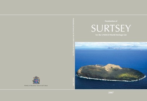
<strong>Nomination</strong> <strong>of</strong> Surtsey for the UNESCO World Heritage List January 2007<br />
<strong>Nomination</strong> <strong>of</strong><br />
SURTSEY<br />
for the UNESCO World Heritage List<br />
2007
<strong>Nomination</strong> <strong>of</strong><br />
SURTSEY<br />
for the UNESCO World Heritage List<br />
Snorri Baldursson and Álfheiður Ingadóttir (eds.)<br />
2007
• O F<br />
ICELANDIC INSTITUTE<br />
N AT U R A L H IS T O RY •<br />
Editors: Snorri Baldursson and Álfheiður Ingadóttir<br />
Photo on cover: Torgny Nordin 2003: Surtsey island, aerial view from the southwest<br />
Maps and drawings: Lovísa Ásbjörnsdóttir and Anette Th. Meier<br />
Photos: Source is given at individual photo<br />
Cover and layout: Prentsnið Ltd. Helga Tómasdóttir<br />
Printed by: Guðjónó – An environmentally friendly printing house<br />
© 2007 Náttúrufræðist<strong>of</strong>nun Íslands/Icelandic Institute <strong>of</strong> Natural History<br />
Hlemmur 3 – P.O.Box 5320 – 125 Reykjavík – Iceland<br />
Recommended citation: Snorri Baldursson and Álfheiður Ingadóttir (eds.) 2007.<br />
<strong>Nomination</strong> <strong>of</strong> Surtsey for the UNESCO World Heritage List.<br />
Icelandic Institute <strong>of</strong> Natural History, Reykjavík, 123 pages.<br />
ISBN-978-9979-9335-6-4
Preface<br />
Surtsey is a scientifically unique area. It <strong>of</strong>fers an outstanding example <strong>of</strong> a virgin, volcanic island that is<br />
being actively created and shaped by geological, geomorphological and ecological processes. The<br />
present nomination document proposes that the Surtsey Nature Reserve, including the entire Surtsey<br />
volcano and the surrounding sea, be recognised through the award <strong>of</strong> World Heritage Site status, in<br />
particular due to its international importance for the natural sciences.<br />
It was on 15 November 1963 that Surtsey emerged as a new volcanic island in the picturesque<br />
Vestmannaeyjar archipelago. The formation <strong>of</strong> Surtsey provided the scientific community with a unique<br />
opportunity to study the development <strong>of</strong> an oceanic volcano from its inception on the sea floor to the<br />
creation <strong>of</strong> an island, and then throughout the modification <strong>of</strong> this newly erected structure by physical<br />
and ecological processes. Since its emergence, the island <strong>of</strong> Surtsey has been strictly protected and<br />
human influence restricted to a minimum. Surtsey has thus <strong>of</strong>fered a natural laboratory in geology,<br />
geomorphology and ecology which has provided invaluable information on the creation and history <strong>of</strong><br />
the Earth and its biosphere.<br />
Preparations for this nomination have involved local and national authorities and various interested<br />
parties. Commissioned by the Icelandic World Heritage Committee, the Icelandic Institute <strong>of</strong> Natural<br />
History has compiled this nomination document with the assistance and advice <strong>of</strong> many people and<br />
institutions.<br />
Our vision is that a World Heritage Site status will further the long-term conservation <strong>of</strong> Surtsey as a<br />
pristine nature reserve. Thus we feel it is both a delight and an honour to recommend this nomination to<br />
the World Heritage Committee <strong>of</strong> UNESCO.<br />
Ragnheiður Helga Þórarinsdóttir<br />
Chair<br />
Icelandic World Heritage Committee<br />
Steingrímur Hermannsson Jón Gunnar Ottósson<br />
Chair Director General<br />
Surtsey Research Society Icelandic Institute <strong>of</strong> Natural History<br />
Jóhann Sigurjónsson Davíð Egilson<br />
Director General Director General<br />
Marine Research Institute Environment and Food Agency<br />
Elliði Vignisson Snorri Baldursson<br />
Mayor Project Manager<br />
Municipality <strong>of</strong> Vestmannaeyjar Icelandic Institute <strong>of</strong> Natural History
This nomination has been commissioned by the Icelandic World Heritage Committee on<br />
behalf <strong>of</strong> the Ministry <strong>of</strong> Education, Science and Culture and the Ministry for the Environment.<br />
The editors and authors are responsible for all the presented results and conclusions.<br />
Members <strong>of</strong> the Icelandic World Heritage Committee:<br />
Ragnheiður H. Þórarinsdóttir, Ministry <strong>of</strong> Education, Science and Culture, Chair<br />
Árni Bragason, Environment and Food Agency <strong>of</strong> Iceland<br />
Kristín Huld Sigurðardóttir, The Archaeological Heritage Agency <strong>of</strong> Iceland<br />
Sigurður Á. Þráinsson, Ministry for the Environment<br />
Project management and editing:<br />
Snorri Baldursson and Álfheiður Ingadóttir, Icelandic Institute <strong>of</strong> Natural History<br />
Authors:<br />
Sveinn P. Jakobsson, Icelandic Institute <strong>of</strong> Natural History<br />
Borgþór Magnússon, Icelandic Institute <strong>of</strong> Natural History<br />
Erling Ólafsson, Icelandic Institute <strong>of</strong> Natural History<br />
Guðríður Þorvarðardóttir, Environment and Food Agency <strong>of</strong> Iceland<br />
Karl Gunnarsson, Marine Research Institute<br />
Snorri Baldursson, Icelandic Institute <strong>of</strong> Natural History<br />
Ævar Petersen, Icelandic Institute <strong>of</strong> Natural History<br />
Contributing authors and advisors:<br />
Baldur Bjartmarsson, Icelandic Maritime Administration<br />
Gísli Viggósson, Icelandic Maritime Administration<br />
Guðríður Gyða Eyjólfsdóttir, Icelandic Institute <strong>of</strong> Natural History<br />
Haraldur Sigurðsson, University <strong>of</strong> Rhode Island, USA<br />
Hörður Kristinsson, Icelandic Institute <strong>of</strong> Natural History<br />
Reynir Fjalar Reynisson, University <strong>of</strong> Trondheim, Norway<br />
Steingrímur Hermannsson, Surtsey Research Society, Reykjavík<br />
Tony Weighell, Joint Nature Conservation Committee, UK<br />
Trausti Jónsson, The Icelandic Meteorological Office<br />
Maps and graphics: Lovísa Ásbjörnsdóttir and Anette Th. Meier, Icelandic Institute <strong>of</strong> Natural History<br />
Technical assistance: Pálína Héðinsdóttir and Ragnhildur Sigrún Björnsdóttir, Icelandic Institute <strong>of</strong> Natural History<br />
Cover and lay-out: Helga Tómasdóttir, Prentsnið Ltd.<br />
Language assistance and translation: Lingua / Norðan Jökuls<br />
Drawings (birds and plants): Jón Baldur Hlíðberg<br />
3D interpretation: Þórdís Högnadóttir, University <strong>of</strong> Iceland<br />
Photos: Source is given at individual photo
SURTSEY<br />
island <strong>of</strong> Surt<br />
In the ancient Eddic poem Völuspá, the prophetess describes the birth as well as the fate <strong>of</strong> life. She tells<br />
Odin about the world tree – the ash Yggdrasil – and about life as it was created and has evolved on earth<br />
but will in the end be destroyed by fires <strong>of</strong> the giant Surt, the dark ruler <strong>of</strong> fire. Upon Ragnarök, the final<br />
destruction <strong>of</strong> the world, Surt will lead the sons <strong>of</strong> Muspel against the gods. As he enters “burning<br />
everything in his path, men plunge to hell and the heavens are split apart”*.<br />
Völuspá<br />
52. vísa<br />
Surtur fer sunnan<br />
með sviga lævi,<br />
skín af sverði<br />
sól valtíva,<br />
grjótbjörg gnata,<br />
en gífur rata,<br />
troða halir helveg,<br />
en himinn kl<strong>of</strong>nar.<br />
In 1963, when volcanic fires began erupting on the seabed south <strong>of</strong> Iceland and building up a tephra<br />
cone, it was found appropriate that the resulting island should be named Surtsey, a word formed in the<br />
normal Icelandic manner <strong>of</strong> including the possessive form <strong>of</strong> a person's name in a place name: Surtsey =<br />
Surt's island (ey meaning “island” in Icelandic) = the island <strong>of</strong> Surt, the fire giant.<br />
*Völuspá: The Prophecy. The prophecy <strong>of</strong> the Vikings – the creation <strong>of</strong> the world.<br />
Gudrun 2001. English translation by Bernard Scudder, p. 70.<br />
Völuspá: The Prophecy*<br />
Verse 52<br />
Surt comes from the south<br />
with his wood-eating fire,<br />
sun glints on the sword<br />
<strong>of</strong> the godly warriors.<br />
Boulders slam together,<br />
sending trolls tumbling,<br />
men tread the path to Hell<br />
and the heavens cleave.
Contents<br />
1 Identification <strong>of</strong> the property ............................................................................................................................. 8<br />
2 Description<br />
2.a Description <strong>of</strong> property ............................................................................................................................. 11<br />
Iceland – geological overview............................................................................................................... 11<br />
Vestmannaeyjar archipelago................................................................................................................... 13<br />
Topography............................................................................................................................................................ 15<br />
Geology .................................................................................................................................................................. 16<br />
The climate............................................................................................................................................................ 25<br />
Offshore waves................................................................................................................................................... 26<br />
Terrestrial life ....................................................................................................................................................... 27<br />
Vegetation .............................................................................................................................................................. 32<br />
Birds ............................................................................................................................................................................ 34<br />
Invertebrates ......................................................................................................................................................... 37<br />
Marine life.............................................................................................................................................................. 39<br />
2.b History and development .......................................................................................................................... 45<br />
The Surtsey eruption ...................................................................................................................................... 45<br />
Posteruption history........................................................................................................................................ 52<br />
Future development <strong>of</strong> Surtsey ............................................................................................................. 56<br />
Influx <strong>of</strong> terrestrial organisms ................................................................................................................. 57<br />
Arrival <strong>of</strong> marine organisms .................................................................................................................... 59<br />
Plant and bird colonisation and ecosystem development.............................................. 59<br />
Invertebrate colonisation ........................................................................................................................... 65<br />
Benthos colonisation..................................................................................................................................... 66<br />
3 Justification for inscription<br />
3.a Criteria under which inscription is proposed .......................................................................... 69<br />
3.b Proposed statement <strong>of</strong> outstanding universal value............................................................. 71<br />
3.c Comparative analysis .................................................................................................................................... 73<br />
3.d Authenticity/Integrity..................................................................................................................................... 77<br />
4 State <strong>of</strong> conservation and factors affecting the property<br />
4.a Present state <strong>of</strong> conservation .................................................................................................................. 81<br />
4.b Factors affecting the property ............................................................................................................... 81<br />
5 Protection and management <strong>of</strong> the property<br />
5.a Ownership ............................................................................................................................................................. 87<br />
5.b Protective designation .................................................................................................................................. 87<br />
5.c Means <strong>of</strong> implementing protective measures ........................................................................... 88<br />
5.d Existing plans related to the municipality <strong>of</strong> the proposed property .................... 88<br />
5.e Property management plan or other management system............................................. 88<br />
5.f Sources and levels <strong>of</strong> finance ............................................................................................................... 89<br />
5.g Sources <strong>of</strong> expertise in conservation and management .................................................. 90<br />
5.h Visitor facilities and statistics ................................................................................................................ 90<br />
5.i Presentation and promotion <strong>of</strong> the property.............................................................................. 90<br />
5.j Staffing levels ..................................................................................................................................................... 91<br />
6 Monitoring<br />
6.a Key indicators for measuring the state <strong>of</strong> conservation .................................................... 93<br />
6.b Administrative arrangements for monitoring property....................................................... 93<br />
6.c Results <strong>of</strong> previous reporting exercises .......................................................................................... 94<br />
7 Documentation<br />
7.a Supplementary material.............................................................................................................................. 95<br />
7.b Declaration <strong>of</strong> Surtsey Nature Reserve, 2006........................................................................... 95<br />
7.c Form and date <strong>of</strong> recent records.......................................................................................................... 97<br />
7.d Agencies holding important records ................................................................................................ 97<br />
7.e Bibliography ......................................................................................................................................................... 98<br />
8 Contact information <strong>of</strong> responsible authorities<br />
8.a Preparers.................................................................................................................................................................. 101<br />
8.b Official local agency ..................................................................................................................................... 101<br />
8.c Other local institutions .............................................................................................................................. 101<br />
8.d Official web address...................................................................................................................................... 101<br />
9 Signature on behalf <strong>of</strong> the State Party ......................................................................................................... 103<br />
Acknowledgements .................................................................................................................................................... 104<br />
Lists <strong>of</strong> figures, tables and appendices........................................................................................................ 105<br />
7
1<br />
8<br />
Reykjavík<br />
Vestmannaeyjar<br />
Surtsey<br />
Identification <strong>of</strong> the property<br />
Iceland<br />
V e s t m a n n a e y j a r<br />
I C E L A N D<br />
VATNAJÖKULL<br />
ICE CAP<br />
Heimaey<br />
Vestmannaeyjar<br />
Town<br />
Álsey<br />
Suðurey<br />
50 km<br />
Elliðaey<br />
5 km<br />
1.a Country<br />
Iceland.<br />
1.b State, province or region<br />
Municipality <strong>of</strong> Vestmannaeyjar.<br />
1.c Name <strong>of</strong> property<br />
Surtsey.<br />
1.d Geographical coordinates<br />
The nominated property is bounded<br />
by the following coordinates:<br />
1) 63°16´08´´N and 20°36´04´´W;<br />
2) 63°16´08´´N and 20°40´00´´W;<br />
3) 63°17´52´´N and 20°40´00´´W;<br />
4) 63°20´22´´N and 20°35´31´´W;<br />
5) 63°18´15´´N and 20°31´16´´W.<br />
1.e Maps and plans showing the<br />
boundaries <strong>of</strong> the nominated<br />
property and buffer zone<br />
Figure 1.1 is a map showing the location and<br />
boundaries <strong>of</strong> the nominated area and its buffer<br />
zone.<br />
1.f Area <strong>of</strong> the nominated property<br />
and the proposed buffer zone<br />
The nominated property, Surtsey (Fig. 1.1,<br />
red line), represents the strictly protected<br />
component <strong>of</strong> the nationally designated Surtsey<br />
Nature Reserve. The 33.7 km 2 property encompasses<br />
the entire Surtsey volcano (<strong>of</strong> which<br />
1.4 km 2 are above sea level and 13.2 km 2 are<br />
submerged) and surrounding ocean (19.1 km 2 ).<br />
The remaining 31.9 km 2 <strong>of</strong> the Surtsey Nature<br />
Reserve (Fig 1.1, black line) represent a buffer<br />
zone for this nomination. Fishing is allowed<br />
within the buffer zone, but construction,<br />
mining and the use <strong>of</strong> firearms are prohibited.<br />
Fig. 1.1. Map <strong>of</strong> Surtsey, showing boundaries <strong>of</strong> the<br />
nominated area and buffer zone. Smaller figures<br />
show the location <strong>of</strong> the nominated area within the<br />
Vestmannaeyjar archipelago, the location <strong>of</strong> Vestmannaeyjar<br />
<strong>of</strong>f Iceland's south coast, and the<br />
location <strong>of</strong> Iceland in the northern hemisphere.<br />
20° 42’W<br />
63°20’<br />
20°41’1<br />
160 m<br />
140 m<br />
120 m<br />
100 m<br />
80 m<br />
60 m<br />
40 m<br />
20 m<br />
0 m<br />
-10 m<br />
-20 m<br />
-30 m<br />
-40 m<br />
-50 m<br />
-60 m<br />
-70 m<br />
-80 m<br />
-90 m<br />
-100 m<br />
-110 m<br />
-120 m<br />
-130 m<br />
-140 m<br />
-150 m<br />
2<br />
63°16’08’’N<br />
20°41’15’’W
22’’N<br />
5’’W<br />
Surtsey Nature Reserve<br />
63°17’52’’N<br />
0°40’00’’W<br />
20° 40’W 20° 38’W<br />
20° 36’W 20° 34’W 20° 32’W<br />
63°16’08’’N<br />
20°40’00’’W<br />
Jólnir<br />
50<br />
100<br />
SURTSEY<br />
63°16’08’’N<br />
20°36’04’’W<br />
63°20’22’’N<br />
20°35’31’’W<br />
Syrtlingur<br />
Surtla<br />
1 km<br />
63°18’15’’N<br />
20°31’16’’W<br />
63°20’22’’N<br />
20°31’16’’W<br />
63°16’08’’N<br />
20°31’16’’W<br />
63°<br />
20’N<br />
63°<br />
19’N<br />
63°<br />
18’N<br />
63°<br />
17’N<br />
9
Aerial photograph <strong>of</strong> Surtsey, August 12th, 2004.<br />
(With permission from: L<strong>of</strong>tmyndir).
2<br />
Description<br />
2.a Description <strong>of</strong> property<br />
Iceland – geological overview<br />
Iceland is an integral part <strong>of</strong> the Mid-Atlantic<br />
Ridge and also its largest supramarine segment<br />
(Fig. 2.1) with a landmass <strong>of</strong> 103,000 km 2 .<br />
Sometimes described as a hot spot above a<br />
mantle plume, Iceland is built almost exclusively<br />
<strong>of</strong> volcanic rock, predominantly basalts, while<br />
sediments constitute about 10% <strong>of</strong> the island's<br />
overall volume. Since the land has been built up<br />
during the last 16 million years, it is geologically<br />
speaking a young country. Iceland's rocks can be<br />
divided into four geological formations: the Late<br />
Tertiary Basalt Formation, the Late Pliocene and<br />
Early Pleistocene Basalt Formation, the Late<br />
Pleistocene Móberg Formation, and the Holocene<br />
Formation (Fig. 2.2).<br />
The crest <strong>of</strong> the Mid-Atlantic Ridge marks the<br />
boundary between the North American and<br />
Eurasian tectonic plates. These two plates move<br />
towards the west-northwest and east-southeast<br />
respectively, with an average spreading rate that<br />
is calculated to be ≤1 cm/yr in each direction in<br />
Surtsey<br />
Fig. 2.1. The Mid-Atlantic Ridge in the region <strong>of</strong><br />
Iceland, with a red line showing the boundary<br />
between the North American and Eurasian tectonic<br />
plates.<br />
the region <strong>of</strong> Iceland. Because the centre <strong>of</strong><br />
spread, running from southwest to northeast,<br />
crosses Iceland, the island expands continuously<br />
through a process <strong>of</strong> rifting apart and accreting<br />
new crust, which stems from volcanism along<br />
the crest zone <strong>of</strong> the Mid-Atlantic Ridge.<br />
50 km<br />
Fig. 2.2. Simplified geological map <strong>of</strong> Iceland, displaying the principal geological formations.<br />
Holocene sediments<br />
Basic and intermediate lavas.<br />
Holocene<br />
Acid rocks<br />
Basic and intermediate tuffs and<br />
sediments. Late Pleistocene<br />
Basic and intermediate lavas.<br />
Late Pleistocene<br />
Basic and intermediate lavas.<br />
Late Pliocene and Early<br />
Pleistocene<br />
Basic and intermediate lavas.<br />
Late Tertiary<br />
11
SURTSEY – NOMINATION FOR THE UNESCO WORLD HERITAGE LIST<br />
The volcanic zones <strong>of</strong> Iceland (Fig. 2.3), are<br />
among the most active on Earth, with an eruption<br />
occurring every three years on average.<br />
Moreover, the country's volcanic activity is<br />
associated with vigorous hydrothermal activity.<br />
Icelandic volcano-tectonics appear to have<br />
been characterised by volcanic systems<br />
throughout the island's geological history. A<br />
volcanic system is a spatial grouping <strong>of</strong> eruption<br />
sites, including feeder dikes and possibly shallow<br />
magma chambers, that usually have in common<br />
certain structural, petrographic and geochemical<br />
characteristics within the bounds <strong>of</strong> the system.<br />
Volcanic production is generally most intense<br />
around the middle <strong>of</strong> each system, where many<br />
have developed a central volcano with the<br />
concomitant production <strong>of</strong> intermediate and acid<br />
rocks. High-temperature hydrothermal activity is<br />
12<br />
Snæfellsnes Zone<br />
Vestmannaeyjar<br />
Surtsey<br />
Western Zone<br />
Eastern Zone<br />
Hekla<br />
Katla<br />
Krafla<br />
50 km<br />
Askja<br />
Northern Zone<br />
Öræfajökull Zone<br />
Tholeiitic<br />
Transitional alkalic<br />
Alkalic<br />
Fig. 2.3. Active volcanic systems in Iceland and on its insular shelf, grouped according to petrological criteria.<br />
The distribution <strong>of</strong> rocks from the Late Pleistocene and Holocene (dark grey) is also shown.<br />
<strong>of</strong>ten connected with the central part <strong>of</strong> each<br />
system, evidenced by steaming vents and<br />
solfataras.<br />
In Iceland and on its insular shelf, about 44<br />
volcanic systems have erupted at least once<br />
during the Holocene and Late Pleistocene (Fig.<br />
2.3), the most active being the Hekla, Katla, Askja<br />
and Krafla systems. The Hekla central volcano<br />
has erupted 19 times during the country's historic<br />
period (i.e. since AD 870), most recently in the<br />
year 2000. The subglacial central volcano <strong>of</strong><br />
Katla has during the same period erupted on<br />
average twice a century, including the most<br />
recent eruption in 1955. The latest eruption<br />
within the Askja caldera occurred in 1961, while<br />
the Krafla volcanic system produced nine small<br />
eruptions from 1975 to 1984 (Ari Trausti<br />
Guðmundsson 2001).
Vestmannaeyjar archipelago<br />
Surtey island is a part <strong>of</strong> the Vestmannaeyjar<br />
archipelago (Fig. 2.4), which consists <strong>of</strong> 18<br />
islands and a number <strong>of</strong> skerries, and is situated<br />
on the insular shelf <strong>of</strong>f the central south coast <strong>of</strong><br />
Iceland. Heimaey is the largest island (13.6 km 2 )<br />
and the only one to be inhabited (4,200<br />
residents). It has one town which is also called<br />
Vestmannaeyjar and the most important fishing<br />
harbour along the south coast <strong>of</strong> Iceland.<br />
Vestmannaeyjar constitutes a separate<br />
volcanic system at the southern end <strong>of</strong> Iceland's<br />
Eastern Volcanic Zone (Fig. 2.3). This is a young<br />
system, having probably commenced activity<br />
some 100,000 years ago, and its oldest part, the<br />
Norðurklettar Formation, is exposed on the<br />
Surtsey<br />
2 km<br />
Einidrangur<br />
120<br />
140<br />
2 DESCRIPTION<br />
northernmost end <strong>of</strong> Heimaey. Norðurklettar<br />
Formation was built up by small volcanoes which<br />
probably erupted through an ice cap, leaving<br />
behind palagonite tuffs and tuff breccias capped<br />
by lavas. No high-temperature hydrothermal<br />
activity has been discovered at the surface in<br />
Vestmannaeyjar (Sveinn P. Jakobsson 1979).<br />
During the Holocene (during the last 11,500<br />
years), volcanism has remained at low intensity in<br />
the Vestmannaeyjar system. Seventeen volcanoes,<br />
<strong>of</strong> which three are on Heimaey, have been<br />
identified above sea level. These volcanoes<br />
originally rose from the sea floor in the same way<br />
as Surtsey, even at similar sea levels. The largest<br />
<strong>of</strong> the volcanoes comprise the islands <strong>of</strong><br />
Bjarnarey, Elliðaey and Suðurey, and include<br />
Álsey<br />
Brandur<br />
V e s t m a n n a e y j a r<br />
Geirfuglasker<br />
100<br />
Geldungur<br />
Súlnasker<br />
60<br />
80<br />
Heimaklettur<br />
Heimaey<br />
Hellisey<br />
Wave buoy<br />
Helgafell<br />
40<br />
Suðurey<br />
20<br />
Stórhöfði<br />
Eldfell<br />
Fig. 2.4. Simplified geological map <strong>of</strong> the Vestmannaeyjar archipelago. Depth contour lines in meters.<br />
Elliðaey<br />
Bjarnarey<br />
HOLOCENE<br />
Basalt tuff<br />
Basalt lava<br />
Surtsey and Eldfell lavas<br />
Scoria<br />
Surtsey sediments<br />
Crater<br />
PLEISTOCENE<br />
Norðurklettur formation<br />
13
SURTSEY – NOMINATION FOR THE UNESCO WORLD HERITAGE LIST<br />
Stórhöfði and Sæfell-Helgafell on the island <strong>of</strong><br />
Heimaey. Two volcanic eruptions are known with<br />
certainty in historic times: the Surtsey eruption <strong>of</strong><br />
1963–1967 and the 1973 Eldfell eruption on<br />
Heimaey. A small submarine eruption may have<br />
occurred on the sea floor southeast <strong>of</strong> Hellisey in<br />
1896. Furthermore, four young submarine<br />
volcanoes have been discovered, so that<br />
altogether 24 volcanic eruptions are known to<br />
have occurred within the Vestmannaeyjar system<br />
during the Holocene (Sveinn P. Jakobsson 1979).<br />
In addition to the submarine rises produced by<br />
the Holocene eruptions, numerous hills and<br />
peaks on the sea floor (Fig. 2.4) presumably<br />
represent remnants <strong>of</strong> more than 40 Late-<br />
Pleistocene submarine volcanoes. Most <strong>of</strong> the<br />
volcanoes in the Vestmannaeyjar system are<br />
relatively small.<br />
As a large part <strong>of</strong> the Vestmannaeyjar volcanic<br />
system is submarine, its geographical limits are<br />
difficult to delineate exactly; however, it reaches<br />
about 38 km from southwest to northeast and 29<br />
km from northwest to southeast, covering an area<br />
<strong>of</strong> 900–1000 km 2 , where the average depth <strong>of</strong> the<br />
Aerial view to the southwest <strong>of</strong> the Vestmannaeyjar<br />
archipelago. Elliðaey and Bjarnarey are in the<br />
foreground, Heimaey in the middle and Surtsey in the<br />
far background. (Photo: Ragnar Th. Sigurðsson 2000).<br />
14<br />
sea is about 70 m. The volume <strong>of</strong> volcanic rock<br />
extruded within the Vestmannaeyjar volcanic<br />
system during the Holocene period has been<br />
estimated as ≥ 3.5 km 3 , which is one order <strong>of</strong><br />
magnitude less than the output <strong>of</strong> the highly<br />
active Hekla and Katla volcanic systems.<br />
Investigations on the Vestmannaeyjar shelf<br />
(Sveinn P. Jakobsson 1982; Kjartan Thors and<br />
Jóhann Helgason 1988) indicate that local<br />
submarine as well as subaerial volcanism was the<br />
source <strong>of</strong> the material building up the marine<br />
shelf and that for the most part this build-up has<br />
probably been ongoing for the last 100,000 years.<br />
The main activity in the Vestmannaeyjar<br />
volcanic system has occurred in and around<br />
Heimaey (Fig. 2.4), which has accordingly<br />
formed a topographic high. Indeed, it has been<br />
proposed that Heimaey is evolving into a central<br />
volcano (Sveinn P. Jakobsson 1979). On the other<br />
hand, there are strong indications that<br />
Vestmannaeyjar system volcanism is episodic.<br />
The youngest Late-Pleistocene tuffs and lavas <strong>of</strong><br />
the Norðurklettar Formation seem to have all<br />
been deposited within a short time interval. There<br />
also appears to have been a major volcanic<br />
episode 5,000–6,000 years ago, leading to the<br />
formation <strong>of</strong> Stórhöfði and Helgafell on Heimaey
and <strong>of</strong> the islands <strong>of</strong> Bjarnarey and Elliðaey<br />
northeast <strong>of</strong> Heimaey. The most recent volcanic<br />
episode may have started with the reported<br />
submarine eruption in 1896, followed by the<br />
Surtsey eruption <strong>of</strong> 1963–1967 and the Eldfell<br />
eruption in 1973.<br />
In contrast to the Surtsey eruption, which had<br />
an insignificant effect on the residents <strong>of</strong><br />
Heimaey, the Eldfell eruption on their island in<br />
January to June 1973 had disastrous effects<br />
(Williams and Moore 1983). A 3-km-long<br />
eruption fissure opened up at the eastern outskirts<br />
<strong>of</strong> town; 350 houses (30% <strong>of</strong> the total) were<br />
destroyed by lava or tephra and a further 400<br />
were damaged. Miraculously, only one life was<br />
lost, as all the islanders were evacuated from the<br />
island within hours. About two-thirds <strong>of</strong> the<br />
residents returned in following summer, or about<br />
3500 out <strong>of</strong> 5300 pre-eruption inhabitants. The<br />
Eldfell eruption is considered to be one <strong>of</strong> the<br />
most destructive volcanic eruptions in the history<br />
<strong>of</strong> Iceland.<br />
2 DESCRIPTION<br />
Fig. 2.5. Three-dimensional model <strong>of</strong> the Surtsey volcano (oblique view from the south), prepared by the Institute <strong>of</strong><br />
Earth Sciences, University <strong>of</strong> Iceland, based on aerial photographs from 2004 (L<strong>of</strong>tmyndir) and depth soundings <strong>of</strong><br />
the seabed from 2000 (Hydrographic Department).<br />
Topography<br />
The Surtsey volcano, which belongs to the<br />
Vestmannaeyjar volcanic system, rose from the<br />
sea floor in a volcanic eruption occurring from<br />
1963 to 1967. The eruption history <strong>of</strong> Surtsey<br />
volcano is described in Chapter 2b. At the end <strong>of</strong><br />
the eruption in 1967, the island <strong>of</strong> Surtsey had<br />
attained a surface area <strong>of</strong> 2.65 km2 and the total<br />
volume <strong>of</strong> erupted material was estimated to be<br />
1.1 km3 , about 70% <strong>of</strong> which was tephra and<br />
30% lava. The island is the subaerial segment <strong>of</strong><br />
the complete Surtsey volcano, which forms a<br />
mainly submarine ridge approximately 5.8 km<br />
long and oriented southwest-northeast. Measured<br />
from northwest to southeast, the volcano's<br />
maximum width is 2.9 km and its base area<br />
encompasses some 13.2 km2 (Fig. 2.5). The<br />
Surtsey volcano has changed considerably since<br />
the eruption ended in 1967, and the following<br />
topographical and geological description is based<br />
mainly on data collected in the summer <strong>of</strong> 2004.<br />
The description <strong>of</strong> bottom topography is based on<br />
depth measurements by the Icelandic Maritime<br />
Administration in the summer <strong>of</strong> 2000.<br />
15
SURTSEY – NOMINATION FOR THE UNESCO WORLD HERITAGE LIST<br />
Fig. 2.6. Geological map <strong>of</strong> Surtsey. Topography is based on aerial photographs from August 2004. See also enclosed<br />
map in the scale <strong>of</strong> 1:5000.<br />
Surtsey has a surface area <strong>of</strong> 1.41km 2 , a maximum<br />
width from west to east <strong>of</strong> 1.33 km and a<br />
maximum length from north to south <strong>of</strong> 1.80 km<br />
(Fig. 2.6; see also enclosed map). It is the second<br />
largest island <strong>of</strong> the Vestmannaeyjar group, followed<br />
by Elliðaey (0.46 km 2 ) and Bjarnarey (0.33<br />
km 2 ). Although the highest elevation on Surtsey is<br />
only 155 m, the sea depth prior to the eruption<br />
was about 130 m, so that the true height <strong>of</strong> the<br />
volcano is 285 m.<br />
Surtsey's prominent topographical features are<br />
two crescent-shaped cones composed <strong>of</strong> tephra<br />
and palagonite tuff, along with a lava field that<br />
caps the southern half <strong>of</strong> the island. Rising to an<br />
elevation <strong>of</strong> 155 m, the eastern cone,<br />
Austurbunki, is marked by several small lava<br />
16<br />
craters and fissures. The western cone, Vesturbunki,<br />
whose height is 141 m, has large slump<br />
scars due to marine abrasion on its western side,<br />
where a 135-m-high sea cliff has formed. From<br />
the tuff cones, the main lava field forms a shield<br />
gently dipping to the south and east. Transported<br />
coastal sediments have mainly been deposited at<br />
the north end <strong>of</strong> the island, constructing a broad<br />
spit.<br />
The shape <strong>of</strong> Surtsey is constantly modified by<br />
the harsh weather conditions which prevail in the<br />
sea south <strong>of</strong> Iceland, particularly during winter.<br />
Heavy sea waves erode the coast and produce<br />
coastal sediments. Being easily eroded and<br />
transported by the wind, loose, unconsolidated<br />
tephra has collected as aeolian deposits along the
150 m<br />
100 m<br />
50 m<br />
0 m<br />
- 50 m<br />
- 100 m<br />
- 150 m<br />
0<br />
NW<br />
Ocean<br />
A<br />
Hot spring<br />
Sea floor previous to the Surtsey eruption<br />
flanks <strong>of</strong> the two cones, as well as on the lava<br />
field. Wind deflation is conspicuous in the<br />
island's tuff, where it has at places created<br />
potholes up to 0.5 m deep and 1.5 m in diameter.<br />
Running water is rarely observed on the<br />
surface <strong>of</strong> the tephra and lava because <strong>of</strong> their<br />
high porosity, although small, temporary streams<br />
do appear on the tuff surface after exceptionally<br />
heavy precipitation. These temporary streams<br />
have eroded the unconsolidated tephra which in<br />
most places surrounds the tuff and built fans at<br />
the base <strong>of</strong> slopes, so that mudflow channels<br />
have developed at several points on the tuff cone<br />
slopes. On the northern slopes <strong>of</strong> Vesturbunki and<br />
Austurbunki, these mudflow channels are usually<br />
0.5–2 m wide and reach down to the foot <strong>of</strong> the<br />
slope. On the inner slope <strong>of</strong> Austurbunki, smaller<br />
mudflow channels can be observed that have<br />
solidified into rock since their original formation<br />
in unconsolidated tephra.<br />
Apart from Surtsey, eruptions occurred on the<br />
sea floor at three sites, concurrent with the<br />
Surtsey eruption. About 2.5 km north-northeast <strong>of</strong><br />
Surtsey, a submarine tephra ridge, Surtla, was<br />
built up between December 1963 and January<br />
1964. Recent depth measurements indicate its<br />
length as 0.9 km and its width as 0.6 km, and it<br />
rises 60 m above the sea floor (Fig. 2.6). At a<br />
distance <strong>of</strong> 0.6 km to the east-northeast <strong>of</strong><br />
Surtsey, explosive activity formed the island <strong>of</strong><br />
Syrtlingur in 1965. Today, however, only a<br />
submarine platform remains, measuring 1.2 km<br />
in diameter and rising 70–80 m above the sea<br />
Drill hole<br />
2 DESCRIPTION<br />
200 400 600 800 1000 1200 1400 1600 1800 2000 2200 2400 2600 m<br />
floor. In 1965–1966 yet another island, called<br />
Jólnir, was formed by explosive activity 1 km<br />
southwest <strong>of</strong> Surtsey. Today it is only represented<br />
by a seamount with a diameter <strong>of</strong> 1.7 km and an<br />
elevation <strong>of</strong> 60–70 m above the sea floor<br />
(Norrman and Erlingsson 1992).<br />
Geology<br />
The surface <strong>of</strong> Surtsey has been mapped in detail,<br />
using conventional methods. Furthermore, a 181<br />
m deep research hole was drilled in 1979 at the<br />
southeast corner <strong>of</strong> Austurbunki in order to<br />
investigate the subsurface constitution and<br />
structure <strong>of</strong> the island. Surtsey, designated as a<br />
submarine tuya (Sigurður Þórarinsson 1966;<br />
Guðmundur Kjartansson 1966), has now become<br />
the best-studied volcano in Iceland. While the<br />
term tuya was originally restricted to subglacial<br />
volcanoes, it has since been extended to include<br />
volcanoes that have erupted into lakes or shallow<br />
seawater. Surtsey is considered to be one <strong>of</strong> the<br />
world's best preserved submarine tuya. The two<br />
primary geological units formed during the<br />
Surtsey eruption are tephra and lava. Basal pillow<br />
lava, an important part <strong>of</strong> most subglacial tuyas,<br />
apparently did not develop in Surtsey because <strong>of</strong><br />
the shallow water depth (Sveinn P. Jakobsson and<br />
Moore 1986). The eruptive products at Surtsey are<br />
composed <strong>of</strong> alkali basalt with phenocrysts <strong>of</strong><br />
olivine, plagioclase and chromian spinel. In<br />
addition, three secondary geological units are<br />
found there: palagonite tuff, aeolian and talus<br />
sediments, and coastal sediments (Fig. 2.6).<br />
17<br />
SE<br />
Ocean<br />
H : L = 2,5 : 1 B C<br />
Tephra Lava 1964-1965 Lava 1966-1967 Breccia, sediments Tuff Intrusions Flow direction <strong>of</strong> water Steam flux<br />
Fig. 2.7. NW-SE pr<strong>of</strong>ile through the Surtsey volcano.<br />
A<br />
B<br />
C
SURTSEY – NOMINATION FOR THE UNESCO WORLD HERITAGE LIST<br />
View to the west over the crater Surtungur. (Photo:<br />
Daníel Bergmann 2003).<br />
Tephra<br />
During the explosive submarine phase <strong>of</strong> the<br />
Surtsey eruption, from November 1963 to April<br />
1964, basalt tephra (volcanic ash) was produced<br />
through the quenching <strong>of</strong> hot magma by cold sea<br />
water. The resulting tephra formed two crescentshaped<br />
cones which merged, and today cover an<br />
area <strong>of</strong> 0.34 km 2 . The cones are built up <strong>of</strong> tephra<br />
layers which to a considerable extent have<br />
consolidated into tuff due to posteruptive<br />
hydrothermal activity. Geologists call craters <strong>of</strong><br />
this type tephra or tuff rings, depending on which<br />
material dominates. The eastern tuff cone, named<br />
Surtur or Austurbunki, has a crest-width <strong>of</strong> 0.43<br />
km, and the western tuff cone, Surtungur or<br />
Vesturbunki, has a crest-width <strong>of</strong> 0.52 km. On<br />
the scale <strong>of</strong> other Icelandic tuff or tephra craters,<br />
the Surtsey tuff craters are medium-sized.<br />
Characterised by poor sorting and varying<br />
grain size, Surtsey tephra ranges in its<br />
constituents from silt to boulders (Lorenz 1974),<br />
although it is mainly made up <strong>of</strong> fine glass shards<br />
less than 2 mm in diameter, along with mineral<br />
phenocrysts and small rock fragments. The tephra<br />
deposited above sea level forms finely-bedded<br />
layers and is poorly sorted, contrasting to the<br />
tephra below sea level, which is more chaotic in<br />
structure and whose grains sometimes demonstrate<br />
considerable size sorting. The porosity <strong>of</strong><br />
the tephra layers above sea level must rate as very<br />
high, or 45–50% by volume.<br />
Surtsey has come to be the world type locality<br />
18<br />
for Surtseyan tephra (Walker and Croasdale 1972;<br />
Walker 1973), i.e. tephra produced by hydromagmatic<br />
explosions in shallow water. The island<br />
is also an important site for accretionary lapilli<br />
(Sveinn P. Jakobsson and Moore 1982), whose<br />
individual pellets there reach the exceptional<br />
diameter <strong>of</strong> 3.5 cm. Also, Surtsey was one <strong>of</strong> the<br />
first localities in the world where vesiculated tuff<br />
was noted and described, i.e. tuff that contains<br />
independent vesicles between particles, where<br />
steam was trapped while the original tephra was<br />
being deposited (Lorenz 1974).<br />
Lava<br />
The Surtsey eruption evolved from an explosive<br />
phase into an effusive phase at the western crater<br />
(Surtungur) in April 1964, when the island was<br />
large enough to isolate that vent from inflowing<br />
seawater. Altogether, seven Surtsey craters and<br />
crater fissures emitted lava between April 1964<br />
and June 1967 (Fig. 2.6). The first major effusive<br />
phase (1964–1965) produced a lava shield<br />
extending 100 m above sea level and containing,<br />
when finished, a total volume <strong>of</strong> 0.3 km 3 , while<br />
the second phase (1966–1967) produced a 70-mhigh<br />
lava shield with a volume <strong>of</strong> 0.1 km 3 . Both<br />
<strong>of</strong> these shields consist <strong>of</strong> two structural units: an<br />
inner lava cone and an outer lava apron<br />
(Thorvaldur Thordarson 2000). Together they form<br />
a lava field that slopes gently to the south and<br />
east. Added to this are five small lava flows on the<br />
slopes <strong>of</strong> Austurbunki. Today the lavas cover an<br />
area <strong>of</strong> 0.72 km 2 .<br />
When lava flows into water it brecciates and<br />
gradually builds up a submarine delta in front <strong>of</strong><br />
the shore. Such a delta is foreset-bedded and<br />
consists <strong>of</strong> the products <strong>of</strong> the quenchfragmentation<br />
<strong>of</strong> molten lava and the<br />
disintegration <strong>of</strong> subaerial lava flows. At Surtsey<br />
the final layers in the western lava crater have<br />
achieved a total thickness <strong>of</strong> 230 m, resting on a<br />
130-m-thick brecciated foundation which lies<br />
below sea level.<br />
Due to heavy marine abrasion, high lava cliffs<br />
have formed on Surtsey and now tower a height<br />
<strong>of</strong> 80 m over the southwest shoreline. These cliffs<br />
provide excellent outcrops for viewing the internal<br />
structure <strong>of</strong> the subaerial lava shield, which was<br />
constructed by multiple lava flows whose thickness<br />
varies but averages 1–2 m. The morphology<br />
<strong>of</strong> the lava surface is very interesting, particularly
Typical ropy lava surface at the southern coast <strong>of</strong> Surtsey. (Photo: Borgþór Magnússon 2005).<br />
through the possibility <strong>of</strong> referring to the modifications<br />
it underwent, according to the detailed<br />
contemporary descriptions by Sigurður Þórarinsson<br />
(1966, 1967, 1969) and Þorleifur Einarsson<br />
(1966). The Surtsey lava flows are mostly smooth<br />
pahoehoe flows, even if rugged aa flows are also<br />
evidenced, mainly in two areas in the lava<br />
produced from 1966 to 1967.<br />
Being basaltic and having a low viscosity, the<br />
Surtsey lavas tended to flow in tubes or closed<br />
trenches, especially from Surtungur, the western<br />
lava crater. Many <strong>of</strong> the lava tubes were left<br />
hollow. Tumulus structures are common, with<br />
2 DESCRIPTION<br />
observations showing that tumuli form when the<br />
lava crust becomes inflated above a wide pool <strong>of</strong><br />
molten lava. Surtsey also has hornitos at several<br />
locations, and one small pit crater remains<br />
southwest <strong>of</strong> the Surtungur where the ro<strong>of</strong> <strong>of</strong> a<br />
large lava tube collapsed (Fig. 2.6).<br />
The geometry and pr<strong>of</strong>ile <strong>of</strong> the subaerial<br />
segments <strong>of</strong> the Surtsey lava shields are strikingly<br />
similar to those <strong>of</strong> other monogenetic lava shields<br />
in Iceland and everywhere else, which permits<br />
the study <strong>of</strong> the effusive activity at Surtsey as an<br />
analogue for establishing a conceptual model <strong>of</strong><br />
lava shields in general.<br />
19
SURTSEY – NOMINATION FOR THE UNESCO WORLD HERITAGE LIST<br />
Possible origin <strong>of</strong> exotic xenoliths found in the Surtsey tephra<br />
Typical samples <strong>of</strong> the exotic xenoliths from Surtsey,<br />
including granite, gneiss, quartzite and dolomite.<br />
(Photo: Kristján Jónasson 2006).<br />
20<br />
Daugaard-Jensen<br />
Storstrømmen<br />
Gerard de Geer<br />
Vestfjord 90%<br />
35%<br />
Major iceberg production<br />
Minor iceberg production<br />
80%<br />
40%<br />
Franz Joseph<br />
Land<br />
Kvit Øya<br />
Probable iceberg track<br />
Less probable iceberg track<br />
40%<br />
60%<br />
40%<br />
Novaya<br />
Zemlya<br />
Possible origin <strong>of</strong> the exotic xenoliths from Surtsey. Numbers refer to the proportion <strong>of</strong> the<br />
exotic xenoliths that match formations presented on geological bedrock maps <strong>of</strong> each area.<br />
Several factors combine to make Daugaard-Jensen glacier in East Greenland the most<br />
probable origin <strong>of</strong> the exotic xenoliths. Most <strong>of</strong> the samples from Surtsey can be traced to<br />
its surrounding area. (From Reynir Fjalar Reynisson 2006).<br />
Rock fragments <strong>of</strong> exotic origin are not<br />
uncommon in the Surtsey tephra. Since<br />
these fragments are quite diverse, they<br />
have been classified into five main groups,<br />
each <strong>of</strong>fering valuable information on a<br />
specific geological issue. A conspicuous<br />
example <strong>of</strong> these groups is fossiliferous bits<br />
which the submarine explosions blasted<br />
upwards from the site's former sea floor.<br />
Another group, whose fragments include<br />
granite, gneiss, quartzite, dolomite and<br />
schist, has attracted special attention, since<br />
such rock types cannot be <strong>of</strong> local origin.<br />
It has been suggested that icebergs<br />
transported them from East Greenland to<br />
the environs <strong>of</strong> Vestmannaeyjar, probably<br />
for the most part during the early Holocene. According to this theory, icebergs containing<br />
terrestrial debris drifted with ocean currents from their place <strong>of</strong> origin to the Vestmannaeyjar<br />
vicinity. As the icebergs melted there in the warmer ocean, the rock debris they had brought from<br />
a far-<strong>of</strong>f land sank to the seabed. While the Surtsey eruption was in its explosive submarine<br />
phases, this debris originating from icebergs was blasted into the atmosphere, along with pieces <strong>of</strong><br />
the uppermost sea floor. As the blasted material settled, it mixed with the tephra in Surtsey (Fig.<br />
2.6). (Reynir Fjalar Reynisson 2006).
Geological definitions<br />
Accretionary lapilli: Spheroidal pellets consisting<br />
<strong>of</strong> cemented or consolidated tephra and<br />
measuring generally between 1 mm and 1 cm in<br />
diameter. Formed in the explosion column by the<br />
accretion <strong>of</strong> wet particles around a nucleus<br />
which is usually a rock fragment.<br />
Alkali basalt: A silica-undersaturated basalt,<br />
uncommon in Iceland.<br />
Breccia: A coarse-grained rock composed <strong>of</strong><br />
angular rock fragments.<br />
Encrustation: A mineral crust formed on a rock<br />
surface.<br />
Holocene: The youngest geological epoch,<br />
representing the last 11,500 years <strong>of</strong> the<br />
geological record.<br />
Hornito: A topographically insignificant mound<br />
or rise <strong>of</strong> spatter from around an opening in the<br />
ro<strong>of</strong> <strong>of</strong> an underlying lava tube.<br />
Hydromagmatic eruption: An explosive volcanic<br />
eruption caused by magma interacting with<br />
ground water, surface water or sea water.<br />
Magma: Molten rock material that contains<br />
suspended crystals (phenocrysts) and is<br />
generated within the upper mantle or crust.<br />
Upon extrusion in Surtsey, the temperature <strong>of</strong> the<br />
magma was 1,155° –1,180° C.<br />
Móberg: An Icelandic term for brownish,<br />
consolidated tephra, <strong>of</strong> basaltic or intermediate<br />
composition.<br />
Móberg Formation: A chronostratigraphical term<br />
spanning all Icelandic deposits from the Late<br />
Pleistocene, i.e. between 0.78 and 0.01 million<br />
years ago.<br />
Palagonite: An altered, hydrated, basaltic glass,<br />
<strong>of</strong> brown or yellow colour. The term is related to<br />
the alteration process, called palagonitisation.<br />
Phenocryst: A relatively large, conspicuous<br />
crystal in a fine-grained or glassy groundmass.<br />
2 DESCRIPTION<br />
Pillow lava: Lava displaying pillow structure and<br />
formed in a subaqueous environment.<br />
Plate tectonics: A theory <strong>of</strong> global tectonics<br />
according to which the lithosphere is divided<br />
into a number <strong>of</strong> plates; these undergo<br />
horizontal movements leading to seismic and<br />
volcanic activity along plate boundaries.<br />
Pleistocene: The geological epoch just previous<br />
to the Holocene, starting 1.8 million years ago<br />
and ending 11,500 years ago.<br />
Silt: Sediment finer-grained than sand but coarser<br />
than clay.<br />
Solifluction: Slow, viscous, downslope flow <strong>of</strong><br />
waterlogged surface material.<br />
Spit: A small point or low tongue or narrow<br />
embarkment <strong>of</strong> land, commonly consisting <strong>of</strong><br />
sand or gravel deposited by longshore transport.<br />
Talus: Coarse rock fragments derived from a cliff<br />
and lying at its base.<br />
Tephra: Unconsolidated rock particles expelled<br />
through volcanic vents or produced by steam<br />
explosions. Classified according to its particle<br />
size, tephra consists mainly <strong>of</strong> basaltic glass.<br />
Tuff: Tuff is cemented or consolidated tephra,<br />
while tuff breccia contains coarse fragments <strong>of</strong><br />
basalt.<br />
Tumulus: Isolated cupola-shaped mound that<br />
protrudes from a lava surface and is typically<br />
1.5–3 m high and 5–15 m in diameter.<br />
Tuya: A relatively flat-topped volcano formed by<br />
an eruption into water thawed from an ice cap,<br />
or into a lake or seawater. Also called a table<br />
mountain, a tuya is mainly composed <strong>of</strong> tephra<br />
and is usually capped by subaerial lava.<br />
Vesiculated tuff: Tuff that contains vesicles left by<br />
steam which was trapped between particles<br />
during deposition <strong>of</strong> the original tephra.<br />
21
SURTSEY – NOMINATION FOR THE UNESCO WORLD HERITAGE LIST<br />
Scientists measuring temperature at a steaming fissure<br />
on the western crest <strong>of</strong> Surtungur. (Photo: Sveinn P.<br />
Jakobsson 1997).<br />
Lava caves<br />
Surtsey has four emptied, subhorizontal lava<br />
caves which have been mapped; the longest such<br />
cave measures 181 m. Emptied, near vertical lava<br />
feeder dikes to craters can be described as a<br />
second type <strong>of</strong> cave on the island. Five caves <strong>of</strong><br />
this type have been mapped, the largest <strong>of</strong> which<br />
extends about 20 m down. Stalactites and<br />
stalagmites <strong>of</strong> lava are common in the lava caves<br />
and reach a length <strong>of</strong> 20 cm. The occurrence <strong>of</strong><br />
lava caves and caverns in the comparatively small<br />
lava field on Surtsey exceeds what has been<br />
observed in other Icelandic lava fields (Björn<br />
Hróarsson 1990).<br />
Encrustations<br />
Fumarolic gases in the cooling lavas resulted in<br />
colourful volcanogenic mineral encrustations that<br />
are especially abundant close to craters. Some <strong>of</strong><br />
these encrustations, being water soluble, quickly<br />
disappeared, while others were easily affected by<br />
general weathering processes. In some <strong>of</strong> the<br />
deeper lava caves, however, abundant<br />
volcanogenic encrustations are still present<br />
(Sveinn P. Jakobsson et al. 1992). Another type <strong>of</strong><br />
encrustation is <strong>of</strong> the evaporitic sort. Not only<br />
does down-seeping precipitation on Surtsey<br />
contain a high proportion <strong>of</strong> ocean spray, but<br />
seawater seeping into the island presumably boils<br />
where it comes into contact with hot intrusions at<br />
22<br />
Sulphur S<br />
Halite NaCl<br />
Fluorite CaF2<br />
Carnallite KMgCl3 . 6H2O<br />
Ralstonite NaXMgXAl2-X(F,OH)6 . H2O<br />
Opal-A SiO2 . nH2O<br />
Calcite CaCO3<br />
Thenardite Na2SO4<br />
Aphthitalite (K,Na)3Na(SO4)2<br />
Glauberite Na2Ca(SO4)2<br />
Anhydrite CaSO4<br />
Galeite Na15(SO4)5F4Cl<br />
Kieserite MgSO4 . H2O<br />
Blodite Na2Mg(SO4)2 . 4H2O<br />
Gypsum CaSO4 . 2H2O<br />
Loweite Na12Mg7(SO4)13 . 15H2O<br />
Kainite KMg(SO4)Cl . 3H2O<br />
New World mineral Na2Ca5(SO4)6 . I. Formed by encrustation upon the cooling<br />
and degassing <strong>of</strong> lava<br />
3H2O<br />
(JCPDS 35-137)<br />
II. Formed in the hydrothermal system as<br />
alteration products <strong>of</strong> basalt tephra<br />
Opal-A SiO2 . nH2O<br />
Calcite CaCO3<br />
Anhydrite CaSO4<br />
Gypsum CaSO4 . 2H2O<br />
Tobermorite Ca5Si6O16(OH)2 . 4H2O<br />
Xonotlite Ca6Si6O17 . (OH)2<br />
Nontronite Na,K,Ca; Al,Mg,Fe-silicate<br />
Analcime NaAlSi2O6 . H2O<br />
Phillipsite (K,Na,Ca)1-2(Si,Al)8O16 . 6H2O<br />
Chabazite CaAl2Si4O12 . 6H2O<br />
Table 2.1. Secondary minerals formed at Surtsey.<br />
sea level (Fig. 2.7). Such conditions facilitate the<br />
formation <strong>of</strong> quite exceptional encrustations,<br />
whose evaporitic specimens have for instance<br />
formed stalactites reaching below cave ro<strong>of</strong>s as<br />
far as 45 cm. Altogether, eighteen mineral species<br />
have been identified; one <strong>of</strong> which appears to be<br />
a new world mineral (Table 2.1).<br />
Hydrothermal anomaly<br />
In the spring <strong>of</strong> 1967, a mild hydrothermal<br />
anomaly was discovered at the surface in<br />
Austurbunki. The extent <strong>of</strong> this anomaly is clearly<br />
related to how the lava craters are distributed
(Friedman and Williams 1970). Although there<br />
has been a postvolcanic decline in thermal flux,<br />
vapour emissions still remain visible from<br />
numerous open fissures in the tuff. In 2002 a<br />
small hot spring with temperatures at 80°C was<br />
discovered at the western shore <strong>of</strong> Surtungur<br />
(Figs. 2.6 and 2.7).<br />
The drill hole on Surtsey provided important<br />
insights into the character <strong>of</strong> the hydrothermal<br />
system in the volcano. Figure 2.7 is a geological<br />
cross-section <strong>of</strong> Surtsey from northwest to southeast,<br />
based on the documented sequence <strong>of</strong><br />
eruption events and on information from the drill<br />
hole. These data strongly suggest that the heat in<br />
the hydrothermal system was provided by<br />
intrusions which formed both below and above<br />
sea level from 1965 to 1966 at Vesturbunki, and<br />
from December 1966 to January 1967 at<br />
Austurbunki, in conjunction with lava extrusions<br />
in these areas (Sveinn P. Jakobsson 1978;<br />
Valgarður Stefánsson et al. 1985).<br />
Because <strong>of</strong> the high porosity <strong>of</strong> Surtsey<br />
formations, any water at sea level inside Surtsey<br />
is presumed to be boiling, which leads to vapour<br />
dominating the hydrothermal system above sea<br />
level and to temperatures <strong>of</strong> around 100° C<br />
2 DESCRIPTION<br />
prevailing in the porous tephra pile (Friedman et<br />
al. 1976). Below sea level, on the other hand,<br />
temperatures <strong>of</strong> several hundred degrees C may<br />
occur, especially close to the inferred intrusions.<br />
Palagonite tuff<br />
The basalt tephra has been observed to alter<br />
rapidly within the hydrothermal portions <strong>of</strong><br />
Surtsey, concluding with consolidation <strong>of</strong> the<br />
tephra into palagonite tuff. In 2004 the tuff area<br />
covered 0.24 km 2 , and some 85% <strong>of</strong> the volume<br />
<strong>of</strong> the tephra cones above sea level is estimated<br />
to have changed into hard palagonite tuff. During<br />
the alteration process, the original glass shards in<br />
the tephra are chemically modified, devitrified<br />
and hydrated to produce palagonite. This process<br />
is called palagonitisation and had not previously<br />
been monitored happening in nature (Sveinn P.<br />
Jakobsson 1972; 1978). During the process, a<br />
number <strong>of</strong> chemical elements are released from<br />
the original glass in the tephra to form an array <strong>of</strong><br />
new secondary minerals which eventually fill the<br />
voids in the rock and at the same time cements its<br />
particles together (Sveinn P. Jakobsson and Moore<br />
1986). Ten types <strong>of</strong> minor secondary minerals are<br />
found in the palagonite tuff (Table 2.1).<br />
Tuff sea cliff on the west coast. The red colour indicates oxidation <strong>of</strong> the tuff caused by the overlaying lava. (Photo:<br />
Daníel Bergmann 2003).<br />
23
SURTSEY – NOMINATION FOR THE UNESCO WORLD HERITAGE LIST<br />
A further aspect to note is that signs <strong>of</strong> bacterial<br />
activity have been observed in many tuff samples<br />
from Surtsey (Thorseth et al. 1992; Sveinn P.<br />
Jakobsson 1996), and it appears possible that<br />
bacteria contribute to altering the tephra there.<br />
The transformation <strong>of</strong> tephra to tuff has an<br />
important implication for the future <strong>of</strong> Surtsey,<br />
since tuff has proved itself to be much more<br />
resistant to marine abrasion than tephra and even<br />
than lava. Through the formation <strong>of</strong> tuff, Surtsey<br />
has been ensured a longer life.<br />
The tuff sea cliffs on the northwestern coast are up to<br />
130 m high and have changed little since 1980.<br />
(Photo Sveinn P. Jakobsson 1985).<br />
24<br />
Sediments<br />
The ferocity <strong>of</strong> wave action in the sea<br />
surrounding Surtsey has come as a surprise to<br />
geologists. Coastal erosion has been rapid,<br />
modifying the coastline markedly from year to<br />
year, above all during winter storms. Thus coastal<br />
sediments (Fig. 2.6), consisting mainly <strong>of</strong><br />
boulders and cobbles derived from the break-up<br />
<strong>of</strong> lava (Norrman 1980; Calles et al. 1982), now<br />
covers an area <strong>of</strong> 0.15 km 2 . Most <strong>of</strong> the lava shore<br />
terrace has been eroded by longshore drift<br />
towards the north, and the boulders, among<br />
which the largest are about 1.5 m in diameter,<br />
have mainly been deposited in the northern spit.<br />
Partly covered with sand originating in the tephra<br />
and tuff <strong>of</strong> the two cones, the northern spit also<br />
has overflow channels where stranded driftwood<br />
indicates the floodline on the spit every winter.<br />
Coastal material is lost downhill, probably in<br />
intermittent slump motions, to form the 130-mdeep<br />
submarine slope <strong>of</strong> Surtsey.<br />
Surtsey presents conspicuous aeolian deposits,<br />
whose source material is mainly tephra. These<br />
wind-driven deposits can be divided into two<br />
groups: firstly, the sand dunes and ripples<br />
capping the slopes <strong>of</strong> the tephra and tuff cones<br />
and, secondly, sand blowing onto and covering<br />
the lava field (Calles et al. 1982). The aeolian<br />
deposits are characterised by considerably better<br />
The northern spit is made up <strong>of</strong> boulders, cobbles and<br />
sand. (Photo: Karl Gunnarsson 1998).
sorting than the original tephra, with the dominant<br />
grain sizes belonging to the sand and silt<br />
fractions. The aeolian deposits (>0.5 m thick) now<br />
cover an area <strong>of</strong> 0.20 km 2 .<br />
Mud flow and talus deposits appear on the<br />
slopes <strong>of</strong> the two tephra and tuff cones, mainly at<br />
the north sides. This material, which has been<br />
transported by the force <strong>of</strong> gravity and running<br />
water, is characterised by poor sorting. In<br />
addition to this, some solifluction material is<br />
found on the northern sides <strong>of</strong> the cones.<br />
The climate<br />
Automatic meteorological observations were<br />
conducted at Surtsey over a two-month period in<br />
the late autumn and early winter <strong>of</strong> 1996. The<br />
observation station, which was at an exposed<br />
location 154 m above sea level, gave results<br />
strongly indicating that the Surtsey weather<br />
conditions and those 19 km to the northeast, at<br />
Stórhöfði lighthouse on Heimaey, are very similar.<br />
The Stórhöfði station is also at a very exposed<br />
location, standing 118 m above sea level, and<br />
has kept a continuous record <strong>of</strong> observations<br />
2 DESCRIPTION<br />
Erosion <strong>of</strong> tephra by temporary streams <strong>of</strong> water at the northern side <strong>of</strong> Austurbunki. (Photo: Sigurður H. Magnússon<br />
2005).<br />
since 1921. During the two-month period the<br />
average temperature difference was less than<br />
0.1° C, although the wind speed at Surtsey<br />
measured higher than at Stórhöfði during the<br />
same period. All climatological references below<br />
refer to the Stórhöfði station, unless otherwise<br />
indicated.<br />
The maritime climate <strong>of</strong> Surtsey is characterised<br />
by relatively warm winters and cool<br />
summers. While the average monthly sea surface<br />
temperature is higher than the air temperature in<br />
every month <strong>of</strong> the year, the average difference in<br />
the winter months exceeds 4° C. On individual<br />
days in any season, though especially in the<br />
summer, the sea can become colder than the air –<br />
circumstances that commonly cause fog or<br />
extremely low clouds. All the winter months<br />
(December to March) have average temperatures<br />
between 1.5 and 2.0° C, whereas the warmest<br />
months at Stórhöfði, slightly higher than sea level,<br />
are July and August, whose average temperatures<br />
lie close to or just below 10° C (Fig. 2.8). The<br />
annual temperature range (difference between the<br />
warmest and coldest months) is thus only about<br />
8.5° C, compared with the range in annual sea<br />
25
SURTSEY – NOMINATION FOR THE UNESCO WORLD HERITAGE LIST<br />
surface temperatures <strong>of</strong> about 5° C. On average,<br />
the minimum temperature drops below 0° C on<br />
80 days <strong>of</strong> the year; however, since the maximum<br />
exceeds 0° C on most <strong>of</strong> those days, round-theclock<br />
freezing is only experienced for 18 days per<br />
year, on average. The frost-free period lasts on<br />
average for 5 to 7 months; during the last 50<br />
years, the longest frost-free period lasted 8<br />
months and the shortest about 15 weeks.<br />
Maximum temperatures in excess <strong>of</strong> 20° C are<br />
quite rare; Stórhöfði has experienced only 2 such<br />
days during the last 85 years. Frost below -15° C<br />
is also extremely rare.<br />
Stórhöfði receives ample precipitation,<br />
totalling annually about 1600 mm. Whereas June<br />
is the driest month <strong>of</strong> the year (93 mm), October<br />
comes out on average as the wettest month (156<br />
mm), though in fact the entire fall and winter<br />
period from August to March resembles October<br />
(Fig. 2.8). Snowfall is rather slight; in fact, its sum<br />
(60 mm) comprises only around 4% <strong>of</strong> the total<br />
annual precipitation. A mixture <strong>of</strong> snow and rain<br />
falls frequently, resulting in approximately<br />
another 30% <strong>of</strong> the overall precipitation, while<br />
the remaining 66% falls as rain. During the<br />
summer, there is no snowfall. Humidity is<br />
generally high, with frequent overcast and lowcloud<br />
conditions.<br />
Winds are strong at the nearby Stórhöfði<br />
lighthouse, where on over 130 days per year the<br />
10-minute average exceeds 20 m/s at least once,<br />
and a sustained 10-minute hurricane force (>32.7<br />
m/s) is exceeded on an average <strong>of</strong> 15 days per<br />
year (Fig. 2.8). Concurrent measurements at<br />
Surtsey and Stórhöfði indicate that the ridge wind<br />
at Surtsey is even stronger than at Stórhöfði;<br />
presumably, however, Surtsey's lower-level winds<br />
are considerably less violent. In any case, the sea<br />
state is <strong>of</strong>ten highly agitated.<br />
Most <strong>of</strong> the weather systems affecting Surtsey<br />
arise out <strong>of</strong> the west (SW to NW). However, the<br />
westerlies al<strong>of</strong>t are usually undercut by shallow<br />
air masses from the northeast, so for most <strong>of</strong> the<br />
year easterly winds prevail in the area and are<br />
reinforced by the barrier <strong>of</strong> the South Iceland<br />
glaciers (Fig. 2.9).<br />
Offshore waves<br />
Iceland's wave climate is severe, including<br />
measured <strong>of</strong>fshore significant wave heights (the<br />
26<br />
°C<br />
m/s<br />
mm<br />
mm/day<br />
mm<br />
10<br />
8<br />
6<br />
4<br />
2<br />
0<br />
14<br />
12<br />
10<br />
8<br />
6<br />
160<br />
140<br />
120<br />
100<br />
80<br />
140<br />
120<br />
100<br />
80<br />
60<br />
40<br />
20<br />
0<br />
Average temperature<br />
Wind speed<br />
Average monthly precipitation<br />
Absolute daily maxima<br />
(precipitation)<br />
Snow total<br />
J F M A M J J A S O N D<br />
Month<br />
Fig. 2.8. Average temperature (red trace) and wind<br />
speed (yellow trace) at Stórhöfði, 1971–2000; average<br />
monthly precipitation (blue trace); snow totals (light<br />
blue trace) and absolute daily maxima (shown by<br />
green dots, in mm per day. (Modified from the<br />
Icelandic Meteorological Office.)<br />
average height <strong>of</strong> one-third <strong>of</strong> the waves observed<br />
during a given period <strong>of</strong> time) <strong>of</strong> over 16 m and<br />
wave peak periods <strong>of</strong> up to 20 seconds. Cyclones<br />
from North America pass over Iceland from the<br />
southwest, generating high waves upon reaching<br />
Southwest Iceland. Deep cyclones sometimes<br />
stagnate east or north <strong>of</strong> the country for several<br />
days and also generate high waves.<br />
In January 1990, for example, an extreme<br />
storm hit the south coast <strong>of</strong> Iceland. At its peak<br />
intensity, the atmospheric pressure plunged to
Fig. 2.9. Wind direction frequency (%) at Stórhöfði,<br />
1971–2000. Easterly winds prevail, with the low<br />
frequency <strong>of</strong> northeasterly winds being owed to the<br />
sheltering effect <strong>of</strong> the Eyjafjallajökull glacier and<br />
mountain mass on the mainland. (Modified from the<br />
Icelandic Meteorological Office.)<br />
928 millibars at a location 200 km southwest <strong>of</strong><br />
the country. The <strong>of</strong>fshore wave buoy at Surtsey<br />
recorded significant wave height <strong>of</strong> 16.68 m, with<br />
peak period <strong>of</strong> 19.4 seconds.<br />
Offshore wave data is available since 1988,<br />
measured <strong>of</strong>f Surtsey (63°17´14´´N, 20°20´70´´W)<br />
at a depth <strong>of</strong> 130 m and <strong>of</strong>f Garðskagi<br />
(64°03´27´´N, 22°56´57´´W) a depth <strong>of</strong> 80 m<br />
(Fig. 2.10). Wave hindcast data are available from<br />
the European Centre for Medium-Range Weather<br />
Forecasts (ECMWF).<br />
Terrestrial life<br />
Flora<br />
Plant colonisation has been closely studied on<br />
Surtsey ever since the island was formed.<br />
Microbial moulds, bacteria and fungi were quick<br />
to establish themselves in the fresh volcanic<br />
substrate (Schwabe 1970a, Smith 1970). The first<br />
vascular plant to be noted growing on the island<br />
was found in 1965 (Sturla Friðriksson 1966a;<br />
Eyþór Einarsson 1968), mosses became visible in<br />
1968 (Bergþór Jóhannsson 1968) and the first<br />
lichens were discovered on the lava in 1970<br />
(Hörður Kristinsson 1972). Vascular plants have<br />
proved <strong>of</strong> far greater significance in vegetation<br />
development than mosses and lichens.<br />
2 DESCRIPTION<br />
Fig. 2.10. Offshore wave statistics based on significant<br />
wave heights <strong>of</strong>f Surtsey at location 63°N,21,0°W for the<br />
ECMWF hindcasted data for the period 1979 to 2004.<br />
(Model: Icelandic Maritime Administration). The <strong>of</strong>fshore<br />
wave statistics explain why the marine abrasion <strong>of</strong> Surtsey<br />
is greatest at the southwest and south coast, cf. Fig 2.24.<br />
Consequently, this element <strong>of</strong> the flora has been<br />
studied most intensely. The island has been<br />
visited every summer by a team <strong>of</strong> botanists and<br />
a record kept <strong>of</strong> colonising species and their fate.<br />
Vascular plants<br />
The biological expedition to Surtsey in 2005<br />
recorded 51 vascular species. On the other<br />
hand, an overall total <strong>of</strong> 60 species has been<br />
recorded since 1965. In other words, there have<br />
been nine unsuccessful colonisation attempts.<br />
About 30 species have managed to establish<br />
viable populations and spread on the island, and<br />
most <strong>of</strong> these are now found in some <strong>of</strong> the 23<br />
permanently established study plots. While forb<br />
and grass species are most prominent (32 and 14<br />
respectively) in the flora, other prominent<br />
taxonomic groups include sedges and rushes<br />
(5 species), shrubs (4 species) and ferns<br />
(2 species) (Table 2.2, Appendix 2). The most<br />
widespread plant species on Surtsey are sea<br />
sandwort Honckenya peploides, procumbent<br />
pearlwort Sagina procumbens, common mouseear<br />
Cerastium alpinum, annual meadow-grass<br />
Poa annua and lyme grass Leymus arenarius<br />
(Table 2.3).<br />
27
SURTSEY – NOMINATION FOR THE UNESCO WORLD HERITAGE LIST<br />
Species Species status in 2005<br />
1965–2005<br />
Pterydophytes 3 3 1<br />
Monocots<br />
Grasses 14 12 7 7<br />
sedges and rushes 6 5 1 2<br />
Orchids 1<br />
Dicots<br />
forbs 32 27 19 15<br />
dwarf shrubs 4 4 2 1<br />
60 51 30 25<br />
Table 2.2. Overview by taxonomic group <strong>of</strong> vascular<br />
species recorded on Surtsey, showing their success <strong>of</strong><br />
establishment.<br />
Most <strong>of</strong> the vascular plant species on Surtsey<br />
are common elsewhere in the Vestmannaeyjar<br />
archipelago, which is probably the main source<br />
<strong>of</strong> species colonising Surtsey. As for the Icelandic<br />
mainland, it has every plant species that has been<br />
noted on Surtsey. Although Surtsey is the<br />
southernmost island <strong>of</strong> Iceland, there has been<br />
no indication <strong>of</strong> species colonising the island<br />
from distant sources (Borgþór Magnússon et<br />
al. 1996).<br />
Number <strong>of</strong> species<br />
160<br />
140<br />
120<br />
100<br />
80<br />
60<br />
40<br />
20<br />
0<br />
28<br />
4 3<br />
2<br />
6<br />
8<br />
5<br />
7<br />
9 - 11<br />
Existing<br />
Surtsey 2005<br />
Viable<br />
populations<br />
Within<br />
permanent plots<br />
Area <strong>of</strong> island [km2 0 1 2 3 4 5 6 7 8 9 10 11<br />
]<br />
Species Number <strong>of</strong> plots<br />
Sea sandwort Honckenya peploides 18<br />
Procumbent pearlwort Sagina procumbens 12<br />
Common mouse-ear Cerastium fontanum 10<br />
Annual meadow-grass Poa annua 9<br />
Lyme-grass Leymus arenarius 8<br />
Smooth meadow-grass Poa pratensis 8<br />
Common chickweed Stellaria media 8<br />
Common scurvygrass Cochlearia <strong>of</strong>ficinalis 7<br />
Arctic fescue Festuca rubra 7<br />
Oysterplant Mertensia maritima 7<br />
Sea mayweed Tripleurospermum<br />
maritimum 6<br />
Reflexed saltmarsh-grass Puccinellia coarctata 6<br />
Table 2.3. The most common vascular plants on Surtsey<br />
and the number <strong>of</strong> permanent plots where each species<br />
was observed in a 2004 survey.<br />
The wild flora <strong>of</strong> Heimaey contains some 150<br />
species <strong>of</strong> vascular plants. Other islands in the<br />
Vestmannaeyjar archipelago harbour only 2–30<br />
species, corresponding to their aerial size, which<br />
ranges from 0.01 to 0.46 km 2 (Sturla Friðriksson<br />
and Björn Johnsen 1967). Thus the number <strong>of</strong><br />
species growing on Surtsey has actually surpassed<br />
that <strong>of</strong> the smaller islands in the archipelago. This<br />
may be explained by Surtsey's considerably larger<br />
size and its greater diversity <strong>of</strong> habitats compared<br />
to the other volcanic islands, which are much<br />
1<br />
2<br />
3<br />
4<br />
5<br />
6<br />
7<br />
8<br />
9<br />
10<br />
11<br />
1<br />
Heimaey<br />
Bjarnarey<br />
Álsey<br />
Elliðaey<br />
Suðurey<br />
Brandur<br />
Hellisey<br />
Súlnasker<br />
Geirfuglasker<br />
Faxasker<br />
Þrídrangar<br />
Fig. 2.11. Number <strong>of</strong><br />
vascular plant species<br />
found on individual<br />
islands in the Vestmannaeyjar<br />
archipelago<br />
in relation to their areal<br />
size (Sturla Friðriksson<br />
and Björn Johnsen<br />
1967). A curve was<br />
drawn to indicate the<br />
relationship and show<br />
the current (2005)<br />
position <strong>of</strong> Surtsey.
older and more eroded. It is likely that species<br />
richness will continue to increase on Surtsey<br />
during the next few decades and peak at about<br />
70–90 species, after which it is expected to<br />
decline with the continual erosion and shrinking<br />
<strong>of</strong> the island (Fig. 2.11).<br />
Bryophytes<br />
Bryophyte colonisation was carefully<br />
documented during the first decade after the<br />
eruption ended. In 1967 the first two moss<br />
species, Funaria hygrometrica and Bryum<br />
argenteum, were found growing close to steam<br />
holes (Bergþór Jóhannsson 1968). Already in<br />
1973, 69 species <strong>of</strong> bryophytes had been<br />
recorded (Skúli Magnússon and Sturla Friðriksson<br />
1974). The most recent survey <strong>of</strong> bryophytes,<br />
carried out within permanent vegetation plots in<br />
2003, also added a few new species to former<br />
finds. By 2003, 75 species <strong>of</strong> bryophytes had<br />
been recorded on Surtsey, sixteen <strong>of</strong> which<br />
2 DESCRIPTION<br />
Sea sandwort and lyme grass on the sand-filled lava on eastern Surtsey. The species are widely dispersed on the<br />
island. Like other plant species, they have colonised Surtsey from the neighbouring islands and the mainland seen in<br />
the background. (Photo: Borgþór Magnússon 2005).<br />
were found within the permanent study plots.<br />
(Appendix 3). The most common and widely<br />
dispersed bryophytes on the island in 2003 were<br />
the mosses Schistidium maritimum, Bryum<br />
dichotomum, B. argenteum, Ceratodon purpureus<br />
and Racomitrium eriocides (Table 2.4). Another<br />
moss, Racomitrium lanuginosum, is abundant in<br />
the large, sheltered western crater, Surtungur,<br />
where it has formed a moss carpet that somewhat<br />
resembles the extensive Racomitrium carpets<br />
covering recent lava flows in areas <strong>of</strong> high<br />
precipitation on the Icelandic mainland.<br />
The bryophytes colonizing the lava <strong>of</strong> Surtsey<br />
are similar to the flora found in young lava flows<br />
and volcanic areas <strong>of</strong> southern Iceland. However,<br />
maritime species are more prominent in the<br />
Surtseyan flora. All bryophytes discovered on<br />
Surtsey so far have been found elsewhere in<br />
Iceland.<br />
29
SURTSEY – NOMINATION FOR THE UNESCO WORLD HERITAGE LIST<br />
Lava blocks overgrown by the moss Racomitrium lanuginosum. (Photo: Hervé Jezequel 2005).<br />
Species Number <strong>of</strong> plots<br />
Schistidium maritimum 12<br />
Bryum dichotomum 10<br />
Bryum argenteum 8<br />
Ceratodon purpureus 6<br />
Racomitrium ericoides 6<br />
Table 2.4. The most common bryophyte species on<br />
Surtsey and the number <strong>of</strong> permanent plots where each<br />
particular species was found in a 2003 survey.<br />
Lichens<br />
Altogether 71 species <strong>of</strong> lichens have been recorded<br />
on Surtsey (Appendix 4). The first lichen<br />
to be found there was Trapelia coarctata, in July<br />
1970 (Hörður Kristinsson 1972). It was growing<br />
around steam holes on the outside wall <strong>of</strong> the<br />
crater Surtungur and had numerous mature<br />
ascocarps, which strongly indicates that it<br />
had been there since at least the year before.<br />
Also in 1970, a further two species <strong>of</strong> lichens,<br />
Stereocaulon vesuvianum and Placopsis gelida,<br />
30<br />
were found in the lava fields around the crater.<br />
Although these specimens were barely visible at<br />
the time, they developed quickly over the next<br />
few years. By 1973, 12 species <strong>of</strong> lichens had<br />
been recorded from Surtsey, including<br />
Stereocaulon capitellatum, which together<br />
with the above-mentioned species became<br />
one <strong>of</strong> the foremost colonisers <strong>of</strong> the lava fields;<br />
Acarospora smaragdula, which colonised all the<br />
lava peaks; and Psilolechia leprosa, which<br />
became the main coloniser <strong>of</strong> rifts and caves in<br />
the lava field.<br />
The next decades saw the addition <strong>of</strong> only a<br />
few more species, until a rapid increase in the<br />
number <strong>of</strong> lichen species following gull<br />
colonisation in the mid-1990s. Thus only some<br />
32 species <strong>of</strong> lichens had been recorded by 1990,<br />
but by 1998 species numbers jumped to 58. The<br />
reasons for the rapid increase in lichen species<br />
included favourable conditions within the<br />
relatively sheltered crater <strong>of</strong> Surtungur as well as<br />
soil formation around the seagull colony, which
The lichen Xanthoria parietina and the moss Ulota<br />
phyllantha growing on a lava surface. (Photo: Erling<br />
Ólafsson 2005).<br />
provided conditions for various kinds <strong>of</strong> soilinhabiting<br />
lichens such as Cladonia spp.,<br />
Leptogium lichenoides and Peltigera canina.<br />
Several rock-inhabiting species were also<br />
brought in directly by the birds, e.g. Caloplaca<br />
verruculifera and Xanthoria parietina.<br />
All lichens recorded on Surtsey, with the exception<br />
<strong>of</strong> one or two inconspicuous species,<br />
have been found elsewhere in Iceland. Colonisation<br />
<strong>of</strong> the new lava fields is also characterized by<br />
the same pioneer species as in other lava fields<br />
on the southern coast <strong>of</strong> Iceland. It is however<br />
remarkable that some <strong>of</strong> the most common<br />
basaltic lichens in Iceland, including<br />
Rhizocarpon geographicum and Tremolecia<br />
atrata, have not yet been found on Surtsey.<br />
Fungi<br />
So far, 24 species <strong>of</strong> fungi have been identified<br />
from Surtsey (Appendix 5), although the island's<br />
specific mycota has yet to be studied in detail.<br />
By April 1965, five species <strong>of</strong> marine fungi<br />
were identified on bits <strong>of</strong> driftwood and dead<br />
algae, primarily Ascophyllum, together with at<br />
least three unidentified species <strong>of</strong> Pythium and<br />
Phoma (Johnson 1966; Johnson and Cavaliere<br />
1968). In 1968 three species <strong>of</strong> anamorphic fungi<br />
(moulds) grew in raw cultures <strong>of</strong> algae from<br />
substrates <strong>of</strong> moist tephra and lava taken near<br />
fumaroles near the two craters (Schwabe 1970a).<br />
Henriksson and Henriksson (1974) isolated and<br />
identified 10 species <strong>of</strong> fungi from soil samples <strong>of</strong><br />
2 DESCRIPTION<br />
While the fungus Entoloma sericeum is a common<br />
grassland species in Iceland, it was not until 2005 that<br />
a specimen was first found on Surtsey. (Photo: Sigurður<br />
H. Magnússon 2005).<br />
Plant communities<br />
Forb-rich grassland community<br />
Lava community<br />
Shore community<br />
Gravel flats community<br />
Vegetation coverage<br />
80 < 100%<br />
50 < 80%<br />
20 < 50%<br />
5 < 20%<br />
< 5%<br />
Fig. 2.12. Permanent study plots on Surtsey and community<br />
classification <strong>of</strong> the vegetation found within<br />
them in 2004. Total vegetation cover is also shown.<br />
31<br />
200 m
SURTSEY – NOMINATION FOR THE UNESCO WORLD HERITAGE LIST<br />
Shore community on the northern coast <strong>of</strong> Surtsey,<br />
composed <strong>of</strong> sea sandwort, lyme grass, oyster plant<br />
and sea rocket. (Photo: Borgþór Magnússon 2005).<br />
the surface layer (0–20 mm) that were collected at<br />
21 localities in July 1972. No soil- or freshwaterinhabiting<br />
aquatic fungi were found on Surtsey<br />
between 1964 and 1972, when their possible<br />
presence was being monitored by T. W. Johnson<br />
together with his students and co-workers.<br />
The first mushroom, Arrhenia rustica, was<br />
found in several places in 1975, growing among<br />
mosses. In 1990 it was common in the bird colony<br />
(Sturla Friðriksson 2005). A second agaric<br />
species was collected once in 1975, an unidentified<br />
Galerina sp. In June 1990 three discomycetes<br />
were collected, Peziza varia growing along the<br />
32<br />
concrete foundation <strong>of</strong> the hut, Lamprospora<br />
crouanii growing amongst low moss on sloping<br />
palagonite tuff at Strompur, and Octospora<br />
auxillaris growing on sand amongst Bryum near a<br />
fish bone. In 1994 the feather stalkball Onygena<br />
corvina grew on feathers from a regurgitated bird<br />
pellet. In the last ten years a Panaeolus sp. has<br />
been found among grasses in the bird colony and<br />
recently the silky pinkgill Entoloma sericeum was<br />
added to that community. In 2005 two agarics,<br />
mycorrhizal partners <strong>of</strong> the tea-leaved willow had<br />
produced fruiting bodies around the plant.<br />
Studies in 1996 on the microbial activity in<br />
three different soils (Frederiksen et al. 2000)<br />
showed that there were few fungal hyphae in<br />
bare soil, a medium number in areas with shore<br />
community, while by far the most hyphae were<br />
measured in the soils <strong>of</strong> the gull colony.<br />
Vegetation<br />
Plants have dispersed and become established in<br />
all parts <strong>of</strong> Surtsey. The only sections <strong>of</strong> the island<br />
which remain mostly devoid <strong>of</strong> plant life are the<br />
steep palagonite hills in the middle <strong>of</strong> the island.<br />
However, the plant cover is still relatively thin,<br />
except at the gull colony on the southern lava<br />
plain (Fig. 2.12), where dense and rather diverse<br />
vegetation has developed over the last 20 years.<br />
In 2004, vegetation analyses <strong>of</strong> the permanent<br />
Lava community on southern Surtsey. Procumbent pearlwort, reflexed saltmarsh-grass and scurvygrass are the most<br />
prominent species in this community. (Photo: Borgþór Magnússon 2004).
study plots revealed four main vegetation types or<br />
communities on Surtsey.<br />
The most widespread vegetation community<br />
is the shore community, which is found on sand<br />
substrates on the island. The main species are sea<br />
sandwort, lyme grass and oyster plant Mertensia<br />
maritima. On the low-lying point at the north end<br />
<strong>of</strong> the island, occasional sea rocket plants Cakile<br />
arctica are also found within this community. The<br />
plant cover ranges from 1–25%, and the species<br />
richness <strong>of</strong> vascular plants is only 1–4 per 100 m 2<br />
plot. Due to the loose substrate, hardly any<br />
bryophytes are recorded. This community is<br />
common on the sandy shores <strong>of</strong> southern Iceland.<br />
The first stages <strong>of</strong> a gravel flat community<br />
have started to develop on the upper part <strong>of</strong> the<br />
island. Growing on fine-textured lava and tephra<br />
substrate, the gravel flat community is most<br />
common on the lava flats around the large<br />
western crater <strong>of</strong> Surtungur. The characteristic<br />
species are northern rock-cress Arabidopsis<br />
petraea, sea campion Silene uniflora and thrift<br />
Armeria maritima, but sea sandwort also occurs.<br />
Plant cover ranges from 1–5%, and the species<br />
richness is 3–7 species per plot, slightly<br />
exceeding that <strong>of</strong> the shore community. Scattered<br />
bryophyte growth occurs, with the main two<br />
species being Racomitrium ericoides and<br />
Schistidium flexipile.<br />
The lava community, thriving on the fringes <strong>of</strong><br />
the gull colony, may be seen as the first stage in<br />
vegetation succession driven by nutrient<br />
enrichment from the birds. The main species <strong>of</strong><br />
this community are the procumbent pearlwort,<br />
reflexed saltmarsh-grass Puccinellia coarctata,<br />
and common scurvygrass Cochlearia <strong>of</strong>ficinalis.<br />
The procumbent pearlwort is usually the first <strong>of</strong><br />
these species to colonise any area <strong>of</strong> new lava<br />
that is being affected by expansion <strong>of</strong> the gull<br />
colony. In this community the plant cover varies<br />
tremendously, or from 1–95%, depending on<br />
how long the site has been affected by the gulls.<br />
Species richness is relatively high for Surtsey, or<br />
4–9 vascular species per plot. This community includes<br />
several bryophyte species, whose total<br />
cover reaches up to 10% and whose most common<br />
species are Bryum dichotomum, Ceratodon<br />
purpureus and Schistidium maritimum.<br />
In the central and oldest part <strong>of</strong> the gull<br />
colony, a forb-rich grassland community has<br />
developed. This community type is found both on<br />
2 DESCRIPTION<br />
Forb-rich grassland in the middle <strong>of</strong> the seagull colony<br />
on southern Surtsey. Sea mayweed in the foreground.<br />
(Photo: Borgþór Magnússon 2005).<br />
Species richness 2004<br />
Vascular plants<br />
Mosses<br />
Total number <strong>of</strong> species (3)<br />
Plots<br />
Fig. 2.13. Diversity <strong>of</strong> moss and vascular plant species<br />
in permanent study plots on Surtsey in 2004. Plots<br />
within the gull colony in the southern part <strong>of</strong> the island<br />
show the highest species diversity.<br />
33<br />
200 m
SURTSEY – NOMINATION FOR THE UNESCO WORLD HERITAGE LIST<br />
Northern fulmar was the second bird confirmed breeding on Surtsey in 1970 and is now the most common breeding<br />
bird on the island. (Photo: Torgny Nordin 2003).<br />
exposed lava and on lava stretches filled over<br />
with sand, with the species composition varying<br />
slightly according to the substrate. The forb-rich<br />
grassland is strongly affected by the breeding gulls<br />
through their provision <strong>of</strong> rich nutrients, introduction<br />
<strong>of</strong> new plant species and nest-building activities.<br />
Having the densest and most diverse vegetation<br />
on Surtsey, this community demonstrates<br />
plant cover ranging from 40–100% and a species<br />
richness for vascular plants varying from 6 to 14<br />
per plot (Fig. 2.12; 2.13). The dominant and<br />
characteristic grass species <strong>of</strong> this community are<br />
smooth meadow-grass, annual meadow-grass Poa<br />
annua, arctic fescue Festuca rubra and lyme<br />
grass. Common forbs include the common<br />
mouse-ear, sea mayweed Tripleurospermum<br />
maritimum, common chickweed Stellaria media,<br />
scurvygrass and sea sandwort. Bryophyte diversity<br />
is relatively high, with permanent plots yielding<br />
3–9 species, <strong>of</strong> which Bryum dichotomum,<br />
Bryum argenteum and Schistidium maritimum are<br />
most common. Surtsey's forb-rich grassland is<br />
beginning to resemble older eutrophic grasslands<br />
found in bird colonies elsewhere in the Vestmannaeyjar<br />
archipelago.<br />
34<br />
Birds<br />
Surtsey had just risen above the ocean surface<br />
when the first birds made their landfall. Gulls<br />
were seen touching down on the island between<br />
eruption bursts on 1 December 1963, only two<br />
weeks after the eruption started (Sturla Friðriksson<br />
1964; Finnur Guðmundsson 1966). Since then, a<br />
number <strong>of</strong> bird species have been recorded on or<br />
near the island. Some <strong>of</strong> them are on feeding trips<br />
from their breeding colonies at neighbouring<br />
islands in the Vestmannaeyjar archipelago. Others<br />
are transient migrants, en route between breeding<br />
areas elsewhere in Iceland or the Arctic and their<br />
wintering grounds in Europe or Africa. Some are<br />
straggling immature birds or non-breeders from<br />
other parts <strong>of</strong> Iceland. Still others are incidental<br />
vagrants from either side <strong>of</strong> the North Atlantic<br />
(Ævar Petersen 1993).<br />
Birds on Surtsey were observed regularly<br />
from 1966 to 1980, primarily to record migrants<br />
staging there in spring and autumn but also to<br />
monitor vagrant species and indications <strong>of</strong><br />
breeding. Museum specimens were collected<br />
during these visits. During these early years,<br />
the entire island was monitored at intervals,
carefully recording any observations <strong>of</strong> birds<br />
on land. After the first confirmed breeding on<br />
the island in 1970, nests were mapped and birds<br />
counted in conjunction with other biological<br />
surveys. Thus the main aspects <strong>of</strong> avian history<br />
on Surtsey are fairly well known (Borgþór<br />
Magnússon and Erling Ólafsson 2003). In 1990<br />
and 2003, a breeding bird census was conducted<br />
on the island, and bird distribution maps were<br />
compiled.<br />
General composition <strong>of</strong> the bird fauna<br />
Altogether, 89 bird species have been found on<br />
Surtsey (Appendix 6); half (45) <strong>of</strong> them are water<br />
birds, while the other half (44) are terrestrial (here<br />
including freshwater) birds. Fifty-seven (57)<br />
species breed elsewhere in Iceland. The remaining<br />
species (32) are: vagrants in regard to Iceland<br />
(12), birds which are primarily vagrants but also<br />
rare or incidental breeders (9), regular transient<br />
migrants that breed in Greenland or Canada (5),<br />
and winter visitors (6). Of the vagrant species, the<br />
majority are European in origin, one is Holarctic<br />
and still another is North-American in origin.<br />
The breeding species<br />
By 2005, thirteen species <strong>of</strong> birds had been<br />
found nesting on the island, <strong>of</strong> which twelve<br />
appear to breed annually (Table 2.5). In addition,<br />
a few pairs <strong>of</strong> arctic terns Sterna paradisaea<br />
nested (unsuccessfully) in 1975–1978 and the<br />
raven Corvus corax has built nests in the walls <strong>of</strong><br />
the large lava crater, without ever laying eggs.<br />
2 DESCRIPTION<br />
The black guillemot Cepphus grylle and<br />
northern fulmar Fulmarus glacialis were the first<br />
bird species found breeding on Surtsey; this was<br />
in 1970, three years after the cessation <strong>of</strong><br />
volcanic activity (Erling Ólafsson 1971; Finnur<br />
Guðmundsson 1972). As early as 1966, however,<br />
the kittiwake Rissa tridactyla and black guillemot<br />
had begun prospecting for nest sites, but were<br />
probably prevented from actual nesting by the<br />
volcanic activity at the nearby crater islands,<br />
Syrtlingur and Jólnir (Finnur Guðmundsson<br />
1967). By 1968, the northern fulmar had also<br />
been sighted as starting to occupy ledges<br />
(Finnur Guðmundsson 1970).<br />
In 1990 a census was organised <strong>of</strong> the numbers<br />
and distribution <strong>of</strong> breeding birds; six breeding<br />
species were recorded, with the fulmar ranking as<br />
the most common breeder (120 pairs), followed<br />
closely by the lesser black-backed gull. Similar<br />
census in 2003 revealed eleven breeding species.<br />
Northern fulmar was still the most common<br />
species (350–400 pairs), followed by the lesser<br />
black-backed gull (150–200 pairs), kittiwake (130<br />
pairs) and then the great black-backed gull, black<br />
guillemot and herring gull (each with 35–40<br />
pairs). With only a single pair, the white wagtail<br />
Motacilla alba was the rarest <strong>of</strong> the Surtsey<br />
breeding birds in 2003 (Table 2.5). In 2004 food<br />
was seen delivered to at least two puffin nests,<br />
the first evidence <strong>of</strong> breeding, and in 2005 birds<br />
attended two likely nest sites.<br />
On the whole, Surtsey bird populations<br />
have stayed more or less stable or have increased<br />
Species breeding Year first No. <strong>of</strong> breeding No. <strong>of</strong> breeding<br />
confirmed pairs in 1990 pairs in 2003<br />
Black guillemot Cepphus grylle 1970 15 35–40<br />
Northern fulmar Fulmarus glacialis 1970 120 350–400<br />
Great black-backed gull Larus marinus 1974 35 35<br />
Kittiwake Rissa tridactyla 1975 4 130<br />
Arctic tern Sterna paradisaea 1975 0 0<br />
Herring gull L. argentatus 1981 25 35–40<br />
Lesser black-backed gull L. fuscus 1985 120 150–200<br />
Glaucous gull L. hyperboreus 1993 4–5<br />
Snow bunting Plectrophenax nivalis 1996 11<br />
White wagtail Motacilla alba 2002 1<br />
Greylag goose Anser anser 2002 2<br />
Meadow pipit Anthus pratensis 2002 2<br />
Puffin Fratercula arctica 2004<br />
Table 2.5. Breeding birds on Surtsey.<br />
35
SURTSEY – NOMINATION FOR THE UNESCO WORLD HERITAGE LIST<br />
Northern fulmar<br />
Apparently occupied nest sites<br />
<strong>of</strong> northern fulmar 2003<br />
Black guillemot<br />
Kittiwake<br />
Puffin<br />
50<br />
10<br />
Fig. 2.14. Distribution maps for breeding birds on<br />
Surtsey.<br />
36<br />
4<br />
99<br />
Territories <strong>of</strong><br />
passerines 2003<br />
White wagtail (1)<br />
Meadow pipit (2)<br />
Snow bunting (10)<br />
Gull colony<br />
6<br />
66<br />
292<br />
134<br />
100<br />
2002<br />
2<br />
4<br />
16<br />
2002<br />
9<br />
2<br />
4<br />
36<br />
200 m<br />
9<br />
8<br />
31<br />
22<br />
26<br />
32<br />
1<br />
10<br />
30<br />
18<br />
2002<br />
2002<br />
5<br />
4<br />
10<br />
19<br />
200 m<br />
Number <strong>of</strong> adult black<br />
guillemot 2003<br />
Number <strong>of</strong> kittiwake<br />
nests 2003<br />
Number <strong>of</strong> puffin<br />
nests 2004<br />
Number <strong>of</strong> birds 2003<br />
Great black-backed gull<br />
Lesser black-backed gull<br />
Herring gull<br />
Glaucous gull<br />
over time, with the exception <strong>of</strong> the arctic tern,<br />
which only bred there between 1975 and 1978.<br />
The fulmar and lesser black-backed gull have<br />
greatly increased in numbers, which is in line<br />
with their general population trends elsewhere<br />
in Iceland (Ævar Petersen 1998). The 2003<br />
distribution <strong>of</strong> breeding species is shown on<br />
Fig. 2.14.<br />
The four species <strong>of</strong> breeding gulls form a<br />
common breeding colony on the lava fields<br />
in the southern part <strong>of</strong> the island. This sort <strong>of</strong><br />
community nesting involving four gull species<br />
is unique in Iceland. As a result <strong>of</strong> increasing<br />
population, the colony area has expanded in<br />
every direction except to the north, where<br />
blowing sand appears to be the limiting factor.<br />
Great black-backed gulls nest primarily in the<br />
epicentre <strong>of</strong> the gull colony; lesser black-backed<br />
gulls and herring gulls flank them towards the<br />
southwest, south and east; and glaucous gulls<br />
choose their sites primarily east <strong>of</strong> the epicentre.<br />
In addition, five great black-backed gull pairs<br />
nested solitarily outside the main colony in<br />
2003.<br />
Migratory birds and vagrants<br />
Bird migration was monitored by observers<br />
stationed on the island from 1966 to 1971,<br />
mainly during spring but also in autumn<br />
(Finnur Guðmundsson 1966, 1970, 1972)<br />
when the island was almost completely barren.<br />
Insect-feeding passerine species, such as the<br />
wheatear Oenanthe oenanthe, meadow pipit<br />
Anthus pratensis and white wagtail, have been<br />
among the most frequent migrants and are<br />
common breeders in Iceland. High-Arctic<br />
migrants have included the turnstone Arenaria<br />
interpres (a wader) and snow bunting<br />
Plectrophenax nivalis (a passerine). The latter<br />
were found to have grit (mineral stones) in the<br />
stomachs, originating from the British Isles<br />
(Sturla Friðriksson and Haraldur Sigurðsson<br />
1969). Despite being relatively inconspicuous<br />
in the Icelandic bird fauna, passerines have<br />
featured highly among terrestrial migrants<br />
visiting Surtsey. The wader staging there most<br />
frequently is the oystercatcher Haematopus<br />
ostralegus.<br />
The numbers <strong>of</strong> straggling species (vagrants)<br />
recorded depends principally on the length <strong>of</strong><br />
period and time <strong>of</strong> year when observations are
carried out. In the early years <strong>of</strong> the island's<br />
formation, observers were stationed on the<br />
island during the migration periods <strong>of</strong> spring<br />
and autumn. Two very rare vagrant species have<br />
been sighted on Surtsey: the European squacco<br />
heron Ardeola ralloides and the North American<br />
northern oriole Icterus galbula. The former is the<br />
only one recorded for Iceland, while the latter<br />
was the third. Other vagrant species sighted<br />
on Surtsey generally include annual vagrants<br />
common to Iceland.<br />
In terms <strong>of</strong> migratory birds, Surtsey should<br />
be considered from an international perspective.<br />
Migratory birds link this location to other corners<br />
<strong>of</strong> the world, whether to the south (where the<br />
birds over-winter) or north (where they seek<br />
their breeding grounds). Furthermore, birds<br />
bring with them and on them life forms such<br />
as seeds and insects; these play their own roles<br />
<strong>of</strong> whatever significance to the developing island<br />
ecosystem (Sturla Friðriksson 1968, 1970b; Sturla<br />
Friðriksson and Haraldur Sigurðsson 1969).<br />
Invertebrates<br />
2 DESCRIPTION<br />
A newly fledged snow bunting in Surtsey. Snow bunting was the first landbird to breed on Surtsey, beginning in<br />
1996. (Photo: Daníel Bergmann 2003).<br />
Phylum/Order English name Number <strong>of</strong><br />
identified species<br />
ARTHROPODA Joint-legged animals<br />
Collembola Springtails 24<br />
Protura Proturans 1<br />
Hemiptera True bugs 7<br />
Thysanoptera Thrips 3<br />
Mallophaga Lice 1<br />
Neuroptera Lacewings 1<br />
Trichoptera Caddis flies 4<br />
Lepidoptera Butterflies and moths 21<br />
Coleoptera Beetles 22<br />
Hymenoptera Hymenopterans 28<br />
Diptera True flies 136<br />
Siphonaptera Fleas 1<br />
Araneae Spiders 13<br />
Acari Mites and ticks 62<br />
ANNELIDA Segmented worms<br />
Oligochaeta Earthworms 2<br />
MOLLUSCA Molluscs<br />
Gastropoda Snails and slugs 2<br />
NEMATODA Roundworms 2<br />
ROTIFERA Rotifers 6<br />
Total 336<br />
Table 2.6. Terrestrial invertebrates on Surtsey. Number<br />
<strong>of</strong> species found until 2004.<br />
37
SURTSEY – NOMINATION FOR THE UNESCO WORLD HERITAGE LIST<br />
Invertebrate diversity on Surtsey island<br />
Average number <strong>of</strong><br />
specimens per day<br />
> 300<br />
200 < 300<br />
451 100 < 200<br />
50 < 75<br />
25 < 50<br />
10 < 25<br />
Plots<br />
The results <strong>of</strong> pitfall trapping within permanent plots show that the diversity <strong>of</strong> Surtseyan invertebrates is<br />
considerably greater within the gull colony than in other parts <strong>of</strong> the island. Furthermore, the<br />
abundance, or number <strong>of</strong> individuals, is also shown to be greater (Fig 2.15).<br />
However, a few permanent plots, located in a shore community on the eastern part <strong>of</strong> the island<br />
also appear to be relatively rich in invertebrates. One <strong>of</strong> these plots is located at the helicopter<br />
platform, where gulls tend to rest and enrich the soil with nutrients. The high abundance recorded at<br />
two other sites is caused by numerous individuals <strong>of</strong> a single species, the thrip Taeniothrips atratus,<br />
which has sea sandwort as its host plant.<br />
A total <strong>of</strong> 335 invertebrate species has been<br />
found on Surtsey (Appendix 7; Table 2.6).<br />
These include arthropods, molluscs, annelids,<br />
nematodes and rotatorians, approximately<br />
half <strong>of</strong> which have become permanently<br />
established. Although flying insects are most<br />
conspicuous, soil animals are most numerous.<br />
There are as <strong>of</strong> yet no endemic invertebrates<br />
on Surtsey. One species <strong>of</strong> special interest<br />
is Ceutorrhyncus insularis, a very small<br />
38<br />
13<br />
21<br />
100<br />
Total number <strong>of</strong><br />
species recorded<br />
50<br />
235<br />
30<br />
20<br />
10<br />
0<br />
39<br />
57<br />
451<br />
72<br />
176<br />
13<br />
72<br />
176<br />
41<br />
14<br />
34<br />
230<br />
189<br />
24<br />
28<br />
146<br />
13<br />
111<br />
31<br />
19<br />
200 m<br />
The tiny weevil Ceutorhynchus insularis, which is<br />
abundant on scurvygrass on Surtsey, was first discovered<br />
in 1968 on one <strong>of</strong> the Vestmannaeyjar<br />
islands. It was originally believed to be a new<br />
species to science and was described as such in<br />
1971. Later on, similar specimens were discovered<br />
in samples from the Hebrides Islands <strong>of</strong>f Scotland.<br />
The forb-rich grassland vegetation <strong>of</strong> the gull<br />
colony supports a higher diversity and abundance<br />
<strong>of</strong> invertebrates than do other parts <strong>of</strong> the island.<br />
snout beetle that feeds on scurvy grass and is<br />
extremely rare on a global scale.<br />
The establishment <strong>of</strong> a gull colony clearly<br />
boosted the insect fauna on Surtsey (Fig. 2.15).<br />
A few species such as Atheta graminicola are<br />
completely dependent on the gull colony, even<br />
though others such as Amara quenseli prefer<br />
the harsh tephra ground elsewhere (see box<br />
on this page).
Amara quenseli<br />
Atheta graminicola<br />
Both species<br />
Marine life<br />
200 m<br />
Fig. 2.15. The diverse, forb-rich grassland vegetation<br />
in the gull colony is favoured by some, but not all,<br />
species <strong>of</strong> invertebrates. The staphilinid beetle Atheta<br />
graminicola is found only within the gull colony<br />
and by the helicopter platform, where similar<br />
vegetation occurs. The carabid beetle Amara quenseli,<br />
in sharp contrast, prefers a barren, sandy substrate,<br />
as occurs in the open gravel flat- and shore<br />
communities.<br />
Benthos<br />
Monitoring <strong>of</strong> the marine benthos around Surtsey<br />
began in 1964. About 80 species <strong>of</strong> macroalgae<br />
and 180 benthic animal species have been<br />
identified in the rocky littoral and hard-bottom<br />
sublittoral zones around Surtsey (Appendices 8<br />
and 9a and b). The number <strong>of</strong> benthic species<br />
found along the coast <strong>of</strong> neighbouring islands in<br />
the Vestmannaeyjar archipelago is considerably<br />
higher. With respect to marine vegetation, the<br />
most striking difference in Surtsey is its complete<br />
lack <strong>of</strong> the large fucoids which dominate littoral<br />
vegetation by the other islands. In Surtsey's<br />
sublittoral zone, there is also a lack <strong>of</strong> crustose<br />
red algae, whereas red crusts, especially crustose<br />
corallines, are prominent among vegetation along<br />
the coast <strong>of</strong> other Vestmannaeyjar islands. The<br />
instability <strong>of</strong> the Surtseyan substrate is probably<br />
2 DESCRIPTION<br />
what prevents perennial fucoids from establishing<br />
viable populations in Surtsey's littoral zone.<br />
Certainly there is no lack <strong>of</strong> propagules, because<br />
each year fertile fragments <strong>of</strong> fucoids are found<br />
as drift on Surtsey. For the sublittoral crustose<br />
species, erosion and sand scouring could pose<br />
potential problems; additionally, many <strong>of</strong> the<br />
crustose species have heavy spores that currents<br />
are unlikely to sweep far away. For comparison,<br />
it might be pointed out that crustose red algae<br />
are already well established on the lava formed<br />
in 1973 at Heimaey, 10 years after the Surtsey<br />
eruption. This lava is, however, adjacent to<br />
established macroalgal vegetation that was<br />
unaffected by the eruption (Karl Gunnarsson<br />
2000).<br />
Littoral zone<br />
Along the west, south and east coast <strong>of</strong> Surtsey,<br />
the littoral zone substrate is composed <strong>of</strong> bedrock<br />
and large boulders. In the northern area, the<br />
substrate consists mostly <strong>of</strong> sand or boulders<br />
embedded in sand. The entire shoreline has been<br />
constantly eroded by heavy breakers, especially<br />
during severe southerly storms. A buoy<br />
monitoring waves just south <strong>of</strong> Surtsey has<br />
registered wave heights <strong>of</strong> some 16 m during<br />
winter storms (see above). The southwestern<br />
shore has been most intensely affected, in some<br />
years receding over 50 m. Although the most<br />
stable shore borders the eastern side <strong>of</strong> Surtsey,<br />
frequent scouring takes place even there, with<br />
waves and currents transporting sand northwards<br />
and depositing it on the northern spit.<br />
Rocks all around Surtsey display algal growth.<br />
Even the boulders embedded in sand on the<br />
northern spit support fast-growing algae during<br />
calm summer periods, and various annual algae<br />
species have colonised littoral cliffs on the<br />
eastern, southern and western shores. In the<br />
beginning, there were very few species and cover<br />
was scanty, but in recent years a number <strong>of</strong><br />
species are found in the littoral zone and have<br />
achieved a total cover <strong>of</strong> over 60%. The most<br />
common species are diatoms in mucilage tubes<br />
(Schizonema type) and the green filamentous<br />
algae Ulothrix flacca, which together comprise<br />
over 80% <strong>of</strong> vegetation cover in the littoral zone.<br />
In the island's southern and western sections,<br />
erosion has formed steep cliffs, rendering the<br />
shore inaccessible. Since 1970, the only part <strong>of</strong><br />
39
SURTSEY – NOMINATION FOR THE UNESCO WORLD HERITAGE LIST<br />
The vegetation in the Surtsey littoral zone is characterised<br />
by two distinct algal communities (see Fig. 2.16).<br />
(Photo: Karl Gunnarsson 1991).<br />
the shoreline which has a hard substrate and has<br />
also been accessible and therefore possible to<br />
examine is the eastern shore.<br />
Two algal belts are distinguishable in the littoral<br />
zone (Fig. 2.16): an upper belt, green in colour<br />
and dominated by the green algae Ulothrix<br />
flacca, Enteromorpha intestinalis and Urospora<br />
penicilliformis; and a lower belt dominated by<br />
brown-coloured species, among which Petalonia<br />
fascia, Petalonia zosterifolia, Scytosiphon<br />
lomentarius, Ectocarpus siliculosus and Porphyra<br />
umbilicalis (a brown-coloured red algae) are most<br />
common. At the lowest extreme <strong>of</strong> the littoral<br />
zone, the brown kelp species Alaria esculenta<br />
encroaches from the sublittoral zone, covering<br />
most <strong>of</strong> the rocks (Sigurður Jónsson et al. 1987).<br />
The littoral fauna is poor, although small crustaceans<br />
have been found amongst the filamentous<br />
algae, including the harpacticoid Harpacticus<br />
arcticus. The sessile animal most <strong>of</strong>ten observed<br />
in Surtsey's littoral zone is the acorn barnacle<br />
Semibalanus balanoides, which colonises the<br />
40<br />
χ 2 [%]<br />
100<br />
80<br />
60<br />
40<br />
20<br />
0<br />
1<br />
8 11 9 10 12 2 3 6 7 5 4<br />
No. <strong>of</strong> sample<br />
Fig. 2.16. Cluster analysis <strong>of</strong> samples from varying<br />
depths in the Surtsey littoral zone. Two communities<br />
can be distinguished: an upper one dominated by<br />
green algae and a lower one dominated by diatoms<br />
and brown algae. The numbers refer to sampling<br />
depths. Sample 1 is taken at low water mark at spring<br />
tide; sample 12 is taken at the highest water level.<br />
lower part <strong>of</strong> the littoral zone each spring, only<br />
to disappear the following winter. In summer tiny<br />
young mussels Mytilus edulis are also found in<br />
the littoral zone (Erlingur Hauksson 2000).<br />
In general, most plant species that have been<br />
identified in the littoral zone are annual species.<br />
All <strong>of</strong> the perennial species found were still in<br />
their first year and without exception disappeared<br />
again before the following spring. None <strong>of</strong> the<br />
large perennial fucoids dominating the mainland<br />
coast and rocky shores elsewhere in the<br />
Vestmannaeyjar archipelago were found to be<br />
growing in Surtsey until 1997, when a small<br />
Fucus spiralis plant from earlier the same summer<br />
was noted. No fucoid plants could be found upon<br />
examining the same site a year later (Sigurður<br />
Jónsson and Karl Gunnarsson 2000).<br />
Sublittoral zone<br />
The substrate in the sublittoral zone west, south<br />
and east <strong>of</strong> the island is made up <strong>of</strong> bedrock and<br />
boulders, <strong>of</strong>ten with sand in-between. In the
1 2<br />
3<br />
4<br />
6 - 8<br />
northern sublittoral zone, the seabed is covered<br />
by sand. As vegetation is limited to hard substrate<br />
and little animal life occurs in the sand due to its<br />
constant motion, monitoring since 1969 has been<br />
confined to the hard substrate on the west, south<br />
and east coasts <strong>of</strong> Surtsey.<br />
In recent years, two different communities<br />
have been noted on the sublittoral hard bottom<br />
(Fig. 2.17). Shallow water harbours a community<br />
<strong>of</strong> fast-growing opportunistic species like the<br />
brown algae Alaria esculenta, Chorda filum and<br />
Desmarestia aculeata and the red algal species<br />
Porphyra miniata and Polysiphonia stricta, with<br />
the dominant animal in this community being the<br />
mussel. In deeper waters from the 15-m level and<br />
farther down is a community <strong>of</strong> perennial<br />
vegetation including the large forest-forming kelp<br />
species Laminaria hyperborea and its<br />
undergrowth <strong>of</strong> red algal species such as<br />
Delesseria sanguinea, Lomentaria orcadensis and<br />
Phycodrys rubens. The sponge Grantia<br />
compressa, hydroids and bryozoans, the brittle<br />
star Ophiopholis aculeata, and various bivalves<br />
Axis 2<br />
9<br />
10 11<br />
17<br />
16<br />
5<br />
Shallow community<br />
Deep community<br />
1 Halosiphon tomentosum<br />
2 Desmarestia viridis<br />
3 Monostroma grevillei<br />
4 Polysiphonia stricta<br />
5 Lomentaria orcadensis<br />
6 Diatoma<br />
7 Ectocarpus sp.<br />
8 Haplospora sp.<br />
9 Desmarestia ligulata<br />
10 Alaria esculenta<br />
12<br />
13<br />
14 15<br />
18<br />
19<br />
Axis 1<br />
11 Porphyra miniata<br />
12 Laminaria hyperborea<br />
13 Oscillatoria sp.<br />
14 Chorda filum<br />
15 Desmarestia aculeata<br />
16 Delesseria sanguinea<br />
17 Phycodrys rubens<br />
18 Conchocelis rosea<br />
19 Derbesia marina<br />
Fig. 2.17. Factorial correspondence analysis <strong>of</strong> principal<br />
algal species in the Surtsey sublittoral zone. Two<br />
communities can be distinguished: a shallow-water<br />
community dominated by fast-growing annual species,<br />
mostly brown algae (delineated by a yellow line) and a<br />
deeper-water community dominated by perennial red<br />
algae (bounded by the blue line).<br />
2 DESCRIPTION<br />
and gastropods are the most common invertebrate<br />
species in this community. The sea star<br />
Asterias rubens is frequently found devouring<br />
mussels and barnacles in both communities.<br />
At depths <strong>of</strong> 25 to 30 m, hard substrate<br />
becomes scarcer, as sand covers most <strong>of</strong> the<br />
seabed. The hard-bottom community is<br />
dominated by sessile animals. Though the most<br />
conspicuous organism is the s<strong>of</strong>t coral Alcyonium<br />
digitatum, which covers large areas <strong>of</strong> the hard<br />
substrate, hydroids also form extensive cover on<br />
the rocks at this depth range, especially the<br />
hydroid Tubularia larynx. Sea slugs are<br />
commonly found feeding on the hydroids.<br />
Sand covers not only most <strong>of</strong> the bottom at<br />
the northern end <strong>of</strong> Surtsey but also predominates<br />
in the lower ranges <strong>of</strong> slopes all around the<br />
island. Its biota is not adequately studied. Early<br />
sampling <strong>of</strong> the sand and gravel substrate<br />
Lemon sole, Microstomus kitt, lying on sand between<br />
rocks at a depth <strong>of</strong> 15 m in the sublittoral zone,<br />
Surtsey. (Photo: Karl Gunnarsson 1991).<br />
41
SURTSEY – NOMINATION FOR THE UNESCO WORLD HERITAGE LIST<br />
Dense stands <strong>of</strong> the kelp species Laminaria hyperborea have developed on top <strong>of</strong> large boulders at depths <strong>of</strong> 10 to<br />
20 m on the sublittoral slopes <strong>of</strong> Surtsey. This perennial plant is a structuring species in the sublittoral communities<br />
<strong>of</strong> nearby islands in the Vestmannaeyjar archipelago, forming a forest that serves as habitat for a number <strong>of</strong> epiphytic<br />
and turf-forming species <strong>of</strong> algae and animals. (Photo: Karl Gunnarsson 1997).<br />
revealed that a number <strong>of</strong> species, mostly bristle<br />
worms and bivalves, had settled on the slopes.<br />
The majority <strong>of</strong> the animals were relatively small<br />
and sparsely distributed, the two most common<br />
species being Pectinaria koreni (bristle worm) and<br />
At a depth <strong>of</strong> 5 to 10 m in the sublittoral zone at<br />
Surtsey, algal cover is at its maximum. The most<br />
common species are annuals such as the Porphyra<br />
miniata, Chorda filum and Desmarestia viridis<br />
pictured here. (Photo: Karl Gunnarsson 1997).<br />
42<br />
Abra prismatica (bivalve). Most <strong>of</strong> the species<br />
recorded were also common on the local areas <strong>of</strong><br />
seabed that had escaped volcanic impact<br />
(Nicolaisen 1970).<br />
At 20- to 25-m depths, algae become rare and animals<br />
start to dominate Surtsey's hard bottom community.<br />
The orange-coloured s<strong>of</strong>t coral Alcyonium digitatum is<br />
conspicuous in association with sponges and hydroids.<br />
(Photo: Karl Gunnarsson 1997).
Marine mammals<br />
Marine mammals have been observed in the<br />
waters around Surtsey every year since the<br />
formation <strong>of</strong> the island (Table 2.7). Seals started<br />
basking on Surtsey shortly after the island's<br />
formation. Due to the constantly changing<br />
shoreline, however, they did not start breeding<br />
on the island until the 1980s, when erosion had<br />
begun to slow down.<br />
There is no direct evidence <strong>of</strong> common seals<br />
Phoca vitulina breeding on Surtsey, but it seems<br />
likely, as pups have been seen at the shoreline in<br />
summer. Groups <strong>of</strong> common seals (0–20 adults<br />
and juveniles) are commonly seen at Surtsey<br />
during summer. Grey seals Halichoerus grypus,<br />
on the other hand, started pupping on the island<br />
as far back as 1983. In recent years, 30–50<br />
newborn grey seal pups have been observed<br />
every autumn on the northern part <strong>of</strong> the island,<br />
lying on the sand as well as among the rocks.<br />
Their numbers peak in late September or October<br />
(Erlingur Hauksson 1992a).<br />
Grey seal pups are born with the white natal hair cover<br />
which is shed 3 to 4 weeks after birth. During that<br />
period the pups stay on shore in their lairs and are fed<br />
by their mother a few times per day. (Photo: Karl<br />
Gunnarsson 2000).<br />
2 DESCRIPTION<br />
Grey seals Halichoerus grypus breed on the northern<br />
spit <strong>of</strong> Surtsey, with pup birth usually peaking in<br />
October. This photo, showing two grey seal pups in<br />
Surtsey, was taken in October 1998. (Photo: Karl<br />
Gunnarsson).<br />
Whales are frequently spotted just <strong>of</strong>f the<br />
Surtsey coast. Three species have been positively<br />
identified: the killer whale Orcinus orca, minke<br />
whale Balaenoptera acutorostrata and harbour<br />
porpoise Phocoena phocoena. Dolphins<br />
Lagenorhynchus sp. have also been seen in pods<br />
close by the coast. The species most commonly<br />
noted during the summer is the killer whale,<br />
which has been seen in pods <strong>of</strong> three to seventy<br />
animals <strong>of</strong> different sizes, foraging near Surtsey.<br />
Seals<br />
Grey seal Halichoerus grypus (Fabricius, 1791)<br />
Common seal Phoca vitulina (Linnaeus, 1758)<br />
Cetaceans<br />
Minke whale Balaenoptera acutorostrata, Lacepède, 1804<br />
Killer whale Orcinus orca (Linnaeus, 1758)<br />
Harbour porpoise Phocoena phocoena Linnaeus, 1758<br />
Dolphins Lagenorhynchus sp.<br />
Table 2.7. Marine mammals observed on or in close<br />
proximity to Surtsey.<br />
43
Lightning flashes in the eruption column during the submarine phase <strong>of</strong><br />
the Surtsey eruption, December 1, 1963. (Photo: Sigurgeir Jónasson).
2.b History and development<br />
Geological history<br />
The Surtsey eruption<br />
The eruption history <strong>of</strong> Surtsey island and its two<br />
short-lived neighbours, Syrtlingur and Jólnir, is<br />
well known, mainly through the work <strong>of</strong> Sigurður<br />
Þórarinsson (1966, 1967; 1969) and Þorleifur<br />
Einarsson (1966). In addition, general outlines<br />
have been published (Sveinn P. Jakobsson and<br />
J. G. Moore 1982). Nevertheless, since the<br />
history <strong>of</strong> the eruption is <strong>of</strong> vital importance<br />
to understanding Surtseyan geology, the main<br />
events are listed below and are further summarised<br />
in Table 2.8.<br />
The visible eruption started with hydromagmatic<br />
explosions along a 300 to 400 m long<br />
fissure trending 035°. This was on 14 November<br />
1963, although the eruption had presumably<br />
broken through the sea floor a few days earlier<br />
without being noticed. The most recent preeruption<br />
sounding in the area had been taken in<br />
1901 by the Royal Danish Hydrographic Office,<br />
showing a water depth <strong>of</strong> 128 m at the point<br />
recorded closest to the eruption site. Based<br />
on the general bathymetric configuration, the<br />
Year Month Day(s)<br />
1963 Nov. 10? Approximate beginning <strong>of</strong> eruption on the sea floor<br />
Nov. 14 First visible explosive activity at water surface, near the eastern vent<br />
Nov. 15 Emergence <strong>of</strong> the island <strong>of</strong> Surtsey<br />
Dec. 28 Submarine activity (Surtla) first visible 2 km ENE <strong>of</strong> Surtsey<br />
1964 Jan. 6 Surtla activity over, after building a 100-m-high submarine ridge<br />
Jan. 31 Activity over at eastern Surtsey vent<br />
Feb. 1 Beginning <strong>of</strong> explosive activity at western Surtsey vent<br />
Apr. 4 Explosive activity over at western Surtsey vent; beginning <strong>of</strong> effusive phase<br />
Apr. 29 Completion <strong>of</strong> lava effusion from western Surtsey vent<br />
July 9 Resumption <strong>of</strong> lava effusion from western Surtsey vent<br />
1965 May 11? Possible beginning <strong>of</strong> submarine activity at Syrtlingur site<br />
May 17 Effusion <strong>of</strong> lava ceased at western Surtsey vent<br />
May 22 Beginning <strong>of</strong> visible explosive activity at Syrtlingur, 0.6 km ENE <strong>of</strong> Surtsey<br />
Oct. 17 Cessation <strong>of</strong> explosive activity at Syrtlingur<br />
Oct. 24 Syrtlingur completely washed away<br />
Oct. end? Probable beginning <strong>of</strong> eruptive activity, 1 km SW <strong>of</strong> Surtsey<br />
Dec. 26 Visible explosive activity SW <strong>of</strong> Surtsey<br />
Dec. 28 Emergence <strong>of</strong> the island <strong>of</strong> Jólnir<br />
1966 May late Fault-bounded lagoon develops in northern part <strong>of</strong> Jólnir<br />
Aug. 10 Cessation <strong>of</strong> explosive activity in Jólnir<br />
Aug. 19 Beginning <strong>of</strong> effusive activity at eastern Surtsey vent<br />
Oct. 31 Jólnir completely washed away<br />
Dec. 12–17 Minor lava flow from vent on inner northwest wall <strong>of</strong> eastern tephra cone<br />
1967 Jan. 1–4 Lava flows into north lagoon from vent on outer north slope <strong>of</strong> eastern tephra cone<br />
Jan. 1–8 Lava eruption from vent on inner north wall on eastern tephra cone<br />
Jan. 2 Tiny lava flow from vent on outer northeast slope <strong>of</strong> eastern tephra cone<br />
Jan. 2–7 Faults form on inner wall <strong>of</strong> eastern tephra cone; minor lava flow from lower fault<br />
June 5 Cessation <strong>of</strong> effusive activity at eastern Surtsey vent<br />
Table 2.8. History <strong>of</strong> the Surtsey eruption, based on Sigurður Þórarinsson (1966, 1969).<br />
45
SURTSEY – NOMINATION FOR THE UNESCO WORLD HERITAGE LIST<br />
The Surtsey eruption column on November 16, 1963.<br />
(Photo: Sigurður Þórarinsson).<br />
pre-eruption water depth at the eruption site is<br />
estimated to have been 130 ± 5 m.<br />
Emerging on 15 November 1963, the island<br />
grew rapidly in size. Two types <strong>of</strong> submarine,<br />
hydromagmatic explosions were most common:<br />
intermittent “cock's-tail” jets and a continuous<br />
uprush <strong>of</strong> tephra. All <strong>of</strong> these explosions were<br />
caused by hot magma being quenched in cold<br />
sea-water. Calculations and measurements on site<br />
indicate that the temperature <strong>of</strong> the magma was<br />
1155°–1180° C, whereas the sea temperature in<br />
this area is around 10° C.<br />
A crescent-shaped crater <strong>of</strong> finely-bedded<br />
tephra layers was built up between November<br />
46<br />
1963 and January 1964 (Fig. 2.18). On 31<br />
January 1964, eruptions ceased in the eastern<br />
vent (Surtur), which until then had been the sole<br />
source <strong>of</strong> activity. On the following day, however,<br />
eruptions broke out once more in a northeasttrending<br />
fissure at the northwest side <strong>of</strong> that<br />
crater, where another crescent-shaped tephra<br />
crater soon formed (Surtungur), merged with the<br />
eastern tephra crater, and finally achieved a<br />
maximum height <strong>of</strong> 173 m above sea level.<br />
During the winter <strong>of</strong> 1963–1964, storm waves<br />
were severely destructive, carving broad<br />
abrasional platforms into the loose tephra <strong>of</strong> these<br />
two cones. On 4 April 1964, the eruption in<br />
Surtungur switched to an effusive Hawaiian-type<br />
lava phase. Clearly the island had at this point<br />
grown large enough to isolate the vent from<br />
inflowing seawater and thus protect the hot<br />
magma from being quenched.<br />
Between 28 December 1963 and 6 January<br />
1964, explosive submarine activity was visible<br />
about 2.0 km east-northeast <strong>of</strong> Surtsey. The<br />
eruption fissure there, estimated as 250 m long,<br />
created a submarine ridge called Surtla to over<br />
100 m above the sea floor, but never raised it<br />
above the water surface. Apparently nothing but<br />
tephra was produced at this site.<br />
At Surtsey, effusive lava activity continued in<br />
the western crater until 17 May 1965, so that<br />
gradually a flat lava shield was formed southwards<br />
from the crater, while foreset-bedded<br />
breccia was produced by submarine flow. The<br />
lava shield was gradually stacked to a height <strong>of</strong><br />
100 m above sea level.<br />
On 22 May 1965, explosive activity again<br />
made itself apparent above the sea floor about<br />
600 m east-northeast <strong>of</strong> Surtsey, creating this time<br />
a small tephra island, Syrtlingur, which climaxed<br />
at a height <strong>of</strong> 70 m and a maximum area <strong>of</strong> 0.15<br />
km 2 . Since no lava was emitted to harden into<br />
armour, this island was washed away by wave<br />
action a few days after the eruption ceased, i.e.<br />
on about 17 October 1965. Yet another island <strong>of</strong><br />
tephra, Jólnir, was created by explosive<br />
submarine activity starting 1 km southwest <strong>of</strong><br />
Surtsey on 26 December 1965. At its maximum,<br />
this island had a height <strong>of</strong> 70 m and an area <strong>of</strong><br />
0.28 km 2 . The eruption died out on 10 August<br />
1966 and Jólnir had disappeared in late October<br />
the same year.<br />
Soon after the Jólnir activity died out, lava
Lava effusion on Surtsey, April 21, 1964. (Photo:<br />
Garðar Pálsson).<br />
began erupting once more as a 220-m-long<br />
fissure opened on 19 August 1966 along the floor<br />
<strong>of</strong> Surtsey's eastern crater, Surtur, which had been<br />
inactive since early February 1964. Lava flowed<br />
incessantly from this fissure throughout late 1966<br />
and early 1967, covering the landscape to the<br />
south and east and constructing the island's<br />
second lava shield. Between 12 and 17<br />
December 1966, another fissure became active in<br />
the northwestern inside wall <strong>of</strong> the eastern tephra<br />
crater, producing a small lava flow. Then, during<br />
the period <strong>of</strong> 1–8 January 1967, lava broke<br />
through the eastern tephra cone, Austurbunki, at<br />
four additional sites, but the southernmost<br />
eruption site is now covered with sand dunes.<br />
Lava was last seen to flow on Surtsey on 5 June<br />
1967.<br />
At the end <strong>of</strong> the eruption in June 1967,<br />
Surtsey had achieved a size <strong>of</strong> 2.65 km 2 , and the<br />
total amount <strong>of</strong> eruptive material was estimated<br />
to be 1.1 km 3 , about 70% <strong>of</strong> which was tephra<br />
and 30% lava. The height <strong>of</strong> the island at that<br />
time was 175 m above sea level, and as the sea<br />
water depth before the eruption had been about<br />
130 m, the total height <strong>of</strong> the volcano was 305<br />
m. A simplified geological map <strong>of</strong> Surtsey is<br />
shown in Fig. 2.19, based on July 1967. As far as<br />
is known, the Surtsey eruption is Iceland's longest<br />
continuous volcanic eruption in historical times<br />
(i.e. since AD 900). For example, it can be<br />
compared with the Hekla eruption <strong>of</strong> April 1766<br />
to May 1768 and the Tröllahraun eruption <strong>of</strong><br />
1862–1864, although several other historic<br />
eruptions have emitted greater volume than that<br />
<strong>of</strong> Surtsey.<br />
2 DESCRIPTION<br />
The eruption column <strong>of</strong> Syrtlingur in the spring <strong>of</strong><br />
1965. (Photo: Sigurður Þórarinsson).<br />
Steam rises from lava flowing into the sea. (Photo:<br />
Hjálmar R. Bárðarson 1967).<br />
47
SURTSEY – NOMINATION FOR THE UNESCO WORLD HERITAGE LIST<br />
15.11.63<br />
48<br />
0 m<br />
-100 m<br />
-200 m<br />
-300 m<br />
(A) 15 November 1963: the island <strong>of</strong> Surtsey emerges.<br />
0 m<br />
-100 m<br />
-200 m<br />
-300 m<br />
4.4.64<br />
(B) 4 April 1964: the western crater (Surtungur) starts erupting lava.<br />
0 m<br />
-100 m<br />
-200 m<br />
-300 m<br />
22.4.64<br />
(C) 22 April 1964: the lava eruption at its maximum.<br />
Fig. 2.18. Block diagrams illustrating the development <strong>of</strong> the Surtsey volcano, cf. Table 2.8.<br />
N<br />
N<br />
N
0 m<br />
-100 m<br />
-200 m<br />
-300 m<br />
6/’65<br />
(D) June 1965: activity on Surtsey has ceased temporarily and a new island, Syrtlingur, has emerged.<br />
0 m<br />
-100 m<br />
-200 m<br />
-300 m<br />
(E) 28 December 1965: the island <strong>of</strong> Jólnir emerges.<br />
0 m<br />
-100 m<br />
-200 m<br />
-300 m<br />
28.12.65<br />
(F) 2 January 1967: Surtsey's last lava crater opens, after a renewal <strong>of</strong> activity on the island.<br />
N<br />
N<br />
N<br />
2.1.67<br />
2 DESCRIPTION<br />
49
SURTSEY – NOMINATION FOR THE UNESCO WORLD HERITAGE LIST<br />
Research work<br />
The Surtsey eruption immediately aroused a great<br />
deal <strong>of</strong> interest, both among scientists and the<br />
general public. As a spectacular eruption in the<br />
picturesque surroundings <strong>of</strong> the Vestmannaeyjar<br />
archipelago, it attracted many Icelandic and<br />
foreign visitors. The research value was further<br />
acknowledged by the scientific community after<br />
it became evident that Surtsey would prove<br />
lasting, because then it was clear that Surtsey<br />
<strong>of</strong>fered an exceptional opportunity to study the<br />
development <strong>of</strong> an oceanic volcano from its<br />
inception on the sea floor, through the formation<br />
<strong>of</strong> an island, to the new land's modification by<br />
hydrothermal processes and wave abrasion.<br />
Scientists, including earth scientists and<br />
biologists, first stepped ashore on 16 December<br />
1963. After that, numerous visits and expeditions<br />
to the island followed.<br />
The course <strong>of</strong> this exceptional, many-faceted<br />
event was observed from the air as well as from<br />
surface elevations. Vertical aerial photographs<br />
were thus taken on 19 flights during the Surtsey<br />
eruption, in the period from February 1964 to<br />
Lava crater<br />
Coastal sediment<br />
Hydrothermal area 1968<br />
Tephra Nov. 1963 - April 1964<br />
Lava April 1964 - May 1965<br />
Lava August 1966 - June 1967<br />
Lava Dec. 1966 - Jan. 1967<br />
50<br />
200 m<br />
Fig. 2.19. Simplified geological map <strong>of</strong> Surtsey in<br />
1967, with the approximate extent <strong>of</strong> the hydrothermal<br />
area indicated as it was in 1968. The shoreline <strong>of</strong><br />
Surtsey, as it was in 2004, is shown for comparison.<br />
Sigurður Þórarinsson, pr<strong>of</strong>essor and volcanologist<br />
(1912–1983) at work in Surtsey on April 16, 1964 by<br />
Surtsey lagoon. The Vestmannaeyjar archipelago is seen<br />
in the background. (Photo: Hjálmar R. Bárðarson).<br />
March 1967. Such trips have continued since the<br />
eruption ceased and have now yielded 53 aerial<br />
photosets, most recently from August 2004. The<br />
photos overlap 60–80% and are <strong>of</strong> generally high<br />
quality; six are reproduced here in Fig. 2.20. This<br />
documentation <strong>of</strong> the construction and<br />
obliteration <strong>of</strong> volcanic islands is unique, with no<br />
comparable coverage existing anywhere else. In<br />
addition, several detailed topographic and<br />
bathymetric maps were compiled during and<br />
after the eruption.<br />
Numerous geological and geophysical studies<br />
have been linked to the Surtsey eruption.<br />
Lightning activity, for instance, typifies<br />
subaquatic/subglacial eruptions, so during the<br />
Surtsey eruption, field and laboratory experiments<br />
were devised to elucidate the cause. The<br />
conclusion was that the contact <strong>of</strong> sea water with<br />
glowing lava at the vent led to charge separation,<br />
resulting in negatively-charged tephra and<br />
positively-charged steam. Lightning jumped<br />
between the oppositely charged clouds whenever<br />
the difference in voltage exceeded the insulating<br />
resistance <strong>of</strong> the intervening air (Sveinbjörn<br />
Björnsson et al. 1966; Blanchard and Sveinbjörn<br />
Björnsson 1967).
17 February 1964: hydromagmatic eruption<br />
in the western tephra crater (Surtungur). The<br />
eastern tephra crater has ceased activity and<br />
is partly filled by a pond.<br />
11 April 1964: lava erupting from the<br />
western crater. A lagoon has formed in the<br />
northern part <strong>of</strong> the island.<br />
23 February 1965: the eruption from the<br />
western crater has continued to build up a<br />
large lava shield.<br />
2 October 1966: lava erupting from vents<br />
within the eastern tephra crater.<br />
3 January 1967: lava erupting from five<br />
vents in the eastern tephra cone. The snow<br />
has melted in areas over subsurface heat.<br />
18 July 1967: the Surtsey eruption has come<br />
to an end.<br />
2 DESCRIPTION<br />
Fig. 2.20. Aerial photographs <strong>of</strong> the Surtsey eruption taken between 1964 and 1967, cf. Table 2.8. Published with<br />
permission <strong>of</strong> the National Land Survey <strong>of</strong> Iceland.<br />
51
SURTSEY – NOMINATION FOR THE UNESCO WORLD HERITAGE LIST<br />
Physical conditions during the Surtsey<br />
eruption allowed the collection <strong>of</strong> the first-ever<br />
samples <strong>of</strong> volcanic gases virtually uncontaminated<br />
by atmosphere. Comparison with a mineralogical<br />
geobarometer showed the volcanic gas to<br />
have been in equilibrium with the magma from<br />
which it evolved (Guðmundur E. Sigvaldason and<br />
Gunnlaugur Elísson 1968; Sigurður Steinþórsson<br />
1972; Symonds et al. 1994). According to<br />
radioactive geochemistry, the water content <strong>of</strong><br />
the undegassed magma was 0.6%, which may<br />
be typical for alkali basalt (Sveinbjörn Björnsson<br />
1968). Further examples <strong>of</strong> research which the<br />
eruption facilitated included measuring the lava<br />
for its temperature and viscosity, and conducting<br />
magnetic surveys on the entire island during its<br />
development.<br />
Petrological and mineralogical studies <strong>of</strong> the<br />
tephra and the lava, ongoing until after the eruption<br />
ceased, demonstrated a striking chemical<br />
modification <strong>of</strong> the basalt magma as the eruption<br />
proceeded. This indicated a layered magma<br />
chamber beneath Surtsey, down in the lower part<br />
<strong>of</strong> the Earth's crust (Sigurður Steinþórsson 1965;<br />
Sveinn P. Jakobsson 1968; Furman et al. 1991).<br />
Small-scale experiments with pumping seawater<br />
onto molten lava were conducted in Surtsey<br />
by Thorbjörn Sigurgeirsson in 1967. The purpose<br />
was to examine the cooling and hardening effect<br />
on the lava in order to verify whether lava flow<br />
could be systematically diverted, impeded or<br />
stopped. After a few hours <strong>of</strong> pumping on one<br />
side <strong>of</strong> a minor lava stream, it solidified and the<br />
flow was diverted to the other side. This experiment<br />
is considered to have been the first <strong>of</strong> its<br />
kind in the world. Drawing on the field observations<br />
at Surtsey, seawater was pumped on a large<br />
scale at Heimaey in 1973 so as to block or divert<br />
a lava tongue from Eldfell whose advance threatened<br />
to close the entrance to the Vestmannaeyjar<br />
harbour.<br />
Volcanologists agree that for shallow waters<br />
the Surtsey event was the best-documented<br />
chain <strong>of</strong> submarine eruptions to date. A particular<br />
geological focus was on the conditions under<br />
which the submarine eruption shifted to a subaerial<br />
eruption emitting lava. All things considered,<br />
the Surtsey eruption and the eruption products<br />
were studied with exceptional care, considering<br />
the methods and knowledge available at the<br />
time.<br />
52<br />
Depth [m]<br />
0<br />
-20<br />
-40<br />
-60<br />
-80<br />
-100<br />
-120<br />
-140<br />
-160<br />
-180<br />
0<br />
Sea level<br />
20<br />
2004<br />
1980<br />
40 60 80 100 120 140<br />
Temperature [°C]<br />
Fig. 2.21. Temperature measurements in the drill hole<br />
at Austurbunki as <strong>of</strong> September 1980 and August 2004.<br />
The seawater level is at a depth <strong>of</strong> 58 m.<br />
Posteruptional history<br />
Hydrothermal activity<br />
The hydrothermal system on Surtsey, described in<br />
Chapter 2a, has on the average been monitored<br />
and mapped every third year since it began to<br />
evolve. What made its development remarkable<br />
was how quickly tephra within the system was<br />
altered and consolidated into dense palagonite<br />
tuff.<br />
Discovered by accident in the spring <strong>of</strong> 1967,<br />
Surtsey's hydrothermal anomaly had apparently<br />
not yet reached the surface by the summer <strong>of</strong><br />
1966, according to infrared air photos taken in<br />
August <strong>of</strong> that year. However, the anomaly was<br />
clearly noticeable in the eastern tephra cone<br />
through infrared aerial photos taken in August <strong>of</strong><br />
1968 (Friedman and Williams 1970, see Fig.<br />
2.19). It has therefore been suggested that subsequent<br />
to lava extrusion, intrusive action occurred<br />
from December 1966 to January 1976 and led to<br />
the development <strong>of</strong> a hydrothermal system within<br />
the core <strong>of</strong> the eastern tephra cone (Sveinn P.<br />
Jakobsson and Moore 1986). Moreover, it appears<br />
possible that hydrothermal activity also occurred<br />
at some depth in the western cone, as a consequence<br />
<strong>of</strong> lava extrusion from April 1964 to May<br />
1965. Characterised as “low-temperature”, this<br />
hydrothermal system is quite different from the<br />
well-known “high temperature” hydrothermal<br />
systems at the centre <strong>of</strong> many active volcanic<br />
systems in Iceland.
The hydrothermal area at the surface continued<br />
to expand until approximately 1979, when it<br />
included segments <strong>of</strong> the western tephra cone,<br />
but then ceased to expand so fast, presumably<br />
because tephra consolidation had started to affect<br />
heat flux through the rock. Since about 1995,<br />
surface temperatures appear to have been on the<br />
decline. In the tephra cones, the highest nearsurface<br />
temperatures within the hydrothermal<br />
area have typically measured about 100° C,<br />
indicating how vapour dominates the heat flux<br />
above sea level. Temperatures within the lava<br />
fields, especially next to the lava craters, have<br />
regularly declined after lava was extruded. By<br />
1995 the lava surface generally conformed to<br />
ambient temperatures.<br />
Temperature measurements have also been<br />
carried out at Austurbunki, on the eastern border<br />
<strong>of</strong> the hydrothermal area, taking advantage <strong>of</strong> a<br />
181-m-deep hole drilled in 1979 (Fig. 2.6). These<br />
measurements show a general regular cooling <strong>of</strong><br />
the hydrothermal system deep inside the island<br />
(Sveinn P. Jakobsson et al. 2000), with the<br />
maximum temperature down at 104 m declining<br />
from a calculated temperature <strong>of</strong> 154° C in 1966<br />
and 1967 to a measured temperature <strong>of</strong> 130° C in<br />
2004. The general rate <strong>of</strong> cooling at the drill hole<br />
location is ≤1° C per year (Fig. 2.21). Monitoring<br />
will continue at the drill hole, providing the<br />
unparalleled opportunity <strong>of</strong> observing the<br />
evolution <strong>of</strong> a posteruptional mild hydrothermal<br />
system over time. It appears probable that similar<br />
hydrothermal systems developed at many <strong>of</strong> the<br />
Icelandic volcanoes which erupted subglacially<br />
during the Late Pleistocene.<br />
Alteration <strong>of</strong> the tephra<br />
The hydrothermal activity caused the Surtsey<br />
tephra to alter rapidly. In fact, palagonite tuff<br />
was observed at the surface in September 1969,<br />
at the southeast corner <strong>of</strong> the eastern tephra cone<br />
(Sveinn P. Jakobsson 1972). Upon this discovery<br />
a monitoring programme was established,<br />
measuring areas <strong>of</strong> tephra and tuff on average<br />
every third year (Sveinn P. Jakobsson 1978;<br />
Sveinn P. Jakobsson et al. 2000). Each time,<br />
rock samples have been taken and a new map<br />
prepared to show the expanding area <strong>of</strong><br />
palagonite tuff.<br />
The palagonitisation and consolidation rates<br />
<strong>of</strong> the Surtsey tephra were estimated on the basis<br />
2 DESCRIPTION<br />
<strong>of</strong> surface observations in 1969–1977 (cf. Fig.<br />
2.22). Compiled for 11 localities where the<br />
temperature was considered to be roughly<br />
constant during that period, the results indicate<br />
that at 100° C (referring to the greater part <strong>of</strong> the<br />
tephra pile lying above sea level) it takes one to<br />
two years for the tephra to convert into dense<br />
palagonitised tuff, with a volume <strong>of</strong> over 10%<br />
palagonite. Furthermore, the results point to the<br />
rate <strong>of</strong> palagonitisation falling considerably when<br />
temperatures drop below about 40° C (Sveinn P.<br />
Jakobsson 1978). Fig. 2.6 shows the stage <strong>of</strong> tuff<br />
expansion in 2004. The 1979 drill core (Chapter<br />
2a) provided additional information on the nature<br />
<strong>of</strong> basaltic tephra conversion.<br />
By 2004 some 55% <strong>of</strong> the exposed tephra had<br />
been transformed into palagonite tuff (Fig. 2.6).<br />
However, as the tephra that still remains<br />
unaltered constitutes only a relatively thin blanket<br />
encircling the tuff segment <strong>of</strong> the Surtseyan<br />
surface, it is estimated by volume that some 85%<br />
<strong>of</strong> what is left above sea level from the original<br />
tephra pile has been converted to palagonite tuff.<br />
Field observations allow the inference that the<br />
core <strong>of</strong> tuff now represents an area <strong>of</strong> 0.4 km 2<br />
at sea level.<br />
So far, tephra outside the hydrothermal area<br />
has not been observed to convert at all. In fact,<br />
comparison with other Icelandic tuff localities<br />
implies that conversion into palagonite takes<br />
thousand <strong>of</strong> years at the ambient weathering<br />
temperatures <strong>of</strong> this country. For Vestmannaeyjar,<br />
average monthly temperatures lie between 1° and<br />
10°C, although diurnal and seasonal variations<br />
can reach twice this value.<br />
Studies <strong>of</strong> the Surtsey material demonstrated<br />
for the first time (Sveinn P. Jakobsson 1972,<br />
1978; Fisher and Schmincke 1984) that the<br />
palagonitisation process is posteruptional,<br />
occurring at low pressures and at relatively low<br />
temperatures, mostly under 100° C. A further<br />
discovery was that the process is highly temperature-dependent<br />
and can potentially proceed<br />
much faster than anyone had envisaged. In short,<br />
Surtsey <strong>of</strong>fers a well-documented case on the<br />
consolidation and alteration <strong>of</strong> basaltic tephra in<br />
nature – a case that remains unparalleled.<br />
Wind and water erosion<br />
Wind was freely eroding Surtsey's tephra cones<br />
even before the eruption was over. Their slopes<br />
53
Temperature [°C]<br />
100<br />
90<br />
80<br />
70<br />
60<br />
50<br />
40<br />
30<br />
20<br />
10<br />
SURTSEY – NOMINATION FOR THE UNESCO WORLD HERITAGE LIST<br />
0<br />
0 1 2 3 4 5 6 7 8 9 10<br />
Years after thermal anomaly is established<br />
have also been subject to mudflow and<br />
solifluction (Sigurður Þórarinsson 1966, 1968;<br />
Calles et al. 1982). Although Surtsey thus <strong>of</strong>fered<br />
an outstanding example <strong>of</strong> the interaction between<br />
erosion and deposition in an environment<br />
<strong>of</strong> strong winds and heavy rainfall, these processes<br />
were not fully monitored from the start.<br />
The tephra cone rims were estimated in 1980<br />
as having been lowered by 1.5–2 m due to wind<br />
erosion (Ólafur Ingólfsson 1982) and by 2004<br />
as having been lowered over 4 m. Eolian action<br />
may have removed some 10 m (vertical thickness)<br />
<strong>of</strong> tephra from the center inner slope <strong>of</strong> the<br />
eastern cone. Although much <strong>of</strong> the eroded<br />
tephra was carried into the sea, the remainder<br />
was deposited along the flanks <strong>of</strong> the two cones<br />
and on the lava field. The extensive erosion <strong>of</strong><br />
tephra by water has been photographically<br />
documented on the northern slopes <strong>of</strong><br />
Austurbunki and Vesturbunki since 1985.<br />
Reduction by coastal erosion<br />
As mentioned in Chapter 2a, Surtsey was<br />
sometimes heavily eroded by sea waves during<br />
the eruption. Though the ease with which tephra<br />
erodes surprised no geomorphologist, the speed<br />
at which lava was abraded came quite unexpectedly.<br />
At times, a storm <strong>of</strong> only a few days would<br />
suffice to transform a coastline <strong>of</strong> gently-sloping,<br />
newly-formed lava into sea cliffs several metres<br />
54<br />
Palagonitised, dense tuff<br />
Incipient palagonitisation,<br />
semiconsolidated<br />
No palagonitisation<br />
Fig. 2.22. Rate <strong>of</strong><br />
palagonitisation and<br />
consolidation at the Surtsey<br />
surface as a function <strong>of</strong><br />
temperature and time, based<br />
on surface observations at 11<br />
locations between 1969 and<br />
1977. (Modified from: Sveinn<br />
P. Jakobsson 1978).<br />
high, footed with beaches <strong>of</strong> rounded boulders<br />
(Sigurður Þórarinsson 1964, 1966, 1969).<br />
During the winter <strong>of</strong> 1963–1964, an<br />
exceptionally rapid retreat was observed in<br />
the tephra cliffs on the southern coast, which<br />
receded a maximum <strong>of</strong> 140 m and an average <strong>of</strong><br />
40 m (Norrman 1970; 1980). Clearly Surtsey<br />
would not have survived such fast marine<br />
abrasion for more than a few years after the end<br />
<strong>of</strong> the eruption, if subaerial lava had not flowed<br />
over and protected the southern area <strong>of</strong> the<br />
volcano. Not only did this serve to fortify the<br />
subaerial tephra and reduce erosion rates, it also<br />
enlarged the island considerably.<br />
The posteruptive period has <strong>of</strong>fered unique<br />
opportunities to study erosive forces in a coastal<br />
environment <strong>of</strong> strong wave activity (Norrman<br />
1980, 1985). Moreover, fine coverage by vertical<br />
aerial photography enables meticulous research<br />
into the island's shrinkage through marine abrasion<br />
(Williams 1983; Sveinn P. Jakobsson et al.<br />
2000; Garvin et al. 2000; Daði Björnsson 2004).<br />
Surtsey's three principal geological units – tephra,<br />
lava and palagonite tuff – react quite differently to<br />
such abrasion. Fig. 2.23 shows the cumulative<br />
areal modification <strong>of</strong> Surtsey as well as distinct<br />
changes in each <strong>of</strong> these three units during the<br />
island's construction period, 1963–1967. The<br />
subsequent depletion after eruptions ceased in<br />
1967 is also shown, with the diagram demon-
Area [km 2 ]<br />
3<br />
2<br />
1<br />
0<br />
1960 1970 1980<br />
Year<br />
1990 2000<br />
strating that lava erosion is the most important<br />
factor in island reductions. The coastal sediment<br />
on the northern spit undergoes perceptible<br />
variations in area, probably depending primarily<br />
on winter storm intensity, but was in general<br />
seen to diminish slightly during the period.<br />
Figure 2.24 shows how the Surtsey outline<br />
changed from 1967 to 2004, as the surface area<br />
shrank from a maximum <strong>of</strong> 2.65 km 2 in 1967<br />
to 1.41 km 2 in 2004. Marine abrasion appears<br />
likely to proceed at a considerable rate until<br />
the resistant core <strong>of</strong> palagonite tuff, the volcanic<br />
necks, and the lava that overlays tuff have been<br />
exposed on every side. Marine abrasion wore<br />
its way to the palagonite core at the western<br />
cliffs as early as 1980; when this core has been<br />
reached on other sides, erosion will subside<br />
considerably.<br />
Submarine erosion<br />
As was mentioned previously and summarised in<br />
Table 2.8, eruptions occurred at three sites on the<br />
seabed apart from Surtsey itself.<br />
Bathymetric maps <strong>of</strong> the Surtsey surroundings<br />
were prepared on nine occasions, from 1964 to<br />
2000, (Norrman 1970; Sveinn P. Jakobsson 1982;<br />
Norrman and Erlingsson 1992; Icelandic Maritime<br />
Administration 2002) and demonstrate considerable<br />
changes in the submarine environment (Fig.<br />
2.25). During this time the Surtsey platform was<br />
widened considerably, due to beach material deposited<br />
from the island. These bathymetric maps<br />
also reveal that Surtla and the submarine remnants<br />
<strong>of</strong> Syrtlingur and Jólnir islands have suffered<br />
Whole island<br />
Lava<br />
Tephra and tuff<br />
Coastal sediment<br />
2 DESCRIPTION<br />
constant, rapid erosion, probably caused by both<br />
wave action and bottom currents (Fig. 2.26).<br />
In 2000 Surtla still stood 70 m above the<br />
surrounding sea floor, having been lowered by<br />
some 30 m, while the depths to the the top <strong>of</strong> the<br />
former islands <strong>of</strong> Syrtlingur and Jólnir were 32 m<br />
Crater<br />
Tuff<br />
Lava<br />
Fig. 2.23. Areal changes in<br />
Surtsey and its three principal<br />
geological formations, 1963–<br />
2004 (in km 2 ). The measurements<br />
are based on aerial photographs<br />
on a scale <strong>of</strong> 1:5,000. Aerial<br />
measurements during the<br />
eruption, 1963–1967, were<br />
made by Sigurður Þórarinsson<br />
(1966, 1969).<br />
2004<br />
1977<br />
1967<br />
200 m<br />
Fig. 2.24. Changes in the shoreline <strong>of</strong> Surtsey between<br />
1967 and 2004. The estimated extent <strong>of</strong> the central<br />
core (about 0.4 km 2 ) is indicated, consisting <strong>of</strong><br />
palagonite tuff (brown), craters (red) and lava resting<br />
on tuff (violet).<br />
55
Depth [m]<br />
Area [km 2 ]<br />
0<br />
-10<br />
-20<br />
-30<br />
-40<br />
-50<br />
-60<br />
3<br />
2<br />
1<br />
SURTSEY – NOMINATION FOR THE UNESCO WORLD HERITAGE LIST<br />
and 41 m, respectively. Since data show the rate<br />
<strong>of</strong> erosion to be decelerating, these submarine<br />
hills seem likely to survive far into the future.<br />
The possible development <strong>of</strong> palagonite tuff in<br />
the cores <strong>of</strong> these seamounts would hinder<br />
erosion appreciably. However, data from the<br />
Surtsey volcano shows a particularly fast, steady<br />
rate <strong>of</strong> erosion <strong>of</strong> submarine volcanic deposits,<br />
unlike anything that has been monitored previously.<br />
No comparable information has come to<br />
light elsewhere.<br />
Future development <strong>of</strong> Surtsey<br />
The curve <strong>of</strong> cumulative areal change in Surtsey<br />
after 1967 is fairly regular (Fig. 2.23), which<br />
facilitates the prediction <strong>of</strong> future developments.<br />
Island erosion has thus been modelled by using a<br />
Syrtlingur<br />
Jólnir<br />
Surtla<br />
1960 1970 1980 1990 2000<br />
Year<br />
0<br />
1960 1980<br />
56<br />
Total area<br />
Observed value<br />
Estimated model<br />
Palagonite tuff<br />
Observed value<br />
Estimated model<br />
2000 2020 2040<br />
Year<br />
2060 2080 2100 2120<br />
Fig. 2.25. Abrasion <strong>of</strong> the<br />
seamounts Surtla, Syrtlingur and<br />
Jólnir, with reference to the mean<br />
depth <strong>of</strong> the top platform.<br />
cone to approximate the shape <strong>of</strong> Surtsey and<br />
assuming the rate <strong>of</strong> erosion to be proportional to<br />
coastal length (Sveinn P. Jakobsson et al 2000;<br />
Sveinn P. Jakobsson and Guðmundur Guðmundsson<br />
2003). The estimated parameters <strong>of</strong> the model<br />
were based on observed values, which resulted in<br />
the extrapolated curve coinciding with the area <strong>of</strong><br />
the palagonite core (0.4 km 2 ) about 160 years<br />
after the end <strong>of</strong> the eruption (Fig. 2.26).<br />
When the core <strong>of</strong> the Surtsey volcano has<br />
been reached, the island will resemble some <strong>of</strong><br />
the islands and sea stacks <strong>of</strong> the Vestmannaeyjar<br />
archipelago, especially Bjarnarey and Elliðaey<br />
(Fig. 2.4). These two islands, dated by tephrochronology<br />
to be about 6,000 years old, were formed<br />
in the same manner as Surtsey. The comparison<br />
enables us to predict that Surtsey will survive for<br />
a long time, probably for thousands <strong>of</strong> years.<br />
Fig. 2.26. Observed changes in the<br />
area <strong>of</strong> Surtsey since June 1967. The<br />
prediction model and estimated<br />
developments in the palagonite tuff<br />
core are also shown. The model<br />
predicts that about 160 years will<br />
elapse from the end <strong>of</strong> the eruption<br />
until only the palagonite tuff is left<br />
above sea level.
History <strong>of</strong> life<br />
Influx <strong>of</strong> terrestrial organisms<br />
The appearance <strong>of</strong> Surtsey provided a unique<br />
opportunity to study the colonisation and<br />
succession <strong>of</strong> life on a sterile island surface. By<br />
1965, the island was already protected by law,<br />
with strict visitation restrictions to ensure that no<br />
plants or animals would be transferred to the<br />
island by humans. Due to this foresight among<br />
Icelandic scientists and the authorities, species<br />
colonisation and ecosystem development on<br />
Surtsey has occurred without human interference.<br />
In particular, the study <strong>of</strong> plant colonisation has<br />
revealed that ocean currents, winds and birds are<br />
the leading agents in transporting new species to<br />
the island.<br />
Dispersal by sea<br />
In 1964, during the first spring after Surtsey rose<br />
from the sea, seeds and other plant parts were<br />
discovered that had washed onto the freshlyformed<br />
shore. Some <strong>of</strong> these seeds were<br />
collected and found to germinate in the<br />
laboratory (Sturla Friðriksson 1966b). This was<br />
early evidence that seeds carried by ocean<br />
currents would prove to be the first pioneers. In<br />
the spring <strong>of</strong> 1965, close to the shoreline, the first<br />
vascular plant seedling was discovered, the sea<br />
2 DESCRIPTION<br />
Sea rocket was the first plant species to colonise Surtsey in 1965. Its seeds were dispersed by sea and washed upon<br />
the shore <strong>of</strong> the island. (Photo: Sturla Friðriksson 1966).<br />
rocket Cakile arctica. Other coastal species, such<br />
as the sea sandwort Hockenya peploides, lyme<br />
grass Leymus arenarius and oyster plant<br />
Mertensia maritima, soon followed this pioneer.<br />
Occasionally a few plants <strong>of</strong> the long-stalked<br />
orache Atriplex glabriuscula have also been<br />
observed growing in the drift line. The seeds <strong>of</strong><br />
these pioneering coastal species are rather large,<br />
Tea-leaved willow provides an example <strong>of</strong> a species<br />
which has been dispersed by wind to Surtsey. (Photo:<br />
Erling Ólafsson 2005).<br />
57
SURTSEY – NOMINATION FOR THE UNESCO WORLD HERITAGE LIST<br />
float easily and tolerate the salty seawater,<br />
adapting them very well to sea transport, which is<br />
their main route <strong>of</strong> long-distance dispersal.<br />
Probably the island's pioneers originated from<br />
parent plants growing on the sandy shores <strong>of</strong><br />
Heimaey or along the southern coast <strong>of</strong> Iceland,<br />
where they are abundant. The distance from<br />
Surtsey to Heimaey is 18 km, while 32 km<br />
separate Surtsey from the mainland.<br />
Seeds have also been dispersed to Surtsey by<br />
being attached to drifting materials. Living plant<br />
parts and small animals have been carried to the<br />
island on floating driftwood, clumps <strong>of</strong> grass turf<br />
and root tangles from nearby islands. Even skate<br />
eggs have been found washed upon shore with<br />
numerous plant seeds attached to their surface<br />
(Sturla Friðriksson 1975).<br />
Dispersal by wind<br />
Seeds and fruits from plants that are adapted to<br />
wind dispersal, such as cotton grass Eriophorum<br />
spp. and groundsel Senecio vulgaris, have<br />
frequently been found on Surtsey during the latter<br />
part <strong>of</strong> summer when the wind blows <strong>of</strong>f the<br />
mainland to the island; however, neither <strong>of</strong> these<br />
species has yet been found growing on the island.<br />
Other species adapted to wind dispersal, such as<br />
the dwarf willow Salix herbacea, woolly willow<br />
Salix lanata, tea-leaved willow Salix phylicifolia,<br />
dandelion Taraxacum spp. and autumn hawkbit<br />
Scurvygrass on Surtsey, a common species <strong>of</strong> seabird<br />
cliffs and colonies in Iceland. The species was initially<br />
found at roosting sites <strong>of</strong> seagulls, which probably were<br />
the dispersal agents. (Photo: Erling Ólafsson 2004).<br />
58<br />
Leontodon autumnalis, have become established<br />
on Surtsey and have most likely been carried<br />
there by the wind.<br />
Mosses, lichens, fungi and algae reproduce by<br />
tiny spores and fruiting bodies that are picked up<br />
by air currents and dispersed by the wind. It<br />
seems obvious that the majority <strong>of</strong> species in<br />
these groups have been brought to Surtsey by air<br />
currents, since their scattered, widespread<br />
distribution at sites <strong>of</strong>fering favourable growing<br />
conditions strongly implies this type <strong>of</strong> transport.<br />
Dispersal by birds<br />
It is a well-known fact that birds serve as seed<br />
carriers. Many bird species eat berries or fruits<br />
that contain seeds, only to expel them later as<br />
waste in new locations. Seeds can even end up in<br />
a bird's digestive tract when it consumes prey. In<br />
addition, seeds may stick to birds and fall <strong>of</strong>f at<br />
far-removed locations. Similarly, the spores and<br />
soredia <strong>of</strong> rock lichens may remain externally on<br />
a bird's feet as it flies from one roosting site to<br />
another. Finally, birds carry nest building material<br />
from plants over significant distances.<br />
There is considerable evidence <strong>of</strong> birds having<br />
carried seeds to Surtsey. Several migratory species<br />
use it as a resting spot on their way from the rest<br />
<strong>of</strong> Europe over the Atlantic. In the late 1960s, a<br />
study <strong>of</strong> the digestive tract contents <strong>of</strong> migrating<br />
snow buntings Plectrophenax nivalis revealed<br />
intact seeds, indicating long-distance dispersal<br />
(Sturla Friðriksson and Haraldur Sigurðsson<br />
1969). Scurvygrass Cochlearia <strong>of</strong>ficinalis became<br />
an early colonist <strong>of</strong> Surtsey and was first noticed<br />
at a point where seagulls rested. In addition, the<br />
lichens Xanthoria candelaria, Caloplaca verruculifera,<br />
Lecania subfuscula and Lecanora poliophaea<br />
were first discovered at sites frequented by<br />
birds, since they are partly nitrophilous and are<br />
all commonly found along coastal cliffs where<br />
birds rest and excrete their droppings.<br />
In the years following the establishment <strong>of</strong> a<br />
seagull colony on Surtsey in 1986, numerous<br />
new plant species colonised the island. The gulls<br />
probably carried nesting material to Surtsey from<br />
neighbouring islands, bringing with it seeds or<br />
other propagules <strong>of</strong> such plants as the crowberry<br />
Empetrum nigrum, meadow buttercup Ranunculus<br />
acris, smooth meadow-grass Poa pratensis,<br />
Bering's tufted hairgrass Deschampsia beringensis<br />
and northern dock Rumex longifolius.
Number <strong>of</strong> vascular plant species<br />
60<br />
50<br />
40<br />
30<br />
20<br />
10<br />
0<br />
1965<br />
Arrival <strong>of</strong> marine organisms<br />
The methods that marine organisms have for dispersing<br />
to Surtsey are probably quite numerous.<br />
Most algae, for example, have planktonic spores<br />
or zygotes that are transported by currents, while<br />
many marine invertebrates have planktonic larvae<br />
that likewise are spread by ocean currents. Such<br />
organisms can be distributed over relatively long<br />
distances.<br />
Marine animal species with young that resemble<br />
the adult form rather than being planktonic<br />
are usually not dispersed by ocean currents. Colonising<br />
a new area can be difficult for such organisms,<br />
since they must crawl, swim or be carried to<br />
the new destination to be able to settle there.<br />
Animals with sessile larval stages living on the<br />
seabed <strong>of</strong>f Surtsey when the eruption began had<br />
an advantage compared to other benthic species,<br />
because they were able to colonise the new bottom<br />
substrate as soon as the eruption ceased. In<br />
November 1964, dredge samples from the base<br />
<strong>of</strong> the volcano, which lies at a depth <strong>of</strong> 100 m,<br />
included the swimming crab Polybius holsatus,<br />
aesop shrimp Pandalus montagui and brown<br />
shrimp Crangon allmanni. These species, as well<br />
as most <strong>of</strong> the other animals identified in the<br />
following years at the base <strong>of</strong> the volcano, were<br />
common in the benthos community immediately<br />
outside the area disturbed by the eruption.<br />
In addition to the previously mentioned<br />
methods <strong>of</strong> dispersal, birds may have brought the<br />
spores and larvae <strong>of</strong> marine organisms in their<br />
feathers, as many seagulls and wading birds<br />
forage in the littoral zone. Drifted algae have<br />
regularly been observed on the shores <strong>of</strong> Surtsey,<br />
Shore plant<br />
colonisation<br />
Total number <strong>of</strong> vascular plant species since 1965<br />
Number <strong>of</strong> vascular plant species alive<br />
1970 1975 1980 1985<br />
Year<br />
1990 1995 2000 2005<br />
2 DESCRIPTION<br />
allowing the assumption that some algae<br />
populations have become established through<br />
drifted individuals. Moreover, some epiphytic<br />
animals were probably carried by drifting<br />
seaweed.<br />
Plant and bird colonisation and ecosystem<br />
development<br />
1965–1974: The invasion <strong>of</strong> coastal species<br />
During the first decade, 1965–1975, the sands<br />
and lava <strong>of</strong> Surtsey were extremely barren and<br />
nearly devoid <strong>of</strong> nitrogen in the soil. Shore plants,<br />
which characterised vegetation development<br />
during that decade (Figs. 2.27 and 2.28), together<br />
with a few moss and lichen species (see later), are<br />
among the few plants adapted to such nutrientpoor<br />
soils and harsh conditions.<br />
The first vascular plant species found growing<br />
on Surtsey was sea rocket, in 1965. Moreover, it<br />
was observed again the following year, along<br />
with lyme grass, while oyster plant and sea<br />
sandwort lengthened the list in 1967 (Sturla<br />
Friðriksson 1970a). Among other plant species<br />
that managed to become established on the<br />
volcanic sands <strong>of</strong> Surtsey during its first decade<br />
were the curved sedge Carex maritima, which is<br />
likewise adapted to sandy environments, and<br />
scurvygrass, which grew poorly, obviously limited<br />
by the lack <strong>of</strong> nutrients (Fig. 2.29). The brittle<br />
bladder-fern Cystopteris fragilis was among the<br />
pioneers, managing to establish itself in moist,<br />
moss-covered crevices within craters and lava<br />
caves. Clearly, the spores <strong>of</strong> this species had been<br />
transported to the island by wind.<br />
New colonisation and<br />
vegetation enhancement<br />
by gulls<br />
Fig. 2.27. Colonisation and<br />
survival <strong>of</strong> vascular plant<br />
species on Surtsey during<br />
1965–2005.<br />
59
SURTSEY – NOMINATION FOR THE UNESCO WORLD HERITAGE LIST<br />
Sea rocket<br />
Drawings: Jón Baldur Hlíðberg<br />
Shore plant colonisation<br />
Year<br />
Seabirds<br />
In 1974, at the close <strong>of</strong> the first decade <strong>of</strong><br />
plant life on Surtsey, 12 species <strong>of</strong> vascular plants<br />
had been found on the island and 10 <strong>of</strong> them had<br />
become established (Sturla Friðriksson 1978).<br />
Species survival was thus relatively high for the<br />
initial period (Fig. 2.27).<br />
1975–1984: Period <strong>of</strong> stagnation<br />
After the momentous first decade, the rate <strong>of</strong><br />
colonisation and succession stagnated. Although<br />
several new plant species were discovered on the<br />
island during the second decade, 1975–1984,<br />
60<br />
Sea<br />
sandwort<br />
Black guillemot<br />
Northern fulmar<br />
Stagnation<br />
Annual<br />
meadow-grass<br />
Kittiwake<br />
Great black-backed gull<br />
Herring gull Glaucous<br />
gull<br />
Lesser<br />
black-backed<br />
gull<br />
Vegetation<br />
enhancement by gulls<br />
Secondary colonisation<br />
Meadow<br />
buttercup<br />
Dwarf<br />
alpine willow<br />
Snow<br />
bunting<br />
Landbirds<br />
Lady’s<br />
bedstraw<br />
1970 1975 1980 1985 1990 1995 2000 2005<br />
Meadow pipit<br />
White wagtail<br />
Greylag<br />
goose<br />
Common<br />
puffin<br />
Fig. 2.28. Main steps in species colonisation and ecosystem development <strong>of</strong> plant communities and birdlife on<br />
Surtsey. A large increase in the number <strong>of</strong> breeding seagulls on the island after 1985 improved its nutrient status and<br />
enhanced development <strong>of</strong> its vegetation and invertebrate communities, enabling the first landbirds to settle on the<br />
island ten years later.<br />
very few became established (Fig. 2.27), probably<br />
due above all to the lack <strong>of</strong> essential soil nutrients.<br />
The sole new species managing to overwinter<br />
and to establish itself during this period were the<br />
common mouse-ear Cerastium fontanum and<br />
sheep's sorrel Rumex acetosella. Attempting but<br />
unsuccessful new species included the field<br />
horsetail Equisetum arvense, sea campion<br />
Silene uniflora, mountain rock-cress Arabidopsis<br />
petraea, common meadow-grass Poa pratensis<br />
and procumbent pearlwort Sagina saginoides.<br />
However, all <strong>of</strong> these achieved greater success
upon later attempts after growing conditions<br />
had improved.<br />
The shore plants sea sandwort, lyme grass and<br />
oyster plant, not being as hampered by the poor<br />
soil conditions, continued flourishing and<br />
spreading during the 1975–1984 period. On the<br />
other hand, it was not until 1977–1979 that lyme<br />
grass and oyster plant began seeding and<br />
spreading effectively over the sand and pumice.<br />
Another landmark was that in the latter half <strong>of</strong><br />
this period, the first plant community, composed<br />
<strong>of</strong> lyme grass, patches <strong>of</strong> sea sandwort and<br />
scattered oyster plants, formed on sand-covered<br />
lava in the eastern part <strong>of</strong> the island. Gulls<br />
became an important factor in this community,<br />
2 DESCRIPTION<br />
Fig. 2.29. Distribution <strong>of</strong> sea sandwort Honckenya peploides and scurvygrass Cochlearia <strong>of</strong>ficinalis on Surtsey in<br />
1967, 1977 and 1997, shown on a 100 x 100 m grid <strong>of</strong> the island. The darker the colour, the more abundant the<br />
species. The sea sandwort was the most common plant on Surtsey in 1997 and is found on sand and tephra<br />
substrates throughout the island. The scurvygrass is more nitrogen dependant and first began to thrive after the<br />
formation <strong>of</strong> seagull colony on the southern part <strong>of</strong> the island.<br />
taking advantage <strong>of</strong> the developing lyme grass<br />
dunes, which were excellent sites for nest building<br />
and for sheltering their chicks. The plants in<br />
turn benefited from growth-enhancing nutrients<br />
introduced by the breeding gulls.<br />
Similar stagnation was observed with regard<br />
to the lichens and mosses <strong>of</strong> the lava fields. The<br />
relatively quick colonisation by Placopsis,<br />
Stereocaulon and Racomitrium was followed by<br />
retrogression due to increased erosion, so that<br />
few additional species were discovered.<br />
By 1984, the total number <strong>of</strong> vascular plant<br />
species found on Surtsey had increased to 21;<br />
however, only 11 <strong>of</strong> them had managed to<br />
become established (Sturla Friðriksson 1992)<br />
61
SURTSEY – NOMINATION FOR THE UNESCO WORLD HERITAGE LIST<br />
Sea sandwort, the first plant species to overwinter on<br />
Surtsey, soon began seeding and spreading extensively.<br />
(Photo: Erling Ólafsson 2005).<br />
(Fig. 2.27). Hence, the relatively successful<br />
colonisation period <strong>of</strong> 1965–1974 was<br />
unexpectedly followed by much poorer survival<br />
during 1975–1984. A whole new picture was<br />
emerging <strong>of</strong> biological colonisation and<br />
succession processes on new insular terrain.<br />
1985–1994: New wave <strong>of</strong> colonisation and<br />
succession, facilitated by breeding gulls<br />
The avian impact on vegetation development<br />
remained limited throughout the island's first two<br />
decades. Breeding birds were relatively few and<br />
their nests mostly confined to the sea cliffs. In<br />
1986, the first sign <strong>of</strong> a seagull colony, consisting<br />
<strong>of</strong> 10 nests built by lesser black-backed Larus<br />
fuscus gulls and herring gulls L. argentatus, was<br />
noted on the black, barren lava in the southern<br />
part <strong>of</strong> the island. A sharp increase in the breeding<br />
population followed, with the number <strong>of</strong> nesting<br />
pairs reaching 180 by the summer <strong>of</strong> 1990, when<br />
great black-backed gulls L. marinus were also<br />
breeding in the colony. Concomitant to the population<br />
explosion <strong>of</strong> gulls was a new wave <strong>of</strong> plant<br />
colonisation and succession; the stagnation<br />
characterising previous years was finally broken.<br />
Not only were a number <strong>of</strong> new species<br />
discovered, but many <strong>of</strong> the species which had<br />
previously attempted colonisation without<br />
success reappeared. Most <strong>of</strong> this development<br />
took place within the gull colony (Borgþór<br />
Magnússon and Sigurður H. Magnússon 2000).<br />
Another change was a considerable improvement<br />
in species survival, against the previous period<br />
62<br />
Ripening seed capsules on a Surtseyan specimen <strong>of</strong> sea<br />
sandwort. (Photo: Erling Ólafsson 2004).<br />
(Fig. 2.27). The rapid plant colonisation, vigorous<br />
vegetation succession and much improved plant<br />
survival now evidenced were clearly driven by<br />
the gulls. Apparently, they not only improved<br />
plant survival and growth by applying soil<br />
nutrients through their excreta and bits <strong>of</strong> lost<br />
chick feed, in addition to the decaying carcases<br />
<strong>of</strong> young and adult birds, but they also facilitated<br />
plant dispersal to Surtsey (Borgþór Magnússon<br />
and Erling Ólafsson 2003).<br />
Several plant species, e.g. the sea-mayweed<br />
Tripleurospermum maritimum and scurvygrass<br />
Cochlearia <strong>of</strong>ficinalis (2.29b), Richardson's<br />
fescue Festuca rubra and common sea meadowgrass<br />
Puccinellia coarctata, having barely<br />
survived previously, were quick to take advantage<br />
<strong>of</strong> the improved soil nutrient condition by<br />
expanding their range on the island. Among the<br />
more important plant species taking a foothold<br />
during this period were smooth meadow-grass,<br />
annual meadow-grass Poa annua, common bent<br />
Agrostis capillaris and common chickweed<br />
Stellaria media. Within a few years, the centre <strong>of</strong><br />
the gull colony had turned green with a<br />
continuous cover <strong>of</strong> vegetation, and a forb-rich<br />
grassland community had arisen on Surtsey.<br />
Gulls also affected lichen colonisation on<br />
Surtsey, mainly in two ways. Firstly, soil formation<br />
around the breeding colony enabled the colonisation<br />
<strong>of</strong> such soil lichens as Cladonia spp. Secondly,<br />
nutrients introduced by the gulls provided the<br />
potential for a special crustose lichen community<br />
to colonise the lava rocks around the breeding
colony, a community composed mainly <strong>of</strong> Lecania<br />
subfuscula and Lecanora poliophaea together with<br />
Caloplaca verruculifera and Xanthoria parietina.<br />
By 1994, the number <strong>of</strong> higher plant species<br />
recorded on Surtsey had doubled (from 21 to 41)<br />
and the number <strong>of</strong> surviving species had tripled<br />
(from 11 to 34), which demonstrates the pr<strong>of</strong>ound<br />
effects <strong>of</strong> the breeding gulls on plant colonisation<br />
and survival (Figs. 2.27 and 2.28).<br />
1995–2004: Secondary plant colonisation, first<br />
breeding by landbirds<br />
The relatively high plant invasion rate continued<br />
between 1995 and 1999, with 13 new species<br />
recorded on the island. Then the invasion rate<br />
began to level <strong>of</strong>f and no new plant species has<br />
been recorded since 2003. It thus appears that<br />
most <strong>of</strong> the species which can potentially benefit<br />
from the gull transport bridge and nutrient<br />
enrichment have already arrived.<br />
An interesting aspect <strong>of</strong> the history <strong>of</strong><br />
Surtseyjan flora since 1995 is the establishment <strong>of</strong><br />
several secondary plant colonisers. They include<br />
three willow species: the dwarf willow, woolly<br />
willow and tea-leaved willow. In all likelihood,<br />
seeds <strong>of</strong> these three species were routinely<br />
dispersed to Surtsey by wind, but met with<br />
unfavourable conditions for their growth and<br />
development until the most recent decade.<br />
Improved nutrient status was probably also the<br />
main prerequisite for other recent plant<br />
colonisers gaining a foothold, such as the cold<br />
eyebright Euphrasia wettseinii, lady's bedstraw<br />
Galium verum and northern green orchid<br />
Platanthera hyperborea, which have all appeared<br />
within the gull colony since 2001. The cold<br />
eyebright is a semi-parasitic plant that poaches<br />
resources from its host plants through root<br />
connections. While lady's bedstraw and northern<br />
green orchid are both common species on<br />
Icelandic grasslands and heathlands, they are<br />
never encountered in barren or extensively<br />
disturbed habitats (Hörður Kristinsson 1998).<br />
By 2004, the number <strong>of</strong> vascular plant species<br />
that had been recorded on Surtsey reached 60.<br />
Of those, 54 still existed there, the highest<br />
number yet in that respect. By 2005, however, the<br />
number <strong>of</strong> species found dropped again to 50<br />
(Fig. 2.27). Notwithstanding this temporary<br />
reduction, the number <strong>of</strong> species on Surtsey will<br />
probably rise somewhat over the next 40–50<br />
2 DESCRIPTION<br />
Lady's bedstraw, a quite new coloniser <strong>of</strong> grass swards<br />
<strong>of</strong> the seagull colony on Surtsey, exemplifies the<br />
secondary plant colonisation that has occurred in the<br />
last few years. (Photo: Borgþór Magnússon 2005).<br />
years, after which it is expected to fall once more,<br />
because <strong>of</strong> ongoing erosion and island shrinkage.<br />
The great increase in plant diversity and cover<br />
subsequent to the gull invasion had pr<strong>of</strong>ound<br />
effects on ecosystem development at Surtsey (Fig.<br />
2.28). Insect life was enriched immensely, and in<br />
1996 the first landbird was found breeding there:<br />
the snow bunting Plectrophenax nivalis, which<br />
feeds its chicks on flying insects. Snow buntings<br />
have bred on Surtsey ever since, in increasing<br />
numbers. Two passerines, the white wagtail<br />
Motacilla alba and meadow pipit Anthus<br />
pratensis, have also bred on Surtsey in recent<br />
years. Starting in 2002, a pair <strong>of</strong> greylag geese,<br />
Anser anser, bred on the island and still nests<br />
there. Thus the first vertebrate grazer has entered<br />
the young ecosystem evolving on Surtsey. The<br />
geese feed on the lush grass swards in the gull<br />
colony (Borgþór Magnússon and Erling Ólafsson<br />
2003).<br />
Birds can influence the development <strong>of</strong><br />
vegetation in various ways. They may locally slow<br />
down succession through trampling, pulling out<br />
plants and scraping to build nests. On the other<br />
hand, the overall outcome considering nest<br />
materials, carcasses, food remains, pellets and<br />
other excreta, etc. has positive effects on the<br />
development <strong>of</strong> both flora and small fauna (see<br />
63
SURTSEY – NOMINATION FOR THE UNESCO WORLD HERITAGE LIST<br />
Effects <strong>of</strong> breeding gulls on ecosystem development<br />
The effects <strong>of</strong> gulls on Surtseyjan ecosystem development have been studied with reference to permanent<br />
plots since 1990. In plots outside the gull colony, changes have proceeded very slowly, compared to plots<br />
within the colony. An example is given in the table below, which compare plant colonisation and succession<br />
along with several other parameters related to ecosystem development on the basis <strong>of</strong> two permanent plots<br />
that are located outside and inside the gull colony but otherwise represent similar tephra-covered lava. The<br />
measurements are taken from the 2004 survey.<br />
In 1994, Plot 13 was delineated on the eastern part <strong>of</strong> the island, where plant succession has not been<br />
affected by gulls. The total plant cover increased from 1.7 to 3.1% from 1994 to 2004, but species richness<br />
and composition stayed constant throughout the period (sea sandwort, lyme grass and oyster plant). Thus it<br />
appears that by 1994 the plant community had already reached environmental barriers (e.g. nutrient status)<br />
determining plant succession.<br />
Plot 1 was positioned in 1990 in an area where nutrient enrichment from the gulls was already evident.<br />
During the same ten-year period as above, plant cover increased from 28.5 to 98.8%, while species richness<br />
increased from 2 to 7; in this manner a barren, species-poor shore community with sea sandwort as the<br />
dominant species had changed to a closed forb grassland that was relatively rich in species. Nutrient input<br />
from the breeding gulls is without doubt the deciding factor for such rapid turnabouts.<br />
Plots as photographed in July 2004<br />
Plants:<br />
P13 – outside the gull colony P1 – inside the gull colony<br />
Species richness 3 9<br />
Total plant cover %<br />
Dominant species and cover %<br />
3.1 98.8<br />
Honckenya peploides 2.1 25.6<br />
Leymus arenarius 0.9 17.3<br />
Poa pratensis 41.3<br />
Plant biomass g dw/m2 Soil*<br />
10.5 427<br />
pH 7.73 6.81<br />
C % 0.04 0.87<br />
N % 0.006 0.067<br />
Soil respiration µmol/m2 s**<br />
Insects:<br />
0.1 5.7<br />
Species richness 12 22<br />
Catch – specimens/day 19 176<br />
*The soil was sampled in 2003, in order to analyse it for pH, C and N. **Bjarni Diðrik Sigurðsson, unpublished data<br />
Results <strong>of</strong> the 2004 investigations into plant communities and biomass, soil chemistry and respiration,<br />
and invertebrate diversity and abundance in areas outside and inside <strong>of</strong> the gull colony on Surtsey.<br />
64<br />
P 1<br />
P 13
Erling Ólafsson 1982; Gjelstrup 2000). Nests, for<br />
instance, can be sources for seed colonisation,<br />
and dead tissue provides food for small animals.<br />
Pulling out plants to build nests, in itself<br />
destructive, can in the final analysis be positive<br />
for ecosystem development.<br />
Birds breeding on Surtsey clearly play a<br />
leading role in the formation <strong>of</strong> soil and the<br />
development <strong>of</strong> plant and insect communities<br />
there. This is especially obvious in the gull<br />
colony which provides an excellent research<br />
opportunity on the development <strong>of</strong> multi-species<br />
communities as well as the colony's interaction<br />
with vegetation and terrestrial invertebrate fauna.<br />
This gull colony is largely unaffected by humans,<br />
while elsewhere in Iceland gulls are generally<br />
persecuted.<br />
Invertebrate colonisation<br />
The first terrestrial invertebrate to be discovered<br />
on Surtsey was the midge Diamesa zernyi, in May<br />
1964 (Oliver 1965). Further specimens were<br />
subsequently discovered, and by the end <strong>of</strong> the<br />
summer <strong>of</strong> 1965 seven additional invertebrate<br />
species had been found (Lindroth 1967). As might<br />
be expected, the initial visitors were mostly flying<br />
insects, which were brought by northerly winds<br />
from two main sources: the Icelandic mainland or<br />
other islands in the Vestmannaeyjar archipelago.<br />
Nonetheless, long-distance travellers, such as<br />
migrating moths and butterflies, were also<br />
recorded, carried to Surtsey by southerly winds<br />
from the European continent. For instance, a<br />
specimen <strong>of</strong> the non-native moth Autographa<br />
gamma was found on the island in 1965<br />
(Lindroth et al. 1973). Even flightless invertebrates<br />
have been blown to the island by air currents,<br />
such as a small spider <strong>of</strong> the family Linyphiidae<br />
which was found in 1966 on northern Surtsey,<br />
after apparently gliding to the island on its long<br />
spinning threads.<br />
Many invertebrates have been transported to<br />
Surtsey by the ocean, either with or without the<br />
aid <strong>of</strong> other drifting materials. Such specimens,<br />
both dead and alive, have been found on the<br />
beach after being washed ashore. The means <strong>of</strong><br />
transport include driftwood and floating clumps<br />
<strong>of</strong> turf, which arrive on shore carrying numerous<br />
small invertebrates such as springtails and mites,<br />
as well as the sole proturan yet noted on the<br />
2 DESCRIPTION<br />
Of all the spider species that have reached Surtsey,<br />
Erigone arctica is by far the most common. Spider eggs<br />
are <strong>of</strong>ten found in clusters on the underside <strong>of</strong> stones<br />
and driftwood. (Photo: Erling Ólafsson 2004).<br />
island. Birds have carried invertebrates not only<br />
in their plumage, but probably also with nesting<br />
material. In fact, there are examples <strong>of</strong> species<br />
carried by birds migrating from Europe, viz. the<br />
well-known tick Ixodes ricinus and the bloodsucking<br />
hippoboscid fly Ornithomyia avicularia<br />
(Lindroth et al. 1973).<br />
Although the number <strong>of</strong> invertebrates found<br />
on the island amounted to 136 species by 1970,<br />
only a few had managed to establish themselves<br />
under the hostile conditions prevailing on the<br />
harsh volcanic substrate. For the majority <strong>of</strong><br />
species, colonisation was prevented by the lack<br />
<strong>of</strong> suitable food sources, meaning that species<br />
which proved capable <strong>of</strong> settling on the island<br />
had to depend on the organic matter washed<br />
ashore by the sea. Due to these reasons, the<br />
early settlers include the fly Heleomyza borealis,<br />
which breeds on fish and bird carcasses along the<br />
coast <strong>of</strong> Surtsey; the springtail Archistoma<br />
besselsi, which disperses by sea currents and<br />
colonises beaches all around Iceland; and<br />
the chironomid midge Holocladius variabilis,<br />
which breeds in shallow pools in the tidal zone<br />
(Lindroth et al. 1973). However, it was not until<br />
permanent vegetation appeared, that a local<br />
invertebrate fauna began to develop.<br />
By 1974, nonetheless, a total <strong>of</strong> 170 species <strong>of</strong><br />
terrestrial invertebrates had been identified on the<br />
65
SURTSEY – NOMINATION FOR THE UNESCO WORLD HERITAGE LIST<br />
The carabid beetle Amara quenseli is common in<br />
Iceland, favouring open vegetation and sandy soil. The<br />
species was found in Surtsey as early as 1967 and is<br />
now found on sparsely vegetated areas throughout the<br />
island. (Photo: Erling Ólafsson 2004).<br />
island, equivalent to approximately 13% <strong>of</strong> the<br />
registered terrestrial invertebrate fauna <strong>of</strong> Iceland<br />
at that time. Furthermore, several species had<br />
become permanently established, forming a<br />
simple insect community composed <strong>of</strong><br />
herbivores, saprotrophs and carnivores. By this<br />
time, a few scattered pairs <strong>of</strong> both great blackbacked<br />
gulls and herring gulls had started to<br />
breed on the island. Each <strong>of</strong> the gulls' nesting<br />
sites, with accompanying plant growth, provided<br />
a base for the invertebrate community. Following<br />
the establishment <strong>of</strong> a distinct gull colony in<br />
1985, vegetation and soil fertility underwent a<br />
dramatic change, while the number <strong>of</strong> soil and<br />
ground invertebrates, such as mites and<br />
springtails, escalated.<br />
In the summer <strong>of</strong> 1993, the first earthworms<br />
were discovered, living in soil samples taken<br />
from the gull colony. These were juveniles <strong>of</strong> the<br />
chestnut worm Lumbricus castaneus (Hólmfríður<br />
Sigurðardóttir 2000). A survey <strong>of</strong> soil<br />
invertebrates in 1995 showed the number <strong>of</strong><br />
mites to have climbed to a total <strong>of</strong> 62 species.<br />
Eight species <strong>of</strong> springtails were found, six <strong>of</strong><br />
which were new to the island. Prior to 1995, a<br />
total <strong>of</strong> 16 species <strong>of</strong> springtails had been<br />
recorded, which means that only a couple <strong>of</strong> the<br />
original pioneers had been able to survive and<br />
establish themselves.<br />
66<br />
The common tortricid moth Eana osseana, whose<br />
larvae feed on grass, has found its ideal habitat in the<br />
gull colony. (Photo: Erling Ólafsson 2004).<br />
Although import <strong>of</strong> organisms has been<br />
strictly controlled, humans have brought at<br />
least two insect species to Surtsey: the lathridid<br />
beetle Lathridius minutes and the drosophilid<br />
fly Drosophila funebris, both found within the<br />
research station and shelter “Pálsbær” and<br />
no doubt coming as stowaways in food<br />
supplies.<br />
Benthos colonisation<br />
The first plants found growing on Surtsey were<br />
marine diatoms discovered in the coastal zone<br />
on recently formed lava in August 1964 (Sigurður<br />
Jónsson 1966). The annual number <strong>of</strong> benthic<br />
marine species observed around Surtsey rose<br />
rapidly from 1964 until 1970. Then the increase<br />
levelled <strong>of</strong>f, and about 40 species <strong>of</strong> macroalgae<br />
have been recovered on each sampling occasion<br />
since 1977, with a similar pattern presented by<br />
benthic fauna (Erlingur Hauksson 1992b; Sigurður<br />
Jónsson and Karl Gunnarsson 2000) (Fig. 2.30).<br />
Soon after the full cessation <strong>of</strong> volcanic<br />
activity, it became possible to observe distinctive<br />
communities. Sessile plants and animals were<br />
found growing on rocks in the sublittoral zone. At<br />
first only fast-growing opportunists, such as Alaria<br />
esculenta and Desmarestia viridis, were found in<br />
the summertime on larger stones. Vegetation
Number <strong>of</strong> species<br />
60<br />
50<br />
40<br />
30<br />
20<br />
10<br />
The slug Deroceras agreste was the first <strong>of</strong> two<br />
terrestrial molluscs found on Surtsey and was probably<br />
carried by birds. It is fairly common in the dense<br />
vegetation <strong>of</strong> the gull colony. (Photo: Erling Ólafsson<br />
2004 ).<br />
remained scarce at first, confined to depths below<br />
6 m and to boulders surrounded by sand and<br />
gravel. The highest plant cover occurred at depths<br />
<strong>of</strong> 15–20 m. A similar pattern was noted for<br />
benthic animals, whose dominant groups were<br />
hydroids and mussels. On the other hand, the<br />
cover and number <strong>of</strong> species grew fast until about<br />
1971, when the number <strong>of</strong> species per sampling<br />
occasion started to level <strong>of</strong>f. By that time a<br />
number <strong>of</strong> red turf algae had appeared, e.g.<br />
Lomentaria orcadensis, Phycodrys rubens and<br />
Polysiphonia stricta, while amongst invertebrates,<br />
the bivalves Heteranomia squamula and Hiatella<br />
arctica and crustaceans such as the acorn barnacle<br />
Verruca stroemia, the crab Hyas coarctatus, and<br />
0<br />
1965<br />
Animals<br />
Algae<br />
1970 1975 1980 1985 1990 1995 2000<br />
Year<br />
2 DESCRIPTION<br />
The brown kelp species Alaria esculenta was among<br />
the first seaweeds to colonise the sublittoral slopes <strong>of</strong><br />
Surtsey. The species was at first confined to the depth<br />
range 15 to 25 m. In recent years it grows most gregariously<br />
at 5–10 m depth. (Photo: Karl Gunnarsson 1997).<br />
shrimps had become common (Erlingur Hauksson<br />
2000; Sigurður Jónsson and Karl Gunnarsson<br />
2000; Aðalsteinn Sigurðsson 2000).<br />
As the substratum has increasingly stabilised,<br />
especially at the east coast, the number <strong>of</strong> colonisers<br />
has climbed steadily. At depths <strong>of</strong> 0–15 m<br />
algae are dominant. With increasing depth, the<br />
cover <strong>of</strong> sessile animals becomes denser, whereas<br />
algae disappear below depths <strong>of</strong> 25–30 m (Sigurður<br />
Jónsson et al. 1987; Erlingur Hauksson 1992a).<br />
Fig. 2.30. Developments in<br />
the number <strong>of</strong> algae and<br />
animal species found in the<br />
Surtsey littoral and sublittoral<br />
zones on each sampling<br />
occasion from 1964 to 1997.<br />
Only groups monitored<br />
regularly are included, i.e. red,<br />
brown and green algae and<br />
the following animal groups:<br />
sponges, anthozoans, s<strong>of</strong>t<br />
corals, molluscs, crustaceans<br />
(except amphipods), echinoids<br />
and ascidians.<br />
67
Surtsey has <strong>of</strong>fered a natural laboratory in geology, geomorphology and<br />
ecology. (Photo: Daníel Bergmann 2003).
13<br />
Justification for inscription<br />
3.a Criteria under which<br />
inscription is proposed<br />
It is proposed that Surtsey, Iceland, be inscribed<br />
on the World Heritage List under Criteria viii and<br />
ix (cf. Article 11.5 <strong>of</strong> the Convention Concerning<br />
the Protection <strong>of</strong> the World Cultural and Natural<br />
Heritage and Paragraph 77 <strong>of</strong> the Operational<br />
Guidelines for the Implementation <strong>of</strong> the World<br />
Heritage Convention).<br />
Criterion viii: to be outstanding examples<br />
representing major stages <strong>of</strong> earth's history,<br />
including the record <strong>of</strong> life, significant ongoing<br />
geological processes in the development <strong>of</strong><br />
landforms, or significant geomorphic or<br />
physiographic features.<br />
The IUCN has recently reviewed the role <strong>of</strong> the<br />
World Heritage Convention in recognising and<br />
protecting geological sites (Dingwall et al. 2005).<br />
The report examines the four different natural<br />
elements, inherent in Criterion viii, which are<br />
relevant to geological and geomorphological<br />
science. Three <strong>of</strong> these are relevant to nominating<br />
Surtsey for World Heritage status. Quotation<br />
marks and italics set <strong>of</strong>f the IUCN text from this<br />
report.<br />
a. Earth's history<br />
'This subset <strong>of</strong> geological (as opposed to<br />
geomorphological) features are represented<br />
by phenomena that record important events<br />
in the past development <strong>of</strong> the planet.'<br />
A relevant example mentioned by the IUCN<br />
report is the record <strong>of</strong> crustal dynamics and<br />
tectonism, linking the genesis and development<br />
<strong>of</strong> mountains and volcanoes.<br />
In historical time, only a few volcanic islands<br />
have been formed in the world as a whole. Most<br />
<strong>of</strong> these islands have quickly disappeared and<br />
none has been as intensely investigated from<br />
its very beginnings as Surtsey. Thus Surtsey <strong>of</strong>fers<br />
The lava from 1967 on the northeast side <strong>of</strong><br />
Austurbunki; erosion has revealed the feeder dike to<br />
the lava crater. (Photo: Sveinn P. Jakobsson 2002).<br />
an outstanding example <strong>of</strong> a virgin volcanic<br />
island which is actively being created and<br />
shaped by geological and geomorphological<br />
processes.<br />
b. Significant ongoing geological processes<br />
in the development <strong>of</strong> landforms<br />
'This element <strong>of</strong> Criterion viii is the first <strong>of</strong> two<br />
aspects related to geomorphology and ongoing<br />
geological processes such as volcanic eruptions.<br />
69
SURTSEY – NOMINATION FOR THE UNESCO WORLD HERITAGE LIST<br />
Finely bedded tuff at the crest <strong>of</strong> Austurbunki, brought<br />
out by wind erosion. (Photo: Sveinn P. Jakobsson<br />
1998).<br />
It relates to active processes that are shaping or<br />
have shaped the Earth's surface.' Relevant<br />
examples mentioned by the report are volcanism<br />
and coastal or marine processes.<br />
Surtsey is renowned for its contributions to<br />
earth sciences. Research on the island during and<br />
since the eruption has provided invaluable<br />
information and insight into several major<br />
geological processes. The Surtsey submarine<br />
eruption (1963–1967) is the most exactly<br />
described submarine eruption ever. Studies on<br />
Surtsey have documented in detail the conversion<br />
<strong>of</strong> tephra into palagonite tuff and also demonstrated<br />
for the first time that palagonitisation is a<br />
posteruptional process and highly temperature-<br />
70<br />
Lesser black-backed gull with fledglings on the southern<br />
lava <strong>of</strong> Surtsey. (Photo: Daníel Bergmann 2003).<br />
dependent. Finally, Surtsey has provided a rare<br />
chance to study the evolution <strong>of</strong> a posteruptional<br />
hydrothermal system.<br />
c. Significant geomorphic or<br />
physiographic features<br />
This second primarily geomorphological element<br />
represents the landscape products <strong>of</strong> active or<br />
past processes, which can be identified as<br />
significant physical landscape features. Relevant<br />
examples mentioned by the report are volcanoes,<br />
volcanic systems and oceanic islands.<br />
Surtsey's subaerial geomorphology, i.e. its<br />
growth and erosion, has been thoroughly documented,<br />
through studies on site and through fifty<br />
three sets <strong>of</strong> vertical aerial photographs taken between<br />
February 1964 and August 2004. Thus it<br />
has been possible to map the erosion <strong>of</strong> the<br />
island, as well as its main geological features, in<br />
great detail and predict its future size. This applies<br />
not only to the supra-marine part <strong>of</strong> the island,<br />
but the entire volcano as its stands on the sea<br />
bottom. The data on submarine abrasion <strong>of</strong> two<br />
transient islets and one submarine ridge appearing<br />
during the Surtsey eruption is unique, with no<br />
comparable measurements existing on any other<br />
volcanic islands in the world.<br />
Criterion ix: to be outstanding examples<br />
representing significant ongoing ecological<br />
and biological processes in the evolution and<br />
development <strong>of</strong> terrestrial, fresh water, coastal<br />
and marine ecosystems and communities <strong>of</strong><br />
plants and animals.
Surtsey's emergence has provided a rare opportunity<br />
for studying one <strong>of</strong> the central questions <strong>of</strong><br />
ecology: the dispersal and colonisation <strong>of</strong> sterile<br />
ground by plants and animals and the development<br />
<strong>of</strong> communities through the processes <strong>of</strong><br />
succession.<br />
The record <strong>of</strong> ecological research on Surtsey is<br />
remarkable in many ways: it spans 40 years <strong>of</strong><br />
regular measurements; includes several decades<br />
<strong>of</strong> monitoring data on individual plant and<br />
animal species; allows a distinction between the<br />
arrival and establishment <strong>of</strong> a species; highlights<br />
how the interaction <strong>of</strong> birds, nutrients and plants<br />
impact primary succession; and provides a<br />
thorough census <strong>of</strong> an entire island. However,<br />
what truly makes Surtsey stand out in this regard,<br />
compared to similar areas <strong>of</strong> sterile ground where<br />
long-term measurements have been maintained,<br />
is how minimal the impact <strong>of</strong> humans has been.<br />
3.b Proposed statement <strong>of</strong><br />
outstanding universal value<br />
Iceland and the Mid-Atlantic Ridge<br />
Running from Jan Mayen to Antarctica, the Mid-<br />
Atlantic Ridge is the Earth's largest continuous<br />
geological structure. Its discovery in the 1950s<br />
led, among other things, to the general acceptance<br />
<strong>of</strong> Wegener's theory <strong>of</strong> continental drift.<br />
Iceland is an integral part <strong>of</strong> the Mid-Atlantic<br />
Ridge, and also its largest supramarine (aerial)<br />
component. The crest <strong>of</strong> the ridge, which marks<br />
the boundary between the North American and<br />
Eurasian tectonic plates, crosses the country from<br />
southwest to northeast, forming a major rift belt<br />
that expands continuously by accreting new land<br />
through volcanic activity. As one <strong>of</strong> the most<br />
volcanically active countries on Earth, Iceland is<br />
constructed almost exclusively <strong>of</strong> volcanic rocks.<br />
Surtsey is the product <strong>of</strong> one <strong>of</strong> Iceland's 29<br />
active volcanic systems, the Vestmannaeyjar<br />
system. This is a young system comprising – if<br />
only what reaches above sea level is counted –<br />
seventeen identified Holocene volcanoes, which<br />
originally rose from the sea floor in the same<br />
manner as Surtsey. Two volcanic eruptions within<br />
this system during historical times are known<br />
with certainty: the Surtsey eruption <strong>of</strong> 1963–1967<br />
and the 1973 Eldfell eruption on Heimaey.<br />
3 JUSTIFICATION FOR INSCRIPTION<br />
Birth <strong>of</strong> an island<br />
The formation <strong>of</strong> a new volcanic island is a rare<br />
event occurring somewhere in the global system<br />
<strong>of</strong> volcanic belts on the average <strong>of</strong> about twice a<br />
century. Most <strong>of</strong> these islands have disappeared<br />
quickly, and none has been as intensely<br />
investigated from the very beginning as Surtsey.<br />
This applies both to the eruption itself and to the<br />
posteruptional natural history <strong>of</strong> the island. In this<br />
regard, Surtsey has <strong>of</strong>fered a natural laboratory in<br />
geology, geomorphology and ecology which is<br />
unparalelled anywhere in the world and has<br />
provided invaluable information on the creation<br />
and history <strong>of</strong> the Earth and its biosphere.<br />
The Surtsey eruption immediately aroused<br />
avid interest among scientists and volcanologists<br />
agree that it is the best documented submarine<br />
eruption to date. It was a spectacular event in the<br />
picturesque surroundings <strong>of</strong> the Vestmannaeyjar<br />
archipelago. The scientific value <strong>of</strong> Surtsey was<br />
further acknowledged after it became evident that<br />
the island would persist and thus provide an exceptional<br />
opportunity to study the development <strong>of</strong><br />
an oceanic volcano from its inception on the sea<br />
floor, through the formation <strong>of</strong> an island, to the<br />
modification <strong>of</strong> the newly erected structure by hydrothermal<br />
processes and wave abrasion. Surtsey<br />
is in reality the type locality <strong>of</strong> Surtseyan tephra<br />
(volcanic ash), produced by hydromagmatic (Surtseyan)<br />
eruptions. Surtsey is also one <strong>of</strong> the best preserved<br />
submarine tuya (tablemountain) on Earth.<br />
Geological processes<br />
Geologists are paying increased attention to the<br />
formation <strong>of</strong> palagonite tuff in Iceland, partly<br />
Surtsey in February 1964. (Photo: Sigurður Þórarinsson).<br />
71
SURTSEY – NOMINATION FOR THE UNESCO WORLD HERITAGE LIST<br />
because similar formations are uncommon<br />
elsewhere on Earth. Studies at Surtsey demonstrated<br />
for the first time that the conversion <strong>of</strong><br />
tephra into tuff is a posteruptional process, occurring<br />
at relatively low temperatures (usually below<br />
100° C) and at low pressures. Furthermore, the<br />
process was shown to be highly temperaturedependent<br />
and to proceed much faster than<br />
anyone had envisaged. In 1969, two years after<br />
the eruption ceased, the first sign <strong>of</strong> palagonitisation<br />
was noticed at the surface <strong>of</strong> Surtsey. By<br />
2004, some 85% <strong>of</strong> the tephra pile above sea<br />
level had been converted to palagonite tuff. In<br />
short, Surtsey has provided a well-documented<br />
case <strong>of</strong> the consolidation and alteration <strong>of</strong> basaltic<br />
tephra, a case which remains unparalleled.<br />
Surtsey has provided a unique opportunity to<br />
study the evolution <strong>of</strong> a posteruptional hydrothermal<br />
system. This system, discovered at the<br />
surface <strong>of</strong> the island in the spring <strong>of</strong> 1967, has<br />
been monitored ever since. The hydrothermal<br />
area at the surface continued to expand until<br />
around 1979 but then the rate <strong>of</strong> expansion<br />
slowed down, presumably because the consolidated<br />
tephra inside the island had started to affect<br />
the heat flux.<br />
Island erosion<br />
The posteruptive period has <strong>of</strong>fered unique<br />
opportunities to study erosive forces in a coastal<br />
environment <strong>of</strong> strong wave activity. The erosion<br />
<strong>of</strong> Surtsey has been documented in detail through<br />
an extensive series <strong>of</strong> vertical aerial photos. The<br />
three principal geological formations <strong>of</strong> Surtsey –<br />
tephra, lava and palagonite tuff – react quite<br />
differently to marine abrasion, with tuff proving<br />
the most resistant. Since 1967, surf has eaten<br />
away about half the island, above all loose tephra<br />
and lava. For the first few years, 3–20 hectares<br />
disappeared annually, while recent years have<br />
seen an annual average <strong>of</strong> approximately one<br />
hectare washed away.<br />
An attempt has been made to model the future<br />
<strong>of</strong> Surtsey by using the curve <strong>of</strong> cumulative areal<br />
change <strong>of</strong> Surtsey from 1967 to 2004. These<br />
models indicate that 120 years from now, only<br />
the core <strong>of</strong> palagonite tuff will be left.<br />
Surrounded at that point by steep palagonite<br />
cliffs, Surtsey will be fairly resistant to further<br />
erosion and remain standing for thousands <strong>of</strong><br />
years, like its neighbours in the archipelago.<br />
72<br />
A series <strong>of</strong> nine bathymetric maps compiled<br />
between 1964 and 2000 on the Surtsey environs<br />
reveal that the underwater remnants <strong>of</strong> the islets<br />
Syrtlingur and Jólnir have suffered continuous,<br />
rapid submarine erosion, caused probably by<br />
both wave action and bottom currents. Since the<br />
data indicate that the rate <strong>of</strong> erosion is gradually<br />
decreasing, these submarine hills should survive<br />
for a long time. The data on submarine erosion at<br />
Surtsey is a unique scientific resource, as no<br />
comparable measurements are available on any<br />
volcanic islands elsewhere.<br />
Ecological laboratory<br />
From its inception, the Surtsey island has been<br />
strictly protected, with human presence limited to<br />
a few scientists for a short period each summer.<br />
Rarely have the flora and fauna <strong>of</strong> an entire,<br />
intact and undisturbed island been recorded as<br />
they naturally accumulated, which means that<br />
Surtsey provides an exceptional opportunity to<br />
further our understanding <strong>of</strong> colonisation,<br />
extinction and the carrying capacity <strong>of</strong> an isolated,<br />
single-island ecosystem. Added to this are the<br />
prospects <strong>of</strong> studying species numbers declining<br />
as the island erodes and shrinks. The opportunity<br />
for direct testing <strong>of</strong> classic island biogeography<br />
concepts is invaluable and certainly seldom on<br />
<strong>of</strong>fer. Already, monitoring individual plants during<br />
their colonisation <strong>of</strong> Surtsey has provided an<br />
extensive record <strong>of</strong> natural invasion processes<br />
and species dynamics; in future, this demographic<br />
data provides a foundation for further<br />
investigations, e.g. exploring secondary dispersal<br />
from the species that are now established.<br />
Surtsey has already allowed the scientific<br />
world to gain insights into the interaction <strong>of</strong><br />
species and how it affects ecological succession.<br />
The establishment <strong>of</strong> a gull colony in the mid-<br />
1980s, with its resulting nutrient input, altered<br />
primary succession in dramatic ways. The<br />
evolving sharp contrast between the lush,<br />
species-rich plant community inside the colony<br />
and the sparse vegetation outside has been better<br />
documented at Surtsey than at any other primary<br />
succession site in the world.<br />
The pristine volcanic island <strong>of</strong> Surtsey is no<br />
mere scenario or model, but an actual, natural<br />
laboratory and a globally outstanding example <strong>of</strong><br />
ongoing geological, geomorphological and ecological<br />
processes in the development <strong>of</strong> land-
forms and biological communities. Therefore, it is<br />
hereby proposed that this scientifically unique<br />
site be recognised through the award <strong>of</strong> World<br />
Heritage Site status.<br />
3.c Comparative analysis<br />
Most recorded events <strong>of</strong> submarine eruptions<br />
have resulted in very short-lived islands, which<br />
frequently submerged quickly and became<br />
submarine volcanic shoals, although these could<br />
periodically re-emerge through repeated<br />
eruptions. When a more substantial island has<br />
resulted, as in Krakatau in Indonesia, human<br />
activity has soon affected development <strong>of</strong> the<br />
plant and animal communities, spoiling their<br />
usefulness for detailed, long-term research into<br />
the establishment and evolution <strong>of</strong> ecosystems in<br />
pristine island systems. Surtsey is therefore unique<br />
in both its persistence and its undisturbed environment,<br />
allowing a detailed record <strong>of</strong> geological<br />
development to be compiled along with<br />
biological surveys <strong>of</strong> ecosystem development.<br />
Since its settlement around AD 870, 14 submarine<br />
volcanic eruptions are known to have<br />
occurred <strong>of</strong>f Iceland, prior to the Surtsey eruption.<br />
3 JUSTIFICATION FOR INSCRIPTION<br />
The ongoing marine erosion <strong>of</strong> the coastline is a major natural force shaping Surtsey. (Photo: Torgny Nordin 2003).<br />
Ten <strong>of</strong> these eruptions took place along the<br />
submarine Reykjanes Ridge, an extension <strong>of</strong> the<br />
Reykjanes peninsula in Southwest Iceland<br />
(Fig 2.3). Three <strong>of</strong> the eruptions there, i.e. in 1211,<br />
1422 and 1783, are known to have built up<br />
islands. No eyewitness descriptions remain, other<br />
than for the island first observed in May 1783,<br />
which was called Nýey (“New Island”). Reaching<br />
a diameter <strong>of</strong> at least 0.9 km, Nýey was apparently<br />
composed <strong>of</strong> tephra formed in a hydromagmatic<br />
eruption exactly like the first phase <strong>of</strong> the<br />
Surtsey eruption. Since no lava flowed, Nýey<br />
disappeared by autumn <strong>of</strong> the same year. It is considered<br />
likely that the Vestmannaeyjar area had a<br />
submarine eruption in 1896. Four submarine<br />
eruptions have been documented <strong>of</strong>f the north<br />
coast <strong>of</strong> Iceland (Sigurður Þórarinsson 1965).<br />
Currently, thirteen sites are inscribed on the<br />
World Heritage List on account <strong>of</strong> their volcanic<br />
character, in addition to nine sites in which<br />
evidence <strong>of</strong> volcanism (usually extinct) is present<br />
(Fig. 3.1). Some <strong>of</strong> the listed sites, including<br />
Heard and McDonal Islands in the Southern<br />
Ocean, the Galapagos Islands in the Pacific<br />
Ocean, Aeolian Islands in the Mediterranean,<br />
Pitons Management Area on Saint Lucia in the<br />
Eastern Caribbean, and Hawaii Volcanoes<br />
73
SURTSEY – NOMINATION FOR THE UNESCO WORLD HERITAGE LIST<br />
The succession <strong>of</strong> plants on the sterile surface <strong>of</strong> Surtsey has been closely monitored from the very beginning.<br />
(Photo: Torgny Nordin 2002).<br />
National Park in the Pacific Ocean, are volcanic<br />
islands. However, with the exception <strong>of</strong> Krakatau,<br />
which lies within the World Heritage Site <strong>of</strong><br />
Ujung Kulon National Park, none <strong>of</strong> these islands<br />
have appeared in recent historical times.<br />
On 27 August 1883, the island <strong>of</strong> Krakatau in<br />
the Sunda Straits <strong>of</strong> Indonesia exploded with<br />
enormous force, so that all previous life is<br />
generally believed to have been extinguished,<br />
leaving a clean slate or tabula rasa. Just as in the<br />
case <strong>of</strong> Surtsey, the surviving islands were<br />
reshaped by the action <strong>of</strong> sea, wind and rain and<br />
were progressively re-colonised by plants and<br />
animals. The volcanology <strong>of</strong> Krakatau is well<br />
known, not least through pioneering work by the<br />
Dutch mining engineer R. D. M. Verbeekm, who<br />
undertook a series <strong>of</strong> investigations on the islands<br />
six weeks after the eruption. However, as there<br />
were no on-site witnesses <strong>of</strong> the Krakatau<br />
eruption, its basic features were only gradually<br />
clarified. Three years after the event, the first<br />
botanist arrived on Krakatau and collected 30<br />
species <strong>of</strong> vascular plants that were already<br />
growing there. Within ten years, the islands were<br />
clothed with low-growing vegetation and today<br />
are covered with tropical rain forest, whose tallest<br />
trees are over 35 m high. This location is near the<br />
equator, in humid tropics with a mean annual<br />
temperature <strong>of</strong> 26.4° C, while Surtsey is in the<br />
74<br />
Lichens and mosses were early colonisers <strong>of</strong> the<br />
Surtseyjan lava. (Photo: Hervé Jezequel 2005).<br />
cold-temperate North Atlantic. Furthermore, the<br />
reservoir <strong>of</strong> potential colonists in Java and<br />
Sumatra was much greater than in Iceland, which<br />
is itself still being colonised after the most recent<br />
Pleistocene glaciation (Thornton 1996).<br />
Going farther back in time to 1831, the year<br />
that Darwin sailed from England, a submarine<br />
eruption in the Mediterranean Sea created a new<br />
island south <strong>of</strong> Sicily. In fact, the volcano there<br />
was surfacing for the fourth time since first being<br />
noticed during the Punic Wars (ca. 250 BC). As<br />
the first to go ashore, the British named the new<br />
site Graham Island, but not long afterwards the
Italians landed and named it Ferdinandea. The<br />
French then named it Giulia, while the Spanish<br />
also showed an interest in claiming the new land.<br />
Fortunately, any further diplomatic wrangling was<br />
averted when the fragile island disappeared a<br />
year later through storm erosion. Graham Shoal is<br />
now a dormant submarine volcano lying about<br />
10 m below sea level.<br />
In 1927, a new submarine volcano raised<br />
itself above sea level within the Krakatau caldera.<br />
Named Anak, the resulting island grew quickly,<br />
due to repeated eruptions, and today stands over<br />
300 m above sea level, with regular annual<br />
eruptions that produce mostly basaltic lava and<br />
scoria. Anak is not only <strong>of</strong> similar size, it has<br />
numerous other similarities as well to the island<br />
<strong>of</strong> Surtsey. However, significant differences exist<br />
respecting levels <strong>of</strong> investigation and the type <strong>of</strong><br />
protection. While the geological, geomorphological<br />
and ecological development <strong>of</strong> Surtsey has<br />
been documented systematically and with great<br />
regularity, the formation and growth, erosion, biological<br />
colonisation and further aspects <strong>of</strong> Anak<br />
have been documented much more sporadically.<br />
In addition, while Surtsey has been effectively<br />
and totally isolated from casual visitors, tourism<br />
and development, Anak has experienced a steady<br />
stream <strong>of</strong> tourists, and local fishermen have set<br />
up camps there. Thus, unlike Surtsey, Anak is by<br />
no means a pristine laboratory for studying<br />
biological colonisation (Sturla Friðriksson and<br />
Borgþór Magnússon 1992; Thornton 1996).<br />
3 JUSTIFICATION FOR INSCRIPTION<br />
In 1957 a volcanic eruption in shallow water<br />
began <strong>of</strong>f the west tip <strong>of</strong> Fayal, an island in the<br />
Azores. Quite soon after the new island <strong>of</strong> Capelinhos<br />
appeared, it joined with the main island,<br />
and remained active until 1958. The volcanic<br />
process was very similar to that <strong>of</strong> Surtsey, but the<br />
geological formation and development as well as<br />
the biological colonisation <strong>of</strong> Capelinhos were<br />
poorly documented. Moreover, its biological<br />
isolation was broken as soon as it united with the<br />
larger island <strong>of</strong> Fayal.<br />
Comparing Surtsey with the two other recent<br />
volcanic islands demonstrates its uniqueness<br />
(Table 3.1).<br />
A large number <strong>of</strong> the Earth's other submarine<br />
volcanoes are close to the stage <strong>of</strong> forming new<br />
islands; nevertheless, none <strong>of</strong> them have yet<br />
made the dramatic, permanent entry to the world<br />
above sea level that Surtsey managed in 1963. A<br />
few examples <strong>of</strong> ready-to-emerge volcanoes are<br />
given below:<br />
• First noted by seafarers in 1851, Metis Shoal<br />
in the Tonga Islands <strong>of</strong> the South Pacific<br />
erupted in 1969 and built up a short-lived<br />
island. This island reappeared during another<br />
eruption in 1995. So far, volcanism has failed<br />
to establish a permanent island at Metis Shoal.<br />
• Kavachi in the nearby Solomon Islands is the<br />
South Pacific's most active submarine<br />
volcano. While some <strong>of</strong> its eruptions, such as<br />
in 1939, have produced short-lived islands, its<br />
crater remains submarine to this day.<br />
Name (eruptions) Location and climate Current attributes and status<br />
Anak, Krakatau Sunda Strait <strong>of</strong> Indonesia at Volcanic island (some 2 km2 ); repeated<br />
(1930–present day) 6°S; humid tropical climate eruptions with interrupted ecological<br />
succession; limited scientific study; marked<br />
human influence; open to tourism; fishery<br />
camps present<br />
Capelinhos, Fayal, Azores North Atlantic at 40°N; Began as a volcanic island (2.4 km2 ), but<br />
(1957–1958) humid subtropical climate joined with a larger island (Fayal) and thereby<br />
lost isolation; designated as a national refuge;<br />
controlled tourism; no systematic scientific<br />
studies<br />
Surtsey, Iceland (1963–1967) North Atlantic at 63°N; Stable but eroding volcanic island (1.4 km2 ) in<br />
humid subarctic climate a pristine condition, strictly protected;<br />
eruption, erosion and ecological succession<br />
thoroughly documented; ongoing, detailed<br />
geological and biological research<br />
Table 3.1. Recent volcanic islands and their status.<br />
75
SURTSEY – NOMINATION FOR THE UNESCO WORLD HERITAGE LIST<br />
Fig. 3.1. A world map relating the nominated area <strong>of</strong> Surtsey nature reserve (red star) to World Heritage Sites, which<br />
are primarily inscribed for their volcanic character (filled red triangles) and sites where volcanism is present,<br />
although not the main reason for inscription (black, open triangles).<br />
• Near Grenada in the Caribbean, the Kick'em<br />
Jenny submarine volcano, whose last eruption<br />
in 2000 brought it yet closer to the surface,<br />
still remains about 150 m below sea level.<br />
• Loihi seamount in the Hawaiian Islands,<br />
considered by many as the next potential for<br />
an island in this volcanic chain, has a long<br />
way left before reaching the surface, as the<br />
crater still lies 1000 m below sea level.<br />
• Ruby submarine volcano near Saipan in the<br />
Marianas Islands has now risen to within 230<br />
m <strong>of</strong> the sea surface. First detected in 1966,<br />
Ruby erupted again in 1995.<br />
• About thirteen active submarine volcanoes in<br />
the Izu and Volcano Islands <strong>of</strong> Japan are at a<br />
stage allowing them to form new islands. As<br />
an example, Fukutoku-Okanoba submarine<br />
volcano erupted last in 1992 and is now only<br />
15 m below sea level.<br />
In terms <strong>of</strong> ecology, Surtsey is one <strong>of</strong> few study<br />
areas, worldwide, where long-term data has been<br />
76<br />
maintained on primary succession (Kristín<br />
Svavarsdóttir and Walker 2006). Others include<br />
volcanic surfaces on Krakatau, Indonesia (since<br />
1908); glacial moraines at Glacier Bay, Alaska,<br />
USA (since 1923); and sand dunes in Cooloola,<br />
Australia (since 1962) (see Walker and del Moral<br />
2003). On Surtsey, it is expected that stable<br />
communities will take several hundred to several<br />
thousand years to develop, based on similar<br />
histories <strong>of</strong> nearby islands in the Vestmannaeyjar<br />
archipelago.<br />
The record <strong>of</strong> ecological research on Surtsey,<br />
which spans 40 years <strong>of</strong> regular measurements, is<br />
exceptional for many reasons, among which are<br />
the pristine condition maintained on the island,<br />
the data obtained by monitoring individual plant<br />
species, and the thorough surveys conducted on<br />
the island in its entirety (Sturla Friðriksson 2005).<br />
In addition to the research already carried out<br />
at Surtsey, there are many potential, non-destructive<br />
measurements which would continue to<br />
further our understanding <strong>of</strong> primary succession.
These include, to name but a few: studies <strong>of</strong><br />
nutrient dynamics (particularly <strong>of</strong> nitrogen and<br />
phosphorus); the links between nutrient fluxes<br />
and changes in both vascular plant and<br />
underground invertebrate populations; carbon<br />
accumulation by species and location; the roles<br />
<strong>of</strong> herbivores and mycorrhizae in succession and<br />
the ramifications <strong>of</strong> escaping from mainland<br />
herbivores; the microhabitats which plants<br />
colonise and how these are partitioned among<br />
functional groups; and the role <strong>of</strong> spatial<br />
aggregation <strong>of</strong> plants during succession (Kristín<br />
Svavarsdóttir and Walker 2006).<br />
3.d Authenticity/Integrity<br />
The boundaries <strong>of</strong> the nominated area, Surtsey,<br />
have been drawn such that they secure the<br />
integrity <strong>of</strong> the site, show the interdependent and<br />
interrelated elements <strong>of</strong> the Surtsey volcano and<br />
its magmatic series, and ensure that all relevant<br />
biophysical and ecological processes are<br />
included and protected. The protective<br />
designation <strong>of</strong> the Surtsey Nature Reserve will<br />
guarantee that the integrity <strong>of</strong> the nominated area<br />
is preserved from any negative future effects<br />
through human activities (Chapter 7b).<br />
The nominated area represents the entire,<br />
intact Surtsey volcano, including Surtsey island;<br />
the submarine remnants <strong>of</strong> the temporary tephra<br />
islands, Syrtlingur and Jólnir; remnants <strong>of</strong> the<br />
submarine volcanic ridge, Surtla; and submarine<br />
lava fields. The two primary geological units<br />
formed during the Surtsey eruption, tephra and<br />
lava, which have since undergone abrasion or<br />
modification through geomorphological and<br />
geological processes, are both represented within<br />
the nominated area. The same applies to the three<br />
secondary geological units formed subsequent to<br />
the eruption: palagonite tuff, eolian and talus<br />
sediments, and coastal sediments. Thus the<br />
nominated area includes every element necessary<br />
to demonstrate the area's outstanding universal<br />
value, while its size is considered adequate to<br />
ensure the wholeness, integrity and intactness <strong>of</strong><br />
factors in the site's natural heritage.<br />
Surtsey island and its littoral and sub-littoral<br />
zones contain ecological features and biophysical<br />
processes that have come into being and<br />
developed since the eruption without any<br />
3 JUSTIFICATION FOR INSCRIPTION<br />
Sturla Friðriksson and Ian Thornton, two well known<br />
island ecologists, on Surtsey in 1990. Ian Thornton<br />
(1926 – 2002) was a pr<strong>of</strong>essor <strong>of</strong> zoology at La Trobe<br />
University, Melbourne, Australia and a leader <strong>of</strong><br />
ecological research on Krakatau for a number <strong>of</strong> years.<br />
(Photo: Borgþór Magnússon).<br />
discernible human influence. From its very<br />
beginnings, the island has been strictly protected<br />
and closed to the general public, with access<br />
restricted to only a few scientists and nature<br />
journalists per year. All species recorded in the<br />
field have colonised the island and its littoral<br />
zones on their own initiative, so that the island’s<br />
flora and fauna contains no established exotic or<br />
alien species. Species establishment and<br />
community development and succession have<br />
also proceeded entirely without human<br />
interference. There are only three man-made<br />
structures on the island, and other physical<br />
human disturbance is neglible. It may therefore<br />
be justifiably claimed that Surtsey island and its<br />
littoral zones represent a pristine natural<br />
phenomenon.<br />
The seas immediately surrounding the Surtsey<br />
volcano have in the past been utilised for smallscale<br />
fishing. However, fishery activity with<br />
towed bottom gear has been banned since<br />
January 2006 within the nominated area that<br />
encompasses the complete magmatic series.<br />
As described in previous chapters, the Surtsey<br />
volcano is subject to ongoing geomorphological,<br />
geological and ecological processes that are<br />
constantly shaping, eroding and remoulding the<br />
young island. These natural processes and their<br />
documentation in a pristine setting provide<br />
support and fulfil major criteria for the<br />
nomination.<br />
77
SURTSEY – NOMINATION FOR THE UNESCO WORLD HERITAGE LIST<br />
Dense and diverse vegetation has developed<br />
within the seagull colony on the lava plain.<br />
(Photo: María Ingimarsdóttir 2005).<br />
Seagulls have been an important catalyst <strong>of</strong><br />
ecosystem development on Surtsey through<br />
the transport <strong>of</strong> nutrients from the sea onto<br />
the island. (Photo: Borgþór Magnússon<br />
2005).<br />
Running water has eroded the cones and<br />
formed small gullies. (Photo: Erling Ólafsson<br />
2004).<br />
78<br />
The surf is constantly abrading the lava,<br />
creating high sea-cliffs. (Photo: Borgþór<br />
Magnússon 2005).<br />
Boulders on the shore <strong>of</strong> the northern spit<br />
derived from break-up <strong>of</strong> lava at the other<br />
side <strong>of</strong> the island (Photo: Borgþór Magnússon<br />
2002).
The tephra cones have been converted into<br />
dense palagonite tuff, which is very<br />
resistant to further erosion.<br />
(Photo: María Ingimarsdóttir 2005).<br />
(Photo: Snævarr Guðmundsson 2005).<br />
Driftwood on the northern shore provides a<br />
shelter for plants and animals. (Photo:<br />
Borgþór Magnússon 2005).<br />
3 JUSTIFICATION FOR INSCRIPTION<br />
Steaming fissures reflect the existence <strong>of</strong> a<br />
hydrothermal system underneath. (Photo:<br />
Árni Bragason 2004).<br />
Surtungur, the main lava crater <strong>of</strong> the<br />
volcano, with the palagonite tuff hills in the<br />
background. (Photo: Sigmar Metúsalemsson<br />
2001).<br />
The lowland northern spit seen from the pass<br />
between the two tuff cones. (Photo: Erling<br />
Ólafsson 2004).<br />
79
Surtsey has <strong>of</strong>fered a rare opportunity to record the flora and fauna <strong>of</strong> an<br />
entire, intact and undisturbed island. (Photo: María Ingimarsdóttir 2005).
4<br />
State <strong>of</strong> conservation and factors<br />
affecting the property<br />
4.a Present state <strong>of</strong><br />
conservation<br />
The conservation status <strong>of</strong> Surtsey island is<br />
excellent and the marks <strong>of</strong> humans minimal.<br />
The infrastructure is limited to one field hut,<br />
a helicopter pad and an abandoned lighthouse,<br />
which will be removed in the summer <strong>of</strong> 2007.<br />
Surtsey itself, as well as the island's flora and<br />
fauna, are still fast developing, as ever-increasing<br />
numbers <strong>of</strong> species colonise the island and<br />
existing species expand their ranges. As tourism<br />
and the exploitation or disturbance <strong>of</strong> wildlife<br />
and vegetation is strictly prohibited, trampling,<br />
pillaging or disruption are not conservation<br />
issues. No population trends have been observed<br />
on the island that can be attributed to local<br />
anthropogenic factors.<br />
The conservation status <strong>of</strong> the marine part <strong>of</strong><br />
the nominated area is less well known, but is<br />
considered good as fisheries have been <strong>of</strong> a small<br />
scale (see below).<br />
4.b Factors affecting the<br />
property<br />
The emerging terrestrial and marine ecosystems<br />
<strong>of</strong> Surtsey are vulnerable to disturbance, natural<br />
as well as anthropogenic. The main natural<br />
disturbances are the ongoing marine erosion <strong>of</strong><br />
the coastline and wind erosion <strong>of</strong> the land<br />
surface, both <strong>of</strong> which should be considered part<br />
<strong>of</strong> the island's past and future natural history.<br />
Anthropogenic disturbance is regarded as<br />
minimal.<br />
Sandstorm at Austurbunki in 1985. Such sandstorms were common before the tephra cones converted into<br />
palagonite tuff. (Photo: Sveinn P. Jakobsson).<br />
81
SURTSEY – NOMINATION FOR THE UNESCO WORLD HERITAGE LIST<br />
Nephros trawl<br />
1 km<br />
Otter trawl<br />
1 km<br />
Fig. 4.1. Fishing activities using towed bottom gear in<br />
the waters <strong>of</strong>f Surtsey during the period 1987 to 2005.<br />
The points refer to the tow starting positions. (Source:<br />
Marine Research Institute).<br />
82<br />
50 50<br />
Danish seine<br />
1 km<br />
SURTSEY<br />
50<br />
50 50<br />
100<br />
SURTSEY<br />
100<br />
SURTSEY<br />
100<br />
Surtsey Nature Reserve<br />
Surtsey Nature Reserve<br />
Surtsey Nature Reserve<br />
(i) Development pressures<br />
Surtsey has never been inhabited. Construction<br />
work is prohibited unless exempted by the<br />
Environment and Food Agency. The current<br />
Declaration <strong>of</strong> Surtsey Nature Reserve (Chapter<br />
7b) also prohibits mining within the ocean<br />
section <strong>of</strong> the reserve and restricts fishing with<br />
towed bottom gear to the outer buffer zone.<br />
Historically, i.e. between 1965 and 2005,<br />
there has been some fishing inside the nature<br />
reserve. Most <strong>of</strong> this activity has been<br />
concentrated to the west <strong>of</strong> Surtsey (Fig 4.1). In<br />
the period from 1987 to 2005, 25 species were<br />
registered in catches in the area <strong>of</strong> Surtsey Nature<br />
Reserve (Fig 4.2; Appendix 9c). The area's total<br />
yearly catches <strong>of</strong> demersal species amount to<br />
about 45 tonnes. The largest catches are <strong>of</strong> ling<br />
Molva molva; an average <strong>of</strong> 12 tonnes per year.<br />
Other important species include the cod Gadus<br />
morhua, haddock Melanogrammus aeglifinus,<br />
saithe Pollachius virens and witch Glyptocephalus<br />
cynoglossus, all with more than five tonnes<br />
average catch per year.<br />
Three types <strong>of</strong> towed bottom gear have been<br />
used: the Nephrops trawl, otter trawl and Danish<br />
seine. The Danish seine is the most common<br />
gear; the average number <strong>of</strong> sets per year within<br />
the nominated area has been about 20 and the<br />
yearly catch some 17 tonnes, mainly witch, dab<br />
Limanda limanda and plaice Pleuronectes<br />
Long-line fishing boat southeast <strong>of</strong> Surtsey. Tusk, ling<br />
and cod are the primary species taken by long-line in<br />
the area. (Photo: Karl Gunnarsson 1996).
Fig. 4.2. Mean<br />
yearly catches <strong>of</strong><br />
fish and Norway<br />
lobster in the<br />
Surtsey Nature<br />
Reserve. The figures<br />
are averages for<br />
the period 1987<br />
to 2005. (Source:<br />
Marine Research<br />
Institute).<br />
Mean yearly catches [t]<br />
12<br />
10<br />
8<br />
6<br />
4<br />
2<br />
0<br />
Ling<br />
Cod<br />
platessa. On average, otter trawl boats have<br />
caught some 14 tonnes annually within the<br />
Surtsey Nature Reserve, mainly haddock but also<br />
saithe and cod. Boats with the Nephrops<br />
trawl have taken some 0.8 tonnes, <strong>of</strong> which<br />
0.5 tonnes is Norway lobster Nephros norvegicus<br />
(Fig 4.2). Fishing with towed bottom gear has<br />
been prohibited within the nominated area since<br />
January 2006.<br />
On average, gill nets bring in about 8 tonnes<br />
per year within the reserve, primarily the ling and<br />
cod. Other gear types used are the longline and<br />
handline. Fishing with gill nets, lines and traps<br />
will be allowed within the nominated area.<br />
Currently there are three visible man-made<br />
facilities on Surtsey island. In 1967, the Surtsey<br />
Research Society erected the research field hut<br />
“Pálsbær” close to the shore on the northern part<br />
<strong>of</strong> the island. That site was gradually destroyed by<br />
ocean erosion. A new hut was erected on the<br />
eastern part <strong>of</strong> the island in 1985 and has been<br />
maintained by the Society ever since. Also, a<br />
helicopter pad was built close to the hut in 1993.<br />
In the late 1980s the Icelandic Maritime Administration<br />
decided to erect a lighthouse on top <strong>of</strong> the<br />
eastern tuff crater, Austurbunki. Although the<br />
lighthouse became inoperative after a few years,<br />
the concrete foundation is still in place.<br />
Responding to a request by the Icelandic World<br />
Heritage Committee, the Ministry <strong>of</strong> Transport<br />
4 STATE OF CONSERVATION AND FACTORS AFFECTING THE PROPERTY<br />
Haddock<br />
Saithe<br />
Witch<br />
Plaice<br />
Dab<br />
Wolffish<br />
Redfish<br />
Tusk<br />
Lemon sole<br />
Long rough dab<br />
Norway lobster<br />
Great silver smelt<br />
Whiting<br />
Megrim<br />
Common skate<br />
Anglerfish<br />
Halibut<br />
and Communications has agreed to decommission<br />
and remove the remnants <strong>of</strong> the lighthouse<br />
and its foundation from Surtsey. The Icelandic<br />
Maritime Administration will oversee this<br />
removal, which will occur no later than spring or<br />
summer <strong>of</strong> 2007.<br />
Apart from normal maintenance <strong>of</strong> the<br />
field hut Pálsbær and the helicopter pad, there<br />
are no plans for additional infrastructures on<br />
Surtsey.<br />
(ii) Environmental pressures<br />
Viewed in a broader context, there are no<br />
discernible environmental pressures on Surtsey<br />
apart from those operating on a larger regional<br />
or global scale, such as climate change and<br />
atmospheric pollution.<br />
No heavy industry or other activities that<br />
handle or produce environmentally hazardous<br />
materials are located within a 50-km radius from<br />
Surtsey. The dumping <strong>of</strong> waste at sea, including<br />
damaged nets, fishing gear, containers or household<br />
garbage, is an issue <strong>of</strong> concern, as significant<br />
quantities <strong>of</strong> litter wash up on Surtsey's<br />
shores every year. This problem is common along<br />
the entire Icelandic coastline.<br />
Large vessels sail along the southern coast <strong>of</strong><br />
Iceland south <strong>of</strong> Surtsey. These pose a potential<br />
pollution hazard, both now and in the future.<br />
83
SURTSEY – NOMINATION FOR THE UNESCO WORLD HERITAGE LIST<br />
The Pálsbær field hut is the only house on Surtsey. The<br />
foundation <strong>of</strong> an abandoned lighthouse is also visible<br />
on the top <strong>of</strong> the hill in the background. The foundation<br />
will be dismantled and removed from the island.<br />
(Photo: Árni Bragason 2004).<br />
The major shipping lane from Europe runs close<br />
to the mainland coast, making landfall <strong>of</strong>f<br />
Dyrhólaey headland, then lying between the<br />
mainland and the Vestmannaeyjar archipelago<br />
towards the Reykjanes peninsula. This is the most<br />
common route, at least among those familiar with<br />
the conditions near land. Another, less frequented<br />
shipping lane lies farther south, with landfall at<br />
Vestmannaeyjar. This lane then leads south <strong>of</strong><br />
Surtsey, at a distance <strong>of</strong> four to ten nautical miles<br />
from the island, before heading for the Reykjanes<br />
peninsula (Fig 4.3).<br />
Between 1999 and 2001, the Icelandic<br />
Maritime Administration proposed to delimit a<br />
zone that would stretch from Dyrhólaey to the<br />
south <strong>of</strong> Vestmannaeyjar, then from there south<br />
and west <strong>of</strong> Fuglasker to Garðskagi, following the<br />
limits <strong>of</strong> the twelve-mile jurisdiction. This zone<br />
was to be defined as an “Area to be Avoided”,<br />
conforming to the rules <strong>of</strong> the International<br />
Maritime Organisation and having the purpose <strong>of</strong><br />
providing protection by directing oil tanker traffic<br />
beyond the area, away from Iceland's coast and<br />
the spawning grounds on Selvogsbanki fishing<br />
banks. The proposal encountered protests from<br />
stakeholders and was not implemented at that<br />
time.<br />
84<br />
Significant quantities <strong>of</strong> litter wash up on Surtsey's<br />
shores every year. (Photo: Hervé Jezequel 2005).<br />
The climate <strong>of</strong> Iceland is expected to warm by<br />
2 to 3° C during this century and precipitation to<br />
increase by 10–20% (ACIA 2004). If this proves to<br />
be the case, the climate <strong>of</strong> Iceland will resemble<br />
that <strong>of</strong> the Faroe Islands and northern Scotland<br />
by the end <strong>of</strong> this century. Warming <strong>of</strong> this<br />
magnitude would undoubtedly facilitate<br />
vegetation and soil development on Surtsey.<br />
Garðskagi<br />
Fuglasker<br />
20 km<br />
REYKJAVÍK<br />
Reykjanes peninsula<br />
SELVOGSBANKI<br />
Proposed “Area to be Avoided”<br />
Surtsey<br />
Dyrhólaey<br />
Fig. 4.3. Main shipping routes <strong>of</strong>f the southern coast <strong>of</strong><br />
Iceland. Hatched area represents a proposed “Area to<br />
be Avoided”. (Source: Icelandic Maritime<br />
Administration).
(iii) Natural disasters and preparing for risk<br />
Surtsey is the product <strong>of</strong> a spectacular natural<br />
event, a submarine eruption that lasted for four<br />
years, from 1963 to 1967. The new island<br />
belongs to the Vestmannaeyjar archipelago,<br />
which constitutes a separate volcanic system at<br />
the southern end <strong>of</strong> the Eastern Volcanic Zone <strong>of</strong><br />
Iceland (Fig. 2.4). As noted above, this is a young<br />
volcanic system with its epicentre around<br />
Heimaey. There are indications that the<br />
Vestmannaeyjar system is approaching a new<br />
volcanic episode with the reported submarine<br />
eruption in 1896, followed by the Surtsey<br />
eruption and the Eldfell eruption 1973. Therefore,<br />
a volcanic eruption within the system within the<br />
next few decades can not be excluded.<br />
With 1–2 earthquakes per year on the average<br />
in the magnitude range 2.0–3.5 on the Richter<br />
scale, Surtsey is seismically active. During the<br />
time period 1991–2005, 5–6 earthquakes have<br />
been recorded annually. No destructive<br />
earthquakes are known to have occurred within<br />
the Vestmannaeyjar system in historical time.<br />
(iv) Visitor/tourism pressures<br />
No tourists are allowed on Surtsey and human<br />
presence and influence has been minimal. Since<br />
the early 1980s visits to the island have been<br />
confined to 6–10 scientists, nature journalists and<br />
photographers for one to two weeks each year.<br />
Any garbage is brought back to the mainland at<br />
the end <strong>of</strong> each visit. The Vestmannaeyjar Rescue<br />
Team travels to Surtsey approximately once a year<br />
to look after the field hut, Pálsbær, and a<br />
maintenance crew <strong>of</strong> craftsmen from the Surtsey<br />
Research Society visits the island every third or<br />
fourth year to repair the hut as needed.<br />
Hence, Surtsey is mainly seen by tourists from<br />
the air or sea from sight-seeing flights, tourist<br />
boats or cruisers.<br />
Strictly speaking, any visit to Surtsey causes<br />
some disruption to the island, including trampling<br />
and the possible introduction <strong>of</strong> species.<br />
Researchers and visitors alike can also<br />
unwittingly affect how the community <strong>of</strong><br />
breeding birds develops. Fulmars and gulls are<br />
particularly vulnerable in this respect. There have<br />
been occasional reports <strong>of</strong> illegal entry onto the<br />
island by people on pleasure boats. However, the<br />
current rigorous control <strong>of</strong> human access,<br />
4 STATE OF CONSERVATION AND FACTORS AFFECTING THE PROPERTY<br />
Several foreign cruise liners sail by Surtsey every<br />
summer, allowing thousands <strong>of</strong> tourists to observe the<br />
island from a distance. (Photo: Sigmar Metúsalemsson<br />
2001).<br />
together with the strict protection regime on<br />
the island, ensures that human disturbance is<br />
minimal.<br />
In spring 2005, a local parliamentary<br />
representative formally asked the Minister for the<br />
Environment whether there were plans to allow<br />
tourist access to Surtsey. On that occasion the<br />
Minister declared that there are no plans to<br />
change the management regime or access<br />
restrictions on Surtsey.<br />
(v) Number <strong>of</strong> inhabitants within the<br />
property and the buffer zone<br />
There are no inhabitants inside the nominated<br />
area <strong>of</strong> Surtsey and never have been. The only<br />
inhabited island among the 18 islands in the<br />
Vestmannaeyjar archipelago is Heimaey, 18 km<br />
NE from Surtsey, with some 4,200 residents.<br />
85
Aerial view <strong>of</strong> the crater Surtur.<br />
(Photo: Ragnar Th. Sigurðsson 2005).
15<br />
5.a Ownership<br />
Protection and management <strong>of</strong> the property<br />
The nominated area is owned by the Icelandic<br />
State. The nominated area is protected as a<br />
nature reserve according to the Act on Nature<br />
Conservation, No. 44/1999, which applies in<br />
Iceland and throughout its territorial waters and<br />
exclusive economic zone. The municipality <strong>of</strong><br />
Vestmannaeyjar serves as the physical planning<br />
authority for the area.<br />
5.b Protective designation<br />
In 1965 the Nature Conservation Council (now<br />
Environment and Food Agency <strong>of</strong> Iceland)<br />
recommended to the Minister <strong>of</strong> Education that<br />
Surtsey be declared a nature reserve. The<br />
intention was to protect and ensure its<br />
colonisation and the succession <strong>of</strong> life under<br />
minimal human influence, and to protect its<br />
fragile surface and landscape (Appendix 1a). The<br />
protection criteria were slightly revised in 1974,<br />
in accordance with a new Act on Nature<br />
Conservation that entered into force in 1971<br />
(Appendix 1b). However, the island has de facto<br />
been managed under IUCN category 1a since<br />
1965, i.e. as a Strict Nature Reserve: protected<br />
area managed mainly for science.<br />
In January 2006, the boundaries <strong>of</strong> Surtsey<br />
Nature Reserve were expanded to their current<br />
outlines (see Chapter 1) and a new and revised<br />
Declaration <strong>of</strong> Surtsey Nature Reserve was issued<br />
(Chapter 7b). This was done in order to ensure the<br />
protection <strong>of</strong> the entire Surtsey volcanic system,<br />
both above and below the sea surface, including<br />
the transient islets Jólnir and Syrtlingur as well as<br />
the submarine ridge Surtla.<br />
The Surtsey Nature Reserve is protected by the<br />
Act on nature conservation, No. 44/1999, as<br />
subsequently amended. The objectives <strong>of</strong> the Act<br />
are defined in Article 1 as follows:<br />
“The purpose <strong>of</strong> this Act is to direct the<br />
interaction <strong>of</strong> man with his environment so that it<br />
harms neither the biosphere nor the geosphere,<br />
nor pollutes the air, sea or water…. The Act is<br />
intended to ensure, to the extent possible, that<br />
Icelandic nature can develop according to its<br />
own laws and to ensure the conservation <strong>of</strong> its<br />
exceptional or historical aspects… The Act shall<br />
facilitate the nation's access to and knowledge <strong>of</strong><br />
Icelandic nature and cultural heritage and<br />
encourage the conservation and utilisation <strong>of</strong><br />
resources based on sustainable development.”<br />
Other articles <strong>of</strong> the Act on Nature Conservation<br />
which relate to the protection <strong>of</strong> Surtsey include<br />
the following:<br />
• Article 37, which confers special protection<br />
inter alia to volcanic craters, pseudocraters<br />
(rootless vents) and lava fields<br />
• Article 38, which calls for the authorisation <strong>of</strong><br />
projects by the Environment and Food Agency<br />
<strong>of</strong> Iceland if there is any risk <strong>of</strong> damage to<br />
protected sites <strong>of</strong> natural interest<br />
• Article 53, which defines nature reserves as<br />
“areas which it is important to preserve because<br />
<strong>of</strong> their special landscape or biosphere.”<br />
Regulation No. 148/1998, based on Act No.<br />
79/1997 on fishing within the Icelandic Fisheries<br />
Jurisdiction, further restricts fisheries within the<br />
Surtsey Nature Reserve by banning towed bottom<br />
gear within the eastern part <strong>of</strong> the reserve.<br />
Surtsey with Geirfuglasker in the foreground.<br />
(Photo: Erling Ólafsson 2005).<br />
87
SURTSEY – NOMINATION FOR THE UNESCO WORLD HERITAGE LIST<br />
5.c Means <strong>of</strong> implementing<br />
protective measures<br />
The Act on Nature Conservation (No. 44/1999, in<br />
Article 37) grants special protection to certain<br />
landscape and habitat types, including volcanic<br />
craters, pseudocraters (rootless vents) and lava<br />
fields. No one is allowed to alter, damage or<br />
destroy features that fall under Article 37 without<br />
prior consent by the Environment and Food<br />
Agency <strong>of</strong> Iceland and the relevant municipality.<br />
The Declaration <strong>of</strong> Surtsey Nature Reserve<br />
states that violating the protective regulations will<br />
result in a fine or imprisonment <strong>of</strong> up to two<br />
years. This provision is based on Article 76 in the<br />
Act on Nature Conservation (No. 44/1999),<br />
which reads as follows: “Anyone who violates the<br />
provisions <strong>of</strong> this Act or rules adopted by virtue<br />
there<strong>of</strong> shall be subject to fines or imprisonment<br />
<strong>of</strong> up to two years. Fines shall be paid to the State<br />
Treasury. Cases under this Article shall be prosecuted<br />
in accordance with provisions for criminal<br />
proceedings, cf. the Criminal Proceedings Act,<br />
No. 19/1991.”<br />
The Environment and Food Agency <strong>of</strong> Iceland<br />
is responsible for implementing the protective<br />
measures <strong>of</strong> Surtsey. A visitors' centre with a<br />
permanent warden will be established in<br />
Vestmannaeyjar town. The management plan<br />
under preparation (Appendix 10) will further<br />
specify implementation measures for the Surtsey<br />
Nature Reserve.<br />
5.d Existing plans related to<br />
the municipality and region in<br />
which the proposed property is<br />
located<br />
A Nature Conservation Strategy, 2004–2008, was<br />
confirmed by the Icelandic Parliament in 2004.<br />
This Strategy, to be renewed every five years, is<br />
meant to ensure the protection <strong>of</strong> a representative<br />
sample <strong>of</strong> Iceland's biological and geological<br />
diversity, as well as sites <strong>of</strong> outstanding natural<br />
beauty or <strong>of</strong> cultural or historic significance. A<br />
large part <strong>of</strong> the Vestmannaeyjar archipelago is<br />
one <strong>of</strong> the areas scheduled for protection in the<br />
88<br />
Nature Conservation Strategy, 2004–2008. The<br />
reasons given include the characteristic and<br />
spectacular landscape <strong>of</strong> the Vestmannaeyjar<br />
archipelago and their scientific and educational<br />
value in terms <strong>of</strong> geomorphology; however, their<br />
rich birdlife is the foremost reason. For example,<br />
Vestmannaeyjar is home to Europe's largest<br />
breeding colony <strong>of</strong> the leach's petrel Oceanodroma<br />
leucorrhoa and to the only breeding colony <strong>of</strong><br />
the Manx shearwater Puffinus puffinus in Iceland.<br />
Over one-third <strong>of</strong> the Icelandic puffin Fratercula<br />
arctica population breeds in Vestmannaeyjar, and<br />
these islands are <strong>of</strong> general international importance<br />
regarding areas with seabird populations <strong>of</strong><br />
over one million pairs (Ólafur Einarsson et al.<br />
2002).<br />
The entire country is subject to planning<br />
requirements, according to Iceland's Planning<br />
and Building Act, No. 73/1997, No. 135/1997<br />
and No. 58/1999. A municipal plan is a<br />
development plan for a specific municipality,<br />
detailing the local authority's policy regarding<br />
land use, transportation and service systems,<br />
environmental matters, and the development <strong>of</strong><br />
settlement in the municipality over a period <strong>of</strong> at<br />
least 12 years. The Municipal plan for Vestmannaeyjar<br />
archipelago, 2002–2014, was confirmed by<br />
the local government and ratified by the Minister<br />
for the Environment on 4 March 2005.<br />
The Municipal plan for Vestmannaeyjar<br />
archipelago confirms the government's intention<br />
to protect the entire archipelago as a managed<br />
nature reserve, while allowing sustainable use <strong>of</strong><br />
its natural resources.<br />
5.e Property management plan<br />
or other management system<br />
A Draft Management Plan for Surtsey Nature<br />
Reserve, 2007–2017, is attached (Appendix 10).<br />
The primary aim <strong>of</strong> this plan is to ensure the<br />
continued protection and management <strong>of</strong> the<br />
reserve.<br />
The Surtsey Research Society, besides<br />
coordinating and enhancing scientific work on<br />
Surtsey, has functioned since 1965 as an <strong>of</strong>ficial<br />
guardian <strong>of</strong> the island. In the 1974 Declaration<br />
<strong>of</strong> Surtsey Nature Reserve (Appendix 1b), the<br />
Nature Conservation Council (now the Environ-
“A room with a view.” (Photo from within Pálsbær:<br />
Borgþór Magnússon 2005).<br />
ment and Food Agency <strong>of</strong> Iceland) bestowed<br />
supervision <strong>of</strong> the island upon the Society.<br />
Supervision includes inter alia maintenance <strong>of</strong><br />
the field hut, keeping track <strong>of</strong> scientific missions<br />
and other visits to the island, informing people<br />
about the conservation regime on the island and<br />
reviewing applications for permission to go<br />
ashore on the island. More or less all scientists<br />
and researchers that have formally applied for<br />
permission to conduct scientific research on<br />
Surtsey have been granted such permission.<br />
Natural history journalists and photographers<br />
have also, with few exceptions, been granted<br />
permission to visit Surtsey, while most other<br />
applications have been turned down.<br />
The Society's Rules on Pálsbær remind guests<br />
<strong>of</strong> the hut not being a mere shelter for the<br />
shipwrecked, but also a centre for important<br />
scientific research. Therefore, it is highly<br />
important that every rule be strictly adhered to,<br />
such as avoiding bringing any soil traces,<br />
organisms or pollutants to the island, or leaving<br />
any organic waste on the island.<br />
The current Declaration <strong>of</strong> Surtsey Nature<br />
Reserve (2006) states that the Environment and<br />
Food Agency <strong>of</strong> Iceland has overall responsibility<br />
for the reserve. The Surtsey Research Society<br />
coordinates and promotes scientific research on<br />
Surtsey. The Icelandic Institute <strong>of</strong> Natural History<br />
5 PROTECTION AND MANAGEMENT OF THE PROPERTY<br />
Scientists boarding a helicopter from the Icelandic<br />
Coast Guard after a successful expedition to Surtsey in<br />
2004. (Photo: Erling Ólafsson).<br />
is engaged in scientific research and responsible<br />
for monitoring activities, carried out in cooperation<br />
with the Marine Research Institute and the<br />
Surtsey Research Society (Chapter 7b). The roles<br />
<strong>of</strong> these four key players will be further specified<br />
in the above mentioned management plan.<br />
5.f Sources and levels <strong>of</strong><br />
finance<br />
The Surtsey Research Society receives a small<br />
yearly allocation (some 7,000 EUR) through the<br />
State Treasury budget, which is used to publish<br />
the periodical Surtsey Research, update the<br />
Society's homepage (www.surtsey.is) and<br />
maintain the field hut Pálsbær. All work<br />
conducted by the Society's members is voluntary.<br />
The Icelandic Institute <strong>of</strong> Natural History and<br />
the Marine Research Institute provide significant<br />
in-kind support by financing scientific research<br />
and the monitoring <strong>of</strong> Surtsey. Previously this also<br />
applied to the Agricultural Research Institute,<br />
which participated actively in field work on<br />
Surtsey until the 1990s. The Icelandic Coast<br />
Guard also provides significant in-kind support<br />
by transporting scientists and their crews to the<br />
island.<br />
89
SURTSEY – NOMINATION FOR THE UNESCO WORLD HERITAGE LIST<br />
5.g Sources <strong>of</strong> expertise and<br />
training in conservation and<br />
management techniques<br />
The Environment and Food Agency <strong>of</strong> Iceland has<br />
staff trained in conservation management,<br />
including wardens in the national parks and<br />
nature reserves managed by the Agency.<br />
The Icelandic Institute <strong>of</strong> Natural History and<br />
the Marine Research Institute, which are now the<br />
two main institutes engaged in research on<br />
Surtsey, have experts in the fields <strong>of</strong> geology,<br />
geomorphology, volcanology, geography,<br />
petrography, oceanography, zoology, botany and<br />
ecology. These experts are active in basic nature<br />
research, environmental monitoring and resource<br />
management at national, Nordic, European and<br />
international levels and have the necessary<br />
expertise to underpin the long-term protection<br />
and management <strong>of</strong> the area.<br />
On a local level, the Vestmannaeyjar Research<br />
Centre and the South Iceland Nature Research<br />
Centre in Vestmannaeyjar town employ several<br />
geologists and biologists who are mainly engaged<br />
in local research and monitoring.<br />
5.h Visitor facilities and<br />
statistics<br />
The town <strong>of</strong> Vestmannaeyjar can be reached by<br />
air or by ferry from the mainland. Accommodation<br />
is available at hotels, hostels and campsites.<br />
There are several visitor attractions on the island,<br />
including a folk museum, art museum, photography<br />
museum and aquarium. The latest star<br />
attraction is the Pompei <strong>of</strong> the North project –<br />
excavation <strong>of</strong> houses that were buried under<br />
tephra during the volcanic eruption on Heimaey<br />
in 1973, which was the first eruption in a densely<br />
populated area in Iceland's history and a major<br />
economic disaster. The objective <strong>of</strong> this project is<br />
to give visitors the opportunity to see what<br />
actually happened.<br />
Surtsey is protected as a strict nature reserve<br />
and closed to the general public. Although tourists<br />
are not allowed to visit Surtsey, they can view it<br />
from the air and from the sea. Aerial sightseeing<br />
tours are available from Reykjavik and the town<br />
90<br />
<strong>of</strong> Vestmannaeyjar and provide an excellent view<br />
<strong>of</strong> the island. Boat trips are also available from<br />
the Vestmannaeyjar harbour. The duration <strong>of</strong> a<br />
round trip by boat is about 4–5 hours.<br />
Scientists have accessed the island by boat<br />
and rubber rafts, small planes and helicopters.<br />
A small airstrip was in operation until 1976,<br />
but is no longer usable or visible. Since then,<br />
the only air transportation has been by helicopter.<br />
The field hut Pálsbær has all the necessary<br />
facilities and can easily accommodate 8–10<br />
people.<br />
5.i Policies and programmes<br />
related to the presentation and<br />
promotion <strong>of</strong> the property<br />
The Surtsey Research Society has been instrumental<br />
in providing information and promoting Surtsey<br />
from the very beginning.<br />
The Surtsey Research Society maintains a<br />
website (www.surtsey.is) with information on the<br />
Society, the origin and development <strong>of</strong> Surtsey<br />
and its ecosystem, scientific work on Surtsey, and<br />
the protection <strong>of</strong> the island as a nature reserve.<br />
The Society publishes Surtsey Research (formerly<br />
the Surtsey Research Progress Report), which is<br />
now available on the website. The series includes<br />
eleven issues, with the first one published in<br />
1965 and the twelfth issue being prepared for<br />
publication. The reports to date contain 201<br />
papers by scientists who have worked or are<br />
working on Surtsey. These reports are the most<br />
reliable and comprehensive information available<br />
on the island's development and on scientific<br />
findings concerning the island. The full Surtseyan<br />
bibliography is extensive: over 900 papers and<br />
books have been published on the island's<br />
development. The full bibliography can be<br />
accessed at the Surtsey website.<br />
Other sources <strong>of</strong> information about Surtsey<br />
and its environs include the following: the<br />
Environment and Food Agency <strong>of</strong> Iceland<br />
(www.ust.is), Icelandic Institute <strong>of</strong> Natural History<br />
(www.ni.is), Vestmannaeyjar Research Centre<br />
(www.setur.is), South Iceland Nature Research<br />
Centre (www.nattsud.is), Vestmannaeyjar municipality<br />
(www.vestmannaeyjar.is) and Heimaslóð –<br />
Vestmannaeyjar (www.heimaslod.is).
The Surtsey Research Society has coordinated<br />
several national and international conferences<br />
and meetings focusing on various aspects <strong>of</strong><br />
Surtsey. The Surtsey Biology Conference was held<br />
in Reykjavik in April 1965 with 38 participants:<br />
22 from Iceland and 16 from abroad. A<br />
Biological Outline for research on and around<br />
Surtsey was presented, “evaluated, scrutinised<br />
and accepted”, as stated in the minutes from the<br />
conference. A second conference, the Surtsey<br />
Research Conference, was held in Reykjavik in<br />
June 1967, with a total <strong>of</strong> 76 participants: 36<br />
from Iceland and 40 from abroad. The thirty- and<br />
forty-year anniversaries <strong>of</strong> the Surtsey eruption<br />
have been commemorated by open seminars in<br />
Reykjavik. In the autumn <strong>of</strong> 2005, a workshop,<br />
Surtsey and its management, was held in the<br />
town <strong>of</strong> Vestmannaeyjar. At this workshop,<br />
scientists outlined the geological and ecological<br />
development <strong>of</strong> the island and participants<br />
discussed its significance and future.<br />
5 PROTECTION AND MANAGEMENT OF THE PROPERTY<br />
Scientists are among the few allowed to visit Surtsey; here is an entomologist at work in the seemingly lifeless desert.<br />
(Photo: Erling Ólafsson 2005).<br />
5.j Staffing levels<br />
All areas in Iceland which are protected<br />
according to the Act on nature conservation are<br />
overseen by the Nature Conservation and<br />
Outdoor Recreation Division at the Environment<br />
and Food Agency <strong>of</strong> Iceland. The Division<br />
employs staff trained in the conservation and<br />
management <strong>of</strong> protected areas. During the<br />
summer months, several wardens are employed<br />
at protected areas. Every warden must attend a<br />
special training course in environmental law,<br />
conservation and outdoor recreation, and the<br />
duties <strong>of</strong> the warden are to aid and guide visitors<br />
and to interpret the locality's natural and cultural<br />
phenomena. A permanent warden will be<br />
stationed at the planned Surtsey visitors centre in<br />
the town <strong>of</strong> Vestmannaeyjar.<br />
91
The small crater Bjallan.<br />
(Photo: Hervé Jezequel 2005).
6<br />
Monitoring<br />
6.a Key indicators for measuring<br />
the state <strong>of</strong> conservation<br />
As explained in Chapter 4, there are few discernible<br />
environmental pressures at work on Surtsey,<br />
and its conservation status is considered excellent.<br />
Under the current regime <strong>of</strong> strict protection,<br />
the Surtsey island essentially protects itself.<br />
Hence there has been no direct monitoring <strong>of</strong> its<br />
conservation status in the past. However, several<br />
natural parameters have been regularly monitored<br />
since the island’s conception (Table 6.1). Various<br />
long-term aspects <strong>of</strong> vegetation will in particular<br />
provide important baselines and indicators<br />
concerning the response <strong>of</strong> a young island system<br />
to disturbances such as climatic change.<br />
The management plan under preparation<br />
(Appendix 10) will further address the issue <strong>of</strong><br />
indicators to measure the natural state <strong>of</strong> Surtsey<br />
and its conservation status.<br />
There are no plans to use the island for<br />
tourism in the near future. Outside pressures<br />
include litter, which the sea washes up on the<br />
beach every year and may be potentially<br />
hazardous for birds. Shipping accidents and oil<br />
spills that would affect Surtsey are considered<br />
unlikely. However, an emergency procedure and<br />
response plan for potential oil spills will be<br />
developed as part <strong>of</strong> the management plan under<br />
preparation (Appendix 10).<br />
6.b Administrative arrangements<br />
for monitoring property<br />
The following agencies are responsible for the<br />
monitoring referenced in Table 6.1:<br />
Icelandic Institute <strong>of</strong> Natural History<br />
Hlemmur 3–5<br />
IS-105 Reykjavík<br />
Iceland<br />
ni@ni.is<br />
Marine Research Institute<br />
Skúlagata 4<br />
IS-121 Reykjavík<br />
Iceland<br />
hafro@hafro.is<br />
Parameter monitored Periodicity Location <strong>of</strong> record<br />
Influx and colonisation <strong>of</strong> new species <strong>of</strong> vascular plants, Annually Icelandic Institute <strong>of</strong> Natural History<br />
mosses, lichens, insects and birds<br />
Vegetation development within permanent plots Bi-annually Icelandic Institute <strong>of</strong> Natural History<br />
Ecosystem parameters (plant biomass, soil respiration, Every few years Icelandic Institute <strong>of</strong> Natural History<br />
soil chemistry, etc.) within permanent plots<br />
Thorough bird surveys Every ten years Icelandic Institute <strong>of</strong> Natural History<br />
Erosion (size and outline) <strong>of</strong> the island, Bi-annually Icelandic Institute <strong>of</strong>Natural History<br />
as shown by aerial photographs<br />
Development and extent <strong>of</strong> the palagonite tuff Bi-annually Icelandic Institute <strong>of</strong> Natural History<br />
Development <strong>of</strong> the hydrothermal area through Bi-annually Icelandic Institute <strong>of</strong> Natural History<br />
temperature measurements<br />
Survey <strong>of</strong> coastal and submarine biota Every ten years Marine Research Institute<br />
Offshore wave measurements at a depth <strong>of</strong> 130 m Continuously Icelandic Maritime Administration<br />
since 1988<br />
Record <strong>of</strong> climate (wind speed, temperature, precipitation) Continuously The Icelandic Meteorological Office<br />
at Stórhöfði, some 19 km northeast <strong>of</strong> Surtsey<br />
Table 6.1. Natural parameters monitored on and around Surtsey.<br />
93
SURTSEY – NOMINATION FOR THE UNESCO WORLD HERITAGE LIST<br />
A team <strong>of</strong> ecologists sampling vegetation in one <strong>of</strong> the permanent study plots on Surtsey. (Photo: Erling Ólafsson 2003).<br />
The Icelandic Meteorological Office<br />
Bústaðavegur 9<br />
IS-150 Reykjavík<br />
Iceland<br />
skrifst<strong>of</strong>a@vedur.is<br />
6.c Results <strong>of</strong> previous<br />
reporting exercises<br />
Although several hundred scientific papers have<br />
been published on Surtsey’s natural history and<br />
development, this report represents the first<br />
comprehensive assessment <strong>of</strong> the island’s natural<br />
state and conservation.<br />
In September 2005, an open seminar was held<br />
in the town <strong>of</strong> Vestmannaeyjar on the subject<br />
Surtsey and its management. On this occasion,<br />
scientists and representatives <strong>of</strong> the local community<br />
discussed the island's future management,<br />
including whether to allow controlled tourism on<br />
the island. The seminar concluded, however, that<br />
it would be unwise to lift the tourist ban on Surts-<br />
94<br />
ey, both because it would jeopardise its value as<br />
a laboratory <strong>of</strong> nature and also because transport<br />
to and from the island, whether by boat or air, is<br />
unsafe. The seminar recommended that a Surtsey<br />
Centre be established in the town, with the<br />
mission <strong>of</strong> informing people about Surtsey and its<br />
development.<br />
Participants at the workshop, Surtsey and its<br />
management, in the town <strong>of</strong> Vestmannaeyjar,<br />
September 2005. (Photo: Ómar Garðarsson 2005).
71Documentation<br />
7.a Supplementary material<br />
This nomination report is supplemented by the<br />
following audiovisual and printed material:<br />
• A videotape with three films by Ósvaldur<br />
Knudsen (1965, 1967 and 1973): Birth <strong>of</strong> an<br />
island; Sequel to Surtsey; and Land out <strong>of</strong> the<br />
ocean. Additional filming and editing by Villi<br />
Knudsen.<br />
• A Videotape/DVD by Páll Steingrímsson<br />
(1993): Surtsey 30-years <strong>of</strong> age [in German].<br />
• A DVD by Helga Brekkan and Torgny Nordin<br />
(2003): The black island.<br />
• A book by Sturla Friðriksson (2005): Surtsey,<br />
ecosystems formed. Varði, The Surtsey<br />
Research Society, Reykjavík, 112 pages.<br />
• Surtsey Research Progress Reports No. IX<br />
(1982), X (1992) and XI (2000). The Surtsey<br />
Research Society, Reykjavík.<br />
• A set <strong>of</strong> slides.<br />
7.b Declaration <strong>of</strong> Surtsey<br />
Nature Reserve, 2006<br />
ADVERTISEMENT<br />
Of a nature reserve on Surtsey island<br />
Art. 1<br />
Declaration <strong>of</strong> conservation<br />
The Minister for the Environment has, in consultation<br />
with the Minister <strong>of</strong> Fisheries and in accord<br />
with the proposal <strong>of</strong> the Environment and Food<br />
Agency and the Icelandic Institute <strong>of</strong> Natural<br />
History, as well as with the consent <strong>of</strong> the municipality<br />
<strong>of</strong> Vestmannaeyjar [the Westman Islands],<br />
decided to renew the declared conservation <strong>of</strong><br />
Surtsey in such manner that the declaration <strong>of</strong><br />
conservation shall apply to the entire volcano,<br />
whether above the surface <strong>of</strong> the sea or underwater,<br />
including the craters <strong>of</strong> Jólnir, Syrtlingur<br />
and Surtla, together with a specified area <strong>of</strong><br />
ocean around the island. The protected area is<br />
conserved as a nature reserve in accord with<br />
Subparagraph 1 <strong>of</strong> the first paragraph <strong>of</strong> Art. 53 <strong>of</strong><br />
the Act on Nature Conservation, No. 44/1999.<br />
Art. 2<br />
Objective <strong>of</strong> conservation<br />
The objective <strong>of</strong> declaring Surtsey a protected<br />
area is to ensure that development <strong>of</strong> the island<br />
will be in keeping with the principles <strong>of</strong> nature<br />
itself, as provided in Art. 1 <strong>of</strong> the Act on Nature<br />
Conservation. The purpose <strong>of</strong> conservation is to<br />
ensure that colonisation by plants and animals,<br />
biotic succession and the shaping <strong>of</strong> geological<br />
formations will be as natural as possible, and that<br />
human disruption will be minimised.<br />
The declaration <strong>of</strong> conservation is based inter<br />
alia upon the great value <strong>of</strong> the area in scientific<br />
and nature conservation terms, both for Iceland<br />
and internationally; the area has complete and<br />
undisturbed natural features which reflect the<br />
developmental processes <strong>of</strong> nature, and which<br />
are highly sensitive to disruption.<br />
Art. 3<br />
Boundaries <strong>of</strong> the nature reserve<br />
The nature reserve includes Surtsey above sea<br />
level and down to the sea floor, together with an<br />
area <strong>of</strong> ocean around the island which is<br />
demarcated by a line drawn between four corner<br />
points; see the accompanying table. The<br />
coordinates <strong>of</strong> the points are designated by the<br />
ISNET93 system and by longitude and latitude<br />
(degrees, minutes and seconds). The boundaries<br />
<strong>of</strong> the area are shown on the accompanying map.<br />
Table ISNET93 Degrees<br />
Point X coordinate Y coordinate Longitude Latitude<br />
1 415350 315875 20º41'15'' 63º16'08''<br />
2 423700 315875 20º41'15'' 63º20'22''<br />
3 423700 308020 20º31'16'' 63º20'22''<br />
4 415350 308020 20º31'16'' 63º16'08''<br />
95
SURTSEY – NOMINATION FOR THE UNESCO WORLD HERITAGE LIST<br />
Art. 4<br />
Supervision <strong>of</strong> the nature reserve, etc.<br />
The Environment and Food Agency conducts the<br />
supervision <strong>of</strong> the nature reserve. A six-member<br />
advisory committee shall be appointed to advise<br />
the Environment and Food Agency on matters <strong>of</strong><br />
the nature reserve and shall include one<br />
representative <strong>of</strong> the Surtsey Research Society, <strong>of</strong><br />
the Icelandic Institute <strong>of</strong> Natural History, <strong>of</strong> the<br />
Marine Research Institute and <strong>of</strong> the Environment<br />
and Food Agency and two representatives <strong>of</strong> the<br />
municipality <strong>of</strong> the Westman Islands. The representative<br />
<strong>of</strong> the Environment and Food Agency<br />
shall be the committee chairperson. This committee<br />
shall be appointed to a term <strong>of</strong> four years.<br />
The Surtsey Research Society coordinates and<br />
seeks to further scientific research on Surtsey and<br />
inside the nature reserve boundaries. A special<br />
agreement shall be concluded in this regard, to<br />
be approved by the Minister for the Environment.<br />
The Icelandic Institute <strong>of</strong> Natural History<br />
conducts research and the regular monitoring <strong>of</strong><br />
natural conditions in the nature reserve, in<br />
cooperation with the Marine Research Institute<br />
and Surtsey Research Society.<br />
96<br />
20° 42’<br />
63°<br />
20’<br />
63°<br />
19’<br />
63°<br />
18’<br />
63°<br />
17’<br />
50m<br />
0<br />
-50<br />
-100<br />
-150<br />
63°20’22’’<br />
20°41’15’’<br />
63°16’08’’<br />
20°41’15’’<br />
63°17’52’’<br />
20°40’00’’<br />
20° 40’ 20° 38’<br />
20° 36’ 20° 34’ 20° 32’<br />
2<br />
3<br />
A<br />
63°16’08’’<br />
20°40’00’’<br />
Jólnir<br />
50<br />
100<br />
SURTSEY<br />
1<br />
63°20’22’’<br />
20°35’31’’<br />
SURTSEY<br />
Jólnir<br />
Syrtlingur Surtla<br />
A B<br />
4<br />
Syrtlingur<br />
Surtla<br />
B<br />
63°16’08’’<br />
20°36’04’’<br />
0 1 2 3 km<br />
2 4 6 km<br />
63°20’22’’<br />
20°31’16’’<br />
63°18’15’’<br />
20°31’16’’<br />
5<br />
63°16’08’’<br />
20°31’16’’<br />
Art. 5<br />
Access to the nature reserve<br />
It is prohibited to go ashore on Surtsey or to dive<br />
by the island except for research purposes and<br />
related activities and with the written permission<br />
<strong>of</strong> the Environment and Food Agency.<br />
Vessels are permitted to travel within the<br />
reserve around Surtsey.<br />
Art. 6<br />
Conservation <strong>of</strong> vegetation, animal life and<br />
geological formations<br />
It is prohibited to disturb vegetation, animal life<br />
or geological formations or other natural features<br />
within the reserve.<br />
It is prohibited to transport to the island live<br />
animals, plants, seeds or plant parts, or other<br />
organisms. Transporting minerals and soil to the<br />
island is also prohibited.<br />
Art. 7<br />
Land use and construction<br />
Construction, disturbing the earth, extracting<br />
materials and otherwise altering the land or the<br />
sea floor within the nature reserve are prohibited,
except by permission <strong>of</strong> the Environment and<br />
Food Agency and the Westman Islands municipal<br />
council, upon their receiving the opinion <strong>of</strong> the<br />
Surtsey Research Society. It is permissible to<br />
maintain such structures as the Surtsey Research<br />
Society's hut (Pálsbær) and the helicopter landing<br />
facilities on the island, as hitherto and as is<br />
described in the conservation plan.<br />
It is prohibited to bury waste or leave it on the<br />
island or within the boundaries <strong>of</strong> the nature<br />
reserve.<br />
Art. 8<br />
Fishing and use <strong>of</strong> firearms<br />
Fishing with fishing gear which is dragged along<br />
the sea floor, for instance bottom trawls, Danish<br />
seines or dredges, is prohibited in the nature<br />
reserve within the area bounded by the following<br />
points: 1) 20°36'04'' W and 63°16'08'' N<br />
2) 20°40'00'' W and 63°16'08'' N<br />
3) 20°40'00'' W and 63°17'52'' N<br />
4) 20°35'31'' W and 63°20'22'' N<br />
5) 20°31'16'' W and 63°18'15'' N.<br />
The use <strong>of</strong> firearms is prohibited within the<br />
nature reserve, both on land and at sea.<br />
Art. 9<br />
Exemptions<br />
Upon receiving the opinion <strong>of</strong> the Environment<br />
and Food Agency and the municipality <strong>of</strong> the<br />
Westman Islands, the Minister for the Environment<br />
may authorise departures from these rules<br />
in particular circumstances, and may provide in<br />
more detail for the conservation <strong>of</strong> the area.<br />
Art. 10<br />
Penalties<br />
Violation <strong>of</strong> the declared protection entails fines<br />
or imprisonment for up to two years.<br />
Art. 11<br />
Entry into force<br />
This declaration <strong>of</strong> protection shall take effect<br />
immediately. At the same time, the advertised<br />
Declaration No. 122/1974, <strong>of</strong> Surtsey as a<br />
reserve, expires.<br />
Ministry for the Environment, 27 January 2006<br />
Sigríður Anna Þórðardóttir<br />
Magnús Jóhannesson<br />
[Translation: Lingua / Norðan Jökuls ehf.]<br />
7.c Form and date<br />
<strong>of</strong> recent records<br />
The Surtsey island and volcano has attracted the<br />
interest <strong>of</strong> a large number <strong>of</strong> scientists. Thus<br />
detailed information exists on its natural history<br />
in numerous scientific publications, many <strong>of</strong><br />
which are cited in this nomination report or<br />
presented with it as supplementary material<br />
(a full bibliography is also provided at:<br />
www.surtsey.is). Sturla Friðriksson's recent book<br />
from 2005 Surtsey, ecosystems formed provides<br />
a general overview <strong>of</strong> the island's nature.<br />
A geological map, prepared by Sveinn P.<br />
Jakobsson in January 2006 (attached), provides<br />
the most recent reference to the geology <strong>of</strong><br />
Surtsey.<br />
7.d Agencies holding<br />
important records<br />
Icelandic Institute <strong>of</strong> Natural History<br />
Hlemmur 3–5<br />
IS-105 Reykjavík<br />
Surtsey Research Society<br />
Hlemmur 3–5<br />
IS-105 Reykjavík<br />
Marine Research Institute<br />
Skúlagata 4<br />
IS-121 Reykjavík<br />
University <strong>of</strong> Iceland<br />
Suðurgata 1<br />
IS-101 Reykjavík<br />
National Land Survey <strong>of</strong> Iceland<br />
Stillholti 16–18<br />
IS-300 Akranes<br />
L<strong>of</strong>tmyndir<br />
Laugavegi 13<br />
IS-101 Reykjavík<br />
Icelandic Maritime Administration<br />
Vesturvör 2<br />
IS-200 Kópavogur<br />
7 DOCUMENTATION<br />
97
SURTSEY – NOMINATION FOR THE UNESCO WORLD HERITAGE LIST<br />
The Icelandic Meteorological Office<br />
Bústaðavegi 9<br />
IS-150 Reykjavík<br />
National and University Library <strong>of</strong> Iceland<br />
Arngrímsgötu 3<br />
IS-107 Reykjavík<br />
Environment and Food Agency <strong>of</strong> Iceland<br />
Suðurlandsbraut 24<br />
IS-108 Reykjavík<br />
Agricultural University <strong>of</strong> Iceland<br />
Keldnaholt<br />
IS-112 Reykjavík<br />
Ministry for the Environment<br />
Skuggasund 1<br />
IS-150 Reykjavík<br />
Ministry <strong>of</strong> Education, Science and Culture<br />
Sölvhólsgötu 4<br />
IS-150 Reykjavík<br />
7.e Bibliography<br />
A full bibliography <strong>of</strong> scientific publications<br />
relevant to Surtsey (1963–2006) is provided on a<br />
separate CD, attached to this nomination report,<br />
and can be found as well at: www.surtsey.is<br />
References:<br />
Ari T. Guðmundsson 2001. Íslenskar eldstöðvar [Icelandic<br />
volcanoes] (in Icelandic). Vaka-Helgafell, Reykjavík, 320<br />
pages.<br />
Aðalsteinn Sigurðsson 2000. A survey <strong>of</strong> the benthic coastal<br />
fauna <strong>of</strong> Surtsey in 1992 and a comparison with earlier<br />
data. Surtsey Research 11: 75–83.<br />
Bergþór Jóhannsson 1968. Bryological observation on Surtsey.<br />
Surtsey Research Progress Report IV: 61.<br />
Björn Hróarsson 1990. Hraunhellar á Íslandi [Icelandic lava<br />
caves] (in Icelandic). Mál og menning, Reykjavík, 174<br />
pages.<br />
Blanchard, D. C., and Sveinbjörn Björnsson 1967. Water and<br />
the generation <strong>of</strong> volcanic electricity. Mon. Weather Rev.<br />
95: 895–898.<br />
Borgþór Magnússon, Sigurður H. Magnússon and Jón<br />
Guðmundsson 1996. Gróðurframvinda í Surtsey<br />
[Vegetation succession on the volcanic island Surtsey]<br />
(in Icelandic with an English summary). Búvísindi 10:<br />
253–272.<br />
Borgþór Magnússon and Sigurður H. Magnússon 2000.<br />
Vegetation succession on Surtsey, Iceland, during<br />
1990–1998 under the influence <strong>of</strong> breeding gulls.<br />
Surtsey Research 11: 9–20.<br />
98<br />
Borgþór Magnússon and Erling Ólafsson 2003. Fuglar og<br />
framvinda í Surtsey [The colonisation <strong>of</strong> Surtsey volcanic<br />
island by birds and plants] (in Icelandic, with English<br />
summary). Fuglar, Ársrit Fuglaverndar 2003, 22–29.<br />
Calles, B., K. Lindé and J. O. Norrman 1982. The<br />
geomorphology <strong>of</strong> Surtsey island in 1980. Surtsey<br />
Research Progress Report IX: 117–132.<br />
Daði Björnsson 2004. Photogrammetric acquisition <strong>of</strong> the<br />
erosion <strong>of</strong> the Surtsey volcanic island. Stuttgart University<br />
<strong>of</strong> Applied Sciences. Unpublished M. Sc. thesis, 65 pages.<br />
Dingwall, P., T. Weighell and T. Badman 2005. Geological<br />
world heritage: A global framework. A contribution to the<br />
global theme study <strong>of</strong> world natural heritage sites.<br />
Protected Area Programme, IUCN, Gland, 52 pages.<br />
Erling Ólafsson 1971. Bird observations on Surtsey in 1971.<br />
In: Surtsey. Technical Progress Report <strong>of</strong> biological<br />
research on the volcanic island Surtsey and environment<br />
for the year 1975. Submitted to the Department <strong>of</strong><br />
Energy, Washington DC Contract no. AT(11-1)-3521.<br />
Appendix VI, 3 pages.<br />
Erling Ólafsson 1982. The status <strong>of</strong> the land-arthropod fauna<br />
on Surtsey, Iceland, in summer 1981. Surtsey Research<br />
Progress Report IX: 68–72.<br />
Erlingur Hauksson 1992a. Observations on seals on Surtsey in<br />
the period 1980–1989. Surtsey Research Progress Report<br />
X: 31–32.<br />
Erlingur Hauksson 1992b. Studies <strong>of</strong> the subtidal fauna <strong>of</strong><br />
Surtsey, Iceland, in 1980–1987 and changes in subtidal<br />
fauna from 1964 to 1987. Surtsey Research Progress<br />
Report X: 33–42.<br />
Erlingur Hauksson 2000. A survey <strong>of</strong> the benthic coastal fauna<br />
<strong>of</strong> Surtsey, Iceland, in 1997. Surtsey Research 11: 85–88.<br />
Eyþór Einarsson 1968. Comparative ecology <strong>of</strong> colonizing<br />
species <strong>of</strong> vascular plants. Surtsey Research Progress<br />
Report IV: 9–21.<br />
Finnur Guðmundsson 1966. Birds observed on Surtsey.<br />
Surtsey Research Progress Report II: 23–28.<br />
Finnur Guðmundsson 1967. Bird observations on Surtsey in<br />
1966. Surtsey Research Progress Report III: 37–41.<br />
Finnur Guðmundsson 1970. Bird migration studies on Surtsey<br />
in the spring <strong>of</strong> 1968. Surtsey Research Progress Report<br />
V: 30–38.<br />
Finnur Guðmundsson 1972. Ornithological work on Surtsey<br />
in 1969 and 1970. Surtsey Research Progress Report VI:<br />
64–65.<br />
Fisher, R. V. and H.-U. Schmincke 1984. Pyroclastic rocks.<br />
Springer Verlag, Berlin, 472 pages.<br />
Frederiksen, H. B., A. L. Pedersen and S. Christensen 2000.<br />
Substrate induced respiration and microbial growth in<br />
soil during the primary succession on Surtsey, Iceland.<br />
Surtsey Research 11: 29–35.<br />
Friedman, J. D., and R. S. Williams 1970. Changing patterns<br />
<strong>of</strong> thermal emission from Surtsey, Iceland, between 1966<br />
and 1969. US Geol. Surv. Pr<strong>of</strong>. Papers 700-D: 116–124.<br />
Friedman, J. D., D. M. Preble and Sveinn P. Jakobsson 1976.<br />
Geothermal flux through palagonitized tephra, Surtsey,<br />
Iceland – The Surtsey temperature data relay experiment<br />
via Landsat-1. Journ. Res. US Geol. Surv. 4(6): 645–659.<br />
Furman, T. H., F. A. Frey and K.-H. Park 1991. Geochemical<br />
constraints on the petrogenesis <strong>of</strong> mildly alkaline lavas<br />
from Vestmannaeyjar, Iceland. Contrib. Mineral. Petrol.<br />
109: 19–37.<br />
Garvin, J. B., R. S. Williams Jr., J. J. Frawley and W. B. Krabill<br />
2000. Volumetric evolution <strong>of</strong> Surtsey, Iceland, from<br />
topographic maps and scanning airborne laser altimetry.<br />
Surtsey Research 11: 127–134.
Gjelstrup, P. 2000. Soil mites and collembolans on Surtsey,<br />
Iceland, 32 years after the eruption. Surtsey Research 11:<br />
43–50.<br />
Guðmundur Kjartansson 1966. Stapakenningin og Surtsey [A<br />
comparison <strong>of</strong> table mountains in Iceland and the<br />
volcanic island <strong>of</strong> Surtsey <strong>of</strong>f the south coast <strong>of</strong> Iceland]<br />
(in Icelandic with an English summary).<br />
Náttúrufræðingurinn 36: 1–34.<br />
Guðmundur E. Sigvaldason and Gunnlaugur Elísson 1968.<br />
Collection and analysis <strong>of</strong> volcanic gases at Surtsey,<br />
Iceland. Geochim. Cosmochim. Acta 32: 797–805.<br />
Henriksson, L. E. and E. Henriksson 1974. Occurrence <strong>of</strong><br />
fungi on the volcanic island <strong>of</strong> Surtsey, Iceland. Acta<br />
Botanica Islandica 3: 82–88.<br />
Hólmfríður Sigurðardóttir 2000. Status <strong>of</strong> collembolans<br />
(Collembola) on Surtsey, Iceland, in 1995 and first<br />
encounter <strong>of</strong> earthworms (Lumbricidae) in 1993. Surtsey<br />
Research 11: 51–55.<br />
Hörður Kristinsson 1972. Studies on lichen colonization in<br />
Surtsey 1970. Surtsey Research Progress Report VI: 77.<br />
Hörður Kristinsson 1998. A guide to the flowering plants and<br />
ferns <strong>of</strong> Iceland. Mál og menning, Reykjavík, 312 pages.<br />
Icelandic Maritime Administration 2002. Sea chart <strong>of</strong><br />
Vestmannaeyjar 321. Scale 1:50,000. Reykjavík.<br />
Johnson Jr., T. W. 1966. Report on research in mycology, 30<br />
March to 5 April, 1966. Surtsey Research Progress Report<br />
II: 29–30.<br />
Johnson Jr., T. W. and Cavaliere, A. R. 1968. Mycological<br />
investigations in Iceland, IV. Surtsey Research Progress<br />
Report IV: 63–65.<br />
Karl Gunnarsson 2000. Benthic marine algal colonisation on<br />
the new lava at Heimaey, Vestmannaeyjar archipelago,<br />
southern Iceland. Surtsey Research 11: 69–74.<br />
Kjartan Thors and Jóhann Helgason 1988. Jarðlög við<br />
Vestmannaeyjar [Geological strata around<br />
Vestmannaeyjar] (in Icelandic). Hafrannsóknast<strong>of</strong>nunin,<br />
Fjölrit nr. 16, 41 pages.<br />
Kristín Svavarsdóttir and L. R. Walker 2006. The value <strong>of</strong><br />
Surtsey for ecological research. Surtsey Research 12<br />
(accepted).<br />
Lindroth, C. H. 1967. Terrestrial invertebrates. In: Proceedings<br />
<strong>of</strong> the Surtsey Research Conference, 25–28 June,<br />
Reykjavík. The Surtsey Research Society and American<br />
Institute <strong>of</strong> Biological Sciences, p. 36.<br />
Lindroth, C. H., H. Anderson, Högni Böðvarsson and Sigurður<br />
H. Richter 1973. Surtsey, Iceland. (The development <strong>of</strong> a<br />
new fauna, 1963–1970. Terrestrial invertebrates). Ent.<br />
Scand. Suppl. 5, 280 pages.<br />
Lorenz, V. 1974. Vesiculated tuffs and associated features.<br />
Sedimentology 21: 273–291.<br />
Nicolaisen, W. 1970. Studies <strong>of</strong> the subtidal fauna <strong>of</strong> Surtsey<br />
in 1968. Surtsey Research Progress Report V: 63–67.<br />
Norrman, J. O. 1970. Trends in post-volcanic development <strong>of</strong><br />
Surtsey island. Progress report on geomorphological<br />
activities in 1968. Surtsey Research Progress Report V:<br />
95–112.<br />
Norrman, J. O. 1980. Coastal erosion and slope development<br />
in Surtsey island, Iceland. Z. Geomorph. N. F., Suppl. 34:<br />
20–38.<br />
Norrman, J. O. 1985. Stages <strong>of</strong> coastal development in Surtsey<br />
island, Iceland. In: Guttormur Sigbjarnarson (ed.),<br />
Iceland Coastal and River Symposium, Proceedings, pp.<br />
33–40.<br />
Norrman, J. O. and U. Erlingsson 1992. The submarine<br />
morphology <strong>of</strong> Surtsey volcanic group. Surtsey Research<br />
Progress Report X: 45–56.<br />
7 DOCUMENTATION<br />
Oliver, D. R. 1965. Fyrsta skordýrið er fannst í Surtsey [The<br />
first insect collected on Surtsey, a new Icelandic island]<br />
(in Icelandic with an English summary).<br />
Náttúrufræðingurinn 35: 145–148.<br />
Ólafur Einarsson, Hörður Kristinsson, Kristinn Haukur<br />
Skarphéðinsson and Jón Gunnar Ottósson 2002. Verndun<br />
tegunda og svæða. Tillögur Náttúrufræðist<strong>of</strong>nunar Íslands<br />
vegna Náttúruverndaráætlunar [Species and habitat conservation.<br />
Recommendations <strong>of</strong> the Institute <strong>of</strong> Natural<br />
History for the Nature Conservation Strategy] (in Icelandic).<br />
Náttúrufræðist<strong>of</strong>nun Íslands NÍ-02016, 118 pages.<br />
Ólafur Ingólfsson 1982. Some observations on the sediments<br />
<strong>of</strong> Surtsey. Surtsey Research Progress Report IX: 133–141.<br />
Reynir Fjalar Reynisson 2006. Xenoliths <strong>of</strong> exotic origin in<br />
Surtsey Island, Iceland. Surtsey Research 12 (accepted).<br />
Schwabe, G. H. 1970a. On the algal settlement in craters on<br />
Surtsey during summer 1968. Surtsey Research Progress<br />
Report V: 68–69.<br />
Schwabe, G. H. 1970b. Blaualgen und Vorstufen der<br />
Bodenbildung auf vulkanischem Substrat, bisherige<br />
Befunde auf Surtsey, Island. Mitt. Dtsch. Bodenkundl.<br />
Ges., 10: 198–199.<br />
Sigurður Jónsson 1966. Initial settlement <strong>of</strong> marine benthic<br />
algae on the rocky shore <strong>of</strong> Surtsey, the new volcanic<br />
island in the North Atlantic. Surtsey Research Progress<br />
Report II: 35–48.<br />
Sigurður Jónsson, Karl Gunnarsson and J.-P. Briane 1987.<br />
Évolution de la nouvelle flore marine de l'île volcanique<br />
de Surtsey, Islande. Rit Fiskideildar 10: 1–30.<br />
Sigurður Jónsson and Karl Gunnarsson 2000. Seaweed<br />
colonisation at Surtsey, the volcanic island south <strong>of</strong><br />
Iceland. Surtsey Research 11: 59–68.<br />
Sigurður Steinþórsson 1965. Surtsey: Petrology and chemistry.<br />
Surtsey Research Progress Report I: 41–49.<br />
Sigurður Steinþórsson 1972. The opaque mineralogy <strong>of</strong><br />
Surtsey. Surtsey Research Progress Report VI: 152–157.<br />
Sigurður Þórarinsson 1964. Surtsey. Eyjan nýja í Atlantshafi/<br />
Surtsey: The new island in the North Atlantic (in<br />
Icelandic and English). Almenna Bókafélagið, Reykjavík,<br />
108 pages.<br />
Sigurður Þórarinsson 1965. Neðansjávargos við Ísland<br />
[Submarine eruptions <strong>of</strong>f the coasts <strong>of</strong> Iceland] (in<br />
Icelandic with an English summary). Náttúrufræðingurinn<br />
35: 49–74.<br />
Sigurður Þórarinsson 1966. Sitt af hverju um Surtseyjargosið<br />
[Some facts about the Surtsey eruption] (in Icelandic with<br />
an English summary). Náttúrufræðingurinn 35: 153–181.<br />
Sigurður Þórarinsson 1967. Surtsey. The new island in the<br />
North Atlantic. Viking Press Inc., New York, 115 pages.<br />
Sigurður Þórarinsson 1969. Síðustu þættir Eyjaelda [The last<br />
phases <strong>of</strong> the Surtsey eruption] (in Icelandic with an<br />
English summary). Náttúrufræðingurinn 38: 113–135.<br />
Skúli Magnússon and Sturla Friðriksson 1974. Moss vegetation<br />
on Surtsey in 1971 and 1972. Surtsey Research Progress<br />
Report VII: 45–57.<br />
Smith, H. G. 1970. An analysis <strong>of</strong> Surtsey substratum for<br />
protozoa. Surtsey Research Progress Report V: 78–79.<br />
Sturla Friðriksson 1964. Um aðflutning lífvera til Surtseyjar<br />
[The colonization <strong>of</strong> dryland biota on the island <strong>of</strong><br />
Surtsey, <strong>of</strong>f the coast <strong>of</strong> Iceland] (in Icelandic with<br />
English summary). Náttúrufræðingurinn 34: 83–89.<br />
Sturla Friðriksson 1966a. The pioneer species <strong>of</strong> vascular<br />
plants in Surtsey, Cakile edentula. Surtsey Research<br />
Progress Report II: 63–65.<br />
Sturla Friðriksson 1966b. The possible oceanic dispersal <strong>of</strong><br />
seed and other plant parts to Surtsey. Surtsey Research<br />
Progress Report II: 59–62.<br />
99
SURTSEY – NOMINATION FOR THE UNESCO WORLD HERITAGE LIST<br />
Sturla Friðriksson 1968. Life arrives on Surtsey. New Scientist<br />
37(590): 684–687.<br />
Sturla Friðriksson 1970a. The colonization <strong>of</strong> vascular plants<br />
on Surtsey in 1968. Surtsey Research Progress Report V:<br />
10–14.<br />
Sturla Friðriksson 1970b. Seed dispersal by snow buntings in<br />
1968. Surtsey Research Progress Report V: 18–19.<br />
Sturla Friðriksson 1975. Surtsey. Evolution <strong>of</strong> life on a volcanic<br />
island. Butterworths, London, 198 pages. (Also published<br />
by Halstead Press, New York, in the same year).<br />
Sturla Friðriksson 1978. Vascular plants on Surtsey<br />
1971–1976. Surtsey Research Progress Report VIII: 9–24.<br />
Sturla Friðriksson 1992. Vascular plants on Surtsey<br />
1981–1990. Surtsey Research Progress Report X: 17–30.<br />
Sturla Friðriksson 2005. Surtsey – ecosystems formed.<br />
Reykjavík, Varði, the Surtsey Research Society, 112<br />
pages.<br />
Sturla Friðriksson and Björn Johnsen 1967. The vascular flora<br />
<strong>of</strong> the outer Westman Islands. Societas Scientiarum<br />
Islandica, Greinar IV(3): 37–67.<br />
Sturla Friðriksson and Haraldur Sigurðsson 1969. Snjótittlingar<br />
hugsanlegir frædreifendur [The possible dispersal by<br />
snow buntings <strong>of</strong> seed to Surtsey in 1967] (in Icelandic<br />
with English summary). Náttúrufræðingurinn 39(1):<br />
32–40.<br />
Sturla Friðriksson and Borgþór Magnússon 1992.<br />
Development <strong>of</strong> the ecosystem on Surtsey with reference<br />
to Anak Krakatau. GeoJournal 28(2): 287–291.<br />
Sveinbjörn Björnsson 1968. Radon and water in volcanic gas<br />
at Surtsey, Iceland. Geochim. Cosmochim. Acta 32:<br />
815–821.<br />
Sveinbjörn Björnsson, D. C. Blanchard and A. T. Spencer<br />
1966. Charge generation due to contact <strong>of</strong> saline waters<br />
with molten lava. Journ. Geophys. Res. 72: 1311–1323.<br />
Sveinn P. Jakobsson 1968. The geology and petrography <strong>of</strong> the<br />
Vestmann Islands: A preliminary report. Surtsey Research<br />
Progress Report IV: 113–129, plus 11 figures.<br />
Sveinn P. Jakobsson 1972. On the consolidation and<br />
palagonitization <strong>of</strong> the tephra <strong>of</strong> the Surtsey volcanic<br />
island, Iceland. Surtsey Research Progress Report VI:<br />
121–128.<br />
Sveinn P. Jakobsson 1978. Environmental factors controlling<br />
the palagonitization <strong>of</strong> the tephra <strong>of</strong> the Surtsey volcanic<br />
island, Iceland. Bull. Geol. Soc. Danmark 27, Spec.<br />
Issue: 91–105.<br />
Sveinn P. Jakobsson 1979. Petrology <strong>of</strong> recent basalts <strong>of</strong> the<br />
eastern volcanic zone, Iceland. Acta Nat. Isl. 26: 103<br />
pages.<br />
Sveinn P. Jakobsson 1982. Dredge hauls from<br />
Vestmannaeyjagrunn, Iceland. Surtsey Research Progress<br />
Report IX: 142–148.<br />
Sveinn P. Jakobsson 1996. Eiga gerlar þátt í ummyndun<br />
basaltgjóskunnar í Surtsey? [Are bacteria partly<br />
responsible for the alteration <strong>of</strong> the hyaloclastite in<br />
Surtsey?] (in Icelandic with English summary.) Búvísindi<br />
10: 273–289.<br />
Sveinn P. Jakobsson and J. G. Moore 1982. The Surtsey<br />
Research Drilling Project <strong>of</strong> 1979. Surtsey Research<br />
Progress Report IX: 76–93.<br />
Sveinn P. Jakobsson and J. G. Moore 1986. Hydrothermal<br />
minerals and alteration rates at Surtsey volcano, Iceland.<br />
Geol. Soc. Am. Bull. 97: 648–659.<br />
100<br />
Sveinn P. Jakobsson, Sigurður S. Jónsson and E. Leonardsen<br />
1992. Encrustations from lava caves in Surtsey, Iceland: A<br />
preliminary report. Surtsey Research Progress Report X:<br />
73–78.<br />
Sveinn P. Jakobsson, Guðmundur Guðmundsson and J. G.<br />
Moore 2000. Geological monitoring <strong>of</strong> Surtsey, Iceland,<br />
1967–1998. Surtsey Research 11: 99–108.<br />
Sveinn P. Jakobsson and Guðmundur Guðmundsson 2003.<br />
R<strong>of</strong> Surtseyjar: Mælingar 1967–2002 og framtíðarspá<br />
[The marine abrasion <strong>of</strong> Surtsey, Iceland: areal changes<br />
1967–2002 and future development] (in Icelandic with<br />
an English summary). Náttúrufræðingurinn 71: 138–144.<br />
Symonds, R. B., W. I. Rose, G. J. S. Bluth and T. M. Gerlach<br />
1994. Volcanic-gas studies: Methods, results, and<br />
applications. In: M. R. Carroll and J. R. Holloway (eds.).<br />
Volatiles in magmas. Mineralogical Society <strong>of</strong> America,<br />
Reviews in Mineralogy 30: 1–66.<br />
Thornton, I. 1996. Krakatau – The destruction and reassembly<br />
<strong>of</strong> an island ecosystem. Harvard University Press,<br />
Cambridge, Mass., USA. 346 pages.<br />
Thorseth, I. H., H. Furnes and M. Heldal 1992. The<br />
importance <strong>of</strong> microbiological activity in the alteration <strong>of</strong><br />
natural basaltic glass. Geochimica et Cosmochimica Acta<br />
56: 845–850.<br />
Thorvaldur Thordarson 2000. Physical volcanology <strong>of</strong> Surtsey,<br />
Iceland: A preliminary report. Surtsey Research 11:<br />
109–126.<br />
Valgarður Stefánsson, Guðni Axelsson, Ómar Sigurðsson,<br />
Guðjón Guðmundsson and Benedikt Steingrímsson<br />
1985. Thermal condition <strong>of</strong> Surtsey. Journ. Geodynamics<br />
4: 91–106.<br />
Walker, G. P. L. 1973. Explosive volcanic eruptions – a new<br />
classification scheme. Geol. Rundsch. 62: 431–446.<br />
Walker, G. P. L. and R. Croasdale 1972. Characteristics <strong>of</strong><br />
some basaltic pyroclastics. Bull. Volcanol. 35(2):<br />
303–317.<br />
Walker, L.R. and R. del Moral 2003. Primary succession and<br />
ecosystem rehabilitation. Cambridge University Press,<br />
Cambridge, U.K., 442 pages.<br />
Williams, R. S. 1983. Geomorphic evolution <strong>of</strong> Surtsey,<br />
Iceland. In: Colwell, R. N. (ed.), Manual <strong>of</strong> Remote<br />
Sensing, Vol. 2, 2nd edition, Amer. Soc. Photogrammetry,<br />
Falls Church, Virginia, pp. 1870–1875.<br />
Williams, R. S. and J. G. Moore 1983. Man against volcano:<br />
The eruption on Heimaey, Vestmannaeyjar, Iceland.<br />
Popular Publications <strong>of</strong> the U. S. Geological Survey, 26<br />
pages.<br />
Þorleifur Einarsson 1966. The Surtsey eruption in words and<br />
pictures. 2nd edition, revised. Heimskringla, Reykjavík,<br />
31 pages, plus figures and a map. (Also available in<br />
Icelandic).<br />
Ævar Petersen 1993. Fuglar [Birds] (in Icelandic). In: Sveinn P.<br />
Jakobsson, Sturla Friðriksson and Erlingur Hauksson<br />
(editors). Surtsey 30 ára. Surtseyjarfélagið, Reykjavík,<br />
p. 14.<br />
Ævar Petersen 1998. Íslenskir fuglar [Birds <strong>of</strong> Iceland] (in<br />
Icelandic). Vaka-Helgafell, Reykjavík. 312 pages.
8<br />
8.a Preparer<br />
Contact information <strong>of</strong> responsible authorities<br />
Sigurður Á. Þráinsson<br />
Ministry for the Environment<br />
Skuggasundi 1<br />
IS-150 Reykjavík, Iceland<br />
Phone: +354 545-8600, fax: +345 562-4566<br />
e-mail: sigurdur.thrainsson@environment.is<br />
www.environment.is<br />
8.b Official local agency<br />
Environment and Food Agency <strong>of</strong> Iceland<br />
Suðurlandsbraut 24<br />
IS-108 Reykjavík, Iceland<br />
Phone: +354 591 2000, fax: +354 591-2010<br />
e-mail: ust@ust.is<br />
www.ust.is<br />
Icelandic Institute <strong>of</strong> Natural History<br />
Hlemmur 3–5<br />
IS-105 Reykjavík, Iceland<br />
Phone: +354 590 0500, fax: +354 590 0595<br />
e-mail: ni@ni.is<br />
www.ni.is<br />
8.c Other local institutions<br />
Vestmannaeyjar Town Counsil<br />
Tröð<br />
IS-900 Vestmannaeyjar, Iceland<br />
www.vestmannaeyjar.is<br />
The Vestmannaeyjar Research Centre<br />
Strandvegur 50<br />
IS-900 Vestmannaeyjar, Iceland<br />
www.setur.is<br />
South Iceland Research Centre<br />
Strandvegur 50<br />
IS-900 Vestmannaeyjar, Iceland<br />
www.setur.is/st<strong>of</strong>nun-nattsud.htm<br />
Vestmannaeyjar Museum <strong>of</strong> Natural History<br />
Heiðarvegi 12<br />
IS-900 Vestmannaeyjar, Iceland<br />
Vestmannaeyjar Tourist Office<br />
Tröð<br />
IS-900 Vestmannaeyjar, Iceland<br />
www.vestmannaeyjar.is<br />
8.d Official web address<br />
www.surtsey.is<br />
Contact name: Sveinn P. Jakobsson,<br />
Surtsey Research Society<br />
e-mail: surtsey@ni.is; sjak@ni.is<br />
www.ust.is<br />
Contact name: Árni Bragason<br />
Environment and Food Agency <strong>of</strong> Iceland<br />
e-mail: arni@ust.is<br />
101
The western sea-cliffs <strong>of</strong> Surtsey.<br />
(Photo: Ragnar Th. Sigurðsson 2005).
9<br />
Signature on behalf <strong>of</strong> the State Party<br />
The Icelandic Government decided in December 2005 to nominate Surtsey for inclusion in the World<br />
Heritage List as a natural heritage site.<br />
The nomination is based on extensive scientific research and close observation <strong>of</strong> the creation and<br />
natural history <strong>of</strong> Surtsey from 1963 to the present time. It is supported by local people, scientists and<br />
relevant authorties.<br />
Signed on behalf <strong>of</strong> the State Party<br />
_____________________________________________________________________________<br />
Place and date<br />
_____________________________________________________________________________ _____________________________________________________________________________<br />
Þorgerður Katrín Gunnarsdóttir Jónína Bjartmarz<br />
Minister <strong>of</strong> Education, Science and Culture Minister for the Environment<br />
103
The Icelandic Institute <strong>of</strong> Natural History and the Icelandic World Heritage Committee would<br />
like to express its sincere thanks to the following experts who contributed with their knowledge<br />
and expertice to this nomination document:<br />
Árni Þór Vésteinsson, Geographer, Icelandic Coast Guard, Hydrographic Department<br />
Bjarni Diðrik Sigurðsson, Pr<strong>of</strong>essor, Agricultural University <strong>of</strong> Iceland<br />
Bryndís Brandsdóttir, Geologist, Institute <strong>of</strong> Earth Sciences, University <strong>of</strong> Iceland<br />
Daði Björnsson, Geographer, L<strong>of</strong>tmyndir<br />
Erlingur Hauksson, Marine biologist, Research Committee on Seafood Quality, Reykjavík<br />
Frosti Gíslason, Director, Environmental Issues and Public Works, Vestmannaeyjar<br />
Garðar Pálsson, former Captain, Icelandic Coast Guard, Reykjavík<br />
Guðbjörg Inga Aradóttir, Biologist, Icelandic Institute <strong>of</strong> Natural History<br />
Guðmundur Guðmundsson, Physicist, Reykjavík<br />
Guðmundur Ó. Ingvarsson, Geographer, Morgunblaðið<br />
Gunnar B. Guðmundsson, Geophysicist, The Icelandic Meteorological Office<br />
Hallgrímur Daði Indriðason, Geologist/webmaster, Surtsey Research Society<br />
Höskuldur Björnsson, Engineer, Marine Research Institute, Reykjavík<br />
Ingvar Atli Sigurðsson, Manager, South Iceland Nature Research Centre, Vestmannaeyjar<br />
Jón Gunnar Ottósson, Director General, Icelandic Institute <strong>of</strong> Natural History<br />
Kjartan Thors, Geologist, Jarðfræðist<strong>of</strong>a Kjartans Thors, Reykjavík<br />
Kristinn H. Skarphéðinsson, Zoologist, Icelandic Institute <strong>of</strong> Natural History<br />
Kristján Jónasson, Geologist, Icelandic Institute <strong>of</strong> Natural History<br />
Magnús Guðmundsson, Director General, National Land Survey <strong>of</strong> Iceland<br />
Magnús Tumi Guðmundsson, Geophysicist, Institute <strong>of</strong> Earth Sciences, University <strong>of</strong> Iceland<br />
Margrét Hallgrímsdóttir, Director General, National Museum <strong>of</strong> Iceland<br />
María Ingimarsdóttir, Biologist, Icelandic Institute <strong>of</strong> Natural History<br />
Níels Óskarsson, Geochemist, Institute <strong>of</strong> Earth Sciences, University <strong>of</strong> Iceland<br />
Páll Marvin Jónsson, Manager, Vestmannaeyjar Research Centre, University <strong>of</strong> Iceland<br />
Peter Stott, Retrospective Inventory, UNESCO World Heritage Centre<br />
Regína Hreinsdóttir, Geographer, Icelandic Institute <strong>of</strong> Natural History<br />
Sigfús Jóhannesson, Datamanager, Marine Research Institute, Reykjavík<br />
Sigrún Jónsdóttir, Cartographer, Icelandic Institute <strong>of</strong> Natural History<br />
Sigurður H. Magnússon, Plant ecologist, Icelandic Institute <strong>of</strong> Natural History<br />
Sigurður Steinþórsson, Pr<strong>of</strong>essor, Institute <strong>of</strong> Earth Sciences, University <strong>of</strong> Iceland<br />
Starri Heiðmarsson, Lichenologist, Icelandic Institute <strong>of</strong> Natural History<br />
Steinunn Jakobsdóttir, Head <strong>of</strong> Department, The Icelandic Meteorological Office<br />
Sturla Friðriksson, Ecologist and Author, Reykjavík<br />
Svanhildur Egilsdóttir, Biologist, Marine Research Institute, Reykjavík<br />
Sveinbjörn Björnsson, Geophysicist, the National Energy Authority<br />
Sven Þ. Sigurðsson, Pr<strong>of</strong>essor, University <strong>of</strong> Iceland<br />
Synnøve Vinsrygg, Deputy Director, Nordic World Heritage Foundation, Norway<br />
104<br />
Acknowledgements
List <strong>of</strong> figures<br />
Lists <strong>of</strong> figures, tables and appendices<br />
Fig. 1.1. Map and location <strong>of</strong> the Surtsey Nature Reserve<br />
Fig. 2.1. The Mid-Atlantic Ridge in the region <strong>of</strong> Iceland<br />
Fig. 2.2. Simplified geological map <strong>of</strong> Iceland<br />
Fig. 2.3. Active volcanic systems in Iceland and on its insular shelf<br />
Fig. 2.4. Simplified geological map <strong>of</strong> the Vestmannaeyjar archipelago<br />
Fig. 2.5. Three-dimensional model <strong>of</strong> the Surtsey volcano<br />
Fig. 2.6. Geological map <strong>of</strong> Surtsey (2006)<br />
Fig. 2.7. NW-SE pr<strong>of</strong>ile through the Surtsey volcano<br />
Figure in box page 14. Possible origin <strong>of</strong> exotic xenoliths from Surtsey<br />
Fig. 2.8. Meteorological facts from the weather station at Stórhöfði, 1971–2000<br />
Fig. 2.9. Wind direction frequency at Stórhöfði, 1971–2000<br />
Fig. 2.10. Offshore wave statistics based on significant wave heights <strong>of</strong>f Surtsey<br />
Fig. 2.11. Area <strong>of</strong> individual Vestmannaeyjar islands in relation to number <strong>of</strong> vascular plants<br />
Fig. 2.12. Permanent study plots on Surtsey and total vegetation cover<br />
Fig. 2.13. Diversity <strong>of</strong> moss and vascular plant species in permanent study plots on Surtsey<br />
Fig. 2.14. Distribution maps for breeding birds on Surtsey<br />
Fig. 2.15. Example <strong>of</strong> two invertebrate species<br />
Fig. in box page 32. Invertebrate diversity on Surtsey<br />
Fig. 2.16. Cluster analysis <strong>of</strong> samples from varying depths in the Surtsey littoral zone<br />
Fig. 2.17. Factorial correspondence analysis <strong>of</strong> algal species at Surtsey<br />
Fig. 2.18. Block diagrams illustrating the development <strong>of</strong> the Surtsey volcano<br />
Fig. 2.19. Simplified geological map <strong>of</strong> Surtsey in 1967<br />
Fig. 2.20. Aerial photographs <strong>of</strong> the Surtsey eruption taken between 1964 and 1967<br />
Fig. 2.21. Temperature measurements in the drill hole on Surtsey<br />
Fig. 2.22. Rate <strong>of</strong> palagonitisation and consolidation on the surface <strong>of</strong> Surtsey<br />
Fig. 2.23. Areal changes <strong>of</strong> Surtsey and its three principal geological formations<br />
Fig. 2.24. Changes in the shoreline <strong>of</strong> Surtsey between 1967 and 2004<br />
Fig. 2.25. Abrasion <strong>of</strong> the seamounts Surtla, Syrtlingur and Jólnir<br />
Fig. 2.26. Prediction model on the future development <strong>of</strong> Surtsey<br />
Fig. 2.27. Colonisation and survival <strong>of</strong> vascular plant species on Surtsey 1965–2005<br />
Fig. 2.28. Species colonisation and development <strong>of</strong> plant communities and birdlife on Surtsey<br />
Fig. 2.29. Distribution <strong>of</strong> sea sandwort and scurvygrass on Surtsey in 1967, 1977 and 1997<br />
Fig. 2.30. Number <strong>of</strong> species in the Surtsey littoral and sublittoral zones 1964 to 1997<br />
Fig. 3.1. The Surtsey Nature Reserve in relation to other World Heritage Sites with volcanic features<br />
Fig. 4.1. Fishing activities using towed bottom gear in the waters <strong>of</strong>f Surtsey during the period 1987 to 2005<br />
Fig. 4.2. Mean yearly catches <strong>of</strong> fish and Norway lobster in the Surtsey Nature Reserve, 1987 to 2005<br />
Fig. 4.3. Main shipping routes <strong>of</strong>f the southern coast <strong>of</strong> Iceland<br />
105
SURTSEY – NOMINATION FOR THE UNESCO WORLD HERITAGE LIST<br />
List <strong>of</strong> tables:<br />
Table 2.1. Secondary minerals formed at Surtsey<br />
Table 2.2. Taxonomic groups <strong>of</strong> vascular plants on Surtsey and their success <strong>of</strong> establishment<br />
Table 2.3. Most common vascular plants on Surtsey<br />
Table 2.4. Most common bryophyte species on Surtsey<br />
Table 2.5. Breeding birds on Surtsey<br />
Table 2.6. Terrestrial invertebrates on Surtsey<br />
Table 2.7. Marine mammals observed on or in close proximity to Surtsey<br />
Table 2.8. History <strong>of</strong> the Surtsey eruption<br />
Table 3.1. Resent volcanic islands and their status<br />
Table 6.1. Natural parameters monitored on and around Surtsey<br />
List <strong>of</strong> appendices:<br />
Appendix 1. Declarations <strong>of</strong> Surtsey as a nature reserve 1965 (a) and 1974 (b)<br />
Appendix 2. Vascular plants on Surtsey<br />
Appendix 3. Bryophyte species recorded on Surtsey<br />
Appendix 4. Lichen species recorded on Surtsey<br />
Appendix 5. Fungi species recorded on Surtsey<br />
Appendix 6. Bird species seen on or around Surtsey<br />
Appendix 7. Terrestrial invertebrates recorded on Surtsey<br />
Appendix 8. Seaweed species recorded at Surtsey<br />
Appendix 9a. Marine zoobenthos found at Surtsey at 0–40 m depth<br />
Appendix 9b. Marine zoobenthos found at Surtsey at 16–125 m depth<br />
Appendix 9c. Fish species found in the sea around Surtsey<br />
Appendix 10. Draft Management Plan for the Surtsey Nature Reserve 2007–2017<br />
Lyme grass Leymus arenarius against red walls <strong>of</strong> the crater Surtur. (Photo: Snorri Baldursson 2006).<br />
106
Appendices<br />
Appendix 1a. Declaration <strong>of</strong> Surtsey as a Nature Reserve<br />
The protection <strong>of</strong> Surtsey as a nature reserve entered into force through an announcement in the Official Gazette on 19 May 1965;<br />
below is the code <strong>of</strong> conduct for the reserve.<br />
The Nature Conservation Council <strong>of</strong> Iceland<br />
Makes known:<br />
According to the authority provided in Sub-article C <strong>of</strong> Article One, and the third paragraph <strong>of</strong> Art. 12 <strong>of</strong> Act No. 48/1956, on<br />
Nature Conservation, the Nature Conservation Council has determined to declare Surtsey a reserve.<br />
Declaring Surtsey a reserve is done above all for the purpose <strong>of</strong> ensuring that the colonisation and succession <strong>of</strong> life on the<br />
island in coming years will be as natural as possible and will undergo minimal disturbances caused by man, as this is extremely<br />
important from a scientific standpoint. Therefore, it is hereby forbidden to go ashore at Surtsey except with a permit from the<br />
Surtsey Research Committee, which, since this committee supervises all scientific investigations at Surtsey, the Nature Conservation<br />
Council has decided to entrust with supervision <strong>of</strong> the island.<br />
It is prohibited to disrupt anything on the island or to transport animals, plants, seeds, or plant parts there, and it is likewise<br />
prohibited to leave behind waste <strong>of</strong> any kind.<br />
Those who might be authorised to go ashore on the island are obliged to adhere in every respect to rules established by the<br />
Nature Conservation Council, in consultation with the Surtsey Research Committee, on treatment <strong>of</strong> the island.<br />
Those violating provisions <strong>of</strong> this decision will be held responsible in accordance with Art. 33 <strong>of</strong> Act No. 48/1956 on Nature<br />
Conservation.<br />
Appendix 1 b. Declaration on the nature reserve at Surtsey<br />
The protection <strong>of</strong> Surtsey was revised through a new Act on Nature Conservation (No. 47/1971), which entered into force in 1971<br />
(and has since been superseded by Act No. 55/1999). Also, the Ministry <strong>of</strong> Education, Science and Culture announced this revised<br />
protection in the Official Gazette (Law and Ministerial Gazette B, No. 122/1974), as appearing below.<br />
Declaration on the reserve at Surtsey<br />
In accordance with the authorisation in Art. 24 <strong>of</strong> Act No. 47/1971, on nature conservation, [the Environment and Food Agency]<br />
has decided for its part to declare Surtsey a reserve.<br />
The following rules shall apply to this reserve:<br />
2. It is forbidden to go ashore on the island except by permission <strong>of</strong> the Surtsey Research Society, which supervises scientific<br />
research there and which [the Environment and Food Agency] has entrusted with supervising the island.<br />
3. It is prohibited to disrupt anything on the island. Permission from [the Environment and Food Agency] is required to build any<br />
lasting man-made structure.<br />
4. It is prohibited to bring any live animals, plants, seeds or plant parts to the island.<br />
5. It is prohibited to leave behind any kind <strong>of</strong> waste on the island or in its proximity.<br />
6. Shooting is prohibited within 2 km <strong>of</strong> the island.<br />
Sanctions for violating these rules shall be in accordance with provisions <strong>of</strong> the Act on Nature Conservation.<br />
Previous provisions on protecting the island are hereby revoked.<br />
The Ministry has approved the declaration <strong>of</strong> the reserve, and this declaration is hereby published with reference to Art. 32 and 33<br />
<strong>of</strong> Act No. 47/1971, on nature conservation, and reserve status shall take effect upon publication <strong>of</strong> this advertisement in the Law<br />
and Ministerial Gazette.<br />
In the Ministry <strong>of</strong> Education, Science and Culture, 3 April 1974<br />
Magnús T. Ólafsson<br />
Knútur Hallsson<br />
107
SURTSEY – NOMINATION FOR THE UNESCO WORLD HERITAGE LIST<br />
Appendix 2. Vascular plants on Surtsey<br />
Species found from 1965 to 2005 Species status in 2005<br />
Alive Viable In permanent<br />
population plots<br />
Pterydophytes<br />
Cystopteris fragilis (L.) Bernh. Brittle bladder-fern X X<br />
Equisetum arvense L. Field horsetail X<br />
Polypodium vulgare L. Common polypody X<br />
Monocots<br />
Grasses<br />
Agrostis capillaris L. Common bent X X X<br />
Agrostis stolonifera L. Creeping bent X X X<br />
Agrostis vinealis Schreber Velvet bent<br />
Alopecurus geniculatus L. Marsh foxtail X<br />
Anthoxanthum odoratum L. Sweet vernal-grass X<br />
Deschampsia beringensis Hult. Bering's tufted hairgrass X<br />
Festuca rubra L. ssp. richardsonii (Hook.) Hultén Arctic fescue X X X<br />
Leymus arenarius (L.) Hochst. Lyme-grass X X X<br />
Phleum pratense L. Timothy X<br />
Poa annua L. Annual meadow-grass X X X<br />
Poa glauca Vahl Glaucous meadow-grass X<br />
Poa pratensis L. Smooth meadow-grass X X X<br />
Puccinellia capillaris (Lilj.) Jansen Reflexed saltmarsh-grass X X X<br />
Puccinellia coarctata Fern & Weath Common saltmarsh-grass<br />
Sedges and rushes<br />
Carex maritima Gunnerus Curved sedge X X X<br />
Eleocharis quinqueflora (F. X. Hartmann) O. Schwarz Few-flowered spike-rush X<br />
Juncus alpinoarticulatus Chaix Alpine rush X X<br />
Juncus arcticus Willd. ssp. intermedius Hyl. Iceland rush X<br />
Luzula multiflora (Retz.) Lej. Heath wood-rush X<br />
Luzula spicata (L.) DC. Spiked wood-rush<br />
Orchids<br />
Platanthera hyperborea (L.) Lindley Northern green orchid<br />
108<br />
Lyme-grass Leymus arenarius.<br />
(Photo: Hervé Jezequel 2005).
APPENDICES<br />
Species status in 2005<br />
Alive Viable In permanent<br />
population plots<br />
Dicots<br />
Forbs<br />
Alchemilla filicaulis Buser Common lady's-mantle<br />
Angelica archangelica L. Garden angelica X<br />
Arabidopsis petraea (L.) Northern rock-cress X X X<br />
Argentina anserina (L.) Rydb. Silverweed X X<br />
Armeria maritima (Miller) Willd. Thrift X X X<br />
Atriplex glabriuscula Edmonston Orache X<br />
Cakile arctica Pobed Sea rocket X X<br />
Capsella bursa-pastoris (L.) Medikus Shepherd's purse<br />
Cerastium fontanum Baumg. Common mouse-ear X X X<br />
Cochlearia <strong>of</strong>ficinalis L. Common scurvygrass X X X<br />
Epilobium palustre L. Marsh willowherb<br />
Euphrasia wettsteinii Gussarova Cold eyebright X X X<br />
Galium normanii O. C. Dahl Slender bedstraw<br />
Galium verum L. Lady's bedstraw X<br />
Honckenya peploides (L.) Ehrh. Sea sandwort X X X<br />
Leontodon autumnalis L. Autumn hawkbit X X<br />
Mertensia maritima (L.) S. F. Gray Oysterplant X X X<br />
Montia fontana L. Blinks X X<br />
Myosotis arvensis (L.) Hill Field forget-me-not X<br />
Oxyria digyna (L.) Hill Mountain sorrel X<br />
Plantago lanceolata L. Ribwort plantain X<br />
Plantago maritima L. Sea plantain X<br />
Polygonum aviculare L. Knotgrass<br />
Ranunculus acris L. Meadow buttercup X X X<br />
Rumex acetocella L. Sheep's sorrel X X X<br />
Rumex acetosa L. Common sorrel X X X<br />
Rumex longifolius DC. (Danser) Rech. f. Northern dock X X<br />
Sagina procumbens L. Procumbent pearlwort X X X<br />
Silene uniflora Roth Sea campion X X X<br />
Stellaria media (L.) Vill. Common chickweed X X X<br />
Taraxacum sp. Dandelion X X<br />
Tripleurospermum maritimum (L.) W. D. J. Koch<br />
Dwarf shrubs<br />
Sea mayweed X X X<br />
Empetrum nigrum L. Crowberry X X X<br />
Salix herbaceae L. Dwarf willow X X<br />
Salix lanata L. Woolly willow X<br />
Salix phylicifolia L. Tea-leaved willow X<br />
Total: 60 species 51 30 25<br />
English names from:<br />
Hörður Kristinsson. A Guide to the Flowering Plants and Ferns <strong>of</strong> Iceland. Mál og menning, Reykjavík 1998.<br />
Blooming oysterplant Mertensi maritima on Surtsey sand. (Photo: Hervé Jezequel 2005).<br />
109
SURTSEY – NOMINATION FOR THE UNESCO WORLD HERITAGE LIST<br />
Appendix 3. Bryophyte species recorded on Surtsey<br />
In permanent plots<br />
Amblystegium serpens (Hedw.) Schimp.<br />
Amphidium lapponicum (Hedw.) Schimp.<br />
Anomobryum julaceum (P. Gaertn. et al.) Schimp.<br />
Aongstroemia longipes (Sommerf.) Bruch et Schimp.<br />
Atrichum undulatum (Hedw.) P. Beauv.<br />
Aulacomnium palustre (Hedw.) Schwägr.<br />
Barbula unguiculata Hedw.<br />
Bartramia ithyphylla Brid.<br />
Brachythecium albicans (Hedw.) Schimp. X<br />
Brachythecium rivulare Schimp.<br />
Brachythecium rutabulum (Hedw.) Schimp.<br />
Brachythecium salebrosum (F. Weber et D. Mohr) Schimp. X<br />
Brachythecium velutinum (Hedw.) Schimp.<br />
Bryoerythrophyllum recurvirostrum (Hedw.) P. C. Chen<br />
Bryum argenteum Hedw. X<br />
Bryum dichotomum Hedw. X<br />
Bryum imbricatum (Schwägr.) Bruch et Schimp.<br />
Bryum klinggraeffii Schimp.<br />
Bryum pallens Sw.<br />
Bryum pallescens Schleich. ex Schwägr.<br />
Bryum salinum I. Hagen ex Limpr.<br />
Cephaloziella divaricata (Sm.) Schiffn. X<br />
Cephaloziella hampeana (Nees) Schiffn. X<br />
Ceratodon purpureus (Hedw.) Brid. X<br />
Dichodontium pellucidum (Hedw.) Schimp.<br />
Dicranella crispa (Hedw.) Schimp.<br />
Dicranella schreberiana (Hedw.) Dixon<br />
Dicranella varia (Hedw.) Schimp.<br />
Dicranoweisia crispula (Hedw.) Milde<br />
Didymodon fallax (Hedw.) R. H. Zander<br />
Didymodon icmadophilus (Schimp. ex Müll. Hal.) K. Saito<br />
Didymodon insulanus (De Not.) M. O. Hill<br />
Distichium capillaceum (Hedw.) Bruch et Schimp.<br />
Ditrichum cylindricum (Hedw.) Grout<br />
Ditrichum heteromallum (Hedw.) E. Britton<br />
Drepanocladus aduncus (Hedw.) Warnst. X<br />
Drepanocladus polygamus (Schimp.) Hedenäs<br />
Encalypta ciliata Hedw.<br />
110<br />
In permanent plots<br />
Fissidens adianthoides Hedw.<br />
Funaria hygrometrica Hedw.<br />
Grimmia torquata Hornsch. ex Grev.<br />
Hypnum lindbergii Mitt.<br />
Isopterygiopsis pulchella (Hedw.) Z. Iwats.<br />
Jungermannia pumila With.<br />
Leptobryum pyriforme (Hedw.) Wilson<br />
Lophozia excisa (Dicks.) Dumort.<br />
Marchantia polymorpha L.<br />
Mnium hornum Hedw.<br />
Oncophorus virens (Hedw.) Brid.<br />
Philonotis arnellii Husn.<br />
Philonotis tomentella Molendo<br />
Plagiomnium cuspidatum (Hedw.) T. J. Kop.<br />
Pogonatum urnigerum (Hedw.) P. Beauv.<br />
Pohlia annotina (Hedw.) Lindb.<br />
Pohlia filum (Schimp.) Mårtensson<br />
Pohlia wahlenbergii (F. Weber et D. Mohr) A. L. Andrews<br />
Polytrichum alpinum Hedw.<br />
Polytrichum longisetum Sw. ex Brid.<br />
Polytrichum piliferum Hedw.<br />
Polytrichum sphaerothecium (Besch.) Müll. Hal.<br />
Psilopilum laevigatum (Wahlenb.) Lindb.<br />
Racomitrium ericoides (Brid.) Brid. X<br />
Racomitrium fasciculare (Hedw.) Brid. X<br />
Racomitrium lanuginosum (Hedw.) Brid. X<br />
Reboulia hemisphaerica (L.) Raddi<br />
Rhytidiadelphus squarrosus (Hedw.) Warnst.<br />
Sanionia uncinata (Hedw.) Loeske X<br />
Scapania scandica (Arnell et H. Buch) Macvicar<br />
Schistidium flexipile (Lindb. ex Broth.) G. Roth X<br />
Schistidium frigidum H. H. Blom<br />
Schistidium maritimum (Turner) Bruch et Schimp. X<br />
Schistidium strictum (Turner) Loeske ex Mårtensson X<br />
Straminergon stramineum (Brid.) Hedenäs<br />
Trichostomum brachydontium Bruch<br />
Ulota phyllantha Brid. X<br />
The moss Racomitrium lanuginosum growing on lava blocks in the shelter <strong>of</strong> the Surtungur crater. (Photo: Hervé<br />
Jezequel 2005).
Appendix 4. Lichens species recorded in Surtsey<br />
Fruticose lichens:<br />
Cladonia chlorophaea (Flörke ex Sommerf.) Spreng.<br />
Cladonia furcata (Huds.) Schrad.<br />
Cladonia islandica nom. prov.<br />
Cladonia macroceras (Delise) Hav.<br />
Cladonia pocillum (Ach.) Grognot<br />
Cladonia rangiformis H<strong>of</strong>fm.<br />
Cladonia symphicarpa (Flörke) Fr.<br />
Cladonia sp.<br />
Stereocaulon alpinum Laurer<br />
Stereocaulon arcticum Lynge<br />
Stereocaulon capitellatum H. Magn.<br />
Stereocaulon condensatum H<strong>of</strong>fm. (?)<br />
Stereocaulon depressum (Frey) I. M. Lamb<br />
Stereocaulon glareosum (L. I. Savicz) H. Magn.<br />
Stereocaulon rivulorum H. Magn.<br />
Stereocaulon spathuliferum Vain.<br />
Stereocaulon tomentosum Fr.<br />
Stereocaulon vanoyei Duv.<br />
Stereocaulon vesuvianum Pers.<br />
Foliose lichens:<br />
Collema tenax (Sw.) Ach. em. Degel.<br />
Leptogium lichenoides (L.) Zahlbr.<br />
Leptogium sp.<br />
Peltigera canina (L.) Willd.<br />
Peltigera didactyla (With.) J. R. Laundon<br />
Peltigera neckeri Hepp. ex Müll. Arg.<br />
Peltigera rufescens (Weiss) Humb. (?)<br />
Peltigera venosa (L.) H<strong>of</strong>fm.<br />
Xanthoria candelaria (L.) Th. Fr.<br />
Xanthoria parietina (L.) Th. Fr.<br />
The lichen Stereocaulon alpinum growing on a bed <strong>of</strong> Racomitrium lanuginosum.<br />
(Photo: Erling Ólafsson 2005).<br />
APPENDICES<br />
Crustose lichens:<br />
Acarospora smaragdula (Wahlenb.) A. Massal.<br />
Acarospora sp.<br />
Arthonia gelidae R.Sant.<br />
Arthonia lapidicola (Taylor) Branth & Rostr.<br />
Caloplaca citrina (H<strong>of</strong>fm.) Th. Fr.<br />
Caloplaca verruculifera (Vain.) Zahlbr.<br />
Calvitimela armeniaca (DC.) Hafellner<br />
Candelariella coralliza (Nyl.) H. Magn.<br />
Catillaria chalybeia (Borrer) A. Massal.<br />
Gyalidea fritzei (Stein) Vĕzda<br />
Hymenelia arctica (Lynge) Lutzoni<br />
Lecania subfuscula (Nyl.) S. Ekman<br />
Lecanora poliophaea (Wahlenb.) Ach.<br />
Lecanora salina H. Magn.<br />
Lecidea lapicida (Ach.) Ach. var. pantherina Ach.<br />
Lichenomphalia sp.<br />
Micarea sp.<br />
Pertusaria lactea (L.) Arnold<br />
Pilophorus cereolus (Ach.) Th. Fr. (?)<br />
Pilophorus dovrensis (Nyl.) Timdal, Hertel & Rambold<br />
Placopsis gelida (L.) Linds.<br />
Placopsis lambii Hertel & V. Wirth<br />
Porpidia cinereoatra (Ach.) Hertel & Knoph<br />
Porpidia flavicunda (Ach.) Gowan (?)<br />
Porpidia melinodes (Körb.) Gowan & Ahti<br />
Porpidia soredizodes (Lamy ex Nyl.) J. R. Laundon<br />
Porpidia tuberculosa (Sm.) Hertel & Knoph<br />
Protopannaria pezizoides (Weber) P. M. Jørgensen & S. Ekman<br />
Psilolechia clavulifera (Nyl.) Coppins<br />
Psilolechia leprosa Coppins & Purvis<br />
Pyrenidium hyalosporum Alstrup, D. Hawksw. & R. Sant.<br />
Rhizocarpon expallescens Th. Fr.<br />
Rhizocarpon lavatum (Fr.) Hazsl.<br />
Rinodina gennarii Bagl.<br />
Scoliciosporum umbrinum (Ach.) Arnold<br />
Stereocaulon tornense (H. Magn.) P. James & Purvis (?)<br />
Trapelia coarctata (Sm.) M. Choisy<br />
Trapelia involuta (Taylor) Hertel<br />
Verrucaria aethiobola Wahlenb.<br />
Verrucaria aquatilis Mudd<br />
Verrucaria sp.<br />
111
SURTSEY – NOMINATION FOR THE UNESCO WORLD HERITAGE LIST<br />
Appendix 5. Fungi species recorded on Surtsey<br />
Fungi on Surtsey island, including species that were isolated<br />
from the soil and grown in culture media in the research<br />
laboratory.<br />
Absidia corymbifera (Cohn) Sacc. & Trotter<br />
Aphanomycopsis bacillariacearum Scherff.<br />
Arrhenia rustica (Fr.) Redhead, Lutzoni, Moncalvo & Vilgalys<br />
Cadophora fastigiata Lagerb. & Melin<br />
Cadophora malorum (Kidd & Beaumont) W. Gams<br />
Ceriosporopsis halima Linder<br />
Cladosporium macrocarpum Preuss<br />
Dinemasporium marinum Sv. Nilsson<br />
Entoloma sericeum (Bull.) Quél.<br />
Epicoccum nigrum Link<br />
Kirschsteiniothelia maritima (Linder) D. Hawksw.<br />
Lamprospora crouanii (Cooke) Seaver<br />
Lecanicillium psalliotae (Treschew) Zare & W. Gams<br />
Lulworthia medusa (Ellis & Everh.) Cribb & J. W. Cribb<br />
Mucor hiemalis Wehmer<br />
Octospora axillaris (Nees) M.M. Moser<br />
Onygena corvina Alb. & Schwein.<br />
Penicillium citrinum Thom<br />
Penicillium palitans Westling<br />
Peziza varia (Hedw.) Fr.<br />
Phoma putaminum Speg.<br />
Trichoderma harzianum Rifai<br />
Trichoderma viride Pers.: Fr.<br />
Ulocladium botrytis Preuss<br />
112<br />
An agaric <strong>of</strong> the genus Panaeolus growing in a<br />
patch <strong>of</strong> sea sandwort. (Photo: Erling Ólafsson<br />
2005).
Appendix 6. Bird species seen on or around Surtsey<br />
Red-throated diver Gavia stellata<br />
Great northern diver Gavia immer<br />
Northern fulmar* Fulmarus glacialis<br />
Manx shearwater Puffinus puffinus<br />
Storm petrel Hydrobates pelagicus<br />
Leach's petrel Oceanodroma leucorhoa<br />
Gannet Sula bassana<br />
Great cormorant Phalacrocorax carbo<br />
European shag Phalacrocorax aristotelis<br />
Squacco heron Ardeola ralloides<br />
Grey heron Ardea cinerea<br />
Whooper swan Cygnus cygnus<br />
Pink-footed goose Anser brachyrhynchus<br />
Greylag goose* Anser anser<br />
Barnacle goose Branta leucopsis<br />
Brent goose Branta bernicla<br />
European widgeon Anas penelope<br />
European teal Anas crecca<br />
Mallard Anas platyrhynchos<br />
Tufted duck Aythya fuligula<br />
Common eider Somateria mollissima<br />
King eider Somateria spectabilis<br />
Harlequin duck Histrionicus histrionicus<br />
Long-tailed duck Clangula hyemalis<br />
Common scoter Melanitta nigra<br />
Red-breasted merganser Mergus serrator<br />
Merlin Falco columbarius<br />
Gyrfalcon Falco rusticolus<br />
Corncrake Crex crex<br />
Eurasian oystercatcher Haematopus ostralegus<br />
Ringed plover Charadrius hiaticula<br />
Golden plover Pluvialis apricaria<br />
Knot Calidris canutus<br />
Sanderling Calidris alba<br />
Purple sandpiper Calidris maritima<br />
Dunlin Calidris alpina<br />
Common snipe Gallinago gallinago<br />
Whimbrel Numenius phaeopus<br />
Redshank Tringa totanus<br />
Turnstone Arenaria interpres<br />
Red-necked phalarope Phalaropus lobatus<br />
Grey phalarope Phalaropus fulicarius<br />
Arctic skua Stercorarius parasiticus<br />
Great skua Stercorarius skua<br />
Little gull Larus minutus<br />
Black-headed gull Larus ridibundus<br />
Common gull Larus canus<br />
Lesser black-backed gull* Larus fuscus<br />
Herring gull* Larus argentatus<br />
Iceland gull Larus glaucoides<br />
Glaucous gull* Larus hyperboreus<br />
Great black-backed gull* Larus marinus<br />
Kittiwake* Rissa tridactyla<br />
Arctic tern* Sterna paradisaea<br />
Common guillemot Uria aalge<br />
Brünnich's guillemot Uria lomvia<br />
Razorbill Alca torda<br />
Black guillemot* Cepphus grylle<br />
Little auk Alle alle<br />
Common puffin* Fratercula arctica<br />
Turtle dove Streptopelia turtur<br />
Long-eared owl Asio otus<br />
Short-eared owl Asio flammeus<br />
Skylark Alauda arvensis<br />
Swallow Hirundo rustica<br />
Meadow pipit* Anthus pratensis<br />
Rock pipit Anthus petrosus<br />
White wagtail* Motacilla alba<br />
European robin Erithacus rubecula<br />
Redstart Phoenicurus phoenicurus<br />
Wheatear Oenanthe oenanthe<br />
Ring ouzel Turdus torquatus<br />
Fieldfare Turdus pilaris<br />
Song thrush Turdus philomelos<br />
European blackbird Turdus merula<br />
European redwing Turdus iliacus<br />
Garden warbler Sylvia borin<br />
Chiffchaff Phylloscopus collybita<br />
Willow warbler Phylloscopus trochilus<br />
Jackdaw Corvus monedula<br />
Raven (*) Corvus corax<br />
Starling Sturnus vulgaris<br />
Chaffinch Fringilla coelebs<br />
Brambling Fringilla montifringilla<br />
Redpoll Carduelis flammea<br />
Crossbill Loxia curvirostra<br />
Lapland bunting Calcarius lapponicus<br />
Snow bunting* Plectrophenax nivalis<br />
Northern oriole Icterus galbula<br />
* = Have bred on Surtsey<br />
(*) = Have built nests but never laid eggs<br />
APPENDICES<br />
Newly hatched fulmar chick Fulmarus glacialis on<br />
Surtsey. (Photo: Borgþór Magnússon 2005).<br />
113
SURTSEY – NOMINATION FOR THE UNESCO WORLD HERITAGE LIST<br />
Appendix 7. Terrestrial invertebrates recorded on Surtsey<br />
ARTHROPODA Joint-legged animals<br />
INSECTA<br />
Collembola Springtails<br />
Hypogastruridae<br />
Ceratophysella denticulata (Bagnall, 1941)<br />
Ceratophysella succinea (Gisin, 1949)<br />
Hypogastrura assimilis (Krausbauer, 1898)<br />
Hypogastrura purpurescens (Lubbock, 1967)<br />
Neanuridae<br />
Anurida granaria (Nicolet, 1847)<br />
Friesea mirabilis (Tullberg, 1871)<br />
Onychiuridae<br />
Mesaphorura krausbaueri Börner, 1901<br />
Mesaphorura macrochaeta Rusek, 1976<br />
Protaphorura armata (Tullberg, 1869)<br />
Thalassaphorura duplopunctata (Strenzke, 1954)<br />
Isotomidae<br />
Archisotoma besselsi (Packard, 1877)<br />
Desoria violacea (Tullberg, 1876)<br />
Folsomia brevicauda Agrell, 1939<br />
Folsomia fimetaria (Linnaeus, 1758)<br />
Folsomia quadrioculata (Tullberg, 1871)<br />
Isotoma anglicana Lubbock, 1862<br />
Isotoma maritima (Tullberg, 1871)<br />
Isotomiella minor (Schaeffer, 1896)<br />
Parisotoma notabilis (Schaeffer, 1896)<br />
Proisotoma minuta (Tullberg, 1871)<br />
Pseudisotoma sensibilis (Tullberg, 1876)<br />
Vertagopus arboreus (Linnaeus, 1758)<br />
Sminthuridae<br />
Sminthuridae indet. sp.<br />
Neelidae<br />
Neelides minutus (Folsom, 1901)<br />
Protura Proturans<br />
Protentomidae<br />
Protentomon thienemanni Strenzke, 1942<br />
Mallophaga Lice<br />
Menoponidae<br />
Eidmanniella pustulosa (Nitzsch, 1866)<br />
Hemiptera True bugs<br />
Saldidae<br />
Salda littoralis (Linnaeus, 1758)<br />
Corixidae<br />
Arctocorisa carinata (Sahlberg, 1819)<br />
Drepanociphidae<br />
Euceraphis punctipennis (Zetterstedt, 1828)<br />
Aphididae<br />
Acyrtociphon auctum (Walker, 1849)<br />
Brachycaudus helichrysi (Kaltenbach, 1843)<br />
Aphididae indet. spp.<br />
Orthezidae<br />
Arctorthezia cataphracta (Olafsen, 1772)<br />
Thysanoptera Thrips<br />
Thripidae<br />
Apterothrips secticornis (Trybom, 1896)<br />
Aptinothrips rufus (Gmelin, 1788)<br />
Taenipthrips atratus (Haliday, 1836)<br />
114<br />
Neuroptera Lacewings<br />
Hemerobiidae<br />
Wesmaelius nervosus (Fabricius, 1793)<br />
Thricoptera Caddis flies<br />
Limnephilidae<br />
Limnephilus affinis Curtis, 1834<br />
Limnephilus elegans Curtis, 1834<br />
Limnephilus fenestratus (Zetterstedt, 1840)<br />
Limnephilus griseus (Linnaeus, 1758)<br />
Lepidoptera Butterflies and moths<br />
Plutellidae<br />
Plutella xylostella (Linnaeus, 1758)<br />
Rhigognostis senilella (Zetterstedt, 1839)<br />
Gelechiidae<br />
Bryotropha similis (Stainton, 1854)<br />
Tortricidae<br />
Eana osseana (Scopoli, 1763)<br />
Pyralidae<br />
Matilella fusca (Haworth, 1811)<br />
Crambus pascuella (Linnaeus, 1758)<br />
Nomophila noctuella (Denis & Schiffermüller, 1775)<br />
Nymphalidae<br />
Vanessa atalanta (Linnaeus, 1758)<br />
Vanessa cardui (Linnaeus, 1758)<br />
Geometridae<br />
Epirrhoe alternata (Müller, 1764)<br />
Xanthorhoe decoloraria (Esper, 1806)<br />
Xanthorhoe designata (Hufnagel, 1767)<br />
Noctuidae<br />
Agrotis ipsilon (Hufnagel, 1766)<br />
Autographa gamma (Linnaeus, 1758)<br />
Cerapteryx graminis (Linnaeus, 1758)<br />
Chortodes stigmatica (Eversmann, 1855)<br />
Diarsia mendica (Fabricius, 1775)<br />
Euxoa ochrogaster (Guenée, 1852)<br />
Noctua pronuba (Linnaeus, 1758)<br />
Peridroma saucia (Hübner, 1808)<br />
Phlogophora meticulosa (Linnaeus, 1758)<br />
Coleoptera Beetles<br />
Carabidae<br />
Amara quenseli (Schönherr, 1806)<br />
Bembidion bipunctatum (Linnaeus, 1761)<br />
Nebria rufescens (Ström, 1768)<br />
Notiophilus biguttatus (Fabricius, 1779)<br />
Patrobus septentrionis (Dejean, 1828)<br />
Trichocellus cognatus (Gyllenhal, 1827)<br />
Dytiscidae<br />
Agabus bipustulatus (Linnaeus, 1767)<br />
Staphylinidae<br />
Amischa analis (Gravenhorst, 1802)<br />
Atheta amicula (Stephens, 1832)<br />
Atheta atramentaria (Gyllenhal, 1810)<br />
Atheta excellens (Kraatz, 1856)<br />
Atheta fungi (Gravenhorst, 1806)<br />
Atheta graminicola (Gravenhorst, 1806)<br />
Atheta vestita (Gravenhorst, 1806)<br />
Omalium excavatum Stephens, 1834<br />
Oxypoda islandica Kraatz, 1857<br />
Parocyusa rubicunda (Erichson, 1837)<br />
Lathridiidae<br />
Lathridius minutus (Linnaeus, 1767)
Coccinellidae<br />
Coccinella undecimpunctata Linnaeus, 1758<br />
Curculionidae<br />
Barynotus squamosus Germar, 1824<br />
Ceutorhynchus insularis Dieckmann, 1971<br />
Otiorhynchus arcticus (Fabricius, 1780)<br />
Hymenoptera Hymenopterans<br />
Ichneumonidae<br />
Aclastus gracilis (Thomson, 1884)<br />
Atractodes ambiguus Ruthe, 1859<br />
Campoletis sp.<br />
Diadegma boreale Horstmann, 1980<br />
Enizemum ornatum (Gravenhorst, 1829)<br />
Nepiera collector (Thunberg, 1822)<br />
Ophion nigricans Ruthe, 1859<br />
Pimpla arctica Zetterstedt, 1838<br />
Pimpla sodalis Ruthe, 1859<br />
Stilpnus tenebricosus (Gravenhorst, 1829)<br />
Sussaba pulchella (Holmgren, 1858)<br />
Braconidae<br />
Alysia manducator (Panzer, 1799)<br />
Chorebus cf. cytherea (Nixon, 1837)<br />
Chorebus sp.<br />
Dacnusa sp.<br />
Meteorus rubens (Nees, 1811)<br />
Aphidiidae<br />
Monoctonus caricis (Haliday, 1833)<br />
Aphidiidae indet. spp.<br />
Cynipidae<br />
Alloxysta sp.<br />
Eucoilidae<br />
Trybliographa sp.<br />
Pteromalidae<br />
Cyrtogaster vulgaris Walker, 1833<br />
Eupteromalus fucicola (Walker, 1835)<br />
Pteromalidae indet. spp.<br />
Diapriidae<br />
Polypeza ciliata (Thomson, 1859)<br />
Scelionidae<br />
Trimorus sp.<br />
Platygastridae<br />
Platygaster splendidulus Ruthe, 1859<br />
Megaspilidae<br />
Dendrocerus bifoveatus (Kieffer, 1907)<br />
Diptera True flies<br />
Tipulidae<br />
Prionocera turcica (Fabricius, 1794)<br />
Tipula marmorata Meigen, 1818<br />
Tipula rufina Meigen, 1818<br />
Limoniidae<br />
Limonia autumnalis (Staeger, 1840)<br />
Erioptera hybrida (Meigen, 1804)<br />
Anisopodidae<br />
Sylvicola fenestralis (Scopoli, 1763)<br />
Trichoceridae<br />
Trichocera maculipennis Meigen, 1818<br />
Bibionidae<br />
Bibio nigriventris Haliday, 1833<br />
Dilophus femoratus Meigen, 1804<br />
Scatopsidae<br />
Scatopse notata (Linnaeus, 1758)<br />
Sciaridae<br />
Bradysia cf. nitidicollis (Meigen, 1818)<br />
Lycoriella conspicua (Winnertz, 1867)<br />
Sciaridae indet. spp.<br />
Mycetophilidae<br />
Brevicornu sp.<br />
Exechia frigida (Boheman, 1865)<br />
Exechia nigra (Edwards, 1925)<br />
Exechia micans Lastovka & Matile, 1974<br />
Chironomidae<br />
Chironomus spp.<br />
Cricotopus sp.<br />
Diamesa bertrami Edwards, 1935<br />
Diamesa bohemani Goetghebuer, 1932<br />
Diamesa incallida (Walker, 1856)<br />
Diamesa zernii Edwards, 1933<br />
Eukiefferiella minor (Edwards, 1929)<br />
Halocladius variabilis (Staeger, 1839)<br />
Metriocnemus eurynotus (Holmgren, 1883)<br />
Micropsectra atr<strong>of</strong>asciata Kieffer, 1911<br />
Micropsectra lindrothi Goetghebuer, 1931<br />
Paracladopelma laminata (Kieffer, 1921)<br />
Procladius islandicus Goetghebuer, 1931<br />
Psectrocladius limbatellus (Holmgren, 1869)<br />
Smitthia sp.<br />
Tanytarsus gracilentus (Holmgren, 1883)<br />
Telmatogeton japonicus Tokunaga, 1933<br />
Oliverida tricornis (Oliver, 1976)<br />
Ceratopogonidae<br />
Ceratopogonidae indet. sp.<br />
Simuliidae<br />
Simulium aureum (Fries, 1824)<br />
Simulium vittatum Zetterstedt, 1838<br />
Empididae<br />
Clinocera stagnalis (Haliday, 1833)<br />
Dolichopodidae<br />
Dolichopus plumipes (Scopoli, 1763)<br />
Hydrophorus viridis (Meigen, 1824)<br />
Syntormon pallipes (Fabricius, 1794)<br />
Lonchopteridae<br />
Lonchoptera furcata (Fallén, 1823)<br />
Syrphidae<br />
Eupeodes corollae (Fabricius, 1794)<br />
Eupeodes lundbecki (Soot-Ryen, 1946)<br />
Eupeodes punctifer (Frey, 1934)<br />
Helophilus pendulus (Linnaeus, 1758)<br />
Melangyna lasiophthalma (Zetterstedt, 1843)<br />
Melanostoma mellinum (Linnaeus, 1758)<br />
Parasyrphus tarsatus (Zetterstedt, 1838)<br />
Platycheirus albimanus (Fabricius, 1781)<br />
Platycheirus clypeatus (Meigen, 1822)<br />
Platycheirus manicatus (Meigen, 1822)<br />
Platycheirus peltatus (Meigen, 1822)<br />
Syrphus torvus Osten-Sacken, 1875<br />
Phoridae<br />
Megaselia pumila (Meigen, 1830)<br />
Megaselia sordida (Zetterstedt, 1838)<br />
Piophilidae<br />
Piophila vulgaris Fallén, 1820<br />
Sciomyzidae<br />
Pherbellia ventralis (Fallén, 1820)<br />
Tetanocera robusta Loew, 1847<br />
Helcomyzidae<br />
Heterocheila buccata (Fallén, 1820)<br />
Sepsidae<br />
Themira dampfi Becker, 1915<br />
Themira pusilla (Zetterstedt, 1847)<br />
Coelopidae<br />
Coelopa frigida (Fabricius, 1805)<br />
APPENDICES<br />
115
SURTSEY – NOMINATION FOR THE UNESCO WORLD HERITAGE LIST<br />
Anthomyzidae<br />
Anthomyza socculata (Zetterstedt, 1847)<br />
Carniidae<br />
Meaneura lamellata Collin, 1930<br />
Heleomyzidae<br />
Heleomyza borealis (Bohemann, 1866)<br />
Heleomyza serrata (Linnaeus, 1758)<br />
Neoleria prominens (Becker, 1897)<br />
Tephrochlaena oraria Collin, 1943<br />
Drosophilidae<br />
Drosophila funebris (Fabricius, 1787)<br />
Scaptomyza graminum (Fallén, 1823)<br />
Scaptomyza pallida (Zetterstedt, 1847)<br />
Sphaeroceridae<br />
Copromyza equina Fallén, 1820<br />
Copromyza nigrina (Gimmerthal, 1847)<br />
Crumomyia nigra (Meigen, 1830)<br />
Kimosina empirica (Hutton, 1901)<br />
Leptocera lutosa (Stenhammar, 1855)<br />
Minilimosina fungicola (Haliday, 1836)<br />
Spelobia clunipes (Meigen, 1830)<br />
Spelobia luteilabris (Rondani, 1880)<br />
Spelobia pseudosetaria (Duda, 1918)<br />
Spelobia rufilabris (Stenhammar, 1855)<br />
Thoracochaeta zosterae (Haliday, 1833)<br />
Ephydridae<br />
Discocerina bohemanni (Becker, 1896)<br />
Hydrellia griseola (Fallén, 1823)<br />
Parydra pusilla (Meigen, 1830)<br />
Philygria vittipennis (Zetterstedt, 1838)<br />
Scatella stagnalis (Fallén, 1823)<br />
Scatella tenuicosta Collin, 1930<br />
Scathophagidae<br />
Chaetosa punctipes (Meigen, 1826)<br />
Scathophaga calida Curtis, 1832<br />
Scathophaga furcata (Say, 1823)<br />
Scathophaga litorea Fallén, 1819<br />
Scathophaga stercoraria (Linnaeus, 1758)<br />
Anthomyiidae<br />
Botanophila betarum (Lintner, 1883)<br />
Botanophila fugax (Meigen, 1826)<br />
Botanophila rubrigena (Schnabl, 1815)<br />
Delia angustifrons (Meigen, 1826)<br />
Delia echinata (Séguy, 1923)<br />
Delia fabricii (Holmgren, 1873)<br />
Delia platura (Meigen, 1826)<br />
Delia radicum (Linnaeus, 1758)<br />
Delia setigera (Stein, 1920)<br />
Fucellia fucorum (Fallén, 1819)<br />
Fucellia maritima (Haliday, 1838)<br />
Lasiomma picipes (Meigen, 1826)<br />
Pegoplata infirma (Meigen, 1826)<br />
Zaphne brunneifrons (Zetterstedt, 1838)<br />
Zaphne divisa (Meigen, 1826)<br />
Zaphne frontata (Zetterstedt, 1838)<br />
Muscidae<br />
Coenosia pumila (Fallén, 1825)<br />
Graphomyia maculata (Scopoli, 1763)<br />
Helina annosa (Zetterstedt, 1838)<br />
Hydrotaea armipes (Fallén, 1825)<br />
Hydrotaea dentipes (Fabricius, 1805)<br />
Limnophora pandellei Séguy, 1923<br />
Limnophora sinuata Collin, 1930<br />
Musca domestica Linnaeus, 1758<br />
Mydaea palpalis Stein, 1916<br />
Myospila meditabunda (Fabricius, 1781)<br />
116<br />
Spilogona baltica (Ringdahl, 1918)<br />
Spilogona micans (Ringdahl, 1918)<br />
Spilogona pacifica (Meigen, 1826)<br />
Thricops rostratus (Meade, 1882)<br />
Fanniidae<br />
Fannia canicularis (Linnaeus, 1761)<br />
Fannia glaucescens (Zetterstedt, 1845)<br />
Calliphoridae<br />
Calliphora uralensis Villeneuve, 1922<br />
Calliphora vicina Robineau-Desvoidy, 1830<br />
Cynomya mortuorum (Linnaeus, 1761)<br />
Phormia terraenovae Robineau-Desvoidy, 1830<br />
Hippoboscidae<br />
Ornithomyia avicularia (Linnaeus, 1758)<br />
Ornithomyia chloropus Bergroth, 1901<br />
Siphonaptera Fleas<br />
Ceratophyllidae<br />
Dasypsyllus gallinulae (Dale, 1878)<br />
ARACHNIDA Arachnids<br />
Araneae Spiders<br />
Linyphiidae<br />
Agyneta nigripes (Simon, 1884)<br />
Allomengea scopigera (Grube, 1859)<br />
Erigone arctica (White, 1852)<br />
Erigone atra Blackwall, 1833<br />
Erigone tirolensis L. Koch, 1872<br />
Islandiana princeps Brændegaard, 1932<br />
Lepthyphantes complicatus (Emerton, 1882)<br />
Lepthyphantes mengei Kulczynski, 1887<br />
Lepthyphantes zimmermanni Bertkau, 1890<br />
Leptotrix hardyi (Blackwall, 1850)<br />
Savignya frontata (Blackwall, 1833)<br />
Walckenaeria clavicornis (Emerton, 1882)<br />
Walckenaeria nudipalpis (Westring, 1851)<br />
Acari Mites and ticks<br />
Gammasina<br />
Dendrolaelaps oudemansi Halbert, 1915<br />
Haemogamasus nidi Michael, 1892<br />
Macrocheles matrius Hull, 1925<br />
Rhodacarus roseus Oudemans, 1902<br />
Thinoseius spinosus Willmann, 1930<br />
Eviphis ostrinus (C. L. Koch, 1836)<br />
Zercon triangularis C. L. Koch, 1836<br />
Arctoseius sp.<br />
Eugamasus kraepelina (nomen dubium)<br />
Halolaelaps suecicus (Sellnick, 1957)<br />
Halolaelaps sp.<br />
Parasitus halophilus Sellnick, 1957<br />
Ixodida<br />
Ixodes ricinus (Linnaeus, 1758)<br />
Ceratixodes uriae (White, 1852)<br />
Actinedida<br />
Cocceupodes clavifrons (Canestrini, 1886)<br />
Ereynetes agilis (Berlese, 1923)<br />
Pedeculaster mesembrinae (Canestrini, 1881)<br />
Tarsonemus fusarii Cooreman, 1941<br />
Nanorchestes arboriger (Berlese, 1904)<br />
Rhagidia mordax Oudemans, 1906<br />
Rhagidia sp.<br />
Penthalodes ovalis (Dugès, 1834)<br />
Petrobia apicalis (Banks, 1917)<br />
Bdella sp.
Neomolgus littoralis (Linnaeus)<br />
Anystis sp.<br />
Bakerdalia sp.<br />
Acaridida<br />
Caloglyphus reglei<br />
Myianoetus digiferus<br />
Myianoetus vesparum<br />
Tyrophagus similis<br />
Tyrophagus dimidiatus<br />
Schwiebia cavernicola<br />
Histiostoma feroniarum<br />
Histiostoma (hypopus)<br />
Oribatida<br />
Lauroppia falcata (Paoli, 1908)<br />
Oribotritia faeroensis (Sellnick, 1923)<br />
Hypochthonius rufulus C. L. Koch, 1836<br />
Liochthonius lapponicus (Trägardh, 1910)<br />
Liochthonius muscorum Forsslund, 1964<br />
Liochthonius propinquus Niedbala, 1972<br />
Eniochthonius minutissimus (Berlese, 1903)<br />
Hermannia sp.<br />
Tectocepheus velatus (Michael, 1880)<br />
Suctobelbella subcornigera (Forsslund, 1941)<br />
Suctobelbella sarekensis (Forsslund, 1941)<br />
Suctobelbella acutidens (Forsslund, 1941)<br />
Quadroppia quadricarinata (Michael, 1885)<br />
Quadroppia sp.<br />
Oppiella nova (Oudemans, 1902)<br />
Oppiella splendens (C. L. Koch, 1841)<br />
Medioppia subpectinata (Oudemans, 1900)<br />
Autogneta longilamellata (Michael, 1885)<br />
Ameronothrus lineatus (Thorell, 1871)<br />
Ameronothrus nigr<strong>of</strong>emoratus (C. L. Koch, 1879)<br />
Zygoribatula exilis (Nicolet, 1855)<br />
Chamobates cuspidatus (Michael, 1884)<br />
Ophidiotrichus connexus (Berlese, 1904)<br />
Achipteria coleoptrata (Linnaeus, 1758)<br />
ANNELIDA Segmented worms<br />
Oligochaeta Earthworms<br />
Lumbricidae<br />
Lumbricus castaneus (Savigny, 1826)<br />
Enchytraeidae<br />
Enchytraeidae indet. spp.<br />
MOLLUSCA Molluscs<br />
Gastropoda Snails and slugs<br />
Agriolimacidae<br />
Deroceras agreste (Linnaeus, 1758)<br />
Vitrinidae<br />
Vitrina pellucida (O. F. Müller, 1774)<br />
NEMATODA Roundworms<br />
Rhabditina<br />
Cephalobidae<br />
Acrobeloides nanus (de Man, 1884)<br />
Monhysterida<br />
Monhysteridae<br />
Monhystera sp.<br />
ROTATORIA Rotifers<br />
Eurolataria<br />
Philodinidae<br />
Philodina acuticornis odiosa Milne, 1916<br />
Habrotrochidae<br />
Habrotrocha<br />
Habrotrocha constricta (Dujardin, 1841)<br />
Habrotrocha sp.<br />
Ploima<br />
Euchlandidae<br />
Euchlanis dilatata Ehrenberg, 1832<br />
Notommatidae<br />
Cephalodella gibba (Ehrenberg, 1832)<br />
Cephalodella gracilis (Ehrenberg, 1832)<br />
APPENDICES<br />
The muscid fly Tricops rostratus visiting an autumn<br />
hawkbit Leontodon autumnalis. (Photo: Erling Ólafsson<br />
2005).<br />
117
SURTSEY – NOMINATION FOR THE UNESCO WORLD HERITAGE LIST<br />
Appendix 8. Seaweed species recorded at Surtsey<br />
Green algae<br />
Acrochaete viridis (Reinke) R. Nielsen<br />
Acrochaete wittrockii (Wille) R. Nielsen<br />
Acrosiphonia arcta (Dillwyn) J. Agardh<br />
Blidingia minima (Nägeli ex Kützing) Kylin<br />
Bryopsis plumosa (Hudson) C. Agardh<br />
Derbesia marina (Lyngbye) Solier<br />
Endodictyon infestans H. Gran<br />
Enteromorpha compressa (Linnaeus) Nees<br />
Enteromorpha flexuosa (Wulfen) J. Agardh<br />
Enteromorpha intestinalis (Linnaeus) Nees<br />
Enteromorpha linza (Linnaeus) J. Agardh<br />
Enteromorpha prolifera (O. F. Müller) J. Agardh<br />
Epicladia flustrae Reinke<br />
Sahlingia subintegra (Rosenvinge) Kornmann<br />
Monostroma grevillei (Thuret) Wittrock<br />
Omphalophyllum ulvaceum Rosenvinge<br />
Pseudentoclonium submarinum Wille<br />
Spongomorpha aeruginosa (Linnaeus) van den Hoek<br />
Ulothrix speciosa (Carmichael ex Harvey in Hooker) Kützing<br />
Ulothrix flacca (Dillwyn) Thuret in Le Jolis<br />
Ulothrix subflaccida Wille<br />
Ulva lactuca Linnaeus<br />
Ulvaria fusca (Postels & Ruprecht) Ruprecht<br />
Urospora bangioides (Harvey) Holmes & Batters<br />
Urospora penicilliformis (Roth) Areschoug<br />
Urospora wormskioldii (Mertens in Hornemann) Rosenvinge<br />
118<br />
Brown algae<br />
Alaria esculenta (Linnaeus) Greville<br />
Chorda filum (Linnaeus) Stackhouse<br />
Desmarestia aculeata (Linnaeus) Lamouroux<br />
Desmarestia ligulata (Lightfoot) Lamouroux<br />
Desmarestia viridis (O. F. Müller) Lamouroux<br />
Ectocarpus fasciculatus Harvey<br />
Ectocarpus siliculosus (Dillwyn) Lyngbye<br />
Fucus spiralis Linnaeus<br />
Halosiphon tomentosum (Lyngbye) Jaasund<br />
Haplospora globosa Kjellman<br />
Hincksia granulosa (J. E. Smith) P. Silva<br />
Hincksia hincksiae (Harvey) P. Silva<br />
Hincksia ovata (Kjellman) P. Silva<br />
Hincksia recurvata (Kuckuck) unpublished combination<br />
Hincksia secunda (Kützing) P. Silva<br />
Laminaria digitata (Hudson) Lamouroux<br />
Laminaria hyperborea (Gunnerus) Foslie<br />
Leptonematella fasciculata (Reinke) Silva<br />
Petalonia fascia (O. F. Müller) Kuntze<br />
Petalonia zosterifolia (Reinke) Kuntze<br />
Petroderma maculiforme (Wollny) Kuckuck<br />
Phaeostroma pustulosum Kuckuck<br />
Protectocarpus speciosus (Børgesen) Kornmann in Kuckuck<br />
Pylaiella littoralis (Linnaeus) Kjellman<br />
Scytosiphon lomentarius (Lyngbye) Link<br />
Sphacelaria caespitula Lyngbye<br />
Red algae<br />
Achrochaetium secundatum (Lyngbye) Nägeli<br />
Antithamnionella floccosa (O. F. Müller) Whittick<br />
Audouinella membranacea (Magnus) Papenfuss<br />
Audouinella pectinata (Kylin) Papenfuss<br />
Bangia artropurpurea (Roth) C. Agardh<br />
Callophyllis cristata (C. Agardh) Kützing<br />
Delesseria sanguinea (Hudson) Lamouroux<br />
Lomentaria clavellosa (Turner) Gaillon<br />
Lomentaria orcadensis (Harvey) Collins ex W. R. Taylor<br />
Meiodiscus spetzbergensis<br />
(Kjellm) G. W. Saunders & McLachlan<br />
Membranoptera alata (Hudson) Stackhouse<br />
Phycodrys rubens (Linnaeus) Batters<br />
Erythrodermis traillii (Holmes ex Batters) Guiry & Garbary<br />
Plocamium cartilagineum (Linnaeus) Dixon<br />
Polysiphonia stricta (Dillwyn) Greville<br />
Porphyra miniata (C. Agardh) C. Agardh<br />
Porphyra purpurea (Roth) C. Agardh<br />
Porphyra umbilicalis (Linnaeus) Kützing<br />
Porphyropsis coccinea (J. Agardh ex Areschoug) Rosenvinge<br />
Rhodochorton purpureum (Lightfoot) Rosenvinge<br />
Rhodophysema elegans (P. Crouan & H. Crouan) Dixon<br />
Scagelothamnion pusillum (Ruprecht) Athanasiadis in Maggs<br />
& Hommersand<br />
Alaria esculenta growing at 5 m depth in Surtsey.<br />
(Photo: Karl Gunnarsson 1997).
APPENDICES<br />
Appendix 9a. Marine zoobenthos found on hard substrate at 0 to 40 m depth at Surtsey<br />
The following animal species were collected in the littoral and<br />
sublittoral zones down to depths <strong>of</strong> 40 m.<br />
Porifera sponges<br />
Grantia compressa (Fabricius, 1780)<br />
Halichondria panicea (Pallas, 1766)<br />
Sycon ciliatum (Fabricius, 1780)<br />
Scyphozoa stalked jellyfish<br />
Haliclystus octoradiatus (Lamarck, 1816)<br />
Hydrozoa hydroids<br />
Aequorea forskalea (Forsskal, 1775)<br />
Bougainvillia ramosa (Van Beneden, 1844)<br />
Callycella syringa (Linnaeus, 1767)<br />
Campanularia integra Macgillivray, 1842<br />
Clytia hemisphaerica (Linnaeus, 1758)<br />
Clytia sarsi Cornelius, 1982<br />
Corymorpha nutans M. Sars, 1835<br />
Cuspidella humilis (Alder, 1862)<br />
Diphasia rosacea (Linnaeus, 1758)<br />
Dulichia porrecta (Bate, 1857)<br />
Eudendrium capillare Alder, 1856<br />
Eudendrium rameum (Pallas, 1766)<br />
Filellum serpens (Hassall, 1848)<br />
Halecium curvicaule Lorenz, 1886<br />
Halecium halecium (Linnaeus, 1758)<br />
Halecium labrosum Alder, 1859<br />
Halecium muricatum (Ellis et Solander, 1786)<br />
Hydractinia carica Bergh, 1887<br />
Lafoeina tenuis Van Beneden, 1847<br />
Obelia hyalina Clarke, 1879<br />
Obelia longissima (Pallas, 1766)<br />
Perigonimus roseus Jäderholm, 1909<br />
Phialella quadrata (Forbes, 1848)<br />
Tubularia larynx Ellis et Solander, 1786<br />
Alcyonacea s<strong>of</strong>t coral<br />
Alcyonium digitatum Linnaeus, 1758<br />
Actinaria sea anemone<br />
Urticina felina (Linnaeus, 1761)<br />
Polycheta bristle worms<br />
Hydroides norvegica (Gunnerus, 1768)<br />
Pomatoceros triqueter (Linnaeus, 1767)<br />
Gastropoda gastropods<br />
Aporrhais pespelicanis Linnaeus, 1758<br />
Buccinum undatum Linnaeus, 1758<br />
Cryptonatica affinis (Gmelin, 1791)<br />
Gibbula tumida (Montagu, 1803)<br />
Hinia incrassata (Ström, 1768)<br />
Lacuna pallidula (E. M. da Costa, 1778)<br />
Lacuna vincta (Montagu, 1803)<br />
Limacina helicina (Phipps, 1774) Pteropod<br />
Margarites groenlandicus (Gmelin, 1791)<br />
Margarites helicinus (Phipps, 1774)<br />
Margarites olivaceus (T. Brown, 1827)<br />
Neptunea despecta (Linnaeus, 1758)<br />
Odostomia unidentata (Montagu, 1803)<br />
Omalogyra atomus (Philippi, 1841)<br />
Onoba semicostata (Montagu, 1803)<br />
Patina pellucida (Linnaeus, 1758)<br />
Skeneopsis planorbis (Fabricius, 1780)<br />
Tectura testudinalis (O. F. Müller, 1776)<br />
Tectura virginea (O. F. Müller, 1776)<br />
Velutina velutina (O. F. Müller, 1776)<br />
Bivalvia bivalves<br />
Abra nitida (O. F. Müller, 1776)<br />
Abra prismatica (Montagu, 1803)<br />
Chlamys distorta (da Costa, 1778)<br />
Chlamys islandica (O. F. Müller, 1776)<br />
Crassadoma pusio (Linnaeus, 1758)<br />
Heteranomia squamula (Linnaeus, 1758)<br />
Hiatella arctica (Linnaeus, 1767)<br />
Kellia suborbicularis (Montagu, 1803)<br />
Lyonsia norvegica (Gmelin, 1791)<br />
Modiolula phaseolina (Philippi, 1844)<br />
Musculus discors (Linnaeus, 1767)<br />
Mya truncata Linnaeus, 1758<br />
Mytilus edulis Linnaeus, 1758<br />
Palliolum tigerinum (O. F. Müller, 1776)<br />
Parvicardium pinnulatum (Conrad, 1831)<br />
Spisula solida (Linnaeus, 1758)<br />
Nudibranchia sea slugs<br />
Acanthodoris pilosa (Abildgaard in O. F. Müller, 1789)<br />
Adalaria proxima (Alder et Hancock, 1854)<br />
Aeolidia papillosa (Linnaeus, 1761)<br />
Ancula gibbosa (Risso, 1818)<br />
Archidoris pseudoargus (Rapp, 1827)<br />
Catronia aurantia (Alder et Hancock, 1854)<br />
Dentronodus frondosus (Ascanius, 1774)<br />
Doto coronata (Gmelin, 1791)<br />
Doto pinnatifida (Montagu, 1804)<br />
Eubranchus pallidus (Alder et Hancock, 1842)<br />
Flabellina verrucosa (M. Sars, 1829)<br />
Onchidoris bilamellata (Linnaeus, 1767)<br />
Onchidoris muricata (O. F. Müller, 1776)<br />
Tergipes tergipes (Forskal, 1775)<br />
Crustacea/Amphipoda amphipods<br />
Ampithoe rubricata (Montagu, 1808)<br />
Apherusa jurinei H. Milne-Edwards, 1830<br />
Calliopius laeviusculus Krøyer, 1838<br />
Caprella linearis Linnaeus, 1767<br />
Caprella septentrionalis Krøyer, 1838<br />
Gammarellus angulosus (Rathke, 1843)<br />
Gammarellus homari Fabricius, 1779<br />
Gammaropsis nitida Stimpson, 1853<br />
Hyperia galba (Montagu, 1813)<br />
Hyperoche medusarum (Krøyer, 1838)<br />
Ischyrocerus anguipes Krøyer, 1838<br />
Jassa falcata (Montagu, 1808)<br />
Metopa alderi (Bate, 1857)<br />
Metopa borealis G. O. Sars, 1882<br />
Metopa bruzeli (Goes, 1866)<br />
Metopa pusilla G. O. Sars, 1892<br />
Metopa rubrovittata G. O. Sars<br />
Metopa solsbergi Schneider, 1884<br />
Obelia geniculata (Linnaeus, 1758)<br />
Parapleustes bicuspis (Krøyer, 1838)<br />
Pleusymtes glaber (Boeck, 1861)<br />
Stenothoe monoculoides (Montagu, 1813)<br />
Crustacea/Isopoda isopods<br />
Idotea granulosa Rathke, 1843<br />
Idotea neglecta G. O. Sars, 1897<br />
Idotea pelagica Leach, 1815<br />
119
SURTSEY – NOMINATION FOR THE UNESCO WORLD HERITAGE LIST<br />
Janira maculosa Leach, 1814<br />
Janiropsis breviremis G. O. Sars, 1899<br />
Munna kröyeri Goodsir, 1842<br />
Crustacea/Cirripedia acorn barnacles<br />
Balanus balanus (Linnaeus, 1758)<br />
Chirona hameri (Ascianus, 1767)<br />
Semibalanus balanoides (Linnaeus, 1766)<br />
Verruca stroemia O. F. Müller, 1776<br />
Crustacea/Natantia shrimps<br />
Crangon allmanii Kinahan, 1857<br />
Eualus pusiolus (Krøyer, 1841)<br />
Crustacea/Anomura squat lobster<br />
Galathea nexa Embleton, 1834<br />
Crustacea/Brachyura crabs<br />
Hyas coarctatus Leach, 1815<br />
Pagurus bernhardus (Linnaeus, 1758)<br />
Pandalus montagui Leach, 1814<br />
Polybius holsatus (Fabricius, 1798)<br />
Crustacea/Copopoda copepod<br />
Harpacticus arcticus Poppe, 1884<br />
Pyconogonida sea spider<br />
Nymphon hirtum Krøyer, 1844<br />
Bryozoa bryozoans<br />
Alcyonidium albidum Alder, 1857<br />
Alcyonidium mamillatum Alder, 1857<br />
Alcyonidium mytili Dalyell, 1847<br />
Alcyonidium parasiticum (Fleming, 1828)<br />
Alcyonidium polyoum Hassall<br />
Amphiblestrum flemingi (Busk, 1854)<br />
Arachnidium fibrosum Hincks, 1880<br />
Bartensia gracilis (M. Sars)<br />
Buskia nitens Alder, 1857<br />
Callopora craticula (Alder, 1857)<br />
Callopora dumerilii (Audouin, 1826)<br />
Callopora lineata (Linnaeus, 1767)<br />
Celleporella hyalina (Linnaeus, 1767)<br />
Celleporina hassallii (Johnston, 1847)<br />
Cribrilina annulata (Fabricius, 1780)<br />
Cribrilina cryptooecium Norman, 1903<br />
Cribrilina punctata Hassall, 1841<br />
Cylindroporella tubulosa (Norman, 1868)<br />
Diplosolen obelia (Johnston, 1838)<br />
Electra pilosa (Linnaeus, 1768)<br />
Escharella immersa (Fleming, 1828)<br />
Flustra foliacea Linnaeus, 1758<br />
Lichenopora hispida (Fleming, 1828)<br />
Lichenopora verrucaria (Fabricius, 1780)<br />
Membranipora membranacea (Linnaeus, 1767)<br />
Membraniporella nitida (Johnston, 1838)<br />
Microporella ciliata (Pallas, 1766)<br />
Parasmittina trispinosa (Johnston, 1838)<br />
Plagioecia patina (Lamarck, 1816)<br />
Porella alba Noordgard, 1906<br />
Porella minuta (Norman, 1868)<br />
Porella smitti Kluge, 1907<br />
Scizomavella linearis (Hassall)<br />
Scruparia ambigua (d'Orbigny, 1841)<br />
Scruparia chelata (Linnaeus, 1758)<br />
Scrupocellaria elongata (Smitt, 1868)<br />
Scrupocellaria scruposa (Linnaeus, 1758)<br />
Tegella arctica (d'Orbigny, 1851)<br />
Tegella unicornis (Fleming, 1828)<br />
120<br />
Tricellaria ternata (Ellis et Solander, 1786)<br />
Tubulipora liliacea (Pallas, 1766)<br />
Umbonula littoralis Hastings, 1944<br />
Echinodermata/Asteroidea starfish<br />
Hippasteria phrygiana (Parelius, 1768)<br />
Asterias rubens Linnaeus, 1758<br />
Echinodermata/Echinoidea sea urchins<br />
Echinus esculentus Linnaeus, 1758<br />
Strongylocentrotus droebachiensis (O. F. Müller, 1776)<br />
Echinodermata/Ophiuroidea brittle star<br />
Ophiopholis aculeata (Linnaeus, 1767)<br />
Echinodermata/Holothurioidea sea cucumber<br />
Cucumaria frondosa (Gunnerus, 1767)<br />
Ascidiacea tunicates<br />
Ascidia callosa Stimpson, 1852<br />
Ascidia obliqua Alder, 1863<br />
Boltenia echinata (Linnaeus, 1767)<br />
Halocynthia pyriformis (Rathke in O. F. Müller, 1806)<br />
Styela rustica (Linnaeus, 1767)<br />
Pisces fish<br />
Ammodytes tobianus Linnaeus, 1758 Sand eel<br />
Cyclopterus lumpus Linnaeus, 1758 Lumpsucker<br />
Limanda limanda (Linnaeus, 1758) Dab<br />
Liparis montagui (Donovan, 1804) Montagu's sea snail<br />
Lophius piscatorius Linnaeus, 1758 Anglerfish<br />
Microstomus kitt (Walbaum, 1792) Lemon sole<br />
Appendix 9b.<br />
Animals found in the sand at 16 to 125 m depths on the<br />
underwater slope <strong>of</strong> the volcano at Surtsey. Nephrops<br />
norvegicus* was fished at 140 to 160 m around Surtsey<br />
Polychaeta bristle worms<br />
Ammotrypane aulogaster Rathke, 1843<br />
Anaitides groenlandica Oersted<br />
Capitella capitata (Fabricius, 1780)<br />
Diplocirrus glaucus (Malmgren, 1867)<br />
Ditrupa arietina (O. F. Müller, 1776)<br />
Sthenelais filamentosa Ditlevsen, 1917<br />
Goniada maculata Oersted, 1843<br />
Kefersteinia cirrata (Keferstein, 1862)<br />
Nephtys hombergii Savigny, 1818<br />
Owenia fusiformis delle Chiaje, 1841<br />
Pectinaria koreni (Malmgren, 1866)<br />
Pholoe minuta (Fabricius, 1780)<br />
Scoloplos armiger (O. F. Müller, 1776)<br />
Spio filicornis (O. F. Müller, 1766)<br />
Spiophanes bombyx (Claparède, 1870)<br />
Castalia punctata (O. F. Müller, 1788)<br />
Eteone longa (Fabricius, 1780)<br />
Lanice conchilega (Pallas, 1766)<br />
Nephtys longisetosa Örsted, 1882<br />
Scolelepis squamata (O. F. Müller, 1789)<br />
Pseudopolydora antennata (Claparède, 1870)<br />
Thelepus cincinnatus (Fabricius, 1780)
Crustacea/Amphipoda amphipod<br />
Hippomedon denticulatus (Bate, 1857)<br />
Crustacea/Brachyura crabs<br />
Eurynome aspera (Pennant, 1777)<br />
Nephrops norvegicus* (Linnaeus, 1758)<br />
Philocheras bispinosus (Hailstone, 1835)<br />
Bivalvia bivalves<br />
Abra nitida (O. F. Müller, 1776)<br />
Abra prismatica (Montagu, 1808)<br />
Acanthocardium echinatum (Linnaeus, 1758)<br />
Arctica islandica (Linnaeus, 1767)<br />
Macoma calcarea (Gmelin, 1791)<br />
Spisula elleptica (Brown, 1827)<br />
Echinodermata/Ophiuroidea brittle stars<br />
Amphiura filiformis (O.F. Müller, 1776)<br />
Ophiocten affinis (Lütken, 1858)<br />
Echinodermata/Echinoidea sea urchin<br />
Echinocardium flavescens (O. F. Müller, 1776)<br />
Appendix 9c. Fish species found<br />
in the sea around Surtsey<br />
Starry ray Amblyraja radiata (Donovan, 1808)<br />
Sand eel* Ammodytes tobianus Linnaeus, 1758<br />
Wolffish Anarhichas lupus (Linnaeus, 1758)<br />
Spotted catfish Anarichias minor Ólafsson, 1772<br />
Greater silver smelt Argentina silus (Ascanius, 1775)<br />
Tusk Brosme brosme (Ascanius, 1772)<br />
Basking shark Cetorhinus maximus (Gunnerus, 1765)<br />
Herring Clupea harengus Linnaeus, 1758<br />
Roundnose grenadier Coryphaenoides rupestris Gunnerus,1765<br />
Lumpsucker* Cyclopterus lumpus Linnaeus, 1758<br />
Common skate Dipturus batis (Linnaeus, 1758)<br />
Cod Gadus morhua Linnaeus, 1758<br />
Witch Glyptocephalus cynoglossus (Linnaeus, 1758)<br />
Long rough dab Hippoglossoides platessoides (Fabricius, 1780)<br />
Halibut Hippoglossus hippoglossus (Linnaeus, 1758)<br />
Megrim Lepidorhombus whiffiagonis (Walbaum, 1792)<br />
Dab** Limanda limanda (Linnaeus, 1758)<br />
Montagu's sea snail* Liparis montagui (Donovan, 1804)<br />
Anglerfish* Lophius piscatorius Linnaeus, 1758<br />
Capelin Mallotus villosus (Müller, 1776)<br />
Haddock Melanogrammus aeglefinus Linnaeus, 1758<br />
Whiting Merlangius merlangus Linnaeus, 1758<br />
Lemon sole* Microstomus kitt (Walbaum, 1792)<br />
Blue ling Molva dypterygia (Pennant, 1784)<br />
Ling Molva molva (Linnaeus, 1758)<br />
Plaice Pleuronectes platessa Linnaeus, 1758<br />
Saithe Pollachius virens (Linnaeus, 1758)<br />
Redfish Sebastes marinus (Linnaeus, 1758)<br />
Deep-sea rosefish Sebastes mentella (Travin, 1951)<br />
* Found sublittorally; listed also in App. 9a.<br />
** Found both in the shallow sublittoral and deeper than 100 m; listed also in App. 9a.<br />
APPENDICES<br />
Common starfish, Asterias rubens in the shallow sublittoral<br />
at Surtsey. (Photo: Karl Gunnarsson 1997).<br />
121
SURTSEY – NOMINATION FOR THE UNESCO WORLD HERITAGE LIST<br />
Appendix 10: Draft Management Plan for the Surtsey Nature Reserve, 2007–2017<br />
Introduction<br />
Surtsey island has been managed for conservation ever since<br />
the original Declaration <strong>of</strong> the Surtsey Nature Reserve by the<br />
Minister <strong>of</strong> Education, Science and Culture on 19 May 1965,<br />
in the Icelandic Official Gazette. A new declaration came into<br />
force in 1974, pursuant to the revised Act on Nature<br />
Conservation, No. 47/1971. The third Declaration <strong>of</strong> the<br />
Surtsey Nature Reserve was issued by the Minister for the<br />
Environment in January 2006. At that time the Reserve was<br />
enlarged to incorporate the entire Surtsey volcano as it stands<br />
on the sea floor, together with a significant area <strong>of</strong> the<br />
surrounding seas. The codes <strong>of</strong> conduct and conservation<br />
provisions <strong>of</strong> the Declaration are based on the Act on Nature<br />
Conservation, No. 44/1999.<br />
The Environment and Food Agency <strong>of</strong> Iceland is responsible<br />
for the conservation, protection and management <strong>of</strong> the<br />
Surtsey Nature Reserve. To advise the Agency on matters<br />
regarding the Reserve, a special Advisory Committee was<br />
appointed in January 2006, composed <strong>of</strong> two members from<br />
the Municipality <strong>of</strong> Vestmannaeyjar and one representative<br />
from the Surtsey Research Society, the Icelandic Institute <strong>of</strong><br />
Natural History, the Marine Research Institute and the<br />
Environment and Food Agency.<br />
This draft Management Plan for the Surtsey Nature Reserve,<br />
2007–2017, provides a long-term vision for Reserve<br />
management, along with a series <strong>of</strong> more detailed goals and<br />
objectives that include the necessary measures for integrated<br />
conservation, research, monitoring and interpretation. During<br />
the first quarter <strong>of</strong> 2007, the draft plan will be subject to<br />
review by the Municipality <strong>of</strong> Vestmannaeyjar, the Surtsey<br />
Research Society, Icelandic Institute <strong>of</strong> Natural History,<br />
Marine Research Institute, South Iceland Research Centre and<br />
Vestmannaeyjar Research Centre. A final plan will then be<br />
prepared and confirmed by the Minister for the Environment.<br />
Vision<br />
The vision <strong>of</strong> Surtsey Nature Reserve management is to<br />
establish the Reserve as an internationally renowned site for<br />
the integrated conservation, study, monitoring and<br />
interpretation <strong>of</strong> a globally significant natural phenomenon.<br />
The island’s terrestrial component will be conserved through<br />
restricted access and the highest protection and conservation<br />
standards. A buffer zone around the island will serve to<br />
safeguard its marine features from threats posed by tanker and<br />
other shipping traffic, over-fishing and <strong>of</strong>fshore energy<br />
development. A World Heritage Site status will strengthen the<br />
long-term conservation <strong>of</strong> Surtsey as a pristine nature reserve.<br />
Guiding principle and management goals<br />
The guiding principle behind the Declaration <strong>of</strong> the Surtsey<br />
Nature Reserve was ensuring that development <strong>of</strong> the island<br />
and its submerged components remain in keeping with<br />
natural evolutionary processes, free <strong>of</strong> human intervention.<br />
Measures have been taken to guarantee that biotic succession,<br />
geomorphological processes and colonisation by plants and<br />
animals follow natural pathways and undergo minimal human<br />
disruption. This has reinforced the value <strong>of</strong> Surtsey for science<br />
and nature conservation, both within Iceland and on a global<br />
basis.<br />
The management <strong>of</strong> the Surtsey Nature Reserve, 2007–2017,<br />
will be founded on this guiding principle, as well as on the<br />
122<br />
goals listed below; they provide the long-term framework for<br />
management and a basis for selecting and assessing<br />
objectives.<br />
Conservation: The principal land use in the Surtsey Nature<br />
Reserve comprises conservation. The island and surrounding<br />
seas will be managed towards conserving the natural heritage,<br />
so as to maintain key features and provide a model <strong>of</strong> best<br />
practice. Conservation management measures will aim at<br />
ensuring to the greatest possible extent that natural features<br />
and processes remain undisturbed by man. Intervention,<br />
however, may occur when called for to protect any more<br />
significant natural features from deterioration or hazard. In<br />
such cases, decisions will be made on a case-by-case basis,<br />
allowing for the reversibility <strong>of</strong> any actions taken and for<br />
minimum disturbance to other natural features and processes.<br />
Research: Such scientific research shall be encouraged as<br />
will improve understanding <strong>of</strong> natural features in the Surtsey<br />
Nature Reserve, or will assist in protecting and managing its<br />
globally outstanding qualities. The Environment and Food<br />
Agency will commission such research on a case-by-case<br />
basis, in cooperation with the Surtsey Research Society.<br />
Research will only be permitted if it is in keeping with the<br />
Declaration <strong>of</strong> the Surtsey Nature Reserve and leads to no<br />
damage to nature in the Reserve.<br />
The Surtsey Nature Reserve is to be a model <strong>of</strong> integrated<br />
conservation management, whereby nature conservation and<br />
research interests are considered together. Where there is a<br />
potential conflict <strong>of</strong> interests between research and nature<br />
conservation, decisions will be made with reference to the<br />
Declaration <strong>of</strong> the Surtsey Nature Reserve and provisions <strong>of</strong><br />
the Act on Nature Conservation, No. 44/1999, following<br />
consultation with the Advisory Committee.<br />
Access: It is prohibited to go ashore on Surtsey or to dive by<br />
the island except when carrying out research purposes and<br />
related activities and bearing written permission from the<br />
Environment and Food Agency. Vessels are however permitted<br />
to travel through the Reserve around Surtsey.<br />
Education and interpretation: There is a wealth <strong>of</strong> primary<br />
and secondary information sources on Surtsey and its eruption<br />
and development; these are kept by several agencies and<br />
organisations as well as by individuals. The Environment and<br />
Food Agency, in cooperation with the Surtsey Research<br />
Society, is to work towards collating this material. Education<br />
and interpretation programmes will be developed, in<br />
partnership with those maintaining the information, in order<br />
to instill a long-lasting appreciation for Surtsey Nature Reserve<br />
characteristics and for the importance <strong>of</strong> sustainable<br />
conservation management at this unique site. Interpretation<br />
facilities will be established in the town <strong>of</strong> Vestmannaeyjar on<br />
Heimaey, the only inhabited island in the archipelago.<br />
Development: It is recognized that some development<br />
activities are inevitable concerning operations for monitoring,<br />
research and conservation within the Surtsey Nature Reserve.<br />
No new construction or renovation may proceed until it has<br />
undergone an environmental impact assessment and the<br />
determination has been made <strong>of</strong> its meeting the following<br />
criteria: it is considered essential, temporary and reversible; its<br />
evaluated effects are judged to have minimal detrimental
effects on natural features, landscape or the wilderness quality<br />
<strong>of</strong> the Reserve; and it does not conflict with statutory<br />
stipulations.<br />
Man-made hazards and risks: The main sailing routes<br />
between Iceland and Europe pass through the vicinity <strong>of</strong> the<br />
Surtsey Nature Reserve. However, larger ships do not usually<br />
come close to the Reserve, due to sea conditions and limited<br />
water depth. Automatic identification systems cover Icelandic<br />
territorial waters, and every vessel that carries cargo oil and/or<br />
other hazardous cargo within the Icelandic pollution<br />
prevention zone is required to report to the Icelandic Coast<br />
Guard Maritime Traffic Service.<br />
The Surtsey Nature Reserve is included in the Icelandic<br />
contingency plan for oil pollution incidents. Strong currents,<br />
high wave energy and the island’s shore types (cliffs, coarsegrained<br />
pebble beaches) are considered in the island’s favour,<br />
since they limit the risk <strong>of</strong> long-term effects on the biota by oil<br />
spills. Equipment to combat oil pollution is kept ready in<br />
Heimaey, with supplements in Reykjavík. According to the<br />
Icelandic Marine Pollution Act, No. 33/2004, a ship-owner is<br />
obliged to remove any shipwreck on beaches, and the<br />
Environment and Food Agency can order the removal <strong>of</strong><br />
sunken ships.<br />
From the very beginning human<br />
influence on Surtsey has been minimal.<br />
(Photo: Hervé Jezequel 2005).<br />
123


![Aðalnámskrá tónlistarskóla : rytmÃsk tónlist [Eingöngu á rafrænu formi]](https://img.yumpu.com/50843672/1/184x260/aaalnamskra-tanlistarskala-rytma-sk-tanlist-eingangu-a-rafranu-formi.jpg?quality=85)