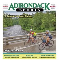
Adirondack Sports June 2024
CONTENTS 5 FROM THE TEAM 7 NEWS BRIEFS 9 HIKING & BACKPACKING Passage of the Pharaohs 13 RUNNING & WALKING Summertime and the Livin’ is Easy 17 PADDLING Quieter, Wilder Saratoga County 21 BICYCLING Buy Where You Ride 25 COMMUNITY Thacher’s ‘Tricam Project’ Ascent 28 ATHLETE PROFILE Running & Rowing with Lisa Chase 31-37 CALENDAR OF EVENTS Make it a Great Summer! 41 SWIMMING & TRIATHLON Enjoy Open Water Swimming 45 BICYCLING Shredders: Bikes in Schools 49-55 RACE RESULTS Top Late Spring Finishers
CONTENTS
5 FROM THE TEAM
7 NEWS BRIEFS
9 HIKING & BACKPACKING
Passage of the Pharaohs
13 RUNNING & WALKING
Summertime and the Livin’ is Easy
17 PADDLING
Quieter, Wilder Saratoga County
21 BICYCLING
Buy Where You Ride
25 COMMUNITY
Thacher’s ‘Tricam Project’ Ascent
28 ATHLETE PROFILE
Running & Rowing with Lisa Chase
31-37 CALENDAR OF EVENTS
Make it a Great Summer!
41 SWIMMING & TRIATHLON
Enjoy Open Water Swimming
45 BICYCLING
Shredders: Bikes in Schools
49-55 RACE RESULTS
Top Late Spring Finishers

You also want an ePaper? Increase the reach of your titles
YUMPU automatically turns print PDFs into web optimized ePapers that Google loves.
JUNE <strong>2024</strong> 11<br />
HIKING & BACKPACKING continued from 9<br />
that only the trucks can reach. There is a campsite and<br />
canoe launch nearby, but the views of Crane are limited<br />
without venturing farther out along the shore.<br />
Look for the hiking trail that leads south from the<br />
parking area, crossing the pond’s outlet on a substantial<br />
footbridge. This, too, was once a road, but its quality is<br />
worlds apart from what you’ve just experienced. The trail<br />
gradually climbs through hemlock-rich forests to a junction<br />
at 2.6 miles (0.7 from Crane Pond) where the hiking<br />
trail to Pharaoh Mountain bears right. A few minutes later,<br />
at three miles, you reach the turnoff for Oxshoe Pond at a<br />
scenic junction beside Glidden Marsh.<br />
The pond-like north end of Glidden Marsh is one of<br />
the joys of this adventure. The trail hugs the shoreline and<br />
provides several photographic vantages. A brief interlude<br />
through the woods brings you to the south end of the<br />
marsh, which is indeed more wetland than pond – but<br />
still scenic, nonetheless.<br />
After crossing the outlet of Crab Pond, the trail climbs<br />
to yet another trail junction at 3.7 miles; a left turn here<br />
would lead to Crab Pond. Trail signs refer to this spot as<br />
“Hay Marsh Junction,” after a wetland that lies off-trail<br />
to the northeast. The trail to Pharaoh Lake continues<br />
straight ahead.<br />
By this point the trail has already shed its road-based<br />
origins and narrowed into a rugged foot tread, but what<br />
follows is the remotest section of the route. The distance<br />
between Hay Marsh and Pharaoh Lake is only 1.6 miles,<br />
but it will seem substantially longer. From an elevation of<br />
about 1,200 feet, the trail gradually climbs to 1,460 feet as<br />
it keeps to high ground above a chain of wetlands occupying<br />
a notch between Pharaoh and Treadway Mountains. A<br />
zigzag between two of the wetlands leads to a short level<br />
section, and then comes the 0.3-mile, 300-foot plunge<br />
down to Pharaoh Lake’s northwest corner.<br />
At 5.3 miles, you reach a junction with the loop trail<br />
that encircles the lake. There are three designated campsites<br />
in this vicinity, including one tiny “solo” campsite to<br />
the left and two more substantial sites to the right, each at<br />
the tip of its own small peninsula. Be sure to look for the<br />
yellow markers leading off the main route to each of these<br />
campsites, which all boast fine views of this large lake. If a<br />
lean-to is more your style, the nearest option is found on<br />
the far side of Split Rock Bay; upon reaching the aroundthe-lake<br />
trail, bear left and continue for an additional 0.5-<br />
mile to the prominent shelter.<br />
The drawback to this route is that when the time comes<br />
to pull up your tent stakes and return to Crane Pond Road,<br />
your day will begin with that 0.3-mile, 300-foot climb back<br />
into the notch, with almost no preliminary. But then the<br />
long descent toward Hay Marsh and Glidden Marsh will<br />
improve your outlook, and the final 1.9 miles along the<br />
abandoned road will breeze right by.<br />
Bill Ingersoll is a cofounder and vice-chair of <strong>Adirondack</strong><br />
Wilderness Advocates: adirondackwilderness.org.<br />
He is the author of the recently published guidebook,<br />
Wilderness Camping in the <strong>Adirondack</strong>s: 25 Backpacking<br />
and Canoeing Overnight Adventures, which features<br />
relatively easy outings, and you can buy it from a local<br />
outfitter, bookstore and online.<br />
◀ GLIDDEN MARSH.<br />
BILL INGERSOLL<br />
▲ SPLIT ROCK BAY.<br />
BILL INGERSOLL