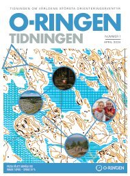
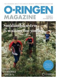
O-Ringen Magazine, nr 1 2024
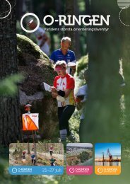
The worlds biggest orienteering adventure. Oskarshamn, Smålandskusten, July 21st to 27 th 2024.
The worlds biggest orienteering adventure. Oskarshamn, Smålandskusten, July 21st to 27 th 2024.

Create successful ePaper yourself
Turn your PDF publications into a flip-book with our unique Google optimized e-Paper software.
We’re staying in Småland 2025!<br />
40% choose easy to moderate orienteering<br />
What makes O-<strong>Ringen</strong> unique? The answer will vary<br />
depending on who you ask, which itself is part of<br />
the magic. However, most people would agree that<br />
the orienteering itself plays a vital role. Here, we’ve<br />
summarised the process of making maps, in particular<br />
the maps for O-<strong>Ringen</strong>’s Jönköping project.<br />
Are you a child who has just started orienteering? Are you<br />
a junior who has managed to step up one or two difficulty<br />
levels? Are you a recreational runner who enjoys just<br />
the right amount of challenge on a moderately difficult<br />
course? We have something for everyone!<br />
We might as well say it right from the beginning; making a<br />
map isn’t an exact science, more like an art within a certain<br />
framework. Orienteering maps will always provoke some<br />
discussion. There are many ways to interpret reality and<br />
the chances are, you’ll come across something in the<br />
forest that you think should be on the map.<br />
Our goal, especially with five stages awaiting us, is that<br />
the maps should be consistent. As a runner, you should<br />
recognise the way the map has been made from stage<br />
to stage, from mapper to mapper. It’s one thing for the<br />
terrain to vary, which it will, but the basis for this should<br />
stay the same. An open area or a dense one should feel the<br />
same, whether you’re competing at Stage 1, 3 or 5.<br />
So what should we do to achieve this?<br />
Contracts have been drawn with professional mapmakers for<br />
the five foot orienteering stages. These contracts include some<br />
formal/technical requirements, for example that maps must be<br />
drawn according to current norms, including requirements for<br />
Level 1 events, in the latest version of OCAD and that maps must<br />
be made at 1:15,000 scale.<br />
However, it’s the “soft” side of the process that we are endeavouring<br />
to make sure is consistent in the terrain. Together with the<br />
designated map co-ordinator and all the mapmakers, we took a<br />
walk through the forest in autumn 2023, before any surveying began.<br />
We walked through the Stage 3 area and discussed everything<br />
from open to dense forest areas, from boulders to crags and from<br />
charcoal burning platforms to dot knolls. Spending some hours<br />
together like this is key for achieving our aim.<br />
Permission to start<br />
After this, each mapmaker is allowed to begin work in their area.<br />
After around 1 km² has been surveyed, the map co-ordinator visits<br />
the area and comments on what the mapper should think about<br />
for the rest of the project, as well as if any adjustments should be<br />
made, all based on the what we discussed in that walk together.<br />
The mapmakers can then continue and finish their work. There<br />
remains the possibility to discuss things with the other mappers<br />
and with the map co-ordinator. Then there’s a final check of the<br />
map and the map is approved for use at O-<strong>Ringen</strong>.<br />
With this way of working we feel reassured that we are working<br />
to make consistent maps. We still have to remember that no matter<br />
what we do, there will always be differences of opinion regarding<br />
maps, and that’s fine – and all part of orienteering!<br />
The fact is that 40% of O-<strong>Ringen</strong> competitors take part on courses<br />
up to Violet colour level (moderately difficult orienteering). If we<br />
choose to focus on levels Orange and below, these are chosen by<br />
about a quarter of competitors. For us organisers, it’s important to<br />
really take note of that. It can be easy to search for the toughest and<br />
most difficult terrain when we choose competition areas but in fact<br />
it’s just as important to look for areas that are suitable for easy and<br />
moderately difficult courses.<br />
What we look for is areas with plenty of line features. Ideally<br />
more than just paths, so we have variety and challenge, as well as<br />
a variety of point features. The terrain should be relatively open<br />
to ensure both good runnability and visibility. The area should<br />
be quite flat or only moderately hilly. The list is quite long and<br />
it’s impossible to tick all the boxes every day but we feel satisfied<br />
with the five areas we can offer in Jönköping, with variation and<br />
challenge for each difficulty level.<br />
On stages 1 and 2, which are<br />
separated by a large marsh, you<br />
will find fewer line features. Apart<br />
from the roads and paths in the<br />
area, the edges of marshes and<br />
clear hills will have to be used<br />
as handrails. These two stages<br />
will also feature more variation<br />
between the denser and more<br />
open forest than the later stages.<br />
Stage 3 might just be the perfect<br />
area, with a mixture of well-used<br />
forest close to town and mature<br />
Småland forest. You will truly feel like you’re out in the middle of<br />
the forest, while at the same time there are plenty of line features<br />
to choose from. It’s “just” a case of choosing the correct path at<br />
the junction and above all maintaining<br />
map contact so you don’t miss one of the<br />
small paths. Don’t forget to take in the<br />
views on the run-in!<br />
For stages 4 and 5 there’s a different<br />
terrain type. The forest opens up in a<br />
different way and the contour shapes<br />
are different, with more medium to<br />
large hills. It’s definitely time to wonder<br />
whether you should run over or round!<br />
Stage 3. Stage 4.<br />
MTBO and Trail-O<br />
Photo: Peter Holgersson.<br />
Mapmakers for O-<strong>Ringen</strong> Jönköping 2025<br />
For foot orienteering<br />
• Stages 1 and 2: Egidijus Koukenys<br />
• Stage 3 and Sprint areas: Håkan Öhlund<br />
• Stages 4 and 5: Jerker Boman and Karl-Erik Engblom<br />
Map co-ordinator: Christer Carlsson<br />
Are you tempted to try MTBO or Trail-O? How about giving<br />
it a go and seeing how it works?<br />
Each discipline will have five days of competition at O-<strong>Ringen</strong><br />
2025 in Jönköping. You can take part for the whole week or choose<br />
one or more individual stages.<br />
For anyone who wants to try something new, there will be<br />
chance to do this on the activity day. On this day the MTBO and<br />
Trail-O will have the same arena, which means you can try both,<br />
or if your family want to try different ones you can easily do this at<br />
the same time. Come and try it!<br />
Jönköping is famous for being a cycling city. Vätter<strong>nr</strong>undan<br />
passes through here and there are mountain bike arenas at both<br />
the IKHP clubhouse and Hallbystugan, for example. This gives us a<br />
wonderful opportunity to offer competitors great variety, from easy<br />
to technical cycling on flat to steep ground.<br />
O-<strong>Ringen</strong> stages 1, 4 and 5 will use the same arena as the foot<br />
orienteering, however there will be a remote finish on stages 1 and<br />
5. We’re focusing on community!<br />
For the Trail-O, the aim is to use just three arenas, while making<br />
sure there is a good variety of controls. The arenas will be in or<br />
near Jönköping but the exact locations will be secret for a while<br />
longer. The maps are now being made. Exciting!<br />
74 O-RINGEN MAGAZINE NO. 1 • <strong>2024</strong> O-RINGEN MAGAZINE NO. 1 • <strong>2024</strong> 75