12 <strong>Adirondack</strong> <strong>Sports</strong> Sales, Rentals, Trips, Paddling Routes Join the fun – visit us this summer! Come Visit Just like having the Owner’s Manual to the <strong>Adirondack</strong> Park! LOOK FOR IT ONLINE OR AT YOUR FAVORITE LOCAL BOOKSELLER! Old Forge Your <strong>Adirondack</strong> Base Camp! Eagle Bay • Stillwater Big Moose • Beaver River It’s Our Nature! Make your own fun, or let us help you! Info-Webcams-Vacation Guide OldForgeNY.com
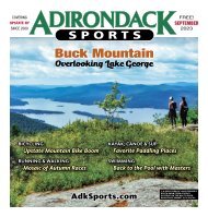
HIKING continued from 11 OCTOBER <strong>2023</strong> 13 ▲ LOST POND. The progression of views is better when hiking in a clockwise direction, beginning at Big Crow Mountain. Also, a few steep ledges are far better suited for scrambling up in this direction than scooting down. That said, hiking in a counter-clockwise direction is neither difficult nor unpleasant. Allow at least a full two hours to hike the path, but with all of the stopping to enjoy the views you will likely spend a minimum of three hours traversing the Soda Range – plus the additional time to complete the loop. This is an outstanding fall hike, with ample views across the Gulf Brook basin to the High Peaks. An extensive forest of poplar makes the nearby foliage predominantly yellow, with streaks of red imparted by maples on the distant slopes. Getting There – You can find the trailhead by following NY Route 9N/73 to downtown Keene, where Hurricane Road (also designated County Route 13) heads east, beginning next to the town offices. Follow Hurricane Road uphill for 2.2 miles, where O’Toole Lane turns left at Glenmore. This is a winding gravel road that continues to climb into the mountains to the Crow Clearing trailhead, a total of 3.3 miles from Keene. Along the way you have good views of the eponymous Crows standing high above the road. Note, however, that the final 0.3-mile of the road is narrow and unplowed in the winter. The parking area has an irregular configuration, forming a loop around an old cellar hole. The limited parking spaces do fill early on peak weekends. The Trail – There are two trails beginning at Crow Clearing, and the trail to Big Crow (and the west end of the Nun-da-ga-o path) begins at the north end of the parking area. It passes through a handsome balsam fir forest with ▲ WESTON MOUNTAIN. PHOTOS BY BILL INGERSOLL two intermittent streams to cross. After the second, the trail promptly begins to climb. The balsams do not climb very high up the mountain with you; instead, red pines take over and offer a few early glimpses of the surrounding landscape. Giant Mountain can be seen over the side of Hurricane. At 0.4-mile and about 400 feet above the trailhead, you reach an intersection; to the right is the start of the Nunda-ga-o Ridge path. One small sign and perhaps a few trail markers are enough to get you started, but the majority of this route is unmarked. It begins by contouring around to a col on the north side of Big Crow and then following the ridgeline north. You do not have to wait long before encountering your first view – in about 10 minutes the path bisects a bald spot with a southerly vista, and then passes a ledge with a lateral view across a beaver quagmire toward Weston Mountain. Each successive knob is a little higher than the previous, and the views come at irregular intervals. At 1.2 miles the path reaches the largest and steepest of the ledges; it comes in two parts, with a side path to another view in between. Continuing along the loop, the main path winds through the woods from ledge to ledge, and often it is merely a narrow corridor lined by balsam fir. Depending on the angle of the ledge, the views range from Weston at one extreme to Whiteface at the other. Note the gradual changes in the High Peaks as you circle the ridge: Giant slowly moves behind Hurricane, Big Slide becomes a prominent bump on the horizon vying with Marcy for prominence, and Pitchoff remains far more eye-catching than neighboring Cascade. Between 2.2 miles and 2.4 miles, the path spends a considerable amount of time on open rock, with promi- nent ledges at both ends. Here, the views are lined up well with the valley at Johns Brook – a distant gash in the High Peaks, located at the foot of Mount Marcy. These ledges also reveal the rocky summit of Coal Dirt Hill, which would no doubt offer many good views of its own. Strangely, though, the path bypasses Coal Dirt Hill and contours along its southern slopes instead. Upon reaching a col southeast of the summit, it promptly begins a long, gentle ascent of the northern ridge of Weston Mountain, which in turn leads to the summit itself at 3.2 miles (3.6 miles from Crow Clearing). At 3,183 feet, this is the highest point on the loop. This view is notably different from all the previous ones you have encountered, for now Lost Pond is clearly visible in the high country between here and Hurricane. This watery element is absent from most of the rest of Nun-da-ga-o Ridge. The remaining 2.5 miles of the loop is a completely different experience, all of it following well-worn trail where encountering other hikers is far more likely. Although there are no markers between Weston and Lost Pond (as of 2022), the route is obvious as it leads down the southwestern slopes, steeply at times, until 0.4-mile later it delivers you into the lush bottomland north of Lost Pond. The first landmark is the Biesemeyer Lean-To, a secluded shelter above 2,800 feet in elevation with limited water access. At this point you begin to see official trail markers for the first time since Big Crow. The trail skirts around the west side of Lost Pond, but if you wish to see its iconic view of Hurricane Mountain you will need to actively seek out shoreline openings. From the pond’s outlet, a long and gentle descent into the Gulf Brook valley follows. At a point about 1.5 miles from Weston’s summit, several things happen. First, you pass the relocated Gulf Brook Lean-To uphill on the right, and then the northern trail to Hurricane Mountain on the left. All that remains of your loop hike is the one-mile-long trunk trail back to Crow Clearing – a section so gentle that it passes quickly. Bill Ingersoll is a co-founder and the vice-chair of <strong>Adirondack</strong> Wilderness Advocates. For more information on this area, visit: adirondackwilderness. org/hurricane-mountain-wilderness.