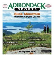
Adirondack Sports August 2023
IN THIS ISSUE 5 NEWS BRIEFS 7 PADDLING & CAMPING Late Summer Paddling 11 RUNNING & WALKING Summer Training and Fall Races 15 HIKING & BACKPACKING Chub Lake, a Charming Pond 19 BICYCLING Bike Upstate with Fall Events 23 TRIATHLON & DUATHLON Late Summer Race Opportunities 24 ATHLETE PROFILE Hudson Swim with Lewis Pugh 27-33 CALENDAR OF EVENTS Enjoy this great time of year! 35-47 RACE RESULTS Top Early Summer Finishers
IN THIS ISSUE
5 NEWS BRIEFS
7 PADDLING & CAMPING
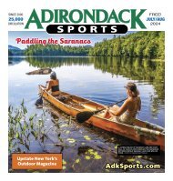
Late Summer Paddling
11 RUNNING & WALKING
Summer Training and Fall Races
15 HIKING & BACKPACKING
Chub Lake, a Charming Pond
19 BICYCLING
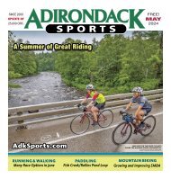
Bike Upstate with Fall Events
23 TRIATHLON & DUATHLON
Late Summer Race Opportunities
24 ATHLETE PROFILE
Hudson Swim with Lewis Pugh
27-33 CALENDAR OF EVENTS
Enjoy this great time of year!
35-47 RACE RESULTS
Top Early Summer Finishers

Create successful ePaper yourself
Turn your PDF publications into a flip-book with our unique Google optimized e-Paper software.
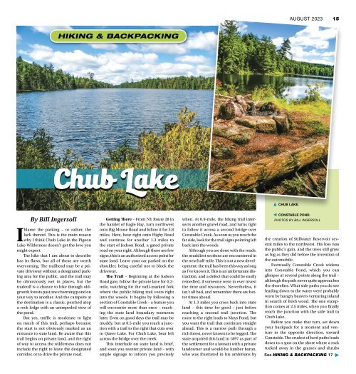
AUGUST <strong>2023</strong> 15<br />
HIKING & BACKPACKING<br />
Chub Lake<br />
▲ CHUB LAKE.<br />
By Bill Ingersoll<br />
I<br />
blame the parking – or rather, the<br />
lack thereof. This is the main reason<br />
why I think Chub Lake in the Pigeon<br />
Lake Wilderness doesn’t get the love you<br />
might expect.<br />
The hike that I am about to describe<br />
has its flaws, but all of these are worth<br />
overcoming. The trailhead may be a private<br />
driveway without a designated parking<br />
area for the public, and the trail may<br />
be obnoxiously wet in places, but the<br />
tradeoff is a chance to hike through oldgrowth<br />
forests past one charming pond on<br />
your way to another. And the campsite at<br />
the destination is a classic, perched atop<br />
a rock ledge with an unimpeded view of<br />
the pond.<br />
But yes, traffic is moderate to light<br />
on much of this trail, perhaps because<br />
the start is not obviously marked as an<br />
entrance to state land. Be aware that this<br />
trail begins on private land, and the right<br />
of way to access the wilderness does not<br />
include the right to leave the designated<br />
corridor, or to drive the private road.<br />
Getting There – From NY Route 28 in<br />
the hamlet of Eagle Bay, turn northwest<br />
onto Big Moose Road and follow it for 3.8<br />
miles. Here, bear right onto Higby Road<br />
and continue for another 1.3 miles to<br />
the start of Judson Road, a gated private<br />
road on your right. Although there are few<br />
signs, this is an authorized access point for<br />
state land. Leave your car parked on the<br />
shoulder, being careful not to block the<br />
driveway.<br />
The Trail – Beginning at the Judson<br />
Road gate, follow the private lane for 0.2-<br />
mile, watching for the well-marked fork<br />
where the public hiking trail veers right<br />
into the woods. It begins by following a<br />
section of Constable Creek – a feature you<br />
will encounter more than once – reaching<br />
the state land boundary moments<br />
later. Even on good days the trail may be<br />
muddy, but at 0.5-mile you reach a junction<br />
with a trail to the right that cuts over<br />
to Queer Lake. For Chub Lake, bear left<br />
across the bridge over the creek.<br />
This interlude on state land is brief,<br />
and soon you reenter private land – with<br />
ample signage to inform you precisely<br />
when. At 0.9-mile, the hiking trail intersects<br />
another gravel road, and turns right<br />
to follow it across a second bridge over<br />
Constable Creek. As soon as you reach the<br />
far side, look for the trail signs pointing left<br />
back into the woods.<br />
Although you are done with the roads,<br />
the muddiest sections are encountered in<br />
the next half-mile. This is not a new development;<br />
the trail has been this way as long<br />
as I’ve known it. This is an unfortunate distraction,<br />
and a defect that could be easily<br />
remedied, if someone were to ever invest<br />
the time and resources. Nevertheless, it<br />
isn’t all bad, and remember there are better<br />
times ahead.<br />
At 1.3 miles you cross back into state<br />
land – this time for good – just before<br />
reaching a second trail junction. The<br />
route to the right leads to Mays Pond, but<br />
you want the trail that continues straight<br />
ahead. This is a narrow path through a<br />
rich forest, never known to be logged. The<br />
state acquired this land in 1897 as part of<br />
the settlement for a lawsuit with a private<br />
landowner and would-be lumber baron,<br />
who was frustrated in his ambitions by<br />
◀ CONSTABLE POND.<br />
PHOTOS BY BILL INGERSOLL<br />
the creation of Stillwater Reservoir several<br />
miles to the northwest. His loss was<br />
the public’s gain, and the trees still grow<br />
as big as they did before the invention of<br />
the automobile.<br />
Eventually Constable Creek widens<br />
into Constable Pond, which you can<br />
glimpse at several points along the trail –<br />
although the path never quite approaches<br />
the shoreline. What side paths you do see<br />
leading down to the water were probably<br />
worn by hungry beavers venturing inland<br />
in search of fresh wood. The one exception<br />
comes at 2.5 miles, when you finally<br />
reach the junction with the side trail to<br />
Chub Lake.<br />
Before you make that turn, set down<br />
your backpack for a moment and venture<br />
in the opposite direction, toward<br />
Constable. The crudest of herd paths leads<br />
down to a spot on the shore where a rock<br />
tucked away in the grasses and shrubs<br />
See HIKING & BACKPACKING 17 ▶