Africa Surveyors May-June issue 2023 digital
Africa Surveyors is Africa’s premier source of Surveying, Mapping and Geospatial news and an envoy of surveying products/service for the Construction, Maritime, Onshore & Offshore energy and exploration, Engineering, Oil and Gas, Agricultural and Mining sectors on new solution based trends and technology for the African market.
Africa Surveyors is Africa’s premier source of Surveying, Mapping and Geospatial news and an envoy of surveying products/service for the Construction, Maritime, Onshore & Offshore energy and exploration, Engineering, Oil and Gas, Agricultural and Mining sectors on new solution based trends and technology for the African market.

Create successful ePaper yourself
Turn your PDF publications into a flip-book with our unique Google optimized e-Paper software.
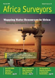
3D MAPPING<br />
A Vizzio Technologies staff member holding a 360-degree video camera. In the background is a laser scanner with a video camera mounted on top<br />
of it. ST PHOTO: ZAIHAN MOHAMED YUSOF<br />
patrolling the grounds every four hours.<br />
“With 3D-mapping technology, which allows virtual patrols, the facility<br />
was able to reduce manpower needs by more than half, which means<br />
cost savings,” added Dr Lee.<br />
Estimates vary, but reports suggest that up to 15,000 security officers<br />
are needed to supplement the 49,000 already working in the sector.<br />
Security firm Aetos is using Vizzio’s 3D-mapping tool to manage<br />
multiple facilities under its charge.<br />
Aetos Holdings CEO Alfred Fox said: “Vizzio had been integral in<br />
helping us implement the nation’s largest 3D <strong>digital</strong> twin within<br />
Aetos’ next-generation 5G Integrated Command Centre (ICC) – an AI<br />
cloud-based platform that visualises unified operations islandwide and<br />
beyond borders onto a single dashboard – based on aggregated data<br />
from numerous subsystems.”<br />
A video wall measuring 2.7m by 9.6m sits on a wall inside the ICC,<br />
which is located within the Aetos headquarters in Corporation Drive. It<br />
displays all of Aetos’ operations and resources in Singapore.<br />
Personnel at the centre can focus on an area on the map, then narrow<br />
the search to a specific building, and even zoom in to go inside a<br />
facility by tapping cameras at the building.<br />
Mr Fox said that with the <strong>digital</strong>-twin tool, the ICC is able to work with<br />
building owners and operators to respond to security breaches and<br />
other safety and management-related incidents.<br />
Stellar Lifestyle, the business arm of SMRT Corporation, has adopted<br />
Vizzio’s 3D-mapping technology to extend its physical retail and<br />
advertising spaces to virtual spaces.<br />
Commuters can access 3D maps on their devices to scan services and<br />
shops which are en route to their destinations. The tool also allows<br />
www.africasurveyorsonline.com<br />
potential tenants to attend virtual viewings of retail units prior to a<br />
physical visit.<br />
Mr Tony Heng, president of Stellar Lifestyle, said: “Beyond physical<br />
spaces, Stellar Lifestyle and Vizzio are bringing our ecosystem of small<br />
and medium-sized enterprises to virtual realms, enabling immersive<br />
shopping, wayfinding, gamification and more.”<br />
Vizzio has also been engaged to map districts in Saudi Arabia and<br />
Hong Kong for tourists.<br />
Dr Lee said the firm captures video footage of an area to be digitised<br />
into a 3D model by having staff walk, cycle or drive along the intended<br />
route.<br />
A selfie stick-mounted video camera, which is capable of generating<br />
a 360-degree image, is good enough to generate accurate 3D models.<br />
But he added that the firm also uses commercially available cameras<br />
to scan buildings.<br />
The data collected is then uploaded into Vizzio’s proprietary AI and<br />
behavioural analytics software.<br />
“Traditionally, people mapped indoor and outdoor areas using bulky<br />
(laser scanners). How many can carry these for kilometres?<br />
“These devices are also mounted on top of a car, which are not able to<br />
cover walkways or areas not passable by cars,” said Dr Lee.<br />
Some companies also use drones for mapping, but he said Vizzio buys<br />
satellite images for its 3D maps.<br />
Dr Lee said live 3D-mapping technology is not just for national or<br />
public security purposes.<br />
“It can be used for many other applications, such as tourism, facilities<br />
management and live street maps,” he added.<br />
<strong>May</strong>-<strong>June</strong> <strong>issue</strong> l <strong>2023</strong> 27