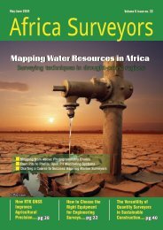
Africa Surveyors May-June issue 2023 digital
Africa Surveyors is Africa’s premier source of Surveying, Mapping and Geospatial news and an envoy of surveying products/service for the Construction, Maritime, Onshore & Offshore energy and exploration, Engineering, Oil and Gas, Agricultural and Mining sectors on new solution based trends and technology for the African market.
Africa Surveyors is Africa’s premier source of Surveying, Mapping and Geospatial news and an envoy of surveying products/service for the Construction, Maritime, Onshore & Offshore energy and exploration, Engineering, Oil and Gas, Agricultural and Mining sectors on new solution based trends and technology for the African market.

Create successful ePaper yourself
Turn your PDF publications into a flip-book with our unique Google optimized e-Paper software.
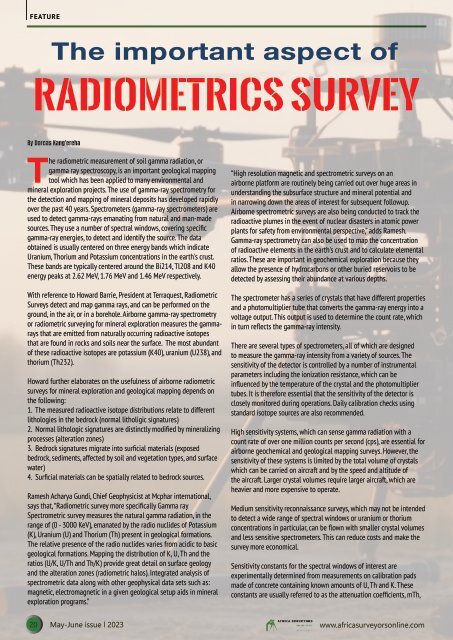
FEATURE<br />
The important aspect of<br />
Radiometrics Survey<br />
By Dorcas Kang'ereha<br />
The radiometric measurement of soil gamma radiation, or<br />
gamma ray spectroscopy, is an important geological mapping<br />
tool which has been applied to many environmental and<br />
mineral exploration projects. The use of gamma-ray spectrometry for<br />
the detection and mapping of mineral deposits has developed rapidly<br />
over the past 40 years. Spectrometers (gamma-ray spectrometers) are<br />
used to detect gamma-rays emanating from natural and man-made<br />
sources. They use a number of spectral windows, covering specific<br />
gamma-ray energies, to detect and identify the source. The data<br />
obtained is usually centered on three energy bands which indicate<br />
Uranium, Thorium and Potassium concentrations in the earth's crust.<br />
These bands are typically centered around the Bi214, Tl208 and K40<br />
energy peaks at 2.62 MeV, 1.76 MeV and 1.46 MeV respectively.<br />
With reference to Howard Barrie, President at Terraquest, Radiometric<br />
Surveys detect and map gamma rays, and can be performed on the<br />
ground, in the air, or in a borehole. Airborne gamma-ray spectrometry<br />
or radiometric surveying for mineral exploration measures the gammarays<br />
that are emitted from naturally occurring radioactive isotopes<br />
that are found in rocks and soils near the surface. The most abundant<br />
of these radioactive isotopes are potassium (K40), uranium (U238), and<br />
thorium (Th232).<br />
Howard further elaborates on the usefulness of airborne radiometric<br />
surveys for mineral exploration and geological mapping depends on<br />
the following:<br />
1. The measured radioactive isotope distributions relate to different<br />
lithologies in the bedrock (normal litholigic signatures)<br />
2. Normal lithologic signatures are distinctly modified by mineralizing<br />
processes (alteration zones)<br />
3. Bedrock signatures migrate into surficial materials (exposed<br />
bedrock, sediments, affected by soil and vegetation types, and surface<br />
water)<br />
4. Surficial materials can be spatially related to bedrock sources.<br />
Ramesh Acharya Gundi, Chief Geophysicist at Mcphar international,<br />
says that, “Radiometric survey more specifically Gamma ray<br />
Spectrometric survey measures the natural gamma radiation, in the<br />
range of (0 - 3000 KeV), emanated by the radio nuclides of Potassium<br />
(K), Uranium (U) and Thorium (Th) present in geological formations.<br />
The relative presence of the radio nuclides varies from acidic to basic<br />
geological formations. Mapping the distribution of K, U, Th and the<br />
ratios (U/K, U/Th and Th/K) provide great detail on surface geology<br />
and the alteration zones (radiometric halos). Integrated analysis of<br />
spectrometric data along with other geophysical data sets such as:<br />
magnetic, electromagnetic in a given geological setup aids in mineral<br />
exploration programs.”<br />
“High resolution magnetic and spectrometric surveys on an<br />
airborne platform are routinely being carried out over huge areas in<br />
understanding the subsurface structure and mineral potential and<br />
in narrowing down the areas of interest for subsequent followup.<br />
Airborne spectrometric surveys are also being conducted to track the<br />
radioactive plumes in the event of nuclear disasters in atomic power<br />
plants for safety from environmental perspective,” adds Ramesh.<br />
Gamma-ray spectrometry can also be used to map the concentration<br />
of radioactive elements in the earth's crust and to calculate elemental<br />
ratios. These are important in geochemical exploration because they<br />
allow the presence of hydrocarbons or other buried reservoirs to be<br />
detected by assessing their abundance at various depths.<br />
The spectrometer has a series of crystals that have different properties<br />
and a photomultiplier tube that converts the gamma-ray energy into a<br />
voltage output. This output is used to determine the count rate, which<br />
in turn reflects the gamma-ray intensity.<br />
There are several types of spectrometers, all of which are designed<br />
to measure the gamma-ray intensity from a variety of sources. The<br />
sensitivity of the detector is controlled by a number of instrumental<br />
parameters including the ionization resistance, which can be<br />
influenced by the temperature of the crystal and the photomultiplier<br />
tubes. It is therefore essential that the sensitivity of the detector is<br />
closely monitored during operations. Daily calibration checks using<br />
standard isotope sources are also recommended.<br />
High sensitivity systems, which can sense gamma radiation with a<br />
count rate of over one million counts per second (cps), are essential for<br />
airborne geochemical and geological mapping surveys. However, the<br />
sensitivity of these systems is limited by the total volume of crystals<br />
which can be carried on aircraft and by the speed and altitude of<br />
the aircraft. Larger crystal volumes require larger aircraft, which are<br />
heavier and more expensive to operate.<br />
Medium sensitivity reconnaissance surveys, which may not be intended<br />
to detect a wide range of spectral windows or uranium or thorium<br />
concentrations in particular, can be flown with smaller crystal volumes<br />
and less sensitive spectrometers. This can reduce costs and make the<br />
survey more economical.<br />
Sensitivity constants for the spectral windows of interest are<br />
experimentally determined from measurements on calibration pads<br />
made of concrete containing known amounts of U, Th and K. These<br />
constants are usually referred to as the attenuation coefficients, mTh,<br />
20 <strong>May</strong>-<strong>June</strong> <strong>issue</strong> l <strong>2023</strong> www.africasurveyorsonline.com