Baffies Easy Munro Guide 3 by Ralph Storer sampler
Baffies’ Easy Munro Guide to the Cairngorms is the third volume in Ralph Storer’s inspirational series of guidebooks dedicated to finding the easiest way up Scotland’s highest mountains. This volume covers the Cairngorms National Park with hand-picked routes that will guide you to the summits of 25 rewarding Munros in all corners of the Cairngorms Range. Each route is described in detail and accompanied by an annotated OS map, full-colour photographs with the route marked on them and sidebars on particular points of interest. Named after his footwear of choice*, Baffies is the alter ego of experienced and respected guidebook writer Ralph Storer. He is allergic to exertion, is prone to lassitude, suffers from altitude sickness above 600m, blisters easily and bleeds readily. In short, he is the ideal companion for those new to Munro bagging, whatever their age or temperament. If he can make it to the summit, so can any couch potato. * Baffies: a Scottish term for slippers
Baffies’ Easy Munro Guide to the Cairngorms is the third volume in Ralph Storer’s inspirational series of guidebooks dedicated to finding the easiest way up Scotland’s highest mountains. This volume covers the Cairngorms National Park with hand-picked routes that will guide you to the summits of 25 rewarding Munros in all corners of the Cairngorms Range.
Each route is described in detail and accompanied by an annotated OS map, full-colour photographs with the route marked on them and sidebars on particular points of interest.
Named after his footwear of choice*, Baffies is the alter ego of experienced and respected guidebook writer Ralph Storer. He is allergic to exertion, is prone to lassitude, suffers from altitude sickness above 600m, blisters easily and bleeds readily. In short, he is the ideal companion for those new to Munro bagging, whatever their age or temperament. If he can make it to the summit, so can any couch potato.
* Baffies: a Scottish term for slippers

Create successful ePaper yourself
Turn your PDF publications into a flip-book with our unique Google optimized e-Paper software.
RALPH STORER is an experienced hillwalker who has hiked extensively<br />
around the world. Despite being a Sassenach <strong>by</strong> birth, he has lived in<br />
Scotland since studying psychology at Dundee University and has a<br />
great affinity for the Highlands. As well as disappearing into the hills<br />
for a regular fix of nature, he also writes novels and sexological nonfiction,<br />
and produces darkwave music on his home computer.<br />
His books are exceptional… <strong>Storer</strong> subverts the guidebook genre<br />
completely. THE ANGRY CORRIE<br />
THE ULTIMATE<br />
GUIDE TO THE<br />
MUNROS series<br />
Picks up where others – including my own – leave off, with lots of<br />
nitty-gritty information… all in a very up-beat style. CAMERON McNEISH<br />
Fabulously illustrated… Entertaining as well as informative… One of the<br />
definitive guides to the <strong>Munro</strong>s. PRESS & JOURNAL<br />
Irresistibly funny and useful; an innovatively thought-through guidebook<br />
that makes an appetising broth of its wit, experience and visual<br />
and literary tools. Brilliant. OUTDOOR WRITERS & PHOTOGRAPHERS GUILD<br />
A truly indispensible guide for the <strong>Munro</strong>-bagger. An absolute gem!<br />
ALEX MacKINNON, Manager, Waterstone’s George Street, Edinburgh<br />
The ideal hillwalking companion. SCOTS MAGAZINE<br />
THE ULTIMATE MOUNTAIN TRIVIA QUIZ CHALLENGE<br />
A thoroughly fascinating way to kill time –<br />
every bothy should be furnished with one.<br />
ROGER COX, THE SCOTSMAN
BAFFIES’ EASY MUNRO GUIDE series<br />
A truly outstanding guidebook.<br />
UNDISCOVERED SCOTLAND<br />
Packed to bursting with concise information and route descriptions.<br />
There should be room for this guide in every couch potato’s rucksack.<br />
OUTDOOR WRITERS & PHOTOGRAPHERS GUILD<br />
It is perfect for anyone exploring Scotland’s beautiful mountains,<br />
whatever his or her level of experience. GUIDEPOST<br />
THE JOY OF HILLWALKING<br />
A treat for all hillwalkers active or<br />
chairbound. SCOTS INDEPENDENT<br />
50 SHADES OF HILLWALKING<br />
A fantastic celebration of this addictive<br />
pastime. DON CURRIE, SCOTLAND OUTDOORS<br />
BY THE SAME AUTHOR:<br />
100 Best Routes on Scottish Mountains (Little Brown)<br />
50 Classic Routes on Scottish Mountains (Luath Press)<br />
50 Best Routes on Skye and Raasay (Birlinn)<br />
Exploring Scottish Hill Tracks (Little Brown)<br />
The Ultimate <strong>Guide</strong> to the <strong>Munro</strong>s series (Luath Press):<br />
Volume 1: Southern Highlands<br />
Volume 2: Central Highlands South (including Glen Coe)<br />
Volume 3: Central Highlands North (including Ben Nevis)<br />
Volume 4: Cairngorms South (including Lochnagar)<br />
<strong>Baffies</strong>’ <strong>Easy</strong> <strong>Munro</strong> <strong>Guide</strong> series (Luath Press):<br />
Volume 1: Southern Highlands<br />
Volume 2: Central Highlands<br />
The Ultimate Mountain Trivia Quiz Challenge (Luath Press)<br />
The Joy of Hillwalking (Luath Press)<br />
50 Shades of Hillwalking (Luath Press)
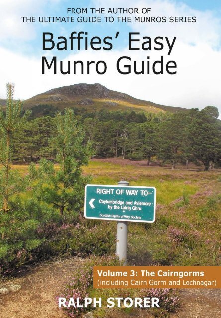
<strong>Baffies</strong>’ <strong>Easy</strong> <strong>Munro</strong> <strong>Guide</strong><br />
Volume 3: The Cairngorms<br />
including Cairn Gorm and Lochnagar<br />
RALPH STORER<br />
Boot-tested and compiled <strong>by</strong><br />
<strong>Baffies</strong>, Entertainments Convenor<br />
The Go-Take-a-Hike Mountaineering Club<br />
Luath Press Limited<br />
EDINBURGH<br />
www.luath.co.uk
For Kay Sarah<br />
Hillwalking and mountaineering are not risk-free activities and may prove<br />
injurious to users of this book. While every care and effort has been taken in its<br />
preparation, readers should note that information contained within may not be<br />
accurate and can change following publication. Neither the publisher nor the<br />
author accept any liability for injury or damage of any kind arising directly or<br />
indirectly from the book’s contents.<br />
First published 2015<br />
Reprinted 2023<br />
ISBN: 978-1-910745-05-2<br />
The paper used in this book is recyclable. It is made from low-chlorine pulps<br />
produced in a low-energy, low-emission manner from renewable forests.<br />
Printed and bound <strong>by</strong> CPI Antony Rowe, Chippenham<br />
Typeset in Tahoma <strong>by</strong> <strong>Ralph</strong> <strong>Storer</strong><br />
All maps reproduced <strong>by</strong> permission of Ordnance Survey on behalf of HMSO.<br />
© Crown copyright 2010. All rights reserved. Ordnance Survey Licence number<br />
100016659.<br />
All photographs <strong>by</strong> the author.<br />
The author’s right to be identified as author of this book under the Copyright,<br />
Designs and Patents Act 1988 has been asserted.<br />
© <strong>Ralph</strong> <strong>Storer</strong>
v<br />
CONTENTS<br />
PREFACE<br />
INTRODUCTION<br />
INDEX<br />
1 Beinn a’ Ghlo – Carn Liath<br />
2 Carn a’ Chlamain<br />
3 Carn na Caim (& A’ Bhuidheanach Bheag)<br />
4 Meall Chuaich<br />
5 The Cairnwell (& Carn Aosda & Carn a’ Gheoidh)<br />
6 Glas Tulaichean<br />
7 Carn Bhac<br />
8 Glas Maol (& Cairn of Claise)<br />
9 Tolmount (& Tom Buidhe)<br />
10 Mayar (& Driesh)<br />
11 Broad Cairn (& Cairn Bannoch)<br />
12 Carn an t-Sagairt Mor<br />
13 Carn a’ Choire Bhoidheach<br />
14 Lochnagar – Cac Carn Beag<br />
15 Mount Keen<br />
16 Sgor Gaoith (& Mullach Clach a’ Bhlair)<br />
17 The Devil’s Point<br />
18 Carn a’ Mhaim<br />
19 Derry Cairngorm<br />
20 Braeriach<br />
21 Cairn Gorm<br />
22 Ben Macdui<br />
23 Bynack More<br />
24 Beinn a’ Bhuird<br />
25 Ben Avon<br />
vi<br />
vii<br />
1<br />
6<br />
10<br />
14<br />
18<br />
22<br />
27<br />
32<br />
35<br />
39<br />
43<br />
48<br />
51<br />
55<br />
60<br />
63<br />
68<br />
72<br />
75<br />
79<br />
83<br />
88<br />
93<br />
97<br />
102<br />
107
vi<br />
o you want to climb <strong>Munro</strong>s<br />
S but have understandable<br />
concerns that you may end up<br />
teetering precariously above an<br />
a<strong>by</strong>smal drop, sitting gingerly<br />
astride a knife-edge ridge or<br />
groping futilely for handfuls of<br />
grass on a crumbling rock ledge.<br />
If possible, you’d like to make it<br />
down to the foot of the mountain<br />
again. In one piece. Before dusk.<br />
Let me introduce you to your<br />
new best friend: <strong>Baffies</strong>, the<br />
Entertainments Convenor of the<br />
Go-Take-a-Hike Mountaineering<br />
Club. In his club bio he lists<br />
himself as someone who is allergic<br />
to exertion, is prone to lassitude,<br />
suffers from altitude sickness<br />
above 600m, blisters easily and<br />
bleeds readily. However meagre<br />
your hillwalking credentials, if he<br />
can make it to the summit, so can<br />
you.<br />
Our sister publication The<br />
Ultimate <strong>Guide</strong> to the <strong>Munro</strong>s does<br />
what it says on the cover and<br />
describes routes of all kinds up all<br />
of the <strong>Munro</strong>s. Not all of these are<br />
suitable for sensitive souls such as<br />
<strong>Baffies</strong>, hence the decision to<br />
‘delegate’ him to write the guidebook<br />
you now hold in your hands.<br />
When the club committee first<br />
suggested to him that he was the<br />
PREFACE<br />
ideal person for the task, he<br />
almost choked on his triple<br />
chocolate layer cake. Only after<br />
we had managed to hold him<br />
down long enough to explain the<br />
book’s remit did he come to<br />
embrace the idea. Indeed, he set<br />
about researching the contents<br />
with such a hitherto unseen<br />
fervour and thoroughness that we<br />
are proud to have the results<br />
associated with the club’s name –<br />
a guidebook dedicated to finding<br />
easy ways up <strong>Munro</strong>s.<br />
Herein you will find easy walking<br />
routes up 25 <strong>Munro</strong>s (and more!)<br />
– routes that require no rock<br />
climbing, no scrambling, no<br />
tightrope walking, no technical<br />
expertise whatsoever. Of course,<br />
hillwalking can never be a risk-free<br />
activity. No <strong>Munro</strong> is as easy to<br />
reach from an armchair as the TV<br />
remote. You will be expected to<br />
be able to put one foot in front of<br />
the other... and repeat.<br />
Given that proviso, you will find<br />
no easier way to climb <strong>Munro</strong>s<br />
than to follow in the footsteps of<br />
<strong>Baffies</strong>. I leave you in his capable<br />
hands.<br />
<strong>Ralph</strong> <strong>Storer</strong>, President<br />
Go-Take-a-Hike Mountaineering Club
INTRODUCTION<br />
vii<br />
INTRODUCTION<br />
THE<br />
CAIRNGORMS
viii<br />
INTRODUCTION<br />
OF MOUNTAINS AND MUNROS<br />
t’s a big place, the Scottish<br />
Highlands. It contains so many<br />
mountains that even resident<br />
hillwalkers struggle to climb them all<br />
in a lifetime. How many mountains?<br />
That depends…<br />
If two summits 100m apart are<br />
separated <strong>by</strong> a shallow dip, do they<br />
constitute two mountains or one<br />
mountain with two tops? If the latter,<br />
then exactly how far apart do they<br />
have to be, and how deep does the<br />
intervening dip have to be, before they<br />
become two separate mountains?<br />
Sir Hugh <strong>Munro</strong> (1856–1919), the<br />
third President of the Scottish<br />
Mountaineering Club, tackled this<br />
problem when he published his<br />
‘Tables of Heights over 3000 Feet’ in<br />
the 1891 edition of the SMC Journal.<br />
Choosing the criterion of 3000ft in the<br />
imperial system of measurement as<br />
his cut-off point, he counted 283<br />
separate Mountains and a further<br />
255 Tops that were over 3000ft but<br />
not sufficiently separated from a<br />
Mountain to be considered separate<br />
Mountains themselves.<br />
In a country with a highpoint of<br />
4409ft (1344m) at the summit of Ben<br />
Nevis, the choice of 3000ft as a cut-off<br />
point is aesthetically justifiable and<br />
gives a satisfying number of<br />
Mountains. A metric cut-off point of<br />
1000m (3280ft), giving a more humble<br />
137 Mountains, has never captured the<br />
hillgoing public’s imagination.<br />
Unfortunately Sir Hugh omitted to<br />
leave to posterity the criteria he used<br />
to distinguish Mountains from Tops,<br />
and Tops from other highpoints over<br />
3000ft. In his notes to the Tables he<br />
even broached the impossibility of<br />
ever making definitive distinctions.<br />
Consider, for example, the problem<br />
of differentiating between Mountains,<br />
Tops and other highpoints on the<br />
Cairngorm plateaus, where every knoll<br />
At the summit of Lochnagar (R14)<br />
Sir Hugh <strong>Munro</strong> himself<br />
never became a <strong>Munro</strong>ist<br />
(someone who has climbed<br />
all the <strong>Munro</strong>s). Of the<br />
Tables of the day, he<br />
climbed all but three: the<br />
Inaccessible Pinnacle<br />
(although that did not<br />
become a <strong>Munro</strong> until<br />
1921), Carn an Fhidhleir<br />
and Carn Cloich-mhuilinn.<br />
The latter, which he was<br />
saving until last because it<br />
was close to his home, was<br />
ironically demoted to Top<br />
status in 1981.
INTRODUCTION<br />
ix<br />
surpasses 3000ft.<br />
The Tables were a substantial<br />
achievement in an age when mapping<br />
of the Highlands was still rudimentary,<br />
but no sooner did they appear than<br />
their definitiveness become the subject<br />
of debate. In subsequent years <strong>Munro</strong><br />
continued to fine-tune them, using<br />
new sources such as the Revised<br />
Six-inch Survey of the late 1890s.<br />
His notes formed the basis of a new<br />
edition of the Tables, published<br />
posthumously in 1921, which listed<br />
276 separate Mountains (now known<br />
as <strong>Munro</strong>s) and 267 Tops.<br />
The 1921 edition also included J.<br />
Rooke Corbett’s list of mountains with<br />
heights between 2500ft and 3000ft<br />
(‘Corbetts’), and Percy Donald’s list of<br />
hills in the Scottish Lowlands of 2000ft<br />
or over (‘Donalds’). Corbett’s test for a<br />
separate mountain was that it needed<br />
a re-ascent of 500ft (c150m) on all<br />
sides. Donald’s test was more<br />
mathematical. A ‘Donald’ had to be 17<br />
units from another one, where a unit<br />
was one twelfth of a mile (approx. one<br />
seventh of a kilometre) or one 50ft<br />
(approx. 15m) contour. <strong>Munro</strong><br />
may well have used some similar<br />
formula concerning distance and<br />
height differential.<br />
Over the years, various<br />
developments have conspired to<br />
prompt further amendments to the<br />
Tables, including metrication,<br />
improved surveying methods (most<br />
recently <strong>by</strong> satellite), and a desire<br />
on the part of each succeeding<br />
generation of editors to reduce what<br />
they have regarded as ‘anomalies.’<br />
For example, the ‘mountain range in<br />
miniature’ of Beinn Eighe was awarded<br />
a second <strong>Munro</strong> in 1997 to redress the<br />
balance with similar but over-endowed<br />
multi-topped ridges such as the<br />
seven-<strong>Munro</strong> South Glen Shiel Ridge.<br />
Changes and the reasons for change<br />
are detailed individually in the main<br />
text (see Peak Fitness for details).<br />
The first metric edition of the<br />
Tables in 1974 listed 279 <strong>Munro</strong>s<br />
and 262 Tops. The 1981 edition listed<br />
276 <strong>Munro</strong>s and 240 Tops. The 1990<br />
edition added an extra <strong>Munro</strong>. The<br />
1997 edition listed 284 <strong>Munro</strong>s and<br />
227 Tops. Since then, following GPS<br />
satellite re-measurement , Sgurr nan<br />
Ceannaichean (2009) and Beinn a’<br />
Chlaidheimh (2012) have been<br />
demoted to Corbett status, leaving<br />
282 <strong>Munro</strong>s. Watch this space.<br />
The first person to bag all the <strong>Munro</strong>s may<br />
have been the Rev Archibald Robertson in<br />
1901, although his notebooks bear no<br />
mention of him having climbed the<br />
Inaccessible Pinnacle and note that he<br />
gave up on Ben Wyvis to avoid a wetting.<br />
The second <strong>Munro</strong>ist was the Rev<br />
Ronald Burn, who additionally bagged all<br />
the Tops, in 1923, thus becoming the first<br />
‘Compleat <strong>Munro</strong>ist’ or Compleater. The<br />
third was James Parker, who additionally<br />
bagged all the Tops and Furths (the<br />
3000ft summits of England, Wales and<br />
Ireland), in 1929. The latest edition of the<br />
Tables lists 1745 known <strong>Munro</strong>ists.
x<br />
INTRODUCTION<br />
THE SCOTTISH HIGHLANDS<br />
he Scottish Highlands are<br />
characterised <strong>by</strong> a patchwork of<br />
mountains separated <strong>by</strong> deep glens,<br />
the result of glacial erosion in the<br />
distant past. On a global scale the<br />
mountains reach an insignificant<br />
height, topping out at (1344m/4409ft)<br />
on Ben Nevis. But in form they hold<br />
their own against any range in the<br />
world, many rising bold and beautiful<br />
from sea-level. For hillwalkers they<br />
Broad Cairn summit (R11)<br />
have distinct advantages over higher<br />
mountain ranges: their height is ideal<br />
for day walks and glens give easy<br />
road access.<br />
Moreover, the variety of mountain<br />
forms and landscapes is arguably<br />
greater than in any mountainous area<br />
of equivalent size. This is due to many<br />
factors, notably differing regional<br />
geology and the influence of the sea.<br />
In an attempt to give some order<br />
to this complexity, the Highlands are<br />
traditionally divided into six regions, as<br />
detailed below. The potted overviews<br />
mislead in that they mask the variety<br />
within each region, ignore numerous<br />
exceptions to the rule and reflect road<br />
access as much as discernible regional<br />
boundaries, but they serve as<br />
introductory descriptions.<br />
The Southern Highlands<br />
46 <strong>Munro</strong>s<br />
The Central Highlands<br />
73 <strong>Munro</strong>s<br />
The Cairngorms<br />
50 <strong>Munro</strong>s<br />
The Western Highlands<br />
62 <strong>Munro</strong>s<br />
The Northern Highlands<br />
38 <strong>Munro</strong>s<br />
The Islands<br />
13 <strong>Munro</strong>s<br />
Gentle, green and accessible, with scope for a great<br />
variety of mountain walks.<br />
A combination of all the other regions, with some of<br />
the greatest rock faces in the country.<br />
Great rolling plateaus, vast corries, remote mountain<br />
sanctuaries, sub-arctic ambience.<br />
Dramatic landscapes, endless seascapes, narrow<br />
ridges, arrowhead peaks, rugged terrain.<br />
Massive, monolithic mountains rising out of a<br />
desolate, watery wilderness.<br />
Exquisite mountainscapes, knife-edge ridges,<br />
sky-high scrambling, maritime ambience.
INTRODUCTION<br />
xi<br />
THE CAIRNGORMS<br />
he world-famous Cairngorms<br />
form the largest tract of high<br />
country in Britain, with more land over<br />
1200m/4000ft, 900m/3000ft and<br />
600m/2000ft (over 200 square miles<br />
of it) than anywhere else. Five of<br />
Britain’s six highest mountains are<br />
found here – only Ben Nevis is higher.<br />
To the north and east, the range is<br />
fringed <strong>by</strong> lower hills that run to the<br />
coastal plains of the North Sea. To the<br />
west, it is bounded <strong>by</strong> the A9, which<br />
runs north over Drumochter Pass to<br />
Aviemore and Inverness. To the south,<br />
the Angus glens descend to the Firth<br />
of Tay and the North Sea.<br />
The Cairngorms National Park that<br />
was created in 2003 necessarily has<br />
Summer snow in<br />
An Garbh Choire<br />
Let’s get one thing straight: taking the easy<br />
way up a <strong>Munro</strong> does not diminish your<br />
hillwalking credentials. Just because you<br />
have your mind set on higher matters than<br />
groping rock all day doesn’t mean you have<br />
to hang up your boots and go lie on a<br />
a more limited perimeter than this<br />
traditional boundary, familiar to<br />
generations of hillwalkers. On its south<br />
side it originally stopped at the<br />
Cairnwell Pass on the A93, at the head<br />
of Glen Shee, there<strong>by</strong> excluding a<br />
number of <strong>Munro</strong>s south-west of<br />
there. In 2010 the southern perimeter<br />
was extended down to Blair Atholl on<br />
the A9 to include them. Some lob<strong>by</strong> to<br />
extend park boundaries still further.<br />
Note that some <strong>Munro</strong>s inside the<br />
park lie west of the A9 and are<br />
traditionally associated with the<br />
Central Highlands (Volume 2).<br />
The Cairngorms have been known<br />
<strong>by</strong> this name for at least a couple of<br />
centuries and are named for their most<br />
accessible 4000ft<br />
mountain, which<br />
overlooks the resort town<br />
of Aviemore at the north<br />
end of the range.<br />
Ironically, the name<br />
means Blue Mountains,<br />
but in Gaelic they are<br />
Am Monadh Ruadh (Am<br />
Monna Roo-a, The Red<br />
Mountains), named for<br />
the pink colour of their<br />
granite. This contrasts<br />
with the mica-schists of<br />
Am Monadh Liath (Am<br />
beach. The joys of hillwalking are not<br />
circumscribed <strong>by</strong> the difficulty of the<br />
endeavour. Sir Hugh himself was perfectly<br />
happy to take an easy way up a mountain<br />
if there was one and there’s no reason you<br />
shouldn’t follow in his footsteps.
xii<br />
INTRODUCTION<br />
Monna Lee-a, The Grey<br />
Mountains) on the other<br />
side of Aviemore across<br />
Strathspey.<br />
On some maps the<br />
mountains are called the<br />
Grampians, but this<br />
elusive name has been<br />
applied so varyingly<br />
across the centuries<br />
that it has become<br />
meaningless. One OS<br />
map, for instance, places<br />
the name over the<br />
Northern Cairngorms, while another<br />
uses the name for all the mountains<br />
between east and west coasts.<br />
Geologically, the primary Cairngorm<br />
rocks are igneous, crystallised out of<br />
magma. Most of the rock is coarsegrained<br />
and weathers into the grit that<br />
surfaces paths and produces excellent<br />
going, generally much better than<br />
elsewhere in the Highlands.<br />
Ice Age glaciers have ground down<br />
the landscape’s rough edges, leaving<br />
behind great plateaus topped <strong>by</strong><br />
rounded summits. In places the weight<br />
of the ice has produced vast saucershaped<br />
depressions such as the Moine<br />
Mhor and the Moine Bhealaidh. More<br />
commonly the glaciers sliced through<br />
the plateaus to leave classic U-shaped<br />
As one explores them and wanders among<br />
them, the magnitude of everything begins<br />
to reveal itself, and one realises the<br />
immensity of the scale upon which the<br />
scene is set, and the greatness and<br />
dignity and calm of the Cairngorms cast<br />
their spell over the spirit.<br />
Reindeer on Braeriach summit plateau (R20)<br />
glens, with hanging corries and huge<br />
rock walls, for the subsequent<br />
delectation of hillwalkers and climbers.<br />
The region is divided into north and<br />
south <strong>by</strong> a great corridor that runs<br />
from west to east, beginning as Glen<br />
Feshie and ending as the Dee Valley.<br />
The Southern Cairngorms contain 32<br />
<strong>Munro</strong>s. The Northern Cairngorms<br />
contain the remaining 18, including<br />
the highest in the massif.<br />
Of these 50 <strong>Munro</strong>s, all of which are<br />
shown on the maps on the following<br />
pages, this guidebook describes easy<br />
routes up 25 of the most scenic<br />
(marked R1–R25). These include Cairn<br />
Gorm itself, mighty Ben Macdui (the<br />
second highest mountain in Scotland<br />
after Ben Nevis) and fabled Lochnagar<br />
above Balmoral.<br />
If you reach all 25 summits you<br />
will come to know the Cairngorms<br />
intimately… and perhaps want to<br />
explore some of the more demanding<br />
<strong>Munro</strong>s described in our sister series:<br />
The Ultimate <strong>Guide</strong> to the <strong>Munro</strong>s.<br />
From the first SMC guidebook<br />
<strong>by</strong> Henry Alexander (1928).<br />
Memo to self: What are you waiting for?<br />
Get your boots on!
INTRODUCTION<br />
xiii<br />
CAIRNGORMS NORTH<br />
1<br />
Page xiv<br />
R4<br />
R3<br />
Road<br />
Pass<br />
NORTHERN<br />
HIGHLANDS<br />
WH<br />
CAIRNGORMS<br />
ISLANDS<br />
CH<br />
SOUTHERN<br />
HIGHLANDS<br />
Glasgow<br />
Edinburgh<br />
CH: CENTRAL HIGHLANDS<br />
WH: WESTERN HIGHLANDS<br />
Scale 1:250,000
xiv<br />
INTRODUCTION<br />
CAIRNGORMS NORTH<br />
2<br />
Page xiii<br />
R7<br />
R2<br />
Tilt
INTRODUCTION<br />
xv<br />
CAIRNGORMS NORTH<br />
3<br />
See<br />
inset<br />
R9<br />
R10<br />
Inset<br />
R15
xvi<br />
INTRODUCTION<br />
4<br />
Lairig an<br />
R23<br />
Lairig<br />
CAIRNGORMS SOUTH
INTRODUCTION<br />
xvii<br />
5<br />
R25<br />
CAIRNGORMS SOUTH
xviii<br />
INTRODUCTION<br />
SEASONS AND WEATHER<br />
rom a hillwalking perspective, the<br />
Highland year has two seasons:<br />
the snow season and the no-snow<br />
season. The length of these seasons<br />
varies from year to year and from<br />
place to place.<br />
From May to September, snow is<br />
rarely a problem. Historically, May<br />
and June have the greatest number of<br />
sunny days, with the air at its clearest.<br />
July and August are the hottest<br />
months but are also more prone to<br />
rain and haze, not to mention that<br />
blight on the landscape, the Highland<br />
midge. The biting season begins in<br />
mid to late June and lasts until the first<br />
chills of late September. By October it<br />
is colder, the hills get their first dusting<br />
of winter snow and good days are few<br />
and far between.<br />
The months from November to April,<br />
though sometimes earlier and later,<br />
Battling a gale<br />
on Carn Liath (R1)<br />
are characterised <strong>by</strong> short days, cold<br />
and snow. March and April are<br />
transition months, with little or lots of<br />
snow. In some years, snow can last<br />
into early summer and be a nuisance<br />
on some routes. If you are unequipped<br />
for it, turn back. Snow is more<br />
treacherous to descend than ascend,<br />
and spring snow often has a crystalline<br />
quality that makes it behave like<br />
ball-bearings.<br />
In a normal winter (whatever that<br />
is, these days), conditions vary from<br />
British to Alpine to Arctic. An easy<br />
summer route can be made lifethreatening<br />
<strong>by</strong> icy conditions and<br />
severe winter weather. When paths<br />
are obliterated <strong>by</strong> snow, hillsides<br />
become treacherous and walking<br />
becomes difficult and tiring.<br />
On a clear winter’s day the Scottish<br />
mountains have an Alpine quality that<br />
makes for unforgettable days out, but<br />
no-one should attempt a <strong>Munro</strong> in<br />
winter without adequate clothing and<br />
equipment (including ice-axe and<br />
crampons), and experience (or the<br />
company of an experienced person).<br />
The number of accidents, some of<br />
them fatal, that occur in the Highlands<br />
every winter should leave no doubt as<br />
to the need for caution.<br />
Sample weather forecasts:<br />
www.metoffice.gov.uk/public/weather/<br />
mountain-forecast<br />
www.metcheck.com/HOBBIES/<br />
mountain.asp<br />
www.mwis.org.uk<br />
www.sais.gov.uk (avalanche conditions)<br />
Useful webcams at the time of writing<br />
can be found at:<br />
www.ski-glenshee.co.uk<br />
www.cairngormmountain.org<br />
www.snoweye.com/?resort=uk_glenshee<br />
www.snoweye.com/?resort=<br />
uk_cairngorm
INTRODUCTION<br />
xix<br />
USING THIS BOOK<br />
Position in <strong>Munro</strong>’s Tables OS 1:50,000<br />
(1 = highest) map number Grid reference<br />
Glas Tulaichean 1051/3448ft (OS 43, NO 051760)<br />
Glass Toolichan, Green Knolls<br />
any <strong>Munro</strong> names are Gaelic<br />
in origin. We give approximate<br />
pronunciations but make no claim<br />
to definitiveness. For example, the<br />
correct pronunciation of Ben is akin<br />
to Pyne, with a soft n as in the first<br />
syllable of onion, but it would be<br />
pedantic to enforce a purist<br />
pronunciation on a non-Gaelic speaker.<br />
The name Bealach, meaning Pass, is<br />
pronounced <strong>by</strong>alach, but many find it<br />
Tolmount from Glen Clova via Jock’s Road<br />
NO 284762, 12ml/19km, 770m/2500ft<br />
hard not to call it a beelach. And if<br />
you’re one of those unfortunates who<br />
appear congenitally incapable of<br />
pronouncing loch as anything other<br />
than lock, you’re in trouble.<br />
In connection with the phonetic<br />
pronunciations given, note that Y<br />
before a vowel is pronounced as in<br />
you, OW is pronounced as in town<br />
and CH is pronounced as in Scottish<br />
loch or German noch.<br />
he maps used in this book are<br />
reproductions of OS 1:50,000<br />
maps at 75% full size (i.e. 1:66,667<br />
or 1.5cm per 1km).<br />
Route distances are specified in<br />
miles (to the nearest half-mile) and<br />
kilometres (to the nearest kilometre).<br />
Short distances are specified in<br />
metres (an approximate imperial<br />
measurement is yards). Total amount<br />
of ascent for a route is specified to<br />
the nearest 10m (50ft) and should be<br />
regarded as an approximation only.<br />
To calculate how long a route will<br />
take, many begin with Naismith’s Rule<br />
(one hour per 3ml/5km + half-hour<br />
per 1000ft/300m). This can be<br />
adjusted <strong>by</strong> an appropriate factor<br />
to suit your own pace and to cater for<br />
stoppages, foul weather, technical<br />
difficulty, rough terrain, tiredness and<br />
decrepitude. (Bill Naismith, 1856–<br />
1935, was the ‘father’ of the SMC.)<br />
River directions, left bank and right<br />
bank, refer to the downstream<br />
direction. When referring to the<br />
direction of travel, we specify left-hand<br />
and right-hand.<br />
The symbols ▲ and ∆ indicate<br />
<strong>Munro</strong>s and Tops. An ATV track is an<br />
All-Terrain Vehicle track, rougher than<br />
a Land Rover track.
xx<br />
INTRODUCTION<br />
ACCESS<br />
and access was revolutionised <strong>by</strong><br />
The Land Reform (Scotland) Act<br />
2003 and the accompanying Scottish<br />
Outdoor Access Code (2005), which<br />
created a statutory right of responsible<br />
access for outdoor recreation. It is<br />
recommended that anyone walking in<br />
the Scottish countryside familiarise<br />
himself/herself with the Code, which<br />
explains rights and responsibilities in<br />
detail. Further information:<br />
www.outdooraccess-scotland.com.<br />
Deer stalking considerations:<br />
Despite the fact that all the <strong>Munro</strong>s in<br />
this volume fall within the boundaries<br />
of the Cairngorms National Park, most<br />
of the land is privately owned and<br />
access may be restricted in certain<br />
places during the stalking season.<br />
Non-compliance with restrictions is<br />
likely to cause aggravation for all<br />
concerned. If revenue is lost because<br />
of interference with stalking activities,<br />
estates may be forced to turn to<br />
TERRAIN<br />
afforestation or worse, there<strong>by</strong><br />
increasing access problems. Note that<br />
there is no stalking on a Sunday.<br />
The red stag stalking season runs<br />
from July 1 to October 20 but actual<br />
dates vary from locality to locality.<br />
Access notices dot the roadside and<br />
information on stalking activities can<br />
be obtained from estate offices and<br />
head stalkers. Specific information<br />
given in the main text is subject to<br />
change and should be verified.<br />
An increasing number of estates<br />
contribute to the ’Heading for the<br />
Scottish Hills’ service, which provides<br />
daily details of where stalking is taking<br />
place. Further information can be<br />
found on the Outdoor Access website:<br />
www.outdooraccess-scotland.com/<br />
hftsh.<br />
The good news is that there are<br />
no access restrictions at any time of<br />
year if you stick to the main routes<br />
described in this guidebook.<br />
hanks to the generally peat-free<br />
granite bedrock and the<br />
proliferation of vehicle tracks and<br />
renovated paths, the Cairngorms have<br />
the best hiking terrain in the Scottish<br />
Highlands. However, good going is not<br />
to be relied upon everywhere. Boggy<br />
ground is commonplace on the great<br />
mosses (Moine Mhor and Moine<br />
Bhealaidh) and elsewhere. In other<br />
places, notably on the plateaus and<br />
at the summits, rockier terrain<br />
precludes the formation of any path.<br />
In general, be prepared always<br />
for rough, rugged terrain and wear<br />
appropriate footwear.<br />
The Carn Ban Mor path (R16)
Luath Press Limited<br />
committed to publishing well written books worth reading<br />
LUATH PRESS takes its name from Robert Burns, whose little collie Luath (Gael.,<br />
swift or nimble) tripped up Jean Armour at a wedding and gave him the chance to<br />
speak to the woman who was to be his wife and the abiding love of his<br />
life. Burns called one of ‘The Twa Dogs’ Luath after Cuchullin’s<br />
hunting dog in Ossian’s Fingal. Luath Press was established<br />
in 1981 in the heart of Burns country, and now resides<br />
a few steps up the road from Burns’ first lodgings on<br />
Edinburgh’s Royal Mile.<br />
Luath offers you distinctive writing with a hint of unexpected<br />
pleasures.<br />
Most bookshops in the UK, the US, Canada, Australia,<br />
New Zealand and parts of Europe either carry our<br />
books in stock or can order them for you. To order direct from<br />
us, please send a £sterling cheque, postal order, international<br />
money order or your credit card details (number, address of<br />
cardholder and expiry date) to us at the address below. Please add<br />
post and packing as follows: UK – £1.00 per delivery address;<br />
overseas surface mail – £2.50 per delivery address; overseas<br />
airmail – £3.50 for the first book to each delivery address, plus £1.00 for each<br />
additional book <strong>by</strong> airmail to the same address. If your order is a gift, we will happily<br />
enclose your card or message at no extra charge.<br />
Luath Press Limited<br />
543/2 Castlehill<br />
The Royal Mile<br />
Edinburgh EH1 2ND<br />
Scotland<br />
Telephone: 0131 225 4326 (24 hours)<br />
Fax: 0131 225 4324<br />
email: sales@luath.co.uk<br />
Website: www.luath.co.uk<br />
ILLUSTRATION: IAN KELLAS