National Register of Historic Places Continuation Sheet
National Register of Historic Places Continuation Sheet
National Register of Historic Places Continuation Sheet

Create successful ePaper yourself
Turn your PDF publications into a flip-book with our unique Google optimized e-Paper software.
NPS Form 10-900-A 0MB Approval No. 1024-0018 (8-86)<br />
United States Department <strong>of</strong> the Interior<br />
<strong>National</strong> Park Service<br />
<strong>National</strong> <strong>Register</strong> <strong>of</strong> <strong>Historic</strong> <strong>Places</strong><br />
<strong>Continuation</strong> <strong>Sheet</strong><br />
Section Number: 8 Page: 2 Geneva-Minnesota <strong>Historic</strong> District, Medford, OR<br />
growth and the most fortunate part <strong>of</strong> it is that it has the resources<br />
to justify such growth and the spirit to carry them through.... 2<br />
Faced with a sudden overwhelming need for housing, Medford's entrepreneurs and speculators<br />
drawn to the area by the boom, turned to the long open agricultural lands east <strong>of</strong> Bear Creek.<br />
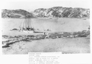
Late 19th century photos show this vast plain as one <strong>of</strong> orchards and widely scattered lone<br />
houses, virtually all <strong>of</strong> which were connected to the agricultural uses <strong>of</strong> the area. A period<br />
comment upon an early 1880 view <strong>of</strong> east Medford, published in 1911, notes;<br />
... the feature which causes the stranger to doubt that the view can<br />
be one <strong>of</strong> the east side is the entire absence <strong>of</strong> residences <strong>of</strong> any<br />
kind on either side <strong>of</strong> the street for a considerable distance eastward<br />
from the bridge. It was just open county then... . 3<br />
Fueled by the orchard boom, numerous additions to Medford were platted east <strong>of</strong> Bear Creek in<br />
the first fifteen years <strong>of</strong> the 20th Century. Subdivided into blocks and lots, former orchard tracts<br />
became prime residential real estate and local newspapers were soon filled with developer's<br />
advertisements <strong>of</strong> property for sale. The old wooden bridge across the creek, the sole<br />
transportation link between the area and downtown, was replaced in 1912 with a modern concrete<br />
span, drastically increasing the practicality <strong>of</strong> "Eastside" living. This improvement greatly added<br />
to the impetus for new construction. The burgeoning area soon was in heated competition with<br />
the earlier residential areas west <strong>of</strong> Bear Creek for prominence and new investment. In April<br />
1911 the newly formed "East Side Improvement Association," comprised <strong>of</strong> developers and real<br />
estate interests, began a campaign geared toward redefining the roles <strong>of</strong> either shore <strong>of</strong> Bear<br />
Creek;<br />
MEDFORD HAS FOUND HER STRIDE. Her phenomenal<br />
growth <strong>of</strong> the past two years will be eclipsed by that <strong>of</strong> the coming<br />
year......Yours is the opportunity to play a man's part NOW in the<br />
laying down <strong>of</strong> a skeleton plan about which shall be built the CITY<br />
BEAUTIFUL! The first strong line <strong>of</strong> that plan must be the<br />
2 "Medford's Population" [Editorial], Medford Sun, 2-December-1910, 2:1-2.<br />
3 "East Main Street Twenty Years Ago," Medford Mail Tribune, 9-June-1910.