Introduction to Physical Oceanography, 2008a
Introduction to Physical Oceanography, 2008a
Introduction to Physical Oceanography, 2008a

You also want an ePaper? Increase the reach of your titles
YUMPU automatically turns print PDFs into web optimized ePapers that Google loves.
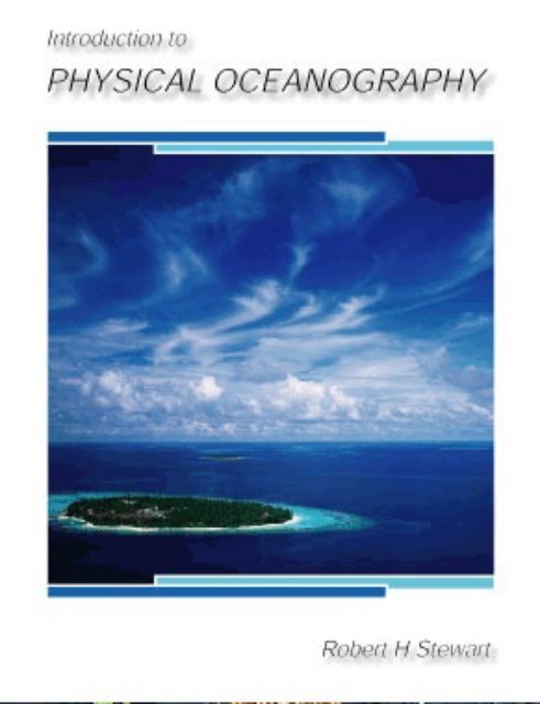
<strong>Introduction</strong> To<br />
<strong>Physical</strong> <strong>Oceanography</strong><br />
Robert H. Stewart<br />
Department of <strong>Oceanography</strong><br />
Texas A & M University<br />
Copyright 2008<br />
September 2008 Edition
ii<br />
This book may be distributed and used under the terms of the Creative Commons<br />
Attribution-NonCommercial-ShareAlike 4.0 International license (CC BY-<br />
NC-SA 4.0).
Contents<br />
Preface<br />
vii<br />
1 A Voyage of Discovery 1<br />
1.1 Physics of the ocean . . . . . . . . . . . . . . . . . . . . . . . . . 1<br />
1.2 Goals . . . . . . . . . . . . . . . . . . . . . . . . . . . . . . . . . 2<br />
1.3 Organization . . . . . . . . . . . . . . . . . . . . . . . . . . . . . 3<br />
1.4 The Big Picture . . . . . . . . . . . . . . . . . . . . . . . . . . . . 3<br />
1.5 Further Reading . . . . . . . . . . . . . . . . . . . . . . . . . . . 5<br />
2 The His<strong>to</strong>rical Setting 7<br />
2.1 Definitions . . . . . . . . . . . . . . . . . . . . . . . . . . . . . . . 8<br />
2.2 Eras of Oceanographic Exploration . . . . . . . . . . . . . . . . . 8<br />
2.3 Miles<strong>to</strong>nes in the Understanding of the Ocean . . . . . . . . . . . 12<br />
2.4 Evolution of some Theoretical Ideas . . . . . . . . . . . . . . . . 15<br />
2.5 The Role of Observations in <strong>Oceanography</strong> . . . . . . . . . . . . 16<br />
2.6 Important Concepts . . . . . . . . . . . . . . . . . . . . . . . . . 20<br />
3 The <strong>Physical</strong> Setting 21<br />
3.1 Ocean and Seas . . . . . . . . . . . . . . . . . . . . . . . . . . . . 22<br />
3.2 Dimensions of the ocean . . . . . . . . . . . . . . . . . . . . . . . 23<br />
3.3 Sea-Floor Features . . . . . . . . . . . . . . . . . . . . . . . . . . 25<br />
3.4 Measuring the Depth of the Ocean . . . . . . . . . . . . . . . . . 28<br />
3.5 Sea Floor Charts and Data Sets . . . . . . . . . . . . . . . . . . . 33<br />
3.6 Sound in the Ocean . . . . . . . . . . . . . . . . . . . . . . . . . 34<br />
3.7 Important Concepts . . . . . . . . . . . . . . . . . . . . . . . . . 37<br />
4 Atmospheric Influences 39<br />
4.1 The Earth in Space . . . . . . . . . . . . . . . . . . . . . . . . . . 39<br />
4.2 Atmospheric Wind Systems . . . . . . . . . . . . . . . . . . . . . 41<br />
4.3 The Planetary Boundary Layer . . . . . . . . . . . . . . . . . . . 43<br />
4.4 Measurement of Wind . . . . . . . . . . . . . . . . . . . . . . . . 43<br />
4.5 Calculations of Wind . . . . . . . . . . . . . . . . . . . . . . . . . 46<br />
4.6 Wind Stress . . . . . . . . . . . . . . . . . . . . . . . . . . . . . . 48<br />
4.7 Important Concepts . . . . . . . . . . . . . . . . . . . . . . . . . 49<br />
iii
iv<br />
CONTENTS<br />
5 The Oceanic Heat Budget 51<br />
5.1 The Oceanic Heat Budget . . . . . . . . . . . . . . . . . . . . . . 51<br />
5.2 Heat-Budget Terms . . . . . . . . . . . . . . . . . . . . . . . . . . 53<br />
5.3 Direct Calculation of Fluxes . . . . . . . . . . . . . . . . . . . . . 57<br />
5.4 Indirect Calculation of Fluxes: Bulk Formulas . . . . . . . . . . . 58<br />
5.5 Global Data Sets for Fluxes . . . . . . . . . . . . . . . . . . . . . 61<br />
5.6 Geographic Distribution of Terms . . . . . . . . . . . . . . . . . . 65<br />
5.7 Meridional Heat Transport . . . . . . . . . . . . . . . . . . . . . 68<br />
5.8 Variations in Solar Constant . . . . . . . . . . . . . . . . . . . . . 70<br />
5.9 Important Concepts . . . . . . . . . . . . . . . . . . . . . . . . . 72<br />
6 Temperature, Salinity, and Density 73<br />
6.1 Definition of Salinity . . . . . . . . . . . . . . . . . . . . . . . . . 73<br />
6.2 Definition of Temperature . . . . . . . . . . . . . . . . . . . . . . 77<br />
6.3 Geographical Distribution . . . . . . . . . . . . . . . . . . . . . . 77<br />
6.4 The Oceanic Mixed Layer and Thermocline . . . . . . . . . . . . 81<br />
6.5 Density . . . . . . . . . . . . . . . . . . . . . . . . . . . . . . . . 83<br />
6.6 Measurement of Temperature . . . . . . . . . . . . . . . . . . . . 88<br />
6.7 Measurement of Conductivity or Salinity . . . . . . . . . . . . . . 92<br />
6.8 Measurement of Pressure . . . . . . . . . . . . . . . . . . . . . . 94<br />
6.9 Temperature and Salinity With Depth . . . . . . . . . . . . . . . 95<br />
6.10 Light in the Ocean and Absorption of Light . . . . . . . . . . . . 97<br />
6.11 Important Concepts . . . . . . . . . . . . . . . . . . . . . . . . . 101<br />
7 The Equations of Motion 103<br />
7.1 Dominant Forces for Ocean Dynamics . . . . . . . . . . . . . . . 103<br />
7.2 Coordinate System . . . . . . . . . . . . . . . . . . . . . . . . . . 104<br />
7.3 Types of Flow in the ocean . . . . . . . . . . . . . . . . . . . . . 105<br />
7.4 Conservation of Mass and Salt . . . . . . . . . . . . . . . . . . . 106<br />
7.5 The Total Derivative (D/Dt) . . . . . . . . . . . . . . . . . . . . 107<br />
7.6 Momentum Equation . . . . . . . . . . . . . . . . . . . . . . . . . 108<br />
7.7 Conservation of Mass: The Continuity Equation . . . . . . . . . 111<br />
7.8 Solutions <strong>to</strong> the Equations of Motion . . . . . . . . . . . . . . . . 113<br />
7.9 Important Concepts . . . . . . . . . . . . . . . . . . . . . . . . . 114<br />
8 Equations of Motion With Viscosity 115<br />
8.1 The Influence of Viscosity . . . . . . . . . . . . . . . . . . . . . . 115<br />
8.2 Turbulence . . . . . . . . . . . . . . . . . . . . . . . . . . . . . . 116<br />
8.3 Calculation of Reynolds Stress: . . . . . . . . . . . . . . . . . . . 119<br />
8.4 Mixing in the Ocean . . . . . . . . . . . . . . . . . . . . . . . . . 123<br />
8.5 Stability . . . . . . . . . . . . . . . . . . . . . . . . . . . . . . . . 127<br />
8.6 Important Concepts . . . . . . . . . . . . . . . . . . . . . . . . . 131
CONTENTS<br />
v<br />
9 Response of the Upper Ocean <strong>to</strong> Winds 133<br />
9.1 Inertial Motion . . . . . . . . . . . . . . . . . . . . . . . . . . . . 133<br />
9.2 Ekman Layer at the Sea Surface . . . . . . . . . . . . . . . . . . 135<br />
9.3 Ekman Mass Transport . . . . . . . . . . . . . . . . . . . . . . . 143<br />
9.4 Application of Ekman Theory . . . . . . . . . . . . . . . . . . . . 145<br />
9.5 Langmuir Circulation . . . . . . . . . . . . . . . . . . . . . . . . 147<br />
9.6 Important Concepts . . . . . . . . . . . . . . . . . . . . . . . . . 147<br />
10 Geostrophic Currents 151<br />
10.1 Hydrostatic Equilibrium . . . . . . . . . . . . . . . . . . . . . . . 151<br />
10.2 Geostrophic Equations . . . . . . . . . . . . . . . . . . . . . . . . 153<br />
10.3 Surface Geostrophic Currents From Altimetry . . . . . . . . . . . 155<br />
10.4 Geostrophic Currents From Hydrography . . . . . . . . . . . . . 158<br />
10.5 An Example Using Hydrographic Data . . . . . . . . . . . . . . . 164<br />
10.6 Comments on Geostrophic Currents . . . . . . . . . . . . . . . . 164<br />
10.7 Currents From Hydrographic Sections . . . . . . . . . . . . . . . 171<br />
10.8 Lagrangian Measurements of Currents . . . . . . . . . . . . . . . 172<br />
10.9 Eulerian Measurements . . . . . . . . . . . . . . . . . . . . . . . 179<br />
10.10Important Concepts . . . . . . . . . . . . . . . . . . . . . . . . . 180<br />
11 Wind Driven Ocean Circulation 183<br />
11.1 Sverdrup’s Theory of the Oceanic Circulation . . . . . . . . . . . 183<br />
11.2 Western Boundary Currents . . . . . . . . . . . . . . . . . . . . . 189<br />
11.3 Munk’s Solution . . . . . . . . . . . . . . . . . . . . . . . . . . . 190<br />
11.4 Observed Surface Circulation in the Atlantic . . . . . . . . . . . 192<br />
11.5 Important Concepts . . . . . . . . . . . . . . . . . . . . . . . . . 197<br />
12 Vorticity in the Ocean 199<br />
12.1 Definitions of Vorticity . . . . . . . . . . . . . . . . . . . . . . . . 199<br />
12.2 Conservation of Vorticity . . . . . . . . . . . . . . . . . . . . . . 202<br />
12.3 Influence of Vorticity . . . . . . . . . . . . . . . . . . . . . . . . . 204<br />
12.4 Vorticity and Ekman Pumping . . . . . . . . . . . . . . . . . . . 205<br />
12.5 Important Concepts . . . . . . . . . . . . . . . . . . . . . . . . . 210<br />
13 Deep Circulation in the Ocean 211<br />
13.1 Defining the Deep Circulation . . . . . . . . . . . . . . . . . . . . 211<br />
13.2 Importance of the Deep Circulation . . . . . . . . . . . . . . . . . 212<br />
13.3 Theory for the Deep Circulation . . . . . . . . . . . . . . . . . . 219<br />
13.4 Observations of the Deep Circulation . . . . . . . . . . . . . . . . 222<br />
13.5 Antarctic Circumpolar Current . . . . . . . . . . . . . . . . . . . 229<br />
13.6 Important Concepts . . . . . . . . . . . . . . . . . . . . . . . . . 232<br />
14 Equa<strong>to</strong>rial Processes 235<br />
14.1 Equa<strong>to</strong>rial Processes . . . . . . . . . . . . . . . . . . . . . . . . . 236<br />
14.2 El Niño . . . . . . . . . . . . . . . . . . . . . . . . . . . . . . . . 240<br />
14.3 El Niño Teleconnections . . . . . . . . . . . . . . . . . . . . . . . 248
vi<br />
CONTENTS<br />
14.4 Observing El Niño . . . . . . . . . . . . . . . . . . . . . . . . . . 250<br />
14.5 Forecasting El Niño . . . . . . . . . . . . . . . . . . . . . . . . . 251<br />
14.6 Important Concepts . . . . . . . . . . . . . . . . . . . . . . . . . 254<br />
15 Numerical Models 255<br />
15.1 <strong>Introduction</strong>–Some Words of Caution . . . . . . . . . . . . . . . . 255<br />
15.2 Numerical Models in <strong>Oceanography</strong> . . . . . . . . . . . . . . . . 257<br />
15.3 Global Ocean Models . . . . . . . . . . . . . . . . . . . . . . . . . 258<br />
15.4 Coastal Models . . . . . . . . . . . . . . . . . . . . . . . . . . . . 262<br />
15.5 Assimilation Models . . . . . . . . . . . . . . . . . . . . . . . . . 266<br />
15.6 Coupled Ocean and Atmosphere Models . . . . . . . . . . . . . . 269<br />
15.7 Important Concepts . . . . . . . . . . . . . . . . . . . . . . . . . 272<br />
16 Ocean Waves 273<br />
16.1 Linear Theory of Ocean Surface Waves . . . . . . . . . . . . . . . 273<br />
16.2 Nonlinear waves . . . . . . . . . . . . . . . . . . . . . . . . . . . 278<br />
16.3 Waves and the Concept of a Wave Spectrum . . . . . . . . . . . 278<br />
16.4 Ocean-Wave Spectra . . . . . . . . . . . . . . . . . . . . . . . . . 284<br />
16.5 Wave Forecasting . . . . . . . . . . . . . . . . . . . . . . . . . . . 288<br />
16.6 Measurement of Waves . . . . . . . . . . . . . . . . . . . . . . . . 289<br />
16.7 Important Concepts . . . . . . . . . . . . . . . . . . . . . . . . . 292<br />
17 Coastal Processes and Tides 293<br />
17.1 Shoaling Waves and Coastal Processes . . . . . . . . . . . . . . . 293<br />
17.2 Tsunamis . . . . . . . . . . . . . . . . . . . . . . . . . . . . . . . 297<br />
17.3 S<strong>to</strong>rm Surges . . . . . . . . . . . . . . . . . . . . . . . . . . . . . 299<br />
17.4 Theory of Ocean Tides . . . . . . . . . . . . . . . . . . . . . . . . 300<br />
17.5 Tidal Prediction . . . . . . . . . . . . . . . . . . . . . . . . . . . 308<br />
17.6 Important Concepts . . . . . . . . . . . . . . . . . . . . . . . . . 312<br />
References 313<br />
Index 332
Preface<br />
This book is written for upper-division undergraduates and new graduate students<br />
in meteorology, ocean engineering, and oceanography. Because these students<br />
have a diverse background, I have emphasized ideas and concepts more<br />
than mathematical derivations.<br />
Unlike most books, I am distributing this book for free in digital format via<br />
the world-wide web. I am doing this for two reasons:<br />
1. Textbooks are usually out of date by the time they are published, usually<br />
a year or two after the author finishes writing the book. Randol Larson,<br />
writing in Syllabus, states: “In my opinion, technology textbooks are a<br />
waste of natural resources. They’re out of date the moment they are<br />
published. Because of their short shelf life, students don’t even want <strong>to</strong><br />
hold on <strong>to</strong> them”—(Larson, 2002). By publishing in electronic form, I can<br />
make revisions every year, keeping the book current.<br />
2. Many students, especially in less-developed countries cannot afford the<br />
high cost of textbooks from the developed world. This then is a gift<br />
from the US National Aeronautics and Space Administration nasa <strong>to</strong> the<br />
students of the world.<br />
Acknowledgements<br />
I have taught from the book for several years, and I thank the many students<br />
in my classes and throughout the world who have pointed out poorly written<br />
sections, ambiguous text, conflicting notation, and other errors. I also thank<br />
Professor Fred Schlemmer at Texas A&M Galves<strong>to</strong>n who, after using the book<br />
for his classes, has provided extensive comments about the material.<br />
I also wish <strong>to</strong> thank many colleagues for providing figures, comments, and<br />
helpful information. I especially wish <strong>to</strong> thank Aanderaa Instruments, Bill Allison,<br />
Kevin Bartlett, James Berger, Gerben de Boer, Daniel Bourgault, Don<br />
Chambers, Greg Crawford, Thierry De Mees, Richard Eanes, Peter Etnoyer,<br />
Tal Ezer, Gregg Foti, Nevin S. Fučkar, Luiz Alexandre de Araujo Guerra,<br />
Hazel Jenkins, Andrew Kiss, Jody Klymak, Judith Lean, Christian LeProvost,<br />
Brooks Martner, Nikolai Maximenko, Kevin McKone, Mike McPhaden, Thierry<br />
De Mees, Pim van Meurs, Gary Mitchum, Joe Murtagh, Peter Niiler, Nuno<br />
Nunes, Ismael Núñez-Riboni, Alex Orsi, Kym Perkin, Mark Powell, Richard<br />
Ray, Joachim Ribbe, Will Sager, David Sandwell, Sea-Bird Electronics, Achim<br />
vii
viii<br />
PREFACE<br />
S<strong>to</strong>essel, David S<strong>to</strong>oksbury, Tom Whitworth, Carl Wunsch and many others.<br />
Of course, I accept responsibility for all mistakes in the book. Please send<br />
me your comments and suggestions for improvement.<br />
Figures in the book came from many sources. I particularly wish <strong>to</strong> thank<br />
Link Ji for many global maps, and colleagues at the University of Texas Center<br />
for Space Research. Don Johnson redrew many figures and turned sketches in<strong>to</strong><br />
figures. Trey Morris tagged the words used in the index.<br />
I especially thank nasa’s Jet Propulsion Labora<strong>to</strong>ry and the Topex/Poseidon<br />
and Jason Projects for their support of the book through contracts 960887 and<br />
1205046.<br />
Cover pho<strong>to</strong>graph of the resort island of Kurumba in North Male A<strong>to</strong>ll in<br />
the Maldives was taken by Jagdish Agara (copyright Corbis). Cover design is<br />
by Don Johnson.<br />
The book was produced in L A TEX2ε using TeXShop 2.14 on an Intel iMac<br />
computer running OS-X 10.4.11. I especially wish <strong>to</strong> thank Gerben Wierda for<br />
his very useful i-Installer package that made it all possible, Richard Koch, Dirk<br />
Olmes and many others for writing the TeXShop software package, and Andrew<br />
Kiss at the University of New South Wales in Canberra Australia for help in<br />
using the hyperref package. The L A TEX2ε software is a pleasure <strong>to</strong> use. All<br />
figures were drawn in Adobe Illustra<strong>to</strong>r.
Chapter 1<br />
A Voyage of Discovery<br />
The role of the ocean on weather and climate is often discussed in the news.<br />
Who has not heard of El Niño and changing weather patterns, the Atlantic<br />
hurricane season and s<strong>to</strong>rm surges? Yet, what exactly is the role of the ocean?<br />
And, why do we care?<br />
1.1 Why study the Physics of the ocean?<br />
The answer depends on our interests, which devolve from our use of the<br />
ocean. Three broad themes are important:<br />
1. We get food from the ocean. Hence we may be interested in processes<br />
which influence the sea just as farmers are interested in the weather and<br />
climate. The ocean not only has weather such as temperature changes<br />
and currents, but the oceanic weather fertilizes the sea. The atmospheric<br />
weather seldom fertilizes fields except for the small amount of nitrogen<br />
fixed by lightning.<br />
2. We use the ocean. We build structures on the shore or just offshore. We<br />
use the ocean for transport. We obtain oil and gas below the ocean. And,<br />
we use the ocean for recreation, swimming, boating, fishing, surfing, and<br />
diving. Hence we are interested in processes that influence these activities,<br />
especially waves, winds, currents, and temperature.<br />
3. The ocean influence the atmospheric weather and climate. The ocean<br />
influence the distribution of rainfall, droughts, floods, regional climate,<br />
and the development of s<strong>to</strong>rms, hurricanes, and typhoons. Hence we are<br />
interested in air-sea interactions, especially the fluxes of heat and water<br />
across the sea surface, the transport of heat by the ocean, and the influence<br />
of the ocean on climate and weather patterns.<br />
These themes influence our selection of <strong>to</strong>pics <strong>to</strong> study. The <strong>to</strong>pics then determine<br />
what we measure, how the measurements are made, and the geographic<br />
areas of interest. Some processes are local, such as the breaking of waves on a<br />
beach, some are regional, such as the influence of the North Pacific on Alaskan<br />
1
2 CHAPTER 1. A VOYAGE OF DISCOVERY<br />
weather, and some are global, such as the influence of the ocean on changing<br />
climate and global warming.<br />
If indeed, these reasons for the study of the ocean are important, lets begin<br />
a voyage of discovery. Any voyage needs a destination. What is ours?<br />
1.2 Goals<br />
At the most basic level, I hope you, the students who are reading this text,<br />
will become aware of some of the major conceptual schemes (or theories) that<br />
form the foundation of physical oceanography, how they were arrived at, and<br />
why they are widely accepted, how oceanographers achieve order out of a random<br />
ocean, and the role of experiment in oceanography (<strong>to</strong> paraphrase Shamos,<br />
1995: p. 89).<br />
More particularly, I expect you will be able <strong>to</strong> describe physical processes<br />
influencing the ocean and coastal regions: the interaction of the ocean with the<br />
atmosphere, and the distribution of oceanic winds, currents, heat fluxes, and<br />
water masses. The text emphasizes ideas rather than mathematical techniques.<br />
I will try <strong>to</strong> answer such questions as:<br />
1. What is the basis of our understanding of physics of the ocean?<br />
(a) What are the physical properties of sea water?<br />
(b) What are the important thermodynamic and dynamic processes influencing<br />
the ocean?<br />
(c) What equations describe the processes and how were they derived?<br />
(d) What approximations were used in the derivation?<br />
(e) Do the equations have useful solutions?<br />
(f) How well do the solutions describe the process? That is, what is the<br />
experimental basis for the theories?<br />
(g) Which processes are poorly unders<strong>to</strong>od? Which are well unders<strong>to</strong>od?<br />
2. What are the sources of information about physical variables?<br />
(a) What instruments are used for measuring each variable?<br />
(b) What are their accuracy and limitations?<br />
(c) What his<strong>to</strong>ric data exist?<br />
(d) What platforms are used? Satellites, ships, drifters, moorings?<br />
3. What processes are important? Some important process we will study<br />
include:<br />
(a) Heat s<strong>to</strong>rage and transport in the ocean.<br />
(b) The exchange of heat with the atmosphere and the role of the ocean<br />
in climate.<br />
(c) Wind and thermal forcing of the surface mixed layer.<br />
(d) The wind-driven circulation including the Ekman circulation, Ekman<br />
pumping of the deeper circulation, and upwelling.
1.3. ORGANIZATION 3<br />
(e) The dynamics of ocean currents, including geostrophic currents and<br />
the role of vorticity.<br />
(f) The formation of water types and masses.<br />
(g) The deep circulation of the ocean.<br />
(h) Equa<strong>to</strong>rial dynamics, El Niño, and the role of the ocean in weather.<br />
(i) Numerical models of the circulation.<br />
(j) Waves in the ocean including surface waves, inertial oscillations,<br />
tides, and tsunamis.<br />
(k) Waves in shallow water, coastal processes, and tide predictions.<br />
4. What are a few of the major currents and water masses in the ocean, and<br />
what governs their distribution?<br />
1.3 Organization<br />
Before beginning a voyage, we usually try <strong>to</strong> learn about the places we will<br />
visit. We look at maps and we consult travel guides. In this book, our guide will<br />
be the papers and books published by oceanographers. We begin with a brief<br />
overview of what is known about the ocean. We then proceed <strong>to</strong> a description<br />
of the ocean basins, for the shape of the seas influences the physical processes<br />
in the water. Next, we study the external forces, wind and heat, acting on<br />
the ocean, and the ocean’s response. As we proceed, I bring in theory and<br />
observations as necessary.<br />
By the time we reach chapter 7, we will need <strong>to</strong> understand the equations<br />
describing dynamic response of the ocean. So we consider the equations of<br />
motion, the influence of earth’s rotation, and viscosity. This leads <strong>to</strong> a study of<br />
wind-driven ocean currents, the geostrophic approximation, and the usefulness<br />
of conservation of vorticity.<br />
Toward the end, we consider some particular examples: the deep circulation,<br />
the equa<strong>to</strong>rial ocean and El Niño, and the circulation of particular areas of the<br />
ocean. Next we look at the role of numerical models in describing the ocean.<br />
At the end, we study coastal processes, waves, tides, wave and tidal forecasting,<br />
tsunamis, and s<strong>to</strong>rm surges.<br />
1.4 The Big Picture<br />
The ocean is one part of the earth system. It mediates processes in the<br />
atmosphere by the transfers of mass, momentum, and energy through the sea<br />
surface. It receives water and dissolved substances from the land. And, it lays<br />
down sediments that eventually become rocks on land. Hence an understanding<br />
of the ocean is important for understanding the earth as a system, especially for<br />
understanding important problems such as global change or global warming. At<br />
a lower level, physical oceanography and meteorology are merging. The ocean<br />
provides the feedback leading <strong>to</strong> slow changes in the atmosphere.<br />
As we study the ocean, I hope you will notice that we use theory, observations,<br />
and numerical models <strong>to</strong> describe ocean dynamics. None is sufficient by<br />
itself.
4 CHAPTER 1. A VOYAGE OF DISCOVERY<br />
1. Ocean processes are nonlinear and turbulent. Yet we don’t really understand<br />
the theory of non-linear, turbulent flow in complex basins. Theories<br />
used <strong>to</strong> describe the ocean are much simplified approximations <strong>to</strong> reality.<br />
2. Observations are sparse in time and space. They provide a rough description<br />
of the time-averaged flow, but many processes in many regions are<br />
poorly observed.<br />
3. Numerical models include much-more-realistic theoretical ideas, they can<br />
help interpolate oceanic observations in time and space, and they are used<br />
<strong>to</strong> forecast climate change, currents, and waves. Nonetheless, the numerical<br />
equations are approximations <strong>to</strong> the continuous analytic equations<br />
that describe fluid flow, they contain no information about flow between<br />
grid points, and they cannot yet be used <strong>to</strong> describe fully the turbulent<br />
flow seen in the ocean.<br />
By combining theory and observations in numerical models we avoid some of<br />
the difficulties associated with each approach used separately (figure 1.1). Continued<br />
refinements of the combined approach are leading <strong>to</strong> ever-more-precise<br />
descriptions of the ocean. The ultimate goal is <strong>to</strong> know the ocean well enough<br />
<strong>to</strong> predict the future changes in the environment, including climate change or<br />
the response of fisheries <strong>to</strong> over fishing.<br />
Data<br />
Numerical<br />
Models<br />
Understanding<br />
Prediction<br />
Theory<br />
Figure 1.1 Data, numerical models, and theory are all necessary <strong>to</strong> understand the ocean.<br />
Eventually, an understanding of the ocean-atmosphere-land system will lead <strong>to</strong> predictions<br />
of future states of the system.<br />
The combination of theory, observations, and computer models is relatively<br />
new. Four decades of exponential growth in computing power has made available<br />
desk<strong>to</strong>p computers capable of simulating important physical processes and<br />
oceanic dynamics.<br />
All of us who are involved in the sciences know that the computer has become<br />
an essential <strong>to</strong>ol for research . . . scientific computation has reached<br />
the point where it is on a par with labora<strong>to</strong>ry experiment and mathematical<br />
theory as a <strong>to</strong>ol for research in science and engineering—Langer<br />
(1999).<br />
The combination of theory, observations, and computer models also implies<br />
a new way of doing oceanography. In the past, an oceanographer would devise
1.5. FURTHER READING 5<br />
a theory, collect data <strong>to</strong> test the theory, and publish the results. Now, the tasks<br />
have become so specialized that few can do it all. Few excel in theory, collecting<br />
data, and numerical simulations. Instead, the work is done more and more by<br />
teams of scientists and engineers.<br />
1.5 Further Reading<br />
If you know little about the ocean and oceanography, I suggest you begin<br />
by reading MacLeish’s (1989) book The Gulf Stream: Encounters With the<br />
Blue God, especially his Chapter 4 on “Reading the ocean.” In my opinion, it<br />
is the best overall, non-technical, description of how oceanographers came <strong>to</strong><br />
understand the ocean.<br />
You may also benefit from reading pertinent chapters from any introduc<strong>to</strong>ry<br />
oceanographic textbook. Those by Gross, Pinet, or Segar are especially useful.<br />
The three texts produced by the Open University provide a slightly more<br />
advanced treatment.<br />
Gross, M. Grant and Elizabeth Gross (1996) <strong>Oceanography</strong>—A View of Earth.<br />
7th edition. Prentice Hall.<br />
MacLeish, William (1989) The Gulf Stream: Encounters With the Blue God.<br />
Hough<strong>to</strong>n Mifflin Company.<br />
Pinet, Paul R. (2006) Invitation <strong>to</strong> <strong>Oceanography</strong>. 4nd edition. Jones and<br />
Bartlett Publishers.<br />
Open University (2001) Ocean Circulation. 2nd edition. Pergamon Press.<br />
Open University (1995) Seawater: Its Composition, Properties and Behavior.<br />
2nd edition. Pergamon Press.<br />
Open University (1989) Waves, Tides and Shallow-Water Processes. Pergamon<br />
Press.<br />
Segar, Douglas A. (2007) <strong>Introduction</strong> <strong>to</strong> Ocean Sciences. 2nd edition. W. W.<br />
Nor<strong>to</strong>n.
6 CHAPTER 1. A VOYAGE OF DISCOVERY
Chapter 2<br />
The His<strong>to</strong>rical Setting<br />
Our knowledge of oceanic currents, winds, waves, and tides goes back thousands<br />
of years. Polynesian naviga<strong>to</strong>rs traded over long distances in the Pacific as early<br />
as 4000 bc (Service, 1996). Pytheas explored the Atlantic from Italy <strong>to</strong> Norway<br />
in 325 bc. Arabic traders used their knowledge of the reversing winds and<br />
currents in the Indian Ocean <strong>to</strong> establish trade routes <strong>to</strong> China in the Middle<br />
Ages and later <strong>to</strong> Zanzibar on the African coast. And, the connection between<br />
tides and the sun and moon was described in the Samaveda of the Indian Vedic<br />
period extending from 2000 <strong>to</strong> 1400 bc (Pugh, 1987). Those oceanographers<br />
who tend <strong>to</strong> accept as true only that which has been measured by instruments,<br />
have much <strong>to</strong> learn from those who earned their living on the ocean.<br />
Modern European knowledge of the ocean began with voyages of discovery by<br />
Bartholomew Dias (1487–1488), Chris<strong>to</strong>pher Columbus (1492–1494), Vasco da<br />
Gama (1497–1499), Ferdinand Magellan (1519–1522), and many others. They<br />
laid the foundation for global trade routes stretching from Spain <strong>to</strong> the Philippines<br />
in the early 16th century. The routes were based on a good working<br />
knowledge of trade winds, the westerlies, and western boundary currents in the<br />
Atlantic and Pacific (Couper, 1983: 192–193).<br />
The early European explorers were soon followed by scientific voyages of<br />
discovery led by (among many others) James Cook (1728–1779) on the Endeavour,<br />
Resolution, and Adventure, Charles Darwin (1809–1882) on the Beagle,<br />
Sir James Clark Ross and Sir John Ross who surveyed the Arctic and Antarctic<br />
regions from the Vic<strong>to</strong>ry, theIsabella, andtheErebus, and Edward Forbes<br />
(1815–1854) who studied the vertical distribution of life in the ocean. Others<br />
collected oceanic observations and produced useful charts, including Edmond<br />
Halley who charted the trade winds and monsoons and Benjamin Franklin who<br />
charted the Gulf Stream.<br />
Slow ships of the 19th and 20th centuries gave way <strong>to</strong> satellites, drifters,<br />
and au<strong>to</strong>nomous instruments <strong>to</strong>ward the end of the 20th century. Satellites<br />
now observe the ocean, air, and land. Thousands of drifters observe the upper<br />
two kilometers of the ocean. Data from these systems, when fed in<strong>to</strong> numerical<br />
models allows the study of earth as a system. For the first time, we can<br />
7
8 CHAPTER 2. THE HISTORICAL SETTING<br />
60 o 180 o<br />
40 o<br />
20 o<br />
0 o<br />
-20 o<br />
-40 o<br />
-60 o<br />
-60 o 0 o 60 o<br />
120 o -120 o<br />
Figure 2.1 Example from the era of deep-sea exploration: Track of H.M.S. Challenger<br />
during the British Challenger Expedition 1872–1876. After Wust (1964).<br />
study how biological, chemical, and physical systems interact <strong>to</strong> influence our<br />
environment.<br />
2.1 Definitions<br />
The long his<strong>to</strong>ry of the study of the ocean has led <strong>to</strong> the development of<br />
various, specialized disciplines each with its own interests and vocabulary. The<br />
more important disciplines include:<br />
<strong>Oceanography</strong> is the study of the ocean, with emphasis on its character as<br />
an environment. The goal is <strong>to</strong> obtain a description sufficiently quantitative <strong>to</strong><br />
be used for predicting the future with some certainty.<br />
Geophysics is the study of the physics of the earth.<br />
<strong>Physical</strong> <strong>Oceanography</strong> is the study of physical properties and dynamics of<br />
the ocean. The primary interests are the interaction of the ocean with the atmosphere,<br />
the oceanic heat budget, water mass formation, currents, and coastal<br />
dynamics. <strong>Physical</strong> <strong>Oceanography</strong> is considered by many <strong>to</strong> be a subdiscipline<br />
of geophysics.<br />
Geophysical Fluid Dynamics is the study of the dynamics of fluid motion on<br />
scales influenced by the rotation of the earth. Meteorology and oceanography<br />
use geophysical fluid dynamics <strong>to</strong> calculate planetary flow fields.<br />
Hydrography is the preparation of nautical charts, including charts of ocean<br />
depths, currents, internal density field of the ocean, and tides.<br />
Earth-system Science is the study of earth as a single system comprising<br />
many interacting subsystems including the ocean, atmosphere, cryosphere, and<br />
biosphere, and changes in these systems due <strong>to</strong> human activity.<br />
2.2 Eras of Oceanographic Exploration<br />
The exploration of the sea can be divided, somewhat arbitrarily, in<strong>to</strong> various<br />
eras (Wust, 1964). I have extended his divisions through the end of the 20th<br />
century.
2.2. ERAS OF OCEANOGRAPHIC EXPLORATION 9<br />
60 o<br />
40 o<br />
20 o<br />
XII<br />
XIV<br />
0 o<br />
XII<br />
IX<br />
X<br />
XI<br />
VII<br />
-20 o<br />
VI<br />
VII<br />
II<br />
-40 o<br />
IV<br />
I<br />
Stations<br />
III<br />
Anchored<br />
Stations<br />
V<br />
-60 o<br />
Meteor<br />
1925–1927<br />
-80 o -60 o -40 o -20 o<br />
0 o 20 o 40 o<br />
Figure 2.2 Example of a survey from the era of national systematic surveys. Track of the<br />
R/V Meteor during the German Meteor Expedition. Redrawn from Wust (1964).<br />
1. Era of Surface <strong>Oceanography</strong>: Earliest times <strong>to</strong> 1873. The era is characterized<br />
by systematic collection of mariners’ observations of winds, currents,<br />
waves, temperature, and other phenomena observable from the deck of<br />
sailing ships. Notable examples include Halley’s charts of the trade winds,<br />
Franklin’s map of the Gulf Stream, and Matthew Fontaine Maury’s <strong>Physical</strong><br />
Geography of the Sea.<br />
2. Era of Deep-Sea Exploration: 1873–1914. Characterized by a few, wideranging<br />
oceanographic expeditions <strong>to</strong> survey surface and subsurface condi-
10 CHAPTER 2. THE HISTORICAL SETTING<br />
60 o<br />
40 o<br />
20 o<br />
0 o<br />
-20 o<br />
-40 o -100 o -80 o<br />
-60 o<br />
-40 o<br />
-20 o<br />
0 o<br />
20 o<br />
Figure 2.3 Example from the era of new methods. The cruises of the R/V Atlantis out of<br />
Woods Hole Oceanographic Institution. After Wust (1964).<br />
tions, especially near colonial claims. The major example is the Challenger<br />
Expedition (figure 2.1), but also the Gazelle and Fram Expeditions.<br />
3. Era of National Systematic Surveys: 1925–1940. Characterized by detailed<br />
surveys of colonial areas. Examples include Meteor surveys of the Atlantic<br />
(figure 2.2), and the Discovery Expeditions.<br />
4. Era of New Methods: 1947–1956. Characterized by long surveys using<br />
new instruments (figure 2.3). Examples include seismic surveys of the<br />
Atlantic by Vema leading <strong>to</strong> Heezen’s maps of the sea floor.<br />
5. Era of International Cooperation: 1957–1978. Characterized by multinational<br />
surveys of ocean and studies of oceanic processes. Examples include<br />
the Atlantic Polar Front Program, the norpac cruises, the International<br />
Geophysical Year cruises, and the International Decade of Ocean Exploration<br />
(figure 2.4). Multiship studies of oceanic processes include mode,<br />
polymode, norpax, andjasin experiments.<br />
6. Era of Satellites: 1978–1995. Characterized by global surveys of oceanic
2.2. ERAS OF OCEANOGRAPHIC EXPLORATION 11<br />
Discovery II<br />
Discovery II<br />
Discovery II<br />
Crawford<br />
Chain<br />
Discovery II<br />
Atlantis<br />
20 o<br />
Crawford<br />
Atlantis<br />
60 o Atlantic<br />
40 o<br />
Discovery II<br />
Crawford<br />
Crawford<br />
0 o<br />
Crawford<br />
Crawford<br />
-20 o<br />
Crawford<br />
Crawford<br />
Atlantis<br />
-40 o<br />
Capt. Canepa<br />
Capt. Canepa<br />
I.G.Y.<br />
Program<br />
1957–1959<br />
-60 o<br />
-80 o -60 o -40 o -20 o<br />
-0 o<br />
20 o 40 o<br />
Figure 2.4 Example from the era of international cooperation . Sections measured by the<br />
International Geophysical Year Atlantic Program 1957-1959. After Wust (1964).<br />
processes from space. Examples include Seasat, noaa 6–10, nimbus–7,<br />
Geosat, Topex/Poseidon, and ers–1 & 2.<br />
7. Era of Earth System Science: 1995– Characterized by global studies of<br />
the interaction of biological, chemical, and physical processes in the ocean<br />
and atmosphere and on land using in situ (which means from measurements<br />
made in the water) and space data in numerical models. Oceanic<br />
examples include the World Ocean Circulation Experiment (woce) (figure<br />
2.5) and Topex/Poseidon (figure 2.6), the Joint Global Ocean Flux Study
12 CHAPTER 2. THE HISTORICAL SETTING<br />
Atlantic Indian Pacific<br />
80 o<br />
60 o 1 1<br />
2<br />
1<br />
40 o 18 16<br />
3<br />
4<br />
22<br />
25<br />
2<br />
5<br />
26<br />
3<br />
27<br />
20 o 20<br />
8 9 10 11 13<br />
6<br />
1<br />
28<br />
4<br />
29<br />
0 o<br />
1514<br />
30<br />
14 15 16 17 18<br />
7<br />
7N 2<br />
5<br />
8 13<br />
8N 9N 10 20<br />
31<br />
-20 o<br />
9<br />
3<br />
21<br />
4<br />
10<br />
5<br />
6<br />
-40 o 17<br />
11S<br />
11<br />
7<br />
6 7S 8S 9S<br />
23<br />
12<br />
12<br />
-60 o 21<br />
S4<br />
S4<br />
S4<br />
0 o 60 o 100 14S 17<br />
-80 o o 140<br />
-40 o 20 o<br />
o<br />
-80 o 180 o -140 o -100 o<br />
19<br />
Committed/completed<br />
Figure 2.5 World Ocean Circulation Experiment: Tracks of research ships making a one-time<br />
global survey of the ocean of the world. From World Ocean Circulation Experiment.<br />
(jgofs), the Global Ocean Data Assimilation Experiment (godae), and<br />
the SeaWiFS, Aqua, and Terra satellites.<br />
2.3 Miles<strong>to</strong>nes in the Understanding of the Ocean<br />
What have all these programs and expeditions taught us about the ocean?<br />
Let’s look at some miles<strong>to</strong>nes in our ever increasing understanding of the ocean<br />
beginning with the first scientific investigations of the 17th century. Initially<br />
60 o 120 o 160 o -160 o -120 o -80 o -40 o<br />
40 o<br />
20 o<br />
0 o<br />
-20 o<br />
-40 o<br />
-60 o<br />
180 o<br />
Figure 2.6 Example from the era of satellites. Topex/Poseidon tracks in the Pacific<br />
Ocean during a 10-day repeat of the orbit. From Topex/Poseidon Project.
2.3. MILESTONES IN THE UNDERSTANDING OF THE OCEAN 13<br />
Figure 2.7 The 1786 version of Franklin-Folger map of the Gulf Stream.<br />
progress was slow. First came very simple observations of far reaching importance<br />
by scientists who probably did not consider themselves oceanographers, if<br />
the term even existed. Later came more detailed descriptions and oceanographic<br />
experiments by scientists who specialized in the study of the ocean.<br />
1685 Edmond Halley, investigating the oceanic wind systems and currents,<br />
published “An His<strong>to</strong>rical Account of the Trade Winds, and Monsoons,<br />
observable in the Seas between and near the Tropicks, with an attempt <strong>to</strong><br />
assign the <strong>Physical</strong> cause of the said Winds” Philosophical Transactions.<br />
1735 George Hadley published his theory for the trade winds based on conservation<br />
of angular momentum in “Concerning the Cause of the General<br />
Trade-Winds” Philosophical Transactions, 39: 58-62.<br />
1751 Henri Ellis made the first deep soundings of temperature in the tropics,<br />
finding cold water below a warm surface layer, indicating the water came<br />
from the polar regions.<br />
1769 Benjamin Franklin, as postmaster, made the first map of the Gulf Stream<br />
using information from mail ships sailing between New England and England<br />
collected by his cousin Timothy Folger (figure 2.7).<br />
1775 Laplace’s published his theory of tides.
14 CHAPTER 2. THE HISTORICAL SETTING<br />
1800 Count Rumford proposed a meridional circulation of the ocean with water<br />
sinking near the poles and rising near the Equa<strong>to</strong>r.<br />
1847 Matthew Fontaine Maury published his first chart of winds and currents<br />
based on ships logs. Maury established the practice of international exchange<br />
of environmental data, trading logbooks for maps and charts derived<br />
from the data.<br />
1872–1876 Challenger Expedition marks the beginning of the systematic study<br />
of the biology, chemistry, and physics of the ocean of the world.<br />
1885 Pillsbury made direct measurements of the Florida Current using current<br />
meters deployed from a ship moored in the stream.<br />
1903 Founding of the Marine Biological Labora<strong>to</strong>ry of the University of California.<br />
It later became the Scripps Institution of <strong>Oceanography</strong>.<br />
1910–1913 Vilhelm Bjerknes published Dynamic Meteorology and Hydrography<br />
which laid the foundation of geophysical fluid dynamics. In it he<br />
developed the idea of fronts, the dynamic meter, geostrophic flow, air-sea<br />
interaction, and cyclones.<br />
1930 Founding of the Woods Hole Oceanographic Institution.<br />
1942 Publication of The ocean by Sverdrup, Johnson, and Fleming, a comprehensive<br />
survey of oceanographic knowledge up <strong>to</strong> that time.<br />
Post WW 2 The need <strong>to</strong> detect submarines led the navies of the world <strong>to</strong><br />
greatly expand their studies of the sea. This led <strong>to</strong> the founding of<br />
oceanography departments at state universities, including Oregon State,<br />
Texas A&M University, University of Miami, and University of Rhode Island,<br />
and the founding of national ocean labora<strong>to</strong>ries such as the various<br />
Institutes of Oceanographic Science.<br />
1947–1950 Sverdrup, S<strong>to</strong>mmel, and Munk publish their theories of the winddriven<br />
circulation of the ocean. Together the three papers lay the foundation<br />
for our understanding of the ocean’s circulation.<br />
1949 Start of California Cooperative Fisheries Investigation of the California<br />
Current. The most complete study ever undertaken of a coastal current.<br />
1952 Cromwell and Montgomery rediscover the Equa<strong>to</strong>rial Undercurrent in the<br />
Pacific.<br />
1955 Bruce Hamon and Neil Brown develop the CTD for measuring conductivity<br />
and temperature as a function of depth in the ocean.<br />
1958 S<strong>to</strong>mmel publishes his theory for the deep circulation of the ocean.<br />
1963 Sippican Corporation (Tim Francis, William Van Allen Clark, Graham<br />
Campbell, and Sam Francis) invents the Expendable BathyThermograph<br />
xbt now perhaps the most widely used oceanographic instrument deployed<br />
from ships.<br />
1969 Kirk Bryan and Michael Cox develop the first numerical model of the<br />
oceanic circulation.
2.4. EVOLUTION OF SOME THEORETICAL IDEAS 15<br />
1978 nasa launches the first oceanographic satellite, Seasat. The project developed<br />
techniques used by generations of remotes sensing satellites.<br />
1979–1981 Terry Joyce, Rob Pinkel, Lloyd Regier, F. Rowe and J. W. Young<br />
develop techniques leading <strong>to</strong> the acoustic-doppler current profiler for measuring<br />
ocean-surface currents from moving ships, an instrument widely<br />
used in oceanography.<br />
1988 nasa Earth System Science Committee headed by Francis Brether<strong>to</strong>n<br />
outlines how all earth systems are interconnected, thus breaking down the<br />
barriers separating traditional sciences of astrophysics, ecology, geology,<br />
meteorology, and oceanography.<br />
1991 Wally Broecker proposes that changes in the deep circulation of the ocean<br />
modulate the ice ages, and that the deep circulation in the Atlantic could<br />
collapse, plunging the northern hemisphere in<strong>to</strong> a new ice age.<br />
1992 Russ Davis and Doug Webb invent the au<strong>to</strong>nomous, pop-up drifter that<br />
continuously measures currents at depths <strong>to</strong> 2 km.<br />
1992 nasa and cnes develop and launch Topex/Poseidon, a satellite that maps<br />
ocean surface currents, waves, and tides every ten days, revolutionizing our<br />
understanding of ocean dynamics and tides.<br />
1993 Topex/Poseidon science-team members publish first accurate global maps<br />
of the tides.<br />
More information on the his<strong>to</strong>ry of physical oceanography can be found in Appendix<br />
A of W.S. von Arx (1962): An <strong>Introduction</strong> <strong>to</strong> <strong>Physical</strong> <strong>Oceanography</strong>.<br />
Data collected from the centuries of oceanic expeditions have been used<br />
<strong>to</strong> describe the ocean. Most of the work went <strong>to</strong>ward describing the steady<br />
state of the ocean, its currents from <strong>to</strong>p <strong>to</strong> bot<strong>to</strong>m, and its interaction with<br />
the atmosphere. The basic description was mostly complete by the early 1970s.<br />
Figure 2.8 shows an example from that time, the surface circulation of the ocean.<br />
More recent work has sought <strong>to</strong> document the variability of oceanic processes,<br />
<strong>to</strong> provide a description of the ocean sufficient <strong>to</strong> predict annual and interannual<br />
variability, and <strong>to</strong> understand the role of the ocean in global processes.<br />
2.4 Evolution of some Theoretical Ideas<br />
A theoretical understanding of oceanic processes is based on classical physics<br />
coupled with an evolving understanding of chaotic systems in mathematics and<br />
the application <strong>to</strong> the theory of turbulence. The dates given below are approximate.<br />
19th Century Development of analytic hydrodynamics. Lamb’s Hydrodynamics<br />
is the pinnacle of this work. Bjerknes develops geostrophic method<br />
widely used in meteorology and oceanography.<br />
1925–40 Development of theories for turbulence based on aerodynamics and<br />
mixing-length ideas. Work of Prandtl and von Karman.
16 CHAPTER 2. THE HISTORICAL SETTING<br />
Greenland<br />
Irminger<br />
Murman<br />
Arctic Circle<br />
Norway<br />
60 o<br />
Oyeshio<br />
Alaska<br />
Labrador<br />
North<br />
Atlantic<br />
drift<br />
45 o<br />
North Pacific<br />
California<br />
Gulf<br />
Stream<br />
30 o<br />
Kuroshio<br />
Florida<br />
Canaries<br />
15 o<br />
Equa<strong>to</strong>rial Countercurrent<br />
Equa<strong>to</strong>r<br />
0 o C.C.<br />
-15 o<br />
-30 o<br />
East<br />
Australia<br />
North Equa<strong>to</strong>rial<br />
South Equa<strong>to</strong>rial<br />
Brazil<br />
Peru<br />
or<br />
Humboldt<br />
N. Eq. C.<br />
Guinea<br />
Somali<br />
S. Eq. C. Eq.C.C.<br />
Benguala<br />
Agulhas<br />
N. Eq. C.<br />
S. Eq. C.<br />
West Australia<br />
-45 o<br />
Falkland<br />
-60 o<br />
West wind drift<br />
or<br />
Antarctic Circumpolar<br />
West wind drift<br />
or<br />
Antarctic Circumpolar<br />
warm currents N. north S. south Eq. equa<strong>to</strong>rial<br />
cool currents C. current C.C. counter current<br />
Figure 2.8 The time-averaged, surface circulation of the ocean during northern hemisphere<br />
winter deduced from a century of oceanographic expeditions. After Tolmazin (1985: 16).<br />
1940–1970 Refinement of theories for turbulence based on statistical correlations<br />
and the idea of isotropic homogeneous turbulence. Books by Batchelor<br />
(1967), Hinze (1975), and others.<br />
1970– Numerical investigations of turbulent geophysical fluid dynamics based<br />
on high-speed digital computers.<br />
1985– Mechanics of chaotic processes. The application <strong>to</strong> hydrodynamics is<br />
just beginning. Most motion in the atmosphere and ocean may be inherently<br />
unpredictable.<br />
2.5 The Role of Observations in <strong>Oceanography</strong><br />
The brief <strong>to</strong>ur of theoretical ideas suggests that observations are essential<br />
for understanding the ocean. The theory describing a convecting, wind-forced,<br />
turbulent fluid in a rotating coordinate system has never been sufficiently well<br />
known that important features of the oceanic circulation could be predicted<br />
before they were observed. In almost all cases, oceanographers resort <strong>to</strong> observations<br />
<strong>to</strong> understand oceanic processes.<br />
At first glance, we might think that the numerous expeditions mounted<br />
since 1873 would give a good description of the ocean. The results are indeed<br />
impressive. Hundreds of expeditions have extended in<strong>to</strong> all ocean. Yet, much<br />
of the ocean is poorly explored.<br />
By the year 2000, most areas of the ocean will have been sampled from<br />
<strong>to</strong>p <strong>to</strong> bot<strong>to</strong>m only once. Some areas, such as the Atlantic, will have been<br />
sparsely sampled three times: during the International Geophysical Year in<br />
1959, during the Geochemical Sections cruises in the early 1970s, and during<br />
the World Ocean Circulation Experiment from 1991 <strong>to</strong> 1996. All areas will be
2.5. THE ROLE OF OBSERVATIONS IN OCEANOGRAPHY 17<br />
vastly under sampled. This is the sampling problem (See box on next page).<br />
Our samples of the ocean are insufficient <strong>to</strong> describe the ocean well enough <strong>to</strong><br />
predict its variability and its response <strong>to</strong> changing forcing. Lack of sufficient<br />
samples is the largest source of error in our understanding of the ocean.<br />
The lack of observations has led <strong>to</strong> a very important and widespread conceptual<br />
error:<br />
“The absence of evidence was taken as evidence of absence.” The great<br />
difficulty of observing the ocean meant that when a phenomenon was not<br />
observed, it was assumed it was not present. The more one is able <strong>to</strong><br />
observe the ocean, the more the complexity and subtlety that appears—<br />
Wunsch (2002a).<br />
As a result, our understanding of the ocean is often <strong>to</strong>o simple <strong>to</strong> be correct.<br />
Selecting Oceanic Data Sets Muchoftheexistingoceanicdatahavebeen<br />
organized in<strong>to</strong> large data sets. For example, satellite data are processed and<br />
distributed by groups working with nasa. Data from ships have been collected<br />
and organized by other groups. Oceanographers now rely more and more on<br />
such collections of data produced by others.<br />
The use of data produced by others introduces problems: i) How accurate<br />
are the data in the set? ii) What are the limitations of the data set? And, iii)<br />
How does the set compare with other similar sets? Anyone who uses public or<br />
private data sets is wise <strong>to</strong> obtain answers <strong>to</strong> such questions.<br />
If you plan <strong>to</strong> use data from others, here are some guidelines.<br />
1. Use well documented data sets. Does the documentation completely describe<br />
the sources of the original measurements, all steps used <strong>to</strong> process<br />
the data, and all criteria used <strong>to</strong> exclude data? Does the data set include<br />
version numbers <strong>to</strong> identify changes <strong>to</strong> the set?<br />
2. Use validated data. Has accuracy of data been well documented? Was<br />
accuracy determined by comparing with different measurements of the<br />
same variable? Was validation global or regional?<br />
3. Use sets that have been used by others and referenced in scientific papers.<br />
Some data sets are widely used for good reason. Those who produced the<br />
sets used them in their own published work and others trust the data.<br />
4. Conversely, don’t use a data set just because it is handy. Can you document<br />
the source of the set? For example, many versions of the digital,<br />
5-minute maps of the sea floor are widely available. Some date back <strong>to</strong><br />
the first sets produced by the U.S. Defense Mapping Agency, others are<br />
from the e<strong>to</strong>po-5 set. Don’t rely on a colleague’s statement about the<br />
source. Find the documentation. If it is missing, find another data set.<br />
Designing Oceanic Experiments Observations are exceedingly important<br />
for oceanography, yet observations are expensive because ship time and satellites<br />
are expensive. As a result, oceanographic experiments must be carefully<br />
planned. While the design of experiments may not fit well within an his<strong>to</strong>rical
18 CHAPTER 2. THE HISTORICAL SETTING<br />
Sampling Error<br />
Sampling error is the largest source of error in the geosciences. It is caused<br />
by a set of samples not representing the population of the variable being<br />
measured. A population is the set of all possible measurements, and a sample<br />
is the sampled subset of the population. We assume each measurement<br />
is perfectly accurate.<br />
To determine if your measurement has a sampling error, you must first<br />
completely specify the problem you wish <strong>to</strong> study. This defines the population.<br />
Then, you must determine if the samples represent the population.<br />
Both steps are necessary.<br />
Suppose your problem is <strong>to</strong> measure the annual-mean sea-surface temperature<br />
of the ocean <strong>to</strong> determine if global warming is occurring. For this<br />
problem, the population is the set of all possible measurements of surface<br />
temperature, in all regions in all months. If the sample mean is <strong>to</strong> equal<br />
the true mean, the samples must be uniformly distributed throughout the<br />
year and over all the area of the ocean, and sufficiently dense <strong>to</strong> include all<br />
important variability in time and space. This is impossible. Ships avoid<br />
s<strong>to</strong>rmy regions such as high latitudes in winter, so ship samples tend not <strong>to</strong><br />
represent the population of surface temperatures. Satellites may not sample<br />
uniformly throughout the daily cycle, and they may not observe temperature<br />
at high latitudes in winter because of persistent clouds, although they<br />
tend <strong>to</strong> sample uniformly in space and throughout the year in most regions.<br />
If daily variability is small, the satellite samples will be more representative<br />
of the population than the ship samples.<br />
From the above, it should be clear that oceanic samples rarely represent<br />
the population we wish <strong>to</strong> study. We always have sampling errors.<br />
In defining sampling error, we must clearly distinguish between instrument<br />
errors and sampling errors. Instrument errors are due <strong>to</strong> the inaccuracy<br />
of the instrument. Sampling errors are due <strong>to</strong> a failure <strong>to</strong> make<br />
a measurement. Consider the example above: the determination of mean<br />
sea-surface temperature. If the measurements are made by thermometers<br />
on ships, each measurement has a small error because thermometers are not<br />
perfect. This is an instrument error. If the ships avoids high latitudes in<br />
winter, the absence of measurements at high latitude in winter is a sampling<br />
error.<br />
Meteorologists designing the Tropical Rainfall Mapping Mission have<br />
been investigating the sampling error in measurements of rain. Their results<br />
are general and may be applied <strong>to</strong> other variables. For a general description<br />
of the problem see North & Nakamo<strong>to</strong> (1989).<br />
chapter,perhapsthe<strong>to</strong>picmeritsafewbriefcommentsbecauseitisseldom<br />
mentioned in oceanographic textbooks, although it is prominently described in<br />
texts for other scientific fields. The design of experiments is particularly important<br />
because poorly planned experiments lead <strong>to</strong> ambiguous results, they may<br />
measure the wrong variables, or they may produce completely useless data.
2.5. THE ROLE OF OBSERVATIONS IN OCEANOGRAPHY 19<br />
The first and most important aspect of the design of any experiment is <strong>to</strong><br />
determine why you wish <strong>to</strong> make a measurement before deciding how you will<br />
make the measurement or what you will measure.<br />
1. What is the purpose of the observations? Do you wish <strong>to</strong> test hypotheses<br />
or describe processes?<br />
2. What accuracy is required of the observation?<br />
3. What resolution in time and space is required? What is the duration of<br />
measurements?<br />
Consider, for example, how the purpose of the measurement changes how you<br />
might measure salinity or temperature as a function of depth:<br />
1. If the purpose is <strong>to</strong> describe water masses in an ocean basin, then measurements<br />
with 20–50 m vertical spacing and 50–300 km horizontal spacing,<br />
repeated once per 20–50 years in deep water are required.<br />
2. If the purpose is <strong>to</strong> describe vertical mixing in the open equa<strong>to</strong>rial Pacific,<br />
then 0.5–1.0 mm vertical spacing and 50–1000 km spacing between<br />
locations repeated once per hour for many days may be required.<br />
Accuracy, Precision, and Linearity While we are on the <strong>to</strong>pic of experiments,<br />
now is a good time <strong>to</strong> introduce three concepts needed throughout the<br />
book when we discuss experiments: precision, accuracy, and linearity of a measurement.<br />
Accuracy is the difference between the measured value and the true value.<br />
Precision is the difference among repeated measurements.<br />
The distinction between accuracy and precision is usually illustrated by the<br />
simple example of firing a rifle at a target. Accuracy is the average distance<br />
from the center of the target <strong>to</strong> the hits on the target. Precision is the average<br />
distance between the hits. Thus, ten rifle shots could be clustered within a circle<br />
10 cm in diameter with the center of the cluster located 20 cm from the center<br />
of the target. The accuracy is then 20 cm, and the precision is roughly 5 cm.<br />
Linearity requires that the output of an instrument be a linear function of<br />
the input. Nonlinear devices rectify variability <strong>to</strong> a constant value. So a nonlinear<br />
response leads <strong>to</strong> wrong mean values. Non-linearity can be as important<br />
as accuracy. For example, let<br />
then<br />
Output = Input +0.1(Input) 2<br />
Input = a sin ωt<br />
Output = a sin ωt +0.1(a sin ωt) 2<br />
Output = Input + 0.1<br />
2 a2 − 0.1<br />
2 a2 cos 2ωt<br />
Note that the mean value of the input is zero, yet the output of this nonlinear<br />
instrument has a mean value of 0.05a 2 plus an equally large term at
20 CHAPTER 2. THE HISTORICAL SETTING<br />
twice the input frequency. In general, if input has frequencies ω 1 and ω 2 ,then<br />
output of a non-linear instrument has frequencies ω 1 ± ω 2 . Linearity of an<br />
instrument is especially important when the instrument must measure the mean<br />
value of a turbulent variable. For example, we require linear current meters when<br />
measuring currents near the sea surface where wind and waves produce a large<br />
variability in the current.<br />
Sensitivity <strong>to</strong> other variables of interest. Errors may be correlated with<br />
other variables of the problem. For example, measurements of conductivity<br />
are sensitive <strong>to</strong> temperature. So, errors in the measurement of temperature in<br />
salinometers leads <strong>to</strong> errors in the measured values of conductivity or salinity.<br />
2.6 Important Concepts<br />
From the above, I hope you have learned:<br />
1. The ocean is not well known. What we know is based on data collected<br />
from only a little more than a century of oceanographic expeditions supplemented<br />
with satellite data collected since 1978.<br />
2. The basic description of the ocean is sufficient for describing the timeaveraged<br />
mean circulation of the ocean, and recent work is beginning <strong>to</strong><br />
describe the variability.<br />
3. Observations are essential for understanding the ocean. Few processes<br />
have been predicted from theory before they were observed.<br />
4. Lack of observations has led <strong>to</strong> conceptual pictures of oceanic processes<br />
that are often <strong>to</strong>o simplified and often misleading.<br />
5. Oceanographers rely more and more on large data sets produced by others.<br />
The sets have errors and limitations which you must understand before<br />
using them.<br />
6. The planning of experiments is at least as important as conducting the<br />
experiment.<br />
7. Sampling errors arise when the observations, the samples, are not representative<br />
of the process being studied. Sampling errors are the largest<br />
source of error in oceanography.<br />
8. Almost all our observations of the ocean now come from satellites, drifters,<br />
and au<strong>to</strong>nomous instruments. Fewer and fewer observations come from<br />
ships at sea.
Chapter 3<br />
The <strong>Physical</strong> Setting<br />
Earth is an oblate ellipsoid, an ellipse rotated about its minor axis, with an<br />
equa<strong>to</strong>rial radius of R e =6, 378.1349 km (West, 1982) slightly greater than<br />
the polar radius of R p =6, 356.7497 km. The small equa<strong>to</strong>rial bulge is due <strong>to</strong><br />
earth’s rotation.<br />
Distances on earth are measured in many different units, the most common<br />
are degrees of latitude or longitude, meters, miles, and nautical miles. Latitude<br />
is the angle between the local vertical and the equa<strong>to</strong>rial plane. A meridian is the<br />
intersection at earth’s surface of a plane perpendicular <strong>to</strong> the equa<strong>to</strong>rial plane<br />
and passing through earth’s axis of rotation. Longitude is the angle between<br />
the standard meridian and any other meridian, where the standard meridian is<br />
the one that passes through a point at the Royal Observa<strong>to</strong>ry at Greenwich,<br />
England. Thus longitude is measured east or west of Greenwich.<br />
A degree of latitude is not the same length as a degree of longitude except<br />
at the equa<strong>to</strong>r. Latitude is measured along great circles with radius R, where<br />
R is the mean radius of earth. Longitude is measured along circles with radius<br />
R cos ϕ, whereϕ is latitude. Thus 1 ◦ latitude = 111 km, and 1 ◦ longitude<br />
= 111 cos ϕ km.<br />
Because distance in degrees of longitude is not constant, oceanographers<br />
measure distance on maps using degrees of latitude.<br />
Nautical miles and meters are connected his<strong>to</strong>rically <strong>to</strong> the size of earth.<br />
Gabriel Mou<strong>to</strong>n proposed in 1670 a decimal system of measurement based on<br />
the length of an arc that is one minute of a great circle of earth. This eventually<br />
became the nautical mile. Mou<strong>to</strong>n’s decimal system eventually became the<br />
metric system based on a different unit of length, the meter, which was originally<br />
intended <strong>to</strong> be one ten-millionth the distance from the Equa<strong>to</strong>r <strong>to</strong> the pole along<br />
the Paris meridian. Although the tie between nautical miles, meters, and earth’s<br />
radius was soon abandoned because it was not practical, the approximations are<br />
very good. For example, earth’s polar circumference is approximately 40,008<br />
km. Therefore one ten-millionth of a quadrant is 1.0002 m. Similarly, a nautical<br />
mile should be 1.8522 km, which is very close <strong>to</strong> the official definition of the<br />
international nautical mile: 1nm≡ 1.8520 km.<br />
21
22 CHAPTER 3. THE PHYSICAL SETTING<br />
0 0 30 o 60 o 90 o<br />
-30 0<br />
-60 o<br />
-90 o<br />
-80 o -40 o 0 o 40 o<br />
-4000 -3000 -1000 -200 0<br />
Figure 3.1 The Atlantic Ocean viewed with an Eckert VI equal-area projection. Depths, in<br />
meters, are from the e<strong>to</strong>po 30 ′ data set. The 200 m con<strong>to</strong>ur outlines continental shelves.<br />
3.1 Ocean and Seas<br />
There is only one ocean. It is divided in<strong>to</strong> three named parts by international<br />
agreement: the Atlantic, Pacific, and Indian ocean (International Hydrographic<br />
Bureau, 1953). Seas, which are part of the ocean, are defined in several ways. I<br />
consider two.<br />
The Atlantic Ocean extends northward from Antarctica and includes all<br />
of the Arctic Sea, the European Mediterranean, and the American Mediterranean<br />
more commonly known as the Caribbean sea (figure 3.1). The boundary<br />
between the Atlantic and Indian Ocean is the meridian of Cape Agulhas (20 ◦ E).<br />
The boundary between the Atlantic and Pacific is the line forming the shortest<br />
distance from Cape Horn <strong>to</strong> the South Shetland Islands. In the north, the<br />
Arctic Sea is part of the Atlantic Ocean, and the Bering Strait is the boundary<br />
between the Atlantic and Pacific.<br />
The Pacific Ocean extends northward from Antarctica <strong>to</strong> the Bering Strait<br />
(figure 3.2). The boundary between the Pacific and Indian Ocean follows the
3.2. DIMENSIONS OF THE OCEAN 23<br />
0 o 30 o 60 o 90 o<br />
-30 o<br />
-60 o<br />
-90 o<br />
120 o 160 o -160 o -120 o -80 o<br />
-4000 -3000 -1000 -200 0<br />
Figure 3.2 The Pacific Ocean viewed with an Eckert VI equal-area projection. Depths, in<br />
meters, are from the e<strong>to</strong>po 30 ′ data set. The 200 m con<strong>to</strong>ur outlines continental shelves.<br />
line from the Malay Peninsula through Sumatra, Java, Timor, Australia at Cape<br />
Londonderry, and Tasmania. From Tasmania <strong>to</strong> Antarctica it is the meridian<br />
of South East Cape on Tasmania 147 ◦ E.<br />
The Indian Ocean extends from Antarctica <strong>to</strong> the continent of Asia including<br />
the Red Sea and Persian Gulf (figure 3.3). Some authors use the name<br />
Southern Ocean <strong>to</strong> describe the ocean surrounding Antarctica.<br />
Mediterranean Seas are mostly surrounded by land. By this definition,<br />
the Arctic and Caribbean Seas are both Mediterranean Seas, the Arctic Mediterranean<br />
and the Caribbean Mediterranean.<br />
Marginal Seas are defined by only an indentation in the coast. The Arabian<br />
Sea and South China Sea are marginal seas.<br />
3.2 Dimensions of the ocean<br />
The ocean and seas cover 70.8% of the surface of earth, which amounts <strong>to</strong><br />
361,254,000 km 2 . The areas of the named parts vary considerably (table 3.1).
24 CHAPTER 3. THE PHYSICAL SETTING<br />
0 o 30 o -4000 -3000 -1000 -200 0<br />
-30 o<br />
-60 o<br />
-90 o<br />
40 o 80 o 120 o<br />
Figure 3.3 The Indian Ocean viewed with an Eckert VI equal-area projection. Depths, in<br />
meters, are from the e<strong>to</strong>po 30 ′ data set. The 200 m con<strong>to</strong>ur outlines continental shelves.<br />
Oceanic dimensions range from around 1500 km for the minimum width of<br />
the Atlantic <strong>to</strong> more than 13,000 km for the north-south extent of the Atlantic<br />
and the width of the Pacific. Typical depths are only 3–4 km. So horizontal<br />
dimensions of ocean basins are 1,000 times greater than the vertical dimension.<br />
A scale model of the Pacific, the size of an 8.5 × 11 in sheet of paper, would<br />
have dimensions similar <strong>to</strong> the paper: a width of 10,000 km scales <strong>to</strong> 10 in, and<br />
a depth of 3 km scales <strong>to</strong> 0.003 in, the typical thickness of a piece of paper.<br />
Because the ocean is so thin, cross-sectional plots of ocean basins must have a<br />
greatly exaggerated vertical scale <strong>to</strong> be useful. Typical plots have a vertical scale<br />
that is 200 times the horizontal scale (figure 3.4). This exaggeration dis<strong>to</strong>rts<br />
our view of the ocean. The edges of the ocean basins, the continental slopes,<br />
are not steep cliffs as shown in the figure at 41 ◦ Wand12 ◦ E. Rather, they are<br />
gentle slopes dropping down 1 meter for every 20 meters in the horizontal.<br />
Thesmallratioofdepth<strong>to</strong>widthoftheoceanbasinsisveryimportant<br />
for understanding ocean currents. Vertical velocities must be much smaller<br />
than horizontal velocities. Even over distances of a few hundred kilometers, the<br />
Table 3.1 Surface Area of the ocean †<br />
Pacific Ocean 181.34 × 10 6 km 2<br />
Atlantic Ocean 106.57 × 10 6 km 2<br />
Indian Ocean 74.12 × 10 6 km 2<br />
† From Menard and Smith (1966)
3.3. SEA-FLOOR FEATURES 25<br />
0<br />
Depth (km)<br />
-2<br />
-4<br />
-6<br />
-45 o -30 o -15 o 0 o 15 o<br />
Longitude<br />
6 km<br />
-45 o -30 o -15 o 0 o 15 o<br />
Figure 3.4 Cross-section of the south Atlantic along 25 ◦ S showing the continental shelf<br />
offshore of South America, a seamount near 35 ◦ W, the mid-Atlantic Ridge near 14 ◦ W, the<br />
Walvis Ridge near 6 ◦ E, and the narrow continental shelf off South Africa. Upper Vertical<br />
exaggeration of 180:1. Lower Vertical exaggeration of 30:1. If shown with true aspect ratio,<br />
the plot would be the thickness of the line at the sea surface in the lower plot.<br />
vertical velocity must be less than 1% of the horizontal velocity. I will use this<br />
information later <strong>to</strong> simplify the equations of motion.<br />
The relatively small vertical velocities have great influence on turbulence.<br />
Three dimensional turbulence is fundamentally different than two-dimensional<br />
turbulence. In two dimensions, vortex lines must always be vertical, and there<br />
can be little vortex stretching. In three dimensions, vortex stretching plays a<br />
fundamental role in turbulence.<br />
6 km<br />
3.3 Sea-Floor Features<br />
Earth’s rocky surface is divided in<strong>to</strong> two types: oceanic, with a thin dense<br />
crust about 10 km thick, and continental, with a thick light crust about 40 km<br />
thick. The deep, lighter continental crust floats higher on the denser mantle<br />
than does the oceanic crust, and the mean height of the crust relative <strong>to</strong> sea<br />
level has two distinct values: continents have a mean elevation of 1100 m, the<br />
ocean has a mean depth of -3400 m (figure 3.5).<br />
The volume of the water in the ocean exceeds the volume of the ocean basins,<br />
and some water spills over on <strong>to</strong> the low lying areas of the continents. These<br />
shallow seas are the continental shelves. Some, such as the South China Sea,<br />
are more than 1100 km wide. Most are relatively shallow, with typical depths<br />
of 50–100 m. A few of the more important shelves are: the East China Sea, the<br />
Bering Sea, the North Sea, the Grand Banks, the Patagonian Shelf, the Arafura<br />
Sea and Gulf of Carpentaria, and the Siberian Shelf. The shallow seas help<br />
dissipate tides, they are often areas of high biological productivity, and they are<br />
usually included in the exclusive economic zone of adjacent countries.<br />
The crust is broken in<strong>to</strong> large plates that move relative <strong>to</strong> each other. New
26 CHAPTER 3. THE PHYSICAL SETTING<br />
Frequency (% Area)<br />
0.00% 0.50% 1.00% 1.50% 2.00% 2.50% 3.00% 3.50% 4.00% 4.50% 5.00%<br />
10,000<br />
8,000<br />
6,000<br />
4,000<br />
Elevation (meters)<br />
2,000<br />
0<br />
-2,000<br />
-4,000<br />
-6,000<br />
-8,000<br />
-10,000<br />
0% 10% 20% 30% 40% 50% 60% 70% 80% 90% 100%<br />
Cumulative (% Area)<br />
Figure 3.5 His<strong>to</strong>gram of height of land and depth of the sea as percentage of area of earth<br />
in 100 m intervals, showing the clear distinction between continents and sea floor. The<br />
cumulative frequency curve is the integral of the his<strong>to</strong>gram. The curves are calculated from<br />
the e<strong>to</strong>po 2 data set by George Sharman of the noaa National Geophysical Data Center.<br />
crust is created at the mid-ocean ridges, and old crust is lost at trenches. The<br />
relative motion of crust, due <strong>to</strong> plate tec<strong>to</strong>nics, produces the distinctive features<br />
of the sea floor sketched in figure 3.6, including mid-ocean ridges, trenches, island<br />
arcs, and basins. The names of the sub-sea features have been defined by<br />
the International Hydrographic Organization (1953), and the following defini-<br />
Shore<br />
CONTINENT<br />
SHELF<br />
(Gravel,<br />
Sand<br />
Av slope<br />
1 in 500)<br />
High Water<br />
Low Water<br />
SLOPE<br />
Sea Level<br />
OCEAN<br />
ISLAND ARC<br />
(Mud<br />
av slope<br />
1 in 20)<br />
RISE<br />
BASIN<br />
(Clay & Oozes)<br />
Mineral Organic<br />
MID-OCEAN<br />
RIDGE<br />
DEEP SEA<br />
SEAMOUNT<br />
TRENCH<br />
Figure 3.6 Schematic section through the ocean showing principal features of the sea floor.<br />
Note that the slope of the sea floor is greatly exaggerated in the figure.
3.3. SEA-FLOOR FEATURES 27<br />
tions are taken from Sverdrup, Johnson, and Fleming (1942), Shepard (1963),<br />
and Dietrich et al. (1980).<br />
Basins are deep depressions of the sea floor of more or less circular or oval<br />
form.<br />
Canyons are relatively narrow, deep furrows with steep slopes, cutting across<br />
the continental shelf and slope, with bot<strong>to</strong>ms sloping continuously downward.<br />
Continental shelves are zones adjacent <strong>to</strong> a continent (or around an island)<br />
and extending from the low-water line <strong>to</strong> the depth, usually about 120 m, where<br />
there is a marked or rather steep descent <strong>to</strong>ward great depths. (figure 3.7)<br />
Continental slopes are the declivities seaward from the shelf edge in<strong>to</strong> greater<br />
depth.<br />
Plains are very flat surfaces found in many deep ocean basins.<br />
Ridges are long, narrow elevations of the sea floor with steep sides and rough<br />
<strong>to</strong>pography.<br />
Seamounts are isolated or comparatively isolated elevations rising 1000 m or<br />
more from the sea floor and with small summit area (figure 3.8).<br />
Figure 3.7 An example of a continental shelf, the shelf offshore of Monterey California<br />
showing the Monterey and other canyons. Canyons are common on shelves, often extending<br />
across the shelf and down the continental slope <strong>to</strong> deep water. Figure copyright Monterey<br />
Bay Aquarium Research Institute (mbari).
28 CHAPTER 3. THE PHYSICAL SETTING<br />
21.4 o<br />
40<br />
48<br />
21.3 o<br />
30<br />
40<br />
21.2 o<br />
20<br />
14<br />
21.1 o<br />
40<br />
20<br />
21.0 o<br />
30<br />
40<br />
20.9 o<br />
20.8 o<br />
163.0 o 163.1 o 163.2 o 163.3 o 163.4 o 163.5 o 163.6 o<br />
Figure 3.8 An example of a seamount, the Wilde Guyot. A guyot is a seamount with a flat<br />
<strong>to</strong>p created by wave action when the seamount extended above sea level. As the seamount is<br />
carried by plate motion, it gradually sinks deeper below sea level. The depth was con<strong>to</strong>ured<br />
from echo sounder data collected along the ship track (thin straight lines) supplemented<br />
with side-scan sonar data. Depths are in units of 100 m. From William Sager, Texas A&M<br />
University.<br />
Sills are the low parts of the ridges separating ocean basins from one another<br />
or from the adjacent sea floor.<br />
Trenches are long, narrow, and deep depressions of the sea floor, with relatively<br />
steep sides (figure 3.9).<br />
Sub-sea features strongly influences the ocean circulation. Ridges separate<br />
deep waters of the ocean in<strong>to</strong> distinct basins. Water deeper than the sill between<br />
two basins cannot move from one <strong>to</strong> the other. Tens of thousands of seamounts<br />
are scattered throughout the ocean basins. They interrupt ocean currents, and<br />
produce turbulence leading <strong>to</strong> vertical mixing in the ocean.<br />
3.4 Measuring the Depth of the Ocean<br />
The depth of the ocean is usually measured two ways: 1) using acoustic<br />
echo-sounders on ships, or 2) using data from satellite altimeters.
3.4. MEASURING THE DEPTH OF THE OCEAN 29<br />
Latitude (North)<br />
57 o 51<br />
56 o<br />
55 o<br />
54 o<br />
53 o<br />
52 o<br />
-500<br />
-200<br />
0<br />
-50<br />
-2000<br />
-4000<br />
-1000<br />
-3000<br />
-5000<br />
0<br />
-200<br />
-2000<br />
-4000<br />
-5000<br />
-500-500<br />
-6000<br />
Bering Sea<br />
Aleutian Trench<br />
B<br />
-50<br />
Alaskan Peninsula<br />
-50<br />
0<br />
-200<br />
-200<br />
-1000<br />
-3000<br />
-5000<br />
-5000<br />
Pacific Ocean<br />
A<br />
51 o<br />
167 o 165 o 163 o 161 o 159 o 157 o 155 o<br />
Longitude (West)<br />
0<br />
Depth (m)<br />
-2000<br />
-4000<br />
-6000<br />
Section A:B<br />
o<br />
52<br />
o<br />
53<br />
o<br />
o<br />
54<br />
Latitude (North)<br />
55 o 56 o 57 o<br />
Figure 3.9 An example of a trench, the Aleutian Trench; an island arc, the Alaskan Peninsula;<br />
and a continental shelf, the Bering Sea. The island arc is composed of volcanos produced<br />
when oceanic crust carried deep in<strong>to</strong> a trench melts and rises <strong>to</strong> the surface. Top: Map of<br />
the Aleutian region of the North Pacific. Bot<strong>to</strong>m: Cross-section through the region.<br />
Echo Sounders Most maps of the ocean are based on measurements made<br />
by echo sounders. The instrument transmits a burst of 10–30 kHz sound and<br />
listens for the echo from the sea floor. The time interval between transmission<br />
of the pulse and reception of the echo, when multiplied by the velocity of sound,<br />
gives twice the depth of the ocean (figure 3.10).<br />
The first transatlantic echo soundings were made by the U.S. Navy Destroyer<br />
Stewart in 1922. This was quickly followed by the first systematic survey of an<br />
ocean basin, made by the German research and survey ship Meteor during its<br />
expedition <strong>to</strong> the south Atlantic from 1925 <strong>to</strong> 1927. Since then, oceanographic<br />
and naval ships have operated echo sounders almost continuously while at sea.<br />
Millions of miles of ship-track data recorded on paper have been digitized <strong>to</strong><br />
produce data bases used <strong>to</strong> make maps. The tracks are not well distributed.
30 CHAPTER 3. THE PHYSICAL SETTING<br />
Electronics<br />
Receiver<br />
transducer<br />
Time-interval<br />
Measurment,<br />
Display, Recording<br />
Amplifier<br />
Oscilla<strong>to</strong>r<br />
Transmitter<br />
transducer<br />
Bot<strong>to</strong>m<br />
Surface<br />
Strip chart<br />
Contact bank<br />
Zero-contact<br />
switch<br />
Sliding<br />
contact<br />
Endless<br />
ribbon<br />
33 kHz<br />
sound pulse<br />
Electromechanical<br />
drive<br />
Oscilla<strong>to</strong>r<br />
Receiver<br />
transducer<br />
Transmitter<br />
transducer<br />
Figure 3.10 Left: Echo sounders measure depth of the ocean by transmitting pulses of sound<br />
and observing the time required <strong>to</strong> receive the echo from the bot<strong>to</strong>m. Right: The time is<br />
recorded by a spark burning a mark on a slowly moving roll of paper. After Dietrich et al.<br />
(1980: 124).<br />
Tracks tend <strong>to</strong> be far apart in the southern hemisphere, even near Australia<br />
(figure 3.11) and closer <strong>to</strong>gether in well mapped areas such as the North Atlantic.<br />
Echo sounders make the most accurate measurements of ocean depth. Their<br />
accuracy is ±1%.<br />
Satellite Altimetry Gaps in our knowledge of ocean depths between ship<br />
tracks have now been filled by satellite-altimeter data. Altimeters profile the<br />
shape of the sea surface, and its shape is very similar <strong>to</strong> the shape of the sea<br />
floor (Tapley and Kim, 2001; Cazenave and Royer, 2001; Sandwell and Smith,<br />
2001). To see this, we must first consider how gravity influences sea level.<br />
The Relationship Between Sea Level and the Ocean’s Depth Excess mass at<br />
the sea floor, for example the mass of a seamount, increases local gravity because<br />
the mass of the seamount is larger than the mass of water it displaces. Rocks<br />
are more than three times denser than water. The excess mass increases local<br />
gravity, which attracts water <strong>to</strong>ward the seamount. This changes the shape of<br />
the sea surface (figure 3.12).<br />
Let’s make the concept more exact. To a very good approximation, the sea<br />
surfaceisaparticularlevel surface called the geoid (see box). By definition a<br />
level surface is a surface of constant gravitational potential, and it is everywhere<br />
perpendicular <strong>to</strong> gravity. In particular, it must be perpendicular <strong>to</strong> the local<br />
vertical determined by a plumb line, which is “a line or cord having at one end<br />
a metal weight for determining vertical direction” (Oxford English Dictionary).<br />
The excess mass of the seamount attracts the plumb line’s weight, causing
3.4. MEASURING THE DEPTH OF THE OCEAN 31<br />
0 o Walter H. F. Smith and David T. Sandwell, Ship Tracks, Version 4.0, SIO, September 26, 1996 Copyright 1996, Walter H. F. Smith and David T. Sandwell<br />
-10 o<br />
-20 o<br />
-30 o<br />
-40 o<br />
90 o 100 o 110 o 120 o 130 o 140 o 150 o 160 o 170 o 180 o<br />
Figure 3.11 Locations of echo-sounder data used for mapping the ocean floor near Australia.<br />
Note the large areas where depths have not been measured from ships. From David Sandwell,<br />
Scripps Institution of <strong>Oceanography</strong>.<br />
the plumb line <strong>to</strong> point a little <strong>to</strong>ward the seamount instead of <strong>to</strong>ward earth’s<br />
center of mass. Because the sea surface must be perpendicular <strong>to</strong> gravity, it must<br />
have a slight bulge above a seamount as shown in figure 3.12. If there were no<br />
bulge, the sea surface would not be perpendicular <strong>to</strong> gravity. Typical seamounts<br />
produce a bulge that is 1–20 m high over distances of 100–200 kilometers. This<br />
bulge is far <strong>to</strong>o small <strong>to</strong> be seen from a ship, but it is easily measured by<br />
satellite altimeters. Oceanic trenches have a deficit of mass, and they produce<br />
a depression of the sea surface.<br />
The correspondence between the shape of the sea surface and the depth of<br />
the water is not exact. It depends on the strength of the sea floor, the age of<br />
the sea-floor feature, and the thickness of sediments. If a seamount floats on the<br />
sea floor like ice on water, the gravitational signal is much weaker than it would<br />
be if the seamount rested on the sea floor like ice resting on a table <strong>to</strong>p. As<br />
a result, the relationship between gravity and sea-floor <strong>to</strong>pography varies from<br />
region <strong>to</strong> region.<br />
Depths measured by acoustic echo sounders are used <strong>to</strong> determine the regional<br />
relationships. Hence, altimetry is used <strong>to</strong> interpolate between acoustic<br />
echo sounder measurements (Smith and Sandwell, 1994).<br />
Satellite-altimeter systems Now let’s see how altimeters measure the shape<br />
of the sea surface. Satellite altimeter systems include a radar <strong>to</strong> measure the<br />
height of the satellite above the sea surface and a tracking system <strong>to</strong> determine<br />
the height of the satellite in geocentric coordinates. The system measures the<br />
height of the sea surface relative <strong>to</strong> the center of mass of earth (figure 3.13).
32 CHAPTER 3. THE PHYSICAL SETTING<br />
The Geoid<br />
The level surface that corresponds <strong>to</strong> the surface of an ocean at rest<br />
is a special surface, the geoid. To a first approximation, the geoid is an<br />
ellipsoid that corresponds <strong>to</strong> the surface of a rotating, homogeneous fluid<br />
in solid-body rotation, which means that the fluid has no internal flow.<br />
To a second approximation, the geoid differs from the ellipsoid because<br />
of local variations in gravity. The deviations are called geoid undulations.<br />
The maximum amplitude of the undulations is roughly ±60m. Toathird<br />
approximation, the geoid deviates from the sea surface because the ocean<br />
is not at rest. The deviation of sea level from the geoid is defined <strong>to</strong> be the<br />
<strong>to</strong>pography. The definition is identical <strong>to</strong> the definition for land <strong>to</strong>pography,<br />
for example the heights given on a <strong>to</strong>pographic map.<br />
The ocean’s <strong>to</strong>pography is caused by tides, heat content of the water, and<br />
ocean surface currents. I will return <strong>to</strong> their influence in chapters 10 and<br />
17. The maximum amplitude of the <strong>to</strong>pography is roughly ±1 m,soitis<br />
small compared <strong>to</strong> the geoid undulations.<br />
Geoid undulations are caused by local variations in gravity due <strong>to</strong> the<br />
uneven distribution of mass at the sea floor. Seamounts have an excess of<br />
mass because they are more dense than water. They produce an upward<br />
bulge in the geoid (see below). Trenches have a deficiency of mass. They<br />
produce a downward deflection of the geoid. Thus the geoid is closely related<br />
<strong>to</strong> sea-floor <strong>to</strong>pography. Maps of the oceanic geoid have a remarkable<br />
resemblance <strong>to</strong> the sea-floor <strong>to</strong>pography.<br />
sea surface<br />
10 m<br />
200 km<br />
2 km<br />
sea floor<br />
Figure 3.12 Seamounts are more dense than sea water. They increase local gravity,<br />
causing a plumb line at the sea surface (arrows) <strong>to</strong> be deflected <strong>to</strong>ward the seamount.<br />
Because the surface of an ocean at rest must be perpendicular <strong>to</strong> gravity, the sea surface<br />
and the local geoid must have a slight bulge as shown. Such bulges are easily measured<br />
by satellite altimeters. As a result, satellite altimeter data can be used <strong>to</strong> map the sea<br />
floor. Note, the bulge at the sea surface is greatly exaggerated, a two-kilometer high<br />
seamount would produce a bulge of approximately 10 m.<br />
This gives the shape of the sea surface.<br />
Many altimetric satellites have flown in space. All observed the marine geoid<br />
and the influence of sea-floor features on the geoid. The altimeters that produced
3.5. SEA FLOOR CHARTS AND DATA SETS 33<br />
Satellite's Orbit<br />
h<br />
Geoid<br />
Sea<br />
Surface<br />
{<br />
Geoid Undulation<br />
Reference<br />
Ellipsoid<br />
r<br />
}<br />
Topography<br />
(not <strong>to</strong> scale)<br />
Center of<br />
Mass<br />
Figure 3.13 A satellite altimeter measures the height of the satellite above the sea surface.<br />
When this is subtracted from the height r of the satellite’s orbit, the difference is sea level<br />
relative <strong>to</strong> the center of earth. The shape of the surface is due <strong>to</strong> variations in gravity, which<br />
produce the geoid undulations, and <strong>to</strong> ocean currents which produce the oceanic <strong>to</strong>pography,<br />
the departure of the sea surface from the geoid. The reference ellipsoid is the best smooth<br />
approximation <strong>to</strong> the geoid. The variations in the geoid, geoid undulations, and <strong>to</strong>pography<br />
are greatly exaggerated in the figure. From Stewart (1985).<br />
the most useful data include Seasat (1978), geosat (1985–1988), ers–1 (1991–<br />
1996), ers–2 (1995– ), Topex/Poseidon (1992–2006), Jason (2002–), and Envisat<br />
(2002). Topex/Poseidon and Jason were specially designed <strong>to</strong> make extremely<br />
accurate measurements of sea-surface height. They measure sea-surface height<br />
with an accuracy of ±0.05 m.<br />
Satellite Altimeter Maps of the Sea-floor Topography Seasat, geosat, ers–<br />
1, and ers–2 were operated in orbits with ground tracks spaced 3–10 km apart,<br />
which was sufficient <strong>to</strong> map the geoid. By combining data from echo-sounders<br />
with data from geosat and ers–1 altimeter systems, Smith and Sandwell<br />
(1997) produced maps of the sea floor with horizontal resolution of 5–10 km<br />
and a global average depth accuracy of ±100 m.<br />
3.5 Sea Floor Charts and Data Sets<br />
Almost all echo-sounder data have been digitized and combined <strong>to</strong> make seafloor<br />
charts. Data have been further processed and edited <strong>to</strong> produce digital<br />
data sets which are widely distributed in cd-rom format. These data have been<br />
supplemented with data from altimetric satellites <strong>to</strong> produce maps of the sea<br />
floor with horizontal resolution around 3 km.<br />
The British Oceanographic Data Centre publishes the General Bathymetric<br />
Chart of the ocean (gebco) Digital Atlas on behalf of the Intergovernmental<br />
Oceanographic Commission of unesco and the International Hydrographic<br />
Organization. The atlas consists primarily of the location of depth con<strong>to</strong>urs,<br />
coastlines, and tracklines from the gebco 5th Edition published at a scale of<br />
1:10 million. The original con<strong>to</strong>urs were drawn by hand based on digitized<br />
echo-sounder data plotted on base maps.
34 CHAPTER 3. THE PHYSICAL SETTING<br />
60 o<br />
30 o<br />
0 o<br />
-30 o<br />
-60 o 180 o<br />
0 o<br />
60 o 120 o<br />
-120 o -60 o 0 o<br />
Walter H. F. Smith and David T. Sandwell Seafloor Topography Version 4.0 SIO September 26, 1996<br />
© 1996 Walter H. F. Smith and David T. Sandwell<br />
Figure 3.14 The sea-floor <strong>to</strong>pography of the ocean with 3 km resolution produced from<br />
satellite altimeter observations of the shape of the sea surface. From Smith and Sandwell.<br />
The U.S. National Geophysical Data Center publishes the e<strong>to</strong>po-2 cd-rom<br />
containing digital values of oceanic depths from echo sounders and altimetry<br />
and land heights from surveys. Data are interpolated <strong>to</strong> a 2-minute (2 nautical<br />
mile) grid. Ocean data between 64 ◦ Nand72 ◦ S are from the work of Smith<br />
and Sandwell (1997), who combined echo-sounder data with altimeter data from<br />
geosat and ers–1. Seafloor data northward of 64 ◦ N are from the International<br />
Bathymetric Chart of the Arctic Ocean. Seafloor data southward of 72 ◦ Sare<br />
from are from the US Naval Oceanographic Office’s Digital Bathymetric Data<br />
Base Variable Resolution. Land data are from the globe Project, that produced<br />
a digital elevation model with 0.5-minute (0.5 nautical mile) grid spacing using<br />
data from many nations.<br />
National governments publish coastal and harbor maps. In the USA, the<br />
noaa National Ocean Service publishes nautical charts useful for navigation of<br />
ships in harbors and offshore waters.<br />
3.6 Sound in the Ocean<br />
Sound provides the only convenient means for transmitting information over<br />
great distances in the ocean. Sound is used <strong>to</strong> measure the properties of the<br />
sea floor, the depth of the ocean, temperature, and currents. Whales and other<br />
ocean animals use sound <strong>to</strong> navigate, communicate over great distances, and<br />
find food.
3.6. SOUND IN THE OCEAN 35<br />
Salinity<br />
33.0 33.5 34.0 34.5 35.0<br />
0<br />
Speed Corrections (m/s)<br />
0 20 40 60 80 100<br />
Sound Speed (m/s)<br />
1500 1520 1540 1560<br />
-0<br />
-1<br />
-1<br />
-2<br />
-2<br />
Depth (km)<br />
-3<br />
-3<br />
-4<br />
t<br />
S<br />
-4<br />
-5<br />
ΔC S<br />
ΔC t ΔC P<br />
C<br />
-5<br />
-6<br />
0 o 5 o 10 o 15 o 20 o<br />
T o C<br />
0 20 40 60 80 100<br />
-6<br />
1500 1520 1540 1560<br />
Figure 3.15 Processes producing the sound channel in the ocean. Left: Temperature T and<br />
salinity S measured as a function of depth during the R.V. Hakuho Maru cruise KH-87-1,<br />
station JT, on 28 January 1987 at Latitude 33 ◦ 52.90 ′ N, Long 141 ◦ 55.80 ′ EintheNorth<br />
Pacific. Center: Variations in sound speed due <strong>to</strong> variations in temperature, salinity, and<br />
depth. Right: Sound speed as a function of depth showing the velocity minimum near 1<br />
km depth which defines the sound channel in the ocean. (Data from jpots Edi<strong>to</strong>rial Panel,<br />
1991).<br />
Sound Speed The sound speed in the ocean varies with temperature, salinity,<br />
and pressure (MacKenzie, 1981; Munk et al. 1995: 33):<br />
C = 1448.96 + 4.591 t − 0.05304 t 2 +0.0002374 t 3 +0.0160 Z (3.1)<br />
+(1.340 − 0.01025 t)(S − 35) + 1.675 × 10 −7 Z 2 − 7.139 × 10 −13 tZ 3<br />
where C is speed in m/s, t is temperature in Celsius, S is salinity (see Chapter<br />
6 for a definition of salinity), and Z is depth in meters. The equation has an<br />
accuracy of about 0.1 m/s (Dushaw et al. 1993). Other sound-speed equations<br />
have been widely used, especially an equation proposed by Wilson (1960) which<br />
has been widely used by the U.S. Navy.<br />
For typical oceanic conditions, C is usually between 1450 m/s and 1550 m/s<br />
(figure 3.15). Using (3.1), we can calculate the sensitivity of C <strong>to</strong> changes of<br />
temperature, depth, and salinity typical of the ocean. The approximate values<br />
are: 40 m/s per 10 ◦ C rise of temperature, 16 m/s per 1000 m increase in depth,<br />
and 1.5 m/s per 1 increase in salinity. Thus the primary causes of variability of<br />
sound speed is temperature and depth (pressure). Variations of salinity are <strong>to</strong>o<br />
small <strong>to</strong> have much influence.<br />
If we plot sound speed as a function of depth, we find that the speed usually
36 CHAPTER 3. THE PHYSICAL SETTING<br />
-0<br />
-1<br />
axis<br />
ray +8<br />
+9<br />
+10<br />
Depth (km)<br />
-2<br />
-3<br />
-9<br />
-4<br />
1.50 1.55<br />
C (km/s)<br />
0 100 200<br />
Range (km)<br />
Figure 3.16 Ray paths of sound in the ocean for a source near<br />
the axis of the sound channel. After Munk et al. (1995).<br />
has a minimum at a depth around 1000 m (figure 3.16). The depth of minimum<br />
speed is called the sound channel. It occurs in all ocean, and it usually reaches<br />
the surface at very high latitudes.<br />
The sound channel is important because sound in the channel can travel<br />
very far, sometimes half way around the earth. Here is how the channel works:<br />
Sound rays that begin <strong>to</strong> travel out of the channel are refracted back <strong>to</strong>ward<br />
the center of the channel. Rays propagating upward at small angles <strong>to</strong> the<br />
horizontal are bent downward, and rays propagating downward at small angles<br />
<strong>to</strong> the horizontal are bent upward (figure 3.16). Typical depths of the channel<br />
vary from 10 m <strong>to</strong> 1200 m depending on geographical area.<br />
Absorption of Sound Absorption of sound per unit distance depends on the<br />
intensity I of the sound:<br />
dI = −kI 0 dx (3.2)<br />
where I 0 is the intensity before absorption and k is an absorption coefficient<br />
which depends on frequency of the sound. The equation has the solution:<br />
I = I 0 exp(−kx) (3.3)<br />
Typical values of k (in decibels dB per kilometer) are: 0.08 dB/km at 1000 Hz,<br />
and 50 dB/km at 100,000 Hz. Decibels are calculated from: dB = 10 log(I/I 0 ),<br />
where I 0 is the original acoustic power, I is the acoustic power after absorption.<br />
For example, at a range of 1 km a 1000 Hz signal is attenuated by only 1.8%:<br />
I =0.982I 0 . At a range of 1 km a 100,000 Hz signal is reduced <strong>to</strong> I =10 −5 I 0 .<br />
The 30,000 Hz signal used by typical echo sounders <strong>to</strong> map the ocean’s depths<br />
are little attenuated going from the surface <strong>to</strong> the bot<strong>to</strong>m and back.<br />
Very low frequency sounds in the sound channel, those with frequencies<br />
below 500 Hz have been detected at distances of megameters. In 1960 15-Hz<br />
sounds from explosions set off in the sound channel off Perth Australia were
3.7. IMPORTANT CONCEPTS 37<br />
heard in the sound channel near Bermuda, nearly halfway around the world.<br />
Later experiment showed that 57-Hz signals transmitted in the sound channel<br />
near Heard Island (75 ◦ E, 53 ◦ S) could be heard at Bermuda in the Atlantic and<br />
at Monterey, California in the Pacific (Munk et al. 1994).<br />
Use of Sound Because low frequency sound can be heard at great distances,<br />
the US Navy, in the 1950s, placed arrays of microphones on the sea floor in<br />
deep and shallow water and connected them <strong>to</strong> shore stations. The Sound<br />
Surveillance System sosus, although designed <strong>to</strong> track submarines, has found<br />
many other uses. It has been used <strong>to</strong> listen <strong>to</strong> and track whales up <strong>to</strong> 1,700 km<br />
away, and <strong>to</strong> find the location of sub-sea volcanic eruptions.<br />
3.7 Important Concepts<br />
1. If the ocean were scaled down <strong>to</strong> a width of 8 inches it would have depths<br />
about the same as the thickness of a piece of paper. As a result, the<br />
velocity field in the ocean is nearly 2-dimensional. Vertical velocities are<br />
much smaller than horizontal velocities.<br />
2. There are only three official ocean.<br />
3. The volume of ocean water exceeds the capacity of the ocean basins, and<br />
the ocean overflows on <strong>to</strong> the continents creating continental shelves.<br />
4. The depths of the ocean are mapped by echo sounders which measure the<br />
time required for a sound pulse <strong>to</strong> travel from the surface <strong>to</strong> the bot<strong>to</strong>m<br />
and back. Depths measured by ship-based echo sounders have been used <strong>to</strong><br />
produce maps of the sea floor. The maps have poor horizontal resolution<br />
in some regions because the regions were seldom visited by ships and ship<br />
tracks are far apart.<br />
5. The depths of the ocean are also measured by satellite altimeter systems<br />
which profile the shape of the sea surface. The local shape of the surface<br />
is influenced by changes in gravity due <strong>to</strong> sub-sea features. Recent maps<br />
based on satellite altimeter measurements of the shape of the sea surface<br />
combined with ship data have depth accuracy of ±100 m and horizontal<br />
resolutions of ±3 km.<br />
6. Typical sound speed in the ocean is 1480 m/s. Speed depends primarily<br />
on temperature, less on pressure, and very little on salinity. The variability<br />
of sound speed as a function of pressure and temperature produces a<br />
horizontal sound channel in the ocean. Sound in the channel can travel<br />
great distances. Low-frequency sounds below 500 Hz can travel halfway<br />
around the world provided the path is not interrupted by land.
38 CHAPTER 3. THE PHYSICAL SETTING
Chapter 4<br />
Atmospheric Influences<br />
The sun and the atmosphere drive directly or indirectly almost all dynamical<br />
processes in the ocean. The dominant external sources and sinks of energy<br />
are sunlight, evaporation, infrared emissions from the sea surface, and sensible<br />
heating of the sea by warm or cold winds. Winds drive the ocean’s surface<br />
circulation down <strong>to</strong> depths of around a kilometer. Wind and tidal mixing drive<br />
the deeper currents in the ocean.<br />
The ocean, in turn, is the dominant source of heat that drives the atmospheric<br />
circulation. The uneven distribution of heat loss and gain by the ocean<br />
leads <strong>to</strong> winds in the atmosphere. Sunlight warms the tropical ocean, which<br />
evaporate, transferring heat in the form of water vapor <strong>to</strong> the atmosphere. The<br />
heat is released when the vapor condenses as rain. Winds and ocean currents<br />
carry heat poleward, where it is lost <strong>to</strong> space.<br />
Because the atmosphere drives the ocean, and the ocean drives the atmosphere,<br />
we must consider the ocean and the atmosphere as a coupled dynamic<br />
system. In this chapter we will look mainly at the exchange of momentum between<br />
the atmosphere and the ocean. In the next chapter, we will look at heat<br />
exchanges. In chapter 14 we will look at how the ocean and the atmosphere<br />
interact in the Pacific <strong>to</strong> produce El Niño.<br />
4.1 The Earth in Space<br />
Earth’s orbit about the sun is nearly circular at a mean distance of 1.5 × 10 8<br />
km. The eccentricity of the orbit is small, 0.0168. Thus earth is 3.4% further<br />
from the Sun at aphelion than at perihelion, the time of closest approach <strong>to</strong> the<br />
sun. Perihelion occurs every year in January, and the exact time changes by<br />
about 20 minutes per year. In 1995, it occurred on 3 January. Earth’s axis of<br />
rotation is inclined 23.45 ◦ <strong>to</strong> the plane of earth’s orbit around the sun (figure<br />
4.1). The orientation is such that the sun is directly overhead at the Equa<strong>to</strong>r<br />
on the vernal and autumnal equinoxes, which occur on or about 21 March and<br />
21 September each year.<br />
The latitudes of 23.45 ◦ North and South are the Tropics of Cancer and<br />
Capricorn respectively. The tropics lie equa<strong>to</strong>rward of these latitudes. As a<br />
39
40 CHAPTER 4. ATMOSPHERIC INFLUENCES<br />
Arctic Circle<br />
Autumnal<br />
equinox<br />
23 1 2 o<br />
perihelion<br />
Winter<br />
solstice<br />
Tropic of<br />
Capricorn<br />
Sun<br />
Summer<br />
solstice<br />
Tropic of<br />
Cancer<br />
aphelion<br />
Vernal<br />
equinox<br />
Antarctic Circle<br />
Figure 4.1 The earth in space. The ellipticity of earth’s orbit around the sun and the tilt of<br />
earth’s axis of rotation relative <strong>to</strong> the plane of earth orbit leads <strong>to</strong> an unequal distribution of<br />
heating and <strong>to</strong> the seasons. Earth is closest <strong>to</strong> the sun at perihelion.<br />
result of the eccentricity of earth’s orbit, maximum solar insolation averaged<br />
over the surface of the earth occurs in early January each year. As a result<br />
of the inclination of earth’s axis of rotation, the maximum insolation at any<br />
location outside the tropics occurs around 21 June in the northern hemisphere,<br />
and around 21 December in the southern hemisphere.<br />
If solar heat was rapidly redistributed over earth, maximum temperature<br />
Annual Wind Speed and Sea Level Pressure (hPa) For 1989<br />
60 o<br />
30 o<br />
0 o<br />
-30 o<br />
-60 o<br />
-90 o<br />
90 o 20 o 60 o 100 o 140 o 180 o -140 o -100 o -60 o -20 o 0 o 20 o<br />
Figure 4.2 Map of mean annual wind velocity calculated from Trenberth et al. (1990) and<br />
sea-level pressure for 1989 from the nasa Goddard Space Flight Center’s Data Assimilation<br />
Office (Schubert et al. 1993). The winds near 140 ◦ W in the equa<strong>to</strong>rial Pacific are about 8<br />
m/s.<br />
1014<br />
1014<br />
1014<br />
1012<br />
1010<br />
1012<br />
1010<br />
990<br />
990<br />
1000<br />
1010<br />
1012<br />
1018<br />
1020<br />
1014<br />
1018<br />
980<br />
1010<br />
1010<br />
1012<br />
1014<br />
1010<br />
1014<br />
1012<br />
1014<br />
1000<br />
1020<br />
1014<br />
990<br />
1012<br />
1012<br />
1012<br />
1010<br />
990<br />
1010<br />
1014<br />
1018<br />
1018<br />
980<br />
1012<br />
1014<br />
1020<br />
1018<br />
1018<br />
1010<br />
1014<br />
1020<br />
1012<br />
1010<br />
1014<br />
1020<br />
1018<br />
1010<br />
1012<br />
1018<br />
1014<br />
1010<br />
1012<br />
1014<br />
1000<br />
990
4.2. ATMOSPHERIC WIND SYSTEMS 41<br />
would occur in January. Conversely, if heat were poorly redistributed, maximum<br />
temperature in the northern hemisphere would occur in summer. So it is clear<br />
that heat is not rapidly redistributed by winds and currents.<br />
4.2 Atmospheric Wind Systems<br />
Figure 4.2 shows the distribution of sea-level winds and pressure averaged<br />
over the year 1989. The map shows strong winds from the west between 40 ◦ <strong>to</strong><br />
60 ◦ latitude, the roaring forties, weak winds in the subtropics near 30 ◦ latitude,<br />
trade winds from the east in the tropics, and weaker winds from the east along<br />
the Equa<strong>to</strong>r. The strength and direction of winds in the atmosphere is the<br />
result of uneven distribution of solar heating and continental land masses and<br />
the circulation of winds in a vertical plane in the atmosphere.<br />
A car<strong>to</strong>on of the distribution of winds in the atmosphere (figure 4.3) shows<br />
that the surface winds are influenced by equa<strong>to</strong>rial convection and other pro-<br />
sinking air<br />
Height (km)<br />
20<br />
10<br />
troposphere<br />
rising<br />
air<br />
upper westerlies<br />
90 o<br />
Polar High<br />
60 o<br />
easterlies heavy precipitation<br />
sinking air<br />
Subpolar Low<br />
variable winds<br />
westerlies<br />
30 o 30 o and calms<br />
Subtropical High or Horse latitudes large evaporation<br />
North-East Trades<br />
variable winds<br />
and calms<br />
rising air<br />
0 o Equa<strong>to</strong>rial Low or Doldrums 0 o<br />
-30 o South-East Trades -30 o<br />
Subtropical High or Horse latitudes large evaporation<br />
sinking air<br />
westerlies<br />
Subpolar Low<br />
-60 o easterlies -60 o heavy precipitation<br />
Polar High<br />
upper westerlies<br />
-90 o<br />
Hadley cells<br />
POLAR<br />
polar<br />
front<br />
rising<br />
air<br />
sinking air<br />
60 o moist air<br />
tropopause<br />
very heavy precipitation<br />
variable winds<br />
and calms<br />
SUB<br />
TROPICAL<br />
temperature inversion<br />
cumulonimbus<br />
activity<br />
0<br />
Pole easterlies 60 o westerlies o<br />
30 Trade Winds<br />
Polar<br />
High<br />
Subpolar<br />
Low<br />
Subtropical<br />
High<br />
Intertropical<br />
Convergence Zone<br />
Equa<strong>to</strong>rial<br />
Low<br />
Figure 4.3 Sketch of earth’s atmospheric circulation driven by solar heating in the tropics and<br />
cooling at high latitudes. Upper: The meridional cells in the atmosphere and the influence<br />
of earth’s rotation on the winds. Bot<strong>to</strong>m: Cross-section through the atmosphere showing<br />
the two major cells of meridional circulation. After The Open University (1989a: 14).
42 CHAPTER 4. ATMOSPHERIC INFLUENCES<br />
cesses higher in the atmosphere. The mean value of winds over the ocean is<br />
(Wentz et al. 1984):<br />
U 10 =7.4 m/s (4.1)<br />
Maps of surface winds change somewhat with the seasons. The largest<br />
changes are in the Indian Ocean and the western Pacific Ocean (figure 4.4).<br />
Both regions are strongly influenced by the Asian monsoon. In winter, the cold<br />
air mass over Siberia creates a region of high pressure at the surface, and cold<br />
air blows southeastward across Japan and on across the hot Kuroshio, extracting<br />
heat from the ocean. In summer, the thermal low over Tibet draws warm,<br />
July Wind Speed<br />
90 o 0 o<br />
60 o<br />
30 o<br />
0 o<br />
-30 o<br />
-60 o<br />
-90 o<br />
20 o 60 o 100 o 140 o 180 o -140 o -100 o -60 o -20 o 20 o<br />
January Wind Speed<br />
90 o 0 o<br />
60 o<br />
30 o<br />
0 o<br />
-30 o<br />
-60 o<br />
-90 o<br />
20 o 60 o 100 o 140 o 180 o -140 o -100 o -60 o -20 o 20 o<br />
Figure 4.4 Mean, sea-surface winds for July and January calculated from the Trenberth et al.<br />
(1990) data set, which is based on the ecmwf reanalyses of weather data from 1980 <strong>to</strong> 1989.<br />
The winds near 140 ◦ W in the equa<strong>to</strong>rial Pacific are about 8 m/s.
4.3. THE PLANETARY BOUNDARY LAYER 43<br />
moist air from the Indian Ocean leading <strong>to</strong> the rainy season over India.<br />
4.3 The Planetary Boundary Layer<br />
The atmosphere within 100 m of the sea surface is influenced by the turbulent<br />
drag of the wind on the sea and the fluxes of heat through the surface. This<br />
is the atmospheric boundary layer. It’s thickness Z i varies from a few tens<br />
of meters for weak winds blowing over water colder than the air <strong>to</strong> around a<br />
kilometer for stronger winds blowing over water warmer than the air.<br />
The lowest part of the atmospheric boundary layer is the surface layer.<br />
Within this layer, which has thickness of ≈ 0.1Z i , vertical fluxes of heat and<br />
momentum are nearly constant.<br />
Wind speed varies as the logarithm of height within the surface layer for<br />
neutral stability. See “The Turbulent Boundary Layer Over a Flat Plate” in<br />
Chapter 8. Hence, the height of a wind measurement is important. Usually,<br />
winds are reported as the value of wind at a height 10 m above the sea U 10 .<br />
4.4 Measurement of Wind<br />
Wind at sea has been measured for centuries. Maury (1855) was the first <strong>to</strong><br />
systematically collect and map wind reports. Recently, the US National Atmospheric<br />
and Oceanic Administration noaa has collected, edited, and digitized<br />
millions of observations going back over a century. The resulting International<br />
Comprehensive Ocean, Atmosphere Data Set icoads discussed in §5.5 is widely<br />
used for studying atmospheric forcing of the ocean.<br />
Our knowledge of winds at the sea surface come from many sources. Here<br />
are the more important, listed in a crude order of relative importance:<br />
Beaufort Scale By far the most common source of wind data up <strong>to</strong> 1991<br />
have been reports of speed based on the Beaufort scale. The scale is based on<br />
features, such as foam coverage and wave shape, seen by an observer on a ship<br />
(table 4.1).<br />
The scale was originally proposed by Admiral Sir F. Beaufort in 1806 <strong>to</strong> give<br />
the force of the wind on a ship’s sails. It was adopted by the British Admiralty<br />
in 1838 and it soon came in<strong>to</strong> general use.<br />
The International Meteorological Committee adopted the force scale for international<br />
use in 1874. In 1926 they adopted a revised scale giving the wind<br />
speed at a height of 6 meters corresponding <strong>to</strong> the Beaufort Number. The scale<br />
was revised again in 1946 <strong>to</strong> extend the scale <strong>to</strong> higher wind speeds and <strong>to</strong> give<br />
the equivalent wind speed at a height of 10 meters. The 1946 scale was based<br />
on the equation U 10 =0.836B 3/2 ,whereB = Beaufort Number and U 10 is the<br />
wind speed in meters per second at a height of 10 meters (List, 1966). More<br />
recently, various groups have revised the Beaufort scale by comparing Beaufort<br />
force with ship measurements of winds. Kent and Taylor (1997) compared the<br />
various revisions of the scale with winds measured by ships having anemometers<br />
at known heights. Their recommended values are given in table 4.1.<br />
Observers on ships everywhere in the world usually report weather observations,<br />
including Beaufort force, at the same four times every day. The times are
44 CHAPTER 4. ATMOSPHERIC INFLUENCES<br />
Table 4.1 Beaufort Wind Scale and State of the Sea<br />
Beaufort Descriptive m/s Appearance of the Sea<br />
Number term<br />
0 Calm 0 Sea like a mirror.<br />
1 Light Air 1.2 Ripples with appearance of scales; no foam crests.<br />
2 Light Breeze 2.8 Small wavelets; crests of glassy appearance,<br />
not breaking.<br />
3 Gentle breeze 4.9 Large wavelets; crests begin <strong>to</strong> break; scattered<br />
whitecaps.<br />
4 Moderate breeze 7.7 Small waves, becoming longer; numerous whitecaps.<br />
5 Fresh breeze 10.5 Moderate waves, taking longer <strong>to</strong> form; many<br />
whitecaps; some spray.<br />
6 Strong breeze 13.1 Large waves forming; whitecaps everywhere;<br />
more spray.<br />
7 Near gale 15.8 Sea heaps up; white foam from breaking waves begins<br />
<strong>to</strong> be blown in<strong>to</strong> streaks.<br />
8 Gale 18.8 Moderately high waves of greater length; edges of<br />
crests begin <strong>to</strong> break in<strong>to</strong> spindrift; foam is blown<br />
in well-marked streaks.<br />
9 Strong gale 22.1 High waves; sea begins <strong>to</strong> roll; dense streaks of foam;<br />
spray may reduce visibility.<br />
10 S<strong>to</strong>rm 25.9 Very high waves with overhanging crests; sea takes<br />
white appearance as foam is blown in very dense<br />
streaks; rolling is heavy and visibility reduced.<br />
11 Violent s<strong>to</strong>rm 30.2 Exceptionally high waves; sea covered with white<br />
foam patches; visibility still more reduced.<br />
12 Hurricane 35.2 Air is filled with foam; sea completely white<br />
with driving spray; visibility greatly reduced.<br />
From Kent and Taylor (1997)<br />
at 0000Z, 0600Z, 1200Z and 1800Z, where Z indicates Greenwich Mean Time.<br />
The reports are coded and reported by radio <strong>to</strong> national meteorological agencies.<br />
The biggest error in the reports is the sampling error. Ships are unevenly<br />
distributed over the ocean. They tend <strong>to</strong> avoid high latitudes in winter and<br />
hurricanes in summer, and few ships cross the southern hemisphere (figure 4.5).<br />
Overall, the accuracy is around 10%.<br />
Scatterometers Observations of winds at sea now come mostly from scatterometers<br />
on satellites (Liu, 2002). The scatterometer is a instrument very<br />
much like a radar that measures the scatter of centimeter-wavelength radio<br />
waves from small, centimeter-wavelength waves on the sea surface. The area<br />
of the sea covered by small waves, their amplitude, and their orientation, depend<br />
on wind speed and direction. The scatterometer measures scatter from<br />
2–4 directions, from which wind speed and direction are calculated.<br />
The scatterometers on ers-1 and 2 have made global measurements of winds<br />
from space since 1991. The nasa scatterometer on adeos measured winds for<br />
a six-month period beginning November 1996 and ending with the premature<br />
failure of the satellite. It was replaced by another scatterometer on QuikScat,<br />
launched on 19 June 1999. Quikscat views 93% of the ocean every 24 hr with a<br />
resolution of 25 km.<br />
Freilich and Dunbar (1999) report that, overall, the nasa scatterometer on<br />
adeos measured wind speed with an accuracy of ±1.3 m/s. The error in wind
4.4. MEASUREMENT OF WIND 45<br />
Volunteer Observing Ship Data September 1997<br />
70 o 90 o<br />
50 o<br />
30 o<br />
10 o<br />
-10 o<br />
-30 o<br />
-50 o<br />
0 o Figure 4.5 Location of surface observations made from volunteer observing ships and<br />
-70 o<br />
90 o 130 o 170 o -150 o -110 o -70 o -30 o 10 o 50 o<br />
reported <strong>to</strong> national meteorological agencies. From noaa, National Ocean Service.<br />
direction was ±17 ◦ . Spatial resolution was 25 km. Data from QuikScat has an<br />
accuracy of ±1 m/s.<br />
Because scatterometers view a specific oceanic area only once a day, the<br />
data must be used with numerical weather models <strong>to</strong> obtain 6-hourly wind<br />
maps required for some studies.<br />
Windsat Windsat is an experimental, polarimetric, microwave radiometer developed<br />
by the US Navy that measures the amount and polarization of microwave<br />
radiation emitted from the sea at angles between 50 ◦ <strong>to</strong> 55 ◦ relative <strong>to</strong><br />
the vertical and at five radio frequencies. It was launched on 6 January 2003 on<br />
the Coriolis satellite. The received radio signal is a function of wind speed, seasurface<br />
temperature, water vapor in the atmosphere, rain rate, and the amount<br />
of water in cloud drops. By observing several frequencies simultaneously, data<br />
from the instrument are used for calculating the surface wind speed and direction,<br />
sea-surface temperature, <strong>to</strong>tal precipitable water, integrated cloud liquid<br />
water, and rain rate over the ocean regardless of time of day or cloudiness.<br />
Winds are calculated over most of the ocean on a 25-km grid once a day.<br />
Winds measured by Windsat have an accuracy of ±2 m/s in speed and ±20 ◦ in<br />
direction over the range of 5–25 m/s.<br />
Special Sensor Microwave SSM/I Another satellite instrument that is used<br />
<strong>to</strong> measure wind speed is the Special-Sensor Microwave/Imager (ssm/i) carried<br />
since 1987 on the satellites of the U.S. Defense Meteorological Satellite Program<br />
in orbits similar <strong>to</strong> the noaa polar-orbiting meteorological satellites. The instrument<br />
measures the microwave radiation emitted from the sea at an angle<br />
near 60 ◦ from the vertical. The radio signal is a function of wind speed, water<br />
vapor in the atmosphere, and the amount of water in cloud drops. By observ-
46 CHAPTER 4. ATMOSPHERIC INFLUENCES<br />
ing several frequencies simultaneously, data from the instrument are used for<br />
calculating the surface wind speed, water vapor, cloud water, and rain rate.<br />
Winds measured by ssm/i have an accuracy of ± 2 m/s in speed. When<br />
combined with ecmwf 1000 mb wind analyses, wind direction can be calculated<br />
with an accuracy of ±22 ◦ (Atlas, Hoffman, and Bloom, 1993). Global, gridded<br />
data are available since July 1987 on a 0.25 ◦ grid every 6 hours. But remember,<br />
the instrument views a specific oceanic area only once a day, and the gridded,<br />
6-hourly maps have big gaps.<br />
Anemometers on Ships Satellite observations are supplemented by winds<br />
reported <strong>to</strong> meteorological agencies by observers reading anemometers on ships.<br />
The anemometer is read four times a day at the standard Greenwich times and<br />
reported via radio <strong>to</strong> meteorological agencies.<br />
Again, the biggest error is the sampling error. Very few ships carry calibrated<br />
anemometers. Those that do tend <strong>to</strong> be commercial ships participating in the<br />
Volunteer Observing Ship program (figure 4.5). These ships are met in port by<br />
scientists who check the instruments and replace them if necessary, and who<br />
collect the data measured at sea. The accuracy of wind measurements from<br />
these ships is about ±2 m/s.<br />
Calibrated Anemometers on Weather Buoys The most accurate measurements<br />
of winds at sea are made by calibrated anemometers on moored weather<br />
buoys. Unfortunately there are few such buoys, perhaps only a hundred scattered<br />
around the world. Some, such as Tropical Atmosphere Ocean tao array<br />
in the tropical Pacific (figure 14.14) provide data from remote areas rarely visited<br />
by ships, but most tend <strong>to</strong> be located just offshore of coastal areas. noaa<br />
operates buoys offshore of the United States and the tao array in the Pacific.<br />
Data from the coastal buoys are averaged for eight minutes before the hour, and<br />
the observations are transmitted <strong>to</strong> shore via satellite links.<br />
The best accuracy of anemometers on buoys operated by the us National<br />
Data Buoy Center is the greater of ±1 m/s or 10% for wind speed and ±10 ◦ for<br />
wind direction (Beardsley et al. 1997).<br />
4.5 Calculations of Wind<br />
Satellites, ships, and buoys measure winds at various locations and times<br />
of the day. If you wish <strong>to</strong> use the observations <strong>to</strong> calculate monthly averaged<br />
winds over the sea, then the observations can be averaged and gridded. If you<br />
wish <strong>to</strong> use wind data in numerical models of the ocean’s currents, then the<br />
data will be less useful. You are faced with a very common problem: How <strong>to</strong><br />
take all observations made in a six-hour period and determine the winds over<br />
the ocean on a fixed grid?<br />
One source of gridded winds over the ocean is the surface analysis calculated<br />
by numerical weather models. The strategy used <strong>to</strong> produce the six-hourly<br />
gridded winds is called sequential estimation techniques or data assimilation.<br />
“Measurements are used <strong>to</strong> prepare initial conditions for the model, which is<br />
then integrated forward in time until further measurements are available. The
4.5. CALCULATIONS OF WIND 47<br />
model is thereupon re-initialized” (Bennett, 1992: 67). The initial condition is<br />
called the analysis.<br />
Usually, all available measurements are used in the analysis, including observations<br />
from weather stations on land, pressure and temperature reported by<br />
ships and buoys, winds from scatterometers in space, and data from meteorological<br />
satellites. The model interpolates the measurements <strong>to</strong> produce an analysis<br />
consistent with previous and present observations. Daley (1991) describes the<br />
techniques in considerable detail.<br />
Surface Analysis from Numerical Weather Models Perhaps the most<br />
widely used weather model is that run by the European Centre for Mediumrange<br />
Weather Forecasts ecmwf. It calculates a surface analysis, including<br />
surface winds and heat fluxes (see Chapter 5) every six hours on a 1 ◦ × 1 ◦<br />
grid from an explicit boundary-layer model. Calculated values are archived on<br />
a2.5 ◦ grid. Thus the wind maps from the numerical weather models lack the<br />
detail seen in maps from scatterometer data, which have a 1/4 ◦ grid.<br />
ecmwf calculations of winds have relatively good accuracy. Freilich and<br />
Dunbar (1999) estimated that the accuracy for wind speed at 10 meters is ±1.5<br />
m/s, and ±18 ◦ for direction.<br />
Accuracy in the southern hemisphere is probably as good as in the northern<br />
hemisphere because continents do not disrupt the flow as much as in the northern<br />
hemisphere, and because scatterometers give accurate positions of s<strong>to</strong>rms and<br />
fronts over the ocean.<br />
The noaa National Centers for Environmental Prediction and the US Navy<br />
also produces global analyses and forecasts every six hours.<br />
Reanalyzed Data from Numerical Weather Models Surface analyses<br />
of weather over some regions have been produced for more than a hundred<br />
years, and over the whole earth since about 1950. Surface analyses calculated<br />
by numerical models of the atmospheric circulation have been available for<br />
decades. Throughout this period, the methods for calculating surface analyses<br />
have constantly changed as meteorologists worked <strong>to</strong> make ever more accurate<br />
forecasts. Fluxes calculated from the analyses are therefore not consistent in<br />
time. The changes can be larger than the interannual variability of the fluxes<br />
(White, 1996). To minimize this problem, meteorological agencies have taken<br />
all archived weather data and reanalyzed them using the best numerical models<br />
<strong>to</strong> produce a uniform, internally-consistent, surface analysis.<br />
The reanalyzed data are used <strong>to</strong> study oceanic and atmospheric processes<br />
in the past. Surface analyses issued every six hours from weather agencies are<br />
used only for problems that require up-<strong>to</strong>-date information. For example, if you<br />
are designing an offshore structure, you will probably use decades of reanalyzed<br />
data. If you are operating an offshore structure, you will watch the surface<br />
analysis and forecasts put out every six hours by meteorological agencies.<br />
Sources of Reanalyzed Data Reanalyzed surface flux data are available from<br />
national meteorological centers operating numerical weather prediction models.<br />
1. The U.S. National Centers for Environmental Predictions, working with
48 CHAPTER 4. ATMOSPHERIC INFLUENCES<br />
the National Center for Atmospheric Research have produced the ncep/<br />
ncar reanalysis based on 51 years of weather data from 1948 <strong>to</strong> 2005 using<br />
the 25 January 1995 version of their forecast model. The reanalysis period<br />
is being extended forward <strong>to</strong> include all date up <strong>to</strong> the present with about<br />
a three-day delay in producing data sets. The reanalysis uses surface and<br />
ship observations plus sounder data from satellites. Reanalysis products<br />
are available every six hours on a T62 grid having 192 × 94 grid points<br />
with a spatial resolution of 209 km and with 28 vertical levels. Important<br />
subsets of the reanalysis, including surface fluxes, are available on cd–rom<br />
(Kalnay et al. 1996; Kistler et al. 2000).<br />
2. The European Centre for Medium-range Weather Forecasts ecmwf has<br />
reanalyzed 45 years of weather data from September 1957 <strong>to</strong> August<br />
2002 (era-40) using their forecast model of 2001 (Uppala et al. 2005).<br />
The reanalysis uses mostly the same surface and ship data used by the<br />
ncep/ncar reanalysis plus data from the ers-1 and ers-2 satellites and<br />
ssm/i. The era-40 full-resolution products are available every six hours<br />
on a N80 grid having 160 × 320 grid points with a spatial resolution of<br />
1.125 ◦ and with 60 vertical levels. The era-40 basic-resolution products<br />
are available every six hours with a spatial resolution of 2.5 ◦ and with<br />
23 vertical levels. The reanalysis includes an ocean-wave model that calculates<br />
ocean wave heights and wave spectra every six hours on a 1.5 ◦<br />
grid.<br />
4.6 Wind Stress<br />
The wind, by itself, is usually not very interesting. Often we are much more<br />
interested in the force of the wind, or the work done by the wind. The horizontal<br />
force of the wind on the sea surface is called the wind stress. Put another way, it<br />
is the vertical transfer of horizontal momentum. Thus momentum is transferred<br />
from the atmosphere <strong>to</strong> the ocean by wind stress.<br />
Wind stress T is calculated from:<br />
T = ρ a C D U 2 10 (4.2)<br />
where ρ a =1.3 kg/m 3 is the density of air, U 10 is wind speed at 10 meters, and<br />
C D is the drag coefficient. C D is measured using the techniques described in<br />
§5.6. Fast response instruments measure wind fluctuations within 10–20 m of<br />
the sea surface, from which T is directly calculated. The correlation of T with<br />
U 2 10 gives C D (figure 4.6).<br />
Various measurements of C D have been published based on careful measurements<br />
of turbulence in the marine boundary layer. Trenberth et al. (1989) and<br />
Harrison (1989) discuss the accuracy of an effective drag coefficient relating wind<br />
stress <strong>to</strong> wind velocity on a global scale. Perhaps the best of the recently published<br />
values are those of Yelland and Taylor (1996) and Yelland et al. (1998)<br />
who give:
4.7. IMPORTANT CONCEPTS 49<br />
0.003<br />
0.002<br />
C D<br />
0.001<br />
0<br />
0 5 10 15 20 25 30 35 40 45 50 55<br />
U 10 (m/s)<br />
Figure 4.6 The drag coefficient as a function of wind speed U 10 ten meters above the sea.<br />
Circles: Measured values from Smith (1980). Triangles: Measured values from Powell,<br />
Vickery, and Reinhold (2003). The solid line is from eq (4.3) proposed by Yelland and Taylor<br />
(1996). The dashed line is from Jarosz (2007).<br />
1000 C D =0.29 + 3.1 + 7.7<br />
U 10 U10<br />
2 (3 ≤ U 10 ≤ 6 m/s) (4.3a)<br />
1000 C D =0.60 + 0.071 U 10 (6 ≤ U 10 ≤ 26 m/s) (4.3b)<br />
for neutrally stable boundary layer. Other values are listed in their table 1 and<br />
in figure 4.6.<br />
4.7 Important Concepts<br />
1. Sunlight is the primary energy source driving the atmosphere and ocean.<br />
2. There is a boundary layer at the bot<strong>to</strong>m of the atmosphere where wind<br />
speed decreases with as the boundary is approached, and in which fluxes<br />
of heat and momentum are constant in the lower 10–20 meters.<br />
3. Wind is measured many different ways. The most common until 1995 was<br />
from observations made at sea of the Beaufort force of the wind.<br />
4. Since 1995, the most important source of wind measurements is from<br />
scatterometers on satellites. They produce daily global maps with 25<br />
km resolution.<br />
5. The surface analysis from numerical models of the atmosphere is the most<br />
useful source of global, gridded maps of wind velocity for dates before<br />
1995. It also is a useful source for 6-hourly maps. Resolution is 100-250<br />
km.<br />
6. The flux of momentum from the atmosphere <strong>to</strong> the ocean, the wind stress,<br />
is calculated from wind speed using a drag coefficient.
50 CHAPTER 4. ATMOSPHERIC INFLUENCES
Chapter 5<br />
The Oceanic Heat Budget<br />
About half the solar energy reaching earth is absorbed by the ocean and land,<br />
where it is temporarily s<strong>to</strong>red near the surface. Only about a fifth of the available<br />
solar energy is directly absorbed by the atmosphere. Of the energy absorbed<br />
by the ocean, most is released locally <strong>to</strong> the atmosphere, mostly by evaporation<br />
and infrared radiation. The remainder is transported by currents <strong>to</strong> other areas<br />
especially mid latitudes.<br />
Heat lost by the tropical ocean is the major source of heat needed <strong>to</strong> drive<br />
the atmospheric circulation. And, solar energy s<strong>to</strong>red in the ocean from summer<br />
<strong>to</strong> winter helps ameliorate earth’s climate. The thermal energy transported by<br />
ocean currents is not steady, and significant changes in the transport, particularly<br />
in the Atlantic, may have been important for the development of the ice<br />
ages. For these reasons, oceanic heat budgets and transports are important for<br />
understanding earth’s climate and its short and long term variability.<br />
5.1 The Oceanic Heat Budget<br />
Changes in energy s<strong>to</strong>red in the upper ocean result from an imbalance between<br />
input and output of heat through the sea surface. This transfer of heat<br />
across or through a surface is called a heat flux. The flux of heat and water also<br />
changes the density of surface waters, and hence their buoyancy. As a result,<br />
the sum of the heat and water fluxes is often called the buoyancy flux.<br />
The flux of energy <strong>to</strong> deeper layers is usually much smaller than the flux<br />
through the surface. And, the <strong>to</strong>tal flux of energy in<strong>to</strong> and out of the ocean<br />
must be zero, otherwise the ocean as a whole would heat up or cool down. The<br />
sum of the heat fluxes in<strong>to</strong> or out of a volume of water is the heat budget.<br />
The major terms in the budget at the sea surface are:<br />
1. Insolation Q SW , the flux of solar energy in<strong>to</strong> the sea;<br />
2. Net Infrared Radiation Q LW , net flux of infrared radiation from the sea;<br />
3. Sensible Heat Flux Q S , the flux of heat out of the sea due <strong>to</strong> conduction;<br />
4. Latent Heat Flux Q L , the flux of energy carried by evaporated water; and<br />
5. Advection Q V , heat carried away by currents.<br />
51
52 CHAPTER 5. THE OCEANIC HEAT BUDGET<br />
30 o<br />
Temperature (Celsius)<br />
20 o<br />
10 o<br />
4.15<br />
4.10<br />
4.05<br />
4.00<br />
4.20<br />
0 o<br />
0 10 20 30 40<br />
Salinity<br />
Figure 5.1 Specific heat of sea water at atmospheric pressure C p in joules per gram per degree<br />
Celsius as a function of temperature in Celsius and salinity, calculated from the empirical<br />
formula given by Millero et al. (1973) using algorithms in Fofonoff and Millard (1983). The<br />
lower line is the freezing point of salt water.<br />
Conservation of heat requires:<br />
Q = Q SW + Q LW + Q S + Q L + Q V (5.1)<br />
where Q is the resultant heat gain or loss. Units for heat fluxes are watts/m 2 .<br />
The product of flux times surface area times time is energy in joules. The change<br />
in temperature Δt of the water is related <strong>to</strong> change in energy ΔE through:<br />
ΔE = C p m Δt (5.2)<br />
where m is the mass of water being warmed or cooled, and C p is the specific<br />
heat of sea water at constant pressure.<br />
C p ≈ 4.0 × 10 3 J · kg −1 · ◦C −1 (5.3)<br />
Thus, 4,000 joules of energy are required <strong>to</strong> heat 1.0 kilogram of sea water by<br />
1.0 ◦ C (figure 5.1).<br />
Importance of the Ocean in Earth’s Heat Budget To understand the<br />
importance of the ocean in earth’s heat budget, let’s make a comparison of the<br />
heat s<strong>to</strong>red in the ocean with heat s<strong>to</strong>red on land during an annual cycle. During<br />
the cycle, heat is s<strong>to</strong>red in summer and released in the winter. The point is <strong>to</strong><br />
show that the ocean s<strong>to</strong>re and release much more heat than the land.<br />
To begin, use (5.3) and the heat capacity of soil and rocks<br />
<strong>to</strong> obtain C p(rock) ≈ 0.2 C p(water) .<br />
C p(rock) = 800 J · kg −1 · ◦C −1 (5.4)
5.2. HEAT-BUDGET TERMS 53<br />
The volume of water which exchanges heat with the atmosphere on a seasonal<br />
cycle is 100 m 3 per square meter of surface, i.e. that mass from the surface <strong>to</strong><br />
a depth of 100 meters. The density of water is 1000 kg/m 3 ,andthemassin<br />
contact with the atmosphere is density × volume = m water = 100, 000 kg. The<br />
volume of land which exchanges heat with the atmosphere on a seasonal cycle<br />
is 1 m 3 . Because the density of rock is 3,000 kg/m 3 , the mass of the soil and<br />
rock in contact with the atmosphere is 3,000 kg.<br />
The seasonal heat s<strong>to</strong>rage values for the ocean and land are therefore:<br />
ΔE ocean = C p(water) m water Δt<br />
= (4000)(10 5 )(10 ◦ ) Joules<br />
=4.0 × 10 9 Joules<br />
ΔE land = C p(rock) m rock Δt<br />
= (800)(3000)(20 ◦ ) Joules<br />
=4.8 × 10 7 Joules<br />
Δt =10 ◦ C<br />
Δt =20 ◦ C<br />
ΔE ocean<br />
= 100<br />
ΔE land<br />
where Δt is the typical change in temperature from summer <strong>to</strong> winter.<br />
The large s<strong>to</strong>rage of heat in the ocean compared with the land has important<br />
consequences. The seasonal range of air temperatures on land increases with<br />
distance from the ocean, and it can exceed 40 ◦ C in the center of continents,<br />
reaching 60 ◦ C in Siberia. Typical range of temperature over the ocean and<br />
along coasts is less than 10 ◦ C. The variability of water temperatures is still<br />
smaller (see figure 6.3, bot<strong>to</strong>m).<br />
5.2 Heat-Budget Terms<br />
Let’s look at the fac<strong>to</strong>rs influencing each term in the heat budget.<br />
Fac<strong>to</strong>rs Influencing Insolation Incoming solar radiation is primarily determined<br />
by latitude, season, time of day, and cloudiness. The polar regions are<br />
heated less than the tropics, areas in winter are heated less than the same area<br />
in summer, areas in early morning are heated less than the same area at noon,<br />
and cloudy days have less sun than sunny days.<br />
The following fac<strong>to</strong>rs are important:<br />
1. The height of the sun above the horizon, which depends on latitude, season,<br />
and time of day. Don’t forget, there is no insolation at night!<br />
2. The length of day, which depends on latitude and season.<br />
3. The cross-sectional area of the surface absorbing sunlight, which depends<br />
on height of the sun above the horizon.<br />
4. Attenuation, which depends on: i) Clouds, which absorb and scatter radiation.<br />
ii) Path length through the atmosphere, which varies as csc ϕ,<br />
where ϕ is angle of the sun above the horizon. iii) Gas molecules which<br />
absorb radiation in some bands (figure 5.2). H 2 O, O 3 ,andCO 2 are all
54 CHAPTER 5. THE OCEANIC HEAT BUDGET<br />
2.0<br />
Blackbody Radiation<br />
(5900 K)<br />
Spectral Irradiance E λ (kW m-2 ⋅μm -1 )<br />
1.5<br />
1.0<br />
0.5<br />
Solar Radiation<br />
above Atmosphere<br />
(m=0)<br />
Solar Radiation<br />
at Surface (m=2)<br />
0<br />
0<br />
0.5 1.0 1.5<br />
Wavelength (μm)<br />
Figure 5.2 Insolation (spectral irradiance) of sunlight at <strong>to</strong>p of the atmosphere and at the<br />
sea surface on a clear day. The dashed line is the best-fitting curve of blackbody radiation<br />
the size and distance of the sun. The number of standard atmospheric masses is designated<br />
by m. Thus m = 2 is applicable for sunlight when the sun is 30 ◦ above the horizon. After<br />
Stewart (1985: 43).<br />
important. iv) Aerosols which scatter and absorb radiation. Both volcanic<br />
and marine aerosols are important. And v) dust, which scatters radiation,<br />
especially Saharan dust over the Atlantic.<br />
5. Reflectivity of the surface, which depends on solar elevation angle and<br />
roughness of sea surface.<br />
Solar inclination and cloudiness dominate. Absorption by ozone, water vapor,<br />
aerosols, and dust are much weaker.<br />
The average annual value for insolation (figure 5.3) is in the range:<br />
30 W/m 2
5.2. HEAT-BUDGET TERMS 55<br />
Clear-Sky Downward Insolation (W/m 2 )<br />
90 o<br />
150<br />
350<br />
60 o<br />
30 o<br />
300<br />
350<br />
300<br />
300<br />
150<br />
0<br />
150<br />
0 o<br />
300<br />
-30 o<br />
350<br />
-60 o<br />
150<br />
50<br />
150<br />
300<br />
300<br />
-90 o<br />
0<br />
Mar Apr May June July Aug Sep Oct Nov Dec Jan Feb<br />
Figure 5.3 Monthly average of downward flux of sunlight through a cloud-free sky and in<strong>to</strong><br />
the ocean in W/m 2 during 1989 calculated by the Satellite Data Analysis Center at the nasa<br />
Langley Research Center (Darnell et al. 1992) using data from the International Satellite<br />
Cloud Clima<strong>to</strong>logy Project.<br />
atmosphere but with varying amounts of water vapor (figure 5.4) shows the<br />
atmosphere is nearly transparent in some wavelength bands called windows.<br />
The transmittance on a cloud-free day through the window from 8 μm <strong>to</strong>13<br />
μm is determined mostly by water vapor. Absorption in other bands, such as<br />
those at 3.5 μm <strong>to</strong>4.0μm depends on CO 2 concentration in the atmosphere.<br />
As the concentration of CO 2 increases, these windows close and more radiation<br />
is trapped by the atmosphere.<br />
Because the atmosphere is mostly transparent <strong>to</strong> incoming sunlight, and<br />
somewhat opaque <strong>to</strong> outgoing infrared radiation, the atmosphere traps radiation.<br />
The trapped radiation, coupled with convection in the atmosphere, keeps<br />
earth’s surface 33 ◦ warmer than it would be in the absence of a convecting, wet<br />
atmosphere but in thermal equilibrium with space. The atmosphere acts like<br />
the panes of glass on a greenhouse, and the effect is known as the greenhouse<br />
effect. See Hartmann (1994: 24–26) for a simple discussion of the radiative<br />
balance of a planet. CO 2 , water vapor, methane, and ozone are all important<br />
greenhouse gasses.<br />
The net infrared flux depends on:<br />
1. Clouds thickness. The thicker the cloud deck, the less heat escapes <strong>to</strong><br />
space.<br />
2. Cloud height, which determines the temperature at which the cloud radiates<br />
heat back <strong>to</strong> the ocean. The rate is proportional <strong>to</strong> t 4 ,wheret is<br />
the temperature of the radiating body in Kelvins. High clouds are colder<br />
than low clouds.<br />
3. Atmospheric water-vapor content. The more humid the atmosphere the<br />
less heat escapes <strong>to</strong> space.
56 CHAPTER 5. THE OCEANIC HEAT BUDGET<br />
Transmittance<br />
1<br />
Subarctic Winter<br />
'62 U.S. Standard<br />
Tropical<br />
0<br />
0<br />
1<br />
1 2 3 4 5<br />
Wavlength (μm)<br />
Transmittance<br />
Subarctic Winter<br />
Midlatitude Winter<br />
1962 U.S. Standard<br />
Subarctic Summer<br />
Midlatitude Summer<br />
Tropical<br />
0<br />
6 8 10 12 14 16 18 20 22 24 26 28<br />
Wavlength (μm)<br />
Figure 5.4 Atmospheric transmittance for a vertical path <strong>to</strong> space from sea level for six<br />
model atmospheres with very clear, 23 km, visibility, including the influence of molecular<br />
and aerosol scattering. Notice how water vapor modulates the transparency of the 10-14 μm<br />
atmospheric window, hence it modulates Q LW , which is a maximum at these wavelengths.<br />
After Selby and McClatchey (1975).<br />
4. Water Temperature. The hotter the water the more heat is radiated.<br />
Again, radiation depends of t 4 .<br />
5. Ice and snow cover. Ice emits as a black body, but it cools much faster<br />
than open water. Ice-covered seas are insulated from the atmosphere.<br />
Water vapor and clouds influence the net loss of infrared radiation more<br />
than surface temperature. Hot tropical regions lose less heat than cold polar<br />
regions. The temperature range from poles <strong>to</strong> equa<strong>to</strong>r is 0 ◦ C < t < 25 ◦ Cor<br />
273K < t < 298K, and the ratio of maximum <strong>to</strong> minimum temperature in<br />
Kelvins is 298/273 = 1.092. Raised <strong>to</strong> the fourth power this is 1.42. Thus there<br />
is a 42% increase in emitted radiation from pole <strong>to</strong> equa<strong>to</strong>r. Over the same<br />
distance water vapor can change the net emitted radiance by 200%.<br />
The average annual value for net infrared flux is in the narrow range:<br />
− 60 W/m 2
5.3. DIRECT CALCULATION OF FLUXES 57<br />
The average annual value for latent-heat flux is in the range:<br />
− 130 W/m 2
58 CHAPTER 5. THE OCEANIC HEAT BUDGET<br />
Table 5.1 Notation Describing Fluxes<br />
Symbol Variable Value and Units<br />
C p Specific heat capacity of air<br />
−1<br />
1030 J·kg<br />
−1·K<br />
C D Drag coefficient (see 4.3) (0.50 + 0.071 U 10) × 10 −3<br />
C L Latent heat transfer coefficient 1.2 × 10 −3<br />
C S Sensible heat transfer coefficient 1.0 × 10 −3<br />
L E Latent heat of evaporation 2.5 × 10 6 J/kg<br />
q Specific humidity of air kg (water vapor)/kg (air)<br />
q a Specific humidity of air 10 m above the sea kg (water vapor)/kg (air)<br />
q s Specific humidity of air at the sea surface kg (water vapor)/kg (air)<br />
Q S Sensible heat flux W/m 2<br />
Q L Latent heat flux W/m 2<br />
T Wind stress Pascals<br />
t a Temperature of the air 10 m above the sea K or ◦ C<br />
t s Sea-surface temperature K or ◦ C<br />
t ′ Temperature fluctuation<br />
◦ C<br />
u ′ Horizontal component of fluctuation of wind m/s<br />
u ∗ Friction velocity m/s<br />
U 10 Wind speed at 10 m above the sea m/s<br />
w ′ Vertical component of wind fluctuation m/s<br />
ρ a Density of air 1.3 kg/m 3<br />
T Vec<strong>to</strong>r wind stress Pa<br />
C S and C L from Smith (1988).<br />
Radiometer Measurements of Radiative Fluxes Radiometers on ships,<br />
offshore platforms, and even small islands are used <strong>to</strong> make direct measurements<br />
of radiative fluxes. Wideband radiometers sensitive <strong>to</strong> radiation from 0.3 μm <strong>to</strong><br />
50 μm can measure incoming solar and infrared radiation with an accuracy of<br />
around 3% provided they are well calibrated and maintained. Other, specialized<br />
radiometers can measure the incoming solar radiation, the downward infrared<br />
radiation, and the upward infrared radiation.<br />
5.4 Indirect Calculation of Fluxes: Bulk Formulas<br />
The use of gust-probes is very expensive, and radiometers must be carefully<br />
maintained. Neither can be used <strong>to</strong> obtain long-term, global values of fluxes. To<br />
calculate these fluxes from practical measurements, we use observed correlations<br />
between fluxes and variables that can be measured globally.<br />
For fluxes of sensible and latent heat and momentum, the correlations are<br />
called bulk formulas. Theyare:<br />
T = ρ a C D U10<br />
2<br />
Q S = ρ a C p C S U 10 (t s − t a )<br />
Q L = ρ a L E C L U 10 (q s − q a )<br />
(5.10a)<br />
(5.10b)<br />
(5.10c)<br />
Air temperature t a is measured using thermometers on ships. It cannot be<br />
measured from space using satellite instruments. t s is measured using thermometers<br />
on ships or from space using infrared radiometers such as the avhrr.
5.4. INDIRECT CALCULATION OF FLUXES: BULK FORMULAS 59<br />
Table 5.2 Accuracy of Wind and Fluxes Observed Globally From Space<br />
Variable Accuracy Comments<br />
Wind Speed ±1.5 m/s Instrument Error<br />
±1.5 m/s Sampling Error (Monthly Average)<br />
Wind Stress ±10 % Drag Coefficient Error<br />
±14 Pa Assuming 10 m/s Wind Speed<br />
Insolation ±5 % Monthly Average<br />
±15 W/m 2 Monthly Average<br />
±10 % Daily Average<br />
Rain Rate ±50 %<br />
Rainfall ±10 % 5 ◦ × 5 ◦ area for trmm<br />
Net Long Wave Radiation ±4–8 % Daily Average<br />
±15–27 W/m 2<br />
Latent Heat Flux ±35 W/m 2 Daily Average<br />
±15 W/m 2 Monthly Average<br />
The specific humidity of air at 10 m above the sea surface q a is calculated<br />
from measurements of relative humidity made from ships. Gill (1982: pp: 39–<br />
41, 43–44, & 605–607) describes equations relating water vapor pressure, vapor<br />
density, and specific heat capacity of wet air. The specific humidity at the sea<br />
surface q s is calculated from t s assuming the air at the surface is saturated with<br />
water vapor. U 10 is measured or calculated using the instruments or techniques<br />
described in Chapter 4. Note that wind stress is a vec<strong>to</strong>r with magnitude and<br />
direction. It is parallel <strong>to</strong> the surface in the direction of the wind.<br />
The problem now becomes: How <strong>to</strong> calculate the fluxes across the sea surface<br />
required for studies of ocean dynamics? The fluxes include: 1) stress; 2)<br />
solar heating; 3) evaporation; 4) net infrared radiation; 5) rain; 5) sensible heat;<br />
and6)otherssuchasCO 2 and particles (which produce marine aerosols). Furthermore,<br />
the fluxes must be accurate. We need an accuracy of approximately<br />
±15 W/m 2 . This is equivalent <strong>to</strong> the flux of heat which would warm or cool a<br />
column of water 100 m deep by roughly 1 ◦ C in one year. Table 5.2 lists typical<br />
accuracies of fluxes measured globally from space. Now, let’s look at each<br />
variable.<br />
Wind Speed and Stress Stress is calculated from wind observations made<br />
from ships at sea and from scatterometers in space as described in the last<br />
chapter.<br />
Insolation is calculated from cloud observations made from ships and from<br />
visible-light radiometers on meteorological satellites. Satellite measurements<br />
are far more accurate than the ship data because it’s very hard <strong>to</strong> measure<br />
cloudiness from below the clouds. Satellite measurements processed by the<br />
International Satellite Cloud Clima<strong>to</strong>logy Project isccp are the basis for maps<br />
of insolation and its variability from month <strong>to</strong> month (Darnell et al. 1988;<br />
Rossow and Schiffer 1991).<br />
The basic idea behind the calculation of insolation is this. Sunlight at the
60 CHAPTER 5. THE OCEANIC HEAT BUDGET<br />
<strong>to</strong>p of the atmosphere is accurately known from the solar constant, latitude,<br />
longitude, and time. Sunlight is either reflected back <strong>to</strong> space by clouds, or it<br />
eventually reaches the sea surface. Only a small and nearly constant fraction<br />
is absorbed in the atmosphere. But, recent work by Cess et al. (1995) and<br />
Ramanathan et al. (1995) suggest that this basic idea may be incomplete,<br />
and that atmospheric absorption may be a function of cloudiness. Assuming<br />
atmospheric absorption is constant, insolation is calculated from:<br />
Insolation = S(1 − A) − C<br />
where S = 1365 W/m 2 is the solar constant, A is albedo, the ratio of incident <strong>to</strong><br />
reflected sunlight, and C is a constant which includes absorption by ozone and<br />
other atmospheric gases and by cloud droplets. Insolation is calculated from<br />
cloud data (which also includes reflection from aerosols) collected from instrumentssuchastheavhrr<br />
on meteorological satellites. Ozone and gas absorption<br />
are calculated from known distributions of the gases in the atmosphere. Q SW<br />
is calculated from satellite data with an accuracy of 5–7%.<br />
Water Flux In (Rainfall) Rain rate is another variable that is very difficult<br />
<strong>to</strong> measure from ships. Rain collected from gauges at different locations on ships<br />
and from gauges on nearby docks all differ by more than a fac<strong>to</strong>r of two. Rain<br />
at sea falls mostly horizontally because of wind, and the ship’s superstructure<br />
dis<strong>to</strong>rts the paths of raindrops. Rain in many areas falls mostly as drizzle, and<br />
it is difficult <strong>to</strong> detect and measure.<br />
The most accurate measurements of rain rate in the tropics (±35 ◦ )arecalculated<br />
from microwave radiometers and radar observations of rain at several<br />
frequencies using instruments on the Tropical Rain Measuring Mission trmm<br />
launched in 1997. Rain for other times and latitudes can be calculated accurately<br />
by combining microwave data with infrared observations of the height of<br />
cloud <strong>to</strong>ps and with rain gauge data (figure 5.5). Rain is also calculated from<br />
the reanalyses weather data by numerical models of the atmospheric circulation<br />
(Schubert, Rood, and Pfaendtner, 1993), and by combining ship and satellite<br />
observations with analyses from numerical weather-prediction models (Xie and<br />
Arkin, 1997).<br />
The largest source of error is due <strong>to</strong> conversion of rain rate <strong>to</strong> cumulative<br />
rainfall, a sampling error. Rain is very rare, it is log-normally distributed, and<br />
most rain comes from a few s<strong>to</strong>rms. Satellites tend <strong>to</strong> miss s<strong>to</strong>rms, and data<br />
must be averaged over areas up <strong>to</strong> 5 ◦ on a side <strong>to</strong> obtain useful values of rainfall.<br />
Net Long-Wave Radiation Net Long-wave radiation is not easily calculated<br />
because it depends on the height and thickness of clouds, and the vertical<br />
distribution of water vapor in the atmosphere. It is calculated by numerical<br />
weather-prediction models or from observations of the vertical structure of the<br />
atmosphere from atmospheric sounders.<br />
Water Flux Out (Latent Heat Flux) Latent heat flux is calculated from<br />
ship observations of relative humidity, water temperature, and wind speed using<br />
bulk formulas (5.10c) and ship data accumulated in the icoads described below.
5.5. GLOBAL DATA SETS FOR FLUXES 61<br />
Global Precipitation for 1995<br />
60 o<br />
0.5<br />
0.5<br />
1.0<br />
30 o<br />
0 o<br />
0.5<br />
1.0<br />
1.0<br />
2.5<br />
1.5<br />
1.5<br />
0.5<br />
1.5<br />
2.5<br />
1.0<br />
0.5<br />
1.5<br />
0.5<br />
1.5<br />
2.5<br />
1.0<br />
0.5 0.5<br />
1.0<br />
2.5<br />
1.0<br />
1.5<br />
1.5<br />
1.0<br />
1.0<br />
0.5<br />
1.5<br />
0.5<br />
-30 o<br />
-60 o<br />
1.0<br />
1.5<br />
0.5<br />
0.5<br />
90 o 0 o<br />
1.0<br />
1.0<br />
1.5<br />
0.5<br />
1.0<br />
0.5<br />
1.5<br />
1.0<br />
0.5<br />
-90 o<br />
20 o 60 o 100 o 140 o 180 o -140 o -100 o -60 o -20 o 20 o<br />
Figure 5.5 Rainfall in m/year calculated from data compiled by the Global Precipitation<br />
Clima<strong>to</strong>logy Project at nasa’s Goddard Space Flight Center using data from rain gauges,<br />
infrared radiometers on geosynchronous meteorological satellites, and the ssm/i. Con<strong>to</strong>ur<br />
interval is 0.5 m/yr, light shaded areas exceed 2 m/yr, heavy shaded areas exceed 3 m/yr.<br />
The fluxes are not calculated from satellite data because satellite instruments<br />
are not very sensitive <strong>to</strong> water vapor close <strong>to</strong> the sea. Perhaps the best fluxes<br />
are those calculated from numerical weather models.<br />
Sensible Heat Flux Sensible heat flux is calculated from observations of airsea<br />
temperature difference and wind speed made from ships, or by numerical<br />
weather models. Sensible fluxes are small almost everywhere except offshore of<br />
the east coasts of continents in winter when cold, Arctic air masses extract heat<br />
from warm, western, boundary currents. In these areas, numerical models give<br />
perhaps the best values of the fluxes. His<strong>to</strong>rical ship report give the long-term<br />
mean values of the fluxes.<br />
5.5 Global Data Sets for Fluxes<br />
Ship and satellite data have been processed <strong>to</strong> produce global maps of fluxes.<br />
Ship measurements made over the past 150 years yield maps of the long-term<br />
mean values of the fluxes, especially in the northern hemisphere. Ship data,<br />
however, are sparse in time and space, and they are being replaced more and<br />
more by fluxes calculated by numerical weather models and by satellite data.<br />
The most useful maps are those made by combining level 3 and 4 satellite<br />
data sets with observations from ships, using numerical weather models. Let’s<br />
look first at the sources of data, then at a few of the more widely used data sets.<br />
International Comprehensive Ocean-Atmosphere Data Set Data collected<br />
by observers on ships are the richest source of marine information. Slutz<br />
et al. (1985) describing their efforts <strong>to</strong> collect, edit, and publish all marine<br />
observations write:
62 CHAPTER 5. THE OCEANIC HEAT BUDGET<br />
Since 1854, ships of many countries have been taking regular observations<br />
of local weather, sea surface temperature, and many other characteristics<br />
near the boundary between the ocean and the atmosphere. The<br />
observations by one such ship-of-opportunity at one time and place, usually<br />
incidental <strong>to</strong> its voyage, make up a marine report. In later years<br />
fixed research vessels, buoys, and other devices have contributed data.<br />
Marine reports have been collected, often in machine-readable form, by<br />
various agencies and countries. That vast collection of data, spanning the<br />
ocean from the mid-nineteenth century <strong>to</strong> date, is the his<strong>to</strong>rical oceanatmosphere<br />
record.<br />
These marine reports have been edited and published as the International Comprehensive<br />
Ocean-Atmosphere Data Set icoads (Woodruff et al. 1987) available<br />
through the National Oceanic and Atmospheric Administration.<br />
The icoads release 2.3 includes 213 million reports of marine surface conditions<br />
collected from 1784–2005 by buoys, other platform types, and by observers<br />
on merchant ships. The data set include fully quality-controlled (trimmed) reports<br />
and summaries. Each unique report contains 22 observed and derived variables,<br />
as well as flags indicating which observations were statistically trimmed<br />
or subjected <strong>to</strong> adaptive quality control. Here, statistically trimmed means<br />
outliers were removed from the data set. The summaries included in the data<br />
set give 14 statistics, such as the median and mean, for each of eight observed<br />
variables: air and sea surface temperatures, wind velocity, sea-level pressure,<br />
humidity, and cloudiness, plus 11 derived variables.<br />
The data set consists of an easily-used data base at three principal resolutions:<br />
1) individual reports, 2) year-month summaries of the individual reports<br />
in 2 ◦ latitude by 2 ◦ longitude boxes from 1800 <strong>to</strong> 2005 and 1 ◦ latitude by 1 ◦<br />
longitude boxes from 1960 <strong>to</strong> 2005, and 3) decade-month summaries. Note that<br />
data from 1784 through the early 1800s are extremely sparse–based on scattered<br />
ship voyages.<br />
Duplicate reports judged inferior by a first quality control process designed<br />
by the National Climatic Data Center ncdc were eliminated or flagged, and<br />
“untrimmed” monthly and decadal summaries were computed for acceptable<br />
data within each 2 ◦ latitude by 2 ◦ longitude grid. Tighter, median-smoothed<br />
limits were used as criteria for statistical rejection of apparent outliers from<br />
the data used for separate sets of trimmed monthly and decadal summaries.<br />
Individual observations were retained in report form but flagged during this<br />
second quality control process if they fell outside 2.8 or 3.5 estimated standarddeviations<br />
about the smoothed median applicable <strong>to</strong> their 2 ◦ latitude by 2 ◦<br />
longitude box, month, and 56–, 40–, or 30–year period (i.e., 1854–1990, 1910–<br />
1949, or 1950–1979).<br />
The data are most useful in the northern hemisphere, especially the North<br />
Atlantic. Data are sparse in the southern hemisphere and they are not reliable<br />
southof30 ◦ S. Gleckler and Weare (1997) analyzed the accuracy of the icoads<br />
data for calculating global maps and zonal averages of the fluxes from 55 ◦ N<br />
<strong>to</strong> 40 ◦ S. They found that systematic errors dominated the zonal means. Zonal<br />
averages of insolation were uncertain by about 10%, ranging from ±10 W/m 2
5.5. GLOBAL DATA SETS FOR FLUXES 63<br />
in high latitudes <strong>to</strong> ±25 W/m 2 in the tropics. Long wave fluxes were uncertain<br />
by about ±7 W/m 2 . Latent heat flux uncertainties ranged from ±10 W/m 2 in<br />
some areas of the northern ocean <strong>to</strong> ±30 W/m 2 in the western tropical ocean<br />
<strong>to</strong> ±50 W/m 2 in western boundary currents. Sensible heat flux uncertainties<br />
tend <strong>to</strong> be around ±5 − 10 W/m 2 .<br />
Josey et al (1999) compared averaged fluxes calculated from icoads with<br />
fluxes calculated from observations made by carefully calibrated instruments on<br />
some ships and buoys. They found that mean flux in<strong>to</strong> the ocean, when averaged<br />
over all the seas surface had errors of ±30 W/m 2 . Errors vary seasonally and<br />
by region, and global maps of fluxes require corrections such as those proposed<br />
by DaSilva, Young, and Levitus (1995) shown in figure 5.7.<br />
Satellite Data Raw data are available from satellite projects, but we need<br />
processed data. Various levels of processed data from satellite projects are<br />
produced (table 5.3):<br />
Table 5.3 Levels of Processed Satellite Data<br />
Level Level of Processing<br />
Level 1 Data from the satellite in engineering units (volts)<br />
Level 2 Data processed in<strong>to</strong> geophysical units (wind speed) at the time and place<br />
the satellite instrument made the observation<br />
Level 3 Level 2 data interpolated <strong>to</strong> fixed coordinates in time and space<br />
Level 4 Level 3 data averaged in time and space or further processed<br />
The operational meteorological satellites that observe the ocean include:<br />
1. noaa series of polar-orbiting, meteorological satellites;<br />
2. U.S. Defense Meteorological Satellite Program dmsp polar-orbiting satellites,<br />
which carry the Special Sensor Microwave/ Imager (ssm/i);<br />
3. Geostationary meteorological satellites operated by noaa (goes), Japan<br />
(gms) and the European Space Agency (meteosats).<br />
Data are also available from instruments on experimental satellites such as:<br />
1. Nimbus-7, Earth Radiation Budget Instruments;<br />
2. Earth Radiation Budget Satellite, Earth Radiation Budget Experiment;<br />
3. The European Space Agency’s ers–1 & 2;<br />
4. The Japanese ADvanced Earth Observing System (adeos) and Midori;<br />
5. QuikScat;<br />
6. The Earth-Observing System satellites Terra, Aqua, and Envisat;<br />
7. The Tropical Rainfall Measuring Mission (trmm); and,<br />
8. Topex/Poseidon and its replacement Jason-1.<br />
Satellite data are collected, processed, and archived by government organizations.<br />
Archived data are further processed <strong>to</strong> produce useful flux data sets.
64 CHAPTER 5. THE OCEANIC HEAT BUDGET<br />
International Satellite Cloud Clima<strong>to</strong>logy Project The International Satellite<br />
Cloud Clima<strong>to</strong>logy Project is an ambitious project <strong>to</strong> collect observations<br />
of clouds made by dozens of meteorological satellites from 1983 <strong>to</strong> 2000, <strong>to</strong><br />
calibrate the the satellite data, <strong>to</strong> calculate cloud cover using carefully verified<br />
techniques, and <strong>to</strong> calculate surface insolation and net surface infrared fluxes<br />
(Rossow and Schiffer, 1991). The clouds were observed with visible-light instruments<br />
on polar-orbiting and geostationary satellites.<br />
Global Precipitation Clima<strong>to</strong>logy Project This project uses three sources<br />
of data <strong>to</strong> calculate rain rate (Huffman, et al. 1995, 1997):<br />
1. Infrared observations of the height of cumulus clouds from goes satellites.<br />
The basic idea is that the more rain produced by cumulus clouds, the<br />
higher the cloud <strong>to</strong>p, and the colder the <strong>to</strong>p appears in the infrared. Thus<br />
rain rate at the base of the clouds is related <strong>to</strong> infrared temperature.<br />
2. Measurements by rain gauges on islands and land.<br />
3. Radio emissions from water drops in the atmosphere observed by ssm–i.<br />
Accuracy is about 1 mm/day. Data from the project are available on a 2.5 ◦<br />
latitude by 2.5 ◦ longitude grid from July 1987 <strong>to</strong> December 1995 from the Global<br />
Land Ocean Precipitation Analysis at the nasa Goddard Space Flight Center.<br />
Xie and Arkin (1997) produced a 17-year data set based on seven types<br />
of satellite and rain-gauge data combined with the rain calculated from the<br />
ncep/ncar reanalyzed data from numerical weather models. The data set has<br />
the same spatial and temporal resolution as the Huffman data set.<br />
Reanalyzed Output From Numerical Weather Models Surface heat flux<br />
has been calculated from weather data using numerical weather models by various<br />
reanalysis projects described in §4.5. The fluxes are consistent with atmospheric<br />
dynamics, they are global, they are calculated every six hours, and they<br />
are available for many years on a uniform grid. For example, the ncar/ncep<br />
reanalysis, available on a cd-rom, include daily averages of wind stress, sensible<br />
and latent heat fluxes, net long and short wave fluxes, near-surface temperature,<br />
and precipitation.<br />
Accuracy of Calculated Fluxes Recent studies of the accuracy of fluxes<br />
computed by numerical weather models and reanalysis projects suggest:<br />
1. Heat fluxes from the ncep and ecmwf reanalyses have similar global average<br />
values, but the fluxes have important regional differences. Fluxes<br />
from the Goddard Earth Observing System reanalysis are much less accurate<br />
(Taylor, 2000: 258). Chou et al (2004) finds large differences in<br />
fluxes calculated by different groups.<br />
2. The fluxes are biased because they were calculated using numerical models<br />
optimized <strong>to</strong> produce accurate weather forecasts. The time-mean values<br />
of the fluxes may not be as accurate as the time-mean values calculated<br />
directly from ship observations.
5.6. GEOGRAPHIC DISTRIBUTION OF TERMS 65<br />
3. The simulation of boundary-layer clouds is a significant source of error in<br />
calculated fluxes. The poor vertical resolution of the numerical models<br />
does not adequately resolve the low-level cloud structure (Taylor, 2001).<br />
4. The fluxes have zonal means that differ significantly from the same zonal<br />
means calculated from icoads data. The differences can exceed 40 W/m 2 .<br />
5. The atmospheric models do not require that the net heat flux averaged<br />
over time and earth’s surface be zero. The ecmwf data set averaged<br />
over fifteen years gives a net flux of 3.7 W/m 2 in<strong>to</strong> the ocean. The ncep<br />
reanalysis gives a net flux of 5.8 W/m 2 out of the ocean (Taylor, 2000:<br />
206). Icoads data give a net flux of 16 W/m 2 in<strong>to</strong> the ocean (figure 5.7).<br />
Thus reanalyzed fluxes are most useful for forcing climate models needing actual<br />
heat fluxes and wind stress. icoads data are most useful for calculating timemean<br />
fluxes except perhaps in the southern hemisphere. Overall, Taylor (2000)<br />
notes that there are no ideal data sets, all have significant and unknown errors.<br />
Output From Numerical Weather Models Some projects require fluxes<br />
a few hours after after observations are collected. The surface analysis from<br />
numerical weather models is a good source for this type of flux.<br />
5.6 Geographic Distribution of Terms in the Heat Budget<br />
Various groups have used ship and satellite data in numerical weather models<br />
<strong>to</strong> calculate globally averaged values of the terms for earth’s heat budget.<br />
The values give an overall view of the importance of the various terms (figure<br />
5.6). Notice that insolation balances infrared radiation at the <strong>to</strong>p of the atmosphere.<br />
At the surface, latent heat flux and net infrared radiation tend <strong>to</strong><br />
balance insolation, and sensible heat flux is small.<br />
Note that only 20% of insolation reaching earth is absorbed directly by the<br />
atmosphere while 49% is absorbed by the ocean and land. What then warms<br />
the atmosphere and drives the atmospheric circulation? The answer is rain and<br />
infrared radiation from the ocean absorbed by the moist tropical atmosphere.<br />
Here’s what happens. Sunlight warms the tropical ocean which evaporates water<br />
<strong>to</strong> keep from warming up. The ocean also radiates heat <strong>to</strong> the atmosphere, but<br />
the net radiation term is smaller than the evaporative term. Trade winds carry<br />
the heat in the form of water vapor <strong>to</strong> the tropical convergence zone. There the<br />
vapor condenses as rain, releasing its latent heat, and heating the atmosphere<br />
by as much as 125 W/m 2 averaged over a year (See figure 14.1).<br />
At first it may seem strange that rain heats the air. After all, we are familiar<br />
with summertime thunders<strong>to</strong>rms cooling the air at ground level. The cool air<br />
from thunders<strong>to</strong>rms is due <strong>to</strong> downdrafts. Higher in the cumulus cloud, heat<br />
released by rain warms the mid-levels of the atmosphere causing air <strong>to</strong> rise<br />
rapidly in the s<strong>to</strong>rm. Thunders<strong>to</strong>rms are large heat engines converting the<br />
energy of latent heat in<strong>to</strong> kinetic energy of winds.<br />
The zonal average of the oceanic heat-budget terms (figure 5.7) shows that<br />
insolation is greatest in the tropics, that evaporation balances insolation, and<br />
that sensible heat flux is small. Zonal average is an average along lines of
66 CHAPTER 5. THE OCEANIC HEAT BUDGET<br />
107<br />
Reflected Solar<br />
Incoming<br />
Radiation<br />
107 W m -2 342<br />
Solar<br />
Radiation<br />
342 W m -2<br />
235<br />
Outgoing<br />
Longwave<br />
Radiation<br />
235 W m -2<br />
Reflected by Clouds<br />
Aerosol and<br />
Atmosphere<br />
77<br />
77<br />
Emitted by<br />
Atmosphere 165<br />
30<br />
40<br />
Atmospheric<br />
Window<br />
67<br />
24<br />
Absorbed by<br />
Atmosphere<br />
78<br />
Latent<br />
Heat<br />
Greenhouse<br />
Gases<br />
Reflected by<br />
Surface<br />
30<br />
350<br />
40 324<br />
Back<br />
Radiation<br />
168<br />
Absorbed by Surface<br />
24 78<br />
Thermals Evapotranspiration<br />
390<br />
Surface<br />
Radiation<br />
324<br />
Absorbed by Surface<br />
Figure 5.6 The mean annual radiation and heat balance of the earth.<br />
After Hough<strong>to</strong>n et al. (1996: 58), which used data from Kiehl and Trenberth (1996).<br />
250<br />
200<br />
150<br />
Q SW<br />
Heat Flux Components<br />
W/m 2 W/m 2<br />
100<br />
50<br />
0<br />
–50<br />
–100<br />
–150<br />
100<br />
50<br />
0<br />
Q L<br />
Q LW<br />
Q S<br />
Total Heat Flux<br />
–50<br />
-90 o<br />
-60 o<br />
-30 o<br />
Figure 5.7 Upper: Zonal averages of heat transfer <strong>to</strong> the ocean by insolation Q SW , and loss<br />
by infrared radiation Q LW , sensible heat flux Q S , and latent heat flux Q L , calculated by<br />
DaSilva, Young, and Levitus (1995) using the icoads data set. Lower: Net heat flux through<br />
the sea surface calculated from the data above (solid line) and net heat flux constrained <strong>to</strong><br />
give heat and other transports that match independent calculations of these transports. The<br />
area under the lower curves ought <strong>to</strong> be zero, but it is 16 W/m 2 for the unconstrained case<br />
and -3 W/m 2 for the constrained case.<br />
0 o<br />
30 o<br />
60 o<br />
90 o
5.6. GEOGRAPHIC DISTRIBUTION OF TERMS 67<br />
Total Sky Net Insolation (W/m 2 )<br />
100<br />
150<br />
200<br />
100<br />
0 o<br />
200<br />
200<br />
200<br />
250<br />
250<br />
-30 o<br />
-60 o<br />
100<br />
200<br />
90 o 0 o<br />
60 o<br />
30 o<br />
150<br />
100<br />
200<br />
100<br />
-90 o<br />
20 o 60 o 100 o 140 o 180 o -140 o -100 o -60 o -20 o 20 o<br />
Net Infrared Flux (W/m 2 )<br />
-40<br />
-40<br />
60 o<br />
-40<br />
-50<br />
-40<br />
-50<br />
-40<br />
-40<br />
-50<br />
30 o<br />
-40<br />
0 o<br />
-70<br />
-50<br />
-40<br />
-50<br />
-30<br />
-40<br />
-50<br />
-50<br />
-60<br />
-40<br />
-50<br />
-30<br />
-40<br />
-30 o<br />
-60 o<br />
-40<br />
-30<br />
-40<br />
-50<br />
90 o 0 o<br />
-60<br />
-50<br />
-40<br />
-40<br />
-50<br />
-30<br />
-40<br />
-90 o<br />
20 o 60 o 100 o 140 o 180 o -140 o -100 o -60 o -20 o 20 o<br />
Figure 5.8 Annual-mean insolation Q SW (<strong>to</strong>p) and infrared radiation Q LW (bot<strong>to</strong>m)<br />
through the sea surface during 1989 calculated by the Satellite Data Analysis Center at<br />
the nasa Langley Research Center (Darnell et al., 1992) using data from the International<br />
Satellite Cloud Clima<strong>to</strong>logy Project. Units are W/m 2 , con<strong>to</strong>ur interval is 10 W/m 2 .<br />
constant latitude. Note that the terms in figure 5.7 don’t sum <strong>to</strong> zero. The<br />
areal-weighted integral of the curve for <strong>to</strong>tal heat flux is not zero. Because the<br />
net heat flux in<strong>to</strong> the ocean averaged over several years must be less than a few<br />
watts per square meter, the non-zero value must be due <strong>to</strong> errors in the various<br />
terms in the heat budget.<br />
Errors in the heat budget terms can be reduced by using additional information.<br />
For example, we know roughly how much heat and other quantities<br />
are transported by the ocean and atmosphere, and the known values for these<br />
transports can be used <strong>to</strong> constrain the calculations of net heat fluxes (figure<br />
5.7). The constrained fluxes show that the heat gained by the ocean in the
68 CHAPTER 5. THE OCEANIC HEAT BUDGET<br />
Surface Evaporation For 1989 (W/m 2 )<br />
50<br />
0 o<br />
-30 o<br />
50<br />
100<br />
100<br />
100<br />
90 o 0 o<br />
60 o<br />
30 o<br />
50<br />
100<br />
100<br />
50<br />
50<br />
50<br />
-60 o<br />
50<br />
-90 o<br />
20 o 60 o 100 o 140 o 180 o -140 o -100 o -60 o -20 o 20 o<br />
Figure 5.9 Annual-mean latent heat flux from the sea surface Q L in W/m 2 during 1989<br />
calculated from data compiled by the Data Assimilation Office of nasa’s Goddard Space<br />
Flight Center using reanalyzed data from the ecmwf numerical weather prediction model.<br />
Con<strong>to</strong>ur interval is 10 W/m 2 .<br />
tropics is balanced by heat lost by the ocean at high latitudes.<br />
Maps of the regional distribution of fluxes give clues <strong>to</strong> the processes producing<br />
the fluxes. Clouds regulate the amount of sunlight reaching the sea surface<br />
(figure 5.8 <strong>to</strong>p), and solar heating is everywhere positive. The net infrared heat<br />
flux (figure 5.8 bot<strong>to</strong>m) is largest in regions with the least clouds, such as the<br />
center of the ocean and the eastern central Pacific. The net infrared flux is<br />
everywhere negative. Latent heat fluxes (figure 5.9) are dominated by evaporation<br />
in the trade wind regions and the offshore flow of cold air masses behind<br />
cold fronts in winter offshore of Japan and North America. Sensible heat fluxes<br />
(figure 5.10 <strong>to</strong>p) are dominated by cold air blowing off continents. The net<br />
heating gain (figure 5.10 bot<strong>to</strong>m) is largest in equa<strong>to</strong>rial regions and net heat<br />
loss is largest downwind on Asia and North America.<br />
Heat fluxes change substantially from year <strong>to</strong> year, especially in the <strong>to</strong>pics,<br />
especially due <strong>to</strong> El Niño. See Chapter 14 for more on tropical variability.<br />
5.7 Meridional Heat Transport<br />
Overall, earth gains heat at the <strong>to</strong>p of the tropical atmosphere, and it loses<br />
heat at the <strong>to</strong>p of the polar atmosphere. The atmospheric and oceanic circulation<br />
<strong>to</strong>gether must transport heat from low <strong>to</strong> high latitudes <strong>to</strong> balance the gains<br />
and losses. This north-south transport is called the meridional heat transport.<br />
The sum of the meridional heat transport in the ocean and atmosphere is<br />
calculated from the zonal average of the net heat flux through the <strong>to</strong>p of the<br />
atmosphere measured by satellites. In making the calculation, we assume that<br />
transports averaged over a few years are steady. Thus any long-term, net heat<br />
gain or loss through the <strong>to</strong>p of the atmosphere must be balanced by a meridional
20<br />
0<br />
80<br />
5.7. MERIDIONAL HEAT TRANSPORT 69<br />
Corrected Sensible Heat Flux (W/m 2 )<br />
60 o<br />
30 o<br />
20<br />
30<br />
10<br />
10<br />
0<br />
90 o 0 o<br />
20<br />
30<br />
20<br />
10<br />
30<br />
20<br />
10<br />
10<br />
0<br />
40<br />
20<br />
30<br />
30<br />
20<br />
20<br />
40<br />
0 o<br />
10<br />
0<br />
-30 o<br />
-60 o<br />
-90 o<br />
0<br />
0<br />
10<br />
10<br />
0<br />
10<br />
10<br />
20<br />
0<br />
20 o 60 o 100 o 140 o 180 o -140 o -100 o -60 o -20 o 20 o<br />
Constrained Net Heat Flux Annual Mean (W/m 2 )<br />
10<br />
10<br />
0<br />
0<br />
10<br />
-20<br />
-20<br />
0 o<br />
-30 o<br />
-20<br />
20<br />
-20<br />
80<br />
20<br />
20<br />
20<br />
20<br />
80<br />
80<br />
-20<br />
-60 o<br />
90 o 0 o<br />
60 o<br />
30 o<br />
20<br />
80<br />
20<br />
20<br />
-20<br />
20<br />
-90 o<br />
20 o 60 o 100 o 140 o 180 o -140 o -100 o -60 o -20 o 20 o<br />
Figure 5.10 Annual-mean upward sensible heat flux Q S (<strong>to</strong>p) and constrained, net, downward<br />
heat flux (bot<strong>to</strong>m) through the sea surface in W/m 2 calculated by DaSilva, Young, and<br />
Levitus (1995) using the icoads data set from 1945 <strong>to</strong> 1989. Con<strong>to</strong>ur interval is 2 W/m 2<br />
(<strong>to</strong>p) and 20 W/m 2 (bot<strong>to</strong>m).<br />
transport and not by heat s<strong>to</strong>rage in the ocean or atmosphere.<br />
Net Heat Flux at the Top of the Atmosphere Heat flux through the <strong>to</strong>p<br />
of the atmosphere is measured very accurately by radiometers on satellites.<br />
1. Insolation is calculated from the solar constant and observations of reflected<br />
sunlight made by meteorological satellites and by special satellites<br />
of the Earth Radiation Budget Experiment.<br />
2. Infrared radiation is measured by infrared radiometers on the satellites.<br />
3. The difference between insolation and net infrared radiation is the net<br />
heat flux across the <strong>to</strong>p of the atmosphere.
70 CHAPTER 5. THE OCEANIC HEAT BUDGET<br />
Net Meridional Heat Transport To calculate the meridional heat transport<br />
in the atmosphere and the ocean, we first average the net heat flux through the<br />
<strong>to</strong>p of the atmosphere in a zonal band. Because the meridional derivative of the<br />
transport is the zonal-mean flux, we calculate the transport from the meridional<br />
integral of the zonal-mean flux. The integral must be balanced by the heat<br />
transported by the atmosphere and the ocean across each latitude band.<br />
Calculations by Trenberth and Caron (2001) show that the <strong>to</strong>tal, annualmean,<br />
meridional heat transport by the ocean and atmosphere peaks at 6 PW<br />
<strong>to</strong>ward each pole at 35 ◦ latitude.<br />
Oceanic Heat Transport The meridional heat transport in the ocean can be<br />
calculated three ways:<br />
1. Surface Flux Method calculates the heat flux through the sea surface from<br />
measurements of wind, insolation, air, and sea temperature, and cloudiness.<br />
The fluxes are integrated <strong>to</strong> obtain the zonal average of the heat<br />
flux (figure 5.7). Finally, we calculate the transport from the meridional<br />
integral of the zonal-mean flux just as we did at the <strong>to</strong>p of the atmosphere.<br />
2. Direct Method calculates the heat transport from values of current velocity<br />
and temperature measured from <strong>to</strong>p <strong>to</strong> bot<strong>to</strong>m along a zonal section<br />
spanning an ocean basin. The flux is the product of northward velocity<br />
and heat content derived from the temperature measurement.<br />
3. Residual Method first calculates the atmospheric heat transport from atmospheric<br />
measurements or the output of numerical weather models. This<br />
is the direct method applied <strong>to</strong> the atmosphere. The atmospheric transport<br />
is subtracted from the <strong>to</strong>tal meridional transport calculated from the<br />
<strong>to</strong>p-of-the-atmosphere heat flux <strong>to</strong> obtain the oceanic contribution as a<br />
residual (figure 5.11).<br />
Various calculations of oceanic heat transports, such as those shown in figure<br />
5.11, tend <strong>to</strong> be in agreement, and the error bars shown in the figure are realistic.<br />
The <strong>to</strong>tal meridional transport of heat by the ocean is small compared with the<br />
<strong>to</strong>tal meridional heat transport by the atmosphere except in the tropics. At 35 ◦ ,<br />
where the <strong>to</strong>tal meridional heat transport is greatest, the ocean carries only 22%<br />
of the heat in the northern hemisphere, and 8% in the southern (Trenberth and<br />
Caron, 2001).<br />
5.8 Variations in Solar Constant<br />
We have assumed so far that the solar constant, the output of light and heat<br />
from the sun, is steady. Recent evidence based on variability of sunspots and<br />
faculae (bright spots) shows that the output varied by ±0.2% over centuries<br />
(Lean, Beer, and Bradley, 1995), and that this variability is correlated with<br />
changes in global mean temperature of earth’s surface of ±0.4 ◦ C. (figure 5.12).<br />
In addition, White and Cayan (1998) found a small 12 yr, 22 yr, and longerperiod<br />
variations of sea-surface temperature measured by bathythermographs<br />
and ship-board thermometers over the past century. The observed response of<br />
earth <strong>to</strong> solar variability is about that calculated from numerical models of the
5.8. VARIATIONS IN SOLAR CONSTANT 71<br />
2.5<br />
2.0<br />
1.5<br />
Global Heat Transport<br />
Northward Heat Transport (PW)<br />
1.0<br />
0.5<br />
0<br />
-0.5<br />
-1.0<br />
-1.5<br />
-2.0<br />
Pacific<br />
Atlantic<br />
Indian<br />
Total<br />
-2.5<br />
-80 o -60 o -40 o -20 o 0 o 20 o 40 o 60 o 80 o<br />
Latitude<br />
Figure 5.11 Northward heat transport for 1988 in each ocean and the <strong>to</strong>tal transport summed<br />
over all ocean calculated by the residual method using atmospheric heat transport from<br />
ecmwf and <strong>to</strong>p of the atmosphere heat fluxes from the Earth Radiation Budget Experiment<br />
satellite. After Hough<strong>to</strong>n et al. (1996: 212), which used data from Trenberth and Solomon<br />
(1994). 1 PW = 1 petawatt = 10 15 W.<br />
Surface Temperature Anomalies (Celsius)<br />
0.2 o<br />
0.0 o<br />
-0.2 o<br />
-0.4 o<br />
mostly solar forcing<br />
Surface Temperature<br />
Paleo reconstruction<br />
NH instrumental<br />
Reconstructed solar<br />
<strong>to</strong>tal irradiance<br />
mostly<br />
volcanic<br />
forcing<br />
solar plus manmade<br />
forcing<br />
1369<br />
1368<br />
1367<br />
1366<br />
1365<br />
1364<br />
Solar Total Irradiance (W/m 2 )<br />
-0.6 o<br />
1600 1700 1800 1900 2000<br />
Year<br />
Figure 5.12 Changes in solar constant (<strong>to</strong>tal solar irradiance) and global mean temperature<br />
of earth’s surface over the past 400 years. Except for a period of enhanced volcanic activity<br />
in the early 19th century, surface temperature is well correlated with solar variability. After<br />
Lean, personal communication.
72 CHAPTER 5. THE OCEANIC HEAT BUDGET<br />
coupled ocean-atmosphere climate system. Many other changes in climate and<br />
weather have been attributed <strong>to</strong> solar variability. The correlations are somewhat<br />
controversial, and much more information can be found in Hoyt and Schatten’s<br />
(1997) book on the subject.<br />
5.9 Important Concepts<br />
1. Sunlight is absorbed primarily in the tropical ocean. The amount of sunlight<br />
changes with season, latitude, time of day, and cloud cover.<br />
2. Most of the heat absorbed by the ocean in the tropics is released as water<br />
vapor which heats the atmosphere when water is condenses as rain. Most<br />
of the rain falls in the tropical convergence zones, lesser amounts fall in<br />
mid-latitudes near the polar front.<br />
3. Heat released by rain and absorbed infrared radiation from the ocean are<br />
the primary drivers for the atmospheric circulation.<br />
4. The net heat flux from the ocean is largest in mid-latitudes and offshore<br />
of Japan and New England.<br />
5. Heat fluxes can be measured directly using fast response instruments on<br />
low-flying aircraft, but this is not useful for measuring heat fluxes over<br />
large oceanic regions.<br />
6. Heat fluxes through large regions of the sea surface can be calculated from<br />
bulk formula. Seasonal, regional, and global maps of fluxes are available<br />
based on ship and satellite observations.<br />
7. The most widely used data sets for studying heat fluxes are the International<br />
Comprehensive Ocean-Atmosphere Data Set and the reanalysis of<br />
meteorological data by numerical weather prediction models.<br />
8. The atmosphere transports most of the heat needed <strong>to</strong> warm latitudes<br />
higher than 35 ◦ . The oceanic meridional transport is comparable <strong>to</strong> the<br />
atmospheric meridional transport only in the tropics.<br />
9. Solar output is not constant, and the observed small variations in output<br />
of heat and light from the sun seem <strong>to</strong> produce the changes in global<br />
temperature observed over the past 400 years.
Chapter 6<br />
Temperature, Salinity, and<br />
Density<br />
Heat fluxes, evaporation, rain, river inflow, and freezing and melting of sea ice<br />
all influence the distribution of temperature and salinity at the ocean’s surface.<br />
Changes in temperature and salinity can increase or decrease the density of water<br />
at the surface, which can lead <strong>to</strong> convection. If water from the surface sinks<br />
in<strong>to</strong> the deeper ocean, it retains a distinctive relationship between temperature<br />
and salinity which helps oceanographers track the movement of deep water. In<br />
addition, temperature, salinity, and pressure are used <strong>to</strong> calculate density. The<br />
distribution of density inside the ocean is directly related <strong>to</strong> the distribution of<br />
horizontal pressure gradients and ocean currents. For all these reasons, we need<br />
<strong>to</strong> know the distribution of temperature, salinity, and density in the ocean.<br />
Before discussing the distribution of temperature and salinity, let’s first define<br />
what we mean by the terms, especially salinity.<br />
6.1 Definition of Salinity<br />
At the simplest level, salinity is the <strong>to</strong>tal amount of dissolved material in<br />
grams in one kilogram of sea water. Thus salinity is a dimensionless quantity.<br />
It has no units. The variability of dissolved salt is very small, and we must be<br />
very careful <strong>to</strong> define salinity in ways that are accurate and practical. To better<br />
understand the need for accuracy, look at figure 6.1. Notice that the range of<br />
salinity for most of the ocean’s water is from 34.60 <strong>to</strong> 34.80 parts per thousand,<br />
which is 200 parts per million. The variability in the deep North Pacific is even<br />
smaller, about 20 parts per million. If we want <strong>to</strong> classify water with different<br />
salinity, we need definitions and instruments accurate <strong>to</strong> about one part per<br />
million. Notice that the range of temperature is much larger, about 1 ◦ C, and<br />
temperature is easier <strong>to</strong> measure.<br />
Writing a practical definition of salinity that has useful accuracy is difficult<br />
(see Lewis, 1980, for the details), and various definitions have been used.<br />
73
74 CHAPTER 6. TEMPERATURE, SALINITY, AND DENSITY<br />
World Ocean<br />
0 o<br />
1 o<br />
2 o<br />
Potential Temperature (Celsius)<br />
4 o<br />
3 o<br />
34.40 34.50 34.70 34.80 34.90<br />
34.60 35.00<br />
Salinity<br />
Figure 6.1 His<strong>to</strong>gram of temperature and salinity of ocean water colder than 4 ◦ C. Height is<br />
proportional <strong>to</strong> volume. Height of highest peak corresponds <strong>to</strong> a volume of 26 million cubic<br />
kilometers per bivariate class of 0.1 ◦ C and 0.01. After Worthing<strong>to</strong>n (1981: 47).<br />
A Simple Definition Originally salinity was defined <strong>to</strong> be the “Total amount<br />
of dissolved material in grams in one kilogram of sea water.” This is not useful<br />
because the dissolved material is almost impossible <strong>to</strong> measure in practice. For<br />
example, how do we measure volatile material like gasses? Nor can we evaporate<br />
sea-water <strong>to</strong> dryness because chlorides are lost in the last stages of drying<br />
(Sverdrup, Johnson, and Fleming, 1942: 50).<br />
A More Complete Definition To avoid these difficulties, the International<br />
Council for the Exploration of the Sea set up a commission in 1889 which recommended<br />
that salinity be defined as the “Total amount of solid materials in<br />
grams dissolved in one kilogram of sea water when all the carbonate has been<br />
converted <strong>to</strong> oxide, the bromine and iodine replaced by chlorine and all organic<br />
matter completely oxidized.” The definition was published in 1902. This is<br />
useful but difficult <strong>to</strong> use routinely.<br />
Salinity Based on Chlorinity Because the above definition was difficult <strong>to</strong><br />
implement in practice, because salinity is directly proportional <strong>to</strong> the amount<br />
of chlorine in sea water, and because chlorine can be measured accurately by a<br />
simple chemical analysis, salinity S was redefined using chlorinity:<br />
S =0.03 + 1.805 Cl (6.1)<br />
where chlorinity Cl is defined as “the mass of silver required <strong>to</strong> precipitate<br />
completely the halogens in 0.328 523 4 kg of the sea-water sample.”<br />
As more and more accurate measurements were made, (6.1) turned out <strong>to</strong><br />
be <strong>to</strong>o inaccurate. In 1964 unesco and other international organizations appointed<br />
a Joint Panel on Oceanographic Tables and Standards <strong>to</strong> produce a
6.1. DEFINITION OF SALINITY 75<br />
more accurate definition. The Joint Panel recommended in 1966 (Wooster, Lee,<br />
and Dietrich, 1969) that salinity and chlorinity be related using:<br />
S =1.806 55 Cl (6.2)<br />
This is the same as (6.1) for S = 35.<br />
Salinity Based on Conductivity Atthesametime(6.2)wasadopted,oceanographers<br />
had began using conductivity meters <strong>to</strong> measure salinity. The meters<br />
were very precise and relatively easy <strong>to</strong> use compared with the chemical techniques<br />
used <strong>to</strong> measure chlorinity. As a result, the Joint Panel also recommended<br />
that salinity be related <strong>to</strong> conductivity of sea water using:<br />
S = − 0.089 96 + 28.297 29 R 15 +12.808 32 R 2 15<br />
− 10.678 69 R15 3 +5.986 24 R15 4 − 1.323 11 R15<br />
5<br />
R 15 = C(S, 15, 0)/C(35, 15, 0)<br />
(6.3a)<br />
(6.3b)<br />
where C(S, 15, 0) is the conductivity of the sea-water sample at 15 ◦ C and atmospheric<br />
pressure, having a salinity S derived from (6.4), and C(35, 15, 0) is<br />
the conductivity of standard “Copenhagen” sea water. Millero (1996) points<br />
out that (6.3) is not a new definition of salinity, it merely gives chlorinity as a<br />
function of conductivity of seawater relative <strong>to</strong> standard seawater.<br />
Practical Salinity Scale of 1978 By the early 1970s, accurate conductivity<br />
meters could be deployed from ships <strong>to</strong> measure conductivity at depth. The<br />
need <strong>to</strong> re-evaluate the salinity scale led the Joint Panel <strong>to</strong> recommend in 1981<br />
(jpots, 1981; Lewis, 1980) that salinity be defined using only conductivity,<br />
breaking the link with chlorinity. All water samples with the same conductivity<br />
ratio have the same salinity even though the their chlorinity may differ.<br />
The Practical Salinity Scale of 1978 is now the official definition:<br />
S =0.0080 − 0.1692 K 1/2<br />
15 +25.3851 K 15 +14.0941 K 3/2<br />
15<br />
− 7.0261 K15 2 +2.7081 K 5/2<br />
15 (6.4a)<br />
K 15 = C(S, 15, 0)/C(KCl,15, 0)<br />
(6.4b)<br />
2 ≤ S ≤ 42<br />
where C(S, 15, 0) is the conductivity of the sea-water sample at a temperature of<br />
14.996 ◦ C on the International Temperature Scale of 1990 (its-90, see §6.2) and<br />
standard atmospheric pressure of 101 325 Pa. C(KCl,15, 0) is the conductivity<br />
of the standard potassium chloride (KCl) solution at a temperature of 15 ◦ Cand<br />
standard atmospheric pressure. The standard KCl solution contains a mass of<br />
32.435 6 grams of KCl in a mass of 1.000 000 kg of solution. Millero (1996: 72)<br />
and Lewis (1980) gives equations for calculating salinity at other pressures and<br />
temperatures.<br />
Comments The various definitions of salinity work well because the ratios of<br />
the various ions in sea water are nearly independent of salinity and location in
76 CHAPTER 6. TEMPERATURE, SALINITY, AND DENSITY<br />
the ocean (table 6.1). Only very fresh waters, such as are found in estuaries, have<br />
significantly different ratios. The result is based on Dittmar’s (1884) chemical<br />
analysis of 77 samples of sea water collected by the Challenger Expedition and<br />
further studies by Carritt and Carpenter (1959).<br />
The importance of this result cannot be over emphasized, as upon it depends<br />
the validity of the chlorinity: salinity: density relationships and,<br />
hence, the accuracy of all conclusions based on the distribution of density<br />
where the latter is determined by chemical or indirect physical methods<br />
such as electrical conductivity...—Sverdrup, Johnson, Fleming (1942).<br />
The relationship between conductivity and salinity has an accuracy of around<br />
±0.003 in salinity. The very small error is caused by variations in constituents<br />
such as SiO 2 which cause small changes in density but no change in conductivity.<br />
Table 6.1 Major Constituents of Sea Water<br />
Ion<br />
A<strong>to</strong>ms<br />
55.3% Chlorine 55.3% Chlorine<br />
30.8% Sodium 30.8% Sodium<br />
7.7% Sulfate 3.7% Magnesium<br />
3.7% Magnesium 2.6% Sulfur<br />
1.2% Calcium 1.2% Calcium<br />
1.1% Potassium 1.1% Potassium<br />
Reference Seawater and Salinity The Practical Salinity Scale of 1978 introduced<br />
several small problems. It led <strong>to</strong> confusion about units and <strong>to</strong> the<br />
use of “practical salinity units” that are not part of the definition of Practical<br />
Salinity. In addition, absolute salinity differs from salinity by about 0.5%. And,<br />
the composition of seawater differs slightly from place <strong>to</strong> place in the ocean,<br />
leading <strong>to</strong> small errors in measuring salinity.<br />
To avoid these and other problems, Millero et al (2008) defined a new measure<br />
of salinity, the Reference Salinity, that accurately represents the Absolute<br />
Salinity of an artificial seawater solution. It is based on a Reference Composition<br />
of seawater that is much more accurate than the values in Table 6.1 above. The<br />
Reference Composition of the artificial seawater is defined by a list of solutes<br />
and their mole fractions given in Table 4 of their paper. From this, they defined<br />
artificial Reference Seawater <strong>to</strong> be seawater having a Reference Composition solute<br />
dissolved in pure water as the solvent, and adjusted <strong>to</strong> its thermodynamic<br />
equilibrium state. Finally, the Reference Salinity of Reference Seawater was<br />
defined <strong>to</strong> be exactly 35.16504 g kg −1 .<br />
With these definitions, plus many details described in their paper, Millero<br />
et al (2008) show Reference Salinity is related <strong>to</strong> Practical Salinity by:<br />
S R ≈ (35.16504/35)g kg −1 × S (6.5)<br />
The equation is exact at S = 35. Reference Salinity is approximately 0.47%<br />
larger than Practical Salinity. Reference Salinity S R is intended <strong>to</strong> be used as<br />
an SI-based extension of Practical Salinity.
6.2. DEFINITION OF TEMPERATURE 77<br />
6.2 Definition of Temperature<br />
Many physical processes depend on temperature. A few can be used <strong>to</strong> define<br />
absolute temperature T . The unit of T is the kelvin, which has the symbol K.<br />
The fundamental processes used for defining an absolute temperature scale over<br />
the range of temperatures found in the ocean include (Soulen and Fogle, 1997):<br />
1) the gas laws relating pressure <strong>to</strong> temperature of an ideal gas with corrections<br />
for the density of the gas; and 2) the voltage noise of a resistance R.<br />
The measurement of temperature using an absolute scale is difficult and the<br />
measurement is usually made by national standards labora<strong>to</strong>ries. The absolute<br />
measurements are used <strong>to</strong> define a practical temperature scale based on the<br />
temperature of a few fixed points and interpolating devices which are calibrated<br />
at the fixed points.<br />
For temperatures commonly found in the ocean, the interpolating device is<br />
a platinum-resistance thermometer. It consists of a loosely wound, strain-free,<br />
pure platinum wire whose resistance is a function of temperature. It is calibrated<br />
at fixed points between the triple point of equilibrium hydrogen at 13.8033 K<br />
and the freezing point of silver at 961.78 K, including the triple point of water<br />
at 0.060 ◦ C, the melting point of Gallium at 29.7646 ◦ C, and the freezing point<br />
of Indium at 156.5985 ◦ C (Pres<strong>to</strong>n-Thomas, 1990). The triple point of water is<br />
the temperature at which ice, water, and water vapor are in equilibrium. The<br />
temperature scale in kelvin T is related <strong>to</strong> the temperature scale in degrees<br />
Celsius t[ ◦ C] by:<br />
t [ ◦ C] = T [K] − 273.15 (6.6)<br />
The practical temperature scale was revised in 1887, 1927, 1948, 1968, and<br />
1990 as more accurate determinations of absolute temperature became accepted.<br />
The most recent scale is the International Temperature Scale of 1990 (its-90).<br />
It differs slightly from the International Practical Temperature Scale of 1968<br />
ipts-68. At 0 ◦ C they are the same, and above 0 ◦ C its-90 is slightly cooler.<br />
t 90 − t 68 = −0.002 at 10 ◦ C, −0.005 at 20 ◦ C, −0.007 at 30 ◦ Cand−0.010 at<br />
40 ◦ C.<br />
Notice that while oceanographers use thermometers calibrated with an accuracy<br />
of a millidegree, which is 0.001 ◦ C, the temperature scale itself has uncertainties<br />
of a few millidegrees.<br />
6.3 Geographical Distribution of Surface Temperature and Salinity<br />
The distribution of temperature at the sea surface tends <strong>to</strong> be zonal, thatis,<br />
it is independent of longitude (figure 6.2). Warmest water is near the equa<strong>to</strong>r,<br />
coldest water is near the poles. The deviations from zonal are small. Equa<strong>to</strong>rward<br />
of 40 ◦ , cooler waters tend <strong>to</strong> be on the eastern side of the basin. North of<br />
this latitude, cooler waters tend <strong>to</strong> be on the western side.<br />
The anomalies of sea-surface temperature, the deviation from a long term<br />
average, are small, less than 1.5 ◦ C (Harrison and Larkin, 1998) except in the<br />
equa<strong>to</strong>rial Pacific where the deviations can be 3 ◦ C (figure 6.3: <strong>to</strong>p).<br />
The annual range of surface temperature is highest at mid-latitudes, especially<br />
on the western side of the ocean (figure 6.3: bot<strong>to</strong>m). In the west, cold air
78 CHAPTER 6. TEMPERATURE, SALINITY, AND DENSITY<br />
Average Sea-Surface Temperature for July<br />
60 o<br />
30 o<br />
0 o<br />
5<br />
15<br />
25<br />
25<br />
0<br />
28<br />
25<br />
28<br />
90 o 0 o<br />
5<br />
10<br />
20<br />
25<br />
15<br />
28<br />
0<br />
25<br />
28<br />
25<br />
5<br />
20<br />
0<br />
10<br />
20<br />
25<br />
-30 o<br />
-60 o<br />
20<br />
10<br />
0<br />
15<br />
5<br />
20<br />
0<br />
10<br />
15<br />
5<br />
-90 o<br />
20 o 60 o 100 o 140 o 180 o -140 o -100 o -60 o -20 o 20 o<br />
Average Sea-Surface Temperature for January<br />
60 o<br />
30 o<br />
5<br />
15<br />
25<br />
0<br />
0<br />
90 o 0 o<br />
5<br />
10<br />
20<br />
15<br />
25<br />
0<br />
5<br />
0<br />
5<br />
10<br />
20<br />
0 o<br />
-30 o<br />
-60 o<br />
28<br />
20<br />
10<br />
0<br />
25<br />
28<br />
25<br />
28<br />
15<br />
5<br />
0<br />
20<br />
10<br />
25<br />
25<br />
15<br />
5<br />
-90 o<br />
20 o 60 o 100 o 140 o 180 o -140 o -100 o -60 o -20 o 20 o<br />
Figure 6.2 Mean sea-surface temperature calculated from the optimal interpolation technique<br />
(Reynolds and Smith, 1995) using ship reports and avhrr measurements of temperature.<br />
Con<strong>to</strong>urintervalis1 ◦ C with heavy con<strong>to</strong>urs every 5 ◦ C. Shaded areas exceed 29 ◦ C.<br />
blows off the continents in winter and cools the ocean. The cooling dominates<br />
the heat budget. In the tropics the temperature range is mostly less than 2 ◦ C.<br />
The distribution of sea-surface salinity also tends <strong>to</strong> be zonal. The saltiest<br />
waters are at mid-latitudes where evaporation is high. Less salty waters are near<br />
the equa<strong>to</strong>r where rain freshens the surface, and at high latitudes where melted<br />
sea ice freshens the surface (figure 6.4). The zonal (east-west) average of salinity<br />
shows a close correlation between salinity and evaporation minus precipitation<br />
plus river input (figure 6.5).<br />
Because many large rivers drain in<strong>to</strong> the Atlantic and the Arctic Sea, why<br />
is the Atlantic saltier than the Pacific? Broecker (1997) showed that 0.32 Sv of
0<br />
6.3. GEOGRAPHICAL DISTRIBUTION 79<br />
the water evaporated from the Atlantic does not fall as rain on land. Instead,<br />
it is carried by winds in<strong>to</strong> the Pacific (figure 6.6). Broecker points out that the<br />
quantity is small, equivalent <strong>to</strong> a little more than the flow in the Amazon River,<br />
but “were this flux not compensated by an exchange of more salty Atlantic<br />
waters for less salty Pacific waters, the salinity of the entire Atlantic would rise<br />
about 1 gram per liter per millennium.”<br />
Mean Temperature and Salinity of the Ocean The mean temperature of the<br />
Optimal Interpolation Monthly SST Anomalies for Jan. 1996<br />
60 o<br />
0<br />
0<br />
1<br />
1<br />
0<br />
0<br />
30 o<br />
0<br />
1<br />
0<br />
1<br />
0<br />
0<br />
0<br />
0<br />
1<br />
0<br />
0 o<br />
90 o 0 o<br />
1<br />
0<br />
0<br />
0<br />
0<br />
1<br />
1<br />
-30 o<br />
-60 o<br />
1<br />
0<br />
0<br />
1<br />
0<br />
0<br />
-90 o<br />
20 o 60 o 100 o 140 o 180 o -140 o -100 o -60 o -20 o 20 o<br />
0<br />
0<br />
0<br />
0<br />
0<br />
1<br />
1<br />
Annual Range of Sea-Surface Temperature<br />
90 o 0 o<br />
60 o<br />
30 o<br />
0 o<br />
-30 o<br />
-60 o<br />
34<br />
12<br />
5<br />
3<br />
4<br />
7<br />
8<br />
9<br />
12<br />
15<br />
10<br />
6<br />
3<br />
2<br />
4<br />
5<br />
2<br />
1<br />
6<br />
17<br />
16<br />
1<br />
3<br />
5<br />
3<br />
6<br />
4<br />
2<br />
5<br />
4<br />
2<br />
5<br />
6<br />
7<br />
5<br />
11<br />
8<br />
10<br />
13<br />
12<br />
9<br />
15<br />
14<br />
4<br />
2<br />
16<br />
17<br />
20<br />
19<br />
18<br />
3<br />
2<br />
4<br />
3<br />
8<br />
4<br />
2<br />
3<br />
7<br />
2<br />
4<br />
1<br />
5<br />
5<br />
8<br />
9<br />
2<br />
10<br />
11<br />
3<br />
2<br />
1<br />
3<br />
7<br />
4<br />
1<br />
3<br />
5<br />
6<br />
5<br />
2<br />
5<br />
2<br />
6<br />
3<br />
4<br />
3<br />
3<br />
5<br />
4<br />
6<br />
17<br />
2<br />
6<br />
16<br />
14<br />
15<br />
1<br />
7<br />
14<br />
89<br />
3 3<br />
13<br />
12<br />
11<br />
4<br />
109<br />
8<br />
7<br />
4<br />
6<br />
5<br />
5<br />
4<br />
2<br />
6<br />
5<br />
6<br />
2<br />
4<br />
5<br />
12<br />
3<br />
4<br />
2<br />
4<br />
1<br />
6<br />
98<br />
11<br />
14<br />
7<br />
5<br />
4<br />
3<br />
6<br />
5<br />
2<br />
-90 o<br />
20 o 60 o 100 o 140 o 180 o -140 o -100 o -60 o -20 o 20 o<br />
Figure 6.3 Top: Sea-surface temperature anomaly for January 1996 relative <strong>to</strong> mean<br />
temperature shown in figure 6.2 using data published by Reynolds and Smith (1995) in the<br />
Climate Diagnostics Bulletin for February 1995. Con<strong>to</strong>ur interval is 1 ◦ C. Shaded areas<br />
are positive. Bot<strong>to</strong>m:Annual range of sea-surface temperature in ◦ C calculated from the<br />
Reynolds and Smith (1995) mean sea-surface temperature data set. Con<strong>to</strong>ur interval is 1 ◦ C<br />
with heavy con<strong>to</strong>urs at 4 ◦ C and 8 ◦ C. Shaded areas exceed 8 ◦ C.
80 CHAPTER 6. TEMPERATURE, SALINITY, AND DENSITY<br />
Annual Mean Sea Surface Salinity<br />
60 o<br />
34<br />
32<br />
35<br />
33<br />
30<br />
3130<br />
29<br />
31<br />
30<br />
32<br />
30<br />
32<br />
34<br />
33<br />
32<br />
30 o<br />
39<br />
35<br />
32<br />
30<br />
33<br />
33<br />
35<br />
34<br />
34<br />
33<br />
35<br />
36<br />
37<br />
37<br />
0 o<br />
37<br />
34<br />
35<br />
32<br />
33<br />
34<br />
35<br />
34 33<br />
32<br />
31<br />
90 o 0 o<br />
-30 o<br />
-60 o<br />
36<br />
35<br />
34<br />
35<br />
35<br />
34<br />
36<br />
34<br />
34<br />
36<br />
35<br />
34<br />
34<br />
34<br />
-90 o<br />
20 o 60 o 100 o 140 o 180 o -140 o -100 o -60 o -20 o 20 o<br />
Annual Mean Precipitation – Evaporation (m/yr)<br />
0.5<br />
0.5<br />
30 o<br />
0 o<br />
-0.5<br />
-1.0<br />
0.5<br />
1.5<br />
1.0<br />
2.5<br />
1.5<br />
2.5<br />
3.0<br />
2.0<br />
-0.5<br />
1.0 1.5<br />
0.5<br />
0.5<br />
2.0<br />
1.5<br />
-0.5<br />
2.0<br />
-1.0<br />
-0.5<br />
0.5<br />
-1.0<br />
1.0<br />
-30 o<br />
-0.5<br />
-1.0<br />
-0.5<br />
-1.0<br />
-0.5<br />
-0.5<br />
-60 o<br />
0.5<br />
0.5<br />
0.5<br />
0.5<br />
0.5<br />
90 o 0 o<br />
60 o<br />
0.5<br />
0.5<br />
-90 o<br />
20 o 60 o 100 o 140 o 180 o -140 o -100 o -60 o -20 o 20 o<br />
Figure 6.4 Top: Mean sea-surface salinity. Con<strong>to</strong>ur interval is 0.25. Shaded areas exceed<br />
a salinity of 36. From Levitus (1982). Bot<strong>to</strong>m: Precipitation minus evaporation in meters<br />
per year calculated from global rainfall by the Global Precipitation Clima<strong>to</strong>logy Project and<br />
latent heat flux calculated by the Data Assimilation Office, both at nasa’s Goddard Space<br />
Flight Center. Precipitation exceeds evaporation in the shaded regions, con<strong>to</strong>ur interval is<br />
0.5 m.<br />
ocean’s waters is: t = 3.5 ◦ C. The mean salinity is S = 34.7. The distribution<br />
about the mean is small: 50% of the water is in the range:<br />
1.3 ◦ C
6.4. THE OCEANIC MIXED LAYER AND THERMOCLINE 81<br />
Evaporation - precipitation (m/yr)<br />
1.0<br />
0.5<br />
0.0<br />
-0.5<br />
-1.0<br />
evaporation - precipitation<br />
salinity<br />
30<br />
-1.5<br />
-90 o -60 o -30 o 0 o 30 o 60 o 90 o<br />
Figure 6.5 Zonal average of sea-surface salinity calculated for all the ocean from Levitus<br />
(1982) and the difference between evaporation and precipitation (E − P ) calculated from<br />
data shown in figure 6.4 (bot<strong>to</strong>m).<br />
6.4 The Oceanic Mixed Layer and Thermocline<br />
Wind blowing on the ocean stirs the upper layers leading <strong>to</strong> a thin mixed<br />
layer at the sea surface having constant temperature and salinity from the<br />
surface down <strong>to</strong> a depth where the values differ from those at the surface. The<br />
magnitude of the difference is arbitrary, but typically the temperature at the<br />
bot<strong>to</strong>m of the layer must be no more than 0.02–0.1 ◦ colder than at the surface.<br />
75 o<br />
36<br />
34<br />
32<br />
Salinity (psu)<br />
60 o<br />
45 o<br />
0.07<br />
-0.18 0.25<br />
Desert<br />
30 o<br />
15 o<br />
0 o<br />
0.36<br />
-0.17<br />
Desert<br />
0.19<br />
-15 o<br />
-30 o<br />
-45 o<br />
0.23 +0.03<br />
-0.32 Sv<br />
0.20<br />
-60 o<br />
180 o<br />
-150 o<br />
-120 o<br />
-90 o<br />
-60 o<br />
-30 o<br />
0 o 30 o 60 o<br />
90 o<br />
120 o 150 o 180 o<br />
Figure 6.6 Water transported by the atmosphere in<strong>to</strong> and out of the Atlantic. Basins<br />
draining in<strong>to</strong> the Atlantic are black, deserts are white, and other drainage basins are shaded.<br />
Arrows give direction of water transport by the atmosphere, and values are in Sverdrups.<br />
Bold numbers give the net transport for the Atlantic at each latitude band. Overall, the<br />
Atlantic loses 0.32 Sv, an amount approximately equal <strong>to</strong> the flow in the Amazon River.<br />
After Broecker (1997).
82 CHAPTER 6. TEMPERATURE, SALINITY, AND DENSITY<br />
0<br />
Aug 90<br />
Pressure (decibars)<br />
50<br />
100<br />
April 90<br />
Jan 90<br />
Nov 89<br />
Sept 90<br />
150<br />
200<br />
18 o<br />
20 o<br />
22 o<br />
24 o<br />
Temperature (Celsius)<br />
26 o<br />
28 o<br />
30 o<br />
Figure 6.7 Growth and decay of the mixed layer and seasonal thermocline from November<br />
1989 <strong>to</strong> September 1990 at the Bermuda Atlantic Time-series Station (bats) at 31.8 ◦ N<br />
64.1 ◦ W. Data were collected by the Bermuda Biological Station for Research, Inc. Note<br />
that pressure in decibars is nearly the same as depth in meters (see §6.8 for a definition of<br />
decibars).<br />
Note that both temperature and salinity must be constant in the mixed layer.<br />
We will see later that mean velocity is not constant. The mixed layer is roughly<br />
10–200 m thick over most of the tropical and mid-latitude belts.<br />
The depth and temperature of the mixed layer varies from day <strong>to</strong> day and<br />
from season <strong>to</strong> season in response <strong>to</strong> two processes:<br />
1. Heat fluxes through the surface heat and cool the surface waters. Changes<br />
in temperature change the density contrast between the mixed layer and<br />
deeper waters. The greater the contrast, the more work is needed <strong>to</strong> mix<br />
the layer downward and visa versa.<br />
2. Turbulence in the mixed layer mixes heat downward. The turbulence<br />
depends on the wind speed and on the intensity of breaking waves. Turbulence<br />
mixes water in the layer, and it mixes the water in the layer with<br />
water in the thermocline.<br />
The mid-latitude mixed layer is thinnest in late summer when winds are<br />
weak, and sunlight warms the surface layer (figure 6.7). At times, the heating<br />
is so strong, and the winds so weak, that the layer is only a few meters thick. In<br />
fall, the first s<strong>to</strong>rms of the season mix the heat down in<strong>to</strong> the ocean thickening<br />
the mixed layer, but little heat is lost. In winter, heat is lost, and the mixed<br />
layer continues <strong>to</strong> thicken, becoming thickest in late winter. In spring, winds<br />
weaken, sunlight increases, and a new mixed layer forms.<br />
Below the mixed layer, water temperature decreases rapidly with depth except<br />
at high latitudes. The range of depths where the rate of change, the<br />
gradient of temperature, is large is called the thermocline. Because density is
6.5. DENSITY 83<br />
0<br />
AAC<br />
Warm<br />
Pool<br />
Winter<br />
Summer<br />
AAC<br />
Warm<br />
Pool<br />
Pressure (decibars)<br />
500<br />
BATS<br />
BATS<br />
1000<br />
1500<br />
0 o 10 o 20 o 30 o<br />
Temperature (Celsius)<br />
34 35 36 37<br />
Salinity<br />
Figure 6.8 Typical temperature and salinity profiles in the open ocean. AAC: At 62.0 ◦ S,<br />
170.0 ◦ E in the Antarctic Circumpolar Current on 16 January 1969 as measured by the R/V<br />
Hakuho Maru. Warm Pool: At 9.5 ◦ N 176.3 ◦ E in the tropical west Pacific warm pool on 12<br />
March 1989 as measured by Bryden and Hall on the R/V Moana Wave. bats: At 31.8 ◦ N<br />
64.1 ◦ W near Bermuda on 17 April and 10 September 1990 as measured by the Bermuda<br />
Biological Station for Research, Inc. Data are included with Java OceanAtlas.<br />
closely related <strong>to</strong> temperature, the thermocline also tends <strong>to</strong> be the layer where<br />
density gradient is greatest, the pycnocline.<br />
The shape of the thermocline varies slightly with the seasons (figure 6.7).<br />
This is the seasonal thermocline. The permanent thermocline extends from<br />
below the seasonal thermocline <strong>to</strong> depths of 1500–2000 meters (figure 6.8). At<br />
high latitudes, such as at the aac station in the figure, there may be a cooler,<br />
fresher layer above the permanent thermocline.<br />
The mixed layer tends <strong>to</strong> be saltier than the thermocline between 10 ◦ and<br />
40 ◦ latitude, where evaporation exceeds precipitation. At high latitudes the<br />
mixed layer is fresher because rain and melting ice reduce salinity. In some<br />
tropical regions, such as the warm pool in the western tropical Pacific, rain also<br />
produces a thin fresher mixed layer.<br />
6.5 Density, Potential Temperature, and Neutral Density<br />
During winter, cold water formed at the surface sinks <strong>to</strong> a depth determined<br />
by its density relative <strong>to</strong> the density of the deeper water. Currents then carry<br />
the water <strong>to</strong> other parts of the ocean. At all times, the water parcel moves<br />
<strong>to</strong> stay below less dense water and above more dense water. The distribution<br />
of currents within the ocean depends on the distribution of pressure, which<br />
depends on the variations of density inside the ocean as outlined in §10.4. So,
84 CHAPTER 6. TEMPERATURE, SALINITY, AND DENSITY<br />
if we want <strong>to</strong> follow water movement within the ocean, we need <strong>to</strong> know the<br />
distribution of density within the ocean.<br />
Density and sigma-t The calculation of water movement requires measurements<br />
of density with an accuracy of a few parts per million. This is not easy.<br />
Absolute Density of water can only be measured in special labora<strong>to</strong>ries, and<br />
only with difficulty. The best accuracy is 1 : 2.5 × 10 5 = 4 parts per million.<br />
To avoid the difficulty of working with absolute density, oceanographers use<br />
density relative <strong>to</strong> density of pure water. Density ρ(S, t, p) is now defined using<br />
Standard Mean Ocean Water of known iso<strong>to</strong>pic composition, assuming saturation<br />
of dissolved atmospheric gasses. Here S, t, p refers <strong>to</strong> salinity, temperature,<br />
and pressure.<br />
In practice, density is not measured, it is calculated from in situ measurements<br />
of pressure, temperature, and conductivity using the equation of state<br />
for sea water. This can be done with an accuracy of two parts per million.<br />
Density of water at the sea surface is typically 1027 kg/m 3 . For simplification,<br />
physical oceanographers often quote only the last 2 digits of the density,<br />
a quantity they call density anomaly or Sigma (S,t,p):<br />
σ(S, t, p) =ρ(S, t, p) − 1000 kg/m 3 (6.7)<br />
The Working Group on Symbols, Units and Nomenclature in <strong>Physical</strong> <strong>Oceanography</strong><br />
(sun, 1985) recommends that σ be replaced by γ because σ was originally<br />
defined relative <strong>to</strong> pure water and it was dimensionless. Here, however, I will<br />
follow common practice and use σ.<br />
If we are studying surface layers of the ocean, we can ignore compressibility,<br />
and we use a new quantity sigma-t (written σ t ):<br />
σ t = σ(S, t, 0) (6.8)<br />
This is the density anomaly of a water sample when the <strong>to</strong>tal pressure on it<br />
has been reduced <strong>to</strong> atmospheric pressure (i.e. zero water pressure), but the<br />
temperature and salinity are in situ values.<br />
Potential Temperature As a water parcel moves within the ocean below the<br />
mixed layer, its salt and heat content can change only by mixing with other<br />
water. Thus we can use measurements of temperature and salinity <strong>to</strong> trace the<br />
path of the water. This is best done if we remove the effect of compressibility.<br />
As water sinks, pressure increases, the water is compressed, and the compression<br />
does work on the water. This increases the internal energy of the water.<br />
To understand how compression increases energy, consider a cube containing a<br />
fixed mass of water. As the cube sinks, its sides move inward as the cube is<br />
compressed. Recalling that work is force times distance, the work is the distance<br />
the side moves times the force exerted on the side by pressure. The change in<br />
internal energy may or may not result in a change in temperature (McDougall<br />
and Feistel, 2003). The internal energy of a fluid is the sum of molecular kinetic<br />
energy (temperature) and molecular potential energy. In sea water, the later<br />
term dominates, and the change of internal energy produces the temperature
6.5. DENSITY 85<br />
-1000<br />
0 o Temperature (Celsius)<br />
1 o 2 o 3 o 4 o<br />
5 o<br />
Density<br />
27.5 27.6 27.7 27.8 27.9<br />
28<br />
-2000<br />
-3000<br />
Depth (m)<br />
-4000<br />
θ<br />
σ θ<br />
-5000<br />
-6000<br />
t<br />
-7000<br />
σ t<br />
-8000<br />
Figure 6.9 Profiles of Left in situ t and potential θ temperature and Right sigma-t and<br />
sigma-theta in the Kermadec Trench in the Pacific measured by the R/V Eltanin during the<br />
Scorpio Expedition on 13 July 1967 at 175.825 ◦ E and 28.258 ◦ S. Data from Warren (1973).<br />
change shown in figure 6.9. At a depth of 8 km, the increase in temperature is<br />
almost 0.9 ◦ C.<br />
To remove the influence of compressibility from measurements of temperature,<br />
oceanographers (and meteorologists who have the same problem in the<br />
atmosphere) use the concept of potential temperature. Potential temperature<br />
Θ is defined as the temperature of a parcel of water at the sea surface after it<br />
has been raised adiabatically from some depth in the ocean. Raising the parcel<br />
adiabatically means that it is raised in an insulated container so it does not exchange<br />
heat with its surroundings. Of course, the parcel is not actually brought<br />
<strong>to</strong> the surface. Potential temperature is calculated from the temperature in the<br />
water at depth, the in situ temperature.<br />
Potential Density If we are studying intermediate layers of the ocean, say<br />
at depths near a kilometer, we cannot ignore compressibility. Because changes<br />
in pressure primarily influence the temperature of the water, the influence of<br />
pressure can be removed, <strong>to</strong> a first approximation, by using the potential density.<br />
Potential density ρ Θ is the density a parcel of water would have if it were
86 CHAPTER 6. TEMPERATURE, SALINITY, AND DENSITY<br />
raised adiabatically <strong>to</strong> the surface without change in salinity. Written as sigma,<br />
σ Θ = σ(S, Θ, 0) (6.9)<br />
σ Θ is especially useful because it is a conserved thermodynamic property.<br />
Potential density is not useful for comparing density of water at great depths.<br />
If we bring water parcels <strong>to</strong> the surface and compare their densities, the calculation<br />
of potential density ignores the effect of pressure on the coefficients for<br />
thermal and salt expansion. As a result, two water samples having the same<br />
density but different temperature and salinity at a depth of four kilometers can<br />
have noticeably different potential density. In some regions the use of ρ(Θ) can<br />
lead <strong>to</strong> an apparent decrease of density with depth (figure 6.10) although we<br />
know that this is not possible because such a column of water would be unstable.<br />
To compare samples from great depths, it is better <strong>to</strong> bring both samples <strong>to</strong><br />
a nearby depth instead of <strong>to</strong> the surface p = 0. For example, we can bring both<br />
parcels <strong>to</strong> a pressure of 4,000 decibars, which is near a depth of 4 km:<br />
σ 4 = σ(S, Θ, 4000) (6.10)<br />
where σ 4 is the density of a parcel of water brought adiabatically <strong>to</strong> a pressure<br />
of 4,000 decibars. More generally, oceanographers sometimes use ρ r<br />
Pressure (decibars)<br />
0m<br />
1000<br />
2000<br />
3000<br />
4000<br />
5000<br />
6000<br />
27.2 27.0<br />
27.4<br />
27.6<br />
27.7<br />
27.8<br />
ANTARCTICA<br />
7000<br />
-80 o<br />
0m 45.6<br />
1000<br />
2000<br />
3000<br />
4000<br />
5000<br />
6000<br />
7000<br />
-80 o<br />
46.0<br />
46.1<br />
ANTARCTICA<br />
27.88 27.85<br />
σ theta<br />
σ r = σ(S, Θ,p,p r ) (6.11)<br />
26.0<br />
27.0<br />
27.88 27.88<br />
27.9<br />
24.0<br />
26.0<br />
27.92<br />
25.0 26.0<br />
27.85<br />
27.9<br />
27.94<br />
27.7 27.9<br />
27.7<br />
28.0<br />
28.08<br />
GREENLAND-ICELAND<br />
RIDGE<br />
-60 o -40 o -20 o 0 o 20 o 40 o 60 o 80 o<br />
σ 4000<br />
46.2<br />
45.4<br />
45.0<br />
45.8<br />
46.1<br />
43.0<br />
45.9<br />
41.0<br />
45.2<br />
45.6<br />
45.7<br />
45.4<br />
45.6<br />
40.0<br />
46.0 45.95<br />
42.0<br />
43.0<br />
44.0<br />
45.0<br />
45.7<br />
27.8<br />
45.4 45.2 46.0<br />
45.5 45.4<br />
45.6 45.6 46.4<br />
46.4<br />
>46.4<br />
45.8<br />
45.9<br />
46.0<br />
45.93<br />
GREENLAND-ICELAND<br />
RIDGE<br />
-60 o -40 o -20 o 0 o 20 o 40 o 60 o 80 o<br />
Figure 6.10 Vertical sections of density in the western Atlantic. Note that the depth scale<br />
changes at 1000 m depth. Upper: σ Θ , showing an apparent density inversion below 3,000 m.<br />
Lower: σ 4 showing continuous increase in density with depth. After Lynn and Reid (1968).
6.5. DENSITY 87<br />
where p is pressure, and p r is pressure at some reference level. In (6.8) the level<br />
is p r = 0 decibars, and in (6.9) p r = 4000 decibars.<br />
The use of σ r leads <strong>to</strong> problems. If we wish <strong>to</strong> follow parcels of water deep<br />
in the ocean, we might use σ 3 in some areas, and σ 4 in others. But what<br />
happens when a parcel moves from a depth of 3 km in one area <strong>to</strong> a depth<br />
of 4 km in another? There is a small discontinuity between the density of the<br />
parcel expressed as σ 3 compared with density expressed as σ 4 . To avoid this<br />
difficulty, Jackett and McDougall (1997) proposed a new variable they called<br />
neutral density.<br />
Neutral Surfaces and Density A parcel of water moves locally along a path<br />
of constant density so that it is always below less dense water and above more<br />
dense water. More precisely, it moves along a path of constant potential density<br />
σ r referenced <strong>to</strong> the local depth r. Such a path is called a neutral path (Eden<br />
and Willebrand, 1999). A neutral surface element is the surface tangent <strong>to</strong> the<br />
neutral paths through a point in the water. No work is required <strong>to</strong> move a<br />
parcel on this surface because there is no buoyancy force acting on the parcel<br />
as it moves (if we ignore friction).<br />
Now let’s follow the parcel as it moves away from a local region. At first we<br />
might think that because we know the tangents <strong>to</strong> the surface everywhere, we<br />
can define a surface that is the envelope of the tangents. But an exact surface is<br />
not mathematically possible in the real ocean, although we can come very close.<br />
Jackett and McDougall (1997) developed a practical neutral density variable<br />
γ n and surface that stays within a few tens meters of an ideal surface anywhere<br />
in the world. They constructed their variables using data in the Levitus (1982)<br />
atlas. The neutral density values were then used <strong>to</strong> label the data in the Levitus<br />
atlas. This prelabeled data set is used <strong>to</strong> calculate γ n at new locations where t, S<br />
are measured as a function of depth by interpolation <strong>to</strong> the four closest points<br />
in the Levitus atlas. Through this practice, neutral density γ n is a function of<br />
salinity S, in situ temperature t, pressure p, longitude, and latitude.<br />
The neutral surface defined above differs only slightly from an ideal neutral<br />
surface. If a parcel moves around a gyre on the neutral surface and returns <strong>to</strong><br />
its starting location, its depth at the end will differ by around 10 meters from<br />
the depth at the start. If potential density surfaces are used, the difference can<br />
be hundreds of meters, a far larger error.<br />
Equation of state of sea water Density of sea water is rarely measured.<br />
Density is calculated from measurements of temperature, conductivity, or salinity,<br />
and pressure using the equation of state of sea water. Theequation of state<br />
is an equation relating density <strong>to</strong> temperature, salinity, and pressure.<br />
The equation is derived by fitting curves through labora<strong>to</strong>ry measurements<br />
of density as a function of temperature, pressure, and salinity, chlorinity, or<br />
conductivity. The International Equation of State (1980) published by the Joint<br />
Panel on Oceanographic Tables and Standards (1981) is now used. See also<br />
Millero and Poisson (1981) and Millero et al (1980). The equation has an<br />
accuracy of 10 parts per million, which is 0.01 units of σ(Θ).<br />
I have not actually written out the equation of state because it consists of
88 CHAPTER 6. TEMPERATURE, SALINITY, AND DENSITY<br />
three polynomials with 41 constants (jpots, 1991).<br />
Accuracy of Temperature, Salinity, and Density If we want <strong>to</strong> distinguish<br />
between different water masses in the ocean, and if the <strong>to</strong>tal range of<br />
temperature and salinity is as small as the range in figure 6.1, then we must<br />
measure temperature, salinity, and pressure very carefully. We will need an<br />
accuracy of a few parts per million.<br />
Such accuracy can be achieved only if all quantities are carefully defined, if<br />
all measurements are made with great care, if all instruments are carefully calibrated,<br />
and if all work is done according <strong>to</strong> internationally accepted standards.<br />
ThestandardsarelaidoutinProcessing of Oceanographic Station Data (jpots,<br />
1991) published by unesco. The book contains internationally accepted definitions<br />
of primary variables such as temperature and salinity and methods for the<br />
measuring the primary variables. It also describes accepted methods for calculating<br />
quantities derived from primary variables, such as potential temperature,<br />
density, and stability.<br />
6.6 Measurement of Temperature<br />
Temperature in the ocean is measured many ways. Thermis<strong>to</strong>rs and mercury<br />
thermometers are commonly used on ships and buoys. These are calibrated in<br />
the labora<strong>to</strong>ry before being used, and after use if possible, using mercury or platinum<br />
thermometers with accuracy traceable <strong>to</strong> national standards labora<strong>to</strong>ries.<br />
Infrared radiometers on satellites measure the ocean’s surface temperature.<br />
Mercury Thermometer This is the most widely used, non-electronic thermometer.<br />
It was widely used in buckets dropped over the side of a ship <strong>to</strong> measure<br />
the temperature of surface waters, on Nansen bottles <strong>to</strong> measure sub-sea<br />
temperatures, and in the labora<strong>to</strong>ry <strong>to</strong> calibrate other thermometers. Accuracy<br />
of the best thermometers is about ±0.001 ◦ C with very careful calibration.<br />
One very important mercury thermometer is the reversing thermometer (figure<br />
6.11) carried on Nansen bottles, which are described in the next section. It<br />
is a thermometer that has a constriction in the mercury capillary that causes<br />
the thread of mercury <strong>to</strong> break at a precisely determined point when the thermometer<br />
is turned upside down. The thermometer is lowered deep in<strong>to</strong> the<br />
ocean in the normal position, and it is allowed <strong>to</strong> come <strong>to</strong> equilibrium with<br />
the water. Mercury expands in<strong>to</strong> the capillary, and the amount of mercury in<br />
the capillary is proportional <strong>to</strong> temperature. The thermometer is then flipped<br />
upside down, the thread of mercury breaks trapping the mercury in the capillary,<br />
and the thermometer is brought back. The mercury in the capillary of the<br />
reversed thermometer is read on deck along with the temperature of a normal<br />
thermometer, which gives the temperature at which the reversed thermometer<br />
is read. The two readings give the temperature of the water at the depth where<br />
the thermometer was reversed.<br />
The reversing thermometer is carried inside a glass tube which protects<br />
the thermometer from the ocean’s pressure because high pressure can squeeze<br />
additional mercury in<strong>to</strong> the capillary. If the thermometer is unprotected, the
6.6. MEASUREMENT OF TEMPERATURE 89<br />
1 5<br />
1 5<br />
1<br />
4<br />
1<br />
4<br />
6<br />
0<br />
1 3<br />
6<br />
0<br />
1 3<br />
1 2<br />
1 2<br />
5<br />
0<br />
1<br />
1<br />
5<br />
0<br />
1<br />
1<br />
1 0<br />
1 0<br />
4<br />
0<br />
9<br />
8<br />
4<br />
0<br />
9<br />
8<br />
7<br />
7<br />
3<br />
0<br />
6<br />
3<br />
0<br />
6<br />
5<br />
5<br />
2<br />
0<br />
4<br />
2<br />
0<br />
4<br />
3<br />
3<br />
1<br />
0<br />
2<br />
1<br />
0<br />
2<br />
1<br />
1<br />
0<br />
0<br />
0<br />
0<br />
1<br />
1<br />
1 0<br />
2<br />
1 0<br />
2<br />
Figure 6.11 Left: Protected and unprotected reversing thermometers is set position, before<br />
reversal. Right: The constricted part of the capillary in set and reversed positions. After<br />
von Arx (1962: 259).<br />
apparent temperature read on deck is proportional <strong>to</strong> temperature and pressure<br />
at the depth where the thermometer was flipped. A pair of protected and<br />
unprotected thermometers gives temperature and pressure of the water at the<br />
depth the thermometer was reversed.<br />
Pairs of reversing thermometers carried on Nansen bottles were the primary<br />
source of sub-sea measurements of temperature as a function of pressure from<br />
around 1900 <strong>to</strong> 1970.<br />
Platinum Resistance Thermometer This is the standard for temperature.<br />
It is used by national standards labora<strong>to</strong>ries <strong>to</strong> interpolate between defined<br />
points on the practical temperature scale. It is used primarily <strong>to</strong> calibrate other
90 CHAPTER 6. TEMPERATURE, SALINITY, AND DENSITY<br />
temperature sensors.<br />
Thermis<strong>to</strong>r A thermis<strong>to</strong>r is a semiconduc<strong>to</strong>r having resistance that varies<br />
rapidly and predictably with temperature. It has been widely used on moored<br />
instruments and on instruments deployed from ships since about 1970. It has<br />
high resolution and an accuracy of about ±0.001 ◦ C when carefully calibrated.<br />
Bucket temperatures The temperature of surface waters has been routinely<br />
measured at sea by putting a mercury thermometer in<strong>to</strong> a bucket which is<br />
lowered in<strong>to</strong> the water, letting it sit at a depth of about a meter for a few<br />
minutes until the thermometer comes <strong>to</strong> equilibrium, then bringing it aboard<br />
and reading the temperature before water in the bucket has time <strong>to</strong> change<br />
temperature. The accuracy is around 0.1 ◦ C. This is a very common source of<br />
direct surface temperature measurements.<br />
Ship Injection Temperature The temperature of the water drawn in<strong>to</strong> the<br />
ship <strong>to</strong> cool the engines has been recorded routinely for decades. These recorded<br />
values of temperature are called injection temperatures. Errors are due <strong>to</strong> ship’s<br />
structure warming water before it is recorded. This happens when the temperature<br />
recorder is not placed close <strong>to</strong> the point on the hull where water is brought<br />
in. Accuracy is 0.5 ◦ –1 ◦ C.<br />
Advanced Very High Resolution Radiometer The most commonly used<br />
instrument <strong>to</strong> measure sea-surface temperature from space is the Advanced Very<br />
High Resolution Radiometer avhrr. The instrument has been carried on all<br />
polar-orbiting meteorological satellites operated by noaa since Tiros-N was<br />
launched in 1978.<br />
The instrument was originally designed <strong>to</strong> measure cloud temperatures and<br />
hence cloud height. The instrument had, however, sufficient accuracy and precision<br />
that it was soon used <strong>to</strong> measure regional and global temperature patterns<br />
at the sea surface.<br />
The instrument is a radiometer that converts infrared radiation in<strong>to</strong> an electrical<br />
voltage. It includes a mirror that scans from side <strong>to</strong> side across the<br />
sub-satellite track and reflects radiance from the ground in<strong>to</strong> a telescope, a<br />
telescope that focuses the radiance on detec<strong>to</strong>rs, detec<strong>to</strong>rs sensitive <strong>to</strong> different<br />
wavelengths that convert the radiance at those wavelengths in<strong>to</strong> electrical<br />
signals, and electronic circuitry <strong>to</strong> digitize and s<strong>to</strong>re the radiance values. The<br />
instruments observes a 2700-km wide swath centered on the sub-satellite track.<br />
Each observation along the scan is from a pixel that is roughly one kilometer<br />
in diameter near the center of the scan and that increases in size with distance<br />
from the sub-satellite track.<br />
The radiometers measures infrared radiation emitted from the surface in<br />
five wavelength bands: three infrared bands: 3.55–3.99 μm, 10.3–11.3 μm, and<br />
11.5–12.5 μm; a near-infrared band at 0.725–1.10 μm; and a visible-light band<br />
at 0.55–0.90 μm. All infrared bands include radiation emitted from the sea and<br />
from water vapor in the air along the path from the satellite <strong>to</strong> the ground. The<br />
3.7 μm band is least sensitive <strong>to</strong> water vapor and other errors, but it works only<br />
at night because sunlight has radiance in this band. The two longest wavelength
6.6. MEASUREMENT OF TEMPERATURE 91<br />
bands at 10.8 μm and 12.0 μm are used <strong>to</strong> observe sea-surface temperature and<br />
water vapor along the path in daylight.<br />
Data with 1-km resolution are transmitted directly <strong>to</strong> ground stations that<br />
view the satellite as it passes the station. This is the Local Area Coverage<br />
mode. Data are also averaged <strong>to</strong> produce observations from 4 × 4 km pixels.<br />
These data are s<strong>to</strong>red by the satellite and later transmitted <strong>to</strong> noaa receiving<br />
stations. This is the Global Area Coverage mode.<br />
The swath width is sufficiently wide that the satellite views the entire earth<br />
twice per day, at approximately 09:00 AM and 9:00 PM local time. Areas at<br />
high latitudes may be observed as often as eight or more times per day.<br />
The most important errors are due <strong>to</strong>:<br />
1. Unresolved or undetected clouds: Large, thick clouds are obvious in the<br />
images of water temperature Thin clouds such as low stratus and high<br />
cirrus produce much small errors that are difficult or almost impossible <strong>to</strong><br />
detect. Clouds smaller in diameter than 1 km, such as trade-wind cumuli,<br />
are also difficult <strong>to</strong> detect. Special techniques have been developed for<br />
detecting small clouds (figure 6.12).<br />
2. Water vapor, which absorbs part of the energy radiated from the sea<br />
surface: Water vapor reduces the apparent temperature of the sea surface.<br />
The influence is different in the 10.8 μm and 12.0 μm channels, allowing<br />
the difference in the two signals <strong>to</strong> be used <strong>to</strong> reduce the error.<br />
3. Aerosols, which absorb infrared radiation. They radiate at temperatures<br />
found high in the atmosphere. Stra<strong>to</strong>spheric aerosols generated by volcanic<br />
eruptions can lower the observed temperatures by up <strong>to</strong> a few degrees<br />
Celsius. Dust particles carried over the Atlantic from Saharan dust<br />
s<strong>to</strong>rms can also cause errors.<br />
10<br />
T 11<br />
6<br />
T 11 - T 3.7<br />
Local Standard Deviation<br />
5<br />
Local Maximum Difference<br />
5<br />
4<br />
3<br />
2<br />
1<br />
0<br />
270 275 280 285 290 295<br />
Local Mean Temperature (K)<br />
0<br />
0 1 2 3<br />
Local Mean Temperature Difference (K)<br />
4<br />
Figure 6.12 The influence of clouds on infrared observations. Left: The standard deviation<br />
of the radiance from small, partly cloudy areas each containing 64 pixels. The feet of the<br />
arch-like distribution of points are the sea-surface and cloud-<strong>to</strong>p temperatures. After Coakley<br />
and Brether<strong>to</strong>n (1982). Right: The maximum difference between local values of T 11 − T 3.7<br />
and the local mean values of the same quantity. Values inside the dashed box indicate<br />
cloud-free pixels. T 11 and T 3.7 are the apparent temperatures at 11.0 and 3.7 μm (data from<br />
K. Kelly). After Stewart (1985: 137).
92 CHAPTER 6. TEMPERATURE, SALINITY, AND DENSITY<br />
4. Skin temperature errors. The infrared radiation seen by the instrument<br />
comes from a layer at the sea surface that is only a few micrometers thick.<br />
The temperature in this layer is not quite the same as temperature a meter<br />
below the sea surface. They can differ by several degrees when winds are<br />
light (Emery and Schussel, 1989). This error is greatly reduced when<br />
avhrr data are used <strong>to</strong> interpolate between ship measurements of surface<br />
temperature.<br />
Maps of temperature processed from Local Area Coverage of cloud-free regions<br />
show variations of temperature with a precision of 0.1 ◦ C. These maps<br />
are useful for observing local phenomena including patterns produced by local<br />
currents. Figure 10.16 shows such patterns off the California coast.<br />
Global maps are made by the U.S. Naval Oceanographic Office, which receives<br />
the global avhrr data directly from noaa’s National Environmental<br />
Satellite, Data and Information Service in near-real time each day. The data<br />
are carefully processed <strong>to</strong> remove the influence of clouds, water vapor, aerosols,<br />
and other sources of error. Data are then used <strong>to</strong> produce global maps between<br />
±70 ◦ with an accuracy of ±0.6 ◦ C (May et al 1998). The maps of sea-surface<br />
temperature are sent <strong>to</strong> the U.S. Navy and <strong>to</strong> noaa’s National Centers for Environmental<br />
Prediction. In addition, the office produces daily 100-km global<br />
and 14-km regional maps of temperature.<br />
Global Maps of Sea-Surface Temperature Global, monthly maps of surface<br />
temperature are produced by the National Centers for Environmental Prediction<br />
using Reynolds et al (2002) optimal-interpolation method. The technique<br />
blends ship and buoy measurements of sea-surface temperature with<br />
avhrr data processed by the Naval Oceanographic Office in 1 ◦ areas for a<br />
month. Essentially, avhrr data are interpolated between buoy and ship reports<br />
using previous information about the temperature field. Overall accuracy<br />
ranges from approximately ±0.3 ◦ C in the tropics <strong>to</strong> ±0.5 ◦ C near western<br />
boundary currents in the northern hemisphere where temperature gradients are<br />
large. Maps are available from November 1981. Figures 6.2–6.4 were made by<br />
noaa using Reynolds’ technique. Other data sets have been produced by the<br />
noaa/nasa Pathfinder program (Kilpatrick, Podesta, and Evans, 2001).<br />
Maps of mean temperature have also been made from icoads data (Smith<br />
and Reynolds, 2004). Because the data are poorly distributed in time and space,<br />
errors also vary in time and space. Smith and Reynolds (2004) estimated the<br />
error in the global mean temperature and found the 95% confidence uncertainty<br />
for the near-global average is 0.48 ◦ C or more in the nineteenth century, near<br />
0.28 ◦ C for the first half of the twentieth century, and 0.18 ◦ C or less after<br />
1950. Anomalies of sea-surface temperature were calculated using mean seasurface<br />
temperature from the period 1854–1997 using icoads supplemented<br />
with satellite data since 1981.<br />
6.7 Measurement of Conductivity or Salinity<br />
Conductivity is measured by placing platinum electrodes in seawater and<br />
measuring the current that flows when there is a known voltage between the
6.7. MEASUREMENT OF CONDUCTIVITY OR SALINITY 93<br />
Platinum Electrodes<br />
(3 places)<br />
Borosilicate<br />
Glass Cell<br />
Current Field<br />
between Electrodes<br />
Seawater<br />
Flow In<br />
Seawater<br />
Flow Out<br />
Cell Terminals<br />
Figure 6.13 A conductivity cell. Current flows through the seawater between platinum<br />
electrodes in a cylinder of borosilicate glass 191 mm long with an inside diameter between the<br />
electrodes of 4 mm. The electric field lines (solid lines) are confined <strong>to</strong> the interior of the cell<br />
in this design making the measured conductivity (and instrument calibration) independent<br />
of objects near the cell. This is the cell used <strong>to</strong> measure conductivity and salinity shown in<br />
figure 6.15. From Sea-Bird Electronics.<br />
electrodes. The current depends on conductivity, voltage, and volume of sea<br />
water in the path between electrodes. If the electrodes are in a tube of nonconducting<br />
glass, the volume of water is accurately known, and the current is<br />
independent of other objects near the conductivity cell (figure 6.13). The best<br />
measurements of salinity from conductivity give salinity with an accuracy of<br />
±0.005.<br />
Before conductivity measurements were widely used, salinity was measured<br />
using chemical titration of the water sample with silver salts. The best measurements<br />
of salinity from titration give salinity with an accuracy of ±0.02.<br />
Individual salinity measurements are calibrated using standard seawater.<br />
Long-term studies of accuracy use data from measurements of deep water masses<br />
of known, stable, salinity. For example, Saunders (1986) noted that temperature<br />
is very accurately related <strong>to</strong> salinity for a large volume of water contained in the<br />
deep basin of the northwest Atlantic under the Mediterranean outflow. He used<br />
the consistency of measurements of temperature and salinity made at many hydrographic<br />
stations in the area <strong>to</strong> estimate the accuracy of temperature, salinity<br />
and oxygen measurements. He concluded that the most careful measurements<br />
made since 1970 have an accuracy of 0.005 for salinity and 0.005 ◦ C for temperature.<br />
The largest source of salinity error was the error in determination of the<br />
standard water used for calibrating the salinity measurements.<br />
Gouretski and Jancke (1995) estimated accuracyof salinity measurements as<br />
a function of time. Using high quality measurements from 16,000 hydrographic<br />
stations in the south Atlantic from 1912 <strong>to</strong> 1991, they estimated accuracy by<br />
plotting salinity as a function of temperature using all data collected below 1500<br />
m in twelve regions for each decade from 1920 <strong>to</strong> 1990. A plot of accuracy as<br />
a function of time since 1920 shows consistent improvement in accuracy since<br />
1950 (figure 6.14). Recent measurements of salinity are the most accurate. The<br />
standard deviation of salinity data collected from all areas in the south Atlantic<br />
from 1970 <strong>to</strong> 1993 adjusted as described by Gouretski and Jancke (1995) was<br />
0.0033. Recent instruments such as the Sea-Bird Electronics Model 911 Plus<br />
have an accuracy of better than 0.005 without adjustments. A comparison of<br />
salinity measured at 43 ◦ 10´N, 14 ◦ 4.5´W by the 911 Plus with his<strong>to</strong>ric data<br />
collected by Saunders (1986) gives an accuracy of 0.002 (figure 6.15).
94 CHAPTER 6. TEMPERATURE, SALINITY, AND DENSITY<br />
0.025<br />
0.020<br />
Salinity Accuracy<br />
0.015<br />
0.010<br />
0.005<br />
0.000<br />
1920 1930 1940 1950 1960 1970 1980 1990 2000<br />
Year<br />
Figure 6.14. Standard deviation of salinity measurements below 1500 m in the south Atlantic.<br />
Each point is the average for the decade centered on the point. The value for 1995 is an<br />
estimate of the accuracy of recent measurements. From Gouretski and Jancke (1995).<br />
6.8 Measurement of Pressure<br />
Pressure is routinely measured by many different types of instruments. The<br />
SI unit of pressure is the pascal (Pa), but oceanographers normally report pressure<br />
in decibars (dbar), where:<br />
2.7 o<br />
1 dbar = 10 4 Pa (6.12)<br />
2.6 o<br />
depth<br />
(dbar)<br />
911 CTD<br />
(PSU)<br />
Au<strong>to</strong>sal<br />
(PSU)<br />
911-Au<strong>to</strong>sal<br />
(PSU)<br />
No. Bottles,<br />
(sample range)<br />
3000 m<br />
Potential Temperature (Celsius)<br />
2.5 o<br />
2.4 o<br />
2.3 o<br />
2.2 o<br />
3000<br />
4000<br />
5000<br />
5262<br />
34.9503<br />
34.9125<br />
34.8997<br />
34.8986<br />
34.9501<br />
34.9134<br />
34.8995<br />
34.8996<br />
4000 m<br />
+0.0002<br />
-0.0009<br />
+0.0002<br />
-0.0010<br />
3 (.0012)<br />
4 (.0013)<br />
4 (.0011)<br />
3 (.0004)<br />
Saunders, P. (1986)<br />
S = 34.698 + 0.098 θ PSU<br />
Valid: θ < 2.5 o C.<br />
2.1 o<br />
2.0 o<br />
5000 m<br />
5262 m<br />
34.89 34.96<br />
Salinity, PSS-78<br />
Figure 6.15. Results from a test of the Sea-Bird Electronics 911 Plus CTD in the North<br />
Atlantic Deep Water in 1992. Data were collected at 43.17 ◦ N and 14.08 ◦ WfromtheR/V<br />
Poseidon. From Sea-Bird Electronics (1992).
6.9. TEMPERATURE AND SALINITY WITH DEPTH 95<br />
because the pressure in decibars is almost exactly equal <strong>to</strong> the depth in meters.<br />
Thus 1000 dbar is the pressure at a depth of about 1000 m.<br />
Strain Gage This is the simplest and cheapest instrument, and it is widely<br />
used. Accuracy is about ±1%.<br />
Vibratron Much more accurate measurements of pressure can be made by<br />
measuring the natural frequency of a vibrating tungsten wire stretched in a<br />
magnetic field between diaphragms closing the ends of a cylinder. Pressure dis<strong>to</strong>rts<br />
the diaphragm, which changes the tension on the wire and its frequency.<br />
The frequency can be measured from the changing voltage induced as the wire<br />
vibrates in the magnetic field. Accuracy is about ±0.1%, or better when temperature<br />
controlled. Precision is 100–1000 times better than accuracy. The<br />
instrument is used <strong>to</strong> detect small changes in pressure at great depths. Snodgrass<br />
(1964) obtained a precision equivalent <strong>to</strong> a change in depth of ±0.8 mm<br />
at a depth of 3 km.<br />
Quartz crystal Very accurate measurements of pressure can also be made by<br />
measuring the natural frequency of a quartz crystal cut for minimum temperature<br />
dependence. The best accuracy is obtained when the temperature of the<br />
crystal is held constant. The accuracy is ±0.015%, and precision is ±0.001% of<br />
full-scale values.<br />
Quartz Bourdon Gage has accuracy and stability comparable <strong>to</strong> quartz crystals.<br />
It <strong>to</strong>o is used for long-term measurements of pressure in the deep sea.<br />
6.9 Measurement of Temperature and Salinity with Depth<br />
Temperature, salinity, and pressure are measured as a function of depth<br />
using various instruments or techniques, and density is calculated from the<br />
measurements.<br />
Bathythermograph (BT) was a mechanical device that measured temperature<br />
vs depth on a smoked glass slide. The device was widely used <strong>to</strong> map the<br />
thermal structure of the upper ocean, including the depth of the mixed layer<br />
before being replaced by the expendable bathythermograph in the 1970s.<br />
Expendable Bathythermograph (XBT) is an electronic device that measures<br />
temperature vs depth using a thermis<strong>to</strong>r on a free-falling streamlined<br />
weight. The thermis<strong>to</strong>r is connected <strong>to</strong> an ohm-meter on the ship by a thin<br />
copper wire that is spooled out from the sinking weight and from the moving<br />
ship. The xbt is now the most widely used instrument for measuring the<br />
thermal structure of the upper ocean. Approximately 65,000 are used each year.<br />
The streamlined weight falls through the water at a constant velocity. So<br />
depth can be calculated from fall time with an accuracy of ±2%. Temperature<br />
accuracy is ±0.1 ◦ C. And, vertical resolution is typically 65 cm. Probes reach <strong>to</strong><br />
depths of 200 m <strong>to</strong> 1830 m depending on model.<br />
Nansen Bottles (figure 6.16) were deployed from ships s<strong>to</strong>pped at hydrographic<br />
stations. Hydrographic stations are places where oceanographers mea-
96 CHAPTER 6. TEMPERATURE, SALINITY, AND DENSITY<br />
Before<br />
turning<br />
While it<br />
turns<br />
After<br />
turning<br />
Figure 6.16 Left A CTD ready <strong>to</strong> be lowered over the side of a ship. From Davis (1987). Right<br />
Nansen water bottles before (I), during (II), and after (III) reversing. Both instruments are<br />
shown at close <strong>to</strong> the same scale. After Defant (1961: 33).<br />
sure water properties from the surface <strong>to</strong> some depth, or <strong>to</strong> the bot<strong>to</strong>m, using<br />
instruments lowered from a ship. Usually 20 bottles were attached at intervals<br />
of a few tens <strong>to</strong> hundreds of meters <strong>to</strong> a wire lowered over the side of the ship.<br />
The distribution with depth was selected so that most bottles are in the upper<br />
layers of the water column where the rate of change of temperature in the vertical<br />
is greatest. A protected reversing thermometer for measuring temperature<br />
was attached <strong>to</strong> each bottle along with an unprotected reversing thermometer<br />
for measuring depth. The bottle contains a tube with valves on each end <strong>to</strong><br />
collect sea water at depth. Salinity was determined by labora<strong>to</strong>ry analysis of<br />
water sample collected at depth.<br />
After bottles had been attached <strong>to</strong> the wire and all had been lowered <strong>to</strong><br />
their selected depths, a lead weight was dropped down the wire. The weight<br />
trippedamechanismoneachbottle,andthebottleflippedover,reversingthe<br />
thermometers, shutting the valves and trapping water in the tube, and releasing<br />
another weight. When all bottles had been tripped, the string of bottles was<br />
recovered. The deployment and retrieval typically <strong>to</strong>ok several hours.<br />
CTD Mechanical instruments on Nansen bottles were replaced beginning in the<br />
1960s by an electronic instrument, called a ctd, that measured conductivity,
6.10. LIGHT IN THE OCEAN AND ABSORPTION OF LIGHT 97<br />
temperature, and depth (figure 6.16). The measurements are recorded in digital<br />
form either within the instrument as it is lowered from a ship or on the ship.<br />
Temperature is usually measured by a thermis<strong>to</strong>r. Conductivity is measured<br />
by a conductivity cell. Pressure is measured by a quartz crystal. Modern<br />
instruments have accuracy summarized in table 6.2.<br />
Table 6.2 Summary of Measurement Accuracy<br />
Variable Range Best Accuracy<br />
Temperature 42 ◦ C ± 0.001 ◦ C<br />
Salinity 1 ± 0.02 by titration<br />
± 0.005 by conductivity<br />
Pressure 10,00 dbar ± 0.65 dbar<br />
Density 2 kg/m 3 ± 0.005 kg/m 3<br />
Equation of State ± 0.005 kg/m 3<br />
CTD on Drifters Perhaps the most common source of temperature and salinity<br />
as a function of depth in the upper two kilometers of the ocean is the set of<br />
profiling argo floats described in §11.8. The floats drift at a depth of 1 km, sink<br />
<strong>to</strong> 2 km, then rise <strong>to</strong> the surface. They profile temperature and salinity while<br />
changing depth using instruments very similar <strong>to</strong> those on a ctd. Data are sent<br />
<strong>to</strong> shore via the Argos system on the noaa polar-orbiting satellites. In 2006,<br />
nearly 2500 floats were producing one profile every 10 days throughout most of<br />
the ocean. The accuracy of data from the floats is 0.005 ◦ C for temperature, 5<br />
decibars for pressure, and 0.01 for salinity (Riser et al (2008).<br />
Data Sets Data are in the Marine Environment and Security For European<br />
Area mersea Enact/Ensembles (en3 Quality Controlled in situ Ocean Temparature<br />
and Salinity Profiles database. As of 2008 the database contained<br />
about one million xbt profiles, 700,000 ctd profiles, 60,000 argos profiles,<br />
1,100,000 Nansen bottle data of high quality in the upper 700 m of the ocean<br />
(Domingues et al, 2008).<br />
6.10 Light in the Ocean and Absorption of Light<br />
Sunlight in the ocean is important for many reasons: It heats sea water,<br />
warming the surface layers; it provides energy required by phy<strong>to</strong>plank<strong>to</strong>n; it is<br />
used for navigation by animals near the surface; and reflected subsurface light<br />
is used for mapping chlorophyll concentration from space.<br />
Light in the ocean travels at a velocity equal <strong>to</strong> the velocity of light in<br />
a vacuum divided by the index of refraction (n), which is typically n =1.33.<br />
Hence the velocity in water is about 2.25×10 8 m/s. Because light travels slower<br />
in water than in air, some light is reflected at the sea surface. For light shining<br />
straight down on the sea, the reflectivity is (n − 1) 2 /(n +1) 2 . For seawater,<br />
the reflectivity is 0.02 = 2%. Hence most sunlight reaching the sea surface is<br />
transmitted in<strong>to</strong> the sea, little is reflected. This means that sunlight incident<br />
on the ocean in the tropics is mostly absorbed below the sea surface.<br />
The rate at which sunlight is attenuated determines the depth which is
98 CHAPTER 6. TEMPERATURE, SALINITY, AND DENSITY<br />
10 4<br />
10 3<br />
10 2<br />
Absorbtion coefficient (m -1 )<br />
10 1<br />
10 0<br />
UV<br />
Visible<br />
violet<br />
blue<br />
green<br />
yellow<br />
orange<br />
red<br />
Infra-red<br />
10 -1<br />
10 -2<br />
10 -3<br />
Lenoble-Saint Guily (1955), path length: 400 cm;<br />
Hulburt (1934)(1945), path length: 364 cm;<br />
Sullivan (1963), path length: 132 cm;<br />
Clarke-James (1939), path length: 97 cm (Ceresin lined tube);<br />
James-Birge (1938), path length: 97 cm (Silver lined tube).<br />
200 500 1000 1500 2000 2500<br />
λ nm<br />
Figure 6.17 Absorption coefficient for pure water as a function of wavelength λ of the<br />
radiation. Redrawn from Morel (1974: 18, 19). See Morel (1974) for references.<br />
lighted and heated by the sun. Attenuation is due <strong>to</strong> absorption by pigments<br />
and scattering by molecules and particles. Attenuation depends on wavelength.<br />
Blue light is absorbed least, red light is absorbed most strongly. Attenuation<br />
per unit distance is proportional <strong>to</strong> the radiance or the irradiance of light:<br />
dI<br />
= −cI (6.13)<br />
dx<br />
where x is the distance along beam, c is an attenuation coefficient (figure 6.17),<br />
and I is irradiance or radiance.<br />
Radiance is the power per unit area per solid angle. It is useful for describing<br />
the energy in a beam of light coming from a particular direction. Sometimes<br />
we want <strong>to</strong> know how much light reaches some depth in the ocean regardless of<br />
whichdirectionitisgoing. Inthiscaseweuseirradiance, whichisthepower<br />
per unit area of surface.<br />
If the absorption coefficient is constant, the light intensity decreases exponentially<br />
with distance.<br />
I 2 = I 1 exp(−cx) (6.14)<br />
where I 1 is the original radiance or irradiance of light, and I 2 is the radiance or
6.10. LIGHT IN THE OCEAN AND ABSORPTION OF LIGHT 99<br />
Transmittance (%/m)<br />
100<br />
80<br />
60<br />
40<br />
20<br />
I<br />
II<br />
III<br />
1<br />
3<br />
5<br />
7<br />
9<br />
9<br />
5<br />
1<br />
III<br />
II<br />
IB<br />
IA<br />
I<br />
-0<br />
-40<br />
-80<br />
-120<br />
Depth (m)<br />
0<br />
-160<br />
300 400 500 600 700 0.5 1 2 5 10 20 50 100<br />
Wavelength (nm)<br />
Percentage<br />
Figure 6.18 Left: Transmittance of daylight in the ocean in % per meter as a function<br />
of wavelength. I: extremely pure ocean water; II: turbid tropical-subtropical water; III:<br />
mid-latitude water; 1-9: coastal waters of increasing turbidity. Incidence angle is 90 ◦ for<br />
the first three cases, 45 ◦ for the other cases. Right: Percentage of 465 nm light reaching<br />
indicated depths for the same types of water. After Jerlov (1976).<br />
irradiance of light after absorption.<br />
Clarity of Ocean Water Sea water in the middle of the ocean is very clear—<br />
clearer than distilled water. These waters are a very deep, cobalt, blue—almost<br />
black. Thus the strong current which flows northward offshore of Japan carrying<br />
very clear water from the central Pacific in<strong>to</strong> higher latitudes is known as the<br />
Black Current, or Kuroshio in Japanese. The clearest ocean water is called<br />
Type I waters by Jerlov (figure 6.18). The water is so clear that 10% of the<br />
light transmitted below the sea surface reaches a depth of 90 m.<br />
In the subtropics and mid-latitudes closer <strong>to</strong> the coast, sea water contains<br />
more phy<strong>to</strong>plank<strong>to</strong>n than the very clear central-ocean waters. Chlorophyll pigments<br />
in phy<strong>to</strong>plank<strong>to</strong>n absorb light, and the plants themselves scatter light.<br />
Together, the processes change the color of the ocean as seen by observer looking<br />
downward in<strong>to</strong> the sea. Very productive waters, those with high concentrations<br />
of phy<strong>to</strong>plank<strong>to</strong>n, appear blue-green or green (figure 6.19). On clear days the<br />
color can be observed from space. This allows ocean-color scanners, such as<br />
those on SeaWiFS, <strong>to</strong> map the distribution of phy<strong>to</strong>plank<strong>to</strong>n over large areas.<br />
As the concentration of phy<strong>to</strong>plank<strong>to</strong>n increases, the depth where sunlight<br />
is absorbed in the ocean decreases. The more turbid tropical and mid-latitude<br />
waters are classified as type II and III waters by Jerlov (figure 6.18). Thus<br />
the depth where sunlight warms the water depends on the productivity of the<br />
waters. This complicates the calculation of solar heating of the mixed layer.<br />
Coastal waters are much less clear than waters offshore. These are the type<br />
1–9 waters shown in figure 6.18. They contain pigments from land, sometimes<br />
called gelbs<strong>to</strong>ffe, which just means yellow stuff, muddy water from rivers, and<br />
mud stirred up by waves in shallow water. Very little light penetrates more<br />
than a few meters in<strong>to</strong> these waters.<br />
Measurement of Chlorophyll from Space The color of the ocean, and<br />
hence the chlorophyll concentration in the upper layers of the ocean has been
100 CHAPTER 6. TEMPERATURE, SALINITY, AND DENSITY<br />
4<br />
3<br />
Reflectance (%)<br />
2<br />
0.3<br />
1.3<br />
0.6<br />
3.0<br />
( < 0.1)<br />
1<br />
0<br />
0.400 0.500 0.600 0.700<br />
Wavelength (μm)<br />
Figure 6.19 Spectral reflectance of sea water observed from an aircraft flying at 305 m over<br />
waters of different colors in the Northwest Atlantic. The numerical values are the average<br />
chlorophyll concentration in the euphotic (sunlit) zone in units of mg/m 3 . The reflectance<br />
is for vertically polarized light observed at Brewster’s angle of 53 ◦ . This angle minimizes<br />
reflected skylight and emphasizes the light from below the sea surface. After Clarke, Ewing,<br />
and Lorenzen (1970).<br />
measured by the Coastal Zone Color Scanner carried on the Nimbus-7 satellite<br />
launched in 1978, by the Sea-viewing Wide Field-of-view Sensor (SeaWiFS)<br />
carried on SeaStar, launched in 1997, and on the Moderate Resolution Imaging<br />
Spectrometer (modis) carried on the Terra and Aqua satellites launched in 1999<br />
and 2002 respectively. modis measures upwelling radiance in 36 wavelength<br />
bands between 405 nm and 14,385 nm.<br />
Most of the upwelling radiance seen by the satellite comes from the atmosphere.<br />
Only about 10% comes from the sea surface. Both air molecules and<br />
aerosols scatter light, and very accurate techniques have been developed <strong>to</strong> remove<br />
the influence of the atmosphere.<br />
The <strong>to</strong>tal radiance L t received by an instrument in space is:<br />
L t (λ i )=t(λ i )L W (λ i )+L r (λ i )+L a (λ i ) (6.15)<br />
where λ i is the wavelength of the radiation in the band measured by the instrument,<br />
L W is the radiance leaving the sea surface, L r is radiance scattered by<br />
molecules, called the Rayleigh radiance, L a is radiance scattered from aerosols,
6.11. IMPORTANT CONCEPTS 101<br />
and t is the transmittance of the atmosphere. L r can be calculated from theory,<br />
and L a can be calculated from the amount of red light received at the instrument<br />
because very little red light is reflected from the water. Therefore L W can<br />
be calculated from the radiance measured at the spacecraft.<br />
Chlorophyll concentration in the water column is calculated from the ratio<br />
of L W at two frequencies. Using data from the Coastal Zone Color Scanner,<br />
Gordon et al. (1983) proposed<br />
[ ] −1.71 LW (443)<br />
C 13 =1.1298<br />
(6.16a)<br />
L W (550)<br />
[ ] −2.40 LW (520)<br />
C 23 =3.3266<br />
(6.16b)<br />
L W (550)<br />
where C is the chlorophyll concentration in the surface layers in mg pigment/m 3 ,<br />
and L W (443),L W (520),andL W (550) is the radiance at wavelengths of 443, 520,<br />
and 550 nm. C 13 is used when C 13 ≤ 1.5 mg/m 3 , otherwise C 23 is used.<br />
The technique is used <strong>to</strong> calculate chlorophyll concentration within a fac<strong>to</strong>r<br />
of 50% over a wide range of concentrations from 0.01 <strong>to</strong> 10 mg/m 3 .<br />
6.11 Important Concepts<br />
1. Density in the ocean is determined by temperature, salinity, and pressure.<br />
2. Density changes in the ocean are very small, and studies of water masses<br />
and currents require density with an accuracy of 10 parts per million.<br />
3. Density is not measured, it is calculated from measurements of temperature,<br />
salinity, and pressure using the equation of state of sea water.<br />
4. Accurate calculations of density require accurate definitions of temperature<br />
and salinity and an accurate equation of state.<br />
5. Salinity is difficult <strong>to</strong> define and <strong>to</strong> measure. To avoid the difficulty,<br />
oceanographers use conductivity instead of salinity. They measure conductivity<br />
and calculate density from temperature, conductivity, and pressure.<br />
6. A mixed layer of constant temperature and salinity is usually found in the<br />
<strong>to</strong>p 1–100 meters of the ocean. The depth is determined by wind speed<br />
and the flux of heat through the sea surface.<br />
7. To compare temperature and density of water masses at different depths in<br />
the ocean, oceanographers use potential temperature and potential density<br />
which remove most of the influence of pressure on density.<br />
8. Water parcels below the mixed layer move along neutral surfaces.<br />
9. Surface temperature of the ocean was usually measured at sea using bucket<br />
or injection temperatures. Global maps of temperature combine these<br />
observations with observations of infrared radiance from the sea surface<br />
measured by an avhrr in space.
102 CHAPTER 6. TEMPERATURE, SALINITY, AND DENSITY<br />
10. Temperature and conductivity are usually measured digitally as a function<br />
of pressure using a ctd. Before 1960–1970 the salinity and temperature<br />
were measured at roughly 20 depths using Nansen bottles lowered on a line<br />
from a ship. The bottles carried reversing thermometers which recorded<br />
temperature and depth and they returned a water sample from that depth<br />
which was used <strong>to</strong> determine salinity on board the ship.<br />
11. Light is rapidly absorbed in the ocean. 95% of sunlight is absorbed in the<br />
upper 100 m of the clearest sea water. Sunlight rarely penetrates deeper<br />
than a few meters in turbid coastal waters.<br />
12. Phy<strong>to</strong>plank<strong>to</strong>n change the color of sea water, and the change in color can<br />
be observed from space. Water color is used <strong>to</strong> measure phy<strong>to</strong>plank<strong>to</strong>n<br />
concentration from space.
Chapter 7<br />
Some Mathematics: The<br />
Equations of Motion<br />
In this chapter I consider the response of a fluid <strong>to</strong> internal and external forces.<br />
This leads <strong>to</strong> a derivation of some of the basic equations describing ocean dynamics.<br />
In the next chapter, we will consider the influence of viscosity, and in<br />
chapter 12 we will consider the consequences of vorticity.<br />
Fluid mechanics used in oceanography is based on New<strong>to</strong>nian mechanics<br />
modified by our evolving understanding of turbulence. Conservation of mass,<br />
momentum, angular momentum, and energy lead <strong>to</strong> particular equations having<br />
names that hide their origins (table 7.1).<br />
Table 7.1 Conservation Laws Leading <strong>to</strong> Basic Equations of Fluid Motion<br />
Conservation of Mass:<br />
Leads <strong>to</strong> Continuity Equation.<br />
Conservation of Energy:<br />
Conservation of heat leads <strong>to</strong> Heat Budgets.<br />
Conservation of mechanical energy leads <strong>to</strong><br />
Wave Equation.<br />
Conservation of Momentum:<br />
Leads <strong>to</strong> Momentum (Navier-S<strong>to</strong>kes) Eq.<br />
Conservation of Angular Momentum: Leads <strong>to</strong> Conservation of Vorticity.<br />
7.1 Dominant Forces for Ocean Dynamics<br />
Only a few forces are important in physical oceanography: gravity, friction,<br />
and Coriolis (table 7.2). Remember that forces are vec<strong>to</strong>rs. They have magnitude<br />
and direction.<br />
1. Gravity is the dominant force. The weight of the water in the ocean<br />
produces pressure. Changes in gravity, due <strong>to</strong> the motion of sun and<br />
moon relative <strong>to</strong> earth produces tides, tidal currents, and tidal mixing in<br />
the interior of the ocean.<br />
Buoyancy is the upward or downward force due <strong>to</strong> gravity acting on a<br />
parcel of water that is more or less dense than other water at its level. For<br />
example, cold air blowing over the sea cools surface waters causing them<br />
103
104 CHAPTER 7. THE EQUATIONS OF MOTION<br />
<strong>to</strong> be more dense than the water beneath. Gravity acting on the difference<br />
in density results in a force that causes the water <strong>to</strong> sink.<br />
Horizontal pressure gradients are due <strong>to</strong> the varying weight of water in<br />
different regions of the ocean.<br />
2. Friction is the force acting on a body as it moves past another body while<br />
in contact with that body. The bodies can be parcels of water or air.<br />
Wind stress is the friction due <strong>to</strong> wind blowing across the sea surface.<br />
It transfers horizontal momentum <strong>to</strong> the sea, creating currents. Wind<br />
blowing over waves on the sea surface leads <strong>to</strong> an uneven distribution of<br />
pressure over the waves. The pressure distribution transfers energy <strong>to</strong> the<br />
waves, causing them <strong>to</strong> grow in<strong>to</strong> bigger waves.<br />
3. Pseudo-forces are apparent forces that arise from motion in curvilinear or<br />
rotating coordinate systems. For example, New<strong>to</strong>n’s first law states that<br />
there is no change in motion of a body unless a resultant force acts on it.<br />
Yet a body moving at constant velocity seems <strong>to</strong> change direction when<br />
viewed from a rotating coordinate system. The change in direction is due<br />
<strong>to</strong> a pseudo-force, the Coriolis force.<br />
Coriolis Force is the dominant pseudo-force influencing motion in a coordinate<br />
system fixed <strong>to</strong> the earth.<br />
Table 7.2 Forces in Geophysical Fluid Dynamics<br />
Dominant Forces<br />
Gravity<br />
Coriolis<br />
Friction<br />
Gives rise <strong>to</strong> pressure gradients, buoyancy, and tides.<br />
Results from motion in a rotating coordinate system<br />
Is due <strong>to</strong> relative motion between two fluid parcels.<br />
Wind stress is an important frictional force.<br />
Other Forces<br />
Atmospheric Pressure<br />
Seismic<br />
Results in inverted barometer effect.<br />
Results in tsunamis driven by earthquakes.<br />
Note that the last two forces are much less important than the first three.<br />
7.2 Coordinate System<br />
Coordinate systems allow us <strong>to</strong> find locations in theory and practice. Various<br />
systems are used depending on the size of the features <strong>to</strong> be described or<br />
mapped. I will refer <strong>to</strong> the simplest systems; descriptions of other systems can<br />
be found in geography and geodesy books.<br />
1. Cartesian Coordinate System is the one I will use most commonly in the<br />
following chapters <strong>to</strong> keep the discussion as simple as possible. We can describe<br />
most processes in Cartesian coordinates without the mathematical<br />
complexity of spherical coordinates. The standard convention in geophysical<br />
fluid mechanics is x is <strong>to</strong> the east, y is <strong>to</strong> the north, and z is up.<br />
f-Plane is a Cartesian coordinate system in which the Coriolis force is<br />
assumed constant. It is useful for describing flow in regions small compared<br />
with the radius of the earth and larger than a few tens of kilometers.
7.3. TYPES OF FLOW IN THE OCEAN 105<br />
β-plane is a Cartesian coordinate system in which the Coriolis force is<br />
assumed <strong>to</strong> vary linearly with latitude. It is useful for describing flow over<br />
areas as large as ocean basins.<br />
2. Spherical coordinates are used <strong>to</strong> describe flows that extend over large<br />
distances and in numerical calculations of basin and global scale flows.<br />
7.3 Types of Flow in the ocean<br />
Many terms are used for describing the ocean circulation. Here are a few of<br />
the more commonly used terms for describing currents and waves.<br />
1. General Circulation is the permanent, time-averaged circulation.<br />
2. Abyssal also called the Deep Circulation is the circulation of mass, in the<br />
meridional plane, in the deep ocean, driven by mixing.<br />
3. Wind-Driven Circulation is the circulation in the upper kilometer of the<br />
ocean forced by the wind. The circulation can be caused by local winds<br />
or by winds in other regions.<br />
4. Gyres are wind-driven cyclonic or anticyclonic currents with dimensions<br />
nearly that of ocean basins.<br />
5. Boundary Currents are currents flowing parallel <strong>to</strong> coasts. Two types of<br />
boundary currents are important:<br />
• Western boundary currents on the western edge of the ocean tend <strong>to</strong><br />
be fast, narrow jets such as the Gulf Stream and Kuroshio.<br />
• Eastern boundary currents are weak, e.g. the California Current.<br />
6. Squirts or Jets are long narrow currents, with dimensions of a few hundred<br />
kilometers, that are nearly perpendicular <strong>to</strong> west coasts.<br />
7. Mesoscale Eddies are turbulent or spinning flows on scales of a few hundred<br />
kilometers.<br />
In addition <strong>to</strong> flow due <strong>to</strong> currents, there are many types of oscilla<strong>to</strong>ry flows<br />
due <strong>to</strong> waves. Normally, when we think of waves in the ocean, we visualize<br />
waves breaking on the beach or the surface waves influencing ships at sea. But<br />
many other types of waves occur in the ocean.<br />
1. Planetary Waves depend on the rotation of the earth for a res<strong>to</strong>ring force,<br />
and they including Rossby, Kelvin, Equa<strong>to</strong>rial, and Yanai waves.<br />
2. Surface Waves sometimes called gravity waves, are the waves that eventually<br />
break on the beach. The res<strong>to</strong>ring force is due <strong>to</strong> the large density<br />
contrast between air and water at the sea surface.<br />
3. Internal Waves are sub-sea wave similar in some respects <strong>to</strong> surface waves.<br />
The res<strong>to</strong>ring force is due <strong>to</strong> change in density with depth.<br />
4. Tsunamis are surface waves with periods near 15 minutes generated by<br />
earthquakes.<br />
5. Tidal Currents are horizontal currents and currents associated with internal<br />
waves driven by the tidal potential.<br />
6. Edge Waves are surface waves with periods of a few minutes confined <strong>to</strong><br />
shallow regions near shore. The amplitude of the waves drops off exponentially<br />
with distance from shore.
106 CHAPTER 7. THE EQUATIONS OF MOTION<br />
7.4 Conservation of Mass and Salt<br />
Conservation of mass and salt can be used <strong>to</strong> obtain very useful information<br />
about flows in the ocean. For example, suppose we wish <strong>to</strong> know the net loss<br />
of fresh water, evaporation minus precipitation, from the Mediterranean Sea.<br />
We could carefully calculate the latent heat flux over the surface, but there are<br />
probably <strong>to</strong>o few ship reports for an accurate application of the bulk formula.<br />
Or we could carefully measure the mass of water flowing in and out of the<br />
sea through the Strait of Gibraltar, but the difference is small and perhaps<br />
impossible <strong>to</strong> measure accurately.<br />
We can, however, calculate the net evaporation knowing the salinity of the<br />
flow in S i and out S o , <strong>to</strong>gether with a rough estimate of the volume of water V o<br />
flowing out, where V o is a volume flow in units of m 3 /s (figure 7.1).<br />
Precipitation<br />
In<br />
S = 36.2 i V i<br />
S o = 38.3<br />
P<br />
E<br />
Evaporation<br />
Out<br />
River Flow<br />
In<br />
R<br />
0.79 Sv<br />
V o<br />
Atlantic Ocean<br />
Mediterranean<br />
Sill<br />
330 m<br />
Figure 7.1 Schematic diagram of flow in<strong>to</strong> and out of a basin.<br />
Values from Bryden and Kinder (1991).<br />
The mass flowing out is, by definition, ρ o V o . If the volume of the sea does<br />
not change, conservation of mass requires:<br />
ρ i V i = ρ o V o (7.1)<br />
where, ρ i ,ρ o are the densities of the water flowing in and out. We can usually<br />
assume, with little error, that ρ i = ρ o .<br />
If there is precipitation P and evaporation E at the surface of the basin and<br />
river inflow R, conservation of mass becomes:<br />
V i + R + P = V o + E (7.2)<br />
Solving for (V o - V i ):<br />
V o − V i =(R + P ) − E (7.3)<br />
which states that the net flow of water in<strong>to</strong> the basin must balance precipitation<br />
plus river inflow minus evaporation when averaged over a sufficiently long time.<br />
Because salt is not deposited or removed from the sea, conservation of salt<br />
requires :<br />
ρ i V i S i = ρ o V o S o (7.4)<br />
Where ρ i , S i are the density and salinity of the incoming water, and ρ o , S o are<br />
density and salinity of the outflow. With little error, we can again assume that<br />
ρ i = ρ o .
7.5. THE TOTAL DERIVATIVE (D/DT) 107<br />
An Example of Conservation of Mass and Salt Using the values for the<br />
flow at the Strait of Gibraltar measured by Bryden and Kinder (1991) and shown<br />
in figure 7.1, solving (7.4) for V i assuming that ρ i = ρ o , and using the estimated<br />
value of V o ,givesV i =0.836 Sv = 0.836×10 6 m 3 /s, where Sv = Sverdrup = 10 6<br />
m 3 /s is the unit of volume transport used in oceanography. Using V i and V o in<br />
(7.3) gives (R + P − E) =−4.6 × 10 4 m 3 /s.<br />
Knowing V i we can also calculate a minimum flushing time for replacing<br />
water in the sea by incoming water. The minimum flushing time T m is the<br />
volume of the sea divided by the volume of incoming water. The Mediterranean<br />
has a volume of around 4 × 10 6 km 3 . Converting 0.836 × 10 6 m 3 /s <strong>to</strong> km 3 /yr<br />
we obtain 2.64 × 10 4 km 3 /yr. Then, T m =4× 10 6 km 3 /2.64 × 10 4 km 3 /yr<br />
= 151 yr. The actual time depends on mixing within the sea. If the waters are<br />
well mixed, the flushing time is close <strong>to</strong> the minimum time, if they are not well<br />
mixed, the flushing time is longer.<br />
Our example of flow in<strong>to</strong> and out of the Mediterranean Sea is an example<br />
of a box model . A box model replaces large systems, such as the Mediterranean<br />
Sea, with boxes. Fluids or chemicals or organisms can move between boxes, and<br />
conservation equations are used <strong>to</strong> constrain the interactions within systems.<br />
7.5 The Total Derivative (D/Dt)<br />
If the number of boxes in a system increases <strong>to</strong> a very large number as<br />
the size of each box shrinks, we eventually approach limits used in differential<br />
calculus. For example, if we subdivide the flow of water in<strong>to</strong> boxes a few meters<br />
on a side, and if we use conservation of mass, momentum, or other properties<br />
within each box, we can derive the differential equations governing fluid flow.<br />
Consider the example of acceleration of flow in a small box of fluid. The<br />
resulting equation is called the <strong>to</strong>tal derivative. It relates the acceleration of a<br />
particle Du/Dt <strong>to</strong> derivatives of the velocity field at a fixed point in the fluid.<br />
We will use the equation <strong>to</strong> derive the equations for fluid motion from New<strong>to</strong>n’s<br />
Second Law which requires calculating the acceleration of a particles passing a<br />
fixed point in the fluid.<br />
We begin by considering the flow of a quantity q in in<strong>to</strong> and q out out of the<br />
small box sketched in figure 7.2. If q can change continuously in time and space,<br />
the relationship between q in and q out is:<br />
q out = q in + ∂q ∂q<br />
δt + δx (7.5)<br />
∂t ∂x<br />
z,w<br />
q in<br />
q<br />
∂q<br />
out = δt +<br />
∂t<br />
Particle path<br />
∂x<br />
y,v<br />
∂q δx + q in<br />
x,u<br />
Figure 7.2 Sketch of flow used for deriving the <strong>to</strong>tal derivative.
108 CHAPTER 7. THE EQUATIONS OF MOTION<br />
The rate of change of the quantity q within the volume is:<br />
Dq<br />
Dt = q out − q in<br />
= ∂q<br />
δt ∂t + ∂q δx<br />
∂x δt<br />
But δx/δt is the velocity u, and therefore:<br />
Dq<br />
Dt = ∂q<br />
∂t + u ∂q<br />
∂x<br />
In three dimensions, the <strong>to</strong>tal derivative becomes:<br />
(7.6)<br />
D<br />
Dt = ∂ dt + u ∂<br />
∂x + v ∂ ∂y + w ∂ (7.7a)<br />
∂z<br />
D<br />
Dt = ∂ dt + u ·∇()<br />
(7.7b)<br />
where u is the vec<strong>to</strong>r velocity and ∇ is the opera<strong>to</strong>r del of vec<strong>to</strong>r field theory<br />
(See Feynman, Leigh<strong>to</strong>n, and Sands 1964: 2–6).<br />
This is an amazing result. Transforming coordinates from one following a<br />
particle <strong>to</strong> one fixed in space converts a simple linear derivative in<strong>to</strong> a nonlinear<br />
partial derivative. Now let’s use the equation <strong>to</strong> calculate the change of<br />
momentum of a parcel of fluid.<br />
7.6 Momentum Equation<br />
New<strong>to</strong>n’s Second Law relates the change of the momentum of a fluid mass<br />
due <strong>to</strong> an applied force. The change is:<br />
D(mv)<br />
= F (7.8)<br />
Dt<br />
where F is force, m is mass, and v is velocity. I have emphasized the need <strong>to</strong><br />
use the <strong>to</strong>tal derivative because we are calculating the force on a particle. We<br />
can assume that the mass is constant, and (7.8) can be written:<br />
Dv<br />
Dt = F m = f m (7.9)<br />
where f m is force per unit mass.<br />
Four forces are important: pressure gradients, Coriolis force, gravity, and<br />
friction. Without deriving the form of these forces (the derivations are given in<br />
the next section), we can write (7.9) in the following form.<br />
Dv<br />
Dt = − 1 ρ ∇ p − 2Ω × v + g + F r (7.10)<br />
Acceleration equals the negative pressure gradient minus the Coriolis force plus<br />
gravity plus other forces. Here g is acceleration of gravity, F r is friction, and<br />
the magnitude Ω of Ω is the Rotation Rate of earth, 2π radians per sidereal day<br />
or<br />
Ω=7.292 × 10 −5 radians/s (7.11)
7.6. MOMENTUM EQUATION 109<br />
Momentum Equation in Cartesian coordinates: Expanding the derivative<br />
in (7.10) and writing the components in a Cartesian coordinate system gives the<br />
Momentum Equation:<br />
∂u<br />
∂t + u ∂u<br />
∂x + v ∂u<br />
∂y + w ∂u<br />
∂z = − 1 ∂p<br />
ρ ∂x +2Ωv sin ϕ + F x (7.12a)<br />
∂v<br />
∂t + u ∂v<br />
∂x + v ∂v<br />
∂y + w ∂v<br />
∂z = − 1 ∂p<br />
ρ ∂y − 2Ωu sin ϕ + F y (7.12b)<br />
∂w<br />
∂t + u ∂w<br />
∂x + v ∂w<br />
∂y + w ∂w<br />
∂z = − 1 ∂p<br />
ρ ∂z +2Ωu cos ϕ − g + F z (7.12c)<br />
where F i are the components of any frictional force per unit mass, and ϕ is<br />
latitude. In addition, we have assumed that w
110 CHAPTER 7. THE EQUATIONS OF MOTION<br />
Dividing by the mass of the fluid δm in the box, the acceleration of the fluid in<br />
the x direction is:<br />
a x = δF x<br />
δm = − ∂p δV<br />
∂x δm<br />
a x = − 1 ∂p<br />
(7.13)<br />
ρ ∂x<br />
The pressure forces and the acceleration due <strong>to</strong> the pressure forces in the y and<br />
z directions are derived in the same way.<br />
The Coriolis Term in the Momentum Equation The Coriolis term exists<br />
because we describe currents in a reference frame fixed on earth. The derivation<br />
of the Coriolis terms is not easy. Henry S<strong>to</strong>mmel, the noted oceanographer at<br />
the Woods Hole Oceanographic Institution even wrote a book on the subject<br />
with Dennis Moore (S<strong>to</strong>mmel & Moore, 1989).<br />
Usually, we just state that the force per unit mass, the acceleration of a<br />
parcel of fluid in a rotating system, can be written:<br />
a fixed =<br />
( Dv<br />
Dt<br />
)<br />
fixed<br />
=<br />
( Dv<br />
Dt<br />
)<br />
rotating<br />
+(2Ω × v)+Ω × (Ω × R) (7.14)<br />
where R is the vec<strong>to</strong>r distance from the center of earth, Ω is the angular velocity<br />
vec<strong>to</strong>r of earth, and v is the velocity of the fluid parcel in coordinates fixed <strong>to</strong><br />
earth. The term 2Ω × v is the Coriolis force, and the term Ω × (Ω × R) isthe<br />
centrifugal acceleration. The latter term is included in gravity (figure 7.4).<br />
The Gravity Term in the Momentum Equation The gravitational attraction<br />
of two masses M 1 and m is:<br />
F g = GM 1 m<br />
R 2<br />
where R is the distance between the masses, and G is the gravitational constant.<br />
The vec<strong>to</strong>r force F g is along the line connecting the two masses.<br />
The force per unit mass due <strong>to</strong> gravity is:<br />
F g<br />
m = g f = GM E<br />
R 2 (7.15)<br />
where M E is the mass of earth. Adding the centrifugal acceleration <strong>to</strong> (7.15)<br />
gives gravity g (figure 7.4):<br />
g = g f − Ω × (Ω × R) (7.16)<br />
Note that gravity does not point <strong>to</strong>ward earth’s center of mass. The centrifugal<br />
acceleration causes a plumb bob <strong>to</strong> point at a small angle <strong>to</strong> the line<br />
directed <strong>to</strong> earth’s center of mass. As a result, earth’s surface including the<br />
ocean’s surface is not spherical but it is a oblate ellipsoid. A rotating fluid<br />
planet has an equa<strong>to</strong>rial bulge.
7.7. CONSERVATION OF MASS: THE CONTINUITY EQUATION 111<br />
g<br />
g f<br />
- x ( x R)<br />
Figure 7.4 Downward acceleration g of a body at rest on earth’s surface is the sum of<br />
gravitational acceleration between the body and earth’s mass g f and the centrifugal<br />
acceleration due <strong>to</strong> earth’s rotation Ω × (Ω × R). The surface of an ocean at rest must be<br />
perpendicular <strong>to</strong> g, and such a surface is close <strong>to</strong> an ellipsoid of rotation. earth’s ellipticity is<br />
greatly exaggerated here.<br />
7.7 Conservation of Mass: The Continuity Equation<br />
Now let’s derive the equation for the conservation of mass in a fluid. We<br />
begin by writing down the flow of mass in<strong>to</strong> and out of a small box (figure 7.5).<br />
z<br />
u, ρ<br />
y<br />
δz<br />
δx<br />
δy<br />
u + δu<br />
ρ + δρ<br />
x<br />
Figure 7.5 Sketch of flow used for deriving the continuity equation.<br />
Mass flow in = ρ u δz δy<br />
Mass flow out = (ρ + δρ)(u + δu)δz δy<br />
The mass flux in<strong>to</strong> the volume must be (mass flow out) − (mass flow in). Therefore,<br />
Massflux=(ρδu+ uδρ+ δρ δu)δz δy<br />
But<br />
Therefore<br />
Mass flux =<br />
δu = ∂u<br />
∂x δx ;<br />
∂ρ<br />
δρ =<br />
∂x δx<br />
(<br />
ρ ∂u<br />
∂x + u ∂ρ<br />
∂x + ∂ρ )<br />
∂u<br />
∂x ∂x δx δx δy δz<br />
The third term inside the parentheses becomes much smaller than the first two<br />
terms as δx → 0, and<br />
Mass flux = ∂(ρu)<br />
∂x<br />
δx δy δz
112 CHAPTER 7. THE EQUATIONS OF MOTION<br />
In three dimensions:<br />
( ∂(ρu)<br />
Mass flux =<br />
∂x<br />
+ ∂(ρv)<br />
∂y<br />
+ ∂(ρw) )<br />
δx δy δz<br />
∂z<br />
The mass flux must be balanced by a change of mass inside the volume, which<br />
is:<br />
∂ρ<br />
δx δy δz<br />
∂t<br />
and conservation of mass requires:<br />
∂ρ<br />
∂t + ∂(ρu)<br />
∂x<br />
+ d(ρv) + ∂(ρw) = 0 (7.17)<br />
∂y ∂z<br />
This is the continuity equation for compressible flow, first derived by Leonhard<br />
Euler (1707–1783).<br />
The equation can be put in an alternate form by expanding the derivatives<br />
of products and rearranging terms <strong>to</strong> obtain:<br />
∂ρ<br />
∂t + u ∂ρ<br />
∂x + v ∂ρ<br />
∂y + w ∂ρ<br />
∂z + ρ ∂u<br />
∂x + ρ ∂v<br />
∂y + ρ ∂w<br />
∂z =0<br />
The first four terms constitute the <strong>to</strong>tal derivative of density Dρ/Dt from (7.7),<br />
and we can write (7.17) as:<br />
1 Dρ<br />
ρ Dt + ∂u<br />
∂x + ∂v<br />
∂y + ∂w =0 (7.18)<br />
∂z<br />
This is the alternate form for the continuity equation for a compressible fluid.<br />
The Boussinesq Approximation Density is nearly constant in the ocean,<br />
and Joseph Boussinesq (1842–1929) noted that we can safely assume density<br />
is constant except when it is multiplied by g in calculations of pressure in the<br />
ocean. The assumption greatly simplifies the equations of motion.<br />
Boussinesq’s assumption requires that:<br />
1. Velocities in the ocean must be small compared <strong>to</strong> the speed of sound c.<br />
Thisensuresthatvelocitydoesnotchangethedensity. Asvelocityapproaches<br />
the speed of sound, the velocity field can produces large changes<br />
of density such as shock waves.<br />
2. The phase speed of waves or disturbances must be small compared with<br />
c. Sound speed in incompressible flows is infinite, and we must assume<br />
the fluid is compressible when discussing sound in the ocean. Thus the<br />
approximation is not true for sound. All other waves in the ocean have<br />
speeds small compared <strong>to</strong> sound.<br />
3. The vertical scale of the motion must be small compared with c 2 /g, where<br />
g is gravity. This ensures that as pressure increases with depth in the<br />
ocean, the increase in pressure produces only small changes in density.<br />
The approximations are true for oceanic flows, and they ensure that oceanic<br />
flows are incompressible. See Kundu (1990: 79 and 112), Gill (1982: 85), Batchelor<br />
(1967: 167), or other texts on fluid dynamics for a more complete description<br />
of the approximation.
7.8. SOLUTIONS TO THE EQUATIONS OF MOTION 113<br />
Compressibility The Boussinesq approximation is equivalent <strong>to</strong> assuming sea<br />
water is incompressible. Now let’s see how the assumption simplifies the continuity<br />
equation. We define the coefficient of compressibility<br />
β ≡− 1 V<br />
∂V<br />
∂p = − 1 V<br />
dV<br />
/ dp<br />
dt dt<br />
where V is volume, and p is pressure. For incompressible flows, β = 0, and:<br />
1 dV<br />
V dt =0<br />
because dp/dt ≠ 0. Remembering that density is mass m per unit volume V ,<br />
and that mass is constant:<br />
1 dV<br />
V dt = − V d ( ) 1<br />
= − V dt V m<br />
If the flow is incompressible, (7.18) becomes:<br />
d<br />
( m<br />
)<br />
= − 1 dρ<br />
dt V ρ dt = − 1 Dρ<br />
ρ Dt =0<br />
∂u<br />
∂x + ∂v<br />
∂y + ∂w =0 (7.19)<br />
∂z<br />
This is the Continuity Equation for Incompressible Flows.<br />
7.8 Solutions <strong>to</strong> the Equations of Motion<br />
Equations (7.12) and (7.19) are four equations, the three components of the<br />
momentum equation plus the continuity equation, with four unknowns: u, v,<br />
w, p. Note, however, that these are non-linear partial differential equations.<br />
Conservation of momentum, when applied <strong>to</strong> a fluid, converted a simple, firs<strong>to</strong>rder,<br />
ordinary, differential equation for velocity (New<strong>to</strong>n’s Second Law), which<br />
is usually easy <strong>to</strong> solve, in<strong>to</strong> a non-linear partial differential equation, which is<br />
almost impossible <strong>to</strong> solve.<br />
Boundary Conditions: In fluid mechanics, we generally assume:<br />
1. No velocity normal <strong>to</strong> a boundary, which means there is no flow through<br />
the boundary; and<br />
2. No flow parallel <strong>to</strong> a solid boundary, which means no slip at the solid<br />
boundary.<br />
Solutions We expect that four equations in four unknowns plus boundary conditions<br />
give a system of equations that can be solved in principle. In practice,<br />
solutions are difficult <strong>to</strong> find even for the simplest flows. First, as far as I know,<br />
there are no exact solutions for the equations with friction. There are very few<br />
exact solutions for the equations without friction. Those who are interested in<br />
ocean waves might note that one such exact solution is Gerstner’s solution for<br />
water waves (Lamb, 1945: 251). Because the equations are almost impossible<br />
<strong>to</strong> solve, we will look for ways <strong>to</strong> greatly simplify the equations. Later, we will<br />
find that even numerical calculations are difficult.
114 CHAPTER 7. THE EQUATIONS OF MOTION<br />
Analytical solutions can be obtained for much simplified forms of the equations<br />
of motion. Such solutions are used <strong>to</strong> study processes in the ocean, including<br />
waves. Solutions for oceanic flows with realistic coasts and bathymetric<br />
features must be obtained from numerical solutions. In the next few chapters<br />
we seek solutions <strong>to</strong> simplified forms of the equations. In Chapter 15 we will<br />
consider numerical solutions.<br />
7.9 Important Concepts<br />
1. Gravity, buoyancy, and wind are the dominant forces acting on the ocean.<br />
2. Earth’s rotation produces a pseudo force, the Coriolis force.<br />
3. Conservation laws applied <strong>to</strong> flow in the ocean lead <strong>to</strong> equations of motion.<br />
Conservation of salt, volume and other quantities can lead <strong>to</strong> deep insights<br />
in<strong>to</strong> oceanic flow.<br />
4. The transformation from equations of motion applied <strong>to</strong> fluid parcels <strong>to</strong><br />
equations applied at a fixed point in space greatly complicates the equations<br />
of motion. The linear, first-order, ordinary differential equations<br />
describing New<strong>to</strong>nian dynamics of a mass accelerated by a force become<br />
nonlinear, partial differential equations of fluid mechanics.<br />
5. Flow in the ocean can be assumed <strong>to</strong> be incompressible except when describing<br />
sound. Density can be assumed <strong>to</strong> be constant except when density<br />
is multiplied by gravity g. The assumption is called the Boussinesq<br />
approximation.<br />
6. Conservation of mass leads <strong>to</strong> the continuity equation, which has an especially<br />
simple form for an incompressible fluid.
Chapter 8<br />
Equations of Motion With<br />
Viscosity<br />
Throughout most of the interior of the ocean and atmosphere friction is relatively<br />
small, and we can safely assume that the flow is frictionless. At the<br />
boundaries, friction, in the form of viscosity, becomes important. This thin,<br />
viscous layer is called a boundary layer. Within the layer, the velocity slows<br />
from values typical of the interior <strong>to</strong> zero at a solid boundary. If the boundary<br />
is not solid, then the boundary layer is a thin layer of rapidly changing velocity<br />
whereby velocity on one side of the boundary changes <strong>to</strong> match the velocity on<br />
the other side of the boundary. For example, there is a boundary layer at the<br />
bot<strong>to</strong>m of the atmosphere, the planetary boundary layer I described in Chapter<br />
3. In the planetary boundary layer, velocity goes from many meters per second<br />
in the free atmosphere <strong>to</strong> tens of centimeters per second at the sea surface.<br />
Below the sea surface, another boundary layer, the Ekman layer described in<br />
Chapter 9, matches the flow at the sea surface <strong>to</strong> the deeper flow.<br />
In this chapter I consider the role of friction in fluid flows, and the stability<br />
of the flows <strong>to</strong> small changes in velocity or density.<br />
8.1 The Influence of Viscosity<br />
Viscosity is the tendency of a fluid <strong>to</strong> resist shear. In the last chapter I wrote<br />
the x–component of the momentum equation for a fluid in the form (7:12a):<br />
∂u<br />
∂t + u ∂u<br />
∂x + v ∂u<br />
∂y + w ∂u<br />
∂z = − 1 ρ<br />
∂p<br />
∂x +2Ωv sin ϑ + F x (8.1)<br />
where F x was a frictional force per unit mass. Now we can consider the form of<br />
this term if it is due <strong>to</strong> viscosity.<br />
Molecules in a fluid close <strong>to</strong> a solid boundary sometime strike the boundary<br />
and transfer momentum <strong>to</strong> it (figure 8.1). Molecules further from the boundary<br />
collide with molecules that have struck the boundary, further transferring the<br />
change in momentum in<strong>to</strong> the interior of the fluid. This transfer of momentum<br />
115
116 CHAPTER 8. EQUATIONS OF MOTION WITH VISCOSITY<br />
z<br />
Velocity<br />
Molecules carry horizontal<br />
momentum perpendicular <strong>to</strong><br />
wall through perpendicular<br />
velocity and collisions with<br />
other molecules<br />
Wall<br />
x<br />
Figure 8.1 Molecules colliding with the wall and with each other transfer<br />
momentum from the fluid <strong>to</strong> the wall, slowing the fluid velocity.<br />
is molecular viscosity. Molecules, however, travel only micrometers between<br />
collisions, and the process is very inefficient for transferring momentum even a<br />
few centimeters. Molecular viscosity is important only within a few millimeters<br />
of a boundary.<br />
Molecular viscosity ρν is the ratio of the stress T tangential <strong>to</strong> the boundary<br />
of a fluid and the velocity shear at the boundary. So the stress has the form:<br />
T xz = ρν ∂u<br />
(8.2)<br />
∂z<br />
for flow in the (x, z) plane within a few millimetres of the surface, where ν is<br />
the kinematic molecular viscosity. Typically ν =10 −6 m 2 /s for water at 20 ◦ C.<br />
Generalizing (8.2) <strong>to</strong> three dimensions leads <strong>to</strong> a stress tensor giving the<br />
nine components of stress at a point in the fluid, including pressure, which is<br />
a normal stress, and shear stresses. A derivation of the stress tensor is beyond<br />
the scope of this book, but you can find the details in Lamb (1945: §328) or<br />
Kundu (1990: p. 93). For an incompressible fluid, the frictional force per unit<br />
mass in (8.1) takes the form:<br />
F x = ∂ [<br />
ν ∂u ]<br />
+ ∂ [<br />
ν ∂u ]<br />
+ ∂ [<br />
ν ∂u ]<br />
= 1 [<br />
∂Txx<br />
∂x ∂x ∂y ∂y ∂z ∂z ρ ∂x<br />
+ ∂T xy<br />
∂y<br />
+ ∂T ]<br />
xz<br />
(8.3)<br />
∂z<br />
8.2 Turbulence<br />
If molecular viscosity is important only over distances of a few millimeters,<br />
and if it is not important for most oceanic flows, unless of course you are a<br />
zooplankter trying <strong>to</strong> swim in the ocean, how then is the influence of a boundary<br />
transferred in<strong>to</strong> the interior of the flow? The answer is: through turbulence.<br />
Turbulence arises from the non-linear terms in the momentum equation<br />
(u∂u/∂x, etc.). The importance of these terms is given by a non-dimensional<br />
number, the Reynolds Number Re, which is the ratio of the non-linear terms <strong>to</strong><br />
the viscous terms:<br />
Re =<br />
Non-linear Terms<br />
Viscous Terms<br />
(<br />
= (<br />
u ∂u<br />
∂x<br />
)<br />
ν ∂2 u<br />
∂x 2 ) ≈<br />
U U L<br />
ν U = UL<br />
ν<br />
L 2<br />
(8.4)
8.2. TURBULENCE 117<br />
Dye<br />
Glass Tube<br />
Water<br />
Valve<br />
Figure 8.2 Reynolds apparatus for investigating the transition <strong>to</strong> turbulence in pipe flow,<br />
with pho<strong>to</strong>graphs of near-laminar flow (left) and turbulent flow (right) in a clear pipe much<br />
like the one used by Reynolds. After Binder (1949: 88-89).<br />
where, U is a typical velocity of the flow and L is a typical length describing<br />
theflow. Youarefree<strong>to</strong>pickwhateverU, L might be typical of the flow. For<br />
example L can be either a typical cross-stream distance, or an along-stream distance.<br />
Typical values in the open ocean are U =0.1 m/s and L = 1 megameter,<br />
so Re =10 11 . Because non-linear terms are important if Re > 10 – 1000, they<br />
are certainly important in the ocean. The ocean is turbulent.<br />
The Reynolds number is named after Osborne Reynolds (1842–1912) who<br />
conducted experiments in the late 19th century <strong>to</strong> understand turbulence. In<br />
one famous experiment (Reynolds 1883), he injected dye in<strong>to</strong> water flowing at<br />
variousspeedsthroughatube(figure8.2). Ifthespeedwassmall,theflow<br />
was smooth. This is called laminar flow. At higher speeds, the flow became<br />
irregular and turbulent. The transition occurred at Re = VD/ν≈ 2000, where<br />
V is the average speed in the pipe, and D is the diameter of the pipe.<br />
As Reynolds number increases above some critical value, the flow becomes<br />
more and more turbulent. Note that flow pattern is a function of Reynold’s<br />
number. AllflowswiththesamegeometryandthesameReynoldsnumberhave<br />
the same flow pattern. Thus flow around all circular cylinders, whether 1 mm<br />
or 1 m in diameter, look the same as the flow at the <strong>to</strong>p of figure 8.3 if the<br />
Reynolds number is 20. Furthermore, the boundary layer is confined <strong>to</strong> a very<br />
thin layer close <strong>to</strong> the cylinder, in a layer <strong>to</strong>o thin <strong>to</strong> show in the figure.<br />
Turbulent Stresses: The Reynolds Stress Prandtl, Karman and others<br />
who studied fluid mechanics in the early 20th century, hypothesized that parcels<br />
of fluid in a turbulent flow played the same role in transferring momentum<br />
within the flow that molecules played in laminar flow. The work led <strong>to</strong> the idea<br />
of turbulent stresses.<br />
To see how these stresses might arise, consider the momentum equation for
118 CHAPTER 8. EQUATIONS OF MOTION WITH VISCOSITY<br />
S<br />
S<br />
8.3. CALCULATION OF REYNOLDS STRESS: 119<br />
The second equation follows from the first since 〈U ∂u ′ /∂x〉 = 0 and 〈u ′ ∂U/∂x〉<br />
= 0, which follow from the definition of U: 〈U∂u ′ /∂x〉 = U∂〈u ′ 〉/∂x =0.<br />
Using (8.5) in (7.19) gives:<br />
∂U<br />
∂x + ∂V<br />
∂y + ∂W<br />
∂z + ∂u′<br />
∂x + ∂v′<br />
∂y + ∂w′ =0 (8.8)<br />
∂z<br />
Subtracting the mean of (8.8) from (8.8) splits the continuity equation in<strong>to</strong> two<br />
equations:<br />
∂U<br />
∂x + ∂V<br />
∂y + ∂W<br />
∂z = 0<br />
∂u ′<br />
∂x + ∂v′<br />
∂y + ∂w′<br />
∂z =0<br />
(8.9a)<br />
(8.9b)<br />
Using (8.5) in (8.1) taking the mean value of the resulting equation, then<br />
simplifying using (8.7), the x-component of the momentum equation for the<br />
mean flow becomes:<br />
DU<br />
Dt = − 1 ∂P<br />
+2ΩV sin ϕ<br />
ρ ∂x<br />
+ ∂ [<br />
ν ∂U ]<br />
∂x ∂x −〈u′ u ′ 〉 + ∂ ∂y<br />
[<br />
ν ∂U ]<br />
∂y −〈u′ v ′ 〉 + ∂ [<br />
ν ∂U<br />
∂z<br />
]<br />
∂z −〈u′ w ′ 〉<br />
(8.10)<br />
The derivation is not as simple as it seems. See Hinze (1975: 22) for details.<br />
Thus the additional force per unit mass due <strong>to</strong> the turbulence is:<br />
F x = − ∂<br />
∂x 〈u′ u ′ 〉− ∂ ∂y 〈u′ v ′ 〉− ∂ ∂z 〈u′ w ′ 〉 (8.11)<br />
The terms ρ〈u ′ u ′ 〉, ρ〈u ′ v ′ 〉,andρ〈u ′ w ′ 〉 transfer eastward momentum (ρu ′ )<br />
in the x, y, andz directions. For example, the term ρ〈u ′ w ′ 〉 gives the downward<br />
transport of eastward momentum across a horizontal plane. Because they<br />
transfer momentum, and because they were first derived by Osborne Reynolds,<br />
they are called Reynolds Stresses.<br />
8.3 Calculation of Reynolds Stress:<br />
The Reynolds stresses such as ∂〈u ′ w ′ 〉/∂z are called virtual stresses (cf.<br />
Goldstein, 1965: §69 & §81) because we assume that they play the same role as<br />
the viscous terms in the equation of motion. To proceed further, we need values<br />
or functional form for the Reynolds stress. Several approaches are used.<br />
From Experiments We can calculate Reynolds stresses from direct measurements<br />
of (u ′ ,v ′ ,w ′ ) made in the labora<strong>to</strong>ry or ocean. This is accurate, but hard<br />
<strong>to</strong> generalize <strong>to</strong> other flows. So we seek more general approaches.
120 CHAPTER 8. EQUATIONS OF MOTION WITH VISCOSITY<br />
By Analogy with Molecular Viscosity Let’s return <strong>to</strong> the example in figure8.1,whichshowsflowaboveasurfaceinthex,<br />
y plane. Prandtl, in a<br />
revolutionary paper published in 1904, stated that turbulent viscous effects are<br />
only important in a very thin layer close <strong>to</strong> the surface, the boundary layer.<br />
Prandtl’s invention of the boundary layer allows us <strong>to</strong> describe very accurately<br />
turbulent flow of wind above the sea surface, or flow at the bot<strong>to</strong>m boundary<br />
layer in the ocean, or flow in the mixed layer at the sea surface. See the box<br />
Turbulent Boundary Layer Over a Flat Plate.<br />
To calculate flow in a boundary layer, we assume that flow is constant in<br />
the x, y direction, that the statistical properties of the flow vary only in the z<br />
direction, and that the mean flow is steady. Therefore ∂/∂t = ∂/∂x = ∂/∂y =0,<br />
and (8.10) can be written:<br />
2ΩV sin ϕ + ∂ [<br />
ν ∂U ]<br />
∂z ∂z −〈u′ w ′ 〉 = 0 (8.12)<br />
We now assume, in analogy with (8.2)<br />
− ρ〈u ′ w ′ ∂U<br />
〉 = T xz = ρA z (8.13)<br />
∂z<br />
where A z is an eddy viscosity or eddy diffusivity which replaces the molecular<br />
viscosity ν in (8.2). With this assumption,<br />
∂T xz<br />
∂z<br />
= ∂ ∂z<br />
( )<br />
∂U ∂ 2 U<br />
A z ≈ A z<br />
∂z ∂z 2 (8.14)<br />
where I have assumed that A z is either constant or that it varies more slowly<br />
in the z direction than ∂U/∂z. Later, I will assume that A z ≈ z.<br />
Because eddies can mix heat, salt, or other properties as well as momentum,<br />
I will use the term eddy diffusivity. It is more general than eddy viscosity, which<br />
is the mixing of momentum.<br />
The x and y momentum equations for a homogeneous, steady-state, turbulent<br />
boundary layer above or below a horizontal surface are:<br />
ρfV + ∂T xz<br />
= 0<br />
∂z<br />
(8.15a)<br />
ρfU − ∂T yz<br />
∂z = 0 (8.15b)<br />
where f =2ω sin ϕ is the Coriolis parameter, and I have dropped the molecular<br />
viscosity term because it is much smaller than the turbulent eddy viscosity.<br />
Note, (8.15b) follows from a similar derivation from the y-component of the momentum<br />
equation. We will need (8.15) when we describe flow near the surface.<br />
The assumption that an eddy viscosity A z can be used <strong>to</strong> relate the Reynolds<br />
stress <strong>to</strong> the mean flow works well in turbulent boundary layers. However A z<br />
cannot be obtained from theory. It must be calculated from data collected in<br />
wind tunnels or measured in the surface boundary layer at sea. See Hinze (1975,
8.3. CALCULATION OF REYNOLDS STRESS: 121<br />
The Turbulent Boundary Layer Over a Flat Plate<br />
The revolutionary concept of a boundary layer was invented by Prandtl in 1904<br />
(Anderson, 2005). Later, the concept was applied <strong>to</strong> flow over a flat plate by G.I.<br />
Taylor (1886–1975), L. Prandtl (1875–1953), and T. von Karman (1881–1963) who<br />
worked independently on the theory from 1915 <strong>to</strong> 1935. Their empirical theory,<br />
sometimes called the mixing-length theory predicts well the mean velocity profile<br />
close <strong>to</strong> the boundary. Of interest <strong>to</strong> us, it predicts the mean flow of air above<br />
the sea. Here’s a simplified version of the theory applied <strong>to</strong> a smooth surface.<br />
We begin by assuming that the mean flow in the boundary layer is steady and<br />
that it varies only in the z direction. Within a few millimeters of the boundary,<br />
friction is important and (8.2) has the solution<br />
U = Tx<br />
ρν z (8.16)<br />
and the mean velocity varies linearly with distance above the boundary. Usually<br />
(8.16) is written in dimensionless form:<br />
U<br />
u = u∗ z<br />
∗ ν<br />
(8.17)<br />
where u ∗2 ≡ T x/ρ is the friction velocity.<br />
Further from the boundary, the flow is turbulent, and molecular friction is not<br />
important. In this regime, we can use (8.13), and<br />
∂U<br />
A z<br />
∂z = u∗2 (8.18)<br />
Prandtl and Taylor assumed that large eddies are more effective in mixing<br />
momentum than small eddies, and therefore A z ought <strong>to</strong> vary with distance from<br />
the wall. Karman assumed that it had the particular functional form A z = κzu ∗ ,<br />
where κ is a dimensionless constant. With this assumption, the equation for the<br />
mean velocity profile becomes<br />
κzu ∗ ∂U<br />
∂z = u∗2 (8.19)<br />
Because U is a function only of z, wecanwritedU = u ∗ /(κz) dz, which has the<br />
solution<br />
( )<br />
U = u∗ z<br />
κ ln (8.20)<br />
z 0<br />
where z 0 is distance from the boundary at which velocity goes <strong>to</strong> zero.<br />
For airflow over the sea, κ =0.4 andz o is given by Charnock’s (1955) relation<br />
z 0 =0.0156 u ∗2 /g. The mean velocity in the boundary layer just above the sea<br />
surface described in §4.3 fits well the logarithmic profile of (8.20), as does the<br />
mean velocity in the upper few meters of the sea just below the sea surface.<br />
Furthermore, using (4.2) in the definition of the friction velocity, then using (8.20)<br />
gives Charnock’s form of the drag coefficient as a function of wind speed.<br />
§5–2 and§7–5) and Goldstein (1965: §80) for more on the theory of turbulence<br />
flow near a flat plate.
122 CHAPTER 8. EQUATIONS OF MOTION WITH VISCOSITY<br />
Prandtl’s theory based on assumption (8.13) works well only where friction<br />
is much larger than the Coriolis force. This is true for air flow within tens of<br />
meters of the sea surface and for water flow within a few meters of the surface.<br />
The application of the technique <strong>to</strong> other flows in the ocean is less clear. For<br />
example, the flow in the mixed layer at depths below about ten meters is less<br />
well described by the classical turbulent theory. Tennekes and Lumley (1990:<br />
57) write:<br />
Mixing-length and eddy viscosity models should be used only <strong>to</strong> generate<br />
analytical expressions for the Reynolds stress and mean-velocity<br />
profile if those are desired for curve fitting purposes in turbulent flows<br />
characterized by a single length scale and a single velocity scale. The<br />
use of mixing-length theory in turbulent flows whose scaling laws are not<br />
knownbeforehandshouldbeavoided.<br />
Problems with the eddy-viscosity approach:<br />
1. Except in boundary layers a few meters thick, geophysical flows may be<br />
influenced by several characteristic scales. For example, in the atmospheric<br />
boundary layer above the sea, at least three scales may be important: i)<br />
the height above the sea z, ii) the Monin-Obukhov scale L discussed in<br />
§4.3, and iii) the typical velocity U divided by the Coriolis parameter U/f.<br />
2. The velocities u ′ ,w ′ are a property of the fluid, while A z is a property of<br />
the flow;<br />
3. Eddy viscosity terms are not symmetric:<br />
〈u ′ v ′ 〉 = 〈v ′ u ′ 〉 ; but<br />
∂V<br />
A x<br />
∂x ≠ A ∂U<br />
y<br />
∂y<br />
From a Statistical Theory of Turbulence The Reynolds stresses can be<br />
calculated from various theories which relate 〈u ′ u ′ 〉 <strong>to</strong> higher order correlations<br />
of the form 〈u ′ u ′ u ′ 〉. The problem then becomes: How <strong>to</strong> calculate the higher<br />
orderterms? Thisistheclosure problem in turbulence. There is no general<br />
solution, but the approach leads <strong>to</strong> useful understanding of some forms of turbulence<br />
such as isotropic turbulence downstream of a grid in a wind tunnel<br />
(Batchelor 1967). Isotropic turbulence is turbulence with statistical properties<br />
that are independent of direction.<br />
The approach can be modified somewhat for flow in the ocean. In the idealized<br />
case of high Reynolds flow, we can calculate the statistical properties of<br />
a flow in thermodynamic equilibrium. Because the actual flow in the ocean is<br />
far from equilibrium, we assume it will evolve <strong>to</strong>wards equilibrium. Holloway<br />
(1986) provides a good review of this approach, showing how it can be used <strong>to</strong><br />
derive the influence of turbulence on mixing and heat transports. One interesting<br />
result of the work is that zonal mixing ought <strong>to</strong> be larger than meridional<br />
mixing.
8.4. MIXING IN THE OCEAN 123<br />
Summary The turbulent eddy viscosities A x , A y ,andA z cannot be calculated<br />
accurately for most oceanic flows.<br />
1. They can be estimated from measurements of turbulent flows. Measurements<br />
in the ocean, however, are difficult. Measurements in the lab, although<br />
accurate, cannot reach Reynolds numbers of 10 11 typical of the<br />
ocean.<br />
2. The statistical theory of turbulence gives useful insight in<strong>to</strong> the role of<br />
turbulence in the ocean, and this is an area of active research.<br />
Table 8.1 Some Values for Viscosity<br />
ν water = 10 −6 m 2 /s<br />
ν tar at 15 ◦ C = 10 6 m 2 /s<br />
ν glacier ice = 10 10 m 2 /s<br />
A yocean = 10 4 m 2 /s<br />
A zocean = (10 −5 − 10 −3 )m 2 /s<br />
8.4 Mixing in the Ocean<br />
Turbulence in the ocean leads <strong>to</strong> mixing. Because the ocean has stable stratification,<br />
vertical displacement must work against the buoyancy force. Vertical<br />
mixing requires more energy than horizontal mixing. As a result, horizontal<br />
mixing along surfaces of constant density is much larger than vertical mixing<br />
across surfaces of constant density. The latter, however, usually called diapycnal<br />
mixing, is very important because it changes the vertical structure of the ocean,<br />
and it controls <strong>to</strong> a large extent the rate at which deep water eventually reaches<br />
the surface in mid and low latitudes.<br />
The equations describing mixing depend on many processes. See Garrett<br />
(2006) for a good overview of the subject. Here I consider some simple flows.<br />
A simple equation for vertical mixing by eddies of a tracer Θ such as salt or<br />
temperature is:<br />
∂Θ<br />
∂t + W ∂Θ<br />
∂z = ∂ ( )<br />
∂Θ<br />
A z + S (8.21)<br />
∂z ∂z<br />
where A z is the vertical eddy diffusivity, W is a mean vertical velocity, and S<br />
is a source term.<br />
Average Vertical Mixing Walter Munk (1966) used a very simple observation<br />
<strong>to</strong> calculate vertical mixing in the ocean. He observed that the ocean has<br />
a thermocline almost everywhere, and the deeper part of the thermocline does<br />
not change even over decades (figure 8.4). This was a remarkable observation<br />
because we expect downward mixing would continuously deepen the thermocline.<br />
But it doesn’t. Therefore, a steady-state thermocline requires that the<br />
downward mixing of heat by turbulence must be balanced by an upward transport<br />
of heat by a mean vertical current W . This follows from (8.21) for steady
124 CHAPTER 8. EQUATIONS OF MOTION WITH VISCOSITY<br />
-1000<br />
Pressure (decibars)<br />
-2000<br />
-3000<br />
1966<br />
1985<br />
-4000<br />
-5000<br />
1 o 2 o 3 o 4 o 5 o 6 o<br />
Potential Temperature (Celsius)<br />
Figure 8.4 Potential temperature measured as a function of depth (pressure) near 24.7 ◦ N,<br />
161.4 ◦ W in the central North Pacific by the Yaquina in 1966 (•), and by the Thompson in<br />
1985 ( □ ). Data from Atlas of Ocean Sections produced by Swift, Rhines, and Schlitzer.<br />
state with no sources or sinks of heat:<br />
W ∂T<br />
∂z = A ∂ 2 T<br />
z<br />
∂z 2 (8.22)<br />
where T is temperature as a function of depth in the thermocline.<br />
The equation has the solution:<br />
T ≈ T 0 exp(z/H) (8.23)<br />
where H = A z /W is the scale depth of the thermocline, and T 0 is the temperature<br />
near the <strong>to</strong>p of the thermocline. Observations of the shape of the deep<br />
thermocline are indeed very close <strong>to</strong> a exponential function. Munk used an<br />
exponential function fit through the observations of T (z) <strong>to</strong>getH.<br />
Munk calculated W from the observed vertical distribution of 14 C, a radioactive<br />
iso<strong>to</strong>pe of carbon, <strong>to</strong> obtain a vertical time scale. In this case, S =<br />
−1.24 × 10 −4 years −1 . The length and time scales gave W =1.2 cm/day and<br />
〈A z 〉 =1.3 × 10 −4 m 2 /s Average Vertical Eddy Diffusivity (8.24)<br />
where the brackets denote average eddy diffusivity in the thermocline.<br />
Munk also used W <strong>to</strong> calculate the average vertical flux of water through the<br />
thermocline in the Pacific, and the flux agreed well with the rate of formation<br />
of bot<strong>to</strong>m water assuming that bot<strong>to</strong>m water upwells almost everywhere at a<br />
constant rate in the Pacific. Globally, his theory requires upward mixing of 25<br />
<strong>to</strong> 30 Sverdrups of water, where one Sverdrup is 10 6 cubic meters per second.
8.4. MIXING IN THE OCEAN 125<br />
Measured Vertical Mixing Direct observations of vertical mixing required<br />
the development of techniques for measuring: i) the fine structure of turbulence,<br />
including probes able <strong>to</strong> measure temperature and salinity with a spatial resolution<br />
of a few centimeters (Gregg 1991), and ii) the distribution of tracers such<br />
as sulphur hexafluoride (SF 6 ) which can be easily detected at concentrations as<br />
small as one gram in a cubic kilometer of seawater.<br />
Direct measurements of open-ocean turbulence and the diffusion of SF 6 yield<br />
an eddy diffusivity:<br />
A z ≈ 1 × 10 −5 m 2 /s Open-Ocean Vertical Eddy Diffusivity (8.25)<br />
For example, Ledwell, Watson, and Law (1998) injected 139 kg of SF 6 in the<br />
Atlantic near 26 ◦ N, 29 ◦ W 1200 km west of the Canary Islands at a depth of<br />
310 m. They then measured the concentration for five months as it mixed<br />
over hundreds of kilometers <strong>to</strong> obtain a diapycnal eddy diffusivity of A z =<br />
1.2 ± 0.2 × 10 −5 m 2 /s.<br />
The large discrepancy between Munk’s calculation of the average eddy diffusivity<br />
for vertical mixing and the small values observed in the open ocean has<br />
been resolved by recent studies that show:<br />
A z ≈ 10 −3 → 10 −1 m 2 /s Local Vertical Eddy Diffusivity (8.26)<br />
Polzin et al. (1997) measured the vertical structure of temperature in the<br />
Brazil Basin in the south Atlantic. They found A z > 10 −3 m 2 /s close <strong>to</strong> the<br />
bot<strong>to</strong>m when the water flowed over the western flank of the mid-Atlantic ridge at<br />
the eastern edge of the basin. Kunze and Toole (1997) calculated enhanced eddy<br />
diffusivity as large as A =10 −3 m 2 /s above Fieberling Guyot in the Northwest<br />
Pacific and smaller diffusivity along the flank of the seamount. And, Garba<strong>to</strong> et<br />
al (2004) calculated even stronger mixing in the Scotia Sea where the Antarctic<br />
Circumpolar Current flows between Antarctica and South America.<br />
The results of these and other experiments show that mixing occurs mostly<br />
by breaking internal waves and by shear at oceanic boundaries: along continental<br />
slopes, above seamounts and mid-ocean ridges, at fronts, and in the mixed<br />
layer at the sea surface. To a large extent, the mixing is driven by deep-ocean<br />
tidal currents, which become turbulent when they flow past obstacles on the sea<br />
floor, including seamounts and mid-ocean ridges (Jayne et al, 2004).<br />
Because water is mixed along boundaries or in other regions (Gnadadesikan,<br />
1999), we must take care in interpreting temperature profiles such as that in<br />
figure 8.4. For example, water at 1200 m in the central north Atlantic could<br />
move horizontally <strong>to</strong> the Gulf Stream, where it mixes with water from 1000<br />
m. The mixed water may then move horizontally back in<strong>to</strong> the central north<br />
Atlantic at a depth of 1100 m. Thus parcels of water at 1200 m and at 1100 m<br />
at some location may reach their position along entirely different paths.<br />
Measured Horizontal Mixing Eddies mix fluid in the horizontal, and large<br />
eddies mix more fluid than small eddies. Eddies range in size from a few meters<br />
due <strong>to</strong> turbulence in the thermocline up <strong>to</strong> several hundred kilometers for<br />
geostrophic eddies discussed in Chapter 10.
126 CHAPTER 8. EQUATIONS OF MOTION WITH VISCOSITY<br />
In general, mixing depends on Reynolds number R (Tennekes 1990: p. 11)<br />
A<br />
γ ≈ A ν ∼ UL<br />
ν = R (8.27)<br />
where γ is the molecular diffusivity of heat, U is a typical velocity in an eddy,<br />
and L is the typical size of an eddy. Furthermore, horizontal eddy diffusivity<br />
are ten thousand <strong>to</strong> ten million times larger than the average vertical eddy<br />
diffusivity.<br />
Equation (8.27) implies A x ∼ UL. This functional form agrees well with<br />
Joseph and Sender’s (1958) analysis, as reported in (Bowden 1962) of spreading<br />
of radioactive tracers, optical turbidity, and Mediterranean Sea water in the<br />
north Atlantic. They report<br />
A x = PL (8.28)<br />
10 km
8.5. STABILITY 127<br />
3. Observations of mixing in the ocean imply that numerical models of the<br />
oceanic circulation should use mixing schemes that have different eddy<br />
diffusivity parallel and perpendicular <strong>to</strong> surfaces of constant density, not<br />
parallel and perpendicular <strong>to</strong> level surfaces of constant z as I used above.<br />
Horizontal mixing along surfaces of constant z leads <strong>to</strong> mixing across layers<br />
of constant density because layers of constant density are inclined <strong>to</strong> the<br />
horizontal by about 10 −3 radians (see §10.7 and figure 10.13).<br />
Studies by Danabasoglu, McWilliams, and Gent (1994) show that numerical<br />
models using isopycnal and diapycnal mixing leads <strong>to</strong> much more<br />
realistic simulations of the oceanic circulation.<br />
4. Mixing is horizontal and two dimensional for horizontal scales greater than<br />
NH/(2f) whereH is the water depth, N is the stability frequency (8.36),<br />
and f is the Coriolis parameter (Dritschel, Juarez, and Ambaum (1999).<br />
8.5 Stability<br />
We saw in section 8.2 that fluid flow with a sufficiently large Reynolds number<br />
is turbulent. This is one form of instability. Many other types of instability<br />
occur in the in the ocean. Here, let’s consider three of the more important ones:<br />
i) static stability associated with change of density with depth, ii) dynamic stability<br />
associated with velocity shear, and iii) double-diffusion associated with<br />
salinity and temperature gradients in the ocean.<br />
Static Stability and the Stability Frequency Consider first static stability.<br />
If more dense water lies above less dense water, the fluid is unstable. The more<br />
dense water will sink beneath the less dense. Conversely, if less dense water<br />
lies above more dense water, the interface between the two is stable. But how<br />
stable? We might guess that the larger the density contrast across the interface,<br />
the more stable the interface. This is an example of static stability. Static<br />
stability is important in any stratified flow where density increases with depth,<br />
and we need some criterion for determining the importance of the stability.<br />
Consider a parcel of water that is displaced vertically and adiabatically in a<br />
stratified fluid (figure 8.5). The buoyancy force F acting on the displaced parcel<br />
is the difference between its weight Vgρ ′ and the weight of the surrounding water<br />
Vgρ 2 ,whereV is the volume of the parcel:<br />
F = Vg(ρ 2 − ρ ′ )<br />
Displaced Volume of Water V @ ρ 2<br />
Displacement Distance δz<br />
Parcel with Density ρ'<br />
Figure 8.5 Sketch for calculating static stability and stability frequency.
128 CHAPTER 8. EQUATIONS OF MOTION WITH VISCOSITY<br />
The acceleration of the displaced parcel is:<br />
but<br />
a = F m = g (ρ 2 − ρ ′ )<br />
ρ ′ (8.31)<br />
( ) dρ<br />
ρ 2 = ρ +<br />
dz<br />
( ) dρ<br />
ρ ′ = ρ +<br />
dz<br />
δz (8.32)<br />
water<br />
δz (8.33)<br />
parcel<br />
Using (8.32) and (8.33) in (8.31), ignoring terms proportional <strong>to</strong> δz 2 , we obtain:<br />
[ (dρ<br />
E = − 1 ) ( ) ]<br />
dρ<br />
−<br />
(8.34)<br />
ρ dz<br />
dz<br />
water<br />
parcel<br />
where E ≡−a/(gδz)isthestability of the water column (McDougall, 1987;<br />
Sverdrup, Johnson, and Fleming, 1942: 416; or Gill, 1982: 50).<br />
In the upper kilometer of the ocean stability is large, and the first term in<br />
(8.34) is much larger than the second. The first term is proportional <strong>to</strong> the<br />
rate of change of density of the water column. The second term is proportional<br />
<strong>to</strong> the compressibility of sea water, which is very small. Neglecting the second<br />
term, we can write the stability equation:<br />
E ≈− 1 ρ<br />
dρ<br />
dz<br />
(8.35)<br />
The approximation used <strong>to</strong> derive (8.35) is valid for E>50 × 10 −8 /m.<br />
Below about a kilometer in the ocean, the change in density with depth is<br />
so small that we must consider the small change in density of the parcel due <strong>to</strong><br />
changes in pressure as it is moved vertically.<br />
Stability is defined such that<br />
E>0 Stable<br />
E = 0 Neutral Stability<br />
E
8.5. STABILITY 129<br />
0<br />
-0<br />
Depth (decibars)<br />
1000<br />
2000<br />
3000<br />
35.0° N, 151.9° E<br />
24 April 1976<br />
7.5° N, 137.0° E<br />
16 June 1974<br />
4000<br />
-400<br />
0 1 2 3 0 5 10 15<br />
Stability Frequency (cycles per hour)<br />
Figure 8.6. Observed stability frequency in the Pacific. Left: Stability of the deep<br />
thermocline east of the Kuroshio. Right: Stability of a shallow thermocline typical of the<br />
tropics. Note the change of scales.<br />
Dynamic Stability and Richardson’s Number If velocity changes with<br />
depth in a stable, stratified flow, then the flow may become unstable if the<br />
change in velocity with depth, the current shear, is large enough. The simplest<br />
example is wind blowing over the ocean. In this case, stability is very large across<br />
the sea surface. We might say it is infinite because there is a step discontinuity<br />
in ρ, and (8.36) is infinite. Yet, wind blowing on the ocean creates waves, and if<br />
the wind is strong enough, the surface becomes unstable and the waves break.<br />
This is an example of dynamic instability in which a stable fluid is made<br />
unstable by velocity shear. Another example of dynamic instability, the Kelvin-<br />
Helmholtz instability, occurs when the density contrast in a sheared flow is much<br />
less than at the sea surface, such as in the thermocline or at the <strong>to</strong>p of a stable,<br />
atmospheric boundary layer (figure 8.7).<br />
The relative importance of static stability and dynamic instability is expressed<br />
by the Richardson Number:<br />
R i ≡<br />
-100<br />
-200<br />
-300<br />
gE<br />
(∂U/∂z) 2 (8.37)<br />
where the numera<strong>to</strong>r is the strength of the static stability, and the denomina<strong>to</strong>r<br />
is the strength of the velocity shear.<br />
R i > 0.25<br />
R i < 0.25<br />
Stable<br />
Velocity Shear Enhances Turbulence<br />
Note that a small Richardson number is not the only criterion for instability.<br />
The Reynolds number must be large and the Richardson number must be less<br />
than 0.25 for turbulence. These criteria are met in some oceanic flows. The<br />
turbulence mixes fluid in the vertical, leading <strong>to</strong> a vertical eddy viscosity and<br />
eddy diffusivity. Because the ocean tends <strong>to</strong> be strongly stratified and currents<br />
tend <strong>to</strong> be weak, turbulent mixing is intermittent and rare. Measurements of
130 CHAPTER 8. EQUATIONS OF MOTION WITH VISCOSITY<br />
Figure 8.7 Billow clouds showing a Kelvin-Helmholtz instability at the <strong>to</strong>p of a stable<br />
atmospheric layer. Some billows can become large enough that more dense air overlies less<br />
dense air, and then the billows collapse in<strong>to</strong> turbulence. Pho<strong>to</strong>graphy copyright Brooks<br />
Martner, noaa Environmental Technology Labora<strong>to</strong>ry.<br />
density as a function of depth rarely show more dense fluid over less dense fluid<br />
as seen in the breaking waves in figure 8.7 (Moum and Caldwell 1985).<br />
Double Diffusion and Salt Fingers In some regions of the ocean, less dense<br />
water overlies more dense water, yet the water column is unstable even if there<br />
are no currents. The instability occurs because the molecular diffusion of heat<br />
is about 100 times faster than the molecular diffusion of salt. The instability<br />
was first discovered by Melvin Stern in 1960 who quickly realized its importance<br />
in oceanography.<br />
Initial Density<br />
Density after a few minutes<br />
Warm, Salty ρ 1<br />
Warm, Salty ρ 1<br />
Cold, Salty ρ > ρ 2<br />
Cold, Less Salty ρ 2<br />
Cold, Less Salty ρ 2<br />
Figure 8.8 Left: Initial distribution of density in the vertical. Right: After some time, the<br />
diffusion of heat leads <strong>to</strong> a thin unstable layer between the two initially stable layers. The<br />
thin unstable layer sinks in<strong>to</strong> the lower layer as salty fingers. The vertical scale in the figures<br />
is a few centimeters.<br />
Consider two thin layers a few meters thick separated by a sharp interface<br />
(figure 8.8). If the upper layer is warm and salty, and if the lower is colder and<br />
less salty than the upper layer, the interface becomes unstable even if the upper<br />
layer is less dense than the lower.<br />
Here’s what happens. Heat diffuses across the interface faster than salt,<br />
leading <strong>to</strong> a thin, cold, salty layer between the two initial layers. The cold<br />
salty layer is more dense than the cold, less-salty layer below, and the water in<br />
the layer sinks. Because the layer is thin, the fluid sinks in fingers 1–5 cm in
8.6. IMPORTANT CONCEPTS 131<br />
diameter and 10s of centimeters long, not much different in size and shape from<br />
our fingers. This is salt fingering. Because two constituents diffuse across the<br />
interface, the process is called double diffusion.<br />
There are four variations on this theme. Two variables taken two at a time<br />
leads <strong>to</strong> four possible combinations:<br />
1. Warm salty over colder less salty. This process is called salt fingering. It<br />
occurs in the thermocline below the surface waters of sub-tropical gyres<br />
and the western tropical north Atlantic, and in the North-east Atlantic<br />
beneath the outflow from the Mediterranean Sea. Salt fingering eventually<br />
leads <strong>to</strong> density increasing with depth in a series of steps. Layers of<br />
constant-density are separated by thin layers with large changes in density,<br />
and the profile of density as a function of depth looks like stair steps.<br />
Schmitt et al (1987) observed 5–30 m thick steps in the western, tropical<br />
north Atlantic that were coherent over 200–400 km and that lasted for<br />
at least eight months. Kerr (2002) reports a recent experiment by Raymond<br />
Schmitt, James Leswell, John Toole, and Kurt Polzin showed salt<br />
fingering off Barbados mixed water 10 times faster than turbulence.<br />
2. Colder less salty over warm salty. This process is called diffusive convection.<br />
It is much less common than salt fingering, and it us mostly found<br />
at high latitudes. Diffusive convection also leads <strong>to</strong> a stair step of density<br />
as a function of depth. Here’s what happens in this case. Double diffusion<br />
leads <strong>to</strong> a thin, warm, less-salty layer at the base of the upper, colder,<br />
less-salty layer. The thin layer of water rises and mixes with water in the<br />
upper layer. A similar processes occurs in the lower layer where a colder,<br />
salty layer forms at the interface. As a result of the convection in the<br />
upper and lower layers, the interface is sharpened. Any small gradients<br />
of density in either layer are reduced. Neal et al (1969) observed 2–10 m<br />
thick layers in the sea beneath the Arctic ice.<br />
3. Cold salty over warmer less salty. Always statically unstable.<br />
4. Warmer less salty over cold salty. Always stable and double diffusion<br />
diffuses the interface between the two layers.<br />
Double diffusion mixes ocean water, and it cannot be ignored. Merryfield<br />
et al (1999), using a numerical model of the ocean circulation that included<br />
double diffusion, found that double-diffusive mixing changed the regional distributions<br />
of temperature and salinity although it had little influence on large-scale<br />
circulation of the ocean.<br />
8.6 Important Concepts<br />
1. Friction in the ocean is important only over distances of a few millimeters.<br />
For most flows, friction can be ignored.<br />
2. The ocean is turbulent for all flows whose typical dimension exceeds a<br />
few centimeters, yet the theory for turbulent flow in the ocean is poorly<br />
unders<strong>to</strong>od.
132 CHAPTER 8. EQUATIONS OF MOTION WITH VISCOSITY<br />
3. The influence of turbulence is a function of the Reynolds number of the<br />
flow. Flows with the same geometry and Reynolds number have the same<br />
streamlines.<br />
4. Oceanographers assume that turbulence influences flows over distances<br />
greater than a few centimeters in the same way that molecular viscosity<br />
influences flow over much smaller distances.<br />
5. The influence of turbulence leads <strong>to</strong> Reynolds stress terms in the momentum<br />
equation.<br />
6. The influence of static stability in the ocean is expressed as a frequency,<br />
the stability frequency. The larger the frequency, the more stable the<br />
water column.<br />
7. The influence of shear stability is expressed through the Richardson number.<br />
The greater the velocity shear, and the weaker the static stability,<br />
the more likely the flow will become turbulent.<br />
8. Molecular diffusion of heat is much faster than the diffusion of salt. This<br />
leads <strong>to</strong> a double-diffusion instability which modifies the density distribution<br />
in the water column in many regions of the ocean.<br />
9. Instability in the ocean leads <strong>to</strong> mixing. Mixing across surfaces of constant<br />
density is much smaller than mixing along such surfaces.<br />
10. Horizontal eddy diffusivity in the ocean is much greater than vertical eddy<br />
diffusivity.<br />
11. Measurements of eddy diffusivity indicate water is mixed vertically near<br />
oceanic boundaries such as above seamounts and mid-ocean ridges.
Chapter 9<br />
Response of the Upper<br />
Ocean <strong>to</strong> Winds<br />
If you have had a chance <strong>to</strong> travel around the United States, you may have<br />
noticed that the climate of the east coast differs considerably from that on the<br />
west coast. Why? Why is the climate of Charles<strong>to</strong>n, South Carolina so different<br />
from that of San Diego, although both are near 32 ◦ N, and both are on or near<br />
the ocean? Charles<strong>to</strong>n has 125–150 cm of rain a year, San Diego has 25–50<br />
cm, Charles<strong>to</strong>n has hot summers, San Diego has cool summers. Or why is the<br />
climate of San Francisco so different from that of Norfolk, Virginia?<br />
If we look closely at the characteristics of the atmosphere along the two<br />
coasts near 32 ◦ N, we find more differences that may explain the climate. For<br />
example, when the wind blows onshore <strong>to</strong>ward San Diego, it brings a cool,<br />
moist, marine, boundary layer a few hundred meters thick capped by much<br />
warmer, dry air. On the east coast, when the wind blows onshore, it brings a<br />
warm, moist, marine, boundary layer that is much thicker. Convection, which<br />
produces rain, is much easier on the east coast than on the west coast. Why<br />
then is the atmospheric boundary layer over the water so different on the two<br />
coasts? The answer can be found in part by studying the ocean’s response <strong>to</strong><br />
local winds, the subject of this chapter.<br />
9.1 Inertial Motion<br />
To begin our study of currents near the sea surface, let’s consider first a<br />
very simple solution <strong>to</strong> the equations of motion, the response of the ocean <strong>to</strong> an<br />
impulse that sets the water in motion. For example, the impulse can be a strong<br />
wind blowing for a few hours. The water then moves only under the influence<br />
of Coriolis force. No other force acts on the water.<br />
Such motion is said <strong>to</strong> be inertial. The mass of water continues <strong>to</strong> move<br />
due <strong>to</strong> its inertia. If the water were in space, it would move in a straight line<br />
according <strong>to</strong> New<strong>to</strong>n’s second law. But on a rotating earth, the motion is much<br />
different.<br />
133
134 CHAPTER 9. RESPONSE OF THE UPPER OCEAN TO WINDS<br />
From (7.12) the equations of motion for a parcel of water moving in the<br />
ocean without friction are:<br />
du<br />
dt = − 1 ∂p<br />
+2Ωv sin ϕ<br />
ρ ∂x (9.1a)<br />
dv<br />
dt = − 1 ∂p<br />
− 2Ωu sin ϕ<br />
ρ ∂y (9.1b)<br />
dw<br />
dt = − 1 ρ<br />
∂p<br />
+2Ωu cos ϕ − g<br />
∂z (9.1c)<br />
where p is pressure, Ω = 2 π/(sidereal day) = 7.292 × 10 −5 rad/s is the rotation<br />
of the earth in fixed coordinates, and ϕ is latitude.<br />
Let’s now look for simple solutions <strong>to</strong> these equations. To do this we must<br />
simplify the momentum equations. First, if only the Coriolis force acts on the<br />
water, there must be no horizontal pressure gradient:<br />
∂p<br />
∂x = ∂p<br />
∂y =0<br />
Furthermore, we can assume that the flow is horizontal, and (9.1) becomes:<br />
where:<br />
du<br />
=2Ωv sin ϕ = fv<br />
dt (9.2a)<br />
dv<br />
= −2Ω u sin ϕ = −fu<br />
dt (9.2b)<br />
f =2Ωsinϕ (9.3)<br />
is the Coriolis Parameter and Ω = 7.292 × 10 −5 /s is the rotation rate of earth.<br />
Equations (9.2) are two coupled, first-order, linear, differential equations<br />
which can be solved with standard techniques. If we solve the second equation<br />
for u, and insert it in<strong>to</strong> the first equation we obtain:<br />
du<br />
dt = − 1 f<br />
d 2 v<br />
dt 2<br />
= fv<br />
Rearranging the equation puts it in<strong>to</strong> a standard form we should recognize, the<br />
equation for the harmonic oscilla<strong>to</strong>r:<br />
d 2 v<br />
dt 2 + f 2 v =0 (9.4)<br />
which has the solution (9.5). This current is called an inertial current or inertial<br />
oscillation:<br />
u = V sin ft<br />
v = V cos ft<br />
(9.5)<br />
V 2 = u 2 + v 2
9.2. EKMAN LAYER AT THE SEA SURFACE 135<br />
47 o Longitude (West)<br />
Inertial Currents<br />
Latitude (North)<br />
46 o<br />
km<br />
0<br />
50<br />
100<br />
142 o 140 o 138 o 136 o<br />
Figure 9.1 Inertial currents in the North Pacific in Oc<strong>to</strong>ber 1987 (days 275–300) measured<br />
by holey-sock drifting buoys drogued at a depth of 15 meters. Positions were observed 10–12<br />
times per day by the Argos system on noaa polar-orbiting weather satellites and interpolated<br />
<strong>to</strong> positions every three hours. The largest currents were generated by a s<strong>to</strong>rm on day<br />
277. Note these are not individual eddies. The entire surface is rotating. A drogue placed<br />
anywhere in the region would have the same circular motion. After van Meurs (1998).<br />
Note that (9.5) are the parametric equations for a circle with diameter D i =<br />
2V/f and period T i =(2π)/f = T sd /(2 sin ϕ) whereT sd is a sidereal day.<br />
T i is the inertial period. Itisonehalfthetimerequiredfortherotation<br />
of a local plane on earth’s surface (Table 9.1). The rotation is anti-cyclonic:<br />
clockwise in the northern hemisphere, counterclockwise in the southern. Inertial<br />
currents are the free motion of parcels of water on a rotating plane.<br />
Table 9.1 Inertial Oscillations<br />
Latitude (ϕ) T i (hr) D (km)<br />
for V = 20 cm/s<br />
90 ◦ 11.97 2.7<br />
35 ◦ 20.87 4.8<br />
10 ◦ 68.93 15.8<br />
Inertial currents are the most common currents in the ocean (figure 9.1).<br />
Webster (1968) reviewed many published reports of inertial currents and found<br />
that currents have been observed at all depths in the ocean and at all latitudes.<br />
The motions are transient and decay in a few days. Oscillations at different<br />
depths or at different nearby sites are usually incoherent.<br />
Inertial currents are caused by rapid changes of wind at the sea surface, with<br />
rapid changes of strong winds producing the largest oscillations. Although we<br />
have derived the equations for the oscillation assuming frictionless flow, friction<br />
cannot be completely neglected. With time, the oscillations decay in<strong>to</strong> other<br />
surface currents. (See, for example, Apel, 1987: §6.3 for more information.)<br />
9.2 Ekman Layer at the Sea Surface<br />
Steady winds blowing on (the sea surface produce a thin, horizontal boundary<br />
layer, the Ekman layer. By thin, I mean a layer that is at most a few-hundred<br />
meters thick, which is thin compared with the depth of the water in the deep
136 CHAPTER 9. RESPONSE OF THE UPPER OCEAN TO WINDS<br />
Table 9.2 Contributions <strong>to</strong> the Theory of the Wind-Driven Circulation<br />
Fridtjof Nansen (1898) Qualitative theory, currents transport water at an<br />
angle <strong>to</strong> the wind.<br />
Vagn Walfrid Ekman (1902) Quantitative theory for wind-driven transport at<br />
the sea surface.<br />
Harald Sverdrup (1947) Theory for wind-driven circulation in the eastern<br />
Pacific.<br />
Henry S<strong>to</strong>mmel (1948) Theory for westward intensification of wind-driven<br />
circulation (western boundary currents).<br />
Walter Munk (1950) Quantitative theory for main features of the winddriven<br />
circulation.<br />
Kirk Bryan (1963) Numerical models of the oceanic circulation.<br />
Bert Semtner (1988) Global, eddy-resolving, realistic model of the<br />
and Robert Chervin<br />
ocean’s circulation.<br />
ocean. A similar boundary layer exists at the bot<strong>to</strong>m of the ocean, the bot<strong>to</strong>m<br />
Ekman layer, and at the bot<strong>to</strong>m of the atmosphere just above the sea surface,<br />
the planetary boundary layer or frictional layer described in §4.3. The Ekman<br />
layer is named after Professor Walfrid Ekman, who worked out its dynamics for<br />
his doc<strong>to</strong>ral thesis.<br />
Ekman’s work was the first of a remarkable series of studies conducted during<br />
the first half of the twentieth century that led <strong>to</strong> an understanding of how winds<br />
drive the ocean’s circulation (Table 9.1). In this chapter we consider Nansen<br />
and Ekman’s work. The rest of the s<strong>to</strong>ry is given in chapters 11 and 13.<br />
Nansen’s Qualitative Arguments Fridtjof Nansen noticed that wind tended<br />
<strong>to</strong> blow ice at an angle of 20 ◦ –40 ◦ <strong>to</strong> the right of the wind in the Arctic, by<br />
which he meant that the track of the iceberg was <strong>to</strong> the right of the wind looking<br />
downwind (See figure 9.2). He later worked out the balance of forces that must<br />
exist when wind tried <strong>to</strong> push icebergs downwind on a rotating earth.<br />
Nansen argued that three forces must be important:<br />
1. Wind Stress, W;<br />
2. Friction F (otherwise the iceberg would move as fast as the wind);<br />
3. Coriolis Force, C.<br />
Nansen argued further that the forces must have the following attributes:<br />
1. Drag must be opposite the direction of the ice’s velocity;<br />
2. Coriolis force must be perpendicular <strong>to</strong> the velocity;<br />
3. The forces must balance for steady flow.<br />
W + F + C =0<br />
Ekman’s Solution Nansen asked Vilhelm Bjerknes <strong>to</strong> let one of Bjerknes’<br />
students make a theoretical study of the influence of earth’s rotation on winddriven<br />
currents. Walfrid Ekman was chosen, and he presented the results in<br />
his thesis at Uppsala (Kullenberg, 1954). Ekman later expanded the study <strong>to</strong>
9.2. EKMAN LAYER AT THE SEA SURFACE 137<br />
Wind<br />
Coriolis<br />
Wind<br />
Velocity of<br />
Iceberg<br />
Drag<br />
W<br />
All forces about equal<br />
Coriolis<br />
F<br />
C<br />
Wind<br />
Drag<br />
Drag (Friction)<br />
Coriolis<br />
Force<br />
Weak Coriolis force<br />
Figure 9.2 The balance of forces acting on an iceberg in a wind on a rotating earth.<br />
include the influence of continents and differences of density of water (Ekman,<br />
1905). The following follows Ekman’s line of reasoning in that paper.<br />
Ekman assumed a steady, homogeneous, horizontal flow with friction on a<br />
rotating earth. Thus horizontal and temporal derivatives are zero:<br />
∂<br />
∂t = ∂<br />
∂x = ∂ =0 (9.6)<br />
∂y<br />
For flow on a rotating earth, this leaves a balance between frictional and Coriolis<br />
forces (8.15). Ekman further assumed a constant vertical eddy viscosity of the<br />
form (8:13):<br />
∂u<br />
T xz = ρA z<br />
∂z , T ∂v<br />
yz = ρA z (9.7)<br />
∂z<br />
where T xz , T yz are the components of the wind stress in the x, y directions, and<br />
ρ is the density of sea water.<br />
Using (9.7) in (8.15), the x and y momentum equations are:<br />
∂ 2 u<br />
fv + A z<br />
∂z 2 = 0<br />
(9.8a)<br />
∂ 2 v<br />
−fu+ A z<br />
∂z 2 =0<br />
(9.8b)<br />
where f is the Coriolis parameter.<br />
It is easy <strong>to</strong> verify that the equations (9.9) have solutions:<br />
u = V 0 exp(az) cos(π/4+az)<br />
v = V 0 exp(az) sin(π/4+az)<br />
when the wind is blowing <strong>to</strong> the north (T = T yz ). The constants are<br />
V 0 =<br />
T<br />
√<br />
ρ<br />
2 w fA z<br />
and a =<br />
(9.9a)<br />
(9.9b)<br />
√<br />
f<br />
2A z<br />
(9.10)
138 CHAPTER 9. RESPONSE OF THE UPPER OCEAN TO WINDS<br />
and V 0 is the velocity of the current at the sea surface.<br />
Now let’s look at the form of the solutions. At the sea surface z = 0,<br />
exp(z = 0) = 1, and<br />
u(0) = V 0 cos(π/4)<br />
v(0) = V 0 sin(π/4)<br />
(9.11a)<br />
(9.11b)<br />
The current has a speed of V 0 <strong>to</strong> the northeast. In general, the surface current is<br />
45 ◦ <strong>to</strong> the right of the wind when looking downwind in the northern hemisphere.<br />
The current is 45 ◦ <strong>to</strong> the left of the wind in the southern hemisphere. Below<br />
the surface, the velocity decays exponentially with depth (figure 9.3):<br />
[<br />
u 2 (z)+v 2 (z) ] 1/2<br />
= V0 exp(az) (9.12)<br />
0<br />
-20<br />
-40<br />
Wind Direction45 o<br />
V o = 6.4 cm/s<br />
Depth (m)<br />
-60<br />
-80<br />
-100<br />
-120<br />
-140<br />
Figure 9.3. Ekman current generated by a 10 m/s wind at 35 ◦ N.<br />
Values for Ekman’s Constants To proceed further, we need values for any<br />
two of the free parameters: the velocity at the surface, V 0 ; the coefficient of<br />
eddy viscosity, A z ; or the wind stress T .<br />
The wind stress is well known, and Ekman used the bulk formula (4.2):<br />
T yz = T = ρ air C D U 2 10 (9.13)<br />
where ρ air is the density of air, C D is the drag coefficient, and U 10 is the wind<br />
speed at 10 m above the sea. Ekman turned <strong>to</strong> the literature <strong>to</strong> obtain values
9.2. EKMAN LAYER AT THE SEA SURFACE 139<br />
for V 0 as a function of wind speed. He found:<br />
V 0 = 0.0127 √<br />
sin |ϕ|<br />
U 10 , |ϕ| ≥10 (9.14)<br />
With this information, he could then calculate the velocity as a function of<br />
depth knowing the wind speed U 10 and wind direction.<br />
Ekman Layer Depth ThethicknessoftheEkmanlayerisarbitrarybecause<br />
the Ekman currents decrease exponentially with depth. Ekman proposed that<br />
the thickness be the depth D E at which the current velocity is opposite the<br />
velocity at the surface, which occurs at a depth D E = π/a, andtheEkman<br />
layer depth is:<br />
√<br />
2π<br />
D E =<br />
2 A z<br />
(9.15)<br />
f<br />
Using (9.13) in (9.10), dividing by U 10 , and using (9.14) and (9.15) gives:<br />
D E =<br />
7.6<br />
√<br />
sin |ϕ|<br />
U 10 (9.16)<br />
in SI units. Wind in meters per second gives depth in meters. The constant in<br />
(9.16) is based on ρ = 1027 kg/m 3 , ρ air =1.25 kg/m 3 , and Ekman’s value of<br />
C D =2.6 × 10 −3 for the drag coefficient.<br />
Using (9.16) with typical winds, the depth of the Ekman layer varies from<br />
about 45 <strong>to</strong> 300 meters (Table 9.3), and the velocity of the surface current varies<br />
from 2.5% <strong>to</strong> 1.1% of the wind speed depending on latitude.<br />
Table 9.3 Typical Ekman Depths<br />
Latitude<br />
U 10 [m/s] 15 ◦ 45 ◦<br />
5 75 m 45 m<br />
10 150 m 90 m<br />
20 300 m 180 m<br />
The Ekman Number: Coriolis and Frictional Forces The depth of the<br />
Ekman layer is closely related <strong>to</strong> the depth at which frictional force is equal <strong>to</strong><br />
the Coriolis force in the momentum equation (9.9). The Coriolis force is fu,<br />
and the frictional force is A z ∂ 2 U/∂z 2 . The ratio of the forces, which is non<br />
dimensional, is called the Ekman Number E z :<br />
∂ 2 u<br />
Friction Force A z<br />
E z =<br />
Coriolis Force = ∂z 2<br />
fu<br />
=<br />
A z<br />
u<br />
d 2<br />
fu<br />
E z = A z<br />
fd 2 (9.17)
140 CHAPTER 9. RESPONSE OF THE UPPER OCEAN TO WINDS<br />
where we have approximated the terms using typical velocities u, and typical<br />
depths d. The subscript z is needed because the ocean is stratified and mixing<br />
in the vertical is much less than mixing in the horizontal. Note that as depth<br />
increases, friction becomes small, and eventually, only the Coriolis force remains.<br />
Solving (9.17) for d gives<br />
√<br />
d =<br />
A z<br />
fE z<br />
(9.18)<br />
which agrees with the functional form (9.15) proposed by Ekman. Equating<br />
(9.18) and (9.15) requires E z =1/(2π 2 )=0.05 at the Ekman depth. Thus Ekman<br />
chose a depth at which frictional forces are much smaller than the Coriolis<br />
force.<br />
Bot<strong>to</strong>m Ekman Layer The Ekman layer at the bot<strong>to</strong>m of the ocean and<br />
the atmosphere differs from the layer at the ocean surface. The solution for a<br />
bot<strong>to</strong>m layer below a fluid with velocity U in the x-direction is:<br />
u = U[1 − exp(−az) cosaz]<br />
v = U exp(−az) sinaz<br />
(9.19a)<br />
(9.19b)<br />
The velocity goes <strong>to</strong> zero at the boundary, u = v =0atz = 0. The direction<br />
of the flow close <strong>to</strong> the boundary is 45 ◦ <strong>to</strong> the left of the flow U outside the<br />
boundary layer in the northern hemisphere, and the direction of the flow rotates<br />
with distance above the boundary (figure 9.4). The direction of rotation is anticyclonic<br />
with distance above the bot<strong>to</strong>m.<br />
Winds above the planetary boundary layer are perpendicular <strong>to</strong> the pressure<br />
gradient in the atmosphere and parallel <strong>to</strong> lines of constant surface pressure.<br />
Winds at the surface are 45 ◦ <strong>to</strong> the left of the winds aloft, and surface currents<br />
are 45 ◦ <strong>to</strong> the right of the wind at the surface. Therefore we expect currents<br />
at the sea surface <strong>to</strong> be nearly in the direction of winds above the planetary<br />
boundary layer and parallel <strong>to</strong> lines of constant pressure. Observations of surface<br />
drifters in the Pacific tend <strong>to</strong> confirm the hypothesis (figure 9.5).<br />
200 300<br />
v (m/s)<br />
4<br />
100<br />
30 305<br />
610<br />
600<br />
910<br />
0<br />
0 4 8 12<br />
16 1000<br />
u (m/s)<br />
Figure 9.4 Ekman layer in the lowest kilometer of the atmosphere (solid line), with wind<br />
velocity measured by Dobson (1914) - - - . The numbers give height above the surface in<br />
meters. The Ekman layer at the sea floor has a similar shape. After Hough<strong>to</strong>n (1977: 107).
9.2. EKMAN LAYER AT THE SEA SURFACE 141<br />
60 o<br />
1012.5<br />
1010<br />
6<br />
5<br />
4<br />
50 o<br />
40 o<br />
30 o<br />
20 o<br />
10 o<br />
1015<br />
3<br />
5 6<br />
1010<br />
1012.5<br />
1015<br />
4 1017.5<br />
3 4 5<br />
6<br />
5<br />
4<br />
6<br />
6<br />
1012.5 5<br />
4 6 5<br />
5 5<br />
4 6 5<br />
5<br />
3<br />
4 3<br />
1012.5<br />
1010<br />
6<br />
5<br />
3<br />
6<br />
4<br />
5<br />
3<br />
3<br />
6 5 4<br />
4 5<br />
4 3<br />
4<br />
3<br />
3 4 5 6<br />
3<br />
5<br />
4<br />
3 5<br />
6<br />
4<br />
3<br />
6<br />
5<br />
4 5<br />
4<br />
6 3<br />
4 3<br />
5 5<br />
6<br />
6<br />
0 o<br />
-10 o 120 o 140 o 160 o 180 o -160 o -140 o -120 o -100 o<br />
Mean Sea Level Pressure in April 1978 (mb)<br />
Figure 9.5 Trajec<strong>to</strong>ries of surface drifters in April 1978 <strong>to</strong>gether with surface pressure in<br />
the atmosphere averaged for the month. Note that drifters tend <strong>to</strong> follow lines of constant<br />
pressure except in the Kuroshio where ocean currents are fast compared with velocities in<br />
the Ekman layer in the ocean. After McNally et al. (1983).<br />
Examining Ekman’s Assumptions Before considering the validity of Ekman’s<br />
theory for describing flow in the surface boundary layer of the ocean,<br />
let’s first examine the validity of Ekman’s assumptions. He assumed:<br />
1. No boundaries. This is valid away from coasts.<br />
2. Deep water. This is valid if depth ≫ 200 m.<br />
3. f-plane. This is valid.<br />
4. Steady state. This is valid if wind blows for longer than a pendulum day.<br />
Note however that Ekman also calculated a time-dependent solution, as<br />
did Hasselmann (1970).<br />
5. A z is a function of U10 2 only. It is assumed <strong>to</strong> be independent of depth.<br />
This is not a good assumption. The mixed layer may be thinner than the<br />
Ekman depth, and A z will change rapidly at the bot<strong>to</strong>m of the mixed layer<br />
because mixing is a function of stability. Mixing across a stable layer is<br />
much less than mixing through a layer of a neutral stability. More realistic<br />
profiles for the coefficient of eddy viscosity as a function of depth change<br />
the shape of the calculated velocity profile. I reconsider this problem<br />
below.<br />
6. Homogeneous density. This is probably good, except as it effects stability.<br />
Observations of Flow Near the Sea Surface Does the flow close <strong>to</strong> the<br />
sea surface agree with Ekman’s theory? Measurements of currents made during
142 CHAPTER 9. RESPONSE OF THE UPPER OCEAN TO WINDS<br />
several, very careful experiments indicate that Ekman’s theory is remarkably<br />
good. The theory accurately describes the flow averaged over many days.<br />
Weller and Plueddmann (1996) measured currents from 2 m <strong>to</strong> 132 m using<br />
14 vec<strong>to</strong>r-measuring current meters deployed from the Floating Instrument<br />
Platform flip in February and March 1990 500 km west of point Conception,<br />
California. This was the last of a remarkable series of experiments coordinated<br />
by Weller using instruments on flip.<br />
Davis, DeSzoeke, and Niiler (1981) measured currents from 2 m <strong>to</strong> 175 m<br />
using 19 vec<strong>to</strong>r-measuring current meters deployed from a mooring for 19 days<br />
in August and September 1977 at 50 ◦ N, 145 ◦ W in the northeast Pacific.<br />
Ralph and Niiler (2000) tracked 1503 drifters drogued <strong>to</strong> 15 m depth in the<br />
Pacific from March 1987 <strong>to</strong> December 1994. Wind velocity was obtained every 6<br />
hours from the European Centre for Medium-Range Weather Forecasts ecmwf.<br />
The results of the experiments indicate that:<br />
1. Inertial currents are the largest component of the flow.<br />
2. The flow is nearly independent of depth within the mixed layer for periods<br />
near the inertial period. Thus the mixed layer moves like a slab<br />
at the inertial period. Current shear is concentrated at the <strong>to</strong>p of the<br />
thermocline.<br />
3. The flow averaged over many inertial periods is almost exactly that calculated<br />
from Ekman’s theory. The shear of the Ekman currents extends<br />
throughtheaveragedmixedlayerandin<strong>to</strong>thethermocline. Ralphand<br />
Niiler found (using SI units, U in m/s):<br />
D E = √ 7.12 U 10 (9.20)<br />
sin |ϕ|<br />
V 0 = 0.0068 √<br />
sin |ϕ|<br />
U 10 (9.21)<br />
The Ekman-layer depth D E is almost exactly that proposed by Ekman<br />
(9.16), but the surface current V 0 is half his value (9.14).<br />
4. The angle between the wind and the flow at the surface depends on latitude,<br />
and it is near 45 ◦ at mid latitudes (figure 9.6).<br />
5. The transport is 90 ◦ <strong>to</strong> the right of the wind in the northern hemisphere.<br />
The transport direction agrees well with Ekman’s theory.<br />
Influence of Stability in the Ekman Layer Ralph and Niiler (2000) point<br />
out that Ekman’s choice of an equation for surface currents (9.14), which leads<br />
<strong>to</strong> (9.16), is consistent with theories that include the influence of stability in the<br />
upper ocean. Currents with periods near the inertial period produce shear in the<br />
thermocline. The shear mixes the surface layers when the Richardson number<br />
falls below the critical value (Pollard et al. 1973). This idea, when included in<br />
mixed-layer theories, leads <strong>to</strong> a surface current V 0 that is proportional <strong>to</strong> √ N/f<br />
V 0 ∼ U 10<br />
√<br />
N/f (9.22)
9.3. EKMAN MASS TRANSPORT 143<br />
80<br />
Angle <strong>to</strong> the Wind (degrees)<br />
60<br />
40<br />
20<br />
0<br />
–20<br />
–40<br />
–60<br />
Ralph & Niiler (2000)<br />
New Data<br />
–80<br />
–80 –60 –40 –20 0 20 40 60 80<br />
Latitude (degrees)<br />
Figure 9.6 Angle between the wind and flow at the surface calculated by Maximenko and<br />
Niiler using positions from drifters drogued at 15 m with satellite-altimeter, gravity, and<br />
grace data and winds from the ncar/ncep reanalysis.<br />
where N is the stability frequency defined by (8.36). Furthermore<br />
A z ∼ U 2 10/N and D E ∼ U 10 / √ Nf (9.23)<br />
Notice that (9.22) and (9.23) are now dimensionally correct. The equations used<br />
earlier, (9.14), (9.16), (9.20), and (9.21) all required a dimensional coefficient.<br />
9.3 Ekman Mass Transport<br />
Flow in the Ekman layer at the sea surface carries mass. For many reasons<br />
we may want <strong>to</strong> know the <strong>to</strong>tal mass transported in the layer. The Ekman<br />
mass transport M E is defined as the integral of the Ekman velocity U E ,V E<br />
from the surface <strong>to</strong> a depth d below the Ekman layer. The two components of<br />
the transport are M Ex , M Ey :<br />
M Ex =<br />
∫ 0<br />
−d<br />
ρU E dz, M Ey =<br />
∫ 0<br />
−d<br />
ρV E dz (9.24)<br />
The transport has units kg/(m·s). It is the mass of water passing through<br />
a vertical plane one meter wide that is perpendicular <strong>to</strong> the transport and<br />
extending from the surface <strong>to</strong> depth −d (figure 9.7).<br />
We calculate the Ekman mass transports by integrating (8.15) in (9.24):<br />
f<br />
∫ 0<br />
−d<br />
∫ 0<br />
ρV E dz = fM Ey = − dT xz<br />
−d<br />
∣ ∣<br />
fM Ey = −T ∣z=0 xz + T ∣z=−d xz (9.25)<br />
A few hundred meters below the surface the Ekman velocities approach zero,<br />
and the last term of (9.25) is zero. Thus mass transport is due only <strong>to</strong> wind
144 CHAPTER 9. RESPONSE OF THE UPPER OCEAN TO WINDS<br />
z<br />
}<br />
1m<br />
}<br />
Y<br />
Sea Surface<br />
U<br />
U<br />
Q X<br />
=<br />
Y M X<br />
r<br />
x<br />
y<br />
Figure 9.7 Sketch for defining Left: mass transports, and Right: volume transports.<br />
stress at the sea surface (z = 0). In a similar way, we can calculate the transport<br />
in the x direction <strong>to</strong> obtain the two components of the Ekman transport:<br />
fM Ey = −T xz (0)<br />
(9.26a)<br />
fM Ex = T yz (0) (9.26b)<br />
where T xz (0),T yz (0) are the two components of the stress at the sea surface.<br />
Notice that the transport is perpendicular <strong>to</strong> the wind stress, and <strong>to</strong> the right<br />
of the wind in the northern hemisphere. If the wind is <strong>to</strong> the north in the positive<br />
y direction (a south wind), then T xz (0) = 0, M Ey =0,andM Ex = T yz (0)/f.<br />
In the northern hemisphere, f is positive, and the mass transport is in the x<br />
direction, <strong>to</strong> the east.<br />
It may seem strange that the drag of the wind on the water leads <strong>to</strong> a current<br />
at right angles <strong>to</strong> the drag. The result follows from the assumption that friction<br />
is confined <strong>to</strong> a thin surface boundary layer, that it is zero in the interior of<br />
the ocean, and that the current is in equilibrium with the wind so that it is no<br />
longer accelerating.<br />
Volume transport Q is the mass transport divided by the density of water<br />
and multiplied by the width perpendicular <strong>to</strong> the transport.<br />
Q x = YM x<br />
ρ , Q y = XM y<br />
ρ<br />
(9.27)<br />
where Y is the north-south distance across which the eastward transport Q x is<br />
calculated, and X in the east-west distance across which the northward transport<br />
Q y is calculated. Volume transport has dimensions of cubic meters per<br />
second. A convenient unit for volume transport in the ocean is a million cubic<br />
meters per second. This unit is called a Sverdrup, and it is abbreviated Sv.<br />
Recent observations of Ekman transport in the ocean agree with the theoretical<br />
values (9.26). Chereskin and Roemmich (1991) measured the Ekman<br />
volume transport across 11 ◦ N in the Atlantic using an acoustic Doppler current<br />
profiler described in Chapter 10. They calculated a transport of Q y =12.0±5.5<br />
Sv (northward) from direct measurements of current, Q y =8.8 ± 1.9 Svfrom<br />
measured winds using (9.26) and (9.27), and Q y =13.5 ± 0.3 Svfrommean<br />
winds averaged over many years at 11 ◦ N.
9.4. APPLICATION OF EKMAN THEORY 145<br />
Wind<br />
Ekman Transport<br />
M E<br />
Cold Upwelled Water<br />
Land<br />
(California)<br />
M E<br />
Upwelling Water<br />
100 - 300 m<br />
100 km<br />
Figure 9.8 Sketch of Ekman transport along a coast leading <strong>to</strong> upwelling of cold water along<br />
the coast. Left: Plan view. North winds along a west coast in the northern hemisphere<br />
cause Ekman transports away from the shore. Right: Cross section. The water transported<br />
offshore must be replaced by water upwelling from below the mixed layer.<br />
Use of Transports Mass transports are widely used for two important reasons.<br />
First, the calculation is much more robust than calculations of velocities<br />
in the Ekman layer. By robust, I mean that the calculation is based on fewer<br />
assumptions, and that the results are more likely <strong>to</strong> be correct. Thus the calculated<br />
mass transport does not depend on knowing the distribution of velocity<br />
in the Ekman layer or the eddy viscosity.<br />
Second, the variability of transport in space has important consequences.<br />
Let’s look at a few applications.<br />
9.4 Application of Ekman Theory<br />
Because steady winds blowing on the sea surface produce an Ekman layer<br />
that transports water at right angles <strong>to</strong> the wind direction, any spatial variability<br />
of the wind, or winds blowing along some coasts, can lead <strong>to</strong> upwelling. And<br />
upwelling is important:<br />
1. Upwelling enhances biological productivity, which feeds fisheries.<br />
2. Cold upwelled water alters local weather. Weather onshore of regions of<br />
upwelling tend <strong>to</strong> have fog, low stratus clouds, a stable stratified atmosphere,<br />
little convection, and little rain.<br />
3. Spatial variability of transports in the open ocean leads <strong>to</strong> upwelling and<br />
downwelling, which leads <strong>to</strong> redistribution of mass in the ocean, which<br />
leads <strong>to</strong> wind-driven geostrophic currents via Ekman pumping.<br />
Coastal Upwelling To see how winds lead <strong>to</strong> upwelling, consider north winds<br />
blowing parallel <strong>to</strong> the California Coast (figure 9.8 left). The winds produce<br />
a mass transport away from the shore everywhere along the shore. The water<br />
pushed offshore can be replaced only by water from below the Ekman layer.<br />
This is upwelling (figure 9.8 right). Because the upwelled water is cold, the<br />
upwelling leads <strong>to</strong> a region of cold water at the surface along the coast. Figure<br />
10.16 shows the distribution of cold water off the coast of California.<br />
Upwelled water is colder than water normally found on the surface, and<br />
it is richer in nutrients. The nutrients fertilize phy<strong>to</strong>plank<strong>to</strong>n in the mixed
146 CHAPTER 9. RESPONSE OF THE UPPER OCEAN TO WINDS<br />
layer, which are eaten by zooplank<strong>to</strong>n, which are eaten by small fish, which<br />
are eaten by larger fish and so on <strong>to</strong> infinity. As a result, upwelling regions<br />
are productive waters supporting the world’s major fisheries. The important<br />
regions are offshore of Peru, California, Somalia, Morocco, and Namibia.<br />
Now I can answer the question I asked at the beginning of the chapter:<br />
Why is the climate of San Francisco so different from that of Norfolk, Virginia?<br />
Figures 4.2 or 9.8 show that wind along the California and Oregon coasts has a<br />
strong southward component. The wind causes upwelling along the coast, which<br />
leads <strong>to</strong> cold water close <strong>to</strong> shore. The shoreward component of the wind brings<br />
warmer air from far offshore over the colder water, which cools the incoming<br />
air close <strong>to</strong> the sea, leading <strong>to</strong> a thin, cool atmospheric boundary layer. As the<br />
air cools, fog forms along the coast. Finally, the cool layer of air is blown over<br />
San Francisco, cooling the city. The warmer air above the boundary layer, due<br />
<strong>to</strong> downward velocity of the Hadley circulation in the atmosphere (see figure<br />
4.3), inhibits vertical convection, and rain is rare. Rain forms only when winter<br />
s<strong>to</strong>rms coming ashore bring strong convection higher up in the atmosphere.<br />
In addition <strong>to</strong> upwelling, other processes influence weather in California and<br />
Virginia.<br />
1. The oceanic mixed layer tends <strong>to</strong> be thin on the eastern side of ocean, and<br />
upwelling can easily bring up cold water.<br />
2. Currents along the eastern side of the ocean at mid-latitudes tend <strong>to</strong> bring<br />
colder water from higher latitudes.<br />
All these processes are reversed offshore of east coasts, leading <strong>to</strong> warm water<br />
close <strong>to</strong> shore, thick atmospheric boundary layers, and frequent convective rain.<br />
Thus Norfolk is much different that San Francisco due <strong>to</strong> upwelling and the<br />
direction of the coastal currents.<br />
Ekman Pumping The horizontal variability of the wind blowing on the sea<br />
surface leads <strong>to</strong> horizontal variability of the Ekman transports. Because mass<br />
must be conserved, the spatial variability of the transports must lead <strong>to</strong> vertical<br />
velocities at the <strong>to</strong>p of the Ekman layer. To calculate this velocity, we first<br />
integrate the continuity equation (7.19) in the vertical:<br />
∂<br />
∂x<br />
∫ 0<br />
ρ<br />
−d<br />
∫ 0<br />
( ∂u<br />
∂x + ∂v<br />
∂y + ∂w<br />
∂z<br />
ρudz+ ∂<br />
−d ∂y<br />
∂M Ex<br />
∂x<br />
∫ 0<br />
−d<br />
)<br />
dz =0<br />
ρvdz = −ρ<br />
+ ∂M Ey<br />
∂y<br />
∫ 0<br />
−d<br />
∂w<br />
∂z dz<br />
= −ρ [w(0) − w(−d)]<br />
By definition, the Ekman velocities approach zero at the base of the Ekman<br />
layer, and the vertical velocity at the base of the layer w E (−d) due <strong>to</strong> divergence<br />
of the Ekman flow must be zero. Therefore:<br />
∂M Ex<br />
∂x<br />
+ ∂M Ey<br />
∂y<br />
= −ρw E (0) (9.28a)
9.5. LANGMUIR CIRCULATION 147<br />
∇ H · M E = −ρw E (0)<br />
(9.28b)<br />
Where M E is the vec<strong>to</strong>r mass transport due <strong>to</strong> Ekman flow in the upper boundary<br />
layer of the ocean, and ∇ H is the horizontal divergence opera<strong>to</strong>r. (9.28)<br />
states that the horizontal divergence of the Ekman transports leads <strong>to</strong> a vertical<br />
velocity in the upper boundary layer of the ocean, a process called Ekman<br />
Pumping.<br />
If we use the Ekman mass transports (9.26) in (9.28) we can relate Ekman<br />
pumping <strong>to</strong> the wind stress.<br />
w E (0) = − 1 ρ<br />
[ ∂<br />
∂x<br />
w E (0) = −curl z<br />
( T<br />
ρf<br />
(<br />
Tyz (0)<br />
f<br />
)<br />
)<br />
− ∂ ∂y<br />
( )]<br />
Txz (0)<br />
f<br />
(9.29a)<br />
(9.29b)<br />
where T is the vec<strong>to</strong>r wind stress and the subscript z indicates the vertical<br />
component of the curl.<br />
The vertical velocity at the sea surface w(0) must be zero because the surface<br />
cannot rise in<strong>to</strong> the air, so w E (0) must be balanced by another vertical velocity.<br />
We will see in Chapter 12 that it is balanced by a geostrophic velocity w G (0)<br />
at the <strong>to</strong>p of the interior flow in the ocean.<br />
Note that the derivation above follows Pedlosky (1996: 13), and it differs<br />
from the traditional approach that leads <strong>to</strong> a vertical velocity at the base of the<br />
Ekman layer. Pedlosky points out that if the Ekman layer is very thin compared<br />
with the depth of the ocean, it makes no difference whether the velocity is<br />
calculated at the <strong>to</strong>p or bot<strong>to</strong>m of the Ekman layer, but this is usually not true<br />
for the ocean. Hence, we must compute vertical velocity at the <strong>to</strong>p of the layer.<br />
9.5 Langmuir Circulation<br />
Measurements of surface currents show that winds generate more than Ekman<br />
and inertial currents at the sea surface. They also generate a Langmuir<br />
circulation (Langmuir, 1938), a current that spiral around an axis parallel <strong>to</strong> the<br />
wind direction. Weller et al. (1985) observed such a flow during an experiment<br />
<strong>to</strong> measure the wind-driven circulation in the upper 50 meters of the sea. They<br />
found that during a period when the wind speed was 14 m/s, surface currents<br />
were organized in<strong>to</strong> Langmuir cells spaced 20 m apart, the cells were aligned at<br />
an angle of 15 ◦ <strong>to</strong> the right of the wind, and vertical velocity at 23 m depth was<br />
concentrated in narrow jets under the areas of surface convergence (figure 9.9).<br />
Maximum vertical velocity was −0.18 m/s. The seasonal thermocline was at 50<br />
m, and no downward velocity was observed in or below the thermocline.<br />
9.6 Important Concepts<br />
1. Changes in wind stress produce transient oscillations in the ocean called<br />
inertial currents<br />
(a) Inertial currents are very common in the ocean.<br />
(b) The period of the current is (2π)/f.
148 CHAPTER 9. RESPONSE OF THE UPPER OCEAN TO WINDS<br />
T<br />
10<br />
V<br />
10<br />
W<br />
0<br />
U<br />
20<br />
10<br />
-10<br />
-20<br />
Figure 9.9 A three-dimensional view of the Langmuir circulation at the surface of the Pacific<br />
observed from the Floating Instrument Platform flip. The heavy dashed line on the sea<br />
surface indicate lines of convergence marked by cards on the surface. Vertical arrows are<br />
individual values of vertical velocity measured every 14 seconds at 23 m depth as the platform<br />
drifted through the Langmuir currents. Horizontal arrows, which are drawn on the surface<br />
for clarity, are values of horizontal velocity at 23 m. The broad arrow gives the direction of<br />
the wind. After Weller et al. (1985).<br />
2. Steady winds produce a thin boundary layer, the Ekman layer, at the <strong>to</strong>p<br />
of the ocean. Ekman boundary layers also exist at the bot<strong>to</strong>m of the ocean<br />
and the atmosphere. The Ekman layer in the atmosphere above the sea<br />
surface is called the planetary boundary layer.<br />
3. The Ekman layer at the sea surface has the following characteristics:<br />
(a) Direction: 45 ◦ <strong>to</strong> the right of the wind looking downwind in the<br />
Northern Hemisphere.<br />
(b) Surface Speed: 1–2.5% of wind speed depending on latitude.<br />
(c) Depth: approximately 40–300 m depending on latitude and wind<br />
velocity.<br />
4. Careful measurements of currents near the sea surface show that:<br />
(a) Inertial oscillations are the largest component of the current in the<br />
mixed layer.<br />
(b) The flow is nearly independent of depth within the mixed layer for<br />
periods near the inertial period. Thus the mixed layer moves like a<br />
slab at the inertial period.<br />
(c) An Ekman layer exists in the atmosphere just above the sea (and<br />
land) surface.<br />
(d) Surface drifters tend <strong>to</strong> drift parallel <strong>to</strong> lines of constant atmospheric<br />
pressure at the sea surface. This is consistent with Ekman’s theory.
9.6. IMPORTANT CONCEPTS 149<br />
(e) The flow averaged over many inertial periods is almost exactly that<br />
calculated from Ekman’s theory.<br />
5. Transport is 90 ◦ <strong>to</strong> the right of the wind in the northern hemisphere.<br />
6. Spatial variability of Ekman transport, due <strong>to</strong> spatial variability of winds<br />
over distances of hundreds of kilometers and days, leads <strong>to</strong> convergence<br />
and divergence of the transport.<br />
(a) Winds blowing <strong>to</strong>ward the equa<strong>to</strong>r along west coasts of continents<br />
produces upwelling along the coast. This leads <strong>to</strong> cold, productive<br />
waters within about 100 km of the shore.<br />
(b) Upwelled water along west coasts of continents modifies the weather<br />
along the west coasts.<br />
7. Ekman pumping, which is driven by spatial variability of winds, drives<br />
a vertical current, which drives the interior geostrophic circulation of the<br />
ocean.
150 CHAPTER 9. RESPONSE OF THE UPPER OCEAN TO WINDS
Chapter 10<br />
Geostrophic Currents<br />
Within the ocean’s interior away from the <strong>to</strong>p and bot<strong>to</strong>m Ekman layers, for<br />
horizontal distances exceeding a few tens of kilometers, and for times exceeding<br />
a few days, horizontal pressure gradients in the ocean almost exactly balance<br />
the Coriolis force resulting from horizontal currents. This balance is known as<br />
the geostrophic balance.<br />
The dominant forces acting in the vertical are the vertical pressure gradient<br />
and the weight of the water. The two balance within a few parts per million.<br />
Thus pressure at any point in the water column is due almost entirely <strong>to</strong> the<br />
weight of the water in the column above the point. The dominant forces in the<br />
horizontal are the pressure gradient and the Coriolis force. They balance within<br />
a few parts per thousand over large distances and times (See Box).<br />
Both balances require that viscosity and nonlinear terms in the equations<br />
of motion be negligible. Is this reasonable? Consider viscosity. We know that<br />
a rowboat weighing a hundred kilograms will coast for maybe ten meters after<br />
the rower s<strong>to</strong>ps. A super tanker moving at the speed of a rowboat may coast<br />
for kilometers. It seems reasonable, therefore that a cubic kilometer of water<br />
weighing 10 15 kg would coast for perhaps a day before slowing <strong>to</strong> a s<strong>to</strong>p. And<br />
oceanic mesoscale eddies contain perhaps 1000 cubic kilometers of water. Hence,<br />
our intuition may lead us <strong>to</strong> conclude that neglect of viscosity is reasonable. Of<br />
course, intuition can be wrong, and we need <strong>to</strong> refer back <strong>to</strong> scaling arguments.<br />
10.1 Hydrostatic Equilibrium<br />
Before describing the geostrophic balance, let’s first consider the simplest<br />
solution of the momentum equation, the solution for an ocean at rest. It gives<br />
the hydrostatic pressure within the ocean. To obtain the solution, we assume<br />
the fluid is stationary:<br />
u = v = w = 0; (10.1)<br />
the fluid remains stationary:<br />
du<br />
dt = dv<br />
dt = dw = 0; (10.2)<br />
dt<br />
151
152 CHAPTER 10. GEOSTROPHIC CURRENTS<br />
Scaling the Equations: The Geostrophic Approximation<br />
We wish <strong>to</strong> simplify the equations of motion <strong>to</strong> obtain solutions that describe the<br />
deep-sea conditions well away from coasts and below the Ekman boundary layer at<br />
the surface. To begin, let’s examine the typical size of each term in the equations<br />
in the expectation that some will be so small that they can be dropped without<br />
changing the dominant characteristics of the solutions. For interior, deep-sea<br />
conditions, typical values for distance L, horizontal velocity U, depthH, Coriolis<br />
parameter f, gravityg, and density ρ are:<br />
L ≈ 10 6 m H 1 ≈ 10 3 m f ≈ 10 −4 s −1 ρ ≈ 10 3 kg/m 3<br />
U ≈ 10 −1 m/s H 2 ≈ 1m ρ ≈ 10 3 kg/m 3 g ≈ 10 m/s 2<br />
where H 1 and H 2 are typical depths for pressure in the vertical and horizontal.<br />
From these variables we can calculate typical values for vertical velocity W ,<br />
pressure P , and time T :<br />
∂W<br />
∂z<br />
( ∂U<br />
= − ∂x + ∂v )<br />
∂y<br />
W<br />
H 1<br />
= U L ;<br />
W = UH1<br />
L = 10−1 10 3<br />
10 6 m/s = 10 −4 m/s<br />
P = ρgH 1 =10 3 10 1 10 3 =10 7 Pa;<br />
T = L/U =10 7 s<br />
The momentum equation for vertical velocity is therefore:<br />
∂p/∂x = ρgH 2/L =10 −2 Pa/m<br />
∂w<br />
∂t + u ∂w<br />
∂x + v ∂w<br />
∂y + w ∂w<br />
∂z = − 1 ∂p<br />
+2Ωu cos ϕ − g<br />
ρ ∂z<br />
W<br />
T + UW L + UW L + W 2<br />
H = P<br />
ρH 1<br />
+ fU − g<br />
10 −11 +10 −11 +10 −11 +10 −11 =10 +10 −5 − 10<br />
and the only important balance in the vertical is hydrostatic:<br />
∂p<br />
∂z = −ρg Correct <strong>to</strong> 1 : 106 .<br />
The momentum equation for horizontal velocity in the x direction is:<br />
∂u<br />
∂t + u ∂u<br />
∂x + v ∂u<br />
∂y + w ∂u<br />
∂z = − 1 ∂p<br />
ρ ∂x + fv<br />
10 −8 + 10 −8 + 10 −8 + 10 −8 = 10 −5 +10 −5<br />
Thus the Coriolis force balances the pressure gradient within one part per thousand.<br />
This is called the geostrophic balance, andthegeostrophic equations are:<br />
1 ∂p<br />
ρ ∂x = fv; 1 ∂p<br />
ρ ∂y = −fu; 1 ∂p<br />
ρ ∂z = −g<br />
This balance applies <strong>to</strong> oceanic flows with horizontal dimensions larger than<br />
roughly 50 km and times greater than a few days.
10.2. GEOSTROPHIC EQUATIONS 153<br />
and, there is no friction:<br />
f x = f y = f z =0. (10.3)<br />
With these assumptions the momentum equation (7.12) becomes:<br />
1 ∂p<br />
ρ ∂x =0; 1 ∂p<br />
ρ ∂y =0; 1 ∂p<br />
= − g(ϕ, z) (10.4)<br />
ρ ∂z<br />
where I have explicitly noted that gravity g is a function of latitude ϕ and height<br />
z. I will show later why I have kept this explicit.<br />
Equations (10.4) require surfaces of constant pressure <strong>to</strong> be level surface<br />
(see page 30). A surface of constant pressure is an isobaric surface. The last<br />
equation can be integrated <strong>to</strong> obtain the pressure at any depth h. Recalling<br />
that ρ is a function of depth for an ocean at rest.<br />
p =<br />
∫ 0<br />
−h<br />
g(ϕ, z) ρ(z) dz (10.5)<br />
For many purposes, g and ρ are constant, and p = ρgh. Later, I will show that<br />
(10.5) applies with an accuracy of about one part per million even if the ocean<br />
is not at rest.<br />
The SI unit for pressure is the pascal (Pa). A bar is another unit of pressure.<br />
One bar is exactly 10 5 Pa (table 10.1). Because the depth in meters and pressure<br />
in decibars are almost the same numerically, oceanographers prefer <strong>to</strong> state<br />
pressure in decibars.<br />
Table 10.1 Units of Pressure<br />
1pascal(Pa) = 1N/m 2 −1<br />
=1kg·s<br />
−2·m<br />
1bar = 10 5 Pa<br />
1decibar = 10 4 Pa<br />
1 millibar = 100 Pa<br />
10.2 Geostrophic Equations<br />
The geostrophic balance requires that the Coriolis force balance the horizontal<br />
pressure gradient. The equations for geostrophic balance are derived from<br />
the equations of motion assuming the flow has no acceleration, du/dt = dv/dt =<br />
dw/dt = 0; that horizontal velocities are much larger than vertical, w ≪ u, v;<br />
that the only external force is gravity; and that friction is small. With these<br />
assumptions (7.12) become<br />
∂p<br />
∂x = ρfv;<br />
∂p<br />
∂y = −ρfu;<br />
∂p<br />
= −ρg (10.6)<br />
∂z<br />
where f =2Ωsinϕ is the Coriolis parameter. These are the geostrophic equations.<br />
The equations can be written:<br />
u = − 1 ∂p<br />
fρ ∂y ; v = 1 ∂p<br />
(10.7a)<br />
fρ ∂x
154 CHAPTER 10. GEOSTROPHIC CURRENTS<br />
∫ ζ<br />
p = p 0 + g(ϕ, z)ρ(z)dz<br />
(10.7b)<br />
−h<br />
where p 0 is atmospheric pressure at z =0,andζ is the height of the sea surface.<br />
Note that I have allowed for the sea surface <strong>to</strong> be above or below the surface<br />
z = 0; and the pressure gradient at the sea surface is balanced by a surface<br />
current u s .<br />
Substituting (10.7b) in<strong>to</strong> (10.7a) gives:<br />
u = − 1<br />
fρ<br />
u = − 1<br />
fρ<br />
∫<br />
∂ 0<br />
∂y<br />
∂<br />
∂y<br />
−h<br />
∫ 0<br />
−h<br />
g(ϕ, z) ρ(z) dz − g f<br />
g(ϕ, z) ρ(z) dz − u s<br />
∂ζ<br />
∂y<br />
(10.8a)<br />
where I have used the Boussinesq approximation, retaining full accuracy for ρ<br />
only when calculating pressure.<br />
In a similar way, we can derive the equation for v.<br />
v = 1<br />
fρ<br />
v = 1<br />
fρ<br />
∫<br />
∂ 0<br />
∂x<br />
∂<br />
∂x<br />
−h<br />
∫ 0<br />
−h<br />
g(ϕ, z) ρ(z) dz + g f<br />
g(ϕ, z) ρ(z) dz + v s<br />
∂ζ<br />
∂x<br />
(10.8b)<br />
If the ocean is homogeneous and density and gravity are constant, the first<br />
term on the right-hand side of (10.8) is equal <strong>to</strong> zero; and the horizontal pressure<br />
gradients within the ocean are the same as the gradient at z = 0. This is<br />
barotropic flow described in §10.4.<br />
If the ocean is stratified, the horizontal pressure gradient has two terms, one<br />
due <strong>to</strong> the slope at the sea surface, and an additional term due <strong>to</strong> horizontal<br />
density differences. These equations include baroclinic flow also discussed in<br />
§10.4. The first term on the right-hand side of (10.8) is due <strong>to</strong> variations in<br />
density ρ(z), and it is called the relative velocity. Thus calculation of geostrophic<br />
currents from the density distribution requires the velocity (u 0 ,v 0 )atthesea<br />
surface or at some other depth.<br />
z<br />
Sea Surface (z=ζ)<br />
ζ<br />
0<br />
x<br />
1m<br />
z=-r<br />
-r<br />
100km<br />
Figure 10.1 Sketch defining ζ and r, used for calculating pressure just below the sea surface.
10.3. SURFACE GEOSTROPHIC CURRENTS FROM ALTIMETRY 155<br />
10.3 Surface Geostrophic Currents From Altimetry<br />
The geostrophic approximation applied at z = 0 leads <strong>to</strong> a very simple<br />
relation: surface geostrophic currents are proportional <strong>to</strong> surface slope. Consider<br />
a level surface slightly below the sea surface, say two meters below the sea<br />
surface, at z = −r (figure 10.1).<br />
The pressure on the level surface is:<br />
p = ρg (ζ + r) (10.9)<br />
assuming ρ and g are essentially constant in the upper few meters of the ocean.<br />
Substituting this in<strong>to</strong> (10.7a), gives the two components (u s ,v s )ofthesurface<br />
geostrophic current:<br />
u s = − g f<br />
∂ζ<br />
∂y ;<br />
v s = g f<br />
∂ζ<br />
∂x<br />
(10.10)<br />
where g is gravity, f is the Coriolis parameter, and ζ is the height of the sea<br />
surface above a level surface.<br />
The Oceanic Topography In §3.4 we define the <strong>to</strong>pography of the sea surface<br />
ζ <strong>to</strong> be the height of the sea surface relative <strong>to</strong> a particular level surface, the<br />
geoid; and we defined the geoid <strong>to</strong> be the level surface that coincided with the<br />
surface of the ocean at rest. Thus, according <strong>to</strong> (10.10) the surface geostrophic<br />
currents are proportional <strong>to</strong> the slope of the <strong>to</strong>pography (figure 10.2), a quantity<br />
that can be measured by satellite altimeters if the geoid is known.<br />
z=ζ<br />
V s =<br />
g<br />
f<br />
dζ<br />
dx<br />
⊗<br />
V s<br />
1m<br />
Sea Surface<br />
Geoid<br />
100km<br />
x<br />
Figure 10.2 The slope of the sea surface relative <strong>to</strong> the geoid (∂ζ/∂x) is directly related <strong>to</strong><br />
surface geostrophic currents v s. The slope of 1 meter per 100 kilometers (10 μrad) is typical<br />
of strong currents. V s is in<strong>to</strong> the paper in the northern hemisphere.<br />
Because the geoid is a level surface, it is a surface of constant geopotential.<br />
To see this, consider the work done in moving a mass m by a distance<br />
h perpendicular <strong>to</strong> a level surface. The work is W = mgh, and the change of<br />
potential energy per unit mass is gh. Thus level surfaces are surfaces of constant<br />
geopotential, where the geopotential Φ=gh.<br />
Topography is due <strong>to</strong> processes that cause the ocean <strong>to</strong> move: tides, ocean<br />
currents, and the changes in barometric pressure that produce the inverted<br />
barometer effect. Because the ocean’s <strong>to</strong>pography is due <strong>to</strong> dynamical processes,<br />
it is usually called dynamic <strong>to</strong>pography. The <strong>to</strong>pography is approximately one<br />
hundredth of the geoid undulations. Thus the shape of the sea surface is dominated<br />
by local variations of gravity. The influence of currents is much smaller.
156 CHAPTER 10. GEOSTROPHIC CURRENTS<br />
-35<br />
-40<br />
mean sea surface<br />
mean geoid<br />
SST (m) Height (m)<br />
-45<br />
-50<br />
-55<br />
-60<br />
1.0<br />
0.5<br />
0.0<br />
Warm Core Rings<br />
Gulf Stream<br />
Cold Core Rings<br />
Geoid Error<br />
-0.5<br />
40 o 38 o 36 o 34 o 32 o 30 o 28 o 26 o 24 o 22 o 20 o<br />
North Latitude<br />
Figure 10.3 Topex/Poseidon altimeter observations of the Gulf Stream. When the altimeter<br />
observations are subtracted from the local geoid, they yield the oceanic <strong>to</strong>pography, which is<br />
due primarily <strong>to</strong> ocean currents in this example. The gravimetric geoid was determined by<br />
the Ohio State University from ship and other surveys of gravity in the region. From Center<br />
for Space Research, University of Texas.<br />
Typically, sea-surface <strong>to</strong>pography has amplitude of ±1m (figure 10.3). Typical<br />
slopes are ∂ζ/∂x ≈ 1–10 microradians for v = 0.1–1.0 m/s at mid latitude.<br />
The height of the geoid, smoothed over horizontal distances greater than<br />
roughly 400 km, is known with an accuracy of ±1mm from data collected by<br />
the Gravity Recovery and Climate Experiment grace satellite mission.<br />
Satellite Altimetry Very accurate, satellite-altimeter systems are needed for<br />
measuring the oceanic <strong>to</strong>pography. The first systems, carried on Seasat, Geosat,<br />
ers–1, and ers–2 were designed <strong>to</strong> measure week-<strong>to</strong>-week variability of currents.<br />
Topex/Poseidon, launched in 1992, was the first satellite designed <strong>to</strong> make the<br />
much more accurate measurements necessary for observing the permanent (timeaveraged)<br />
surface circulation of the ocean, tides, and the variability of gyre-scale<br />
currents. It was followed in 2001 by Jason and in 2008 by Jason-2.<br />
Because the geoid was not well known locally before about 2004, altimeters<br />
were usually flown in orbits that have an exactly repeating ground track. Thus<br />
Topex/Poseidon and Jason fly over the same ground track every 9.9156 days.<br />
By subtracting sea-surface height from one traverse of the ground track from<br />
height measured on a later traverse, changes in <strong>to</strong>pography can be observed<br />
without knowing the geoid. The geoid is constant in time, and the subtraction<br />
removes the geoid, revealing changes due <strong>to</strong> changing currents, such as mesoscale<br />
eddies, assuming tides have been removed from the data (figure 10.4). Mesoscale<br />
variability includes eddies with diameters between roughly 20 and 500 km.
10.3. SURFACE GEOSTROPHIC CURRENTS FROM ALTIMETRY 157<br />
64 o<br />
Topography Variability (cm)<br />
32 o<br />
15<br />
15<br />
6<br />
0 o<br />
8<br />
6<br />
10<br />
-32 o<br />
-64 o<br />
15<br />
8<br />
15<br />
15<br />
15<br />
20 o 60 o 100 o 140 o 180 o -140 o -100 o -60 o -20 o 0 o 20 o<br />
Figure 10.4 Global distribution of standard deviation of <strong>to</strong>pography from Topex/Poseidon<br />
altimeter data from 10/3/92 <strong>to</strong> 10/6/94. The height variance is an indica<strong>to</strong>r of variability of<br />
surface geostrophic currents. From Center for Space Research, University of Texas.<br />
The great accuracy and precision of the Topex/Poseidon and Jason altimeter<br />
systems allow them <strong>to</strong> measure the oceanic <strong>to</strong>pography over ocean basins with<br />
an accuracy of ±(2–5) cm (Chel<strong>to</strong>n et al, 2001). This allows them <strong>to</strong> measure:<br />
1. Changes in the mean volume of the ocean and sea-level rise with an accuracy<br />
of ±0.4 mm/yr since 1993 (Nerem et al, 2006);<br />
2. Seasonal heating and cooling of the ocean (Chambers et al 1998);<br />
3. Open ocean tides with an accuracy of ±(1–2) cm (Shum et al, 1997);<br />
4. Tidal dissipation (Egbert and Ray, 1999; Rudnick et al, 2003);<br />
5. The permanent surface geostrophic current system (figure 10.5);<br />
6. Changes in surface geostrophic currents on all scales (figure 10.4); and<br />
7. Variations in <strong>to</strong>pography of equa<strong>to</strong>rial current systems such as those associated<br />
with El Niño (figure 10.6).<br />
Altimeter Errors (Topex/Poseidon and Jason) The most accurate observations<br />
of the sea-surface <strong>to</strong>pography are from Topex/Poseidon and Jason.<br />
Errors for these satellite altimeter system are due <strong>to</strong> (Chel<strong>to</strong>n et al, 2001):<br />
1. Instrument noise, ocean waves, water vapor, free electrons in the ionosphere,<br />
and mass of the atmosphere. Both satellites carried a precise<br />
altimeter system able <strong>to</strong> observe the height of the satellite above the sea<br />
surface between ±66 ◦ latitude with a precision of ±(1–2) cm and an accuracy<br />
of ±(2–5) cm. The systems consist of a two-frequency radar altimeter<br />
<strong>to</strong> measure height above the sea, the influence of the ionosphere, and wave<br />
height, and a three-frequency microwave radiometer able <strong>to</strong> measure water<br />
vapor in the troposphere.<br />
15<br />
15<br />
15
60<br />
158 CHAPTER 10. GEOSTROPHIC CURRENTS<br />
66 o<br />
Four-Year Mean Sea-Surface Topography (cm)<br />
44 o<br />
0<br />
22 o<br />
100<br />
60<br />
80<br />
60<br />
120<br />
40<br />
60<br />
20<br />
0<br />
0 o<br />
60<br />
80<br />
60<br />
80<br />
40<br />
80<br />
80<br />
40<br />
40<br />
60<br />
40<br />
120<br />
20<br />
-22 o<br />
80<br />
60<br />
80<br />
40<br />
60<br />
-44 o<br />
-66 o<br />
80<br />
-50<br />
-100<br />
-150<br />
40<br />
20<br />
-150<br />
40<br />
20<br />
0<br />
-50<br />
20 o 60 o 100 o 140 o 180 o -140 o -100 o -60 o -20 o 0 o 20 o<br />
Figure 10.5 Global distribution of time-averaged <strong>to</strong>pography of the ocean from Topex/Poseidon<br />
altimeter data from 10/3/92 <strong>to</strong> 10/6/99 relative <strong>to</strong> the jgm–3 geoid. Geostrophic<br />
currents at the ocean surface are parallel <strong>to</strong> the con<strong>to</strong>urs. Compare with figure 2.8 calculated<br />
from hydrographic data. From Center for Space Research, University of Texas.<br />
2. Tracking errors. The satellites carried three tracking systems that enable<br />
their position in space, the ephemeris, <strong>to</strong> be determined with an accuracy<br />
of ±(1–3.5) cm.<br />
3. Sampling error. The satellites measure height along a ground track that<br />
repeats within ±1 km every 9.9156 days. Each repeat is a cycle. Because<br />
currents are measured only along the sub-satellite track, there is a<br />
sampling error. The satellite cannot map the <strong>to</strong>pography between ground<br />
tracks, nor can they observe changes with periods less than 2 × 9.9156 d<br />
(see §16.3).<br />
4. Geoid error. The permanent <strong>to</strong>pography is not well known over distances<br />
shorter than a hundred kilometers because geoid errors dominate for short<br />
distances. Maps of <strong>to</strong>pography smoothed over greater distances are used<br />
<strong>to</strong> study the dominant features of the permanent geostrophic currents at<br />
the sea surface (figure 10.5). New satellite systems grace and champ are<br />
measuring earth’s gravity accurately enough that the geoid error is now<br />
small enough <strong>to</strong> ignore over distances greater than 100 km.<br />
-100<br />
-150<br />
-100<br />
40<br />
20<br />
0<br />
-100<br />
40<br />
40<br />
20<br />
-150<br />
Taken <strong>to</strong>gether, the measurements of height above the sea and the satellite position<br />
give sea-surface height in geocentric coordinates within ±(2–5) cm. Geoid<br />
error adds further errors that depend on the size of the area being measured.<br />
10.4 Geostrophic Currents From Hydrography<br />
The geostrophic equations are widely used in oceanography <strong>to</strong> calculate currents<br />
at depth. The basic idea is <strong>to</strong> use hydrographic measurements of temperature,<br />
salinity or conductivity, and pressure <strong>to</strong> calculate the density field of<br />
the ocean using the equation of state of sea water. Density is used in (10.7b)
10.4. GEOSTROPHIC CURRENTS FROM HYDROGRAPHY 159<br />
150<br />
155<br />
160<br />
165<br />
170<br />
175<br />
180<br />
185<br />
190<br />
195<br />
200<br />
205<br />
210<br />
215<br />
220<br />
225<br />
230<br />
235<br />
240<br />
245<br />
250<br />
255<br />
260<br />
265<br />
270<br />
275<br />
280<br />
285<br />
290<br />
295<br />
300<br />
305<br />
310<br />
315<br />
320<br />
10/9/96<br />
11/28/96<br />
1/16/97<br />
3/7/97<br />
4/25/97<br />
6/14/97<br />
8/3/97<br />
9/21/97<br />
11/10/97<br />
12/29/97<br />
2/17/98<br />
4/7/98<br />
5/27/98<br />
7/16/98<br />
9/3/98<br />
10/23/98<br />
12/11/98<br />
1/30/99<br />
3/20/99<br />
5/9/99<br />
6/28/99<br />
8/4/99<br />
10/5/99<br />
11/23/99<br />
1/22/00<br />
3/2/00<br />
4/20/00<br />
6/9/00<br />
7/28/00<br />
9/16/00<br />
11/4/00<br />
12/24/00<br />
2/12/01<br />
4/2/01<br />
5/22/01<br />
140 160 180 200 220 240 260 280<br />
-25 -20 -15 -10 -5 0 5 10 15 20 25 30<br />
cm<br />
Figure 10.6 Time-longitude plot of sea-level anomalies in the Equa<strong>to</strong>rial Pacific observed<br />
by Topex/Poseidon during the 1997–1998 El Niño. Warm anomalies are light gray, cold<br />
anomalies are dark gray. The anomalies are computed from 10-day deviations from a<br />
three-year mean surface from 3 Oct 1992 <strong>to</strong> 8 Oct 1995. The data are smoothed with<br />
a Gaussian weighted filter with a longitudinal span of 5 ◦ and a latitudinal span of 2 ◦ .<br />
The annotations on the left are cycles of satellite data. From Center for Space Research,<br />
University of Texas.
160 CHAPTER 10. GEOSTROPHIC CURRENTS<br />
<strong>to</strong> calculate the internal pressure field, from which the geostrophic currents are<br />
calculated using (10.8a, b). Usually, however, the constant of integration in<br />
(10.8) is not known, and only the relative velocity field can be calculated.<br />
At this point, you may ask, why not just measure pressure directly as is done<br />
in meteorology, where direct measurements of pressure are used <strong>to</strong> calculate<br />
winds. And, aren’t pressure measurements needed <strong>to</strong> calculate density from<br />
the equation of state? The answer is that very small changes in depth make<br />
large changes in pressure because water is so heavy. Errors in pressure caused<br />
by errors in determining the depth of a pressure gauge are much larger than<br />
the pressure due <strong>to</strong> currents. For example, using (10.7a), we calculate that the<br />
pressure gradient due <strong>to</strong> a 10 cm/s current at 30 ◦ latitude is 7.5 × 10 −3 Pa/m,<br />
which is 750 Pa in 100 km. From the hydrostatic equation (10.5), 750 Pa is<br />
equivalent <strong>to</strong> a change of depth of 7.4 cm. Therefore, for this example, we must<br />
know the depth of a pressure gauge with an accuracy of much better than 7.4<br />
cm. This is not possible.<br />
Geopotential Surfaces Within the Ocean Calculation of pressure gradients<br />
within the ocean must be done along surfaces of constant geopotential just as we<br />
calculated surface pressure gradients relative <strong>to</strong> the geoid when we calculated<br />
surface geostrophic currents. As long ago as 1910, Vilhelm Bjerknes (Bjerknes<br />
and Sandstrom, 1910) realized that such surfaces are not at fixed heights in the<br />
atmosphere because g is not constant, and (10.4) must include the variability<br />
of gravity in both the horizontal and vertical directions (Saunders and Fofonoff,<br />
1976) when calculating pressure in the ocean.<br />
The geopotential Φis:<br />
∫ z<br />
Φ= gdz (10.11)<br />
0<br />
Because Φ/9.8 in SI units has almost the same numerical value as height in meters,<br />
the meteorological community accepted Bjerknes’ proposal that height be<br />
replaced by dynamic meters D =Φ/10 <strong>to</strong> obtain a natural vertical coordinate.<br />
Later, this was replaced by the geopotential meter (gpm) Z =Φ/9.80. The<br />
geopotential meter is a measure of the work required <strong>to</strong> lift a unit mass from<br />
sea level <strong>to</strong> a height z against the force of gravity. Harald Sverdrup, Bjerknes’<br />
student, carried the concept <strong>to</strong> oceanography, and depths in the ocean are often<br />
quoted in geopotential meters. The difference between depths of constant vertical<br />
distance and constant potential can be relatively large. For example, the<br />
geometric depth of the 1000 dynamic meter surface is 1017.40 m at the north<br />
pole and 1022.78 m at the equa<strong>to</strong>r, a difference of 5.38 m.<br />
Note that depth in geopotential meters, depth in meters, and pressure in<br />
decibars are almost the same numerically. At a depth of 1 meter the pressure<br />
is approximately 1.007 decibars and the depth is 1.00 geopotential meters.<br />
Equations for Geostrophic Currents Within the Ocean To calculate geostrophic<br />
currents, we need <strong>to</strong> calculate the horizontal pressure gradient within<br />
the ocean. This can be done using either of two approaches:<br />
1. Calculate the slope of a constant pressure surface relative <strong>to</strong> a surface of
10.4. GEOSTROPHIC CURRENTS FROM HYDROGRAPHY 161<br />
constant geopotential. We used this approach when we used sea-surface<br />
slope from altimetry <strong>to</strong> calculate surface geostrophic currents. The sea<br />
surface is a constant-pressure surface. The constant geopotential surface<br />
was the geoid.<br />
2. Calculate the change in pressure on a surface of constant geopotential.<br />
Suchasurfaceiscalledageopotential surface.<br />
} Φ B -Φ A<br />
P 2<br />
β<br />
Φ A = Φ(P 1A ) − Φ(P 2A ) Φ B = Φ(P 1B ) − Φ(P 2B )<br />
A<br />
L<br />
Figure 10.7. Sketch of geometry used for calculating geostrophic current from hydrography.<br />
Oceanographers usually calculate the slope of constant-pressure surfaces.<br />
The important steps are:<br />
1. Calculate differences in geopotential (Φ A − Φ B ) between two constantpressure<br />
surfaces (P 1 ,P 2 ) at hydrographic stations A and B (figure 10.7).<br />
This is similar <strong>to</strong> the calculation of ζ of the surface layer.<br />
2. Calculate the slope of the upper pressure surface relative <strong>to</strong> the lower.<br />
3. Calculate the geostrophic current at the upper surface relative <strong>to</strong> the current<br />
at the lower. This is the current shear.<br />
4. Integrate the current shear from some depth where currents are known<br />
<strong>to</strong> obtain currents as a function of depth. For example, from the surface<br />
downward, using surface geostrophic currents observed by satellite<br />
altimetry, or upward from an assumed level of no motion.<br />
To calculate geostrophic currents oceanographers use a modified form of the<br />
hydrostatic equation. The vertical pressure gradient (10.6) is written<br />
B<br />
P 1<br />
δp<br />
ρ<br />
= αδp= −gδz<br />
(10.12a)<br />
αδp= δΦ<br />
(10.12b)<br />
where α = α(S, t, p) isthespecific volume, and (10.12b) follows from (10.11).<br />
Differentiating (10.12b) with respect <strong>to</strong> horizontal distance x allows the geostrophic<br />
balance <strong>to</strong> be written in terms of the slope of the constant-pressure surface
162 CHAPTER 10. GEOSTROPHIC CURRENTS<br />
using (10.6) with f =2Ωsinφ:<br />
α ∂p<br />
∂x = 1 ∂p<br />
= −2Ωv sin ϕ<br />
ρ ∂x (10.13a)<br />
∂Φ(p = p 0 )<br />
= −2Ωv sin ϕ (10.13b)<br />
∂x<br />
where Φ is the geopotential at the constant-pressure surface.<br />
Now let’s see how hydrographic data are used for evaluating ∂Φ/∂x on a<br />
constant-pressure surface. Integrating (10.12b) between two constant-pressure<br />
surfaces (P 1 ,P 2 ) in the ocean as shown in figure 10.7 gives the geopotential<br />
difference between two constant-pressure surfaces. At station A the integration<br />
gives:<br />
∫ P2A<br />
Φ(P 1A ) − Φ(P 2A )= α (S, t, p) dp (10.14)<br />
P 1A<br />
The specific volume anomaly is written as the sum of two parts:<br />
α(S, t, p) =α(35, 0,p)+δ (10.15)<br />
where α(35, 0,p) is the specific volume of sea water with salinity of 35, temperature<br />
of 0 ◦ C, and pressure p. The second term δ is the specific volume anomaly.<br />
Using (10.15) in (10.14) gives:<br />
∫ P2A<br />
Φ(P 1A ) − Φ(P 2A )= α(35, 0,p) dp +<br />
P 1A<br />
Φ(P 1A ) − Φ(P 2A )=(Φ 1 − Φ 2 ) std<br />
+ΔΦ A<br />
∫ P2A<br />
where (Φ 1 − Φ 2 ) std is the standard geopotential distance between two constantpressure<br />
surfaces P 1 and P 2 ,and<br />
∫ P2A<br />
ΔΦ A = δdp (10.16)<br />
P 1A<br />
is the anomaly of the geopotential distance between the surfaces. It is called the<br />
geopotential anomaly. The geometric distance between Φ 2 and Φ 1 is numerically<br />
approximately (Φ 2 − Φ 1 )/g where g = 9.8m/s 2 is the approximate value of<br />
gravity. The geopotential anomaly is much smaller, being approximately 0.1%<br />
of the standard geopotential distance.<br />
Consider now the geopotential anomaly between two pressure surfaces P 1<br />
and P 2 calculated at two hydrographic stations A and B a distance L meters<br />
apart (figure 10.7). For simplicity we assume the lower constant-pressure surface<br />
is a level surface. Hence the constant-pressure and geopotential surfaces<br />
coincide, and there is no geostrophic velocity at this depth. The slope of the<br />
upper surface is<br />
ΔΦ B − ΔΦ A<br />
L<br />
P 1A<br />
δdp<br />
= slope of constant-pressure surface P 2
10.4. GEOSTROPHIC CURRENTS FROM HYDROGRAPHY 163<br />
because the standard geopotential distance is the same at stations A and B.<br />
The geostrophic velocity at the upper surface calculated from (10.13b) is:<br />
V = (ΔΦ B − ΔΦ A )<br />
2Ω L sin ϕ<br />
(10.17)<br />
where V is the velocity at the upper geopotential surface. The velocity V is<br />
perpendicular <strong>to</strong> the plane of the two hydrographic stations and directed in<strong>to</strong><br />
the plane of figure 10.7 if the flow is in the northern hemisphere. A useful rule of<br />
thumb is that the flow is such that warmer, lighter water is <strong>to</strong> the right looking<br />
downstream in the northern hemisphere.<br />
Note that I could have calculated the slope of the constant-pressure surfaces<br />
using density ρ instead of specific volume α. I used α because it is the common<br />
practice in oceanography, and tables of specific volume anomalies and computer<br />
code <strong>to</strong> calculate the anomalies are widely available. The common practice follows<br />
from numerical methods developed before calcula<strong>to</strong>rs and computers were<br />
available, when all calculations were done by hand or by mechanical calcula<strong>to</strong>rs<br />
with the help of tables and nomograms. Because the computation must be done<br />
with an accuracy of a few parts per million, and because all scientific fields tend<br />
<strong>to</strong> be conservative, the common practice has continued <strong>to</strong> use specific volume<br />
anomalies rather than density anomalies.<br />
Barotropic and Baroclinic Flow: If the ocean were homogeneous with constant<br />
density, then constant-pressure surfaces would always be parallel <strong>to</strong> the<br />
sea surface, and the geostrophic velocity would be independent of depth. In<br />
this case the relative velocity is zero, and hydrographic data cannot be used<br />
<strong>to</strong> measure the geostrophic current. If density varies with depth, but not with<br />
horizontal distance, the constant-pressure surfaces are always parallel <strong>to</strong> the sea<br />
surface and the levels of constant density, the isopycnal surfaces. In this case,<br />
the relative flow is also zero. Both cases are examples of barotropic flow.<br />
Barotropic flow occurs when levels of constant pressure in the ocean are<br />
always parallel <strong>to</strong> the surfaces of constant density. Note, some authors call the<br />
vertically averaged flow the barotropic component of the flow. Wunsch (1996:<br />
74) points out that barotropic is used in so many different ways that the term<br />
is meaningless and should not be used.<br />
Baroclinic flow occurs when levels of constant pressure are inclined <strong>to</strong> surfaces<br />
of constant density. In this case, density varies with depth and horizontal<br />
position. A good example is seen in figure 10.8 which shows levels of constant<br />
density changing depth by more than 1 km over horizontal distances of 100 km<br />
at the Gulf Stream. Baroclinic flow varies with depth, and the relative current<br />
can be calculated from hydrographic data. Note, constant-density surfaces<br />
cannot be inclined <strong>to</strong> constant-pressure surfaces for a fluid at rest.<br />
In general, the variation of flow in the vertical can be decomposed in<strong>to</strong> a<br />
barotropic component which is independent of depth, and a baroclinic component<br />
which varies with depth.
164 CHAPTER 10. GEOSTROPHIC CURRENTS<br />
10.5 An Example Using Hydrographic Data<br />
Let’s now consider a specific numerical calculation of geostrophic velocity<br />
using generally accepted procedures from Processing of Oceanographic Station<br />
Data (jpots Edi<strong>to</strong>rial Panel, 1991). The book has worked examples using<br />
hydrographic data collected by the r/v Endeavor in the north Atlantic. Data<br />
were collected on Cruise 88 along 71 ◦ W across the Gulf Stream south of Cape<br />
Cod, Massachusetts at stations 61 and 64. Station 61 is on the Sargasso Sea<br />
side of the Gulf Stream in water 4260 m deep. Station 64 is north of the Gulf<br />
Stream in water 3892 m deep. The measurements were made by a Conductivity-<br />
Temperature-Depth-Oxygen Profiler, Mark III CTD/02, made by Neil Brown<br />
Instruments Systems.<br />
The ctd sampled temperature, salinity, and pressure 22 times per second,<br />
and the digital data were averaged over 2 dbar intervals as the ctd was lowered<br />
in the water. Data were tabulated at 2 dbar pressure intervals centered on<br />
odd values of pressure because the first observation is at the surface, and the<br />
first averaging interval extends <strong>to</strong> 2 dbar, and the center of the first interval<br />
is at 1 dbar. Data were further smoothed with a binomial filter and linearly<br />
interpolated <strong>to</strong> standard levels reported in the first three columns of tables 10.2<br />
and 10.3. All processing was done by computer.<br />
δ(S, t, p) in the fifth column of tables 10.2 and 10.3 is calculated from the values<br />
of t, S, p in the layer. is the average value of specific volume anomaly<br />
for the layer between standard pressure levels. It is the average of the values of<br />
δ(S, t, p) at the <strong>to</strong>p and bot<strong>to</strong>m of the layer (cf. the mean-value theorem of calculus).<br />
The last column (10 −5 ΔΦ) is the product of the average specific volume<br />
anomaly of the layer times the thickness of the layer in decibars. Therefore, the<br />
last column is the geopotential anomaly ΔΦ calculated by integrating (10.16)<br />
between P 1 at the bot<strong>to</strong>m of each layer and P 2 at the <strong>to</strong>p of each layer.<br />
The distance between the stations is L = 110, 935 m; the average Coriolis<br />
parameter is f =0.88104×10 −4 ; and the denomina<strong>to</strong>r in (10.17) is 0.10231 s/m.<br />
This was used <strong>to</strong> calculate the geostrophic currents relative <strong>to</strong> 2000 decibars<br />
reported in table 10.4 and plotted in figure 10.8.<br />
Notice that there are no Ekman currents in figure 10.8. Ekman currents<br />
are not geostrophic, so they don’t contribute directly <strong>to</strong> the <strong>to</strong>pography. They<br />
contribute only indirectly through Ekman pumping (see figure 12.7).<br />
10.6 Comments on Geostrophic Currents<br />
Now that we know how <strong>to</strong> calculate geostrophic currents from hydrographic<br />
data, let’s consider some of the limitations of the theory and techniques.<br />
Converting Relative Velocity <strong>to</strong> Velocity Hydrographic data give geostrophic<br />
currents relative <strong>to</strong> geostrophic currents at some reference level. How can<br />
we convert the relative geostrophic velocities <strong>to</strong> velocities relative <strong>to</strong> the earth?<br />
1. Assume a Level of no Motion: Traditionally, oceanographers assume there<br />
is a level of no motion, sometimes called a reference surface, roughly 2,000<br />
m below the surface. This is the assumption used <strong>to</strong> derive the currents<br />
in table 10.4. Currents are assumed <strong>to</strong> be zero at this depth, and relative<br />
currents are integrated up <strong>to</strong> the surface and down <strong>to</strong> the bot<strong>to</strong>m <strong>to</strong>
10.6. COMMENTS ON GEOSTROPHIC CURRENTS 165<br />
Table 10.2 Computation of Relative Geostrophic Currents.<br />
Data from Endeavor Cruise 88, Station 61<br />
(36 ◦ 40.03’N, 70 ◦ 59.59’W; 23 August 1982; 1102Z)<br />
Pressure t S σ(θ) δ(S, t, p) 10 −5 ΔΦ<br />
decibar<br />
◦ C kg/m 3 10 −8 m 3 /kg 10 −8 m 3 /kg m 2 /s 2<br />
0 25.698 35.221 23.296 457.24<br />
1 25.698 35.221 23.296 457.28<br />
10 26.763 36.106 23.658 423.15<br />
20 26.678 36.106 23.658 423.66<br />
30 26.676 36.107 23.659 423.98<br />
50 24.528 36.561 24.670 328.48<br />
75 22.753 36.614 25.236 275.66<br />
100 21.427 36.637 25.630 239.15<br />
125 20.633 36.627 25.841 220.06<br />
150 19.522 36.558 26.086 197.62<br />
200 18.798 36.555 26.273 181.67<br />
250 18.431 36.537 26.354 175.77<br />
300 18.189 36.526 26.408 172.46<br />
400 17.726 36.477 26.489 168.30<br />
500 17.165 36.381 26.557 165.22<br />
600 15.952 36.105 26.714 152.33<br />
700 13.458 35.776 26.914 134.03<br />
800 11.109 35.437 27.115 114.36<br />
900 8.798 35.178 27.306 94.60<br />
1000 6.292 35.044 27.562 67.07<br />
1100 5.249 35.004 27.660 56.70<br />
1200 4.813 34.995 27.705 52.58<br />
1300 4.554 34.986 27.727 50.90<br />
1400 4.357 34.977 27.743 49.89<br />
1500 4.245 34.975 27.753 49.56<br />
1750 4.028 34.973 27.777 49.03<br />
2000 3.852 34.975 27.799 48.62<br />
2500 3.424 34.968 27.839 46.92<br />
3000 2.963 34.946 27.868 44.96<br />
3500 2.462 34.920 27.894 41.84<br />
4000 2.259 34.904 27.901 42.02<br />
457.26 0.046<br />
440.22 0.396<br />
423.41 0.423<br />
423.82 0.424<br />
376.23 0.752<br />
302.07 0.755<br />
257.41 0.644<br />
229.61 0.574<br />
208.84 0.522<br />
189.65 0.948<br />
178.72 0.894<br />
174.12 0.871<br />
170.38 1.704<br />
166.76 1.668<br />
158.78 1.588<br />
143.18 1.432<br />
124.20 1.242<br />
104.48 1.045<br />
80.84 0.808<br />
61.89 0.619<br />
54.64 0.546<br />
51.74 0.517<br />
50.40 0.504<br />
49.73 0.497<br />
49.30 1.232<br />
48.83 1.221<br />
47.77 2.389<br />
45.94 2.297<br />
43.40 2.170<br />
41.93 2.097<br />
obtain current velocity as a function of depth. There is some experimental<br />
evidence that such a level exists on average for mean currents (see for<br />
example, Defant, 1961: 492).<br />
Defant recommends choosing a reference level where the current shear in<br />
the vertical is smallest. This is usually near 2 km. This leads <strong>to</strong> useful<br />
maps of surface currents because surface currents tend <strong>to</strong> be faster than<br />
deeper currents. Figure 10.9 shows the geopotential anomaly and surface<br />
currents in the Pacific relative <strong>to</strong> the 1,000 dbar pressure level.<br />
2. Use known currents: The known currents could be measured by current
166 CHAPTER 10. GEOSTROPHIC CURRENTS<br />
Table 10.3 Computation of Relative Geostrophic Currents.<br />
Data from Endeavor Cruise 88, Station 64<br />
(37 ◦ 39.93’N, 71 ◦ 0.00’W; 24 August 1982; 0203Z)<br />
Pressure t S σ(θ) δ(S, t, p) 10 −5 ΔΦ<br />
decibar<br />
◦ C kg/m 3 10 −8 m 3 /kg 10 −8 m 3 /kg m 2 /s 2<br />
0 26.148 34.646 22.722 512.09<br />
1 26.148 34.646 22.722 512.21<br />
10 26.163 34.645 22.717 513.01<br />
20 26.167 34.655 22.724 512.76<br />
30 25.640 35.733 23.703 419.82<br />
50 18.967 35.944 25.755 224.93<br />
75 15.371 35.904 26.590 146.19<br />
100 14.356 35.897 26.809 126.16<br />
125 13.059 35.696 26.925 115.66<br />
150 12.134 35.567 27.008 108.20<br />
200 10.307 35.360 27.185 92.17<br />
250 8.783 35.168 27.290 82.64<br />
300 8.046 35.117 27.364 76.16<br />
400 6.235 35.052 27.568 57.19<br />
500 5.230 35.018 27.667 48.23<br />
600 5.005 35.044 27.710 45.29<br />
700 4.756 35.027 27.731 44.04<br />
800 4.399 34.992 27.744 43.33<br />
900 4.291 34.991 27.756 43.11<br />
1000 4.179 34.986 27.764 43.12<br />
1100 4.077 34.982 27.773 43.07<br />
1200 3.969 34.975 27.779 43.17<br />
1300 3.909 34.974 27.786 43.39<br />
1400 3.831 34.973 27.793 43.36<br />
1500 3.767 34.975 27.802 43.26<br />
1750 3.600 34.975 27.821 43.13<br />
2000 3.401 34.968 27.837 42.86<br />
2500 2.942 34.948 27.867 41.39<br />
3000 2.475 34.923 27.891 39.26<br />
3500 2.219 34.904 27.900 39.17<br />
4000 2.177 34.896 27.901 40.98<br />
512.15 0.051<br />
512.61 0.461<br />
512.89 0.513<br />
466.29 0.466<br />
322.38 0.645<br />
185.56 0.464<br />
136.18 0.340<br />
120.91 0.302<br />
111.93 0.280<br />
100.19 0.501<br />
87.41 0.437<br />
79.40 0.397<br />
66.68 0.667<br />
52.71 0.527<br />
46.76 0.468<br />
44.67 0.447<br />
43.69 0.437<br />
43.22 0.432<br />
43.12 0.431<br />
43.10 0.431<br />
43.12 0.431<br />
43.28 0.433<br />
43.38 0.434<br />
43.31 0.433<br />
43.20 1.080<br />
43.00 1.075<br />
42.13 2.106<br />
40.33 2.016<br />
39.22 1.961<br />
40.08 2.004<br />
meters or by satellite altimetry. Problems arise if the currents are not<br />
measured at the same time as the hydrographic data. For example, the<br />
hydrographic data may have been collected over a period of months <strong>to</strong><br />
decades, while the currents may have been measured over a period of<br />
only a few months. Hence, the hydrography may not be consistent with<br />
the current measurements. Sometimes currents and hydrographic data<br />
are measured at nearly the same time (figure 10.10). In this example,<br />
currents were measured continuously by moored current meters (points)<br />
in a deep western boundary current and calculated from ctd data taken<br />
just after the current meters were deployed and just before they were
10.6. COMMENTS ON GEOSTROPHIC CURRENTS 167<br />
Table 10.4 Computation of Relative Geostrophic Currents.<br />
Data from Endeavor Cruise 88, Station 61 and 64<br />
Pressure 10 −5 ΔΦ 61 ΣΔΦ 10 −5 ΔΦ 64 ΣΔΦ V<br />
decibar m 2 /s 2 at 61 ∗ m 2 /s 2 at 64 ∗ (m/s)<br />
0 2.1872 1.2583 0.95<br />
0.046 0.051<br />
1 2.1826 1.2532 0.95<br />
0.396 0.461<br />
10 2.1430 1.2070 0.96<br />
0.423 0.513<br />
20 2.1006 1.1557 0.97<br />
0.424 0.466<br />
30 2.0583 1.1091 0.97<br />
0.752 0.645<br />
50 1.9830 1.0446 0.96<br />
0.755 0.464<br />
75 1.9075 0.9982 0.93<br />
0.644 0.340<br />
100 1.8431 0.9642 0.90<br />
0.574 0.302<br />
125 1.7857 0.9340 0.87<br />
0.522 0.280<br />
150 1.7335 0.9060 0.85<br />
0.948 0.501<br />
200 1.6387 0.8559 0.80<br />
0.894 0.437<br />
250 1.5493 0.8122 0.75<br />
0.871 0.397<br />
300 1.4623 0.7725 0.71<br />
1.704 0.667<br />
400 1.2919 0.7058 0.60<br />
1.668 0.527<br />
500 1.1252 0.6531 0.48<br />
1.588 0.468<br />
600 0.9664 0.6063 0.37<br />
1.432 0.447<br />
700 0.8232 0.5617 0.27<br />
1.242 0.437<br />
800 0.6990 0.5180 0.19<br />
1.045 0.432<br />
900 0.5945 0.4748 0.12<br />
0.808 0.431<br />
1000 0.5137 0.4317 0.08<br />
0.619 0.431<br />
1100 0.4518 0.3886 0.06<br />
0.546 0.431<br />
1200 0.3972 0.3454 0.05<br />
0.517 0.433<br />
1300 0.3454 0.3022 0.04<br />
0.504 0.434<br />
1400 0.2950 0.2588 0.04<br />
0.497 0.433<br />
1500 0.2453 0.2155 0.03<br />
1.232 1.080<br />
1750 0.1221 0.1075 0.01<br />
1.221 1.075<br />
2000 0.0000 0.0000 0.00<br />
2.389 2.106<br />
2500 -0.2389 -0.2106 -0.03<br />
2.297 2.016<br />
3000 -0.4686 -0.4123 -0.06<br />
2.170 1.961<br />
3500 -0.6856 -0.6083 -0.08<br />
2.097 2.004<br />
4000 -0.8952 -0.8087 -0.09<br />
∗ Geopotential anomaly integrated from 2000 dbar level.<br />
Velocity is calculated from (10.17)<br />
recovered (smooth curves). The solid line is the current assuming a level<br />
of no motion at 2,000 m, the dotted line is the current adjusted using the<br />
current meter observations smoothed for various intervals before or after<br />
the ctd casts.<br />
3. Use Conservation Equations: Lines of hydrographic stations across a strait<br />
or an ocean basin may be used with conservation of mass and salt <strong>to</strong><br />
calculate currents. This is an example of an inverse problem (Wunsch,<br />
1996 describes the application of inverse methods in oceanography). See<br />
Mercier et al. (2003) for a description of how they determined the cir-
168 CHAPTER 10. GEOSTROPHIC CURRENTS<br />
-500<br />
Speed (m/s)<br />
-0.5 0 0.5 1<br />
0<br />
baroclinic<br />
89<br />
Station Number<br />
79 69<br />
27.60<br />
26.50<br />
2 6.<br />
27.00<br />
60<br />
2 7.70<br />
-1000<br />
-1500<br />
Depth (decibars)<br />
-2000<br />
barotropic<br />
27.80<br />
27.82<br />
-2500<br />
27.8<br />
4<br />
27.86<br />
-3000<br />
42 o 40 o 38 o<br />
North Latitude<br />
-3500<br />
-4000<br />
Figure 10.8 Left Relative current as a function of depth calculated from hydrographic data<br />
collected by the Endeavor cruise south of Cape Cod in August 1982. The Gulf Stream is<br />
the fast current shallower than 1000 decibars. The assumed depth of no motion is at 2000<br />
decibars. Right Cross section of potential density σ θ across the Gulf Stream along 63.66 ◦ W<br />
calculated from ctd data collected from Endeavor on 25–28 April 1986. The Gulf Stream is<br />
centered on the steeply sloping con<strong>to</strong>urs shallower than 1000m between 40 ◦ and 41 ◦ . Notice<br />
that the vertical scale is 425 times the horizontal scale. (Data con<strong>to</strong>ured by Lynn Talley,<br />
Scripps Institution of <strong>Oceanography</strong>).<br />
culation in the upper layers of the eastern basins of the south Atlantic<br />
using hydrographic data from the World Ocean Circulation Experiment<br />
and direct measurements of current in a box model constrained by inverse<br />
theory.<br />
Disadvantage of Calculating Currents from Hydrographic Data Currents<br />
calculated from hydrographic data have been used <strong>to</strong> make maps of ocean<br />
currents since the early 20th century. Nevertheless, it is important <strong>to</strong> review<br />
the limitations of the technique.<br />
1. Hydrographic data can be used <strong>to</strong> calculate only the current relative <strong>to</strong> a<br />
current at another level.
150<br />
10.6. COMMENTS ON GEOSTROPHIC CURRENTS 169<br />
80 o 80 o<br />
60 o 60 o<br />
110<br />
40 o 40 o<br />
220<br />
210<br />
110<br />
190<br />
170<br />
20 o 20 o<br />
180<br />
130<br />
150<br />
170<br />
200<br />
190<br />
0 o 0 o<br />
190<br />
200<br />
170<br />
180<br />
-20 o -20 o<br />
150<br />
130<br />
-40 o -40 o<br />
170<br />
50<br />
90<br />
70<br />
-60 o -60 o<br />
-80 o -80 o<br />
Figure 10.9. Mean geopotential anomaly relative <strong>to</strong> the 1,000 dbar surface in the Pacific<br />
based on 36,356 observations. Height of the anomaly is in geopotential centimeters. If the<br />
velocity at 1,000 dbar were zero, the map would be the surface <strong>to</strong>pography of the Pacific.<br />
After Wyrtki (1979).<br />
2. The assumption of a level of no motion may be suitable in the deep ocean,<br />
but it is usually not a useful assumption when the water is shallow such<br />
as over the continental shelf.<br />
3. Geostrophic currents cannot be calculated from hydrographic stations that<br />
are close <strong>to</strong>gether. Stations must be tens of kilometers apart.<br />
Limitations of the Geostrophic Equations I began this section by showing<br />
that the geostrophic balance applies with good accuracy <strong>to</strong> flows that exceed a<br />
few tens of kilometers in extent and with periods greater than a few days. The<br />
balance cannot, however, be perfect. If it were, the flow in the ocean would<br />
never change because the balance ignores any acceleration of the flow. The<br />
important limitations of the geostrophic assumption are:<br />
1. Geostrophic currents cannot evolve with time because the balance ignores
170 CHAPTER 10. GEOSTROPHIC CURRENTS<br />
-2000<br />
-6.99<br />
-2500<br />
-3000<br />
-3500<br />
MOORING 6<br />
(206-207)<br />
recovery<br />
rel 2000<br />
best fit<br />
Depth (m)<br />
-4000<br />
-4500<br />
-5000<br />
18 XI 1200<br />
1-day<br />
2-day<br />
3-day<br />
5-day *<br />
7-day<br />
-5500<br />
-6000<br />
-15 -10 -5 0 5<br />
Northward Speed (cm/s)<br />
Figure 10.10 Current meter measurements can be used with ctd measurements <strong>to</strong> determine<br />
current as a function of depth avoiding the need for assuming a depth of no motion. Solid<br />
line: profile assuming a depth of no motion at 2000 decibars. Dashed line: profile adjusted<br />
<strong>to</strong> agree with currents measured by current meters 1–7 days before the ctd measurements.<br />
(Plots from Tom Whitworth, Texas A&M University)<br />
acceleration of the flow. Acceleration dominates if the horizontal dimensions<br />
are less than roughly 50 km and times are less than a few days.<br />
Acceleration is negligible, but not zero, over longer times and distances.<br />
2. The geostrophic balance does not apply within about 2 ◦ of the equa<strong>to</strong>r<br />
where the Coriolis force goes <strong>to</strong> zero because sin ϕ → 0.<br />
3. The geostrophic balance ignores the influence of friction.<br />
Accuracy Strub et al. (1997) showed that currents calculated from satellite<br />
altimeter measurements of sea-surface slope have an accuracy of ±3–5 cm/s.<br />
Uchida, Imawaki, and Hu (1998) compared currents measured by drifters in<br />
the Kuroshio with currents calculated from satellite altimeter data assuming<br />
geostrophic balance. Using slopes over distances of 12.5 km, they found the<br />
difference between the two measurements was ±16 cm/s for currents up <strong>to</strong> 150<br />
cm/s, or about 10%. Johns, Watts, and Rossby (1989) measured the velocity of<br />
the Gulf Stream northeast of Cape Hatteras and compared the measurements<br />
with velocity calculated from hydrographic data assuming geostrophic balance.<br />
They found that the measured velocity in the core of the stream, at depths<br />
less than 500 m, was 10–25 cm/s faster than the velocity calculated from the<br />
geostrophic equations using measured velocities at a depth of 2000 m. The<br />
maximum velocity in the core was greater than 150 cm/s, so the error was<br />
≈ 10%. When they added the influence of the curvature of the Gulf Stream,<br />
which adds an acceleration term <strong>to</strong> the geostrophic equations, the difference in<br />
the calculated and observed velocity dropped <strong>to</strong> less than 5–10 cm/s (≈ 5%).
10.7. CURRENTS FROM HYDROGRAPHIC SECTIONS 171<br />
p 1<br />
z<br />
v 1<br />
p 2<br />
Northern<br />
Hemisphere<br />
v 2<br />
ρ 1<br />
Level<br />
Surface<br />
β 2 β 1<br />
p 3<br />
ρ 2<br />
p 4<br />
γ<br />
x<br />
Interface<br />
Figure 10.11 Slopes β of the sea surface and the slope γ of the interface between two<br />
homogeneous, moving layers, with density ρ 1 and ρ 2 in the northern hemisphere. After<br />
Neumann and Pierson (1966: 166)<br />
10.7 Currents From Hydrographic Sections<br />
Lines of hydrographic data along ship tracks are often used <strong>to</strong> produce con<strong>to</strong>ur<br />
plots of density in a vertical section along the track. Cross-sections of<br />
currents sometimes show sharply dipping density surfaces with a large contrast<br />
in density on either side of the current. The baroclinic currents in the section<br />
can be estimated using a technique first proposed by Margules (1906) and described<br />
by Defant (1961: 453). The technique allows oceanographers <strong>to</strong> estimate<br />
the speed and direction of currents perpendicular <strong>to</strong> the section by a quick look<br />
at the section.<br />
To derive Margules’ equation, consider the slope ∂z/∂x of a stationary interface<br />
between two water masses with densities ρ 1 and ρ 2 (see figure 10.11).<br />
To calculate the change in velocity across the interface we assume homogeneous<br />
layers of density ρ 1
172 CHAPTER 10. GEOSTROPHIC CURRENTS<br />
δz/δx gives:<br />
δz<br />
δx ≡ tan γ = f ( )<br />
ρ2 v 2 − ρ 1 v 1<br />
g ρ 2 − ρ 1<br />
Because ρ 1 ≈ ρ 2 ,andforsmallβ and γ,<br />
tan γ ≈ f ( )<br />
ρ1<br />
(v 2 − v 1 ) (10.21a)<br />
g ρ 2 − ρ 1<br />
tan β 1 = − f g v 1<br />
tan β 2 = − f g v 2<br />
(10.21b)<br />
(10.21c)<br />
where β is the slope of the sea surface, and γ is the slope of the interface between<br />
the two water masses. Because the internal differences in density are small, the<br />
slope is approximately 1000 times larger than the slope of the constant pressure<br />
surfaces.<br />
Consider the application of the technique <strong>to</strong> the Gulf Stream (figure 10.8).<br />
From the figure: ϕ =36 ◦ , ρ 1 = 1026.7 kg/m 3 ,andρ 2 = 1027.5 kg/m 3 at a<br />
depth of 500 decibars. If we use the σ t =27.1 surface <strong>to</strong> estimate the slope<br />
between the two water masses, we see that the surface changes from a depth<br />
of 350 m <strong>to</strong> a depth of 650 m over a distance of 70 km. Therefore, tan γ =<br />
4300 × 10 −6 =0.0043, and Δv = v 2 − v 1 = −0.38 m/s. Assuming v 2 =0,then<br />
v 1 =0.38 m/s. This rough estimate of the velocity of the Gulf Stream compares<br />
well with velocity at a depth of 500m calculated from hydrographic data (table<br />
10.4) assuming a level of no motion at 2,000 decibars.<br />
The slope of the constant-density surfaces are clearly seen in figure 10.8.<br />
And plots of constant-density surfaces can be used <strong>to</strong> quickly estimate current<br />
directions and a rough value for the speed. In contrast, the slope of the sea<br />
surface is 8.4 × 10 −6 or 0.84 m in 100 km if we use data from table 10.4.<br />
Note that constant-density surfaces in the Gulf Stream slope downward <strong>to</strong><br />
the east, and that sea-surface <strong>to</strong>pography slopes upward <strong>to</strong> the east. Constant<br />
pressure and constant density surfaces have opposite slope.<br />
If the sharp interface between two water masses reaches the surface, it is an<br />
oceanic front, which has properties that are very similar <strong>to</strong> atmospheric fronts.<br />
Eddies in the vicinity of the Gulf Stream can have warm or cold cores (figure<br />
10.12). Application of Margules’ method <strong>to</strong> these mesoscale eddies gives<br />
the direction of the flow. Anticyclonic eddies (clockwise rotation in the northern<br />
hemisphere) have warm cores (ρ 1 is deeper in the center of the eddy than<br />
elsewhere) and the constant-pressure surfaces bow upward. In particular, the<br />
sea surface is higher at the center of the ring. Cyclonic eddies are the reverse.<br />
10.8 Lagrangian Measurements of Currents<br />
<strong>Oceanography</strong> and fluid mechanics distinguish between two techniques for<br />
measuring currents: Lagrangian and Eulerian. Lagrangian techniques follow a<br />
water particle. Eulerian techniques measure the velocity of water at a fixed<br />
position.
10.8. LAGRANGIAN MEASUREMENTS OF CURRENTS 173<br />
ρ 1<br />
p 0<br />
p 0<br />
p 1<br />
p 1<br />
ρ 1<br />
p 2<br />
p 3<br />
p 4<br />
p 5<br />
p 2<br />
p 5<br />
p 3<br />
ρ 2<br />
ρ 2<br />
p 4<br />
Warm-core ring<br />
Cold-core ring<br />
Figure 10.12 Shape of constant-pressure surfaces p i and the interface between two water<br />
masses of density ρ 1 ,ρ 2 if the upper is rotating faster than the lower. Left: Anticyclonic<br />
motion, warm-core eddy. Right: Cyclonic, cold-core eddy. Note that the sea surface p 0<br />
slopes up <strong>to</strong>ward the center of the warm-core ring, and the constant-density surfaces slope<br />
down <strong>to</strong>ward the center. Circle with dot is current <strong>to</strong>ward the reader, circle with cross is<br />
current away from the reader. After Defant (1961: 466).<br />
Basic Technique Lagrangian techniques track the position of a drifter designed<br />
<strong>to</strong> follow a water parcel either on the surface or deeper within the water<br />
column. The mean velocity over some period is calculated from the distance<br />
between positions at the beginning and end of the period divided by the period.<br />
Errors are due <strong>to</strong>:<br />
1. The failure of the drifter <strong>to</strong> follow a parcel of water. We assume the drifter<br />
stays in a parcel of water, but wind blowing on the surface float of a surface<br />
drifter can cause the drifter <strong>to</strong> move relative <strong>to</strong> the water.<br />
2. Errors in determining the position of the drifter.<br />
3. Sampling errors. Drifters go only where drifters want <strong>to</strong> go. And drifters<br />
want <strong>to</strong> go <strong>to</strong> convergent zones. Hence drifters tend <strong>to</strong> avoid areas of<br />
divergent flow.<br />
Satellite Tracked Surface Drifters Surface drifters consist of a drogue plus a<br />
float. Its position is determined by the Argos system on meteorological satellites<br />
(Swenson and Shaw, 1990) or calculated from gps data recorded continuously<br />
by the buoy and relayed <strong>to</strong> shore.<br />
Argos-tracked buoys carry a radio transmitter with a very stable frequency<br />
F 0 . A receiver on the satellite receives the signal and determines the Doppler<br />
shift F as a function of time t (figure 10.13). The Doppler frequency is<br />
F = dR F 0<br />
dt c + F 0<br />
where R is the distance <strong>to</strong> the buoy, c is the velocity of light. The closer the<br />
buoy <strong>to</strong> the satellite the more rapidly the frequency changes. When F = F 0 the<br />
range is a minimum. This is the time of closest approach, and the satellite’s<br />
velocity vec<strong>to</strong>r is perpendicular <strong>to</strong> the line from the satellite <strong>to</strong> the buoy. The<br />
time of closest approach and the time rate of change of Doppler frequency at<br />
that time gives the buoy’s position relative <strong>to</strong> the orbit with a 180 ◦ ambiguity<br />
(B and BB in the figure). Because the orbit is accurately known, and because<br />
the buoy can be observed many times, its position can be determined without<br />
ambiguity.
174 CHAPTER 10. GEOSTROPHIC CURRENTS<br />
E<br />
A2<br />
K<br />
A1<br />
BB<br />
B<br />
F<br />
F 0<br />
t<br />
Figure 10.13 System Argos uses radio signals transmitted from surface buoys <strong>to</strong> determine<br />
the position of the buoy. A satellite receives the signal from the buoy B. The time rate of<br />
change of the signal, the Doppler shift F , is a function of buoy position and distance from<br />
the satellite’s track. Note that a buoy at BB would produce the same Doppler shift as the<br />
buoy at B. The recorded Doppler signal is transmitted <strong>to</strong> ground stations E, which relays the<br />
information <strong>to</strong> processing centers A via control stations K. After Dietrich et al. (1980: 149).<br />
The accuracy of the calculated position depends on the stability of the frequency<br />
transmitted by the buoy. The Argos system tracks buoys with an accuracy<br />
of ±(1–2) km, collecting 1–8 positions per day depending on latitude.<br />
Because 1 cm/s ≈ 1 km/day, and because typical values of currents in the ocean<br />
range from one <strong>to</strong> two hundred centimeters per second, this is an very useful<br />
accuracy.<br />
Holey-Sock Drifters The most widely used, satellite-tracked drifter is the<br />
holey-sock drifter. It consists of a cylindrical drogue of cloth 1 m in diameter<br />
by 15 m long with 14 large holes cut in the sides. The weight of the drogue is<br />
supported by a float set 3 m below the surface. The submerged float is tethered<br />
<strong>to</strong> a partially submerged surface float carrying the Argos transmitter.<br />
The buoy was designed for the Surface Velocity Program and extensively<br />
tested. Niiler et al. (1995) carefully measured the rate at which wind blowing<br />
on the surface float pulls the drogue through the water, and they found that<br />
the buoy moves 12 ± 9 ◦ <strong>to</strong> the right of the wind at a speed<br />
U s =(4.32 ± 0.67×)10 −2 U 10<br />
D<br />
+(11.04 ± 1.63)<br />
(10.22)<br />
DAR DAR<br />
where DAR is the drag area ratio defined as the drogue’s drag area divided by<br />
the sum of the tether’s drag area and the surface float’s drag area, and D is the
10.8. LAGRANGIAN MEASUREMENTS OF CURRENTS 175<br />
difference in velocity of the water between the <strong>to</strong>p of the cylindrical drogue and<br />
the bot<strong>to</strong>m. Drifters typically have a DAR of 40, and the drift U s < 1cm/sfor<br />
U 10 < 10 m/s.<br />
Argo Floats The most widely used subsurface floats are the Argo floats. The<br />
floats (figure 10.14) are designed <strong>to</strong> cycle between the surface and some predetermined<br />
depth. Most floats drift for 10 days at a depth of 1 km, sink <strong>to</strong> 2<br />
km, then rise <strong>to</strong> the surface. While rising, they profile temperature and salinity<br />
as a function of pressure (depth). The floats remains on the surface for a few<br />
hours, relays data <strong>to</strong> shore via the Argos system, then sink again <strong>to</strong> 1 km. Each<br />
float carries enough power <strong>to</strong> repeat this cycle for several years. The float thus<br />
measures currents at 1 km depth and density distribution in the upper ocean.<br />
ThreethousandArgofloatsarebeingdeployedinallpartsoftheoceanforthe<br />
Global Ocean Data Assimilation Experiment godae.<br />
Argos Antenna Port<br />
Evacuation Port<br />
Camping Disk<br />
From Internal<br />
Reservoir<br />
Mo<strong>to</strong>r<br />
107 cm<br />
Internal Reservoir<br />
Argos Transmitter<br />
Controller and<br />
Circuit Boards<br />
Microprocessor<br />
Battery Packs<br />
Pump Battery Packs<br />
Mo<strong>to</strong>r<br />
Filter<br />
Hydraulic Pump<br />
Latching Valve<br />
Pressure Case<br />
Wobble Plate<br />
Self-Priming<br />
Channel<br />
70 cm<br />
Pis<strong>to</strong>n<br />
One-Way<br />
Check Valve<br />
Inlet Channel<br />
To Internal<br />
Reservoir<br />
Latching Valve<br />
Descending State<br />
Argos<br />
Antenna<br />
Ascending State<br />
17cm<br />
External Bladder<br />
Figure 10.14 The Au<strong>to</strong>nomous Lagrangian Circulation Explorer (ALACE) floats is the<br />
pro<strong>to</strong>type for the Argos floats. It measures currents at a depth of 1 km. Left: Schematic of<br />
the drifter. To ascend, the hydraulic pump moves oil from an internal reservoir <strong>to</strong> an external<br />
bladder, reducing the drifter’s density. To descend, the latching valve is opened <strong>to</strong> allow oil<br />
<strong>to</strong> flow back in<strong>to</strong> the internal reservoir. The antenna is mounted <strong>to</strong> the end cap. Right:<br />
Expanded schematic of the hydraulic system. The mo<strong>to</strong>r rotates the wobble plate actuating<br />
the pis<strong>to</strong>n which pumps hydraulic oil. After Davis et al. (1992).<br />
Lagrangian Measurements Using Tracers The most common method for<br />
measuring the flow in the deep ocean is <strong>to</strong> track parcels of water containing<br />
molecules not normally found in the ocean. Thanks <strong>to</strong> a<strong>to</strong>mic bomb tests in<br />
the 1950s and the recent exponential increase of chlorofluorocarbons in the atmosphere,<br />
such tracers have been introduced in<strong>to</strong> the ocean in large quantities.<br />
See §13.4 for a list of tracers used in oceanography. The distribution of trace
176 CHAPTER 10. GEOSTROPHIC CURRENTS<br />
10 o<br />
0<br />
0 o<br />
10 o<br />
2<br />
4<br />
20 o<br />
30 o<br />
40 o<br />
50 o<br />
5 6<br />
5<br />
4<br />
60 o<br />
H<br />
70 o<br />
3<br />
2<br />
80 o<br />
Depth (m)<br />
-1000<br />
-2000<br />
-3000<br />
Western North Atlantic (1972)<br />
3<br />
2<br />
0.2<br />
1<br />
0.8<br />
0.4<br />
0.6<br />
0.6 0.8<br />
2<br />
2<br />
1<br />
0.8<br />
L<br />
0.8<br />
H<br />
0.8<br />
L<br />
0.8<br />
1<br />
-4000<br />
-5000<br />
-6000<br />
-1000<br />
10 o<br />
0<br />
0 o<br />
10 o<br />
20 o<br />
2<br />
30 o<br />
4<br />
3<br />
40 o<br />
H 3<br />
4<br />
L<br />
50 o<br />
4<br />
60 o<br />
3<br />
70 o<br />
5 4<br />
3<br />
2<br />
5<br />
80 o<br />
Depth (m)<br />
-2000<br />
-3000<br />
Western North Atlantic (1981)<br />
0.6<br />
0.2 0.4<br />
1<br />
2<br />
2<br />
3<br />
1<br />
-4000<br />
0.8<br />
2<br />
-5000<br />
0.2<br />
-6000<br />
Figure 10.15 Distribution of tritium along a section through the western basins in the north<br />
Atlantic, measured in 1972 (Top) and remeasured in 1981 (Bot<strong>to</strong>m). Units are tritium<br />
units, where one tritium unit is 10 18 (tritium a<strong>to</strong>ms)/(hydrogen a<strong>to</strong>ms) corrected <strong>to</strong> the<br />
activity levels that would have been observed on 1 January 1981. Compare this figure <strong>to</strong> the<br />
density in the ocean shown in figure 13.10. After Toggweiler (1994).<br />
molecules is used <strong>to</strong> infer the movement of the water. The technique is especially<br />
useful for calculating velocity of deep water masses averaged over decades<br />
and for measuring turbulent mixing discussed in §8.4.<br />
The distribution of trace molecules is calculated from the concentration of<br />
the molecules in water samples collected on hydrographic sections and surveys.<br />
Because the collection of data is expensive and slow, there are few repeated<br />
sections. Figure 10.15 shows two maps of the distribution of tritium in the<br />
north Atlantic collected in 1972–1973 by the Geosecs Program and in 1981, a
10.8. LAGRANGIAN MEASUREMENTS OF CURRENTS 177<br />
Figure 10.16 Ocean temperature and current patterns are combined in this avhrr analysis.<br />
Surface currents were computed by tracking the displacement of small thermal or sediment<br />
features between a pair of images. A directional edge-enhancement filter was applied here <strong>to</strong><br />
define better the different water masses. Warm water is shaded darker. From Ocean Imaging,<br />
Solana Beach, California, with permission.<br />
decade later. The sections show that tritium, introduced in<strong>to</strong> the atmosphere<br />
during the a<strong>to</strong>mic bomb tests in the atmosphere in the 1950s <strong>to</strong> 1972, penetrated<br />
<strong>to</strong> depths below 4 km only north of 40 ◦ N by 1971 and <strong>to</strong> 35 ◦ N by 1981. This<br />
shows that deep currents are very slow, about 1.6 mm/s in this example.<br />
Because the deep currents are so small, we can question what process are<br />
responsible for the observed distribution of tracers. Both turbulent diffusion<br />
and advection by currents can fit the observations. Hence, does figure 10.15<br />
give mean currents in the deep Atlantic, or the turbulent diffusion of tritium?
178 CHAPTER 10. GEOSTROPHIC CURRENTS<br />
Another useful tracer is the temperature and salinity of the water. I will consider<br />
these observations in §13.4 where I describe the core method for studying<br />
deep circulation. Here, I note that avhrr observations of surface temperature<br />
of the ocean are an additional source of information about currents.<br />
Sequential infrared images of surface temperature are used <strong>to</strong> calculate the<br />
displacement of features in the images (figure 10.16). The technique is especially<br />
useful for surveying the variability of currents near shore. Land provides reference<br />
points from which displacement can be calculated accurately, and large<br />
temperature contrasts can be found in many regions in some seasons.<br />
There are two important limitations.<br />
1. Many regions have extensive cloud cover, and the ocean cannot be seen.<br />
2. Flow is primarily parallel <strong>to</strong> temperature fronts, and strong currents can<br />
exist along fronts even though the front may not move. It is therefore<br />
essential <strong>to</strong> track the motion of small eddies embedded in the flow near<br />
the front and not the position of the front.<br />
The Rubber Duckie Spill On January 10, 1992 a 12.2-m container with<br />
29,000 bathtub <strong>to</strong>ys, including rubber ducks (called rubber duckies by children)<br />
washed overboard from a container ship at 44.7 ◦ N, 178.1 ◦ E (figure 10.17). Ten<br />
170 o -170 o -150 o -130 o -110 o<br />
North America<br />
60 o<br />
Sitka<br />
20 o 1990-92<br />
10 o<br />
50 o<br />
Bering Sea<br />
Origin of<br />
40 o Toy Spill<br />
North Pacific Ocean<br />
30 o<br />
1992-94<br />
1959-64<br />
1984-86<br />
1961-63<br />
Hawaii<br />
Figure 10.17 Trajec<strong>to</strong>ries that spilled rubber duckies would have followed had they been<br />
spilled on January 10 of different years. Five trajec<strong>to</strong>ries were selected from a set of 48<br />
simulations of the spill each year between 1946 and 1993. The trajec<strong>to</strong>ries begin on January<br />
10 and end two years later (solid symbols). Grey symbols indicate positions on November<br />
16 of the year of the spill. The grey circle gives the location where rubber ducks first came<br />
ashore near Sitka in 1992. The code at lower left gives the dates of the trajec<strong>to</strong>ries. After<br />
Ebbesmeyer and Ingraham (1994).
10.9. EULERIAN MEASUREMENTS 179<br />
months later the <strong>to</strong>ys began washing ashore near Sitka, Alaska. A similar accident<br />
on May 27, 1990 released 80,000 Nike-brand shoes at 48 ◦ N, 161 ◦ Wwhen<br />
waves washed containers from the Hansa Carrier.<br />
The spills and eventual recovery of the <strong>to</strong>ys and shoes proved <strong>to</strong> be good<br />
tests of a numerical model for calculating the trajec<strong>to</strong>ries of oil spills developed<br />
by Ebbesmeyer and Ingraham (1992, 1994). They calculated the possible trajec<strong>to</strong>ries<br />
of the spilled <strong>to</strong>ys using the Ocean Surface Current Simulations oscurs<br />
numerical model driven by winds calculated from the Fleet Numerical <strong>Oceanography</strong><br />
Center’s daily sea-level pressure data. After modifying their calculations<br />
by increasing the windage coefficient by 50% for the <strong>to</strong>ys and by decreasing<br />
their angle of deflection function by 5 ◦ , their calculations accurately predicted<br />
the arrival of the <strong>to</strong>ys near Sitka, Alaska on November 16, 1992, ten months<br />
after the spill.<br />
10.9 Eulerian Measurements<br />
Eulerian measurements are made by many different types of instruments on<br />
ships and moorings.<br />
Moorings (figure 10.18) are placed on the sea floor by ships. The moorings<br />
may last for months <strong>to</strong> longer than a year. Because the mooring must be<br />
deployed and recovered by deep-sea research ships, the technique is expensive<br />
Sea Surface<br />
Light, Radio, & Float<br />
Sea Surface<br />
Wire<br />
Wire<br />
Wire<br />
Nylon<br />
Nylon<br />
Wire 20m<br />
Chafe Chain<br />
5m<br />
Chafe Chain<br />
3m<br />
Chafe Chain<br />
Instrument<br />
Instrument<br />
Instrument<br />
Wire <strong>to</strong> 2000m<br />
Instrument<br />
Instrument<br />
Backup-Recovery Section<br />
6" or 7" glass spheres in<br />
hardhats on chain<br />
(Typ. 35 Spheres)<br />
Acoustic Release<br />
Anchor Tag Line-Nylon<br />
(Typ. 20m)<br />
Anchor (Typ. 3000lb.)<br />
Radio, Light, & Radio Float<br />
Wire 20m<br />
Wire<br />
Wire<br />
Wire 20m<br />
Wire<br />
Wire 20m<br />
Wire<br />
Wire<br />
Anchor Tag Line-<br />
Nylon(Typ. 20m)<br />
Anchor<br />
(Typ. 2000lb.)<br />
1/2" Chain<br />
Wire (Typ. 20m)<br />
Top Buoyancy<br />
(Typ. 20 shperes)<br />
Instrument<br />
Instrument<br />
Intermediate Buoyancy<br />
(Typ. 10 spheres)<br />
Instrument<br />
Intermediate Buoyancy<br />
(Typ. 6 spheres)<br />
Instrument<br />
Backup Recovery<br />
Bouyancy<br />
(Typ. 15 spheres)<br />
Release<br />
5m Chafe Chain<br />
3m Chafe Chain<br />
Figure 10.18 Left: An example of a surface mooring of the type deployed by the Woods<br />
Hole Oceanographic Institution’s Buoy Group. Right: An example of a subsurface mooring<br />
deployed by the same group. After Baker (1981: 410–411).
180 CHAPTER 10. GEOSTROPHIC CURRENTS<br />
and few moorings are now being deployed. The subsurface mooring shown on<br />
the right in the figure is preferred for several reasons: it does not have a surface<br />
float that is forced by high frequency, strong, surface currents; the mooring is out<br />
of sight and it does not attract the attention of fishermen; and the floatation is<br />
usually deep enough <strong>to</strong> avoid being caught by fishing nets. Measurements made<br />
from moorings have errors due <strong>to</strong>:<br />
1. Mooring motion. Subsurface moorings move least. Surface moorings in<br />
strong currents move most, and are seldom used.<br />
2. Inadequate Sampling. Moorings tend not <strong>to</strong> last long enough <strong>to</strong> give accurate<br />
estimates of mean velocity or interannual variability of the velocity.<br />
3. Fouling of the sensors by marine organisms, especially instruments deployed<br />
for more than a few weeks close <strong>to</strong> the surface.<br />
Acoustic-Doppler Current Meters and Profilers The most common Eulerian<br />
measurements of currents are made using sound. Typically, the current<br />
meterorprofilertransmitssoundinthreeorfournarrowbeamspointedin<br />
different directions. Plank<strong>to</strong>n and tiny bubbles reflect the sound back <strong>to</strong> the instrument.<br />
The Doppler shift of the reflected sound is proportional <strong>to</strong> the radial<br />
component of the velocity of whatever reflects the sound. By combining data<br />
from three or four beams, the horizontal velocity of the current is calculated<br />
assuming the bubbles and plank<strong>to</strong>n do not move very fast relative <strong>to</strong> the water.<br />
Two types of acoustic current meters are widely used. The Acoustic-Doppler<br />
Current Profiler, called the adcp, measures the Doppler shift of sound reflected<br />
from water at various distances from the instrument using sound beams projected<br />
in<strong>to</strong> the water just as a radar measures radio scatter as a function of range<br />
using radio beams projected in<strong>to</strong> the air. Data from the beams are combined<br />
<strong>to</strong> give profiles of current velocity as a function of distance from the instrument.<br />
On ships, the beams are pointed diagonally downward at 3–4 horizontal<br />
angles relative <strong>to</strong> the ship’s bow. Bot<strong>to</strong>m-mounted meters use beams pointed<br />
diagonally upward.<br />
Ship-board instruments are widely used <strong>to</strong> profile currents within 200 <strong>to</strong><br />
300 m of the sea surface while the ship steams between hydrographic stations.<br />
Becauseashipmovesrelative<strong>to</strong>thebot<strong>to</strong>m,theship’svelocityandorientation<br />
must be accurately known. gps data have provided this information since the<br />
early 1990s.<br />
Acoustic-Doppler current meters are much simpler than the adcp. They<br />
transmit continuous beams of sound <strong>to</strong> measure current velocity close <strong>to</strong> the<br />
meter, not as a function of distance from the meter. They are placed on moorings<br />
and sometimes on a ctd. Instruments on moorings record velocity as a function<br />
of time for many days or months. The Aanderaa current meter (figure 10.19)<br />
in the figure is an example of this type. Instruments on ctds profile currents<br />
from the surface <strong>to</strong> the bot<strong>to</strong>m at hydrographic stations.<br />
10.10 Important Concepts<br />
1. Pressure distribution is almost precisely the hydrostatic pressure obtained<br />
by assuming the ocean is at rest. Pressure is therefore calculated very
10.10. IMPORTANT CONCEPTS 181<br />
Mooring Line<br />
RCM Acoustic<br />
Doppler Current Sensor<br />
Optional Sensors:<br />
-Oxygen<br />
-Pressure<br />
-Temperature<br />
-Turbidity<br />
Electronics and<br />
Data S<strong>to</strong>rage<br />
Mooring Line<br />
Figure 10.19 An example of a moored acoustic current meter, the rcm 9 produced by<br />
Aanderaa Instruments. Two components of horizontal velocity are measured by an acoustic<br />
system, and the directions are referenced <strong>to</strong> north using an internal Hall-effect compass. The<br />
electronics, data recorder, and battery are in the pressure-resistant housing. Accuracy is<br />
±0.15 cm/s and ±5 ◦ . (Courtesy Aanderaa Instruments)<br />
accurately from measurements of temperature and conductivity as a function<br />
of pressure using the equation of state of seawater. Hydrographic<br />
data give the relative, internal pressure field of the ocean.<br />
2. Flow in the ocean is in almost exact geostrophic balance except for flow<br />
in the upper and lower boundary layers. Coriolis force almost exactly<br />
balances the horizontal pressure gradient.<br />
3. Satellite altimetric observations of the oceanic <strong>to</strong>pography give the surface<br />
geostrophic current. The calculation of <strong>to</strong>pography requires an accurate<br />
geoid. If the geoid is not known, altimeters can measure the change<br />
in <strong>to</strong>pography as a function of time, which gives the change in surface<br />
geostrophic currents.<br />
4. Topex/Poseidon and Jason are the most accurate altimeter systems, and<br />
they can measure the <strong>to</strong>pography or changes in <strong>to</strong>pography with an accuracy<br />
of ±4 cm.<br />
5. Hydrographic data are used <strong>to</strong> calculate the internal geostrophic currents<br />
in the ocean relative <strong>to</strong> known currents at some level. The level can be<br />
surface currents measured by altimetry or an assumed level of no motion<br />
at depths below 1–2 km.<br />
6. Flow in the ocean that is independent of depth is called barotropic flow,
182 CHAPTER 10. GEOSTROPHIC CURRENTS<br />
flow that depends on depth is called baroclinic flow. Hydrographic data<br />
give only the baroclinic flow.<br />
7. Geostrophic flow cannot change with time, so the flow in the ocean is not<br />
exactly geostrophic. The geostrophic method does not apply <strong>to</strong> flows at<br />
the equa<strong>to</strong>r where the Coriolis force vanishes.<br />
8. Slopes of constant density or temperature surfaces seen in a cross-section<br />
of the ocean can be used <strong>to</strong> estimate the speed of flow through the section.<br />
9. Lagrangian techniques measure the position of a parcel of water in the<br />
ocean. The position can be determined using surface drifters or subsurface<br />
floats, or chemical tracers such as tritium.<br />
10. Eulerian techniques measure the velocity of flow past a point in the ocean.<br />
The velocity of the flow can be measured using moored current meters or<br />
acoustic velocity profilers on ships, ctds ormoorings.
Chapter 11<br />
Wind Driven Ocean<br />
Circulation<br />
What drives the ocean currents? At first, we might answer, the winds. But if<br />
we think more carefully about the question, we might not be so sure. We might<br />
notice, for example, that strong currents, such as the North Equa<strong>to</strong>rial Countercurrents<br />
in the Atlantic and Pacific Ocean go upwind. Spanish naviga<strong>to</strong>rs<br />
in the 16th century noticed strong northward currents along the Florida coast<br />
that seemed <strong>to</strong> be unrelated <strong>to</strong> the wind. How can this happen? And, why are<br />
strong currents found offshore of east coasts but not offshore of west coasts?<br />
Answers <strong>to</strong> the questions can be found in a series of three remarkable papers<br />
published from 1947 <strong>to</strong> 1951. In the first, Harald Sverdrup (1947) showed that<br />
the circulation in the upper kilometer or so of the ocean is directly related <strong>to</strong><br />
the curl of the wind stress if the Coriolis force varies with latitude. Henry<br />
S<strong>to</strong>mmel (1948) showed that the circulation in oceanic gyres is asymmetric also<br />
because the Coriolis force varies with latitude. Finally, Walter Munk (1950)<br />
added eddy viscosity and calculated the circulation of the upper layers of the<br />
Pacific. Together the three oceanographers laid the foundations for a modern<br />
theory of ocean circulation.<br />
11.1 Sverdrup’s Theory of the Oceanic Circulation<br />
While Sverdrup was analyzing observations of equa<strong>to</strong>rial currents, he came<br />
upon (11.6) below relating the curl of the wind stress <strong>to</strong> mass transport within<br />
the upper ocean. To derive the relationship, Sverdrup assumed that the flow is<br />
stationary, that lateral friction and molecular viscosity are small, that non-linear<br />
terms such as u∂u/∂xare small, and that turbulence near the sea surface can be<br />
described using a vertical eddy viscosity. He also assumed that the wind-driven<br />
circulation vanishes at some depth of no motion. With these assumptions, the<br />
horizontal components of the momentum equation from 8.9 and 8.12 become:<br />
∂p<br />
∂x = fρv+ ∂T xz<br />
∂z<br />
(11.1a)<br />
183
184 CHAPTER 11. WIND DRIVEN OCEAN CIRCULATION<br />
∂p<br />
∂y = −f ρu+ ∂T yz<br />
(11.1b)<br />
∂z<br />
Sverdrup integrated these equations from the surface <strong>to</strong> a depth −D equal<br />
<strong>to</strong> or greater than the depth at which the horizontal pressure gradient becomes<br />
zero. He defined:<br />
∫0<br />
∂P<br />
∂x =<br />
M x ≡<br />
−D<br />
∫ 0<br />
−D<br />
∂p<br />
∂x dz,<br />
ρu(z) dz,<br />
∫0<br />
∂P<br />
∂y =<br />
M y ≡<br />
−D<br />
∫ 0<br />
−D<br />
∂p<br />
∂y dz,<br />
ρv(z) dz,<br />
(11.2a)<br />
(11.2b)<br />
where M x ,M y are the mass transports in the wind-driven layer extending down<br />
<strong>to</strong> an assumed depth of no motion.<br />
The horizontal boundary condition at the sea surface is the wind stress. At<br />
depth −D the stress is zero because the currents go <strong>to</strong> zero:<br />
T xz (0) = T x T xz (−D) =0<br />
T yz (0) = T y T yz (−D) = 0 (11.3)<br />
where T x and T y are the components of the wind stress.<br />
Using these definitions and boundary conditions, (11.1) become:<br />
∂P<br />
∂x = fM y + T x<br />
∂P<br />
∂y = −f M x + T y<br />
(11.4a)<br />
(11.4b)<br />
In a similar way, Sverdrup integrated the continuity equation (7.19) over the<br />
same vertical depth, assuming the vertical velocity at the surface and at depth<br />
−D are zero, <strong>to</strong> obtain:<br />
∂M x<br />
∂x<br />
+ ∂M y<br />
∂y = 0 (11.5)<br />
Differentiating (11.4a) with respect <strong>to</strong> y and (11.4b) with respect <strong>to</strong> x, subtracting,<br />
and using (11.5) gives:<br />
βM y = ∂T y<br />
∂x − ∂T x<br />
∂y<br />
βM y =curl z (T ) (11.6)<br />
where β ≡ ∂f/∂y is the rate of change of Coriolis parameter with latitude, and<br />
where curl z (T ) is the vertical component of the curl of the wind stress.<br />
This is an important and fundamental result—the northward mass transport<br />
of wind driven currents is equal <strong>to</strong> the curl of the wind stress. Note that Sverdrup<br />
allowed f <strong>to</strong> vary with latitude. We will see later that this is essential.
11.1. SVERDRUP’S THEORY OF THE OCEANIC CIRCULATION 185<br />
-10 -5<br />
Streamlines of Mass<br />
Transport<br />
Boundaries of Counter<br />
Current<br />
20 o<br />
15<br />
10<br />
5<br />
0<br />
Values of stream function, Ψ,<br />
given in units of 10 metric <strong>to</strong>ns/sec<br />
10 o<br />
0 o<br />
-15<br />
15<br />
-15<br />
10<br />
-10<br />
-10<br />
-20<br />
5<br />
-5<br />
-5<br />
0<br />
0<br />
30 o Figure 11.1 Streamlines of mass transport in the eastern Pacific calculated<br />
0<br />
0<br />
-10 o<br />
25 20 15 10 5<br />
-160 o -150 o -140 o -130 o -120 o -110 o -100 o -90 o -80 o<br />
from Sverdrup’s theory using mean annual wind stress. After Reid (1948).<br />
We calculate β from<br />
β ≡ ∂f<br />
∂y = 2Ωcosϕ<br />
(11.7)<br />
R<br />
where R is earth’s radius and ϕ is latitude.<br />
Over much of the open ocean, especially in the tropics, the wind is zonal<br />
and ∂T y /∂x is sufficiently small that<br />
M y ≈− 1 β<br />
∂T x<br />
∂y<br />
(11.8)<br />
Substituting (11.8) in<strong>to</strong> (11.5), assuming β varies with latitude, Sverdrup obtained:<br />
( )<br />
∂M x<br />
∂x = − 1 ∂Tx<br />
2Ωcosϕ ∂y tan ϕ + ∂2 T x<br />
∂y 2 R (11.9)<br />
Sverdrup integrated this equation from a north-south eastern boundary at<br />
x = 0, assuming no flow in<strong>to</strong> the boundary. This requires M x =0atx =0.<br />
Then<br />
M x = −<br />
Δx [〈 〉 〈 ∂Tx<br />
∂ 2 〉 ]<br />
T x<br />
tan ϕ +<br />
2Ωcosϕ ∂y<br />
∂y 2 R (11.10)<br />
where Δx is the distance from the eastern boundary of the ocean basin, and<br />
brackets indicate zonal averages of the wind stress (figure 11.1).<br />
To test his theory, Sverdrup compared transports calculated from known<br />
winds in the eastern tropical Pacific with transports calculated from hydrographic<br />
data collected by the Carnegie and Bushnell in Oc<strong>to</strong>ber and November<br />
1928, 1929, and 1939 between 34 ◦ Nand10 ◦ Sandbetween80 ◦ W and 160 ◦ W.
186 CHAPTER 11. WIND DRIVEN OCEAN CIRCULATION<br />
Latitude<br />
25<br />
Latitude<br />
25<br />
20<br />
North Equa<strong>to</strong>rial<br />
Current<br />
20<br />
15<br />
15<br />
10<br />
5<br />
North Equa<strong>to</strong>rial<br />
Counter Current<br />
10<br />
5<br />
M y M x<br />
-7 -5 -3 -1 1 3 5 -50 -30 -10 10 30 50 70<br />
Southward<br />
Northward Westward<br />
Eastward<br />
-5<br />
-5<br />
South Equa<strong>to</strong>rial<br />
Current<br />
-10<br />
-10<br />
Figure 11.2 Mass transport in the eastern Pacific calculated from Sverdrup’s theory using<br />
observed winds with 11.8 and 11.10 (solid lines) and pressure calculated from hydrographic<br />
data from ships with 11.4 (dots). Transport is in <strong>to</strong>ns per second through a section one meter<br />
wide extending from the sea surface <strong>to</strong> a depth of one kilometer. Note the difference in scale<br />
between M y and M x. After Reid (1948).<br />
The hydrographic data were used <strong>to</strong> compute P by integrating from a depth<br />
of D = −1000 m. The comparison, figures 11.2, showed not only that the<br />
transports can be accurately calculated from the wind, but also that the theory<br />
predicts wind-driven currents going upwind.<br />
Comments on Sverdrup’s Solutions<br />
1. Sverdrup assumed i) The internal flow in the ocean is geostrophic; ii) there<br />
is a uniform depth of no motion; and iii) Ekman’s transport is correct. I<br />
examined Ekman’s theory in Chapter 9, and the geostrophic balance in<br />
Chapter 10. We know little about the depth of no motion in the tropical<br />
Pacific.<br />
2. The solutions are limited <strong>to</strong> the east side of the ocean because M x grows<br />
with x. The result comes from neglecting friction which would eventually<br />
balance the wind-driven flow. Nevertheless, Sverdrup solutions have been<br />
used for describing the global system of surface currents. The solutions<br />
are applied throughout each basin all the way <strong>to</strong> the western limit of the<br />
basin. There, conservation of mass is forced by including north-south<br />
currents confined <strong>to</strong> a thin, horizontal boundary layer (figure 11.3).<br />
3. Only one boundary condition can be satisfied, no flow through the eastern<br />
boundary. More complete descriptions of the flow require more complete<br />
equations.<br />
4. The solutions do not give the vertical distribution of the current.<br />
5. Results were based on data from two cruises plus average wind data assuming<br />
a steady state. Later calculations by Leetmaa, McCreary, and
11.1. SVERDRUP’S THEORY OF THE OCEANIC CIRCULATION 187<br />
40 o<br />
0<br />
20<br />
0<br />
20 o<br />
20<br />
20<br />
0<br />
0<br />
0<br />
0<br />
0 o<br />
-20 o<br />
60<br />
10<br />
0<br />
20<br />
-40 o 30 o 60 o 90 o 120 o 150 o 180 o -150 o -120 o -90 o -60 o -30 o 0 o<br />
30<br />
20<br />
0<br />
20<br />
40<br />
Figure 11.3 Depth-integrated Sverdrup transport applied globally using the wind stress from<br />
Hellerman and Rosenstein (1983). Con<strong>to</strong>ur interval is 10 Sverdrups. After Tomczak and<br />
Godfrey (1994: 46).<br />
Moore (1981) using more recent wind data produces solutions with seasonal<br />
variability that agrees well with observations provided the level of<br />
no motion is at 500 m. If another depth were chosen, the results are not<br />
as good.<br />
6. Wunsch (1996: §2.2.3) after carefully examining the evidence for a Sverdrup<br />
balance in the ocean concluded we do not have sufficient information<br />
<strong>to</strong> test the theory. He writes<br />
The purpose of this extended discussion has not been <strong>to</strong> disapprove<br />
the validity of Sverdrup balance. Rather, it was <strong>to</strong> emphasize the gap<br />
commonly existing in oceanography between a plausible and attractive<br />
theoretical idea and the ability <strong>to</strong> demonstrate its quantitative<br />
applicability <strong>to</strong> actual oceanic flow fields.—Wunsch (1996).<br />
Wunsch, however, notes<br />
Sverdrup’s relationship is so central <strong>to</strong> theories of the ocean circulation<br />
that almost all discussions assume it <strong>to</strong> be valid without any<br />
comment at all and proceed <strong>to</strong> calculate its consequences for higherorder<br />
dynamics. . . it is difficult <strong>to</strong> overestimate the importance of<br />
Sverdrup balance.—Wunsch (1996).<br />
But the gap is shrinking. Measurements of mean stress in the equa<strong>to</strong>rial<br />
Pacific (Yu and McPhaden, 1999) show that the flow there is in Sverdrup<br />
balance.<br />
Stream Lines, Path Lines, and the Stream Function Before discussing<br />
more about the ocean’s wind-driven circulation, we need <strong>to</strong> introduce the concept<br />
of stream lines and the stream function (see Kundu, 1990: 51 & 66).<br />
At each instant in time, we can represent a flow field by a vec<strong>to</strong>r velocity at<br />
each point in space. The instantaneous curves that are everywhere tangent <strong>to</strong>
188 CHAPTER 11. WIND DRIVEN OCEAN CIRCULATION<br />
y<br />
x + dx<br />
-u dy<br />
x<br />
v dx<br />
ψ + dψ<br />
ψ<br />
x<br />
Figure 11.4 Volume transport between stream lines in a<br />
two-dimensional, steady flow. After Kundu (1990: 68).<br />
the direction of the vec<strong>to</strong>rs are called the stream lines of the flow. If the flow is<br />
unsteady, the pattern of stream lines change with time.<br />
The trajec<strong>to</strong>ry of a fluid particle, the path followed by a Lagrangian drifter,<br />
is called the path line in fluid mechanics. The path line is the same as the stream<br />
line for steady flow, and they are different for an unsteady flow.<br />
We can simplify the description of two-dimensional, incompressible flows by<br />
using the stream function ψ defined by:<br />
u ≡ ∂ψ<br />
∂y ,<br />
v ≡−∂ψ ∂x , (11.11)<br />
The stream function is often used because it is a scalar from which the vec<strong>to</strong>r<br />
velocity field can be calculated. This leads <strong>to</strong> simpler equations for some flows.<br />
Stream functions are also useful for visualizing the flow. At each instant,<br />
the flow is parallel <strong>to</strong> lines of constant ψ. Thus if the flow is steady, the lines of<br />
constant stream function are the paths followed by water parcels.<br />
The volume rate of flow between any two stream lines of a steady flow is<br />
dψ, and the volume rate of flow between two stream lines ψ 1 and ψ 2 is equal<br />
<strong>to</strong> ψ 1 − ψ 2 . To see this, consider an arbitrary line dx =(dx, dy) between two<br />
stream lines (figure 11.4). The volume rate of flow between the stream lines is:<br />
vdx+(−u) dy = − ∂ψ ∂ψ<br />
dx − dy = −dψ (11.12)<br />
∂x ∂y<br />
and the volume rate of flow between the two stream lines is numerically equal<br />
<strong>to</strong> the difference in their values of ψ.<br />
Now, lets apply the concepts <strong>to</strong> satellite-altimeter maps of the oceanic <strong>to</strong>pography.<br />
In §10.3 I wrote (10.10)<br />
u s = − g ∂ζ<br />
f ∂y<br />
v s = g ∂ζ<br />
(11.13)<br />
f ∂x
11.2. WESTERN BOUNDARY CURRENTS 189<br />
Comparing (11.13) with (11.11) it is clear that<br />
ψ = − g f ζ (11.14)<br />
and the sea surface is a stream function scaled by g/f. Turning <strong>to</strong> figure 10.5, the<br />
lines of constant height are stream lines, and flow is along the lines. The surface<br />
geostrophic transport is proportional <strong>to</strong> the difference in height, independent of<br />
distance between the stream lines. The same statements apply <strong>to</strong> figure 10.9,<br />
except that the transport is relative <strong>to</strong> transport at the 1000 decibars surface,<br />
which is roughly one kilometer deep.<br />
In addition <strong>to</strong> the stream function, oceanographers use the mass-transport<br />
stream function Ψ defined by:<br />
M x ≡ ∂Ψ<br />
∂y ,<br />
M y ≡− ∂Ψ<br />
∂x<br />
This is the function shown in figures 11.2 and 11.3.<br />
(11.15)<br />
11.2 S<strong>to</strong>mmel’s Theory of Western Boundary Currents<br />
At the same time Sverdrup was beginning <strong>to</strong> understand circulation in the<br />
eastern Pacific, S<strong>to</strong>mmel was beginning <strong>to</strong> understand why western boundary<br />
currents occur in ocean basins. To study the circulation in the north Atlantic,<br />
S<strong>to</strong>mmel (1948) used essentially the same equations used by Sverdrup (11.1,<br />
11.2, and 11.3) but he added a bot<strong>to</strong>m stress proportional <strong>to</strong> velocity <strong>to</strong> (11.3):<br />
( )<br />
∂u<br />
A z<br />
∂z<br />
( )<br />
∂v<br />
A z<br />
∂z<br />
0<br />
0<br />
= −T x = −F cos(πy/b)<br />
= −T y =0<br />
( )<br />
∂u<br />
A z<br />
∂z<br />
( )<br />
∂v<br />
A z<br />
∂z<br />
D<br />
D<br />
= −Ru (11.16a)<br />
= −Rv (11.16b)<br />
where F and R are constants.<br />
S<strong>to</strong>mmel calculated steady-state solutions for flow in a rectangular basin<br />
0 ≤ y ≤ b, 0≤ x ≤ λ of constant depth D filled with water of constant density.<br />
His first solution was for a non-rotating earth. This solution had a symmetric<br />
flow pattern with no western boundary current (figure 11.5, left). Next, S<strong>to</strong>mmel<br />
assumed a constant rotation, which again led <strong>to</strong> a symmetric solution with<br />
no western boundary current. Finally, he assumed that the Coriolis force varies<br />
with latitude. This led <strong>to</strong> a solution with western intensification (figure 11.5,<br />
right). S<strong>to</strong>mmel suggested that the crowding of stream lines in the west indicated<br />
that the variation of Coriolis force with latitude may explain why the Gulf<br />
Stream is found in the ocean. We now know that the variation of Coriolis force<br />
with latitude is required for the existence of the western boundary current, and<br />
that other models for the flow which use different formulations for friction, lead<br />
<strong>to</strong> western boundary currents with different structure. Pedlosky (1987, Chapter<br />
5) gives a very useful, succinct, and mathematically clear description of the<br />
various theories for western boundary currents.
190 CHAPTER 11. WIND DRIVEN OCEAN CIRCULATION<br />
In the next chapter, we will see that S<strong>to</strong>mmel’s results can also be explained<br />
in terms of vorticity—wind produces clockwise <strong>to</strong>rque (vorticity), which must<br />
be balanced by a counterclockwise <strong>to</strong>rque produced at the western boundary.<br />
-20 -10<br />
-40<br />
-20<br />
-60<br />
-30<br />
-80<br />
-40<br />
y<br />
x<br />
1000 km<br />
1000 km<br />
Wind<br />
Stress<br />
Figure 11.5 Stream function for flow in a basin as calculated by S<strong>to</strong>mmel (1948). Left: Flow<br />
for non-rotating basin or flow for a basin with constant rotation. Right: Flow when rotation<br />
varies linearly with y.<br />
11.3 Munk’s Solution<br />
Sverdrup’s and S<strong>to</strong>mmel’s work suggested the dominant processes producing<br />
a basin-wide, wind-driven circulation. Munk (1950) built upon this foundation,<br />
adding information from Rossby (1936) on lateral eddy viscosity, <strong>to</strong> obtain a<br />
solution for the circulation within an ocean basin. Munk used Sverdrup’s idea<br />
of a vertically integrated mass transport flowing over a motionless deeper layer.<br />
This simplified the mathematical problem, and it is more realistic. The ocean<br />
currents are concentrated in the upper kilometer of the ocean, they are not<br />
barotropic and independent of depth. To include friction, Munk used lateral<br />
eddy friction with constant A H = A x = A y . Equations (11.1) become:<br />
1 ∂p<br />
ρ ∂x =<br />
fv+ ∂ ∂z<br />
1 ∂p<br />
ρ ∂y = −f u+ ∂ ∂z<br />
(<br />
∂u<br />
A z<br />
∂z<br />
(<br />
A z<br />
∂v<br />
∂z<br />
)<br />
+ A H<br />
∂ 2 u<br />
∂ 2 u<br />
∂y 2<br />
∂x 2 + A H<br />
)<br />
∂ 2 v<br />
+ A H<br />
∂x 2 + A ∂ 2 v<br />
H<br />
∂y 2<br />
(11.17a)<br />
(11.17b)<br />
Munk integrated the equations from a depth −D <strong>to</strong> the surface at z = z 0<br />
which is similar <strong>to</strong> Sverdrup’s integration except that the surface is not at z =0.<br />
Munk assumed that currents at the depth −D vanish, that (11.3) apply at<br />
the horizontal boundaries at the <strong>to</strong>p and bot<strong>to</strong>m of the layer, and that A H is<br />
constant.<br />
To simplify the equations, Munk used the mass-transport stream function<br />
(11.15), and he proceeded along the lines of Sverdrup. He eliminated the pressure<br />
term by taking the y derivative of (11.17a) and the x derivative of (11.17b)<br />
<strong>to</strong> obtain the equation for mass transport:<br />
A H ∇ 4 Ψ<br />
} {{ }<br />
Friction<br />
− β ∂Ψ<br />
∂x = − curl zT<br />
} {{ }<br />
Sverdrup Balance<br />
(11.18)
11.3. MUNK’S SOLUTION 191<br />
60 o<br />
ϕ b<br />
0<br />
1000 2000 3000 4000 5000 6000 7000 8000 9000 10000<br />
60 o<br />
50 o<br />
ϕ a<br />
ϕ b<br />
50 o<br />
40 o<br />
10 8 dT x /dy<br />
40 o<br />
30 o<br />
τ x<br />
ϕ a<br />
30 o<br />
20 o<br />
20 o<br />
10 o<br />
ϕ b<br />
ϕ a<br />
10 o<br />
0 o<br />
ϕ b<br />
ϕ a<br />
0 o<br />
ϕ b<br />
-10 o -1 0 1<br />
1<br />
dynes cm -2<br />
and<br />
dynes cm -3<br />
0<br />
0<br />
X<br />
1000 2000 3000 4000 5000 6000 7000 8000 9000 10000<br />
Figure 11.6 Left: Mean annual wind stress T x(y) over the Pacific and the curl of the wind<br />
stress. ϕ b are the northern and southern boundaries of the gyres, where M y = 0 and curl<br />
τ =0. ϕ 0 is the center of the gyre. Upper Right: The mass transport stream function for<br />
a rectangular basin calculated by Munk (1950) using observed wind stress for the Pacific.<br />
Con<strong>to</strong>ur interval is 10 Sverdrups. The <strong>to</strong>tal transport between the coast and any point x, y<br />
is ψ(x, y).The transport in the relatively narrow northern section is greatly exaggerated.<br />
Lower Right: North-South component of the mass transport. After Munk (1950).<br />
where<br />
∇ 4 = ∂4<br />
∂x 4 +2 ∂ 4<br />
∂x 2 ∂y 2 + ∂4<br />
∂y 4 (11.19)<br />
is the biharmonic opera<strong>to</strong>r. Equation (11.18) is the same as (11.6) with the<br />
addition of the lateral friction term A H . The friction term is large close <strong>to</strong> a<br />
lateral boundary where the horizontal derivatives of the velocity field are large,<br />
and it is small in the interior of the ocean basin. Thus in the interior, the<br />
balance of forces is the same as that in Sverdrup’s solution.<br />
Equation (11.18) is a fourth-order partial differential equation, and four<br />
boundary conditions are needed. Munk assumed the flow at a boundary is<br />
parallel <strong>to</strong> a boundary and that there is no slip at the boundary:<br />
Ψ bdry =0,<br />
( ) ∂Ψ<br />
= 0 (11.20)<br />
∂n<br />
bdry<br />
where n is normal <strong>to</strong> the boundary. Munk then solved (11.18) with (11.20)<br />
assuming the flow was in a rectangular basin extending from x =0<strong>to</strong>x = r,<br />
and from y = −s <strong>to</strong> y =+s. He further assumed that the wind stress was zonal
192 CHAPTER 11. WIND DRIVEN OCEAN CIRCULATION<br />
and in the form:<br />
T = a cos ny + b sin ny + c<br />
n = jπ/s, j=1, 2, ... (11.21)<br />
Munk’s solution (figure 11.6) shows the dominant features of the gyre-scale<br />
circulation in an ocean basin. It has a circulation similar <strong>to</strong> Sverdrup’s in the<br />
eastern parts of the ocean basin and a strong western boundary current in the<br />
west. Using A H =5× 10 3 m 2 /s gives a boundary current roughly 225 km wide<br />
with a shape similar <strong>to</strong> the flow observed in the Gulf Stream and the Kuroshio.<br />
The transport in western boundary currents is independent of A H ,andit<br />
depends only on (11.6) integrated across the width of the ocean basin. Hence,<br />
it depends on the width of the ocean, the curl of the wind stress, and β. Using<br />
the best available estimates of the wind stress, Munk calculated that the Gulf<br />
Stream should have a transport of 36 Sv and that the Kuroshio should have a<br />
transport of 39 Sv. The values are about one half of the measured values of<br />
the flow available <strong>to</strong> Munk. This is very good agreement considering the wind<br />
stress was not well known.<br />
Recent recalculations show good agreement except for the region offshore of<br />
Cape Hatteras where there is a strong recirculation. Munk’s solution was based<br />
on wind stress averaged aver 5 ◦ squares. This underestimated the curl of the<br />
stress. Leetmaa and Bunker (1978) used modern drag coefficient and 2 ◦ × 5 ◦<br />
averages of stress <strong>to</strong> obtain 32 Sv transport in the Gulf Stream, a value very<br />
close <strong>to</strong> that calculated by Munk.<br />
11.4 Observed Surface Circulation in the Atlantic<br />
The theories by Sverdrup, Munk, and S<strong>to</strong>mmel describe an idealized flow.<br />
But the ocean is much more complicated. To see just how complicated the<br />
flow is at the surface, let’s look at a whole ocean basin, the north Atlantic. I<br />
have chosen this region because it is the best observed, and because mid-latitude<br />
processes in the Atlantic are similar <strong>to</strong> mid-latitude processes in the other ocean.<br />
Thus, for example, I use the Gulf Stream as an example of a western boundary<br />
current.<br />
Let’s begin with the Gulf Stream <strong>to</strong> see how our understanding of ocean<br />
surface currents has evolved. Of course, we can’t look at all aspects of theflow.<br />
You can find out much more by reading Tomczak and Godfrey (1994) book<br />
onRegional <strong>Oceanography</strong>: An <strong>Introduction</strong>.<br />
North Atlantic Circulation The north Atlantic is the most thoroughly studied<br />
ocean basin. There is an extensive body of theory <strong>to</strong> describe most aspects of<br />
the circulation, including flow at the surface, in the thermocline, and at depth,<br />
<strong>to</strong>gether with an extensive body of field observations. By looking at figures<br />
showing the circulation, we can learn more about the circulation, and by looking<br />
at the figures produced over the past few decades we can trace an ever more<br />
complete understanding of the circulation.<br />
Let’s begin with the traditional view of the time-averaged surface flow in the<br />
north Atlantic based mostly on hydrographic observations of the density field
11.4. OBSERVED SURFACE CIRCULATION IN THE ATLANTIC 193<br />
60 o<br />
3 3<br />
40 o 6 -4<br />
10<br />
4<br />
10<br />
14<br />
55<br />
5<br />
2<br />
12<br />
20 o 12<br />
16<br />
16<br />
26<br />
6<br />
0 o -90 o -60 o<br />
-30 o<br />
0 o<br />
30 o<br />
Figure 11.7 Sketch of the major surface currents in the North Atlantic. Values are transport<br />
in units of 10 6 m 3 /s. After Sverdrup, Johnson, and Fleming (1942: fig. 187).<br />
(figure 2.7). It is a contemporary view of the mean circulation of the entire<br />
ocean based on a century of more of observations. Because the figure includes<br />
all the ocean, perhaps it is overly simplified. So, let’s look then at a similar<br />
view of the mean circulation of just the north Atlantic (figure 11.7).<br />
The figure shows a broad, basin-wide, mid latitude gyre as we expect from<br />
Sverdrup’s theory described in §11.1. In the west, a western boundary current,<br />
the Gulf Stream, completes the gyre. In the north a subpolar gyre includes the<br />
Labrador current. An equa<strong>to</strong>rial current system and countercurrent are found<br />
at low latitudes with flow similar <strong>to</strong> that in the Pacific. Note, however, the<br />
strong cross equa<strong>to</strong>rial flow in the west which flows along the northeast coast<br />
of Brazil <strong>to</strong>ward the Caribbean.<br />
If we look closer at the flow in the far north Atlantic (figure 11.8) we see that<br />
the flow is still more complex. This figure includes much more detail of a region<br />
important for fisheries and commerce. Because it is based on an extensive base<br />
of hydrographic observations, is this reality? For example, if we were <strong>to</strong> drop a<br />
Lagrangian float in<strong>to</strong> the Atlantic would it follow the streamline shown in the<br />
figure?<br />
To answer the question, let’s look at the tracks of a 110 buoys drifting on<br />
the sea surface compiled by Phil Richardson (figure 11.9 <strong>to</strong>p). The tracks give a<br />
very different view of the currents in the north Atlantic. It is hard <strong>to</strong> distinguish<br />
the flow from the jumble of lines, sometimes called spaghetti tracks. Clearly, the<br />
flow is very turbulent, especially in the Gulf Stream, a fast, western-boundary<br />
current. Furthermore, the turbulent eddies seem <strong>to</strong> have a diameter of a few<br />
degrees. This is much different than turbulence in the atmosphere. In the air,<br />
the large eddies are called s<strong>to</strong>rms, and s<strong>to</strong>rms have diameters of 10 ◦ –20 ◦ .Thus<br />
oceanic “s<strong>to</strong>rms” are much smaller than atmospheric s<strong>to</strong>rms.<br />
Perhaps we can see the mean flow if we average the drifter tracks. What<br />
happens when Richardson averages the tracks through 2 ◦ × 2 ◦ boxes? The<br />
averages (figure 11.9 bot<strong>to</strong>m) begin <strong>to</strong> show some trends, but note that in some<br />
3
194 CHAPTER 11. WIND DRIVEN OCEAN CIRCULATION<br />
-100 o -90 o -80 o -60 o -40 o<br />
0 o 20 o 30 o 40 o<br />
70 o 80 o<br />
N<br />
S c<br />
b 2<br />
W g<br />
1<br />
60 o<br />
2<br />
Ni<br />
50 o<br />
-20 o -10 o<br />
E g<br />
8<br />
4<br />
3<br />
3<br />
2<br />
E i<br />
N g<br />
4<br />
W g<br />
L a<br />
1<br />
4<br />
E g<br />
2 2<br />
I r<br />
N a<br />
7 1<br />
N a<br />
25<br />
4<br />
40 o 15<br />
G u<br />
50<br />
35<br />
10<br />
10<br />
P o<br />
2<br />
30<br />
-50 o<br />
-40 o<br />
-30 o<br />
Figure 11.8 Detailed schematic of named currents in the north Atlantic. The numbers give<br />
the transport in units on 10 6 m 3 /s from the surface <strong>to</strong> a depth of 1 km. Eg: East Greenland<br />
Current; Ei: East Iceland Current; Gu: Gulf Stream; Ir: Irminger Current; La: Labrador<br />
Current; Na: North Atlantic Current; Nc: North Cape Current; Ng: Norwegian Current;<br />
Ni: North Iceland Current; Po: Portugal Current; Sb: Spitsbergen Current; Wg: West<br />
Greenland Current. Numbers within squares give sinking water in units on 10 6 m 3 /s. Solid<br />
Lines: Warmer currents. Broken Lines: Colder currents. After Dietrich et al. (1980: 542).<br />
regions, such as east of the Gulf Stream, adjacent boxes have very different<br />
means, some having currents going in different directions. This indicates the<br />
flow is so variable, that the average is not stable. Forty or more observations<br />
do not yields a stable mean value. Overall, Richardson finds that the kinetic<br />
energy of the eddies is 8 <strong>to</strong> 37 times larger than the kinetic energy of the mean<br />
flow. Thus oceanic turbulence is very different than labora<strong>to</strong>ry turbulence. In<br />
the lab, the mean flow is typically much faster than the eddies.<br />
Further work by Richardson (1993) based on subsurface buoys freely drifting<br />
at depths between 500 and 3,500 m, shows that the current extends deep below<br />
the surface, and that typical eddy diameter is 80 km.<br />
Gulf Stream Recirculation Region If we look closely at figure 11.7 we<br />
see that the transport in the Gulf Stream increases from 26 Sv in the Florida<br />
Strait (between Florida and Cuba) <strong>to</strong> 55 Sv offshore of Cape Hatteras. Later<br />
measurements showed the transport increases from 30 Sv in the Florida Strait<br />
<strong>to</strong> 150 Sv near 40 ◦ N.<br />
The observed increase, and the large transport off Hatteras, disagree with<br />
transports calculated from Sverdrup’s theory. Theory predicts a much smaller<br />
-20 o
200<br />
200<br />
11.4. OBSERVED SURFACE CIRCULATION IN THE ATLANTIC 195<br />
60 o<br />
-80 o -70 o -60 o -50 o -40 o -30 o -20 o -10 o 0 o<br />
50 o<br />
40 o<br />
30 o<br />
20 o<br />
60 o -80 o -70 o -60 o -50 o -40 o -30 o -20 o -10 o 0 o<br />
Speed (cm/sec)<br />
0 50 100m<br />
200<br />
200<br />
50 o<br />
200<br />
200<br />
200<br />
40 o<br />
30 o<br />
200<br />
20 o<br />
200<br />
Figure 11.9 Top Tracks of 110 drifting buoys deployed in the western north Atlantic.<br />
Bot<strong>to</strong>m Mean velocity of currents in 2 ◦ × 2 ◦ boxes calculated from tracks above. Boxes<br />
with fewer than 40 observations were omitted. Length of arrow is proportional <strong>to</strong> speed.<br />
Maximum values are near 0.6 m/s in the Gulf Stream near 37 ◦ N71 ◦ W. After Richardson<br />
(1981).<br />
maximum transport of 30 Sv, and that the maximum ought <strong>to</strong> be near 28 ◦ N.<br />
Now we have a problem: What causes the high transports near 40 ◦ N?<br />
Niiler (1987) summarizes the theory and observations. First, there is no
196 CHAPTER 11. WIND DRIVEN OCEAN CIRCULATION<br />
-78 o -70 o -66 o<br />
34 o 34 o Feb. 15<br />
Feb. 23-4<br />
-74 o<br />
-78 o -74 o -70 o -66 o<br />
42 o<br />
38 o<br />
42 o<br />
38 o<br />
200 m<br />
200 m<br />
-78 o -74 o -70 o -66 o<br />
42 o<br />
38 o<br />
200 m<br />
Feb. 26-27<br />
34 o A<br />
Mar. 9-10<br />
-78 o -74 o -70 o -66 o<br />
42 o<br />
B<br />
38 o<br />
XBT section<br />
200 m<br />
Figure 11.10 Gulf Stream meanders lead <strong>to</strong> the formation of a spinning eddy, a ring.<br />
Notice that rings have a diameter of about 1 ◦ . After Ring Group (1981).<br />
hydrographic evidence for a large influx of water from the Antilles Current<br />
that flows north of the Bahamas and in<strong>to</strong> the Gulf Stream. This rules out the<br />
possibility that the Sverdrup flow is larger than the calculated value, and that<br />
the flow bypasses the Gulf of Mexico. The flow seems <strong>to</strong> come primarily from<br />
the Gulf Stream itself. The flow between 60 ◦ Wand55 ◦ W is <strong>to</strong> the south. The<br />
water then flows south and west, and rejoins the Stream between 65 ◦ Wand<br />
75 ◦ W. Thus, there are two subtropical gyres: a small gyre directly south of the<br />
Stream centered on 65 ◦ W, called the Gulf Stream recirculation region, and the<br />
broad, wind-driven gyre near the surface seen in figure 11.7 that extends all the<br />
way <strong>to</strong> Europe.<br />
The Gulf Stream recirculation carries two <strong>to</strong> three times the mass of the<br />
broader gyre. Current meters deployed in the recirculation region show that<br />
the flow extends <strong>to</strong> the bot<strong>to</strong>m. This explains why the recirculation is weak<br />
in the maps calculated from hydrographic data. Currents calculated from the<br />
density distribution give only the baroclinic component of the flow, and they<br />
miss the component that is independent of depth, the barotropic component.<br />
The Gulf Stream recirculation is driven by the potential energy of the steeply<br />
sloping thermocline at the Gulf Stream. The depth of the 27.00 sigma-theta<br />
(σ θ ) surface drops from 250 meters near 41 ◦ N in figure 10.8 <strong>to</strong> 800 m near<br />
38 ◦ N south of the Stream. Eddies in the Stream convert the potential energy<br />
<strong>to</strong> kinetic energy through baroclinic instability. The instability leads <strong>to</strong> an<br />
interesting phenomena: negative viscosity. The Gulf Stream accelerates not
11.5. IMPORTANT CONCEPTS 197<br />
-85 o -80 o -75 o -70 o -65 o -60 o<br />
45 o<br />
Bos<strong>to</strong>n<br />
200m<br />
NOVA<br />
SCOTIA<br />
200m<br />
Dec 7<br />
40 o<br />
Washing<strong>to</strong>n<br />
New York<br />
Oct 23<br />
200m<br />
Dec 7<br />
Dec 7<br />
Oct 23<br />
Oct 23<br />
B<br />
B'<br />
35 o<br />
Cape<br />
Hatteras<br />
Oct 23<br />
Dec 7<br />
Oct 25<br />
A<br />
Dec 7<br />
Oct 23<br />
Dec 7<br />
Oct 27<br />
Dec 7<br />
Bermuda<br />
Jacksonville<br />
Key<br />
30 o the mainstream and the<br />
rings on Oc<strong>to</strong>ber 23<br />
the rings on Oc<strong>to</strong>ber 25<br />
the mainstream and the<br />
rings on December 7<br />
200m depth con<strong>to</strong>ur<br />
Miami<br />
25 o<br />
Figure 11.11 Sketch of the position of the Gulf Stream, warm core, and cold core eddies<br />
observed in infrared images of the sea surface collected by the infrared radiometer on noaa-5<br />
in Oc<strong>to</strong>ber and December 1978. After Tolmazin (1985: 91).<br />
decelerates. It acts as though it were under the influence of a negative viscosity.<br />
The same process drives the jet stream in the atmosphere. The steeply sloping<br />
density surface separating the polar air mass from mid-latitude air masses at<br />
the atmosphere’s polar front also leads <strong>to</strong> baroclinic instability. For more on<br />
this <strong>to</strong>pic see Starr’s (1968) book on Physics of Negative Viscosity Phenomena.<br />
Let’s look at this process in the Gulf Stream (figure 11.10). The strong<br />
current shear in the Stream causes the flow <strong>to</strong> begin <strong>to</strong> meander. The meander<br />
intensifies, and eventually the Stream throws off a ring. Those on the south<br />
side drift southwest, and eventually merge with the stream several months later<br />
(figure 11.11). The process occurs all along the recirculation region, and satellite<br />
images show nearly a dozen or so rings occur north and south of the stream<br />
(figure 11.11).<br />
11.5 Important Concepts<br />
1. The theory for wind-driven, geostrophic currents was first outlined in a<br />
series of papers by Sverdrup, S<strong>to</strong>mmel, and Munk between 1947 and 1951.<br />
2. They showed that realistic currents can be calculated only if the Coriolis<br />
parameter varies with latitude.<br />
3. Sverdrup showed that the curl of the wind stress drives a northward mass<br />
200m
198 CHAPTER 11. WIND DRIVEN OCEAN CIRCULATION<br />
transport, and that this can be used <strong>to</strong> calculate currents in the ocean<br />
away from western boundary currents.<br />
4. S<strong>to</strong>mmel showed that western boundary currents are required for flow <strong>to</strong><br />
circulate around an ocean basin when the Coriolis parameter varies with<br />
latitude.<br />
5. Munk showed how <strong>to</strong> combine the two solutions <strong>to</strong> calculate the winddriven<br />
geostrophic circulation in an ocean basin. In all cases, the current<br />
is driven by the curl of the wind stress.<br />
6. The observed circulation in the ocean is very turbulent. Many years of<br />
observations may need <strong>to</strong> be averaged <strong>to</strong>gether <strong>to</strong> obtain a stable map of<br />
the mean flow.<br />
7. The Gulf Stream is a region of baroclinic instability in which turbulence<br />
accelerates the stream. This creates a Gulf Stream recirculation. Transports<br />
in the recirculation region are much larger than transports calculated<br />
from the Sverdrup-Munk theory.
Chapter 12<br />
Vorticity in the Ocean<br />
Most of the fluid flows with which we are familiar, from bathtubs <strong>to</strong> swimming<br />
pools, are not rotating, or they are rotating so slowly that rotation is not<br />
important except maybe at the drain of a bathtub as water is let out. As a<br />
result, we do not have a good intuitive understanding of rotating flows. In the<br />
ocean, rotation and the conservation of vorticity strongly influence flow over<br />
distances exceeding a few tens of kilometers. The consequences of the rotation<br />
leads <strong>to</strong> results we have not seen before in our day-<strong>to</strong>-day dealings with fluids.<br />
For example, did you ask yourself why the curl of the wind stress leads <strong>to</strong> a<br />
mass transport in the north-south direction and not in the east-west direction?<br />
What is special about north-south motion? In this chapter, I will explore some<br />
of the consequences of rotation for flow in the ocean.<br />
12.1 Definitions of Vorticity<br />
In simple words, vorticity is the rotation of the fluid. The rate of rotation<br />
can be defined various ways. Consider a bowl of water sitting on a table in a<br />
labora<strong>to</strong>ry. The water may be spinning in the bowl. In addition <strong>to</strong> the spinning<br />
of the water, the bowl and the labora<strong>to</strong>ry are rotating because they are on a<br />
rotating earth. The two processes are separate and lead <strong>to</strong> two types of vorticity.<br />
Planetary Vorticity Everything on earth, including the ocean, the atmosphere,<br />
and bowls of water, rotates with the earth. This rotation is the planetary<br />
vorticity f. It is twice the local rate of rotation of earth:<br />
f ≡ 2Ωsinϕ (radians/s) = 2 sin ϕ (cycles/day) (12.1)<br />
Planetary vorticity is the Coriolis parameter I used earlier <strong>to</strong> discuss flow in the<br />
ocean. It is greatest at the poles where it is twice the rotation rate of earth.<br />
Note that the vorticity vanishes at the equa<strong>to</strong>r and that the vorticity in the<br />
southern hemisphere is negative because ϕ is negative.<br />
Relative Vorticity The ocean and atmosphere do not rotate at exactly the<br />
same rate as earth. They have some rotation relative <strong>to</strong> earth due <strong>to</strong> currents<br />
199
200 CHAPTER 12. VORTICITY IN THE OCEAN<br />
and winds. Relative vorticity ζ is the vorticity due <strong>to</strong> currents in the ocean.<br />
Mathematically it is:<br />
ζ ≡ curl z V = ∂v<br />
∂x − ∂u<br />
(12.2)<br />
∂y<br />
where V =(u, v) is the horizontal velocity vec<strong>to</strong>r, and where we have assumed<br />
that the flow is two-dimensional. This is true if the flow extends over distances<br />
greater than a few tens of kilometers. ζ is the vertical component of the threedimensional<br />
vorticity vec<strong>to</strong>r ω, and it is sometimes written ω z . ζ is positive for<br />
counter-clockwise rotation viewed from above. This is the same sense as earth’s<br />
rotation in the northern hemisphere.<br />
Note on Symbols Symbols commonly used in one part of oceanography often<br />
have very different meaning in another part. Here I use ζ for vorticity, but in<br />
Chapter 10, I used ζ <strong>to</strong> mean the height of the sea surface. I could use ω z for<br />
relative vorticity, but ω is also commonly used <strong>to</strong> mean frequency in radians per<br />
second. I have tried <strong>to</strong> eliminate most confusing uses, but the dual use of ζ is<br />
one we will have <strong>to</strong> live with. Fortunately, it shouldn’t cause much confusion.<br />
For a rigid body rotating at rate Ω, curlV = 2 Ω. Of course, the flow does<br />
not need <strong>to</strong> rotate as a rigid body <strong>to</strong> have relative vorticity. Vorticity can<br />
also result from shear. For example, at a north/south western boundary in the<br />
ocean, u =0,v = v(x) andζ = ∂v(x)/∂x.<br />
ζ is usually much smaller than f, and it is greatest at the edge of fast currents<br />
such as the Gulf Stream. To obtain some understanding of the size of ζ, consider<br />
the edge of the Gulf Stream off Cape Hatteras where the velocity decreases by<br />
1 m/s in 100 km at the boundary. The curl of the current is approximately (1<br />
m/s)/(100 km) = 0.14 cycles/day = 1 cycle/week. Hence even this large relative<br />
vorticity is still almost seven times smaller than f. A more typical values of<br />
relative vorticity, such as the vorticity of eddies, is a cycle per month.<br />
Absolute Vorticity The sum of the planetary and relative vorticity is called<br />
absolute vorticity:<br />
Absolute Vorticity ≡ (ζ + f) (12.3)<br />
We can obtain an equation for absolute vorticity in the ocean by manipulating<br />
the equations of motion for frictionless flow. We begin with:<br />
Du<br />
Dt − fv= − 1 ∂p<br />
ρ ∂x<br />
Dv<br />
Dt + fu= − 1 ∂p<br />
ρ ∂y<br />
(12.4a)<br />
(12.4b)<br />
If we expand the substantial derivative, and if we subtract ∂/∂y of (12.4a) from<br />
∂/∂xof (12.4b) <strong>to</strong> eliminate the pressure terms, we obtain after some algebraic<br />
manipulations:<br />
(<br />
D<br />
∂u<br />
Dt (ζ + f)+(ζ + f) ∂x + ∂v )<br />
=0 (12.5)<br />
∂y
12.1. DEFINITIONS OF VORTICITY 201<br />
Z<br />
Surface<br />
H (x,y,t)<br />
Bot<strong>to</strong>m<br />
b (x,y)<br />
Reference Level (z=0)<br />
Figure 12.1 Sketch of fluid flow used for deriving conservation of<br />
potential vorticity. After Cushman-Roisin (1994: 55).<br />
In deriving (12.5) we used:<br />
Df<br />
Dt = ∂f<br />
∂t + u ∂f<br />
∂x + v ∂f<br />
∂y = βv<br />
because f is independent of time t and eastward distance x.<br />
Potential Vorticity The rotation rate of a column of fluid changes as the<br />
column is expanded or contracted. This changes the vorticity through changes<br />
in ζ. To see how this happens, consider barotropic, geostrophic flow in an<br />
ocean with depth H(x, y, t), where H is the distance from the sea surface <strong>to</strong> the<br />
bot<strong>to</strong>m. That is, we allow the surface <strong>to</strong> have <strong>to</strong>pography (figure 12.1).<br />
Integrating the continuity equation (7.19) from the bot<strong>to</strong>m <strong>to</strong> the <strong>to</strong>p of the<br />
ocean gives (Cushman-Roisin, 1994):<br />
( ∂u<br />
∂x + ∂v ) ∫ b+H<br />
∂y<br />
b<br />
dz + w ∣ ∣ b+H<br />
b<br />
= 0 (12.6)<br />
where b is the <strong>to</strong>pography of the bot<strong>to</strong>m, and H is the depth of the water. Notice<br />
that ∂u/∂x and ∂v/∂y are independent of z because they are barotropic, and<br />
the terms can be taken outside the integral.<br />
The boundary conditions require that flow at the surface and the bot<strong>to</strong>m be<br />
along the surface and the bot<strong>to</strong>m. Thus the vertical velocities at the <strong>to</strong>p and<br />
the bot<strong>to</strong>m are:<br />
w(b + H) =<br />
∂(b + H)<br />
∂t<br />
+ u<br />
∂(b + H)<br />
∂x<br />
+ v<br />
∂(b + H)<br />
∂y<br />
(12.7)<br />
w(b) =u ∂(b)<br />
∂x + v ∂(b)<br />
(12.8)<br />
∂y<br />
where we used ∂b/∂t = 0 because the bot<strong>to</strong>m does not move, and ∂H/∂z =0.<br />
Substituting (12.7) and (12.8) in<strong>to</strong> (12.6) we obtain<br />
( ∂u<br />
∂x + ∂v )<br />
+ 1 DH<br />
∂y H Dt =0
202 CHAPTER 12. VORTICITY IN THE OCEAN<br />
Substituting this in<strong>to</strong> (12.5) gives:<br />
D (ζ + f) DH<br />
(ζ + f) −<br />
Dt H Dt =0<br />
which can be written:<br />
( )<br />
D ζ + f<br />
=0<br />
Dt H<br />
The quantity within the parentheses must be constant. It is called potential<br />
vorticity Π. Potential vorticity is conserved along a fluid trajec<strong>to</strong>ry:<br />
Potential Vorticity = Π ≡ ζ + f<br />
(12.9)<br />
H<br />
For baroclinic flow in a continuously stratified fluid, the potential vorticity<br />
can be written (Pedlosky, 1987: §2.5):<br />
Π= ζ + f ·∇λ (12.10)<br />
ρ<br />
where λ is any conserved quantity for each fluid element. In, particular, if λ = ρ<br />
then:<br />
Π= ζ + f ∂ρ<br />
(12.11)<br />
ρ ∂z<br />
assuming the horizontal gradients of density are small compared with the vertical<br />
gradients, a good assumption in the thermocline. In most of the interior of<br />
the ocean, f ≫ ζ and (12.11) is written (Pedlosky, 1996, eq 3.11.2):<br />
Π= f ∂ρ<br />
(12.12)<br />
ρ ∂z<br />
This allows the potential vorticity of various layers of the ocean <strong>to</strong> be determined<br />
directly from hydrographic data without knowledge of the velocity field.<br />
12.2 Conservation of Vorticity<br />
The angular momentum of any isolated spinning body is conserved. The<br />
spinning body can be an eddy in the ocean or the earth in space. If the the<br />
spinning body is not isolated, that is, if it is linked <strong>to</strong> another body, then angular<br />
momentum can be transferred between the bodies. The two bodies need not<br />
be in physical contact. Gravitational forces can transfer momentum between<br />
bodies in space. I will return <strong>to</strong> this <strong>to</strong>pic in Chapter 17 when I discuss tides in<br />
the ocean. Here, let’s look at conservation of vorticity in a spinning ocean.<br />
Friction is essential for the transfer of momentum in a fluid. Friction transfers<br />
momentum from the atmosphere <strong>to</strong> the ocean through the thin, frictional,<br />
Ekman layer at the sea surface. Friction transfers momentum from the ocean<br />
<strong>to</strong> the solid earth through the Ekman layer at the sea floor. Friction along the<br />
sides of sub-sea mountains leads <strong>to</strong> pressure differences on either side of the<br />
mountain which causes another kind of drag called form drag. Thisisthesame<br />
drag that causes wind force on cars moving at high speed. In the vast interior<br />
of the ocean, however, the flow is frictionless, and vorticity is conserved. Such<br />
a flow is said <strong>to</strong> be conservative.
12.2. CONSERVATION OF VORTICITY 203<br />
Conservation of Potential Vorticity The conservation of potential vorticity<br />
couples changes in depth, relative vorticity, and changes in latitude. All three<br />
interact.<br />
1. Changes in the depth H of the flow changes in the relative vorticity. The<br />
concept is analogous with the way figure skaters decreases their spin by<br />
extending their arms and legs. The action increases their moment of<br />
inertia and decreases their rate of spin (figure 12.2).<br />
Ω 1<br />
Ω 2 > Ω 1<br />
H<br />
U<br />
Figure 12.2 Sketch of the production of relative vorticity by the changes in the height of a<br />
fluid column. As the vertical fluid column moves from left <strong>to</strong> right, vertical stretching reduces<br />
the moment of inertia of the column, causing it <strong>to</strong> spin faster.<br />
2. Changes in latitude require a corresponding change in ζ. Asacolumnof<br />
water moves equa<strong>to</strong>rward, f decreases, and ζ must increase (figure 12.3).<br />
If this seems somewhat mysterious, von Arx (1962) suggests we consider a<br />
barrel of water at rest at the north pole. If the barrel is moved southward,<br />
the water in it retains the rotation it had at the pole, and it will appear<br />
<strong>to</strong> rotate counterclockwise at the new latitude where f is smaller.<br />
Figure 12.3 Angular momentum tends <strong>to</strong> be conserved as columns of water change latitude.<br />
This changes the relative vorticity of the columns. After von Arx (1962: 110).
204 CHAPTER 12. VORTICITY IN THE OCEAN<br />
12.3 Influence of Vorticity<br />
The concept of conservation of potential vorticity has far reaching consequences,<br />
and its application <strong>to</strong> fluid flow in the ocean gives a deeper understanding<br />
of ocean currents.<br />
Flow Tends <strong>to</strong> be Zonal In the ocean f tends <strong>to</strong> be much larger than ζ and<br />
thus f/H = constant. This requires that the flow in an ocean of constant depth<br />
be zonal. Of course, depth is not constant, but in general, currents tend <strong>to</strong> be<br />
east-west rather than north south. Wind makes small changes in ζ, leading <strong>to</strong><br />
a small meridional component <strong>to</strong> the flow (see figure 11.3).<br />
Topographic Steering Barotropic flows are diverted by sea floor features.<br />
Consider what happens when a flow that extends from the surface <strong>to</strong> the bot<strong>to</strong>m<br />
encounters a sub-sea ridge (figure 12.4). As the depth decreases, ζ + f must<br />
also decrease, which requires that f decrease, and the flow is turned <strong>to</strong>ward the<br />
equa<strong>to</strong>r. This is called <strong>to</strong>pographic steering. If the change in depth is sufficiently<br />
large, no change in latitude will be sufficient <strong>to</strong> conserve potential vorticity, and<br />
the flow will be unable <strong>to</strong> cross the ridge. This is called <strong>to</strong>pographic blocking.<br />
x<br />
- z<br />
H(x)<br />
y<br />
x<br />
Figure 12.4 Barotropic flow over a sub-sea ridge is turned equa<strong>to</strong>rward<br />
<strong>to</strong> conserve potential vorticity. After Dietrich et al. (1980: 333).<br />
Western Boundary Currents The balance of vorticity provides an alternate<br />
explanation for the existence of western boundary currents. Consider the gyrescale<br />
flow in an ocean basin (figure 12.5), say in the north Atlantic from 10 ◦ N<br />
<strong>to</strong> 50 ◦ N. The wind blowing over the Atlantic adds negative vorticity ζ τ . As<br />
the water flows around the gyre, the vorticity of the gyre must remain nearly<br />
constant, else the flow would spin faster or slower. Overall, the negative vorticity<br />
input by the wind must be balanced by a source of positive vorticity.<br />
Throughout most of the basin the negative vorticity input by the wind is<br />
balanced by an increase in relative vorticity. As the flow moves southward<br />
throughout the basin, f decreases and ζ must increase according <strong>to</strong> (12.9) because<br />
H, the depth of the wind-driven circulation, does not change much.<br />
The balance breaks down, however, in the west where the flow returns northward.<br />
In the west, f increases, ζ decreases, and a source of positive vorticity is<br />
needed. The positive vorticity ζ b is produced by the western boundary boundary<br />
current.
12.4. VORTICITY AND EKMAN PUMPING 205<br />
Westerlies<br />
Westerlies<br />
ζ τ<br />
ζτ<br />
ζ τ<br />
+<br />
ζ b<br />
ζ<br />
ζ<br />
Trades<br />
+<br />
ζ<br />
Trades<br />
+<br />
ζ<br />
Figure 12.5 The balance of potential vorticity can clarify why western boundary currents are<br />
necessary. Left: Vorticity input by the wind ζ τ balances the change in relative vorticity ζ in<br />
the east as the flow moves southward and f decreases. The two do not balance in the west<br />
where ζ must decrease as the flow moves northward and f increases. Right: Vorticity in the<br />
west is balanced by relative vorticity ζ b generated by shear in the western boundary current.<br />
12.4 Vorticity and Ekman Pumping<br />
Rotation places another very interesting constraint on the geostrophic flow<br />
field. To help understand the constraints, let’s first consider flow in a fluid<br />
with constant rotation. Then we will look in<strong>to</strong> how vorticity constrains the<br />
flow of a fluid with rotation that varies with latitude. An understanding of the<br />
constraints leads <strong>to</strong> a deeper understanding of Sverdrup’s and S<strong>to</strong>mmel’s results<br />
discussed in the last chapter.<br />
Fluid dynamics on the f Plane: the Taylor-Proudman Theorem The<br />
influence of vorticity due <strong>to</strong> earth’s rotation is most striking for geostrophic flow<br />
of a fluid with constant density ρ 0 on a plane with constant rotation f = f 0 .<br />
From Chapter 10, the three components of the geostrophic equations (10.4) are:<br />
fv=<br />
1 ∂p<br />
ρ 0 ∂x<br />
fu= − 1 ∂p<br />
ρ 0 ∂y<br />
g = − 1 ∂p<br />
ρ 0 ∂z<br />
and the continuity equations (7.19) is:<br />
0= ∂u<br />
∂x + ∂v<br />
∂y + ∂w<br />
∂z<br />
Taking the z derivative of (12.13a) and using (12.13c) gives:<br />
(12.13a)<br />
(12.13b)<br />
(12.13c)<br />
(12.13d)<br />
∂v<br />
−f 0<br />
∂z = − 1 ∂<br />
ρ 0 ∂z<br />
∂v<br />
f 0<br />
∂z =0<br />
∂v<br />
∴<br />
∂z =0<br />
( ) ∂p<br />
= ∂ (<br />
− 1 )<br />
∂p<br />
= ∂g<br />
∂x ∂x ρ 0 ∂z ∂x =0
206 CHAPTER 12. VORTICITY IN THE OCEAN<br />
Similarly, for the u-component of velocity (12.13b). Thus, the vertical derivative<br />
of the horizontal velocity field must be zero.<br />
∂u<br />
∂z = ∂v =0 (12.14)<br />
∂z<br />
This is the Taylor-Proudman Theorem, which applies <strong>to</strong> slowly varying flows<br />
in a homogeneous, rotating, inviscid fluid. The theorem places strong constraints<br />
on the flow:<br />
If therefore any small motion be communicated <strong>to</strong> a rotating fluid<br />
the resulting motion of the fluid must be one in which any two particles<br />
originally in a line parallel <strong>to</strong> the axis of rotation must remain so, except<br />
for possible small oscillations about that position—Taylor (1921).<br />
Hence, rotation greatly stiffens the flow! Geostrophic flow cannot go over a<br />
seamount, it must go around it. Taylor (1921) explicitly derived (12.14) and<br />
(12.16) below. Proudman (1916) independently derived the same theorem but<br />
not as explicitly.<br />
Further consequences of the theorem can be obtained by eliminating the<br />
pressure terms from (12.13a & 12.13b) <strong>to</strong> obtain:<br />
∂u<br />
∂x + ∂v<br />
∂y = − ∂ ( ) 1 ∂p<br />
+ ∂ ( ) 1 ∂p<br />
(12.15a)<br />
∂x f 0 ρ 0 ∂y ∂y f 0 ρ 0 ∂x<br />
∂u<br />
∂x + ∂v<br />
∂y = 1 (<br />
)<br />
− ∂2 p<br />
f 0 ρ 0 ∂x∂y +<br />
∂2 p<br />
(12.15b)<br />
∂x∂y<br />
∂u<br />
∂x + ∂v<br />
∂y = 0<br />
(12.15c)<br />
Because the fluid is incompressible, the continuity equation (12.13d) requires<br />
∂w<br />
∂z = 0 (12.16)<br />
Furthermore, because w = 0 at the sea surface and at the sea floor, if the<br />
bot<strong>to</strong>m is level, there can be no vertical velocity on an f–plane. Note that the<br />
derivation of (12.16) did not require that density be constant. It requires only<br />
slow motion in a frictionless, rotating fluid.<br />
Fluid Dynamics on the Beta Plane: Ekman Pumping If (12.16) is true,<br />
the flow cannot expand or contract in the vertical direction, and it is indeed as<br />
rigid as a steel bar. There can be no gradient of vertical velocity in an ocean<br />
with constant planetary vorticity. How then can the divergence of the Ekman<br />
transport at the sea surface lead <strong>to</strong> vertical velocities at the surface or at the<br />
base of the Ekman layer? The answer can only be that one of the constraints<br />
used in deriving (12.16) must be violated. One constraint that can be relaxed<br />
is the requirement that f = f 0 .
12.4. VORTICITY AND EKMAN PUMPING 207<br />
Consider then flow on a beta plane. If f = f 0 + βy, then (12.15a) becomes:<br />
∂u<br />
∂x + ∂v<br />
∂y = − 1 ∂ 2 p<br />
fρ 0 ∂x∂y + 1 ∂ 2 p<br />
fρ 0 ∂x∂y − β 1 ∂p<br />
(12.17)<br />
f fρ 0 ∂x<br />
( ∂u<br />
f<br />
∂x + ∂v )<br />
= −βv (12.18)<br />
∂y<br />
where we have used (12.13a) <strong>to</strong> obtain v in the right-hand side of (12.18).<br />
Using the continuity equation, and recalling that βy≪ f 0<br />
f 0<br />
∂w G<br />
∂z<br />
= βv (12.19)<br />
wherewehaveusedthesubscriptG <strong>to</strong> emphasize that (12.19) applies <strong>to</strong> the<br />
ocean’s interior, geostrophic flow. Thus the variation of Coriolis force with latitude<br />
allows vertical velocity gradients in the geostrophic interior of the ocean,<br />
and the vertical velocity leads <strong>to</strong> north-south currents. This explains why Sverdrup<br />
and S<strong>to</strong>mmel both needed <strong>to</strong> do their calculations on a β-plane.<br />
Ekman Pumping in the Ocean In Chapter 9, we saw that the curl of the<br />
wind stress T produced a divergence of the Ekman transports leading <strong>to</strong> a<br />
vertical velocity w E (0) at the <strong>to</strong>p of the Ekman layer. In Chapter 9 we derived<br />
( ) T<br />
w E (0) = −curl<br />
(12.20)<br />
ρf<br />
which is (9.30b) where ρ is density and f is the Coriolis parameter. Because the<br />
vertical velocity at the sea surface must be zero, the Ekman vertical velocity<br />
must be balanced by a vertical geostrophic velocity w G (0).<br />
( ) T<br />
w E (0) = −w G (0) = −curl<br />
(12.21)<br />
ρf<br />
Ekman pumping (w E (0)) drives a vertical geostrophic current (−w G (0)) in<br />
the ocean’s interior. But why does this produce the northward current calculated<br />
by Sverdrup (11.6)? Peter Niiler (1987: 16) gives an explanation.<br />
Let us postulate there exists a deep level where horizontal and vertical<br />
motion of the water is much reduced from what it is just below the mixed<br />
layer [figure 12.6]... Also let us assume that vorticity is conserved there<br />
(or mixing is small) and the flow is so slow that accelerations over the<br />
earth’s surface are much smaller than Coriolis accelerations. In such a<br />
situation a column of water of depth H will conserve its spin per unit<br />
volume, f/H (relative <strong>to</strong> the sun, parallel <strong>to</strong> the earth’s axis of rotation).<br />
A vortex column which is compressed from the <strong>to</strong>p by wind-forced sinking<br />
(H decreases) and whose bot<strong>to</strong>m is in relatively quiescent water would<br />
tend <strong>to</strong> shorten and slow its spin. Thus because of the curved ocean<br />
surface it has <strong>to</strong> move southward (or extend its column) <strong>to</strong> regain its<br />
spin. Therefore, there should be a massive flow of water at some depth
208 CHAPTER 12. VORTICITY IN THE OCEAN<br />
North Pole<br />
Westerlies<br />
Trade Winds<br />
Geostrophic<br />
Interior<br />
Ekman Layer<br />
Figure 12.6 Ekman pumping that produces a downward velocity at the base of the Ekman<br />
layer forces the fluid in the interior of the ocean <strong>to</strong> move southward. See text for why this<br />
happens. After Niiler (1987).<br />
below the surface <strong>to</strong> the south in areas where the surface layers produce<br />
a sinking motion and <strong>to</strong> the north where rising motion is produced. This<br />
phenomenon was first modeled correctly by Sverdrup (1947) (after he<br />
wrote “ocean”) and gives a dynamically plausible explanation of how wind<br />
produces deeper circulation in the ocean.<br />
Peter Rhines (1984) points out that the rigid column of water trying <strong>to</strong> escape<br />
the squeezing imposed by the atmosphere escapes by moving southward.<br />
The southward velocity is about 5,000 times greater than the vertical Ekman<br />
velocity.<br />
Ekman Pumping: An Example Now let’s see how Ekman pumping drives<br />
geostrophic flow in say the central north Pacific (figure 12.7) where the curl of<br />
the wind stress is negative. Westerlies in the north drive a southward transport,<br />
the trades in the south drive a northward transport. The converging Ekman<br />
transports must be balanced by downward geostrophic velocity (12.21).<br />
Because the water near the surface is warmer than the deeper water, the<br />
vertical velocity produces a pool of warm water. Much deeper in the ocean, the<br />
wind-driven geostrophic current must go <strong>to</strong> zero (Sverdrup’s hypothesis) and<br />
the deep pressure gradients must be zero. As a result, the surface must dome<br />
upward because a column of warm water is longer than a column of cold water<br />
having the same weight (they must have the same weight, otherwise, the deep<br />
pressure would not be constant, and there would be a deep horizontal pressure<br />
gradient). Such a density distribution produces north-south pressure gradients<br />
at mid depths that must be balanced by east-west geostrophic currents. In short,<br />
the divergence of the Ekman transports redistributes mass within the frictionless<br />
interior of the ocean leading <strong>to</strong> the wind-driven geostrophic currents.<br />
Now let’s continue the idea <strong>to</strong> include the entire north Pacific <strong>to</strong> see how<br />
winds produce currents flowing upwind. The example will give a deeper under-
12.4. VORTICITY AND EKMAN PUMPING 209<br />
Ekman Layer<br />
Trade Winds<br />
Westerlies<br />
ρ 2<br />
ρ 3<br />
ρ 4<br />
ρ 5<br />
North<br />
ρ 1<br />
ρ 6<br />
East<br />
Figure 12.7 Winds at the sea surface drive Ekman transports <strong>to</strong> the right of the wind in<br />
this northern hemisphere example (bold arrows in shaded Ekman layer). The converging<br />
Ekman transports driven by the trades and westerlies drives a downward geostrophic flow<br />
just below the Ekman layer (bold vertical arrows), leading <strong>to</strong> downward bowing constant<br />
density surfaces ρ i . Geostrophic currents associated with the warm water are shown by bold<br />
arrows. After Tolmazin (1985: 64).<br />
Easterlies<br />
80º<br />
Ekman Transports<br />
Convergence<br />
curl τ < 0<br />
Sea Surface Height and<br />
Geostrophic Currents<br />
H<br />
AK<br />
60º<br />
Divergence<br />
curl τ > 0<br />
L<br />
Westerlies<br />
40º<br />
Convergence<br />
curl τ < 0<br />
H<br />
20º<br />
Trades<br />
Divergence<br />
curl τ > 0<br />
L<br />
NEC<br />
NECC<br />
-4 0 4<br />
Mean Wind Speed (m/s)<br />
Convergence<br />
curl τ < 0<br />
H<br />
Figure 12.8 An example of how winds produce geostrophic currents running upwind. Ekman<br />
transports due <strong>to</strong> winds in the north Pacific (Left) lead <strong>to</strong> Ekman pumping (Center),<br />
which sets up north-south pressure gradients in the upper ocean. The pressure gradients are<br />
balanced by the Coriolis force due <strong>to</strong> east-west geostrophic currents (Right). Horizontal<br />
lines indicate regions where the curl of the zonal wind stress changes sign. AK: Alaskan<br />
Current, NEC: North Equa<strong>to</strong>rial Current, NECC: North Equa<strong>to</strong>rial Counter Current.
210 CHAPTER 12. VORTICITY IN THE OCEAN<br />
standing of Sverdrup’s results we discussed in §11.1.<br />
Figure 12.8 shows shows the mean zonal winds in the Pacific, <strong>to</strong>gether with<br />
the north-south Ekman transports driven by the zonal winds. Notice that convergence<br />
of transport leads <strong>to</strong> downwelling, which produces a thick layer of<br />
warm water in the upper kilometer of the water column, and high sea level.<br />
Figure 12.6 is a sketch of the cross section of the region between 10 ◦ Nand<br />
60 ◦ N, and it shows the pool of warm water in the upper kilometer centered on<br />
30 ◦ N. Conversely, divergent transports leads <strong>to</strong> low sea level. The mean northsouth<br />
pressure gradients associated with the highs and lows are balanced by the<br />
Coriolis force of east-west geostrophic currents in the upper ocean (shown at<br />
the right in the figure).<br />
12.5 Important Concepts<br />
1. Vorticity strongly constrains ocean dynamics.<br />
2. Vorticity due <strong>to</strong> earth’s rotation is much greater than other sources of<br />
vorticity.<br />
3. Taylor and Proudman showed that vertical velocity is impossible in a<br />
uniformly rotating flow. The ocean is rigid in the direction parallel <strong>to</strong> the<br />
rotation axis. Hence Ekman pumping requires that planetary vorticity<br />
vary with latitude. This explains why Sverdrup and S<strong>to</strong>mmel found that<br />
realistic oceanic circulation, which is driven by Ekman pumping, requires<br />
that f vary with latitude.<br />
4. The curl of the wind stress adds relative vorticity <strong>to</strong> central gyres of each<br />
ocean basin. For steady state circulation in the gyre, the ocean must lose<br />
vorticity in western boundary currents.<br />
5. Positive wind stress curl leads <strong>to</strong> divergent flow in the Ekman layer. The<br />
ocean’s interior geostrophic circulation adjusts through a northward mass<br />
transport.<br />
6. Conservation of absolute vorticity in an ocean with constant density leads<br />
<strong>to</strong> the conservation of potential vorticity. Thus changes in depth in an<br />
ocean of constant density requires changes of latitude of the current.
Chapter 13<br />
Deep Circulation in the<br />
Ocean<br />
The direct forcing of the oceanic circulation by wind discussed in the last few<br />
chapters is strongest in the upper kilometer of the water column. Below a<br />
kilometer lies the vast water masses of the ocean extending <strong>to</strong> depths of 4–5 km.<br />
The water is everywhere cold, with a potential temperature less than 4 ◦ C. The<br />
water mass is formed when cold, dense water sinks from the surface <strong>to</strong> great<br />
depths at high latitudes. It spreads out from these regions <strong>to</strong> fill the ocean<br />
basins. Deep mixing eventually pulls the water up through the thermocline<br />
over large areas of the ocean. It is this upward mixing that drives the deep<br />
circulation. The vast deep ocean is usually referred <strong>to</strong> as the abyss, andthe<br />
circulation as the abyssal circulation.<br />
The densest water at the sea surface, water that is dense enough <strong>to</strong> sink <strong>to</strong><br />
the bot<strong>to</strong>m, is formed when frigid air blows across the ocean at high latitudes<br />
in winter in the Atlantic between Norway and Greenland and near Antarctica.<br />
The wind cools and evaporates water. If the wind is cold enough, sea ice forms,<br />
further increasing the salinity of the water because ice is fresher than sea water.<br />
Bot<strong>to</strong>m water is produced only in these two regions. Cold, dense water is formed<br />
in the North Pacific, but it is not salty enough <strong>to</strong> sink <strong>to</strong> the bot<strong>to</strong>m.<br />
At mid and low latitudes, the density, even in winter, is sufficiently low that<br />
the water cannot sink more than a few hundred meters in<strong>to</strong> the ocean. The only<br />
exception are some seas, such as the Mediterranean Sea, where evaporation is<br />
so great that the salinity of the water is sufficiently great for the water <strong>to</strong> sink<br />
<strong>to</strong> the bot<strong>to</strong>m of these seas. If these seas can exchange water with the open<br />
ocean, the waters formed in winter in the seas mixes with the water in the open<br />
ocean and it spreads out along intermediate depths in the open ocean.<br />
13.1 Defining the Deep Circulation<br />
Many terms have been used <strong>to</strong> describe the deep circulation. They include:<br />
1) abyssal circulation, 2)thermohaline circulation 3) meridional overturning<br />
211
212 CHAPTER 13. DEEP CIRCULATION IN THE OCEAN<br />
circulation, and 4) global conveyor. The term thermohaline circulation was<br />
once widely used, but it has almost entirely disappeared from the oceanographic<br />
literature (Toggweiler and Russell, 2008). It is no longer used because it is now<br />
clear that the flow is not density driven, and because the concept has not been<br />
clearly defined (Wunsch, 2002b).<br />
The meridional overturning circulation is better defined. It is the zonal<br />
average of the flow plotted as a function of depth and latitude. Plots of the<br />
circulation show where vertical flow is important, but they show no information<br />
about how circulation in the gyres influences the flow.<br />
Following Wunsch (2002b), I define the deep circulation as the circulation<br />
of mass. Of course, the mass circulation also carries heat, salt, oxygen, and<br />
other properties. But the circulation of the other properties is not the same as<br />
the mass transport. For example, Wunsch points out that the north Atlantic<br />
imports heat but exports oxygen.<br />
13.2 Importance of the Deep Circulation<br />
The deep circulation carries heat, salinity, oxygen, CO 2 , and other properties<br />
from high latitudes in winter <strong>to</strong> lower latitudes throughout the world. This has<br />
very important consequences.<br />
1. The contrast between the cold deep water and the warm surface waters<br />
determines the stratification of the ocean, which strongly influences ocean<br />
dynamics.<br />
2. The volume of deep water is far larger than the volume of surface water.<br />
Although currents in the deep ocean are relatively weak, they have<br />
transports comparable <strong>to</strong> the surface transports.<br />
3. The fluxes of heat and other variables carried by the deep circulation<br />
influences earth’s heat budget and climate. The fluxes vary from decades<br />
<strong>to</strong> centuries <strong>to</strong> millennia, and this variability modulates climate over such<br />
time intervals. The ocean may be the primary cause of variability over<br />
times ranging from years <strong>to</strong> decades, and it may have helped modulate<br />
ice-age climate.<br />
Two aspects of the deep circulation are especially important for understanding<br />
earth’s climate and its possible response <strong>to</strong> increased carbon dioxide CO 2 in<br />
the atmosphere: i) the ability of cold water <strong>to</strong> s<strong>to</strong>re CO 2 and heat absorbed<br />
from the atmosphere, and ii) the ability of deep currents <strong>to</strong> modulate the heat<br />
transported from the tropics <strong>to</strong> high latitudes.<br />
The ocean as a Reservoir of Carbon Dioxide The ocean are the primary<br />
reservoir of readily available CO 2 , an important greenhouse gas. The ocean<br />
contain 40,000 GtC of dissolved, particulate, and living forms of carbon. The<br />
land contains 2,200 GtC, and the atmosphere contains only 750 GtC. Thus the<br />
ocean hold 50 times more carbon than the air. Furthermore, the amount of<br />
new carbon put in<strong>to</strong> the atmosphere since the industrial revolution, 150 GtC,<br />
is less than the amount of carbon cycled through the marine ecosystem in five
13.2. IMPORTANCE OF THE DEEP CIRCULATION 213<br />
years. (1 GtC = 1 giga<strong>to</strong>n of carbon = 10 12 kilograms of carbon.) Carbonate<br />
rocks such as limes<strong>to</strong>ne, the shells of marine animals, and coral are other, much<br />
larger, reservoirs. But this carbon is locked up. It cannot be easily exchanged<br />
with carbon in other reservoirs.<br />
More CO 2 dissolves in cold water than in warm water. Just imagine shaking<br />
and opening a hot can of Coke TM . The CO 2 from a hot can will spew out far<br />
faster than from a cold can. Thus the cold deep water in the ocean is the major<br />
reservoir of dissolved CO 2 in the ocean.<br />
New CO 2 is released in<strong>to</strong> the atmosphere when fossil fuels and trees are<br />
burned. Very quickly, 48% of the CO 2 released in<strong>to</strong> the atmosphere dissolves<br />
in<strong>to</strong> the ocean (Sabine et al, 2004), much of which ends up deep in the ocean.<br />
Forecasts of future climate change depend strongly on how much CO 2 is<br />
s<strong>to</strong>red in the ocean and for how long. If little is s<strong>to</strong>red, or if it is s<strong>to</strong>red and<br />
later released in<strong>to</strong> the atmosphere, the concentration in the atmosphere will<br />
change, modulating earth’s long-wave radiation balance. How much and how<br />
long CO 2 is s<strong>to</strong>red in the ocean depends on the transport of CO 2 by the deep<br />
circulation and on the net flux of carbon deposited on the sea floor. The amount<br />
that dissolves depends on the temperature of the deep water, the s<strong>to</strong>rage time<br />
in the deep ocean depends on the rate at which deep water is replenished, and<br />
the deposition depends on whether the dead plants and animals that drop <strong>to</strong><br />
the sea floor are oxidized. Increased ventilation of deep layers, and warming of<br />
the deep layers could release large quantities of the gas <strong>to</strong> the atmosphere.<br />
The s<strong>to</strong>rage of carbon in the ocean also depends on the dynamics of marine<br />
ecosystems, upwelling, and the amount of dead plants and animals s<strong>to</strong>red in<br />
sediments. But I won’t consider these processes.<br />
Oceanic Transport of Heat The ocean carry about half the heat out of<br />
the tropics needed <strong>to</strong> maintain earth’s temperature. Heat carried by the Gulf<br />
Stream and the north Atlantic drift keeps the far north Atlantic ice free, and it<br />
helps warm Europe. Norway, at 60 ◦ N is far warmer than southern Greenland<br />
or northern Labrador at the same latitude. Palm trees grow on the west coast<br />
of Ireland, but not in Newfoundland which is further south.<br />
Wally Broecker (1987), working at Lamont-Doherty Geophysical Observa<strong>to</strong>ry<br />
of Columbia University, calls the oceanic component of the heat-transport<br />
system the Global Conveyor Belt. The basic idea is that surface currents carry<br />
heat <strong>to</strong> the far north Atlantic (figure 13.1). There the surface water releases<br />
heat and water <strong>to</strong> the atmosphere, and it becomes sufficiently cold, salty, and<br />
dense that it sinks <strong>to</strong> the bot<strong>to</strong>m in the Norwegian and Greenland Seas. It then<br />
flows southward in cold, bot<strong>to</strong>m currents. Some of the water remains on the<br />
surface and returns <strong>to</strong> the south in cool surface currents such as the Labrador<br />
Current and Portugal Current (see figure 11.8). Richardson (2008) has written<br />
a very useful paper surveying our understanding of the global conveyor belt.<br />
The deep bot<strong>to</strong>m water from the north Atlantic is mixed upward in other<br />
regions and ocean, and eventually it makes its way back <strong>to</strong> the Gulf Stream and<br />
the North Atlantic. Thus most of the water that sinks in the north Atlantic<br />
must be replaced by water from the far south Atlantic. As this surface water
214 CHAPTER 13. DEEP CIRCULATION IN THE OCEAN<br />
80 o N<br />
60 o E<br />
Canada<br />
Greenland<br />
Labrador<br />
Labrador<br />
Sea<br />
Greenland<br />
Sea<br />
30 o E<br />
70 o N<br />
60 o W<br />
Norwegian<br />
Sea<br />
Norwegian Current<br />
Norway<br />
60 o N<br />
North Atlantic Current<br />
EUROPE<br />
40 o N 30 o W<br />
50 o N 0 o<br />
Figure 13.1 The surface (narrow dashes) and deep (wide dashes) currents in the north<br />
Atlantic. The North Atlantic Current brings warm water northward where it cools. Some<br />
sinks and returns southward as a cold, deep, western-boundary current. Some returns<br />
southward at the surface. From Woods Hole Oceanographic Institution.<br />
moves northward across the equa<strong>to</strong>r and eventually in<strong>to</strong> the Gulf Stream, it<br />
carries heat out of the south Atlantic.<br />
So much heat is pulled northward by the formation of north Atlantic bot<strong>to</strong>m<br />
water in winter that heat transport in the Atlantic is entirely northward, even in<br />
the southern hemisphere (figure 5.11). Much of the solar heat absorbed by the<br />
tropical Atlantic is shipped north <strong>to</strong> warm Europe and the northern hemisphere.<br />
Imagine then what might happen if the supply of heat is shut off. I will get<br />
back <strong>to</strong> that <strong>to</strong>pic in the next section.<br />
We can make a crude estimate of the importance of the north Atlantic surface<br />
and deep circulation from a calculation based on what we know about waters in<br />
the Atlantic compiled by Bill Schmitz (1996) in his wonderful summary of his<br />
life’s work. The Gulf Stream carries 40 Sv of 18 ◦ C water northward. Of this,<br />
14 Sv return southward in the deep western boundary current at a temperature<br />
of 2 ◦ C. The water must therefore lose 0.9 petawatts (1 petawatt = 10 15 watt)<br />
in the north Atlantic north of 24 ◦ N. Although the calculation is very crude, it<br />
is remarkably close <strong>to</strong> the value of 1.2 ± 0.2 petawatts estimated much more<br />
carefully by Rin<strong>to</strong>ul and Wunsch (1991).<br />
Note that if the water remained on the surface and returned as an eastern<br />
boundary current, it would be far warmer than the deep current when it returned
13.2. IMPORTANCE OF THE DEEP CIRCULATION 215<br />
southward. Hence, the heat transport would be much reduced and it would<br />
probably not keep the far north Atlantic ice free.<br />
The production of bot<strong>to</strong>m water is influenced by the surface salinity and<br />
winds in the north Atlantic (Toggweiler and Russell, 2008). It is also influenced<br />
by the rate of upwelling due <strong>to</strong> mixing in other oceanic areas. First, let’s look<br />
at the influence of salinity.<br />
Saltier surface waters form denser water in winter than less salty water. At<br />
first you may think that temperature is also important, but at high latitudes<br />
water in all ocean basins gets cold enough <strong>to</strong> freeze, so all ocean produce −2 ◦ C<br />
water at the surface. Of this, only the most salty will sink, and the saltiest<br />
water is in the Atlantic and under the ice on the continental shelves around<br />
Antarctica.<br />
The production of bot<strong>to</strong>m water is remarkably sensitive <strong>to</strong> small changes<br />
in salinity. Rahms<strong>to</strong>rf (1995), using a numerical model of the meridional overturning<br />
circulation, showed that a ±0.1Sv variation of the flow of fresh water<br />
in<strong>to</strong> the north Atlantic can switch on or off the deep circulation of 14 Sv. If the<br />
deep-water production is shut off during times of low salinity, the 1 petawatt of<br />
heat may also be shut off. Weaver and Hillaire-Marcel (2004) point out that the<br />
shutdown of the production of bot<strong>to</strong>m water is unlikely, and if it did happen,<br />
it would lead <strong>to</strong> a colder Europe, not a new ice age, because of the higher<br />
concentrations of CO 2 now in the atmosphere.<br />
Iwritemay be shut off because the ocean is a very complex system. We<br />
don’t know if other processes will increase heat transport if the deep circulation<br />
is disturbed. For example, the circulation at intermediate depths may increase<br />
when deep circulation is reduced.<br />
The production of bot<strong>to</strong>m water is also remarkably sensitive <strong>to</strong> small changes<br />
in mixing in the deep ocean. Munk and Wunsch (1998) calculate that 2.1 TW<br />
(terawatts = 10 12 watts) are required <strong>to</strong> drive the deep circulation, and that this<br />
small source of mechanical mixing drives a poleward heat flux of 2000 TW. Some<br />
of the energy for mixing comes from winds which can produce turbulent mixing<br />
throughout the ocean. Some energy comes from the dissipation of tidal currents,<br />
which depend on the distribution of the continents. Some of the energy comes<br />
from the flow of deep water past the mid-ocean ridge system. Thus during<br />
the last ice age, when sea level was much lower, tides, tidal currents, tidal<br />
dissipation, winds, and deep circulation all differed from present values.<br />
Role of the Ocean in Ice-Age Climate Fluctuations What might happen<br />
if the production of deep water in the Atlantic is shut off? Information contained<br />
in Greenland and Antarctic ice sheets, in north Atlantic sediments, and in lake<br />
sediments provide important clues.<br />
Several ice cores through the Greenland and Antarctic ice sheets provide a<br />
continuous record of atmospheric conditions over Greenland and Antarctica extending<br />
back more than 700,000 years before the present in some cores. Annual<br />
layers in the core are counted <strong>to</strong> get age. Deeper in the core, where annual<br />
layers are hard <strong>to</strong> see, age is calculated from depth and from dust layers from<br />
well-dated volcanic eruptions. Oxygen-iso<strong>to</strong>pe ratios of the ice give air temper-
216 CHAPTER 13. DEEP CIRCULATION IN THE OCEAN<br />
ature at the glacier surface when the ice was formed. Deuterium concentrations<br />
give ocean-surface temperature at the moisture source region. Bubbles in the<br />
icegiveatmosphericCO 2 and methane concentration. Pollen, chemical composition,<br />
and particles give information about volcanic eruptions, wind speed,<br />
and direction. Thickness of annual layers gives snow accumulation rates. And<br />
iso<strong>to</strong>pes of some elements give solar and cosmic ray activity (Alley, 2000).<br />
Cores through deep-sea sediments in the north Atlantic made by the Ocean<br />
Drilling Program give information about i) surface and deep temperatures and<br />
salinity at the location of above the core, ii) the production of north Atlantic<br />
deep water, iii) ice volume in glaciers, and iv) production of icebergs. Ice-sheet<br />
and deep-sea cores have allowed reconstructions of climate for the past few<br />
hundred thousand years.<br />
1. The oxygen-iso<strong>to</strong>pe and deuterium records in the ice cores show abrupt<br />
climate variability many times over the past 700,000 years. Many times<br />
during the last ice age temperatures near Greenland warmed rapidly over<br />
periods of 1–100 years, followed by gradual cooling over longer periods.<br />
(Dansgaard et al, 1993). For example, ≈ 11, 500 years ago, temperatures<br />
over Greenland warmed by ≈ 8 ◦ C in 40 years in three steps, each<br />
spanning 5 years (Alley, 2000). Such abrupt warming is called a Dansgaard/Oeschger<br />
event. Other studies have shown that much of the northern<br />
hemisphere warmed and cooled in phase with temperatures calculated<br />
from the ice core.<br />
2. The climate of the past 8,000 years was constant with very little variability.<br />
Our perception of climate change is thus based on highly unusual<br />
circumstances. All of recorded his<strong>to</strong>ry has been during a period of warm<br />
and stable climate.<br />
3. Hartmut Heinrich and colleagues (Bond et al. 1992), studying the sediments<br />
in the north Atlantic found periods when coarse material was deposited<br />
on the bot<strong>to</strong>m in mid ocean. Only icebergs can carry such material<br />
out <strong>to</strong> sea, and the find indicated times when large numbers of icebergs<br />
were released in<strong>to</strong> the north Atlantic. These are now called Heinrich<br />
events.<br />
4. The correlation of Greenland temperature with iceberg production is related<br />
<strong>to</strong> the deep circulation. When icebergs melted, the surge of fresh<br />
water increased the stability of the water column shutting off the production<br />
of north Atlantic Deep Water. The shut-off of deep-water formation<br />
greatly reduced the northward transport of warm water in<strong>to</strong> the north<br />
Atlantic, producing very cold northern hemisphere climate (figure 13.2).<br />
The melting of the ice pushed the polar front, the boundary between cold<br />
and warm water in the north Atlantic further south than its present position.<br />
The location of the front, and the time it was at different positions<br />
can be determined from analysis of bot<strong>to</strong>m sediments.<br />
5. When the meridional overturning circulation shuts down, heat normally<br />
carried from the south Atlantic <strong>to</strong> the north Atlantic becomes available <strong>to</strong>
13.2. IMPORTANCE OF THE DEEP CIRCULATION 217<br />
1<br />
Polar front<br />
3<br />
2<br />
4<br />
Ice margin<br />
Colder<br />
Colder<br />
Colder<br />
Warmer<br />
Holocene Interglacial<br />
Cold<br />
Glacial<br />
Warmer<br />
Eemian Interglacial<br />
Today<br />
10ky bp<br />
20ky bp<br />
40ky bp<br />
1100ky bp<br />
130ky bp<br />
Figure 13.2 Periodic surges of icebergs during the last ice age appear <strong>to</strong> have modulated<br />
temperatures of the northern hemisphere by lowering the salinity of the far north Atlantic and<br />
reducing the meridional overturning circulation. Data from cores through the Greenland ice<br />
sheet (1), deep-sea sediments (2,3), and alpine-lake sediments (4) indicate that: Left: During<br />
recent times the circulation has been stable, and the polar front which separates warm and<br />
cold water masses has allowed warm water <strong>to</strong> penetrate beyond Norway. Center: During<br />
the last ice age, periodic surges of icebergs reduced salinity and reduced the meridional<br />
overturning circulation, causing the polar front <strong>to</strong> move southward and keeping warm water<br />
south of Spain. Right: Similar fluctuations during the last interglacial appear <strong>to</strong> have caused<br />
rapid, large changes in climate. The Bot<strong>to</strong>m plot is a rough indication of temperature in<br />
the region, but the scales are not the same. After Zahn (1994).<br />
warm the southern hemisphere. This results in a climate ’sea-saw’ between<br />
North Atlantic Surface Temperature<br />
2<br />
3 4<br />
1<br />
North Atlantic Salinity<br />
Figure 13.3 The meridional-overturning circulation in the north Atlantic may be stable near<br />
2 and 4. But, the switching from a warm, salty regime <strong>to</strong> a cold, fresh regime and back<br />
has hysteresis. This means that as the warm salty ocean in an initial state 1 freshens, and<br />
becomes more fresh than 2 it quickly switches <strong>to</strong> a cold, fresh state 3. When the area again<br />
becomes salty, it must move past state 4 before it can switch back <strong>to</strong> 1.
218 CHAPTER 13. DEEP CIRCULATION IN THE OCEAN<br />
northern and southern hemispheres.<br />
6. The switching on and off of the deep circulation has large hysteresis (figure<br />
13.3). The circulation has two stable states. The first is the present<br />
circulation. In the second, deep water is produced mostly near Antarctica,<br />
and upwelling occurs in the far north Pacific (as it does <strong>to</strong>day) and in the<br />
far north Atlantic. Once the circulation is shut off, the system switches <strong>to</strong><br />
the second stable state. The return <strong>to</strong> normal salinity does not cause the<br />
circulation <strong>to</strong> turn on. Surface waters must become saltier than average<br />
for the first state <strong>to</strong> return (Rahms<strong>to</strong>rf, 1995).<br />
7. Heinrich events seem <strong>to</strong> precede the largest Dansgaard/Oeschger events<br />
(S<strong>to</strong>cker and Marchal, 2000). Here’s what seems <strong>to</strong> happen. The Heinrich<br />
event shuts off the Atlantic deep circulation which leads <strong>to</strong> a very cold<br />
north Atlantic (Martrat et al, 2007). This is followed about 1000 years<br />
later by a Dansgaard/Oeschger event with rapid warming.<br />
8. Dansgaard/Oeschger–Heinrich tandem events have global influence, and<br />
they are related <strong>to</strong> warming events seen in Antarctic ice cores. Temperatures<br />
changes in the two hemispheres are out of phase. When Greenland<br />
warms, Antarctica cools. Recent data from the European Project for Ice<br />
Coring in Antarctica (epica) shows that in the period between 20,000 and<br />
90,000 years ago, 40% of the variance in the Greenland temperature data<br />
can be explained by Antarctic temperature data (Steig, 2006).<br />
9. A weakened version of this process with a period of about 1000 years may<br />
be modulating present-day climate in the north Atlantic, and it may have<br />
been responsible for the Little Ice Age from 1100 <strong>to</strong> 1800.<br />
The relationship between variations in salinity, air temperature, deep-water<br />
formation, and the atmospheric circulation is not yet unders<strong>to</strong>od. For example,<br />
we don’t know if changes in the atmospheric circulation trigger changes in the<br />
meridional overturning circulation, or if changes in the meridional overturning<br />
circulation trigger changes in the atmospheric circulation (Brauer et al, 2008).<br />
Furthermore, surges may result from warmer temperatures caused by increased<br />
water vapor from the tropics (a greenhouse gas) or from an internal instability of<br />
a large ice sheet. We do know, however, that climate can change very abruptly,<br />
and that circulation in the northern hemisphere has a very sensitive threshold,<br />
that when crossed, causes large changes in the circulation pattern.<br />
For example, Steffensen (2008) found that 11,704, 12,896, and 14,694 years<br />
before 2000 ad the temperature of the source water for Greenland precipitation<br />
warmed 2–4 ◦ C in 1–3 years. This indicates a very rapid reorganization of the<br />
atmospheric circulation at high latitudes in the northern hemisphere and a shift<br />
in the location of the source region. During the earliest event air temperature<br />
over Greenland warmed by ≈ 10 ◦ C in 3 years. At the later events, air temperature<br />
over Greenland changed more slowly, over 60 <strong>to</strong> 200 years. Brauer et al<br />
(2008) found an abrupt change in s<strong>to</strong>rminess over Germany at almost exactly<br />
the same time, 12,679 years ago.
13.3. THEORY FOR THE DEEP CIRCULATION 219<br />
13.3 Theory for the Deep Circulation<br />
S<strong>to</strong>mmel, Arons, and Faller in a series of papers from 1958 <strong>to</strong> 1960 described<br />
a simple theory of the abyssal circulation (S<strong>to</strong>mmel 1958; S<strong>to</strong>mmel, Arons, and<br />
Faller, 1958; S<strong>to</strong>mmel and Arons, 1960). The theory differed so greatly from<br />
what was expected that S<strong>to</strong>mmel and Arons devised labora<strong>to</strong>ry experiments<br />
with rotating fluids <strong>to</strong> confirmed their theory. The theory for the deep circulation<br />
has been further discussed by Marotzke (2000) and Munk and Wunsch<br />
(1998).<br />
The S<strong>to</strong>mmel, Arons, Faller theory is based on three fundamental ideas:<br />
1. Cold, deep water is supplied by deep convection at a few high-latitude<br />
locations in the Atlantic, notably in the Irminger and Greenland Seas in<br />
the north and the Weddell Sea in the south.<br />
2. Uniform mixing in the ocean brings the cold, deep water back <strong>to</strong> the<br />
surface.<br />
3. The deep circulation is strictly geostrophic in the interior of the ocean,<br />
and therefore potential vorticity is conserved.<br />
Notice that the deep circulation is driven by mixing, not by the sinking of<br />
cold water at high latitudes. Munk and Wunsch (1998) point out that deep<br />
convection by itself leads <strong>to</strong> a deep, stagnant, pool of cold water. In this case,<br />
the deep circulation is confined <strong>to</strong> the upper layers of the ocean. Mixing or<br />
upwelling is required <strong>to</strong> pump cold water upward through the thermocline and<br />
drive the deep circulation. Winds and tides are the primary source of energy<br />
driving the mixing.<br />
Notice also that convection and sinking are not the same, and they do not<br />
occur in the same place (Marotzke and Scott, 1999). Convection occurs in<br />
small regions a few kilometers on a side. Sinking, driven by Ekman pumping<br />
and geostrophic currents, can occur over far larger areas. In this chapter, we<br />
are discussing mostly sinking of water.<br />
To describe the simplest aspects of the flow, we begin with the Sverdrup<br />
equation applied <strong>to</strong> a bot<strong>to</strong>m current of thickness H in an ocean of constant<br />
depth:<br />
βv= f ∂w<br />
(13.1)<br />
∂z<br />
where f =2Ωsinϕ, β = (2Ω cos ϕ) /R, Ω is earth’s rotation rate, R earth’s<br />
radius, and ϕ is latitude. Integrating (13.1) from the bot<strong>to</strong>m of the ocean <strong>to</strong><br />
the <strong>to</strong>p of the abyssal circulation gives:<br />
V =<br />
∫ H<br />
0<br />
vdz=<br />
∫ H<br />
0<br />
f<br />
β<br />
∂w<br />
∂z dz<br />
V = R tan ϕW 0 (13.2)<br />
where V is the vertical integral of the northward velocity, and W 0 is the velocity<br />
at the base of the thermocline. W 0 must be positive (upward) almost everywhere<br />
<strong>to</strong> balance the downward mixing of heat. Then V must be everywhere <strong>to</strong>ward
220 CHAPTER 13. DEEP CIRCULATION IN THE OCEAN<br />
S 2<br />
S 1<br />
Figure 13.4 Idealized sketch of the deep circulation due <strong>to</strong> deep convection in the Atlantic<br />
(dark circles) and upwelling through the thermocline elsewhere. The real circulation is much<br />
different than the circulation shown in this sketch. After S<strong>to</strong>mmel (1958).<br />
the poles. This is the abyssal flow in the interior of the ocean sketched by<br />
S<strong>to</strong>mmel in figure 13.4. The U component of the flow is calculated from V and<br />
w using the continuity equation.<br />
To connect the streamlines of the flow in the west, S<strong>to</strong>mmel added a deep<br />
western boundary current. The strength of the western boundary current depends<br />
on the volume of water S produced at the source regions.<br />
S<strong>to</strong>mmel and Arons calculated the flow for a simplified ocean bounded by<br />
the Equa<strong>to</strong>r and two meridians (a pie shaped ocean). First they placed the<br />
source S 0 near the pole <strong>to</strong> approximate the flow in the north Atlantic. If the<br />
volume of water sinking at the source equals the volume of water upwelled in the<br />
basin, and if the upwelled velocity is constant everywhere, then the transport<br />
T w in the western boundary current is:<br />
T w = −2 S 0 sin ϕ (13.3)<br />
The transport in the western boundary current at the poles is twice the volume<br />
of the source, and the transport diminishes <strong>to</strong> zero at the Equa<strong>to</strong>r (S<strong>to</strong>mmel<br />
and Arons, 1960a: eq, 7.3.15; see also Pedlosky, 1996: §7.3). The flow driven by<br />
the upwelling water adds a recirculation equal <strong>to</strong> the source. If S 0 exceeds the<br />
volume of water upwelled in the basin, then the western boundary current carries<br />
water across the Equa<strong>to</strong>r. This gives the western boundary current sketched in<br />
the north Atlantic in figure 13.4.<br />
Next, S<strong>to</strong>mmel and Arons calculated the transport in a western boundary<br />
current in a basin with no source. The transport is:<br />
T w = S [1 − 2sinϕ] (13.4)<br />
where S is the transport across the Equa<strong>to</strong>r from the other hemisphere. In this<br />
basin S<strong>to</strong>mmel notes:
13.3. THEORY FOR THE DEEP CIRCULATION 221<br />
10 o<br />
20 o 30 o<br />
Arabia<br />
0.9<br />
1.10Arabian<br />
1.20<br />
Basin<br />
Car<br />
0.8<br />
Madagascar<br />
0.85<br />
0.6<br />
Mascarene<br />
Basin<br />
Madagascar<br />
0.5<br />
Basin<br />
Crozet Is.<br />
-0.6<br />
-0.8<br />
ls b e rg<br />
Asia<br />
Evolution of<br />
potential temperature<br />
at depths greater<br />
than 4000m<br />
0 o<br />
-10 o<br />
-60 o<br />
-30 o<br />
-40 o<br />
-50 o<br />
-60 o<br />
Somall<br />
Basin<br />
Rid g e<br />
0.1<br />
Crozet<br />
Basin<br />
1.23<br />
Indian<br />
0.97<br />
Median<br />
Basin<br />
0.96<br />
-0.2<br />
Kerguelen Is.<br />
Kerguelen Plateau<br />
Central<br />
0.95 0.75<br />
Ninety East Ridge<br />
North<br />
0.70 and<br />
Northwest<br />
Australian<br />
Basin<br />
0.65<br />
West<br />
Australian<br />
Basin<br />
0 o 0 o<br />
-0.4<br />
0.5<br />
South Australian<br />
Basin<br />
0.2<br />
-0.2<br />
Australia<br />
-70 o<br />
Antarctic<br />
20 o 40 o 60 o 80 o 100 o 120 o 140 o<br />
Figure 13.5 Deep flow in the Indian Ocean inferred from the temperature, given in ◦ C. Note<br />
that the flow is constrained by the deep mid-ocean ridge system. After Tchernia (1980).<br />
A current of recirculated water equal <strong>to</strong> the source strength starts at the<br />
pole and flows <strong>to</strong>ward the source ... [and] gradually diminishes <strong>to</strong> zero at<br />
ϕ =30 ◦ north latitude. A northward current of equal strength starts at<br />
the equa<strong>to</strong>rial source and also diminishes <strong>to</strong> zero at 30 ◦ north latitude.<br />
This gives the western boundary current as sketched in the north Pacific in<br />
figure 13.4.<br />
Note that the S<strong>to</strong>mmel-Arons theory assumes a flat bot<strong>to</strong>m. The mid-ocean<br />
ridge system divides the deep ocean in<strong>to</strong> a series of basins connected by sills<br />
through which the water flows from one basin <strong>to</strong> the next. As a result, the<br />
flow in the deep ocean is not as simple as that sketched by S<strong>to</strong>mmel. Boundary<br />
current flow along the edges of the basins, and flow in the eastern basins in the<br />
Atlantic comes through the mid-Atlantic ridge from the western basics. Figure<br />
13.5 shows how ridges control the flow in the Indian Ocean.<br />
Finally, S<strong>to</strong>mmel-Arons theory gives some values for time required for water<br />
<strong>to</strong> move from the source regions <strong>to</strong> the base of the thermocline in various basins.<br />
The time varies from a few hundred years for basins near the sources <strong>to</strong> nearly<br />
a thousand years for the north Pacific, which is farther from the sources.<br />
Some Comments on the Theory for the Deep Circulation Our understanding<br />
of the deep circulation is still evolving.<br />
1. Marotzke and Scott (1999) points out that deep convection and mixing are<br />
very different processes. Convection reduces the potential energy of the
222 CHAPTER 13. DEEP CIRCULATION IN THE OCEAN<br />
water column, and it is self powered. Mixing in a stratified fluid increases<br />
the potential energy, and it must be driven by an external process.<br />
2. Numerical models show that the deep circulation is very sensitive <strong>to</strong> the<br />
assumed value of vertical eddy diffusivity in the thermocline (Gargett and<br />
Holloway, 1992).<br />
3. Numerical calculations by Marotzke and Scott (1999) indicate that the<br />
mass transport is not limited by the rate of deep convection, but it is<br />
sensitive <strong>to</strong> the assumed value of vertical eddy diffusivity, especially near<br />
side boundaries.<br />
4. Cold water is mixed upward at the ocean’s boundaries, above seamounts<br />
and mid-ocean ridges, along strong currents such as the Gulf Stream,<br />
and in the Antarctic Circumpolar Current (Toggweiler and Russell, 2008;<br />
Garaba<strong>to</strong> et al, 2004, 2007). Because mixing is strong over mid-ocean<br />
ridges and small in nearby areas, flow is zonal in the ocean basins and<br />
poleward along the ridges (Hogg et al. 2001). A map of the circulation<br />
will not look like figure 13.4. Numerical models and measurements of deep<br />
flow by floats show the flow is indeed zonal.<br />
5. Because the transport of mass, heat, and salt are not closely related the<br />
transport of heat in<strong>to</strong> the north Atlantic may not be as sensitive <strong>to</strong> surface<br />
salinity as described above.<br />
13.4 Observations of the Deep Circulation<br />
The abyssal circulation is less well known than the upper-ocean circulation.<br />
Direct observations from moored current meters or deep-drifting floats were<br />
difficult <strong>to</strong> make until recently, and there are few long-term direct measurements<br />
of current. In addition, the measurements do not produce a stable mean value for<br />
the deep currents. For example, if the deep circulation takes roughly 1,000 years<br />
<strong>to</strong> transport water from the north Atlantic <strong>to</strong> the Antarctic Circumpolar Current<br />
and then <strong>to</strong> the north Pacific, the mean flow is about 1 mm/s. Observing<br />
this small mean flow in the presence of typical deep currents having variable<br />
velocities of up <strong>to</strong> 10 cm/s or greater, is very difficult.<br />
Most of our knowledge of the deep circulation is inferred from measured<br />
distribution of water masses with their distinctive temperature and salinity and<br />
their concentrations of oxygen, silicate, tritium, fluorocarbons and other tracers.<br />
These measurements are much more stable than direct current measurements,<br />
and observations made decades apart can be used <strong>to</strong> trace the circulation. Tomczak<br />
(1999) carefully describes how the techniques can be made quantitative and<br />
how they can be applied in practice.<br />
Water Masses The concept of water masses originates in meteorology. Vilhelm<br />
Bjerknes, a Norwegian meteorologist, first described the cold air masses<br />
that form in the polar regions. He showed how they move southward, where<br />
they collide with warm air masses at places he called fronts, just as masses of<br />
troops collide at fronts in war (Friedman, 1989). In a similar way, water masses
13.4. OBSERVATIONS OF THE DEEP CIRCULATION 223<br />
are formed in different regions of the ocean, and the water masses are often separated<br />
by fronts. Note, however, that strong winds are associated with fronts<br />
in the atmosphere because of the large difference in density and temperature on<br />
either side of the front. Fronts in the ocean sometimes have little contrast in<br />
density, and these fronts have only weak currents.<br />
Tomczak (1999) defines a water mass as a<br />
body of water with a common formation his<strong>to</strong>ry, having its origin in a<br />
physical region of the ocean. Just as air masses in the atmosphere, water<br />
masses are physical entities with a measurable volume and therefore<br />
occupy a finite volume in the ocean. In their formation region they have<br />
exclusive occupation of a particular part of the ocean. Elsewhere they<br />
share the ocean with other water masses with which they mix. The <strong>to</strong>tal<br />
volume of a water mass is given by the sum of all its elements regardless<br />
of their location.<br />
Plots of salinity as a function of temperature, called T-S plots, are used <strong>to</strong><br />
delineate water masses and their geographical distribution, <strong>to</strong> describe mixing<br />
among water masses, and <strong>to</strong> infer motion of water in the deep ocean. Here’s<br />
why the plots are so useful: water properties, such as temperature and salinity,<br />
are formed only when the water is at the surface or in the mixed layer. Heating,<br />
cooling, rain, and evaporation all contribute. Once the water sinks below the<br />
mixed layer temperature and salinity can change only by mixing with adjacent<br />
water masses. Thus water from a particular region has a particular temperature<br />
associated with a particular salinity, and the relationship changes little as the<br />
water moves through the deep ocean.<br />
0<br />
Salinity<br />
34.5 35 35.5 36 36.5 37 34.5<br />
35 35.5 36 36.5 37<br />
30 o<br />
Pressure (decibars)<br />
1000<br />
2000<br />
3000<br />
Temperature<br />
Salinity<br />
75<br />
30<br />
600<br />
50<br />
Station 61<br />
Station 64<br />
25 o<br />
20 o<br />
15 o<br />
10 o<br />
5 o<br />
Temperature (Celsius)<br />
4000<br />
0 o 6 o 12 o 18 o 24 o 30 o<br />
Temperature (Celsius)<br />
Figure 13.6 Temperature and salinity measured at hydrographic stations on either side of the<br />
Gulf Stream. Data are from tables 10.2 and 10.4. Left: Temperature and salinity plotted<br />
as a function of depth. Right: The same data, but salinity is plotted as a function of<br />
temperature in a T-S plot. Notice that temperature and salinity are uniquely related below<br />
the mixed layer. A few depths are noted next <strong>to</strong> data points.<br />
0 o
224 CHAPTER 13. DEEP CIRCULATION IN THE OCEAN<br />
Temperature<br />
Salinity<br />
Salinity<br />
(T 1 ,S 1 )<br />
T 1<br />
T 2<br />
S 1<br />
Depth<br />
Depth<br />
Temperature<br />
S 2<br />
(T 2 ,S 2 )<br />
Temperature<br />
Salinity<br />
Salinity<br />
Depth<br />
2<br />
1<br />
T 1<br />
2<br />
1<br />
T 2<br />
Depth<br />
S 2<br />
1<br />
2<br />
S 1<br />
Temperature<br />
(T 2 ,S 2 )<br />
(T 1 ,S 1 )<br />
S 3<br />
S 3<br />
(T 3 ,S 3 )<br />
T 3<br />
Figure 13.7 Upper: Mixing of two water masses produces a line on a T-S plot. Lower:<br />
Mixing among three water masses produces intersecting lines on a T-S plot, and the apex at<br />
the intersection is rounded by further mixing. After Defant (1961: 205).<br />
Thus temperature and salinity are not independent variables. For example,<br />
the temperature and salinity of the water at different depths below the Gulf<br />
Stream are uniquely related (figure 13.6, right), indicating they came from the<br />
same source region, even though they do not appear related if temperature and<br />
salinity are plotted independently as a function of depth (figure 13.6, left).<br />
Temperature and salinity are conservative properties because there are no<br />
sources or sinks of heat and salt in the interior of the ocean. Other properties,<br />
such as oxygen are non-conservative. For example, oxygen content may change<br />
slowly due <strong>to</strong> oxidation of organic material and respiration by animals.<br />
Each point in the T-S plot is a water type. This is a mathematical ideal.<br />
Some water masses may be very homogeneous and they are almost points on<br />
the plot. Other water masses are less homogeneous, and they occupy regions<br />
on the plot.<br />
Mixing two water types leads <strong>to</strong> a straight line on a T-S diagram (figure<br />
13.7). Because the lines of constant density on a T-S plot are curved, mixing<br />
increases the density of the water. This is called densification (figure 13.8).
13.4. OBSERVATIONS OF THE DEEP CIRCULATION 225<br />
15 o 32.5 33.0 33.5 34.0 34.5 35.0<br />
Temperature (Celsius)<br />
10 o<br />
5 o<br />
0 o<br />
σ t = 24.5<br />
25.5<br />
25.0<br />
L<br />
26.0<br />
26.5<br />
27.0<br />
M<br />
27.5<br />
G<br />
28.0<br />
Salinity<br />
Figure 13.8 Mixing of two water types of the same density(L and G) produces water that is<br />
denser (M) than either water type. After Tolmazin (1985: 137).<br />
Water Masses and the Deep Circulation Let’s use these ideas of water<br />
masses and mixing <strong>to</strong> study the deep circulation. We start in the south Atlantic<br />
because it has very clearly defined water masses. A T-S plot calculated from<br />
hydrographic data collected in the south Atlantic (figure 13.9) shows three important<br />
water masses listed in order of decreasing depth (table 13.1): Antarctic<br />
Bot<strong>to</strong>m Water aab, North Atlantic Deep Water nadw, and Antarctic Intermediate<br />
Water aiw. All are deeper than one kilometer. The mixing among three<br />
water masses shows the characteristic rounded apexes shown in the idealized<br />
case shown in figure 13.7.<br />
The plot indicates that the same water masses can be found throughout the<br />
western basins in the south Atlantic. Now let’s use a cross section of salinity <strong>to</strong><br />
trace the movement of the water masses using the core method.<br />
Core Method The slow variation from place <strong>to</strong> place in the ocean of a tracer<br />
such as salinity can be used <strong>to</strong> determine the source of the waters masses such<br />
as those in figure 13.9. This is called the core method . The method may also<br />
be used <strong>to</strong> track the slow movement of the water mass. Note, however, that a<br />
slow drift of the water and horizontal mixing both produce the same observed<br />
properties in the plot, and they cannot be separated by the core method.<br />
A core is a layer of water with extreme value (in the mathematical sense) of<br />
Table 13.1 Water Masses of the south Atlantic between 33 ◦ Sand11 ◦ N<br />
Temp.<br />
( ◦ C)<br />
Salinity<br />
Antarctic water Antarctic Intermediate Water aiw 3.3 34.15<br />
Antarctic Bot<strong>to</strong>m Water abw 0.4 34.67<br />
North Atlantic water North Atlantic Deep Water nadw 4.0 35.00<br />
North Atlantic Bot<strong>to</strong>m Water nabw 2.5 34.90<br />
Thermocline water Subtropical Lower Water u 18.0 35.94<br />
From Defant (1961: table 82)
226 CHAPTER 13. DEEP CIRCULATION IN THE OCEAN<br />
34 – 35 34 – 35 34 – 35 – 36<br />
Temperature (Celsius)<br />
25 o<br />
20 o<br />
15 o<br />
10 o<br />
30 o 34 – 35 34 – 35 34 – 35<br />
35 S<br />
24 S<br />
15 S<br />
4 S<br />
5 N<br />
U<br />
47 S<br />
5 o<br />
0 o<br />
AIW<br />
AAB<br />
NADW<br />
Salinity<br />
Figure 13.9 T-S plot of data collected at various latitudes in the western basins of the<br />
south Atlantic. Lines drawn through data from 5 ◦ N, showing possible mixing between<br />
water masses: nadw–North Atlantic Deep Water, aiw–Antarctic Intermediate Water, aab<br />
Antarctic Bot<strong>to</strong>m Water, u Subtropical Lower Water.<br />
salinity or other property as a function of depth. An extreme value is a local<br />
maximum or minimum of the quantity as a function of depth. The method<br />
assumes that the flow is along the core. Water in the core mixes with the water<br />
masses above and below the core and it gradually loses its identity. Furthermore,<br />
the flow tends <strong>to</strong> be along surfaces of constant potential density.<br />
Let’s apply the method <strong>to</strong> the data from the south Atlantic <strong>to</strong> find the source<br />
of the water masses. As you might expect, this will explain their names.<br />
We start with a north-south cross section of salinity in the western basins of<br />
the Atlantic (figure 13.10). It we locate the maxima and minima of salinity as<br />
a function of depth at different latitudes, we can see two clearly defined cores.<br />
The upper low-salinity core starts near 55 ◦ S and it extends northward at depths<br />
near 1000 m. This water originates at the Antarctic Polar Front zone. This is<br />
the Antarctic Intermediate Water. Below this water mass is a core of salty water<br />
originating in the far north Atlantic. This is the North Atlantic Deep Water.<br />
Below this is the most dense water, the Antarctic Bot<strong>to</strong>m Water. It originates<br />
in winter when cold, dense, saline water forms in the Weddell Sea and other<br />
shallow seas around Antarctica. The water sinks along the continental slope<br />
and mixes with Circumpolar Deep Water. It then fills the deep basins of the<br />
south Pacific, Atlantic, and Indian ocean.<br />
The Circumpolar Deep Water is mostly North Atlantic Deep Water that<br />
has been carried around Antarctica. As it is carried along, it mixes with deep<br />
waters of the Indian and Pacific Ocean <strong>to</strong> form the circumpolar water.<br />
The flow is probably not along the arrows shown in figure 13.10. The distri-
13.4. OBSERVATIONS OF THE DEEP CIRCULATION 227<br />
Depth (m)<br />
0<br />
PF SAF<br />
228 CHAPTER 13. DEEP CIRCULATION IN THE OCEAN<br />
Temperature (Celsius)<br />
15 o<br />
10 o<br />
5 o<br />
15 o<br />
10 o<br />
5 o<br />
(a) Indian Ocean<br />
subantarctic<br />
water<br />
500-<br />
8000m<br />
(b) South Pacific<br />
Ocean<br />
equa<strong>to</strong>rial water<br />
Indian central water<br />
100-200m<br />
1000m<br />
15 o<br />
10 o<br />
5 o<br />
15 o<br />
10 o<br />
5 o<br />
(c) North Pacific<br />
Ocean<br />
2000m<br />
Pacific subarctic<br />
water<br />
2000m<br />
3000m<br />
1000m 3000m<br />
0 o circumpolar water 1000-4000m<br />
Antarctic bot<strong>to</strong>m water<br />
0 o<br />
34.0 34.5 35.0 35.5 36.0 36.5 34.0 34.5 35.0 35.5 36.0 36.5<br />
Antarctic<br />
intermdiate water<br />
subantarctic<br />
water<br />
400-<br />
600m<br />
1000m<br />
Red Sea<br />
water<br />
100-200m<br />
300-400m<br />
east North Pacific central water<br />
west North Pacific<br />
central water<br />
Pacific equa<strong>to</strong>rial water<br />
1000m<br />
(d) Atlantic Ocean<br />
subantarctic<br />
water<br />
400-<br />
700m<br />
North Pacific<br />
intermediate<br />
water<br />
500- 500-<br />
800m 1000m<br />
100-200m<br />
Key<br />
SA subarctic water<br />
AI Arctic intermediate<br />
water<br />
100-200m 100-200m<br />
0 o Pacific subarctic water<br />
2000m<br />
2000m<br />
3000m<br />
3000m<br />
North Atlantic deep and bot<strong>to</strong>m water<br />
circumpolar water 1000-4000m 0 o circumpolar water 1000-4000m<br />
Antarctic bot<strong>to</strong>m water<br />
34.0 34.5 35.0 35.5 36.0 36.5 34.0 34.5 35.0 35.5 36.0 36.5<br />
Antarctic<br />
intermediate<br />
water<br />
500-<br />
800m<br />
west south Pacific central water<br />
east South Pacific central water<br />
Pacific equa<strong>to</strong>rial water<br />
Antarctic<br />
intermediate<br />
water<br />
SA<br />
AI<br />
South Atlantic centralwater<br />
North Atlantic central water<br />
Mediterranean<br />
water<br />
Salinity<br />
Figure 13.11 T-S plots of water in the various ocean basins. After Tolmazin (1985: 138).<br />
used <strong>to</strong> follow the deep and intermediate water in the ocean. Here are some of<br />
the most widely used tracers.<br />
1. Salinity is conserved, and it influences density much less than temperature.<br />
2. Oxygen is only partly conserved. Its concentration is reduced by the<br />
respiration by marine plants and animals and by oxidation of organic<br />
carbon.<br />
3. Silicates are used by some marine organisms. They are conserved at depths<br />
below the sunlit zone.<br />
4. Phosphates are used by all organisms, but they can provide additional<br />
information.<br />
5. 3 He is conserved, but there are few sources, mostly at deep-sea volcanic<br />
areas and hot springs.<br />
6. 3 H (tritium) was produced by a<strong>to</strong>mic bomb tests in the atmosphere in the<br />
1950s. It enters the ocean through the mixed layer, and it is useful for<br />
tracing the formation of deep water. It decays with a half life of 12.3 y<br />
and it is slowly disappearing from the ocean. Figure 10.16 shows the slow<br />
advection or perhaps mixing of the tracer in<strong>to</strong> the deep north Atlantic.<br />
Note that after 25 years little tritium is found south of 30 ◦ N. This implies<br />
a mean velocity of less than a mm/s.<br />
7. Fluorocarbons (Freon used in air conditioning) have been recently injected<br />
in<strong>to</strong> atmosphere. They can be measured with very great sensitivity, and<br />
they are being used for tracing the sources of deep water.
13.5. ANTARCTIC CIRCUMPOLAR CURRENT 229<br />
8. Sulphur hexafluoride SF 6 can be injected in<strong>to</strong> sea water, and the concentration<br />
can be measured with great sensitivity for many months.<br />
Each tracer has its usefulness, and each provides additional information about<br />
the flow.<br />
North Atlantic Meridional Overturning Circulation The great importance<br />
of the meridional overturning circulation for European climate has led <strong>to</strong><br />
programs <strong>to</strong> moni<strong>to</strong>r the circulation. The Rapid Climate Change/Meridional<br />
Overturning Circulation and Heat Flux Array rapid/mocha deployed an array<br />
of instruments that measured bot<strong>to</strong>m pressure plus temperature and salinity<br />
throughout the water column at 15 locations along 24 ◦ N near the western and<br />
eastern boundaries and on either side of the mid-Atlantic ridge beginning in<br />
2004 (Church, 2007). At the same time, flow of the Gulf Stream was measured<br />
through the Strait of Florida, and wind stress, which gives the Ekman<br />
transports, was measured along 24 ◦ N by satellite instruments. The measurements<br />
show that transport across 24 ◦ N was zero, within the accuracy of the<br />
measurements, as expected. The one-year average of the Meridional Overturning<br />
Circulation was 18.7 ± 5.6 Sv, with variability ranging from 4.4 <strong>to</strong> 35.3 Sv.<br />
Accuracy of the measurement was ± 1.5 Sv.<br />
13.5 Antarctic Circumpolar Current<br />
The Antarctic Circumpolar Current is an important feature of the ocean’s<br />
deep circulation because it transports deep and intermediate water between<br />
the Atlantic, Indian, and Pacific Ocean, and because Ekman pumping driven<br />
by westerly winds is a major driver of the deep circulation. Because it is so<br />
important for understanding the deep circulation in all ocean, let’s look at what<br />
is known about this current.<br />
A plot of density across a line of constant longitude in the Drake Passage<br />
(figure 13.12) shows three fronts. They are, from north <strong>to</strong> south: 1) the Subantarctic<br />
Front, 2) the Polar Front, and 3) the Southern acc Front. Each front<br />
is continuous around Antarctica (figure 13.13). The plot also shows that the<br />
constant-density surfaces slope at all depths, which indicates that the currents<br />
extend <strong>to</strong> the bot<strong>to</strong>m.<br />
Typical current speeds are around 10 cm/s with speeds of up <strong>to</strong> 50 cm/s near<br />
some fronts. Although the currents are slow, they transport much more water<br />
than western boundary currents because the flow is deep and wide. Whitworth<br />
and Peterson (1985) calculated transport through the Drake Passage using several<br />
years of data from an array of 91 current meters on 24 moorings spaced<br />
approximately 50 km apart along a line spanning the passage. They also used<br />
measurements of bot<strong>to</strong>m pressure measured by gauges on either side of the passage.<br />
They found that the average transport through the Drake Passage was<br />
125±11 Sv, and that the transport varied from 95 Sv <strong>to</strong> 158 Sv. The maximum<br />
transport tended <strong>to</strong> occur in late winter and early spring (figure 13.14).<br />
Because the antarctic currents reach the bot<strong>to</strong>m, they are influenced by <strong>to</strong>pographic<br />
steering. As the current crosses ridges such as the Kerguelen Plateau,<br />
the Pacific-Antarctic Ridge, and the Drake Passage, it is deflected by the ridges.
230 CHAPTER 13. DEEP CIRCULATION IN THE OCEAN<br />
40<br />
Transport (Sv)<br />
20<br />
0<br />
0<br />
117<br />
116<br />
27.9<br />
114<br />
27.6<br />
112<br />
6.9<br />
110<br />
27.2<br />
27.4<br />
108<br />
106<br />
104<br />
26.5<br />
102<br />
-1<br />
28<br />
28.05<br />
27.8<br />
27.6<br />
27.2<br />
27.4<br />
27.9<br />
28.15<br />
28.1<br />
28<br />
27.8<br />
-2<br />
28.05<br />
27.9<br />
28.2<br />
Depth (km)<br />
-3<br />
28.25<br />
28.15<br />
28.1<br />
28.05<br />
28<br />
PF<br />
28.2<br />
SAF<br />
28.15<br />
28.1<br />
sACCf<br />
-4<br />
62S<br />
28.25<br />
WOCE A21 (1990)<br />
Neutral Density (kg/m 3 ) - γ n<br />
| | | |<br />
28.2<br />
28.2<br />
60S 58S<br />
0 200 400 600 800<br />
Distance (km)<br />
Figure 13.12 Cross section of neutral density across the Antarctic Circumpolar Current in<br />
the Drake Passage from the World Ocean Circulation Experiment section A21 in 1990. The<br />
current has three streams associated with the three fronts (dark shading): sf = Southern<br />
acc Front, pf = Polar Front, and saf = Subantarctic Front. Hydrographic station numbers<br />
are given at the <strong>to</strong>p, and transports are relative <strong>to</strong> 3,000 dbar. Circumpolar deep water is<br />
indicated by light shading. Data from Alex Orsi, Texas A&M University.<br />
The core of the current is composed of Circumpolar Deep Water, a mixture<br />
of deep water from all ocean. The upper branch of the current contains<br />
oxygen-poor water from all ocean. The lower (deeper) branch contains a core<br />
of high-salinity water from the Atlantic, including contributions from the north<br />
Atlantic deep water mixed with salty Mediterranean Sea water. As the different<br />
water masses circulate around Antarctica they mix with other water masses<br />
with similar density. In a sense, the current is a giant ‘mix-master’ taking deep<br />
water from each ocean, mixing it with deep water from other ocean, and then<br />
redistributing it back <strong>to</strong> each ocean (Garaba<strong>to</strong> et al, 2007).<br />
The coldest, saltiest water in the ocean is produced on the continental shelf<br />
around Antarctica in winter, mostly from the shallow Weddell and Ross seas.<br />
The cold salty water drains from the shelves, entrains some deep water, and
13.5. ANTARCTIC CIRCUMPOLAR CURRENT 231<br />
-40 o 40 o<br />
South<br />
Atlantic Ocean<br />
-20 o 0 o 20 o<br />
-60 o<br />
-120 o 60 o<br />
SAF<br />
-90 o<br />
PF<br />
90 o<br />
SACC<br />
ACC boundary<br />
STF<br />
South<br />
Pacific Ocean<br />
-50º<br />
-70º<br />
Indian Ocean<br />
120 o<br />
-30º<br />
New Zealand<br />
-140 o<br />
-160 o 180 o 160 o<br />
140 o<br />
Figure 13.13 Distribution of fronts around Antarctica: STF: Subtrobical Front; SAF:<br />
Subantarctic Front; PF: Polar Front; SACC: Southern Antarctic Circumpolar Front.<br />
Shaded areas are shallower than 3 km. From Orsi (1995).<br />
81-82<br />
July<br />
78<br />
79-80<br />
77<br />
160<br />
Transport (10 6 m 3 s -1 )<br />
150<br />
140<br />
130<br />
120<br />
110<br />
100<br />
90<br />
Jan<br />
1977<br />
July<br />
Jan<br />
1978<br />
July<br />
Jan<br />
1979<br />
July<br />
Jan<br />
1980<br />
Jan<br />
1981<br />
July<br />
Jan<br />
1982<br />
Figure 13.14 Variability of the transport in the Antarctic Circumpolar Current as measured<br />
by an array of current meters deployed across the Drake Passage. The heavier line is<br />
smoothed, time-averaged transport. From Whitworth (1988).
232 CHAPTER 13. DEEP CIRCULATION IN THE OCEAN<br />
spreads out along the sea floor. Eventually, 8–10 Sv of bot<strong>to</strong>m water are formed<br />
(Orsi, Johnson, and Bullister, 1999). This dense water then seeps in<strong>to</strong> all the<br />
ocean basins. By definition, this water is <strong>to</strong>o dense <strong>to</strong> cross through the Drake<br />
Passage, so it is not circumpolar water.<br />
The Antarctic currents are wind driven. Strong west winds with maximum<br />
speed near 50 ◦ S drive the currents (see figure 4.2), and the north-south gradient<br />
of wind speed produces convergence and divergence of Ekman transports.<br />
Divergence south of the zone of maximum wind speed, south of 50 ◦ Sleads<br />
<strong>to</strong> upwelling of the Circumpolar Deep Water. Convergence north of the zone<br />
of maximum winds leads <strong>to</strong> downwelling of the Antarctic intermediate water.<br />
The surface water is relatively fresh but cold, and when they sink they define<br />
characteristics of the Antarctic intermediate water.<br />
The position of the circumpolar current relative <strong>to</strong> the maximum of the westerly<br />
winds influences the meridional overturning circulation and climate. North<br />
of the maximum, Ekman transports converge, pushing water downward in<strong>to</strong> the<br />
Antarctic Intermediate Water north of the Polar Front. South of the maximum<br />
winds, Ekman transports diverge, pulling Circumpolar Atlantic Deep Water <strong>to</strong><br />
the surface south of the Polar Front, which helps drive the deep circulation<br />
(figure 13.10). When the maximum winds are further from the pole, less deep<br />
water is pulled upward, and the deep circulation is weak, as it was during the<br />
last ice age. As the earth warmed after the ice age, the maximum winds shifted<br />
south. The winds were more aligned with the Circumpolar Current, and they<br />
pulled more deep water <strong>to</strong> the surface. Since 1960, the winds have strengthened<br />
and shifted southward, further strengthening Circumpolar Current and the deep<br />
circulation Toggweiler and Russell, 2008).<br />
Because wind constantly transfers momentum <strong>to</strong> the Antarctic Circumpolar<br />
Current, causing it <strong>to</strong> accelerate, the acceleration must be balanced by drag, and<br />
we are led <strong>to</strong> ask: What keeps the flow from accelerating <strong>to</strong> very high speeds?<br />
Munk and Palmen (1951), suggest form drag dominates. Form drag is due <strong>to</strong><br />
the current crossing sub-sea ridges, especially at the Drake Passage. Form drag<br />
is also the drag of the wind on a fast moving car. In both cases, the flow is<br />
diverted, by the ridge or by your car, creating a low pressure zone downstream<br />
of the ridge or down wind of the car. The low pressure zone transfers momentum<br />
in<strong>to</strong> the solid earth, slowing down the current.<br />
13.6 Important Concepts<br />
1. The deep circulation of the ocean is very important because it determines<br />
the vertical stratification of the ocean and because it modulates climate.<br />
2. The ocean absorbs CO 2 from the atmosphere reducing atmospheric CO 2<br />
concentrations. The deep circulation carries the CO 2 deep in<strong>to</strong> the ocean<br />
temporarily keeping it from returning <strong>to</strong> the atmosphere. Eventually, however,<br />
most of the CO 2 must be released back <strong>to</strong> the atmosphere. But, some<br />
remains in the ocean. Phy<strong>to</strong>plank<strong>to</strong>n convert CO 2 in<strong>to</strong> organic carbon,<br />
some of which sinks <strong>to</strong> the sea floor and is buried in sediments. Some CO 2<br />
is used <strong>to</strong> make sea shells, and it <strong>to</strong>o remains in the ocean.
13.6. IMPORTANT CONCEPTS 233<br />
3. The production of deep bot<strong>to</strong>m waters in the north Atlantic draws a<br />
petawatt of heat in<strong>to</strong> the northern hemisphere which helps warm Europe.<br />
4. Variability of deep water formation in the north Atlantic has been tied <strong>to</strong><br />
large fluctuations of northern hemisphere temperature during the last ice<br />
ages.<br />
5. Deep convection which produces bot<strong>to</strong>m water occurs only in the far north<br />
Atlantic and at a few locations around Antarctica.<br />
6. The deep circulation is driven by vertical mixing, which is largest above<br />
mid-ocean ridges, near seamounts, and in strong boundary currents.<br />
7. The deep circulation is <strong>to</strong>o weak <strong>to</strong> measure directly. It is inferred from<br />
observations of water masses defined by their temperature and salinity<br />
and from observation of tracers.<br />
8. The Antarctic Circumpolar Current mixes deep water from the Atlantic,<br />
Pacific, and Indian Ocean and redistributes it back <strong>to</strong> each ocean. The<br />
current is deep and slow with a transport of 125 Sv.
234 CHAPTER 13. DEEP CIRCULATION IN THE OCEAN
Chapter 14<br />
Equa<strong>to</strong>rial Processes<br />
Equa<strong>to</strong>rial processes are at the center of our understanding the influence of<br />
the ocean on the atmosphere, and they dominate the interannual fluctuations<br />
in global weather patterns. The sun warms the vast expanses of the tropical<br />
Pacific and Indian ocean, evaporating water. When the water condenses as<br />
rain it releases so much heat that these areas are the primary engine driving the<br />
atmospheric circulation (figure 14.1). Rainfall over extensive areas exceeds three<br />
meters per year (figure 5.5), and some oceanic regions receive more than five<br />
meters of rain per year. To put the numbers in perspective, five meters of rain<br />
per year releases on average 400 W/m 2 of heat <strong>to</strong> the atmosphere. Equa<strong>to</strong>rial<br />
currents modulate the air-sea interactions, especially through the phenomenon<br />
known as El Niño, with global consequences. I describe here first the basic<br />
equa<strong>to</strong>rial processes, then the year-<strong>to</strong>-year variability of the processes and the<br />
influence of the variability on weather patterns.<br />
60º<br />
-25<br />
-25<br />
30º<br />
+25<br />
+25<br />
0º<br />
+125<br />
-25<br />
-30º<br />
+25<br />
+75<br />
+75<br />
+25<br />
-60º<br />
0º 60º 120º 180º -120º -60º 0º<br />
Figure 14.1 Average diabatic heating between 700 and 50 mb in the atmosphere during<br />
December, January and February calculated from ecmwf data for 1983–1989. Most of the<br />
heating is due <strong>to</strong> the release of latent heat by rain. After Webster et al. (1992).<br />
235
236 CHAPTER 14. EQUATORIAL PROCESSES<br />
0<br />
-100<br />
25 o 160 o 180 o -160 o -140 o -120 o -100 o -80 o<br />
Depth (m)<br />
-200<br />
-300<br />
-400<br />
20 o<br />
15 o<br />
10 o<br />
-500<br />
-600<br />
Longitude<br />
Figure 14.2 The mean, upper-ocean, thermal structure along the equa<strong>to</strong>r in the Pacific from<br />
north of New Guinea <strong>to</strong> Ecuador calculated from data in Levitus (1982).<br />
14.1 Equa<strong>to</strong>rial Processes<br />
The tropical ocean is characterized by a thin, permanent, shallow layer of<br />
warm water over deeper, colder water. In this respect, the vertical stratification<br />
is similar <strong>to</strong> the summer stratification at higher latitudes. Surface waters are<br />
hottest in the west (figure 6.3) in the great Pacific warm pool. The mixed layer<br />
is deep in the west and very shallow in the east (Figure 14.2).<br />
The shallow thermocline has important consequences. The southeast trade<br />
winds blow along the equa<strong>to</strong>r (figure 4.2) although they tend <strong>to</strong> be strongest in<br />
the east. North of the equa<strong>to</strong>r, Ekman transport is northward. South of the<br />
equa<strong>to</strong>r it is southward. The divergence of the Ekman flow causes upwelling<br />
on the equa<strong>to</strong>r. In the west, the upwelled water is warm. But in the east the<br />
upwelled water is cold because the thermocline is so shallow. This leads <strong>to</strong> a<br />
cold <strong>to</strong>ngue of water at the sea surface extending from South America <strong>to</strong> near<br />
the dateline (figure 6.3).<br />
Surface temperature in the east is a balance among four processes:<br />
1. The strength of the upwelling, which is determined by the westward component<br />
of the wind.<br />
2. The speed of westward currents which carry cold water from the coast of<br />
Peru and Ecuador.<br />
3. North-south mixing with warmer waters on either side of the equa<strong>to</strong>r.<br />
4. Heat fluxes through the sea surface along the equa<strong>to</strong>r.<br />
The east-west temperature gradient on the equa<strong>to</strong>r drives a zonal circulation<br />
in the atmosphere, the Walker circulation. Thunders<strong>to</strong>rms over the warm pool<br />
carry air upward, and sinking air in the east feeds the return flow at the surface.<br />
Variations in the temperature gradient influences the Walker circulation, which,<br />
in turn, influences the gradient. The feedback can lead <strong>to</strong> an instability, the El<br />
Niño-Southern Oscillation (enso) discussed in the next section.
14.1. EQUATORIAL PROCESSES 237<br />
Average Velocity at 10 m Jan 1981 – Dec 1994<br />
20 o<br />
10 o<br />
0 o<br />
-10 o<br />
-20 o<br />
20.0 cm/s<br />
140 o 160 o 180 o -160 o -140 o -120 o -100 o -80 o<br />
Figure 14.3 Average currents at 10 m calculated from the Modular Ocean Model driven by<br />
observed winds and mean heat fluxes from 1981 <strong>to</strong> 1994. The model, operated by the noaa<br />
National Centers for Environmental Prediction, assimilates observed surface and subsurface<br />
temperatures. After Behringer, Ji, and Leetmaa (1998).<br />
Surface Currents The strong stratification confines the wind-driven circulation<br />
<strong>to</strong> the mixed layer and upper thermocline. Sverdrup’s theory and Munk’s<br />
extension, described in §11.1 and §11.3, explain the surface currents in the tropical<br />
Atlantic, Pacific, and Indian ocean. The currents include (figure 14.3):<br />
1. The North Equa<strong>to</strong>rial Countercurrent between 3 ◦ Nand10 ◦ N, which flows<br />
eastward with a typical surface speed of 50 cm/s. The current is centered<br />
on the band of weak winds, the doldrums, around 5–10 ◦ N where the north<br />
and south trade winds converge, the tropical convergence zone.<br />
2. The North and South Equa<strong>to</strong>rial Currents which flow westward in the<br />
zonal band on either side of the countercurrent. The currents are shallow,<br />
less than 200 m deep. The northern current is weak, with a speed less<br />
than roughly 20 cm/s. The southern current has a maximum speed of<br />
around 100 cm/s, in the band between 3 ◦ N and the equa<strong>to</strong>r.<br />
The currents in the Atlantic are similar <strong>to</strong> those in the Pacific because the<br />
trade winds in that ocean also converge near 5 ◦ –10 ◦ N. The South Equa<strong>to</strong>rial<br />
Current in the Atlantic continues northwest along the coast of Brazil, where it<br />
is known as the North Brazil Current. In the Indian Ocean, the doldrums occur<br />
in the southern hemisphere and only during the northern-hemisphere winter. In<br />
the northern hemisphere, the currents reverse with the monsoon winds.<br />
There is, however, much more <strong>to</strong> the s<strong>to</strong>ry of equa<strong>to</strong>rial currents.<br />
Equa<strong>to</strong>rial Undercurrent: Observations Just a few meters below the surface<br />
on the equa<strong>to</strong>r is a strong eastward flowing current, the Equa<strong>to</strong>rial Undercurrent,<br />
the last major oceanic current <strong>to</strong> be discovered. Here’s the s<strong>to</strong>ry:<br />
In September 1951, aboard the U.S. Fish and Wildlife Service research<br />
vessel long-line fishing on the equa<strong>to</strong>r south of Hawaii, it was noticed that<br />
the subsurface gear drifted steadily <strong>to</strong> the east. The next year Cromwell,<br />
in company with Montgomery and Stroup, led an expedition <strong>to</strong> investigate<br />
the vertical distribution of horizontal velocity at the equa<strong>to</strong>r. Using
238 CHAPTER 14. EQUATORIAL PROCESSES<br />
floating drogues at the surface and at various depths, they were able <strong>to</strong><br />
establish the presence, near the equa<strong>to</strong>r in the central Pacific, of a strong,<br />
narrow eastward current in the lower part of the surface layer and the<br />
upper part of the thermocline (Cromwell, et. al., 1954). A few years later<br />
the Scripps Eastropac Expedition, under Cromwell’s leadership, found the<br />
current extended <strong>to</strong>ward the east nearly <strong>to</strong> the Galapagos Islands but was<br />
not present between those islands and the South American continent.<br />
The current is remarkable in that, even though comparable in transport<br />
<strong>to</strong> the Florida Current, its presence was unsuspected ten years ago.<br />
Even now, neither the source nor the ultimate fate of its waters has been<br />
established. No theory of oceanic circulation predicted its existence, and<br />
only now are such theories being modified <strong>to</strong> account for the important<br />
features of its flow.—Warren S. Wooster (1960).<br />
The Equa<strong>to</strong>rial Undercurrent in the Atlantic was first discovered by Buchanan<br />
in 1886, and in the Pacific by the Japanese Navy in the 1920s and 1930s<br />
(McPhaden, 1986).<br />
However, no attention was paid <strong>to</strong> these observations. Other earlier hints<br />
regarding this undercurrent were mentioned by Matthäus (1969). Thus<br />
the old experience becomes even more obvious which says that discoveries<br />
not attracting the attention of contemporaries simply do not exist.—<br />
Dietrich et al. (1980).<br />
Bob Arthur (1960) summarized the major aspects of the flow:<br />
1. Surface flow may be directed westward at speeds of 25–75 cm/s;<br />
2. Current reverses at a depth of from 20 <strong>to</strong> 40 m;<br />
3. Eastward undercurrent extends <strong>to</strong> a depth of 400 meters with a transport<br />
of as much as 30 Sv = 30 × 10 6 m 3 /s;<br />
4. Core of maximum eastward velocity (0.50–1.50 m/s) rises from a depth of<br />
100 m at 140 ◦ W <strong>to</strong> 40 m at 98 ◦ W, then dips down;<br />
5. Undercurrent appears <strong>to</strong> be symmetrical about the equa<strong>to</strong>r and becomes<br />
much thinner and weaker at 2 ◦ Nand2 ◦ S.<br />
In essence, the Pacific Equa<strong>to</strong>rial Undercurrent is a ribbon with dimensions of<br />
0.2 km× 300 km × 13, 000 km (figure 14.4).<br />
Equa<strong>to</strong>rial Undercurrent: Theory Although we do not yet have a complete<br />
theory for the undercurrent, we do have a clear understanding of some of the<br />
more important processes at work in the equa<strong>to</strong>rial regions. Pedlosky(1996), in<br />
his excellent chapter on Equa<strong>to</strong>rial Dynamics of the Thermocline: The Equa<strong>to</strong>rial<br />
Undercurrent, points out that the basic dynamical balances we have used<br />
in mid latitudes break down near or on the equa<strong>to</strong>r.<br />
Near the equa<strong>to</strong>r:<br />
1. The Coriolis parameter becomes very small, going <strong>to</strong> zero at the equa<strong>to</strong>r:<br />
f =2Ωsinϕ = βy ≈ 2Ω ϕ (14.1)<br />
where ϕ is latitude, β = ∂f/∂y ≈ 2Ω/R near the equa<strong>to</strong>r, and y = Rϕ.
14.1. EQUATORIAL PROCESSES 239<br />
Depth (m)<br />
0<br />
-100<br />
-200<br />
-300<br />
0<br />
0<br />
20<br />
10<br />
50<br />
30<br />
10<br />
0<br />
10<br />
20<br />
0<br />
Depth (m)<br />
-400<br />
-500<br />
0<br />
-100<br />
-200<br />
-300<br />
-400<br />
-500<br />
0<br />
-100<br />
0<br />
-15 o<br />
28.0<br />
26.0<br />
24.0<br />
22.0<br />
20.0<br />
18.0<br />
16.0<br />
14.0<br />
12.0<br />
10.0<br />
0<br />
-10 o<br />
-10 o<br />
0<br />
-5 o<br />
-5 o<br />
10<br />
0<br />
0 o 5 o 10 o 15 o<br />
0 o 5 o 10 o 15 o<br />
34.60<br />
u (cm/s)<br />
t (Celsius)<br />
Depth (m)<br />
-200<br />
-300<br />
-400<br />
-500<br />
-15 o Latitude<br />
35.60<br />
35.40<br />
35.20<br />
35.00<br />
-15 o -10 o<br />
-5 o<br />
34.80<br />
34.60<br />
34.80<br />
0 o 5 o 10 o 15 o<br />
S<br />
Figure 14.4 Cross section of the Equa<strong>to</strong>rial Undercurrent in the Pacific calculated from<br />
Modular Ocean Model with assimilated surface data (See §14.5). The section is an average<br />
from 160 ◦ E <strong>to</strong> 170 ◦ E from January 1965 <strong>to</strong> December 1999. Stippled areas are westward<br />
flowing. From Nevin S. Fučkar.<br />
2. Planetary vorticity f is also small, and the advection of relative vorticity<br />
cannot be neglected. Thus the Sverdrup balance (11.7) must be modified.<br />
3. The geostrophic and vorticity ( balances fail when the meridional distance<br />
√U/β )<br />
L <strong>to</strong> the equa<strong>to</strong>r is O ,whereβ = ∂f/∂y. If U = 1 m/s, then<br />
L = 200 km or 2 ◦ of latitude. Lagerloeff et al (1999), using measured<br />
currents, show that currents near the equa<strong>to</strong>r can be described by the<br />
geostrophic balance for |ϕ| > 2.2 ◦ . They also show that flow closer <strong>to</strong> the<br />
equa<strong>to</strong>r can be described using a β-plane approximation f = βy.<br />
4. The geostrophic balance for zonal currents works so well near the equa<strong>to</strong>r<br />
because f and ∂ζ/∂y → 0asϕ → 0, where ζ is sea surface <strong>to</strong>pography.<br />
Upwelled water along the equa<strong>to</strong>r produced by Ekman pumping is not part<br />
of a two-dimensional flow in a north-south, meridional plane. The flow is threedimensional.<br />
Water tends <strong>to</strong> flow along the con<strong>to</strong>urs of constant density (isopycnal<br />
surfaces), close <strong>to</strong> the lines of constant temperature in figure 14.2. Cold<br />
water enters the undercurrent in the far west Pacific, and it moves eastward
240 CHAPTER 14. EQUATORIAL PROCESSES<br />
West<br />
Sea Surface Wind<br />
Thermocline<br />
East<br />
A<br />
B<br />
Thermocline<br />
Mixed Layer<br />
C<br />
∂P/∂x<br />
Figure 14.5 Left: Cross-sectional sketch of the thermocline and sea-surface <strong>to</strong>pography along<br />
the equa<strong>to</strong>r. Right: Eastward pressure gradient in the central Pacific caused by the density<br />
structure at left.<br />
and upward along the equa<strong>to</strong>r. For example, the 25 ◦ isotherm enters the undercurrent<br />
at a depth near 125 m in the western Pacific at 170 ◦ E and eventually<br />
reaches the surface at 125 ◦ W in the eastern Pacific.<br />
The meridional geostrophic balance near the equa<strong>to</strong>r gives the speed of the<br />
zonal currents, but it does not explain what drives the undercurrent. A very<br />
simplified theory for the undercurrent is based on a balance of zonal pressure<br />
gradients along the equa<strong>to</strong>r. Wind stress pushes water westward, producing the<br />
deep thermocline and warm pool in the west. The deepening of the thermocline<br />
causes the sea-surface <strong>to</strong>pography ζ <strong>to</strong> be higher in the west, assuming that<br />
flow below the thermocline is weak. Thus there is an eastward pressure gradient<br />
along the equa<strong>to</strong>r in the surface layers <strong>to</strong> a depth of a few hundred meters. The<br />
eastward pressure gradient at the surface (layer A in figure 14.5) is balanced by<br />
the wind stress T x ,andT x /H = −∂p/∂x, where H is the mixed-layer depth<br />
Below a few tens of meters in layer B, the influence of the wind stress is small,<br />
and the pressure gradient is unbalanced, leading <strong>to</strong> an accelerated flow <strong>to</strong>ward<br />
the east, the equa<strong>to</strong>rial undercurrent. Within this layer, the flow accelerates<br />
until the pressure gradient is balanced by frictional forces which tend <strong>to</strong> slow<br />
the current. At depths below a few hundred meters in layer C, the eastward<br />
pressure gradient is <strong>to</strong>o weak <strong>to</strong> produce a current, ∂p/∂x ≈ 0.<br />
Coriolis forces keep the equa<strong>to</strong>rial undercurrent centered on the equa<strong>to</strong>r. If<br />
the flow strays northward, the Coriolis force deflects the current southward. The<br />
opposite occurs if the flow strays southward.<br />
14.2 Variable Equa<strong>to</strong>rial Circulation: El Niño/La Niña<br />
The trades are remarkably steady, but they do vary from month <strong>to</strong> month<br />
and year <strong>to</strong> year, especially in the western Pacific. One important source of<br />
variability are Madden-Julian waves in the atmosphere (McPhaden, 1999). If<br />
the trades in the west weaken or reverse, the air-sea system in the equa<strong>to</strong>rial<br />
regions can be thrown in<strong>to</strong> another state called El Niño. This disruption of<br />
the equa<strong>to</strong>rial system in the Pacific is the most important cause of changing<br />
weather patterns around the globe.<br />
Although the modern meaning of the term El Niño denotes a disruption of<br />
the entire equa<strong>to</strong>rial system in the Pacific, the term has been used in the past<br />
<strong>to</strong> describe several very different processes. This causes a lot of confusion. To<br />
reduce the confusion, let’s learn a little his<strong>to</strong>ry.
14.2. EL NIÑO 241<br />
A Little His<strong>to</strong>ry In the 19th century, the term was applied <strong>to</strong> conditions off<br />
the coast of Peru. The following quote comes from the introduction <strong>to</strong> Philander’s<br />
(1990) excellent book El Niño, La Niña, and the Southern Oscillation:<br />
In the year 1891, Señor Dr. Luis Carranza of the Lima Geographical<br />
Society, contributed a small article <strong>to</strong> the Bulletin of that Society, calling<br />
attention <strong>to</strong> the fact that a counter-current flowing from north <strong>to</strong> south<br />
had been observed between the ports of Paita and Pacasmayo.<br />
The Paita sailors, who frequently navigate along the coast in small<br />
craft, either <strong>to</strong> the north or the south of that port, name this countercurrent<br />
the current of “El Niño” (the Child Jesus) because it has been<br />
observed <strong>to</strong> appear immediately after Christmas.<br />
As this counter-current has been noticed on different occasions, and<br />
its appearance along the Peruvian coast has been concurrent with rains in<br />
latitudes where it seldom if ever rains <strong>to</strong> any great extent, I wish, on the<br />
present occasion, <strong>to</strong> call the attention of the distinguished geographers<br />
here assembled <strong>to</strong> this phenomenon, which exercises, undoubtedly, a very<br />
great influence over the climatic conditions of that part of the world.—<br />
Señor Frederico Alfonso Pezet’s address <strong>to</strong> the Sixth International Geographical<br />
Congress in Lima, Peru 1895.<br />
The Peruvians noticed that in some years the El Niño current was stronger<br />
than normal, it penetrated further south, and it is associated with heavy rains<br />
in Peru. This occurred in 1891 when (again quoting from Philander’s book)<br />
. . . it was then seen that, whereas nearly every summer here and there<br />
there is a trace of the current along the coast, in that year it was so visible,<br />
and its effects were so palpable by the fact that large dead alliga<strong>to</strong>rs and<br />
trunks of trees were borne down <strong>to</strong> Pacasmayo from the north, and that<br />
the whole temperature of that portion of Peru suffered such a change<br />
owing <strong>to</strong> the hot current that bathed the coast. . . . —Señor Frederico<br />
Alfonso Pezet.<br />
. . . the sea is full of wonders, the land even more so. First of all the<br />
desert becomes a garden . . . . The soil is soaked by the heavy downpour,<br />
and within a few weeks the whole country is covered by abundant pasture.<br />
The natural increase of flocks is practically doubled and cot<strong>to</strong>n can be<br />
grown in places where in other years vegetation seems impossible.—From<br />
Mr. S.M. Scott & Mr. H. Twiddle quoted from a paper by Murphy, 1926.<br />
The El Niño of 1957 was even more exceptional. So much so that it attracted<br />
the attention of meteorologists and oceanographers throughout the Pacific basin.<br />
By the fall of 1957, the coral ring of Can<strong>to</strong>n Island, in the memory of<br />
man ever bleak and dry, was lush with the seedlings of countless tropical<br />
trees and vines.<br />
One is inclined <strong>to</strong> select the events of this isolated a<strong>to</strong>ll as epi<strong>to</strong>mizing<br />
the year, for even here, on the remote edges of the Pacific, vast concerted<br />
shifts in the ocean and atmosphere had wrought dramatic change.<br />
Elsewhere about the Pacific it also was common knowledge that the<br />
year had been one of extraordinary climatic events. Hawaii had its first<br />
recorded typhoon; the seabird-killing El Niño visited the Peruvian coast;
242 CHAPTER 14. EQUATORIAL PROCESSES<br />
the ice went out of Point Barrow at the earliest time in his<strong>to</strong>ry; and on the<br />
Pacific’s western rim, the tropical rainy season lingered six weeks beyond<br />
its appointed term—Sette and Isaacs (1960).<br />
Just months after the event, in 1958, a distinguished group of oceanographers<br />
and meteorologists assembled in Rancho Santa Fe, California <strong>to</strong> try <strong>to</strong> understand<br />
the Changing Pacific Ocean in 1957 and 1958 (Sette and Isaacs (1960).<br />
There, for perhaps the first time, they began the synthesis of atmospheric and<br />
oceanic events leading <strong>to</strong> our present understanding of El Niño.<br />
While oceanographers had been mostly concerned with the eastern equa<strong>to</strong>rial<br />
Pacific and El Niño, meteorologists had been mostly concerned with the<br />
western tropical Pacific, the tropical Indian Ocean, and the Southern Oscillation.<br />
Hildebrandsson, the Lockyers, and Sir Gilbert Walker noticed in the early<br />
decades of the 20th century that pressure fluctuations throughout that region<br />
are highly correlated with pressure fluctuations in many other regions of the<br />
world (figure 14.6). Because variations in pressure are associated with winds<br />
and rainfall, they wanted <strong>to</strong> find out if pressure in one region could be used <strong>to</strong><br />
forecast weather in other regions using the correlations.<br />
The early studies found that the two strongest centers of the variability are<br />
near Darwin, Australia and Tahiti. The fluctuations at Darwin are opposite<br />
those at Tahiti, and resemble an oscillation. Furthermore, the two centers had<br />
strong correlations with pressure in areas far from the Pacific. Walker named<br />
the fluctuations the Southern Oscillation.<br />
The Southern Oscillation Index is sea-level pressure at Tahiti minus sea-level<br />
pressure at Darwin (figure 14.7) normalized by the standard deviation of the<br />
difference. The index is related <strong>to</strong> the trade winds. When the index is high, the<br />
pressure gradient between east and west in the tropical Pacific is large, and the<br />
trade winds are strong. When the index is negative trades, are weak.<br />
2<br />
0<br />
60 o<br />
40 o<br />
20 o<br />
0 o<br />
-20 o<br />
-40 o<br />
-60 o<br />
2<br />
2<br />
L<br />
2<br />
2 0<br />
80 o 0<br />
4<br />
0<br />
-2<br />
60 o<br />
0<br />
2<br />
4<br />
6<br />
8<br />
-2<br />
L<br />
H<br />
L<br />
-2<br />
2<br />
6<br />
4<br />
2<br />
L<br />
-4<br />
-2<br />
0<br />
0<br />
-4<br />
0<br />
0<br />
-2<br />
0<br />
-5 L<br />
H<br />
2<br />
-6<br />
-2<br />
L<br />
-8 -4<br />
-6<br />
L -2<br />
-2<br />
0<br />
2<br />
2<br />
0<br />
0 o 120 o 180 o -120 o<br />
-60 o<br />
Figure 14.6 Correlation coefficient of annual-mean sea-level pressure with pressure at<br />
Darwin. – – – – Coefficient < −0.4. After Trenberth and Shea (1987).
14.2. EL NIÑO 243<br />
3<br />
2<br />
Normalized Southern Oscillation Index<br />
Normalized Index<br />
1<br />
0<br />
-1<br />
-2<br />
-3<br />
-4<br />
1950 1955 1960 1965 1970 1975 1980 1985 1990 1995 2000<br />
Figure 14.7 Normalized Southern Oscillation Index from 1951 <strong>to</strong> 1999. The normalized index<br />
is sea-level pressure anomaly at Tahiti divided by its standard deviation minus sea-level<br />
pressure anomaly at Darwin divided by its standard deviation then the difference is divided<br />
by the standard deviation of the difference. The means are calculated from 1951 <strong>to</strong> 1980.<br />
Monthly values of the index have been smoothed with a 5-month running mean. Strong El<br />
Niño events occurred in 1957–58, 1965–66, 1972–73, 1982–83, 1997–98. Data from noaa.<br />
The connection between the Southern Oscillation and El Niñowasmadesoon<br />
after the Rancho Santa Fe meeting. Ichiye and Petersen (1963) and Bjerknes<br />
(1966) noticed the relationship between equa<strong>to</strong>rial temperatures in the Pacific<br />
during the 1957 El Niño and fluctuations in the trade winds associated with the<br />
Southern Oscillation. The theory was further developed by Wyrtki (1975).<br />
Because El Niño and the Southern Oscillation are so closely related, the<br />
phenomenon is often referred <strong>to</strong> as the El Niño–Southern Oscillation or enso.<br />
More recently, the oscillation is referred <strong>to</strong> as El Niño/La Niña, where La Niña<br />
refers <strong>to</strong> the positive phase of the oscillation when trade winds are strong, and<br />
water temperature in the eastern equa<strong>to</strong>rial region is very cold.<br />
Definition of El Niño Philander (1990) points out that each El Niño is<br />
unique, with different temperature, pressure, and rainfall patterns. Some are<br />
strong, some are weak. So, exactly what events deserve <strong>to</strong> be called El Niño?<br />
The icoads data show that the best indica<strong>to</strong>r of El Niño is sea-level pressure<br />
anomaly in the eastern equa<strong>to</strong>rial Pacific from 4 ◦ S<strong>to</strong>4 ◦ N and from 108 ◦ W<strong>to</strong><br />
98 ◦ W (Harrison and Larkin, 1996). It correlates better with sea-surface temperature<br />
in the central Pacific than with the Southern-Oscillation Index. Thus<br />
the importance of the El Niño is not exactly proportional <strong>to</strong> the Southern Oscillation<br />
Index—the strong El Niño of 1957–58, has a weaker signal in figure 14.7<br />
than the weaker El Niño of 1965–66.<br />
Trenberth (1997) recommends that those disruptions of the equa<strong>to</strong>rial system<br />
in the Pacific shall be called an El Niño only when the 5-month running<br />
mean of sea-surface temperature anomalies in the region 5 ◦ N–5 ◦ S, 120 ◦ W–<br />
170 ◦ W exceeds 0.4 ◦ C for six months or longer.<br />
So El Niño, which started life as a change in currents off Peru each Christmas,<br />
has grown in<strong>to</strong> a giant. It now means a disruption of the ocean-atmosphere<br />
system over the whole equa<strong>to</strong>rial Pacific.<br />
Date
244 CHAPTER 14. EQUATORIAL PROCESSES<br />
Theory of El Niño Wyrtki (1975) gives a clear description of El Niño.<br />
During the two years preceding El Niño, excessively strong southeast<br />
trades are present in the central Pacific. These strong southeast trades<br />
intensify the subtropical gyre of the South Pacific, strengthen the South<br />
Equa<strong>to</strong>rial Current, and increase the east-west slope of sea level by building<br />
up water in the western equa<strong>to</strong>rial Pacific. As soon as the wind stress<br />
in the central Pacific relaxes, the accumulated water flows eastward, probably<br />
in the form of an equa<strong>to</strong>rial Kelvin wave. This wave leads <strong>to</strong> the accumulation<br />
of warm water off Ecuador and Peru and <strong>to</strong> a depression of the<br />
usually shallow thermocline. In <strong>to</strong>tal, El Niño is the result of the response<br />
of the equa<strong>to</strong>rial Pacific <strong>to</strong> atmospheric forcing by the trade winds.<br />
Sometimes the trades in the western equa<strong>to</strong>rial Pacific not only weaken,<br />
they actually reverse direction for a few weeks <strong>to</strong> a month, producing westerly<br />
wind bursts that quickly deepen the thermocline there. The deepening of the<br />
thermocline launches an eastward propagating Kelvin wave and a westward<br />
propagating Rossby wave. (If you are asking, What are Kelvin and Rossby<br />
waves? I will answer that in a minute. So please be patient.)<br />
The Kelvin wave deepens the thermocline as it moves eastward, and it carries<br />
warm water eastward. Both processes cause a deepening of the mixed layer in<br />
the eastern equa<strong>to</strong>rial Pacific a few months after the wave is launched in the<br />
western Pacific. The deeper thermocline in the east leads <strong>to</strong> upwelling of warm<br />
water, and the surface temperatures offshore of Ecuador and Peru warms by 2–<br />
4 ◦ . The warm water reduces the temperature contrast between east and west,<br />
further reducing the trades. The strong positive feedback between sea-surface<br />
temperature and the trade winds causes rapid development of El Niño.<br />
With time, the warm pool spreads east, eventually extending as far as 140 ◦ W<br />
(figure 14.8). Plus, water warms in the east along the equa<strong>to</strong>r due <strong>to</strong> upwelling<br />
of warm water, and <strong>to</strong> reduced advection of cold water from the east due <strong>to</strong><br />
weaker trade winds.<br />
The warm waters along the equa<strong>to</strong>r in the east cause the areas of heavy rain<br />
<strong>to</strong> move eastward from Melanesia and Fiji <strong>to</strong> the central Pacific. Essentially,<br />
a major source of heat for the atmospheric circulation moves from the west <strong>to</strong><br />
the central Pacific, and the whole atmosphere responds <strong>to</strong> the change. Bjerknes<br />
(1972), describing the interaction between the ocean and the atmosphere over<br />
the eastern equa<strong>to</strong>rial Pacific concluded:<br />
In the cold ocean case (1964) the atmosphere has a pronounced stable<br />
layer between 900 and 800 mb, preventing convection and rainfall, and in<br />
the warm case (1965) the heat supply from the ocean eliminates the atmospheric<br />
stability and activates rainfall. . . . A side effect of the widespread<br />
warming of the tropical belt of the atmosphere shows up in the increase<br />
of exchange of angular momentum with the neighboring subtropical belt,<br />
whereby the subtropical westerly jet strengthens . . . The variability of the<br />
heat and moisture supply <strong>to</strong> the global atmospheric thermal engine from<br />
the equa<strong>to</strong>rial Pacific can be shown <strong>to</strong> have far-reaching large-scale effects.<br />
Klaus Wyrtki (1985), drawing on extensive observations of El Niño, writes:
14.2. EL NIÑO 245<br />
30 o<br />
-0.2<br />
0<br />
0<br />
20 o<br />
10 o<br />
0<br />
0.2<br />
-0.2<br />
0.2<br />
0<br />
0<br />
0 o<br />
-10 o<br />
-20 o<br />
0<br />
(a) March-May<br />
-0.2<br />
0.4<br />
0.2<br />
1.0<br />
0.4<br />
0.6<br />
0 0.2<br />
0.8<br />
0.6<br />
0.6<br />
0.8 0.4<br />
-30 o 0 0.2 0.2 0 0.4 0.4 0.8<br />
100 o 120 o 140 o 160 o 180 o -160 o -140 o -120 o -100 o -80 o<br />
30 o<br />
-0.2<br />
0<br />
0<br />
0<br />
20 o<br />
10 o<br />
0 o<br />
-10 o<br />
-20 o<br />
0<br />
0.2<br />
0.2<br />
0<br />
(b) August-Oc<strong>to</strong>ber<br />
-0.4<br />
0.2<br />
0<br />
0.2<br />
0.4<br />
0.6<br />
1.2<br />
1.0 1.2<br />
0.8<br />
0.8 1.0<br />
-0.2 -0.2<br />
0<br />
-0.4 -0.2 0.2<br />
-30 o 0<br />
-0.4<br />
-0.2<br />
100 o 120 o 140 o 160 o 180 o -160 o -140 o -120 o -100 o -80 o<br />
1.4<br />
-0.2<br />
1.0<br />
-0.6<br />
0.4<br />
30 o<br />
20 o<br />
10 o<br />
0 o<br />
-10 o<br />
-20 o<br />
0.4 0.2<br />
0.2<br />
0.4<br />
-0.2<br />
-0.2<br />
-0.2<br />
0<br />
0.4<br />
(b) December-February<br />
-30 o 100 o 120 o 140 o 160 o 180 o -160 o -140 o -120 o -100 o -80 o<br />
0<br />
0.6<br />
0.2<br />
0.2<br />
-0.2<br />
-0.2<br />
0<br />
-0.2<br />
-0.2<br />
0<br />
0.2<br />
0.6<br />
0.4 0.6<br />
1.6<br />
1.0<br />
1.4 1.2 0.8 0.6<br />
0.6<br />
0<br />
0<br />
0.2<br />
0<br />
-0.4<br />
-0.2 -0.2<br />
30 o<br />
20 o<br />
10 o<br />
0 o<br />
0.2<br />
0<br />
-0.2<br />
0<br />
0.2<br />
0.4<br />
0.4 0.4<br />
-0.2<br />
0<br />
0.2<br />
0<br />
0.2<br />
0<br />
0<br />
0.4<br />
0.2<br />
-10 o<br />
-20 o<br />
0.4<br />
(d) May-July<br />
0<br />
-0.4<br />
0<br />
0.4<br />
0.4<br />
0<br />
0.2<br />
-0.2<br />
-30 o 100 o 120 o 140 o 160 o 180 o -160 o -140 o -120 o -100 o -80 o<br />
0<br />
-0.6<br />
-0.4<br />
-0.2<br />
0 0<br />
Figure 14.8 Anomalies of sea-surface temperature (in ◦ C) during a typical El Niño obtained<br />
by averaging data from El Niños between 1950 and 1973. Months are after the onset of the<br />
event. After Rasmusson and Carpenter (1982).
246 CHAPTER 14. EQUATORIAL PROCESSES<br />
AcompleteElNiño cycle results in a net heat discharge from the tropical<br />
Pacific <strong>to</strong>ward higher latitudes. At the end of the cycle the tropical Pacific<br />
is depleted of heat, which can only be res<strong>to</strong>red by the slow accumulation<br />
of warm water in the western Pacific by the normal trade winds. Consequently,<br />
the time scale of the Southern Oscillation is given by the time<br />
required for the accumulation of warm water in the western Pacific.<br />
It is these far reaching events that make El Niño so important. Few people<br />
care about warm water off Peru around Christmas, many care about global<br />
changes the weather. El Niño is important because of its atmospheric influence.<br />
When the Kelvin wave reaches the coast of Ecuador, part is reflected as an<br />
westward propagating Rossby wave, and part propagates north and south as<br />
a coastal trapped Kelvin wave carrying warm water <strong>to</strong> higher latitudes. For<br />
example, during the 1957 El Niño, the northward propagating Kelvin wave<br />
produced unusually warm water off shore of California, and it eventually reached<br />
Alaska. This warming of the west coast of North America further influences<br />
climate in North America, especially in California.<br />
As the Kelvin wave moves along the coast, it forces Rossby waves which<br />
move west across the Pacific at a velocity that depends on the latitude (14.4).<br />
The velocity is very slow at high latitudes and fastest on the equa<strong>to</strong>r, where<br />
the reflected wave moves back as a deepening of the thermocline, reaching the<br />
central equa<strong>to</strong>rial Pacific a year later. Similarly, the westward propagating<br />
Rossby wave launched at the start of the El Niño in the west, reflects off Asia<br />
and returns <strong>to</strong> the central equa<strong>to</strong>rial Pacific as a Kelvin wave, again about a<br />
year later.<br />
El Niño ends when the Rossby waves reflected from Asia and Ecuador meet<br />
in the central Pacific about a year after the onset of El Niño (Picaut, Masia, and<br />
du Penhoat, 1997). The waves push the warm pool at the surface <strong>to</strong>ward the<br />
west. At the same time, the Rossby wave reflected from the western boundary<br />
causes the thermocline in the central Pacific <strong>to</strong> become shallower when the<br />
waves reaches the central Pacific. Then any strengthening of the trades causes<br />
upwelling of cold water in the east, which increases the east-west temperature<br />
gradient, which increases the trades, which increases the upwelling (Takayabu et<br />
al 1999). The system is then thrown in<strong>to</strong> the La Niña state with strong trades,<br />
and a very cold <strong>to</strong>ngue along the equa<strong>to</strong>r in the east.<br />
La Niña tends <strong>to</strong> last longer than El Niño, and the cycle from La Niña <strong>to</strong> El<br />
Niño and back takes about three years. The cycle isn’t exact. El Niño comes<br />
back at intervals from 2-7 years, with an average near four years (figure 14.7).<br />
Equa<strong>to</strong>rial Kelvin and Rossby Waves Kelvin and Rossby waves are the<br />
ocean’s way of adjusting <strong>to</strong> changes in forcing such as westerly wind bursts.<br />
The adjustment occurs as waves of current and sea level that are influenced by<br />
gravity, Coriolis force f, and the north-south variation of Coriolis force ∂f/∂y =<br />
β. There are many kinds of these waves with different frequencies, wavelengths,<br />
and velocities. If gravity and f are the res<strong>to</strong>ring forces, the waves are called<br />
Kelvin and Poincaré waves. If β is the res<strong>to</strong>ring force, the waves are called<br />
planetary waves. One important type of planetary wave is the Rossby wave.
14.2. EL NIÑO 247<br />
North<br />
y<br />
O<br />
East<br />
x<br />
ρ 1<br />
H<br />
h<br />
ρ 2<br />
Figure 14.9 Sketch of the two-layer model of the equa<strong>to</strong>rial ocean used <strong>to</strong> calculate planetary<br />
waves in those regions. After Philander (1990: 107).<br />
Two types of waves are especially important for El Niño: internal Kelvin<br />
waves and Rossby waves. Both waves can have modes that are confined <strong>to</strong><br />
a narrow, north-south region centered on the equa<strong>to</strong>r. These are equa<strong>to</strong>rially<br />
trapped waves. Both exist in slightly different forms at higher latitudes.<br />
Kelvin and Rossby wave theory is beyond the scope of this book, so I will<br />
just tell you what they are without deriving the properties of the waves. If you<br />
are curious, you can find the details in Philander (1990): Chapter 3; Pedlosky<br />
(1987): Chapter 3; and Apel (1987): §6.10–6.12. If you know little about waves,<br />
their wavelength, frequency, group and phase velocities, skip <strong>to</strong> Chapter 16 and<br />
read §16.1.<br />
The theory for equa<strong>to</strong>rial waves is based on a two-layer model of the ocean<br />
(figure 14.9). Because the tropical ocean have a thin, warm, surface layer above<br />
a sharp thermocline, such a model is a good approximation for those regions.<br />
Equa<strong>to</strong>rial-trapped Kelvin waves are non-dispersive, with group velocity:<br />
c Kg = c ≡ √ g ′ H; where g ′ = ρ 2 − ρ 1<br />
ρ 1<br />
g (14.2)<br />
g ′ is reduced gravity, ρ 1 ,ρ 2 are the densities above and below the thermocline,<br />
and g is gravity. Trapped Kelvin waves propagate only <strong>to</strong> the east. Note, that c<br />
is the phase and group velocity of a shallow-water, internal, gravity wave. It is<br />
the maximum velocity at which disturbances can travel along the thermocline.<br />
Typical values of the quantities in (14.2) are:<br />
ρ 2 − ρ 1<br />
ρ 1<br />
=0.003; H = 150 m; c =2.1 m/s<br />
At the equa<strong>to</strong>r, Kelvin waves propagate eastward at speeds of up <strong>to</strong> 3 m/s, and<br />
they cross the Pacific in a few months. Currents associated with the wave are<br />
everywhere eastward with north-south component (figure 14.10).<br />
Kelvin waves can also propagate poleward as a trapped wave along an east<br />
coast of an ocean basin. Their group velocity is also given by (14.3), and they<br />
are confined <strong>to</strong> a coastal zone with width x = c/ (βy)
248 CHAPTER 14. EQUATORIAL PROCESSES<br />
1000<br />
Latitude (km)<br />
0<br />
-1000<br />
Equa<strong>to</strong>r<br />
-2000 0 2000 4000<br />
Longitute (km)<br />
2.1<br />
2.1<br />
.3<br />
.3<br />
h(x,y) cm<br />
-2000 0 2000 4000<br />
Longitute (km)<br />
Figure 14.10 Left: Horizontal currents associated with equa<strong>to</strong>rially trapped waves generated<br />
by a bell-shaped displacement of the thermocline. Right: Displacement of the thermocline<br />
due <strong>to</strong> the waves. The figures shows that after 20 days, the initial disturbance has separated<br />
in<strong>to</strong> an westward propagating Rossby wave (left) and an eastward propagating Kelvin wave<br />
(right). After Philander et al. (1984: 120).<br />
The important Rossby waves on the equa<strong>to</strong>r have frequencies much less than<br />
the Coriolis frequency. They can travel only <strong>to</strong> the west. The group velocity is:<br />
c<br />
c Rg = − ; n =1, 2, 3, ... (14.3)<br />
(2 n +1)<br />
The fastest wave travels westward at a velocity near 0.8 m/s. The currents<br />
associated with the wave are almost in geostrophic balance in two counterrotating<br />
eddies centered on the equa<strong>to</strong>r (figure 14.10).<br />
Away from the equa<strong>to</strong>r, low-frequency, long-wavelength Rossby waves also<br />
travel only <strong>to</strong> the west, and the currents associated with the waves are again<br />
almost in geostrophic balance. Group velocity depends strongly on latitude:<br />
c Rg = − βg′ H<br />
f 2 (14.4)<br />
Wave dynamics in the equa<strong>to</strong>rial regions differ markedly from wave dynamics<br />
at mid-latitudes. Baroclinic waves are much faster, and the response of the ocean<br />
<strong>to</strong> changes in wind forcing is much faster than at mid-latitudes. For planetary<br />
waves near the equa<strong>to</strong>r, we can speak of an equa<strong>to</strong>rial wave guide.<br />
Now, let’s return <strong>to</strong> El Niño and its “far-reaching large-scale effects.”<br />
14.3 El Niño Teleconnections<br />
Teleconnections are statistically significant correlations between weather e-<br />
vents that occur at different places on the earth. Figure 14.11 shows the dominant<br />
global teleconnections associated with the El Niño/Southern Oscillation.<br />
The influence of enso is through its influence on convection and associated<br />
latent heat release in the equa<strong>to</strong>rial Pacific. As the area of heavy rain<br />
moves east, the source of atmospheric heating moves with the rain, leading <strong>to</strong><br />
widespread changes in atmospheric circulation and weather patterns outside the<br />
tropical Pacific (McPhaden, Zebiak and Glantz, 2006), including perturbations<br />
in atmospheric pressure (figure 14.12). This sequence of events leads <strong>to</strong> some<br />
predictability of weather patterns a season in advance over North America,<br />
Brazil, Australia, South Africa and other regions.
14.3. EL NIÑO TELECONNECTIONS 249<br />
60 o<br />
40 o<br />
Jun(0)-Sep(0)<br />
Apr(0)-Oct(0)<br />
Oct(0)-Mar(+)<br />
20 o<br />
Sep(0)-May(+)<br />
Nov(0)-May(+)<br />
Jul(0)-Mar(+)<br />
0 o<br />
-20 o<br />
-40 o<br />
Oct(0)-Dec(0)<br />
Jun(0)-Nov(0)<br />
Sep(0)-Mar(+)<br />
Nov(0)-May(+) Mar(0)-Feb(+)<br />
May(0)-Apr(+)<br />
Jul(0)-Jun(+)<br />
Apr(0)-Mar(+)<br />
Insufficient<br />
station data<br />
for analysis<br />
May(0)-Oct(0)<br />
Nov(0)-Feb(+)<br />
-60 o 0 o 40 o 80 o 120 o 160 o 180 o -160 o -120 o -80 o -40 o<br />
Figure 14.11 Sketch of regions receiving enhanced rain (dashed lines) or drought (solid lines)<br />
during an El Niño event. (0) indicates that rain changed during the year in which El Niño<br />
began, (+)indicates that rain changed during the year after El Niño began. After Ropelewski<br />
and Halpert (1987).<br />
The enso perturbations <strong>to</strong> mid-latitude and tropical weather systems leads<br />
<strong>to</strong> dramatic changes in rainfall in some regions (figure 14.11). As the convective<br />
regions migrate east along the equa<strong>to</strong>r, they bring rain <strong>to</strong> the normally arid,<br />
central-Pacific islands. The lack of rain the western Pacific leads <strong>to</strong> drought in<br />
Indonesia and Australia.<br />
NP GM<br />
EQ<br />
Figure 14.12 Changing patterns of convection in the equa<strong>to</strong>rial Pacific during an El Niño,<br />
set up a pattern of pressure anomalies in the atmosphere (solid lines) which influence the<br />
extratropical atmosphere. After Rasmusson and Wallace (1983).
250 CHAPTER 14. EQUATORIAL PROCESSES<br />
45<br />
40<br />
Average Texas Rainfall (inches)<br />
35<br />
30<br />
25<br />
20<br />
15<br />
10<br />
-2 -1 0 1 2 3<br />
Southern Oscillation Index<br />
Figure 14.13 Correlation of yearly averaged rainfall averaged over Texas plotted as a<br />
function of the Southern Oscillation Index averaged for the year. From Stewart (1995).<br />
An Example: Variability of Texas Rainfall Figure 14.11 shows a global<br />
view of teleconnections. Let’s zoom in <strong>to</strong> one region, Texas, that I chose only<br />
because I live there. The global figure shows that the region should have higher<br />
than normal rainfall in the winter season after El Niño begins. I therefore correlated<br />
yearly averaged rainfall for the state of Texas <strong>to</strong> the Southern Oscillation<br />
Index (figure 14.13). Wet years correspond <strong>to</strong> El Niño years in the equa<strong>to</strong>rial<br />
Pacific. During El Niño, convection normally found in the western equa<strong>to</strong>rial<br />
Pacific moved east in<strong>to</strong> the central equa<strong>to</strong>rial Pacific. The subtropical jet also<br />
moves east, carrying tropical moisture across Mexico <strong>to</strong> Texas and the Mississippi<br />
Valley. Cold fronts in winter interact with the upper level moisture <strong>to</strong><br />
produce abundant winter rains from Texas eastward.<br />
14.4 Observing El Niño<br />
The tropical and equa<strong>to</strong>rial Pacific is a vast, remote area seldom visited by<br />
ships. To observe the region noaa’s Pacific Marine Environmental Labora<strong>to</strong>ry<br />
in Seattle deployed an array of buoys <strong>to</strong> measure oceanographic and meteorological<br />
variables (figure 14.14). The first buoy was successfully deployed in 1976<br />
by David Halpern. Since then, new moorings have been added <strong>to</strong> the array, new<br />
instruments have been added <strong>to</strong> the moorings, and the moorings have been improved.<br />
The program has now evolved in<strong>to</strong> the Tropical Atmosphere Ocean tao<br />
array of approximately 70 deep-ocean moorings spanning the equa<strong>to</strong>rial Pacific<br />
Ocean between 8 ◦ Nand8 ◦ Sfrom95 ◦ W <strong>to</strong> 137 ◦ E (McPhaden et al, 1998).<br />
The array began full operation in December 1994, and it continues <strong>to</strong> evolve.<br />
The work necessary <strong>to</strong> design and calibrate instruments, deploy moorings, and<br />
process data is coordinated through the tao Project. It is a multi-national<br />
effort involving the United States, Japan, Korea, Taiwan, and France with a<br />
project office at the Pacific Marine Environmental Labora<strong>to</strong>ry.
14.5. FORECASTING EL NIÑO 251<br />
20 o<br />
Tropical Atmosphere Ocean (TAO) Array<br />
10 o<br />
0 o<br />
-10 o<br />
Atlas Current Meter<br />
-20 o<br />
120 o 140 o 160 o 180 o -160 o -140 o -120 o -100 o -80 o<br />
Figure 14.14 Tropical Atmosphere Ocean tao array of moored buoys operated by the noaa<br />
Pacific Marine Environmental Labora<strong>to</strong>ry with help from Japan, Korea, Taiwan, and France.<br />
Figure from noaa Pacific Marine Environmental Labora<strong>to</strong>ry.<br />
The tao moorings measure air temperature, relative humidity, surface wind<br />
velocity, sea-surface temperatures, and subsurface temperatures from 10 meters<br />
down <strong>to</strong> 500 meters. Five moorings located on the equa<strong>to</strong>r at 110 ◦ W, 140 ◦ W,<br />
170 ◦ W, 165 ◦ E, and 147 ◦ E also carry upward-looking Acoustic Doppler Current<br />
Profilers adcp <strong>to</strong> measure upper-ocean currents between 10 m and 250 m. Data<br />
are sent back through the Argos system, and data are processed and made<br />
available in near real time. The moorings are recovered and replaced yearly. All<br />
sensors are calibrated prior <strong>to</strong> deployment and after recovery.<br />
Data from tao are merged with altimeter data from Jasin, and ers-2 <strong>to</strong> obtain<br />
a more comprehensive measurement of El Niño. Jasin and Topex/Poseidon<br />
data have been especially useful because they could be used <strong>to</strong> produce accurate<br />
maps of sea level every ten days. The maps provided detailed views of<br />
the development of the 1997–1998 El Niño in near real time that were widely<br />
reproduced throughout the world. The observations (figure 10.6) show high sea<br />
level propagating from west <strong>to</strong> east, peaking in the eastern equa<strong>to</strong>rial Pacific<br />
in November 1997. In addition, satellite data extended beyond the tao data<br />
region <strong>to</strong> include the entire tropical Pacific. This allowed oceanographers <strong>to</strong><br />
look for extra-tropical influences on El Niño.<br />
Rain rates are measured by nasa’s Tropical Rainfall Measuring Mission<br />
which was specially designed for this purpose. It was launched on 27 November<br />
1997, and it carries five instruments: the first spaceborne precipitation radar,<br />
a five-frequency microwave radiometer, a visible and infrared scanner, a cloud<br />
and earth radiant energy system, and a lightning imaging sensor. Working<br />
<strong>to</strong>gether, the instruments provide data necessary <strong>to</strong> produce monthly maps of<br />
tropical rainfall averaged over 500 km by 500 km areas with 15% accuracy.<br />
The grid is global between ±35 ◦ latitude. In addition, the satellite data are<br />
used <strong>to</strong> measure latent heat released <strong>to</strong> the atmosphere by rain, thus providing<br />
continuous moni<strong>to</strong>ring of heating of the atmosphere in the tropics.<br />
14.5 Forecasting El Niño<br />
TheimportanceofElNiño <strong>to</strong> global weather patterns has led <strong>to</strong> many<br />
schemes for forecasting events in the equa<strong>to</strong>rial Pacific. Several generations<br />
of models have been produced, but the skill of the forecasts has not always
252 CHAPTER 14. EQUATORIAL PROCESSES<br />
increased. Models worked well for a few years, then failed. Failure was followed<br />
by improved models, and the cycle continued. Thus, the best models in 1991<br />
failed <strong>to</strong> predict weak El Niños in 1993 and 1994 (Ji, Leetmaa, and Kousky,<br />
1996). The best model of the mid 1990s failed <strong>to</strong> predict the onset of the strong<br />
El Niño of 1997-1998 although a new model developed by the National Centers<br />
for Environmental Prediction made the best forecast of the development of the<br />
event. In general, the more sophisticated the model, the better the forecasts<br />
(Kerr, 1998).<br />
The following recounts some of the more recent work <strong>to</strong> improve the forecasts.<br />
For simplicity, I describe the technique used by the National Centers for<br />
Environmental Prediction (Ji, Behringer, and Leetmaa, 1998). But Chen et al.<br />
(1995), Latif et al. (1993), and Barnett et al. (1993), among others, have all<br />
developed useful prediction models.<br />
Atmospheric Models How well can we model atmospheric processes over<br />
the Pacific? To help answer the question, the World Climate Research Program’s<br />
Atmospheric Model Intercomparison Project (Gates, 1992) compared<br />
output from 30 different atmospheric numerical models for 1979 <strong>to</strong> 1988. The<br />
Variability in the Tropics: Synoptic <strong>to</strong> Intraseasonal Timescales subproject is<br />
especially important because it documents the ability of 15 atmospheric generalcirculation<br />
models <strong>to</strong> simulate the observed variability in the tropical atmosphere<br />
(Slingo et al. 1995). The models included several operated by government<br />
weather forecasting centers, including the model used for day-<strong>to</strong>-day<br />
forecasts by the European Center for Medium-Range Weather Forecasts.<br />
The first results indicate that none of the models were able <strong>to</strong> duplicate all<br />
important interseasonal variability of the tropical atmosphere on timescales of<br />
2 <strong>to</strong> 80 days. Models with weak intraseasonal activity tended <strong>to</strong> have a weak<br />
annual cycle. Most models seemed <strong>to</strong> simulate some important aspects of the<br />
interannual variability including El Niño. The length of the time series was,<br />
however, <strong>to</strong>o short <strong>to</strong> provide conclusive results on interannual variability.<br />
The results of the substudy imply that numerical models of the atmospheric<br />
general circulation need <strong>to</strong> be improved if they are <strong>to</strong> be used <strong>to</strong> study tropical<br />
variability and the response of the atmosphere <strong>to</strong> changes in the tropical ocean.<br />
Oceanic Models Our ability <strong>to</strong> understand El Niño also depends on our<br />
ability <strong>to</strong> model the oceanic circulation in the equa<strong>to</strong>rial Pacific. Because the<br />
models provide the initial conditions used for the forecasts, they must be able <strong>to</strong><br />
assimilate up-<strong>to</strong>-date measurements of the Pacific along with heat fluxes and surface<br />
winds calculated from the atmospheric models. The measurements include<br />
sea-surface winds from scatterometers and moored buoys, surface temperature<br />
from the optimal-interpolation data set (see §6.6), subsurface temperatures from<br />
buoys and xbts, and sea level from altimetry and tide-gauges on islands.<br />
Ji, Behringer, and Leetmaa (1998) at the National Centers for Environmental<br />
Prediction have modified the Geophysical Fluid Dynamics Labora<strong>to</strong>ry’s<br />
Modular Ocean Model for use in the tropical Pacific (see §15.3 for more information<br />
about this model). It’s domain is the Pacific between 45 ◦ Sand55 ◦ N<br />
and between 120 ◦ Eand70 ◦ W. The zonal resolution is 1.5 ◦ . The meridional<br />
resolution is 1/3 ◦ within 10 ◦ of the equa<strong>to</strong>r, increasing smoothly <strong>to</strong> 1 ◦ pole-
14.5. FORECASTING EL NIÑO 253<br />
ward of 20 ◦ latitude. It has 28 vertical levels, with 18 in the upper 400 m <strong>to</strong><br />
resolve the mixed layer and thermocline. The model is driven by mean winds<br />
from Hellerman and Rosenstein (1983), anomalies in the wind field from Florida<br />
State University, and mean heat fluxes from Oberhuber (1988). It assimilates<br />
subsurface temperature from the tao array and xbts, and surface temperatures<br />
from the monthly optimal-interpolation data set (Reynolds and Smith, 1994).<br />
The output of the model is an ocean analysis, the density and current field<br />
that best fits the data used in the analysis (figures 14.3 and 14.4). This is used<br />
<strong>to</strong> drive a coupled ocean-atmosphere model <strong>to</strong> produce forecasts.<br />
Coupled Models Coupled models are separate atmospheric and oceanic<br />
models that pass information through their common boundary at the sea surface,<br />
thus coupling the two calculations. The coupling can be one way, from the<br />
atmosphere, or two way, in<strong>to</strong> and out of the ocean. In the scheme used by the<br />
noaa National Centers for Environmental Prediction the ocean model is the<br />
same Modular Ocean Model described above. It is coupled <strong>to</strong> a low-resolution<br />
version of the global, medium-range forecast model operated by the National<br />
Centers (Kumar, Leetmaa, and Ji, 1994). Anomalies of wind stress, heat, and<br />
fresh-water fluxes calculated from the atmospheric model are added <strong>to</strong> the mean<br />
annual values of the fluxes, and the sums are used <strong>to</strong> drive the ocean model.<br />
Sea-surface temperature calculated from the ocean model is used <strong>to</strong> drive the<br />
atmospheric model from 15 ◦ N<strong>to</strong>15 ◦ S.<br />
As computer power decreases in cost, models are becoming ever more complex.<br />
The trend is <strong>to</strong> global coupled models able <strong>to</strong> include other coupled oceanatmosphere<br />
systems in addition <strong>to</strong> enso. I return <strong>to</strong> the problem in §15.6 where<br />
I describe global coupled models.<br />
Statistical Models Statistical models are based on an analysis of weather<br />
patterns in the Pacific using data going back many decades. The basic idea is<br />
that if weather patterns <strong>to</strong>day are similar <strong>to</strong> patterns at some time in the past,<br />
then <strong>to</strong>days patterns will evolve as they did at that past time. For example, if<br />
winds and temperatures in the tropical Pacific <strong>to</strong>day are similar <strong>to</strong> wind and<br />
temperatures just before the 1976 El Niño, then we might expect a similar El<br />
Niño <strong>to</strong> start in the near future.<br />
Forecasts In general, the coupled ocean-atmosphere models produce forecasts<br />
that are no better than the statistical forecasts (Jan van Oldenborgh,<br />
2005). The forecasts include not only events in the Pacific but also the global<br />
consequences of El Niño. The forecasts are judged two ways:<br />
1. Using the correlation between the area-averaged sea-surface-temperature<br />
anomalies from the model and the observed temperature anomalies in the<br />
eastern equa<strong>to</strong>rial Pacific. The area is usually from 170 ◦ W <strong>to</strong> 120 ◦ W<br />
between 5 ◦ Sand5 ◦ N. Useful forecasts have correlations exceeding 0.6.<br />
2. Using the root-mean-square difference between the observed and predicted<br />
sea-surface temperature in the same area.<br />
The forecasts of the very strong 1997 El Niño have been carefully studied.<br />
Jan van Oldenborg et al (2005) and Barns<strong>to</strong>n et al (1999) found no models<br />
successfully forecast the earliest onset of the El Niño in late 1996 and early
254 CHAPTER 14. EQUATORIAL PROCESSES<br />
1997. The first formal announcements of the El Niño were made in May 1997.<br />
Nor did any model forecast the large temperature anomalies observed in the<br />
eastern equa<strong>to</strong>rial Pacific until the area had already warmed. There was no<br />
clear distinction between the accuracy of the dynamical or statistical forecasts.<br />
14.6 Important Concepts<br />
1. Equa<strong>to</strong>rial processes are important because heat released by rain in the<br />
equa<strong>to</strong>rial region helps drives much of the atmospheric circulation.<br />
2. Solar energy absorbed by the Pacific is the most important driver of atmospheric<br />
circulation. Solar energy is lost from the ocean mainly by evaporation.<br />
The heat warms the atmosphere and drives the circulation when<br />
the latent heat of evaporation is released in rainy areas, primarily in the<br />
western tropical Pacific and the Intertropical Convergence Zone.<br />
3. The interannual variability of currents and temperatures in the equa<strong>to</strong>rial<br />
Pacific modulates the oceanic forcing of the atmosphere. This interannual<br />
variability is associated with El Niño/La Niña.<br />
4. Changes in equa<strong>to</strong>rial dynamics cause changes in atmospheric circulation<br />
by changing the location of rain in tropical Pacific and therefore the location<br />
of the major heat source driving the atmospheric circulation.<br />
5. El Niño causes the biggest changes in equa<strong>to</strong>rial dynamics. During El<br />
Niño, trade-winds weaken in the western Pacific, the thermocline becomes<br />
less deep in the west. This drives a Kelvin wave eastward along the equa<strong>to</strong>r,<br />
which deepens the thermocline in the eastern Pacific. The warm pool<br />
in the west moves eastward <strong>to</strong>ward the central Pacific, and the intense<br />
tropical rain areas move with the warm pool.<br />
6. El Ni˜[n]o is the largest source of year-<strong>to</strong>-year fluctuations in global weather<br />
patterns.<br />
7. As a result of El Niño, drought occurs in the Indonesian area and northern<br />
Australia, and floods occur in western, tropical South America. Variations<br />
in the atmospheric circulation influence more distant areas through teleconnections.<br />
8. Forecasts of El Niño are made using coupled ocean-atmospheric numerical<br />
models. Forecasts appear <strong>to</strong> have useful accuracy for 3–6 months in<br />
advance, mostly after the onset of El Niño.
Chapter 15<br />
Numerical Models<br />
We saw earlier that analytic solutions of the equations of motion are impossible<br />
<strong>to</strong> obtain for typical oceanic flows. The problem is due <strong>to</strong> non-linear terms in<br />
the equations of motion, turbulence, and the need for realistic shapes for the sea<br />
floor and coastlines. We have also seen how difficult it is <strong>to</strong> describe the ocean<br />
from measurements. Satellites can observe some processes almost everywhere<br />
every few days. But they observe only some processes, and only near or at<br />
the surface. Ships and floats can measure more variables, and deeper in<strong>to</strong> the<br />
water, but the measurements are sparse. Hence, numerical models provide the<br />
only useful, global view of ocean currents. Let’s look at the accuracy and validity<br />
of the models, keeping in mind that although they are only models, they provide<br />
a remarkably detailed and realistic view of the ocean.<br />
15.1 <strong>Introduction</strong>–Some Words of Caution<br />
Numerical models of ocean currents have many advantages. They simulate<br />
flows in realistic ocean basins with a realistic sea floor. They include the influence<br />
of viscosity and non-linear dynamics. And they can calculate possible<br />
future flows in the ocean. Perhaps, most important, they interpolate between<br />
sparse observations of the ocean produced by ships, drifters, and satellites.<br />
Numerical models are not without problems. “There is a world of difference<br />
between the character of the fundamental laws, on the one hand, and the nature<br />
of the computations required <strong>to</strong> breathe life in<strong>to</strong> them, on the other”—Berlinski<br />
(1996). The models can never give complete descriptions of the oceanic flows<br />
even if the equations are integrated accurately. The problems arise from several<br />
sources.<br />
Discrete equations are not the same as continuous equations. In Chapter 7<br />
we wrote down the differential equations describing the motion of a continuous<br />
fluid. Numerical models use algebraic approximations <strong>to</strong> the differential equations.<br />
We assume that the ocean basins are filled with a grid of points, and<br />
time moves forward in tiny steps. The value of the current, pressure, temperature,<br />
and salinity are calculated from their values at nearby points and previous<br />
times. Ian Stewart (1992), a noted mathematician, points out that<br />
255
256 CHAPTER 15. NUMERICAL MODELS<br />
Discretization is essential for computer implementation and cannot be dispensed<br />
with. The essence of the difficulty is that the dynamics of discrete<br />
systems is only loosely related <strong>to</strong> that of continuous systems—indeed the<br />
dynamics of discrete systems is far richer than that of their continuous<br />
counterparts—and the approximations involved can create spurious solutions.<br />
Calculations of turbulence are difficult. Numerical models provide information<br />
only at grid points of the model. They provide no information about the<br />
flow between the points. Yet, the ocean is turbulent, and any oceanic model<br />
capable of resolving the turbulence needs grid points spaced millimeters apart,<br />
with time steps of milliseconds.<br />
Practical ocean models have grid points spaced tens <strong>to</strong> hundreds of kilometers<br />
apart in the horizontal, and tens <strong>to</strong> hundreds of meters apart in the vertical.<br />
This means that turbulence cannot be calculated directly, and the influence of<br />
turbulence must be parameterized. Holloway (1994) states the problem succinctly:<br />
Ocean models retain fewer degrees of freedom than the actual ocean<br />
(by about 20 orders of magnitude). We compensate by applying ‘eddyviscous<br />
goo’ <strong>to</strong> squash motion at all but the smallest retained scales.<br />
(We also use non-conservative numerics.) This is analogous <strong>to</strong> placing a<br />
partition in a box <strong>to</strong> prevent gas molecules from invading another region<br />
of the box. Our oceanic models cannot invade most of the real oceanic<br />
degrees of freedom simply because the models do not include them.<br />
Given that we cannot do things ‘right’, is it better <strong>to</strong> do nothing?<br />
That is not an option. ‘Nothing’ means applying viscous goo and wishing<br />
for the ever bigger computer. Can we do better? For example, can we<br />
guess a higher entropy configuration <strong>to</strong>ward which the eddies tend <strong>to</strong><br />
drive the ocean (that tendency <strong>to</strong> compete with the imposed forcing and<br />
dissipation)?<br />
By “degrees of freedom” Holloway means all possible motions from the smallest<br />
waves and turbulence <strong>to</strong> the largest currents. Let’s do a calculation. We<br />
know that the ocean is turbulent with eddies as small as a few millimeters. To<br />
completely describe the ocean we need a model with grid points spaced 1 mm<br />
apart and time steps of about 1 ms. The model must therefore have 360 ◦ ×<br />
180 ◦ × (111 km/degree) 2 × 10 12 (mm/km) 2 × 3km×10 6 (mm/km) = 2.4 × 10 27<br />
data points for a 3 km deep ocean covering the globe. The global Parallel Ocean<br />
Program Model described in the next section has 2.2 × 10 7 points. So we need<br />
10 20 times more points <strong>to</strong> describe the real ocean. These are the missing 10 20<br />
degrees of freedom.<br />
Practical models must be simpler than the real ocean. Models of the ocean<br />
must run on available computers. This means oceanographers further simplify<br />
their models. We use the hydrostatic and Boussinesq approximations, and we<br />
often use equations integrated in the vertical, the shallow-water equations (Haidvogel<br />
and Beckmann, 1999: 37). We do this because we cannot yet run the most<br />
detailed models of oceanic circulation for thousands of years <strong>to</strong> understand the<br />
role of the ocean in climate.
15.2. NUMERICAL MODELS IN OCEANOGRAPHY 257<br />
Numerical code has errors. Do you know of any software without bugs?<br />
Numerical models use many subroutines each with many lines of code which<br />
are converted in<strong>to</strong> instructions unders<strong>to</strong>od by processors using other software<br />
called a compiler. Eliminating all software errors is impossible. With careful<br />
testing, the output may be correct, but the accuracy cannot be guaranteed.<br />
Plus, numerical calculations cannot be more accurate than the accuracy of the<br />
floating-point numbers and integers used by the computer. Round-off errors cannot<br />
be ignored. Lawrence et al (1999), examining the output of an atmospheric<br />
numerical model found an error in the code produced by the fortran-90 compiler<br />
used on the cray Research supercomputer used <strong>to</strong> run the code. They<br />
also found round-off errors in the concentration of tracers calculated from the<br />
model. Both errors produced important errors in the output of the model.<br />
Most models are not well verified or validated (Post & Votta, 2005). Yet,<br />
without adequate verification and validation, output from numerical models is<br />
not credible.<br />
Summary Despite these many sources of error, most are small in practice.<br />
Numerical models of the ocean are giving the most detailed and complete views<br />
of the circulation available <strong>to</strong> oceanographers. Some of the simulations contain<br />
unprecedented details of the flow. I included the words of warning not <strong>to</strong> lead<br />
you <strong>to</strong> believe the models are wrong, but <strong>to</strong> lead you <strong>to</strong> accept the output with<br />
a grain of salt.<br />
15.2 Numerical Models in <strong>Oceanography</strong><br />
Numerical models are very widely used for many purposes in oceanography.<br />
For our purpose we can divide models in<strong>to</strong> two classes:<br />
Mechanistic models are simplified models used for studying processes. Because<br />
the models are simplified, the output is easier <strong>to</strong> interpret than output<br />
from more complex models. Many different types of simplified models have been<br />
developed, including models for describing planetary waves, the interaction of<br />
the flow with sea-floor features, or the response of the upper ocean <strong>to</strong> the wind.<br />
These are perhaps the most useful of all models because they provide insight<br />
in<strong>to</strong> the physical mechanisms influencing the ocean. The development and use<br />
of mechanistic models is, unfortunately, beyond the scope of this book.<br />
Simulation models are used for calculating realistic circulation of oceanic<br />
regions. The models are often very complex because all important processes are<br />
included, and the output is difficult <strong>to</strong> interpret.<br />
The first simulation model was developed by Kirk Bryan and Michael Cox<br />
(Bryan, 1969) at the Geophysical Fluid Dynamics labora<strong>to</strong>ry in Prince<strong>to</strong>n. They<br />
calculated the 3-dimensional flow in the ocean using the continuity and momentum<br />
equation with the hydrostatic and Boussinesq approximations and a simple<br />
equation of state. Such models are called primitive equation models because<br />
they use the basic, or primitive form of the equations of motion. The equation<br />
of state allows the model <strong>to</strong> calculate changes in density due <strong>to</strong> fluxes of heat<br />
and water through the surface, so the model includes thermodynamic processes.
258 CHAPTER 15. NUMERICAL MODELS<br />
The Bryan-Cox model used large horizontal and vertical viscosity and diffusion<br />
<strong>to</strong> eliminate turbulent eddies having diameters smaller about 500 km, which<br />
is a few grid points in the model. It had complex coastlines, smoothed sea-floor<br />
features, and a rigid lid. The rigid lid was needed <strong>to</strong> eliminate ocean-surface<br />
waves, such as tides and tsunamis, that move far <strong>to</strong>o fast for the coarse time<br />
steps used by all simulation models. The rigid lid had, however, disadvantages.<br />
Islands substantially slowed the computation, and the sea-floor features were<br />
smoothed <strong>to</strong> eliminate steep gradients.<br />
The first simulation model was regional. It was quickly followed by a global<br />
model (Cox, 1975) with a horizontal resolution of 2 ◦ andwith12levelsinthe<br />
vertical. The model ran far <strong>to</strong>o slowly even on the fastest computers of the day,<br />
but it laid the foundation for more recent models. The coarse spatial resolution<br />
required that the model have large values for viscosity, and even regional models<br />
were <strong>to</strong>o viscous <strong>to</strong> have realistic western boundary currents or mesoscale eddies.<br />
Since those times, the goal has been <strong>to</strong> produce models with ever finer resolution,<br />
more realistic modeling of physical processes, and better numerical<br />
schemes. Computer technology is changing rapidly, and models are evolving<br />
rapidly. The output from the most recent models of the north Atlantic, which<br />
have resolution of 0.03 ◦ look very much like the real ocean. Models of other areas<br />
show previously unknown currents near Australia and in the south Atlantic.<br />
Ocean and Atmosphere Models use very different spacing of grid points.<br />
As a result, ocean modeling lags about a decade behind atmosphere modeling.<br />
Dominant ocean eddies are 1/30 the size of dominant atmosphere eddies<br />
(s<strong>to</strong>rms). But, ocean features evolve at a rate that is 1/30 the rate in the atmosphere.<br />
Thus ocean models running for say one year have (30 × 30) more<br />
horizontal grid points than the atmosphere, but they have 1/30 the number of<br />
time steps. Both have about the same number of grid points in the vertical. As<br />
a result, ocean models run 30 times slower than atmosphere models of the same<br />
complexity.<br />
15.3 Global Ocean Models<br />
Several types of global models are widely used in oceanography. Most have<br />
grid points about one tenth of a degree apart, which is sufficient <strong>to</strong> resolve<br />
mesoscale eddies, such as those seen in figures 11.10, 11.11, and 15.2, that have<br />
a diameter larger than two <strong>to</strong> three times the distance between grid points. Vertical<br />
resolution is typically around 30 vertical levels. Models include: i) realistic<br />
coasts and bot<strong>to</strong>m features; ii) heat and water fluxes though the surface; iii)<br />
eddy dynamics; and iv) the meridional-overturning circulation. Many assimilate<br />
satellite and float data using techniques described in §15.5. The models range<br />
in complexity from those that can run on desk<strong>to</strong>p workstations <strong>to</strong> those that<br />
require the world’s fastest computers.<br />
All models must be be run <strong>to</strong> calculate one <strong>to</strong> two decades of variability<br />
before they can be used <strong>to</strong> simulate the ocean. This is called spin-up. Spin-up<br />
is needed because initial conditions for density, fluxes of momentum and heat<br />
through the sea-surface, and the equations of motion are not all consistent.
15.3. GLOBAL OCEAN MODELS 259<br />
Models are started from rest with values of density from the Levitus (1982)<br />
atlas and integrated for a decade using mean-annual wind stress, heat fluxes,<br />
and water flux. The model may be integrated for several more years using<br />
monthly wind stress, heat fluxes, and water fluxes.<br />
The Bryan-Cox models evolved in<strong>to</strong> several widely used models which are<br />
providing impressive views of the global ocean circulation.<br />
Geophysical Fluid Dynamics Labora<strong>to</strong>ry Modular Ocean Model MOM<br />
consistsof a large set of modules that can be configured <strong>to</strong> run on many different<br />
computers<strong>to</strong> model many different aspects of the circulation. The source code<br />
is open and free, and it is in the public domain. The model is widely use for<br />
climate studies and for studying the ocean’s circulation over a wide range of<br />
space and time scales (Pacanowski and Griffies, 1999).<br />
Because mom is used <strong>to</strong> investigate processes which cover a wide range of<br />
time and space scales, the code and manual are lengthy. However, it is far<br />
from necessary for the typical ocean modeler <strong>to</strong> become acquainted with<br />
all of its aspects. Indeed, mom can be likened <strong>to</strong> a growing city with many<br />
different neighborhoods. Some of the neighborhoods communicate with<br />
one another, some are mutually incompatible, and others are basically<br />
independent. This diversity is quite a challenge <strong>to</strong> coordinate and support.<br />
Indeed, over the years certain “neighborhoods” have been jettisoned or<br />
greatly renovated for various reasons.—Pacanowski and Griffies.<br />
The model uses the momentum equations, equation of state, and the hydrostatic<br />
and Boussinesq approximations. Subgrid-scale motions are reduced by<br />
use of eddy viscosity. Version 4 of the model has improved numerical schemes,<br />
a free surface, realistic bot<strong>to</strong>m features, and many types of mixing including<br />
horizontal mixing along surfaces of constant density. Plus, it can be coupled <strong>to</strong><br />
atmospheric models.<br />
Parallel Ocean Program Model produced by Smith and colleagues at Los<br />
Alamos National Labora<strong>to</strong>ry (Maltrud et al, 1998) is another widely used model<br />
growing out of the original Bryan-Cox code. The model includes improved<br />
numerical algorithms, realistic coasts, islands, and unsmoothed bot<strong>to</strong>m features.<br />
It has model has 1280×896 equally spaced grid points on a Merca<strong>to</strong>r projection<br />
extending from 77 ◦ S<strong>to</strong>77 ◦ N, and 20 levels in the vertical. Thus it has 2.2×10 7<br />
points giving a resolution of 0.28 ◦ × 0.28 ◦ cos θ, which varies from 0.28 ◦ (31.25<br />
km) at the equa<strong>to</strong>r <strong>to</strong> 0.06 ◦ (6.5 km) at the highest latitudes. The average<br />
resolution is about 0.2 ◦ . The model was is forced by ecmwf wind stress and<br />
surface heat and water fluxes (Barnier et al, 1995).<br />
Hybrid Coordinate Ocean Model hycom All the models just described<br />
use x, y, z coordinates. Such a coordinate system has both advantages and<br />
disadvantages. It can have high resolution in the surface mixed layer and in<br />
shallower regions. But it is less useful in the interior of the ocean. Below the<br />
mixed layer, mixing in the ocean is easy along surfaces of constant density, and<br />
difficult across such surfaces. A more natural coordinate system in the interior<br />
of the ocean uses x, y, ρ, whereρ is density. Such a model is called an isopycnal
260 CHAPTER 15. NUMERICAL MODELS<br />
60 o -100 o 0 o<br />
40 o<br />
20 o<br />
0 o<br />
-80 o -60 o -40 o -20 o<br />
Figure 15.1 Near-surface geostrophic currents on Oc<strong>to</strong>ber 1, 1995 calculated by the Parallel<br />
Ocean Program numerical model developed at the Los Alamos National Labora<strong>to</strong>ry. The<br />
length of the vec<strong>to</strong>r is the mean speed in the upper 50 m of the ocean. The direction is the<br />
mean direction of the current. From Richard Smith, Los Alamos National Labora<strong>to</strong>ry.<br />
model. Essentially, ρ(z) is replaced with z(ρ). Because isopycnal surfaces are<br />
surfaces of constant density, horizontal mixing is always on constant-density<br />
surfaces in this model.<br />
The Hybrid Coordinate Ocean Model hycom model uses different vertical<br />
coordinates in different regions of the ocean, combining the best aspects of z-<br />
coordinate model and isopycnal-coordinate model (Bleck, 2002). The hybrid<br />
model has evolved from the Miami Isopycnic-Coordinate Ocean Model (fig-
15.3. GLOBAL OCEAN MODELS 261<br />
Figure 15.2 Output of Bleck’s Miami Isopycnal Coordinate Ocean Model micom. It is a<br />
high-resolution model of the Atlantic showing the Gulf Stream, its variability, and the<br />
circulation of the north Atlantic. From Bleck.<br />
ure 15.2). It is a primitive-equation model driven by wind stress and heat<br />
fluxes. It has realistic mixed layer and improved horizontal and vertical mixing<br />
schemes that include the influences of internal waves, shear instability, and<br />
double-diffusion (see §8.5). The model results from collaborative work among<br />
investiga<strong>to</strong>rs at many oceanographic labora<strong>to</strong>ries.<br />
Regional Oceanic Modeling System roms is a regional model that can be<br />
imbedded in models of much larger regions. It is widely used for studying coastal<br />
current systems closely tied <strong>to</strong> flow further offshore, for example, the California<br />
Current. roms is a hydrostatic, primitive equation, terrain-following model<br />
using stretched vertical coordinates, driven by surface fluxes of momentum, heat,<br />
and water. It has improved surface and bot<strong>to</strong>m boundary layers (Shchepetkin<br />
and McWilliams, 2004).<br />
Climate models are used for studies of large-scale hydrographic structure,<br />
climate dynamics, and water-mass formation. These models are the same as<br />
the eddy-admitting, primitive equation models I have just described except<br />
the horizontal resolution is much coarser because they must simulate ocean<br />
processes for decades or centuries. As a result, they must have high dissipation<br />
for numerical stability, and they cannot simulate mesoscale eddies. Typical<br />
horizontal resolutions are 2 ◦ <strong>to</strong> 4 ◦ . The models tend, however, <strong>to</strong> have high<br />
vertical resolution necessary for describing the deep circulation important for<br />
climate.
262 CHAPTER 15. NUMERICAL MODELS<br />
15.4 Coastal Models<br />
The great economic importance of the coastal zone has led <strong>to</strong> the development<br />
of many different numerical models for describing coastal currents, tides,<br />
and s<strong>to</strong>rm surges. The models extend from the beach <strong>to</strong> the continental slope,<br />
and they can include a free surface, realistic coasts and bot<strong>to</strong>m features, river<br />
runoff, and atmospheric forcing. Because the models don’t extend very far<br />
in<strong>to</strong> deep water, they need additional information about deep-water currents or<br />
conditions at the shelf break.<br />
The many different coastal models have many different goals, and many different<br />
implementations. Several of the models described above, including mom<br />
and rom, have been used <strong>to</strong> model coastal processes. But many other specialized<br />
models have also been developed. Heaps (1987), Lynch et al (1996), and<br />
Haidvogel and Beckman (1998) provide good overviews of the subject. Rather<br />
than look at a menu of models, let’s look at two typical models.<br />
Prince<strong>to</strong>n Ocean Model developed by Blumberg and Mellor (1987, and Mellor,<br />
1998) and is widely used for describing coastal currents. It includes thermodynamic<br />
processes, turbulent mixing, and the Boussinesq and hydrostatic<br />
approximations. The Coriolis parameter is allowed <strong>to</strong> vary using a beta-plane<br />
approximation. Because the model must include a wide range of depths, Blumberg<br />
and Mellor used a vertical coordinate σ scaled by the depth of the water:<br />
σ = z − η<br />
(15.1)<br />
H + η<br />
where z = η(x, y, t) is the sea surface, and z = −H(x, y) is the bot<strong>to</strong>m.<br />
Sub-grid turbulence is parameterized using a closure scheme proposed by<br />
Mellor and Yamada (1982) whereby eddy diffusion coefficients vary with the<br />
size of the eddies producing the mixing and the shear of the flow.<br />
The model is driven by wind stress and heat and water fluxes from meteorological<br />
models. The model uses known geostrophic, tidal, and Ekman currents<br />
at the outer boundary.<br />
The model has been used <strong>to</strong> calculate the three-dimensional distribution of<br />
velocity, salinity, sea level, temperature, and turbulence for up <strong>to</strong> 30 days over<br />
a region roughly 100–1000 km on a side with grid spacing of 1–50 km.<br />
Dartmouth Gulf of Maine Model developed by Lynch et al (1996) is a 3-<br />
dimensional model of the circulation using a triangular, finite-element grid. The<br />
size of the triangles is proportional <strong>to</strong> both depth and the rate of change of<br />
depth. The triangles are small in regions where the bot<strong>to</strong>m slopes are large<br />
and the depth is shallow, and they are large in deep water. The variable mesh<br />
is especially useful in coastal regions where the depth of water varies greatly.<br />
Thus the variable grid gives highest resolution where it is most needed.<br />
The model uses roughly 13,000 triangles <strong>to</strong> cover the Gulf of Maine and<br />
nearby waters of the north Atlantic (figures 15.3). Minimum size of the elements<br />
is roughly one kilometer. The model has 10 <strong>to</strong> 40 horizontal layers. The vertical<br />
spacing of the layers is not uniform. Layers are closer <strong>to</strong>gether near the <strong>to</strong>p and<br />
bot<strong>to</strong>m and they are more widely spaced in the interior. Minimum spacing is<br />
roughly one meter in the bot<strong>to</strong>m boundary layer.
15.4. COASTAL MODELS 263<br />
45 o 72 o<br />
70 o 68 o 66 o 64 o 62 o<br />
BAY OF FUNDY<br />
60m<br />
44 o<br />
200m<br />
100m<br />
100m<br />
43 o<br />
42 o<br />
CAPE<br />
COD<br />
GULF OF<br />
MAINE<br />
200m<br />
WILKONSON<br />
BASIN<br />
JORDAN<br />
BASIN<br />
200m<br />
200m<br />
300m<br />
GEORGES<br />
BASIN<br />
CAPE<br />
SABLE<br />
BROWN'S<br />
BANK<br />
100m<br />
SCOTIAN<br />
SHELF<br />
1000m<br />
NORTHEAST CHANNEL<br />
41 o<br />
40 o<br />
NEW ENGLAND<br />
SHELF<br />
1000m<br />
300m<br />
NANTUCKET<br />
SHOALS<br />
60m<br />
100m<br />
200m<br />
GREAT SOUTH CHANNEL<br />
GEORGES BANK<br />
60m<br />
100 km<br />
Figure 15.3 Top: Topographic map of the Gulf of Maine showing important features. Inset:<br />
Triangular, finite-element grid used <strong>to</strong> compute flow in the gulf. The size of the triangles<br />
varies with depth and rate of change of depth. After Lynch et al, (1996).<br />
The model integrates the three-dimensional, primitive equations in shallowwater<br />
form. The model has a simplified equation of state and a depth-averaged<br />
continuity equation, and it uses the hydrostatic and Boussinesq assumptions.<br />
Sub-grid mixing of momentum, heat and mass is parameterized using the Mellor<br />
and Yamada (1982) turbulence-closure scheme which gives vertical mixing
264 CHAPTER 15. NUMERICAL MODELS<br />
coefficients that vary with stratification and velocity shear. Horizontal mixing<br />
coefficients were calculated from Smagorinski (1963). A carefully chosen, turbulent,<br />
eddy viscosity is used in the bot<strong>to</strong>m boundary layer. The model is forced<br />
by wind, heating, and tidal forcing from the deep ocean.<br />
The model is spun up from rest for a few days using a specified density field<br />
at all grid points, usually from a combination of ctd data plus his<strong>to</strong>rical data.<br />
This gives a velocity field consistent with the density field. The model is then<br />
forced with local winds and heat fluxes <strong>to</strong> calculate the evolution of the density<br />
and velocity fields.<br />
Comments on Coastal Models Roed et al. (1995) examined the accuracy<br />
of coastal models by comparing the ability of five models, including Blumberg<br />
and Mellor’s <strong>to</strong> describe the flow in typical cases. They found that the models<br />
produced very different results, but that after the models were adjusted, the<br />
differences were reduced. The differences were due <strong>to</strong> differences in vertical and<br />
horizontal mixing and spatial and temporal resolution.<br />
Hackett et al. (1995) compared the ability of two of the five models <strong>to</strong><br />
describe observed flow on the Norwegian shelf. They conclude that<br />
. . . both models are able <strong>to</strong> qualitatively generate many of the observed<br />
features of the flow, but neither is able <strong>to</strong> quantitatively reproduce detailed<br />
currents . . . [Differences] are primarily attributable <strong>to</strong> inadequate<br />
parameterizations of subgrid scale turbulent mixing, <strong>to</strong> lack of horizontal<br />
resolution and <strong>to</strong> imperfect initial and boundary conditions.<br />
S<strong>to</strong>rm-Surge Models S<strong>to</strong>rms coming ashore across wide, shallow, continental<br />
shelves drive large changes of sea level at the coast called s<strong>to</strong>rm surges (see<br />
§17.3 for a description of surges and processes influencing surges). The surges<br />
can cause great damage <strong>to</strong> coasts and coastal structures. Intense s<strong>to</strong>rms in the<br />
Bay of Bengal have killed hundreds of thousands in a few days in Bangladesh.<br />
Because surges are so important, government agencies in many countries have<br />
developed models <strong>to</strong> predict the changes of sea level and the extent of coastal<br />
flooding.<br />
Calculating s<strong>to</strong>rm surges is not easy. Here are some reasons, in a rough order<br />
of importance.<br />
1. The distribution of wind over the ocean is not well known. Numerical<br />
weather models calculate wind speed at a constant pressure surface, s<strong>to</strong>rmsurge<br />
models need wind at a constant height of 10 m. Winds in bays and<br />
lagoons tend <strong>to</strong> be weaker than winds just offshore because nearby land<br />
dis<strong>to</strong>rts the airflow, and this is not included in the weather models.<br />
2. The shoreward extent of the model’s domain changes with time. For example,<br />
if sea level rises, water will flood inland, and the boundary between<br />
water and sea moves inland with the water.<br />
3. The drag coefficient of wind on water is not well known for hurricane force<br />
winds.<br />
4. The drag coefficient of water on the seafloor is also not well known.
15.4. COASTAL MODELS 265<br />
5. The models must include waves and tides which influence sea level in<br />
shallow waters.<br />
6. S<strong>to</strong>rm surge models must include the currents generated in a stratified,<br />
shallow sea by wind.<br />
To reduce errors, models are tuned <strong>to</strong> give results that match conditions seen in<br />
past s<strong>to</strong>rms. Unfortunately, those past conditions are not well known. Changes<br />
in sea level and wind speed are rarely recorded accurately in s<strong>to</strong>rms except at a<br />
few, widely paced locations. Yet s<strong>to</strong>rm-surge heights can change by more than<br />
a meter over distances of tens of kilometers.<br />
Despite these problems, models give very useful results. Let’s look at the<br />
official noaa model, and a new experimental model developed by the Corps of<br />
Engineers.<br />
Sea, Lake, and Overland Surges Model slosh is used by noaa for forecasting<br />
s<strong>to</strong>rm surges produced by hurricanes coming ashore along the Atlantic and Gulf<br />
coasts of the United States (Jelesnianski, Chen, and Shaffer, 1992).<br />
The model is the result of a lifetime of work by Chester Jelesnianski. In<br />
developing the model, Jelesnianski paid careful attention <strong>to</strong> the relative importance<br />
of errors in the model. He worked <strong>to</strong> reduce the largest errors, and ignored<br />
the smaller ones. For example, the distribution of winds in a hurricane is not<br />
well known, so it makes little sense <strong>to</strong> use a spatially varying drag coefficient<br />
for the wind. Thus, Jelesnianski used a constant drag coefficient in the air, and<br />
a constant eddy stress coefficient in the water.<br />
slosh calculates water level from depth-integrated, quasi-linear, shallowwater<br />
equations. Thus it ignores stratification. It also ignores river inflow,<br />
rain, and tides. The latter may seem strange, but the model is designed for<br />
forecasting. The time of landfall cannot be forecast accurately, and hence the<br />
height of the tides is mostly unknown. Tides can be added <strong>to</strong> the calculated<br />
surge, but the nonlinear interaction of tides and surge is ignored.<br />
The model is forced by idealized hurricane winds. It needs only atmospheric<br />
pressure at the center of the s<strong>to</strong>rm, the distance from the center <strong>to</strong> the area of<br />
maximum winds, the forecast s<strong>to</strong>rm track and speed along the track.<br />
In preparation for hurricanes coming ashore near populated areas, the model<br />
has been adapted for 27 basins from Bos<strong>to</strong>n Harbor Massachusetts <strong>to</strong> Laguna<br />
Madre Texas. The model uses a fixed polar mesh. Mesh spacing begins with<br />
a fine mesh near the pole, which is located near the coastal city for which the<br />
model is adapted. The grid stretches continuously <strong>to</strong> a coarse mesh at distant<br />
boundaries of a large basin. Such a mesh gives high resolution in bays and near<br />
the coast where resolution is most needed. Using measured depths at sea and<br />
elevations on land, the model allows flooding of land, over<strong>to</strong>pping of levees and<br />
dunes, and sub-grid flow through channels between offshore islands.<br />
Sea level calculated from the model has been compared with heights measured<br />
by tide gauges for 13 s<strong>to</strong>rms, including Betsy: 1965, Camile: 1969, Donna:<br />
1960, and Carla: 1961. The overall accuracy is ±20% .<br />
Advanced Circulation Model adcirc is an experimental model for forecasting<br />
s<strong>to</strong>rm surges produced by hurricanes coming ashore along the Atlantic and Gulf
266 CHAPTER 15. NUMERICAL MODELS<br />
coasts of the United States (Graber et al, 2006). The model uses a finite-element<br />
grid, the Boussinesq approximation, quadratic bot<strong>to</strong>m friction, and vertically<br />
integrated continuity and momentum equations for flow on a rotating earth.<br />
It can be run as either a two-dimensional, depth-integrated model, or as a<br />
three-dimensional model. Because waves contribute <strong>to</strong> s<strong>to</strong>rm surges, the model<br />
includes waves calculated from the wam third-geneation wave model (see §16.5).<br />
The model is forced by:<br />
1. High resolution winds and surface pressure obtained by combining weather<br />
forecasts from the noaa National Weather Service and the National Hurricane<br />
Center along the official and alternate forecast s<strong>to</strong>rm tracks.<br />
2. Tides at the open-ocean boundaries of the model.<br />
3. Sea-surface height and currents at the open-ocean boundaries of the model.<br />
The model successfully forecast the Hurricane Katrina s<strong>to</strong>rm surge, giving values<br />
in excess of 6.1 m near New Orleans.<br />
15.5 Assimilation Models<br />
Many of the models I have described so far have output, such as current<br />
velocity or surface <strong>to</strong>pography, constrained by oceanic observations of the variables<br />
they calculate. Such models are called assimilation models. In this section,<br />
I will consider how data can be assimilated in<strong>to</strong> numerical models.<br />
Let’s begin with a primitive-equation, eddy-admitting numerical model used<br />
<strong>to</strong> calculate the position of the Gulf Stream. Let’s assume that the model is<br />
driven with real-time surface winds from the ecmwf weather model. Using<br />
the model, we can calculate the position of the current and also the sea-surface<br />
<strong>to</strong>pography associated with the current. We find that the position of the Gulf<br />
Stream wiggles offshore of Cape Hatteras due <strong>to</strong> instabilities, and the position<br />
calculated by the model is just one of many possible positions for the same wind<br />
forcing. Which position is correct, that is, what is the position of the current<br />
<strong>to</strong>day? We know, from satellite altimetry, the position of the current at a few<br />
points a few days ago. Can we use this information <strong>to</strong> calculate the current’s<br />
position <strong>to</strong>day? How do we assimilate this information in<strong>to</strong> the model?<br />
Many different approaches are being explored (Malanotte-Rizzoli, 1996).<br />
Roger Daley (1991) gives a complete description of how data are used with<br />
atmospheric models. Andrew Bennet (1992) and Carl Wunsch (1996) describe<br />
oceanic applications.<br />
The different approaches are necessary because assimilation of data in<strong>to</strong><br />
models is not easy.<br />
1. Data assimilation is an inverse problem: A finite number of observations<br />
are used <strong>to</strong> estimate a continuous field—a function, which has an infinite<br />
number of points. The calculated fields, the solution <strong>to</strong> the inverse problem,<br />
are completely under-determined. There are many fields that fit the<br />
observations and the model precisely, and the solutions are not unique. In<br />
our example, the position of the Gulf Stream is a function. We may not<br />
need an infinite number of values <strong>to</strong> specify the position of the stream if
15.5. ASSIMILATION MODELS 267<br />
we assume the position is somewhat smooth in space. But we certainly<br />
need hundreds of values along the stream’s axis. Yet, we have only a few<br />
satellite points <strong>to</strong> constrain the position of the Stream.<br />
To learn more about inverse problems and their solution, read Parker<br />
(1994) who gives a very good introduction based on geophysical examples.<br />
2. Ocean dynamics are non-linear, while most methods for calculating solutions<br />
<strong>to</strong> inverse problems depend on linear approximations. For example<br />
the position of the Gulf Stream is a very nonlinear function of the forcing<br />
by wind and heat fluxes over the north Atlantic.<br />
3. Both the model and the data are incomplete and both have errors. For<br />
example, we have altimeter measurements only along the tracks such as<br />
those shown in figure 2.6, and the measurements have errors of ±2 cm.<br />
4. Most data available for assimilation in<strong>to</strong> data comes from the surface, such<br />
as avhrr and altimeter data. Surface data obviously constrain the surface<br />
geostrophic velocity, and surface velocity is related <strong>to</strong> deeper velocities.<br />
The trick is <strong>to</strong> couple the surface observations <strong>to</strong> deeper currents.<br />
While various techniques are used <strong>to</strong> constrain numerical models in oceanography,<br />
perhaps the most practical are techniques borrowed from meteorology.<br />
Most major ocean currents have dynamics which are significantly nonlinear.<br />
This precludes the ready development of inverse methods. . . Accordingly,<br />
most attempts <strong>to</strong> combine ocean models and measurements have followed<br />
the practice in operational meteorology: measurements are used <strong>to</strong><br />
prepare initial conditions for the model, which is then integrated forward<br />
in time until further measurements are available. The model is thereupon<br />
re-initialized. Such a strategy may be described as sequential.—Bennet<br />
(1992).<br />
Let’s see how Professor Allan Robinson and colleagues at Harvard University<br />
used sequential estimation techniques <strong>to</strong> make the first forecasts of the Gulf<br />
Stream using a very simple model.<br />
The Harvard Open-Ocean Model was an eddy-admitting, quasi-geostropic<br />
model of the Gulf Stream east of Cape Hatteras (Robinson et al. 1989). It had<br />
six levels in the vertical, 15 km resolution, and one-hour time steps. It used a<br />
filter <strong>to</strong> smooth high-frequency variability and <strong>to</strong> damp grid-scale variability.<br />
By quasi-geostrophic we mean that the flow field is close <strong>to</strong> geostrophic<br />
balance. The equations of motion include the acceleration terms D/Dt, where<br />
D/Dt is the substantial derivative and t is time. The flow can be stratified,<br />
but there is no change in density due <strong>to</strong> heat fluxes or vertical mixing. Thus<br />
the quasi-geostrophic equations are simpler than the primitive equations, and<br />
they could be integrated much faster. Cushman-Roisin (1994: 204) gives a good<br />
description of the development of quasi-geostrophic equations of motion.<br />
The model reproduces the important features of the Gulf Stream and it’s<br />
extension, including meanders, cold- and warm-core rings, the interaction of<br />
rings with the stream, and baroclinic instability (figure 15.4). Because the
268 CHAPTER 15. NUMERICAL MODELS<br />
3<br />
Cold Ring<br />
3<br />
Warm Ring<br />
L<br />
3<br />
H<br />
Cold Ring<br />
Cold Ring<br />
A<br />
Nowcast<br />
2 March 1988<br />
44 o<br />
42 o<br />
40 o<br />
38 o<br />
36 o<br />
34 o<br />
32 o<br />
76 o 72 o 68 o 74 o 60 o 56 o 52 o 76 o 72 o 68 o 74 o 60 o 56 o 52 o<br />
44 o<br />
3<br />
3<br />
IR<br />
Fronts<br />
3<br />
3<br />
3<br />
GEOSAT<br />
Track<br />
2/28<br />
2/25 2/26<br />
AXBT<br />
Locations<br />
2/29<br />
3<br />
2/24<br />
3/1<br />
2/27<br />
B<br />
Data<br />
2 March 1988<br />
3<br />
3<br />
Cold Ring<br />
A<br />
Warm<br />
Ring<br />
3<br />
3<br />
3<br />
H<br />
Cold<br />
Ring<br />
B<br />
Vertical<br />
Section<br />
Location<br />
Cold<br />
Ring<br />
C<br />
Forcast<br />
9 March 1988<br />
42 o<br />
40 o<br />
38 o<br />
36 o<br />
34 o<br />
32 o<br />
3/4<br />
3<br />
3<br />
3/7<br />
3/2<br />
L<br />
3<br />
3/8<br />
3/5<br />
3<br />
3/6<br />
H<br />
3<br />
3/7<br />
D<br />
Actual<br />
9 March 1988<br />
Figure 15.4 Output from the Harvard Open-Ocean Model: A the initial state of the model,<br />
the analysis, and B Data used <strong>to</strong> produce the analysis for 2 March 1988. C The forecast for<br />
9 March 1988. D The analysis for 9 March. Although the Gulf Stream changed substantially<br />
in one week, the model forecasts the changes well. After Robinson et al. (1989).<br />
model was designed <strong>to</strong> forecast the dynamics of the Gulf Stream, it must be<br />
constrained by oceanic measurements:<br />
1. Data provide the initial conditions for the model. Satellite measurements<br />
of sea-surface temperature from the avhrr and <strong>to</strong>pography from an altimeter<br />
are used <strong>to</strong> determine the location of features in the region. Expendable<br />
bathythermograph, axbt measurements of subsurface temperature,<br />
and his<strong>to</strong>rical measurements of internal density are also used. The<br />
features are represented by an analytic functions in the model.<br />
2. The data are introduced in<strong>to</strong> the numerical model, which interpolates and<br />
smoothes the data <strong>to</strong> produce the best estimate of the initial fields of<br />
density and velocity. The resulting fields are called an analysis.<br />
3. The model is integrated forward for one week, when new data are available,<br />
<strong>to</strong> produce a forecast.<br />
4. Finally, the new data are introduced in<strong>to</strong> the model as in the first step<br />
above, and the processes is repeated.<br />
The model made useful, one-week forecasts of the Gulf Stream region. Much<br />
more advanced models with much higher resolution are now being used <strong>to</strong> make<br />
global forecasts of ocean currents up <strong>to</strong> one month in advance in support of the<br />
Global Ocean Data Assimilation Experiment godae that started in 2003. The<br />
goal of godae is produce routine oceanic forecasts similar <strong>to</strong> <strong>to</strong>days weather<br />
forecasts.
15.6. COUPLED OCEAN AND ATMOSPHERE MODELS 269<br />
An example of a godae model is the global US Navy Layered Ocean Model.<br />
It is a primitive equation model with 1/32 ◦ resolution in the horizontal and<br />
seven layers in the vertical. It assimilates altimeter data from Jason, Geosat<br />
Follow-on (gfo), and ers-2 satellites and sea-surface temperature from avhrr<br />
on noaa satellites. The model is forced with winds and heat fluxes for up <strong>to</strong> five<br />
days in the future using output from the Navy Operational Global Atmospheric<br />
Prediction System. Beyond five days, seasonal mean winds and fluxes are used.<br />
The model is run daily (figure 15.5) and produces forecasts for up <strong>to</strong> one month<br />
in the future. The model has useful skill out <strong>to</strong> about 20 days.<br />
45°N<br />
1/16° Global Navy Layed Ocean Model Sea-Surface Height and Current<br />
40°N<br />
35°N<br />
30°N<br />
75°W 65°W 55°W 45°W<br />
-62.5 -50.8 -38.4 -22 -7.6 8.8 21.2 35.8 50<br />
0.80 m/s<br />
Analysis for 25 June 2003<br />
Sea-Surface Height (cm)<br />
Figure 15.5 Analysis of the Gulf Stream region from the Navy Layered Ocean Model.<br />
From the U.S. Naval Oceanographic Office.<br />
A group of French labora<strong>to</strong>ries and agencies operates a similar operational<br />
forecasting system, Merca<strong>to</strong>r, based on assimilation of altimeter measurements<br />
of sea-surface height, satellite measurements of sea-surface temperature, and<br />
internal density fields in the ocean, and currents at 1000 m from thousands of<br />
Argo floats. Their model has 1/15 ◦ resolution in the Atlantic and 2 ◦ globally.<br />
15.6 Coupled Ocean and Atmosphere Models<br />
Coupled numerical models of the atmosphere and ocean are used <strong>to</strong> study the<br />
climate, its variability, and its response <strong>to</strong> external forcing. The most important<br />
use of the models has been <strong>to</strong> study how earth’s climate might respond <strong>to</strong> a<br />
doubling of CO 2 in the atmosphere. Much of the literature on climate change<br />
is based on studies using such models. Other important uses of coupled models<br />
include studies of El Niño and the meridional overturning circulation. The<br />
former varies over a few years, the latter varies over a few centuries.<br />
Development of the coupled models tends <strong>to</strong> be coordinated through the<br />
World Climate Research Program of the World Meteorological Organization<br />
wcrp/wmo, and recent progress is summarized in Chapter 8 of the Climate
270 CHAPTER 15. NUMERICAL MODELS<br />
Change 2001: The Scientific Basis report by the Intergovernmental Panel on<br />
Climate Change (ipcc, 2007).<br />
Many coupled ocean and atmosphere models have been developed. Some<br />
include only physical processes in the ocean, atmosphere, and the ice-covered<br />
polar seas. Others add the influence of land and biological activity in the ocean.<br />
Let’s look at the oceanic components of a few models.<br />
Climate System Model The Climate System Model developed by the National<br />
Center for Atmospheric Research ncar includes physical and biogeochemical<br />
influence on the climate system (Boville and Gent, 1998). It has atmosphere,<br />
ocean, land-surface, and sea-ice components coupled by fluxes between components.<br />
The atmospheric component is the ncar Community Climate Model, the<br />
oceanic component is a modified version of the Prince<strong>to</strong>n Modular Ocean Model,<br />
using the Gent and McWilliams (1990) scheme for parameterizing mesoscale eddies.<br />
Resolution is approximately 2 ◦ × 2 ◦ with 45 vertical levels in the ocean.<br />
The model has been spun up and integrated for 300 years, the results are<br />
realistic, and there is no need for a flux adjustment. (See the special issue of<br />
Journal of Climate, June 1998).<br />
Prince<strong>to</strong>n Coupled Model The model consists of an atmospheric model with<br />
a horizontal resolution of 7.5 ◦ longitude by 4.5 ◦ latitude and 9 levels in the vertical,<br />
an ocean model with a horizontal resolution of 4 ◦ and 12 levels in the vertical,<br />
and a land-surface model. The ocean and atmosphere are coupled through<br />
heat, water, and momentum fluxes. Land and ocean are coupled through river<br />
runoff. And land and atmosphere are coupled through water and heat fluxes.<br />
Hadley Center Model This is an atmosphere-ocean-ice model that minimizes<br />
the need for flux adjustments (Johns et al, 1997). The ocean component is based<br />
on the Bryan-Cox primitive equation model, with realistic bot<strong>to</strong>m features,<br />
vertical mixing coefficients from Pacanowski and Philander (1981). Both the<br />
ocean and the atmospheric component have a horizontal resolution of 96 × 73<br />
grid points, the ocean has 20 levels in the vertical.<br />
In contrast <strong>to</strong> most coupled models, this one is spun up as a coupled system<br />
with flux adjustments during spin up <strong>to</strong> keep sea surface temperature and salinity<br />
close <strong>to</strong> observed mean values. The coupled model was integrated from rest<br />
using Levitus values for temperature and salinity for September. The initial<br />
integration was from 1850 <strong>to</strong> 1940. The model was then integrated for another<br />
1000 years. No flux adjustment was necessary after the initial 140-year integration<br />
because drift of global-averaged air temperature was ≤ 0.016 K/century.<br />
Comments on Accuracy of Coupled Models Models of the coupled, landair-ice-ocean<br />
climate system must simulate hundreds <strong>to</strong> thousands of years. Yet,<br />
It will be very hard <strong>to</strong> establish an integration framework, particularly<br />
on a global scale, as present capabilities for modelling the earth system<br />
are rather limited. A dual approach is planned. On the one hand, the<br />
relatively conventional approach of improving coupled atmosphere-oceanland-ice<br />
models will be pursued. Ingenuity aside, the computational demands<br />
are extreme, as is borne out by the Earth System Simula<strong>to</strong>r — 640
15.6. COUPLED OCEAN AND ATMOSPHERE MODELS 271<br />
linked supercomputers providing 40 teraflops [10 12 floating-point operations<br />
per second] and a cooling system from hell under one roof — <strong>to</strong> be<br />
built in Japan by 2003.— New<strong>to</strong>n, 1999.<br />
Because models must be simplified <strong>to</strong> run on existing computers, the models<br />
must be simpler than models that simulate flow for a few years (wcrp, 1995).<br />
In addition, the coupled model must be integrated for many years for the<br />
ocean and atmosphere <strong>to</strong> approach equilibrium. As the integration proceeds,<br />
the coupled system tends <strong>to</strong> drift away from reality due <strong>to</strong> errors in calculating<br />
fluxes of heat and momentum between the ocean and atmosphere. For example,<br />
very small errors in precipitation over the Antarctic Circumpolar Current leads<br />
<strong>to</strong> small changes the salinity of the current, which leads <strong>to</strong> large changes in deep<br />
convection in the Weddell Sea, which greatly influences the volume of deep water<br />
masses.<br />
Some modelers allow the system <strong>to</strong> drift, others adjust sea-surface temperature<br />
and the calculated fluxes between the ocean and atmosphere. Returning<br />
<strong>to</strong> the example, the flux of fresh water in the circumpolar current could be adjusted<br />
<strong>to</strong> keep salinity close <strong>to</strong> the observed value in the current. There is no<br />
good scientific basis for the adjustments except the desire <strong>to</strong> produce a “good”<br />
coupled model. Hence, the adjustments are ad hoc and controversial. Such<br />
adjustments are called flux adjustments or flux corrections.<br />
Fortunately, as models have improved, the need for adjustment or the magnitude<br />
of the adjustment has been reduced. For example, using the Gent-<br />
McWilliams scheme for mixing along constant-density surfaces in a coupled<br />
ocean-atmosphere model greatly reduced climate drift in a coupled ocean-atmosphere<br />
model because the mixing scheme reduced deep convection in the Antarctic<br />
Circumpolar Current and elsewhere (Hirst, O’Farrell, and Gordon, 2000).<br />
Grassl (2000) lists four capabilities of a credible coupled general circulation<br />
model:<br />
1. “Adequate representation of the present climate.<br />
2. “Reproduction (within typical interannual and decades time-scale climate<br />
variability) of the changes since the start of the instrumental record for a<br />
given his<strong>to</strong>ry of external forcing;<br />
3. “Reproduction of a different climate episode in the past as derived from<br />
paleoclimate records for given estimates of the his<strong>to</strong>ry of external forcing;<br />
and<br />
4. “Successful simulation of the gross features of an abrupt climate change<br />
event from the past.”<br />
McAvaney et al. (2001) compared the oceanic component of twenty-four<br />
coupled models, including models with and without flux adjustments. They<br />
found substantial differences among the models. For example, only five models<br />
calculated a meridional overturning circulation within 10% the observed value of<br />
20 Sv. Some had values as low as 3 Sv, others had values as large as 36 Sv. Most<br />
models could not calculate a realistic transport for the Antarctic Circumpolar<br />
Current.
272 CHAPTER 15. NUMERICAL MODELS<br />
Grassl (2000) found that many coupled climate models, including models<br />
with and without flux adjustment, meet the first criterion. Some models meet<br />
the second criterion (Smith et al. 2002, S<strong>to</strong>tt et al. 2000), but external solar<br />
forcing is still not well known and more work is needed. And a few models are<br />
starting <strong>to</strong> reproduce some aspects of the warm event of 6,000 years ago.<br />
But how useful are these models in making projections of future climate?<br />
Opinion is polarized. At one extreme are those who take the model results<br />
as gospel. At the other are those who denigrate results simply because<br />
they distrust models, or on the grounds that the model performance is<br />
obviously wrong in some respects or that a process is not adequately included.<br />
The truth lies in between. All models are of course wrong because,<br />
by design, they give a simplified view of the system being modelled. Nevertheless,<br />
many—but not all—models are very useful.—Trenberth, 1997.<br />
15.7 Important Concepts<br />
1. Numerical models are used <strong>to</strong> simulate oceanic flows with realistic and<br />
useful results. The most recent models include heat fluxes through the<br />
surface, wind forcing, mesoscale eddies, realistic coasts and sea-floor features,<br />
and more than 20 levels in the vertical.<br />
2. Recent models are now so good, with resolution near 0.1 ◦ , that they show<br />
previously unknown aspects of the ocean circulation,<br />
3. Numerical models are not perfect. They solve discrete equations, which<br />
are not the same as the equations of motion described in earlier chapters.<br />
And,<br />
4. Numerical models cannot reproduce all turbulence of the ocean because<br />
the grid points are tens <strong>to</strong> hundreds of kilometers apart. The influence of<br />
turbulent motion over smaller distances must be calculated from theory,<br />
and this introduces errors.<br />
5. Numerical models can be forced by real-time oceanographic data from<br />
ships and satellites <strong>to</strong> produce forecasts of oceanic conditions, including<br />
El Niño in the Pacific, and the position of the Gulf Stream in the Atlantic.<br />
6. Coupled ocean-atmosphere models have much coarser spatial resolution<br />
so that that they can be integrated for hundreds of years <strong>to</strong> simulate the<br />
natural variability of the climate system and its response <strong>to</strong> increased CO 2<br />
in the atmosphere.
Chapter 16<br />
Ocean Waves<br />
Looking out <strong>to</strong> sea from the shore, we can see waves on the sea surface. Looking<br />
carefully, we notice the waves are undulations of the sea surface with a height of<br />
around a meter, where height is the vertical distance between the bot<strong>to</strong>m of a<br />
trough and the <strong>to</strong>p of a nearby crest. The wavelength, which we might take <strong>to</strong><br />
be the distance between prominent crests, is around 50-100 meters. Watching<br />
the waves for a few minutes, we notice that wave height and wave length are<br />
not constant. The heights vary randomly in time and space, and the statistical<br />
properties of the waves, such as the mean height averaged for a few hundred<br />
waves, change from day <strong>to</strong> day. These prominent offshore waves are generated<br />
by wind. Sometimes the local wind generates the waves, other times distant<br />
s<strong>to</strong>rms generate waves which ultimately reach the coast. For example, waves<br />
breaking on the Southern California coast on a summer day may come from<br />
vast s<strong>to</strong>rms offshore of Antarctica 10,000 km away.<br />
If we watch closely for a long time, we notice that sea level changes from<br />
hour <strong>to</strong> hour. Over a period of a day, sea level increases and decreases relative <strong>to</strong><br />
a point on the shore by about a meter. The slow rise and fall of sea level is due<br />
<strong>to</strong> the tides, another type of wave on the sea surface. Tides have wavelengths of<br />
thousands of kilometers, and they are generated by the slow, very small changes<br />
in gravity due <strong>to</strong> the motion of the sun and the moon relative <strong>to</strong> earth.<br />
In this chapter you will learn how <strong>to</strong> describe ocean-surface waves quantitatively.<br />
In the next chapter I will describe tides and waves along coasts.<br />
16.1 Linear Theory of Ocean Surface Waves<br />
Surface waves are inherently nonlinear: The solution of the equations of<br />
motion depends on the surface boundary conditions, but the surface boundary<br />
conditions are the waves we wish <strong>to</strong> calculate. How can we proceed?<br />
We begin by assuming that the amplitude of waves on the water surface<br />
is infinitely small so the surface is almost exactly a plane. To simplify the<br />
mathematics, we can also assume that the flow is 2-dimensional with waves<br />
traveling in the x-direction. We also assume that the Coriolis force and viscosity<br />
can be neglected. If we retain rotation, we get Kelvin waves discussed in §14.2.<br />
273
274 CHAPTER 16. OCEAN WAVES<br />
With these assumptions, the sea-surface elevation ζ of a wave traveling in<br />
the x direction is:<br />
ζ = a sin(kx− ωt) (16.1)<br />
with<br />
ω =2πf = 2π<br />
T ; k = 2π (16.2)<br />
L<br />
where ω is wave frequency in radians per second, f is the wave frequency in<br />
Hertz (Hz), k is wave number, T is wave period, L is wave length, and where<br />
we assume, as stated above, that ka = O(0).<br />
The wave period T is the time it takes two successive wave crests or troughs<br />
<strong>to</strong> pass a fixed point. The wave length L is the distance between two successive<br />
wave crests or troughs at a fixed time.<br />
Dispersion Relation Wave frequency ω is related <strong>to</strong> wave number k by the<br />
dispersion relation (Lamb, 1945 §228):<br />
ω 2 = gktanh(kd) (16.3)<br />
where d is the water depth and g is the acceleration of gravity.<br />
Two approximations are especially useful.<br />
1. Deep-water approximation is valid if the water depth d is much greater<br />
than the wave length L. In this case, d ≫ L, kd ≫ 1, and tanh(kd) =1.<br />
2. Shallow-water approximation is valid if the water depth is much less than<br />
a wavelength. In this case, d ≪ L, kd ≪ 1, and tanh(kd) =kd.<br />
For these two limits of water depth compared with wavelength the dispersion<br />
relation reduces <strong>to</strong>:<br />
ω 2 = gk Deep-water dispersion relation (16.4)<br />
d>L/4<br />
ω 2 = gk 2 d Shallow-water dispersion relation (16.5)<br />
d
16.1. LINEAR THEORY OF OCEAN SURFACE WAVES 275<br />
The direction of propagation is perpendicular <strong>to</strong> the wave crest and <strong>to</strong>ward the<br />
positive x direction.<br />
The deep- and shallow-water approximations for the dispersion relation give:<br />
√ g<br />
c =<br />
k = g ω<br />
Deep-water phase velocity (16.7)<br />
c = √ gd Shallow-water phase velocity (16.8)<br />
The approximations are accurate <strong>to</strong> about 5% for limits stated in (16.4, 16.5).<br />
In deep water, the phase speed depends on wave length or wave frequency.<br />
Longer waves travel faster. Thus, deep-water waves are said <strong>to</strong> be dispersive.<br />
In shallow water, the phase speed is independent of the wave; it depends only<br />
on the depth of the water. Shallow-water waves are non-dispersive.<br />
Group Velocity The concept of group velocity c g is fundamental for understanding<br />
the propagation of linear and nonlinear waves. First, it is the velocity<br />
at which a group of waves travels across the ocean. More importantly, it is also<br />
the propagation velocity of wave energy. Whitham (1974, §1.3 and §11.6) gives<br />
a clear derivation of the concept and the fundamental equation (16.9).<br />
The definition of group velocity in two dimensions is:<br />
c g ≡ ∂ω<br />
(16.9)<br />
∂k<br />
Using the approximations for the dispersion relation:<br />
c g = g<br />
2ω = c Deep-water group velocity (16.10)<br />
2<br />
c g = √ gd = c Shallow-water group velocity (16.11)<br />
For ocean-surface waves, the direction of propagation is perpendicular <strong>to</strong> the<br />
wave crests in the positive x direction. In the more general case of other types<br />
of waves, such as Kelvin and Rossby waves that we met in §14.2, the group<br />
velocity is not necessarily in the direction perpendicular <strong>to</strong> wave crests.<br />
Notice that a group of deep-water waves moves at half the phase speed of the<br />
waves making up the group. How can this happen? If we could watch closely a<br />
group of waves crossing the sea, we would see waves crests appear at the back<br />
of the wave train, move through the train, and disappear at the leading edge of<br />
the group. Each wave crest moves at twice the speed of the group.<br />
Do real ocean waves move in groups governed by the dispersion relation? Yes.<br />
Walter Munk and colleagues (1963) in a remarkable series of experiments in the<br />
1960s showed that ocean waves propagating over great distances are dispersive,<br />
and that the dispersion could be used <strong>to</strong> track s<strong>to</strong>rms. They recorded waves<br />
for many days using an array of three pressure gauges just offshore of San<br />
Clemente Island, 60 miles due west of San Diego, California. Wave spectra were
276 CHAPTER 16. OCEAN WAVES<br />
0.08<br />
0.07<br />
10<br />
10<br />
10<br />
10<br />
0.06<br />
Frequency (mHz)<br />
0.05<br />
0.04<br />
0.1<br />
1.0<br />
0.03<br />
0.02<br />
Δ=135 o θ=200 o<br />
.01<br />
.01<br />
.01<br />
.01<br />
0.01<br />
0<br />
Δ=115 o θ=205 o Δ=126 o θ=200 o<br />
Δ=121 o θ=205 o<br />
9 11 13 15 17 19 21<br />
September 1959<br />
Figure 16.1 Con<strong>to</strong>urs of wave energy on a frequency-time plot calculated from spectra of<br />
waves measured by pressure gauges offshore of southern California. The ridges of high wave<br />
energy show the arrival of dispersed wave trains from distant s<strong>to</strong>rms. The slope of the ridge<br />
is inversely proportional <strong>to</strong> distance <strong>to</strong> the s<strong>to</strong>rm. Δ is distance in degrees, θ is direction of<br />
arrival of waves at California. After Munk et al. (1963).<br />
calculated for each day’s data. (The concept of a spectra is discussed below.)<br />
From the spectra, the amplitudes and frequencies of the low-frequency waves<br />
and the propagation direction of the waves were calculated. Finally, they plotted<br />
con<strong>to</strong>urs of wave energy on a frequency-time diagram (figure 16.1).<br />
To understand the figure, consider a distant s<strong>to</strong>rm that produces waves of<br />
many frequencies. The lowest-frequency waves (smallest ω) travel the fastest<br />
(16.11), and they arrive before other, higher-frequency waves. The further away<br />
the s<strong>to</strong>rm, the longer the delay between arrivals of waves of different frequencies.<br />
The ridges of high wave energy seen in the figure are produced by individual<br />
s<strong>to</strong>rms. The slope of the ridge gives the distance <strong>to</strong> the s<strong>to</strong>rm in degrees Δ<br />
along a great circle; and the phase information from the array gives the angle <strong>to</strong><br />
the s<strong>to</strong>rm θ. The two angles give the s<strong>to</strong>rm’s location relative <strong>to</strong> San Clemente.<br />
Thus waves arriving from 15 <strong>to</strong> 18 September produce a ridge indicating the<br />
s<strong>to</strong>rm was 115 ◦ away at an angle of 205 ◦ which is south of new Zealand near<br />
Antarctica.<br />
The locations of the s<strong>to</strong>rms producing the waves recorded from June through<br />
Oc<strong>to</strong>ber 1959 were compared with the location of s<strong>to</strong>rms plotted on weather<br />
maps and in most cases the two agreed well.
16.1. LINEAR THEORY OF OCEAN SURFACE WAVES 277<br />
Wave Energy Wave energy E in Joules per square meter is related <strong>to</strong> the<br />
variance of sea-surface displacement ζ by:<br />
E = ρ w g 〈 ζ 2〉 (16.12)<br />
where ρ w is water density, g is gravity, and the brackets denote a time or space<br />
average.<br />
200<br />
Wave Amplitude (m)<br />
100<br />
0<br />
-100<br />
-200<br />
0 20 40 60 80 100 120<br />
Time (s)<br />
Figure 16.2 A short record of wave amplitude measured<br />
by a wave buoy in the north Atlantic.<br />
Significant Wave Height What do we mean by wave height? If we look at<br />
a wind-driven sea, we see waves of various heights. Some are much larger than<br />
most, others are much smaller (figure 16.2). A practical definition that is often<br />
used is the height of the highest 1/3 of the waves, H 1/3 . The height is computed<br />
as follows: measure wave height for a few minutes, pick out say 120 wave crests<br />
and record their heights. Pick the 40 largest waves and calculate the average<br />
height of the 40 values. This is H 1/3 for the wave record.<br />
The concept of significant wave height was developed during the World War<br />
II as part of a project <strong>to</strong> forecast ocean wave heights and periods. Wiegel (1964:<br />
p. 198) reports that work at the Scripps Institution of <strong>Oceanography</strong> showed<br />
. . . wave height estimated by observers corresponds <strong>to</strong> the average of the<br />
highest 20 <strong>to</strong> 40 per cent of waves. . . Originally, the term significant wave<br />
height was attached <strong>to</strong> the average of these observations, the highest 30<br />
per cent of the waves, but has evolved <strong>to</strong> become the average of the highest<br />
one-third of the waves, (designated H S or H 1/3 )<br />
More recently, significant wave height is calculated from measured wave displacement.<br />
If the sea contains a narrow range of wave frequencies, H 1/3 is<br />
related <strong>to</strong> the standard deviation of sea-surface displacement (nas , 1963: 22;<br />
Hoffman and Karst, 1975)<br />
H 1/3 =4 〈 ζ 2〉 1/2<br />
(16.13)<br />
where 〈 ζ 2〉 1/2<br />
is the standard deviation of surface displacement. This relationship<br />
is much more useful, and it is now the accepted way <strong>to</strong> calculate wave<br />
height from wave measurements.
278 CHAPTER 16. OCEAN WAVES<br />
16.2 Nonlinear waves<br />
We derived the properties of an ocean surface wave assuming the wave amplitude<br />
was infinitely small ka = O(0). If ka ≪ 1 but not infinitely small, the<br />
wave properties can be expanded in a power series of ka (S<strong>to</strong>kes, 1847). He<br />
calculated the properties of a wave of finite amplitude and found:<br />
ζ = a cos(kx − ωt)+ 1 2 ka2 cos 2(kx − ωt)+ 3 8 k2 a 3 cos 3(kx − ωt)+··· (16.14)<br />
The phases of the components for the Fourier series expansion of ζ in (16.14) are<br />
such that non-linear waves have sharpened crests and flattened troughs. The<br />
maximum amplitude of the S<strong>to</strong>kes wave is a max =0.07L (ka =0.44). Such<br />
steep waves in deep water are called S<strong>to</strong>kes waves (See also Lamb, 1945, §250).<br />
Knowledge of non-linear waves came slowly until Hasselmann (1961, 1963a,<br />
1963b, 1966), using the <strong>to</strong>ols of high-energy particle physics, worked out <strong>to</strong> 6th<br />
order the interactions of three or more waves on the sea surface. He, Phillips<br />
(1960), and Longuet-Higgins and Phillips (1962) showed that n free waves on<br />
the sea surface can interact <strong>to</strong> produce another free wave only if the frequencies<br />
and wave numbers of the interacting waves sum <strong>to</strong> zero:<br />
ω 1 ± ω 2 ± ω 3 ±···ω n = 0<br />
(16.15a)<br />
k 1 ± k 2 ± k 3 ±···k n = 0<br />
(16.15b)<br />
ωi 2 = gk i<br />
(16.15c)<br />
where we allow waves <strong>to</strong> travel in any direction, and k i is the vec<strong>to</strong>r wave<br />
number giving wave length and direction. (16.15) are general requirements for<br />
any interacting waves. The fewest number of waves that meet the conditions of<br />
(16.15) are three waves which interact <strong>to</strong> produce a fourth. The interaction is<br />
weak; waves must interact for hundreds of wave lengths and periods <strong>to</strong> produce<br />
a fourth wave with amplitude comparable <strong>to</strong> the interacting waves. The S<strong>to</strong>kes<br />
wave does not meet the criteria of (16.15) and the wave components are not free<br />
waves; the higher harmonics are bound <strong>to</strong> the primary wave.<br />
Wave Momentum The concept of wave momentum has caused considerable<br />
confusion (McIntyre, 1981). In general, waves do not have momentum, a mass<br />
flux, but they do have a momentum flux. This is true for waves on the sea<br />
surface. Ursell (1950) showed that ocean swell on a rotating earth has no mass<br />
transport. His proof seems <strong>to</strong> contradict the usual textbook discussions of steep,<br />
non-linear waves such as S<strong>to</strong>kes waves. Water particles in a S<strong>to</strong>kes wave move<br />
along paths that are nearly circular, but the paths fail <strong>to</strong> close, and the particles<br />
move slowly in the direction of wave propagation. This is a mass transport, and<br />
the phenomena is called S<strong>to</strong>kes drift. But the forward transport near the surface<br />
is balanced by an equal transport in the opposite direction at depth, and there<br />
is no net mass flux.<br />
16.3 Waves and the Concept of a Wave Spectrum<br />
If we look out <strong>to</strong> sea, we notice that waves on the sea surface are not sinusoids.<br />
The surface appears <strong>to</strong> be composed of random waves of various lengths
16.3. WAVES AND THE CONCEPT OF A WAVE SPECTRUM 279<br />
and periods. How can we describe this surface? The answer is, Not very easily.<br />
We can however, with some simplifications, come close <strong>to</strong> describing the surface.<br />
The simplifications lead <strong>to</strong> the concept of the spectrum of ocean waves. The<br />
spectrum gives the distribution of wave energy among different wave frequencies<br />
or wave lengths on the sea surface.<br />
The concept of a spectrum is based on work by Joseph Fourier (1768–1830),<br />
who showed that almost any function ζ(t) (orζ(x) if you like), can be represented<br />
over the interval −T/2 ≤ t ≤ T/2 as the sum of an infinite series of sine<br />
and cosine functions with harmonic wave frequencies:<br />
where<br />
a n = 2 T<br />
b n = 2 T<br />
ζ(t) = a ∞ 0<br />
2 + ∑<br />
(a n cos 2πnft + b n sin 2πnft) (16.16)<br />
∫ T/2<br />
−T/2<br />
∫ T/2<br />
−T/2<br />
n=1<br />
ζ(t) cos 2πnft dt, (n =0, 1, 2,...) (16.17a)<br />
ζ(t)sin2πnft dt, (n =0, 1, 2,...) (16.17b)<br />
f =1/T is the fundamental frequency, and nf are harmonics of the fundamental<br />
frequency. This form of ζ(t) is called a Fourier series (Bracewell, 1986: 204;<br />
Whittaker and Watson, 1963: §9.1). Notice that a 0 is the mean value of ζ(t)<br />
over the interval.<br />
Equations (16.18 and 16.19) can be simplified using<br />
exp(2πinft) = cos(2πnft)+i sin(2πnft) (16.18)<br />
where i = √ −1. Equations (16.18 and 16.19) then become:<br />
where<br />
ζ(t) =<br />
∞∑<br />
n=−∞<br />
Z n exp i2πnft (16.19)<br />
Z n = 1 T<br />
∫ T/2<br />
−T/2<br />
ζ(t)exp −i2πnft dt, (n =0, 1, 2,...) (16.20)<br />
Z n is called the Fourier transform of ζ(t).<br />
The spectrum S(f) ofζ(t) is:<br />
S(nf) =Z n Z ∗ n (16.21)<br />
where Z ∗ is the complex conjugate of Z. WewillusetheseformsfortheFourier<br />
series and spectra when we describing the computation of ocean wave spectra.<br />
We can expand the idea of a Fourier series <strong>to</strong> include series that represent<br />
surfaces ζ(x, y) using similar techniques. Thus, any surface can be represented<br />
as an infinite series of sine and cosine functions oriented in all possible directions.
280 CHAPTER 16. OCEAN WAVES<br />
Now, let’s apply these ideas <strong>to</strong> the sea surface. Suppose for a moment that<br />
the sea surface were frozen in time. Using the Fourier expansion, the frozen<br />
surface can be represented as an infinite series of sine and cosine functions of<br />
different wave numbers oriented in all possible directions. If we unfreeze the<br />
surface and let it move, we can represent the sea surface as an infinite series<br />
of sine and cosine functions of different wave lengths moving in all directions.<br />
Because wave lengths and wave frequencies are related through the dispersion<br />
relation, we can also represent the sea surface as an infinite sum of sine and<br />
cosine functions of different frequencies moving in all directions.<br />
Note in our discussion of Fourier series that we assume the coefficients<br />
(a n ,b n ,Z n ) are constant. For times of perhaps an hour, and distances of perhaps<br />
tens of kilometers, the waves on the sea surface are sufficiently fixed that<br />
the assumption is true. Furthermore, non-linear interactions among waves are<br />
very weak. Therefore, we can represent a local sea surface by a linear superposition<br />
of real, sine waves having many different wave lengths or frequencies<br />
and different phases traveling in many different directions. The Fourier series<br />
in not just a convenient mathematical expression, it states that the sea surface<br />
is really, truly composed of sine waves, each one propagating according <strong>to</strong> the<br />
equations I wrote down in §16.1.<br />
The concept of the sea surface being composed of independent waves can be<br />
carried further. Suppose I throw a rock in<strong>to</strong> a calm ocean, making a big splash.<br />
According <strong>to</strong> Fourier, the splash can be represented as a superposition of cosine<br />
waves all of nearly zero phase so the waves add up <strong>to</strong> a big splash at the origin.<br />
Each individual Fourier wave begins <strong>to</strong> travel away from the splash. The longest<br />
waves travel fastest, and eventually, far from the splash, the sea consists of a<br />
dispersed train of waves with the longest waves further from the splash and the<br />
shortest waves closest. This is exactly what we see in figure 16.1. The s<strong>to</strong>rm<br />
makes the splash, and the waves disperse as seen in the figure.<br />
Sampling the Sea Surface Calculating the Fourier series that represents the<br />
sea surface is perhaps impossible. It requires that we measure the height of the<br />
sea surface ζ(x, y, t) everywhere in an area perhaps ten kilometers on a side for<br />
perhaps an hour. So, let’s simplify. Suppose we install a wave staff somewhere in<br />
the ocean and record the height of the sea surface as a function of time ζ(t). We<br />
would obtain a record like that in figure 16.2. All waves on the sea surface will<br />
be measured, but we will know nothing about the direction of the waves. This<br />
is a much more practical measurement, and it will give the frequency spectrum<br />
of the waves on the sea surface.<br />
Working with a trace of wave height on say a piece of paper is difficult, so<br />
let’s digitize the output of the wave staff <strong>to</strong> obtain<br />
ζ j ≡ ζ(t j ), t j ≡ jΔ (16.22)<br />
j =0, 1, 2, ··· ,N − 1<br />
where Δ is the time interval between the samples, and N is the <strong>to</strong>tal number<br />
of samples. The length T of the record is T = N Δ. Figure 16.3 shows the first<br />
20 seconds of wave height from figure 16.2 digitized at intervals of Δ = 0.32 s.
16.3. WAVES AND THE CONCEPT OF A WAVE SPECTRUM 281<br />
200<br />
Wave Height, ζ j (m)<br />
100<br />
0<br />
-100<br />
-200<br />
0 5 10 15 20<br />
Time, jΔ (s)<br />
Figure 16.3 The first 20 seconds of digitized data from figure 16.2. Δ = 0.32 s.<br />
Notice that ζ j is not the same as ζ(t). We have absolutely no information<br />
about the height of the sea surface between samples. Thus we have converted<br />
from an infinite set of numbers which describes ζ(t) <strong>to</strong> a finite set of numbers<br />
which describe ζ j . By converting from a continuous function <strong>to</strong> a digitized<br />
function, we have given up an infinite amount of information about the surface.<br />
The sampling interval Δ defines a Nyquist critical frequency (Press et al,<br />
1992: 494)<br />
Ny ≡ 1/(2Δ) (16.23)<br />
The Nyquist critical frequency is important for two related, but distinct,<br />
reasons. One is good news, the other is bad news. First the good<br />
news. It is the remarkable fact known as the sampling theorem: Ifacontinuous<br />
function ζ(t), sampled at an interval Δ, happens <strong>to</strong> be bandwidth<br />
limited <strong>to</strong> frequencies smaller in magnitude than Ny, i.e., if S(nf) =0<br />
for all |nf| ≥Ny, then the function ζ(t) iscompletely determined by its<br />
samples ζ j. . . This is a remarkable theorem for many reasons, among them<br />
that it shows that the “information content” of a bandwidth limited function<br />
is, in some sense, infinitely smaller than that of a general continuous<br />
function. . .<br />
Now the bad news. The bad news concerns the effect of sampling a<br />
continuous function that is not bandwidth limited <strong>to</strong> less than the Nyquist<br />
critical frequency. In that case, it turns out that all of the power spectral<br />
density that lies outside the frequency range −Ny ≤ nf ≤ Ny is spuriously<br />
moved in<strong>to</strong> that range. This phenomenon is called aliasing. Any<br />
frequency component outside of the range (−Ny,Ny)isaliased (falsely<br />
translated) in<strong>to</strong> that range by the very act of discrete sampling. . . There<br />
is little that you can do <strong>to</strong> remove aliased power once you have discretely<br />
sampled a signal. The way <strong>to</strong> overcome aliasing is <strong>to</strong> (i) know the natural<br />
bandwidth limit of the signal — or else enforce a known limit by analog<br />
filtering of the continuous signal, and then (ii) sample at a rate sufficiently<br />
rapid <strong>to</strong> give at least two points per cycle of the highest frequency present.<br />
—Press et al 1992, but with notation changed <strong>to</strong> our notation.<br />
Figure 16.4 illustrates the aliasing problem. Notice how a high frequency<br />
signal is aliased in<strong>to</strong> a lower frequency if the higher frequency is above the<br />
critical frequency. Fortunately, we can can easily avoid the problem: (i) use<br />
instruments that do not respond <strong>to</strong> very short, high frequency waves if we are
282 CHAPTER 16. OCEAN WAVES<br />
f=4Hz<br />
f=1Hz<br />
t=0.2 s<br />
one second<br />
Figure 16.4 Sampling a 4 Hz sine wave (heavy line) every 0.2 s aliases the frequency <strong>to</strong> 1 Hz<br />
(light line). The critical frequency is 1/(2 × 0.2 s) = 2.5 Hz, which is less than 4 Hz.<br />
interested in the bigger waves; and (ii) chose Δt small enough that we lose little<br />
useful information. In the example shown in figure 16.3, there are no waves in<br />
the signal <strong>to</strong> be digitized with frequencies higher than Ny =1.5625 Hz.<br />
Let’s summarize. Digitized signals from a wave staff cannot be used <strong>to</strong> study<br />
waves with frequencies above the Nyquist critical frequency. Nor can the signal<br />
be used <strong>to</strong> study waves with frequencies less than the fundamental frequency<br />
determined by the duration T of the wave record. The digitized wave record<br />
contains information about waves in the frequency range:<br />
1<br />
T
16.3. WAVES AND THE CONCEPT OF A WAVE SPECTRUM 283<br />
10 8 Figure 16.5 The periodogram calculated from the first 164 s of data<br />
10 6<br />
Power Spectral Density (m 2 /Hz)<br />
10 4<br />
10 2<br />
10 0<br />
10 -2<br />
10 -4 10 -3 10 -2 10 -1 10 0<br />
10 1<br />
Frequency (Hz)<br />
from figure 16.2. The Nyquist frequency is 1.5625 Hz.<br />
where S N is normalized such that:<br />
N−1<br />
∑<br />
j=0<br />
N/2<br />
∑<br />
|ζ j | 2 = S n (16.27)<br />
The variance of ζ j is the sum of the (N/2 + 1) terms in the periodogram. Note,<br />
the terms of S n above the frequency (N/2) are symmetric about that frequency.<br />
Figure 16.5 shows the periodogram of the time series shown in figure 16.2.<br />
The periodogram is a very noisy function. The variance of each point is equal<br />
<strong>to</strong> the expected value at the point. By averaging <strong>to</strong>gether 10–30 periodograms<br />
we can reduce the uncertainty in the value at each frequency. The averaged<br />
periodogram is called the spectrum of the wave height (figure 16.6). It gives the<br />
distribution of the variance of sea-surface height at the wave staff as a function<br />
of frequency. Because wave energy is proportional <strong>to</strong> the variance (16.12) the<br />
spectrum is called the energy spectrum or the wave-height spectrum. Typically<br />
three hours of wave staff data are used <strong>to</strong> compute a spectrum of wave height.<br />
Summary We can summarize the calculation of a spectrum in<strong>to</strong> the following<br />
steps:<br />
1. Digitize a segment of wave-height data <strong>to</strong> obtain useful limits according <strong>to</strong><br />
(16.26). For example, use 1024 samples from 8.53 minutes of data sampled<br />
at the rate of 2 samples/second.<br />
n=0
10 -2 10 -2 10 -1 10 0<br />
284 CHAPTER 16. OCEAN WAVES<br />
10 5<br />
10 4<br />
Power Spectral Density (m 2 /Hz)<br />
10 3<br />
10 2<br />
10 1<br />
10 0<br />
10 -1<br />
Frequency (Hz)<br />
Figure 16.6 The spectrum of waves calculated from 11 minutes of data shown in figure 7.2<br />
by averaging four periodograms <strong>to</strong> reduce uncertainty in the spectral values. Spectral values<br />
below 0.04 Hz are in error due <strong>to</strong> noise.<br />
2. Calculate the digital, fast Fourier transform Z n of the time series.<br />
3. Calculate the periodogram S n from the sum of the squares of the real and<br />
imaginary parts of the Fourier transform.<br />
4. Repeat <strong>to</strong> produce M = 20 periodograms.<br />
5. Average the 20 periodograms <strong>to</strong> produce an averaged spectrum S M .<br />
6. S M has values that are χ 2 distributed with 2M degrees of freedom.<br />
This outline of the calculation of a spectrum ignores many details. For more<br />
complete information see, for example, Percival and Walden (1993), Press et<br />
al. (1992: §12), Oppenheim and Schafer (1975), or other texts on digital signal<br />
processing.<br />
16.4 Ocean-Wave Spectra<br />
Ocean waves are produced by the wind. The faster the wind, the longer the<br />
wind blows, and the bigger the area over which the wind blows, the bigger the<br />
waves. In designing ships or offshore structures we wish <strong>to</strong> know the biggest<br />
waves produced by a given wind speed. Suppose the wind blows at 20 m/s for<br />
many days over a large area of the North Atlantic. What will be the spectrum<br />
of ocean waves at the downwind side of the area?
16.4. OCEAN-WAVE SPECTRA 285<br />
110<br />
100<br />
90<br />
20.6 m/s<br />
Wave Spectral Density (m 2 / Hz)<br />
80<br />
70<br />
60<br />
50<br />
40<br />
30<br />
20<br />
10<br />
18 m/s<br />
15.4 m/s<br />
12.9 m/s<br />
10.3 m/s<br />
0<br />
0 0.05 0.10 0.15 0.20 0.25 0.30 0.35<br />
Frequency (Hz)<br />
Figure 16.7 Wave spectra of a fully developed sea for different<br />
wind speeds according <strong>to</strong> Moskowitz (1964).<br />
Pierson-Moskowitz Spectrum Various idealized spectra are used <strong>to</strong> answer<br />
the question in oceanography and ocean engineering. Perhaps the simplest is<br />
that proposed by Pierson and Moskowitz (1964). They assumed that if the<br />
wind blew steadily for a long time over a large area, the waves would come in<strong>to</strong><br />
equilibrium with the wind. This is the concept of a fully developed sea. Here, a<br />
“long time” is roughly ten-thousand wave periods, and a “large area” is roughly<br />
five-thousand wave lengths on a side.<br />
To obtain a spectrum of a fully developed sea, they used measurements of<br />
waves made by accelerometers on British weather ships in the north Atlantic.<br />
First, they selected wave data for times when the wind had blown steadily for<br />
long times over large areas of the north Atlantic. Then they calculated the wave<br />
spectra for various wind speeds (figure 16.7), and they found that the function<br />
[ (<br />
S(ω) = αg2<br />
ω 5 exp ω0<br />
) ] 4<br />
−β<br />
(16.28)<br />
ω<br />
was a good fit <strong>to</strong> the observed spectra, where ω =2πf, f is the wave frequency<br />
in Hertz, α =8.1 × 10 −3 , β =0.74, ω 0 = g/U 19.5 and U 19.5 is the wind speed at<br />
a height of 19.5 m above the sea surface, the height of the anemometers on the<br />
weather ships used by Pierson and Moskowitz (1964).<br />
For most airflow over the sea the atmospheric boundary layer has nearly
286 CHAPTER 16. OCEAN WAVES<br />
neutral stability, and<br />
U 19.5 ≈ 1.026 U 10 (16.29)<br />
assuming a drag coefficient of 1.3 × 10 −3 .<br />
The frequency of the peak of the Pierson-Moskowitz spectrum is calculated<br />
by solving dS/dω =0forω p , <strong>to</strong> obtain<br />
ω p =0.877 g/U 19.5 . (16.30)<br />
The speed of waves at the peak is calculated from (16.7), which gives:<br />
c p = g ω p<br />
=1.14 U 19.5 ≈ 1.17 U 10 (16.31)<br />
Hence waves with frequency ω p travel 14% faster than the wind at a height of<br />
19.5 m or 17% faster than the wind at a height of 10 m. This poses a difficult<br />
problem: How can the wind produce waves traveling faster than the wind? I will<br />
return <strong>to</strong> the problem after I discuss the jonswap spectrum and the influence<br />
of nonlinear interactions among wind-generated waves.<br />
By integrating S(ω) overallω we get the variance of surface elevation:<br />
〈<br />
ζ<br />
2 〉 ∫ ∞<br />
= S(ω) dω =2.74 × 10 −3 (U 19.5) 4<br />
g 2 (16.32)<br />
0<br />
Remembering that H 1/3 =4 〈 ζ 2〉 1/2<br />
, the significant wave height is:<br />
H 1/3 =0.21 (U 19.5) 2<br />
≈ 0.22 (U 10) 2<br />
(16.33)<br />
g<br />
g<br />
Figure 16.8 gives significant wave heights and periods for the Pierson-Moskowitz<br />
spectrum.<br />
20<br />
20<br />
Significant Wave Height (m)<br />
15<br />
10<br />
5<br />
Period<br />
Height<br />
15<br />
10<br />
5<br />
Period (s)<br />
0<br />
0<br />
0 5 10 15 20 25<br />
Wind Speed U 10<br />
(m/s)<br />
Figure 16.8 Significant wave height and period at the peak of the spectrum of a fully<br />
developed sea calculated from the Pierson-Moskowitz spectrum using (16.35 and 16.32).
16.4. OCEAN-WAVE SPECTRA 287<br />
0.7<br />
0.6<br />
80 km<br />
Wave Spectral Density (m 2 / Hz)<br />
0.5<br />
0.4<br />
0.3<br />
0.2<br />
52 km<br />
37 km<br />
20 km<br />
0.1<br />
9.5 km<br />
0<br />
0<br />
0.1 0.2 0.3 0.4 0.5 0.6 0.7<br />
Frequency (Hz)<br />
Figure 16.9 Wave spectra of a developing sea for different fetches<br />
measured at jonswap. After Hasselmann et al. (1973).<br />
JONSWAP Spectrum Hasselmann et al. (1973), after analyzing data collected<br />
during the Joint North Sea Wave Observation Project jonswap, found<br />
that the wave spectrum is never fully developed (figure 16.9). It continues <strong>to</strong><br />
develop through non-linear, wave-wave interactions even for very long times and<br />
distances. They therefore proposed the spectrum:<br />
S(ω) =<br />
[− αg2<br />
ω 5 exp 5 ( ωp<br />
) ] 4<br />
γ r<br />
(16.34a)<br />
4 ω<br />
r =exp<br />
[− (ω − ω p) 2 ]<br />
2 σ 2 ωp<br />
2 (16.34b)<br />
Wave data collected during the jonswap experiment were used <strong>to</strong> determine<br />
the values for the constants in (16.36):<br />
( ) U<br />
2 0.22<br />
α =0.076 10<br />
(16.35a)<br />
Fg<br />
( ) g<br />
2 1/3<br />
ω p =22<br />
(16.35b)<br />
U 10 F<br />
γ =3.3<br />
(16.35c)<br />
{ 0.07 ω ≤ ωp<br />
σ =<br />
(16.35d)<br />
0.09 ω>ω p<br />
where F is the distance from a lee shore, called the fetch, or the distance over<br />
which the wind blows with constant velocity.
288 CHAPTER 16. OCEAN WAVES<br />
The energy of the waves increases with fetch:<br />
〈<br />
ζ<br />
2 〉 =1.67 × 10 −7 (U 10) 2<br />
F (16.36)<br />
g<br />
where F is fetch.<br />
The jonswap spectrum is similar <strong>to</strong> the Pierson-Moskowitz spectrum except<br />
that waves continues <strong>to</strong> grow with distance (or time) as specified by the α term,<br />
and the peak in the spectrum is more pronounced, as specified by the γ term.<br />
The latter turns out <strong>to</strong> be particularly important because it leads <strong>to</strong> enhanced<br />
non-linear interactions and a spectrum that changes in time according <strong>to</strong> the<br />
theory of Hasselmann (1966).<br />
Generation of Waves by Wind We have seen in the last few paragraphs<br />
that waves are related <strong>to</strong> the wind. We have, however, put off until now just<br />
how they are generated by the wind. Suppose we begin with a mirror-smooth<br />
sea (Beaufort Number 0). What happens if the wind suddenly begins <strong>to</strong> blow<br />
steadily at say 8 m/s? Three different physical processes begin:<br />
1. The turbulence in the wind produces random pressure fluctuations at the<br />
sea surface, which produces small waves with wavelengths of a few centimeters<br />
(Phillips, 1957).<br />
2. Next, the wind acts on the small waves, causing them <strong>to</strong> become larger.<br />
Wind blowing over the wave produces pressure differences along the wave<br />
profile causing the wave <strong>to</strong> grow. The process is unstable because, as the<br />
wave gets bigger, the pressure differences get bigger, and the wave grows<br />
faster. The instability causes the wave <strong>to</strong> grow exponentially (Miles, 1957).<br />
3. Finally, the waves begin <strong>to</strong> interact among themselves <strong>to</strong> produce longer<br />
waves (Hasselmann et al. 1973). The interaction transfers wave energy<br />
from short waves generated by Miles’ mechanism <strong>to</strong> waves with frequencies<br />
slightly lower than the frequency of waves at the peak of the spectrum.<br />
Eventually, this leads <strong>to</strong> waves going faster than the wind, as noted by<br />
Pierson and Moskowitz.<br />
16.5 Wave Forecasting<br />
Our understanding of ocean waves, their spectra, their generation by the<br />
wind, and their interactions are now sufficiently well unders<strong>to</strong>od that the wave<br />
spectrum can be forecast using winds calculated from numerical weather models.<br />
If we observe some small ocean area, or some area just offshore, we can see waves<br />
generated by the local wind, the wind sea, plus waves that were generated<br />
in other areas at other times and that have propagated in<strong>to</strong> the area we are<br />
observing, the swell. Forecasts of local wave conditions must include both sea<br />
and swell, hence wave forecasting is not a local problem. We saw, for example,<br />
that waves off California can be generated by s<strong>to</strong>rms more than 10,000 km away.<br />
Various techniques have been used <strong>to</strong> forecast waves. The earliest attempts<br />
were based on empirical relationships between wave height and wave length<br />
and wind speed, duration, and fetch. The development of the wave spectrum
16.6. MEASUREMENT OF WAVES 289<br />
allowed evolution of individual wave components with frequency f travelling in<br />
direction θ of the directional wave spectrum ψ(f,θ) using<br />
∂ψ 0<br />
∂t + c g ·∇ψ 0 = S i + S nl + S d (16.37)<br />
where ψ 0 = ψ 0 (f,θ; x,t) varies in space (x) andtimet, S i is input from the wind<br />
given by the Phillips (1957) and Miles (1957) mechanisms, S nl is the transfer<br />
among wave components due <strong>to</strong> nonlinear interactions, and S d is dissipation.<br />
The third-generation wave-forecasting models now used by meteorological<br />
agencies throughout the world are based on integrations of (16.39) using many<br />
individual wave components (The swamp Group 1985; The wamdi Group, 1988;<br />
Komen et al, 1996). The forecasts follow individual components of the wave<br />
spectrum in space and time, allowing each component <strong>to</strong> grow or decay depending<br />
on local winds, and allowing wave components <strong>to</strong> interact according <strong>to</strong><br />
Hasselmann’s theory. Typically the sea is represented by 300 components: 25<br />
wavelengths going in 12 directions (30 ◦ ). To reduce computing time, the models<br />
use a nested grid of points: the grid has a high density of points in s<strong>to</strong>rms and<br />
near coasts and a low density in other regions. Typically, grid points in the<br />
open ocean are 3 ◦ apart.<br />
Some recent experimental models take the wave-forecasting process one step<br />
further by assimilating altimeter and scatterometer observations of wind speed<br />
and wave height in<strong>to</strong> the model. Forecasts of waves using assimilated satellite<br />
data are available from the European Centre for Medium-Range Weather<br />
Forecasts.<br />
Noaa’s Ocean Modeling Branch at the National Centers for Environmental<br />
Predictions also produces regional and global forecasts of waves. The Branch use<br />
a third-generation model based on the Cycle-4 wam model. It accommodates<br />
ever-changing ice edge, and it assimilates buoy and satellite altimeter wave<br />
data. The model calculates directional frequency spectra in 12 directions and 25<br />
frequencies at 3-hour intervals up <strong>to</strong> 72 hours in advance. The lowest frequency<br />
is 0.04177 Hz and higher frequencies are spaced logarithmically at increments<br />
of 0.1 times the lowest frequency. Wave spectral data are available on a 2.5 ◦ ×<br />
2.5 ◦ grid for deep-water points between 67.5 ◦ S and 77.5 ◦ N. The model is driven<br />
using 10-meter winds calculated from the lowest winds from the Centers weather<br />
model adjusted <strong>to</strong> a height of 10 meter by using a logarithmic profile (8.20). The<br />
Branch is testing an improved forecast with 1 ◦ × 1.25 ◦ resolution (figure 16.10).<br />
16.6 Measurement of Waves<br />
Because waves influence so many processes and operations at sea, many<br />
techniques have been invented for measuring waves. Here are a few of the<br />
more commonly used. Stewart (1980) gives a more complete description of<br />
wave measurement techniques, including methods for measuring the directional<br />
distribution of waves.<br />
Sea State Estimated by Observers at Sea This is perhaps the most common<br />
observation included in early tabulations of wave heights. These are the
290 CHAPTER 16. OCEAN WAVES<br />
GM<br />
2<br />
2<br />
4<br />
5<br />
3<br />
4<br />
3<br />
1<br />
2<br />
1<br />
2<br />
1<br />
1<br />
2<br />
1<br />
1<br />
2<br />
4<br />
3<br />
2<br />
Global 1 x 1,25 grid<br />
Wind Speed in Knots<br />
20 August 1998 00:00 UTC<br />
Figure 16.10 Output of a third-generation wave forecast model produced by Noaa’s Ocean<br />
Modeling Branch for 20 August 1998. Con<strong>to</strong>urs are significant wave height in meters, arrows<br />
give direction of waves at the peak of the wave spectrum, and barbs give wind speed in m/s<br />
and direction. From noaa Ocean Modeling Branch.<br />
significant wave heights summarized in the U.S. Navy’s Marine Clima<strong>to</strong>logical<br />
Atlas and other such reports printed before the age of satellites.<br />
Satellite Altimeters The satellite altimeters used <strong>to</strong> measure surface geostrophic<br />
currents also measure wave height. Altimeters were flown on Seasat in<br />
1978, Geosat from 1985 <strong>to</strong> 1988, ers–1 &2 from 1991, Topex/Poseidon from<br />
1992, and Jason from 2001. Altimeter data have been used <strong>to</strong> produce monthly<br />
mean maps of wave heights and the variability of wave energy density in time<br />
and space. The next step, just begun, is <strong>to</strong> use altimeter observation with wave<br />
forecasting programs, <strong>to</strong> increase the accuracy of wave forecasts.<br />
The altimeter technique works as follows. Radio pulse from a satellite altimeter<br />
reflect first from the wave crests, later from the wave troughs. The<br />
reflection stretches the altimeter pulse in time, and the stretching is measured<br />
and used <strong>to</strong> calculate wave height (figure 16.11). Accuracy is ±10%.<br />
Accelerometer Mounted on Meteorological or Other Buoy This is a<br />
less common measurement, although it is often used for measuring waves during<br />
short experiments at sea. For example, accelerometers on weather ships<br />
measured wave height used by Pierson & Moskowitz and the waves shown in<br />
figure 16.2. The most accurate measurements are made using an accelerometer<br />
stabilized by a gyro so the axis of the accelerometer is always vertical.
16.6. MEASUREMENT OF WAVES 291<br />
Received power<br />
1.94m SWH<br />
0.56m SHW<br />
-15 -10 -5 0 5 10 15 20<br />
Time (ns)<br />
Figure 16.11 Shape of radio pulse received by the Seasat altimeter, showing the influence<br />
of ocean waves. The shape of the pulse is used <strong>to</strong> calculate significant wave height. After<br />
Stewart (1985: 264).<br />
Double integration of vertical acceleration gives displacement. The double<br />
integration, however, amplifies low-frequency noise, leading <strong>to</strong> the low frequency<br />
signals seen in figures 16.5 and 16.6. In addition, the buoy’s heave is not sensitive<br />
<strong>to</strong> wavelengths less than the buoy’s diameter, and buoys measure only waves<br />
having wavelengths greater than the diameter of the buoy. Overall, careful<br />
measurements are accurate <strong>to</strong> ± 10% or better.<br />
Wave Gages Gauges may be mounted on platforms or on the sea floor in<br />
shallow water. Many different types of sensors are used <strong>to</strong> measure the height<br />
of the wave or subsurface pressure which is related <strong>to</strong> wave height. Sound,<br />
infrared beams, and radio waves can be used <strong>to</strong> determine the distance from<br />
the sensor <strong>to</strong> the sea surface provided the sensor can be mounted on a stable<br />
platform that does not interfere with the waves. Pressure gauges described in<br />
§6.8 can be used <strong>to</strong> measure the depth from the sea surface <strong>to</strong> the gauge. Arrays<br />
of bot<strong>to</strong>m-mounted pressure gauges are useful for determining wave directions.<br />
Thus arrays are widely used just offshore of the surf zone <strong>to</strong> determine offshore<br />
wave directions.<br />
Pressure gauge must be located within a quarter of a wavelength of the<br />
surface because wave-induced pressure fluctuations decrease exponentially with<br />
depth. Thus, both gauges and pressure sensors are restricted <strong>to</strong> shallow water or<br />
<strong>to</strong> large platforms on the continental shelf. Again, accuracy is ± 10% or better.<br />
Synthetic Aperture Radars on Satellites These radars map the radar reflectivity<br />
of the sea surface with spatial resolution of 6–25 m. Maps of reflectivity<br />
often show wave-like features related <strong>to</strong> the real waves on the sea surface. I say<br />
‘wave-like’ because there is not an exact one-<strong>to</strong>-one relationship between wave<br />
height and image density. Some waves are clearly mapped, others less so. The<br />
maps, however, can be used <strong>to</strong> obtain additional information about waves, especially<br />
the spatial distribution of wave directions in shallow water (Vesecky and
292 CHAPTER 16. OCEAN WAVES<br />
Stewart, 1982). Because the directional information can be calculated directly<br />
from the radar data without the need <strong>to</strong> calculate an image (Hasselmann, 1991),<br />
data from radars and altimeters on ers–1 & 2 are being used <strong>to</strong> determine if the<br />
radar and altimeter observations can be used directly in wave forecast programs.<br />
16.7 Important Concepts<br />
1. Wavelength and frequency of waves are related through the dispersion<br />
relation.<br />
2. The velocity of a wave phase can differ from the velocity at which wave<br />
energy propagates.<br />
3. Waves in deep water are dispersive, longer wavelengths travel faster than<br />
shorter wavelengths. Waves in shallow water are not dispersive.<br />
4. The dispersion of ocean waves has been accurately measured, and observations<br />
of dispersed waves can be used <strong>to</strong> track distant s<strong>to</strong>rms.<br />
5. The shape of the sea surface results from a linear superposition of waves of<br />
all possible wavelengths or frequencies travelling in all possible directions.<br />
6. The spectrum gives the contributions by wavelength or frequency <strong>to</strong> the<br />
variance of surface displacement.<br />
7. Wave energy is proportional <strong>to</strong> variance of surface displacement.<br />
8. Digital spectra are band limited, and they contain no information about<br />
waves with frequencies higher than the Nyquist frequency.<br />
9. Waves are generated by wind. Strong winds of long duration generate the<br />
largest waves.<br />
10. Various idealized forms of the wave spectrum generated by steady, homogeneous<br />
winds have been proposed. Two important ones are the Pierson-<br />
Moskowitz and jonswap spectra.<br />
11. Observations by mariners on ships and by satellite altimeters have been<br />
used <strong>to</strong> make global maps of wave height. Wave gauges are used on platforms<br />
in shallow water and on the continental shelf <strong>to</strong> measure waves.<br />
Bot<strong>to</strong>m-mounted pressure gauges are used <strong>to</strong> measure waves just offshore<br />
of beaches. And synthetic-aperture radars are used <strong>to</strong> obtain information<br />
about wave directions.
Chapter 17<br />
Coastal Processes and Tides<br />
In the last chapter I described waves on the sea surface. Now we can consider<br />
several special and important cases: the transformation of waves as they come<br />
ashore and break; the currents and edge waves generated by the interaction<br />
of waves with coasts; tsunamis; s<strong>to</strong>rm surges; and tides, especially tides along<br />
coasts and in the deep ocean.<br />
17.1 Shoaling Waves and Coastal Processes<br />
Wave phase and group velocities are a function of depth when the depth<br />
is less than about one-quarter wavelength in deep water. Wave period and<br />
frequency are invariant (don’t change as the wave comes ashore); and this is<br />
used <strong>to</strong> compute the properties of shoaling waves. Wave height increases as<br />
wave group velocity slows. Wave length decreases. Waves change direction due<br />
<strong>to</strong> refraction. Finally, waves break if the water is sufficiently shallow; and broken<br />
waves pour water in<strong>to</strong> the surf zone, creating long-shore and rip currents.<br />
Shoaling Waves The dispersion relation (16.3) is used <strong>to</strong> calculate wave properties<br />
as the waves propagate from deep water offshore <strong>to</strong> shallow water just<br />
outside the surf zone. Because ω is constant, (16.3) leads <strong>to</strong>:<br />
L<br />
= c = sin α = tanh 2πd<br />
L 0 c 0 sin α 0 L<br />
(17.1)<br />
where<br />
L 0 = gT 2<br />
2π ,<br />
c 0 = gT<br />
2π<br />
(17.2)<br />
and L is wave length, c is phase velocity, α is the angle of the crest relative<br />
<strong>to</strong> con<strong>to</strong>urs of constant depth, and d is water depth. The subscript 0 indicates<br />
values in deep water.<br />
The quantity d/L is calculated from the solution of<br />
d<br />
= d 2πd<br />
tanh<br />
L 0 L L<br />
(17.3)<br />
293
294 CHAPTER 17. COASTAL PROCESSES AND TIDES<br />
2.0<br />
, C L , , L 0 sin α 0 C 0 H 0<br />
C<br />
( ) C G<br />
1.0<br />
0.5<br />
H / H 0<br />
(<br />
tanh 2πd<br />
L<br />
)<br />
C , L , sin α<br />
C 0 L 0 sin α 0<br />
C G / C 0<br />
C G / C<br />
, tanh 2πd<br />
L<br />
0.2<br />
d / L<br />
d<br />
L<br />
0.1<br />
0.01 0.02 0.05<br />
0.1 0.2 0.5 1.0<br />
shallow<br />
d / L 0<br />
deep<br />
Figure 17.1 Properties of waves in intermediate depths between deep and shallow water. d =<br />
depth, L = wavelength, C = phase velocity, C g = group velocity, α = angle of crests relative<br />
<strong>to</strong> con<strong>to</strong>urs of constant depth, H = wave height. Subscript 0 refers <strong>to</strong> properties in deep<br />
water. From values in Wiegel (1964: A1).<br />
using an iterative technique, or from figure 17.1, or from Wiegel (1964: A1).<br />
Because wave velocity is a function of depth in shallow water, variations<br />
in offshore water depth can focus or defocus wave energy reaching the shore.<br />
Consider the simple case of waves with deep-water crests almost parallel <strong>to</strong> a<br />
Beach<br />
deposit<br />
Wave<br />
fronts<br />
Headland<br />
40<br />
20<br />
Bay<br />
60<br />
Water depth (m)<br />
Headland<br />
Orthogonal<br />
lines<br />
80<br />
Figure 17.2 sub-sea features, such as submarine canyons and ridges, offshore of coasts can<br />
greatly influence the height of breakers inshore of the features. After Thurman (1985: 229).
17.1. SHOALING WAVES AND COASTAL PROCESSES 295<br />
0.07<br />
1 2 3 4<br />
Deepwater wave steepness Ho/Lo<br />
0.06<br />
0.05<br />
0.04<br />
0.03<br />
0.02<br />
0.01<br />
Spilling<br />
breaker<br />
Plunging<br />
breaker<br />
Surging<br />
(a) Spilling breaker<br />
1 2 3 4<br />
(b) Plunging breaker<br />
1 2 3 4<br />
0<br />
0 0.02 0.04 0.06 0.08 0.10 0.12<br />
Beach slope tanβ<br />
(c) Surging breaker<br />
Figure 17.3 Left: Classification of breaking waves as a function of beach steepness and wave<br />
steepness offshore. Right: Sketch of types of breaking waves. After Horikawa (1988: 79, 81).<br />
straight beach with two ridges each extending seaward from a headland (figure<br />
17.2). Wave group velocity is faster in the deeper water between the ridges, and<br />
the wave crests become progressively deformed as the wave propagates <strong>to</strong>ward<br />
the beach. Wave energy, which propagates perpendicular <strong>to</strong> wave crests, is<br />
refracted out of the region between the headland. As a result, wave energy is<br />
focused in<strong>to</strong> the headlands, and breakers there are much larger than breakers in<br />
the bay. The difference in wave height can be surprisingly large. On a calm day,<br />
breakers can be knee high shoreward of a submarine canyon at La Jolla Shores,<br />
California, just south of the Scripps Institution of <strong>Oceanography</strong>. At the same<br />
time, waves just north of the canyon can be high enough <strong>to</strong> attract surfers.<br />
Breaking Waves As waves move in<strong>to</strong> shallow water, the group velocity becomes<br />
small, wave energy per square meter of sea surface increases, and nonlinear<br />
terms in the wave equations become important. These processes cause<br />
waves <strong>to</strong> steepen, with short steep crests and broad shallow troughs. When<br />
wave slope at the crest becomes sufficiently steep, the wave breaks (figure 17.3<br />
Right). The shape of the breaking wave depends on the slope of the bot<strong>to</strong>m,<br />
and the steepness of waves offshore (figure 17.3 Left).<br />
1. Steep waves tend <strong>to</strong> lose energy slowly as the waves moves in<strong>to</strong> shallower<br />
water through water spilling down the front of the wave. These are spilling<br />
breakers.<br />
2. Less steep waves on steep beaches tend <strong>to</strong> steepen so quickly that the<br />
crest of the wave moves much faster than the trough, and the crest, racing<br />
ahead of the trough, plunges in<strong>to</strong> the trough (figure 17.4).<br />
3. If the beach is sufficiently steep, the wave can surge up the face of the<br />
beach without breaking in the sense that white water is formed. Or if it<br />
is formed, it is at the leading edge of the water as it surges up the beach.<br />
An extreme example would be a wave incident on a vertical breakwater.
296 CHAPTER 17. COASTAL PROCESSES AND TIDES<br />
Figure 17.4 Steep, plunging breakers are the archetypical breaker. The edge<br />
of such breakers are ideal for surfing. From pho<strong>to</strong> by Jeff Devine.<br />
Wave-Driven Currents Waves break in a narrow band of shallow water along<br />
the beach, the surf zone. After breaking, waves continues as a near-vertical wall<br />
of turbulent water called a bore which carries water <strong>to</strong> the beach. At first, the<br />
bore surges up the beach, then retreats. The water carried by the bore is left<br />
in the shallow waters inside the breaker zone.<br />
Water dumped inside the breaker zone must return offshore. It does this by<br />
first moving parallel <strong>to</strong> the beach as an along-shore current. Then it turns and<br />
flows offshore perpendicular <strong>to</strong> the beach in a narrow, swift rip current. The<br />
rips are usually spaced hundreds of meters apart (figure 17.5). Usually there is<br />
a band of deeper water between the breaker zone and the beach, and the longshore<br />
current runs in this channel. The strength of a rip current depends on the<br />
Coastal Current<br />
Rip Current<br />
Rip Current<br />
Breaker Zone<br />
Longshore Current<br />
Beach<br />
Figure 17.5 Sketch of rip currents generated by water carried <strong>to</strong> the beach by breaking waves.
17.2. TSUNAMIS 297<br />
height and frequency of breaking waves and the strength of the onshore wind.<br />
Rips are a danger <strong>to</strong> unwary swimmers, especially poor swimmers bobbing along<br />
in the waves inside the breaker zone. They are carried along by the along-shore<br />
current until they are suddenly carried out <strong>to</strong> sea by the rip. Swimming against<br />
the rip is futile, but swimmers can escape by swimming parallel <strong>to</strong> the beach.<br />
Edge waves are produced by the variability of wave energy reaching shore.<br />
Waves tend <strong>to</strong> come in groups, especially when waves come from distant s<strong>to</strong>rms.<br />
For several minutes breakers may be smaller than average, then a few very large<br />
waves will break. The minute-<strong>to</strong>-minute variation in the height of breakers<br />
produces low-frequency variability in the along-shore current. This, in turn,<br />
drives a low-frequency wave attached <strong>to</strong> the beach, an edge wave. The waves<br />
have periods of a few minutes, a long-shore wave length of around a kilometer,<br />
and an amplitude that decays exponentially offshore (figure 17.6).<br />
z<br />
x<br />
y (north)<br />
Figure 17.6 Computer-assisted sketch of an edge wave. Such waves exist in the breaker<br />
zone near the beach and on the continental shelf. After Cutchin and Smith (1973).<br />
17.2 Tsunamis<br />
Tsunamis are low-frequency ocean waves generated by submarine earthquakes.<br />
The sudden motion of sea floor over distances of a hundred or more<br />
kilometers generates waves with periods of 15–40 minutes (figure 17.7). A quick<br />
calculation shows that such waves must be shallow-water waves, propagating at<br />
a speed of 180 m/s and having a wavelength of 130 km in water 3.6 km deep<br />
(figure 17.8). The waves are not noticeable at sea, but after slowing on approach<br />
<strong>to</strong> the coast, and after refraction by sub-sea features, they can come ashore and<br />
surge <strong>to</strong> heights ten or more meters above sea level. In an extreme example,<br />
the great 2004 Indian Ocean tsunami destroyed hundreds of villages, killing at<br />
least 200,000 people.<br />
Shepard (1963, Chapter 4) summarized the influence of tsunamis based on<br />
his studies in the Pacific.<br />
1. Tsunamis appear <strong>to</strong> be produced by movement (an earthquake) along a<br />
linear fault.<br />
2. Tsunamis can travel thousands of kilometers and still do serious damage.
298 CHAPTER 17. COASTAL PROCESSES AND TIDES<br />
05:00<br />
Approximate Time (hrs)<br />
06:00 07:00<br />
08:00<br />
55 o<br />
50 o<br />
KEY<br />
Orthogonals<br />
Wave Fronts 2:30A.M.<br />
Submarine Con<strong>to</strong>urs: m<br />
1800<br />
3700<br />
5500<br />
3:30<br />
A L E U<br />
3:00<br />
T I A<br />
N I<br />
2:30<br />
S L<br />
2:00AM4000<br />
D<br />
A N<br />
S<br />
ALASKA<br />
Waimea<br />
gauge<br />
1.0<br />
0.8<br />
0.4<br />
Height (m)<br />
45 o<br />
4:00<br />
0<br />
40 o<br />
4:30<br />
5:00<br />
5.2<br />
2.4<br />
-175 o -160 o<br />
-160 o -170 o -165 o -155 o -150 o<br />
50' 40' 30' 20' 10'<br />
20'<br />
35 o<br />
14<br />
7.3<br />
3.7<br />
14<br />
12<br />
10'<br />
6.1<br />
8.5<br />
30 o<br />
12m<br />
3.7<br />
0'910<br />
4.6<br />
7.6<br />
22 o 0'<br />
25 o WAIMEA<br />
4.6<br />
2.1<br />
2.4<br />
20 o<br />
50'<br />
Figure 17.7 Left Hourly positions of leading edge of tsunami generated by the large<br />
earthquake in the Aleutian Trench on April 1, 1946 at 1:59 AM Hawaiian time (12:59 GMT).<br />
Right: <strong>to</strong>p Sealevel recorded by a river gauge in the estuary of the Waimea River. Right:<br />
lower Map of Kauai showing the heights reached by the water (in meters above lower low<br />
water) during the tsunami, wave fronts, orthogonals, and submarine con<strong>to</strong>urs. Times refer <strong>to</strong><br />
the computed arrival time of the first wave. After Shepard, MacDonald, and Cox (1950).<br />
5:30<br />
6:00<br />
6:30<br />
7:00<br />
H A W A I I A N<br />
I S L<br />
A N<br />
D<br />
S<br />
3700<br />
2700<br />
1800<br />
910<br />
550<br />
1800<br />
2700<br />
6:28<br />
180<br />
6:28<br />
2700<br />
1800<br />
1800<br />
2700<br />
6:26<br />
6:24<br />
6:20<br />
6:22<br />
3. The first wave of a tsunami is not likely <strong>to</strong> be the biggest.<br />
4. Wave amplitudes are relatively large shoreward of submarine ridges. They<br />
are relatively low shoreward of submarine valleys, provided the features<br />
extend in<strong>to</strong> deep water.<br />
5. Wave amplitudes are decreased by the presence of coral reefs bordering<br />
the coast.<br />
6. Some bays have a funneling effect, but long estuaries attenuate waves.<br />
7. Waves can bend around circular islands without great loss of energy, but<br />
they are considerably smaller on the backsides of elongated, angular islands.<br />
Numerical models are used <strong>to</strong> forecast tsunami heights throughout ocean<br />
basins and the inundation of coasts. For example, noaa’s Center for Tsunami<br />
Research uses the Method of Splitting Tsunami most model (Ti<strong>to</strong>v and Gonzalez,<br />
1997). The model uses nested grids <strong>to</strong> resolve the tsunami wavelength, it
17.3. STORM SURGES 299<br />
Figure 17.8 Tsunami waves four hours after the great M9 Cascadia earthquake off the coast of<br />
Washing<strong>to</strong>n on 26 January 1700 calculated by a finite-element, numerical model. Maximum<br />
open-ocean wave height, about one meter, is north of Hawaii. After Satake et al. (1996).<br />
propagates the wave across ocean basins, and then calculates run-up when the<br />
wave comes ashore. It is initialized from a ground deformation model that uses<br />
measured earthquake magnitude and location <strong>to</strong> calculate vertical displacement<br />
of the sea floor. The forcing is modified once waves are measured near the<br />
earthquake by seafloor observing stations.<br />
17.3 S<strong>to</strong>rm Surges<br />
S<strong>to</strong>rm winds blowing over shallow, continental shelves pile water against the<br />
coast. The increase in sea level is known as a s<strong>to</strong>rm surge. Several processes<br />
are important:<br />
1. Ekman transport by winds parallel <strong>to</strong> the coast transports water <strong>to</strong>ward<br />
the coast causing a rise in sea level.<br />
2. Winds blowing <strong>to</strong>ward the coast push water directly <strong>to</strong>ward the coast.<br />
3. Wave run-up and other wave interactions transport water <strong>to</strong>ward the coast<br />
adding <strong>to</strong> the first two processes.<br />
4. Edge waves generated by the wind travel along the coast.<br />
5. The low pressure inside the s<strong>to</strong>rm raises sea level by one centimeter for<br />
each millibar decrease in pressure through the inverted-barometer effect.<br />
6. Finally, the s<strong>to</strong>rm surge adds <strong>to</strong> the tides, and high tides can change a<br />
relative weak surge in<strong>to</strong> a much more dangerous one.<br />
See Graber et al (2006) and §15.5 for a description of Advanced Circulation<br />
Model used by the National Hurricane Center for predicting s<strong>to</strong>rm-surges.<br />
To a crude first approximation, wind blowing over shallow water causes a<br />
slope in the sea surface proportional <strong>to</strong> wind stress.<br />
∂ζ<br />
∂x = τ 0<br />
(17.4)<br />
ρgH
300 CHAPTER 17. COASTAL PROCESSES AND TIDES<br />
5<br />
4<br />
1894<br />
1953<br />
S<strong>to</strong>rm Surge (m)<br />
3<br />
2<br />
1904<br />
1916<br />
1906<br />
1928<br />
1<br />
Mean High Water<br />
0<br />
10 3 10 2 10 1 10 -1 10 -2 10 -3 10 -4<br />
Frequency per year<br />
Figure 17.9 Probability (per year) density distribution of vertical height of s<strong>to</strong>rm surges in<br />
the Hook of Holland in the Netherlands. The distribution function is Rayleigh, and the<br />
probability of large surges is estimated by extrapolating the observed frequency of smaller,<br />
more common surges. After Wiegel (1964: 113).<br />
where ζ is sea level, x is horizontal distance, H is water depth, T 0 is wind stress<br />
at the sea surface, ρ is water density; and g is gravitational acceleration.<br />
If x = 100 km, U =40m/s,andH = 20 m, values typical of a hurricane<br />
offshore of the Texas Gulf Coast, then T =2.7 Pa, and ζ =1.3 m at the shore.<br />
Figure 17.9 shows the frequency of surges at the Netherlands and a graphical<br />
method for estimating the probability of extreme events using the probability<br />
of weaker events.<br />
17.4 Theory of Ocean Tides<br />
Tides have been so important for commerce and science for so many thousands<br />
of years that tides have entered our everyday language: time and tide wait<br />
for no one, the ebb and flow of events, a high-water mark, andturn the tide of<br />
battle.<br />
1. Tides produce strong currents in many parts of the ocean. Tidal currents<br />
can have speeds of up <strong>to</strong> 5 m/s in coastal waters, impeding navigation and<br />
mixing coastal waters.<br />
2. Tidal currents generate internal waves over seamounts, continental slopes,<br />
and mid-ocean ridges. The waves dissipate tidal energy. Breaking internal<br />
waves and tidal currents are a major force driving oceanic mixing.<br />
3. Tidal mixing helps drive the deep circulation, and it influences climate<br />
and abrupt climate change.<br />
4. Tidal currents can suspend bot<strong>to</strong>m sediments, even in the deep ocean.
17.4. THEORY OF OCEAN TIDES 301<br />
5. Earth’s crust is elastic. It bends under the influence of the tidal potential.<br />
It also bends under the weight of oceanic tides. As a result, the sea floor,<br />
and the continents move up and down by about 10 cm in response <strong>to</strong><br />
the tides. The deformation of the solid earth influence almost all precise<br />
geodetic measurements.<br />
6. Oceanic tides lag behind the tide-generating potential. This produces<br />
forces that transfer angular momentum between earth and the tide producing<br />
body, especially the moon. As a result of tidal forces, earth’s rotation<br />
about it’s axis slows, increasing the length of day; the rotation of the moon<br />
about earth slows, causing the moon <strong>to</strong> move slowly away from earth; and<br />
moon’s rotation about it’s axis slows, causing the moon <strong>to</strong> keep the same<br />
side facing earth as the moon rotates about earth.<br />
7. Tides influence the orbits of satellites. Accurate knowledge of tides is<br />
needed for computing the orbit of altimetric satellites and for correcting<br />
altimeter measurements of oceanic <strong>to</strong>pography.<br />
8. Tidal forces on other planets and stars are important for understanding<br />
many aspects of solar-system dynamics and even galactic dynamics. For<br />
example, the rotation rate of Mercury, Venus, and Io result from tidal<br />
forces.<br />
Mariners have known for at least four thousand years that tides are related <strong>to</strong><br />
the phase of the moon. The exact relationship, however, is hidden behind many<br />
complicating fac<strong>to</strong>rs, and some of the greatest scientific minds of the last four<br />
centuries worked <strong>to</strong> understand, calculate, and predict tides. Galileo, Descartes,<br />
Kepler, New<strong>to</strong>n, Euler, Bernoulli, Kant, Laplace, Airy, Lord Kelvin, Jeffreys,<br />
Munk and many others contributed. Some of the first computers were developed<br />
<strong>to</strong> compute and predict tides. Ferrel built a tide-predicting machine in 1880 that<br />
was used by the U.S. Coast Survey <strong>to</strong> predict nineteen tidal constituents. In<br />
1901, Harris extended the capacity <strong>to</strong> 37 constituents.<br />
Despite all this work important questions remained: What is the amplitude<br />
and phase of the tides at any place on the ocean or along the coast? What is<br />
the speed and direction of tidal currents? What is the shape of the tides on<br />
the ocean? Where is tidal energy dissipated? Finding answers <strong>to</strong> these simple<br />
questions is difficult, and the first, accurate, global maps of deep-sea tides were<br />
only published in 1994 (LeProvost et al. 1994). The problem is hard because<br />
the tides are a self-gravitating, near-resonant, sloshing of water in a rotating,<br />
elastic, ocean basin with ridges, mountains, and submarine basins.<br />
Predicting tides along coasts and at ports is much easier. Data from a tide<br />
gauge plus the theory of tidal forcing gives an accurate description of tides near<br />
the tide gauge.<br />
Tidal Potential Tides are calculated from the hydrodynamic equations for<br />
a self-gravitating ocean on a rotating, elastic earth. The driving force is the<br />
gradient of the gravity field of the moon and sun. If the earth were an ocean<br />
planet with no land, and if we ignore the influence of inertia and currents, the<br />
gravity gradient produces a pair of bulges of water on earth, one on the side
302 CHAPTER 17. COASTAL PROCESSES AND TIDES<br />
facing the moon or sun, one on the side away from the moon or sun. A clear<br />
derivation of the forces is given by Pugh (1987) and by Dietrich, Kalle, Krauss,<br />
and Siedler (1980). Here I follow the discussion in Pugh (1987: §3.2).<br />
Note that many oceanographic books state that the tide is produced by<br />
two processes: i) the centripetal acceleration at earth’s surface as the earth and<br />
moon circle around a common center of mass, and ii) the gravitational attraction<br />
of mass on earth and the moon. However, the derivation of the tidal potential<br />
does not involve centripetal acceleration, and the concept is not used by the<br />
astronomical or geodetic communities.<br />
Earth<br />
O<br />
r<br />
ϕ<br />
P<br />
r 1<br />
R<br />
A<br />
Celestial<br />
body<br />
Figure 17.10 Sketch of coordinates for determining the tide-generating potential.<br />
To calculate the amplitude and phase of the tide on an ocean planet, we<br />
begin by calculating the tide-generating potential. This is much easier than<br />
calculating the forces. Ignoring for now earth’s rotation, the rotation of moon<br />
about earth produces a potential V M at any point on earth’s surface<br />
V M = − γM r 1<br />
(17.5)<br />
where the geometry is sketched in figure 17.10, γ is the gravitational constant,<br />
and M is moon’s mass. From the triangle OPA in the figure,<br />
r 2 1 = r 2 + R 2 − 2rR cos ϕ (17.6)<br />
Using this in (17.5) gives<br />
V M = − γM R<br />
{ ( r<br />
) ( r<br />
) } 2 −1/2<br />
1 − 2 cos ϕ +<br />
(17.7)<br />
R R<br />
r/R ≈ 1/60, and (17.7) may be expanded in powers of r/R using Legendre<br />
polynomials (Whittaker and Watson, 1963: §15.1):<br />
V M = − γM { ( r<br />
) ( r<br />
) ( }<br />
2 1<br />
1+ cos ϕ +<br />
(3 cos<br />
R R R 2)<br />
2 ϕ − 1) + ··· (17.8)<br />
The tidal forces are calculated from the spatial gradient of the potential. The<br />
first term in (17.8) produces no force. The second term, when differentiated<br />
with respect <strong>to</strong> (r cos ϕ) produces a constant force γM/R 2 parallel<strong>to</strong>OAthat<br />
keeps earth in orbit around the center of mass of the earth-moon system. The<br />
third term produces the tides, assuming the higher-order terms can be ignored.<br />
The tide-generating potential is therefore:<br />
V = − γMr2<br />
2R 3 (3 cos2 ϕ − 1) (17.9)
17.4. THEORY OF OCEAN TIDES 303<br />
60 o<br />
Z<br />
30 o<br />
-30 o 0 o<br />
Figure 17.11 The horizontal component of the tidal force on earth when the<br />
tide-generating body is above the Equa<strong>to</strong>r at Z. After Dietrich et al. (1980: 413).<br />
The tide-generating force can be decomposed in<strong>to</strong> components perpendicular<br />
P and parallel H <strong>to</strong> the sea surface. Tides are produced by the horizontal<br />
component. “The vertical component is balanced by pressure on the sea bed,<br />
but the ratio of the horizontal force per unit mass <strong>to</strong> vertical gravity has <strong>to</strong> be<br />
balanced by an opposing slope of the sea surface, as well as by possible changes<br />
in current momentum” (Cartwright, 1999: 39, 45). The horizontal component,<br />
shown in figure 17.11, is:<br />
H = − 1 r<br />
∂V<br />
∂ϕ = 2G r<br />
sin 2ϕ (17.10)<br />
where<br />
G = 3 ( ) r<br />
2<br />
4 γM R 3 (17.11)<br />
The tidal potential is symmetric about the earth-moon line, and it produces<br />
symmetric bulges.<br />
If we allow our ocean-covered earth <strong>to</strong> rotate, an observer in space sees<br />
the two bulges fixed relative <strong>to</strong> the earth-moon line as earth rotates. To an<br />
observer on earth, the two tidal bulges seems <strong>to</strong> rotate around earth because<br />
moon appears <strong>to</strong> move around the sky at nearly one cycle per day. Moon<br />
produces high tides every 12 hours and 25.23 minutes on the equa<strong>to</strong>r if the<br />
moon is above the equa<strong>to</strong>r. Notice that high tides are not exactly twice per day<br />
because the moon is also rotating around earth. Of course, the moon is above<br />
the equa<strong>to</strong>r only twice per lunar month, and this complicates our simple picture<br />
of the tides on an ideal ocean-covered earth. Furthermore, moon’s distance from<br />
earth R varies because moon’s orbit is elliptical and because the elliptical orbit<br />
is not fixed.<br />
Clearly, the calculation of tides is getting more complicated than we might<br />
have thought. Before continuing on, we note that the solar tidal forces are<br />
derivedinasimilarway. Therelativeimportanceofthesunandmoonare
304 CHAPTER 17. COASTAL PROCESSES AND TIDES<br />
nearly the same. Although the sun is much more massive than moon, it is much<br />
further away.<br />
G sun = G S = 3 4 γS ( r<br />
2<br />
R 3 sun<br />
G moon = G M = 3 4 γM ( r<br />
2<br />
)<br />
R 3 moon<br />
)<br />
(17.12)<br />
(17.13)<br />
G S<br />
G M<br />
=0.46051 (17.14)<br />
where R sun is the distance <strong>to</strong> the sun, S is the mass of the sun, R moon is the<br />
distance <strong>to</strong> the moon, and M is the mass of the moon.<br />
Coordinates of Sun and Moon Before we can proceed further we need <strong>to</strong><br />
know the position of moon and sun relative <strong>to</strong> earth. An accurate description of<br />
the positions in three dimensions is very difficult, and it involves learning arcane<br />
terms and concepts from celestial mechanics. Here, I paraphrase a simplified<br />
description from Pugh (1987). See also figure 4.1.<br />
A natural reference system for an observer on earth is the equa<strong>to</strong>rial system<br />
described at the start of Chapter 3. In this system, declinations δ of a celestial<br />
body are measured north and south of a plane which cuts the earth’s equa<strong>to</strong>r.<br />
Angular distances around the plane are measured relative <strong>to</strong> a point<br />
on this celestial equa<strong>to</strong>r which is fixed with respect <strong>to</strong> the stars. The point<br />
chosen for this system is the vernal equinox, also called the ‘First Point of<br />
Aries’. . . The angle measured eastward, between Aries and the equa<strong>to</strong>rial<br />
intersection of the meridian through a celestial object is called the right<br />
ascension of the object. The declination and the right ascension <strong>to</strong>gether<br />
define the position of the object on a celestial background. . .<br />
[Another natural reference] system uses the plane of the earth’s revolution<br />
around the sun as a reference. The celestial extension of this<br />
plane, which is traced by the sun’s annual apparent movement, is called<br />
the ecliptic. Conveniently, the point on this plane which is chosen for<br />
a zero reference is also the vernal equinox, at which the sun crosses the<br />
equa<strong>to</strong>rial plane from south <strong>to</strong> north around 21 March each year. Celestial<br />
objects are located by their ecliptic latitude and ecliptic longitude.<br />
The angle between the two planes, of 23.45 ◦ , is called the obliquity of the<br />
ecliptic. . . —Pugh (1987: 72).<br />
Tidal Frequencies Now, let’s allow earth <strong>to</strong> spin about its polar axis. The<br />
changing potential at a fixed geographic coordinate on earth is:<br />
cos ϕ =sinϕ p sin δ +cosϕ p cos δ cos(τ 1 − 180 ◦ ) (17.15)<br />
where ϕ p is latitude at which the tidal potential is calculated, δ is declination<br />
of moon or sun north of the equa<strong>to</strong>r, and τ 1 is the hour angle of moon or sun.<br />
The hour angle is the longitude where the imaginary plane containing the sun<br />
or moon and earth’s rotation axis crosses the Equa<strong>to</strong>r.
17.4. THEORY OF OCEAN TIDES 305<br />
The period of the solar hour angle is a solar day of 24 hr 0 m. The period<br />
of the lunar hour angle is a lunar day of 24 hr 50.47 m.<br />
Earth’s axis of rotation is inclined 23.45 ◦ with respect <strong>to</strong> the plane of earth’s<br />
orbit about the sun. This defines the ecliptic, and the sun’s declination varies<br />
between δ = ±23.45 ◦ with a period of one solar year. The orientation of earth’s<br />
rotation axis precesses with respect <strong>to</strong> the stars with a period of 26 000 years.<br />
The rotation of the ecliptic plane causes δ and the vernal equinox <strong>to</strong> change<br />
slowly, and the movement called the precession of the equinoxes.<br />
Earth’s orbit about the sun is elliptical, with the sun in one focus. That point<br />
in the orbit where the distance between the sun and earth is a minimum is called<br />
perigee. The orientation of the ellipse in the ecliptic plane changes slowly<br />
with time, causing perigee <strong>to</strong> rotate with a period of 20 942 years. Therefore<br />
R sun varies with this period.<br />
Moon’s orbit is also elliptical, but a description of moon’s orbit is much<br />
more complicated than a description of earth’s orbit. Here are the basics. The<br />
moon’s orbit lies in a plane inclined at a mean angle of 5.15 ◦ relative <strong>to</strong> the<br />
plane of the ecliptic. And lunar declination varies between δ =23.45 ± 5.15 ◦<br />
with a period of one tropical month of 27.32 solar days. The actual inclination<br />
of moon’s orbit varies between 4.97 ◦ , and 5.32 ◦ .<br />
The shape of moon’s orbit also varies. First, perigee rotates with a period<br />
of 8.85 years. The eccentricity of the orbit has a mean value of 0.0549, and<br />
it varies between 0.044 and 0.067. Second, the plane of moon’s orbit rotates<br />
around earth’s axis of rotation with a period of 18.613 years. Both processes<br />
cause variations in R moon .<br />
Note that I am a little imprecise in defining the position of the sun and<br />
moon. Lang (1980: § 5.1.2) gives much more precise definitions.<br />
Substituting (17.15) in<strong>to</strong> (17.9) gives:<br />
V = γMr2 1 [(<br />
3sin 2<br />
R 3 ϕ p − 1 )( 3sin 2 δ − 1 )<br />
4<br />
+3sin2ϕ p sin 2δ cos τ 1<br />
+3cos 2 ϕ p cos 2 ]<br />
δ cos 2τ 1 (17.16)<br />
Equation (17.16) separates the period of the lunar tidal potential in<strong>to</strong> three<br />
terms with periods near 14 days, 24 hours, and 12 hours. Similarly the solar<br />
potential has periods near 180 days, 24 hours, and 12 hours. Thus there are<br />
three distinct groups of tidal frequencies: twice-daily, daily, and long period,<br />
having different latitudinal fac<strong>to</strong>rs sin 2 θ,sin2θ, and(1− 3cos 2 θ)/2, where θ is<br />
the co-latitude (90 ◦ − ϕ).<br />
Doodson (1922) expanded (17.16) in a Fourier series using the cleverly chosen<br />
frequencies in table 17.1. Other choices of fundamental frequencies are possible,<br />
for example the local, mean, solar time can be used instead of the local, mean,<br />
lunar time. Doodson’s expansion, however, leads <strong>to</strong> an elegant decomposition<br />
of tidal constituents in<strong>to</strong> groups with similar frequencies and spatial variability.<br />
Using Doodson’s expansion, each constituent of the tide has a frequency<br />
f = n 1 f 1 + n 2 f 2 + n 3 f 3 + n 4 f 4 + n 5 f 5 + n 6 f 6 (17.17)
306 CHAPTER 17. COASTAL PROCESSES AND TIDES<br />
Table 17.1 Fundamental Tidal Frequencies<br />
Frequency Period Source<br />
◦ /hour<br />
f 1 14.49205211 1 lunar day Local mean lunar time<br />
f 2 0.54901653 1 month Moon’s mean longitude<br />
f 3 0.04106864 1 year Sun’s mean longitude<br />
f 4 0.00464184 8.847 years Longitude of moon’s perigee<br />
f 5 -0.00220641 18.613 years Longitude of moon’s ascending node<br />
f 6 0.00000196 20,940 years Longitude of sun’s perigee<br />
where the integers n i are the Doodson numbers. n 1 =1, 2, 3andn 2 –n 6 are<br />
between −5 and +5. To avoid negative numbers, Doodson added five <strong>to</strong> n 2···6 .<br />
Each tidal wave having a particular frequency given by its Doodson number is<br />
called a tidal constituent, sometimes called a partial tides. For example, the<br />
principal, twice-per-day, lunar tide has the number 255.555. Because the very<br />
long-term modulation of the tides by the change in sun’s perigee is so small, the<br />
last Doodson number n 6 is usually ignored.<br />
If the ocean surface is in equilibrium with the tidal potential, which means<br />
we ignore inertia and currents and assume no land (Cartwright 1999: 274), the<br />
largest tidal constituents would have amplitudes given in table 17.2. Notice<br />
that tides with frequencies near one or two cycles per day are split in<strong>to</strong> closely<br />
spaced lines with spacing separated by a cycle per month. Each of these lines is<br />
further split in<strong>to</strong> lines separated by a cycle per year (figure 17.12). Furthermore,<br />
each of these lines is split in<strong>to</strong> lines separated by a cycle per 8.8 yr, and so on.<br />
Table 17.2 Principal Tidal Constituents<br />
Equilibrium<br />
Tidal Amplitude† Period<br />
Species Name n 1 n 2 n 3 n 4 n 5 (m) (hr)<br />
Semidiurnal n 1 =2<br />
Principal lunar M 2 2 0 0 0 0 0.242334 12.4206<br />
Principal solar S 2 2 2 -2 0 0 0.112841 12.0000<br />
Lunar elliptic N 2 2 -1 0 1 0 0.046398 12.6584<br />
Lunisolar K 2 2 2 0 0 0 0.030704 11.9673<br />
Diurnal n 1 =1<br />
Lunisolar K 1 1 1 0 0 0 0.141565 23.9344<br />
Principal lunar O 1 1 -1 0 0 0 0.100514 25.8194<br />
Principal solar P 1 1 1 -2 0 0 0.046843 24.0659<br />
Elliptic lunar Q 1 1 -2 0 1 0 0.019256 26.8684<br />
Long Period n 1 =0<br />
Fortnightly Mf 0 2 0 0 0 0.041742 327.85<br />
Monthly Mm 0 1 0 -1 0 0.022026 661.31<br />
Semiannual Ssa 0 0 2 0 0 0.019446 4383.05<br />
†Amplitudes from Apel (1987)
17.4. THEORY OF OCEAN TIDES 307<br />
10 2 26 27 28 29 30 31 32<br />
Amplitude (cm)<br />
10 1<br />
10 0<br />
10 -1<br />
3N 2<br />
ε 2<br />
2N 2 μ2<br />
N 2<br />
ν 2<br />
γ 2<br />
α 2<br />
M 2<br />
β 2<br />
T 2<br />
δ 2<br />
λ 2<br />
L 2<br />
2T 2<br />
S 2<br />
K 2<br />
R 2<br />
ζ 2<br />
η 2<br />
10 -2<br />
Frequency (deg/hr)<br />
10 2<br />
Amplitude (cm)<br />
10 1<br />
10 0<br />
10 -1<br />
S 2<br />
K 2<br />
T 2<br />
R 2<br />
2T 2<br />
10 -2<br />
29.80 29.85 29.90 29.95 30.00 30.05 30.10 30.15 30.20<br />
Frequency (deg/hr)<br />
Figure 17.12 Upper: Spectrum of equilibrium tides with frequencies near twice per day.<br />
The spectrum is split in<strong>to</strong> groups separated by a cycle per month (0.55 deg/hr). Lower:<br />
Expanded spectrum of the S 2 group, showing splitting at a cycle per year (0.04 deg/hr).<br />
The finest splitting in this figure is at a cycle per 8.847 years (0.0046 deg/hr). From Richard<br />
Eanes, Center for Space Research, University of Texas.<br />
Clearly, there are very many possible tidal constituents.<br />
Why is the tide split in<strong>to</strong> the many constituents shown in figure 17.12? To<br />
answer the question, suppose moon’s elliptical orbit was in the equa<strong>to</strong>rial plane<br />
of earth. Then δ = 0. From (17.16), the tidal potential on the equa<strong>to</strong>r, where<br />
ϕ p =0,is:<br />
V = γMr2 1<br />
R 3 4 cos (4πf 1) (17.18)<br />
If the ellipticity of the orbit is small, R = R 0 (1+ɛ), and (17.18) is approximately<br />
V = a(1 − 3ɛ)cos(4πf 1 ) (17.19)<br />
where a = ( γMr 2) / ( 4R 3) is a constant. ɛ varies with a period of 27.32 days,<br />
and we can write ɛ = b cos(2πf 2 )whereb is a small constant. With these<br />
simplifications, (17.19) can be written:<br />
V = a cos (4πf 1 ) − 3ab cos (2πf 2 )cos(4πf 1 )<br />
V = a cos (4πf 1 ) − 3ab [cos 2π (2f 1 − f 2 )+cos2π (2f 1 + f 2 )]<br />
(17.20a)<br />
(17.20b)
308 CHAPTER 17. COASTAL PROCESSES AND TIDES<br />
which has a spectrum with three lines at 2f 1 and 2f 1 ± f 2 . Therefore, the slow<br />
modulation of the amplitude of the tidal potential at two cycles per lunar day<br />
causes the potential <strong>to</strong> be split in<strong>to</strong> three frequencies. This is the way amplitude<br />
modulated AM radio works. If we add in the slow changes in the shape of the<br />
orbit, we get still more terms even in this very idealized case of a moon in an<br />
equa<strong>to</strong>rial orbit.<br />
If you are very observant, you will have noticed that the tidal spectrum<br />
in figure 17.12 does not look like the ocean-wave spectrum of ocean waves in<br />
figure 16.6. Ocean waves have all possible frequencies, and their spectrum is<br />
continuous. Tides have precise frequencies determined by the orbit of earth and<br />
moon, and their spectrum is not continuous. It consists of discrete lines.<br />
Doodson’s expansion included 399 constituents, of which 100 are long period,<br />
160 are daily, 115 are twice per day, and 14 are thrice per day. Most have very<br />
small amplitudes, and only the largest are included in table 17.2. The largest<br />
tides were named by Sir George Darwin (1911) and the names are included in<br />
the table. Thus, for example, the principal, twice-per-day, lunar tide, which has<br />
Doodson number 255.555, is the M 2 tide, called the M-two tide.<br />
17.5 Tidal Prediction<br />
If tides in the ocean were in equilibrium with the tidal potential, tidal prediction<br />
would be much easier. Unfortunately, tides are far from equilibrium.<br />
The shallow-water wave which is the tide cannot move fast enough <strong>to</strong> keep up<br />
with sun and moon. On the equa<strong>to</strong>r, the tide would need <strong>to</strong> propagate around<br />
the world in one day. This requires a wave speed of around 460 m/s, which is<br />
only possible in an ocean 22 km deep. In addition, the continents interrupt the<br />
propagation of the wave. How <strong>to</strong> proceed?<br />
We can separate the problem of tidal prediction in<strong>to</strong> two parts. The first<br />
deals with the prediction of tides in ports and shallow water where tides can be<br />
measured by tide gauges. The second deals with the prediction of tides in the<br />
deep ocean where tides are measured by satellite altimeters.<br />
Tidal Prediction for Ports and Shallow Water Two methods are used <strong>to</strong><br />
predict future tides at a tide-gauge station using past observations of sea level<br />
measured at the gauge.<br />
TheHarmonicMethodThis is the traditional method, and it is still widely<br />
used. The method typically uses 19 years of data from a coastal tide gauge from<br />
which the amplitude and phase of each tidal constituent (the tidal harmonics)<br />
in the tide-gage record are calculated. The frequencies used in the analysis are<br />
specified in advance from the basic frequencies given in table 17.1.<br />
Despite its simplicity, the technique had disadvantages compared with the<br />
response method described below.<br />
1. More than 18.6 years of data are needed <strong>to</strong> resolve the modulation of the<br />
lunar tides.<br />
2. Amplitude accuracy of 10 −3 of the largest term require that at least 39<br />
frequencies be determined. Doodson found 400 frequencies were needed<br />
for an amplitude accuracy of 10 −4 of the largest term.
17.5. TIDAL PREDICTION 309<br />
3. Non-tidal variability introduces large errors in<strong>to</strong> the calculated amplitudes<br />
and phases of the weaker tidal constituents. The weaker tides have amplitudes<br />
smaller than variability at the same frequency due <strong>to</strong> other processes<br />
such as wind set up and currents near the tide gauge.<br />
4. At many ports, the tide is non-linear, and many more tidal constituents are<br />
important. For some ports, the number of frequencies is unmanageable.<br />
When tides propagate in<strong>to</strong> very shallow water, especially river estuaries,<br />
they steepen and become non-linear. This generates harmonics of the original<br />
frequencies. In extreme cases, the incoming waves steepens so much<br />
the leading edge is nearly vertical, and the wave propagates as solitary<br />
wave. This is a tidal bore.<br />
The Response Method This method, developed by Munk and Cartwright<br />
(1966), calculates the relationship between the observed tide at some point and<br />
the tidal potential. The relationship is the spectral admittance between the<br />
major tidal constituents and the tidal potential at each station. The admittance<br />
is assumed <strong>to</strong> be a slowly varying function of frequency so that the admittance<br />
of the major constituents can be used for determining the response at nearby<br />
frequencies. Future tides are calculated by multiplying the tidal potential by<br />
the admittance function.<br />
1. The technique requires only a few months of data.<br />
2. The tidal potential is easily calculated, and a knowledge of the tidal frequencies<br />
is not needed.<br />
3. The admittance is Z(f) =G(f)/H(f). G(f) andH(f) are the Fourier<br />
transforms of the potential and the tide gage data, and f is frequency.<br />
4. The admittance is inverse transformed <strong>to</strong> obtain the admittance as a function<br />
of time.<br />
5. The technique works only if the waves propagate as linear waves.<br />
Tidal Prediction for Deep-Water Prediction of deep-ocean tides has been<br />
much more difficult than prediction of shallow-water tides because tide gauges<br />
were seldom deployed in deep water. All this changed with the launch of Topex/<br />
Poseidon. The satellite was placed in<strong>to</strong> an orbit especially designed for observing<br />
ocean tides (Parke et al. 1987), and the altimetric system was sufficiently<br />
accurate <strong>to</strong> measure many tidal constituents. Data from the satellite have now<br />
been used <strong>to</strong> determine deep-ocean tides with an accuracy of ± 2 cm. For most<br />
practical purposes, the tides are now known accurately for most of the ocean.<br />
Two avenues led <strong>to</strong> the new knowledge of deep-water tides using altimetry.<br />
Prediction Using Hydrodynamic Theory Purely theoretical calculations of<br />
tides are not very accurate, especially because the dissipation of tidal energy<br />
is not well known. Nevertheless, theoretical calculations provided insight in<strong>to</strong><br />
processes influencing ocean tides. Several processes must be considered:<br />
1. The tides in one ocean basin perturb earth’s gravitational field, and the<br />
mass in the tidal bulge attracts water in other ocean basins. The selfgravitational<br />
attraction of the tides must be included.
310 CHAPTER 17. COASTAL PROCESSES AND TIDES<br />
2. The weight of the water in the tidal bulge is sufficiently great that it<br />
deforms the sea floor. The earth deforms as an elastic solid, and the<br />
deformation extends thousands of kilometers.<br />
3. The ocean basins have a natural resonance close <strong>to</strong> the tidal frequencies.<br />
The tidal bulge is a shallow-water wave on a rotating ocean, and it propagates<br />
as a high tide rotating around the edge of the basin. Thus the tides<br />
are a nearly resonant sloshing of water in the ocean basin. The actual tide<br />
heights in deep water can be higher than the equilibrium values noted in<br />
table 17.2.<br />
4. Tides are dissipated by bot<strong>to</strong>m friction especially in shallow seas, by the<br />
flow over seamounts and mid-ocean ridges, and by the generation of internal<br />
waves over seamounts and at the edges of continental shelves. If<br />
the tidal forcing s<strong>to</strong>pped, the tides would continue sloshing in the ocean<br />
basins for several days.<br />
5. Because the tide is a shallow-water wave everywhere, its velocity depends<br />
on depth. Tides propagate more slowly over mid-ocean ridges and shallow<br />
seas. Hence, the distance between grid points in numerical models must<br />
be proportional <strong>to</strong> depth with very close spacing on continental shelves<br />
(LeProvost et al. 1994).<br />
6. Internal waves generated by the tides produce a small signal at the sea<br />
surface near the tidal frequencies, but not phase-locked <strong>to</strong> the potential.<br />
The noise near the frequency of the tides causes the spectral cusps in<br />
the spectrum of sea-surface elevation first seen by Munk and Cartwright<br />
(1966). The noise is due <strong>to</strong> deep-water, tidally generated, internal waves.<br />
Altimetry Plus Response Method Several years of altimeter data from Topex/<br />
Poseidon have been used with the response method <strong>to</strong> calculate deep-sea tides<br />
almost everywhere equa<strong>to</strong>rward of 66 ◦ (Ma et al. 1994). The altimeter measured<br />
sea-surface heights in geocentric coordinates at each point along the subsatellite<br />
track every 9.97 days. The temporal sampling aliased the tides in<strong>to</strong> long<br />
frequencies, but the aliased periods are precisely known and the tides can be<br />
recovered (Parke et al. 1987). Because the tidal record is shorter than 8 years,<br />
the altimeter data are used with the response method <strong>to</strong> obtain predictions for<br />
a much longer time.<br />
Recent solutions by ten different groups, have accuracy of ± 2.8 cm in deep<br />
water (Andersen, Woodworth, and Flather, 1995). Work has begun <strong>to</strong> improve<br />
knowledge of tides in shallow water.<br />
Altimetry Plus Numerical Models Altimeter data can be used directly with<br />
numerical models of the tides <strong>to</strong> calculate tides in all areas of the ocean from<br />
deep water all the way <strong>to</strong> the coast. Thus the technique is especially useful<br />
for determining tides near coasts and over sea-floor features where the altimeter<br />
ground track is <strong>to</strong>o widely spaced <strong>to</strong> sample the tides well in space. Tide models<br />
use finite-element grids similar <strong>to</strong> the one shown in figure 15.3. Recent numerical<br />
calculations by (LeProvost et al. 1994; LeProvost, Bennett, and Cartwright,<br />
1995) give global tides with ± 2–3 cm accuracy and full spatial resolution.
20<br />
20<br />
50<br />
50<br />
30<br />
0<br />
40<br />
17.5. TIDAL PREDICTION 311<br />
60 o<br />
M 2<br />
20<br />
30<br />
70<br />
60<br />
50<br />
40<br />
20<br />
30<br />
120<br />
40<br />
30 o<br />
0 o<br />
20<br />
30<br />
10<br />
180<br />
30<br />
20<br />
120<br />
40<br />
30<br />
120<br />
0<br />
60<br />
10<br />
60<br />
300<br />
30<br />
40<br />
20<br />
50<br />
60<br />
30<br />
60<br />
40<br />
40<br />
50<br />
300<br />
240<br />
70<br />
0<br />
20<br />
60<br />
30<br />
80<br />
10<br />
300<br />
300<br />
-30 o<br />
60<br />
180<br />
20<br />
20<br />
40<br />
30<br />
240<br />
50<br />
40<br />
30<br />
50<br />
30<br />
20<br />
240<br />
30<br />
20<br />
300<br />
0<br />
50<br />
40<br />
20<br />
20<br />
50<br />
40<br />
30<br />
20<br />
120<br />
180<br />
0<br />
10<br />
30<br />
-60 o<br />
120<br />
180<br />
120<br />
10<br />
20<br />
60<br />
40<br />
20<br />
60<br />
60<br />
50<br />
30<br />
120<br />
10<br />
20<br />
180<br />
240<br />
60<br />
180<br />
10<br />
10<br />
20<br />
30<br />
40<br />
30<br />
20<br />
20<br />
300<br />
10<br />
20<br />
60 o 120 o 180 o -120 o -60 o 0 o<br />
Figure 17.13 Global map of M 2 tide calculated from Topex/Poseidon observations of the<br />
height of the sea surface combined with the response method for extracting tidal information.<br />
Full lines are con<strong>to</strong>urs of constant tidal phase, con<strong>to</strong>ur interval is 30 ◦ . Dashed lines are lines<br />
of constant amplitude, con<strong>to</strong>ur interval is 10 cm. From Richard Ray, nasa Goddard Space<br />
Flight Center.<br />
Maps produced by this method show the essential features of the deep-ocean<br />
tides (figure 17.13). The tide consists of a crest that rotates counterclockwise<br />
around the ocean basins in the northern hemisphere, and in the opposite direction<br />
in the southern hemisphere. Points of minimum amplitude are called<br />
amphidromes. Highest tides tend <strong>to</strong> be along the coast.<br />
The maps also show the importance of the size of the ocean basins. The<br />
semi-diurnal (12 hr period) tides are relatively large in all ocean basins. But<br />
the diurnal (24 hr period) tides are small in the Atlantic and relatively large<br />
in the Pacific and Indian ocean. The Atlantic is <strong>to</strong>o small <strong>to</strong> have a resonant<br />
sloshing with a period near 24 hr.<br />
Tidal Dissipation Tides dissipate 3.75 ± 0.08 TW of power (Kantha, 1998),<br />
of which 3.5 TW are dissipated in the ocean, and much smaller amounts in<br />
the atmosphere and solid earth. The dissipation increases the length of day<br />
by about 2.07 milliseconds per century, it causes the semimajor axis of moon’s<br />
orbit <strong>to</strong> increase by 3.86 cm/yr, and it mixes water masses in the ocean.<br />
The calculations of dissipation from Topex/Poseidon observations of tides<br />
are remarkably close <strong>to</strong> estimates from lunar-laser ranging, astronomical observations,<br />
and ancient eclipse records. The calculations show that roughly two<br />
thirds of the M2 tidal energy is dissipated on shelves and in shallow seas, and<br />
one third is transferred <strong>to</strong> internal waves and dissipated in the deep ocean (Egbert<br />
and ray, 2000). 85 <strong>to</strong> 90% of the energy of the K1 tide is dissipated in<br />
shallow water, and only about 10–15% is transferred <strong>to</strong> internal waves in the<br />
deep ocean (LeProvost 2003, personal communication).<br />
Overall, our knowledge of the tides is now sufficiently good that we can<br />
begin <strong>to</strong> use the information <strong>to</strong> study mixing in the ocean. Recent results show
312 CHAPTER 17. COASTAL PROCESSES AND TIDES<br />
that “tides are perhaps responsible for a large portion of the vertical mixing<br />
in the ocean” (Jayne et al. 2004). Remember, mixing helps drive the abyssal<br />
circulation in the ocean as discussed in §13.2 (Munk and Wunsch, 1998). Who<br />
would have thought that an understanding of the influence of the ocean on<br />
climate would require accurate knowledge of tides?<br />
17.6 Important Concepts<br />
1. Waves propagating in<strong>to</strong> shallow water are refracted by features of the<br />
seafloor, and they eventually break on the beach. Breaking waves drive<br />
near-shore currents including long-shore currents, rip currents, and edge<br />
waves.<br />
2. S<strong>to</strong>rm surges are driven by strong winds in s<strong>to</strong>rms close <strong>to</strong> shore. The<br />
amplitude of the surge is a function of wind speed, the slope of the seafloor,<br />
and the propagation of the s<strong>to</strong>rm.<br />
3. Tides are important for navigation; they influence accurate geodetic measurements;<br />
and they change the orbits and rotation of planets, moons, and<br />
stars in galaxies.<br />
4. Tides are produced by a combination of time-varying gravitational potential<br />
of the moon and sun and the centrifugal forces generated as earth<br />
rotates about the common center of mass of the earth-moon-sun system.<br />
5. Tides have six fundamental frequencies. The tide is the superposition of<br />
hundreds of tidal constituents, each having a frequency that is the sum<br />
and difference of five fundamental frequencies.<br />
6. Shallow water tides are predicted using tide measurements made in ports<br />
and other locations along the coast. Tidal records of just a few months<br />
duration can be used <strong>to</strong> predict tides many years in<strong>to</strong> the future.<br />
7. Tides in deep water are calculated from altimetric measurements, especially<br />
Topex/Poseidon measurements. As a result, deep water tides are<br />
known almost everywhere with an accuracy approaching ±2 cm.<br />
8. The dissipation of tidal energy in the ocean transfers angular momentum<br />
from moon <strong>to</strong> earth, causing the day <strong>to</strong> become longer.<br />
9. Tidal dissipation mixes water masses, and it is a major driver of the deep,<br />
meridional-overturning circulation. Tides, abyssal circulation, and climate<br />
are closely linked.
References<br />
Alley R.B. 2000. Ice-core evidence of abrupt climate change. Proceedings of National<br />
Academy of Sciences 97 (4): 1331–1334.<br />
Apel J.R. 1987. Principles of Ocean Physics. New York: Academic Press.<br />
Anderson J.D. 2005. Ludwig Prandtl’s Boundary Layer. Physics Today 58 (12): 42–48.<br />
Andersen O.B., P.L. Woodworth, and R.A. Flather. 1995. Intercomparison of recent ocean<br />
tide models. J. Geophysical Research 100 (C12): 25,262–25,282.<br />
Arthur R.S. 1960. A review of the calculation of ocean currents at the equa<strong>to</strong>r. Deep-Sea<br />
Research 6 (4): 287–297.<br />
Atlas R., R.N. Hoffman, and S.C. Bloom. 1993. Surface wind velocity over the oceans. In:<br />
Atlas of satellite observations related <strong>to</strong> global change. Edited by R. J. Gurney, J. L.<br />
Foster and C. L. Parkinson. 129–140. Cambridge: University Press.<br />
Baker D.J. 1981. Ocean instruments and experiment design. In Evolution of <strong>Physical</strong><br />
<strong>Oceanography</strong>: Scientific Surveys in Honor of Henry S<strong>to</strong>mmel. Edited by B. A. Warren<br />
and C. Wunsch. 396–433. Cambridge: Massachusetts Institute of Technology Press.<br />
Barnett T.P., M. Latif, N.E. Graham, M. Flugel, S. Pazan, and W. White. 1993. enso<br />
and enso-related predictability. Part I: Prediction of equa<strong>to</strong>rial Pacific sea surface<br />
temperature in a hybrid coupled ocean-atmosphere model. Journal of Climate 6: 1545–<br />
1566.<br />
Barnier B., L. Siefridt, and P. Marchesiello. 1995. Thermal forcing for a global ocean<br />
circulation model using a three-year clima<strong>to</strong>logy of ecmwf analyses. Journal of Marine<br />
Systems 6: 393–380.<br />
Barns<strong>to</strong>n A.G., Y. Hea, and M.H. Glantz. 1999. Predictive Skill of Statistical and Dynamical<br />
Climate Models in SST Forecasts during the 1997–98 El Niño Episode and the 1998<br />
La Niña Onset. Bulletin of the American Meteorological Society 80 (2): 217–243.<br />
Batchelor G.K. 1967. An <strong>Introduction</strong> <strong>to</strong> Fluid Dynamics. Cambridge: University Press.<br />
Baumgartner A., and E. Reichel. 1975. The World Water Balance. New York: Elsevier.<br />
Beardsley R.C., A.G. Enriquez, C.A. Friehe, and C.A. Alessi. 1997. Intercomparison of<br />
aircraft and buoy measurements of wind speed and wind stress during smile. Journal<br />
of Atmospheric and Oceanic Technology 14: 969–977.<br />
Behringer D.W., M. Ji and A. Leetmaa. 1998. An improved coupled model for enso prediction<br />
and implications for ocean initialization: Part 1: The ocean data assimilation.<br />
Monthly Weather Review 126(4): 1013–1021.<br />
Bennett A.F. 1992. Inverse Methods in <strong>Physical</strong> <strong>Oceanography</strong>. Cambridge: University<br />
Press.<br />
Berlinski D. 1996. The end of materialist science. Forbes ASAP (December 2, 1996): 146–<br />
160.<br />
Binder R.C. 1949. Fluid Mechanics. Second ed. New York: Prentice–Hall.<br />
313
314 REFERENCES<br />
Bjerknes J. 1966. The possible response of the atmospheric Hadley circulation <strong>to</strong> equa<strong>to</strong>rial<br />
anomalies of ocean temperature. Tellus 4: 820-929.<br />
Bjerknes J. 1972. Large-scale atmospheric response <strong>to</strong> the 1964–65 Pacific equa<strong>to</strong>rial warming.<br />
Journal of <strong>Physical</strong> <strong>Oceanography</strong> 2 (3): 212–217.<br />
Bjerknes V. and J.W. Sandström. 1910. Dynamic Meteorology and Hydrography, Part I.<br />
Statics. Carnegie Institution of Washing<strong>to</strong>n DC, Publication No. 88.<br />
Bleck R. 2002. An oceanic general circulation model framed in hybrid isopycnic-Cartesian<br />
coordinates. Ocean Modeling 4: 55–88.<br />
Blumberg A.F., and G.L. Mellor. 1987. A description of a three-dimensional ocean circulation<br />
model. In: Three-Dimensional Coastal Ocean Models. Edited by N. S. Heaps.<br />
1–16. Washing<strong>to</strong>n, DC: American Geophysical Union.<br />
Bond G., H. Heinrich, W. Broecker, L. Labeyrie, J. McManus, J. Andrews, S. Huon, R.<br />
Jantschik, S. Clasen, C. Simet, K. Tedesco, M. Klas, G. Bonani, and S. Ivy. 1992.<br />
Evidence for massive discharges of icebergs in<strong>to</strong> the North Atlantic ocean during the<br />
last glacial period. Nature 360, 245–.<br />
Boville B.A., and P.R. Gent. 1998. The ncar Climate System Model, Version One. Journal<br />
of Climate 11 (6): 1115–1130.<br />
Bowden K.F. 1962. Turbulence. In: The Sea Volume 1. Edited by M. N. Hill. 802–825.<br />
New York: Interscience Publishers, John Wiley and Sons.<br />
Bracewell R.N. 1986. The Fourier Transform and Its Applications. Second, revised ed.<br />
New York: McGraw-Hill Publishing Company.<br />
Brauer A., G. H. Haug, et al. 2008. An abrupt wind shift in western Europe at the onset<br />
of the Younger Dryas cold period. Nature Geoscience 1 (8): 520–523.<br />
Broecker W.S. 1987. Unpleasant surprises in the greenhouse? Nature 328: 123–126.<br />
Broecker W.S. 1997. Thermohaline circulation, the Achilles heel of our climate system: Will<br />
man-made CO 2 upset the current balance? Science 278 (5343): 1582–1588.<br />
Bryan K. 1969. A numerical method for the study of the world ocean. Journal of Computational<br />
Physics 4: 347–376.<br />
Bryden H.L. and T.H. Kinder. 1991. Steady two-layer exchange through the Strait of<br />
Gibraltar. Deep Sea Research 38 Supplement 1A: S445–S463.<br />
Carritt D.E., and J.H. Carpenter. 1959. The composition of sea water and the salinitychlorinity-density<br />
problems. National Academy of Sciences-National Research Council,<br />
Report 600: 67–86.<br />
Cartwright D.E. 1999. Tides: A Scientific His<strong>to</strong>ry. Cambridge, University Press.<br />
Cazenave A., and J.Y. Royer. 2001. Applications <strong>to</strong> marine Geophysics. In Satellite Altimetry<br />
and earth Sciences. 407–439. San Diego: Academic Press.<br />
Cess R.D., M.H. Zhang, P.Minnis, L.Corsetti, E.G. Dut<strong>to</strong>n, B.W. Forgan, D.P. Garber,<br />
W.L. Gates, J.J. Hack, E.F. Harrison, X. Jing, J.T. Kiehl, C.N. Long, J.-J. Morcrette,<br />
G.L. Potter, V. Ramanathan, B. Subasilar, C.H. Whitlock, D.F. Young, and Y. Zhou.<br />
1995. Absorption of solar radiation by clouds: Observations versus models. Science<br />
267 (5197): 496–499.<br />
Chambers D.P., B.D. Tapley, and Stewart, R.H. 1998. Measuring heat s<strong>to</strong>rage changes in<br />
the equa<strong>to</strong>rial Pacific: A comparison between Topex altimetry and Tropical Atmosphere-Ocean<br />
buoys. Journal of Geophysical Research 103(C9): 18,591–18,597.<br />
Charnock H. 1955. Wind stress on a water surface. Quarterly Journal Royal Meteorological<br />
Society 81: 639–640.<br />
Chel<strong>to</strong>n D.B., J.C. Ries, B.J. Haines, L.L. Fu, and P.S. Callahan. 2001. Satellite Altimetry.<br />
In: Satellite Altimetry and Earth Sciences: A handbook of techniques and applications.<br />
Edi<strong>to</strong>rs: L.-L. Fu and A. Cazenave. Academic Press: 1–131.
REFERENCES 315<br />
Chen D., S.E. Zebiak, A.J. Busalacchi, and M.A. Cane. 1995. An improved proceedure for<br />
El Niño forecasting: Implications for predictability. Science 269 (5231): 1699–1702.<br />
Chereskin T.K., and D. Roemmich. 1991. A comparison of measured and wind-derived<br />
Ekman transport at 11 ◦ N in the Atlantic Ocean. Journal of <strong>Physical</strong> <strong>Oceanography</strong><br />
21 (6): 869–878.<br />
Chen D., S.E. Zebiak, A.J. Busalacchi, and M.A. Cane. 1995. An improved proceedure for<br />
El Niño forecasting: Implications for predictability. Science 269 (5231): 1699–1702.<br />
Chou S.-H., E. Nelkin, et al. 2004. A comparison of latent heat fluxes over global oceans for<br />
four flux products. Journal of Climate 17 (20): 3973–3989.<br />
Church J. A. 2007. Oceans: A Change in Circulation? Science 317 (5840): 908–909.<br />
Clarke G.L., G.C. Ewing, and C.J. Lorenzen. 1970. Spectra of backscattered light from<br />
the sea obtained from aircraft as a measure of chlorophyll concentration. Science 167:<br />
1119–1121.<br />
Coakley J.A., and F.P. Brether<strong>to</strong>n. 1982. Cloud cover from high resolution scanner data:<br />
Detecting and allowing for partially filled fields of view. Journal of Geophysical. Research<br />
87 (C7): 4917–4932.<br />
Cooley J.W., P.A. Lewis, and P.D. Welch. 1970. The fast Fourier transform algorithm:<br />
Programming considerations in the calculation of sine, cosine and Laplace transforms.<br />
Journal of Sound and Vibration 12: 315–337.<br />
Couper A. Edi<strong>to</strong>r. 1983. The Times Atlas of the Oceans. New York: Van Nostrand<br />
Reinhold Company.<br />
Cox M.D. 1975. A baroclinic model of the world ocean: Preliminary results. In: Numerical<br />
Models of Ocean Circulation: 107–120. Washing<strong>to</strong>n, DC: National Academy of<br />
Sciences.<br />
Cromwell T., R.B. Montgomery, and E.D. Stroup. 1954. Equa<strong>to</strong>rial undercurrent in Pacific<br />
Ocean revealed by new methods. Science 119 (3097): 648–649.<br />
Cushman-Roisin B. 1994. <strong>Introduction</strong> <strong>to</strong> Geophysical Fluid Dynamics. Englewood Cliffs:<br />
Prentice Hall.<br />
Cutchin D.L., and R.L. Smith. 1973. Continental shelf waves: Low-frequency variations in<br />
sea level and currents over the Oregon continental shelf. Journal of <strong>Physical</strong> <strong>Oceanography</strong><br />
3 (1): 73–82.<br />
Daley R. 1991. Atmospheric Data Analysis. Cambridge: University Press.<br />
Danabasoglu G., J.C. McWilliams, and P.R. Gent. 1994. The role of mesoscale tracer<br />
transports in the global ocean circulation. Science 264 (5162): 1123–1126.<br />
Dansgaard W., S.J. Johnsen, H.B. Clausen, D. Dahl-Johnsen, N. Gunderstrup, C.U. Hammer,<br />
C. Hvidberg, J. Steffensen, A. Sveinbjrnsobttir, J. Jouze and G. Bond. 1993.<br />
Evidence for general instability of past climate from a 250-kyr ice core record. Nature<br />
364: 218-220.<br />
Darnell W.L., F. Staylor, S.K. Gupta, and F,M. Denn. 1988. Estimation of surface insolation<br />
using sun-synchronous satellite data. Journal of Climate 1 (8): 820–835.<br />
Darnell W.L., W.F. Staylor, S.K. Gupta, N.A. Ritchey, and A.C. Wilbur. 1992. Seasonal<br />
variation of surface radiation budget derived from International Satellite Cloud Clima<strong>to</strong>logy<br />
Project C1 data. Journal of Geophysical Research 97: 15,741–15,760.<br />
Darwin Sir G.H. 1911. The Tides and Kindred Phenomena in the Solar System. 3rd ed.<br />
London: John Murray.<br />
DaSilva A., C.C. Young, and S. Levitus. 1995. Atlas of surface marine data 1994. Vol.<br />
1: Algorithms and procedures. National Oceanic and Atmospheric Administration<br />
Report.<br />
Davis R.A. 1987. <strong>Oceanography</strong>: An <strong>Introduction</strong> <strong>to</strong> the Marine Environment. Dubuque:<br />
Wm. C. Brown Publishers.
316 REFERENCES<br />
Davis R.E., R. DeSzoeke, and P. Niiler. 1981. Variability in the upper ocean during mile.<br />
Part II: Modeling the mixed layer response. Deep-Sea Research 28A (12): 1453–1475.<br />
Davis R.E., D.C. Webb, L.A. Regier, and J. Dufour. 1992. The Au<strong>to</strong>nomous Lagrangian<br />
Circulation Explorer (alace). Journal of Atmospheric and Oceanic Technology 9:<br />
264–285.<br />
Defant A. 1961. <strong>Physical</strong> <strong>Oceanography</strong>. New York: Macmillan Company.<br />
Dietrich G., K. Kalle, W. Krauss, and G. Siedler. 1980. General <strong>Oceanography</strong>. 2nd ed.<br />
Translated by Susanne and Hans Ulrich Roll. New York: John Wiley and Sons (Wiley-<br />
Interscience).<br />
Dittmar W. 1884. Report on researches in<strong>to</strong> the composition of ocean water, collected by<br />
the HMS Challenger. Challenger Reports, Physics and Chemistry 1.<br />
Dobson G.M.B. 1914. Pilot balloon ascents at the central flying school, Upavon, during the<br />
year 1913. Quarterly Journal of the Royal Meteorological Society 40: 123–135.<br />
Domingues C. M., J. A. Church, et al 2008. Improved estimates of upper-ocean warming<br />
and multi-decadal sea-level rise. Nature 453 (7198): 1090–1093.<br />
Doodson A.T. 1922. Harmonic development of the tide-generating potential. Proceedings<br />
of the Royal Society of London A 100: 305–329.<br />
Dorman C.E. and R.H. Bourke. 1981. Precipitation over the Atlantic ocean, 30 ◦ S<strong>to</strong>70 ◦ N.<br />
Monthly Weather Review 109: 554–563.<br />
Dritschel D.G., M. de la T. Juarez and M.H.P. Ambaum. 1999. The three-dimensional<br />
vortical nature of atmospheric and oceanic turbulent flows. Physics of Fluids 11(6):<br />
1512–1520.<br />
Dushaw B.D., P.F. Worcester, B.D. Cornuelle, and B.M. Howe. 1993. On equations for the<br />
speed of sound in sea water. Journal of the Acoustical Society of America 93: 255–275.<br />
Ebbesmeyer C.C., and W.J. Ingraham. 1992. Shoe spill in the North Pacific. EOS, Transactions<br />
of the American Geophysical Union 73 (34): 361, 365.<br />
Ebbesmeyer C.C., and W.J. Ingraham. 1994. Pacific <strong>to</strong>y spill fuels ocean current pathways<br />
research. EOS Transactions of the American Geophysical Union 75 (37): 425, 427,<br />
430.<br />
Eden C., and J. Willebrand. 1999. Neutral density revisited. Deep-Sea Research Part II:<br />
Topical Studies in <strong>Oceanography</strong>. 46: 33–54.<br />
Egbert G.B. and R.D. Ray 2000. Significant dissipation of tidal energy in the deep ocean<br />
inferred from satellit altimeter data. Nature 405: 775–778.<br />
Ekman V.W. 1905. On the influence of the Earth’s rotation on ocean currents. Arkiv for<br />
Matematik, Astronomi, och Fysik: 2 (11).<br />
Emery W., and P. Schussel. 1989. Global difference between skin and bulk sea surface<br />
temperatures. EOS: Transactions of the American Geophysical Union 70 (14): 210–<br />
211.<br />
Feynman R.P., R.B. Leigh<strong>to</strong>n, and M. Sands. 1964. The Feynman Lectures on Physics.<br />
Addison-Wesley Publishing Company.<br />
Fofonoff N.P., and R.C. Millard. 1983. Algorithms for computation of fundamental properties<br />
of sea water. unesco Technical Papers in Marine Science 44.<br />
Friedman R.M. 1989. Appropriating the Weather. Vilhelm Bjerknes and the Construction<br />
of a Modern Meteorology. Ithaca and London: Cornell University Press.<br />
Friedrichs M.A.M., and M.M. Hall. 1993. Deep circulation in the tropical North Atlantic.<br />
Journal of Marine Research 51 (4): 697–736.<br />
Freilich M.H., and R.S. Dunbar. 1999. The accuracy of the NSCAT 1 vec<strong>to</strong>r winds: Comparisons<br />
with National Data Buoy Center buoys. Journal of Geophysical Research<br />
submitted
REFERENCES 317<br />
Garaba<strong>to</strong> A.C.N., K.L. Polzin, B.A. King, K.J. Heywood, and M. Visbeck. 2004. Widespread<br />
Intense Turbulent Mixing in the Southern Ocean. Science 303 (5655): 210–213.<br />
Garaba<strong>to</strong> A.C.N., D.P. Stevens, A.J. Watson, and W. Roether. 2007. Short-circuiting of<br />
the overturning circulation in the Antarctic Circumpolar Current. Nature 447 (7141):<br />
194–197.<br />
Gargett A.E., and G. Holloway. 1992. Sensitivity of the gfdl ocean model <strong>to</strong> different<br />
diffusivities of heat and salt. Journal of <strong>Physical</strong> <strong>Oceanography</strong> 22 (10): 1158–1177.<br />
Garrett C. 2006. Turbulent dispersion in the ocean. Progress in <strong>Oceanography</strong> 70 (2–4):<br />
113–125.<br />
Gates W.L., A. Henderson-Sellers, G.J. Boer, C.K. Folland, A. Ki<strong>to</strong>h, B.J. McAvaney, F.<br />
Semazzi, N. Smith, A.J. Weaver, and Q.-C. Zeng. 1996. Climate Models–Evaluation.<br />
In: Climate Change 1995. Edited by J.T. Hough<strong>to</strong>n, L.G.M. Filho, B.A. Callander, N.<br />
Harris, A. Kattenberg and K. Maskell. 229–284. Cambridge: University Press.<br />
Gates W.L. 1992. amip: The Atmospheric Model Intercomparison Project. Bulletin American<br />
Meteorological Society 73: 1962–1970.<br />
Gent P.R., and J.C. McWilliams. 1990. Isopycnal mixing in ocean circulation models.<br />
Journal of <strong>Physical</strong> <strong>Oceanography</strong> 20: 150–155.<br />
Gleckler P.J., and B. Weare. 1997. Uncertainties in global ocean surface heat flux clima<strong>to</strong>logies<br />
derived from ship observance. Journal of Climate 10: 2763–2781.<br />
Gill A.E. 1982. Atmosphere-Ocean Dynamics. New York: Academic Press.<br />
Gnadadesikan A. 1999. A simple predictive model for the structure of the oceanic pycnocline.<br />
Science 283 (5410): 2077–2079.<br />
Goldenberg S.B., and J.J. O’Brien. 1981. Monthly Weather Review 109: 1190.<br />
Goldstein S. 1965. Modern Developments in Fluid Dynamics: Two Volumes. New York:<br />
Dover Publications.<br />
Gordon H.R., D.K. Clark, J.W. Brown, O.B. Brown, R.H. Evans, and W.W. Broenkow.<br />
1983. Phy<strong>to</strong>plank<strong>to</strong>n pigment concentrations in the Middle Atlantic Bight: comparison<br />
of ship determinations and czcs estimates. Applied Physics 22 (1): 20-36.<br />
Gouretski V., and K. Jancke. 1995. A consistent pre-woce hydrographic data set for the<br />
south Atlantic: Station data and gridded fields. woce Report No. 127/95.<br />
Graber H.C., V.J. Cardone, R.E. Jensen, D.N. Slinn, S.C. Hagen, A.T. Cox, M.D. Powell,<br />
and C. Grassl. 2006. Coastal Forecasts and S<strong>to</strong>rm Surge Predictions for Tropical<br />
Cyclones: A Timely Partnership Program. <strong>Oceanography</strong> 19 (1): 131–141.<br />
Grassl H. 2000. Status and improvements of coupled general circulation models. Science<br />
288 (5473): 1991–1997.<br />
Gregg M.C. 1987. Diapycnal mixing in the thermocline: A review. Journal of Geophysical<br />
Research 92 (C5): 5,249–5,289.<br />
Gregg M.C. 1991. The study of mixing in the ocean: a brief his<strong>to</strong>ry. <strong>Oceanography</strong> 4(1):<br />
39–45.<br />
Hackett B., L.P. Roed, B. Gjevik, E.A. Martinsen, and L.I. Eide. 1995. A review of the<br />
Me<strong>to</strong>cean Modeling Project (mompop) Part 2: Model validation study. In: Quantitative<br />
Skill Assessment for Coastal Ocean Models. Edited by D. R. Lynch and A. M.<br />
Davies. 307–327. Washing<strong>to</strong>n DC: American Geophysical Union.<br />
Haidvogel D.B., and A. Beckmann. 1998. Numerical models of the coastal ocean. In: The<br />
Sea, Volume 10. Edited by K. H. Brink and A. R. Robinson. 457–482. New York:<br />
John Wiley and Sons.<br />
Haidvogel D.B. and A. Beckmann. 1999. Numerical Ocean Circulation Modeling. London,<br />
Imperial College Press.
318 REFERENCES<br />
Hall M.M., and H.L. Bryden. 1982. Direct estimates and mechanisms of ocean heat transport.<br />
Deep-Sea Research 29: 339–359.<br />
Harrison D.E. 1989. On clima<strong>to</strong>logical monthly mean wind stress and wind stress curl fields<br />
over the world ocean. Journal of Climate 2: 57.<br />
Harrison D.E., and N.K. Larkin. 1996. The coads sea level pressure signal: A near-global<br />
el Niño composite and time series view, 1946–1993. Journal of Climate 9 (12): 3025–<br />
3055.<br />
Harrison D.E. and N.K. Larkin 1998. El Niño-Southern Oscillation sea surface temperature<br />
and wind anomalies, 1946–1993. Reviews of Geophysics 36 (3): 353–399.<br />
Hartmann D.L. 1994. Global <strong>Physical</strong> Clima<strong>to</strong>logy. Academic Press.<br />
Hasselmann K. 1961. On the non-linear energy transfer in a gravity-wave spectrum Part 1.<br />
General theory. Journal of Fluid Mechanics 12 (4): 481–500.<br />
Hasselmann K. 1963a. On the non-linear energy transfer in a gravity wave spectrum. Part<br />
2. Conservation theorems; wave-particle analogy; irreversibility. Journal of Fluid Mechanics<br />
15 (2): 273–281.<br />
Hasselmann K. 1963b. On the non-linear energy transfer in a gravity wave spectrum. Part<br />
3. Evaluation of the energy flux and swell-sea interaction for a Neumann spectrum.<br />
Journal of Fluid Mechanics. 15 (3): 385–398.<br />
Hasselmann K. 1966. Feynman diagrams and interaction rules of wave-wave scattering<br />
processes. Reviews of Geophysical. 4 (1): 1–32.<br />
Hasselmann K. 1970. Wind–driven inertial oscillations. Geophysical Fluid Dynamics 1: 1<br />
463–502.<br />
Hasselmann K., T.P. Barnett, E. Bouws, H. Carlson, D.E. Cartwright, K. Enke, J.A. Ewing,<br />
H. Gienapp, D.E. Hasselmann, P. Kruseman, A. Meerburg, P. Mller, D.J. Olbers, K.<br />
Richter, W. Sell, and H. Walden. 1973. Measurements of wind-wave growth and<br />
swell decay during the Joint North Sea Wave Project (jonswap). Ergnzungsheft zur<br />
Deutschen Hydrographischen Zeitschrift Reihe A(8) (Nr. 12): 95.<br />
Hasselmann K., and S. Hasselmann. 1991. On the nonlinear mapping of an ocean wave<br />
spectrum in<strong>to</strong> a synthetic aperture radar image spectrum and its inversion. Journal of<br />
Geophysical Research C96 10,713–10,729.<br />
Heaps N.S., Edi<strong>to</strong>r. 1987. Three-Dimensional Coastal Ocean Models. Washing<strong>to</strong>n DC:<br />
American Geophysical Union.<br />
Hinze J.O. 1975. Turbulence. 2nd ed. New York: McGraw-Hill.<br />
Hirst A.C., S.P. O’Farrell, and H.B. Gordon. 2000. Comparison of a coupled oceanatmosphere<br />
model with and without oceanic eddy-induced advection. Part I: Oceanic<br />
spinup and control integration. Journal of Climate 13 (1): 139–163.<br />
Hoffman D., and O.J. Karst. 1975. The theory of the Rayleigh distribution and some of its<br />
applications. Journal of Ship Research 19 (3): 172–191.<br />
Hogg N., J. McWilliams, P. Niiler and J. Price. 2001. Objective 8—To determine the<br />
important processes and balances for the dynamics of the general circulation. In: 2001<br />
U.S. WOCE Report. College Station, Texas, U.S. woce Office: 50–59.<br />
Holloway G. 1986. Eddies, waves, circulation, and mixing: statistical geofluid mechanics.<br />
Annual Reviews of Fluid Mechanics 18: 91–147.<br />
Holloway G. 1986. Estimation of oceanic eddy transports from satellite altimetry. Nature<br />
323 (6085): 243–244.<br />
Holloway G. 1994. Representing eddy forcing in models. woce Notes 6 (3): 7–9.<br />
Horikawa K. 1988. Nearshore Dynamics and Coastal Processes. Tokyo: University of Tokyo<br />
Press.<br />
Hough<strong>to</strong>n J.T. 1977. The Physics of Atmospheres. Cambridge: University Press.
REFERENCES 319<br />
Hough<strong>to</strong>n J.T., L.G.M. Filho, B.A. Callander, N. Harris, A. Kattenberg, and K. Maskell.<br />
1996. Climate Change 1995: The Science of Climate Change. Cambridge: University<br />
Press.<br />
Hoyt D.V., and K.H. Schatten. 1997. The Role of the Sun in Climate Change. Oxford:<br />
Oxford University Press.<br />
Huffman G.J., R.F. Adler, B. Rudolf, U. Schneider, and P.R. Keehm. 1995. Global precipitation<br />
estimates based on a technique for combining satellite-based estimates, rain<br />
gauge analysis, and nwp model precipitation information. Journal of Climate 8: 1284–<br />
1295.<br />
Huffman G.J., R.F. Adler, P.A. Arkin, A. Chang, R. Ferraro, A. Gruber, J. Janowiak, A.<br />
McNab, B. Rudolf, and U. Schneider. 1997. The Global Precipitation Clima<strong>to</strong>logy<br />
Project (gpcp) combined precipitation data set. Bulletin of the American Meteorological<br />
Society 78 (1): 5–20.<br />
Ichiye T., and J. Petersen. 1963. The anomalous rainfall of the 1957–1958 winter in the<br />
equa<strong>to</strong>rial central Pacific arid area. Journal of the Meteorological Society of Japan<br />
Series II, 41: 172–182.<br />
International Hydrographic Bureau 1953. Limits of oceans and seas, 3rd ed. Special<br />
Report No. 53, Monte Carlo.<br />
IPCC Intergovernmental Panel on Climate Change. 2007. Climate Change 2007: The<br />
<strong>Physical</strong> Science Basis. Contribution of Working Group I <strong>to</strong> the Fourth Assessment<br />
Report of the Intergovernmental Panel on Climate Change. [Solomon, S., D. Qin,<br />
M. Manning, Z. Chen, M. Marquis, K.B. Averyt, M. Tignor and H.L. Miller (eds.)].<br />
Cambridge University Press, Cambridge, United Kingdom and New York, NY, USA,<br />
996 pp.<br />
Iselin C. 1936. A study of the circulation of the Western North Atlantic. <strong>Physical</strong> <strong>Oceanography</strong><br />
and Meteorology. 6 (4): 101.<br />
Isemer H.J., and L. Hasse. 1987. The Bunker Climate Atlas of the North Atlantic. Volume<br />
2. Berlin: Springer-Verlag.<br />
Jackett D.R., and T.J. McDougall. 1997. A neutral density variable for the world’s oceans.<br />
Journal of <strong>Physical</strong> <strong>Oceanography</strong> 27: 237–263.<br />
Jan van Oldenborgh G., M.A. Balmaseda, L. Ferranti, T.N. S<strong>to</strong>ckdale, and D.L.T. Anderson.<br />
2005. Did the ECMWF Seasonal Forecast Model Outperform Statistical enso<br />
Forecast Models over the Last 15 Years? Journal of Climate 18 (16): 3240–3249.<br />
Jarosz E., D.A. Mitchell, D.W. Wang, and W.J. Teague. 2007. Bot<strong>to</strong>m-Up Determination<br />
of Air-Sea Momentum Exchange Under a Major Tropical Cyclone. Science 315 (5819):<br />
1707–1709.<br />
Jayne S.R., L.C.S. Laurent and S.T. Gille. 2004. Connections between ocean bot<strong>to</strong>m <strong>to</strong>pography<br />
and Earth’s climate. <strong>Oceanography</strong> 17 (1): 65–74.<br />
Jelesnianski C.P.J., P.C. Chen, and W.A. Shaffer. 1992. slosh: Sea, lake, and overland<br />
surges from hurricanes. noaa Technical Report nws 48.<br />
Jerlov N.G. 1976. Marine Optics. Amsterdam: Elsevier Scientific Publishing Company.<br />
Ji M., A. Leetmaa, and V. Kousky. 1996. Coupled model predictions of enso during the<br />
1980s and the 1990s at the National Centers for Environmental Prediction. Journal of<br />
Climate 9 (12): 3105–3120.<br />
Ji M., D.W. Behringer, and A. Leetmaa. 1998. An improved coupled model for enso prediction<br />
and implications for ocean initialization. Part II: The coupled model. Bulletin of<br />
the American Meteorological Society 126 (4): 1022–1034.<br />
Johns E., D.R. Watts, and H.T. Rossby. 1989. A test of geostrophy in the Gulf Stream.<br />
Journal of Geophysical Research 94 (C3): 3211–3222.
320 REFERENCES<br />
Johns T.C., R.E. Carnell, J.F. Crossley, J.M. Gregory, J.F.B. Mitchell, C.A. Senior, S.F.B.<br />
Trett, and R.A. Wood. 1997. The second Hadley Centre coupled ocean-atmosphere<br />
GCM: model description, spinup and validation. Climate Dynamics 13 (2): 103–134.<br />
Joseph J., and H. Sender. 1958. Uber die horizontale diffusion im meere. Deutsches Hydrographiches<br />
Zeitung 11: 49–77.<br />
Josey S.A., E.C. Kent, and P.K. Taylor. 1999. New insights in<strong>to</strong> the ocean heat budget<br />
closure problem from analysis of the soc air-sea flux clima<strong>to</strong>logy. Journal of Climate<br />
12: 2856–2880.<br />
JPOTS Joint Panel on Oceanographic Tables and Standards. 1981. The practical salinity<br />
scale 1978 and the international equation of state of seawater 1980. Paris: unesco<br />
Technical Papers in Marine Science 36: 25.<br />
JPOTS Joint Panel on Oceanographic Tables and Standards. 1991. Processing of Oceanographic<br />
Station Data. Paris: unesco.<br />
Kalnay E., M. Kanamitsu, R. Kistler, W. Collins, D. Deaven, L. Gandin, M. Iredell, S. Saha,<br />
G. White, J. Woollen, Y. Zhu, M. Chelliah, W. Ebisuzaki, W. Higgins, J. Janowiak,<br />
K.C. Mo, C. Ropelewski, J. Wang, A. Leetmaa, R. Reynolds, R. Jenne, and D. Joseph.<br />
1996. The ncep/ncar 40–year reanalysis project. Bulletin American Meteorological<br />
Society 77: 437–471.<br />
Kantha L.H. 1998. Tides–A modern perspective. Marine Geodesy 21: 275–297.<br />
Kent E.C., and P.K. Taylor. 1997. Choice of a Beaufort Scale. Journal of Atmospheric and<br />
Oceanic Technology 14 (2): 228–242.<br />
Kerr R.A. 1998. Models win big in forecasting El Niño. Science 280 (5363): 522–523.<br />
Kerr R.A. 2002. Salt fingers mix the sea. Science 295 (5561): 1821.<br />
Kiehl J.T., and K.E. Trenberth. 1996. Earth’s annual global mean energy budget. Bulletin<br />
of the American Meteorological Society 78 (2): 197–208.<br />
Kilpatrick K.A., G.P. Podesta, and R. Evans. 2001. Overview of the noaa/nasa advanced<br />
very high resolution radiometer Pathfinder algorithm for sea surface temperature and<br />
associated matchup database. Journal of Geophysical Research 106: 9179–9198.<br />
Kistler R.E., E. Kalnay, W. Collins, S. Saha, G. White, J. Woolen, M. Chelliah, and W.<br />
Ebisuzaki. 2000. The ncep/ncar 50-year reanalysis. Bulletin of the American Meteorological<br />
Society 82: 247–267.<br />
Komen G.J., L. Cavaleri, M. Donelan, K. Hasselmann, S. Hasselmann, and P.A.E.M. Janssen.<br />
1996. Dynamics and Modelling of Ocean Waves. 1st paperback ed. Cambridge:<br />
University Press.<br />
Kullenberg B. 1954. Vagn Walfrid Ekman 1874–1954. Journal du Conseil international<br />
pour l’exploration de la mer 20 (2): 140–143.<br />
Kumar A., A. Leetmaa, and M. Ji. 1994. Simulations of atmospheric variability induced<br />
by sea surface temperatures and implications for global warming. Science 266 (5185):<br />
632–634.<br />
Kundu P.K. 1990. Fluid Mechanics. San Diego: Academic Press.<br />
Kunze E., and J.M. Toole. 1997. Tidally driven vorticity, diurnal shear, and turbulence<br />
a<strong>to</strong>p Fieberling Seamount. Journal of <strong>Physical</strong> <strong>Oceanography</strong> 27 (2): 2,663–2,693.<br />
Lagerloef G.S.E., G. Mitchum, R. Lukas, and P. Niiler. 1999. Tropical Pacific near-surface<br />
current estimates from altimeter, wind and drifter data. Journal of Geophysical Research<br />
104 (C10): 23,313–23,326.<br />
Lamb H. 1945. Hydrodynamics. 6th, first American edition. New York: Dover Publications.<br />
Lang K.R. 1980. Astrophysical Formulae: A Compendium for the Physicist and Astrophysicist.<br />
2nd ed. Berlin: Springer-Verlag.
REFERENCES 321<br />
Langer J. 1999. Computing in physics: Are we taking it <strong>to</strong>o seriously? Or not seriously<br />
enough? Physics Today 52 (7): 11–13.<br />
Langmuir I. 1938. Surface motion of water induced by wind. Science 87: 119–123.<br />
Larson R. 2002. E-Enabled textbooks: Lower cost, higher functionality. Syllabus 15(10):<br />
44.<br />
Latif M., A. Sterl, E. Maier-Reimer, and M.M. Junge. 1993. Structure and predictability of<br />
the El Niño/Southern Oscillation phenomenon in a coupled ocean-atmosphere model.<br />
Journal of Climate 6: 700–708.<br />
Lawrence M.G., J. Landgraf, P. Jckel, and B. Ea<strong>to</strong>n. 1999. Artifacts in global atmospheric<br />
modeling: Two recent examples. EOS Transactions American Geophysical Union 80<br />
(11): 123, 128.<br />
Lean J., J. Beer, and R. Bradley. 1995. Reconstruction of solar irradiance since 1610:<br />
Implications for climate change. Geophysical Research Letters 22 (23): 3195–3198.<br />
Ledwell J.R., A.J. Watson and C.S. Law 1998. Mixing of a tracer in the pycnocline. Journal<br />
of Geophysical Research 103(C10): 21,499–421,529.<br />
Leetmaa A., and A.F. Bunker. 1978. Updated charts of the mean annual wind stress, convergences<br />
in the Ekman layers and Sverdrup transports in the North Atlantic. Journal<br />
of Marine Research 36: 311–322.<br />
Leetmaa A., J.P. McCreary, and D.W. Moore. 1981. Equa<strong>to</strong>rial currents; observation and<br />
theory. In: Evolution of <strong>Physical</strong> <strong>Oceanography</strong>. Edited by B. A. Warren and C.<br />
Wunsch. 184–196. Cambridge: Massachusetts Institute of Technology Press.<br />
LeProvost C., M.L. Genco, F. Lyard, P. Vincent, and P. Canceil. 1994. Spectroscopy of<br />
the world ocean tides from a finite element hydrodynamic model. Journal Geophysical<br />
Research 99 (C12): 24,777–24,797.<br />
LeProvost C., A. F. Bennett and D. E. Cartwright. 1995. Ocean tides for and from Topex/<br />
Poseidon. Science 267 (5198): 639–647.<br />
Levitus S. 1982. Clima<strong>to</strong>logical Atlas of the World Ocean. noaa Professional Paper 13.<br />
Levitus S. 1994. World Ocean Atlas 1994 cd-rom Data Set. noaa National Oceanographic<br />
Data Center.<br />
Lewis E.L. 1980. The Practical Salinity Scale 1978 and its antecedents. IEEE Journal of<br />
Oceanic Engineering oe-5: 3–8.<br />
List R.J. 1966. Smithsonian Meteorological Tables. 6th ed. Washing<strong>to</strong>n DC: The Smithsonian<br />
Institution.<br />
Liu W.T. 2002. Progress in scatterometer application. Journal of <strong>Oceanography</strong> 58: 121–<br />
136.<br />
Longuet-Higgins M.S., and O.M. Phillips. 1962. Phase velocity effects in tertiary wave<br />
interactions. Journal of Fluid Mechanics. 12 (3): 333–336.<br />
Lynch D.R., J.T.C. Ip, C.E. Naimie, and F.E. Werner. 1996. Comprehensive coastal circulation<br />
model with application <strong>to</strong> the Gulf of Maine. Continental Shelf Research 16 (7):<br />
875–906.<br />
Lynn R.J., and J.L. Reid. 1968. Characteristics and circulation of deep and abyssal waters.<br />
Deep-Sea Research 15 (5): 577–598.<br />
McAvaney B.J., C. Covey, S. Joussaume, V. Kattsov, A. Ki<strong>to</strong>h, W. Ogana, A.J. Pitman,<br />
A.J. Weaver, R. A. Wood and Z.-C. Zhao. 2001. Model Evaluation. In: Climate<br />
Change 2001: The Scientific Basis. Contribution of Working Group 1 <strong>to</strong> the Third<br />
Assessment Report of the Intergovernmental Panel on Climate Change. Editeb by J.T.<br />
Hough<strong>to</strong>n, Y. Ding, D.J. Griggs, N. Noguer, P.J. v. d. Linden, X. Dai, K. Maskell and<br />
C.A. Johnson. Cambridge, University Press: 881.<br />
MacKenzie K.V. 1981. Nine-term equation for sound speed in the ocean. Journal of the<br />
Acoustical Society of America 70: 807–812.
322 REFERENCES<br />
McDougall T.J. 1987. Neutral surfaces. Journal of <strong>Physical</strong> <strong>Oceanography</strong> 17 (11): 1950–<br />
1964.<br />
McDougall T. J. and R. Feistel 2003. What causes the adiabatic lapse rate? Deep Sea<br />
Research Part I: Oceanographic Research Papers 50 (12): 1523–1535.<br />
McIntyre M.E. 1981. On the ‘wave momentum’ myth. Journal of Fluid Mechanics 106:<br />
331–347.<br />
McNally G.J., W.C. Patzert, A.D. Kirwan, and A.C. Vastano. 1983. The near-surface circulation<br />
of the North Pacific using satellite tracked drifting buoys. Journal of Geophysical<br />
Research 88 (C12): 7,507–7,518.<br />
McPhaden M.J. 1986. The equa<strong>to</strong>rial undercurrent: 100 years of discovery. EOS Transansactions<br />
of the Amererican Geophysical Union 67 (40): 762–765.<br />
McPhaden M.J., A.J. Busalacchi, R. Cheney, J.R. Donguy, K.S. Gage, D. Halpern, M. Ji, P.<br />
Julian, G. Meyers, G.T. Mitchum, P.P. Niiler, J. Picaut, R.W. Reynolds, N. Smith K.<br />
Takeuchi. 1998. The Tropical Ocean-Global Atmosphere (textsc<strong>to</strong>a) observing system:<br />
A decade of progress. Journal of Geophysical Research 103: 14,169–14,240.<br />
McPhaden M.J. 1999. Genesis and evolution of the 1997-1998 El Niño. Science 283 (5404):<br />
950–954.<br />
McPhaden M.J., S.E. Zebiak, and M.H. Glantz. 2006. enso as an Integrating Concept in<br />
Earth Science. Science 314 (5806): 1740–1745.<br />
Ma X.C., C.K. Shum, R.J. Eanes, and B.D. Tapley. 1994. Determination of ocean tides<br />
from the first year of Topex/Poseidon altimeter measurements. Journal of Geophysical<br />
Research 99 (C12): 24,809–24,820.<br />
Malanotte-Rizzoli P., Ed. 1996. Modern Approaches <strong>to</strong> Data Assimilation in Ocean Modeling.<br />
Amsterdam: Elsevier.<br />
Maltrud M.E., R.D. Smith, A.J. Semtner, and R.C. Malone. 1998. Global eddy-resolving<br />
ocean simulations driven by 1985–1995 atmospheric winds. Journal of Geophysical<br />
Research 103 (C13): 30,825–30,852.<br />
Margules M. 1906. Uber Temperaturschichtung in stationarbewegter und ruhender Luft.<br />
Meteorologische Zeitschrift 241–244.<br />
Marotzke J., and J.R. Scott. 1999. Convective mixing and the thermohaline circulation.<br />
Journal of <strong>Physical</strong> <strong>Oceanography</strong> 29 (11): 2962–2970.<br />
Marotzke J. 2000. Abrupt climate change and thermohaline circulation: Mechanisms and<br />
predictability. Proceedings National Academy of Sciences 97 (4): 1347–1350.<br />
Martrat B., J.O. Grimalt, N.J. Shackle<strong>to</strong>n, L. de Abreu, M.A. Hutterli, and T.F. S<strong>to</strong>cker.<br />
2007. Four Climate Cycles of Recurring Deep and Surface Water Destabilizations on<br />
the Iberian Margin. Science 317 (5837): 502–507.<br />
Matthäus W. 1969. Zur entdeckungsgeschichte des Äqua<strong>to</strong>rialen Unterstroms im Atkantischen<br />
Ozean. Beitrage Meereskunde 23: 37–70.<br />
Maury M.F. 1855. <strong>Physical</strong> Geography of the Sea. Harper.<br />
May D.A., M.M. Parmenter, D.S. Olszewski, and B.D. McKenzie. 1998. Operational processing<br />
of satellite sea surface temperature retrievals at the Naval Oceanographic Office.<br />
Bulletin of the American Meteorological Society 79 (3): 397–407.<br />
Mellor G.L., and T. Yamada. 1982. Development of a turbulence closure model for geophysical<br />
fluid problems. Reviews of Geophysics and Space Physics 20 (4): 851–875.<br />
Mellor G.L. 1998. User’s Guide for a Three-dimensional, Primitive equation, Numerical<br />
Ocean Model Version 1998. Prince<strong>to</strong>n, Prince<strong>to</strong>n University: 41.<br />
Menard H.W., and S.M. Smith. 1966. Hypsometry of ocean basin provinces. Journal of<br />
Geophysical Research 71: 4305–4325.
REFERENCES 323<br />
Mercier H., M. Arhan and J.R.E. Lutjeharm. 2003. Upper-layer circulation in the eastern<br />
Equa<strong>to</strong>rial and South Atlantic Ocean in January–March 1995. Deep-Sea Research 50<br />
(7): 863–887.<br />
Merryfield W.J., G. Holloway, and A.E. Gargett. 1999. A global ocean model with doublediffusion<br />
mixing. Journal of <strong>Physical</strong> <strong>Oceanography</strong> 29 (6): 1124–1142.<br />
Miles J.W. 1957. On the generation of surface waves by shear flows. Journal of Fluid<br />
Mechanics. 3 (2) 185–204.<br />
Millero F.J., G. Perron, and J.F. Desnoyers. 1973. Heat capacity of seawater solutions from<br />
5 ◦ <strong>to</strong> 35 ◦ C and 0.05 <strong>to</strong> 22 ◦ / ◦◦ chlorinity. Journal of Geophysical Research 78 (21):<br />
4499–4506.<br />
Millero F.J., C.-T. Chen, A. Bradshaw, and K. Schleicher. 1980. A new high pressure<br />
equation of state for seawater. Deep-Sea Research 27A: 255–264.<br />
Millero F.J., and A. Poisson. 1981. International one-atmosphere equation of state of<br />
seawater.Deep-Sea Research 28A (6): 625–629.<br />
Millero F.J. 1996. Chemical <strong>Oceanography</strong> (2nd ed). New York, CRC Press.<br />
Millero F. J., R. Feistel, et al. 2008. The composition of Standard Seawater and the<br />
definition of the Reference-Composition Salinity Scale. Deep Sea Research Part I:<br />
Oceanographic Research Papers 55 (1): 50–72.<br />
Montgomery R.B., and E.D. Stroup. 1962. Equa<strong>to</strong>rial Waters and Currents at 150 ◦ Win<br />
July–August, 1952. Baltimore: The Johns Hopkins Press.<br />
Morel A. 1974. Optical porperties of pure water and pure seawater. In: Optical Aspects of<br />
<strong>Oceanography</strong>. Edited by N. G. Jerlov and E. S. Nielson. 1–24. Academic Press.<br />
Moskowitz L. 1964. Estimates of the power spectrums for fully developed seas for wind<br />
speeds of 20 <strong>to</strong> 40 knots. Journal of Geophysical Research 69 (24): 5161–5179.<br />
Moum J.N., and D.R. Caldwell. 1985. Local influences on shear-flow turbulence in the<br />
equa<strong>to</strong>rial ocean. Science 230: 315–316.<br />
Munk W.H. 1950. On the wind-driven ocean circulation. Journal of Meteorology 7(2):<br />
79–93.<br />
Munk W.H., and E. Palmen. 1951. A note on the dynamics of the Antarctic Circumpolar<br />
Current. Tellus 3: 53–55.<br />
Munk W.H. 1966. Abyssal recipes. Deep-Sea Research 13: 707–730.<br />
Munk W.H., G.R. Miller, F.E. Snodgrass, and N.F. Barber. 1963. Directional recording<br />
of swell from distant s<strong>to</strong>rms. Philosophical Transactions Royal Society of London 255<br />
(1062): 505–584.<br />
Munk W.H., and D.E. Cartwright. 1966. Tidal spectroscopy and prediction. Philosophical<br />
Transactions Royal Society London Series A. 259 (1105): 533–581.<br />
Munk W.H., R.C. Spindel, A. Baggeroer, and T.G. Birdsall. 1994. The Heard Island feasibility<br />
test. Journal of the Acoustical Society of America 96 (4): 2330–2342.<br />
Munk W., P. Worcester, and C. Wunsch. 1995. Ocean Acoustic Tomography. Cambridge:<br />
University Press.<br />
Munk W. and C. Wunsch 1998. Abyssal recipes II. Deep-Sea Research 45: 1976–2009.<br />
NAS National Academy of Sciences. 1963. Ocean Wave Spectra: Proceedings of a Conference.<br />
Englewood Cliffs, New Jersey: Prentice-Hall.<br />
Neal V.T., S. Neshyba, and W. Denner. 1969. Thermal stratification in the Arctic Ocean.<br />
Science 166 (3903): 373–374.<br />
Nerem R.S., E. Leuliette, and A. Cazenave. 2006. Present-day sea-level change: A review.<br />
Comptes Rendus Geosciences 338 (14–15): 1077–1083.<br />
Neumann G., and W.J. Pierson. 1966. Principles of <strong>Physical</strong> <strong>Oceanography</strong>. New Jersey:<br />
Prentice-Hall.
324 REFERENCES<br />
New<strong>to</strong>n P. 1999. A manual for planetary management. Nature 400 (6743): 399.<br />
Niiler P.P., R.E. Davis, and H.J. White. 1987. Water-following characteristics of a mixed<br />
layer drifter. Deep-Sea Research 34 (11): 1867–1881.<br />
Niiler P.P., A.S. Sybrandy, K. Bi, P.M. Poulain, and D. Bitterman. 1995. Measurement of<br />
the water following capability of holey-sock and tristar drifters. Deep-Sea Research<br />
42 (11/12): 1951–1964.<br />
North G.R. and S. Nakamo<strong>to</strong>. 1989. Formalism for comparing rain estimation designs.<br />
Journal of Atmospheric and Oceanic Technology. 6 (6): 985–992.<br />
Oberhuber J.M. 1988. An atlas based on the coads data set: The budgets of heat, buoyancy<br />
and turbulent kinetic energy at the surface of the global ocean. Max-Planck-Institut<br />
für Meteorologie: Report 15.<br />
Open University 1989a. Ocean Circulation. Oxford: Pergamon Press.<br />
Open University 1989b. Seawater: Its Composition, Properties and Behaviour. Oxford:<br />
Pergamon Press.<br />
Open University 1989c. Waves, Tides and Shallow Water–Processes. Oxford: Pergamon<br />
Press.<br />
Oppenheim A.V. and R.W. Schafer. 1975. Digital Signal Processing. Englewood Cliffs,<br />
New Jersey: Prentice-Hall.<br />
Orsi A.H., T. Whitworth and W.D. Nowlin. 1995. On the meridional extent and fronts of<br />
the Antarctic Circumpolar Current. Deep-Sea Research 42(5): 641–673.<br />
Orsi A.H., G.C. Johnson, and J.L. Bullister. 1999. Circulation, mixing, and production of<br />
Antarctic Bot<strong>to</strong>m Water. Progress in <strong>Oceanography</strong> 43 55-109.<br />
Pacanowski R., and S.G.H. Philander. 1981. Parameterization of vertical mixing in numerical<br />
models of tropical oceans. Journal of <strong>Physical</strong> <strong>Oceanography</strong> 11: 1443–1451.<br />
Pacanowski R.C., and S.M. Griffies. 1999 MOM 3.0 Manual. Noaa/Geophysical Fluid<br />
Dynamics Labora<strong>to</strong>ry, Prince<strong>to</strong>n.<br />
Parke M.E., R.H. Stewart, D.L. Farless, and D.E. Cartwright. 1987. On the choice of orbits<br />
for an altimetric satellite <strong>to</strong> study ocean circulation and tides. Journal of Geophysical<br />
Research 92: 11,693–11,707.<br />
Parker R.L. 1994. Geophysical Inverse Theory. Prince<strong>to</strong>n: Prince<strong>to</strong>n University Press.<br />
Pedlosky J. 1987. Geophysical Fluid Dynamics. 2nd ed. Berlin: Springer Verlag.<br />
Pedlosky J. 1996. Ocean Circulation Theory. Berlin: Springer–Verlag.<br />
Percival D.B., and A.T. Walden. 1993. Spectral Analysis for <strong>Physical</strong> Applications: Multitaper<br />
and Conventional Univariate Techniques. Cambridge: University Press.<br />
Philander S.G.H., T. Yamagata, and R.C. Pacanowski. 1984. Unstable air-sea interactions<br />
in the tropics. Journal of Atmospheric Research 41: 604–613.<br />
Philander S.G. 1990. El Niño, La Niña, and the Southern Oscillation. Academic Press.<br />
Phillips O.M. 1957. On the generation of waves by turbulent wind. Journal of Fluid Mechanics.<br />
2 (5): 417–445.<br />
Phillips O.M. 1960. On the dynamics of unsteady gravity waves of finite amplitude. Part I.<br />
The elementary interactions. Journal of Fluid Mechanics 9 (2): 193–217.<br />
Picaut J., F. Masia, and Y.d. Penhoat. 1997. An advective-reflective conceptual model for<br />
the oscilla<strong>to</strong>ry nature of the ENSO. Science 277 (5326): 663–666.<br />
Pickard G.L., and W.J. Emery. 1990. Descriptive <strong>Physical</strong> <strong>Oceanography</strong>: An <strong>Introduction</strong>.<br />
5th enlarged ed. Oxford: Pergamon Press.<br />
Pierson W.J., and L. Moskowitz. 1964. A proposed spectral form for fully developed wind<br />
seas based on the similarity theory of S.A. Kitaigordskii. Journal of Geophysical.<br />
Research 69: 5181–5190.
REFERENCES 325<br />
Pinet P.R. 2000. Invitation <strong>to</strong> oceanography. 2nd Edition. Sudbury, Massachusetts: Jones<br />
and Bartlett Publishers.<br />
Polzin K.L., J.M. Toole, J.R. Ledwell, and R.W. Schmitt. 1997. Spatial variability of<br />
turbulent mixing in the abyssal ocean. Science 276 (5309): 93–96.<br />
Post D.E. and L.G. Votta. 2005. Computational science demands a new paradigm. Physics<br />
Today 58 (1): 35–41.<br />
Powell M. D., P.J. Vickery and T.A. Reinhold. 2003. Reduced drag coefficient for high wind<br />
speeds in tropical cyclones. Nature 422 (6929): 279–283.<br />
Press W.H., S.A. Teukolsky, W.T. Vetterling, and B.P. Flannery. 1992. Numerical Recipes<br />
in FORTRAN. 2nd ed. Cambridge: University Press.<br />
Pres<strong>to</strong>n-Thomas H. 1990. The International Temperature Scale of 1990 (its-90). Metrologia<br />
27 (1): 3–10.<br />
Proudman J. 1916. On the motion of solids in a liquid possessing vorticity. Proceedings<br />
Royal Society (London) A 92: 408–424<br />
Pugh D.T. 1987. Tides, Surges, and Mean Sea-Level. Chichester: John Wiley.<br />
Rahms<strong>to</strong>rf S. 1995. Bifurcations of the Atlantic thermohaline circulation in response <strong>to</strong><br />
changes in the hydrological cycle. Nature 378: 145–149.<br />
Ralph E.A., and P.P. Niiler. 2000. Wind-driven currents in the tropical Pacific. Journal of<br />
<strong>Physical</strong> <strong>Oceanography</strong> 29 (9): 2121–2129.<br />
Ramanathan V., B. Subasilar, G.J. Zhang, W. Conant, R.D. Cess, J.T. Kiehl, H. Grassl,<br />
and L. Shi. 1995. Warm pool heat budget shortwave cloud forcing: A missing physics?<br />
Science 267 (5197): 499–503.<br />
Rasmusson E.M., and T.H. Carpenter. 1982. Variations in tropical sea surface temperature<br />
and surface wind fields associated with the Southern Oscillation/El Niño. Monthly<br />
Weather Review 110: 354–384.<br />
Rasmusson E.M., and J.M. Wallace. 1983. Meteorological Aspects of the El Niño/Southern<br />
Oscillation. Science 222: 1195–1202.<br />
Reid R.O. 1948. The equa<strong>to</strong>rial currents of the eastern Pacific as maintained by the stress<br />
of the wind. Journal of Marine Research 7 (2): 75–99.<br />
Reynolds O. 1883. An experimental investigation of the circumstances which determine<br />
whether the motion of water will be direct or sinuous, and the law of resistance in<br />
parallel channels. Philosophical Transactions, Royal Society London 174: 935.<br />
Reynolds R.W., and D.C. Marsico. 1993. An improved real-time global sea surface temperature<br />
analysis. Journal of Climate 6: 114–119.<br />
Reynolds R.W., and T.M. Smith. 1994. Improved global sea surface temperature analysis<br />
using optimum interpolation. Journal of Climate 7: 929–948.<br />
Reynolds R.W., and T.M. Smith. 1995. A high-resolution global sea surface clima<strong>to</strong>logy.<br />
Journal of Climate 8 (6): 1571–1583.<br />
Reynolds R.W., N.A. Rayner, T. M. Smith, D. C. S<strong>to</strong>kes, W. Wang. 2002. An improved in<br />
situ and satellite SST analysis for climate. Journal of Climate 15: 1609–1625.<br />
Rhines P.B. 1984. Notes on the general circulation of the ocean. In: A Celebration in<br />
Geophysics and <strong>Oceanography</strong>–1982. 83–86. Scripps Institution of <strong>Oceanography</strong>.<br />
Richardson E.G. 1961. Dynamics of Real Fluids. 2nd ed. London: Edward Arnolds.<br />
Richardson P.L. 1981. Eddy kinetic energy in the North Atlantic from surface drifters.<br />
Journal of Geophysical Research. 88 (C7): 4355–4367.<br />
Richardson P.L. 1993. Tracking Ocean Eddies. American Scientist 81: 261–271.<br />
Richardson P. L. 2008. On the his<strong>to</strong>ry of meridional overturning circulation schematic<br />
diagrams. Progress In <strong>Oceanography</strong> 76 (4): 466–486.
326 REFERENCES<br />
Ring Group R.H. Backus, G.R. Flierl, D.R. Kester, D.B. Olson, P.L. Richardson, A.C.<br />
Vastano, P.H. Wiebe, and J.H. Wormuth. 1981. Gulf Stream cold-core rings: Their<br />
physics, chemistry, and biology. Science 212 (4499): 1091–1100.<br />
Rin<strong>to</strong>ul S.R., and C. Wunsch. 1991. Mass, heat, oxygen and nutrient fluxes and budgets in<br />
the North Atlantic Ocean. Deep-Sea Research 38 (Supplement 1): S355–S377.<br />
Riser S. C., L. Ren, et al. 2008. Salinity in ARGO. <strong>Oceanography</strong> 21 (1): 56–67.<br />
Robinson A.R., S.M. Glenn, M.A. Spall, L.J. Walstad, G.M. Gardner, and W.G. Leslie.<br />
1989. Forecasting Gulf Stream meanders and rings. EOS Transactions American<br />
Geophysical Union 70: (45).<br />
Roed L.P., B. Hackett, B. Gjevik, and L.I. Eide. 1995. A review of the Me<strong>to</strong>cean Modeling<br />
Project (mompop) Part 1: Model comparison study. In: Quantitative Skill Assessment<br />
for Coastal Ocean Models. Edited by D. R. Lynch and A. M. Davies. 285–305.<br />
Washing<strong>to</strong>n DC: American Geophysical Union.<br />
Ropelewski C.F., and M.S. Halpert. 1987. Global and regional precipitation associated<br />
with El Niño/Southern Oscillation. Monthly Weather Review 115: 1606–1626.<br />
Rossby C.C. 1936. Dynamics of steady ocean currents in the light of experimental fluid<br />
mechanics. Papers in <strong>Physical</strong> <strong>Oceanography</strong> and Meteorology, Massachusetts Institute<br />
of Technology and Woods Hole Oceanographic Institution. 5(1): 43.<br />
Rossow W.B. and R.A. Schiffer. 1991. Isccp Cloud Data Products. Bulletin of the American<br />
Meteorology Society, 72 (1): 2–20.<br />
Rudnick , D.L., T.J. Boyd, R.E. Brainard, G.S. Carter, G.D. Egbert, M.C. Gregg, P.E.<br />
Holloway, J.M. Klymak, E. Kunze, C.M. Lee, M.D. Levine, D.S. Luther, J.P. Martin,<br />
M.A. Merrifield, J.N. Moum, J.D. Nash, R. Pinkel, L. Rainville, T.B. Sanford. 2003.<br />
From Tides <strong>to</strong> Mixing Along the Hawaiian Ridge. Science 301 (5631): 355–357.<br />
Sabine C.L., R.A. Feely, N. Gruber, R.M. Key, K. Lee, J.L. Bullister, R. Wanninkhof, C.S.<br />
Wong, D.W.R. Wallace, B. Tilbrook, F.J. Millero, T.-H. Peng, A. Kozyr, T. Ono and<br />
A.F. Rios. 2004. The Oceanic Sink for Anthropogenic CO 2 . Science 305 (5682):<br />
367–371.<br />
Sandwell D.T., and W.H.F. Smith. 2001. Bathymetric Estimation. In: Satellite Altimetry<br />
and Earth Sciences. Edited by L.-L. Fu and A. Cazanave. 441–457. San Diego:<br />
Academic Press.<br />
Satake K., K. Shimazaki, Y. Tsuji, and K. Ueda. 1996. Time and size of a giant earthquake<br />
in Cascadia inferred from Japanese tsunami records of January 1700. Nature 379<br />
(6562): 246–249.<br />
Saunders P.M. and N. P. Fofonoff. 1976. Conversion of pressure <strong>to</strong> depth in the ocean.<br />
Deep-Sea Research 23: 109–111.<br />
Saunders P.M. 1986. The accuracy of measurements of salinity, oxygen and temperature in<br />
the deep ocean. Journal of <strong>Physical</strong> <strong>Oceanography</strong> 16 (1): 189–195.<br />
Schmitt R.W., H. Perkins, J.D. Boyd, and M.C. Stalcup. 1987. C-SALT: An investigation of<br />
the thermohaline staircase in the western tropical North Atlantic. Deep-Sea Research<br />
34 (10): 1655–1665.<br />
Schmitt R.W., P.S. Bogden, and C.E. Dorman. 1989. Evaporation minus precipitation and<br />
density fluxes for the North Atlantic. Journal of <strong>Physical</strong> <strong>Oceanography</strong> 19: 1208–1221.<br />
Schmitt R.W. 1994. The ocean freshwater cycle. jsc Ocean Observing System Development<br />
Panel, Texas A&M University, College Station, Texas: 40.<br />
Schmitz W.J. 1996. On the World Ocean Circulation: Volume I. Some Global Features/<br />
North Atlantic Circulation. Woods Hole Oceanographic Institution, Technical Report<br />
whoi–96–03.<br />
Schubert S.D., R.B. Rood, and J. Pfaendtner. 1993. An assimilated dataset for Earth<br />
science applications. Bulletin American Meteorological Society 74 (12): 2331–2342.
REFERENCES 327<br />
Selby J.E.A., and R.A. McClatchey. 1975. Atmospheric transmittance from 0.25 <strong>to</strong> 28.5<br />
μm: Computer code lowtran 3. Air Force Cambridge Research Labora<strong>to</strong>ries, Optical<br />
Physics Labora<strong>to</strong>ry Technical Report TR–75–0255.<br />
Service R.F. 1996. Rock chemistry traces ancient traders. Science 274 (5295): 2012–2013.<br />
Sette O.E., and J.D. Isaacs. 1960. Symposium on “The Changing Pacific Ocean in 1957 and<br />
1958”. California Cooperative Oceanic Fisheries Investigations Reports VII: 13–217.<br />
Shamos M.H. 1995. The Myth of Scientific Literacy. New Brunswick: Rutger University<br />
Press.<br />
Shchepetkin A. F. and J.C. McWilliams. 2004. The Regional Oceanic Modeling System: A<br />
split-explicit, free-surface, <strong>to</strong>pography-following-coordinate ocean model. Ocean Modelling<br />
9: 347–404.<br />
Shepard F.P., G.A. MacDonald and D.C. Cox. 1950. The tsunami of April 1, 1946. Bulletin<br />
of the Scripps Institution of <strong>Oceanography</strong> 5(6): 391–528.<br />
Shepard F.P. 1963. Submarine Geology. 2nd ed. New York: Harper and Row.<br />
Slingo J.M., K.R. Sperber, J.S. Boyle, J.-P. Ceron, M. Dix, B. Dugas, W. Ebisuzaki, J. Fyfe,<br />
D. Gregory, J.-F. Gueremy, J. Hack, A. Harzallah, P. Inness, A. Ki<strong>to</strong>h, W.K.-M. Lau,<br />
B. McAvaney, R. Madden, A. Matthews, T.N. Palmer, C.-K. Park, D. Randall, and<br />
N. Renno. 1995. Atmospheric Model Intercomparison Project (amip): Intraseasonal<br />
Oscillations in 15 Atmospheric General Circulation Models (Results From an aimp<br />
Diagnostics Subproject). World Meteorological Organization/World Climate Research<br />
Programme, WCRP–88 (WMO/TD No. 661).<br />
Slutz R.J., S.J. Lubker, J.D. Hiscox, S.D. Woodruff, R.L. Jenne, D.H. Joseph, P.M. Steurer,<br />
and J.D. Elms. 1985: Comprehensive Ocean-Atmosphere Data Set; Release 1. noaa<br />
Environmental Research Labora<strong>to</strong>ries, Climate Research Program, Boulder, Colorado:,<br />
268. (NTIS PB86–105723).<br />
Smagorinski J. 1963. General circulation experiments with primitive equations I. The basic<br />
experiment. Monthly Weather Review 91: 99–164.<br />
Smith R.D., M.E. Maltrud, F.O. Bryan and M.W. Hecht. 2000. Numerical simulation of the<br />
North Atlantic ocean at 1/10 ◦ . Journal of <strong>Physical</strong> <strong>Oceanography</strong> 30 (7): 1532–1561.<br />
Smith S.D. 1980. Wind stress and heat flux over the ocean in gale force winds. Journal of<br />
<strong>Physical</strong> <strong>Oceanography</strong> 10: 709-726.<br />
Smith S.D. 1988. Coefficients for sea surface wind stress, heat flux and wind profiles as a<br />
function of wind speed and temperature. Journal of Geophysical Research 93: 15,467–<br />
15,472.<br />
Smith T.M., T.R. Karl and R.W. Reynolds. 2002. How accurate are climate simulations?<br />
Science 296 (5567): 483–484.<br />
Smith T.M., and R.W. Reynolds. 2004. Improved extended reconstruction of sst (1854–<br />
1997). Journal of Climate 17 (6): 2466–2477.<br />
Smith W.H.F., and D.T. Sandwell. 1994. Bathymetric prediction from dense satellite altimetry<br />
and sparse shipboard bathymetry. Journal of Geophysical Research 99 (B11):<br />
21,803–21,824.<br />
Smith W.H.F. and D.T. Sandwell 1997. Global sea floor <strong>to</strong>pography from satellite altimetry<br />
and ship depth soundings. Science 277 (5334): 1956–1962.<br />
Snodgrass F.E. 1964. Precision digital tide gauge. Science 146 (3641): 198–208.<br />
Soulen R.J., and W.E. Fogle. 1997. Temperature scales below 1 kelvin. Physics Today 50<br />
(8 Part 1): 36–42.<br />
Stammer D., R. Tokmakian, A. Semtner, and C. Wunsch. 1996. How well does a 1/4 ◦ global<br />
circulation model simulate large-scale oceanic observations? Journal of Geophysical<br />
Research 101 (C10): 25,779–25,811.
328 REFERENCES<br />
Starr V.P. 1968. Physics of Negative Viscosity Phenomena. New York: McGraw-Hill.<br />
Steig E.J. 2006. Climate change: The south-north connection. Nature 444 (7116): 152–153.<br />
Stern M.E. 1960. The ‘salt fountain’ and thermohaline convection. Tellus 12: 172–175.<br />
Stewart I. 1992. Warning—handle with care! Nature 355: 16–17.<br />
Stewart R.H. 1980. Ocean wave measurement techniques. In: Air Sea Interaction, Instruments<br />
and Methods. Edited by L. H. F. Dobson and R. Davis. 447–470. New York:<br />
Plenum Press.<br />
Stewart R.H. 1985. Methods of Satellite <strong>Oceanography</strong>. University of California Press.<br />
Stewart R.H. 1995. Predictability of Texas Rainfall Patterns on Time Scales of Six <strong>to</strong><br />
Twelve Months: A Review. In: The Changing Climate of Texas: Predictability and<br />
Implications for the Future Edited by J. Norwine, J.R. Giardino, G.R. North and J.B.<br />
Valdes. College Station, Texas: Texas A&M University. 38–47<br />
S<strong>to</strong>cker T.F., and O. Marchal. 2000. Abrupt climate change in the computer: Is it real?<br />
Proceedings National Academy of Sciences 97 (4): 1362–1365.<br />
S<strong>to</strong>kes G.G. 1847. On the theory of oscilla<strong>to</strong>ry waves. Cambridge Transactions 8: 441–473.<br />
S<strong>to</strong>mmel H. 1948. The westward intensification of wind-driven ocean currents. Transactions,<br />
American Geophysical Union 29 (2): 202–206.<br />
S<strong>to</strong>mmel H. 1958. The abyssal circulation. Deep-Sea Research 5 (1): 80–82.<br />
S<strong>to</strong>mmel H., A.B. Arons, and A.J. Faller. 1958. Some examples of stationary flow patterns<br />
in bounded basins. Tellus 10 (2): 179–187.<br />
S<strong>to</strong>mmel H., and A.B. Arons. 1960. On the abyssal circulation of the world ocean—II. An<br />
idealized model of the circulation pattern and amplitude in oceanic basins. Deep-Sea<br />
Research 6: 217–233.<br />
S<strong>to</strong>mmel H.M., and D.W. Moore. 1989. An <strong>Introduction</strong> <strong>to</strong> the Coriolis Force. Cambridge:<br />
University Press.<br />
S<strong>to</strong>tt P.A., S.F.B. Tett, G.S. Jones, M.R. Allen, J.F.B. Mitchell and G.J. Jenkins 2000.<br />
External Control of 20th Century Temperature by Natural and Anthropogenic Forcings.<br />
Science 290 (5499): 2133-2137.<br />
Strub P.T., T.K. Chereskin, P.P. Niiler, C. James, and M.D. Levine. 1997. Altimeterderived<br />
variability of surface velocities in the California Current System 1. Evaluation<br />
of Topex altimeter velocity resolution. Journal of Geophysical Research 102 (C6):<br />
12,727–12,748.<br />
SUN Working Group on Symbols, Units and Nomenclature in <strong>Physical</strong> <strong>Oceanography</strong>. 1985.<br />
The International System of units (SI) in oceanography. iapso Paris: Unesco Technical<br />
Papers in Marine Science 45: 124.<br />
Sverdrup H.U. 1947. Wind-driven currents in a baroclinic ocean: with application <strong>to</strong> the<br />
equa<strong>to</strong>rial currents of the eastern Pacific. Proceedings of the National Academy of<br />
Sciences 33 (11): 318–326.<br />
Sverdrup H.U., M.W. Johnson, and R.H. Fleming. 1942. The Oceans: Their Physics,<br />
Chemistry, and General Biology. Englewood Cliffs, New Jersey: Prentice-Hall.<br />
SWAMP Group Sea Wave Modeling Project. 1985. Ocean Wave Modeling. New York:<br />
Plenum Press.<br />
Swenson K.R., and A.E. Shaw. 1990. The Argos system: Moni<strong>to</strong>ring the world’s environment.<br />
<strong>Oceanography</strong> 3 (1): 60–61.<br />
Takayabu Y.N., T. Ihuchi, M. Kachi, A. Shibata, and H. Kanzawa. 1999. Abrupt termination<br />
of the 1997–98 El Nino in response <strong>to</strong> a Madden-Julian oscillation. Nature 402<br />
(6759): 279–282.
REFERENCES 329<br />
Tapley B.D., and M.-C. Kim. 2001. Applications <strong>to</strong> geodesy. In Satellite Altimetry and<br />
Earth Sciences. Edited by L.-L. Fu and A. Cazenave. 371–406. San Diego: Academic<br />
Press.<br />
Taylor G.I. 1921. Experiments with rotating fluids. Proceedings Royal Society (London) A<br />
100: 114–121.<br />
Taylor P.K. Edi<strong>to</strong>r. 2000. Intercomparison and validation of ocean-atmosphere energy flux<br />
fields: Final Report of the Joint World Climate Research Program and Scientific Committee<br />
on Ocean Research Working Group on Air-sea Fluxes, World Climate Research<br />
Program Report wcrp-112: 303.<br />
Taylor P. K., E.F. Bradley, C.W. Fairall, D. Legler, J. Schultz, R.A. Weller and G.H. White.<br />
2001. Surface fluxes and surface reference sites. In: Observing the Oceans in the<br />
21st Century. Edited by C.J. Koblinsky and N.R. Smith. Melbourne, Bureau of<br />
Meteorology: 177–197.<br />
Tchernia P. 1980. Descriptive Regional <strong>Oceanography</strong>. Oxford: Pergamon Press.<br />
Tennekes H., and J.L. Lumley. 1990. A First Course in Turbulence. Bos<strong>to</strong>n: MIT Press.<br />
Thurman H.V. 1985. Introduc<strong>to</strong>ry <strong>Oceanography</strong>. Fourth ed. Columbus: Charles E. Merrill<br />
Publishing Company.<br />
Ti<strong>to</strong>v V.V. and F.I. Gonzalez. 1997. Implementation and testing of the Method of Splitting<br />
Tsunami (most) model. Noaa Pacific Marine Environmental Labora<strong>to</strong>ry Contribution<br />
1927: 14.<br />
Toggweiler J.R. 1994. The ocean’s overturning circulation. Physics Today 47 (11): 45–50.<br />
Toggweiler J. R. and J. Russell 2008. Ocean circulation in a warming climate. Nature 451<br />
(7176): 286–288.<br />
Tolmazin D. 1985. Elements of Dynamic <strong>Oceanography</strong>. Bos<strong>to</strong>n: Allen and Unwin.<br />
Tomczak M., and J.S. Godfrey. 1994. Regional <strong>Oceanography</strong>: An <strong>Introduction</strong>. London:<br />
Pergamon.<br />
Tomczak M. 1999. Some his<strong>to</strong>rical, theoretical and applied aspects of quantitative water<br />
mass analysis. Journal of Marine Research 57 (2): 275–303.<br />
Trenberth K.E., and D.J. Shea. 1987. On the evolution of the Southern Oscillation.<br />
Monthly Weather Review 115: 3078–3096.<br />
Trenberth K.E., W.G. Large, and J.G. Olson. 1989. The effective drag coefficient for<br />
evaluating wind stress over the oceans. Journal of Climate, 2: 1507–1516.<br />
Trenberth K.E., W.G. Large, and J.G. Olson. 1990. The mean annual cycle in global ocean<br />
wind stress. Journal of <strong>Physical</strong> <strong>Oceanography</strong> 20 (11): 1742–1760.<br />
Trenberth K.E., and A. Solomon. 1994. The global heat balance: heat transports in the<br />
atmosphere and ocean. Climate Dynamics 10 (3): 107–134.<br />
Trenberth K.E. 1997. The use and abuse of climate models. Nature 386 (6621): 131–133.<br />
Trenberth K.E. 1997. The definition of El Niñno. Bulletin of the American Meteorological<br />
Society 78 (12): 2771–2777.<br />
Trenberth K.E. and J.M. Caron. 2001. Estimates of meridional atmospheric and oceanic<br />
heat transports. Journal of Climate 14 (16): 3433–3443.<br />
Uchida H., S. Imawaki, and J.-H. Hu. 1998. Comparisons of Kuroshio surface velocities<br />
derived from satellite altimeter and drifting buoy data. Journal of <strong>Oceanography</strong> 54:<br />
115–122.<br />
Uppala S.M., and P.W. Kållberg, A.J. Simmons, U. Andrae, V. Da Costa Bech<strong>to</strong>ld, M.<br />
Fiorino, J. K. Gibson, J. Haseler, A. Hernandez, G. A. Kelly, X. Li, K. Onogi, S.<br />
Saarinen, N. Sokka, R. P. Allan, E. Andersson, K. Arpe, M. A. Balmaseda, A. C. M.<br />
Beljaars, L. Van De Berg, J. Bidlot, N. Bormann, S. Caires, F. Chevallier, A. Dethof,<br />
M. Dragosavac, M. Fisher, M. Fuentes, S. Hagemann, E. Hólm, B. J. Hoskins, L.
330 REFERENCES<br />
Isaksen, P.A.E.M. Janssen, R. Jenne, A. P. McNally, J.-F. Mahfouf, J.-J. Morcrette,<br />
N. A. Rayner, R. W. Saunders, P. Simon, A. Sterl, K. E. Trenberth, A. Untch, D.<br />
Vasiljevic, P. Viterbo, J. Woollen. 2005. The era–40 re-analysis. Quarterly Journal<br />
of the Royal Meteorological Society 131(612): 2961–3012.<br />
Ursell F. 1950. On the theoretical form of ocean swell on a rotating earth. Monthly Notices<br />
Royal Astronomical Society, Geophysical Supplement 6 (1): G1–G8.<br />
van Meurs P. 1998. Interactions between near-inertial mixed layer currents and the mesoscale:<br />
The importance of spatial variability in the vorticity field. Journal of <strong>Physical</strong><br />
<strong>Oceanography</strong> 28 (7): 1363–1388.<br />
Vesecky J.F., and R.H. Stewart. 1982. The observation of ocean surface phenomena using<br />
imagery from the Seasat synthetic aperture radar: An assessment. Journal of Geophysical<br />
Research 87 (C5): 3397–3430.<br />
von Arx W.S. 1962. An <strong>Introduction</strong> <strong>to</strong> <strong>Physical</strong> <strong>Oceanography</strong>. Reading, Massachusetts:<br />
Addison-Wesley.<br />
WAMDI Group S. Hasselmann, K. Hasselmann, E. Bauer, P.A.E.M. Janssen, G.J. Komen,<br />
L. Ber<strong>to</strong>tti, P. Lionello, A. Guillaume, V.C. Cardone, J.A. Greenwood, M. Reistad,<br />
L. Zambresky, and J.A. Ewing. 1988. The WAM model—A third generation wave<br />
prediction model. Journal of <strong>Physical</strong> <strong>Oceanography</strong> 18: 1775–1810.<br />
Warren B.A. 1973. Transpacific hydrographic sections at Latitudes 43 ◦ S and 28 ◦ S: The<br />
scorpio Expedition–II. Deep Water. Deep-Sea Research 20: 9–38.<br />
WCRP World Climate Research Program. 1995. Proceedings of the Workshop on Global<br />
Coupled General Circulation Models. World Meteorological Organization/World Climate<br />
Research Program, WCRP-87 (WMO/TD Number 655).<br />
Weaver A.J. and C. Hillaire-Marcel 2004. Global Warming and the Next Ice Age. Science<br />
304 (5669): 400–402.<br />
Webb D.J., and N. Suginohara. 2001. Vertical mixing in the ocean. Nature 409 (6816): 37.<br />
Webster F. 1968. Observations of inertial-period motions in the deep sea. Reviews of<br />
Geophysics 6 (4): 473–490.<br />
Webster P.J., and R. Lukas. 1992. <strong>to</strong>ga coare: The Coupled Ocean-Atmosphere Response<br />
Experiment. Bulletin American Meteorological Society 73 (9): 1377–1416.<br />
Weller R.A., J.P. Dean, J. Marra, J.F. Price, E.A. Francis, and D.C. Boardman. 1985.<br />
Three–dimensional flow in the upper ocean. Science 227: 1552–1556.<br />
Weller R.A., and A.J. Plueddmann. 1996. Observations of the vertical structure of the<br />
oceanic boundary layer. Journal of Geophysical Research 101 (C4): 8,789–8,806.<br />
Wentz P.J., S. Peteherych, and L.A. Thomas. 1984. A model function for ocean radar cross<br />
sections at 14.6 GHz. Journal of Geophysical Research 89 (C3): 3689–3704.<br />
West G.B. 1982. Mean Earth ellipsoid determined from Seasat 1 altimetric observations.<br />
Journal of Geophysical Research 87 (B7): 5538–5540.<br />
White G. Edi<strong>to</strong>r. 1996. wcrp Workshop on Air-Sea Flux Fields for Forcing Ocean Models<br />
and Validating GCMs. Geneva: World Meteorological Organization Report WCRP–95<br />
(WMO/TD Number 762).<br />
White W.B., and D.R. Cayan. 1998. Quasi-periodicity and global symmetries in interdecadal<br />
upper ocean temperature variability. Journal of Geophysical Research 103<br />
(C10): 21,335–21,354.<br />
Whitham G.B. 1974. Linear and Nonlinear Waves. New York: John Wiley.<br />
Whittaker E.T., and G.N. Watson. 1963. A Course of Modern Analysis. 4th ed. Cambridge:<br />
University Press.<br />
Whitworth T., and R.G. Peterson. 1985. Volume transport of the Antarctic Circumpolar<br />
Current from bot<strong>to</strong>m pressure measurements. Journal of <strong>Physical</strong> <strong>Oceanography</strong> 15<br />
(6): 810–816.
REFERENCES 331<br />
Wiegel R.L. 1964. Oceanographical Engineering. Englewood Cliffs, New Jersey: Prentice<br />
Hall.<br />
Wilson W.D. 1960. Equation for the speed of sound in sea water. Journal of the Acoustical<br />
Society of America 32 (10): 1357.<br />
Woodruff S.D., R.J. Slutz, R.L. Jenne, and P.M. Steurer. 1987. A comprehensive ocean–<br />
atmosphere data set. Bulletin American Meteorological Society 68: 1239–1250.<br />
Wooster W.S. 1960. Investigations of equa<strong>to</strong>rial undercurrents. Deep-Sea Research 6(4):<br />
263–264.<br />
Wooster W.S., A.J. Lee, and G. Dietrich. 1969. Redefinition of salinity. Deep-Sea Research<br />
16 (3): 321–322.<br />
Worthing<strong>to</strong>n L.V. 1981. The water masses of the World Ocean: Some results of a fine-scale<br />
census. In: Evolution of <strong>Physical</strong> <strong>Oceanography</strong>: Scientific surveys in honor of Henry<br />
S<strong>to</strong>mmel. Edited by B. A. Warren and C. Wunsch. 42–69. Cambridge: Massachusetts<br />
Institute of Technology.<br />
Wunsch C. 1996. The Ocean Circulation Inverse Problem. Cambridge: University Press.<br />
Wunsch C. 2002. Ocean observations and the climate forecast problem.In: Meteorology at<br />
the Millennium, Edited by R.P. Pearce. London: Royal Meteorological Society: 233–<br />
245.<br />
Wunsch C. 2002b. What is the thermohaline circulation? Science 298 (5596): 1179–1180.<br />
Wust G. 1964. The major deep–sea expeditions and research vessels 1873–1960. Progress in<br />
<strong>Oceanography</strong> 2: 3–52.<br />
Wyrtki K. 1975. El Niño—The dynamic response of the equa<strong>to</strong>rial Pacific Ocean <strong>to</strong> atmospheric<br />
forcing. Journal of <strong>Physical</strong> <strong>Oceanography</strong> 5 (4): 572–584.<br />
Wyrtki K. 1979. Sea level variations: moni<strong>to</strong>ring the breath of the Pacific. EOS Transactions<br />
of the American Geophysical Union 60 (3): 25-27.<br />
Wyrtki K. 1985. Water displacements in the Pacific and the genesis of El Niño cycles.<br />
Journal of Geophysical Research 90 (C4): 7129-7132.<br />
Xie P., and P.A. Arkin. 1997. Global precipitation: A 17-year monthly analysis based on<br />
gauge observations, satellite estimate, and numerical model outputs. Bulletin of the<br />
American Meteorological Society 78 (1): 2539–2558.<br />
Yelland M., and P.K. Taylor. 1996. Wind stress measurements from the open ocean. Journal<br />
of <strong>Physical</strong> <strong>Oceanography</strong> 26 (4): 541–558.<br />
Yelland M.J., B.I. Moat, P.K. Taylor, R.W. Pascal, J. Hutchings and V.C. Cornell. 1998.<br />
Wind stress measurements from the open ocean corrected for airflow dis<strong>to</strong>rtion by the<br />
ship. Journal of <strong>Physical</strong> <strong>Oceanography</strong> 28 (7): 1511–1526.<br />
Yu X., and M.J. McPhaden. 1999. Dynamical analysis of seasonal and interannual variability<br />
in the equa<strong>to</strong>rial Pacific. Journal of <strong>Physical</strong> <strong>Oceanography</strong> 29 (9): 2350–2369.<br />
Zahn R. 1994. Core correlations. Nature 371 (6495): 289–290.
Index<br />
absolute vorticity, 210<br />
absolute vorticity, 200, 200<br />
abyss, 211, 227<br />
abyssal circulation, 211, 211, 219, 222,<br />
312<br />
abyssal circulation, 105<br />
acceleration equation, 109<br />
accuracy, 17, 19, 19, 88<br />
altimeter, 157, 170<br />
Argos, 174<br />
AVHRR temperature, 90<br />
maps, 92<br />
Boussinesq approximation, 154<br />
CTD, 97<br />
current meter, 181<br />
density, 76, 84, 101, 163<br />
depth from XBT, 95<br />
drag coefficient, 48<br />
echo sounders, 30<br />
El Niño forecasts, 254<br />
equation<br />
momentum, 153<br />
of state, 87<br />
sound speed, 35<br />
equations<br />
geostrophic, 169<br />
fluxes<br />
from models, 64<br />
ICOADS, 62<br />
radiative, 58<br />
geoid, 156, 158<br />
heat fluxes, 59<br />
numerical models, 255, 257<br />
coastal, 264<br />
coupled, 270<br />
pressure, 95, 160<br />
rainfall, 64, 251<br />
salinity, 73, 76, 93, 94<br />
from titration, 93<br />
satellite tracking systems, 158<br />
short-wave radiation, 60<br />
s<strong>to</strong>rm surge, 265<br />
temperature, 77<br />
bucket, 90<br />
sea-surface maps, 92<br />
ship-injection, 90<br />
thermis<strong>to</strong>r, 90<br />
XBT, 95<br />
thermometers<br />
mercury, 88<br />
platinum, 88<br />
tides, 308–310, 312<br />
<strong>to</strong>pography, 181<br />
wave height, 290, 291<br />
winds<br />
Beaufort, 44<br />
calculated, 47<br />
scatterometer, 44<br />
ship, 46<br />
SSM/I, 46<br />
acoustic-doppler current profiler, 180<br />
adiabatically, 85<br />
Advanced Very High Resolution Radiometer<br />
(AVHRR), 101<br />
Advanced Very High Resolution Radiometer<br />
(AVHRR), 58, 92<br />
Advanced Very High Resolution Radiometer<br />
(AVHRR), 90, 92,<br />
177<br />
Advanced Very High Resolution Radiometer<br />
(AVHRR), 60, 178,<br />
267, 268<br />
advection, 51<br />
Agua satellite, 100<br />
332
INDEX 333<br />
altimeters, see satellite altimetry<br />
amphidromes, 311<br />
anomalies<br />
atmospheric pressure, 249<br />
density, 163<br />
sea-surface temperature, 77, 253<br />
sea-surface temperature, 92, 159,<br />
243, 245<br />
sealevel, 159<br />
specific volume, 163<br />
wind, 253<br />
wind stress, 253<br />
Antarctic Circumpolar Current, 233<br />
calculations of, 271<br />
Antarctic Circumpolar Current, 83, 222,<br />
229, 231, 232, 271<br />
calculations of, 271<br />
Antarctic Intermediate Water, 225, 226<br />
Antarctic Polar Front, 232<br />
anti-cyclonic, 135<br />
Argos system, 174, 175<br />
Argos system, 97, 135, 173, 174, 251<br />
atmospheric circulation<br />
causes, 235<br />
atmospheric transmittance, 56<br />
atmospheric boundary layer, 43<br />
atmospheric circulation<br />
driven by ocean, 39<br />
atmospheric conditions<br />
finding his<strong>to</strong>rical, 215<br />
β-plane, 105, 207, 239, 262<br />
Ekman Pumping, 206<br />
fluid dynamics on, 206<br />
baroclinic flow, 163<br />
barotropic flow, 163<br />
basins, 27<br />
bathymetric charts<br />
ETOPO-2, 34<br />
GEBCO, 33<br />
bathythermograph (BT)<br />
expendable (XBT), 268<br />
bathythermograph (BT), 70, 95<br />
expendable (XBT), 95<br />
bore, 296<br />
bot<strong>to</strong>m water<br />
Antarctic, 226<br />
bot<strong>to</strong>m water, 215<br />
Antarctic, 225, 227<br />
North Atlantic, 213<br />
North Atlantic, 211, 213, 233<br />
boundary currents, 105<br />
boundary layer, 115<br />
Boussinesq approximation, 154, 259<br />
Boussinesq approximation, 112, 114,<br />
256, 257, 262, 263<br />
box model, 168<br />
box model, 107<br />
breakers<br />
and edge waves, 297<br />
and long-shore currents, 296<br />
and long-shore currents, 296<br />
height of, 294, 295<br />
plunging, 295, 296<br />
spilling, 295<br />
surging, 295<br />
types of, 295<br />
Brunt-Vaisala frequency, 128<br />
Brunt-Vaisala frequency, see stability,<br />
frequency<br />
bulk formulas, 58<br />
buoyancy, 87, 103, 114, 123, 127<br />
frequency, 128<br />
buoyancy flux, 51<br />
canyon, 27<br />
carbon dioxide, 212<br />
chlorinity, 74<br />
chlorophyll<br />
calculating concentration, 101<br />
measurement from space, 99<br />
circulation<br />
abyssal, 211, 211, 219, 222, 312<br />
deep<br />
Antarctic Circumpolar Current,<br />
229<br />
fundamental ideas, 219<br />
importance of, 212<br />
observations of, 222<br />
theory for, 219–222<br />
Gulf Stream recirculation region,
334 INDEX<br />
194<br />
meridional overturning, 212, 215,<br />
269, 271<br />
meridional overturning, 14, 216,<br />
217, 258, 271, 312<br />
North Atlantic, 192<br />
Sverdrup’s Theory, 183<br />
Circumpolar Deep Water<br />
composition, 230<br />
closure problem, 122<br />
conductivity, 75<br />
measurement of, 92<br />
conservation laws, 103<br />
conservation of mass, 106, 111<br />
conservative, 202<br />
conservative flow, 202<br />
conservative properties, 224<br />
continental shelves, 27<br />
continental slopes, 27<br />
continuity equation, 112<br />
continuity equation, 111, 113<br />
coordinate systems<br />
β-plane, 105<br />
Cartesian, 104<br />
f-plane, 104<br />
spherical coordinates, 105<br />
coordinate systems, 104<br />
for sun and moon, 304<br />
Copenhagen sea water, 75<br />
core, 225<br />
core method, 225, 227<br />
tracers, 227<br />
Coriolis parameter, 122, 155, 199<br />
Coriolis force, 104, 110, 136, 139, 153<br />
Coriolis parameter, 120, 134, 137, 152,<br />
153, 164, 197, 198, 207<br />
near equa<strong>to</strong>r, 238<br />
CTD, 14, 94, 96, 97, 102, 164, 166,<br />
168, 170, 180, 182, 264<br />
current shear, 129<br />
currents<br />
along shore, 296<br />
rip, 296<br />
surface, 237<br />
tidal, 300<br />
wave-driven, 296<br />
Dansgaard/Oeschger event, 216<br />
data<br />
validated, 17<br />
data assimilation, 46, 68, 266<br />
data sets<br />
what makes good data?, 17<br />
data assimilation, 266–268<br />
data sets, 17<br />
what makes good data?, 17<br />
declinations, 304<br />
deep circulation<br />
fundamental ideas, 219<br />
theory for, 222<br />
deep circulation, 105, 219<br />
Antarctic Circumpolar Current,<br />
229<br />
importance of, 212<br />
observations of, 222<br />
theory for, 219<br />
densification, 224<br />
density, 84<br />
absolute, 84<br />
accuracy of, 88<br />
anomaly or sigma, 84<br />
equation<br />
of state, 87<br />
neutral surfaces, 87<br />
potential, 85<br />
diapycnal mixing, 123<br />
diapycnal mixing, 125, 127<br />
diffusive convection, 131<br />
dispersion relation, 274<br />
doldrums, 237<br />
Doodson numbers, 306<br />
double diffusion, 127, 131<br />
salt fingers, 130<br />
drag<br />
coefficient, 48, 48, 49, 121, 138,<br />
139, 192, 264, 265, 286<br />
form, 202, 232<br />
drifters, 2, 148, 173, 182<br />
accuracy of current measurements,<br />
173, 174<br />
and numerical models, 255<br />
holey-sock, 174<br />
in Kuroshio, 170
INDEX 335<br />
in Pacific, 140, 141<br />
measurement of Ekman currents,<br />
142<br />
rubber duckie, 179<br />
dynamic instability, 129<br />
dynamic <strong>to</strong>pography, 155<br />
dynamic meter, 160<br />
earth<br />
equinox, 305<br />
in space, 39<br />
perigee of, 305<br />
radii of, 21<br />
rotation rate, 108<br />
earth-system science, 8<br />
echo sounders, 28–30<br />
errors in measurement, 30<br />
eddy viscosity, 120<br />
eddy diffusivity, 120<br />
Ekman pumping, 210, 239<br />
Ekman transport, 232, 236<br />
Ekman layer, 115, 135–143, 151, 164,<br />
202<br />
bot<strong>to</strong>m, 136, 140<br />
characteristics, 148<br />
coastal upwelling, 145<br />
defined, 135<br />
depth, 139<br />
Ekman’s assumptions, 137, 141<br />
influence of stability, 142<br />
observations of, 141<br />
sea surface, 135<br />
sea surface, 139<br />
surface-layer constants, 138<br />
theory of, 136<br />
Ekman Number, 139<br />
Ekman pumping, 2, 145–147, 149, 205,<br />
207–209, 219<br />
defined, 147<br />
example, 208<br />
Ekman transport, 143–144, 186, 232,<br />
299<br />
mass transport defined, 143<br />
uses, 145<br />
volume transport defined, 144<br />
El Niño, 240<br />
forecasting<br />
coupled models, 253<br />
teleconnections, 248<br />
El Niño, 246<br />
defined, 243<br />
forecasting, 251, 253<br />
atmospheric models, 252<br />
oceanic models , 252<br />
observing, 250<br />
theory of, 243<br />
El Niño–Southern Oscillation (ENSO),<br />
see Southern Oscillation<br />
Envisat, 33<br />
equation of state, 87<br />
equa<strong>to</strong>rial processes<br />
Niña, 240<br />
equa<strong>to</strong>rial processes, 236<br />
El Niño, 240<br />
undercurrent, 237<br />
theory, 238<br />
equa<strong>to</strong>rially trapped waves, 247<br />
equinox, 305<br />
precession of, 305<br />
ERS satellites, 11, 33, 48, 63, 156,<br />
251, 269, 292<br />
Euler equation, 109<br />
Eulerian measurements, 179<br />
acoustic-doppler current profiler,<br />
180<br />
f -plane, 104<br />
fluid dynamics on, 205<br />
Taylor-Proudman Theorem, 205<br />
fetch, 287<br />
floats, 175<br />
ALACE, 175<br />
Argo, 97, 175, 269<br />
in North Atlantic, 195<br />
flow<br />
conservative, 202<br />
types of, 105<br />
flux<br />
buoyancy, 51<br />
direct calculation of<br />
gust probe measurement, 57<br />
radiometer measurements, 58
336 INDEX<br />
global data sets for, 61<br />
indirect calculation of<br />
bulk formulas, 58<br />
latent heat flux<br />
calculation of, 60<br />
net long-wave radiation, 60<br />
sensible heat flux<br />
calculation of, 61<br />
water flux<br />
calculation of, 60<br />
flux adjustments, 271<br />
flux corrections, 271<br />
form drag, 202<br />
form drag, 232<br />
Fourier series, 279<br />
Fourier transform, 279<br />
friction, 104<br />
friction velocity, 121<br />
andwindstress,121<br />
fully developed sea, 285<br />
general circulation, 105<br />
geoid, 32, 32, 33, 155, 156, 158, 160,<br />
161, 181<br />
errors, 158<br />
undulations, 32, 33, 155<br />
geophysical fluid dynamics, 8<br />
geophysics, 8<br />
geopotential, 155, 160<br />
anomaly, 162<br />
meter, 160<br />
surface, 160, 161<br />
Geosat, 11, 33, 156, 290<br />
Follow-On mission, 269<br />
geostrophic currents<br />
from altimetry, 156<br />
in ocean’s interior, 207<br />
measured by altimetry, 181<br />
vertical and Ekman pumping, 207<br />
vorticity constraints, 205<br />
geostrophic approximation, 3, 152, 169<br />
geostrophic balance, 151, 152, 181<br />
and Rossby waves, 248<br />
ignores friction, 170<br />
limitations of, 169<br />
not near equa<strong>to</strong>r, 170<br />
not near equa<strong>to</strong>r, 239<br />
geostrophic currents, 3, 14, 15, 149,<br />
163<br />
altimeter observations of, 126<br />
and Ekman pumping, 145<br />
and Ekman pumping, 208<br />
and Ekman transports, 209<br />
and level of no motion, 170<br />
assimilated in<strong>to</strong> numerical models,<br />
267<br />
calculated by numerical model, 260<br />
cannot change, 169<br />
comments on, 164<br />
deep interior, 219<br />
eddies, 125, 126<br />
equations for, 153–155, 160<br />
from altimetry, 155<br />
from hydrographic data, 172<br />
from altimetry, 157, 158<br />
from hydrographic data, 158–164<br />
from slope of density surfaces, 171<br />
in Gulf Stream, 170<br />
in Pacific, 210<br />
measured by altimetry, 170<br />
Munk’s theory for, 198<br />
not near equa<strong>to</strong>r, 239<br />
relative, 164<br />
relative <strong>to</strong> level of no motion, 181<br />
relative <strong>to</strong> the earth, 164<br />
surface, 155<br />
Sverdrup’s theory for, 197<br />
velocity of, 147<br />
vorticity, 201<br />
vorticity constraints, 206<br />
geostrophic equations, 152, 153<br />
limitations of, 169<br />
geostrophic transport, 189<br />
Global Conveyer Belt, 213<br />
Global Ocean Data Assimilation Experiment<br />
floats, 175<br />
products, 268<br />
global precipitation<br />
map of, 61<br />
Global Precipitation Clima<strong>to</strong>logy Project,<br />
64
INDEX 337<br />
GRACE, 143, 156, 158<br />
gravity, 103<br />
greenhouse effect, 55<br />
group velocity, 275<br />
Gulf Stream<br />
calculation of, 266, 269<br />
cross section of, 168<br />
density surfaces, 172<br />
forecasts, 267, 268<br />
northeast of Cape Hatteras, 170<br />
position of, 267<br />
transport, 214<br />
transport of heat by, 213<br />
vorticity, 200<br />
Gulf Stream, 5, 172, 194, 198<br />
and deep mixing, 222<br />
and mixing, 125<br />
as a western boundary current,<br />
105<br />
as a western boundary current,<br />
193<br />
calculated by MICOM numerical<br />
model, 261<br />
calculation of, 267<br />
cross section of, 223<br />
eddies, 172<br />
forecasts, 267, 268<br />
forecasts of, 272<br />
Franklin-Folger map of, 13<br />
is baroclinic, 163<br />
mapped by floats, 193<br />
mapped by Benjamin Franklin, 7,<br />
9, 13<br />
mapped by Topex/Poseidon, 156<br />
observations of, 192<br />
position of, 266<br />
recirculation region, 194<br />
sketch of, 197<br />
south of Cape Cod, 164<br />
S<strong>to</strong>mmel’s theory for, 189<br />
T-S plots, 224<br />
transport, 192<br />
velocity of, 172<br />
wiggles, 266<br />
gyres, 105<br />
heat flux<br />
mean annual, 68<br />
net, 70<br />
net through the <strong>to</strong>p of atmosphere,<br />
68<br />
heat transport<br />
Global Conveyer Belt, 213<br />
meridional, 68<br />
heat budget, 51<br />
geographical distribution of terms,<br />
65<br />
importance of, 52<br />
terms of, 51, 53<br />
through the <strong>to</strong>p of the atmosphere,<br />
69<br />
zonal average, 65<br />
heat flux, 2, 47, 51, 65, 237, 252, 259,<br />
261, 267, 270, 272<br />
from icoads, 72<br />
from numerical models, 64, 65<br />
global average, 67<br />
infrared, see infrared flux<br />
latent, see latent heat flux<br />
measurement of, 72<br />
measurements of, 57<br />
net, 67, 72<br />
net through the <strong>to</strong>p of atmosphere,<br />
71<br />
net through the <strong>to</strong>p of atmosphere,<br />
69, 70<br />
Oberhuber atlas, 253<br />
poleward, 215<br />
sensible, see sensible heat flux<br />
solar, see insolation<br />
units of, 52<br />
zonal average, 66, 70<br />
heat s<strong>to</strong>rage, 69<br />
seasonal, 53<br />
heat transport<br />
calculation of<br />
surface flux method, 70<br />
calculation of, 70<br />
direct method, 70<br />
residual method, 70<br />
meridional, 68<br />
oceanic, 213
338 INDEX<br />
Heinrich events, 216<br />
hydrographic data<br />
and geostrophic currents, 163<br />
and potential vorticity, 202<br />
from Endeavor, 168<br />
hydrographic stations<br />
used for salinity, 93<br />
hydrographic data, 158, 162<br />
across Gulf Stream, 172, 196, 223<br />
and altimetry, 181<br />
and geostrophic currents, 168, 181,<br />
182<br />
and geostrophic currents, 163, 164,<br />
166, 168–170<br />
and north Atlantic circulation, 192<br />
and Sverdrup transport, 186<br />
and Sverdrup transport, 186<br />
and water masses, 225<br />
disadvantage of, 168<br />
from Carnegie, 185<br />
from Endeavor, 164<br />
hydrographic sections, 171, 176<br />
hydrographic stations, 95, 161–163, 167<br />
across Antarctic Circumpolar Current,<br />
230<br />
and acoustic Doppler current profiler,<br />
180<br />
used for salinity, 93<br />
hydrography, 8<br />
hydrostatic equilibrium, 151<br />
ice-age, 215<br />
ICOADS (international comprehensive<br />
ocean-atmosphere data set),<br />
65<br />
ICOADS (international comprehensive<br />
ocean-atmosphere data set),<br />
43, 60, 62, 92, 243<br />
ICOADS (international comprehensive<br />
ocean-atmosphere data set),<br />
61, 65, 92<br />
in situ, 11, 84, 85, 87<br />
inertial<br />
current, 134, 135, 147<br />
motion, 133<br />
oscillation, 3, 134<br />
period, 135, 142, 148<br />
infrared flux<br />
annual average, 56<br />
infrared flux, 68<br />
fac<strong>to</strong>rs influencing, 54<br />
net, 55<br />
insolation, 51, 53, 70<br />
absorption of, 65<br />
annual average, 54<br />
annual average, 67<br />
at surface, 65<br />
at <strong>to</strong>p of atmosphere, 69<br />
at <strong>to</strong>p of atmosphere, 54, 65<br />
balanced by evaporation, 65<br />
calculation of, 59, 60, 64<br />
fac<strong>to</strong>rs influencing, 53<br />
maps of, 59<br />
maximum, 40<br />
zonal average, 62, 65, 66<br />
instability<br />
dynamic, 129<br />
International Hydrographic Organization,<br />
33<br />
International Hydrographic Bureau, 22,<br />
26<br />
international nautical mile, 21<br />
International Satellite Cloud Clima<strong>to</strong>logy<br />
Project, 64<br />
inverse problem, 266<br />
irradiance, 98<br />
isobaric surface, 153<br />
isopycnal model, 260<br />
isopycnal surfaces, 163<br />
isotropic turbulence, 122<br />
Jason, 33, 63, 156, 157, 181, 269, 290<br />
accuracy of, 33, 157<br />
Jason-2, 156<br />
jets, 105<br />
JPOTS (Processing of Oceanographic<br />
Station Data), 88<br />
Kelvin wave, see waves, Kelvin<br />
Kuroshio, 42, 99<br />
as a western boundary current,<br />
105
INDEX 339<br />
geostrophic balance in, 170<br />
observed by drifters, 141<br />
thermocline, 129<br />
transport of, 192<br />
width of, 192<br />
La Niña, 246<br />
forecasting, 253<br />
coupled models, 253<br />
oceanic models, 252<br />
teleconnections, 248<br />
La Niña, 240<br />
forecasting, 251<br />
atmospheric models, 252<br />
observing, 250<br />
theory of, 243<br />
Lagrangian measurements, 172<br />
holey-sock drifters, 174<br />
satellite tracked surface drifters,<br />
173<br />
tracers, 175<br />
Langmuir circulation, 147<br />
latent heat flux, 51<br />
calculation of, 60<br />
latent heat flux, 56<br />
latitude, 21<br />
level surface, 30, 155, 162<br />
level surface, 32, 127, 153, 155<br />
light, 97<br />
absorption of, 97<br />
linearity, 19<br />
longitude, 21<br />
meridional transport, 68<br />
mesoscale eddies, 105, 151, 156, 172,<br />
258, 261, 270, 272<br />
mixed layer, 84, 223<br />
external forcing of, 2, 82<br />
measured by bathythermograph,<br />
95<br />
solar heating and phy<strong>to</strong>plank<strong>to</strong>n,<br />
99<br />
mixed layer, 81, 101, 120, 228<br />
and Ekman layer, 142<br />
and Ekman layer, 141<br />
and Ekman pumping, 207<br />
and inertial oscillations, 148<br />
and phy<strong>to</strong>plank<strong>to</strong>n, 146<br />
currents, 237<br />
currents within, 148<br />
deepened by Kelvin waves, 244<br />
equa<strong>to</strong>rial, 236<br />
high latitude, 83<br />
in eastern basins, 146<br />
in numerical models, 253<br />
mid-latitude, 82<br />
mixing through base of, 126<br />
mixing in, 125<br />
seasonal growth and decay, 82<br />
T-S plot, 223<br />
theory, 122<br />
tropical Pacific, 83<br />
upwelling through, 145<br />
velocity within, 142<br />
water mass formation within, 223<br />
mixing, 123<br />
above seamounts, 222<br />
along constant-density surfaces, 227<br />
among water masses, 224, 225<br />
and core method, 225<br />
and deep circulation, 225<br />
and flushing time, 107<br />
and poleward heat flux, 215<br />
average horizontal, 125–126<br />
average vertical, 123<br />
between water masses, 223, 226<br />
by winds, 215<br />
diapycnal, 123, 125, 127<br />
energy for, 215<br />
equa<strong>to</strong>rial, 236<br />
horizontal, 126<br />
in Circumpolar Current, 271<br />
in numerical models<br />
coastal, 264<br />
in Circumpolar Current, 230<br />
in numerical models<br />
Gent-McWilliams scheme, 271<br />
quasi-geostrophic, 267<br />
in numerical models, 259, 260, 262–<br />
264<br />
Mellor and Yamada scheme, 262,<br />
263
340 INDEX<br />
Pacanowski and Philander scheme,<br />
270<br />
Smagorinski scheme, 264<br />
in thermocline, 211, 219<br />
increases density, 224<br />
measured vertical, 125<br />
meridional, 122<br />
oceanic, 123<br />
of tracers, 227<br />
of deep waters, 125, 211, 215, 219,<br />
221, 233<br />
of heat downward, 219<br />
of momentum, 120, 121<br />
of tritium, 228<br />
on surfaces of constant density,<br />
259<br />
tidal, 39, 103, 125, 215, 219, 300,<br />
311<br />
vertical, 19, 28, 123, 227<br />
measured, 125<br />
zonal, 122<br />
mixing-length theory, 122<br />
mixing-length theory, 15, 121<br />
MODIS, 100<br />
molecular viscosity, 116<br />
momentum equation, 108<br />
Cartesian coordinates, 109<br />
Coriolis term, 110<br />
gravity term, 110<br />
moon, 7, 103, 273, 301–304, 308, 312<br />
coordinates, 304<br />
Munk’s solution, 190<br />
Nansen bottles, 95<br />
nautical mile, 21<br />
Navier-S<strong>to</strong>kes equation, 109<br />
net infrared radiation, 51<br />
net long-wave radiation, 60<br />
neutral path, 87<br />
neutral surface element, 87<br />
neutral surfaces, 87<br />
North Atlantic Deep Water, 216<br />
North Atlantic Deep Water, 94, 225–<br />
227<br />
numerical models<br />
assimilation, 266<br />
Merca<strong>to</strong>r, 269<br />
coastal<br />
Prince<strong>to</strong>n Ocean Model, 262<br />
coupled, 253<br />
isopycnal, 260<br />
oceanic, 252<br />
primitive-equation<br />
climate models, 261<br />
Hybrid Coordinate Ocean Model,<br />
259<br />
Parallel Ocean Program Model,<br />
259<br />
s<strong>to</strong>rm-surge, 264<br />
Advanced Circulation Model, 265<br />
numerical models, 4<br />
assimilation<br />
Harvard Open-Ocean Model, 267<br />
NLOM, 269<br />
atmospheric, 252<br />
coastal, 262<br />
Dartmouth Gulf of Maine Model,<br />
262<br />
coupled, 269<br />
accuracy of, 270<br />
Climate System Model, 270<br />
flux adjustments in, 270, 272<br />
flux adjustments in, 271<br />
flux adjustments in, 270, 271<br />
Hadley Center Model, 270<br />
Prince<strong>to</strong>n Coupled Model, 270<br />
deep circulation, 222<br />
limitations of, 255<br />
mechanistic models, 257<br />
numerical weather models, 46<br />
reanalysis from, 47<br />
reanalyzed data from, 64<br />
sources of reanalyzed data, 47<br />
primitive-equation, 259<br />
Geophysical Fluid Dynamics Labora<strong>to</strong>ry<br />
Modular Ocean Model<br />
(MOM), 259<br />
simulation models, 257, 257<br />
spin-up, 258<br />
s<strong>to</strong>rm-surge<br />
Sea, Lake, and Overland Surges<br />
Model, 265
INDEX 341<br />
tidal prediction, 310<br />
Nyquist critical frequency, 281<br />
observations, 4, 16<br />
ocean, 1<br />
Atlantic Ocean, 22<br />
defined, 22<br />
dimensions of, 23<br />
dominant forces in, 103<br />
features of, 26–28<br />
Indian Ocean, 23<br />
maps of, 33<br />
mean temperature, 79<br />
mean salinity, 79<br />
miles<strong>to</strong>nes in understanding, 15<br />
miles<strong>to</strong>nes in understanding, 13<br />
Pacific Ocean, 22<br />
processes in, 4<br />
oceanic circulation<br />
abyssal, 211, 211, 219, 222, 312<br />
deep<br />
importance of, 212<br />
observations of, 222<br />
oceanic circulation<br />
deep<br />
Antarctic Circumpolar Current,<br />
229<br />
fundamental ideas, 219<br />
theory for, 219–222<br />
Gulf Stream recirculation region,<br />
194<br />
Sverdrup’s Theory, 183<br />
oceanic experiments, 17<br />
oceaniccirculation<br />
Meridional Overturning, 212<br />
oceanography, 8<br />
eras of exploration, 8–12<br />
new methods of, 4<br />
path line, 188<br />
perigee, 305<br />
periodogram, 282<br />
phase velocity, 274<br />
physical oceanography, 8<br />
big picture, 3<br />
goals of, 2<br />
plains, 27<br />
planetary vorticity, 199<br />
potential<br />
density, 85<br />
temperature, 84, 85<br />
potential vorticity, 202<br />
conservation<br />
consequences of, 204<br />
conservation of, 203<br />
precision, 19<br />
pressure<br />
measurement of, 94<br />
quartz bourdon gage, 95<br />
quartz crystal, 95<br />
strain gage, 95<br />
vibratron, 95<br />
standard atmospheric, 75<br />
units of, 153<br />
pressure gradient<br />
horizontal, 104<br />
pseudo-forces, 104<br />
pycnocline, 83<br />
quasi-geostrophic, 267<br />
QuikScat, 45, 63<br />
radiance, 98<br />
rainfall<br />
calculation of, 60<br />
cumulative, 60<br />
equa<strong>to</strong>rial, 235<br />
global, 80<br />
map, 61<br />
over cold ocean, 244<br />
patterns, 243<br />
rates, 251<br />
Texas, 249<br />
tropical, 251<br />
rainfall<br />
and ENSO, 249<br />
reduced gravity, 247<br />
Reference Seawater, 76<br />
reference surface, 164<br />
relative vorticity, 200<br />
Reynolds Stress, 117, 119<br />
calculation of, 119
342 INDEX<br />
Richardson Number, 129<br />
ridges, 27<br />
rip currents, 293, 296, 312<br />
Rossby wave, see waves, Rossby<br />
Rubber Duckie Spill, 178<br />
salinity, 73, 74<br />
accuracy of, 88, 93<br />
based on chlorinity, 74<br />
based on conductivity, 75<br />
conservation of, 224<br />
geographical distribution of, 77<br />
measurement of, 93<br />
measurement with depth, 95<br />
practical, 76<br />
Practical Salinity Scale, 75<br />
Reference, 76<br />
simple vs. complete, 74<br />
salt fingering, 131<br />
sampling error, 46<br />
sampling error, 17, 18, 44, 60, 158<br />
satellite altimetry<br />
maps of the sea-floor <strong>to</strong>pography,<br />
33<br />
systems, 31<br />
satellite altimetry, 156, 290, 310<br />
errors in, 157<br />
use in measuring depth, 30<br />
satellite tracked surface drifters, 173<br />
scatterometer<br />
Quikscat, 44<br />
scatterometers, 44, 45, 47, 49, 59, 252,<br />
289<br />
accuracy of, 44<br />
seamounts, 27<br />
seas<br />
marginal, 23<br />
Mediterranean, 23<br />
Seasat, 33<br />
sensible heat flux, 51<br />
calculation of, 61<br />
maps of, 68<br />
sensible heat flux, 57<br />
annual average, 69<br />
global average, 65<br />
uncertainty, 63<br />
zonal average, 65, 66<br />
sequential estimation techniques, 267<br />
sequential estimation techniques, 46<br />
sequential estimation techniques, 267<br />
sills, 28, 28<br />
solar constant<br />
and insolation, 69<br />
value, 60<br />
variability of, 71<br />
solar constant<br />
and insolation, 60<br />
variability of, 70<br />
sound<br />
absorption of, 36<br />
channel, 35, 36, 36<br />
in ocean, 34<br />
rays, 36<br />
speed, 35<br />
and Boussinesq approximation,<br />
112<br />
as function of depth, 35<br />
in incompressible fluid, 112<br />
typical, 37<br />
variation of, 35<br />
use of, 34, 37<br />
used <strong>to</strong> measure depth, 30<br />
used <strong>to</strong> measure depth, 37<br />
used <strong>to</strong> measure depth, 29<br />
Southern Oscillation, 242, 243<br />
El Niño Southern Oscillation (ENSO),<br />
248<br />
Index, 236, 242<br />
Southern Oscillation, 241, 242<br />
El Niño Southern Oscillation (ENSO),<br />
248<br />
El Niño Southern Oscillation (ENSO),<br />
236, 243, 253<br />
Index, 243, 250<br />
specific humidity, 57<br />
specific volume, 161<br />
anomaly, 162<br />
squirts, 105<br />
stability, 128<br />
dynamic, 127<br />
equation, 128<br />
frequency, 127, 128, 128, 132
INDEX 343<br />
in Pacific, 129<br />
sketch of, 127<br />
static, 127<br />
standard geopotential distance, 162<br />
S<strong>to</strong>mmel’s Theory, 189<br />
S<strong>to</strong>mmel, Arons, Faller theory, 219<br />
S<strong>to</strong>mmel, Arons, Faller theory, 221<br />
s<strong>to</strong>rm surges, 299<br />
strain gage, 95<br />
stream function, 188<br />
stream lines, 188<br />
sun, 7, 39, 40, 103, 273<br />
coordinates, 304<br />
equinox, 39<br />
height above horizon, 53, 54<br />
perigee of, 305<br />
warms equa<strong>to</strong>rial watewrs, 235<br />
surf zone, 296<br />
surface temperature, 236<br />
surface analysis, 46, 47, 65<br />
surface currents, 237<br />
Sverdrup, 107, 144<br />
Sverdrup’s assumptions, 186<br />
Sverdrup’s Theory, 183<br />
Taylor-Proudman Theorem, 206<br />
teleconnections, 248<br />
temperature, 77, 77<br />
absolute, 77<br />
accuracy of, 88<br />
conservation of, 224<br />
geographical distribution of, 77<br />
global maps of, 92<br />
International Temperature Scale,<br />
77<br />
measurement at surface<br />
errors in, 91<br />
measurement at surface, 88<br />
Advanced Very High Resolution<br />
Radiometer (AVHRR), 269<br />
by thermis<strong>to</strong>rs, 90<br />
by Advanced Very High Resolution<br />
Radiometer (AVHRR),<br />
90<br />
by bucket thermometers, 90<br />
by mercury thermometers, 88<br />
by platinum resistance thermometers,<br />
89<br />
errors in, 92<br />
from ship injection temperatures,<br />
90<br />
measurement with depth, 95<br />
by reversing thermometers, 95<br />
measurement with depth<br />
by bathythermograph (BT), 95<br />
by CTD, 96<br />
by expendable bathythermograph<br />
(XBT), 95<br />
potential, 84, 85<br />
practical scale, 77<br />
surface, 236<br />
Terra satellite, 100<br />
thermis<strong>to</strong>r, 90<br />
thermocline, 82, 82, 83, 123–125, 129,<br />
147, 202, 221<br />
and current shear, 142<br />
and Kelvin waves, 244<br />
below Gulf Stream, 196<br />
deep, 240<br />
eddy diffusivity in, 124, 222<br />
equa<strong>to</strong>rial, 240, 244, 246–248, 254<br />
in North Atlantic, 192<br />
in numerical models, 253<br />
mixing in, 211<br />
mixing in, 126, 219<br />
permanent, 83<br />
seasonal, 82, 83, 147<br />
shallow, 236<br />
stability of, 129<br />
upper, 237, 238<br />
ventilated, 126<br />
vertical velocity in, 219, 220<br />
thermometer<br />
mercury, 88<br />
reversing, 88, 89, 96, 102<br />
on Nansen bottles, 95<br />
tidal<br />
currents, 105<br />
amphidromes, 311<br />
bore, 309<br />
constituents, 306, 309<br />
principal, 306
344 INDEX<br />
currents, 300<br />
dissipation, 311<br />
Doodson numbers, 306<br />
frequencies, 304–308<br />
hour angle, 304<br />
potential, 301, 302<br />
prediction, 308<br />
altimetry plus numerical models,<br />
310<br />
altimetry plus response method,<br />
310<br />
deep water, 309<br />
from hydrodynamic theory, 309<br />
harmonic method, 308<br />
response method, 309<br />
shallow water, 308, 309<br />
tides, 15, 273, 312<br />
and perigee, 305<br />
and s<strong>to</strong>rm surges, 265<br />
and the equinox, 305<br />
diurnal, 311<br />
equilibrium, 306, 307<br />
hour angle, 304<br />
partial, 306<br />
semi-diurnal, 311<br />
theory of, 300–308<br />
Topex/Poseidon, 11, 15, 33, 63, 156,<br />
157, 181, 251, 290, 310, 312<br />
accuracy of, 33, 157<br />
ground tracks, 12<br />
observations of <strong>to</strong>pography, 157<br />
observations of dissipation, 311<br />
observations of El Niño, 159<br />
observations of Gulf Stream, 156<br />
observations of tides, 309<br />
tide map, 311<br />
<strong>to</strong>pographic steering, 204<br />
<strong>to</strong>pographic blocking, 204<br />
<strong>to</strong>pography, 32<br />
dynamic, 155<br />
measured by altimetry, 181<br />
oceanic, 155<br />
<strong>to</strong>tal derivative, 107<br />
tracers, 175, 227<br />
transport<br />
across equa<strong>to</strong>r, 220<br />
and Ekman pumping, 145, 147<br />
and upwelling, 145<br />
atmospheric, 81<br />
by Antarctic Circumpolar Current,<br />
229<br />
by Antarctic Circumpolar Current,<br />
233<br />
by Antarctic Circumpolar Current,<br />
222, 230, 231, 271<br />
by equa<strong>to</strong>rial undercurrent, 238<br />
by Gulf Stream, 192, 194, 198,<br />
214<br />
by waves, 278<br />
calculated by S<strong>to</strong>mmel and Arons,<br />
220<br />
carbon dioxide, 213<br />
convergence of, 210<br />
eastward, 144<br />
Ekman, 142, 143, 145, 206–209<br />
Ekman mass, 143, 144, 147<br />
Ekman volume, 144<br />
Ekman, observations of, 144<br />
equa<strong>to</strong>rial, 236<br />
geostrophic mass, 189<br />
global Sverdrup, 187<br />
heat, 2, 51, 67, 70–72, 122, 212–<br />
215<br />
heat in North Atlantic, 233<br />
heat upward, 123<br />
in North Atlantic, 194<br />
in western boundary currents, 220<br />
in North Atlantic, 193<br />
in Pacific, 185, 186, 210<br />
in Southern Ocean, 229<br />
in western boundary currents, 192<br />
mass, 199, 212, 222<br />
mass and s<strong>to</strong>rm surges, 299<br />
meridional, 68, 70<br />
momentum, 119<br />
northward, 184, 198<br />
northward heat, 216<br />
northward in trades, 208<br />
southward in westerlies, 208<br />
stream function, 189–191<br />
surface mass, 189<br />
Sverdrup, 183–185
INDEX 345<br />
through Drake Passage, 229<br />
volume, 107, 188<br />
volume, in deep ocean, 212<br />
wind-driven, 136<br />
trenches, 28<br />
tropical convergence zone, 237<br />
tsunami, 3, 258, 293<br />
Cascadia 1700, 299<br />
characteristics, 297<br />
Hawaiian, 298<br />
Indian Ocean, 297<br />
tsunamis, 105, 297<br />
turbulence, 25, 103, 193, 256<br />
atmospheric, 288<br />
calculation of, 256, 262<br />
closure problem, 122<br />
closure problem, 263<br />
in deep ocean, 28<br />
in Gulf Stream, 198<br />
in mixed layer, 82<br />
in numerical models, 255<br />
isotropic, 122<br />
labora<strong>to</strong>ry, 194<br />
measurement of, 48, 117, 125<br />
oceanic, 194<br />
Reynolds number, 132<br />
subgrid, 262, 272<br />
theory of, 123<br />
theory of, 15, 16, 121<br />
transition <strong>to</strong>, 117<br />
two dimensional, 25<br />
turbulent<br />
boundary layer, 121<br />
fine structure, 125<br />
mixing, 122, 123, 125, 126, 130,<br />
131<br />
stress, 117, 119, 183<br />
upwelling, 145, 215<br />
and deep circulation, 220<br />
and carbon s<strong>to</strong>rage, 213<br />
and deep circulation, 219, 220<br />
and fisheries, 146<br />
and water temperature, 145<br />
coastal, 145, 146, 149<br />
due <strong>to</strong> Ekman pumping, 2, 145<br />
equa<strong>to</strong>rial, 236, 244, 246<br />
importance of, 145<br />
in North Pacific, 218<br />
of Circumpolar deep Water, 232<br />
radiance, 100<br />
vibratron, 95<br />
viscosity, 115<br />
eddy, 120<br />
molecular, 116<br />
turbulent, 116<br />
vorticity, 199<br />
absolute, 200, 210<br />
conservation of, 202<br />
water<br />
clarity of, 99<br />
compressibility coefficient, 113<br />
type, 3, 224<br />
type mixing, 225<br />
type mixing, 224<br />
water flux<br />
calculation of, 60<br />
water mass, 223, 226<br />
Antarctic Bot<strong>to</strong>m Water, 226<br />
Antarctic Intermediate Water, 226<br />
Circumpolar Deep Water, 226<br />
deep circulation, 224<br />
North Atlantic Deep Water, 226<br />
waves<br />
breaking, 295<br />
currents, 296<br />
dispersion relation, 274<br />
edge, 297<br />
edge waves, 105<br />
energy, 276<br />
equa<strong>to</strong>rial, 105<br />
fetch, 287<br />
forecasting, 288<br />
Fourier series, 279<br />
Fourier transform, 279<br />
generation by wind, 288<br />
group velocity, 275<br />
internal waves, 105<br />
Kelvin, 105, 244, 246–248, 254,<br />
273, 275
346 INDEX<br />
length, 274<br />
linear theory, 273<br />
measurement of<br />
satellite altimeters, 290<br />
measurement of, 289–292<br />
gages, 291<br />
synthetic aperture radars, 291<br />
momentum, 278<br />
nonlinear, 278<br />
Nyquist critical frequency, 281<br />
period, 274<br />
periodogram, 282<br />
phase velocity, 274<br />
planetary waves, 105<br />
Rossby, 105, 244, 246–248, 275<br />
shoaling, 293<br />
significant height, 277<br />
solitary, 309<br />
spectra, 284<br />
calculating, 282<br />
concept, 278<br />
energy, 283<br />
JONSWAP, 287<br />
Pierson-Moskowitz, 285<br />
wave-height, 283<br />
surface waves, 105<br />
tidal currents, 105<br />
tsunamis, 105<br />
Yanai, 105<br />
westerly wind bursts, 244<br />
western boundary currents<br />
S<strong>to</strong>mmels Theory, 189<br />
wind, 104<br />
Beaufort scale, 43, 44, 49<br />
from numerical weather models,<br />
46, 47, 49<br />
from scatterometers, 44, 47, 49,<br />
59, 252, 289<br />
generation of waves, 288<br />
global map, 40<br />
global mean, 42<br />
measurement of, 43–46<br />
speed, 59<br />
wind sea, 288<br />
wind stress, 192<br />
and s<strong>to</strong>rm surges, 299<br />
components, 184<br />
curl of, 183, 184, 197<br />
equa<strong>to</strong>rial, 240<br />
wind stress, 48, 49, 184, 191, 192<br />
and numerical models, 261<br />
and drag coefficient, 48<br />
and Ekman layer, 138<br />
and Ekman pumping, 147<br />
and mass transport in ocean, 144<br />
and numerical models, 262<br />
and numerical models, 259<br />
and surface currents, 147<br />
and Sverdrup transport, 187<br />
annual average, 185, 191<br />
anomalies, 253<br />
calculation of, 59<br />
components, 137<br />
curl of, 183, 192, 198, 199, 207–<br />
210<br />
daily averages of, 64<br />
equa<strong>to</strong>rial, 244<br />
from numerical models, 65<br />
is a vec<strong>to</strong>r, 59<br />
mean annual, 259<br />
zonal average, 185<br />
wind-driven circulation, 105<br />
Windsat, 45<br />
World Ocean Circulation Experiment,<br />
11, 12, 16, 230<br />
zonal, 77