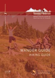
Wander Guide 2021

Create successful ePaper yourself
Turn your PDF publications into a flip-book with our unique Google optimized e-Paper software.
PIESENDORF<br />
Friedensbachreith - Kurzvariante<br />
5<br />
5 A<br />
5,1 km<br />
1 - 2 h<br />
253 m<br />
253 m<br />
Start & Ziel: Parkplatz Walchen<br />
Start & destination: Parking lot Walchen<br />
Schwierigkeit: leicht<br />
Difficult: easy<br />
Technik<br />
Technique<br />
Kondition<br />
Stamina<br />
Erlebnis<br />
Experience<br />
Landschaft<br />
Landscape<br />
Vom Parkplatz geht es bergab bis zur<br />
Brücke und links weiter in die Oberkammerer<br />
Straße. Dieser sowie dem <strong>Wander</strong>weg<br />
5 bis zur Kreuzung folgen. Links<br />
halten und am Leitenweg in Richtung<br />
Hauserberg wandern. Am Hauserbauer<br />
vorbei, wieder links abbiegen und dem<br />
Weg 5A über Friedensbachreith folgen.<br />
<strong>Wander</strong>weg Nr. 5 führt retour zum Start.<br />
From the car park walk downhill to the<br />
bridge and turn left into Oberkammerer<br />
Straße. Follow this road and hiking trail 5 to<br />
the crossroads. Keep left and walk along the<br />
Leitenweg in the direction of Hauserberg.<br />
Pass the Hauserbauer farm, turn left again<br />
and follow trail 5A via Friedensbachreith.<br />
Hiking trail no. 5 leads back to the start.<br />
107<br />
Klammweg - Kurzvariante<br />
2<br />
3<br />
3,4 km<br />
1 - 2 h<br />
108 m<br />
108 m<br />
Start & Ziel: <strong>Wander</strong>infopoint<br />
Start & destination: Hiking info point<br />
Schwierigkeit: leicht<br />
Difficult: easy<br />
Technik<br />
Technique<br />
Kondition<br />
Stamina<br />
Erlebnis<br />
Experience<br />
Landschaft<br />
Landscape<br />
Vom <strong>Wander</strong>infopoint der Straße bis<br />
zur Kirche folgen und weiter geht es<br />
am Grabenbäckweg bis Pichl. Hier<br />
links halten und nun führt der <strong>Wander</strong>weg<br />
Nr. 3 zur Klamm. Der Rückweg<br />
erfolgt über Saulehen und Pichl.<br />
From the hiking info point, follow the road<br />
to the church and continue along the Grabenbäckweg<br />
to Pichl. Keep left here and<br />
now hiking trail no. 3 will leads to the gorge.<br />
The way back is via Saulehen and Pichl.