p. 1 Republic of the Marshall Islands “State” - Western Forestry ...
p. 1 Republic of the Marshall Islands “State” - Western Forestry ...
p. 1 Republic of the Marshall Islands “State” - Western Forestry ...

Create successful ePaper yourself
Turn your PDF publications into a flip-book with our unique Google optimized e-Paper software.
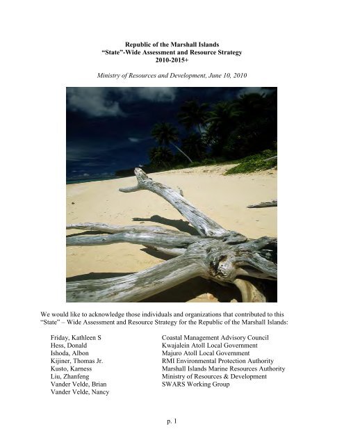
<strong>Republic</strong> <strong>of</strong> <strong>the</strong> <strong>Marshall</strong> <strong>Islands</strong><br />
<strong>“State”</strong>-Wide Assessment and Resource Strategy<br />
2010-2015+<br />
Ministry <strong>of</strong> Resources and Development, June 10, 2010<br />
We would like to acknowledge those individuals and organizations that contributed to this<br />
<strong>“State”</strong> – Wide Assessment and Resource Strategy for <strong>the</strong> <strong>Republic</strong> <strong>of</strong> <strong>the</strong> <strong>Marshall</strong> <strong>Islands</strong>:<br />
Friday, Kathleen S Coastal Management Advisory Council<br />
Hess, Donald Kwajalein Atoll Local Government<br />
Ishoda, Albon Majuro Atoll Local Government<br />
Kijiner, Thomas Jr. RMI Environmental Protection Authority<br />
Kusto, Karness <strong>Marshall</strong> <strong>Islands</strong> Marine Resources Authority<br />
Liu, Zhanfeng Ministry <strong>of</strong> Resources & Development<br />
Vander Velde, Brian SWARS Working Group<br />
Vander Velde, Nancy<br />
p. 1
Table <strong>of</strong> Contents<br />
I Introduction<br />
Page<br />
4<br />
II Assessment <strong>of</strong> Forest Resources<br />
6<br />
General forest conditions<br />
7<br />
Crosscutting consideration: climate change<br />
7<br />
Crosscutting consideration: freshwater resources<br />
8<br />
Crosscutting consideration: capacity-building<br />
8<br />
Crosscutting consideration: invasive plant species, pests and diseases<br />
9<br />
A Issue: Biodiversity<br />
10<br />
B Issue: Food security and sustainable livelihoods<br />
13<br />
C Issue: Coastal Reinforcement<br />
16<br />
D Issue: Urbanization<br />
17<br />
III Forest Resource Strategy<br />
IV Appendices<br />
19<br />
A Methodology for assessment & geospatial analysis<br />
25<br />
B Stakeholder involvement<br />
27<br />
C Glossary <strong>of</strong> terms and acronyms<br />
30<br />
D S&PF performance measures<br />
31<br />
E Plans consulted<br />
33<br />
The Five-Year Plan, Urban and Community <strong>Forestry</strong> Program, Majuro Atoll, 2006 –<br />
2011<br />
34<br />
The Five-Year Plan, Urban and Community <strong>Forestry</strong> Program, Ebeye, Kwajalein Atoll,<br />
2006 - 2011<br />
41<br />
V Published documents enclosed (integral to <strong>the</strong> assessment and strategy) (hard copies available<br />
at R5 RO Office)<br />
Reimaanlok: National Conservation Area Plan for <strong>the</strong> <strong>Marshall</strong> <strong>Islands</strong><br />
[Reimaanlok.pdf on CD; submitted as hardcopy to USFS R5 S&PF 1<br />
]<br />
The <strong>Marshall</strong> <strong>Islands</strong> – Living Atolls Amidst <strong>the</strong> Living Sea: The National Biodiversity<br />
Report <strong>of</strong> <strong>the</strong> <strong>Republic</strong> <strong>of</strong> <strong>the</strong> <strong>Marshall</strong> <strong>Islands</strong><br />
[Submitted as hardcopy to USFS R5 S&PF 2<br />
]<br />
<strong>Republic</strong> <strong>of</strong> <strong>the</strong> <strong>Marshall</strong> <strong>Islands</strong>, Ministry <strong>of</strong> Resources and Development, Strategy and<br />
Action Plan 2005-2010.<br />
<strong>Marshall</strong>s RD Strategic Plan Nov 2004.pdf on CD<br />
1 Laurie Tippin (Vallejo), Lisa Fischer (Sacramento), Katie Friday (Massachusetts/Hilo)<br />
2 Laurie Tippin (Vallejo), Katie Friday (Massachusetts/Hilo)<br />
p. 2
VI Maps <strong>of</strong> current conditions and priority areas (on CD as separate .jpg documents)<br />
Ailinginae, Bikini, Rongelap, Rongerik atolls<br />
Ailinglaplap atoll: inset 01 (western islets)<br />
Ailinglaplap atoll: inset 02 (eastern islets)<br />
Ailuk atoll<br />
Arno atoll<br />
Arno atoll: inset 01 (northwestern islet)<br />
Arno atoll: inset 02 (western islet)<br />
Arno atoll: inset 03 (southwestern islet)<br />
Arno atoll: inset 04 (sou<strong>the</strong>rn islet)<br />
Arno atoll: inset 05 (eastern islets)<br />
Aur atoll<br />
Jaluit atoll<br />
Jaluit atoll: inset 01 (Javor)<br />
Jaluit atoll: inset 02 (Jaluit Jaluit)<br />
Kwajelein atoll<br />
Kwajelein atoll: inset 01 (Ebeye)<br />
Kwajelein atoll: inset 02 (nor<strong>the</strong>astern islets)<br />
Likiep atoll<br />
Likiep atoll: inset 01 (northwestern islets)<br />
Likiep atoll: inset 02 (eastern islets)<br />
Likiep atoll: inset 03 (nor<strong>the</strong>astern islets)<br />
Majuro atoll<br />
Majuro atoll: inset 01 (Laura)<br />
Majuro atoll: inset 02 (D.U.D.)<br />
Majuro atoll: inset 03 (Long Island)<br />
Maloelap atoll<br />
Maloelap atoll: inset 01 (nor<strong>the</strong>astern islets)<br />
Maloelap atoll: inset 02 (northwestern islets)<br />
Mili atoll<br />
Mili atoll: inset 01 (northwestern islets)<br />
Mili atoll: inset 02 (southwestern islets)<br />
Wotje atoll<br />
Wotje atoll: inset 01 (nor<strong>the</strong>rn islets)<br />
Wotje atoll: inset 02 (eastern islets)<br />
p. 3
I Introduction<br />
This <strong>“State”</strong>-Wide Assessment and Resource Strategy (SWARS) identifies <strong>the</strong> <strong>Marshall</strong>s’<br />
highest priorities for forest resource management and needs for assistance from <strong>the</strong> United States<br />
Department <strong>of</strong> Agriculture (USDA) Forest Service (FS). State assessments and resource<br />
strategies are integral to <strong>the</strong> Forest Service’s State and Private <strong>Forestry</strong> (S&PF) Redesign and<br />
required as an amendment to <strong>the</strong> Cooperative <strong>Forestry</strong> Assistance Act (CFAA), as enacted in <strong>the</strong><br />
2008 Farm Bill. Each <strong>“State”</strong> is required to complete a State Assessment and Resource Strategy<br />
within two years after enactment <strong>of</strong> <strong>the</strong> 2008 Farm Bill (June 18, 2008) to receive funds under<br />
CFAA. The 2008 Farm Bill also made <strong>the</strong> <strong>Republic</strong> <strong>of</strong> <strong>the</strong> <strong>Marshall</strong> <strong>Islands</strong> eligible for CFAA<br />
programs that are available to states, territories and commonwealths <strong>of</strong> <strong>the</strong> USA.<br />
The <strong>Marshall</strong>s SWARS summarizes information from existing assessments and strategic plans;<br />
details may be found in those existing documents, which are attached as appendices. It thus<br />
includes two components to <strong>the</strong> assessment and planning required by <strong>the</strong> S&PF Redesign<br />
approach to identify priority forest landscape areas and highlight work needed to address<br />
national, regional, and state forest management priorities:<br />
State-wide Assessment <strong>of</strong> Forest Resources—provides an analysis <strong>of</strong> forest conditions<br />
and trends in <strong>the</strong> state and delineates priority rural and urban forest landscape<br />
areas.<br />
State-wide Forest Resource Strategy—provides long-term strategies for investing state,<br />
federal, and o<strong>the</strong>r resources to manage priority landscapes identified in <strong>the</strong><br />
assessment, focusing where federal investment can most effectively stimulate or<br />
leverage desired action and engage multiple partners.<br />
The SWARS provides a basis for subsequent annual grant proposals, as authorized under several<br />
CFAA programs. The Redesign deemphasizes program-by-program planning and emphasizes<br />
program integration to meet island priorities. The <strong>Marshall</strong>s’ SWARS is thus organized around<br />
<strong>the</strong> <strong>Marshall</strong>s’ own priority issues with respect to forests. Issues were defined by <strong>the</strong> advisory<br />
group to <strong>the</strong> “state” forester <strong>of</strong> <strong>the</strong> <strong>Marshall</strong> <strong>Islands</strong> Ministry <strong>of</strong> Resources & Development<br />
(MRD) as a way <strong>of</strong> organizing <strong>the</strong> goals and strategies most relevant to <strong>the</strong> island and to <strong>the</strong><br />
SWARS. “Cross-cutting considerations” were also recognized by <strong>the</strong> advisory group, as threats,<br />
constraints and limitations that affected more than one issue.<br />
Table 1 <strong>Marshall</strong> <strong>Islands</strong> priority issues (addressed by forests and trees) and cross-cutting<br />
considerations<br />
Issues Cross-cutting considerations<br />
Biodiversity<br />
Food security and sustainable livelihoods<br />
Coastal reinforcement<br />
Urbanization<br />
Climate change<br />
Freshwater resources<br />
Capacity-building<br />
Invasive plant species, pests & diseases<br />
p. 4
The SWARS <strong>the</strong>n cross-references USDA Forest Service <strong>the</strong>mes and objectives (Table 2) and<br />
specific funding programs and <strong>the</strong>ir requirements.<br />
Table 2 USDA Forest Service National Themes and Objectives<br />
1. Conserve Working Forest Landscapes<br />
1.1. Identify and conserve high priority forest ecosystems and landscapes<br />
1.2. Actively and sustainably manage forests<br />
2. Protect Forests from Harm<br />
2.1. Restore fire-adapted lands and reduce risk <strong>of</strong> wildfire impacts<br />
2.2. Identify, manage, and reduce threats to forest and ecosystem health<br />
3. Enhance Public Benefits from Trees and Forests<br />
3.1. Protect and enhance water quality and quantity<br />
3.2. Improve air quality and conserve energy<br />
3.3. Assist communities in planning for and reducing wildfire/forest health risks<br />
3.4. Maintain and enhance <strong>the</strong> economic benefits and values <strong>of</strong> trees and forests<br />
3.5. Protect, conserve, and enhance wildlife and fish habitat<br />
3.6. Connect people to trees and forests, and engage <strong>the</strong>m in environmental stewardship<br />
activities<br />
3.7. Manage and restore trees and forests to mitigate and adapt to global climate change<br />
p. 5
II Assessment <strong>of</strong> Forest Resources<br />
Overall introduction: The <strong>Republic</strong> <strong>of</strong> <strong>the</strong> <strong>Marshall</strong> <strong>Islands</strong> is a former U.S. Trust Territory, now<br />
a sovereign nation in a “Compact <strong>of</strong> Free Association” with <strong>the</strong> U.S. As a result <strong>of</strong> its U.S.<br />
affiliation, it is eligible for all State & Private <strong>Forestry</strong> programs.<br />
…<strong>the</strong> <strong>Marshall</strong> <strong>Islands</strong> encompass 29 atolls and 5 solitary islands, and is comprised <strong>of</strong><br />
approximately 1,225 individual islands and islets. These are situated from 160 degrees to 173<br />
degrees longitude East, and between 4 degrees and 14 degrees latitude North. Total dry land area<br />
is only about 70 square miles. All <strong>the</strong> <strong>Marshall</strong> <strong>Islands</strong> are low in elevation; <strong>the</strong> average height <strong>of</strong><br />
land above sea level being 7 feet. The air is warm and moist, with a humidity <strong>of</strong> about 80%, with<br />
considerable salt spray as well. The air temperature averages around 82 degrees Fahrenheit,<br />
ranging between about 76 and 90 degrees. Rainfall tends to be seasonal. It can range from as<br />
much as 160 inches in <strong>the</strong> south to as little as 25 inches a year in <strong>the</strong> north – or even less during<br />
<strong>the</strong> extremely dry years when <strong>the</strong>re may be no precipitation whatsoever on some <strong>of</strong> <strong>the</strong> drier<br />
atolls. Tropical storms (typhoons) are fortunately relatively rare, but when <strong>the</strong>y do hit, can be<br />
devastating. 3<br />
Map #1 <strong>Republic</strong> <strong>of</strong> <strong>the</strong> <strong>Marshall</strong> <strong>Islands</strong>: See also detailed maps <strong>of</strong> each atoll.<br />
3 National Biodiversity Team <strong>of</strong> <strong>the</strong> <strong>Republic</strong> <strong>of</strong> <strong>the</strong> <strong>Marshall</strong> <strong>Islands</strong>. 2000. “The <strong>Marshall</strong> <strong>Islands</strong> – Living Atolls<br />
Amidst <strong>the</strong> Living Sea: The National Biodiversity Report <strong>of</strong> <strong>the</strong> <strong>Republic</strong> <strong>of</strong> <strong>the</strong> <strong>Marshall</strong> <strong>Islands</strong>.” A Global<br />
Environmental Facility / United Nations Development Programme Project. 344 pages. (Printed copy provided as an<br />
integral part <strong>of</strong> this SWARS.)<br />
p. 6
General forest conditions: The <strong>Marshall</strong> <strong>Islands</strong> are naturally tropical forested ecosystems,<br />
mostly converted to agro-forest over <strong>the</strong> millennia since settlement by <strong>the</strong> <strong>Marshall</strong>ese people.<br />
<strong>Marshall</strong>ese agro-forest is a mix <strong>of</strong> trees, woody shrubs and herbaceous species, managed for<br />
food and o<strong>the</strong>r forest products, notably breadfruit, coconut, pandanus, and bananas. Since<br />
<strong>Western</strong> contact, many areas have been managed as coconut plantations (<strong>of</strong>ten with o<strong>the</strong>r species<br />
intercropped, a simpler form <strong>of</strong> agro-forestry) and additional species have been introduced and<br />
integrated into <strong>the</strong> agro-forest (especially fruit trees).<br />
Mapping and forest inventory conducted for <strong>the</strong> first time in 2008 4<br />
shows that forest, including<br />
agro-forest and coconut plantations, covers about 70% <strong>of</strong> <strong>the</strong> <strong>Marshall</strong>s’ land area.12% <strong>of</strong> <strong>the</strong><br />
landscape was classified as urban land. See attached maps for forest, urban and o<strong>the</strong>r land cover<br />
classes. Species diversity is low; a total <strong>of</strong> 17 tree species and 45 understory species were<br />
measured on <strong>the</strong> FIA plots, with an average <strong>of</strong> four tree species per sixth-acre plot.<br />
All forest land is privately owned under complex forms <strong>of</strong> land tenure.<br />
Crosscutting consideration: Climate change<br />
Global projections <strong>of</strong> sea level rise over <strong>the</strong> long term are potentially devastating to <strong>the</strong> lowelevation<br />
atolls <strong>of</strong> <strong>the</strong> <strong>Marshall</strong>s. Regional information about climate change effects over a<br />
planning horizon measured in decades is critical to planning for adaptation strategies, but is still<br />
not precise.<br />
…Small islands are vulnerable to sea-level rise, coastal erosion, extreme wea<strong>the</strong>r events, coral<br />
reef bleaching, ocean acidification, and contamination <strong>of</strong> freshwater resources with saltwater. The<br />
islands have experienced rising temperatures and sea level in recent decades. Projections for <strong>the</strong><br />
rest <strong>of</strong> this century suggest continued increases in air and ocean surface temperatures in … <strong>the</strong><br />
Pacific…, an increased frequency <strong>of</strong> heavy downpours nearly everywhere, and increased rainfall<br />
during <strong>the</strong> summer months (ra<strong>the</strong>r than <strong>the</strong> normal rainy season in <strong>the</strong> winter months) for <strong>the</strong><br />
Pacific islands. Hurricane wind speeds and rainfall rates are likely to increase with continued<br />
warming. Island coasts will be at increased risk <strong>of</strong> inundation due to sea-level rise and storm<br />
surge with major implications for coastal communities, infrastructure, natural habitats, and<br />
resources... [Atolls] depend on freshwater lenses below <strong>the</strong> surface, which are recharged by<br />
precipitation. Changes in precipitation… are thus a cause <strong>of</strong> great concern. Sea-level rise also<br />
affects island water supplies by causing salt water to contaminate <strong>the</strong> freshwater lens and by<br />
causing an increased frequency <strong>of</strong> flooding due to storm high tides. Water pollution (such as from<br />
agriculture or sewage), exacerbated by storms and floods, can contaminate freshwater supplies,<br />
affecting public health. 5<br />
Measured sea level rise in <strong>the</strong> <strong>Marshall</strong> <strong>Islands</strong> chain is ~2-9 mm/yr from 1992-2009 6<br />
. Rainfall,<br />
drought and sea level are strongly affected by ENSO (El Nino Sou<strong>the</strong>rn Oscillation) processes,<br />
4<br />
Donnegan, J; S. Trimble; K. Kusto; O. Kuegler; B. Hiserote. Draft. The <strong>Republic</strong> <strong>of</strong> <strong>the</strong> <strong>Marshall</strong> <strong>Islands</strong>’ Forest<br />
Resources, 2008.<br />
5<br />
Regional Highlights from Global Climate Change Impacts in <strong>the</strong> United States. www.globalchange.gov/usimpacts<br />
Cambridge University Press.<br />
6<br />
Fletcher, C. and B. Richmond. 2010 draft. “Climate Change in <strong>the</strong> Federated States <strong>of</strong> Micronesia: Food and Water<br />
Security, Climate Risk Management, and Adaptive Strategies.” Numeric rates <strong>of</strong> sea level rise not quoted directly;<br />
read from map with color key.<br />
p. 7
ut climate models do not agree on how ENSO patterns will change with continued global<br />
warming. 7<br />
There have been several strong ENSO cycles in recent decades, so measured changes<br />
in rainfall and sea level rise in recent decades cannot necessarily be projected into <strong>the</strong> future.<br />
Storms and extraordinarily high tides occur with natural variability and are also amplified by<br />
climate change and sea level rise. Atolls, with <strong>the</strong>ir characteristic beach berms and depressed<br />
interiors, are sensitive to <strong>the</strong> frequency <strong>of</strong> surges overtopping those shoreline barriers. Increased<br />
frequency <strong>of</strong> overtopping events, exceeding required recovery times, will alter terrestrial<br />
ecosystems and agro-forests, and will leave islands uninhabitable well before sea level rise<br />
permanently inundates <strong>the</strong> island.<br />
The movement <strong>of</strong> people between outlying and urban atolls, and between Majuro and <strong>the</strong> U.S., is<br />
affected by expectations <strong>of</strong> <strong>the</strong> effects <strong>of</strong> climate change and also o<strong>the</strong>r cultural changes as<br />
people seek jobs, education, health care and o<strong>the</strong>r aspects <strong>of</strong> modern lifestyles. An assessment <strong>of</strong><br />
demographic change and decisions by municipal governments concerning <strong>the</strong> futures <strong>of</strong> <strong>the</strong>ir<br />
communities would be highly desirable to inform strategies concerning agro-forestry extension<br />
and natural resource management.<br />
Crosscutting consideration: Freshwater resources<br />
Native forest ecosystems and traditional agro-forest management are both dependent upon and<br />
protective <strong>of</strong> <strong>the</strong> freshwater lens underlying atoll soils. The maintenance <strong>of</strong> coastal forest<br />
windbreaks (to reduce salt spray and desiccation), <strong>the</strong> conservation <strong>of</strong> native and traditional tree<br />
species adapted to atoll conditions, <strong>the</strong> avoidance <strong>of</strong> irrigation and chemical fertilizers, and <strong>the</strong><br />
maintenance <strong>of</strong> soil organic matter through vegetative cover and composting techniques, all<br />
protect <strong>the</strong> quality <strong>of</strong> existing freshwater resources and assist continued productivity where<br />
freshwater resources are limited or dwindling. MRD has chosen not to address freshwater<br />
directly as an “issue” in this SWARS, as this does not fall directly under its area <strong>of</strong><br />
responsibility, but it is identified as a crosscutting consideration because MRD conducts all its<br />
activities to be conservative <strong>of</strong> water quantity and quality.<br />
Crosscutting consideration: Capacity-building<br />
The Ministry <strong>of</strong> Resources & Development is <strong>the</strong> government agency responsible for agriculture,<br />
energy, trade & investment, and small business development in <strong>the</strong> <strong>Republic</strong> <strong>of</strong> <strong>the</strong> <strong>Marshall</strong><br />
<strong>Islands</strong>. The Ministry’s Strategy and Action Plan (2005-2010), attached, underscores <strong>the</strong><br />
importance <strong>of</strong> sustainable development in all sectors under <strong>the</strong> ministry’s area <strong>of</strong> responsibility.<br />
Currently <strong>the</strong> agriculture division has 6 full-time staff and 5 casual workers. The Assistant Chief<br />
<strong>of</strong> Agriculture and Livestock is also <strong>the</strong> State Forester. Clearly, <strong>the</strong>re is a great need for<br />
capacity-building in agro-forestry; more trained personnel are needed to implement <strong>the</strong><br />
Ministry’s expanding agro-forestry program. To compensate for <strong>the</strong> lack <strong>of</strong> staff, MRD works<br />
cooperatively with o<strong>the</strong>r government ministries and agencies and relevant stakeholders to<br />
progress its work program. In certain instances, <strong>the</strong> Ministry contracts out <strong>the</strong>se services to o<strong>the</strong>r<br />
providers.<br />
7 Fletcher C, and B. Richmond. (as previously cited)<br />
p. 8
Forest Service financial assistance to <strong>the</strong> <strong>Republic</strong> <strong>of</strong> <strong>the</strong> <strong>Marshall</strong> <strong>Islands</strong> Ministry <strong>of</strong> Resources<br />
and Development (MRD) is currently about $50,000/year (base funding); additional funding may<br />
be secured through a competitive process ($300,000 was awarded through MRD to <strong>the</strong> <strong>Marshall</strong><br />
<strong>Islands</strong> Conservation Society (MICS) in 2009.<br />
Crosscutting consideration: Invasive plant species, pests & diseases<br />
Pests and diseases affect <strong>the</strong> health <strong>of</strong> native forests, agro-forests, coastal and urban forests, and<br />
<strong>the</strong>refore forest health management is a cross-cutting consideration.<br />
Forest Inventory data 8<br />
shows that approximately 37% <strong>of</strong> trees had some form <strong>of</strong> damage, most<br />
<strong>of</strong>ten damage by unspecified insects, and next most <strong>of</strong>ten damage by o<strong>the</strong>r vegetation, including<br />
vines.<br />
The most comprehensive available assessment <strong>of</strong> invasive plant species conditions (a threat<br />
under both <strong>the</strong> biodiversity and food security issues) is available at <strong>the</strong> Pacific <strong>Islands</strong> Ecosystem<br />
at Risk (PIER) website 9 , which is kept updated with information from ongoing monitoring by<br />
Vander Velde 10 for <strong>the</strong> MRD Invasive Plants program (supported by S&PF grants). Invasive<br />
species are listed for <strong>the</strong> nation and by atoll to <strong>the</strong> extent that surveys have been completed, with<br />
information about each species, but no ranking <strong>of</strong> <strong>the</strong> degree <strong>of</strong> threat <strong>of</strong> each species within <strong>the</strong><br />
<strong>Marshall</strong> <strong>Islands</strong>. Vander Velde 11<br />
considers <strong>the</strong> most destructive invasive plant species currently<br />
in <strong>the</strong> <strong>Marshall</strong>s to include Casuarina equisetifolia, Turnera umbifolia, Bidens alba, and<br />
several grasses including Dactyloctenium aegyptium (crowfoot grass).<br />
The MRD Strategic Plan 12<br />
in 2004 identified fruit flies, mealy bugs, and coconut scale as <strong>the</strong><br />
insects requiring monitoring and surveillance because <strong>of</strong> <strong>the</strong>ir impacts on agricultural crops,<br />
including agro-forestry crops such as coconut and tree fruits. Based on landowner complaints,<br />
mealy bugs and fruit flies are getting worse.<br />
The “Living Atolls” 13<br />
assessment stated in 2000 that "So far, at least, <strong>the</strong> <strong>Marshall</strong> <strong>Islands</strong> have<br />
not suffered from invasive species to <strong>the</strong> totally disastrous extent <strong>of</strong> o<strong>the</strong>r places. No endemic<br />
species has yet been driven into extinction by <strong>the</strong> onslaught <strong>of</strong> exotics. [However,] …non-native<br />
species can bring with <strong>the</strong>m diseases and parasites that can fur<strong>the</strong>r harm native plants and<br />
animals. The ... infestations <strong>of</strong> <strong>the</strong> spiraling whitefly and mealy bugs are cases in point...<br />
Pesticides and herbicides are ... <strong>of</strong>ten used to control exotics, but... thin limestone soil makes <strong>the</strong><br />
use <strong>of</strong> herbicides risky since <strong>the</strong>se... can easily seem down into <strong>the</strong> valuable water lens."<br />
8<br />
Donnegan et al (as previously cited)<br />
9<br />
Space, J., N. Vander Velde and B. Vander Velde. 2010. Plant Threats to Pacific Ecosystems – Information and<br />
Links from PIER: <strong>Marshall</strong> <strong>Islands</strong>. Pacific Island Ecosystems at Risk project, website<br />
http://www.hear.org/Pier/locations/pacific/marshall_islands/index.html<br />
10<br />
Nancy and Brian Vander Velde, personal communication, 2010.<br />
11<br />
Nancy and Brian Vander Velde, personal communication, 2010.<br />
12<br />
<strong>Republic</strong> <strong>of</strong> <strong>the</strong> <strong>Marshall</strong> <strong>Islands</strong>, Ministry <strong>of</strong> Resources and Development. 2004. “Strategy<br />
and Action Plan 2005-2010.”<br />
13 “Living Atolls,” as previously cited.<br />
p. 9
Education is <strong>the</strong>refore critical to stop <strong>the</strong> introduction <strong>of</strong> invasive species and <strong>the</strong>ir movement<br />
from atoll to atoll.<br />
A Issue: Biodiversity<br />
Conservation <strong>of</strong> biodiversity in <strong>the</strong> <strong>Marshall</strong>s concerns terrestrial native species, especially<br />
endemic species and including migratory birds; traditional cultivars; and sustainable land<br />
management to protect <strong>the</strong> biodiversity and productivity <strong>of</strong> <strong>the</strong> species-rich marine environment.<br />
Concern from this issue is rooted in efforts to reconnect with traditional culture; interest <strong>of</strong><br />
external scientists; and international commitments including <strong>the</strong> Micronesian Challenge.<br />
Values: Terrestrial biodiversity values in <strong>the</strong> <strong>Marshall</strong> <strong>Islands</strong> include pan-Pacific species that<br />
are uniquely manifest as atoll ecosystems. Forest-associated wildlife includes a subspecies <strong>of</strong> <strong>the</strong><br />
Imperial Micronesian Pigeon endemic to <strong>the</strong> Ratak chain <strong>of</strong> <strong>the</strong> <strong>Marshall</strong> <strong>Islands</strong> , a species <strong>of</strong><br />
shrimp, <strong>the</strong> Arno skink, and about 25 insects <strong>of</strong>ten endemic not only to <strong>the</strong> <strong>Marshall</strong> <strong>Islands</strong> but<br />
to a specific island or wetland. The <strong>Marshall</strong> <strong>Islands</strong>’ terrestrial plant species include about 80<br />
native vascular plant species, <strong>of</strong> which only one (a grass) is endemic; however, biodiversity<br />
values include agro-biodiversity, a rich heritage <strong>of</strong> local cultivars <strong>of</strong> traditional species,<br />
especially pandanus and breadfruit. Sustainable land and urban management practices also avoid<br />
adverse impacts on near shore marine biodiversity, which includes many endemic fish species.<br />
“The <strong>Marshall</strong> <strong>Islands</strong> – Living Atolls Amidst <strong>the</strong> Living Sea: The National Biodiversity Report<br />
<strong>of</strong> <strong>the</strong> <strong>Republic</strong> <strong>of</strong> <strong>the</strong> <strong>Marshall</strong> <strong>Islands</strong>” 14<br />
(enclosed as an integral part <strong>of</strong> this SWARS, and<br />
called “Living Atolls” throughout this document) provides a non quantitative, unmapped<br />
assessment <strong>of</strong> <strong>the</strong> <strong>Marshall</strong>s’ biodiversity <strong>of</strong> flora and fauna, including comprehensive species<br />
lists and species status as <strong>of</strong> 2000. Atoll-by-atoll overviews (pp. 45-51) provide very brief<br />
assessments <strong>of</strong> environmental conditions.<br />
Specific locations with high biodiversity values (populations <strong>of</strong> valued species, rare assemblages<br />
or species, and relevant cultural sites) are now being identified and mapped using published<br />
literature, personal observations <strong>of</strong> experts, and local knowledge. Assessment is proceeding atollby-atoll<br />
as part <strong>of</strong> community-based assessment and planning work, relying heavily on local<br />
informants. “Reimaanlok: Looking to <strong>the</strong> Future; National Conservation Area Plan for <strong>the</strong><br />
<strong>Marshall</strong> <strong>Islands</strong>” 15 (called Reimaanlok throughout this document) describes this assessment<br />
process in detail, along with maps for sample atolls. The team’s work is ongoing, and currently<br />
available terrestrial data is shown in <strong>the</strong> atoll maps <strong>of</strong> this SWARS, with <strong>the</strong> exception <strong>of</strong> values<br />
such as turtle nesting sites and mo 16<br />
which are kept confidential (unpublished) to protect <strong>the</strong>m<br />
from poachers. Reimaanlok calls <strong>the</strong>se “fine-scale” (localized) “conservation targets”<br />
(biodiversity values targeted for conservation); see Reimaanlok pp. 68-70 and “Living Atolls”<br />
pp. 61-65 for definitions/descriptions.<br />
14 National Biodiversity Team <strong>of</strong> <strong>the</strong> <strong>Republic</strong> <strong>of</strong> <strong>the</strong> <strong>Marshall</strong> <strong>Islands</strong>, 2000. (as already cited)<br />
15 Reimaan National Planning Team, 2008. “Reimaanlok: Looking to <strong>the</strong> Future; National Conservation Area Plan<br />
for <strong>the</strong> <strong>Marshall</strong> <strong>Islands</strong> 2007-2012.” Published by: N. Baker: Melbourne. 79 pages. (Printed copy provided as an<br />
integral part <strong>of</strong> this SWARS.)<br />
16 “Mo”, traditional reserves, are described by “Living Atolls” on pp. 26-27.<br />
p. 10
Table 3 Fine-scale terrestrial conservation targets<br />
<strong>Marshall</strong>ese English<br />
Mo Bird Island (traditional reserve) (confidential)<br />
Bwebwenato [mistranslated 17<br />
in Reimaanlok as Traditional special<br />
purpose area]<br />
Ma<br />
Breadfruit forest<br />
Kanal, kojbar Climax forest (Pisonia grandis, Neisosperma<br />
oppositifolium)<br />
Jon, bulabol, kimeme Mangrove forest<br />
Kone Pemphis acidula forest<br />
Pat Pond<br />
[not translated] Native shrubland and grassland<br />
[not translated] Crab population<br />
[not translated] Turtle nesting beach (confidential)<br />
Janar Windward forest<br />
Benefits and services:<br />
• Ecological services<br />
• Rare species<br />
• Endemic species<br />
• Sustainable livelihood<br />
• Traditional medicinal plants<br />
Threats:<br />
• Development resulting in habitat loss<br />
• Loss <strong>of</strong> keystone species<br />
• Unsustainable farming practices<br />
• Loss <strong>of</strong> traditional conservation practices<br />
• Invasive species introductions and effects continue at a steady pace despite some efforts<br />
at quarantine and eradication.<br />
• Urban development and pollution<br />
• Climate change and sea-level rise<br />
• Still unknown long-term effects from nuclear testing<br />
• Conflicting cultural perceptions. For example, janar (windward forest) is removed to<br />
provide “clean” (tidy) landscaping, views, and breezes.<br />
Trends: Data is not available or has not been located. Forest inventory has only taken place once<br />
(and was not designed to detect rare species and populations) and initial community-based<br />
assessment and mapping is still underway.<br />
17 Thomas Kijiner, Jr., Secretary <strong>of</strong> MRD, personal communication 2010<br />
p. 11
Opportunities:<br />
• The Micronesian Challenge and international donors are providing support for<br />
biodiversity conservation in <strong>the</strong> <strong>Marshall</strong>s.<br />
• The Reimaanlok process will write management plans for all islands with conservation<br />
areas; plans have been written for a few so far; <strong>the</strong>se plans may be reported as Forest<br />
Stewardship accomplishments (written plans for clusters <strong>of</strong> private landowners) once <strong>the</strong><br />
program is fur<strong>the</strong>r developed; community organization will be coordinated with <strong>the</strong><br />
U&CF program.<br />
Priority areas for forestry program outreach and activity. The Reimaanlok National<br />
Planning Team (2008) is pursuing a community-based process <strong>of</strong> designating conservation areas.<br />
Most conservation areas encompass both near-shore marine resources and terrestrial resources;<br />
designations as “subsistence only” or “special reserve” primarily reflect intentions for <strong>the</strong> marine<br />
resources, so both types are simply shown as “conservation areas” in this terrestrial SWARS.<br />
The enclosed atoll-by-atoll maps show all conservation areas designated to date which do<br />
include terrestrial resources. The “priority area” for <strong>the</strong> biodiversity issue <strong>of</strong> <strong>the</strong> <strong>Marshall</strong>s<br />
SWARS includes <strong>the</strong>se areas and any conservation areas that might subsequently be identified<br />
through a community-based process. Table 4 shows, for any given atoll, whe<strong>the</strong>r <strong>the</strong><br />
conservation area designation process has taken place or not. If <strong>the</strong> process has taken place but<br />
<strong>the</strong>re is no conservation area on <strong>the</strong> map, <strong>the</strong>n <strong>the</strong> community did not agree to any terrestrial<br />
conservation area.<br />
Critical information gaps<br />
• Community-based mapping and designation <strong>of</strong> priority areas has not taken place on most<br />
atolls (see Table 4). Implementation work on any atoll will also require a review <strong>of</strong> <strong>the</strong><br />
resource assessment and conservation area designation, to address any errors, changes in<br />
resource conditions, or changes in community acceptance <strong>of</strong> conservation areas since<br />
initial fieldwork was conducted.<br />
• “Coarse-scale terrestrial conservation targets” (ecosystem types <strong>of</strong> interest) listed by<br />
Reimaanlok National Planning Team (2008) (“agro-forests,” “indigenous broadleaf<br />
forests”, and “wetlands”) are thus far mapped only as “land,” while <strong>the</strong> Forest Service<br />
vegetation type maps thus far only map “forest” and non-forest types (range, urban,<br />
barren, water). Actual vegetation type mapping is <strong>the</strong>refore an information gap at both<br />
<strong>the</strong> <strong>Republic</strong> and project level.<br />
• Many <strong>of</strong> <strong>the</strong> atolls have not been scientifically studied, or those which have been, were<br />
studied decades ago or only superficially. So for many, <strong>the</strong>re are no baselines studies for<br />
starting points, and comparisons as to trends cannot be made.<br />
• Not all species in <strong>the</strong> <strong>Marshall</strong> <strong>Islands</strong> are known. When some recent surveys have been<br />
made through <strong>the</strong> USDA Forest Health Program and o<strong>the</strong>r agencies by B. and N. Vander<br />
Velde, species previously unknown from <strong>the</strong> <strong>Marshall</strong> <strong>Islands</strong> have been reported, even<br />
some previously unreported for <strong>the</strong> region.<br />
• Quantitative information about projected sea level rise and projected changes in local<br />
climate (both <strong>of</strong> which will affect terrestrial biodiversity) have a great deal <strong>of</strong> uncertainty.<br />
Predictions will become more accurate with (a) local direct monitoring <strong>of</strong> relative sea<br />
level rise, (b) improved world and regional modeling, and (c) commitments by larger<br />
nations concerning <strong>the</strong>ir carbon emissions.<br />
p. 12
• See Appendix A for an explanation <strong>of</strong> what imagery is and is not available.<br />
Table 4 Status <strong>of</strong> mapping<br />
Atoll name Land cover classes<br />
(including “Forest”,<br />
“Urban”) mapped to date<br />
p. 13<br />
Fine-scale<br />
conservation targets<br />
mapped to date<br />
Ailinginae No Yes Yes<br />
Ailinglaplap Yes Yes ?<br />
Ailuk No Yes Yes<br />
Arno Yes Yes Yes<br />
Aur Yes Yes ?<br />
Bikini No Yes Yes<br />
Jaluit Yes Yes Yes<br />
Kwajelein Yes Yes Yes<br />
Likiep Yes Yes ?<br />
Majuro Yes Yes ?<br />
Maloelap Yes Yes ?<br />
Mili Yes Yes Yes<br />
Rongelap Yes Yes Yes<br />
Rongerik No Yes Yes<br />
Wotje Yes ? ?<br />
o<strong>the</strong>r 18<br />
No<br />
No No<br />
B Issue: Food security and sustainable livelihoods<br />
Conservation areas<br />
mapped to date<br />
Agro-forests are a source <strong>of</strong> subsistence goods and commercial products. Many <strong>Marshall</strong>ese<br />
suffer from malnutrition and diabetes that could partially be addressed with increased agro-forest<br />
production. <strong>Marshall</strong>ese family incomes are low; agro-forest production can reduce <strong>the</strong> need for<br />
purchases and bring in cash income.<br />
Values, benefits and services:<br />
• Food security. Breadfruit, pandanus (tree crops) and taro (a component <strong>of</strong> <strong>the</strong> agro-forest)<br />
are traditional staple starches.<br />
• Nutrition. Fresh tree fruits avoid malnutrition and diabetes from unhealthy imported<br />
foods. Many traditional species and varieties have higher nutritional values than varieties<br />
bred for large-scale production.<br />
• Import substitution.<br />
• Fiber for handicrafts, an important source <strong>of</strong> income, especially for women.<br />
• Copra (dried coconut)<br />
• High value market crops: some rare pandanus cultivars could prove to be useful specialty<br />
crops<br />
18 O<strong>the</strong>r atolls include Bikar, Bokak (Taongi), Erikub, Ebon, Enewetak, Jabat, Jemo Island, Kili,<br />
Lae, Lib Island, Mejit Island, Nadikdik (Knox), Namorik, Namu, Toke, Ujae, Ukelang, Utirik,<br />
Wotho
• Sustainability. Traditional agro-forest practices maximize soil organic material<br />
(compost), essential for water retention in sandy soils. Traditional practices do not add<br />
chemical fertilizers and pesticides to aquifers.<br />
• Appropriate for <strong>the</strong> environment. The chemical composition <strong>of</strong> atoll soil does not allow<br />
<strong>the</strong> production <strong>of</strong> many crops that are grown on high islands or o<strong>the</strong>r tropical areas.<br />
Threats:<br />
• Loss <strong>of</strong> traditional agro-forestry practices<br />
• Lack <strong>of</strong> awareness <strong>of</strong> nutritional values<br />
• Invasive species, including those introduced as food crops or as ornamentals<br />
• Clearing <strong>of</strong> forest in order to plant market crops, which are <strong>of</strong>ten unsustainable in <strong>the</strong><br />
atoll environment<br />
• Climate change (drought) and sea-level rise (salt water intrusion)<br />
• Conflicting cultural perceptions such as <strong>the</strong> above mention <strong>of</strong> clearing land vs. shoreline<br />
protection, also ga<strong>the</strong>ring gravel for use around homes<br />
• Insects and diseases (see College <strong>of</strong> <strong>the</strong> <strong>Marshall</strong> <strong>Islands</strong>, Land Grant for more<br />
information<br />
• Excessive land clearing, mowing, burning etc. which removes protection and organic<br />
material inputs to <strong>the</strong> uppermost layers <strong>of</strong> soil, potentially rendering <strong>the</strong> soil less fertile<br />
• Overuse <strong>of</strong> water for crops threatens <strong>the</strong> sustainability <strong>of</strong> underlying aquifers<br />
Trends: While <strong>the</strong>re has not been a formal comprehensive survey <strong>of</strong> agro-forests in <strong>the</strong> <strong>Marshall</strong><br />
<strong>Islands</strong> in recent years, partial surveys indicate that agro-forests in <strong>the</strong> country are generally<br />
becoming less managed. In <strong>the</strong> last three to five years, however, <strong>the</strong>re seems to be a growing<br />
interest among <strong>the</strong> general public on improving management and preservation <strong>of</strong> <strong>the</strong> country’s<br />
agro-forests. This is due in a large part to better awareness by <strong>the</strong> general public <strong>of</strong> <strong>the</strong><br />
importance <strong>of</strong> agro-forests.<br />
Forest inventory data confirms that <strong>the</strong> national coconut resource is mostly in a cohort <strong>of</strong> mature<br />
plantation trees, indicating that sustained future copra production may require replacement <strong>of</strong><br />
older senescing trees. 19<br />
In terms <strong>of</strong> local food production and consumption, <strong>the</strong> trend is mixed. While <strong>the</strong>re has been<br />
increased interest in local production in <strong>the</strong> urban center <strong>of</strong> Majuro, <strong>the</strong> results are mixed in<br />
terms <strong>of</strong> consumption. In <strong>the</strong> urban centers, it is clear that younger <strong>Marshall</strong>ese have an affinity<br />
for imported processed foods over local foods. A sustained awareness campaign on <strong>the</strong> health<br />
benefits <strong>of</strong> local food consumption must be prioritized if this trend is to be reversed.<br />
In <strong>the</strong> outer islands, local food production has declined over <strong>the</strong> last 10 to 20 years due to urban<br />
migration. With a dwindling population base, many outer island communities no longer have <strong>the</strong><br />
human resources to tend to <strong>the</strong> land. This has resulted in a decrease in local food production.<br />
19 Donnegan et al (as already cited)<br />
p. 14
Opportunities:<br />
• The UN General Environmental Fund (GEF) has <strong>of</strong>fered to pay for an invasive species<br />
coordinator within <strong>the</strong> <strong>Marshall</strong>s. OEPPC would likely be <strong>the</strong> agency to receive <strong>the</strong>se<br />
funds and hire this coordinator. With this expanded capacity, MRD may request that <strong>the</strong><br />
Forest Service expand its support to include invasive species control coordinated by<br />
OEPPC, informed by and in addition to <strong>the</strong> monitoring and detection contracted by MRD<br />
over <strong>the</strong> past several years. Roles should be sorted out as <strong>the</strong> MIIST develops strategic<br />
and action plans (currently <strong>the</strong>re is only a regional plan including <strong>Marshall</strong> <strong>Islands</strong><br />
content, for which no draft yet has been received within <strong>the</strong> country).<br />
• The GEF has also provided a grant for Sustainable Land Management (which can include<br />
agro-forestry extension) to <strong>the</strong> OEPPC ($475,000 for 2008-2011) and is likely to<br />
continue to do so.<br />
• There is also possibility <strong>of</strong> expanding existing sustainable land management activities<br />
through funding under <strong>the</strong> Copenhagen Accord. At present, however, <strong>the</strong>re is limited<br />
information on <strong>the</strong> timeframe when <strong>the</strong>se funds would be available as well as <strong>the</strong> level <strong>of</strong><br />
funding.<br />
• The MRD has submitted to <strong>the</strong> Asian Development Bank (ADB) a grant proposal for a<br />
nation-wide coconut replanting project. The Bank has indicated initial support for <strong>the</strong><br />
proposal, and if approved, it is anticipated that <strong>the</strong> project will commence in <strong>the</strong> latter<br />
part <strong>of</strong> 2011.<br />
Priority areas for forestry program outreach and activity. The priority area for this issue is<br />
considered all areas mapped “forest” in <strong>the</strong> enclosed maps, since this class is mostly agro-forest<br />
and no more detailed maps are available. Inhabited atolls (some atolls such as Rongerik,<br />
Ailinginae, Bikar and Bokak are uninhabited) are served by MRD agriculture extension and are<br />
considered part <strong>of</strong> <strong>the</strong> priority area. The most productive areas are generally <strong>the</strong> inner lands <strong>of</strong> an<br />
islet, especially <strong>the</strong> widest islets with <strong>the</strong> richest soil and deepest freshwater lenses. Priorities are<br />
placed generally according to <strong>the</strong> following relative weights (although data is not available in<br />
GIS format and <strong>the</strong>refore has not been mapped):<br />
- Breadfruit - 80%<br />
- Coconut - 90%<br />
- Climax forest - 70%<br />
- Mangrove area - 50%<br />
- Shrubland and Grassland - 40%<br />
- Windward forest - - 60%<br />
- Traditional reserves - 40%<br />
- Traditional special purpose areas - 40%<br />
Critical information gaps:<br />
• Maps <strong>of</strong> <strong>the</strong> most important underground water lenses (freshwater resources)<br />
• Quantitative information about projected sea level rise and projected changes in local<br />
climate<br />
• Many <strong>of</strong> <strong>the</strong> atolls have not been scientifically studied, or those which have been, were<br />
studied decades ago or only superficially. So for many, <strong>the</strong>re are no baseline studies for<br />
starting points, and comparisons as to trends cannot be made.<br />
p. 15
C Issue: Coastal reinforcement<br />
Coastal forests are those on <strong>the</strong> beach crest above high tide mark. Their root systems reinforce<br />
<strong>the</strong> beach “berm” or crest. To an extent, <strong>the</strong>y can <strong>the</strong>refore resist coastal erosion, maintain berm<br />
height, and <strong>the</strong>refore minimize <strong>the</strong> occurrence <strong>of</strong> “overtopping” (surge <strong>of</strong> high seawater into<br />
depressed interior areas). (However, extreme events can always wash away forest, berms and<br />
even entire sections <strong>of</strong> sandy islands.) Coastal forests have been thinned and removed in many<br />
urban and rural areas, so <strong>the</strong>ir restoration and maintenance in <strong>the</strong>ir natural state is a “no-regrets<br />
strategy” and a first line <strong>of</strong> defense against <strong>the</strong> effects <strong>of</strong> sea level rise.<br />
Values, benefits and services:<br />
• Stabilize beach crest and avoid coastal erosion<br />
• Windbreak protecting inner agro-forests from wind, desiccation and salt spray.<br />
• Protection for rare, endangered and/or endemic species, subspecies and cultivars<br />
• The species <strong>of</strong> this coastal reinforcement are <strong>of</strong>ten pioneer species which are ecologically<br />
needed before secondary species can become established<br />
Threats:<br />
• Land clearing including coastal forests, especially in urban areas.<br />
• Urbanization<br />
• Invasive species, especially Casuarina which is <strong>of</strong>ten inappropriately promoted as a wind<br />
break but is instead destructive in <strong>the</strong> atoll environment<br />
• Construction <strong>of</strong> seawalls<br />
• Indiscriminate beach “clean-up” efforts<br />
• Tourism, removing <strong>the</strong> vegetation for better view <strong>of</strong> <strong>the</strong> sea, planting <strong>of</strong> “prettier” species.<br />
Coastal forests are usually not understood or appreciated for <strong>the</strong>ir ecological values.<br />
• Climate change<br />
• Pollution, locally generated and distant through drift<br />
• Erosion and salt water inundation and excessive salt spray<br />
Trends: Data is not available, but continued clearing can be observed.<br />
Opportunities: The <strong>Marshall</strong> <strong>Islands</strong> Conservation Society currently has a large competitive<br />
grant to restore coastal forests. <strong>Marshall</strong> <strong>Islands</strong> High School began a pilot project to replant <strong>the</strong><br />
coastal forest; a grant application has been made for a continuation <strong>of</strong> <strong>the</strong> project. 20<br />
Priority areas for forestry program outreach and activity: The priority area for this issue has<br />
been mapped as a 100-foot strip around <strong>the</strong> coasts <strong>of</strong> each island in <strong>the</strong> <strong>Marshall</strong>s. At <strong>the</strong> project<br />
level, education takes place where <strong>the</strong> strip is intact, and restoration takes place where this strip<br />
has been devegetated. Four atolls (Majuro, Kwajelein, Jaluit and Wotje) have been targeted by<br />
<strong>the</strong> current grant for initial outreach and restoration.<br />
20 N Vander Velde, 2010, personal communication; see Mark Stege for more information<br />
p. 16
Critical information gaps:<br />
• Capacity to address and analyze accelerated erosion processes and to identify mitigation<br />
opportunities.<br />
• Many <strong>of</strong> <strong>the</strong> atolls have not been scientifically studied; those which have been were<br />
studied decades ago or only superficially. So for many, <strong>the</strong>re are no baseline studies for<br />
starting points, and comparisons as to trends cannot be made.<br />
• Not all species in <strong>the</strong> <strong>Marshall</strong>s are known.<br />
• Being diverse ecosystems, <strong>the</strong>re are expected to be differences in species etc. between <strong>the</strong><br />
sou<strong>the</strong>rn wetter atolls and <strong>the</strong> nor<strong>the</strong>rn drier ones.<br />
D Issue: Urbanization<br />
Urbanization is a result <strong>of</strong> migration and <strong>the</strong> adoption <strong>of</strong> <strong>Western</strong> patterns <strong>of</strong> living. A large<br />
proportion <strong>of</strong> <strong>the</strong> <strong>Marshall</strong>s’ population is now concentrated on a few urban islands, with<br />
resulting reductions in forest cover and separation <strong>of</strong> people from <strong>the</strong> tangible and cultural<br />
benefits <strong>of</strong> forests.<br />
Values, benefits and services <strong>of</strong> urban forests:<br />
• Food (homegardens)<br />
• Beauty<br />
• Cultural awareness<br />
• Shade trees<br />
• Larger number <strong>of</strong> people can benefit and learn about local species than in <strong>the</strong> more rural<br />
areas<br />
Threats to urban forests:<br />
• Overcrowding, ultra-urbanization, as has occurred on Ebeye, Kwajalein and in parts <strong>of</strong><br />
downtown Majuro, where trees are cut down to allow for more homes and concrete<br />
• Invasive species, such as insect pests which can destroy trees.<br />
• Changed sense <strong>of</strong> aes<strong>the</strong>tics, where plain concrete is viewed as better than “messy” plants<br />
• More vehicles, need for more roads, parking lots, etc.<br />
• Climate change, reducing available appropriate building areas, hence putting more<br />
pressure to cut down trees.<br />
• People are <strong>of</strong>ten too busy with <strong>the</strong>ir jobs and o<strong>the</strong>r responsibilities to tend to gardens and<br />
trees<br />
• Lack <strong>of</strong> organic matter inputs to enrich sandy soils; fire hazard from burning urban forest<br />
and agro-forest debris (that traditionally would have been at least partially composted).<br />
One such debris fire ignited and partially destroyed a school in Laura village on Majuro<br />
atoll; fire engines located in Rita, about 30 miles away, were not able to reach Laura in<br />
time.<br />
Trends:<br />
No data available. Although some tree planting continues, it likely cannot keep pace with <strong>the</strong><br />
increase <strong>of</strong> number <strong>of</strong> trees being cut down to allow for more houses, o<strong>the</strong>r buildings, and<br />
parking lots.<br />
p. 17
Opportunities:<br />
• As people generally do appreciate having trees and o<strong>the</strong>r plants around, more emphasis<br />
could be placed as to <strong>the</strong>ir value, not only for food, but also for <strong>the</strong>ir es<strong>the</strong>tics and value<br />
in stress reduction.<br />
• To date, <strong>the</strong>re has been no engagement with Public Safety. With <strong>the</strong> 2008 Farm Bill and<br />
eligibility for Cooperative Fire programs, MRD wishes to engage Public Safety with <strong>the</strong><br />
goal <strong>of</strong> naming <strong>the</strong>m as <strong>the</strong> primary cooperator with <strong>the</strong> Forest Service for <strong>the</strong>se<br />
programs.<br />
Priority areas for forestry program outreach and activity. The priority area for this issue has<br />
been mapped as all “urban” areas on <strong>the</strong> landcover type map. (However, Urban & Community<br />
<strong>Forestry</strong> funding may be applied to o<strong>the</strong>r issues in addition to “urbanization” per se.)<br />
Information gaps:<br />
• Fur<strong>the</strong>r information should be found as to which trees and o<strong>the</strong>r forest plants are<br />
appropriate for <strong>the</strong> urban setting (i.e. trees that tend to grow too large and break up house<br />
foundations should be discouraged, ones that are slower growing and do not drop<br />
excesses litter would likely be preferred).<br />
• It would be appropriate also to determine which would best survive in <strong>the</strong> tropical atoll<br />
urban setting.<br />
p. 18
I Forest Resource Strategy<br />
Please note that <strong>the</strong> “priority area” for each issue is verbally described in <strong>the</strong> assessment above, under each issue. Maps <strong>of</strong> each atoll<br />
(as listed in <strong>the</strong> Table <strong>of</strong> Contents) show <strong>the</strong> priority area as it appears on multiple atolls. Note that fur<strong>the</strong>r detail for several strategies<br />
is shown in o<strong>the</strong>r, existing strategic plans; see Appendix E for a list and description <strong>of</strong> several <strong>of</strong> <strong>the</strong>se plans; see <strong>the</strong> Table <strong>of</strong> Contents<br />
for which plans are appended and are considered an integral part <strong>of</strong> this SWARS. See Glossary <strong>of</strong> Acronyms, Appendix C.<br />
Table 5 Direct strategies<br />
RMI’s Issues Long-term Strategy & <strong>Marshall</strong>s plan with<br />
more information<br />
Biodiversity Organize, educate & build capacity in<br />
communities (see below, “Urban” issue)<br />
Map more detailed forest ecosystem types;<br />
map forest types and conservation values on<br />
additional atolls<br />
Protection <strong>of</strong> ‘special reserves’ and<br />
conservation areas (See Reimaanlok and<br />
soon-to-be published Reimaanlok Field<br />
Guide for community facilitation)<br />
Designate ‘traditional land use’<br />
conservation areas (subsistence agr<strong>of</strong>orestry<br />
production and compatible income<br />
generation with sustainable practices) (See<br />
Reimaanlok and soon-to-be published<br />
Reimaanlok Field Guide for community<br />
facilitation); see also strategies for Food<br />
Security (below) from MRD Five-Year<br />
Plan)<br />
Invasive plant species, pests & diseases (see<br />
below)<br />
Programs/<br />
Partners that<br />
contribute<br />
p. 19<br />
Resources<br />
Required<br />
(see below) FAO and<br />
Reimaanlok,<br />
FI&A, Forest<br />
Service mapping<br />
MRD, UCF, MC<br />
Initiative, MICS,<br />
EPA , OEPPC,<br />
Local<br />
Governments<br />
MRD, MICS, MC,<br />
SLM, Traditional<br />
and local govt.<br />
leaders,<br />
community<br />
champions<br />
SPC can<br />
fund this and<br />
coordinate<br />
with MRD<br />
to show this<br />
as match for<br />
U&CF and<br />
FSP; low<br />
priority for<br />
direct S&PF<br />
funding.<br />
Forest service<br />
objective<br />
(Table 2)<br />
Performance<br />
Measure<br />
(see below) (see below)<br />
Conserve<br />
(1.2)<br />
Conserve<br />
(1.1)<br />
Enhance (3.5,<br />
3.6)<br />
Conserve<br />
(1.2)<br />
Protect (2.2)<br />
Enhance (3.5,<br />
3.6)<br />
#communities<br />
developing/<br />
managing forests<br />
Acres/% land under<br />
conservation (MC);<br />
Acres conserved for<br />
habitat; #people<br />
engaged<br />
Acres/% land under<br />
conservation (MC);<br />
acres <strong>of</strong> land<br />
managed locally for<br />
traditional use,<br />
invasive protection,<br />
habitat; # people<br />
engaged<br />
(see below) (see below) (see below) (see below)
Food Security<br />
and<br />
Sustainable<br />
Livelihood<br />
Promote and increase production <strong>of</strong> agr<strong>of</strong>orestry<br />
including high value market crops;<br />
community extension and education<br />
(See MRD Five-Year Plan: Agriculture<br />
Production Services as applied to tree crops<br />
– pp. 22-23)<br />
Rejuvenate Traditional crops<br />
- Promote drought tolerant variety <strong>of</strong><br />
indigenous food crops.<br />
- Educate community, as with “Bob”<br />
festival<br />
(See MRD Five-Year Plan as applied to tree<br />
crops, pp. 22-25)<br />
Coconut “Tree <strong>of</strong> Life” Development:<br />
rehabilitation, replantation<br />
( MRD Five-Year Plan, pp. 18-20)<br />
Invasive species<br />
- prepare & implement MIIST strategy &<br />
action plan<br />
- hire coordinator<br />
- prevention and control<br />
- public education<br />
- planning and monitoring<br />
- eradication at a minimum<br />
Reimaanlok,<br />
MRD, MICS and<br />
MC, SPC, FAO,<br />
SLM, SGP, Local<br />
governments<br />
Reimaanlok,<br />
MRD, MICS, MC,<br />
SPC, FAO, local<br />
governments<br />
MRD, SPC, FAO,<br />
local governments<br />
RISC, PII, IUCN,<br />
MRD, RMIEPA,<br />
OEPPC, SPREP,<br />
SPC, MIIST &<br />
MICS<br />
p. 20<br />
High<br />
priority for<br />
S&PF<br />
funding<br />
High<br />
priority for<br />
S&PF<br />
funding<br />
Medium<br />
priority for<br />
S&PF<br />
funding, as<br />
FAO will<br />
also fund<br />
this work<br />
High<br />
priority for<br />
S&PF<br />
funding<br />
Enhance (3.4,<br />
3.6)<br />
Protect (2.2)<br />
Conserve<br />
(1.2)<br />
Enhance (3.7,<br />
3.6, 3.4, 3.1)<br />
Conserve<br />
(1.2)<br />
Enhance (3.4,<br />
3.6)<br />
Conserve<br />
(1.2)<br />
Protect (2.2)<br />
Enhance (3.6,<br />
3.3)<br />
Conserve<br />
(1.2)<br />
% <strong>of</strong> pop.<br />
Benefitting from<br />
sustainable<br />
livelihood thru:<br />
health, education<br />
and standard <strong>of</strong><br />
living;<br />
Increase or change<br />
in number <strong>of</strong><br />
households access<br />
to traditional crops;<br />
#acres made more<br />
resilient<br />
Increased # <strong>of</strong><br />
acres/% <strong>of</strong><br />
community owned<br />
coconut rehab sites.<br />
Increased # <strong>of</strong> pop.<br />
Benefitting from<br />
copra<br />
% <strong>of</strong> identified<br />
areas with IS<br />
eradicated
(continued)<br />
Food Security<br />
and<br />
Sustainable<br />
Livelihood<br />
Coastal<br />
Reinforcement<br />
Forest/agro-forest pests & diseases<br />
- Quarantine<br />
- Eradication and control programs;<br />
response plans<br />
- Bio-control 21<br />
- Public education re quarantine<br />
- Monitoring & surveillance<br />
(MRD Five-Year Plan, Plant and Animal<br />
Protection Services as applied to tree crops,<br />
pp. 24-25)<br />
Urban home gardens<br />
- research on possible medicinal plants to<br />
grow<br />
- increase soil fertility<br />
- promote tree planting<br />
- survey on basic gardening needs<br />
(See R&D Five-Year Plan as applied to tree<br />
crops, pp. 22-25)<br />
Organize, educate & build capacity in<br />
communities<br />
Protection <strong>of</strong> Coastal Areas<br />
- Replanting <strong>of</strong> indigenous salt<br />
tolerant vegetations<br />
- Training and Capacity building for<br />
locals<br />
- Considering hard structures such as<br />
seawalls<br />
(See U&CF Five-Year plans)<br />
MRD, SPC<br />
Seek more<br />
collaboration with<br />
College <strong>of</strong> <strong>the</strong><br />
<strong>Marshall</strong> <strong>Islands</strong><br />
MRD, Local<br />
Govts., TTM (<br />
Laura Farm),<br />
NTC, MIVA,<br />
Wellness Center<br />
and MICS,<br />
WUTMI, USP<br />
medicinal plant<br />
book<br />
p. 21<br />
High<br />
priority for<br />
S&PF<br />
funding,<br />
except<br />
quarantine is<br />
funded by<br />
local $<br />
Medium<br />
priority for<br />
S&PF<br />
funding,<br />
because<br />
SLM also<br />
funding this<br />
Protect (2.2)<br />
Enhance (3.6,<br />
3.3)<br />
Enhance (3.4,<br />
3.6, 3.7)<br />
% <strong>of</strong> identified<br />
areas with pests &<br />
diseases controlled<br />
Strategic plan for<br />
home gardens<br />
Increased # <strong>of</strong><br />
home gardens<br />
(see below) (see below) (see below) (see below)<br />
USFS, MICS,<br />
MRD, RMIEPA,<br />
CMI-UH Sea-<br />
Grant, SPREP,<br />
SOPAC, Local<br />
governments<br />
High<br />
priority for<br />
S&PF<br />
funding after<br />
current<br />
competitive<br />
grant ends<br />
Enhance (3.7,<br />
3.6, 3.3)<br />
Conserve<br />
(1.2)<br />
Increase % <strong>of</strong><br />
coastal vegetation<br />
grown in vulnerable<br />
sites within Ebeye,<br />
Majuro and Wotje.<br />
Increased cultural<br />
awareness. Acres <strong>of</strong><br />
forest made more<br />
resilient.<br />
21<br />
Currently SPC is providing technical assistance for distribution <strong>of</strong> “black beetle” bio-control agent for mealy bugs and black flies, but results have not yet been<br />
satisfactory.
Urbanization Organize, educate and build capacity in<br />
communities<br />
- Organize municipal advisory groups<br />
- Recruit volunteers<br />
- Develop tree ordinances (including<br />
conservation area designations)<br />
- Community assessments & plans<br />
- Conservation education<br />
MRD and all<br />
agencies in<br />
Advisory Council<br />
p. 22<br />
High<br />
priority for<br />
S&PF<br />
(U&CF)<br />
funding<br />
Enhance (3.3,<br />
3.6)<br />
#communities<br />
developing/<br />
managing forests<br />
#people in<br />
environmental<br />
literacy &<br />
stewardship<br />
Home gardens See above See above See above See above<br />
Beautification & cultural awareness:<br />
- Pre and post assessments<br />
- Education and Awareness strategy<br />
(See U&CF Five-Year plans)<br />
Schools<br />
- Promote School planting activities<br />
- Interest youth in careers in<br />
agriculture and agro-forestry<br />
- Pre and post assessments<br />
(See U&CF Five-Year plans)<br />
Fire Planning & Education<br />
- Develop <strong>Marshall</strong> <strong>Islands</strong> fire plan<br />
and community plans<br />
- Education and Awareness in<br />
communities and schools<br />
- Promote use <strong>of</strong> organic/ composting<br />
instead <strong>of</strong> burning waste<br />
Fire Protection and Mitigation<br />
- Practical training <strong>of</strong> firefighters<br />
WUTMI, MICS,<br />
MIVA, MRD,<br />
Traditional &<br />
comm. leaders,<br />
Local<br />
governments<br />
MICS, MRD,<br />
FAO, MOE,<br />
MIVA, WUTMI,<br />
Traditional and<br />
community<br />
leaders, MOE<br />
MICS, MRD,<br />
MALGOV<br />
Potential NRCS<br />
Public Safety,<br />
MICS, MRD,<br />
MALGOV<br />
Low priority<br />
for S&PF<br />
funding<br />
High<br />
priority for<br />
S&PF<br />
funding<br />
High<br />
priority for<br />
F&AM,<br />
WUI, U&CF<br />
funding<br />
High priority<br />
for F&AM<br />
funding &<br />
tech. asst.<br />
Enhance (3.6) Change in general<br />
attitude towards<br />
plants and forests.<br />
#People engaged in<br />
stewardship.<br />
Enhance (3.6) Change in attitude<br />
and increased<br />
cultural awareness.<br />
#People in<br />
environmental<br />
Protect (2.1)<br />
Enhance (3.3)<br />
Protect (2.1)<br />
literacy programs.<br />
Decreased in # <strong>of</strong><br />
forest fires;<br />
Increase % <strong>of</strong> ppl<br />
composting organic<br />
matters.<br />
#People in env.<br />
literacy programs.
Table 6 Overcoming Limiting Factors for <strong>the</strong> State Forester<br />
Capacity Constraints Strategy<br />
Bureaucracy and Red Tape Improved communications/relations between MRD and Ministry <strong>of</strong> Finance; 2010 S&PF review<br />
Human Resources Increase partnerships with NGO’s and Community members<br />
Increase program, agency & partner coordination (see below)<br />
Training Training <strong>of</strong> State Forester for Arborist Certification<br />
Training <strong>of</strong> more agro-foresters<br />
Basis for future program, agency and partner coordination<br />
The Coastal Management Advisory Council (See Forest Stewardship Committee, Appendix B) will be playing a key role in <strong>the</strong><br />
coordination and assistance <strong>of</strong> <strong>the</strong> implementation <strong>of</strong> <strong>the</strong> SWARS with communities across <strong>the</strong> <strong>Marshall</strong> <strong>Islands</strong>. Partnership amongst<br />
key member agencies and is key to <strong>the</strong> success <strong>of</strong> <strong>the</strong> Council. Part <strong>of</strong> <strong>the</strong> Council’s delivery is through a community focused marine<br />
science certificate course that is being <strong>of</strong>fered exclusively to conservation <strong>of</strong>ficers in <strong>the</strong> Outer <strong>Islands</strong>. This year, <strong>the</strong> program will<br />
expand fur<strong>the</strong>r to include water quality and terrestrial resource management.<br />
The current <strong>Marshall</strong>s-wide Urban & Community <strong>Forestry</strong> Council has lost several members to emigration, and several <strong>of</strong> its<br />
remaining members are already part <strong>of</strong> <strong>the</strong> Coastal Management Advisory Council. Therefore, it will be rejuvenated by merging its<br />
mission and membership with <strong>the</strong> Coastal Management Advisory Council. The existing Ebeye and Majuro U&CF Tree-Planting<br />
Advisory Boards will continue, and <strong>the</strong> U&CF system <strong>of</strong> developing municipal/atoll “tree boards” will be coordinated with <strong>the</strong><br />
Reimaanlok approach <strong>of</strong> organizing community consultation.<br />
The Council will serve as an advisor, facilitator and reviewer <strong>of</strong> projects that address priority SWARS strategies, especially those that<br />
can best be implemented by or with o<strong>the</strong>r agencies and communities. When MRD receives Funding Advice and call letters for<br />
competitive S&PF funding, MRD will disseminate <strong>the</strong> information through <strong>the</strong> Council and to communities, requesting proposals for<br />
those activities that fulfill SWARS priorities. MRD will screen proposals with advice from <strong>the</strong> Council. Funds or in-kind assistance<br />
may be provided by MRD directly to partners (small projects) or MRD may request that funds be granted directly to partners (as for<br />
<strong>the</strong> competitive grant to MICS).<br />
The Council will serve as a coordination mechanism when large strategic planning and proposal-writing efforts are required by o<strong>the</strong>r<br />
external donors with natural resource mandates coinciding with Forest Service assistance, for example, <strong>the</strong> Sustainable Land<br />
Management project (see “Opportunities” under <strong>the</strong> “Food Security” issue). The purpose <strong>of</strong> coordination will be to set priorities,<br />
share resources and information, and avoid duplication <strong>of</strong> paperwork and projects.<br />
p. 23
Monitoring outcomes within priority forest landscape areas and how action will be revised when needed<br />
According to Reimaanlok, conservation activities (biodiversity issue) will be reviewed for progress annually and a complete review<br />
will be carried out in 2012. Review to date has led to a new field guide that will soon be available, with tools for <strong>the</strong> national team to<br />
use during community facilitation. In <strong>the</strong> current review process, Reimaanlok is also integrating climate change issues (looking at<br />
conservation through a climate “lens”).<br />
MRD will require partners to report progress in formats compatible with <strong>the</strong> reporting MRD gives to <strong>the</strong> Forest Service. MRD will<br />
review progress with advice from <strong>the</strong> Council.<br />
p. 24
IV Appendices<br />
Appendix A: Methodology for assessment & geospatial analysis<br />
Source Data<br />
• from USFS R5 FHP Davis<br />
o Land Cover Types<br />
� created based on QuickBird (Satellite) imagery by <strong>the</strong> FHP Davis team<br />
(2008)<br />
o Coastal Buffer Zone<br />
� based on <strong>the</strong> atoll land boundary lines generated from <strong>the</strong> FHP land cover<br />
data<br />
� by buffering inland 70-feet and outwards 30-feet into <strong>the</strong> ocean<br />
, for<br />
Reimaanlok); mostly digitized based on various satellite imagery, and described as "for<br />
display and informational purpose only.” Maps <strong>of</strong> <strong>the</strong>se data had only been published in<br />
Reimaanlok for sample atolls.)<br />
o Airports<br />
• from Karness Kusto 22 (<strong>the</strong>se layers were created by Caleb McClennan, 2010 23<br />
o Point (Fine-Scale) Conservation Targets. Fine-scale targets were mapped as<br />
points, though one point might characterize <strong>the</strong> entire islet.<br />
o Protected (Conservation) Area (Type I & Type II). A discrepancy was noted<br />
between Type I and Type II conservation areas, in <strong>the</strong> printed Reimaanlok<br />
compared to <strong>the</strong> metadata; <strong>the</strong> difference in management strategy between <strong>the</strong><br />
types was determined to be irrelevant for terrestrial portions <strong>of</strong> <strong>the</strong> conservation<br />
areas.<br />
o Coarse-Scale Conservation Targets (Areas) – polygons. Three different terrestrial<br />
coarse-scale targets were described in Reimaanlok, but were all mapped as <strong>the</strong><br />
same class (land) in <strong>the</strong> GIS data; <strong>the</strong>refore “land cover types” (described above)<br />
provided more detail for terrestrial areas.<br />
Method 24<br />
• S<strong>of</strong>tware<br />
o ESRI ArcGIS 9.3<br />
o Windows XP with Service Pack 3<br />
• Process<br />
o We started with a set <strong>of</strong> overview maps created with only <strong>the</strong> FHP landcover data,<br />
while in <strong>the</strong> mean time searching for available data layers for RMI.<br />
o Data searching turned out very few results o<strong>the</strong>r than a set <strong>of</strong> digitized maps<br />
created by Caleb McClennen based on satellite imagery, which we decided to use<br />
for this SWARS reporting.<br />
o After <strong>the</strong> first draft <strong>of</strong> overview maps were reviewed, comments were ga<strong>the</strong>red<br />
and <strong>the</strong> second round <strong>of</strong> maps were produced with <strong>the</strong> McClennen layers.<br />
22 State Forester, <strong>Republic</strong> <strong>of</strong> <strong>the</strong> <strong>Marshall</strong> <strong>Islands</strong>, personal communication 2010<br />
23 Personal communication; currently Director for Marine Conservation, Wildlife Conservation Society, New York.<br />
24 Mapping done and metadata documented by Zhangfeng Liu, 2010.<br />
p. 25
o The third revision <strong>of</strong> <strong>the</strong> maps was focused on determining exactly which maps to<br />
produce, <strong>the</strong> map layouts, styling (color, elements, etc.), and contents. Major<br />
changes including <strong>the</strong> use <strong>of</strong> separate maps for previously insets only contents and<br />
simplification/modification <strong>of</strong> symbology.<br />
o The maps went through two more revisions after each new set <strong>of</strong> maps were<br />
reviewed and new comments were made. The final fine-tuning is all about<br />
making <strong>the</strong> maps look better and all <strong>the</strong> map elements are exactly what <strong>the</strong> report<br />
wants.<br />
Notes<br />
• Data Gap<br />
o There is no question that <strong>the</strong> lack <strong>of</strong> up-to-date geospatial data for <strong>the</strong> RMI is a<br />
major problem. There are very few data available. Those do exist may not have<br />
<strong>the</strong> sufficient information including metadata or geographic accuracy to warrant a<br />
precise GIS modeling analysis as required by SWARS.<br />
o Significant efforts and resources should be committed to building a set <strong>of</strong> baseline<br />
spatial data for <strong>the</strong>se very important RMI islands which obviously are facing<br />
many challenges that require <strong>the</strong> assistance <strong>of</strong> Geospatial technology and<br />
analyses.<br />
Imagery available for various atolls<br />
High-resolution (60 centimeter) QuickBird Imagery Purchased for 2008 FHP (Davis) PIC<br />
Mapping -- Landcover Maps<br />
Ailinglaplap, Arno, Aur, Enewetok, Jaluit, Kwajalein, Likiep, Majuro, Maloelap, Mili,<br />
Rongelap, Wotje<br />
O<strong>the</strong>r Satellite Imagery (14 meter resolution/4 band) provided by Karness<br />
Ailinginae, Ailinglaplap, Ailuk, Arno, Aur, Bikar, Biniki, Bokak, Ebon, Enewetak, Erikub,<br />
Jabat, Jaluit, Jemo, Kili, Kwajelein, Lae, Likiep, Majuro, Maloelap, Mejit, Mili, Namorik,<br />
Namu North, Namu South, Rongelap, Rongerik, Taka, Ujae, Ujelang, Utrik, Wake, Wotho,<br />
Wotje East, Wotje West.<br />
p. 26
Appendix B: Stakeholders’ involvement in SWARS development<br />
<strong>“State”</strong> Forest Stewardship Coordinating Committee (required) / Coastal Management<br />
Advisory Council<br />
The <strong>“State”</strong> Forest Stewardship Committee became a Forest Service requirement for <strong>the</strong><br />
<strong>Marshall</strong> <strong>Islands</strong> only with <strong>the</strong> 2008 Farm Bill (for <strong>the</strong> Forest Stewardship Program and <strong>the</strong><br />
SWARS). An existing, active committee, already representing most <strong>of</strong> <strong>the</strong> required interests, <strong>the</strong><br />
Coastal Management Advisory Council, has taken on <strong>the</strong> additional role <strong>of</strong> advising MRD<br />
concerning S&PF programs. The bylaws for its mission and membership have been revised<br />
accordingly. Additional members were added to represent WUTMI and local governments from<br />
Ebeye (Kwajelein) and two o<strong>the</strong>r atoll municipalities; a fourth municipal membership is in <strong>the</strong><br />
process <strong>of</strong> being filled. The name <strong>of</strong> <strong>the</strong> committee will be changed to “Assessment and<br />
Resource Management Advisory Council”.<br />
The Coastal Management Advisory Council is established as a working group pursuant to <strong>the</strong><br />
Memorandum <strong>of</strong> Understanding signed between several partner agencies, institutions and nongovernment<br />
organizations. The purpose <strong>of</strong> <strong>the</strong> group was to assist local government councils to<br />
formulate fishery management plans and fisheries management ordinances, and to harmonize<br />
efforts in facilitating <strong>the</strong> implementation <strong>of</strong> community fisheries management programs to all<br />
communities <strong>of</strong> <strong>the</strong> <strong>Marshall</strong> <strong>Islands</strong>. Over <strong>the</strong> years <strong>the</strong> group has expanded in membership to<br />
include <strong>Marshall</strong> <strong>Islands</strong> Visitors Authority, Office <strong>of</strong> Environmental Policy, Planning and<br />
Coordination and <strong>the</strong> Historic Preservation Office. Additionally, <strong>the</strong> Council has expanded its<br />
scope to focus on terrestrial resources in line with fur<strong>the</strong>r integrating <strong>the</strong> RMI’s communitybased<br />
resource management planning efforts under <strong>the</strong> Reimaanlok. The purpose <strong>of</strong> <strong>the</strong> Council<br />
will be to continue to work with local communities, local governments, NGOs and o<strong>the</strong>rs who<br />
are interested in developing policy for <strong>the</strong>ir coastal resources. It needs to be emphasized here that<br />
this group is an advisory body and is not for <strong>the</strong> purpose <strong>of</strong> creating policy or legislation.<br />
Any community, government or NGO within <strong>the</strong> <strong>Marshall</strong> <strong>Islands</strong> can present to this group a<br />
request to help <strong>the</strong>m develop policies and procedures for creating plans for sustainable<br />
development or conservation actions. This group will help through <strong>the</strong>ir combined expertise <strong>the</strong><br />
goals <strong>of</strong> member partners. CMAC will not dictate or mandate any action but will recommend <strong>the</strong><br />
best course <strong>of</strong> action.<br />
Council members were convened in 2009 to list and discuss <strong>the</strong> primary set <strong>of</strong> SWARS issues,<br />
and again in March 2010 to develop strategies. Drafts <strong>of</strong> <strong>the</strong> SWARS have been circulated to all<br />
members and comments incorporated.<br />
p. 27
Table 7 Forest Stewardship Committee representation<br />
Interest or agency required by law “if feasible”<br />
on <strong>the</strong> Forest Stewardship Committee<br />
Forest Service (not feasible) -<br />
NRCS (not feasible) -<br />
Farm Service Agency (not feasible) -<br />
Cooperative Extension Service / National<br />
Institute <strong>of</strong> Food and Agriculture<br />
(Colleges/universities)<br />
p. 28<br />
<strong>Marshall</strong>s agency/group represented<br />
on expanded Coastal Management<br />
Advisory Council<br />
College <strong>of</strong> <strong>the</strong> <strong>Marshall</strong> <strong>Islands</strong> - Land<br />
Grant Program<br />
Local Government Municipal representatives from four<br />
atolls (one has recently joined from<br />
Ebeye, three more have been invited to<br />
date)<br />
(Association <strong>of</strong>) S&WCD (not feasible) -<br />
Consulting foresters (Environmental consultants) Hermit Crab Organization (Directors<br />
Forest products industry<br />
(Pr<strong>of</strong>it-making agro-forestry, handicrafts, copra<br />
processing, or ecotourism representatives)<br />
Private Forest landowners (Agro-forest<br />
landowners)<br />
Tribal representatives (chiefs)<br />
Land ownership rights in <strong>the</strong> <strong>Marshall</strong>s overlap,<br />
analogous to easements. All people have some<br />
land ownership/usage rights, but ultimate<br />
authority rests with one or more chiefs for each<br />
atoll. Chiefs do not need to be consulted for<br />
projects involving rights held by common people,<br />
but chiefs would need to be consulted directly<br />
with anything affecting ultimate authorities (as<br />
would be <strong>the</strong> case under Forest Legacy).<br />
Land-trust organizations (not feasible)<br />
State lead agency for Forest Legacy (not<br />
applicable)<br />
are consultants)<br />
<strong>Marshall</strong> <strong>Islands</strong> Handicraft<br />
Association is represented through<br />
Women United Toge<strong>the</strong>r in <strong>the</strong><br />
<strong>Marshall</strong> <strong>Islands</strong><br />
Environmental/Conservation organizations MICS<br />
State fish & wildlife agency MIMRA<br />
MRD<br />
O<strong>the</strong>rs EPA, OEPPC<br />
Committee members (local government<br />
<strong>of</strong>ficials) are tasked to consult with and<br />
represent <strong>the</strong>ir atolls’ landowners<br />
(chiefs) and thus represent <strong>the</strong>ir<br />
interests on <strong>the</strong> committee. Direct<br />
consultation <strong>of</strong> landowners where<br />
necessary can be done through formal<br />
consultation <strong>of</strong> <strong>the</strong> Council <strong>of</strong> Chiefs,<br />
which is a very high-level, sensitive<br />
and political process.<br />
-
<strong>“State”</strong> Wildlife Agency (required)<br />
MRD, <strong>the</strong> forestry agency and submitter <strong>of</strong> <strong>the</strong> SWARS, is <strong>the</strong> point <strong>of</strong> contact for <strong>the</strong><br />
Endangered Species Act (including terrestrial wildlife), in collaboration with EPA and MIMRA.<br />
The <strong>Marshall</strong> <strong>Islands</strong> Marine Resources Authority has overall responsibility for near shore<br />
marine fisheries, which are affected by forest (land) management. EPA and MIMRA were both<br />
consulted as part <strong>of</strong> <strong>the</strong> Coastal Management Advisory Council / Forest Stewardship Committee,<br />
as explained above.<br />
State Technical Committee (required)<br />
The Farm Bill expects consultation with <strong>the</strong> State Technical Committee, which would normally<br />
represent interests within <strong>the</strong> “state.” The State Technical Committee in <strong>the</strong> Pacific is a regional<br />
body that only came to cover <strong>the</strong> <strong>Marshall</strong> <strong>Islands</strong> after <strong>the</strong> SWARS requirement became known;<br />
meetings are held by videoconference quarterly. The interests that would normally be<br />
represented by a State Technical Committee are largely <strong>the</strong> same as <strong>the</strong> interests represented in<br />
<strong>the</strong> Forest Stewardship Committee. There is no USDA NRCS <strong>of</strong>fice or Local Working Group in<br />
<strong>the</strong> <strong>Marshall</strong>s. Therefore, this requirement was addressed by establishing <strong>the</strong> Forest Stewardship<br />
Committee, and by emailing <strong>the</strong> draft SWARS to Bart Lawrence, Assistant Director for<br />
Operations, Pacific <strong>Islands</strong>-West, USDA NRCS, in May 2010, with a request for review by <strong>the</strong><br />
(regional) State Technical Committee, even if late.<br />
Lead agency for <strong>the</strong> Forest Legacy Program (required)<br />
Not applicable, as <strong>the</strong> <strong>Marshall</strong> <strong>Islands</strong> are not yet participating in <strong>the</strong> Forest Legacy program.<br />
Applicable Federal land management agencies (required)<br />
The only Federal (US) land management agency is <strong>the</strong> US Department <strong>of</strong> Defense, which<br />
occupies and manages most <strong>of</strong> Kwajelein atoll, under <strong>the</strong> terms <strong>of</strong> <strong>the</strong> Compact <strong>of</strong> Free<br />
Association between <strong>the</strong> U.S. and <strong>the</strong> <strong>Republic</strong> <strong>of</strong> <strong>the</strong> <strong>Marshall</strong> <strong>Islands</strong>. This military relationship<br />
is highly sensitive; especially as consultations concerning land also involves chiefs (see<br />
explanation <strong>of</strong> “tribal representatives” under Forest Stewardship Committee).<br />
Under <strong>the</strong> terms <strong>of</strong> <strong>the</strong> Compact <strong>of</strong> Free Association, as Amended, <strong>the</strong>re are established forums<br />
where specific issues <strong>of</strong> concern can be addressed. The first is <strong>the</strong> Community Relations Council<br />
(CRC) which comprises <strong>the</strong> RMI government, <strong>the</strong> Kwajalein Leadership and <strong>the</strong> US Department<br />
<strong>of</strong> Defense. The o<strong>the</strong>r forum is <strong>the</strong> twice-yearly Joint Committee Meeting (JCM) between <strong>the</strong><br />
RMI and US governments. The SWARS will be reviewed through <strong>the</strong>se established channels<br />
with <strong>the</strong> US military.<br />
State Urban <strong>Forestry</strong> Council<br />
The <strong>Marshall</strong>s Urban <strong>Forestry</strong> Council was established in 2006 and includes two tree-planting<br />
advisory boards for <strong>the</strong> most urbanized islands, Majuro and Ebeye. Members <strong>of</strong> <strong>the</strong> Council,<br />
including <strong>the</strong> members <strong>of</strong> <strong>the</strong> Majuro and Ebeye U&CF Tree-planting Advisory Boards, were<br />
consulted concerning SWARS.<br />
p. 29
Appendix C: Glossary <strong>of</strong> acronyms<br />
CE Conservation Education<br />
CFAA Cooperative <strong>Forestry</strong> Assistance Act<br />
CMAC Coastal Management Advisory Council<br />
CMI College <strong>of</strong> <strong>the</strong> <strong>Marshall</strong> <strong>Islands</strong><br />
CWPP Community Wildfire Protection Plans<br />
EPA Environmental Protection Authority (also RMIEPA)<br />
F&AM Fire & Aviation Management<br />
FAO United Nations Food & Agriculture Organization<br />
FS USDA Forest Service<br />
FSP Forest Stewardship Program<br />
GEF United Nations General Environmental Fund<br />
GIS Geographic Information System<br />
IUCN International Union for <strong>the</strong> Conservation <strong>of</strong> Nature<br />
JNJIE Jorikrik Nan Jorikrik Ilo Ejmour (Youth to Youth in Health)<br />
KALGOV Kwajelein Atoll Local Government<br />
NIPF Non-Industrial Private Forest Land (all forest land in <strong>the</strong> <strong>Marshall</strong> <strong>Islands</strong>)<br />
NRCS USDA Natural Resources Conservation Service<br />
MALGOV Majuro Atoll Local Government<br />
MC Micronesia Challenge<br />
MICS <strong>Marshall</strong> <strong>Islands</strong> Conservation Society<br />
MIIST <strong>Marshall</strong> <strong>Islands</strong> Invasive Species Taskforce<br />
MIMRA <strong>Marshall</strong> <strong>Islands</strong> Marine Resources Authority<br />
MIVA <strong>Marshall</strong> <strong>Islands</strong> Visitors Authority<br />
MOE Ministry <strong>of</strong> Education<br />
MRD Ministry <strong>of</strong> Resources and Development<br />
NTC National Training Council<br />
OEPPC Office <strong>of</strong> Environmental Planning and Policy Coordination<br />
PII Pacific Invasive Initiative<br />
RISC Regional Invasive Species Council (Micronesia)<br />
RMIEPA <strong>Republic</strong> <strong>of</strong> <strong>the</strong> <strong>Marshall</strong> <strong>Islands</strong> Environmental Protection Authority<br />
RNGR FSP Reforestation, Nurseries & Genetic Resources<br />
S&PF State & Private <strong>Forestry</strong><br />
SFSCC State Forest Stewardship Program Coordinating Committee<br />
SLM Sustainable Land Management<br />
SOPAC Pacific <strong>Islands</strong> Applied Geoscience Commission<br />
( to be absorbed into SPREP and SPC)<br />
SPC Secretariat <strong>of</strong> <strong>the</strong> Pacific Community<br />
SPREP Secretariat <strong>of</strong> <strong>the</strong> Pacific Regional Environmental Programme<br />
STC State Technical Committee = TAC (NRCS)<br />
SWARS State-Wide Assessment and Resource Strategy<br />
TAC Technical Advisory Committee = STC (NRCS)<br />
TTM Taiwan Technical Mission<br />
U&CF Urban & Community <strong>Forestry</strong><br />
USDA United States Department <strong>of</strong> Agriculture<br />
USFS United States (Department <strong>of</strong> Agriculture) Forest Service<br />
USP University <strong>of</strong> <strong>the</strong> South Pacific<br />
WUTMI Women United Toge<strong>the</strong>r <strong>Marshall</strong> <strong>Islands</strong><br />
p. 30
Appendix D: S&PF performance measures<br />
Objective Proposed Core Performance Measure<br />
(attributable to S&PF Investments)<br />
1.1 Identify and<br />
conserve high priority<br />
forest ecosystems and<br />
landscapes.<br />
1.2 Actively and<br />
sustainably manage<br />
forests.<br />
2.1 Restore fire-adapted<br />
lands and/or reduce risk<br />
<strong>of</strong> wildfire impacts.<br />
2.2 Identify, manage<br />
and reduce threats to<br />
forest and ecosystem<br />
health.<br />
3.1 Protect and enhance<br />
water quality and<br />
quantity.<br />
3.2 Improve air quality<br />
and conserve energy.<br />
3.3 Assist communities<br />
in planning for and<br />
reducing forest health<br />
& wildfire risks.<br />
3.4 Maintain and<br />
enhance <strong>the</strong> economic<br />
benefits and values <strong>of</strong><br />
trees and forests.<br />
CURRENT MEASURE –High priority forest ecosystems and landscapes are<br />
protected from conversion (acres - annual and cumulative).<br />
CURRENT MEASURE<br />
• Number <strong>of</strong> acres in forest areas being managed sustainably as defined by current<br />
Forest Stewardship Management Plan (cumulative 25<br />
) – through a nationally<br />
consistent monitoring program.<br />
CURRENT MEASURES<br />
• Number <strong>of</strong> acres treated to restore fire-adapted ecosystems that are (1) moved toward<br />
desired conditions and (2) maintained in desired conditions (annual).<br />
• Total # <strong>of</strong> acres treated to reduce hazardous fuels on state and private lands through<br />
State Fire Assistance (annual, direct federal grant only).<br />
• Percentage <strong>of</strong> at risk communities who report increased local suppression capacity as<br />
evidenced by: (1) The increasing number <strong>of</strong> trained and/or certified fire fighters and<br />
crews or (2) Upgraded or new fire suppression equipment obtained or (3) Formation<br />
<strong>of</strong> a new fire department or expansion <strong>of</strong> an existing department involved in wildland<br />
fire fighting.<br />
CURRENT MEASURE<br />
• Number and percent <strong>of</strong> forest acres restored and/or protected from (1) invasive and<br />
(2) native insects, diseases and plants (annual).<br />
NEW MEASURE<br />
• Acres and percent <strong>of</strong> priority watershed areas where S&PF activities are enhancing<br />
or protecting water quality and quantity.<br />
NEW MEASURES<br />
• Population <strong>of</strong> communities benefiting from S&PF activities designed to contribute to<br />
an improvement in air quality.<br />
• Population <strong>of</strong> communities benefiting from S&PF activities that result in energy<br />
conservation.<br />
CURRENT MEASURES<br />
• Number and percent <strong>of</strong> communities-at-risk covered by a CWPP or equivalent that<br />
are reducing <strong>the</strong>ir risk <strong>of</strong> wildland fire (annual).<br />
• Percent <strong>of</strong> population living in communities developing or managing programs to<br />
plant, protect and maintain <strong>the</strong>ir urban and community trees and forests.<br />
CURRENT MEASURE<br />
• Number <strong>of</strong> communities and percent <strong>of</strong> population served under an active urban<br />
forest management plan.<br />
NEW MEASURE<br />
• Number <strong>of</strong> total jobs (direct, indirect, and induced) sustained or maintained in <strong>the</strong><br />
economy annually due to S&PF investments.<br />
• Total value <strong>of</strong> resources leveraged through partnerships with states and o<strong>the</strong>rs<br />
partners. 26<br />
25 In this instance, “cumulative” refers to <strong>the</strong> sum total <strong>of</strong> current, active plans that have been field-verified.<br />
26 This measure will account for both monetary and in-kind contributions from partners. This type <strong>of</strong> information will be<br />
collected annually due to a new requirement in <strong>the</strong> 2008 Farm Bill that requires States to submit an annual report detailing how<br />
funds made available under <strong>the</strong> Farm Bill are used. This measure will utilize that information.<br />
p. 31
3.5 Protect, conserve,<br />
and enhance wildlife<br />
and fish habitat.<br />
3.6 Connect people to<br />
trees and forests, and<br />
engage <strong>the</strong>m in<br />
environmental<br />
stewardship activities.<br />
3.7 Manage trees and<br />
forests to mitigate and<br />
adapt to global climate<br />
change<br />
NEW MEASURES<br />
• Acres and percent <strong>of</strong> priority habitat areas where S&PF activities are protecting,<br />
conserving, and enhancing wildlife and fish habitat.<br />
• Acres <strong>of</strong> connected forest resulting from S&PF investments.<br />
CURRENT MEASURES<br />
• Number <strong>of</strong> people who annually participate in FS and state forestry agency<br />
environmental literacy programs and activities.<br />
NEW MEASURE<br />
• Number <strong>of</strong> people (measured in person days) engaged in environmental stewardship<br />
activities as part <strong>of</strong> an S&PF program. 27<br />
NEW MEASURES<br />
• Acres and percent <strong>of</strong> priority areas vulnerable to climate change where S&PF<br />
activities are contributing to resilient forests able to adapt to climate change. 28<br />
• Potential carbon sequestered through implementation <strong>of</strong> forest management<br />
practices that result from S&PF investments on private forest lands.<br />
Appendix E: Plans consulted and/or attached<br />
27 This will include information on landowners in <strong>the</strong> Forest Stewardship Program who have attended education programs, as<br />
well as people attending trainings, workshops, or volunteering as captured by o<strong>the</strong>r programs, like Urban and Community<br />
<strong>Forestry</strong>, Forest Health, and o<strong>the</strong>rs. .<br />
28 Many <strong>of</strong> <strong>the</strong> activities occurring in Themes 1 and 2, as well as some occurring in Theme 3, are occurring in those "vulnerable<br />
areas" and would help forests adapt to climate change. Not all activities in S&PF will be counted towards this measure.<br />
p. 32
Community Wildfire Protection Plans (required)<br />
No community wildfire protection plans or state-wide fire plan have been written in <strong>the</strong> <strong>Marshall</strong><br />
<strong>Islands</strong>. (The <strong>Marshall</strong>s became eligible for FS Fire & Aviation Management funding with <strong>the</strong><br />
2008 Farm Bill.) The development <strong>of</strong> such plans is shown as a strategy.<br />
<strong>“State”</strong> Wildlife Action Plan (required)<br />
Several documents address native terrestrial wildlife as part <strong>of</strong> broader biodiversity plans. The<br />
National Biodiversity Report <strong>of</strong> <strong>the</strong> <strong>Republic</strong> <strong>of</strong> <strong>the</strong> <strong>Marshall</strong> <strong>Islands</strong> (“The <strong>Marshall</strong> <strong>Islands</strong> –<br />
Living Atolls Amidst <strong>the</strong> Living Sea” 29 ) is enclosed as an integral part <strong>of</strong> this Assessment. The<br />
2000 “<strong>Republic</strong> <strong>of</strong> <strong>the</strong> <strong>Marshall</strong> <strong>Islands</strong> Biodiversity Strategy and Action Plan” 30 was written but<br />
does not address specific terrestrial locations or species. Reimaanlok 31<br />
was published in 2008 to<br />
move <strong>the</strong> Action Plan to address specific community consultation processes, specific<br />
conservation areas, and species and ecosystems; as <strong>the</strong> most recent, active and managementoriented<br />
biodiversity plan, it was chosen to be an integral part <strong>of</strong> <strong>the</strong> SWARS.<br />
O<strong>the</strong>r<br />
<strong>Republic</strong> <strong>of</strong> <strong>the</strong> <strong>Marshall</strong> <strong>Islands</strong>, Ministry <strong>of</strong> Resources and Development, 2004. “Strategy and<br />
Action Plan 2005-2010.” 63 pages. This is still <strong>the</strong> guiding document for R&D (an updated<br />
Strategy and Action Plan will be completed later in <strong>the</strong> year) and is attached to this SWARS. It<br />
cross-references goals, objectives and strategies from <strong>the</strong> <strong>Marshall</strong>s’ “Vision 2018” (15-year<br />
strategic development plan) that are most relevant to MRD.<br />
Urban & Community <strong>Forestry</strong> strategic plans for Majuro and Ebeye, 2006-2011. These currently<br />
active plans for <strong>the</strong> most urbanized islands are retained as working documents and are<br />
incorporated into <strong>the</strong> SWARS, cross-referenced in <strong>the</strong> Strategies matrix and attached in this<br />
Appendix.<br />
29 National Biodiversity Team <strong>of</strong> <strong>the</strong> <strong>Republic</strong> <strong>of</strong> <strong>the</strong> <strong>Marshall</strong> <strong>Islands</strong>, 2000. (as already cited)<br />
30 The <strong>Republic</strong> <strong>of</strong> <strong>the</strong> <strong>Marshall</strong> <strong>Islands</strong> National Biodiversity Strategy and Action Plan Team. 2000. “The <strong>Republic</strong><br />
<strong>of</strong> <strong>the</strong> <strong>Marshall</strong> <strong>Islands</strong> Biodiversity Strategy and Action Plan.” A Global Environmental Facility / United Nations<br />
Development Programme Project.<br />
31 Reimaanlok National Planning Team (as already cited)<br />
p. 33
Appendix E-1<br />
<strong>Republic</strong> <strong>of</strong> <strong>the</strong> <strong>Marshall</strong> <strong>Islands</strong>, Ministry <strong>of</strong> Resources and Development<br />
Division <strong>of</strong> Agriculture<br />
P. O. Box 1727<br />
Majuro, <strong>Marshall</strong> <strong>Islands</strong> 96960<br />
Telephone (692) 625 3206/4020<br />
Fax (692) 625 7471<br />
The Five-Year Plan<br />
Urban and Community <strong>Forestry</strong> Program<br />
Majuro Atoll, 2006 - 2011<br />
Currently Funded By:<br />
Region 5, State and Private <strong>Forestry</strong> Programs<br />
USDA Forest Service<br />
Prepared for:<br />
Majuro Atoll Urban and Community <strong>Forestry</strong> Tree Planting Advisory Board<br />
and<br />
The USDA Forest Service, Region 5 State and Private <strong>Forestry</strong><br />
Prepared by:<br />
The Division <strong>of</strong> Agriculture, Ministry <strong>of</strong> Resources and Development<br />
Karness K. Kusto, Program Manager<br />
January 2006<br />
p. 34
FORWARD<br />
The Urban and Community <strong>Forestry</strong> Five-Year Plan Majuro Atoll<br />
2006 - 2011<br />
This Five-year plan is intended to serve as a guide to coordinate emerging issues and <strong>the</strong><br />
needs <strong>of</strong> Majuro Atoll. It is intended to serve as a guide to increase <strong>the</strong> mutual<br />
understanding and appreciating <strong>the</strong> benefits <strong>of</strong> urban forests. In Majuro, "Urban<br />
<strong>Forestry</strong>" applies to all areas including villages, and coastal areas where urbanization<br />
largely occurs. These benefits include clean water, clean air, energy conservation, and<br />
some economic returns. This effort will be successful only if we encourage sustainability<br />
<strong>of</strong> our limited natural resources in <strong>the</strong> urban communities.<br />
Urban and Community forestry will address <strong>the</strong> need to create and maintain healthy<br />
ecosystems where people live, work, and recreate. The success <strong>of</strong> <strong>the</strong> Urban and<br />
Community <strong>Forestry</strong> Program strictly depends on community involvement and awareness<br />
rising <strong>of</strong> forestry conservation. A volunteer concept is incorporated with particular<br />
emphasis on <strong>the</strong> empowerment <strong>of</strong> <strong>the</strong> community so that <strong>the</strong> people see <strong>the</strong>mselves as<br />
potential leaders and resource owners (stakeholders).<br />
When communities have access to information and opportunities for improving<br />
management skills, <strong>the</strong>y can make appropriate decisions for sustainable land-use by<br />
<strong>the</strong>mselves. The Urban and Community <strong>Forestry</strong> Program will continue to encourage<br />
partnership among USDA Forest Service, <strong>the</strong> <strong>Republic</strong> <strong>of</strong> <strong>the</strong> <strong>Marshall</strong> <strong>Islands</strong><br />
Government, Majuro Atoll Local Government, traditional and local leaders, Women<br />
groups, Youth groups, churches, inter-agencies and concerned citizens.<br />
I. INTRODUCTION<br />
A. Island Overview:<br />
Majuro Atoll is <strong>the</strong> most urbanized island in <strong>the</strong> <strong>Republic</strong> <strong>of</strong> <strong>the</strong> <strong>Marshall</strong> <strong>Islands</strong>. It is<br />
about 30 miles from <strong>the</strong> nor<strong>the</strong>rn end <strong>of</strong> Rita Village to <strong>the</strong> western end <strong>of</strong> Laura. It is<br />
consists <strong>of</strong> one main flat coral island and 21 small islets spread on <strong>the</strong> flat reef <strong>of</strong> <strong>the</strong><br />
atoll. The current population is approximately 31,200 people (1998). The total land<br />
area is about 6 square miles. Roughly 55% <strong>of</strong> <strong>the</strong> population <strong>of</strong> <strong>the</strong> entire nation lives in<br />
Majuro. The climate is maritime tropical, and <strong>the</strong> natural vegetation <strong>of</strong> <strong>the</strong> island is<br />
humid sub-tropical.<br />
p. 35
B. Land Ownership<br />
Majuro Atoll strongly maintains and practices its traditional leadership system called <strong>the</strong><br />
“iroij” for man, <strong>the</strong> “leroij” for woman, “alap” land owner and “ri-jerbal” <strong>the</strong> worker.<br />
An iroj traditionally has <strong>the</strong> authority for distribution <strong>of</strong> land, water and forests claimed<br />
under his or her title. An iroj decides which piece <strong>of</strong> <strong>the</strong> land each household will use.<br />
The use <strong>of</strong> an assigned area <strong>of</strong> land with permission for farming and dwelling marks <strong>the</strong><br />
establishment <strong>of</strong> a more or less permanent right to land ownership.<br />
Under traditional law, custom and decree protect <strong>the</strong> undeveloped forestlands <strong>of</strong> <strong>the</strong><br />
village. The cutting or o<strong>the</strong>r management <strong>of</strong> forestlands is only allowed by special<br />
permission <strong>of</strong> <strong>the</strong> iroj or alab and ri-jerbal <strong>of</strong> such land portion.<br />
C. The Current Situation<br />
Majuro Atoll is facing <strong>the</strong> same problem as many <strong>of</strong> <strong>the</strong> o<strong>the</strong>r small islands in <strong>the</strong> Pacific:<br />
► A fixed and very limited arable land base.<br />
► A high percentage <strong>of</strong> <strong>the</strong> land base in fragile ecosystems<br />
► A rapidly expanding population.<br />
►Isolation from <strong>the</strong> mainstream <strong>of</strong> ecosystem management concepts<br />
►Susceptibility to sea level changes (i.e. global climate changes)<br />
Soils are most susceptible to erosion along coastal areas, especially during storms and<br />
storm surges without proper coastal protection. The projected population growth is 3.7<br />
%, which translates to 35,000 additional people will live in by <strong>the</strong> year 2010. The rapid<br />
population expansion is creating more subsistence farmers, and accompanying<br />
urbanization is forcing those new subsistence farmers onto fragile sites such as coastal<br />
areas and forests which lead to deforestation. This land use activity can only exacerbate<br />
<strong>the</strong> existing environmental problems <strong>of</strong> non-point source pollution and degrade both<br />
terrestrial and marine ecosystems.<br />
II. VISION: The vision <strong>of</strong> Urban and Community <strong>Forestry</strong> Program is to develop a<br />
sustainable and healthy community forests throughout <strong>the</strong> <strong>Marshall</strong> <strong>Islands</strong>.<br />
A. Mission Statement:<br />
The mission <strong>of</strong> Urban and Community <strong>Forestry</strong> Program is to support local communities<br />
with <strong>the</strong> planning and implementation <strong>of</strong> community beautification, coastal stabilization,<br />
traditional forestry practices, and <strong>the</strong> sustainable use <strong>of</strong> natural resources. The Urban<br />
and Community <strong>Forestry</strong> Program provides <strong>the</strong> leadership in forestry education and<br />
management <strong>of</strong> forests and tree resources with respect to <strong>the</strong> culture and environment <strong>of</strong><br />
Majuro Atoll and <strong>the</strong> entire <strong>Republic</strong> <strong>of</strong> <strong>the</strong> <strong>Marshall</strong> <strong>Islands</strong>.<br />
B. PROGRAM GOALS<br />
p. 36
1. To improve <strong>the</strong> community environment by planting ornamental and/or culturally<br />
important tree species in towns, schools, o<strong>the</strong>r public areas, and villages in order to<br />
maintain and enhance aes<strong>the</strong>tic and recreational value <strong>of</strong> trees in our community.<br />
2. To increase public awareness and appreciation <strong>of</strong> forests and traditional knowledge <strong>of</strong><br />
plant uses.<br />
4. To improve and maintain <strong>the</strong> physical environment <strong>of</strong> with special attention to <strong>the</strong> health<br />
<strong>of</strong> wetland systems, conservation <strong>of</strong> biodiversity, and protection <strong>of</strong> coastal erosion.<br />
5. To promote effective communication and cooperation among agencies and interested<br />
parties working with natural resources.<br />
V. OBJECTIVES and ACTIVITIES<br />
Objective 1: Promote <strong>the</strong> planting <strong>of</strong> aes<strong>the</strong>tically pleasing trees in villages, parks and schools.<br />
Activities;<br />
A. Collect seeds <strong>of</strong> and propagate selected species<br />
B. Distribute seedlings to communities, schools and o<strong>the</strong>r groups that<br />
demonstrate a desire to improve <strong>the</strong>ir local environment<br />
C. Incorporate ideas and innovations from o<strong>the</strong>r islands in <strong>the</strong> Pacific Region<br />
to improve <strong>the</strong> quality <strong>of</strong> community forests. With special care not to<br />
import invasive species<br />
Objective 2: Promote <strong>the</strong> planting <strong>of</strong> heritage tree species.<br />
Activities;<br />
A. Collect <strong>the</strong> seeds <strong>of</strong> and propagate well-known heritage species.<br />
B. Distribute seedlings for planting in communities, parks and public areas.<br />
C. Conduct investigation to determine <strong>the</strong> location <strong>of</strong> and availability <strong>of</strong><br />
lesser-known heritage species.<br />
Objective 3: Involve communities with <strong>the</strong> planning and execution <strong>of</strong> U&CF projects.<br />
Activities:<br />
A. Encourage land owners and o<strong>the</strong>r participants such as volunteers, and<br />
resource custodians to do <strong>the</strong> planting and maintain <strong>the</strong> project area.<br />
B. <strong>Forestry</strong> staff will organize and attend meetings with communities in <strong>the</strong><br />
evenings and weekends, if normal working-day arrangements are not possible.<br />
C. Appropriate authorities will be consulted before tree planting projects proceed to<br />
avoid possible conflicts with land owners, public services and o<strong>the</strong>r construction<br />
development.<br />
Objective 4: Ensure that trees planted are well maintained and receive proper security.<br />
p. 37
Activities:<br />
A. U&CF staff will monitor projects frequently and remind clients or<br />
participants about maintaining <strong>the</strong>ir responsibilities.<br />
B. U&CF will continue to provide technical assistance to <strong>the</strong> responsible<br />
organizations, villages, and individuals.<br />
C. Recognize those communities that properly take care <strong>of</strong> urban forests.<br />
Objective 5: Promote <strong>the</strong> awareness and appreciation <strong>of</strong> <strong>Marshall</strong>ese trees and forests to <strong>the</strong><br />
youth <strong>of</strong> <strong>the</strong> <strong>Marshall</strong> <strong>Islands</strong>.<br />
Activities;<br />
A. Provide educational materials and services to schools and villages.<br />
B. Conduct presentations to students, teachers, and religious youth groups.<br />
C. Assist students with annual science fair projects and o<strong>the</strong>r school<br />
investigations.<br />
D. Provide training to students and campus custodians for <strong>the</strong> proper tree care<br />
and maintenance.<br />
E. Invite school and o<strong>the</strong>r youth groups to visit demonstration areas at <strong>the</strong><br />
Nursery Station.<br />
D. Promote <strong>the</strong> celebration <strong>of</strong> Earth Day in as many schools as possible.<br />
Objective 6: Promote <strong>the</strong> awareness and appreciation <strong>of</strong> Majuro forests and trees to <strong>the</strong><br />
communities <strong>of</strong> Majuro Atoll<br />
Activities;<br />
A. Produce brochures and information centers about important species<br />
B.<br />
and <strong>the</strong>ir cultural values.<br />
Prepare radio talks, television programs, and newspaper articles.<br />
C. Conduct presentations to communities and government leaders.<br />
D. Recognition <strong>of</strong> communities, individuals and partners who demonstrate<br />
excellent U&CF practices.<br />
E. Develop demonstration projects that promote heritage trees.<br />
F. Provide training to communities and public agencies for proper tree care<br />
and maintenance.<br />
G. Promote <strong>the</strong> celebration <strong>of</strong> Earth day in communities when appropriate.<br />
Objective 7: Promote <strong>the</strong> awareness and appreciation <strong>of</strong> traditional uses <strong>of</strong> Majuro forests and<br />
plants.<br />
Activities;<br />
A. Maintain a demonstration garden <strong>of</strong> traditional <strong>Marshall</strong>ese plants and<br />
provide interpretive information for visitors.<br />
B. Publish brochures on Majuro forests and <strong>the</strong> traditional uses <strong>of</strong><br />
important plants.<br />
C. Hold workshops on Majuro forests and traditional uses <strong>of</strong> plants.<br />
D. Conduct surveys on <strong>the</strong> contemporary use <strong>of</strong> plants in <strong>Marshall</strong>ese<br />
p. 38
communities.<br />
Objective 8: To protect coastlines from erosion and storm surges<br />
Activities:<br />
A. Collect seeds and propagate appropriate coastal and riparian plants.<br />
B. Work with coastal and streamside villages and schools to plant trees in<br />
areas that stabilization is required.<br />
C. Monitor planting sites to ensure tree survival and<br />
effectiveness <strong>of</strong> stabilization.<br />
Objective 10: Facilitate <strong>the</strong> ability <strong>of</strong> agencies and communities to effectively educate <strong>the</strong> public<br />
and protect natural resources <strong>of</strong> <strong>the</strong> <strong>Marshall</strong> <strong>Islands</strong>.<br />
Activities;<br />
A. Hold quarterly U&CF council meetings to discuss past and future<br />
developments <strong>of</strong> <strong>the</strong> forestry sector in <strong>the</strong> Ministry <strong>of</strong> Resources and<br />
Development. Update 5-year plan as necessary.<br />
B. Work with <strong>the</strong> local college and o<strong>the</strong>r organizations to<br />
promote environmental concepts and education.<br />
D. Develop MOU’s between CMI Land Grant and o<strong>the</strong>r agencies to clarify<br />
<strong>Forestry</strong>'s role in providing technical advice, education, and planting<br />
materials.<br />
E. Encourage <strong>the</strong> RMI Government and o<strong>the</strong>r entities to compensate <strong>the</strong><br />
U&CF program for <strong>the</strong> support <strong>of</strong> seedling production and technical<br />
assistance so that USFS matching requirements can be met.<br />
F. Encourage forestry training programs for pr<strong>of</strong>essionals and interested<br />
people.<br />
G. Participate in environmental workshops, seminars, and educators'<br />
conferences.<br />
Delivery System: The UCF makes initial contacts with <strong>the</strong> village councils before <strong>the</strong> start <strong>of</strong> a<br />
new project, through <strong>the</strong> Office <strong>of</strong> Internal and Local Government Affairs. With o<strong>the</strong>r<br />
organizations UCF makes arrangements through <strong>the</strong>ir leaders particularly churches and youth<br />
groups, public and private schools, government-inter-agency partnerships, Women<br />
Organizations, and <strong>the</strong> media-TVs, radios, newspapers, trainings, workshops, meetings, fielddays,<br />
and celebrations. The UCF Program also assists individual projects by giving<br />
presentations for <strong>the</strong> lands where projects are established.<br />
A. RMI Ministry <strong>of</strong> Resources and Development - Dept. <strong>of</strong> Agriculture – <strong>Marshall</strong> <strong>Islands</strong><br />
Conservation Society (MICS)<br />
The local Conservation Society <strong>of</strong> <strong>the</strong> <strong>Marshall</strong> <strong>Islands</strong> (MICS) has agreed to serve as<br />
one <strong>of</strong> <strong>the</strong> members <strong>of</strong> <strong>the</strong> Urban and Community <strong>Forestry</strong> Tree Planting Advisory<br />
Board have very similar goals and objectives, which facilitates cooperation and<br />
p. 39
B. WUTMI<br />
C. MIVA<br />
D. MALGOV<br />
collaboration <strong>of</strong> some projects. MICS also collaborate with <strong>the</strong> <strong>Forestry</strong> Section to<br />
provide technical assistance for coastal projects in RMI.<br />
The women association <strong>of</strong> <strong>the</strong> <strong>Marshall</strong> <strong>Islands</strong> (WUTMI) Women United Toge<strong>the</strong>r in<br />
<strong>the</strong> <strong>Marshall</strong> <strong>Islands</strong> has been playing a vital role in <strong>the</strong> Tree Planting Advisory Board.<br />
WUTMI has its own goals and objectives which are very similar in many ways to<br />
conservation <strong>of</strong> traditional trees and medicinal plants. WUTMI is providing technical<br />
assistance in school beautification projects.<br />
p. 40
Appendix E-2.<br />
<strong>Republic</strong> <strong>of</strong> <strong>the</strong> <strong>Marshall</strong> <strong>Islands</strong>, Ministry <strong>of</strong> Resources and Development<br />
Division <strong>of</strong> Agriculture<br />
P. O. Box 1727<br />
Majuro, <strong>Marshall</strong> <strong>Islands</strong> 96960<br />
Telephone (692) 625 3206/4020<br />
Fax (692) 625 7471<br />
The Five-Year Plan<br />
Urban and Community <strong>Forestry</strong> Program<br />
Ebeye, Kwajalein Atoll, 2006 - 2011<br />
Currently Funded By:<br />
Region 5, State and Private <strong>Forestry</strong> Programs<br />
USDA Forest Service<br />
Prepared for:<br />
Ebeye Urban and Community <strong>Forestry</strong> Tree Planting Advisory Board<br />
and<br />
The USDA Forest Service, Region 5 State and Private <strong>Forestry</strong><br />
Prepared by:<br />
The Division <strong>of</strong> Agriculture, Ministry <strong>of</strong> Resources and Development<br />
Karness K. Kusto, Program Manager<br />
January 2006<br />
p. 41
The Urban and Community <strong>Forestry</strong> Five-Year Plan Ebeye Kwajalein Atoll<br />
FORWARD<br />
2006 - 2011<br />
This Five-year plan is intended to serve as a guide to coordinate emerging issues and <strong>the</strong><br />
needs <strong>of</strong> Ebeye Island. It is intended to serve as a guide to increase <strong>the</strong> mutual<br />
understanding and appreciating <strong>the</strong> benefits <strong>of</strong> urban forests. In Ebeye, "Urban <strong>Forestry</strong>"<br />
applies to all areas including villages, and coastal areas where urbanization largely<br />
occurs. These benefits include clean water, clean air, energy conservation, and some<br />
economic returns. This effort will be successful only if we encourage sustainability <strong>of</strong><br />
our limited natural resources in <strong>the</strong> urban communities.<br />
Urban and Community forestry will address <strong>the</strong> need to create and maintain healthy<br />
ecosystems where people live, work, and recreate. The success <strong>of</strong> <strong>the</strong> Urban and<br />
Community <strong>Forestry</strong> Program strictly depends on community involvement and awareness<br />
rising <strong>of</strong> forestry conservation. A volunteer concept is incorporated with particular<br />
emphasis on <strong>the</strong> empowerment <strong>of</strong> <strong>the</strong> community so that <strong>the</strong> people see <strong>the</strong>mselves as<br />
potential leaders and resource owners (stakeholders).<br />
When communities have access to information and opportunities for improving<br />
management skills, <strong>the</strong>y can make appropriate decisions for sustainable land-use by<br />
<strong>the</strong>mselves. The Urban and Community <strong>Forestry</strong> Program will continue to encourage<br />
partnership among USDA Forest Service, <strong>the</strong> <strong>Republic</strong> <strong>of</strong> <strong>the</strong> <strong>Marshall</strong> <strong>Islands</strong><br />
Government, Kwajalein Atoll Local Government, traditional and local leaders, Women<br />
groups, Youth groups, churches, inter-agencies and concerned citizens.<br />
I. INTRODUCTION<br />
C. Island Overview:<br />
Ebeye Island is <strong>the</strong> most urbanized island in <strong>the</strong> <strong>Republic</strong> <strong>of</strong> <strong>the</strong> <strong>Marshall</strong> <strong>Islands</strong>. It is<br />
less than 3 miles from one end to <strong>the</strong> o<strong>the</strong>r. It is one <strong>of</strong> <strong>the</strong> small islets spread on <strong>the</strong> flat<br />
reef <strong>of</strong> Kwajalein Atoll. The current population is approximately 10,000 people (1998).<br />
The total land area is about less than square miles. Roughly 20% <strong>of</strong> <strong>the</strong> population <strong>of</strong> <strong>the</strong><br />
entire nation lives in Ebeye. The climate is maritime tropical, and <strong>the</strong> natural vegetation<br />
<strong>of</strong> <strong>the</strong> island is humid sub-tropical.<br />
B. Land Ownership<br />
p. 42
Ebeye strongly maintains and practices its traditional leadership system called <strong>the</strong> “iroij”<br />
for man and <strong>the</strong> “leroij” for woman. An iroj traditionally has <strong>the</strong> authority for<br />
distribution <strong>of</strong> land, water and forests claimed under his or her title. An iroj decides<br />
which piece <strong>of</strong> <strong>the</strong> land each household will use. The use <strong>of</strong> an assigned area <strong>of</strong> land<br />
with permission for farming and dwelling marks <strong>the</strong> establishment <strong>of</strong> a more or less<br />
permanent right to land ownership.<br />
Under traditional law, custom and decree protect <strong>the</strong> undeveloped forestlands <strong>of</strong> <strong>the</strong><br />
village. The cutting or o<strong>the</strong>r management <strong>of</strong> forestlands is only allowed by special<br />
permission <strong>of</strong> <strong>the</strong> iroj or alab and senior ri-jerbal <strong>of</strong> such land portion.<br />
D. The Current Situation<br />
Ebeye is facing <strong>the</strong> same problem as many <strong>of</strong> <strong>the</strong> o<strong>the</strong>r small islands in <strong>the</strong> Pacific:<br />
► A fixed and very limited arable land base.<br />
► A high percentage <strong>of</strong> <strong>the</strong> land base in fragile ecosystems<br />
► A rapidly expanding population.<br />
►Isolation from <strong>the</strong> mainstream <strong>of</strong> ecosystem management concepts<br />
►Susceptibility to sea level changes (i.e. global climate changes)<br />
Soils are most susceptible to erosion along coastal areas, especially during storms and<br />
storm surges without proper coastal protection. The projected population growth is 3.7<br />
%, which translates to 35,000 additional people will live in by <strong>the</strong> year 2010. The rapid<br />
population expansion is creating more subsistence farmers, and accompanying<br />
urbanization is forcing those new subsistence farmers onto fragile sites such as coastal<br />
areas and forests which lead to deforestation. This land use activity can only exacerbate<br />
<strong>the</strong> existing environmental problems <strong>of</strong> non-point source pollution and degrade both<br />
terrestrial and marine ecosystems.<br />
II. VISION: The vision <strong>of</strong> Urban and Community <strong>Forestry</strong> Program is to develop a<br />
sustainable and healthy community forests throughout <strong>the</strong> <strong>Marshall</strong> <strong>Islands</strong>.<br />
A. Mission Statement:<br />
The mission <strong>of</strong> Urban and Community <strong>Forestry</strong> Program is to support local communities<br />
with <strong>the</strong> planning and implementation <strong>of</strong> community beautification, coastal stabilization,<br />
traditional forestry practices, and <strong>the</strong> sustainable use <strong>of</strong> natural resources. The Urban<br />
and Community <strong>Forestry</strong> Program provides <strong>the</strong> leadership in forestry education and<br />
management <strong>of</strong> forests and tree resources with respect to <strong>the</strong> culture and environment <strong>of</strong><br />
Ebeye, Kwajalein Atoll and <strong>the</strong> entire <strong>Republic</strong> <strong>of</strong> <strong>the</strong> <strong>Marshall</strong> <strong>Islands</strong>.<br />
B. PROGRAM GOALS<br />
1. To improve <strong>the</strong> community environment by planting ornamental and/or culturally<br />
important tree species in towns, schools, o<strong>the</strong>r public areas, and villages in order to<br />
p. 43
maintain and enhance aes<strong>the</strong>tic and recreational value <strong>of</strong> trees in our community.<br />
2. To increase public awareness and appreciation <strong>of</strong> forests and traditional knowledge <strong>of</strong><br />
plant uses.<br />
4. To improve and maintain <strong>the</strong> physical environment <strong>of</strong> with special attention to <strong>the</strong> health<br />
<strong>of</strong> wetland systems, conservation <strong>of</strong> biodiversity, and protection <strong>of</strong> coastal erosion.<br />
5. To promote effective communication and cooperation among agencies and interested<br />
parties working with natural resources.<br />
V. OBJECTIVES and ACTIVITIES<br />
Objective 1: Promote <strong>the</strong> planting <strong>of</strong> aes<strong>the</strong>tically pleasing trees in villages, parks and schools.<br />
Activities;<br />
A. Collect seeds <strong>of</strong> and propagates selected species<br />
B. Distribute seedlings to communities, schools and o<strong>the</strong>r groups that<br />
demonstrate a desire to improve <strong>the</strong>ir local environment<br />
C. Incorporate ideas and innovations from o<strong>the</strong>r islands in <strong>the</strong> Pacific Region<br />
to improve <strong>the</strong> quality <strong>of</strong> community forests. With special care not to<br />
import invasive species<br />
Objective 2: Promote <strong>the</strong> planting <strong>of</strong> heritage tree species.<br />
Activities;<br />
A. Collect <strong>the</strong> seeds <strong>of</strong> and propagate well-known heritage species.<br />
B. Distribute seedlings for planting in communities, parks and public areas.<br />
C. Conduct investigation to determine <strong>the</strong> location <strong>of</strong> and availability <strong>of</strong><br />
lesser-known heritage species.<br />
Objective 3: Involve communities with <strong>the</strong> planning and execution <strong>of</strong> U&CF projects.<br />
Activities:<br />
A. Encourage land owners and o<strong>the</strong>r participants such as volunteers, and<br />
resource custodians to do <strong>the</strong> planting and maintain <strong>the</strong> project area.<br />
B. <strong>Forestry</strong> staff will organize and attend meetings with communities in <strong>the</strong><br />
evenings and weekends, if normal working-day arrangements are not possible.<br />
C. Appropriate authorities will be consulted before tree planting projects proceed to<br />
avoid possible conflicts with land owners, public services and o<strong>the</strong>r construction<br />
development.<br />
Objective 4: Ensure that trees planted are well maintained and receive proper security.<br />
Activities:<br />
A. U&CF staff will monitor projects frequently and remind clients or<br />
p. 44
participants about maintaining <strong>the</strong>ir responsibilities.<br />
B. U&CF will continue to provide technical assistance to <strong>the</strong> responsible<br />
organizations, villages, and individuals.<br />
C. Recognize those communities that properly take care <strong>of</strong> urban forests.<br />
Objective 5: Promote <strong>the</strong> awareness and appreciation <strong>of</strong> <strong>Marshall</strong>ese trees and forests to <strong>the</strong><br />
youth <strong>of</strong> <strong>the</strong> <strong>Marshall</strong> <strong>Islands</strong>.<br />
Activities;<br />
A. Provide educational materials and services to schools and villages.<br />
B. Conduct presentations to students, teachers, and religious youth groups.<br />
C. Assist students with annual science fair projects and o<strong>the</strong>r school<br />
investigations.<br />
D. Provide training to students and campus custodians for <strong>the</strong> proper tree care<br />
and maintenance.<br />
E. Invite school and o<strong>the</strong>r youth groups to visit demonstration areas at <strong>the</strong><br />
Nursery Station.<br />
D. Promote <strong>the</strong> celebration <strong>of</strong> Earth Day in as many schools as possible.<br />
Objective 6: Promote <strong>the</strong> awareness and appreciation <strong>of</strong> forests and trees to <strong>the</strong> communities <strong>of</strong><br />
Ebeye,Kwajalein Atoll<br />
Activities;<br />
A. Produce brochures and information centers about important species<br />
B.<br />
and <strong>the</strong>ir cultural values.<br />
Prepare radio talks, television programs, and newspaper articles.<br />
C. Conduct presentations to communities and government leaders.<br />
D. Recognition <strong>of</strong> communities, individuals and partners who demonstrate<br />
excellent U&CF practices.<br />
E. Develop demonstration projects that promote heritage trees.<br />
F. Provide training to communities and public agencies for proper tree care<br />
and maintenance.<br />
G. Promote <strong>the</strong> celebration <strong>of</strong> Earth day in communities when appropriate.<br />
Objective 7: Promote <strong>the</strong> awareness and appreciation <strong>of</strong> traditional uses <strong>of</strong> Ebeye forests and<br />
plants.<br />
Activities;<br />
A. Maintain a demonstration garden <strong>of</strong> traditional <strong>Marshall</strong>ese plants and<br />
provide interpretive information for visitors.<br />
B. Publish brochures on Ebeye forests and <strong>the</strong> traditional uses <strong>of</strong><br />
important plants.<br />
C. Hold workshops on Ebeye forests and traditional uses <strong>of</strong> plants.<br />
D. Conduct surveys on <strong>the</strong> contemporary use <strong>of</strong> plants in <strong>Marshall</strong>ese<br />
communities.<br />
p. 45
Objective 8: To protect coastlines from erosion and storm surges<br />
Activities:<br />
A. Collect seeds and propagate appropriate coastal and riparian plants.<br />
B. Work with coastal and streamside villages and schools to plant trees in<br />
areas that stabilization is required.<br />
C. Monitor planting sites to ensure tree survival and<br />
effectiveness <strong>of</strong> stabilization.<br />
Objective 10: Facilitate <strong>the</strong> ability <strong>of</strong> agencies and communities to effectively educate <strong>the</strong> public<br />
and protect natural resources <strong>of</strong> <strong>the</strong> <strong>Marshall</strong> <strong>Islands</strong>.<br />
Activities;<br />
A. Hold quarterly U&CF council meetings to discuss past and<br />
future developments <strong>of</strong> <strong>the</strong> forestry sector in <strong>the</strong> Ministry <strong>of</strong> Resources<br />
and Development. Update 5-year plan as necessary.<br />
B. Work with <strong>the</strong> local college and o<strong>the</strong>r organizations to<br />
promote environmental concepts and education.<br />
D. Develop MOU’s between CMI Land Grant and o<strong>the</strong>r agencies to clarify<br />
<strong>Forestry</strong>'s role in providing technical advice, education, and planting<br />
materials.<br />
E. Encourage <strong>the</strong> RMI Government and o<strong>the</strong>r entities to compensate <strong>the</strong><br />
U&CF program for <strong>the</strong> support <strong>of</strong> seedling production and technical<br />
assistance so that USFS matching requirements can be met.<br />
F. Encourage forestry training programs for pr<strong>of</strong>essionals and interested<br />
people.<br />
G. Participate in environmental workshops, seminars, and educators'<br />
conferences.<br />
Delivery System: The UCF makes initial contacts with <strong>the</strong> village councils before <strong>the</strong> start<br />
<strong>of</strong> a new project, through <strong>the</strong> Office <strong>of</strong> Internal and Local Government Affairs. With o<strong>the</strong>r<br />
organizations UCF makes arrangements through <strong>the</strong>ir leaders particularly churches and<br />
youth groups, public and private schools, government-inter-agency partnerships, Women<br />
Organizations, and <strong>the</strong> media-TVs, radios, newspapers, trainings, workshops, meetings,<br />
field-days, and celebrations. The UCF Program also assists individual projects by giving<br />
presentations for <strong>the</strong> lands where projects are established.<br />
A. U.S Dept. <strong>of</strong> Agriculture - Natural Resources Conservation Service (NRCS)<br />
The local Conservation Society <strong>of</strong> <strong>the</strong> <strong>Marshall</strong> <strong>Islands</strong> (MICS) has agreed to serve as<br />
one <strong>of</strong> <strong>the</strong> members <strong>of</strong> <strong>the</strong> Urban and Community <strong>Forestry</strong> Tree Planting Advisory<br />
Board have very similar goals and objectives, which facilitates cooperation and<br />
collaboration <strong>of</strong> some projects. MICS also collaborate with <strong>the</strong> <strong>Forestry</strong> Section to<br />
provide technical assistance for coastal projects in RMI.<br />
p. 46
The women association <strong>of</strong> <strong>the</strong> <strong>Marshall</strong> <strong>Islands</strong> (WUTMI) Women United Toge<strong>the</strong>r in<br />
<strong>the</strong> <strong>Marshall</strong> <strong>Islands</strong> has been playing a vital role in <strong>the</strong> Tree Planting Advisory Board.<br />
WUTMI has its own goals and objectives which are very similar in many ways to<br />
conservation <strong>of</strong> traditional trees and medicinal plants. WUTMI is providing technical<br />
assistance in school beautification projects.<br />
MIVA<br />
KALGOV<br />
p. 47
Reimaanlok<br />
Looking to <strong>the</strong> Future<br />
National Conservation Area Plan for <strong>the</strong><br />
<strong>Marshall</strong> <strong>Islands</strong><br />
May 2008
Supported by...<br />
This Project was undertaken with funding<br />
from <strong>the</strong> Australian Government through <strong>the</strong><br />
Regional Natural Heritage Programme.<br />
<strong>Republic</strong> <strong>of</strong> <strong>the</strong> <strong>Marshall</strong> <strong>Islands</strong><br />
OFFICE OF ENVIRONMENTAL<br />
PLANNING AND POLICY<br />
COORDINATION<br />
Cover Photo: Photo: Jim Maragos, Ph.D., Reef ecologist. 2007<br />
Suggested citation: Reimaan National Planning Team. 2008.<br />
Reimaanlok: National Conservation Area Plan for <strong>the</strong> <strong>Marshall</strong><br />
<strong>Islands</strong> 2007-2012. Published by: N. Baker: Melbourne.<br />
For fur<strong>the</strong>r information please contact:<br />
Albon Ishoda<br />
<strong>Marshall</strong> <strong>Islands</strong> Marine Resources Authority<br />
albon@mimra.com<br />
or<br />
Nicole Baker<br />
Reimaan Team Leader<br />
nicole.f.baker@gmail.com<br />
International Centre for<br />
Environmental Management
Table <strong>of</strong> Contents<br />
Foreword 3<br />
Vision 4<br />
Part 1: Introduction to <strong>the</strong> Plan 6<br />
1.1 Why a National Conservation Area Plan? 6<br />
1.2 How this Plan was Developed 8<br />
1.3 The Audience for <strong>the</strong> Plan 11<br />
1.4 Timeframe and Monitoring <strong>the</strong> Implementation <strong>of</strong> <strong>the</strong> Plan 11<br />
Part 2: Background and Context 12<br />
2.1 Place, People and Biodiversity 13<br />
2.2 Threats 16<br />
2.3 A Brief History <strong>of</strong> Conservation in <strong>the</strong> <strong>Marshall</strong> <strong>Islands</strong> 18<br />
Part 3: The Plan - A Blueprint for Conservation Areas 20<br />
3.1 What is “Effective Conservation” in <strong>the</strong> <strong>Marshall</strong> <strong>Islands</strong>? 20<br />
3.2 What to Conserve? Selecting Conservation Targets 23<br />
3.3 How Much to Conserve? Setting Conservation Goals 27<br />
3.4 Gap Assessment- Success at Meeting Conservation Goals 29<br />
3.5 Design Principles 32<br />
3.6 Limitations <strong>of</strong> Planning Process and Data Gaps 36<br />
Part 4: Taking Action: <strong>the</strong> Way Forward 38<br />
4.1 Establishing Community-Based Fisheries and Resource Management 40<br />
4.2 Managing Information 52<br />
4.3 Streng<strong>the</strong>ning <strong>the</strong> Legal Framework 53<br />
4.4 Streng<strong>the</strong>ning Coordination Mechanisms 57<br />
4.5 Securing Sustainable Financing 58<br />
4.6 Building Capacity 58<br />
4.7 Education and Awareness 59<br />
Appendices 61<br />
Appendix I:Record <strong>of</strong> Formal Meetings and Workshops 62<br />
Appendix II: References 63<br />
Appendix III: Conservation Targets and Goals 66<br />
Appendix IV: Guidelines for Collection <strong>of</strong> Local and Traditional Knowledge<br />
on Biodiversity Resources and Mo<br />
74
2<br />
Abbreviations<br />
CBD Convention on Biological Diversity<br />
CI Conservation International<br />
CMAC Coastal Management Advisory Council<br />
CMI College <strong>of</strong> <strong>the</strong> <strong>Marshall</strong> <strong>Islands</strong><br />
EEZ Exclusive economic zone<br />
GIS Geographic information system<br />
ICEM International Centre for Environmental Management<br />
MICS <strong>Marshall</strong> <strong>Islands</strong> Conservation Society<br />
MIMRA <strong>Marshall</strong> <strong>Islands</strong> Marine Resources Authority<br />
MIVA <strong>Marshall</strong> <strong>Islands</strong> Visitors Authority<br />
NGO Non-governmental organization<br />
NRAS Natural Resource Assessment Surveys (<strong>Marshall</strong> <strong>Islands</strong>)<br />
OEPPC Office <strong>of</strong> Environmental Policy and Planning Coordination (<strong>Marshall</strong> <strong>Islands</strong>)<br />
PIMPAC Pacific <strong>Islands</strong> Marine Protected Areas Community<br />
R&D <strong>Marshall</strong> <strong>Islands</strong> Ministry <strong>of</strong> Resources and Development<br />
RMIEPA <strong>Republic</strong> <strong>of</strong> <strong>the</strong> <strong>Marshall</strong> <strong>Islands</strong> Environment Protection Authority<br />
RNHP Australian Government Regional Natural Heritage Programme<br />
SPREP Pacific Regional Environment Program<br />
TNC The Nature Conservancy<br />
UN United Nations<br />
UNCLOS United Nations Convention on <strong>the</strong> Law <strong>of</strong> <strong>the</strong> Sea<br />
UNDP United Nations Development Program<br />
USP University <strong>of</strong> <strong>the</strong> South Pacific<br />
WH World Heritage Convention<br />
Contributors to <strong>the</strong> Plan<br />
Core Team<br />
Nicole Baker (ICEM)<br />
Caleb McClennen (ICEM)<br />
Albon Ishoda (MIMRA)<br />
Florence Edwards (MIMRA)<br />
Joy Kawakami (MICS)<br />
Maria Beger (ICEM)<br />
Graham Baines (ICEM)<br />
National Planning Team<br />
Deborah Barker (OEPPC)<br />
John Bungitak (RMIEPA)<br />
Andrew Finlay (RMIEPA)<br />
Don Hess (CMI)<br />
Dean Jacobson (CMI)<br />
Glen Joseph (MIMRA)<br />
Emma Kabua (MIMRA)<br />
Neiar Kabua (MIVA)<br />
Terry Keju (MIMRA)<br />
Karness Kusto (Ministry <strong>of</strong> R&D)<br />
Ned Lobwij (OEPPC)<br />
Riyad Mistry (RMIEPA)<br />
Moriana Phillips (Project Intern - ICEM)<br />
Emelyn Simon (MIVA)<br />
Brian Vander Velde (Local Biodiversity Expert)<br />
Nancy Vander Velde (Local Biodiversity Expert)<br />
Melba White (MIMRA)<br />
Steve Why (MICS)<br />
Jeff Zebedy (OEPPC)<br />
Additional Support<br />
Jeremy Carew-Reid (ICEM)<br />
Trina Leberer (TNC)<br />
Bill Raynor (TNC)<br />
Sean C. Austin (TNC)<br />
Ge<strong>of</strong>f Lipsett-Moore (TNC)<br />
Thanks to:<br />
Serge Andrefouet for providing IMARS data.<br />
USP <strong>Marshall</strong> <strong>Islands</strong> for use <strong>of</strong> facilities.<br />
Jay Chubb for editing <strong>of</strong> an early version.<br />
Very Special Thanks to:<br />
Nancy Vander Velde for <strong>the</strong> beautiful drawings.<br />
Jim Maragos for <strong>the</strong> wonderful photographs.<br />
Jeanine Almany (TNC) for thoughtful editing.
Global biodiversity loss is rapid and ongoing.<br />
International efforts are redoubling as <strong>the</strong> international<br />
community realizes <strong>the</strong> importance <strong>of</strong> biodiversity in<br />
maintaining our life support systems. In 2004 Parties to<br />
<strong>the</strong> Convention on Biological Diversity committed to have<br />
effectively conserved at least 10% <strong>of</strong> marine and coastal<br />
ecological regions globally by 2010. Micronesian leaders<br />
responded to this commitment, and have taken this one<br />
step fur<strong>the</strong>r by committing to effectively conserve 30%<br />
<strong>of</strong> nearshore marine and 20% <strong>of</strong> terrestrial resources<br />
by <strong>the</strong> year 2020. The <strong>Marshall</strong> <strong>Islands</strong>, <strong>the</strong> first Pacific<br />
Island country to prepare <strong>the</strong> National Biodiversity<br />
Strategy and Action Plan in 2000, now presents this<br />
document outlining our strategy to achieve <strong>the</strong> ambitious<br />
Micronesian Challenge.<br />
As a small island developing state, we have a strong<br />
dependence on our natural resources and biodiversity<br />
- not only for food and income, but our relationship<br />
with <strong>the</strong>se islands forms <strong>the</strong> basis <strong>of</strong> our culture and<br />
society. The unique culture and way <strong>of</strong> life <strong>of</strong> <strong>the</strong><br />
<strong>Marshall</strong> Islanders has developed in harmony with our<br />
natural environment over thousands <strong>of</strong> years. In <strong>the</strong><br />
face <strong>of</strong> global threats to our planet, <strong>the</strong> <strong>Marshall</strong> <strong>Islands</strong><br />
is still a paradise, with pristine waters and coral reefs-<br />
contributing in an essential way to <strong>the</strong> productivity <strong>of</strong> <strong>the</strong><br />
Pacific Ocean.<br />
This document, Reimaanlok, presents a clear roadmap <strong>of</strong><br />
<strong>the</strong> way forward. To achieve <strong>the</strong> ambitious targets <strong>of</strong> <strong>the</strong><br />
Micronesia Challenge requires us to be strategic about<br />
what needs to be done, and to bring all resources to bear.<br />
Foreword<br />
Now is <strong>the</strong> time for cooperation and collaboration. One<br />
agency or one person cannot effect <strong>the</strong> changes that are<br />
required to ensure <strong>the</strong> viability <strong>of</strong> our island biodiversity.<br />
The hard work and dedication <strong>of</strong> <strong>the</strong> Reimaanlok<br />
team, drawn from a number <strong>of</strong> government and nongovernment<br />
organizations in <strong>the</strong> <strong>Marshall</strong>s and utilizing<br />
<strong>the</strong> assistance <strong>of</strong> international expertise, demonstrates<br />
what can be achieved with cooperation by producing this<br />
National Conservation Area Plan.<br />
There is so much to be done - we are only just starting<br />
on <strong>the</strong> path to have our communities around <strong>the</strong> world<br />
come into balance with <strong>the</strong> resources we live from,<br />
and this plan demonstrates <strong>the</strong> <strong>Marshall</strong> <strong>Islands</strong>’ intent<br />
to show leadership in <strong>the</strong> Pacific Region. This plan<br />
shows that conservation is not only about setting aside<br />
wilderness areas, but it is about creating dialogue,<br />
streng<strong>the</strong>ning communities and valuing our people’s<br />
knowledge and understanding <strong>of</strong> our reefs and forests.<br />
Indeed, <strong>the</strong> fact that our people have lived in harmony<br />
with our islands for thousands <strong>of</strong> years suggests we have<br />
something important to teach o<strong>the</strong>rs in <strong>the</strong> world about<br />
conservation.<br />
I invite you to read Reimaanlok: A National Conservation<br />
Area Plan for <strong>the</strong> <strong>Marshall</strong> <strong>Islands</strong> as an indication <strong>of</strong> my<br />
people’s commitment to leadership in conservation.<br />
Frederick H. Muller<br />
Minister <strong>of</strong> Resources and Development<br />
<strong>Republic</strong> <strong>of</strong> <strong>the</strong> <strong>Marshall</strong> <strong>Islands</strong><br />
April 7, 2008<br />
3
4<br />
<strong>the</strong> riveting gaze <strong>of</strong> a Camouflage grouper (Epinephelus polyphekadion) at Ailinginae Atoll<br />
Photo: Jim Maragos, Ph.D., Reef ecologist. 2007
Vision<br />
I could imagine what she looked like<br />
An amazing haven untouched<br />
So perfect and beautiful in every aspect<br />
Mo<strong>the</strong>r nature at its best!<br />
Rich bounties, diverse with life<br />
Spilling with abundant gifts<br />
So caring and loving to her people<br />
Inviting <strong>the</strong>m to live from her with respect.<br />
As <strong>the</strong> days pass, things change<br />
People’s love for her grows dim<br />
They abuse and spoil her unique beauty<br />
Demanding and expecting more.<br />
She humbly tells <strong>the</strong>m how she feels<br />
How mutilated are her natural features<br />
She cries for <strong>the</strong>m to stop<br />
From slowly turning her into an unwanted creature.<br />
As time goes by, <strong>the</strong>y begin to see<br />
How sad and hurt she has become<br />
They had failed to see <strong>the</strong>ir mo<strong>the</strong>r cry<br />
And decide to hear her plea.<br />
Her beauty slowly regained<br />
Creatures once again in harmony<br />
And I know she is once again smiling<br />
Proud Mo<strong>the</strong>r and her family.<br />
5
Photo: Jim Maragos, Ph.D., Reef ecologist. 2007<br />
6<br />
Part 1: Introduction to <strong>the</strong> Plan<br />
1.1 Why a National Conservation Area Plan?<br />
Conservation and sustainable resource management has<br />
always been a part <strong>of</strong> <strong>Marshall</strong>ese traditional culture.<br />
In <strong>the</strong> face <strong>of</strong> global losses <strong>of</strong> biodiversity, <strong>the</strong> <strong>Marshall</strong>s<br />
retain some <strong>of</strong> <strong>the</strong> healthiest and most pristine coral reef<br />
systems anywhere in <strong>the</strong> world. In recent years, however,<br />
biodiversity in <strong>the</strong> <strong>Marshall</strong> <strong>Islands</strong> has become threatened<br />
by increased pressures on fisheries, climate change<br />
and sea-level rise, increased urbanization and a loss <strong>of</strong><br />
<strong>the</strong> traditional subsistence lifestyle, central to <strong>the</strong> identity<br />
and well-being <strong>of</strong> <strong>the</strong> <strong>Marshall</strong>ese people.<br />
These trends have streng<strong>the</strong>ned commitment within <strong>the</strong><br />
<strong>Marshall</strong> <strong>Islands</strong> government and communities to establish<br />
and manage community-based conservation areas<br />
in addition to o<strong>the</strong>r resource conservation strategies. The<br />
aim is to revive <strong>the</strong> physical and spiritual connection <strong>of</strong><br />
people to <strong>the</strong>ir environment, to ensure <strong>the</strong> sustainable<br />
use <strong>of</strong> resources and food security, and to conserve <strong>the</strong><br />
remarkable biodiversity <strong>of</strong> <strong>the</strong> <strong>Marshall</strong> <strong>Islands</strong>.<br />
In 2000, <strong>the</strong> <strong>Marshall</strong> <strong>Islands</strong> was one <strong>of</strong> <strong>the</strong> first Pacific<br />
Island countries to complete its National Biodiversity<br />
Report, and <strong>the</strong> National Biodiversity Strategy and Action<br />
Plan (NBSAP) under <strong>the</strong> Convention on Biological Diversity.<br />
In 2006, <strong>the</strong> President <strong>of</strong> <strong>the</strong> <strong>Marshall</strong> <strong>Islands</strong> signed<br />
<strong>the</strong> Micronesia Challenge, a commitment by Micronesian<br />
countries and territories to “Effectively Conserve” 30%<br />
<strong>of</strong> Nearshore Marine and 20% <strong>of</strong> Terrestrial Resources<br />
by 2020.
opposite: juvenile brown-footed booby<br />
(Sula leucogaster) in flight<br />
Over <strong>the</strong> last decade, various efforts have been made to<br />
establish community-based conservation areas on different<br />
atolls. Those conservation initiatives have been led<br />
ei<strong>the</strong>r by <strong>the</strong> <strong>Marshall</strong> <strong>Islands</strong> Marine Resources Authority<br />
(MIMRA), as part <strong>of</strong> <strong>the</strong> development <strong>of</strong> sustainable<br />
local fisheries, or by <strong>the</strong> national Environment Protection<br />
Authority (RMIEPA). In addition, some communities and<br />
leaders are pursuing <strong>the</strong> establishment <strong>of</strong> conservation<br />
areas independently, such as <strong>the</strong> protection <strong>of</strong> Ailinginae<br />
and Bikini Atolls, both being nominated for inclusion on<br />
<strong>the</strong> World Heritage list, and <strong>the</strong> initiation <strong>of</strong> resource<br />
assessment surveys on <strong>the</strong> atolls <strong>of</strong> Ailuk and Namu, supported<br />
by a local NGO.<br />
The need for an overarching framework for conservation<br />
area planning became apparent as <strong>the</strong> learning and<br />
experience from all <strong>the</strong>se activities has grown, along<br />
with <strong>the</strong> commitment to <strong>the</strong> Micronesia Challenge. The<br />
development <strong>of</strong> this plan and <strong>of</strong> accompanying processes<br />
and guidelines, through Project Reimaanlok, is intended<br />
to address this need.<br />
The <strong>Marshall</strong> <strong>Islands</strong> is quite different to many o<strong>the</strong>r<br />
places – in terms <strong>of</strong> its geographic isolation, relatively<br />
low level <strong>of</strong> scientific study <strong>of</strong> <strong>the</strong> natural environment,<br />
<strong>the</strong> dependence on subsistence use <strong>of</strong> resources and <strong>the</strong><br />
traditional land-tenure and governance systems. Therefore,<br />
this plan is unique to <strong>the</strong> special situation and needs<br />
“this plan ... develops <strong>the</strong> principles, process and guidelines for<br />
<strong>the</strong> design, establishment and management <strong>of</strong> conservation areas<br />
that are fully owned, led and endorsed by local communities<br />
based on <strong>the</strong>ir needs, values and cultural heritage”<br />
<strong>of</strong> <strong>the</strong> <strong>Marshall</strong> <strong>Islands</strong> – it looks somewhat different to<br />
those that have been prepared in o<strong>the</strong>r regions and for<br />
o<strong>the</strong>r countries.<br />
One critical difference is that this plan does not attempt<br />
to identify specific sites for conservation areas, but ra<strong>the</strong>r,<br />
develops <strong>the</strong> principles, process and guidelines for <strong>the</strong><br />
design, establishment and management <strong>of</strong> conservation<br />
areas that are fully owned, led and endorsed by local<br />
communities based on <strong>the</strong>ir needs, values and cultural<br />
heritage.<br />
7
1.2 How this Plan was Developed<br />
8<br />
Part 1: Introduction to <strong>the</strong> Plan<br />
The Planning Team<br />
This Plan was developed by a team <strong>of</strong> resource management<br />
pr<strong>of</strong>essionals from <strong>the</strong> <strong>Marshall</strong> <strong>Islands</strong> and<br />
internationally, over an intensive 8 month period from<br />
November 2006 to July 2007. In November 2006, a<br />
small Core Team was assembled which <strong>the</strong>n engaged key<br />
resource management pr<strong>of</strong>essionals from national and<br />
local government and non-government organizations to<br />
participate throughout <strong>the</strong> planning process – this was<br />
<strong>the</strong> National Planning Team. Additional experts from The<br />
Nature Conservancy (TNC) were consulted on aspects<br />
<strong>of</strong> <strong>the</strong> plan development. The entire process was a<br />
steep learning curve for all those involved, and thus has<br />
contributed in significant ways to <strong>the</strong> capacity <strong>of</strong> local<br />
pr<strong>of</strong>essionals within <strong>the</strong> national resource management<br />
agencies.<br />
Principles <strong>of</strong> <strong>the</strong> Planning Approach<br />
The principles <strong>of</strong> <strong>the</strong> planning process included:<br />
Inter-sectoral involvement – participation was sought<br />
from a range <strong>of</strong> agencies involved in conservation in <strong>the</strong><br />
<strong>Marshall</strong> <strong>Islands</strong>, primarily at <strong>the</strong> national institutional<br />
level.<br />
Consultative, open and transparent – <strong>the</strong> concepts and<br />
details <strong>of</strong> <strong>the</strong> plan were developed and discussed in<br />
workshops and one-on-one meetings with stakeholders<br />
and opportunities were provided to review documents<br />
and outputs.<br />
Practical and relevant – while drawing on international<br />
models and approaches for conservation planning,<br />
it was necessary to ensure <strong>the</strong> approach taken was<br />
directly applicable to <strong>the</strong> particular situation in <strong>the</strong><br />
<strong>Marshall</strong>s.<br />
Members <strong>of</strong> <strong>the</strong> Reimaanlok National Planning Team at <strong>the</strong> 3-Day Workshop on Eneko Island, Majuro April 2007<br />
Back (left-right): Ned Lobwij, Melba White, Miram Ankeid, Andrew Finlay, Maria Beger, Emma Kabua, Caleb McClennen, Neiar Kabua,<br />
Candice Guavis, Karness Kusto, Nicole Baker, Albon Ishoda. Front: Joy Kawakami, Florence Edwards, Emelyn Simon.
Building capacity for conservation – <strong>the</strong> planning<br />
process was used as an opportunity to develop knowledge<br />
and skills, and to build real tools and processes<br />
that provide a foundation for effective conservation in<br />
<strong>the</strong> <strong>Marshall</strong> <strong>Islands</strong>. Thus <strong>the</strong> planning process also<br />
resulted in <strong>the</strong> development <strong>of</strong> <strong>the</strong> following tools:<br />
• RMI Conservation Geographic Information System<br />
(GIS)<br />
• Guidelines for Collection <strong>of</strong> Local and Traditional<br />
Knowledge<br />
• Process for Community-Based Fisheries and<br />
Resource Management Planning.<br />
The Process<br />
In December 2006, <strong>the</strong> Core Team considered various<br />
models for an ecoregional planning framework, settling<br />
on The Nature Conservancy’s “Designing a Geography <strong>of</strong><br />
Hope” 1 . Primarily, this was to ensure that <strong>the</strong> terminology<br />
and concepts are aligned with those used in o<strong>the</strong>r<br />
Micronesian countries (especially Palau and <strong>the</strong> Federated<br />
States <strong>of</strong> Micronesia) where TNC has been active<br />
in conservation planning. The framework was adapted<br />
during <strong>the</strong> planning process with <strong>the</strong> input <strong>of</strong> <strong>the</strong> National<br />
Planning Team.<br />
The first stage <strong>of</strong> <strong>the</strong> planning process was to compile<br />
information about biodiversity in <strong>the</strong> <strong>Marshall</strong> <strong>Islands</strong><br />
into a Geographic Information System (GIS). A database<br />
was constructed and populated with satellite images <strong>of</strong><br />
all atolls, atoll maps derived from high resolution satellite<br />
imagery, nautical charts and coral reef habitat maps<br />
developed by IMARS 2 , and information about special<br />
biodiversity and cultural features collected from review<br />
<strong>of</strong> literature and from interviews with local knowledge<br />
experts and scientists.<br />
The building <strong>of</strong> <strong>the</strong> GIS database and preparation <strong>of</strong> maps<br />
was followed by an intensive series <strong>of</strong> workshops 3 to<br />
develop:<br />
• Objectives for conservation in <strong>the</strong> <strong>Marshall</strong><br />
<strong>Islands</strong>,<br />
• Conservation Targets - those elements <strong>of</strong><br />
biodiversity that we wish to conserve,<br />
• Conservation Goals – how much <strong>of</strong> each<br />
Conservation Target is to be conserved, and<br />
• Definitions for key concepts including “effective<br />
conservation”, Nearshore Marine Resources and<br />
Terrestrial Resources.<br />
A Gap Assessment was <strong>the</strong>n carried out using GIS analysis<br />
to determine how successful existing conservation areas<br />
are in meeting <strong>the</strong> conservation goals.<br />
A workshop was held in February 2007 to consider <strong>the</strong><br />
status and lessons learned from past efforts to establish<br />
resource management plans and conservation areas. A<br />
working group <strong>the</strong>n developed <strong>the</strong> Process for Community-Based<br />
Fisheries and Resource Management Planning<br />
(see section 4.1), as a set <strong>of</strong> guidelines for facilitators to<br />
assist communities. This was presented and discussed in<br />
two workshops with <strong>the</strong> National Planning Team.<br />
Action planning was carried out throughout <strong>the</strong> planning<br />
process by identifying specific steps and actions needed<br />
to implement <strong>the</strong> plan. Part 4 <strong>of</strong> this Plan, “Taking Action:<br />
The Way Forward” presents <strong>the</strong>se steps while specific<br />
actions and responsibilities are included in a separate<br />
document, Reimaanlok Action Plan .<br />
A review <strong>of</strong> <strong>the</strong> existing legislation and international<br />
commitments related to conservation areas was also<br />
conducted. The recommendations for streng<strong>the</strong>ning this<br />
legal framework were discussed in a fur<strong>the</strong>r workshop<br />
with <strong>the</strong> heads <strong>of</strong> <strong>the</strong> relevant agencies and are<br />
presented in Part 4 <strong>of</strong> this Plan.<br />
“The planning process was used as an<br />
opportunity to develop knowledge and skills,<br />
and also to build real tools and processes ...”<br />
9
10<br />
Part 1: Introduction to <strong>the</strong> Plan<br />
Summary <strong>of</strong> Planning Process and Timeline<br />
November 2006 December 2006 - June 2007 October 2007<br />
Establishing <strong>the</strong> Project Team<br />
Recruiting people with a mix <strong>of</strong> skills for Core Team<br />
Ensuring <strong>the</strong> involvement <strong>of</strong> local resource<br />
management pr<strong>of</strong>essionals for <strong>the</strong> National<br />
Planning Team<br />
Developing <strong>the</strong> Conceptual Framework<br />
Reviewing ecoregional planning tools<br />
Selecting a framework – TNC’s “Designing a<br />
Geography <strong>of</strong> Hope”<br />
Adapting <strong>the</strong> framework for <strong>the</strong> RMI<br />
Assembling Information<br />
Building <strong>the</strong> Conservation GIS<br />
Reviewing Literature<br />
Mapping Coarse-scale targets<br />
Collecting and Mapping Local Knowledge<br />
Planning for Conservation<br />
Selecting Conservation Targets<br />
Defining “Effective Conservation”<br />
Setting Conservation Goals<br />
Developing Design Principles<br />
Developing Process and Guidelines<br />
Process for Community-based Fisheries and Resource<br />
Management Planning<br />
Guidelines for Collection <strong>of</strong> Local and Traditional<br />
Knowledge<br />
Institutional & Legislative Review<br />
Reviewing existing legislation and institutional<br />
arrangements & recommendations for<br />
streng<strong>the</strong>ning<br />
Action Planning<br />
Determining priority actions to move forward<br />
Writing, Review and Finalization <strong>of</strong><br />
Documents<br />
WHO<br />
Team Leader<br />
Core Team<br />
Core Team<br />
National<br />
Planning Team<br />
National<br />
Planning Team<br />
Core Team<br />
Core Team<br />
HOW<br />
Figure 1: Summary <strong>of</strong> <strong>the</strong> Planning Process and Timeline<br />
Literature review<br />
Review <strong>of</strong> o<strong>the</strong>r plans<br />
Discussion with core team and o<strong>the</strong>r<br />
experts<br />
Database development<br />
Reclassification <strong>of</strong> maps and satellite<br />
images<br />
Interviews with local knowledge holders<br />
and scientists<br />
Review and preparation by Core Team<br />
Workshops<br />
Write-up<br />
Peer review<br />
Review and preparation by Core Team<br />
Workshops<br />
Write-up<br />
Peer review<br />
Review and preparation by Core Team<br />
Workshops and discussion with heads <strong>of</strong><br />
agencies<br />
Write-up<br />
Peer review<br />
Compiling actions identified throughout<br />
<strong>the</strong> planning process and from existing<br />
plans<br />
Write-up<br />
Peer review
1.3 The Audience for <strong>the</strong> Plan<br />
This plan is written for organizations and people who are<br />
interested in and committed to conservation and sustainable<br />
resource management in <strong>the</strong> <strong>Marshall</strong> <strong>Islands</strong>.<br />
<strong>Marshall</strong> <strong>Islands</strong> Government Agencies,<br />
Educational Institutions and NGOs<br />
At a national level, agencies and organizations have both<br />
legal and general mandates to conserve and sustainably<br />
manage <strong>the</strong> natural resources <strong>of</strong> <strong>the</strong> <strong>Marshall</strong> <strong>Islands</strong>.<br />
For those agencies, <strong>the</strong> plan provides an overarching<br />
framework to guide <strong>the</strong> implementation <strong>of</strong> <strong>the</strong> Micronesia<br />
Challenge commitments and <strong>the</strong> continuation <strong>of</strong> <strong>the</strong><br />
processes in place to develop and streng<strong>the</strong>n communitybased<br />
conservation and resource management.<br />
Local Governments and Communities <strong>of</strong> <strong>the</strong><br />
<strong>Marshall</strong> <strong>Islands</strong><br />
Local governments and local communities are directly<br />
responsible for <strong>the</strong> conservation and sustainable use <strong>of</strong><br />
<strong>the</strong>ir resources. The active management <strong>of</strong> resources and<br />
dialogue about conservation is a rich part <strong>of</strong> <strong>the</strong> traditional<br />
culture and heritage, and contributes greatly to<br />
<strong>the</strong> spiritual well-being <strong>of</strong> <strong>the</strong> <strong>Marshall</strong>ese people. This<br />
plan demonstrates how locally-driven actions contribute<br />
to an overall effort towards conservation in <strong>the</strong> <strong>Marshall</strong><br />
<strong>Islands</strong>, and also describes <strong>the</strong> assistance available to local<br />
communities for conservation.<br />
International and Regional Environment and<br />
Conservation Organizations<br />
International organizations (such as SPREP, TNC, CI and<br />
UNDP) provide funding and technical assistance to fur<strong>the</strong>r<br />
<strong>the</strong> work <strong>of</strong> global and regional initiatives in conservation.<br />
This plan demonstrates <strong>the</strong> seriousness and intent with<br />
which <strong>the</strong> <strong>Marshall</strong>s is addressing conservation issues,<br />
and is designed to highlight gaps and areas <strong>of</strong> need for<br />
funding and technical assistance, so that international assistance<br />
may be more effectively targeted to <strong>the</strong> specific<br />
needs and priorities.<br />
Scientists and Educational Institutions Carrying<br />
Out Studies in <strong>the</strong> <strong>Marshall</strong> <strong>Islands</strong><br />
The work <strong>of</strong> scientists and educational institutions contributes<br />
greatly both to <strong>the</strong> knowledge and understanding<br />
<strong>of</strong> <strong>the</strong> biodiversity <strong>of</strong> <strong>the</strong> <strong>Marshall</strong> <strong>Islands</strong>, and to <strong>the</strong><br />
capacity <strong>of</strong> local pr<strong>of</strong>essionals and communities working<br />
on conservation. Scientists working on conservation and<br />
biological studies in <strong>the</strong> <strong>Marshall</strong> <strong>Islands</strong> should refer to<br />
this plan to understand <strong>the</strong> various activities underway<br />
to implement conservation and to help <strong>the</strong> <strong>Marshall</strong>s to<br />
address <strong>the</strong> information and technical assistance needs<br />
for <strong>the</strong> future.<br />
1.4 Timeframe and Monitoring<br />
This plan is intended to provide guidance for conservation<br />
activities in <strong>the</strong> <strong>Marshall</strong> <strong>Islands</strong> for 5 years, from<br />
2007-2012. A complete review should be carried out<br />
in 2012. In monitoring <strong>the</strong> implementation <strong>of</strong> <strong>the</strong><br />
plan, an annual review should be made <strong>of</strong> progress<br />
against meeting Conservation Goals at a national level<br />
(see section 3.3) and review <strong>of</strong> <strong>the</strong> national network <strong>of</strong><br />
conservation areas against Design Principles (see section<br />
3.5). Additionally, <strong>the</strong> effectiveness <strong>of</strong> conservation<br />
area management should be reviewed in line with <strong>the</strong><br />
community-based management plans (see section 4.1).<br />
11
Photo: Jim Maragos, Ph.D., Reef ecologist. 2007<br />
Part 2: Background and Context<br />
12
2.1 Place, People and Biodiversity<br />
Twenty-nine low-lying coral atolls and five solitary low<br />
coral islands rise over 6,000 meters (20,000 feet) from<br />
<strong>the</strong> abyssal plain to no more than a couple <strong>of</strong> meters<br />
above <strong>the</strong> surface <strong>of</strong> <strong>the</strong> equatorial Pacific and comprise<br />
<strong>the</strong> islands known to <strong>the</strong> <strong>Marshall</strong>ese as Aelōn̄ Kein. The<br />
Exclusive Economic Zone (EEZ) 4 <strong>of</strong> <strong>the</strong> <strong>Marshall</strong> <strong>Islands</strong> is<br />
over 2 million km 2 (770,000 sq. miles) and a mere fraction<br />
<strong>of</strong> that – less than 0.01% (183 km 2 or 70 sq. miles) – is<br />
land. A total <strong>of</strong> 1,225 individual islands and islets make<br />
up <strong>the</strong> Ratak (Sunrise) chain in <strong>the</strong> east, and <strong>the</strong> Ralik<br />
(Sunset) chain in <strong>the</strong> west. The atolls consist <strong>of</strong> biotic<br />
limestone on a deep basalt core, built over millions <strong>of</strong><br />
years by living coral organisms that grew as <strong>the</strong> basalt<br />
core slowly subsided, creating a marine environment<br />
extremely rich in productivity, diversity and complexity.<br />
The entirety <strong>of</strong> <strong>the</strong> <strong>Marshall</strong> <strong>Islands</strong> lies in <strong>the</strong> centralwestern<br />
part <strong>of</strong> <strong>the</strong> Conservation International Polynesia/<br />
Micronesia Hotspot, and <strong>the</strong> nor<strong>the</strong>rn <strong>Marshall</strong> <strong>Islands</strong><br />
form <strong>the</strong> Key Biodiversity Area, Kabin Meto.<br />
The youngest islands and atolls only breached <strong>the</strong> surface<br />
between 2,000 and 4,000 years ago, amid a slight lowering<br />
<strong>of</strong> sea-level. Archaeological evidence suggests <strong>the</strong> region<br />
was <strong>the</strong>n immediately settled by <strong>the</strong> direct ancestors<br />
<strong>of</strong> today’s <strong>Marshall</strong>ese. Local stories (bwebwenato) and<br />
recent climatic records indicate that <strong>the</strong> land, biodiversity<br />
and people have been under constant pressure from<br />
waves, droughts and, occasionally, from typhoons – and<br />
are thus part <strong>of</strong> a dynamic environmental system.<br />
13
14<br />
Part 2: Background and Context<br />
Of crucial importance to human survival in <strong>the</strong><br />
<strong>Marshall</strong>s are larger sections <strong>of</strong> atolls which are<br />
capable <strong>of</strong> storing a fresh-water lens and thus allow<br />
for agriculture, and which also provide some degree<br />
<strong>of</strong> security during a typhoon. Traditional life was<br />
based on subsistence fishing and agriculture, and <strong>the</strong><br />
<strong>Marshall</strong>ese developed complex skills in agr<strong>of</strong>orestry,<br />
fishing, sailing and navigation.<br />
In <strong>the</strong> late 19th century, German traders established<br />
<strong>the</strong> copra trade in <strong>the</strong> <strong>Marshall</strong>s, creating a dramatic<br />
change in <strong>the</strong> landscape from traditional agriculture to<br />
<strong>the</strong> coconut plantations we see today. The <strong>Marshall</strong>s<br />
were declared a German protectorate in 1885 with<br />
headquarters on Jaluit Atoll. In 1914, as World War I<br />
broke out, Japan took over military possession from<br />
Germany and in 1922, was awarded <strong>the</strong> <strong>Marshall</strong>s as a<br />
League <strong>of</strong> Nations mandate. In 1933, Japan withdrew<br />
from <strong>the</strong> League <strong>of</strong> Nations and, in anticipation <strong>of</strong><br />
World War II, it began militarily fortifying <strong>the</strong> atolls <strong>of</strong><br />
Kwajalein, Wotje, Maloelap, Jaluit, and later Mili and<br />
Enewetak. After heavy fighting in <strong>the</strong> <strong>Marshall</strong>s, <strong>the</strong><br />
islands were taken over by <strong>the</strong> U.S., and in 1947 <strong>the</strong><br />
islands were given to <strong>the</strong> U.S. as a UN Strategic Trust<br />
Territory . From 1946 to 1958, <strong>the</strong> U.S. conducted 67<br />
nuclear tests in, above, and around Bikini and Enewetak<br />
Atolls. This changed <strong>the</strong> landscape and seascape <strong>of</strong><br />
<strong>the</strong>se atolls, and exposed <strong>the</strong> population to radiation<br />
and resulting radiation-illnesses, dislocating people<br />
from <strong>the</strong>ir homelands and subsistence lifestyles and<br />
introducing a dependence on imported food and a cash<br />
economy. In 1986 <strong>the</strong> country became a self-governing<br />
democracy in free association with <strong>the</strong> U.S.; <strong>the</strong><br />
<strong>Republic</strong> <strong>of</strong> <strong>the</strong> <strong>Marshall</strong> <strong>Islands</strong>.<br />
At <strong>the</strong> time <strong>of</strong> Japanese administration, <strong>the</strong> population<br />
<strong>of</strong> <strong>the</strong> <strong>Marshall</strong>s was estimated at roughly 10,000<br />
people, with no more than 500-1000 people per habitable<br />
atoll. The 20th century, particularly post-World<br />
War II, has witnessed a massive population increase to<br />
around 60,000, two-thirds <strong>of</strong> which are located in <strong>the</strong><br />
two urban centers <strong>of</strong> Majuro and Ebeye. Twenty-two<br />
atolls and 4 islands are inhabited.<br />
The isolation and relatively low population means that<br />
<strong>the</strong> <strong>Marshall</strong>s have some <strong>of</strong> <strong>the</strong> healthiest and most<br />
pristine coral reef and terrestrial habitat in <strong>the</strong> world.<br />
Already a rich biodiversity has been catalogued and<br />
new species remain to be discovered. There are over<br />
1000 species <strong>of</strong> fishes with more than 860 <strong>of</strong> <strong>the</strong>se<br />
being in-shore, or reef, fish and <strong>the</strong> rest deepwater<br />
or pelagic. In addition, in <strong>the</strong> marine environment<br />
<strong>the</strong>re are over 362 species <strong>of</strong> corals, over 250 <strong>of</strong> <strong>the</strong>se<br />
being hard corals; 40 sponges; 1655 molluscs; 728<br />
crustaceans; 128 echinoderms; 27 marine mammals<br />
and 5 turtle species 5 . About 700 land animals<br />
have been identified, mostly insects, along with 80<br />
indigenous vascular plants. 6<br />
Coconut crab (Birgus latro)
Our People, Our Land and Forests<br />
With only 182km 2 (70 sq. miles) <strong>of</strong> land and a small proportion <strong>of</strong> this being suitable for<br />
settlement, land is <strong>the</strong> most prized possession in <strong>the</strong> <strong>Marshall</strong> <strong>Islands</strong> and forms <strong>the</strong> basis <strong>of</strong><br />
<strong>Marshall</strong>ese culture. A major difference between <strong>the</strong> <strong>Marshall</strong> <strong>Islands</strong> and o<strong>the</strong>r Pacific Island<br />
areas is that soil was thought to be stabilized and beginning to be colonized by plants and animals<br />
for only a very short time before people arrived. So when people came here and established<br />
food crops and o<strong>the</strong>r useful species, <strong>the</strong>y probably had more <strong>of</strong> an influence shaping <strong>the</strong> land<br />
environment than almost anywhere else on earth. Since <strong>the</strong> land <strong>the</strong> ancestors found here was<br />
so limited and accessible, <strong>the</strong>y were also able to influence a greater proportion <strong>of</strong> <strong>the</strong> natural<br />
environment than most o<strong>the</strong>r places.<br />
So humans can be seen to be an integral part <strong>of</strong> <strong>the</strong> land ecosystem here in <strong>the</strong> <strong>Marshall</strong>s. The<br />
<strong>Marshall</strong>ese people retain a tremendous knowledge <strong>of</strong> native forests and plants, and strong skills<br />
in agro-forestry. In fact <strong>the</strong> maintenance <strong>of</strong> much <strong>of</strong> <strong>the</strong> forest and vegetation relies on humans<br />
for propagation and management.<br />
Our People and Our Seas<br />
The people <strong>of</strong> <strong>the</strong> <strong>Marshall</strong> <strong>Islands</strong> are accomplished seafarers, navigators and fishermen. The<br />
many fishing methods devised and used demonstrate a deep understanding <strong>of</strong> sea life, ranging<br />
from <strong>the</strong> simple hook and line to nets, traps, spears, clubs, rope and coconut fronds. Some<br />
methods were used only for specific types <strong>of</strong> fish, in specific areas or seasons. Some methods<br />
involved <strong>the</strong> participation <strong>of</strong> many people and some were practiced by <strong>the</strong> individual.<br />
In <strong>the</strong> past, fishing was accompanied by complex taboos, procedures and magic chants that<br />
integrated <strong>the</strong> spiritual and social life with <strong>the</strong> methods for ga<strong>the</strong>ring food. Social hierarchy<br />
determined who could fish and where. Accomplished fishermen were granted prestige in <strong>the</strong>ir<br />
communities. 7<br />
Many traditional fishing practices remain in use today, but many are being lost along with <strong>the</strong><br />
in-depth understanding <strong>of</strong> <strong>the</strong> sea and its creatures. Moreover, fish and o<strong>the</strong>r marine creatures<br />
remain important subsistence foods, <strong>the</strong> catching and sharing <strong>of</strong> which revive culture and<br />
community.<br />
15
16<br />
Part 2: Background and Context<br />
2.2 Threats<br />
Loss <strong>of</strong> Traditional Conservation Practices<br />
Traditional conservation practices, governed by iroij<br />
(chiefs), were designed to protect and manage natural<br />
resources in order to secure reliable food supplies. The<br />
erosion <strong>of</strong> traditional resource management has negative<br />
implications for biodiversity in <strong>the</strong> <strong>Marshall</strong> <strong>Islands</strong>.<br />
Today many <strong>of</strong> <strong>the</strong> iroij no longer live on <strong>the</strong> atolls <strong>the</strong>y<br />
represent, and few atoll communities have living memory<br />
<strong>of</strong> traditional taboo or mo. In some cases, <strong>the</strong> loss <strong>of</strong><br />
knowledge, absence <strong>of</strong> <strong>the</strong> iroij and a lack <strong>of</strong> enforcement<br />
<strong>of</strong> traditional practices has led to unchecked harvesting <strong>of</strong><br />
marine resources.<br />
Invasive Species<br />
Many land and marine invasive species, both plants and<br />
animals, are threatening <strong>the</strong> biodiversity <strong>of</strong> <strong>the</strong> <strong>Marshall</strong><br />
<strong>Islands</strong>. Once an invasive species becomes established<br />
it can be extremely difficult and expensive to control or<br />
eradicate. There are many examples <strong>of</strong> invasive species<br />
already established in <strong>the</strong> <strong>Marshall</strong>s including <strong>the</strong> plants<br />
Merremia peltata and Wedelia trilobata, <strong>the</strong> long-legged<br />
crazy ant and <strong>the</strong> Red-vented Bulbul (bird). Invasive<br />
species can cause <strong>the</strong> extinction <strong>of</strong> native and endemic<br />
species by taking over <strong>the</strong>ir positions in <strong>the</strong> ecosystem, or<br />
through predation.<br />
Illegal, Unreported and Unregulated<br />
Fishing<br />
Several fishing vessels have been caught in recent years<br />
fishing illegally in <strong>the</strong> atolls <strong>of</strong> Bikini, Ujelang, Jaluit and<br />
Mili. Additionally, fishing companies based in Majuro are<br />
known to approach <strong>the</strong> inhabitants <strong>of</strong> atolls and trade<br />
goods with <strong>the</strong>m in exchange for delicacies such as giant<br />
clam, lobster, coconut crabs, sea cucumber and shark fins.<br />
The true extent <strong>of</strong> unreported, illegal and unregulated<br />
fishing is unknown due to inherent difficulties in monitoring.<br />
Overfishing<br />
Overfishing is a threat to marine biodiversity everywhere<br />
and <strong>the</strong> <strong>Marshall</strong>s is no exception. With <strong>the</strong> decline <strong>of</strong> copra<br />
production and trade, many outer island communities<br />
are looking to o<strong>the</strong>r means <strong>of</strong> generating income and one<br />
key strategy for economic development is <strong>the</strong> establishment<br />
<strong>of</strong> commercial in-shore fisheries. There is a growing<br />
threat <strong>of</strong> overfishing <strong>of</strong> in-shore fisheries especially if key<br />
areas such as spawning sites are not effectively managed.<br />
Urban Development and Pollution<br />
Since independence and <strong>the</strong> signing <strong>of</strong> <strong>the</strong> Compact <strong>of</strong><br />
Free Association with <strong>the</strong> United States, <strong>the</strong> <strong>Marshall</strong><br />
<strong>Islands</strong> has embarked upon extensive infrastructure development,<br />
especially at <strong>the</strong> urban centers <strong>of</strong> Majuro and<br />
Ebeye. This has destroyed natural habitats in <strong>the</strong> most<br />
concentrated parts <strong>of</strong> <strong>the</strong>se atolls, while less developed<br />
portions <strong>of</strong> <strong>the</strong> atolls are increasingly threatened by human<br />
encroachment and development.<br />
Urbanization and construction is a threat in a number <strong>of</strong><br />
ways: through habitat depletion, sedimentation <strong>of</strong> marine<br />
ecosystems as a consequence <strong>of</strong> dredging and land reclamation,<br />
reductions <strong>of</strong> lagoon flushing through restriction<br />
or blockage <strong>of</strong> reef passes by road construction, and<br />
water pollution.<br />
Rapid urbanization and <strong>the</strong> relative affluence <strong>of</strong> urban<br />
centers have given rise to serious waste and pollution<br />
problems in <strong>the</strong> <strong>Marshall</strong> <strong>Islands</strong>, particularly on Majuro<br />
and Ebeye. Waste and pollution pose serious threats to<br />
biodiversity including excessive nutrient loading in <strong>the</strong><br />
marine environment and poorly managed landfills that<br />
provide habitat for invasive species such as rats.
Crimson-crowned fruit dove (Ptilinopus porphyraceus)<br />
formerly found on Ebon and now<br />
extirpated (locally extinct)<br />
Baker Shot on Bikini Atoll July 25, 1946<br />
Photo courtesy <strong>of</strong> National Nuclear Security<br />
Administration / Nevada Site Office<br />
Climate Change and Sea-Level Rise<br />
There is no longer any doubt that climate change is a<br />
major threat to <strong>the</strong> <strong>Marshall</strong> <strong>Islands</strong>. The relative safety<br />
that <strong>the</strong> islands provide is in jeopardy and <strong>the</strong> islands are<br />
at risk from storm surge in <strong>the</strong> short to medium term,<br />
and complete inundation in <strong>the</strong> future. Rises in sea<br />
temperature will likely cause coral bleaching – <strong>the</strong> extent<br />
and impact <strong>of</strong> which is unpredictable. Ocean acidification<br />
is predicted to seriously impact <strong>the</strong> ability <strong>of</strong> corals to<br />
grow and form skeletons. In addition, any rise in sealevel<br />
could cause intrusion <strong>of</strong> saline water in <strong>the</strong> fragile<br />
fresh-water lenses that sustain terrestrial ecosystems and<br />
agriculture.<br />
Nuclear History <strong>of</strong> <strong>the</strong> <strong>Marshall</strong> <strong>Islands</strong><br />
From 1946 to 1958 <strong>the</strong> US military carried out 67 tests <strong>of</strong> nuclear<br />
weapons on Bikini and Enewetak. While <strong>the</strong> atolls <strong>of</strong> Bikini, Enewetak,<br />
Rongelap, Ailinginae and Utrik received <strong>the</strong> bulk <strong>of</strong> radiation and fallout<br />
from <strong>the</strong>se tests, it is thought that most atolls in <strong>the</strong> <strong>Marshall</strong>s received<br />
some radiation. The long-term impact <strong>of</strong> this testing on <strong>the</strong> biodiversity<br />
<strong>of</strong> <strong>the</strong> <strong>Marshall</strong> <strong>Islands</strong> is unknown, but in some cases this has meant a<br />
form <strong>of</strong> protection for biodiversity as what were once highly habitable<br />
islands are now unpopulated, and <strong>the</strong> biological resources (particularly<br />
<strong>the</strong> terrestrial resources) are deemed unsafe to eat.<br />
17
18<br />
Part 2: Background and Context<br />
2.3 A Brief History <strong>of</strong> Conservation in <strong>the</strong> <strong>Marshall</strong> <strong>Islands</strong><br />
Traditional Environmental Management<br />
In <strong>the</strong> past, <strong>the</strong> people <strong>of</strong> <strong>the</strong> <strong>Marshall</strong>s developed many<br />
methods for <strong>the</strong> sustainable harvest <strong>of</strong> resources. One<br />
<strong>of</strong> <strong>the</strong> methods remaining in use in some areas is “mo” –<br />
<strong>the</strong> traditional system to designate parts <strong>of</strong> land, a whole<br />
island, or a reef area, as a restricted site. Special permission<br />
from <strong>the</strong> iroij was required to visit a mo. Harvesting<br />
from <strong>the</strong> mo would be done for special occasions, or in<br />
times <strong>of</strong> need, such as during a drought. The rules and<br />
regulations for mo varied across <strong>the</strong> archipelago and<br />
would <strong>of</strong>ten involve rituals and chants. There was <strong>the</strong><br />
belief that failure to observe <strong>the</strong> rules, rituals and chants<br />
could result in a bad storm for <strong>the</strong> homeward journey,<br />
or a tragic accident for a member <strong>of</strong> <strong>the</strong> visiting party.<br />
O<strong>the</strong>r methods for conserving natural resources included<br />
seasonal harvesting <strong>of</strong> different species and o<strong>the</strong>r restrictions,<br />
such as those practiced on Wotje Atoll where <strong>the</strong><br />
size <strong>of</strong> coconut crabs was restricted and no females with<br />
eggs were to be taken. 8<br />
While on some atolls mo are still known by <strong>the</strong> community<br />
and are respected, in o<strong>the</strong>r places <strong>the</strong> community<br />
has no living memory <strong>of</strong> mo and this important method <strong>of</strong><br />
conservation and sustainable use is being lost, along with<br />
<strong>the</strong> deep ecological understanding that accompanied it.<br />
The need to document and revive <strong>the</strong> knowledge and<br />
practice <strong>of</strong> mo, and <strong>of</strong> traditional environmental management<br />
in general, has been repeatedly emphasized in work<br />
done since 1999 on planning for biodiversity conservation<br />
in <strong>the</strong> <strong>Marshall</strong>s. The <strong>Marshall</strong>ese heritage, like o<strong>the</strong>r<br />
indigenous peoples around <strong>the</strong> world, includes a deep understanding<br />
<strong>of</strong> how to live in harmony with <strong>the</strong> environment.<br />
This Plan acknowledges <strong>the</strong> importance <strong>of</strong> reviving<br />
traditional knowledge and practice, while augmenting it<br />
with national and local government support for conservation.
Recent Efforts in Conservation and Resource<br />
Management<br />
In <strong>the</strong> last decade, national and local governments have taken many actions<br />
towards <strong>the</strong> conservation and sustainable management <strong>of</strong> biodiversity resources<br />
in <strong>the</strong> <strong>Marshall</strong> <strong>Islands</strong>. Some <strong>of</strong> <strong>the</strong> key efforts are mentioned briefly here:<br />
National Efforts on Policy, Planning and Coordination<br />
1999-2000: Development <strong>of</strong> <strong>the</strong> National Biodiversity Report and <strong>the</strong> Biodiversity<br />
Strategy and Action Plan (NBSAP).<br />
2002: Establishment <strong>of</strong> M2EIC 9 as a collaborative multi-agency group focused<br />
on sustainable use <strong>of</strong> coastal resources, fisheries management and biodiversity<br />
conservation.<br />
2005: Drafting <strong>of</strong> RMI National Coastal Management Framework and Atoll Coastal<br />
Management Plans initiated by RMIEPA for Majuro, Jaluit , Wotje and Majuro.<br />
2006: Evolution <strong>of</strong> M2EIC to <strong>the</strong> Coastal Management Advisory Council (CMAC)<br />
and development <strong>of</strong> a strategic plan.<br />
Community/ atoll-level driven efforts<br />
1997: Bikini Atoll declared a protected area under local government ordinance.<br />
1999-2003: Development <strong>of</strong> <strong>the</strong> Jaluit Atoll Plan <strong>of</strong> Management for conservation<br />
and sustainable livelihoods and, in 2004, declaration <strong>of</strong> Jaluit Atoll Conservation<br />
Area as a Ramsar site.<br />
2003: Ailinginae, Rongelap and Rongerik declared as protected areas under local<br />
government ordinances.<br />
2003: Fisheries management plans for Likiep and Arno Atolls drafted.<br />
2003: Draft management plan for Mili Conservation Area prepared.<br />
2005: Fisheries management planning for Majuro initiated.<br />
2007: Fisheries and conservation management plan for Ailuk Atoll prepared.<br />
Biological Resource Assessment Surveys<br />
In addition, biological surveys have been carried out on Jaluit (2000), Likiep<br />
(2001), Ailinginae and Bikini (2002), Mili, Likiep, Ailinginae and Rongelap (2003),<br />
Namu and Majuro (2004), and Ailuk (2006) with <strong>the</strong> specific purpose <strong>of</strong> helping<br />
to identify areas <strong>of</strong> biodiversity significance for <strong>the</strong> establishment <strong>of</strong> conservation<br />
areas and fisheries management plans.<br />
19
20<br />
Part 3: The Plan - A Blueprint<br />
3.1 What is “Effective Conservation” in <strong>the</strong> <strong>Marshall</strong> <strong>Islands</strong>?<br />
Photo: Jim Maragos, Ph.D., Reef ecologist. 2007<br />
The true giant clam (Tridacna gigas) is rare throughout <strong>the</strong><br />
world but remains abundant in some parts <strong>of</strong> <strong>the</strong> <strong>Marshall</strong><br />
<strong>Islands</strong><br />
Under <strong>the</strong> Micronesia Challenge, <strong>the</strong> <strong>Marshall</strong><br />
<strong>Islands</strong> has agreed to have 30% <strong>of</strong> Nearshore Marine<br />
Resources and 20% <strong>of</strong> Terrestrial Resources under<br />
“Effective Conservation” by 2020. The definitions<br />
that follow are <strong>the</strong> result <strong>of</strong> several workshops,<br />
meetings and discussions with government and<br />
communities during 2006 and 2007, culminating in a<br />
3-day planning workshop where <strong>the</strong>se were discussed<br />
in depth and finalized. These definitions intend to<br />
provide an interpretation <strong>of</strong> <strong>the</strong> Micronesia Challenge<br />
commitment.<br />
Nearshore Marine Resources are defined as all those<br />
resources below <strong>the</strong> high water mark oceanward<br />
to a depth <strong>of</strong> approximately 100m (basically at <strong>the</strong><br />
ocean-side reef drop-<strong>of</strong>f), and including <strong>the</strong> entire<br />
lagoon. Given this definition, <strong>the</strong>re are 14,067 km 2 <strong>of</strong><br />
Nearshore Marine Resources in <strong>the</strong> RMI.<br />
Terrestrial Resources are defined as all land area<br />
outside <strong>of</strong> inhabited population centers. All land<br />
area in <strong>the</strong> RMI covers 182 km 2 but <strong>the</strong> amount <strong>of</strong><br />
Terrestrial Resources has not yet been calculated.
for Conservation Areas<br />
Definition <strong>of</strong> Effective Conservation<br />
Effective Conservation <strong>of</strong> areas in <strong>the</strong> <strong>Marshall</strong> <strong>Islands</strong> is defined as management that:<br />
- maintains or improves atoll ecosystems—<strong>the</strong>ir biodiversity, health, productivity and integrity,<br />
- sustains artisanal subsistence use <strong>of</strong> resources, and<br />
- protects and preserves areas <strong>of</strong> significant natural and cultural heritage.<br />
Areas under Effective Conservation have:<br />
- publicly developed, legitimately recognized and actionable management plans with clear<br />
management objectives,<br />
- long-term biological and socio-economic monitoring and evaluation against management<br />
objectives, and<br />
- some form <strong>of</strong> recognized customary or legal rules and compliance system.<br />
In addition, areas under Effective Conservation are part <strong>of</strong> a national system <strong>of</strong> conservation areas that<br />
includes representation <strong>of</strong> all habitat types and special conservation targets.<br />
Types <strong>of</strong> Conservation Areas in <strong>the</strong> <strong>Marshall</strong> <strong>Islands</strong><br />
Existing and proposed conservation areas in <strong>the</strong> <strong>Marshall</strong>s can be broadly classified into two different management<br />
regimes, providing a useful comparison with internationally-recognized categories for protected<br />
areas.<br />
Type I - Subsistence Only. This area is managed for subsistence non-commercial use. In international standards<br />
this relates to IUCN Category VI- Managed Resource Protected Area. The management area may include<br />
some Type II - Special Reserve no-take or highly restricted areas as part <strong>of</strong> <strong>the</strong> management regime.<br />
Type II - Special Reserve. This area is subject to a high level <strong>of</strong> protection, and occasionally a very low level<br />
<strong>of</strong> subsistence or special occasion activities. In international standards, this relates to IUCN Category Ib-<br />
Wilderness Area. Examples <strong>of</strong> this are <strong>the</strong> atolls <strong>of</strong> Ailinginae and Bikini that have high levels <strong>of</strong> protection<br />
and restrictions on human activities.<br />
21
22<br />
Part 3: The Plan - A Blueprint for Conservation Areas<br />
What does “Effective Conservation” actually look like in practice?<br />
The National Planning Team considered how conservation <strong>of</strong> marine and terrestrial resources might<br />
differ, and what effective conservation would look like in practice.<br />
Effective Conservation for Nearshore Marine Resources<br />
Marine areas under Effective Conservation will be actively managed according to <strong>the</strong>ir management<br />
objectives, based on <strong>the</strong> needs <strong>of</strong> <strong>the</strong> community. If applicable, national agencies or external facilitators<br />
would be expected to assist in educating <strong>the</strong> community about conservation management<br />
practices. Generally this will be interpreted as subsistence-only fishing and harvesting, using nondestructive<br />
methods. Subsistence use means that resources harvested in this area cannot be sold,<br />
traded or shipped <strong>of</strong>f-atoll but are to be consumed by <strong>the</strong> community within <strong>the</strong> atoll. This applies<br />
to food fishes, aquarium fishes and invertebrates, shells for use in handicrafts, to name a few. There<br />
may be some exceptions in <strong>the</strong> instance <strong>of</strong> a traditionally managed mo which is under <strong>the</strong> control<br />
<strong>of</strong> an Iroij. Non-destructive methods <strong>of</strong> extraction refer to <strong>the</strong> collection <strong>of</strong> natural resources, such<br />
as fish, in ways that do not damage <strong>the</strong> natural habitat <strong>of</strong> <strong>the</strong>se organisms significantly. In addition,<br />
it is expected that some parts <strong>of</strong> <strong>the</strong> marine conservation areas would be designated as no-take<br />
zones, which may be done completely, for particular species, seasonally, or for a fixed period <strong>of</strong><br />
time (e.g. 5 years). Extraction <strong>of</strong> resources such as limestone will be prohibited in areas under Effective<br />
Conservation because <strong>of</strong> <strong>the</strong> destructive impact on natural habitats. Terrestrial vegetation<br />
adjacent to a marine area will be maintained to ensure stability <strong>of</strong> <strong>the</strong> land.<br />
Effective Conservation for Terrestrial Resources<br />
Generally, Effective Conservation in terrestrial areas means actively maintaining <strong>the</strong> current land<br />
use. For agr<strong>of</strong>orestry, it means ongoing maintenance and management <strong>of</strong> <strong>the</strong> forests. Many<br />
forests in <strong>the</strong> <strong>Marshall</strong> <strong>Islands</strong> are fast-growing and form successive states <strong>of</strong> dynamic equilibrium -<br />
meaning <strong>the</strong>y are subject to periodic disturbances and changes in <strong>the</strong> assemblage <strong>of</strong> species. The<br />
natural history <strong>of</strong> <strong>the</strong> <strong>Marshall</strong> <strong>Islands</strong> makes it clear that people have been part <strong>of</strong> <strong>the</strong> terrestrial<br />
ecosystem for most <strong>of</strong> <strong>the</strong> time land has existed here. Most <strong>of</strong> <strong>the</strong> forests are able to tolerate a high<br />
level <strong>of</strong> use although this is not <strong>the</strong> case with <strong>the</strong> old stands <strong>of</strong> Pemphis acidula, which should be<br />
subject to high levels <strong>of</strong> protection.<br />
Within forests, animals such as land crabs and birds need varying levels <strong>of</strong> protection depending on<br />
<strong>the</strong>ir vulnerability and abundance. The greatest threats to terrestrial animals and birds are habitat<br />
loss and invasive species including snakes, rats, crazy-legged ants and numerous plant species.<br />
Some terrestrial environments should be placed under high levels <strong>of</strong> protection as habitats for<br />
important or threatened species, to protect <strong>the</strong> life-cycle <strong>of</strong> <strong>the</strong>se species.<br />
It is recognized that marine and terrestrial ecosystems interact and do not exist independently from<br />
each o<strong>the</strong>r. Therefore, marine and terrestrial conservation areas will be placed adjacent to each<br />
o<strong>the</strong>r whenever possible.
3.2 What to Conserve? Selecting Conservation Targets<br />
Conservation Targets are <strong>the</strong> elements <strong>of</strong> biodiversity<br />
and related cultural features that will be <strong>the</strong> focus <strong>of</strong><br />
conservation and management planning efforts. Very<br />
simply, <strong>the</strong>y are <strong>the</strong> things that we wish to conserve or<br />
manage.<br />
A “coarse-filter/fine-filter” approach to consider conservation<br />
targets at different spatial scales was adopted for<br />
this, as outlined in The Nature Conservancy’s Designing a<br />
Geography <strong>of</strong> Hope. 10<br />
Conservation Targets are grouped into three types:<br />
a. Coarse-scale Conservation Targets/ Environmental<br />
Units: Broad categorization <strong>of</strong> habitats and ecosystems<br />
that encompass all <strong>the</strong> biota <strong>of</strong> <strong>the</strong> <strong>Marshall</strong> <strong>Islands</strong>.<br />
b. Fine-scale Conservation Targets/ Special Features:<br />
Important areas for species targets, rare or imperiled<br />
communities, places <strong>of</strong> cultural significance.<br />
c. Species Conservation Targets: Threatened species,<br />
endemic/ restricted range, flagship species, species <strong>of</strong> cultural<br />
significance and species <strong>of</strong> economic importance.<br />
The conservation targets listed below are <strong>the</strong> results <strong>of</strong><br />
three workshops <strong>of</strong> <strong>the</strong> national planning team, a literature<br />
review and extensive consultation with national and<br />
international experts familiar with <strong>the</strong> biodiversity and<br />
ecosystems <strong>of</strong> <strong>the</strong> <strong>Marshall</strong> <strong>Islands</strong>. The list was subsequently<br />
refined over a period <strong>of</strong> six months in discussions.<br />
Comprehensive tables <strong>of</strong> <strong>the</strong>se targets are included as<br />
Appendix III with descriptions <strong>of</strong> each.<br />
Photos: Jim Maragos, Ph.D., Reef ecologist. 2007<br />
23
24<br />
Part 3: The Plan - A Blueprint for Conservation Areas<br />
a. Coarse-scale Conservation Targets/<br />
Environmental Units<br />
Terrestrial<br />
Agr<strong>of</strong>orests<br />
Indigenous broadleaf forests<br />
Wetlands<br />
Marine<br />
Deep lagoon<br />
Lagoon pinnacles<br />
Lagoon slope<br />
Ocean leeward reef liklal<br />
Ocean Reef<br />
Ocean Seabed<br />
Ocean windward reef<br />
Pelagic system<br />
Reef flat<br />
Reef pass and channel<br />
b. Fine-scale Conservation Targets/ Special<br />
Features<br />
Terrestrial<br />
Bird Island<br />
Breadfruit forest mā<br />
Climax forest communities: kanāl (Pisonia<br />
grandis) and kōjbar (Neisosperma oppositifolium)<br />
forests<br />
Mangrove area jon̄, bulabol and kimeme<br />
Pemphis acidula forest kōnē<br />
Pond pat<br />
Shrubland and grassland<br />
Turtle nesting beach<br />
Windward forest jānār<br />
Marine<br />
Clam site<br />
Fish spawning aggregation area (SPAG)<br />
Point with extended ocean reef bōke<br />
Reef hole nam<br />
Seagrass meadow<br />
Traditional Special Areas<br />
Traditional reserve mo<br />
Traditional special purpose area bwebwenato<br />
Traditional special fishing location lōb, kolla,<br />
wōd in ekonak<br />
Table 1: Conservation Targets for <strong>the</strong> <strong>Marshall</strong> <strong>Islands</strong><br />
c. Species Conservation Targets<br />
Terrestrial<br />
Aquatic shrimp<br />
Arno skink<br />
Horticultural species bōb (Pandanus tectorius<br />
clones), iaraj (taro)<br />
Land crabs atun̄, baru wan, barulep<br />
Avifauna<br />
Bristle-thighed curlew kuk-kuk/ kewak<br />
Great Frigatebird toulōn̄ (f), ak (m)<br />
Micronesian pigeon (including <strong>the</strong> Ratak subspecies)<br />
mule<br />
Short-eared owl<br />
Short-tailed albatross<br />
Marine<br />
Bigeye tuna bwebwe<br />
Black-lipped pearl oyster di<br />
Bumphead parrotfish mem<br />
Cetaceans<br />
Cowries and o<strong>the</strong>r shells libuke<br />
Fisheries target species<br />
Game fishes<br />
Giant clams<br />
Giant grouper kidriej<br />
Green sea turtle wōn / jebake<br />
O<strong>the</strong>r turtles wōn<br />
Hawksbill turtle jebake<br />
Lobster wōr<br />
Manta ray boran̄<br />
Napoleon wrasse lappo<br />
Rare coral species<br />
Sea cucumber jibenben<br />
Sharks bako<br />
Spotted eagle ray imel<br />
Three-banded anenome fish banij<br />
Whale shark
Staff from MIMRA and<br />
OEPPC develop <strong>the</strong><br />
method for mapping<br />
local and traditional<br />
knowledge.<br />
Left-right: Terry Keju,<br />
Ned Lobwij, Albon<br />
Ishoda, Jeffrey Zebedy.<br />
Where Conservation Targets Occur<br />
Coarse-scale marine conservation targets were mapped based on a raw satellite imagery<br />
(IKONOS, Quickbird, LandSat and ASTER), coral reef habitat maps classified from Landsat7<br />
satellite image analysis (IMARS 11 ), and previously vectorized nautical charts.<br />
Coarse-scale terrestrial conservation targets have not been mapped during <strong>the</strong> preparation<br />
<strong>of</strong> this plan due to time constraints. The existing satellite photos will need to be manually<br />
reclassified into <strong>the</strong> three coarse-scale terrestrial Conservation Targets at a later date.<br />
Occurrences <strong>of</strong> fine-scale conservation targets were identified using three methods:<br />
1. review <strong>of</strong> literature,<br />
2. personal observations <strong>of</strong> experts from field experience, and<br />
3. local knowledge.<br />
These were mapped as point-data only as information about <strong>the</strong>ir extent/area was not able<br />
to be captured at this time. Some points, as <strong>the</strong>y occur on small islands, can be extrapolated<br />
to <strong>the</strong> entire island.<br />
Photo: Nicole Baker. 2007<br />
25
26<br />
Part 3: The Plan - A Blueprint for Conservation Areas<br />
Collection <strong>of</strong> Local and Traditional Knowledge<br />
To ga<strong>the</strong>r local knowledge on Conservation Target occurrences, local planning team members interviewed<br />
more than 15 people knowledgeable about resources and special features in different atolls. Simple maps<br />
and data recording sheets were used to collect <strong>the</strong> information, which was <strong>the</strong>n entered into <strong>the</strong> RMI Conservation<br />
GIS. Although <strong>the</strong> interviews were carried out only on Majuro, over 500 special biodiversity or<br />
traditional management locations across <strong>the</strong> entire <strong>Marshall</strong> <strong>Islands</strong> were mapped, providing a baseline <strong>of</strong><br />
information that can be built on as more detailed information is ga<strong>the</strong>red during conservation area planning<br />
at <strong>the</strong> atoll-level. This activity has successfully developed local teamwork and capacity in eliciting and documenting<br />
local knowledge <strong>of</strong> biodiversity and traditional management.<br />
A process was developed by local facilitators for more detailed mapping <strong>of</strong> Conservation Targets with communities<br />
during <strong>the</strong> atoll-level management planning process. This process has been documented in <strong>the</strong><br />
Guidelines for Collection <strong>of</strong> Local and Traditional Knowledge on Biodiversity Resources and Mo (see Appendix<br />
IV). Over time, as more information is ga<strong>the</strong>red, it will be added to <strong>the</strong> RMI Conservation GIS.<br />
Local and traditional knowledge is critical to <strong>the</strong> development <strong>of</strong> effective conservation in <strong>the</strong> <strong>Marshall</strong>s<br />
as it actively engages <strong>the</strong> community in a dialogue about <strong>the</strong>ir resources. While scientific information can<br />
augment this knowledge, <strong>the</strong> first-hand experience over many years, seeing seasons come and go, and <strong>the</strong><br />
traditions and knowledge handed down from generation to generation, are invaluable from a conservation<br />
planning point <strong>of</strong> view.<br />
Example <strong>of</strong> Mapping <strong>of</strong><br />
Conservation Targets:<br />
Wotho Atoll<br />
This map shows examples <strong>of</strong> finescale<br />
conservation target mapping.<br />
In this case, turtle nesting<br />
beaches and feeding areas, islands<br />
where birds nest or roost, special<br />
marine areas (such as areas with<br />
special coral or high density <strong>of</strong><br />
giant clams), and areas known for<br />
coconut crabs are represented.<br />
Figure 2: Conservation Targets on Wotho Atoll
3.3 How Much to Conserve? Setting Conservation Goals<br />
What proportion <strong>of</strong> an ecosystem needs to be conserved<br />
to ensure that ecological processes remain<br />
intact? How many populations <strong>of</strong> target species are<br />
needed to sustain <strong>the</strong> species in <strong>the</strong> planning region?<br />
How much is enough? 12<br />
The answers to <strong>the</strong>se questions help set a national framework<br />
for conservation planning. However, <strong>the</strong> process <strong>of</strong><br />
setting Conservation Goals in <strong>the</strong> <strong>Marshall</strong> <strong>Islands</strong> was<br />
subject to all <strong>the</strong> uncertainties that <strong>of</strong>ten hamper conservation<br />
planning - a lack <strong>of</strong> data and a limited understanding<br />
<strong>of</strong> <strong>the</strong> area that needs to be protected to maintain<br />
habitats and species, and to ensure <strong>the</strong> persistence <strong>of</strong><br />
ecological processes.<br />
There is no general consensus between conservationists<br />
on how much is enough. The Conservation Goals developed<br />
for <strong>the</strong> <strong>Marshall</strong>s <strong>Islands</strong> in this plan take <strong>the</strong> <strong>Marshall</strong><br />
<strong>Islands</strong> commitment to <strong>the</strong> Micronesia Challenge as<br />
a minimum – i.e. to effectively conserve 30% <strong>of</strong> Nearshore<br />
Marine Resources and 20% <strong>of</strong> Terrestrial Resources<br />
by 2020. Those goals aim to balance <strong>the</strong> immediate use<br />
<strong>of</strong> a resource in sustaining human communities with <strong>the</strong><br />
need to ensure <strong>the</strong> ongoing health and productivity <strong>of</strong><br />
habitats and ecosystems.<br />
How much to conserve? What <strong>the</strong> experts say….<br />
National Conservation Goals<br />
National Conservation Goals define amounts <strong>of</strong> conservation<br />
targets <strong>the</strong> <strong>Marshall</strong> <strong>Islands</strong> aim to conserve<br />
across <strong>the</strong> entire country. Two sets <strong>of</strong> National Conservation<br />
Goals are presented here- amount <strong>of</strong> target to be<br />
under Type I - Subsistence Only management and <strong>the</strong><br />
amount <strong>of</strong> target to be under Type II- Special Reserve<br />
management.<br />
Type I Conservation Goals are inclusive <strong>of</strong> Type II Conservation<br />
Goals, which means that <strong>the</strong> area covered by Type<br />
I management is calculated to include area under Type II<br />
management.<br />
Atoll-level Conservation Goals<br />
In addition to <strong>the</strong> overall National Conservation Goals, <strong>the</strong><br />
<strong>Marshall</strong> <strong>Islands</strong> has a goal to have effective conservation<br />
<strong>of</strong> at least 30% <strong>of</strong> Nearshore Marine Resources and 20%<br />
<strong>of</strong> Terrestrial Resources on every atoll. This will be more<br />
achievable on some atolls than on o<strong>the</strong>rs. The figures<br />
for <strong>the</strong> National Conservation Goals are <strong>the</strong>refore to be<br />
used as guidance when carrying out atoll-level management<br />
planning and conservation area design, but are not<br />
prescriptive. For example, 100% <strong>of</strong> <strong>the</strong> atolls <strong>of</strong> Bikini<br />
and Ailinginae will be under Type II management while<br />
more heavily populated atolls, such as Majuro, may not<br />
be able to achieve 30% <strong>of</strong> Marine Resources under Type I<br />
management.<br />
In 2004, <strong>the</strong> CBD Conference <strong>of</strong> <strong>the</strong> Parties 13 committed to have at least 10% <strong>of</strong> <strong>the</strong> world’s ecological<br />
regions “effectively conserved” by 2012 14 . In 2003, <strong>the</strong> World Parks Congress recommended to<br />
<strong>the</strong> UN General Assembly that national networks <strong>of</strong> marine protected areas include no-take areas<br />
covering 20-30% <strong>of</strong> habitats by 2012 . O<strong>the</strong>r authors recommend that conservation <strong>of</strong> 20-40% 15<br />
works best for fisheries enhancement, while it is suggested that more than 30% 16 <strong>of</strong> coral reef systems<br />
need to be no-take areas to be robust to <strong>the</strong> impacts <strong>of</strong> climate change. Some <strong>of</strong> <strong>the</strong> leading<br />
marine scientists in <strong>the</strong> world, <strong>the</strong> Pew Fellows, recommend placing “no less than 10% and as much<br />
as 50% <strong>of</strong> each ecosystem in no-take zones, according to identified needs and management options<br />
<strong>of</strong> a particular ecosystem”. 17<br />
27
28<br />
Part 3: The Plan - A Blueprint for Conservation Areas<br />
Table 2: Conservation Goals for Coarse-scale<br />
Conservation Targets.<br />
a. Coarse-scale Conservation<br />
Targets/ Environmental Units<br />
Terrestrial<br />
Type I<br />
Goal<br />
Type II<br />
Goal<br />
Agr<strong>of</strong>orests 50% -<br />
Indigenous broadleaf<br />
forests<br />
20% 10%<br />
Wetlands<br />
Marine<br />
80% -<br />
Deep lagoon 30% 0-5%<br />
Lagoon pinnacles 30-40% 0-15%<br />
Lagoon slope 50% 0-15%<br />
Ocean leeward reef liklal 30-50% 0-10%<br />
Ocean Reef 100% -<br />
Ocean Seabed - -<br />
Ocean windward reef 30-50% 0-10%<br />
Pelagic system - -<br />
Reef flat 30-50% 0-10%<br />
Reef pass and channel 80-100% 0-30%<br />
Notes on Tables 3 and 4:<br />
Table 3: Conservation Goals for Fine-scale<br />
Conservation Targets.<br />
b. Fine-scale Conservation<br />
Targets/ Special Features<br />
Terrestrial<br />
Type I<br />
Goal<br />
Type II<br />
Goal<br />
Bird Island 100% 50%<br />
Breadfruit forest mā 100% 0%<br />
Climax forest communities:<br />
kanāl (Pisonia<br />
grandis) and kōjbar (Neisosperma<br />
oppositifolium)<br />
forests<br />
20% 10%<br />
Mangrove area jon̄, bulabol<br />
and kimeme<br />
90% -<br />
Pemphis acidula forest<br />
kōnē<br />
100% 50%<br />
Pond pat 60-80% -<br />
Shrubland and grassland 100% 50%<br />
Turtle nesting beach 100% 100%<br />
Windward forest jānār<br />
Marine<br />
100% -<br />
Clam site 50% 30%<br />
Fish spawning aggregation<br />
area (SPAG)<br />
100% -<br />
Point with extended<br />
ocean reef bōke<br />
30% -<br />
Reef hole nam 30% -<br />
Seagrass meadow 100% -<br />
The values in Table 2 for Coarse-scale Targets are area-based, thus <strong>the</strong> % refers to a portion <strong>of</strong> <strong>the</strong> total area <strong>of</strong> that habitat-type.<br />
The values in Table 3 for Fine-scale Targets are based on occurrences. That is <strong>the</strong> % refers to a portion <strong>of</strong> <strong>the</strong> total number <strong>of</strong> occurrences <strong>of</strong> <strong>the</strong> target.<br />
Thus if 200 climax forest communities in <strong>the</strong> <strong>Marshall</strong>s are identified, <strong>the</strong>n 20 (10%) should be protected, and ano<strong>the</strong>r 20 managed for subsistence use only.<br />
A total <strong>of</strong> 40 areas (20%) should be under effective conservation. Often <strong>the</strong> Fine-scale Targets are too small to easily map (consider a turtle nesting beach)<br />
and so <strong>the</strong> goals are set by occurrences ra<strong>the</strong>r than by area.<br />
Conservation Goals are location and area-based, <strong>the</strong>refore <strong>the</strong>re are no conservation goals set for Species Conservation Targets.<br />
Some Conservation Targets do not have Conservation Goals associated with <strong>the</strong>m due to uncertainty within <strong>the</strong> National Planning Team about appropriate<br />
goals. It is expected that <strong>the</strong> importance <strong>of</strong> <strong>the</strong>se Conservation Targets and appropriate goals will be determined during atoll-level conservation planning<br />
processes.<br />
For more details on specific management issues or ideas for each Conservation Target, see <strong>the</strong> comprehensive table in Appendix III.
3.4 Gap Assessment- Success at Meeting Conservation Goals<br />
The gap assessment is done through GIS analysis <strong>of</strong><br />
existing and proposed conservation areas. It shows how<br />
successful current declared and proposed conservation<br />
areas are at meeting <strong>the</strong> Conservation Goals. Note that<br />
this assessment does not cover <strong>the</strong> effectiveness <strong>of</strong> <strong>the</strong><br />
current management or degree <strong>of</strong> implementation, which<br />
in most cases is not being effectively monitored and is<br />
<strong>the</strong>refore unknown. Figure 3 shows Type I and Type II<br />
management areas on Jaluit Atoll, as an example. Figure<br />
4 shows <strong>the</strong> atolls with some form <strong>of</strong> current or proposed<br />
conservation areas.<br />
Figure 3: Satellite photo <strong>of</strong><br />
Jaluit Atoll overlaid with<br />
<strong>the</strong> map <strong>of</strong> conservation<br />
areas: Type II areas are<br />
shown in red and Type I<br />
areas are shown in green.<br />
29
30<br />
Part 3: The Plan - A Blueprint for Conservation Areas<br />
Gap Assessment: Coarse- scale targets<br />
Table 4 sets out <strong>the</strong> areas <strong>of</strong> coarse-scale targets now under conservation or management. This figure includes<br />
both Type I and Type II categories <strong>of</strong> conservation areas.<br />
Table 4: Success at Meeting Conservation Goals for Coarse-scale Conservation Targets/ Environmental Units.<br />
Target<br />
Total<br />
Area<br />
(km 2 )<br />
Existing or<br />
Planned<br />
Conservation<br />
Areas (km 2 )<br />
Existing or<br />
Planned<br />
Conservation<br />
Areas<br />
(% <strong>of</strong> total) Goal<br />
Ocean reef (windward and leeward) 627.3 108.4 17% 50%<br />
Lagoon slope 1120.4 258.8 23% 50%<br />
Reef pass and channel 646.7 133.9 21% 80%<br />
Lagoon pinnacles 77.8 9.6 12% 40%<br />
Reef flat 1354.6 316.9 23% 50%<br />
Deep lagoon 10239.7 1727.2 17% 30%<br />
Total Nearshore Marine 18 14066.6 2554.7 18% 30% 19<br />
Land 181.9 28.9 16% 20% 20<br />
Total 14248.8 2583.7 18% -<br />
Gap Assessment: Fine-scale targets<br />
Table 5 provides a few examples <strong>of</strong> <strong>the</strong> percentage <strong>of</strong> <strong>the</strong>se fine-scale targets under conservation or management.<br />
This table should be read with caution as it relates only to <strong>the</strong> occurrence <strong>of</strong> targets that have been<br />
identified and mapped in <strong>the</strong> RMI Conservation GIS. There may be o<strong>the</strong>r occurrences not yet mapped and<br />
<strong>the</strong>refore <strong>the</strong> actual percentage under protection is probably lower.<br />
Table 5: Success at Meeting Conservation Goals for Fine-scale Conservation Targets/ Special Features.<br />
Target<br />
Total<br />
Count<br />
Conservation<br />
Count<br />
Percentage<br />
Under<br />
Conservation<br />
(occurrences) Goal<br />
Bird island 64 26 41% 100%<br />
Mangrove area 16 4 25% 90%<br />
Turtle nesting beach 51 14 27% 100%
Current Status <strong>of</strong> Management on Different Atolls<br />
Table 6, below, summarises <strong>the</strong> current status <strong>of</strong> management for atolls with conservation areas.<br />
Table 6: Current Status <strong>of</strong> Conservation Areas in <strong>the</strong> <strong>Marshall</strong> <strong>Islands</strong>.<br />
Atoll<br />
Type <strong>of</strong><br />
Protection and<br />
Management Current Status<br />
Ailinginae Type II Currently protected by ordinance. Management plan in preparation by local<br />
government and landowners for nomination to World Heritage list.<br />
Ailuk Type I Management plan in preparation as part <strong>of</strong> MIMRA’s community-based fisheries<br />
management.<br />
Arno Type I Management plan developed and local government ordinances drafted. Not yet<br />
fully implemented.<br />
Bikini Type II Currently protected by ordinance. Management plan in preparation for nomination<br />
to World Heritage list.<br />
Jaluit Type I and II Management plan developed and local government ordinances drafted. Not yet<br />
fully implemented.<br />
Likiep Type I Management plan developed and local government ordinances drafted. Not yet<br />
fully implemented.<br />
Mili Type II Management plan drafted but not yet implemented.<br />
Rongelap Type I Currently protected by ordinance.<br />
Rongerik Type I Currently protected by ordinance.<br />
Figure 4: Map showing<br />
which atolls in <strong>the</strong> <strong>Marshall</strong><br />
<strong>Islands</strong> curently<br />
have some form <strong>of</strong> declared<br />
protected areas.<br />
31
3.5 Design Principles<br />
32<br />
Part 3: The Plan - A Blueprint for Conservation Areas<br />
Design principles are guidelines for <strong>the</strong> selection, design, establishment and management <strong>of</strong> conservation areas.<br />
The principles were discussed and developed during a 3-day workshop by <strong>the</strong> National Planning Team, based on<br />
those used in <strong>the</strong> Great Barrier Reef Marine Park 21,22 , Palau’s Protected Area Network 23 , Kimbe Bay 24 in Papua New<br />
Guinea and international literature. These principles can help achieve <strong>the</strong> Conservation Goals in an ecologically<br />
sound and socially acceptable manner and will help to ensure <strong>the</strong> system remains resilient to global threats such<br />
as climate change.<br />
Design principles are applied here at two key scales:<br />
National-Scale Design Principles<br />
National-scale design principles are used to guide <strong>the</strong> development <strong>of</strong> <strong>the</strong> overall national conservation area<br />
network for <strong>the</strong> <strong>Marshall</strong> <strong>Islands</strong>. They can be used to periodically assess how well conservation areas across <strong>the</strong><br />
nation meet <strong>the</strong> basic requirements <strong>of</strong> an effective eco-regional conservation area network.<br />
Comprehensiveness: Conservation areas should represent <strong>the</strong> full range <strong>of</strong> biogeographic and socio-cultural<br />
diversity.<br />
Balance: The network should be balanced (i.e. not under representing some targets and over representing<br />
o<strong>the</strong>rs).<br />
Adequacy: Conservation areas should be large enough, and <strong>the</strong> ecosystems being conserved should have viability<br />
and integrity to allow <strong>the</strong>m to persist.<br />
Representativeness: Conservation areas should include sites typical <strong>of</strong>, or a good example <strong>of</strong>, a habitat type or<br />
feature.<br />
Efficiency: Conservation and management should aim to achieve <strong>the</strong> objectives with minimal resource use, cost,<br />
and effort.<br />
Key sites: Include sites that contain rare or unusual features, areas <strong>of</strong> special cultural significance, areas <strong>of</strong> high<br />
biodiversity or endemism and areas with significant populations <strong>of</strong> threatened species.<br />
These principles should be used to review and assess <strong>the</strong> overall conservation area network periodically, to<br />
determine whe<strong>the</strong>r conditions are being met and where additions and adjustments are needed.
Atoll-Scale Design Principles<br />
At <strong>the</strong> atoll-level, <strong>the</strong> design principles provide guidance to <strong>the</strong> facilitator and <strong>the</strong> community on how to select<br />
<strong>the</strong> most appropriate sites within <strong>the</strong> atoll. These design principles include both biophysical and socio-economic<br />
considerations and can help achieve conservation goals (<strong>the</strong> quantity <strong>of</strong> each target to be managed) in an<br />
ecologically sound and socially acceptable manner.<br />
These principles serve as a guideline only. Facilitators who work with local communities should acquire a good<br />
enough understanding <strong>of</strong> <strong>the</strong>se principles to be able to modify <strong>the</strong>m in a sensible way to suit <strong>the</strong> community. Each<br />
atoll will have different requirements and slightly different management objectives. The resulting conservation area<br />
design will have considered and balanced as many <strong>of</strong> <strong>the</strong> design principles as possible.<br />
Comprehensiveness and balance: Conservation areas should represent <strong>the</strong> full range <strong>of</strong> atoll-wide biogeographic<br />
and socio-cultural diversity and its variation.<br />
• Determine which habitats, processes, threats and community uses/ habits are relevant to achieve <strong>the</strong><br />
management objectives and ensure ALL <strong>the</strong>se are addressed in <strong>the</strong> selection <strong>of</strong> conservation areas.<br />
• Include both inhabited and uninhabited areas:<br />
- Inhabited: <strong>of</strong>ten high threat, low health levels, but HIGH visibility which helps with education, flagship<br />
reserves and easier enforcement.<br />
- Uninhabited: already quite low threat from resident population, but more threat from illegal<br />
unchecked activities.<br />
• Exposure - include both exposed and sheltered areas, and in-between.<br />
Protecting key sites: Include special and unique sites including:<br />
• permanent<br />
or transient aggregations <strong>of</strong> key fisheries species (e.g. groupers, Napoleon wrasses,<br />
invertebrates),<br />
• areas that support high species and habitat diversity (e.g. passes),<br />
• areas that support rare, endemic, or vulnerable species (e.g. birds, sharks, turtles, rare corals, and those on<br />
<strong>the</strong> IUCN red list), and<br />
• distinctiveness: unusual, endemic, rare, or significant features are specifically considered.<br />
Adequacy: Include sites and quantities <strong>of</strong> <strong>the</strong> target that allow its persistence, so that Effective Conservation is<br />
achieved. This means <strong>the</strong> resources continue to exist in a quality and quantity required to support <strong>the</strong> life <strong>of</strong> <strong>the</strong><br />
local community that depends on <strong>the</strong>m.<br />
• Threats. Sites have priority if <strong>the</strong>y have low threats. Highly threatened sites are only given priority if <strong>the</strong>y host<br />
critically threatened or unique species.<br />
- Sometimes highly threatened targets must be protected because <strong>the</strong>y are threatened everywhere.<br />
- Different types <strong>of</strong> threats must be reviewed separately.<br />
- A low threat site takes less effort to conserve than a high-threat site.<br />
- A low risk site for one threat can be a high risk site for o<strong>the</strong>r threats. The scenarios must be balanced<br />
on a case by case basis.<br />
- High threat sites are <strong>of</strong>ten required for visibility and education and sometimes for threatened species.<br />
- If a fishery or conservation target is threatened, explore why <strong>the</strong> community thinks it is threatened.<br />
• How big should <strong>the</strong> managed area be? How much <strong>of</strong> each atoll should be under management, and how much<br />
<strong>of</strong> each atoll should be under Type I or Type II management?<br />
- Area must be large enough to maintain <strong>the</strong> feature to be protected, e.g. species with larger home<br />
range require larger conservation areas. Bigger is better.<br />
2 - What area do your animals need? e.g. damselfish territory can be ~1 m but Napoleon wrasse needs a<br />
33
34<br />
Part 3: The Plan - A Blueprint for Conservation Areas<br />
-<br />
-<br />
much bigger area. Consider <strong>the</strong> target species in an area- what size do <strong>the</strong>y need?<br />
When designing sites, size and shape can be determined by natural features, e.g. reef patch or island.<br />
Landmarks and seascape features are used to define boundaries so people know where it starts and<br />
ends.<br />
To discuss size <strong>of</strong> management areas with communities, consider producing an information sheet<br />
that shows target species and <strong>the</strong>ir ranges as a basis for discussion <strong>of</strong> size.<br />
• Adjacency:<br />
Include habitats adjacent to each o<strong>the</strong>r in each management site.<br />
- Aim to protect adjacent habitats at <strong>the</strong> same management levels, to ensure <strong>the</strong> continuity <strong>of</strong><br />
processes that require more than one target to function, e.g. choose reef flat adjacent to lagoon<br />
slope and outer reef targets.<br />
- Keep in mind land-reef interactions and ensure some managed areas on reefs and land are next to<br />
each o<strong>the</strong>r. For example coconut crabs need access to water to breed; mangroves, pollution and<br />
sedimentation cross <strong>the</strong> land-water boundary; and turtles need access from resting and feeding<br />
areas to nest peacefully on beaches.<br />
Existing protection: Maintain and include sites where management already exists. Ask <strong>the</strong> community for<br />
existing or formerly active sites <strong>of</strong> traditional management (TM) (such as mo).<br />
• Explore how <strong>the</strong> community defines <strong>the</strong> geographic delineation and rules <strong>of</strong> <strong>the</strong> mo or TM site.<br />
• Try to understand why <strong>the</strong> TM/ mo were created.<br />
• Incorporate active sites so <strong>the</strong> community can relate. Conservation will be more relevant if it is based on<br />
existing knowledge and sites, complemented by additional sites that achieve objectives not yet achieved<br />
by <strong>the</strong> TM.<br />
• Inactive TM sites: Find out why this management stopped, and evaluate if it would be a good idea to<br />
resurrect <strong>the</strong>se sites. What is <strong>the</strong> current use, and biological condition <strong>of</strong> <strong>the</strong>se sites? Carry out a rapid<br />
survey.<br />
Integrity: Healthier ecosystems, or a less modified cultural context are better from a scientific perspective. If<br />
<strong>the</strong>re is a choice <strong>of</strong> sites, choose <strong>the</strong> better, healthier site (everything else being equal). Choose a less healthy site<br />
that is close to <strong>the</strong> community to foster stewardship, community-monitoring initiatives, and education.<br />
This is something to think about when balancing between healthy habitat (<strong>of</strong>ten healthy because less accessible)<br />
and visibility (and thus stewardship).<br />
Risk spreading: Replicate areas, spread sites. Duplicate or triplicate targets in different areas, so choose more<br />
than one managed area for each atoll. This means if one area is damaged by a catastrophic event, <strong>the</strong>re are still<br />
some good areas remaining to replenish <strong>the</strong> damaged areas.<br />
Replicated areas dispersed over a wide geographic range allow for <strong>the</strong> recovery from a catastrophic event on one<br />
site (such as a typhoon, oil spill, crown <strong>of</strong> thorns outbreak) from o<strong>the</strong>r unaffected sites fur<strong>the</strong>r away (don’t put all<br />
<strong>the</strong> eggs in one basket, just in case).<br />
Representativeness: Include sites that are typical <strong>of</strong> <strong>the</strong> target, and some say it should be among <strong>the</strong> better<br />
examples <strong>of</strong> this target. Conserve areas that are typical <strong>of</strong> a “type” <strong>of</strong> site<br />
Effectiveness: While achieving conservation objectives, find conservation strategies that maximize outcome<br />
while minimizing <strong>the</strong> effort and resources required. Aim to achieve <strong>the</strong> best possible outcome with your limited<br />
resources.
Socio-Economic Design Principles<br />
Community-based issues:<br />
• Determine <strong>the</strong> concerns <strong>of</strong> <strong>the</strong> community to define management objectives.<br />
• Understand and incorporate local knowledge and traditional fisheries management and conservation<br />
practices.<br />
• Recognize and respect local resource owners and customary marine tenure systems and protect areas <strong>of</strong><br />
cultural importance.<br />
• Minimize negative impacts on existing livelihood strategies, and avoid conflicting uses (e.g. sites for<br />
tourism versus coral mining).<br />
• Equity: Distribute costs and benefits fairly within and among communities.<br />
• Consider current and future population trends and changing resource use.<br />
• Identify use patterns that pose an unsustainable use threat.<br />
• Ensure maintenance <strong>of</strong> cultural heritage and <strong>Marshall</strong>ese lifestyle.<br />
• Facilitators should take care not to over-sell <strong>the</strong> benefits <strong>of</strong> conservation or management to a user group.<br />
Be careful not to promise spillover in an already healthy system. Be careful with promising alternative<br />
income generation.<br />
• For all design principles, facilitators need to translate concepts effectively to explain to <strong>the</strong> community,<br />
and how <strong>the</strong>y relate to <strong>the</strong>ir objectives.<br />
• Ecosystem education is needed in order to enhance understanding <strong>of</strong> ecological, social and economic<br />
issues affected by management.<br />
• Ensure a transparent decision-making process and a fair process for dispute resolution.<br />
Fisheries:<br />
• Ensure <strong>the</strong> management plan supports sustainable subsistence and artisanal fisheries for local<br />
communities by recognizing diverse livelihood strategies, and different areas and seasons for fishing.<br />
• Consider <strong>the</strong> costs and benefits to local communities <strong>of</strong> managing commercial fisheries.<br />
• Promote artisanal fishing over commercial coral reef fisheries, and manage, limit and prohibit<br />
unsustainable methods and fisheries (e.g. destructive fishing methods, live reef food fish trade, aquarium<br />
trade and fisheries for vulnerable species like sharks, rays, and sea cucumbers).<br />
Shipping:<br />
• Accommodate existing shipping infrastructure (i.e. avoid placing highly protected areas in <strong>the</strong> vicinity <strong>of</strong><br />
<strong>the</strong>se areas).<br />
Pollution:<br />
• Avoid establishing conservation areas next to likely sources <strong>of</strong> pollution (e.g. don’t place a conservation<br />
area beneath a dump-site).<br />
O<strong>the</strong>r economic activities: Consider a variety <strong>of</strong> economic activities and <strong>the</strong>ir effects on natural resources.<br />
• Regulate game fisheries.<br />
• Support sustainable aquaculture, but avoid proximity to aquaculture sites when selecting no-take<br />
reserves.<br />
• Potential and planned developments, new enterprise: Avoid areas that have been or might soon be<br />
affected by new developments. Communicate conservation and management efforts to developers and<br />
o<strong>the</strong>r internal and external users to foster understanding and to avoid conflict.<br />
• Tourist potential: Tourism creates alternative income and is frequently an incentive to establish<br />
conservation areas. Tourism can also damage <strong>the</strong> environment through inappropriate buildings or<br />
poorly managed tourism activities.<br />
35
36<br />
Part 3: The Plan - A Blueprint for Conservation Areas<br />
3.6 Limitations <strong>of</strong> Planning Process and Data Gaps<br />
Geographic Data Gaps<br />
The isolation, vast expanses <strong>of</strong> ocean and <strong>the</strong> relatively<br />
little scientific study <strong>of</strong> <strong>the</strong> <strong>Marshall</strong> <strong>Islands</strong> means that<br />
<strong>the</strong>re is a paucity <strong>of</strong> data that could be used in this planning<br />
process. The planning team relied very much on<br />
local and expert knowledge from past and recent visits<br />
to <strong>the</strong>se atolls to conduct this analysis. Ga<strong>the</strong>ring local<br />
knowledge on occurrences <strong>of</strong> conservation targets was<br />
carried out by local team members with informants on<br />
Majuro only (although covering all <strong>the</strong> atolls <strong>of</strong> <strong>the</strong> <strong>Marshall</strong><br />
<strong>Islands</strong>), and was difficult to achieve within <strong>the</strong> time<br />
available for <strong>the</strong> development <strong>of</strong> this plan. There are<br />
several uninhabited atolls in <strong>the</strong> <strong>Marshall</strong>s that are likely<br />
to have significant conservation value which includes bird<br />
roosting, resting and nesting sites, turtle nesting sites,<br />
and habitat for significant populations <strong>of</strong> giant clams and<br />
o<strong>the</strong>r rare or threatened species. One <strong>of</strong> <strong>the</strong>se, Bokak (or<br />
Taongi) Atoll, is almost certain to have a unique terrestrial<br />
ecosystem. Some <strong>of</strong> <strong>the</strong>se atolls were visited in 1988 as<br />
part <strong>of</strong> a rapid ecological assessment 25 , and some were<br />
visited in 1992 26 for a turtle survey. However, relatively<br />
little is known about <strong>the</strong>se atolls from a scientific perspective.<br />
In recent years, biological surveys have been conducted<br />
on <strong>the</strong> Atolls <strong>of</strong> Likiep, Mili, Rongelap, Ailinginae, Namu,<br />
Majuro, Ailuk, Jaluit, Majuro and Bikini, providing information<br />
on species, diversity and ecosystem health. This<br />
work has been used to assist communities to identifyi<br />
appropriate sites for protection and management.<br />
Data on Terrestrial Coarse Scale Targets<br />
While data on marine coarse-scale targets was obtained<br />
from reclassified satellite imagery, <strong>the</strong>re are no recent<br />
terrestrial vegetation maps <strong>of</strong> <strong>the</strong> <strong>Marshall</strong> <strong>Islands</strong>. It<br />
would, however, be possible to obtain <strong>the</strong> extent and occurrence<br />
<strong>of</strong> coarse-scale terrestrial targets from a manual<br />
reclassification <strong>of</strong> high-resolution satellite imagery. This<br />
was not feasible during this project and will be done at a<br />
later stage.<br />
Open Ocean<br />
This Plan is focused on <strong>the</strong> Terrestrial and Nearshore<br />
Marine Resources, and does not explicitly consider open<br />
ocean as a focus for conservation. However, <strong>the</strong> Pacific<br />
Ocean itself is by far <strong>the</strong> largest system in <strong>the</strong> <strong>Marshall</strong><br />
<strong>Islands</strong>. The nutrient rich waters surrounding deep sea<br />
seamounts provide a rich and productive habitat for many<br />
commercially and ecologically important species, and<br />
may be as important for sustainable fisheries as shallow<br />
coral reefs27, 28 . There are many seamounts and ocean<br />
reefs within <strong>the</strong> EEZ <strong>of</strong> <strong>the</strong> <strong>Marshall</strong>s, about which little is<br />
known.<br />
Wetlands<br />
Preliminary studies <strong>of</strong> various ponds and mangrove areas<br />
in <strong>the</strong> <strong>Marshall</strong>s show <strong>the</strong>y are likely to support various<br />
species <strong>of</strong> shrimp and o<strong>the</strong>r animals endemic not only<br />
to <strong>the</strong> <strong>Marshall</strong> <strong>Islands</strong> but to a specific island or pond29 .<br />
Again, <strong>the</strong>re is little known about <strong>the</strong>se species or <strong>the</strong><br />
wetland habitats that support <strong>the</strong>m.
Identification <strong>of</strong> Priority Sites<br />
The planning team did not identify specific priority sites<br />
for conservation as is commonly done in ecoregional conservation<br />
planning processes. This was discussed during<br />
<strong>the</strong> planning process and it was decided that, in essence,<br />
<strong>the</strong> biodiversity <strong>of</strong> each atoll is important to those people<br />
who live on it, all atolls have areas worth conserving, and<br />
only <strong>the</strong> community and landowners <strong>of</strong> that atoll have<br />
<strong>the</strong> right to determine which sites <strong>the</strong>y will conserve and<br />
which management strategies <strong>the</strong>y will use.<br />
In practice, though, some atolls are identified as being<br />
high priority for conservation action based on issues such<br />
as <strong>the</strong> level <strong>of</strong> leadership and political support, presence<br />
<strong>of</strong> an active fishery and <strong>the</strong> outstanding biodiversity value<br />
<strong>of</strong> some atolls.<br />
In terms <strong>of</strong> developing a national framework for conservation<br />
areas, <strong>the</strong> Design Principles are intended to guide<br />
<strong>the</strong> selection <strong>of</strong> sites at an atoll-level so that communities<br />
can prioritize specific sites based on both socio-economic<br />
and ecological considerations.<br />
Viability Assessment<br />
A viability assessment considers <strong>the</strong> size and condition<br />
<strong>of</strong> occurrences <strong>of</strong> Conservation Targets, and uses<br />
this information to prioritize areas with high viability for<br />
conservation. The planning team did not attempt a viability<br />
assessment <strong>of</strong> conservation targets due to lack <strong>of</strong><br />
data and time constraints. As data is collected from local<br />
knowledge and from scientific surveys and entered into<br />
<strong>the</strong> RMI Conservation GIS in a usable form, this type <strong>of</strong><br />
assessment may become possible in <strong>the</strong> future.<br />
“...<strong>the</strong> biodiversity <strong>of</strong> each atoll is important to those<br />
people who live on it, all atolls have areas worth<br />
conserving, and only <strong>the</strong> community and landowners<br />
<strong>of</strong> that atoll have <strong>the</strong> right to determine which sites<br />
<strong>the</strong>y will conserve..”<br />
37<br />
Photo: Nicole Baker. 2007.
Photo: Jim Maragos, Ph.D., Reef ecologist. 2007<br />
The Christmas tree worm (above), Spirobranchus<br />
giganteus, is found throughout<br />
<strong>the</strong> healthy reefs <strong>of</strong> <strong>the</strong> <strong>Marshall</strong> <strong>Islands</strong>.<br />
A vibrantly coloured red sea star (right).<br />
38<br />
Part 4: Taking Action -<br />
Photo: Jim Maragos, Ph.D., Reef ecologist. 2007
The Way Forward<br />
Having set <strong>the</strong> goals and direction for conservation areas<br />
in <strong>the</strong> <strong>Marshall</strong>s in Part 3, Part 4 <strong>of</strong> <strong>the</strong> Plan describes <strong>the</strong><br />
key strategies and actions for achieving those goals. The<br />
primary strategy for <strong>the</strong> establishment and management <strong>of</strong><br />
conservation areas is through community-based fisheries<br />
and resource management planning on individual atolls.<br />
The actions outlined in this section are <strong>the</strong>refore focused on<br />
enabling effective community-based resource planning and<br />
management through <strong>the</strong> provision <strong>of</strong> adequate support<br />
from national level agencies. The strategies outlined in Part 4<br />
are supported by <strong>the</strong> Reimaanlok Action Plan which may be<br />
obtained as a separate document from MIMRA.<br />
The key strategies and actions fall under <strong>the</strong> following<br />
headings:<br />
1. Establishing Community-Based Fisheries and<br />
Resource Management<br />
2. Managing Information<br />
3. Streng<strong>the</strong>ning <strong>the</strong> Legal Framework<br />
4. Streng<strong>the</strong>ning Coordination Mechanisms<br />
5. Securing Sustainable Financing<br />
6. Building Capacity<br />
7. Education and Awareness<br />
Photo: Jim Maragos, Ph.D., Reef ecologist. 2007<br />
Fairy tern (Gygis alba) and a precious,<br />
precariously balanced egg<br />
39
40<br />
Part 4: Taking Action - The Way Forward<br />
4.1 Establishing Community-Based Fisheries and<br />
Resource Management<br />
In February 2007, a “stock-taking" workshop was held<br />
to consider <strong>the</strong> status and lessons learned from past<br />
resource management and conservation activities<br />
in <strong>the</strong> <strong>Marshall</strong> <strong>Islands</strong>. MIMRA community-based<br />
fisheries management facilitators <strong>the</strong>n worked to<br />
develop <strong>the</strong> Process for Community-Based Fisheries and<br />
Resource Management Planning to assist communities<br />
in establishing and managing conservation areas and<br />
sustainable fisheries, responding to weaknesses and <strong>the</strong><br />
need for improvements identified in <strong>the</strong> stock-taking<br />
workshop.<br />
The Process evolved from reflection on <strong>the</strong> experiences<br />
over <strong>the</strong> last few years in <strong>the</strong> RMI in <strong>the</strong> development <strong>of</strong><br />
three related types <strong>of</strong> plans:<br />
- Community<br />
based fisheries management; a<br />
process led by MIMRA in which MIMRA responds<br />
to requests from local governments to assist<br />
<strong>the</strong>m in developing a resource management plan<br />
focused on sustainable fisheries.<br />
- Conservation management plans led by <strong>the</strong><br />
RMIEPA, such as that prepared for Jaluit Atoll<br />
which focused on balancing conservation with<br />
sustainable livelihoods.<br />
- Coastal management plans,<br />
led by RMIEPA,<br />
that have been written for atolls with <strong>the</strong><br />
highest population and subject to <strong>the</strong> greatest<br />
development pressures.<br />
During <strong>the</strong>se many discussions it was determined that<br />
atolls need an over-arching resource management<br />
framework that addresses fisheries, conservation, and<br />
coastal zone management. In order to implement this<br />
integration effectively, a multi-agency approach should<br />
be used in <strong>the</strong> development <strong>of</strong> <strong>the</strong> atoll management<br />
plans. This would be more effective than three different<br />
plans that intersect but are developed independently.<br />
The underlying principles <strong>of</strong> this process are that<br />
resource management must be community-driven,<br />
while being supported with resources and expertise<br />
from national agencies. The steps summarized in Figure<br />
5 start from initiating a management planning process,<br />
building commitment within a community, and collecting<br />
detailed information about resources and resource use.<br />
A management plan is prepared based on <strong>the</strong> specific<br />
needs <strong>of</strong> <strong>the</strong> community combined with good ecosystembased<br />
design principles. Implementation <strong>of</strong> <strong>the</strong> plan<br />
requires adaptive management and ongoing support.<br />
This process is supported by a Toolkit, consisting <strong>of</strong>:<br />
- Tools specifically developed to guide <strong>the</strong> collection<br />
and recording <strong>of</strong> local and traditional knowledge<br />
and practices30 ;<br />
- Existing tools from various sources, including <strong>the</strong><br />
PIMPAC Management Planning Guidelines; and<br />
- Tools identified as needed, but not yet developed,<br />
which will be added to <strong>the</strong> toolkit progressively,<br />
such as socio-economic and biological assessment<br />
tools.<br />
Both this Process and <strong>the</strong> Toolkit are living documents,<br />
designed to be updated and adapted as practice and<br />
implementation <strong>of</strong> community-based management in <strong>the</strong><br />
<strong>Marshall</strong> <strong>Islands</strong> continues to develop and evolve.<br />
Role <strong>of</strong> National Agencies in<br />
Community-Based Fisheries and<br />
Resource Management<br />
While <strong>the</strong> establishment <strong>of</strong> conservation areas is<br />
community-led, in practice this will usually require<br />
substantial support and leadership from nationallevel<br />
agencies, including both government and nongovernment<br />
organizations. The roles and responsibilities<br />
<strong>of</strong> <strong>the</strong>se agencies will include:<br />
•<br />
•<br />
•<br />
•<br />
•<br />
Project Management<br />
Fund-raising<br />
Providing relevant information, education and<br />
awareness to <strong>the</strong> community about <strong>the</strong> benefits <strong>of</strong><br />
conservation areas<br />
Collecting and documenting local knowledge <strong>of</strong><br />
biodiversity and resources<br />
Facilitating <strong>the</strong> development <strong>of</strong> management plans
with multiple visits and considerable time spent in<br />
communities<br />
• Carrying out or initiating resource assessment and<br />
biodiversity surveys to assist in conservation area<br />
design<br />
• Ongoing support, human and technical resources for<br />
<strong>the</strong> implementation <strong>of</strong> <strong>the</strong> management plan<br />
• Developing policy instruments to support<br />
community-based resource management<br />
• Developing and enforcing national laws and<br />
regulations<br />
• Maintaining conservation and biodiversity-related<br />
information systems to support planning and<br />
effective management.<br />
Coastal Management Advisory Council (CMAC)<br />
The Coastal Management Advisory Council is a<br />
cross-sectoral working group <strong>of</strong> people from a range<br />
<strong>of</strong> organizations in <strong>the</strong> <strong>Marshall</strong> <strong>Islands</strong>, all with a<br />
common interest in <strong>the</strong> conservation, development and<br />
management <strong>of</strong> coastal and marine resources. CMAC<br />
functions as an advisory and coordination body and<br />
all activities are carried out under <strong>the</strong> auspices <strong>of</strong> <strong>the</strong><br />
member organizations. CMAC is an essential body to<br />
ensure <strong>the</strong> coordination and collaboration <strong>of</strong> national<br />
efforts in conservation. Active membership <strong>of</strong> CMAC<br />
currently includes:<br />
- <strong>Marshall</strong> <strong>Islands</strong> Marine Resources Authority<br />
(MIMRA)<br />
- RMI Environmental Protection Agency (RMIEPA)<br />
- College <strong>of</strong> <strong>the</strong> <strong>Marshall</strong> <strong>Islands</strong> (CMI)<br />
- <strong>Marshall</strong> <strong>Islands</strong> Visitors Authority (MIVA)<br />
- Office <strong>of</strong> Environmental Planning and Policy<br />
Coordination (OEPPC)<br />
- <strong>Marshall</strong> <strong>Islands</strong> Conservation Society (MICS)<br />
- Natural Resources Assessments Surveys <strong>Marshall</strong><br />
<strong>Islands</strong> (NRAS).<br />
It is intended to engage <strong>the</strong> participation <strong>of</strong> o<strong>the</strong>r<br />
relevant organizations in <strong>the</strong> CMAC process.<br />
Photo: NIcole Baker . 2003.<br />
Tranquil beauty <strong>of</strong> Ailinglaplap Atoll.<br />
41
42<br />
Part 4: Taking Action - The Way Forward<br />
National Resource Management and Conservation Organizations<br />
<strong>Marshall</strong> <strong>Islands</strong> Marine Resources Authority (MIMRA)<br />
As <strong>the</strong> national agency responsible for marine resources, MIMRA actively engages with local governments and communities<br />
to facilitate <strong>the</strong> development <strong>of</strong> community-based management plans. MIMRA has broad legislated powers regarding<br />
marine resources and is able to fur<strong>the</strong>r support local-level resource management through <strong>the</strong> delegation <strong>of</strong> legal powers<br />
and through <strong>the</strong> declaration <strong>of</strong> marine parks and marine reserves.<br />
<strong>Republic</strong> <strong>of</strong> <strong>the</strong> <strong>Marshall</strong> <strong>Islands</strong> Environment Protection Authority (RMIEPA)<br />
RMIEPA has also led <strong>the</strong> development <strong>of</strong> community-based resource management and conservation plans, especially on<br />
Jaluit and Mejatto. At <strong>the</strong> moment, as <strong>the</strong> Ramsar focal point, <strong>the</strong> RMIEPA is focused on assisting atolls to establish conservation<br />
areas around wetlands, and more specifically, mangroves.<br />
College <strong>of</strong> <strong>the</strong> <strong>Marshall</strong> <strong>Islands</strong> (CMI)<br />
The Marine Science Department <strong>of</strong> CMI contributes greatly to overall conservation efforts in <strong>the</strong> <strong>Marshall</strong>s through hosting<br />
scientists and research programs, providing technical support to facilitators working with communities, development<br />
<strong>of</strong> a marine park <strong>of</strong>ficer training program, assisting with resource assessment and biological surveys, contributing to <strong>the</strong><br />
coordination <strong>of</strong> CMAC, developing grant proposals and providing community outreach activities such as development <strong>of</strong><br />
education and awareness materials.<br />
<strong>Marshall</strong> <strong>Islands</strong> Visitors Authority (MIVA)<br />
The <strong>Marshall</strong> <strong>Islands</strong> Visitors Authority can assist conservation by promoting <strong>the</strong> benefits <strong>of</strong> conservation tourism to communities,<br />
and by promoting <strong>the</strong> stunning natural environment <strong>of</strong> <strong>the</strong> <strong>Marshall</strong>s to tourists and <strong>the</strong> tourism industry.<br />
Office <strong>of</strong> Environmental Policy and Planning Coordination (OEPPC)<br />
OEPPC is <strong>the</strong> nationally-appointed focal point for <strong>the</strong> CBD, <strong>the</strong> Micronesia Challenge and for o<strong>the</strong>r biodiversity-related<br />
international funding sources such as <strong>the</strong> Pacific Regional Environment Program (SPREP) and <strong>the</strong> US Coral Reef Task Force.<br />
The role <strong>of</strong> this <strong>of</strong>fice is important in facilitating access to funding and technical assistance from <strong>the</strong>se organizations for <strong>the</strong><br />
implementing agencies above.<br />
<strong>Marshall</strong> <strong>Islands</strong> Conservation Society (MICS)<br />
The recently-established MICS is developing strength as a key partner to RMIEPA and MIMRA to assist in <strong>the</strong> facilitation<br />
and development <strong>of</strong> management plans with communities, and with carrying out education and awareness programs on<br />
conservation.<br />
Ministry <strong>of</strong> Resources & Development (R&D)<br />
As <strong>the</strong> national agency responsible for agriculture and forests, R&D works with communities to maintain and protect <strong>the</strong>se<br />
human-managed ecosystems and <strong>the</strong>ir associated biodiversity.<br />
Natural Resources Assessments Surveys <strong>Marshall</strong> <strong>Islands</strong> (NRAS)<br />
NRAS Conservation is an NGO dedicated to <strong>the</strong> conservation <strong>of</strong> tropical marine ecosystems in <strong>the</strong> Pacific. NRAS Conservation<br />
assists with resource assessment, resource monitoring, conservation planning, training, and capacity building to communities<br />
to sustainably manage <strong>the</strong>ir marine natural resources.
1<br />
2<br />
3<br />
4<br />
5<br />
6<br />
7<br />
8<br />
Summary <strong>of</strong> <strong>the</strong> Process for Community-Based Fisheries and Resource<br />
Management Planning<br />
Initiation<br />
Project Scoping<br />
and Setup<br />
Building<br />
Commitment<br />
Collecting &<br />
Managing<br />
Information<br />
Developing <strong>the</strong><br />
Management Plan<br />
Sign Off<br />
Monitoring,<br />
Evaluation<br />
and Adaptive<br />
Management<br />
Maintaining<br />
Commitment<br />
A need to develop a community-based resource management<br />
plan is identified ei<strong>the</strong>r at <strong>the</strong> local government<br />
level or at <strong>the</strong> national level.<br />
Establishment <strong>of</strong> a project workplan, a team <strong>of</strong> facilitators<br />
and identification <strong>of</strong> budget and resources.<br />
An initial visit is made by <strong>the</strong> national team to carry<br />
out education and awareness about <strong>the</strong> benefits <strong>of</strong><br />
conservation and resource management, and to build<br />
trust with <strong>the</strong> community.<br />
Fur<strong>the</strong>r visits focus on collection and documentation<br />
<strong>of</strong> local knowledge and use <strong>of</strong> resources, socio-economic<br />
information and baseline scientific information.<br />
Several visits are made to <strong>the</strong> community to develop,<br />
draft and revise a detailed management plan.<br />
Achieve commitment to <strong>the</strong> plan through sign-<strong>of</strong>f <strong>of</strong><br />
management plan.<br />
Monitor achievement <strong>of</strong> <strong>the</strong> objectives – both biological<br />
and socio-economic. Adapt <strong>the</strong> management plan<br />
accordingly.<br />
Ensure community has adequate support for ongoing<br />
management.<br />
Figure 5: Summary <strong>of</strong> <strong>the</strong> Process for Community-Based Fisheries and Resource<br />
Management Planning<br />
43
44<br />
Part 4: Taking Action - The Way Forward<br />
Step 1: Initiation<br />
Initiation is <strong>the</strong> first stage in <strong>the</strong> development <strong>of</strong> a<br />
community-based fisheries and resource management<br />
plan. Projects can be initiated in three key ways:<br />
1. Local government requests assistance from MIMRA<br />
or RMIEPA<br />
2. National agencies initiate process (such as RMIEPA<br />
coastal management plans)<br />
3. Regional and international programs and funding<br />
(such as SPREP, Ramsar, World Heritage, OFCF fisheries<br />
support).<br />
Projects are initiated for two key reasons:<br />
- In response to increased development or ongoing<br />
resource extraction and a perceived need to<br />
manage this, and<br />
- For conservation <strong>of</strong> special areas, heritage and<br />
biodiversity.<br />
At initiation, dialogue is started with local government and<br />
traditional leaders, checking for support for <strong>the</strong> process.<br />
Critical Success Factors: At this stage, it is essential that<br />
<strong>the</strong>re be a stated commitment from elected and traditional<br />
leaders to support resource management and conservation<br />
in <strong>the</strong>ir community.<br />
Outputs:<br />
• Document showing intention to develop a plan and<br />
an agreement between <strong>the</strong> lead agency and <strong>the</strong><br />
local government.<br />
Criteria for Initiating National<br />
Support for Community-Based<br />
Management<br />
The decision to apply national resources to a<br />
community-based management planning process<br />
is to be based on simple criteria against which atolls<br />
are rated High, Medium or Low. If an atoll requests<br />
assistance to develop a fisheries and resource<br />
management plan, <strong>the</strong> situation is assessed against<br />
<strong>the</strong> following criteria to determine if it will be an<br />
effective use <strong>of</strong> scarce resources.<br />
Biodiversity Value/ Natural Heritage Value<br />
- Irreplaceability <strong>of</strong> <strong>the</strong> habitat and<br />
biodiversity<br />
- Populations <strong>of</strong> threatened species<br />
- Highest quality examples <strong>of</strong> special<br />
conservation targets<br />
- Number <strong>of</strong> different conservation targets<br />
- Health <strong>of</strong> <strong>the</strong> landscape/ seascape<br />
(integrity, naturalness, low threat/ pressure<br />
level)<br />
Level <strong>of</strong> use/pressure/economic dependence on<br />
resources<br />
- Human population<br />
- Presence <strong>of</strong> fish base<br />
- Development activities<br />
- Tourism<br />
Feasibility<br />
- Level <strong>of</strong> leadership and political support<br />
- Community-readiness<br />
- Capacity and resources to implement<br />
- Existing protection<br />
Leverage Potential<br />
- The ability to affect conservation at several<br />
areas by taking action at an individual area,<br />
i.e. <strong>the</strong> visibility <strong>of</strong> an area.
Step 2: Project Scoping and Setup<br />
Once <strong>the</strong> need for a project has been identified and <strong>the</strong>re<br />
is commitment from elected and traditional leaders, and<br />
adequate support from <strong>the</strong> national level, a project plan<br />
is drawn up for <strong>the</strong> development and implementation <strong>of</strong><br />
a community-based fisheries and resource management<br />
plan.<br />
Lead Agency: The Lead Agency will have ultimate<br />
responsibility for <strong>the</strong> implementation <strong>of</strong> <strong>the</strong> project. The<br />
Lead Agency will provide:<br />
-<br />
-<br />
-<br />
<strong>the</strong> project manager;<br />
core funding for <strong>the</strong> project (ei<strong>the</strong>r from core<br />
budget or from grants or o<strong>the</strong>r sources <strong>of</strong><br />
funding); and<br />
logistical support/administration <strong>of</strong> core project<br />
funds.<br />
The Lead Agency will be <strong>the</strong> first point <strong>of</strong> contact between<br />
<strong>the</strong> atoll-level leadership, external technical and financial<br />
support, and <strong>the</strong> project team. Any agency can be <strong>the</strong> Lead<br />
Agency, but it is likely this role will mostly fall to MIMRA,<br />
RMIEPA or MICS, as <strong>the</strong> establishment <strong>of</strong> conservation<br />
areas and resource management plans falls within <strong>the</strong>ir<br />
strategic priorities.<br />
National Project Team: A project team is established<br />
consisting <strong>of</strong> facilitators from national agencies. National<br />
agencies will participate in <strong>the</strong> team according to <strong>the</strong>ir<br />
available financial and human resource capacity, and how<br />
well <strong>the</strong> project fits with <strong>the</strong>ir organizational priorities.<br />
“It is essential to<br />
ensure that <strong>the</strong><br />
time, financial and<br />
human resources<br />
committed to<br />
<strong>the</strong> project are<br />
adequate for<br />
<strong>the</strong> achievement<br />
<strong>of</strong> successful<br />
outcomes, based<br />
on lessons learned<br />
from <strong>the</strong> past.”<br />
Project Workplan: A project plan is developed identifying<br />
key steps in <strong>the</strong> process, timelines and necessary resources<br />
including people’s time and financial resources. Subject to<br />
<strong>the</strong> available resources and <strong>the</strong> strategic priorities <strong>of</strong> each<br />
<strong>of</strong> <strong>the</strong> participating organizations, commitments <strong>of</strong> financial<br />
and human resources for <strong>the</strong> project are confirmed.<br />
External financial and/or technical assistance: The<br />
need for external financial or technical assistance should<br />
be identified and proposals developed to obtain this<br />
assistance.<br />
Suggested Activities:<br />
Activity Suggested Tools/ Resources<br />
Project Planning Meetings<br />
with Project Team<br />
Project Plan Template [under<br />
development]<br />
Critical Success Factors: It is essential to ensure that <strong>the</strong><br />
time, financial and human resources committed to <strong>the</strong><br />
project are adequate for <strong>the</strong> achievement <strong>of</strong> successful<br />
outcomes, based on lessons learned from <strong>the</strong> past.<br />
Outputs:<br />
• Project Plan<br />
• Commitments from agencies for resources<br />
• Proposals for additional expertise or financial<br />
resources<br />
Photo: Nicole Baker. 2007.<br />
Developing <strong>the</strong> method for mapping local and traditional knowledge - a key element <strong>of</strong> community-based<br />
planning. Left-right: Deborah Barker, Neiar Kabua, Florence Edwards, Joy Kawakami.<br />
45
46<br />
Part 4: Taking Action - The Way Forward<br />
Organizational Arrangements<br />
The Lead Agency has overall<br />
responsibility for <strong>the</strong> project and<br />
manages <strong>the</strong> majority <strong>of</strong> resources<br />
and funding. The Project is in<br />
line with <strong>the</strong> strategic priorities <strong>of</strong><br />
<strong>the</strong> Agency.<br />
Lead<br />
Agency<br />
Community<br />
Management Planning<br />
Committee<br />
The Community Management Planning Committee consists<br />
<strong>of</strong> representatives <strong>of</strong> different community stakeholder groups<br />
and is responsible for:<br />
•<br />
•<br />
Development <strong>of</strong> <strong>the</strong> atoll resource management plan<br />
(with <strong>the</strong> assistance <strong>of</strong> <strong>the</strong> National Project Team)<br />
Reporting back to <strong>the</strong> community<br />
National Project<br />
Team<br />
The National Project Team consists <strong>of</strong><br />
members from MIMRA/ RMIEPA/ MICS and<br />
possibly o<strong>the</strong>rs as required. The National<br />
Project Team is responsible for:<br />
• Setup <strong>of</strong> project<br />
• Facilitation <strong>of</strong> management planning<br />
• Ongoing support for implementation<br />
<strong>of</strong> <strong>the</strong> plan<br />
CMAC & o<strong>the</strong>r technical<br />
resources<br />
The National Project Team may call on<br />
CMAC as a group, or individual member<br />
agencies, to provide specialist resources,<br />
technical assistance, fundraising assistance<br />
or o<strong>the</strong>r advice. International assistance<br />
may also be engaged.<br />
Figure 6: Organizational Arrangements for Developing a Community-Based Management Plan<br />
Note on <strong>the</strong> role <strong>of</strong> <strong>the</strong> Coastal Management Advisory<br />
Council (CMAC): CMAC can play an important and<br />
well-defined role in this process to support <strong>the</strong> project<br />
team. Specifically, <strong>the</strong> project team can:<br />
- Present <strong>the</strong> project plan to CMAC<br />
- Report on progress against <strong>the</strong> project plan<br />
- Ask CMAC for advice, ideas and <strong>of</strong>fers <strong>of</strong><br />
assistance when <strong>the</strong>re are blockages<br />
- Ask CMAC for assistance in gaining resources,<br />
writing proposals, technical assistance<br />
- Ask CMAC for comments and feedback to<br />
improve <strong>the</strong> process.
Step 3: Building Commitment<br />
This entire step has been identified as an important<br />
precursor to developing <strong>the</strong> actual management<br />
plan. It provides necessary awareness-building for <strong>the</strong><br />
community, and time for <strong>the</strong> community to consider <strong>the</strong><br />
possibilities and implications <strong>of</strong> resource management<br />
and conservation.<br />
The National Project Team will visit <strong>the</strong> community,<br />
primarily to commence a dialogue with <strong>the</strong> community<br />
and to raise awareness <strong>of</strong> <strong>the</strong> benefits <strong>of</strong> resource<br />
management and conservation. It is critical for <strong>the</strong><br />
National Project Team to:<br />
- understand <strong>the</strong> local interests and relationships,<br />
- understand <strong>the</strong> degree <strong>of</strong> readiness within <strong>the</strong><br />
community to develop a resource management<br />
plan, and<br />
- build a relationship <strong>of</strong> trust with <strong>the</strong> community.<br />
Towards <strong>the</strong> end <strong>of</strong> <strong>the</strong> visit, it is recommended that<br />
an Atoll/ Community Management Planning Group be<br />
established. It is also possible during this time that<br />
collection and mapping <strong>of</strong> local knowledge can be started.<br />
Suggested Activities:<br />
Activity Suggested Tools/ Resources<br />
Presentations to schools,<br />
community groups, council<br />
members<br />
Presentations on marine<br />
protected areas, management<br />
plans, o<strong>the</strong>r examples in <strong>the</strong><br />
RMI<br />
Posters and education<br />
materials<br />
Activities for schools and<br />
groups such as snorkeling<br />
Informal bwebwenato with<br />
community<br />
Stakeholder Analysis PIMPAC Guidelines: Session/<br />
Worksheet 2<br />
Establish Local<br />
Management Planning<br />
Committee<br />
Survey questionnaire<br />
to assess level <strong>of</strong><br />
understanding and<br />
commitment<br />
Description <strong>of</strong> how to establish<br />
<strong>the</strong> Local Management<br />
Planning Committee and<br />
template Terms <strong>of</strong> Reference<br />
for Local Management<br />
Planning Committee. [under<br />
development]<br />
Standard Survey- [under<br />
development]<br />
Critical Success Factors:<br />
- Most importantly, a successful outcome depends<br />
very much on a relationship <strong>of</strong> trust between <strong>the</strong><br />
National Project Team and <strong>the</strong> local community.<br />
A fur<strong>the</strong>r critical success factor in Building<br />
Commitment has been identified; if commitments<br />
are made to <strong>the</strong> community, <strong>the</strong>n it is vitally<br />
important that <strong>the</strong> National Project Team keep<br />
those promises and do what <strong>the</strong>y say <strong>the</strong>y will do.<br />
- The Local Management Planning Committee<br />
membership is key to <strong>the</strong> success <strong>of</strong> this process<br />
also. They must be people who are both<br />
accessible to, and respected by <strong>the</strong> community.<br />
Outputs:<br />
• Stakeholder analysis<br />
• Terms <strong>of</strong> Reference for Local Management<br />
Planning Committee<br />
• Plan for Visit 2<br />
• Survey/questionnaire results<br />
47
48<br />
Part 4: Taking Action - The Way Forward<br />
Step 4: Collecting and Managing Information<br />
This phase <strong>of</strong> work is primarily about collection <strong>of</strong><br />
information that forms <strong>the</strong> basis for <strong>the</strong> development <strong>of</strong><br />
<strong>the</strong> management plan. This involves collection <strong>of</strong> local<br />
and traditional knowledge and use <strong>of</strong> resources to obtain<br />
information about resource health and status, as well as<br />
collection <strong>of</strong> socio-economic information. If not done<br />
in <strong>the</strong> previous visit, <strong>the</strong> Local Management Planning<br />
Committee (at community or at atoll level) is established<br />
prior to detailed collection <strong>of</strong> information as <strong>the</strong>y are key<br />
to <strong>the</strong> coordination <strong>of</strong> interviews and meetings.<br />
Collection <strong>of</strong> Local and Traditional Knowledge<br />
A detailed approach to <strong>the</strong> collection <strong>of</strong> this knowledge has<br />
been documented by <strong>Marshall</strong>ese facilitators in Guidelines<br />
for Local and Traditional Knowledge Collection, found in<br />
Appendix IV.<br />
Suggested Activities:<br />
Activity Suggested Tools/ Resources<br />
Community mapping <strong>of</strong><br />
resources and use<br />
Guidelines for Collection <strong>of</strong> Local<br />
and Traditional Knowledge and<br />
mo in <strong>the</strong> <strong>Marshall</strong> <strong>Islands</strong><br />
Socio-Economic Survey<br />
Collection <strong>of</strong> socio-economic information is important<br />
for understanding <strong>the</strong> degree <strong>of</strong> dependence <strong>of</strong> <strong>the</strong> local<br />
community on <strong>the</strong> natural resources for both subsistence<br />
and income-generation. Socio-economic information<br />
should be collected in a standardized way for both baseline<br />
information and ongoing monitoring, as discussed in<br />
Step 7.<br />
Activity Suggested Tools/ Resources<br />
Socio-economic survey SEM-Pacifika socio-economic<br />
monitoring toolkit. SPC socioeconomic<br />
survey method .<br />
Baseline Survey <strong>of</strong> Natural Resources<br />
At some stage during <strong>the</strong> management planning process,<br />
it is useful to have a baseline survey <strong>of</strong> resources – i.e.<br />
what is <strong>the</strong>re and how healthy is it? Scientific data are<br />
useful to establish a baseline by which future impacts<br />
<strong>of</strong> resource management can be gauged through a<br />
standardized monitoring procedure. It is also very<br />
useful for education and awareness <strong>of</strong> <strong>the</strong> community,<br />
particularly where <strong>the</strong>re are special biodiversity areas <strong>of</strong><br />
national or international significance.<br />
Because better management decisions can be made<br />
based on up-to-date information about <strong>the</strong> health and<br />
status <strong>of</strong> <strong>the</strong> natural resources to be managed, it is<br />
beneficial (although not essential) to get this information<br />
before final management decisions are made. Several<br />
options are available; <strong>the</strong> choice <strong>of</strong> method should be<br />
made based on <strong>the</strong> degree <strong>of</strong> reliability required and <strong>the</strong><br />
resources available for <strong>the</strong> survey.<br />
Suggested Activities:<br />
Activity Suggested Tools/ Resources<br />
Qualitative* survey by<br />
members <strong>of</strong> National<br />
Project Team combined<br />
with local knowledge:<br />
quick survey <strong>of</strong> key<br />
locations with simple<br />
methods and low logistical<br />
complexity (e.g. snorkeling<br />
<strong>the</strong> reef, walk around in a<br />
forest)<br />
Quantitative** survey<br />
by external experts /<br />
volunteer scientists and<br />
staff <strong>of</strong> National Project<br />
Team combined with local<br />
knowledge.<br />
There is a need to develop<br />
tools/ methods to assist with<br />
this.<br />
NRAS survey methods or o<strong>the</strong>r<br />
standardized international<br />
survey protocols for marine<br />
and terrestrial resource<br />
assessments.<br />
* Qualitative means that resulting information can assess <strong>the</strong> quality <strong>of</strong><br />
<strong>the</strong> resource (e.g. does it look healthy, is it “good”, does it cover a large<br />
versus small area, is it really as good as <strong>the</strong> local knowledge suggested,<br />
is it a diverse or single species community, estimated percent cover or<br />
tree height)<br />
** Quantitative means that resulting information can assess <strong>the</strong> quality<br />
AND quantity (size, number, abundance, diversity) <strong>of</strong> <strong>the</strong> resource (e.g.<br />
does it look healthy, is it “good”, <strong>the</strong> area is covers, how many species<br />
exist, which threats exist and how bad are <strong>the</strong>y, ground-truthing <strong>of</strong> <strong>the</strong><br />
local knowledge and expanding it in inaccessible locations, measured<br />
percent cover or tree height)<br />
RMI Conservation GIS<br />
All relevant knowledge to be collected is entered into <strong>the</strong><br />
RMI Conservation GIS system. If required, a high-quality<br />
satellite image should be acquired for <strong>the</strong> atoll.<br />
Outputs:<br />
• Spatial and descriptive information <strong>of</strong> resources<br />
and use<br />
• Socio-economic information<br />
• Updated Conservation GIS
Step 5: Developing <strong>the</strong> Management Plan<br />
There are good tools available to guide <strong>the</strong> development<br />
<strong>of</strong> community-based management plans including<br />
<strong>the</strong> PIMPAC-LMMA Guidelines. The development <strong>of</strong><br />
<strong>the</strong> management plan is to be primarily done through<br />
<strong>the</strong> Local Management Planning Committee. The<br />
development <strong>of</strong> <strong>the</strong> management plan is to be staged<br />
across several visits, with small gaps <strong>of</strong> time between<br />
each, using <strong>the</strong> following activities as a guide:<br />
Suggested Activities:<br />
Activity Suggested Tools/<br />
Resources<br />
Identify and prioritize Natural PIMPAC Guidelines:<br />
Resource Targets<br />
Worksheet 4<br />
Community mapping <strong>of</strong> natural Guidelines for Collection<br />
resource targets, threats, <strong>of</strong> Local and Traditional<br />
resource use, currents, “mo” Knowledge and mo in <strong>the</strong><br />
and description <strong>of</strong> rules around <strong>Marshall</strong> <strong>Islands</strong><br />
“mo”<br />
(see also PIMPAC<br />
Guidelines Worksheet 7)<br />
Identify and prioritize threats PIMPAC Guidelines<br />
Worksheet 9<br />
Community Visioning-<br />
PIMPAC Guidelines<br />
determine development<br />
aspirations<br />
Worksheet 5<br />
Develop objectives for<br />
PIMPAC Guidelines<br />
management<br />
Session/ Worksheet 10<br />
Identify management actions to PIMPAC Guidelines<br />
achieve objectives<br />
Session/ Worksheet 11<br />
Develop Indicators: Process PIMPAC Guidelines<br />
(milestones), Biological and<br />
Socio-economic<br />
Session/ Worksheet 12<br />
Prioritize management actions PIMPAC Guidelines<br />
Session/ Worksheet 14<br />
Select and design conservation <strong>Marshall</strong> <strong>Islands</strong><br />
areas/ management zones Conservation Area<br />
Design Principles<br />
Utilize voluntary advice<br />
from conservation<br />
planners via email or<br />
Skype.<br />
Determine authority and<br />
responsibility<br />
Develop an incentive plan/<br />
enforcement plan<br />
Action plan with tasks, timelines<br />
and responsibilities<br />
Develop a budget for<br />
implementation <strong>of</strong> <strong>the</strong> plan and<br />
how to finance it<br />
Determine capacity- building<br />
plan<br />
Establish a sign-<strong>of</strong>f procedure<br />
and dispute resolution process<br />
Present <strong>the</strong> draft plan and get<br />
comments and feedback from<br />
<strong>the</strong> community<br />
There is a need to<br />
develop tools/ methods<br />
to assist with this.<br />
Template for<br />
management plan [to be<br />
developed]<br />
Present draft ordinances Template for ordinances<br />
[to be developed]<br />
Critical Success Factors:<br />
- Make sure consultation is held with all <strong>the</strong><br />
influential people. Ensure Local Management<br />
Planning Committee is reporting back to <strong>the</strong><br />
groups <strong>the</strong>y represent and <strong>the</strong>ir community and<br />
that <strong>the</strong>y have <strong>the</strong> appropriate level <strong>of</strong> authority.<br />
Outputs:<br />
• Maps and datasheets <strong>of</strong> natural resource and<br />
conservation targets and uses<br />
• Draft management plan<br />
49
50<br />
Part 4: Taking Action - The Way Forward<br />
Step 6: Sign-Off<br />
Sign-<strong>of</strong>f is an important step in finalizing <strong>the</strong> management<br />
plan, and ensuring <strong>the</strong> community and <strong>the</strong> leaders are<br />
ready to implement <strong>the</strong> plan, including enforcement <strong>of</strong><br />
rules and regulations. During <strong>the</strong> development <strong>of</strong> this<br />
process, it was acknowledged that <strong>the</strong> sign-<strong>of</strong>f step has<br />
previously been a bottleneck in <strong>the</strong> process. Previously<br />
this sign-<strong>of</strong>f step has been centred around <strong>the</strong> passing<br />
<strong>of</strong> local government ordinances, and this was <strong>of</strong>ten a<br />
difficult process.<br />
In rethinking this, <strong>the</strong> sign-<strong>of</strong>f process here refers to<br />
signing <strong>of</strong>f on <strong>the</strong> management plan and agreeing to<br />
move forward in its implementation. There may be<br />
various ways to do this, depending on <strong>the</strong> particular<br />
circumstances. Some local governments may wish to pass<br />
an ordinance immediately, while o<strong>the</strong>r communities may<br />
indicate thier intent to implement management strategies<br />
while developing local laws to be implemented at a later<br />
date.<br />
The three-banded anenome fish<br />
(Amphiprion tricinctus) is <strong>the</strong><br />
flagship endemic species <strong>of</strong> <strong>the</strong><br />
<strong>Marshall</strong> <strong>Islands</strong>.
Step 7: Monitoring, Evaluation and<br />
Adaptive Management<br />
There is a clear need for <strong>the</strong> national support agencies<br />
to remain involved in <strong>the</strong> community-based resource<br />
management and conservation with each atoll on an<br />
ongoing basis to ensure that <strong>the</strong> actions are achieving<br />
<strong>the</strong>ir desired result, and to support <strong>the</strong> community in<br />
adapting <strong>the</strong> plan.<br />
The national agencies should lead <strong>the</strong> community in<br />
establishing a monitoring program, including building<br />
community capacity in monitoring techniques.<br />
Once indicators have been identified for socio-economic<br />
and biodiversity factors, monitoring is <strong>the</strong>n conducted<br />
at regular intervals and analyzed in comparison to <strong>the</strong><br />
baseline data. Results from this analysis show <strong>the</strong><br />
effects <strong>the</strong> management regime is having.<br />
Management Plans should be reviewed and evaluated in<br />
a participatory manner every three to five years to see<br />
if <strong>the</strong> management objectives are being achieved, and if<br />
<strong>the</strong>y are not, adjustments should be made to <strong>the</strong> plan or<br />
to <strong>the</strong> management implementation.<br />
In <strong>the</strong> early stages <strong>of</strong> implementation, <strong>the</strong> National<br />
Project Team should visit <strong>the</strong> atoll every 6 months<br />
to review and monitor <strong>the</strong> implementation <strong>of</strong> <strong>the</strong><br />
management plan and ensure that <strong>the</strong> community<br />
has adequate support. This will emphasize to <strong>the</strong><br />
community how important <strong>the</strong> implementation <strong>of</strong> <strong>the</strong><br />
plan is.<br />
In addition, <strong>the</strong> National Project Team should focus on<br />
ensuring buy-in from traditional leaders in encouraging<br />
people to adhere to <strong>the</strong> plan.<br />
Critical success factors:<br />
- Monitoring must be participatory.<br />
- Actions must be achievable and successes<br />
celebrated.<br />
- Management actions/ strategies must be<br />
adapted if <strong>the</strong> objectives are not being<br />
achieved.<br />
- Leadership <strong>of</strong> <strong>the</strong> community must actively<br />
support <strong>the</strong> ongoing implementation and<br />
compliance with <strong>the</strong> management plan.<br />
Step 8: Maintaining Commitment<br />
This stage will involve ongoing education and awareness<br />
and capacity-building for <strong>the</strong> community and should<br />
continue for many years after <strong>the</strong> initial plan has been<br />
developed. At a minimum:<br />
- Annual training is provided to at least one<br />
member <strong>of</strong> <strong>the</strong> community on an ongoing basis<br />
(fisheries <strong>of</strong>ficer, conservation <strong>of</strong>ficer, leadership).<br />
- Ensure an annual visit by an environmental<br />
education and awareness program.<br />
- Ensure an annual participatory/community-led<br />
evaluation (supported from national level).<br />
Critical Success Factors:<br />
-<br />
Ongoing support from local elected and<br />
traditional leaders. Ensure that if fur<strong>the</strong>r<br />
support is required from national level, <strong>the</strong>n it is<br />
forthcoming.<br />
51
52<br />
Part 4: Taking Action - The Way Forward<br />
4.2 Managing Information<br />
<strong>Marshall</strong> <strong>Islands</strong> Conservation GIS<br />
The Reimaanlok Project has developed a RMI<br />
Conservation GIS designed to function as a central<br />
repository for all spatial biodiversity and resource<br />
management information. It will be maintained and<br />
updated within MIMRA. All relevant government<br />
agencies, scientists and researchers who are working on<br />
conservation or resource-management related issues<br />
in <strong>the</strong> <strong>Marshall</strong>s will have access to <strong>the</strong> database and<br />
products. The capacity <strong>of</strong> <strong>the</strong> system will need to be<br />
developed over time by constructing new parts <strong>of</strong> <strong>the</strong><br />
database to hold different types <strong>of</strong> information, such<br />
as socio-economic data, local knowledge <strong>of</strong> resources<br />
and biological survey data. This will require ongoing<br />
development <strong>of</strong> national capacity to manage <strong>the</strong><br />
database. It should become a primary tool for resource<br />
management and conservation planning.<br />
The first version <strong>of</strong> <strong>the</strong> RMI Conservation GIS, developed<br />
as part <strong>of</strong> Project Reimaanlok, incorporates <strong>the</strong> following<br />
features:<br />
-<br />
-<br />
-<br />
-<br />
-<br />
Satellite images <strong>of</strong> all atolls<br />
Habitat maps <strong>of</strong> marine areas<br />
Maps <strong>of</strong> existing and proposed conservation areas<br />
Important legal boundaries: local government<br />
jurisdiction and territorial waters<br />
Point data <strong>of</strong> local and expert knowledge <strong>of</strong> special<br />
biodiversity features.<br />
Collection and Recording <strong>of</strong> Local,<br />
Traditional and Expert Knowledge<br />
There are various reasons for <strong>the</strong> collection and recording<br />
<strong>of</strong> local and traditional knowledge on natural resources in<br />
<strong>the</strong> <strong>Marshall</strong>s including:<br />
−<br />
−<br />
identification <strong>of</strong> places and species that should be<br />
targets for conservation and management;<br />
empowering communities and encouraging <strong>the</strong>ir<br />
participation in developing resource management<br />
plans for <strong>the</strong>ir atolls, including provision for<br />
conservation and fisheries management, by<br />
acknowledging <strong>the</strong> existence and value <strong>of</strong> <strong>the</strong>ir<br />
knowledge;<br />
−<br />
−<br />
documenting and guarding against <strong>the</strong> loss <strong>of</strong><br />
traditional knowledge and resource management<br />
practices as part <strong>of</strong> <strong>Marshall</strong> <strong>Islands</strong> heritage; and<br />
promoting traditional practices toge<strong>the</strong>r with<br />
modern approaches where <strong>the</strong>y reinforce<br />
conservation and sustainable use.<br />
A workshop was held in December 2006 during which<br />
local resource management facilitators developed<br />
and documented Guidelines for Collection <strong>of</strong> Local &<br />
Traditional Knowledge on Natural Resources and Mo in<br />
<strong>the</strong> <strong>Marshall</strong> <strong>Islands</strong> (see Appendix IV). This approach<br />
considered key issues such as:<br />
−<br />
−<br />
−<br />
−<br />
using mapping as a powerful method for<br />
representing and discussing information with<br />
community members,<br />
protocol for approaching <strong>the</strong> community and<br />
traditional leaders,<br />
collecting information on biodiversity features,<br />
resource use and traditional management, and<br />
appropriate handling <strong>of</strong> sensitive information<br />
(such as favorite fishing locations or fish spawning<br />
aggregation sites).<br />
The Process for Community-Based Fisheries and Resource<br />
Management Planning incorporates <strong>the</strong> collection and<br />
documentation <strong>of</strong> local knowledge as a key part <strong>of</strong> <strong>the</strong><br />
planning process.
4.3 - Streng<strong>the</strong>ning <strong>the</strong> Legal Framework<br />
Review <strong>of</strong> Legislative Framework<br />
The Reimaanlok Project carried out a review <strong>of</strong> legislation<br />
in <strong>the</strong> <strong>Marshall</strong> <strong>Islands</strong> related to conservation area<br />
establishment and management and also to <strong>the</strong><br />
conservation <strong>of</strong> important or threatened species. The<br />
key findings and recommendations have been agreed<br />
to, in principle, by <strong>the</strong> heads <strong>of</strong> <strong>the</strong> relevant government<br />
agencies, with concern expressed about <strong>the</strong> capacity <strong>of</strong><br />
agencies to fully implement recommendations. Technical<br />
and financial assistance from outside <strong>the</strong> <strong>Marshall</strong>s will<br />
be required to implement <strong>the</strong>se recommendations.<br />
The legislative review considered aspects <strong>of</strong> resource<br />
governance specific to <strong>the</strong> <strong>Marshall</strong>s, before assessing<br />
<strong>the</strong> overall system against guidelines for effective marine<br />
protected area legislation outlined by Kelleher 31 . A<br />
summary <strong>of</strong> <strong>the</strong> key considerations and recommendations<br />
is presented here. Some <strong>of</strong> <strong>the</strong> key issues underlying this<br />
assessment include:<br />
-<br />
-<br />
-<br />
Customary resource ownership and governance,<br />
Focus on community- based management <strong>of</strong><br />
resources, and<br />
International recognition that community conserved<br />
areas (those under community management and<br />
sanctions) are legitimate protected areas, regardless<br />
<strong>of</strong> whe<strong>the</strong>r <strong>the</strong>re is a formal legal framework32 .<br />
Importantly, within RMI local government and national<br />
resource management agencies, <strong>the</strong>re is currently a<br />
“growth spurt” <strong>of</strong> capacity and intent to implement<br />
effective community-based conservation and resource<br />
management. The sector is in a phase <strong>of</strong> learning, testing<br />
new ideas, reflecting, sharing information and developing<br />
and documenting processes and procedures which<br />
may require a legislative foundation when more fully<br />
developed.<br />
Based on <strong>the</strong>se considerations <strong>the</strong> assessment and<br />
recommendations favor a national-level legislation<br />
that provides for <strong>the</strong> establishment and management<br />
<strong>of</strong> conservation areas but which is not unnecessarily<br />
demanding or prescriptive. The provisions within this<br />
legislation should allow for s<strong>of</strong>t-policy, local law and<br />
subsidiary regulations to develop detailed processes and<br />
management regimes for conservation areas. These s<strong>of</strong>tpolicy,<br />
local law and subsidiary regulations should remain<br />
flexible and be allowed to evolve.<br />
Local Ownership <strong>of</strong> Resources and<br />
Governance Arrangements<br />
Given <strong>the</strong> scarcity <strong>of</strong> land in <strong>the</strong> <strong>Marshall</strong>s, land is <strong>the</strong><br />
most highly prized possession and “control <strong>of</strong> <strong>the</strong> land<br />
is <strong>the</strong> central <strong>the</strong>me <strong>of</strong> <strong>Marshall</strong>ese culture.” 33 Land is<br />
divided into weto held under a matrilineal line. Land<br />
rights are shared between different levels <strong>of</strong> society:<br />
<strong>the</strong> iroij, or chief holds title over entire islands or atolls,<br />
The alap manages one or more weto and <strong>the</strong> ri-jerbal,<br />
or workers, cultivate <strong>the</strong> land, harvest marine resources<br />
and pay tribute to <strong>the</strong> iroij in return for <strong>the</strong> rights to live<br />
on <strong>the</strong> land and use <strong>the</strong> resources. The iroij establishes<br />
rules and manages <strong>the</strong> land and resources in a way that<br />
provides for all <strong>the</strong> people.<br />
Marine Resources<br />
Marine resources are owned by <strong>the</strong> government. The<br />
Public Lands Act reaffirmed earlier Japanese law by<br />
severely limiting traditional rights and declaring all<br />
waters below <strong>the</strong> high water mark as <strong>the</strong> property <strong>of</strong> <strong>the</strong><br />
government <strong>of</strong> <strong>the</strong> <strong>Marshall</strong> <strong>Islands</strong>. Several exceptions<br />
are mentioned, including rights up to four feet below<br />
<strong>the</strong> mean low water line <strong>of</strong> adjacent land owners and<br />
“<strong>the</strong> traditional and customary right <strong>of</strong> <strong>the</strong> individual<br />
land owner, clan, family or municipality to control <strong>the</strong><br />
use <strong>of</strong>, or material in, marine areas below <strong>the</strong> ordinary<br />
high watermark.” However, all <strong>the</strong>se exceptions are<br />
“subject only to, and limited by, <strong>the</strong> inherent rights <strong>of</strong> <strong>the</strong><br />
Government <strong>of</strong> <strong>the</strong> <strong>Marshall</strong> <strong>Islands</strong> as <strong>the</strong> owner <strong>of</strong> such<br />
marine areas.”<br />
Land<br />
All lands, with very few exceptions, in <strong>the</strong> <strong>Marshall</strong>s are<br />
under customary ownership. Traditional land rights are<br />
enshrined in <strong>the</strong> Constitution.<br />
53
54<br />
Part 4: Taking Action - The Way Forward<br />
Customary Practice<br />
Traditional resource management was inherent to <strong>the</strong><br />
survival <strong>of</strong> <strong>the</strong> <strong>Marshall</strong>ese and was given effect in<br />
marine areas by <strong>the</strong> establishment <strong>of</strong> mo, or taboo,<br />
areas. Mo can be on land or sea, and are not always<br />
associated with resource management, but frequently<br />
have some geographic delimitation. The level <strong>of</strong> this<br />
form <strong>of</strong> resource management that continues to this day<br />
varies from atoll to atoll, and in general, is stronger in <strong>the</strong><br />
western, Ralik, chain <strong>of</strong> islands, with many mo areas still<br />
intact.<br />
As in much <strong>of</strong> <strong>the</strong> Pacific, increased commercialization,<br />
foreign fishing pressures and a break-down <strong>of</strong> <strong>the</strong><br />
traditional cultural system has led to <strong>the</strong> diminished<br />
effectiveness and use <strong>of</strong> <strong>the</strong> mo system. In many atolls,<br />
fishers can no longer recollect where <strong>the</strong> mo once were,<br />
and if <strong>the</strong>y can, many are not respected or in place. Thus<br />
traditional systems <strong>of</strong> resource management provide a<br />
solid basis on which to present a variety <strong>of</strong> community<br />
strategies but, in and <strong>of</strong> <strong>the</strong>mselves, are not effective<br />
enough at <strong>the</strong> current level <strong>of</strong> practice to adequately<br />
provide for all resource management needs.<br />
Addressing Different Types <strong>of</strong> Threats<br />
While community-based sanctions are a primary strategy,<br />
resource managers have identified that this needs to be<br />
supported by <strong>the</strong> additional protection <strong>of</strong> well-enforced<br />
formal legislation. There are threats to conservation<br />
areas and species that are not adequately addressed at<br />
<strong>the</strong> community level, such as foreign and illegal fishers,<br />
negative impacts <strong>of</strong> earthmoving and pollution, and <strong>the</strong><br />
inadvertent introduction <strong>of</strong> invasive species. In this case<br />
<strong>the</strong>re is an opportunity to use national-level legislation<br />
and regulations and enforcement, to delegate authority<br />
for enforcement to local people and thus streng<strong>the</strong>n legal<br />
sanctions for <strong>the</strong>se threats to conservation areas.<br />
Special issues and needs arise in <strong>the</strong> case <strong>of</strong> remote<br />
atolls, such as Ailinginae, being nominated for a very high<br />
level <strong>of</strong> protection by its community and landowners.<br />
These atolls are uninhabited, although people have land<br />
rights <strong>the</strong>re. Thus <strong>the</strong>se atolls are in need mostly <strong>of</strong><br />
protection from foreign illegal fishing and this requires<br />
effective surveillance and enforcement.<br />
General Model for Legislative and<br />
Institutional Arrangements<br />
In line with <strong>the</strong>se systems <strong>of</strong> governance, authority and<br />
customary tenure in <strong>the</strong> <strong>Marshall</strong> <strong>Islands</strong>, an appropriate<br />
model for <strong>the</strong> legislative framework is to have a national<br />
umbrella-style legislation that provides for communitybased<br />
management, with local-level laws (ordinances) for<br />
<strong>the</strong> implementation <strong>of</strong> specific conservation areas.<br />
In addition, national-level legislation should address<br />
specific issues that affect habitat and species, but which<br />
cannot be easily dealt with at a community level such as:<br />
-<br />
-<br />
-<br />
protection <strong>of</strong> threatened or migratory speciesespecially<br />
through control <strong>of</strong> sale or trade,<br />
prevention <strong>of</strong> invasive species through inter-island<br />
quarantine procedures, and<br />
surveillance and enforcement <strong>of</strong> non-sanctioned<br />
fishing activity (illegal or unreported) that affects<br />
<strong>the</strong> near-shore marine environment.<br />
In some cases, it may be useful to have conservation<br />
areas declared at <strong>the</strong> national level. The reasons for<br />
this include bringing enhanced recognition to <strong>the</strong> site,<br />
which in turn would bring increased resources and<br />
enforcement powers to <strong>the</strong> site. This may be appropriate<br />
where <strong>the</strong> site is <strong>of</strong> national or international importance<br />
for its natural or cultural value, and where <strong>the</strong>re may be<br />
elevated external threats, such as illegal fishing vessels (as<br />
in <strong>the</strong> case <strong>of</strong> Ailinginae and Bikini Atolls being nominated<br />
for World Heritage status).<br />
Gap Assessment<br />
Existing legislation was considered in light <strong>of</strong> Kelleher’s<br />
guidelines for an effective legislative framework for<br />
marine protected areas. Key elements <strong>of</strong> such a<br />
framework include:<br />
- The form and content <strong>of</strong> legislation should be<br />
consistent with <strong>the</strong> legal, institutional and social<br />
practices and values <strong>of</strong> <strong>the</strong> peoples governed by<br />
<strong>the</strong> legislation.<br />
- Legislation and policy must take into account<br />
any international, regional, or o<strong>the</strong>r multi-lateral<br />
treaties <strong>of</strong> which <strong>the</strong> country is or will likely be a<br />
member. Should also be protection for migratory
species <strong>of</strong> fish and birds.<br />
- Legislation should establish specific responsibility,<br />
accountability and capacity for <strong>the</strong> management <strong>of</strong><br />
conservation areas, and provide a general responsibility<br />
to ensure that government agencies work<br />
with local government, traditional owners, community<br />
bodies and individual citizens.<br />
- Legislation provides for control <strong>of</strong> activities which<br />
occur outside a conservation area and which may<br />
adversely affect features, natural resources or activities<br />
within <strong>the</strong> conservation area.<br />
- Legislation on conservation areas should require<br />
that management plans be prepared for each site<br />
and should specify <strong>the</strong> constituent elements <strong>of</strong> <strong>the</strong><br />
plan. Should require periodic revision <strong>of</strong> zoning<br />
and management plans and research and monitoring.<br />
- Local users <strong>of</strong> <strong>the</strong> marine environment must be<br />
involved in establishing, maintaining, monitoring<br />
and implementing management <strong>of</strong> conservation<br />
areas, and it is desirable that this is anchored in<br />
legislation.<br />
- The legislation should provide for surveillance <strong>of</strong><br />
use in order to determine <strong>the</strong> extent to which users<br />
adhere to <strong>the</strong> provisions <strong>of</strong> management; monitor<br />
<strong>the</strong> condition <strong>of</strong> <strong>the</strong> managed ecosystem and<br />
its resources; and measure any changes in user<br />
demands.<br />
- Financial arrangements for <strong>the</strong> management <strong>of</strong><br />
marine areas should be identified in legislation.<br />
- Legislation must provide for making regulations to<br />
control or, if necessary, prohibit activities.<br />
- Enforcement, Incentives and Penalties:<br />
To be effective,<br />
legislation must be capable <strong>of</strong> being enforced.<br />
The gaps between <strong>the</strong> existing legislation (national and<br />
local-level) were identified and <strong>the</strong>n addressed with <strong>the</strong><br />
following recommendations.<br />
Key Recommendations<br />
Short Term (0-2 Years)<br />
Streng<strong>the</strong>n and Empower Local Governance <strong>of</strong><br />
Conservation Areas<br />
“S<strong>of</strong>t Policy”- Management Plan and Planning Process<br />
Develop guidance on content and process <strong>of</strong><br />
development <strong>of</strong> management plans that addresses <strong>the</strong><br />
following issues:<br />
1. Identify and establish specific responsibility,<br />
accountability and capacity building for<br />
management <strong>of</strong> conservation areas.<br />
2. Create structures and procedures for<br />
coordination between agencies (national and<br />
local) with jurisdiction over resources.<br />
3. Build procedures for community-participation in<br />
management planning.<br />
4. Monitor, evaluate and review plan<br />
implementation.<br />
5. Develop financial arrangements.<br />
6. Define zones, boundaries and restricted or<br />
prohibited activities.<br />
7. Control activities that occur adjacent to<br />
conservation area that may affect conservation<br />
area.<br />
8. Enable enforcement, incentives and penalties.<br />
9. Provide support to management and<br />
enforcement with effective education and<br />
awareness raising.<br />
These aspects are being addressed by <strong>the</strong> Process for<br />
Community-Based Fisheries and Resource Management<br />
Planning presented in Section 4.1.<br />
Legal Instruments- Local Government Ordinances<br />
Ensure relevant sections <strong>of</strong> <strong>the</strong> management plan are<br />
represented in local government ordinances, especially:<br />
• specific responsibility and accountability,<br />
• financial arrangements,<br />
• zoning, boundaries and regulations,<br />
• enforcements, incentives and penalties, and<br />
•<br />
dispute resolution processes.<br />
55
56<br />
Part 4: Taking Action - The Way Forward<br />
Protection <strong>of</strong> Species<br />
A particular gap in <strong>the</strong> legislative framework exists in<br />
<strong>the</strong> protection <strong>of</strong> threatened species. Regulations on<br />
threatened species should be promulgated that provide:<br />
- list <strong>of</strong> species which are threatened (with reference<br />
to <strong>the</strong> IUCN Redlist, <strong>the</strong> CITES list and <strong>the</strong> <strong>Marshall</strong><br />
<strong>Islands</strong> list <strong>of</strong> species conservation targets;<br />
- protection <strong>of</strong> special habitat areas <strong>of</strong> threatened<br />
species; and<br />
- restrictions/ prohibitions on harvest, trade and sale<br />
<strong>of</strong> species included in <strong>the</strong> list.<br />
The threatened species regulations are to consider and<br />
allow for important customary practices involving use<br />
<strong>of</strong> <strong>the</strong> species, where possible. MIMRA has power to<br />
develop regulations for all marine threatened species<br />
(Marine Resources Act §242). The Minister <strong>of</strong> Resources<br />
and Development has <strong>the</strong> power to promulgate such<br />
regulations for all species.<br />
Authority to enforce <strong>the</strong>se regulations is to be delegated<br />
from R&D/ MIMRA to RMIEPA and local <strong>of</strong>ficers at <strong>the</strong><br />
atoll level. The process <strong>of</strong> developing and implementing<br />
<strong>the</strong>se regulations will be effective in raising awareness<br />
about threatened species.<br />
Medium Term 2-5 Years<br />
Support Local Management with National Level<br />
Authority<br />
MIMRA is to promulgate regulations to clarify <strong>the</strong> “marine<br />
park” and “marine reserve” categories (Marine Resources<br />
Act §208) and may declare <strong>the</strong>se reserves in support <strong>of</strong><br />
community-managed conservation areas. This is to be<br />
supported by delegation <strong>of</strong> MIMRA authority to local<br />
<strong>of</strong>ficers allowing violations to be prosecuted by MIMRA.<br />
RMIEPA may promulgate similar regulations for terrestrial<br />
conservation areas, under <strong>the</strong> National Environment<br />
Protection Act, and similarly delegate RMIEPA authority<br />
to local <strong>of</strong>ficers.<br />
Enhanced protection through authority from <strong>the</strong>se<br />
national level agencies will be most useful where <strong>the</strong>re<br />
are external threats, or a far higher level <strong>of</strong> protection is<br />
required.<br />
Medium-Long Term (5+ Years)<br />
Revision <strong>of</strong> National Legislation<br />
This review was done in <strong>the</strong> context <strong>of</strong> a particular<br />
institutional environment in conservation/ resource<br />
management in <strong>the</strong> RMI, in which <strong>the</strong>re is a developing<br />
culture <strong>of</strong> cooperation and sharing responsibilities<br />
between national government agencies, civil society and<br />
local-level institutions. In this context, it is thought that<br />
<strong>the</strong> existing national legislation provides an adequate<br />
framework for effective declaration and management<br />
<strong>of</strong> conservation areas, assuming <strong>the</strong> medium term<br />
recommendations are addressed.<br />
In <strong>the</strong> medium to long term, however, it will be useful to<br />
review <strong>the</strong> entire conservation-related national legislation<br />
and institutional responsibilities. This would allow<br />
some overlapping jurisdictions to be clarified, and could<br />
institutionalize inter-agency cooperation arrangements<br />
that are, as yet, in <strong>the</strong>ir infancy.
4.4 Streng<strong>the</strong>ning Coordination Mechanisms<br />
The successful implementation <strong>of</strong> <strong>the</strong> Reimaanlok<br />
National Conservation Area Plan, <strong>the</strong> achievement <strong>of</strong><br />
<strong>the</strong> Micronesia Challenge and <strong>the</strong> implementation <strong>of</strong><br />
<strong>the</strong> Coastal Management Advisory Council Strategic<br />
Plan requires ongoing focus on <strong>the</strong> effective sharing <strong>of</strong><br />
information and coordination between different agencies.<br />
The Coastal Management Advisory Council has many<br />
strengths in this area and has <strong>the</strong> potential to become<br />
an effective mechanism for achieving this. Aspects for<br />
fur<strong>the</strong>r development <strong>of</strong> CMAC include:<br />
-<br />
-<br />
-<br />
Conducting meetings in a culturally appropriate<br />
manner that allows for <strong>the</strong> participation <strong>of</strong> all<br />
members.<br />
Keeping records and minutes from meetings.<br />
Ensuring <strong>the</strong> roles and responsibilities <strong>of</strong> CMAC and<br />
its member organizations are clearly defined.<br />
To fur<strong>the</strong>r <strong>the</strong> effectiveness <strong>of</strong> <strong>the</strong> scarce human and<br />
financial resources, it is intended to establish a database<br />
<strong>of</strong> conservation and resource management projects in <strong>the</strong><br />
<strong>Marshall</strong>s, to help identify areas <strong>of</strong> overlap and synergy.<br />
The green sea turtle (Chelonias mydas) is <strong>of</strong><br />
great cultural importance to <strong>Marshall</strong>ese as<br />
a traditional food source, and is also listed as<br />
endangered by IUCN.<br />
57
58<br />
Part 4: Taking Action - The Way Forward<br />
4.5 Securing Sustainable<br />
Financing<br />
Effective management <strong>of</strong> conservation areas will be aided<br />
by sustainable financing to carry out long-term and committed<br />
programs with communities. These actions have<br />
been previously identified in line with <strong>the</strong> Micronesia<br />
Challenge, in <strong>the</strong> <strong>Marshall</strong> <strong>Islands</strong> Early Action Grant proposal.<br />
It is intended that a long-term fundraising strategy<br />
for <strong>the</strong> <strong>Marshall</strong>s will be developed during 2008 with <strong>the</strong><br />
support <strong>of</strong> TNC. Part <strong>of</strong> this will be to determine how to<br />
make <strong>the</strong> most effective use <strong>of</strong> funds committed under<br />
<strong>the</strong> Micronesia Challenge.<br />
Members <strong>of</strong> <strong>the</strong> community on Ailuk Atoll learn aquaculture techniques for income<br />
generation, as part <strong>of</strong> <strong>the</strong> overall conservation plan for <strong>the</strong> atoll.<br />
Photo: Frankie Harriss. 2007.<br />
4.6 Building Capacity<br />
With <strong>the</strong> planning and establishment <strong>of</strong> communitybased<br />
conservation and resource management, <strong>the</strong>re is a<br />
need to build <strong>the</strong> capacity <strong>of</strong> <strong>the</strong>se communities with <strong>the</strong><br />
skills required to effectively manage. Many <strong>of</strong> <strong>the</strong>se skills<br />
will be most effectively developed by working side-by-side<br />
with <strong>the</strong> national facilitators for <strong>the</strong> development <strong>of</strong> <strong>the</strong><br />
plan and <strong>the</strong> follow up stages <strong>of</strong> monitoring and adaptive<br />
management. In addition, <strong>the</strong> community will need to<br />
have rangers responsible for monitoring, surveillance and<br />
enforcement. CMI is currently developing a curriculum<br />
for conservation area rangers and expects to start training<br />
in 2008.
4.7 Education and Awareness<br />
Several education and awareness activities related<br />
to conservation are underway or are planned. These<br />
activities will be most effective when <strong>the</strong>y focus on <strong>the</strong><br />
education <strong>of</strong> both outer-island and urban communities,<br />
and are integrated into <strong>the</strong> Process for Community-Based<br />
Fisheries and Resource Management Planning. Two <strong>of</strong><br />
<strong>the</strong> key activities under development are:<br />
1. RARE Pride campaign: A local conservation leader<br />
has undergone <strong>the</strong> RARE Pride training and is now<br />
implementing an 18 month program. The program<br />
aims to build grassroots support for conservation<br />
through <strong>the</strong> use <strong>of</strong> a charismatic flagship species, as<br />
a symbol <strong>of</strong> local pride and as a messenger to build<br />
support for habitat and wildlife protection32 .<br />
2. “Just Act Natural” is an initiative <strong>of</strong> a local NGO,<br />
Youth to Youth in Health, and <strong>the</strong> <strong>Marshall</strong> <strong>Islands</strong><br />
World Heritage Project to establish a conservation<br />
<strong>the</strong>atre program run by young people. The program<br />
will develop plays, skits and radio plays and perform<br />
in schools and in outer island communities to<br />
promote cultural and natural heritage, including<br />
biodiversity conservation.<br />
Funding for education and awareness for conservation<br />
occasionally becomes available through various regional<br />
and international programs. It is important that as <strong>the</strong>se<br />
opportunities arise, <strong>the</strong> resources are applied strategically<br />
to support <strong>the</strong> community-based conservation areas.<br />
An area <strong>of</strong> immediate need is <strong>the</strong> development or<br />
purchase <strong>of</strong> education and awareness materials for use<br />
in outer island communities that are in <strong>the</strong> process <strong>of</strong><br />
developing or implementing management plans.<br />
59
60<br />
Notes:<br />
1. Groves et al. 2000.<br />
2. Products from Coral Reef Millennium Mapping Project.<br />
3. A record <strong>of</strong> all workshops and formal meetings is in Appendix I.<br />
4. EEZ is a seazone over which each state has special rights over <strong>the</strong> exploration<br />
and use <strong>of</strong> marine resources. It is <strong>the</strong> area <strong>of</strong> water measured 200 nautical<br />
miles out from a baseline (low water mark), as defined by <strong>the</strong> UN Convention<br />
on <strong>the</strong> Law <strong>of</strong> <strong>the</strong> Sea (1982).<br />
5. Richards et. al. 2002.<br />
6. National Biodiversity Team <strong>of</strong> <strong>the</strong> <strong>Republic</strong> <strong>of</strong> <strong>the</strong> <strong>Marshall</strong> <strong>Islands</strong>.<br />
2000.<br />
7. Petrosian-Husa. 2004.<br />
8. Jorelik Tibon in National Biodiversity Team <strong>of</strong> <strong>the</strong> <strong>Republic</strong> <strong>of</strong> <strong>the</strong> <strong>Marshall</strong><br />
<strong>Islands</strong>. 2000.<br />
9. Acronym for this name compiled from <strong>the</strong> names <strong>of</strong> member organizations:<br />
MIMRA, MIVA, RMIEPA, CMI and Ministry <strong>of</strong> Internal Affairs.<br />
10. Groves. 2000.<br />
11. Products from Coral Reef Millennium Mapping Project.<br />
12. For a detailed discussion <strong>of</strong> <strong>the</strong>se issues – <strong>the</strong> difficulty for conservation planners<br />
in determining how much to conserve, see Groves. 2003. Ch.6.<br />
13. UNEP. 2004.<br />
14. World Parks Congress, 2003.<br />
15. Gell and Roberts. 2003.<br />
16. Hughes et al. 2003.<br />
17. Pew Fellows. 2005.<br />
18. As defined in Section 3.1.<br />
19. Micronesia Challenge commitment.<br />
20. Micronesia Challenge commitment.<br />
21. GBRMPA. Biophysical Operational Principles as recommended by <strong>the</strong> Scientific<br />
Steering Committee for <strong>the</strong> Representative Areas Program http://www.<br />
gbrmpa.gov.au/__data/assets/pdf_file/0020/7337/tech_sheet_06.pdf.<br />
22. GBRMPA. Social, economic, cultural and management feasibility operational<br />
principles http://www.gbrmpa.gov.au/__data/assets/pdf_file/0003/7338/<br />
tech_sheet_07.pdf .<br />
23. TNC. 2006.<br />
24. TNC. 2007.<br />
25. Thomas et al. 1989.<br />
26. Puleloa et al. 1992.<br />
27. Antartic and Sou<strong>the</strong>rn Ocean Coalition. http://www.asoc.org/what_<br />
seamounts.htm. viewed August 2, 2007.<br />
28. UNEP. 2004. Decision 7/V <strong>of</strong> <strong>the</strong> CBD.<br />
29. Nancy Vander Velde pers. comm.<br />
30. Guidelines for Collection <strong>of</strong> Local and Traditional Knowledge on Natural<br />
Resources and Mo in <strong>the</strong> <strong>Marshall</strong> <strong>Islands</strong>. See Appendix IV.<br />
31. Kelleher 1999.<br />
32. World Parks Congress 2003: Recommendation V/26.<br />
33. Petrosian Husa. 2004.<br />
34. http://www.rareconservation.org/programs/<br />
viewed September 24, 2007.
Appendices<br />
61
62<br />
Appendix I: Record <strong>of</strong> Formal Meetings and Workshops<br />
MIVA MICS CMI<br />
R&D<br />
ICEM MIMRA OEPPC RMIEPA<br />
Brian Vandervelde<br />
Nancy Vandervelde<br />
Frankie Harriss<br />
Dean Jacobsen<br />
Don Hess<br />
Steve Why<br />
Candice Guavis<br />
Elai Isaia<br />
Neiar Kabua<br />
Emelyn Simon<br />
Karness Kusto<br />
Riyad Mistry<br />
Miram Ankeid<br />
Andrew Finlay<br />
John Bungitak<br />
Jeffrey Zebedy<br />
Ned Lobwij<br />
Deborah Barker<br />
Emma Kabua<br />
Melba White<br />
Florence Edwards<br />
Terry Keju<br />
Albon Ishoda<br />
Glen Joseph<br />
Moriana Phillip<br />
Joy Kawakami<br />
Maria Beger<br />
Graham Baines<br />
Caleb McClennen<br />
Nicole Baker<br />
Project Meetings Date<br />
Inception Meeting 27/11/2006 1 1 1 1 1 1 1 1 1 1 1 1 1<br />
Local and<br />
Traditional<br />
Knowledge 1 1/12/2006 1 1 1 1 1 1 1 1 1 1 1<br />
Local and<br />
Traditional<br />
Knowledge 2 6/12/2006 1 1 1 1 1 1<br />
Steering Committee<br />
1 8/12/2006 1 1 1 1 1<br />
Selecting<br />
Conservation<br />
Targets 12/12/2006 1 1 1 1 1 1 1 1 1 1 1 1 1 1<br />
Conservation<br />
Objectives<br />
Discussion 15/12/2006 1 1 1 1 1 1 1 1 1 1<br />
Lessons Learned<br />
Workshop 28/02/2007 1 1 1 1 1 1 1 1 1 1 1 1 1 1 1<br />
Zoning Workshop 6/03/2007 1 1 1 1 1 1 1 1 1 1 1 1 1 1 1<br />
26/04/2007 1 1 1 1 1 1 1 1 1 1 1 1 1<br />
Conservation<br />
27/04/2007 1 1 1 1 1 1 1 1 1 1 1 1<br />
Planning Workshop<br />
28/04/2007 1 1 1 1 1 1 1 1 1 1 1 1 1 1 1<br />
Final Workshop-<br />
GIS, Legislative<br />
Review 17/05/2007 1 1 1 1 1 1 1 1 1 1 1 1 1 1 1 1 1 1 1 1 1
Appendix II: References<br />
Atkinson, S.(editor). 2006. A Management Planning Guide for Marine Resource Managers. Unpublished report.<br />
Pacific <strong>Islands</strong> Marine Protected Area Community and Community Conservation Network: Honolulu.<br />
Baker, N. and Chutaro, B. 2004. Capacity Building Needs Assessment for Biodiversity Conservation in <strong>the</strong> <strong>Marshall</strong><br />
<strong>Islands</strong>. Unpublished report. Office <strong>of</strong> Environmental Policy and Planning Coordination: Majuro.<br />
Baker, N. and Haws, M. 2006. Chapter on <strong>the</strong> <strong>Marshall</strong> <strong>Islands</strong>. In Natural resources management needs for coastal<br />
and littoral marine ecosystems <strong>of</strong> <strong>the</strong> U.S. Affiliated Pacific <strong>Islands</strong>: American Samoa, Guam, Commonwealth<br />
<strong>of</strong> <strong>the</strong> Nor<strong>the</strong>rn Marianas <strong>Islands</strong>, <strong>Republic</strong> <strong>of</strong> <strong>the</strong> <strong>Marshall</strong> <strong>Islands</strong>, Federated States <strong>of</strong> Micronesia and <strong>the</strong><br />
<strong>Republic</strong> <strong>of</strong> Palau. Hawaii Cooperative Studies Unit, Technical Report HCSU-002. University <strong>of</strong> Hawaii: Hilo.<br />
Coastal Management Advisory Council. 2006. Coastal Management Advisory Council (CMAC) Strategic Plan and<br />
Charter. CMAC: Majuro.<br />
Conservation International - Melanesia Center for Biodiversity Conservation. 2004. Ecosystem Pr<strong>of</strong>ile: Polynesia-<br />
Micronesia Biodiversity Hotspot. Conservation International: Arlington, VA.<br />
Davey, A.G. 1998. National System Planning for Protected Areas. IUCN: Gland, Switzerland and Cambridge, UK.<br />
Fosberg, F.R. 1990. ‘A Review <strong>of</strong> <strong>the</strong> Natural History <strong>of</strong> <strong>the</strong> <strong>Marshall</strong> <strong>Islands</strong>’. Atoll Research Bulletin No. 330. National<br />
Museum <strong>of</strong> Natural History Smithsonian Institution: Washington, D.C.<br />
Great Barrier Reef Marine Park (GBRMPA). Biophysical Operational Principles as recommended by <strong>the</strong> Scientific<br />
Steering Committee for <strong>the</strong> Representative Areas Program<br />
http://www.gbrmpa.gov.au/__data/assets/pdf_file/0020/7337/tech_sheet_06.pdf<br />
Great Barrier Reef Marine Park (GBRMPA). Social, economic, cultural and management feasibility operational<br />
principles http://www.gbrmpa.gov.au/__data/assets/pdf_file/0003/7338/tech_sheet_07.pdf<br />
Groves, Craig. 2003. Drafting a Conservation Blueprint: a practitioner’s guide to conservation planning. The<br />
Nature Conservancy: Washington D.C.<br />
Groves, C. Valutis, L., Vosick, D., Neely, B., Wheaton, K., Touval, J. and Runnels, B. 2000. Designing a Geography<br />
<strong>of</strong> Hope: A Practitioner’s Handbook for Ecoregional Conservation Planning. Second Edition, vols. I and II. The<br />
Nature Conservancy: Washington D.C.<br />
Hughes, TP., et al. 2003. 'Climate change, human impacts, and <strong>the</strong> resilience <strong>of</strong> coral reefs.' Science, vol. 301, pp.<br />
929-33.<br />
IUCN. 1994. Guidelines for Protected Area Management Categories. IUCN: Gland, Switzerland and Cambridge, UK.<br />
IUCN. 2006. The 2006 IUCN Red List <strong>of</strong> Threatened Species. . Downloaded on 14 December<br />
2006.<br />
Kelleher, G. 1999. Guidelines for Marine Protected Areas. IUCN: Gland, Switzerland and Cambridge, UK.<br />
Lindsay, S. and Aiello, R. 2002. Jaluit Atoll Environmental Resource Plan <strong>of</strong> Management. <strong>Republic</strong> <strong>of</strong> <strong>the</strong> <strong>Marshall</strong><br />
<strong>Islands</strong> Environmental Protection Authority: Majuro.<br />
Maragos J.E. 1994. Description <strong>of</strong> reefs and corals for <strong>the</strong> 1988 protected area survey <strong>of</strong> <strong>the</strong> Nor<strong>the</strong>rn <strong>Marshall</strong><br />
<strong>Islands</strong>. Atoll Research Bulletin No. 419. National Museum <strong>of</strong> Natural History Smithsonian Institution: Washington,<br />
D.C.<br />
Myers, R.F. 1999. Micronesian Reef Fishes: A practical guide to <strong>the</strong> Identification <strong>of</strong> <strong>the</strong> coral reef fishes <strong>of</strong> <strong>the</strong><br />
tropical central and western Pacific. Coral Graphics Production: Guam.<br />
National Biodiversity Team <strong>of</strong> <strong>the</strong> <strong>Republic</strong> <strong>of</strong> <strong>the</strong> <strong>Marshall</strong> <strong>Islands</strong>. 2000. The <strong>Marshall</strong> <strong>Islands</strong> - Living Atolls<br />
Amidst <strong>the</strong> Living Sea: The National Biodiversity Report <strong>of</strong> <strong>the</strong> <strong>Republic</strong> <strong>of</strong> <strong>the</strong> <strong>Marshall</strong> <strong>Islands</strong>. RMI Biodiversity<br />
Project: Majuro.<br />
The Nature Conservancy and World Wildlife Fund, 2006. Standards for Ecoregional Assessments and Biodiversity<br />
Visions. 2006. The Nature Conservancy: Arlington, VA.<br />
63
64<br />
The Nature Conservancy. 2002. A Blueprint for Conserving <strong>the</strong> Biodiversity <strong>of</strong> <strong>the</strong> Federated States <strong>of</strong> Micronesia.<br />
The Nature Conservancy Micronesia Program Office: Pohnpei.<br />
The Nature Conservancy. 2006. Draft Report: Biodiversity Planning Workshops for Palau’s Protected Areas Network.<br />
Workshop 1: 25th May 06, Workshop 2: 30th May 06.<br />
The Nature Conservancy. 2007. Designing a Resilient Network <strong>of</strong> Marine Protected Areas in Kimbe Bay, West New<br />
Britain, Papua New Guinea. The Nature Conservancy: Brisbane.<br />
Petrosian-Husa, C.C.H. 2004. Traditional Fishing Techniques on <strong>the</strong> <strong>Marshall</strong> <strong>Islands</strong>. Alele Report 2004/03. <strong>Republic</strong><br />
<strong>of</strong> <strong>the</strong> <strong>Marshall</strong> <strong>Islands</strong> Historic Preservation Office: Majuro.<br />
Pew Fellows in Marine Conservation. 2005. In support <strong>of</strong> no-take zones and o<strong>the</strong>r marine protected areas: a policy<br />
statement. Pew Institute for Ocean Science: Miami.<br />
Phillips, B. and Baker, N. 2005. Institutional capacity building and review <strong>of</strong> training needs for implementation <strong>of</strong><br />
<strong>the</strong> Ramsar Convention on Wetlands in <strong>the</strong> <strong>Republic</strong> <strong>of</strong> <strong>the</strong> <strong>Marshall</strong> <strong>Islands</strong>. Unpublished report. Environment<br />
Protection Authority <strong>of</strong> <strong>the</strong> <strong>Republic</strong> <strong>of</strong> <strong>the</strong> <strong>Marshall</strong> <strong>Islands</strong> with funding provided by <strong>the</strong> Small Grants Fund <strong>of</strong><br />
<strong>the</strong> Ramsar Convention on Wetlands: Majuro.<br />
Puleloa, W.K. and N. Kilma. 1992. The sea turtles <strong>of</strong> <strong>the</strong> Nor<strong>the</strong>rn <strong>Marshall</strong>s: A research expedition to Bikar and<br />
Erikup Atolls and Jemo Island. Unpublished Report to SPREP.<br />
RMI Embassy website . Viewed on July 31, 2007.<br />
Richmond, R., R. Kelty, P. Craig, C. Emaurois, A. Green, C. Birkeland, G. Davis, A. Edward, Y.Golbuu, J. Gutierrez, P.<br />
Houk, N. Idechong, J. Maragos, G. Paulay, J. Starmer, A. Tafileichig, M. Trianni and N. V. Velde, 2002. Status <strong>of</strong> <strong>the</strong><br />
Coral Reefs in Micronesia and American Samoa: US Affiliated and Freely Associated <strong>Islands</strong> in <strong>the</strong> Pacific. In: C.R.<br />
Wilkinson (ed.), Status <strong>of</strong> coral reefs <strong>of</strong> <strong>the</strong> world:2002. GCRMN Report, Australian Institute <strong>of</strong> Marine<br />
Science, Townsville. Chapter 12, pp 217-236.<br />
Salm, R.V., Clark, J. and Siirila, E. 2000. Marine and Coastal Protected Areas: A guide for planners and managers.<br />
IUCN: Washington DC.<br />
Taafaki, I. J., Fowler, M. and Thaman, R.R. 2006. Traditional Medicine <strong>of</strong> <strong>the</strong> <strong>Marshall</strong> <strong>Islands</strong>: The women, <strong>the</strong><br />
plants, <strong>the</strong> treatments. University <strong>of</strong> <strong>the</strong> South Pacific: Suva.<br />
Thomas, P.E.J., 1989. Report <strong>of</strong> <strong>the</strong> Nor<strong>the</strong>rn <strong>Marshall</strong> <strong>Islands</strong> natural diversity and protected areas survey 7-24<br />
September 1988. South Pacific Commission/ SPREP: Noumea and East-West Center: Honolulu.<br />
United Nations Environment Programme (UNEP). 2004. Decision VII/28 and Decision VII/ 30 adopted by <strong>the</strong><br />
Conference <strong>of</strong> <strong>the</strong> Parties to <strong>the</strong> Convention on Biological Diversity at its seventh Meeting. Secretariat <strong>of</strong> <strong>the</strong><br />
Convention on Biological Diversity: Montreal. http://www.cbd.int/decisions/cop-07.shtml?m=cop-07<br />
United Nations Environment Programme (UNEP). 2006. Decision VIII/1 adopted by <strong>the</strong> Conference <strong>of</strong> <strong>the</strong> Parties<br />
to <strong>the</strong> Convention on Biological Diversity at its eighth Meeting. Secretariat <strong>of</strong> <strong>the</strong> Convention on Biological<br />
Diversity: Montreal.<br />
http://www.cbd.int/decisions/cop-08.shtml?m=cop-08<br />
United States Army Kwajalein Atoll (USAKA). 2004. Environmental Standards and Procedures for United States<br />
Army Kwajalein Atoll (USAKA) Activities in <strong>the</strong> <strong>Republic</strong> <strong>of</strong> <strong>the</strong> <strong>Marshall</strong> <strong>Islands</strong>. 9th Edition. USAKA: Kwajalein.<br />
US Fish and Wildlife Service. 2007. Discussion Paper: Proposed UES Change No. 443: Migratory Birds Protected<br />
Under Migratory Bird Conservation Act within U.S. Army Kwajalein Atoll, <strong>Republic</strong> <strong>of</strong> <strong>the</strong> <strong>Marshall</strong> <strong>Islands</strong>.<br />
USAKA: Kwajalein.<br />
Vander Velde, N. and Muller, F. 1999. Overview <strong>of</strong> <strong>the</strong> <strong>Marshall</strong> <strong>Islands</strong>’ Forest Resources. <strong>Republic</strong> <strong>of</strong> <strong>the</strong> <strong>Marshall</strong><br />
<strong>Islands</strong> Ministry <strong>of</strong> Resources, Development and Works, Agriculture Division: Majuro.<br />
World Parks Congress. 2003. Recommendation 5.2.2 and Recommendation 26.
Conventions<br />
Convention on Biological Diversity. 1992. UNEP. http://www.cbd.int/convention/convention.shtml<br />
Convention Concerning <strong>the</strong> Protection <strong>of</strong> <strong>the</strong> World Cultural and Natural Heritage (World Heritage Convention).<br />
1972. UNESCO. http://whc.unesco.org/en/conventiontext<br />
Convention on Wetlands <strong>of</strong> International Importance Especially as Watefowl Habitat (Ramsar Convention on<br />
Wetlands). 1971.<br />
http://www.ramsar.org/index_key_docs.htm<br />
Legislation<br />
Constitution <strong>of</strong> <strong>the</strong> <strong>Republic</strong> <strong>of</strong> <strong>the</strong> <strong>Marshall</strong> <strong>Islands</strong>.<br />
Management <strong>of</strong> Marine Resources. MIRC Title 51.<br />
National Environmental Protection Act 1984. MIRC Title 35 Chapter 1.<br />
Coast Conservation Act 1988. MIRC Title 35 Chapter 3.<br />
Endangered Species Act 1975. MIRC Title 8 Chapter 3.<br />
Local Government Act 1980. MIRC Title 4.<br />
Public Lands and Resources Act 1980. MIRC Title 9 Chapter 1.<br />
Marine Zones and Protection <strong>of</strong> Mammals. MIRC Title 33.<br />
Additional Resources<br />
Products from Coral Reef Millennium Mapping Project, Institute for Marine Remote Sensing at University <strong>of</strong> South<br />
Florida, USA, and Institut de Recherche Pour le Développement, France. Contacts: andrefou@noumea.ird.nc.<br />
The Project has made use <strong>of</strong> <strong>the</strong>se products in <strong>the</strong> development <strong>of</strong> <strong>the</strong> reef classification system for <strong>the</strong> RMI<br />
Conservation GIS.<br />
65
66<br />
Appendix III: Conservation Targets and Goals<br />
a. Coarse-Scale Conservation Targets and Goals<br />
Broad categorization <strong>of</strong> habitats and ecosystems that encompass all <strong>the</strong> biota <strong>of</strong> <strong>the</strong> <strong>Marshall</strong> <strong>Islands</strong>.<br />
Terrestrial<br />
Target Description & Importance for Conservation Type I<br />
Goal<br />
Agr<strong>of</strong>orests Modified forests typically <strong>of</strong> coconut, breadfruit and<br />
o<strong>the</strong>r species. Includes all o<strong>the</strong>r agriculture such as taro<br />
pits. Includes currently managed and unmanaged areas.<br />
Indigenous broadleaf<br />
forests<br />
Indigenous tree forests in any stage <strong>of</strong> natural succession.<br />
Includes mixed species with understory vegetation, beach<br />
strand vegetation and monodominant climax communities.<br />
Will include modified areas where natural succession<br />
processes have become re-established.<br />
Wetlands Ponds, mangroves and inland depressions - brackish and<br />
freshwater.<br />
Marine<br />
Deep lagoon Lagoon below approximately 30m depth. Lagoon bottom<br />
communities <strong>of</strong>ten unknown. Sand depositions and<br />
movement important for atoll building, circulation, etc.<br />
Lagoon pinnacles Areas <strong>of</strong> coral encrusted limestone pinnacles rising from<br />
<strong>the</strong> bottom <strong>of</strong> some parts <strong>of</strong> some lagoons. These structures<br />
are associated with higher species numbers and<br />
biomass than lagoon areas that lack pinnacles. Biological<br />
resources specific to lagoon, aggregation sites for megafauna,<br />
rare corals (e.g. Acropora rongelapensis is from a<br />
pinnacle).<br />
Lagoon slope Area in <strong>the</strong> lagoon adjacent to <strong>the</strong> intertidal reef flat<br />
to a depth <strong>of</strong> approximately 30 meters. Characteristic<br />
sheltered or medium-energy lagoon biota associated with<br />
<strong>the</strong> more protected environmental conditions and more<br />
limited water exchange, characterized by large patches <strong>of</strong><br />
sand and patch reef (bommies).<br />
Ocean leeward reef<br />
liklal<br />
The reef on <strong>the</strong> leeward side <strong>of</strong> <strong>the</strong> atoll (typically <strong>the</strong><br />
south-west half) extending from <strong>the</strong> seaward edge <strong>of</strong> <strong>the</strong><br />
intertidal reef flat downslope to a depth <strong>of</strong> 100 meters<br />
(Micronesia Challenge definition). Characteristic medium<br />
to low -energy outer reef biota associated with <strong>the</strong> more<br />
protected environmental conditions than on ocean windward<br />
reefs.<br />
Ocean Reef Shallow oceanic coralline bank independent <strong>of</strong> any atoll<br />
or island. Occurs both east <strong>of</strong> Mili Atoll and west <strong>of</strong> Bikar<br />
atoll. Expected to have important and unusual biodiversity.<br />
Type II<br />
Goal<br />
Special issues<br />
50% For managed<br />
agr<strong>of</strong>orestry, EffectiveConservation<br />
implies that<br />
<strong>the</strong>re will be no<br />
change in land use<br />
in that area.<br />
20%<br />
80%<br />
10% As a dynamic system,<br />
<strong>the</strong> challenge<br />
will be keeping<br />
any one stage<br />
from becoming<br />
dominant.<br />
30% 0-5%<br />
30-40% 0-15% Heavy pressure<br />
as usually fishing<br />
grounds.<br />
50% 0-15% Fishing pressure,<br />
pressure, high<br />
visibility to community<br />
30-50% 0-10%<br />
100%
Target Description & Importance for Conservation Type I<br />
Goal<br />
Ocean Seabed A variety <strong>of</strong> ocean seabed features below 100 m depth.<br />
Diversity <strong>of</strong> habitats <strong>of</strong> which little is known.<br />
Ocean windward reef The reef on <strong>the</strong> windward side <strong>of</strong> <strong>the</strong> atoll (typically <strong>the</strong><br />
north-east half), extending from <strong>the</strong> seaward edge <strong>of</strong> <strong>the</strong><br />
intertidal reef flat downslope to a depth <strong>of</strong> 100 meters<br />
(Micronesia Challenge definition). Characteristic highenergy<br />
outer reef biota that is subject to constant strong<br />
wave action, influencing <strong>the</strong> type <strong>of</strong> coral communities<br />
and associated species. Important for coastal protection<br />
as receives <strong>the</strong> brunt <strong>of</strong> wea<strong>the</strong>r.<br />
Pelagic system Open ocean free-swimming and floating organisms classified<br />
according to depth zones and water movement<br />
patterns. E.g. plankton, and tuna. Foraging and feeding<br />
areas, nursery grounds, spawning areas and migration<br />
routes for species <strong>of</strong> commercial significance for <strong>the</strong><br />
<strong>Marshall</strong> <strong>Islands</strong>.<br />
Reef flat Includes ocean and lagoon side intertidal areas and shallow<br />
subtidal areas <strong>of</strong> <strong>the</strong> atoll rim. Characteristic highenergy<br />
shallow water biota, coastal protection. Important<br />
for shells for handicrafts and food<br />
Reef passand channel The areas <strong>of</strong> highest marine ‘biomass aggregation’.<br />
Ocean-lagoon water and nutrient exchanges result in<br />
high numbers <strong>of</strong> coral and fish species in and near to<br />
reef passes and, associated with <strong>the</strong>se, an abundance <strong>of</strong><br />
pelagic species. Water exchange areas, extremely rich<br />
biologically, important for water circulation around atolls,<br />
also important for shipping (and thus experiencing higher<br />
threats).<br />
Type II<br />
Goal<br />
Special issues<br />
30-50% 0-10%<br />
5 nautical miles<br />
from atoll baseline<br />
under local governmentjurisdiction.<br />
Not many people<br />
go <strong>the</strong>re for lack<br />
<strong>of</strong> boat. Seasonal<br />
management.<br />
Subject to outside<br />
threats.<br />
5 miles from atoll<br />
baseline under<br />
local government<br />
jurisdiction.<br />
30-50% 0-10% Prohibit quarrying<br />
100% on reef<br />
flat on nondeveloped<br />
islands<br />
- high pressure as<br />
people have easy<br />
access<br />
80-100% 0-30% Some management<br />
needed for<br />
all passes<br />
67
68<br />
b. Fine-Scale Conservation Targets/ Special Features<br />
Important areas for species targets, rare or imperiled communities, places <strong>of</strong> cultural significance. These are targets considered<br />
worthy <strong>of</strong> conservation consideration that are not adequately dealt with under <strong>the</strong> coarse-scale targets above.<br />
Target <strong>Marshall</strong>ese<br />
name<br />
Terrestrial<br />
Description & Importance for conservation Type I<br />
Goal<br />
Bird Island Description: Areas where birds congregate to roost,<br />
rest and/or nest.<br />
Importance: Protect bird life cycle for a range <strong>of</strong><br />
land, sea and shore birds and migratory birds.<br />
Breadfruit<br />
forest<br />
Climax forest<br />
communities:<br />
Pisonia grandis<br />
and Neisospermaoppositifolium<br />
forests<br />
mā Description: An agr<strong>of</strong>orest dominated by breadfruit<br />
(Artocarpus sp.).<br />
Importance: food security, cultural significance,<br />
<strong>of</strong>ten a nesting area for endangered Micronesian<br />
pigeon, Ducula oceanica including ssp. ratakensis.<br />
kanāl (Pisonia)<br />
kōjbar (Neisosperma)<br />
Mangrove area jon̄, bulabol<br />
and kimeme<br />
Pemphis<br />
acidula forest<br />
Description: These forest types, now rare on Pacific<br />
atolls, was once widespread and is now found only<br />
where traditional mo prohibitions have prevented<br />
damage or clearance.<br />
Importance: rarity, preferred habitat for <strong>the</strong> nesting<br />
<strong>of</strong> certain birds, usually associated with mo.<br />
Description: Mangroves in <strong>the</strong> <strong>Marshall</strong> <strong>Islands</strong><br />
are almost entirely inland, not coastal, and more<br />
common in <strong>the</strong> wetter, sou<strong>the</strong>rn atolls. Many may<br />
have been introduced. Species differ from atoll<br />
to atoll and include jon̄ (Bruguiera gymnorrhiza),<br />
bulabol (Sonneratia alba) and kimeme (Lumnitzera<br />
littorea).<br />
Importance: They are locally important as fisheries<br />
habitat, dye, canoe building and traditional<br />
garlands.<br />
kōnē Description: A plant community dominated by<br />
an extremely hardy shrub or tree growing in a<br />
harsh, rocky environment alongside <strong>the</strong> sea. Some<br />
specimens up to 5ft in circumference could be<br />
many hundreds <strong>of</strong> years old. Is both a pioneer and<br />
climax species and is possibly <strong>the</strong> initial stabilizing<br />
vegetation for <strong>the</strong> land formation <strong>of</strong> <strong>the</strong> <strong>Marshall</strong><br />
<strong>Islands</strong>.<br />
Importance: erosion control, rarity, wood source<br />
for firewood and building.<br />
Type II<br />
Goal<br />
Special issues<br />
100% 50% Important to protect<br />
<strong>the</strong> actual habitat -<br />
especially sand-spit<br />
islands from dredging.<br />
Major threat to<br />
birds is invasives. Half<br />
<strong>the</strong> bird islands on an<br />
atoll should be protected<br />
from harvest.<br />
100% 0% Conservation is critical<br />
for food security.<br />
Suggest that maintain<br />
or increase total area<br />
under breadfruit<br />
plantation, even if <strong>the</strong><br />
location <strong>of</strong> <strong>the</strong> forest<br />
shifts.<br />
20% 10% These communities<br />
should be considered<br />
simply as one stage<br />
(<strong>the</strong> final stage) <strong>of</strong><br />
dynamic successive<br />
communities. Thus,<br />
if not impacted by<br />
human activity, <strong>the</strong>y<br />
are subject to disturbance<br />
from typhoons<br />
and storm surge.<br />
90% -<br />
100% 50% Large specimens<br />
<strong>of</strong> Pemphis acidula<br />
should all be protected
Target <strong>Marshall</strong>ese<br />
name<br />
Description & Importance for conservation Type I<br />
Goal<br />
Pond pat Description: Inland fresh or brackish water pond.<br />
Rich with land crabs, shrimps, mangrove crabs, and<br />
it is a rich spawning and feeding area for reef fish<br />
and fresh, brackish and salt water crustaceans.<br />
Importance: Surface freshwater is rare. Biodiversity<br />
<strong>of</strong> ponds and swamps is rare and contains endemic<br />
snails and shrimp. endemic. Resting for migratory<br />
birds.<br />
Shrubland and<br />
grassland<br />
Turtle nesting<br />
beach<br />
Windward<br />
forest<br />
Description: Species <strong>of</strong> low stature (Boehavia spp.,<br />
Portulaca spp., Sida fallax, Lepturus repens, Cyperus<br />
spp. etc.) − primarily on nor<strong>the</strong>rn atolls.<br />
Importance: important unique habitat, seabirds<br />
nesting habitat, includes endemic grass species on<br />
Bokak (Lepturus gasparricensis).<br />
Description: Nesting beaches for green sea turtle<br />
(Chelonia mydas) and hawksbill turtle (Eretmochelys<br />
imbricate).<br />
Importance: Protect turtle reproduction for both<br />
<strong>the</strong>se species <strong>of</strong> threatened turtles.<br />
jānār Description: A mixed forest <strong>of</strong> windward shores.<br />
Typically contains <strong>the</strong> species Scaevola, Tournefortia,<br />
wild Pandanus, Guettarda, Suriana (nor<strong>the</strong>rn<br />
atolls). Scaevola taccada is <strong>of</strong>ten <strong>the</strong> most seaward<br />
and its labyrinth like drooping branches can effectively<br />
dissipate wave action.<br />
Importance: protection <strong>of</strong> water lens, coastal<br />
protection and land stabilization, protection from<br />
salt-spray and wind, provision <strong>of</strong> food resources in<br />
<strong>the</strong> form <strong>of</strong> planted edible Pandanus.<br />
Marine<br />
Clam site Description: Areas with an unusual abundance <strong>of</strong><br />
Tridacna spp. and/or Hippopus hippopus clams.<br />
Importance: as source population for surrounding<br />
areas.<br />
Fish spawning<br />
aggregation<br />
area (SPAG)<br />
Description: Places where fish <strong>of</strong> a species occasionally<br />
aggregate to spawn.<br />
Importance: High importance to protect reproduction<br />
process to ensure recruitment, vulnerable to<br />
exploitation when aggregated.<br />
60-<br />
80%<br />
Type II<br />
Goal<br />
Special issues<br />
100% 50% Need to protect<br />
representative examples<br />
<strong>of</strong> distinctive<br />
wetlands as <strong>the</strong>se<br />
are globally unique<br />
ecosystems and have<br />
high levels <strong>of</strong> undescribed<br />
endemism.<br />
100% 100% Nesting turtles and<br />
eggs already in<br />
legislation. Important<br />
to protect actual<br />
beach from erosion,<br />
dredging and human<br />
disturbance.<br />
100% - Important to maintain<br />
<strong>the</strong> function <strong>of</strong> this<br />
forest for coastal<br />
protection.<br />
50% 30% Non-actively farmed<br />
sites protected as<br />
source for surrounding<br />
areas.<br />
100% NA 100% <strong>of</strong> known<br />
locations <strong>of</strong> SPAGs<br />
protected seasonally<br />
for food, commercial<br />
and threatened or<br />
depleted species.<br />
69
70<br />
Target <strong>Marshall</strong>ese<br />
name<br />
Point with extended<br />
ocean<br />
reef<br />
Description & Importance for conservation Type I<br />
Goal<br />
bōke Description: Extended ocean reef on point. On<br />
<strong>the</strong> reef flat, <strong>the</strong> extended rocky area is used for<br />
collection <strong>of</strong> edible mollusks. This is a popular area<br />
for women in <strong>the</strong> villages and this is <strong>the</strong> only type<br />
<strong>of</strong> “fishing” women were permitted to do in <strong>the</strong> old<br />
days. These areas are exposed during low tide but<br />
during high tide, <strong>the</strong>se are submerged and become<br />
rich areas for reef herbivorous fishes that depend<br />
on <strong>the</strong> algae growth on <strong>the</strong> rocks. Deeper, <strong>the</strong>se<br />
areas tend to be fish aggregation sites.<br />
Importance: fish aggregation sites, high biodiversity.<br />
Reef hole nam Description: A deep biodiversity rich body <strong>of</strong> salt<br />
water partly or completely surrounded by reefs.<br />
Best area for night fishing for reef fishes and turtles.<br />
Importance: traditional and biological value.<br />
Seagrass<br />
meadow<br />
Traditional Special Areas<br />
Traditional<br />
reserve<br />
Traditional special<br />
purpose<br />
area<br />
Description: Area with seagrasses, usually in <strong>the</strong> lagoon.<br />
Thalassia hemprichii, Cymodocea rotundata<br />
and Halophila minor have been recorded. Importance:<br />
Nursery area for some species <strong>of</strong> fisheries<br />
importance, and grazing for green turtle.<br />
mo Description: Areas subject to a traditional chiefly<br />
taboo.<br />
Importance: Though resources are harvested<br />
intermittently from some <strong>of</strong> <strong>the</strong>se areas, <strong>the</strong> fact<br />
that public access is forbidden and that vegetation<br />
cannot be cleared means that <strong>the</strong>se areas are<br />
usually prime examples <strong>of</strong> terrestrial and marine<br />
biodiversity. Where reefs are subject to mo prohibitions<br />
<strong>the</strong>y function as fisheries habitat and could<br />
be significant as larval sources and as nursery areas<br />
that enhance fisheries productivity in adjacent<br />
areas.<br />
bwebwenato Description: 1. Areas and/or features associated<br />
with legends (bwebwenato); 2. Areas where<br />
traditional medicine is cultivated, harvested and/or<br />
administered; 3. graveyards (wuliej lap, for chiefs).<br />
O<strong>the</strong>r sites?<br />
Importance: Vegetation here is subject to little<br />
disturbance<br />
30% -<br />
Type II<br />
Goal<br />
Special issues<br />
30% - Protect from blasting/<br />
dredging for boat<br />
channels.<br />
100% - Fur<strong>the</strong>r investigation<br />
should be done<br />
as to <strong>the</strong> ecological<br />
role <strong>of</strong> seagrasses in<br />
<strong>the</strong> <strong>Marshall</strong>s, and<br />
depending upon<br />
<strong>the</strong> findings, some<br />
protection may be<br />
advisable.<br />
- - Maintain traditional<br />
management type.<br />
- - Traditional management
Target <strong>Marshall</strong>ese<br />
name<br />
Traditional<br />
Special Fishing<br />
Location<br />
Description & Importance for conservation Type I<br />
Goal<br />
lōb Description: Shallow body <strong>of</strong> water being partially<br />
bordered by an exposed coral reef during low tide.<br />
Much smaller and shallower than a Nam.<br />
Importance: traditional and biological value.<br />
kolla Description: Shallow corals spots in <strong>the</strong> lagoon<br />
where turtles use for resting and sleeping at noon.<br />
Best hunting area for turtles. Importance: traditional<br />
and biological value<br />
wōd in ekonak Description: Certain lagoon pinnacles designated<br />
for fishing rainbow runners using traditional methods<br />
to catch <strong>the</strong> fish. Rich also with Tridacna giant<br />
clams.<br />
Importance: traditional and biological value<br />
- -<br />
Type II<br />
Goal<br />
Special issues<br />
need to check if <strong>the</strong>re<br />
is any traditional<br />
management<br />
71
72<br />
c. Species Conservation Targets<br />
All <strong>Marshall</strong>ese plant and animal species are <strong>of</strong> significance and efforts to conserve <strong>the</strong>se for protection and use are always necessary.<br />
Some species however require priority attention and <strong>the</strong>se have been listed below. The listing <strong>of</strong> each species is accompanied<br />
by an indication <strong>of</strong> its local, regional and international conservation status ― <strong>the</strong> latter with reference to <strong>the</strong> IUCN red list.<br />
Target<br />
Terrestrial<br />
<strong>Marshall</strong>ese<br />
Name<br />
Conservation significance<br />
Aquatic shrimp Several species/ variants found in wetlands on Jaluit - possibly endemic to a single island<br />
or marsh area.<br />
Arno skink Emoia arnoensis arnoensis. Endemic / restricted range (endemic to Micronesia).<br />
Horticultural<br />
species<br />
bōb (Pandanus<br />
tectorius clones),<br />
iaraj (taro)<br />
Land crabs atun̄, baru wan,<br />
barulep<br />
Avifauna<br />
Bristle-thighed<br />
curlew<br />
A number <strong>of</strong> varieties <strong>of</strong> Pandanus tectorius (bōb) are part <strong>of</strong> <strong>the</strong> <strong>Marshall</strong>ese biodiversity<br />
heritage, many being endemic clones which were aboriginally developed. They cannot be<br />
maintained through seed but only though cuttings, hence are at risk <strong>of</strong> dying out. The giant<br />
swamp taro (iaraj) (Cyrtosperma chamissonis) is one <strong>of</strong> <strong>the</strong> most important traditional<br />
stabile but is falling into disuse through <strong>the</strong> westernization <strong>of</strong> foodstuffs.<br />
Three species are harvested; a Cardisoma species (atun̄), Geographus crinipes (baru wan)<br />
and <strong>the</strong> coconut crab, Birgus latro (barulep).<br />
kuk-kuk/ kewak Numenius tahitiensis: Vulnerable-IUCN.<br />
Great Frigatebird toulōn̄ (f), ak (m) Fregata minor: <strong>of</strong> cultural importance to <strong>Marshall</strong>ese.<br />
Micronesian<br />
pigeon (including<br />
<strong>the</strong> Ratak<br />
subspecies)<br />
mule Ducula oceanica: Near Threatened - IUCN. and D. oceanica ratakensis: Endangered<br />
species RMI law, Species <strong>of</strong> Concern, USFWS, Restricted range known only in eastern<br />
Micronesia.<br />
Short-eared owl Asio flammeus: <strong>the</strong> whole species is IUCN (BirdLife International) Lower Risk/least concern;<br />
if it is <strong>the</strong> subspecies ponapensis, it would be regionally endemic and considered to<br />
be Candidate for Listing by <strong>the</strong> USFWS.<br />
Short-tailed<br />
albatross<br />
Marine<br />
Phoebastria albatrus: Vulnerable-IUCN.<br />
Bigeye tuna bwebwe Thunnus obesus: Vulnerable IUCN<br />
Black-lipped<br />
pearl oyster<br />
Bumphead parrotfish<br />
di Pinctada margaritfera Commercially important to RMI black pearl industry. (currently has<br />
a closed season under MIMRA Act MIRC Title 51 Para 217)<br />
mem Bolbometopon muricatum: Bumphead parrot fish, <strong>the</strong> largest <strong>of</strong> parrot fish in <strong>the</strong> <strong>Marshall</strong>s.<br />
Cetaceans All species <strong>of</strong> whales and dolphins. RMI legislation currently identifies <strong>the</strong> following:<br />
(Marine Mammal Protection Act, MIRC Title 33 Ch. 2) These are also listed as Lower<br />
Risk/ Conservation dependent by IUCN. Pantropical spotted dolphin - Stenella attenuata<br />
(and subspecies/ forms); Long-snouted spinner dolphin - S. longirostris (and subspecies/<br />
forms); Common dolphin - Delphinus delphis; Striped dolphin - S. coeruleoalba. And any<br />
o<strong>the</strong>r species <strong>of</strong> small too<strong>the</strong>d cetaceans, captured in <strong>the</strong> course <strong>of</strong> commercial fishing<br />
operations in <strong>the</strong> eastern tropical Pacific Ocean.<br />
Cowries and<br />
o<strong>the</strong>r shells<br />
Fisheries target<br />
species<br />
libuke Various species harvested for use in handicrafts. Are <strong>the</strong>re any species that are rare/<br />
threatened?<br />
e.g. convict tang, rabbitfish, groupers etc. Are <strong>the</strong>re any species shown to be declining?
Target <strong>Marshall</strong>ese<br />
Name<br />
Conservation significance<br />
Game fishes Marlin, Mahi mahi, wahoo, tuna etc. Migratory species. Important for tourism and<br />
sportfishing. (Currently protected under <strong>the</strong> MIRC Title 33 Ch.3 within a radius <strong>of</strong> Majuro<br />
and Kwajalein)<br />
Giant clams Tridacna gigas (kabwōr): Vulnerable-IUCN, T.squamosa (dirmouj) : Lower Risk /conservation<br />
dependent-IUCN ; Hippopus hippopus (tōtwōd): Lower risk/ conservation dependent-<br />
IUCN. T.maxima (jeno/ mejenwōd) food.<br />
Giant grouper kidriej Epinephelus lanceolatus: Vulnerable-IUCN<br />
Green sea turtle wōn / jebake<br />
(brown color)<br />
Chelonia mydas: Endangered-IUCN. Known to nest in <strong>the</strong> <strong>Marshall</strong>s. Cultural importance.<br />
Hawksbill turtle jebake Eretmochelys imbricata: Critically Endangered-IUCN. Known to nest in <strong>the</strong> <strong>Marshall</strong>s.<br />
Cultural importance.<br />
Lobster wōr Green Spiny Lobster (Panulirus penicillatus), Slipper Lobster (Parribacus antarcticus.) and<br />
o<strong>the</strong>r spp.<br />
Manta ray boran̄ Manta birostris: Near Threatened - IUCN. Charismatic megafauna - may be useful in raising<br />
awareness.<br />
Napoleon wrasse lappo Cheilinus undulatus: Endangered-IUCN.<br />
O<strong>the</strong>r turtles wōn Pacific Olive Ridley Turtle - Lepidochelys olivacea: Endangered-IUCN. Loggerhead turtle -<br />
Caretta caretta: Endangered-IUCN. Lea<strong>the</strong>rback turtle - Dermochelys coriacea: Critically<br />
Endangered-IUCN.<br />
Rare coral species<br />
Yet to be listed.<br />
Sea cucumber jibenben Highly vulnerable to overharvesting. Populations elsewhere in <strong>the</strong> region are severely<br />
depleted.<br />
Sharks bako Including but not limited to: Gray reef shark - Carcharhinus amblyrhynchos: Lower Risk/<br />
near threatened - IUCN. Black-tip reef shark - Carcharhinus melanopterus: Lower Risk/<br />
near threatened-IUCN. Tiger shark - Galeocerdo cuvier: Lower Risk/ near threatened-<br />
IUCN. Lemon shark - Negaprion acutidens: Vulnerable - IUCN<br />
Spotted eagle ray imel Aetobatis narinari: Near Threatened - IUCN. Charismatic megafauna - may be useful in<br />
raising awareness.<br />
Three-banded<br />
anenome fish<br />
banij Amphiprion tricinctus – endemic species, and well-known in <strong>the</strong> <strong>Marshall</strong> <strong>Islands</strong> as an endemic<br />
species – (could be a flagship species for reef.) (and associated anenomes Stichodactyla<br />
mertensii, Heteractis crispa, H. aurora and Entacmaea quadricolor. )<br />
Whale shark - Rhincodon typus: Vulnerable-IUCN.<br />
Notes:<br />
Status <strong>of</strong> species according to <strong>the</strong> IUCN Red List: IUCN 2006. 2006 IUCN Red List <strong>of</strong> Threatened Species. . Downloaded on 14 December 2006.<br />
RMI is not party to CITES however reference should be made to CITES list in fur<strong>the</strong>r development <strong>of</strong> this list.<br />
73
74<br />
Appendix IV: Guidelines for Collection <strong>of</strong> Local and Traditional<br />
Knowledge on Biodiversity Resources and Mo<br />
Purpose <strong>of</strong> <strong>the</strong>se guidelines<br />
This document outlines key steps and guidelines for <strong>the</strong> collection <strong>of</strong> local and traditional knowledge on natural<br />
resources in <strong>the</strong> <strong>Marshall</strong> <strong>Islands</strong>. It was developed by local facilitators <strong>of</strong> natural resource management planning<br />
through a workshop in December 2006, and <strong>the</strong>n was tested and refined through <strong>the</strong> process <strong>of</strong> collecting local and<br />
traditional knowledge to build <strong>the</strong> <strong>Marshall</strong> <strong>Islands</strong> Conservation GIS from January to May 2007. This document forms<br />
part <strong>of</strong> a larger toolkit for community-based conservation and resource-management planning in <strong>the</strong> <strong>Marshall</strong> <strong>Islands</strong><br />
and should be adapted and added to on an ongoing basis.
Process Steps<br />
1. Define Purpose <strong>of</strong> Local and Traditional Knowledge Collection<br />
There are various reasons for <strong>the</strong> collection <strong>of</strong> local and traditional knowledge on natural resources in <strong>the</strong> RMI including:<br />
a. Identification <strong>of</strong> places and species that should be targets for conservation and management;<br />
b. Empowering communities and encouraging <strong>the</strong>ir participation in developing resource management plans for<br />
<strong>the</strong>ir atolls, including conservation plans and fisheries management plans, by acknowledging <strong>the</strong> existence and<br />
value <strong>of</strong> <strong>the</strong>ir knowledge; and<br />
c. Documenting and guarding against <strong>the</strong> loss <strong>of</strong> traditional knowledge and resource management practices as<br />
part <strong>of</strong> <strong>Marshall</strong> <strong>Islands</strong> heritage.<br />
Prior to a process for collecting information, it is important to be clear about <strong>the</strong> purpose and uses <strong>of</strong> <strong>the</strong> information.<br />
This will influence <strong>the</strong> following process. Consider <strong>the</strong> questions:<br />
• What will be done with <strong>the</strong> information? How will it be used?<br />
• Where and how will <strong>the</strong> information be stored?<br />
• Who will have access to <strong>the</strong> information?<br />
2. Preliminary Meetings with Iroij and Mayor<br />
The appropriate way to access <strong>the</strong> community is through traditional and elected leaders. In addition, <strong>the</strong>se leaders<br />
may <strong>the</strong>mselves have good knowledge <strong>of</strong> <strong>the</strong> resources on <strong>the</strong>ir atolls. In particular, <strong>the</strong> Iroij is a key source for information<br />
about mo.<br />
Preliminary meetings with <strong>the</strong> Iroij and Mayors should be held with <strong>the</strong> objectives:<br />
• To fully inform <strong>the</strong>m <strong>of</strong> <strong>the</strong> purpose <strong>of</strong> <strong>the</strong> information ga<strong>the</strong>ring,<br />
• To ga<strong>the</strong>r preliminary information on resources and mo, and<br />
• To gain access to knowledgeable people from <strong>the</strong>ir communities.<br />
More than one meeting will probably be required in order to meet all <strong>the</strong>se objectives. Meetings may also include<br />
advisors and representatives <strong>of</strong> <strong>the</strong> Iroij or Mayor.<br />
3. Setup Workshop/ Meeting<br />
a. Invite informants<br />
Make sure informants know <strong>the</strong> date, time and location. Make reminder phone calls. Direction from <strong>the</strong><br />
Mayor or Iroij to <strong>the</strong> informant will be helpful to ensure <strong>the</strong> informant has <strong>the</strong> authority to give information.<br />
b. Prepare materials for workshop<br />
Arrange for maps or charts <strong>of</strong> <strong>the</strong> atoll for <strong>the</strong> workshop.<br />
Small format maps may be generated from <strong>the</strong> <strong>Marshall</strong> <strong>Islands</strong> Conservation GIS. Large format maps may be<br />
printed by RMIEPA or nautical charts may be used.<br />
Prepare forms for recording <strong>of</strong> <strong>the</strong> information.<br />
Simple data sheets are included in <strong>the</strong> toolkit or more detailed data sheets can be developed on an as-needs<br />
basis.<br />
Suggested materials:<br />
• Map<br />
• Markers/ pencils<br />
• Handouts <strong>of</strong> purpose <strong>of</strong> information ga<strong>the</strong>ring in <strong>Marshall</strong>ese language<br />
• Refreshments<br />
c. Review <strong>the</strong> process for <strong>the</strong> meeting<br />
75
76<br />
Who is <strong>the</strong> facilitation team? Is it one person? A pair? Determine who will be facilitating <strong>the</strong> discussion and<br />
who will be recording.<br />
It is <strong>of</strong>ten useful to have two people recording <strong>the</strong> information as different people will hear different things-<br />
gives you more complete information at <strong>the</strong> end when you compare. Can <strong>the</strong> facilitator also record <strong>the</strong> information?<br />
Should you debrief and review information directly after <strong>the</strong> meeting and capture anything that was<br />
not written during <strong>the</strong> meeting?<br />
Who are your informants? How are <strong>the</strong>y likely to interact? Do you need to separate groups (men/ women,<br />
traditional leaders/ dri-jerbal)?<br />
Make sure you have agreed roles and know <strong>the</strong> process for <strong>the</strong> workshop/ meeting.<br />
4. Hold Meeting<br />
a. Inform participants <strong>of</strong> purpose<br />
It is very important that informants/ participants understand <strong>the</strong> following:<br />
• The larger context <strong>of</strong> <strong>the</strong> information ga<strong>the</strong>ring- what is it being used for? What is it a part <strong>of</strong>?<br />
• How will <strong>the</strong> information be used? What happens to <strong>the</strong> information?<br />
• Who will have access to <strong>the</strong> information?<br />
This needs to be explained very clearly up front in order for <strong>the</strong> informants to have trust in <strong>the</strong> process, and<br />
also for <strong>the</strong>m to decide what information to reveal and what to keep to <strong>the</strong>mselves.<br />
In this case, <strong>the</strong> context <strong>of</strong> <strong>the</strong> information is that we are working with communities and leadership to collect<br />
information for use in conservation/ resource-management planning. This is to assist <strong>the</strong> RMI to manage <strong>the</strong><br />
resources sustainably. It DOES NOT mean that <strong>the</strong> national government will be declaring any protected areas<br />
or restrictions. This will always be done through <strong>the</strong> local community and local leadership. The information<br />
<strong>the</strong> informants give us will help identify species and places <strong>of</strong> importance in terms <strong>of</strong> biodiversity. The information<br />
will be put into a document and a database and will be accessible to government agencies and those<br />
people interested in conservation and resource management in <strong>the</strong> <strong>Marshall</strong> <strong>Islands</strong>.<br />
Sensitive Information As <strong>the</strong> information collected is difficult to keep confidential, we do not wish to know<br />
<strong>the</strong> precise locations <strong>of</strong> special fishing areas or fish aggregation sites, or o<strong>the</strong>r very sensitive information.<br />
The informants may be willing to indicate a range or vicinity in which fishing and fish aggregation sites occur.<br />
When information collection is done in more depth at <strong>the</strong> atoll level, while developing management plans, this<br />
sensitive information may be discussed more openly. The use and dissemination <strong>of</strong> this information may be<br />
restricted only to <strong>the</strong> community <strong>of</strong> that atoll in line with <strong>the</strong>ir wishes, or it may be added to <strong>the</strong> Conservation<br />
GIS and made more widely available.<br />
b. Facilitation<br />
Good facilitation is critical to <strong>the</strong> process <strong>of</strong> information ga<strong>the</strong>ring to ensure good quality <strong>of</strong> information and<br />
also to effectively engage <strong>the</strong> community and informants in <strong>the</strong> management <strong>of</strong> <strong>the</strong>ir resources. Some key<br />
elements <strong>of</strong> effective facilitation include:<br />
• Appropriate dress<br />
• Create an environment <strong>of</strong> openness and trust<br />
• Encourage participation and engagement- watch your participants and make sure no-one is “dropping<br />
out”<br />
• Body language- open, relaxed
• Questioning<br />
o Open questions to invite detailed responses<br />
o Closed questions to confirm<br />
o Be careful to not ask leading questions<br />
• Paraphrasing- repeat back to <strong>the</strong> person what <strong>the</strong>y said, using different words and <strong>the</strong>n ask for<br />
confirmation “is that what you mean? Is <strong>the</strong>re something you would like to add to that?”<br />
• Use <strong>the</strong> map as a focus for discussion- and ensure you draw out all <strong>the</strong> relevant information<br />
through discussion.<br />
Opportunities for <strong>the</strong> development <strong>of</strong> facilitation skills and training should be pursued.<br />
c. Record Information<br />
In general, spatial information will be recorded on a map, and a detailed data table will accompany <strong>the</strong><br />
spatial location.<br />
d. Cross-check and compile information<br />
After each meeting, cross-check information with your co-facilitator and agree on <strong>the</strong> information collected.<br />
If several meetings are held around <strong>the</strong> same atolls and resources, cross-check <strong>the</strong> information between<br />
meetings and different informants.<br />
e. Transfer Information to Conservation GIS<br />
A procedure for entering information into <strong>the</strong> Conservation GIS is to be developed.<br />
Information to be targeted for collection:<br />
<strong>Marshall</strong>ese Names<br />
Check names <strong>of</strong> islands, reefs and o<strong>the</strong>r atoll features- spelling etc.<br />
Background Socio-Economic Information<br />
What are your main sources <strong>of</strong> food? (local harvest, imported, marine, agricultural)<br />
What are your main sources <strong>of</strong> income? (fishing, copra, handicrafts, medicine, store, remittances, etc)<br />
Biodiversity<br />
In general, local knowledge <strong>of</strong> locations, species, seasons and relative abundance will be extremely valuable in<br />
identifying areas for conservation focus. Information ga<strong>the</strong>ring on biodiversity will target:<br />
a. Threatened species (<strong>of</strong> global conservation importance);<br />
b. Species <strong>of</strong> local economic importance (i.e. commercial and subsistence fisheries, food, handicrafts, medicine,<br />
sport fishing and diving attractions where applicable)<br />
c. Species <strong>of</strong> cultural significance (ie those with stories “bwebwenato” attached, medicinal plants).<br />
• What species are important? (note: prompt for known species <strong>of</strong> cultural/ economic importance)<br />
• What species <strong>of</strong> fish spawn in <strong>the</strong> atoll?<br />
• Where are <strong>the</strong>y located?<br />
• When is <strong>the</strong> season?<br />
• How many/ abundance? Has abundance <strong>of</strong> species changed? How?<br />
77
78<br />
Include consideration <strong>of</strong>:<br />
• Turtles- Where are nesting beaches, feeding areas? What species? What time <strong>of</strong> year do <strong>the</strong>y nest/<br />
feed? How many?<br />
• Reef fish- Where are spawning aggregation areas (not specific locations)? What species? What<br />
time(s) <strong>of</strong> year? Abundance?<br />
• Transient fish- Where are spawning aggregation areas? What species? What time(s) <strong>of</strong> year?<br />
• Coconut crabs- Where are <strong>the</strong> areas <strong>of</strong> high abundance?<br />
• Giant clams- area <strong>of</strong> high abundance<br />
• Trochus/ shells- area <strong>of</strong> high abundance<br />
• Sharks<br />
• Bird- species, location, seasons, abundance<br />
• Napoleon Wrasse<br />
Resource Use<br />
Identify all main forms <strong>of</strong> resource use including:<br />
Fish<br />
Shellfish<br />
Turtle<br />
Birds<br />
Sand, aggregate/ rubble<br />
• What is harvested?<br />
• Where is it harvested?<br />
• Is it for household use/ trade/ sale or for commercial use?<br />
• When is <strong>the</strong> harvest time?– what time <strong>of</strong> year? Every year? Special occasions? How <strong>of</strong>ten?<br />
• How is it caught/ harvested? What fishing gear is used? (eg what fishing method? turtles taken in<br />
water or on beach?)<br />
• How are medicinal plants, pandanus coconut harvested?<br />
• Who harvests it? (division <strong>of</strong> labour between men and women? youth?)<br />
• Traditionally, who is allowed to harvest?<br />
• Why is it harvested? What is <strong>the</strong> purpose <strong>of</strong> <strong>the</strong> harvest?<br />
• How do you use it?<br />
• Where do you NOT go fishing (because it is too far)?<br />
• Where is <strong>the</strong>re ciguatera?<br />
• Where do you catch <strong>the</strong> most fish? Where are <strong>the</strong> main fishing areas? (Where are <strong>the</strong> best fishing<br />
spots?)<br />
• Are <strong>the</strong>re commercial fishing activities?<br />
• Where are <strong>the</strong> recreational sites?<br />
Environmental Issues/ Threats<br />
• What? (e.g. dredging, erosion, waste, illegal/ over fishing, forest/ wood collection)<br />
• Where does it occur?<br />
• Who is carrying out <strong>the</strong> activity?<br />
• Why is <strong>the</strong> activity occurring?<br />
• What species are declining? Describe <strong>the</strong> decline.
Special/ sacred places, mo (taboo)<br />
• Where are <strong>the</strong> special places?<br />
• What elements comprise mo? What rules are <strong>the</strong>re?<br />
• What are <strong>the</strong> stories <strong>of</strong> <strong>the</strong> special place?<br />
• Who controls <strong>the</strong> place? Who are <strong>the</strong> Iroij and Alap? (How long and why?) Who makes decisions<br />
about mo?<br />
• How do you take care <strong>of</strong> this special place mo?<br />
• Does mo ever get relocated?<br />
• What is <strong>the</strong> status (i.e. do people know <strong>the</strong> rules and respect <strong>the</strong>m?) Do people know <strong>the</strong> rules<br />
<strong>of</strong> <strong>the</strong> mo? Do people observe <strong>the</strong> rules <strong>of</strong> <strong>the</strong> mo? Are <strong>the</strong> rules enforced? By who? (Can you rate/<br />
describe <strong>the</strong> extent <strong>of</strong> your traditional management efforts?)<br />
• When visitors come, do you tell <strong>the</strong>m about special places?<br />
• Where are you not allowed to go?<br />
• What species are abundant at <strong>the</strong> mo? What types <strong>of</strong> resources are in <strong>the</strong> mo?<br />
• What traditional bwebwenato are <strong>the</strong>re with regards to water and land? Where is <strong>the</strong> bwebwenato?<br />
Current Conservation Practices<br />
• Are <strong>the</strong>re any conservation practices in place?<br />
• Are <strong>the</strong>re any local ordinances or community rules relating to fisheries or conservation?<br />
• Are <strong>the</strong>re any traditional conservation/ management practices being used? What, where, how?<br />
It will take a long time to cover all <strong>the</strong>se questions and discussions with informants and groups within <strong>the</strong> community.<br />
Consider breaking this discussion into parts and exploring <strong>the</strong>m on different days during a community visit. Use<br />
this list as a checklist to guide your discussions.<br />
79
Aelōn̄ Kein<br />
SEA SKY LAND
vestment<br />
<strong>Republic</strong> <strong>of</strong> <strong>the</strong> <strong>Marshall</strong> <strong>Islands</strong><br />
Ministry <strong>of</strong> Resources and Development<br />
electrification<br />
Strategy and Action Plan<br />
2005-2010<br />
food security<br />
people<br />
investment electrification<br />
outer- islands<br />
job creation<br />
productive people<br />
megrown healthy foods self- reliance<br />
outer- islands<br />
job creation<br />
homegrown healthy foods<br />
food security investment electrification<br />
productive people<br />
self- reliance<br />
outer- islands<br />
job creation<br />
homegrown healthy foods
[Foreword from <strong>the</strong> Minister and/or Secretary needs to be inserted here]<br />
food security investment electrification<br />
productive people<br />
self- reliance<br />
outer-islands job creation<br />
homegrown healthy foods<br />
November 2004 Page 1 <strong>of</strong> 63
RMI Ministry <strong>of</strong> Resources & Development Strategic Plan 2005-2010<br />
Table <strong>of</strong> Contents<br />
ABBREVIATIONS USED ........................................................................................................................................................... 4<br />
WHO WE ARE............................................................................................................................................................................... 5<br />
OUR MISSION.................................................................................................................................................................................5<br />
OUR VISION ...................................................................................................................................................................................5<br />
OUR CORE VALUES......................................................................................................................................................................6<br />
BACKGROUND AND CONTEXT OF THE MINISTRY OF R&D.....................................................................................................7<br />
CURRENT SITUATION ............................................................................................................................................................. 8<br />
PHYSICAL INFRASTRUCTURE ......................................................................................................................................................8<br />
FINANCIAL RESOURCES...............................................................................................................................................................9<br />
HUMAN RESOURCES.....................................................................................................................................................................9<br />
CORE PROCESSES ................................................................................................................................................................... 10<br />
KEY CUSTOMERS .................................................................................................................................................................... 11<br />
POLICY AND PLANNING COMMITTEES ...................................................................................................................... 12<br />
RESOURCES AND DEVELOPMENT TASK FORCE......................................................................................................................12<br />
FOOD AND NUTRITION TASK FORCE........................................................................................................................................12<br />
PROGRAM OVERVIEW TAB LE......................................................................................................................................... 13<br />
AN APPROACH TO RESOURCE DEVELOPMENT- THE VALUE CHAIN......................................................... 14<br />
SPECIAL PROGRAMS ............................................................................................................................................................. 15<br />
SPECIAL PROGRAM: “FARMERS MARKETS” ON MAJURO AND EBEYE...............................................................................16<br />
SPECIAL PROGRAM: COCONUT “TREE OF LIFE” DEVELOPMENT.........................................................................................18<br />
PROGRAM AREA A: AGRICULTURE .............................................................................................................................. 21<br />
PROGRAM A1: AGRICULTURE PRODUCTION SERVICES........................................................................................................22<br />
PROGRAM A2: PLANT AND ANIMAL PROTECTION SERVICES..............................................................................................24<br />
PROGRAM A3: AGRICULTURE POLICY AND PLANNING.......................................................................................................26<br />
Page 2 <strong>of</strong> 63
food security investment electrification<br />
productive people<br />
self- reliance<br />
outer-islands job creation<br />
homegrown healthy foods<br />
PROGRAM AREA B: PROD UCT AND MARKET DEVELOPMENT ..................................................................... 29<br />
PROGRAM B1: PRODUCT DEVELOPMENT SERVICES.............................................................................................................30<br />
PROGRAM B2: DOMESTIC MARKETING SERVICES................................................................................................................32<br />
PROGRAM B3: INTERNATIONAL MARKETING SERVICE........................................................................................................34<br />
PROGRAM B4: TRADE FACILITATION SERVICES....................................................................................................................36<br />
PROGRAM AREA C: INVESTMENT AND BUSINESS DEVELOPMENT............................................................ 38<br />
PROGRAM C1: MICRO-FINANCE SERVICES............................................................................................................................39<br />
PROGRAM C2: SMALL TO MEDIUM BUSINESS DEVELOPMENT............................................................................................40<br />
PROGRAM C3: INVESTMENT INFORMATION AND FACILITATION SERVICES......................................................................42<br />
PROGRAM C4: TRADE AND INVESTMENT POLICY.................................................................................................................44<br />
PROGRAM AREA D: ENER GY SERVICES ..................................................................................................................... 47<br />
PROGRAM D1: OUTER-ISLAND ELECTRIFICATION................................................................................................................48<br />
PROGRAM D2: OTHER ENERGY SERVICES..............................................................................................................................50<br />
PROGRAM AREA E: MANAGEMENT AND ADMINISTRATION ......................................................................... 51<br />
PROGRAM E1: HUMAN RESOURCE MANAGEMENT ...............................................................................................................52<br />
PROGRAM E2: PLANNING, MEASUREMENT AND REPORTING..............................................................................................54<br />
PROGRAM E3: INFORMATION MANAGEMENT........................................................................................................................56<br />
OVERARCHING OBJECTIVES IMPACTING R&D..................................................................................................... 58<br />
COMPACT OF FREE ASSOCIATION AS AMENDE D....................................................................................................................58<br />
VISION 2018 ................................................................................................................................................................................58<br />
ORGANIZATIONAL CHART................................................................................................................................................ 61<br />
November 2004 Page 3 <strong>of</strong> 63
RMI Ministry <strong>of</strong> Resources & Development Strategic Plan 2005-2010<br />
Abbreviations Used<br />
ADB Asian Development Bank<br />
AG Office <strong>of</strong> <strong>the</strong> Attorney General (RMI)<br />
APCC Asia Pacific Coconut Community<br />
CMI College <strong>of</strong> <strong>the</strong> <strong>Marshall</strong> <strong>Islands</strong><br />
DSAP Development <strong>of</strong> Sustainable Agriculture in <strong>the</strong> Pacific (SPC)<br />
RMIEPA Environment Protection Authority (RMI)<br />
EPPSO Office <strong>of</strong> Economics, Policy, Planning and Statistics (RMI)<br />
EU European Union<br />
FAO United Nations Food and Agriculture Organization<br />
FIAS Foreign Investment Advisory Service (Australia)<br />
HACCP Hazard Analysis Critical Control Points<br />
IA Ministry <strong>of</strong> Internal Affairs (RMI)<br />
JEMFAC Joint Economic Management and Fiscal Administration Committee<br />
KALGov Kwajalein Atoll Local Government<br />
MEC <strong>Marshall</strong>s Energy Company<br />
MIDA <strong>Marshall</strong> <strong>Islands</strong> Development Authority<br />
MIDB <strong>Marshall</strong> <strong>Islands</strong> Development Bank<br />
MIMRA <strong>Marshall</strong> <strong>Islands</strong> Marine Resources Authority<br />
MIVA <strong>Marshall</strong> <strong>Islands</strong> Visitors Authority<br />
OEPPC Office <strong>of</strong> Environmental Policy and Planning Coordination (RMI)<br />
PIC Pacific <strong>Islands</strong> Center<br />
PISBDCN Pacific <strong>Islands</strong> Small Business Development Center Network<br />
PITIC Pacific <strong>Islands</strong> Trade and Investment Commission<br />
R&D Ministry <strong>of</strong> Resources and Development (RMI)<br />
RMI <strong>Republic</strong> <strong>of</strong> <strong>the</strong> <strong>Marshall</strong> <strong>Islands</strong><br />
SBA Small Business Administration (US)<br />
SBDC Small Business Development Center (RMI)<br />
SOPAC South Pacific Applied Geoscience Commission<br />
SPC Secretariat <strong>of</strong> <strong>the</strong> Pacific Communities<br />
SSC South South Cooperation (FAO)<br />
T&C Ministry <strong>of</strong> Transport and Communications (RMI)<br />
UH University <strong>of</strong> Hawaii<br />
UNDP United Nations Development Program<br />
UNESCAP United Nations Economic and Social Commission for Asia and <strong>the</strong> Pacific<br />
UNIDO United Nations Industrial Development Organization<br />
USAKA United States Army Kwajalein Atoll<br />
USDA United States Department <strong>of</strong> Agriculture<br />
WAM Waan Aelon in Majol<br />
WTO World Trade Organization<br />
WUTMI Women United Toge<strong>the</strong>r in <strong>the</strong> <strong>Marshall</strong> <strong>Islands</strong><br />
Page 4 <strong>of</strong> 63
Who We Are<br />
Our Mission<br />
Our Vision<br />
food security investment electrification<br />
productive people<br />
self- reliance<br />
outer-islands job creation<br />
homegrown healthy foods<br />
As <strong>the</strong> primary government organization responsible for Agriculture, Energy, Trade and<br />
Investment in <strong>the</strong> <strong>Marshall</strong> <strong>Islands</strong>, <strong>the</strong> Ministry <strong>of</strong> Resources and Development will<br />
promote and assist <strong>the</strong> development <strong>of</strong> <strong>the</strong>se sectors in a sustainable and productive<br />
manner, through activities which foster sustainable food production, provide alternative<br />
energy resources and income-generating opportunities for <strong>the</strong> people <strong>of</strong> <strong>the</strong> <strong>Marshall</strong><br />
<strong>Islands</strong>. Respect for <strong>the</strong> environment will be a top priority and special focus will be<br />
given to <strong>the</strong> outer-island communities in developing <strong>the</strong>ir agricultural, energy and<br />
economic sectors.<br />
We envision a future where:<br />
� Modern development and urbanization co-exists with <strong>the</strong> environment and our<br />
traditional lifestyles ;<br />
� Physically active people eat locally grown and processed, healthy foods and we<br />
have secure supplies <strong>of</strong> food;<br />
� There are business and job opportunities for our people;<br />
� Each outer-island household has access to electricity;<br />
� Our beautiful islands are safeguarded from pests and disease;<br />
� Our unique <strong>Marshall</strong>ese products are being successfully exported around <strong>the</strong><br />
world; and<br />
� Our traditions are alive, and we are economically self-reliant.<br />
November 2004 Page 5 <strong>of</strong> 63
RMI Ministry <strong>of</strong> Resources & Development Strategic Plan 2005-2010<br />
Our Core Values<br />
Page 6 <strong>of</strong> 63<br />
Team-work and Cooperation<br />
We happily work toge<strong>the</strong>r towards common goals, through talking to each o<strong>the</strong>r,<br />
sharing ideas, listening, and by doing <strong>the</strong> tasks that we need to do.<br />
Trust<br />
When a supervisor gives a staff member a task to do, <strong>the</strong>re is trust in that delegation.<br />
At <strong>the</strong> same time, <strong>the</strong> staff member does what is expected in order to retain that trust.<br />
“Honesty is <strong>the</strong> Best Policy”<br />
We commit to do our tasks and we try our best to complete <strong>the</strong>se tasks. However,<br />
when we encounter a problem or delay, or when we make mistakes, we ask for help.<br />
Communication and Sharing Information<br />
We have regular meetings and regularly report on our activities to all parts <strong>of</strong> <strong>the</strong><br />
organization. We are engaged in questioning and listening to o<strong>the</strong>rs, because by<br />
sharing information we will achieve our goals.<br />
Organized<br />
We work toge<strong>the</strong>r towards <strong>the</strong> common goals we have developed through planning.<br />
To help us do this effectively we have detailed work plans with clear schedules and<br />
responsibilities and regular reporting. We have good collaboration through meetings<br />
and written plans, and responsibilities are made clear in our organizational structure<br />
and job descriptions.<br />
Respect and Leadership<br />
We are all leaders at one time or ano<strong>the</strong>r. We show respect to ourselves and o<strong>the</strong>rs by<br />
being on time, getting our tasks done and by being role models. We give praise and<br />
encouragement to recognize <strong>the</strong> efforts <strong>of</strong> o<strong>the</strong>rs by saying “Good job” or “Thank you,”<br />
but also give constructive feedback to help each o<strong>the</strong>r to improve. This type <strong>of</strong><br />
encouragement and feedback occurs from supervisor to staff, between colleagues and<br />
from staff to supervisor.<br />
“Nobody is perfect…we are all learning!”
Background and Context <strong>of</strong> <strong>the</strong> Ministry <strong>of</strong> R&D<br />
History:<br />
Legislative<br />
Framework:<br />
food security investment electrification<br />
productive people<br />
self- reliance<br />
outer-islands job creation<br />
homegrown healthy foods<br />
The Ministry <strong>of</strong> Resources and Development was established in 1979 under <strong>the</strong><br />
Constitution <strong>of</strong> <strong>the</strong> <strong>Marshall</strong> <strong>Islands</strong>. The portfolio <strong>of</strong> <strong>the</strong> Ministry has undergone<br />
several changes during its history. Primarily responsible for development <strong>of</strong> <strong>the</strong><br />
economy through promoting agriculture, investment and trade and energy<br />
development, <strong>the</strong> Ministry has also been responsible for fisheries, tourism and public<br />
works in <strong>the</strong> past. In 1997 The <strong>Marshall</strong> <strong>Islands</strong> Marine Resources Authority was<br />
established by an Act and mandated with <strong>the</strong> management <strong>of</strong> all marine resources in<br />
<strong>the</strong> RMI. In 1997 The <strong>Marshall</strong> <strong>Islands</strong> Visitors Authority was created to focus on<br />
development <strong>of</strong> <strong>the</strong> tourism industry in <strong>the</strong> <strong>Marshall</strong>s. While <strong>the</strong>se remain <strong>the</strong> two<br />
greatest opportunities for economic development and export, <strong>the</strong> sectors within <strong>the</strong><br />
Ministry remain critical for economic development <strong>of</strong> <strong>the</strong> young nation <strong>of</strong> <strong>the</strong> <strong>Marshall</strong><br />
<strong>Islands</strong>. In 1997 through <strong>the</strong> ADB-led public sector reform program, <strong>the</strong> Ministry <strong>of</strong><br />
Public Works was incorporated into <strong>the</strong> Ministry <strong>of</strong> R&D. It was subsequently<br />
separated out again in 2000.<br />
Lands and survey, planning and zoning functions and labor functions were also part <strong>of</strong><br />
<strong>the</strong> Ministry in <strong>the</strong> past. The Ministry has evolved over <strong>the</strong> years to its current set <strong>of</strong><br />
responsibilities.<br />
There are several key pieces <strong>of</strong> legislation relating to <strong>the</strong> Ministry <strong>of</strong> Resources and<br />
Development.<br />
The following references have all been taken from <strong>the</strong> <strong>Marshall</strong> <strong>Islands</strong> Revised Code,<br />
2004 Edition.<br />
Title 8, Chapter 1: Quarantine Restrictions - “Animal and Plant Inspection Act” requires<br />
<strong>the</strong> Chief <strong>of</strong> Agriculture (within <strong>the</strong> Ministry <strong>of</strong> R&D) to issue regulations pertaining to<br />
quarantine, and to monitor and enforce those regulations and <strong>the</strong> Act. This describes<br />
<strong>the</strong> core function <strong>of</strong> <strong>the</strong> Animal and Plant Protection Unit within <strong>the</strong> Ministry.<br />
Quarantine Regulations exist subsidiary to this law.<br />
Title 8, Chapter 2: “Export Meat Inspection Act” requires <strong>the</strong> Chief <strong>of</strong> Agriculture to<br />
inspect all meat for export.<br />
Title 8, Chapter 3: “Endangered Species Act” requires <strong>the</strong> Secretary <strong>of</strong> Resources and<br />
Development to promulgate, monitor and enforce regulations regarding endangered<br />
species in <strong>the</strong> RMI. Again, no such regulations are in existence. Consideration should<br />
be given to coordinating with o<strong>the</strong>r agencies, in particular <strong>the</strong> Environment Protection<br />
Authority to amend and/or implement <strong>the</strong> Act as required. The implementation <strong>of</strong> this<br />
act is critical to <strong>the</strong> conservation <strong>of</strong> <strong>the</strong> <strong>Marshall</strong> <strong>Islands</strong>’ biodiversity.<br />
Title 35, Chapter 3: “Alternative Energy Fund Act <strong>of</strong> 1989” provides for a revolving fund<br />
for <strong>the</strong> development, marketing and operation <strong>of</strong> alternative energy systems, and as<br />
such is to be utilized by <strong>the</strong> Energy Services unit <strong>of</strong> <strong>the</strong> Ministry (although <strong>the</strong> fund itself<br />
is administered by <strong>the</strong> Ministry <strong>of</strong> Finance).<br />
Title 11, Chapter 14: “Agricultural Supplies Account Act 1979” provides for a fund for<br />
<strong>the</strong> purchase <strong>of</strong> Agricultural supplies, to be administered by <strong>the</strong> Minister and Ministry <strong>of</strong><br />
Resources and Development.<br />
Many o<strong>the</strong>r business related laws are relevant to <strong>the</strong> Ministry, in that <strong>the</strong> Ministry<br />
provides guidance to investors on how to comply with those laws. The staff in <strong>the</strong><br />
Ministry needs to become familiar with <strong>the</strong> relevant business and investment-related<br />
laws and regulations.<br />
November 2004 Page 7 <strong>of</strong> 63
RMI Ministry <strong>of</strong> Resources & Development Strategic Plan 2005-2010<br />
Current Situation<br />
Physical Infrastructure<br />
Page 8 <strong>of</strong> 63<br />
Facilities:<br />
Office Space:<br />
Transport:<br />
Heavy<br />
Equipment:<br />
Lab Equipment:<br />
Information<br />
Technology:<br />
The Ministry <strong>of</strong> R&D works out <strong>of</strong> four facilities in Majuro, one in Ebeye and one in<br />
Arno.<br />
On Majuro, most <strong>of</strong> <strong>the</strong> divisions are located in a building shared with MIMRA in Delap.<br />
The Small Business Development Center <strong>of</strong>fices are located at <strong>the</strong> <strong>Marshall</strong> <strong>Islands</strong><br />
Development Bank (MIDB) building.<br />
The Quarantine division has an <strong>of</strong>fice on Ebeye located on <strong>the</strong> 1 st floor <strong>of</strong> <strong>the</strong> Kwajalein<br />
Atoll Local Government (KALGOV) building.<br />
R&D has two extension/demonstration facilities in Laura Village on Majuro; both are<br />
managed through a technical assistance program funded by <strong>the</strong> <strong>Republic</strong> <strong>of</strong> China<br />
(Taiwan).<br />
There appears to be adequate <strong>of</strong>fice space for all <strong>of</strong> <strong>the</strong> staff at R&D. The staff has<br />
expressed interest in establishing an information center and library to house all R&D<br />
materials. These would be accessible to R&D staff and to <strong>the</strong> general public.<br />
The Ministry has four double cab trucks and one car which is used exclusively by <strong>the</strong><br />
Quarantine division.<br />
The Ministry formerly owned an inter island landing craft. It was transferred to <strong>the</strong><br />
Ministry <strong>of</strong> Transportation & Communications two years ago. The lack <strong>of</strong> access to an<br />
inter island vessel such as <strong>the</strong> landing craft has made it more difficult to move<br />
equipment such as agricultural tools, and has had a negative impact on outer island<br />
outreach programs.<br />
The Agriculture Services division has in its possession various heavy equipment,<br />
including a tractor and backhoe loader. It also has shredding equipment and o<strong>the</strong>r<br />
types <strong>of</strong> equipment. Most <strong>of</strong> <strong>the</strong> equipment is located at <strong>the</strong> main R&D compound in<br />
Delap.<br />
The Ag riculture Services division has lab equipment, but all <strong>of</strong> it is in storage or has<br />
been given to <strong>the</strong> CMI/ LandGrant program at Arrak. Today, R&D collaborates with<br />
CMI LandGrant and relies on <strong>the</strong>ir research.<br />
There is a computer network in <strong>the</strong> main <strong>of</strong>fices in Delap, but not everyone has access<br />
to <strong>the</strong> network and it is slow and in need <strong>of</strong> an upgrade. The network is hooked up to<br />
<strong>the</strong> internet. Almost all <strong>of</strong> <strong>the</strong> <strong>of</strong>fices have a desktop computer. However, reports,<br />
announcements and so forth are not always posted on <strong>the</strong> network.
Financial Resources<br />
Budget<br />
Summary:<br />
Human Resources<br />
Quantitative:<br />
Capacity Building<br />
Needs:<br />
food security investment electrification<br />
productive people<br />
self- reliance<br />
outer-islands job creation<br />
homegrown healthy foods<br />
The bulk <strong>of</strong> <strong>the</strong> Ministry’s total budget comes from international agencies. The Ministry<br />
receives:<br />
$645,842 From <strong>the</strong> RMI General Fund for use across <strong>the</strong> range <strong>of</strong> programs;<br />
$141,362 From <strong>the</strong> Compact fund for private sector development;<br />
$326,147 From UN FAO for Food Security, South South Cooperation (technical<br />
assistance) and o<strong>the</strong>r special projects such as <strong>the</strong> Banana project;<br />
$41,0 00 From US Federal Grants ; and<br />
$50,000 annually for SPC Development <strong>of</strong> Sustainable Agriculture in <strong>the</strong> Pacific<br />
(DSAP).<br />
The Ministry also administers grants from <strong>the</strong> EU for implementing energy policy.<br />
These numbers are dictated by fiscal year budgets and are subject to change on an<br />
annual basis.<br />
The Ministry employs about 26 staff; 13 in Agriculture and Quarantine Services, 5 in<br />
Trade, Investment and Business Services, 2 in Energy Services and 6 in Management<br />
and Administration.<br />
There needs to be a strategic approach to Human Res ource Development and<br />
Capacity-building within <strong>the</strong> Ministry. In <strong>the</strong> future, it will be important to have degreequalified<br />
people working in <strong>the</strong> technical areas <strong>of</strong> Agriculture, Trade and Investment<br />
and in Energy.<br />
Pr<strong>of</strong>essional needs:<br />
� Agriculturists;<br />
� Economist / International Trade/ Business Management;<br />
� Public Policy and Planning;<br />
� Human Resource Management; and<br />
� Access to highly specialized pr<strong>of</strong>essions such as entomologists and<br />
veterinarians.<br />
Additionally, because <strong>of</strong> <strong>the</strong> Ministry’s key role in intermediary capacity building, <strong>the</strong>re<br />
will need to be pr<strong>of</strong>essional level people in Agriculture Extension who are well-versed<br />
in participatory techniques.<br />
In response to <strong>the</strong> ongoing needs for Capacity Building and Human Resource<br />
Development, <strong>the</strong> Ministry has developed a Strategic Program to address Human<br />
Resource Issues in a consistent manner, with an eye on recruiting and retaining a<br />
higher level <strong>of</strong> skill and competence. See Program E1: Human Resource<br />
Management.<br />
November 2004 Page 9 <strong>of</strong> 63
RMI Ministry <strong>of</strong> Resources & Development Strategic Plan 2005-2010<br />
Core Processes<br />
Service Provider:<br />
Page 10 <strong>of</strong> 63<br />
Facilitator:<br />
Information<br />
Manager:<br />
The Ministry describes itself as a Service Provider, primarily delivering services <strong>of</strong><br />
Facilitation and Information. In order to emphasize <strong>the</strong> role <strong>of</strong> service to <strong>the</strong> community<br />
and <strong>the</strong> people <strong>of</strong> <strong>the</strong> <strong>Marshall</strong> <strong>Islands</strong>, <strong>the</strong> Ministry has named <strong>the</strong> most relevant<br />
programs as “Services .”<br />
The Ministry describes its role as a Facilitator as:<br />
We “listen” to <strong>the</strong> needs and wants <strong>of</strong> our key stakeholders and target groups<br />
Through meetings, consultation, surveys and observation,<br />
We process this information<br />
And respond by<br />
Organizing, planning, and acting as <strong>the</strong> liaison between stakeholders.<br />
The Ministry describes its role as an Information Manager as <strong>the</strong> following:<br />
We collect, manage and disseminate relevant information<br />
To enable <strong>the</strong> Ministry and our customers and stakeholders to make informed<br />
decisions.<br />
Information is collected and stored in hard copy or electronic form,<br />
Is processed to make it more meaningful, through translation or publication,<br />
And <strong>the</strong>n disseminated to our customers and stakeholders through a variety <strong>of</strong><br />
mechanisms.
Key Customers<br />
Farmers:<br />
Outer-Island<br />
Communities:<br />
Business<br />
Community and<br />
Investors:<br />
food security investment electrification<br />
productive people<br />
self- reliance<br />
outer-islands job creation<br />
homegrown healthy foods<br />
Several programs need to focus on providing services to farmers with an emphasis on<br />
development <strong>of</strong> skills in agriculture and in basic business planning and marketing <strong>of</strong><br />
produce- including identifying what types <strong>of</strong> crops to grow, post-harvest handling and<br />
food safety. Ano<strong>the</strong>r major issue is providing this customer group with access to credit<br />
for tools, seeds etc. All programs will rely heavily on <strong>the</strong> Agriculture Extension trips,<br />
leveraging <strong>the</strong>se Outer-island visits to provide a broader range <strong>of</strong> services.<br />
Special Program: Farmers’ Markets<br />
A1: Agriculture Production Services<br />
C1: Micr<strong>of</strong>inance<br />
C2: SBDC<br />
A focus <strong>of</strong> <strong>the</strong> Ministry’s mission is <strong>the</strong> development <strong>of</strong> Outer-island communities. The<br />
distances and difficulties <strong>of</strong> accessing <strong>the</strong> Outer <strong>Islands</strong> means that R&D will have to<br />
prioritize islands for development and for Extension activities. All programs will rely<br />
heavily on <strong>the</strong> Agriculture Extension trips, leveraging <strong>the</strong>se Outer Island visits to<br />
provide a broader range <strong>of</strong> services.<br />
A challenge for R&D will be to extend <strong>the</strong> range <strong>of</strong> services to Outer-island<br />
communities.<br />
Special Program: Coconut “Tree <strong>of</strong> Life”<br />
A1: Agriculture Production Services<br />
B1: Product Development Services<br />
C1: Micr<strong>of</strong>inance<br />
C2: SBDC<br />
D1: Outer Island Electrification<br />
Private sector development is one <strong>of</strong> <strong>the</strong> most important development strategies <strong>of</strong> <strong>the</strong><br />
RMI government. The Ministry provides a range <strong>of</strong> services to potential and<br />
established businesses and investors, including:<br />
� Information and guidelines on establishing a business and investing in <strong>the</strong><br />
RMI;<br />
� Contact information;<br />
� Assistance in business planning for small businesses ;<br />
� Export facilitation (assisting businesses to meet export requirements);<br />
� Facilitation <strong>of</strong> access to domestic and international markets; and<br />
� Assistance in product development.<br />
B1: Product Development Services<br />
B2: Domestic Marketing Services<br />
B3: International Marketing Services<br />
B4: Trade Facilitation Services<br />
C2: Small to Medium Business Services<br />
C3: Investment Information and Facilitation Services<br />
There are many o<strong>the</strong>r stakeholders and customers for <strong>the</strong> Ministry, however, <strong>the</strong><br />
groups listed above remain <strong>the</strong> primary focus <strong>of</strong> Ministry service delivery.<br />
November 2004 Page 11 <strong>of</strong> 63
RMI Ministry <strong>of</strong> Resources & Development Strategic Plan 2005-2010<br />
Policy and Planning Committees<br />
Resources and Development Task Force<br />
Over <strong>the</strong> years, as statutory authorities were established for <strong>the</strong> important industries <strong>of</strong> tourism and fisheries, <strong>the</strong>se<br />
agencies split away along with <strong>the</strong> functions <strong>of</strong> planning for economic development. The Resource and Development<br />
Task Force was established in 2000 in order to provide a forum for <strong>the</strong> coordination and sharing <strong>of</strong> economic<br />
development plans and policies. The R&D Task Force has been dormant and <strong>the</strong> Ministry intends to revive <strong>the</strong> Task<br />
Force to improve planning coordination. Key members <strong>of</strong> <strong>the</strong> Task Force are <strong>the</strong> <strong>Marshall</strong> <strong>Islands</strong> Visitors Authority<br />
(MIVA), <strong>Marshall</strong> <strong>Islands</strong> Marine Resources Authority (MIMRA), <strong>the</strong> Economics, Policy, Planning and Statistics Office<br />
(EPPSO), <strong>the</strong> <strong>Marshall</strong> <strong>Islands</strong> Development Bank (MIDB) and Tobolar.<br />
Food and Nutrition Task Force<br />
The Food and Nutrition Task Force is a multi-agency committee that was established in 1996 with a basic mandate to<br />
decrease <strong>the</strong> incidence <strong>of</strong> lifestyle diseases in <strong>the</strong> RMI and increase <strong>the</strong> consumption <strong>of</strong> local foods <strong>of</strong> higher<br />
nutritional value. In that year, <strong>the</strong> task force developed and approved <strong>the</strong> “RMI Food and Nutrition Policies .” Since<br />
2000, however, <strong>the</strong> task force has been dormant. The Ministry intends to revive <strong>the</strong> committee, consisting <strong>of</strong><br />
representatives from <strong>the</strong> Ministries <strong>of</strong> Health and Education, MIMRA, <strong>the</strong> Environment Protection Authority (RMIEPA)<br />
and <strong>the</strong> private sector to provide guidance and policy direction on a range <strong>of</strong> issues including:<br />
� Promoting healthy eating and <strong>Marshall</strong>ese produce;<br />
� Codex Alimentarius com pliance and food safety;<br />
� Health <strong>of</strong> imported goods (for example, turkey tails);<br />
� Providing input on <strong>the</strong> activities <strong>of</strong> <strong>the</strong> SPC Development <strong>of</strong> Sustainable Agriculture in <strong>the</strong> Pacific and <strong>the</strong><br />
FAO Food Security programs; and<br />
� O<strong>the</strong>r activities regarding food and nutrition where stakeholder input is required.<br />
Page 12 <strong>of</strong> 63
Program Overview Table<br />
Program Area A<br />
(Outcome 1)<br />
Primary Production<br />
Agriculture<br />
A1: Agriculture<br />
Production Services<br />
A2: Plant and Animal<br />
Protection Services<br />
A3: Agriculture Policy<br />
and Planning<br />
food security investment electrification<br />
productive people<br />
self- reliance<br />
outer- islandsjob<br />
creation<br />
homegrown healthy foods<br />
Special Programs<br />
1: Coconut “Tree <strong>of</strong> Life” (Outcome 1)<br />
2: Farmers’ Markets (Outcome 2)<br />
Program Area B<br />
(Outcome 2)<br />
Product and Market<br />
Development<br />
B1: Product<br />
Development<br />
Services<br />
B2: Domestic<br />
Marketing Services<br />
B3: International<br />
Marketing Services<br />
B4: Trade Facilitation<br />
Services<br />
Program Area C<br />
(Outcome 3)<br />
Investment and<br />
Business<br />
Development<br />
C1: Micro-finance<br />
Services<br />
C2: Small to Medium<br />
Business Services<br />
(SBDC)<br />
C3: Investment<br />
Information and<br />
Facilitation Services<br />
C4:Trade and<br />
Investment Policy<br />
Program Area E: (Outcome 5)<br />
Management and Administration<br />
E1: Human Resource Management<br />
E2: Planning, Measurement and Reporting<br />
E3: Information Management<br />
November 2004 Page 13 <strong>of</strong> 63<br />
Program Area D<br />
(Outcome 4)<br />
Energy Services<br />
D1: Outer Island<br />
Electrification<br />
D2: O<strong>the</strong>r Energy<br />
Services
RMI Ministry <strong>of</strong> Resources & Development Strategic Plan 2005-2010<br />
An Approach to Resource Development- <strong>the</strong> Value Chain<br />
The Ministry <strong>of</strong> Resources and Development has taken a strategic approach to consider <strong>the</strong> questions…<br />
What are <strong>the</strong> Resources <strong>of</strong> <strong>the</strong> <strong>Marshall</strong> <strong>Islands</strong>?<br />
What are <strong>the</strong> opportunities for <strong>the</strong> Development <strong>of</strong> <strong>the</strong>se resources?<br />
As a result <strong>of</strong> this, <strong>the</strong> Ministry has used a “Value Chain” model looking at primary production, value-added production<br />
and market development for products. The diagram below indicates how R&D’s programs support <strong>the</strong> development <strong>of</strong><br />
<strong>the</strong> resource value chain.<br />
Primary<br />
Production<br />
A1: Agriculture<br />
Production Services<br />
A2: Plant and<br />
Animal Protection<br />
Services<br />
A3: Agriculture<br />
Policy and Planning<br />
Page 14 <strong>of</strong> 63<br />
Value- Added<br />
Production<br />
B1: Product<br />
Development<br />
Services<br />
C1: Micr<strong>of</strong>inance Services<br />
Domestic<br />
Market<br />
Special Program 1: Coconut Value Chain Development<br />
Special Program 2: Farmers’ Markets<br />
B2: Domestic<br />
Marketing Services<br />
C2: Small to Medium Business Development Services<br />
C3: Investment Information and Facilitation Services<br />
C4: Trade and Investment Policy<br />
D1: Outer-Island Electrification<br />
D2: Energy Policy<br />
International<br />
Market<br />
B3: International<br />
Marketing Services<br />
B4: Trade<br />
Facilitation Services<br />
What happens if<br />
What happens if<br />
we integrate our<br />
we integrate our<br />
approach to<br />
approach to<br />
development?<br />
development?
Special Programs<br />
food security investment electrification<br />
productive people<br />
self- reliance<br />
outer-islands job creation<br />
homegrown healthy foods<br />
Special Programs are programs to be implemented by <strong>the</strong> Ministry <strong>of</strong> Resources and<br />
Development, which are broad in scope and cut across not only <strong>the</strong> departments<br />
within <strong>the</strong> Ministry, but will also require committed involvement from a range <strong>of</strong> o<strong>the</strong>r<br />
stakeholders. We think <strong>the</strong>se are projects that have <strong>the</strong> potential to create<br />
sustainable change and real economic development and are worthy <strong>of</strong> our special<br />
focus. With our limited resources, <strong>the</strong>se are <strong>the</strong> areas in which we are optimistic that<br />
we can make a difference.<br />
“Farmers Markets” on Majuro and Ebeye<br />
Coconut “Tree <strong>of</strong> Life” Development<br />
November 2004 Page 15 <strong>of</strong> 63
RMI Ministry <strong>of</strong> Resources & Development Strategic Plan 2005-2010<br />
Special Program: “Farmers Markets” on Majuro and Ebeye<br />
Objectives<br />
Page 16 <strong>of</strong> 63<br />
Established Farmers ’ Markets in <strong>the</strong> urban centers <strong>of</strong> Majuro and Ebeye to encourage<br />
production and sale <strong>of</strong> locally grown and processed food and goods.<br />
Measures � Markets are established;<br />
� Number <strong>of</strong> producers participating in <strong>the</strong> market;<br />
� Number <strong>of</strong> consumers participating in <strong>the</strong> market; and<br />
� Value <strong>of</strong> goods exc hanged in <strong>the</strong> market.<br />
Background A “farmers’ market” is a place where local people can come toge<strong>the</strong>r and sell <strong>the</strong>ir local<br />
produce- fruit and vegetables, and also fresh fish and locally processed foods such as<br />
preserved Pandanus, roasted breadfruit and fish jerky. It can also be a place to sell<br />
handicrafts or clo<strong>the</strong>s. For <strong>the</strong> consumers in <strong>the</strong> local community, <strong>the</strong> market will be a<br />
place to buy local, fresh and healthy foods, and would serve as a ga<strong>the</strong>ring and meeting<br />
place.<br />
Strategies<br />
Key<br />
Stakeholders<br />
and Partners<br />
Creating such markets will help achieve several development objectives for <strong>the</strong> <strong>Marshall</strong><br />
<strong>Islands</strong> , including import replacement, healthier diets, increased self-reliance and incomegenerating<br />
opportunities for <strong>the</strong> community.<br />
Previous attempts have been made to establish such a market. A building was<br />
established several years ago near <strong>the</strong> Ministry building but was subsequently<br />
appropriated for o<strong>the</strong>r uses. The Ministry <strong>of</strong> R&D has highlighted this “Farmers’ Market “<br />
program as a special focus area. Its cross-cutting nature requires that resources be<br />
allocated from various departments in <strong>the</strong> Ministry, and also requires that <strong>the</strong> Ministry work<br />
in close cooperation with Farmers’ Associations, Local Governments and <strong>the</strong> private<br />
sector to establish a sustainable activity.<br />
� Facilitate <strong>the</strong> establishment <strong>of</strong> a fixed location for <strong>the</strong> market, with access to<br />
shelter, tables, water for cleaning and administration <strong>of</strong> market fees;<br />
� Encourage private sector involvement in <strong>the</strong> market in terms <strong>of</strong> ownership or<br />
management;<br />
� Facilitate <strong>the</strong> participation <strong>of</strong> existing and new local producers;<br />
� Facilitate access to transport and local agents for outer-islands producers to sell<br />
<strong>the</strong>ir produce or goods at <strong>the</strong> market;<br />
� Cooperate with MIMRA to include sale <strong>of</strong> fish at <strong>the</strong> market; and<br />
� Ensure post-harvest handling is done in accordance with food safety principles.<br />
Farmers, manufacturers, producers<br />
Laura Farmers Association<br />
Handicrafts Association<br />
MIMRA<br />
Majuro and Kwajalein Local Governments<br />
Private sector investors, owners and/or managers
food security investment electrification<br />
productive people<br />
self- reliance<br />
outer-islands job creation<br />
homegrown healthy foods<br />
Activity Partners Timing Responsibility Outputs/ Measures<br />
Carry out research to understand<br />
why <strong>the</strong> previous attempt at a<br />
market did not work<br />
Develop a detailed work plan for<br />
facilitating a monthly farmers<br />
market on Majuro<br />
Facilitate a monthly farmers<br />
market on Majuro until permanent<br />
market can be established<br />
Establish permanent Farmers’<br />
Market on Majuro<br />
Establish Farmers’ Market on<br />
Ebeye<br />
Encourage agricultural production<br />
on Majuro and select outer islands<br />
to supply farmers market<br />
Provide training to farmers in postharvest<br />
handling<br />
Advise farmers on which crops to<br />
grow<br />
Facilitate transport from outer<br />
islands to urban centers by<br />
negotiating with transport<br />
operators<br />
Possible<br />
Issues/<br />
Constraints<br />
MalGov<br />
MIMRA<br />
MalGov<br />
Laura<br />
Farmers’<br />
Asn.<br />
As part <strong>of</strong> Agriculture<br />
Production Services<br />
See Program A1.<br />
Yr 1 Q1 Trade Promotion<br />
Officer<br />
Yr 1 Q1 Trade Promotion<br />
Officer<br />
Chief, Agriculture<br />
Yr 1 Q1 Trade Promotion<br />
Officer<br />
Chief, Agriculture<br />
Report describing<br />
“Lessons Learned” and<br />
recommendations<br />
Detailed work plan with<br />
commitment<br />
Monthly farmers’ market<br />
held<br />
Yr 1 Q4 Deputy Secretary Market established and<br />
held weekly<br />
Yr 2 Q4 Deputy Secretary Market established and<br />
held weekly or bi-weekly<br />
Chief, Agriculture Increased produce and<br />
goods being sold from<br />
outer islands<br />
FAO/ SPC Yr 1 Q4 Chief, Agriculture # Farmers trained in<br />
post-harvest handling<br />
Ministry <strong>of</strong><br />
T&C<br />
Private<br />
operators<br />
Yr 1 Q4 Trade Promotion<br />
Officer<br />
Yr 1<br />
Ongoing<br />
Deputy Secretary # <strong>of</strong> visits <strong>of</strong> merchant/<br />
supply boats to each<br />
outer island<br />
This program requires cooperation and coordination with a range <strong>of</strong> stakeholders and will<br />
require engagement <strong>of</strong> a party (not <strong>the</strong> Ministry) to establish and manage permanent<br />
market sites.<br />
November 2004 Page 17 <strong>of</strong> 63
RMI Ministry <strong>of</strong> Resources & Development Strategic Plan 2005-2010<br />
Special Program: Coconut “Tree <strong>of</strong> Life” Development<br />
Objectives<br />
Page 18 <strong>of</strong> 63<br />
Increase <strong>the</strong> value <strong>of</strong> coconuts and coconut products to <strong>the</strong> <strong>Marshall</strong> <strong>Islands</strong> .<br />
Reduce dependence <strong>of</strong> outer islands on imported fuel and copra subsidies .<br />
Develop value-added coconut products for export.<br />
Measures � Increase in real value <strong>of</strong> coconuts and coconut products to <strong>the</strong> <strong>Marshall</strong> <strong>Islands</strong><br />
(economic assessment);<br />
� Increase in use <strong>of</strong> coconut products on-island;<br />
� Increase in income or equivalent income for outer island communities (for example, if<br />
fuel costs are reduced, this can be considered equivalent income); and<br />
� Decrease in subsidy payments from <strong>the</strong> government.<br />
Background Since <strong>the</strong> 1850’s <strong>the</strong> <strong>Marshall</strong> <strong>Islands</strong> have been involved in Copra production, and <strong>the</strong><br />
atolls are widely planted with coconut trees. This is one <strong>of</strong> <strong>the</strong> most underutilized<br />
resources and an integrated approach to <strong>the</strong> development <strong>of</strong> coconut resources in <strong>the</strong> RMI<br />
has <strong>the</strong> potential to have a positive impact on <strong>the</strong> living standards <strong>of</strong> outer islanders while<br />
reducing <strong>the</strong> reliance on government subsidies for copra.<br />
The extraction <strong>of</strong> coconut oil can be decentralized and carried out on outer islands at<br />
relatively low cost. The oil can <strong>the</strong>n be used to run electricity generators (at significantly<br />
lower cost than solar power), diesel vehicles and outboard motors. Electricity from <strong>the</strong><br />
generator can be used to drive high-power machines such as refrigerators, irrigation<br />
pumps and power tools, thus opening up a range <strong>of</strong> income-generating opportunities. This<br />
is a particularly exciting possibility for Outer Island Electrification using a renewable energy<br />
source. (See Program D1: Outer-Island Electrification).<br />
All <strong>of</strong> this provides opportunity to increase subsistence and surplus production <strong>of</strong> fisheries<br />
and agricultural products.<br />
Coconut oil can also be used directly for cooking, or to develop value-added products such<br />
as beauty creams and oils.<br />
While parts <strong>of</strong> <strong>the</strong> coconut tree are already used for handicrafts, <strong>the</strong>re are o<strong>the</strong>r parts<br />
whose economic value can be explored, such as <strong>the</strong> timber from <strong>the</strong> large population <strong>of</strong><br />
senile trees (at <strong>the</strong> end <strong>of</strong> <strong>the</strong>ir productive life), and high-quality, high-value charcoal<br />
production from <strong>the</strong> coconut shell.<br />
The Ministry <strong>of</strong> R&D highlights <strong>the</strong> “Coconut Value Chain Development” as a high-priority<br />
program with <strong>the</strong> potential to have a real impact on <strong>the</strong> quality <strong>of</strong> life in <strong>the</strong> outer islands. It<br />
is a cross-cutting program which requires allocation <strong>of</strong> resources from all departments in<br />
<strong>the</strong> Ministry; Agriculture, Trade and Business Development and Energy, as well as strong<br />
partnerships with many o<strong>the</strong>r stakeholders .
Strategies<br />
Key<br />
Stakeholders<br />
and Partners<br />
� Establishment <strong>of</strong> a Multi-Agency Project Team;<br />
� Rehabilitation and replanting <strong>of</strong> coconut trees;<br />
food security investment electrification<br />
productive people<br />
self- reliance<br />
outer-islands job creation<br />
homegrown healthy foods<br />
� Value-added production and use <strong>of</strong> coconut products on outer islands, <strong>the</strong>refore<br />
reducing costs and losses from inter-island transport;<br />
� Refocus <strong>the</strong> coconut industry from copra-export to value added products and<br />
local use in fuel, cooking oil, livestock feed, and o<strong>the</strong>r uses;<br />
� Complete assessment <strong>of</strong> economic value chain to pinpoint development areas <strong>of</strong><br />
focus;<br />
� Facilitation <strong>of</strong> access to small-scale processing equipment and access to credit<br />
for purchase <strong>of</strong> equipment;<br />
� Examination <strong>of</strong> different value-added products for export potential; and<br />
� Focus on development <strong>of</strong> coconut value-chain on outer islands.<br />
All divisions <strong>of</strong> R&D; Agriculture Services, Trade, Investment and Business Services and<br />
Energy Services<br />
Tobolar, PII<br />
SOPAC<br />
WAM (for possible uses <strong>of</strong> timber)<br />
FAO<br />
SPC<br />
APCC<br />
USDA <strong>Forestry</strong> Service<br />
November 2004 Page 19 <strong>of</strong> 63
RMI Ministry <strong>of</strong> Resources & Development Strategic Plan 2005-2010<br />
Activity Partners Timing Responsibility Outputs/ Measures<br />
Establish a “Coconut Value Chain”<br />
project team<br />
Page 20 <strong>of</strong> 63<br />
As above Yr 1 Q1 Secretary Team established and<br />
Terms <strong>of</strong> Reference<br />
written<br />
Project plan developed Yr 1 Q2 Secretary Published project plan<br />
Collect and compile information<br />
on possible uses <strong>of</strong> coconut<br />
products and by-products<br />
Carry out economic assessment<br />
<strong>of</strong> possible uses <strong>of</strong> coconut in <strong>the</strong><br />
<strong>Marshall</strong>s<br />
Select outer islands for pilot<br />
project<br />
Establish replanting and<br />
rehabilitation program<br />
Coconut tree census CMI/<br />
LandGrant<br />
Yr 1 Q2 TBD Information Compiled<br />
and made available<br />
Yr 1 Q2 TBD Economic assessment<br />
published<br />
Yr 1 Q2 Secretary Outer islands selected<br />
Yr 1 Q2 Chief, Agriculture Plan developed and<br />
revised based on<br />
coconut census data<br />
(below)<br />
Y1 Q2 Chief, Agriculture Data showing quantity<br />
and ages (relative<br />
productivity) <strong>of</strong> coconut<br />
trees across <strong>the</strong> RMI<br />
Note: This outline <strong>of</strong> activities, and <strong>the</strong>ir timing and responsibility may change substantially based on <strong>the</strong> project<br />
design, however, <strong>the</strong> project team should include <strong>the</strong>ses activities as a minimum guide to what needs to be achieved.<br />
This program is strongly linked to Program D1: Outer-Island Electrification.<br />
Possible<br />
Issues/<br />
Constraints<br />
These activities require cooperation and coordination <strong>of</strong> a range <strong>of</strong> stakeholders and will<br />
also require strong political support to maintain <strong>the</strong> focus.
Program Area A: Agriculture<br />
food security investment electrification<br />
productive people<br />
self- reliance<br />
outer-islands job creation<br />
homegrown healthy foods<br />
A1: Agriculture Production Services<br />
A2: Plant and Animal Protection Services<br />
A3: Agriculture Policy and Planning<br />
November 2004 Page 21 <strong>of</strong> 63
RMI Ministry <strong>of</strong> Resources & Development Strategic Plan 2005-2010<br />
Program A1: Agriculture Production Services<br />
Objectives<br />
Page 22 <strong>of</strong> 63<br />
Increase domestic food production.<br />
Ensure adequate production <strong>of</strong> raw materials for handicrafts, medicine, coconut products<br />
and o<strong>the</strong>r non-food production.<br />
Measures � Increase in agricultural production across <strong>the</strong> <strong>Marshall</strong> <strong>Islands</strong> ; and<br />
� Corresponding decrease in consumption <strong>of</strong> imported goods .<br />
Background Agriculture Production Services essentially provides extension support for agriculture in<br />
<strong>the</strong> RMI. Of key relevance here is <strong>the</strong> Agriculture Sector Development Strategy and<br />
Action Plan for <strong>the</strong> RMI, developed with assistance from <strong>the</strong> ADB in 1997. This document<br />
outlines particular approaches to developing agriculture for <strong>the</strong> RMI and should be referred<br />
to while developing detailed action plans from this 5-year plan.<br />
Strategies � Improving <strong>the</strong> technical skill <strong>of</strong> farmers through extension services including<br />
hands -on demonstrations, access to training courses and “how-to” publications;<br />
Key<br />
Stakeholders<br />
and Partners<br />
� Increasing community participation in farming through demonstration plots,<br />
school gardens and by demonstrating <strong>the</strong> income generating potential <strong>of</strong> farming;<br />
� Increase <strong>the</strong> participation <strong>of</strong> women in farming;<br />
� Implement sustainable farming systems ;<br />
� Composting (link composting to business opportunity and solid waste<br />
management);<br />
� Increased intensive production through integrating introduced crops to an existing<br />
farming system ;<br />
� Promotion <strong>of</strong> livestock farming;<br />
� Increase domestic/ local trade in agricultural products;<br />
� Sustainable management <strong>of</strong> agro-forest resources, including replanting and<br />
rehabilitation, particularly <strong>of</strong> senile coconut trees;<br />
� Focus on development <strong>of</strong> agriculture in outer islands ; and<br />
� Establish and maintain nurseries for preservation <strong>of</strong> genetic resources and as a<br />
supply for farmers.<br />
FAO, SSC, SPC<br />
Farmers, NGOs, Women’s Groups, Churches, Schools, Farmers’ Associations .
food security investment electrification<br />
productive people<br />
self- reliance<br />
outer-islands job creation<br />
homegrown healthy foods<br />
Activity Partners Timing Responsibility Outputs/ Measures<br />
Develop extension manual,<br />
including procedures for data<br />
collection<br />
Develop plans for outer-island<br />
visits<br />
Recruit and train local counterpart<br />
on selected atolls<br />
SPC-<br />
DSAP<br />
project<br />
Local<br />
Government<br />
Yr 1Q4 Chief, Agriculture<br />
Services<br />
Yr 1 Q2 Chief, Agriculture<br />
Services<br />
Yr 1 and<br />
Ongoing<br />
Carry out visits to outer islands Yr 1 Q1<br />
and<br />
Ongoing<br />
Nursery Program<br />
Expand nursery on<br />
Majuro<br />
Establish satellite<br />
nurseries on outerislands<br />
Establish Livestock Breeding<br />
Program<br />
USDA<br />
<strong>Forestry</strong><br />
Service<br />
FAO<br />
SPC-DSAP<br />
Ongoing<br />
Chief, Agriculture<br />
Services<br />
Extension Agents<br />
Chief, Agriculture<br />
Services<br />
FAO/ SPC Yr 3-5 Chief, Agriculture<br />
Services<br />
Operate Demonstration Farms TBD TBD Chief, Agriculture<br />
Services<br />
Develop “micro-gardening” in<br />
urban centers through awareness<br />
programs and demonstrations<br />
Possible<br />
Issues/<br />
Constraints<br />
Plans for outer-island visits will include:<br />
Yr 2<br />
onwards<br />
Chief, Agriculture<br />
Services<br />
Low capacity in agriculture and extension in terms <strong>of</strong> skill;<br />
Lack <strong>of</strong> inter-island transport by boat; and<br />
Degree <strong>of</strong> commitment <strong>of</strong> local governments and communities .<br />
Which atoll and islands are to be visited, when,<br />
by who and <strong>the</strong> specific objectives <strong>of</strong> <strong>the</strong> visit.<br />
Clear and effective<br />
extension manual<br />
Written plans for each<br />
outer-island visit<br />
Counterparts recruited<br />
and trained<br />
# <strong>of</strong> visits carried out and<br />
reports <strong>of</strong> activities<br />
produced<br />
# <strong>of</strong> species maintained<br />
# <strong>of</strong> plants distributed<br />
1 nursery established on<br />
each <strong>of</strong> <strong>the</strong> 5 target<br />
atolls<br />
# <strong>of</strong> plants in satellite<br />
nurseries<br />
November 2004 Page 23 <strong>of</strong> 63<br />
TBD<br />
TBD<br />
# <strong>of</strong> people with “microgardens”<br />
Objectives will include:<br />
− Developing a local on-island counterpart;<br />
− Collecting information on agricultural activities and<br />
needs, soil samples etc;<br />
− Providing hands on training, information and<br />
awareness in <strong>the</strong> areas <strong>of</strong>:<br />
o Crop production<br />
o Agr<strong>of</strong>orestry<br />
o Livestock production<br />
o Pest and Disease control<br />
− Providing information about o<strong>the</strong>r services <strong>of</strong>fered<br />
by R&D especially:<br />
o Business planning and training<br />
o Facilitating access to credit<br />
o Product development services<br />
o Energy/ electrification services.
RMI Ministry <strong>of</strong> Resources & Development Strategic Plan 2005-2010<br />
Program A2: Plant and Animal Protection Services<br />
Objectives<br />
Page 24 <strong>of</strong> 63<br />
Prevent <strong>the</strong> introduction and fur<strong>the</strong>r spread <strong>of</strong> injurious pests and diseases into and within<br />
<strong>the</strong> <strong>Marshall</strong> <strong>Islands</strong> .<br />
Safeguard agriculture, livestock and <strong>the</strong> <strong>Marshall</strong>s’ natural biodiversity.<br />
Measures � Incidence <strong>of</strong> injurious pests and diseases in <strong>the</strong> <strong>Marshall</strong> <strong>Islands</strong> (from survey).<br />
Background The activities in Plant and Animal Protection Services are critical to <strong>the</strong> ongoing health <strong>of</strong><br />
<strong>the</strong> <strong>Marshall</strong>s ’ extraordinary natural biodiversity and agricultural activities, as well as<br />
current and future export and trade activities.<br />
Strategies<br />
Key<br />
Stakeholders<br />
and Partners<br />
Plant and Animal Protection Services carry out quarantine inspections and law<br />
enforcement on all incoming aircraft and vessels to <strong>the</strong> <strong>Marshall</strong> <strong>Islands</strong>. In addition, <strong>the</strong><br />
division will conduct surveys and monitoring <strong>of</strong> pests.<br />
It is essential that <strong>the</strong> Ministry <strong>of</strong> R&D maintains an internationally acceptable level and<br />
quality <strong>of</strong> activity.<br />
� Inspections according to regulations ;<br />
� Eradication and control programs ;<br />
� Public education and awareness to comply with quarantine laws:<br />
− Increase awareness <strong>of</strong> bringing in pests and disease from overseas ;<br />
− Increase awareness on <strong>the</strong> spread <strong>of</strong> pests and disease between<br />
islands;<br />
− Provide information on eradication and control procedures;<br />
� Monitoring and surveillance <strong>of</strong> fruit flies, mealy bug, coconut scale;<br />
� Capacity-building; improve <strong>the</strong> identification <strong>of</strong> species <strong>the</strong> quarantine <strong>of</strong>ficers do<br />
not know; and<br />
� Develop response plans.<br />
SPC Plant Protection Micronesia Project<br />
FAO Pest Net<br />
RMI Ports Authority<br />
Airlines<br />
Importers and Exporters<br />
Ministry <strong>of</strong> Health<br />
Environment Protection Authority<br />
Community
food security investment electrification<br />
productive people<br />
self- reliance<br />
outer-islands job creation<br />
homegrown healthy foods<br />
Activity Partners Timing Responsibility Outputs/ Measures<br />
Review quarantine manual SPC Yr 1 Q4 Head Quarantine<br />
Officer<br />
Review quarantine regulations AG Yr 1 Q4 Head Quarantine<br />
Officer<br />
Develop response plans for pest<br />
and disease outbreaks<br />
Carry out enforcement <strong>of</strong><br />
quarantine law (Ports inspections<br />
on Majuro and Kwajalein)<br />
Carry out extension activities-<br />
show people how to identify and<br />
eradicate pests and disease<br />
Produce and maintain brochures<br />
for public awareness<br />
Public Awareness campaign on<br />
quarantine and pests<br />
Regular surveillance and<br />
monitoring (esp. fruit flies, mealy<br />
bug and coconut scale)<br />
Identification <strong>of</strong> previously<br />
unknown species<br />
Carry out control/ eradication<br />
activities- Scheduled and<br />
Responsive<br />
Respond to requirements <strong>of</strong><br />
Cartagena Protocol as required<br />
Establish an animal health/ paraveterinary<br />
service<br />
Develop a coordinated approach<br />
to plant and animal protection with<br />
USAKA (includes quarantine<br />
inspections on incoming military<br />
planes and vessels, control and<br />
eradication, incineration <strong>of</strong> confiscated<br />
goods etc .)<br />
Possible<br />
Issues/<br />
Constraints<br />
Chief<br />
Secretary’s<br />
Office,<br />
Ministry <strong>of</strong><br />
Health, Ports<br />
Authority,<br />
RMIEPA ,<br />
SPC<br />
R&D<br />
Extension<br />
Officers<br />
Yr 2 Head Quarantine<br />
Officer<br />
Ongoing Quarantine<br />
Officers<br />
Ongoing Head Quarantine<br />
Officer<br />
SPC Ongoing Head Quarantine<br />
Officer<br />
Ongoing Head Quarantine<br />
Officer<br />
SPC Ongoing Head Quarantine<br />
Officer<br />
CMI<br />
LandGrant,<br />
SPC, FAO<br />
PestNet<br />
Ongoing Head Quarantine<br />
Officer<br />
Ongoing<br />
(Scheduled<br />
Quarterly)<br />
Head Quarantine<br />
Officer<br />
Updated quarantine manual<br />
Updated quarantine<br />
regulations<br />
Mitigation plans in place<br />
# and type <strong>of</strong> inspections<br />
# and type <strong>of</strong> confiscations<br />
#, type and location <strong>of</strong><br />
extension activities<br />
# <strong>of</strong> brochures distributed<br />
# <strong>of</strong> radio announcements,<br />
pamphlets, conferences etc.<br />
Frequency and type <strong>of</strong><br />
surveys<br />
Results <strong>of</strong> surveys<br />
# <strong>of</strong> species identified<br />
# and type <strong>of</strong> scheduled/<br />
responsive control activities<br />
Measure effectiveness<br />
through results <strong>of</strong> surveys<br />
OEPPC As needed Secretary Regulations and manual<br />
updated to reflect<br />
compliance<br />
Yr 3 Secretary Service established<br />
USAKA Yr 1 Q4 Secretary Agreement made between<br />
RMI Government and<br />
USAKA on quarantine <strong>of</strong><br />
military vessels<br />
Difficulty in accessing convenient transport for quarantine <strong>of</strong>ficers between Ebeye and<br />
Kwajalein for ports inspections .<br />
November 2004 Page 25 <strong>of</strong> 63
RMI Ministry <strong>of</strong> Resources & Development Strategic Plan 2005-2010<br />
Program A3: Agriculture Policy and Planning<br />
Objectives<br />
Page 26 <strong>of</strong> 63<br />
Develop policy and plans for <strong>the</strong> effective development <strong>of</strong> agriculture in <strong>the</strong> <strong>Marshall</strong><br />
<strong>Islands</strong> .<br />
Measures � Agriculture development plan for RMI produced;<br />
� Atoll-based development plans produced;<br />
� Agricultural information available; and<br />
� Long-term: Socio-economic impact on <strong>the</strong> population <strong>of</strong> <strong>the</strong> RMI.<br />
Background An agriculture policy was developed in 1996 with <strong>the</strong> assistance <strong>of</strong> <strong>the</strong> Asian<br />
Development Bank. There is a need to develop capacity for agriculture planning, and to<br />
develop plans that are based on information. This program focuses on ga<strong>the</strong>ring<br />
information, developing national and local agriculture plans and ensuring that <strong>the</strong><br />
institutional framework is conducive to agriculture development.<br />
Strategies<br />
Key<br />
Stakeholders<br />
and Partners<br />
There is also a need to improve work planning and data ga<strong>the</strong>ring within <strong>the</strong> agriculture<br />
division to increase <strong>the</strong> effectiveness <strong>of</strong> <strong>the</strong> Ministry’s activities in this area.<br />
FAO<br />
SPC<br />
EPPSO<br />
� Improve agriculture information collection and management;<br />
� Develop a national plan, and detailed plans for agriculture development on atolls<br />
based on <strong>the</strong> information;<br />
� Build capacity in agriculture policy and planning; and<br />
� Ensure legislation and government policy is conducive to <strong>the</strong> development <strong>of</strong><br />
agriculture.<br />
Lands and Survey (Ministry <strong>of</strong> Internal Affairs), MEC
food security investment electrification<br />
productive people<br />
self- reliance<br />
outer-islands job creation<br />
homegrown healthy foods<br />
Activity Partners Timing Responsibility Outputs/ Measures<br />
Conduct agriculture census FAO<br />
Consultant<br />
Create Agriculture Development<br />
Plan<br />
Yr 1 Q3 Chief, Agriculture<br />
Services<br />
Completed report <strong>of</strong><br />
results <strong>of</strong> agriculture<br />
census<br />
National FAO, SPC Yr 2 National Agriculture<br />
Development Plan<br />
Atoll-based As req’d<br />
Establish GIS System for<br />
Agriculture Planning<br />
Collect and maintain agricultural<br />
information/ census information<br />
during extension activities<br />
SPC<br />
RMIEPA,<br />
MIMRA,<br />
Lands and<br />
Survey (IA),<br />
MEC<br />
FAO, SPC Yr 1 Q4<br />
Select 5 target atolls for each year Yr 1 Q1<br />
and<br />
annually<br />
Develop Agriculture Program for<br />
Majuro and Kwajalein<br />
Review government policy and<br />
legislation and make<br />
recommendations to facilitate<br />
agriculture development<br />
Possible<br />
Issues/<br />
Constraints<br />
FAO, SPC As<br />
required<br />
Chief, Agriculture<br />
Services<br />
Yr 3 Chief, Agriculture<br />
Services<br />
Chief, Agriculture<br />
Services<br />
Secretary<br />
Yr 2 Chief, Agriculture<br />
Services<br />
Secretary<br />
Atoll-specific agriculture<br />
development plans<br />
GIS System with<br />
agriculture information in<br />
place<br />
Data submitted from all<br />
outer-island visits<br />
5 atolls selected for<br />
focus each year<br />
Written Plan for<br />
Agriculture on Majuro<br />
and Kwajalein<br />
Recommendations to<br />
cabinet/ revised<br />
legislation<br />
A major constraint is <strong>the</strong> current capacity for agriculture policy and planning within <strong>the</strong><br />
Ministry.<br />
November 2004 Page 27 <strong>of</strong> 63
RMI Ministry <strong>of</strong> Resources & Development Strategic Plan 2005-2010<br />
Page 28 <strong>of</strong> 63<br />
[Page left intentionally blank]
food security investment electrification<br />
productive people<br />
self- reliance<br />
outer-islands job creation<br />
homegrown healthy foods<br />
Program Area B: Product and Market Development<br />
B1: Product Development Services<br />
B2: Domestic Marketing Services<br />
B3: International Marketing Services<br />
B4: Trade Facilitation Services<br />
November 2004 Page 29 <strong>of</strong> 63
RMI Ministry <strong>of</strong> Resources & Development Strategic Plan 2005-2010<br />
Program B1: Product Development Services<br />
Objectives<br />
Page 30 <strong>of</strong> 63<br />
Improve quality and increase quantity <strong>of</strong> manufactured products ;<br />
Develop new products (Increase <strong>the</strong> number and type <strong>of</strong> manufactured products );<br />
Ensure <strong>the</strong> safety <strong>of</strong> products especially products for consumption ;<br />
Ensure manufacturing <strong>of</strong> products for export meets all export requirements; and<br />
Improve packaging and labeling to be more attractive, and to meet requirements <strong>of</strong><br />
importing countries.<br />
Measures � Number <strong>of</strong> different local products available for local consumption; and<br />
� Number <strong>of</strong> local products that meet export standards for quality and reliability.<br />
Background As part <strong>of</strong> an overall strategy to provide income-generating opportunities for <strong>the</strong> people <strong>of</strong><br />
<strong>the</strong> <strong>Marshall</strong> <strong>Islands</strong> , <strong>the</strong> Ministry will provide support for <strong>the</strong> development <strong>of</strong> manufactured<br />
and processed products for local consumption and for export.<br />
The efforts will be focused on providing training, workshops and o<strong>the</strong>r information to<br />
encourage <strong>the</strong> development <strong>of</strong> new products, and to improve <strong>the</strong> production <strong>of</strong> existing<br />
products, especially for cottage-scale operations.<br />
Products to be developed may include handicrafts, processed foods such as preserved<br />
fish and pandanus, traditional medicine such as <strong>the</strong> Noni juice and o<strong>the</strong>r products made<br />
from local raw materials.<br />
This program is one part <strong>of</strong> <strong>the</strong> Ministry’s overall strategy to increase consumption <strong>of</strong><br />
domestic products, thus decreasing dependence on imports and increasing <strong>the</strong> selfreliance<br />
<strong>of</strong> <strong>Marshall</strong>ese families and communities.<br />
Strategies � Business development; encourage small and medium enterprises in<br />
manufacturing/ value-added production ;<br />
Key<br />
Stakeholders<br />
and Partners<br />
� Facilitate access to training in manufacturing technology, food production,<br />
product development, HACCP and packaging and labeling;<br />
� Target training for small cottage-scale production;<br />
� Have a food technologist/ HACCP expert in house;<br />
� Identify local products that can replace imports for product development;<br />
� Develop a showcase <strong>of</strong> <strong>Marshall</strong>ese and Pacific Island Products ;<br />
� Ensure products meet labeling requirements <strong>of</strong> importing countries.<br />
Handicrafts Association<br />
Noni Juice/ Arno Oil company<br />
Tobolar<br />
MIMRA<br />
WAM<br />
WUTMI<br />
Farmers’ Associations<br />
FAO
food security investment electrification<br />
productive people<br />
self- reliance<br />
outer-islands job creation<br />
homegrown healthy foods<br />
Activity Partners Timing Responsibility Outputs/ Measures<br />
Identify specific business<br />
opportunities in manufacturing<br />
and feed into SBDC<br />
Identify quality and labeling<br />
requirements for importing<br />
countries and develop appropriate<br />
training material<br />
Identify specific types <strong>of</strong> products<br />
on which to focus development<br />
each year<br />
Develop a list <strong>of</strong> specific training<br />
needs and identify local trainers, if<br />
available<br />
Apply to regional or international<br />
agencies for assistance in training<br />
Schedule training sessions to<br />
coincide with conferences<br />
Advertise training sessions on<br />
radio, in paper and through<br />
meetings <strong>of</strong> interest groups<br />
Organize and host training<br />
sessions<br />
Yr 1 Q1<br />
Ongoing<br />
Trade Promotion<br />
Officer<br />
FAO Trade Promotion<br />
Officer<br />
Yr 1 Q1 &<br />
Annually<br />
Trade Promotion<br />
Officer<br />
Yr 1 Q1 Trade Promotion<br />
Officer<br />
Yr 1 Q2<br />
Ongoing<br />
Trade Promotion<br />
Officer<br />
Yr 1 Q4 Trade Promotion<br />
Officer<br />
Yr 2 Trade Promotion<br />
Officer<br />
Yr 2 Trade Promotion<br />
Officer<br />
Descriptions <strong>of</strong><br />
suggested business<br />
opportunities and basis<br />
for inclusion<br />
List <strong>of</strong> product<br />
development focus each<br />
year<br />
List <strong>of</strong> specific training<br />
needs<br />
Written requests for<br />
assistance to<br />
appropriate agencies<br />
Schedule <strong>of</strong> training<br />
Advertisements and<br />
brochures<br />
# and type <strong>of</strong> training<br />
sessions annually<br />
# <strong>of</strong> people trained<br />
Note: This program will leverage agriculture ext ension visits to outer islands as a way to disseminate information<br />
about services and training <strong>of</strong>fered.<br />
Possible<br />
Issues/<br />
Constraints<br />
Previous attempts to develop new products have tended to focus on too many products at<br />
one time. A lesson learned is to focus on a small number <strong>of</strong> product types and to develop<br />
skills in that area.<br />
Local trainers are preferred, but are <strong>of</strong>ten not experienced in product development and<br />
high-quality presentation.<br />
November 2004 Page 31 <strong>of</strong> 63
RMI Ministry <strong>of</strong> Resources & Development Strategic Plan 2005-2010<br />
Program B2: Domestic Marketing Services<br />
Objective<br />
Page 32 <strong>of</strong> 63<br />
Increase domestic consumption <strong>of</strong> local products.<br />
Measures � Value <strong>of</strong> domestic products sold domestically.<br />
Background Development <strong>of</strong> a domestic market is essentially increasing <strong>the</strong> demand from domestic<br />
consumers for locally produced goods and services. The development <strong>of</strong> a domestic<br />
market for local products will help achieve several development objectives for <strong>the</strong> <strong>Marshall</strong><br />
<strong>Islands</strong> including providing income for producers and manufacturers <strong>of</strong> local goods,<br />
reducing <strong>the</strong> dependence on imports, and improving <strong>the</strong> health <strong>of</strong> <strong>the</strong> community through<br />
<strong>the</strong> consumption <strong>of</strong> locally-grown healthy foods.<br />
Strategies<br />
Key<br />
Stakeholders<br />
and Partners<br />
There are various strategies for <strong>the</strong> development <strong>of</strong> <strong>the</strong> domestic market. It is important to<br />
ensure that <strong>the</strong> production and availability <strong>of</strong> local products grows alongside <strong>the</strong> demand<br />
that this program will generate.<br />
This means increasing agricultural production and also value-added products, and<br />
importantly, ensuring that <strong>the</strong>se products have transport to bring <strong>the</strong>m from <strong>the</strong>ir place <strong>of</strong><br />
origin to <strong>the</strong> market, which will primarily be in <strong>the</strong> urban centers <strong>of</strong> Majuro and Ebeye.<br />
Facilitating Access to Market<br />
� Facilitate <strong>the</strong> establishment <strong>of</strong> local Fa rm ers ’ Markets on Majuro and Ebeye (see<br />
Special Program: Farmers’ Markets);<br />
� Encourage investment in transportation; and<br />
� Facilitate transportation from outer islands to urban centers through negotiation<br />
with transport companies.<br />
Market Research<br />
� Understand <strong>the</strong> local market through market research; find out why people prefer<br />
imported products and respond to that.<br />
Active Promotions<br />
� Hold local “Made in <strong>the</strong> <strong>Marshall</strong>s ” trade fairs ;<br />
� Promote “Be <strong>Marshall</strong>ese…. Buy <strong>Marshall</strong>ese” / “ Juon Ri-Majol…. Wia Menin<br />
Majol”;<br />
� Have all information on products available; and<br />
� Be a role model- have coconuts, local produce featured in all R&D functions .<br />
Trade Policy<br />
� Develop policy and recommendations on pricing <strong>of</strong> local products ; and<br />
� Utilize allowances for “infant industries” and “negative lists” under <strong>the</strong> Pacific<br />
Island Countries Trade Agreement (PICTA) to encourage local industry.<br />
Local business/ retailers<br />
Farmers, manufacturers, producers<br />
Laura Farmers’ Association<br />
Handicrafts Association<br />
Transport operators, AMI, Ministry <strong>of</strong> T&C<br />
Chambers <strong>of</strong> Commerce<br />
Forum Secretariat, PIC, PITIC (Aus, NZ)
food security investment electrification<br />
productive people<br />
self- reliance<br />
outer-islands job creation<br />
homegrown healthy foods<br />
Activity Partners Timing Responsibility Outputs/ Measures<br />
Establish data collection for<br />
domestic products sold<br />
Carry out economic assessment<br />
<strong>of</strong> transporting produce from outer<br />
islands to urban markets and<br />
provide investors with information<br />
to facilitate development <strong>of</strong><br />
transport infrastructure<br />
Design and carry out basic market<br />
research to understand consumer<br />
preferences<br />
Develop and run “Be<br />
<strong>Marshall</strong>ese… Buy <strong>Marshall</strong>ese”<br />
Campaign<br />
Develop and maintain catalogue<br />
or product info sheets <strong>of</strong> all<br />
<strong>Marshall</strong>ese products<br />
Develop and maintain Website<br />
with product info as above<br />
EPPSO Trade Promotion<br />
Officer<br />
EPPSO<br />
UNESCAP<br />
Develop handicrafts catalogue UNDP<br />
Livelihoods<br />
Program<br />
Hold local “Made in <strong>the</strong> <strong>Marshall</strong>s”<br />
Trade Fair for domestic market<br />
Establish calendar <strong>of</strong> international<br />
and local conferences to<br />
coordinate with marketing events<br />
Possible<br />
Issues/<br />
Constraints<br />
Yr 1 Trade and<br />
Investment<br />
Policy Officer<br />
Yr 1 & as<br />
required<br />
Yr 1 &<br />
ongoing<br />
Yr 2 &<br />
ongoing<br />
Trade Promotion<br />
Officer<br />
Trade Promotion<br />
Officer<br />
Trade Promotion<br />
Officer<br />
Trade Promotion<br />
Officer<br />
Yr 1 Q1 Trade Promotion<br />
Officer<br />
Yr 1<br />
&<br />
annually<br />
Yr 1 Q1 &<br />
update as<br />
required<br />
Collected data on value<br />
<strong>of</strong> domestic products<br />
sold<br />
Information provided to<br />
transport operators on<br />
economics <strong>of</strong> transport<br />
Market research report<br />
on selected products<br />
Campaign outputs such<br />
as brochures,<br />
newspaper ads, radio<br />
ads and programs,<br />
T-shirts, events.<br />
Up-to-date Catalogue/<br />
Product Info Sheets<br />
Up-to-date Website<br />
Handicrafts Catalogue<br />
Deputy Secretary Fair held annually<br />
Trade Promotion<br />
Officer<br />
Lack <strong>of</strong> experience in market research and survey design.<br />
Satisfaction survey <strong>of</strong><br />
participants<br />
Capacity for policy development and economic assessment is limited within <strong>the</strong> Ministry.<br />
November 2004 Page 33 <strong>of</strong> 63
RMI Ministry <strong>of</strong> Resources & Development Strategic Plan 2005-2010<br />
Program B3: International Marketing Service<br />
Objective<br />
Page 34 <strong>of</strong> 63<br />
Increase exports <strong>of</strong> niche/ value-added products .<br />
Measures � Number and type <strong>of</strong> products being exported;<br />
Background<br />
Strategies<br />
Key<br />
Stakeholders<br />
and Partners<br />
� Quantity and value <strong>of</strong> products being exported; and<br />
� Pr<strong>of</strong>itability <strong>of</strong> products being exported.<br />
While <strong>the</strong> development <strong>of</strong> an export market for <strong>Marshall</strong>ese products has been a priority<br />
for R&D, this strategic planning process allowed us to rethink its strategic importance to<br />
<strong>the</strong> <strong>Marshall</strong> <strong>Islands</strong>. As a result, <strong>the</strong> overall emphasis <strong>of</strong> this plan is on domestic product<br />
and market development, and import substitution.<br />
However, it remains that <strong>the</strong> <strong>Marshall</strong>s has some unique and important products that<br />
require <strong>the</strong> development <strong>of</strong> a niche international market. These products currently include<br />
handicrafts and Noni juice (and o<strong>the</strong>r products made from Noni) and may also include<br />
o<strong>the</strong>r products over time.<br />
The <strong>Marshall</strong>’s primary exports currently are copra oil and processed fish. The strategic<br />
plan for R&D does not focus on fish, leaving fish as <strong>the</strong> primary responsibility <strong>of</strong> MIMRA.<br />
Copra oil prices have been consistently low and it has not been pr<strong>of</strong>itable recently as an<br />
export product (once subsidy is taken into account), <strong>the</strong>refore R&D are redirecting efforts<br />
on Copra to maximize value domestically (see Special Program: Coconut Value Chain<br />
Development).<br />
Market Research<br />
� Identify Markets;<br />
� Contact Management – ensure that regular and pr<strong>of</strong>essional contact is<br />
maintained with international buyers or potential buyers; and<br />
� Understand <strong>the</strong> market through market res earch; find out what <strong>the</strong> market<br />
requires in terms <strong>of</strong> quality, quantity and type <strong>of</strong> product.<br />
Active Promotions<br />
� Attend international trade fairs ; and<br />
� Have all information on products available.<br />
Local business/ retailers<br />
Manufacturers, producers<br />
Handicrafts Association<br />
Pacific Business Center, UH Honolulu<br />
Key contacts (for example Mary Lou Foley)<br />
Forum Secretariat, PIC, PITIC (Aus, NZ)
food security investment electrification<br />
productive people<br />
self- reliance<br />
outer-islands job creation<br />
homegrown healthy foods<br />
Activity Partners Timing Responsibility Outputs/ Measures<br />
Establish and maintain a database<br />
<strong>of</strong> international buyers or potential<br />
buyers<br />
Maintain regular communication<br />
with international buyers about<br />
products via email<br />
Develop and maintain catalogue<br />
or product info sheets <strong>of</strong> all<br />
<strong>Marshall</strong>ese products<br />
Develop and maintain Website<br />
with product info as above<br />
Develop handicrafts catalogue UNDP<br />
Livelihoods<br />
Program<br />
Attend international trade fairs as<br />
appropriate<br />
Possible<br />
Issues/<br />
Constraints<br />
Yr 1 Q1 &<br />
Ongoing<br />
Trade Promotion<br />
Officer<br />
Ongoing Trade Promotion<br />
Officer<br />
Yr 1 &<br />
ongoing<br />
Yr 2 &<br />
ongoing<br />
Trade Promotion<br />
Officer<br />
Trade Promotion<br />
Officer<br />
Yr 1 Q1 Trade Promotion<br />
Officer<br />
Database <strong>of</strong> buyers<br />
# <strong>of</strong> communications to<br />
buye rs<br />
Up-to-date Catalogue/<br />
Product Info Sheets<br />
Up-to-date Website<br />
Handicrafts Catalogue<br />
Ongoing As appropriate # <strong>of</strong> events attended<br />
# <strong>of</strong> enquiries/ contacts<br />
added to database<br />
Export <strong>of</strong> products, particularly food stuffs and products for consumption, will only be<br />
possible if <strong>the</strong> RMI meets requirements in terms <strong>of</strong> food safety, quality assurance and<br />
labeling requirements.<br />
November 2004 Page 35 <strong>of</strong> 63
RMI Ministry <strong>of</strong> Resources & Development Strategic Plan 2005-2010<br />
Program B4: Trade Facilitation Services<br />
Objectives<br />
Page 36 <strong>of</strong> 63<br />
Ensure export products meet international requirements;<br />
Have smooth and efficient export permit processes ; and<br />
Facilitate trade by ensuring RMI meets import and export standards .<br />
Measures � # and type <strong>of</strong> products that meet export requirements.<br />
Background Trade Facilitation Services will essentially provide support to manufacturers and exporters<br />
in meeting import / export requirements. This will include compliance <strong>of</strong> manufactured<br />
products with international safety standards (Codex Alimentarius and HACCP), iss uance<br />
<strong>of</strong> certificates <strong>of</strong> origin and streamlining <strong>of</strong> import and export documentation processes.<br />
Strategies<br />
Key<br />
Stakeholders<br />
and Partners<br />
� Export certificate <strong>of</strong> origin (Ensure pest list is updated);<br />
� Recruitment or development <strong>of</strong> a sufficiently skilled person;<br />
� Become a member <strong>of</strong> Codex Alimentarius ;<br />
� Utilize membership <strong>of</strong> Codex Alimentarius to gain access to training;<br />
� HACCP and Codex Alimentarius training to manufacturers ;<br />
� Improve trade documentation, issuing import/ export certificates, certificates <strong>of</strong><br />
origin; and<br />
� Ensure all necessary information about products is documented. Plans to<br />
develop some processed food and medicine products means <strong>the</strong> Quarantine<br />
service will need to develop capacity in HACCP certification to ensure <strong>the</strong> quality<br />
and safety <strong>of</strong> exported food products .<br />
Food and Nutrition Task Force (Ministry <strong>of</strong> Health)<br />
Customs<br />
Transport Operators<br />
MIMRA<br />
FAO<br />
Codex Alimentarius<br />
WHO<br />
USDA<br />
Importers/ Exporters<br />
WTO
food security investment electrification<br />
productive people<br />
self- reliance<br />
outer-islands job creation<br />
homegrown healthy foods<br />
Activity Partners Timing Responsibility Outputs/ Measures<br />
Harmonize quarantine regulations<br />
with FSM and Palau<br />
Recommend to Cabinet that RMI<br />
become a member <strong>of</strong> <strong>the</strong> Codex<br />
Alimentarius<br />
Develop a national approach to<br />
HACCP and Codex Alimentarius<br />
compliance for export<br />
Ensure pest list is up-to-date<br />
(refer also to Program A2)<br />
Create and maintain registry <strong>of</strong><br />
importers and exporters<br />
Improve process <strong>of</strong> issuing<br />
certificates <strong>of</strong> origin and import/<br />
export permits<br />
Possible<br />
Issues/<br />
Constraints<br />
FAO and<br />
partners in<br />
Palau and<br />
FSM<br />
Food &<br />
Nutrition<br />
Task Force<br />
Food &<br />
Nutrition<br />
Task Force<br />
SPC<br />
USDA<br />
Yr 2 Secretary Quarantine regulations<br />
Yr 1 Q3 Secretary Recommendation to<br />
Cabinet<br />
Yr 2 Secretary Documented national<br />
approach outlining roles<br />
and responsibilities <strong>of</strong><br />
different agencies<br />
Yr 1 Q4 Head Quarantine<br />
Officer<br />
Yr 1 Q3 Trade Promotion<br />
Officer<br />
Yr 2 Head Quarantine<br />
Officer<br />
Updated Pest List<br />
maintained<br />
Registry <strong>of</strong> importers<br />
and exporters<br />
Clear documented<br />
procedures for <strong>the</strong><br />
issuance <strong>of</strong> <strong>the</strong>se<br />
This program will need highly qualified people skilled in food safety and quality assurance.<br />
The recruitment <strong>of</strong> such a person may take several years. (See Program E1: Human<br />
Resource Management).<br />
November 2004 Page 37 <strong>of</strong> 63
RMI Ministry <strong>of</strong> Resources & Development Strategic Plan 2005-2010<br />
Program Area C: Investment and Business Development<br />
Page 38 <strong>of</strong> 63<br />
C1: Micro-Finance Services<br />
C2: Small to Medium Business Services<br />
C3: Investment Information and Facilitation Services<br />
C4: Trade and Investment Policy
Program C1: Micro-Finance Services<br />
Objective<br />
food security investment electrification<br />
productive people<br />
self- reliance<br />
outer-islands job creation<br />
homegrown healthy foods<br />
Encourage economic growth through providing access to small loans and credit,<br />
particularly for those in <strong>the</strong> community who have difficulty accessing current credit<br />
facilities.<br />
Measures � Number <strong>of</strong> small loans provided to individuals and credits;<br />
� Default rate on loans ;<br />
� Total value <strong>of</strong> loans provided; and<br />
� Economic development on outer islands linked to access to credit.<br />
Background A key obstacle to <strong>the</strong> development <strong>of</strong> income-generating opportunities and small-scale<br />
businesses, particularly on <strong>the</strong> outer islands, is a lack <strong>of</strong> access to credit. Access to micr<strong>of</strong>inance<br />
can enable individuals or families to purchase basic tools and equipment to <strong>the</strong>n<br />
generate income, such as tools for farming, small boats for fishing or tools and o<strong>the</strong>r<br />
equipment.<br />
Various examples <strong>of</strong> <strong>the</strong> success <strong>of</strong> <strong>the</strong>se programs in economic development can be<br />
seen around <strong>the</strong> world, including <strong>the</strong> famous Grameen bank in Bangladesh.<br />
This program requires considerable attention from <strong>the</strong> Ministry to facilitate <strong>the</strong><br />
establishment <strong>of</strong> a micro-finance facility in <strong>the</strong> <strong>Marshall</strong> <strong>Islands</strong>, that can provide access to<br />
outer- island communities in particular.<br />
Strategies � Investigate possible institutional arrangements for a micro-finance service; and<br />
Key<br />
Stakeholders<br />
and Partners<br />
� Work with key stakeholders to develop an approach to micr<strong>of</strong>inancing.<br />
<strong>Marshall</strong> <strong>Islands</strong> Development Bank (MIDB)<br />
United States Departm ent <strong>of</strong> Agriculture (USDA)<br />
Small Business Administration (SBA-US)<br />
Activity Partners Timing Responsibility Outputs/ Measures<br />
Investigate and facilitate <strong>the</strong><br />
establishment <strong>of</strong> micro-credit<br />
facilities in <strong>the</strong> RMI<br />
Facilitate <strong>the</strong> MIDB to provide<br />
commercial loans (i.e. not secured<br />
by allotments)<br />
Possible<br />
Issues/<br />
Constraints<br />
MIDB<br />
USDA<br />
SBA<br />
Yr 2 Secretary R&D Micro-credit facility<br />
established<br />
MIDB Yr 2 Secretary R&D MIDB provided loans<br />
unsecured by salary<br />
allotments<br />
The establishment <strong>of</strong> a micro-finance facility can not be done directly within <strong>the</strong> existing<br />
institutional structure <strong>of</strong> <strong>the</strong> Ministry <strong>of</strong> R&D, thus <strong>the</strong> success <strong>of</strong> this program depends<br />
very much on <strong>the</strong> degree <strong>of</strong> participation <strong>of</strong> o<strong>the</strong>r stakeholders, including <strong>the</strong> MIDB.<br />
November 2004 Page 39 <strong>of</strong> 63
RMI Ministry <strong>of</strong> Resources & Development Strategic Plan 2005-2010<br />
Program C2: Small to Medium Business Development<br />
Objectives<br />
Page 40 <strong>of</strong> 63<br />
Enhance employment growth in <strong>the</strong> private sector through business creation/ expansion;<br />
Encourage economic growth through sustainable business development; and<br />
Start to promote export-oriented growth through expansion/ diversification <strong>of</strong> <strong>the</strong> markets.<br />
Measures � Number <strong>of</strong> jobs created and sustained as a result <strong>of</strong> SBDC activities;<br />
� Number, type and size <strong>of</strong> businesses established or developed through SBDC<br />
activities; and<br />
� Impact on outer island, low-income or disadvantaged communities.<br />
Background The Small Business Development Center has been established under a technical<br />
assistance program from <strong>the</strong> US Small Business Administration.<br />
Strategies � Provide high-quality one-on-one counseling sessions to deliver management and<br />
technical assistance to existing and prospective businesses ;<br />
Key<br />
Stakeholders<br />
and Partners<br />
� Provide workshops that cover <strong>the</strong> basics <strong>of</strong> starting and running a business ;<br />
� Identifying business opportunities in <strong>the</strong> RMI including <strong>the</strong> areas <strong>of</strong>:<br />
o Agriculture<br />
o Aquaculture and fisheries<br />
o Tourism<br />
o Small-scale m anufacturing<br />
o Handicrafts<br />
o Retail outlets<br />
o Service industries<br />
� Identify and facilitate access to sources <strong>of</strong> capital and credit including <strong>the</strong> MIDB<br />
and o<strong>the</strong>r banks, and also private investors or business partners- to focus on<br />
outer islands or similarly disadvantaged communities ;<br />
� Actively network in <strong>the</strong> business community through <strong>the</strong> Chamber <strong>of</strong> Commerce<br />
and o<strong>the</strong>r business-oriented associations ; and<br />
� Leverage agriculture extension visits to outer islands as a way to deliver<br />
information about services.<br />
Small Business Administration (SBA-US)<br />
Pacific Island Small Business Development Center Network (PISBDCN)<br />
Majuro Chamber <strong>of</strong> Commerce<br />
Ebeye Chamber <strong>of</strong> Commerce<br />
<strong>Marshall</strong> <strong>Islands</strong> Development Bank<br />
Pacific Business Center, UH Honolulu
food security investment electrification<br />
productive people<br />
self- reliance<br />
outer-islands job creation<br />
homegrown healthy foods<br />
Activity Partners Timing Responsibility Outputs/ Measures<br />
Develop and maintain a list <strong>of</strong><br />
business opportunities or areas <strong>of</strong><br />
market demand<br />
Assist businesses in obtaining<br />
financing through preparation <strong>of</strong><br />
business plans and loan<br />
applications<br />
Develop and distribute calendar <strong>of</strong><br />
events<br />
Advertise and promote services<br />
and workshops through radio,<br />
press, associations and directly to<br />
clients<br />
Deliver one-on-one management<br />
and technical counseling<br />
Sponsor or deliver training<br />
workshops in business<br />
Provide <strong>the</strong> Young Entrepreneur<br />
Training Course<br />
Seek funding from external<br />
sources and retain government<br />
funding<br />
Establish and maintain information<br />
center<br />
Possible<br />
Issues/<br />
Constraints<br />
Yr 1 Q2 Director, SBDC List produced<br />
MIDB Ongoing Director, SBDC # and type <strong>of</strong> business<br />
plans<br />
Yr 1 Q1 Director, SBDC Calendar produced<br />
Ongoing Director, SBDC # <strong>of</strong> radio<br />
announcements<br />
Ongoing Director, SBDC # <strong>of</strong> clients<br />
# <strong>of</strong> newspaper articles<br />
and announcements<br />
# <strong>of</strong> counseling sessions<br />
Ongoing Director, SBDC # <strong>of</strong> workshops<br />
Twice<br />
annually<br />
Director, SBDC Workshops run<br />
Ongoing Director, SBDC Amount <strong>of</strong> funding<br />
Yr 1 Q2 Director, SBDC Information center<br />
established<br />
The main constraint for <strong>the</strong> SBDC is <strong>the</strong> access to micro-finance facility for our clients.<br />
Ano<strong>the</strong>r constraint is th e access to <strong>the</strong> outer islands and <strong>the</strong>ir communities . This will<br />
require careful planning for travel and should link closely with visits by <strong>the</strong> Agriculture<br />
Extension Officers.<br />
November 2004 Page 41 <strong>of</strong> 63
RMI Ministry <strong>of</strong> Resources & Development Strategic Plan 2005-2010<br />
Program C3: Investment Information and Facilitation Services<br />
Objectives<br />
Page 42 <strong>of</strong> 63<br />
Increase foreign and domestic investment in <strong>the</strong> <strong>Marshall</strong> <strong>Islands</strong>; and<br />
Facilitate <strong>the</strong> administrative processes for investment<br />
Measures � Amount <strong>of</strong> foreign investment in <strong>the</strong> RMI, by business type;<br />
� # <strong>of</strong> Foreign Investment Business License issued by type and amount;<br />
� # <strong>of</strong> local business licenses issued (by atoll);<br />
� # <strong>of</strong> jobs created locally;<br />
� # <strong>of</strong> joint local/ foreign investment partnerships ; and<br />
� Increase in number <strong>of</strong> queries .<br />
Background This program is designed to facilitate and promote foreign and domestic investment in <strong>the</strong><br />
<strong>Marshall</strong> <strong>Islands</strong> to achieve greater self-sufficiency, alleviation <strong>of</strong> poverty, increased<br />
employment opportunities and <strong>the</strong> o<strong>the</strong>r social benefits <strong>of</strong> greater economic activity, such<br />
as improved education and health systems.<br />
A focus <strong>of</strong> this program is to identify and reduce administrative barriers to investment.<br />
Strategies � Develop economic partnerships between foreign and local companies ;<br />
Key<br />
Stakeholders<br />
and Partners<br />
EPPSO<br />
� Develop policies that encourage investment;<br />
� Provide clear, succinct and up-to-date information to investors;<br />
� Streamline investment-related administrative processes;<br />
� Track investment activities through collection and management <strong>of</strong> information<br />
(Info Mgt Strategy) ;<br />
� Actively promote <strong>the</strong> <strong>Marshall</strong> <strong>Islands</strong>’ investment opportunities and investment<br />
climate to potential investors ;<br />
� Encourage sustainable development by assessing investments for <strong>the</strong>ir social,<br />
environmental and economic impact (coordinating with RMIEPA and EPPSO);<br />
� Provide assistance in obtaining administrative approvals to investors on an<br />
ongoing basis; and<br />
� Develop local awareness <strong>of</strong> foreign investment.<br />
Attorney-General’s Office<br />
Foreign Investment Advisory Service (FIAS- Australia, World Bank, Forum Secretariat)
food security investment electrification<br />
productive people<br />
self- reliance<br />
outer-islands job creation<br />
homegrown healthy foods<br />
Activity Partners Timing Responsibility Outputs/ Measures<br />
Identify local and foreign potential<br />
investors<br />
Establish and maintain a database<br />
or contact management system<br />
for potential foreign and local<br />
investors<br />
Send information about changes<br />
in policy, investment environment<br />
or investment opportunities to<br />
contacts, as appropriate<br />
Develop clear and concise<br />
guidelines for establishing a<br />
foreign investment business or a<br />
local business<br />
Disseminate information on<br />
foreign investments, business<br />
license regulations, and o<strong>the</strong>r<br />
related information for fo reign<br />
investors<br />
Actively network in <strong>the</strong> business<br />
community through <strong>the</strong> Chambers<br />
<strong>of</strong> Commerce and o<strong>the</strong>r businessoriented<br />
associations<br />
Possible<br />
Issues/<br />
Constraints<br />
Yr 1 Q2 Investment<br />
Promotion Officer<br />
Ongoing Investment<br />
Promotion Officer<br />
Ongoing Investment<br />
Promotion Officer<br />
AG Yr 1 Q2 Investment<br />
Promotion Officer<br />
Chamber <strong>of</strong><br />
Commerce<br />
Ongoing Investment<br />
Promotion Officer<br />
Ongoing Investment<br />
Promotion Officer<br />
Database established<br />
# and type <strong>of</strong><br />
communications<br />
Process reviewed and<br />
improved and clear<br />
guidelines published<br />
Information<br />
communicated<br />
# <strong>of</strong> Chamber events<br />
attended<br />
# <strong>of</strong> activities arising<br />
from networking (i.e.<br />
responses to queries)<br />
There needs to be improved collaboration with <strong>the</strong> AG’s <strong>of</strong>fice to ga<strong>the</strong>r investment data.<br />
Need to develop a good working relations hip with <strong>the</strong> Chambers <strong>of</strong> Commerce.<br />
November 2004 Page 43 <strong>of</strong> 63
RMI Ministry <strong>of</strong> Resources & Development Strategic Plan 2005-2010<br />
Program C4: Trade and Investment Policy<br />
Objective<br />
Page 44 <strong>of</strong> 63<br />
Develop Trade and Investment Policies to contribute to <strong>the</strong> economic development <strong>of</strong> <strong>the</strong><br />
RMI.<br />
Measures � Increase in investment in <strong>the</strong> RMI.<br />
Background<br />
While Trade and Investment Policy is a critical part <strong>of</strong> private sector development in <strong>the</strong><br />
RMI, <strong>the</strong>re is limited capacity to carry out effective policy development. The Ministry will<br />
need to focus on recruiting, developing and retaining human resources to fill this role.<br />
Strategies � Solicit technical assistance for policy development from international agencies<br />
(listed here as stakeholders);<br />
Key<br />
Stakeholders<br />
and Partners<br />
� Identify and remove barriers to investment;<br />
� Identify opportunities to develop <strong>Marshall</strong>ese industry using policy tools (such as<br />
trade tariffs) while still complying with necessary trade agreements;<br />
� Carefully assess <strong>the</strong> costs and benefits <strong>of</strong> international trade agreements for <strong>the</strong><br />
RMI.<br />
UNESCAP<br />
UNIDO<br />
WTO<br />
FIAS/ ADB<br />
Forum Secretariat<br />
Customs<br />
Quarantine
food security investment electrification<br />
productive people<br />
self- reliance<br />
outer-islands job creation<br />
homegrown healthy foods<br />
Activity Partners Timing Responsibility Outputs/ Measures<br />
Identify administrative barriers and<br />
develop actions to address <strong>the</strong>se<br />
Establish an investment<br />
committee to discuss investment<br />
related issues<br />
Revise and publish <strong>the</strong> National<br />
Investment Policy<br />
Establish a process for assessing<br />
<strong>the</strong> economic, social and<br />
environmental sustainability <strong>of</strong><br />
investments<br />
Develop “negative list” and “Infant<br />
industries” list for <strong>the</strong> RMI and<br />
recommend policy options to<br />
protect <strong>the</strong>se local products (i.e.<br />
tariffs)<br />
Develop policy recommendations<br />
for pricing control for domestic<br />
products to increase <strong>the</strong>ir<br />
competitiveness<br />
Possible<br />
Issues/<br />
Constraints<br />
FIAS (ADB)<br />
Attorney-<br />
General<br />
EPPSO<br />
AG<br />
Chambers<br />
Key<br />
Business<br />
People<br />
EPPSO<br />
RMIEPA<br />
IA<br />
EPPSO<br />
Trade and<br />
Investment Policy<br />
Officer<br />
Yr 1 Q4 Trade and<br />
Investment Policy<br />
Officer<br />
Depending<br />
on policy<br />
changes<br />
Trade and<br />
Investment Policy<br />
Officer<br />
Yr 3-5 Trade and<br />
Investment Policy<br />
Officer<br />
Yr 1 Q1<br />
& update<br />
as<br />
required<br />
Trade and<br />
Investment Policy<br />
Officer<br />
Trade and<br />
Investment Policy<br />
Officer<br />
Report identifying<br />
barriers and<br />
recommendations<br />
Barriers rem oved<br />
Investment committee<br />
meets on a regular basis<br />
Revised policy document<br />
Process documented<br />
Process implemented<br />
Policy recommendation<br />
on “negative” trade list<br />
Recommendations made<br />
to Cabinet on pricing <strong>of</strong><br />
local products<br />
At <strong>the</strong> time <strong>of</strong> writing, <strong>the</strong> position <strong>of</strong> Trade and Investment Policy Officer was vacant.<br />
There may be difficulty in recruiting a suitably qualified person for this role.<br />
November 2004 Page 45 <strong>of</strong> 63
RMI Ministry <strong>of</strong> Resources & Development Strategic Plan 2005-2010<br />
Page 46 <strong>of</strong> 63<br />
[Page left intentionally blank]
Program Area D: Energy Services<br />
D1: Outer-Island Electrification<br />
D2: O<strong>the</strong>r Energy Services<br />
food security investment electrification<br />
productive people<br />
self- reliance<br />
outer-islands job creation<br />
homegrown healthy foods<br />
November 2004 Page 47 <strong>of</strong> 63
RMI Ministry <strong>of</strong> Resources & Development Strategic Plan 2005-2010<br />
Program D1: Outer-Island Electrification<br />
Objectives<br />
Page 48 <strong>of</strong> 63<br />
Providing access to electricity in <strong>the</strong> outer islands in a way which contributes to real<br />
economic development <strong>of</strong> outer island communities .<br />
Measures � Number <strong>of</strong> outer island households with access to electricity; and<br />
� Impact on quality <strong>of</strong> life (need measures here).<br />
Background Access to electricity is important for economic and social development in <strong>the</strong> Outer<br />
<strong>Islands</strong> <strong>of</strong> <strong>the</strong> RMI. This program will develop appropriate strategies for Outer-island<br />
electrification, and access to o<strong>the</strong>r sources <strong>of</strong> power such as fuel. The approach requires<br />
significant rethinking <strong>of</strong> electrification strategies up to this point, including <strong>the</strong> costs,<br />
benefits and lessons learned from solar electrification.<br />
The program is strongly supported by SOPAC under <strong>the</strong> Forum Secretariat. This program<br />
also links very strongly with Special Program 1: Coconut Value Chain Development.<br />
Strategies � Careful assessment <strong>of</strong> needs and uses <strong>of</strong> outer islands for electricity and<br />
development <strong>of</strong> appropriate electrification strategies;<br />
Key<br />
Stakeholders<br />
and Partners<br />
SOPAC<br />
� Integration with Coconut Value Chain Development Project; and<br />
� Focus on developing fuel sources in <strong>the</strong> form <strong>of</strong> coconut oil processed on-island.<br />
MEC<br />
Local Governments<br />
Private sector
food security investment electrification<br />
productive people<br />
self- reliance<br />
outer-islands job creation<br />
homegrown healthy foods<br />
Activity Partners Timing Responsibility Outputs/ Measures<br />
Capacity Building for Energy<br />
Planner - attachment to SOPAC,<br />
Pr<strong>of</strong>essional Networking and<br />
understanding regional and<br />
international sources <strong>of</strong><br />
assistance<br />
Economic assessment <strong>of</strong><br />
Coconut Value Chain &<br />
comparison <strong>of</strong> rural electrification<br />
options<br />
Review electrification work todate<br />
on Namdrik and lessons<br />
learned- including <strong>the</strong> impact <strong>of</strong><br />
<strong>the</strong> project on poverty alleviation<br />
Develop <strong>of</strong> Outer-Island<br />
Electrification Strategy with<br />
renewed focus on poverty<br />
alleviation<br />
Establish and maintain inventory<br />
<strong>of</strong> electricity systems and projects<br />
on all outer islands<br />
Possible<br />
Issues/<br />
Constraints<br />
SOPAC Yr 1 Q2 &<br />
ongoing<br />
Energy Planner Individual has enhanced<br />
understanding <strong>of</strong> energy<br />
policy issues and has a<br />
network <strong>of</strong> people and<br />
resources regionally<br />
SOPAC Yr 1 Q3 Energy Planner Report containing<br />
economic assessment<br />
SOPAC<br />
Namdrik LG<br />
Yr 1 Q3 Energy Planner Report containing<br />
review, lessons learned,<br />
recommendations<br />
SOPAC Yr 1 Q4 Energy Planner Outer-Island<br />
Electrification Strategy<br />
Document<br />
Ministry <strong>of</strong><br />
Internal<br />
Affairs<br />
Yr 1 Q2 Energy Planner Database <strong>of</strong> outer-island<br />
electricity systems<br />
This program is highly dependent on technical and financial assistance from SOPAC.<br />
It also involves a significant shift in policy away from solar energy and <strong>the</strong>re may be parties<br />
with vested interests in this area.<br />
November 2004 Page 49 <strong>of</strong> 63
RMI Ministry <strong>of</strong> Resources & Development Strategic Plan 2005-2010<br />
Program D2: O<strong>the</strong>r Energy Services<br />
Objectives<br />
Page 50 <strong>of</strong> 63<br />
Provide energy policy development and o<strong>the</strong>r energy services in a way that contributes to<br />
<strong>the</strong> social and economic development <strong>of</strong> <strong>the</strong> <strong>Marshall</strong> <strong>Islands</strong>.<br />
Measures � Production and dissemination <strong>of</strong> policy documents.<br />
Background RMI is heavily dependent on imported fuel for its energy supply. Currently, a gallon <strong>of</strong> gas<br />
costs $3 on island and $5-$7 in <strong>the</strong> outer islands. Preliminary figures show that power<br />
generated from copra oil costs around 40 cents/kWh, while solar electricity costs three<br />
times this amount, about $1.20/kWh.<br />
There is a strong need to re-evaluate current fuel pricing policies and o<strong>the</strong>r related<br />
regulations in order to provide recommendations for policy development.<br />
Strategies � Policy development and implementation;<br />
Key<br />
Stakeholders<br />
and Partners<br />
� Education and awareness campaigns; and<br />
� Information management to assist in policy development.<br />
MEC<br />
SOPAC<br />
Local Governments<br />
Private sector<br />
# Activity Partners Timing Responsibility Outputs/ Measures<br />
Public awareness campaigns<br />
on:<br />
− Energy Efficiency<br />
− Petroleum products<br />
safety<br />
Investigate and develop<br />
policy on vehicle taxes/ duties<br />
covering fuel consumption<br />
and disposal levy<br />
Monitor and maintain data on<br />
copra oil prices and landed<br />
diesel prices , usage statistics<br />
and o<strong>the</strong>r useful statistics.<br />
Develop Fuel Pricing Policy<br />
for Majuro and Outer <strong>Islands</strong><br />
Review <strong>of</strong> National Energy<br />
Policy<br />
Possible<br />
Issues/<br />
Constraints<br />
None identified.<br />
Ag<br />
Extension<br />
<strong>of</strong>ficers<br />
Yr 1 for<br />
materials<br />
Yr 2 for<br />
dissemination<br />
Energy Planner Campaign materials<br />
such as brochures,<br />
radio spots,<br />
MoFinance Yr 2 Energy Planner Policy recommendation<br />
Tobolar<br />
MEC<br />
Mobil<br />
EPPSO<br />
MoFinance<br />
Yr 1 Q1 Energy Planner Database <strong>of</strong> useful<br />
statistics , updated<br />
Yr 2 Energy Planner Fuel Pricing Policy<br />
recommendations to<br />
Cabinet<br />
Yr 3 Energy Planner Revised National<br />
Energy Policy
food security investment electrification<br />
productive people<br />
self- reliance<br />
outer-islands job creation<br />
homegrown healthy foods<br />
Program Area E: Management and Administration<br />
Goal A motivated, happy and skilled team that develop<br />
well-planned activities and achieves its goals.<br />
E1: Human Resource Management<br />
E2: Planning, Measurement and Reporting<br />
E3: Information Management<br />
November 2004 Page 51 <strong>of</strong> 63
RMI Ministry <strong>of</strong> Resources & Development Strategic Plan 2005-2010<br />
Program E1: Human Resource Management<br />
Objectives<br />
Page 52 <strong>of</strong> 63<br />
Have a documented Staff Performance Management System that is used by all staff;<br />
Personal performance plans and work plans are clearly linked to <strong>the</strong> Strategic Plan;<br />
Staff and supervisors have skill and comfort in using <strong>the</strong> system- in developing plans and<br />
in giving and receiving feedback; and<br />
A recruitment plan that will ensure <strong>the</strong> Ministry has <strong>the</strong> required skills and competencies in<br />
<strong>the</strong> future.<br />
Measures � Improved staff satisfaction with performance management system (as distinct<br />
from <strong>the</strong> current PSC evaluation system);<br />
� Improved job satisfaction; and<br />
� Decreased absenteeism.<br />
Background The Ministry <strong>of</strong> R & D recognizes that Capacity-building is about improving <strong>the</strong> skills and<br />
competence <strong>of</strong> Ministry staff, and that it is also about utilizing <strong>the</strong> current skills more fully<br />
through improved work planning and motivation.<br />
Strategies<br />
Key<br />
Stakeholders<br />
and Partners<br />
Performance Management is a process by which staff members are able to clarify work<br />
objectives and learning is promoted. Skills are developed to contribute to <strong>the</strong> broader<br />
goals <strong>of</strong> <strong>the</strong> organization. The aim is to create a work environment that enables and<br />
supports employees.<br />
Through explicit processes, negotiation and mutual agreement <strong>the</strong> organization’s goals<br />
are more effectively met and staff members are enabled and involved. Individual staff<br />
members develop skills and knowledge in identified areas. They are supported in<br />
planning for personal and career aspirations.<br />
In <strong>the</strong> near future <strong>the</strong> Ministry needs to recruit and retain staff with pr<strong>of</strong>essional-level skills<br />
in Agriculture, Business, Economics and Trade, HACCP or Food Technology and<br />
Resource Management.<br />
Staff Performance Management System<br />
� Performance management system that focuses on employee development and<br />
accountability;<br />
� Development <strong>of</strong> management skills in coaching, motivating staff, and in managing<br />
underperformance; and<br />
� Improving recognition and reward systems, including salaries, but also <strong>the</strong><br />
supervisors’ acknowledgement and praise <strong>of</strong> staff.<br />
Strategic Recruitment<br />
� Recruiting people with appropriate skills ;<br />
� Recommending areas for study to <strong>the</strong> scholarship board and linking scholarships<br />
with internships and jobs upon completion <strong>of</strong> studies ; and<br />
� Providing internships to undergraduate students .<br />
Pr<strong>of</strong>essional Development<br />
� Screening for training courses ; and<br />
� Strong commitment to ongoing pr<strong>of</strong>essional development <strong>of</strong> staff through<br />
overseas attachments, long-term ex-patriate counterparts and formal study.<br />
All Ministry staff and management<br />
Scholarship Board<br />
CMI, high s chools, Ministry <strong>of</strong> Education<br />
All regional and international organizations that can assist with Capacity-building
food security investment electrification<br />
productive people<br />
self- reliance<br />
outer-islands job creation<br />
homegrown healthy foods<br />
Activity Partners Timing Responsibility Outputs/ Measures<br />
Develop guidelines for<br />
Performance Management and<br />
incorporate into policy<br />
Develop an Employee<br />
Performance Plan for each<br />
employee<br />
Develop a Personal Development<br />
Plan for each employee<br />
Link performance to salary<br />
increases in HR policy<br />
Carry out quarterly progress<br />
meetings with each employee<br />
Carry out annual review meetings<br />
with each employee<br />
Review Performance<br />
Management System annually<br />
Establish appropriate filing system<br />
for personnel files- both hard copy<br />
and electronic copy<br />
Establish internship and College<br />
Work-study program within <strong>the</strong><br />
Ministry<br />
Develop a list <strong>of</strong> required<br />
pr<strong>of</strong>essional skills for <strong>the</strong> next 3-<br />
10 years, and arrange for<br />
scholarships in <strong>the</strong>se areas<br />
Visit schools to promote careers<br />
with <strong>the</strong> Ministry <strong>of</strong> R&D.<br />
Actively recruit young people for<br />
<strong>the</strong>se scholarships through<br />
advertising<br />
Possible<br />
Issues/<br />
Constraints<br />
Yr 1 Q1 Secretary Document describing<br />
policies and processes<br />
Yr 1 Q2 Each Supervisor Plans developed for all<br />
employees<br />
Yr 1 Q2 Each Supervisor Personal Development<br />
plans developed for all<br />
employees<br />
PSC Yr 2 Secretary Policy linking<br />
performance to salary<br />
is documented<br />
CMI<br />
USP<br />
Scholarship<br />
Board<br />
Ministry <strong>of</strong><br />
Education/<br />
Schools<br />
Scholarship<br />
Board<br />
Yr 1 Q2<br />
and<br />
Ongoing<br />
Yr 1 Q4<br />
and<br />
annually<br />
Each Supervisor Number <strong>of</strong> progress<br />
and review meetings<br />
carried out<br />
Each Supervisor Review meetings for all<br />
employees<br />
Secretary System reviewed<br />
Yr 1 Q1 Chief,<br />
Administration<br />
Yr 1 Q2 Chief,<br />
Administration<br />
Filing System<br />
established and all<br />
supervisors trained in<br />
using <strong>the</strong> system<br />
1 College Work-study<br />
and 2 Summer Interns<br />
per year<br />
Yr 1 Q2 Secretary List <strong>of</strong> pr<strong>of</strong>essional<br />
skills and scholarships<br />
arranged<br />
TBD TBD # school visits and<br />
career days<br />
During<br />
scholarship<br />
cycle<br />
Secretary Young people studying<br />
<strong>the</strong> identified<br />
pr<strong>of</strong>essional needs<br />
Human Resource management requires consistent, positive messages from <strong>the</strong><br />
leadership and ongoing visible commitment.<br />
Formalizing <strong>the</strong> salary structure depends on cooperation from PSC and is subject to<br />
government-wide policies, however, this is an important part <strong>of</strong> <strong>the</strong> motivation <strong>of</strong><br />
employees.<br />
November 2004 Page 53 <strong>of</strong> 63
RMI Ministry <strong>of</strong> Resources & Development Strategic Plan 2005-2010<br />
Program E2: Planning, Measurement and Reporting<br />
Objectives<br />
Page 54 <strong>of</strong> 63<br />
Develop and maintain a working strategic plan for <strong>the</strong> Ministry <strong>of</strong> R&D, that is accepted by<br />
staff and stakeholders;<br />
Develop and maintain annual program plans and budgets that clearly correspond to <strong>the</strong><br />
strategic plan; and<br />
Effectively report against <strong>the</strong> strategic and annual program plans to key stakeholders,<br />
including <strong>the</strong> requirements for Compact reporting.<br />
Measures � Strategic plan published and signed-<strong>of</strong>f by all staff;<br />
� Program/ operational plans developed for all activities in <strong>the</strong> current year;<br />
� Increased focus and satisfaction <strong>of</strong> staff (qualitative by staff survey); and<br />
� Written program plans that are reviewed and updated annually.<br />
Background Essential to effective operation <strong>of</strong> any organization is <strong>the</strong> development <strong>of</strong> shared goals and<br />
objectives, and <strong>the</strong> development <strong>of</strong> plans or “roadmaps” to help achieve those objectives.<br />
This document forms one output <strong>of</strong> <strong>the</strong> strategic planning process and will be supported by<br />
more detailed project and program plans.<br />
Strategies<br />
Key<br />
Stakeholders<br />
and Partners<br />
It is necessary for <strong>the</strong> Ministry <strong>of</strong> R&D to have an ongoing focus on <strong>the</strong> planning process,<br />
monitoring or progress against plans, and <strong>the</strong> review <strong>of</strong> plans.<br />
� Develop organization-wide skills in strategic and project/ program planning;<br />
� Regular review <strong>of</strong> plans ;<br />
� Have consistent management and Ministerial focus upon <strong>the</strong> achievement <strong>of</strong> <strong>the</strong><br />
plan; and<br />
� Develop skills in performance-based budgeting.<br />
US D epartment <strong>of</strong> Interior/ JEMFAC (Performance-Based Budget)<br />
EPPSO<br />
Ministry <strong>of</strong> Finance (Budget Office)
food security investment electrification<br />
productive people<br />
self- reliance<br />
outer-islands job creation<br />
homegrown healthy foods<br />
Activity Partners Timing Responsibility Outputs/ Measures<br />
Develop and sign-<strong>of</strong>f on strategic<br />
plan<br />
Review and Sign-<strong>of</strong>f on strategic<br />
plan<br />
Consultant Yr 1 Q1 Secretary<br />
Yr 1 Q4 &<br />
Annually<br />
Secretary<br />
Strategic plan signed<strong>of</strong>f<br />
by all staff and<br />
Board members<br />
Develop new strategic plan Consultant Year 3 to 5 Secretary Strategic Plan<br />
Document<br />
Develop and maintain annual<br />
work plans<br />
Develop and maintain annual<br />
performance -based budget<br />
Collect baseline data for each <strong>of</strong><br />
<strong>the</strong> measures and targets in <strong>the</strong><br />
strategic plan<br />
Review measures and monitoring<br />
mechanisms based on availability<br />
<strong>of</strong> data and ease <strong>of</strong> collection<br />
Dept.<strong>of</strong><br />
Interior<br />
Consultant<br />
Yr 1 Q1 Each Supervisor Written plans for each<br />
department<br />
According<br />
to budget<br />
cycle<br />
Secretary<br />
Chief,<br />
Administration<br />
Consultant Yr 1 Q1 Chief,<br />
Administration<br />
Performance-based<br />
budget submitted<br />
Baseline measures for<br />
appropriate areas<br />
Consultant Yr 1 Q2 Secretary Revised list <strong>of</strong><br />
measures<br />
Collect measures annually Consultant Annually Chief,<br />
Administration<br />
Report on measures against plan Consultant Annually Chief,<br />
Administration<br />
Hold weekly department meetings<br />
for work planning- every Monday<br />
morning<br />
Possible<br />
Issues/<br />
Constraints<br />
Measures collected and<br />
recorded<br />
Report on<br />
achievements against<br />
<strong>the</strong> plan<br />
Weekly Each Supervisor Weekly work plans and<br />
minutes<br />
The effectiveness <strong>of</strong> this program underlies all <strong>of</strong> <strong>the</strong> Ministry’s work and will depend very<br />
much on <strong>the</strong> continued focus from and attention <strong>of</strong> <strong>the</strong> Secretary and <strong>the</strong> Minister, as well<br />
as ongoing support to develop staff planning skills.<br />
As <strong>the</strong> measures are collected over <strong>the</strong> first couple <strong>of</strong> years, <strong>the</strong>y will need to be reviewed<br />
as some will be inappropriate or too difficult to quantify.<br />
The success <strong>of</strong> this program will depend on a shift in measurement focus from financial<br />
results towards outcomes and outputs.<br />
November 2004 Page 55 <strong>of</strong> 63
RMI Ministry <strong>of</strong> Resources & Development Strategic Plan 2005-2010<br />
Program E3: Information Management<br />
Objective<br />
Page 56 <strong>of</strong> 63<br />
Have information managed and easy to access for all employees and o<strong>the</strong>rs .<br />
Measures � Staff satisfaction with information management (by survey)<br />
Background Information management is a core organizational process; that is , a basic function <strong>of</strong> an<br />
organization that allows it to achieve its objectives. Information and <strong>the</strong> management <strong>of</strong><br />
information is an essential part <strong>of</strong> organizational capacity, along with Human Resources<br />
and Planning and Management. Information management will enable <strong>the</strong> Ministry and its<br />
customers to make informed, information-based decisions.<br />
Strategies<br />
Key<br />
Stakeholders<br />
and Partners<br />
The implementation <strong>of</strong> this strategy will involve establishing basic services such as a<br />
library and electronic and hard copy filing systems.<br />
Information management is <strong>the</strong> responsibility <strong>of</strong> all departments and employees.<br />
� Hold reference material and research to meet future needs in decisions and<br />
policy development;<br />
� Electronic shared file system ;<br />
� Upgrading <strong>of</strong> computer network; and<br />
� Catalogued library <strong>of</strong> hard-copy resources from all sources.<br />
Provider <strong>of</strong> IT services
food security investment electrification<br />
productive people<br />
self- reliance<br />
outer-islands job creation<br />
homegrown healthy foods<br />
Activity Partners Timing Responsibility Outputs/ Measures<br />
Upgrade computer network Contractor Yr 1 Q2 Chief,<br />
Administration<br />
Establish individual email<br />
addresses for employees and an<br />
internal mail system<br />
Set up protocol for file sharing and<br />
a shared electronic file<br />
management system<br />
Set up protocol for hard-copy files,<br />
especially for personnel files<br />
Yr 1 Q2<br />
Yr 1 Q1 Chief,<br />
Administration<br />
Yr 1 Q1 Chief,<br />
Administration<br />
Computer network in<br />
place and functioning<br />
File management and<br />
document control<br />
protocol in place and<br />
documented<br />
Create functional hard-copy library Yr 1 Q4 All relevant hard copy<br />
publications and<br />
documents catalogued<br />
in library<br />
Possible<br />
Issues/<br />
Constraints<br />
There is limited access to IT pr<strong>of</strong>essionals and training on-island.<br />
Funds may need to be reallocated to upgrade <strong>the</strong> network system.<br />
Lack <strong>of</strong> maintenance <strong>of</strong> <strong>the</strong> network.<br />
November 2004 Page 57 <strong>of</strong> 63
RMI Ministry <strong>of</strong> Resources & Development Strategic Plan 2005-2010<br />
Overarching Objectives Impacting R&D<br />
Compact <strong>of</strong> Free Association as amended<br />
Private Sector Development<br />
Title Two- Economic Relations<br />
Article 1, Section 211 (a) (3) Private Sector Development. United States grant assistance shall be made available in<br />
accordance with <strong>the</strong> strategic framework described in subsection (f) <strong>of</strong> this section to support <strong>the</strong> efforts <strong>of</strong> <strong>the</strong><br />
<strong>Republic</strong> <strong>of</strong> <strong>the</strong> <strong>Marshall</strong> <strong>Islands</strong> to attract foreign investment and increase indigenous business activity by vitalizing<br />
<strong>the</strong> commercial environment, ensuring fair and equitable application <strong>of</strong> <strong>the</strong> law, promoting adherence to core labor<br />
standards, maintaining progress toward privatization <strong>of</strong> state-owned and partially state-owned enterprises and<br />
engaging in o<strong>the</strong>r reforms.<br />
Vision 2018<br />
Vision 2018 is a 15 year strategic development plan for <strong>the</strong> <strong>Marshall</strong> <strong>Islands</strong> that was developed in a consultative<br />
process. The following Goals, Objectives and Strategies are those that <strong>the</strong> Ministry <strong>of</strong> R&D has identified as being<br />
<strong>the</strong> most relevant to its Mission. The Ministry has attempted to address <strong>the</strong>se strategies where possible, and where<br />
<strong>the</strong>y are not addressed this is due to constraints from resources and capacity in <strong>the</strong> next few years<br />
Goal 2- Enhanced socio-economic self-reliance<br />
Sub-Goal A: Macroeconomic Framework<br />
Objective 1: Developing, diversifying and streng<strong>the</strong>ning our economic base so as to generate maximum feasible selfsustaining<br />
level <strong>of</strong> national income and domestically generated Government revenues.<br />
Page 58 <strong>of</strong> 63<br />
Strategy:<br />
Enhancing and implementing policies and programs aimed at increasing productivity and efficiency at all<br />
levels <strong>of</strong> <strong>the</strong> economy including Public Sector, Private Sector, Rural Economy, NGOs and Households.<br />
Objective 3: Achieving a more balanced structure in <strong>the</strong> economy with a greater reliance on foreign exchange earning/<br />
import substitution sector.<br />
Strategies:<br />
Developing foreign exchange earning/ import substitution sector in <strong>the</strong> economy, including mainly agriculture,<br />
fisheries, tourism , manufacturing, IT industries, airspace and seabed potential;<br />
Promoting Oute r Island Development;<br />
Provision <strong>of</strong> adequate infrastructure services, especially in <strong>the</strong> outer islands;<br />
Creating a conducive environment for <strong>the</strong> Private Sector growth including foreign investment particularly<br />
aimed at promoting foreign exchange earning/ saving activities;<br />
Promoting Human Resources Development; and<br />
Adopting measures to ensure credit accessibility from <strong>the</strong> banking sector for small and medium businesses<br />
especially in <strong>the</strong> Outer <strong>Islands</strong> aimed at export earning/ import substitution production.<br />
Objective 4: Ensuring optimal accessibility to opportunities to ensure wider participation <strong>of</strong> women in <strong>the</strong> self-reliant<br />
and sustainable development process in <strong>the</strong> country.<br />
Objective 5: Ensuring an acceptable level <strong>of</strong> equity in <strong>the</strong> distribution <strong>of</strong> national income among different income<br />
groups, within families and among family members.<br />
Strategies:<br />
Streng<strong>the</strong>ning and implementing policies aimed at raising <strong>the</strong> income <strong>of</strong> low-income groups; and<br />
Streng<strong>the</strong>ning and implementing policies and programs directed towards m inimizing <strong>the</strong> level <strong>of</strong><br />
unemployment in <strong>the</strong> economy.
food security investment electrification<br />
productive people<br />
self- reliance<br />
outer-islands job creation<br />
homegrown healthy foods<br />
Sub-Goal B: Food Security “To attain food security for all people at all times and to substitute<br />
imports to <strong>the</strong> best extent possible and develop exports”<br />
Sub-Goal B Sector B1: Agriculture<br />
Objective 1: Increase output <strong>of</strong> local foods and agricultural exports<br />
Strategies<br />
1) Establish Farmers Markets in Urban centers;<br />
2) Education <strong>of</strong> people in regard to making healthy choices when purchasing imported food sold in stores<br />
and local food preparation;<br />
3) Promote and encourage “Home Garden” concept and seedlings <strong>of</strong> plants and crops that currently grow<br />
only on certain atolls be made available at reasonable cost to Outer Island farmers and sharing <strong>of</strong> seed stock<br />
from our biodiversity be encouraged;<br />
4) Establish a reliable marketing organizational structure;<br />
5) Facilitate easy access by farmers to agricultural tools and extension and research services;<br />
6) Review and if appropriate, replicate Enewetak agricultural development model to o<strong>the</strong>r Atolls;<br />
7) Facilitate availability <strong>of</strong> credit to farmers;<br />
8) Promote growth in agriculture based on comprehensive corporate plans for agricultural diversification and<br />
development with emphasis on Outer <strong>Islands</strong>;<br />
9) Implement measures to increase value-added products based on coconut oil such as better quality soap;<br />
10) Increase <strong>the</strong> distribution <strong>of</strong> goods or manufactured products at <strong>the</strong> copra processing plant;<br />
11) Urge traditional leaders to promote and encourage communities to grow more traditional local foods and<br />
also request that <strong>the</strong>y establish partnership with schools in order to revitalize land left idle as a means <strong>of</strong><br />
encouraging higher production <strong>of</strong> local food;<br />
12) Provide assistance to encourage preservation <strong>of</strong> traditional foods;<br />
13) Diversify agriculture on Outer <strong>Islands</strong> to generate additional incomes;<br />
14) Establish a “Kitok Maro Day” to encourage tree-planting especially those trees that bear fruits and which<br />
could also be used for commercial purposes such as handicrafts;<br />
15) Assist in developing hydroponics; and<br />
17) Assist people in eradicating pests and diseases that infest food crops.<br />
Objective 2: Achieve healthy and balanced diets to minimize both malnutrition and obesity<br />
Objective 3: Increase output <strong>of</strong> locally processed foods and supplements<br />
Strategies:<br />
1) Increase agricultural surplus available for processing;<br />
2) Education in food processing technology;<br />
3) Encourage small business in food processing;<br />
4) Fostering commercial small-agri business at household level;<br />
5) Review “Grameen Bank” model and identify its merits for application in <strong>the</strong> <strong>Marshall</strong> <strong>Islands</strong>; and<br />
6) Extend <strong>the</strong> required agriculture infrastructure to Outer <strong>Islands</strong>.<br />
Objective 4: Increase utilization <strong>of</strong> idle land<br />
Strategies:<br />
1) Rehabilitate and replant coconut plantations;<br />
2) Review and grow [appropriate] trees around atolls to keep salt spray out;<br />
3) Replant commercially valuable trees and crops needed for handicrafts; and<br />
November 2004 Page 59 <strong>of</strong> 63
RMI Ministry <strong>of</strong> Resources & Development Strategic Plan 2005-2010<br />
Page 60 <strong>of</strong> 63<br />
4) Consult with traditional leaders and landowners to identify lands for replanting.<br />
Objective 5: Decrease <strong>the</strong> adverse impact <strong>of</strong> natural disasters<br />
Strategies:<br />
1) Promote crop and livestock management system, which will help alleviate and reduce <strong>the</strong> adverse impact<br />
<strong>of</strong>, and at <strong>the</strong> same time facilitate early response; and<br />
2) Develop <strong>of</strong> on emergency response plan and training program to control and eradicate pest and disease<br />
outbreaks.<br />
Sector B3: Manufacturing<br />
Objective 1: Enhancing <strong>the</strong> production and processing <strong>of</strong> local food and o<strong>the</strong>r products for domestic consumption and<br />
export.<br />
Strategies:<br />
1) Identify markets both domestic and overseas for local products that have <strong>the</strong> potential;<br />
3) To facilitate and promote foreign and domestic involvement in <strong>the</strong> development <strong>of</strong> our economy through<br />
partnership between foreign and local companies;<br />
4) Establish a Product Development Unit within <strong>the</strong> Ministry <strong>of</strong> Resources and Development which would<br />
focus on <strong>the</strong> development <strong>of</strong> product oriented business activities;<br />
5) Ensure availability <strong>of</strong> infrastructure services such as transport, energy, water and communication to<br />
facilitate manufacturing especially in selected development sites in <strong>the</strong> outer islands;<br />
6) Ensure availability <strong>of</strong> skilled labor through appropriate training programs;<br />
7) Establish a handicrafts manufacturing center using skilled and renown handicraft producers; and<br />
8) Review and increase import duties on those goods that could be produced nationally as an incentive to<br />
develop and produce those goods domestically.<br />
Objective 2: Creating an enabling environment for manufacturing activities.<br />
Objective 3: To identify and promote new products.<br />
Goal 3- An Educated People<br />
Establishing a knowledge -based economy by equipping <strong>Marshall</strong>ese citizens with internationally competitive skills,<br />
qualities and a positive attitude to work and society.<br />
Goal 5- A Productive People<br />
Enabling <strong>Marshall</strong>ese within <strong>the</strong>ir capacity and capability to develop a sense <strong>of</strong> purpose, take initiative, participate and<br />
contribute in <strong>the</strong> sustainable development <strong>of</strong> our nation.<br />
Goal 9- Respecting our culture and traditions<br />
Preserve, streng<strong>the</strong>n and promote our language, traditional skills, knowledge, values and customs to maintain <strong>the</strong><br />
cultural identity <strong>of</strong> all <strong>Marshall</strong>ese people.<br />
Strategy:<br />
4) Streng<strong>the</strong>n and preserve our traditional skills especially in agriculture, environmental conservation, and<br />
fishing and fisheries management as reinforcements <strong>of</strong> our identity as <strong>Marshall</strong>ese.<br />
Goal 10: Environmental Sustainability<br />
Objective 2: To develop and have in place a contingency/ adaptation plan to counter <strong>the</strong> emerging threats resulting<br />
from <strong>the</strong> adverse effects <strong>of</strong> Climate Change.<br />
Strategy:<br />
3) Promote planting <strong>of</strong> all types <strong>of</strong> trees to counteract <strong>the</strong> emerging threats <strong>of</strong> Global Warming and Sea Level<br />
rise.
Organizational Chart<br />
Ministry <strong>of</strong> Resources and Development<br />
November 2004<br />
Head, Plant and Animal<br />
Protection Services<br />
Banner Bwijtak<br />
Quarantine Officer Ebeye<br />
Joe Jericho<br />
Quarantine Inspector II<br />
Carlos Lajkam<br />
Quarantine Inspector II<br />
Stanley Hosia<br />
Quarantine Inspector I<br />
Roselynn Telco<br />
Quarantine Inspector I<br />
Kennar Anmontha<br />
Chief <strong>of</strong> Agriculture<br />
Jimmy Joseph<br />
Extension Team<br />
Extension Officer<br />
Henry Capelle<br />
Extension Officer<br />
Sweden Batin<br />
Extension Officer<br />
Kamomi Kamo<br />
Extension Officer<br />
Thomas Thomas<br />
Extension Officer<br />
Jackie Joseph<br />
Extension Officer<br />
Vacant<br />
food security investment electrification<br />
productive people<br />
self- reliance<br />
outer- islandsjob<br />
creation<br />
homegrown healthy foods<br />
Urban and Community<br />
<strong>Forestry</strong> Project Assistant<br />
Milner Milne<br />
Chief <strong>of</strong> Trade<br />
and Investment<br />
Vacant<br />
Minister<br />
John M. Silk<br />
Secretary <strong>of</strong> R&D<br />
Fred Muller<br />
Deputy Secretary<br />
Rebecca Lorennij<br />
Policy Officer<br />
Vacant<br />
Trade Promotion Officer<br />
Mandy Ritok<br />
Investment Promotion<br />
Officer<br />
Jerry Nathan<br />
Director, SBDC<br />
Anel Philimon<br />
SBDC Counselor<br />
Leeno Aikuij<br />
November 2004 Page 61 <strong>of</strong> 63<br />
Energy Planner<br />
Atina Myazoe<br />
Energy Officer<br />
Paul Ishoda<br />
Chief, Administration<br />
Robin Kios<br />
Administrative Officer<br />
Salome Kattil<br />
Mechanic<br />
Mobi Lorennij<br />
Special Worker<br />
Stephen Libokmeto