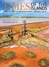
Times of the Islands Spring 2021
Presents the "soul of the Turks & Caicos Islands" with in-depth features about local people, culture, history, environment, real estate, businesses, resorts, restaurants and activities.
Presents the "soul of the Turks & Caicos Islands" with in-depth features about local people, culture, history, environment, real estate, businesses, resorts, restaurants and activities.

Create successful ePaper yourself
Turn your PDF publications into a flip-book with our unique Google optimized e-Paper software.
This is a very early picture (1967) <strong>of</strong> <strong>the</strong> “new” runway, when we could only use <strong>the</strong> small, white portion on <strong>the</strong> eastern end. You can also see<br />
<strong>the</strong> 1,200 foot strip to <strong>the</strong> north (arrow).<br />
Finbar Dempsey and Gus Lightbourne, who was <strong>the</strong><br />
elected representative for Providenciales. Planning and<br />
survey departments were still to be formed.<br />
The government suggested that we extend <strong>the</strong> location<br />
where we had <strong>the</strong> 1,200 feet. As we now had <strong>the</strong><br />
proper topographic map available, I could show Fritz<br />
that we could build a 4,500-foot runway <strong>the</strong>re, but <strong>the</strong>re<br />
would be no room for future extension because we would<br />
be jammed in between two hills. The map clearly showed<br />
that if <strong>the</strong> runway was moved about half a mile south it<br />
would be more suitable, because in that location <strong>the</strong>re<br />
was a lot <strong>of</strong> flat ground.<br />
We were having a lot <strong>of</strong> discussions about where <strong>the</strong><br />
best location for <strong>the</strong> Providenciales airport should be.<br />
Both Fritz and I agreed that <strong>the</strong> ideal location for an east–<br />
west runway would be just south <strong>of</strong> North West Point.The<br />
noisy approach and take <strong>of</strong>f areas would be over water.<br />
But this was 1967 and North West Point was about as far<br />
away as <strong>the</strong> moon!<br />
South Caicos District Commissioner Ben Bolt came<br />
over on behalf <strong>of</strong> <strong>the</strong> government to inspect <strong>the</strong> location<br />
for <strong>the</strong> runway that we were suggesting. First, I showed<br />
him on <strong>the</strong> topo map why this was a good location. Then<br />
we walked on <strong>the</strong> footpath from Blue Hills to Five Cays<br />
which was flanked by a stone wall. When we reached<br />
<strong>the</strong> proposed location, we jumped atop <strong>the</strong> wall to see<br />
above <strong>the</strong> bushes. It was obvious <strong>the</strong>re was a lot <strong>of</strong> flat,<br />
level ground stretching far to <strong>the</strong> west. Ben Bolt agreed<br />
that this looked like a good location, so <strong>the</strong> decision was<br />
made <strong>the</strong>n and <strong>the</strong>re that this was where we were going<br />
to build <strong>the</strong> runway for Providenciales and that’s where<br />
we are still landing today!<br />
The Providenciales International Airport underwent a major expansion/redevelopment program in 2011.<br />
22 www.timespub.tc