Spate Irrigation in Yemen
Spate Irrigation in Yemen
Spate Irrigation in Yemen

Create successful ePaper yourself
Turn your PDF publications into a flip-book with our unique Google optimized e-Paper software.
SPATE IRRIGATION IN YEMEN<br />
By<br />
Dr. Sharafadd<strong>in</strong> A. Saleh
SPATE IRRIGATION IN YEMEN
Was spate irrigation <strong>in</strong>vented <strong>in</strong> <strong>Yemen</strong>?
Mar’ib Dam<br />
برأم دس<br />
• Constructions is started 5000 years ago<br />
• Barrage 18 meter high and 700 meter long<br />
• <strong>Irrigation</strong> off-takes on both sides (60 cubic meter/s)<br />
• Command area of 9600 hectares<br />
• Supported population of 30-50,000 people<br />
• F<strong>in</strong>al catastrophic breach 2400 years ago
and satellite image for recent Marib dam<br />
and old Marib dam
<strong>Yemen</strong> satellite image map
Type of spate systems <strong>in</strong> <strong>Yemen</strong>:<br />
(1) large coastal systems<br />
Tihama systems<br />
South <strong>Yemen</strong><br />
Systems
<strong>Yemen</strong> Major<br />
Wadis
Ra<strong>in</strong>fall <strong>in</strong> <strong>Yemen</strong> is characterized as:<br />
�The Red Sea Convergence Zone from<br />
March to May (the summer season (Sief<br />
Season)<br />
�A monsoonal Intertropical Convergence<br />
Zone from July to mid October (the autumn<br />
season (Kharif season)).<br />
�The Mediterranean Zone that causes<br />
occasional light ra<strong>in</strong>fall events <strong>in</strong> the dry<br />
season from December to January.
�The average ra<strong>in</strong>fall flocculates from<br />
50 mm /year <strong>in</strong> the castle pla<strong>in</strong> and<br />
Eastern regions To 300 mm/year <strong>in</strong> the<br />
middle altitude areas and Southern<br />
prov<strong>in</strong>ces.<br />
� The ra<strong>in</strong>fall exceeds to 800 mm/year<br />
at the wadis catchments areas <strong>in</strong> the<br />
central and Southern highlands of<br />
<strong>Yemen</strong>
Ra<strong>in</strong>fall Isohyets In <strong>Yemen</strong>
<strong>Yemen</strong> map with different climatic Zones
The Mean Annual flows and Catchments Areas for Major Wadis <strong>in</strong> <strong>Yemen</strong><br />
Escarpment<br />
Name of Wadi Catchment area<br />
(km 2 )<br />
Mean Annual<br />
ra<strong>in</strong>fall (mm)<br />
Western Mwar 8,000 480 210<br />
Surdud 2,700 650 121<br />
Siham 4,900 500 130<br />
Rima 2,700 570 103<br />
Zabid 4,700 560 164<br />
Rasyan 2,000 500 54<br />
Southren Bana 7,200 349 160<br />
Tuban 5,090 224 125<br />
Hassan 3,300 300 30<br />
Middle Al-Jawf 14,000 140 35<br />
Mean Annual<br />
flow (Mm 3 )<br />
Adhanah 12,600 Not available Not available<br />
Ahwar 7,250 100 40<br />
Maifaa 6,000 200 30<br />
Baihan 3,600 150 54<br />
Hajr 9,324 80 228<br />
Eastern Hadramaut 113,900 63 230<br />
Masila Not available 200 27<br />
Source: Participatory <strong>Spate</strong> <strong>Irrigation</strong> Management Study
Levels (m)<br />
4.5<br />
4<br />
3.5<br />
3<br />
2.5<br />
2<br />
1.5<br />
1<br />
0.5<br />
Example Flood Hydrograph<br />
(Wadi Rima)<br />
Water level record - Mishrafah March 1981<br />
First peak<br />
steep rise<br />
(<strong>in</strong> 30 m<strong>in</strong>utes<br />
to 4 meter)<br />
Recession<br />
Second flood<br />
0<br />
18:00 6:00 18:00 6:00 18:00 6:00 18:00 6:00<br />
13 March 1981 14 March 1981 15 March 1981
Flash flood <strong>in</strong> wadis <strong>in</strong> <strong>Yemen</strong>
As a result every wadi has different strategy<br />
for divert<strong>in</strong>g water, that relates to flood<br />
patterns, shape and level of command area and<br />
groundwater conditions<br />
• Capture the base flow?<br />
• Divert the small and medium sized floods only or also<br />
captur<strong>in</strong>g the peak floods?<br />
• Improve groundwater recharge?
<strong>Spate</strong> <strong>Irrigation</strong> Potential<br />
�<strong>Spate</strong> areas <strong>in</strong>crease from (117,000 ha) <strong>in</strong> dry years<br />
to (165,000 ha) <strong>in</strong> wet years.<br />
�The spate irrigation systems is def<strong>in</strong>ed as:<br />
�Small scale <strong>Irrigation</strong> systems (SSI)<br />
•range from a few hectares to 300 ha most<br />
•Wadis upper catchment’s<br />
•traditional systems made by farmers.<br />
�Medium Scale <strong>Irrigation</strong> systems (MSI)<br />
•ranges from 300 ha to 2000 ha<br />
•the Wadis middle catchment's and upstream lower part.<br />
•mostly made by farmers and some times local authority.<br />
•most of them are tradition or improved.<br />
�Large Scale <strong>Irrigation</strong> systems (LSI)<br />
•More than 2000 ha<br />
•exist <strong>in</strong> the western and southern coastal pla<strong>in</strong>s<br />
•modern systems or improved traditional systems<br />
• most of them constructed by Government Authority<br />
and M<strong>in</strong>istry departments.
The common <strong>Spate</strong> <strong>Irrigation</strong> Systems <strong>in</strong> <strong>Yemen</strong> &<br />
responsibility of Operation and Ma<strong>in</strong>tenance (O&M)<br />
Infrastructure<br />
O&M<br />
Farmers (F) F (S)<br />
F + Local Gov<br />
(LG)<br />
Traditional<br />
Systems<br />
(TS)<br />
Improved<br />
Infrastructure<br />
(II)<br />
F + LG (M)<br />
F+ Agency (A) F + A (L)<br />
Modernized/ and<br />
New Systems<br />
F + LG + A F + A (M and L)<br />
Special<br />
Agency<br />
(L)<br />
(S) Small System (M) Medium systems (L) Large system
<strong>Spate</strong> <strong>Irrigation</strong> Water Resource<br />
�Surface Water (flood water or spate<br />
water, spr<strong>in</strong>gs, and Wadis Base Flow).<br />
�Ground water.<br />
�The flood occurs <strong>in</strong> two seasons (Seif<br />
and khsrif)
<strong>Spate</strong> <strong>Irrigation</strong> Diversion Structures Systems<br />
�Traditional <strong>Spate</strong> <strong>Irrigation</strong> Systems<br />
�Improved <strong>Spate</strong> <strong>Irrigation</strong> systems<br />
�Modern <strong>Spate</strong> <strong>Irrigation</strong> Systems
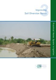
Traditional <strong>Spate</strong> <strong>Irrigation</strong> Systems
Traditional <strong>Spate</strong> <strong>Irrigation</strong> Systems<br />
Traditional diversion structure <strong>in</strong> <strong>Yemen</strong>
Traditional <strong>Spate</strong> <strong>Irrigation</strong> Systems
Improved <strong>Spate</strong> <strong>Irrigation</strong> systems
Wadi Siham Dabashia diversion downstream1<br />
Wadi Siham, <strong>Yemen</strong><br />
Improved <strong>Spate</strong> <strong>Irrigation</strong> systems<br />
Improved flood channel open <strong>in</strong>take<br />
Traditional diversion spur<br />
re<strong>in</strong>forced with gabions<br />
ٌRe<strong>in</strong>forced river embankment<br />
Channel <strong>in</strong>take and bed level fixed
Modern <strong>Spate</strong> <strong>Irrigation</strong> systems
Modern <strong>Spate</strong> <strong>Irrigation</strong> systems
Modern <strong>Spate</strong> <strong>Irrigation</strong> systems<br />
The irrigated areas <strong>in</strong> Major Wadis <strong>in</strong> <strong>Yemen</strong><br />
Escarpment<br />
Western<br />
Wadis<br />
South and<br />
Eastern<br />
Wadis<br />
Name of<br />
Wadi<br />
Irrigated<br />
areas (ha)<br />
Notice<br />
Mwar 17,000 Traditional systems (9,000ha)<br />
Siham 10,929<br />
Rima 7,100<br />
Zabid 15,215 Sometimes extended to<br />
(21,000ha)<br />
Rasyan Not<br />
available<br />
Bana 25,722<br />
Tuban 11,000<br />
Hassan 6,300<br />
Ahwar 7,000<br />
Hadramau<br />
t<br />
8000 The flood occur every 1.5- 2<br />
years
Estimated rehabilitation cost for some<br />
<strong>Spate</strong> <strong>Irrigation</strong> systems <strong>in</strong> <strong>Yemen</strong> Wadis<br />
Project Name (related to<br />
Q18)<br />
Type of<br />
Intervention<br />
Rehabilitation Cost (US$/ha)<br />
Wadi Mawr system PHL 3830.6(estimated)<br />
Wadi Rima system<br />
PHL 2312.7(estimated)<br />
Wadi Siham systems PHL 1756.8(estimated)<br />
Wadi Zabid systems PHS 231(actual)<br />
Wadi Bana system PHS 3544.3(estimated)<br />
Wadi Ahwar systems PHS 1555.71 (estimated)<br />
Wadi Tuban systems PHS 388 (actual)<br />
Wadi Hadramout systems<br />
NPH<br />
(improved traditional structures)<br />
cost from 31$/ha for small<br />
project to 18267$/ha for large<br />
project<br />
PHS (Moaza Shibam)<br />
(NPH): Non permanent headwork <strong>in</strong>clud<strong>in</strong>g soil bunds, gabion structures and diversion channels<br />
(PHS): Permanent headwork for small systems <strong>in</strong>clud<strong>in</strong>g diversion weirs and guide bunds<br />
(PHL): Permanent headwork for large systems <strong>in</strong>clud<strong>in</strong>g diversion weirs, breach<strong>in</strong>g bunds and siphons<br />
(M): Ma<strong>in</strong>tenance costs
<strong>Spate</strong> <strong>Irrigation</strong> Water Distribution<br />
and Water Rights<br />
�(al a'la fal a'la) or Al-Arda’a ful Al-Arda’a<br />
� <strong>Spate</strong> water right is based on"Aurf" and<br />
Al- Shareiah or traditional custom rights
A. Water Rights <strong>in</strong> Wadi Hadramout<br />
Shibam canal distribution<br />
system<br />
Shibam canal distribution system and field off-take<br />
First Rule is proportion of the flow go<strong>in</strong>g to<br />
c<br />
different flood channels and fields<br />
a<br />
Under gate open<strong>in</strong>g
A. Water Rights <strong>in</strong> Wadi Hadramout<br />
Al-Powirigat palims spate irrigation flood distribution (wadi Al-A<strong>in</strong> Hadramout).jpg<br />
field canal<br />
secondary canals<br />
a b<br />
Al-Powirigat palims spate irrigation flood distribution (wadi Al-A<strong>in</strong> Hadramout).jpg<br />
Field canals<br />
ma<strong>in</strong> canal<br />
field canal<br />
Second Rule is the flow distribution accord<strong>in</strong>g to nearest secondary field canals<br />
c<br />
and fields elevations by gated or un-gated field channel<br />
with different channel bed elevation
Third Rule water depth control <strong>in</strong> field<br />
by elevated spillway or tail gates<br />
Masonry spillway and can
B. Water Rights <strong>in</strong> Wadi Bana<br />
�Specific program for spate water<br />
distribution are made for every season by<br />
the <strong>Irrigation</strong> Department with the help of<br />
local committee<br />
�The priority is given to un-irrigated land<br />
<strong>in</strong> the last season, and for fields which<br />
have sal<strong>in</strong>ity problem and cereals fields.
Cropp<strong>in</strong>g Pattern <strong>in</strong> <strong>Spate</strong> <strong>Irrigation</strong> Areas<br />
serl Crop Area (ha) Yield (Tons/ha)<br />
1. Wadi Tuban (improved wadi)<br />
1 Cotton 89 1.32 to 2.02<br />
2 Sorghum gra<strong>in</strong>s 38.5 0.77to 1.85<br />
3 Sorghum fodder 70 0.81 to 1.1<br />
4 Sesame 48.5 0.65 to 0.88<br />
5 Groundnut 30 0.53 to 0.78<br />
2. Wadi bana<br />
1 Cotton 1890 1.28<br />
2 Sorghum gra<strong>in</strong> 1312 0.98<br />
Sorghum fodder 3265 11.5<br />
3 Sesame 756 1.02<br />
Groundnut 677 0.71<br />
4 Water Melon 225 8.73<br />
5 Sweet Melon 86 5.86
Cropp<strong>in</strong>g Pattern <strong>in</strong> <strong>Spate</strong> <strong>Irrigation</strong> Areas-----Cont<strong>in</strong>ued<br />
3. Wadi Hassan<br />
1 Cotton 472 1.28<br />
Sorghum gra<strong>in</strong> 328 0.98<br />
Sorghum fodder 816 1.02<br />
3 Sesame 189 0.71<br />
Groundnut 169 8.73<br />
Water Melon 56 5.86<br />
5 Sweet Melon 22 0.98<br />
4. Wadi Siham<br />
1 Sorghum 458.5 0.525<br />
2 Sesame 5.0 0.83<br />
5. Wadi Rima<br />
1 Sorghum 221.5 0.63<br />
2 Sesame 38.5 0.97
Cropp<strong>in</strong>g Pattern <strong>in</strong> <strong>Spate</strong> <strong>Irrigation</strong> Areas-----Cont<strong>in</strong>ued<br />
6. Wadi Zabid (improved)<br />
1 Cotton 320 1.2 to 1.9<br />
2 Sorghum gra<strong>in</strong>s 96 0.8 to 1.3<br />
3 Sorghum fodder 50 6.8 to 8.8<br />
4 Sesame 50 0.49 to 0.71<br />
5 Maize 30 2.78 to 3.7<br />
7. Wadi Hadramout<br />
1 Sorghum gra<strong>in</strong>s not available<br />
data yet)<br />
2 Sesame not available<br />
data yet)<br />
3 Dates not available<br />
data yet)<br />
4 Wheat not available<br />
data yet)<br />
5<br />
not available<br />
data yet)<br />
not available<br />
data yet)<br />
not available<br />
data yet)<br />
not available<br />
data yet)
Net annual revenues from spate irrigation <strong>in</strong> US$ per household<br />
Project Name<br />
Number of<br />
Households<br />
Wadi Mwar systems 17174 6474<br />
Wadi Rima systems 68233 6394.5<br />
Wadi Siham systems 17470 5450<br />
Net Annual<br />
Revenues<br />
(US$/Household)<br />
Note<br />
Wadi Zabid systems 1531 ------- Not available<br />
Wadi Rasyan systems ----- ------- Not available<br />
Wadi Bana systems 20941 8671<br />
Wadi Ahwar systems 3405 6474<br />
Wadi Tuban systems 13203 ----- Not available<br />
Wadi Hassan systems ------ ------ Not available<br />
Wadi Hadramout<br />
systems<br />
-------<br />
------ Not available
Soil Moisture Conservation<br />
<strong>in</strong> <strong>Spate</strong> <strong>Irrigation</strong> Areas<br />
�Farmers plough their lands before<br />
irrigation <strong>in</strong> order to make loose<br />
soil and <strong>in</strong>crease the water<br />
percolation <strong>in</strong> soil depth.<br />
� plough after irrigation to keep the<br />
soil moistures.<br />
�Farmers do mulch<strong>in</strong>g for the<br />
ploughed wet soil after irrigation to<br />
keep soil moistures.
<strong>Spate</strong> <strong>Irrigation</strong> Constra<strong>in</strong>s<br />
�The spate water fluctuations with ra<strong>in</strong>fall from<br />
season to another and from year to another.<br />
�Farmer’s dependency on the government f<strong>in</strong>ancial<br />
support for the construction of the new system,<br />
and operation and ma<strong>in</strong>tenance of exist<strong>in</strong>g<br />
systems<br />
�High sediments concentration <strong>in</strong> floods<br />
�The crops yield market<strong>in</strong>g is not organized and<br />
has<br />
not its opportunities for beter market<strong>in</strong>g.<br />
�The applied water is more than needed CWR<br />
�Field to field irrigation
Recommendations<br />
�Apply<strong>in</strong>g the canal water distribution<br />
method<br />
�us<strong>in</strong>g adjustable or equitable water rights<br />
�us<strong>in</strong>g the improved tradition diversion<br />
structures<br />
�Shar<strong>in</strong>g the farmers communities <strong>in</strong> the<br />
structures site selection and design<br />
�Shar<strong>in</strong>g the farmers communities <strong>in</strong> the<br />
O&M of canal and head-works structures
Thank you