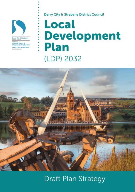
Derry City & Strabane District Council Local Development Plan 2032 - draft Plan Strategy
Derry City and Strabane District Council has published its LDP draft Plan Strategy (dPS) on Monday 2nd December 2019. The LDP dPS and other associated documents are open to public consultation for an 8-week period ending on 27th January 2020.
Derry City and Strabane District Council has published its LDP draft Plan Strategy (dPS) on Monday 2nd December 2019. The LDP dPS and other associated documents are open to public consultation for an 8-week period ending on 27th January 2020.

You also want an ePaper? Increase the reach of your titles
YUMPU automatically turns print PDFs into web optimized ePapers that Google loves.
<strong>Derry</strong> <strong>City</strong> & <strong>Strabane</strong> <strong>District</strong> <strong>Council</strong><br />
<strong>Local</strong><br />
<strong>Development</strong><br />
<strong>Plan</strong><br />
(LDP) <strong>2032</strong><br />
Draft <strong>Plan</strong> <strong>Strategy</strong>
Consultation Arrangements<br />
Consultation Arrangements<br />
This LDP <strong>draft</strong> <strong>Plan</strong> <strong>Strategy</strong> (dPS) is a consultation document, to which representations<br />
can be made during a formal consultation period from Monday 2nd December 2019<br />
to Monday 27th January 2020. Representations received after this date will not be<br />
considered.<br />
This dPS document is available, together with the associated documents, at http://www.<br />
derrystrabane.com/Subsites/LDP/<strong>Local</strong>-<strong>Development</strong>-<strong>Plan</strong><br />
These documents are also available to view, during normal opening hours, at:<br />
• <strong>Council</strong> Offices, 98 Strand Road, <strong>Derry</strong>, BT48 7NN<br />
• <strong>Council</strong> Offices, 47 <strong>Derry</strong> Road, <strong>Strabane</strong>, BT82 8DY<br />
• Public Libraries and <strong>Council</strong> Leisure Centres throughout the <strong>District</strong>.<br />
Public Meetings and Workshops will be held throughout the <strong>District</strong> during December<br />
2019 / January 2020; see the <strong>Council</strong>’s website and local press advertisements for details.<br />
This LDP <strong>draft</strong> <strong>Plan</strong> <strong>Strategy</strong> is considered by the <strong>Council</strong> to be ‘sound’; if you have any<br />
comments or objections to make, it is necessary to demonstrate why you consider that<br />
the <strong>Plan</strong> is not ‘sound’ and / or why you consider your proposal to be ‘sound’. Comments,<br />
or representations made in writing, will be considered at an Independent Examination (IE)<br />
conducted by the <strong>Plan</strong>ning Appeals Commission (PAC) or other independent body that will<br />
be appointed by the Department for Infrastructure (DfI). The IE will determine whether the<br />
dPS satisfies statutory requirements and also consider the ‘soundness’ of the LDP dPS –<br />
against the Procedural Tests, Consistency Tests and the Coherence & Effectiveness Tests.<br />
Before submitting a representation, you are strongly advised to read DfI’s guidance on<br />
soundness in <strong>Development</strong> <strong>Plan</strong> Practice Note (DPPN) 06 (See<br />
https://www.planningni.gov.uk/index/advice/practice-notes/common-newpage-9.<br />
htm). It is also recommended that you read the PAC’s guidance entitled ‘Procedures for<br />
Independent Examination of <strong>Local</strong> <strong>Development</strong> <strong>Plan</strong>s’ available on their website www.<br />
pacni.gov.uk<br />
Representations can also be submitted during the consultation period regarding the associated<br />
appraisal documents, namely the <strong>draft</strong> Sustainability Appraisal (incorporating the Strategic<br />
Environmental Assessment, SEA), the <strong>draft</strong> Habitats Regulations Assessment (HRA or AA), <strong>draft</strong><br />
Equality Impact Assessment (EQIA) and <strong>draft</strong> Rural Needs Impact Assessment (RNIA).<br />
Your comments may be submitted by e-mail to: LDP@<strong>Derry</strong><strong>Strabane</strong>.com preferably by<br />
using the online questionnaire at the above website. Alternatively, you can write to the<br />
<strong>Plan</strong>ning LDP Team, 98 Strand Road, <strong>Derry</strong> BT48 7NN. (Please note that, under Freedom<br />
of Information and <strong>Council</strong>’s policy of Transparency, all representations will normally be<br />
made publicly available. Any requests otherwise should be clearly stated and the request<br />
will be considered by the <strong>Council</strong>.)<br />
This LDP <strong>draft</strong> <strong>Plan</strong> <strong>Strategy</strong> (dPS) and supporting documents can be supplied in<br />
alternative formats; please submit your request and requirements to the above address.<br />
Our other contacts are: Telephone - 028 71 253 253 Ext. 7014, Textphone – 028 71 376 646.<br />
The Closing Date for Representations is Monday 27 th January 2020<br />
<strong>Local</strong> <strong>Development</strong> <strong>Plan</strong> (LDP) <strong>2032</strong> – Draft <strong>Plan</strong> <strong>Strategy</strong><br />
1
Foreword<br />
Foreword from The <strong>Council</strong><br />
Mayor, <strong>Plan</strong>ning Committee<br />
Chair and Chief Executive<br />
This <strong>Local</strong> <strong>Development</strong> <strong>Plan</strong> (LDP) <strong>draft</strong> <strong>Plan</strong> <strong>Strategy</strong> (dPS) is an important step for<br />
<strong>Derry</strong> <strong>City</strong> and <strong>Strabane</strong> <strong>District</strong> <strong>Council</strong> as we prepare our new LDP. Most <strong>Plan</strong>ning<br />
powers have been with the <strong>Council</strong> since 2015 and we have been making decisions<br />
based upon the existing Area <strong>Plan</strong>s and DOE <strong>Plan</strong>ning policies. This LDP is our<br />
opportunity to set our own <strong>Plan</strong>ning policies and priorities to meet the development<br />
needs of <strong>Derry</strong> <strong>City</strong> and <strong>Strabane</strong> <strong>District</strong>.<br />
In preparing this LDP dPS, the <strong>Council</strong> has taken account of the representations<br />
received at the LDP Preferred Options Paper (POP) stage in Mid-2017. There have also<br />
been further inputs from key consultees, stakeholders and in particular, the elected<br />
<strong>Council</strong>lors have been actively involved in discussing and agreeing each LDP <strong>Plan</strong>ning<br />
topic through numerous Member Workshops and <strong>Plan</strong>ning Committee meetings.<br />
The LDP supports the implementation of the <strong>District</strong>’s Community <strong>Plan</strong> – the Strategic<br />
Growth <strong>Plan</strong> (SGP, 2017), both being focussed on delivering the <strong>District</strong>’s vision to be ‘a<br />
thriving, prosperous and sustainable <strong>City</strong> and <strong>District</strong> with equality of opportunity for all’.<br />
Therefore, this LDP <strong>draft</strong> <strong>Plan</strong> <strong>Strategy</strong> sets out the strategic <strong>Plan</strong>ning objectives,<br />
designations and policies, which will guide developments and encourage investment,<br />
co-ordinate infrastructure for our people and protect our environment to beyond<br />
<strong>2032</strong>. The <strong>Council</strong> wants the public, community and other key stakeholders with<br />
an interest in the future development of our <strong>City</strong> and <strong>District</strong> to understand and<br />
take ownership of this <strong>Local</strong> <strong>Development</strong> <strong>Plan</strong>. Please take the opportunity to feed<br />
back any comments or representations about this LDP <strong>draft</strong> <strong>Plan</strong> <strong>Strategy</strong> within the<br />
forthcoming consultation period.<br />
Together, we can deliver the jobs, homes, facilities and infrastructure in a sustainable<br />
manner, to make this <strong>District</strong> thrive and prosper for everyone.<br />
2 nd December 2019<br />
Mayor of <strong>District</strong> 2019/20,<br />
<strong>Council</strong>lor Michaela Boyle<br />
<strong>Council</strong> Chief Executive<br />
John Kelpie<br />
Chair of <strong>Plan</strong>ning Committee<br />
2019/20, <strong>Council</strong>lor<br />
Christopher Jackson<br />
2 <strong>Local</strong> <strong>Development</strong> <strong>Plan</strong> (LDP) <strong>2032</strong> – Draft <strong>Plan</strong> <strong>Strategy</strong>
Contents<br />
<strong>Derry</strong>-<strong>Strabane</strong> - LDP Draft <strong>Plan</strong> <strong>Strategy</strong> –<br />
Contents<br />
Consultation Arrangements 1<br />
Foreword from <strong>Council</strong> Mayor, <strong>Plan</strong>ning Committee Chair and Chief Executive 2<br />
Contents<br />
Part A - Contextual Chapters<br />
1. Introduction to the LDP <strong>Plan</strong> <strong>Strategy</strong> (PS) 7<br />
2. Survey & Profile of the <strong>Derry</strong> <strong>City</strong> and <strong>Strabane</strong> <strong>District</strong> 16<br />
3. Policy Context for the LDP 35<br />
Part B - Overall <strong>Strategy</strong><br />
4. LDP Vision and Objectives 44<br />
5. Growth <strong>Strategy</strong> for the <strong>Derry</strong> <strong>City</strong> and <strong>Strabane</strong> <strong>District</strong> 49<br />
6. Spatial <strong>Strategy</strong> for the <strong>Derry</strong> <strong>City</strong> and <strong>Strabane</strong> <strong>District</strong> 56<br />
7. General <strong>Development</strong> Principles & Policies 73<br />
8. Enforcement of <strong>Plan</strong>ning 109<br />
Part C - Economy – <strong>Strategy</strong>, Designations & Policies<br />
9. Economic <strong>Development</strong> 112<br />
10. <strong>City</strong> / Town Centres, Retailing, Offices, Leisure and Other Uses 129<br />
11. Transport and Movement 145<br />
12. Tourism <strong>Development</strong> 182<br />
13. Minerals <strong>Development</strong> 198<br />
14. Signs & Outdoor Advertising 207<br />
15. Agriculture & Other <strong>Development</strong> in the Countryside 211<br />
Part D - Social <strong>Development</strong> – <strong>Strategy</strong>, Designations & Policies<br />
16. Housing in Settlements and in the Countryside 219<br />
17. Open Space, Sport & Outdoor Recreation 277<br />
<strong>Local</strong> <strong>Development</strong> <strong>Plan</strong> (LDP) <strong>2032</strong> – Draft <strong>Plan</strong> <strong>Strategy</strong><br />
3
Contents<br />
18. Community Infrastructure 298<br />
19. Utilities <strong>Development</strong> 301<br />
20. Waste <strong>Plan</strong>ning 309<br />
Part E - Environment – <strong>Strategy</strong>, Designations & Policies<br />
21. Natural Environment 323<br />
22. Coastal <strong>Development</strong> 339<br />
23. Historic Environment 346<br />
24. Renewable and Low Carbon Energy <strong>Development</strong> 365<br />
25. <strong>Development</strong> and Flooding 376<br />
Part F - Place-Making And Design Vision<br />
26. Place-Making & Design Vision For <strong>Development</strong> in the <strong>District</strong> 399<br />
27. Place-Making & Design Vision/Policy for <strong>Derry</strong>-Londonderry 409<br />
28. Place-Making & Design Vision/Policy for <strong>Strabane</strong> 424<br />
29. Place-Making & Design Vision/Policy for <strong>Local</strong> Towns 431<br />
30. Place-Making & Design Vision/Policy for Villages 438<br />
31. Place-Making & Design Vision/Policy for Small Settlements 440<br />
32. Place-Making & Design Vision/Policy for Countryside 442<br />
Part G - Specialised Requirements, Etc.<br />
33. Hazardous Substances, COMAH & Major Accidents 453<br />
34. Developer Contributions and Community Benefits 455<br />
35. Demolition and Redevelopment 457<br />
36. Regeneration and Comprehensive Redevelopment 459<br />
37. Other Specialist Requirements 462<br />
38. Supplementary <strong>Plan</strong>ning Guidance 464<br />
39. Transitional Arrangements 466<br />
Part H - LDP Monitoring and Review<br />
40. Monitoring Criteria & Review Process 471<br />
41. Next Steps – From Draft <strong>Plan</strong> <strong>Strategy</strong> Onwards 473<br />
4 <strong>Local</strong> <strong>Development</strong> <strong>Plan</strong> (LDP) <strong>2032</strong> – Draft <strong>Plan</strong> <strong>Strategy</strong>
Appendices<br />
Appendices<br />
Appendix 1:<br />
Appendix 2:<br />
<strong>Plan</strong> <strong>Strategy</strong> Proposals Maps of <strong>District</strong> – Settlement and<br />
Environment 476<br />
Tourism Benefit Statement and Sustainable<br />
Benefit Statement 477<br />
Appendix 3: Open Space 479<br />
Appendix 4: <strong>Development</strong> and Flooding Annexes 481<br />
Appendix 5: Housing Allocation Tables 501<br />
Appendix 6: Supplementary <strong>Plan</strong>ning Guidance 507<br />
Appendix 7: Glossary of Terms & Abbreviations 517<br />
We wish to acknowledge the Executive Office and Translink for the use of certain<br />
photographs within this document<br />
<strong>Local</strong> <strong>Development</strong> <strong>Plan</strong> (LDP) <strong>2032</strong> – Draft <strong>Plan</strong> <strong>Strategy</strong><br />
5
Part A - Contextual Chapters<br />
A<br />
Contexual Chapters<br />
6<br />
<strong>Local</strong> <strong>Development</strong> <strong>Plan</strong> (LDP) <strong>2032</strong> – Draft <strong>Plan</strong> <strong>Strategy</strong>
1. Introduction to the<br />
<strong>Local</strong> <strong>Development</strong><br />
<strong>Plan</strong> (LDP) Draft <strong>Plan</strong><br />
<strong>Strategy</strong> (DPS)<br />
The LDP <strong>Plan</strong> <strong>Strategy</strong> (PS)<br />
1.1 This <strong>Local</strong> <strong>Development</strong> <strong>Plan</strong> (LDP) is being prepared under the provisions<br />
of Part 2 of the <strong>Plan</strong>ning Act (NI) 2011 and the <strong>Plan</strong>ning (<strong>Local</strong> <strong>Development</strong><br />
<strong>Plan</strong>) Regulations (NI) 2015. This LDP <strong>Plan</strong> <strong>Strategy</strong> is the first of two<br />
development plan documents that will together comprise the <strong>Council</strong>’s <strong>Local</strong><br />
<strong>Development</strong> <strong>Plan</strong> (LDP) for the <strong>Derry</strong> <strong>City</strong> and <strong>Strabane</strong> <strong>District</strong>. In May 2017,<br />
the LDP Preferred Options Paper (POP) provided the basis for consulting<br />
with the public and stakeholders on a series of options for dealing with key<br />
issues in the <strong>Plan</strong> area. It set out the <strong>Council</strong>’s initial proposals and policy<br />
direction, therefore aiming to stimulate public comment and help interested<br />
parties to become involved in a more meaningful way at this earliest stage of<br />
<strong>Plan</strong> preparation. This <strong>draft</strong> LDP <strong>Plan</strong> <strong>Strategy</strong> will also be opened to public<br />
consultation, after which an Independent Examination will be held and<br />
the final version of the LDP <strong>Plan</strong> <strong>Strategy</strong> will then be published. A second<br />
development plan document – the <strong>Local</strong> Policies <strong>Plan</strong> (LPP) will then be<br />
prepared; together they will comprise the <strong>Local</strong> <strong>Development</strong> <strong>Plan</strong> (LDP).<br />
1.2 As set out in the Contents page and following the format of the earlier LDP<br />
POP, this LDP <strong>draft</strong> <strong>Plan</strong> <strong>Strategy</strong> sets out the strategic <strong>Plan</strong>ning objectives,<br />
designations and policies in clear logical sections, each one being colourcoded<br />
for ease of reading. Firstly, the proposed LDP Vision is set out, then<br />
the LDP Objectives, followed by the proposed overall Growth <strong>Strategy</strong> and<br />
the Hierarchy of Settlements for the <strong>District</strong>. The various <strong>Plan</strong>ning topics<br />
are then set out under the primary headings of Economy, then Social and<br />
then Environment. Part F then outlines the <strong>Council</strong>’s Place-making vision<br />
for each of the main Settlement tiers in terms of how they are expected to<br />
develop and grow positively over the next 15 years. The final sections address<br />
the <strong>Council</strong>’s approach to several specific aspects of <strong>Plan</strong>ning, plus the<br />
arrangements for the important ongoing monitoring and LDP review. The<br />
Proposals maps, technical sections and a Glossary of terms all follow in the<br />
appendices.<br />
<strong>Local</strong> <strong>Development</strong> <strong>Plan</strong> (LDP) <strong>2032</strong> – Draft <strong>Plan</strong> <strong>Strategy</strong><br />
7
Part A - Contextual Chapters<br />
1.3 The LDP <strong>draft</strong> <strong>Plan</strong> <strong>Strategy</strong> Proposals Map consists of two <strong>District</strong>-scale<br />
maps at Appendix 1 plus the map diagrams in certain chapters. The <strong>District</strong><br />
maps are divided into two layers for clarity i.e. settlement and environment.<br />
A number of existing features and non-LDP designations are shown ‘for<br />
information’, including the transport network, location of settlements, AONB<br />
and ASSIs (there are other related ‘international’ designations but these<br />
are not shown, for clarity). The maps do show the indicative location and<br />
extent of the main LDP strategic proposals i.e. the settlement hierarchy, the<br />
Green Belt, the Special Countryside Area (SCA), the Areas of High Landscape<br />
Importance (AHLIs) and approximate locations for Wind Energy Capacity<br />
Areas (WECAs). These designations and settlement limits are indicated for<br />
strategic purposes only and boundaries will be fully defined at the LDP <strong>Local</strong><br />
Policies <strong>Plan</strong> (LPP) stage. Within individual chapters, the map diagrams also<br />
form part of the LDP <strong>Plan</strong> <strong>Strategy</strong> Proposals Map, indicating the strategic<br />
direction of specific aspects.<br />
1.4 To accompany this main LDP <strong>draft</strong> <strong>Plan</strong> <strong>Strategy</strong> document, please also see<br />
the associated appraisal documents, namely the Sustainability Appraisal<br />
(incorporating the Strategic Environmental Assessment, SEA), the <strong>draft</strong><br />
Habitats Regulations Assessment (HRA or AA), Equality Impact Assessment<br />
(EQIA) and Rural Needs Impact Assessment (RNIA). There is also a significant<br />
number of technical papers / reports that explain and support the content of<br />
the dPS; these have been compiled as a topic-based ‘Evidence Base’. A final<br />
Report on the consideration of POP Representations and a LDP Monitoring &<br />
Review Report have also been issued along with the dPS. All these documents<br />
are available to view at http://www.derrystrabane.com/Subsites/LDP/<strong>Local</strong>-<br />
<strong>Development</strong>-<strong>Plan</strong>.<br />
The <strong>Local</strong> <strong>Development</strong> <strong>Plan</strong> (LDP)<br />
1.5 The purpose of the <strong>Local</strong> <strong>Development</strong> <strong>Plan</strong> (LDP) is to inform the general<br />
public, statutory authorities, developers and other interested parties of<br />
the policy framework and land use proposals that will guide development<br />
decisions within the <strong>District</strong>. The LDP is expected to apply regional policies at<br />
the appropriate local level and it will set out a clear vision of how the <strong>District</strong><br />
should look in the future, by indicating what type and scale of development<br />
should be encouraged and where it should be located. The <strong>Plan</strong>’s landuse<br />
zonings, designations and <strong>Plan</strong>ning policies will ensure that lands are<br />
appropriately zoned, development is managed and that infrastructure is coordinated<br />
to develop the <strong>District</strong> for future generations.<br />
1.6 The allocations, designations, policies, proposals and zoning contained in the<br />
LDP, collectively referred to as the plan proposals, constitute considerations<br />
that the <strong>Council</strong> (or other decision-maker) will take into account in the<br />
determination of planning applications. The contents of the LDP must be<br />
read as a whole, as often a combination of designations, policies, proposals<br />
and zonings may be relevant to a particular development proposal.<br />
8<br />
<strong>Local</strong> <strong>Development</strong> <strong>Plan</strong> (LDP) <strong>2032</strong> – Draft <strong>Plan</strong> <strong>Strategy</strong>
1.7 The plan proposals are not the only tests of acceptability for development<br />
proposals. In making its decisions, the <strong>Council</strong> will also assess proposals<br />
against all planning policies and other materials considerations that are<br />
relevant to it. The contents of the LDP must be read in conjunction with the<br />
relevant contents of regional policy documents and supplementary planning<br />
guidance documents.<br />
1.8 The LDP will help to provide greater clarity and certainty for the public and<br />
would-be developers regarding development proposals. However, it should<br />
be recognised there may be occasions when other material considerations<br />
outweigh the LDP proposals. Each planning application will be considered on<br />
its merits to assess whether or not an exception would be justified, but the<br />
provisions of the LDP will prevail unless there are over-riding policy or other<br />
material considerations that outweigh them and justify a contrary decision.<br />
1.9 It should also be understood that no proposal or policy in this LDP should<br />
be interpreted as a commitment by the <strong>Council</strong> or other body to commit to<br />
expenditure on a particular proposal; such decisions are subject to economic<br />
appraisal and other budgeting and decision-making procedures.<br />
1.10 When adopted, the <strong>Council</strong>’s LDP for the <strong>District</strong> will replace the current<br />
<strong>Derry</strong> Area <strong>Plan</strong> 2011 (adopted May 2000) and the <strong>Strabane</strong> Area <strong>Plan</strong> 2001<br />
(adopted April 1991), both of which were produced by the Department<br />
of the Environment (DOE). The new LDP will also replace most existing<br />
regional planning policies. The LDP will comprise of two development plan<br />
documents;<br />
• The <strong>Plan</strong> <strong>Strategy</strong> (PS); and<br />
• The <strong>Local</strong> Policies <strong>Plan</strong> (LPP).<br />
1.11 Public participation and engagement in formulating the LDP and progress<br />
through to adoption is facilitated through the Statement of Community<br />
Involvement (SCI) and Timetable, which have been agreed between the<br />
<strong>Council</strong> and the Department for Infrastructure (DfI). See http://www.<br />
derrystrabane.com/Subsites/LDP/<strong>Local</strong>-<strong>Development</strong>-<strong>Plan</strong><br />
1.12 This LDP <strong>draft</strong> <strong>Plan</strong> <strong>Strategy</strong> (dPS) has been prepared first and will be<br />
subjected to public consultation and Independent Examination before<br />
adoption. After the <strong>Plan</strong> <strong>Strategy</strong> has been adopted, the <strong>Local</strong> Policies <strong>Plan</strong><br />
will be prepared and also subjected to public consultation and Independent<br />
Examination before adoption.<br />
1.13 In summary, the LDP for <strong>Derry</strong> <strong>City</strong> and <strong>Strabane</strong> <strong>District</strong> will fulfil the<br />
following functions:<br />
• provide a 15-year plan framework (2017-<strong>2032</strong>) to support the<br />
economic, social and environmental needs of the <strong>District</strong> in line with<br />
regional strategies and policies, providing for the delivery of sustainable<br />
development;<br />
<strong>Local</strong> <strong>Development</strong> <strong>Plan</strong> (LDP) <strong>2032</strong> – Draft <strong>Plan</strong> <strong>Strategy</strong><br />
9
Part A - Contextual Chapters<br />
• facilitate sustainable growth by co-ordinating public and private<br />
investment to encourage development where it can be of most benefit to<br />
the well-being of the community;<br />
• allocate sufficient land to meet society’s needs;<br />
• provide an opportunity for all stakeholders, including the public, to have a<br />
say about where and how development within their local area should take<br />
place;<br />
• provide a ‘plan-led’ framework for rational and consistent decisionmaking<br />
by the public, private and community sectors and those affected<br />
by development proposals; in particular, it will be the primary document<br />
against which the <strong>Council</strong> will assess and decide on planning applications;<br />
and<br />
• deliver the spatial aspects of the <strong>Council</strong>’s Community <strong>Plan</strong> – the inclusive<br />
Strategic Growth <strong>Plan</strong> for <strong>Derry</strong> <strong>City</strong> and <strong>Strabane</strong> <strong>District</strong> (SGP, 2017).<br />
1.14 The following are the Key Stages in the <strong>Local</strong> <strong>Development</strong> <strong>Plan</strong> preparation;<br />
see Figure 1 also:<br />
Stage 1: Initial <strong>Plan</strong> Preparation<br />
a. This stage included the development of the evidence base, preparation of the<br />
Statement of Community Involvement (SCI, published July 2016 and revised<br />
May 2018), the LDP Timetable (published July 2016 and revised May 2018 and<br />
July 2019) and the production of the Preferred Options Paper (POP, published<br />
May 2017). The Timetable sets out the <strong>Council</strong>’s programme for the production<br />
of the <strong>Plan</strong> <strong>Strategy</strong> and <strong>Local</strong> Policies <strong>Plan</strong> including key milestones and<br />
timelines for plan production through to adoption. The SCI promotes a more<br />
meaningful and effective approach to enable interested parties and the local<br />
community to engage early in the plan process and throughout its preparation.<br />
Before the <strong>Council</strong> could consult on its Preferred Options Paper, it needed<br />
to have an agreed SCI in place in order to inform the general public and all<br />
stakeholders of how, where and when they can become involved in the <strong>Local</strong><br />
<strong>Development</strong> <strong>Plan</strong> preparation process and the timescale for doing so.<br />
b. In preparing the POP, the <strong>Council</strong> also undertook the initial stages of<br />
Sustainability Appraisal (SA). As illustrated in Figure 1, the SA is a continual<br />
process that runs parallel with the preparation of the POP and <strong>Local</strong><br />
<strong>Development</strong> <strong>Plan</strong> (LDP). An SA Interim Report (consisting of SA Scoping<br />
Report and assessment of alternatives) was published with the POP. The POP<br />
indicated the <strong>Council</strong>’s preferred options for growth and development in the<br />
area and was the basis for consulting with the public and stakeholders. At<br />
this stage in the process, the public and stakeholders had an opportunity to<br />
formally put forward views and influence the <strong>Local</strong> <strong>Development</strong> <strong>Plan</strong>.<br />
10<br />
<strong>Local</strong> <strong>Development</strong> <strong>Plan</strong> (LDP) <strong>2032</strong> – Draft <strong>Plan</strong> <strong>Strategy</strong>
Stage 2: Preparation and Adoption of <strong>Plan</strong> <strong>Strategy</strong><br />
c. This stage of the <strong>Local</strong> <strong>Development</strong> <strong>Plan</strong> preparation process consists of the<br />
preparation and publication of the <strong>draft</strong> <strong>Plan</strong> <strong>Strategy</strong> which will be subject<br />
to an Independent Examination prior to adoption. The <strong>Council</strong> has prepared<br />
this <strong>draft</strong> <strong>Plan</strong> <strong>Strategy</strong> based on both the information gathered and also<br />
the public and stakeholders’ responses to the Preferred Options Paper. As<br />
part of this process, the <strong>Council</strong> has also carried out a range of assessments<br />
including Sustainability Appraisal (SA), Equality Impact Assessment (EQIA),<br />
Habitats Regulations Assessment (HRA) and Rural Needs Impact Assessment<br />
(RNIA) – all of which are published alongside this <strong>draft</strong> <strong>Plan</strong> <strong>Strategy</strong><br />
document, also for public consultation.<br />
d. The Department for Infrastructure (DfI) will appoint the <strong>Plan</strong>ning Appeals<br />
Commission (PAC) or other independent examiners to hold the Independent<br />
Examination (IE). The IE will examine the Draft <strong>Plan</strong> <strong>Strategy</strong> against<br />
‘soundness’ tests which will relate to how the <strong>Plan</strong> <strong>Strategy</strong> has been<br />
produced (procedural tests), and how it has taken account of central<br />
government plans, policy and guidance, and also its coherence and<br />
consistency / effectiveness. Following the IE, the examiner will issue a report<br />
of its findings to the Department which will in turn consider this and issue a<br />
binding report to the <strong>Council</strong>. On this basis, the <strong>Council</strong> must incorporate any<br />
changes outlined in the binding report and subsequently adopt the LDP <strong>Plan</strong><br />
<strong>Strategy</strong>.<br />
Stage 3: Preparation and Adoption of <strong>Local</strong> Policies <strong>Plan</strong><br />
e. The <strong>Local</strong> Policies <strong>Plan</strong> must be consistent with the adopted <strong>Plan</strong> <strong>Strategy</strong><br />
and incorporate detailed site-specific proposals for the <strong>Plan</strong> area. The <strong>Plan</strong><br />
<strong>Strategy</strong> must be adopted before the <strong>draft</strong> <strong>Local</strong> Policies <strong>Plan</strong> is published for<br />
consultation, subjected to IE and adopted. The process for the preparation of<br />
the <strong>Local</strong> Policies <strong>Plan</strong> is largely similar to that of the <strong>Plan</strong> <strong>Strategy</strong> outlined<br />
above. The <strong>draft</strong> <strong>Local</strong> Policies <strong>Plan</strong> and associated assessments will also<br />
be published for public consultation. Following this, the process for IE and<br />
adoption of the <strong>Local</strong> Policies <strong>Plan</strong> will be similar to that of the <strong>Plan</strong> <strong>Strategy</strong>.<br />
These two adopted documents will then comprise the <strong>Local</strong> <strong>Development</strong><br />
<strong>Plan</strong> (LDP) for this <strong>District</strong>.<br />
<strong>Local</strong> <strong>Development</strong> <strong>Plan</strong> (LDP) <strong>2032</strong> – Draft <strong>Plan</strong> <strong>Strategy</strong><br />
11
Part A - Contextual Chapters<br />
Stage 4: Monitoring and Review<br />
f. The final stage in the <strong>Local</strong> <strong>Development</strong> <strong>Plan</strong> preparation process is<br />
Monitoring and Review, which are essential in establishing how the<br />
objectives in the <strong>Local</strong> <strong>Development</strong> <strong>Plan</strong> are being achieved and whether<br />
any changes are required. Regular monitoring of the implementation of the<br />
<strong>Local</strong> <strong>Development</strong> <strong>Plan</strong> is required and this will include the preparation<br />
of an Annual Monitoring Report that specifies the amount of housing and<br />
economic land, the number of housing completions and any other relevant<br />
information regarding the implementation of the <strong>Local</strong> <strong>Development</strong> <strong>Plan</strong>.<br />
The Annual Monitoring Report must also be submitted to the Department<br />
(DfI). The <strong>Council</strong> will also be required to undertake regular Reviews of the<br />
<strong>Local</strong> <strong>Development</strong> <strong>Plan</strong> at least every 5 years from the date of adoption<br />
of the <strong>Local</strong> Policies <strong>Plan</strong> and submit its findings to the Department (DfI).<br />
Depending on the outcome of those Reviews, the <strong>Council</strong> (or Department)<br />
may decide to formally Revise the LDP.<br />
12<br />
<strong>Local</strong> <strong>Development</strong> <strong>Plan</strong> (LDP) <strong>2032</strong> – Draft <strong>Plan</strong> <strong>Strategy</strong>
Figure 1: The Process for Preparing a <strong>Local</strong> <strong>Development</strong> <strong>Plan</strong> (LDP)<br />
Stage<br />
1<br />
Stage<br />
2<br />
Stage<br />
3<br />
Timetable<br />
Preferred Options<br />
Draft <strong>Plan</strong> <strong>Strategy</strong><br />
Soundness Based Independent Examination<br />
• Advisory Report to Central Government<br />
• Central Government issues binding report to<br />
<strong>District</strong> <strong>Council</strong><br />
Adopted <strong>Plan</strong> <strong>Strategy</strong><br />
Draft <strong>Local</strong> Policies <strong>Plan</strong><br />
Soundness Based Independent Examination<br />
• Advisory Report to Central Government<br />
• Central Government issues binding report to<br />
<strong>District</strong> <strong>Council</strong><br />
Sustainability Appraisal Incorporating SEA<br />
Adopted <strong>Local</strong> Policies <strong>Plan</strong><br />
Stage<br />
4<br />
Annual Monitoring Report<br />
Review every 5 years<br />
Monitoring<br />
& <strong>Plan</strong><br />
Review<br />
<strong>Local</strong> <strong>Development</strong> <strong>Plan</strong> (LDP) <strong>2032</strong> – Draft <strong>Plan</strong> <strong>Strategy</strong><br />
13
Part A - Contextual Chapters<br />
Where we are in the LDP Preparation Process<br />
1.15 The table below summarises the indicative timetable for the production of<br />
our LDP. The Timetable and Statement of Community Involvement (SCI)<br />
documents were published in July 2016 and updated in April 2018 and July<br />
2019, whilst the Preferred Options Paper (POP) was published in May 2017.<br />
A significant amount of technical <strong>Plan</strong>ning reports have been prepared,<br />
<strong>Council</strong>lors have been very involved with the completion of input Workshops<br />
on related topics, the Statutory Consultation Bodies have been engaged and<br />
initial public input has been received, as well as input from identified Key<br />
Stakeholder Groups, both before and since the POP. The technical papers and<br />
the various initial inputs / feedback are compiled as a topic-based ‘Evidence<br />
Base’; these are available to view at http://www.derrystrabane.com/Subsites/<br />
LDP/<strong>Local</strong>-<strong>Development</strong>-<strong>Plan</strong>.<br />
Figure 2: Key Stages in Timetable for Preparation of our <strong>Local</strong><br />
<strong>Development</strong> <strong>Plan</strong><br />
<strong>Derry</strong> <strong>City</strong> and <strong>Strabane</strong> <strong>District</strong><br />
<strong>Local</strong> <strong>Development</strong> <strong>Plan</strong> <strong>2032</strong> (LDP)<br />
Overview of LDP Preparation<br />
Date LDP Stage Sustainability Appraisal (SA) Stage<br />
May 2016<br />
onwards<br />
May 2017<br />
Autumn<br />
2019<br />
2020<br />
-2021<br />
SCI and Timetable Launch<br />
Prepare Evidence Base<br />
Launch LDP Preferred Options<br />
Paper (POP)<br />
Draft LDP <strong>Plan</strong> <strong>Strategy</strong> (PS)<br />
Hold Independent Examination (IE)<br />
Preparatory Work for LDP <strong>Local</strong><br />
Policies <strong>Plan</strong> (LPP)<br />
Baseline Information for SA<br />
Scoping Report<br />
Launch SA Interim Report<br />
SA Report (PS), HRA Report, EQIA,<br />
Rural Needs<br />
SA Adoption Statement (PS)<br />
2021-2022 Finalise LDP <strong>Plan</strong> <strong>Strategy</strong><br />
SA Monitoring of PS<br />
Commence LPP<br />
Issue Draft LDP <strong>Local</strong> Policies <strong>Plan</strong><br />
(LPP)<br />
2022-2023 Hold Independent Examination (IE) SA Adoption Statement (LPP)<br />
Finalise <strong>Local</strong> Policies <strong>Plan</strong><br />
Annual MONITORING & 5-Year REVIEW of LDP<br />
The Sustainability Appraisal & Other Technical Assessments<br />
1.16 A number of Assessments and Appraisals are required to be produced<br />
in association with preparation of the <strong>Local</strong> <strong>Development</strong> <strong>Plan</strong> (LDP), in<br />
particular a Sustainability Appraisal (SA), which incorporates the Strategic<br />
14<br />
<strong>Local</strong> <strong>Development</strong> <strong>Plan</strong> (LDP) <strong>2032</strong> – Draft <strong>Plan</strong> <strong>Strategy</strong>
Environmental Assessment (SEA). A Habitats Regulations Assessment, Equality<br />
Impact Assessment (EQIA) and Rural Needs Impact Assessment (RNIA) are<br />
also required. Accordingly, an SA Scoping Report and a <strong>draft</strong> Sustainability<br />
Appraisal Report have been produced and are available to view at the above<br />
web link, as well as the <strong>draft</strong> baseline and assessment reports on EQIA<br />
and RNIA. Other assessments are related to the SA but separate reports<br />
are not specifically required; they include Health Impact Assessment (HIA)<br />
and Promoting Social Inclusion (PSI, formerly Targeting Social Need, TSN).<br />
Therefore, the baseline and initial assessment on, HIA and deprivation / PSI<br />
are also considered within the SA report. There is also a separate Habitats<br />
Regulations Report.<br />
1.17 Given the complex nature of the SA process and its iterative contribution<br />
to ensuring the legislative ‘soundness’ of the LDP, the <strong>Council</strong> has engaged<br />
external specialist advice in producing these first reports. The undertaking of<br />
all of these assessments / appraisals is intertwined with the preparation of the<br />
LDP itself – see Chapter 3 for more detail.<br />
<strong>Local</strong> <strong>Development</strong> <strong>Plan</strong> (LDP) <strong>2032</strong> – Draft <strong>Plan</strong> <strong>Strategy</strong><br />
15
Part A - Contextual Chapters<br />
2. Survey & Profile<br />
of the <strong>Derry</strong> <strong>City</strong> and<br />
<strong>Strabane</strong> <strong>District</strong><br />
Introduction<br />
2.1 The existing characteristics of the <strong>Derry</strong> <strong>City</strong> and <strong>Strabane</strong> <strong>District</strong> (DCSD) set<br />
the context for the <strong>Local</strong> <strong>Development</strong> <strong>Plan</strong>. The <strong>District</strong> profile provides a<br />
summary of the statutorily-required survey of the <strong>District</strong>, with the key spatial,<br />
demographic, social, environmental and infrastructure characteristics of the<br />
<strong>District</strong> and its environs; this therefore contains a summary of the spatial<br />
relationships of the <strong>District</strong> with our adjoining districts, including Donegal and<br />
the North-West Region. These key characteristics in turn assist in identifying<br />
the key <strong>Plan</strong>ning issues which the LDP will seek to address - through the<br />
objectives, strategy, zonings / designations and <strong>Plan</strong>ning policies.<br />
Spatial Characteristics<br />
2.2 The <strong>Derry</strong> <strong>City</strong> and <strong>Strabane</strong> <strong>District</strong> borders County Donegal (RoI) and has<br />
shared boundaries with Causeway Coast & Glens, Mid-Ulster and Fermanagh<br />
& Omagh <strong>District</strong>s (see Figure 3, and Appendix 1 for larger Maps, and Section<br />
2.39 for further details on the adjoining districts).<br />
2.3 The RDS 2035 identifies <strong>Derry</strong> not only as the principal city of the North<br />
West but also as a regional and international gateway. <strong>Strabane</strong> is identified<br />
as a main hub and, due to its proximity, is clustered with <strong>Derry</strong>. Future<br />
development will require recognition of the complementary role of the<br />
two settlements in the North West cluster in order to provide the capacity<br />
to deliver quality services. (<strong>Derry</strong>-Letterkenny is also identified as a Linked<br />
Gateway in the RDS and as a Metropolitan <strong>City</strong> Region in the RoI National<br />
<strong>Plan</strong>ning Framework, NPF).<br />
2.4 The DCSD has a population of approximately 150,000 people and a land<br />
area of approximately 1,245 square kilometres. It is estimated that 71% of<br />
the population live in ‘urban areas’ (NISRA urban-rural estimates for 2017)<br />
whereas 29% reside in the rural area. However, based on the 47 settlements<br />
in the <strong>District</strong>, 84% of the population live within designated settlements with<br />
16% of the population living in the remaining rural areas. From the larger<br />
population centres such as <strong>Derry</strong> and <strong>Strabane</strong>, to the more rural and remote<br />
areas, there is a full spectrum of settlement types across the <strong>District</strong>.<br />
16<br />
<strong>Local</strong> <strong>Development</strong> <strong>Plan</strong> (LDP) <strong>2032</strong> – Draft <strong>Plan</strong> <strong>Strategy</strong>
2.5 The <strong>District</strong> contains many areas of significant environmental and landscape<br />
importance. Among the designations are the Sperrin Area of Outstanding<br />
Natural Beauty (AONB), Lough Foyle Special Protection Area (SPA), River<br />
Faughan and River Foyle Special Areas of Conservation (SACs) and the special<br />
wetlands and wildlife found on the Ramsar sites of Lough Foyle and Fairy<br />
Water Bogs. (See Map 2 at Appendix 1.).<br />
Figure 3: <strong>District</strong> Context<br />
2.6 There are many other valuable assets located throughout <strong>Derry</strong> and <strong>Strabane</strong><br />
such as ancient woodlands and the Nature Reserves at Ness and Ervey Wood,<br />
Killeter Forest and Prehen Wood, as well as several excellent civic parks.<br />
2.7 The <strong>Council</strong> area also has a rich and diverse built heritage which has<br />
evolved over hundreds of years. There are many elements of our historic<br />
environment, from the remains of remote ancient settlements and castles,<br />
ritual sites and tombs, and the many buildings of architectural importance in<br />
our <strong>District</strong>. Five Conservation Areas (CAs) have been designated, three in<br />
<strong>Derry</strong> city (Historic <strong>City</strong>, Clarendon Street and Magee),as well as in Sion Mills<br />
and Newtownstewart, together with approximately 675 listed buildings and<br />
other sites of significance.<br />
<strong>Local</strong> <strong>Development</strong> <strong>Plan</strong> (LDP) <strong>2032</strong> – Draft <strong>Plan</strong> <strong>Strategy</strong><br />
17
Part A - Contextual Chapters<br />
Population and Society<br />
2.8 Based on 2016 population projections produced by NISRA, the population<br />
of the <strong>District</strong> could be expected to increase from 150,142 in 2016 to around<br />
150,496 in 2022 before falling back to 145,852 by 2041. The population<br />
profile is younger than that for Northern Ireland; however, trends indicate<br />
an increasingly ageing population and by <strong>2032</strong>, over 65s are expected to<br />
represent more than 20% of the population. An ageing population will place<br />
additional demands on health and community services while a reduction in<br />
the under 16s would have implications for service provision such as schools,<br />
as well as on the amount and type of houses required, transport and other<br />
land uses.<br />
Figure 4: Population of <strong>District</strong> by Age (2017, <strong>2032</strong> and 2041)<br />
%<br />
Age 2017 <strong>2032</strong> 2041<br />
0-15 22 20 19<br />
16-24 12 12 11<br />
25-44 26 23 22<br />
45-64 26 25 24<br />
65+ 15 21 24<br />
Source: NISRA. Data may not sum to 100 due to rounding<br />
Projected Population Age Profile, 2041<br />
24<br />
24<br />
19<br />
22<br />
11<br />
0-15<br />
16-24<br />
25-44<br />
45-64<br />
65+<br />
18<br />
<strong>Local</strong> <strong>Development</strong> <strong>Plan</strong> (LDP) <strong>2032</strong> – Draft <strong>Plan</strong> <strong>Strategy</strong>
2.9 The corresponding household projections for 2016-2041 which take account<br />
of population growth, a reduced size of household and the changing age<br />
structure of the population, could lead to an increase of 4.6% in the number<br />
of households in DCSD between 2016 and 2041 (The NI increase is 12.2%.) In<br />
<strong>Derry</strong> and <strong>Strabane</strong> <strong>District</strong>, the average size of households is predicted to fall<br />
from 2.57 in 2017 (2.54 for NI) to 2.44 in <strong>2032</strong> (below the NI level of 2.46).<br />
2.10 In terms of health, one in five people has a long-term health problem or a<br />
disability that limits their day-to-day activities and while life expectancy is<br />
increasing, it is still about a year lower than the Northern Ireland average.<br />
2.11 The Northern Ireland Multiple Deprivation Measure 2017 results show that<br />
20 of the 100 most deprived Super Output Areas (SOAs) in Northern Ireland<br />
are located in our <strong>District</strong>. The <strong>Council</strong> area has the highest proportion of<br />
its population living in households whose equalised income is below 60<br />
per cent of the NI median (15.5%). It also has the highest proportion of the<br />
working age population who are employment-deprived (29.5%). Deprivation<br />
is particularly prevalent in some parts of <strong>Derry</strong> <strong>City</strong>, parts of <strong>Strabane</strong> Town<br />
and certain parts of its surrounding countryside.<br />
2.12 DCSD has been improving in terms of educational attainment, particularly<br />
the percentage of the population that have a third level qualification. The<br />
percentage of Year 12 pupils achieving 5 or more GCSE’s (A*-C) including<br />
English and Maths, is 70% compared to the NI average of 70.6%. The<br />
percentage of pupils leaving school with 2 or more A-Levels is 57% compared<br />
with an NI average of 56.7%. (Figures are 2017/18). At 39%, <strong>Derry</strong> <strong>City</strong> and<br />
<strong>Strabane</strong> <strong>District</strong> has the highest percentage of school leavers entitled to free<br />
school meals, compared to the 2017/18 NI average of 25%.<br />
Housing<br />
2.13 Between 1999 and 2015, approximately 80% of all the houses built across<br />
the former <strong>Derry</strong> <strong>District</strong> were developed in <strong>Derry</strong> <strong>City</strong>, where 595 hectares<br />
of land has been zoned for housing in the <strong>Derry</strong> Area <strong>Plan</strong> 2011, with an<br />
estimated 370 hectares remaining undeveloped. Within the villages, the<br />
greatest growth was in Culmore and Eglinton with disproportionate growth<br />
across some of the smaller settlements. In the former <strong>Strabane</strong> <strong>District</strong><br />
<strong>Council</strong> area, approximately 49% of all the houses built across the settlements<br />
were developed in <strong>Strabane</strong> Town followed by Castlederg, Sion Mills and<br />
Newtownstewart. Within the villages, there has been notable build rates in<br />
Artigarvan and Erganagh, as well as significant growth in a number of the<br />
hamlets such as Bready, Glenmornan and Donagheady.<br />
2.14 According to the 2011 Census, the majority of house types were detached<br />
dwellings, which accounted for 33% of housing stock across the <strong>District</strong>,<br />
followed by semi-detached at 31% and terraced dwellings at 28%, which is<br />
broadly reflective of house types across Northern Ireland.<br />
<strong>Local</strong> <strong>Development</strong> <strong>Plan</strong> (LDP) <strong>2032</strong> – Draft <strong>Plan</strong> <strong>Strategy</strong><br />
19
Part A - Contextual Chapters<br />
Table 1: Houses by Type 2011<br />
<strong>Derry</strong> <strong>City</strong><br />
and <strong>Strabane</strong><br />
Detached Semi-Detached Terraced Flats Other Total<br />
18,140<br />
(33%)<br />
NI 264,307<br />
(37%)<br />
Source: NISRA, Census 2011<br />
17,210 (31%) 15,745<br />
(28%)<br />
200,577 (28%) 174,896<br />
(25%)<br />
4,439<br />
(8%)<br />
62,386<br />
(9%)<br />
62 55,596<br />
(100%)<br />
1,109 703,275<br />
(100%)<br />
2.15 In terms of tenure, 60% of dwellings were owner-occupied which is<br />
below the NI average. The percentage of social housing in the <strong>Council</strong><br />
<strong>District</strong> is 21%, which is significantly above the NI average of 15%.<br />
The proportion of social housing has further increased over the past<br />
decade given the considerable amount of social house building.<br />
Table 2: Housing Tenure 2011<br />
Owner/<br />
Occupier<br />
Social Housing<br />
Private Rented<br />
and Other<br />
Total<br />
Households<br />
<strong>Derry</strong> <strong>City</strong> and 33,274(60%) 11,609 (21%) 10,713 (19%) 55,596 (100%)<br />
<strong>Strabane</strong><br />
NI 474,751 (68%) 104, 885 (15%) 123,639 (17%) 703,275 (100%)<br />
Source: NISRA, Census 2011<br />
2.16 ‘Housing need’ for the <strong>District</strong> has consistently increased annually between<br />
2014 and 2019, despite the approval and ongoing construction of a<br />
considerable number of social dwelling units recently. According to the NIHE<br />
figures for March 2019, there were 4,510 applicants on the waiting list for<br />
<strong>Derry</strong> <strong>City</strong> & <strong>Strabane</strong> with 3,401 in housing stress. There were 917 allocations<br />
over the year. In fact, the total number of applicants in housing stress has<br />
increased consistently every year since 2002 from a figure of 1,031 to 3,401 at<br />
March 2019, despite the additional social housing units.<br />
Table 3: Social Housing Need for <strong>Derry</strong> <strong>City</strong> & <strong>Strabane</strong> <strong>District</strong> by<br />
Settlement Type, 2018 -2023<br />
Settlement Type<br />
Social Housing Need (Units)<br />
5 years (2018 - 2023)<br />
<strong>City</strong> (<strong>Derry</strong>) 2,473<br />
Main Town (<strong>Strabane</strong>) 139<br />
Other Settlements 132<br />
<strong>Derry</strong> <strong>City</strong> & <strong>Strabane</strong> <strong>District</strong> Total 2,744<br />
Source: NIHE <strong>Derry</strong> and <strong>Strabane</strong>, Housing Investment <strong>Plan</strong>, 2019-2023<br />
20<br />
<strong>Local</strong> <strong>Development</strong> <strong>Plan</strong> (LDP) <strong>2032</strong> – Draft <strong>Plan</strong> <strong>Strategy</strong>
2.17 Therefore, though the proportion of social housing stock in the <strong>District</strong> is<br />
considerably higher than for the rest of Northern Ireland, there is a current<br />
and ongoing need to ensure suitable small-unit housing, for individuals,<br />
families, for the ageing population and those with disability.<br />
Employment / Economy<br />
2.18 The Regional <strong>Development</strong> <strong>Strategy</strong> (RDS) 2035 promotes strong, sustainable<br />
growth for the benefit of all parts of NI, strengthens Belfast as the regional<br />
economic driver and <strong>Derry</strong> as the principal city of the North West, with<br />
<strong>Strabane</strong> as a Main Hub.<br />
2.19 In 2017, there were 55,820 employee jobs in DCSD. Of these, 25,750 were<br />
jobs carried out by males and 30,070 were jobs held by females. However,<br />
males have a higher tendency to work in full-time positions; of the 25,750<br />
jobs held by males, 20,210 jobs (78.5%) were full-time and 5,530 were parttime.<br />
The split in job status for females was more even, with 15,510 jobs<br />
(51.6%) being held by a female in a full-time position and 14,560 (48.4%) being<br />
held by a female in a part-time position. (Therefore, of all full-time jobs, 57%<br />
were held by males and 43% were female. Of all part-time jobs, 28% were<br />
held by males whilst 72% were held by females).<br />
Figure 5: Number of Employee Jobs in DCSD, 2011 – 2017<br />
57,000<br />
56,000<br />
55,000<br />
55,820<br />
54,000<br />
54,990<br />
53,000<br />
53,630<br />
Number<br />
52,000<br />
51,000<br />
51,080<br />
52,610<br />
50,000<br />
50,470<br />
50,250<br />
49,000<br />
48,000<br />
47,000<br />
2011 2012 2013 2014 2015 2016 2017<br />
Year<br />
Source: NISRA, Census of Employment, Business Registration Employment Survey<br />
2.20 When compared to NI, a higher proportion of DCSD employee jobs are<br />
concentrated in those sectors with high public sector involvement. This<br />
is due to the presence of a major hospital, university campus and regional<br />
technical college in the <strong>Council</strong> <strong>District</strong>. As a result, nearly a third of<br />
<strong>Local</strong> <strong>Development</strong> <strong>Plan</strong> (LDP) <strong>2032</strong> – Draft <strong>Plan</strong> <strong>Strategy</strong><br />
21
Part A - Contextual Chapters<br />
employee jobs (32.9%) are in the ‘Human Health and Social Work’ industry<br />
(21.6%) and the ‘Education’ industry (11.3%). In NI, just over a quarter (26.9%)<br />
of employee jobs are in the same industries. As highlighted below in Table 4,<br />
there has been a slight increase across the majority of the industries within<br />
the <strong>District</strong>, most notably within the manufacturing, construction, education<br />
and human health and social work industries. However contrary to this trend,<br />
the finance, real estate and public administration and defence categories<br />
have all decreased since 2011.<br />
Table 4: Number of Employee Jobs by Industry Sector, 2011 - 2017<br />
Industry 2011 2013 2015 2017<br />
Agriculture, Forestry And Fishing * 60 50 90<br />
Mining and Quarrying * * 70 60<br />
Manufacturing 4,540 4,620 5,090 5,710<br />
Electricity, Gas, Steam and Air Conditioning 30 * 100 170<br />
Water Supply; Sewerage, Waste<br />
410 410 420 510<br />
Management<br />
Construction 2,200 1,900 2,240 2,640<br />
Wholesale / Retail Trade1 9,620 9,290 9,280 9,530<br />
Transportation and Storage 1,290 1,240 1,380 1,500<br />
Accommodation and Food Service 2,940 3,080 3,410 3,480<br />
Information and Communication * 1,720 1,870 2,030<br />
Financial and Insurance 1,240 1,200 1,150 1,140<br />
Real Estate 730 480 500 450<br />
Professional, Scientific and Technical 1,120 1,180 1,240 1,400<br />
Administrative and Support Service 3,040 3,640 3,260 3,970<br />
Public Administration and Defence 3,900 3,910 3,790 3,670<br />
Education * 5,640 6,040 5,830<br />
Human Health and Social Work 9,800 9,890 11,600 11,310<br />
Arts, Entertainment and Recreation 1,020 1,080 1,260 1,300<br />
Other Service 800 830 880 1,040<br />
Total 50,470 50,250 53,630 55,820<br />
Source: NISRA, Census of Employment, Business Registration Employment Survey<br />
Includes repair of motor vehicles * Data suppressed to avoid disclosure<br />
2.21 In 2018, the gross weekly median pay for those working in DCSD was<br />
£381.90 compared with a figure of £342.10 for those who live in the council<br />
area. Both of these were lower than the overall NI average (£423.10). Those<br />
working in DCSD tend to earn more than those who live in DCSD. This is as a<br />
result of a greater tendency of workers to commute into the council area for<br />
higher earning employment.<br />
22<br />
<strong>Local</strong> <strong>Development</strong> <strong>Plan</strong> (LDP) <strong>2032</strong> – Draft <strong>Plan</strong> <strong>Strategy</strong>
Table 5: Gross Median Weekly Pay, DCSD and NI, 2014 - 2018<br />
Year<br />
Working in DCSD<br />
(£)<br />
Resident in DCSD<br />
(£)<br />
NI<br />
(£)<br />
2014 346.2 323.0 363.1<br />
2015 356.1 329.9 381.9<br />
2016 352.1 325.5 393.1<br />
2017 373.6 344.6 407.4<br />
2018 381.9 342.1 423.1<br />
Source: NISRA, Annual Survey of Hours and Earnings<br />
2.22 The economic profile of the <strong>District</strong> at 2017 is characterised by a low<br />
economic activity rate of 63.0% and an employment rate of 56.8% compared<br />
to the NI average of 72.3% and 69.0% respectively (all these figures are those<br />
aged 16-64). The unemployment rate (in 2017) of 4,820 claimants (5.0%) is<br />
a considerable improvement on past levels but is still above the Northern<br />
Ireland figure of 2.6%. The claimant count rate (Sept 2019) of 4,495 claimants<br />
(4.7%) was above the Northern Ireland figure of 2.5%.<br />
2.23 There are high levels of deprivation across the <strong>District</strong> with 20 of the most<br />
deprived SOAs in NI and high long-term unemployed (March 2017 - DCSD<br />
figure 90.0%, NI figure 67.5%, UK figure 60.3%).<br />
Environment<br />
2.24 The <strong>District</strong> has a considerable wealth in built heritage and archaeological<br />
designations. These include the iconic <strong>Derry</strong> Walls - the largest monument<br />
in State Care in Northern Ireland. The monument means not only the city<br />
walls, but also the adjoining land and property and associated below-ground<br />
archaeology which forms its setting. Other notable scheduled monuments<br />
are the 14th Century Harry Avery’s Castle (Newtownstewart) and the 15th<br />
Century Derg Castle (Castlederg). Other sites of importance include raths,<br />
burial chambers, lime kilns, etc. which are spread throughout the <strong>District</strong>.<br />
Overall, there are 857 sites on the current NI Sites and Monuments Record<br />
(NISMR) that are in this <strong>District</strong> as well as 18 Monuments in State Care and 10<br />
Scheduled Monuments in State Care.<br />
2.25 There are 675 Listed Buildings within the <strong>District</strong> and 5 Conservation Areas<br />
(CAs) located within the <strong>Council</strong> area, namely Sion Mills designated 1977,<br />
Newtownstewart (1993), Historic <strong>City</strong> (1977, Reviewed / extended 2006),<br />
Clarendon Street (1978, Reviewed / extended 2006) and Magee (2006).<br />
2.26 There are four Areas of Townscape Character (ATCs) identified in the <strong>Derry</strong><br />
Area <strong>Plan</strong> 2011. These are Victoria Park, Bond’s Hill, Eglinton and Culmore.<br />
This designation was not available at the time of the <strong>Strabane</strong> Area <strong>Plan</strong> in<br />
1991.<br />
2.27 Our <strong>District</strong>’s landscape provides a rich resource of productive agricultural<br />
<strong>Local</strong> <strong>Development</strong> <strong>Plan</strong> (LDP) <strong>2032</strong> – Draft <strong>Plan</strong> <strong>Strategy</strong><br />
23
Part A - Contextual Chapters<br />
land, settlements, sites for nature conservation and archaeological and<br />
historical features. It also provides for many recreational needs and has the<br />
potential to become an increasingly important tourist asset such as parts of<br />
the Sperrin Mountains, the exposed moorland summits of Loughermore hills,<br />
the deep wooded valleys of the River Faughan system and the lower reaches<br />
of the scenic River Foyle, where it flows into Lough Foyle. Other notable sites<br />
include, Killeter Forest, Monegal Bog, Baronscourt, the lower Owenkillew<br />
River as it meets the Strule and the dramatic Glenelly River. The <strong>District</strong> has<br />
the longest valley (Glenelly Valley) and largest coniferous woodland (Killeter<br />
Forest) in Northern Ireland.<br />
2.28 There are 3 rivers that enter Lough Foyle – Foyle, Faughan and Muff. The<br />
Foyle and Faughan rivers are particularly significant, because they support<br />
Atlantic salmon, brown trout and sea trout. Part of the Foyle estuary and<br />
the whole of the Faughan estuary fall within the SPA, ASSI and RAMSAR<br />
designations of Lough Foyle. These estuaries and tidal rivers provide essential<br />
spawning sites for the following priority species: shad, European smelt and<br />
lampreys. Also, the rivers provide an important habitat for otters, kingfishers<br />
and sand martins. The Skeoge River drains westwards towards Donegal and<br />
Lough Swilly, which is also a European-protected site.<br />
2.29 The River Foyle constitutes the focus of the Lower Foyle Catchment, as it<br />
flows from its confluence of rivers Mourne and Finn to <strong>Derry</strong>. Burn Dennet<br />
and Glenmornan rise in the Sperrins and flow west to the River Foyle. The<br />
River Finn rises in Co. Donegal and flows east to <strong>Strabane</strong> to join with the<br />
River Mourne. The River Mourne is a transitional river, constituting the middle<br />
section of the Foyle catchment, extending from its origins where the River<br />
Strule and River Derg meet near Ardstraw, to its confluence with the River Finn<br />
and the formation of the River Foyle at <strong>Strabane</strong>. The River Derg rises in the<br />
Killeter uplands and flows to its confluence with the Strule River near Ardstraw.<br />
24<br />
<strong>Local</strong> <strong>Development</strong> <strong>Plan</strong> (LDP) <strong>2032</strong> – Draft <strong>Plan</strong> <strong>Strategy</strong>
The River Strule is the upper main spine of the Foyle catchment, originating in<br />
Omagh, flowing north to its confluence with the River Derg. It is fed by two<br />
major tributaries, the Owenkillew River located east of Newtownstewart and<br />
the Fairy Water, north-west of Omagh. The Glenelly River originates in the<br />
Sperrin Mountains and flows to meet the Owenkillew River.<br />
2.30 In addition to the designated sites and landscapes, the rest of the <strong>District</strong>’s<br />
land, urban and rural, is also very important to protect and enhance, for its<br />
own beauty and bio-diversity.<br />
Infrastructure<br />
2.31 The <strong>District</strong> has a wide variety of transportation services and links including<br />
the road network, pedestrian and cycle paths, the railway, the airport, the port<br />
and public and community transport. There are no motorways within the<br />
<strong>District</strong>, and of the 2,313km of road length within our <strong>District</strong>, 17.5km are dual<br />
carriageway and 92km are single-carriageway main roads.<br />
2.32 Travelling on the road by car or bus is the most common form of transport<br />
within the <strong>District</strong>. Both <strong>Derry</strong> and <strong>Strabane</strong> sit on Key Transport Corridors,<br />
linking <strong>Derry</strong> to Belfast (A6) and <strong>Derry</strong> to Dublin (A5 and hence to N2). <strong>Derry</strong><br />
is also linked to the North Coast by the A2 and to Donegal via the Buncrana<br />
Road (A2 and hence to N13) and the Letterkenny Road (A40), while <strong>Strabane</strong><br />
is linked to Donegal at Lifford Bridge (A38 and hence to N14 or N15).<br />
Figure 6 Spatial Framework for Northern Ireland<br />
Diagram No. 2.3<br />
FOYLE<br />
ESTUARY<br />
CAUSEWAY<br />
COAST<br />
Rathlin Island<br />
Ballycastle<br />
Spatial Framework<br />
for Northern Ireland<br />
Belfast Metropolitan Urban Area<br />
Coleraine<br />
Ballymoney<br />
ANTRIM<br />
COAST &<br />
GLENS<br />
Londonderry- North West Region<br />
Letterkenny<br />
G<br />
Londonderry<br />
Limavady<br />
Ballymena<br />
Gateways<br />
G<br />
Sligo<br />
Donegal<br />
To Sligo<br />
Lough<br />
Allen<br />
Lower<br />
Lough<br />
Erne<br />
G<br />
FERMANAGH<br />
LAKELAND<br />
Enniskillen<br />
<strong>Strabane</strong><br />
Upper<br />
Lough<br />
Erne<br />
To Dublin<br />
Cavan<br />
Omagh<br />
SPERRINS<br />
Cookstown<br />
Dungannon<br />
Monaghan<br />
Magherafelt<br />
Armagh<br />
RING OF<br />
GULLION<br />
LOUGH<br />
NEAGH<br />
Newry<br />
Dundalk<br />
To Dublin<br />
Craigavon<br />
G<br />
Antrim<br />
MOURNES<br />
Warrenpoint<br />
Larne<br />
Belfast<br />
G<br />
Lisburn<br />
Banbridge<br />
G<br />
Newcastle<br />
Carrickfergus<br />
Bangor<br />
STRANGFORD<br />
LOUGH &<br />
COAST<br />
Downpatrick<br />
Newtownards<br />
Main Hubs<br />
<strong>Local</strong> Hubs<br />
Clusters<br />
Ports<br />
Belfast International Airport<br />
Airports<br />
Strategic Natural Resource<br />
Key Transport Corridors<br />
Link Corridors<br />
Trunk Roads<br />
Railways<br />
NSS - National Spatial <strong>Strategy</strong><br />
Gateway<br />
NSS - National Spatial <strong>Strategy</strong><br />
Hubs<br />
Source: Regional <strong>Development</strong> <strong>Strategy</strong> 2035<br />
<strong>Local</strong> <strong>Development</strong> <strong>Plan</strong> (LDP) <strong>2032</strong> – Draft <strong>Plan</strong> <strong>Strategy</strong><br />
25
Part A - Contextual Chapters<br />
2.33 The Travel Survey for Northern Ireland Report 2015-2017 contends that<br />
the most common mode of transport was by private car accounting for<br />
61% of the total. Only 5% of journeys were taken by all the public transport<br />
combined, while 28% of journeys were carried out on foot and 1% on bicycle.<br />
According to the Census NINIS statistics, of those people in employment<br />
within the <strong>District</strong>, the highest proportion drove to work at 56%, while 16.2%<br />
travelled as part of a car pool.<br />
2.34 The most significant highway schemes in the <strong>Plan</strong> area include the proposed<br />
dualling of the A5 carriageway between <strong>Derry</strong> and Aughnacloy, via <strong>Strabane</strong><br />
and Omagh, (which would link in with Letterkenny via N14 and Dublin<br />
via the N2) and a new dual carriageway which is be provided between<br />
Drumahoe and Stradreagh as part of the proposed A6 dualling between<br />
<strong>Derry</strong> and Dungiven. The upgrade of the A2 at Buncrana Road in <strong>Derry</strong> is<br />
also a major transport infrastructure item. The railway network continues<br />
to be progressed, including the significant Multi-modal Transport Hub at<br />
the Waterside Station in the heart of <strong>Derry</strong> city. Similarly, the <strong>City</strong> of <strong>Derry</strong><br />
Airport and the Foyle Port are key infrastructural assets for the <strong>District</strong> which<br />
continue to be developed and will be important for the <strong>District</strong>’s future<br />
growth.<br />
2.35 The dispersed rural nature of the <strong>District</strong> not only impacts on connectivity<br />
by road but also on telecommunications and broadband provision. Rural<br />
deficiencies in both mobile infrastructure and broadband are important issues<br />
for rural dwellers with implications for rural businesses; certain areas currently<br />
receive minimal or no broadband coverage but the situation is generally<br />
improving.<br />
2.36 The provision of water supply and wastewater treatment within the <strong>District</strong> is<br />
the responsibility of NI Water. Whilst there is generally very good infrastructure<br />
across most settlements of the <strong>District</strong>, NIW has identified a number of our<br />
smaller settlements as having limitations of sewerage ‘headroom capacity’;<br />
ongoing upgrades of the WWTWs and the pipework will be required over the<br />
LDP period in order to accommodate existing and new developments whilst<br />
achieving the necessary water quality and environmental standards.<br />
2.37 It is important for the domestic and business development of the <strong>District</strong><br />
to continue to have a secure and un-interrupted supply of electricity and<br />
therefore the transmission and distribution networks will need to be monitored<br />
and developed over the LDP period to ensure that supply can meet the<br />
requirements of our projected growth. The availability of mains gas to <strong>Derry</strong><br />
city and also in the <strong>Strabane</strong> town area is an important asset to support the<br />
domestic and business expansion in the <strong>District</strong>’s main settlements.<br />
Topic-specific Survey and Profile Information<br />
2.38 Other topic-specific survey and profile information is included in the<br />
respective Evidence Base papers that accompany this document, to be<br />
26<br />
<strong>Local</strong> <strong>Development</strong> <strong>Plan</strong> (LDP) <strong>2032</strong> – Draft <strong>Plan</strong> <strong>Strategy</strong>
further detailed in the papers with the LDP <strong>Local</strong> Policies <strong>Plan</strong> (LPP). In<br />
particular, information is provided in relation to:<br />
• strategic growth potential (including studies of population and <strong>District</strong> /<br />
regional economy growth potential);<br />
• the various settlements (including a Sion Mills study and settlement<br />
appraisals);<br />
• infrastructure;<br />
• economic development land uses (including ED land monitor and office<br />
monitor);<br />
• retailing / town centres (including a substantial study on retail capacity and<br />
town centre health checks);<br />
• transport networks (including a North West Transport Study with DfI and<br />
also a <strong>District</strong> Parking Study);<br />
• tourism assets / accommodation (in conjunction with the <strong>Council</strong>’s new<br />
Tourism <strong>Strategy</strong>);<br />
• minerals resources / quarries (incorporating DfE minerals returns);<br />
• housing (including Housing Monitor and Urban Capacity survey / studies);<br />
• open spaces / pitches (including an open space audit and <strong>Council</strong> Pitches<br />
<strong>Strategy</strong>);<br />
• natural environment assets / designations / landscapes (including a<br />
Landscape Architect-led review report of our Landscape Character<br />
Assessments);<br />
• historic environment assets / designations;<br />
• renewable energy installations;<br />
• flooding areas; and<br />
• a substantial, focussed study on the Place-making, Design and Movement<br />
characteristics of our main city and towns.<br />
Adjoining <strong>District</strong>s and North West Region<br />
2.39 <strong>Derry</strong> <strong>City</strong> and <strong>Strabane</strong> <strong>District</strong> <strong>Council</strong> (DCSDC) is focused on the<br />
possibilities and opportunities for the <strong>District</strong> arising from its position as<br />
part of a much broader cohesive socio-economic and geographical area.<br />
Given the diversity and geographical extent of DCSD, opportunities for cooperation<br />
are being harnessed across the <strong>District</strong>’s boundaries including<br />
the three adjoining Northern Ireland councils (Fermanagh & Omagh <strong>District</strong><br />
<strong>Council</strong>, Mid Ulster <strong>District</strong> <strong>Council</strong> and Causeway Coast & Glens Borough<br />
<strong>Council</strong>) and one in the Republic of Ireland (Donegal County <strong>Council</strong>). (See<br />
maps in Figure 3 and Figure 6.)<br />
<strong>Local</strong> <strong>Development</strong> <strong>Plan</strong> (LDP) <strong>2032</strong> – Draft <strong>Plan</strong> <strong>Strategy</strong><br />
27
Part A - Contextual Chapters<br />
2.40 The three councils adjoining <strong>Derry</strong> <strong>City</strong> and <strong>Strabane</strong> <strong>District</strong> <strong>Council</strong> in NI<br />
are going through the same process of preparing their <strong>Local</strong> <strong>Development</strong><br />
<strong>Plan</strong>s (LDPs) and each of these LDPs, like Donegal’s County <strong>Development</strong><br />
<strong>Plan</strong> (CDDP), has cross-boundary considerations with our <strong>Council</strong> area. Our<br />
<strong>District</strong>, its settlements and the people cannot prosper and function to our<br />
mutual potential by focussing solely within our own <strong>Council</strong> area. Therefore,<br />
the LDP will seek to enhance the role of <strong>Derry</strong> <strong>City</strong> and <strong>Strabane</strong> Town as key<br />
settlements of the North West, thus providing services for the wider region<br />
in addition to servicing our own <strong>District</strong> e.g. in retail, health, education and<br />
employment. Similarly, it is recognised that there will continue to be some<br />
facilities that will service our population but that are located outside of our<br />
<strong>District</strong>. The challenge of the LDP is therefore to have mutual awareness of<br />
our issues, with co-operation and co-ordination with our adjoining councils<br />
to achieve efficient use of infrastructure, avoid duplication, back-to-back<br />
development and seek to complement rather than just compete with the<br />
other districts and settlements. Each <strong>District</strong> is considered in turn, below:<br />
Causeway Coast & Glens Borough<br />
2.41 Causeway Coast & Glens Borough <strong>Council</strong> (CCGBC) is currently preparing<br />
its LDP <strong>draft</strong> <strong>Plan</strong> <strong>Strategy</strong> and is due to publish it in late 2020. (The LDP<br />
Preferred Options Paper was issued in June 2018 and has been considered<br />
by DSCDC LDP. The CCGB Community <strong>Plan</strong>, A Better Future Together 2017-<br />
2030, and its Delivery <strong>Plan</strong>, have also been taken into consideration.) CCGB<br />
is situated to the east of DCSD, having a long north-south boundary of<br />
approx. 43 km. Our main settlements close to CCGB are Eglinton, Claudy<br />
(<strong>Local</strong> Town) and Park with their main western settlements being the towns<br />
of Limavady (Main Hub) and Dungiven, as well as the settlements of Greysteel<br />
and Ballykelly (Town) in the north and Foreglen and Feeny in the south.<br />
From the shared Lough Foyle frontage, the coastal plains north of Eglinton<br />
/ Greysteel give way to the uplands of Loughermore Mountain (ASSI, area<br />
is subject to wind farms / turbines such as Barrr Cregg in DCSD) and hence<br />
to the Roe Valley & Tributaries (ASSI & SAC) in the south and the hills of the<br />
Sperrins. The Sperrin AONB straddles both <strong>District</strong>s with the highest peaks,<br />
Sawel and Dart being just within DCSD.<br />
2.42 The <strong>District</strong>s are linked through key infrastructure such as the A2 <strong>Derry</strong> –<br />
Limavady / Coleraine, the upgraded A6 towards Belfast and also the upgraded<br />
<strong>Derry</strong> – Coleraine – Belfast railway service. Additionally, the <strong>City</strong> of <strong>Derry</strong><br />
Airport (CODA) abuts the CCGB boundary and Foyle Port is also nearby,<br />
convenient for both <strong>District</strong>s. A number of main employment centres in<br />
DCSD are close to the boundary, namely the Campsie / Maydown economic<br />
development area. Nearby, Ballykelly in CCGB is home to the new HQ of<br />
DAERA. The tourist products of both <strong>District</strong>s also complement each other,<br />
with the <strong>Derry</strong> Historic city breaks linking to the Causeway Coastal Route, as<br />
well as the potential of the Sperrins. The visual impacts of renewable energy<br />
28<br />
<strong>Local</strong> <strong>Development</strong> <strong>Plan</strong> (LDP) <strong>2032</strong> – Draft <strong>Plan</strong> <strong>Strategy</strong>
and the management of supply of minerals are relevant issues for both<br />
<strong>District</strong>s.<br />
2.43 Regular meetings, including through the Sperrin Forum, have sought to<br />
ensure that the two <strong>Council</strong>s’ respective LDPs have a common understanding<br />
of issues and opportunities, as a basis for co-ordination and ongoing cooperation.<br />
In particular, the proposed strategic designations and policies<br />
in the LDP dPS are considered to be compatible with CCGB’s current /<br />
emerging strategies as outlined in its LDP POP, in terms of the identified<br />
issues, including settlements, infrastructure, economic development lands,<br />
housing, renewable energy and minerals extraction.<br />
Fermanagh and Omagh <strong>District</strong><br />
2.44 Fermanagh and Omagh <strong>District</strong> <strong>Council</strong> (FODC) published its LDP <strong>draft</strong> <strong>Plan</strong><br />
<strong>Strategy</strong> in October 2018 and this has been considered by DSCDC LDP.<br />
(The ‘Fermanagh and Omagh 2030 Community <strong>Plan</strong>’, including Action <strong>Plan</strong>,<br />
2018, has also been taken into consideration by DSCDC LDP.) Situated to the<br />
south of our <strong>District</strong>, FOD shares a long boundary (approx. 69 km) extending<br />
from the Killeter / Killen / Drumquin areas in the west to Newtownstewart /<br />
Plumbridge / Gortin areas in the centre to Cranagh / Sperrin / Greencastle in<br />
the east. Within DCSD, <strong>Strabane</strong>, Castlederg, Newtownstewart (Towns) and<br />
Plumbridge are in County Tyrone and all have strong ties with Omagh, which<br />
provides shopping, employment and education. The LDP <strong>draft</strong> <strong>Plan</strong> Strategies<br />
of FODC and DCSDC both have a similar hierarchy and standard of villages<br />
and small settlements across our boundaries e.g. Plumbridge and Gortin.<br />
2.45 The upland area in the west of both our <strong>District</strong>s contains considerable<br />
numbers of wind farms / turbines, many of which are visually related.<br />
Additionally, several ASSIs are close to our boundary such as Scraghy,<br />
Drumahon and Lough Corr, as well as the Fairy Water Bogs ASSI which<br />
straddles the <strong>District</strong>s’ boundary. The Strule River catchment around Omagh<br />
is an important feeder to the River Foyle and Tributaries ASSI and SAC (Special<br />
Area of Conservation). Key tourism assets along our boundary include the<br />
Ulster-American Folk Park / Mellon Country Inn Hotel and the Gortin Glens<br />
Forest Park. The A5 road, proposed as a new dual-carriageway linking<br />
Letterkenny to <strong>Strabane</strong> via Omagh to Dublin, is a key piece of infrastructure<br />
for the future of both <strong>District</strong>s.<br />
2.46 The <strong>District</strong>s share much of the Sperrin AONB, with Newtownstewart,<br />
Plumbridge and Gortin being key gateway settlements and on scenic routes.<br />
Natural features such as Bessy Bell and Mary Gray hills and Barnes Gap to<br />
Glenhull sit along our margins. The LDP teams and elected Members have<br />
engaged, especially through the Sperrin Forum, to ensure that we have a<br />
mutual understanding and linked approach to a number of cross-cutting<br />
topics that affect both <strong>District</strong>s.<br />
<strong>Local</strong> <strong>Development</strong> <strong>Plan</strong> (LDP) <strong>2032</strong> – Draft <strong>Plan</strong> <strong>Strategy</strong><br />
29
Part A - Contextual Chapters<br />
2.47 The proposed strategic designations and policies in the DCSDC LDP dPS<br />
are considered to be cognisant of, and reasonably compatible with, those<br />
in the FODC dPS, particularly current / emerging strategies in terms of wind<br />
turbines, minerals, tourism, general rural housing policies and environmental<br />
designations, especially our Special Countryside Area (SCA, though DCSDC<br />
has not produced detailed mapping at this dPS stage) and AONB policy.<br />
Mid Ulster <strong>District</strong><br />
2.48 Mid Ulster <strong>District</strong> <strong>Council</strong> (MUDC) published its LDP <strong>draft</strong> <strong>Plan</strong> <strong>Strategy</strong><br />
in February 2019 and this has been considered by DSCDC LDP. (‘Our<br />
Community <strong>Plan</strong> 2017 – 10-year <strong>Plan</strong> for Mid Ulster’ and its Delivery <strong>Plan</strong><br />
2017-2020 have also been taken into consideration.) Situated to the east<br />
of our <strong>District</strong>, MUD shares a short boundary (approx. 8km) east of the<br />
settlement of Cranagh, as well as Sperrin, along the scenic but remote<br />
Glenelly Valley. Draperstown is the main settlement nearby in MUD, which<br />
serves the rural communities such as Sixtowns, Straw and Moneyneaney at<br />
this edge of the Sperrins.<br />
2.49 These two <strong>District</strong>s also share the Sperrin AONB, being remote and very rural,<br />
with natural features such as Goles Forest, Glenlark, Doraville and Broughderg<br />
uplands along our boundary. The <strong>Council</strong>s’ LDP teams / Members have<br />
engaged, particularly through the Sperrin Forum to ensure that we have a<br />
mutual understanding and linked approach to a number of cross-cutting<br />
topics that affect both <strong>District</strong>s; these include the wind farms / turbines /<br />
high structures, tourism, general rural housing policies and environmental<br />
designations, especially noting the Special Countryside Area (SCA, though<br />
DCSDC has not produced detailed mapping at this dPS stage), AONB policy,<br />
Tourism Zones and Minerals Constraint areas.<br />
Donegal County <strong>Council</strong> and the North West <strong>City</strong> Region<br />
2.50 The County Donegal <strong>Development</strong> <strong>Plan</strong> 2018 – 2024 (CDDP) was adopted by<br />
Donegal County <strong>Council</strong> in June 2018 and it includes a considerable amount of<br />
statistics, text and policy references to the North West Region and ‘the Border<br />
Dimension’; therefore, this document has also been taken into account in the<br />
preparation of the LDP <strong>Plan</strong> <strong>Strategy</strong>. Though it is located in the jurisdiction of<br />
the Republic of Ireland (RoI), County Donegal is an adjoining district with very<br />
strong relationships and everyday interactions with much of DCSD. The long<br />
shared border (approx. 118km) is situated to the west of our <strong>District</strong>, extending<br />
from north of <strong>Derry</strong> city to beyond Castlederg in the south-west.<br />
2.51 <strong>Derry</strong> city has strong interactions with Buncrana (a Layer 2 town) and the<br />
Inishowen peninsula generally, given their proximity. Moreover, <strong>Derry</strong> is<br />
strategically associated with Letterkenny (Layer 1 town, the county’s main<br />
centre of population, employment, shopping and services) as key linked<br />
gateway settlements, both functionally and as planned in the NI RDS 2035<br />
30<br />
<strong>Local</strong> <strong>Development</strong> <strong>Plan</strong> (LDP) <strong>2032</strong> – Draft <strong>Plan</strong> <strong>Strategy</strong>
and in the RoI National <strong>Plan</strong>ning Framework (NPF, 2018). At a local level, the<br />
main cross-border villages / local towns are: Culmore and Muff (Layer 3 rural<br />
town) are very close cross-border settlements; Bridgend (Layer 2b town)<br />
is immediately adjacent to Coshquin in <strong>Derry</strong> city; Killea (Layer 3) straddles<br />
the border and its NI part is to be designated as a part-village; Carrigans<br />
and St Johnston (both Layer 3) look across the Foyle towards Newbuildings,<br />
Magheramason and Ballymagorry villages; Lifford (Layer 2b town) is a longstanding<br />
Donegal administrative centre and is immediately across the border<br />
/ bridge, is a main crossing point and shares many functional services with<br />
<strong>Strabane</strong> (Main Town): Clady village is also on the border separated by the<br />
historic bridge over the River Finn. Further south west, the border is typified by<br />
a remote rural area, on both sides of the border, with marginal quality uplands<br />
/ bogs, widespread afforestation and few settlements; such rural areas lie<br />
several miles north and west of Castlederg, Aghyaran / Corgary and Killeter in<br />
DCSD, with the Barnesmore and Lough Derg areas being in south Donegal.<br />
2.52 In terms of landscape, the north-western part of <strong>Derry</strong> city drains towards<br />
Lough Swilly in Donegal, which is a SAC European protected site. <strong>Local</strong> hills<br />
and ridges such as Sheriff’s Mountain give way to the east Donegal farmlands<br />
along the River Foyle which becomes the border. This River and its tributaries<br />
are also European-protected, including the River Finn which extends from<br />
south Donegal as far as <strong>Strabane</strong>. Further south, the Barnesmore Bog is a<br />
National Heritage Area (NHA) and the Pettigo Plateau is also a blanket bog<br />
Nature Reserve and SAC European site. Such landscape and environmental<br />
designations are taken into account in LDP preparation and in considering<br />
relevant planning applications, both at local level and through formal<br />
European trans-boundary consultation procedures.<br />
2.53 The County Donegal <strong>Development</strong> <strong>Plan</strong> has considered the county with<br />
regard to its rural development pressures, especially for new homes and<br />
population growth. Accordingly, it has categorised the parts of the county as<br />
being either ‘structurally weak rural areas’, ‘stronger rural areas’ and notably,<br />
the eastern parts of the county closest to Letterkenny, <strong>Derry</strong> and <strong>Strabane</strong><br />
are categorised as being ‘under strong urban influence’. This useful strategic<br />
categorisation can implicitly be applied to DCSD and other near-urban rural<br />
areas to assist the LDP rural development policies. Accordingly, the LDP<br />
has applied a similar policy intent, with Green Belts around <strong>Derry</strong> city and<br />
<strong>Strabane</strong> town, as well as other localised <strong>Development</strong> Pressure Areas, all to<br />
be further defined at the LPP stage.<br />
2.54 Key infrastructure between the two counties includes the A2 Buncrana<br />
Road which has a planned upgrade to four lane road from central <strong>Derry</strong><br />
to the border at Bridgend, to improve transport infrastructure as part of<br />
the TEN-T network (Trans-European Transport Network). Further planned<br />
upgrade of this N13 route, possibly including a Bridgend By-pass, will<br />
improve connectivity of <strong>Derry</strong> to Letterkenny and onwards to the N15 Atlantic<br />
Economic Corridor, and vice versa linking Letterkenny to the A6 and onwards<br />
<strong>Local</strong> <strong>Development</strong> <strong>Plan</strong> (LDP) <strong>2032</strong> – Draft <strong>Plan</strong> <strong>Strategy</strong><br />
31
Part A - Contextual Chapters<br />
to Belfast. The proposed new N14 is also a TEN-T priority route, linking<br />
Letterkenny with Lifford / <strong>Strabane</strong> and onwards to the new A5 / N2 on to<br />
Dublin. Other potential cross-border infrastructure includes the new cross<br />
border transport hubs in <strong>Derry</strong> and potentially in Letterkenny, there may be<br />
feasibility-testing of the extension of the rail network into Donegal, whilst<br />
active travel proposals include the North West Greenway, a pedestrian bridge<br />
for the <strong>Strabane</strong> – Lifford Riverine project and also potential Park and Ride<br />
sites at <strong>Derry</strong> / Letterkenny. There are also the electricity interconnectors,<br />
possible natural gas extension from <strong>Derry</strong> and from <strong>Strabane</strong> into Letterkenny<br />
/ Lifford, as well as the Foyle Port and <strong>City</strong> of <strong>Derry</strong> Airport (CODA).<br />
2.55 The economies of the two districts are also intertwined, with populations<br />
moving across the border daily for employment, shopping, health, education<br />
and other everyday services. Tourism is also an important contributor, with<br />
Donegal’s Wild Atlantic Way complementing the historic <strong>Derry</strong> city breaks,<br />
often on route to the Causeway Coast and hopefully to the Sperrins in future.<br />
The cross-border flows of people (to live and to work, etc), employment and<br />
services will continue to be influenced heavily by currency exchange rates,<br />
as well as freedom of movement. There will be challenges and opportunities<br />
arising from ‘Brexit’ over the coming years and the LDP (like the CDDP) can<br />
provide the <strong>Plan</strong>ning framework for decision-making, yet being flexible,<br />
allowing opportunities within both districts to accommodate the arising land<br />
use needs, in a planned and co-ordinated, complementary manner.<br />
Figure 7: <strong>City</strong> Region Diagram from NW Regional Spatial & Economic<br />
<strong>Strategy</strong> (RSES)<br />
32<br />
<strong>Local</strong> <strong>Development</strong> <strong>Plan</strong> (LDP) <strong>2032</strong> – Draft <strong>Plan</strong> <strong>Strategy</strong>
2.56 For several years, there have been ongoing initiatives to achieve spatial<br />
<strong>Plan</strong>ning of DCSDC and DCC, underpinned by the establishment of the North<br />
West Strategic Growth Partnership. The Partnership includes key <strong>Council</strong><br />
officers and Members and aims to work collaboratively to drive forward<br />
economic, environmental and social regeneration and prosperity in the North<br />
West <strong>City</strong> Region focussing across three pillars: economic development,<br />
physical development and social / community planning. Significantly, this local<br />
government partnership between DCSDC and DCC has been endorsed by<br />
both local authorities and also by both of the national governments.<br />
2.57 As previously stated, the RDS 2035 and the RoI’s National Spatial <strong>Strategy</strong><br />
(NSS) both recognised the idea of the North West cross-border Region and<br />
the linked gateway settlements of <strong>Derry</strong>-Londonderry and Letterkenny.<br />
Both <strong>Council</strong>s inputted to the RoI’s National <strong>Plan</strong>ning Framework (NPF,<br />
Project Ireland 2040, 2018) which has now further recognised the concept<br />
of the North West Metropolitan <strong>City</strong> Region, with <strong>Derry</strong> <strong>City</strong>, <strong>Strabane</strong> and<br />
Letterkenny as its linked metropolitan area. The Donegal CDDP is consistent<br />
with this concept and the Northern & Western Regional Assembly (NWRA)<br />
has now prepared a Regional Spatial and Economic <strong>Strategy</strong> (RSES, 2019)<br />
which includes a framework of measures to plan and deliver the <strong>City</strong> Region<br />
concept, under the heading of ‘All Island Cohesion’. This LDP dPS, its vision,<br />
objectives and policies, support <strong>Derry</strong> <strong>City</strong> and <strong>Strabane</strong> <strong>District</strong> <strong>Council</strong>’s<br />
critical role in the wider region and in particular in the implementation of the<br />
North West <strong>City</strong> Region Initiative.<br />
2.58 Therefore, through the preparation of the DCSDC’s LDP <strong>draft</strong> <strong>Plan</strong> <strong>Strategy</strong>, a<br />
number of meetings / consultations have taken place with each of the aforementioned<br />
<strong>Council</strong> areas, either through the Sperrin Forum or individually<br />
with each of the respective councils throughout the development of their<br />
LDPs (or County <strong>Development</strong> <strong>Plan</strong>) and our own LDP <strong>draft</strong> <strong>Plan</strong> <strong>Strategy</strong>. All<br />
relevant cross-cutting topics have been considered and there has been an<br />
agreement of commonality in relation to our approach to most of the topics<br />
and the resultant policies and designations. Most of the designations and<br />
policies proposed in the LDP are similar to the existing ones, new ones have<br />
been carefully considered and, since the level of growth that is proposed is<br />
quite modest, it is considered that the LDP will not conflict with the strategic<br />
intentions or <strong>Plan</strong>s of our adjoining districts.<br />
2.59 Moreover, the North West Strategic Growth Partnership is an important<br />
and ongoing spatial planning initiative between the two <strong>Council</strong>s that will<br />
ensure compatibility and co-operation. Significantly, a ‘Sperrins Statement<br />
of Common Ground’ between all four Sperrins <strong>Council</strong>s has also agreed the<br />
commonality and principles of approaches for our respective LDPs. The LDP<br />
also takes account of the emerging Sperrins Future Search initiative among<br />
<strong>Local</strong> <strong>Development</strong> <strong>Plan</strong> (LDP) <strong>2032</strong> – Draft <strong>Plan</strong> <strong>Strategy</strong><br />
33
Part A - Contextual Chapters<br />
the four <strong>Council</strong>s, so that <strong>Plan</strong>ning policy can incorporate any relevant<br />
specific proposals, especially at LPP stage, particularly for tourism promotion<br />
or any common approach that emerges regarding the joint management of<br />
the Sperrin AONB.<br />
34<br />
<strong>Local</strong> <strong>Development</strong> <strong>Plan</strong> (LDP) <strong>2032</strong> – Draft <strong>Plan</strong> <strong>Strategy</strong>
3. Policy Context for<br />
the LDP<br />
Context for the LDP<br />
3.1 Our LDP is being prepared within the context of the <strong>Council</strong>’s Community<br />
<strong>Plan</strong> (the inclusive Strategic Growth <strong>Plan</strong> 2017-<strong>2032</strong>, Nov. 2017) and the wider<br />
policy hierarchy and context operating at international, national and regional<br />
levels. In addition, there are various other iterative assessments and appraisals<br />
that are required to be undertaken. The required adherence to these will be<br />
tested at the LDP’s future Independent Examinations to ensure ‘soundness’.<br />
Linkage between LDP & Community <strong>Plan</strong><br />
3.2 The <strong>Local</strong> Government Act introduces a statutory link between the<br />
Community <strong>Plan</strong> (CP) and the LDP, in that the preparation of the LDP must<br />
‘take account of’ the Community <strong>Plan</strong>. It is intended that the LDP will be the<br />
spatial reflection of the CP and that the two should work in tandem towards<br />
the same vision for the <strong>Council</strong> area and our communities and set the long<br />
term social, economic and environmental objectives for the <strong>District</strong>.<br />
3.3 The LDP system aims to move away from a narrow land use focus towards<br />
a ‘place shaping’ approach that incorporates a spatial analysis and visioning<br />
process. The new style of LDP provides a unique opportunity for <strong>Council</strong> to<br />
genuinely shape the <strong>District</strong> for local communities and will enable them to<br />
adopt a joined up approach, incorporating linkages to other functions such as<br />
regeneration, local economic development and community planning.<br />
<strong>Plan</strong>ning Policy Context for the LDP<br />
<strong>Plan</strong>ning Act (Northern Ireland) 2011<br />
3.4 The LDP is being prepared under the provisions of the <strong>Plan</strong>ning Act (Northern<br />
Ireland) 2011. This provides for the ‘plan-led’ system that ensures that the<br />
LDP will be the primary consideration in the determination of planning<br />
applications for the development or use of land within our <strong>District</strong>.<br />
The <strong>Plan</strong>ning (<strong>Local</strong> <strong>Development</strong> <strong>Plan</strong>) Regulations (NI) 2015<br />
3.5 The Regulations came into operation on the 1 st April 2015 and set out the<br />
legislative definition of exactly what is to be contained within the LDP and<br />
how the preparation process is to run from start to adoption and subsequent<br />
monitoring.<br />
<strong>Local</strong> <strong>Development</strong> <strong>Plan</strong> (LDP) <strong>2032</strong> – Draft <strong>Plan</strong> <strong>Strategy</strong><br />
35
Part A - Contextual Chapters<br />
The Sustainable <strong>Development</strong> <strong>Strategy</strong><br />
3.6 The Northern Ireland Executive’s ‘Everyone’s Involved – Sustainable<br />
<strong>Development</strong> <strong>Strategy</strong>, (May 2010) aims to put in place economic, social,<br />
and environmental measures to ensure that we can continue to grow<br />
our economy, improve our society and communities and utilise our<br />
natural resources in an environmentally sustainable manner. Sustainable<br />
development will be at the heart of the LDP. Furthering sustainable<br />
development within our <strong>District</strong> means balancing social, economic and<br />
environmental objectives, all of which are considerations in the planning for<br />
and management of development.<br />
3.7 The delivery of the <strong>Strategy</strong> is based on six guiding principles:<br />
• Living within environmental limits;<br />
• Ensuring a strong, healthy, just and equal society;<br />
• Achieving a sustainable economy;<br />
• Promoting good governance;<br />
• Using sound science responsibly; and<br />
• Promoting opportunity and innovation.<br />
Sustainability Appraisal (SA) & Strategic Environmental<br />
Assessment (SEA)<br />
3.8 Section 25 of the Northern Ireland (Miscellaneous Provisions) Act 2006<br />
requires all <strong>Council</strong>s and NI Departments, in exercising their functions, to act<br />
in the way they consider best calculated to contribute to the achievement<br />
of sustainable development. Section 5 of the <strong>Plan</strong>ning Act (Northern Ireland)<br />
2011 (the 2011 Act) copper-fastens this duty by requiring those who exercise<br />
any function in relation to LDPs to do so with the objective of furthering<br />
sustainable development.<br />
3.9 The 2011 Act requires <strong>Council</strong> to undertake an appraisal of sustainability<br />
for both the <strong>Plan</strong> <strong>Strategy</strong> and the <strong>Local</strong> Policies <strong>Plan</strong> respectively. As the<br />
Sustainability Appraisal (SA) for each of these development plan documents<br />
will incorporate an assessment of environmental effects, it must also<br />
comply with the requirements of the European Directive 2001/42/EC on the<br />
Assessment of Effects of Certain <strong>Plan</strong>s and Programmes on the Environment<br />
(SEA Directive) The SEA Directive was transposed into Northern Ireland<br />
legislation through the Environmental Assessment of <strong>Plan</strong>s and Programmes<br />
Regulations (Northern Ireland) 2004 (the EAPP (NI) Regulations).<br />
3.10 The purpose of SA is to promote sustainable development through the<br />
integration of social, environmental and economic considerations into the<br />
preparation of plans and programmes such as LDPs. The main difference<br />
between SA and Strategic Environmental Assessment (SEA) is that SA is wider<br />
36<br />
<strong>Local</strong> <strong>Development</strong> <strong>Plan</strong> (LDP) <strong>2032</strong> – Draft <strong>Plan</strong> <strong>Strategy</strong>
in scope as it will cover the social and economic effects of the LDP, as well as<br />
the more environmentally focused considerations of SEA as required by the<br />
SEA Directive. Similar to SEA, SA must be carried out from the outset and in<br />
parallel with the LDP preparation process.<br />
Habitats Regulation Assessment (HRA)<br />
3.11 Habitats Regulations Assessment is a provision of The Conservation (Natural<br />
Habitats, etc.) Regulations (Northern Ireland) 1995 (as amended). The<br />
regulations require assessment of possible adverse effects on the integrity<br />
of European sites (Special Areas of Conservation and Special Protection<br />
Areas) as a result of plans and policies in the LDP. An assessment is also<br />
carried out for Ramsar sites (wetlands of international importance identified<br />
under the provisions of the Ramsar Convention). A <strong>draft</strong> Habitats Regulations<br />
Assessment (HRA) has been published for consultation with the Draft <strong>Plan</strong><br />
<strong>Strategy</strong>.<br />
Regional <strong>Development</strong> <strong>Strategy</strong> 2035<br />
3.12 The Regional <strong>Development</strong> <strong>Strategy</strong> (RDS 2035) offers a strategic and longterm<br />
perspective on the future development of Northern Ireland up to 2035.<br />
The RDS contains regional guidance to provide policy direction in relation<br />
to the economy, society and environment and spatial framework guidance<br />
tailored to each component of the spatial planning framework. It sets the<br />
context in which to make policy and development decisions in order to<br />
achieve sustainable development throughout the region. The <strong>Plan</strong>ning Act<br />
(NI) 2011 requires that the LDP should be in general conformity with the RDS.<br />
The RDS 2035 specifically refers to both the significant role which <strong>Derry</strong> has<br />
to play as the principal city of an expanding North West region as well as<br />
an enhanced role for <strong>Strabane</strong> as a Main Hub in providing services to local<br />
communities. This means being outward looking by encouraging cross-border<br />
networks of economic co-operation and enterprise, developing a cohesive<br />
network of cross-border and trans-regional infrastructure and extending cooperation<br />
in the protection and management of the environment.<br />
Ireland 2040 – National <strong>Plan</strong>ning Framework<br />
3.13 The Republic of Ireland (RoI) has prepared a National <strong>Plan</strong>ning Framework<br />
(NPF, Project Ireland 2040, 2018), as well as a North West Regional Spatial<br />
and Economic <strong>Strategy</strong> (RSES, 2019) which includes a framework of measures<br />
to plan and deliver the <strong>City</strong> Region concept. The NPF provides an opportunity<br />
to establish a policy framework that supports joined-up approaches and<br />
the mechanisms to deliver co-ordinated growth in the border region. It<br />
recognises the existing cooperation between Donegal County and <strong>Derry</strong> <strong>City</strong><br />
and <strong>Strabane</strong> <strong>District</strong> <strong>Council</strong>s. A key output is to enhance the performance<br />
<strong>Local</strong> <strong>Development</strong> <strong>Plan</strong> (LDP) <strong>2032</strong> – Draft <strong>Plan</strong> <strong>Strategy</strong><br />
37
Part A - Contextual Chapters<br />
of the North West metropolitan area which is key to both the NI Executive’s<br />
and the Irish Government’s ambitions to realise the economic potential of the<br />
region. (See Para 2.57 above, for further details.)<br />
Ensuring a Sustainable Transport Future: A New Approach to<br />
Regional Transport<br />
3.14 Published in March 2012, this document sets out the approach to regional<br />
transportation and guides strategic investment decisions. It complements the<br />
RDS 2035 and contains high level aims and strategic objectives to support<br />
the growth of the economy, enhance the quality of life for all and reduce the<br />
environmental impact of transport.<br />
Strategic <strong>Plan</strong>ning Policy Statement (SPPS)<br />
3.15 The SPPS (2015) is a key <strong>Plan</strong>ning document which sets out the new<br />
<strong>Development</strong> <strong>Plan</strong> and <strong>Development</strong> Management system requirements and<br />
consolidates the existing suite of strategic subject planning policies into a<br />
single document as well as replacing PPS 1, PPS5 and PPS9. In addition, it also<br />
brings forward new strategic town centres and retailing planning policy. The<br />
SPPS must be ‘taken into account’ in the preparation of the LDP.<br />
3.16 The SPPS provides a new set of overarching core planning principles<br />
to underpin delivery of the planning reforms set out in the <strong>Plan</strong>ning Act<br />
(Northern Ireland) 2011. The core planning principles of the two-tier planning<br />
system are:<br />
• Improving Health and Well-being;<br />
• Creating and Enhancing Shared Space;<br />
• Supporting Sustainable Economic Growth;<br />
• Supporting Good Design and Positive Place-making;<br />
• Preserving and Improving the Built and Natural Environment.<br />
3.17 The SPPS provides a planning policy framework within which the <strong>Council</strong><br />
will bring forward detailed operational policies in the LDP to replace those<br />
contained within the PPSs. The Department for Infrastructure (DfI) is currently<br />
undertaking a review of the Countryside Policy and the Renewables Policy<br />
within the SPPS. The SPPS also clarifies that when the <strong>Council</strong> adopts its LDP<br />
<strong>Plan</strong> <strong>Strategy</strong>, existing policies contained within the existing suite of PPSs and<br />
the remaining provisions of ‘A <strong>Plan</strong>ning <strong>Strategy</strong> for Rural Northern Ireland’<br />
will cease to have operational effect.<br />
<strong>Plan</strong>ning Policy Statements (PPSs)<br />
3.18 The existing suite of PPSs will be cancelled when <strong>Council</strong> has adopted a new <strong>Plan</strong><br />
<strong>Strategy</strong> for the whole of the <strong>District</strong>. A transitional period will operate until such<br />
38<br />
<strong>Local</strong> <strong>Development</strong> <strong>Plan</strong> (LDP) <strong>2032</strong> – Draft <strong>Plan</strong> <strong>Strategy</strong>
times as our LDP <strong>Plan</strong> <strong>Strategy</strong> is adopted. Any relevant supplementary and best<br />
practice guidance will also continue to apply during this time.<br />
A <strong>Plan</strong>ning <strong>Strategy</strong> for Rural Northern Ireland (1993)<br />
3.19 The document has largely been superseded over recent years by the<br />
introduction of various PPSs and more recently the SPPS, but it still covers<br />
topics such as Coastal and Minerals. As stated above, the remaining<br />
provisions of the strategy will be cancelled when the <strong>Council</strong> has adopted a<br />
new LDP <strong>Plan</strong> <strong>Strategy</strong> for the whole of the <strong>District</strong>, subject to the transitional<br />
period.<br />
Sustainable Water – A Long Term Water <strong>Strategy</strong> for NI (DfI<br />
2015-40)<br />
3.20 This document sets out the published initiatives to deliver the Executive’s<br />
long term goal of a sustainable water sector. The strategy identifies relevant<br />
planning matters – water quality and flood risk and seeks to ensure that<br />
the LDP preparation is informed by these matters as well as existing water,<br />
wastewater infrastructure capacity and future investment proposals.<br />
UK Marine Policy Statement (UK MPS 2011)<br />
3.21 The UK MPS provides the policy framework for the Marine <strong>Plan</strong>ning system<br />
and for taking decisions that have the potential to impact on the marine<br />
environment. The NI marine area comprises the inshore and offshore regions,<br />
sea loughs, tidal rivers and their associated inter-tidal zones. As our <strong>District</strong><br />
includes Lough Foyle and the associated tidal stretches of the Foyle and<br />
Faughan, regard has been had to the UK MPS.<br />
Draft Marine <strong>Plan</strong> for Northern Ireland (DAERA 2018)<br />
3.22 The <strong>draft</strong> Marine <strong>Plan</strong> seeks to protect and sustainably manage the NI<br />
marine environment whilst facilitating sustainable development in it and<br />
along its coastal fringes. The document will inform and guide the regulation,<br />
management and protection of the marine area. The <strong>draft</strong> Marine <strong>Plan</strong> was<br />
taken into account during the preparation of the LDP PS and will inform the<br />
ongoing LDP process until such times as the Marine <strong>Plan</strong> for NI is adopted.<br />
Other Strategies and <strong>Plan</strong>s<br />
3.23 The following supplementary documents also support the wider regional<br />
policies relevant to our <strong>District</strong>:<br />
• Living Places – An Urban Stewardship and Design Guide (2014). It aims to<br />
clearly establish the key principles behind good place making;<br />
<strong>Local</strong> <strong>Development</strong> <strong>Plan</strong> (LDP) <strong>2032</strong> – Draft <strong>Plan</strong> <strong>Strategy</strong><br />
39
Part A - Contextual Chapters<br />
• The NI Waste Management <strong>Strategy</strong> “Delivering Resource Efficiency”<br />
(October 2013);<br />
• Building on Tradition – A Sustainable Design Guide for the NI Countryside<br />
(2012). The guide promotes quality and sustainable building design in the<br />
countryside;<br />
• Lifetime Opportunities – Government’s Anti-Poverty and Social Inclusion<br />
<strong>Strategy</strong> for Northern Ireland (November 2006);<br />
• Creating Places (2000) provides guidance to improve design, character<br />
and layout of new housing developments;<br />
• EU Biodiversity <strong>Strategy</strong> 2020; Northern Ireland Biodiversity <strong>Strategy</strong> 2020<br />
(currently under review) and <strong>Council</strong>’s <strong>Local</strong> Biodiversity Action <strong>Plan</strong>s.<br />
• Thinking Rural – The Essential Guide to Rural Proofing (March 2011);<br />
• Northern Ireland Landscape Character Assessment (NILCA 1999);<br />
• Wind Energy <strong>Development</strong> in NI Landscapes (NIEA 2010)<br />
• Northern Ireland Regional Landscape Character Assessment (2019);<br />
• Northern Ireland Regional Seascape Character Assessment 2014;<br />
• Regional Transportation <strong>Strategy</strong> for NI (2002-2012);<br />
• Changing Gear – A Bicycle <strong>Strategy</strong> for NI (2015);<br />
• Exercise – Explore – Enjoy – A Strategic <strong>Plan</strong> for NI Greenways (2016).<br />
Equality Impact Assessment<br />
3.24 Section 75 of the Northern Ireland Act 1998, Equality of Opportunity, places<br />
a statutory requirement on the <strong>Council</strong> to carry out their functions with due<br />
regard to the need to promote equality of opportunity and to promote good<br />
relations between persons of different religious belief, political opinion or<br />
racial group.<br />
3.25 To ensure that the LDP is prepared in accordance with Section 75 statutory<br />
obligations, <strong>Council</strong> has undertaken an Equality Impact Assessment (EQIA)<br />
to determine if there will be any potential impacts upon Section 75 groups<br />
as a result of the policies and proposals contained in the LDP. There is a<br />
monitoring commitment as part of the EQIA to provide statistical evidence in<br />
terms of the LDP content and its potential impact on Section 75 groups..<br />
Rural Needs Impact Assessment (RNIA)<br />
3.26 Rural areas differ from urban areas due to their area / scale, countryside<br />
landscape, greater geographical isolation, population dispersal, longer<br />
distances from key services like health, education or leisure facilities and<br />
limited employment opportunities.<br />
40<br />
<strong>Local</strong> <strong>Development</strong> <strong>Plan</strong> (LDP) <strong>2032</strong> – Draft <strong>Plan</strong> <strong>Strategy</strong>
3.27 The Rural Needs Act (Northern Ireland) 2016 came into effect in June 2017.<br />
This places a duty on <strong>Council</strong> to have due regard to rural needs when<br />
developing, adopting, implementing or revising policies, strategies and plans<br />
and designing and delivering public services. The objective of RNIA is to<br />
ensure robust consideration and integration of rural issues at the outset of<br />
the policy making process to help ensure fair and equitable treatment for<br />
rural areas through the development of policies which are proportionate to<br />
need.<br />
3.28 RNIA has been used as part of the LDP policy making process to ensure<br />
fair and equitable treatment of rural communities and that a policy does<br />
not indirectly have a detrimental impact on rural dwellers and rural<br />
communities. ‘Equitable’ means policies in the LDP should treat rural areas<br />
in a fair or reasonable way. This does not mean that rural areas should have<br />
an equal level of resources as urban, but rather that policies demonstrate<br />
proportionality to rural areas, taking into account their need and unique<br />
characteristics.<br />
<strong>Local</strong> <strong>Development</strong> <strong>Plan</strong> (LDP) <strong>2032</strong> – Draft <strong>Plan</strong> <strong>Strategy</strong><br />
41
Part A - Contextual Chapters<br />
LDP links with other <strong>Council</strong> <strong>Plan</strong>s / Strategies, other<br />
Masterplans and Guidance Documents<br />
3.29 As well as the Community <strong>Plan</strong>, the LDP will be central to the articulation of<br />
certain other <strong>Council</strong> plans and strategies. The LDP will also consider other<br />
masterplans, where relevant, in which the <strong>Council</strong> is a lead partner and other<br />
local <strong>Plan</strong>ning guidance documents; they include:<br />
• The <strong>Council</strong>’s Inclusive Strategic Growth <strong>Plan</strong> 2017-<strong>2032</strong> – Our<br />
Community <strong>Plan</strong>;<br />
• The <strong>Council</strong>’s Green Infrastructure <strong>Plan</strong>;<br />
• North West Greenways <strong>Plan</strong>;<br />
• The <strong>Council</strong>’s Tourism <strong>Strategy</strong> 2018 – 2025;<br />
• The One <strong>Plan</strong> (<strong>Derry</strong> <strong>City</strong>);<br />
• <strong>Strabane</strong> Masterplan (<strong>Strabane</strong> Town);<br />
• Foyle Valley Gateway Masterplan (<strong>draft</strong> published 2012);<br />
• Strategic Riverside Masterplan (<strong>draft</strong> published 2011);<br />
• Ebrington <strong>Development</strong> Framework (approved 2016);<br />
• Fort George <strong>Development</strong> Framework (approved 2015);<br />
• Designation Booklets, Baseline Audits and Design Guides for our five<br />
Conservation Areas.<br />
42<br />
<strong>Local</strong> <strong>Development</strong> <strong>Plan</strong> (LDP) <strong>2032</strong> – Draft <strong>Plan</strong> <strong>Strategy</strong>
B<br />
Overall <strong>Strategy</strong><br />
<strong>Local</strong> <strong>Development</strong> <strong>Plan</strong> (LDP) <strong>2032</strong> – Draft <strong>Plan</strong> <strong>Strategy</strong><br />
43
Part B - Overall <strong>Strategy</strong><br />
4. LDP Vision and<br />
Objectives<br />
4.1 The <strong>Council</strong>’s overall Vision for the <strong>District</strong> is set out in Our Community <strong>Plan</strong><br />
– the inclusive Strategic Growth <strong>Plan</strong> for <strong>Derry</strong> <strong>City</strong> and <strong>Strabane</strong> <strong>District</strong> (SGP,<br />
2017). The LDP builds upon this Vision for the <strong>District</strong>, namely:<br />
To make <strong>Derry</strong> <strong>City</strong> and <strong>Strabane</strong> <strong>District</strong> a thriving, prosperous and<br />
sustainable area – <strong>Plan</strong>ning for balanced and appropriate high-quality<br />
development, whilst protecting our environment, and also promoting wellbeing<br />
with equality of opportunity for all.<br />
4.2 The LDP is required to ‘take account of’ the Community <strong>Plan</strong>; the two<br />
documents are closely aligned, having been initiated at the same time, with<br />
similar vision and priorities for the <strong>District</strong> to <strong>2032</strong>, structured across the<br />
themes of Economy, Environment & Regeneration and Social / Health &<br />
Community. The LDP is the spatial articulation of the SGP / Community <strong>Plan</strong>, in<br />
that the LDP deals primarily with the spatial, land use and place-making aspects<br />
of the various actions and priorities in the SGP; therefore, the LDP will be an<br />
important vehicle for the implementation of the SGP’s vision for the <strong>District</strong>.<br />
4.3 The LDP formulates key <strong>Plan</strong>ning designations, zonings and policies for the<br />
<strong>District</strong>, with the intention of delivering ‘sustainable development’; these<br />
are structured under the three key headings of sustainable development<br />
i.e. economic, social and environment. It is apparent that if the needs of<br />
the population are to be addressed, then there must be a strong focus on<br />
significantly increasing and improving our economic and social base, whilst<br />
at the same time, protecting and enhancing the environment and improving<br />
public infrastructure. Accordingly, a number of <strong>Plan</strong>ning needs and policy<br />
goals have been drawn from the survey / analysis of the <strong>District</strong> and these<br />
have assisted in formulating the relevant aims and objectives of the new <strong>Local</strong><br />
<strong>Development</strong> <strong>Plan</strong>.<br />
4.4 In practice, most LDP objectives are cross-cutting, having different degrees<br />
of economic, social and environmental aspects, and all have differing spatial<br />
impact – which is the primary focus for the <strong>Plan</strong>ning of development in the<br />
<strong>District</strong>, through the LDP. In practical terms therefore, the LDP will aim to<br />
deliver its Vision through the following main strategic Objectives, categorised<br />
broadly into spatial / cross-cutting, economic, social and environmental<br />
objectives:<br />
44<br />
<strong>Local</strong> <strong>Development</strong> <strong>Plan</strong> (LDP) <strong>2032</strong> – Draft <strong>Plan</strong> <strong>Strategy</strong>
Spatial & Cross-Cutting Objectives<br />
(a)<br />
(i)<br />
(ii)<br />
(iii)<br />
(iv)<br />
(v)<br />
<strong>Plan</strong>ning for a sustainable <strong>District</strong>, with a strong <strong>Derry</strong>, <strong>Strabane</strong> and vibrant<br />
rural areas, as the focus of the North West Region<br />
To put in place the <strong>Council</strong>’s sound <strong>Plan</strong>ning framework of policies and land<br />
uses, aligned with the Strategic Growth <strong>Plan</strong> and taking account of regional<br />
priorities, that will deliver high-quality, sustainable developments across<br />
the <strong>City</strong> and <strong>District</strong> to <strong>2032</strong>, contributing to climate-change prevention /<br />
adaptation, protecting the environment and meeting the needs (including<br />
health, well-being and amenity) of residents and visitors.<br />
To develop and reinforce <strong>Derry</strong> <strong>City</strong> as the core settlement, regional gateway<br />
and principal city of the North West – providing employment, administration,<br />
commerce, specialised services, cultural amenities and tourism / visitor<br />
facilities as well as shopping health, education and leisure services, particularly<br />
for the cross-border population within the one-hour drive time across the<br />
North West Region.<br />
To further develop and grow <strong>Strabane</strong> as the main hub, as a prosperous and<br />
regenerated town linked to <strong>Derry</strong>, Tyrone and the rest of the North West,<br />
particularly benefitting from its close proximity to Lifford, a key administrative<br />
centre for Donegal County. <strong>Strabane</strong> will be the focus for employment,<br />
administration, shopping, health, education and commerce for its local and<br />
cross-border hinterland.<br />
To protect and consolidate the role of local towns and villages spread across<br />
the <strong>District</strong> so that they act as local centres for appropriate-scale shops,<br />
employment, houses and community services, meeting the daily needs of<br />
their rural hinterlands.<br />
To provide for vital and vibrant rural communities elsewhere, including in<br />
our small settlements, whilst protecting the countryside in which they live by<br />
accommodating appropriate development so as to sustain and service these<br />
rural communities.<br />
Economic <strong>Development</strong> Objectives<br />
(b) Creating Jobs and Promoting Prosperity<br />
(i) To facilitate the creation of approximately 15,000 new jobs by <strong>2032</strong>, based<br />
upon projected population increase, reduced unemployment rates and<br />
investment-driven growth, focussed on the identified growth sectors,<br />
at a variety of locations where they are accessible to all members of the<br />
community, including those without a private car.<br />
(ii) To recognise and accommodate entrepreneurship and innovation for large,<br />
medium and small firms by attracting new firms, facilitating new business<br />
start-ups and accommodating expanding businesses, in urban areas and also<br />
in rural areas where appropriate location, type and scale.<br />
(iii) To recognise the importance of, and to accommodate, self-employment and<br />
home working, in both urban and rural locations.<br />
<strong>Local</strong> <strong>Development</strong> <strong>Plan</strong> (LDP) <strong>2032</strong> – Draft <strong>Plan</strong> <strong>Strategy</strong><br />
45
Part B - Overall <strong>Strategy</strong><br />
(iv)<br />
(v)<br />
(vi)<br />
(vii)<br />
(viii)<br />
(ix)<br />
To recognise the North West’s significant renewable energy resource and<br />
encourage the use of sustainable energy both as a means of generating<br />
money for the local economy, attracting investment in enterprise and<br />
providing sustainable and affordable electrical power for the population.<br />
To manage the utilisation of the <strong>District</strong>’s mineral resources in a responsible<br />
and sustainable manner that meets the developmental needs of the<br />
<strong>District</strong> and wider region, yet protecting the landscape quality and natural<br />
environment of the <strong>District</strong>.<br />
To facilitate the <strong>City</strong> to capitalise on its role as a key cross-border and<br />
international gateway providing access by road, air, rail, and sea, while<br />
similarly maximising the economic corridor potential for <strong>Strabane</strong> and the rest<br />
of the <strong>District</strong> of the cross border and A2, A5 and A6 improvement schemes<br />
to the North West.<br />
Continue the high levels of co-operation between Letterkenny, <strong>Derry</strong> and<br />
<strong>Strabane</strong> as pursued by the North West Regional <strong>Development</strong> Group, to<br />
unlock the potential of the North West and consider opportunities to improve<br />
transport / accessibility and public services in sectors such as health and<br />
education.<br />
Retailing and Centres – to achieve a strong, vibrant and multi-use <strong>City</strong> Centre<br />
and Town Centres supported by a hierarchy of other centres that sustainably<br />
meets the shopping, working and leisure needs of all the people.<br />
Tourism – to increase the visitor numbers, spend and economic benefit<br />
of tourism for the <strong>District</strong>. To continue the regeneration of the <strong>City</strong> and its<br />
promotion as a major tourist destination while respecting its heritage assets,<br />
exceptional landscape setting and unique walled core through sensitive<br />
development. The city-based tourism success will be complemented by<br />
sustainable, focused rural tourism across the <strong>District</strong> especially through assets<br />
such as the Sperrin AONB and Foyle / Faughan valleys.<br />
Social <strong>Development</strong> Objectives<br />
(c) Accommodating People and Facilitating Communities<br />
(i) To provide for approximately 9,000 new, quality homes by <strong>2032</strong>, in a balance<br />
of private and social housing, in a variety of formats designed to meet the<br />
needs of families, including single-parent families, small households, the<br />
elderly and disabled and single people, at sustainable locations accessible to<br />
community services, leisure and recreational facilities, for those people with<br />
and without a car. Housing schemes in <strong>Derry</strong> city, <strong>Strabane</strong> and the smaller<br />
settlements will require imaginative and innovative design, including mixed use<br />
schemes, and possibly mixed tenure, to ensure that they link into the existing<br />
urban fabric. Rural houses also need to be of quality design and siting, with a<br />
focus on sustainable development to provide homes to sustain vibrant rural<br />
communities.<br />
(ii) To recognise the needs of both growing families and carers of the elderly and<br />
disabled by accommodating development which allows people to remain<br />
within their own communities while not adversely impacting on neighbours or<br />
the environment.<br />
46<br />
<strong>Local</strong> <strong>Development</strong> <strong>Plan</strong> (LDP) <strong>2032</strong> – Draft <strong>Plan</strong> <strong>Strategy</strong>
(iii) To facilitate the development of new community facilities at locations<br />
accessible to the communities they serve, through a variety of modes of<br />
efficient public transportation in accordance with the community plan.<br />
(iv) To achieve balanced communities and to accommodate cultural differences<br />
between communities of all religious backgrounds, whilst promoting “shared<br />
spaces” to bring people together with equality of opportunity.<br />
(v) To close the gap in quality of life for those living in deprived areas.<br />
(vi) Open Space – to provide a network of ample, good quality open spaces,<br />
sports and recreation facilities to give the <strong>District</strong>’s people a healthy well-being<br />
and high quality of life.<br />
(vii) Waste – to minimise our waste products and to sustainability provide facilities<br />
to manage / reuse any such products in a sustainable manner – as a ‘Zero<br />
Waste-Circular Economy’ approach.<br />
Environment-Focused Objectives<br />
(d) Enhancing the Environment, Creating Places and Improving Infrastructure<br />
(i) To protect and enhance the natural and historic built environment to achieve<br />
biodiversity, quality design, enhanced leisure and economic opportunity and<br />
promote health and well-being. Protecting ecosystem services of fauna and<br />
flora, as well as achieving significantly more tree-cover, energy efficiency,<br />
less pollution and other measures to tackle climate change.<br />
(ii) To build upon the existing urban assets / built heritage value, but also<br />
improving connectivity to existing and new urban soft and hard spaces, so as<br />
to achieve enhanced place-making. High standards of design and materials<br />
will help to develop / protect the distinctive character of each of the <strong>District</strong>’s<br />
settlements, and the countryside. In particular, <strong>Derry</strong> city is to grow to look<br />
and function as a modern, cosmopolitan, people-focussed university and<br />
riverfront city. <strong>Strabane</strong> is to regenerate with improved internal accessibility, a<br />
strong unified commercial heart and Riverine-linked green edge.<br />
(iii) To accommodate investment in power, water and sewerage infrastructure,<br />
and waste management, particularly in the interests of public health.<br />
(iv) To prevent future development of areas of flood risk, mitigating where<br />
necessary, and prevent inappropriate development that would cause or<br />
exacerbate flooding elsewhere.<br />
<strong>Local</strong> <strong>Development</strong> <strong>Plan</strong> (LDP) <strong>2032</strong> – Draft <strong>Plan</strong> <strong>Strategy</strong><br />
47
Part B - Overall <strong>Strategy</strong><br />
(v) To improve connectivity between and within settlements and their rural<br />
hinterland through accommodating investment in transportation to improve<br />
travel times, alleviate congestion and improve safety for both commercial<br />
and private vehicles as well as more sustainable modes of transport including<br />
buses, rail, walking and cycling.<br />
(vi) To improve connectivity, though developments for telecommunications -<br />
especially broadband, which both meets the needs of business and private<br />
households whilst reducing the need to travel.<br />
(vii) To enhance transport linkages across the North West particularly between<br />
<strong>Derry</strong>, <strong>Strabane</strong> and Donegal, to and from the air and sea ports and the<br />
distribution of traffic from and between transport corridors.<br />
(viii) To contribute towards a ‘modal shift’ away from dependence on private<br />
cars and minimising traffic-generation, enabling ‘places for people’, relying<br />
more on improved public transport services and achieve the more efficient<br />
integration of land use and transportation. <strong>Plan</strong>ning for new developments<br />
in locations well-served by public transport will provide more accessibility to<br />
sustainable choices of transport.<br />
(ix) Protect areas of high landscape quality / scenic value, undeveloped coastline<br />
and wetlands from inappropriate development, particularly recognising the<br />
attractive natural and historic setting of the <strong>City</strong> and the Sperrins, which also<br />
bring benefits to the economy and society.<br />
(x) Protect and enhance the network of open spaces and greenways in the<br />
North West. Opportunities should be taken for connections to an enhanced<br />
network of pedestrian paths, cycle-ways and ecological corridors.<br />
4.5 The traditional approach to <strong>Plan</strong>ning can assist in achieving many of these<br />
objectives by:<br />
(a)<br />
(b)<br />
(c)<br />
(d)<br />
designating settlement limits, city and town centre boundaries;<br />
zoning land for housing and economic development;<br />
reserving land for community, recreational use or infrastructure;<br />
identifying and designating areas subject to environmental protection.<br />
4.6 However, if the <strong>District</strong>’s needs are to be fully addressed, there is also a need<br />
for some policy innovation in the <strong>Local</strong> <strong>Development</strong> <strong>Plan</strong>, which is likely to<br />
vary to some degree from established regional policy. The Strategic <strong>Plan</strong>ning<br />
Policy Statement (SPPS) does increase the scope of the <strong>Local</strong> <strong>Development</strong><br />
<strong>Plan</strong> by facilitating <strong>Council</strong>s to formulate their own policies.<br />
4.7 It is not intended that the list of needs and policy goals is exhaustive. It is<br />
also recognised that these policy goals are based on a general analysis and<br />
benefit from the views of elected <strong>Council</strong>lors and input from those directly<br />
involved in <strong>Plan</strong>ning and from the different stakeholders. Such Vision and<br />
Objectives will be critical for the clarity of focus of the LDP, as the ensuing<br />
strategic policies need to implement that Vision / Objectives, as well as for<br />
the ongoing Monitoring of the LDP’s policies – so as to ensure that they are<br />
indeed effective in achieving the desired <strong>Plan</strong>ning impacts for the <strong>District</strong>.<br />
48<br />
<strong>Local</strong> <strong>Development</strong> <strong>Plan</strong> (LDP) <strong>2032</strong> – Draft <strong>Plan</strong> <strong>Strategy</strong>
5. Growth <strong>Strategy</strong><br />
For the <strong>Derry</strong> <strong>City</strong> and<br />
<strong>Strabane</strong> <strong>District</strong><br />
5.1 The RDS 2035 and the National <strong>Plan</strong>ning Framework (NPF, Project Ireland<br />
2040, 2018) both identify <strong>Derry</strong>-Letterkenny as the regional growth centre(s)<br />
for the North West, being a metropolitan city region of up to 350,000<br />
population. <strong>Derry</strong> <strong>City</strong> itself is identified as a linked gateway for Northern<br />
Ireland and is expected to grow in population and jobs as an economic driver<br />
for the North West region. In strategic spatial planning terms, economic<br />
development of the <strong>District</strong> / NW Region is required for balanced regional<br />
development and is intended as a counter-weight to potential ‘over-heating’<br />
of the Dublin – Belfast economic corridor.<br />
<strong>Local</strong> <strong>Development</strong> <strong>Plan</strong> (LDP) <strong>2032</strong> – Draft <strong>Plan</strong> <strong>Strategy</strong><br />
49
Part B - Overall <strong>Strategy</strong><br />
5.2 The RDS seeks, firstly, to develop a Belfast Metropolitan Area and then to<br />
grow the strong North West centred on <strong>Derry</strong>-Londonderry, stating that it<br />
is well-suited to provide regional services to much of the western part of<br />
Northern Ireland and to a substantial part of County Donegal. Indeed, <strong>Derry</strong><br />
<strong>City</strong> is clearly recognised as the second city of Northern Ireland, having its<br />
own unique urban identity, linked as a cross-border city and having regionalscale<br />
facilities such as Ulster University, Altnagelvin Hospital / Regional Cancer<br />
Centre / proposed Medical School, large shopping centres, <strong>City</strong> of <strong>Derry</strong><br />
Airport and Foyle Port, strong cultural offering / renowned festivals and vibrant<br />
tourism offering / city breaks / cruise liners, busy hotels / top restaurants, etc.<br />
Therefore, <strong>Derry</strong> <strong>City</strong> and <strong>Strabane</strong> <strong>District</strong> is indeed well-placed to grow and<br />
develop at a scale expected of the NW Region’s principal city.<br />
5.3 Recent joint studies by Donegal County <strong>Council</strong> and DCSDC have identified<br />
the realistic yet ambitious pathway to growth of the region over the next 15<br />
years, particularly with:<br />
• extensive investment in infrastructure including the A5 and A6 dual<br />
carriageways, plus A2 Buncrana Road upgrade;<br />
• the upgraded rail network and transportation hub;<br />
• expansion of Altnagelvin Hospital;<br />
• continued development of the <strong>City</strong> of <strong>Derry</strong> Airport and Foyle Port at<br />
Lisahally, with their related business locations;<br />
• the significant student-expansion of Ulster University Magee, and North<br />
West Regional College, as part of a ‘Knowledge Zone’ (with new campus<br />
buildings, student accommodation, student servicing, city vibrancy and<br />
cosmopolitanism, as well as research/medical/hi-tech sector spin-off<br />
businesses);<br />
• significant growth in technology industries especially at key regeneration<br />
sites at Ebrington and Fort George;<br />
• plans to significantly expand the resident populations of <strong>Derry</strong>,<br />
Letterkenny, <strong>Strabane</strong> and wider North West cross-border growth Region;<br />
• significant modern retail investment in the city centre;<br />
• urban regeneration and significant place-making / remodelling of city<br />
centre and the Riverfront;<br />
• a continued expansion of city-based, heritage tourism, festivals and<br />
events, as well as a drive for focused rural tourism growth.<br />
50<br />
<strong>Local</strong> <strong>Development</strong> <strong>Plan</strong> (LDP) <strong>2032</strong> – Draft <strong>Plan</strong> <strong>Strategy</strong>
Figure 8: Primary ‘1-Hour Drivetime’ Catchment of <strong>Derry</strong> in North West<br />
Region<br />
Overview<br />
")<br />
Isochrones (Time Bands)<br />
10 minutes<br />
20 minutes<br />
30 minutes<br />
40 minutes<br />
50 minutes<br />
60 minutes<br />
") Destination<br />
35 Newhall Street<br />
Birmingham<br />
United Kingdom<br />
Department for Regional <strong>Development</strong><br />
<strong>Derry</strong> - The Guildhall<br />
AM Peak Car Drive Time Accessibility<br />
Access to:<br />
The Guildhall<br />
T: +44 (0)121 234 1681<br />
W: www.mottmac.com<br />
01 01/06/2016<br />
CW<br />
For Information<br />
JMG<br />
NH<br />
© Mott MacDonald Ltd.<br />
Kilometres<br />
This document is issued for the party which commissioned it and for specific purposes connected with the captioned project only. It should not be relied upon by any other party or used for any other purpose.<br />
We accept no responsibility for the consequences of this document being relied upon by any other party, or being used for any other purpose, or containing any error or omission which is due to an error or omission in data supplied to use by other parties. 0 5 10 15 20 25<br />
P:\Birmingham\ITB\363187 Accessibility analyses NI\Task 1\MXDs\028_<strong>Derry</strong>Guildhall\<strong>Derry</strong>Guildhall_DriveTime_1to375k.mxd<br />
[<br />
Rev Date<br />
Scale at A3<br />
1:375,000<br />
Drawn Description<br />
Ch'k'd App'd<br />
Drawing No.<br />
MM-363817-GIS-028-C<br />
5.4 <strong>Derry</strong> <strong>City</strong> and <strong>Strabane</strong> <strong>District</strong> <strong>Council</strong> is progressing a very significant<br />
multi-million pound capital investment programme for its key regeneration<br />
sites in <strong>Derry</strong> and <strong>Strabane</strong> to pump-prime finance from central government<br />
and the private sector. The above projects are all included in the Strategic<br />
Growth <strong>Plan</strong> for the <strong>District</strong> (SGP / Our Community <strong>Plan</strong>) and this LDP <strong>Plan</strong><br />
<strong>Strategy</strong> is required to align and ‘take account’ of that SGP. Many of the<br />
key infrastructure projects are to be delivered through the proposed <strong>City</strong><br />
Deal that has been announced for <strong>Derry</strong> in May 2019. It has endorsed the<br />
role of the <strong>Council</strong>, together with statutory and non-statutory partners in a<br />
collaborative growth strategy to increase jobs and investment into <strong>Derry</strong> <strong>City</strong><br />
and its hinterland.<br />
5.5 There may be opportunities presented for this cross-border <strong>District</strong> / Region<br />
in the years following ‘Brexit’ including related favourable tax rates, property<br />
prices and health, for businesses, commerce, trading, distribution / logistics,<br />
employment, and population growth / relocation to within this <strong>District</strong>.<br />
Therefore, this LDP will need to be ambitious, yet achievable, in order to<br />
facilitate the potential development to <strong>2032</strong>, which will in turn play an<br />
important role in helping to deliver the ambition of the RDS, the NPF and the<br />
inclusive Strategic Growth <strong>Plan</strong>, as well as the other strategies to grow this<br />
‘city region’.<br />
<strong>Local</strong> <strong>Development</strong> <strong>Plan</strong> (LDP) <strong>2032</strong> – Draft <strong>Plan</strong> <strong>Strategy</strong><br />
51
Part B - Overall <strong>Strategy</strong><br />
5.6 As stated in Chapter 2, the DCSD had a 2017 population of approximately<br />
150,000, with growth having been modest in recent years and only projected<br />
to continue slightly over the coming period. There were approximately<br />
55,800 employee jobs in the <strong>District</strong> in 2017, with an improving trend over the<br />
past five years. There was a baseline of around 61,000 dwellings in the <strong>District</strong><br />
in 2017, with building levels having been very low over the previous decade<br />
due to the serious economic downturn. The LDP Growth <strong>Strategy</strong> will seek<br />
to develop the <strong>District</strong> sustainably from these baseline levels over the next 15<br />
years. (All data is sourced from NISRA.)<br />
5.7 In the POP, three ‘Growth <strong>Strategy</strong>’ Options were identified regarding the<br />
scale of target growth for the <strong>Council</strong>’s <strong>District</strong> to <strong>2032</strong>. That Growth <strong>Strategy</strong><br />
focused on three key aspects, namely population, jobs and houses; those<br />
options are summarised in the table below and explained in the following text:<br />
Table 6: Overall Growth <strong>Strategy</strong> for <strong>Derry</strong> <strong>City</strong> & <strong>Strabane</strong> <strong>District</strong><br />
Growth<br />
<strong>Strategy</strong> – Key<br />
Elements<br />
Current<br />
Baseline, 2017<br />
Current<br />
Projections<br />
– Modest<br />
Growth<br />
LDP Growth<br />
<strong>Strategy</strong><br />
- <strong>Plan</strong>ned<br />
Growth<br />
Potential<br />
Growth - as a<br />
<strong>City</strong> Region<br />
Population 150,000 149-150k 155-160k 160-170k<br />
Jobs 55,800 + 4k + 8-15k + 16-18k<br />
Homes 61,000 + 4.1k +8-10k +11-15k<br />
5.8 The current NISRA population growth projections (2016-based, dated 2018)<br />
are that the <strong>District</strong> will grow to a peak of approximately 151k in 2022 and<br />
then fall back to 149k by <strong>2032</strong>. The related 2016-based Housing Growth<br />
Indicator (HGI, Sept 2019) figures from DfI/RDS give an indicator of just 4,100<br />
additional dwellings required. Similar modest projections are for job growth<br />
of just 4,000 extra jobs over the period. NISRA is clear that these population<br />
projections are not forecasts and are based solely on historical fertility,<br />
mortality and migration rates. Thus, the projections do not take account of<br />
any planned policy changes (social or economic – such as the SGP) that<br />
could alter the levels of population.<br />
5.9 The Regional <strong>Development</strong> <strong>Strategy</strong> (RDS 2035) specifically identifies the<br />
<strong>District</strong> for regional scale growth and this has not been factored into the HGIs<br />
- which are ‘policy neutral’. Specifically, the RDS 2035 objective is ‘to develop<br />
a strong North West’ (SFG6) and ‘to strengthen the role of <strong>Derry</strong> as the<br />
principal city of the North West’ (SFG7). Therefore, it is considered reasonable<br />
and indeed necessary for the <strong>Council</strong> to aim to grow the <strong>District</strong> at a rate<br />
higher than the ‘steady state’ projections of NISRA / HGIs.<br />
5.10 The Strategic Growth <strong>Plan</strong> (SGP 2017-<strong>2032</strong>, Our Community <strong>Plan</strong>) for<br />
the <strong>District</strong> sets out the ambition of increasing the <strong>District</strong>’s population by<br />
approximately 10,000 to around 160,000, because of the <strong>Council</strong>’s more<br />
ambitious aspirations, for ‘planned growth’. This level of growth is based<br />
upon approximately 15,000 new jobs and would require up to 10,000 new<br />
52<br />
<strong>Local</strong> <strong>Development</strong> <strong>Plan</strong> (LDP) <strong>2032</strong> – Draft <strong>Plan</strong> <strong>Strategy</strong>
homes over the <strong>Plan</strong> period to <strong>2032</strong>. The University of Ulster Economic<br />
Policy Centre (UUEPC, November 2018) has undertaken additional analysis<br />
in order to map out the scenarios that can achieve this growth level,<br />
particularly by comparison with the recent experience of several other cities<br />
that have had university-led expansion. The <strong>Council</strong>’s Senior Economist has<br />
further reviewed the latest economic and demographic data in October<br />
2019, including the revised HGI figures, and has concluded that the LDP<br />
‘<strong>Plan</strong>ned Growth’ target levels are still achievable (see reports in Evidence<br />
Base). Therefore, this LDP will work towards accommodating these same<br />
ambitious-yet-achievable levels of growth.<br />
5.11 However, if the local economy really were to reach its full potential growth<br />
ambition, with full implementation of the SGP as well as favourable wider<br />
economic climate, with inward migration (which is considered to be very<br />
possible post-Brexit), significant levels of inward investment and exponential<br />
jobs growth, it could be anticipated that the <strong>District</strong>’s population could actually<br />
grow to 170,000, with 16 - 18,000 new jobs created and up to 15,000 new<br />
homes would be required to meet that growth (see column 3 of the above<br />
table). The <strong>Council</strong>’s LDP <strong>Strategy</strong> is to accommodate sustainable ‘<strong>Plan</strong>ned<br />
Growth’; however, if it appears that the target levels are being achieved, at the 5<br />
and 10-year LDP Review stages, the <strong>Council</strong> will re-visit the LDP to ensure that<br />
the further potential growth can be sustainably planned and accommodated.<br />
5.12 In 2010, DOE / DRD had anticipated a <strong>2032</strong> <strong>District</strong> population of<br />
approximately 160,000 (extrapolated from NISRA 2008-based projections,<br />
2010) and the related Housing Growth Indicator (2012 HGIs, also<br />
2008-based) had indicated a requirement for approximately 15, 500 new<br />
homes pro rata over a 15-year LDP period. The 2016 HGIs then indicated a<br />
pro rata figure of 5,750 new dwellings, which has now been further reduced<br />
to 4,100 in 2019; these levels are well below the current build rates, so their<br />
validity as an indicator has to be evaluated. The Evidence Base seeks to<br />
demonstrate the link between the currently proposed 10k population growth<br />
(to 160k) and the number of houses that will be needed.<br />
5.13 Specifically, the Evidence Base considers: the surprisingly wide range of the<br />
HGIs in recent years; the previous NISRA pop projection and resultant HGI of<br />
almost 15.5k HGI; the NISRA population and households projections which<br />
reflect that household size is falling so a relatively static population does<br />
require more dwellings; NIHE advise that almost 4,000 social houses will<br />
be required. Therefore, with the above considerations and the amount of<br />
planned investment envisaged by the <strong>Council</strong>, as summarised in Para 5.3, it<br />
is considered reasonable to aim to provide the levels of houses shown in the<br />
central column i.e. the LDP will therefore seek to deliver approx. 8-10,000<br />
homes over the LDP period to <strong>2032</strong>.<br />
5.14 Therefore, the LDP <strong>Plan</strong> <strong>Strategy</strong> is to provide enough land to accommodate<br />
and facilitate the provision of approximately 9,000 dwellings and 15,000 jobs,<br />
with associated services and infrastructure for up to 160,000 people.<br />
<strong>Local</strong> <strong>Development</strong> <strong>Plan</strong> (LDP) <strong>2032</strong> – Draft <strong>Plan</strong> <strong>Strategy</strong><br />
53
Part B - Overall <strong>Strategy</strong><br />
Figure 9: Summary of Growth Targets for <strong>District</strong> to <strong>2032</strong><br />
9,000<br />
New Homes<br />
10,000<br />
More People<br />
15,000<br />
More Jobs<br />
<strong>Strategy</strong> to Deliver the Growth Levels<br />
5.15 In order to deliver the required levels and type of growth as ‘sustainable<br />
development’, the <strong>Council</strong>’s LDP Growth <strong>Strategy</strong> will be delivered through<br />
the following strategic elements:<br />
• the <strong>District</strong> prospering as a key part of the cross-border North West <strong>City</strong>-<br />
Region,<br />
• a hierarchy of defined settlements across the <strong>District</strong> – focussing on<br />
<strong>Derry</strong> city and <strong>Strabane</strong> town with a vibrant rural area including local<br />
towns, villages and small settlements,<br />
• a well-connected <strong>District</strong> – with important roads infrastructure,<br />
rail, airport, port and walking /cycling, as well as excellent<br />
telecommunications / broadband connections,<br />
• a strong regenerated <strong>Derry</strong>/Londonderry and <strong>Strabane</strong> town, as well as 3<br />
local towns, with vibrant ‘city / town centres’ to service the regional and<br />
local population;<br />
• expanding economic development and employment, including tourism<br />
and minerals, in the main settlements and across the <strong>District</strong><br />
• provide adequate land for the delivery of approx. 9,000 new homes,<br />
including social / affordable housing, as well as the services and<br />
infrastructure to service the population, at appropriate locations across<br />
the <strong>District</strong>;<br />
54<br />
<strong>Local</strong> <strong>Development</strong> <strong>Plan</strong> (LDP) <strong>2032</strong> – Draft <strong>Plan</strong> <strong>Strategy</strong>
• have high design standards and positively plan for successful, attractive<br />
and distinctive places across the <strong>District</strong><br />
• put in place a whole range of strategic and operational <strong>Plan</strong>ning policies<br />
that will allow the <strong>Council</strong> to manage the sustainable development of the<br />
<strong>City</strong> and <strong>District</strong> to <strong>2032</strong> and beyond.<br />
Monitoring and Review of Growth Levels<br />
5.16 Following adoption of the LDP, the <strong>Council</strong> will monitor the amount, type<br />
and location of overall growth that is being achieved. Hence, an assessment<br />
can be made of whether the LDP policies are being effective in achieving the<br />
relevant LDP objectives, so that any adjustments can then be made, at the<br />
LDP 5-yearly review and / or the LDP replacement.<br />
<strong>Local</strong> <strong>Development</strong> <strong>Plan</strong> (LDP) <strong>2032</strong> – Draft <strong>Plan</strong> <strong>Strategy</strong><br />
55
Part B - Overall <strong>Strategy</strong><br />
6. Spatial <strong>Strategy</strong><br />
for the <strong>Derry</strong> <strong>City</strong> and<br />
<strong>Strabane</strong> <strong>District</strong><br />
6.1 The spatial strategy sets out our settlement hierarchy, the main environmental<br />
areas, transport corridors and other main infrastructure features, as well as<br />
the general spatial strategy for <strong>Derry</strong> city and <strong>Strabane</strong> town. The spatial<br />
strategy will determine where planned growth will be directed, balanced with<br />
the priority areas for environmental protection and enhancement.<br />
The LDP’s spatial strategy and the settlement hierarchy, in accordance with<br />
guidance in the RDS and the SPPS, sets out the following strategic spatial<br />
objectives:<br />
• <strong>Derry</strong> as the principal city, linked with Letterkenny, of an expanding North<br />
West region;<br />
• <strong>Strabane</strong> as a main hub town;<br />
• The rural communities to be sustained and vibrant, living in local towns,<br />
villages and small settlements, as well as the open countryside.<br />
• Key environmental designations such as Special Countryside Area (SCAs)<br />
and Areas of High Landscape Importance (AHLIs) to protect important<br />
landscapes and proposed Green Belts around <strong>Derry</strong> and <strong>Strabane</strong> to<br />
contain urban sprawl and development pressure. The LDP will also define<br />
<strong>Development</strong> Pressure Areas, which are focused areas of development<br />
pressure in the countryside. A number of Wind Energy Capacity Areas<br />
(WECAs) are also designated to reflect certain local areas that are<br />
considered to be at or reaching capacity with wind turbines / wind farms.<br />
• Main infrastructure features including, road infrastructure;A2 Buncrana<br />
Road to Letterkenny, A2 northwards to Coleraine, A5 to Dublin (including<br />
links into the TEN-T route from <strong>Strabane</strong> to Letterkenny) and A6 to<br />
Belfast, rail infrastructure; <strong>Derry</strong> to Belfast line, <strong>City</strong> of <strong>Derry</strong> Airport and<br />
Foyle Port.<br />
6.2 The LDP will channel growth in a sustainable manner across the <strong>District</strong>; plan<br />
proposals have been assessed against the Sustainability Appraisal, regarding<br />
their environmental, social and economic sustainability, including EQIA, APSI<br />
and HIA. It has also be assessed against the LDP Objective of ‘sustainable rural<br />
56<br />
<strong>Local</strong> <strong>Development</strong> <strong>Plan</strong> (LDP) <strong>2032</strong> – Draft <strong>Plan</strong> <strong>Strategy</strong>
development’, which requires vibrant rural communities, guided by the Rural<br />
Needs Impact Assessment process during LDP preparation.<br />
6.3 The role of all settlements and some potential new settlements have been<br />
systematically evaluated, guided by the RDS Hierarchy of Settlements.<br />
This has assisted decision-making as to the position / role of the various<br />
settlements within the new LDP settlement hierarchy and spatial strategy.<br />
It should be noted that, across the settlement hierarchy, there is generally<br />
adequate quantum of land within the limits of most settlements to cater<br />
for the main development land needs over this LDP period. Those seeking<br />
to submit housing proposals are also advised to engage early with NIW to<br />
ensure that adequate wastewater infrastructure and capacity is available to<br />
serve the proposal. Developers may be required to fund their own suitablyscaled<br />
WWTW to facilitate development, as advised by NI Water.<br />
Overall Settlement Hierarchy<br />
6.4 The following Settlement Hierarchy is proposed for the LDP: A 5-tier<br />
hierarchy to reflect the mixture of types of settlements we have in the<br />
<strong>Council</strong> <strong>District</strong>. The 5 tiers will be <strong>City</strong>, Main Town, <strong>Local</strong> Towns, Villages and<br />
Small Settlements, as set out below:<br />
Overview of Settlement Hierarchy<br />
<strong>Derry</strong> as the principal <strong>City</strong> of an expanding North West cross-border city<br />
region, to be the prime focus of development, to achieve a ‘critical mass’<br />
of size and limiting other nearby settlements that would compete / detract<br />
from it;<br />
<strong>Strabane</strong> as a Main Town, to also be a main focus of development (but at<br />
a lower scale than the city), to achieve a ‘critical mass’ of size and limiting<br />
other nearby settlements that would compete / detract from it;<br />
3 <strong>Local</strong> Towns to service the rural areas of the <strong>District</strong> - Castlederg, Claudy<br />
and Newtownstewart;<br />
23 Villages and 19 Small Settlements, spread across the remainder of the<br />
<strong>District</strong>, to help ensure a vibrant rural area.<br />
Each settlement in the hierarchy will have a defined development limit,<br />
beyond which there will be presumption against further urban development.<br />
(The current development limits in the DAP 2011 and SAP 2001 will continue<br />
to guide development until they are reviewed and adopted in the LPP.)<br />
6.5 The LDP <strong>Plan</strong> <strong>Strategy</strong> is for more-balanced growth across the <strong>District</strong>,<br />
having a degree of focus on <strong>Derry</strong> city as well as <strong>Strabane</strong> to a lesser extent.<br />
This focused yet balanced growth is broadly in line with the RDS. It focuses<br />
growth on <strong>Derry</strong> <strong>City</strong> as a regional city as well as <strong>Strabane</strong> Town as a main<br />
hub, with a limited amount of development across the rest of the settlement<br />
hierarchy. Over time, this will help to grow <strong>Derry</strong> <strong>City</strong> to a critical mass,<br />
<strong>Local</strong> <strong>Development</strong> <strong>Plan</strong> (LDP) <strong>2032</strong> – Draft <strong>Plan</strong> <strong>Strategy</strong><br />
57
Part B - Overall <strong>Strategy</strong><br />
making it a strong, expanding and large city that can compete with other<br />
cities within Ireland and elsewhere. Similarly, the emphasis will be on<br />
growing <strong>Strabane</strong> as a main town which has the strength to compete and<br />
attract businesses, jobs and provide services of a scale which serves its wider<br />
rural hinterland including cross border. This would provide for proportionate<br />
growth across all the settlements and countryside, broadly reflecting the roles<br />
and functions set out in Table 7: Settlement hierarchy-related Infrastructure<br />
Table (RDS 2035).<br />
6.6 The LDP <strong>Plan</strong> <strong>Strategy</strong> comprises 47 settlements including <strong>Derry</strong> <strong>City</strong>,<br />
<strong>Strabane</strong> Town, 3 <strong>Local</strong> Towns, 23 Villages and 19 Small Settlements. (See also<br />
dPS Proposals Map 1 at Appendix 1)<br />
Designation SETT 1: Settlement Hierarchy for DC&SD, LDP <strong>2032</strong><br />
<strong>City</strong><br />
<strong>Derry</strong><br />
Main Town<br />
<strong>Strabane</strong><br />
<strong>Local</strong> Towns (3 No.)<br />
Castlederg, Claudy, Newtownstewart<br />
Villages (23 No.)<br />
Ardstraw<br />
Killen<br />
Artigarvan<br />
Killeter<br />
Ballymagorry<br />
Lettershendoney<br />
Clady<br />
Magheramason<br />
Cranagh<br />
Newbuildings<br />
Culmore<br />
Park<br />
Donemana<br />
Plumbridge<br />
Eglinton<br />
Sion Mills<br />
Erganagh<br />
Spamount<br />
Glebe<br />
Strathfoyle<br />
Glenmornan<br />
Victoria Bridge<br />
Killea (part – rest is in RoI)<br />
Small Settlements (19 No.)<br />
Aghabrack<br />
Drumlegagh<br />
Aghyaran<br />
Garvetagh<br />
Ardmore<br />
Goshaden<br />
Ballyrory<br />
Killaloo<br />
Bready<br />
Maydown<br />
Campsey<br />
Nixon’s Corner<br />
Cloghcor<br />
Straidarran<br />
Craigbane<br />
Tamnaherin<br />
Donagheady<br />
Tullintrain<br />
Douglas Bridge<br />
58<br />
<strong>Local</strong> <strong>Development</strong> <strong>Plan</strong> (LDP) <strong>2032</strong> – Draft <strong>Plan</strong> <strong>Strategy</strong>
Justification & Amplification<br />
Settlement Tier Overview<br />
<strong>City</strong><br />
6.7 <strong>Derry</strong> will continue to have a significant role and will be considered as the<br />
‘<strong>City</strong>’ at the top tier of the new hierarchy. With a substantial population (c.83k,<br />
plus more than 10k in the nearby ‘urban SOAs’), <strong>Derry</strong> already possesses much<br />
of the key characteristics of a city as set out in the RDS (see Table 7) such<br />
as having a University, Regional Hospital, Port, Airport, Cultural venues and<br />
signature Tourism projects. The city also has substantial higher-level retailing,<br />
which includes sizeable department stores in the main shopping centres with<br />
a number of anchor tenants, as well as outlying retail centres at <strong>District</strong> and<br />
<strong>Local</strong> level. <strong>Derry</strong> is also well located in proximity to key transport roads and<br />
has the capacity for further development to consolidate its acknowledged role<br />
in the RDS, as a linked Gateway city for the North West region.<br />
Main Town<br />
6.8 <strong>Strabane</strong> is the next largest settlement in the <strong>District</strong> and when evaluated<br />
in the context of the RDS (Table 7), it performs strongly in terms of its role<br />
and function. <strong>Strabane</strong> has a significant population (c.13k), further education<br />
campus, bus centre, district court, police station, leisure and cultural facilities.<br />
<strong>Strabane</strong> also has locally important retail parks that exert a significant crossborder<br />
influence, as well as sharing other facilities with Lifford, Co Donegal.<br />
Taking this into account, <strong>Strabane</strong> will be considered as a ‘Main Town’ and will<br />
be the 2 nd tier of the proposed hierarchy.<br />
<strong>Local</strong> <strong>Development</strong> <strong>Plan</strong> (LDP) <strong>2032</strong> – Draft <strong>Plan</strong> <strong>Strategy</strong><br />
59
Part B - Overall <strong>Strategy</strong><br />
<strong>Local</strong> Towns<br />
6.9 The third proposed tier will be for ‘<strong>Local</strong> Towns’, to take into account<br />
the local importance of a number of settlements throughout the <strong>District</strong>,<br />
particularly given their spatial location and where they serve a wider rural<br />
area in terms of service provision. It is therefore proposed to identify<br />
3 <strong>Local</strong> Towns to service the more peripheral rural areas: Castlederg,<br />
Newtownstewart and Claudy; these are also ‘rural service hubs’ in line with<br />
the <strong>District</strong>’s Rural <strong>Development</strong> Programme. It is proposed to re-classify the<br />
current <strong>Local</strong> Town of Sion Mills to a Village, given its current character, role<br />
and historic evolution, along with the context of its strategic function close to<br />
<strong>Strabane</strong>.<br />
Villages<br />
6.10 The fourth tier on the proposed hierarchy are ‘Villages’. These settlements<br />
are often quite ‘sustainable’ and can be fairly self-sufficient, characterised<br />
by having a cluster of services such as a primary school, good local shop(s),<br />
pub(s), doctors, varied community facilities, play areas, etc. The type of<br />
services listed are those that normally service the immediate local population<br />
(several miles radius) and tend to be clustered around a well-defined core<br />
which offers a range of retail services.<br />
Small Settlements<br />
6.11 The fifth settlement tier is ‘Small Settlements’. These are normally<br />
60<br />
<strong>Local</strong> <strong>Development</strong> <strong>Plan</strong> (LDP) <strong>2032</strong> – Draft <strong>Plan</strong> <strong>Strategy</strong>
characterised by a concentration of buildings displaying an obvious sense of<br />
cohesion and with one or more community facility.<br />
Open Countryside<br />
6.12 Beyond the five tiers of ‘settlement’ in our settlement hierarchy is the ‘open<br />
countryside’, outside of defined settlements. New rural policy in this LDP<br />
will provide opportunities for appropriate development in the countryside,<br />
so as to sustain vibrant rural areas and their communities. Nevertheless, it is<br />
important to bear in mind the <strong>Council</strong>’s vision for the countryside itself, as<br />
well as the impact on the amount of development for the settlements and<br />
indeed the overall ‘sustainability’ of this LDP.<br />
6.13 New small settlements were also considered, to align the standards across<br />
both former <strong>District</strong>s, and to provide enhanced development opportunities<br />
in the remoter rural areas, however it has been decided that there is no<br />
justification for additional new settlements within the <strong>District</strong>, after a<br />
systematic evaluation of potential candidate settlements.<br />
<strong>Local</strong> <strong>Development</strong> <strong>Plan</strong> (LDP) <strong>2032</strong> – Draft <strong>Plan</strong> <strong>Strategy</strong><br />
61
Part B - Overall <strong>Strategy</strong><br />
Table 7: Settlement Hierarchy-Related Infrastructure<br />
Infrastructure Principal <strong>City</strong><br />
(<strong>Derry</strong>)<br />
Main Town<br />
(<strong>Strabane</strong>)<br />
<strong>Local</strong> Towns<br />
Skills University Further<br />
Education;<br />
Special Schools<br />
Health<br />
Social<br />
Environment<br />
Commercial<br />
Justice<br />
Productive<br />
Networks<br />
Acute Hospital,<br />
A& E, Maternity<br />
Museums/<br />
Galleries,<br />
Conference/<br />
Concert Arena<br />
Power<br />
Generation,<br />
AONB/ASSI<br />
Department<br />
Stores,<br />
Specialist Shops,<br />
Arts & Cultural<br />
Facilities<br />
Police HQ,<br />
High Court,<br />
Prison Forensic<br />
Science<br />
Tourism<br />
Signature<br />
Projects,<br />
Science Centre,<br />
Major Industrial<br />
parks, Strategic<br />
<strong>Development</strong><br />
Zones<br />
Ports & Airports,<br />
Key Transport<br />
Nodes, Energy<br />
Generation<br />
Interconnector<br />
A&E Hospital,<br />
Children’s<br />
Home, Minor<br />
Injuries,<br />
Outpatients<br />
Leisure Centre<br />
(pool) Visitor<br />
Centre, Advice<br />
Centres, Arts &<br />
Culture Centre<br />
Water & Sewage<br />
Treatment<br />
<strong>Plan</strong>ts, Wastelandfill,<br />
Wasterecycle<br />
Shopping<br />
Centres, Retail<br />
Warehousing,<br />
Range of<br />
Restaurants<br />
Police <strong>District</strong>,<br />
County Court,<br />
Probation<br />
Service<br />
Industrial Park,<br />
Tourism Office<br />
Major Roads,<br />
Bus/Rail, Park<br />
N’ Ride, Cycle<br />
Network<br />
Library; post-<br />
Primary<br />
Pharmacy,<br />
Health<br />
Centres, Social<br />
Services, Day<br />
Care Centres<br />
Community<br />
Centre,<br />
Sports Facility,<br />
Welfare<br />
Services<br />
Recycling,<br />
Renewables,<br />
Water &<br />
Sewers Supply<br />
Supermarket,<br />
Restaurants,<br />
Mix of Retail<br />
Facilities<br />
Police Station<br />
Enterprise<br />
Centre,<br />
Information<br />
Office<br />
Link Corridors/<br />
Trunk Roads,<br />
Bus/Rail to<br />
larger centres<br />
Villages/Small<br />
Settlements<br />
Nursery;<br />
Primary School<br />
Doctor,<br />
Ambulance,<br />
Outreach<br />
Services<br />
<strong>Local</strong> Hall, Play<br />
Areas<br />
Access to clean<br />
water, sewage<br />
disposal<br />
Shop, Pub, Post<br />
Office, Petrol<br />
Station<br />
Neighbourhood<br />
Watch<br />
Workshop/<br />
Business unit<br />
<strong>Local</strong> Roads,<br />
Broadband,<br />
Urban Street<br />
Lighting, <strong>Local</strong><br />
Bus, Cycle<br />
Source: Adapted from the Hierarchy of Settlements and Related infrastructure Wheel, Page 24 of RDS 2035<br />
62<br />
<strong>Local</strong> <strong>Development</strong> <strong>Plan</strong> (LDP) <strong>2032</strong> – Draft <strong>Plan</strong> <strong>Strategy</strong>
‘Resilient form of Settlement’ Exemplar Project<br />
6.14 The idea for a feasibility study for a ‘Resilient form of Settlement’ as a oneoff<br />
pilot project has been included within Chapter 7: General <strong>Development</strong><br />
Principles and Policies, as an initiative to demonstrate best-practice in<br />
terms of ‘sustainable development’ and ‘adaptation to climate change’. The<br />
<strong>Council</strong> will explore opportunities to demonstrate / test climate-changeadaptation<br />
processes but any new settlement form would be of modest<br />
scale and possibly based upon an existing cluster or settlement – if / when<br />
it is developed over the life of this LDP. Any such development would be an<br />
‘exceptional case’, considered on its individual merits, and it would need to fit<br />
in the appropriate tier within the LDP’s settlement hierarchy.<br />
Land Uses in Settlements<br />
6.15 In the interests of sustainable development and the proper <strong>Plan</strong>ning of the<br />
<strong>District</strong>, development limits will be defined for all settlements and land use<br />
zonings and local policy areas will also be defined at LPP stage, as follows:<br />
Designation SETT 2: <strong>Development</strong> within Settlement <strong>Development</strong> Limits<br />
Each settlement in the settlement hierarchy will have a defined development<br />
limit, beyond which there will be presumption against further urban development<br />
(subject to development in accordance with the other relevant policies.)<br />
(The current development limits in the DAP 2011 and SAP 2001 will remain in place<br />
and continue to guide development until they are reviewed and adopted in the<br />
LPP.)<br />
Land use zonings will be defined for each of the main proposed land uses, within<br />
<strong>Derry</strong> <strong>City</strong>, <strong>Strabane</strong> and the <strong>Local</strong> Towns of Castlederg, Newtownstewart and<br />
Claudy.<br />
<strong>Local</strong> policy areas will also be defined, as appropriate within settlements, including<br />
<strong>Local</strong> Landscape Policy Areas (LLPAs) and Areas of Townscape Character (ATCs or<br />
AVCs).<br />
Within Villages and Small Settlements, Land Use Policy Areas (LUPAs) will be<br />
identified for housing and certain other uses including community uses, open<br />
space and economic development, all appropriate to the scale of the settlement.<br />
<strong>Plan</strong>ning permission will be granted for development proposals within Settlement<br />
<strong>Development</strong> Limits, including zoned sites, provided that the proposal is<br />
appropriate in nature and scale for the settlement and the location; is in<br />
accordance with the other LDP policies especially General <strong>Development</strong> Policies 1<br />
and 2; and is in accordance with the Key Site Requirements and specific policy area<br />
requirements as are defined in the LDP <strong>Local</strong> Policies <strong>Plan</strong> (LPP).<br />
Justification & Amplification<br />
6.16 Settlement development limits (SDL) are designated for the settlements set<br />
out in the hierarchy at SETT 1. Each settlement development limit defines<br />
the area where appropriate development will be acceptable in principle. It<br />
<strong>Local</strong> <strong>Development</strong> <strong>Plan</strong> (LDP) <strong>2032</strong> – Draft <strong>Plan</strong> <strong>Strategy</strong><br />
63
Part B - Overall <strong>Strategy</strong><br />
does not mean, however, that where a piece of land is included within the<br />
development limit, it is automatically acceptable for development to take<br />
place there. The settlement development limits will be based on a detailed<br />
appraisal of each settlement, having regard primarily to the strategic guidance<br />
of the RDS and a detailed Settlement Appraisal (stage 3) at LPP stage.<br />
6.17 The LPP will identify land use zonings and policies for all the significant<br />
areas with development potential within the city, towns, villages and small<br />
settlements, as appropriate. These will be defined to meet all the identified<br />
main land use needs of local communities, consistent with the principles<br />
and policies of the RDS. More specific guidance on each proposed zoning<br />
or policy area and the requirements which development is expected to<br />
meet, will be set out in the LPP. The zoning of land provides a basis for<br />
rational and consistent decisions on planning applications and provides a<br />
measure of certainty regarding the types of development that will and will<br />
not be permitted. However, other policies within the <strong>Plan</strong> and other material<br />
considerations may also be relevant.<br />
6.18 <strong>Local</strong> Landscape Policy Areas (LLPAs) will be identified and defined at LPP<br />
stage. These will be areas of locally important landscape and historic built<br />
environment within or close to settlements, being used to replace the existing<br />
AoLNCAI in the current DAP, as well as those LLPAs subsequently identified<br />
and included as part of settlement analysis in the forthcoming LPP (see Policy<br />
NE 8). Areas of Townscape / Village Character (ATCs / AVCs) may also be<br />
defined, to protect areas of quality built form and layout (see Policy NE 8).<br />
Arising from the detailed Settlement Appraisals at LPP stage, other policy<br />
areas and accompanying local policy may also be required.<br />
6.19 Land Use Policy Areas (LUPAs) in villages and small settlements will be<br />
designated for housing and certain other uses including community uses,<br />
open space and economic development, all appropriate to the scale of<br />
the settlement. These LUPAs will be designated based on a number of<br />
considerations at LPP stage. These will include, but are not restricted to, the<br />
settlement’s indicative housing allocation, sewerage capacity, community<br />
capacity and Social Housing Need. In particular, LUPAs will be identified as a<br />
means of managing the sustainable scale, location and ensuring delivery of<br />
future housing within individual settlements.<br />
Strategic Environmental Spatial Designations<br />
Designation SCA 1 - Special Countryside Area (SCA)<br />
6.20 The LDP PS designates a Special Countryside Area (SCA) in the Sperrin AONB<br />
and this will be focused the high summits (above approximately 310 metres<br />
elevation). These upland areas contain the more remote, exposed and<br />
undeveloped portions of the AONB which are significant in terms of views<br />
within and beyond our <strong>District</strong> (See dPS Proposals Map 2). Only a limited<br />
range of development will be allowed in SCAs (see Policy NE 6).<br />
64<br />
<strong>Local</strong> <strong>Development</strong> <strong>Plan</strong> (LDP) <strong>2032</strong> – Draft <strong>Plan</strong> <strong>Strategy</strong>
Designation AHLI 1 - Areas of High Landscape Importance (AHLIs)<br />
6.21 The LDP PS also designates Areas of High Landscape Importance (AHLIs).<br />
AHLIs will cover key coastal, river valley and settlement settings in our<br />
<strong>District</strong> (See dPS Proposals Map 2). Proposals that would adversely affect or<br />
change either the quality or character of the landscape within the AHLIs will<br />
not normally be permitted (see Policy NE 7).<br />
Justification & Amplification<br />
6.22 Beyond existing national and international environmental designations, the LDP<br />
<strong>Plan</strong> <strong>Strategy</strong> designates and spatially indicates key environmental designations<br />
at <strong>District</strong> level that will have an objective of protecting landscapes of intrinsic<br />
value from inappropriate development. The LDP dPS indicates the location and<br />
extent of the following designations (see dPS Proposals maps at Appendix 1)<br />
their detailed boundaries will be defined at LPP stage.<br />
Strategic <strong>Development</strong> Pressure Policy Areas<br />
6.23 The LDP PS also designates 2 Green Belts (GBs), <strong>Development</strong> Pressure<br />
Areas (DPAs) and Wind Energy Capacity Areas (WECAs), all of which have<br />
been identified as being under particular development pressure, or that have<br />
particular potential for such.<br />
Designation GB 1 Green Belts (GBs)<br />
The LDP designates a Green Belt around <strong>Derry</strong> city and <strong>Strabane</strong> town.<br />
Within these Green Belts, development will be strictly managed and, apart from a<br />
limited number of uses, there will be a clear presumption against any new use of<br />
land which might create a demand for more buildings.<br />
For permitted residential development in the Green Belt, see Chapter 16: Housing<br />
Permission will be granted for non-residential development in the Green Belt<br />
provided that it is for one of the following:<br />
- Farm Diversification developments in accordance with Chapter 15<br />
- Agriculture and forestry development in accordance with Chapter 15<br />
- The conversion and the re-use of existing buildings for non-residential use<br />
where it does not significantly intensify the use or significantly increase the<br />
footprint of the existing buildings. Proposals must also meet the relevant<br />
policy relating to the non-residential use<br />
- Open Space, Sport & Outdoor Recreation development in accordance with<br />
relevant policies in Chapter 17.<br />
- Tourism development requiring a specific Green Belt location and that is also<br />
in accordance with relevant policies in Chapter 12<br />
- Community Infrastructure to serve an identified need and to serve the local<br />
rural population and in accordance with Policy CI 1 in Chapter 18<br />
- Renewable Energy in accordance with relevant policies in Chapter 24<br />
<strong>Local</strong> <strong>Development</strong> <strong>Plan</strong> (LDP) <strong>2032</strong> – Draft <strong>Plan</strong> <strong>Strategy</strong><br />
65
Part B - Overall <strong>Strategy</strong><br />
- Economic <strong>Development</strong> in accordance with Chapter 9<br />
Other development will not normally be allowed unless there are over-riding<br />
reasons why that development is essential (such as projects of overriding <strong>District</strong><br />
or Regional importance) and could not be located within a settlement limit, or in a<br />
part of the countryside not subject to the Green Belt policy area.<br />
Justification & Amplification<br />
6.24 The LDP PS designates 2 Green Belts (GBs). The Green Belts will be around<br />
the larger settlements of <strong>Derry</strong> and <strong>Strabane</strong> and are indicated on the<br />
<strong>Plan</strong> <strong>Strategy</strong> Proposals Map 1 at Appendix 1. Green Belts are considered<br />
to be a long-established, valued, proven, generally-accepted and widelyused<br />
<strong>Plan</strong>ning tool for many decades in GB, NI and in RoI. The Green Belts<br />
will address the issue of urban-generated development pressure and will<br />
complement the similarly designated ‘Areas Under Strong Urban Influence’<br />
that are across the border in Donegal.<br />
6.25 The strategic objectives of the Green Belt designation / policy are as follows:<br />
• To prevent the potential for urban-generated development pressure<br />
arising from residential and non-residential development in the<br />
countryside area<br />
• To prevent unrestricted urban sprawl and ensure that <strong>Derry</strong> and <strong>Strabane</strong><br />
develop as compact urban settlements<br />
• To protect the setting of <strong>Derry</strong> and <strong>Strabane</strong><br />
• To assist in urban regeneration and to make best use of the existing<br />
infrastructure within <strong>Derry</strong> and <strong>Strabane</strong><br />
Designation DPA 1 - <strong>Development</strong> Pressure Areas (DPAs)<br />
6.26 The LDP PS also designates <strong>Development</strong> Pressure Areas (DPAs). The DPAs<br />
will be centered in focused areas of existing pressure or the potential for<br />
localised development pressure in the countryside.<br />
Within DPAs, the same policy tests indicated for Green Belts in GB1 will apply.<br />
Justification & Amplification<br />
6.27 <strong>Development</strong> Pressure Areas will be identified at the LPP stage, being<br />
localised areas that are under particular development pressure such that<br />
further unacceptable development would cause significant harm to the<br />
appearance and character of the countryside. Therefore, it is clarified that the<br />
Green Belt policy applies rather than rural Housing policy HOU 22 (Clusters)<br />
and HOU 23 (Infill). The strategic objectives of the <strong>Development</strong> Pressure<br />
Area designation / policy is as follows:<br />
• To prevent significant localised development pressure arising from<br />
residential and non-residential development in the countryside area<br />
• To prevent unrestricted urban sprawl arising from development pressure<br />
such as ribbon development;<br />
66<br />
<strong>Local</strong> <strong>Development</strong> <strong>Plan</strong> (LDP) <strong>2032</strong> – Draft <strong>Plan</strong> <strong>Strategy</strong>
Designation WECA 1 - Wind Energy Capacity Areas (WECAs)<br />
6.28 The LDP PS also designates Wind Energy Capacity Areas (WECAs). WECAs<br />
are those localised areas of the <strong>District</strong> that have experienced significant<br />
pressure (existing operational and approved) from wind farms and single<br />
turbines so need careful consideration of any further such proposals,<br />
to prevent unacceptable further development. The policy for such<br />
developments in these areas is set out in Chapter 24: Renewable Energy.<br />
Justification & Amplification<br />
6.29 The strategic objectives of the Wind Energy Capacity Areas (WECAs)<br />
designation / policy is as follows:<br />
• To protect those sensitive <strong>District</strong> landscapes considered to be at or<br />
reaching landscape capacity in terms of significant turbine development<br />
pressure from wind farms and / or single turbines.<br />
The likely locations of the WECAs are indicated on the dPS Proposals Map No.<br />
2 but the actual locations and detailed boundaries will be shown at the LDP<br />
<strong>Local</strong> Policies <strong>Plan</strong> stage.<br />
6.30 The policy requirements of Policy GB 1 & Policy DPA 1 will apply to the<br />
existing Green Belts and Highway Policy Areas (as shown in the <strong>Derry</strong> Area<br />
<strong>Plan</strong> 2011 and <strong>Strabane</strong> Area <strong>Plan</strong> 2001) during the interim period to LPP<br />
adoption. These policy areas will be reviewed at LDP <strong>Local</strong> Policies <strong>Plan</strong><br />
stage, when the full extent of these policy areas will be confirmed and, if<br />
appropriate and necessary, additional <strong>Development</strong> Pressure Areas will be<br />
identified (see Para 39.6).<br />
Key Infrastructure<br />
6.31 A fit-for-purpose transportation system is essential for the economy of the <strong>City</strong><br />
& <strong>District</strong>, as well as for people’s quality-of-life and our environmental wellbeing.<br />
The LDP will spatially indicate the key infrastructure within the <strong>District</strong> in<br />
Map 1, Appendix 1. The <strong>District</strong> has a wide variety of transportation services and<br />
links including the road network, pedestrian and cycle paths, the railway, the<br />
airport, the port and public and community transport. There are no motorways<br />
within the <strong>District</strong>, and of the 2,313km of road length within our <strong>District</strong>, 17.5km<br />
are dual-carriageway and 92km are single-carriageway main roads.<br />
6.32 Both <strong>Derry</strong> and <strong>Strabane</strong> sit on Key Transport Corridors, linking <strong>Derry</strong> to<br />
Belfast (A6) and <strong>Derry</strong> to Dublin (A5). <strong>Derry</strong> is also linked to the North Coast<br />
by the A2 and to Donegal via the Buncrana Road (A2) and the Letterkenny<br />
Road (A40), while <strong>Strabane</strong> is linked to Donegal at Lifford Bridge (A38).<br />
6.33 The most significant highway schemes in the <strong>Plan</strong> area include the proposed<br />
dualling of the A5 carriageway (between <strong>Derry</strong> and Aughnacloy, via Omagh<br />
and <strong>Strabane</strong>, which would link in with Dublin-bound traffic via the N2 and<br />
the proposed N14 link between <strong>Strabane</strong> and Letterkenny) and also the<br />
<strong>Local</strong> <strong>Development</strong> <strong>Plan</strong> (LDP) <strong>2032</strong> – Draft <strong>Plan</strong> <strong>Strategy</strong><br />
67
Part B - Overall <strong>Strategy</strong><br />
new A6 dualling between <strong>Derry</strong> and Dungiven. The upgrade of the A2 at<br />
Buncrana Road in <strong>Derry</strong> is also a major transport infrastructure proposal. The<br />
railway network will benefit from the new Multi-modal Transport Hub at the<br />
Waterside Station, whilst the <strong>Council</strong> will be determined in its aspirations<br />
to ensure that Phase 3 of the <strong>Derry</strong> – Coleraine line is delivered as quickly<br />
as possible. Similarly, the <strong>City</strong> of <strong>Derry</strong> Airport and the Foyle Port are key<br />
infrastructural assets for the <strong>District</strong> which continue to be developed and will<br />
be important for the <strong>District</strong>’s future growth.<br />
6.34 The LDP will seek to achieve an over-arching objective of moving towards<br />
a modal shift away from the car. Therefore within the Transport <strong>Strategy</strong> as<br />
set out in Chapter 11, measures will be set out in relation to identifying active<br />
travel routes / networks generally, enhancing priority for pedestrians, cyclists<br />
and public transport and providing Park and Ride / Park and Share facilities at<br />
our main strategic bus and rail stops linked to the key infrastructure above.<br />
This will also allow for consideration of inner urban re-modelling of main<br />
transport arteries in <strong>Derry</strong>.<br />
6.35 Using spatial accessibility evidence gathered through the North-West<br />
Transport Study and the Spatial Analysis contained within the Place-Making<br />
& Settlement Study, the LDP will seek to indicate the suitability of the<br />
various land uses or the intensity of uses when indexed against the transport<br />
considerations. For example, this information will assist in identification of<br />
key corridors that are capable of accommodating employment / residential<br />
uses depending on how well linked they are by car, public transport, walking,<br />
cycling etc. and apply appropriate policies in those areas in relation to car<br />
parking, etc. However, many of the main land uses in this LDP are already<br />
zoned and are committed, including Housing and Economic <strong>Development</strong><br />
Land.<br />
6.36 Through the North-West Transport Study, the LDP will seek to investigate<br />
the potential for orbital roads / links around <strong>Derry</strong> i.e. A5 to A6, A6 to A2, and<br />
A5 to A2 including a 3rd road bridge over the Foyle near Newbuildings. As<br />
appropriate, these are indicated on the map-diagrams at Figure 10 and Figure<br />
12 (Transport and Movement Chapter 11) as ‘Potential Link Roads’.<br />
Spatial <strong>Plan</strong> for <strong>Derry</strong><br />
6.37 The LDP will define a city development limit, beyond which there will be<br />
presumption against further urban development. The city development limit<br />
will separate the <strong>City</strong> from Culmore, Newbuidings and Strathfoyle. There will<br />
be a Green Belt immediately outside the development limit, where restrictive<br />
Policy will apply (see GB1). The main strategic spatial proposals for <strong>Derry</strong> <strong>City</strong><br />
are summarised in the map-diagram overleaf:<br />
68<br />
<strong>Local</strong> <strong>Development</strong> <strong>Plan</strong> (LDP) <strong>2032</strong> – Draft <strong>Plan</strong> <strong>Strategy</strong>
Figure 10: Strategic <strong>Development</strong> of <strong>Derry</strong>-Londonderry <strong>City</strong><br />
Central<br />
Riverfront area<br />
as focus for<br />
regeneration<br />
Potential<br />
Pedestrian<br />
Bridge<br />
River as key<br />
city asset<br />
Green Belt<br />
around <strong>Derry</strong><br />
Key:<br />
Potential Park & Ride<br />
Railway Station<br />
Bus Station<br />
Airport<br />
Port<br />
Key Riverside Setting<br />
Main Housing Locations<br />
Arrival Points<br />
Recreation /Open Space<br />
Main Economic<br />
Developement Locations<br />
NI Rail<br />
Developement Limit<br />
<strong>City</strong> Centre as focus for<br />
development, active travel<br />
and ‘for people’.<br />
Future Road Upgrades<br />
Potential Link Roads<br />
Hillside Setting of <strong>City</strong><br />
6.38 Most of the <strong>City</strong>’s growth will be accommodated within the city development<br />
limits. Given the significant number of existing housing commitments<br />
within our <strong>City</strong>, when compared to those required over the lifetime of the<br />
forthcoming plan, it is not considered necessary to propose new greenfield<br />
zonings for housing, unless in an exceptional circumstance where a<br />
specifically identified local need is robustly evidenced. It is expected that<br />
the supply of housing during the plan will be met by the completion of<br />
existing commitments, zonings and development/windfall opportunities<br />
on brownfield sites in sustainable / accessible locations. In interests of<br />
sustainability and encouraging appropriate densities, the LDP will define three<br />
distinct density bands within the <strong>City</strong>. Higher density development will be<br />
acceptable within Density Band 1 (<strong>City</strong> Centre/immediate areas) and Density<br />
Band 2 (Along key transport corridors & adjacent to <strong>District</strong> Centres/<strong>Local</strong><br />
Centres). Within Density Band 3 (Remainder of <strong>City</strong> outside Bands 1 & 2),<br />
density will be based on the established density of that area.<br />
<strong>Local</strong> <strong>Development</strong> <strong>Plan</strong> (LDP) <strong>2032</strong> – Draft <strong>Plan</strong> <strong>Strategy</strong><br />
69
Part B - Overall <strong>Strategy</strong><br />
6.39 Economic development growth will also be largely accommodated within<br />
the development limits through a number of employment opportunity areas<br />
such as Strategic Redevelopment Areas (SRAs) focussed in the city centre,<br />
Special Economic <strong>Development</strong> Areas (SEDAs) focussed on key areas such as<br />
Ebrington, Fort George and the University, General Economic Areas (GEDAs)<br />
based on existing industrial/business parks and it will also look at the potential<br />
for New Economic <strong>Development</strong> Areas (NEDAs), which will be identified to<br />
sustainably meet the needs of expanding urban areas and/or areas of social<br />
disadvantage. There will be a number of large employment opportunity sites<br />
located outside the development limit of <strong>City</strong> and other settlements, centred<br />
on the Port, Airport, Maydown and Campsie, which are required to ensure<br />
the provision of an ample supply of suitable economic development land to<br />
meet the needs of the <strong>City</strong> and wider <strong>District</strong>. Although these areas lie outside<br />
any settlement development limits, when applying the policies of the LDP,<br />
their zoning / use will take precedence rather than just being considered as<br />
countryside.<br />
6.40 The city centre will be the focus for shopping, offices, entertainment, leisure<br />
and cultural uses. Retailing will be the main focus within a Primary Retail<br />
Core, with opportunities within a diverse mixed use <strong>City</strong> Centre providing<br />
for residential, offices, as well as the evening and night-time economy. It<br />
will also be the focus for major regeneration, with particular focus on the<br />
Central Riverfront Regeneration Area and also creating a cohesive <strong>City</strong> Centre<br />
linking the historic core, centred on the <strong>Derry</strong> Walls, with the riverfront, and<br />
Ebrington, and utilising opportunity sites within the <strong>City</strong> Centre.<br />
6.41 In relation to transportation and movement for the <strong>City</strong>, it is expected that<br />
during the LDP period that there is the potential for significant changes. The<br />
proposed A2 dualling of Buncrana Rd will be a major infrastructure project<br />
within the <strong>City</strong> limits, which will be critical in terms of access to Fort George<br />
and major housing land, as well as being a key link in the wider North-<br />
West Region and <strong>Derry</strong> / Letterkenny <strong>City</strong> Region. There will be a focus<br />
on improving accessibility for public transport, walking and cycling in the<br />
city, which will contribute, through re-modelling of existing roads, to the<br />
regeneration of locations such as Foyle Embankment (including Harbour<br />
Square, Queens Quay and Strand Road) and Duke Street to Limavady Road.<br />
Possible orbital routes around the <strong>City</strong> have the potential to take heavy transit<br />
traffic away from the <strong>City</strong> Centre and residential areas and would create<br />
cleaner and quieter environments.<br />
6.42 The LDP will build upon the existing network of greenways in the <strong>City</strong><br />
and will facilitate the planned growth through forthcoming greenway<br />
projects creating links from <strong>Derry</strong> to Buncrana via Bridgend, Muff to <strong>Derry</strong><br />
via Culmore, Clooney Greenway and Phase 3 of the Waterside Greenway<br />
from <strong>Derry</strong> to Strathfoyle. It will seek to facilitate any improvements and/<br />
or expansion to greenways / cycle-ways through connections to new<br />
development or via developer contributions.<br />
70<br />
<strong>Local</strong> <strong>Development</strong> <strong>Plan</strong> (LDP) <strong>2032</strong> – Draft <strong>Plan</strong> <strong>Strategy</strong>
6.43 The LDP will seek to facilitate / identify a network of Park and Ride / Share<br />
facilities at key locations at all the main entrances / exits to <strong>Derry</strong> city (A5<br />
Newbuildings, A6 Drumahoe, A2 Gransha-Campsie, A2 Buncrana Road, Muff/<br />
Culmore and Letterkenny Road).<br />
6.44 During the LDP period, open space provision is expected to be largely<br />
provided through the existing network of parks, greenways, public squares<br />
and play / sport provision. Where opportunities arise, the LDP will encourage<br />
increased connectivity to and between open space.<br />
Spatial <strong>Plan</strong> for <strong>Strabane</strong> Town<br />
6.45 <strong>Strabane</strong> town will have a defined settlement limit, beyond which there will<br />
be a presumption against additional urban development. There will be a<br />
defined Green Belt around the <strong>Strabane</strong> town, which will separate it from<br />
Sion Millls and the other nearby settlements. The main strategic spatial<br />
proposals for <strong>Strabane</strong> Town are summarised in the map-diagram below:<br />
Figure 11: Strategic <strong>Development</strong> of <strong>Strabane</strong> Town<br />
Key:<br />
Main Housing Locations<br />
Recreation /Open Space<br />
Main Economic<br />
Developement Locations<br />
Bus Station<br />
Developement Limit<br />
Future Road Upgrades<br />
Town Centre as focus for<br />
development, active travel<br />
'for people'.<br />
Town’s Setting<br />
Potential<br />
Pedestrian<br />
Bridges<br />
Green Belt<br />
around <strong>Strabane</strong><br />
<strong>Local</strong> <strong>Development</strong> <strong>Plan</strong> (LDP) <strong>2032</strong> – Draft <strong>Plan</strong> <strong>Strategy</strong><br />
71
Part B - Overall <strong>Strategy</strong><br />
6.46 Like <strong>Derry</strong>, it is expected that the supply of housing and growth in <strong>Strabane</strong><br />
town during the plan will be substantially met by the completion of existing<br />
commitments, zonings and development / windfall opportunities on<br />
brownfield sites in sustainable / accessible locations. Depending on the<br />
amount of ‘urban capacity’ land identified at the LPP stage, there may be<br />
a requirement to include a limited amount of additional land for housing,<br />
especially on the western side of the town. Again, it would be important for<br />
such lands to be in sustainable, central and accessible locations as far as<br />
possible.<br />
6.47 Economic development land will also be expected to be supplied within<br />
the development limits of the town, which will be decided at LPP stage.<br />
Opportunity sites will be identified within <strong>Strabane</strong> town centre for economic<br />
development / mixed-use employment opportunities.<br />
6.48 The town centre will have a focus on shopping, offices, entertainment, leisure<br />
and cultural uses. Regeneration opportunities, such as at the Canal Basin, will<br />
be explored during the LPP process. These will seek to strengthen the role of<br />
the town centre, by bringing more people in to work, shop and socialise.<br />
6.49 In relation to transportation and movement for <strong>Strabane</strong>, it is envisaged that<br />
the upgraded A5 will be a significant infrastructural change for the town.<br />
Whilst the existing by-pass removed a large amount of through traffic in<br />
the town, the new upgrade has the potential to provide improved intersettlement<br />
linkage between <strong>Strabane</strong>, <strong>Derry</strong>, Omagh and further afield<br />
to Dublin. This will make <strong>Strabane</strong> a more attractive location in terms of<br />
economic development. The LDP will seek to facilitate/identify Park and Ride/<br />
Share facilities in <strong>Strabane</strong>.<br />
6.50 <strong>Strabane</strong> will also see growth in relation to the provision of greenways<br />
through the forthcoming project creating a link from <strong>Strabane</strong> to Lifford. The<br />
new A5 will also create opportunities to improve pedestrian and cycle ways<br />
within the existing network.<br />
6.51 The ‘Riverine Project’ on the outskirts of <strong>Strabane</strong> and linking to Lifford, will<br />
provide additional open space in the locality. However within the town itself,<br />
it would be desirable to identify further opportunities for green space / public<br />
space within the town centre.<br />
Monitoring and LDP Review<br />
6.52 Following adoption of the LDP, the <strong>Council</strong> will monitor the overall patterns<br />
and amounts of developments that are being permitted and implemented<br />
across the <strong>District</strong>. Hence, an assessment can be made of whether the LDP<br />
policies are being effective in achieving the desired Spatial <strong>Strategy</strong> and<br />
relevant LDP objectives, so that any adjustments can then be made, at the<br />
LDP 5-yearly review and / or the LDP replacement.<br />
72<br />
<strong>Local</strong> <strong>Development</strong> <strong>Plan</strong> (LDP) <strong>2032</strong> – Draft <strong>Plan</strong> <strong>Strategy</strong>
7. General <strong>Development</strong><br />
Principles & Policies<br />
Purpose of <strong>Plan</strong>ning<br />
7.1 The objective of the <strong>Council</strong>’s <strong>Plan</strong>ning system is to secure the orderly<br />
and consistent development of land within this <strong>District</strong>, whilst furthering<br />
sustainable development and improving well-being.<br />
7.2 The <strong>Plan</strong>ning system operates in the public interest of local communities and<br />
the region as a whole, and encompasses the present as well as future needs<br />
of society. It does not exist to protect the private interests of one person<br />
against the activities of another, although private interests may coincide with<br />
the public interest in some cases. It can be difficult to distinguish between<br />
public and private interests, but this may be necessary on occasion.<br />
7.3 The basic question is not whether owners and occupiers of neighbouring<br />
properties would experience financial or other loss from a particular<br />
development, but whether the proposal would unacceptably affect amenities<br />
and the existing use of land and buildings that ought to be protected in the<br />
public interest. Good neighbourliness and fairness are among the yardsticks<br />
against which development proposals will be measured.<br />
7.4 Consistent with the SPPS, this LDP will pursue the proper and responsible<br />
<strong>Plan</strong>ning of this <strong>District</strong> to deliver sustainable development in line with a<br />
series of overarching development principles. This chapter sets out those<br />
key development principles GDP 1 to GDP 8 and their underlying criteria<br />
which all development requiring <strong>Plan</strong>ning permission will seek to achieve. It<br />
also sets out those general policy (GDPOL 1 & GDPOL 2) requirements that<br />
relevant development proposals should meet in order to secure planning<br />
permission. This chapter also gives further detail on how these principles will<br />
be implemented.<br />
Sustainable <strong>Development</strong><br />
7.5 <strong>Derry</strong> <strong>City</strong> and <strong>Strabane</strong> <strong>District</strong> <strong>Council</strong>’s LDP adopts the definition of<br />
sustainable development as ‘meeting the needs of the present without<br />
compromising the ability of future generations to meet their own needs’.<br />
7.6 In line with the <strong>District</strong>’s SGP vision of a: ‘Thriving, prosperous and sustainable<br />
<strong>City</strong> and <strong>District</strong> with equality of opportunity for all’, the <strong>Council</strong>’s LDP aims to<br />
further sustainable development through its LDP Vision and strategic spatial<br />
/ cross-cutting, economic, social and environmental objectives as set out in<br />
Chapter 4.<br />
<strong>Local</strong> <strong>Development</strong> <strong>Plan</strong> (LDP) <strong>2032</strong> – Draft <strong>Plan</strong> <strong>Strategy</strong><br />
73
Part B - Overall <strong>Strategy</strong><br />
7.7 The LDP will be in line with the SPPS, in that it will not seek to promote any of<br />
the three strategic objectives over the other. In practice, the relevance of, and<br />
weight to be given to social, economic and environmental considerations<br />
is a matter of planning judgement in any given case. Furthering sustainable<br />
development means balancing social, economic and environmental<br />
objectives, all of which are considerations in the planning for and<br />
management of development.<br />
GDP 1 Sustainable <strong>Development</strong><br />
In order to deliver sustainable places and strategically manage the spatial growth<br />
of the <strong>City</strong> and <strong>District</strong>, the delivery of new homes, jobs, infrastructure and<br />
community facilities must comply with the LDP’s Growth and Spatial <strong>Strategy</strong>,<br />
which requires:<br />
i developments to be delivered in a manner consistent with the Growth<br />
<strong>Strategy</strong>, Spatial <strong>Strategy</strong> and the LDP’s Housing and Economic <strong>Development</strong><br />
Strategies;<br />
ii development to be directed to the most sustainable locations, which is<br />
normally within the defined settlement boundaries of <strong>Derry</strong>, <strong>Strabane</strong> and the<br />
other settlements identified in the LDP. Such developments, depending on<br />
their scale, type and function, should be at the appropriate settlement tier;<br />
iii development to be directed to the most sustainable locations within the<br />
defined settlement boundaries, where possible being: centrally located,<br />
accessible by a range of modes of transport - including active travel and<br />
located so as to make best use of current / proposed infrastructure.<br />
iv development to prevent the significant loss of biodiversity and promote<br />
biodiversity net gain, protect the <strong>District</strong>’s Natural Environment and Historic<br />
Environment designations and protect the parts of the <strong>District</strong> under greatest<br />
development pressure.<br />
v development in the countryside to be delivered in a sustainable manner in<br />
accordance with the Growth <strong>Strategy</strong>, Spatial <strong>Strategy</strong> and the LDP’s Housing<br />
and Economic <strong>Development</strong> Strategies.<br />
Justification & Amplification<br />
7.8 The intention of this principle is to give overarching direction on the<br />
sustainable delivery of the growth strategy, spatial strategy, housing strategy,<br />
economic development strategy, as well as other strategic direction for<br />
development. It should be read in conjunction with the specific chapters<br />
relating to the proposed development.<br />
7.9 Proposals within development limits should consider the most sustainable<br />
locations when proposing development and this will include taking account<br />
of factors such as access to public transport routes and other transport<br />
routes such as existing pedestrian links and greenways, as well as access<br />
to amenities including centres / shops, community infrastructure and open<br />
space. In some circumstances, this may involve the provision of additional<br />
facilities through the use of Section 76 legal agreements. <strong>Development</strong><br />
74<br />
<strong>Local</strong> <strong>Development</strong> <strong>Plan</strong> (LDP) <strong>2032</strong> – Draft <strong>Plan</strong> <strong>Strategy</strong>
should also avoid unnecessary greenfield development and ensure that<br />
proposals do not have an adverse impact on the natural environment.<br />
7.10 Sustainable development will be permitted unless the proposed development<br />
will cause demonstrable harm to interests of acknowledged importance. This<br />
will mean that development that accords with this LDP should be approved<br />
and proposed development that conflicts with the LDP should be refused,<br />
unless other material considerations indicate otherwise.<br />
Climate Change<br />
7.11 The Earth’s climate has already become warmer, and it is projected to<br />
continue. The extent of warming will depend on our greenhouse gas<br />
emissions, and how quickly we can reduce them. Society and government<br />
need to contribute to a reduction in greenhouse gas emissions and towards<br />
the adaptation of society to the climate of today and the future.<br />
7.12 In the North West, climate change has led to changes in the frequency,<br />
intensity, duration and timing of extreme weather and climate events and will<br />
continue to do so, unless there is substantial intervention by the public and<br />
private sectors and the private individual. Within the <strong>City</strong> and <strong>District</strong>, this has<br />
<strong>Local</strong> <strong>Development</strong> <strong>Plan</strong> (LDP) <strong>2032</strong> – Draft <strong>Plan</strong> <strong>Strategy</strong><br />
75
Part B - Overall <strong>Strategy</strong><br />
led to increasing instances of severe flooding 1 . The impacts of these include<br />
damage and disruption to business, community, infrastructure, agriculture<br />
and the natural environment, health, water supply, productivity and daily life.<br />
7.13 The <strong>Council</strong> has produced the Green Infrastructure <strong>Plan</strong> 2019 – <strong>2032</strong> (GIP<br />
<strong>2032</strong>) which outlines the impacts of climate change facing the <strong>District</strong> and<br />
the role GI can play in addressing the issue. More recently, in June 2019,<br />
the <strong>Council</strong> declared a ‘climate emergency’, which reinforces the need for<br />
urgency and underpins the requirement for these development principles<br />
within the <strong>Council</strong>’s LDP. In addition, the <strong>District</strong>’s Strategic Growth <strong>Plan</strong><br />
(SGP), under the Environment and Regeneration Pillar, the outcome ‘we<br />
connect people and opportunities through our infrastructure’, outlines a<br />
number of key actions that will help to address climate change such as<br />
promoting a modal shift away from the private car to more sustainable forms<br />
of transport which produce fewer carbon emissions. Both documents have<br />
informed the preparation of the LDP.<br />
7.14 The <strong>Council</strong> has a critical role in mitigating and preventing the effects of<br />
climate change as well as adapting to them, particularly through its <strong>Plan</strong>ning<br />
function. The LDP seeks to contribute to this by setting strategies and policies<br />
that promote sustainable forms of development, avoid and / or mitigate<br />
against flooding, reduce the impact of heatwaves and encourage a modal<br />
shift away from the use of the private car to alternative modes of transport.<br />
In doing so, it pays due regard to the findings and objectives GIP <strong>2032</strong> and<br />
the SGP respectively.<br />
GDP 2 Climate Change<br />
To mitigate against the effects of climate change, adapt to its impacts, and to ensure<br />
resilience, development proposals should take into account and demonstrate how<br />
they are:<br />
i promoting sustainable patterns of development including development in<br />
sustainable locations (refer also to GDP 1 above);<br />
ii promoting the use of energy efficient, micro-generating and decentralised<br />
renewable energy systems, including through incorporating sustainable design<br />
features and the use of zero carbon technologies (refer to Policy GDPOL 1<br />
below);<br />
iii promoting the use of zero carbon technologies;<br />
iv facilitating sustainable travel by encouraging active travel and travel by public<br />
transport in preference to the private car;<br />
v supporting the adaption of existing homes to reduce energy use, including<br />
listed buildings and those located within conservation areas, providing there is<br />
no adverse impact on historic character or appearance.<br />
vi supporting the delivery of facilities needed to divert waste away from landfill<br />
and promote the prevention, reuse, recycling and recovery of materials<br />
(including heat from waste) with disposal to landfill as the final option;<br />
1 http://www.derrystrabane.com/climate<br />
76<br />
<strong>Local</strong> <strong>Development</strong> <strong>Plan</strong> (LDP) <strong>2032</strong> – Draft <strong>Plan</strong> <strong>Strategy</strong>
vii considering the energy and cooling / heat requirements of new developments<br />
when designating land for new residential, commercial and industrial<br />
development and making use of opportunities for energy and power sharing,<br />
or for decentralised or low carbon sources of heat and power wherever<br />
possible.<br />
viii limiting / mitigating the likely greenhouse gas emissions, including through<br />
the provision of green infrastructure, and minimising resource and energy<br />
requirements through the siting, design and layout of all new development;<br />
ix avoiding development in areas with increased risk from flooding, landslip and<br />
coastal erosion and highly exposed sites at significant risks from impacts of<br />
storms; and<br />
x working with natural environmental processes through promoting green<br />
infrastructure and the use of Sustainable Drainage Systems (refer to Chapter<br />
25: <strong>Development</strong> and Flooding Annexes contained within Appendix 4)<br />
Justification & Amplification<br />
7.15 The LDP can play a key role in looking after and improving our environment<br />
for future generations in a changing climate. It can do so by promoting<br />
sustainable development, promoting sustainable and active travel, limiting<br />
emissions, promoting green infrastructure to provide cooling and natural<br />
water management and avoiding development in areas with risk from<br />
flooding.<br />
7.16 For larger-scale development proposals 2 (or cumulative proposals that<br />
result in such), the LDP will require the developer to demonstrate, through<br />
evidence, how they have taken into account the effects of climate change.<br />
For issues such as flooding, this may involve a statement on how the proposal<br />
meets the flooding policy in Chapter 25. The <strong>Council</strong> is currently developing<br />
a Climate Change Adaptation <strong>Plan</strong> and this may inform further supplementary<br />
planning guidance on climate change and its relationship with <strong>Plan</strong>ning<br />
Improving Health and Well-being<br />
7.17 The World Health Organisation (WHO) advises that good health is not just<br />
the absence of disease or infirmity but rather ‘a state of complete physical,<br />
mental and social well-being’. A key element of the <strong>District</strong>’s Strategic Growth<br />
<strong>Plan</strong>: Our Community <strong>Plan</strong> (SGP), is the promotion of well-being. The SGP<br />
is aligned to the three pillars of sustainability: economic, environmental<br />
and social. It sets out key outcomes for each and, for social well-being, this<br />
includes living long, healthy and fulfilling lives.<br />
7.18 Evidence suggests that this <strong>District</strong> has a higher than Northern Ireland<br />
average for childhood obesity, rates for prescriptions for mood and anxiety<br />
2 Those proposals which meet the thresholds for major development as set out in the Major<br />
<strong>Development</strong> Thresholds Schedule of The <strong>Plan</strong>ning (<strong>Development</strong> Management) Regulations<br />
(Northern Ireland) 2015.<br />
<strong>Local</strong> <strong>Development</strong> <strong>Plan</strong> (LDP) <strong>2032</strong> – Draft <strong>Plan</strong> <strong>Strategy</strong><br />
77
Part B - Overall <strong>Strategy</strong><br />
disorders and also has a lower life expectancy by gender than the Northern<br />
Ireland average. Furthermore, incidences of long-term health problems,<br />
where day-to-day activities are significantly restricted, are higher than the<br />
Northern Ireland average.<br />
7.19 The LDP has a role to play in addressing current trends by improving health<br />
and well-being through the policies contained within its chapters.<br />
GDP 3 Improving Health and Well-Being<br />
The LDP will seek to ensure that development proposals make a positive<br />
contribution to the health and well-being of our <strong>District</strong>. Therefore, development<br />
proposals should take into account and demonstrate how they:<br />
i encourage active travel and how they are facilitating travel by public transport<br />
in preference to the private car.<br />
ii make best use of and create meaningful multi-modal links to existing areas of<br />
open space, community facilities and centres as set out in the Retail chapter.<br />
iii provide for adequate private, semi-private and public amenity space in<br />
accordance with the Housing chapter.<br />
iv protect existing open space, natural and historic environment assets of the<br />
countryside and coast. (refer to Chapter 17 and GDP’s 7 and 8)<br />
v do not significantly adversely impact air quality, particularly in problem areas<br />
where Air Quality Management Areas (AQMAs) have been designated by<br />
Environmental Health (refer also to GDPOL 1);<br />
vi do not have a significant adverse impact on health and well-being, including<br />
as a result of the nature of the use proposed. This will require the submission<br />
of a Health Impact Statement (HIA) for large scale developments where an<br />
environmental impact assessment (EIA) indicates that an environmental<br />
statement (ES) is required as health issues have been determined to be a<br />
significant environmental concern.<br />
vii contribute to creating / enhancing, shared space / cross-community and<br />
mixed / balanced communities (refer to GDP 5)<br />
Justification & Amplification<br />
7.20 <strong>Plan</strong>ning can have a positive role in our society through the LDP and by<br />
managing development in the following ways:<br />
• safeguarding and facilitating quality open space, sport and outdoor<br />
recreation;<br />
• providing for safe and secure age-friendly environments;<br />
• encouraging and supporting quality, environmentally sustainable design;<br />
• better connected communities with safe pedestrian environments;<br />
• better integration between land-use planning and transport;<br />
• facilitating the protection and provision of green and blue infrastructure;<br />
78<br />
<strong>Local</strong> <strong>Development</strong> <strong>Plan</strong> (LDP) <strong>2032</strong> – Draft <strong>Plan</strong> <strong>Strategy</strong>
• supporting the provision of jobs, services, and economic growth;<br />
• supporting delivery of homes to meet the full range of housing needs,<br />
contributing to balanced communities; and<br />
• supporting broader government policy aimed at addressing for example<br />
obesity, and health and well-being impacts arising through pollution.<br />
The above principles provide a framework as to how these objectives may be<br />
achieved through their incorporation into development proposals.<br />
7.21 The SPPS advises that well designed buildings and places can have a positive<br />
impact on how people feel:<br />
‘The way in which places and buildings are configured, patterns of movement<br />
in the space around us and the level of access to quality open space are<br />
all factors that can make us feel good. Successful places also influence the<br />
choices we make which may contribute positively to improving our health<br />
and well-being e.g. whether to walk or cycle, or whether to stay longer in a<br />
good place.’<br />
7.22 Despite the increasing number of modes of transport available to us<br />
nowadays, we are still highly dependent on the private car. According to the<br />
DfI Travel Survey 2015 – 2017, during this period approximately 70% of all<br />
journeys in Northern Ireland were made by car, compared to only 18% by<br />
walking and 5% by public transport. Moreover, 80% of people travel to work<br />
by car or van 3 .<br />
7.23 When respondents were asked what would encourage them to cycle,<br />
while there was no single overarching reason, there was a common theme.<br />
Respondents wanted more cycle lanes (37%), safer cycling routes (28%) and<br />
more pleasant routes (28%). Similarly, with the exception of the weather and<br />
time of year, the top answers as to why people do not walk more were: better<br />
lighting of footways (16%), more pleasant routes e.g. greenways, by the river<br />
(15%) and more footpaths (11%)<br />
7.24 The above statistics illustrate two clear points. Firstly, connectivity and<br />
accessibility are key to encouraging active travel. Secondly, both the<br />
destinations and the route to them should be well designed with a balance<br />
of form and function. It is not enough to be able to access a particular place;<br />
the place itself should be attractive, as should the journey to it. It is therefore<br />
clear that development which features high levels of connectivity and<br />
accessibility within and without the subject space and which is well designed<br />
aesthetically are important factors in improving health and wellbeing.<br />
7.25 In addition to making provision for private and public amenity space,<br />
development proposals should show consideration of their wider context<br />
and how the subject site proposes to connect to assets such as community<br />
facilities, existing public open space – including green spaces such as<br />
3 https://www.infrastructure-ni.gov.uk/system/files/publications/infrastructure/tsni-in-depthreport-2015-2017.pdf<br />
<strong>Local</strong> <strong>Development</strong> <strong>Plan</strong> (LDP) <strong>2032</strong> – Draft <strong>Plan</strong> <strong>Strategy</strong><br />
79
Part B - Overall <strong>Strategy</strong><br />
the <strong>District</strong>’s greenway networks, the countryside, the coast and historic<br />
environment via a variety of transport modes with an emphasis on active<br />
travel. This consideration should include mitigation and / or management of<br />
adverse impacts such as air or noise pollution.<br />
7.26 Where a proposal may be constrained by a historic environment asset<br />
or a natural feature such as a watercourse for example these could be<br />
incorporated into the overall design and where possible made a feature of<br />
the development thus securing their protection and exploiting their potential<br />
benefit to the proposed development.<br />
7.27 The LDP will expect developers to demonstrate how they have considered<br />
the potential health and well-being impacts of any potentially-problematic<br />
development. For certain uses such as those involving industrial processes<br />
or hot food takeaways for example, assessments of potential noise and/or<br />
odour pollution will normally be required, as detailed under GDPOL 1 General<br />
<strong>Development</strong> Management Policy. For all large scale developments where<br />
EIA screening is required and that screening indicates that health issues<br />
are a significant environmental concern, the submission of a health impact<br />
assessment (HIA) will be necessary. The HIA should take account of the above<br />
principles and relevant policy and, in addition to demonstrating consideration<br />
of potential adverse impacts, it should also outline any resulting mitigating<br />
measures. For smaller-scale developments with potential health issues, a<br />
planning statement to address those issues may be sufficient. In all cases,<br />
the submission should take account of the above principles, as well as the<br />
relevant Chapters in the LDP.<br />
Supporting Sustainable Economic Growth<br />
7.28 <strong>Derry</strong> <strong>City</strong> and <strong>Strabane</strong> <strong>District</strong> has the lowest employment rate in NI with<br />
only 56.8% of 16-64 year olds in employment 4 . The Northern Ireland average<br />
for the same period was 69.0% and as high as 76% for the best performing<br />
district. In addition, there are also high rates of economic inactivity; there are<br />
37.7% of people inactive in the <strong>District</strong> compared to 26.0% for the province<br />
overall 5 . It is clear that our local economy is not growing at a sufficient pace,<br />
when set within this context, and is more vulnerable than others throughout<br />
the region. This is without the considerable challenges that Brexit will bring.<br />
The <strong>Plan</strong>ning system through the LDP and the development management<br />
process is one of the more effective mechanisms to address this.<br />
7.29 The DCSD inclusive Strategic Growth <strong>Plan</strong> 2017 – <strong>2032</strong> (SGP <strong>2032</strong>) identifies<br />
a number of key actions to help strengthen our local economy. Those which<br />
<strong>Plan</strong>ning can most influence include:<br />
• Maximise job creation and investment opportunities in our <strong>City</strong> and Town<br />
4 Labour Force Survey Annual Report 2017 – NISRA, published Sep 2018.<br />
5 DCSD Inclusive Strategic Growth <strong>Plan</strong> 2017 – <strong>2032</strong>, published Nov 2017.<br />
80<br />
<strong>Local</strong> <strong>Development</strong> <strong>Plan</strong> (LDP) <strong>2032</strong> – Draft <strong>Plan</strong> <strong>Strategy</strong>
Centres, regionally significant regeneration sites and rural areas.<br />
• Reinforcing and growing <strong>Derry</strong>’s role as a vibrant University city<br />
• Develop more Grade A office accommodation<br />
• Build and strengthen clusters of Industry specialism in advanced<br />
manufacturing, life and health sciences, digital, creative and cultural<br />
industries and tourism.<br />
• Develop a pilot Rural Community Broadband Scheme and roll out in<br />
multiple locations<br />
• Further development of facilities at Foyle Port.<br />
7.30 The <strong>Council</strong> is committed to promoting sustainable growth and the<br />
promotion of a strong North West Region. The Regional <strong>Development</strong><br />
<strong>Strategy</strong> (RDS) 2035 recognises the importance of a strong North West region<br />
as a focus for economic growth with <strong>Derry</strong> identified as the principle city<br />
and <strong>Strabane</strong> as a main hub. The <strong>Local</strong> <strong>Development</strong> <strong>Plan</strong> will take a positive<br />
approach to appropriate economic development proposals, and proactively<br />
support and enable growth-generating activities provided they accord with<br />
the relevant policy.<br />
7.31 The <strong>Local</strong> <strong>Development</strong> <strong>Plan</strong> supports the creation of jobs and promoting<br />
prosperity and the facilitation and creation of approximately 15,000 new jobs,<br />
reducing unemployment and promoting investment.<br />
7.32 In line with the SPPS and the RDS, the council aims to;<br />
- Create new employment opportunities;<br />
- Promote investment and growth in the North West Region;<br />
- Reduce the unemployment rate;<br />
- Facilitate <strong>Derry</strong> <strong>City</strong> & <strong>Strabane</strong> to capitalise on their roles as key cross<br />
border and international gateway locations;<br />
- Continue the high levels of co-operation between Letterkenny, <strong>Derry</strong> and<br />
<strong>Strabane</strong><br />
- Continue the regeneration of the <strong>City</strong> and <strong>District</strong>.<br />
<strong>Local</strong> <strong>Development</strong> <strong>Plan</strong> (LDP) <strong>2032</strong> – Draft <strong>Plan</strong> <strong>Strategy</strong><br />
81
Part B - Overall <strong>Strategy</strong><br />
GDP 4 Supporting Sustainable Economic Growth<br />
The <strong>Council</strong> aims to promote sustainable economic development and a strong<br />
North West region with increased cross border co-operation. The <strong>Council</strong> will<br />
support economic development proposals that meet normal <strong>Plan</strong>ning and<br />
environmental criteria and provided that;<br />
i they are of a scale, type and design that is sympathetic to the existing<br />
character and of high quality design;<br />
ii they are sited in accessible locations with sustainable and inclusive transport<br />
linkages;<br />
iii they do not have an unacceptable adverse effect on <strong>Local</strong> Amenity,<br />
Landscape, Ecology, Ecosystems or the Historic and Natural environments.<br />
The <strong>Council</strong> will balance the need to support job creation and the economic<br />
growth against the environmental impacts.<br />
Justification & Amplification<br />
7.33 <strong>Derry</strong> & <strong>Strabane</strong> <strong>District</strong> <strong>Council</strong> is committed to the promotion of<br />
economic growth, job provision and creation, cross border co-operation and<br />
reducing the unemployment rate within the district. In line with the SPPS and<br />
the RDS GDP 4 will work with other policies produced to promote investment<br />
and job creation in the North West Region.<br />
7.34 The <strong>Council</strong> will support development proposals that meet the aims of GDP<br />
4. <strong>Development</strong> proposals for economic growth should not compromise on<br />
environmental standards and the <strong>Council</strong> will balance the need to support<br />
job creation and economic growth with protecting and enhancing the quality<br />
of the natural and historic environment.<br />
7.35 When taking into account the implications of proposals for job creation, the<br />
<strong>Council</strong> will consider the potential of proposals to deliver sustainable medium<br />
to long-term employment growth.<br />
Creating and Enhancing Shared Space<br />
7.36 The <strong>Council</strong> will work with the Government to deliver on the ‘Together:<br />
Building a United Community (T:BUC)’ strategy in order to address the<br />
barriers that prevent or inhibit the creation of shared spaces. Creating,<br />
maintaining and ensuring shared spaces are accessible to all will ensure<br />
that all individuals can live, learn, work and play wherever they choose. The<br />
LDP will deliver on the aims of T:BUC by promoting and committing to the<br />
creation of shared inclusive spaces for all.<br />
• Continue to improve attitudes amongst young people and to build a<br />
community where they can play a full and active role in building good<br />
relations<br />
• Create a community where division does not restrict the life opportunities<br />
of individuals and where all areas are open and accessible to everyone<br />
82<br />
<strong>Local</strong> <strong>Development</strong> <strong>Plan</strong> (LDP) <strong>2032</strong> – Draft <strong>Plan</strong> <strong>Strategy</strong>
• Create a community where everyone feels safe in moving around and<br />
where life choices are not inhibited by fears around safety<br />
• Create a community, which promotes mutual respect and understanding,<br />
is strengthened by its diversity and where cultural expression is celebrated<br />
and embraced.<br />
GDP 5 Creating and Enhancing Shared Space<br />
The <strong>Council</strong> aims to promote shared spaces, improve community well-being<br />
and provide inclusive developments accessible by all. The <strong>Council</strong> will support<br />
developments that:<br />
i are accessible to all;<br />
ii promote shared neighbourhoods;<br />
iii enhances opportunities for shared spaces;<br />
iv have a high standard of connectivity;<br />
v support shared use of public space.<br />
<strong>Local</strong> <strong>Development</strong> <strong>Plan</strong> (LDP) <strong>2032</strong> – Draft <strong>Plan</strong> <strong>Strategy</strong><br />
83
Part B - Overall <strong>Strategy</strong><br />
Justification & Amplification<br />
7.37 Together: Building a United Community (T:BUC) includes the goal that<br />
all interface barriers will be removed by 2023. The <strong>Council</strong> and the <strong>Local</strong><br />
<strong>Development</strong> <strong>Plan</strong> will work to meet the aims of T:BUC to promote well<br />
designed, inclusive and sustainable developments that are accessible to all.<br />
The <strong>Council</strong> will promote shared spaces and ensure that:<br />
• they are well connected to every community and strive to meet the needs<br />
of all;<br />
• they are connected to all communities via sustainable transport linkages;<br />
• they utilise shared public realms;<br />
• shared spaces are safe for use by everyone<br />
7.38 The <strong>Local</strong> <strong>Development</strong> <strong>Plan</strong> will deliver the aims of T:BUC by positively<br />
influencing the type, location, siting and design of developments. These<br />
developments can include mixed use developments; mixed tenure housing<br />
schemes; strong neighbourhood centres; temporary uses in interface<br />
locations; active street frontages; buildings that provide public services,<br />
including education, healthcare and recreational facilities; public paths and<br />
cycle ways; and passive spaces such as civic squares and public parks.<br />
Importance of Ecosystem Services<br />
7.39 Ecosystems are critical systems of living things within a particular area that<br />
provide us with clean air, water, food and materials. Ecosystem services<br />
are the conditions and processes through which natural ecosystems, and<br />
the species that make them up, sustain and fulfil human life. They maintain<br />
biodiversity and the production of ecosystem goods 6 . It is important to<br />
protect these natural assets from the adverse effects of an expanding<br />
and ever increasing human presence. The effect we can have on natural<br />
ecosystems can be significant. A continued negative human effect can<br />
reduce the number of trees, animal habitats, pollute waters and reduce<br />
biodiversity populations.<br />
7.40 A thriving natural environment is directly linked to improving health, wellbeing<br />
and living standards. A protected and thriving environment can also<br />
improve natural resilience to climate change in a number of ways, such as the<br />
use of trees for natural flood protection, well-connected green infrastructure<br />
to encourage more active travel and less reliance on the private car and<br />
promoting sustainable farming methods.<br />
6 Nature’s Services, G.C. Daily, 1997.<br />
84<br />
<strong>Local</strong> <strong>Development</strong> <strong>Plan</strong> (LDP) <strong>2032</strong> – Draft <strong>Plan</strong> <strong>Strategy</strong>
7.41 The <strong>Local</strong> <strong>Development</strong> <strong>Plan</strong> has an important role to play in reducing the<br />
adverse effects of development on housing areas, parks and protected<br />
natural environments by influencing its design and siting.<br />
GDP 6 Importance of Ecosystem Services<br />
The <strong>Council</strong> aims to reduce the effects of climate change, promote sustainable<br />
eco-friendly developments with sustainable transport methods, promote green and<br />
blue infrastructure, protect animal habitats from the effects of an increasing human<br />
presence, protect and promote ecosystems. Therefore, development proposals<br />
should:<br />
i. take into account any demonstrable adverse effects on established<br />
ecosystems;<br />
ii. give due consideration for the promotion and inclusion of Green<br />
infrastructure;<br />
iii. where possible and practicable, include measures to prevent and adapt to<br />
environmental change<br />
<strong>Development</strong> proposals are required to be sensitive to all protected species<br />
and sites and should be designed to protect them, their habitats and prevent<br />
deterioration and destruction of their breeding sites or resting places.<br />
Justification & Amplification<br />
7.42 The effects of a rising human population has the potential to significantly<br />
impact the natural environment. This can include the removal of trees and<br />
woodland, the impact on watercourses and sources and the rise in Co2<br />
emissions. The removal of ecosystems and habitats can add to the effects of<br />
climate change. The removal of woodlands can lead to more damage caused<br />
in flooding events as woodlands act as a natural flood defence.<br />
7.43 Policies GDPOL 1 and 2 state that development proposals should take into<br />
account measures to adapt to environmental change. These can range from:<br />
a) Incorporation of SuDS;<br />
b) Additional tree planting to help offset carbon emissions;<br />
c) Inclusion and promotion of green infrastructure;<br />
d) sustainable transport methods and linkages.<br />
7.44 <strong>Plan</strong>ning permission should only be granted for a development proposal<br />
which is not likely to result in the unacceptable adverse impact on or damage<br />
to known:<br />
• Priority habitats;<br />
• Priority species;<br />
• Active peatland;<br />
• Ancient and long-established woodland<br />
<strong>Local</strong> <strong>Development</strong> <strong>Plan</strong> (LDP) <strong>2032</strong> – Draft <strong>Plan</strong> <strong>Strategy</strong><br />
85
Part B - Overall <strong>Strategy</strong><br />
• Features of earth science conservation importance;<br />
• Features of the landscape which are of major importance for wild flora and<br />
fauna;<br />
• Rare or threatened indigenous species;<br />
• Wetlands (includes river corridors); or<br />
• Other natural environment features worthy of protection, including trees<br />
and woodlands.<br />
<strong>Development</strong> proposals will be assessed against the detailed planning policy<br />
contained in Chapter 21: Natural Environment.<br />
Preserving and Enhancing the Natural Environment<br />
7.45 Our <strong>District</strong> is one that has a rich natural environment. <strong>Development</strong> at<br />
whatever scale has the potential to adversely impact on our environment.<br />
As the <strong>Plan</strong>ning authority, the <strong>Council</strong> must pursue our economic and social<br />
priorities while simultaneously being aware of our legislative obligations in<br />
relation to our environmental assets.<br />
GDP 7 <strong>Development</strong> Principles: Preserving and Enhancing the Natural Environment<br />
<strong>Development</strong> should accord with the principles of the protection and enhancement<br />
of the natural environment, including landscape, biodiversity and geodiversity<br />
and especially those areas designated as being of international, national and local<br />
importance. To further protect the natural environment within the <strong>District</strong> as a whole:<br />
i the relationship between development and the natural environment will be<br />
managed to minimise the risk of environmental damage, habitat loss and<br />
fragmentation;<br />
ii loss of the best and most versatile agricultural land will be avoided;<br />
iii encouragement will be given to the creation of opportunities for species to<br />
migrate and create niches elsewhere in order to reduce any negative impacts<br />
of development and to allow species to migrate as a result of climate change;<br />
iv the creation and restoration of traditional habitats will be encouraged and<br />
where identified in policies in the LDP, existing wildlife and habitats such as<br />
hedges, ponds, woodlands, ancient and long-established woodlands, wetlands<br />
and species rich grasslands will be protected and enhanced;<br />
v where possible, developments will be expected to include suitable measures<br />
to contribute positively to overall biodiversity net gain in the <strong>District</strong> or to<br />
mitigate harm caused by development through measures including additional<br />
and compensatory tree planting;<br />
86<br />
<strong>Local</strong> <strong>Development</strong> <strong>Plan</strong> (LDP) <strong>2032</strong> – Draft <strong>Plan</strong> <strong>Strategy</strong>
vi development should reflect and where possible enhance local landscape<br />
character;<br />
vii manage development in sustainable ways that collectively mitigate against the<br />
effects of climate change, pollution and habitat loss and fragmentation.<br />
viii where relevant, identify and seek submission of a management plan to control<br />
invasive species as part of improved land management practices;<br />
ix promote improvements in accessibility to the natural environment for all<br />
people regardless of disability, age, gender, religious belief, political opinion or<br />
ethnicity;<br />
Justification & Amplification<br />
7.46 <strong>Plan</strong>ning makes a significant contribution to economic regeneration<br />
and growing our local economy will be a priority of the <strong>Council</strong>. While<br />
recognising this priority, it cannot be at the expense of our natural<br />
environment. The LDP will determine planning applications on the basis of a<br />
precautionary approach in that, where there is a significant risk of damage to<br />
the environment, its protection will generally be paramount, unless there are<br />
imperative reasons of overriding public interest.<br />
7.47 <strong>Development</strong> should accord with the principles of protection and<br />
enhancement of the natural environment, including landscape, biodiversity<br />
and geodiversity and especially those areas designated as being of<br />
international, national and local importance. There is therefore a significant<br />
responsibility on all involved in the planning process to ensure that any<br />
potential environmental impacts, whatever their scale, are identified to enable<br />
effects to be considered, avoided or mitigated.<br />
Preserving and Enhancing the Historic Environment<br />
7.48 The historic environment plays a key role in the economic, social and<br />
environmental regeneration of our <strong>City</strong>, towns and villages. The <strong>District</strong><br />
contains an extensive wealth of historic environment assets which represent<br />
a finite, non-renewable resource in terms of local distinctiveness.<br />
GDP 8 <strong>Development</strong> Principles: Preserving and Enhancing the Historic Environment<br />
<strong>Development</strong> affecting the historic environment should:<br />
i promote sustainable development and environmental stewardship with regard<br />
to our historic environment;<br />
ii secure the preservation, conservation and where possible, the enhancement<br />
of buildings and areas of cultural, historic or archaeological interest including<br />
conservation areas, historic parks, gardens, areas of archaeological interest and<br />
listed buildings and their settings;<br />
<strong>Local</strong> <strong>Development</strong> <strong>Plan</strong> (LDP) <strong>2032</strong> – Draft <strong>Plan</strong> <strong>Strategy</strong><br />
87
Part B - Overall <strong>Strategy</strong><br />
iii promote the enhancement of the historic environment through the use of<br />
high standards of design and careful choice of sustainable materials for all<br />
development;<br />
iv promote economic and community development through the sympathetic<br />
and appropriate reuse of existing buildings, especially those which make a<br />
contribution to the special character of their locality;<br />
v promote design that ensures a safe and secure environment;<br />
vi maximise opportunities for the use of sustainable construction techniques<br />
such as the re-use of building materials, sustainable drainage systems,<br />
renewable energy generation, water and energy efficiency, recycling and reuse<br />
to minimise waste in new developments;<br />
vii incorporate high quality design which results in usable, durable and adaptable<br />
places which reflect local distinctiveness.<br />
viii promote improvements in accessibility of the historic environment for all<br />
people regardless of age, gender, religious belief, political opinion or ethnicity.<br />
Justification & Amplification<br />
7.49 The historic environment makes a strong contribution to the attractiveness<br />
of the area for tourism and economic development as well as being a driving<br />
force for heritage-led regeneration. There needs to be a strong emphasis on<br />
the protection and enhancement of these sensitive environments. Detailed<br />
planning policy guidance in respect of the historic environment is contained<br />
in Chapter 23 – Historic Environment.<br />
7.50 In all cases the desirability of preserving an archaeological site or monument<br />
and its setting, whether Scheduled or otherwise, is a material consideration<br />
in determining planning applications. Accordingly, in assessing the<br />
archaeological implications of a development proposal, the <strong>Council</strong> will<br />
determine (in consultation with Historic Environment Division) whether it<br />
would damage or destroy the site or monument, result in inappropriate<br />
change to its setting or whether the existing quality and character of the site<br />
or monument would be retained.<br />
Implementation of General <strong>Development</strong> Principles<br />
The <strong>Council</strong> will deliver the development principles through the following<br />
measures:<br />
i the policies contained in the LDP;<br />
ii the <strong>Council</strong> leading by example through the application of best practice<br />
guidance;<br />
iii considering the feasibility of a pilot ‘resilient settlement’ project at LPP stage;<br />
and<br />
iv significantly increasing tree-planting associated with development proposals<br />
(outside of landscaping requirements).<br />
88<br />
<strong>Local</strong> <strong>Development</strong> <strong>Plan</strong> (LDP) <strong>2032</strong> – Draft <strong>Plan</strong> <strong>Strategy</strong>
Justification & Amplification<br />
7.51 These development principles set out in this Chapter will underpin the<br />
consideration of all planning applications for development in this <strong>District</strong>.<br />
All policies in this LDP seek to support these principles and the achievement<br />
of the principles and related criteria will be material considerations in the<br />
<strong>Council</strong>’s planning decision-making, being given appropriate weight beside<br />
the formal policies.<br />
7.52 The <strong>Council</strong> is a responsible organisation, taking a civic lead through all<br />
its services delivery (where practicable currently) in promoting sustainable<br />
development, adapting to climate change, conserve biodiversity, zero waste/<br />
circular economy and health/leisure/open space/play etc. Additionally,<br />
the <strong>Council</strong> will continue to lead by example in its own practices and<br />
development projects e.g. considering SuDS drainage systems, high energyefficiency,<br />
high quality design and green infrastructure provision. Such<br />
exemplar projects will demonstrate the <strong>Council</strong>’s practical commitment to<br />
sustainable development, as it will require other developers to do – through<br />
the <strong>Plan</strong>ning system.<br />
<strong>Local</strong> <strong>Development</strong> <strong>Plan</strong> (LDP) <strong>2032</strong> – Draft <strong>Plan</strong> <strong>Strategy</strong><br />
89
Part B - Overall <strong>Strategy</strong><br />
7.53 Furthermore, this LDP makes provision, on an exceptional basis, for<br />
developers to undertake a feasibility study for an exciting and innovative,<br />
one-off pilot project for the development of a ‘resilient settlement’ which<br />
would employ the most up-to-date best-practice of sustainable development<br />
and the other development principles, as a locally significant model for<br />
developers to aspire to going forward.<br />
7.54 The initiative is intended to demonstrate best practice in terms of adaptation<br />
to climate change as well as sustainable development. It will promote selfsufficiency.<br />
It is envisaged that the project will be mixed use. It will entail<br />
a number of residential and non-residential units and uses, as well as the<br />
associated ancillary development. This collaboration of uses will help to<br />
provide a development for working and living.<br />
7.55 All buildings will be constructed to the highest environmental standards and<br />
energy efficiency designs and the subject area may include such sustainable<br />
features as a district heating system, renewable energy, sustainable drainage<br />
systems (SuDS), biodiversity, communal facilities, full spectrum re-cycling<br />
capabilities i.e. zero waste / circular economy, low water usage and biosewage<br />
disposal systems.<br />
7.56 It will also feature high quality public open space, community facilities and<br />
allotments/green-living provision and excellent connectivity/accessibility<br />
for walking and cycling; all of which will perform the dual function of<br />
contributing to sustainability and improving health and well-being. The<br />
excellent connectivity and accessibility is also intended to promote a high<br />
uptake of public transport. Electric vehicles will also be provided for.<br />
7.57 This low-carbon, zero-emissions, eco-friendly development is expected<br />
to be of a fairly modest scale, yet large enough and multi-faceted so as to<br />
have a certain degree of self-sufficiency / affordability. The project would<br />
also ideally be close to public transport nodes. This ‘resilient development’,<br />
subject to the feasibility study, would be an exceptional case and would need<br />
to fit in the appropriate tier within the LDP’s settlement hierarchy. Refer also<br />
to Chapter 6 of the LDP Spatial <strong>Strategy</strong>, Para 6.14.<br />
7.58 In line with the SGP, the GIP and the <strong>Council</strong>’s Climate Change Adaptation<br />
<strong>Plan</strong>, the LDP seeks to contribute towards a significant increase in the amount<br />
of tree-planting and woodland cover across our <strong>District</strong> during the LDP period.<br />
It is the LDP’s intention to raise the <strong>District</strong> woodland cover / tree planting from<br />
its current baseline by <strong>2032</strong>. There is the potential for the LDP to contribute<br />
significantly to the numbers of native trees in the <strong>District</strong> over the LDP period<br />
and to positively mitigate against the effects of climate change and enhance<br />
our <strong>District</strong>’s biodiversity net gain and ecosystem services.<br />
7.59 Through Policy GDPOL 1, the LDP will require sympathetic tree planting of<br />
a scale commensurate with the proposed site and normally additional to<br />
that required as part of landscaping proposals associated with development.<br />
90<br />
<strong>Local</strong> <strong>Development</strong> <strong>Plan</strong> (LDP) <strong>2032</strong> – Draft <strong>Plan</strong> <strong>Strategy</strong>
Where feasible, development proposals (other than minor development7)<br />
are required to have sufficient land included within the proposal to permit<br />
the planting of a proportionate quantity of native-species trees as part of the<br />
development. This requirement applies to all development proposals whether<br />
within or outside settlement limits, though it is likely that new development in<br />
countryside will provide the greatest opportunity for on-site planting. While<br />
development proposals in the countryside may have additional environmental<br />
impact, they also have the most potential to offset these impacts. Therefore<br />
outside of development limits, each new house or other new building will be<br />
encouraged, where possible, to include a proposal to plant on-site or nearby,<br />
a small woodland of native species trees as a partial carbon offset. Further<br />
details on tree planting for new development can be found under GDPOL 1<br />
and its associated justification and amplification. The uptake and success of<br />
this initiative will be monitored annually and following the LDP Review, it may<br />
be made mandatory.<br />
7.60 Northern Ireland is statistically one of the least ‘wooded’ regions in Europe<br />
with just 8% of its land covered by forest (measuring only woodland blocks<br />
of over 0.1 ha), compared to 10% in the Republic of Ireland; 12 % in the<br />
UK, and a European average of 46%. Much of the <strong>District</strong> would once have<br />
been covered in native broadleaf woodlands, with part being the ’oak leaf<br />
county’ (Doire). Today, the <strong>District</strong> has over 11,000 ha of woodland, the 4th<br />
largest area in NI, including several large Forest Service forests and a few<br />
large private estates and ancient woodlands. However, across most of the<br />
<strong>District</strong>, the countryside comprises a rich tapestry of small fields with treedhedgerows<br />
and small copses. It is this aspect that the LDP seeks to improve,<br />
by considerably increasing the amount of tree-planting to accompany<br />
development.<br />
7.61 Forestry mostly falls outside of the <strong>Plan</strong>ning control system, as planning<br />
permission is not required to plant or to fell forestry. However, forestry /<br />
woodland is an important and extensive land use within this <strong>District</strong> and<br />
the <strong>Council</strong> will continue to work with DAERA Forest Service in promoting<br />
sustainable forestry, other woodland proposals and tree-planting, for timber<br />
businesses and in order to improve biodiversity and air quality, increase the<br />
carbon storage locally, to integrate developments and to enhance the visual<br />
appearance of the <strong>District</strong>. Macro initiatives such as timber values, tax rates,<br />
setaside and other agri-environmental grant schemes are likely to have the<br />
greatest impact in achieving extensive increases in woodland cover in the<br />
<strong>District</strong> over the LDP period. Other initiatives, such as that by the Woodland<br />
Trust, working actively with the <strong>Council</strong>, proposing to create over the<br />
coming years an outdoor forest hub in the woodlands of the Faughan Valley.<br />
Tree planting in such river valley areas and elsewhere stabilises riverbanks<br />
and reduces flood impacts. Trees also help clean water before it reaches<br />
7 Defined as householder extensions and alterations and those changes of use where no<br />
operational development is proposed and the resulting use would have no significant increase in<br />
carbon emissions beyond its current/last known use.<br />
<strong>Local</strong> <strong>Development</strong> <strong>Plan</strong> (LDP) <strong>2032</strong> – Draft <strong>Plan</strong> <strong>Strategy</strong><br />
91
Part B - Overall <strong>Strategy</strong><br />
treatment works, reducing the cost of treatment, as well as locking up carbon<br />
and contributing to offsetting the effects of development and of wider<br />
climate change.<br />
Good Design and Place-making<br />
7.62 The way we design a place can affect how we live, move, interact and it can<br />
also create a lasting impression. <strong>Derry</strong> <strong>City</strong> and <strong>Strabane</strong> <strong>District</strong> has a rich<br />
built environment, including many examples of high-standard individual<br />
buildings, layouts and places. These must be protected and enhanced in<br />
particular, but all parts of the <strong>District</strong> should benefit from high quality design<br />
of buildings and places.<br />
7.63 The <strong>District</strong> also has examples of poor design and layouts, which have<br />
ignored their context and / or the characteristics of the site. The LDP will seek<br />
to avoid this by promoting a series of design principles that can be applied to<br />
development proposals.<br />
7.64 The LDP will open up opportunities for creating distinctive, attractive ‘places’,<br />
enhancing their appearance and character through good design standards,<br />
whilst continuing the development of our settlements and open countryside.<br />
7.65 The <strong>Council</strong> will protect our natural and historic environment assets, seek<br />
sympathetic contextual design solutions, including innovative modern<br />
designs, high quality materials, hard and soft landscaping, strong urban forms<br />
which create interesting and connected spaces.<br />
7.66 A development principle of the LDP will be to enhance the quality of<br />
buildings, places and spaces, and respond positively to aspects of local<br />
context and character that contribute towards a sense of place.<br />
7.67 The LDP will enhance and expand upon the general principles of design and<br />
place-making through Chapters 26 - 32, which set out place-making and<br />
design visions for <strong>Derry</strong>, <strong>Strabane</strong>, the local towns, villages/small settlements<br />
and for the countryside. Chapters 26 – 32 set a number of objectives,<br />
broader place-making and design principles and tier specific strategic<br />
policies, which are material considerations and should be read in conjunction<br />
with the policy direction as set out in GDPOL 2 below.<br />
<strong>Development</strong> Management<br />
7.68 The term ‘development management’ within the <strong>Council</strong>’s <strong>Plan</strong>ning function<br />
refers to the processing of <strong>Plan</strong>ning applications, listed building consents,<br />
advertisement consents, applications for non-material changes and those<br />
to vary or remove conditions and certificates of lawful use or development.<br />
It also includes enforcement. The LDP has a role to play in ensuring that<br />
development is managed in such a way that a wide range of environmental<br />
and amenity issues are considered in all development proposals.<br />
92<br />
<strong>Local</strong> <strong>Development</strong> <strong>Plan</strong> (LDP) <strong>2032</strong> – Draft <strong>Plan</strong> <strong>Strategy</strong>
7.69 This will involve a role in minimising adverse impacts affecting amenity such<br />
as noise, odour, dust, light pollution, loss of light, overshadowing and general<br />
nuisance. <strong>Development</strong> also has potential to have an adverse effect through<br />
environmental impacts such as sewerage, drainage, waste, and water quality.<br />
7.70 The LDP contains specific chapters dealing with environmental and amenity<br />
impacts arising from particular forms of development. It also contains<br />
overarching development management policies. These represent the<br />
minimum requirements of proper planning. Therefore, the below should be<br />
taken as the essential criteria that must be met by all development proposals,<br />
subject to their relevance to a given proposal.<br />
GDPOL 1 General <strong>Development</strong> Management Policy<br />
<strong>Plan</strong>ning permission will be granted where:<br />
i there is no significant adverse impact on amenity (including privacy) as a result<br />
of light, noise, vibration, air pollution, dust and odours. This could also include<br />
proposals which would be sensitive to existing environmental conditions, such<br />
as noise;<br />
ii the storage and collection of waste has been adequately provided for in the<br />
design of the development;<br />
iii sustainable drainage systems (SuDS) have been incorporated. Where this<br />
preferred drainage method is not feasible, this must also be demonstrated;<br />
iv renewable and low carbon energy technology, including micro-generation<br />
and Passive Solar Design (PSD), has been incorporated unless it is<br />
demonstrated that this is not feasible. They must be commensurate with the<br />
development proposed and in accordance with the provisions of Policy RED 1<br />
of Chapter 24 Renewable and Low Carbon Energy. Where it is not feasible to<br />
incorporate renewable energy measures, this must also be demonstrated;<br />
v measures for carbon offsetting have been incorporated, for example through<br />
the planting of trees on or off-site, proportionate to the scale of the site unless<br />
it is demonstrated that this is not feasible;<br />
vi the proposal meets the relevant requirements as set out in the Historic<br />
Environment chapter;<br />
vii the proposal meets the relevant requirements as set out in the Natural<br />
Environment chapter;<br />
viii there will be no significant adverse impact on human health and the<br />
environment as a result of the potential for release of contaminants from<br />
contaminated lands;<br />
ix there is no significant adverse impact as a result of litter, vermin and birds; and<br />
x the proposal meets the relevant requirements as set out in the Transport<br />
chapter;<br />
<strong>Local</strong> <strong>Development</strong> <strong>Plan</strong> (LDP) <strong>2032</strong> – Draft <strong>Plan</strong> <strong>Strategy</strong><br />
93
Part B - Overall <strong>Strategy</strong><br />
xi planning permission will only be granted for development relying on nonmains<br />
sewerage, where the applicant can demonstrate that this will not<br />
create or add to a pollution problem. Applicants will be required to submit<br />
sufficient information on the means of sewerage to allow a proper assessment<br />
of such proposals to be made. In those areas identified as having a pollution<br />
risk, development relying on non-mains sewerage will only be permitted in<br />
exceptional circumstances.<br />
Justification & Amplification<br />
7.71 A key principle of how development is managed is to consider how land uses<br />
and development can impact upon people and features of acknowledged<br />
importance such as the natural and built environment.<br />
7.72 When considering the impact upon people, generally this refers to the<br />
potential for adverse impact on public or residential amenity that may arise<br />
from a particular development such as noise, impact on privacy, impact on<br />
natural light etc. It also refers to other general considerations that may give<br />
rise to nuisance such as storage of refuse (odour, dust etc.) and parking/<br />
access arrangements (air quality, vibration, light pollution etc.) for example.<br />
These principles identify the more frequently arising general issues which<br />
impact on people; however the list is not exhaustive and there may be other<br />
adverse impacts that arise depending on the nature of a particular proposal.<br />
Noise (including vibration)<br />
7.73 It is accepted that noise is a feature of everyday life; however, where it<br />
is excessive and/or prolonged it can become one of the most pervasive<br />
pollutants 8 with significant potential detriment to human health and<br />
well-being. The World Health Organisation (WHO) states that, depending<br />
on the level and duration of the noise, it can result in pain and hearing<br />
fatigue, impaired hearing, altered behaviour, interference in speech and<br />
communication, sleep disturbance, cardiovascular effects, reduced<br />
performance, stress and a weakened immune system 9 , In addition, to<br />
statutory noise nuisance, consideration of noise disturbance is also an<br />
important element of ‘good neighbourliness’.<br />
7.74 Due regard should be paid to the Noise Policy Statement for Northern<br />
Ireland 10 (NPSNI) which seeks to clarify policy aims to enable decisions to be<br />
made which ensure the appropriate balance is struck between the degree of<br />
adverse impact due to noise and all other relevant considerations.<br />
7.75 The NPSNI identifies three types of noise:<br />
• environmental noise – noise from transportation and industrial sources;<br />
8 Noise Complaint Statistics for Northern Ireland 2016 – 2017, DAERA.<br />
9 Noise Complaint Statistics for Northern Ireland 2016 – 2017, DAERA<br />
10 Noise Policy Statement for Northern Ireland – DOE, September 2014.<br />
94<br />
<strong>Local</strong> <strong>Development</strong> <strong>Plan</strong> (LDP) <strong>2032</strong> – Draft <strong>Plan</strong> <strong>Strategy</strong>
• neighbour noise – noise from inside and outside people’s homes; and<br />
• neighbourhood noise – noise arising from within the community such as<br />
from entertainment premises, trade and business premises, construction<br />
noise and noise in the street.<br />
7.76 Due to their nature, development proposals for such operations as quarrying,<br />
renewable energy in the form of wind turbines and wind farms, those<br />
involving industrial processes and/or those for storage and distribution uses<br />
will normally generate significant noise and on occasion vibration. Equally,<br />
ancillary works such as proposed access roads to these types of development<br />
or indeed the intensification of vehicular traffic along existing roads,<br />
particularly those heavily trafficked by articulated vehicles for example, will<br />
also generate significant noise and vibration.<br />
7.77 Where proposals of this nature are proximate to sensitive receptors, 11 it<br />
is likely the submission of a noise assessment will be necessary, as will<br />
consultation with Environmental Health. Greatest weight in decision-making<br />
will be placed on consideration of the impacts on ‘actual’ sensitive receptors;<br />
whilst the impacts on ‘potential’ sensitive receptors, such as a potentiallyreplaceable<br />
dwelling in a rural area, can be a consideration, it is likely to be<br />
given limited weight. It may be appropriate to attach conditions relating<br />
to monitoring and/or mitigation depending on the merits of a particular<br />
proposal. The NPSNI is clear however that issues of noises should be carefully<br />
balanced against all other relevant material considerations, in particular the<br />
wider benefits of a proposal.<br />
7.78 Householder development, by virtue of its scale and domestic nature,<br />
is not likely to generate significant noise (outside of initial construction<br />
works) however where there may be potential nuisance, consultation with<br />
Environmental Health will be necessary. Subsequently, it may also be the<br />
case that additional information is required, again depending on the merits of<br />
a particular proposal. Householder development which is demonstrated to<br />
have an unacceptable adverse impact on sensitive receptors due to noise and<br />
which cannot be adequately mitigated will be refused permission.<br />
7.79 Neighbourhood noise is largely managed through legislative provisions<br />
outside of the <strong>Plan</strong>ning system such as entertainment licensing and / or<br />
through the Clean Neighbourhoods and Environment Act (Northern Ireland)<br />
2011. These provisions notwithstanding, it may be appropriate to attach<br />
mitigating conditions to proposals that would result in mixed and therefore<br />
potentially not fully compatible uses in proximity to each other such as<br />
restrictions on the hours of operation and/or servicing of a local shop or<br />
takeaway adjacent to residential development. The need to attach such<br />
conditions will be determined in consultation with Environmental Health.<br />
7.80 Within the <strong>Derry</strong> <strong>City</strong> and <strong>Strabane</strong> <strong>District</strong>, it is anticipated that the <strong>City</strong><br />
11 For the purposes of this policy, sensitive receptors are defined as habitable residential<br />
accommodation (although not necessarily occupied), hospitals, schools and churches.<br />
<strong>Local</strong> <strong>Development</strong> <strong>Plan</strong> (LDP) <strong>2032</strong> – Draft <strong>Plan</strong> <strong>Strategy</strong><br />
95
Part B - Overall <strong>Strategy</strong><br />
of <strong>Derry</strong> Airport will be expanded within the life of the LDP. Road network<br />
upgrade schemes are also either underway or intended to commence in<br />
the near future. Wind energy development is also a prevalent feature of the<br />
<strong>District</strong>. <strong>Development</strong> proposals, primarily those involving sensitive receptors,<br />
in the locality of these and similar schemes should take account of the<br />
increased likelihood of significant noise impact by incorporating materials<br />
and design features which help to mitigate any potential adverse impact.<br />
Air Quality (including odour and dust)<br />
7.81 Air pollution can have such an adverse effect on human health that it can<br />
reduce life expectancy significantly. Across the UK, poor air quality reduces<br />
life expectancy by an average of 7 – 8 months, with equivalent health costs<br />
estimated to be up to £20 billion a year. Improvements between 1990 and<br />
2001 have helped avoid an estimated 4,200 premature deaths a year, and<br />
3,500 hospital admissions a year 12 .<br />
7.82 In Northern Ireland air pollution comes primarily from three main sources:<br />
nitrogen oxides from road traffic emissions, in particular diesel vehicles;<br />
particulate matter from residential burning of solid fuels, in particular coal;<br />
and ammonia emissions from agricultural activities such as manure storage,<br />
handling and spreading 13 .<br />
7.83 The relative reliance of our regional and local economies on the agricultural<br />
sector accounts for the high levels of ammonia; while reliance on the private<br />
car, partly due to a lack of reasonable alternative forms of public transport<br />
and inadequate provision of pedestrian or cycle infrastructure, accounts for<br />
road traffic emissions. Similarly, according to the 2011 census, almost 66%<br />
of households do not benefit from gas or electric central heating, instead<br />
relying upon oil or solid fuel burning, with wood burning stoves becoming<br />
increasingly popular.<br />
7.84 There are currently four active Air Quality Management Areas (AQMA) in the<br />
<strong>District</strong> 14 :<br />
7.85<br />
• <strong>Derry</strong> AQMA - An area encompassing parts of Creggan Road, Windsor<br />
Terrace on Infirmary Road, Creggan Street and Marlborough Terrace on<br />
Lone Moor Road, <strong>Derry</strong>.<br />
• Dale’s Corner AQMA - All of Ebrington Terrace and Columba Terrace on<br />
Limavady Rd, <strong>Derry</strong> and part of Glendermott Rd, <strong>Derry</strong>.<br />
• Buncrana Road/Racecourse Road AQMA - All of St Patricks Terrace, all of<br />
Maybrook Terrace and part of Collon Terrace, Buncrana Road, <strong>Derry</strong>.<br />
• Spencer Road AQMA - Part of Spencer Road, <strong>Derry</strong>.<br />
12 The UK Air Quality <strong>Strategy</strong> for England, Scotland, Wales and Northern Ireland. Published by<br />
13 Clean Air <strong>Strategy</strong> 2019. Published by DEFRA January 2019<br />
14 http://www.airqualityni.co.uk/laqm/aqma?id=452<br />
96<br />
<strong>Local</strong> <strong>Development</strong> <strong>Plan</strong> (LDP) <strong>2032</strong> – Draft <strong>Plan</strong> <strong>Strategy</strong>
There is also a partial Smoke Control Area (SCA) in effect over the <strong>District</strong><br />
which is limited to those parts of <strong>Strabane</strong>, Castlederg and Newtownstewart<br />
where an AQMA had also been effect from 2004 until 2018. Within the<br />
designated areas 15 it is an offence to emit smoke from a chimney of a<br />
building, from a furnace or from any fixed boiler and/or to acquire an<br />
‘unauthorised fuel’ for use within a SCA unless it is used in an ‘exempt’<br />
appliance. Only ‘authorised’ smokeless fuels can be burnt 16 .<br />
7.86 Central government has been preparing an Air Quality <strong>Strategy</strong> for Northern<br />
Ireland (AQSNI) which will explore air pollution by sector 17 . It will propose<br />
policies for the reduction of air pollution from road traffic, agriculture and<br />
householder emissions. It is anticipated that the strategy will be published for<br />
consultation in the latter half of 2019.<br />
7.87 The need to sustainably manage and improve air pollution is clearly an ever<br />
more important objective. In addition to the AQSNI, the LDP is one of the<br />
more effective mechanisms to do so. As set out in the Strategic <strong>Plan</strong>ning<br />
Policy Statement, the LDP can and should endeavour to:<br />
• identify land or set out criteria for the location of potentially polluting<br />
developments and the availability of alternative sites;<br />
• zone land with a view to minimising the potential for incompatible land<br />
uses to become established in close proximity; and<br />
• take into account the existing or likely future air quality in an area and have<br />
regard to any local Air Quality Management Area (AQMA) action plans in<br />
planning for development. This could include reducing the need to travel<br />
and integrating development with public transport services.<br />
7.88 In addition to the aforementioned air pollutants, odour and dust are relevant<br />
planning issues with regard to air quality. Dust is more generally associated<br />
with temporary activities such as construction or demolition but can have a<br />
long term impact on such things as respiratory function, as is the case with<br />
mineral extraction and some other industrial processes.<br />
7.89 Those proposals which will generate significant dust such as quarrying or<br />
major housing developments should be accompanied by a dust management<br />
plan which outlines the measures to be taken in the mitigation and<br />
management of dust with significant potential for harm to human health and/<br />
or residential and public amenity.<br />
7.90 The impact of odours from a proposed development and proposed<br />
development which encroaches on an existing odour producing<br />
15 Available to view on the <strong>Council</strong>’s map viewer at: http://www.arcgis.com/apps/<br />
webappviewer/index.html?id=dfd758a2714a4c7aab28f46254b4a378&extent=-<br />
963484.4665%2C7262941.12%2C-691674.394%2C7397011.6676%2C102100<br />
16 Health and Community Wellbeing Service paper on <strong>Local</strong> <strong>Development</strong> <strong>Plan</strong> Draft <strong>Strategy</strong> –<br />
Environmental Health Department, DCSDC.<br />
17 https://assets.publishing.service.gov.uk/government/uploads/system/uploads/attachment_data/<br />
file/770715/clean-air-strategy-2019.pdf<br />
<strong>Local</strong> <strong>Development</strong> <strong>Plan</strong> (LDP) <strong>2032</strong> – Draft <strong>Plan</strong> <strong>Strategy</strong><br />
97
Part B - Overall <strong>Strategy</strong><br />
development are both material considerations in the assessment of a<br />
planning application.<br />
7.91 The impact on health varies with the concentration of an odorous compound.<br />
Effects can be severe such as nausea, vomiting, eye / nose irritation or<br />
headache 18 . Odour pollution which does not rise to this level can still be a<br />
significant nuisance and cause disamenity, particularly to residential development.<br />
7.92 Those developments most likely to generate odour to nuisance levels and<br />
thus adversely impact on residential or public amenity include: hot food<br />
takeaways; wastewater treatment works (WwTW); intensive farming and<br />
some industrial developments. This list is not exhaustive however, in the<br />
majority of cases, odour pollution can be managed and mitigated through<br />
appropriate ventilation and similar measures. It may be the case that an odour<br />
management plan will be required to be submitted for review, in consultation<br />
with Environmental Health, demonstrating the proposed mitigation.<br />
7.93 With regard to managing those development proposals with the potential<br />
for any form of unacceptable adverse impact upon air quality, developers<br />
will be required to assess the possible impact and include, where necessary,<br />
provision for effective mitigation, including but not limited to the provision<br />
of green infrastructure. Where no effective mitigation can be achieved or<br />
where only limited mitigation can be achieved and where it has not been<br />
demonstrated that approval of a given proposal would be of overriding<br />
regional or district importance, planning permission should not be granted.<br />
Light<br />
7.94 Natural and artificial light, the unacceptable loss and appropriate<br />
management of respectively, are often important features of development.<br />
Natural light or ‘daylighting’, including sunlight 19 , has both aesthetic and<br />
practical benefits. The aesthetic benefits are evident; residential and nonresidential<br />
buildings which have a good level of natural light are generally<br />
perceived to be more pleasing and welcoming and can give the illusion of<br />
a larger space. Practical benefits include the capacity for passive solar gain<br />
which in turn can reduce dependence on less sustainable central heating<br />
methods and artificial lighting.<br />
7.95 In addition to being one of the key amenity considerations (in the case of<br />
residential development particularly), natural light also has proven mental<br />
and physical health benefits. The World Health Organisation (WHO) advises<br />
that exposure to natural light is important for vitamin D production, sleep<br />
cycle regulation and mood 20 . The ability to protect and manage daylight and<br />
18 https://www.sepa.org.uk/media/154129/odour_guidance.pdf<br />
19 Daylight is defined as being the volume of natural light that enters a building to provide<br />
satisfactory illumination of internal accommodation between sunrise and sunset. This is known<br />
as ambient light. Sunlight refers to direct sunshine – ‘Daylight and Sunlight’ leaflet, published by<br />
Fife <strong>Council</strong> March 2018.<br />
20 https://www.who.int/sustainable-development/housing/strategies/lighting/en/<br />
98<br />
<strong>Local</strong> <strong>Development</strong> <strong>Plan</strong> (LDP) <strong>2032</strong> – Draft <strong>Plan</strong> <strong>Strategy</strong>
sunlight is an important way in which the <strong>Plan</strong>ning system can contribute to<br />
the health and well-being of people<br />
7.96 All development proposals should therefore consider the potential for adverse<br />
impact on the natural light received by existing surrounding development and<br />
extant approved development from the outset and where necessary include<br />
design features which mitigate or avoid significant adverse impact.<br />
7.97 More detailed advice on daylighting and sunlight can be found in the<br />
Supplementary <strong>Plan</strong>ning Guidance (SPG) to Chapter 16 – Housing.<br />
7.98 While natural light is normally preferable to artificial light, it is not always<br />
possible or practical to harness it for the needs of a particular development<br />
so while not always ideal, artificial lighting has its purpose. Floodlighting<br />
for sports grounds, streetlamps for visibility and security lighting for crime<br />
deterrence are all necessary and valid uses of artificial light, though only<br />
when used proportionately and appropriately.<br />
7.99 When artificial lighting is misused or its potential impact not given due<br />
consideration it frequently results in light pollution. Similar to noise, artificial<br />
light only constitutes pollution where one or more of the following is true:<br />
• it is excessive;<br />
• used at inappropriate times; and/or<br />
• used in inappropriate places<br />
7.100 Though the full effects of light pollution on people (and animals) are not yet<br />
known, light pollution can have serious effects on health and well-being<br />
both directly and indirectly; for example it can cause direct harm through<br />
sleep disturbance, reduced daytime alertness and stress. Indirectly, lack of<br />
quality sleep with or without related reduced alertness and / or reduced<br />
mental clarity (as a result of stress) can leave a person susceptible to physical<br />
injury or unable to meet day to day responsibilities. These in turn can further<br />
contribute to stress and other mental health ailments.<br />
7.101 <strong>Development</strong> proposals which therefore require the use of significant<br />
external artificial lighting should be accompanied by a lighting plan<br />
demonstrating that due consideration has been given to the impact of the<br />
scheme’s lighting on neighbours, ecology and surrounding buildings and that<br />
appropriate lighting is proposed. As well as ensuring that artificial lighting<br />
is fit for use in new developments, this approach will contribute to fulfilling<br />
objectives for improved health and well-being and sustainable development.<br />
Privacy<br />
7.102 The protection of the privacy of the occupants of residential properties is an<br />
important element of the quality of a residential environment 21 and as such the<br />
potential for a residential property to be overlooked by other development is a<br />
21 Strategic <strong>Plan</strong>ning Policy Statement NI – DOE, published Sept. 2015.<br />
<strong>Local</strong> <strong>Development</strong> <strong>Plan</strong> (LDP) <strong>2032</strong> – Draft <strong>Plan</strong> <strong>Strategy</strong><br />
99
Part B - Overall <strong>Strategy</strong><br />
material consideration, as is the extent to which it may be overlooked.<br />
7.103 There are few scenarios where overlooking is not a consideration in<br />
residential development in respect of individual dwellings and householder<br />
extensions, particularly those sited in urban areas. While a person’s right to<br />
privacy in their own home is important, this does not mean that every aspect<br />
of a dwelling or its associated outbuildings and gardens should be free from<br />
overlooking. Therefore, some overlooking does not necessarily represent<br />
an unacceptable adverse impact on residential amenity. This is determined<br />
by several factors including the extent of overlooking and the nature of the<br />
space being overlooked.<br />
7.104 More detailed guidance on privacy and overlooking is contained within the<br />
Supplementary <strong>Plan</strong>ning Guidance to the Housing chapter.<br />
7.105 For all development proposals, both the impact of a proposed development on<br />
existing public and/or residential amenity and the impact of existing development<br />
on the amenity of a proposed development will be taken into account.<br />
Sustainable Drainage Systems - SuDS<br />
7.106 SuDS are sustainable drainage systems designed to reduce the potential<br />
impact of new and existing developments on surface water drainage. The<br />
proposed policy approach enables the LDP to contribute to the Strategic<br />
Growth <strong>Plan</strong>’s key action to prioritise protection from the risk of flooding and<br />
promote the use of sustainable drainage systems (SuDS). The <strong>Council</strong>’s Green<br />
Infrastructure <strong>Plan</strong> 2019-<strong>2032</strong> has key strategic priorities, including the need<br />
to encourage SuDS to reduce the need for additional grey infrastructure.<br />
7.107 The Regional <strong>Development</strong> <strong>Strategy</strong> states that developments in areas, even<br />
those outside flood risk areas should incorporate SuDS and that greater use<br />
of SuDS should be encouraged to promote a more sustainable approach to<br />
the provision of water and sewerage services and flood risk management.<br />
The SPPS promotes the use of SuDS to reduce flood risk and improve<br />
water quality and states that in managing development, particularly in areas<br />
susceptible to surface water flooding, planning authorities should encourage<br />
developers to use SuDS as the preferred drainage solution.<br />
7.108 SuDS measures can mitigate flood risks, for example, green roofs and<br />
permeable paving, ponds or wetlands, which can reduce surface water runoff.<br />
Also, natural flood management with trees, riparian planting and soft<br />
landscaping can provide significant benefits in terms of water management<br />
and flood alleviation.<br />
7.109 It is important to consider all relevant factors when selecting the most<br />
appropriate sustainable drainage system. The implementation and ongoing<br />
management / maintenance of SuDS should be considered a pre-requisite<br />
of early planning proposals, from site evaluations, design and environmental<br />
100<br />
<strong>Local</strong> <strong>Development</strong> <strong>Plan</strong> (LDP) <strong>2032</strong> – Draft <strong>Plan</strong> <strong>Strategy</strong>
impact assessments. Sustainable drainage is further referred to in the<br />
following chapters:<br />
• <strong>Development</strong> and Flooding – FLD 3 <strong>Development</strong> and Surface Water<br />
(Pluvial) Flood Risk Outside Flood Plains and FLD 4 Artificial Modification of<br />
Watercourses. Also see Appendix 4: Annex A on Sustainable Drainage and<br />
particularly Para. A19;<br />
• TAM 10 of the Transport and Movement – TAM 10 Design of Car Parking;<br />
• Housing in Settlements and the Countryside – HOU 8 Quality in New<br />
Residential <strong>Development</strong>;<br />
• Open Space, Sport and Outdoor Recreation – OS 2 Open Space in New<br />
<strong>Development</strong>s, re. management / maintenance and OS 3 Green and Blue<br />
Infrastructure; and<br />
• Utilities <strong>Development</strong> – UT 2 Water Infrastructure.<br />
7.110 The requirement for SuDs will be dependent on the scale and nature of the<br />
proposal, although it is envisaged that most forms of development could<br />
incorporate a degree of SuDs. Appendix 4 of the LDP sets out detailed<br />
guidance in relation to SuDs and their implementation. It is acknowledged<br />
that at present the ongoing management of sustainable drainage systems,<br />
and in particular soft SuDs, raises issues in relation to feasibility of SuDs<br />
and the overall deliverability of schemes. However, the LDP recognises that<br />
there is a clear pathway for the future of sustainable drainage in Northern<br />
Ireland as set out in Appendix 4, Annex A, Paragraphs A16 – A19 and that the<br />
policy requirements of the LDP are structured to complement all proposed<br />
measures in Paragraph A18. In the case that an applicant is claiming that SuDs<br />
is not feasible for a proposal, a suitable statement should be submitted at the<br />
outset clearly outlining why SuDs is not considered to be feasible.<br />
Renewable and Low Carbon Energy Technology<br />
7.111 The <strong>Council</strong> wishes to facilitate and encourage greater integration of<br />
renewable and low carbon energy technologies, both in the layout, siting<br />
and design of new development, and through the appropriate retrofitting<br />
of such technologies to existing development as part of its overall efforts to<br />
promote renewable and low carbon energy and enhance energy efficiency.<br />
This will mean increased consideration of the benefits of small-scale ‘microgeneration’<br />
renewable energy technologies, and of complementary measures<br />
in the design of new buildings, such as the application of Passive Solar<br />
Design principles, to help achieve energy gains. However, the technology /<br />
design measures proposed must also be appropriate to the site location as<br />
any visual or amenity impact they may have will continue to be an important<br />
consideration.<br />
<strong>Local</strong> <strong>Development</strong> <strong>Plan</strong> (LDP) <strong>2032</strong> – Draft <strong>Plan</strong> <strong>Strategy</strong><br />
101
Part B - Overall <strong>Strategy</strong><br />
7.112 The following types of new development provide the greatest opportunity<br />
for maximising the benefits that can be derived from integrated renewable<br />
technology and/or PSD:<br />
a) large-scale urban development (generally defined for the purposes of this<br />
policy as a site of 1ha or greater or a building of 5,000m 2 or greater);<br />
b) public sector development; and<br />
c) development in the countryside, including individual dwellings.<br />
Carbon Offsetting<br />
7.113 Carbon emissions contribute heavily to the issue of climate change though<br />
carbon offsetting can help to reduce this. Carbon offsetting, in <strong>Plan</strong>ning<br />
terms, is a mechanism by which we can account for carbon emissions<br />
arising from a new or expanded development or re-development of a site.<br />
The removal of trees and other vegetation to facilitate a proposal as well<br />
as the equipment and vehicles and their traffic movements necessary for<br />
its construction are just two examples of how development can generate<br />
increased carbon emissions.<br />
7.114 As part of the sustainability drive, to tackle ‘climate change’, increase<br />
biodiversity and offset the carbon impact of developments, this policy seeks<br />
to encourage most developments to plant compensatory trees. This planting<br />
will normally be separate to that required for integration purposes however<br />
where it is demonstrated that ‘integration planting’ can perform the dual<br />
function this will be acceptable.<br />
7.115 In urban locations, the <strong>Plan</strong> <strong>Strategy</strong> seeks urban tree planting but it is<br />
recognised that there will be less scope for on-site tree-planting so there<br />
will need to be more off-site and developer contributions to plant elsewhere<br />
in the <strong>District</strong>. In rural locations, each new house or other new building is<br />
encouraged where possible to include a proposal to plant on-site / nearby,<br />
for a small woodland of native-species trees as a partial carbon-offset (a<br />
102<br />
<strong>Local</strong> <strong>Development</strong> <strong>Plan</strong> (LDP) <strong>2032</strong> – Draft <strong>Plan</strong> <strong>Strategy</strong>
woodland of approx. 20 x 20 metres to deliver 100 ‘whip’ / feathered trees @<br />
2-metre centres is suggested). Though this planting is not mandatory, it will<br />
be more applicable on rural sites but this is considered to be justifiable, being<br />
more important to have rural integration and to compensate for generally<br />
larger houses, septic tanks and typically more / longer car journeys in the<br />
countryside.<br />
Contamination<br />
7.116 Land that has previous industrial/commercial use(s) or which is situated<br />
adjacent to industrial or commercial activities may be potentially affected<br />
by contamination. Any development proposal (with the exception of<br />
householder extensions/alterations) where the development site is located<br />
on previous industrial lands or is adjacent to an industrial site will require<br />
an assessment of potential risks due to impacts from previous industrial<br />
uses (e.g. spillages, migration, tanks, etc) to the relevant receptors for the<br />
proposed development. In addition, any development proposal where it<br />
becomes clear, through the processing of the application, that the subject<br />
site is potentially contaminated will also require such an assessment. The<br />
nature and level of risk are defined largely by the particular condition and<br />
circumstances of any individual piece of land and consequently the type and<br />
level of information required is dependent on site-specific circumstances. As<br />
a minimum, a Preliminary Risk Assessment (PRA) should be submitted.<br />
<strong>Development</strong> Relying on Non-Mains Sewerage<br />
7.117 New development relying on non-mains sewerage may, either individually or<br />
cumulatively, increase the risk of groundwater pollution. As such, it has the<br />
potential to adversely affect the ecology and chemical quality of the water<br />
environment.<br />
7.118 Accordingly, it is desirable for new development to connect to mains services<br />
wherever possible. However, it is acknowledged that it will not be feasible<br />
for many buildings to connect to a public water borne sewerage system and<br />
they will rely instead on some means of on-site sewage treatment’, such as<br />
a septic tank or package treatment plant. Effluent from such installations<br />
is usually dispersed through a system of channels or field drains before<br />
percolating to the nearest watercourse.<br />
7.119 Under the Water (Northern Ireland) Order 1999, the consent of the Northern<br />
Ireland Environment Agency is required to discharge any trade or sewage<br />
effluent or any other potentially polluting matter from commercial, industrial<br />
or domestic premises to waterways or underground strata.<br />
7.120 However, planning applications for development relying on non-mains<br />
sewerage are often made prior to application for ‘Consent to Discharge’<br />
under the Water Order. It then falls to the planning system to assess whether<br />
the arrangements for the treatment of effluent would create or add to a<br />
<strong>Local</strong> <strong>Development</strong> <strong>Plan</strong> (LDP) <strong>2032</strong> – Draft <strong>Plan</strong> <strong>Strategy</strong><br />
103
Part B - Overall <strong>Strategy</strong><br />
pollution problem. In such cases, consultation will be undertaken with the<br />
Northern Ireland Environment Agency.<br />
7.121 The number and type of on-site sewage treatment plans which will be<br />
acceptable in a particular area will be determined by the sub-soil conditions,<br />
the sensitivity and capacity of the receiving watercourse and the vulnerability<br />
/ sensitivity of water catchment areas. In addition, such installations should be<br />
located at least 15 metres away from any dwelling and soakaways should not<br />
drain across the curtilage of any neighbouring property.<br />
7.122 <strong>Plan</strong>ning permission will be refused for development relying on non-mains<br />
sewerage where the physical arrangements proposed for on-site sewerage<br />
treatment are unsatisfactory or in cases where ‘Consent to Discharge’ under<br />
the Water Order is unlikely to be forthcoming due to pollution risks. The<br />
Northern Ireland Environment Agency may identify certain areas where a<br />
pollution risk exists sufficient to warrant no further development relying on<br />
non-mains sewerage arrangements. It will be considered after consultation<br />
with NIEA if these areas will be highlighted in the <strong>Local</strong> <strong>Development</strong> <strong>Plan</strong> at<br />
<strong>Local</strong> <strong>Plan</strong> Policies Stage.<br />
7.123 <strong>Development</strong> proposals that rely on non-mains sewerage that affect natural<br />
environment interests 22 or where developments may have an effect on water<br />
environment including groundwater and fisheries 23 should consider standing<br />
advice from the Department of Agriculture, Environment and Rural Affairs<br />
(DAERA) which explains what applicants must do to meet legislative and<br />
policy requirements.<br />
GDPOL 2 Design Policy in Settlements<br />
<strong>Development</strong> must enhance the quality of places and spaces, and respond positively<br />
to aspects of local context and character that contribute towards a sense of place.<br />
Where applicable, proposals must demonstrate that:<br />
i appropriate siting, layout, scale, height, form, massing, use of materials and<br />
detail have been applied;<br />
ii the proposal should complement and / or enhance the surrounding areas<br />
in terms of the design, scale and appearance of the proposed development,<br />
including associated landscaping (detailed in an accompanying landscaping<br />
plan);<br />
iii the design, layout and orientation of proposed buildings, and the spaces<br />
between them, must provide for an attractive, legible and safe environment<br />
iv they provide and / or link to a hierarchy of interconnected streets and spaces<br />
(housing and new urban redevelopments);<br />
v there are active frontages onto streets and spaces to provide natural<br />
surveillance and positive character;<br />
22 https://www.daera-ni.gov.uk/publications/standing-advice-development-land-may-affectnatural-heritage-interests<br />
23 https://www.daera-ni.gov.uk/publications/standing-advice-development-may-have-effect-waterenvironment-including-groundwater-and-fisheries<br />
104<br />
<strong>Local</strong> <strong>Development</strong> <strong>Plan</strong> (LDP) <strong>2032</strong> – Draft <strong>Plan</strong> <strong>Strategy</strong>
vi they provide an accessible environment for all;<br />
vii they create or enhance opportunities for Active Travel and greater use of public<br />
transport;<br />
viii they integrate effectively with the <strong>District</strong>’s network of multi-functional open<br />
spaces and where possible enhance the <strong>District</strong>’s green and blue infrastructure<br />
network;<br />
ix development involving public art, needs to be of high quality, to complement<br />
the design of associated buildings and to respect the surrounding site context.<br />
Justification & Amplification<br />
7.124 The RDS promotes imaginative and innovative design which respects the<br />
character of an area, the local tradition and the human scale, in order to<br />
create attractive surroundings and safe places to live. The SPPS states that<br />
good design can change lives, communities and neighbourhoods for the<br />
better. The LDP will seek to make <strong>Derry</strong> <strong>City</strong> and <strong>Strabane</strong> <strong>District</strong> <strong>Council</strong> a<br />
better place to live, work and socialise and the promotion of good design will<br />
play a key role in meeting this objective.<br />
7.125 Good design is not just about the architecture of individual buildings, but<br />
also about the functionality and impact of the development on the overall<br />
character, quality and sustainability of an area. Therefore, there will be an<br />
onus on the developer to take account of this broader description of design.<br />
7.126 This policy provides a range of general principles of design that can be applied<br />
across all development proposals within settlement limits, unless stated<br />
otherwise above. The LDP will provide further design policy and guidance in the<br />
Place-making and Design chapters, including for proposals where the subject<br />
site is located in the countryside (refer to CY 2 of Chapter 32 – Countryside:<br />
Strategic Vision and Design) and within specific chapters such as: Housing In<br />
Settlements and in the Countryside; <strong>City</strong> / Town Centres, Retailing, Offices,<br />
Leisure and Other Uses; Natural Environment and Historic Environment.<br />
<strong>Local</strong> <strong>Development</strong> <strong>Plan</strong> (LDP) <strong>2032</strong> – Draft <strong>Plan</strong> <strong>Strategy</strong><br />
105
Part B - Overall <strong>Strategy</strong><br />
7.127 The LDP will seek to ensure that all development proposals integrate into<br />
their surroundings and are appropriate to their context. In doing so, it is<br />
important that contextual analysis of the site is carried out, existing positive<br />
elements are identified and that decisions on urban form, building height,<br />
massing and other key design cues as set out in the above policy are<br />
informed by appreciation of the context of the site.<br />
7.128 One such key design consideration which can be overlooked or not<br />
sufficiently addressed is landscaping. Often when we think of landscaping, we<br />
tend to think of rural development, particularly single dwellings and the use<br />
of existing and proposed natural screenings to aid their integration; however<br />
landscaping is a key feature of most forms of development. It is not solely a<br />
matter of planting or retaining indigenous vegetation to the boundaries of a<br />
particular site but rather refers to how we address all external spaces (not in<br />
use or developed themselves for a particular purpose).<br />
7.129 Landscaping not only is useful for integration purposes; it also helps<br />
to maintain the character of an area and can be used create a pleasant<br />
environment in which to live, work and spend leisure time. It can help soften<br />
the appearance of developments which value function over form such as<br />
industrial buildings/estates, larger scale or multiple commercial units such<br />
as retail parks. It can also provide habitats for local wildlife and contribute to<br />
reducing pollution.<br />
7.130 The main landscaping of a development site should be part of the overall<br />
design reflecting the character of the locality. It should be appropriate<br />
to the development it serves, for example smaller sites may only need to<br />
be concerned with boundary planting or retention of existing boundary<br />
vegetation whereas large sites such as major housing developments or those<br />
aforementioned will normally be required to include proposals for those<br />
spaces within the site. It may also be the case that good urban design is best<br />
reflected through the provision of hard landscaping, in addition to or in place<br />
of the aforementioned soft landscaping features.<br />
7.131 <strong>Development</strong> proposals unaccompanied by an appropriate or sufficient<br />
landscaping scheme may be refused.<br />
7.132 Proposals should create a scheme or place that complements and / or<br />
enhances an existing local or distinctive character. This does not necessarily<br />
mean that proposals should mimic existing developments in every sense;<br />
however, distinctive characteristics such as building types, landscaping, the<br />
character / layout of streets and spaces should be key indicators in designing<br />
proposals.<br />
7.133 Furthermore, proposals should understand other key local features such<br />
as topography and natural and historic assets in the development of the<br />
scheme. In areas of poor quality, for example in areas of altered urban<br />
fabric where the urban grain has been fractured or areas where buildings of<br />
inappropriate scale have been developed, this policy gives an opportunity<br />
106<br />
<strong>Local</strong> <strong>Development</strong> <strong>Plan</strong> (LDP) <strong>2032</strong> – Draft <strong>Plan</strong> <strong>Strategy</strong>
to enhance and repair so that a new positive distinctive character is created.<br />
This may also involve the maintenance or reinstatement of building lines,<br />
on-street active frontages or street width ratios that are more in keeping with<br />
overall character of a settlement.<br />
7.134 <strong>Development</strong> proposals should not restrict their design to the appearance<br />
and internal function of the building. The LDP will place emphasis through<br />
this policy on proposals to be aware of the wider context. The design and<br />
layout should seek to provide an attractive environment and surroundings,<br />
which can be done through use of high quality public realm, landscaping and<br />
boundary treatments.<br />
7.135 Legibility is important between buildings and spaces in urban areas.<br />
Proposals should seek to maximise the legibility of existing areas through the<br />
understanding of where the proposal sits within the wider street hierarchy<br />
and through the use of visual cues such as landmark buildings at key<br />
locations such as corners and at key junctions.<br />
7.136 The design and layout of an urban area also contributes to how safe it is and<br />
feels. A clear delineation should exist between public and private space, so as<br />
to avoid uncertainty of use by people. Public spaces including streets, should<br />
be overlooked as much as possible by the windows of adjacent buildings.<br />
Mixed use development helps to maintain activity levels through the day and<br />
evening, whilst also bestowing a sense of ownership which deters vandalism<br />
and other antisocial behaviours. Lighting must also be well provided for in<br />
publicly accessible urban areas, encouraging positive activity during the<br />
hours of darkness. Proposals that unnecessarily segregate traffic/pedestrian<br />
movements, such as overhead or underground walkways, should be avoided.<br />
7.137 All proposals for new residential and urban development should seek to<br />
provide internal permeability within the site, as well as creating connectivity<br />
to wider external movement networks, whether that be roads, pathways or<br />
greenways. The LDP will seek to create greater connectivity in our city, towns,<br />
villages and small settlements by creating or adding to a network of interconnected<br />
routes, that will give choice to users, reduce walking distances<br />
and maintain a flow of movement that help keep places active and safe.<br />
Connectivity should not be confined to the red line of an application and<br />
should demonstrate all opportunities to interconnect with existing streets.<br />
Proposals that refuse to avail of interconnection opportunities, without sound<br />
reasoning, should be refused. Cul-de-sacs can often impose long journeys<br />
on people needing to travel short distances, leading to increased usage of<br />
the car. Creation of cul-de-sacs should be avoided except in cases of where<br />
site constraints or localised issues make them the only viable option. Good<br />
examples of connectivity and permeability within the <strong>City</strong> can be found in the<br />
Space Syntax ‘Place-making and Design Study’ in the evidence base.<br />
7.138 The pedestrian environment should be closely associated with active<br />
frontages at street level and there should be an appropriate intensity of use<br />
<strong>Local</strong> <strong>Development</strong> <strong>Plan</strong> (LDP) <strong>2032</strong> – Draft <strong>Plan</strong> <strong>Strategy</strong><br />
107
Part B - Overall <strong>Strategy</strong><br />
in all areas at all times. This is achieved by locating activity-generating uses<br />
on the ground floor of buildings, (e.g. small shops, cafes, bars, community<br />
centres) and less-activity-generating uses on upper floors (e.g. offices,<br />
apartments, large shops, car parks). Such less-activity-generating uses, can<br />
also be enveloped behind active frontages. Narrow building plots result in an<br />
increased number of frontages and entrances along the street. Long ground<br />
floor stretches of blank wall, frosted windows or car park openings must be<br />
avoided so to ensure that our urban centres remain active, safe and attractive.<br />
The provision of outdoor spill-out areas catering for stalls and seating are<br />
encouraged, provided they meet all other statutory requirements.<br />
7.139 <strong>Development</strong> proposals should consider creating places, spaces and streets<br />
that are useable and accessible for all people. The LDP encourages the<br />
creation of safe, lively, healthy and sustainable urban areas. Proposals should<br />
be designed at a human scale and encourage and facilitate the needs of<br />
amongst others, pedestrians, wheelchair users, the visually impaired, pram<br />
users and cyclists. This policy can be achieved on many levels including<br />
consideration of the location of accesses, boundary/landscape treatments,<br />
street furniture, and also through the creation and positioning of new links to<br />
reinforce the options for the above users.<br />
7.140 <strong>Development</strong> proposals should seek to create and enhance the opportunities<br />
for active travel and public transport through practical measures in<br />
development proposals. This may take the form of creating new pedestrian<br />
and cycle routes, provision of dedicated facilities for active travel uses within<br />
schemes and liaising with public transport providers to maximise the options<br />
of users to access public transport.<br />
7.141 The <strong>Council</strong> has developed an extensive network of parks and greenways<br />
and has plans to develop these further. These pieces of green infrastructure<br />
make a significant contribution to the aspirations of providing a healthy and<br />
sustainable <strong>District</strong> for its citizens. Opportunities to add to, integrate with or<br />
link into these should be taken within planning applications proposals. Further<br />
policy and guidance is provided within Chapter 17: Open Space, Sport and<br />
Outdoor Recreation.<br />
7.142 Public art can play a key role in the quality, identity and attractiveness of a<br />
place. The LDP will seek good quality public art, which is sympathetic to its<br />
context and does not detract from the existing character or existing features<br />
such as the historic or natural environment. Just like buildings, issues like<br />
scale, massing, materials and siting are material considerations in assessing<br />
public art.<br />
108<br />
<strong>Local</strong> <strong>Development</strong> <strong>Plan</strong> (LDP) <strong>2032</strong> – Draft <strong>Plan</strong> <strong>Strategy</strong>
8. Enforcement<br />
8.1 Enforcement is viewed as a key part of an effective <strong>Plan</strong>ning system and is<br />
essential to ensure its integrity. Along with other development management<br />
functions, it helps to regulate the development and use of land, contributing<br />
to the objective of furthering sustainable development and promoting and<br />
improving well-being. Therefore, the <strong>Council</strong> will use enforcement as an<br />
integral part of its exercise of <strong>Plan</strong>ning powers in order to ensure the proper<br />
<strong>Plan</strong>ning and development of the <strong>District</strong>.<br />
8.2 Essentially, formal <strong>Plan</strong>ning enforcement is the taking of enforcement action,<br />
including legal proceedings, when it is considered that there has been breach<br />
of planning control. On many occasions, this may occur after an attempt to<br />
resolve the problem by negotiation has not resulted in a satisfactory outcome.<br />
8.3 Under the <strong>Plan</strong>ning (Northern Ireland) Act 2011, the primary responsibility<br />
for exercising the function of <strong>Plan</strong>ning enforcement was transferred to<br />
councils. <strong>Derry</strong> <strong>City</strong> and <strong>Strabane</strong> <strong>District</strong> <strong>Council</strong> has discretionary powers<br />
to take enforcement action when it considers it expedient to do so, having<br />
regard to the provisions of the <strong>Local</strong> <strong>Development</strong> <strong>Plan</strong> and other material<br />
considerations.<br />
8.4 The <strong>Council</strong>’s priorities for enforcement action are contained within the<br />
<strong>Council</strong>’s published Enforcement <strong>Strategy</strong>. The Enforcement <strong>Strategy</strong> sets<br />
out the objectives of the <strong>Council</strong> in relation to <strong>Plan</strong>ning enforcement and<br />
also sets out how the <strong>Council</strong> deals with complaints relating to breaches of<br />
<strong>Plan</strong>ning control.<br />
8.5 The <strong>Council</strong> has identified in this LDP that enforcement is particularly<br />
important in relation to advertisements, minerals, waste and access<br />
arrangements (due to the safety implications). These are in addition to those<br />
priority types of breach outlined in the Enforcement <strong>Strategy</strong>.<br />
8.6 The <strong>Council</strong> will have regard to the LDP as a whole when considering the<br />
use of the discretionary powers of <strong>Plan</strong>ning enforcement and will be guided<br />
by the objectives, guiding principles, procedures and planning enforcement<br />
priorities as set out the Enforcement <strong>Strategy</strong> when deciding how to apply<br />
these powers. The <strong>Council</strong> will also take account of the four regional<br />
Enforcement Practice Notes, namely:<br />
• Enforcement Practice Note 01 Introduction to <strong>Plan</strong>ning Enforcement<br />
• Enforcement Practice Note 02 Legislative Framework<br />
<strong>Local</strong> <strong>Development</strong> <strong>Plan</strong> (LDP) <strong>2032</strong> – Draft <strong>Plan</strong> <strong>Strategy</strong><br />
109
Part B - Overall <strong>Strategy</strong><br />
• Enforcement Practice Note 03 Investigative Approaches<br />
• Enforcement Practice Note 04 Enforcement Procedures<br />
The practice notes have been designed to guide <strong>Plan</strong>ning officers and others<br />
engaged in the <strong>Plan</strong>ning system through <strong>Plan</strong>ning enforcement processes<br />
and deal primarily with procedures, as well as good practice.<br />
Part C - Economy -<br />
<strong>Strategy</strong>, Designations<br />
& Policies<br />
110<br />
<strong>Local</strong> <strong>Development</strong> <strong>Plan</strong> (LDP) <strong>2032</strong> – Draft <strong>Plan</strong> <strong>Strategy</strong>
C<br />
Economy - <strong>Strategy</strong>,<br />
Designations & Policies<br />
<strong>Local</strong> <strong>Development</strong> <strong>Plan</strong> (LDP) <strong>2032</strong> – Draft <strong>Plan</strong> <strong>Strategy</strong><br />
111
Part C - Economy - <strong>Strategy</strong>, Designations & Policies<br />
9. Economic<br />
<strong>Development</strong><br />
Context<br />
9.1 <strong>Derry</strong> is the second largest city in Northern Ireland and the fourth largest city<br />
on the island of Ireland, serving a <strong>City</strong> Region of up to 350,000 people. As<br />
recognised in the Regional <strong>Development</strong> <strong>Strategy</strong> 2035 (RDS) and Ireland’s<br />
National <strong>Plan</strong>ning Framework (NPF), <strong>Derry</strong> provides key servicing and<br />
connectivity functions for the North West Region. This is the only functional<br />
economic city region of its scale on the island of Ireland which straddles a<br />
national jurisdictional border. The area also benefits from a large, thriving<br />
rural area with a number of key settlements which have strong local identity<br />
and centres of local commerce.<br />
9.2 The RDS 2035 provides the overarching framework for strong sustainable<br />
economic growth across the Region. While there is a particular focus on<br />
Belfast Metropolitan Area (BMA) and <strong>Derry</strong> / Londonderry, the framework also<br />
aims to exploit the economic potential of the strategic network of hubs, key<br />
transport corridors and regional gateways and to provide for a diversified and<br />
competitive rural economy. The Strategic <strong>Plan</strong>ning Policy Statement (SPPS)<br />
aims to facilitate this in ways which are consistent with the protection of the<br />
environment and the principles of sustainable development.<br />
9.3 Within the <strong>District</strong>, there is an ongoing trend of economic development<br />
from primary (agriculture, mining and natural resources) and secondary<br />
(manufacturing, engineering and construction) towards the tertiary service<br />
sector (service industry) which accounts for 84% of all jobs. While the<br />
traditional manufacturing base has declined, there has been a marked<br />
growth in the small business sector. Moreover, there continues to be steady<br />
growth in the business, professional and financial service sectors and <strong>Derry</strong><br />
continues to raise its profile for its vibrant and expanding digital and creative<br />
community, as well as its evolving role as a hub for health and life sciences.<br />
9.4 One of <strong>Council</strong>’s key objectives is to deliver a thriving and competitive<br />
economy and to diversify the <strong>District</strong>’s economy by making it an attractive<br />
and competitive place to start-up, grow and invest in a broad range of<br />
businesses. This is essential to increase the number and quality of jobs<br />
available and to lower the rate of unemployment and retain working age<br />
people. It is also important to support growth in the number and quality<br />
of jobs by allocating employment land that will make them accessible to<br />
workers across the <strong>District</strong>.<br />
112<br />
<strong>Local</strong> <strong>Development</strong> <strong>Plan</strong> (LDP) <strong>2032</strong> – Draft <strong>Plan</strong> <strong>Strategy</strong>
9.5 The RDS and SPPS both advocate that the LDP positively and proactively<br />
encourages economic growth. The <strong>Council</strong>’s Inclusive Strategic Growth<br />
<strong>Plan</strong> (SGP) envisages growth of approximately 15,000 jobs over the<br />
<strong>Plan</strong> period. The expansion of the Ulster University Magee campus and<br />
improvements to road infrastructure, including the A5 to Dublin, A6 to<br />
Belfast and A2 Buncrana Road are key to realising the economic revitalisation<br />
of the city, district and region. There is an emphasis on developing more<br />
Grade A office accommodation and it places a focus on industry clusters<br />
in advance manufacturing, life and health sciences and digital and creative<br />
industries within the context of strategically important regeneration sites<br />
such as Ebrington, Fort George, <strong>Derry</strong> city centre and <strong>Strabane</strong> town<br />
centre. Moreover, the <strong>Plan</strong>, in collaboration with government and private<br />
sector partners, shall also reflect the aspirations of other key development<br />
regeneration and renewal frameworks for <strong>Derry</strong> city centre, the riverfront,<br />
<strong>Strabane</strong> town centre as well as those in settlements and in the rural area.<br />
9.6 The <strong>Council</strong> is committed to providing a responsive and flexible approach<br />
to growing the <strong>District</strong>’s economy, tackling disadvantage and facilitating<br />
job creation. The <strong>Plan</strong> will act as a facilitator by providing a forward looking<br />
economic foundation by ensuring that there is an ample supply of suitable<br />
land available over the <strong>Plan</strong> period which offers a range and choice of sites in<br />
terms of size and location.<br />
9.7 The LDP Economic <strong>Strategy</strong> also recognises the important role and<br />
contribution of Higher Education Institutes (HEI’s) to education, upskilling,<br />
generating innovation and job creation. Small and Medium Enterprises<br />
(SMEs), social economy, the community and voluntary sectors, creative<br />
and cultural sectors also have their place in driving and delivering inclusive<br />
economic growth.<br />
9.8 The <strong>Council</strong>’s LDP <strong>Strategy</strong> for Economic <strong>Development</strong> is to promote<br />
sustainable economic development in an environmentally sensitive manner<br />
and reinforcing <strong>Derry</strong>’s role as the hub of the North West <strong>City</strong> Region,<br />
strengthening cross-border links and opportunities and the creation of<br />
up to 15,000 jobs. The LDP will safeguard existing employment lands and<br />
continue to focus economic development opportunities in <strong>Derry</strong>, <strong>Strabane</strong><br />
and the local towns, in their centres, in dedicated employment areas and<br />
through other opportunities. It will promote communication lines and hubs,<br />
notably the Port and <strong>City</strong> of <strong>Derry</strong> Airport and support the important role<br />
of the University as a key economic driver. Opportunities will also be<br />
provided for the rural economy in villages, small settlements and the<br />
countryside especially through home-working, farm diversification and reuse<br />
of redundant buildings.<br />
Economic <strong>Development</strong> Land Supply<br />
9.9 The <strong>draft</strong> <strong>Plan</strong> <strong>Strategy</strong> designates 5 Tiers of Economic <strong>Development</strong> sites<br />
<strong>Local</strong> <strong>Development</strong> <strong>Plan</strong> (LDP) <strong>2032</strong> – Draft <strong>Plan</strong> <strong>Strategy</strong><br />
113
Part C - Economy - <strong>Strategy</strong>, Designations & Policies<br />
across the <strong>City</strong> and <strong>District</strong> in terms of range and choice of site and also in<br />
terms of location and size that are available to meet the needs and ambition<br />
of growth set out in the Strategic Growth <strong>Plan</strong> (SGP) and the economic<br />
development strategy as set out above.<br />
9.10 These include Strategic Redevelopment Areas (SRAs) within the city centre<br />
and <strong>Strabane</strong> Town Centre, Special Economic <strong>Development</strong> Areas (SEDAs)<br />
such as Ebrington and Fort George and the Port. General Economic<br />
<strong>Development</strong> Areas (GEDAs) are located within and adjacent to the city<br />
and within some other settlements. There is also a proposal to provide a<br />
New Economic <strong>Development</strong> Area (NEDA) to provide a sustainable location<br />
to serve the expansion of the city in the west along the Buncrana Road.<br />
There will also be some opportunities for economic development in the<br />
countryside.<br />
9.11 The scale, extent and location of all employment opportunity areas will be<br />
confirmed at the <strong>Local</strong> Policies <strong>Plan</strong> (LPP) Stage.<br />
Tier 1 Designation: Employment Opportunity Areas<br />
Strategic Redevelopment Areas (SRAs)<br />
Area<br />
Main Purpose<br />
<strong>Derry</strong> city centre<br />
Relevant <strong>Plan</strong>ning<br />
Policies:<br />
ED 1 & ED 3<br />
<strong>Strabane</strong> town centre<br />
Relevant <strong>Plan</strong>ning<br />
Policies:<br />
ED 1 & ED 3<br />
As well as being the preferred location for main town<br />
centre uses as set out in the retail chapter, the city centre<br />
will be the preferred location for office development. The<br />
city centre will provide for opportunities for re-use of<br />
existing buildings and also for new build office and mixed<br />
use business centres. One of the key redevelopment areas<br />
will be the Central Riverfront Regeneration Project (CRRP)<br />
which includes an area stretching from Craigavon Bridge to<br />
Queen’s Quay roundabout.<br />
Like <strong>Derry</strong>, <strong>Strabane</strong> town centre will provide opportunities<br />
for office accommodation and proposals for such uses<br />
in the town will be directed towards to the town centre.<br />
<strong>Strabane</strong> town centre provides regeneration opportunities<br />
for mixed use development at the Canal Basin and its<br />
immediate vicinity.<br />
114<br />
<strong>Local</strong> <strong>Development</strong> <strong>Plan</strong> (LDP) <strong>2032</strong> – Draft <strong>Plan</strong> <strong>Strategy</strong>
Tier 2 Designation: Employment Opportunity Areas<br />
Special Economic <strong>Development</strong> Areas (SEDAs)<br />
Area<br />
Ebrington<br />
Relevant <strong>Plan</strong>ning<br />
Policies:<br />
ED 1 & ED 2<br />
Fort George<br />
Relevant <strong>Plan</strong>ning<br />
Policy:<br />
ED 1 & ED 2<br />
Foyle Port<br />
Relevant <strong>Plan</strong>ning<br />
Policy:<br />
ED 1, ED 3 & ED 4<br />
Main Purpose<br />
The site is subject to the Ebrington <strong>Development</strong><br />
Framework, which was granted outline approval for a<br />
mixture of uses which will contribute to the regeneration<br />
and economic development of the <strong>City</strong> and <strong>District</strong>.<br />
The framework provides approval for the following:<br />
Approximately 40,000sqm of the 83,566sqm approved<br />
floorspace will be given over to B1 office, creative<br />
industries, workshops and research and development.<br />
The site is subject to the Fort George <strong>Development</strong><br />
Framework, which was granted outline approval for a<br />
mixture of uses which will contribute to the regeneration<br />
and economic development of the <strong>City</strong> and <strong>District</strong>.<br />
The framework allowed for 10,000sqm of B1 offices, of<br />
which 5,530sqm remains, as the NWSP building has already<br />
been developed.<br />
The NWSP, known as Catalyst Inc, hosts the North West<br />
Centre for Advanced Manufacturing (CAM), which is a<br />
trans-regional centre for research and development.<br />
The main port area is approximately 100ha and it is<br />
estimated that approximately 37ha of land remains available<br />
for development. This strategic development area will<br />
facilitate expansion of the port, including opportunities for<br />
improvement of berthing and dockside facilities. Other uses<br />
that would complement the port use and existing energy<br />
generation uses could be accommodated in this area.<br />
<strong>City</strong> of <strong>Derry</strong> Airport<br />
Relevant <strong>Plan</strong>ning<br />
Policy:<br />
ED 1 & ED 3<br />
Ulster University,<br />
Magee and<br />
Altnagelvin Campus<br />
Relevant <strong>Plan</strong>ning<br />
Policy:<br />
ED 1, ED 3 & ED 2<br />
(offices ancillary to<br />
main medical and<br />
educational use.)<br />
CoDA is a vital piece of transport infrastructure for the<br />
north-west region. Strategically, it is important that its<br />
future development and growth is managed through<br />
the LDP, to ensure land availability for aircraft servicing<br />
businesses, freight, logistics and other air transport-related<br />
economic development uses.<br />
Ulster University, through its campuses at Magee and<br />
Altnagelvin, will play a key role in the economic development<br />
of the <strong>Council</strong> Area. It already hosts Cognitive Analytics<br />
Research LAB (CARL), the Clinical Translational Research<br />
and Innovation Centre (C-TRIC), the Northern Ireland Centre<br />
for Stratified Medicine and the Intelligent Systems Research<br />
Centre (ISRC). The University has a key role in developing a<br />
research and development hub in the city.<br />
There will be some scope for B1 (a) and (c) office<br />
development in association with the main medical and<br />
educational uses.<br />
<strong>Local</strong> <strong>Development</strong> <strong>Plan</strong> (LDP) <strong>2032</strong> – Draft <strong>Plan</strong> <strong>Strategy</strong><br />
115
Part C - Economy - <strong>Strategy</strong>, Designations & Policies<br />
Tier 3 Designation: Employment Opportunity Areas<br />
General Economic <strong>Development</strong> Areas (GEDAs)<br />
Area Main Purpose<br />
• Existing zoned<br />
economic<br />
development land.<br />
• Existing economic<br />
development land<br />
• Potential urban<br />
capacity sites/<br />
whiteland suitable<br />
for economic<br />
development land.<br />
Relevant <strong>Plan</strong>ning<br />
Policies:<br />
ED 1, ED 3 & ED 4<br />
To provide land for general economic and industrial uses<br />
such as B2, B3, B4 and appropriate Sui Generis uses. In<br />
some locations, some appropriate uses such as ‘trade<br />
counter’ wholesalers and hiring shops will be allowed.<br />
However “town centre” uses such as retail, office uses (both<br />
A2 & B1), leisure, cultural and community will be directed<br />
towards the town centre first and assessed under the retail<br />
policy.<br />
Our economic land monitor and evidence base concludes<br />
that we have more than sufficient land in terms of<br />
quantity. Strategically it is important that as a <strong>Council</strong><br />
area, we provide a range and choice of types of economic<br />
development land. The GEDAs provide different types<br />
of existing economic areas throughout the <strong>District</strong>, that<br />
allow us to meet the general economic needs of small to<br />
medium businesses as well as having the scope to meet<br />
the needs of uses such as storage and distribution, that<br />
normally require more land. The GEDAs are dispersed in<br />
such a way that they are capable of tackling disadvantage,<br />
but also are logistically capable of taking advantage of key<br />
infrastructure.<br />
There is no strategic need to expand GEDAs through the<br />
LDP; however it may be necessary at LPP stage to define<br />
the extent and purpose of individual GEDAs to ensure that<br />
we retain the most viable economic land, set out key site<br />
requirements where appropriate and ensure that future<br />
sustainable development is balanced in an environmentally<br />
sensitive manner that also takes account of the amenity of<br />
nearby uses.<br />
In villages and small settlements, Land Use Policy Areas<br />
(LUPAs) may be designated for economic development<br />
uses as set out for this tier and appropriate to the scale of<br />
the settlement. These LUPAs will be designated based on a<br />
number of considerations at LPP stage. These will include,<br />
but is not restricted, to sewerage capacity, the character<br />
and setting of the settlement and compatibility to adjacent<br />
and nearby land uses. LUPAs will be expected to be<br />
sustainably centrally located in such settlements.<br />
116<br />
<strong>Local</strong> <strong>Development</strong> <strong>Plan</strong> (LDP) <strong>2032</strong> – Draft <strong>Plan</strong> <strong>Strategy</strong>
Tier 4 Designation: Employment Opportunity Area<br />
New Economic <strong>Development</strong> Area (NEDA)<br />
Area<br />
Buncrana Road<br />
ED 1, ED 3 & ED 4<br />
Main Purpose<br />
Proposed new Economic <strong>Development</strong> area, which is<br />
located to provide sustainable employment opportunities<br />
for the expanding western section of the city.<br />
Tier 5 Designation: Employment Opportunity Area<br />
Economic <strong>Development</strong> in Countryside<br />
Area<br />
Outside development<br />
limits<br />
Relevant planning<br />
policy:<br />
ED 1, ED 5, ED 6 & ED 7<br />
Main Purpose<br />
Economic development outside the development limits<br />
will be accommodated where it meets the planning policy<br />
requirements as set out in policy ED 1, ED 5, ED 6 & ED 7 .<br />
Economic <strong>Development</strong> Policies<br />
9.12 This LDP intends to deliver the vision, objectives and strategy for economic<br />
development through sustainable management of development through<br />
the following policies. All development proposals in relation to economic<br />
development will need to be particularly cognisant of the LDP principles to<br />
promote sustainable development and being resilient to climate change,<br />
as well as the respective LDP sections such as Retailing and Town Centres,<br />
Natural Environment, Historic Environment, Transport and Movement,<br />
Coastal <strong>Development</strong> and <strong>Plan</strong>ning Enforcement. Farm diversification would<br />
also be considered economic development, though it is dealt with in Chapter<br />
15: Agricultural and Rural <strong>Development</strong>.<br />
ED 1 General Criteria for Economic <strong>Development</strong><br />
A proposal for an economic development use, in addition to policy provisions of ED<br />
2 - ED 7 will be permitted when it meets all the following criteria:<br />
(a) it will not result in unacceptable harm to nearby residents ;<br />
(b) it does not adversely affect features of the natural and historic environment<br />
in accordance with Chapter 21: Natural Environment and Chapter 23:<br />
Historic Environment;<br />
(c) it meets all relevant flooding policy criteria set out in Chapter 25:<br />
<strong>Development</strong> and Flooding;<br />
(d) it does not create a noise nuisance;<br />
(e) it is capable of dealing satisfactorily with any emission or effluent;<br />
(f) the existing road network can safely handle any extra vehicular traffic the<br />
proposal will generate or suitable developer led improvements are proposed<br />
to overcome any identified road problem;<br />
<strong>Local</strong> <strong>Development</strong> <strong>Plan</strong> (LDP) <strong>2032</strong> – Draft <strong>Plan</strong> <strong>Strategy</strong><br />
117
Part C - Economy - <strong>Strategy</strong>, Designations & Policies<br />
(g) adequate access arrangements, parking and manoeuvring areas are<br />
provided;<br />
(h) a movement pattern is provided, insofar as possible, that supports walking<br />
and cycling, meets the needs of people whose mobility is impaired, respects<br />
existing public rights of way and provides adequate and convenient access to<br />
public transport;<br />
(i) the site layout, building and design, associated infrastructure and landscaping<br />
arrangements are of high quality and assist the promotion of sustainability<br />
and biodiversity;<br />
(j) appropriate boundary treatment and means of enclosure are provided and any<br />
areas of outside storage proposed are adequately screened from public view;<br />
(k) is designed to deter crime and promote personal safety; and<br />
(l) In the case of proposals in the countryside, there are satisfactory measures to<br />
assist integration into the landscape.<br />
(m) A proposal for development in the vicinity of an existing or approved<br />
economic development use is compatible with that use and does not<br />
prejudice its future operation (see ED 4 for further direction on this criteria)<br />
Justification and Amplification<br />
9.13 In facilitating new economic development uses, the <strong>Council</strong> will seek to<br />
minimise adverse impacts on the amenity of neighbouring properties,<br />
particularly to residential dwellings and to natural and built heritage assets.<br />
Particular care will be taken to safeguarding natural environment designations<br />
of local, national and international importance. Specific policies relating to<br />
the natural and historic environment are contained in the relevant sections<br />
of the LDP. The <strong>Council</strong> will also strive to ensure that the design of new<br />
economic development uses are of a high standard with adequate access,<br />
servicing and parking arrangements.<br />
9.14 The <strong>Council</strong> also recognises the challenges associated with climate change<br />
and will encourage that any new proposals adopts sustainability principles in<br />
relation to energy conservation and waste management.<br />
9.15 Environmental assessment is the process by which information about the<br />
likely effects of certain major projects is collected, assessed and taken into<br />
account by the <strong>Council</strong> in deciding whether planning permission should<br />
be granted. Major industrial and business development proposals are<br />
among those most likely to be affected by the requirement to undertake<br />
environmental assessment. The <strong>Plan</strong>ning (Environmental Impact Assessment)<br />
Regulations (Northern Ireland) 2017 set out the types of projects where an<br />
Environmental Statement will be required to assess the likely environmental<br />
effects of the proposal and properly consider any mitigating factors.<br />
9.16 In addition to planning permission, some industrial developments may<br />
also require consent under <strong>Plan</strong>ning (Hazardous Substances) Regulations<br />
(Northern Ireland) 2015. This legislation allows the <strong>Council</strong> to consider<br />
whether the proposed storage or use of a significant quantity of a hazardous<br />
118<br />
<strong>Local</strong> <strong>Development</strong> <strong>Plan</strong> (LDP) <strong>2032</strong> – Draft <strong>Plan</strong> <strong>Strategy</strong>
substance is appropriate to a particular location, having regard to the risks<br />
arising to persons in the surrounding area and the wider implications for the<br />
community. Additional guidance in relation to this is provided in Chapter 33:<br />
Hazardous Substances and Major Accidents.<br />
9.17 Some proposed developments may be incompatible with nearby industries or<br />
businesses, either operating or already approved; Policy ED 4 provides further<br />
direction on this.<br />
ED 2 Office <strong>Development</strong><br />
(a) <strong>City</strong> and Towns<br />
Proposals for Class B1 (a) and (b) (business uses offices and call centres) will be<br />
permitted:-<br />
(i) if located within the city or town centre or other location specified for such<br />
use in the <strong>Local</strong> <strong>Development</strong> <strong>Plan</strong> (LDP);<br />
Elsewhere in cities and towns, a development proposal for Class B1 (a) and (b) will<br />
only be permitted where all the following criteria are met;<br />
(i) there is no suitable site within the city or town centre or other location<br />
specified in the LDP;<br />
(ii) it is a firm rather than a speculative development proposal for business use;<br />
and<br />
(iii) the proposal would make a substantial contribution to the economy of the<br />
urban area.<br />
(b) Villages and Small Settlements<br />
In villages and small settlements, such proposals will be permitted where all of the<br />
following have been met:<br />
(i) the scale, nature and design of the proposal are in keeping with the character<br />
and setting of the settlement and are centrally located;<br />
(ii) the proposal is compatible with adjacent and nearby land uses, including<br />
residential; and<br />
(iii) the floor-space of any individual unit is limited to no more than 200sqm.<br />
Justification and Amplification<br />
9.18 The RDS indicates that the urban hubs/clusters of the region will be the<br />
main focus for employment and services. The objective is to capitalise on<br />
development opportunities provided by the concentration of people and<br />
goods combined with available infrastructure and the clustering of a range of<br />
business services, including the professional, technical and financial services<br />
essential to economic development.<br />
9.19 <strong>City</strong> and town centres will continue to be the primary focus for expanding<br />
service employment, as advocated by the RDS.<br />
9.20 The development of <strong>Derry</strong> city centre is a key element of delivering the SGP<br />
and the LDP’s economic strategy. Key to this is directing appropriate economic<br />
development proposals, such as office development, to the city centre and<br />
<strong>Local</strong> <strong>Development</strong> <strong>Plan</strong> (LDP) <strong>2032</strong> – Draft <strong>Plan</strong> <strong>Strategy</strong><br />
119
Part C - Economy - <strong>Strategy</strong>, Designations & Policies<br />
also ensuring there is provision to allow for a supply of such development over<br />
the plan period. <strong>Derry</strong> and <strong>Strabane</strong> town centres present the most sustainable<br />
location for office development in the <strong>District</strong> and therefore new business uses<br />
should locate within town centre boundaries first, or specific locations identified<br />
for business use. Outside of these areas, office uses will be considered where it<br />
has been demonstrated that a need exists for a definitive end-user and, through<br />
a sequential assessment, there are no suitable, viable or available sites located<br />
within the town centre boundary or to the edge of the centre.<br />
9.21 <strong>Plan</strong>ning (Use Classes) Order (Northern Ireland) 2015. Class B refers to Part<br />
B Industrial & Business Uses as set out in the <strong>Plan</strong>ning (Use) Order (Northern<br />
Ireland) 2015.<br />
ED 3 Economic <strong>Development</strong> in Settlements<br />
(a) <strong>City</strong> and Towns<br />
Proposals for B1(c) (Research and <strong>Development</strong>), Class B2 (Light Industrial),<br />
Class B3 (General Industrial), Class B4 (Storage and Distribution) and appropriate<br />
complementary uses will be permitted on:-<br />
(i) land zoned for such purposes in the <strong>Local</strong> <strong>Development</strong> <strong>Plan</strong>; or<br />
(ii) within an existing industrial area where it is compatible with the adjacent and<br />
nearby uses and is of a scale, nature and form in keeping with the industrial<br />
area and in the case of B4 uses, approval will not lead to a significant<br />
diminution in the industrial / employment resource both in the locality and<br />
the plan area generally.<br />
120<br />
<strong>Local</strong> <strong>Development</strong> <strong>Plan</strong> (LDP) <strong>2032</strong> – Draft <strong>Plan</strong> <strong>Strategy</strong>
(iii) in areas outside (i) or (ii), small scale development will be permitted provided<br />
the scale, nature and design of the proposal are in keeping with the character and<br />
setting of the settlement and the proposal is compatible with adjacent and nearby<br />
land uses, including residential.<br />
(b) Villages and Small Settlement<br />
In villages and small settlements such proposals will be permitted where all of the<br />
following have been met:<br />
(i) the land is identified as a Land Use Policy Area (LUPA) for economic<br />
development use<br />
(ii) the scale, nature and design of the proposal are in keeping with the<br />
character and setting of the settlement and are centrally located;<br />
(iii) the proposal is compatible with adjacent and nearby land uses, including<br />
residential.<br />
Justification and Amplification<br />
9.22 The existing zonings contained in the existing area plans will apply during<br />
the interim period after the <strong>draft</strong> <strong>Plan</strong> <strong>Strategy</strong>. The location and extent of<br />
zonings will be decided at <strong>Local</strong> Policies <strong>Plan</strong> stage (see Para 39.6).<br />
9.23 Within zoned and established economic development areas, there will be a<br />
presumption in favour of economic development related uses classes, unless<br />
otherwise specified in the LDP. As well as the use classes set out in ED 3, there<br />
is evidence of a diverse range of appropriate uses within existing economic<br />
development areas including sui generis uses as well as other uses, such as<br />
car showrooms, trade-counter wholesalers and hire shops. In existing areas<br />
where such a mixture of uses exists, favourable consideration will be given to<br />
further proposals for such uses subject to complying with ED 4. Town centre<br />
first uses, as set out Policy RP 10, will be directed to Town Centres.<br />
9.24 Within villages and small settlements, the LDP will identify, if appropriate,<br />
Land Use Policy Areas for economic development uses at LPP stage.<br />
However, during the interim period until adoption of LPP, favourable<br />
consideration should be given to an economic development proposal where<br />
it is of a scale, nature and design appropriate to the character of the particular<br />
settlement, is in sustainable central location and subject to meeting the<br />
normal <strong>Plan</strong>ning criteria such as compatibility with nearby residential uses.<br />
9.25 Small scale development refers to business and economic uses that are<br />
larger in scale than homeworking. Small scale development does not include<br />
offices as set out in ED 2 or town centre uses as set out in Chapter 10.<br />
<strong>Local</strong> <strong>Development</strong> <strong>Plan</strong> (LDP) <strong>2032</strong> – Draft <strong>Plan</strong> <strong>Strategy</strong><br />
121
Part C - Economy - <strong>Strategy</strong>, Designations & Policies<br />
ED 4 Protection of Zoned and Established Economic <strong>Development</strong> Land and Uses<br />
Zoned Land in all Locations<br />
<strong>Development</strong> that would result in the loss of land or buildings zoned for economic<br />
development use in the LDP to other uses will not be permitted. An exception will<br />
be permitted where an essential need has been demonstrated and the proposed use<br />
is a small scale complementary / ancillary use that meets the day-to-day needs of<br />
local employees and it meets other relevant planning policies and does not lead to<br />
a significant diminution in the industrial / employment resource both in the locality<br />
and the plan area generally.<br />
Unzoned Land in Settlements<br />
On unzoned land, a development proposal that would result in the loss of an<br />
existing Class B2, B3 or B4 use, or land last used for these purposes, will only be<br />
permitted where it is demonstrated that it is a:<br />
(a) redevelopment for a Class B1 business use (other than offices) or other<br />
suitable employment use that would make a significant contribution to the<br />
local economy; or<br />
(b) the proposal is a specific mixed-use regeneration initiative which contains<br />
a significant element of economic development use and may also include<br />
residential or community use, and which will bring substantial community<br />
benefits that outweigh the loss of land for economic development use; or<br />
(c) the proposal is for the development of a compatible sui generis<br />
employment use or compatible uses of a scale, nature and form appropriate<br />
to the location and such uses are established in the location; or<br />
(d) the present use has a significant adverse impact on the character or<br />
amenities of the surrounding area; or<br />
(e) the site is unsuitable for modern industrial, storage or distribution purposes; or<br />
(f) an alternative use would secure the long-term future of a building or<br />
buildings of architectural or historical interest or importance, whether<br />
statutorily listed or not; or<br />
(g) there is a firm proposal to replicate existing economic benefits on an<br />
alternative site in the vicinity; or<br />
(h) where an essential need has been demonstrated, a small scale<br />
complementary / ancillary use that meets the day-to-day needs of local<br />
employees and it meets other relevant planning policies.<br />
Compatibility with Nearby Established / Approved Economic Uses<br />
A proposal for development in the vicinity of an existing or approved economic<br />
development use must be compatible with that use and not prejudice its future<br />
operation. This will apply to both proposals for economic or non-economic<br />
uses and applicants must demonstrate that any new proposal will not unduly<br />
compromise the future operation of an established or approved economic use.<br />
Justification and Amplification<br />
9.26 It is important that economic development uses on zoned and unzoned<br />
122<br />
<strong>Local</strong> <strong>Development</strong> <strong>Plan</strong> (LDP) <strong>2032</strong> – Draft <strong>Plan</strong> <strong>Strategy</strong>
sites should be retained so as to ensure a sufficient and ongoing land supply.<br />
The reallocation of zoned lands should normally occur through the <strong>Local</strong><br />
<strong>Development</strong> <strong>Plan</strong> process.<br />
9.27 At <strong>Local</strong> Policies <strong>Plan</strong> stage, the type and range of economic development<br />
uses that will be acceptable within specific zoned sites and other key strategic<br />
sites and locations will be specified. Within <strong>Derry</strong> and the towns, the <strong>Plan</strong><br />
shall, where appropriate, zone individual sites for a particular industrial<br />
business class, such as Class B1 Business, B2 Light Industrial, Class B3 General<br />
Industrial and Class B4 Storage and Distribution. The <strong>Plan</strong> shall also set out<br />
restrictions where appropriate and in the interests of residential amenity,<br />
compatibility of uses. In the case of offices, these shall normally be restricted<br />
to town centres or areas identified in the <strong>Plan</strong> in order to promote the vitality<br />
and viability of town centres. Similarly, research and development facilities<br />
shall be directed to locations identified for high technology type businesses<br />
that offer the opportunity to cluster with a range of business support services.<br />
9.28 If a B1 Business Use is proposed in an existing economic area, it would still<br />
need to adhere to Policy ED 2 and adopt a ‘town centre first’ approach. In<br />
considering acceptable uses, some sui generis uses such as builders’ yard<br />
may be acceptable providing it is demonstrated that it supports wider<br />
economic development and is compatible with neighbouring uses.<br />
9.29 In many of the unzoned and existing economic developments areas,<br />
non-B class uses have become established. Whilst Class A1 retail uses such<br />
as convenience, comparison and retail services would not be deemed<br />
acceptable going forward, the policy will allow under criteria (c), compatible<br />
sui generis employment use or compatible uses such as ‘trade-counter’,<br />
hiring shops or car sales provided such uses are established in the location.<br />
9.30 A small scale complementary / ancillary use will be allowed, where it has<br />
been demonstrated that there is a site specific reason that meets the<br />
essential day-to-day needs of local employees. Examples may include a café<br />
or a crèche or other uses that can be demonstrated to primarily meet the<br />
needs of the immediately nearby employees. If the same use exists within<br />
600m-800m 24 of the site, the onus will be on the applicant to demonstrate<br />
why the additional proposal is required above and beyond the existing nearby<br />
facilities. For clarification, main town centre uses, such as convenience<br />
retailing, hairdressers / beauticians / etc or professional services such as<br />
accountant’s offices, as per RP 10 (regardless of whether such uses already<br />
exist in the area) will not normally be acceptable under this policy.<br />
9.31 Some proposed developments may be incompatible with nearby economic<br />
development enterprises, either already operating, or approved. For example,<br />
activities giving rise to emissions such as dust, odour or micro-organisms<br />
may be incompatible with industrial enterprises requiring a particularly<br />
clean and contaminant free environment. Examples of the latter include<br />
24 600m-800m is accepted as a 10 minute walk: Space Syntax <strong>Derry</strong> & <strong>Strabane</strong> Settlement Study<br />
<strong>Local</strong> <strong>Development</strong> <strong>Plan</strong> (LDP) <strong>2032</strong> – Draft <strong>Plan</strong> <strong>Strategy</strong><br />
123
Part C - Economy - <strong>Strategy</strong>, Designations & Policies<br />
pharmaceuticals, medical products, food products and research and<br />
development. Often, an individual enterprise engaged in one of these sectors<br />
will offer employment in specialised jobs and of significant importance to the<br />
local or regional economy. Accordingly, it is in the public interest to ensure<br />
that their operations are not unduly compromised through incompatible<br />
development. Other examples of incompatible uses relate to noise generating<br />
uses, such as gyms, which have the potential to adversely affect nearby<br />
economic uses that require a quiet environment.<br />
9.32 In other cases, incompatibility could arise when new residential development<br />
is approved in proximity to an existing economic development use that<br />
would be likely to cause nuisance, for example through noise, pollution<br />
or traffic disturbance. Where it is clearly demonstrated that a proposal for<br />
new or expanded development would prejudice the future operation of an<br />
established or approved economic development use, then it will normally<br />
be appropriate to refuse the application. All reasonable means of mitigation<br />
should be explored with the developer and the established enterprise<br />
prior to determining the application. Supplementary <strong>Plan</strong>ning Guidance to<br />
<strong>Plan</strong>ning Policy Statement 4 – Policy PED 8: ‘<strong>Development</strong> Incompatible<br />
with Economic <strong>Development</strong> Uses’ will be a material consideration in the<br />
assessment of proposals under this policy.<br />
ED 5 Small Scale Economic <strong>Development</strong> in the Countryside<br />
Proposals for economic development in the countryside will be permitted where<br />
they do not harm the established character of the rural area and where they<br />
comprise:-<br />
(a) development of a small rural community enterprise / centre, outside of<br />
a village or small settlement where the use will be associated with the<br />
settlement. Where practicable, an edge of settlement location will be<br />
favoured; or<br />
(b) small scale Class B2, B3 or B4 business use / building adjacent to the main<br />
dwelling of business owner; or<br />
(c) re-development of an established economic development use or re-use of<br />
existing or redundant non-residential rural buildings; or<br />
(d) homeworking.<br />
In Green Belt locations, proposals shall be in accordance with GB 1 and the<br />
following:<br />
• Proposals for Criteria b development in the Green Belt, will only be<br />
acceptable where the proposal is re-using or replacing an existing or<br />
redundant building and it does not significantly intensify the use or<br />
significantly increase the footprint of the existing buildings.<br />
Justification and Amplification<br />
9.33 In the interests of rural amenity and wider sustainability objectives, the extent<br />
of new buildings outside of settlement limits will be controlled. However,<br />
in some circumstances, it may be possible to justify a small-scale new build<br />
124<br />
<strong>Local</strong> <strong>Development</strong> <strong>Plan</strong> (LDP) <strong>2032</strong> – Draft <strong>Plan</strong> <strong>Strategy</strong>
economic development use outside of a development limit where there is no<br />
suitable site within the settlement. In the first instance, an edge of settlement<br />
location will be favoured over a location in the rural area, subject to meeting<br />
normal planning and other environmental considerations.<br />
9.34 The guiding principle for policies and proposals for economic development<br />
in the countryside is to provide opportunities likely to benefit and sustain the<br />
rural community, while protecting or enhancing the character of the rural<br />
area. A number of economic development opportunities exist for small scale<br />
economic development, home-working, appropriate re-development and reuse<br />
of rural buildings for a range of appropriate uses.<br />
9.35 Criteria b is intended to support small scale rural business start-ups, who<br />
may grow and move to a nearby settlement, or essential services such as a<br />
mechanics, that can sustain a local rural community. In relation to criteria b,<br />
proposals will be granted where they are of a nature and scale appropriate<br />
to their immediate siting and should respect the scale, design and materials<br />
of the original building(s) on the site. Proposals should not impact on the<br />
amenity of the residential use. Proposals should demonstrate adequate<br />
provision for parking and servicing for the proposed use. <strong>Council</strong> will expect<br />
the highest standard of landscaping and boundary treatment to ensure there<br />
is adequate screening and that proposals do not detrimentally impact on the<br />
rural character. Proposals are expected to comply with the requirements of<br />
Policies CY 1 & 2 of Chapter 32. Policy GB 1 sets out that development will<br />
be strictly managed in Green Belts and, apart from a limited number of uses,<br />
there will be a clear presumption against any new use of land which might<br />
create a demand for more buildings. Therefore proposals which propose<br />
new build, significant intensification of the use or increase of footprint of the<br />
existing use will be not normally be approved under ED 5.<br />
9.36 Opportunities may also exist for proposals relating to the conversion or reuse<br />
of unlisted vernacular buildings of local importance to use for certain<br />
industry and business uses.<br />
9.37 Homeworking does not necessarily require planning permission. Permission<br />
is not normally required where the use of part of a dwelling house for<br />
business purposes does not change the overall scale, nature and character of<br />
the property’s use as a single dwelling. Assessment of whether a material of<br />
change of use has taken place is matter of fact and degree.<br />
9.38 Those considering working from home are advised to seek the advice of<br />
<strong>Council</strong> at an early stage.<br />
<strong>Local</strong> <strong>Development</strong> <strong>Plan</strong> (LDP) <strong>2032</strong> – Draft <strong>Plan</strong> <strong>Strategy</strong><br />
125
Part C - Economy - <strong>Strategy</strong>, Designations & Policies<br />
ED 6 Expansion of an Established Economic <strong>Development</strong> Use in the Countryside<br />
The expansion of an established economic development use in the countryside will<br />
be permitted where the scale and nature of the proposal does not harm the rural<br />
character or appearance of the local area and there is no major increase in the site<br />
area of the enterprise.<br />
Proposals for expansion will normally be expected to be accommodated through<br />
the reuse or extension of existing buildings on site. Where it is demonstrated that<br />
this is not possible, new buildings may be approved provided they are in proportion<br />
to the existing building(s) and will integrate as part of the overall development.<br />
Any extension or new building should respect the scale, design and materials of the<br />
original building(s) on the site and any historic or architectural interest the original<br />
property may have. A proposal for the major expansion of an existing industrial<br />
enterprise that would not meet the above policy provisions will only be permitted in<br />
exceptional circumstances where it is demonstrated that:<br />
• relocation of the enterprise is not possible for particular operational or<br />
employment reasons; or,<br />
• the proposal would make a significant contribution to the local economy;<br />
and<br />
• the development would not undermine rural character.<br />
In all cases, measures to aid integration into the landscape will be required for both<br />
the extension and the existing site.<br />
In the Green Belt, in addition to the above, only proposals that can be<br />
accommodated through the reuse or extension of existing buildings on site will<br />
normally be allowed.<br />
Justification and Amplification<br />
9.39 There are already many industrial and business enterprises located in rural<br />
areas. Some are long established, are normally small-scale, and / or have<br />
been granted planning permission to operate in disused rural buildings. Many<br />
of these enterprises will over time need to expand and / or diversify. While<br />
such expansion is desirable for job creation, it can radically change the nature<br />
of the enterprise and its impact on the local environment. It is therefore<br />
important to weigh carefully the advantages to the rural economy of job<br />
creation or an improved industrial/business facility against the potential for an<br />
adverse impact on the rural environment.<br />
9.40 Where proposals for expansion of an industrial or business enterprise in the<br />
countryside are considered inappropriate, planning permission will generally<br />
be refused. In those circumstances, the <strong>Council</strong> would normally recommend<br />
relocation of the enterprise to a nearby settlement. Exceptionally, where it<br />
is accepted that relocation of an existing industrial enterprise is not possible<br />
for particular operational or employment reasons, such expansion may be<br />
permitted.<br />
9.41 In all cases where permission for major expansion is granted, the <strong>Council</strong><br />
will require measures to be taken to ameliorate the impact, not only of the<br />
extension but also of the existing enterprise, on the local environment. Such<br />
126<br />
<strong>Local</strong> <strong>Development</strong> <strong>Plan</strong> (LDP) <strong>2032</strong> – Draft <strong>Plan</strong> <strong>Strategy</strong>
measures will normally be considered essential to the grant of planning<br />
permission. Where necessary, planning agreements may be used to secure<br />
environmental improvements. Conditions will also be imposed to ensure<br />
there is adequate landscaping, parking and servicing provision.<br />
ED 7 Major Industrial <strong>Development</strong> in the Countryside<br />
In exceptional circumstances a major industrial proposal which makes a significant<br />
contribution to the regional economy will be permitted in the countryside<br />
only where it is demonstrated that the proposal due to its size or site specific<br />
requirements needs a countryside location. Such proposals will be assessed taking<br />
account all of following:<br />
(a) the long-term sustainable economic benefits;<br />
(b) the availability of alternative sites;<br />
(c) the environmental or transport impacts.<br />
Where an industrial development proposal is judged acceptable in principle in the<br />
Countryside under the above, an edge of town location will be favoured over a<br />
location elsewhere in the rural area<br />
This policy will also apply in the <strong>Derry</strong> and <strong>Strabane</strong> Green Belts<br />
Justification and Amplification<br />
9.42 While most industrial development is generally best located within<br />
settlements the <strong>Council</strong> recognises that certain industrial projects, because<br />
of their size or specific site requirements, may require to be located in the<br />
countryside.<br />
9.43 Developers will need to demonstrate that there is an overriding reason for<br />
such a development in the countryside in the interest of the Region as a<br />
whole and that a thorough exploration of alternatives, including urban, and<br />
edge of urban sites, has been made and these are unsuitable. It will be the<br />
responsibility of the developer to explore all environmental impacts, both<br />
local and of wider consequence. The <strong>Council</strong> will consider not only the<br />
economic needs and benefits but also the wider long-term environmental<br />
effects of the proposal. This will include consideration of the accessibility of<br />
the proposal by different modes of transport and may entail the submission<br />
of a Transport Assessment and associated Travel <strong>Plan</strong>.<br />
9.44 Where such a proposal is justified in principle, the <strong>Council</strong> will expect the<br />
design of any buildings and associated development infrastructure to be<br />
of the highest standard. It should be accompanied by measures to assist<br />
integration of the proposal into the landscape and help promote biodiversity.<br />
9.45 The <strong>Council</strong> will not normally grant permission for existing urban based<br />
enterprises seeking relocation in the countryside.<br />
<strong>Local</strong> <strong>Development</strong> <strong>Plan</strong> (LDP) <strong>2032</strong> – Draft <strong>Plan</strong> <strong>Strategy</strong><br />
127
Part C - Economy - <strong>Strategy</strong>, Designations & Policies<br />
Monitoring and LDP Review<br />
9.46 Following the adoption of the LDP, the <strong>Council</strong> will monitor the amount and<br />
type of economic development proposals that are permitted / implemented.<br />
There will also be an annual review of the uptake of our economic<br />
development land. Hence, an assessment can be made of whether the LDP<br />
policies are effective in achieving the relevant LDP objectives, so that any<br />
adjustments can then be made, at the LDP 5-yearly review and / or the LDP<br />
replacement.<br />
128<br />
<strong>Local</strong> <strong>Development</strong> <strong>Plan</strong> (LDP) <strong>2032</strong> – Draft <strong>Plan</strong> <strong>Strategy</strong>
10. <strong>City</strong> / Town Centres,<br />
Retailing, Offices,<br />
Leisure and Other Uses<br />
Context<br />
10.1 The Strategic <strong>Plan</strong>ning Policy Statement (SPPS, 2015) is the main policy<br />
and guidance document in relation to retailing and town centres.<br />
The aim of the SPPS is to support and sustain vibrant town centres<br />
across Northern Ireland through the promotion of established town<br />
centres as the appropriate first choice location of retailing and other<br />
complementary functions, consistent with the Regional <strong>Development</strong><br />
<strong>Strategy</strong> (RDS).<br />
10.2 <strong>Derry</strong> is recognised as an important regional retail centre in the<br />
RDS which highlights the need to strengthen and secure its role as<br />
the principal city for the North West and a focus for administration,<br />
shopping, commerce, specialised services, cultural amenities and<br />
tourism within the North West.<br />
<strong>Local</strong> <strong>Development</strong> <strong>Plan</strong> (LDP) <strong>2032</strong> – Draft <strong>Plan</strong> <strong>Strategy</strong><br />
129
Part C - Economy - <strong>Strategy</strong>, Designations & Policies<br />
10.3 <strong>Derry</strong> <strong>City</strong> Centre will be the focus for shopping along with a wide<br />
range of other services and facilities. This will be supported elsewhere<br />
in the <strong>District</strong> by <strong>Strabane</strong> town centre, as well as a network of town,<br />
district, village and local centres.<br />
10.4 The LDP will promote a ‘city centre first’ approach in relation to<br />
shopping and other town centres uses ensuring <strong>Derry</strong> city centre<br />
builds upon its status as the regional centre making best use of the<br />
existing services provided by the city.<br />
10.5 The LDP will also identify a network and hierarchy of centres which will<br />
provide a framework which will allow a sequential test to be applied to<br />
planning applications relating to main town centre uses, ensuring that<br />
they are directed to the most appropriate locations.<br />
10.6 In support of developing the strategy and policies for city/ town<br />
centres, retailing and other main town centres uses, the <strong>Council</strong><br />
commissioned a ‘Retail Capacity and <strong>City</strong>/Town Centre Health Study’.<br />
The report underpins the proposals in this chapter, and for the LPP<br />
stage, so it is included in the evidence base papers to accompany this<br />
LDP.<br />
10.7 The <strong>Council</strong>’s LDP <strong>Strategy</strong> for retailing and town centres, in<br />
accordance with the above documents, aims to adopt a town centre<br />
first approach which recognises the key role that <strong>Derry</strong> city centre<br />
plays as the primary location for retailing and other related uses within<br />
the region. In doing so, it will encourage and direct appropriate uses<br />
to concentrate in the city centre, in order to maintain and grow its<br />
status as the regional centre for shopping and a range of other uses.<br />
The <strong>Strategy</strong> will also recognise the role that <strong>Strabane</strong> town centre<br />
plays as a key centre with its own catchment, achieving appropriate<br />
uses within that centre. The <strong>Local</strong> towns will also have centres<br />
to focus their uses, whilst the villages will be supported to deliver<br />
sustainable local services.<br />
Network and Hierarchy of Centres<br />
10.8 The LDP designates the following network and hierarchy of centres as<br />
follows:-<br />
130<br />
<strong>Local</strong> <strong>Development</strong> <strong>Plan</strong> (LDP) <strong>2032</strong> – Draft <strong>Plan</strong> <strong>Strategy</strong>
Designation HC 1: Proposed Hierarchy of Centres<br />
<strong>City</strong> Centre<br />
<strong>Derry</strong>, with Primary Retail Core (PRC)<br />
Town Centres<br />
<strong>Strabane</strong>, with Primary Retail Core (PRC), Castlederg, Newtownstewart and Claudy<br />
<strong>District</strong> Centres<br />
Lisnagelvin, Northside, Rath Mór, Springtown<br />
<strong>Local</strong> Centres<br />
<strong>Local</strong> Centres within <strong>Derry</strong> and <strong>Strabane</strong>: Small groups of shops and services,<br />
servicing day-to-day needs of immediate local area.<br />
Village and Small Settlements<br />
Small groups of shops and services, servicing day-to-day needs of these<br />
settlements.<br />
Designation DOS 1: <strong>Development</strong> Opportunity Sites within <strong>Derry</strong> <strong>City</strong> Centre and<br />
<strong>Strabane</strong> Town Centre<br />
10.9 At the <strong>Local</strong> Policies <strong>Plan</strong> (LPP) stage, <strong>Development</strong> Opportunity Sites,<br />
to facilitate a mixture of uses including retail, office, leisure, cultural<br />
and residential uses, will be identified through a ‘call for sites’ exercise.<br />
When identified, these sites will ensure that there is a supply of adequate<br />
opportunities within the centres in support of the town centre first approach.<br />
Policies<br />
10.10 In addition to the retail policies set out below, all applications for retail<br />
development or main town centre type uses will also be assessed in<br />
accordance with normal planning criteria including transportation and access<br />
arrangements, design, environmental and amenity impacts.<br />
RP 1 Town Centre First<br />
<strong>Derry</strong> <strong>City</strong> and <strong>Strabane</strong> <strong>District</strong> <strong>Council</strong> will adopt a town centre first approach for<br />
retail and main centre uses 25 . A sequential test will be applied to all applications that<br />
are not within an existing centre. DCSDC will require applications for main town<br />
centre uses to be considered in the following order of preference:<br />
- Primary Retail Core<br />
- Town Centres (including town, district and local / village centres)<br />
- Edge of town centre<br />
- Out of centre locations that are or can be made accessible by a choice of<br />
public transport modes.<br />
The sequential test will direct development within centres before considering<br />
an edge of centre site. Preference will be given to edge of centre land before<br />
considering an out of centre site.<br />
<strong>Local</strong> <strong>Development</strong> <strong>Plan</strong> (LDP) <strong>2032</strong> – Draft <strong>Plan</strong> <strong>Strategy</strong><br />
131
Part C - Economy - <strong>Strategy</strong>, Designations & Policies<br />
Justification and Amplification 25<br />
10.11 A key objective of the LDP is to strengthen <strong>Derry</strong> city centre and also<br />
<strong>Strabane</strong> town centre. This order of preference is also consistent with both<br />
the RDS and SPPS in terms of defining a network and hierarchy of centres.<br />
The RDS highlights the need to strengthen and secure the role of <strong>Derry</strong> as the<br />
principal city for the North West and, a strong and vibrant city centre should<br />
be at the heart of this, in accordance with the ‘town centre first’ approach in<br />
the SPPS. Prioritising the city centre is therefore a key objective of the LDP.<br />
10.12 <strong>Derry</strong> <strong>City</strong> Centre is the main regional centre for shopping and a range of<br />
other uses. It is home to a range of cultural destinations, restaurants, pubs, as<br />
well as businesses and residential properties and it is important to maintain<br />
and improve its offer across all these areas. The policy is set out to ensure<br />
that any potential further out of centre retail and / or commercial leisure<br />
development does not undermine its role in the hierarchy.<br />
10.13 Beyond <strong>Derry</strong> <strong>City</strong> Centre, <strong>Strabane</strong> is the next largest settlement within the<br />
<strong>District</strong>, with findings from our retail study underlining its important role as a<br />
main service centre and with cross-border retailing being a significant part of<br />
its overall role and function.<br />
10.14 Castlederg, Newtownstewart and Claudy all contain a broad mix of main<br />
town centre uses and are performing roles commensurate with a town<br />
centre. They provide a broad range of facilities and services which are found<br />
in the definition of ‘main town centre uses’ in the SPPS and which function as<br />
a focus for the local community.<br />
10.15 <strong>District</strong> Centres typically contain groups of shops that are separate from the<br />
town centre and are often anchored by a larger food-store offer, as well<br />
as providing other non-retail services and in some cases, community and<br />
business facilities. <strong>District</strong> Centres typically serve a district within a larger<br />
settlement, rather than the whole settlement itself. As set out in the SPPS,<br />
these centres should be complementary to the role and function of town<br />
centres. In this regard, the LDP identifies that centres which are performing<br />
this role and function are all found in <strong>Derry</strong>, specifically Lisnagelvin,<br />
Northside, Rath Mór and Springtown.<br />
10.16 <strong>Local</strong> shopping centres serve an important role in <strong>Derry</strong> and typically contain<br />
a small groupings of shops and services catering for local day-to-day<br />
shopping needs. Village centres perform a similar role in the settlements.<br />
10.17 Following <strong>City</strong>/ Town Centres, preference will be given to edge-oftown<br />
centre land before considering out-of-centre sites. For a site to be<br />
considered as edge-of-centre, a default distance threshold of 300 metres<br />
from the town centre boundary will apply.<br />
25 Includes cultural and community facilities, retail, leisure, entertainment and businesses<br />
132<br />
<strong>Local</strong> <strong>Development</strong> <strong>Plan</strong> (LDP) <strong>2032</strong> – Draft <strong>Plan</strong> <strong>Strategy</strong>
10.18 The network and hierarchy for the <strong>District</strong> in terms of locations is set out in<br />
Designation HC 1: Proposed Hierarchy of Centres. The exact location and<br />
associated boundaries of the hierarchy will be confirmed as part of the LPP.<br />
RP 2 <strong>Derry</strong> Primary Retail Core (PRC) and <strong>City</strong> Centre<br />
The LDP identifies a primary retail core for <strong>Derry</strong>. The <strong>Council</strong> seeks to protect<br />
the vitality and viability of the Primary Retail Core. <strong>Plan</strong>ning permission for<br />
retail development in the PRC will be granted having regard to the following<br />
considerations:-<br />
a) whether the proposal will provide high quality, commercially attractive<br />
units to a high standard of design that will strengthen the role of <strong>Derry</strong> as<br />
a regional shopping centre, safeguard historic character and improve the<br />
appearance of the city centre;<br />
b) whether the proposal will reinforce the retail vitality of the shopping streets<br />
in the PRC;<br />
c) whether the proposal has paid special attention to upper floors if not to<br />
be used for retail purposes, and how these may be put to, or brought into<br />
beneficial use which will enhance city centre character; and,<br />
d) whether the proposal will help to create a safe and attractive pedestrian<br />
environment, safeguard historic character and improve the appearance of<br />
the city centre including the public realm.<br />
Elsewhere within <strong>Derry</strong> <strong>City</strong> Centre planning permission for retail development will<br />
be granted having regard to A & D and to the following:-<br />
i) proposals demonstrate that they satisfactorily integrate into the centre and<br />
are compatible, in terms of scale and type, with the character and function of<br />
the centre;<br />
ii) proposals reinforce the retail vitality and improve the appearance of the<br />
centre, including public realm.<br />
<strong>Plan</strong>ning permission will be granted for retail development on sites which adjoin or<br />
can form an effective extension to the town centre if it is clear that no suitable sites<br />
are available within the PRC, and subject to considerations i) & ii) above.<br />
Justification and Amplification<br />
10.19 The LDP will seek to consolidate the Primary Retail Core (PRC) of <strong>Derry</strong> as<br />
the principal focus for retail in the <strong>District</strong> and wider region. This policy seeks<br />
to support strong retail presence in a concentrated area based around the<br />
recognised primary retail areas at and adjacent to Foyleside and Richmond<br />
centres.<br />
10.20 The policy also recognises that beyond the PRC, the rest of <strong>Derry</strong> <strong>City</strong> Centre<br />
has a strong retail presence and this will be continued to be supported in this<br />
policy.<br />
10.21 Upper floors in the PRC are often under-utilised and present opportunities<br />
to introduce uses which can complement the retail offer within the<br />
PRC. Complementary uses could include ‘town centre’ uses such as<br />
office, business, cultural, community and leisure as set out RP 10 and<br />
<strong>Local</strong> <strong>Development</strong> <strong>Plan</strong> (LDP) <strong>2032</strong> – Draft <strong>Plan</strong> <strong>Strategy</strong><br />
133
Part C - Economy - <strong>Strategy</strong>, Designations & Policies<br />
notwithstanding permitted development rights, it will apply to residential uses<br />
as set out in HOU 12.<br />
10.22 The success of <strong>Derry</strong> as a regional shopping location depends not just on<br />
the quantity and quality of shopping facilities but also the appearance of the<br />
shopping environment, taking account of its historic character and ease of<br />
movement, by pedestrians in particular.<br />
10.23 <strong>Development</strong> opportunities can be challenging to deliver in historic and<br />
traditional town centres, especially to meet the requirements of larger<br />
stores, and they may be more suited to edge of town centre sites. <strong>Derry</strong><br />
PRC and <strong>City</strong> Centre is focused on the historic city and contains a significant<br />
amount of built heritage. Further to this, in some areas, it faces topographical<br />
challenges, including steep streets. <strong>Development</strong> in these locations should<br />
however benefit and must not compete with the centre in question. They<br />
should demonstrate strong integration with the town centre in terms of<br />
appearance and in particular, pedestrian connections in the form of linked<br />
trips.<br />
10.24 The exact boundaries of the PRC and <strong>City</strong> Centre will defined at LPP stage.<br />
In the interim period, the DAP 2011 boundaries for Commercial Core and<br />
Central Area will be used.<br />
RP 3 <strong>Strabane</strong> Primary Retail Core (PRC) and Town Centre<br />
The LDP identifies a primary retail core for <strong>Strabane</strong>. The <strong>Council</strong> seeks to<br />
protect the vitality and viability of the Primary Retail Core. <strong>Plan</strong>ning permission<br />
for retail development in the PRC will be granted having regard to the following<br />
considerations:<br />
a) whether the proposal will provide high quality, commercially attractive units<br />
to a high standard of design that will strengthen the role of <strong>Strabane</strong> as a<br />
shopping centre, safeguard historic character and improve the appearance of<br />
the town centre;<br />
134<br />
<strong>Local</strong> <strong>Development</strong> <strong>Plan</strong> (LDP) <strong>2032</strong> – Draft <strong>Plan</strong> <strong>Strategy</strong>
) Whether the proposal will reinforce the retail vitality of the shopping streets<br />
in the PRC;<br />
c) Whether the proposal has paid special attention to upper floors if not to<br />
be used for retail purposes, and how these may be put to, or brought into<br />
beneficial use which will enhance town centre character;<br />
d) Whether the proposal will help to create a safe and attractive pedestrian<br />
environment, safeguard historic character and improve the appearance of<br />
the town centre including the public realm;<br />
Elsewhere within <strong>Strabane</strong> Town Centre planning permission for retail development<br />
will be granted having regard to a, d & e and to the following:-<br />
i) proposals demonstrate that they satisfactorily integrate into the centre and<br />
are compatible, in terms of scale and type, with the character and function of<br />
the centre;<br />
ii) proposals reinforce the retail vitality and improve the appearance of the<br />
centre, including public realm.<br />
<strong>Plan</strong>ning permission will be granted for retail development on sites which adjoin or<br />
can form an effective extension to the town centre if it is clear that no suitable sites<br />
are available within the PRC, and subject to considerations i) & ii) above.<br />
Justification and Amplification<br />
10.25 DSCDC acknowledges that <strong>Strabane</strong> provides an important retail and<br />
commercial function within the <strong>District</strong> and indeed within the wider area.<br />
10.26 This policy seeks to support a strong retail presence in a concentrated area<br />
based around the recognised primary retail areas in the traditional town<br />
centre on Main Street, Castle Street and Abercorn Square, as well as the<br />
modern retail area at Railway Street.<br />
10.27 The policy also acknowledges the same challenges as set out in RP 2<br />
relating to upper floors of retail units, appearance of shopping areas,<br />
walking environment and issues delivering retail opportunities in traditional<br />
centres. Complementary uses could include ‘town centre’ uses such as<br />
office, business, cultural, community and leisure as set out RP 10 and<br />
notwithstanding permitted development rights, it will apply to residential uses<br />
as set out in HOU 12.<br />
10.28 The exact boundaries of the PRC and Town Centre will be defined at LPP<br />
stage. In the interim period, the SAP 2001 boundary for the town centre will<br />
be used.<br />
<strong>Local</strong> <strong>Development</strong> <strong>Plan</strong> (LDP) <strong>2032</strong> – Draft <strong>Plan</strong> <strong>Strategy</strong><br />
135
Part C - Economy - <strong>Strategy</strong>, Designations & Policies<br />
RP 4 Other Town and <strong>District</strong> Centres<br />
<strong>Plan</strong>ning permission will be granted for retail and other main town centre uses within<br />
a town centre or district centre, where it has been demonstrated that:<br />
a) there will be no significant adverse effects on the vitality and viability of the<br />
city centre or any other town centre;<br />
b) the proposal is compatible, in terms of scale and type, with the character and<br />
function of the centre;<br />
c) the proposal will reinforce the retail vitality and improve the appearance,<br />
including public realm.<br />
<strong>Plan</strong>ning permission may also be supported for retail development on sites which<br />
adjoin the boundary of other town and district centres, or can form an effective<br />
extension to these centres, and if it can be demonstrated that no suitable sites are<br />
available within the centre itself in question, and subject to the above considerations<br />
(a to c).<br />
Justification and Amplification<br />
10.29 This policy applies to the following town centres- Castlederg,<br />
Newtownstewart, Claudy.<br />
10.30 This policy applies to the following district centres- Lisnagelvin, Springtown,<br />
Rath Mór and Northside. It has been noted that Springtown has a high level of<br />
vacancy and therefore its status as a <strong>District</strong> Centre will be closely monitored.<br />
10.31 Within town centres and district centres in our <strong>District</strong>, planning permission<br />
will be supported for retail development in recognition of their important<br />
role in providing shopping and services in locations well served by public<br />
transport. Other main town centre uses are those set out in RP 10.<br />
10.32 The exact boundaries of these Town Centres and <strong>District</strong> Centres will defined<br />
at LPP stage.<br />
136<br />
<strong>Local</strong> <strong>Development</strong> <strong>Plan</strong> (LDP) <strong>2032</strong> – Draft <strong>Plan</strong> <strong>Strategy</strong>
RP 5 <strong>Local</strong> Centres<br />
Permission will be granted for retail and other complementary uses within local<br />
centres provided they are:<br />
1) compatible, in terms of scale and type, with the character and function of the<br />
centre;<br />
2) that the proposal makes a positive contribution to the shopping environment<br />
and appearance of the centre; and,<br />
3) that the proposal would not have a significant adverse impact on any other<br />
centre within the network and hierarchy.<br />
Justification and Amplification<br />
10.33 This policy applies to the existing <strong>Local</strong> Centres, as identified in <strong>Derry</strong> Area<br />
<strong>Plan</strong> 2011. It also recognises that local centre, known as the “High Street” has<br />
been approved as part of the H2 zoning from DAP 2011. Consideration will<br />
be given to identifying additional <strong>Local</strong> Centres in both <strong>Derry</strong> and <strong>Strabane</strong><br />
at LPP stage. The exact boundaries and extent of these and existing <strong>Local</strong><br />
Centres will be defined at LPP stage.<br />
10.34 Complementary uses will include those as set out in RP 10, provided they are<br />
compatible as set out in bullet point 1. Food and beverage outlets may also<br />
be considered acceptable subject to the above criteria.<br />
RP 6 Villages and Small Settlements<br />
Permission will be granted for retail and complementary uses within villages and<br />
small settlements provided they are:-<br />
1) compatible, in terms of scale and type with the character and function of the<br />
village or settlement;<br />
2) that the proposal makes a positive contribution to the shopping environment<br />
and appearance of the village or small settlement;<br />
3) that the proposal would not have a significant adverse impact on any other<br />
centre within the network and hierarchy; and,<br />
4) in the case of new (or very significantly expanded) retail development, it<br />
should be located at a central location in the settlement and be accessible by<br />
public transport (if available) and foot and cycle.<br />
Justification and Amplification<br />
10.35 This policy applies villages and settlement within the <strong>District</strong> that do not have<br />
a defined town centre. It will ensure that rural areas have sustainable facilities,<br />
which will meet the day-to-day needs of the population and also serve focal<br />
points in the community.<br />
<strong>Local</strong> <strong>Development</strong> <strong>Plan</strong> (LDP) <strong>2032</strong> – Draft <strong>Plan</strong> <strong>Strategy</strong><br />
137
Part C - Economy - <strong>Strategy</strong>, Designations & Policies<br />
10.36 The policy seeks to ensure that in cases of new build retail development<br />
that the proposal is of appropriate scale and type and that it is located at a<br />
central location that is easily accessible to the population of the settlement,<br />
by a number of different modes of transport. In relation to extensions and<br />
re-development of existing facilities within villages and small settlements,<br />
significant increases in size / intensification of use, which are out of scale<br />
or type with the character and function of the village / settlement and are<br />
deemed to have a significant adverse impact on the heart of the settlement or<br />
any other centre will be resisted. In such cases, it will be necessary to submit<br />
a convincing supporting statement that demonstrates that the proposal will<br />
not have a significant adverse impact on the functioning of the heart of that<br />
settlement or other settlement.<br />
10.37 Complementary uses will include those as set out in RP 10, provided they<br />
are compatible as set out in bullet point 1. A range of retail services, that are<br />
essential to serve the local community, will also be considered acceptable<br />
subject to the above criteria.<br />
RP 7 Retail <strong>Development</strong> in the Countryside<br />
Retailing will be directed to the centres within the retail hierarchy, and the<br />
development of inappropriate retail facilities in the countryside will be resisted.<br />
However, as a general exception to the overall policy approach some retail facilities<br />
which may be considered appropriate outside of settlement limits include farm<br />
shops, craft shops and shops serving tourist or recreational facilities and appropriate<br />
scale facilities attached to existing fuel filling stations.<br />
138<br />
<strong>Local</strong> <strong>Development</strong> <strong>Plan</strong> (LDP) <strong>2032</strong> – Draft <strong>Plan</strong> <strong>Strategy</strong>
Such retail facilities should be located within existing buildings and should be of an<br />
appropriate scale to ensure that there will be no unacceptable adverse impact on the<br />
vitality and viability of existing centres / settlements.<br />
Fuel Filling Stations in the Countryside<br />
Proposals for fuel filling stations outside of settlement development limits needs will<br />
only be allowed where there is a clear indication of need and that satisfactory access<br />
arrangements can be achieved.<br />
Proposals should be of an appropriate scale to ensure that there will be no<br />
unacceptable adverse impact on the vitality and viability of existing centres /<br />
settlements.<br />
Proposals for new facilities within 12 miles of existing services will not normally be<br />
acceptable<br />
Justification and Amplification<br />
10.38 Retail will be directed towards the centres within the retail hierarchy as these<br />
are locations that serve a significant population and are normally easily<br />
accessible by a number of different modes of transport.<br />
10.39 The LDP acknowledges that in order to sustain rural communities and<br />
associated businesses that there may be exceptions when appropriate retail<br />
offers can be located in rural areas to meet specific needs.<br />
10.40 In normal circumstances, it is considered reasonable to expect a driver to<br />
drive at least 12 miles along a main traffic route network along the main<br />
traffic route network before reaching a fuel filling station or service centre.<br />
RP 8 Alternative Use of Shops in Primary Retail Cores and Other Centres<br />
<strong>Plan</strong>ning permission will be granted for change of use from retail to non-retail within<br />
the PRCs of <strong>Derry</strong> and <strong>Strabane</strong> provided the following criteria is met.<br />
1) the proposal will not result in the significant loss of retail floor-space;<br />
2) the proposal is for an appropriate commercial, business or community use<br />
which would complement the character of the primary retail core and would<br />
not be detrimental to its vitality or viability;<br />
3) the amount of non-retail uses across the entire frontage in question, as a<br />
result of approving the change of use proposed does not exceed 40%; and,<br />
4) the amount of consecutive non-retail uses that would result from permitting<br />
the change of use does not exceed 3.<br />
<strong>Plan</strong>ning permission will be granted for change of use from retail to non-retail<br />
beyond the PRCs of <strong>Derry</strong> and <strong>Strabane</strong> and within other centres in the retail<br />
hierarchy provided the following criteria is met:<br />
1) the proposed use does not impact on the character and vitality of the centre<br />
in question.<br />
<strong>Local</strong> <strong>Development</strong> <strong>Plan</strong> (LDP) <strong>2032</strong> – Draft <strong>Plan</strong> <strong>Strategy</strong><br />
139
Part C - Economy - <strong>Strategy</strong>, Designations & Policies<br />
2) where the unit is located within a predominantly commercial area, the<br />
proposed use must be compatible with the character of the area; and;<br />
3) where residential use is proposed, whether the development is acceptable in<br />
terms of external appearance and the standard of accommodation created.<br />
An exception to the above policy would be in cases where there is justification that<br />
the unit in retail use is essential to meet local needs.<br />
Justification and Amplification<br />
10.41 This policy aims to limit the amount of non-retail uses within primary retail<br />
cores, in particular where these would lead to the significant loss of retail<br />
floor-space and associated clustering of non-retail uses, and where this<br />
would present dead frontage during daytime hours.<br />
10.42 Larger floor-plates are often more challenging to accommodate in historic<br />
city centres such as <strong>Derry</strong> and as such we will seek to retain appropriately<br />
such units for a range of retail need.<br />
10.43 Whilst the primary aim of the policy is to protect the important retailing<br />
function of these areas, it also recognises the benefits of a wider range of<br />
complementary service, leisure and other community uses. A more flexible<br />
approach to the introduction of complementary uses that support the main<br />
shopping function, provide employment, extend dwell time and encourage<br />
activity throughout the day and into the evening will therefore be considered.<br />
10.44 In the other centres that make up the network (beyond the PRC), a more<br />
flexible approach to change of use applications offers a suitable approach. In<br />
district and local centres for example, former shop units may also be suitable<br />
for other complementary uses, bringing vacant units back into positive use<br />
and employment close to where people live. A growing trend is to reuse<br />
vacant shops for leisure use (such as gyms) or residential.<br />
140<br />
<strong>Local</strong> <strong>Development</strong> <strong>Plan</strong> (LDP) <strong>2032</strong> – Draft <strong>Plan</strong> <strong>Strategy</strong>
RP9 Out of Centre <strong>Development</strong><br />
Proposals for retail and other main town centre development in an out-of-centre<br />
location will only be permitted provided it has been demonstrated that:-<br />
1) the proposal will address a quantitative or qualitative deficiency or will meet<br />
the needs of an expanding residential or working population within its<br />
catchment area;<br />
2) all potential sites, either within or on the edge of an identified centre (see<br />
Designation HC 1: Proposed Hierarchy of Centres), have been assessed and<br />
can be discounted as unsuitable or unavailable;<br />
3) the proposal will not have a significant adverse effect, either individually or<br />
cumulatively with other developments, on the vitality and viability of any<br />
existing centre; and,<br />
4) the site is or can be made easily accessible by a choice of transport modes<br />
and will reduce the length and overall number of shopping trips made by car.<br />
Proposals that have a retail floor-space of 1,000sqm gross and above and which<br />
are not proposed in a town centre*, will need to be accompanied by a retail impact<br />
assessment and an assessment of need. The <strong>Council</strong> may request a retail impact<br />
assessment and an assessment of need for development below the 1,000sqm<br />
threshold, taking in account local circumstances such as the size, role and function<br />
of nearby centres.<br />
Commercial Parks<br />
There are a number of existing commercial parks in <strong>Derry</strong>, which primarily cater for<br />
bulky goods retailing. Crescent Link Retail Park and Faustina Retail Park are the two<br />
existing commercial parks in <strong>Derry</strong>.<br />
The individual developments within these parks have been subject to various degrees<br />
of restricted good conditions.<br />
New proposals involving the sale of any of the restricted goods ranges at these<br />
locations will only be supported where it can be established that they meet<br />
requirements as set out in this policy.<br />
Justification and Amplification<br />
10.45 Evidence gathered in preparation for the LDP has indicated that there has<br />
been a leakage of town centres uses to out of centres locations and to<br />
industrial / economic development areas over the last plan period. The LDP<br />
will adopt a town centre first approach in respect of retail and as such only<br />
proposals that meet the requirements set out above and comply with other<br />
relevant policy relating to designation / existing land use of the site, will be<br />
allowed outside the retail hierarchy set out in the LDP.<br />
10.46 In certain circumstances, there may be retail proposals that justify an out of<br />
centre location, for example to meet the needs of an expanding population<br />
or where a gap in provision can be proven.<br />
10.47 The findings of the <strong>Council</strong>’s ‘Retail Capacity and Town Centre Health Check’<br />
have not identified any need to recommend that specific out of centre<br />
locations are identified or zoned for retail development in the LDP.<br />
<strong>Local</strong> <strong>Development</strong> <strong>Plan</strong> (LDP) <strong>2032</strong> – Draft <strong>Plan</strong> <strong>Strategy</strong><br />
141
Part C - Economy - <strong>Strategy</strong>, Designations & Policies<br />
10.48 In all cases, the SPPS makes it clear that a sequential test should be applied<br />
to planning applications for retail uses that are not in an existing centre and<br />
are not in accordance with an up-to-date LDP. For similar applications that<br />
are above a threshold of 1,000sq.m, a full assessment of retail impact, as well<br />
as need, is also required, including applications for extensions which would<br />
result in the overall development exceeding 1,000sq.m. Town centre* in this<br />
case does not include district centres or local centres and as such if proposals<br />
come forward in these areas that exceed the 1,000sqm threshold or are<br />
deemed to be an exception, as set out above, then they will be required to be<br />
accompanied by a retail impact and assessment of need.<br />
10.49 Factors to be addressed in a retail impact and assessment of need include:<br />
• the impact of the proposal on trade and turnover for both convenience<br />
and comparison goods traders, and the impact on town centre turnover<br />
overall for all centres within the catchment of the proposal;<br />
• the impact of the proposal on existing committed and planned public and<br />
private sector investment and investor confidence in the town centre/s;<br />
• the impact of the proposals on the delivery of the planned/allocated sites<br />
and the LDP strategy;<br />
• the impact on the vitality and viability of existing centres including<br />
consideration of the local context. This should take into account existing<br />
retail mix and the diversity of other facilities and activities;<br />
• cumulative impact taking account of committed and planned<br />
development, including plan commitments within the town centre and<br />
wider area; and,<br />
• a review of local economic impacts.<br />
10.50 A sequential test will be applied to planning applications for retail<br />
development and main town centre uses that are not in an existing centre<br />
in accordance with our network and hierarchy of centres. Where it is<br />
established that an alternative sequentially preferable site or sites exist within<br />
a proposal’s whole catchment, an application which proposes development<br />
on a less sequentially preferred site will be refused.<br />
10.51 Similarly, permission will be refused where impact on one or more of the<br />
criteria (for assessments of impact and need) at paragraph 10.49 is considered<br />
significantly adverse, or where on balance is judged to be harmful.<br />
10.52 There will be a presumption that the majority of non-bulky good comparison,<br />
retail service and convenience retailing can be accommodated within<br />
the centres set out in the network and retail hierarchy. Commercial Parks<br />
primarily cater for bulky goods retailing, however they often have smaller<br />
scale ancillary convenience and retail services within the site to meet the<br />
needs of shoppers. Commercial Parks perform an important function and<br />
role, with conditions attached on approvals restricting the scale and nature<br />
142<br />
<strong>Local</strong> <strong>Development</strong> <strong>Plan</strong> (LDP) <strong>2032</strong> – Draft <strong>Plan</strong> <strong>Strategy</strong>
of certain goods. Without diminishing the role and function of Commercial<br />
Parks, it is important to ensure that they do not undermine the role of the <strong>City</strong><br />
Centre and other centres on the hierarchy.<br />
10.53 For purposes of clarity, existing economic development areas or industrial<br />
estates are considered out of centre locations and proposals for retail and<br />
main town centre uses are not acceptable unless they meet the policy<br />
requirements of RP 9 and/or ED 4 of the Economic <strong>Development</strong> Chapter.<br />
10.54 This policy should be read in conjunction with RP 1 and RP 10. In the case of<br />
B1 office uses the test for assessing suitability of location is set out in Policy<br />
ED 2.<br />
RP 10 Other Main Town Centre Uses<br />
Proposals for other main town centre uses will be subject the sequential test as set<br />
out in RP 1 and RP 9 and should also be directed, in the first instance, to centres<br />
within the network and hierarchy of centres.<br />
In addition to retail, <strong>Council</strong> consider the following to be other main town centre<br />
uses:<br />
- Office use (Both A2 and B1 uses)<br />
- Cultural and community use<br />
- Leisure uses<br />
- Entertainment uses<br />
All proposals must:-<br />
a) integrate satisfactorily into their surroundings with attractive frontages to a<br />
high quality of design that safeguards existing character;<br />
b) be compatible with surrounding uses and not lead to a significant increase in<br />
noise, disturbance and on-street activity at unsocial hours to the detriment of<br />
living conditions for nearby residents; and,<br />
c) be easily accessible by public transport, foot and cycle.<br />
Justification and Amplification<br />
10.55 The purpose of this policy is to identify the preferred location for main town<br />
centre uses including retail, offices, cultural and community uses, leisure uses<br />
and entertainment uses.<br />
10.56 In accordance with the SPPS, the LDP finds that proposals for main town<br />
centre uses should be directed, in the first instance, to centres within the<br />
network and hierarchy of centres.<br />
10.57 The policy recognises that town centres are about much more than the “high<br />
street” and for <strong>Derry</strong> and other town centres to meet the challenges facing<br />
retail they must diversify and provide a range of uses that promote dwell time,<br />
encourage both a daytime and an evening economy and complement the<br />
retail offer.<br />
<strong>Local</strong> <strong>Development</strong> <strong>Plan</strong> (LDP) <strong>2032</strong> – Draft <strong>Plan</strong> <strong>Strategy</strong><br />
143
Part C - Economy - <strong>Strategy</strong>, Designations & Policies<br />
10.58 <strong>Council</strong> recognises that in exceptional circumstances there may proposals or<br />
uses that cannot be located with existing centres.<br />
10.59 This policy is in place to ensure that in such cases that proposals are suitably<br />
located. There has been a harmful trend of locating such uses in in peripheral<br />
locations only accessible by car. Furthermore such uses have also been<br />
located in areas with incompatible land uses such as industrial parks or near<br />
residential properties.<br />
LDP Monitoring and Review<br />
10.60 Following adoption of the LDP, the <strong>Council</strong> will monitor the amount and<br />
type of ‘retail’ (and other town centre uses) developments that are permitted<br />
/ implemented. Hence, an assessment can be made of whether the LDP<br />
policies are being effective in achieving the relevant LDP objectives, so that<br />
any adjustments can then be made, at the LDP 5-yearly review and / or the<br />
LDP replacement. Furthermore the <strong>Council</strong> will monitor the performance<br />
of the network and hierarchy, through Health Checks, as well as monitoring<br />
the implementation of developments. Particular attention will be paid to<br />
Springtown <strong>District</strong> Centre, given the vacancy levels at present.<br />
144<br />
<strong>Local</strong> <strong>Development</strong> <strong>Plan</strong> (LDP) <strong>2032</strong> – Draft <strong>Plan</strong> <strong>Strategy</strong>
11. Transport and<br />
Movement<br />
Strategic Context<br />
11.1 The LDP Transport <strong>Strategy</strong> is based upon the <strong>Local</strong> Transport Study (LTS)<br />
undertaken as part of North West Transport <strong>Plan</strong> (NWTP). It has been<br />
undertaken by DfI in conjunction with the <strong>Council</strong>. The purpose of the LTS<br />
is to set out an objective, evidence-based assessment of current and future<br />
transport issues in the context of the <strong>Council</strong>’s growth ambitions during<br />
the LDP period to <strong>2032</strong>. It will also ensure that the transport network and<br />
transport needs of the <strong>Derry</strong> and <strong>Strabane</strong> area are taken into account when<br />
planning for future development.<br />
11.2 The LTS is also supported and informed by the <strong>Council</strong>’s Car-Parking Study.<br />
This Parking Study examines current and future parking provision in <strong>Derry</strong><br />
<strong>City</strong> and <strong>Strabane</strong> Town and considers the need for LDP relevant policies<br />
and zones to constrain parking as a tool to discourage private car use. This<br />
will also allow for the consideration of inner urban re-modelling of main<br />
transport arteries in <strong>Derry</strong>.<br />
11.3 The study follows the same seven objectives which have been developed to<br />
support the achievement of the objectives set out in the <strong>draft</strong> Programme for<br />
Government, current Government policies and with the direction of the <strong>Derry</strong><br />
<strong>City</strong> and <strong>Strabane</strong> <strong>District</strong> Inclusive Growth <strong>Plan</strong> (Our Community <strong>Plan</strong>), the<br />
Preferred Options Paper and the emerging LDP <strong>draft</strong> <strong>Plan</strong> <strong>Strategy</strong>. The seven<br />
transport objectives are as follows:<br />
<strong>Local</strong> <strong>Development</strong> <strong>Plan</strong> (LDP) <strong>2032</strong> – Draft <strong>Plan</strong> <strong>Strategy</strong><br />
145
Part C - Economy - <strong>Strategy</strong>, Designations & Policies<br />
LTS Transport Objectives based on Draft Programme for<br />
Government<br />
• Improve external linkages: Enhance accessibility by road and public<br />
transport to the <strong>City</strong> of <strong>Derry</strong> from Letterkenny, Belfast, Dublin, <strong>Strabane</strong><br />
and other gateways / hubs;<br />
• Improving public transport accessibility: Ensure financially viable and<br />
sustainable public transport accessibility to essential services including<br />
health and education for people living in the <strong>Derry</strong> <strong>City</strong> and <strong>Strabane</strong><br />
<strong>District</strong><br />
• Improving active travel accessibility: Ensure there are attractive and safe<br />
active travel networks (walking and cycling) linking all residential, retail,<br />
leisure, culture, office and commercial uses within the urban areas of the<br />
<strong>Derry</strong> <strong>City</strong> & <strong>Strabane</strong> <strong>District</strong>.<br />
• Providing high quality public realm: Deliver high quality public realm in<br />
<strong>Derry</strong> city centre (especially the central riverfront area) and <strong>Strabane</strong> town<br />
centre with reduced vehicle dominance and increased permeability /<br />
walkability,<br />
• Improving town centre accessibility: Enhance transport accessibility and<br />
manage traffic congestion in <strong>Derry</strong> <strong>City</strong> and <strong>Strabane</strong> town to strengthen<br />
<strong>Derry</strong>’s role as the principal city of the cross border North West <strong>City</strong><br />
Region.<br />
• Improving public safety including air quality: Enhance safety for all<br />
modes of travel, reduce the number and severity of casualties and improve<br />
air quality.<br />
• Promoting sustainability and resilience: Protect and enhance the built<br />
and natural environment by ensuring our transport systems operate<br />
sustainably and can integrate climate change adaptation requirements.<br />
11.4 The LTS presents a range of measures for public transport, roads, walking,<br />
cycling and strategic parking for the period up to <strong>2032</strong>. At this point, in line<br />
with the LDP <strong>Plan</strong> <strong>Strategy</strong> stage, the location of the transport measures are<br />
not described in detail and are referenced in terms of strategic locations. The<br />
<strong>Council</strong> acknowledges that the focus of many of these transport measures<br />
relate strategically to <strong>Derry</strong> <strong>City</strong> and <strong>Strabane</strong> Town where there is the<br />
greatest opportunity to deliver modal shift encouraging measures as a result<br />
of the successful integration between transportation and land use. Such a<br />
direction is consistent with the aims of the SPPS and the RDS.<br />
11.5 The detail and specific schemes will be added at the later LDP <strong>Local</strong> Policies<br />
<strong>Plan</strong> stage, when land use zonings are identified. The thirteen transport<br />
measures are as follows:<br />
146<br />
<strong>Local</strong> <strong>Development</strong> <strong>Plan</strong> (LDP) <strong>2032</strong> – Draft <strong>Plan</strong> <strong>Strategy</strong>
<strong>Local</strong> Transport Study (LTS) Transport Measures<br />
• Improved inter-urban roads on Key Transport Corridors (KTC): The A2<br />
and A5 (proposed) schemes and the A6 road scheme (currently under<br />
construction) will reduce journeys times and improve journey time reliability<br />
for all users including public transport and freight in the wider North West<br />
region including Donegal;<br />
• Improved ‘limited-stop’ bus services to key hubs: These services will<br />
build upon the existing Goldline route network to be listed in the Regional<br />
Strategic Transport Network Transport <strong>Plan</strong> (RSTNTP) currently under<br />
preparation;<br />
• Rail service improvements to and from Coleraine, Belfast and Dublin: with<br />
the improved offer at the Integrated Transport Hub, focus will be given to<br />
providing attractive service timings to facilitate commuters to <strong>Derry</strong> and<br />
Belfast and through connections to and from Dublin. During the LDP period,<br />
a feasibility study will be undertaken for the extension of the rail network to<br />
<strong>Strabane</strong> / Omagh, etc. and to Letterkenny / Donegal, etc;<br />
• Park & Ride and Park & Share at strategic locations: As an integral part of<br />
<strong>Derry</strong>’s city centre parking strategy, Park & Ride sites, served by frequent<br />
buses to the city centre, will be needed on strategic roads at the edge of the<br />
urban area of <strong>Derry</strong>. In addition, parking will be required at <strong>Strabane</strong> and at<br />
key locations, adjacent to regional bus services, in the wider region;<br />
• Integration of passenger transport services including innovative transport<br />
models such as ‘ride-share’: to be considered in the context of NI-wide<br />
policy issues for DfI and other transport providers;<br />
• Improvements to Foyle Metro with flagship (<strong>Derry</strong> Glider) high quality<br />
cross-city route: A core cross city route serving key residential and<br />
commercial developments across the city running at high frequency between<br />
Park & Ride termini could justify extensive priority over general traffic;<br />
• New urban road links and supporting sustainable transport infrastructure<br />
to facilitate key development funded by developer: new development may<br />
require the developer to fund new urban road links as well as walking, cycling<br />
and public transport infrastructure<br />
<strong>Local</strong> <strong>Development</strong> <strong>Plan</strong> (LDP) <strong>2032</strong> – Draft <strong>Plan</strong> <strong>Strategy</strong><br />
147
Part C - Economy - <strong>Strategy</strong>, Designations & Policies<br />
• <strong>Derry</strong> and <strong>Strabane</strong> Parking Strategies including integrated management of<br />
long and short-stay spaces and Park and Stride sites: The strategies should<br />
reduce extraneous traffic which currently dominates the town centres and<br />
improve the turnover of parking spaces to re-balance the modal choice<br />
towards the use of walking, cycling to public transport;<br />
• Provision of improved walking facilities in urban areas: The provision<br />
of improved walking facilities in the urban areas of <strong>Derry</strong> and <strong>Strabane</strong>,<br />
including links to Park and Stride sites, are recommended as a core measure<br />
of the Transport <strong>Plan</strong>;<br />
• Provision of a network of attractive radial cycling routes in <strong>Derry</strong> and<br />
<strong>Strabane</strong> with greenways between towns: As far as practical, the completed<br />
cycle networks should serve all residential areas;<br />
• Traffic management schemes in urban areas to re-balance modal hierarchy<br />
with priority given to pedestrians, cyclists and public transport in <strong>Derry</strong><br />
and <strong>Strabane</strong> centres: Consideration will be given as to how road-space is<br />
designated and used by a range of modes (pedestrian, cyclist, bus, goods<br />
service vehicle and general traffic) in the urban areas of <strong>Derry</strong> and <strong>Strabane</strong>;<br />
• Transport infrastructure to be designed, provided and maintained to ‘best<br />
practice’ standards to maximise operational performance and safety at all<br />
times:<br />
• Ensure that user behaviour regarding safe use of the transport<br />
network is monitored and addressed: Road safety depends heavily on<br />
drivers, pedestrians and cyclists understanding how they should use the<br />
infrastructure and the risks of inattention and excessive speed etc.<br />
11.6 Outside of <strong>Derry</strong> and <strong>Strabane</strong>, the <strong>Council</strong> will seek increased frequency /<br />
provision of rural public transport routes; enhanced broadband to facilitate<br />
improved home working opportunities therefore reducing dependency on<br />
a need to travel to an office. The <strong>Council</strong> will also facilitate enhanced rural<br />
business opportunities as provided by the LDP PS to enable those seeking to<br />
set up an appropriately scaled business in the countryside as per Policy ED 5.<br />
11.7 In line with the LTS, the LDP will also promote and seek to enable, through<br />
development delivered infrastructure, more sustainable forms of transport<br />
such as walking, cycling and public transport. Regard has been had to the<br />
<strong>Council</strong>’s Green Infrastructure <strong>Plan</strong> which seeks to provide a planned, high<br />
quality, and more importantly, well-connected green and blue infrastructure<br />
network across our <strong>District</strong>. This will improve the lives of local people by<br />
providing important recreational space and health & wellbeing benefits.<br />
Main Transport Challenges for the <strong>City</strong> and <strong>District</strong><br />
• There is recognition that a modern, fit-for-purpose multi-modal transport<br />
network is essential for the economy of the <strong>City</strong> & <strong>District</strong>, as well as for<br />
people’s quality-of-life and our environmental well-being;<br />
• The over-arching aspiration / objective of moving towards a modal shift<br />
from single occupancy private car to walking, cycling and public transport<br />
or more sustainable car sharing practices.<br />
148<br />
<strong>Local</strong> <strong>Development</strong> <strong>Plan</strong> (LDP) <strong>2032</strong> – Draft <strong>Plan</strong> <strong>Strategy</strong>
• The identification of active travel routes / networks generally (for a range<br />
of infrastructure improvements to increase the use of more sustainable<br />
modes. In particular, within urban areas, providing enhanced priority to<br />
pedestrians, cyclists and public transport (better train / bus services) and<br />
a restricted strategic level of car parking to assist as a tool to reduce the<br />
number of cars in our urban areas.);<br />
• An integrated land use planning system which seeks to reduce the amount<br />
of additional and often unnecessary vehicular journeys.<br />
11.8 The main challenge during the timeframe of the LDP will be to deliver in<br />
combination with DfI and other relevant agencies, the following:<br />
11.9 It is therefore essential that all within the <strong>District</strong> and those directly involved in<br />
the delivery of the necessary transport infrastructure recognise the <strong>Council</strong>’s<br />
over-arching aspiration / objective of moving towards a modal shift, and<br />
recognising that a modern fit for purpose transportation system is essential<br />
for the economy of the <strong>City</strong> and <strong>District</strong>, as well as for people’s quality-of-life<br />
and our environmental well-being.<br />
11.10 It is stressed that the LDP can only deliver those transport and movement<br />
related policies and designations over the life of the LDP period that are<br />
within its <strong>Plan</strong>ning remit. By itself, the LDP cannot effect a meaningful modal<br />
shift. It will also require significant long term input in terms of finance,<br />
infrastructure and services from the relevant arms of DfI and other relevant<br />
government Departments to ensure that the aspired transport and movement<br />
vision for the <strong>District</strong> is fully realised.<br />
11.11 Therefore the <strong>Council</strong>’s LDP <strong>Strategy</strong> in accordance with the LTS will be to:<br />
• promote sustainable forms of development, in both an urban and rural<br />
setting, which reduces the need for motorised transport, encourages<br />
active travel, and facilitate travel by public transport in preference to the<br />
private car;<br />
• accomodate development which will facilitate the use of new<br />
technologies such as electric vehicles, hydrogen vehicles, delivery<br />
drones, home-working and other means of sustainable traffic reduction;<br />
• promote a sustainable transport hierarchy, which encourages active<br />
travel, and travel by public transport in preference to the private car;<br />
• promote parking policies that will assist in reducing reliance on the<br />
private car and help tackle growing congestion in <strong>Derry</strong> and <strong>Strabane</strong>;<br />
• promote road safety, in particular for pedestrians, cyclists and other<br />
vulnerable road users.<br />
11.12 Copies of the DFI 2019 <strong>draft</strong> <strong>Local</strong> Transport Study and the <strong>Council</strong>’s <strong>Derry</strong><br />
<strong>City</strong> & <strong>Strabane</strong> Town Car Parking are available on the <strong>Council</strong>’s <strong>draft</strong> LDP PS<br />
website. They are also included as part of the evidence base with this LDP.<br />
<strong>Local</strong> <strong>Development</strong> <strong>Plan</strong> (LDP) <strong>2032</strong> – Draft <strong>Plan</strong> <strong>Strategy</strong><br />
149
Part C - Economy - <strong>Strategy</strong>, Designations & Policies<br />
11.13 The delivery of the Transport strategy will be achieved through the following<br />
strategic operational policies and also by any specific proposals that will be<br />
brought forward at the LPP stage.<br />
Figure 12 Overview of Transport <strong>Strategy</strong> for <strong>District</strong><br />
Coleraine<br />
Limavady<br />
Letterkenny<br />
Consider feasibility of<br />
extension of railway to<br />
<strong>Strabane</strong> and Donegal<br />
N14<br />
<strong>Derry</strong>~<br />
Londonderry<br />
An accessible, walkable<br />
& public transport city -<br />
a city centre for people<br />
Claudy<br />
A6<br />
Key:<br />
Potential Park & Ride<br />
Airport<br />
Port<br />
<strong>Derry</strong> <strong>City</strong> &<br />
<strong>Strabane</strong> <strong>District</strong><br />
N13<br />
N15<br />
Lifford<br />
<strong>Strabane</strong><br />
A5<br />
<strong>Strabane</strong> as a<br />
walkable, cyclable &<br />
bus-town<br />
New upgraded<br />
main roads<br />
Existing network of rural<br />
roads, new P&Rs and<br />
enhanced rural buses,<br />
new Greenways<br />
Potential orbital link<br />
roads around <strong>Derry</strong><br />
Railway<br />
Casltederg<br />
Newtownstewart<br />
Omagh<br />
<strong>District</strong> Transportation and Movement, with Operational<br />
Policies<br />
11.14 The successful integration of transport and land use is fundamental to the<br />
<strong>Council</strong>’s objective of furthering sustainable development. Key economic,<br />
social and environmental objectives within the POP reflect the importance<br />
of a well-connected <strong>District</strong>, utilising efficient public transport and which<br />
facilitates our wider development and growth. Climate change and health<br />
and social equality issues confront us with confronts us with the challenge<br />
of shifting from an over-dependence on the private car to public transport,<br />
walking and cycling.<br />
150<br />
<strong>Local</strong> <strong>Development</strong> <strong>Plan</strong> (LDP) <strong>2032</strong> – Draft <strong>Plan</strong> <strong>Strategy</strong>
11.15 <strong>Plan</strong>ning has a significant contributing role for improving connectivity,<br />
promoting more sustainable patterns of transport and travel and facilitating<br />
enhanced greenway provision. In the <strong>District</strong>, we have a disproportionate<br />
reliance on car use to travel to work - 73%, whilst only 10% walk or cycle and<br />
less than 5% use public transport. This causes congestion at peak commuting<br />
times within <strong>Derry</strong> and <strong>Strabane</strong> along with associated implications for<br />
emissions and general health and well-being.<br />
11.16 The RDS recognises <strong>Derry</strong> as the regional gateway city for the North West<br />
possessing a sea port, a regional airport and strategic links to Letterkenny<br />
and Donegal. As the principal city of the North West, with a University, it is<br />
a key cross border and international gateway providing access by road, rail<br />
and sea to the North West Region. Similarly, <strong>Strabane</strong> has a close crossborder<br />
relationship with Lifford and their locational advantage will be further<br />
strengthened with the implementation of the A5 upgrade scheme linking<br />
Dublin and Omagh to <strong>Strabane</strong> and <strong>Derry</strong>.<br />
11.17 Both <strong>Derry</strong> and <strong>Strabane</strong> sit on Key Transport Corridors, linking <strong>Derry</strong> to<br />
Belfast (A6) and <strong>Derry</strong> to Dublin (A5). <strong>Derry</strong> is also linked to the North Coast<br />
by the A2 and to Donegal via the Buncrana Road (A2) and the Letterkenny<br />
Road (A40), while <strong>Strabane</strong> is linked to Donegal at Lifford Bridge (A38). The<br />
A2, A5 and A6 are all designated by Dfl as Protected Routes.<br />
11.18 The <strong>District</strong>’s regional road network is primarily of single carriageway standard<br />
and, with a mix of heavy goods vehicles and peak time commuter flows is<br />
prone to unreliable journey times and slow speeds at peak times. There are no<br />
motorways within the <strong>District</strong>, and of the 2,313km of road length within our<br />
<strong>District</strong>, 17.5km are dual-carriageway and 92km are single-carriageway main<br />
roads.<br />
11.19 Accessibility analysis indicates that <strong>Derry</strong> <strong>City</strong> has a greater 60-minute<br />
catchment travel time to the east on the A6 route, but least to the west on<br />
the N13 / N56. <strong>Strabane</strong> studies illustrate that the 60-minute catchment<br />
reaches as far south as Aughnacloy, but falls short of reaching Enniskillen.<br />
To the west, the catchment includes Donegal Town while to the northeast it<br />
almost spans to Limavady.<br />
11.20 Significant road upgrades are currently ongoing or proposed during the LDP<br />
period. These include the new A6 dualling between <strong>Derry</strong> and Dungiven<br />
dual carriageway (under construction) and the proposed dualling of the A5<br />
carriageway (between <strong>Derry</strong> and Aughnacloy, via Omagh and <strong>Strabane</strong>, which<br />
would link in with Dublin-bound traffic via the N2 and the proposed N14 link<br />
between <strong>Strabane</strong> and Letterkenny). The upgrade of the A2 at Buncrana Road<br />
in <strong>Derry</strong> is also a major transport infrastructure proposal which will improve<br />
the connectivity of <strong>Derry</strong> <strong>City</strong> – to Letterkenny / Inishowen.<br />
11.21 Through the NWTP, the LDP will seek to investigate the potential for orbital<br />
roads / links around <strong>Derry</strong> i.e. A5 to A6, A6 to A2, A2 Buncrana Road upgrade<br />
and A5 to A2 including a 3rd road bridge over the Foyle near Newbuildings.<br />
<strong>Local</strong> <strong>Development</strong> <strong>Plan</strong> (LDP) <strong>2032</strong> – Draft <strong>Plan</strong> <strong>Strategy</strong><br />
151
Part C - Economy - <strong>Strategy</strong>, Designations & Policies<br />
During the LDP period, the NWTP will examine the need (including current<br />
and future infrastructure capacity) for these proposals and evidence, using<br />
modelling, the realistic financial requirement for them and the potential<br />
improvements they will bring to the <strong>City</strong>, e.g. channelling heavy vehicles and<br />
through traffic away from the central area<br />
11.22 The <strong>Council</strong> will consider the need for the LDP to produce future guidance<br />
on development proposals in relation to the Port and Airport. Both have key<br />
roles to play in terms of facilitating delivery of good services and tourists to<br />
the city, which otherwise would have normally had to have been delivered /<br />
arrived by road. Consideration will be given at LPP stage as to whether there<br />
is a requirement for specific policies / key site requirements to assist in any<br />
planned growth of the Airport and Port over the plan period and beyond.<br />
11.23 The <strong>Council</strong> considers a specific rail halt with an associated edge of city<br />
Parkway as essential to fully integrate and deliver the combined benefits of a<br />
modern rail and airport infrastructure.<br />
11.24 Working with DfI and Translink, the <strong>Council</strong> will seek for the development of<br />
a <strong>District</strong> public transport system that delivers effective infrastructure which<br />
supports a modal shift, for example dedicated bus lanes and a flagship ‘<strong>Derry</strong><br />
Glider’ style bus route operating frequently along a cross-city route would<br />
offer timing certainty and the incentive for those commuters looking to make<br />
the move from car to bus. It could also reduce traffic levels on the central<br />
riverside route<br />
11.25 The LDP will facilitate the location and density of future development along<br />
such profiled bus routes to ensure that the maximum number of people are<br />
located adjacent to such high frequency and well-connected routes. The<br />
multi-modal Transport Hub, will be integral to providing for the travel needs<br />
of tourists and cross-border link-up. In relation to the <strong>Derry</strong>- Belfast line, rail<br />
upgrades have been completed to Phase 2. The <strong>Council</strong> will be determined<br />
in its aspirations to ensure that Phase 3 (passing loop and remaining bridge<br />
works) are also delivered.<br />
11.26 The LDP will identify active travel routes / networks generally (for a range of<br />
infrastructure improvements to increase the use of more-sustainable modes).<br />
In particular, within urban areas, providing enhanced priority to pedestrians,<br />
segregated cycling networks and public transport (better train / bus services)<br />
and a restricted level of car parking to assist in reducing the number of cars<br />
in our urban areas. Physically segregated (where possible) cycling paths and<br />
initiatives like ‘<strong>Derry</strong>-Bike’ hire for the <strong>City</strong> and possibly also <strong>Strabane</strong> will be<br />
important elements in encouraging modal shift.<br />
11.27 The <strong>Council</strong> will continue to safeguard lands for the development of the<br />
proposed Greenway <strong>Strategy</strong> both within the <strong>District</strong> and those planned<br />
cross-border link-ups.<br />
152<br />
<strong>Local</strong> <strong>Development</strong> <strong>Plan</strong> (LDP) <strong>2032</strong> – Draft <strong>Plan</strong> <strong>Strategy</strong>
11.28 Former disused transport routes, such as former rail and canal routes will be<br />
safeguarded under Policy TAM 5. The LDP will identify those disused transport<br />
routes, together with any associated facilities, at the LPP stage where<br />
proposals exist for their re-use and disused routes of <strong>District</strong> importance<br />
which offer potential in the longer term for future transport use.<br />
11.29 As part of active travel proposals, the LDP, informed by the NWTP, will<br />
indicate strategic locations for Park and Ride / Park and Share facilities at<br />
our main strategic bus and rail stops (possibly including a new ‘<strong>Derry</strong>-North<br />
Parkway’ stop, at CODA), and at all the main entrances / exits to <strong>Derry</strong> city (A5<br />
Newbuildings, A6 Drumahoe, A2 Gransha-Campsie, A2 Buncrana Road, Muff<br />
/ Culmore and Letterkenny Road), as well as at <strong>Strabane</strong> town and at other<br />
locations such as Claudy and Dungiven / Magherafelt (A6), Victoria Bridge<br />
/ Omagh / Newtownstewart (A5), Limavady/Coleraine (A2) and Letterkenny<br />
(N13). These latter proposals will be important in providing realistic<br />
alternatives to private car usage to bring people to the <strong>City</strong> / <strong>District</strong> yet<br />
limiting the number of cars to be accommodated on roads and to be parked.<br />
11.30 Since 1st April 2015, the <strong>Council</strong> has been responsible for all aspects relating<br />
to the management, operation and maintenance of the public car parks<br />
within the <strong>District</strong>. The <strong>Council</strong>’s <strong>draft</strong> Car Parking study (August 2019) for<br />
<strong>Derry</strong> <strong>City</strong> and <strong>Strabane</strong> Town indicates 2,892 total car-parking spaces and 16<br />
car parks for <strong>Derry</strong> and 666 car-parking spaces and 10 car parks for <strong>Strabane</strong>.<br />
11.31 The LDP will need to consider the requirement of placing a cap in terms of<br />
associated car parking to be provided for development in central areas, and in<br />
particular for proposed development on out of centre locations. The Parking<br />
Study indicates the current car parking regime is perceived to be inexpensive<br />
and therefore not a deterrent to all-day parking. Any changes in the parking<br />
charges are likely to displace commuter parking. Informed by the findings of<br />
the <strong>Council</strong>’s 2019 Car Parking Study, it will be the future strategic intent of<br />
the <strong>Council</strong> over the lifetime of the LDP, in relation to car-parking to:<br />
<strong>Local</strong> <strong>Development</strong> <strong>Plan</strong> (LDP) <strong>2032</strong> – Draft <strong>Plan</strong> <strong>Strategy</strong><br />
153
Part C - Economy - <strong>Strategy</strong>, Designations & Policies<br />
Strategic Objectives for Car Parking in <strong>Derry</strong> <strong>City</strong> and <strong>Strabane</strong><br />
• discourage long term commuter parking in both <strong>Derry</strong> <strong>City</strong> and <strong>Strabane</strong><br />
Town centres while ensuring adequate but not excessive parking provision<br />
for short term shopping; leisure and business use;<br />
• provide suitably priced edge of centre Park and Stride sites for long - stay<br />
provision;<br />
• adopt a parking pricing mechanism to ensure that parking is not priced so as<br />
to undermine the attraction of public transport;<br />
• restrict car parking for future developments in the city / town centre as well<br />
as those at out of centre locations;<br />
• create additional Park and Ride locations around the edge of the city and<br />
other strategic locations across the <strong>District</strong> to link in with adjoining <strong>Council</strong>s,<br />
in order to reduce congestion and improve air quality<br />
11.32 Whilst it will be the strategic intent of the <strong>Council</strong>, over the life of the LDP, to<br />
reduce <strong>Derry</strong> <strong>City</strong> and <strong>Strabane</strong> Town centre public parking and expand long<br />
stay capacity within edge of centre and peripheral Park & Ride / Park & Stride<br />
sites, any reduction in <strong>Derry</strong> <strong>City</strong> and <strong>Strabane</strong> Town centre parking will be<br />
done in a phased manner and not take place until alternatives (e.g. enhanced<br />
public transport provision / flagship ‘<strong>Derry</strong> Glider’ route) are in place. Specific<br />
proposals in relation to the above will be identified at the LPP stage.<br />
11.33 Although outside of the LDP remit, the <strong>Council</strong>’s car parking strategy will<br />
consider the potential displacement of parking into local residential areas as a<br />
result of any changes in parking charges. The <strong>Council</strong> in conjunction with DfI<br />
can address this through the introduction of Residents Parking Schemes.<br />
11.34 Access and traffic generation has also been a significant consideration in<br />
the LDP PS and its iterative Sustainability Appraisal in the <strong>Council</strong>’s overall<br />
aspiration for sustainable development and climate change adaptation. The<br />
LDP is extremely mindful of the extensive rural population that live in the<br />
countryside that surrounds our <strong>District</strong>’s settlement hierarchy. In such areas,<br />
the use of the private car is almost a practical necessity to facilitate daily<br />
activities, such as farming, employment and the school run.<br />
11.35 In attempting to minimise the impacts arising from this necessary<br />
dependence, rural policies for housing, employment and industrial locations<br />
have been developed that enable appropriate opportunities for those<br />
choosing to farm, work and live in the countryside and sustain its viability.<br />
11.35 Rural settlements have been allocated appropriate indicative housing<br />
allocations to encourage those that wish to live within such settlements<br />
and to take advantage of the services and public transport routes that such<br />
locations possess. Policies for small scale economic development in the<br />
countryside permit a range of activities in the countryside which may reduce<br />
the need for those living in the countryside to travel to larger settlements for<br />
employment purposes.<br />
154<br />
<strong>Local</strong> <strong>Development</strong> <strong>Plan</strong> (LDP) <strong>2032</strong> – Draft <strong>Plan</strong> <strong>Strategy</strong>
11.36 To achieve better integration between transport and land use, the LDP<br />
PS has been informed by the NWTS, Car Parking Study and Accessibility<br />
Analysis maps developed by DfI. Due regard has also been had to the<br />
Regional <strong>Development</strong> <strong>Strategy</strong> (RDS), the DRD (2011) document: Ensuring a<br />
Sustainable Transport Future: A new Approach to Regional Transportation and<br />
the SPPS regional strategic transport objectives.<br />
Figure 13: Map of <strong>Derry</strong> <strong>City</strong>, indicating Centrality, Accessibility &<br />
Sustainable Locations<br />
Overview<br />
")<br />
Isochrones (Time Bands)<br />
5 minutes<br />
10 minutes<br />
15 minutes<br />
20 minutes<br />
25 minutes<br />
30 minutes<br />
") Destination<br />
35 Newhall Street<br />
Birmingham<br />
United Kingdom<br />
Department for Regional <strong>Development</strong><br />
<strong>Derry</strong> - The Guildhall<br />
Cycling Accessibility<br />
Access to:<br />
The Guildhall<br />
T: +44 (0)121 234 1681<br />
W: www.mottmac.com<br />
01 29/03/2016<br />
CW<br />
For Information<br />
JMG<br />
NH<br />
© Mott MacDonald Ltd.<br />
This document is issued for the party which commissioned it and for specific purposes connected with the captioned project only. It should not be relied upon by any other party or used for any other purpose.<br />
We accept no responsibility for the consequences of this document being relied upon by any other party, or being used for any other purpose, or containing any error or omission which is due to an error or omission in data supplied to use by other parties.<br />
P:\Birmingham\ITB\363187 Accessibility analyses NI\Task 1\MXDs\028_<strong>Derry</strong>Guildhall\<strong>Derry</strong>Guildhall_Cycling_1to60k.mxd<br />
Kilometres<br />
0 1 2 3 4 5<br />
[<br />
Rev Date<br />
Scale at A3<br />
1:60,000<br />
Drawn Description<br />
Ch'k'd App'd<br />
Drawing No.<br />
MM-363817-GIS-028-B<br />
11.37 At LPP stage key corridors will be identified that are capable of<br />
accommodating employment/residential uses by knowing how well linked<br />
they are by public transport and potentially cycling. Appropriate policies can<br />
then be applied in those areas in relation to housing density, active travel and<br />
car parking etc.<br />
11.38 Though many of the main land uses in this LDP are already zoned and<br />
are committed, including Housing and Economic <strong>Development</strong> Land, the<br />
amount of traffic generation by development proposals and the ability of sites<br />
to be sustainably serviced by public transport and active travel links will both<br />
be important considerations in land-use zonings through the LDP.<br />
11.39 The <strong>Council</strong> has very ambitious redevelopment plans for the inner urban<br />
re-modelling of the main transport arteries in <strong>Derry</strong> i.e. Foyle Embankment<br />
(including Harbour Square, Queens Quay and Strand Road) and Duke<br />
<strong>Local</strong> <strong>Development</strong> <strong>Plan</strong> (LDP) <strong>2032</strong> – Draft <strong>Plan</strong> <strong>Strategy</strong><br />
155
Part C - Economy - <strong>Strategy</strong>, Designations & Policies<br />
Street to Limavady Road. The <strong>Council</strong> and DfI will undertake a feasibility<br />
study required for the Central Riverfront / Harbour Square area, to improve<br />
the experience of the area in terms of place-making (See Chapter 27) and<br />
prepare / allow for a phased re-structuring of the infrastructure associated<br />
with the wider aims of delivering <strong>City</strong> Deal. The NWTS, in tandem with the<br />
Car Parking Study, will examine the feasibility for all the previously mentioned<br />
orbital routes as these will be essential to facilitating the require transport<br />
change needed to implement such major urban re-modelling in these areas.<br />
Figure 14: Centrality, Accessibility & Sustainable Locations in <strong>Strabane</strong><br />
Town<br />
Overview<br />
")<br />
Isochrones (Time Bands)<br />
5 minutes<br />
10 minutes<br />
15 minutes<br />
20 minutes<br />
25 minutes<br />
30 minutes<br />
") Destination<br />
35 Newhall Street<br />
Birmingham<br />
United Kingdom<br />
T: +44 (0)121 234 1681<br />
W: www.mottmac.com<br />
Department for Regional <strong>Development</strong><br />
<strong>Strabane</strong><br />
Walking Accessibility<br />
Access to:<br />
Alley Theatre / Library<br />
Assumed Walking Speed: 4.8kph<br />
01 23/02/2016<br />
CW<br />
For Information<br />
JMG<br />
NH<br />
© Mott MacDonald Ltd.<br />
This document is issued for the party which commissioned it and for specific purposes connected with the captioned project only. It should not be relied upon by any other party or used for any other purpose.<br />
We accept no responsibility for the consequences of this document being relied upon by any other party, or being used for any other purpose, or containing any error or omission which is due to an error or omission in data supplied to use by other parties.<br />
P:\Birmingham\ITB\363187 Accessibility analyses NI\Task 1\MXDs\055_<strong>Strabane</strong>\<strong>Strabane</strong>_Walking_1to20k.mxd<br />
Meters<br />
0 250 500 750 1,000 1,250 1,500<br />
[<br />
Rev Date<br />
Scale at A3<br />
1:20,000<br />
Drawn Description<br />
Ch'k'd App'd<br />
Drawing No.<br />
MM-363817-GIS-055-A<br />
11.40 In <strong>Strabane</strong>, similar re-vitalising schemes are proposed for the Town centre<br />
along Railway Street and the SCORE site / Canal Basin. At LPP stage,<br />
consideration will need to be given to the post A5 access and linkage /<br />
junctions into the town centre via the Camels Hump and the <strong>Derry</strong> Rd<br />
junctions.<br />
11.41 Similar consideration will also need to be given to those settlements along<br />
the A5, especially Sion Mills and those settlements between <strong>Derry</strong> and<br />
<strong>Strabane</strong> which may take on a new attraction for those seeking development<br />
in these settlements which are now close to, but more importantly not<br />
immediately on, the main transport corridor as previous. <strong>Plan</strong>ning will<br />
have a major role here to maintain appropriate levels, forms and scales of<br />
development in such settlements.<br />
156<br />
<strong>Local</strong> <strong>Development</strong> <strong>Plan</strong> (LDP) <strong>2032</strong> – Draft <strong>Plan</strong> <strong>Strategy</strong>
11.42 Accordingly, the <strong>Council</strong>, working with DFI and public transport operators,<br />
will seek to promote the following Strategic <strong>Plan</strong>ning Objectives to facilitate<br />
the integration of transportation and land-use planning with the intent of<br />
delivering modal shift:<br />
Strategic <strong>Plan</strong>ning Objectives for Delivery of Transport <strong>Strategy</strong> and Measures<br />
• The <strong>Council</strong> will continue to work with and encourage DfI and other relevant<br />
statutory partners to bring forward major upgrades and improvements to our<br />
current transportation infrastructure (including to the walking and cycling<br />
network) and public transport service provision with the intent of delivering<br />
an integrated transport network that meets the needs of all in the <strong>District</strong>, in<br />
accordance with the SPG and wider NW Region.<br />
• The <strong>Council</strong> will continue to work with and encourage DFI and other relevant<br />
statutory partners to bring forward appropriately located, strategic car<br />
parking developments (including Park and Ride / Park and Share) in relation<br />
to <strong>Derry</strong> and <strong>Strabane</strong> where these would be in accordance with the DFI<br />
NWTP and the <strong>Council</strong>’s Car Park Study.<br />
• The <strong>Council</strong> will seek to ensure that all new development proposals<br />
encourage active means of travel – walking and cycling.<br />
Designations to be carried over:<br />
11.43 The following designations will be carried over until superseded at the LPP<br />
stage with specific policy & designations as informed by the final findings of<br />
the NWTS and accompanying Car Parking <strong>Strategy</strong>:<br />
<strong>Derry</strong> Area <strong>Plan</strong> - TR 5 Car Parking Provision in New <strong>Development</strong>.<br />
11.44 The Car parking Study indicates this current policy is still applicable, however<br />
the extent of the Commercial Core and Central Area designations may be<br />
amended at the LPP stage (see Chapter 10). Any subsequent changes in<br />
extent will be replicated for the Zones A, B & C bandings. Pg DAP 106 – 107.<br />
<strong>Local</strong> <strong>Development</strong> <strong>Plan</strong> (LDP) <strong>2032</strong> – Draft <strong>Plan</strong> <strong>Strategy</strong><br />
157
Part C - Economy - <strong>Strategy</strong>, Designations & Policies<br />
The bandings were based on Commercial Core / Central Area / Remainder<br />
naming convention (DAP) and these areas may change at LPP stage with<br />
subsequent impacts on the sizes of the respective bandings.<br />
Operational Policies for Transport and Movement<br />
TAM 1 Creating an Accessible Environment<br />
Developers will be required to take account of the specific needs of people with<br />
disabilities and others whose mobility is impaired in the design of new development.<br />
Where appropriate, the external layout of development will be required to<br />
incorporate all or some of the following:<br />
• facilities to aid accessibility e.g. provision of dropped kerbs and tactile paving<br />
etc, together with the removal of any unnecessary obstructions;<br />
• convenient movement along pathways and an unhindered approach to<br />
buildings;<br />
• pedestrian priority to facilitate pedestrian movement within and between<br />
land uses; and<br />
• ease of access to reserved car parking, public transport facilities and taxi<br />
ranks.<br />
The development of a new building open to the public, or to be used for<br />
employment or education purposes, will only be permitted where it is designed<br />
to provide suitable access for all, whether as customers, visitors or employees. In<br />
such cases the <strong>Council</strong> will operate a presumption in favour of a level approach<br />
from the boundary of the site to the building entrance and the use of steps, ramps<br />
or mechanical aids will only be permitted where it is demonstrated that these are<br />
unavoidable and can be facilitated from the public footway without overly impairing<br />
available width.<br />
<strong>Development</strong> should be designed to facilitate ease of access for all pedestrians,<br />
including wheelchair users, not only to the building entrance but also to and from<br />
the pedestrian environment around the building. The <strong>Council</strong> will also seek to ensure<br />
that access to existing buildings and their surroundings is improved as opportunities<br />
arise through alterations, extensions and changes of use. The <strong>Council</strong> may require<br />
the submission of an Access Statement to accompany development proposals.<br />
Justification and Amplification<br />
11.45 The SPPS identifies the need to “ensure accessibility for all, with the needs<br />
of people with disabilities and others whose mobility is impaired given<br />
particular consideration” (6.297). The current guidance documents adopted<br />
by DfI is the DOE (2000) “Creating Places – Achieving Quality in Residential<br />
<strong>Development</strong>s.” This guidance demonstrates how quality places, whether<br />
created in rural surroundings or an urban setting, will respect their context<br />
and make the most of the existing site characteristics. A well designed layout<br />
protects and respects natural habitat and heritage, encourages walking and<br />
cycling and provides convenient access to public transport.<br />
11.46 The <strong>Council</strong> is committed to improving opportunities for the mobility of<br />
158<br />
<strong>Local</strong> <strong>Development</strong> <strong>Plan</strong> (LDP) <strong>2032</strong> – Draft <strong>Plan</strong> <strong>Strategy</strong>
those who are socially excluded and in greatest need. The changing state of<br />
our built environment - whether by new development, redevelopment or the<br />
upgrading and refurbishment of existing buildings - provides an opportunity<br />
to secure a more accessible environment for everyone. In assessing<br />
development proposals the <strong>Council</strong> will therefore seek to facilitate improved<br />
accessibility for all people, and in particular will require that the specific<br />
needs of people with disabilities and others whose mobility is impaired be<br />
addressed.<br />
11.47 The needs of disabled people are explicitly recognised in the Disability<br />
Discrimination Act 1995 (DDA). This legislation has introduced measures<br />
to make it unlawful to discriminate against disabled people and with the<br />
introduction of the final phase of the Act service providers are now obliged<br />
to make ‘reasonable adjustments’ to remove or overcome physical barriers to<br />
access.<br />
11.48 The integration of good accessibility in all aspects of design will benefit<br />
everyone in society through a better thought out, easier and more accessible<br />
environment and the matter should be considered at an early stage in<br />
the design process. The quality of such access is just as important as its<br />
availability. For example suitable access should be provided for all through<br />
the main entrance of a building to ensure that everyone’s dignity is respected.<br />
11.49 There is also a need to ensure that special attention is paid to areas outside<br />
buildings. The siting of buildings and the layout of associated car parking,<br />
vehicular access and circulation roads can often act as a barrier to convenient<br />
movement. <strong>Development</strong> should therefore be designed to facilitate ease<br />
of access for all pedestrians and wheelchair users, not only to the building<br />
entrance but also from the pedestrian environment, streets and spaces<br />
around buildings and where necessary should provide for priority for such<br />
movement over vehicles.<br />
11.50 The designer of a new building should seek as far as possible to meet the<br />
<strong>Council</strong>’s presumption of providing a level approach from site boundary<br />
to the building entrance. The detailed design features for access into the<br />
building, such as a level threshold, remains a matter for consideration under<br />
the Building Regulations.<br />
11.51 It is recognised that many existing buildings were not designed with disabled<br />
people in mind. Accordingly it may not always be possible for development<br />
involving the alteration or change of use of an existing building which is<br />
open to the public to provide level access. In such cases there will be a<br />
presumption that suitable access for all should be incorporated as far as<br />
reasonably possible. Designing suitable access in these circumstances may<br />
call for imagination and creativity.<br />
11.52 In the case of historic or listed buildings, if a flexible and pragmatic approach<br />
is taken, it should often be possible to plan suitable access for all without<br />
compromising the building’s special interest or character.<br />
<strong>Local</strong> <strong>Development</strong> <strong>Plan</strong> (LDP) <strong>2032</strong> – Draft <strong>Plan</strong> <strong>Strategy</strong><br />
159
Part C - Economy - <strong>Strategy</strong>, Designations & Policies<br />
Access Statements<br />
11.53 Where appropriate, the <strong>Council</strong> may require the submission of an Access<br />
Statement to accompany a development proposal for a buildings open<br />
to the public, or to be used for employment or education purposes. The<br />
preparation of such a statement can help create buildings and places which<br />
are accessible and inclusive.<br />
11.54 Where an Access Statement is required to accompany a planning application<br />
it should identify:<br />
• The philosophy and approach to inclusive design;<br />
• The key issues of the particular scheme; and<br />
• The sources of advice and guidance used.<br />
11.55 In the case of existing buildings, particularly historic buildings, such a<br />
statement would enable a designer / developer to identify the constraints<br />
posed by the existing structure and its immediate environment and to explain<br />
how these have been overcome.<br />
11.56 Further information on designing for a more accessible environment is set<br />
out in the SPG ‘Access for All – Designing for an Accessible Environment’.<br />
TAM 2 Access to Public Roads<br />
<strong>Plan</strong>ning permission will only be granted for a development proposal involving direct<br />
access, or the intensification of the use of an existing access, onto a public road<br />
where:<br />
a) such access will not prejudice road safety or significantly inconvenience the<br />
flow of traffic; and<br />
b) the proposal does not conflict with Policy TAM 3 Access to Protected Routes.<br />
The acceptability of access arrangements, including the number of access points<br />
onto the public road, will be assessed against the <strong>Council</strong>’s adopted Advice Note.<br />
Consideration will also be given to the following factors:<br />
• the nature and scale of the development;<br />
• the character of existing development;<br />
• the contribution of the proposal to the creation of a quality environment,<br />
including the potential for urban / village regeneration and environmental<br />
improvement;<br />
• the location and number of existing accesses; and<br />
• the standard of the existing road network together with the speed and<br />
volume of traffic using the adjacent public road and any expected increase.<br />
Justification and Amplification<br />
11.57 The land-use planning system has an important role to play in promoting<br />
road safety, as identified in the SPPS. It is important to fully consider the effect<br />
proposed new development will potentially have on the public road network<br />
160<br />
<strong>Local</strong> <strong>Development</strong> <strong>Plan</strong> (LDP) <strong>2032</strong> – Draft <strong>Plan</strong> <strong>Strategy</strong>
and <strong>Plan</strong>ning Authorities should ensure appropriate policy is included in the<br />
LDP. A well designed access is important for the safety and convenience<br />
of all road users. The standards used to determine the suitability of a new<br />
or intensification of use of an existing access are set out in the <strong>Council</strong>’s<br />
adopted SPG “<strong>Development</strong> Control Advice Note 15 (2nd Edition).”<br />
11.58 The <strong>Plan</strong>ning system has an important role to play in promoting road safety<br />
and ensuring the efficient use of the public road network. New development<br />
will often affect the public road network surrounding it, and it is part of the<br />
function of planning control to seek to avoid or mitigate adverse impacts. In<br />
assessing development proposals, the <strong>Council</strong> will therefore seek to ensure<br />
that access arrangements for development proposals are safe and will<br />
not unduly interfere with the movement of traffic. In addition the <strong>Council</strong><br />
considers it essential to restrict access to Protected Routes in order to<br />
facilitate the efficient and safe movement of traffic over long distances (see<br />
Policy TAM 3 Access to Protected Routes).<br />
New Access<br />
11.59 New development will generally require vehicular access (For the purposes of<br />
this policy, a field gate is not an access) to a public road, either in the form of<br />
a new access or by the use of an existing one. A properly located and welldesigned<br />
access is essential for the safety and convenience of all road users;<br />
those proceeding on the public road, including cyclists and pedestrians, as<br />
well as those using the access.<br />
11.60 The proximity of the proposed access to junctions, other existing accesses<br />
and the total number of accesses onto a given stretch of road are relevant<br />
matters in the assessment of traffic hazards. The combining of individual<br />
access points along a road will be encouraged as this can help to improve<br />
road safety.<br />
11.61 Whatever the type of access, good visibility is also essential for the safety<br />
and convenience of all road users. The <strong>Council</strong> will expect applicants to<br />
have control over the land required to provide the requisite visibility splays<br />
and ensure that they are retained free of any obstruction. A condition will<br />
normally be imposed requiring that no development shall take place until<br />
the works required to provide access, including visibility splays, have been<br />
carried out. The removal of hedgerows and hedgerow trees to facilitate<br />
visibility splays is conditioned as part of any planning approval. The <strong>Council</strong><br />
will enforce that those sections of hedging and individual hedgerow trees<br />
removed to implement splays are replaced with suitably sized native species<br />
to ensure the biodiversity and landscape character, particularly in our<br />
countryside, is maintained and enhanced.<br />
11.62 DCAN 15 ‘Vehicular Access Standards ’ sets out the current standards for<br />
sightlines, radii, gradient etc. that will be applied to both new access and<br />
intensified use of an existing vehicular access onto existing public roads.<br />
<strong>Local</strong> <strong>Development</strong> <strong>Plan</strong> (LDP) <strong>2032</strong> – Draft <strong>Plan</strong> <strong>Strategy</strong><br />
161
Part C - Economy - <strong>Strategy</strong>, Designations & Policies<br />
DCAN 15 also includes guidance on special requirements for access onto<br />
a Trunk Road. The current standards for access within new residential<br />
developments are set out in the ‘Creating Places’ design guide<br />
11.63 It is recognised that it may not always be practicable to comply fully<br />
with the appropriate visibility standards. Such standards, like all material<br />
considerations, need to be assessed in light of the particular circumstances of<br />
the individual case. Exceptionally a relaxation in standards may be acceptable<br />
in order to secure other important planning objectives. Visibility standards,<br />
however, will not be reduced to such a level that danger is likely to be caused.<br />
Use of an Existing Access<br />
11.64 In circumstances where an existing access is available to facilitate<br />
development proposals, the <strong>Council</strong> will generally expect this to be<br />
used, unless there is an opportunity to provide a more acceptable access<br />
arrangement, having regard to both road safety and local amenity<br />
considerations. Where an existing access is to be used, but is sub-standard,<br />
a condition requiring its improvement prior to the commencement of the<br />
development will normally be imposed on a grant of planning permission.<br />
In cases where a new access is considered acceptable in preference to the<br />
intensified use of an existing access a condition requiring the existing access<br />
to be closed may be imposed.<br />
Access for Rural Replacement Dwellings<br />
11.65 In relation to development proposals for a replacement dwelling in the<br />
countryside, where an existing access is available but this does not meet the<br />
current standards, the <strong>Council</strong> would encourage applicants to consider the<br />
potential for incorporating improvements to the access in the interests of<br />
road safety.<br />
Access Within Settlement Limits<br />
11.66 One of the key themes that underlies the <strong>Council</strong>’s approach to planning is<br />
quality development, in particular, the need to secure a higher level of design,<br />
layout and landscaping for residential development. Housing policy (Chapter<br />
17) recognises that the design of many housing developments in recent years<br />
has tended to be dominated by roads considerations. Properties have often<br />
backed onto nearby roads or other public areas and created unsightly views.<br />
This has, in part, resulted from the practice of minimising the number of<br />
access points onto the public road.<br />
11.67 Minimising access onto the public road needs to be balanced with the greater<br />
emphasis now placed on the overall quality of design and sustainability<br />
of development. The residential design guide ‘Creating Places’ advocates<br />
the creation of permeable layouts with an interconnected network of<br />
carriageways and a number of access points. This will not only help improve<br />
162<br />
<strong>Local</strong> <strong>Development</strong> <strong>Plan</strong> (LDP) <strong>2032</strong> – Draft <strong>Plan</strong> <strong>Strategy</strong>
quality, but it can also enhance safety by ensuring that vehicle flows are<br />
well distributed and low in most places by creating the shortest practicable<br />
routes to destinations. It will also provide alternative means of access for the<br />
emergency services.<br />
11.68 Accordingly the <strong>Council</strong> considers that greater attention should in future be<br />
given to the potential adverse impact that minimising the number of vehicular<br />
accesses on to the public road can have on the visual and environmental<br />
qualities of a development scheme.<br />
Access for Emergency Services<br />
11.69 The suitability of access arrangements for the fire service and ambulance<br />
service can be an important consideration in the layout and design of<br />
development, particularly in relation to back land development or sites<br />
with restricted access. Designers should therefore consider the needs of<br />
the emergency services early in the design process and may be required to<br />
submit information to accompany their proposals indicating how the matter<br />
has been addressed.<br />
TAM 3 Access to Protected Routes<br />
The <strong>Council</strong> will restrict the number of new accesses and control the level of use of<br />
existing accesses onto Protected Routes as follows:<br />
Motorways and High Standard Dual Carriageways – All locations<br />
<strong>Plan</strong>ning permission will not be granted for development proposals involving direct<br />
access. An exception may be considered in the case of motorway service areas.<br />
Other Dual Carriageways, Ring Roads, Through-Passes and By-Passes – All<br />
locations:<br />
<strong>Plan</strong>ning permission will only be granted for a development proposal involving<br />
direct access or the intensification of the use of an existing access in exceptional<br />
circumstances or where the proposal is of regional significance.<br />
Other Protected Routes – Outside Settlement Limits<br />
<strong>Plan</strong>ning permission will only be granted for a development proposal involving<br />
access onto this category of Protected Route in the following cases:<br />
a) a Replacement Dwelling – where the building to be replaced would meet<br />
the criteria set out in Policy HOU 20 (see Housing Chapter) and there is an<br />
existing vehicular access onto the Protected Route.<br />
b) a Farm Dwelling – where a farm dwelling would meet the criteria set out<br />
in Policy HOU 18 (see Housing Chapter) and access cannot reasonably<br />
be obtained from an adjacent minor road. Where this cannot be achieved<br />
proposals will be required to make use of an existing vehicular access onto<br />
the Protected Route.<br />
<strong>Local</strong> <strong>Development</strong> <strong>Plan</strong> (LDP) <strong>2032</strong> – Draft <strong>Plan</strong> <strong>Strategy</strong><br />
163
Part C - Economy - <strong>Strategy</strong>, Designations & Policies<br />
c) a Dwelling Serving an Established Commercial or Industrial Enterprise –<br />
where a dwelling would meet the criteria for development set out in Policy<br />
HOU 19 (see Housing Chapter) and access cannot reasonably be obtained<br />
from an adjacent minor road. Where this cannot be achieved proposals will<br />
be required to make use of an existing vehicular access onto the Protected<br />
Route.<br />
d) other Categories of <strong>Development</strong> – approval may be justified in particular<br />
cases for other developments which would meet the criteria for<br />
development in the countryside and access cannot reasonably be obtained<br />
from an adjacent minor road. Where this cannot be achieved proposals will<br />
be required to make use of an existing vehicular access onto the Protected<br />
Route.<br />
e) Access arrangements must be in accordance with the <strong>Council</strong>’s adopted<br />
guidance.<br />
Other Protected Routes – Within Settlement Limits<br />
<strong>Plan</strong>ning permission will only be granted for a development proposal involving direct<br />
access, or the intensification of the use of an existing access:<br />
a) where access cannot reasonably be taken from an adjacent minor road; or<br />
b) in the case of proposals involving residential development, it is demonstrated<br />
to the <strong>Council</strong>’s satisfaction that the nature and level of access onto<br />
the Protected Route will significantly assist in the creation of a quality<br />
environment without compromising standards of road safety or resulting in<br />
an unacceptable proliferation of access points.<br />
c) The distinction between the various categories of Protected Routes is<br />
illustrated on the Protected Routes map.<br />
Fuel filling Stations<br />
Proposals for new fuel filling stations in the countryside, within 12 miles of existing<br />
services, will not be acceptable. It is considered reasonable to expect car users to<br />
travel at least 12 miles along the protected route network before reaching a fuel<br />
filling station or service area (on either side of single carriageway roads). Where a<br />
protected route is already adequately served by existing services the creation of<br />
new fuel filling stations will not be acceptable. All such development proposals for<br />
new filling stations should meet normal planning, environmental and road safety<br />
considerations. They should also be of an appropriate scale to ensure that there will<br />
be no unacceptable adverse impact on the vitality and viability of existing centres /<br />
settlements.<br />
Justification and Amplification<br />
11.70 The SPPS provides a clear direction as to the importance of regionally<br />
designated protected routes located within the <strong>Plan</strong> area.<br />
11.71 The <strong>Council</strong> will restrict access onto the main roads that facilitate the<br />
efficient movement of traffic across our <strong>District</strong> and over long distances in<br />
Northern Ireland. These roads contribute significantly to economic prosperity<br />
by providing efficient links between all the main towns, airports and seaports,<br />
and with the Republic of Ireland.<br />
164<br />
<strong>Local</strong> <strong>Development</strong> <strong>Plan</strong> (LDP) <strong>2032</strong> – Draft <strong>Plan</strong> <strong>Strategy</strong>
11.72 The roads onto which this policy of access control is exercised are known as<br />
‘Protected Routes’ and comprise:<br />
• primary routes;<br />
• routes between the principal town in other <strong>Council</strong> <strong>District</strong> and/or cross<br />
border;<br />
• routes to ports and airports; and<br />
• selected routes with high traffic flows.<br />
11.73 This encompasses the roads element of the Regional Strategic Transport<br />
Network contained in the DfI <strong>Strategy</strong>.<br />
11.74 An up to date map (see Annex 1) identifies the existing roads throughout<br />
Northern Ireland established as Protected Routes and indicates the distinction<br />
between the various categories of Protected Routes. As new roads continue<br />
to be constructed DfI will update this schedule and the Protected Routes map<br />
as necessary. The <strong>Council</strong> will update and publish these as necessary.<br />
11.75 The Protected Routes network has progressively been improved over the<br />
years, including the building of motorways, ring roads, through-passes,<br />
bypasses and dual carriageways. Such improvements to the strategic road<br />
network in Northern Ireland will continue in the future as part of DfI’s<br />
ongoing programme of investment. This will include the provision of High<br />
Standard Dual Carriageways, a new standard of dual carriageway, similar in<br />
design terms to a motorway. It is important that a new access or intensified<br />
use of an existing access onto a Protected Route does not compromise their<br />
function of facilitating the free and safe movement of traffic or does not<br />
significantly add to congestion. Additionally on stretches of Protected Routes<br />
designed specifically to facilitate the efficient and safe movement of traffic,<br />
it is essential that access which would compromise road safety or prejudice<br />
their design standards, is severely restricted.<br />
11.76 In all cases, where access to a Protected Route is acceptable in principle it<br />
will also be required to be safe in accordance with Policy TAM 2.<br />
<strong>Local</strong> <strong>Development</strong> <strong>Plan</strong> (LDP) <strong>2032</strong> – Draft <strong>Plan</strong> <strong>Strategy</strong><br />
165
Part C - Economy - <strong>Strategy</strong>, Designations & Policies<br />
Figure 15: Map of Current Protected Routes (from DfI website Map<br />
Viewer, 2019. To be reviewed following the upgrade of the A5 and A6<br />
roads.)<br />
TAM 4 Protection for New Transport Schemes<br />
<strong>Plan</strong>ning permission will not be granted for development that would prejudice the<br />
implementation of a transport scheme identified in the LDP.<br />
The following matters will be taken into account in assessing whether the<br />
implementation of a particular scheme would be prejudiced by a development<br />
proposal:<br />
• the nature of the proposal;<br />
• the programming of the transport scheme; and<br />
• the extent to which implementation of the scheme would be compromised<br />
by the carrying out of the proposed development.<br />
Justification and Amplification<br />
11.77 The SPPS sets out the requirement for new transport schemes or planned<br />
improvements to the transport network to be identified in the LDP and “to<br />
be afforded adequate protection from development likely to jeopardise its<br />
implementation”. Such land will be identified in the LDP. This includes all<br />
transport schemes, including walking and cycling schemes that may be<br />
brought forward as firm proposals before the LPP stage, for inclusion in<br />
the LPP. Other transport schemes that do come forward and are approved<br />
166<br />
<strong>Local</strong> <strong>Development</strong> <strong>Plan</strong> (LDP) <strong>2032</strong> – Draft <strong>Plan</strong> <strong>Strategy</strong>
funded over the LDP period, under other legislation / powers, will also<br />
be protected from conflicting development since that scheme would be<br />
considered to be a ’material consideration’ that would be given considerable<br />
weight in decision-making.<br />
11.78 It is recognised that blight resulting from the need to protect land required<br />
for a future transport scheme can have a damaging impact on an area.<br />
Every effort will be made to minimise the effects of blight and where this<br />
is unavoidable provision exists to compensate landowners whose land is<br />
required for such schemes.<br />
TAM 5 Disused Transport Routes<br />
<strong>Plan</strong>ning permission will not be granted for development that would prejudice<br />
the future re-use of a disused transport route identified in the LDP for transport or<br />
recreational purposes.<br />
Justification and Amplification<br />
11.79 The <strong>District</strong> has a transport network comprising roads, railway lines and<br />
stations, canals and associated towpaths, locks etc. Many of these former<br />
transport routes have potential for re-use either for transportation purposes<br />
or for recreation, leisure or tourism. This does not preclude such transport<br />
routes from being brought back into use to deliver their original transport<br />
function.<br />
11.80 A number of disused rail and canal facilities offer important opportunities<br />
through the re-opening of their former transportation mode, while other<br />
former transport routes may present opportunities for alternative transport<br />
modes. This could include new public transport corridors or use as pedestrian<br />
routes or for cycle networks.<br />
11.81 Disused railway lines and canal stretches within the <strong>District</strong> have the potential<br />
for greenway regeneration for or public access, recreation and tourism.<br />
Some have already been reclaimed for such purposes, such as the Foyle<br />
Valley Railway. The <strong>Council</strong>s NW Greenways <strong>Plan</strong> sets out key infrastructural<br />
proposals in this regard with several routes well advanced and other strategic<br />
routes under consideration.<br />
11.82 It is anticipated that the forthcoming North West Transport Study will<br />
assess the need for continued protection of such routes and will make a<br />
recommendation to the <strong>Council</strong> as to the need for continued protection of<br />
disused transport routes within the <strong>District</strong>.<br />
11.83 The LDP will identify those disused transport routes, together with any<br />
associated facilities, at the LPP stage where proposals exist for their re-use<br />
and disused routes of <strong>District</strong> importance which offer potential in the longer<br />
term for future transport use.<br />
<strong>Local</strong> <strong>Development</strong> <strong>Plan</strong> (LDP) <strong>2032</strong> – Draft <strong>Plan</strong> <strong>Strategy</strong><br />
167
Part C - Economy - <strong>Strategy</strong>, Designations & Policies<br />
TAM 6 Transport Assessment<br />
In order to evaluate the transport implications of a development proposal the LDP<br />
will, where appropriate, require developers to submit a Transport Assessment.<br />
Adopted guidance on Transport Assessments is contained within the 2006 published<br />
Transport Assessment – Guidelines for <strong>Development</strong> Proposals in NI.<br />
Where a development necessitates the provision of additional transport<br />
infrastructure improvements, these costs shall be borne by the developer.<br />
The coverage and detail of a TA should reflect the scale of development and the<br />
extent of the transport implications of the proposal. In applications for significant<br />
travel generating uses, a TA may need to be accompanied by a Travel <strong>Plan</strong><br />
Justification and Amplification<br />
11.84 The control of development offers the opportunity to consider proposals in<br />
terms of their impact on existing transport movements and infrastructure<br />
within the context of wider government policy aimed at achieving more<br />
sustainable travel patterns through a change in transport behaviour. This can<br />
best be achieved through the process of Transport Assessment (TA)<br />
11.85 The coverage and detail of a TA should reflect the scale of development<br />
and the extent of the transport implications of the proposal. In applications<br />
for significant traffic generating uses, a TA may need to be accompanied<br />
by a travel plan. The Draft guidelines to Transport Assessment in Northern<br />
Ireland (2006) issued jointly by the former DRD and DOE provides detailed<br />
information on this process and should be referred to directly.<br />
11.86 Developers will be required to bear the costs of transport infrastructure by<br />
their development.<br />
11.87 Transport Assessment (TA) represents a significant tool that assists with the<br />
integration of transport policy and land-use planning. The SPPS identifies the<br />
requirement for the <strong>Council</strong> to “apply the Department’s published guidance”.<br />
It is suggested that Travel <strong>Plan</strong>s, through the setting out of complementary<br />
measures can help to mitigate adverse impacts highlighted by TA’s. The<br />
<strong>Council</strong> will make appropriate provision for the monitoring and enforcement<br />
of Travel <strong>Plan</strong>s, particularly where agreed objectives are not met – this may<br />
be done through attaching a condition to the planning consent or any legal<br />
agreement.<br />
168<br />
<strong>Local</strong> <strong>Development</strong> <strong>Plan</strong> (LDP) <strong>2032</strong> – Draft <strong>Plan</strong> <strong>Strategy</strong>
TAM 7 Walking & Cycle Provision<br />
<strong>Plan</strong>ning permission will only be granted for development where the needs of<br />
pedestrians and cyclists are taken into account. Where appropriate provision of the<br />
following may be required:<br />
a) safe and convenient pedestrian and cycle access;<br />
b) safe, convenient, secure and weatherproof cycle parking having regard to the<br />
<strong>Council</strong>’s published / adopted standards; and<br />
c) safe and convenient pedestrian and cycle links to existing or programmed<br />
cycle networks where they adjoin the development site. In addition, major<br />
employment-generating development will be required to make appropriate<br />
provision for shower and changing facilities.<br />
Justification and Amplification<br />
11.88 Programme for Government (PfG) Outcomes 2 and 11 set out requirements<br />
to secure increased levels of journeys made by walking, cycling and public<br />
transport. In order to achieve this, walking and cycling as everyday modes of<br />
transport, within urban areas, must be made easier. A major concern which<br />
discourages people from walking and cycling is the lack of good quality<br />
infrastructure.<br />
11.89 Within the <strong>District</strong>, there is an established network of greenway, walking and<br />
cycling routes of approximately 90 kms. The <strong>Council</strong>’s Green Infrastructure<br />
<strong>Plan</strong> will encourage the expansion of greenways to encourage more<br />
walking and cycling, active travel and increase modal shift. This includes the<br />
<strong>Local</strong> <strong>Development</strong> <strong>Plan</strong> (LDP) <strong>2032</strong> – Draft <strong>Plan</strong> <strong>Strategy</strong><br />
169
Part C - Economy - <strong>Strategy</strong>, Designations & Policies<br />
development of a network of cycleways, pathways and greenways across the<br />
<strong>District</strong>. New walking and cycling infrastructure will facilitate a modal shift<br />
away from private cars and encourage healthy lifestyle choices, to improve<br />
health and wellbeing. Where feasible the preference of this <strong>Council</strong> will<br />
be for the provision of physically segregated (grade separated) pedestrian<br />
/ cycleways. Creating Places recommends this is best achieved by means<br />
of a physical separation, such as a verge or a raised kerb (with pedestrians<br />
stepping down to the cycle track).<br />
11.90 Walking and cycling are popular modes of travel for an increasing number<br />
of people. Like walking it is healthy, pollution free and makes relatively small<br />
demands on land. Within Northern Ireland 45% of all journeys presently made<br />
are less than two miles in length and cycling has the potential to replace the<br />
car for a great variety of these short journeys and to form part of a longer<br />
journey when linked to onward travel by public transport. The Northern<br />
Ireland Cycling <strong>Strategy</strong> (June 2000) highlights the important contribution<br />
cycling can make in an integrated transport system and had set a target to<br />
quadruple the number of trips by cycle by 2015.<br />
11.91 Cycling is a relatively inexpensive transport mode and the cost of<br />
infrastructure provision is low in comparison to other modes. Measures to<br />
support cycling can be readily integrated with both new development and<br />
existing private and public transport. The promotion of cycling as a travel<br />
opportunity is also part of the drive to promote alternatives to the private car<br />
and encourage more sustainable means of travel. One step in this process will<br />
be to improve the provision, safety, convenience and general environment for<br />
cycling by ensuring that the needs of cyclists are fully taken into account in<br />
the development process.<br />
11.92 To help promote cycle use the amount of good quality cycle parking needs<br />
to be increased. It is important therefore that secure cycle parking is provided<br />
as an integral part of development providing jobs, shopping, leisure and<br />
services. It should also be available in town and district centres, at educational<br />
institutions and public transport interchanges, including Park and Ride<br />
and Park and Share sites. Proposals will be assessed against the <strong>Council</strong>’s<br />
published / adopted parking standards.<br />
11.93 Full secure, weather protected parking will normally be required for employee<br />
cycle parking. Weather protection will also be required for visitor parking<br />
where space for ten or more cycles is provided or in cases where medium<br />
to long-term cycle parking is required, for instance at public transport<br />
interchanges.<br />
11.94 Security is a major consideration in determining the location of cycle parking<br />
areas which should be provided closer to a building’s entrance than carparking.<br />
They should be well lit and located where staff or the public can<br />
provide informal surveillance. Staff parking can best be provided within a<br />
building.<br />
170<br />
<strong>Local</strong> <strong>Development</strong> <strong>Plan</strong> (LDP) <strong>2032</strong> – Draft <strong>Plan</strong> <strong>Strategy</strong>
11.95 Employment generating developments will be expected to provide shower<br />
and changing facilities conveniently located to the provision of cycle parking<br />
to encourage and facilitate those who travel to work by bicycle. However<br />
it is recognised that there may be situations where such provision may not<br />
be feasible e.g. suitability of accommodation / historic buildings / nature of<br />
the workplace / small size of business. Applicants will be expected to clearly<br />
demonstrate to the satisfaction of the <strong>Council</strong> why they cannot provide such<br />
facilities.<br />
11.96 Cycle parking provision in association with residential development is<br />
addressed in the Housing Chapter 16 and the design guide ‘Creating Places’.<br />
TAM 8 Provision of Public and Private Car Parks<br />
<strong>Plan</strong>ning permission will only be granted for the development or extension of<br />
public or private car parks, including park and ride and park and share where it is<br />
demonstrated that:<br />
• they do not significantly contribute to an increase in congestion;<br />
• are not detrimental to local environmental quality;<br />
• they meet a need identified by the North West Transport <strong>Plan</strong> and / or the<br />
<strong>Council</strong>’s Parking <strong>Strategy</strong> or are accepted by the <strong>Council</strong> following robust<br />
analysis provided by a developer;<br />
• within defined areas of parking restraint, they are only used for short-stay<br />
parking and are appropriately managed to deter long stay commuter parking;<br />
and<br />
• they are compatible with adjoining land uses.<br />
In addition to above, Chapter 27 provides further policy direction for the provision of<br />
car parks in certain locations within <strong>Derry</strong>.<br />
Justification and Amplification<br />
11.97 Car parking is considered to be a key transport policy lever and can, when<br />
appropriately managed, act as a stimulant to economic development whilst<br />
having environmental and safety benefits in locations such as our city and<br />
town centres. In line with the SPPS, the <strong>Council</strong> will require to be satisfied that<br />
there is a need for the development by reference to the North West Transport<br />
<strong>Plan</strong> and the <strong>Council</strong>’s Parking <strong>Strategy</strong> overall parking strategy following a<br />
robust analysis by the applicant. Other relevant <strong>Plan</strong>ning considerations when<br />
determining such proposals will include traffic and environmental impacts and<br />
the proposal compatibility with adjoining land uses.<br />
11.98 Public car parking facilities normally comprise:<br />
• On street car parking controlled by the <strong>Council</strong>;<br />
• Public car parks operated by the <strong>Council</strong>; and<br />
• Public car parks operated by the private sector including temporary car<br />
parks on sites awaiting redevelopment (these include long and short-stay<br />
parking and the leasing of contract spaces).<br />
<strong>Local</strong> <strong>Development</strong> <strong>Plan</strong> (LDP) <strong>2032</strong> – Draft <strong>Plan</strong> <strong>Strategy</strong><br />
171
Part C - Economy - <strong>Strategy</strong>, Designations & Policies<br />
11.99 Of critical importance to the supply of public car parking facilities is the<br />
type of parking to be provided. Within town and city centres in particular it<br />
is essential that sufficient short-stay public parking facilities are available to<br />
maintain economic vitality and viability and to allow them to compete with<br />
new out-of-centre developments. An ever-increasing supply of car parking<br />
spaces solely serving long-stay commuter demand in such locations on the<br />
other hand can act as an impediment to economic growth by contributing to<br />
increased congestion and the erosion of environmental quality.<br />
11.100 Accordingly the <strong>Council</strong> considers that public parking provision in future<br />
should focus on meeting the demand generated by centres for short-stay<br />
spaces. However the overall transportation objective will nevertheless be to<br />
restrain the use of the car and encourage shoppers and commuters to use<br />
public transport and Park and Ride initiatives. In order to support the switch<br />
from car to bus and to walk and cycle, the <strong>Council</strong> will seek to integrate city<br />
centre parking and traffic management to ensure that long stay<br />
11.101 The development and operation of public car parks by the private sector,<br />
including multi-storey provision and temporary car parks should seek to<br />
complement existing parking provision and the <strong>Council</strong>’s approach to<br />
meeting short-stay needs. In locations where a proposal is considered<br />
acceptable, the <strong>Council</strong> will require developers to enter into a <strong>Plan</strong>ning<br />
Agreements to control the use of parking spaces in order to deter long-stay<br />
commuter parking. This will normally include restrictions on the leasing of<br />
contract spaces.<br />
Park and Ride / Park and Share / Park and Stride<br />
11.102 The <strong>Council</strong> will promote the development of Park and Ride; Park and Share<br />
and Park and Stride facilities in appropriate locations where these will reduce<br />
the number of cars entering our central urban areas and promote the use<br />
of public transport. These will be sited at appropriate locations adjacent<br />
to regional road links and will benefit from higher frequency bus service<br />
focussing on key flagship routes across the city which in turn will service<br />
less frequent routes. To encourage modal shift to bus, cycle and walking the<br />
<strong>Council</strong> will also seek to deliver an integrated city centre parking and traffic<br />
management strategy, in tandem with DfI. To reduce the daily number of<br />
vehicles coming into the city, this strategy will consider the re- location of<br />
long-stay parking at the edge of the city centre and ensuring that long-stay<br />
pricing is compatible with likely bus travel costs.<br />
11.103 Regional Transportation Policy places greater emphasis on alternatives to the<br />
private car and on more effective use of motorised transport. Promotion of<br />
park and share to increase the occupancy of cars entering urban areas can<br />
contribute to a reduction in traffic. Where clear benefits have been identified<br />
in the NWTS, the <strong>Council</strong> will seek, in liaison with DfI, the creation of Park and<br />
Ride / Share / Stride sites.<br />
172<br />
<strong>Local</strong> <strong>Development</strong> <strong>Plan</strong> (LDP) <strong>2032</strong> – Draft <strong>Plan</strong> <strong>Strategy</strong>
11.104 The establishment of sustainably located Park and Ride sites and associated<br />
services will also be an important contribution to the <strong>District</strong>’s integrated<br />
transport. Such schemes will seek to persuade car users to change to<br />
public transport for the final part of their journey to the city centre thereby<br />
reducing the level of congestion and pollution in the centre. They should also<br />
contribute to the economic viability of the centre by avoiding the use of land<br />
at the centre for car parking which, for economic and environmental reasons,<br />
would be better put to other purposes.<br />
11.105 Park and Share should normally be sited at key junctions on the regional road<br />
network. Park and Ride sites should preferably be located within settlements.<br />
Ideal locations are public transport interchanges. It is recognised however<br />
that there may be occasions where a countryside / Green Belt location may<br />
be needed for such development and this may be appropriate provided that<br />
all the following are met:<br />
• a comprehensive assessment of potential sites, to meet the identified<br />
need, has been carried out. This should include both non-Green Belt and,<br />
if appropriate, other Green Belt locations;<br />
• the assessment establishes that the proposed green belt site is a<br />
sustainable option taking account of all relevant factors including travel<br />
impacts;<br />
• the scheme will not seriously compromise the purposes of including land<br />
in the Green Belt;<br />
• the proposal is contained within the NWTP or is based on a thorough<br />
assessment of travel impacts; and<br />
• any buildings forming part of the development proposal are essential to<br />
the operation of the park and ride/share scheme.<br />
11.106 The layout, design and landscaping of Park and Ride and Park and Share sites<br />
is particularly important in rural locations (see also Policy TAM 10 Design of<br />
Car Parks). Provision of facilities, such as floodlighting, which are generally<br />
considered essential to the safe operation of such sites, will need careful<br />
design to ensure that they are not visually intrusive or impact on biodiversity<br />
e.g. bats.<br />
<strong>Local</strong> <strong>Development</strong> <strong>Plan</strong> (LDP) <strong>2032</strong> – Draft <strong>Plan</strong> <strong>Strategy</strong><br />
173
Part C - Economy - <strong>Strategy</strong>, Designations & Policies<br />
TAM 9 Car Parking and Servicing<br />
<strong>Development</strong> proposals will be required to provide adequate provision for car<br />
parking and appropriate servicing arrangements. The precise amount of car parking<br />
will be determined according to the specific characteristics of the development<br />
and its location having regard to the <strong>Council</strong>’s adopted standards or any reduction<br />
provided for in an area of parking restraint designated within the LDP. Proposals<br />
should accord with the NWTS and the <strong>Council</strong>’s Car Parking Study in recognising<br />
the role of car parking in influencing modal choice between private car and public<br />
transport. Proposals must not prejudice road safety or significantly inconvenience<br />
the flow of people or goods.<br />
At the LPP stage, the <strong>Council</strong> may identify and bring forward areas of parking<br />
restraint.<br />
Car Parking provision in new developments within <strong>Derry</strong> <strong>City</strong> will be controlled on a<br />
zonal basis as follow:<br />
• Zone A – in which only operational car parking (servicing and other essential<br />
operations) will be permitted.<br />
• Zone B – in which both operational and non-operational car parking will be<br />
required as determined by the <strong>Council</strong>.<br />
• Zone C – all other areas in which full operational and non-operational car<br />
parking will normally be required.<br />
Within Zones B and C, a reduced level of car parking provision may be acceptable in<br />
the following circumstances:<br />
• where, through a Transport Assessment, it forms part of a package of<br />
measures to promote alternative transport modes; or<br />
• where the development is in a highly accessible location well served by<br />
public transport; or<br />
• where the development would benefit from spare capacity available in<br />
nearby public car parks or adjacent on street car parking; or<br />
• where shared car parking is a viable option; or<br />
• where the exercise of flexibility would assist in the conservation of the built<br />
or natural heritage, would aid regeneration, facilitate a better quality of<br />
development or the beneficial re-use of an existing building.<br />
Proposals involving car parking in excess of the <strong>Council</strong>’s adopted standards<br />
or which exceed a reduction provided for in the LDP will only be permitted in<br />
exceptional circumstances.<br />
In assessing car parking provision the <strong>Council</strong> will require that a proportion of the<br />
spaces to be provided are reserved for people with disabilities in accordance with<br />
best practice. Where a reduced level of car parking provision is applied or accepted,<br />
this will not normally apply to the number of reserved spaces to be provided.<br />
Consideration should be given to electric vehicles and the provision and access to<br />
charging points.<br />
174<br />
<strong>Local</strong> <strong>Development</strong> <strong>Plan</strong> (LDP) <strong>2032</strong> – Draft <strong>Plan</strong> <strong>Strategy</strong>
Justification and Amplification<br />
11.107 The availability of car parking is a major influence on the means of transport<br />
people choose for their journeys, even for those locations well served by<br />
public transport. This combined with increasing car ownership levels is<br />
contributing to a growth in traffic congestion in the centres of <strong>Derry</strong> and<br />
<strong>Strabane</strong>.<br />
11.108 The <strong>Council</strong> in conjunction with DfI is examining the location of public<br />
parking as part of its Car Parking Study and the NWTS. The future location<br />
and designation as long or short-stay using payment controls will be<br />
identified at the LPP stage which will also include the location and operation<br />
of edge of city Park & Ride and the promotion of Park & Stride near the<br />
centres of <strong>Derry</strong> and <strong>Strabane</strong>.<br />
11.109 The strategies should remove extraneous traffic which dominates the city and<br />
town centres and improve the turnover of parking spaces and re-balance the<br />
modal choice towards the use of walking, cycling and public transport. Such<br />
proposals will need to work in tandem with other proposals e.g. Park and<br />
Ride / Park and Share at strategic locations and further development of the<br />
Foyle Metro to outlying residential areas, along with a high frequency / high<br />
quality flagship cross-city route to facilitate effective modal shift.<br />
11.110 The provision of car parking in association with development therefore<br />
needs to be considered within the context of wider <strong>Council</strong> and regional<br />
policy aimed at achieving more sustainable travel patterns within the <strong>District</strong>.<br />
Within <strong>Derry</strong>, adequate provision of car parking spaces will help to ensure<br />
the continuing attraction and viability of the <strong>City</strong> Centre. However generous<br />
car parking provision will also increase the attraction of private cars and add<br />
to congestion. A balance is required between commercial need and the<br />
desirability of reducing car travel.<br />
11.111 During the interim period, the Draft PS will rely on the Parking Zones as set<br />
out in the DAP 2011 in Policy TR 5 and the associated Map 2 and 3. At LPP<br />
stage, the extent and location of the Parking Zones will be reviewed and<br />
amended if required. In Zone A, parking provision for service vehicles and<br />
other essential operations only will be permitted with a view to keeping the<br />
main shopping area as free as possible from vehicular traffic. In Zone B, the<br />
levels of operational and non-operational car parking will be determined<br />
by the <strong>Council</strong> taking into account the nature of the development, the<br />
availability of existing parking on and off street and other local circumstances.<br />
Locations outside the Central Area in which Zone B conditions may be<br />
applied include the main radial routes where scope for provision of full<br />
parking within the curtilage of frontage properties is likely to be limited in<br />
many cases.<br />
11.112 In Zone C, off street car parking will normally be provided as an integral part<br />
of all development schemes. Where large developments are concerned<br />
in such areas and it is not possible to provide the appropriate car parking<br />
<strong>Local</strong> <strong>Development</strong> <strong>Plan</strong> (LDP) <strong>2032</strong> – Draft <strong>Plan</strong> <strong>Strategy</strong><br />
175
Part C - Economy - <strong>Strategy</strong>, Designations & Policies<br />
requirement within the curtilage of the development, the <strong>Council</strong> may require<br />
developers, via a legal agreement, to contribute to the provision of a Park and<br />
Ride or car park construction as part of a regional strategy.<br />
11.113 To tackle growing congestion problems and help reduce reliance on the<br />
private car the <strong>Council</strong> considers that in certain instances it will no longer be<br />
appropriate or desirable for developers to fully meet demand for car parking<br />
generated by their developments. Beyond these areas of parking restraint<br />
there may also be situations where a reduction in car parking provision in<br />
association with new development will be acceptable.<br />
11.114 A reduction in parking provision may be accepted where it forms part of a<br />
package of measures to promote alternative transport modes, particularly<br />
where this has been demonstrated and accepted through the Transport<br />
Assessment process. Reduced parking provision may also be acceptable in<br />
locations which are highly accessible and well served by public transport.<br />
11.115 On occasion reduced parking provision may be appropriate where<br />
new development is proposed close to existing public car parking and<br />
it is demonstrated there is available spare capacity. Reduced parking<br />
provision may also be acceptable where schemes propose shared parking<br />
arrangements, particularly in town centres or as part of major proposals.<br />
It may also be acceptable for small-scale developments, which do not<br />
generate significant parking demand, to rely on using on-street parking for a<br />
proportion of their parking provision. In assessing these options the <strong>Council</strong><br />
will require evidence to demonstrate the capacity and availability of such<br />
alternative parking provision.<br />
11.116 In assessing developments affecting Conservation Areas, Areas of Townscape<br />
Character or the surroundings of listed buildings, it may not always be<br />
possible or desirable to provide the full standard of parking provision. In<br />
order to protect the character and appearance of these features of the<br />
built heritage or assist with the retention of trees, a reduction in parking<br />
provision may be considered acceptable. There may also be occasions where<br />
flexibility in the level of car parking provision will help facilitate a better quality<br />
development or facilitate the beneficial re-use of an existing building.<br />
11.117 Where parking reduction is considered acceptable in principle the <strong>Council</strong><br />
will negotiate the precise level of reduction with developers. Account will<br />
be taken of the specific characteristics of the development, its location and<br />
its accessibility to means of travel other than the private car, including any<br />
measures proposed to promote alternative transport modes.<br />
11.118 In many locations however it will remain important that development makes<br />
adequate provision for car parking. This is particularly important in rural areas<br />
and those towns and villages where the potential for using public transport<br />
is limited. Accordingly, with the exceptions outlined above, development<br />
proposals in areas not subject to parking restraint through the LDP will<br />
generally be expected to meet the <strong>Council</strong>’s adopted parking standards.<br />
176<br />
<strong>Local</strong> <strong>Development</strong> <strong>Plan</strong> (LDP) <strong>2032</strong> – Draft <strong>Plan</strong> <strong>Strategy</strong>
11.119 Parking provision in excess of the adopted standards will only be permitted<br />
in exceptional circumstances. It is recognised that in <strong>Derry</strong> and <strong>Strabane</strong> in<br />
particular, a balance has to be struck between encouraging new investment<br />
by providing adequate levels of parking and potentially increasing traffic<br />
congestion caused by too many cars. Accordingly, where major retail or<br />
leisure developments are proposed in the centre or an edge of centre site in<br />
<strong>Derry</strong> or <strong>Strabane</strong>, parking provision additional to the normal standard may<br />
be considered acceptable. In such instances it must be demonstrated that the<br />
parking facilities will genuinely serve the city / town centre as a whole and a<br />
legal agreement to this effect will be required before planning permission is<br />
granted. Any proposed parking provision must be in line with the NWTP and<br />
the <strong>Council</strong>’s Car Parking Study.<br />
11.120 Given that the car is often the only form of transport available to many<br />
people with disabilities developers will be required to reserve an appropriate<br />
proportion of parking spaces to meet the needs of people with disabilities.<br />
Such designated parking spaces should be conveniently located to facilitate<br />
ease of access to the buildings they serve in order to take account of the<br />
limited mobility range of many disabled people. Best practice on the number,<br />
size and layout of reserved parking spaces is set out in the <strong>Council</strong>’s adopted<br />
guide ‘Access for All’.<br />
11.121 Consideration should also be given to the provision of public transport<br />
facilities for able-bodied people and people with disabilities who do not have<br />
access to a car. In larger schemes provision should be made for appropriately<br />
located bus stops, including set-down and pick-up bays for vehicles such as<br />
public and private hire taxis which are wheelchair compatible.<br />
11.122 For retail, leisure and community uses consideration should be given by<br />
developers to the provision of ‘parent and child’ parking spaces. As with<br />
spaces reserved for people with disabilities these should be located in a<br />
manner, which facilitates ease of access to the buildings they serve.<br />
11.123 The <strong>Council</strong>s policy for parking associated with residential development is<br />
set out in the Housing Chapter and parking standards are currently contained<br />
in the adopted design guide ‘Creating Places’. DCAN 8 – Housing in Existing<br />
Urban Areas recognises that levels of provision lower than those set out in<br />
Creating Places may be appropriate. For example in urban contexts where<br />
there is good pedestrian access to local facilities and public transport, or<br />
where townscape character would be undermined.<br />
11.124 Servicing arrangements are also important and can exert a major influence<br />
on the quality of the urban environment and its attractiveness to shoppers<br />
and other visitors. In city and town centre locations, developers will normally<br />
be expected to include proposals for the provision of rear servicing facilities<br />
where practicable. It is recognised, however, that historic settlement patterns<br />
may be a constraint upon the provision of rear servicing.<br />
<strong>Local</strong> <strong>Development</strong> <strong>Plan</strong> (LDP) <strong>2032</strong> – Draft <strong>Plan</strong> <strong>Strategy</strong><br />
177
Part C - Economy - <strong>Strategy</strong>, Designations & Policies<br />
TAM 10 Design of Car Parking<br />
The <strong>Council</strong> will expect a high standard of design, layout and landscaping to<br />
accompany all proposals for car parking. <strong>Plan</strong>ning permission will only be granted<br />
for a proposal where all the following criteria are met:<br />
a) it respects the character of the local townscape / landscape and riverscapes;<br />
b) it will not adversely affect visual amenity and biodiversity;<br />
c) provision has been made for security, and the direct and safe access and<br />
movement of pedestrians and cyclists within the site; and<br />
d) Consideration has been given to the use of SuDs as per the requirement in<br />
GDPOL 1<br />
Justification and Amplification<br />
11.125 The amount and arrangement of car parking can have a significant impact<br />
on the quality of both the built and natural environment. All proposals for<br />
parking and associated facilities should therefore be well designed, respect<br />
local character and their wider setting. They should also provide for safe and<br />
convenient access / egress and direct and safe internal movement for cyclists<br />
and pedestrians, including people with disabilities and others whose mobility<br />
is impaired. In line with the <strong>Council</strong>’s Place-making and Design Chapter 27<br />
and in particular policy DSDP 4, surface level parking should be avoided along<br />
the Riverfront. Parking within the city and town centres should be screened<br />
from view, preferably within the building envelope.<br />
11.126 Security is of particular importance in the design of car parks. The <strong>Council</strong> will<br />
therefore expect developers to address this matter, particularly in relation to<br />
multi-storey and basement car parking, and would encourage developers to<br />
seek advice from the Police Service of Northern Ireland, Architectural Liaison<br />
Service.<br />
Surface Level Car Parks<br />
11.127 Surface level car parking should generally be broken up to avoid the creation<br />
of a vast expanse of “dead space”. This can be achieved by way of a welldesigned<br />
landscape scheme, which includes appropriate boundary and<br />
surface treatments. In urban situations the re-arrangement of buildings<br />
and space within the layout may in some instances be a more appropriate<br />
solution.<br />
Temporary Car Parks<br />
11.128 In assessing proposals for temporary car parks on sites awaiting<br />
redevelopment the <strong>Council</strong> will normally still require a landscaping scheme<br />
incorporating details of boundary and surface treatments.<br />
178<br />
<strong>Local</strong> <strong>Development</strong> <strong>Plan</strong> (LDP) <strong>2032</strong> – Draft <strong>Plan</strong> <strong>Strategy</strong>
Multi-storey Car Parks<br />
11.129 The design of multi-storey car parks should reflect the character and<br />
appearance of the surrounding townscape in terms of form, scale,<br />
massing and use of materials. Building lines should adhere to those already<br />
established, while public facades in particular should be designed to create<br />
visual interest. The <strong>Council</strong> will seek the inclusion of an active frontage at<br />
ground floor level where the multi storey car parks fronts out on to principal<br />
streets or other significant assets e.g. riverside frontage. Where practical, such<br />
active frontage consideration should also include minor streets. Blank screen<br />
walls will not be acceptable as these can have a negative impact on the street<br />
scene.<br />
Parking within Buildings<br />
11.130 The design of basement or semi-basement car parks requires careful<br />
attention to ensure that they are safe to use and do not have a negative<br />
impact at street level by the creation of dead frontage.<br />
11.131 Surface parking underneath a raised ground floor can create the same effect<br />
to an even greater extent, particularly where ground floor elevations are<br />
entirely made up of metal grids or finished in an unimaginative way. This can<br />
effectively remove life from the street and contribute to the creation of a<br />
threatening and unpleasant environment. Such an approach to the provision<br />
of car parking will be unacceptable.<br />
Rural Car Parks<br />
11.132 The amount and arrangement of car parking in rural locations can have<br />
a significant impact on the natural or historic environment, particularly in<br />
sensitive locations. The development of larger schemes in the countryside,<br />
such as those to serve tourist facilities or rural golf courses, need particular<br />
care in respect of their scale and design. Overflow parking to cater for<br />
increased demand for special events should not generally be a hardened<br />
surface and use should be made of concrete grass pavers with pockets of soil<br />
which encourage the growth of grass, general vegetation or shrubs to hide<br />
the concrete.<br />
11.133 The design, layout and landscaping of rural car parks should seek to retain the<br />
open nature and visual amenity of the countryside. In addition matters such<br />
as floodlighting, will require careful design in order to minimise their impact<br />
on visual amenity and biodiversity including bats.<br />
<strong>Local</strong> <strong>Development</strong> <strong>Plan</strong> (LDP) <strong>2032</strong> – Draft <strong>Plan</strong> <strong>Strategy</strong><br />
179
Part C - Economy - <strong>Strategy</strong>, Designations & Policies<br />
TAM 11 Temporary Car Parks<br />
<strong>Plan</strong>ning permission will not be granted for the development of a temporary car park<br />
unless it is demonstrated that:<br />
• it complies with Policy TAM 10 and the developer can show that a need exists<br />
which cannot be met in the short term by the <strong>Council</strong> or DfI or the private<br />
sector; and<br />
• it is submitted in conjunction with programmed proposals to develop /<br />
redevelop the site in question.<br />
<strong>Plan</strong>ning permission if granted will be subject to a time-limited condition for a period<br />
of 1 year.<br />
Justification and Amplification<br />
11.134 As identified above in the provision of public and private car parks (TAM<br />
8), car parking is inextricably linked to both transportation and broader<br />
environmental objectives.<br />
11.135 Developers often seek approval for temporary car parking on sites which<br />
have been acquired for development. This must be seen as a short-term<br />
expediency and the long-term existence of such car parks may be contrary to<br />
both transportation and broader environmental objectives.<br />
11.136 While planning applications for temporary car parks, including public car<br />
parking, will be assessed in the light of all relevant factors, there will be a<br />
presumption against such development where it is considered unnecessary<br />
and is not linked to firm proposals for the development of the site.<br />
Developers should note that a time limited planning permission for temporary<br />
use of land for car parking will not normally be renewed.<br />
TAM 12 Transport Facilities<br />
<strong>Plan</strong>ning permission may be granted for proposals necessary for the improvement of<br />
strategic transportation facilities such as regional ports and airports. Such proposals<br />
should be directly related to the transportation function of the site and meet all<br />
other relevant LDP policies. <strong>Development</strong> which is related to, and dependent on,<br />
siting adjacent to the port or airport will normally be considered acceptable unless it<br />
would result in an unacceptable loss of safety or amenity for adjacent communities<br />
or does not meet the requirements of GDPOL 1.<br />
Justification and Amplification<br />
11.137 Permission will normally be granted for development considered necessary to<br />
maintain current operational requirements or for appropriate improvements<br />
to or expansion of existing facilities. Such proposals may assist with climate<br />
change adaptation in that, through their development, they could facilitate a<br />
reduction in roads-based transport.<br />
180<br />
<strong>Local</strong> <strong>Development</strong> <strong>Plan</strong> (LDP) <strong>2032</strong> – Draft <strong>Plan</strong> <strong>Strategy</strong>
11.138 <strong>Development</strong> at regional ports or airports which is not automatically<br />
permitted, by Classes 13-15 of the General <strong>Development</strong> Order, will normally<br />
be granted permission provided:<br />
• it is necessary for the current operational requirements of the facility;<br />
• it forms part of a scheme for the improvement to or for an appropriate<br />
level of expansion of the existing facility;<br />
• the proposal is for development which is clearly related to and dependent<br />
on siting adjacent to the facility. General industrial or warehousing<br />
development is unlikely to be permitted adjacent to airports which are<br />
located in rural areas;<br />
• the proposal would not result in an unacceptable reduction in the amenity<br />
of adjoining residents or businesses as a result of noise, dust, smell,<br />
pollution or excessive traffic generation;<br />
• in relation to port development the proposal would not lead to an<br />
unacceptable impact on coastal ecology or processes; and<br />
• the proposal would not result in an unacceptable impact on any area,<br />
feature or species of nature conservation importance or feature of<br />
archaeological or historic / defence heritage interest.<br />
11.139 Having consulted with the <strong>City</strong> of <strong>Derry</strong> Airport and Foyle Port, the LDP will<br />
zone at the LPP stage, where appropriate, land for known requirements for<br />
future expansion of the ports and airport.<br />
<strong>Local</strong> <strong>Development</strong> <strong>Plan</strong> (LDP) <strong>2032</strong> – Draft <strong>Plan</strong> <strong>Strategy</strong><br />
181
Part C - Economy - <strong>Strategy</strong>, Designations & Policies<br />
12. Tourism<br />
<strong>Development</strong><br />
Context<br />
12.1 Tourism in the <strong>District</strong> has been strong in recent years, generating wealth,<br />
jobs, exports, civic pride and innovation, spearheaded by city breaks, festivals<br />
and cultural events. Investment in tourism brings new facilities to <strong>Derry</strong> <strong>City</strong>,<br />
<strong>Strabane</strong>, our other settlements and surrounding countryside. It also provides<br />
the opportunity to get maximum benefit from our wealth of environmental<br />
and heritage assets including our waterways, landscapes and built heritage.<br />
The area boasts a remarkable heritage, of which the historic <strong>City</strong> Walls are<br />
the most striking feature. There are also well-being benefits to be gained by<br />
a more active resident population who are motivated to be out and about<br />
exploring more of the <strong>District</strong>’s tourism assets and amenities.<br />
12.2 Tourism has the potential to drive economic growth and this is gaining<br />
further recognition through the NI Executive’s Draft Programme for<br />
Government (2016 – 2021) and the NI Executive Economic <strong>Strategy</strong>. The<br />
Regional <strong>Development</strong> <strong>Strategy</strong> 2035 (RDS) and the Strategic <strong>Plan</strong>ning Policy<br />
Statement (SPPS) seeks to manage the provision of sustainable and high<br />
quality tourism developments in appropriate locations within the historic and<br />
182<br />
<strong>Local</strong> <strong>Development</strong> <strong>Plan</strong> (LDP) <strong>2032</strong> – Draft <strong>Plan</strong> <strong>Strategy</strong>
natural environment. The <strong>District</strong>’s Strategic Growth <strong>Plan</strong> ‘Our Community<br />
<strong>Plan</strong>’ (SGP) and <strong>Derry</strong> <strong>City</strong> and <strong>Strabane</strong> <strong>District</strong>’s Tourism <strong>Strategy</strong> 2018-2025<br />
documents have highlighted the importance of tourism in terms of creating<br />
and sustaining jobs as well as the positive impact that it has for communities.<br />
12.3 The <strong>Council</strong>’s Tourism Vision and objectives are to sustain, grow and<br />
regenerate the <strong>City</strong> and promote it as a major tourist destination while<br />
respecting its heritage assets, exceptional landscape setting and historic<br />
walled centre through sensitive development. <strong>Derry</strong> <strong>City</strong> and <strong>Strabane</strong> with<br />
its maritime and industrial heritage as well as event festivals, nightlife and a<br />
strong cultural vibe creates a strong tourist offering. There have been recent<br />
developments in key urban areas that draw people to visit the area, whilst not<br />
necessarily being tourist amenities.<br />
12.4 In the <strong>District</strong>’s settlements, the objective is to ensure tourism contributes<br />
positively to urban regeneration and capitalises on the wider North West<br />
cross-border location. The <strong>City</strong> is strategically located to serve the Walled<br />
<strong>City</strong> which meets the Causeway Coastal Route as noted in the <strong>Council</strong>’s<br />
Tourism <strong>Strategy</strong>. The objective in the rural area of the <strong>District</strong> is to develop<br />
sustainable rural tourism especially through assets such as the Sperrin AONB,<br />
particularly Sawel / Dart mountains and the Glenelly Valley and to promote<br />
walking trails such as the Appalachian Way / Ulster Way and the Sperrins<br />
Scenic Driving Routes.<br />
12.5 Tourism Hubs, Gateways and Historic Villages are important to welcome and<br />
encourage any future tourism developments in these parts of the <strong>District</strong>.<br />
Our main Tourism Hubs are <strong>Derry</strong> <strong>City</strong> with its city breaks, rich heritage,<br />
festivals, maritime history, accommodation and restaurants as its main<br />
tourism strengths and <strong>Strabane</strong> Town with its cross border location, industrial<br />
heritage, historic persons, etc. Our identified Sperrin Tourism Gateways<br />
are Claudy, <strong>Strabane</strong>, Donemana, Newtownstewart and Plumbridge with<br />
Castlederg being identified as the Tourism Gateway to the south-west of<br />
the <strong>District</strong>. The villages of Sion Mills, Newtownstewart and Eglinton are<br />
recognised as important and attractive historic villages.<br />
<strong>Local</strong> <strong>Development</strong> <strong>Plan</strong> (LDP) <strong>2032</strong> – Draft <strong>Plan</strong> <strong>Strategy</strong><br />
183
Part C - Economy - <strong>Strategy</strong>, Designations & Policies<br />
12.6 The <strong>Council</strong>’s LDP <strong>Strategy</strong> for Tourism is that <strong>Derry</strong> <strong>City</strong> will remain<br />
the prime tourism opportunity and will have the greatest economic<br />
benefit. Elsewhere, the main tourism development opportunities are in<br />
our key settlements across the <strong>District</strong>. With the <strong>Council</strong>’s increased role<br />
in promoting tourism development, it is the LDP’s Tourism <strong>Strategy</strong> to<br />
support and facilitate appropriate sustainable tourism development to fulfil<br />
the <strong>District</strong>’s tourism potential as well as protect tourism assets within the<br />
<strong>District</strong>. Proposals will be directed primarily to the city, towns and other<br />
key settlements in order to ensure that there will be economic benefit and<br />
environmental sustainability across our <strong>District</strong>. In exceptionally defined<br />
circumstances, there may be a need for an attraction or infrastructure close<br />
to the tourism asset, so long as these proposals are sustainable and high<br />
quality forms of development. This <strong>Strategy</strong> aligns with the RDS, the SPPS<br />
and the <strong>Council</strong>’s Strategic Growth <strong>Plan</strong> and Tourism <strong>Strategy</strong>.<br />
Designations and Zonings<br />
12.7 The Tourism <strong>Strategy</strong> will seek to channel tourism development to potential<br />
tourism growth areas, as required by the SPPS, particularly to the key<br />
settlements and where they are sensitively related to the <strong>District</strong>’s tourism<br />
assets. Any specific sites that are identified for significant or flagship tourismrelated<br />
proposals will be shown on the maps included in the LDP <strong>Local</strong><br />
Policies <strong>Plan</strong> (LPP). The LDP will also protect those tourism assets and our<br />
sensitive areas by designating Special Countryside Areas (SCAs), Areas of<br />
High Landscape Importance (AHLIs) and other natural / historic environment<br />
designations. Enhanced design in our AONB will also be a key consideration.<br />
European and international designated sites for nature conservation extend<br />
through much of our <strong>Council</strong> from lowland raised bogs in the south west,<br />
along our rivers and to Lough Foyle. There is potential for tourism to have<br />
a direct impact on these sites, or an indirect effect on supporting habitat or<br />
through increasing recreational pressure. Therefore assessment of the impact<br />
of all tourism proposals on these sites will be an important consideration in<br />
their assessment to maintain their conservation value.<br />
12.8 Such opportunity / protection areas are largely consistent with similar<br />
designations in adjoining <strong>District</strong>s, especially in the Sperrins. The <strong>Council</strong> is<br />
co-operating with adjoining <strong>District</strong>s, particularly with regard to the Future<br />
Search and the Sperrins Forum for the ongoing management of the Sperrins.<br />
The key settlements for tourism and strategic tourism assets are shown in the<br />
following diagrammatic map:<br />
184<br />
<strong>Local</strong> <strong>Development</strong> <strong>Plan</strong> (LDP) <strong>2032</strong> – Draft <strong>Plan</strong> <strong>Strategy</strong>
Figure 16: Tourism <strong>Strategy</strong> Overview for <strong>District</strong> / North West Region<br />
Coleraine<br />
Key:<br />
Tourist<br />
Settlements<br />
Sperrins Scenic<br />
Route<br />
Causeway Route<br />
<strong>Derry</strong> <strong>City</strong> &<br />
<strong>Strabane</strong> <strong>District</strong><br />
Appalachian<br />
Trail<br />
Letterkenny<br />
Wild Atlantic Way<br />
N14<br />
Historic<br />
<strong>Derry</strong>~Londonderry<br />
<strong>City</strong> Breaks<br />
Eglinton<br />
Claudy<br />
A6<br />
Limavady<br />
Causeway Coastal Route<br />
Feeny<br />
Dungiven<br />
Explore Scenic Sperrins<br />
Wild Atlantic<br />
Way<br />
AONB<br />
N13<br />
Donegal tourism<br />
N15<br />
Lifford<br />
<strong>Strabane</strong><br />
A5<br />
Sion Mills<br />
Donemana<br />
Concentrate accommodation,<br />
attractions and spend<br />
in the Tourism Settlements<br />
Plumbridge<br />
Protect Tourism<br />
Assets<br />
Draperstown<br />
Newtownstewart<br />
Greencastle<br />
Castlederg<br />
Gortin<br />
Rural walking, cycling &<br />
driving routes for visitors<br />
Omagh<br />
Tourism Policies<br />
12.9 A positive approach will be adopted in determining applications for tourism<br />
development in the <strong>District</strong>, especially for those proposals which are<br />
sustainable and will result in high quality forms of development. Policies for<br />
proposals in the countryside will ensure that tourism development is carefully<br />
managed. The following policies including one to safeguard tourism assets as<br />
well as policies for tourism development in the urban and countryside areas,<br />
which have been tailored to meet the specific circumstances of the <strong>District</strong><br />
and will reflect the aim, objectives and policy approach of the SPPS.<br />
12.10 All development proposals in relation to tourism development will need<br />
to be particularly cognisant of the LDP principles to promote sustainable<br />
development and being resilient to climate change, as well as the respective<br />
<strong>Local</strong> <strong>Development</strong> <strong>Plan</strong> (LDP) <strong>2032</strong> – Draft <strong>Plan</strong> <strong>Strategy</strong><br />
185
Part C - Economy - <strong>Strategy</strong>, Designations & Policies<br />
LDP Chapters, especially Natural Environment, Historic Environment,<br />
Economic <strong>Development</strong> Land, Transport & Movement, <strong>City</strong> / Town Centres,<br />
Retailing, Offices, Leisure and others and Housing in the Settlements and<br />
Countryside.<br />
TOU 1 Safeguarding of Tourism Assets<br />
<strong>Plan</strong>ning permission will not be granted for development that would in itself, or in<br />
combination with existing and approved development in the locality have an adverse<br />
impact on a tourism asset such as to significantly compromise its tourism value. This<br />
policy provides for the safeguarding of all tourism assets, including those which are<br />
also subject to protection under built and natural heritage legislation.<br />
12.11 A tourism asset is defined as any feature associated with the built or natural<br />
environment which is of intrinsic interest to tourists. The safeguarding of<br />
tourism assets from unnecessary, inappropriate or excessive development is<br />
a vital element in securing a viable and sustainable tourism industry. To allow<br />
such development could damage the intrinsic character and quality of the<br />
asset and diminish its effectiveness in attracting tourists.<br />
12.12 There are many diverse features of the historic and natural environment in<br />
our <strong>District</strong> that can be regarded as tourism assets i.e. they are important in<br />
attracting tourists and sustaining the tourism industry. Key assets include the<br />
<strong>Derry</strong> Walls, the largest state care monument in NI and the Sperrin AONB,<br />
a largely mountainous area of great geological complexity, penetrated<br />
by narrow glens and deep valleys. The AONB is also rich in historic and<br />
archaeological heritage and folklore. A list of indicative tourism assets has<br />
been identified in the Tourism Evidence Base Appendix; however it cannot be<br />
definitive, especially given the subjective, changing and non-physical nature<br />
of some assets.<br />
12.13 The policy is applicable to all forms of development which may impact<br />
adversely upon a tourism asset. Adverse impact will include visual impact, for<br />
example within the AONB, an AHLI or in a Conservation Area, either of which<br />
could be important for attracting tourists. Adverse impact upon a tourism<br />
asset could also arise through other sources, for example odour, noise,<br />
dust or pollution of air or watercourses. Some tourism assets are already<br />
subject to protection from inappropriate or excessive development through<br />
statutory designation. This policy is intended to afford protection to other<br />
undesignated environmental assets primarily on the basis of their tourism<br />
value.<br />
12.14 However, this policy is not intended to restrict all development. <strong>Development</strong><br />
that will not significantly compromise the overall tourism value of the asset<br />
may be facilitated. Where the tourism asset is large scale, for example our<br />
portion of the Sperrin AONB, there will be key locations such as the Special<br />
Countryside Area and Areas of High Landscape Importance where this will<br />
permitted subject to Policies NE 5, NE 6 and NE 7.<br />
186<br />
<strong>Local</strong> <strong>Development</strong> <strong>Plan</strong> (LDP) <strong>2032</strong> – Draft <strong>Plan</strong> <strong>Strategy</strong>
TOU 2 Tourism <strong>Development</strong> in Settlements<br />
<strong>Plan</strong>ning permission will be granted for a proposal for tourism development<br />
(including a tourist amenity or tourist accommodation) within a settlement, provided<br />
it is of a nature appropriate to the settlement and respects the site context in<br />
terms of scale, size and design. All proposals must meet the General <strong>Development</strong><br />
Principles & Policies set out in Chapter 7, in terms of Sustainable <strong>Development</strong> and<br />
also the normal Operational <strong>Plan</strong>ning criteria including residential amenity, traffic<br />
generation, etc.<br />
All tourism developments should be located in one of the nine tourism settlements<br />
identified in paragraph 12.5, and development in any other settlements need to<br />
demonstrate a location-specific case as to why they cannot be located in the<br />
identified settlements. Within <strong>Derry</strong> <strong>City</strong> and <strong>Strabane</strong>, they should be centrally<br />
located to be accessible and to maximise the use of existing infrastructure.<br />
It is important that all proposals for tourism development in settlements are of a high<br />
quality and that they meet an identified tourism need or market. They must therefore<br />
demonstrate how they make a positive and sustainable contribution to the tourism<br />
offer and visitor experience.<br />
Justification and Amplification<br />
12.15 There will be a general presumption in favour of tourism development within<br />
settlements, subject to meeting normal planning criteria, but particularly to<br />
focus our tourism on the ten identified tourism hubs, gateways and attractive<br />
historic villages. Tourism can support existing services and facilities such as<br />
retail, catering, entertainment, leisure, and transport as well as promoting a<br />
sense of urban vitality.<br />
12.16 In <strong>Derry</strong> <strong>City</strong> and <strong>Strabane</strong> <strong>District</strong>, the current tourism offering is strongest<br />
in relation to heritage and culture, of which the historic <strong>City</strong> Walls are the<br />
most striking feature. It is important to recognise that any proposals for<br />
tourism development are of a high quality to ensure that there are substantial<br />
benefits derived from them and that they will have a positive impact in <strong>Derry</strong><br />
<strong>City</strong>, <strong>Strabane</strong> Town and our key settlements. They have the potential to<br />
continue to develop our heritage, improve our buildings and waterfront<br />
assets and more recently our cultural renaissance that has taken place in<br />
urban areas such as world class events and festivals throughout the year.<br />
In addition to ‘tourism’ developments, it is important to ensure that other<br />
types of development should contribute, or not harm, the attractiveness of<br />
the settlements for visitors, including a rich shopping offer, culture / nightlife,<br />
murals, broadband, pedestrianisation, parking, buildings / townscape,<br />
etc. Refer to Chapters 26 - 31 on Place Making and Design for <strong>Local</strong> Towns,<br />
Villages and Small Settlements.<br />
12.17 In specific locations, tourism can provide a focus for regeneration schemes<br />
or may be a key component of mixed use development. Tourism benefits<br />
from the synergy arising through the concentration of hotels, museums,<br />
<strong>Local</strong> <strong>Development</strong> <strong>Plan</strong> (LDP) <strong>2032</strong> – Draft <strong>Plan</strong> <strong>Strategy</strong><br />
187
Part C - Economy - <strong>Strategy</strong>, Designations & Policies<br />
art galleries, conference facilities, restaurants, bars, cinemas and theatres,<br />
particularly within city / town centres. While the policy will provide for<br />
tourism development within settlements, account will be taken of the nature,<br />
size, scale and design of the development and its impact on the appearance<br />
and character of the surrounding area and neighbouring residential amenity.<br />
These considerations and the need for high quality design in particular,<br />
will be afforded substantial weight within Conservation Areas and Areas of<br />
Townscape / Village Character.<br />
12.18 There can be tourist accommodation which is marketed under short-term-let<br />
tourist accommodation such as B&Bs and serviced / self-catering apartments.<br />
Most B&Bs are ‘permitted development’ in urban and rural situations;<br />
however where there is a new-build or material change of use, planning<br />
applications are required for B&Bs and will be assessed under this policy.<br />
Usually Bed and Breakfasts are found in residential areas and in addition to<br />
the relevant policy above, they will also be considered against other general<br />
planning criteria including the quality of proposal, the design, impact on<br />
residential amenity, parking, noise and traffic generated from the proposal<br />
(see Chapter 7: General <strong>Development</strong> Principles & Policies). Applications for<br />
such proposals in the Countryside will be dealt with in policy TOU 4.<br />
188<br />
<strong>Local</strong> <strong>Development</strong> <strong>Plan</strong> (LDP) <strong>2032</strong> – Draft <strong>Plan</strong> <strong>Strategy</strong>
TOU 3 Tourist Amenities in the Countryside<br />
New Proposals for tourist amenities in the countryside.<br />
<strong>Plan</strong>ning permission will be granted for a tourist amenity in the countryside where it<br />
is demonstrated that:<br />
a) it is in association with and requires a site at or close to a particular tourism<br />
attraction located in the countryside, or<br />
b) the type of tourist activity in itself requires a countryside ocation, and<br />
c) it meets the requirements of GDPOL 1.<br />
All proposals that include buildings must utilise existing or replacement buildings,<br />
where possible.<br />
Where a proposed tourist amenity is of regional importance or is otherwise<br />
significant in terms of the extent of new build or the scale of engineering operations<br />
it must demonstrate substantial benefit to regional tourism as well as sustainable<br />
benefits to the locality. Such applications must be supported by a Tourism Benefit<br />
Statement and a Sustainable Benefit Statement.<br />
Extension of an Existing Tourist Amenity<br />
A proposal for the extension of an existing tourist amenity will be permitted where<br />
the scale and nature of the proposal does not harm the rural character, landscape<br />
quality or environmental integrity of the local area.<br />
Where possible, such proposals will be expected to be accommodated through<br />
the conversion, reuse or extension of existing buildings on site, unless it can be<br />
demonstrated that this is not a feasible option. In circumstances where the <strong>Council</strong><br />
accepts a new or replacement building, it should be sited and designed so as to<br />
integrate with the overall development.<br />
Any conversion, extension or new building should respect the scale, design and<br />
materials of the original building(s) on the site and any historic or architectural<br />
interest they may have.<br />
Justification and Amplification<br />
12.19 A tourist amenity (as defined by the Tourism (NI) Order 1992) is an amenity,<br />
facility or service provided primarily for tourists but does not include tourist<br />
accommodation. Tourist amenities are diverse in terms of their nature, scale<br />
and function and not all proposals will be suited to an urban location. The<br />
policy therefore provides for tourist amenities in the countryside where the<br />
tourism activity and associated facilities require a rural location in terms of<br />
their functional or site / area specific requirements.<br />
12.20 There are many opportunities for activity-based tourism, particularly in the<br />
rural parts of the <strong>District</strong> as recognised in the <strong>Council</strong>’s Tourism <strong>Strategy</strong>.<br />
The Rural <strong>Development</strong> Programme (RDP), assists in supporting rural<br />
communities and improving the quality of life and economic prosperity in<br />
the area. It is important that the applicant ensures there is a compatibility<br />
with the relevant planning policy, any other planning criteria and RDP funding<br />
criteria.<br />
<strong>Local</strong> <strong>Development</strong> <strong>Plan</strong> (LDP) <strong>2032</strong> – Draft <strong>Plan</strong> <strong>Strategy</strong><br />
189
Part C - Economy - <strong>Strategy</strong>, Designations & Policies<br />
12.21 The impact of proposals on rural character, landscape and natural / built<br />
heritage is an important consideration in their assessment, particularly within<br />
areas designated for their landscape, natural or cultural heritage qualities. In<br />
order to facilitate assessment of regionally significant or large scale proposals,<br />
applications must be accompanied by a tourism benefit statement and a<br />
sustainable benefit statement to demonstrate the value of the proposal in<br />
terms of tourism revenue and employment opportunity and also how it will<br />
further the <strong>Council</strong>’s Tourism <strong>Strategy</strong>. The <strong>Council</strong> will refer such proposals<br />
to Tourism NI for comment in regard to tourism benefit. Tourism proposals<br />
will be particularly welcomed which complement and utilise the Appalachian/<br />
Ulster Way and the Sperrins Scenic Driving Routes to attract tourism to the<br />
area. See Appendix 2 in LDP for requirements of a Tourism Benefit Statement<br />
and a Sustainable Benefit Statement.<br />
TOU 4 Hotels, Guest Houses, B&Bs and Tourist Hostels in the Countryside<br />
It is important that all proposals for tourist accommodation are of a high quality<br />
and that they meet an identified tourism need or market. They must therefore<br />
demonstrate how they make a positive and sustainable contribution to the tourism<br />
offer and visitor experience. All development must meet the requirements of GDPOL<br />
1.<br />
Expansion of Existing Hotels, Guest Houses, B&Bs and Tourist Hostels:<br />
A proposal for the expansion of an existing hotel, guest house, B&B or tourist hostel<br />
will be permitted subject to the following specific criteria:<br />
(a) new or replacement building(s) are subsidiary in terms of scale to the<br />
existing building(s) and will integrate as part of the overall development;<br />
(b) any extension or new building should respect the scale, design and materials<br />
of the original building(s) on the site and any historic or architectural interest<br />
the original property may have.<br />
<strong>Plan</strong>ning permission will be granted for a new hotel / guest house / tourist hostel<br />
in the countryside in the following circumstances and will be assessed under the<br />
specified criteria:<br />
(a) Replacement of an Existing Rural Building:<br />
A proposal to replace existing building in the countryside with a hotel, guest house<br />
or tourist hostel will be permitted subject to the following specific criteria:<br />
• the existing building is of permanent construction;<br />
• the existing building and its replacement are both of sufficient size to<br />
facilitate the proposed use.<br />
• the existing building is not a listed building;<br />
• where the existing building is a vernacular building and is considered to make<br />
an important contribution to local heritage or character, replacement will<br />
only be approved where it is demonstrated that the building is not reasonably<br />
capable of being made structurally sound or otherwise improved;<br />
• the redevelopment proposed will result in significant environmental benefit;<br />
190<br />
<strong>Local</strong> <strong>Development</strong> <strong>Plan</strong> (LDP) <strong>2032</strong> – Draft <strong>Plan</strong> <strong>Strategy</strong>
• the overall size and scale of the new development, including car parking and<br />
ancillary facilities, will allow it to integrate into the surrounding landscape and<br />
will not have a visual impact significantly greater than the existing building;<br />
• the design is of high quality, appropriate to the rural setting and has regard to<br />
local distinctiveness;<br />
• access, car parking and other necessary services are available or can be<br />
provided without significant adverse impact on the environment, the<br />
appearance and character of the locality and road safety.<br />
Refer to Chapter 15, AGR 3 The conversion and re-use of existing buildings for<br />
agricultural and other suitable rural uses.<br />
(b) New Build Hotel, Guest House, B&B or Tourist Hostel on the periphery of a<br />
Settlement.<br />
Where there is no suitable site within a settlement, a new - build hotel, guest house,<br />
or tourist hostel may be appropriate on the periphery of a settlement subject to<br />
meeting normal planning requirements.<br />
A firm proposal to develop a hotel, guest house, B&B or tourist hostel on land at the<br />
periphery of a settlement will be permitted if there is no suitable site or opportunities<br />
within the settlement or other nearby settlement either through the conversion or<br />
replacement of a suitable building(s) and the development is close to the settlement,<br />
but will not dominate it, adversely affect landscape setting, or otherwise contribute<br />
to urban sprawl.<br />
Where the principle of a new building on the periphery of a settlement is established<br />
through meeting the above criteria, the <strong>Council</strong> will apply a sequential locational<br />
test, with preference being attributed to sites in the following order:<br />
• land adjacent to the existing settlement limit, subject to amenity and<br />
environmental considerations;<br />
• a site on the periphery of the settlement limit which currently contains<br />
buildings or where the site is already in a degraded or derelict state and there<br />
is an opportunity to improve the environment;<br />
• an undeveloped site close to the settlement where the development could<br />
be visually integrated into the landscape.<br />
Any proposed change of use or replacement of a hotel, guest house or tourist<br />
hostel approved under this policy to a non-tourism use will be resisted, unless it is<br />
demonstrated that the facility is not viable in the long term and there is sufficient<br />
alternative provision in the locality to offset the loss of tourism benefit.<br />
See TOU 2 for this type of accommodation within settlements.<br />
Justification and Amplification<br />
12.22 Replacement and / or extension or conversion of an Existing Rural Building:<br />
The potential for the conversion and re-use of suitable rural buildings for<br />
tourism uses, including use as a hotel, guest house or tourist hostel, will<br />
be assessed under this Policy and Policy AGR 3, (The conversion and reuse<br />
of existing buildings for agricultural and other suitable rural uses).<br />
Redevelopment of appropriate building(s) for such uses, will be favourably<br />
considered in circumstances where the environmental benefit of full or partial<br />
<strong>Local</strong> <strong>Development</strong> <strong>Plan</strong> (LDP) <strong>2032</strong> – Draft <strong>Plan</strong> <strong>Strategy</strong><br />
191
Part C - Economy - <strong>Strategy</strong>, Designations & Policies<br />
replacement will outweigh the retention and conversion of the building.<br />
The condition of the building and the economic feasibility of repairing and<br />
maintaining it will also be taken into account in assessing such proposals.<br />
Good design is of paramount importance and redevelopment proposals<br />
must be sensitive to the rural setting and local distinctiveness. Those<br />
supplying evidence in relation to the replacement of a non-designated<br />
vernacular building should be from a suitably accredited and / or experienced<br />
conservation background. Reports should provide recommendations for<br />
conservation or stabilisation options alongside evidence that all options have<br />
been considered and exhausted to retain the structure.<br />
12.23 New Build Hotel, Guest House, B&B or Tourist Hostel on the periphery<br />
of a Settlement: Where there is no suitable site within a settlement, a new<br />
build hotel, guest house, B&B or tourist hostel may be appropriate on the<br />
periphery of a settlement subject to meeting normal planning requirements.<br />
New Build Hotels, Guest Houses, B&Bs or Tourist Hostels should usually be<br />
located within settlements in order to take advantage of existing services and<br />
facilities, provide ready access for visitors and employees and to minimise<br />
the impact on rural amenity and character. However, it is important that<br />
firm proposals for such projects are not impeded due to a lack of suitable<br />
land within settlements. Where the case for a location outside a settlement<br />
in such an area can be clearly demonstrated, the selected site should be as<br />
close to the settlement as possible, subject to amenity and environmental<br />
considerations, as this is usually more sustainable than a more remote site.<br />
12.24 There can be tourist accommodation which is marketed under short-term-let<br />
tourist accommodation such as B&Bs and serviced / self-catering apartments.<br />
Most B&Bs are ‘permitted development’ in urban and rural situations;<br />
however where there is a new-build or material change of use, planning<br />
applications are required for B&Bs in the countryside and will be assessed<br />
under this policy. Short term let tourist accommodation will be monitored<br />
and reviewed over the period of the plan.<br />
12.25 A proposal must also respect the character of the settlement and its<br />
setting in the surrounding landscape. This in turn will require careful site<br />
selection, layout, design and landscaping. Proposals which are deemed to<br />
be acceptable in principle will be required to include sufficient mitigation<br />
measures, including landscaping and design, to ameliorate any negative<br />
impacts and secure higher quality development.<br />
12.26 All applications must provide sufficient evidence to indicate how firm or<br />
realistic the particular proposal is and what sources of finance are available<br />
(including any grant aid) to sustain the project including:<br />
• detailed information to illustrate that there is no reasonable prospect of<br />
securing a suitable site within the limits of the particular settlement or<br />
other nearby settlement;<br />
• justification for the particular site chosen and illustrative details of the<br />
proposed design and site layout.<br />
192<br />
<strong>Local</strong> <strong>Development</strong> <strong>Plan</strong> (LDP) <strong>2032</strong> – Draft <strong>Plan</strong> <strong>Strategy</strong>
12.27 The grant of planning permission will not in itself allow for inappropriate<br />
alternative uses if an approved scheme for some reason does not go ahead.<br />
While the <strong>Council</strong> cannot require business enterprises which become<br />
uneconomic to continue, alternative land uses will only be approved if there<br />
is sufficient alternative accommodation in the locality to provide for tourism<br />
benefit. The <strong>Council</strong>’s Tourism Department is to be consulted with regard to<br />
such applications and Tourism NI will also be consulted for developments of<br />
a significant scale.<br />
TOU 5 Major Tourism <strong>Development</strong> in the Countryside – Exceptional<br />
Circumstances<br />
A proposal for a major tourism development in the countryside will be permitted if it<br />
meets all of the following exceptional circumstances:<br />
(a) it can demonstrate exceptional benefit to the tourism industry in the <strong>District</strong><br />
or Region and;<br />
(b) it can demonstrate that the proposal requires a countryside location by<br />
reason of its size or site specific or functional requirements and;<br />
(c) it can demonstrate sustainable benefit to the locality<br />
All proposals brought forward under exceptional circumstances must be<br />
accompanied by a statement demonstrating how the proposal meets the 3 criteria.<br />
All proposals must meet the relevant General <strong>Development</strong> Principles & Policies<br />
set out in Chapter 7 and also the normal Operational <strong>Plan</strong>ning criteria including<br />
residential amenity, traffic generation, etc.<br />
Justification and Amplification<br />
12.28 This policy makes provision for major tourism development projects<br />
(including accommodation and amenities) in the countryside in exceptional<br />
circumstances for proposals that offer exceptional benefit to the tourism<br />
industry in the <strong>District</strong>. A proposal that offers a tourist amenity likely to attract<br />
significant numbers of visitors along with a commensurate level and quality of<br />
visitor accommodation will be considered under this policy.<br />
Applications under this policy will be required to be accompanied with the<br />
following information:<br />
• A Tourism Benefit Statement (see Appendix 2) that will demonstrate<br />
the value of the proposal in terms of tourism revenue, increased visitor<br />
numbers to the Region and the <strong>District</strong>.<br />
• Sufficient evidence to demonstrate how realistic the particular proposal<br />
is and what sources of finance are available (including any grant aid) to<br />
sustain the project.<br />
• Justification for the particular site chosen and illustrative details of the<br />
proposed design and site layout.<br />
• A Sustainable Benefit Statement (see Appendix 2) taking account of the<br />
considerations will be required.<br />
<strong>Local</strong> <strong>Development</strong> <strong>Plan</strong> (LDP) <strong>2032</strong> – Draft <strong>Plan</strong> <strong>Strategy</strong><br />
193
Part C - Economy - <strong>Strategy</strong>, Designations & Policies<br />
12.29 All such proposals in the countryside will be subject to consultation with the<br />
Tourism NI, the Tourism Section of the <strong>Council</strong> and other relevant groups<br />
concerned with tourism development in the general locality. The impact<br />
of proposals on rural character, landscape and natural / built heritage is<br />
an important consideration in their assessment, particularly within areas<br />
designated for their landscape, natural or cultural heritage qualities.<br />
TOU 6 Self-Catering Accommodation in the Countryside<br />
<strong>Plan</strong>ning approval will be granted for self-catering units of tourist accommodation in<br />
any of the following circumstances:<br />
(a) one or more new units all located within the grounds of an existing or<br />
approved hotel, self-catering complex, guest house or holiday park;<br />
(b) a cluster of 3 or more new units are to be provided at or close to an existing<br />
or approved tourist amenity that is / will be a significant visitor attraction in its<br />
own right;<br />
(c) the restoration of an existing clachan, through conversion and / or<br />
replacement of existing buildings, subject to the retention of the original<br />
scale and proportions of the buildings and sympathetic treatment of<br />
boundaries. Where practicable, original materials and finishes should be<br />
included.<br />
In either circumstance (a) or (b) above, self-catering development is required to be<br />
subsidiary in scale and ancillary to the primary tourism use of the site.<br />
Where a cluster of self-catering units is proposed in conjunction with a proposed or<br />
approved hotel, self-catering complex, guest house or holiday park and / or tourist<br />
amenity, a condition will be attached to the permission preventing occupation of the<br />
units before the primary tourism use is provided and fully operational.<br />
All permissions for self-catering accommodation will include a condition requiring<br />
the units to be used for holiday letting accommodation only and not for permanent<br />
residential accommodation.<br />
The overall design of the self-catering scheme, including layout, the provision of<br />
amenity open space and the size and detailed design of individual units, must deter<br />
permanent residential use. To this end, permitted development rights in respect of<br />
plot boundaries will also be removed.<br />
This policy on self-catering units includes substantial cabins of various types e.g.<br />
wooden huts and chalets where there are substantial connections to services and<br />
facilities within the units. Refer to TOU 7 for glamping, where the accommodation is<br />
for smaller, temporary-appearing and mobile-type structures such as yurts, pods, rail<br />
carriages, etc. with limited fixed facilities.<br />
It will be necessary to provide a Tourist Benefit Statement and a Sustainable Benefit<br />
Statement to demonstrate how the proposal will be marketed, funded and operated.<br />
See Appendix 2. All development must meet the requirement of GDPOL 1.<br />
194<br />
<strong>Local</strong> <strong>Development</strong> <strong>Plan</strong> (LDP) <strong>2032</strong> – Draft <strong>Plan</strong> <strong>Strategy</strong>
Justification and Amplification<br />
12.30 This policy provides sustainable economic benefits and opportunities for selfcatering<br />
tourist accommodation in the countryside particularly in areas where<br />
tourist amenities and accommodation have become established. The policy<br />
will also provide sustainable environmental benefit through focusing selfcatering<br />
development in existing nodes of tourism activity, thereby avoiding<br />
random development throughout the countryside and safeguarding the value<br />
of tourism assets. The applicant will need to provide evidence of how the<br />
proposal will be funded and operated through a tourist benefit statement and<br />
a sustainable benefit statement – see Appendix 2 for details.<br />
12.31 Where units are proposed in association with a tourist amenity, the policy<br />
requires that the tourist amenity must be a significant visitor attraction in its<br />
own right. The <strong>Council</strong>’s Tourism Department will be consulted with regard<br />
to such applications to take account of the <strong>Council</strong>’s Tourism <strong>Strategy</strong> and<br />
Tourism NI will also be consulted for developments of a significant scale.<br />
Where self-catering units are permitted on the basis of an associated tourist<br />
accommodation or a tourist amenity, it is imperative that the primary tourism<br />
use which provides the justification is in place and functioning, before the<br />
units become operational. The requirement for approved self-catering<br />
units to be retained in tourism use and not used for permanent residential<br />
accommodation will seek to ensure that tourist accommodation is available<br />
to benefit local communities in rural areas and that the unauthorised use of<br />
approved tourist accommodation as a private dwelling(s) does not occur.<br />
12.32 Permanent residential use of self-catering units will also be deterred through<br />
design. Such units will be required to demonstrate an informal site layout with<br />
communal open space only. Informal road layout without designated car<br />
parking will also be required. Individual units must be of appropriate design<br />
for holiday use, for example rural cottage style, with possible restrictions<br />
on floorspace and building height. Plot divisions between units by means<br />
of fences or walls will be prevented through the removal of permitted<br />
development rights. Policies that relate to the conversion and reuse of rural<br />
buildings, farm or forestry diversification may provide other opportunities<br />
for small scale, including single unit, self-catering accommodation in the<br />
countryside. See Chapter 15, Policy AGR 1 Farm and Forestry Diversification<br />
and AGR 3, The Conversion and Re-Use of Existing Buildings for Agricultural<br />
and other Suitable Rural Uses.<br />
<strong>Local</strong> <strong>Development</strong> <strong>Plan</strong> (LDP) <strong>2032</strong> – Draft <strong>Plan</strong> <strong>Strategy</strong><br />
195
Part C - Economy - <strong>Strategy</strong>, Designations & Policies<br />
TOU 7 New and Extended Holiday Parks<br />
<strong>Plan</strong>ning permission will be granted for a new holiday park or an extension to an<br />
existing facility where it is demonstrated that the proposal will create a high quality<br />
and sustainable form of tourism development. Holiday Parks include static caravan<br />
holiday homes and holiday chalets, touring caravans, motor homes, camping sites<br />
and glamping (refer to Policy TOU 2 for proposals such as this, if they are located in<br />
settlements).<br />
The applicant will need to demonstrate how all of the above types of<br />
accommodation are close to, or avail of, an existing or approved tourist amenity<br />
that is / will be a significant visitor attraction in its own right or linked to a<br />
Farm Diversification scheme – see Chapter 15, Policy AGR1 Farm and Forestry<br />
Diversification.<br />
The applicant will need to provide evidence of how the proposal will be funded and<br />
operated through a Tourist Benefit Statement and a Sustainable Benefit Statement –<br />
see Appendix 2 for details.<br />
The location, siting, size, design, layout and landscaping of the holiday park proposal,<br />
including proposals for glamping accommodation, must be based on an overall design<br />
concept that respects the surrounding landscape, rural character, site context and<br />
does not impact on any adjacent and designated built or natural heritage features.<br />
Proposals for holiday park development must be accompanied by a layout and<br />
llandscaping plan, must meet the requirements of GDPOL 1, and will be subject to<br />
the following specific criteria:<br />
(a) The site is located in an area that has the capacity to absorb the holiday park<br />
development, without adverse impact on visual amenity and rural character;<br />
(b) Effective integration into the landscape must be secured primarily through<br />
the utilisation of existing natural or built features. Where appropriate, planted<br />
areas or discrete groups of trees will be required along site boundaries in<br />
order to soften the visual impact of the development and assist its integration<br />
with the surrounding area;<br />
(c) Adequate provision (normally around 15% of the site area) is made for<br />
communal open space (including play and recreation areas and landscaped<br />
areas), as an integral part of the development;<br />
(d) The layout of caravan pitches / motor homes, or camping / glamping pitches<br />
or structures is informal and characterised by discrete groupings or clusters<br />
of units separated through the use of appropriate soft landscaping;<br />
(e) The design of the development, including the design and scale of ancillary<br />
buildings and the design of other elements including internal roads, paths,<br />
car parking areas, walls and fences, is appropriate for the site and the locality,<br />
respecting the best local traditions of form, materials and detailing;<br />
(f) Environmental assets including features of the archaeological and built<br />
heritage, natural habitats, trees and landscape features are identified and,<br />
where appropriate, retained and integrated in a suitable manner into the<br />
overall design and layout;<br />
(g) Mains water supply and sewerage services must be utilised where available<br />
and practicable.<br />
196<br />
<strong>Local</strong> <strong>Development</strong> <strong>Plan</strong> (LDP) <strong>2032</strong> – Draft <strong>Plan</strong> <strong>Strategy</strong>
Justification and Amplification<br />
12.33 Holiday parks are important for the domestic tourism market in terms of the<br />
volume of rural tourism bed spaces they provide and the economic benefits<br />
that flow from this scale of tourism activity. It has been identified that there<br />
has been under provision of caravan and holiday park accommodation in<br />
both rural and urban parts of the <strong>District</strong>.<br />
12.34 Such parks may offer a range of accommodation, including static caravan<br />
holiday homes and holiday chalets, touring caravans, motor homes,<br />
camping sites and glamping in the countryside as well as a diverse range<br />
of infrastructure and amenity provision. It is important that they are located<br />
in existing areas of tourism activity or they avail of nearby tourism assets,<br />
thereby avoiding random or un-justified development throughout the<br />
countryside and safeguarding the value of tourism assets.<br />
12.35 Glamping has become increasingly popular as a type of tourist<br />
accommodation as a new form of holiday park or as part of an existing<br />
holiday park. Glamping is defined as a form of ‘glamorous camping’ involving<br />
accommodation and facilities more luxurious than those associated with<br />
traditional camping. They are often diversification projects and whilst they are<br />
normally eco-friendly in nature, it is important that they provide sustainable<br />
environmental benefits through ensuring that the proposal is of a modest<br />
size, with limited connections to services and has an appearance that is<br />
temporary in nature. See Policy TOU 6, Self-Catering in the Countryside<br />
for proposals that are for self-catering units including substantial cabins of<br />
various types e.g. wooden huts, chalets etc. where there are connections to<br />
services and facilities within the units.<br />
12.36 Appropriate site selection is crucial in order to ensure visual integration<br />
into the landscape and to avoid detrimental impact upon environmentally<br />
sensitive sites. The importance of design, layout and landscaping in order<br />
to achieve high quality development that integrates into the landscape<br />
and respects the surrounding rural context as well as providing a pleasant<br />
environment for users of the holiday park is important. It is acknowledged<br />
that new holiday parks incorporating elements such as glamping may<br />
typically require somewhat larger sites than traditional high density parks<br />
and therefore site location and design is fundamental. Refer to Chapter 25<br />
<strong>Development</strong> and Flooding to ensure that the proposed site is not in an area<br />
likely to be at risk from flooding and the proposed development will not<br />
significantly increase such risks in the locality.<br />
Monitoring and Review<br />
12.37 Following adoption of the LDP, the <strong>Council</strong> will monitor the amount and<br />
type of ‘tourism’ developments that are permitted / implemented. Hence, an<br />
assessment can be made of whether the LDP policies are being effective in<br />
achieving the relevant LDP objectives, so that any adjustments can then be<br />
made, at the LDP 5-yearly review and / or the LDP replacement.<br />
<strong>Local</strong> <strong>Development</strong> <strong>Plan</strong> (LDP) <strong>2032</strong> – Draft <strong>Plan</strong> <strong>Strategy</strong><br />
197
Part C - Economy - <strong>Strategy</strong>, Designations & Policies<br />
13. Minerals<br />
<strong>Development</strong><br />
13.1 The geology of our <strong>Council</strong> <strong>District</strong> is rich in minerals ranging from sand<br />
and gravel, basalt, igneous rock, sandstone, psammites, quartzites and peat<br />
as well as the potential for gold prospecting. ‘Minerals’ include all minerals<br />
and substances in or under land of a kind ordinarily worked for removal by<br />
underground or surface working. It also includes turf (peat) cut for purposes<br />
of commercial sale. Raw materials obtained from minerals extraction are<br />
vital to construction including buildings, roads and other infrastructure, and<br />
therefore have an important role in the growth of the economy of our district<br />
and region.<br />
13.2 The <strong>Local</strong> <strong>Development</strong> <strong>Plan</strong> (LDP) recognises that while there are important<br />
economic benefits to minerals extraction and production, this industry also<br />
provides a number of challenges, including impact on the environment and<br />
impact on the amenity of local residents. The LDP may identify Minerals<br />
Reserve Areas (MRAs), as well as identifying Areas of Constraint on Minerals<br />
<strong>Development</strong> (ACMDs); in doing so, this will indicate those other areas of<br />
the <strong>District</strong>, which are suitable for minerals development, subject to normal<br />
environmental and planning assessment.<br />
13.3 In preparing new minerals policies and designations, the <strong>Council</strong> has worked<br />
along with neighbouring <strong>Council</strong>s through the Sperrins Forum to co-ordinate<br />
designations and policies where considered appropriate. Work was carried<br />
out to consider the need to safeguard minerals; potential areas of constraint;<br />
valuable minerals; commercial peat extraction; hydrocarbons; and restoration<br />
bonds, this engagement will be reflected in the policies and designations<br />
detailed below.<br />
13.4 The regional strategic objectives set out in the SPPS in relation to minerals<br />
aims to facilitate sustainable minerals development, through balancing<br />
the need for minerals development against the need to safeguard the<br />
environment, and minimise the impacts of minerals development on<br />
local communities; landscape quality; built and natural heritage and the<br />
water environment. The SPPS also aims to secure the sustainable and safe<br />
restoration, including the appropriate reuse of minerals sites, at the earliest<br />
opportunity.<br />
198<br />
<strong>Local</strong> <strong>Development</strong> <strong>Plan</strong> (LDP) <strong>2032</strong> – Draft <strong>Plan</strong> <strong>Strategy</strong>
13.5 The <strong>Council</strong>’s LDP <strong>Strategy</strong> for Minerals <strong>Development</strong> aims to have a<br />
balanced approach, which seeks to promote minerals development in<br />
sustainable locations, by potentially identifying Minerals Reserve Areas<br />
(MRA’s). The <strong>Council</strong> will also focus on protecting particularly sensitive<br />
landscapes through Areas of Constraint on Minerals <strong>Development</strong> (ACMD)<br />
in the High Sperrins, Glenelly valley, Faughan valley and Foyle river corridor.<br />
In all other areas, the <strong>Council</strong> aims to ensure that sufficient local supplies<br />
of construction aggregates can be made available for use within the local,<br />
and where appropriate, the regional market and beyond, to meet likely<br />
future development needs over the LDP period. In addition to this, the<br />
<strong>Council</strong> will have policies directed specifically towards valuable minerals.<br />
The <strong>Council</strong> will also require the restoration of newly approved quarries /<br />
minerals sites, as well as old / existing quarries through the Review of Old<br />
Minerals Permissions (ROMPs), when the ROMPs legislation is fully enacted.<br />
The <strong>Council</strong> will work proactively with the local minerals industry to ensure<br />
sustainable and environmentally responsible minerals production, using our<br />
enforcement and legislative powers to ensure compliance in accordance<br />
with the <strong>Council</strong>’s enforcement strategy.<br />
Zonings / Designations for Minerals <strong>Development</strong><br />
13.6 The <strong>Council</strong> may identify Minerals Reserve Areas (MRAs) in the LDP <strong>Local</strong><br />
Policies <strong>Plan</strong> (LPP) – provided that minerals resources are identified that are<br />
of particular local or regional economic and conservation value, following<br />
detailed analysis and advice from key consultees. The <strong>Council</strong> will also align<br />
Special Countryside Area (SCAs) and Areas of High Landscape Importance<br />
(AHLIs) with the Minerals <strong>Development</strong> <strong>Strategy</strong> and as such, proposals for<br />
minerals within these areas will be subject to Policy MIN 2 Areas of Constraint<br />
on Minerals <strong>Development</strong> (ACMDs). This is in order to focus on protecting<br />
their particularly sensitive landscapes due to their intrinsic landscape, amenity,<br />
scientific or heritage value (including natural, built and archaeological<br />
heritage). These ACMDs may form all or part of an area designated for<br />
their scientific value or archaeological or historic interest. European and<br />
international designated sites for nature conservation extend through much<br />
of our <strong>Council</strong> from lowland raised bogs in the south west, along our rivers<br />
and to Lough Foyle. There is potential for minerals development to have a<br />
direct impact on these sites, or an indirect effect on supporting habitat for<br />
example by impacting on water quality.<br />
13.7 Detailed boundaries of MRAs and ACMDs will be defined in the LDP <strong>Local</strong><br />
Policies <strong>Plan</strong> (LPP), which will also contain site-specific or local-specific<br />
policy on how applications within such areas will be treated. In addition to<br />
the areas outlined in Paragraph 13.6, during the transitional interim period<br />
(see Para 39.6), existing Areas of Mineral Constraint as set out in the <strong>Derry</strong><br />
Area <strong>Plan</strong> 2011 and the <strong>Strabane</strong> Area <strong>Plan</strong> 2001 shall remain and be subject<br />
to the policy in this <strong>draft</strong> <strong>Plan</strong> <strong>Strategy</strong> (dPS). In all other areas, minerals<br />
<strong>Local</strong> <strong>Development</strong> <strong>Plan</strong> (LDP) <strong>2032</strong> – Draft <strong>Plan</strong> <strong>Strategy</strong><br />
199
Part C - Economy - <strong>Strategy</strong>, Designations & Policies<br />
proposals shall be considered on their merits, subject to normal <strong>Plan</strong>ning<br />
and environmental considerations. <strong>Derry</strong> <strong>City</strong> and <strong>Strabane</strong> <strong>District</strong> <strong>Council</strong><br />
(DC&SDC) will also liaise with surrounding <strong>Council</strong>s to consider crossboundary<br />
designations.<br />
Policies for Minerals <strong>Development</strong><br />
13.8 This LDP intends to deliver its vision, objectives and strategy for minerals<br />
through sustainable management of development through the following<br />
policies. All proposals in relation to minerals development will need to<br />
be particularly cognisant of the LDP principles to promote sustainable<br />
development and being resilient to climate change, as well as the respective<br />
LDP sections, especially Economic <strong>Development</strong> Land, Natural Environment,<br />
Transport and Movement, Waste <strong>Plan</strong>ning and Coastal <strong>Development</strong>.<br />
MIN 1 Minerals <strong>Development</strong><br />
The <strong>Council</strong> will grant planning permission for minerals development where it meets<br />
the requirements of GDPOL 1 and it is demonstrated that the proposal will not have<br />
unacceptable adverse impact on:<br />
• the natural environment, including earth science features;<br />
• historic environment;<br />
• landscape and visual amenity;<br />
• water environment;<br />
• public safety, human health and amenity of people living or working nearby;<br />
and<br />
• road safety and convenience of road users.<br />
All minerals applications must include the proposed details of restoration and<br />
aftercare of the site in accordance with MIN 5.<br />
Justification and Amplification<br />
13.9 The <strong>Council</strong>’s policy approach for minerals development, including<br />
commercial peat extraction from bog lands, is to balance the need for<br />
mineral resources against the need to protect and conserve the environment.<br />
Pre-application discussion should be used to identify the particular issues<br />
relating to each development site. Environmental reports and technical<br />
assessments may be required to support planning proposals to demonstrate<br />
that there will be no unacceptable adverse impacts. It is accepted that<br />
minerals extraction, by its very nature, does have an impact on the<br />
environment; therefore, the objective is to minimise those impacts, mitigate<br />
where possible and balance the harm against the benefits to the economy,<br />
society and environment. The critical policy test is therefore to assess against<br />
unacceptable adverse impacts.<br />
13.10 The Natural Environment – An extension to an existing mineral working<br />
which minimises environmental in the countryside, will normally be preferred<br />
to new workings on green-field sites. Minerals development within, in close<br />
200<br />
<strong>Local</strong> <strong>Development</strong> <strong>Plan</strong> (LDP) <strong>2032</strong> – Draft <strong>Plan</strong> <strong>Strategy</strong>
proximity or with a pathway to areas such as Areas of Special Scientific<br />
Interest (ASSI), National Nature Reserves (NNR) and Special Areas of<br />
Conservation (SACs) which have been declared or proposed for declaration<br />
on the basis that their scientific value in regard to flora and fauna will not<br />
normally be given permission where they would prejudice the essential<br />
character of such areas (see chapter 21 Natural Environment). Earth science<br />
features which underpin AONB designations will also be protected from<br />
mineral development.<br />
13.11 Historic Environment – Minerals exploration and working may impact sites<br />
and structures of unknown archaeology and historic interest. The early<br />
identification of such sites, structures and remains liable to be affected by<br />
proposed minerals developments is important. Applicants must ensure that<br />
their proposals accord with the physical preservation of important nature<br />
conservation sites, historic buildings and ancient monuments along with their<br />
setting. Minerals development within or in close proximity to areas which<br />
have been or are to be designated, scheduled or listed because they contain<br />
features of archaeological or historic interest will not normally be given<br />
permission where they would prejudice the essential character of such areas<br />
(see chapter 23 Historic Environment).<br />
13.12 Landscape and Visual Amenity – Minerals development proposals within<br />
or in close proximity to an area that has been designated (or is proposed for<br />
designation) to protect its landscape, scientific or natural heritage significance<br />
will not normally be granted permission where this would prejudice the<br />
essential character of the area and the rationale for its designation.<br />
13.13 Where permission is granted, landscape quality should be protected by<br />
attaching conditions designed to mitigate any adverse visual impacts.<br />
Particular regard should be given to:<br />
• the preservation of skylines;<br />
• proposed locations of plant / structures;<br />
• stockpiles; and<br />
• overburden / waste.<br />
13.14 <strong>Plan</strong>ning permission will not normally be granted for new excavations, which<br />
will cause a breach in a prominent skyline. The <strong>Council</strong> will also resist any<br />
further extension of an existing breach of such a skyline unless it will produce<br />
a more pleasing visual aspect / amenity. Where possible plant, structure and<br />
stockpiles within workings should be positioned so as to remain below the<br />
skyline.<br />
13.15 Water Environment – Minerals development that will have demonstrable<br />
unacceptable adverse impact on the water environment will not be<br />
acceptable. Where applicable and appropriate, mitigation measures designed<br />
to prevent pollution of rivers, watercourses and ground water should be<br />
included in applications for minerals extraction and processing plant,<br />
<strong>Local</strong> <strong>Development</strong> <strong>Plan</strong> (LDP) <strong>2032</strong> – Draft <strong>Plan</strong> <strong>Strategy</strong><br />
201
Part C - Economy - <strong>Strategy</strong>, Designations & Policies<br />
including settlement ponds. The provision of reliable protective measures<br />
will be an important factor in assessing the acceptability of the extraction<br />
proposal.<br />
13.16 Public Safety, human health and amenity of people living or working nearby<br />
– Minerals development likely to compromise safety or to significantly<br />
impair the amenity of people living or working in proximity to the site will<br />
not normally be acceptable. Such adverse impacts could result from noise,<br />
vibration and dust arising through excavation, processing or transporting<br />
of materials. Where such impacts are judged incompatible, with standards<br />
of amenity acceptable to the <strong>Council</strong>, planning permission will be refused,<br />
unless the developer can demonstrate adequate means of mitigations.<br />
13.17 Where possible, the <strong>Council</strong> will reduce the potential for conflict by requiring<br />
an appropriate degree of separation in consultation with relevant consultees,<br />
to be kept between minerals working and other developments, particularly<br />
where minerals operations involve blasting.<br />
13.18 Where there are existing dwellings on surface lands above proposed<br />
underground mining operations, consideration will be given to mine depth,<br />
mining method, and any design measures and techniques which mitigate<br />
against surface disruption. <strong>Plan</strong>ning permission for mining would only be<br />
considered where there are appropriate safeguards proposed.<br />
13.19 Conversely, proposals to develop the surface lands directly above or<br />
surrounding areas from which minerals have been or are being extracted by<br />
underground methods will be carefully considered in relation to the attended<br />
risks. <strong>Development</strong> which involve the erection of buildings will not normally<br />
be permitted in the interest of public safety.<br />
13.20 Road safety and convenience of road users – Where traffic from a minerals<br />
development proposal would prejudice the safety and convenience of road<br />
users, planning permission will normally be refused unless the access road<br />
and / or local road network can be satisfactorily improved. Where appropriate<br />
the <strong>Council</strong> will be prepared to discuss difficulties and possible solutions with<br />
the developer and DFI Roads.<br />
13.21 Vehicles transporting material from a minerals site may be directed to use<br />
particular routes in order to avoid disturbance to people living adjacent to<br />
other roads in the locality. Where appropriate, conditions will be applied to<br />
prevent dirt on the wheels of vehicles being deposited on the public roads.<br />
13.22 Mineral resources can occur where the public road network is unsuitable for<br />
the volume of heavy traffic, which mineral developments can generate. When<br />
considering applications for new mineral developments with access onto the<br />
main traffic route network, particular attention will be paid to the importance<br />
of the mineral to the economy of the area, alternative sources of the mineral,<br />
the availability of an alternative access and the suitability of the access having<br />
regard to the standards of sightlines, radii, gradients, etc.<br />
202<br />
<strong>Local</strong> <strong>Development</strong> <strong>Plan</strong> (LDP) <strong>2032</strong> – Draft <strong>Plan</strong> <strong>Strategy</strong>
13.23 Peat – Permission for the commercial extraction of peat will only be<br />
granted where the proposal is consistent with the protection of boglands<br />
that are valuable to nature conservation interests, and with the protection<br />
of landscape quality, especially in designated areas. In the assessment of<br />
any planning applications for the extraction of peat (or applications for<br />
other types of development that might include incidental removal of peat),<br />
particular attention will be paid to the hydrology of boglands and specifically<br />
to avoid any negative direct and indirect effects on any ‘active’ or protected<br />
peat. See also Chapter 21: Natural Environment and policy NE 3 Biodiversity.<br />
MIN 2 Areas of Constraint on Minerals <strong>Development</strong> (ACMDs).<br />
Within Areas of Constraint on Minerals <strong>Development</strong>, there will be a presumption<br />
against the granting of planning permission for the extraction and / or processing<br />
of minerals, including extensions to existing operations. These areas are protected<br />
from minerals development because of their intrinsic landscape, amenity, scientific<br />
or heritage value (including natural and historic environment).<br />
However, where a designated area covers expansive tracts of land, the <strong>Council</strong> will<br />
carefully considered the scope for some minerals development that avoids key sites<br />
and that would not unduly compromise the integrity of the areas as a whole or<br />
threaten to undermine the rationale for the designation.<br />
Application within Areas of Constraint on Minerals <strong>Development</strong> (ACMD) must be<br />
accompanied by landscape and visual impact assessments.<br />
Justification and Amplification<br />
13.24 The <strong>Council</strong> will identify Areas of Constraint on Minerals <strong>Development</strong> as<br />
set out in Paragraphs 13.6 and 13.7. Detailed boundaries of ACMDs will be<br />
defined in the LDP <strong>Local</strong> Policies <strong>Plan</strong>, which will also contain site specific or<br />
local specific policy on how applications within ACMDs will be treated. The<br />
identification of the physical extent of the ACMDs will be undertaken using<br />
the most up-to-date available geographical and mineral resource information<br />
along with consideration of our landscape, amenity, environmental and<br />
heritage designations / evidence base, as well as taking advice from relevant<br />
consultees.<br />
13.25 Exceptions 26 to this policy may be made where the <strong>Council</strong> is satisfied that<br />
the proposed operations are short-term and the environmental and amenity<br />
implications are not significant 27 . Applications for development within an<br />
ACMD will be assessed on a case-by-case basis and the short-term period<br />
will depend on the nature and scale of the proposal and its potential impacts<br />
on amenity and the environment. In such cases, the <strong>Council</strong> are unlikely to<br />
favour on-site processing. SCAs and AHLIs are also considered as ACMD and<br />
MIN 2 will apply.<br />
26 Such an exception will not be applied to unconventional hydrocarbon extraction until there is<br />
sufficient and robust evidence on all environmental impacts.<br />
27 The term ’significant’ in this sentence will have its ordinary meaning, not the technical EIA<br />
interpretation<br />
<strong>Local</strong> <strong>Development</strong> <strong>Plan</strong> (LDP) <strong>2032</strong> – Draft <strong>Plan</strong> <strong>Strategy</strong><br />
203
Part C - Economy - <strong>Strategy</strong>, Designations & Policies<br />
MIN 3 Mineral Reserve Areas (MRAs)<br />
Mineral Reserve Areas (MRAs) may be defined around minerals resources, which<br />
should be conserved due to their particular local or regional economic value.<br />
Surface development which would prejudice future exploitation of these mineral<br />
resources will not be permitted. In addition to the above, the requirements of Min 1<br />
will also apply.<br />
Justification and Amplification<br />
13.26 The <strong>Council</strong> will undertake a detailed assessment of the known mineral<br />
reserves of the <strong>District</strong> and, if appropriate, designate Mineral Reserve Areas<br />
(MRAs). Detailed boundaries of MRAs may be defined in the <strong>Local</strong> Policies<br />
<strong>Plan</strong> (LPP) which may also contain policy on how applications within<br />
MRAs will be treated. The identification of the physical extent of MRAs will<br />
be undertaken using current available geological and mineral resource<br />
information and discussions with the minerals industry. In considering<br />
potential MRAs, it will be important to get the correct balance between<br />
protecting the most useful / valuable mineral resources and avoiding unnecessary<br />
<strong>Plan</strong>ning blight / anxiety or uncertainty to people in the <strong>District</strong>.<br />
13.27 In considering a proposed MRA where the site is within a natural<br />
environment; historic environment or landscape designation, due weight will<br />
be given to the reasons for the designation. MRAs are likely to be designated<br />
on such areas where exploitation will have the least environmental, landscape<br />
and amenity impacts, as well as offering good accessibility to the strategic<br />
transport network.<br />
13.28 Where there are minerals reserves which are considered to be of particular<br />
value to the economy and those reserves have been proven to acceptable<br />
standards, surface development which would prejudice their exploitation<br />
will not be permitted. Policy Areas in respect of such minerals will, where<br />
appropriate, be defined in the LDP <strong>Local</strong> Policies <strong>Plan</strong> (LPP).<br />
13.29 The following types of development will be exempt from the policy:<br />
• applications for householder development 28 ;<br />
• applications for in-curtilage replacements for currently / recently habitable<br />
dwellings;<br />
• applications for alterations and extension to existing non-residential<br />
buildings and for change of use of existing development, unless<br />
intensifying activity on the site;<br />
• applications for advertisement consent;<br />
• applications for Reserve Matters, including subsequent applications after<br />
Outline <strong>Plan</strong>ning Permission has been granted;<br />
28 ‘Householder development’ is for the alteration and extension to existing households and does<br />
not include the development of new homes, which could sterilise the MRA.<br />
204<br />
<strong>Local</strong> <strong>Development</strong> <strong>Plan</strong> (LDP) <strong>2032</strong> – Draft <strong>Plan</strong> <strong>Strategy</strong>
• Certificates of Lawful Use or <strong>Development</strong> (CLUD);<br />
• applications for works to trees protected under a Trees Preservation Order<br />
(TPO); and,<br />
• applications for temporary <strong>Plan</strong>ning Permission.<br />
MIN 4 Valuable Minerals<br />
Applications to exploit minerals, limited in occurrence and with some uncommon or<br />
valuable property, will be considered on their merits. There will not be a presumption<br />
against their exploitation in any area apart from within designated Special<br />
Countryside Areas. This however is subject to meeting the relevant requirements of<br />
GDPOL 1 and other policies including NE 1.<br />
All applications for Valuable Minerals will have to comply with MIN 1. Where the<br />
planning application site is within designated landscape, natural and historic<br />
environment sites, due weight will be given to the reason for the designation.<br />
In relation to unconventional hydrocarbon extraction, there will be a presumption<br />
against their exploitation until there is sufficient and robust evidence on all<br />
environmental impacts.<br />
Justification & Amplification<br />
13.30 From time to time, minerals may be discovered which are particularly<br />
valuable to the economy. Exploitation may create environmental effects<br />
which are particular to the methods of extraction or treatment of that<br />
mineral. In considering a proposal where the site is within a designated site,<br />
due weight will be given to the reason for the designation.<br />
13.31 Exploratory works for unconventional hydrocarbon extraction which do<br />
require planning permission will be considered under Policy MIN 1.<br />
MIN 5 Restoration<br />
<strong>Plan</strong>ning permission for all new minerals development will be conditional upon the<br />
satisfactory restoration of proposals. All application for minerals development must<br />
be accompanied by satisfactory proposals for:<br />
• the progress and final restoration of sites and proposed future land use;<br />
• timescales for completion of restoration, including details of individual<br />
phases where a progressive scheme is proposed;<br />
• aftercare arrangement once restoration is complete; and<br />
• site management and security arrangements during and after the process of<br />
restoration.<br />
A restoration bond or other financial provision, such as a Restoration Guarantee<br />
Fund, will be required to ensure full reinstatement of the site. Should the developer<br />
fail to implement the previously agreed restoration plan, the <strong>Council</strong> will utilise the<br />
bond to ensure full site restoration.<br />
<strong>Local</strong> <strong>Development</strong> <strong>Plan</strong> (LDP) <strong>2032</strong> – Draft <strong>Plan</strong> <strong>Strategy</strong><br />
205
Part C - Economy - <strong>Strategy</strong>, Designations & Policies<br />
Justification and Amplification<br />
13.32 Restoration is required to make mineral workings fit for beneficial use and<br />
environmentally acceptable following extraction. The standard of restoration<br />
has generally improved in recent years and there are a number of uses to<br />
which sites can be restored. The preferred types of reclamation and afteruse<br />
depends on the characteristics of the deposits, nature of excavation,<br />
availability of fill materials, the surrounding landscape, the needs of the local<br />
community and the potential for nature conservation on the site. Only inert<br />
materials should normally be used for restoration of former minerals sites –<br />
subject to consideration of any proposals under Waste <strong>Plan</strong>ning Policies WP 3<br />
and WP 4.<br />
13.33 Applications for the extraction of minerals must include satisfactory<br />
restoration proposals. Where practicable such proposal should provide for<br />
progressive restoration of sites. Traditionally, sand and gravel sites have been<br />
restored back to agricultural land, whilst hard rock quarries have not usually<br />
not been filled. However, any opportunities for enhancing biodiversity, local<br />
environment, European sites and ecological value of the site, the setting of<br />
historic assets or community recreation and access should be considered.<br />
Section 53 of <strong>Plan</strong>ning Act (Northern Ireland) 2011 set out the powers open to<br />
<strong>Council</strong> to impose aftercare conditions on the grant of planning permission.<br />
13.34 Where historical deposits are not conditioned to be restored, the <strong>Council</strong><br />
would invite future planning application for extension or other use to<br />
consider voluntary restoration and consider a restoration condition to be<br />
enacted on all previous workings in so far as permitted under Section 52 and<br />
53 of the <strong>Plan</strong>ning Act (Northern Ireland) 2011.<br />
13.35 Restoration Bonds (Section 76 agreements) will be applied to ensure that<br />
appropriate restoration takes place on the proposed development site, to be<br />
done on a phased basis and progressively implemented, during extraction<br />
and also after the minerals resource is exhausted. The arrangements for a<br />
financial restoration bond or other financial provision will be made before<br />
permission is granted. This may be through an established mutual funding<br />
scheme such as a Restoration Guarantee Fund or through a bond scheme<br />
administered by the <strong>Council</strong>. During the restoration of minerals sites,<br />
overburden waste should be taken from within the site. Where necessary,<br />
inert waste can be used to fill and restore the site<br />
13.36 Mineral sites have the potential to enhance biodiversity at the end of their<br />
working lives through restoration and <strong>Council</strong> would encourage the use of<br />
best practice guidance such as the RSPB publication, ‘Habitats Creation for<br />
Minerals Industry’.<br />
206<br />
<strong>Local</strong> <strong>Development</strong> <strong>Plan</strong> (LDP) <strong>2032</strong> – Draft <strong>Plan</strong> <strong>Strategy</strong>
14. Signs & Outdoor<br />
Advertising<br />
14.1 Signage and advertising is a common feature of our environment that<br />
can contribute to a vibrant and competitive economy. All advertisements<br />
affect the character and appearance of the building or place where they are<br />
displayed. Given the potential impact of outdoor advertising on amenity,<br />
both positive and negative, there is a need to balance the requirements of<br />
both the advertising industry and those who need and use advertising with<br />
the protection and, where possible enhancement of the character and<br />
appearance of our city, towns, other settlements and the countryside. There<br />
is a corresponding need to ensure that advertisements will not prejudice<br />
public safety.<br />
14.2 <strong>Derry</strong> <strong>City</strong> and <strong>Strabane</strong> <strong>District</strong> is known for its historical and architectural<br />
significance including our Scheduled <strong>City</strong> Walls, cathedrals, numerous Listed<br />
Buildings and five Conservation Areas. Care must therefore be taken to<br />
ensure that an advertisement will not detract from the place where it is to be<br />
displayed or its surroundings. Such areas can quickly become cluttered with<br />
inappropriate signage or illuminated advertisements which can impact on<br />
their character and detract from their intrinsic appeal to visitors and tourists.<br />
14.3 Advertisement Consent is required for the display of advertisements.<br />
However, some adverts benefit from ‘Deemed Advertisement Consent’ under<br />
the <strong>Plan</strong>ning (Control of Advertisements) Regulation (Northern Ireland) 2015.<br />
These range from small non-intrusive adverts such as small plaques on<br />
business premises to certain fascia signs.<br />
14.4 The strategic objectives for the management of advertisements, as set out in<br />
the SPPS, are to ensure that outdoor advertisements respect amenity, do not<br />
prejudice public safety, including road safety; and help everyone involved in<br />
the display of outdoor advertisements contribute positively to the appearance<br />
of a well-cared for and attractive environment in our cities, towns, villages<br />
and the countryside. The key entrances to the <strong>District</strong>’s main settlements are<br />
considered to be particularly sensitive locations, as well as on roundabouts,<br />
at road junctions, main arterial routes, on public railings / fences, central /<br />
tourist locations, heritage sites and our industrial estates.<br />
<strong>Local</strong> <strong>Development</strong> <strong>Plan</strong> (LDP) <strong>2032</strong> – Draft <strong>Plan</strong> <strong>Strategy</strong><br />
207
Part C - Economy - <strong>Strategy</strong>, Designations & Policies<br />
14.5 The <strong>Council</strong>’s LDP <strong>Strategy</strong> for Signage and Outdoor Advertisements,<br />
in accordance with the SPPS, aims to ensure that proposals requiring<br />
advertisement consent do not prejudice amenity or public safety, including<br />
road safety, having regard to the specific circumstances of each proposal.<br />
The <strong>Council</strong> will seek well-designed advertising which respects the building<br />
or location, including our historically sensitive locations, where it is to be<br />
displayed and which contributes to a quality environment. The <strong>Council</strong> will<br />
utilise its Enforcement powers in a focussed manner and work proactively<br />
with land-owners to ensure that signage / advertisements are effectively<br />
managed and controlled.<br />
AD 1 Signage & Outdoor Advertisements<br />
<strong>Plan</strong>ning Permission will be granted for the display of an advertisement where:<br />
• It respects amenity, when assessed in the context of the general<br />
characteristics of the locality; and<br />
• It does not prejudice public safety and does not affect motorists in terms of<br />
distracting, blocking sightlines or detracting from existing road sign<br />
Justification & Amplification<br />
14.6 The purpose of outdoor advertising is designed to attract attention by<br />
providing information, directions or promotions. Advertisements are used<br />
near roads, buildings, public pathways and billboards. Advertisements are<br />
used to promote a business and increase competitiveness. Businesses are<br />
in competition for the reader’s attention and therefore promotion of their<br />
business. An increase in businesses has the potential to lead to an increase in<br />
advertisements.<br />
14.7 The LDP will promote appropriately-scaled economic business opportunities<br />
in the countryside. However this will require a corresponding management<br />
of any necessary advertising to ensure that the amenity of the countryside<br />
and its unique qualities are protected from the negative effects of advertising.<br />
Signage in the countryside will need to be carefully controlled in terms of the<br />
number, location, type – directional / not advertising, as well as appearance –<br />
discrete / subtle / standardised. The <strong>Council</strong> will liaise closely with DfI Roads<br />
to agree appropriate standards and the <strong>Council</strong> will be pro-active in enforcing<br />
such management.<br />
14.8 In assessing the impact on public safety, the vital consideration for <strong>Council</strong><br />
will be whether the advertisement itself, or the exact location proposed for its<br />
display, is likely to be so distracting or confusing that it creates a hazard to, or<br />
endangers, people in the vicinity - be they drivers, cyclists or pedestrians.<br />
14.9 The main types of advertisements which are likely to pose a threat to public<br />
include:<br />
• Those which obstruct or impair sight lines at corners, bends or at a<br />
208<br />
<strong>Local</strong> <strong>Development</strong> <strong>Plan</strong> (LDP) <strong>2032</strong> – Draft <strong>Plan</strong> <strong>Strategy</strong>
junction or at any point of access to a road or those which would be likely<br />
to distract road users because of their size, siting or unusual design; Only<br />
controlled appropriate signage will be permitted on main arterial routes<br />
and ways into the city in accordance with Article 87/ 21/ 34 of the Roads<br />
(Northern Ireland) Order 1993<br />
• Illuminated signs, including LEDs, where the means of illumination is<br />
directly visible from any part of the road and could result in glare or<br />
dazzle, or otherwise distract road users especially in wet or misty weather.<br />
Permission will be granted when the level of illumination proposed<br />
is appropriate to the location. Where external lighting is proposed,<br />
‘trough’ lighting is preferred; the trough should extend over the fascia<br />
advertisement and be painted to integrate into the built form. Illumination<br />
of external signage will be restricted to the sign lettering and logo.<br />
• Light pollution from illuminated signage which could have an adverse<br />
effect on the amenity of people living nearby, or public safety.<br />
• Signs which incorporate moving or apparently moving elements in their<br />
display, especially where the whole message is not displayed at one time<br />
therefore increasing the time taken to read the whole message;<br />
• Those which could cause possible interference with a navigational light or<br />
an aerial beacon. This is particularly relevant in the proximity of the setting<br />
of <strong>City</strong> of <strong>Derry</strong> Airport.<br />
14.10 The <strong>Council</strong> is aware that, on occasion, some advertisements can positively<br />
contribute to public safety, for example, by directing drivers and others to<br />
their destination.<br />
14.11 Thoughtful siting and illumination can overcome many of the potential<br />
hazards listed above. Public safety issues are less likely to occur where an<br />
advertisement is proposed within an existing industrial or commercial centre,<br />
and when the level of illumination proposed is appropriate to the location.<br />
14.12 Where appropriate, the <strong>Council</strong> will consult other relevant public bodies<br />
who have an interest in the safe display of advertisements. In particular, the<br />
<strong>Council</strong> will take into account the advice of DfI Roads on matters of road<br />
safety.<br />
AD 2 Advertisements and Heritage Assets<br />
Advertisement Consent will only be granted, in consultation with the relevant<br />
statutory authority, for the display of an advertisement on or adjacent to a Scheduled<br />
Monument, Conservation Area, Listed Building or an Area of Townscape Character<br />
where:<br />
• The signage or advertising is in keeping with the historic architectural<br />
form and detailing, does not detract from the character or setting of the<br />
monument, location or building, does not cause or add to clutter in the area,<br />
and is not detrimental to public safety.<br />
<strong>Local</strong> <strong>Development</strong> <strong>Plan</strong> (LDP) <strong>2032</strong> – Draft <strong>Plan</strong> <strong>Strategy</strong><br />
209
Part C - Economy - <strong>Strategy</strong>, Designations & Policies<br />
Justification & Amplification<br />
14.13 The <strong>Council</strong> is aware that our Scheduled Monuments (including the <strong>City</strong><br />
Walls & Ebrington), Conservation Areas and many of our Listed Buildings are<br />
to be found in key commercial locations where the normal range of signage<br />
and advertisements is to be expected and is essential for commercial activity.<br />
Moreover, they all contribute significantly to our <strong>District</strong>’ economy and are<br />
very important in terms of our tourism offer. Given the <strong>Council</strong>’s LDP and<br />
Strategic Growth <strong>Plan</strong>’s key aim to preserve or enhance the character or<br />
appearance of these features, it is considered reasonable that more exacting<br />
standards of advertisement management should apply in such areas and<br />
therefore they will only be approved where high standards are met.<br />
14.14 The <strong>Council</strong> will consult with Historic Environment Division (Department<br />
for Communities – HED) when appropriate when determining planning<br />
applications or seeking permission to display advertisements on or within the<br />
above historic / architectural locations or features.<br />
14.15 Scheduled Monument Consent may be required for applications on<br />
or adjacent to the <strong>Derry</strong> Walls under the Historic Monuments and<br />
Archaeological Objects (NI) Order 1995. The consideration of signage<br />
proposals on Listed Buildings are frequently included as part of applications<br />
seeking to undertake changes to the interior or exterior of the Listed Building.<br />
Such works require Listed Building Consent under the <strong>Plan</strong>ning Act (NI)<br />
2011. However, the <strong>Council</strong> may still undertake consultation with HED for an<br />
applications seeking permission for only a specific advertisement proposal.<br />
14.16 Those seeking to display advertisements on or adjacent to the Scheduled<br />
<strong>Derry</strong> Walls are advised to familiarise themselves with the <strong>Derry</strong> Walls<br />
Management <strong>Plan</strong> (2018) and the <strong>Derry</strong> Walls Conservation <strong>Plan</strong> (2015) prior<br />
to making any application.<br />
14.17 Where signage or advertisements have not been granted Advertisement<br />
Consent or are in breach of <strong>Plan</strong>ning Conditions, the <strong>Council</strong> will commence<br />
and pursue enforcement action against the owner of the advertisement in<br />
line with the <strong>Council</strong>’s <strong>Plan</strong>ning Enforcement <strong>Strategy</strong> and the SPPS.<br />
210<br />
<strong>Local</strong> <strong>Development</strong> <strong>Plan</strong> (LDP) <strong>2032</strong> – Draft <strong>Plan</strong> <strong>Strategy</strong>
15. Agriculture & Other<br />
<strong>Development</strong> in the<br />
Countryside<br />
15.1 In <strong>Derry</strong> <strong>City</strong> and <strong>Strabane</strong> <strong>District</strong>, there is a long established link to<br />
agriculture and other development in the countryside. In 2018, there were<br />
24,895 active farms in Northern Ireland; of these, 1,771 farms were registered<br />
in <strong>Derry</strong> <strong>City</strong> and <strong>Strabane</strong> <strong>District</strong> <strong>Council</strong> of which a majority (75%) were<br />
classified as very small.<br />
15.2 The <strong>Council</strong> recognises that as agriculture and development in the<br />
countryside continues to change, it is important that the <strong>Plan</strong>ning process<br />
continues to support the operational need of these enterprises to enhance<br />
the attractiveness of the countryside as a place to grow, invest and work<br />
consistent with the Regional <strong>Development</strong> <strong>Strategy</strong> (RDS) 2035.<br />
15.3 The aim of the SPPS with regard to the countryside is to manage<br />
development in a manner, which strikes a balance between protection of<br />
the environment from inappropriate development, while supporting and<br />
sustaining rural communities consistent with the RDS. The SPPS adopts<br />
a policy approach based on clustering, consolidating and grouping new<br />
development, with existing established buildings and the re-use of previously<br />
used buildings. It also states that all new development in the countryside<br />
must integrate, respect rural character and be appropriately designed.<br />
15.4 The <strong>Council</strong>’s LDP <strong>Strategy</strong> for Agriculture & Other <strong>Development</strong> in the<br />
Countryside aims to promote agricultural development in sustainable<br />
locations. The <strong>Council</strong> will focus on providing opportunities through farm<br />
diversification, agriculture and forestry development and the conversion<br />
and re-use of existing buildings for agricultural and other suitable rural<br />
development uses.<br />
Policies for Agriculture and Other <strong>Development</strong> in the<br />
Countryside<br />
15.5 This LDP intends to deliver its vision, objectives and strategy for Agriculture<br />
& Other <strong>Development</strong> in the Countryside through sustainable management<br />
of development through the following policies. All proposals in relation<br />
<strong>Local</strong> <strong>Development</strong> <strong>Plan</strong> (LDP) <strong>2032</strong> – Draft <strong>Plan</strong> <strong>Strategy</strong><br />
211
Part C - Economy - <strong>Strategy</strong>, Designations & Policies<br />
to Agriculture & Other <strong>Development</strong> in the Countryside will need to<br />
be particularly cognisant of the LDP principles to promote sustainable<br />
development and being resilient to climate change, as well as the respective<br />
LDP sections.<br />
AGR 1 Farm and Forestry Diversification<br />
<strong>Plan</strong>ning permission will be granted for a farm or forestry diversification proposal<br />
where it has been demonstrated that it is to be run in conjunction with the<br />
agricultural operations on the farm or forestry business. The following criteria will<br />
apply:<br />
(a) the farm or forestry business is currently active and established; and<br />
(b) in terms of character and scale it is appropriate to its location; and<br />
(c) it will not have an adverse impact on the natural environment or historic<br />
environment; and<br />
(d) it will not result in detrimental impact on the amenity of nearby residential<br />
dwellings including potential problems arising from noise, smell and<br />
pollution.<br />
Proposals will only be acceptable where they involve the re-use or adaptation of<br />
existing farm or forestry buildings.<br />
Exceptionally, a new building may be permitted where there is no existing building<br />
available to accommodate the proposed use, either because they are essential<br />
for the maintenance of the existing farm holding or forestry enterprise, are<br />
clearly unsuitable for adaption and re-use or cannot be adapted to meeting the<br />
requirements of other statutory agencies.<br />
Where a new building is justified, it should be satisfactorily integrated with an existing<br />
group of buildings and conform to policies CY 1, CY 2 and be of a scale appropriate<br />
to the immediate location.<br />
Green Belt<br />
Applicants will need to demonstrate a site-specific need to be located at the<br />
proposed location within the Green Belt, and why the proposal cannot be located in<br />
a nearby settlement.<br />
Justification and Amplification<br />
15.6 <strong>Derry</strong> <strong>City</strong> and <strong>Strabane</strong> <strong>District</strong> <strong>Council</strong> is committed to supporting the<br />
process of farm and forestry diversification where it is compatible with<br />
other objectives for the countryside. This policy aims to promote forms<br />
of diversification that are sustainable in the countryside, including suitable<br />
tourism or agri-tourism schemes. ‘To be run in conjunction with’ does<br />
not necessarily mean that the proposal has to be in some way related to<br />
agriculture or forestry, but there is significant economic benefit to the farm<br />
holding or forestry enterprise.<br />
15.7 Diversification proposals should be of a scale and nature appropriate for the<br />
location and be capable of satisfactory integration into the rural landscape.<br />
212<br />
<strong>Local</strong> <strong>Development</strong> <strong>Plan</strong> (LDP) <strong>2032</strong> – Draft <strong>Plan</strong> <strong>Strategy</strong>
<strong>Development</strong> proposed under this policy should conform to CY 1, CY 2 and<br />
should be of a scale appropriate to the immediate location. Applications for<br />
large-scale proposals more suitable to the urban area or existing urban based<br />
enterprises seeking relocation will not be acceptable under this policy. It is<br />
important that the countryside is not spoilt by the unfettered development of<br />
urban uses.<br />
15.8 Where a new building is proposed, the applicant will be required to provide<br />
sufficient information to satisfactorily demonstrate why existing buildings<br />
cannot be used. For the purposes of this policy, the determining criteria for<br />
an active and established business will be that set out under Policy HOU 18.<br />
15.9 This policy should be read in conjunction with a number of policies included<br />
in the <strong>draft</strong> <strong>Plan</strong> <strong>Strategy</strong> (dPS) including the relevant Retail Policy, Economic<br />
<strong>Development</strong> (Countryside) Policy, Tourism Policy, Natural Environment<br />
Policy and Community Infrastructure.<br />
AGR 2 Farm and Forestry <strong>Development</strong><br />
<strong>Plan</strong>ning permission will be granted for development on an active and established<br />
agricultural or forestry holding where it is demonstrated that:<br />
(a) it is necessary for the efficient use of the agricultural holding or forestry<br />
enterprise; and<br />
(b) in terms of character and scale it is appropriate to its location; and<br />
(c) it visually integrates into the local landscape and additional landscaping is<br />
provided as necessary; and<br />
(d) it will not have an adverse impact on the natural environment or historic<br />
environment; and<br />
(e) it will not result in detrimental impact on the amenity of residential dwellings<br />
outside the holding or enterprise including potential problems arising from<br />
noise, smell and pollution.<br />
(f) it will not result in damaging impacts on human health, as well as sensitive<br />
habitats, wider biodiversity and ecosystem resilience, through increased<br />
ammonia emissions;<br />
(g) it will not add to or create a pollution<br />
In cases where a new building is proposed applicants will also need to provide<br />
sufficient information to confirm all of the following:<br />
• there are no suitable existing buildings on the holding or enterprise that can<br />
be used; and<br />
• the design and materials to be used are sympathetic to the locality and<br />
adjacent buildings; and<br />
• the proposal is sited beside existing farm or forestry buildings.<br />
<strong>Local</strong> <strong>Development</strong> <strong>Plan</strong> (LDP) <strong>2032</strong> – Draft <strong>Plan</strong> <strong>Strategy</strong><br />
213
Part C - Economy - <strong>Strategy</strong>, Designations & Policies<br />
Exceptionally, consideration may be given to an alternative site away from existing<br />
farm or forestry buildings, provided there are no other sites available at another<br />
group of buildings on the holding or enterprise, and where:<br />
• it is essential for the efficient functioning of the business; or<br />
• there are demonstrable health and safety reasons.<br />
Green Belt<br />
Proposals within the Green Belt will only be permitted where it can be demonstrated<br />
that the development is needed to meet the essential requirements of the farm<br />
holding or forestry enterprise.<br />
Justification and Amplification<br />
15.10 Under ‘The <strong>Plan</strong>ning (General Permitted <strong>Development</strong>) Order (NI) 2015’,<br />
certain developments relating to agriculture (Part 7) and forestry (Part 8) are<br />
permitted development (i.e. a planning application is not required as permission<br />
is deemed to be granted). Where a proposal is not permitted development and<br />
planning permission is required, permission will be granted for agricultural and<br />
forestry buildings / works subject to the criteria stated in AGR 2, as well as other<br />
planning criteria and policy requirements.<br />
15.11 Where permission is sought for a new building, the applicant will be required<br />
to satisfactorily demonstrate that renovation, alternation or redevelopment<br />
opportunities do not exist.<br />
15.12 New buildings can form an integral part of the landscape if developed in<br />
sympathy with their surroundings, so as to blend in obtrusively into the<br />
landscape. The Department of Agriculture, Environment and Rural Affairs<br />
(DAERA) has played an important role with a number of schemes relating<br />
to the design of farm buildings. The publication ‘Building on Tradition – A<br />
Sustainable Design Guide for the Northern Ireland Countryside’ gives practical<br />
guidance on the importance of integrating modern buildings into the<br />
landscape.<br />
15.13 Consideration may be given to an alternative site away from the existing<br />
principle farm or forestry buildings. Provided there are no other alternative<br />
sites available at another group of buildings on the holding. A proposal<br />
located away from existing agricultural or forestry buildings will only be<br />
acceptable where it is shown to be essential for the efficient functioning of<br />
the holding or enterprise. In such cases, the applicant will be required to<br />
provide sufficient information to demonstrate that this is the case. Where<br />
such a proposal is justified, the building will still be required to visually<br />
integrate (in accordance with CY 1 and CY 2) into the landscape and be of<br />
appropriate design and materials. A prominent, skyline or top of slope ridge<br />
location will be unacceptable.<br />
15.14 However, with respect to applications for intensive livestock agriculture, the reuse<br />
of an existing building (or buildings) either located separately or as part of<br />
a group would not be appropriate due to bio security risks to flock and feed. In<br />
214<br />
<strong>Local</strong> <strong>Development</strong> <strong>Plan</strong> (LDP) <strong>2032</strong> – Draft <strong>Plan</strong> <strong>Strategy</strong>
order to reduce the risk of introducing disease, it is reasonable and acceptable<br />
for new commercial intensive livestock houses to be sited away from other<br />
development and the exception under Policy AGR 2 for an alternative site away<br />
from existing farm buildings can be applied in this instance.<br />
15.15 All permissions granted under this policy will be subject to a condition<br />
limiting the use of the building to either agricultural or forestry use as<br />
appropriate. For the purposes of this policy, the determining criteria for an<br />
active and established business will be that set out under Policy HOU 18.<br />
15.16 Ammonia (NH 3<br />
) is a gas emitted into the air as a result of many farm activities<br />
such as the housing of livestock, the storage and spreading of animal<br />
manures and slurries and the use of chemical fertiliser. Air pollution related<br />
to ammonia, and the associated nitrogen deposition, is known to have a<br />
damaging impact on sensitive habitats, wider biodiversity and ecosystem<br />
resilience, as well as human health. Agriculture is a dominant source of<br />
ammonia emissions, currently making up 94% of Northern Irelands current<br />
emission levels. The majority of Northern Irelands designated sites are<br />
exceeding their critical levels, the concentration at which environmental<br />
damage occurs. Increases (or more intensive) agricultural activities may<br />
further exacerbate this widespread issue.<br />
15.17 Proposals for agricultural and forestry development that may affect natural<br />
heritage interests 29 or where developments may have an effect on water<br />
environment including groundwater and fisheries 30 should consider standing<br />
advice from the Department of Agriculture, Environment and Rural Affairs<br />
(DAERA) which explains what applicants must do to meet legislative and<br />
policy requirements.<br />
29 https://www.daera-ni.gov.uk/publications/standing-advice-development-land-may-affectnatural-heritage-interests<br />
30 https://www.daera-ni.gov.uk/publications/standing-advice-development-may-have-effectwater-environment-including-groundwater-and-fisheries<br />
<strong>Local</strong> <strong>Development</strong> <strong>Plan</strong> (LDP) <strong>2032</strong> – Draft <strong>Plan</strong> <strong>Strategy</strong><br />
215
Part C - Economy - <strong>Strategy</strong>, Designations & Policies<br />
AGR 3 The Conversion and Re-Use Of Existing Buildings for Agricultural and other<br />
Suitable Rural Uses<br />
<strong>Plan</strong>ning permission will be granted to proposals for the sympathetic conversion,<br />
with adaption if necessary, of a suitable building for a variety of alternative uses,<br />
where this would secure its upkeep and retention. Such proposal will be required to<br />
be of a high design quality and to meet all of the following criteria:<br />
(a) the buildings is of permanent construction;<br />
(b) the reuse or conversion would maintain or enhance the form, character and<br />
architectural features, design and setting of the existing building and not<br />
have an adverse effect on the character or appearance of the locality;<br />
(c) any new extension are sympathetic to the scale, massing and architectural<br />
style and finishes of the existing building:<br />
(d) the reuse or conversion would not unduly affect the amenities of nearby<br />
residents or adversely affect the continued agricultural use of adjoining land<br />
or buildings;<br />
(e) the nature and scale of any proposed use is appropriate to a countryside<br />
location;<br />
(f) all necessary services are available or can be provided without significant<br />
adverse impact on the environment or character of the locality; and<br />
(g) access to the public road will not prejudice road safety or significantly<br />
inconvenience the flow of traffic.<br />
(h) All proposals will be in accordance with the Natural Environment chapter.<br />
Listed Buildings<br />
All proposals for the conversion or refurbishment of a building listed as being of<br />
special architectural or historic interest for agricultural and other suitable rural uses<br />
will be assessed against the policy provisions of Historic Environment Policy HE 4<br />
-Listed Buildings and their Settings.<br />
Green Belt<br />
Within the Green Belt, re-use will take priority over conversion / extension. It will be<br />
for the applicant to demonstrate that a conversion or extension is required and the<br />
building cannot be re-used in its current form.<br />
Justification and Amplification<br />
15.18 Provision will be made for the conversion and re-use of existing buildings for<br />
agricultural and other suitable rural uses. Sympathetic conversion and re-use<br />
of a suitable rural building (such as former schoolhouses, churches and older<br />
traditional barns and outbuildings) for a variety of alternative uses where this<br />
would secure the upkeep and retention, and where the nature and scale of<br />
the proposed use would be appropriate to its countryside location.<br />
15.19 This policy should be read in conjunction with a number of policies included<br />
in the <strong>Plan</strong> <strong>Strategy</strong> including AGR 1 Farm and Forestry Diversification,<br />
relevant Retail policy, Economic <strong>Development</strong> (Countryside) policy, Natural<br />
Environment, Tourism policy and Community Infrastructure.<br />
216<br />
<strong>Local</strong> <strong>Development</strong> <strong>Plan</strong> (LDP) <strong>2032</strong> – Draft <strong>Plan</strong> <strong>Strategy</strong>
LDP Monitoring and Review<br />
15.20 Following adoption of the LDP, the <strong>Council</strong> will monitor the quantity, nature<br />
and location of proposals that have been subject to the ‘’Agriculture and<br />
Other <strong>Development</strong> in the Countryside’ policy and that are permitted /<br />
implemented. Following which, an assessment can be made as to whether<br />
the LDP policies are effective in achieving the relevant LDP objectives or<br />
whether any constraining designations are required. Where necessary,<br />
adjustments can then be made at the LDP 5-yearly review and / or the LDP<br />
replacement.<br />
<strong>Local</strong> <strong>Development</strong> <strong>Plan</strong> (LDP) <strong>2032</strong> – Draft <strong>Plan</strong> <strong>Strategy</strong><br />
217
Part D - Social <strong>Development</strong> - <strong>Strategy</strong>, Designations & Policies<br />
D Designations<br />
Social <strong>Development</strong> - <strong>Strategy</strong>,<br />
& Policies<br />
218<br />
<strong>Local</strong> <strong>Development</strong> <strong>Plan</strong> (LDP) <strong>2032</strong> – Draft <strong>Plan</strong> <strong>Strategy</strong>
16. Housing in<br />
Settlements and in the<br />
Countryside<br />
Context<br />
16.1 Good quality housing is a fundamental human need that plays a significant<br />
role in shaping our lives and the communities within our <strong>District</strong>. A home, be<br />
it in an urban or rural setting, is a vital part of people’s lives and contributes<br />
to creating a safe, healthy and prosperous society. The <strong>Local</strong> <strong>Development</strong><br />
<strong>Plan</strong> (LDP) will play a positive and supporting role in the strategic delivery<br />
of homes to meet the full range of our housing needs throughout <strong>Derry</strong><br />
<strong>City</strong> and <strong>Strabane</strong> <strong>District</strong>, within the wider framework of sustainable<br />
development.<br />
16.2 The Regional <strong>Development</strong> <strong>Strategy</strong> (RDS) 2035 recognises the importance<br />
of <strong>Derry</strong> as the principal city for the North West, along with <strong>Strabane</strong> in a<br />
key supporting role as a Main Hub. It is therefore appropriate over the life of<br />
the LDP that the focus of our strategic housing allocation will be on <strong>Derry</strong><br />
city and <strong>Strabane</strong> town respectively. The LDP will deliver both private and<br />
affordable housing and particularly seeks to address the significant ongoing<br />
‘social housing need’, especially in <strong>Derry</strong> <strong>City</strong>.<br />
16.3 Elsewhere, appropriate levels and scales of housing allocation will be<br />
provided in the remainder of the settlement hierarchy and countryside to<br />
ensure the delivery of the <strong>District</strong>’s Strategic Growth <strong>Plan</strong> vision, based on a<br />
sound and sustainable planned approach to development in settlements and<br />
the countryside.<br />
16.4 The majority of new strategic housing growth in the settlements will be<br />
delivered through existing housing sites under construction, sites with current<br />
planning permission or on ‘brownfield’ sites within the existing built-up areas.<br />
16.5 The Strategic Growth <strong>Plan</strong> aspires to grow <strong>Derry</strong> <strong>City</strong> and <strong>Strabane</strong> <strong>District</strong><br />
by approx. 10,000 additional people, 15,000 additional jobs and 12,000<br />
additional households (2017-2037). The aspiration of this LDP is to be the<br />
spatial outworking of our Strategic Growth <strong>Plan</strong> and from this, the <strong>Council</strong><br />
aims to provide enough land over the LDP period (2017-<strong>2032</strong>, 15 years) to<br />
meet this housing requirement.<br />
16.6 The following key objectives of the LDP <strong>Plan</strong> <strong>Strategy</strong> (see Chapter 4) are<br />
directly related to the provision of Housing:<br />
<strong>Local</strong> <strong>Development</strong> <strong>Plan</strong> (LDP) <strong>2032</strong> – Draft <strong>Plan</strong> <strong>Strategy</strong><br />
219
Part D - Social <strong>Development</strong> - <strong>Strategy</strong>, Designations & Policies<br />
• To achieve balanced growth across the <strong>District</strong>’s settlement hierarchy. To<br />
grow and strengthen <strong>Derry</strong> <strong>City</strong> as the regional capital of the North West<br />
metropolitan, cross-border city region and also <strong>Strabane</strong> town as the linked<br />
main hub town. To direct appropriate developments to the local towns,<br />
villages and small settlements across the <strong>District</strong> as a focus for sustaining<br />
vibrant rural areas, including sustainable development in the countryside.<br />
• To provide for approximately 9,000 new, quality homes by <strong>2032</strong>, in private<br />
and social housing, in a variety of formats designed to meet the needs of<br />
families, including single-parent families, small households, the elderly<br />
and disabled and single people, at sustainable locations accessible to<br />
community services, leisure and recreational facilities, for those people<br />
with and without a car. Housing schemes in <strong>Derry</strong> city, <strong>Strabane</strong> and the<br />
other settlements will require imaginative and innovative design, including<br />
mixed use schemes and mixed tenure, to ensure that they link into the<br />
existing urban fabric. Rural houses also need to be of quality design and<br />
siting, with a focus on sustainable development.<br />
16.7 The Strategic <strong>Plan</strong>ning Policy Statement (SPPS) sets out a number of<br />
processes for allocating housing land. It also suggests that a ‘<strong>Plan</strong>, Monitor<br />
and Manage’ approach is necessary to ensure that, as a minimum, a five-year<br />
supply of land for housing is maintained. It was previously indicated through<br />
the May 2016 RDS Housing Growth Indicator (HGI), that the <strong>Council</strong> would<br />
need approximately 5,775 new houses over the 15-year period of the LDP.<br />
This figure was considered in the preparation of the LDP POP. The revised<br />
HGI figures (September 2019) project a lower indicative requirement of 4,100<br />
dwellings for the <strong>District</strong>. Despite this statistical downgrading, the <strong>Council</strong><br />
still believes that 9,000 dwellings over the LDP period is a more appropriate<br />
reflection of the <strong>District</strong>’s aspired growth (see Chapter 5: Growth <strong>Strategy</strong>).<br />
As per the SPPS 31 , it would be prudent to provide an additional five years<br />
land supply. This would establish the requirement for land for approximately<br />
12,000 dwellings over the LDP period.<br />
16.8 In order to manage and direct this housing requirement, the <strong>Council</strong> is<br />
required to strategically set out an indicative breakdown of where housing<br />
is expected to be built over the LDP period, across the settlement hierarchy.<br />
The following table sets out the indicative allocation proposed for the LDP<br />
period:<br />
31 SPPS 6.140 – “A ‘plan, monitor and manage’ approach is necessary to ensure that, as a minimum,<br />
a 5 year supply of land for housing is maintained.”<br />
220<br />
<strong>Local</strong> <strong>Development</strong> <strong>Plan</strong> (LDP) <strong>2032</strong> – Draft <strong>Plan</strong> <strong>Strategy</strong>
Table 8: Indicative Allocation of Housing in DC&SDC by Settlement Tier<br />
2017-32<br />
Settlement<br />
Tier<br />
% Share of<br />
<strong>District</strong>’s<br />
Households<br />
% Share of<br />
<strong>District</strong>’s<br />
Population<br />
Proposed<br />
Indicative<br />
% Share of<br />
Requirement<br />
Proposed<br />
Indicative Number<br />
of Dwellings<br />
<strong>City</strong> 57.9% 55.3% 55 – 65% 4,950 - 5,850<br />
Main Town 9.2% 8.8% 8 – 10% 720 - 900<br />
<strong>Local</strong> Towns 4.2% 3.9% 3.5 – 4.5% 315 - 405<br />
Villages 13.7% 14.1% 12 – 14% 1,080 - 1,260<br />
Small 1.8% 1.8% 1.5 – 2% 135 - 180<br />
Settlements<br />
Countryside 13.1% 16.2% 12 – 16% 1,080 - 1,440<br />
c. 8,300 – 10,000<br />
c. 9,000 average<br />
16.9 The above indicative allocation is relative to the current proportion of<br />
households (dwellings) or population in each tier; the allocations are further<br />
broken down for each of the <strong>District</strong>’s settlements and the countryside, as set<br />
out in Table 1 in Appendix 5. The strategic aim of this allocation is to ensure<br />
a balanced growth across the <strong>District</strong>’s settlement hierarchy with a focus on<br />
<strong>Derry</strong> <strong>City</strong> as the regional city of the North West, as well as <strong>Strabane</strong> Town as<br />
a Main Hub plus other housing opportunities in the rural settlements and the<br />
countryside. The city’s allocation is also mindful of the considerable social<br />
housing need, the potential for additional student accommodation with the<br />
proposed expansion of Ulster University Magee campus, more sustainably<br />
located housing in the city centre, which may attract professionals as part of<br />
<strong>City</strong> Deal, as well as the urban-focussed trend for more smaller-size dwelling<br />
units.<br />
16.10 It should be noted that the 7 th and 8 th columns of Table 1 provide an indicative<br />
share, to each settlement, of the <strong>District</strong>’s overall target requirement of<br />
9,000 dwellings. These shares are based directly on a pro rata percentage<br />
of their current household / population numbers so are only an initial<br />
indication. As part of the LDP Evidence Base, Settlement Appraisals have been<br />
undertaken, based upon the RDS evaluation framework which takes account<br />
of the following six tests: 1. Resource Test 2. Environmental Capacity Test<br />
3. Transport Test 4. Economic <strong>Development</strong> Test, 5. Urban/Rural Character<br />
Test and 6. Community Services Test. Table 2 uses this settlement evaluation<br />
information plus the LDP Spatial <strong>Strategy</strong> in order to produce an indicative<br />
allocation of houses for that settlement over the LDP period. In nearly all<br />
settlements, there is ample housing land capacity, so the LDP is confident<br />
that the indicative numbers of dwellings can be delivered. The LDP <strong>Plan</strong><br />
<strong>Strategy</strong> and <strong>Local</strong> Policies <strong>Plan</strong> will seek to manage the settlements’ housing<br />
land supply and the annual housing monitor will measure progress in<br />
delivering the desired amount of houses.<br />
<strong>Local</strong> <strong>Development</strong> <strong>Plan</strong> (LDP) <strong>2032</strong> – Draft <strong>Plan</strong> <strong>Strategy</strong><br />
221
Part D - Social <strong>Development</strong> - <strong>Strategy</strong>, Designations & Policies<br />
16.11 The SPPS requires the LDP to ‘manage’ the supply of housing land, in order<br />
to ensure delivery of the required number, type and location of dwellings<br />
over the LDP period. It is important to provide adequate housing land in the<br />
settlements, in a choice of locations, as under-provision can lead to land<br />
shortages, price rises and under-supply of dwellings. Similarly, over-supply<br />
of housing land is unsound <strong>Plan</strong>ning as it can result in urban sprawl, the<br />
development of peripheral / less-accessible lands and the non-development<br />
of more-sustainable urban brownfield and infill lands. Therefore, the LDP<br />
will provide adequate housing lands across <strong>Derry</strong> and <strong>Strabane</strong> especially, as<br />
well as appropriate housing opportunities in the other settlements across the<br />
<strong>District</strong>. The Policies HOU 18 to HOU 26 will manage the amount and type of<br />
houses in the countryside in a sustainable manner, as an important part of the<br />
overall strategy for delivering the required amount of housing.<br />
16.12 Monitoring of the current housing land situation has identified that this<br />
<strong>District</strong> currently has a remaining potential of approximately 13,790 32<br />
committed housing units i.e. on zoned housing land and / or with planning<br />
permission; this equates to approx. 706ha. of housing land. Therefore, the<br />
current commitments on these existing identified sites exceeds the amount<br />
of houses that the <strong>District</strong> will be likely to require for the lifetime of the LDP.<br />
However, in a small number of settlements including <strong>Strabane</strong>, where the<br />
housing land quantum is limited, there will be a need to identify a limited<br />
amount of additional land for housing, either through selected Urban<br />
Capacity sites or a limited extension of the settlement limits.<br />
16.13 In addition to the significant number of existing housing commitments, land<br />
has been identified for housing on ‘urban capacity’ and ‘whiteland’ sites,<br />
plus an allowance for ‘windfall’ dwellings within our <strong>District</strong>’s settlements.<br />
These figures are rounded and summarised in Table 2 below. It is clear that<br />
there is ample ‘housing land’ available within the <strong>District</strong>’s settlements, when<br />
compared to the number of houses required over the LDP lifetime.<br />
32 ’13,680 committed housing units’ from 2016/17 Housing Monitor.<br />
222<br />
<strong>Local</strong> <strong>Development</strong> <strong>Plan</strong> (LDP) <strong>2032</strong> – Draft <strong>Plan</strong> <strong>Strategy</strong>
Table 9: Summary of Land for Delivery of Housing, in <strong>District</strong>’s<br />
Settlements, at 2017 333435<br />
Settlement<br />
Tier<br />
(47 No.)<br />
Commitments<br />
on Zoned<br />
Housing Land<br />
Other<br />
Commitments<br />
(outside<br />
Zonings)<br />
Approx.<br />
Urban<br />
Capacity &<br />
Whiteland 34<br />
Additional<br />
Windfall<br />
Potential 35<br />
Total<br />
Dwellings<br />
Capacity<br />
Units Ha. Units Ha. Units Ha. Units Units<br />
<strong>City</strong> 8,000 400 1,500 44 2,500 125 600 12,600<br />
Main Town 300 20 200 9 1,000 33 75 1,600<br />
<strong>Local</strong> Towns 700 40 400 24 400 16 75 1,575<br />
Villages 160 9 2,200 130 1,400 93 190 3,760<br />
Small - - 330 30 600 40 45 930<br />
Settlements<br />
Settlements<br />
Total<br />
9,160 469 4,630 237 5,900 307 985 20,500*<br />
Source: DC&SDC Housing Monitor, Urban Capacity Study & Windfall Study. *Rounded figures<br />
16.14 As can be seen from the final columns of Tables 8 and 9 and the breakdown<br />
in Appendix 5, most of the <strong>District</strong>’s settlements have sufficient land to meet<br />
their housing requirement up to <strong>2032</strong> and beyond. The LDP will therefore<br />
seek to manage the <strong>District</strong>’s housing by:<br />
a. Zoning (by defining and refining) the committed housing land and<br />
prioritising sites, using phasing to focus on early delivery, in the city and<br />
towns;<br />
b. Not zoning additional land for housing generally;<br />
c. Identifying additional housing land on brownfield sites and otherwise in<br />
sustainable, accessible and central locations;<br />
d. zoning additional housing lands only in an exceptional circumstance,<br />
where a specifically identified local need, and lack of alternative lands, is<br />
robustly evidenced. These sites should also be sustainable, accessible and<br />
central locations as far as possible;<br />
e. Within villages and small settlements, identify and manage the priority<br />
housing areas for early delivery, at appropriate density levels;<br />
f. Managing the amount, type and location of dwellings outside of<br />
settlements through Policies HOU 18 to HOU 26; and<br />
g. By actively monitoring the amount, type and location of all dwellings being<br />
33 Figures based on 2016/17 Housing Monitor. Housing Monitor Figures will continue to be<br />
updated throughout the LDP preparation process.<br />
34 Urban Capacity is identified sites in settlements over 5,000 population i.e. <strong>Derry</strong> and <strong>Strabane</strong>.<br />
Whiteland is uncommitted land in all other settlements. The figures from both Urban Capacity<br />
and Whiteland only count over 5 units / 0.1ha. UC sites will be further evaluated at <strong>Local</strong> Policies<br />
<strong>Plan</strong> stage.<br />
35 Windfall (un-predicted sites) is assumed at 5% of the ‘predicted’ housing units / land for each<br />
settlement tier in addition to that counted in the middle columns of this table.<br />
<strong>Local</strong> <strong>Development</strong> <strong>Plan</strong> (LDP) <strong>2032</strong> – Draft <strong>Plan</strong> <strong>Strategy</strong><br />
223
Part D - Social <strong>Development</strong> - <strong>Strategy</strong>, Designations & Policies<br />
approved and implemented, with a view to revising the LDP zonings or<br />
policies so as to ensure that adequate housing is actually being delivered.<br />
16.15 The LDP <strong>Plan</strong> <strong>Strategy</strong> (PS) has been informed by and taken account of<br />
the Draft Programme for Government, <strong>Derry</strong> <strong>City</strong> and <strong>Strabane</strong> <strong>District</strong>’s<br />
Strategic Growth <strong>Plan</strong> and the wider regional framework set by the Regional<br />
<strong>Development</strong> <strong>Strategy</strong> (RDS) 2035, the Strategic <strong>Plan</strong>ning Policy Statement<br />
(SPPS) and the Northern Ireland Housing Executive Housing Needs<br />
Assessment (HNA) and Housing Market Analysis (HMA). The LDP’s housing<br />
provision will be reflective of the LDP’s overall Growth <strong>Strategy</strong>, Spatial<br />
<strong>Strategy</strong> and Settlement Hierarchy and the aim is to provide 9,000 new<br />
homes across <strong>Derry</strong> <strong>City</strong> and <strong>Strabane</strong> <strong>District</strong> by <strong>2032</strong>, and have a 5-year<br />
supply of an additional 3,000 dwellings.<br />
16.16 The LDP <strong>Strategy</strong> for the Strategic allocation of Housing land is: to have a<br />
supply of housing land to meet the anticipated requirements of the <strong>District</strong><br />
with the main housing allocation in <strong>Derry</strong> <strong>City</strong> as the Regional <strong>City</strong> for the<br />
North West, as well as giving a proportionate supply to <strong>Strabane</strong> as the Main<br />
Hub. There will be housing opportunities across the remaining settlement<br />
tier and in the countryside at an appropriate scale and density. The LDP<br />
aim is to deliver 9,000 new, quality homes by <strong>2032</strong> at sustainable locations<br />
that are accessible to infrastructure, employment, shopping, community<br />
services, leisure and recreational facilities.<br />
Allocations, Zonings and Designations for Housing<br />
16.17 The LDP will carry forward most of the Housing zonings / designations<br />
from the <strong>Derry</strong> Area <strong>Plan</strong> 2011 and the <strong>Strabane</strong> Area <strong>Plan</strong> 2001, namely the<br />
(substantially) unimplemented Housing zonings, Flats Policy Zone (formerly<br />
the DAP designated Flat Zone FL 1) and the associated Flat Prevention Areas<br />
(formerly the DAP Flat Exemption Areas). These zonings / designations,<br />
together with a series of Houses in Multiple Occupancy (HMO) Management<br />
Areas, will be considered in the <strong>Local</strong> Policies <strong>Plan</strong> and detailed boundaries<br />
shown as appropriate. (A full list of the existing zonings / designations can be<br />
found in the Housing Evidence Base).<br />
Policies for Strategic Housing Allocations<br />
16.18 The LDP will deliver its strategic supply of housing land through the following<br />
strategic policies. All proposals in relation to strategic housing development<br />
will need to be particularly cognisant of the LDP principles to promote<br />
sustainable development and being resilient to climate change, as well as the<br />
other relevant LDP sections.<br />
224<br />
<strong>Local</strong> <strong>Development</strong> <strong>Plan</strong> (LDP) <strong>2032</strong> – Draft <strong>Plan</strong> <strong>Strategy</strong>
HOU 1 Strategic Allocation and Management of Housing Land – Zoned Housing<br />
Land and LUPAs.<br />
The LDP allocates land to deliver at least 9,000 new homes in the <strong>District</strong> as set out<br />
in Table 1. The quantum of existing commitments significantly exceeds the future<br />
housing requirements for the LDP period. The identification and release of land for<br />
housing will be managed as follows:<br />
(a) <strong>City</strong>, Main Town and <strong>Local</strong> Towns<br />
To provide a managed release of housing land across the <strong>District</strong>, the <strong>Council</strong> will<br />
zone housing land within the <strong>City</strong>, Main Town and the <strong>Local</strong> Towns in two phases.<br />
Phase 1 sites will be developed first and should be sufficient to meet future housing<br />
needs over the LDP period. Small sites and brownfield site will also provide housing<br />
opportunities (see Policy HOU 2).<br />
LDP Phase 1 Zonings – Phase 1 housing land will be zoned on sites (of 0.2 hectares<br />
or 10 or more dwelling units in the following circumstances:<br />
• Existing commitments i.e. sites with live residential planning permission;<br />
• Selected Urban Capacity Sites (<strong>City</strong> and Main Town) and Whiteland Sites<br />
(<strong>Local</strong> Towns) identified at LPP;<br />
LDP Phase 2 Zonings – Phase 2 housing land will be zoned and held in reserve in<br />
the following circumstances:<br />
• <strong>Derry</strong> Area <strong>Plan</strong> (DAP) and <strong>Strabane</strong> Area <strong>Plan</strong> (SAP) housing zonings without<br />
current residential planning permission; and<br />
• Other Urban Capacity Sites (<strong>City</strong> and Main Town) and Whiteland Sites (<strong>Local</strong><br />
Towns).<br />
If, during the LDP period there is a need for Phase 2 housing zonings earlier than<br />
anticipated, the following will apply:<br />
• Phase 2 can be re-zoned as Phase 1 as a consequence of an LDP<br />
amendment following a <strong>Plan</strong> review and the re-appraisal of future housing<br />
requirements;<br />
• Phase 2 land can be approved through a planning application from a<br />
registered housing association for social / affordable housing where there is<br />
a localised housing stress / need. Such a need should be supported by NIHE<br />
In exceptional circumstances and where there is extreme localised social / affordable<br />
housing stress / need that cannot be met through the above sequential test, the<br />
following will be permitted:<br />
• A site will be identified at LPP in the urban fringe or by extending the<br />
settlement limits;<br />
• A planning application after LPP outside of the settlement limits from a<br />
registered housing association for social / affordable housing where there is<br />
a localised housing stress / need. Such a need should be supported by NIHE.<br />
<strong>Local</strong> <strong>Development</strong> <strong>Plan</strong> (LDP) <strong>2032</strong> – Draft <strong>Plan</strong> <strong>Strategy</strong><br />
225
Part D - Social <strong>Development</strong> - <strong>Strategy</strong>, Designations & Policies<br />
(b) Villages and Small Settlements<br />
Within the Villages and Small Settlements, the <strong>Council</strong> will identify Land Use<br />
Policy Areas (LUPAs) in the LPP. These will indicate where most new houses within<br />
settlements will be located. Exceptions may be made for social housing where a<br />
Housing Association demonstrates a need within a settlement that cannot be met<br />
inside a LUPA.<br />
Within all settlements, housing developments and associated residential facilities<br />
will be acceptable in principle on LDP Phase 1 zoned housing land, the exceptions<br />
and HOU 2 land and relevant LUPAs, subject to the following Housing policies and<br />
Chapter 7 General <strong>Development</strong> Principles and Polices. In order to ensure delivery<br />
of sustainable housing, alternative uses will not normally be permitted on zoned<br />
Housing land.<br />
(c) Housing in the Countryside<br />
The LDP expects to deliver approx. 1,100 to 1,400 houses in the countryside over the<br />
LDP period; these will be strategically delivered via policies HOU 18 – 26.<br />
Justification and Amplification<br />
16.19 Housing provision in the <strong>District</strong>’s settlements will be reflective of the LDPs<br />
overall Strategic Growth <strong>Plan</strong>, Spatial Growth <strong>Plan</strong> and Settlement Hierarchy.<br />
The <strong>Council</strong> will strategically allocate and manage housing for 9,000 new<br />
homes for the LDP period. In many of our settlements, the number of existing<br />
commitments is sufficient to meet the housing requirement up to <strong>2032</strong> and<br />
even beyond. It will only be after these commitments are delivered that a<br />
requirement will emerge for the phased release of selected sites for housing.<br />
As such, the on-going monitoring of housing delivery will be vital to allow for<br />
the proper phased and managed release of selected Phase 2 sites.<br />
16.20 A criteria-based approach to selecting sites for each phase will be undertaken<br />
in the <strong>Local</strong> Policies <strong>Plan</strong> (LPP). The selection criteria will take account of a<br />
number of factors including: Housing Monitor; Urban Capacity; Windfall and<br />
Housing Needs Assessment (HNA). Sites may be zoned at LPP with key site<br />
requirements to guide their development. Sites will only be selected where it<br />
can be shown that they can accommodate 5 or more dwellings.<br />
16.21 As previously stated, Phase 1 sites that are considered as existing<br />
commitments are only those with a current planning permission or that have<br />
made a valid material start or where development is ongoing. Any previously<br />
permitted site that has not made a material start prior to their permission<br />
expiring may not have the permission renewed and will thus be considered<br />
as a Phase 2 site. This will assist commencement and hopefully delivery of<br />
housing, rather than contribute to delay and land-banking.<br />
16.22 Phase 1 sites will also include Selected Urban Capacity sites and Selected<br />
Whiteland sites. The process for selecting these sites will be outlined and<br />
completed at LPP stage. A criteria-based approach to selecting the sites for<br />
each phase will be undertaken in the <strong>Local</strong> Policies <strong>Plan</strong> (LPP). The selection<br />
226<br />
<strong>Local</strong> <strong>Development</strong> <strong>Plan</strong> (LDP) <strong>2032</strong> – Draft <strong>Plan</strong> <strong>Strategy</strong>
criteria will take account of a number of factors particularly Accessibility<br />
Analysis to ensure that the most central / sustainable sites come forward first.<br />
An initial analysis has been undertaken to establish the likely potential output<br />
of available sites as indicated in Appendix 5, Table 2, from which these further<br />
sites will be selected.<br />
16.23 Phase 2 sites will be held as a reserve to meet future need. This approach<br />
provides a vision for the long term management of our existing oversupply<br />
of housing land. Phase 2 housing zonings can be released at an earlier<br />
time as detailed in the policy, account will be taken of the latest housing<br />
requirements and housing stress / housing need as detailed by NIHE.<br />
16.24 As an exception to the Phased approach, the <strong>Council</strong> has identified that<br />
there may be a very specific shortage of housing land, matched with a very<br />
high social housing need, in certain local areas. In these circumstances, if<br />
no alternatives can be identified after a sequential consideration, it may be<br />
necessary to exceptionally permit some additional housing lands. Such lands,<br />
whether inside or outside of settlement development limits, should also be<br />
sequentially assessed, to be sustainable, accessible and as centrally located to<br />
services as far as possible. The term ‘specialised housing’, refers to supported<br />
housing, disability-focused and otherwise as per the NIHE definition.<br />
16.25 <strong>Development</strong> proposal for housing on unzoned ‘greenfield sites’ 36 that are<br />
within the settlement limits will not normally be approved as they would<br />
undermine the LDP strategy for housing allocation. This will also apply to<br />
development proposals for the renewal of existing and lapsed planning<br />
permissions (i.e. existing commitments) on ‘greenfield sites’.<br />
16.26 Land Use Policy Areas (LUPAs) in villages and small settlements will be<br />
designated for housing and certain other uses including community uses,<br />
open space and economic development, all appropriate to the scale of<br />
the settlement. These LUPAs will be designated based on a number of<br />
considerations at LPP stages. These will include, but is not restricted to, the<br />
settlement’s indicative allocation, sewerage capacity, school capacity and<br />
Social Housing Need.<br />
16.27 The LUPAs will be identified following a detailed analysis and character<br />
appraisal of the settlements, and will focus on providing housing in locations<br />
where it is most likely to integrate into the character of the settlement. The<br />
LUPAs will also be proportionate with the scale of, and the future housing<br />
requirement of, the individual settlement.<br />
16.28 In recent decades, some of the villages and small settlements, especially<br />
those close to <strong>Derry</strong> and <strong>Strabane</strong>, have experienced unsustainable levels<br />
of housing development, often with no or low levels of nearby service<br />
provision. Such developments can be considered to be too large in relation<br />
to their position in the settlement hierarchy and the availability of services.<br />
36 ‘Greenfield Sites’ – Land that has not previously been developed.<br />
<strong>Local</strong> <strong>Development</strong> <strong>Plan</strong> (LDP) <strong>2032</strong> – Draft <strong>Plan</strong> <strong>Strategy</strong><br />
227
Part D - Social <strong>Development</strong> - <strong>Strategy</strong>, Designations & Policies<br />
Similarly, they are often out of character with the traditional pattern of<br />
growth. Conversely, some other villages and small settlements, especially<br />
those in remote rural locations have had very little housing growth within<br />
their settlement limits, thereby resulting in declining population numbers.<br />
Consequently local services such as schools, shops, pubs, sports teams and<br />
other community facilities suffer through this gradual decline. The aim of the<br />
LDP is to sustain vibrant rural communities and small settlements, so it will<br />
be important to monitor to ensure that adequate amounts of new housing is<br />
being approved and built.<br />
16.29 Therefore, assisted by the designation of LUPA’s in the LDP <strong>Local</strong> Policies<br />
<strong>Plan</strong>, the LDP <strong>Plan</strong> <strong>Strategy</strong> will seek to deliver in the villages and small<br />
settlements over the LDP period, the appropriate scale and type of housing<br />
developments to reflect their settlement status and level of services so<br />
as to sustain them at the heart of vibrant rural communities. Housing<br />
developments in villages will be expected to restrict the number and size<br />
to reflect the above and the indicative housing requirement in Table 2.<br />
Typically, village housing development should be modest-scale of not<br />
more than 10 – 20 dwellings. Small settlements should have small-scale<br />
housing development of single dwellings, some infill and small groups of<br />
typically 5 – 10 dwellings. The layouts should be informal and house designs<br />
should also reflect the rural location - refer to Chapter 26, Place Making<br />
and Design Vision, Chapter 30, Strategic Vision and Design, and Chapter 31,<br />
Small Settlements: Strategic Vision and Design for more information. In the<br />
transition period until LPP adoption of LUPAs, these standards will be applied<br />
for planning applications. In this manner, the LDP will manage and deliver the<br />
appropriate housing to meet requirement of the villages / small settlements<br />
as part of the <strong>District</strong> housing overall requirement.<br />
228<br />
<strong>Local</strong> <strong>Development</strong> <strong>Plan</strong> (LDP) <strong>2032</strong> – Draft <strong>Plan</strong> <strong>Strategy</strong>
HOU 2 Strategic Allocation of Housing in Settlements – other than Zoned<br />
Housing Land and LUPAs<br />
It is the LDP’s intent that all new housing development within the LDP area will be<br />
delivered on previously committed sites (see Policy HOU1) or within the existing<br />
settlement limit. This policy promotes the development of new housing on<br />
appropriate vacant and underutilised land to contribute to the regional target for<br />
60% of new housing to be located in appropriate ‘brownfield’ sites.<br />
Therefore, <strong>Plan</strong>ning permission will be granted for housing developments on<br />
brownfield sites 37 , small whiteland 38 or open space (if it accords with Policy OS1)<br />
within the settlement limits which are not zoned for housing or mixed use (to<br />
include an element of housing), where the following criteria are met:<br />
a. The site is suitable for housing development;<br />
b. The location is accessible and convenient to public transport and walking<br />
and cycling infrastructure; and<br />
c. Provision is made for any additional infrastructure required as a result of the<br />
development, including its cumulative impact alongside committed and<br />
planned housing development.<br />
<strong>Plan</strong>ning permission will be subject to proposals meeting all other policy<br />
requirements.<br />
37 38<br />
Justification and Amplification<br />
16.30 In accordance with HOU 1, proposals on unallocated ‘greenfield’ sites that<br />
are within the settlement limits will be contrary to policy, as they would<br />
undermine the LDP Housing strategy. <strong>Development</strong> on ‘brownfield’ sites<br />
within settlements will be encouraged as it can assist in returning derelict<br />
sites to a productive use; help deliver more attractive environments; assist<br />
with economic renewal; and reduce the need for development on existing<br />
undeveloped or greenfield sites.<br />
16.31 <strong>Development</strong> on whiteland within settlements will be permitted where the<br />
proposal is less than 0.2ha or is for less than 10 units and meets the above<br />
HOU 2 criteria, to ensure that sustainable sites come forward. Exceptionally,<br />
development will be permitted on open space in accordance with the<br />
exception test of policy OS 1, Protection of Open Space.<br />
16.32 This approach is in accordance with the sequential approach in the SPPS;<br />
however, the LDP will only identify brownfield sites as Phase 1 sites at LPP<br />
stage in local areas where there is an identified housing need.<br />
16.33 Where suitable brownfield sites are identified, it is vital that any potential<br />
impact from such developments on the surrounding character and<br />
infrastructure provision, is minimised and that development is planned to<br />
contribute to sustainable development. It is essential that housing coming<br />
forward from windfall sites meets the same high level of sustainability as the<br />
37 Brownfield sites are sites within a settlement limit, which are or were occupied by a permanent<br />
structure.<br />
38 Whiteland refers to undeveloped land that is included within a development limit but has not<br />
been zoned for a specific use.<br />
<strong>Local</strong> <strong>Development</strong> <strong>Plan</strong> (LDP) <strong>2032</strong> – Draft <strong>Plan</strong> <strong>Strategy</strong><br />
229
Part D - Social <strong>Development</strong> - <strong>Strategy</strong>, Designations & Policies<br />
sites identified and zoned in the LDP and that there is sufficient infrastructure<br />
capacity to support development.<br />
Policies for Housing in Urban Areas<br />
16.34 <strong>Derry</strong> <strong>City</strong> and <strong>Strabane</strong> Strategic Growth <strong>Plan</strong> is committed to ensuring<br />
quality social and private housing in sustainable urban neighbourhoods to<br />
meet the needs of the existing and growing population.<br />
16.35 The LDP <strong>Strategy</strong> for Urban Housing is to deliver the housing needs for<br />
the <strong>District</strong> by providing high-quality mixed housing developments in a<br />
range of sizes and tenures including private housing, social and affordable<br />
housing, housing for the elderly, student accommodation, HMOs, Traveller<br />
accommodation and specialist housing. The LDP will seek to provide land<br />
and policies for permissions and delivery of approximately 7,800 dwellings<br />
at a range of locations across and within the <strong>District</strong>’s settlements, especially<br />
focussing on <strong>Derry</strong> city and <strong>Strabane</strong> town, in order to meet the housing<br />
demand and affordable housing need.<br />
HOU 3 Density of Residential <strong>Development</strong><br />
<strong>Plan</strong>ning permission for housing will be granted if it is in accordance with the<br />
following density bands:<br />
Density Band 1 (High):<br />
<strong>Derry</strong> <strong>City</strong> Centre 39 and <strong>Strabane</strong> Town Centre.<br />
Density Band 2 (Medium-High): Key and link transport corridors including arterial<br />
routes and sites adjacent to <strong>District</strong> and <strong>Local</strong><br />
Centres inside the settlement limits of <strong>Derry</strong> and<br />
<strong>Strabane</strong>.<br />
Density Band 3 (as per that<br />
area):<br />
Other areas within settlements where the<br />
proposed density is not significantly higher than<br />
the established residential density of that area.<br />
The above density bands are to be used as a guide to inform proposed<br />
developments within the relevant areas.<br />
<strong>Development</strong> proposals outside of these bands will be considered on their merits,<br />
relative to the character of that area.<br />
Whilst this policy sets out the principle, proposed development will need to be<br />
delivered in a sensitive way, striking a careful balance between meeting housing<br />
needs whilst ensuring well-designed developments appropriate to their locations.<br />
It should also form an integral part of major housing or mixed-use development<br />
proposals. In residential areas of distinctive townscape character (either<br />
designated or otherwise), an increase in density will only be allowed in exceptional<br />
circumstances.<br />
39<br />
Justification and Amplification<br />
16.36 The promotion of increased density in housing aims to achieve a more<br />
39 For the purposes of interpretation, <strong>Derry</strong> <strong>City</strong> Centre means the Designated Flat Zone and its<br />
boundary as contained in Map FL 1 in the DAP 2011.<br />
230<br />
<strong>Local</strong> <strong>Development</strong> <strong>Plan</strong> (LDP) <strong>2032</strong> – Draft <strong>Plan</strong> <strong>Strategy</strong>
sustainable form of development by encouraging compact urban forms and<br />
promoting more housing within existing urban areas. This reflects the policy<br />
approach of the SPPS which requires a number of measures to be included in<br />
development plans, including the need to ‘set density levels for housing sites<br />
appropriate to the location of the site and the character of the surrounding<br />
area’. Demand for higher density accommodation has the potential to<br />
increase over the LDP period, particularly in <strong>Derry</strong> <strong>City</strong>, mainly in response to<br />
the growth of the Magee Campus of Ulster University, the <strong>City</strong> Deal and the<br />
increase in the number of one and two person households.<br />
16.37 <strong>City</strong> and town centres and transport corridors, which benefit from sustainable<br />
transport services, as well as those in close proximity to existing services such as<br />
<strong>District</strong> Centres and <strong>Local</strong> Centres are examples of accessible locations suitable<br />
for both higher density and mixed use development. Higher densities will assist<br />
in making the best use of urban land and generally support the viability of public<br />
transport services. Further details of future car parking provision in the following<br />
bands is set out in the Transport and Movement chapter.<br />
16.38 Density Band 1: An increase in the density of housing development will<br />
be accepted in Density Band 1 which will equate to the <strong>Derry</strong> <strong>City</strong> Centre<br />
and <strong>Strabane</strong> Town Centre where there are established higher densities in<br />
sustainable locations. For the purposes of interpretation, <strong>Derry</strong> <strong>City</strong> Centre<br />
means the Designated Flat Zone and its boundary as contained in Map FL 1<br />
in the DAP 2011. The <strong>Strabane</strong> Town Centre is as designated in the <strong>Strabane</strong><br />
Area <strong>Plan</strong> 2001. The development of higher density housing should be<br />
appropriate in scale and design to the existing housing density in established<br />
residential areas where they are not already of a high density. These areas will<br />
be reviewed and the location and extent of the boundaries will be defined at<br />
<strong>Local</strong> Policies <strong>Plan</strong> stage.<br />
16.39 Density Band 2: A high - medium density will also be acceptable in other<br />
locations outside of the central areas, which front on to key transport corridors,<br />
including arterial routes within <strong>Derry</strong> and <strong>Strabane</strong>, and sites adjacent to<br />
<strong>District</strong> and <strong>Local</strong> Centres. The location and extent of these locations, arterial<br />
routes and <strong>District</strong> and <strong>Local</strong> Centres will be clarified and identified at the<br />
<strong>Local</strong> Polices <strong>Plan</strong>. In the interim period, between LDP <strong>Plan</strong> <strong>Strategy</strong> and <strong>Local</strong><br />
Policies <strong>Plan</strong>, it will be for the applicant to demonstrate how their development<br />
proposal can be considered to front on to an arterial route or be adjacent to<br />
the Centres. These areas will be reviewed and the location and extent of the<br />
boundaries will be defined at <strong>Local</strong> Policies <strong>Plan</strong> Stage.<br />
16.40 Density Band 3: includes all areas outside Density Bands 1 and 2 where the<br />
proposed density is not significantly higher than that found in the established<br />
residential area. Within established residential areas, it is important to ensure<br />
that the proposed density of new housing development, together with its<br />
form, scale, massing and layout will respect local character and environmental<br />
quality as well as safeguarding the amenity of existing residents.<br />
<strong>Local</strong> <strong>Development</strong> <strong>Plan</strong> (LDP) <strong>2032</strong> – Draft <strong>Plan</strong> <strong>Strategy</strong><br />
231
Part D - Social <strong>Development</strong> - <strong>Strategy</strong>, Designations & Policies<br />
16.41 In established residential areas, any increase in housing density needs to<br />
be handled sensitively, particularly the redevelopment of existing houses<br />
and infill sites. To prevent town cramming, the overriding objective will<br />
be to avoid any significant erosion of the environmental quality, amenity<br />
and privacy enjoyed by existing residents (refer to HOU 11). Where new<br />
developments are acceptable in principle, they should respect the form, scale<br />
and massing of adjacent housing and seek to safeguard privacy. To protect<br />
the distinctive townscape characteristics of Conservation Areas and Areas of<br />
Townscape / Village Character and those residential areas not designated,<br />
an increase in housing density will be acceptable providing it meets policies<br />
HE 5 and HE 6 for AT / VCS and Conservation Areas. The applicant will need<br />
to identify what is an exceptional circumstance for an increase in density in<br />
areas of distinctive townscape character and these will be considered on a<br />
case by case basis.<br />
16.42 As part of the drive to achieve an increased housing density, the SPPS states<br />
that the LDP should specify minimum site densities as a key site requirement<br />
for zoned housing land. This will be considered at the <strong>Local</strong> Policies <strong>Plan</strong><br />
stage. This is also further detailed in the <strong>Development</strong> Principles and<br />
Settlements & Place-Making Chapters.<br />
HOU 4 Protection of Existing Residential Accommodation<br />
<strong>Derry</strong> <strong>City</strong> and <strong>Strabane</strong> <strong>District</strong> <strong>Council</strong> recognises the importance in protecting<br />
existing residential accommodation. The <strong>Plan</strong> <strong>Strategy</strong> will operate a general<br />
presumption in favour of the retention of residential stock for permanent<br />
occupation.<br />
Re-development and / or change of use of existing dwellings for other uses:<br />
<strong>Plan</strong>ning permission will be granted for the redevelopment and/or change of use of<br />
existing dwellings for other uses where:<br />
a. it is considered complementary to surrounding residential uses and will not<br />
result in unacceptable adverse effects on existing residential amenity; or<br />
b. the proposal is for community infrastructure considered necessary within<br />
the residential area.<br />
Partial change of use of an existing dwelling:<br />
In the case of the partial change of use of an existing dwelling, in addition to the<br />
above requirements, the non-residential use should:<br />
c. be subordinate to the residential use; and<br />
d. provide a separate user entrance if public access is required.<br />
Sites adjacent to existing dwellings:<br />
The protection of residential amenity will be a prime consideration when dealing<br />
with planning applications on sites adjacent to existing dwellings. This will be<br />
subject to meeting all other policy requirements.<br />
232<br />
<strong>Local</strong> <strong>Development</strong> <strong>Plan</strong> (LDP) <strong>2032</strong> – Draft <strong>Plan</strong> <strong>Strategy</strong>
Justification and amplification<br />
16.43 Regional policy seeks to manage housing growth to achieve sustainable<br />
patterns of residential development and to support urban (and rural)<br />
renaissance. Policy HOU 1 outlines the requirement for over 9,000 new<br />
homes in our <strong>District</strong> over the LDP period to meet housing requirements and,<br />
given this significant growth target, it is necessary to also protect existing<br />
housing stock, especially in <strong>Derry</strong> city and <strong>Strabane</strong> town. It also calls for the<br />
delivery of higher densities (as set out in Policy HOU 3).<br />
16.44 This policy therefore seeks to restrict the type of non-residential proposals<br />
that are permitted in established residential areas and areas where higher<br />
density residential accommodation is appropriate. Where non-residential<br />
uses are permitted, they should be complementary to the surrounding<br />
residential uses and protect established residential amenity. In such cases,<br />
all other policy requirements still apply to the proposal such as open space<br />
provision, density and sustainable transportation all of which are of critical<br />
importance in sustainable neighbourhoods.<br />
HOU 5 Affordable Housing in Settlements<br />
Affordable housing should consist of social rented housing and/or intermediate<br />
housing. In determining the appropriate mix of affordable housing in terms of<br />
size, type and tenure, regard will be had to NIHE’s up-to-date analysis of demand,<br />
including housing stress and prevailing housing need.<br />
Amount of Affordable Housing<br />
<strong>Plan</strong>ning permission will be granted for a residential development scheme of, or<br />
including, 10 or more residential units; or on a site of 0.5 ha or more, where a<br />
minimum of 10% of units are provided as affordable housing. Where there is an<br />
acute localised need as demonstrated by the NIHE, the proportion required may be<br />
uplifted on an individual site.<br />
In order to achieve balanced and mixed communities, all housing schemes will<br />
normally be expected to have no more than a maximum of 70% of either private or<br />
affordable houses and will be expected to provide a balanced tenure to reflect the<br />
proposed and existing mix in that local area. Any exceptions to this will need to be<br />
specifically justified by the applicant.<br />
The agreed ratio of private to affordable housing will need to be implemented and<br />
maintained during the construction of the scheme.<br />
Where it can be demonstrated that there is no need and it is not sustainable or<br />
viable for a proposed development in the area to meet the requirements of this<br />
policy in full, the <strong>Council</strong> will consider a suitable proportion on a case-by-case<br />
basis.<br />
<strong>Local</strong> <strong>Development</strong> <strong>Plan</strong> (LDP) <strong>2032</strong> – Draft <strong>Plan</strong> <strong>Strategy</strong><br />
233
Part D - Social <strong>Development</strong> - <strong>Strategy</strong>, Designations & Policies<br />
In rural villages and small settlements, the minimum viable number of affordable<br />
units will be 2 in a development of 10 units or more. Similarly, sites below the<br />
normal threshold of 10 units may also need to provide affordable housing if there is<br />
an identified need.<br />
<strong>Plan</strong>ning permission will not be granted for development proposals containing less<br />
than 10 housing units where lands have been artificially divided for the purposes<br />
of circumventing these policy requirements. Where there is a phased approach<br />
to the development of a site, this should be discussed with the <strong>Council</strong> at the<br />
outset to ensure that the affordable housing requirement can be developed in a<br />
comprehensive way over the whole scheme.<br />
Affordable housing will be secured as appropriate, depending on the size of the<br />
development, by way of a condition or Section 76 <strong>Plan</strong>ning Agreement, which<br />
should be in place in advance of planning permission being granted. An off-site<br />
developer contribution may be required and / or alternative off-site provision will be<br />
considered on a case-by-case basis.<br />
Mixed Tenure / Tenure-Blindness<br />
The design and external appearance of the affordable housing in the development<br />
should reflect the character of the remainder of the site. These should be<br />
interspersed within the market housing so that they are not readily distinguishable in<br />
terms of external design, materials and finishes.<br />
Justification and Amplification<br />
16.45 One of the main aims of the RDS is to promote development which improves<br />
the health and well-being of communities and that the provision of more<br />
affordable housing will also help to build strong balanced communities. Given<br />
the importance of affordable housing in the <strong>District</strong> this policy will ensure that<br />
it is delivered as an integrated part of all new residential developments over a<br />
site size threshold.<br />
16.46 The <strong>District</strong> has a higher proportion of social housing compared to<br />
Northern Ireland as a whole. The total new-build social housing need for<br />
<strong>Derry</strong> <strong>City</strong> and <strong>Strabane</strong> <strong>District</strong> <strong>Council</strong> for the period 2017 – <strong>2032</strong> is<br />
4,750 40 units. Within this <strong>District</strong>, there is significant demand for affordable<br />
housing, especially in <strong>Derry</strong> <strong>City</strong>. It is anticipated that the significant majority<br />
(approximately 4,400) of the required Social Housing Need will be delivered<br />
through existing housing sites under construction or with current planning<br />
permission (commitments) or via remaining housing zonings.<br />
16.47 Affordable housing, while enabling the delivery of new homes to meet needs,<br />
should also ensure that growth contributes positively to the creation of<br />
mixed, inclusive and sustainable communities and delivers high-quality, welldesigned<br />
homes and neighbourhoods. A range of housing in terms of dwelling<br />
size, type, tenure and affordability is central to achieving mixed communities,<br />
and ensuring that areas are attractive to people of different ages, lifestyles and<br />
incomes. Refer to Policy HOU 6, House Types, Size and Tenure.<br />
40 Northern Ireland Housing Executive (NIHE) - 15 Year Social Housing Need Assessment to <strong>2032</strong><br />
(December 2018).<br />
234<br />
<strong>Local</strong> <strong>Development</strong> <strong>Plan</strong> (LDP) <strong>2032</strong> – Draft <strong>Plan</strong> <strong>Strategy</strong>
16.48 Where an application is submitted and is subject to an affordable housing<br />
requirement, the <strong>Council</strong> will liaise with NIHE to establish that affordable<br />
housing on that site is needed. Applicants are encouraged to seek advice<br />
from NIHE to discuss the exact mix of affordable housing required in<br />
each case. This should ensure that affordable housing takes account of<br />
the number of applicants in housing stress in a locality, according to the<br />
common housing selection scheme and that it meets recognised housing<br />
need as identified through an up-to-date Housing Needs Assessment (HNA).<br />
Advice from a Housing Association on the layout and design of the affordable<br />
housing units and the financial and technical regime within which Housing<br />
Associations work will assist the applicant in submitting a residential scheme<br />
that meets this policy.<br />
16.49 Where the developer can demonstrate by up-to-date evidence provided<br />
by NIHE that an acute localised need for a higher proportion of affordable<br />
housing cannot be fully addressed by the minimum 10% requirement, the<br />
proportion of affordable housing required may be uplifted on an individual<br />
site. This policy will not preclude the <strong>Local</strong> Policies <strong>Plan</strong> varying the<br />
proportion of affordable housing through a Key Site Requirement on zoned<br />
housing land.<br />
16.50 If need, in the local area, has been met or has decreased, the affordable<br />
housing requirement may be lowered or removed. Under this policy,<br />
developers will need to provide the <strong>Council</strong> with robust evidence to justify<br />
raising, lowering or removing the affordable housing requirement on a site.<br />
16.51 The 70% indicative proportion of either private or affordable housing is<br />
in the interests of achieving balanced and sustainable communities. The<br />
applicant will need to provide evidence and submit a statement which takes<br />
into account the existing social mix. This would include up-to-date NIHE<br />
information and supported private-rented accommodation evidence if<br />
required.<br />
16.52 For the purposes of the LDP (as per the SPPS), ‘affordable housing’ relates to<br />
social rented housing and intermediate housing. These are defined as follows:<br />
16.53 Social Rented Housing is housing provided at an affordable rent by a<br />
Registered Housing Association; that is, one which is registered and regulated<br />
by the Department for Communities as a social housing provider. Social<br />
rented accommodation should be available to households in housing<br />
need and is offered in accordance with the Common Selection Scheme,<br />
administered by the NIHE, which prioritises households who are living in<br />
unsuitable or insecure accommodation.<br />
16.54 Intermediate Housing consists of shared ownership housing provided<br />
through a Registered Housing Association and helps households who can<br />
afford a small mortgage, but that are not able to afford to buy a property<br />
outright. The property is split between part ownership by the householder<br />
and part social renting from the Registered Housing Association. The<br />
<strong>Local</strong> <strong>Development</strong> <strong>Plan</strong> (LDP) <strong>2032</strong> – Draft <strong>Plan</strong> <strong>Strategy</strong><br />
235
Part D - Social <strong>Development</strong> - <strong>Strategy</strong>, Designations & Policies<br />
proportion of property ownership and renting can vary depending on<br />
householder circumstances and preferences.<br />
16.55 The SPPS recognises that the definition of intermediate housing ‘may change<br />
over time to incorporate other forms of housing tenure below market<br />
rates’. The NI definition of intermediate housing may be further expanded<br />
in the future to include these other products to support the SPPS aim of<br />
assisting eligible households into affordable housing. Where this is the case,<br />
such additional products will be considered suitable to meet the affordable<br />
housing obligations of this policy in the future. For e.g. Co-Ownership<br />
launched a Rent to Own product in April 2016 which is a product for people<br />
who aspire to buy a home, but aren’t ready to do so, whereby they rent up to<br />
three years with an option to buy the home after one year. 41<br />
16.56 Mixed tenure is residential development, which combines a range of tenure<br />
options, which can include owner-occupier housing, shared ownership<br />
housing and rental properties (social, intermediate and private). The focus<br />
of mixed-tenure development is fostering greater social, economic and<br />
community mix to support thriving and sustainable communities (see HOU 6,<br />
House types and Size).<br />
16.57 To support mixed tenure development, the affordable housing units<br />
should be interspersed with the market housing. ‘Tenure Blindness’, as<br />
well as ‘pepper-potting’ is widely accepted as a key component of any<br />
successful mixed tenure development. In essence, it means there should<br />
be no distinction, particularly in the external specifications and standard of<br />
finishes between tenures and any external design finishes should be minimal.<br />
Research has shown that visible differences in tenure can contribute to a<br />
sense of difference and division between residents, which would be entirely<br />
counterintuitive to efforts to promote mixed tenure communities in which<br />
neighbourly relationships can thrive. <strong>Plan</strong>ning permission may be refused<br />
where schemes do not provide effective integration of affordable units in new<br />
developments.<br />
16.58 This policy also states that developments cannot be artificially divided<br />
or phased to avoid housing obligations. Partial redevelopment of a site<br />
will only be considered acceptable where an overall concept masterplan<br />
demonstrating that all of the provisions of this policy can be met and future<br />
affordable housing provision can be ensured through a planning condition or<br />
Section 76 <strong>Plan</strong>ning Agreement, where appropriate.<br />
16.59 There may be cases where, due to the nature, scale or locations of the<br />
proposed development, on-site provision for affordable housing may not be<br />
necessary or desirable.<br />
16.60 Off-site provision will only be acceptable in exceptional circumstances. It<br />
will only be agreed where the approach contributes to the creation of mixed<br />
41 A public consultation is currently being undertaken about plans to introduce a new definition of<br />
Affordable Housing for NI by the Department for Communities, Housing Division.<br />
236<br />
<strong>Local</strong> <strong>Development</strong> <strong>Plan</strong> (LDP) <strong>2032</strong> – Draft <strong>Plan</strong> <strong>Strategy</strong>
and balanced communities in the local area. It must be subject to robust<br />
justification based upon, for example, if the housing priorities could be better<br />
met in an alternative location, determined by the <strong>Council</strong>, in consultation<br />
with NIHE. Provision of affordable housing units on an alternative site will<br />
be in addition to any applicable affordable housing requirement arising from<br />
the development of any market housing on the alternative site. The <strong>Council</strong><br />
will require applicants to have secured planning permission for the required<br />
amount of off-site affordable housing before any occupation of the market<br />
housing development on site. An off-site Developer Contribution will also be<br />
considered on a case by case basis. (See Chapter 34 Developer Contributions<br />
and Community Benefits for further information.<br />
HOU 6 House Types, Size and Tenure<br />
In order to achieve balanced and sustainable communities, planning permission will<br />
only be granted for new residential development of 10 or more units, or on sites of<br />
0.1 hectare or more, where a mix of house types and sizes is provided.<br />
The onus will be on the developer to demonstrate through robust evidence, the<br />
type and variety of housing required on a case-by-case basis, taking account of the<br />
specific characteristics of the development, the size and its context in that area. An<br />
appropriate mix of house type, size and tenure is also required as per the Affordable<br />
Housing Policy HOU 5.<br />
For locations where apartment development of 10 or more units is considered<br />
acceptable, variety in the size of units will be required.<br />
Justification and Amplification<br />
16.61 Achieving balanced communities and strengthening community cohesion<br />
is one of the major themes underpinning the RDS, as well as the SPPS. The<br />
LDP has an important role to play in the delivery of good quality residential<br />
areas that support the creation of more balanced and diverse communities.<br />
Balanced communities can contribute positively to the creation and<br />
enhancement of shared spaces and vice-versa. The provision of good quality<br />
housing offering a variety of house types, sizes and tenures to meet different<br />
needs, in housing schemes will therefore help with meeting the diverse<br />
requirements of all the community.<br />
16.62 The long-term trend towards the formation of smaller and single person<br />
households has ensured that household growth has occurred across<br />
Northern Ireland. The 2011 census shows that 28% of <strong>Derry</strong> <strong>City</strong> and<br />
<strong>Strabane</strong> households were one-person and 28% of households were twoperson,<br />
the average household size being 2.6. Smaller households (single<br />
households and two adults without children), currently make up 53% of all<br />
households. By 2037, it is projected that small households will make up 59%<br />
of the population. Consequently, smaller size, new-build dwellings, across all<br />
tenures, will be required to meet future household needs.<br />
<strong>Local</strong> <strong>Development</strong> <strong>Plan</strong> (LDP) <strong>2032</strong> – Draft <strong>Plan</strong> <strong>Strategy</strong><br />
237
Part D - Social <strong>Development</strong> - <strong>Strategy</strong>, Designations & Policies<br />
16.63 A mix of size and types is important to accommodate a balanced range<br />
of occupants, including single persons, couples, families of different<br />
sizes, ‘downsizers’ / ‘empty–nesters’ and active-retired, whilst elderly and<br />
disabled will require bungalows. Whilst many dwellings will be traditional<br />
houses (detached, semis and townhouses / terraces), there is also a role for<br />
appropriately located flats / apartments and other shared-dwelling forms.<br />
Though a well-designed scheme can add visual interest through a variety of<br />
house types, it should include a mix of tenures and allow households with<br />
different backgrounds and incomes to live together. Any artificial sub-dividing<br />
or phasing of sites to avoid compliance will be unacceptable.<br />
16.64 The <strong>Council</strong> is also supportive of achieving more-balanced and diverse<br />
communities in terms of shared-space and breaking down traditional<br />
community divisions. Whilst the LDP policies can not directly require crosscommunity<br />
balance, these varied housing developments and the increasing<br />
amounts of housing in central, more-neutral and accessible locations will all<br />
assist in achieving more-sustainable communities across the <strong>District</strong>.<br />
16.65 The exact need in terms of house types and sizes varies by tenure and<br />
will need to be determined on a site-by-site basis in response to up-todate<br />
evidence of need and demand, both short-term and long-term. An<br />
appropriate mix of tenure as per Affordable Housing Policy HOU 5 is required.<br />
Refer to Space Standards in Supplementary Guidance and Chapters 26 – 32<br />
Place Making and Design for <strong>Derry</strong>, <strong>Strabane</strong>, <strong>Local</strong> Towns, Villages and Small<br />
Settlements.<br />
238<br />
<strong>Local</strong> <strong>Development</strong> <strong>Plan</strong> (LDP) <strong>2032</strong> – Draft <strong>Plan</strong> <strong>Strategy</strong>
HOU 7 Accessible Housing (Lifetime Homes and Wheelchair Standards)<br />
All new housing, regardless of tenure will be required to comply with the Lifetime<br />
Homes standards as set out in the Department for Communities, Housing<br />
Association Guide.<br />
The onus will be on the developer to demonstrate by way of a Compliance<br />
Statement that the dwellings are in accordance with the standards set out in DfC’s<br />
Housing Association Guide 42 .<br />
For developments over 5 units, every applicant must state, within their application<br />
how they have considered or will propose to address Wheelchair Standards for 10%<br />
of units as set out in DfC’s Housing Association Guide.<br />
Justification and Amplification 42<br />
16.66 The quality of our homes has a significant influence on our health, happiness,<br />
confidence, social life, relationships with our families and general well-being.<br />
For those with mobility problems, who may be more likely to spend a larger<br />
proportion of their time at home, it is essential that their home enables them<br />
to live as safely, healthily and as independently as possible. Bringing Lifetime<br />
Homes design into the general housing stock should, over time, allow older<br />
people to stay in their own homes for longer, reduce the need for home<br />
adaptations and give greater choice to disabled people who cannot achieve<br />
independent living due to lack of suitable housing.<br />
16.67 In <strong>Derry</strong> <strong>City</strong> and <strong>Strabane</strong> <strong>District</strong>, 23% of people had a long-term health<br />
problem or disability that limited their day-to-day activities (2011 Census);<br />
75% of those aged 65+ years were living with a long-term health condition, of<br />
which 44% had a mobility or dexterity difficulty and 65 % said that their dayto-day<br />
activities were limited (2011 Census); 8% lived in households that had<br />
been adapted or designed for wheelchair use; and 14% lived in households<br />
that had been adapted or designed for other physical or mobility issues.<br />
16.68 The term accessible housing is defined as housing that is designed to Lifetime<br />
Home standards or wheelchair standards as set out in Department for<br />
Communities, Housing Association Guide. Standards for Lifetime Homes and<br />
wheelchair housing are already in place in Northern Ireland for social housing<br />
developments.<br />
Lifetime Homes<br />
16.69 Lifetime Homes are flexible, designed to create better living environments for<br />
everyone, from raising children, coping with illness or dealing with reduced<br />
mobility in later life, allowing people to remain independently for longer<br />
in their own homes. The development of homes within these standards is<br />
especially important in the context of an ageing population and can prevent<br />
the need for costly and disruptive adaptations. Because Lifetime Homes and<br />
wheelchair housing will be suitable for older people and disabled people as<br />
well as non-disabled people, they will have a wider market of potential buyers<br />
42 https://www.communities-ni.gov.uk/collections/housing-association-guide.<br />
<strong>Local</strong> <strong>Development</strong> <strong>Plan</strong> (LDP) <strong>2032</strong> – Draft <strong>Plan</strong> <strong>Strategy</strong><br />
239
Part D - Social <strong>Development</strong> - <strong>Strategy</strong>, Designations & Policies<br />
and residents, increasing their value and the ease with which they can be<br />
sold.<br />
16.70 Features of ‘Lifetime Homes’ ensure that a home can develop as needs<br />
change. Some Lifetime features need to be in place from the start, while<br />
others, the requirement is provision for future adaptations. To ensure this<br />
policy is met, it is important that Lifetime Homes are considered as early as<br />
possible in the <strong>Plan</strong>ning process.<br />
These include:<br />
• Ample parking space close to home with level access;<br />
• Wider doorways;<br />
• Ground floor living room adaptable as an additional bedroom;<br />
• Accessible WC on ground floor with shower room potential;<br />
• Space and design for stair and floor lifts, hoists and wheelchair adaptable if<br />
required;<br />
• Easy open windows and easy bin access.<br />
Wheelchair Standard Homes<br />
16.71 Wheelchair standard homes support independent living, promote an inclusive<br />
society and reduce the need for costly and disruptive adaptions. Standard<br />
wheelchair housing is primarily designed to aid independent living for people<br />
with physical disabilities and those who also need a wheelchair for day-today<br />
mobility and require the larger areas and circulation areas afforded by this<br />
accommodation type. The design of Lifetime Homes make it easy for wheelchair<br />
users within the household to visit the property, but does not necessarily<br />
provide full wheelchair access throughout the home. It is therefore important<br />
that wheelchair accessible homes are developed as well. Additional guidance on<br />
achieving wheelchair design standards is also provided within Department for<br />
Communities Housing Association Guide (HAG) – <strong>Development</strong> Guide Design<br />
Standards Table 9.<br />
16.72 There may be some exceptional circumstances where not all of these policy<br />
requirements can be accommodated whilst still meeting other <strong>Plan</strong>ning<br />
policy obligations. For instance, the conversion or retrofitting of a historic<br />
building for apartment use may require some standards to be applied flexibly<br />
to prevent harm to the special architectural or historic interest of the building.<br />
Such cases will be considered on their merits whilst carefully balancing all<br />
policy and other material considerations.<br />
240<br />
<strong>Local</strong> <strong>Development</strong> <strong>Plan</strong> (LDP) <strong>2032</strong> – Draft <strong>Plan</strong> <strong>Strategy</strong>
HOU 8 Quality in New Residential <strong>Development</strong>s<br />
<strong>Plan</strong>ning permission will be granted for new residential development where it is<br />
demonstrated that the proposal will create a quality and sustainable residential<br />
environment and meets the following criteria:<br />
a) The design and layout respects the landscape, local character, natural<br />
environment (including trees), appearance and residential amenity of<br />
the surrounding area in terms of layout, scale, proportions, massing and<br />
appearance of buildings, structures and landscaped, hard surfaced areas and<br />
level requirements;<br />
b) In Conservation Areas and Areas of Townscape / Village Character, housing<br />
proposals will be required to maintain or enhance their distinctive character<br />
and appearance. In the primarily residential parts of these designated areas,<br />
proposals involving intensification of site usage or site coverage will only be<br />
permitted in exceptional circumstances;<br />
c) Features of the historic environment are identified and, where appropriate,<br />
protected and integrated in a suitable manner into the overall design and<br />
layout of the development;<br />
d) Adequate provision is made for public and private open space and<br />
landscaped areas as an integral part of the development. See Policy OS<br />
2, Public Open Space in New <strong>Development</strong>s. Detailed plans of boundary<br />
treatment should be provided;<br />
e) Adequate provision is made for necessary local neighbourhood facilities, to<br />
be provided by the developer as an integral part of the development;<br />
f) A movement pattern is provided that supports walking and cycling, meets<br />
the needs of people whose mobility is impaired, respects existing public<br />
rights of way, provides adequate and convenient access to public transport<br />
and incorporates traffic calming measures and makes appropriate provision<br />
for connections to green and blue infrastructure as set out in the <strong>Council</strong>’s<br />
Green Infrastructure <strong>Plan</strong>;<br />
g) Adequate and appropriate provision is made for parking;<br />
h) The design of the development draws upon the best local traditions of form,<br />
materials and detailing;<br />
i) The design and layout does not unduly affect the privacy or amenity of<br />
neighbouring residents in terms of overlooking, loss of light, overshadowing,<br />
dominance, noise or other disturbance; and<br />
j) The development is designed to deter crime and promote personal safety<br />
and ensure that ‘secure by design’ principles have been applied.<br />
<strong>Local</strong> <strong>Development</strong> <strong>Plan</strong> (LDP) <strong>2032</strong> – Draft <strong>Plan</strong> <strong>Strategy</strong><br />
241
Part D - Social <strong>Development</strong> - <strong>Strategy</strong>, Designations & Policies<br />
k) Private driveways, patios, paths, and shared hard landscaped surfaces<br />
should be built using permeable paving materials. Permeable paving within<br />
new residential developments can provide a means of reducing the risk of<br />
flooding associated with surface water run-off. Sustainable Drainage Systems<br />
(SuDs) will be incorporated unless it is demonstrated to the <strong>Council</strong>’s<br />
satisfaction, that this preferred drainage method is not feasible (see GDPOL 1<br />
General <strong>Development</strong> Management Policy).<br />
l) All dwelling units and apartments are built to a size not less than those set<br />
out in the Space Standards section of the Supplementary <strong>Plan</strong>ning Guidance.<br />
Any proposal for residential development which fails to produce an appropriate<br />
quality of design will be refused, even on land identified for residential use in the LDP.<br />
Refer also to Policy GDPOL 2 for Design Policy in Settlements and GDP2 – Climate<br />
Change and Appendix 6 for Space Standards.<br />
Justification and Amplification<br />
16.73 Good design should be the aim of all those involved in housing development<br />
and will be expected everywhere. All new housing developments should<br />
demonstrate a high quality of design, layout (including road infrastructure<br />
considerations) and landscaping. Good design contributes to the creation<br />
of places to live that are safe and attractive and is also a key element in<br />
achieving sustainable development.<br />
16.74 Quality design comes from achieving a balanced response to all the factors<br />
influencing a scheme. It will require housing layouts with individuality<br />
and which respond to a local context by making the most of a site’s<br />
characteristics and its landscape or townscape setting. Quality design also<br />
entails variety and contrast within developments, in layout, in boundaries and<br />
planting and in adapting the buildings and spaces around them, to enhance<br />
local distinctiveness. It requires a greater attention to detail and consideration<br />
of other matters which contribute to a sense of place, such as the creation<br />
of landmarks and the use of public art. Quality design addresses the needs<br />
of residents, in particular those of children and the elderly. It encourages<br />
pedestrian and cycle movements, makes provision for increased use of public<br />
transport, promotes biodiversity and encourages wildlife, integrates open<br />
space and, where necessary, accommodates local neighbourhood facilities.<br />
16.75 Refer to Policies HOU 5, 6 and 7 for further information on affordable<br />
housing, house types and size and accessible accommodation. Policy OS 2<br />
requires most residential developments to provide, or contribute to, open<br />
space and play areas, including equipped children’s play area(s) as an integral<br />
part of larger developments.<br />
16.76 SuDS are sustainable drainage systems designed to reduce the potential<br />
impact of new and existing developments on surface water drainage. It is<br />
important to consider all relevant factors when selecting the most appropriate<br />
sustainable drainage system. For larger-scale development proposals (or<br />
cumulative proposals that result in such), the LDP will require the developer<br />
242<br />
<strong>Local</strong> <strong>Development</strong> <strong>Plan</strong> (LDP) <strong>2032</strong> – Draft <strong>Plan</strong> <strong>Strategy</strong>
to demonstrate, through evidence, how they have taken into the account the<br />
effects of climate change - see GDP2 – Climate Change for further details on<br />
SuDS and particularly the requirements for their ongoing management.<br />
16.77 The provision, and early delivery / phasing of community facilities and<br />
other infrastructure will be important in establishing high-quality successful<br />
residential areas. The <strong>Council</strong> will use Section 76 legal <strong>Plan</strong>ning Agreements<br />
where appropriate, in accordance with reasonable requirements – see<br />
Chapter 34: Developer Contributions and Community Benefits.<br />
16.78 <strong>Development</strong>s will be expected to have regard to the LDP’s adopted Regional<br />
Strategic Design Guidance especially Creating Places and Living Places,<br />
‘An Urban Stewardship and Design Guide for Northern Ireland’. In order<br />
to achieve quality residential developments, applicants will be required to<br />
provide Design and Access Statements (D&AS) for certain applications. 43 See<br />
Appendix 6 for other Supplementary <strong>Plan</strong>ning Guidance which shall be taken<br />
into account when assessing development proposals.<br />
HOU 9 Design Concept Statements, Concept Master <strong>Plan</strong>s and Comprehensive<br />
<strong>Plan</strong>ning<br />
The <strong>Council</strong> will require the submission of a Design Concept Statement, or where<br />
appropriate a Concept Master <strong>Plan</strong>, to accompany all planning applications for<br />
residential development. The Concept Statement or Master <strong>Plan</strong> must clearly<br />
indicate how the proposal will deliver the requirements of Policy HOU 8.<br />
A Concept Master <strong>Plan</strong> will be required for planning applications involving:<br />
a) 200 dwellings or more; or<br />
b) The development, in part or full, of sites of 10 hectares or more<br />
In the case of proposals for the partial development of a site zoned for housing<br />
the Concept Master <strong>Plan</strong> will be expected to demonstrate how the comprehensive<br />
planning of the entire zoned area is to be undertaken.<br />
Any proposal for housing that would result in unsatisfactory piecemeal development<br />
will be refused, even on land zoned for housing in the <strong>Local</strong> <strong>Development</strong> <strong>Plan</strong> and<br />
subject to Master <strong>Plan</strong>s or Concept Statements.<br />
The <strong>Council</strong> will use Section 76 legal <strong>Plan</strong>ning Agreements where appropriate,<br />
in accordance with reasonable requirements – see Chapter 34: Developer<br />
Contributions & Community Benefits.<br />
Justification and Amplification<br />
16.79 The submission of Design Concept Statements and, where appropriate,<br />
Concept Master <strong>Plan</strong>s will be required to support all planning applications for<br />
residential development. Such information is necessary to accompany outline<br />
as well as full planning applications, to show how the developer will deliver<br />
a quality residential environment on a particular site. It will indicate how the<br />
43 The statutory provisions which set out the requirements for a Design & Access Statement are<br />
found in the 2011 Act, The <strong>Plan</strong>ning (General <strong>Development</strong> Procedure) Order (Northern Ireland)<br />
2015.<br />
<strong>Local</strong> <strong>Development</strong> <strong>Plan</strong> (LDP) <strong>2032</strong> – Draft <strong>Plan</strong> <strong>Strategy</strong><br />
243
Part D - Social <strong>Development</strong> - <strong>Strategy</strong>, Designations & Policies<br />
design concept has evolved and provide a clear idea of what is intended for<br />
the site without the need for fully detailed plans.<br />
16.80 A design concept should be sought from and agreed with the developer<br />
incorporating sustainable elements such as good linkage of housing with<br />
schools, community facilities and public transport; provision for cycling;<br />
adequate provision of open space, play facilities where required and<br />
landscaping integrated with broader green and blue infrastructure systems;<br />
energy efficient design of housing units and use of sustainable drainage<br />
systems (SuDS).<br />
16.81 Larger housing developments of over 200 units will require a detailed<br />
concept masterplan, possibly phased implementation and they will normally<br />
require the signing of a Section 76 <strong>Plan</strong>ning Agreement (under Section 76 of<br />
the <strong>Plan</strong>ning Act (NI) 2011). Such an agreement will normally cover related<br />
off-site infrastructure, public transport contributions, etc. and can also enable<br />
the larger-scale open spaces in these developments.<br />
16.82 The <strong>Council</strong>’s Parks and Recreation Department will be consulted at Concept<br />
Design stage to ensure appropriate and relevant requirements for open<br />
space, play, recreation, biodiversity, connectivity, greenways etc. are met<br />
at early stages. This will also enable the integration of the <strong>Council</strong>’s Green<br />
Infrastructure and Climate Adaptation principles into design development.<br />
This will include SuDS drainage systems - See Policy GDPOL 1 for Design<br />
Policy in Settlements.<br />
16.83 <strong>Development</strong>s will be expected to give regard to the LDP adopted Regional<br />
Strategic Design Guidance such as Creating Places and Living Places,<br />
‘An Urban Stewardship and Design Guide for Northern Ireland’. Other<br />
Supplementary <strong>Plan</strong>ning Guidance will be taken into account when assessing<br />
development proposals. The use of Pre-Application Discussions (PADs) 44<br />
and Pre-Application Notices (PANs) 45 will assist developers to achieve quality<br />
design at an early stage.<br />
44 The pre-application discussion process will not be relevant in every instance. A proportionate<br />
approach should be taken in light of the nature, scale and impact of the application.<br />
45 The statutory provisions which set out the requirements for PACC are found in the 2011 Act, The<br />
<strong>Plan</strong>ning (<strong>Development</strong> Management) Regulations (Northern Ireland) 2015.<br />
244<br />
<strong>Local</strong> <strong>Development</strong> <strong>Plan</strong> (LDP) <strong>2032</strong> – Draft <strong>Plan</strong> <strong>Strategy</strong>
HOU 10 Residential Extensions and Alterations<br />
<strong>Plan</strong>ning permission will be granted for a proposal to extend or alter a residential<br />
property, including those located in the countryside, where all of the following<br />
criteria are met:<br />
a) The scale, massing, design and external materials of the proposal are<br />
sympathetic with the built form and appearance of the existing property and<br />
will not detract from the appearance and character of the surrounding area;<br />
b) The proposal does not unduly affect the privacy or amenity of neighbouring<br />
residents;<br />
c) The proposal will not cause the unacceptable loss of, or damage to,<br />
trees or other landscape features which contribute significantly to local<br />
environmental quality; and<br />
d) Sufficient space remains within the curtilage of the property for recreational<br />
and domestic purposes including the parking and manoeuvring of vehicles<br />
Proposals to extend or alter other residential uses, such as residential / nursing homes,<br />
hostels and holiday accommodation are also required to meet the above criteria.<br />
Guidance for Residential Extensions and Alterations contained within Chapter<br />
38: Supplementary <strong>Plan</strong>ning Guidance will be taken into account when assessing<br />
proposals against the above criteria. 46<br />
46<br />
Justification and Amplification<br />
16.84 The <strong>Council</strong> expects the highest standard of design for all development,<br />
including proposals for residential extensions and alterations. Good design<br />
will help promote sustainable development and improve the quality of<br />
the existing environment. It should also afford appropriate protection of<br />
residential amenity.<br />
16.85 A proposal to extend or alter a residential property can have a significant<br />
impact on the character and appearance of the local environment. The main<br />
causes of harm arise where an extension is poorly designed, oversized or<br />
badly sited or where inappropriate alterations are proposed. Even smallscale<br />
changes can, by virtue of their cumulative impact over a period of time,<br />
significantly erode the character of a street, town, village or rural setting. An<br />
extension or alteration can also affect the privacy and amenities enjoyed by<br />
neighbouring households, with issues such as dominance, privacy and loss of<br />
light often arising.<br />
16.86 Applications for house extensions and alterations therefore raise detailed,<br />
site-specific issues and each case will be assessed on its individual merits.<br />
The acceptability of proposals will depend on the particular circumstances on<br />
the site and its surroundings and decisions will be informed by the guidance<br />
provided in Chapter 25: Supplementary <strong>Plan</strong>ning Guidance Annex A<br />
46 N.B. The requirement of ‘Guidance for Residential Extensions and Alterations’, to share facilities<br />
such as a kitchen will not be afforded determining weight in the assessment of proposals for<br />
ancillary accommodation.<br />
<strong>Local</strong> <strong>Development</strong> <strong>Plan</strong> (LDP) <strong>2032</strong> – Draft <strong>Plan</strong> <strong>Strategy</strong><br />
245
Part D - Social <strong>Development</strong> - <strong>Strategy</strong>, Designations & Policies<br />
16.87 The overall aim is to encourage high quality design solutions. The design<br />
approach, which is most commonly followed, is for extensions and alterations<br />
to tie in with the style, design and materials of the existing property. However,<br />
the <strong>Council</strong> does not wish to stifle or dismiss an innovative, contemporary<br />
design solution and this will be acceptable where the proposal complements<br />
the host property and respects its wider surroundings.<br />
Sustainable Design<br />
16.88 In promoting good design for residential alterations and extensions, the<br />
<strong>Council</strong> will encourage proposals which incorporate features intended to<br />
maximise sustainability and energy efficiency such as passive solar design and<br />
/ or the use of renewable energy sources such as solar panels for example.<br />
The <strong>Council</strong> would draw attention to a number of best practice guides on<br />
this matter that can assist property owners and their professional advisors<br />
in preparing proposals for extending or altering a residential property. For<br />
example, Building Research Establishment Environmental Assessment<br />
Method (BREEAM), Eco-Homes: the environmental rating for homes (BRE)<br />
and Civil Engineering Environmental Quality Assessment (CEEQUAL).<br />
Landscape<br />
16.89 The <strong>Council</strong> will resist proposals for extensions or other ancillary buildings<br />
that would result in the loss of significant local landscape features, in<br />
particular trees which are the subject of a Tree Preservation Order or which<br />
contribute to areas designated for their townscape or heritage importance.<br />
In other cases, where proposals impact on local landscape features, the<br />
<strong>Council</strong> will normally seek the provision of compensatory planting to mitigate<br />
against the loss of local environmental quality and assist in the promotion of<br />
biodiversity.<br />
People with Disabilities<br />
16.90 The <strong>Council</strong> will give sympathetic consideration to proposals where an<br />
extension or alteration is required for a person with a disability or whose<br />
mobility is otherwise impaired. If imaginative and innovative design<br />
approaches are fully explored the <strong>Council</strong> believes it is generally possible to<br />
provide a satisfactory solution in line with the policy. The specific needs of a<br />
person with a disability are however an important material consideration and<br />
exceptionally the policy criteria may be relaxed to meet these needs.<br />
Ancillary Accommodation<br />
16.91 There may be occasions when people wish to provide ancillary<br />
accommodation to provide additional living space for elderly relatives or to<br />
meet a variety of other personal and domestic circumstances.<br />
16.92 To be ancillary, accommodation must be subordinate to the main dwelling<br />
in scale and its function supplementary to the use of the existing residence.<br />
Such additional accommodation should normally be attached to the existing<br />
246<br />
<strong>Local</strong> <strong>Development</strong> <strong>Plan</strong> (LDP) <strong>2032</strong> – Draft <strong>Plan</strong> <strong>Strategy</strong>
property and be internally accessible from it, although a separate doorway<br />
access will also be acceptable.<br />
16.93 Where an extension to the existing house is not practicable and it is<br />
proposed to convert and extend an existing outbuilding, planning permission<br />
will normally depend on the development providing a modest scale of<br />
accommodation. The purpose of this is to ensure the use of the building<br />
as part of the main dwelling. The construction of a separate building, as<br />
self-contained accommodation, within the curtilage of an existing dwelling<br />
house will not be acceptable, unless a separate dwelling would be granted<br />
permission in its own right. Other proposals for ancillary residential use which<br />
are clearly incidental to the enjoyment of the property, such as a garden<br />
room or a gazebo, will be treated on their merits within the terms of the<br />
policy.<br />
16.94 In all cases the <strong>Council</strong> will need to be satisfied that the proposed<br />
accommodation will remain ancillary to the main residential property<br />
and careful consideration will be given to the impact of proposals on<br />
neighbouring dwellings. Where permission is granted it will be subject to<br />
a condition that the extension will only be used for ancillary residential<br />
purposes in connection with the main dwelling, and not as a separate unit of<br />
accommodation.<br />
Rural Design<br />
16.95 Care will be needed to ensure that a proposal to extend or alter a dwelling<br />
in the countryside is sensitive to its setting within the rural landscape. This is<br />
particularly important in the case of an application for development within<br />
the Sperrin Area of Outstanding Natural Beauty (AONB) and our designated<br />
Areas of High Landscape Importance (AHLIs). Within such designations,<br />
it must be demonstrated that the proposed development will enhance<br />
or maintain the character of our important landscape through the siting,<br />
massing, shape, design, finishes and landscaping of the proposal. In addition,<br />
the proposal should accord with any relevant local design guidance.<br />
16.96 This is particularly important where it is proposed to upgrade a small unimproved<br />
dwelling to modern amenity standards and for proposals involving<br />
ancillary buildings. Such cases also provide the opportunity for additional<br />
planting which can assist integration into the landscape and help promote<br />
biodiversity.<br />
Heritage<br />
16.97 In assessing planning applications for residential extensions and / or<br />
alterations in conservation areas, areas of townscape character and those<br />
affecting listed buildings, the <strong>Council</strong> will also consider the relevant policies<br />
contained within PPS 6 ‘<strong>Plan</strong>ning, Archaeology and the Built Heritage’ and<br />
its addendum ‘Areas of Townscape Character’, together with any policy or<br />
advice contained in the relevant development plan or local design guide.<br />
<strong>Local</strong> <strong>Development</strong> <strong>Plan</strong> (LDP) <strong>2032</strong> – Draft <strong>Plan</strong> <strong>Strategy</strong><br />
247
Part D - Social <strong>Development</strong> - <strong>Strategy</strong>, Designations & Policies<br />
HOU 11 Redevelopment of Existing Buildings, or Infilling of Sites for Housing<br />
In established residential areas, planning permission will only be granted for the<br />
redevelopment of existing buildings, or the infilling of vacant sites (including<br />
extended garden areas) to accommodate new housing, where all relevant criteria<br />
set out in HOU 8 New Residential <strong>Development</strong> and all the additional criteria set out<br />
below are met:<br />
a) The proposed density is not significantly higher than that found in the<br />
established residential area;<br />
b) The pattern of development is in keeping with the overall character and<br />
environmental quality of the established residential area; and<br />
c) All dwelling units and apartments are built to a size not less than those set<br />
out in the Space Standards section of the Supplementary <strong>Plan</strong>ning Guidance<br />
in Appendix 6.<br />
Justification and Amplification<br />
16.98 Established residential areas or small settlements, outside of Conservation<br />
Areas or Areas of Townscape / Village Character, can be vulnerable to<br />
changes in their physical environment from redevelopment or infill proposals.<br />
<strong>Development</strong> proposals for new housing developments within established<br />
residential areas should be sensitive in design and in harmony with local<br />
character and will not be permitted where it would result in unacceptable<br />
damage to the local character, environmental quality or residential amenity<br />
of these areas. Design Concept Statements will be required to support<br />
all planning applications for residential development, setting out how the<br />
proposed scheme has taken account of its site and context and how it<br />
meets criteria of Policy HOU 8, New Residential <strong>Development</strong>. See also<br />
HOU 3 Density of Residential <strong>Development</strong> and HOU 4 Protection of<br />
Existing Residential Accommodation. Supplementary <strong>Plan</strong>ning Guidance as<br />
adopted by the LDP will be taken into account when assessing development<br />
proposals.<br />
248<br />
<strong>Local</strong> <strong>Development</strong> <strong>Plan</strong> (LDP) <strong>2032</strong> – Draft <strong>Plan</strong> <strong>Strategy</strong>
HOU 12 Flats and Apartments<br />
Flats Policy Area and Flats Prevention Areas:<br />
<strong>Plan</strong>ning Permission will normally be granted in the Flats Policy Area for:<br />
• the conversion or change of use of existing buildings to flats or apartments;<br />
• flats/apartments above shops and other business premises or<br />
• development of flats / apartments.<br />
Flats / apartments are unlikely to be acceptable in the Flats Prevention Areas.<br />
Conversion of Flats / apartments outside the Flats Policy Area will not normally be<br />
permitted except where:<br />
a) dwelling is considered to be no longer suitable for single family<br />
accommodation after an assessment of such factors as the size, age and<br />
condition of the dwelling, location and adjoining land uses; or<br />
b) an exceptional local need for flat accommodation has been demonstrated to<br />
justify the creation of extra dwelling units. Where terraces are concerned a<br />
case based on exceptional local need is more likely to be acceptable where<br />
comprehensive schemes for the conversion of complete terrace blocks are<br />
proposed rather than haphazard proposals for single dwellings; or<br />
c) it is considered appropriate to renovate certain redundant non-residential<br />
buildings.<br />
The development or redevelopment of a part or whole of a plot outside of the<br />
Flats Policy Area will not normally be permitted except where:<br />
a) it can be demonstrated to the satisfaction of the <strong>Council</strong> that it is necessary<br />
to avoid vacancy or dereliction which in itself could be harmful to the<br />
residential amenity of these particular areas; or<br />
b) the development of a portion or whole of the plot would not result in<br />
development out of keeping with the character of adjoining or nearby<br />
residential areas.<br />
All relevant criteria set out in policy HOU 8 and the following additional criteria must<br />
be met:<br />
a) there is no adverse effect on the local character, environmental quality or<br />
residential amenity of the surrounding area;<br />
b) the proposal maintains or enhances the form, character and architectural<br />
features, design and setting of the existing building and streetscape;<br />
c) the original property is greater than 150 square metres gross internal floor<br />
space; (an exception will be made for proposals for flats / apartments,<br />
whereby the size of the original space will be considered on a case by case<br />
basis).<br />
<strong>Local</strong> <strong>Development</strong> <strong>Plan</strong> (LDP) <strong>2032</strong> – Draft <strong>Plan</strong> <strong>Strategy</strong><br />
249
Part D - Social <strong>Development</strong> - <strong>Strategy</strong>, Designations & Policies<br />
d) all flats or apartments are self-contained (i.e. having separate bathroom, w.c.<br />
and kitchen available for use only by the occupiers); and<br />
e) the development does not contain any flat or apartment which is wholly in<br />
the rear of the property and without access to the public street.<br />
f) there is adequate waste storage areas that are well designed to safeguard<br />
amenity.<br />
g) The proposal includes convenient, adequate and secure facilities for the<br />
storage of bicycles.<br />
Justification and Amplification<br />
16.99 The conversion and reuse of existing buildings for flats or apartments, and<br />
development or redevelopment of flats / apartments and residential use<br />
above shops and other business premises is consistent with achieving more<br />
sustainable patterns of residential development and makes an important<br />
contribution to meeting the varied housing needs of the whole community,<br />
assists with the creation of balanced communities, and can also support<br />
urban regeneration by reusing buildings.<br />
16.100 Intensification of existing dwellings may have negative impacts on local<br />
character, amenity space provision, or privacy of residents, by way of<br />
increased density, overlooking, increased traffic congestion and loss of<br />
family sized housing. The overall aim is to ensure converted buildings<br />
sympathetically harmonise with adjacent properties and maintain or enhance<br />
the overall character and environmental quality of existing residential areas,<br />
with an emphasis on quality and sustainability, and consideration of the<br />
potentially damaging effect of cumulative changes in a neighbourhood.<br />
Supplementary <strong>Plan</strong>ning Guidance – see Appendix 6 which included space<br />
standards, will be taken into account when assessing development proposals.<br />
16.101 Residential use above shops and other business premises should be<br />
facilitated, where appropriate, as this can promote sustainability through<br />
utilising underused space, maintaining the fabric of buildings and contributing<br />
to the vitality and viability of <strong>Derry</strong> <strong>City</strong>, <strong>Strabane</strong> Town and local town<br />
centres. <strong>City</strong> / town centre living brings many social and economic benefits<br />
and is a cost-effective means of accommodating additional housing and can<br />
provide a useful source of affordable rented housing.<br />
16.102 <strong>Plan</strong>ning permission will not normally be granted for the conversion of<br />
buildings and the development or the redevelopment of sites to flats in the<br />
Flats Protection Areas. Areas of Flats Exemption zoned in the <strong>Derry</strong> Area <strong>Plan</strong><br />
2011, will remain in place - College Terrace, Aberfoyle Terrace, Clarence<br />
Avenue, Asylum Road, Fountain Street and Simpsons Brae in the interim<br />
period. These areas of Exemption are all within <strong>Derry</strong> city, and tend to be in<br />
single-family occupation. Additional areas will also be considered at <strong>Local</strong><br />
Policies <strong>Plan</strong> in <strong>Derry</strong> and <strong>Strabane</strong>.<br />
250<br />
<strong>Local</strong> <strong>Development</strong> <strong>Plan</strong> (LDP) <strong>2032</strong> – Draft <strong>Plan</strong> <strong>Strategy</strong>
16.103 The conversion or development or redevelopment of Flats / Apartments will<br />
be managed through the Flats Policy and exceptions will apply. The Flats<br />
Zones <strong>Plan</strong> as per the <strong>Derry</strong> Area <strong>Plan</strong> 2011 will remain in place in the interim<br />
period until the Flats Policy Area is defined in the <strong>Local</strong> Policies <strong>Plan</strong>, equating<br />
to the Density Bands 1 and 2 – see Policy HOU 3.<br />
HOU 13 Houses in Multiple Occupation (HMO) Management Areas<br />
Within designated HMO Management Areas, planning permission will only be<br />
granted where the numbers of HMO dwelling units does not exceed 30% of all<br />
dwelling units within the policy area.<br />
Outside of HMO policy areas, planning permission will only be granted for further<br />
HMO development where the number of HMOs does not exceed 10% of dwelling<br />
units on that road or street.<br />
In the transition period until the LDP <strong>Local</strong> Policies <strong>Plan</strong> is adopted, the <strong>Council</strong> will<br />
not permit more than 30% of any of the houses within any street to be granted for<br />
further HMO development.<br />
Houses for HMO development / conversion must accord with the licensing<br />
requirements, including space standards, as set out in the Houses in Multiple<br />
Occupation Act (NI) 2016.<br />
Justification and Amplification<br />
16.104 A House in Multiple Occupation (HMO) is a property, which is the living<br />
accommodation and the main residence of three or more people who are<br />
from more than two households and rented by a least one of the people in<br />
the accommodation (Houses in Multiple Occupation Act (Northern Ireland)<br />
2016). Policy HOU 13 is designed to protect the established character of<br />
existing areas from any potential amenity impacts that could arise from<br />
the over concentration of HMOs in a locality. The policy enables careful<br />
management in such areas. Over concentration of HMOs (as per the<br />
definition, Houses in Multiple Occupation Act (Northern Ireland 2016)<br />
Footnote needed has the potential to place pressure on the existing services<br />
and infrastructure in the area such as parking, waste collection and public<br />
transport. It can also have the potential to detract from existing traditional<br />
family homes and can impact negatively on streetscape through the<br />
proliferation of ‘To Let’ marketing signs.<br />
<strong>Local</strong> <strong>Development</strong> <strong>Plan</strong> (LDP) <strong>2032</strong> – Draft <strong>Plan</strong> <strong>Strategy</strong><br />
251
Part D - Social <strong>Development</strong> - <strong>Strategy</strong>, Designations & Policies<br />
16.105 The 30% interim threshold (and 30% and 10% thresholds to apply at LPP<br />
stage) is designed to enable such HMO proposals to come forward and be<br />
suitably managed in terms of numbers while not impacting on the existing<br />
establish character and amenity of the immediate and surrounding areas.<br />
16.106 The levels of HMOs within a policy area will be measured by adding together:<br />
• The number of HMOs recorded under the HMO licencing scheme;<br />
• The number of planning approvals for HMOs not yet registered;<br />
• The number of units with approved planning permission; and<br />
The total will then be divided by the total number of units within the<br />
boundary of the policy area.<br />
16.107 The levels of HMOs outside a policy area will be measured by adding<br />
together:<br />
• The number of HMOs recorded under the HMO licencing scheme;<br />
• The number of <strong>Plan</strong>ning approvals for HMOs not yet licensed;<br />
• The total will then be divided by the total number of units within the street;<br />
16.108 The levels of HMOs calculated inside and outside the identified boundaries<br />
will inform the decision making process for further planning permission for<br />
additional HMOs<br />
HOU 14 Houses in Multiple Occupation (HMO)<br />
<strong>Plan</strong>ning permission will only be granted for HMO development where all of the<br />
following criteria are met:<br />
• Any proposed HMO unit does not exceed 4 bedrooms;<br />
• The original property is greater than 150 square metres gross internal floor<br />
space in accordance with the space standards for HMOs when any house is<br />
being converted to flats for HMO use;<br />
• All HMO units are self-contained (i.e. having separate bathroom, w.c. and<br />
kitchen available for use only by the HMO unit occupiers);<br />
• Any HMO unit is not wholly in the rear of the property and without access to<br />
the public street;<br />
• The proposal does not detract from the established residential character of<br />
the area.<br />
Applications which do not meet all of the above criteria will normally be refused.<br />
However, in exceptional circumstances it may be demonstrated that there is an<br />
exceptional local need to justify lowering some of the criteria requirements.<br />
Justification and Amplification<br />
16.109 This policy relates to change of use applications from existing buildings to<br />
HMOs; extension / alteration to houses and flats used as HMOs; and newbuild<br />
HMOs. HMO 14 has a similar aim as HOU 13, to protect the existing<br />
amenity and character of established areas. HMOs have the potential to affect<br />
252<br />
<strong>Local</strong> <strong>Development</strong> <strong>Plan</strong> (LDP) <strong>2032</strong> – Draft <strong>Plan</strong> <strong>Strategy</strong>
esidential amenity. The policy places a maximum capacity on bedrooms<br />
and a minimum space requirement in order to minimize the potential for any<br />
amenity impacts arising from HMO development.<br />
16.110 The minimum size requirement allows for the protection of the existing<br />
housing stock which would be considered appropriate for family occupation<br />
if it were to be returned to a family use single unit.<br />
HOU 15 Specialist Residential Accommodation.<br />
<strong>Plan</strong>ning permission will be granted for sheltered accommodation, residential or<br />
nursing care accommodation, retirement villages and care-related facilities, where<br />
the proposals will deliver convenient access to relevant local services and facilities,<br />
including local shops, public transport routes and health facilities. This will also<br />
include the retention and refurbishment of existing specialist accommodation.<br />
This will be subject to meeting all other relevant policy requirements including<br />
Designation SETT 2 and Policies GDPOL 1, HOU 8 and FLD 1.<br />
Justification and Amplification<br />
16.111 The SPPS requires that the LDP makes provision to meet the full range of<br />
housing needs. NISRA’s population projections suggest that our age profile<br />
within our <strong>District</strong> is likely to change over the LDP period. There will be an<br />
increase in the percentage of 65+ from 14.3% to 21% in <strong>2032</strong>. Those aged<br />
16 – 25 will fall by 0.6% and those aged 26 – 35 will fall by 2.5%. This shows a<br />
change to an increasingly ageing population demographic.<br />
16.112 The LDP will seek to facilitate specialist residential accommodation to ensure<br />
that accommodation is provided that matches the most up to date evidence<br />
of housing need. Whilst there is a general preference to enable older or<br />
disabled people to stay within their own homes and to live independently for<br />
as long as possible, cases will arise where specialist accommodation options<br />
can provide a more suitable housing solution, whose housing needs cannot<br />
be readily met through general needs housing, usually because they require<br />
specialised, accommodation-based solutions, extra housing support or an<br />
element of care in addition to a home.<br />
16.113 An up-to-date NIHE Housing Needs Assessment (HNA / HMA) will<br />
identify the range of specific housing needs, including supported housing<br />
needs. The HNA / HMA will only relate to that need which cannot be met<br />
through a general needs housing solution but requires the provision of a<br />
specialised, accommodation-based solution. Any speculative private sector<br />
developments will also need to demonstrate need associated with their<br />
proposed type of accommodation.<br />
16.114 Given that specialist forms of housing may differ in scale and appearance to<br />
conventional housing, it is important that the location requirements, such as<br />
access to local shops and services, are balanced with the need to protect the<br />
established character of existing residential areas. It should be noted that as<br />
<strong>Local</strong> <strong>Development</strong> <strong>Plan</strong> (LDP) <strong>2032</strong> – Draft <strong>Plan</strong> <strong>Strategy</strong><br />
253
Part D - Social <strong>Development</strong> - <strong>Strategy</strong>, Designations & Policies<br />
specialist residential accommodation does not meet the needs of the general<br />
population, such development will be exempt from affordable housing<br />
obligations.<br />
HOU 16 Travellers Accommodation<br />
Where a local Housing Needs Assessment identifies that there is a demonstrable<br />
need for Travellers-specific accommodation, planning permission will be granted<br />
for a suitable facility which meets this need. This may be provided through either a<br />
grouped housing scheme, a serviced site or a transit site where the following criteria<br />
are met:<br />
• adequate landscaping is provided;<br />
• the development is compatible with existing and proposed buildings and<br />
structures in the area paying particular regard to environmental amenity; and<br />
• where appropriate, the provision of workspace, play space and visitor<br />
parking is provided.<br />
Where a need is identified for a transit site or a serviced site, which cannot<br />
readily be met within an existing settlement in the locality, applications will be<br />
required to meet the policy requirements of Policy HOU 21 – Affordable Housing<br />
in the Countryside. Exceptionally, and without a requirement to demonstrate<br />
need, a single family traveller transit site or serviced site may be permitted in<br />
the countryside. Such proposals will be assessed on their merits. In all cases,<br />
the <strong>Council</strong> will take full account of planning, environmental and other material<br />
considerations – for example the availability of suitable infrastructure and services.<br />
Justification and Amplification<br />
16.115 Travellers have distinctive needs which will be assessed as part of the local<br />
Housing Needs Assessment (HNA) undertaken by the Northern Ireland<br />
Housing Executive. Where a suitable site within a settlement is not available,<br />
exceptionally, a site adjoining or in close proximity to a settlement will be<br />
considered. Where a need is identified the <strong>Local</strong> Policies <strong>Plan</strong> will identify<br />
suitable traveller site(s). See Glossary definition of serviced sites or transit<br />
sites. Any proposal for an individual single family site may have fewer<br />
requirements than those listed in the main policy text (e.g. play space) and<br />
this should be taken into account when determining such proposals.<br />
16.116 The Travellers serviced site in <strong>Strabane</strong> at Greenbrae will be impacted by the<br />
future A5 road improvements and a suitable re-location site will be identified<br />
in conjunction with the NIHE at the LPP stage.<br />
254<br />
<strong>Local</strong> <strong>Development</strong> <strong>Plan</strong> (LDP) <strong>2032</strong> – Draft <strong>Plan</strong> <strong>Strategy</strong>
HOU 17 Large-Scale Managed Student Accommodation<br />
<strong>Plan</strong>ning permission will only be granted for the building of new large-scale,<br />
managed student accommodation where all of the following criteria are met:<br />
• The proposal will normally be located in Density Band 1 as per Policy HOU 3,<br />
Density of Residential <strong>Development</strong>.<br />
• Proposals for large-scale purpose-built student accommodation schemes<br />
may be permitted in Density Band 2 where they can clearly demonstrate the<br />
benefits of sustainable transport connections adjacent to arterial routes;<br />
• All units are self-contained (i.e. having shared amenities, such as a<br />
bathroom, w.c. and kitchen, available for use only by the occupiers of the<br />
units);<br />
• The proposal has appropriate management in place to deliver a positive and<br />
safe living environment for students whilst minimising any potential negative<br />
impacts on surrounding residents;<br />
• Landscaping and amenity space is provided in accordance with a<br />
landscaping plan indicating all landscaping proposals for the scheme and,<br />
where relevant, making provision for future maintenance and<br />
• There is convenient access to relevant educational facilities and local<br />
services, including local shops, public transport routes, and health facilities.<br />
• The proposal includes convenient, adequate and secure facilities for the<br />
storage of bicycles.<br />
Justification and Amplification<br />
16.117 Large scale purpose built accommodation should be located within<br />
Density Band 1 of Policy HOU 3, which benefits from sustainable transport<br />
services and those in close proximity to existing services. With the proposed<br />
expansion of the Ulster University Magee campus, purpose-built student<br />
accommodation may be required in order to facilitate the increased number<br />
of students coming into the city who will make a significant contribution to<br />
the local and regional economy.<br />
16.118 A management plan will be required to ensure a quality, safe and attractive<br />
place for residents and will include detailed arrangements for waste storage<br />
and collection and the safety and security of residents. It will also be<br />
important to have a high quality building design for student accommodation<br />
which respects the character of the area. The size of the units and the<br />
number of students will be considered on a case by case basis appropriate to<br />
the scale and character of the area. The design and height of the proposed<br />
build will be a consideration – refer to Policy GDPOL 2 for Design Policy in<br />
Settlements and Chapter 26 – Place Making and Design Vision (for <strong>Derry</strong>).<br />
Policies for Housing in the Countryside<br />
16.119 <strong>Derry</strong> <strong>City</strong> and <strong>Strabane</strong> <strong>District</strong> <strong>Council</strong> aims to strike a balance between the<br />
need to sustain a strong and vibrant rural community, while simultaneously<br />
<strong>Local</strong> <strong>Development</strong> <strong>Plan</strong> (LDP) <strong>2032</strong> – Draft <strong>Plan</strong> <strong>Strategy</strong><br />
255
Part D - Social <strong>Development</strong> - <strong>Strategy</strong>, Designations & Policies<br />
delivering sustainable <strong>Council</strong> services and protection of the environment<br />
i.e. with regard to the wider environment / climate change and the local<br />
environment, through visual appearance and pollution prevention. There will<br />
be a range of housing development which in principle will be considered<br />
acceptable in the countryside and that will contribute to the aims of<br />
sustainable development. As set-out in the above ‘strategic housing’ sections,<br />
the LDP expects to deliver approx. 1,100 to 1,400 houses in the countryside<br />
over the LDP period; these will be strategically delivered via the following<br />
policies HOU 18 – 26.<br />
16.120 Monitoring and Review will be important to ensure that adequate numbers /<br />
locations of dwellings are being permitted and built so as to sustain vibrant<br />
rural areas (in the countryside and nearby smaller settlements), but also to<br />
ensure that too many are not being built which would undermine the LDP’s<br />
objectives for sustainable development, environmental protection and the<br />
drive for urban strengthening especially of <strong>Derry</strong> <strong>City</strong> and <strong>Strabane</strong> town.<br />
16.121 The LDP <strong>Strategy</strong> for Housing in the Countryside is to manage the amount,<br />
type and location of rural housing to achieve appropriate and sustainable<br />
patterns of development which delivers the required 1,100-1,400 homes<br />
and supports a vibrant rural community while protecting the landscape<br />
and natural resources of the rural area. The strategy for housing in the<br />
countryside also seeks to ensure that houses are sited, designed and<br />
landscaped to integrate into the countryside and that they do not mar the<br />
distinction between individual settlements and the countryside. The policy<br />
approach is to cluster, consolidate and group new houses with existing<br />
established buildings and promote the re-use of previously-used buildings,<br />
ensuring high standards of design and integration. The categories of<br />
acceptable types of housing in the countryside are set out in policies HOU<br />
18 to HOU 26 below.<br />
16.122 The LDP intends to deliver its vision, objectives and regional strategy through<br />
sustainable management of housing in the countryside by means of the<br />
following policies. All proposals in relation to houses in the countryside<br />
will need to be particularly cognisant of the LDP principles to promote<br />
sustainable development and being resilient to climate change, as well as the<br />
respective LDP sections, especially Chapter 7: <strong>Development</strong> Principles and<br />
Chapter 16: Agriculture and Other Rural <strong>Development</strong>, as well as Chapter<br />
6: Spatial <strong>Strategy</strong> and Chapter 22: Natural Environment - as they relate<br />
to the designation of Green Belts. All proposals for housing and ancillary<br />
development in the countryside must be sited and designed to integrate<br />
sympathetically with their surroundings and to meet other <strong>Plan</strong>ning and<br />
environmental considerations, including those for tree-planting, drainage and<br />
road access, in accordance with relevant LDP policies and Supplementary<br />
<strong>Plan</strong>ning Guidance, especially Building on Tradition: A Sustainable Design<br />
Guide for the NI Countryside.<br />
256<br />
<strong>Local</strong> <strong>Development</strong> <strong>Plan</strong> (LDP) <strong>2032</strong> – Draft <strong>Plan</strong> <strong>Strategy</strong>
16.123 The clustering of new homes with the established development that exists<br />
in the countryside is a sustainable approach that facilitates new dwellings to<br />
benefit from the utilisation of existing services such as access and drainage.<br />
Clustering can simultaneously mitigate the potential adverse impacts upon<br />
rural amenity and scenic landscapes arising from the cumulative effect of<br />
one-off, sporadic development upon rural amenity and landscape character.<br />
In order to ensure the delivery of adequate houses to meet the <strong>District</strong>’s<br />
requirements over the LDP period, Policies HOU 18 to HOU 26 below set<br />
out the categories of dwellings that will be acceptable in principle in the<br />
countryside, primarily those on farms and other rural businesses, as well as<br />
replacements, conversions, in existing clusters and infill dwellings, as well as<br />
personal circumstances, mobile homes and affordable housing schemes.<br />
HOU 18 Dwellings on Farms<br />
<strong>Plan</strong>ning permission will be granted for a dwelling house on a farm where all of the<br />
following criteria can be met:<br />
1. The farm business is currently active and has been established for at least 6<br />
years prior to the date of the planning application; and<br />
2. No dwelling or development opportunities (outside settlement limits) have<br />
been sold off from the farm holding within 10 years of the date of the<br />
planning application; and<br />
3. The new building should be sited to cluster with an established group of<br />
buildings on the farm (in the first instance). Exceptionally, consideration may<br />
be given to an alternative site elsewhere on the farm, provided there are no<br />
other sites available that would cluster, and where there are either:<br />
(a) Demonstrable health and safety reasons; or<br />
(b) Verifiable plans to expand the farm business at the existing buildings; or<br />
(c) It can be shown that an alternative site nearby would result in<br />
demonstrable landscape, natural and / or historic environment, access<br />
and amenity benefits.<br />
In all such circumstances (criteria 3 above), the site proposal must also meet the<br />
requirements of Policies CY 1 (a-f), CY 2 and GDPOL 1 . Where it is demonstrated<br />
that the farm holding has no group of farm buildings for a dwelling to cluster with,<br />
the site still needs to meet the requirements of Policies CY 1 (a-f), CY 2 and GDPOL 1.<br />
<strong>Plan</strong>ning permission granted under this policy will only be forthcoming once every<br />
10 years.<br />
A proposal for a dwelling by those involved in the keeping and breeding or horses<br />
for commercial purposes will be assessed under the criteria set out in this policy.<br />
Green Belt Policy Area<br />
Within the Green Belt, planning permission will be granted for dwellings on farms.<br />
However, a stricter policy test will be applied whereby the proposed development<br />
has to be sited to cluster with an established group of buildings on the farm. The<br />
exception at 3 (c) will not apply in the Green Belt and <strong>Plan</strong>ning Permission will not<br />
be granted if there are no buildings on the farm to cluster with.<br />
<strong>Local</strong> <strong>Development</strong> <strong>Plan</strong> (LDP) <strong>2032</strong> – Draft <strong>Plan</strong> <strong>Strategy</strong><br />
257
Part D - Social <strong>Development</strong> - <strong>Strategy</strong>, Designations & Policies<br />
Justification and Amplification<br />
16.124 In recognition of changing farming practices, the age-profile of farmers<br />
in the <strong>District</strong> and to help support rural communities, it is considered that<br />
there is a continuing requirement for new dwellings on farms in order to<br />
accommodate those engaged directly in the farm business, to assist farm<br />
succession, to accommodate farm families many of whom also help work<br />
on the farm and also to house non-farming rural dwellers. However, if a<br />
high number of dwellings are approved, this would result in excessive rural<br />
development which would be harmful to the farming industry and the<br />
amenity of the countryside, as well as acting to undermine the impetus for<br />
siting rural dwellings in the nearby villages and small settlements. Accordingly,<br />
in line with the overall LDP strategy for housing in the countryside and with<br />
the SPPS, the policy approach is to cluster or group new dwellings with<br />
the existing farm buildings, or otherwise to ensure that they are very well<br />
integrated into the countryside.<br />
Currently Active and Established<br />
16.125 New houses on farms will not be acceptable unless the existing farm business<br />
is both currently active and that it has been active for the past six years and<br />
established for the six years prior to submission of the planning application.<br />
The applicant will therefore normally be required to provide the Farm’s<br />
DAERA Agricultural Business Identification number along with other evidence<br />
to prove that the application site has been on their active and established<br />
farm over the required 6-year period. The site may be owned, or land taken<br />
in con-acre, on a full or part time basis in accordance with criteria for<br />
‘agricultural activity’ below. The level of agricultural activity is not an issue.<br />
Such farms will normally (but not exclusively) be in receipt of Single Farm<br />
Payment for their own land.<br />
16.126 Where the Farm Business ID cannot be provided for the 6-year period, the<br />
applicant will otherwise need to demonstrate that the farm business has<br />
been, and still is, active. The LDP will utilise the definition of an ‘active farm’ in<br />
accordance with the SPPS and in line with EU and DAERA regulations (Article<br />
4 of the EC Regulation No. 1307/2013):<br />
An active farm is a farm business in which an agricultural activity is taking<br />
place. ‘agricultural activity’ means:<br />
(i) Production, rearing or growing of agricultural products, including<br />
harvesting, milking, breeding animals, and keeping animals for farming<br />
purposes; or<br />
(ii) Maintaining an agricultural area in a state which makes it suitable for<br />
grazing or cultivation without preparatory action going beyond usual<br />
agricultural methods and machineries; or<br />
(iii) Carrying out a minimum activity, on agricultural areas naturally kept in a<br />
state suitable for grazing or cultivation.<br />
258<br />
<strong>Local</strong> <strong>Development</strong> <strong>Plan</strong> (LDP) <strong>2032</strong> – Draft <strong>Plan</strong> <strong>Strategy</strong>
16.127 Therefore, in summary, for the purposes of determining planning applications<br />
under this policy, <strong>Derry</strong> <strong>City</strong> and <strong>Strabane</strong> <strong>District</strong> <strong>Council</strong> will require the<br />
applicant to submit:<br />
a) The farm’s DAERA Agricultural Business Identification Number for the<br />
land that includes the application site, covering the previous 6 years, plus<br />
evidence of activity; or<br />
b) Evidence that they have been in receipt of Single Farm Payment (SFP) for<br />
the land that includes the application site, covering the previous 6 years, or<br />
other evidence of activity; or<br />
c) Evidence that they are a farm business and have owned the land (that<br />
includes the application site) and the land has been maintained – by<br />
or on behalf of that farm business, for the previous 6 years, in a state<br />
which makes it suitable for grazing or cultivation or have been carrying<br />
out a minimum activity so as to keep it in a state suitable for grazing or<br />
cultivation. Appropriate evidence would include deeds / solicitor’s letter /<br />
farm maps, accounts of income / expenditure of the farm business and its<br />
activity receipts for hedge-cutting, fencing, draining, fodder-making, crops<br />
or adequate livestock for grazing to achieve minimum stocking levels<br />
(DAERA SFP levels). (If the land is let out in conacre, that farm business<br />
should submit accounts / certification of their 6-year ownership and<br />
letting income plus a written confirmation from the renting farmer that<br />
they have taken that land and a summary of the farm activity they have<br />
undertaken, over the relevant period). Only one farm business can avail of<br />
a dwelling for a particular farm, over the specified 10-year period.<br />
Dwelling or <strong>Development</strong> Opportunities Sold Off<br />
16.128 <strong>Plan</strong>ning permission will not be granted for a dwelling under this policy<br />
where a farm business is artificially divided solely for the purpose of obtaining<br />
planning permission or has recently sold-off a dwelling or development<br />
opportunity from the farm such as a site for a dwelling, a replacement<br />
dwelling or other building capable of conversion. For the purposes of this<br />
policy, ‘sold-off’ will mean any residential development opportunity (outside<br />
of a settlement) disposed-of from the farm holding to any other person<br />
including being gifted to a member of the family. If a site or dwelling<br />
is currently for sale, up to the time a decision is made on the planning<br />
application, this intention to sell would be contrary to this criteria.<br />
Established Group of Buildings<br />
16.129 There will preferably be a number of substantial agricultural buildings<br />
which makes the site ‘look like a farm’ and also to give subsidiary-scale to a<br />
proposed dwelling. ‘Established’ means they have been there for 6 years. An<br />
existing farm dwelling can count as one of the buildings, provided it is nearby<br />
/ clustered with the other agricultural buildings. Light-weight or temporary-<br />
<strong>Local</strong> <strong>Development</strong> <strong>Plan</strong> (LDP) <strong>2032</strong> – Draft <strong>Plan</strong> <strong>Strategy</strong><br />
259
Part D - Social <strong>Development</strong> - <strong>Strategy</strong>, Designations & Policies<br />
type buildings will not normally count. If there is only one agricultural<br />
building, or the other buildings are not clustered, then that single agricultural<br />
building will suffice provided that it is of a substantial scale i.e. visually larger<br />
than the proposed dwelling. It will not be sufficient to cluster with one<br />
dwelling alone, as this would simply have the appearance of two-dwellingstogether<br />
rather than looking like a dwelling on a farm.<br />
Sited to Cluster<br />
16.130 As set out in criteria 3, it is important that new dwellings should seek, if at<br />
all possible, to cluster with existing buildings. Without this requirement, the<br />
<strong>Council</strong> could face pressure to approve an unsustainably high number of<br />
dwellings on farms and they would appear as isolated, sporadic dwellings,<br />
often for sale speculatively, which would individually and cumulatively harm<br />
the countryside and settlements.<br />
16.131 To help minimise impact on the character and appearance of the landscape,<br />
all dwellings and ancillary structures should be positioned sensitively, in<br />
close proximity to an established group of buildings on the farm (or separate<br />
out-farm), either to form an integral part of that particular building group, or<br />
when viewed from surrounding vantage points, it reads as being clustered<br />
with those buildings, with little appreciation of any physical separation<br />
that may exist between them. If however, the existing buildings group is<br />
well-landscaped, or where a site adjacent to the building group is welllandscaped,<br />
planning permission can be granted for a new dwelling even<br />
though the degree of visual linkage between the two is either very limited, or<br />
virtually non-existent due to the amount of screening vegetation.<br />
16.132 Where an alternative site is proposed under criteria 3 (a) which is away<br />
from existing buildings on the farm, the applicant will be required to submit<br />
appropriate and demonstrable evidence from a competent and independent<br />
authority, such as the Health and Safety Executive or Environmental Health<br />
Department, to justify the siting. Where an alternative site is proposed under<br />
criteria 3 (b) the applicant needs to submit evidence of verifiable plans to expand<br />
the farm business at the existing; evidence relating to the future expansion of<br />
the farm business (criteria 3b) may include valid <strong>Plan</strong>ning permission, Building<br />
Control approvals, or Certificate of Lawful <strong>Development</strong> (CLUD, for Permitted<br />
<strong>Development</strong> sheds) and contract(s) to build within the near future, or<br />
contractual obligations to supply farm produce such as to justify the expansion.<br />
16.133 As an alternative to the requirement of criteria 3, where the buildings cannot be<br />
sited to cluster with the established buildings on the farm, evidence will need<br />
to be provided to show that an alternative site nearby would result in a better<br />
<strong>Plan</strong>ning outcome in terms of demonstrable landscape, heritage, access and<br />
amenity benefits. (These four criteria are to be considered ‘in the round’ rather<br />
than having to meet ‘all’ or just ‘any’ one of them.) It will not normally be desirable<br />
siting to cluster a new dwelling with buildings which are on a neighbouring farm<br />
holding, but this may be the best siting solution in some cases.<br />
260<br />
<strong>Local</strong> <strong>Development</strong> <strong>Plan</strong> (LDP) <strong>2032</strong> – Draft <strong>Plan</strong> <strong>Strategy</strong>
16.134 Where practicable, the proposed dwelling should be accessed from an<br />
existing lane in order to show the clustering with the existing buildings and<br />
to utilise existing infrastructure and reduce the visual impact of the proposed<br />
dwelling and ancillary works. However, if the applicant can demonstrate that<br />
this is not practicable for reasons of road safety or health and safety; then a<br />
new alternative access can be permitted.<br />
Siting for Integration and Protection of Rural Character<br />
16.135 All dwellings will need to be carefully sited and landscaped to achieve a<br />
high standard of integration, being carefully sited and utilising the landforms<br />
and established landscaping, supplemented by additional rural-appropriate<br />
planting, especially of native deciduous trees in order to integrate the<br />
development into the countryside, with the clustered buildings, and also<br />
preferably with compensatory ‘climate-change woodland’ – as detailed in<br />
Chapter 7: <strong>Development</strong> Principles.<br />
16.136 On those farm businesses, that do not have an established group of buildings<br />
on their farm (or separate out-farm) to cluster with (other than in the Green<br />
Belt), any alternative site will need to have a particularly high standard of<br />
integration and protection of rural character - in accordance with Policy<br />
CY1: Integration and CY2: Build-up & Rural Character, as well as GDPOL 1:<br />
<strong>Development</strong> Principles – <strong>Development</strong> Management and the SPG Building<br />
on Tradition: A Sustainable Design Guide for the NI Countryside. Similarly,<br />
for any proposed dwelling that is not in close proximity to the existing group<br />
of buildings (due to exceptions 3a-c), high standards of integration and rural<br />
protection are very important. A site that is not capable of meeting these<br />
standards will be unacceptable and, if no alternative satisfactory site can be<br />
identified on the farm, planning permission will not be granted, even if the<br />
farm business does meet criteria 1 and 2.<br />
Equine Businesses<br />
16.137 Under this policy, an equine business is to be afforded the same benefits as<br />
an established and active farm. Such businesses will include horse breeding<br />
and training and the operating of livery yards, trekking centres and riding<br />
schools. Applicants will have to provide sufficient information to demonstrate<br />
a level of involvement commensurate with commercial activity over the<br />
requisite period of 6 years. Such information should include:<br />
• A statement of commercial rateable history for the business;<br />
• Copies of appropriate insurances;<br />
• Copies of ‘Horse Passports’ (if applicable); and<br />
• Any other information considered relevant to the particular case.<br />
16.138 Those keeping horses and / or ponies for hobby purposes will not satisfy the<br />
requirements of this policy.<br />
<strong>Local</strong> <strong>Development</strong> <strong>Plan</strong> (LDP) <strong>2032</strong> – Draft <strong>Plan</strong> <strong>Strategy</strong><br />
261
Part D - Social <strong>Development</strong> - <strong>Strategy</strong>, Designations & Policies<br />
16.139 The Department of Agriculture, Environment and Rural Affairs will confirm<br />
the DAERA Business ID number. DAERA and other relevant authorities will<br />
be further consulted as necessary on application for dwellings on farms,<br />
including those for equine businesses.<br />
16.140 Within the Green Belt, there is likely to be greater urban-generated<br />
development pressure than in the countryside generally so it will be<br />
particularly important to carefully manage the numbers and locations of<br />
new dwellings. Therefore, within the Green Belt, planning permission will be<br />
granted for dwellings on farms, but with a stricter policy test whereby the<br />
proposed development does have to be sited to cluster with an established<br />
group of buildings on the farm (other than criteria 3a or 3b). The exception<br />
at 3(c) will not apply in the Green Belt and <strong>Plan</strong>ning Permission will not be<br />
granted if there are no buildings on the farm to visually link or cluster with.<br />
HOU 19 Dwellings For Established Non-Agricultural Business Enterprises<br />
<strong>Plan</strong>ning permission will be granted for a dwelling house in connection with an<br />
established non-agricultural business enterprise where all of the following criteria<br />
can be met:<br />
1. The non - agricultural business enterprise has been established for at least 6<br />
years; and<br />
2. No dwelling or development opportunities (outside settlement limits) have<br />
been sold off from the non-agricultural business within 10 years of the date<br />
of application; and<br />
3. A site-specific need can be clearly demonstrated that makes it essential for<br />
one of the business’s key employees to live at the site of their work.<br />
4. The dwelling house will need to be located beside, or within, the boundaries<br />
of the business enterprise and integrate with the buildings on the site.<br />
Exceptionally, consideration may be given to an alternative site nearby,<br />
provided there are no other sites available that would be visually linked or<br />
cluster, and where there are either:<br />
(a) Demonstrable health and safety reasons; or<br />
(b) Verifiable plans to expand the non-agricultural business at the existing<br />
buildings group(s); or<br />
(c) It can be shown that an alternative site nearby would result in<br />
demonstrable landscape, natural and / or historic environment, access<br />
and amenity benefits.<br />
In all circumstances, the proposed site must also meet the requirements of CY<br />
1, CY 2 and GDPOL 1. <strong>Plan</strong>ning permission granted under this policy will only be<br />
forthcoming once every 10 years.<br />
Green Belt Policy Area<br />
Within the Green Belt, <strong>Plan</strong>ning permission will be granted for a dwelling in<br />
connection with an established non-agricultural business enterprises. However, in<br />
addition to the above-mentioned criteria there will be no 4 (c) exceptions and any<br />
planning permission granted under this policy within the Green Belt will be subject<br />
to a condition restricting occupation of the dwelling for the use of the business.<br />
262<br />
<strong>Local</strong> <strong>Development</strong> <strong>Plan</strong> (LDP) <strong>2032</strong> – Draft <strong>Plan</strong> <strong>Strategy</strong>
Justification and Amplification<br />
16.141 Established non-agricultural business enterprises, located in the countryside,<br />
may require residential accommodation to help sustain rural business and to<br />
help support employment in rural communities; it is considered that there<br />
must be a need for a new dwelling for a key worker of established nonagricultural<br />
business enterprises.<br />
16.142 New houses on established non-agricultural business enterprises will not<br />
be acceptable unless the existing business is established for at least 6 years.<br />
The applicant will therefore be required to provide evidence (e.g. business<br />
accounts) to prove the business was operational over the required period and<br />
at the time of application.<br />
16.143 <strong>Plan</strong>ning permission will not be granted for a dwelling under this policy<br />
where a rural business has recently sold-off a development opportunity<br />
from the business such as a replacement dwelling or other building capable<br />
of conversion. For the purposes of the policy, ‘sold-off’ will mean any<br />
development opportunity disposed of from the business to any other person<br />
including a member of the family. If a site or dwelling is currently for sale, up<br />
to the time a decision is made on the planning application, this intention to<br />
sell would be contrary to this criteria.<br />
16.144 This policy does not apply to homeworking and the established nonagricultural<br />
business enterprises has to be considered lawful development; if<br />
this is not the case when an application under HOU 19 is received, then the<br />
business will be required to regularise their operation through a Certificate of<br />
Lawful <strong>Development</strong> (CLUD).<br />
16.145 It will be necessary for the business to demonstrate how the dwelling is<br />
needed for a key employee, in terms of role to date and future role. They<br />
will normally be expected to have been employed by the firm, full-time and<br />
substantively in that role for a minimum of 2 years. Employment records will<br />
be required, including details of the business and its activities at this location.<br />
16.146 Established non-agricultural business enterprises, located in the countryside,<br />
may require residential accommodation. The presence of such a business<br />
is not, of itself, sufficient justification to grant permission for someone to<br />
live on the site. Applicants must provide sufficient information to show that<br />
there is a site specific need which makes it essential for one of the firm’s<br />
employees to live at the site of their work, as against a general desire for<br />
a dwelling in association with the business. A business which has been<br />
operating satisfactorily without residential accommodation will be expected<br />
to demonstrate why accommodation is now considered necessary in order<br />
to enable the enterprise to function properly. Furthermore it should be noted<br />
that the need to provide improved security from theft and / or vandalism<br />
by having someone living on the site is unlikely on its own to warrant the<br />
granting of planning permission.<br />
<strong>Local</strong> <strong>Development</strong> <strong>Plan</strong> (LDP) <strong>2032</strong> – Draft <strong>Plan</strong> <strong>Strategy</strong><br />
263
Part D - Social <strong>Development</strong> - <strong>Strategy</strong>, Designations & Policies<br />
16.147 With regard to criteria no. 4, the requirements are similar to those for HOU 18<br />
in that the dwelling should be sited to group with the existing business, using<br />
the same lane where practicable and the exceptions will need to be similarly<br />
evidenced.<br />
16.148 New buildings should not harm the viability or operation of the rural business.<br />
‘Nearby’ as detailed in the policy will be reasonably close to the existing<br />
business and be within proximity to justify the siting and location.<br />
16.149 Within the Green Belt, an occupancy condition will be attached, for a<br />
minimum of 10 years and will be personal to the business or that key<br />
employee.<br />
HOU 20 Restored and Replacement Rural Dwellings<br />
<strong>Plan</strong>ning permission will be granted for a replacement dwelling where the building<br />
to be replaced exhibits the essential characteristics of a dwelling and as a minimum,<br />
all external structural walls are ‘substantially’ intact.<br />
All Replacement Cases<br />
In addition to the above, proposals for a replacement dwelling will only be permitted<br />
where all the following criteria are met:<br />
• The proposed replacement dwelling should be sited within the established<br />
curtilage of the existing building, unless either:<br />
(a) the curtilage is so restrictive that it could not reasonably accommodate<br />
a modest sized dwelling, or<br />
(b) it can be shown that an alternative position nearby would result in<br />
demonstrable landscape, heritage, access or amenity benefits;<br />
• The overall size of the new dwelling should allow it to integrate into the<br />
surrounding landscape and would not have a visual impact significantly<br />
greater than the existing building; and<br />
• The design of the replacement dwelling should be of a high quality,<br />
appropriate to its rural setting and have regard to local distinctiveness;<br />
• All necessary services are available or can be provided without significant<br />
adverse impact on the environment or character of the locality: and<br />
• Access to the public road will not prejudice road safety or significantly<br />
inconvenience the flow of traffic.<br />
Favourable consideration will be given to the replacement of a redundant nonresidential<br />
building with a single dwelling, where the redevelopment proposed<br />
would bring significant environmental benefits and provide the building is not<br />
listed or otherwise make an important contribution to the heritage, appearance or<br />
character of the locality.<br />
264<br />
<strong>Local</strong> <strong>Development</strong> <strong>Plan</strong> (LDP) <strong>2032</strong> – Draft <strong>Plan</strong> <strong>Strategy</strong>
Non-listed Vernacular Dwellings<br />
The retention and sympathetic refurbishment, with adaptation and extension if<br />
necessary, of non-listed vernacular dwellings in the countryside will be encouraged<br />
in preference to their replacement. Proposals involving the replacement of such<br />
dwellings will be assessed as follows:<br />
• If the dwelling makes an important contribution to the heritage, appearance<br />
or character of the locality, planning permission will only be granted for<br />
replacement where it is demonstrated that it is not reasonably capable of<br />
being made structurally sound or otherwise improved.<br />
• If the dwelling does not make an important contribution to the heritage,<br />
appearance or character of the locality, planning permission will be granted<br />
for a new dwelling. In such cases, the retention of the existing structure will<br />
be accepted where it is sympathetically incorporated into the layout of the<br />
overall development scheme, for example as ancillary accommodation or a<br />
store, to form an integrated building group.<br />
In cases where the original building is retained, it will not be eligible for replacement<br />
again. Equally, this policy will not apply to buildings where planning permission<br />
conditions have previously been imposed, restricting the future use of the original<br />
building, or where the building is immune from enforcement action as a result of<br />
non-compliance with a condition to demolish.<br />
Listed Dwellings<br />
The policy provision of BH 4 states that there is a presumption in favour of the<br />
retention of buildings listed as being of special agricultural or historic interest.<br />
<strong>Plan</strong>ning permission will not therefore be granted for the replacement of a listed<br />
dwelling unless there are exceptional circumstances.<br />
Green Belt Policy Area<br />
Within the Green Belt, <strong>Plan</strong>ning permission will be granted for rural replacement<br />
dwellings, subject to the above criteria. In particular, bullet point 2 (visual impact of<br />
the proposed dwelling) will be strictly applied.<br />
<strong>Local</strong> <strong>Development</strong> <strong>Plan</strong> (LDP) <strong>2032</strong> – Draft <strong>Plan</strong> <strong>Strategy</strong><br />
265
Part D - Social <strong>Development</strong> - <strong>Strategy</strong>, Designations & Policies<br />
Justification and Amplification<br />
16.150 The replacement of existing dwellings is important to the renewal and<br />
upgrading of the rural housing stock. All permission for a replacement<br />
dwelling granted under this policy will be subject to a condition requiring<br />
demolition of the existing dwelling or restricting its future use if it is to be<br />
retained as part of the overall development scheme.<br />
16.151 Proposals to replace existing semi-detached or terraced dwelling will<br />
generally only be acceptable if replaced in situ with the proposed new<br />
dwelling remaining attached to the other elements of the existing<br />
development unless there are practical mitigating circumstances to be<br />
considered.<br />
16.152 Proposals for replacement dwellings should refer to ‘Building on Tradition<br />
– A Sustainable Design Guide for the Northern Ireland Countryside’ and<br />
consideration be given to scale, size and form of buildings.<br />
16.153 There is growing concern that the tendency to replace, rather than upgrade,<br />
older dwellings is depleting our vernacular rural dwellings, which is increasingly<br />
viewed as an important element of our built heritage. Accordingly, this<br />
policy seeks to help retain vernacular houses and promote their sympathetic<br />
renovation and continued use rather than replacement. In order to encourage<br />
the retention / refurbishment of such houses, the <strong>Council</strong> will look positively<br />
on imaginative proposals to restore and extend these dwellings.<br />
16.154 Where the replacement of a vernacular dwelling is considered acceptable in<br />
principle, the encouragement provided in this policy to retain and incorporate<br />
the existing structure into the overall layout of the development scheme is<br />
intended to promote imaginative design solutions that will help retain a visual<br />
link with the past.<br />
16.155 The advice (definition and characteristics of Rural Vernacular Dwellings)<br />
set out in ‘A Sense of Loss – The Survival of Rural Traditional Buildings in<br />
Northern Ireland’ will be employed to help determine what constitutes a<br />
vernacular dwelling or building for the purposes of this policy.<br />
16.156 Buildings designed and used for agricultural purposes, such as shed or stores,<br />
and buildings of a temporary-type construction will not however be eligible<br />
for replacement under this policy. While Policy HOU 21 highlights that the<br />
reuse and sympathetic conversion of non-residential buildings can represent<br />
a sustainable approach to development in the countryside, it is however<br />
acknowledged that there may be occasions where the replacement of such<br />
buildings can result in significant environmental benefits. There is a need to<br />
demonstrate that the building is genuinely redundant so that it does not close<br />
down a rural business or that it would need replacement with another similar<br />
building.<br />
16.157 In cases where a dwelling has recently been destroyed, for example, through<br />
an accident or a fire, planning permission may be granted for a replacement<br />
266<br />
<strong>Local</strong> <strong>Development</strong> <strong>Plan</strong> (LDP) <strong>2032</strong> – Draft <strong>Plan</strong> <strong>Strategy</strong>
dwelling. Evidence about the status and previous condition of the building<br />
and the cause and extent of the damage must be provided.<br />
16.158 For the purposes of this policy ‘curtilage’ will mean the immediate, usually<br />
defined and enclosed area surrounding an existing or former dwelling<br />
house. All references to ‘dwellings’ will include buildings previously used as<br />
dwellings.<br />
HOU 21 The Conversion and Re-use of Other Rural Buildings<br />
<strong>Plan</strong>ning permission will be granted to proposals for the sympathetic conversion,<br />
with adaption if necessary, of a suitable building for a variety of alternative uses,<br />
including use as a single dwelling, where this would secure its upkeep and retention.<br />
Such proposals will be required to be of a high design quality and to meet all of the<br />
following criteria:<br />
a. The building is of permanent construction;<br />
b. The re-use or conversion would maintain or enhance the form, character<br />
and architectural features, design and setting of the existing building and not<br />
have an adverse effect on the character or appearance of the locality;<br />
c. Any new extensions are sympathetic to the scale, massing and architectural<br />
style and finishes of the existing building;<br />
d. The re-use or conversion would not unduly affect the amenities of nearby<br />
residents or adversely affect the continued agricultural or other rural<br />
business use of adjoining land or buildings;<br />
e. The nature and scale of any proposed non-residential use is appropriate to a<br />
countryside location;<br />
f. All necessary services are available or can be provided without significant<br />
adverse impact on the environment or character of the locality; and<br />
g. Access to the public road will not prejudice road safety or significantly<br />
inconvenience the flow of traffic.<br />
Buildings of a temporary-type construction such as those designed and used for<br />
agricultural purposes, including sheds or stores will not however be eligible for<br />
conversion or re-use under this policy.<br />
Exceptionally, consideration may be given to the sympathetic conversion of a<br />
traditional non-residential building to provide more than one dwelling where<br />
the building is of sufficient size; the scheme of conversion involves minimal<br />
intervention; and the overall scale of the proposal and intensity of use is considered<br />
appropriate to the locality.<br />
Listed Buildings<br />
All proposal for the conversion or refurbishment of a building listed as being of<br />
special architectural or historic interest for residential purposes will be assessed<br />
against the policy provisions of Historic Environment Policy BH 4, Listed Buildings<br />
and their Settings.<br />
Green Belt Policy Area<br />
Within the Green Belt, <strong>Plan</strong>ning permission will be granted for proposals seeking<br />
the conversion / re-use of other rural buildings, subject to the above criteria. In<br />
particular, criteria c (scale of new extensions) will be strictly applied.<br />
<strong>Local</strong> <strong>Development</strong> <strong>Plan</strong> (LDP) <strong>2032</strong> – Draft <strong>Plan</strong> <strong>Strategy</strong><br />
267
Part D - Social <strong>Development</strong> - <strong>Strategy</strong>, Designations & Policies<br />
Justification and Amplification<br />
16.159 Due to changing patterns of rural life, there are a range of older buildings<br />
in the countryside, including some that have been listed, that are no<br />
longer needed for their original purpose. These can include former school<br />
houses, churches and older traditional barns and outbuildings. The re-use<br />
and sympathetic conversion of these types of buildings can represent a<br />
sustainable approach to development in the countryside and for certain<br />
buildings may be the key to their preservation.<br />
16.160 In examining whether a building is suitable for conversion, attention should<br />
be given to the nature of the building. The conversion of modern agricultural<br />
/ industrial steel frame buildings or temporary buildings such as porta-cabins<br />
will not be permitted.<br />
16.161 In particular, any building to be converted to a dwelling must be of traditional<br />
construction, usually masonry and slate / tiles and be of architectural<br />
or historic merit that makes a positive contribution to the locality. Any<br />
such extension should be subservient to the existing building and be of<br />
sympathetic design – see Chapter C: Historic Environment, Policy HE 8 on<br />
conversion of non-listed vernacular buildings. Reference should also be<br />
made to ‘Building on Tradition – A Sustainable Design Guide for the Northern<br />
Ireland Countryside’ in terms of sympathetic rural site layouts and building<br />
designs.<br />
16.162 There is the potential for the reuse of an existing non-residential building<br />
as a dwelling and exceptionally, planning permission may be granted to<br />
conversion of a traditional building of merit to more than one dwelling.<br />
There is also scope for the reuse and adaption of existing buildings in the<br />
countryside for a variety of non-residential uses, including appropriate<br />
economic, tourism and recreational uses or as a local community facilities.<br />
Retailing, unless small scale and ancillary to the main use, will not however be<br />
considered acceptable.<br />
16.163 The <strong>Council</strong> would stress the importance of good design in all such<br />
cases and in particular care needs to be taken for proposals involving the<br />
conversion of traditional buildings to ensure that their character is not lost in<br />
the overall scheme of redevelopment.<br />
16.164 In addition, it should be noted that this policy relates only to schemes<br />
of sympathetic conversion. The <strong>Council</strong> would therefore stress that the<br />
granting of planning permission for conversion on non-residential buildings<br />
to residential use will not in itself be considered sufficient grounds to<br />
subsequently permit the replacement of the buildings with a new dwelling,<br />
unless the proposal meets the requirements of Policy HOU 20.<br />
268<br />
<strong>Local</strong> <strong>Development</strong> <strong>Plan</strong> (LDP) <strong>2032</strong> – Draft <strong>Plan</strong> <strong>Strategy</strong>
HOU 22 New Dwelling in an Existing Cluster in the Countryside<br />
<strong>Plan</strong>ning permission will be granted for a dwelling at an existing cluster of<br />
development provided that all the following criteria are met:<br />
1. The cluster of development lies outside of a farm and consists of four or<br />
more buildings (excluding ancillary buildings such as garages, outbuildings<br />
and open-sided structures) of which at least three are dwellings;<br />
2. The cluster appears as a visual entity in the local landscape;<br />
3. The cluster is associated with an established focal point such as a social /<br />
community building or is located at a cross roads;<br />
4. The identified site provides a suitable degree of enclosure, is immediately<br />
adjoining other development in the cluster;<br />
5. <strong>Development</strong> of the site can be absorbed into the existing cluster through<br />
rounding-off and consolidation and will not significantly alter its existing<br />
character, create or extend a ribbon of 3 or more buildings along the road<br />
frontage, or significantly visually intrude into the open countryside; and<br />
6. <strong>Development</strong> would not adversely affect residential amenity.<br />
7. It meets the relevant requirements of GDPOL 1 and other policies.<br />
Exceptionally, where there is a particularly strong, established and recognised rural<br />
focal point, the first bullet-point criteria may be relaxed, in cases where there are<br />
currently only a few dwellings or other buildings.<br />
Green Belt Policy Area<br />
Within the Green Belt, <strong>Plan</strong>ning permission will not be granted for a new dwelling in<br />
existing clusters of development / focal points.<br />
Justification and Amplification<br />
16.165 In line with the overall LDP strategy for housing in the countryside and<br />
with the SPPS, the policy approach is to cluster and consolidate new<br />
dwellings with the existing groups of buildings that are already established<br />
in the countryside. Below the formal rural settlement hierarchy of <strong>Local</strong><br />
Towns, Villages and Small Settlements, there is a strong tradition of smaller<br />
groupings of buildings and rural communities across this <strong>District</strong> and<br />
regionally. Dwellings have traditionally been developed in informal clachantype<br />
groupings, often around focal points such as a rural church, school,<br />
community buildings / facility, graveyard or sports facility. Some of the rural<br />
clusters already have a small WWTW and they have been considered as<br />
candidates for small settlements as part of the LDP preparation. Whilst there<br />
has been a considerable amount of single, isolated dwellings built over the<br />
recent decades, it is considered to be a much more sustainable approach to<br />
provide opportunities for rural dwellings clustered with the existing groups of<br />
buildings and strong identified focal points. Proposals for appropriate-scaled<br />
economic and social development will also be sympathetically considered.<br />
16.166 The determining factors on any proposal in an existing cluster will be<br />
the scale of development proposed, visual impact, and its association<br />
<strong>Local</strong> <strong>Development</strong> <strong>Plan</strong> (LDP) <strong>2032</strong> – Draft <strong>Plan</strong> <strong>Strategy</strong><br />
269
Part D - Social <strong>Development</strong> - <strong>Strategy</strong>, Designations & Policies<br />
or integration with the existing pattern of development. Other services<br />
considerations such as access, method of sewage disposal, and drainage may<br />
on occasions be critical. Each proposal for development in an existing cluster<br />
will depend on individual circumstances and planning decision will be made<br />
having regard to other relevant policies in the LDP. Focal points considered<br />
as part of a proposal relating to existing clusters will include a church, school,<br />
community buildings / facility, graveyard, rural housing estates, a cross-roads,<br />
a long-established rural shop / post office or other long-established rural<br />
business or sports facilities. Such focal points should be widely recognised<br />
as such in the locality and does not include natural features, spread-out or<br />
very local features – such as a forest / woodland, a rural bridge, agricultural<br />
buildings or small ancillary features like telephone or post boxes.<br />
In criteria 3, the emphasis will be on ensuring that the cluster is associated<br />
with an established focal point, so there is scope for some flexibility around<br />
whether it is located at an actual cross roads or some other form of roads<br />
junction. The retention of an informal siting / layout and the consolidation /<br />
rounding-off of the existing cluster of buildings around the focal point will<br />
be critical in terms of retaining its small-scale and rural character. Suburbantype<br />
designs / layouts or the creation or extension of a ribbon will not be<br />
acceptable (see Building on Traditions for guidance on appropriate layouts,<br />
though it relates to PPS 21 criteria).<br />
16.167 It is recognised that there are some particularly strong, established and<br />
recognised rural focal points such as at a long-established football or cricket<br />
pitch, church or community hall, that currently have few buildings. They<br />
would normally be expected to have at least two buildings i.e. one dwelling<br />
and a focal building or changing rooms, spectator stand, etc. However,<br />
these are established focal points, the heart of some rural communities,<br />
and it would be socially and environmentally sustainable to provide a small<br />
number of opportunities for rural dwellings, as an exception to the general<br />
policy requirement. This exception will not apply in the Green Belt, in order to<br />
protect its openness and control the number of rural dwellings where there is<br />
likely to be significant urban-generated development pressure.<br />
270<br />
<strong>Local</strong> <strong>Development</strong> <strong>Plan</strong> (LDP) <strong>2032</strong> – Draft <strong>Plan</strong> <strong>Strategy</strong>
HOU 23 New Single Dwelling in a Small Gap in Existing Built-up Frontage<br />
in the Countryside<br />
<strong>Plan</strong>ning permission will only be granted for the development of a small infill or gap<br />
site that is sufficient only to accommodate up to a maximum of one house, within<br />
an otherwise substantial and continuously built-up frontage and provided that this<br />
respects the existing development pattern along the frontage in terms of size, scale,<br />
siting and plot size and meets other planning and environmental requirements.<br />
For the purposes of this policy, the definition of a substantial and built-up frontage<br />
includes a line of five or more dwellings in a row along a road frontage (where it<br />
does not have accompanying development to the rear or opposite such as would<br />
qualify it for a cluster of development). <strong>Plan</strong>ning permission will be refused for a<br />
building, which creates or adds to ribbon development.<br />
Exceptionally, in those parts of the Sperrin AONB, where it can be demonstrated<br />
that there are very few opportunities for dwellings other than in linear road-front<br />
sites, planning permission will be granted for a single dwelling within a larger<br />
infill or gap site that is sufficient only to accommodate up to a maximum of two<br />
houses. Such an infill or gap site will need to be within an otherwise substantial and<br />
continuously built-up frontage and respect the existing development pattern along<br />
the frontage in terms of size, scale, siting and plot size and meet other <strong>Plan</strong>ning and<br />
environmental requirements.<br />
Green Belt Policy Area<br />
Within the Green Belt, planning permission will not be granted for infill development<br />
in the Countryside within such a built-up frontage.<br />
Justification and Amplification<br />
16.168 In some cases, ribbons of development have occurred over the past decades.<br />
Such ribbon development is detrimental to the character, appearance and<br />
amenity of the countryside. It creates and reinforces a built-up and suburban<br />
appearance to roads, footpaths and private laneways and can sterilise backland,<br />
often hampering the planned in – depth expansion of settlements. It<br />
can also make access to farmland difficult and cause road safety problems.<br />
Ribbon development has consistently been opposed and will continue to be<br />
unacceptable. Consistent with Policy CY2, this policy seeks to prevent the<br />
elongation of such ribbon development and to manage the infilling of gaps<br />
within their length.<br />
16.169 Many frontages in the countryside have gaps between houses or other<br />
buildings that provide relief and visual breaks in the developed appearance of<br />
the locality and that help maintain rural character. The infilling of these gaps<br />
will therefore not be permitted except where it comprises the development<br />
of a small gap within an otherwise substantial and continuously built-up<br />
frontage. In considering in what circumstances one dwelling might be<br />
approved in such cases, it will not be sufficient to simply show how one<br />
house could be accommodated. Applicants must take full account of the<br />
existing pattern of development and produce a design solution which clearly<br />
<strong>Local</strong> <strong>Development</strong> <strong>Plan</strong> (LDP) <strong>2032</strong> – Draft <strong>Plan</strong> <strong>Strategy</strong><br />
271
Part D - Social <strong>Development</strong> - <strong>Strategy</strong>, Designations & Policies<br />
shows how the proposed new development integrates with the existing<br />
buildings.<br />
16.170 Bearing in mind the existing settlement patterns / spacing’s, a small gap is<br />
one that would reasonably accommodate one such typical dwelling. If a gap<br />
comprises 2 or more dwelling widths (with normal ancillary space), then it<br />
is not a small gap and is valuable in preventing the appearance of a ribbon.<br />
Such a ‘small’ gap would normally be expected to be less than 30 metres<br />
frontage width, unless the adjoining widths are typically smaller. A single<br />
dwelling will be allowed within such a genuine small gap in a genuine ribbon.<br />
16.171 For the purposes of this policy, a road frontage includes a footpath or<br />
private lane. A ‘ribbon’ does not necessarily have to be served by individual<br />
accesses nor have a continuous or uniform building line. Dwellings sited<br />
back, staggered or at angles and with small gaps between them can still<br />
represent ribbon development, if they have a common frontage and they are<br />
visually linked. However, for the purposes of this policy, a continuously builtup<br />
frontage must comprise a line of five or more dwellings in a row along a<br />
road ‘frontage’ (they should all usually be no more than 10-20 metres back,<br />
depending on the settlement pattern, and not be visually broken up by very<br />
long front gardens or dense trees / hedges that hide those buildings.)<br />
16.172 Ancillary buildings such as garages and outbuildings are excluded from the<br />
definition of buildings. Where the frontage has a variety of types of buildings<br />
and plot size, it is a matter of judgement based on the specific case. If a<br />
substantial ancillary building is a prominent feature on the road frontage and<br />
clearly reads to form a line of five or more buildings it may be regarded as an<br />
opportunity that may be replaced as a suitable gap.<br />
16.173 There are certain locations within the <strong>District</strong> that possess very specific and<br />
challenging landscape character, such as the Glenelly Valley and certain other<br />
parts of the Sperrin AONB where the steep valley sides have traditionally<br />
restricted development to an elongated, linear road-frontage form. Whilst<br />
these AONB steep-sided valleys often contain the most scenic and sensitive<br />
landscapes, they are also often contain the most remote communities and<br />
are subject to very limited development pressure. However to sustain them as<br />
‘vibrant rural areas’ they require the potential for new dwellings and additional<br />
population. Applicants will need to demonstrate that the site is in one of<br />
these steep side valleys where there are few other development opportunities<br />
due to the challenging landscape. It is not envisaged that such landscape<br />
situations will be widespread across the AONB. <strong>Plan</strong>ning permission will<br />
therefore be granted for a single dwelling within these linear road-frontage<br />
forms, in a larger infill or gap site that is sufficient only to accommodate<br />
up to a maximum of two houses. The policy will operate a more-relaxed<br />
interpretation of a substantial and continuously built-up frontage i.e. 3 or<br />
more dwellings within 100 metres. The proposed dwelling should still respect<br />
the existing development pattern along the frontage in terms of size, scale,<br />
siting and plot size and meet other planning and environmental requirements.<br />
272<br />
<strong>Local</strong> <strong>Development</strong> <strong>Plan</strong> (LDP) <strong>2032</strong> – Draft <strong>Plan</strong> <strong>Strategy</strong>
16.174 In certain circumstances it may also be acceptable to consider the infilling of<br />
such a small gap site with an appropriate economic development proposal<br />
(Chapter 7: Economy). This could include light industry where this is of a<br />
scale in keeping with adjoining development; is of a high standard of design;<br />
would not impact adversely on the amenities of neighbouring residents and<br />
meets other planning and environmental requirements.<br />
HOU 24 Personal and Domestic Circumstances in the Countryside<br />
<strong>Plan</strong>ning permission will be granted for a dwelling in the countryside for the long<br />
term needs of the applicant, where there are compelling, and site specific reasons<br />
for this related to the applicant’s personal or domestic circumstances and provided<br />
the following criteria are met:<br />
a. The applicant can provide satisfactory evidence that a new dwelling is a<br />
necessary response to the particular circumstances of the case and that<br />
genuine hardship would be caused if planning permission were refused; and<br />
b. There are no alternative solutions to meet the particular circumstances of<br />
the case, such as: an extension or annex attached to the existing dwelling;<br />
the conversion or reuse of another building within the curtilage of the<br />
property; or the use of a temporary mobile home for a limited period to deal<br />
with the immediate short term circumstances.<br />
All permissions granted under this policy will be subject to a condition restricting the<br />
occupation of the dwelling to a named individual and their dependents for a period<br />
of 5 years.<br />
Green Belt Policy Area<br />
Within the Green Belt, <strong>Plan</strong>ning permission will be similarly granted for a dwelling<br />
in the countryside for the long-term needs of the applicant, where there are<br />
compelling, and site specific reasons for this, related to the applicant’s personal and<br />
domestic circumstances, subject to the above criteria.<br />
Justification and Amplification<br />
16.175 There may be cases where personal or domestic circumstances require a<br />
new house in the countryside. Such cases will include instances where a<br />
young adult requires a continuing and high level of care, but who could also<br />
benefit from a greater degree of independent living.<br />
16.176 Applicants will be expected to provide sufficient information to allow a proper<br />
assessment of each specific case. Such information should include:<br />
• A statement detailing the special personal or domestic circumstances<br />
supported if appropriate by medical evidence from a medical or health<br />
professional;<br />
• Details of the level of care required in relation to any medical condition<br />
(again supported by the appropriate health professional), the identity of<br />
the main carer, their current address and occupation;<br />
<strong>Local</strong> <strong>Development</strong> <strong>Plan</strong> (LDP) <strong>2032</strong> – Draft <strong>Plan</strong> <strong>Strategy</strong><br />
273
Part D - Social <strong>Development</strong> - <strong>Strategy</strong>, Designations & Policies<br />
• An explanation of why care can only be provided at the specific location<br />
and how genuine hardship would be caused if planning permission were<br />
refused;<br />
• Details of what alternatives to a new dwelling have been considered e.g.<br />
extension / annex to an existing dwelling and why such alternatives are not<br />
considered practical to meet the site specific need; and<br />
• Any other information considered relevant to the particular case.<br />
HOU 25 Affordable Housing in the Countryside<br />
<strong>Plan</strong>ning permission may be granted for a group of no more than 14 dwellings<br />
adjacent to or near a village or small settlement to provide affordable housing to<br />
meet the needs of the rural community. <strong>Plan</strong>ning permission will only be granted<br />
where the application is made by a registered Housing Association and where<br />
a demonstrable need cannot readily be met within an existing settlement in the<br />
locality and has been robustly identified by the Northern Ireland Housing Executive.<br />
In assessing the acceptability of sites outside of the settlement, the following<br />
sequential test in terms of location will be applied:<br />
a. Land adjacent to the existing settlement limit, subject to amenity and<br />
environmental considerations;<br />
b. A site close to the settlement limits which currently contains buildings<br />
or where the site is already in a degraded or derelict state and there is an<br />
opportunity to improve the environment;<br />
c. An undeveloped site in close proximity to the settlement where the<br />
development could be visually integrated into the landscape.<br />
All proposals will need to be sited and designed to integrate sympathetically with<br />
their surroundings and meet other <strong>Plan</strong>ning criteria and policy requirements.<br />
Proposals must meet the relevant requirements of GDPOL 1 and other policies.<br />
Generally only one group will be permitted in close proximity to any particular rural<br />
settlement during the LDP period.<br />
Green Belt Policy Area<br />
Within the Green Belt, <strong>Plan</strong>ning permission will not be granted for a group of<br />
dwellings adjacent to or near a village or small settlement to provide for affordable<br />
housing in the countryside.<br />
Justification and Amplification<br />
16.177 The majority of land considered by the <strong>Council</strong> as suitable for housing<br />
developments will be allocated through the <strong>Local</strong> Policies <strong>Plan</strong> within<br />
settlements.<br />
16.178 While <strong>Plan</strong>ning policy resists groups of dwellings in the countryside, an<br />
exception may be made where a specific local need for affordable housing<br />
has been established through the Housing Needs Assessment (HNA)<br />
undertaken by NIHE, and where the need has not been foreseen and<br />
provided for through the LDP.<br />
274<br />
<strong>Local</strong> <strong>Development</strong> <strong>Plan</strong> (LDP) <strong>2032</strong> – Draft <strong>Plan</strong> <strong>Strategy</strong>
16.179 For the purposes of this policy, villages or small settlements are those<br />
identified in the LDP settlement hierarchy, while ‘affordable housing’ is<br />
defined as social rented housing and intermediate housing for eligible<br />
households as outlined in HOU 5.<br />
16.180 Applications for affordable housing groups will be restricted to Registered<br />
Housing Associations. Such proposals will need to be accompanied by<br />
information demonstrating that the potential to locate the necessary housing<br />
within settlement limits has been explored, and that no suitable sites are<br />
available.<br />
16.181 It is envisaged that adequate affordable housing provision can be found<br />
within villages and small settlement located within the green belt, thus the<br />
exception to allow additional affordable housing adjacent to / or near to<br />
villages and small settlements will not be permitted.<br />
HOU 26 Residential Caravans and Mobile Homes<br />
<strong>Plan</strong>ning permission may be granted for a residential caravan or mobile home, for a<br />
temporary period only, in exceptional circumstances.<br />
These exceptional circumstances include:<br />
• The provision of temporary residential accommodation pending the<br />
development of a permanent dwelling; or<br />
• Where there are compelling and site–specific reasons related to personal<br />
and domestic circumstances (see Policy HOU 24).<br />
All permissions will normally be subject to a three-year limit. However, this may be<br />
extended having regard to the particular circumstances of the case.<br />
The siting of a residential caravan or mobile home will be subject to the same<br />
planning and environmental considerations as a permanent dwelling. Permission<br />
will depend on the ability to integrate the unit within an existing building group and<br />
screen the unit from public view. Residential caravans or mobile homes on farms<br />
will be required to be visually linked or sited to cluster with an established group of<br />
buildings on the farm.<br />
Green Belt Policy Area<br />
Within the Green Belt, planning permission will be granted for Residential<br />
Caravans and Mobile Homes. However, any applications for renewals are unlikely<br />
to be considered favourably, in order to retain the openness of the Green Belt<br />
countryside.<br />
Justification and Amplification<br />
16.182 The design and finishes of a residential caravan or mobile home limits<br />
its potential for integration into the landscape. For this reason, planning<br />
permission will not be granted for a permanently sited residential caravan or<br />
mobile home in the countryside.<br />
<strong>Local</strong> <strong>Development</strong> <strong>Plan</strong> (LDP) <strong>2032</strong> – Draft <strong>Plan</strong> <strong>Strategy</strong><br />
275
Part D - Social <strong>Development</strong> - <strong>Strategy</strong>, Designations & Policies<br />
16.183 It is accepted however, that in exceptional circumstances, a caravan or<br />
mobile home can be a sensible temporary solution, to meeting the need for<br />
residential accommodation in the countryside.<br />
Monitoring and LDP Review<br />
16.184 Following adoption of the LDP, the <strong>Council</strong> will monitor the amount, type<br />
and location of houses that are being built yearly within the <strong>District</strong> and under<br />
which policies they are being approved. Hence, an assessment can be made<br />
of whether the LDP policies are being effective in achieving the relevant LDP<br />
objectives, so that any adjustment can then be made at the LDP 5 – yearly<br />
review and / or the LDP replacement.<br />
276<br />
<strong>Local</strong> <strong>Development</strong> <strong>Plan</strong> (LDP) <strong>2032</strong> – Draft <strong>Plan</strong> <strong>Strategy</strong>
17. Open Space,<br />
Sport and Outdoor<br />
Recreation<br />
Context<br />
17.1 <strong>Derry</strong> <strong>City</strong> and <strong>Strabane</strong> <strong>District</strong> <strong>Council</strong> has a wide variety of open spaces<br />
that offer important opportunities for outdoor recreation, sport and play as<br />
well as green and blue infrastructure. Open space and outdoor recreation<br />
facilities, whether or not there is public access to it, provides important<br />
green lungs, visual amenity, biodiversity and eco-system services. It also<br />
provides active transport networks, flood prevention and health and wellbeing<br />
benefits to the life of our community. Open space also enhances the<br />
character of our residential areas, civic buildings, Conservations Areas, Listed<br />
Buildings and archaeological sites. It also helps to attract investment and<br />
tourism and thereby contributes to urban and rural regeneration.<br />
<strong>Local</strong> <strong>Development</strong> <strong>Plan</strong> (LDP) <strong>2032</strong> – Draft <strong>Plan</strong> <strong>Strategy</strong><br />
277
Part D - Social <strong>Development</strong> - <strong>Strategy</strong>, Designations & Policies<br />
17.2 For the purposes of the LDP, ‘open space’ means all open space and ancillary<br />
facilities of recreational, amenity or environmental value, including land and<br />
water bodies, irrespective of condition, ownership or access. The definition<br />
of “Open Space” has been clarified for the purposes of this <strong>Plan</strong>ning policy,<br />
at Appendix 3. It relates particularly to open space in or near settlements<br />
or serving them, rather than extensive areas of open lands such as AONBs,<br />
which are dealt with in Chapter 21: Natural Environment.<br />
17.3 The <strong>Local</strong> <strong>Development</strong> <strong>Plan</strong> (LDP) objective is to protect and enhance the<br />
open spaces and their networking, across the <strong>District</strong> and to ensure there are<br />
sufficient lands to meet the recreation, open space and sporting needs of the<br />
<strong>District</strong> until <strong>2032</strong>. The <strong>draft</strong> Programme for Government (dPfG) 2016-2021<br />
has identified strategic outcomes, including that we enjoy long, healthy, active<br />
lives, which fits with the <strong>Council</strong>’s aims to improve health and encourage<br />
greater involvement in sporting activities, all of which have direct links to<br />
the provision and accessibility of open space and recreation. The <strong>Council</strong>’s<br />
approach also adheres to the Regional <strong>Development</strong> <strong>Strategy</strong> 2035 (RDS)<br />
whose key objectives for open space, sport and outdoor recreation are to:<br />
• safeguard existing open space and sites identified for future provision;<br />
• ensure that new open space areas and sporting facilities are convenient<br />
and accessible for all sections of society, particularly children, older people<br />
and those with disabilities;<br />
• achieve high standards of siting, design and landscaping for all new open<br />
space areas and sporting facilities; and<br />
• ensure that the provision of new open space areas and sporting facilities<br />
are in keeping with the principles of environmental conservation and helps<br />
sustain and enhance biodiversity.<br />
The RDS also highlights the need to provide adequate green and blue<br />
infrastructure in cities, neighbourhoods and new developments.<br />
17.4 The Strategic <strong>Plan</strong>ning Policy Statement (SPPS) recognises that open space,<br />
sport and outdoor recreation is important to society both now and in the<br />
future. It supports many cultural, social, economic, health and environmental<br />
benefits. Everyone, particularly children, older people and people with<br />
disabilities should have easy access to open space and the opportunity to<br />
participate in sport and outdoor recreational activity or simply enjoy and have<br />
contact with nature.<br />
17.5 <strong>Derry</strong> <strong>City</strong> and <strong>Strabane</strong> <strong>District</strong>’s Inclusive Strategic Growth <strong>Plan</strong> (SGP) 2017 -<br />
<strong>2032</strong>: Our Community <strong>Plan</strong>, mission is ‘to improve the social, economic and<br />
environmental well-being of the <strong>City</strong> and <strong>District</strong> and to do so in a sustainable<br />
way’.<br />
17.6 The <strong>Council</strong>’s Green Infrastructure <strong>Plan</strong> 2019- <strong>2032</strong> (GIP) is linked with the<br />
<strong>Council</strong>’s SGP and is a strategic approach for the creation of a planned and<br />
managed network of multi-functional green and blue spaces, which can<br />
278<br />
<strong>Local</strong> <strong>Development</strong> <strong>Plan</strong> (LDP) <strong>2032</strong> – Draft <strong>Plan</strong> <strong>Strategy</strong>
deliver a range of environmental, economic and social benefits for local<br />
communities. It identifies priority areas for protecting and improving green<br />
infrastructure and highlights the importance of enhancing biodiversity,<br />
safeguarding ecosystem services, mitigating and adapting to climate change<br />
and improving health and well-being benefits.<br />
17.7 The <strong>Council</strong>’s LDP Open Space <strong>Strategy</strong> seeks to align with the RDS, the<br />
SPPS and the <strong>Council</strong>’s Strategic Growth <strong>Plan</strong> and Green Infrastructure <strong>Plan</strong>.<br />
Its purpose is to ensure a co-ordinated and consistent approach to meeting<br />
the <strong>District</strong>’s open space, sporting and recreational needs and protecting<br />
and developing the <strong>District</strong>’s network of open spaces. It will:<br />
1. Provide appropriate protection to all existing open space and green and<br />
blue infrastructure networks across the <strong>District</strong>’s urban and rural areas<br />
including those areas that are not specifically identified or zoned in the LDP.<br />
2. Ensure there is sufficient land to meet the recreational, open space and<br />
sporting needs of the <strong>District</strong> and that existing and new areas of open<br />
space are convenient and accessible for local communities, residents and<br />
visitors.<br />
3. Ensure that all new open space areas and sporting facilities achieve high<br />
standards of siting, design, landscaping and management, and are in<br />
keeping with the principles of environmental sustainability.<br />
4. New development proposals will, where appropriate, connect into the<br />
<strong>District</strong>’s green infrastructure network of pedestrian paths, cycleways and<br />
ecological corridors.<br />
Open Space, Sport and Outdoor Recreation<br />
17.8 The LDP will identify the main areas of existing open space, sport and<br />
outdoor recreation land within (or near) the various settlements across<br />
the <strong>District</strong>. The LDP will also zone adequate additional land to meet the<br />
identified needs of the <strong>District</strong>. The strategic requirements are assessed taking<br />
account of the <strong>Council</strong>’s wider strategies for open space, play areas, pitches<br />
and green and blue infrastructure, as well as the recommended standards.<br />
A requirement has been identified for additional open space, playing pitches<br />
and play facilities, as well as network linkages, over the life of the LDP to<br />
<strong>2032</strong>. The LDP <strong>Local</strong> Policies <strong>Plan</strong> (LPP) will show the detail of the zonings<br />
and proposals in each of the <strong>District</strong>’s settlements.<br />
17.9 The <strong>Council</strong>’s Pitches <strong>Strategy</strong> (2018) has examined the adequacy of<br />
provision of pitches, in all ownerships across the <strong>District</strong>, and indicated<br />
whether the current supply exceeded or fell below the current demand. It<br />
highlighted that the provision of pitches for community use, excepting youth<br />
pitches for soccer, barely meets demand and in the case of Gaelic games falls<br />
well short of demand. Particular shortfalls were identified in the following<br />
sub-areas: <strong>Strabane</strong> Rural (Soccer) <strong>Derry</strong> <strong>City</strong> and <strong>Strabane</strong> Rural (Gaelic<br />
games); <strong>Council</strong> Area (Adult Rugby).<br />
<strong>Local</strong> <strong>Development</strong> <strong>Plan</strong> (LDP) <strong>2032</strong> – Draft <strong>Plan</strong> <strong>Strategy</strong><br />
279
Part D - Social <strong>Development</strong> - <strong>Strategy</strong>, Designations & Policies<br />
17.10 The <strong>Council</strong> has also examined the distribution, provision and accessibility<br />
of children’s play provision and other open space (formal and informal)<br />
in the settlements across the <strong>District</strong>. Further ongoing studies will assess<br />
the adequacy of that provision and in particular, the <strong>Council</strong> will identify<br />
the number / location of deliverable strategic play / open space areas for<br />
inclusion as zonings in the LDP <strong>Local</strong> Policies <strong>Plan</strong>. Whilst certain strategic<br />
/ <strong>District</strong>-scale spaces will receive contributions from new large-scale<br />
developments, most new neighbourhood and local provision will be<br />
generated by the new housing developments, through Policy OS 2 below.<br />
Open Space, Sport and Outdoor Recreation - Policies<br />
17.11 The Open Space, Sport and Outdoor Recreation policies are brought forward<br />
to protect, promote and enhance the recreational, landscape and access<br />
value of the open spaces, sporting facilities and the green networks of the<br />
<strong>District</strong> which are an integral part of the overall LDP <strong>Plan</strong> <strong>Strategy</strong>. <strong>Plan</strong>ning<br />
applications relating to open space, sport and outdoor recreation will be<br />
assessed against the relevant policies and this policy approach will also<br />
provide the framework for more-detailed, site-specific proposals contained<br />
in the LDP <strong>Local</strong> Policies <strong>Plan</strong>.<br />
17.12 All development proposals in relation to open space, sport and outdoor<br />
recreation development will need to be particularly cognisant of the LDP<br />
principles to promote sustainable development, health / well-being and<br />
being resilient to climate change, as well as the respective LDP sections,<br />
especially Natural Environment, Historic Environment, Housing and Transport<br />
& Movement.<br />
OS 1 Protection of Open Space<br />
This policy safeguards existing open space throughout the <strong>District</strong>. The <strong>Council</strong><br />
will not permit development that would result in the loss of existing open space,<br />
sport or outdoor recreation or land zoned for the provision of such uses. The<br />
presumption against the loss of existing open space will apply irrespective of its<br />
physical condition and appearance, public access or ownership.<br />
Exception 1: An exception will be permitted where it is clearly shown that<br />
redevelopment will bring substantial community benefits that decisively outweigh<br />
the loss of the open space, and where the following is demonstrated:<br />
(i) There remains adequate quantity and quality of open space in the immediate<br />
and wider area so that there is no unacceptable loss in the provision. If<br />
appropriate, it will be necessary for the developer to make alternative<br />
provision which is at least as accessible to current users and at least<br />
equivalent in terms of size, usefulness, attractiveness, safety and quality.<br />
280<br />
<strong>Local</strong> <strong>Development</strong> <strong>Plan</strong> (LDP) <strong>2032</strong> – Draft <strong>Plan</strong> <strong>Strategy</strong>
Exception 2: An exception will also be permitted where it is demonstrated that<br />
the loss of open space will have no significant detrimental impact on the amenity,<br />
character or biodiversity of an area and where either of the following circumstances<br />
occur:<br />
i) in the case of an area of open space of 2 hectares or less, alternative<br />
provision is made by the developer which is at least as accessible to current<br />
users and at least equivalent in terms of size, usefulness, attractiveness,<br />
safety and quality and biodiversity value; or<br />
(ii) in the case of playing fields and sports pitches within settlement limits, it<br />
is demonstrated by the developer that the retention and enhancement of<br />
the facility can only be achieved by the development of a small part of the<br />
existing space which is limited to a maximum of 10% of the overall area, and<br />
this will have no adverse effect on the sporting potential of the facility or<br />
result in any biodiversity loss. This exception will be exercised only once.<br />
Justification and Amplification<br />
17.13 Open space is essential in any community for both amenity and recreation<br />
purposes and often contributes positively to the character, attractiveness and<br />
vitality of our cities, towns and villages. It provides areas for play, an essential<br />
element in the development of all children and enhances the quality of the<br />
residential environment for all. It can also provide valuable areas for nature<br />
conservation and biodiversity, act as a buffer between conflicting land uses,<br />
help reduce flood risk, promote pedestrian linkages and provide ‘green<br />
lungs’ that can assist in meeting objectives to improve air quality. Ultimately,<br />
open space and the use of such space contributes to the health and quality<br />
of life for all. It should be noted that ‘open space of public value’ does not<br />
fall within the definition of ‘brownfield / previously-developed sites’, whose<br />
redevelopment is generally being encouraged.<br />
17.14 In recent years, there has been growing public concern at the loss of open<br />
space to alternative uses. The use of land as open space, however, is no less<br />
important than other uses. It is a valuable resource and the <strong>Council</strong> attaches<br />
great importance to its retention, for once built on, it is almost certainly lost<br />
to the community forever. Accordingly, the <strong>Council</strong> will operate a general<br />
presumption against the loss of open space to competing land uses. The<br />
protection of open space is particularly important in urban areas where<br />
competing development pressures are greatest, particularly the drive to<br />
promote more housing affordable and / or private within existing urban areas<br />
without town cramming. This, however, should not lead to a loss of amenity.<br />
The protection and enhancement of sporting and outdoor recreational<br />
facilities in urban areas may also reduce the demand for such activities in<br />
the countryside. This can sometimes help provide relief for more fragile<br />
environments in the rural area.<br />
<strong>Local</strong> <strong>Development</strong> <strong>Plan</strong> (LDP) <strong>2032</strong> – Draft <strong>Plan</strong> <strong>Strategy</strong><br />
281
Part D - Social <strong>Development</strong> - <strong>Strategy</strong>, Designations & Policies<br />
Exception 1:<br />
17.15 The <strong>Council</strong> will permit an exception to the presumption against loss of<br />
open space where development would produce such community benefit<br />
that this would decisively outweigh its loss. A greater emphasis on the need<br />
to carefully consider the validity of the ‘substantial community benefits’ and<br />
also the need to maintain a well-distributed, well-connected and accessible<br />
supply of open space is important.<br />
17.16 In all such cases, applicants will be expected to demonstrate that there<br />
remains adequate open space or that the developer can make compensatory<br />
provision, to the satisfaction of the <strong>Council</strong> (Developer Contributions and<br />
Community Benefits may be appropriate – see Chapter 34). Applicants will<br />
generally be expected to demonstrate that their proposals are supported by<br />
the local community.<br />
17.17 Examples of what would constitute a “substantial community benefit” include:<br />
Exception 2:<br />
• the provision of affordable housing, only where there is a verified, very<br />
severe shortage in that local area and it is demonstrated that there are no<br />
viable alternative sites that can meet that housing need and the proposal<br />
is part of a wider linked scheme for comprehensive redevelopment in<br />
that area including provision of compensatory facilities for community<br />
betterment;<br />
• the provision of a substantial community facility that is needed in that area<br />
and that is of a scale and value reasonably proportionate to compensate<br />
for the loss of that open space.<br />
17.18 (i) Areas of 2 hectares or less: It is also recognised that development can<br />
on occasion provide an opportunity to recreate open space or outdoor<br />
recreational facilities in an alternative nearby location to substitute for the loss<br />
of an existing open space or facility. This approach will only be considered<br />
for areas of 2 hectares or less and a key factor in assessing proposals will be<br />
the accessibility of the proposed new space to all the users of the existing<br />
space. It should not be assumed, however, that the <strong>Council</strong> will automatically<br />
grant permission when alternative provision is proposed. Existing open space<br />
is often of considerable value to the amenity, character and biodiversity of a<br />
local area and it is therefore worthy of protection in its own right.<br />
17.19 (ii) Playing Fields and Pitches within settlements: In relation to playing fields<br />
and sports pitches in urban areas, there may be exceptional circumstances<br />
where it is demonstrated that the retention and enhancement of the facility<br />
can only be achieved by the redevelopment of a part of the area. This can,<br />
however, be detrimental to the quality and value of such facilities and call<br />
into question their overall viability. Consideration will therefore only be given<br />
to redevelopment proposals that are judged to have no adverse effect on<br />
the sporting potential or overall amenity value of the open space and which<br />
282<br />
<strong>Local</strong> <strong>Development</strong> <strong>Plan</strong> (LDP) <strong>2032</strong> – Draft <strong>Plan</strong> <strong>Strategy</strong>
are restricted to an area no greater than 10% of the total site. The above<br />
exception will be applied only once, to guard against the piecemeal erosion<br />
of playing fields and sports pitches by a succession of small developments,<br />
possibly over a long period of time.<br />
17.20 Alternative Provision: All proposals for the alternative use of open space<br />
will be assessed with regard to their effect on the amenity, character and<br />
biodiversity of the area and the wider locality and taking into account the<br />
needs of future generations. Any deterioration in the appearance or condition<br />
of open space due to inadequate management or maintenance, however,<br />
will not be sufficient justification in itself for the loss of the open space to<br />
alternative uses.<br />
<strong>Local</strong> <strong>Development</strong> <strong>Plan</strong> (LDP) <strong>2032</strong> – Draft <strong>Plan</strong> <strong>Strategy</strong><br />
283
Part D - Social <strong>Development</strong> - <strong>Strategy</strong>, Designations & Policies<br />
OS 2 Public Open Space in New <strong>Development</strong>s<br />
Provision of Open Space<br />
The <strong>Council</strong> will require all new housing developments to consider and make<br />
provision for public open space.<br />
The <strong>Council</strong> will only permit proposals for new residential developments of 25 or<br />
more units, or on sites of one hectare or more, where adequate and well-designed<br />
public open space is provided as an integral part of the development.<br />
In smaller residential schemes, of less than 25 units, the need to provide public open<br />
space will be considered on its individual merits, bearing in mind the type of the<br />
development, its size, the location, character of the area and existing provision.<br />
Exception 1: An exception to the requirement of providing public open space will<br />
be permitted in the case of apartment developments or specialised housing where a<br />
reasonable level of private communal open space is being provided.<br />
Exception 2: An exception will also be considered in cases where residential<br />
development is designed to integrate with and make use of adjoining public open<br />
space. In all those cases where adequate open space is not being provided as an<br />
integral part of the development, the applicant will be required to demonstrate<br />
adequacy of, and linkages to, existing / proposed provision and also make an agreed<br />
developer contribution towards the provision and maintenance of the referenced<br />
public open space / play area (see Section 34: Developer Contributions and<br />
Community Benefits).<br />
Open Space in Non-Residential <strong>Development</strong>s: All other new mixed-use,<br />
commercial or employment developments should include appropriate provision for<br />
open space, including hard and soft landscaped areas and outdoor amenity areas, to<br />
serve the needs of the development.<br />
Amount and Type of Open Space in Residential <strong>Development</strong>s: Where the provision<br />
of public open space is required, the precise amount, location, type and design of<br />
such provision will be negotiated with applicants, taking account of the specific<br />
characteristics of the development, the site and its context and having regard to the<br />
following:<br />
(i) At least 10% of the total site area will be required for all housing<br />
developments of 5 units or more;<br />
(ii) A progressively larger percentage of open space to be provided for larger<br />
developments, with residential developments of 200 units or more, or for<br />
development sites of 10 hectares or more, around 15% of the total site area<br />
will be required;<br />
284<br />
<strong>Local</strong> <strong>Development</strong> <strong>Plan</strong> (LDP) <strong>2032</strong> – Draft <strong>Plan</strong> <strong>Strategy</strong>
(iii) Provision at a rate less than the above-mentioned percentages may be<br />
acceptable where the residential development:<br />
• is located within a town or city centre; or<br />
• is close to and would benefit from ease of access to areas of existing<br />
public open space; or<br />
• provides accommodation for special groups, such as the elderly or<br />
people with disabilities.<br />
Children’s Play Area:<br />
For residential development of 100 units or more, or for development sites of 5<br />
hectares or more, an equipped children’s play area will be required as an integral<br />
part of the development. The <strong>Council</strong> will consider an exception to this requirement<br />
where it is demonstrated that sufficient equipped children’s play area exists within<br />
reasonable walking distance (generally around 400 metres) of the majority of the<br />
units within the development scheme.<br />
General Criteria for Open Space:<br />
Public open space required by this policy will be expected to conform to all the<br />
following criteria:<br />
• it is designed in a comprehensive and linked way as an integral part of the<br />
development;<br />
• it is of demonstrable recreational or amenity value and is not unduly<br />
fragmented;<br />
• it is designed, wherever possible, to be multi-functional;<br />
• it provides easy and safe access for the residents of the dwellings that it is<br />
designed to serve;<br />
• its design, location and appearance takes into account the amenity of<br />
nearby residents and the needs of people with disabilities; and<br />
• it retains important landscape, natural and historic environment assets and<br />
incorporates and protects these in an appropriate fashion;<br />
• proposals that create unnecessary fences, walls (including retaining walls)<br />
and barriers will be resisted unless overriding reasons for their necessity can<br />
be demonstrated to the <strong>Council</strong>’s satisfaction.<br />
Developers should ensure that there is green / blue network enhancement as an<br />
integral part of the new housing proposals by providing on-site linkages to the wider<br />
network. In particular, development on greenfield housing sites should seek to<br />
provide opportunities to extend existing green corridors into the wider countryside.<br />
<strong>Local</strong> <strong>Development</strong> <strong>Plan</strong> (LDP) <strong>2032</strong> – Draft <strong>Plan</strong> <strong>Strategy</strong><br />
285
Part D - Social <strong>Development</strong> - <strong>Strategy</strong>, Designations & Policies<br />
Management Arrangements:<br />
<strong>Plan</strong>ning permission will not be granted until the developer has satisfied the <strong>Council</strong><br />
that suitable arrangements will be put in place for the future management and<br />
maintenance in perpetuity of areas of public open space, including SuDS, that may<br />
be required under this policy. This will normally require the developer to enter a<br />
legal agreement transferring ownership of and responsibility for the open space to<br />
the <strong>Council</strong>.<br />
An exception will only be made to this arrangement where the developer can<br />
demonstrate an equal or superior management arrangement to the satisfaction of<br />
the <strong>Council</strong>. Other arrangements that may be acceptable to the <strong>Council</strong> include:<br />
(a) a legal agreement transferring ownership of and responsibility for the<br />
open space to a charitable trust registered by the Charity Commission or a<br />
management company supported by such a trust; or<br />
(b) a legal agreement transferring ownership of and responsibility for the<br />
open space to a properly constituted residents’ association with associated<br />
management arrangements<br />
If management solution (a) or (b) above are to be acceptable, they will need to have<br />
a developer guarantor or bond in place, to the satisfaction of the <strong>Council</strong>, to ensure<br />
long-term management. Such arrangements may only be achievable through a<br />
<strong>Plan</strong>ning Agreement.<br />
In all cases, developers will be required to submit Landscape <strong>Plan</strong>s, Maintenance<br />
Schedules, and (in cases other than <strong>Council</strong> take-over) details of a Landscape<br />
Company and associated Landscape Management Agreement (LMA). The developer<br />
will be responsible for the laying-out and landscaping of public open space required<br />
under this policy.<br />
For proposed housing developments of 200 units or more, it will normally be<br />
necessary for the developer to enter a Section 76 <strong>Plan</strong>ning Agreement, which will<br />
also enable the developer and the <strong>Council</strong> to ensure that the open space is linked to<br />
the wider strategic network of provision in that settlement. The <strong>Plan</strong>ning Agreement<br />
should be in place in advance of planning permission being granted. See the<br />
Housing Chapter 16 for further details.<br />
Off-site Open Space Provision:<br />
There may be cases where, due to the nature, scale or location of the proposed<br />
development, on-site provision may not be necessary or desirable. In such<br />
circumstances, the provision of new or improved facilities nearby or improved<br />
access to such facilities which will be of greater public benefit. This includes<br />
improvements and extensions to the green and blue infrastructure network, which<br />
will be of benefit to occupiers of the new development, as well as to the settlement<br />
as a whole. Such arrangements for off-site open space will be done by way of a<br />
<strong>Plan</strong>ning Agreement with the developers, who will normally be required to bear the<br />
costs of work required to facilitate their open space proposals. (See Chapter 34 -<br />
Developer Contributions & Community Benefits for further information.)<br />
Justification and Amplification<br />
17.21 Providing public open space as an integral part of a housing scheme<br />
286<br />
<strong>Local</strong> <strong>Development</strong> <strong>Plan</strong> (LDP) <strong>2032</strong> – Draft <strong>Plan</strong> <strong>Strategy</strong>
contributes to the creation of a sustainable and quality residential<br />
environment. For non-residential developments, it may also be appropriate<br />
to provide open spaces, though this may commonly be less-extensive and be<br />
hard-landscaped areas. All housing schemes (of 5 or more dwellings) should<br />
submit a statement to accompany the <strong>Plan</strong>ning application which will detail<br />
how the public open space provision proposed is to be delivered as part of<br />
that development. Public open space provision can be in the form of on-site,<br />
off-site or via a commuted-sum developer contribution - see Chapter 34 -<br />
Developer Contributions & Community Benefits.<br />
17.22 Small developments of up to 25 units / 1 hectare will not normally be required<br />
to meet the open space provision on site, though this may be the preferable<br />
solution in certain areas of deficit or in smaller settlements. In larger housing<br />
development areas where it is proposed to part-develop or where a series of<br />
smaller housing proposals are submitted incrementally, the requirements of<br />
making provision and need for a legal agreement of this policy still apply. All<br />
the size thresholds detailed in Policy OS 2 will be progressively applied. For<br />
example, 25 units is not a strict cut-off threshold; for developments of almost<br />
25 units, 10 % open space provision will be expected, or developments of<br />
almost 200 units will be expected to provide the 15% open space threshold<br />
on a pro rata basis.<br />
17.23 Open space has both recreational and social value, and helps to establish a<br />
sense of identity. The ‘greening’ of an area can also contribute to people’s<br />
health, well-being and quality of life, particularly of children, and can help<br />
promote biodiversity. Public open space can be provided in a variety of forms<br />
ranging from village greens, kickabout areas and small parks through to<br />
equipped play areas and sport pitches. In addition, the creation or retention<br />
of woodland areas or other natural or semi-natural areas of open space can<br />
provide valuable habitats for wildlife and promote biodiversity. To provide for<br />
maximum surveillance, areas of open space should be located where they<br />
are overlooked by the fronts of nearby dwellings. A particularly important<br />
consideration in determining the layout of new housing developments is the<br />
provision of safe opportunities for children’s play. It is important, therefore,<br />
that children’s play areas and facilities are located within a reasonable walking<br />
distance of where they live. However, they should not be located so close to<br />
dwellings as to cause noise or nuisance problems for residents.<br />
17.24 In large developments, there may be a need to provide multiple play areas<br />
and more-formal outdoor recreation facilities, such as playing pitches, to<br />
meet the needs generated by the development. In such cases, the <strong>Council</strong><br />
<strong>Plan</strong>ning Department will liaise closely with the <strong>Council</strong>’s Parks <strong>Development</strong><br />
Department. In calculating the precise amount of public open space<br />
provision needed in an individual development proposal, only space of<br />
demonstrable recreational or amenity value i.e. ‘useable’ open space, will<br />
be counted. Accordingly, verges and visibility splays, which form part of the<br />
adopted highway, will not normally count towards the open space provision.<br />
<strong>Local</strong> <strong>Development</strong> <strong>Plan</strong> (LDP) <strong>2032</strong> – Draft <strong>Plan</strong> <strong>Strategy</strong><br />
287
Part D - Social <strong>Development</strong> - <strong>Strategy</strong>, Designations & Policies<br />
17.25 Apartment developments and specialised housing will also require adequate<br />
provision of open space to meet the needs of future residents and to help<br />
integrate the development and promote a more attractive environment. In<br />
cases where private communal gardens are proposed as an integral part of<br />
the development, the <strong>Council</strong> will not require separate provision of public<br />
open space, but this private provision may need to be supplemented with<br />
a developer contribution, in line with the requirements of Chapter 34:<br />
Developer Contributions & Community Benefits. The submission of a high<br />
quality Landscape <strong>Plan</strong> should be submitted with all planning applications.<br />
17.26 It will be important that to secure the long-term management and<br />
maintenance of the open space areas, including any SuDS areas, and the<br />
developer will normally be expected to transfer the land to the <strong>Council</strong><br />
and contribute to the ongoing maintenance of the spaces, unless they can<br />
demonstrate alternative arrangements that are of a similar high standard<br />
of long-term stability and quality. Early engagement is recommended with<br />
the <strong>Council</strong>’s Parks <strong>Development</strong> Department so as to agree the general<br />
parameters / standards (including play equipment) that are likely to secure an<br />
agreement for <strong>Council</strong> transfer.<br />
17.27 As set out in the Housing Chapter 16 of this <strong>Plan</strong> <strong>Strategy</strong>, larger housing<br />
developments of over 200 units will require a detailed concept masterplan,<br />
possibly phased implementation and they will normally require the signing<br />
of a bespoke Section 76 <strong>Plan</strong>ning Agreement (under Section 76 of the<br />
<strong>Plan</strong>ning Act (NI) 2011). Such an agreement will normally cover related offsite<br />
infrastructure, public transport contributions, etc. and can also enable<br />
the larger-scale open spaces in these developments to fit into the <strong>Council</strong>’s<br />
strategic hierarchy of <strong>District</strong> / Neighbourhood spaces or Pitches <strong>Strategy</strong>, as<br />
well as achieving actual physical linkages to the wider green / blue network.<br />
288<br />
<strong>Local</strong> <strong>Development</strong> <strong>Plan</strong> (LDP) <strong>2032</strong> – Draft <strong>Plan</strong> <strong>Strategy</strong>
OS 3 Green and Blue Infrastructure<br />
The <strong>Council</strong> will protect existing and potential sites and corridors that form part of<br />
the network of green and blue infrastructure across the <strong>District</strong>’s urban, countryside<br />
and coastal elements. Enhancements to the green network will be required to<br />
mitigate any impacts from development on existing wildlife habitats or potential<br />
connections between them, or other features of value to natural heritage, green<br />
space, landscape and recreation.<br />
Developers must ensure that green networks are considered in the preparation of<br />
future planning applications. <strong>Development</strong>s are expected to incorporate elements<br />
that positively contribute to the green network through, for example:<br />
• Providing access to existing public open space and existing path and active<br />
Green travel networks where opportunities arise and where this does not<br />
conflict with natural heritage interests or amenity and public safety;<br />
• Providing new and / or enhancing existing wildlife habitats through building<br />
and landscape design, thus preventing habitat fragmentation where possible;<br />
• Managing surface water drainage, treatment and flood risk through<br />
sustainable drainage (SuDS) and providing amenity and biodiversity benefits<br />
e.g. green roofs, swales and ponds (see Chapter 7: General <strong>Development</strong><br />
Principles & Policies and Policy GDPOL 1 - General <strong>Development</strong><br />
Management Policy and Chapter 25: <strong>Development</strong> and Flooding, regarding<br />
SuDS). If SuDs are proposed within areas of open space within new or<br />
extensions to housing developments, then the long term management and<br />
maintenance of which shall be delivered in accordance to the Policy OS2<br />
and GDPOL 1.<br />
• Mitigating and adapting to the impacts of climate change e.g. resource<br />
efficient design, planting trees to capture carbon, intercept and absorb<br />
rainfall.<br />
<strong>Local</strong> <strong>Development</strong> <strong>Plan</strong> (LDP) <strong>2032</strong> – Draft <strong>Plan</strong> <strong>Strategy</strong><br />
289
Part D - Social <strong>Development</strong> - <strong>Strategy</strong>, Designations & Policies<br />
Justification and Amplification<br />
17.28 The RDS highlights the need to provide adequate provision for green and blue<br />
infrastructure in cities, neighbourhoods and new developments. The LDP<br />
will seek to develop an integrated and multi-functional green infrastructure<br />
network of high quality open spaces, parks, and corridors which will be<br />
designated and safeguarded at the LDP <strong>Local</strong> Policies <strong>Plan</strong> stage. This policy<br />
will also support the delivery of <strong>Council</strong>’s Green Infrastructure <strong>Plan</strong> 2019-<br />
<strong>2032</strong>. A green and blue infrastructure network will connect open spaces<br />
and green corridors to provide a multitude of recreational, environmental,<br />
ecological, wellbeing, socio-cultural and economic benefits for the <strong>District</strong>.<br />
17.29 The <strong>District</strong> has a variety of open spaces, both public and private, many<br />
of which have the potential to be connected to form an integrated green<br />
and blue infrastructure network. This policy recognises the opportunity to<br />
plan for a green and blue infrastructure network across the plan area and<br />
will assist in addressing the significant challenges of poor health due to an<br />
inactive lifestyle, poor connectivity and air pollution. It will also provide<br />
an opportunity to both mitigate against and adapt to climate change.<br />
SuDs measures also form part of the green and blue infrastructure and are<br />
supported by the <strong>Council</strong>’s Green Infrastructure <strong>Plan</strong>.<br />
OS 4 Outdoor Sport and Recreation in the Countryside<br />
The <strong>Council</strong> will permit the development of proposals for the provision of new open<br />
space facilities, including for sport and outdoor recreation at appropriate locations<br />
in the countryside, where all the following criteria are met:<br />
(i) there is no significant detrimental impact on features of importance to the<br />
natural and historic environment;<br />
(ii) agricultural land and no unacceptable impact on nearby agricultural<br />
activities;<br />
(iii) there is no significant detrimental impact on visual amenity or the character<br />
of the local landscape and the development can be readily absorbed into the<br />
landscape by taking advantage of existing vegetation and / or topography;<br />
(iv) there is no unacceptable impact on the amenities of people living nearby;<br />
(v) public safety is not prejudiced and the development is compatible with<br />
other countryside uses in terms of the nature, scale, extent and frequency or<br />
timing of the recreational activities proposed;<br />
(vi) any ancillary buildings or structures are designed to a high standard, are of<br />
a scale appropriate to the local area and are sympathetic to the surrounding<br />
environment in terms of their siting, layout and landscape treatment;<br />
(vii) the proposed facility takes into account the needs of people with disabilities<br />
and is, as far as possible, accessible by means of transport other than the<br />
private car; and<br />
(viii) the road network can safely accommodate the extra vehicular traffic the<br />
proposal will generate and satisfactory arrangements are provided for<br />
access, parking, drainage and waste disposal.<br />
290<br />
<strong>Local</strong> <strong>Development</strong> <strong>Plan</strong> (LDP) <strong>2032</strong> – Draft <strong>Plan</strong> <strong>Strategy</strong>
In all cases, it will be necessary to submit a statement to demonstrate, to the<br />
<strong>Council</strong>’s satisfaction, why the proposal should be located in the countryside or<br />
there is a site-specific reason for that location or that it can be demonstrated that<br />
there is no alternative site within a nearby settlement or closer / adjacent to a<br />
settlement. A use may not be acceptable if it is demonstrated there is likely to be<br />
unacceptable impact on the visual appearance of the countryside especially as a<br />
result of floodlighting – for visual, amenity, natural environment and ‘dark skies’ /<br />
light pollution considerations.<br />
Justification and Amplification<br />
17.30 Countryside recreation can contribute to the rural economy and<br />
the promotion of tourism. The <strong>District</strong> lends itself to the provision of<br />
opportunities for a wide range of countryside recreation activities for both<br />
the local population and for an increasing number of tourists. Hill walking,<br />
rambling, cycling and angling are among the most popular countryside<br />
recreational pursuits as well as activities such as horse riding, orienteering,<br />
mountain-biking, rowing, sailing and canoeing. Such activities often bring<br />
with them a resulting need for ancillary facilities. The environmental impact of<br />
certain countryside pursuits and their related developments can be a concern<br />
and the <strong>Council</strong> wishes to ensure that new recreational development in<br />
the countryside is sustainable, particularly the need to minimise vehicular<br />
journeys, so that it does not conflict with the need to preserve, and wherever<br />
possible, enhance our environment for future generations.<br />
17.31 In locations designated for their landscape, nature conservation or heritage<br />
importance, special care is needed in assessing proposals. It may be possible<br />
to meet the demand for outdoor recreation use so far as this is consistent<br />
with the conservation or enhancement of the interest for which the site or<br />
area is designated. The <strong>Council</strong>’s policies for the protection of sites of nature<br />
conservation importance are set out in Chapter 21 while policies to protect<br />
our historic environment are contained in Chapter 23.<br />
17.32 In assessing proposals, the <strong>Council</strong> will take account of the nature of the<br />
sporting or outdoor recreational activity and the ability of the land or the<br />
landscape to sustain that activity in the long term. The natural qualities<br />
inherent in certain areas, notably their silence, solitude or remoteness, also<br />
need to be considered. The impact of development associated with certain<br />
outdoor recreational uses can be reduced by careful attention to scale, siting,<br />
layout, design and landscaping details. Any proposed activity or development<br />
should not, however, become a dominant feature in the landscape. In some<br />
cases, therefore, the provision of ancillary facilities may need to be severely<br />
limited or even prohibited.<br />
17.33 Temporary Recreational Uses. The <strong>Plan</strong>ning (General Permitted <strong>Development</strong>)<br />
Order (NI) 2015 provides rights for the temporary use of land for a specified<br />
number of days each year. These rights are often used to facilitate certain<br />
sporting and outdoor recreational activities, such as clay pigeon shooting<br />
<strong>Local</strong> <strong>Development</strong> <strong>Plan</strong> (LDP) <strong>2032</strong> – Draft <strong>Plan</strong> <strong>Strategy</strong><br />
291
Part D - Social <strong>Development</strong> - <strong>Strategy</strong>, Designations & Policies<br />
and certain equestrian activities. On occasion, proposals are submitted to<br />
develop permanent buildings or structures in support of such temporary uses.<br />
Generally these will only be acceptable where the <strong>Council</strong> considers use of<br />
the site on a permanent basis would of itself be acceptable.<br />
17.34 Certain sports or outdoor recreation activities may on occasion create a<br />
demand for additional development, such as holiday chalets or a hotel and<br />
will be considered on their own planning merits (See Tourism Chapter 12 for<br />
relevant policies). The existence of an outdoor recreational use, such as a golf<br />
course, will not therefore in itself provide the justification for approving an<br />
associated development if this would not be acceptable in its own right.<br />
OS 5 Intensive Sports Facilities<br />
The <strong>Council</strong> will operate a presumption in favour of sport and recreational facilities<br />
inside settlement development limits where they meet both GDPOL 1 & 2.<br />
For intensive sports facilities the following will apply:<br />
The <strong>Council</strong> will only permit the development of intensive sports facilities where<br />
these are located at appropriate and accessible locations within settlements.<br />
An exception may be permitted in the case of the development of a sports stadium<br />
where all the following criteria are met:<br />
(i) there is no alternative site within the settlement which can accommodate<br />
the development;<br />
(ii) the proposed development site is located close to the edge of the<br />
settlement and can be clearly identified as being visually associated with the<br />
settlement;<br />
(iii) there is no adverse impact on the setting of the settlement; and<br />
(iv) the scale of the development is in keeping with the size of the settlement.<br />
In all cases, the development of intensive sports facilities will be required to meet<br />
GDPOL1 1 and all the following criteria:<br />
• there is no unacceptable impact on the amenities of people living nearby<br />
by reason of the siting, scale, extent, frequency or timing of the sporting<br />
activities proposed, including any noise or light pollution likely to be<br />
generated;<br />
• there is no unacceptable impact on the visual appearance of the countryside<br />
especially as a result of floodlighting – for visual and ‘dark skies’ / light<br />
pollution considerations;<br />
• there is no adverse impact on features of importance to nature conservation,<br />
archaeology or built heritage;<br />
• buildings or structures are designed to a high standard, are of a scale<br />
appropriate to the local area or townscape and are sympathetic to the<br />
surrounding environment in terms of their siting, layout and landscape<br />
treatment;<br />
292<br />
<strong>Local</strong> <strong>Development</strong> <strong>Plan</strong> (LDP) <strong>2032</strong> – Draft <strong>Plan</strong> <strong>Strategy</strong>
• the proposed facility takes into account the needs of people with disabilities<br />
and is located so as to be accessible to the catchment population giving<br />
priority to walking, cycling and public transport; and<br />
• the road network can safely accommodate the extra vehicular traffic the<br />
proposal will generate and satisfactory arrangements are provided for site<br />
access, car parking, drainage and waste disposal.<br />
Justification and Amplification<br />
17.35 An intensive sport facility is defined as a purpose-built indoor or outdoor<br />
resource which facilitates one or more activity fundamental to maintaining<br />
individual health and fitness. This may include stadia, sports halls, leisure<br />
centres, swimming pools and other indoor (and outdoor) sports facilities and<br />
should be located at appropriate and accessible locations within settlements.<br />
They may also serve as a focus for the community where they can be accessed<br />
most easily by a significant local catchment population. The precise location<br />
of intensive sports facilities can be contentious, but they can generate a lot<br />
of vehicular and pedestrian traffic for many years, so it is very important that<br />
they are in sustainable locations. The availability, distribution and accessibility<br />
of such spaces and facilities together with the amenity value, environmental<br />
assets and linkages they may provide will be important considerations.<br />
17.36 The <strong>Council</strong> will seek to ensure that development of intensive sports<br />
facilities takes place in appropriate locations, are of good design and apply<br />
the principles of sustainability. Factors which are important in assessing<br />
development proposals include the need for the facility, the size and profile<br />
of the proposed catchment population, accessibility to this population in<br />
terms of walking and cycling distances, proximity to public transport, the<br />
impact on the local environment and residential amenity, traffic generation<br />
and, where appropriate, the proximity to existing facilities of a similar size and<br />
nature. Specific problems may also arise where floodlighting is proposed (see<br />
also Policy OS 8). Detailed information on these matters should accompany<br />
proposals for intensive sports facilities to enable the <strong>Council</strong> to make a full<br />
assessment of the development.<br />
17.37 It is acknowledged that specific difficulties may arise in seeking to locate<br />
a sports stadium within a settlement, particularly larger-scale proposals.<br />
Exceptionally, the <strong>Council</strong> may be prepared to accept such development at<br />
the edge of a settlement. In such cases applicants will need to provide, as part<br />
of the application, specific justification for the choice of site together with<br />
details of what alternative sites were considered and the reasons these could<br />
not accommodate the development. It will not be acceptable to locate a<br />
development in the countryside if the applicant has disposed of / ceased use<br />
of an existing alternative site in a settlement in recent years. Ease of access<br />
will be a key issue in assessing such proposals, in particular, the availability of<br />
public transport.<br />
<strong>Local</strong> <strong>Development</strong> <strong>Plan</strong> (LDP) <strong>2032</strong> – Draft <strong>Plan</strong> <strong>Strategy</strong><br />
293
Part D - Social <strong>Development</strong> - <strong>Strategy</strong>, Designations & Policies<br />
OS 6 Noise-Generating Sports and Outdoor Recreational Activities<br />
The <strong>Council</strong> will only permit the development of sport or outdoor recreational<br />
activities that generate high levels of noise where all the following criteria are met:<br />
(i) There is no unacceptable impact on the amenities of people living nearby or<br />
conflict with other noise-sensitive uses;<br />
(ii) there is no unacceptable level of disturbance to farm livestock and wildlife;<br />
(iii) there is no adverse impact on the visual amenity or character of the locality<br />
or on natural and historic environment interests and environmentally<br />
sensitive features and locations or areas valued for their silence and solitude;<br />
and<br />
(iv) Public safety is not prejudiced.<br />
Justification and Amplification<br />
17.38 The impact of noise is an important issue in assessing proposals for activities<br />
such as motorsports, shooting, water-skiing and paintball adventure games.<br />
The noise associated with such activities can cause disturbance to local<br />
residents and conflict with nearby noise sensitive uses such as schools,<br />
hospitals, nursing homes and places of worship. These sports or activities<br />
can also be disruptive to livestock and wildlife and have a detrimental effect<br />
on the natural environment. Appropriate sites for regular use by noise<br />
generating sports are not easy to identify. Much will depend on the type of<br />
activity, the tone, level, frequency and duration of any noise generated, the<br />
design of facilities, the nature of the local topography and the amount of<br />
existing and proposed screening.<br />
17.39 There may be occasions where the <strong>Council</strong> may only consider it appropriate<br />
to grant a planning permission for a limited period to allow the impact of<br />
noise levels and any potential disturbance or nuisance to be assessed. The<br />
development of noisy sports or outdoor recreation activities will generally<br />
be inappropriate in or near environmentally sensitive features or locations,<br />
such as sites of nature conservation importance or historic parks, gardens<br />
and demesnes. Particular care will also be necessary in assessing proposals in<br />
areas of high landscape quality and the Sperrin Area of Outstanding Natural<br />
Beauty.<br />
17.40 Where appropriate, the <strong>Council</strong> will liaise with the Sports <strong>Council</strong> for<br />
Northern Ireland or the governing body of a particular noise-generating sport<br />
to ascertain if the activity is subject to a code of practice or other means<br />
of control such as licensing conditions. It should be noted that a number<br />
of noise generating sports, such as clay pigeon shooting and motor racing,<br />
which may only function infrequently, operate within the confines of the<br />
temporary use rights currently provided by the <strong>Plan</strong>ning (General Permitted<br />
<strong>Development</strong>) Order (NI) 2015. Proposals are also required to comply with<br />
GDPOL 1 especially regarding noise.<br />
294<br />
<strong>Local</strong> <strong>Development</strong> <strong>Plan</strong> (LDP) <strong>2032</strong> – Draft <strong>Plan</strong> <strong>Strategy</strong>
OS 7 <strong>Development</strong> of Facilities Ancillary to Water Sports<br />
The <strong>Council</strong> will permit the development of facilities ancillary to water sports<br />
adjacent to inland lakes, reservoirs and waterways where all the following criteria are<br />
met:<br />
(i) it is compatible with any existing use of the water, including nonrecreational<br />
uses;<br />
(ii) there is no adverse impact on features of importance to nature conservation,<br />
archaeology or built heritage;<br />
(iii) there is no adverse impact on visual amenity or the character of the local<br />
landscape;<br />
(iv) it will not result in water pollution or an unacceptable level of noise or<br />
disturbance;<br />
(v) buildings or structures are designed to a high standard, are of a scale<br />
appropriate to the local area or townscape and are sympathetic to the<br />
surrounding environment in terms of their siting, layout and landscape<br />
treatment;<br />
(vi) the proposed facility takes into account the needs of people with disabilities;<br />
and<br />
(vii) there is no conflict with the provisions of any relevant local management<br />
plan e.g. River Basin Management <strong>Plan</strong>s or Flood Risk Management <strong>Plan</strong>s.<br />
Justification and Amplification<br />
17.41 Water-based sports are an increasingly popular activity and our rivers,<br />
reservoirs, lakes and canals are an important recreational resource. Water<br />
sports range from tranquil uses such as angling, sailing, canoeing, rowing and<br />
sail-boarding, to powered activities such as water-skiing, jet-skiing and other<br />
power boat uses. The development of ancillary facilities to support water<br />
sport uses, such as slipways, jetties, boat houses, toilet and changing facilities,<br />
parking areas and access, generally requires planning permission.<br />
17.42 In considering such development proposals, the <strong>Council</strong> will assess the<br />
impact on the visual amenity and character of the area. Particular attention<br />
will be paid to the potential for development to result in over-intensive use<br />
of a site especially in or adjacent to sites of nature conservation importance,<br />
or areas designated for their landscape quality. It is the general intention of<br />
the <strong>Council</strong> to conserve the environmental quality and character of inland<br />
bodies of water and to protect them and their surroundings from harmful<br />
development. The need for and impact of access across land to inland bodies<br />
of water will be addressed when considering proposals for water sports.<br />
Ancillary space requirements for launching, mooring and car parking can vary<br />
from modest dimensions to large compounds. Proposals for facilities must<br />
therefore demonstrate that they will not damage the wider environment.<br />
Noise, erosion of shorelines or river banks and the potential loss of amenity<br />
for other users will be considered.<br />
<strong>Local</strong> <strong>Development</strong> <strong>Plan</strong> (LDP) <strong>2032</strong> – Draft <strong>Plan</strong> <strong>Strategy</strong><br />
295
Part D - Social <strong>Development</strong> - <strong>Strategy</strong>, Designations & Policies<br />
17.43 The <strong>Council</strong> will require good design in terms of layout, buildings and<br />
other structures and high quality treatment for boundaries either adjacent<br />
to the road or the actual waterway. Proposals should include details of all<br />
landscaping and surface treatments.<br />
OS 8 Floodlighting of Sports and Outdoor Recreational Facilities<br />
The <strong>Council</strong> will only permit the development of floodlighting associated with<br />
sports and outdoor recreational facilities where all the following criteria are met<br />
(i) there is no unacceptable impact on the amenities of people living nearby;<br />
(ii) there is no adverse impact on the visual amenity or character of the locality<br />
and on natural and historic environment assets; and<br />
(iii) public safety is not prejudiced.<br />
Justification and Amplification<br />
17.44 There has been an increasing trend in recent years towards the provision of<br />
floodlighting at sports and outdoor recreational facilities. Care must be taken,<br />
however, to ensure that such development will not cause unacceptable<br />
harm to amenity or prejudice public safety. The potential for increased use<br />
of the facility, light pollution and increased traffic and noise generation are<br />
particularly relevant where the proposed floodlighting is close to residential<br />
properties. The impact of the design and size of the floodlighting structures<br />
on visual amenity and their use on the character of the wider area are<br />
also important considerations. Particular care needs to be exercised in the<br />
countryside and those areas identified for their landscape, townscape or<br />
heritage value.<br />
17.45 In assessing the impact of floodlighting on public safety, the <strong>Council</strong> will<br />
have regard to its effect upon the safe use and operation of any form of<br />
traffic or transport on land, on or over water or in the air. For example, glare<br />
from excessively bright or poorly aimed floodlighting can cause dazzle with<br />
implications for transport users and pedestrians, particularly the elderly.<br />
The alignment and brightness of the lights are important considerations,<br />
therefore, in determining proposals for floodlighting. In certain cases it<br />
may be possible to permit proposals subject to the imposition of conditions<br />
limiting the hours during which the floodlights may be operated and / or the<br />
frequency of their use, restricting the luminance or brightness of the lights or<br />
requiring the installation of appropriate shielding.<br />
17.46 Bats are a European Protected Species (EPS) and some are priority<br />
species. They are subject to a system of strict protection and are a material<br />
consideration during the planning process. <strong>Development</strong> can cause<br />
disturbance to bats or impact directly on their places of refuge or feeding<br />
areas therefore they must be considered carefully when determining any<br />
impact of floodlighting on bats. The Northern Ireland Biodiversity Checklist<br />
should be used to establish if a bat survey is required. A bat survey should be<br />
296<br />
<strong>Local</strong> <strong>Development</strong> <strong>Plan</strong> (LDP) <strong>2032</strong> – Draft <strong>Plan</strong> <strong>Strategy</strong>
conducted by an experienced and qualified ecologist who is a member of<br />
the Chartered Institute of Ecology and Environment Management. Salmon<br />
are also a protected species and their migration can be affected by the<br />
floodlighting of river stretches which are adjacent to such sport and outdoor<br />
recreational facilities. Due regard will be given to the impacts of floodlighting<br />
on Salmon in such locations.<br />
Monitoring and LDP Review<br />
17.47 Following adoption of the LDP, the <strong>Council</strong> will monitor the amount and<br />
type of open space, sport and outdoor developments that are permitted<br />
/ implemented. Hence, an assessment can be made of whether the LDP<br />
policies are being effective in achieving the relevant LDP objectives, so that<br />
any adjustments can then be made, at the LDP 5-yearly review and / or the<br />
LDP replacement<br />
<strong>Local</strong> <strong>Development</strong> <strong>Plan</strong> (LDP) <strong>2032</strong> – Draft <strong>Plan</strong> <strong>Strategy</strong><br />
297
Part D - Social <strong>Development</strong> - <strong>Strategy</strong>, Designations & Policies<br />
18. Community<br />
Infrastructure<br />
Context<br />
18.1 Community infrastructure (CI) and facilities play a significant role within<br />
our <strong>City</strong> and <strong>District</strong>. Community infrastructure is essential in growing and<br />
maintaining a high quality of life. Community infrastructure aims to provide<br />
facilities to all those who live and work within our <strong>City</strong> and <strong>District</strong>, increase<br />
and promote community cohesion and provide a high standard of services to<br />
those in the local area.<br />
18.2 Community Infrastructure includes cultural and youth centres, schools, both<br />
primary and secondary, health care and community services, emergency<br />
services, community centres and facilities such as leisure and sports facilities,<br />
community allotments, places of worship and local cemeteries that are not<br />
within parish care.<br />
18.3 Most such CI developments will be provided directly by, or in conjunction<br />
with, the relevant statutory provider / government department or a<br />
community organisation. As such, the main consideration with these<br />
proposals is often to secure funding and therefore they often come to<br />
<strong>Plan</strong>ning at a late stage – when the siting and funding has been secured and<br />
even the initial design has been developed. This can cause difficulties for site<br />
discussions and for EIA, including the consideration of alternatives.<br />
18.4 Therefore government departments, other organisations or developers are<br />
advised to approach <strong>Council</strong> <strong>Plan</strong>ning at an early stage, often through PADs,<br />
to consider the scale / siting options / constraints and alternatives so as to<br />
achieve the optimum ‘sustainable’ development.<br />
18.5 Regional Policy RG6 of the RDS encourages the development of integrated<br />
services and facilities. Furthermore, the SPPS sets out the core principles of<br />
planning such as improving health and well-being, creating and enhancing<br />
shared spaces and furthering sustainable development. The Strategic<br />
Growth <strong>Plan</strong> is committed to supporting and promoting positive community<br />
identities, promoting greater integration and inclusion through shared spaces,<br />
services and facilities and delivering a programme of improved community<br />
centres and facilities. These principles provide a framework for informing the<br />
strategy and policy for community infrastructure.<br />
298<br />
<strong>Local</strong> <strong>Development</strong> <strong>Plan</strong> (LDP) <strong>2032</strong> – Draft <strong>Plan</strong> <strong>Strategy</strong>
18.6 The <strong>Council</strong>s LDP <strong>Strategy</strong> for Community Infrastructure, in accordance<br />
with the SPPS, aims to promote new community infrastructure<br />
developments within our local communities and to protect existing facilities<br />
and services within the <strong>District</strong>. Where appropriate, Section 76 <strong>Plan</strong>ning<br />
Agreements will be used to ensure provision of new facilities and services<br />
that are needed to serve future residents.<br />
In villages and small settlements, Land Use Policy Areas (LUPAs) may<br />
be designated for community infrastructure, appropriate to the scale<br />
of the settlement. These LUPAs will be designated based on a number<br />
of considerations at LPP stages. These will include, but is not restricted<br />
to sewerage capacity, the character and setting of the settlement and<br />
compatibility to adjacent and nearby land uses. Such uses will be expected<br />
to be sustainably centrally located in such settlements.<br />
CI 1 Community Infrastructure<br />
Proposals for new facilities, extended facilities or re-development of community<br />
infrastructure will be permitted provided that they meet the principles of sustainable<br />
development (see Section 7) and comply with all of the following criteria:<br />
- They demonstrate a clear community need;<br />
- The community they seek to serve can access the facility via a number of<br />
different forms of transport including walking, cycling and, where available,<br />
public transport;<br />
- They are appropriate in terms of scale and are in character within their<br />
locality; and<br />
- They meet the principles as set out in GDP 1<br />
Proposals for developments adjacent to existing community infrastructure will be<br />
permitted provided that it is demonstrated there will be no adverse impact on the<br />
role, function and character of the existing facility.<br />
Proposals for change of use or redevelopment to a non-community use will be<br />
permitted provided it is demonstrated that the building / facility is no longer needed<br />
for a community use.<br />
The <strong>Council</strong> may request, (in consultation with the <strong>Council</strong>’s Community<br />
<strong>Development</strong> Section) that appropriate community infrastructure is provided by<br />
a means of a developer contribution under a Section 76 <strong>Plan</strong>ning Agreement and<br />
in consultation with the relevant community infrastructure provider. This will be in<br />
accordance with the guidance set out in Chapter 35: Developer Contributions.<br />
Justification & Amplification<br />
18.7 In order for the health and well-being of residents, and for the <strong>City</strong> and<br />
<strong>District</strong> to grow, adequate community infrastructure must be readily available<br />
and accessible to all. Existing community infrastructure must be protected<br />
in order to meet the current and growing needs of those in the area.<br />
The <strong>Council</strong> will seek to provide and promote community infrastructure<br />
developments in health, leisure, education, cemeteries and community<br />
<strong>Local</strong> <strong>Development</strong> <strong>Plan</strong> (LDP) <strong>2032</strong> – Draft <strong>Plan</strong> <strong>Strategy</strong><br />
299
Part D - Social <strong>Development</strong> - <strong>Strategy</strong>, Designations & Policies<br />
services based on the local requirement and need.<br />
18.8 New developments will have an onus placed on them that they do not<br />
put undue pressure on the existing services and community infrastructure.<br />
<strong>Development</strong> for non-community uses will be permitted provided that there<br />
is no longer a need for the existing facility and that satisfactory reasoning is<br />
confirmed from the community infrastructure provider.<br />
18.9 The <strong>Council</strong> aims to protect the existing amenity of current community<br />
facilities, such as cemeteries, hospitals, schools etc. from incompatible uses<br />
that would impact on their role, function and character.<br />
18.10 The <strong>Council</strong> seeks to ensure that community facilities are accessible to<br />
the people that they are designed to cater for. For example, proposals in<br />
peripheral locations in settlements that can only be accessed by car will be<br />
not normally be allowed. An exception will be made for the provision of new<br />
or improved facilities in the rural area when it is demonstrated that it cannot<br />
reasonably be provided within a nearby settlement and that there are no<br />
viable alternatives to the car.<br />
18.11 It is anticipated that most CI developments over the LDP period will<br />
continue to be implemented by the public sector. However, some larger<br />
development proposals that come forward that require the provision of<br />
additional appropriate community infrastructure, such as community centres<br />
/ hubs, social / health hubs and neighbourhood services, to serve the new<br />
development or to benefit the wider community. In such cases, the <strong>Council</strong><br />
will seek to secure developer contribution through the use of a <strong>Plan</strong>ning<br />
Agreement under Section 76 of the <strong>Plan</strong>ning Act (Northern Ireland) 2011.<br />
The <strong>Council</strong> (<strong>Plan</strong>ning and Community <strong>Development</strong> section) will establish<br />
the need for such through direction and consultation from the relevant<br />
community infrastructure provider. Please refer to Chapter 35: Developer<br />
Contributions for further guidance.<br />
Monitoring and LDP Review<br />
18.12 Following adoption of the LDP, the <strong>Council</strong> will monitor the amount,<br />
type and locational sustainability of CI developments that are permitted<br />
/ implemented. Hence, an assessment can be made of whether the LDP<br />
policies are being effective in achieving the relevant LDP objectives, so that<br />
any adjustments can then be made, at the LDP 5-yearly review and / or the<br />
LDP replacement.<br />
300<br />
<strong>Local</strong> <strong>Development</strong> <strong>Plan</strong> (LDP) <strong>2032</strong> – Draft <strong>Plan</strong> <strong>Strategy</strong>
19. Utilities<br />
<strong>Development</strong><br />
Context<br />
19.1 Utilities include water supply, wastewater sewerage, and surface water<br />
sewerage, energy infrastructure including electricity and gas, as well as<br />
telecommunications infrastructure such as fixed lines, mobile connectivity<br />
and broadband. Utilities are normally supplied by government agencies and<br />
regulated utility providers and play a key role in the sustainable growth of our<br />
community and its economy. In line with the SPPS, the <strong>Council</strong> will facilitate<br />
sustainable delivery of telecommunications, power systems and water<br />
infrastructure, using Sustainable Drainage Systems where feasible.<br />
19.2 To underpin our economic and societal growth, it is necessary to have a<br />
safe, secure and reliable energy infrastructure. However, such utilities have<br />
the potential to be visually prominent and intrusive in their siting across the<br />
<strong>District</strong>, in both urban and rural settings. New energy infrastructure must be<br />
planned, sited and constructed safely and sympathetically to the surrounding<br />
area to avoid natural and historic assets and adverse visual and negative<br />
amenity effects.<br />
19.3 The provision of water supply and wastewater treatment within the<br />
<strong>District</strong> is the responsibility of NI Water. Whilst there is generally very good<br />
infrastructure in the <strong>District</strong>, they have identified a number of our settlements<br />
as having little or no remaining sewerage ‘headroom capacity’; this poses<br />
challenges for future waste water management. Details of the specific WWTW<br />
capacity consideration by NIW for each of the <strong>District</strong>’s settlements can be<br />
found in the Utilities Evidence Base. The LDP will seek to accommodate any<br />
programme of capital investment (for renewal / upgrade and expansion) that<br />
may be required over the LDP period in order to accommodate development<br />
and to meet environmental standards.<br />
19.4 Particularly careful consideration will be given to utility proposals in the<br />
Sperrin Area of Outstanding Natural Beauty, Areas of High Landscape<br />
Importance, <strong>Local</strong> Landscape Policy Areas and in prominent views from<br />
roadside locations. This Chapter needs to be read in conjunction with<br />
the content and policy of other relevant Chapters, particularly: Natural<br />
Environment (21), Coastal <strong>Development</strong> (22), Historic Environment (23) and<br />
Renewable & Low Carbon Energy <strong>Development</strong> (24).<br />
<strong>Local</strong> <strong>Development</strong> <strong>Plan</strong> (LDP) <strong>2032</strong> – Draft <strong>Plan</strong> <strong>Strategy</strong><br />
301
Part D - Social <strong>Development</strong> - <strong>Strategy</strong>, Designations & Policies<br />
19.5 The Strategic Growth <strong>Plan</strong> for <strong>Derry</strong> <strong>City</strong> & <strong>Strabane</strong> <strong>District</strong> aims to connect<br />
people and opportunities through our infrastructure, which will deliver a<br />
secure and affordable energy supply and water that is cleaner and more<br />
effectively managed.<br />
19.6 Telecommunications are essential to facilitate modern businesses and<br />
quality-of-life, being particularly important in increasing the connectivity of<br />
rural areas. Connectivity provides an opportunity to reduce rural remoteness<br />
and allows for increased competitiveness, home working and increases<br />
connectivity with people and information.<br />
19.7 The main utilities in the LDP context are water supply infrastructure, sewerage<br />
facilities, surface-water drainage, energy and gas infrastructure, as well as the<br />
provision of a well-connected telecommunications network for urban areas<br />
and upgrading the existing rural service connections. The provision of public<br />
services is primarily the responsibility of a number of different government<br />
branches, agencies and statutory bodies. The <strong>Council</strong> has consulted with<br />
those key statutory agencies with responsibility for the provision of public<br />
services including Northern Ireland Water, Northern Ireland Electricity<br />
Networks / SONI, the Department for the Economy (DfE) and the Department<br />
for Communities.<br />
19.8 Many of the less-substantial utility developments can be carried out<br />
without the need to apply for specific planning permission. In particular,<br />
the <strong>Plan</strong>ning (General Permitted <strong>Development</strong>) Order (NI) 2015, grants<br />
‘permitted development rights’ for certain developments by ‘statutory<br />
and other undertakers’ (Part 14, electricity undertakers, gas, postal, water<br />
/ sewerage, etc) and by ‘electronic communications code operators’ /<br />
telecommunications (Part 18 & 19) or by DfI Roads, etc (Part 23). These<br />
developments therefore lie outside of the scope of the LDP.<br />
19.9 The <strong>Council</strong>’s LDP strategy for Utilities developments, in accordance<br />
with the SPPS and RDS, aims to facilitate sustainable development,<br />
through efficient use of infrastructure, to enable economic and social<br />
development including connecting across the <strong>District</strong>, minimising harm<br />
to the environment or sensitive locations. The LDP will provide policy<br />
guidance to assist and inform investment in power, gas, water, and<br />
sewerage infrastructure. It will also seek to improve connectivity though<br />
telecommunications, which meets the needs of businesses and private<br />
households, both rural and urban, whilst reducing the need to travel.<br />
302<br />
<strong>Local</strong> <strong>Development</strong> <strong>Plan</strong> (LDP) <strong>2032</strong> – Draft <strong>Plan</strong> <strong>Strategy</strong>
UT 1 Electricity & Gas Infrastructure<br />
<strong>Plan</strong>ning Permission will normally be granted for proposals to develop new or<br />
upgrade existing electricity or gas infrastructure (that is not covered by Permitted<br />
<strong>Development</strong> Rights) where it is demonstrated that:<br />
• There is no unacceptable loss of residential amenity or harm to public safety;<br />
• Any proposal is designed and sited to minimise impact (minimise poles,<br />
pylons, wires and other apparatus) on visual amenity. Consideration has<br />
been given to undergrounding of certain sections of electricity lines /<br />
equipment that are in designated areas, on prominent ridges or very visible<br />
locations close to public roads, or that would cause / exacerbate visual<br />
clutter. In such locations, the applicant must demonstrate to the <strong>Council</strong>’s<br />
satisfaction that this undergrounding option is not feasible, or would cause<br />
unacceptable impacts to natural and / or historic assets;<br />
• The proposal does not adversely affect natural heritage features;<br />
• Applications for such proposals in designated areas of high landscape<br />
value such as the Sperrin AONB, Special Countryside Areas, Areas of<br />
High Landscape Importance or on features of Natural and / or Historic<br />
environment will be required to submit a Statement detailing how they<br />
have considered and mitigated for any potential landscape / visual amenity<br />
impact.<br />
• New developments or upgrades do not affect existing energy infrastructure;<br />
• Proposals for development of power lines comply with 1998 International<br />
Commission on Non-ionizing Radiation Protection (ICNIRP).<br />
Justification and Amplification:<br />
19.10 As the <strong>City</strong> and <strong>District</strong> develops, the energy infrastructure also needs to<br />
develop in order to meet the increased demand, the variety of energy<br />
sources and to reduce pressure on the existing infrastructure, in addition to<br />
ongoing improvements in energy efficiency. Adequate investment in energy<br />
infrastructure is a key factor in facilitating new development, promoting<br />
new businesses and attracting inward investment. Therefore, together with<br />
permitted development rights, this policy is positive in allowing this necessary<br />
infrastructure, provided that it does not cause unacceptable harm to the<br />
amenity of the <strong>District</strong>’s citizens and that every reasonable effort is made to<br />
minimise impacts on our environment.<br />
19.11 Certain parts of the <strong>District</strong>, particularly close to electricity sub-stations,<br />
have already been subject to significant visual clutter and in some cases,<br />
such infrastructure has effectively ‘sterilised’ the usage potential of some<br />
land and has encroached on peoples’ homes, businesses, etc., thus affecting<br />
their residential amenity and potentially public safety. Similarly, new sources<br />
of renewable energy have meant the need for new transmission lines,<br />
often close to existing lines, which has caused visual clutter in the <strong>District</strong>’s<br />
landscapes.<br />
<strong>Local</strong> <strong>Development</strong> <strong>Plan</strong> (LDP) <strong>2032</strong> – Draft <strong>Plan</strong> <strong>Strategy</strong><br />
303
Part D - Social <strong>Development</strong> - <strong>Strategy</strong>, Designations & Policies<br />
19.12 In visually sensitive locations, therefore, the <strong>Council</strong> will require any providers<br />
to carefully consider the case-specific necessity for additional electricity<br />
poles, pylons, transformers, etc, and to minimise them, share existing poles /<br />
lines, re-site them or preferably to place the wires underground, unless they<br />
can demonstrate to the <strong>Council</strong>’s satisfaction that such options have been<br />
seriously considered and are not feasible. Their visibility from public views,<br />
especially roads will be an important consideration. In all such locations,<br />
applicants will be required to submit sufficient information to demonstrate<br />
visual impacts have been thoroughly considered and where necessary<br />
mitigated. The potential of overhead lines to disrupt the flight paths of birds<br />
will also be a consideration.<br />
19.13 The <strong>Council</strong> will require utility providers to submit with proposals (beyond<br />
those proposals considered as Permitted <strong>Development</strong>), in designated areas<br />
of high landscape value such as the Sperrin AONB, Special Countryside<br />
Areas (SCAs), Areas of High Landscape Importance (AHLIs) or on designated<br />
features of Natural and / or Historic environment, a Statement which clearly<br />
details how they have considered the visual and amenity impacts of the<br />
proposal and what measures are being introduced to avoid the location or<br />
to mitigate for such impacts. The applicant should consider undergrounding<br />
sections of lines and apparatus in particularly sensitive locations. Such<br />
Statements will need to provide a commensurate level of detail for<br />
proposals in those areas. The potential for impact from utility applications<br />
304<br />
<strong>Local</strong> <strong>Development</strong> <strong>Plan</strong> (LDP) <strong>2032</strong> – Draft <strong>Plan</strong> <strong>Strategy</strong>
on views from roadside vantage points within such areas will also be a<br />
key consideration and will require an appropriate level of detail within any<br />
submitted Statement.<br />
19.14 The <strong>Council</strong> considers it important to minimise and prevent unacceptable<br />
impacts in both urban and rural parts of the <strong>District</strong>, so the policy applies<br />
generally. Careful siting and the avoidance of proliferation is particularly<br />
important in the countryside and especially in areas that have been<br />
designated for their scenic, nature or landscape importance. It is recognised<br />
that in some cases, an exorbitant cost, lack of alternatives, non-feasibility of<br />
land access or unacceptable impact on natural or historic environment assets<br />
may mean that an overhead option will be considered acceptable.<br />
19.15 The <strong>Council</strong> recognises that certain developments in the countryside will<br />
provide particular challenges where high voltage power lines are required,<br />
such as for some rural businesses or to service remote renewable energy<br />
sites. As can be seen from Chapter 25 – Renewable Energy, any such<br />
development proposals will be required to also submit indicative details of<br />
their consequent energy infrastructure requirements, so that the wholeproject<br />
can be assessed.<br />
19.16 It is also important that any new developments or upgrades that<br />
require planning permission do not unacceptably affect existing energy<br />
infrastructure, e.g. pylons or sub-stations.<br />
UT 2 Water Infrastructure<br />
<strong>Plan</strong>ning Permission will normally be granted for water infrastructure (that is not<br />
covered by Permitted <strong>Development</strong> Rights) if all the following criteria are met:<br />
• There is no unacceptable adverse effect on amenity, public safety including<br />
traffic, odour or other nuisance;<br />
• There is no unacceptable adverse effect on the environment, nature<br />
conservation, landscape, built heritage, or visual amenity;<br />
• The ‘headroom capacity’ of existing sewage treatment infrastructure is<br />
demonstrated to be adequate;<br />
• Sustainable Drainage Systems (SuDs) are used where feasible, in order to<br />
reduce the potential impact of new and existing developments on surfacewater<br />
drainage systems.<br />
Justification and Amplification:<br />
19.17 Water is a vital resource in everyday life. Significant infrastructure is required<br />
to provide clean and safe drinking water to homes and to remove, store<br />
and transport harmful wastewater away from homes and to treat the water<br />
to prevent harm to people and the environment. Freshwater and marine<br />
habitats and species are important features in our <strong>Council</strong> and European and<br />
International designated sites extend along our rivers and to Lough Foyle.<br />
The policy seeks to contribute towards meeting Water Framework Directive<br />
objectives and improving water quality in the <strong>District</strong>.<br />
<strong>Local</strong> <strong>Development</strong> <strong>Plan</strong> (LDP) <strong>2032</strong> – Draft <strong>Plan</strong> <strong>Strategy</strong><br />
305
Part D - Social <strong>Development</strong> - <strong>Strategy</strong>, Designations & Policies<br />
19.18 The RDS recognises the need to promote a more sustainable approach to the<br />
provision of water and sewerage services in contributing to environmental<br />
protection. It highlights the need to integrate water and land use planning,<br />
reduce water consumption by recycling wastewater and encouraging the<br />
use of Sustainable Drainage Systems (SuDs). Developers will be required to<br />
submit a statement in order to demonstrate why it is not feasible to utilise<br />
Sustainable Drainage System (SuDs). See also Chapter 25: <strong>Development</strong> and<br />
Flooding and Chapter 7: General <strong>Development</strong> Principles & Policies.<br />
19.19 NI Water has provided the <strong>Council</strong> with updated information on the current<br />
status of the <strong>District</strong>’s various settlements in terms of WWTW capacity, as<br />
well as the sewerage network capacity. The LDP will seek to accommodate<br />
any programme of capital investment (for renewal and expansion) that may<br />
be required over the LDP period in order to accommodate development and<br />
to meet environmental standards. The latest information from NI Water is<br />
included in the evidence base paper and is referred to in Table 2 of Appendix<br />
5. The status of infrastructure will be further considered at LPP stage, as part<br />
of the detailed settlement appraisals and land use zonings.<br />
UT 3 Telecommunications & Connectivity, including Broadband<br />
Proposals for telecommunication masts, pylons and other high structures will<br />
be considered having regard to the potential for impact on landscape and visual<br />
amenity and should avoid areas of landscape sensitivity such as AONBs, Special<br />
Countryside Areas and Areas of High Landscape Importance.<br />
<strong>Plan</strong>ning Permission will normally be granted for the development of new or<br />
upgrading of existing telecommunications infrastructure including masts, antennae,<br />
dishes and other apparatus (that is not covered by Permitted <strong>Development</strong> Rights) if:<br />
• It enhances connectivity;<br />
• It does not significantly detract from the existing character of the area or<br />
have an adverse effect on environmentally sensitive features or historic<br />
environment assets;<br />
• Proposals are accompanied by a Statement detailing how they have<br />
considered and mitigated for any potential landscape / visual amenity<br />
impact. Such Statements will need to provide a commensurate level of detail<br />
for proposals in areas of high landscape sensitivity such as the Sperrin AONB,<br />
Special Countryside Areas, Areas of High Landscape Importance or on the<br />
Natural and / or Historic environment.<br />
• It is accommodated through the sharing of an existing mast or telecoms<br />
structure (new masts will only be considered where sharing is not feasible or<br />
if it offers an improved environmental solution);<br />
• Proposals for telecoms development should comply with 1998 International<br />
Commission on Non-ionizing Radiation Protection (ICNIRP);<br />
306<br />
<strong>Local</strong> <strong>Development</strong> <strong>Plan</strong> (LDP) <strong>2032</strong> – Draft <strong>Plan</strong> <strong>Strategy</strong>
Justification and Amplification:<br />
19.20 The development of the <strong>District</strong>’s economic infrastructure, including an<br />
excellent communications network infrastructure, will be essential in<br />
promoting growth and inward investment.<br />
19.21 Telecommunications are essential in order to improve our quality-of-life,<br />
grow our economy, and increase our ability to promote the <strong>Derry</strong> <strong>City</strong> &<br />
<strong>Strabane</strong> <strong>District</strong> globally and to facilitate homes / businesses in both rural<br />
and urban areas by providing easy access to information, e-commerce and<br />
learning facilities.<br />
19.22 The <strong>Council</strong> acknowledges that technical and operational constraints can<br />
determine the suitability of sites for telecommunications. Proposals for<br />
telecoms development must be sited and designed to minimise visual and<br />
environmental impact, particularly in sensitive areas such as AONBs, SCA’s<br />
and AHLI’s. New masts should only be considered where site-sharing is not<br />
feasible or offers an improved environmental solution.<br />
19.23 Operators will be encouraged to site-share wherever possible.<br />
Applications for the development of telecommunications equipment<br />
should be accompanied by a statement declaring that when operational<br />
the development will meet the ICNIRP guidelines for public exposure<br />
to electromagnetic fields and that it does not interfere with existing<br />
broadcasting apparatus.<br />
19.24 Such Statements will need to provide a commensurate level of detail<br />
for proposals in areas of high landscape sensitivity such as the Sperrin<br />
AONB, Special Countryside Areas, Areas of High Landscape Importance<br />
or on the Natural or Historic environment. The potential for impact from<br />
telecommunication applications on views from roadside vantage points<br />
within such areas.<br />
19.25 When submitting proposals for telecommunications development, applicants<br />
will be required to provide the following information:<br />
• Demonstrate the purpose and need for the proposed development;<br />
• Demonstrate what alternatives have been considered and why they have /<br />
have not been pursued (new masts only);<br />
• Detail the measures taken to minimise and mitigate the visual and<br />
environmental impact of the proposal. In some cases, more-detailed<br />
information on visual impact may be required, such as photomontages<br />
to show the proposed equipment in its wider setting. <strong>Development</strong> in the<br />
‘sensitive areas’ should be avoided if possible, or particular care taken to<br />
minimise visual impacts (See relevant policies / designations in the relevant<br />
Natural and Historic Environment chapters); and<br />
• A declaration that the apparatus when operational will meet ICNIRP public<br />
exposure guidelines.<br />
<strong>Local</strong> <strong>Development</strong> <strong>Plan</strong> (LDP) <strong>2032</strong> – Draft <strong>Plan</strong> <strong>Strategy</strong><br />
307
Part D - Social <strong>Development</strong> - <strong>Strategy</strong>, Designations & Policies<br />
UT 4 Future-Proofing of <strong>Development</strong>s for Utility Services and Broadband<br />
All new residential developments of 5 units or more, or other commercial<br />
developments of over 500m² will be required to provide appropriate service ducting<br />
that can facilitate future infrastructure connections for further development.<br />
Justification and Amplification:<br />
It is important to ensure that new homes and businesses, etc. in the<br />
<strong>District</strong> are reasonably future-proofed for connection / upgrade to future<br />
telecommunications including fast broadband and media services. This is<br />
essential to facilitate business, home-working and improving quality-oflife<br />
for all our people. The <strong>Council</strong> also considers it important to facilitate<br />
such upgrades to avoid unnecessary excavation or repeated disturbance<br />
of footpaths and roadways. Therefore, all planning applications for such<br />
developments will be required to submit a services / utilities plan as part<br />
of the proposal. <strong>Plan</strong>ning officers will liaise with DfI Roads Service as<br />
appropriate. A guide to the standardised location of such service ducting<br />
is given in Section 12 of the SPG ‘Creating Places – achieving quality in<br />
residential developments’.<br />
Monitoring and LDP Review<br />
19.27 Following adoption of the LDP, the <strong>Council</strong> will monitor the location, amount,<br />
type and impact of public utilities that are permitted / implemented. Hence,<br />
an assessment can be made of whether the LDP policies are being effective<br />
in achieving the relevant LDP objectives, so that any adjustments can then be<br />
made, at the LDP 5-yearly review and / or the LDP replacement.<br />
308<br />
<strong>Local</strong> <strong>Development</strong> <strong>Plan</strong> (LDP) <strong>2032</strong> – Draft <strong>Plan</strong> <strong>Strategy</strong>
20. Waste <strong>Plan</strong>ning<br />
Context<br />
20.1 The <strong>Council</strong> recognises that managing our waste sustainably is essential<br />
for the health and well-being of society and our quality of life. Waste can<br />
be considered as a resource, with potential for energy generation and/or<br />
employment creation.<br />
20.2 Waste is considered as any substance or object which the holder discards, or<br />
intends, or is required to discard, and anything which is discarded as if it were<br />
a waste, as per the Waste Framework Directive. Waste management refers<br />
to activities and facilities for the collection, transport, treatment and disposal<br />
of all wastes, including waste water treatment. Waste material is managed<br />
to avoid its adverse effect on human health and environment, and also to<br />
get resources from it. Separate from the <strong>Plan</strong>ning system, but with overlaps,<br />
there is also governmental system of licencing (with conditions) of waste<br />
management facilities and of the types (waste codes, including hazardous<br />
wastes) of materials that can be used. Wastewater Treatment Works (WwTWs)<br />
are also dealt with in the LDP PS Chapter 19 – Utilities <strong>Development</strong>s, see<br />
also Chapter 24 – Renewable and Low Carbon Energy <strong>Development</strong>, as<br />
it relates to Anaerobic Digestion and Chapter 7 –General <strong>Development</strong><br />
Principles & Policies, as it relates to contaminated lands, including former<br />
landfill sites and Chapter 13 - Minerals <strong>Development</strong>, as it deals with re-use /<br />
restoration of former mineral sites.<br />
20.3 The LDP assesses the likely extent of future waste management facilities<br />
for this <strong>District</strong> taking account of the Northern Ireland Waste Management<br />
<strong>Strategy</strong> (NIWMS) (2013) – “Delivering Resource Efficiency”. Furthermore, the<br />
<strong>Council</strong> is a member of the North West Region Waste Management Group<br />
(NWRWMG), along with Causeway Coast & Glens Borough <strong>Council</strong>. This<br />
group has produced a Waste Management <strong>Plan</strong> (WMP), which sets out the<br />
waste management arrangements for the <strong>Council</strong> areas from 2016 to 2020.<br />
20.4 The move towards sustainable waste management means that more facilities<br />
will be required to sort, recycle, process and recover energy from waste in<br />
the future as we move away from our reliance on landfill and work towards<br />
the achievement of the landfill diversion targets.<br />
20.5 The 5-step waste management hierarchy (see Figure 17) which is laid down in<br />
Article 5 of the Waste Framework Directive, is a core principle of the Northern<br />
Ireland Waste Management <strong>Strategy</strong> and is also referenced in the Regional<br />
<strong>Development</strong> <strong>Strategy</strong> 2035. The waste hierarchy aims to encourage the<br />
<strong>Local</strong> <strong>Development</strong> <strong>Plan</strong> (LDP) <strong>2032</strong> – Draft <strong>Plan</strong> <strong>Strategy</strong><br />
309
Part D - Social <strong>Development</strong> - <strong>Strategy</strong>, Designations & Policies<br />
management of waste materials in order to reduce the amount of waste<br />
materials produced, and to recover maximum value from any waste<br />
produced. Waste disposal should only be used when no option further up the<br />
hierarchy is possible.<br />
Figure 17 – Waste Management Hierarchy<br />
Prevent<br />
If you can’t prevent, then...<br />
Prepare for re-use<br />
If you can’t prepare for re-use, then...<br />
Recycle<br />
If you can’t recycle, then...<br />
Recover other value<br />
If you can’t recover value, then...<br />
Dispose<br />
Landfill if no alternative available.<br />
20.6 The <strong>Council</strong> supports a move from a society where we “make, use, dispose”<br />
to a society where we “make, use, remake”. The <strong>Council</strong> has signed up to a<br />
“Zero Waste Circular Economy <strong>Strategy</strong>” (ZWCES). It sets out the key actions<br />
required to move <strong>Council</strong> towards a zero waste circular economy.<br />
20.7 DCSDC’s Strategic Growth <strong>Plan</strong> sets out the key aims for waste management<br />
for the <strong>Council</strong>, which is consistent with the overarching policy documents<br />
including the RDS, SPPS, WMS and WMP. The aim is to ensure “an integrated<br />
approach to waste management and developing a circular economy<br />
approach to meet landfill diversion targets, invest further in high quality waste<br />
facilities and infrastructure”.<br />
20.8 There are currently no landfill sites, a number of public & private waste<br />
processing facilities and 11 recycling centres within the <strong>District</strong>. During the<br />
LDP period, it is expected that further public and private facilities will be<br />
developed across the <strong>District</strong>, including new household recycling centres for<br />
Waterside, Eglinton and the Castlederg area.<br />
310<br />
<strong>Local</strong> <strong>Development</strong> <strong>Plan</strong> (LDP) <strong>2032</strong> – Draft <strong>Plan</strong> <strong>Strategy</strong>
20.9 The <strong>Council</strong>’s LDP <strong>Strategy</strong> for Waste Management, in accordance with the<br />
above documents, aims to promote development of waste management<br />
and recycling facilities in appropriate locations. There will be a presumption<br />
in favour of waste management facilities where there is a need established<br />
through the NIWMS and WMP.<br />
In addition to this, the <strong>Strategy</strong> seeks to ensure that detrimental effects<br />
associated with waste management are avoided or minimised; these include<br />
effects on people, the environment, and local amenity such as pollution. The<br />
strategy also seeks to secure appropriate restoration of waste management<br />
sites for after-uses.<br />
The <strong>Council</strong> strategy supports the “Proximity Principle” whereby there will be<br />
an emphasis on the need to treat or dispose of waste as close as practicable<br />
to the point of generation, to minimise the environmental impacts of waste<br />
transport.<br />
20.10 All development proposals in relation to waste management development<br />
will need to be particularly cognisant of the LDP principles to promote<br />
sustainable development and being resilient to climate change, as well as<br />
the respective LDP sections, especially Transport and Movement, Natural<br />
Environment, Economic <strong>Development</strong>, <strong>Development</strong> and Flooding, Minerals<br />
<strong>Development</strong> and Renewable and Low Carbon Energy <strong>Development</strong>, in so far<br />
as they are relevant.<br />
<strong>Local</strong> <strong>Development</strong> <strong>Plan</strong> (LDP) <strong>2032</strong> – Draft <strong>Plan</strong> <strong>Strategy</strong><br />
311
Part D - Social <strong>Development</strong> - <strong>Strategy</strong>, Designations & Policies<br />
Policy WP 1 Environmental Impact of a Waste Management Facility<br />
Sites and proposals for the development or extension of a Waste Management<br />
Facility will be granted planning permission where all of the following can be<br />
demonstrated:<br />
a) the proposal will not cause demonstrable harm to human health or result in<br />
an unacceptable adverse impact on the environment;<br />
b) the proposal is designed to be compatible with the character of the<br />
surrounding area and adjacent land uses;<br />
c) the site is not at risk to any form of flooding;<br />
d) the visual impact of the waste management facility, including the final<br />
landform of landfilling or land raising operations, is acceptable in the<br />
landscape. Waste management facilities will only be permitted where it can<br />
be demonstrated that they will not have an unacceptable visual impact.<br />
The site planning for a waste management facility must include adequate<br />
landscape treatment and a landscaping scheme will be required as an<br />
integral part of the planning application;<br />
e) the access to the site and the nature and frequency of associated traffic<br />
movements will not prejudice the safety and convenience of road users or<br />
constitute a nuisance to neighbouring residents by virtue of noise, dirt and<br />
dust;<br />
f) the public road network can satisfactorily accommodate, or can be<br />
upgraded to accommodate, the traffic generated;<br />
g) access, car parking and other necessary services are available or can be<br />
provided without significant adverse impact on the environment, the<br />
appearance and character of the locality and road safety;<br />
h) adequate arrangements shall be provided within the site for parking,<br />
servicing and circulation of vehicles;<br />
i) wherever practicable the use of alternative transport modes, in particular, rail<br />
and water has been considered;<br />
j) the development will not have an unacceptable adverse impact on the<br />
natural environment, areas of landscape value or the historic environment;<br />
k) the types of waste to be deposited or treated and the proposed method of<br />
disposal or treatment will not pose a serious environmental risk to air, water<br />
or soil resources that cannot be prevented or appropriately controlled by<br />
mitigating measures;<br />
l) the proposal avoids (as far as is practicable) the permanent loss of the best<br />
and most versatile agricultural land; and<br />
m) in the case of landfilling, the proposal includes suitable, detailed and<br />
practical restoration, landscaping and aftercare proposals for the site.<br />
Justification and Amplification<br />
20.11 The key aim of the NI Waste Management <strong>Strategy</strong> is to achieve fully<br />
sustainable waste management, by developing modern waste management<br />
312<br />
<strong>Local</strong> <strong>Development</strong> <strong>Plan</strong> (LDP) <strong>2032</strong> – Draft <strong>Plan</strong> <strong>Strategy</strong>
facilities to deal with our waste sustainably, minimising the impact on the<br />
environment as well as bringing environmental benefits. In determining the<br />
acceptability of the environmental impact of a proposal, the <strong>Council</strong> will<br />
seek advice from relevant expert consultees to ensure adequate protection<br />
and conservation of the environment. Many waste management facilities by<br />
reason of their size, nature or location have the potential to cause significant<br />
damage to the environment in terms of visual intrusion, habitat or heritage<br />
destruction and pollution.<br />
20.12 Given the nature of waste management applications, sufficient information<br />
should be submitted to allow the <strong>Council</strong> to make an assessment of the<br />
environmental impact of each proposal. Where appropriate, the <strong>Council</strong> will<br />
use it powers contained in the <strong>Plan</strong>ning (General <strong>Development</strong> Procedure)<br />
Order (NI) 2015 Section 3 (6) to request applicants to supply such additional<br />
information as considered necessary to allow proper determination of<br />
planning applications. As appropriate, the <strong>Council</strong> will carefully condition,<br />
monitor and enforce the quantity and categories of permissible waste at any<br />
proposed facility.<br />
20.13 In assessing all proposals for waste management facilities, the <strong>Council</strong> will<br />
be guided by the precautionary approach i.e. where there are significant risks<br />
of damage to the environment, its protection will generally be paramount,<br />
unless there are imperative reasons of overriding public interest.<br />
20.14 Certain waste management applications / projects will fall under the scope<br />
of the <strong>Plan</strong>ning (Environmental Impact Assessment) Regulations 2017. Waste<br />
disposal installations for the incineration, chemical treatment or landfill of<br />
hazardous waste require an Environmental Impact Assessment in every case.<br />
Certain other waste management projects, which fall within the scope of the<br />
EIA Regulations, may require an assessment where the <strong>Council</strong> considers that<br />
the development will have significant effects.<br />
20.15 The following matters will be taken into consideration in the assessment of<br />
applications for new and / or extensions for waste management facilities:<br />
• Health Considerations - In assessing the public health impact of waste<br />
management facilities, the <strong>Council</strong> will be guided by advice from our<br />
Environmental Health Department and, where appropriate, the HSC<br />
Public Health Agency.<br />
• Compatibility with adjacent development - Certain waste management<br />
facilities, such as landfill sites or incinerators can cause significant amenity<br />
problems for the occupiers of neighbouring properties. However, it is not<br />
always necessary or appropriate to separate waste management facilities,<br />
especially small-scale developments such as civic amenity recycling<br />
centres, from residential or other sensitive uses, provided they will not<br />
cause detriment to amenity by reason of noise, dust or noxious emissions.<br />
The <strong>Council</strong> will not therefore restrict development solely because it<br />
differs from the predominant land use in the locality.<br />
<strong>Local</strong> <strong>Development</strong> <strong>Plan</strong> (LDP) <strong>2032</strong> – Draft <strong>Plan</strong> <strong>Strategy</strong><br />
313
Part D - Social <strong>Development</strong> - <strong>Strategy</strong>, Designations & Policies<br />
• Visual intrusion and impact on the landscape - Consideration must<br />
be given to their potential effects on the landscape. A comprehensive<br />
landscaping consideration must be provided as part of the application,<br />
including details of the landscaping treatment and scheme.<br />
Notwithstanding the general LDP policy tests set out for designated areas<br />
identified for their landscape value (such as Area of Outstanding Natural<br />
Beauty (AONBs), Special Countryside Areas (SCAs), Areas of High Landscape<br />
Importance (AHLIs) and <strong>Local</strong> Landscape Policy Areas (LLPAs) ), proposals<br />
which have an unacceptable adverse impact will not be permitted. See WP<br />
3 for guidance on landfill and land raising in these areas;<br />
• Transport, traffic and access - most modern waste management facilities<br />
depend on a large throughput of materials, often generating a substantial<br />
volume of traffic, which may be a significant environmental issue. In<br />
most cases, a Transport Assessment will be required and applicants will<br />
have to identify lorry routes proposed to service the site, the movement<br />
of waste, staff and visitors as well as quantifying construction traffic. The<br />
<strong>Council</strong> may specify the use of a particular route or require certain routes<br />
to be upgraded and/or strengthened to accommodate additional traffic<br />
movements, particularly if HGV’s are involved. Where the road network<br />
cannot accommodate the numbers of vehicle movements likely to be<br />
generated, the application will be refused or where appropriate, planning<br />
permission will condition the quantities of materials or the number of<br />
vehicle movements over specified periods. Proposals will be expected to<br />
provide adequate access, servicing and car parking arrangements for sites<br />
in accordance with the transport policies set out in the LDP.<br />
• Natural and Historic environment - waste management development can<br />
cause unacceptable harm to both the natural and historic environment.<br />
Such damage can be incurred directly through physical destruction or<br />
indirectly through pollution, alteration of water tables, dust and other<br />
disturbance to sensitive species e.g floodlighting. Equally, unacceptable<br />
damage can occur to historic assets including archaeologically sensitive<br />
sites. Notwithstanding the general LDP policy tests set out for designated<br />
areas identified for their natural and historic environment importance,<br />
proposals which will have an unacceptable adverse impact will not be<br />
permitted. See WP 3 for guidance on landfill and land raising in these areas.<br />
• Environmental pollution - here are a number potential sources of<br />
environmental pollution linked to waste management facilities. These<br />
include noise, dust and airborne pollution, litter, vermin and birds and land<br />
instability.<br />
• Hours of operation - The hours of operation of a waste management facility<br />
are linked closely to the issues of noise control and traffic movements, but<br />
are also relevant, for example, to levels of lighting. Where appropriate, the<br />
<strong>Council</strong> will attach a condition to planning approvals setting out the hours<br />
of working, to the extent that they may affect surrounding land use.<br />
314<br />
<strong>Local</strong> <strong>Development</strong> <strong>Plan</strong> (LDP) <strong>2032</strong> – Draft <strong>Plan</strong> <strong>Strategy</strong>
• Duration of operations - A planning permission for a waste management<br />
facility must normally be commenced within 5 years. However, different<br />
periods may be appropriate depending on the circumstances, for example,<br />
in the case of temporary approvals. The impacts of innovative proposals<br />
may need to be monitored carefully, especially during the initial stages. In<br />
some cases, a time limit may be placed on the completion of operations,<br />
to allow full consideration of environmental issues in the light of the<br />
circumstances then prevailing. The duration of a consent will relate<br />
to the particular waste management proposal. Appropriate conditions<br />
will be attached to consider issues such as phasing, end-dates for the<br />
removal of waste and restoration of sites. If appropriate, financial and legal<br />
arrangement may need to be put in place to ensure that adequate site<br />
restoration takes pace, in a timely manner.<br />
• Protection of surface and groundwater - In assessing proposals, the <strong>Council</strong><br />
must have regard to the need to protect the quality of surface water and<br />
groundwater. Whilst modern containment and drainage engineering<br />
has significantly reduced the likelihood of water contamination, waste<br />
development has the potential to pollute surface and groundwater<br />
resources if operations are not properly controlled and monitored. In<br />
particular, problems can arise from surface water run-off, landfill leachate<br />
and the discharge of wastewater from waste management operations such<br />
as composting and recycling plants. Developers must ensure that a suitable<br />
drainage system is proposed which will prevent contaminants from reaching<br />
surface water drains or groundwater resources.<br />
• Flooding from rivers - The Department for Infrastructure’s Rivers Agency<br />
is consulted on applications for development which would have drainage<br />
implications – for example those affecting watercourses or where land is<br />
subject to flooding. Waste management proposals will not be acceptable<br />
where the proposed development would exacerbate the risk from flooding<br />
on site or would be likely to increase the risk of flooding elsewhere. Works<br />
required to alleviate flood risk may result in unacceptable damage to visual<br />
amenity, nature conservation interest or the man-made heritage. On<br />
the limited occasions where exceptions to this policy arise and planning<br />
permission is granted, conditions may be imposed: to require necessary<br />
alleviation works; and to ensure adequate access to watercourses. In<br />
addition, Schedule 6 of the Drainage (NI) Order 1973 requires the consent<br />
of Rivers Agency for any discharge into a waterway.<br />
• Agricultural land quality - High quality agricultural land is an important<br />
resource. Once developed, the return to viable agricultural use is<br />
rarely feasible. It is important to protect, as far as is practicable, the<br />
best and most versatile agricultural land from development. Where<br />
possible, planning policy will be to avoid the loss of high grade land<br />
but on occasions the need for a waste management facility may be the<br />
overriding consideration. Particular consideration will be given to directing<br />
<strong>Local</strong> <strong>Development</strong> <strong>Plan</strong> (LDP) <strong>2032</strong> – Draft <strong>Plan</strong> <strong>Strategy</strong><br />
315
Part D - Social <strong>Development</strong> - <strong>Strategy</strong>, Designations & Policies<br />
development to areas of poorer agricultural quality land and encouraging<br />
the re-use of redundant or derelict land.<br />
• Reinstatement of the site - When the operation of a waste management<br />
site comes to an end, it must be left in a fit state for beneficial subsequent<br />
use. Licence conditions and sound management will ensure that ground<br />
contamination is minimised or kept to an acceptable level.<br />
Policy WP 2 Waste Collection and Treatment Facilities<br />
Sites and proposals for waste collection and treatment facilities will be permitted<br />
where they comply with policy WP 1 and:<br />
a) there is a need for the facility as established through the NIWMS and the<br />
WMP; and<br />
b) the proposed facility complies with one or more of the following locational<br />
criteria:<br />
(i) it is located within an industrial or port area of a character appropriate<br />
to the development; or<br />
(ii) it is suitably located within an active or worked-out hard-rock quarry or<br />
on the site of an existing or former waste management facility including<br />
a landfill site; or<br />
(iii) it brings previously developed, derelict or contaminated land back into<br />
productive use or makes use of existing or redundant buildings; or<br />
(iv) in the case of a civic amenity and similar neighbourhood facilities,<br />
the site is conveniently located in terms of access to service a<br />
neighbourhood or settlement whilst avoiding unacceptable adverse<br />
impact on the character, environmental quality and amenities of the<br />
local area; or<br />
(v) if it is suitably located in the countryside, it involves the reuse of existing<br />
buildings or is on land within or adjacent to existing building groups.<br />
Alternatively where it is demonstrated that new buildings / plant are<br />
needed, these must not have an unacceptable visual and environmental<br />
impact; and<br />
c) the following criteria are also met:<br />
(i) in the case of a regional scale waste collection or treatment facility,<br />
its location relates closely to and benefits from easy access to key<br />
transport corridors and, where practicable makes use of the alternative<br />
transport modes of rail and water;<br />
(ii) proposals involving the sorting and processing of waste, are carried out<br />
within a purpose built or appropriately modified existing building, unless<br />
it can be demonstrated that part or all of the proposed operation can<br />
only be carried out in the open;<br />
(iii) the built development associated with the proposed methods of<br />
handling, storage, treatment and processing of waste is appropriate to<br />
the nature and hazards of the waste(s) concerned;<br />
316<br />
<strong>Local</strong> <strong>Development</strong> <strong>Plan</strong> (LDP) <strong>2032</strong> – Draft <strong>Plan</strong> <strong>Strategy</strong>
(iv) proposals for the incineration of waste and other thermal processes,<br />
shall incorporate measures to maximise energy recovery both in the<br />
form of heat and electricity, taking account of prevailing technology,<br />
economics and characteristics of the waste stream involved; and<br />
it will not result in an unacceptable adverse environmental impact<br />
that cannot be prevented or appropriately controlled by mitigating<br />
measures (see Policy WP 1).<br />
Justification & Amplification<br />
20.16 The targets contained within the NI Waste Management <strong>Strategy</strong> require a<br />
significant shift away from landfill. Waste treatment facilities reuse, recycle<br />
and recover waste materials and can significantly reduce the amount of<br />
waste going to landfill and can have benefits in relation to the co-location<br />
or provision of integrated facilities close to the source of the waste, close to<br />
where it is reused or close to other waste treatment facilities. <strong>Council</strong> will<br />
seek to facilitate the increase in the number, type and range in size of waste<br />
treatment facilities in line with the requirements of the WMS and the WMP<br />
where the need has been demonstrated by the applicant.<br />
For the purposes of this policy, waste treatment projects include:<br />
• Waste separation;<br />
• Recycling; (including recycling of tyres)<br />
• Transfer;<br />
• Storage and processing of end-of-life vehicles and ‘scrapyards’<br />
• Composting;<br />
• The treatment and transfer of special waste;<br />
• The thermal treatment of waste including incineration and relatively new<br />
techniques such as pyrolysis, gasification, and fluidised bed combustion;<br />
• Chapter 24 Renewable Energy<br />
• <strong>Plan</strong>ning applications for the recycling of construction and demolition<br />
waste<br />
20.17 Waste water is not controlled waste and therefore the WMS and WMPs do<br />
not apply to proposals for waste water treatment works (WWTWs) and related<br />
facilities – see Policy UT 2: Water Infrastructure.<br />
20.18 Hazardous Waste is defined by European <strong>Council</strong> Directive 91/689/EEC (the<br />
Hazardous Waste Directive). The Hazardous Waste Regulations (Northern<br />
Ireland) 2005 implement the Hazardous Waste Directive into domestic<br />
legislation for Northern Ireland. The nature of hazardous waste and the<br />
need to protect the public from any harmful effects associated with noise,<br />
smell, fumes and dust emphasise the importance that needs to be placed on<br />
the safe treatment of such waste and to reducing the amount that requires<br />
disposal.<br />
<strong>Local</strong> <strong>Development</strong> <strong>Plan</strong> (LDP) <strong>2032</strong> – Draft <strong>Plan</strong> <strong>Strategy</strong><br />
317
Part D - Social <strong>Development</strong> - <strong>Strategy</strong>, Designations & Policies<br />
20.19 The revised WMS, has stated that there are plans to issue a Hazardous Waste<br />
Policy Statement. It is hoped that this will include information on future<br />
facility needs for Northern Ireland. Until such times that this information is<br />
issued, consideration will be given to the compatibility of the operation with<br />
other nearby land uses. It must be demonstrated that the built development<br />
associated with proposed methods of handling, storage, treatment and<br />
processing of waste is appropriate to the nature and hazards of the waste(s)<br />
concerned. <strong>Local</strong> impacts, including the comparison of alternative sites,<br />
should be addressed through Environmental Impact Assessment when<br />
specific sites are being sought.<br />
Policy WP 3 Waste Disposal<br />
Proposals for the development of landfill or land raising facilities for the disposal of<br />
waste will be permitted where they comply with policy WP 1 and it is demonstrated:<br />
a) there is a need for the facility as established through the WMS and the WMP;<br />
and<br />
b) the proposed facility complies with all of the following criteria:<br />
(i) it will not result in an unacceptable adverse environmental impact<br />
that cannot be prevented or appropriately controlled by mitigating<br />
measures (see Policy WP 1);<br />
(ii) the proposal is outside any designated sites including the Sperrin AONB,<br />
Special Countryside Areas and sites designated for their landscape and /<br />
or natural or historic environment value;<br />
(iii) significant mineral reserves are not sterilised;<br />
(iv) it is suitably located within an active or worked out hard rock quarry<br />
or it brings land that is despoiled, derelict or contaminated back into<br />
productive use;<br />
(v) in the case of a regional-scale landfill or land-raising site, its location<br />
closely relates to and allows for easy access to key transport corridors<br />
and, where practicable, make use of the alternative transport modes of<br />
rail and water;<br />
(vi) detailed measures are included for the appropriate restoration and<br />
aftercare of sites that will help to enhance bio-diversity.<br />
In line with the WMS, prior to the establishment of an integrated network of waste<br />
management facilities, the development of interim landfill or land raising facilities<br />
for the disposal of waste will be permitted where the criteria under (b) are met and<br />
the proposed facility:<br />
(i) provides essential interim capacity;<br />
(ii) is likely to form part of a co-ordinated regional or sub-regional network; and<br />
(iii) as far as possible does not lead to an increase in the number of active landfill<br />
sites.<br />
Justification and Amplification<br />
20.20 Landfilling is the disposal of waste into void spaces in the land often left as a<br />
318<br />
<strong>Local</strong> <strong>Development</strong> <strong>Plan</strong> (LDP) <strong>2032</strong> – Draft <strong>Plan</strong> <strong>Strategy</strong>
esult of mineral extraction. Land raising is the disposal of waste by depositing<br />
on land thereby raising its level. This policy applies to all proposals for the<br />
disposal of household, industrial and commercial waste with the exception<br />
of the deposition of inert waste which is suitable for the purposes of land<br />
improvement (See Policy WP 4).<br />
20.21 Landfilling and land raising of municipal waste are at the bottom of the waste<br />
management hierarchy and they are usually the least sustainable waste<br />
management option and waste quantities going to landfill must be reduced.<br />
Waste disposal proposals will be expected to include a statement identifying<br />
the waste implications of the development, measures taken to minimise and<br />
manage the waste generated, a critical analysis of the alternative methods<br />
of treatment for the particular waste material and its potential for recycling,<br />
composting or energy recovery.<br />
20.22 Environmental impact is a critical consideration of waste disposal and<br />
therefore proposals will not be permitted where the development would lead<br />
to an unacceptable impact on the environment or unacceptable pollution<br />
problems (See Policy WP 1). <strong>Plan</strong>ning conditions may be required to mitigate<br />
potential adverse effects. The Landfill Directive bans the co-disposal of inert,<br />
hazardous and non-hazardous waste and all waste going to landfill must<br />
be pre-treated. In addition, certain wastes are banned from landfilling as a<br />
disposal method altogether.<br />
20.23 Due to the nature of landfill and land raising operations, waste disposal sites<br />
may be suitably located within a hard rock quarry or where the impact of<br />
the operations will not have a detrimental effect on residential amenity or<br />
the environment. It is important that Waste Disposal Projects do not sterilise<br />
mineral reserves considered to be of particular value to the economy. Only<br />
inert materials should normally be used for restoration of former minerals<br />
sites; where non-inert materials are to be used in the proposal this will be<br />
subject to consideration under Waste Management Policy WP 3.<br />
20.24 Land-raising, in that it creates a new landform, has the potential to<br />
significantly impact on the landscape. As a result, careful consideration will<br />
be given to the proposed landform and scale of land raising activities to<br />
ensure that these can satisfactorily be assimilated into the existing landscape.<br />
(See Policy WP 1). <strong>Plan</strong>ning permission will not be granted for the disposal<br />
of waste in sites designated for landscape or natural environment value,<br />
including international, European and national sites designated outside the<br />
LDP. Exceptionally, permission may be granted for landfilling / land-raising in<br />
accordance with WP 4.<br />
20.25 Careful restoration and aftercare is essential to prepare landfill or land raising<br />
sites for a use which is compatible with the surrounding area. Proposals<br />
should be detailed, comprehensive, practical and achievable and they should<br />
help promote or enhance bio-diversity on the finished landform and the<br />
surrounding area. All applications for landfill and land-raising operations<br />
<strong>Local</strong> <strong>Development</strong> <strong>Plan</strong> (LDP) <strong>2032</strong> – Draft <strong>Plan</strong> <strong>Strategy</strong><br />
319
Part D - Social <strong>Development</strong> - <strong>Strategy</strong>, Designations & Policies<br />
should be accompanied by drawings illustrating typical cross-sections<br />
through the site and indicating depth of fill, capping details, final restoration<br />
contours, planting and other relevant details. Without the submission of all<br />
the required information and necessary detailed plans, the <strong>Council</strong> is likely to<br />
refuse planning permission.<br />
Policy WP 4 Land Improvement<br />
<strong>Development</strong> proposals for the disposal of inert waste by its deposition on land will<br />
be permitted where it is demonstrated that it will result in land improvement and<br />
provided all of the following criteria are met:<br />
• it will not result in an unacceptable adverse environmental impact that<br />
cannot be prevented or appropriately controlled by mitigating measures (see<br />
Policy WP 1);<br />
• it will not exacerbate the potential impacts from flooding;<br />
• there is a local need for the development ;<br />
• only the minimum quantity of fill necessary to achieve the proposed<br />
improvement shall be deposited;<br />
• detailed measures are included for the appropriate restoration and aftercare<br />
of sites that will help to enhance biodiversity<br />
Justification and Amplification<br />
20.26 The main purpose of the proposal should be to improve land quality or<br />
other necessary development, rather than disposal of waste and should<br />
conform to the principles of the waste hierarchy. In this regard, the quantity<br />
of waste to be deposited should be the minimum required to achieve the<br />
proposed improvement. Any such schemes should not adversely affect<br />
nature conservation or historic assets, nor have an unacceptable impact<br />
on the landscape (See Policy WP 1). Vacant land or land of low agricultural<br />
value often provides important habitats for flora and fauna and therefore<br />
biodiversity must be protected.<br />
20.27 It should be noted that, under the <strong>Plan</strong>ning (General Permitted <strong>Development</strong>)<br />
Order (Northern Ireland) 2015, a planning application is not normally required<br />
for the carrying out, on agricultural land comprised in an agricultural unit, of<br />
engineering operations reasonably necessary for the purposes of agriculture.<br />
Policy WP 5 <strong>Development</strong> in the Vicinity of Waste Management Facilities<br />
<strong>Development</strong> proposals in the vicinity of existing or approved waste management<br />
facilities and waste water treatment works (WWTWs) will be permitted where all the<br />
following criteria are met:<br />
• it will not prejudice the operation of such facilities, and<br />
• it will not give rise to unacceptable adverse impacts in terms of people,<br />
transport or the environment.<br />
320<br />
<strong>Local</strong> <strong>Development</strong> <strong>Plan</strong> (LDP) <strong>2032</strong> – Draft <strong>Plan</strong> <strong>Strategy</strong>
Justification and Amplification<br />
20.28 Waste management facilities carry out an important function in the treatment<br />
and disposal of waste and will be approved in appropriate locations. Such<br />
facilities often undertake complex operations that can impact adversely<br />
on the environment with potential risks at individual sites, for example, in<br />
relation to odour, windblown litter or birds. The potential adverse impact<br />
of existing or approved facilities upon neighbouring land uses will be a<br />
material consideration in the determination of planning applications for the<br />
development of that land.<br />
20.29 <strong>Development</strong> management must consider the acceptability of development<br />
in proximity to potential sources of pollution. Consideration will therefore<br />
need to be given to the sensitivity of development proposed in the vicinity of<br />
waste management facilities and WWTWs, particularly proposals for sensitive<br />
uses such as residential development or areas of public use.<br />
20.30 In relation to development proposed in the vicinity of WWTWs, the potential<br />
adverse impact of existing or approved infrastructure upon neighbouring<br />
land uses will be a material consideration in the determination of planning<br />
applications for the development of that land. In particular, planning<br />
applications involving land within the vicinity of WWTWs will not be approved<br />
where there would be an unacceptable loss of amenity from odour, dust or<br />
other nuisance.<br />
20.31 Applications will be approved or refused depending on the circumstances<br />
prevailing at particular locations. Relevant considerations will include the<br />
nature and capacity of the facility or treatment works, local topography,<br />
prevailing wind direction, screening and disposition of existing development,<br />
the nature of the proposed development, the precise position of actual<br />
odour sources within the boundaries of the works and advice on relevant<br />
environmental health matters. In all cases, specific advice will be sought from<br />
the Environmental Health Department and the applicant will be required to<br />
demonstrate that there will not be unacceptable impacts.<br />
Monitoring and Review of LDP<br />
20.32 Following adoption of the LDP, the <strong>Council</strong> will monitor the amount and type<br />
of waste management developments, as well as affected developments, that<br />
are permitted / implemented. Hence, an assessment can be made of whether<br />
the LDP policies are being effective in achieving the relevant LDP objectives,<br />
so that any adjustments can then be made, at the LDP 5-yearly review and /<br />
or the LDP replacement.<br />
<strong>Local</strong> <strong>Development</strong> <strong>Plan</strong> (LDP) <strong>2032</strong> – Draft <strong>Plan</strong> <strong>Strategy</strong><br />
321
Part E - Environment - <strong>Strategy</strong>, Designations & Policies<br />
E<br />
Environment - <strong>Strategy</strong>,<br />
Designations & Policies<br />
322<br />
<strong>Local</strong> <strong>Development</strong> <strong>Plan</strong> (LDP) <strong>2032</strong> – Draft <strong>Plan</strong> <strong>Strategy</strong>
21. Natural<br />
Environment<br />
Context<br />
21.1 The importance of our natural environment is reflected in the Regional<br />
<strong>Development</strong> <strong>Strategy</strong> (RDS) 2035 which sets out guidance for the<br />
conservation, protection and enhancement of our natural environment. The<br />
RDS also recognises the contribution that our natural environment makes to<br />
improving health and well-being and in promoting economic development.<br />
Similarly, the Strategic <strong>Plan</strong>ning Policy Statement (SPPS) is fully committed<br />
to ‘sustainable development’ including the core principle of ‘preserving and<br />
improving the natural environment’. It sets out our commitments to meeting<br />
international (including European), national and local responsibilities and<br />
obligations, and encourages that a precautionary approach is adopted when<br />
considering the impacts of development on such designations. The <strong>Council</strong>’s<br />
Strategic Growth <strong>Plan</strong> seeks to protect and promote our natural environment<br />
and ensure everyone can benefit from accessing it.<br />
21.2 Our <strong>District</strong> comprises a wealth of outstanding landscapes which include<br />
mountains, coastal sea lough, river valleys and rolling farmland. These<br />
landscapes provide a rich resource of productive agricultural land, habitats<br />
for nature conservation, archaeological and historical features which illustrate<br />
ways in which the land has provided for human occupation and activity in the<br />
past. The countryside remains the home and livelihood for a considerable<br />
part of our population, farmers and non-farming families, living in our many<br />
rural communities.<br />
21.3 The <strong>District</strong>’s natural environment can provide job creation in such areas,<br />
particularly in the recreation and nature tourism sectors. Our unique natural<br />
heritage is a valuable resource that can be used for cultural, educational<br />
and leisure purposes, supporting our tourism industry and economy and<br />
enhancing the quality of life and well-being of our citizens.<br />
21.4 Our natural biodiversity provides a range of natural benefits from nature<br />
which are commonly referred to as ‘ecosystem services’. These serve a<br />
number of important functions such as supporting the productivity of<br />
agriculture, forestry, fisheries, water- purification and climate moderation. It<br />
is important that the LDP policies contribute to improving water quality and<br />
meeting Water Framework Directive objectives within the <strong>District</strong>.<br />
<strong>Local</strong> <strong>Development</strong> <strong>Plan</strong> (LDP) <strong>2032</strong> – Draft <strong>Plan</strong> <strong>Strategy</strong><br />
323
Part E - Environment - <strong>Strategy</strong>, Designations & Policies<br />
21.5 Many of our natural heritage assets are covered by European / international<br />
designations to ensure their special characteristics, habitats and unique<br />
biodiversity are protected, e.g. Lough Foyle and the Rivers Foyle and Faughan<br />
and their associated tributaries. In addition, a hierarchy of national and local<br />
designations also protects other natural heritage assets across the <strong>District</strong>,<br />
including our important bogs, ancient and long-established woodlands and<br />
glacial landforms.<br />
21.6 While the Northern Ireland Environment Agency (NIEA) has the principal<br />
responsibility for the designation of such sites on the basis of their nature<br />
conservation importance, the <strong>Council</strong>, as the <strong>Plan</strong>ning authority, has to<br />
ensure their protection from inappropriate development.<br />
21.7 Pressures associated with new development can take a variety of forms on<br />
our natural heritage assets. They can include habitat loss, fragmentation and<br />
disturbance, drainage of bogs, pollution and light pollution on protected<br />
species and the spread of Invasive Alien Species (IAS). In addition, climate<br />
change is a global driver for natural heritage and landscape change. Over<br />
coming years, its impact will soon become readily apparent on our <strong>District</strong>’s<br />
landscape, biodiversity, coastal and tidal stretches unless we begin to mitigate<br />
and adapt for such changes through sustainable development. More recently,<br />
air pollution related to ammonia and the associated nitrogen deposition,<br />
is now linked to having a damaging impact on sensitive habitats, wider<br />
biodiversity and ecosystem resilience, as well as human health.<br />
21.8 The majority of Northern Ireland’s designated sites are exceeding their critical<br />
ammonia levels, the concentration at which environmental damage occurs.<br />
Within our <strong>District</strong> for example, this could impact on our Ancient Woodlands<br />
(Ness and Ervey Woods – ASSI’s) and on our Internationally and European<br />
protected bogs such as the Fairy Water Bogs (Ramsar and SAC) and Moneygal<br />
Bogs Part I & II (SAC). Ammonia is a gas emitted into the air as a result of<br />
many farming activities such as the housing of livestock, the storage and<br />
spreading of animal manures and slurries and the use of chemical fertilizer.<br />
Agriculture is the dominant source of ammonia emissions, currently making<br />
up 94% of Northern Ireland’s current emission levels. Increased (or more<br />
intensive) agricultural activities may further exacerbate this widespread issue.<br />
21.9 In response to these pressures, the <strong>Council</strong> has recently produced a<br />
Green Infrastructure <strong>Plan</strong> (GI), which places an emphasis on the creation,<br />
enhancement and promotion of green infrastructure to improve quality-oflife,<br />
health, biodiversity and the development of greenways. This LDP (see<br />
Chapter 7 – <strong>Development</strong> Principles & Policies) embraces these principles<br />
of promoting sustainable development, protecting the natural environment<br />
and halting the loss of biodiversity. Moreover, the fundamental aim of most<br />
of the other chapters and policies is to accommodate development whilst<br />
protecting our natural environment.<br />
324<br />
<strong>Local</strong> <strong>Development</strong> <strong>Plan</strong> (LDP) <strong>2032</strong> – Draft <strong>Plan</strong> <strong>Strategy</strong>
21.10 The <strong>Council</strong>’s LDP <strong>Strategy</strong> for the Natural Environment is to protect,<br />
restore, enhance and conserve the abundance, quality, diversity and<br />
distinctiveness of the <strong>District</strong>’s natural heritage and its associated landscape<br />
and seascape. In addition, it will further sustainable development by ensuring<br />
that natural heritage and associated biodiversity is conserved and enhanced<br />
as an integral part of social, economic and environmental development.<br />
The <strong>Council</strong> will apply the precautionary principle when considering the<br />
impacts of a proposed development on national or international / European<br />
protected natural heritage assets or landscapes.<br />
Designations<br />
21.11 The <strong>District</strong>’s current International / European / National designations are<br />
detailed in the supporting Natural Environment Evidence Base. They are:<br />
• 2 Ramsar sites (wetlands, Lough Foyle and the Fairy Water Bogs),<br />
• 1 Special Protection Area (SPA, for birds, Lough Foyle),<br />
• 5 Special Areas of Conservation (SACs - River Foyle & Tributaries; River<br />
Faughan & Tributaries; Owenkillew River, Moneygal Bog and the Fairy<br />
Water Bogs),<br />
• 25 Areas of Special Scientific Interest (ASSIs),<br />
• 3 National Nature Reserves; and<br />
• the Sperrin Area of Outstanding Natural Beauty (AONB).<br />
A detailed schedule of these designations is contained in the Natural<br />
Environment Evidence Base and certain sites (for map clarity, the European<br />
sites are not specifically shown but many of the ASSIs are also European) are<br />
indicated on the <strong>Plan</strong> <strong>Strategy</strong> Proposals Map No 2 - Environment. See also<br />
https://www.daera-ni.gov.uk/services/natural-environment-map-viewer)<br />
and https://www.infrastructure-ni.gov.uk/articles/rivers-maintenance-andflood-management<br />
for definition / extent of ‘main’ rivers’, see Policy NE 4.<br />
21.12 The following designations are proposed in the LDP, see Chapter 6 for<br />
designations:<br />
• A Special Countryside Areas (SCA) in relation to the Sperrin AONB (relates<br />
to Policy NE 6);<br />
• 11 X Areas of High Landscape Importance (AHLIs) to cover key coastal,<br />
river valley and settlement settings in our <strong>District</strong> (relates to Policy NE 7);<br />
• <strong>Local</strong> Landscape Policy Areas (LLPAs). LLPAs will be finalised at LPP stage<br />
but policy is being introduced to set future plan strategy in relation to<br />
LLPA’s being used to replace the existing AoLNCAI in the current DAP<br />
as well as those LLPAs subsequently identified and included as part of<br />
settlement analysis in the forthcoming LPP (relates to Policy NE 8).<br />
<strong>Local</strong> <strong>Development</strong> <strong>Plan</strong> (LDP) <strong>2032</strong> – Draft <strong>Plan</strong> <strong>Strategy</strong><br />
325
Part E - Environment - <strong>Strategy</strong>, Designations & Policies<br />
The above designations will work in conjunction with the strategic Green Belt,<br />
<strong>Development</strong> Pressure Areas (DPAs) and Wind Energy Capacity Areas (WECAs)<br />
spatial designations that are introduced in Chapter 6 of this LDP <strong>Plan</strong> <strong>Strategy</strong>.<br />
Policies NE 1: Nature Conservation Sites<br />
European / International Sites<br />
<strong>Plan</strong>ning permission will only be granted for a development proposal that, either<br />
individually or in combination with existing and / or proposed plans or projects, is<br />
not likely to have a significant effect on:<br />
- a European Site (Special Protection Area - SPA, Special Areas of<br />
Conservation – SAC, candidate Special Areas of Conservation - cSAC or;<br />
- a listed or proposed Ramsar Site:<br />
Where a development proposal is likely to have a significant effect (either alone<br />
or in combination) or reasonable scientific doubt remains, the <strong>Council</strong> shall make<br />
an appropriate assessment of the implications for the site in view of the site’s<br />
conservation objectives. Appropriate mitigation measures in the form of planning<br />
conditions may be imposed. In light of the conclusions of the assessment, the<br />
<strong>Council</strong> shall agree to the development only having ascertained that it will not<br />
adversely affect the integrity of the site.<br />
In exceptional circumstances, a development proposal which could adversely affect<br />
the integrity of a European a listed or proposed Ramsar Site may only be permitted<br />
where:<br />
- there are no alternative solutions; and<br />
- the proposed development is required for imperative reasons of overriding<br />
public interest; and<br />
- Compensatory measures are agreed and fully secured.<br />
As part of the consideration of exceptional circumstances, where a European or<br />
Ramsar site hosts a priority habitat or priority species listed in Annex I or II of the<br />
Habitats Directive, a development proposal will only be permitted when:<br />
- it is necessary for reasons of human health or public safety or there is a<br />
beneficial consequence of primary importance to the environment; or<br />
- agreed in advance with the European Commission.<br />
326<br />
<strong>Local</strong> <strong>Development</strong> <strong>Plan</strong> (LDP) <strong>2032</strong> – Draft <strong>Plan</strong> <strong>Strategy</strong>
National / Regional Sites<br />
<strong>Plan</strong>ning permission will only be granted for a development proposal that is not<br />
likely to have an adverse effect on the integrity, including the value of the site to the<br />
habitat network, or special interest of an Area of Special Scientific Interest (ASSI);<br />
Nature Reserve (NR); National Nature Reserve (NNR) or Marine Nature Reserve<br />
(MNR). A development proposal which could adversely affect a site of national<br />
importance may only be permitted where the benefits of the proposed development<br />
clearly outweigh the value of the site. In such cases, appropriate mitigation and / or<br />
compensatory measures will be required.<br />
<strong>Local</strong> Designations / Sites<br />
<strong>Plan</strong>ning permission will only be granted for a development proposal that is not<br />
likely to have a significant adverse impact on a <strong>Local</strong> Nature Reserve (LNR) or<br />
Wildlife Refuge (WR). A development proposal which could have a significant<br />
adverse impact on such sites of local importance will only be permitted where the<br />
benefits of a proposed development outweighs the value of the site. In such cases,<br />
appropriate mitigation and / or compensatory measures will be required. In such<br />
cases, appropriate mitigation and / or compensatory measures will be required.<br />
Justification and Amplification<br />
21.13 Ramsar, Special Protection Areas (SPAs) and Special Conservation Areas<br />
(SCAs) benefit from the highest level of statutory protection so it is essential<br />
that the governing legislation is complied with. <strong>Development</strong> proposals that<br />
are likely to have a significant impact on any of these sites will be subject to<br />
an Appropriate Assessment under the Habitats Regulation by the <strong>Council</strong>.<br />
Only after it has been established that there will be no adverse effects on<br />
the integrity of the designating reasons for the site, will development be<br />
permitted, along with any appropriate mitigation in the form of planning<br />
conditions,. This policy also applies equally to any proposed Special<br />
Protection Area (pSPA), candidate Special Areas of Conservation (cSCA) or a<br />
proposed Ramsar Site.<br />
<strong>Local</strong> <strong>Development</strong> <strong>Plan</strong> (LDP) <strong>2032</strong> – Draft <strong>Plan</strong> <strong>Strategy</strong><br />
327
Part E - Environment - <strong>Strategy</strong>, Designations & Policies<br />
21.14 Areas of Special Scientific Interest (ASSIs) are of special interest by virtue<br />
of their flora, fauna, geological and / or physiographical features and are<br />
designated under the Environment (Northern Ireland) Order 2002. There is<br />
a legal duty on <strong>Council</strong> to take reasonable steps to further the conservation<br />
and enhancement of the intrinsic features for which the ASSI has been<br />
declared. Most international / European sites in the <strong>District</strong> are also covered<br />
and underpinned by the national ASSI designation.<br />
21.15 Nature reserves can be of local or national importance. Our <strong>District</strong> contains<br />
a variety managed by Central Government, Conservation organisations<br />
or by <strong>Council</strong> itself. There are National Nature Reserves (NNR’s) at Ervey<br />
Wood, Killeter Forest and Ness Wood and <strong>Local</strong> Nature Reserves (LNR’s)<br />
have been designated at Prehen Woods, Oaks Woods, Killaloo Wood and<br />
at part of Bay Road in <strong>Derry</strong>. A development proposal which could have a<br />
significant adverse impact on any of these sites of local importance will only<br />
be permitted where the benefits of the proposed development outweigh the<br />
value of the site. <strong>Council</strong> has the powers to declare further Nature Reserves<br />
and Wildlife Refuges under the provisions of the Nature and Amenity Lands<br />
(Northern Ireland) Order 1985.<br />
NE 2 Protected Species and their Habitats<br />
European Protected Species<br />
<strong>Plan</strong>ning permission will be granted for a development proposal that is not likely to<br />
harm a European protected species. In exceptional circumstances, a development<br />
proposal that is likely to harm these species may only be permitted where<br />
- there are no alternative solutions; and<br />
- it is required for imperative reasons of overriding public interest; and<br />
- there is no detriment to the maintenance of the population of the species at<br />
a favourable conservation status; and<br />
- compensatory measures are agreed and fully secured.<br />
National Protected Species<br />
<strong>Plan</strong>ning permission will only be granted for a development proposal that is not<br />
likely to harm any other statutorily protected species and which can be adequately<br />
mitigated or compensated against.<br />
<strong>Development</strong> proposals are required to be sensitive to all protected species, and<br />
sited and designed to protect them, their habitats and prevent deterioration and<br />
destruction of their breeding sites or resting places. Seasonal factors will also be<br />
taken into account. Mitigation measures may be required to enhance the habitat of<br />
those protected species known to be present on the site of a development proposal<br />
and to facilitate their safe passage through it.<br />
Justification and Amplification<br />
21.16 The presence or potential presence of a legally protected species is an<br />
important consideration in decision-making. If there is evidence to suggest<br />
that a protected species is present on site or may be affected by a proposed<br />
328<br />
<strong>Local</strong> <strong>Development</strong> <strong>Plan</strong> (LDP) <strong>2032</strong> – Draft <strong>Plan</strong> <strong>Strategy</strong>
development, steps must be taken to establish whether it is present, the<br />
requirements of the species must be factored into the planning and design<br />
of the development, and any likely impact on the species must be fully<br />
considered prior to any determination.<br />
21.17 <strong>Plan</strong>ning permission will only be granted for a development proposal that<br />
is not likely to harm any European protected species or other statutorily<br />
protected species.<br />
21.18 <strong>Development</strong> proposals are required to be sensitive to all protected species,<br />
and will be required to be sited and designed to protect them, their habitats<br />
and prevent deterioration and destruction of their breeding sites, access<br />
routes and resting places. Disturbance by noise or floodlighting from must<br />
also be considered. Seasonal factors should also be taken into account in<br />
assessing the likely impacts of development. Nesting seasons and the timing<br />
of required surveys will be important considerations.<br />
<strong>Local</strong> <strong>Development</strong> <strong>Plan</strong> (LDP) <strong>2032</strong> – Draft <strong>Plan</strong> <strong>Strategy</strong><br />
329
Part E - Environment - <strong>Strategy</strong>, Designations & Policies<br />
NE 3 Biodiversity or Features of Natural Heritage Importance<br />
<strong>Plan</strong>ning permission will not be granted for a development proposal that is likely to<br />
result in unacceptable adverse impacts on, or damage to:<br />
- priority habitats;<br />
- priority species.<br />
Key priority habitats and species within our <strong>District</strong> include our peatlands, Bats,<br />
Otters, Red Squirrels and Salmon. A full list of NI Priority Species and Habitats can be<br />
found in the Natural Environment Evidence Base.<br />
<strong>Plan</strong>ning permission will not be permitted for proposals which are likely to result in<br />
an unacceptable adverse impact on, or damage to other natural heritage assets and<br />
landscape features such as:<br />
- active peatland;<br />
- landscape features / ecological corridors of major importance to flora and<br />
fauna including hedgerow boundaries and hedgerow trees;<br />
- rare or threatened native species;<br />
- wetlands (including river corridors);<br />
- features of earth science conservation importance;<br />
- other natural heritage features worthy of protection;<br />
A development proposal which is likely to result in an unacceptable adverse impact<br />
on, or damage to, habitats, species or features listed above may only be permitted<br />
where the benefits of the proposed development outweigh the value of the habitat,<br />
species or feature. In such cases, appropriate mitigation and/or compensatory<br />
measures will be required.<br />
<strong>Plan</strong>ning permission will only be granted in wholly exceptional circumstances for<br />
proposals likely to result in damage or direct loss of ancient or long-established<br />
woodland.<br />
Justification and Amplification<br />
21.19 The <strong>District</strong> has a wealth of other habitats, species and features of natural<br />
heritage importance which are integral to biodiversity and ecosystem services<br />
which may fall outside of designated sites. The <strong>Council</strong> will ensure it meets its<br />
wider environmental obligations particularly where there is a potential impact<br />
on European and Northern Ireland priority habitats and species.<br />
21.20 The <strong>Council</strong>’s Green Infrastructure Action <strong>Plan</strong> published in 2019 sets out<br />
further details on those local species and habitats of importance within this<br />
<strong>District</strong>.<br />
21.21 Our <strong>District</strong> contains several key areas of ancient (areas wooded since<br />
1600) or long established woodland. Such woodland covers less than 1%<br />
of Northern Ireland’s landscape. Host to many rare and threatened species,<br />
these woodlands are fragmented and small in size and often undervalued<br />
accordingly. Many types of development can cause indirect impacts on<br />
ancient and long-established woodlands, often because they are adjacent to<br />
or closely abutting these areas.<br />
330<br />
<strong>Local</strong> <strong>Development</strong> <strong>Plan</strong> (LDP) <strong>2032</strong> – Draft <strong>Plan</strong> <strong>Strategy</strong>
NE 4 <strong>Development</strong> adjacent to Main Rivers and Open Water Bodies<br />
<strong>Plan</strong>ning permission will only be granted for a development proposal adjacent to<br />
main rivers and open water bodies where it can be demonstrated that the proposal<br />
meets all the following provisions:<br />
- will have no permanent adverse impacts on their landscape character and<br />
setting;<br />
- there is no unacceptable adverse impact on nature conservation;<br />
- will not involve a loss of significant views to and from the rivers and water<br />
bodies;<br />
- the proposal will not compromise or impact on the natural flooding regime<br />
of the river or open water body<br />
- will not prejudice existing or the potential for future public access; and<br />
- is in conformity with other LDP policies.<br />
Tidal reaches of the Foyle and Faughan:<br />
For those tidal stretches of the River Foyle and Faughan and their tributaries,<br />
development proposals must also accord with the UK Marine Policy Statement<br />
(MPS) and any adopted Marine <strong>Plan</strong>.<br />
Where development is permitted, and outside of settlements, a biodiversity strip<br />
of at least 10 metre from the edge of the river must be provided and accompanied<br />
with an appropriate landscaping management proposal.<br />
Justification and Amplification<br />
21.22 The policy is primarily aimed at protecting the landscape adjacent to the River<br />
Foyle and its tributaries, the Faughan and its tributaries and other main rivers<br />
i.e. as designated by the Drainage <strong>Council</strong> (NI) as ‘Main’ rivers. This policy also<br />
applies to open water bodies, such as Enagh Loughs and the water bodies<br />
along the Foyle estuary, as well as other loughs such as Moor Lough, Lough<br />
Ash and Lake Catherine / Fanny. The policy will be applied on a case by case<br />
basis, based on a determination of what can reasonably be considered to<br />
be ‘adjacent’. It is not considered unreasonable to consider a field adjoining<br />
a river or water body to be adjacent. The immediate landscape and field<br />
patterns will also contribute in determining what is considered as ‘adjacent’.<br />
21.23 The policy seeks to ensure access to our main rivers is maintained, risk from<br />
pollution is reduced, flooding impacts are minimised and infilling as a result of<br />
riverside development in a countryside setting is prevented. It also recognises<br />
the habitat importance of the rivers and water bodies, river corridors and<br />
their floodable margins for relevant flora and fauna. The provision of a buffer<br />
strip seeks to establish an adjacent green link adjacent to the water and<br />
provides a buffer habitat for relevant wildlife. This Policy will need to be read<br />
in conjunction with Policy FLD 2 <strong>Development</strong> and Flooding Chapter 25 in<br />
relation to access for river maintenance.<br />
21.24 As the Foyle and Faughan are partially tidal rivers, the policy also contributes<br />
towards the protection of our undeveloped coast and Lough Foyle. Particular<br />
<strong>Local</strong> <strong>Development</strong> <strong>Plan</strong> (LDP) <strong>2032</strong> – Draft <strong>Plan</strong> <strong>Strategy</strong><br />
331
Part E - Environment - <strong>Strategy</strong>, Designations & Policies<br />
attention will be paid to the opportunities for conservation, enhancement of<br />
the existing tree cover and improved public access. Within settlement limits,<br />
it is important to find new uses for major areas of dereliction adjacent to the<br />
riverside area requires special consideration. The <strong>Council</strong> will encourage<br />
regeneration along the riverside which would improve the environment and<br />
townscape of those areas currently marred by dereliction and under-use.<br />
Further policy and guidance relevant to appropriate development alongside<br />
rivers and open water bodies is given in the Coastal <strong>Development</strong>, Tourism,<br />
Economic <strong>Development</strong> and Place-making chapters.<br />
Our <strong>District</strong>’s Landscape and Seascape<br />
21.25 The <strong>District</strong> comprises a mixture of landscapes and seascapes that vary from<br />
mountains, including much of the Sperrin AONB to river valleys and rolling<br />
farm land. Similarly, our seascapes include the gently meandering River Foyle<br />
and part of the shallow, but extensive and exposed Lough Foyle.<br />
21.26 Our countryside provides for many recreational needs including activities<br />
such as fishing, photography, walking and festivals and has the potential<br />
to become an increasingly important tourist asset. The consideration of<br />
landscape and seascape character is an integral part of land-use planning<br />
and was integrated into the preparation of the <strong>Local</strong> <strong>Development</strong> <strong>Plan</strong><br />
(LDP). In <strong>Plan</strong>ning terms, landscape issues can vary in scale from loss of field<br />
boundaries or perceived inappropriate rural design associated with housing<br />
applications to large scale consideration when developing possible new rural<br />
policy as part of LDP preparation or when considering wind farm or solar<br />
applications in upland areas.<br />
21.27 The LDP PS sets out how <strong>Derry</strong> <strong>City</strong> and <strong>Strabane</strong> <strong>District</strong> <strong>Council</strong> will<br />
positively plan to accommodate growth within the <strong>District</strong> by seeking to<br />
deliver more sustainable development in line with <strong>Council</strong>’s Strategic Growth<br />
<strong>Plan</strong>. Central in this will be securing high quality design, taking account<br />
of the different roles and character of different areas and recognising and<br />
protecting the intrinsic character and beauty of the countryside. Landscape<br />
recognition and protection are core planning principles as set out in the<br />
Programme for Government, Regional <strong>Development</strong> <strong>Strategy</strong> (RDS) 2035 and<br />
the Strategic <strong>Plan</strong>ning Policy Statement (SPPS) for NI. Our landscape is one<br />
of the key reasons why people come to visit our <strong>District</strong>. Their visits underpin<br />
many livelihoods within our communities. We must carefully balance these<br />
livelihoods and any landscape impacts when considering development<br />
proposals.<br />
332<br />
<strong>Local</strong> <strong>Development</strong> <strong>Plan</strong> (LDP) <strong>2032</strong> – Draft <strong>Plan</strong> <strong>Strategy</strong>
NE 5 <strong>Development</strong> within or affecting the setting of the Sperrin AONB<br />
The <strong>Council</strong> will not permit development that will adversely impact or erode the<br />
intrinsic appeal of the Sperrin AONB, including its landscape character and setting,<br />
when considered individually or cumulatively alongside existing or approved<br />
development.<br />
All proposals must demonstrate how they have considered siting, massing, shape,<br />
design, finishes and landscaping in order to positively enhance our important AONB<br />
landscape.<br />
The <strong>Council</strong> will be supportive of the provision of pathways and informal<br />
recreational facilities of an appropriate scale and in a suitable location, subject to<br />
policy provisions contained elsewhere in the LDP.<br />
Justification and Amplification<br />
21.28 The Sperrin AONB covers 118, 206 ha. Approximately 447 sq kms lie within<br />
our <strong>District</strong>. The remainder is shared (approx 1,200 sq kms) with the following<br />
<strong>District</strong> <strong>Council</strong>s: Fermanagh & Omagh 301sq kms; Mid Ulster 256 sq kms;<br />
and Causeway Coast & Glens 177 sq kms. This policy seeks to protect,<br />
enhance and conserve the outstanding natural beauty of the Sperrin AONB<br />
and the quality of landscape, heritage and wildlife within it. The <strong>Council</strong><br />
will be pro-active in seeking the highest standards of design that positively<br />
enhances the unique scenic quality of the Sperrin AONB.<br />
21.29 It recognises that there is a need to protect against any form of development<br />
which could be likely to detract from or gradually erode the distinctive AONB<br />
landscape character. This includes those forms and scales of development<br />
which can either impact visually in or within the setting of the AONB or<br />
physically degrade or remove those landscape features which contribute to<br />
the original AONB designation in 1968 or its subsequent boundary review in<br />
2008. The AONB does not currently have an AONB Management <strong>Plan</strong> but the<br />
<strong>Council</strong> is working with the adjoining Sperrin <strong>Council</strong>s to develop suitable<br />
future AONB management proposals.<br />
21.30 The Sperrin AONB is a significant tourism asset and a growing contributor<br />
to the local economy. It is also at risk from future climate change should the<br />
hydrology of the upland peaks be affected and the associated vegetation<br />
cover start to suffer. The <strong>Council</strong> recognises that the AONB is a ‘living<br />
landscape’ and while requiring higher standards of design, will seek to<br />
accommodate the needs of our AONB communities.<br />
21.31 Accordingly, all development proposals within the Sperrin AONB, or those<br />
which could affect its setting, should clearly demonstrate how they are<br />
sensitive to the distinctive landscape character of the area and the quality of<br />
the landscape, historic environment and wildlife, including priority habitats<br />
and species. In addition, they should reflect the traditional settlement and<br />
siting patterns within the locality, and reflect the design characteristics of<br />
local vernacular buildings. In addition, applicants should seek to minimise<br />
<strong>Local</strong> <strong>Development</strong> <strong>Plan</strong> (LDP) <strong>2032</strong> – Draft <strong>Plan</strong> <strong>Strategy</strong><br />
333
Part E - Environment - <strong>Strategy</strong>, Designations & Policies<br />
the visual impact of proposed development on the landscape and provide<br />
appropriate mitigation measures including landscape proposals to ensure<br />
the landscape and visual integration of the proposed development within<br />
the AONB. The <strong>Council</strong> will require native planting proposals associated with<br />
relevant housing policy applicable in the countryside, including sightline<br />
hedge replanting and the avoidance of suburban style detailing within front<br />
gardens – gates, wing-walls, ornate railings and lighting etc.<br />
21.32 The <strong>Council</strong> is seeking, through this LDP PS, to raise standards in terms of<br />
protecting, enhancing and conserving the intrinsic appeal of our AONB and<br />
its associated heritage and nature conservation from future development. It<br />
will therefore not accept the reference to existing buildings, considered to be<br />
of a poor quality or detrimental to the landscape and distinctiveness of the<br />
AONB, as precedents for proposing similar, unless exceptional circumstances<br />
dictate. Minor improvements, such as walking and cycling infrastructure,<br />
permitted under this policy, will need to clearly demonstrate how such<br />
proposals will both sensitively integrate into the landscape character and not<br />
cause any adverse impacts on nature conservation interests or the fragile<br />
surfaces of such protected landscapes.<br />
NE 6 <strong>Development</strong> within Special Countryside Areas (SCA)<br />
Within the Special Countryside Area, planning permission will not be granted for<br />
development proposals unless they are:<br />
- of such regional or national importance, as to outweigh any potential<br />
detrimental impact on the unique landscape character of the upland Sperrin<br />
AONB and its significant vistas; or<br />
- for the consolidation of existing development, providing it is of a character<br />
and scale that can integrate into the landscape character and does not<br />
adversely impact on nature conservation or historic environment interests;<br />
or<br />
- minor works or improvements – such as to walking or cycle-ways<br />
infrastructure; or providing tourism accommodation or facilities through<br />
the re-use of existing vernacular buildings that integrate with the AONB<br />
landscape character and do not adversely impact on adjacent nature<br />
conservation or historic environment interests.<br />
Justification and Amplification<br />
21.33 The SPPS provides for the protection within the countryside of those<br />
exceptional landscapes, such as mountains, stretches of lough shores and<br />
certain views or vistas from unnecessary and inappropriate development.<br />
Within such areas, the quality of the landscape and unique amenity<br />
value is such that development should only be permitted in exceptional<br />
circumstances. The <strong>Council</strong> is designating the open mountain landscape of<br />
the Sperrin AONB which contains the high summits (Sawel, Dart, the Moat,<br />
etc.) approximately 310+ metres elevation) as a Special Countryside Area.<br />
334<br />
<strong>Local</strong> <strong>Development</strong> <strong>Plan</strong> (LDP) <strong>2032</strong> – Draft <strong>Plan</strong> <strong>Strategy</strong>
21.34 This upland area contains the more remote, exposed and undeveloped<br />
portions of the AONB which are significant in views within and beyond our<br />
<strong>District</strong>. It tends to contain natural upland heathland / grassland that is not<br />
subject to intensive agricultural practices. The <strong>Council</strong> seeks to keep such<br />
relatively natural upland areas free from inappropriate development that<br />
could in any way comprise their intrinsic value. The SCA is in three parts. The<br />
larger SCA designation covers the upland parts of the central Sperrin AONB<br />
within our <strong>District</strong>.<br />
21.35 A smaller upland outlier is designated to the west of the main SCA<br />
designation. A third linear portion is designated to include the corresponding<br />
lands above 310m on the southern side of the Glenelly Valley which rise up<br />
to the <strong>District</strong> boundary with Fermanagh and Omagh <strong>District</strong>. A similar SCA<br />
protection is afforded to the AONB within that <strong>District</strong>. The SCA will also be<br />
designated as an Area of Mineral Constraint and will be subject to the relevant<br />
policy within the Mineral Chapter of the LDP PS.<br />
21.36 Approximately 40% of the Sperrin AONB lies with our <strong>District</strong>. The Sperrins are<br />
widely recognised as the largest, most unspoilt and least explored mountain<br />
range in NI and includes a particularly diverse range of landscape types. This<br />
isolation also brings a strong sense of wilderness to the core AONB areas.<br />
Its high tops are prominent as backdrops in stunning long range views and it<br />
provides the landscape setting for many settlements within and outside our<br />
<strong>District</strong>.<br />
21.37 The landscape provides the basis for a growing range of outdoor activities<br />
and increasingly it is recognised that the economy of the area is, to a large<br />
degree, dependent on its natural and cultural heritage. Minor improvements,<br />
such as walking and cycling infrastructure, permitted under this policy,<br />
will need to clearly demonstrate how such proposals will both sensitively<br />
integrate into the landscape character and not cause any adverse impacts<br />
on nature conservation interests or the fragile surfaces of such protected<br />
landscapes.<br />
21.38 The 2005 Sperrin AONB boundary review highlighted the extreme<br />
sensitivity of the open mountain landscape. Accordingly, it is considered<br />
that development in the Sperrin SCA should be limited to those exceptional<br />
circumstances listed above. The <strong>Council</strong> will be pro-active in seeking the<br />
highest standards of design that positively enhances the unique scenic quality<br />
of the Sperrin AONB.<br />
<strong>Local</strong> <strong>Development</strong> <strong>Plan</strong> (LDP) <strong>2032</strong> – Draft <strong>Plan</strong> <strong>Strategy</strong><br />
335
Part E - Environment - <strong>Strategy</strong>, Designations & Policies<br />
NE 7 <strong>Development</strong> within Areas of High Landscape Importance (AHLIs)<br />
Proposals for development which would adversely affect or adversely change either<br />
the quality or character of the landscape, including its intrinsic nature conservation<br />
interest, within the Areas of High Landscape Importance will not normally be<br />
permitted.<br />
Where development is proposed within AHLIs, the proposals must clearly<br />
demonstrate special regard to siting, massing, shape, design, finishes and<br />
landscaping in order that it may be integrated into the landscape. In exceptional<br />
circumstances, significant proposals will only be permitted within AHLIs where<br />
their regional or <strong>District</strong>-wide importance is considered to outweigh any potential<br />
adverse impact on the intrinsic features of the AHLI.<br />
AHLIs are also identified as Areas of Constraint on Minerals <strong>Development</strong> (ACMDs)<br />
and will be subject to the requirements of Policy MIN 2.<br />
Within AHLIs, the <strong>Council</strong> will be supportive of the provision of pathways and<br />
informal recreational facilities of an appropriate scale and in a suitable location,<br />
subject to policy provisions contained elsewhere in the LDP.<br />
Justification and Amplification<br />
21.39 The <strong>Council</strong> considers that there is a particular need for an appropriate LDP<br />
PS designation to protect those second-tier landscapes which are of <strong>District</strong>scale<br />
importance, including key parts of our AONB. Such features provide<br />
attractive and significant settings including our coastal flatlands, significant<br />
river valleys and pristine glacial slopes. The landscape and the natural features<br />
they contain frequently provide habitat for protected species and serve as<br />
important ecological corridors, as well as their inter-connectedness allowing<br />
the public to access and enjoy their benefits.<br />
21.40 Incorporating the former CPAs and AoHSVs, their basis for designation is<br />
more than just a subjective visual / “scenic” consideration, as several of<br />
these AHLIs will also have intrinsic landscape, earth-science interest and<br />
biodiversity reasons that make them to be especially significant within our<br />
<strong>District</strong>. Such areas include our key coastal, river valley and key settlement<br />
settings and their associated nature conservation assets many of which are<br />
nationally recognised and protected. AHLI are also identified as Areas of<br />
Constraint on Minerals <strong>Development</strong> (ACMDs) and will be subject to the<br />
constraints of that policy. Mineral extraction in such areas can quickly remove<br />
the naturalness of such pristine areas and their associated flora and fauna.<br />
A number of the AHLI around <strong>Derry</strong> are located within the Greenbelt where<br />
Greenbelt policies will also apply.<br />
21.41 The highest standards in design will be required within the AHLI.<br />
<strong>Development</strong> should be seen as an opportunity to maintain and enhance the<br />
landscape quality. Landscaping proposals should indicate the overall impacts<br />
of the proposal on the landscape together with any mitigation measures.<br />
Proposals must include an analysis of the landscape to assess its sensitivity,<br />
the cumulative effects of the development and the capacity of the AHLI<br />
336<br />
<strong>Local</strong> <strong>Development</strong> <strong>Plan</strong> (LDP) <strong>2032</strong> – Draft <strong>Plan</strong> <strong>Strategy</strong>
to absorb the proposal. Native tree planting should also form an integral<br />
part of all proposals and in this respect the site must be large enough to<br />
accommodate the landscape element.<br />
21.42 The <strong>Council</strong> is seeking through this LDP to raise the standard in terms of<br />
protecting, enhancing and conserving the intrinsic appeal of our AHLIs -<br />
their landscape and associated heritage and nature conservation, with high<br />
quality development. It will therefore not accept the reference to existing<br />
buildings, considered to be of a poor quality or detrimental to the landscape<br />
and distinctiveness of the AHLI, as precedents for proposing similar unless<br />
exceptional circumstances dictate.<br />
21.43 Detailed boundaries and development guidance for individual AHLIs will<br />
be included in the LPP. Minor improvements, such as walking and cycling<br />
infrastructure, permitted under this policy, will need to clearly demonstrate<br />
how such proposals will both sensitively integrate into the landscape<br />
character and not cause any adverse impacts on nature conservation<br />
interests or the fragile surfaces of such protected landscapes.<br />
<strong>Local</strong> <strong>Development</strong> <strong>Plan</strong> (LDP) <strong>2032</strong> – Draft <strong>Plan</strong> <strong>Strategy</strong><br />
337
Part E - Environment - <strong>Strategy</strong>, Designations & Policies<br />
NE 8 <strong>Development</strong> within <strong>Local</strong> Landscape Policy Areas (LLPAs)<br />
<strong>Plan</strong>ning permission will be granted for those development proposals within or<br />
adjoining an LLPA where it is demonstrated that they do not adversely impact on the<br />
LLPAs intrinsic landscape character, visual amenity, and environmental and historic<br />
value.<br />
Justification and Amplification<br />
21.44 Our settlements possess a range of historic and environmental assets which<br />
contribute to their distinctive character, views, setting, sense of place and<br />
local identity. LLPAs are designated to help protect these local assets where<br />
they are found within or adjoining settlements. Such assets could include:<br />
• archaeological sites and monuments and their surroundings;<br />
• listed and other locally important buildings and their surroundings;<br />
• river banks and shore lines and associated public access;<br />
• attractive vistas, localised hills and other areas of local amenity<br />
importance;<br />
• areas of woodland and important tree groups.<br />
21.44 LLPA’s can also perform important roles as creating green wedges or<br />
buffers separating different land uses. They can also assist in retaining visual<br />
breaks within urban areas. Where LLPAs contain significant parts of Historic<br />
Parks, Gardens or Demesnes, Conservation Areas, Listed Buildings and<br />
archaeological monuments, this policy will apply in addition to and without<br />
prejudice to any other statutory provision or PS policy relating to these assets.<br />
Detailed boundaries and development guidance for individual LLPAs will be<br />
included in the LPP.<br />
LDP <strong>Local</strong> Policies <strong>Plan</strong><br />
21.45 In accordance with the requirements of the SPPS, the LDP <strong>Local</strong> Policies <strong>Plan</strong><br />
(LPP) will identify the detailed boundaries of the LDP designations, namely<br />
the SCAs, the AHLIs and the LLPAs. In the transition period, until adoption<br />
of the LDP <strong>Plan</strong> <strong>Strategy</strong> and where relevant, the LDP <strong>Local</strong> Policies <strong>Plan</strong>,<br />
all the existing natural environment designations in the DAP 2011 and SAP<br />
2001 will remain in place until they are replaced / superseded by new LDP<br />
designations.<br />
Monitoring and Review<br />
21.46 Following adoption of the LDP, the <strong>Council</strong> will monitor the amount, type<br />
and location of applications in relation to our Natural Environment that are<br />
permitted / implemented. Hence, an assessment can be made of whether<br />
the LDP policies are being effective in enhancing and protecting our natural<br />
assets, so that any adjustments can then be made, at the LDP 5-yearly review<br />
and / or the LDP replacement.<br />
338<br />
<strong>Local</strong> <strong>Development</strong> <strong>Plan</strong> (LDP) <strong>2032</strong> – Draft <strong>Plan</strong> <strong>Strategy</strong>
22. Coastal<br />
<strong>Development</strong><br />
Context<br />
22.1 Our <strong>District</strong> has a relatively short coastline (approx. 12km of sea lough) of<br />
shallow, intertidal mudflats along Lough Foyle, from beyond Culmore in the<br />
north-west as far as <strong>City</strong> of <strong>Derry</strong> Airport in the north-east. The sea exerts a tidal<br />
influence along reaches of the River Foyle, to <strong>Strabane</strong> (approx. 33km), as well<br />
as the River Faughan (approx. 4km). Short stretches of both the Mourne, Finn,<br />
Dennet and Glenmornan Rivers are also subject to minor tidal influences. The<br />
extensive intertidal mudflats at the mouth of the River Foyle comprise highly<br />
productive and biologically diverse ecosystems, supporting habitats and wildlife.<br />
22.2 In addition to their visual qualities, such coastal features also serve as critical<br />
natural defences against storms, floods and erosion. Lough Foyle, the<br />
Foyle river system and the Faughan system are all designated as important<br />
European-protected features and are also important Salmon rivers. Lough<br />
Foyle is recognised as being regionally important for marine tourism and<br />
angling; the cross-border nature of the Lough means it is managed as ‘shared<br />
waters’ through the Loughs Agency.<br />
22.3 The <strong>District</strong>’s primary coastal zone lies immediately along the sea coast<br />
(several hundred metres inland), but it could also be considered to be<br />
‘coastal’ for a few miles inland depending on its local features / land use and<br />
its relationship with the marine environment – including the hydrological<br />
links. It should be noted that ‘coastal’ includes the inter-tidal area, where<br />
there is an overlap in responsibility with the marine <strong>Plan</strong>ning and licensing<br />
system. Coastal erosion and coastal flooding are likely to have implications<br />
for activities and development along our coastal / tidal stretches during the<br />
LDP period and beyond. In particular, urban frontages along the River Foyle,<br />
transport infrastructure (rail and airport links) and major economic activities<br />
immediately adjacent to the Lough Foyle could potentially be at risk.<br />
22.4 Baseline evidence for coastal erosion along the NI coastline is extremely<br />
limited as confirmed in the ‘Baseline Study and Gap Analysis of Coastal<br />
Erosion in NI’ report (Dec 2018) which was jointly commissioned by the<br />
Department for Infrastructure and Department of Agriculture, Environment<br />
and Rural Affairs. The <strong>Council</strong> is working with DfI and DAERA as part of the<br />
Coastal Forum to ensure the key coastal / tidal / water quality issues within<br />
our <strong>District</strong> are fully evidenced and soundly covered within the LDP.<br />
<strong>Local</strong> <strong>Development</strong> <strong>Plan</strong> (LDP) <strong>2032</strong> – Draft <strong>Plan</strong> <strong>Strategy</strong><br />
339
Part E - Environment - <strong>Strategy</strong>, Designations & Policies<br />
22.5 Because there is a marine component within the <strong>District</strong>, the Marine and<br />
Coastal Access Act 2009 and the Marine Act (NI) 2013, require that the <strong>Council</strong><br />
must, in the preparation of the LDP and all of its associated documents, have<br />
regard to both the UK Marine Policy Statement (2011) or a Marine <strong>Plan</strong> once<br />
adopted. (A <strong>draft</strong> Marine <strong>Plan</strong> for Northern Ireland was published by DAERA in<br />
April 2018. A Marine Spatial <strong>Plan</strong> for Ireland was initiated in 2017, DHPLG.) The<br />
LDP must also take account of the relevant coastal sections of the RDS and<br />
the SPPS, including consideration of the effects on the <strong>District</strong>’s landscape and<br />
seascape. The Regional Seascape Character Assessment of Northern Ireland<br />
(SCA, NIEA 2014) defines and describes the Foyle Estuary and Lough Foyle as<br />
distinct SCA’s with a unique sense of place.<br />
22.6 The <strong>Council</strong>’s LDP <strong>Strategy</strong> for coastal development, in accordance with<br />
the above documents, aims to manage development in our coastal areas,<br />
protecting them in order to retain their visual quality, safeguard against<br />
the loss of distinctive habitats, to help adaptation to climate change and<br />
ensure that their landscape / seascape setting is conserved. The LDP will<br />
therefore protect the undeveloped coast in particular from inappropriate<br />
development, whilst accommodating appropriate sustainable development<br />
that contributes to the economy and which is sensitive to its coastal location<br />
and compatible with nearby Marine <strong>Plan</strong>ning.<br />
Coastal Designations<br />
22.7 In accordance with the requirements of the SPPS, the LDP <strong>Local</strong> Policies<br />
<strong>Plan</strong> (LPP) will identify areas within coastal settlements or other parts of<br />
the developed coast where opportunities exist for enhancement or the<br />
regeneration of urban waterfronts, through new developments. The LPP<br />
340<br />
<strong>Local</strong> <strong>Development</strong> <strong>Plan</strong> (LDP) <strong>2032</strong> – Draft <strong>Plan</strong> <strong>Strategy</strong>
will also identify areas where there is likely to be inter-tidal development,<br />
as well as areas of high landscape importance where development should<br />
be restricted on account of some coastal areas possessing acknowledged<br />
interest in terms of amenity or landscape value, nature conservation interest<br />
or historical or archaeological importance. Policy NE 4 in the Natural<br />
Environment Chapter 21 provides protection for the <strong>District</strong>’s main river<br />
corridors, including those with tidal / coastal stretches. Any localised areas<br />
of coast that are known to be at risk from flooding, coastal erosion, or land<br />
instability and where new development will therefore not be permitted, will<br />
also be identified in the <strong>Local</strong> Policies <strong>Plan</strong>.<br />
Coastal Policies<br />
22.8 All development proposals in relation to coastal development will need<br />
to be particularly cognisant of the LDP principles to promote sustainable<br />
development and being resilient to climate change, as well as the normal<br />
<strong>Plan</strong>ning and environmental criteria in the respective LDP sections, especially<br />
Natural Environment, Economic <strong>Development</strong>, Housing, Tourism, Flooding<br />
and Settlements.<br />
CD 1 Coastal <strong>Development</strong><br />
The <strong>Council</strong> will require the protection or enhancement of the <strong>District</strong>’s coastal<br />
area and seascape. <strong>Development</strong> proposals must comply with NE 1 and should<br />
not have an unacceptable effect, either directly, indirectly, or cumulatively, on the<br />
coastal area and its setting. <strong>Development</strong> will not normally be permitted in areas<br />
of the coast known to be at risk from flooding, coastal erosion or land instability.<br />
<strong>Development</strong> proposals will also be assessed against the UK Marine Policy<br />
Statement (MPS) and any adopted Marine <strong>Plan</strong>.<br />
• Undeveloped Coast *<br />
<strong>Development</strong> will only be permitted on the ‘undeveloped coast’ where the<br />
proposal is of such national or regional importance as to outweigh any potential<br />
detrimental impact on the coastal environment and where there is no feasible<br />
alternative site within the existing developed coast in the locality. An exception<br />
to this requirement (for proposals to be of national or regional importance), is<br />
for a tourism or recreational water-based amenity where it can be demonstrated<br />
that the proposal needs to be located in a coastal or waterside location and<br />
that it is not feasible to locate within a settlement and that it is of <strong>District</strong>-scale<br />
importance and that the general public will have access.<br />
Where development within the ‘undeveloped coast’ is acceptable in principle, it must:<br />
• Avoid unacceptable adverse impacts on the natural environment,<br />
archaeological / built heritage, geological or landscape / seascape value of<br />
the area;<br />
• Minimise the visual impact of development by the careful siting, design and<br />
landscaping of the proposal; and<br />
• Keep important public views of the coast free from development.<br />
<strong>Local</strong> <strong>Development</strong> <strong>Plan</strong> (LDP) <strong>2032</strong> – Draft <strong>Plan</strong> <strong>Strategy</strong><br />
341
Part E - Environment - <strong>Strategy</strong>, Designations & Policies<br />
• Developed Coast*<br />
<strong>Development</strong> proposals will be permitted on the ‘developed coast’ where the<br />
proposal meets the normal <strong>Plan</strong>ning and environmental criteria set out in the<br />
other relevant sections of this LDP.<br />
Within the developed or undeveloped coast, development which would result<br />
in the closure of existing coastal access points or the severing of routes will<br />
normally only be acceptable where a suitable alternative is provided. Proposals<br />
to extend access to the coastline or for the provision of associated facilities such<br />
as pathways or picnic areas, should not impact adversely on the natural, built or<br />
archaeological / defence heritage, geological or landscape value of the area.<br />
There will be a presumption against inappropriate development on green<br />
areas and open space along the coast within existing settlements. Appropriate<br />
development would include small-scale tourist or recreational development in<br />
association with existing open space uses. The enlargement and enhancement<br />
of existing amenity open space along the coastline within existing settlements<br />
will be encouraged. Applications for tourist and recreational schemes or caravan<br />
/ chalet parks will be directed to existing urban areas, subject to the exception<br />
detailed above.<br />
• Tidal reaches of the Foyle and Faughan:<br />
Tidal stretches of our <strong>District</strong>’s rivers, other than the inter-tidal overlap area, are<br />
not included in our developed / undeveloped coast consideration, but all will be<br />
subject to the policy requirement of NE 4 as set out in the Natural Environment<br />
Chapter 21.<br />
* The ‘developed coast’ includes existing settlements (i.e. within development limits) and<br />
existing major developments such as ports, isolated industrial units / areas and power<br />
stations. All other coastal areas are considered to be ‘undeveloped coast’.<br />
Justification & Amplification<br />
22.9 There is no agreed delineation of the extent of our ‘coast’ but it clearly<br />
includes the Lough Foyle from CODA to the Lough / River meeting at<br />
Culmore Point and hence north to the border at Muff (approx. 12km overall).<br />
However, the River Foyle, Faughan and the other named rivers are also tidal<br />
and are therefore strongly linked to the sea coast. Any development close to<br />
those tidal river stretches could be affected by the coast and vice versa, they<br />
could affect the sea coast.<br />
22.10 In theory, therefore, this ‘Coastal’ policy could be applied along all those<br />
rivers, to significantly limit many potential developments, some of which are<br />
many miles away from the sea. However, in line with the SPPS, this is not<br />
considered to be the primary intent of this <strong>Plan</strong>ning policy, so it is clarified<br />
that this Coastal policy will apply mainly to the sections of sea coast and will<br />
only apply along the Foyle and Faughan rivers for a short distance inland i.e.<br />
where the proposed development could directly affect / be affected by the<br />
sea. As previously stated, the ‘developed’ and ‘undeveloped coast’ will be<br />
defined on a map at LPP stage. Those other tidal stretches will still be subject<br />
to adequate protection and assessment against other policies in the LDP,<br />
342<br />
<strong>Local</strong> <strong>Development</strong> <strong>Plan</strong> (LDP) <strong>2032</strong> – Draft <strong>Plan</strong> <strong>Strategy</strong>
especially Policies NE 1: Nature Conservation Sites, NE 2: Protected Species<br />
and their Habitats and NE 4: <strong>Development</strong> adjacent to Rivers and Open Water<br />
Bodies, as well as EIA regulations.<br />
22.11 There is also no agreed definition of how far inland the ‘coastal’ zone<br />
extends. However, it will generally be determined by the geographical<br />
extent of the coastal natural processes and human activities related to the<br />
coast. The <strong>District</strong>’s primary coastal zone lies immediately along the coast<br />
(a few hundred metres inland), but it is also considered to be ‘coastal’ for<br />
a few miles inland depending on its features / land use and its relationship<br />
with the marine environment. It should be noted that ‘coastal’ includes<br />
the inter-tidal area, where there is an overlap in responsibility with the<br />
marine <strong>Plan</strong>ning and licensing system. Away from the sea coast, this intertidal<br />
overlap consideration will also apply to those tidal stretches of rivers<br />
within the <strong>District</strong>. Applications in such areas will need to accord with the<br />
policy requirements of NE 4, specifically those referring to all relevant<br />
marine legislation and licencing considerations. The nature and scale of<br />
the proposed development is also a consideration as to whether a proposal<br />
is coastal i.e. it would have significant impacts on the coast or marine<br />
environment.<br />
22.12 The <strong>Council</strong> recognises that the protection and enhancement of<br />
the undeveloped coastal environment is an aim of the SPPS. Coastal<br />
<strong>Development</strong> Policy CD 1 supports this by restricting development in this<br />
area unless it is required in the national or regional interest, or if it is an<br />
important tourism / recreational development that needs to be in a coastal /<br />
waterside location. The Policy, while still facilitating opportunities for minor<br />
development such as access improvements and limited tourism / recreational<br />
use, will require applicants to carefully consider the possible impacts of their<br />
proposals against a range of relevant documents including the <strong>Council</strong>’s<br />
Climate Adaptation <strong>Plan</strong>, the UK MPS, the SPPS and the Marine <strong>Plan</strong> for<br />
Northern Ireland (when adopted).<br />
22.13 The <strong>Council</strong> will require all relevant proposals to clearly demonstrate how<br />
they will protect or enhance the coastal zone, in terms of natural / historic<br />
environment, biodiversity, water quality, and amenity value. Proposals must<br />
also indicate how they accord with the relevant Marine legislation and the<br />
Marine <strong>Plan</strong> for NI (when adopted). In addition, all proposals must consider<br />
the potential implications of environmental change, including rising sea<br />
levels and flood risk, and demonstrate appropriate measures to address these<br />
issues.<br />
22.14 There are few types of development which require a coastal location;<br />
examples in our <strong>District</strong> include Lisahally Port, Foyle Port Marina and portrelated<br />
economic development uses. Other key development locations<br />
with a coastal / tidal setting in our <strong>District</strong> include; <strong>City</strong> of <strong>Derry</strong> Airport,<br />
Coolkeeragh power station, Dupont / Invista, our riverside railway line and<br />
<strong>Local</strong> <strong>Development</strong> <strong>Plan</strong> (LDP) <strong>2032</strong> – Draft <strong>Plan</strong> <strong>Strategy</strong><br />
343
Part E - Environment - <strong>Strategy</strong>, Designations & Policies<br />
associated infrastructure, Fort George, Ebrington and the urban waterfront<br />
(particularly between the two road bridges in <strong>Derry</strong>).<br />
22.15 In dealing with development proposals for coastal uses / buildings, the<br />
<strong>Council</strong> will carefully assess each proposal, its effect on the local or regional<br />
economy and potential impacts on the environment, including the marine.<br />
It is likely that such developments will be located within our existing urban<br />
areas or within established economic development areas close to the Foyle.<br />
Key consultees will be the Loughs Agency, DAERA - Marine <strong>Plan</strong>ning / Marine<br />
& Fisheries Division, NI Water, DfI Rivers and SES where appropriate.<br />
22.16 Applications for major / significant developments on the coast may be<br />
required to be accompanied by relevant assessments e.g. a Coastal Impact<br />
Study, Sea Level / Flood Risk Assessment, an Environmental Impact Statement<br />
and a HRA appropriate assessment. Particular scrutiny will be applied to the<br />
visual and physical impact of coastal protection schemes, particularly on the<br />
undeveloped coastline. Any analysis carried out should utilise the most upto-date<br />
publicly available data and be proportionate to the potential impact<br />
and the sensitivity of the area.<br />
22.17 A Coastal Impact Study will involve: an analysis of the coastal / tidal processes<br />
currently at work; demonstrate how coastal / tidal processes may affect<br />
or be affected by the proposal; demonstrate how any adverse impact is (in<br />
order of preference) avoided, minimised and/or mitigated; and demonstrate a<br />
proposal’s resilience to future risk, where appropriate.<br />
22.18 Our ‘Developed Coast’ tidal shoreline exhibits a wide range of character<br />
including urban-related economic activities and quiet wooded stretches<br />
of the Foyle. The definition at the end of Policy CD 1 indicates what is<br />
considered to be the Developed Coast, including our settlements and the<br />
major development areas of the Port and our industrial zoned lands. Within<br />
the Developed Coast, there will be a presumption in favour of development<br />
that promotes the enhancement and regeneration or urban waterfronts.<br />
Subject to meeting all other relevant applicable policy, favourable<br />
consideration will be given to schemes that improve and enhance our urban<br />
waterfronts.<br />
22.19 In the <strong>Derry</strong> Area <strong>Plan</strong> 2011, the Foyle Estuary Country Countryside Policy<br />
Area (CPA) and the Areas of High Scenic Value (AoHSV) on both sides of the<br />
River Foyle placed greater emphasis on the visual impact of proposals on the<br />
coastal zone. The Foyle Estuary CPA was brought forward in the DAP 2011 in<br />
accordance with Policy CO 1 of the PSRNI. The landscape / visual protection<br />
element of both of these DAP designations is now amalgamated into the<br />
Area of High Landscape Importance (AHLI) designation in the LDP PS. The<br />
proposed AHLI designations utilise the CPA / AoHSV boundaries which will<br />
apply during the transitional interim period (see Para 39.6) of the LDP PS, until<br />
the final boundaries and policies are confirmed in the LDP <strong>Local</strong> Policies <strong>Plan</strong><br />
(LPP).<br />
344<br />
<strong>Local</strong> <strong>Development</strong> <strong>Plan</strong> (LDP) <strong>2032</strong> – Draft <strong>Plan</strong> <strong>Strategy</strong>
22.20 In dealing with any future development of coastal settlements through the<br />
LDP <strong>Local</strong> Policies <strong>Plan</strong> (LPP) stage, new built development will generally<br />
be accommodated on the landward boundary of the settlement rather than<br />
permitting additional development along the coast. This will aim to prevent<br />
‘coastal squeeze’ on seascape setting and coastal habitats.<br />
22.21 <strong>Development</strong> proposals should be of a design appropriate to the particular<br />
location and of a high visual quality when viewed from public areas and the<br />
shoreline. Proposals which would locate unsightly rear elevations or services<br />
provision on the coastal aspect will not normally be considered acceptable.<br />
22.22 Within the Undeveloped and Developed Coast, areas of amenity value<br />
(such as parks, outdoor sports / play areas and coastal walkways) and areas<br />
or features designated for their importance to the archaeological, built or<br />
natural heritage, should be protected from inappropriate development.<br />
Relevant policies set out elsewhere in the LDP and SPPS will apply in all such<br />
areas.<br />
22.23 The LDP <strong>Local</strong> Policies <strong>Plan</strong> (LPP) will identify and designate areas for<br />
coastal development and protection, including the tidal rivers. In the interim<br />
period, the existing Countryside Policy Area (CPA) and Areas of High Scenic<br />
Value (AoHSV) will apply, as well as the existing <strong>Development</strong> <strong>Plan</strong> policies,<br />
prevailing regional <strong>Plan</strong>ning Policy Statements and statutory designations.<br />
Monitoring and Review of Coastal <strong>Development</strong><br />
22.24 Following adoption of the LDP, the <strong>Council</strong> will monitor the amount, type and<br />
location of ‘coastal’ developments that are permitted / implemented – within<br />
the developed coast and the undeveloped coast. Hence, an assessment can<br />
be made of whether the LDP policies are being effective in achieving the<br />
relevant LDP objectives, so that any adjustments can then be made, at the<br />
LDP 5-yearly review and / or the LDP replacement.<br />
<strong>Local</strong> <strong>Development</strong> <strong>Plan</strong> (LDP) <strong>2032</strong> – Draft <strong>Plan</strong> <strong>Strategy</strong><br />
345
Part E - Environment - <strong>Strategy</strong>, Designations & Policies<br />
23. Historic<br />
Environment<br />
Context<br />
23.1 <strong>Derry</strong> <strong>City</strong> and <strong>Strabane</strong> <strong>District</strong> has a rich and diverse legacy of historic<br />
features comprising both built and archaeological assets which are the result<br />
of some 9,000 years of human activity. There are examples of standing<br />
stones, stone circles, court tombs crannogs and raths widely distributed<br />
throughout the <strong>District</strong>. Later periods of settlement have provided other<br />
important landmarks, with castles, the <strong>City</strong> Walls, fortified houses, civic<br />
buildings, Georgian streetscapes and industrial and commercial architecture<br />
/ archaeology, as well as significant defence heritage assets relating to 20th<br />
century global conflicts.<br />
346<br />
<strong>Local</strong> <strong>Development</strong> <strong>Plan</strong> (LDP) <strong>2032</strong> – Draft <strong>Plan</strong> <strong>Strategy</strong>
23.2 This historical and archaeological wealth, spread across our urban and rural<br />
landscapes, reflects the evolution of our <strong>District</strong> and requires protection for<br />
the understanding and enjoyment of future generations, as well as providing<br />
information about our past and helping to create a sense of identity for<br />
our <strong>District</strong>’s population. The protection and promotion of such features<br />
is also very important to this <strong>District</strong>’s economy. Heritage locations have<br />
an important role to play in creating vibrant and sustainable places and<br />
communities and attracting / encouraging economic development and<br />
investment opportunities.<br />
23.3 Our heritage assets play a key role in the economic, physical and social<br />
wellbeing of the <strong>District</strong> and for our citizens, businesses and visiting tourists.<br />
The importance of built heritage and regeneration features prominently<br />
within the Strategic Growth <strong>Plan</strong>. The historic environment is also at the core<br />
of the <strong>District</strong>’s Tourism <strong>Development</strong> <strong>Strategy</strong> in terms of recognizing the<br />
contribution of historic ‘gateway’ locations throughout the <strong>District</strong>, which add<br />
to the overall visitor proposition and experience.<br />
23.4 The Historic Walled <strong>City</strong> of <strong>Derry</strong> is an international tourism destination and<br />
at the heart of our heritage experience. The Walls are a State Care monument<br />
– the largest in NI. The entirety of the Historic <strong>City</strong> Conservation Area, which<br />
includes the Walled <strong>City</strong> and certain lands outside, is designated as an Area<br />
of Archaeological Potential (AAP). The importance of <strong>Strabane</strong> town’s historic<br />
canal infrastructure and associated industrial / commercial heritage is also<br />
recognized. The route of the canal and the Canal Basin are collectively<br />
protected as a Scheduled Monument.<br />
23.5 The <strong>District</strong> contains 124 Scheduled Monuments, 18 State Care Monuments,<br />
10 Scheduled Monuments in State Care, 857 sites on the current NI Sites<br />
and Monuments Register, 1 Area of Archaeological Potential and 675 Listed<br />
Buildings. Our <strong>District</strong> also contains 9 registered Historic Parks, Gardens and<br />
Demesnes and 13 on the Supplementary List. Full details of all designations<br />
can be found on the HED Historic Environment Map Viewer<br />
23.6 There are also 5 Conservation Areas in the <strong>District</strong>: Sion Mills, designated<br />
in 1977, Newtownstewart (1993), Historic <strong>City</strong> (1977, Reviewed / extended<br />
2006), Clarendon Street (1978 Reviewed / extended 2006) and Magee (2006).<br />
There are currently 4 Areas of Townscape Character in the <strong>District</strong>, located at<br />
Victoria Park, Bond’s Hill, Eglinton and Culmore.<br />
23.7 In keeping with the SPPS, the LDP will ensure that our <strong>District</strong>’s archaeological<br />
and built heritage assets and their settings are protected, conserved and where<br />
possible, enhanced through the promotion of sustainable development, and<br />
environmental stewardship. The LDP policies will also facilitate appropriate<br />
and productive use of the historic assets and opportunities for investment<br />
whilst safeguarding their historic or architectural integrity.<br />
23.8 The <strong>Council</strong> has a strong track record of heritage delivery, evidenced through<br />
projects such as the restoration of the Guildhall, Sion Mills Stables and the<br />
<strong>Local</strong> <strong>Development</strong> <strong>Plan</strong> (LDP) <strong>2032</strong> – Draft <strong>Plan</strong> <strong>Strategy</strong><br />
347
Part E - Environment - <strong>Strategy</strong>, Designations & Policies<br />
revitalization of many individual buildings through the Walled <strong>City</strong> Townscape<br />
Heritage Initiative (THI). The <strong>Council</strong> is keen to ensure that the character of<br />
our Conservation Areas is enhanced, managed and enforced through the use<br />
of appropriate signage and advertisements.<br />
23.9 The LDP strategy in relation to our <strong>District</strong>’s historic environment is<br />
to protect, conserve and where appropriate, enhance our assets, while<br />
promoting sustainable development. The <strong>Council</strong> proposes policies<br />
to protect and manage development in relation to our listed buildings,<br />
monuments, archaeology and historic designed-landscapes, as well as<br />
facilitating the re-use of our unlisted vernacular buildings. Policies will<br />
manage development within the five conservation areas whilst a number<br />
of new areas of townscape character will be identified at LPP stage, with<br />
appropriate policies to manage their development.<br />
LDP Designations<br />
23.10 The Historic Environment Division (HED – within the Department<br />
for Communities) is responsible for designating most of the <strong>District</strong>’s<br />
archaeological and built heritage assets such as Scheduled Monuments /<br />
Scheduled Monuments in State Care; Areas of Significant Archaeological<br />
Interest (ASAIs); Areas of Archaeological Potential (AAPs); Listed Buildings<br />
and Historic Parks, Gardens and Demesnes (HPGDs). Where appropriate, the<br />
LDP will show such statutory designations for information purposes and will<br />
ensure the protection of these assets through the appropriate LDP policy.<br />
Conservation Areas are generally designated outside of the LDP process; it is<br />
not proposed to designate any further Conservation Areas at this time.<br />
23.11 The LDP <strong>Plan</strong> <strong>Strategy</strong> has undertaken an outline review and has identified<br />
additional Areas of Townscape Character (ATC’s) throughout our settlements;<br />
these will be further detailed and boundaries defined at the LDP <strong>Local</strong> Policies<br />
<strong>Plan</strong> stage. Should appropriate legislation come into effect during the life of<br />
the LDP, the <strong>Council</strong> may undertake a review for ‘local listing’ of other nondesignated<br />
heritage assets such as unlisted vernacular buildings or historic<br />
building of local importance.<br />
23.12 The policies to deliver the Historic Environment strategy are as follows:<br />
348<br />
<strong>Local</strong> <strong>Development</strong> <strong>Plan</strong> (LDP) <strong>2032</strong> – Draft <strong>Plan</strong> <strong>Strategy</strong>
HE 1 Archaeology and Upstanding Remains<br />
Archaeological Remains of Regional Importance<br />
<strong>Plan</strong>ning permission will not be permitted where a development proposal would<br />
adversely affect archaeological remains of Regional importance such as Monuments<br />
in State Care, Scheduled Monuments, and Areas of Significant Archaeological<br />
Interest (ASAI). <strong>Development</strong> which would adversely affect such sites or the integrity<br />
of their settings must only be permitted in exceptional circumstances.<br />
Archaeological Remains of <strong>Local</strong> Importance<br />
<strong>Plan</strong>ning permission will not be granted for a development proposal which would<br />
adversely affect archaeological remains of local importance or their settings.<br />
<strong>Plan</strong>ning permission will only be granted where <strong>Council</strong> considers that the need for<br />
the proposed development or other material considerations outweigh the value of<br />
the remains and or their setting.<br />
Justification and Amplification<br />
23.13 ‘Archaeological Remains of Regional Importance’ include monuments in State<br />
Care, Scheduled Monuments and Areas of Significant Archaeological Interest<br />
and are protected under the Historic Monuments and Archaeological Objects<br />
(NI) Order 1995. These distinctive areas of the historic landscape are likely to<br />
include a number of individual and related sites and monuments and may be<br />
distinguished by their landscape character and setting.<br />
23.14 State Care and Scheduled Monuments and Areas of Significant Archaeological<br />
Interest (ASAI) are key historic assets within Northern Ireland. It is therefore<br />
important that they are preserved in situ and within an appropriate setting.<br />
The <strong>Council</strong> will operate a presumption against proposals which would<br />
adversely affect such remains and their settings.<br />
23.15 Once a site or monument has been scheduled, it benefits from statutory<br />
protection and Scheduled Monument Consent will be a requirement in<br />
advance of planning permission being granted and evidence of this should be<br />
used in the final decision. Where works or development is being proposed,<br />
it is advisable to engage at an early stage with HED to ascertain if consent is<br />
feasible or not. At <strong>Local</strong> Policy <strong>Plan</strong> (LPP) stage, specific policies for individual<br />
ASAIs and candidate sites will be brought forward for the protection of the<br />
distinctive character of these historic areas.<br />
23.16 The LPP will also bring forward <strong>Local</strong> Landscape Policy Area (LLPA)<br />
designations which will seek to protect those features and areas within<br />
and adjoining settlements considered to be of greatest amenity value,<br />
landscape quality or local significance and therefore considered worthy of<br />
protection from undesirable or damaging development. Archaeological sites<br />
and monuments and their surroundings may be contributory reasons for<br />
designating LLPAs.<br />
23.17 ‘Archaeological Remains of <strong>Local</strong> Importance’, while not suitable for<br />
Scheduling, are still capable of providing valuable evidence about our past.<br />
<strong>Local</strong> <strong>Development</strong> <strong>Plan</strong> (LDP) <strong>2032</strong> – Draft <strong>Plan</strong> <strong>Strategy</strong><br />
349
Part E - Environment - <strong>Strategy</strong>, Designations & Policies<br />
Many are archaeologically important in the local context or valued by the<br />
community and therefore require safeguarding through the <strong>Plan</strong>ning process.<br />
Industrial or defence heritage features can also generally be considered as<br />
locally important. The <strong>Council</strong> will use a number of factors when assessing<br />
the local significance of archaeological sites and monuments, including:<br />
• Appearance: distinctive features in the landscape / townscape or local<br />
landmarks;<br />
• Quality; well preserved or extensive buried remains;<br />
• Folklore / historical interest; association with a person or event in local<br />
tradition or legend;<br />
• Group value; one of a number of locally important sites; and<br />
• Rarity; a locally rare example.<br />
HE 2 Archaeological Assessment, Evaluation and Mitigation<br />
<strong>Plan</strong>ning Permission will not be granted where the impact of a development<br />
on important archaeological remains are unclear, or the relative importance of<br />
the remains is uncertain. The <strong>Council</strong> will require developers to provide further<br />
information in the form of an archaeological assessment or an archaeological<br />
evaluation. Where such information is requested but not provided, a precautionary<br />
approach will be adopted and <strong>Plan</strong>ning Permission will be refused;<br />
Where <strong>Plan</strong>ning Permission is granted for development which will affect sites known<br />
or likely to contain archaeological remains, the <strong>Council</strong> will impose conditions to<br />
ensure preservation in situ, and archiving of the archaeology before development<br />
commences.<br />
Justification and Amplification<br />
23.18 The preferred approach to archaeological remains affected by development<br />
is:<br />
- Preservation of remains in situ;<br />
- Licensed excavation;<br />
- Recording examination and archiving.<br />
23.19 It is therefore in the developers own interest to establish whether a site<br />
is known or likely to contain archaeological remains as part of their<br />
own assessment. The first step is to consult the National Buildings and<br />
Monuments Record which contains database information on all known<br />
archaeological sites and monuments and which is maintained by DfC.<br />
23.20 In some circumstances, it will be possible to permit development proposals<br />
which affect archaeological remains to proceed provided that appropriate<br />
archaeological mitigation measures are in place which preserve the remains<br />
in the final development or ensure excavation recording prior to destruction.<br />
350<br />
<strong>Local</strong> <strong>Development</strong> <strong>Plan</strong> (LDP) <strong>2032</strong> – Draft <strong>Plan</strong> <strong>Strategy</strong>
23.21 Mitigation may require design alterations to development schemes which<br />
avoid disturbing the remains altogether or minimise the potential damage<br />
through measures such as careful siting of landscaped and open space areas.<br />
There are techniques available for sealing archaeological remains underneath<br />
buildings or landscaping, thus securing their preservation for the future, even<br />
though they remain inaccessible for the time being.<br />
23.22 The excavation recording of remains is regarded as a second best option<br />
to their physical preservation. The science of archaeology is developing<br />
rapidly and excavation means the total destruction of evidence (apart from<br />
removable objects) from which future techniques could almost certainly<br />
extract more information than is currently possible. Excavation is also<br />
expensive and time-consuming, and discoveries may have to be evaluated in<br />
a hurry against an inadequate research framework. The preservation in-situ of<br />
important archaeological remains is always the preferred course of action.<br />
23.23 Developers need to take into account archaeological considerations and<br />
should deal with them from the beginning of the <strong>Development</strong> Management<br />
process. The needs of archaeology and development can often be<br />
reconciled, and potential conflict avoided or much reduced, if developers<br />
discuss their proposals with the <strong>Council</strong> and HED at an early stage. The<br />
entirety of the Historic <strong>City</strong> Conservation Area, which includes the Walled<br />
<strong>City</strong>, and certain lands outside but immediately adjacent to the south and<br />
east of the Conservation Area boundary, are recognised as being an Area of<br />
Archaeological Potential by HED – DfC.<br />
23.24 As there is an increased likelihood of archaeology being discovered in such<br />
areas, the <strong>Council</strong> will consult with HED to determine the need for proposals<br />
to be supported with site evaluation. Permissions may be conditioned, to<br />
minimise disturbance or to provide for archaeological recording which may<br />
include excavation.<br />
HE 3 <strong>Development</strong> adjacent to the Walls<br />
<strong>Plan</strong>ning Permission will not be granted for a development near to or within sight of<br />
the Walls that would adversely affect the Monument or integrity of its setting.<br />
The <strong>Council</strong> will carefully control the demolition of properties located against,<br />
overlooking or opening onto the Monument. A compelling case will need to be<br />
demonstrated that a proposed demolition will be to the ultimate benefit and<br />
enhancement of the Monument.<br />
Justification and Amplification<br />
23.25 The Walls were built between 1613-1618 and define the limits of the original<br />
planned settlement. They are a distinctive townscape feature and are of<br />
major public interest and a key component of our <strong>District</strong>’s Tourism <strong>Strategy</strong>.<br />
Under agreement with their owners (The Honourable The Irish Society, who<br />
were responsible for building the original Walls in the early 17th Century), they<br />
have been maintained by the State since 1955.<br />
<strong>Local</strong> <strong>Development</strong> <strong>Plan</strong> (LDP) <strong>2032</strong> – Draft <strong>Plan</strong> <strong>Strategy</strong><br />
351
Part E - Environment - <strong>Strategy</strong>, Designations & Policies<br />
23.26 The impact of development on the Monument is not restricted to the streets<br />
and spaces in its immediate vicinity. There are expansive views to and from<br />
the Walls that also need to be taken into account. Critical views, aspects<br />
and vistas will need to be identified and preserved. Particular scrutiny will<br />
be applied to development proposals which could potentially impact on<br />
the access and public approaches to the Walls and the understanding and<br />
enjoyment of the site by visitors.<br />
23.27 The <strong>Council</strong> in conjunction with the appropriate consultees will carefully<br />
control proposals for the demolition of buildings adjacent to, or overlooking<br />
the Walls. While Conservation Area and Scheduled Monument Consent<br />
legislation will both control such proposals, the <strong>Council</strong> is keen to retain as<br />
many of the period properties and the historic fabric adjacent to the Walls<br />
which add to their character and setting.<br />
23.28 As a Monument in State Care and as a Historic Monument, no works can<br />
be carried out to the monument without the permission of the Historic<br />
Environment Division of the Department of Communities (DfC). The primary<br />
legislation relating to this is the Historic Monuments and Archaeological<br />
Objects (NI) Order 1995, and the Historic Monuments (class consents) Order<br />
(Northern Ireland) 2001.<br />
352<br />
<strong>Local</strong> <strong>Development</strong> <strong>Plan</strong> (LDP) <strong>2032</strong> – Draft <strong>Plan</strong> <strong>Strategy</strong>
23.29 The <strong>Council</strong>’s LDP <strong>Strategy</strong> and the Strategic Growth <strong>Plan</strong>’s key aim is to<br />
preserve or enhance the character or appearance of its historic areas. It<br />
is therefore considered appropriate that more rigorous scrutiny will apply<br />
to development and signage proposals in such areas. The <strong>Council</strong> will<br />
consult with Historic Environment Division (Department for Communities<br />
– HED) when appropriate when determining proposals for development or<br />
applications to display an advertisement on or within the above historic /<br />
architectural locations or features.<br />
23.30 Scheduled Monument Consent may be required for applications on<br />
or adjacent to the <strong>Derry</strong> Walls under the Historic Monuments and<br />
Archaeological Objects (NI) Order 1995. However, the <strong>Council</strong> may still<br />
undertake consultation with HED for any applications seeking permission.<br />
Those seeking to carry out development or display signs on or adjacent to the<br />
Scheduled Walls Monument are advised to fully familiarise themselves with<br />
the <strong>Derry</strong> Walls Management <strong>Plan</strong> (2018) and the <strong>Derry</strong> Walls Conservation<br />
<strong>Plan</strong> (2015) and relevant policies contained in this Historic Environment<br />
chapter prior to making any application.<br />
HE 4 Listed Buildings and their Settings<br />
Change of Use of a Listed Building<br />
<strong>Plan</strong>ning Permission will be granted, in consultation with the relevant statutory<br />
authority, where the change of use secures its upkeep and survival, and the<br />
character and architectural or historic interest of the building would be preserved or<br />
enhanced. Proposals for a change of use should incorporate details of all intended<br />
alterations to the building and its curtilage to demonstrate their effect on its<br />
appearance, character and setting.<br />
Extensions and Alterations to a Listed Building<br />
<strong>Plan</strong>ning permission will only be granted, in consultation with the relevant statutory<br />
authority for development proposals, for the extension and alteration of a listed<br />
building where the following criteria are met:<br />
- The essential character of the building and its setting are retained and its<br />
features of special interest remain intact and unimpaired;<br />
- The works proposed make use of traditional and / or sympathetic building<br />
materials and techniques which match or are in keeping with those found<br />
on the building; and<br />
- The architectural details (e.g. doors, gutters, windows) match or are in<br />
keeping with the building.<br />
The Control of Advertisements on a Listed Building<br />
Advertisement Consent will only be granted, in consultation with the relevant<br />
statutory authority, for advertisements and signs on a listed building where they<br />
are carefully designed and located to respect the architectural form and detailing<br />
of the building and meets the requirements of the strategic policy in the Signage &<br />
Outdoor Advertising chapter.<br />
<strong>Local</strong> <strong>Development</strong> <strong>Plan</strong> (LDP) <strong>2032</strong> – Draft <strong>Plan</strong> <strong>Strategy</strong><br />
353
Part E - Environment - <strong>Strategy</strong>, Designations & Policies<br />
Demolition of a Listed Building<br />
There will be a presumption in favour of retaining Listed Buildings. The <strong>Council</strong>,<br />
in consultation with the relevant statutory authority, will not permit the total<br />
demolition or any significant part of a listed building unless there are exceptional<br />
reasons why the building cannot be retained in its original or a reasonably modified<br />
form. Where, exceptionally, Listed Building Consent is granted for demolition, this<br />
will normally be conditional on prior agreement for the redevelopment of the site<br />
and appropriate arrangements for recording before its demolition.<br />
<strong>Development</strong> Affecting the Setting of a Listed Building<br />
<strong>Plan</strong>ning Permission will only be granted, for a development proposal which would<br />
not adversely affect the setting of a listed building. <strong>Development</strong> proposals will<br />
normally only be considered appropriate where all the following criteria is met:<br />
- The detailed design respects the listed building in terms of scale, height,<br />
massing and alignment.<br />
- The works proposed make use of traditional or sympathetic building<br />
materials and techniques which respect those found on the building; and<br />
- The nature of the use proposed respects the character of the setting of the<br />
building.<br />
Justification and Amplification<br />
23.31 The <strong>District</strong> contains a wealth of listed buildings with the greatest<br />
concentration being within <strong>Derry</strong>’s historic core within the vicinity of the <strong>City</strong><br />
Walls, and its planned historic centre. It is important therefore to retain these<br />
buildings as representative of the growth and historical development of the<br />
<strong>City</strong> and <strong>District</strong>.<br />
23.32 Listed buildings are designated by the Department as being of ‘special<br />
architectural or historic interest’ under Section 80 of the <strong>Plan</strong>ning Act (NI)<br />
2011 and benefit of statutory protection. They are key elements of our built<br />
heritage fabric and are often important for their intrinsic value and for their<br />
contribution to the character and quality of settlements and the countryside.<br />
It is important therefore that development proposals impacting upon<br />
such buildings and their settings are assessed, paying due regard to these<br />
considerations, as well as the rarity of the type of structure and any other<br />
features of special architectural or historic interest which it possesses.<br />
23.33 The <strong>Council</strong> will consult with HED (DfC) when appropriate when determining<br />
planning applications or seeking permission to display advertisements on or<br />
within the above historic / architectural locations or features.<br />
23.34 The key to survival and upkeep of listed buildings is to keep them in active use<br />
and accessible to all sections of the community. While the most appropriate<br />
use of an historic building will often be that for which it was designed. It<br />
is widely accepted that new compatible uses should be found for historic<br />
buildings where they can no longer reasonably be expected to serve their<br />
original use and where the integrity of their built fabric is under threat.<br />
354<br />
<strong>Local</strong> <strong>Development</strong> <strong>Plan</strong> (LDP) <strong>2032</strong> – Draft <strong>Plan</strong> <strong>Strategy</strong>
23.35 In assessing the effect of any alteration or extension, consideration will<br />
be given to the elements that make up the special interest of the building<br />
in question. All proposals for alteration should be based on a proper<br />
understanding of the structure of the listed building, because it is vitally<br />
important that new work does not weaken the structural integrity of the<br />
building. Applications to ensure accessibility to heritage assets to fulfill the<br />
Disability Discrimination Act 1995 must ensure that the essential character<br />
and architectural or historic interest of the Listed Building and its setting, and<br />
features of special interest remain intact and unimpaired.<br />
23.36 Where a building forms part of an architectural group, for example as part of<br />
a terrace, then it may not be possible to make even minor external alterations<br />
without disrupting the architectural unity of the group. Even painting or<br />
stone cleaning of one unit in a terrace can have this effect.<br />
23.37 The <strong>Council</strong> is aware that many of our listed buildings are to be found<br />
in in key commercial locations where the normal range of signage and<br />
advertisements is to be expected and is essential for commercial activity. New<br />
signs and advertisements can have a major impact on the appearance and<br />
character of a listed building. Where a proposal to display signs on a listed<br />
building is considered to be acceptable in principle, they should be designed<br />
to complement the age and architectural style of the building.<br />
23.38 While it is acknowledged that very occasionally demolition of a listed building<br />
will be unavoidable, consent will not be given simply because redevelopment<br />
is economically more attractive to the developer. Where proposed works<br />
would result in total demolition of a listed building, or any significant part<br />
of it, consideration will be given to the condition of the building, cost of<br />
repairing and maintaining it in relation to its importance and to the value<br />
derived from its continued use; the adequacy of efforts made to retain the<br />
building in use; and the merits for alternative proposals for the site.<br />
23.39 The setting of a listed building is often an integral part of the buildings charm.<br />
Any proposal for development, which by its character or location may have<br />
an adverse impact on the setting of a listed building, will require very careful<br />
consideration. The design of new buildings planned to stand alongside<br />
historic buildings must be designed to respect their settings and follow<br />
fundamental principles of scale, height, massing and alignment and use of<br />
appropriate materials.<br />
<strong>Local</strong> <strong>Development</strong> <strong>Plan</strong> (LDP) <strong>2032</strong> – Draft <strong>Plan</strong> <strong>Strategy</strong><br />
355
Part E - Environment - <strong>Strategy</strong>, Designations & Policies<br />
HE 5 Conservation Areas<br />
(a) New development within or affecting the setting of a Conservation Area<br />
<strong>Plan</strong>ning Permission will be granted for a proposal that enhances the<br />
character or appearance where the opportunity to do so exists or to<br />
preserve its character or appearance where an opportunity to enhance<br />
does not arise. Any proposal for new development in or adjacent to a<br />
Conservation Area should:<br />
- be sympathetic to the characteristic built form of the area;<br />
- respect the characteristics of adjoining buildings in the area by way of<br />
its scale, form materials and detailing;<br />
- not result in environmental problems such as noise, nuisance or<br />
disturbance;<br />
- protect important views within, into and out of an area;<br />
- protect trees and other landscape features contributing to the<br />
character or appearance of the area;<br />
- protect the Conservation Area public realm – including street furniture,<br />
light fixtures and traditional paving surfaces and patterns;<br />
- conform with the guidance set out in the Conservation Area design<br />
guides; and<br />
- only consider the demolition of an unlisted building where <strong>Council</strong><br />
deems that the building makes no material contribution to the<br />
character or appearance of the areas and subject to appropriate<br />
arrangements for the redevelopment of the site.<br />
(b) Demolition in a Conservation Area<br />
The <strong>Council</strong> will normally only permit the demolition of an unlisted building<br />
in a Conservation Area where the building makes no material contribution<br />
to the character or appearance of the area. Where Conservation Area<br />
consent for demolition is granted this will normally be conditional on prior<br />
agreement for the redevelopment of the site and appropriate arrangements<br />
for recording the building before its demolition.<br />
(c) The Control of Advertisements in a Conservation Area<br />
The <strong>Council</strong> will not normally grant consent for the display of an<br />
advertisement in or close to a Conservation Area which would adversely<br />
affect the character, appearance or setting of the area or which would be<br />
detrimental to public safety in accordance with Chapter 14: Signs & Outdoor<br />
Advertising.<br />
Justification and Amplification<br />
23.40 Conservation Areas are areas of special architectural or historic interest<br />
that were designated by the Department under Article 104 of The <strong>Plan</strong>ning<br />
(NI) Act 2011. Conservation Area designation introduces control over the<br />
demolition of unlisted property in the area and affords protection to trees<br />
as if a Tree Preservation Order was in place. Anyone wishing to demolish<br />
a building must first apply for Conservation Area Consent. It is a criminal<br />
offence to demolish unlisted buildings in a Conservation Area without<br />
356<br />
<strong>Local</strong> <strong>Development</strong> <strong>Plan</strong> (LDP) <strong>2032</strong> – Draft <strong>Plan</strong> <strong>Strategy</strong>
consent. Each of the five Conservation Areas in the <strong>Council</strong> <strong>District</strong> has<br />
its own design guide which provides information on the planning context,<br />
character appraisal and historic development, as well as giving guidelines for<br />
future development proposals.<br />
23.41 The <strong>Council</strong> will seek to maximize any opportunities which enhances the<br />
character or appearance where the opportunity to do so exists or to preserve<br />
its character or appearance where an opportunity to enhance does not arise.<br />
In deploying the principles of preserve, conserve and enhance, the <strong>Council</strong><br />
will encourage the sympathetic restoration of unlisted buildings of townscape<br />
character, protection of important trees and green spaces and reduction of<br />
visual clutter on buildings along important streets. The <strong>Council</strong> will seek the<br />
retention and enhancement of the Conservation Area public realm. The removal<br />
/ replacement of such features that contribute to the historic public realm of the<br />
Conservation Area – such as their traditional lamp posts, street railings, paving<br />
and kerbing will not be permitted without the prior agreement of the <strong>Council</strong>.<br />
Any proposals will have to demonstrate how any potential replacement features<br />
and street finishes will enhance the Conservation Area public realm.<br />
23.42 While the <strong>Council</strong> will operate a presumption against the demolition of<br />
unlisted buildings of townscape quality which contribute to the character of<br />
an area, it also acknowledges that there will be occasions where demolition<br />
is justified. In these instances, corroborating information will be required in<br />
support of any proposed demolition. Similarly, where demolition is deemed<br />
necessary and permission granted, it will be conditional on prior agreement<br />
for the redevelopment of the site in order to prevent the streetscape from<br />
being marred by gap sites.<br />
<strong>Local</strong> <strong>Development</strong> <strong>Plan</strong> (LDP) <strong>2032</strong> – Draft <strong>Plan</strong> <strong>Strategy</strong><br />
357
Part E - Environment - <strong>Strategy</strong>, Designations & Policies<br />
HE 6 Areas of Townscape / Village Character (ATCs / AVCs)<br />
(a)<br />
Demolition in an Area of Townscape or Village Character<br />
The <strong>Council</strong> will operate a presumption in favour of retaining any building<br />
which makes a positive contribution to the character of an Area of Townscape<br />
Character (ATC) and its setting. The <strong>Council</strong> will normally only permit the<br />
demolition of an unlisted building within an ATC where the building makes no<br />
material contribution to the distinctive character of the area.<br />
Where permission for demolition is granted, this will normally be conditional<br />
on prior agreement for the redevelopment of the site.<br />
(b) New <strong>Development</strong> in an Area of Townscape or Village Character<br />
The <strong>Council</strong> will permit development proposals in an Area of Townscape<br />
Character where the development maintains or enhances its overall<br />
character and respects the built form of the area. The <strong>Council</strong> will require<br />
that any trees, archaeological or other landscape features which contribute<br />
to the distinctive character of the area are protected and integrated in a<br />
suitable manner into the design and layout of the development.<br />
(c) The Control of Advertisements in an Area of Townscape Character<br />
The <strong>Council</strong> will only grant consent for the display of an advertisement in an<br />
area of Townscape Character where:<br />
- It maintains the overall character and appearance of the area; and<br />
- It does not prejudice public safety<br />
- The advertisement is in accordance with Chapter 14: Signs & Outdoor<br />
Advertising.<br />
Justification and Amplification<br />
23.43 Many areas within our settlements do not possess the distinctive character<br />
to warrant Conservation Area designation. However, Areas of Townscape<br />
or Village Character (ATCs) are commonly seen as being ‘second tier<br />
conservation areas’ which are designated through the <strong>Development</strong> <strong>Plan</strong><br />
process because of their own unique identity often based on the historic built<br />
form or layout. ATC designation also introduces control over the demolition<br />
of unlisted buildings.<br />
23.44 In assessing planning applications within ATCs, the key consideration for<br />
<strong>Council</strong> will be to ensure that development proposals respect the appearance<br />
and qualities of each townscape area and to maintain or enhance their<br />
distinctive character, including those with mature tree cover. Within ATCs, it<br />
will be particularly important to achieve a high standard of design, materials<br />
and detailing, retaining / replicating / reflecting features such as chimneys,<br />
window lines and rooflines. It is also important to maintain characteristics<br />
such as street patterns / layout & building lines.<br />
23.45 There are currently four ATCs in the <strong>District</strong> at Victoria Park, Bond’s Hill,<br />
Eglinton and Culmore and further designations may be brought forward at<br />
LPP stage.<br />
358<br />
<strong>Local</strong> <strong>Development</strong> <strong>Plan</strong> (LDP) <strong>2032</strong> – Draft <strong>Plan</strong> <strong>Strategy</strong>
HE 7 Historic Parks, Gardens, Demesnes and their Settings<br />
The <strong>Council</strong> will not normally permit development which would lead to the loss of,<br />
or cause harm to, the character, principal components or setting of parks, gardens<br />
and demesnes of special historic interest. Where <strong>Plan</strong>ning Permission is granted,<br />
this will normally be conditional on the recording of any features of interest which<br />
will be lost before development commences<br />
Justification and Amplification<br />
23.46 The planned landscapes of the 17th Century onwards are protected and are<br />
referenced in the Historic Environment Evidence Base. It is important that<br />
these historically valuable Historic Parks, Gardens and Demesnes (HPGDs) are<br />
protected from development which would harm their historic character.<br />
23.47 A Register of Parks, Gardens and Demesnes of special historic interest in<br />
Northern Ireland, based on a comprehensive inventory, is held by DfC.<br />
There are also a number of parks, gardens and demesnes which retain only<br />
some elements of their original form. These are included in an appendix to<br />
the main register as ‘supplementary sites’. For further information, see the<br />
Historic Environment Evidence Base.<br />
23.48 The <strong>Council</strong> considers it important that these valuable features of our built<br />
environment are protected from development which would harm their<br />
historic character. In assessing proposals for development in or adjacent to<br />
parks, gardens and demesnes of special historic interest particular attention<br />
will be paid to the impact of the proposal on:<br />
i. the archaeological, historical or botanical interest of the site;<br />
ii. the site’s original design concept, overall quality and setting;<br />
iii. trees and woodland and the site’s contribution to local landscape<br />
character;<br />
iv. any buildings or features of character within the site including boundary<br />
walls, pathways, garden terraces or water features; and<br />
v. planned historic views of or from the site or buildings within it.<br />
HE 8 Conversion and Re-Use of locally important Unlisted Vernacular Buildings<br />
The <strong>Council</strong> will permit the sympathetic conversion of non-listed vernacular<br />
buildings to other appropriate uses where this would secure their upkeep and<br />
retention. In the countryside, conversion to residential use will normally only be<br />
considered appropriate where the building to be converted is an important element<br />
in the landscape and of local architectural merit or historic interest. Proposals for<br />
conversion will normally be required to meet all the following criteria:<br />
(a) The building is structurally sound and capable of conversion;<br />
<strong>Local</strong> <strong>Development</strong> <strong>Plan</strong> (LDP) <strong>2032</strong> – Draft <strong>Plan</strong> <strong>Strategy</strong><br />
359
Part E - Environment - <strong>Strategy</strong>, Designations & Policies<br />
(b) The scheme of conversion will not have an adverse effect on the character<br />
or appearance of the locality and safeguards the form, character and<br />
architectural features, design and setting of the existing building. This will<br />
involve retention of existing door and window openings and minimising the<br />
number of new openings. Details such as door and window design, external<br />
surfaces, rainwater goods and means of enclosure should be of a traditional<br />
or sympathetic design and materials;<br />
(c) The new use would not cause unacceptable adverse effects on the<br />
amenities of nearby residents or other land uses;<br />
(d) Any new extensions are modest in size relative to the existing building, is<br />
visually subservient to it, does not harm the character or appearance of that<br />
building and uses sympathetic design, details and materials; and<br />
(e) Access and other necessary services are provided without adverse impact on<br />
the character of the locality.<br />
Justification and Amplification<br />
23.49 Changing patterns of life mean that some traditional local buildings are no<br />
longer needed for their original use. These can include former churches,<br />
former dwellings and traditional barns or outbuildings. Their vacancy puts<br />
them at risk of eventual dereliction. Such buildings represent a valuable<br />
historic resource and their appropriate re-use would contribute to sustainable<br />
development and may encourage the social and economic regeneration of<br />
particular areas.<br />
23.50 The SPPS describes vernacular buildings as those which reflect the local ‘folk<br />
tradition’ and are typical of a common type of building in a particular locality,<br />
generally pre 1925. ‘Building on Tradition’ - A Sustainable Design Guide for<br />
the NI Countryside) published as Supplementary <strong>Plan</strong>ning Guidance to PPS<br />
21 in 2012 states that the term vernacular architecture applies to building<br />
design that was not formalized but its form, plan and method of construction<br />
expresses local and regional traditions. Vernacular dwellings can largely be<br />
identified by:<br />
• A simplicity of form;<br />
• The linear plan, usually single room deep between the front and the rear<br />
walls;<br />
• Linear extension or extensions with an extra storey;<br />
• Hearths and chimneys expressed along the ridge lines;<br />
• The use of local materials;<br />
• Siting either fronting or gable end to the road.<br />
23.51 The <strong>Council</strong> will encourage the re-use of such vernacular buildings by<br />
sympathetic renovation or conversion for a range of appropriate uses. This<br />
may include proposals for tourism or recreation use, small-scale employment<br />
uses or new rural enterprises. All development proposals for the conversion<br />
360<br />
<strong>Local</strong> <strong>Development</strong> <strong>Plan</strong> (LDP) <strong>2032</strong> – Draft <strong>Plan</strong> <strong>Strategy</strong>
of a vernacular building should involve a minimum of work and should<br />
maintain or enhance the existing character of the building and its setting.<br />
23.52 Approval will not normally be given to a scheme involving substantial<br />
demolition or dominant extensions which significantly alter the appearance<br />
or character of the building. Design therefore is particularly important and<br />
where extensions or external alterations are proposed, these must reflect<br />
the scale, massing, materials and detailing of the existing property. All<br />
proposals will therefore be critically assessed as to their contribution to the<br />
conservation of the building to be converted.<br />
23.53 This policy should be read in conjunction to LDP Policy HOU 21: The<br />
Conversion and Re-use of other Rural Buildings, which focuses on the<br />
housing aspect rather than the building per se and also relates to nonvernacular<br />
buildings. Great care will be necessary in assessing proposals for<br />
conversion to residential use as this can be particularly detrimental to the<br />
fabric and character of certain buildings. In the countryside, and particularly<br />
in Green Belts and Areas of High Landscape Importance (AHLIs), the <strong>Council</strong><br />
will normally only consider a relaxation of its normal planning policies for<br />
residential development, where:<br />
• residential use is the key to the conservation of a building of local<br />
architectural merit or historic interest which comprises an important<br />
element of the landscape;<br />
• the conversion scheme involves minimal alteration or extension; and<br />
• the overall scale of the proposal and intensity of use is appropriate to the<br />
locality and would not prejudice the objectives behind Green Belt and<br />
AHLI designation.<br />
23.54 Each proposal will be determined on its merits. Proposals under this policy<br />
will be balanced against all other relevant policies contained within the LDP.<br />
It should be noted that the application of this policy relates only to schemes<br />
of sympathetic conversion. The <strong>Council</strong> would therefore stress that a grant<br />
of planning permission for conversion to residential use will not in itself be<br />
considered sufficient grounds to subsequently permit the replacement of the<br />
building with a new dwelling.<br />
23.55 Where a conversion scheme to residential use in the countryside is<br />
considered acceptable, any residential curtilage to be created, as part of<br />
the proposal should not have a harmful effect on the character of the<br />
countryside, particularly in the Area of Outstanding Natural Beauty or Areas<br />
of High Landscape Importance. In certain cases, it may be necessary to<br />
remove permitted development rights in order to protect the character of the<br />
converted buildings or the landscape generally.<br />
<strong>Local</strong> <strong>Development</strong> <strong>Plan</strong> (LDP) <strong>2032</strong> – Draft <strong>Plan</strong> <strong>Strategy</strong><br />
361
Part E - Environment - <strong>Strategy</strong>, Designations & Policies<br />
HE 9 Enabling <strong>Development</strong><br />
The <strong>Council</strong> will only permit proposals involving enabling development where all of<br />
the following criteria is demonstrated by the applicant in a submitted Statement of<br />
Justification to accompany an application for <strong>Plan</strong>ning Permission:.<br />
a. the principal development to be subsidised by the proposed enabling<br />
development will bring significant long-term benefits according to its scale<br />
and location;<br />
b. the principal development would otherwise be either operationally or<br />
financially unviable;<br />
c. the impact of the enabling development is precisely defined at the outset;<br />
d. the scale of the proposed enabling development does not exceed what is<br />
necessary to support the principal proposal. The setting and any potential<br />
visual impact of the proposed enabling development will be important<br />
considerations;<br />
e. sufficient subsidy is not available from any other source; and<br />
f. the public benefit decisively outweighs the dis-benefits of setting aside other<br />
<strong>Plan</strong>ning policy.<br />
Enabling development may be considered in the following historic environment<br />
circumstances:<br />
• the refurbishment of an historic building;<br />
• the refurbishment of industrial or defence heritage;<br />
• the restoration of an Historic Park, Garden or Demesne;<br />
In addition, proposals involving enabling development and which relate to the<br />
re-use, restoration or refurbishment of significant places, i.e. any part of the<br />
historic environment that has heritage value including scheduled monuments,<br />
archaeological remains, historic building (both statutorily listed or of more local<br />
significance) together with any historically related contents, industrial or defence<br />
heritage, conservation areas or an historic park, garden or demesne, will be required<br />
to demonstrate all of the following in its Statement of Justification:<br />
(i) it will not materially harm the heritage values of the significant place or its<br />
setting;<br />
(ii) it avoids detrimental fragmentation of the management of the significant<br />
place;<br />
(iii) it will secure the long term future of the significant place and, where<br />
applicable, through sympathetic schemes for their appropriate re-use; and<br />
(iv) it is necessary to resolve problems arising from the inherent needs of the<br />
heritage asset, rather than circumstances of the present owner, or the<br />
purchase price paid. In considering enabling development proposals,<br />
developers are encouraged to enter into pre-application discussions with<br />
the <strong>Council</strong>. The public benefit to be derived from the principal proposal will<br />
be secured either by conditional grant of <strong>Plan</strong>ning Permission or conditional<br />
grant accompanied by a <strong>Plan</strong>ning Agreement.<br />
362<br />
<strong>Local</strong> <strong>Development</strong> <strong>Plan</strong> (LDP) <strong>2032</strong> – Draft <strong>Plan</strong> <strong>Strategy</strong>
Justification and Amplification<br />
23.56 It is intended that this policy will only be used where the long-term public<br />
benefit of securing a place of heritage significance or scheme of significant<br />
regional or sub-regional benefit decisively outweighs the disadvantages of<br />
setting aside normal policy presumptions. It allows for assessment of these<br />
proposals as a preliminary requirement and is not to be implemented if the<br />
<strong>Council</strong> is not convinced that the public benefit will be gained.<br />
23.57 Enabling development will often be located close to the principal<br />
development. In some instances however it may be more appropriate for<br />
the enabling development to be located elsewhere in the locality or wider<br />
<strong>Council</strong> <strong>District</strong>, as long as cross-funding measures are secured by way of a<br />
<strong>Plan</strong>ning Agreement.<br />
23.58 To fully address the requirement to provide a Statement of Justification as<br />
required by Policy HE 9, the <strong>Council</strong> will expect the developer should:<br />
• be fully aware, through commissioning the necessary expert advice and<br />
an adequate assessment of the place, of the heritage value of the principal<br />
proposal in its context, and thus the opportunities and constraints of that<br />
particular built heritage asset;<br />
• for significant places, explore a range of alternative options for its use;<br />
• set a realistic timescale for the proposed development, especially for<br />
preparing and submitting applications;<br />
• seek early, pre-application consultation with all who are likely to have a<br />
significant interest;<br />
• provide the planning authority with clear, detailed proposals, supported by<br />
relevant and adequate information on the likely impact of the information;<br />
• demonstrate where possible that the policy requirements have been met;<br />
• propose an appropriate mitigation strategy to address any unavoidable<br />
harm; and<br />
• be prepared to enter into any related legal agreements, such as an Section<br />
76 agreement, necessary to tie the implementation of the proposals to<br />
securing the future of the place.<br />
Assessing Enabling <strong>Development</strong>’ (published by Central Government - DOE<br />
April 2014) is the relevant Best Practice Guidance to Enabling <strong>Development</strong>.<br />
Pre-application Discussions<br />
23.59 Developers are encouraged to enter into pre-application discussions with<br />
the <strong>Council</strong> to assess the impact of the enabling element of the proposed<br />
development; to establish the level of detail required; to discuss the need<br />
to submit a ‘full’ as opposed to ‘outline’ planning application; and to avoid<br />
unrealistic expectations.<br />
<strong>Local</strong> <strong>Development</strong> <strong>Plan</strong> (LDP) <strong>2032</strong> – Draft <strong>Plan</strong> <strong>Strategy</strong><br />
363
Part E - Environment - <strong>Strategy</strong>, Designations & Policies<br />
23.60 In some instances, planning conditions attached to a permission will<br />
be sufficient to ensure that the public benefits are delivered. In other,<br />
more-complex cases, and where there is a need to secure the long-term<br />
management arrangements, a <strong>Plan</strong>ning Agreement will be required under<br />
Section 76 of the <strong>Plan</strong>ning Act (NI) 2011.<br />
23.61 In accordance with the requirements of the SPPS, the LDP <strong>Local</strong> Policies <strong>Plan</strong><br />
(LPP) will identify the detailed boundaries of any LDP designations, namely<br />
the Areas of Significant Archaeological Interest, Areas of Archaeological<br />
Potential, ATC’s, and LLPAs (where they include built heritage, see Chapter<br />
21 – Natural Environment). In the transition period, until adoption of the LDP<br />
<strong>Plan</strong> <strong>Strategy</strong> and where relevant, the LDP <strong>Local</strong> Policies <strong>Plan</strong>, all the existing<br />
historic environment designations in the DAP 2011 and SAP 2001 will remain<br />
in place until they are replaced / superseded by new LDP designations.<br />
Monitoring and Review<br />
23.62 Following adoption of the LDP, the <strong>Council</strong> will monitor the amount, type<br />
and location of applications in relation to our Historic Environment that are<br />
permitted / implemented. Hence, an assessment can be made of whether the<br />
LDP policies are effective in achieving the relevant LDP objectives, so that any<br />
adjustments can then be made, at the LDP 5-yearly review and / or the LDP<br />
replacement.<br />
364<br />
<strong>Local</strong> <strong>Development</strong> <strong>Plan</strong> (LDP) <strong>2032</strong> – Draft <strong>Plan</strong> <strong>Strategy</strong>
24. Renewable and<br />
Low Carbon Energy<br />
<strong>Development</strong><br />
Context<br />
24.1 This <strong>District</strong> has particularly strong potential for generation of renewable<br />
and low carbon energy, especially from wind, hydro, biomass and solar.<br />
Energy derived from these sources contributes to a sustainable supply of<br />
same to local businesses and homes and also contributes to the drive for<br />
‘green electricity’ generation across the island of Ireland through the interconnected<br />
grid.<br />
24.2 Renewable energy developers have to date taken great advantage of the<br />
<strong>District</strong>’s potential, in particular through the granting and implementation of<br />
planning permission for single wind turbines and wind farms. As of March 2017,<br />
the <strong>Derry</strong> <strong>City</strong> and <strong>Strabane</strong> <strong>District</strong> is the single largest producing council of<br />
renewable energy, generating approximately 27% across NI, having some 44<br />
operational single wind turbines, 12 wind farms, 12 hydro-electric installations<br />
approved and 21 anaerobic digester approvals, as well as numerous small-scale<br />
solar, biomass and geothermal installations. <strong>Plan</strong>ning permission has also been<br />
granted for many other renewable and low carbon energy projects that have<br />
not yet been implemented, including two solar farms.<br />
<strong>Local</strong> <strong>Development</strong> <strong>Plan</strong> (LDP) <strong>2032</strong> – Draft <strong>Plan</strong> <strong>Strategy</strong><br />
365
Part E - Environment - <strong>Strategy</strong>, Designations & Policies<br />
24.3 In addition to providing sustainable energy, the benefits of these installations<br />
also include: ongoing contributions to rates income for the <strong>Council</strong>,<br />
community benefits payments and investment spending in the <strong>District</strong> largely<br />
through their construction, but also through some ongoing maintenance<br />
employment. As with most forms of development, there are also sometimes<br />
less desirable effects: it should be acknowledged for example that they can<br />
also impact on visual amenity and landscape character. The visibility of wind<br />
turbine development, particularly in terms of long range views within the<br />
<strong>District</strong> is a growing concern.<br />
24.4 The aim of this LDP in relation to renewable and low carbon energy<br />
development is to facilitate the siting of development that generates<br />
renewable and low carbon energy, in appropriate locations within the<br />
natural and built environments and which does not cause harm to the<br />
amenity of people in the <strong>District</strong>. This will seek to achieve a more stable and<br />
affordable energy supply and to realise the social and economic benefits of<br />
renewable and low carbon energy without compromising other important<br />
environmental assets or people’s quality-of-life.<br />
24.5 This objective also supports a key action of the <strong>Council</strong>’s Strategic Growth<br />
<strong>Plan</strong> to develop a strategy to reduce energy use through the establishment<br />
of an energy sustainability forum, promote energy efficiency, gas availability,<br />
improve air quality, appropriate planning and siting of renewable energy<br />
development and implement a ‘smart grid’ pilot project. It also accords with<br />
the aim of the 2014 NI Climate Change Adaptation Programme to make<br />
Northern Ireland more resilient to a changing climate.<br />
24.6 Renewable energy is defined as coming from energy sources that are<br />
continuously replenished by nature; this reduces our dependence on<br />
imported fossil fuels and brings diversity and security of supply to our energy<br />
infrastructure. Low carbon energy is energy produced by processes which<br />
emit significantly less carbon. They are not interchangeable but largely<br />
overlap and both are an integral part of the Government’s approach to<br />
climate change and its aim to reduce carbon emissions by 80% by 2050 47<br />
(from 1990 levels) and also to achieve 40% electricity consumption from<br />
renewable sources and a 10% renewable heat target, by 2020 48 .<br />
24.7 The regional strategic objectives for renewable energy as set out in the SPPS<br />
are to ensure that any environmental, landscape, visual and amenity impacts<br />
associated with renewable energy development are adequately addressed.<br />
It also seeks to ensure adequate protection of the region’s built, natural and<br />
cultural heritage features and aims to facilitate the integration of renewable<br />
energy technology into the design, siting and layout of new development and<br />
promote greater application of the principles of passive solar design.<br />
47 Climate Change Act (2008)<br />
48 Strategic Energy Framework (DETI 2010)<br />
366<br />
<strong>Local</strong> <strong>Development</strong> <strong>Plan</strong> (LDP) <strong>2032</strong> – Draft <strong>Plan</strong> <strong>Strategy</strong>
49<br />
24.8 The <strong>Council</strong>’s LDP <strong>Strategy</strong> for Renewable and Low Carbon Energy<br />
<strong>Development</strong>, in accordance with the above documents, aims to permit a<br />
diverse range of Renewable Energy <strong>Development</strong> across our <strong>District</strong> to align<br />
with the Strategic Growth <strong>Plan</strong>, the <strong>Council</strong>’s Climate Change Adaptation<br />
<strong>Plan</strong> and the need to facilitate decarbonisation of our energy supply. This<br />
LDP will be in line with regional policy to allow and indeed encourage<br />
appropriate sustainable development, whilst protecting and respecting our<br />
citizens, designated sites and our most important and sensitive environments<br />
/ landscapes. Wind Energy Capacity Areas (WECAs) will be designated to<br />
carefully manage any further turbines / wind farms 49 in those landscapes<br />
considered to be at or reaching capacity from wind energy development.<br />
24.9 This LDP intends to deliver the <strong>Council</strong>’s vision, objectives and strategy<br />
for renewable and low carbon energy development through sustainable<br />
management of development through the use of the following designations<br />
and policies. All proposals for renewable energy development will need to be<br />
particularly cognisant of the LDP principles to promote sustainable development,<br />
be resilient to climate change and not to harm amenity, as well as the respective<br />
LDP sections, especially Natural Environment, Utilities, and Tourism.<br />
24.10 The LDP recognises that different parts of the <strong>District</strong> have varying levels of<br />
landscape sensitivity. It also acknowledges that certain locations are at or<br />
reaching visual capacity, particularly in respect of wind energy development.<br />
The LDP’s position is predicated upon the results of the Landscape /<br />
Seascape Assessment which was conducted for the <strong>District</strong> in 2018. This<br />
study, plus Member concerns, has provided evidence of accumulations of<br />
wind energy developments in certain locations. To address this, the LDP is<br />
introducing Wind Energy Capacity Areas (WECAs), where it is considered that<br />
such landscapes have reached or are extremely close to their capacity and<br />
any further wind energy development within them, including re-powering,<br />
will need to be very carefully considered so that they do not unacceptably<br />
intensify existing adverse landscape impacts in these areas.<br />
24.11 Additionally, landscape-related policies contained within Chapter 21 - Natural<br />
Environment will limit development within the following designations 50 :<br />
• Special Countryside Area – General presumption against development<br />
proposals with specified exceptions 51 .<br />
• Area of High Landscape Importance – General presumption against<br />
development proposals unless demonstrated that the proposal would not<br />
adversely affect or adversely change either the quality or character of the<br />
designation.<br />
• Area of Outstanding Natural Beauty – General presumption against<br />
49 Defined as development comprising more than 2 turbines (SPPS Pg. 91)<br />
50 Refer to Annex A Glossary<br />
51 Refer to Chapter 21 Natural Environment<br />
<strong>Local</strong> <strong>Development</strong> <strong>Plan</strong> (LDP) <strong>2032</strong> – Draft <strong>Plan</strong> <strong>Strategy</strong><br />
367
Part E - Environment - <strong>Strategy</strong>, Designations & Policies<br />
individual or cumulative development proposals unless demonstrated that<br />
the proposal would not adversely impact or erode the intrinsic appeal of<br />
the Sperrin AONB<br />
The above limitations not only apply to renewable development but equally<br />
apply to all associated ancillary works.<br />
24.12 The <strong>Council</strong> will also require that proposals for renewable energy take<br />
particular account of the fabric of the <strong>District</strong>’s historic environment. This<br />
also includes those historic assets which are buried underground. For visible<br />
historic assets, the impacts on the setting and views of the asset itself will be<br />
of particular importance.<br />
RED 1 Renewable and Low Carbon Energy <strong>Development</strong> – General Criteria<br />
All Renewable and Low Carbon Energy <strong>Development</strong>s<br />
In the first instance, proposals for renewable energy must accord with the relevant<br />
LDP landscape designations (Refer also to Chapter 21 Natural Environment):<br />
- Wind Energy Capacity Area (WECA)<br />
- Special Countryside Area (SCA)<br />
- Area of High Landscape Importance (AHLI)<br />
- Area of Outstanding Natural Beauty (AONB)<br />
Subsequent to meeting the above, development proposals that generate energy<br />
from renewable resources will be permitted where the proposal, and any associated<br />
buildings and infrastructure, will not result in an unacceptable adverse impact<br />
on:<br />
a) public safety, human health, or residential amenity;<br />
b) visual amenity, landscape character and designated / protected areas;<br />
c) biodiversity, natural and / or historic assets;<br />
d) local natural resources, such as air quality or water quality or quantity;<br />
e) public access to the countryside; or<br />
f) flood risk;<br />
Proposals will be expected to be located at, or as close as possible to, the source of<br />
the resource needed for that particular technology (the proximity principle), unless,<br />
in the case of a combined heat and power scheme or a biomass heating scheme,<br />
it can be demonstrated that the benefits of the scheme outweigh the need for<br />
transportation and an end-user is identified.<br />
Where any project is likely to result in unavoidable damage to the site / area<br />
during its installation, operation or decommissioning, the application will need to<br />
indicate how this will be minimised and mitigated, including details of any proposed<br />
compensatory measures, such as a habitat management plan or the creation of<br />
a new habitat. This matter will need to be agreed before planning permission is<br />
granted.<br />
368<br />
<strong>Local</strong> <strong>Development</strong> <strong>Plan</strong> (LDP) <strong>2032</strong> – Draft <strong>Plan</strong> <strong>Strategy</strong>
Sufficient detail shall be provided, i.e. adequate to allow assessment of the overall<br />
impact, of all consequent electricity infrastructure (power lines, sub-stations,<br />
cabinets, batteries, etc.) required to service the development. This shall be provided<br />
at the outset of the submission of any planning application for renewable and low<br />
carbon energy development so that the overall impact of the project can be fully<br />
assessed. Refer also to Policy UT 1, which seeks to protect the <strong>District</strong>’s landscape,<br />
both urban and rural, from the potential of visual intrusion associated with electricity<br />
infrastructure.<br />
The potential for significant adverse impacts from renewable and low carbon energy<br />
development proposals on designated sites across the <strong>District</strong>, including Special<br />
Countryside Areas (SCA), Areas of High Landscape Importance (AHLIs) and Areas<br />
of Outstanding Natural Beauty (AONB) will be a priority consideration. The impact<br />
of proposals on designated natural and historic environment assets will also be a<br />
priority consideration.<br />
Depending on the specific type / technology being considered, a maximum time<br />
limit will normally be conditioned for its removal / site restoration. In relation to<br />
all such developments particularly wind farms and solar farms, applicants will be<br />
required to provide details on future decommissioning, including proposals for<br />
site restoration. In such cases, planning conditions (or a legal agreement, where<br />
appropriate) should be used and the arrangements for financial restoration bonds or<br />
other financial provision will be made, before planning permission is granted.<br />
The wider environmental, economic and social benefits of all proposals for renewable<br />
energy and low carbon projects are material considerations that will be given<br />
appropriate weight in determining whether planning permission should be granted.<br />
Any renewable or low carbon energy development on active peatland 52 will not be<br />
permitted unless there are imperative reasons of overriding public interes 53 .<br />
All proposals involving the production of renewable and low carbon energy<br />
(including repowering of existing wind farm development) must have regard to the<br />
‘LDP Landscape Character Area Review’ and ‘Wind Energy <strong>Development</strong> in Northern<br />
Ireland’s Landscapes’ and have regard to the publication ‘Best Practice Guidance<br />
to <strong>Plan</strong>ning Policy Statement 18 Renewable Energy’ as Supplementary <strong>Plan</strong>ning<br />
Guidance (SPG).<br />
Renewable energy development proposals require particular scrutiny through<br />
Environmental Impact Assessment (EIA) and Habitats Regulations Assessment where<br />
applicable.<br />
• Wind Energy <strong>Development</strong><br />
Proposals for wind energy development, including proposals for repowering of<br />
existing developments, will also be required to meet all of the following criteria:<br />
i. the development will not have an unacceptable impact on visual amenity or<br />
landscape character through: the number, scale, size and siting of turbines;<br />
5253<br />
52 ‘Active peatland’ refers to currently active and temporarily inactive peatland.<br />
53 As defined under The Conservation (Natural Habitats, etc.) Regulations (Northern Ireland) 1995<br />
as amended<br />
<strong>Local</strong> <strong>Development</strong> <strong>Plan</strong> (LDP) <strong>2032</strong> – Draft <strong>Plan</strong> <strong>Strategy</strong><br />
369
Part E - Environment - <strong>Strategy</strong>, Designations & Policies<br />
ii. the development has taken into consideration the cumulative impact of<br />
existing wind turbines, those which have permissions and those that are<br />
currently the subject of valid but undetermined applications;<br />
iii. it is demonstrated that development will not create a significant risk of<br />
landslide or bog burst; nor will it exacerbate any existing surface water<br />
flooding;<br />
iv. no part of the development will give rise to unacceptable electromagnetic<br />
interference to communications installations; radar or air traffic control<br />
systems; emergency services communications; or other telecommunication<br />
systems;<br />
v. no part of the development will have an unacceptable impact on roads, rail<br />
or aviation safety.<br />
vi. turbines proximate to any public road, public right of way or railway line are<br />
set back a minimum distance of the fall over distance 54 plus 10% from the<br />
edge of same.<br />
vii. turbines proximate to any occupied or occupiable buildings are set back a<br />
minimum distance of the fall over distance plus 10% from the curtilage of<br />
same;<br />
viii. the development will not cause significant harm to the safety or amenity<br />
of any sensitive receptors 55 (including future occupants of committed<br />
developments) arising from noise; shadow flicker; ice throw; and reflected<br />
light; and<br />
ix. above-ground redundant plant (including turbines), buildings and associated<br />
infrastructure shall be removed and the site restored to an agreed standard<br />
appropriate to its location. A time limit condition of 30 years will normally be<br />
attached.<br />
For wind farms and single wind turbines, a separation distance of 10 times rotor<br />
diameter to occupied property will generally apply. For wind farms, the separation<br />
distance should be a minimum of 500m. Where the <strong>Council</strong> considers it necessary,<br />
a noise-assessment report, in accordance with best-practice methodology and/or<br />
photographic mock-ups to aid assessment of visual impact will be submitted upon<br />
request.<br />
Within designated Wind Energy Capacity Areas (WECAs), any further wind energy<br />
development proposals, including re-powering, will need to be very carefully<br />
considered so that they do not unacceptably intensify existing adverse landscape<br />
impacts in these areas.<br />
• Solar Farms<br />
Proposals for solar farms will also be required to meet all of the following specific<br />
criteria:<br />
i. there shall not be unacceptably adverse impacts of glint and glare, for public<br />
safety especially of drivers and for visual amenity;<br />
5455<br />
54 Fall over distance is total height + turbine blades<br />
55 For the purposes of this policy sensitive receptors are defined as habitable residential<br />
accommodation (although not necessarily occupied), hospitals, schools and churches.<br />
370<br />
<strong>Local</strong> <strong>Development</strong> <strong>Plan</strong> (LDP) <strong>2032</strong> – Draft <strong>Plan</strong> <strong>Strategy</strong>
ii. there shall not be unacceptably adverse visual impacts or undue prominence<br />
within the landscape;<br />
iii. it is demonstrated that the associated means of enclosure and other<br />
ancillary structures and/or works integrate sufficiently; iv. there shall not be<br />
unacceptable loss of Best and Most Versatile agricultural land (BMV);<br />
v. above-ground redundant plant, buildings and associated infrastructure shall<br />
be removed and the site restored to an agreed standard appropriate to its<br />
location. A time limit condition of 30 years will normally be attached.<br />
The ‘LDP Landscape Character Area Review’ will be taken into account in assessing<br />
all solar farm energy proposals, as Supplementary <strong>Plan</strong>ning Guidance (SPG).<br />
• Anaerobic Digesters (AD)<br />
Proposals for anaerobic digesters will also be required to meet all of the following<br />
specific criteria:<br />
i. feedstock for the AD must be specified, including any waste products. Full<br />
‘waste codes’ must be specified and agreed;<br />
ii. details of the source of all feedstock and transportation requirements and<br />
routes (in line with the proximity principle) must be provided<br />
iii. details of appropriate arrangements must be provided for the storage,<br />
transport and end use of all digestate / waste outputs of the AD process,<br />
taking account of the ‘proximity principle’, likely transportation requirements,<br />
safety, amenity, environmental and visual impact;<br />
iv. appropriate provision for the pollution / spillage potential, bunding and other<br />
mitigation measures must be specified;<br />
v. public safety considerations must be adequately addressed;<br />
vi. relationship to other licensing regimes must be taken into account;<br />
vii. acceptable arrangements for access, turning and parking arrangements for<br />
vehicles, on and accessing the site must be demonstrated;<br />
viii. any ancillary structures or buildings shall have no significant adverse impact<br />
on:<br />
a) public safety, human health, or residential amenity;<br />
b) visual amenity, landscape character and designated / protected areas;<br />
c) biodiversity, nature conservation or heritage assets;<br />
d) local natural resources, such as air quality or water quality or quantity;<br />
e) public access to the countryside; or<br />
f) flood risk.<br />
Waste products are often used in or result from AD operations. Therefore all such<br />
proposals shall also be assessed against Policy WP 1 in the Waste <strong>Plan</strong>ning Chapter.<br />
<strong>Local</strong> <strong>Development</strong> <strong>Plan</strong> (LDP) <strong>2032</strong> – Draft <strong>Plan</strong> <strong>Strategy</strong><br />
371
Part E - Environment - <strong>Strategy</strong>, Designations & Policies<br />
• Hydro-electric Schemes<br />
Hydro-electric Schemes will also be required to demonstrate all of the following<br />
specific criteria:<br />
i. the potential loss of water flow due to extraction / diversion, especially<br />
during various times of the year is adequately addressed;<br />
ii. there is no significant adverse impact on fish, water birds and other waterdependent<br />
Wildlife; and<br />
iii. there is no significant adverse impact on water quality as a result of the<br />
development.<br />
Justification & Amplification<br />
24.13 This policy relates to all renewable and low carbon energy developments<br />
including but not limited to that generated by wind, solar, tidal, biomass,<br />
hydroelectric, geothermal and anaerobic energy generation. It applies to<br />
proposals for new sites, extensions to existing sites or changes to apparatus,<br />
including their ‘re-powering’, densification or otherwise upgrading. This policy<br />
relates to the totality of each renewable and/or low carbon energy project<br />
including: the generation site itself, the access arrangements, impacts on the<br />
surrounding area and any ancillary buildings or infrastructure. Full details of<br />
proposed ancillary development will be required to be submitted at the outset<br />
for comprehensive assessment purposes. Further guidance on the general<br />
principles criteria is provided in Chapter 7 - General <strong>Development</strong> Principles<br />
and Policies. As technologies are continually being researched and developed,<br />
proposals utilising other renewable technologies or which are not presently<br />
viable, will also be assessed against the requirements of Policy RED 1.<br />
24.14 Northern Ireland has significant renewable and low carbon energy resources<br />
and a vibrant renewable energy industry that makes an important contribution<br />
towards achieving sustainable development, including providing employment<br />
and investment. Although development proposals for wind energy have<br />
dominated ‘renewables’, a diversity of technologies is required for a<br />
sustainable energy mix, such as solar, tidal, biomass, hydroelectric, geothermal<br />
and anaerobic energy generation. It is also important to have a fit-forpurpose<br />
electricity transmission grid to enable future large scale and local<br />
level grid connections to ensure energy is supplied as efficiently as possible.<br />
For the 12 month period January 2018 to December 2018, 83.1% of renewable<br />
electricity generation within NI was generated by wind, whilst biomass, biogas<br />
and solar PV continue to show a steady increase over the past few years.<br />
24.15 Increased development of renewable and low carbon energy resources is<br />
vital to facilitating the delivery of international and national commitments on<br />
both greenhouse gas emissions and renewable and low carbon energy, which<br />
will also assist in greater diversity and security of energy supply. The <strong>Council</strong><br />
will therefore support renewable and low carbon energy proposals unless<br />
they would have unacceptable adverse impacts which are not outweighed<br />
372<br />
<strong>Local</strong> <strong>Development</strong> <strong>Plan</strong> (LDP) <strong>2032</strong> – Draft <strong>Plan</strong> <strong>Strategy</strong>
y the local and wider environmental, economic and social benefits of the<br />
development. Some of the more common potential adverse impacts are<br />
listed below but this list is by no means exhaustive:<br />
• noise pollution during the construction phase for all types and when<br />
operational for certain technologies such as wind turbines;<br />
• erosion of landscape character and / or loss of visual amenity;<br />
• damage to the carbon sequestration function of peatland / forested areas<br />
• pollution of watercourses through unsuitable measures for managing run<br />
off and/or effluent leading to harm or destruction of biodiversity, including<br />
riverine ecology – particularly in relation to anaerobic digesters and from<br />
land spreading of digestate<br />
• increased associated vehicular traffic and thus increased air pollution<br />
etc. – particularly in relation to transporting waste to and from anaerobic<br />
digesters<br />
• changes to flows of watercourses through abstraction;<br />
• disruption of bird flight paths.<br />
<strong>Development</strong> proposals will be required therefore to demonstrate any<br />
environmental, economic and social benefits, as well as how any adverse<br />
impacts have been mitigated through careful consideration of location, scale,<br />
design and other measures.<br />
24.16 In all cases, careful consideration will be given to the scale, siting, design and<br />
layout of the proposal. The significance of environmental effects may depend<br />
on the type and scale of the renewable or low carbon energy development<br />
and the sensitivity of the location. As the sensitivity of location between and<br />
within different designated areas can vary, each proposal will be assessed<br />
against the specific reason for designation, taking into account uniqueness,<br />
beauty, character of landscape, habitat and species, physiographic,<br />
geological, value as a carbon sink, heritage and cultural features. Policy<br />
relating to these matters is set out in the Natural Environment and Historic<br />
Environment Chapters of the LDP.<br />
24.17 A cautious approach for renewable and low carbon energy development<br />
proposals will apply within our AONB and its wider setting, the designated<br />
landscapes which are of significant value and the setting of <strong>Derry</strong> and<br />
<strong>Strabane</strong>. In more sensitive landscapes, it may be difficult to accommodate<br />
proposals including wind turbines, without detriment to the <strong>District</strong>’s natural<br />
and cultural assets. There has been a period of intensive renewable and low<br />
carbon energy development in this <strong>District</strong>, adjacent <strong>Council</strong> <strong>District</strong>s and<br />
cross-boundary areas, especially in relation to wind. Therefore, in relation<br />
to locations which are considered to be approaching ‘saturation point’,<br />
especially from wind or solar energy development, considerable scrutiny will<br />
apply to future applications. The situation in such areas shall be continue<br />
<strong>Local</strong> <strong>Development</strong> <strong>Plan</strong> (LDP) <strong>2032</strong> – Draft <strong>Plan</strong> <strong>Strategy</strong><br />
373
Part E - Environment - <strong>Strategy</strong>, Designations & Policies<br />
to be monitored and subject to appropriate LDP review as necessary (see<br />
designation and policy for Wind Energy Capacity Areas, WECAs, in Chapter 2:<br />
Spatial <strong>Strategy</strong> and 21: Natural Environment, as well as in Appendix 1, Map 2).<br />
24.18 Where a renewable or low carbon energy development is likely to have an<br />
adverse impact on the natural heritage or nature conservation interests but<br />
this impact has been assessed by the <strong>Council</strong> to not be significant, developers<br />
will be required to bring forward mitigation measures, and where appropriate<br />
the scope for compensatory measures may be considered.<br />
24.19 Active peatland, comprising blanket and raised bog, i.e. peatland on which<br />
peat is currently forming and accumulating, is identified as a priority habitat<br />
for Europe in Annex 1 of the EC <strong>Council</strong> Directive 92/43/EEC on the<br />
Conservation of Natural Habitats and Wild Fauna and Flora (the ‘Habitats<br />
Directive’).<br />
24.20 The cutting and drainage associated with the development of, in particular,<br />
wind turbines and their associated infrastructure / access arrangements, has<br />
the potential to severely impact on the hydrology of a large area of active<br />
bog. In addition, development in peatland involves a risk of a mass of peat<br />
or bog movement, resulting in landslide or bog burst. Where development<br />
is proposed on peatland, the onus will be on the developer to provide<br />
comprehensive information identifying existing, potential and construction<br />
induced peat landslide hazards, increased likelihood of localised surface<br />
water flooding and / or reduction of the peatland’s ability to act as a carbon<br />
sink.<br />
24.21 Where complete avoidance of risk is not possible the proposed design<br />
should be modified to incorporate engineering options for mitigation of risk.<br />
<strong>Development</strong> consent may be declined due to the level of hazard identified<br />
or where engineering solutions have the potential to significantly increase the<br />
level of disturbance, or drying out of the peat and release of carbon.<br />
24.22 Where the hydrology of other peatland sites has been negatively impacted<br />
upon through previous interventions, measures may be taken to restore such<br />
areas to active peatland. In promoting mitigation / compensatory measures<br />
for renewable and low carbon energy developments, developers may be<br />
required to restore areas to active peatland that are within or adjacent to the<br />
development site.<br />
24.23 A renewable energy developer may wish to provide community benefits in<br />
support of a community affected by the installation of a renewable and/or<br />
low carbon energy project. Community benefits are entirely voluntary and<br />
are not a material consideration in the assessment of a planning application,<br />
in accordance with para. 5.71 of the SPPS. They can include the creation of<br />
local jobs and training opportunities, energy efficiency measures that help to<br />
address fuel poverty, payments to the affected community and contributions<br />
in kind to local assets and facilities; this list is not exhaustive. Further detail<br />
on community benefits and developer contributions (through a section 76<br />
374<br />
<strong>Local</strong> <strong>Development</strong> <strong>Plan</strong> (LDP) <strong>2032</strong> – Draft <strong>Plan</strong> <strong>Strategy</strong>
agreement) is in Chapter 34 – Developer Contributions and Community<br />
Benefits.<br />
24.24 In accordance with the requirements of the SPPS, the LDP <strong>Local</strong> Policies <strong>Plan</strong><br />
(LPP) will identify the detailed boundaries of WECAs, AHLIs, AONBs and SCAs.<br />
Monitoring and Review<br />
24.25 Following adoption of the LDP, the <strong>Council</strong> will monitor the quantity, nature<br />
and location of renewable energy development with extant permissions or<br />
which have been implemented. Following which, an assessment can be<br />
made as to whether the LDP policies are effective in achieving the relevant<br />
LDP objectives or whether any constraining designations are required. Where<br />
necessary, adjustments can then be made at the LDP 5-yearly review and / or<br />
the LDP replacement.<br />
<strong>Local</strong> <strong>Development</strong> <strong>Plan</strong> (LDP) <strong>2032</strong> – Draft <strong>Plan</strong> <strong>Strategy</strong><br />
375
Part E - Environment - <strong>Strategy</strong>, Designations & Policies<br />
25. <strong>Development</strong> and<br />
Flooding<br />
Context<br />
25.1 Flooding is a natural process that cannot be entirely prevented. Some<br />
areas are already susceptible to intermittent flooding from various sources,<br />
principally from rivers, the sea or surface water run-off. It is recognised that<br />
climate change will increase the risk of flooding, as well as leading to changes<br />
in the frequency, intensity, spatial extent, duration, and timing of extreme<br />
weather and climate events. Such extreme weather events lead to disruption<br />
to business, agriculture, services and daily life.<br />
25.2 The four main sources of flooding are fluvial (river), coastal, pluvial (surface<br />
water) and water impoundment (reservoir) breach or failure. There is the<br />
potential for occurrences of all four sources within / adjoining the <strong>District</strong>.<br />
There have been substantial instances of flooding in <strong>Derry</strong> and at the edge of<br />
the city in Drumahoe, as well as <strong>Strabane</strong>, Eglinton and Clady in recent years.<br />
<strong>Derry</strong> has been identified by DfI Rivers as an Area of Potential Significant<br />
Flood Risk (APSFR) and <strong>Strabane</strong> as a Transitional Area of Potential Significant<br />
Flood Risk (TAPSFR).<br />
25.3 <strong>Development</strong> of our city, towns and other settlements have evolved over<br />
a long time and in most cases have been developed to be on or close to a<br />
river or the coast. The probability of such developments being affected by<br />
flooding has increased due to their proximity to the river / coast and the ever<br />
increasing need to manage surface water and also to supply water to growing<br />
populations. Further development within our settlements and, in particular,<br />
on land susceptible to flooding must be managed in the future so as to<br />
reduce the risks and impacts of flooding.<br />
25.4 <strong>Plan</strong>ning is one of the most cost-effective means to reduce potential<br />
future flood damage; this can be achieved by ensuring current and future<br />
development and flood risk policies are robust and are core elements of this<br />
LDP. The EU Floods Directive, the Regional <strong>Development</strong> <strong>Strategy</strong> 2035 (RDS)<br />
and the SPPS all recognise the need to avoid, where possible, the selection of<br />
flood-prone land for employment and housing growth especially.<br />
25.5 Therefore, the <strong>Council</strong> will adopt a precautionary approach to development<br />
in areas of flood risk and will use the latest flood risk information that is<br />
available in order to properly manage such development. The most effective<br />
way to manage flood risk is to avoid that risk, by locating new buildings<br />
376<br />
<strong>Local</strong> <strong>Development</strong> <strong>Plan</strong> (LDP) <strong>2032</strong> – Draft <strong>Plan</strong> <strong>Strategy</strong>
and infrastructure outside the flood risk area and avoid zoning land for<br />
development that would be at risk of flooding.<br />
25.6 The LDP has a wider objective to ensure flood avoidance and management.<br />
In line with the SPPS the LDP will not bring forward sites or zone land that<br />
may be susceptible to flooding, now or in the future. Only in exceptional<br />
circumstances will development be permitted within areas known to be at<br />
risk from flooding, or that may exacerbate the impacts of flooding. In such<br />
circumstances, proposals will need to set out the measures necessary to<br />
manage or mitigate the risk. The same principle will apply at <strong>Local</strong> Policies<br />
<strong>Plan</strong> stage.<br />
25.7 The LDP will also require that all development proposals are sustainable and<br />
environmentally friendly. This will require the addressing of the following<br />
measures where practicable:<br />
• retention and restoration of natural flood plains;<br />
• retention and restoration of natural watercourses (discouraging culverts<br />
and ‘daylighting’ such features);<br />
• use of sustainable drainage systems (SuDS) in new development / redevelopment<br />
(including as an alternative to culverts) and also as a<br />
mitigation measure in drainage assessments.<br />
25.8 The proposed policy approach enables the LDP to contribute to the Strategic<br />
Growth <strong>Plan</strong>’s key action to prioritise protection from the risk of flooding and<br />
promote the use of sustainable drainage systems (SuDS).<br />
25.9 As the effects of flooding do not respect geographic boundaries, it is<br />
important to consider the potential impacts of development on flooding in<br />
other adjoining districts (and vice versa) including County Donegal. Therefore,<br />
similar policies apply elsewhere and appropriate consultation will be required<br />
including trans-boundary liaison and flood consideration in Environmental<br />
Impact Assessments (EIAs), SA / SEA and HRAs.<br />
25.10 The LDP has therefore been informed by and taken account of various<br />
documents, including our Community <strong>Plan</strong> - the Inclusive Strategic Growth<br />
<strong>Plan</strong>, the <strong>Council</strong>’s Green Infrastructure <strong>Plan</strong>, the Regional <strong>Development</strong><br />
<strong>Strategy</strong> 2035, the SPPS, the EU Floods Directive 2007/060/EC and the North<br />
Western Flood Risk Management <strong>Plan</strong>.<br />
25.11 The strategy for <strong>Development</strong> and Flooding will be in line with the wider<br />
objectives and the specific chapters of the LDP to protect and enhance<br />
the natural and built environment, to manage coastal areas, to achieve<br />
biodiversity, quality design, enhanced leisure and economic opportunity and<br />
promote health and well-being. These will be key policies to deal with the<br />
effects of climate change, and will require strong adherence to this policy to<br />
meet the overall LDP objectives.<br />
<strong>Local</strong> <strong>Development</strong> <strong>Plan</strong> (LDP) <strong>2032</strong> – Draft <strong>Plan</strong> <strong>Strategy</strong><br />
377
Part E - Environment - <strong>Strategy</strong>, Designations & Policies<br />
25.12 The <strong>Council</strong>’s LDP <strong>Strategy</strong> for <strong>Development</strong> and Flooding, in accordance<br />
with the above documents, is to have a precautionary approach to<br />
development within flood-prone areas. Our policy approach will be to avoid<br />
inappropriate development within areas of flood risk and areas that may<br />
increase flooding elsewhere, protect our key assets from risk of flooding<br />
and to minimise and manage the risk of flooding. This LDP will be in line<br />
with regional policy whereby only suitable types of development will be<br />
permitted across our <strong>District</strong>, to align with the Strategic Growth <strong>Plan</strong> and the<br />
<strong>Council</strong>’s emerging Climate Change Adaptation <strong>Plan</strong>.<br />
Designations and Zonings<br />
25.13 The locations of current flood-prone areas within our <strong>District</strong> are available<br />
via DfI Flood Maps (NI) http://DfI-ni.maps.arcgis.com/home/index.html see<br />
also the <strong>Development</strong> and Flooding Evidence Base. It is stressed that these<br />
maps will be subject to ongoing review and defined areas may change over<br />
the life of the LDP. These have been an important consideration in identifying<br />
lands for development, strategically in this LDP <strong>Plan</strong> <strong>Strategy</strong>. They will be<br />
equally important at the <strong>Local</strong> Policies <strong>Plan</strong> stage. There has been a strategic<br />
assessment of the flood potential of all existing land zoned for development,<br />
as well as any potential new zonings.<br />
25.14 At the LPP stage, this will be a particularly important consideration when<br />
identifying any new development land, following detailed flood risk<br />
assessment in line with latest flood information; it will also consider all<br />
appropriate options to avoid, minimise or mitigate flood risk arising from<br />
development. The avoidance of flooding is a key aspect of the Climate<br />
Change and Sustainable <strong>Development</strong> Principles and <strong>Development</strong><br />
Management sections of Chapter 7: General <strong>Development</strong> Principles and<br />
Policies, as well as Chapter 22: Coastal <strong>Development</strong>.<br />
378<br />
<strong>Local</strong> <strong>Development</strong> <strong>Plan</strong> (LDP) <strong>2032</strong> – Draft <strong>Plan</strong> <strong>Strategy</strong>
Policies for Flooding and <strong>Development</strong><br />
FLD 1 <strong>Development</strong> in Fluvial (River) and Coastal Flood Plains<br />
The <strong>Council</strong> will not permit development within the 1 in 100 year fluvial flood plain<br />
(AEP 56 of 1%) plus climate change allowance 57 or the 1 in 200 year coastal flood plain<br />
(AEP of 0.5%) plus climate change allowance unless the applicant can demonstrate<br />
that the proposal constitutes an exception to the policy.<br />
Where the principle of development is accepted by the <strong>Council</strong> through meeting<br />
the ‘Exceptions Test’, as set out below under the Exceptions heading, the applicant<br />
is required to submit a Flood Risk Assessment for all proposals. <strong>Plan</strong>ning permission<br />
will only be granted if the Flood Risk Assessment demonstrates that:<br />
a) All sources of flood risk to and from the proposed development have been<br />
identified; and<br />
b) There are adequate measures to manage and mitigate any increase in flood<br />
risk arising from the development.<br />
Exceptions<br />
Defended Areas<br />
a) <strong>Development</strong> of previously developed land protected by flood defences<br />
that are confirmed by DfI Rivers, as the competent authority, as structurally<br />
adequate and provide a minimum standard of 1 in 100 year fluvial or 1 in 200<br />
year coastal flood protection.<br />
• Due to the residual flood risk, there will be a presumption against<br />
development where proposals include essential infrastructure, storage<br />
of hazardous substances, bespoke accommodation for vulnerable<br />
groups or development located close to flood defences.<br />
• Proposals involving significant intensification of use will be considered<br />
on their individual merits and will be informed by the Flood Risk<br />
Assessment<br />
Undefended Areas<br />
b) New development within settlements in the coastal floodplain where the<br />
land is raised (through infilling), to an acceptable level above the flood plain<br />
and subject to meeting all of the following criteria:<br />
• The proposal is not dependent on the provision of new coastal flood<br />
defences or likely to require such protection as a result of anticipated<br />
climate change;<br />
• The site is not in an area likely to be at risk from coastal erosion or land<br />
instability and the proposed development will not significantly increase<br />
such risks in the locality;<br />
5657<br />
56 Annual Exceedance Probability – the annual probability of a flood exceeding the peak floodwater<br />
level.<br />
57 DfI Water and Drainage Policy Division Technical Flood Risk Guidance in relation to Allowances<br />
for Climate Change in Northern Ireland has been updated in relation to climate change and<br />
is available to view here: https://www.infrastructure-ni.gov.uk/sites/default/files/publications/<br />
infrastructure/technical-flood-risk-guidance-in-allowances-for-climate-change-6feb19.PDF<br />
<strong>Local</strong> <strong>Development</strong> <strong>Plan</strong> (LDP) <strong>2032</strong> – Draft <strong>Plan</strong> <strong>Strategy</strong><br />
379
Part E - Environment - <strong>Strategy</strong>, Designations & Policies<br />
• The elevation of development above the flood plain will not unduly<br />
disrupt the provision and ongoing delivery of essential services,<br />
including access, power, water and sewerage.<br />
c) Replacement of an existing building.<br />
• Proposals that include essential infrastructure or bespoke<br />
accommodation for vulnerable groups or that involve significant<br />
intensification of use will not be acceptable.<br />
d) <strong>Development</strong> for agricultural use, transport and utilities infrastructure, which<br />
for operational reasons has to be located within the flood plain.<br />
e) Water-compatible development such as for boat mooring, navigation and<br />
water- based recreational use, which for operational reasons has to be<br />
located within the flood plain.<br />
f) The use of land for sport and outdoor recreation, amenity open space or for<br />
nature conservation purposes, including ancillary buildings. This exception<br />
does not include playgrounds for children or substantial / non-ancillary<br />
facilities associated with sport and outdoor recreation<br />
g) The extraction of mineral deposits and necessary ancillary development.<br />
<strong>Development</strong> Proposals of Overriding Regional or Sub-Regional Economic<br />
Importance<br />
A development proposal within the floodplain that does not constitute an exception<br />
to the policy may be permitted where it is deemed to be of overriding regional or<br />
sub regional economic importance and meets both of the following criteria:<br />
• Demonstration of exceptional benefit to the regional or sub-regional<br />
economy;<br />
• Demonstration that the proposal requires a location within the flood plain<br />
and justification of why possible alternative sites outside the flood plain are<br />
unsuitable.<br />
Where the principle of development is established through meeting the above<br />
criteria, the <strong>Council</strong> will steer the development to those sites at lowest flood risk.<br />
The applicant is required to submit a Flood Risk Assessment for all proposals.<br />
Minor <strong>Development</strong><br />
Minor development 58 will be acceptable within defended and undefended flood<br />
plains subject to a satisfactory flood risk assessmen 59 .<br />
Flood Protection / Management Measures<br />
The following flood protection and management measures proposed as part of the<br />
planning application, in order to facilitate development within flood plains, will not<br />
be acceptable:<br />
• new hard engineered or earthen bank flood defences;<br />
• flood compensation storage works;<br />
• land raising (infilling) to elevate a site above the flood level within the<br />
undefended fluvial flood plain.<br />
5859<br />
58 As defined in the glossary<br />
59 The need for a Flood Risk Assessment for residential extensions and alterations will be<br />
determined on a case by case basis.<br />
380<br />
<strong>Local</strong> <strong>Development</strong> <strong>Plan</strong> (LDP) <strong>2032</strong> – Draft <strong>Plan</strong> <strong>Strategy</strong>
Justification & Amplification<br />
25.15 Flood plains store and convey water during times of flood. These functions<br />
are important in the wider flood management system. New development<br />
within a flood plain will not only be at risk of flooding itself but it will add<br />
to the risk of flooding elsewhere. The cumulative effect of piecemeal<br />
development within a flood plain can also redirect flows and will also<br />
undermine its natural function in accommodating and attenuating flood<br />
water. Accordingly, to minimise flood risk and help maintain their natural<br />
function it is necessary to avoid development within flood plains wherever<br />
possible.<br />
Definition of a Flood Plain<br />
25.16 A river or fluvial flood plain is a generally flat area adjacent to a river where<br />
water flows in time of flooding or would flow but for the presence of flood<br />
defences. The <strong>Council</strong> has been advised by DfI Rivers that the definition of<br />
a floodplain is currently under review. For planning purposes, taking into<br />
account climate change predictions based on available scientific evidence,<br />
the design limits of flood plains are currently defined as follows:<br />
• River (Fluvial) Flood Plain – the extent of a flood event with a 1 in 100 year<br />
probability (or 1% annual probability) of exceeding the peak floodwater<br />
level.<br />
25.17 A coastal flood plain is a generally flat area adjacent to the shoreline where<br />
water flows in time of flooding, attributed to the combination of high<br />
tide levels, surge, wave action and sea level rise or would flow but for the<br />
presence of coastal flood defences.<br />
• Coastal (Tidal) Flood Plain – the extent of a flood event with a 1 in 200<br />
year probability (or 0.5% annual probability) of exceeding the peak<br />
floodwater level.<br />
25.18 While there is a lower annual probability of flooding within coastal flood<br />
plains compared with river flood plains, the effect of rapid inundation by fast<br />
flowing sea water presents a greater risk to life, hence planning policy for<br />
development in both cases is broadly similar.<br />
25.19 Estuarine flooding can originate from a combination of both river and coastal<br />
sources. In such areas the policy will apply to the greatest flood risk, normally<br />
the higher flood level and greater area of flood inundation.<br />
25.20 DfI Rivers advises the <strong>Council</strong> on the extent of river and coastal flood plains<br />
including reservoir inundation maps in Northern Ireland. Current information<br />
on flooded areas, including the definition of present day river and coastal<br />
flood plains and those which take account of climate change predictions,<br />
is available on the Flood Maps (NI) website http://DfI-ni.maps.arcgis.com/<br />
home/index.html<br />
<strong>Local</strong> <strong>Development</strong> <strong>Plan</strong> (LDP) <strong>2032</strong> – Draft <strong>Plan</strong> <strong>Strategy</strong><br />
381
Part E - Environment - <strong>Strategy</strong>, Designations & Policies<br />
25.21 Flood Maps (NI) is an interactive map-viewer that enables users to access the<br />
latest flood hazard information available from government. It highlights the<br />
areas throughout Northern Ireland that are prone to flooding and its potential<br />
adverse impacts - designed to help plan and manage to reduce flood risk,<br />
encourage those who live and work in areas prone to flooding to be aware<br />
and take appropriate action, and inform anyone applying for planning<br />
permission if flooding is likely to be an important consideration. The Flood<br />
Maps will evolve and update during the LDP period as better technology<br />
emerges with more up to date flood modelling.<br />
25.22 This information is being regularly updated as more detailed flood hazard<br />
and risk maps are prepared as required by legislation. The extent of flood<br />
plains may therefore change over time in response to any updated flood<br />
risk maps that may be published by the Northern Ireland Government. The<br />
extent of flood plains in adjoining areas of County Donegal will also be given<br />
due consideration (www.floodinfo.ie), with appropriate consultation being<br />
undertaken in relevant cases.<br />
Defended Areas<br />
25.23 A ‘Defended Area’ is that part of the flood plain where flooding would<br />
normally occur except for the presence of flood defences. The location of<br />
the flood defences and the areas benefiting from their protection are shown<br />
on the Flood Maps NI.<br />
25.24 Previously developed land protected by existing flood defences, either<br />
cored earthen flood banks or hard engineered walls, constructed to the<br />
appropriate standard and height, will generally be considered acceptable for<br />
development.<br />
25.25 The flood risk within a defended area cannot be entirely eliminated. Flood<br />
defences are designed to protect land from a specific height of flood water<br />
such as a 100 year fluvial or 200 year coastal flood event. The possibility of a<br />
flood greater than this occurring and overtopping the defences (the residual<br />
flood risk) will always remain. Another risk arises through the potential for<br />
structural collapse and breeching of the defences which could result in<br />
sudden and rapid inundation of flood water.<br />
25.26 There is also potential for back drainage systems to become overwhelmed as<br />
they are unable to discharge effectively when water levels remain high during<br />
flood conditions. In all such circumstances flood water within defended areas<br />
is likely to become trapped by the defences, resulting in longer term impacts<br />
and may require evacuation and pumping or other engineering solutions to<br />
remove.<br />
25.27 The height of a flood defence to top level should include an allowance for<br />
freeboard. This is normally between 300mm – 600mm above the design<br />
flood level to accommodate factors such as wave action, storm surge and<br />
climate change.<br />
382<br />
<strong>Local</strong> <strong>Development</strong> <strong>Plan</strong> (LDP) <strong>2032</strong> – Draft <strong>Plan</strong> <strong>Strategy</strong>
25.28 Because of these flood risks the policy places restrictions on the location<br />
of development relative to flood defences. The policy also restricts certain<br />
types of development for which the consequences of a flood event could<br />
be serious, either in terms of the direct threat to vulnerable groups, or the<br />
secondary impacts on the general population arising through damage or<br />
disruption to essential infrastructure or pollution.<br />
25.29 <strong>Development</strong> close to flood defences will be resisted as such land will often<br />
be low lying and therefore the most susceptible to flooding. Also, it may<br />
need to be available for temporary flood storage in a flood event. Before<br />
progressing proposals in proximity to flood defences, developers are advised<br />
to seek guidance from DfI Rivers on acceptable separation distances.<br />
25.30 Vulnerable groups would generally include the young, old and infirm.<br />
Flood warning and evacuation procedures may be difficult to implement<br />
for people with disabilities or those whose mobility is otherwise impaired,<br />
therefore their risks of injury or fatality are somewhat greater than for the<br />
general population. Accordingly, because of the residual flood risk, the policy<br />
operates a presumption against permission being granted for development<br />
associated with vulnerable groups. This includes facilities such as children’s<br />
nurseries, schools, residential care / nursing homes, sheltered housing and<br />
hospitals. This list is not exhaustive.<br />
25.31 <strong>Development</strong> proposals for essential infrastructure, such as for emergency<br />
services / emergency depots, power supply and telecommunications will be<br />
resisted because access and uninterrupted operation cannot be guaranteed<br />
in locations where there is a residual flood risk.<br />
25.32 <strong>Development</strong> likely to give rise to significant levels of environmental<br />
pollution in the event of damage caused by flooding will be discouraged<br />
because of the residual flood risk in defended areas. Therefore, proposals<br />
for development associated with the storage of hazardous substances, fuel<br />
storage depots, sewage treatment works or other development likely to give<br />
rise to environmental pollution in the event of flooding will only be granted<br />
planning permission where it is demonstrated that an alternative lower risk<br />
location is not available and that adequate provision is made for pollution<br />
containment so as to prevent a pollution incident in the event of flooding.<br />
25.33 <strong>Development</strong> involving a significant intensification of use, such as the<br />
conversion of a single dwelling unit to a number of apartments, would be<br />
liable to expose more people to the residual flood risk in defended areas.<br />
However, whilst such development is not desirable in the context of flood<br />
risk, this factor must be balanced against other material considerations,<br />
including the provisions of other policies within this plan that may tend to<br />
favour higher density development in urban areas. Accordingly, the <strong>Council</strong><br />
will determine each application on its individual merits taking account of the<br />
scope for mitigation of the residual flood risk.<br />
<strong>Local</strong> <strong>Development</strong> <strong>Plan</strong> (LDP) <strong>2032</strong> – Draft <strong>Plan</strong> <strong>Strategy</strong><br />
383
Part E - Environment - <strong>Strategy</strong>, Designations & Policies<br />
25.34 There will be a presumption against development of green field sites in<br />
defended areas. As well as exposing more people and property to the residual<br />
flood risk, this form of development could remove valuable flood storage<br />
should the defences overtop or breach.<br />
Undefended Areas<br />
25.35 An ‘Undefended Area’ is an area within the flood plain that is not protected by<br />
flood defences. This applies to the vast majority of fluvial and coastal flood<br />
plains. Undefended areas are at much higher flood risk than defended areas,<br />
although the flooded areas are usually more predictable and flood water<br />
usually recedes more quickly.<br />
25.36 Any built development will cause piecemeal reduction of the flood plain<br />
and potentially remove valuable flood storage area, which may cause or<br />
exacerbate flooding elsewhere. <strong>Development</strong> also has the potential to impair<br />
the conveyance function of the flood plain and its ecological integrity. For<br />
these reasons, and also the need to limit exposure of people and property to<br />
flood risk, built development and infrastructure works, particularly on green<br />
field sites, will normally not be permitted.<br />
25.37 However, it is recognised that in certain cases, development or infrastructure<br />
has to be in such locations, as alternative lower flood risk sites would be<br />
neither practical nor available. Exceptions to the policy are therefore set<br />
out for a range of development types, including for example, agricultural<br />
development, minerals development and transport or utilities infrastructure.<br />
In regard to agricultural and minerals development, this exception will only<br />
apply where the unit is located wholly in the flood plain or where the use of<br />
other land outside the flood plain would not be feasible and available.<br />
25.38 The policy provides opportunity for new development in the undefended<br />
coastal flood plain on the basis that infilling and land raising to an appropriate<br />
level above the flood plain will have a negligible effect on the extent of the<br />
coastal flood plain, now or in the future, taking account of anticipated climate<br />
change. Accordingly, such development will not result in additional flood<br />
risk elsewhere in the coastal flood plain. In order to minimise the potential<br />
incidence of coastal erosion to the development (or elsewhere as a result of<br />
it), particularly in areas of ‘soft’ coastline, the exception applies only within<br />
settlements where a built footprint will have already been established.<br />
25.39 Replacement of an existing building may be considered on the basis that<br />
this should not normally result in any material increase in the flood risk to<br />
the development or elsewhere. The adoption of suitable flood proofing<br />
measures through resistance and resilience construction (Part E) will normally<br />
be expected. However, the replacement of a building to provide bespoke<br />
accommodation allowing for the introduction of vulnerable groups to the<br />
flood risk area is unacceptable.<br />
384<br />
<strong>Local</strong> <strong>Development</strong> <strong>Plan</strong> (LDP) <strong>2032</strong> – Draft <strong>Plan</strong> <strong>Strategy</strong>
25.40 Similarly, replacement of a building to accommodate essential infrastructure<br />
will be unacceptable as continual access and egress for operational activities<br />
will no longer be possible when the area has been cut off during a flood<br />
event. A replacement proposal which involves significant intensification of<br />
use, for example through increasing the existing footprint or change of use,<br />
will be resisted if this would have the effect of introducing more people to a<br />
high flood risk area.<br />
25.41 The policy allows for the provision of areas for amenity open space, sports,<br />
outdoor recreation and nature conservation purposes on the basis that such<br />
areas are not generally occupied and are unlikely to incur major damage as<br />
a result of flood inundation. Children’s playgrounds are not included in this<br />
exception to the policy as such proposals would have the effect of exposing<br />
a vulnerable group to flood risk. Ancillary development such as changing<br />
facilities and job-related accommodation for caretakers and staff may be<br />
acceptable where justified by the flood risk assessment.<br />
25.42 Even though these areas are intermittently occupied, proposals will be<br />
required to demonstrate mitigation providing for adequate flood warning<br />
procedures and safe means of evacuation from the site. Open space areas in<br />
the undefended flood plain should be suitably contoured to avoid ponding<br />
and to allow for the quick recession of flood water. The use of synthetic<br />
sports surfaces will not be permitted where this would increase the flood risk<br />
to the site or elsewhere. It should also be noted that such materials are prone<br />
to damage through flooding.<br />
25.43 Where a proposal for residential development includes land adjacent to<br />
or partially within a flood plain, it will normally be acceptable to utilise the<br />
flood plain land for public open space associated with the housing. This will<br />
only be acceptable where there is no infilling of the open space and suitable<br />
mitigation measures such as signage are in place to facilitate safe access and<br />
egress.<br />
<strong>Development</strong> Proposals of Overriding Regional or Sub-<br />
Regional Economic Importance<br />
25.44 While most economic development is best located outside of flood<br />
plains, it is accepted that certain projects because of their nature, size or<br />
site specific requirements, may require a site that happens to fall within a<br />
flood plain. In such circumstances the policy allows for development that<br />
is demonstrated to be of significant regional or sub - regional economic<br />
importance. Normally, such a proposal will be expected to demonstrate its<br />
particular contribution to the regional economy. However, a proposal may<br />
also be considered acceptable if it is of significant sub-regional economic<br />
importance, for example, in providing employment for a substantial number<br />
of people living in one or more district council areas.<br />
<strong>Local</strong> <strong>Development</strong> <strong>Plan</strong> (LDP) <strong>2032</strong> – Draft <strong>Plan</strong> <strong>Strategy</strong><br />
385
Part E - Environment - <strong>Strategy</strong>, Designations & Policies<br />
25.45 In regard to such proposals, developers must justify the need for a location<br />
within the flood plain. As part of this process, there will be a requirement<br />
to demonstrate that a thorough search for sites outside the flood plain has<br />
been undertaken and to justify why these are considered unsuitable. Subject<br />
to the principle of development in the flood plain being accepted by the<br />
<strong>Council</strong>, the developer will be prompted to identify a suitable site in the least<br />
vulnerable parts of the flood plain. The development of greenfield sites in the<br />
undefended fluvial flood plain will rarely be acceptable as these areas pose<br />
the greatest flood risk.<br />
Flood Management and Mitigation Measures<br />
25.46 Where, by exception or overriding need, built development is acceptable in<br />
principle in the flood plain, then a Flood Risk Assessment (FRA) is required.<br />
This must demonstrate measures that shall be taken to manage and mitigate<br />
the identified risks. These measures will be proportionate to the flood risk and<br />
generally will be more rigorous in undefended areas than in defended areas<br />
where the flood risk (residual) is lesser. Details and methodology relating to<br />
the FRA are outlined in Part D. Information on flood proofing, resistance and<br />
resilience techniques is contained in Part E.<br />
25.47 The policy specifies certain types of flood mitigation measures which are<br />
not normally considered acceptable in flood plains. Infilling or land raising<br />
within the undefended fluvial flood plain is not considered acceptable<br />
because the loss of flood storage area may well cause or exacerbate flooding<br />
elsewhere. Flood compensation storage involves the replacement of flood<br />
plain land lost through infilling for development, with compensatory land at<br />
the same level and in a close location. This compensatory land is provided<br />
through excavation. Due to the cumulative effect and unknown implications<br />
associated with infilling and excavation, flood compensatory storage in itself<br />
is not considered as justification for development in a flood plain. However,<br />
in exceptional circumstances where infilling may be permitted to facilitate<br />
the provision of key infrastructure, such as a road embankment, flood<br />
compensatory storage may be acceptable as a flood mitigation measure.<br />
25.48 New hard engineered or cored earthen bank flood defences, publicly funded<br />
and constructed, are seen as a necessary and acceptable flood mitigation<br />
method to protect existing property that is already in the flood plain and<br />
is liable to repeated flooding and resulting damage. However new hard<br />
engineered or earthen bank flood defences, proposed by the applicant,<br />
will not be seen as justification to allow development in the flood plain to<br />
proceed. This is because the defences will remove valuable flood storage<br />
from the flood plain, which may put other locations at increased flood risk,<br />
and also introduce people to an area where the threat of residual flooding by<br />
overtopping or collapse will always remain.<br />
386<br />
<strong>Local</strong> <strong>Development</strong> <strong>Plan</strong> (LDP) <strong>2032</strong> – Draft <strong>Plan</strong> <strong>Strategy</strong>
25.49 As indicated in paragraph 25.38, infilling within the undefended coastal flood<br />
plain will be considered as an acceptable flood mitigation measure as the loss<br />
of storage area will have a negligible effect on the extent of the coastal flood<br />
plain. However, development relying on infilling or raising of land will need to<br />
address other factors such as a suitable freeboard and safe access and egress<br />
to the site which may limit sites to those areas of lower risk close to the<br />
extremities of the flood plain.<br />
FLD 2 Protection of Flood Defence and Drainage Infrastructure<br />
The <strong>Council</strong> will not permit development that would impede the operational<br />
effectiveness of watercourses, flood defence and drainage infrastructure or hinder<br />
access to enable their maintenance.<br />
25.50 Flood defence and drainage infrastructure are critical in providing a level of<br />
flood protection to people and property and adequate land drainage.<br />
25.51 Where a new development proposal is located beside a flood defence,<br />
control structure or watercourse it is essential that an adjacent working strip<br />
is retained to facilitate future maintenance by DfI Rivers, other statutory<br />
undertaker or the riparian landowners. The working strip should have<br />
a minimum width of 5 metres, but up to 10 metres where considered<br />
necessary, and be provided with clear access and egress at all times. The<br />
retention of a working strip along watercourses will have added benefits,<br />
including general amenity, enhanced biodiversity and increased control<br />
over water pollution, the latter assisting in the implementation of the Water<br />
Framework Directive.<br />
<strong>Local</strong> <strong>Development</strong> <strong>Plan</strong> (LDP) <strong>2032</strong> – Draft <strong>Plan</strong> <strong>Strategy</strong><br />
387
Part E - Environment - <strong>Strategy</strong>, Designations & Policies<br />
25.52 There is a general presumption against the erection of buildings or other<br />
structures over the line of a culverted watercourse in order to facilitate<br />
replacement, maintenance or other necessary operations. This Policy needs<br />
to be read in conjunction with Policy NE 4 <strong>Development</strong> adjacent to Rivers<br />
and Open Water Bodies (Natural Environment Chapter 21) in relation to the<br />
provision of biodiversity strips.<br />
FLD 3 <strong>Development</strong> and Surface Water (Pluvial) Flood Risk Outside Flood Plains<br />
A Drainage Assessment will be required for all development proposals that exceed<br />
any of the following thresholds:<br />
• A residential development comprising of 10 or more dwelling units<br />
• A development site in excess of 1 hectare<br />
• A change of use involving new buildings and / or hard-surfacing exceeding<br />
1,000 square metres in area.<br />
Phased developments and those which exceed the stated thresholds as result of<br />
cumulative development will also be taken into account in determining the need for<br />
a Drainage Assessment.<br />
A Drainage Assessment will also be required for any development proposal, except<br />
for minor development 60 , where:<br />
• The proposed development is located in an area where there is evidence of<br />
a history of surface water flooding.<br />
• Surface water run-off from the development may adversely impact upon<br />
other development or features of importance to the natural and / or historic<br />
environment.<br />
Such development will be permitted where it is demonstrated through the Drainage<br />
Assessment that adequate measures will be put in place so as to effectively mitigate<br />
the flood risk to the proposed development and from the development elsewhere.<br />
Where a Drainage Assessment is not required but there is potential for surface<br />
water flooding as indicated by the surface water layer of the Flood Maps (NI), it is<br />
the developer’s responsibility to assess the flood risk and drainage impact and to<br />
mitigate the risk to the development and any impacts beyond the site.<br />
Where the proposed development is also located within a fluvial or coastal flood<br />
60plain, then Policy FLD 1 will take precedence.<br />
Justification and Amplification<br />
25.53 Pluvial or surface water flooding occurs as a result of high intensity rainfall<br />
which overwhelms natural or man-made drainage systems resulting in water<br />
flowing overland and ponding in depressions in the ground. It is a particular<br />
problem in urban areas which are often dominated by non-permeable<br />
surfaces (e.g. roofs, roads and car parks). Such development inhibits the<br />
natural run-off process, often by removing opportunities for surface water<br />
storage and restricting infiltration of water into the ground. Surface water<br />
runoff and flooding has increased steadily with the expansion of urban areas,<br />
the infilling of green spaces and the cumulative effects of minor development<br />
60 See Paragraph 25.89 for definition<br />
388<br />
<strong>Local</strong> <strong>Development</strong> <strong>Plan</strong> (LDP) <strong>2032</strong> – Draft <strong>Plan</strong> <strong>Strategy</strong>
such as house extensions and the paving of gardens to provide for patios and<br />
car parking.<br />
25.54 All of these factors have combined to intensify surface water runoff and<br />
place additional pressures on the drainage network, particularly during<br />
prolonged periods of high intensity rainfall. It is not uncommon for drainage<br />
systems to be overwhelmed during such rainfall events, particularly where<br />
blockages occur. The problem is exacerbated in many areas by an outdated<br />
drainage infrastructure that has not been upgraded to cope with the rate of<br />
development. However, even modern urban drainage systems are designed<br />
only to cope with a 1 in 30 year (3.3% AEP) rainfall event while older parts of<br />
the network will invariably be operating to a much lower standard.<br />
25.55 Damage from pluvial flooding has been a major factor in recent significant<br />
flood events in Northern Ireland. In the 2007 and 2008 flood events, it is<br />
estimated that 84% and 60% of the respective total economic damages were<br />
attributable to this source. Although generally localised, this type of flooding<br />
may be extended in duration through water being trapped in low lying areas,<br />
thus causing more damage to property and greater hardship to the people<br />
affected. A flood event caused by an artificial drainage system surcharge can<br />
also pose public health risks through foul water contamination.<br />
25.56 The Flood Maps (NI) include information on surface water flood risk, a<br />
strategic level assessment that gives an indication of the likelihood of pluvial<br />
flooding. Nevertheless, the map indicates that approximately 20,000 or 2.5%<br />
of the properties in Northern Ireland are sited in an area that is shown to be at<br />
risk of flooding from a 1 in 200 year (0.5% AEP) pluvial event greater than 300<br />
mm deep, albeit that many of these properties would already be at risk from<br />
fluvial and / or coastal flooding. As a consequence of the predicted increase in<br />
the frequency and intensity of extreme rainfall events due to climate change,<br />
urban areas are susceptible to an increasing risk of this type of flooding.<br />
25.57 The approach adopted in these policies to the management of development<br />
likely to be at risk from surface water flooding is to facilitate development<br />
provided that the drainage assessment demonstrates that the flood risk can<br />
be effectively controlled and mitigated and that it will not create greater<br />
potential for surface water flooding elsewhere. However, adequate control<br />
and mitigation may prove difficult and expensive in locations where there is a<br />
history of recurrent flooding and in such circumstances it would be prudent<br />
for the developer to consider an alternative site.<br />
25.58 In carrying out the drainage assessment, the developer should give<br />
consideration to the use of sustainable drainage systems (SuDS) as the<br />
preferred drainage solution. These systems manage surface water at or close<br />
to source. Sustainable drainage techniques will include water storage (e.g.<br />
ponds), swales, wetlands and groundwater infiltration. It is recommended that<br />
these techniques be used in combination to secure maximum benefit. More<br />
detailed information on the general application of SuDS is contained in Annex<br />
<strong>Local</strong> <strong>Development</strong> <strong>Plan</strong> (LDP) <strong>2032</strong> – Draft <strong>Plan</strong> <strong>Strategy</strong><br />
389
Part E - Environment - <strong>Strategy</strong>, Designations & Policies<br />
A, Part A of this chapter and GDPOL 1 General <strong>Development</strong> Management<br />
Policy of the <strong>Development</strong> Principles and Policies Chapter of this LDP.<br />
25.59 In assessing the need for a drainage assessment, the <strong>Council</strong> may consult<br />
with DfI Rivers or other relevant government departments 61 and nondepartmental<br />
public bodies. This may be necessary in order to establish<br />
whether there is evidence of a history of surface water flooding at a particular<br />
location. Consultation will also be carried out as necessary in appraising the<br />
drainage assessment.<br />
25.60 This is necessary not only to assess the adequacy of the proposed control<br />
and mitigation measures in the context of the policy, but also to afford the<br />
opportunity for such bodies to assess the impact of the measures upon their<br />
infrastructure. Where a proposal is acceptable, the <strong>Council</strong> will need to be<br />
satisfied that suitable arrangements are in place with regard to the long term<br />
management and maintenance of the infrastructure on which mitigation<br />
depends.<br />
25.61 Identification of areas where there is a history of surface water flooding can<br />
be derived from the Flood Maps (NI), which will also assist developers in<br />
identifying broad locations where surface water flooding could be a potential<br />
problem. In relevant cases, the Floodinfo.ie maps (for RoI) and appropriate<br />
consultation will be undertaken with adjoining <strong>District</strong>s that may be affected.<br />
25.62 In determining the need for a Drainage Assessment, the <strong>Council</strong> in liaison<br />
with DfI Rivers, will also consider whether the proposal is a phase of a larger<br />
development that would exceed the thresholds. Similarly, the <strong>Council</strong> will<br />
also take into account proximate development, even if the ownership is<br />
unrelated, that would exceed the thresholds or otherwise have significant<br />
potential cumulative impacts. Such impacts of phased or cumulative<br />
developments will be considered in the Drainage Assessment.<br />
25.63 Even in circumstances where a Drainage Assessment is not required by the<br />
policy, it remains the responsibility of the applicant (or suitably qualified<br />
person with demonstrable experience in flood risk assessments) to assess the<br />
flood risk and drainage impact of the proposed development and to mitigate<br />
the risk to their development and that beyond the site. An informative to this<br />
effect will normally be attached to <strong>Plan</strong>ning approvals, where relevant.<br />
25.64 Prior to implementing <strong>Plan</strong>ning approval, it will also normally be necessary<br />
for the developer to apply for a Consent to Discharge from the relevant<br />
authority. Applications for Consent to Discharge require that appropriate<br />
drainage arrangements are considered and provided for, irrespective of<br />
whether the stated thresholds under Policy FLD 3 are exceeded or not; thus,<br />
in the event that a Drainage Assessment is not required under <strong>Plan</strong>ning policy,<br />
this element will still be addressed.<br />
61 The Surface Water Roles and Responsibilities Report, December 2011, sets out current<br />
arrangements for the management of surface water flooding between various government<br />
departments and statutory agencies.<br />
390<br />
<strong>Local</strong> <strong>Development</strong> <strong>Plan</strong> (LDP) <strong>2032</strong> – Draft <strong>Plan</strong> <strong>Strategy</strong>
FLD 4 Artificial Modification of Watercourses<br />
The <strong>Council</strong> will only permit the artificial modification of a watercourse, including<br />
culverting or canalisation operations, in either of the following exceptional<br />
circumstances:<br />
• Where the culverting of a short length of a watercourse is necessary to<br />
provide access to a development site or part thereof;<br />
• Where it can be demonstrated that a specific length of watercourse needs<br />
to be culverted for engineering reasons and that there are no reasonable or<br />
practicable alternative courses of action.<br />
The <strong>Council</strong> will discourage culverting or modification of watercourses in a SPA,<br />
SAC, Ramsar sites and supporting habitat. Where there is no alternative, the <strong>Council</strong><br />
will seek to ensure that such artificial modification of a watercourse will not lead<br />
to a loss of supporting habitat, disrupt the passage of site selection features or<br />
adversely affect them during construction.<br />
Justification and Amplification<br />
25.65 Culverting and / or canalisation of watercourses, whether undertaken as an<br />
operation in its own right, or as works associated with the development of<br />
land usually requires planning permission.<br />
25.66 Some culverting operations may constitute permitted development as set<br />
out under the provisions of the <strong>Plan</strong>ning (General <strong>Development</strong>) Order<br />
(Northern Ireland) 2015 and subsequent amendments. In some cases it may<br />
be necessary to remove permitted development rights where culverting is<br />
likely to increase flood risk elsewhere.<br />
25.67 Any artificial modification of a watercourse as part of a flood alleviation or<br />
drainage infrastructure scheme carried out by a public body in pursuance of<br />
its statutory responsibilities will normally be exempt from planning permission<br />
however approvals may still be required from the relevant authority.<br />
25.68 Where culverting is proposed for other than development purposes, for<br />
example a change in agricultural use, then approval may also have to be<br />
sought from other relevant authorities. It is important to be aware that<br />
such written consents do not constitute planning permission to undertake<br />
culverting or canalisation activities. Such an operation carried out without<br />
planning permission is a breach of planning control which could result in<br />
enforcement action to undertake remedial action.<br />
25.69 If part of a watercourse is already culverted prior to the commencement of<br />
any development, this does not necessarily mean that it can automatically<br />
be lengthened or upgraded to meet the site discharge requirements. Each<br />
application will be assessed on its own merits.<br />
25.70 The artificial modification of watercourses is likely to have impacts which run<br />
contrary to the objectives of sustainable development as embodied in the Water<br />
Framework Directive, the Floods Directive and the Northern Ireland Sustainable<br />
<strong>Development</strong> <strong>Strategy</strong>. Similarly such actions can have adverse impacts on<br />
<strong>Local</strong> <strong>Development</strong> <strong>Plan</strong> (LDP) <strong>2032</strong> – Draft <strong>Plan</strong> <strong>Strategy</strong><br />
391
Part E - Environment - <strong>Strategy</strong>, Designations & Policies<br />
European and International designated sites (such as SPA’S, SACs, Ramsar’s and<br />
supporting habitats) and their site selection features. <strong>Council</strong> will discourage<br />
the artificial modification of watercourses in such locations. If no alternative is<br />
available, the <strong>Council</strong> will seek to ensure the passage of site selection features is<br />
not disrupted or adversely affected during or after construction.<br />
25.71 Culverting and canalisation are generally considered to be environmentally<br />
unsustainable as such operations can adversely impact upon visual amenity<br />
in the built environment and can damage or impair the landscape quality,<br />
ecological integrity and biodiversity of watercourses. Culverting creates<br />
barriers to the passage of fish, while the higher flow velocities generated<br />
cause the unnatural movement of sediment, increased erosion downstream<br />
and hinder the future recovery of the watercourse.<br />
25.72 Whilst culverting may in some instances alleviate local flood risk it can<br />
increase flood risk downstream by the accumulation of higher flows. The<br />
installation of protective grilles at culvert inlets may reduce the incidence<br />
of blockages within the culvert, but can often become blocked themselves<br />
and cause flooding as a result of a high intensity rainfall event or lack of<br />
maintenance. Culverting therefore does not completely remove the potential<br />
for local flooding.<br />
25.73 All new development should aim to be in harmony with the water<br />
environment. Good layout and design should promote the retention of<br />
open watercourses as a central amenity feature, although re-alignment or<br />
diversion to enhance the quality of the site layout will normally be acceptable<br />
where there are no overriding environmental concerns. Consistent with the<br />
requirements of Chapter 16 – Housing in Settlements and the Countryside;<br />
incorporating watercourses into the open space requirements for new<br />
residential development will be preferred to locating them to the rear of<br />
properties where they are difficult to maintain or can become dumping<br />
grounds contributing to flood risk.<br />
Where possible, the removal of culverts and the re-introduction of the natural<br />
watercourse should be encouraged.<br />
25.74 The adoption of sustainable drainage solutions (SuDS) for the disposal of<br />
stormwater may be a much more sustainable alternative than culverting<br />
or other options involving the artificial modification of watercourses. The<br />
use of SuDS source control solutions such as ponds and swales and their<br />
integration into new development schemes as amenity features will therefore<br />
be encouraged. Such green infrastructure solutions, by negating increased<br />
site discharges, will reduce the need for flood alleviation / culverting works<br />
downstream and any associated maintenance.<br />
25.75 It is acknowledged that in exceptional circumstances, culverting of a section<br />
of a watercourse may be unavoidable. This may apply where there are<br />
insurmountable inherent structural problems such as slope stability and<br />
land slippage. However, even in such circumstances, other solutions such<br />
392<br />
<strong>Local</strong> <strong>Development</strong> <strong>Plan</strong> (LDP) <strong>2032</strong> – Draft <strong>Plan</strong> <strong>Strategy</strong>
as bank reinforcement, gabion wall construction and underpinning should<br />
be considered first, as they will usually have lesser long term environmental<br />
/ ecological impacts. Similarly, where there are health and safety concerns<br />
arising from open access to watercourses or hazardous riverbanks, the<br />
construction of solid barriers such as fencing, or planting of ‘soft’ landscape<br />
barriers, should be considered as alternatives to culverting.<br />
25.76 Culverting of short lengths of the watercourse (usually less than 10m) is<br />
acceptable to enable access to and from the development as required. The<br />
site design should aim to keep the number of crossings to a minimum.<br />
FLD 5 <strong>Development</strong> in Proximity to Controlled Reservoirs 62<br />
New <strong>Development</strong><br />
New development will only be permitted within the potential flood inundation area<br />
of a “controlled reservoir” 63 as shown on the Flood Maps (NI), if:<br />
• the applicant can demonstrate that the condition, management and<br />
maintenance regime of the reservoir is appropriate to provide sufficient<br />
assurance regarding reservoir safety 64 , so as to enable the development to<br />
proceed; or<br />
• where assurance on the condition, management and maintenance<br />
regime of the relevant reservoir/s is not demonstrated, the application is<br />
accompanied by a Flood Risk Assessment, or other analysis, which assesses<br />
the downstream flood risk in the event of an uncontrolled release of water<br />
due to reservoir<br />
Replacement Buildings<br />
Where assurance on the condition, management and maintenance regime of the<br />
relevant reservoir/s is not demonstrated, planning approval will be granted for the<br />
replacement of an existing building(s) within the potential flood inundation area of a<br />
controlled reservoir provided it is demonstrated that there is no material increase in<br />
the flood risk to the proposed development or elsewhere.<br />
All <strong>Development</strong><br />
There will be a presumption against development within the potential flood<br />
inundation area for proposals that include:<br />
• essential infrastructure;<br />
• storage of hazardous substances;<br />
• bespoke accommodation for vulnerable groups;<br />
626364<br />
Justification and Amplification<br />
25.77 Water impounding structures such as reservoirs or dams constitute a<br />
potential source of flood risk that can have serious consequences. Flooding<br />
62 Policy FLD 5 applies to Reservoirs, Dams and other impounding structures as defined in the<br />
Reservoirs Act (Northern Ireland) 2015<br />
63 Reservoirs with an individual or combined capacity greater than 10,000 cubic metres above the<br />
natural level of any part of the surrounding land.<br />
64 Refer to Technical Advice Note - The Practical Application of Strategic <strong>Plan</strong>ning Policy for<br />
‘<strong>Development</strong> on Proximity to Reservoirs’ published by DfI Rivers August 2018.<br />
<strong>Local</strong> <strong>Development</strong> <strong>Plan</strong> (LDP) <strong>2032</strong> – Draft <strong>Plan</strong> <strong>Strategy</strong><br />
393
Part E - Environment - <strong>Strategy</strong>, Designations & Policies<br />
of downstream areas within what is known as the area of inundation may<br />
ensue if the structure fails or is overtopped. Downstream flooding may also<br />
arise from the controlled release of water from the reservoir, for example<br />
via spillways during periods of high flows due to weather conditions. This is<br />
normal practice to avoid capacity exceedance and overtopping.<br />
25.78 In any of these circumstances there is potential for rapid inundation of<br />
downstream areas and response times to flooding are likely to be short. This<br />
is especially the case where failure of reservoir structures triggers landslips<br />
resulting in a sudden uncontrolled release of water.<br />
Reservoirs Act (Northern Ireland) 2015<br />
25.79 The Reservoirs Act provides a proportionate regulatory framework for<br />
the maintenance and management of controlled reservoirs in order to<br />
protect people, economic activity, the environment and cultural heritage<br />
from flooding caused by an uncontrolled release of water due to reservoir<br />
failure. The introduction of this regulatory framework is dependent upon the<br />
commencement of relevant sections of the Reservoirs Act and the making of<br />
subordinate legislation.<br />
25.80 It is intended that the legislation will provide for a risk based and<br />
proportionate approach for the management of controlled reservoirs. A<br />
Register of Reservoirs within Northern Ireland will indicate the risk category<br />
of such reservoirs as ‘high’, ‘medium’ or ‘low’ risk, according to the potential<br />
differential impacts on human life, economic activity, the environment and<br />
cultural heritage in the inundation areas. Reservoirs designated as ‘high’<br />
risk will be subject to more rigorous standards of control and ongoing<br />
maintenance than those included in lower risk categories.<br />
25.81 New development will have cost implications for the reservoir manager and<br />
the developer where structural improvement works are required to bring the<br />
impounding structure to the required standard. There are also likely to be<br />
ongoing maintenance costs to be borne by one or both parties. The funding<br />
of such costs is a private matter between the developer and the reservoir<br />
manager.<br />
<strong>Plan</strong>ning Considerations<br />
25.82 <strong>Development</strong> within the flood inundation area of a reservoir can only be<br />
justified where the condition, management and maintenance regime of<br />
the reservoir are appropriate to provide assurance regarding reservoir<br />
safety. Accordingly, the policy requires that planning permission for new<br />
development can only be granted subject to such assurance. In this regard,<br />
the planning application must be accompanied by certification from a<br />
person with demonstrable experience 65 in flood risk management, which will<br />
65 As defined in Technical Advice Note - The Practical Application of Strategic <strong>Plan</strong>ning Policy for<br />
‘<strong>Development</strong> on Proximity to Reservoirs’ published by DfI Rivers August 2018.<br />
394<br />
<strong>Local</strong> <strong>Development</strong> <strong>Plan</strong> (LDP) <strong>2032</strong> – Draft <strong>Plan</strong> <strong>Strategy</strong>
then require to be appraised by DfI Rivers, as the responsible body for the<br />
management of reservoir flood risk.<br />
25.83 There will be a presumption against development in areas where the Flood<br />
Risk Assessment indicates that there is a likelihood of an unacceptable<br />
combination of depth and velocity. In many situations this may be in locations<br />
close to the reservoir impoundment, where, in the event of a reservoir flood<br />
event, such areas may be subjected to flood waves that have very short lead<br />
in times with greater water depths and higher velocities than elsewhere<br />
within the flood inundation area.<br />
25.84 Due to the risk of rapid inundation in the event of reservoir flooding and the<br />
limitations of certain vulnerable groups to react promptly to flood warning<br />
and evacuation procedures, the policy operates a presumption against<br />
bespoke development for vulnerable groups within reservoir flood inundation<br />
areas.<br />
25.85 Any proposed development for essential infrastructure, such as for<br />
emergency services / depots, transport or utilities and also development for<br />
the storage of hazardous substances will need to demonstrate in the Flood<br />
Risk Assessment that no alternative viable sites or routes are available and<br />
that they can remain operational at times of flooding or can demonstrate<br />
appropriate contingency planning.<br />
25.86 The replacement of a building within a flood inundation area will generally be<br />
acceptable as in most cases this ought not to affect the potential future flood<br />
risk area. Where the Flood Risk Assessment indicates that the site is located<br />
in an area susceptible to an unacceptable combination of depth and velocity,<br />
replacement opportunities located elsewhere should be considered and<br />
discussed with the <strong>Council</strong>.<br />
Flood Risk Assessment<br />
25.87 A Flood Risk Assessment will be required for all development proposals,<br />
except for minor development, within the potential flood inundation areas<br />
of controlled reservoirs 66 . This must address the controlled and uncontrolled<br />
release of floodwater from the reservoir and should normally include a map<br />
showing flow paths, depths and velocities of the floodwater. The Flood Risk<br />
Assessment should also provide for an emergency evacuation plan that can<br />
demonstrate the safe access and egress for emergency services and people<br />
during times of flooding. The detail required in the Flood Risk Assessment will<br />
be proportionate to the flood risk.<br />
25.88 Even in circumstances where an impounding structure does not fall within<br />
the policy it remains the responsibility of the applicant (or suitably qualified<br />
66 In such circumstances where there is a responsible reservoir manager and/or in the case<br />
of service reservoirs, it will not be necessary to request a Flood Risk Assessment; though all<br />
development proposals located in the potential flood inundation area of a “controlled reservoir”<br />
will be subject to consultation with DfI Rivers.<br />
<strong>Local</strong> <strong>Development</strong> <strong>Plan</strong> (LDP) <strong>2032</strong> – Draft <strong>Plan</strong> <strong>Strategy</strong><br />
395
Part E - Environment - <strong>Strategy</strong>, Designations & Policies<br />
person with demonstrable experience in flood risk management) to consider<br />
and assess the flood risk and drainage impact of the proposed development<br />
and to mitigate the risk to the development and that beyond the site.<br />
Minor <strong>Development</strong><br />
25.89 Minor development is defined as:<br />
- Non-residential extensions (Industrial / Commercial / Leisure etc.) with a<br />
footprint less than 150 sq. metres<br />
- Alterations: development that does not increase the size of buildings, e.g.<br />
alterations to external finishes<br />
- ‘Householder’ development: e.g. sheds, garages, games rooms etc. within<br />
the curtilage of the existing dwelling in addition to extensions to the<br />
existing dwelling. This excludes any proposed development that would<br />
create a separate dwelling within the curtilage of the existing dwelling e.g.<br />
subdivision of a dwelling house into flats.<br />
Further Technical Advice<br />
25.90 Further technical guidance which sets out the requirements of flood risk and<br />
drainage assessments is set out in Appendix 4.<br />
LDP Monitoring and Review<br />
25.91 Following adoption of the LDP, the <strong>Council</strong> will monitor the quantity, nature<br />
and location of proposals that have been subject to the ‘<strong>Development</strong> and<br />
Flooding’ policy and that are permitted/implemented. Following which,<br />
an assessment can be made as to whether the LDP policies are effective in<br />
achieving the relevant LDP objectives. Where necessary, adjustments can<br />
then be made at the LDP 5-yearly review and / or the LDP replacement.<br />
396<br />
<strong>Local</strong> <strong>Development</strong> <strong>Plan</strong> (LDP) <strong>2032</strong> – Draft <strong>Plan</strong> <strong>Strategy</strong>
<strong>Local</strong> <strong>Development</strong> <strong>Plan</strong> (LDP) <strong>2032</strong> – Draft <strong>Plan</strong> <strong>Strategy</strong><br />
397
Part F - Place - Making and Design Vision<br />
F<br />
Place - Making and Design Vision<br />
398<br />
<strong>Local</strong> <strong>Development</strong> <strong>Plan</strong> (LDP) <strong>2032</strong> – Draft <strong>Plan</strong> <strong>Strategy</strong>
26. Place-Making &<br />
Design Vision For<br />
<strong>Development</strong> In The<br />
<strong>District</strong><br />
26.1 The urban and rural settlements across the <strong>District</strong> differ in size, form and<br />
character and each have their unique appeal and characteristics. Likewise<br />
our open countryside displays its own character which has developed over<br />
a long period. The LDP will open up opportunities for creating distinctive,<br />
attractive ‘places’, enhancing their appearance and character through good<br />
design standards, whilst continuing the development of our settlements and<br />
open countryside. This will include landmark & civic buildings in the city,<br />
major urban regeneration schemes, bustling towns, village revitalisation and<br />
rural developments. The LDP will protect our built and natural heritage assets,<br />
seek sympathetic contextual design solutions, including innovative modern<br />
designs, high quality materials, hard and soft landscaping, strong urban forms,<br />
creating interesting spaces, connected and potentially ‘visionary’ proposals.<br />
26.2 The <strong>Council</strong> will seek high standards, as a key element of promoting<br />
sustainable, quality development in this <strong>District</strong>. Accordingly, the LDP will<br />
seek to support good design and positive place-making, in line with the<br />
strategic objectives as put forward in the SPPS and the guidance as set out<br />
in Living Places – An Urban Stewardship and Design Guide for NI (2014) and<br />
Building on Tradition – A Sustainable Design Guide for the NI Countryside<br />
(2012) and as evidenced through the <strong>Council</strong> commissioned ‘Settlement and<br />
Place-making Study’. The preferred approach to design and place-making<br />
is to take a strategic approach through the implementation of a strategic<br />
framework for our city and our main towns, which will be supported by<br />
specific <strong>Plan</strong>ning policy and guidance in relation to place-making and design.<br />
Additionally, the other settlements and countryside will have a proportionate<br />
place-making and design vision statement as well as policy on design. Further<br />
detailed design policy may be introduced for each settlement, and/or for sites<br />
within settlements, at LPP stage.<br />
26.3 The <strong>District</strong>’s inclusive Strategic Growth <strong>Plan</strong> 2017-<strong>2032</strong> (the Community<br />
<strong>Plan</strong>) sets out the strategic priorities and outcomes for the <strong>City</strong> and <strong>District</strong>,<br />
<strong>Local</strong> <strong>Development</strong> <strong>Plan</strong> (LDP) <strong>2032</strong> – Draft <strong>Plan</strong> <strong>Strategy</strong><br />
399
Part F - Place - Making and Design Vision<br />
which include attracting economic growth, living sustainably, whilst<br />
protecting and enhancing the environment, and connecting people and<br />
opportunities through our infrastructure. This vision will provide opportunities<br />
for significant development and redevelopment within the <strong>City</strong> and <strong>District</strong>;<br />
therefore it is important for the LDP to ensure that such opportunities are<br />
realised and delivered with urban design and place-making at the forefront of<br />
the mind of the developer.<br />
26.4 In this LDP <strong>Plan</strong> <strong>Strategy</strong>, the <strong>Council</strong> hereby sets out a design and placemaking<br />
vision for LDP, which will be underpinned and delivered through the<br />
following hierarchy:<br />
• Place-making & Design Objectives (PDOs)<br />
These are 6 overarching objectives that set out the key areas that this LDP<br />
seeks to promote and deliver in relation to Place-making and Design.<br />
These are set out in this chapter.<br />
• Place-making & Design Principles (PDPs)<br />
In addition to the 6 PDOs, there are 18 Place-making & Design Principles<br />
(PDPs), which provide additional guidance on what is most important to<br />
the <strong>Council</strong> in terms of delivering the PDO, as well as how best to deliver<br />
these broad objectives for our <strong>District</strong>. These are set out in this chapter.<br />
• Strategic Design Policies (SDPs)<br />
Chapters 27-32 set out Strategic Design Policies (SDPs) for <strong>Derry</strong>,<br />
<strong>Strabane</strong>, <strong>Local</strong> Towns, Villages, Small Settlements and the Countryside.<br />
SDPs set out a range of Place-making and Design policies, which may<br />
relate to specific tiers or locations within tiers. These SDPs will help to<br />
deliver the objectives and principles, alongside other relevant policy<br />
within the LDP.<br />
26.5 PDOs and PDPs are material considerations, which can be given weight<br />
alongside SDPs, as well as other policy in the LDP and in particular GDPOL 2:<br />
Design Policy in Settlements in Chapter 7; General <strong>Development</strong> Principles<br />
and Policies. Particular chapters within the LDP, such as Housing, <strong>City</strong>/ Town<br />
Centres and Retailing, Historic Environment and Transport may provide<br />
further detailed policy in relation to Place-making and Design.<br />
26.6 The hierarchy as set out above has been informed directly by the finding<br />
of the ‘Settlements and Place-making Study’ commissioned for this LDP.<br />
Living Places was a key reference for this study. The PDO and PDPs have<br />
been drawn from particularly relevant aspects of Living Places in relation to<br />
our <strong>District</strong>. Living Places will remain an important supplementary planning<br />
guidance alongside the particular recommendations in this study.<br />
26.7 Building on Tradition – A Sustainable Design Guide for the NI Countryside<br />
remains an important reference point for place-making and design in the<br />
rural area and this has also been reflected in the formation of this hierarchy.<br />
400<br />
<strong>Local</strong> <strong>Development</strong> <strong>Plan</strong> (LDP) <strong>2032</strong> – Draft <strong>Plan</strong> <strong>Strategy</strong>
Place-making & Design Objectives (PDOs)<br />
PDO 1) To Protect and Promote Built Environment and Townscape Features<br />
PDO 2) To Enhance the Value of the Natural Environment<br />
PDO 3) To Implement a Sustainable Transport Hierarchy<br />
PDO 4) To Sustain Social and Economic Vitality<br />
PDO 5) To Deliver a Consistently High Design Quality Throughout The <strong>District</strong><br />
PDO 6) To Maintain the Character of the Countryside<br />
PDO 1 - Protect and Promote Built Environment and<br />
Townscape Features<br />
26.8 The distinctive character in our neighbourhoods, villages, towns and cities<br />
can be found in their built environment, including heritage. Historic street<br />
layouts, buildings and other built features greatly define our place identity.<br />
It is vitally important therefore, to protect and promote our built heritage,<br />
so preserving history, connecting communities with their heritage, building<br />
local pride and attracting investment. Tourism is an increasingly important<br />
component of our economy that also thrives on places with a special sense<br />
of place and story to tell.<br />
26.9 Place-making & Design Principle 1 (PDP 1) - Retain the Historic Fabric- The<br />
retention of older buildings and structures is a critical feature of development<br />
practice in urban areas. This should not only apply to landmarks, listed<br />
buildings and conservation areas, but ‘ordinary’ buildings such as terraces<br />
that contribute positively to place, identity and character. Furthermore, the<br />
layout of streets and spaces must be carefully understood through design<br />
processes, so as to ensure new development complements such networks.<br />
26.10 Place-making & Design Principle 2 (PDP 2) - Secure Sustainable New Uses-<br />
Towns and cities are not museums and it is important that they have capacity<br />
to evolve and adapt in response to changing social and economic conditions.<br />
This will require a pragmatic attitude to historic assets that ensures core<br />
attributes are protected, but at the same time new uses, spaces and life can<br />
be appropriately accommodated to ensure their sustainability.<br />
26.11 Place-making & Design Principle 3 (PDP 3) - Protect the Setting- Often the<br />
setting of our built heritage is as valuable as the structures themselves. It will<br />
therefore be important to take into consideration the immediate environs of<br />
historic buildings, as well as views to and from them. Sometimes key views<br />
can be inadvertently obstructed, thereby depreciating the overall quality of<br />
place. The setting of entire settlements is also an important consideration<br />
where pronounced topography and other natural features are integral to their<br />
character.<br />
<strong>Local</strong> <strong>Development</strong> <strong>Plan</strong> (LDP) <strong>2032</strong> – Draft <strong>Plan</strong> <strong>Strategy</strong><br />
401
Part F - Place - Making and Design Vision<br />
PDO 2 - Enhance the value of the Natural Environment<br />
26.12 While <strong>Derry</strong>, <strong>Strabane</strong> and other settlements are primarily man-made<br />
environments, the natural landscape, as well as our parks and open spaces<br />
are integral to their sustainability and the quality of life for residents. As the<br />
challenges posed by global climate change become ever more acute, it is<br />
essential that we seek to protect and enhance the natural environment of<br />
our urban and rural areas. This will help to reduce our negative impacts upon<br />
them, while providing people with the opportunities to connect with nature.<br />
26.13 Place-making & Design Principle 4 (PDP 4) Safeguard Wildlife Habitats -<br />
Rivers, woodlands and other natural elements are key components of our<br />
<strong>District</strong>, providing wildlife habitat and places for recreation. Accordingly,<br />
they must be protected from inappropriate development and pro-actively<br />
managed to balance the needs of their ecosystems with their roles as a<br />
places for people.<br />
26.14 Place-making & Design Principle 5 (PDP 5) Capitalise upon Natural Assets<br />
- Good urban design and landscape architecture is needed to ensure that<br />
natural features are not viewed as constraints to development, but as<br />
integral assets that increase the environmental, social and economic value<br />
of the place in question. Maximising river views, adapting to topographical<br />
features (such as the hillsides of <strong>Derry</strong>) and retaining mature trees and hedge<br />
boundaries are all examples of how natural features add meaningful value to<br />
the places we call home.<br />
26.15 Place-making & Design Principle 6 (PDP 6) Improve Environmental<br />
Conditions - More so than ever, urban dwellers face increased climatic<br />
challenges such as air pollution and flooding, placing an onus on good<br />
planning and design to reduce and mitigate such risks. In doing so at the<br />
local level, natural solutions and systems should be prioritised whenever<br />
possible. For example, street trees play a key role in tackling air quality, while<br />
sustainable drainage systems (SUDs) can provide a cost efficient means<br />
of managing surface water. Future biodiversity gain can also be achieved<br />
through the <strong>Council</strong>’s tree planting requirements as set out in GDPOL 1<br />
General <strong>Development</strong> Management Policy.<br />
PDO 3 - Implement a Sustainable Transport Hierarchy<br />
26.16 To thrive, urban settlements need effective movement networks that allow<br />
for the fluid passage of people, goods and services. Investment is needed in<br />
cycle, road and rail infrastructure to ensure settlements are better connected<br />
with one another.<br />
26.17 Within settlements, it will be as important to improve movement systems<br />
in a manner that ensures people can move around easily while minimising<br />
detrimental impacts on place quality and the wider environment. For <strong>Derry</strong><br />
<strong>City</strong> and <strong>Strabane</strong> <strong>District</strong>, this must involve facilitating an increased modal<br />
402<br />
<strong>Local</strong> <strong>Development</strong> <strong>Plan</strong> (LDP) <strong>2032</strong> – Draft <strong>Plan</strong> <strong>Strategy</strong>
shift to walking, cycling and public transport, thereby reducing the harmful<br />
local effects such as air pollution, physical inactivity, road congestion and<br />
visual blight.<br />
26.18 Place-making & Design Principle 7 (PDP 7) Implement a Sustainable<br />
Transport Hierarchy - The needs of pedestrians, cyclists and public transport<br />
users must be increasingly prioritised over car-based development. This<br />
hierarchy should be taken into full account in all decision making, from<br />
planning to investment.<br />
26.19 Place-making & Design Principle 8 (PDP 8) Create Walkable Settlements<br />
- Implementing a sustainable transport approach must involve building<br />
within a walkable catchment of key services and facilities. This will require a<br />
medium density development pattern that results in more people living a 5 -<br />
10 minute walk (400 - 800m) away from shops, parks, schools, employment<br />
opportunities and public transport hubs. This is in contrast to edge-of-town<br />
greenfield development that is of insufficient density to support public<br />
transport and other services, so increasing car usage. Notwithstanding<br />
existing commitments on edge-of-town greenfield sites, this LDP will seek to<br />
begin to repair the development patterns of previous plans in order to make<br />
better use of existing facilities, land and infrastructure and seek to create a<br />
more sustainable city, as well as more compact sustainable settlements.<br />
<strong>Local</strong> <strong>Development</strong> <strong>Plan</strong> (LDP) <strong>2032</strong> – Draft <strong>Plan</strong> <strong>Strategy</strong><br />
403
Part F - Place - Making and Design Vision<br />
26.20 Place-making & Design Principle 9 (PDP 9) Make Places for People (not<br />
cars) - In order to create places which are safer and more inviting to walk<br />
and cycle, investment is needed in public realm and cycle infrastructure.<br />
This will require well-connected, permeable streets (as opposed to cul-desacs)<br />
that keep walking times short. This will require good quality pedestrian<br />
environments, in particular streets (as opposed to roads), that are easy to<br />
cross and use for all, including those with wheelchairs and buggies. It will also<br />
require the provision of ‘green’ infrastructure, including more greenways and<br />
cycle lanes.<br />
PDO 4 - Sustain Social & Economic Vitality<br />
26.21 Urban settlements must work hard to support appropriate social and<br />
economic vitality. Generating footfall is a key goal for central areas, creating<br />
a ‘buzz’ which supports retail activity and makes places attractive to tourism<br />
and investment. Increasing the animation of all urban areas, including<br />
neighbourhoods, parks and play areas, also contributes to safety and social<br />
interaction.<br />
26.22 Place-making & Design Principle 10 (PDP 10) Sustainable Densities & Town<br />
Centre Living - A critical mass of people in an area is needed to sustain<br />
the services and facilities for urban life. This must involve a prioritisation of<br />
brownfield, over greenfield development. Similar to many of our 19th century<br />
urban development, good medium density development consists of wellproportioned<br />
terraced buildings and low rise apartments, but not necessarily<br />
towers. In suburban areas, this objective means less detached properties and<br />
bungalows, while in town and city centres more residential accommodation<br />
and underground / enveloped/ multistorey, rather than surface car parks.<br />
Higher densities must be focussed on town and city centres, neighbourhood<br />
centres and along sustainable transport corridors such as bus routes and<br />
close to rail stops, as well as along key urban cycle routes.<br />
26.23 Place-making & Design Principle 11 (PDP 11) Mixed Use, Type and Tenure<br />
<strong>Development</strong> - Mixed uses, as well as property types and tenures help to<br />
sustain diverse neighbourhoods and communities. Mixed use buildings are<br />
essential for achieving sustainable urban densities and add life and vitality<br />
to streets at different times of the day and week. Mixed type and tenure<br />
neighbourhoods consist of properties of different sizes, with a mix of privately<br />
owned, rented, affordable and social housing. Such arrangements result in<br />
more diverse community make ups, providing for people of different family<br />
sizes, ages and incomes within the same area.<br />
404<br />
<strong>Local</strong> <strong>Development</strong> <strong>Plan</strong> (LDP) <strong>2032</strong> – Draft <strong>Plan</strong> <strong>Strategy</strong>
26.24 Place-making & Design Principle 12 (PDP 12) Activate Public Realm -<br />
Essential for thriving settlements are safe, attractive and lively public spaces,<br />
be they streets, squares or parks. Buildings must play their part by fronting<br />
onto public spaces (with private spaces to the rear); activating spaces through<br />
ground floor uses, and overlooking spaces with windows. Streets and spaces<br />
must be of good quality design, flexible to support a range of uses and<br />
events.<br />
PDO 5 - Deliver a Consistently High Design Quality<br />
Throughout The <strong>District</strong><br />
26.25 For the settlements to fulfil their potential as outlined in this section, it<br />
will be vital that the conditions are right for good quality design to prevail.<br />
Place-making requires a combination of design skills including <strong>Plan</strong>ning,<br />
architecture, landscape architecture and civil engineering, brought together<br />
through good urban design. Design is also required to ensure the places are<br />
well managed. Design quality must also be matched with high standards<br />
of specification, construction and management, so ensuring development<br />
makes a positive, long term contribution to the place in question.<br />
26.26 It is essential that quality is a driver for urban and rural development and<br />
regeneration across our <strong>District</strong>. Good urban places rely on consistent<br />
quality of design, materials, construction and maintenance, as well as the<br />
services which they offer. Quality must not be confused with cost. Buildings<br />
and spaces with modest budgets must still be designed to a high quality,<br />
using appropriate materials and maintained as intended from the outset.<br />
<strong>Development</strong>s should not be high-maintenance but they should ‘stand the<br />
test of time’, be fit-for-purpose and not devalue in terms of quality.<br />
26.27 Good design is not just about the architecture of individual buildings, but<br />
also about the functionality and impact of the development on the overall<br />
character, quality and sustainability of an area. Therefore, there will be an<br />
onus on the developer to take account of this broader description of design.<br />
26.28 All places have unique attributes, be they views or natural features, buildings,<br />
open spaces, design details or materials. New design must therefore help to<br />
positively contribute to such identity through respect of its existing context<br />
and the incorporation of place-specific features. Place-specific design does<br />
not however equate to mimicry or pastiche copies of existing places. Cutting<br />
edge, contemporary design can sit well within an existing context if it is of<br />
sufficient quality and it has understood, respected and responded to those<br />
unique features of its context.<br />
<strong>Local</strong> <strong>Development</strong> <strong>Plan</strong> (LDP) <strong>2032</strong> – Draft <strong>Plan</strong> <strong>Strategy</strong><br />
405
Part F - Place - Making and Design Vision<br />
26.29 Place-making & Design Principle 13 (PDP 13) A Contextual Place-Based<br />
Approach- <strong>Development</strong>s large or small must be founded on a solid<br />
appreciation of context. Decisions on urban form, building heights, massing,<br />
movement routes and design cues should be positively influenced by an<br />
appreciation of context, as well as wider objectives of the settlement in<br />
question.<br />
26.30 The LDP will seek to encourage proposals which create good urban and rural<br />
places, improve the quality of the place and respond positively to the local<br />
context and character. Proposals must not look at buildings in isolation and<br />
must effectively manage spaces that are created.<br />
26.31 Place-making & Design Principle 14 (PDP 14) Ensuring the Skills are in<br />
Place- Place-making is difficult and as such, every effort must be made to<br />
ensure the right skills are in the right places. This will include promoting good<br />
quality design in all planning applications. Design and Access statements, will<br />
be required by legislation for certain development proposals and beyond<br />
those, there will be an expectation that appropriate design considerations are<br />
demonstrated in application proposals. LDP will expect D&A statements to<br />
take account of the Department’s ‘Design & Access Statements – a guide for<br />
Northern Ireland’ and evidence of this will be expected within the statement.<br />
406<br />
<strong>Local</strong> <strong>Development</strong> <strong>Plan</strong> (LDP) <strong>2032</strong> – Draft <strong>Plan</strong> <strong>Strategy</strong>
26.32 Place-making & Design Principle 15 (PDP 15) Working Together- Also key<br />
to successful place-making across the <strong>Derry</strong> <strong>City</strong> and <strong>Strabane</strong> <strong>District</strong> is<br />
a commitment to joined up thinking and collaborative working processes.<br />
Boundaries - such as landownership, organisational responsibilities or<br />
professional disciplines - can prevent the right solutions for a place coming<br />
forward, requiring leadership, collaboration and strategic thinking to<br />
overcome. Furthermore, meaningful engagement with the public and key<br />
stakeholders will be essential to achieving the best outcomes.<br />
PDO 6 - To Maintain the Character of the Countryside<br />
26.33 Place-making and design has a role to play in maintaining the character<br />
of our open countryside. Our <strong>District</strong> is home to dramatic river valleys, the<br />
scenic Sperrin Mountains, rolling hillsides and coastal plains. The LDP will<br />
allow for sustainable development in the countryside and therefore, there is<br />
an expectation that it must absorb a degree of built development. Alongside<br />
other policy and designations that protect our rural landscape, it is important<br />
to provide principles of how to best accommodate built development, whilst<br />
still maintaining the overall character of our countryside.<br />
26.34 Place-making & Design Principle 16 (PDP 16) High Standard of Design - Just<br />
like in urban areas, delivering a high design quality is essential in the rural<br />
area. The most successful rural designs are those which are based upon<br />
simple shapes and forms of traditional buildings. It is acknowledged that there<br />
will be opportunities for contemporary or innovative design. This may result<br />
in the provision of high quality and more environmentally friendly buildings,<br />
provided the overall design and orientation are acceptable.<br />
26.35 Place-making & Design Principle 17 (PDP 17) Successful Integration into<br />
the Landscape - Whilst it is accepted that development will result in some<br />
degree of visual intrusion into the landscape, every effort should be made to<br />
integrate new buildings into their surroundings.<br />
26.36 Place-making & Design Principle 18 (PDP 18) Avoiding urban forms of<br />
development - The traditional pattern of development in the countryside in<br />
our <strong>District</strong> is a dispersed pattern of development of mainly single dwellings,<br />
farm buildings and small informal clusters of buildings. In order to maintain<br />
this pattern it is important not to replicate urban forms of development<br />
such as ribbon development, suburban style build up and ancillary elements<br />
associated with developments such as large suburban style gardens.<br />
Regeneration Sites / Opportunity Sites / Redevelopment Sites<br />
26.37 Chapter 36 will set out the LDP’s intention in relation to Regeneration Sites,<br />
Opportunity Sites and Redevelopment Sites. Existing regeneration sites, such<br />
as Ebrington and Fort George have approved development frameworks. If<br />
proposals at these sites deviate from their frameworks, the expectation would<br />
<strong>Local</strong> <strong>Development</strong> <strong>Plan</strong> (LDP) <strong>2032</strong> – Draft <strong>Plan</strong> <strong>Strategy</strong><br />
407
Part F - Place - Making and Design Vision<br />
be that the new proposals are developed in accordance with the PDOs and<br />
PDPs set out in this Chapter as well as GDPOL 2 in Chapter 7 and relevant<br />
SDPs in Chapter 27. Likewise, any new sites identified at LPP stage will be<br />
considered in the context of this Chapter as well as meeting the policy<br />
requirements of Chapter 7. Depending on the location of the site, the relevant<br />
Chapter within 27 -32 will also be taken into account.<br />
LDP Monitoring and Review<br />
26.38 Following adoption of the LDP, the <strong>Council</strong> will monitor the quality of placemaking<br />
and design across the <strong>District</strong> by monitoring the quantity, nature and<br />
location of proposals that have been subject to the Place-making and Design<br />
Chapters 26-32 principles and policy and that are permitted / implemented.<br />
Following which, an assessment can be made as to whether the LDP policies<br />
are effective in achieving the relevant LDP objectives. Where necessary,<br />
adjustments can then be made at the LDP 5-yearly review and / or the LDP<br />
replacement.<br />
408<br />
<strong>Local</strong> <strong>Development</strong> <strong>Plan</strong> (LDP) <strong>2032</strong> – Draft <strong>Plan</strong> <strong>Strategy</strong>
27. Place-Making &<br />
Design Vision / Policy<br />
For <strong>Derry</strong>-Londonderry<br />
27.1 <strong>Derry</strong> is the second largest city in Northern Ireland and the fourth largest<br />
city on the island of Ireland. The key objective of the <strong>Council</strong> is to develop a<br />
thriving, prosperous and sustainable city, yet still being distinctively <strong>Derry</strong>. In<br />
order to meet this objective, it is envisaged that we will harness the existing<br />
positive aspects of our city, whilst also utilising opportunities to create ‘new’<br />
urban areas through the regeneration, connection and re-imaging of pivotal<br />
opportunity sites within our city.<br />
27.2 <strong>Derry</strong> already has a distinct urban identity as exhibited in the hillside-stepped<br />
streets and in the areas such as the grid pattern layouts of the Walled <strong>City</strong> and<br />
Clarendon Street area. In the modern era, the Riverside <strong>Strategy</strong> Framework<br />
within the <strong>Derry</strong> Area <strong>Plan</strong> 2011, which included the concept of the Peace<br />
Bridge, has transformed the heart of the city. In many ways, these areas can<br />
provide an exemplar of good place-making and can signpost us as we seek<br />
to maximise the potential of our <strong>City</strong> as an urban destination. It is important<br />
to respect and reflect <strong>Derry</strong>’s river setting and protection of its hillsides and<br />
public spaces which also give its unique setting.<br />
27.3 The challenge for <strong>Derry</strong> is to build upon its positive elements to ensure<br />
that the <strong>City</strong> is an attractive place to live, visit, learn, work and socialise.<br />
This will involve identifying pivotal locations for regeneration and creating<br />
a framework that facilitates their development that is in the one respect<br />
anchored to an overall objective, but at the same time flexible enough to<br />
accommodate change.<br />
27.4 A number of sites have emerged that present both an opportunity and<br />
challenge for the LDP. Areas such as Central Riverfront, Ebrington, the<br />
Walled <strong>City</strong> and Fort George will be key locations in a wider regeneration<br />
development framework. The expansion of the University is part of an overall<br />
objective to revitalise the city and there remains the scope for appropriate<br />
development of our riverside beyond the above key sites.<br />
27.5 The wider regeneration framework and the design principles for <strong>Derry</strong> will<br />
draw upon the first five Place-making and Design Objectives (PDOs) and the<br />
associated Place-making and Design Principles (PDPs) set out in Chapter 26.<br />
<strong>Local</strong> <strong>Development</strong> <strong>Plan</strong> (LDP) <strong>2032</strong> – Draft <strong>Plan</strong> <strong>Strategy</strong><br />
409
Part F - Place - Making and Design Vision<br />
27.6 In the preparation of the LDP, a ‘Settlement and Place-making Study’ was<br />
prepared to gain an understanding of the place, its design, character and<br />
functioning. Based on the analysis from this, a series of recommendations<br />
have been used to inform the LDP place-making and design vision for each<br />
of the settlement tiers. For <strong>Derry</strong>, this includes a number of Strategic Design<br />
Policies (SDPs) that apply city wide, as well as specific SDPs for a number of<br />
the study areas identified in the ‘Settlement and Place-making Study’ (See<br />
Figure 18). These SDPs are material considerations, in guiding potential<br />
public and private investment in the city and in determining planning<br />
applications for development proposals.<br />
Figure 18: <strong>Derry</strong> Study Areas<br />
410<br />
<strong>Local</strong> <strong>Development</strong> <strong>Plan</strong> (LDP) <strong>2032</strong> – Draft <strong>Plan</strong> <strong>Strategy</strong>
<strong>Derry</strong> Strategic Design Policy 1 (DSDP 1) - Arrival Points<br />
There are a number of key arrival points to our <strong>City</strong>. Arrival should be celebrated at<br />
these key locations, so as to create a positive welcome and image of our <strong>City</strong>. Key<br />
arrival points are as follows:<br />
<strong>City</strong> Arrival Points – These will be at the main road entrances to the <strong>City</strong><br />
<strong>City</strong> Centre Arrival Points<br />
Transport Interchanges – These will include the North West Transport Hub, Foyle<br />
Street Bus Station and main car parks / coach parks.<br />
Where appropriate, proposals at these locations must demonstrate the following:<br />
- High standards of landscape design and maintenance<br />
- Clear and attractive public art and city signage<br />
- Minimisation of advertising, roads signs and other cluttering elements<br />
- Good quality feature lighting<br />
- Buildings and property boundaries of a high design quality and standard of<br />
upkeep<br />
- Address vacant and / or derelict sites through temporary improvements and/<br />
or meanwhile uses<br />
- Where opportunities arise for new buildings, the LDP will welcome<br />
distinctive landmark buildings which will improve legibility at the key arrival<br />
points.<br />
At the <strong>Local</strong> Policies <strong>Plan</strong> stage of the LDP, it may be appropriate to provide further<br />
detailed development management guidance, such as key site requirements, on<br />
some key city centre arrival points<br />
Justification and Amplification<br />
27.7 The quality of the arrival experience into the city and its centre is an important<br />
consideration. Not only do first impressions influence the perceptions of<br />
visitors and potential investors, they also contribute to a wider sense of pride<br />
amongst those who live and work there.<br />
27.8 At LPP stage, it will be important to identify arrival points to the city and its<br />
centre, so as to ensure they are presented as positively as possible. At LPP<br />
stage, it may be also appropriate to provide further detailed development<br />
management guidance, such as key site requirements, on some key arrival<br />
points.<br />
<strong>Local</strong> <strong>Development</strong> <strong>Plan</strong> (LDP) <strong>2032</strong> – Draft <strong>Plan</strong> <strong>Strategy</strong><br />
411
Part F - Place - Making and Design Vision<br />
<strong>Derry</strong> Strategic Design Policy 2 (DSDP 2) Sustainable Connectivity for the <strong>City</strong><br />
Alleviate <strong>City</strong> Centre Traffic<br />
- <strong>City</strong> centre development proposals must demonstrate the provision of<br />
adequate on-site, and if necessary off-site, infrastructure to allow users of<br />
the building to avail of maximum opportunities to walk, cycle and use public<br />
transport to get to and from the development.<br />
- There will be a presumption in favour of proposals which encourage,<br />
facilitate and enhance public transport provision subject to compliance with<br />
GDPOL 1 and 2 and other relevant policy considerations.<br />
- Park and Ride/ Share/ Stride facilities will be encouraged subject to a need<br />
being identified by the North West Transport <strong>Plan</strong> and/ or the <strong>Council</strong>’s<br />
Parking <strong>Strategy</strong> or accepted by the <strong>Council</strong> following robust analysis<br />
provided by a developer.<br />
Implement a network of Blue and Greenways / Cycle ways<br />
- There will be a presumption in favour of Blue and Greenways subject to<br />
compliance with Policy OS 3 Green and Blue Infrastructure<br />
- There will be a presumption in favour of cycle paths / lanes subject to<br />
compliance with Policy TAM 7 Walking and Cycling Provision. The <strong>Council</strong><br />
will seek to ensure the provision of physically segregated cycle paths / lanes,<br />
where opportunities arise through new roads, developments and traffic remodelling<br />
schemes<br />
Further Traverse the River<br />
Subject to compliance with other <strong>Plan</strong>ning policy within the LDP and other statutory<br />
permissions, the LDP will give favourable consideration to proposals for the river<br />
linkages such as bridges.<br />
Justification and Amplification<br />
27.9 Ensuring the convenient movement of people to, from and across the city<br />
of <strong>Derry</strong> is an important objective. The settlement analysis found that like in<br />
many cities, locations such as the riverfront have become dominated by road<br />
infrastructure that compromises the pedestrian experience and affects the<br />
place quality. For the city to grow and attract investment, it will therefore be<br />
important that our transport strategy facilitates movement in a manner that<br />
contributes positively to the regeneration of the city as a whole.<br />
27.10 In line with PDO 3 - Implementing a Sustainable Transport Hierarchy, city<br />
centre traffic should be reduced through modal shift to public transport,<br />
as well as means of non-motorised transport such as walking and cycling.<br />
This will require more park and ride facilities along key bus routes, as well as<br />
increased investment in the railway network.<br />
27.11 Excellent progress has been made in <strong>Derry</strong> and the wider <strong>District</strong> in<br />
developing a network of blue and greenways. Following waterways and green<br />
spaces, these are traffic free routes that enable safe and convenient walking<br />
and cycling for commuting and leisure use. As well as reducing traffic and<br />
412<br />
<strong>Local</strong> <strong>Development</strong> <strong>Plan</strong> (LDP) <strong>2032</strong> – Draft <strong>Plan</strong> <strong>Strategy</strong>
associated environmental impacts, they also impact upon local levels of<br />
health and fitness. Improvements can be made in terms of providing cycle<br />
routes along the existing road network or any proposed network updates.<br />
Any new cycle lanes along such routes should be segregated physically by a<br />
kerb or other physical barrier.<br />
27.12 Growing this network of blue and greenways / cycle ways throughout the<br />
city should continue as a key objective. The banks of the River Foyle are<br />
ideally suited to continuous routes on either side, with potential to effectively<br />
become a cycling ‘superhighway’ that connects many neighbourhoods and<br />
smaller settlements directly with the city centre. Other greenway connections<br />
can then join this river corridor at key sections.<br />
27.13 While a wonderful natural asset, the River Foyle is also a barrier to movement<br />
across the city. The opening of the Peace Bridge made a major impact in<br />
addressing this barrier effect. Potential now exists for other river crossings<br />
to further improve physical and social connectivity, particularly to connect<br />
North West Transport Hub more directly to the <strong>City</strong> Centre.<br />
<strong>Local</strong> <strong>Development</strong> <strong>Plan</strong> (LDP) <strong>2032</strong> – Draft <strong>Plan</strong> <strong>Strategy</strong><br />
413
Part F - Place - Making and Design Vision<br />
<strong>Derry</strong> Strategic Design Policy 3 (DSDP 3) Manage the Visual <strong>City</strong>scape<br />
<strong>Plan</strong> for Sustainable Urban Densities<br />
- The LDP will seek to plan for sustainable urban densities. Policy HOU 3<br />
Density Bands sets out the density bands for residential development in the<br />
city. The LDP will seek to direct a range of non-residential development to<br />
central or sustainable locations as set out in GDP 1 Sustainable <strong>Development</strong><br />
and through other LDP policies including for offices in Policy ED 2 Office<br />
<strong>Development</strong> and for retail development and other main town centre uses in<br />
Policy RP 1 Town Centre.<br />
<strong>City</strong> Centre Building Heights and Townscape <strong>Strategy</strong><br />
Whilst there will be no formal height restriction set for buildings in <strong>Derry</strong>, proposals<br />
for tall buildings 67 will be expected to demonstrate the following:<br />
(i) The proposal responds positively to the local context by demonstrating how<br />
it responds to its immediate and wider setting including:<br />
- Natural Topography<br />
- Scale and height of existing buildings<br />
- Urban grain and streetscape<br />
- Protecting significant views of the city skylines<br />
- Historic Assets, landmark buildings and areas and their settings,<br />
including backdrops, and important local views, prospects and<br />
panoramas.<br />
(ii) The proposal is of the highest quality in architectural form, detail and<br />
materials. The design of the top will be particularly important and any<br />
associated plant should be considered in the overall design so as to avoid<br />
inappropriate skyline features<br />
(iii) That account has been taken of all significant local, medium range and long<br />
range views of the proposed development<br />
(iv) Consideration has been given to how the building will operate at street level<br />
67<br />
Justification and Amplification<br />
27.14 The historic evolution of <strong>Derry</strong> is intimately linked with its geography, with the<br />
walled city occupying its elevated defensive position overlooking the River<br />
Foyle.<br />
27.15 In the ‘Settlement and Place-making Study’, a number of important views<br />
across the city are documented. The importance of the visual landscape in<br />
<strong>Derry</strong> is such that a <strong>City</strong> Centre Building Heights and Townscape <strong>Strategy</strong> is<br />
recommended in the study. This may involve a more detailed study of visual<br />
relationships across the city centre than has been possible for the purposes<br />
of this stage of the LDP; however <strong>Council</strong> will consider the possibility of<br />
commissioning such a study if needs arises and evidence becomes available.<br />
67 Until such times that a <strong>City</strong> Centre Building Heights and Townscape <strong>Strategy</strong> is developed, tall<br />
buildings shall mean 5 + storeys or 20m+ in height.<br />
414<br />
<strong>Local</strong> <strong>Development</strong> <strong>Plan</strong> (LDP) <strong>2032</strong> – Draft <strong>Plan</strong> <strong>Strategy</strong>
27.16 As documented through the Settlement Analysis section of the ‘Settlement<br />
and Place-making Study’, much of the city’s unique character today is drawn<br />
from this topography and the many views across the city, be they from key<br />
vantage points and otherwise modest side streets. Of particular importance<br />
is a ‘<strong>City</strong> Centre Zone of Visual Influence’ within which the city centre is<br />
located, defined by the ridge lines of the river valley and punctuated by city<br />
landmarks, such as the cathedral spires.<br />
27.17 As the ambitions of the city revolve around increased growth and investment,<br />
great care is required to manage this visual landscape in a manner that<br />
facilitates growth without compromising the unique city landscape that is so<br />
central to its place-identity and its attractiveness for investment and tourism.<br />
27.18 In <strong>Derry</strong>, there are some large areas of low density, as well as numerous<br />
vacant sites and buildings. Accommodating city growth should therefore<br />
be firmly based around an appropriate increase of urban densities and the<br />
development of brownfield sites. Whilst there is a legacy of committed<br />
greenfield development on the outskirts of the city, the LDP will seek to<br />
redress this trend of development through appropriate scale densification,<br />
which does not necessarily mean high rise buildings in the centre. As<br />
well as the city centre, higher densities should also be considered at key<br />
neighbourhood centres and along the city’s sustainable transport corridors.<br />
The density at which development takes places is linked to its ability to<br />
support key services and facilities like shops and bus routes. Relatively high<br />
densities can be achieved through the use of terraced buildings and mediumrise<br />
blocks.<br />
27.19 Policy GDPOL 2: ‘Design Policy in Settlements’ in the <strong>Development</strong> Principles<br />
and Policies in Chapter 7 sets out general design policy direction that<br />
should be applied across the board and in addition to the particular policy<br />
requirements set for tall buildings as set out above.<br />
27.20 Furthermore, guidance in relation to the protection of the setting of<br />
Listed Buildings and Conservation Areas is set out in Chapter 23: Historic<br />
Environment and this will provide guidance on how the heights of the<br />
buildings are assessed in the vicinity of those areas of acknowledged<br />
importance.<br />
<strong>Local</strong> <strong>Development</strong> <strong>Plan</strong> (LDP) <strong>2032</strong> – Draft <strong>Plan</strong> <strong>Strategy</strong><br />
415
Part F - Place - Making and Design Vision<br />
<strong>Derry</strong> Strategic Design Policy 4 (DSDP 4) Riverfront<br />
Create a Fully Connected and Accessible Riverfront<br />
In order to create a fully connected and accessible riverfront, schemes or proposals<br />
within the Riverfront study area and those sections adjacent to the river in the Inner<br />
Historic Core study must demonstrate how they make connections between the<br />
city and riverfront.<br />
The LDP will particularly seek urban design solutions to successfully connect the<br />
landing point of the Peace Bridge across to the city centre and to Shipquay Street<br />
and beyond. Such solutions may be based on the recommendations of Key Site 2 of<br />
Part 2 of ‘Settlements and Place-making Study’.<br />
Establish a Consistent Quality of Public Realm<br />
Proposals have to be of the highest quality in terms of material, finishes, landscaping<br />
and street furniture. Proposals that create unnecessary fences, walls and barriers will<br />
be resisted unless overriding reasons for their necessity can be demonstrated.<br />
Rationalise Dominant Transport Infrastructure<br />
Where opportunities arise through redevelopment schemes and it is demonstrated<br />
to be feasible, the LDP will support the rationalisation of dominant transport<br />
infrastructure, such as dual carriageways, along the riverfront.<br />
Proposals which create new and/or additional surface level car parking along the<br />
riverfront will normally be refused.<br />
Design Quality, Character and Condition<br />
Proposals along the riverfront must comply with the requirements of GDPOL 2 and<br />
DSDP 3.<br />
Proposals along the riverfront must activate the riverfront and principal street<br />
elevations at ground floor level and should also respect the existing street layout<br />
and blocks. Car parking, if necessary, should be enveloped within the buildings. Car<br />
parking proposals adjacent to the riverfront will also need to accord with all other<br />
the transport and movement requirements as set out in Policy TAM 10<br />
Central Riverfront Regeneration Area<br />
The Central Riverfront is an integrated public/private sector programme of<br />
investment which will deliver the physical, economic, environmental and social<br />
regeneration of the <strong>City</strong>’s currently underutilised banks of the River Foyle.<br />
The investment will transform this area of the <strong>City</strong> to supply the accommodation,<br />
services and break out space. The CRRA will provide the critical physical link<br />
east-west between the historic walled town on the west bank of the river and its<br />
later extension on the east bank and north-south linking the core of the city with<br />
the university, key green spaces and residential areas on both sides of the river.<br />
Delivery of this regeneration area will be consistent with PDOs and PDPs as set out<br />
in Chapter 26 as well as the relevant Strategic Design Policies in this Chapter and<br />
Policy GDPOL 2 in Chapter 7.<br />
416<br />
<strong>Local</strong> <strong>Development</strong> <strong>Plan</strong> (LDP) <strong>2032</strong> – Draft <strong>Plan</strong> <strong>Strategy</strong>
Further detail on the CRRA will be defined at the LPP stage and progressed through<br />
the <strong>City</strong> Deal and other regeneration initiatives. At LPP stage Harbour Square<br />
will be designated a Strategic <strong>Development</strong> Site and until such times the LDP<br />
will discourage any piecemeal development that would be have the potential to<br />
adversely impact on the delivery of a comprehensive redevelopment of this area.<br />
Justification and Amplification<br />
27.21 Recent public sector investment has seen extensive sections of the Riverfront<br />
improved with high quality paving, planting and streetscape elements. This<br />
has contributed to the Riverfront becoming the <strong>City</strong>’s main stage for hosting<br />
events and community activities. The creation of high quality public spaces<br />
and universally accessible, fully joined up paths should be extended to all<br />
sections of the Riverfront, providing opportunities for walking, running, sitting<br />
and relaxing, and encouraging people to linger longer and enjoy the scenic<br />
riverfront views. In the case of sections of riverside path that may be required<br />
to be diverted away from the river’s edge, such as alongside the rail track, high<br />
quality, alternative direct links should be put in place. Universally accessible<br />
connections between the riverfront and the wider <strong>City</strong> should be achieved<br />
through improved pedestrian crossings and a clear way-finding strategy.<br />
27.22 Continuity of public realm across the entire Riverfront should be promoted<br />
where possible, in order to increase usage during the day and especially after<br />
dark. Sections of riverfront suffering from a low standard of architectural<br />
and design quality or lacking clear spatial definition, for example the road<br />
sections of Foyle Embankment, Duke Street and Queens Quay require public<br />
realm enhancement to create spaces that people find safe, attractive and<br />
enjoy spending time in. Areas of the riverfront dominated by fences, walls and<br />
barriers or other inappropriate boundary treatments should be addressed to<br />
ensure ease of movement and maintain the quality of views.<br />
27.23 In connection with the overarching principle across the plan area to<br />
implement a sustainable transport hierarchy, scope exists to rationalise the<br />
extensive transport infrastructure that dominates and greatly undermines<br />
the quality of place in many areas of the riverfront. Doing so would not only<br />
improve walkability and the ease of movement between the riverfront and<br />
the wider city, but would also create substantial development opportunity<br />
sites. These high profile sites would provide the opportunity to accommodate<br />
appropriate city centre development with active uses, adding to vibrancy<br />
along the riverfront and its overall quality as a destination for investment<br />
and tourism. In order to fully understand and plan for this, it is envisaged<br />
that a fully detailed feasibility study and design analysis would be required to<br />
be undertaken in advance of the LPP. Surface level car parks alongside our<br />
riverfront have become an unwelcome feature resulting in the loss of the<br />
prime riverfront development land, as well as having a detrimental impact<br />
on visual amenity. If car parking is required it should be enveloped within the<br />
building.<br />
<strong>Local</strong> <strong>Development</strong> <strong>Plan</strong> (LDP) <strong>2032</strong> – Draft <strong>Plan</strong> <strong>Strategy</strong><br />
417
Part F - Place - Making and Design Vision<br />
27.24 Built form along the riverfront is largely inconsistent in its massing, form<br />
and design quality. Furthermore there are prominent examples of missed<br />
opportunities to activate the riverfront. Whilst there will be acceptance for a<br />
degree of form and variety along the riverfront, development proposals will<br />
be expected to be broadly consistent with their context in terms of massing<br />
and form. It is also important to respect existing street layout and where it<br />
is considered elements of the layout, such as building lines, make a positive<br />
contribution to the area then they should be maintained and / or extended /<br />
replicated.<br />
<strong>Derry</strong> Strategic Design Policy 5 (DSDP 5) Inner Historic Core<br />
Conserve Mix of Architectural Styles<br />
‘A Design Guide for the Historic <strong>City</strong> Conservation Area’ defines the principles<br />
of conservation, building design and urban design that will be applied to all<br />
development proposals within the Historic <strong>City</strong> Conservation Area and its setting.<br />
Enhance Key Public Spaces<br />
Where opportunities arise to enhance key public spaces within the Inner Historic<br />
Core (as per Figure 18) proposals should:<br />
- Be of the highest quality in terms of material, finishes, landscaping and street<br />
furniture. Proposals that create unnecessary fences, walls and barriers will be<br />
resisted unless overriding reasons for their necessity can be demonstrated<br />
- Consider the reduction of the volume of traffic and stationary vehicles<br />
- Realise the potential to provide a flexible space that will provide for a range<br />
of users and activities<br />
- Demonstrate compliance with policy GDPOL 2<br />
At LPP stage, consideration will be given to the creation of additional public spaces<br />
at Queen’s Quay Roundabout and Foyleside Roundabout<br />
27.25 Well-designed public spaces generate significant benefits, including<br />
encouraging social interaction, improving physical and mental health,<br />
highlighting cultural identity and architectural quality and stimulating<br />
business activity and investment. Three key public squares are proposed as<br />
the principle structuring elements within the Inner Historic Core, namely<br />
Ebrington Square, Guildhall Square and The Diamond. Presently, the potential<br />
benefits of these public spaces are compromised by a variety of issues<br />
including vehicular dominance, poor connectivity or a lack of animation.<br />
Potential exists to complement these spaces with new squares along the<br />
riverfront, at locations such as Queen’s Quay Roundabout and Foyleside<br />
Roundabout and if necessary such schemes will be identified at the LPP<br />
stage.<br />
27.26 Addressing vehicular dominance at the Diamond and creating a high quality<br />
public space that puts people first will create a central focal point upon<br />
which business and investment can be focused and attract people into the<br />
area through the delivery of activities and events on the space. Additional<br />
418<br />
<strong>Local</strong> <strong>Development</strong> <strong>Plan</strong> (LDP) <strong>2032</strong> – Draft <strong>Plan</strong> <strong>Strategy</strong>
guidance on possible ways of developing the Diamond are included in Key<br />
Site 2 of Part 2 of the ‘Settlement and Place-making Study’.<br />
<strong>Derry</strong> Strategic Design Policy 6 (DSDP 6) Outer Historic Core<br />
Conserve Mix of Architectural Styles<br />
‘A Design Guide for the Clarendon Street Conservation Area’ defines the principles<br />
of conservation, building design and urban design that will be applied to all<br />
development proposals within the Clarendon Street Conservation Area and its<br />
setting.<br />
Enhance and Create Key Public Spaces<br />
Where opportunities arise to enhance existing public spaces within this area,<br />
proposals should:<br />
- Be of the highest quality in terms of material, finishes, landscaping and street<br />
furniture. Proposals that create unnecessary fences, walls and barriers will be<br />
resisted unless sound reasons for their necessity can be demonstrated<br />
- Consider the reduction of the volume of traffic and stationary vehicles<br />
- Realise the potential to provide a flexible space that will provide for a range of<br />
users and activities<br />
- Demonstrate compliance with policy GDPOL 2<br />
At LPP, stage consideration will be given to the creation of additional public spaces<br />
within this area.<br />
Justification and Amplification<br />
27.27 A complementary mix of architectural styles characterise this study area,<br />
such as the steeply sloping, narrow residential avenues, fine-grain, redbrick<br />
Victorian terraces and the linear Georgian terraced streets within the<br />
Clarendon Conservation Area. Collectively this architectural mix contributes<br />
to the rich character and distinctive identity of the study area that must be<br />
safeguarded against inappropriate development. This does not mean that<br />
new development must meticulously replicate existing buildings. Rather it<br />
is about ensuring that the area’s character and identity is understood and<br />
complemented through new development which is appropriate in scale and<br />
massing and is informed by the architectural cues of the existing built form<br />
27.28 While the expansive green area to the front of the <strong>City</strong> Walls positively<br />
contributes to creating an attractive setting for the <strong>City</strong> Walls, scope exists for<br />
this area to offer wider benefits for the <strong>City</strong>. Through an appropriate landscape<br />
design and the provision of additional, universally accessible links, the natural<br />
heritage value, amenity value and usability of this space would be enhanced<br />
and a strengthened relationship formed with the immediate Walled <strong>City</strong> and<br />
the residential populations surrounding. Such a scheme would be subject to<br />
compliance with the policy requirements of the Historic Environment Chapter.<br />
27.29 Notable areas of poor quality public ream, such as in the vicinity of the<br />
Lecky Flyover and Fahan Street, undermine townscape character and create<br />
uninviting areas for pedestrians, particularly after dark. Targeted interventions<br />
<strong>Local</strong> <strong>Development</strong> <strong>Plan</strong> (LDP) <strong>2032</strong> – Draft <strong>Plan</strong> <strong>Strategy</strong><br />
419
Part F - Place - Making and Design Vision<br />
are encouraged to establish a consistent quality of public realm across<br />
the study area, with improved pedestrian links and the creation of wellproportioned<br />
streets and spaces that are safe, attractive and encourage dwell<br />
time.<br />
27.30 Despite the size of this study area, the number of formal public spaces for<br />
socialising and holding events are limited. The creation of additional public<br />
spaces, both hard and soft, would establish welcome breathing spaces within<br />
the relatively dense urban fabric and provide a focus for community and<br />
business activity.<br />
<strong>Derry</strong> Strategic Design Policy 7 (DSDP 7): University And College<br />
Conserve Mix of Architectural Styles<br />
‘A Design Guide for Magee Conservation Area’ defines the principles of conservation,<br />
building design and urban design that will be applied by the <strong>Council</strong> to all proposals<br />
(including regeneration) which are within the Magee Conservation Area and within<br />
its setting.<br />
Magee Campus and North West Regional College<br />
- Improved integration between the city centre and the University and College,<br />
would strengthen the student experience and increase the contribution<br />
that these two major education providers make to the <strong>City</strong>. Favourable<br />
consideration will be given to proposals that contribute to this objective.<br />
- New development proposals at Magee should recognise the importance of<br />
retaining the unique landscape structure, respect and respond to the natural<br />
parkland quality and safeguard against over-development<br />
- In addition to the above, proposals should demonstrate compliance with<br />
policy GDPOL 2<br />
Justification and Amplification<br />
27.31 The mature landscape, within which the Magee Campus is set, is a distinctive<br />
feature of this part of the <strong>City</strong> and contributes to the area’s sense of place. It<br />
is essential that any new development proposals recognise the importance<br />
of retaining this landscape structure, respects and responds to the natural<br />
parkland quality and safeguards against over development. Active uses at<br />
ground floor level will help to animate the open space and encourage greater<br />
use by both students and neighbouring communities.<br />
27.32 Clear and memorable civic entrances to both the Ulster University campus<br />
and the North West Regional College should be established to reflect and<br />
demonstrate the status of these facilities in the context of the wider <strong>City</strong>.<br />
Environmental improvement works at the remaining entrance points should<br />
also be undertaken to improve the overall arrival experience.<br />
420<br />
<strong>Local</strong> <strong>Development</strong> <strong>Plan</strong> (LDP) <strong>2032</strong> – Draft <strong>Plan</strong> <strong>Strategy</strong>
<strong>Derry</strong> Strategic Design Policy 8 (DSDP 8) Outer Strand Road & Western Slopes<br />
Outer Strand<br />
Where opportunities arise to enhance the quality of the place and to strengthen<br />
the urban structure of the Outer Strand, particular attention should be paid to the<br />
following:<br />
- A consistent built form and built up frontage to both Strand Rd and river<br />
that is of an appropriate scale to reflect its gateway location would help to<br />
establish a positive arrival experience.<br />
- Enhance the environment for pedestrians and cyclists by protecting existing<br />
links and where opportunities arise, new links should be formed.<br />
- In addition to the above, proposals should demonstrate compliance with<br />
policy GDPOL 2<br />
Western Slopes<br />
Particular attention should be given to the distinctive urban design characteristics of<br />
established residential areas in this location. In addition to compliance with policy<br />
requirements of GDPOL 2, new development should be informed by the urban<br />
design characteristics that define this character, including development<br />
scale, massing and integrated street pattern.<br />
Justification and Amplification<br />
27.33 The Outer Strand Road study area was identified through analysis as having<br />
low place-quality, dominated by hard spaces, wide roads, large car parks and<br />
a general lack of vegetation. In the short term, the aesthetics of this approach<br />
into the <strong>City</strong> Centre should be enhanced through public realm improvements<br />
and the introduction of street trees, while longer term restructuring and<br />
increased development density would enhance vitality and activation.<br />
27.34 Strengthening the urban structure, particularly at the Pennyburn Roundabout,<br />
with a consistent built form that is of an appropriate scale to reflect its<br />
gateway location would help to establish a positive arrival experience and<br />
demarcate the starting point for the transition between edge of city centre<br />
residential areas and the city centre. Where opportunities arise between<br />
Pennyburn Roundabout and Rockmills for redevelopment, including at<br />
Fort George, proposals should introduce a strong urban form with positive<br />
built up frontages onto Strand Road and onto other key edges such as the<br />
riverside. Parking, where necessary, should be enveloped within the building<br />
or at the very least to rear of the building where it can be screened from main<br />
public viewpoints.<br />
27.35 Heavy traffic flows converge on this area, creating an environment dominated<br />
by moving and parked vehicles and deterring circulation by pedestrians and<br />
cyclists. A lack of animation in this area after dark further compounds this<br />
issue. Greater emphasis must be given to pedestrians and cyclists through<br />
the provision of improved lighting, footpaths and pedestrian crossing<br />
facilities. Longer term restructuring of this study area should seek to redress<br />
<strong>Local</strong> <strong>Development</strong> <strong>Plan</strong> (LDP) <strong>2032</strong> – Draft <strong>Plan</strong> <strong>Strategy</strong><br />
421
Part F - Place - Making and Design Vision<br />
the balance between vehicles and pedestrians with the objective of putting<br />
people first. Opportunities should also be taken to improve pedestrian<br />
connectivity between the Outer Strand Road and adjacent routes, in<br />
particular the riverfront pedestrian walkway.<br />
27.36 The distinctive character of the Western Slopes study area is largely defined<br />
by a network of attractive and well-proportioned streets and spaces, stepping<br />
up the sloping hillside and fronted onto by traditional two storey residential<br />
terraces and grand three-storey terraces, for example the Lawrence Hill,<br />
Creggan and Rosemount areas. This stepped network of streets and spaces<br />
forms attractive outward linear vistas towards the city centre as well as<br />
creating a panoramic backdrop along the hillside looking from the <strong>City</strong><br />
Centre. There are examples of areas within the study area where fractures<br />
in the urban fabric occur, adversely impacting upon place quality. These<br />
fractures generally take the form of lower density, post 1950s, residential<br />
development, which fail to appropriately respond to the architectural quality<br />
of surrounding development and, in utilising a cul-de-sac development<br />
layout, break up the traditional network of well-connected streets and<br />
spaces. It is fundamental that the distinctive townscape character of this area<br />
is conserved.<br />
<strong>Derry</strong> Strategic Design Policy 9 (DSDP 9) Creating New Appropriate Designated<br />
Areas<br />
At LPP stage of the LDP <strong>Local</strong> Landscape Policy Areas (LLPAs) and Areas of<br />
Townscape Character (ATCs) will be designated as appropriate in accordance with<br />
the policies contained within Chapter 21 Natural Environment and Chapter 23<br />
Historic Environment<br />
Justification and Amplification<br />
27.37 Additional details are outlined in the relevant policies in the above chapters<br />
<strong>Derry</strong> Strategic Design Policy 10 (DSDP 10) External Shutters Within The <strong>City</strong><br />
Centre<br />
Notwithstanding existing guidance with Conservation Design Guides, this policy<br />
introduces the test that all premises within the city centre will be encouraged<br />
in the first instance to demonstrate why internal shutters cannot be installed in<br />
their premises. If, for example for security reasoning, external shutters are the<br />
only option, then external shutters will be permitted subject to their design being<br />
sympathetic to the character of the building and the streetscape. External shutters<br />
and grilles will only be permitted on Listed Buildings in the most exceptional of<br />
circumstances.<br />
Justification and Amplification<br />
27.38 External roller shutters adversely impact on the character or appearance of<br />
shop fronts, streetscapes and particularly our Conservation Areas. Solid steel<br />
shutters have an extremely deadening impact on the street, particularly when<br />
422<br />
<strong>Local</strong> <strong>Development</strong> <strong>Plan</strong> (LDP) <strong>2032</strong> – Draft <strong>Plan</strong> <strong>Strategy</strong>
the premises are closed and, as such, they will not normally be acceptable<br />
within the city centre. This is particularly the case when no lighting / window<br />
display is visible in the evenings and for evening uses, such as fast food<br />
takeaways, that are shuttered all day, or for vacant premises.<br />
27.39 Open lattice or fretwork effect shutters (powder coated or painted) are much<br />
more effective in preserving the character and appearance of buildings.<br />
These should ideally be positioned on the inside of the shop window. This<br />
arrangement has been installed at several shops in Waterloo Street with a very<br />
positive effect on the character and appearance of the area. If this method is<br />
not possible, the shutter housing must sit flush with the external façade of the<br />
front of the building.<br />
<strong>Derry</strong> Strategic Design Policy 11 (DSDP 11) Conservation Area Design Guides<br />
Conservation Area Design Guidance documents provide detailed guidance<br />
and as such the guidance within these documents will provide the basis for the<br />
development of and assessment of all development proposals within Conservation<br />
Areas. Applications will be expected to include detailed submissions on how the<br />
guidance has been considered in the preparation of a development proposal. This<br />
will apply in all cases, including applications that are required to be accompanied by<br />
Design and Access Statements.<br />
Justification and Amplification<br />
27.40 There are currently three published Design Guides for Conservation Areas in<br />
the city: ‘A Design Guide for Magee Conservation Area’, A Design Guide for<br />
Clarendon Street Conservation Area’ and ‘A Design Guide for Historic <strong>City</strong><br />
Conservation Area’.<br />
LDP Monitoring and Review<br />
27.41 Following adoption of the LDP, the <strong>Council</strong> will monitor the quality of placemaking<br />
and design across the relevant areas of <strong>Derry</strong> by monitoring the<br />
quantity, nature and location of proposals that have been subject to this<br />
Place-making and Design Chapter and that are permitted / implemented.<br />
Following which, an assessment can be made as to whether the LDP policies<br />
are effective in achieving the relevant LDP objectives. Where necessary,<br />
adjustments can then be made at the LDP 5-yearly review and / or the LDP<br />
replacement.<br />
<strong>Local</strong> <strong>Development</strong> <strong>Plan</strong> (LDP) <strong>2032</strong> – Draft <strong>Plan</strong> <strong>Strategy</strong><br />
423
Part F - Place - Making and Design Vision<br />
28. Place-Making &<br />
Design Vision / Policy<br />
For <strong>Strabane</strong><br />
28.1 <strong>Strabane</strong> plays an important role providing a range of services to its residents<br />
and surrounding rural area. It is an important gateway between Northern<br />
Ireland and RoI and located beside the A5 which is a key transportation<br />
corridor between <strong>Derry</strong> and Dublin. In accordance with the RDS, the future of<br />
the town can be linked to cross border co-operation and the development of<br />
economic networks and trade.<br />
424<br />
<strong>Local</strong> <strong>Development</strong> <strong>Plan</strong> (LDP) <strong>2032</strong> – Draft <strong>Plan</strong> <strong>Strategy</strong>
28.2 The vision for <strong>Strabane</strong> is to create a vibrant market town with a focus on<br />
building a strong town centre which incorporates, strengthens and links the<br />
underperforming traditional town core with that of the thriving modern retail<br />
development at the edge of the town centre. An emphasis will be placed on<br />
creating high quality streets and public realms which will help to reinvigorate<br />
important historic streets such as Railway Street, Abercorn Square and Market<br />
Street. A number of gap sites and back land sites which mar the streetscapes<br />
can be harnessed as opportunity sites to accommodate future growth in<br />
a sustainable manner complementing projects at the Canal Basin area,<br />
including the SCORE Site and along Canal Street.<br />
28.3 <strong>Strabane</strong> town centre is typically characterised by its intact historic street<br />
layout, comprising a series of well-proportioned streets and spaces. A<br />
significant number of historic buildings and structures are contained within<br />
the central core. While few are major visual landmarks, collectively they<br />
contribute to townscape character and the overall place quality. However,<br />
the poor condition of some historic assets and unsympathetic recent<br />
development undermine their heritage value.<br />
28.4 The wider regeneration framework and the design principles for <strong>Strabane</strong><br />
will draw upon the first five Place-making and Design Objectives (PDOs) and<br />
the associated Place-making and Design Principles (PDPs) set out in Chapter<br />
26.<br />
28.5 In the preparation of the LDP, a ‘Settlement and Place-making Study’ was<br />
prepared to gain an understanding of the place, its design, character and<br />
functioning. Based on the analysis from this, a series of recommendations<br />
have been used to inform the LDP place-making and design vision for each<br />
of the settlement tiers. For <strong>Strabane</strong>, this includes a number of Strategic<br />
Design Policies (SDPs) that apply to <strong>Strabane</strong> (See Figure 19). These SDPs are<br />
material considerations, in guiding potential public and private investment<br />
in the <strong>Strabane</strong> and in determining planning applications for development<br />
proposals.<br />
<strong>Local</strong> <strong>Development</strong> <strong>Plan</strong> (LDP) <strong>2032</strong> – Draft <strong>Plan</strong> <strong>Strategy</strong><br />
425
Part F - Place - Making and Design Vision<br />
Figure 19; <strong>Strabane</strong> Study Area<br />
<strong>Strabane</strong> Strategic Design Policy 1 (SSDP 1) Redevelopment Of Town Centre<br />
Re-development sites may be identified within <strong>Strabane</strong> Town Centre at <strong>Local</strong><br />
Policies <strong>Plan</strong> stage and where appropriate will be expected to demonstrate the<br />
following:<br />
- Reinstatement of urban form where it has been lost<br />
- Provision of high quality public realm<br />
- That town centre views are respected and promoted<br />
- Where feasible, opportunities to engage with the river are utilised<br />
- Compliance with GDPOL 2<br />
Justification and Amplification<br />
28.6 It is expected that during the LDP period, there will be opportunities to<br />
redevelop and re-shape parts of the town. Key to an overall vision of<br />
connecting the traditional town centre with the new retail area on the edge<br />
of town is applying good urban design principles to areas such as Railway<br />
Street, Canal Basin area, including the SCORE Site and along Canal Street.<br />
28.7 Abercorn Square occupies a key central location with strong radial views<br />
along Railway Street, <strong>Derry</strong> Road, Market Street and Castle Street. These views<br />
contribute to a strong sense of place and should therefore be identified and<br />
protected.<br />
28.8 The Mourne River runs through the centre of town but its quality as a natural<br />
asset is undermined by the large flood defences which create a weak physical<br />
426<br />
<strong>Local</strong> <strong>Development</strong> <strong>Plan</strong> (LDP) <strong>2032</strong> – Draft <strong>Plan</strong> <strong>Strategy</strong>
elationship with the town centre. Views of the river are limited, opportunities<br />
to establish a visual connection between the town centre and the river should<br />
be identified and established.<br />
<strong>Strabane</strong> Strategic Design Policy 2 (SSDP 2) Arrival Points<br />
There are a number of key arrival points to <strong>Strabane</strong>. Arrival should be celebrated at<br />
these key locations, so as to create a positive welcome and image of <strong>Strabane</strong>. Key<br />
arrival points are as follows:<br />
Town Arrival Points – These will be at the main road entrances to <strong>Strabane</strong><br />
Town Centre Arrival Points<br />
Transport Interchanges – This relates to <strong>Strabane</strong> Bus Station and main car parks /<br />
coach parks.<br />
Where appropriate, proposals at these locations must demonstrate the following:<br />
- High standards of landscape design and maintenance<br />
- Clear and attractive public art and town signage<br />
- Minimisation of advertising, roads signs and other cluttering elements<br />
- Good quality feature lighting<br />
- Buildings and property boundaries of a high design quality and standard of<br />
upkeep<br />
- Address vacant and / or derelict sites through temporary improvements and/<br />
or meanwhile uses<br />
- Where opportunities arise for new buildings, the LDP will welcome distinctive<br />
landmark buildings which will improve legibility at the key arrival points<br />
At the <strong>Local</strong> Policies <strong>Plan</strong> stage of the LDP, it may be appropriate to provide further<br />
detailed development management guidance, such as key site requirements, on<br />
some key town centre arrival points.<br />
<strong>Local</strong> <strong>Development</strong> <strong>Plan</strong> (LDP) <strong>2032</strong> – Draft <strong>Plan</strong> <strong>Strategy</strong><br />
427
Part F - Place - Making and Design Vision<br />
Justification and Amplification<br />
28.9 First impressions have a major impact on the perceptions of <strong>Strabane</strong>,<br />
especially for the visitor. Arrival points can shape a person’s first impression<br />
of a place, can make it easy, or difficult, to understand how to get around,<br />
and set the tone for somebody’s experience of the town generally and also<br />
for the town centre. It is vital, therefore, that <strong>Strabane</strong> extends a positive<br />
welcome beyond its town centre to the approach roads and arrival points<br />
into the town. The main gateways along the A5 and at the roundabout with<br />
Railway Street, as well the northern approach from <strong>Derry</strong>, western approach<br />
from Lifford and southern approach from Sion Mills play an important role<br />
on shaping first impressions of <strong>Strabane</strong>. The public art piece known as the<br />
‘Tinnies’ and the new footbridge are the best known images of <strong>Strabane</strong><br />
and these positive images need to be built upon and possibly create similar<br />
images to re-inforce the other main arrival points. While some attractive<br />
views to the surrounding countryside exist, the overall impressions of<br />
the town are compromised by unattractive road infrastructure and lowquality<br />
edge of town development. Strengthened gateways with enhanced<br />
environmental improvements will contribute to <strong>Strabane</strong>’s unique character<br />
through the creation of a memorable arrival experience, attracting more<br />
visitors to the town centre. The treatment of arrival points will need to be<br />
reviewed when the A5 is upgraded.<br />
<strong>Strabane</strong> Strategic Design Policy 3 (SSDP 3) Connections<br />
Where opportunities arise, within or near the town, proposals should demonstrate<br />
how they enhance the environment for pedestrians and cyclists by protecting<br />
existing links and where opportunities arise, creating new links.<br />
Justification and Amplification<br />
28.10 Although <strong>Strabane</strong>’s town centre is of a relatively compact nature, there are<br />
several peripheral areas which are disconnected from the centre. Improved<br />
connectivity between the town centre and both the residential areas and<br />
cross-border town of Lifford would strengthen the town centre’s role as<br />
an important hub to surrounding communities. The opportunity to create<br />
new and improved linkages between residential areas and facilities will bring<br />
increased physical, social and economic activity and take advantage of<br />
<strong>Strabane</strong>’s border location.<br />
28.11 <strong>Strabane</strong>’s town centre is dominated by moving and parked vehicles, with<br />
large surface car parks occupying central spaces. To ensure that <strong>Strabane</strong> is<br />
a place for people, with improved walkability throughout the town centre,<br />
attractive and convenient pedestrian/cycle links, along both sides and across<br />
the Mourne River, should be provided. The introduction of a new pedestrian/<br />
cycle bridge connecting Main Street/John Wesley Place with the bus station<br />
would create a walkable well-connected town centre as well as providing a<br />
positive physical relationship between the town centre and the river.<br />
428<br />
<strong>Local</strong> <strong>Development</strong> <strong>Plan</strong> (LDP) <strong>2032</strong> – Draft <strong>Plan</strong> <strong>Strategy</strong>
<strong>Strabane</strong> Strategic Design Policy 4 (SSDP 4) Promote & Protect A Sense Of Place<br />
Particular attention should be given to the distinctive urban design characteristics<br />
of established historic buildings and street layout within <strong>Strabane</strong> Town Centre. In<br />
addition to compliance with policy requirements of GDPOL 2, new development<br />
should be informed by the urban design characteristics that define this character,<br />
including development scale, massing and integrated street pattern.<br />
Justification and Amplification<br />
28.12 <strong>Strabane</strong> town centre is typically characterised by its historic layout and the<br />
significant number of historic buildings. Some historic buildings have fallen<br />
into disrepair while other more recent development has undermined their<br />
physical appearance and setting. The setting of the listed properties around<br />
the Bowling Green area have been adversely impacted by car parking and<br />
the police station. Proposals to redevelop existing historic buildings and their<br />
settings, should seek to promote and protect the sense of place they create.<br />
The introduction of a town centre frontage improvement scheme could<br />
enhance place quality and contribute to strengthening Railway Street, as an<br />
important link between the core areas and the retail park.<br />
<strong>Strabane</strong> Strategic Design Policy 5 (SSDP 5) Create Key Public Spaces<br />
Where opportunities arise to enhance or create key public spaces within <strong>Strabane</strong><br />
town centre, proposals should:<br />
- Be of the highest quality in terms of material, finishes, landscaping and street<br />
furniture. Proposals that create unnecessary fences, walls and barriers will be<br />
resisted unless sound reasons for their necessity can be demonstrated<br />
- Consider the reduction of the volume of traffic and stationary vehicles<br />
- Realise the potential to provide a flexible space that will provide for a range<br />
of users and activities<br />
- Demonstrate compliance with policy GDPOL 2<br />
Justification and Amplification<br />
28.13 Re-development of <strong>Strabane</strong> town centre may provide opportunities to<br />
enhance existing or create new public space. The above policy will be applied<br />
in such cases.<br />
<strong>Strabane</strong> Strategic Design Policy 6 (SSDP 6) Creating New Appropriate Designated<br />
Areas<br />
At LPP stage of the LDP <strong>Local</strong> Landscape Policy Areas (LLPAs) and Areas of<br />
Townscape Character (ATCs) will be designated as appropriate in accordance with<br />
the policies contained within Chapter 21 Natural Environment and Chapter 23<br />
Historic Environment<br />
Justification and Amplification<br />
28.14 Additional details are outlined in the relevant policies in the above chapters.<br />
<strong>Local</strong> <strong>Development</strong> <strong>Plan</strong> (LDP) <strong>2032</strong> – Draft <strong>Plan</strong> <strong>Strategy</strong><br />
429
Part F - Place - Making and Design Vision<br />
<strong>Strabane</strong> Strategic Design Policy 7 (SSDP 7) External Shutters Within The Town<br />
Centre<br />
Premises within the town centre will be encouraged in the first instance to<br />
demonstrate why internal shutters cannot be installed in their premises. If, for<br />
example for security reasoning, external shutters are the only option, then external<br />
shutters will be permitted subject to their design being sympathetic to the character<br />
of the building and the streetscape. External shutters and grilles will only be<br />
permitted on Listed Buildings in the most exceptional of circumstances.<br />
Justification and Amplification<br />
28.15 External roller shutters adversely impact on the character or appearance<br />
of shop fronts and our streetscapes. Solid steel shutters have an extremely<br />
deadening impact on the street, particularly when the premises are closed<br />
and, as such, they will not normally be acceptable within the town centre.<br />
This is particularly the case when no lighting / window display is visible in<br />
the evenings and for evening uses, such as fast food takeaways, that are<br />
shuttered all day, or for vacant premises. Vacancy and prevalence of shutters<br />
during daytime is a particular issue in some areas of <strong>Strabane</strong> town centre.<br />
LDP Monitoring and Review<br />
28.16 Following adoption of the LDP, the <strong>Council</strong> will monitor the quality of placemaking<br />
and design across the relevant areas in <strong>Strabane</strong> by monitoring the<br />
quantity, nature and location of proposals that have been subject to this Placemaking<br />
and Design Chapter and that are permitted / implemented. Following<br />
which, an assessment can be made as to whether the LDP policies are effective<br />
in achieving the relevant LDP objectives. Where necessary, adjustments can<br />
then be made at the LDP 5-yearly review and / or the LDP replacement.<br />
430<br />
<strong>Local</strong> <strong>Development</strong> <strong>Plan</strong> (LDP) <strong>2032</strong> – Draft <strong>Plan</strong> <strong>Strategy</strong>
29. Place-Making &<br />
Design Vision / Policy<br />
For <strong>Local</strong> Towns<br />
29.1 The principles of good place-making and design will be applied in general<br />
in our local towns of Castlederg, Newtownstewart and Claudy. New<br />
development will be expected to be in keeping with the size and character<br />
of the settlement. Proposals will be expected to take account of their<br />
setting, context and settlement pattern and consideration will be given to<br />
other design policy requirements in the General <strong>Development</strong> Principles<br />
and Policies, Housing, Historic Environment and Retailing Chapters. <strong>Local</strong><br />
Landscape Policy Areas (LLPAs) and Areas of Townscape Character (ATCs or<br />
AVCs) will be designated as appropriate at LPP stage.<br />
29.2 <strong>Plan</strong>ning permission will be granted for development proposals within local<br />
towns, provided they are of a high standard and:<br />
- are sensitive to and make a positive contribution to the character of the<br />
settlement;<br />
- are in keeping with the size and character of the settlement;<br />
- do not lead either individually or cumulatively to a loss of amenity;<br />
- respect the opportunities and constraints of the specific site and have<br />
regard to the potential to create a new sense of place through sensitive<br />
design;<br />
- comply with all other relevant LDP policies and in particular GDPOL 2<br />
29.3 The wider regeneration framework and the design principles for the local<br />
towns will draw upon the first five Place-making and Design Objectives<br />
(PDOs) and the associated Place-making and Design Principles (PDPs) set out<br />
in Chapter 26.<br />
29.4 In the preparation of the LDP, a ‘Settlement and Place-making Study’ was<br />
prepared to gain an understanding of the place, its design, character and<br />
functioning. Based on the analysis from this, a series of recommendations<br />
have been used to inform the LDP place-making and design vision for<br />
each of the settlement tiers. For the local towns, this includes a number of<br />
<strong>Local</strong> <strong>Development</strong> <strong>Plan</strong> (LDP) <strong>2032</strong> – Draft <strong>Plan</strong> <strong>Strategy</strong><br />
431
Part F - Place - Making and Design Vision<br />
Strategic Design Policies (SDPs) that apply to all 3 local towns. Whilst the<br />
SDPs will apply across the 3 local towns, this Chapter will set out how they<br />
are relevant to each settlement. These SDPs are material considerations,<br />
in guiding potential public and private investment in the Castlederg,<br />
Newtownstewart and Claudy and in determining planning applications for<br />
development proposals.<br />
Castlederg – Place-Making Vision<br />
29.5 Castlederg is situated approximately 14 km south-west of <strong>Strabane</strong> and is the<br />
most westerly town in County Tyrone, with a population of around 3,000. It<br />
stands on the banks of the Derg River. It is designated as a <strong>Local</strong> Town in the<br />
LDP and functions as an important service centre for a wide rural area which<br />
extends to the south-west of the <strong>District</strong>.<br />
29.6 The vision for Castlederg is to strengthen its role as an important market<br />
town and service centre which reflects its importance as a main local centre<br />
for the area. There is also further potential to exploit the natural and historic<br />
assets and historical links such as the remains of Castlederg Castle, to<br />
maximise its tourism potential.<br />
29.7 Castlederg town centre comprises several streets situated immediately north<br />
of the River Derg. The historic street pattern, radiating out from the central<br />
Diamond area, is a distinctive feature of Castlederg’s townscape character.<br />
The Diamond area has a strong urban form, with the central landscaped area<br />
overlooked on all sides by attractive, three storey, and traditional terraced<br />
development. In recent years, commercial and residential development has<br />
established to the south of the River Derg along Castlegore Road. Ensuring<br />
good quality links between this area and the town centre will become<br />
increasingly important.<br />
29.8 The Castelderg study area incorporates the town centre, as defined by the<br />
<strong>Strabane</strong> Area <strong>Plan</strong> 2001.<br />
Newtownstewart – Place-Making Vision<br />
29.9 Newtownstewart is located in the south of the <strong>District</strong> and according to the<br />
2011 Census has a population of 1,551. Newtownstewart is designated as<br />
a <strong>Local</strong> Town in the LDP and is an important service centre catering for its<br />
resident population and a wide rural area.<br />
29.10 The town has an archetypal plantation layout that is characterised by a<br />
church at one end and the remains of a castle at the other and wide main<br />
street which is lined on either side by impressive terraces. The special<br />
architectural and historical character of the town core has been recognised<br />
through the designation of a Conservation Area in 1993.<br />
432<br />
<strong>Local</strong> <strong>Development</strong> <strong>Plan</strong> (LDP) <strong>2032</strong> – Draft <strong>Plan</strong> <strong>Strategy</strong>
29.11 Newtownstewart originally evolved at the site of a historic ford crossing<br />
the River Strule. This attractive plantation town, has maintained much of<br />
its original architectural quality and townscape character. The central core<br />
remains as originally laid out and is defined by three well-proportioned<br />
streets, namely Main Street, Townhall Street and St Eugene’s Street. Main<br />
Street is the settlement’s principal street and contains most of the town’s<br />
commercial uses. This wide street is lined by attractive two and three storey<br />
terraces, developed in a stepped arrangement as the street rises towards St<br />
Eugene’s Church. Despite the immediate proximity, the River is hidden from<br />
the town centre, with views and physical connections almost non-existent.<br />
29.12 The Newtownstewart study area predominantly concentrates on the central<br />
core, which is defined by the above mentioned streets.<br />
Claudy – Place-Making Vision<br />
29.13 Claudy is located approximately 16km from <strong>Derry</strong> and has a population of<br />
1,340. Claudy is designated as a <strong>Local</strong> Town in the LDP and is an important<br />
service centre catering for its resident population and a wide rural area.<br />
Claudy has evolved around a crossroads junction.<br />
29. 14 The settlement is situated within the highly scenic Faughan Valley, with the<br />
River Faughan and Claudy Country Park to the south of the settlement.<br />
Within the central core, the typical built form is characterised by twostorey<br />
traditional terraces, containing residential and commercial uses, and<br />
standalone landmark heritage buildings. This attractive built heritage, coupled<br />
with strong, scenic views of the surrounding natural landscape is integral to<br />
the settlements townscape character<br />
29.15 Areas of low quality development detract from the townscape character of<br />
the town, including high profile derelict buildings, e.g. the Northern Bank<br />
building, and unsympathetic shop frontages. The condition of the former<br />
central car park also impacts townscape character and weakens the urban<br />
grain on Church Street.<br />
29.16 The Claudy study area concentrates on the central core, established around a<br />
cross roads junction, which forms the central focal point of the town.<br />
<strong>Local</strong> <strong>Development</strong> <strong>Plan</strong> (LDP) <strong>2032</strong> – Draft <strong>Plan</strong> <strong>Strategy</strong><br />
433
Part F - Place - Making and Design Vision<br />
<strong>Local</strong> Town Strategic Design Policy 1 (LSDP 1) Respect And Promote Place Quality<br />
Arrival Points<br />
Arrival points and gateway locations should be enhanced, ensuring development in<br />
the vicinity is of a high standard that positively contributes to first impressions and<br />
the arrival experience<br />
Where appropriate, proposals at these locations must demonstrate the following:<br />
- High standards of landscape design and maintenance<br />
- Clear and attractive public art and town signage<br />
- Minimisation of advertising, roads signs and other cluttering elements<br />
- Good quality feature lighting<br />
- Buildings and property boundaries of a high design quality and standard of<br />
upkeep<br />
- Address vacant and / or derelict sites through temporary improvements and/<br />
or meanwhile uses<br />
- Where opportunities arise for new buildings, the LDP will welcome distinctive<br />
landmark buildings (of a scale commensurate with the character of the <strong>Local</strong><br />
Town) which will improve legibility at the key arrival points<br />
Maintaining Historic Street Patterns<br />
Proposals which adversely affect or diminish the historic layout of any of the local<br />
town centres will normally be refused<br />
Justification and Amplification<br />
29.17 First impressions have a major impact on the perceptions of that place,<br />
especially for the visitor. There is an opportunity to enhance town centre<br />
gateway locations, ensuring development in the vicinity is of a high standard<br />
that positively contributes to first impressions and the arrival experience.<br />
29.18 Arrival points and gateway locations should be enhanced, ensuring<br />
development in the vicinity is of a high standard that positively contributes<br />
to first impressions and the arrival experience, for Castlederg this is the case<br />
particularly at <strong>Strabane</strong> Road and Kilclean Road. For Newtownstewart, the key<br />
approach from the A5 should be improved to create a sense of arrival. For<br />
Claudy there are opportunities to improve the road entrances into the town,<br />
particularly through gateway signage.<br />
29.19 Proposals which adversely affect or diminish the historic layout or historic<br />
street pattern of the local town centres will normally be refused.<br />
29.20 The intact, historic street pattern, radiating out from the central Diamond area<br />
is a distinctive feature of the Castlederg’s townscape character and should<br />
be protected. Newtownstewart’s town centre and plantation layout has<br />
additional protection as a Conservation Area and this LSDP gives additional<br />
policy guidance in assessing applications in that area. Claudy has a distinct<br />
street layout based on the cross road, which should be protected as the focal<br />
point of the town.<br />
434<br />
<strong>Local</strong> <strong>Development</strong> <strong>Plan</strong> (LDP) <strong>2032</strong> – Draft <strong>Plan</strong> <strong>Strategy</strong>
<strong>Local</strong> Town Strategic Design Policy 2 (LSDP 2) Enhance The Public Realm<br />
Where opportunities arise to enhance key public spaces within the local towns,<br />
proposals should:<br />
- Be of the highest quality in terms of material, finishes, landscaping and street<br />
furniture. Proposals that create unnecessary fences, walls and barriers will be<br />
resisted unless sound reasons for their necessity can be demonstrated<br />
- Consider the reduction of the volume of traffic and stationary vehicles<br />
- Realise the potential to provide a flexible space that will provide for a range<br />
of users and activities<br />
- Demonstrate compliance with policy GDPOL 2<br />
Justification and Amplification<br />
29.21 The enhancement and/or creation of high quality, safe, pedestrian friendly<br />
public spaces will strengthen our local town centres. Whilst our local towns<br />
have their own unique issues as set out below, this SDP will deal with a<br />
number of scenarios in relation to public realm.<br />
29.22 In Castlderg, the Diamond, as a central public space, is not utilised fully and<br />
an emphasis should be placed on encouraging social and recreation use<br />
of the space. To enhance the Diamond further there is also opportunity to<br />
explore the pedestrianisation of the eastern side of The Diamond.<br />
29.23 In Newtownstewart, scope exists to enhance the visual relationship between<br />
landmark buildings and the wider public realm. There is an opportunity to<br />
improve the setting of both the Library and Stewart’s Castle. An enhanced<br />
public realm space at the top end of Main Street would create an area<br />
for cultural activities and events as well as strengthening the relationship<br />
between the Library and Main Street. Main Street is currently a traffic<br />
dominated environment that severely detracts from the place quality.<br />
Opportunities to establish off street parking facilities in proximity to Main<br />
Street should be explored.<br />
29.24 In Claudy, public open space in the central traditional core is limited,<br />
preventing the opportunity for community activities and events. The creation<br />
of high quality, safe, pedestrian friendly public spaces, including along Main<br />
Street and Church Street will strengthen the town centre. The central car<br />
park, given its location, has significant potential to support and accommodate<br />
community activities and events. Enhancement of this central public space<br />
would benefit local business and improve the setting of the surrounding built<br />
heritage assets.<br />
<strong>Local</strong> Towns Strategic Design Policy 3 (LSDP 3) Connections<br />
Where opportunities arise, within or near the local town centres, proposals should<br />
demonstrate how they enhance the environment for pedestrians and cyclists by<br />
protecting existing links and where opportunities arise, creating new links.<br />
<strong>Local</strong> <strong>Development</strong> <strong>Plan</strong> (LDP) <strong>2032</strong> – Draft <strong>Plan</strong> <strong>Strategy</strong><br />
435
Part F - Place - Making and Design Vision<br />
Justification and Amplification<br />
29.25 A key theme raised through the ‘Settlement and Place-making Study’ is the<br />
opportunity to make better connections for pedestrians and cyclists within<br />
our local towns. This may be achieved through standalone schemes or as<br />
integral elements of other development proposals. In all cases the ‘Settlement<br />
and Place-making Study’ will assist in terms of direction, particularly through<br />
use of the spatial accessibility, analysis and movement sections relevant to<br />
each to local town.<br />
29.26 To better integrate, Castlederg town centre with its assets there is scope to<br />
identify and establish both visual and physical connectivity between the town<br />
centre and both the river and Derg Castle. The creation of a legible route will<br />
improve the relationship between the town centre and its historic and natural<br />
assets.<br />
29.27 The compact nature of the town centre creates an easily walkable central<br />
core. There is an opportunity to improve and strengthen pedestrian<br />
connections between town centre streets and off-street car parks. New<br />
physical connections should be introduced in conjunction with back land<br />
opportunity sites. Opportunity to create a legible route between the Castle to<br />
the town centre should be explored if an opportunity arises through public or<br />
private investment<br />
29.28 Despite the immediate proximity of Newtownstewart, the river is hidden from<br />
the town centre, with views and physical connections almost non-existent.<br />
As the town has evolved it has turned its back on the river, disconnecting this<br />
major asset from town centre animation. Opportunities to create activity and<br />
provide both visual and physical connections between the town centre and<br />
river should be identified and established. Access from the town centre to<br />
the river is very limited, so to further integrate the river with the town centre<br />
additional links and extended riverside walkways should be provided. The<br />
large blocks along Main Street reduce permeability and limit connections to<br />
the riverfront and other areas of the town. There is potential to create more<br />
connections along Main Street, enhancing the walkability of the town centre.<br />
29.29 The scale of the central core of Claudy is easily walkable, however, there is<br />
scope to improve accessibility by improving the quality of existing links and<br />
the creation of new ones. Additional connections around the key intersection,<br />
as part of a potential future development, will improve overall local scale<br />
accessibility. Where opportunities arise, connectivity should be increased<br />
between residential streets and Main Street.<br />
29.30 The Claudy Country Park is of significant local amenity value and the physical<br />
relationship should be improved with strengthened walking and cycling links<br />
between the Country Park and the town centre.<br />
436<br />
<strong>Local</strong> <strong>Development</strong> <strong>Plan</strong> (LDP) <strong>2032</strong> – Draft <strong>Plan</strong> <strong>Strategy</strong>
<strong>Local</strong> Towns Strategic Design Policy 4 (LSDP 4) Conservation Area Design Guides<br />
Conservation Area Design Guidance documents provide detailed guidance<br />
and as such the guidance within these documents will provide the basis for the<br />
development of and assessment of all development proposals within Conservation<br />
Areas. Applications will be expected to include detailed submissions on how the<br />
guidance has been considered in the preparation of a development proposal. This<br />
will apply all cases, including application that are required to be accompanied by<br />
Design and Access Statements.<br />
Justification and Amplification<br />
29.31 This SDP only applies to Newtownstewart. There is a published Conservation<br />
Design Guide for entitled ‘Newtownstewart Conservation Areas’. The<br />
document generally provides information on the planning context, historical<br />
development, description or character appraisal of the area, the designation<br />
and guidelines for development proposals.<br />
LDP Monitoring and Review<br />
29.32 Following adoption of the LDP, the <strong>Council</strong> will monitor the quality of placemaking<br />
and design across the local towns by monitoring the quantity, nature<br />
and location of proposals that have been subject to this Place-making and<br />
Design Chapter and that are permitted / implemented. Following which,<br />
an assessment can be made as to whether the LDP policies are effective in<br />
achieving the relevant LDP objectives. Where necessary, adjustments can<br />
then be made at the LDP 5-yearly review and / or the LDP replacement.<br />
<strong>Local</strong> <strong>Development</strong> <strong>Plan</strong> (LDP) <strong>2032</strong> – Draft <strong>Plan</strong> <strong>Strategy</strong><br />
437
Part F - Place - Making and Design Vision<br />
30. Place-Making &<br />
Design Vision / Policy<br />
For Villages<br />
30.1 The principles of good place-making and design will be applied in general in<br />
our local villages. New development will be expected to be in keeping with<br />
the size and character of the settlement. Proposals will be expected to take<br />
account of their setting, context and settlement pattern and consideration<br />
will be given to other design policy requirements in the General <strong>Development</strong><br />
Principles and Policies, Housing, Historic Environment and Retailing Chapters.<br />
<strong>Local</strong> Landscape Policy Areas (LLPAs) and Areas of Village Character (AVCs)<br />
will be designated as appropriate.<br />
30.2 <strong>Plan</strong>ning permission will be granted for development proposals within<br />
Villages provided they are of a high standard and:<br />
- are sensitive to and make a positive contribution to the character of the<br />
settlement;<br />
- are in keeping with the size and character of the settlement;<br />
- do not lead either individually or cumulatively to a loss of amenity;<br />
- respect the opportunities and constraints of the specific site and have<br />
regard to the potential to create a new sense of place through sensitive<br />
design<br />
- comply with all other relevant LDP policies and in particular GDPOL 2<br />
30.3 The <strong>District</strong> has 23 villages, which vary in origin, form, layout, size and<br />
character. Good design and place-making is just as important in the villages<br />
as it is in the larger urban areas. Good design can create better places to<br />
live, engender community pride and make a place more attractive to invest<br />
in or visit. Likewise place-making can create new quality places / spaces or<br />
build upon existing places, which can have a positive impact on the quality of<br />
villages.<br />
30.4 Given the number of villages in the <strong>District</strong>, it is proposed that at LPP stage<br />
and upon completion of the Stage 3 Settlement Appraisals, consideration<br />
will be given to the character of each village and where appropriate further<br />
policy guidance / key village requirements will be given, which will be specific<br />
438<br />
<strong>Local</strong> <strong>Development</strong> <strong>Plan</strong> (LDP) <strong>2032</strong> – Draft <strong>Plan</strong> <strong>Strategy</strong>
to the character of each settlement. The need for further policy / key village<br />
requirement will be based on the principle of protecting and/or enhancing<br />
the settlement’s character.<br />
30.5 Two of the villages within the <strong>District</strong>, Eglinton (historic <strong>Plan</strong>tation village) and<br />
Sion Mills (historic planned mill village), have a particularly distinct historic<br />
character, with existing designations of an Area of Townscape Character and<br />
a Conservation Area respectively. In order to protect and enhance the existing<br />
characters of these villages, Sion Mills is currently subject to a separate<br />
heritage based Masterplan, which will identify the key themes / principles for<br />
the village going forward and these will be taken into account at LPP stage.<br />
Eglinton’s townscape has been considered within the ‘Settlement and Placemaking<br />
Study’ and therefore this study will be taken in account for Eglinton at<br />
LPP stage.<br />
30.6 This chapter relates to the following villages: Ardstraw, Artigarvan,<br />
Ballymagorry, Clady, Cranagh, Culmore, Donemana, Eglinton, Erganagh,<br />
Glebe, Glenmornan, Killea (part – rest is in RoI), Killen, Killeter,<br />
Lettershendoney, Magheramason, Newbuildings, Park, Plumbridge, Sion Mills,<br />
Spamount, Strathfoyle, Victoria Bridge.<br />
30.7 In recent years, the <strong>Council</strong> has also prepared Village <strong>Plan</strong>s for a number of<br />
the <strong>District</strong>’s villages, usually in conjunction with the respective community<br />
development association. As part of the Strategic Growth <strong>Plan</strong> (SGP) for the<br />
<strong>District</strong>, eight DEA-based <strong>Local</strong> Growth <strong>Plan</strong>s have been issued in 2019 which<br />
include local actions to implement the overall of the SGP. More information<br />
on these plans are available at https://www.derrystrabane.com/Subsites/<br />
Community-<strong>Development</strong>-(1)/test2/<strong>Local</strong>-Community-<strong>Plan</strong>s<br />
30.8 Furthermore a series of Cluster Village <strong>Plan</strong>s have been prepared in 2018.<br />
They have specific actions that cover all of the rural villages and small<br />
settlements of the <strong>District</strong>. More information on these plans are available at<br />
https://www.derrystrabane.com/<strong>Local</strong>plans<br />
30.9 It will be important, in implementing the above-mentioned plans, for<br />
developers and organisations to be in accordance with the place-making and<br />
design requirements for that village. Similarly, the detailed requirements of<br />
that are prepared at LPP stage will take account of the content of those plans.<br />
LDP Monitoring and Review<br />
30.10 Following adoption of the LDP, the <strong>Council</strong> will monitor the quality of placemaking<br />
and design across the villages by monitoring the quantity, nature<br />
and location of proposals that have been subject to this Place-making and<br />
Design Chapter and that are permitted / implemented. Following which,<br />
an assessment can be made as to whether the LDP policies are effective in<br />
achieving the relevant LDP objectives. Where necessary, adjustments can<br />
then be made at the LDP 5-yearly review and / or the LDP replacement.<br />
<strong>Local</strong> <strong>Development</strong> <strong>Plan</strong> (LDP) <strong>2032</strong> – Draft <strong>Plan</strong> <strong>Strategy</strong><br />
439
Part F - Place - Making and Design Vision<br />
31. Place-Making &<br />
Design Vision / Policy<br />
For Small Settlements<br />
31.1 The principles of good design will be applied in general in our small<br />
settlements. New development will be expected to be in keeping with the<br />
size and character of the settlement. Proposals will be expected to take<br />
account of their setting, context and settlement pattern and consideration<br />
will be given to other design policy requirements in the General <strong>Development</strong><br />
Principle and Policies, Housing, Historic Environment and Retailing Chapters.<br />
<strong>Local</strong> Landscape Policy Areas (LLPAs) and Areas of Village Character (AVCs)<br />
may be designated as appropriate.<br />
31.2 <strong>Plan</strong>ning permission will be granted for development proposals within Towns,<br />
Villages and Small Settlements provided they are of a high standard and;<br />
- are sensitive to and make a positive contribution to the character of the<br />
settlement;<br />
- are in keeping with the size and character of the settlement;<br />
- do not lead either individually or cumulatively to a loss of amenity;<br />
- respect the opportunities and constraints of the specific site and have<br />
regard to the potential to create a new sense of place through sensitive<br />
design;<br />
- comply with all other relevant LDP policies and in particular GDPOL 2.<br />
31.3 The <strong>District</strong> has a number of small settlements, which vary in role, size and<br />
character. Most are very rural in layout and are organic in form however<br />
good design and place-making is just as important in the small settlements<br />
as it is in the larger urban areas. Good design can create better places to live,<br />
engender community pride and make a place more attractive to invest in or<br />
visit. Likewise place-making can create new quality places/spaces or build<br />
upon existing places, which can have a positive impact on the quality of small<br />
settlements.<br />
31.4 Given the number of small settlements in the <strong>District</strong>, it is proposed that<br />
at LPP stage and upon completion of the Stage 3 Settlement Appraisals,<br />
consideration will be given to the character of each small settlement and<br />
440<br />
<strong>Local</strong> <strong>Development</strong> <strong>Plan</strong> (LDP) <strong>2032</strong> – Draft <strong>Plan</strong> <strong>Strategy</strong>
where appropriate further policy / key settlement requirements will be given,<br />
which will be specific to the character of each settlement. The need for<br />
further policy / key settlement requirement will be based on the principle of<br />
protecting and/or enhancing the settlement’s character.<br />
31.5 This chapter relates to the following settlements: Aghabrack, Aghyaran<br />
Ardmore, Ballyrory, Bready, Campsey, Cloghcor, Craigbane, Donagheady,<br />
Douglas Bridge, Drumlegagh, Garvetagh, Goshaden, Killaloo, Maydown,<br />
Nixon’s Corner, Straidarran, Tamnaherin and Tullintrain.<br />
31.6 In recent years, the <strong>Council</strong> has also prepared Village <strong>Plan</strong>s for a number of<br />
the <strong>District</strong>’s villages, usually in conjunction with the respective community<br />
development association. A series of Cluster Village <strong>Plan</strong>s have been prepared<br />
in 2018. They have specific actions that cover all of the rural villages and small<br />
settlements of the <strong>District</strong>. More information on these plans are available at<br />
https://www.derrystrabane.com/Subsites/Community-<strong>Development</strong>-(1)/<br />
test2/Cluster-Village-<strong>Plan</strong>s<br />
31.7 It will be important, in implementing the above-mentioned plans, for<br />
developers and organisations to be in accordance with the place-making and<br />
design requirements for that village. Similarly, the detailed requirements of<br />
that are prepared at LPP stage will take account of the content of those plans.<br />
LDP Monitoring and Review<br />
31.8 Following adoption of the LDP, the <strong>Council</strong> will monitor the quality of placemaking<br />
and design across the small settlements by monitoring the quantity,<br />
nature and location of proposals that have been subject to this Place-making<br />
and Design Chapter and that are permitted / implemented. Following which,<br />
an assessment can be made as to whether the LDP policies are effective in<br />
achieving the relevant LDP objectives. Where necessary, adjustments can<br />
then be made at the LDP 5-yearly review and / or the LDP replacement.<br />
<strong>Local</strong> <strong>Development</strong> <strong>Plan</strong> (LDP) <strong>2032</strong> – Draft <strong>Plan</strong> <strong>Strategy</strong><br />
441
Part F - Place - Making and Design Vision<br />
32. Place-Making &<br />
Design Vision / Policy<br />
For Countryside<br />
32.1 The countryside is recognised as one of our greatest assets, with its highly<br />
valued landscapes, coastline, a complex variety of wildlife, rich built and<br />
cultural heritage, for the ecosystem services it provides, and for its sense<br />
of place and history. In addition to its role and function as a recreational<br />
and tourist asset, the countryside also supports our important agricultural<br />
industry, offers potential opportunities for sustainable growth in new sectors,<br />
and is home to a considerable rural population. The countryside is defined as<br />
land lying outside of settlement limits as identified in this LDP.<br />
32.2 To maintain and enhance the attractiveness of the countryside as a place<br />
to invest, live and work, the countryside requires a sustainable approach<br />
to new development, consistent with the Regional <strong>Development</strong> <strong>Strategy</strong><br />
2035 (RDS). The RDS recognises that to sustain rural communities, new<br />
development and employment opportunities are required which respect<br />
local, social and environmental circumstances. In order to facilitate<br />
development in appropriate locations, it is considered necessary to ensure<br />
proposals are integrated appropriately within rural settlements or in the case<br />
of countryside locations, within the rural landscape.<br />
32.3 There are wide variations across Northern Ireland in terms of the economic,<br />
social and environmental characteristics of rural areas. Our Countryside<br />
contains large parts of Counties Tyrone and <strong>Derry</strong>, including the Sperrin<br />
Mountains, open uplands/moorlands, numerous low hills. Flat and undulating<br />
farmlands, several linear river valleys and coastal plains. (See Landscape<br />
Character Review)<br />
32.4 Policy approaches to new development should therefore reflect<br />
differences within the region, be sensitive to local needs and be sensitive to<br />
environmental issues including the ability of settlements and landscapes to<br />
absorb development. This will involve recognising areas that are particularly<br />
sensitive to change and areas which have lower sensitivities and thus<br />
provide opportunities to accommodate sustainable development. It is also<br />
important to take into account the role and function of rural settlements and<br />
accessibility to existing services and infrastructure. Such approaches should<br />
also reflect and complement the SPPS.<br />
442<br />
<strong>Local</strong> <strong>Development</strong> <strong>Plan</strong> (LDP) <strong>2032</strong> – Draft <strong>Plan</strong> <strong>Strategy</strong>
32.5 The proposed LDP approach for Place-making and Design in the<br />
Countryside, is that all development proposals must be sited and designed<br />
to integrate sympathetically with their surroundings, including the natural<br />
topography, and to meet other <strong>Plan</strong>ning policy and environmental<br />
considerations. Proposals must take account of supplementary planning<br />
guidance on sustainable rural design: ‘Building on Tradition: A Sustainable<br />
Design Guide for the Northern Ireland Countryside’ to ensure good design<br />
standards.<br />
Policy CY 1 Integration and Design of Buildings in the Countryside<br />
<strong>Plan</strong>ning permission will be granted for a building in the countryside where it can be<br />
visually integrated into the surrounding landscape and it is of an appropriate design.<br />
A building will be unacceptable where:<br />
(a) it is a prominent feature in the landscape; or<br />
(b) the site lacks long established natural boundaries or is unable to provide a<br />
suitable degree of enclosure for the building to integrate into the landscape;<br />
or<br />
(c) it relies primarily on the use of new landscaping for integration; or<br />
(d) ancillary works do not integrate with their surroundings; or<br />
(e) the design of the building is inappropriate for the site and its locality; or<br />
(f) it fails to blend with the landform, existing trees, buildings, slopes and other<br />
natural features which provide a backdrop.<br />
Proposals considered under HOU 18 Dwellings on Farms must also meet the above<br />
criteria if they meet the exceptional criteria as set out in Part 3 (a-c) of that policy<br />
All development proposals in the countryside, that are not already subject to the<br />
submission of a Design and Access Statement, must demonstrate how they have<br />
taken account of ‘Building on Tradition’: A Sustainable Design Guide for the Northern<br />
Ireland Countryside’.<br />
Justification and Amplification<br />
32.6 Traditional buildings in the countryside evolved in response to their setting<br />
and function on the land. They normally blend sympathetically with their<br />
surroundings and do not appear incongruous in the landscape. It is essential<br />
that similar care is exercised in the siting and design of new buildings to<br />
ensure they too can integrate harmoniously with their surroundings and<br />
thereby protect the amenity and character of our countryside.<br />
32.7 Landscapes vary, and this needs to be taken into account. The determination<br />
of whether a new building integrates into the landscape is not a test of<br />
invisibility; rather it requires an assessment of the extent to which the<br />
development of the proposed site, including necessary site works, will blend<br />
in unobtrusively with its immediate and wider surroundings.<br />
32.8 A statement must be submitted to demonstrate how the developer has taken<br />
account of the requirements and guidance within ‘Building on Tradition’. This<br />
<strong>Local</strong> <strong>Development</strong> <strong>Plan</strong> (LDP) <strong>2032</strong> – Draft <strong>Plan</strong> <strong>Strategy</strong><br />
443
Part F - Place - Making and Design Vision<br />
should include a design concept statement setting out the processes involved<br />
in site selection, site analysis and how the building design has responded to<br />
site constraints, the local landscape and consideration of passive solar design<br />
and renewable energy technologies. The length and detail of this statement<br />
should be proportionate with the scale and type of building proposed, as well<br />
as, the sensitivity of the location. This requirement applies to all buildings,<br />
including replacements. The <strong>Council</strong> may request such a statement for<br />
an extension, if they are of substantial scale and /or the site is particularly<br />
sensitive.<br />
32.9 The main criteria against which the degree of visual impact will be considered<br />
include:<br />
• the location of the site within the landscape, the position of the building<br />
within the site and its relationship with surrounding buildings. This will help<br />
determine whether the development will be a prominent feature in the<br />
landscape;<br />
• the attributes of the site and its landscape surroundings and whether<br />
these provide sufficient enclosure for the new building. This includes the<br />
existence or otherwise of natural boundaries and/or a visual backdrop, and<br />
whether there is any intervening vegetation or natural features between<br />
the site and critical views; and<br />
• the suitability of the design of the building for the site and its locality,<br />
including its form, scale and massing.<br />
444<br />
<strong>Local</strong> <strong>Development</strong> <strong>Plan</strong> (LDP) <strong>2032</strong> – Draft <strong>Plan</strong> <strong>Strategy</strong>
32.10 The assessment of integration will be judged from critical views along<br />
stretches of the public road network; shared private lane-ways serving<br />
existing or approved dwellings; public rights of way and other areas of<br />
general public access and assembly, e.g. a car park. There may also be<br />
occasions where combined views from individual private laneways, located in<br />
close proximity to each other, will be relevant in assessing integration. Where<br />
a site cannot be readily identified from critical viewpoints, it does not remove<br />
the need for careful site selection to ensure the proposed building blends into<br />
its surroundings and is of a high standard of design.<br />
32.11 New buildings that would read as skyline development or occupy a top of<br />
slope/ridge location or otherwise be a prominent feature in the landscape will<br />
be unacceptable.<br />
32.12 New buildings should be sited to take advantage of the opportunities<br />
afforded by existing mature planting, hills, slopes or other natural features to<br />
provide suitable enclosure. These features can provide a visual backdrop to<br />
development and equally, where located in the foreground between the site<br />
and critical views, can assist integration by filtering views of the new building.<br />
32.13 A group of existing buildings, such as a farm complex, may also provide an<br />
opportunity to sensitively integrate a new building provided this does not<br />
adversely impact on rural character.<br />
32.14 Where trees provide enclosure or a backdrop to a site, they should be<br />
retained and where necessary augmented by new planting with native or<br />
other species characteristic of the area. This will assist the integration of<br />
the new building, help promote biodiversity and contribute to the aims of<br />
raising current woodland cover / tree planting as set out in Chapter 7 General<br />
<strong>Development</strong> Principles and Policies. Care should be taken to ensure that an<br />
appropriate distance is maintained between tree root systems and building<br />
foundations, so neither is compromised.<br />
32.15 While new tree planting for integration purposes will be considered together<br />
with existing landscape features, new planting alone will not be sufficient.<br />
A building on an unacceptable site cannot be successfully integrated into<br />
the countryside by the use of landscaping. New planting will inevitably take<br />
a considerable length of time to mature and in the interim will not mitigate<br />
the impact of new development. Similarly, a new building that relies on<br />
significant earth works, such as mounding or cut and fill for integration will be<br />
unacceptable.<br />
32.16 Due to the widespread views generally available in flat landscapes or exposed<br />
hill areas, it is all the more important to ensure that new buildings integrate<br />
well with their surroundings. In such areas, poor siting and design carries with<br />
it a greater potential for adverse impact on visual amenity and rural character.<br />
Particular care is therefore required in site selection so that new buildings will<br />
integrate into these landscapes.<br />
<strong>Local</strong> <strong>Development</strong> <strong>Plan</strong> (LDP) <strong>2032</strong> – Draft <strong>Plan</strong> <strong>Strategy</strong><br />
445
Part F - Place - Making and Design Vision<br />
Design<br />
32.17 The form and proportions of a new building are key elements in the design<br />
and strongly influence its visual impact on the landscape. If form and<br />
proportion are wrong, then little can be done with any other features to<br />
mitigate the impact of a poor design. Where the scale, form or massing of<br />
a building would make it dominant or incongruous in the local landscape,<br />
planning permission will be refused.<br />
32.18 The most successful rural designs are those which are based upon simple<br />
shapes and forms of traditional buildings. It is however acknowledged that<br />
there will also be opportunities for contemporary or innovative design<br />
which results in the provision of high quality, more environmentally friendly<br />
buildings, provided the overall design and orientation are acceptable.<br />
32.19 Irrespective of whichever design approach is followed, relative simplicity of<br />
design and discretion in the use of materials, texture and colour will greatly<br />
enhance the appearance of a new building. The use of materials that are not<br />
traditional in the countryside, such as brick, concrete and artificial stonecladding<br />
tends to introduce too much diversity of colour and texture so<br />
should be avoided or used sparingly. Combinations of materials on walls, the<br />
use of feature panels and excessive ornament should be avoided.<br />
32.20 Where appropriate, applications for buildings in the countryside should<br />
include details of proposals for site works, retention or reinstatement of<br />
boundaries, hedges and walls and details of new landscaping.<br />
Access and other ancillary works<br />
32.21 New accesses are often a visible feature of new buildings in the countryside<br />
and on occasion can be more obtrusive than the building itself, particularly<br />
if they include ornate walls, gates and fencing. Accordingly it will often be<br />
necessary to attach a condition removing permitted development rights for<br />
such boundary features in the interests of preserving the amenity and rural<br />
character of an area.<br />
32.22 Wherever possible, access to a new building should be taken from an<br />
existing lane-way. Where a new access drive and services, such as electricity<br />
and telephone lines, are required, they should, as far as practicable, be run<br />
unobtrusively alongside existing hedgerows or wall lines and accompanied<br />
by landscaping measures. Access driveways should respect site contours<br />
and cross them gently, thus integrating the building with its entrance and<br />
site. Sweeping driveways which create a suburban emphasis and access<br />
arrangements, will not be acceptable.<br />
32.23 While adequate visibility at the road access is necessary in the interests of<br />
road safety, access driveways surfaced in tarmacadam and with concrete<br />
kerbing can look out of place in the countryside and less formal solutions<br />
should be sought. The traditional field pattern should be preserved and<br />
446<br />
<strong>Local</strong> <strong>Development</strong> <strong>Plan</strong> (LDP) <strong>2032</strong> – Draft <strong>Plan</strong> <strong>Strategy</strong>
oadside and field boundary hedges and stone walls retained or reinstated<br />
following any access works. Retention or reinstatement of boundaries,<br />
hedges and walls is an important element in mitigating the impact of new<br />
development and where necessary will be controlled by condition. Native<br />
species hedging / landscaping will be sought and large or suburban style<br />
wing walls, gates, pillars or ornate detailing or lighting will not be acceptable.<br />
32.24 Large garden areas between a new dwelling and the public road can also be a<br />
prominent and unnatural feature in the countryside and will be unacceptable.<br />
Suburban type lawns and ornamental planting should therefore be avoided,<br />
preferably proposals should retain or continue the adjacent existing field<br />
boundaries along the front of the dwelling. It may on occasion be necessary<br />
to control the size and extent of the curtilage of a new dwelling by applying a<br />
planning condition.<br />
Policy CY 2 Rural Character<br />
<strong>Plan</strong>ning permission will be granted for a building in the countryside where it does<br />
not cause a detrimental change to, or further erode the rural character of an area.<br />
A new building will be unacceptable where:<br />
(a) it is unduly prominent in the landscape; or<br />
(b) it results in a suburban style build-up of development when viewed with<br />
existing and approved buildings; or<br />
(c) it does not respect the traditional pattern of settlement exhibited in that<br />
area; or<br />
(d) it creates or adds to a ribbon of development (see Policy HOU 23); or<br />
(e) the impact of ancillary works (with the exception of necessary visibility splays)<br />
would damage rural character.<br />
Proposals considered under HOU 18 Dwellings on Farms must also meet the above<br />
criteria if they meet the exceptional criteria as set out in Part 3 (a-c) of that policy<br />
Justification and Amplification<br />
32.25 The <strong>District</strong>’s countryside is valued for its intrinsic landscape character, natural<br />
and historic heritage, as well as being a resource for tourism and recreation.<br />
While the countryside is constantly changing in response to human activity,<br />
the pace of change is now more rapid than ever. This has resulted in the<br />
erosion of the rural character of parts of the Region, some of which now<br />
appear sub-urbanised and built-up due to the cumulative effect of ongoing<br />
development. It is crucial therefore to ensure that new buildings and any<br />
associated ancillary works do not result in a detrimental change to, or further<br />
erode the rural character of an area, rather they should seek to maintain and<br />
protect the special qualities and unique character of our countryside.<br />
<strong>Local</strong> <strong>Development</strong> <strong>Plan</strong> (LDP) <strong>2032</strong> – Draft <strong>Plan</strong> <strong>Strategy</strong><br />
447
Part F - Place - Making and Design Vision<br />
32.26 There are a number of different ways in which new development in the<br />
countryside can impact detrimentally on rural character. One building by<br />
itself could have a significant effect on an area if it is poorly sited or designed<br />
and would be unduly prominent, particularly in more open and exposed<br />
landscapes.<br />
32.27 On other occasions a new building may have little impact by itself. However,<br />
when taken cumulatively with other existing and approved buildings and their<br />
ancillary features in the vicinity, it could result in a build-up of development<br />
detrimental to the rural character of that area.<br />
32.28 In assessing the cumulative impact of a building on rural character, the<br />
matters taken into consideration include the following:<br />
• the inter-visibility of the proposed building with existing and approved<br />
development; (Approved development relates to unimplemented extant<br />
planning permissions for new buildings.)<br />
• the vulnerability of the landscape and its capacity to absorb further<br />
development; and<br />
• the siting, scale and design of the proposed development.<br />
32.29 In order to maintain and protect the rural character of an area, the new<br />
building should respect the traditional pattern of settlement; that is, the<br />
disposition and visual appearance of land and buildings in the locality of the<br />
proposed development. Accordingly, to be considered acceptable, a new<br />
building in the countryside should:<br />
• adopt the spacing of the traditional buildings found in the locality; or<br />
• integrate sensitively along with a group of existing buildings, such as a<br />
farm complex.<br />
32.30 It is considered that ribbon development is always detrimental to the rural<br />
character of an area as it contributes to a localised sense of build-up and fails<br />
to respect the traditional settlement pattern of the countryside.<br />
32.31 The assessment of the impact of a new building on rural character will be<br />
judged from critical views along stretches of the public road network; shared<br />
private lane-ways serving existing or approved dwellings; public rights of way<br />
and other areas of general public access and assembly. There may also be<br />
occasions where combined views from individual private laneways, located<br />
in close proximity to each other, will be relevant in assessing the impact of a<br />
proposal on rural character.<br />
32.32 The impact of ancillary works associated with a new building on rural<br />
character will also be assessed. In particular the access arrangements can<br />
often raise awareness of and draw attention to new development and when<br />
read in conjunction with other existing or approved accesses can have a<br />
combined impact damaging to the rural character of an area.<br />
448<br />
<strong>Local</strong> <strong>Development</strong> <strong>Plan</strong> (LDP) <strong>2032</strong> – Draft <strong>Plan</strong> <strong>Strategy</strong>
Policy CY 3 The Setting of Settlements<br />
<strong>Plan</strong>ning permission will be refused for development that mars the distinction<br />
between a settlement and the surrounding countryside or that otherwise results in<br />
urban sprawl.<br />
Justification and Amplification<br />
32.33 A settlement’s identity can be as much as a result of its setting within the<br />
surrounding countryside, as the quality of its buildings. Landscapes around<br />
settlements have a special role to play in maintaining the distinction between<br />
settlement and countryside, in preventing coalescence between adjacent<br />
built-up areas and in providing a rural setting to the built up area.<br />
32.34 The principle of drawing a settlement limit is partly to promote and partly to<br />
contain new development within that limit and so maintain a clear distinction<br />
between the built-up area and surrounding countryside.<br />
32.35 Proposals that would mar this distinction or create urban sprawl will therefore<br />
be unacceptable. Where social and affordable housing under Policy HOU 25<br />
may in principle be acceptable, it will be important to consider what siting<br />
options are available and to mitigate any adverse impact on the setting of the<br />
settlement.<br />
Policy CY 4 Design in Area of Outstanding Natural Beauty<br />
<strong>Plan</strong>ning permission for new buildings within the Sperrin Area of Outstanding Natural<br />
Beauty will only be granted where it is of an appropriate design, size and scale for<br />
the locality and all the following criteria are met:<br />
a) the siting and scale of the proposal is sympathetic to the special character<br />
of the Area of Outstanding Natural Beauty in general and of the particular<br />
locality; and<br />
b) it respects or conserves features (including buildings and other man-made<br />
features) of importance to the character, appearance or heritage of the<br />
landscape; and<br />
c) the proposal respects:<br />
- local architectural styles and patterns;<br />
- traditional boundary details, by retaining features such as hedges, walls,<br />
trees and gates; and<br />
- local materials, design and colour.<br />
Justification and Amplification<br />
32.36 This policy requires development proposals in the Sperrin Area of<br />
Outstanding Natural Beauty (AONB) to be sensitive to the distinctive special<br />
character of the area and the quality of their landscape, heritage and<br />
wildlife. The quality, character and heritage value of the landscape of the<br />
Sperrin AONB lies in the tranquillity, cultural associations, distinctiveness,<br />
conservation interest, visual appeal and amenity value.<br />
<strong>Local</strong> <strong>Development</strong> <strong>Plan</strong> (LDP) <strong>2032</strong> – Draft <strong>Plan</strong> <strong>Strategy</strong><br />
449
Part F - Place - Making and Design Vision<br />
32.37 In assessing proposals, including cumulative impacts, it must be<br />
demonstrated how account has been taken of the Landscape Character<br />
Assessments and any other relevant guidance such as ‘Building on<br />
Tradition’and any relevant local design guides.<br />
32.38 The <strong>Council</strong> will not permit development that will adversely impact or erode<br />
the intrinsic appeal of the Sperrin AONB, including its landscape character<br />
and setting, when considered individually or cumulatively alongside existing<br />
or approved development. All proposals must demonstrate how they have<br />
considered siting, massing, shape, design, finishes and landscaping in order<br />
to positively enhance our important AONB landscape. The <strong>Council</strong> will be<br />
supportive of the provision of pathways and informal recreational facilities of<br />
an appropriate scale and in a suitable location, subject to policy provisions<br />
contained elsewhere in the LDP.<br />
32.39 This policy seeks to protect, enhance and conserve the outstanding natural<br />
beauty of the Sperrin AONB and the quality of landscape, heritage and wildlife<br />
within it. The <strong>Council</strong> will be pro-active in seeking the highest standards<br />
of design that positively enhances the unique scenic quality of the Sperrin<br />
AONB. It recognises that there is a need to protect against any form of<br />
development which could be likely to detract from, or gradually erode, the<br />
distinctive AONB landscape character. The Sperrin AONB is a significant<br />
tourism asset and a growing contributor to the local economy. The <strong>Council</strong><br />
recognises that the AONB is a ‘living landscape’ and while requiring higher<br />
standards of design, will seek to accommodate the needs of our AONB<br />
communities.<br />
32.40 Accordingly, all development proposals within the Sperrin AONB, or those<br />
which could affect its setting, should clearly demonstrate how they are<br />
sensitive to the distinctive landscape character of the area and the quality of<br />
the landscape, historic environment and wildlife, including priority habitats<br />
and species. In addition, they should reflect the traditional settlement and<br />
siting patterns within the locality, and reflect the design characteristics of<br />
local vernacular buildings. In addition, applicants should seek to minimise<br />
the visual impact of proposed development on the landscape and provide<br />
appropriate mitigation measures including landscape proposals to ensure<br />
the landscape and visual integration of the proposed development within the<br />
AONB. The <strong>Council</strong> will seek native planting proposals, including sightline<br />
hedge replanting and the avoidance of suburban style detailing within front<br />
gardens – gates, wing-walls, ornate railings and lighting etc.<br />
32.41 The <strong>Council</strong> is seeking, through this LDP, to raise standards in terms of<br />
protecting, enhancing and conserving the intrinsic appeal of our AONB and<br />
its associated heritage and nature conservation from future development.<br />
It will therefore not accept the reference to existing buildings, considered<br />
to be of a poor quality or detrimental to the landscape and distinctiveness<br />
of the AONB, as precedents for proposing similar, unless in exceptional<br />
circumstances.<br />
450<br />
<strong>Local</strong> <strong>Development</strong> <strong>Plan</strong> (LDP) <strong>2032</strong> – Draft <strong>Plan</strong> <strong>Strategy</strong>
Monitoring & Review<br />
32.42 Following adoption of the LDP, the <strong>Council</strong> will monitor the quality of placemaking<br />
and design across the Countryside by monitoring the quantity, nature<br />
and location of proposals that have been subject to this Place-making and<br />
Design Chapter and that are permitted / implemented. Following which,<br />
an assessment can be made as to whether the LDP policies are effective in<br />
achieving the relevant LDP objectives. Where necessary, adjustments can<br />
then be made at the LDP 5-yearly review and / or the LDP replacement.<br />
<strong>Local</strong> <strong>Development</strong> <strong>Plan</strong> (LDP) <strong>2032</strong> – Draft <strong>Plan</strong> <strong>Strategy</strong><br />
451
Part G - Specialised Requirements, Etc.<br />
G<br />
Specialised<br />
Requirements, Etc.<br />
452<br />
<strong>Local</strong> <strong>Development</strong> <strong>Plan</strong> (LDP) <strong>2032</strong> – Draft <strong>Plan</strong> <strong>Strategy</strong>
33. Hazardous<br />
Substances, COMAH &<br />
Major Accidents<br />
33.1 Hazardous substances, if not stored or sited properly, have the potential<br />
to cause catastrophic damage to the environment and the surrounding<br />
area. Natural disasters, flooding events, leakages, human error or transport<br />
complications have the potential to cause pollution or the dispersal of<br />
hazardous substances. If any of the hazardous substances are released they<br />
can cause significant harm to our own health and well-being. They can also<br />
critically damage our ecosystems, water sources, plant life and land pH levels<br />
that in turn can negatively affect human health and well-being.<br />
33.2 In accordance with the requirements of Part 4, Section 14 of The <strong>Plan</strong>ning<br />
(<strong>Local</strong> <strong>Development</strong> <strong>Plan</strong>) Regulations (NI) 2015, this chapter provides<br />
information on Hazardous Substance Consent, COMAH sites and major<br />
accidents related to hazardous substances – both in terms of their prevention<br />
and the consequences arising from such a circumstance occurring. In<br />
addition to the information contained herein, the <strong>Council</strong> will further meet<br />
its obligations under these regulations at LPP stage, where there will be<br />
consideration given to the need to constrain development on land in the<br />
vicinity of establishments where hazardous substances are or may be present.<br />
33.3 The <strong>Council</strong>’s objectives in relation to hazardous materials are in accordance<br />
with the COMAH directive.<br />
33.4 The <strong>Council</strong>’s LDP objectives for Hazardous Substances, in accordance with<br />
the SPPS, COMAH directive and in consultation with HSENI and NIEA, aims to:<br />
• protect the environment from the adverse effects of hazardous<br />
substances;<br />
• to prevent major accidents which involve dangerous substances; and<br />
• to limit their consequences for humans and the environment.<br />
33.5 The <strong>Council</strong> will consult with HSENI and NIEA on every application for<br />
Hazardous Substances Consent. Applications will also be assessed against<br />
the advice contained within <strong>Development</strong> Control Advice Note 12- (DCAN)<br />
<strong>Plan</strong>ning Controls for Hazardous Substances.<br />
<strong>Local</strong> <strong>Development</strong> <strong>Plan</strong> (LDP) <strong>2032</strong> – Draft <strong>Plan</strong> <strong>Strategy</strong><br />
453
Part G - Specialised Requirements, Etc.<br />
33.6 The Control of Major Accident Hazards Regulations seek to ensure that public<br />
safety and protection of the environment are upheld and protected. The<br />
licensing and management of premises where such substances are stored is<br />
key to protecting the environment and human health and well-being.<br />
33.7 There are three identified COMAH sites within the <strong>Derry</strong> & <strong>Strabane</strong> <strong>District</strong><br />
- all within Maydown. The businesses on these COMAH sites must ensure<br />
that all necessary measures are taken to prevent major accidents involving<br />
dangerous substances. They are also required to have controls in place<br />
which limit the consequences to people and the environment of any major<br />
accidents which occur.<br />
33.8 COMAH regulations apply when a site has more than a threshold quantity of<br />
dangerous substances present. Sites are subject to more stringent controls<br />
if the quantities of substances present are above a higher threshold. New<br />
development in the vicinity of COMAH sites is subject to the <strong>Plan</strong>ning<br />
process. HSENI advises the <strong>Council</strong> by applying the PADHI guidelines<br />
(<strong>Plan</strong>ning Advice for <strong>Development</strong>s near Hazardous Installations).<br />
33.9 Any development must therefore demonstrate, to the satisfaction of the<br />
<strong>Council</strong>, that appropriate mitigation measures have been put in place to<br />
protect the environment and the health and well-being of those in the<br />
surrounding area.<br />
33.10 Applications for Hazardous Substance Consent and those applications that<br />
involve the storage of hazardous substances within or adjacent to a COMAH<br />
site will be assessed against the advice received from consultation with<br />
HSENI and NIEA and all other relevant material considerations. Appropriate<br />
conditions relating to mitigation measures will be attached to any approval<br />
which may be granted, in accordance with the advice of HSENI, NIEA and<br />
other relevant bodies.<br />
454<br />
<strong>Local</strong> <strong>Development</strong> <strong>Plan</strong> (LDP) <strong>2032</strong> – Draft <strong>Plan</strong> <strong>Strategy</strong>
34. Developer<br />
Contributions and<br />
Community Benefits<br />
34.1 Provision for developer contributions arises from the principle that<br />
developers should be required to bear the reasonable or proportionate<br />
costs of works required to facilitate their development proposals. Since the<br />
transfer of planning powers in April 2015, <strong>Derry</strong> <strong>City</strong> and <strong>Strabane</strong> <strong>District</strong><br />
<strong>Council</strong> (DC&SDC) has routinely secured developer contributions. Developer<br />
contributions are secured through a legally binding agreement between<br />
the relevant planning authority (usually <strong>Council</strong>) and a landowner and / or<br />
developer. DC&SDC identified in our Preferred Options Paper (POP) that<br />
we intended to further research requirements / mechanisms of developer<br />
contributions and community benefit and to utilise both tools to positively<br />
and pro-actively secure legitimate contributions, for the benefit and proper<br />
planning of this <strong>District</strong> via the <strong>Local</strong> <strong>Development</strong> <strong>Plan</strong> (LDP).<br />
34.2 The Department for Infrastructures (DfI) recently published <strong>Development</strong><br />
Management Practice Note 21 ‘Section 76 <strong>Plan</strong>ning Agreements’,<br />
68<br />
which advises that <strong>Council</strong> LDPs should provide policy on the use of<br />
planning agreements including the expected nature, scope and levels of<br />
contribution that may be sought from developers, so as to provide certainty<br />
at an early stage. Broad principles, including the items for which contributions<br />
and the occasions when they will be sought should be set out in the LDP, and<br />
be subject to scrutiny and examination.<br />
34.3 The Strategic <strong>Plan</strong>ning Policy Statement (SPPS) sets out examples of<br />
circumstances where developer contributions may be required. In practice,<br />
developer contributions are likely to be most commonly required where a<br />
development would create deficiencies in or add to existing problems with<br />
regard to infrastructure needed to serve the development. This could, for<br />
example, include roads, sewerage or public open space. It could also include<br />
necessary community facilitates. In such circumstances the SPPS advises that<br />
developer contributions could be sought where there is no planned provision<br />
on the part of public bodies, or if earlier than planned implementation of<br />
a programmed scheme is required in order to facilitate the development.<br />
Developer contributions are not included in the general development<br />
68 <strong>Plan</strong>ning.gov.uk – <strong>Development</strong> Management Practice Note 21<br />
<strong>Local</strong> <strong>Development</strong> <strong>Plan</strong> (LDP) <strong>2032</strong> – Draft <strong>Plan</strong> <strong>Strategy</strong><br />
455
Part G - Specialised Requirements, Etc.<br />
principles and policies within this <strong>draft</strong> <strong>Plan</strong> <strong>Strategy</strong> (dPS) as they are unlikely<br />
to be sought for all development proposals.<br />
34.4 Developer contributions are currently sought through the use of planning<br />
agreements. <strong>Plan</strong>ning agreements are provided under Section 76 of the<br />
<strong>Plan</strong>ning Act (Northern Ireland) 2011 and can be used to overcome obstacles<br />
to grant planning permission where these cannot be addressed through<br />
the use of conditions. A planning agreement may facilitate or restrict the<br />
development or use of the land in any specific way, require operations or<br />
activities to be carried out, or require the land to be used in any specific<br />
way. It may also require a sum or sums to be paid to the <strong>Council</strong> or to a<br />
Northern Ireland government Department. Developer contributions can also<br />
be delivered under Article 122 of The Roads (Northern Ireland) Order 1993<br />
relating to infrastructure works.<br />
34.5 The dPS has identified particular instances where the <strong>Council</strong> will seek to use<br />
Section 76 in order to achieve objectives of the LDP. This includes seeking<br />
the provision and early delivery / phasing of open space/greenways, play<br />
parks, community facilities and other infrastructure as set in the Housing,<br />
Open Space and Community Infrastructure chapters. This may also include<br />
related off-site infrastructure, public transport contributions, etc. and can<br />
also enable larger-scale open space in developments to fit into the <strong>Council</strong>’s<br />
strategic hierarchy of <strong>District</strong> / Neighbourhood spaces or Pitches <strong>Strategy</strong>, as<br />
well as achieving actual physical linkages to the wider green / blue network.<br />
Furthermore the LDP will seek to use Section 76 agreements to ensure<br />
proper restoration and aftercare of sites in relation to proposals for quarries<br />
in the Minerals <strong>Development</strong> chapter and wind farms and solar farms in the<br />
Renewable and Low Carbon Energy <strong>Development</strong> chapter.<br />
34.6 The <strong>Council</strong> is currently preparing a <strong>draft</strong> Developer Contributions<br />
Framework. We will shortly consult on this framework after the consultation<br />
of the dPS. It is expected that this guidance will be consolidated when the<br />
new DC&SDC LDP is in place. Where relevant to a specific development<br />
proposal, this <strong>draft</strong> framework once adopted will be a material consideration<br />
when determining planning applications.<br />
34.7 In instances where developer contributions are not considered appropriate<br />
there may be occasions when community benefit may be offered voluntarily<br />
by developers to communities likely to be affected by the proposed<br />
development. Community benefit can take a variety of forms including<br />
payments to the community; in-kind benefits and shared ownership<br />
arrangements and have been most commonly used in large scale renewable<br />
energy proposals. Whilst DC&SDC is supportive of local communities<br />
benefiting from development schemes in their area, such community benefits<br />
cannot be considered material considerations in decision making and are<br />
distinct from developer contributions and planning conditions.<br />
456<br />
<strong>Local</strong> <strong>Development</strong> <strong>Plan</strong> (LDP) <strong>2032</strong> – Draft <strong>Plan</strong> <strong>Strategy</strong>
35. Demolition /<br />
Re-development<br />
35.1 The demolition of a building is generally classed as permitted development<br />
and therefore planning permission is not usually needed. However, the<br />
demolition of certain buildings and structures will need approval and this<br />
section outlines, in basic terms, these circumstances. It is intended simply<br />
as a guide and its contents should not be relied upon as an authoritative<br />
interpretation of the law.<br />
35.2 In most circumstances, the demolition of buildings and other structures<br />
does not require the consent of the <strong>Council</strong>. However, there are many<br />
historic buildings as well as areas of distinctive character where control over<br />
demolition is necessary. Accordingly, proposals for the demolition of listed<br />
buildings (LB), buildings in a conservation area (CA) and buildings in areas of<br />
townscape character or village character are subject to demolition control.<br />
35.3 Listed buildings are those buildings which are listed (recorded) as being<br />
of special architectural or historic interest. If you wish to demolish a listed<br />
building or to carry out works for its alteration or extension you will need<br />
to apply for listed building consent. Forms for listed building consent are<br />
available from the <strong>Council</strong>’s <strong>Plan</strong>ning Offices or available to download on the<br />
NI <strong>Plan</strong>ning Portal website: https://www.planningni.gov.uk/.<br />
35.4 Conservation areas are legislated for under Areas of Special Architectural or<br />
Historic Interest, Section 104 of the <strong>Plan</strong>ning Act (NI) 2011. Once the area is<br />
designated, Section 105 of the <strong>Plan</strong>ning Act provides that consent is required<br />
for the demolition of the majority of buildings within the conservation area.<br />
The <strong>Council</strong> will normally only permit the demolition of an unlisted building<br />
in a conservation area where the building makes no material contribution to<br />
the character or appearance of the area. Where conservation area consent<br />
for demolition is granted, this will be conditional on prior agreement for the<br />
redevelopment of the site and appropriate arrangements being made for<br />
recording the building before its demolition.<br />
35.5 An area of townscape character/village character is normally designated,<br />
through the local development plan (LDP), to places which exhibit distinctive<br />
character and intrinsic qualities, often based on their historic built form and<br />
layout. They are designated in order to maintain or enhance their overall<br />
character and respect their built form. If demolition is proposed within<br />
an area of townscape or village character then consent will be required.<br />
<strong>Local</strong> <strong>Development</strong> <strong>Plan</strong> (LDP) <strong>2032</strong> – Draft <strong>Plan</strong> <strong>Strategy</strong><br />
457
Part G - Specialised Requirements, Etc.<br />
Demolition is also often part of a proposal for the redevelopment of a site and<br />
will therefore be included in a planning application as part of the proposal.<br />
Application forms for demolition consent are available from the <strong>Council</strong>’s<br />
<strong>Plan</strong>ning Offices or available to download on the on the NI <strong>Plan</strong>ning Portal<br />
website: https://www.planningni.gov.uk/.<br />
35.6 Scheduled monuments are monuments that come under the protection<br />
of the Department for Communities (DfC) because of their archaeological,<br />
historical, architectural, traditional or artistic interest. If you wish to carry<br />
out works on or near to a scheduled monument you must apply to Historic<br />
Environment Division (HED) of DfC.<br />
35.7 If you intend to demolish a gate, fence, wall or other means of enclosure 1<br />
metre or higher which is adjacent to a road or public open space, or 2 metres<br />
or higher in any other case and that structure is within a conservation area,<br />
conservation area consent will be required. Similarly, if the gate, fence, wall or<br />
other means of enclosure is within an area of townscape or village character<br />
and exceeds the height restrictions set out above then planning permission<br />
will be required. Works to or the demolition of walls or other means of<br />
enclosure of listed buildings will require listed building consent, where they<br />
form part of the listing.<br />
35.8 Within urban areas there have been instances where buildings have been<br />
demolished as part of re-development schemes that have never progressed<br />
to full implementation. This has resulted in instances of gap sites and<br />
fractured urban fabric, which can create negative townscape and spaces.<br />
Where such a re-development proposal comes forward, prior to granting<br />
approval, the <strong>Council</strong> will require that it is sufficiently demonstrated that there<br />
is a reasonable prospect of the scheme being implemented to the <strong>Council</strong>’s<br />
satisfaction, for example through the submission of evidence which shows<br />
that a re-development contract has been signed that includes the demolition<br />
and preferably that an appropriate end user has been secured. In the case<br />
of a listed building, it will also be necessary to demonstrate that appropriate<br />
arrangements have been made for the recording of the building prior to its<br />
demolition.<br />
35.9 The <strong>Council</strong> will consider applying Section 4 of The <strong>Plan</strong>ning (General<br />
Permitted <strong>Development</strong>) Order (Northern Ireland) 2015, in relation to the<br />
restriction of the permitted development rights for demolition, in areas where<br />
the <strong>Council</strong> deems that a proliferation of demolition works is having an<br />
adverse impact on the character or urban built fabric of that area.<br />
35.10 It is recommended that before works are carried out to such buildings,<br />
including demolition, that advice is sought from the <strong>Council</strong>’s <strong>Plan</strong>ning<br />
Department.<br />
458<br />
<strong>Local</strong> <strong>Development</strong> <strong>Plan</strong> (LDP) <strong>2032</strong> – Draft <strong>Plan</strong> <strong>Strategy</strong>
36. Regeneration/<br />
Comprehensive<br />
Re-<strong>Development</strong><br />
36.1 The LDP <strong>Plan</strong> <strong>Strategy</strong> sets out three principal objectives to be achieved in<br />
order to realise its vision of a ‘Thriving, prosperous and sustainable <strong>City</strong> and<br />
<strong>District</strong> with equality of opportunity for all’, namely:<br />
1. creating jobs and promoting prosperity;<br />
2. accommodating people and facilitating communities and enhancing the<br />
environment and<br />
3. creating places and improving infrastructure.<br />
Regeneration of the <strong>City</strong> and <strong>District</strong> through the comprehensive physical<br />
redevelopment of existing key sites, buildings and other assets is one of the<br />
best and most sustainable methods of delivering on each of these objectives<br />
as it crosscuts all three. Not only can regeneration facilitate the achievement<br />
of each objective equally but moreover, success in one area stimulates<br />
success in each of the others.<br />
36.2 The Regional <strong>Development</strong> <strong>Strategy</strong> (RDS) 2035 promotes regeneration at<br />
both a regional and local level, directing focus to areas of high deprivation<br />
and low employment. RG7 supports urban and rural renaissance for the<br />
region and SPG7 provides for strengthening the role of the <strong>City</strong> as the<br />
principal city for the North West through its continued regeneration.<br />
36.3 Similarly, the Strategic <strong>Plan</strong>ning Policy Statement (SPPS) prioritises urban<br />
and rural regeneration and advises that for environmental regeneration to be<br />
successful initiatives must also address the social and economic challenges<br />
of multiple deprivation and social exclusion. It also advises that regeneration<br />
projects which involve peacelines and/or contested spaces should be part of<br />
a wider comprehensive neighbourhood development.<br />
36.4 Central government’s urban regeneration and community development<br />
powers and budgets were due to be conferred on local councils from 1 April<br />
2016, however this was deferred and no new date has been set for transfer.<br />
Nevertheless, the <strong>Council</strong> will continue to work closely with partners, such<br />
as the North West <strong>Development</strong> Office of the Department for Communities<br />
and the Executive Office, to deliver consistent and high quality regeneration<br />
projects.<br />
<strong>Local</strong> <strong>Development</strong> <strong>Plan</strong> (LDP) <strong>2032</strong> – Draft <strong>Plan</strong> <strong>Strategy</strong><br />
459
Part G - Specialised Requirements, Etc.<br />
36.5 It is the position of the LDP, in accordance with the RDS, that focussing<br />
physical regeneration initiatives on areas of social and economic deprivation<br />
is the way forward and that all such initiatives, not only those involving<br />
contested spaces, should take account of the wider context and propose<br />
comprehensive redevelopment of a given locality as a whole and not just a<br />
space, building or asset in isolation.<br />
36.6 The LDP and the <strong>Council</strong>’s Strategic Growth <strong>Plan</strong> (SGP) <strong>2032</strong> are in concert in<br />
respect of regeneration. The SGP promotes the physical and environmental<br />
regeneration of the <strong>District</strong>, the <strong>City</strong> and the Town, chiefly, as essential to<br />
achieving the outcome of sustainable living and identifies a number of capital<br />
projects to be progressed or completed within the <strong>District</strong> by 2025, including:<br />
• Ebrington Phase 1 – mixed office, tourism and leisure uses;<br />
• North West Multimodal Transport Hub;<br />
• <strong>Strabane</strong> Town Centre Public Realm Scheme;<br />
• Riverine Project <strong>Strabane</strong>;<br />
• Sion Mills and Newtownstewart Conservation Projects;<br />
• Fort George redevelopment and<br />
• Magee University expansion.<br />
36.7 The outline bid for the recently secured <strong>City</strong> Deal: <strong>Derry</strong>~Londonderry <strong>City</strong><br />
Region also includes proposals for priority regeneration sites/projects and<br />
direction for private investment opportunities which it hopes will stimulate<br />
investment for the <strong>City</strong> and for <strong>Strabane</strong>. It identifies a number of key<br />
regeneration projects for <strong>Derry</strong> and <strong>Strabane</strong> including:<br />
• the Central Riverfront Regeneration Project (CRRP) in <strong>Derry</strong> - This will be<br />
a joint public/private sector project which aims to deliver not just physical<br />
but economic, environmental and social regeneration of the <strong>City</strong>’s<br />
currently underutilised banks of the River Foyle;<br />
• the Canal Basin Regeneration Project - This is an ambitious mixed use<br />
initiative for the regeneration of <strong>Strabane</strong> Town Centre which intends to<br />
provide a mix of public services in an area of acknowledged deprivation,<br />
poor health outcomes and high unemployment.<br />
36.8 In addition, the <strong>Council</strong>’s Village Renewal <strong>Plan</strong> identifies fifteen ‘cluster<br />
villages’ (comprised of the settlements as designated under the superseded<br />
<strong>Strabane</strong> and <strong>Derry</strong> area plans) for physical and other regeneration/<br />
improvement. The cluster plans identify the specific needs of each<br />
community and set out a range of agreed actions to be delivered over the<br />
lifetime of the plans for each cluster. <strong>Plan</strong>s include exploring provision of<br />
leisure and sports facilities and provision of village centre improvement<br />
schemes.<br />
460<br />
<strong>Local</strong> <strong>Development</strong> <strong>Plan</strong> (LDP) <strong>2032</strong> – Draft <strong>Plan</strong> <strong>Strategy</strong>
36.9 The policies and development principles contained within the LDP are<br />
designed to support and facilitate the regeneration of the <strong>District</strong> in a<br />
sustainable manner and it may be that to do so comprehensively will<br />
necessitate the identification of further opportunity sites, spaces, buildings<br />
and other assets at LPP stage.<br />
36.10 Detailed parameters will be set out in relation to opportunity regeneration<br />
and redevelopment sites identified at LPP stage in the form of key site<br />
requirements and where appropriate, design briefs. The Place-making &<br />
Design Vision for the <strong>District</strong>, as set out in chapters 26-32, will also be a key<br />
consideration in the development of regeneration sites.<br />
<strong>Local</strong> <strong>Development</strong> <strong>Plan</strong> (LDP) <strong>2032</strong> – Draft <strong>Plan</strong> <strong>Strategy</strong><br />
461
Part G - Specialised Requirements, Etc.<br />
37. Other Specialist<br />
Requirements<br />
<strong>Plan</strong>ning as it relates to other approvals by the <strong>Council</strong><br />
37.1 The <strong>Council</strong> has a range of other licensing and regulatory responsibilities<br />
that, whilst may be connected to <strong>Plan</strong>ning, require separate licences or<br />
approvals under other statutory regulations. This chapter gives additional<br />
guidance to when a licence/approval may be considered a relevant material<br />
planning consideration. As the <strong>Council</strong> may or may not grant a license/<br />
approval, this is no indication that planning permission will be forthcoming<br />
and vice versa. In practice, such applications may be submitted at separate<br />
times and each regulation will have different requirements and will therefore<br />
be assessed against different criteria. In some cases it is necessary to hold a<br />
valid planning permission before the other license will be issued. As a result<br />
of the above, it is important to establish the principle that, whilst the <strong>Council</strong><br />
may take account of the other required license/approval, securing planning<br />
permission is largely a separate procedural and legal process so they will<br />
rarely be a relevant material planning consideration that is given significant or<br />
determining weight in determining any planning application.<br />
37.2 The <strong>Council</strong>’s Environmental Health, Building Control, Licensing and other<br />
departments also play a regulatory role in the licensing and registering of<br />
certain types of development / land uses such as: building control approvals;<br />
licensing of houses in multiple occupation (HMOs); amusement centres;<br />
public houses; public entertainment events and a wide range of other<br />
business activities which are listed on the <strong>Council</strong>’s website. They are also<br />
responsible for caravan site licences, both for tourism/residential purposes<br />
and for Traveller accommodation. Some developments that are related to<br />
these permits/licenses/approvals also require separate planning permission.<br />
Any such planning applications will be assessed against planning policy and<br />
guidance as set out in the LDP and whether or not such a permit/licence/<br />
approval has been granted prior to planning approval will not be considered a<br />
material consideration in assessing the planning application. The assessment<br />
criteria used for the granting of any of the above permits/licences/approvals<br />
shall not be considered to be a material planning consideration when<br />
assessing applications in accordance with this LDP.<br />
462<br />
<strong>Local</strong> <strong>Development</strong> <strong>Plan</strong> (LDP) <strong>2032</strong> – Draft <strong>Plan</strong> <strong>Strategy</strong>
Airport Safeguarding<br />
37.3 Responsibility for air safety issues, including public safety zone policy<br />
throughout the UK, is a matter for the Secretary of State for Transport and<br />
the Civil Aviation Authority (CAA). The SPPS states that LDPs should highlight<br />
airport public safety zones (PSZs) where appropriate. The CAA has not<br />
declared a PSZ at <strong>City</strong> of <strong>Derry</strong> Airport.<br />
37.4 Despite having no declared public safety zones at <strong>City</strong> of <strong>Derry</strong> Airport,<br />
airport safeguarding is still an important planning consideration. The <strong>Council</strong><br />
will consult with a number of bodies, including the CAA and airport operators,<br />
regarding proposals for development where the height of proposed<br />
structures would exceed the various specified limits within a safeguarded<br />
area (as defined by the CAA) around <strong>City</strong> of <strong>Derry</strong> Airport and in the case of<br />
certain developments, for example some wind farm development, Belfast<br />
International Airport.<br />
37.5 In such cases proposals for renewable energy development are, primarily but<br />
not exclusively, assessed against the policies contained within Chapter 24:<br />
Renewable and Low Carbon Energy <strong>Development</strong>. High structures other than<br />
turbines that exceed the various specified limits must also demonstrate that<br />
they will have no adverse impact on aviation safety.<br />
<strong>Local</strong> <strong>Development</strong> <strong>Plan</strong> (LDP) <strong>2032</strong> – Draft <strong>Plan</strong> <strong>Strategy</strong><br />
463
Part G - Specialised Requirements, Etc.<br />
38. Supplementary<br />
<strong>Plan</strong>ning Guidance<br />
Context<br />
38.1 This chapter sets out the supplementary planning guidance (SPG) that the<br />
<strong>Council</strong> is adopting as part of the <strong>Plan</strong> <strong>Strategy</strong>. These adopted documents<br />
will continue to be treated as material considerations during the transitional<br />
interim period (or as the case may be after the expiry of the transitional<br />
period) and are listed in Appendix 6. This list is not exhaustive and is subject<br />
to review, taking into account the <strong>Council</strong>’s local needs and any new regional<br />
policy or guidance published in due course. The weight to be attached to<br />
SPG in making decisions will be a matter for the <strong>Council</strong> to consider on a<br />
case by case basis, in so far as being material to the application in question.<br />
38.2 Ideally, this <strong>Council</strong> would re-write the many SPG documents and specifically<br />
tailor them to our <strong>District</strong>; however, the vast majority of the content of such<br />
documents is very useful and still applicable to assist the <strong>Council</strong>’s decisionmaking<br />
so their wholesale replacement is considered to be unnecessary.<br />
It would also be a considerable resource requirement for the <strong>Council</strong> to<br />
re-do these often substantial and sometimes technical documents, and<br />
they would almost certainly need to be produced as a follow-on, not as a<br />
contemporaneous part of the LDP document. It is proposed that the best<br />
solution is for the <strong>Council</strong> to consider each SPG document in turn and to<br />
specify their ongoing use as SPG, in support of the LDP.<br />
38.3 The SPG list, in Appendix 6, is mostly comprised of documents produced<br />
by central government, and supports the wider regional policies relevant to<br />
our <strong>Council</strong> area. It is proposed to retain a majority of the supplementary<br />
planning guidance, either in full or in part (those elements that are still<br />
relevant to <strong>Derry</strong> <strong>City</strong> and <strong>Strabane</strong> <strong>District</strong> <strong>Council</strong>). If there are any identified<br />
gaps in terms of SPG, we will consider preparing and publishing additional<br />
SPG throughout the LDP period. Furthermore, other sections within the<br />
<strong>Council</strong> may publish documents over the LDP period that are relevant and<br />
can be used as SPG; if it is appropriate these may be adopted by the LDP.<br />
38.4 In addition to SPG, each of the five conservation areas in the <strong>District</strong> has<br />
its own design guide which provides information on the planning context,<br />
character appraisal and historic development, as well as giving guidelines for<br />
future development proposals, and are material to planning decisions during<br />
464<br />
<strong>Local</strong> <strong>Development</strong> <strong>Plan</strong> (LDP) <strong>2032</strong> – Draft <strong>Plan</strong> <strong>Strategy</strong>
and beyond the adoption of the LDP. The conservation areas are: Sion Mills<br />
- designated 1977; Newtownstewart (1993); Historic <strong>City</strong> (1977, Reviewed<br />
/ extended 2006); Clarendon Street (1978 Reviewed / extended 2006) and<br />
Magee (2006). All five guides will continue to apply however they may be<br />
updated as necessary.<br />
<strong>Local</strong> <strong>Development</strong> <strong>Plan</strong> (LDP) <strong>2032</strong> – Draft <strong>Plan</strong> <strong>Strategy</strong><br />
465
Part G - Specialised Requirements, Etc.<br />
39. Transitional<br />
Arrangements<br />
39.1 The LDP recognises the need for transitional arrangements up until key<br />
stages of the LDP, including the adoption of <strong>Plan</strong> <strong>Strategy</strong> and the adoption<br />
of the <strong>Local</strong> Policies <strong>Plan</strong>. The SPPS sets out arrangements known as the<br />
‘transitional period’, which are to be applied up until the adoption of the <strong>Plan</strong><br />
<strong>Strategy</strong>. This chapter provides additional guidance on the arrangements to<br />
be applied between adoption of the PS and adoption of the LPP.<br />
Transitional Period<br />
39.2 The ‘transitional period’ operates until such times as the LDP <strong>Plan</strong> <strong>Strategy</strong><br />
for the council area has been adopted. During the transitional period the<br />
<strong>Council</strong> will apply existing policy contained within the documents listed<br />
below, together with the SPPS (PPS 1: General Principles, PPS 5 Retailing<br />
and Town Centres and PPS 9: The Enforcement of <strong>Plan</strong>ning Control were<br />
superseded by the SPPS). Any best practice guidance associated with these<br />
polices will also continue to apply.<br />
39.3 The policy provisions of the following documents are retained<br />
- PPS 2: Natural Heritage<br />
- PPS 3: Access, Movement and Parking<br />
- PPS 3: (Clarification) Access, Movement and Parking<br />
- PPS 4: <strong>Plan</strong>ning and Economic <strong>Development</strong><br />
- PPS 6: <strong>Plan</strong>ning, Archaeology and the Built Heritage<br />
- PPS 6 (Addendum): Area of Townscape Character<br />
- PPS 7: Quality Residential Environments<br />
- PPS 7 (Addendum) Residential Extensions and Alterations<br />
- PPS 7 (Addendum): Safeguarding the Character of Residential Areas<br />
- PPS 8: Open Space, Sport and Recreation<br />
- PPS 10: Telecommunications (Policy TEL 2 is cancelled)<br />
- PPS 11: <strong>Plan</strong>ning and Waste Management<br />
- PPS 12: Housing in Settlements<br />
466<br />
<strong>Local</strong> <strong>Development</strong> <strong>Plan</strong> (LDP) <strong>2032</strong> – Draft <strong>Plan</strong> <strong>Strategy</strong>
- PPS 12: Policy HS 3 (Amended) ‘Traveller Accommodation<br />
- PPS 13: Transportation and Land use<br />
- PPS 15 Revised: <strong>Plan</strong>ning and Flood Risk<br />
- PPS 16: Tourism<br />
- PPS 17: Control of Outdoor Advertisements<br />
- PPS 18: Renewable Energy<br />
- PPS 21: Sustainable <strong>Development</strong> in the Countryside<br />
- PPS 23: Enabling <strong>Development</strong><br />
- Relevant provisions of ‘A <strong>Plan</strong>ning <strong>Strategy</strong> for Rural Northern Ireland’.<br />
39.4 When the <strong>Plan</strong> <strong>Strategy</strong> is adopted, existing policy retained under transitional<br />
arrangements shall cease to have effect in the district and shall not be<br />
material from that date, whether the planning application has been received<br />
before or after that date.<br />
39.5 Any conflict between the SPPS and any policy retained under transitional<br />
arrangements must be resolved in favour of the SPPS. For example, where<br />
the SPPS introduces a change of policy and / or provides a policy clarification<br />
that would be in conflict with the retained policy, the SPPS should be<br />
accorded the greater weight in the assessment of individual planning<br />
applications. However, where the SPPS is silent or less prescriptive on a<br />
particular planning policy matter than retained policies this should not be<br />
judged to lessen the weight to be afforded by the retained policy.<br />
Interim Measures<br />
39.6 This LDP <strong>Plan</strong> <strong>Strategy</strong> contains a number of elements of policy direction,<br />
which are based on a spatial entity such as a policy area / designation.<br />
The full extent and nature of these spatial entities cannot be defined until<br />
the <strong>Local</strong> Policies <strong>Plan</strong> (LPP) stage of the LDP. Therefore, transitional<br />
arrangements are outlined in this PS which make specific reference to policy<br />
direction relating to existing spatial entities contained in the <strong>Derry</strong> Area<br />
<strong>Plan</strong> 2011 or <strong>Strabane</strong> Area <strong>Plan</strong> 2001. In the ‘transition period’ between the<br />
adoption of the PS and the adoption of the LPP, the policies will apply to<br />
these ‘interim’ areas until such times that the extent and nature of the new<br />
spatial entity is confirmed in the adopted LPP. Thereafter,the policy will apply<br />
to the new spatial entity as set out in the LPP. The following policies will be<br />
subject to these arrangements and interim measures are outlined in these<br />
policies:<br />
• GB 1 – Green Belt<br />
• DPA 1 – <strong>Development</strong> Pressure Area<br />
• HOU 3 - Density of Residential <strong>Development</strong><br />
<strong>Local</strong> <strong>Development</strong> <strong>Plan</strong> (LDP) <strong>2032</strong> – Draft <strong>Plan</strong> <strong>Strategy</strong><br />
467
Part G - Specialised Requirements, Etc.<br />
• HOU 12 - Flats and Apartments<br />
• TAM 9 – Car Parking and Servicing<br />
• RP 1 – Town Centre First<br />
• RP2 – <strong>Derry</strong> Primary Retail Core (PRC) and <strong>City</strong> Centre<br />
• RP3 – <strong>Strabane</strong> Primary Retail Core (PRC) and <strong>City</strong> Centre<br />
• RP4 – Other Town and <strong>District</strong> (in relation to Town Centres)<br />
• GEDAs - General Economic <strong>Development</strong> Areas<br />
• ED2 – Office <strong>Development</strong><br />
• ED3 – Economic <strong>Development</strong> in Settlements<br />
• ED4 – Protection of Zoned and Established Economic <strong>Development</strong> Land<br />
• MIN 2 - Areas of Constraint on Minerals <strong>Development</strong> (ACMDs)<br />
• HE 1 - Areas of Special Archaeological Interest (ASAIs) and Candidate<br />
ASAIs<br />
• HE 5 – Conservation Areas (in relation to existing CAs)<br />
• HE 6 – Areas of Townscape/Village Character (in relation to existing ATCs)<br />
• NE 7 - <strong>Development</strong> within Areas of High Landscape Importance (AHLIs)<br />
• NE 8 - <strong>Development</strong> within <strong>Local</strong> Landscape Policy Areas (LLPAs)<br />
39.7 Furthermore, new policy areas will be introduced at PS stage that have no<br />
equivalent spatial designation within the <strong>Derry</strong> Area <strong>Plan</strong> or <strong>Strabane</strong> Area<br />
<strong>Plan</strong>. At LPP stage, the nature and spatial extent will be defined and any<br />
interim measures relevant to these policy areas / designations have been set<br />
out for each area in the relevant Chapter in the PS.<br />
• SETT 2 <strong>Development</strong> within Settlement <strong>Development</strong> Limits (in relation to<br />
LUPAs and LLPAs)<br />
• HOU 1 - Strategic Allocation and Management of Housing Land (in relation<br />
to LUPAs)<br />
• HOU 13 - Houses in Multiple Occupation (HMO) Management Areas<br />
• RP4 – Other Town and <strong>District</strong> Centres (in relation to <strong>District</strong> Centres)<br />
• RP5 – <strong>Local</strong> Centres<br />
• MIN 3 - Mineral Reserve Areas (MRAs)<br />
• RED 1 - Renewable and Low Carbon Energy <strong>Development</strong> – General<br />
Criteria (in relation to WECAs - Wind Energy Capacity Areas).<br />
• Strategic Redevelopment Areas (SRAs) within Economic <strong>Development</strong><br />
Chapter<br />
• Special Economic <strong>Development</strong> Areas (SEDAs) within Economic<br />
468<br />
<strong>Local</strong> <strong>Development</strong> <strong>Plan</strong> (LDP) <strong>2032</strong> – Draft <strong>Plan</strong> <strong>Strategy</strong>
<strong>Development</strong> Chapter<br />
• New Economic <strong>Development</strong> Areas (NEDAs) within Economic<br />
<strong>Development</strong> Chapter<br />
Commencement of <strong>Plan</strong> <strong>Strategy</strong> Policies and Prematurity<br />
39.10 The SPPS states that the LDP dPS policies will come into effect upon<br />
adoption of the PS.<br />
Good-will Implementation of <strong>Plan</strong> <strong>Strategy</strong> Standards.<br />
39.11 Immediately upon the publication of this LDP Draft <strong>Plan</strong> <strong>Strategy</strong>, this<br />
document will represent the <strong>Council</strong>’s proposed <strong>Plan</strong>ning vision, objectives,<br />
development principles, strategic policies and standards. As such, the<br />
<strong>Council</strong> requests, as a matter of ‘good will’, that all would-be developers<br />
in this <strong>District</strong> will respect the wishes of the elected <strong>Council</strong> and will give<br />
due consideration to them in preparing any planning application (including<br />
Reserved Matters applications) or otherwise implementing previouslyapproved<br />
development (subject to not requiring a fresh planning application)<br />
e.g. Lifetimes Homes, dwelling space standards, mixed tenures / types,<br />
landscaping / tree-planting, high quality design standards, etc.<br />
<strong>Local</strong> <strong>Development</strong> <strong>Plan</strong> (LDP) <strong>2032</strong> – Draft <strong>Plan</strong> <strong>Strategy</strong><br />
469
Part H - LDP Monitoring & Review<br />
H<br />
LDP<br />
Monitoring & Review<br />
470<br />
<strong>Local</strong> <strong>Development</strong> <strong>Plan</strong> (LDP) <strong>2032</strong> – Draft <strong>Plan</strong> <strong>Strategy</strong>
40. Monitoring Criteria<br />
and Review Process<br />
40.1 An integral and important part of the new LDP preparation process is the<br />
requirement for ongoing monitoring, with annual reporting and the 5-yearly<br />
review of the LDP.<br />
40.2 The <strong>Council</strong> must undertake comprehensive and reliable monitoring in order<br />
to establish how the objectives of the <strong>Plan</strong> <strong>Strategy</strong> are being achieved and<br />
should test and monitor the effectiveness of its policies and proposals to<br />
trigger whether any changes are required to ensure the continued delivery of<br />
the <strong>Plan</strong> <strong>Strategy</strong>.<br />
40.3 Section 21 of The <strong>Plan</strong>ning Act 2011 requires a council to prepare an annual<br />
monitoring report (AMR) which must contain information on the extent to<br />
which the objectives of the LDP are being achieved. Regulation 25 of the LDP<br />
Regulations sets out the minimum standards and more detailed requirements<br />
regarding the annual monitoring report. As set out in (<strong>Local</strong> <strong>Development</strong><br />
<strong>Plan</strong>) Regulations (Northern Ireland) 2015, the <strong>Local</strong> Government<br />
(Performance Indicators and Standards) Order (NI) 2015, Departmental<br />
Practice Notes, and the Department’s <strong>Plan</strong>ning Performance Management<br />
and Reporting Framework, additional statutory and administrative monitoring<br />
requirements will be kept under review. This will provide more flexibility and<br />
enable councils to adapt to changing circumstances. As a minimum, the<br />
AMR should report on the amount of housing land and number of units built<br />
together with the amount of economic land in a council’s area. The <strong>Council</strong><br />
may also include other information as it considers relevant.<br />
40.4 The LDP must show how objectives, policies and proposals for the area will<br />
be implemented. Arrangements for monitoring and implementation, may<br />
include setting up appropriate structures to monitor and assess development<br />
on housing and economic land and ensuring appropriate delivery<br />
mechanisms e.g. working groups are set up to ensure that performance<br />
targets and measures are met. It may also be necessary to ensure that the<br />
LDP remains in line with prevailing regional policy, broader context indicators<br />
or general statistics for the <strong>District</strong> that the LDP may have an impact on both<br />
within and beyond the <strong>Council</strong> area.<br />
40.5 Where a policy is not being implemented, the AMR should state the reasons<br />
for this and set out the steps to secure its implementation. Alternatively, a<br />
council may prepare a revision of the LDP to replace or amend the policy.<br />
<strong>Local</strong> <strong>Development</strong> <strong>Plan</strong> (LDP) <strong>2032</strong> – Draft <strong>Plan</strong> <strong>Strategy</strong><br />
471
Part H - LDP Monitoring & Review<br />
Therefore, the AMR will provide an important source of evidence to ascertain<br />
if policy changes or a review of the LDP will be required. Furthermore, the<br />
<strong>Council</strong> must also undertake monitoring requirements as part of the SA and<br />
EQIA of its LDP.<br />
40.6 As a LDP will provide a long term planning framework for the council area, a<br />
LDP is unlikely to be effective if it cannot deal with unexpected or changing<br />
circumstances. Social, economic and environmental issues may change over<br />
time and the LDP should be able to handle this uncertainty by alternative<br />
strategies if considered necessary. Throughout the <strong>Plan</strong>, the <strong>Council</strong> will<br />
have regard to any changes made to the Housing Growth Indicators,<br />
Social/Affordable Housing needs and other needs such as public services<br />
and provisions identified by the relevant bodies such as the Education<br />
Department, Environmental Health, Health and Social Care Services and<br />
Utility Providers.<br />
40.7 In line with the SPPS, councils must keep the implementation of their<br />
plans under review and report annually to the Department on whether the<br />
objectives in the <strong>Plan</strong> <strong>Strategy</strong> or <strong>Local</strong> Policies <strong>Plan</strong> are being achieved.<br />
The <strong>Council</strong> may revise its <strong>Plan</strong> <strong>Strategy</strong> or <strong>Local</strong> Policies <strong>Plan</strong> at any time<br />
(after adoption), or by direction by the Department. If a review identifies any<br />
changes and a revision of the <strong>Plan</strong> is required, the <strong>Plan</strong> will go through the<br />
appropriate part of the plan process. Depending on the size and scale of the<br />
revision, it may result in a replacement of the full LDP. However, where a<br />
minor change is identified and required the <strong>Local</strong> Policies <strong>Plan</strong> can only be<br />
altered where it remains consistent with the <strong>Plan</strong> <strong>Strategy</strong>.<br />
40.8 A Monitor and Review Technical Paper accompanies this LDP PS, setting<br />
out the indicators and target to assess the effectiveness of the LDP<br />
policies will accompany the <strong>draft</strong> <strong>Plan</strong> <strong>Strategy</strong>. Not all policies will have an<br />
associated indicator set within the monitoring framework as not all policies<br />
have measurable indicators. The information recorded in undertaking this<br />
monitoring will then inform the AMR and subsequently the review of the <strong>Plan</strong>.<br />
472<br />
<strong>Local</strong> <strong>Development</strong> <strong>Plan</strong> (LDP) <strong>2032</strong> – Draft <strong>Plan</strong> <strong>Strategy</strong>
41. Next Steps – from<br />
Draft <strong>Plan</strong> <strong>Strategy</strong><br />
Onwards<br />
41.1 This LDP <strong>draft</strong> <strong>Plan</strong> <strong>Strategy</strong> (dPS) is a consultation document, to which<br />
representations can be made for a formal period from 2 nd December 2019 to<br />
Monday 27 th January 2020.<br />
41.2 This PS document is available, together with the associated documents, at<br />
http://www.derrystrabane.com/Subsites/LDP/<strong>Local</strong>-<strong>Development</strong>-<strong>Plan</strong>.<br />
These documents are also available to view at:<br />
• <strong>Council</strong> Offices, 98 Strand Road, <strong>Derry</strong>, BT48 7NN<br />
• <strong>Council</strong> Offices, 47 <strong>Derry</strong> Road, <strong>Strabane</strong>, BT82 8DY<br />
• Public Libraries and <strong>Council</strong> Leisure Centres throughout the <strong>District</strong>.<br />
41.3 Public Meetings and Workshops will be held throughout the <strong>District</strong> during<br />
December 2019 / January 2020; see the <strong>Council</strong>’s website and local press<br />
advertisements for details: http://www.derrystrabane.com/Subsites/LDP/<br />
<strong>Local</strong>-<strong>Development</strong>-<strong>Plan</strong><br />
41.4 This Draft LDP <strong>Plan</strong> <strong>Strategy</strong> is considered by the <strong>Council</strong> to be ‘sound’; if you<br />
have any comments or objections to make, it is necessary to demonstrate<br />
why you consider that the <strong>Plan</strong> is not ‘sound’ and why you consider your<br />
proposal to be ‘sound’. Further guidance on the tests of ‘soundness’ are given<br />
on the <strong>Council</strong>’s website.<br />
41.5 Your comments may be submitted by e-mail to: LDP@<strong>Derry</strong><strong>Strabane</strong>.<br />
com preferably by using the online questionnaire at the above website.<br />
Alternatively, you can write to the <strong>Plan</strong>ning LDP Team, 98 Strand Road, <strong>Derry</strong><br />
BT48 7NN. (Please note that, under Freedom of Information and <strong>Council</strong>’s<br />
policy of Transparency, all representations will normally be made publicly<br />
available. Any requests otherwise should be clearly stated and the request will<br />
be considered by the <strong>Council</strong>.)<br />
41.6 This LDP <strong>draft</strong> <strong>Plan</strong> <strong>Strategy</strong> (dPS) and supporting documents can be supplied<br />
in alternative formats; please submit your request and requirements to the<br />
above address.<br />
The Closing Date for Representations is Monday 27 th January 2020.<br />
<strong>Local</strong> <strong>Development</strong> <strong>Plan</strong> (LDP) <strong>2032</strong> – Draft <strong>Plan</strong> <strong>Strategy</strong><br />
473
Part H - LDP Monitoring & Review<br />
41.7 Following the above Consultation, we will sort the Representations, then hold<br />
a Consultation for Counter-Representations, then consider them, report to<br />
the <strong>Plan</strong>ning Ctte, re-consider our Self-Assessed Statement of Soundness<br />
(SASS) and / or consider if any Focussed Changes are required. We would<br />
then submit the <strong>draft</strong> <strong>Plan</strong> <strong>Strategy</strong> plus Representations to the Department<br />
for Infrastructure (DfI, who will then assess it and request an Independent<br />
Examination to be held (IE). IE will be held and an IE-Report issued to DfI. If it<br />
is considered to be ‘sound’, the <strong>Council</strong> will amend as appropriate and Adopt<br />
the LDP <strong>Plan</strong> <strong>Strategy</strong> (PS). The <strong>Council</strong> will then commence the LDP <strong>Local</strong><br />
Policies <strong>Plan</strong> (LPP) and go through a similar process.<br />
41.8 The <strong>Local</strong> Policies <strong>Plan</strong> (LPP) will follow around the end of 2023 in<br />
accordance with the published Timetable (see summary below). Hence,<br />
the LDP will be completed, for implementation / delivery (with subsequent<br />
Monitoring and Review) to help the <strong>Council</strong> to make <strong>Derry</strong> <strong>City</strong> and<br />
<strong>Strabane</strong> <strong>District</strong> a thriving, prosperous and sustainable area – <strong>Plan</strong>ning for<br />
balanced and appropriate high-quality development, whilst protecting our<br />
environment, and also promoting well-being with equality of opportunity<br />
for all.<br />
Key Stages in Timetable for Preparation of our <strong>Local</strong> <strong>Development</strong> <strong>Plan</strong><br />
<strong>Derry</strong> <strong>City</strong> and <strong>Strabane</strong> <strong>District</strong><br />
<strong>Local</strong> <strong>Development</strong> <strong>Plan</strong> <strong>2032</strong> (LDP)<br />
Overview of LDP Preparation<br />
Date LDP Stage Sustainability Appraisal (SA) Stage<br />
May 2016<br />
onwards<br />
SCI and Timetable Launch<br />
Prepare Evidence Base<br />
Baseline Information for SA<br />
Scoping Report<br />
May 2017 Launch LDP Preferred Options<br />
Paper (POP)<br />
Launch SA Interim Report<br />
Stage A (1) & A(2)<br />
Autumn<br />
2019<br />
Draft LDP <strong>Plan</strong> <strong>Strategy</strong> (PS) SA Report (PS), HRA Report,<br />
EQIA,Rural Needs<br />
2020<br />
-2021<br />
Hold Independent Examination (IE)<br />
Preparatory Work for<br />
SA Adoption Statement (PS)<br />
Stage E<br />
2021-<br />
2022<br />
2022-<br />
2023<br />
LDP <strong>Local</strong> Policies <strong>Plan</strong> (LPP)<br />
Finalise LDP <strong>Plan</strong> <strong>Strategy</strong><br />
Commence LPP<br />
Issue Draft LDP <strong>Local</strong> Policies <strong>Plan</strong><br />
(LPP)<br />
Hold Independent Examination (IE)<br />
Finalise <strong>Local</strong> Policies <strong>Plan</strong><br />
Annual MONITORING & 5-Year REVIEW of LDP<br />
SA Monitoring of PS - Stage F<br />
SA Report (LPP)<br />
SA Adoption Statement (LPP)<br />
Stage E<br />
474<br />
<strong>Local</strong> <strong>Development</strong> <strong>Plan</strong> (LDP) <strong>2032</strong> – Draft <strong>Plan</strong> <strong>Strategy</strong>
Appendices<br />
Appendix 1:<br />
Appendix 2:<br />
Appendix 3:<br />
Appendix 4:<br />
<strong>Plan</strong> <strong>Strategy</strong> Proposals Maps of <strong>District</strong><br />
1) Settlement 2) Environment<br />
Tourism Benefit Statement & Sustainable<br />
Benefit Statement<br />
Open Space<br />
<strong>Development</strong> and Flooding Annexes<br />
Appendix 5:<br />
Housing Allocation Tables<br />
Appendix 6:<br />
Supplementary <strong>Plan</strong>ning Guidance<br />
Appendix 7:<br />
Glossary of Terms & Abbreviations<br />
<strong>Local</strong> <strong>Development</strong> <strong>Plan</strong> (LDP) <strong>2032</strong> – Draft <strong>Plan</strong> <strong>Strategy</strong><br />
475
Appendices<br />
476<br />
<strong>Local</strong> <strong>Development</strong> <strong>Plan</strong> (LDP) <strong>2032</strong> – Draft <strong>Plan</strong> <strong>Strategy</strong>
Appendix 1: <strong>Plan</strong> <strong>Strategy</strong> Maps of <strong>District</strong> – Settlement & Environment
Appendix 2 –<br />
Tourism Benefit Statement & Sustainable Benefit Statement<br />
Developers are advised to engage with the <strong>Council</strong> at an early stage to ensure that all<br />
necessary information for any tourism development proposal, as considered necessary<br />
is provided. The Developer is advised to refer to the relevant General <strong>Development</strong><br />
Principles and Policies in Chapter 7, as well as information that may be required for<br />
certain tourism development projects including the following:<br />
Tourism Benefit Statement:<br />
(a) Environmental Impact Assessment (EIA). Certain tourism developments,<br />
depending on their nature, scale or location may be likely to require<br />
Environmental Impact Assessment (EIA) under the provisions of the<br />
<strong>Plan</strong>ning (Environmental Impact Assessment) Regulations (Northern<br />
Ireland) 2017. Schedule 2 of the Regulations lists a number of categories<br />
of development, including defined tourism and leisure related<br />
projects, which will be likely to require an EIA if they meet or exceed<br />
the thresholds specified in the Schedule. In addition, where such<br />
development is located within a “sensitive area”, EIA will also be required<br />
if it is likely to have a significant effect on the environment.<br />
(b) Transport Assessment. A Transport Assessment may be required in<br />
order to evaluate the transport implications of the development<br />
proposal, where it likely to have significant travel generating uses. The<br />
DfI’s Transport Assessment Supplementary <strong>Plan</strong>ning Guidance for<br />
<strong>Development</strong> Proposals will provide detailed information on this process<br />
and should be considered.<br />
(c) Details on the viability of the proposal in terms of tourism revenue and<br />
employment and increased visitor numbers to the Region / NI and the<br />
<strong>District</strong>.<br />
(d) Sufficient evidence to demonstrate how realistic the particular proposal<br />
is and what sources of finance are available (including any grant aid) to<br />
sustain the project. Provide information on an identified tourism market<br />
and marketing plan;<br />
(e) Justification for the particular site chosen and illustrative details of the<br />
proposed design and site layout.<br />
<strong>Local</strong> <strong>Development</strong> <strong>Plan</strong> (LDP) <strong>2032</strong> – Draft <strong>Plan</strong> <strong>Strategy</strong><br />
477
Appendices<br />
Sustainable Benefit Statement:<br />
(a) Details that the proposal will enhance the range and quality of tourism<br />
attractions and facilities in the local area;<br />
(b) Details that the proposed development will extend the tourist season in<br />
the local area;<br />
(c) There will be significant utilisation of local goods and services, including<br />
trades and crafts;<br />
(d) That the proposal is an important element in farm or broader rural<br />
diversification;<br />
(e) That the proposed development will help to protect or improve an<br />
environmental asset associated with either the natural or built heritage;<br />
(f) That the proposed development will enhance biodiversity, for example<br />
through the creation or improvement of wetland or woodland habitat.<br />
478 <strong>Local</strong> <strong>Development</strong> <strong>Plan</strong> (LDP) <strong>2032</strong> – Draft <strong>Plan</strong> <strong>Strategy</strong>
Appendix 3 – Open<br />
Space<br />
Definition of Open Space<br />
1. For the purposes of this <strong>draft</strong> <strong>Plan</strong> <strong>Strategy</strong>, open space is taken to mean all<br />
open space of public value, including not just land, but also inland bodies<br />
of water such as rivers, canals, lakes and reservoirs which offer important<br />
opportunities for sport and outdoor recreation and can also act as a visual<br />
amenity.<br />
2. The following typology illustrates the broad range of open spaces that are of<br />
public value:<br />
(i)<br />
parks and gardens – including urban parks, country parks, forest parks<br />
and formal gardens;<br />
(ii) outdoor sports facilities (with natural or artificial surfaces and either<br />
publicly or privately owned) – including tennis courts, bowling greens,<br />
sport pitches, golf courses, athletic tracks, school and other institutional<br />
playing fields, and other outdoor sports areas;<br />
(iii) amenity green space (most commonly, but not exclusively in housing<br />
areas) – including informal recreation spaces, communal green spaces in<br />
and around housing, and village greens;<br />
(iv) provision for children and teenagers – including play areas, kickabout<br />
areas, skateboard parks and outdoor basketball hoops;<br />
(v) green corridors – including river and canal banks, amenity footpaths and<br />
cycleways;<br />
(vi) natural and semi-natural urban green spaces – including woodlands,<br />
urban forestry, grasslands (eg. meadows), wetlands, open and running<br />
water, and rock areas (eg. cliffs);<br />
(vii) allotments and community gardens:<br />
(viii) cemeteries and churchyards; and<br />
(ix) civic spaces, including civic and market squares and other hard surface<br />
areas designed for pedestrians.<br />
<strong>Local</strong> <strong>Development</strong> <strong>Plan</strong> (LDP) <strong>2032</strong> – Draft <strong>Plan</strong> <strong>Strategy</strong><br />
479
Appendices<br />
3. The <strong>Council</strong> recognises that most areas of open space can perform multiple<br />
functions. These will be taken account of when applying the policies of this<br />
<strong>Strategy</strong>. These include:<br />
(i)<br />
strategic functions - defining and separating urban areas; providing<br />
community greenways, ‘green lungs’ or landscape buffers within urban<br />
areas; better linking of town and country; and serving recreational needs<br />
over a wide area;<br />
(ii) urban quality - helping to support regeneration and improving quality of<br />
life for communities by providing visually attractive green spaces close to<br />
where people live;<br />
(iii) promoting health and well-being - providing opportunities to people of<br />
all ages for informal recreation, or to walk, cycle or ride within parks and<br />
open space or along paths, bridleways and canal banks. Allotments may<br />
provide physical exercise and other health benefits;<br />
(iv) havens and habitats for flora and fauna – sites may also have potential<br />
to be corridors or stepping stones from one habitat to another and may<br />
contribute towards achieving objectives set out in the Northern Ireland<br />
Biodiversity <strong>Strategy</strong>;<br />
(v) as a community resource – a place for congregating and for holding<br />
community events; and<br />
(vi) as a visual amenity – even without public access, people enjoy having<br />
open space near to them to provide an outlook, variety in the urban<br />
scene, or as a positive element in the landscape.<br />
480 <strong>Local</strong> <strong>Development</strong> <strong>Plan</strong> (LDP) <strong>2032</strong> – Draft <strong>Plan</strong> <strong>Strategy</strong>
Appendix 4 –<br />
<strong>Development</strong> and<br />
Flooding Annexes<br />
Annex A: Sustainable Drainage<br />
<strong>Development</strong> and Drainage<br />
A1<br />
A2<br />
A3<br />
A4<br />
<strong>Development</strong> inevitably results in hard, impermeable surfaces such as roofs,<br />
roads, footpaths and parking areas which traditionally drain surface water<br />
to pipes and sewers and thence to rivers. With development, the area of<br />
green space decreases and the volume and velocity of drainage water from<br />
the development site increases. Our existing engineered drainage network<br />
serving Northern Ireland is under considerable capacity pressures. Sustainable<br />
drainage offers a solution to support future development while avoiding<br />
increased pressure on the existing infrastructure. The use of sustainable<br />
drainage (SuDS), particularly for new developments, will provide drainage<br />
solutions while not adding more pressure to the existing drainage network.<br />
Taking into consideration the latest research findings on climate change,<br />
which predicts more frequent and higher intensity rainfall events, it is<br />
imperative that the increased flood risk, particularly in urban and built up<br />
areas, is properly managed. Sustainable drainage is a key element in future<br />
climate change adaptation planning.<br />
Traditionally, drainage has involved the installation of underground pipes<br />
to convey water away as quickly as possible. Although this approach may<br />
prevent local flooding it can simply transfer flood risk to other parts of the<br />
catchment. Piped drainage systems can become overwhelmed during<br />
prolonged periods of high intensity rainfall, particularly where drainage<br />
bottle- necks occur in urban centres. Additional water quality problems will<br />
occur where surface water and sewage are transported in the same pipes and<br />
flooding occurs.<br />
Currently there is an automatic right for developers to connect surface<br />
water run-off to a surface or combined public sewer. When accompanied by<br />
ongoing urban development and the projected changes to rainfall patterns<br />
resulting from climate change, the climate change predictions, if realised,<br />
will significantly increase both the volume and flow rate of storm water, thus<br />
<strong>Local</strong> <strong>Development</strong> <strong>Plan</strong> (LDP) <strong>2032</strong> – Draft <strong>Plan</strong> <strong>Strategy</strong><br />
481
Appendices<br />
increasing the risk of flooding in the future. An alternative approach widely<br />
used in other parts of the United Kingdom and European Union to address<br />
these problems involves the embedding of sustainable drainage measures<br />
into new development through the planning system. The current uptake of<br />
sustainable drainage solutions for new development within Northern Ireland<br />
is estimated to be below 5%.<br />
Sustainable Drainage Systems<br />
A5<br />
Careful design and incorporation of SuDS into new development or<br />
redevelopment schemes will deliver effective drainage while at the same time<br />
avoiding increased flood risk downstream. Sustainable drainage effectively<br />
delivers on the three ‘pillars’ that define the concept, i.e. water quantity, water<br />
quality and amenity / biodiversity, as depicted below:<br />
Water Quantity<br />
Manage rainfall to mimic natural drainage<br />
• Reduce run-off rates<br />
• Reduce additional run-off volumes and frequencies<br />
• Encourage natural groundwater recharge<br />
• Reduce the impact of short duration intense storm events, in particular<br />
helping to reduce the impact of ‘out of sewer’ flood / pollution events<br />
Water Quality<br />
Minimise adverse impacts on water quality<br />
• Reduce pollution and protect the quality of receiving waters<br />
• Prevent direct discharge of spillage -, SuDS used at the construction stage<br />
for a development is considered as ‘best practice’<br />
• Reduce the volume of surface waste runoff to sewers and so reduce storm<br />
overflows<br />
Amenity and Biodiversity<br />
• Contribute to the amenity and aesthetic value of the development and the<br />
wider environs<br />
• Provide habitat for wildlife and enhance biodiversity<br />
Sustainable Stormwater Management Techniques<br />
A6<br />
There is a wide range of sustainable drainage techniques available to<br />
developers 69 which can be applied, individually or in combination. A<br />
69 British Standards Institution Publication BS 8582:2013 Code of practice for surface water<br />
management for development sites. Published November 2013.<br />
482 <strong>Local</strong> <strong>Development</strong> <strong>Plan</strong> (LDP) <strong>2032</strong> – Draft <strong>Plan</strong> <strong>Strategy</strong>
combination of techniques will deliver the best results – for example, a<br />
housing development where downpipes are fitted with water butts, the<br />
driveways use permeable paving, all connecting to conveyance swales, which<br />
in turn are linked to a pond or wetland area. This combination of drainage<br />
techniques is known as a ‘treatment train’.<br />
Benefits of Sustainable Drainage<br />
A7<br />
A8<br />
A9<br />
Whilst the focus in this chapter is on flood risk management benefits,<br />
it should be noted that sustainable drainage offers a wide range of<br />
environmental, economic and social benefits.<br />
Flood Risk Management Benefits<br />
With climate change predictions for more extreme rainfall events, sustainable<br />
drainage systems will provide more drainage capacity and will incorporate a<br />
design capacity considerably greater than traditional pipes. Accordingly, they<br />
offer greater flood protection. The main flood risk management benefits are<br />
outlined below:<br />
• SuDS reduce peak flows through the use of appropriate sustainable<br />
drainage techniques and will reduce the impact of localised surface water<br />
flooding;<br />
• The reduction of peak flows from new development sites incorporating<br />
SuDS means that less stormwater will discharge to downstream drainage<br />
networks or watercourses, thereby reducing flood risk;<br />
• Effective sustainable drainage systems can reduce the demand for and<br />
cost of flood emergency response and preparedness procedures;<br />
• Sustainable drainage promotes a joined up approach to flood risk<br />
management as it requires input from a range of responsible bodies<br />
(e.g. the flood risk management authority, local councils, the land use<br />
planning authority, statutory undertakers) and a wide variety of disciplines<br />
(engineers, planners, architects / designers, hydrologists, water quality<br />
expertise and ecologists).<br />
Environmental Benefits<br />
While the flood risk element of the disposal of surface water and the impact<br />
on human health and safety has long been a material consideration in the<br />
determination of planning applications; environmental considerations such<br />
as amenity, ecology and water resource issues have historically had limited<br />
influence on drainage system design and the determination of development<br />
decisions. However, the EC Water Framework Directive now requires urban<br />
diffuse pollution to be regulated through the implementation of the Directive.<br />
This means that continuing to drain built up areas without taking due account<br />
of wider environmental impacts, particularly on water quality, is no longer an<br />
option.<br />
<strong>Local</strong> <strong>Development</strong> <strong>Plan</strong> (LDP) <strong>2032</strong> – Draft <strong>Plan</strong> <strong>Strategy</strong><br />
483
Appendices<br />
A10<br />
A11<br />
Sustainable drainage provides opportunity for the realisation of a number of<br />
environmental benefits. These include:<br />
• Improved water quality. This can be delivered in a number of ways,<br />
including: (a) natural treatment provided within the SuDS component<br />
– for example by filtering drainage thus reducing the level of sediment<br />
discharging to watercourses; (b) absorbing of nutrients by plants growing<br />
within the SuDS system; and (c) reduced volumes within the combined<br />
piped sewerage systems will mean fewer spills of storm sewage to<br />
watercourses.<br />
• Increased capacity for water storage through retention of storm water,<br />
for example in basins, ponds and water butts provides opportunities for<br />
this water to be reused. This in turn creates potential for households and<br />
businesses to reduce their consumption of potable water;<br />
• Conservation of biodiversity and ecology will be supported through the<br />
incorporation of SuDS features such as ponds and wetlands;<br />
• A well designed SuDS system can connect into and support the existing<br />
drains and waterways located beyond the development site, thus<br />
extending biodiversity via new nature corridors.<br />
Economic Benefits<br />
Economic benefits likely to accrue from sustainable drainage include the<br />
following:<br />
• The increased application of on-site sustainable drainage solutions by<br />
the developer will mean that less investment will be required in the<br />
provision and maintenance of traditional piped infrastructure. This should<br />
reduce costs for infrastructure providers such as DfI Roads, DfI Rivers and<br />
Northern Ireland Water and also the need to seek cost recovery from the<br />
developer;<br />
• The removal of storm water from combined sewerage systems will reduce<br />
the running costs of sewage treatment works and costs associated with<br />
pollution of watercourses;<br />
• Developer savings can accrue through the combination and integration of<br />
sustainable drainage with open space provision, particularly on residential<br />
sites where the latter is usually required for amenity reasons 70 ;<br />
• Developer costs associated with designing and installing a sustainable<br />
drainage system are invariably less than with a traditional piped system;<br />
• The retention of stormwater as a consequence of sustainable drainage<br />
may offer scope for rainwater harvesting and the reuse of this water can<br />
result in economic benefits. Considerations such as long term water<br />
70 Chapter 17 – Open Space, Sport and Outdoor Recreation states 10% of the total site area<br />
as a normal expectation for open space provision in new residential development with this<br />
proportion rising to 15% for developments of 200 units or more or 10 hectares or more.<br />
484 <strong>Local</strong> <strong>Development</strong> <strong>Plan</strong> (LDP) <strong>2032</strong> – Draft <strong>Plan</strong> <strong>Strategy</strong>
esource security and improved water supply efficiency are assuming<br />
greater economic importance in the face of continually increasing<br />
demands upon water resources;<br />
• Buildings overlooking water features generally command higher than<br />
average premiums;<br />
A12<br />
• Although difficult to quantify, the benefits to societal health and wellbeing<br />
(see below) associated with sustainable drainage, particularly within<br />
urban areas, are likely to reduce public expenditure in such sectors as<br />
health and social services.<br />
Social / Amenity Benefits<br />
Sustainable drainage also offers scope for the realisation of significant<br />
social, recreational and health / quality of life benefits. Examples include the<br />
following:<br />
• The potential of some elements, such as swales, basins, ponds and<br />
wetlands to contribute to the provision and integration of ‘green<br />
infrastructure’ 71 within the urban fabric helps to deliver the quality of life<br />
benefits associated with green infrastructure;<br />
• The potential use of some elements, such as ponds, for active and passive<br />
recreational purposes and educational purposes;<br />
• Improved water quality generally will benefit public health and enhance<br />
the enjoyment of water based recreational activities such as angling;<br />
• The risks to those suffering from respiratory conditions, notably asthma,<br />
resulting from air pollution, have been shown to reduce through the<br />
chemical effect of certain sustainable drainage systems in trapping<br />
pollutants. Such benefits are particularly realised in large urban areas<br />
where levels of air pollution are usually highest.<br />
Feasibility and Design Considerations<br />
A13<br />
There are a number of considerations which may influence the choice and<br />
design of sustainable drainage solutions for specific sites. These include the<br />
following, although the list is not exhaustive:<br />
• The surface structures that may be needed can use more space than<br />
conventional systems, although it is usually possible for them to be<br />
integrated into the surrounding land use, for example in public open space<br />
or road verges;<br />
• Infiltration may not be possible or is likely to be restricted in a number of<br />
circumstances; for example, if the permeability of the soil is limited, or the<br />
71 Green infrastructure is defined by the European Commission as “the use of ecosystems, green<br />
spaces, and water in strategic land use planning to deliver environmental and quality of life<br />
benefit.<br />
<strong>Local</strong> <strong>Development</strong> <strong>Plan</strong> (LDP) <strong>2032</strong> – Draft <strong>Plan</strong> <strong>Strategy</strong><br />
485
Appendices<br />
water table is high or the land is contaminated or where there is ground<br />
instability. However, in all such situations, alternative SuDS solutions are<br />
usually available;<br />
• Safety and access considerations associated with surface water will always<br />
need to be considered as part of the overall design of the development in<br />
general and surface water SuDS features in particular, so as to minimise<br />
risks.<br />
Sustainable Drainage and the <strong>Plan</strong>ning Process<br />
A14<br />
A15<br />
Currently, the option of using sustainable drainage to help offset flooding risk<br />
or as a more sustainable option to traditional piped drainage is not integral<br />
to the planning process. However, legislation is currently being considered<br />
within government which will support the implementation of sustainable<br />
drainage.<br />
Notwithstanding the current legislative position, development proposals that<br />
facilitate sustainable drainage while meeting broader planning objectives<br />
or requirements will usually be considered favourably by the planning<br />
authority. It is recognised for example that sustainable drainage offers<br />
much potential for providing amenity open space and enhancing quality in<br />
residential environments. The planning authority will therefore encourage<br />
early engagement with the developer and also between the developer and<br />
other relevant agencies and disciplines (e.g. architects, drainage engineers,<br />
landscape architects, ecologists). This will inform the planning and design of<br />
a sustainable drainage system that is suitable for the particular characteristics<br />
of the site and its surroundings. It will also influence the layout of the site<br />
and identify the potential for the drainage system to deliver planning and<br />
environmental benefits. Other considerations such as safety issues and long<br />
term operation and maintenance arrangements are also best addressed at an<br />
early stage.<br />
The Future for Sustainable Drainage in Northern Ireland<br />
A16<br />
A17<br />
In regard to the implementation of sustainable drainage, progress in Northern<br />
Ireland lags behind the other UK jurisdictions where legislation 72 is in place<br />
that makes SuDS a requirement for most new development schemes and<br />
designates specific bodies with statutory responsibility for approval and<br />
oversight of the SuDS elements.<br />
In Northern Ireland no such legislation is currently in place. However, it is<br />
government intention that sustainable drainage practices will ultimately<br />
72 The Water Environment (Controlled Activities) (Scotland) Regulations 2011 (as amended), The<br />
Flood and Water Management Act (England and Wales) 2010<br />
486 <strong>Local</strong> <strong>Development</strong> <strong>Plan</strong> (LDP) <strong>2032</strong> – Draft <strong>Plan</strong> <strong>Strategy</strong>
A18<br />
be implemented as an integral part of the development process wherever<br />
possible. In September 2011 an inter-departmental / agency working party<br />
chaired by the Northern Ireland Environment Agency (NIEA) published<br />
the final version of “Managing Stormwater – A <strong>Strategy</strong> for Promoting<br />
the Use of Sustainable Drainage Systems (SuDS) within Northern Ireland”.<br />
This report, which has been endorsed by the Assembly Environment<br />
Committee, promotes the use of SuDS as the preferred drainage option<br />
for new development. It also advocates the retrofitting of SuDS through<br />
joint action by DfI Rivers, NI Water and DfI Roads, on those existing surface<br />
water drainage schemes which have a significant adverse effect on the<br />
environment, where this is practicable and economically viable.<br />
In June 2011 the Stormwater Management Group (SMG) was set up to<br />
implement the recommendations published in the <strong>Strategy</strong> document. Similar<br />
to the initial working party, this group has representation from all relevant<br />
government departments and agencies. Key deliverables identified by the<br />
SMG to deliver implementation by 2017 are as follows:<br />
• Implementation strategy for sustainable drainage in Northern Ireland;<br />
• Legislation which will enforce sustainable drainage<br />
• Technical guidance for the most effective sustainable drainage systems;<br />
• Approval Body which will assess and approve sustainable drainage<br />
proposals for new and retrofit schemes. This body will work closely with<br />
the planning authority;<br />
• New Companies will be created to service the new sustainable drainage<br />
systems, creating new jobs.<br />
A19<br />
It is anticipated that the ultimate delivery of sustainable drainage in Northern<br />
Ireland along these lines will enable the planning authority to require the use<br />
of such systems as part of most development proposals. From the planning<br />
perspective, it is imperative that a responsible approval body is in place, either<br />
to facilitate meaningful consultation on the sustainable drainage aspects of<br />
development proposals or itself to adjudicate on the merits of submitted<br />
proposals. Also important are the intended new service companies, as<br />
planning permission will not be granted without appropriate guarantees on<br />
the management and maintenance of sustainable drainage arrangements<br />
so as to ensure they will function effectively over the life of the proposed<br />
development.<br />
Annex B: Assessing Flood Risk and Drainage Impact<br />
Introduction<br />
B1 Proposals that accord with the policies set out in this chapter must be<br />
<strong>Local</strong> <strong>Development</strong> <strong>Plan</strong> (LDP) <strong>2032</strong> – Draft <strong>Plan</strong> <strong>Strategy</strong><br />
487
Appendices<br />
B2<br />
B3<br />
accompanied, depending on the sources of flooding, by a Flood Risk<br />
Assessment (FRA) and / or a Drainage Assessment (DA). The detail of the<br />
Assessment should be proportionate to the scale and nature of the proposed<br />
development and the risks involved. The applicant should appoint a suitable<br />
qualified and competent professional to carry out the assessment. This part<br />
provides guidance on relevant considerations and information requirements<br />
concerning both types of assessment.<br />
A FRA must consider the flood risk from all sources of flooding where the<br />
proposed development is located within or in proximity to the fluvial (river)<br />
flood plain, the coastal flood plain or the flood inundation area of a reservoir.<br />
It should then identify measures that can be adopted to control and mitigate<br />
the flooding to the development or elsewhere as a result of the development.<br />
The main sources of flooding73 (under the implementation of the EU Floods<br />
Directive in Northern Ireland) are:<br />
• Fluvial – flooding from watercourses, either natural or man-made and<br />
either open or culverted. Such flooding is normally caused when channel<br />
or culvert capacity is exceeded and water flows out-of-bank onto the<br />
natural flood plain.<br />
• Coastal – flooding from the sea when water levels exceed the normal tidal<br />
range and flood onto low lying areas along the coastline.<br />
• Pluvial – flooding which results from excessive rainfall, generating<br />
overland flow that overwhelms existing drainage systems and / or collects<br />
in low lying areas.<br />
• Reservoirs – flooding which occurs to the surrounding area as a result<br />
of reservoir failure, overtopping or the controlled release of water via<br />
spillways during periods of high flows.<br />
A Drainage Assessment should consider the flood risk mainly from pluvial<br />
flooding where the proposed development is located beyond the fluvial and<br />
/ or coastal flood plain or a reservoir flood inundation area. It should then<br />
identify measures that can be adopted to control and mitigate the risk of<br />
flooding to the development or elsewhere as a result of it and include for the<br />
safe disposal of surface water runoff from the site.<br />
When is a Flood Risk Assessment required?<br />
B4<br />
When a more accurate definition of the Flood Plain and Extents is needed.<br />
Due to the nature of the Strategic Flood Map for Northern Ireland the<br />
geographical extent of predicted flood areas cannot be precisely defined.<br />
In some cases reservoir inundation maps may not be available. A FRA to<br />
determine a more accurate extent of flooding is therefore necessary for<br />
73 Infrastructure failure should also be considered as a potential source of flooding, which may<br />
occur as a result of a blockage or collapse within a watermain, culvert or sewer system.<br />
488 <strong>Local</strong> <strong>Development</strong> <strong>Plan</strong> (LDP) <strong>2032</strong> – Draft <strong>Plan</strong> <strong>Strategy</strong>
development proposals located in proximity to the margins of the predicted<br />
flood plain, irrespective of whether the site lies just outside or just inside<br />
(wholly or partially) the extent as depicted on the Strategic Flood Map. In<br />
these circumstances it is sufficient for the FRA to identify the sources of<br />
flooding and the resulting flood extents. For some sites the applicant may be<br />
able to demonstrate through a combination of local knowledge, photographs<br />
of historic flood events or a level survey that the site or part of the site lies<br />
outside the flood plain and would be suitable for development from a flood<br />
risk aspect. For other sites, a more detailed river model may be required.<br />
Preliminary discussion with DfI Rivers is advisable to ascertain the type of<br />
information required. Should the outcome of this exercise confirm that the<br />
development site or part thereof lies within the flood plain, then the applicant<br />
should consider a more suitable alternative location.<br />
B5<br />
When the proposed development is within the (fluvial / coastal flood plain<br />
/ reservoir flood inundation area) and is otherwise acceptable under the<br />
policy<br />
In circumstances where the proposed development is acceptable in principle<br />
under the policy, for example where it constitutes an exception to policy<br />
FLD1; this chapter still requires a FRA to be submitted to the planning<br />
authority as part of the planning application, so as to ensure the identification<br />
of all sources of flooding, the resulting flood extents and the means by which<br />
flooding is to be controlled and mitigated. A FRA should not be undertaken<br />
when a proposal is clearly unacceptable in principle under the policy as<br />
this will invariably result in nugatory work and expense on the part of the<br />
developer.<br />
B6<br />
What information should be in a Flood Risk<br />
Assessment?<br />
When a more accurate definition of the Flood Plain and Extents is needed<br />
For this purpose, the FRA will typically be required to contain the following<br />
information:<br />
• A location plan to a suitable scale, which clearly illustrates geographical<br />
features and identifies the catchment, watercourses in the vicinity and the<br />
built development;<br />
• A site plan (and where appropriate, cross sections) showing existing levels<br />
related to Ordnance Datum Belfast), existing structures, watercourses in or<br />
bounding the site, internal site drainage and drainage outfalls;<br />
• Data on historical flooding events, including photographs and media<br />
reports, supported by information on rainfall, flood return periods and the<br />
probability of storm surge occurrences, where appropriate. Evidence on<br />
<strong>Local</strong> <strong>Development</strong> <strong>Plan</strong> (LDP) <strong>2032</strong> – Draft <strong>Plan</strong> <strong>Strategy</strong><br />
489
Appendices<br />
trends in flood occurrences and changes in the local environment since<br />
the last event is particularly valuable;<br />
B7<br />
• A plan of the site showing the extent of the predicted Q100 / Q200 flood<br />
plain, and / or in the case of a reservoir, the extent of the predicted flood<br />
inundation area. This may require a local hydraulic model based on the<br />
topographical information, historical flood events and the assessment of<br />
design flow discharges at the site using industry standard methodologies.<br />
When the proposed development is within the fluvial / coastal flood plain74<br />
The FRA in these circumstances will typically be required to contain the<br />
following information relating to the Assessment of the Flood Risk:<br />
• A location plan as detailed under paragraph B6;<br />
• A site plan (and where appropriate, cross sections) showing predevelopment<br />
and post-development levels related to Ordnance Datum<br />
Belfast, existing structures, development proposals, watercourses in or<br />
bounding the site, internal site drainage and drainage outfalls;<br />
• Details of any existing or proposed flood alleviation measures or flood<br />
defence structures that may influence the site including information on<br />
their structural condition, level of protection and maintenance regime;<br />
• The identification of all sources of flooding pre and post- development;<br />
• An assessment of the hydraulic capacity and structural integrity of all<br />
drains and sewers within or bounding the site. The methodologies for<br />
assessment must be clearly identified;<br />
• Data on historical flooding events accompanied by supporting information<br />
as detailed under paragraph B6;<br />
• A plan of the site showing the extent of the predicted Q100 / Q200 flood<br />
plain and / or in the case of a reservoir, the extent of the predicted flood<br />
inundation area. This will involve the production of hydraulic models<br />
requiring longitudinal / cross sections of the watercourse and the site,<br />
assessment of flood discharges using industry standard methodologies,<br />
and the inclusion of information such as finished floor levels, access<br />
road and car park levels, estimated flood water levels, flood depths and<br />
velocities and associated probability of flooding;<br />
• A plan and description of features which may influence local hydraulics.<br />
For example, bridges, pipes or ducts crossing watercourses, culverts,<br />
embankments and walls;<br />
• An assessment of the likely speed of potential flooding, the sequence in<br />
which various parts of the site may flood, the likely duration of a flood<br />
event, the potential consequences of a flood event, the depth and velocity<br />
of flood water;<br />
74 Refer to FLD 5 J&A for guidance on FRA associated with development in proximity to reservoirs<br />
490 <strong>Local</strong> <strong>Development</strong> <strong>Plan</strong> (LDP) <strong>2032</strong> – Draft <strong>Plan</strong> <strong>Strategy</strong>
B8<br />
B9<br />
B10<br />
B11<br />
• Where appropriate, the likely impact of any displaced water or increased<br />
run-off from the development site should be estimated and the<br />
consequences for neighbouring or other locations assessed.<br />
Where the proposed development is located within the fluvial / coastal<br />
flood plain (or reservoir flood inundation area), the FRA will also be required<br />
to provide details of flood control and mitigation measures as well as<br />
safety procedures that will address the flood risks identified. The following<br />
considerations may be relevant:<br />
Flood Control Measures<br />
• Infrastructure and drainage design where it may be possible to limit<br />
the flow and duration of flood water to the proposed development by<br />
diversion of flow paths, culvert upgrading and introduction of control<br />
structures such as sluices, weirs and sealed manholes;<br />
• Management of residual flood risk through keeping development a safe<br />
distance away from flood defence structures and introducing sacrificial<br />
flood storage areas at the rear of defences;<br />
• Suitable maintenance and management procedures;<br />
• Ground water control and pumping.<br />
Flood Mitigation Measures<br />
• Site design and layout such as siting built development so as to avoid areas<br />
of the site liable to flooding and flood flowpaths;<br />
• Raising finished floor levels of new buildings;<br />
• Coastal infilling / land raising;<br />
• Flood resistant and resilient construction (refer to Annex C)<br />
Safety Procedures<br />
• Flood and weather warning systems;<br />
• Clear communication lines between those at flood risk and those with<br />
flood risk responsibilities;<br />
• Emergency evacuation plans and procedures including safe access and<br />
egress for emergency rescue services;<br />
• Capacity and procedures for the rapid movement of furniture and goods<br />
to locations outwith of the flood risk area;<br />
• Safe shutdown of electrical supply for domestic and industrial use;<br />
• Pollution control procedures.<br />
<strong>Local</strong> <strong>Development</strong> <strong>Plan</strong> (LDP) <strong>2032</strong> – Draft <strong>Plan</strong> <strong>Strategy</strong><br />
491
Appendices<br />
Flood Risk Assessment – General Considerations<br />
B12<br />
B13<br />
B14<br />
While it will be necessary to consider all the factors identified above, the<br />
detail necessary is likely to vary from case to case, depending on local<br />
conditions and the scale and type of development proposed.<br />
Because of the uncertainties inherent in flood estimation and expected<br />
climate change impacts, the application of the precautionary approach to<br />
hydrological analysis of flood flows and the determination of flood event<br />
return periods requires any assessment of flood risk to incorporate the<br />
necessary allowances for increased rainfall, storminess and sea level rise<br />
specified in current UK research and guidance.<br />
All FRAs should acknowledge that there are no circumstances in which<br />
the risk of flooding can be removed entirely. In defended areas therefore<br />
consideration should always be given to the potential impacts of extreme<br />
events on defences, the residual risks and the minimising of risks to life and<br />
property in such events.<br />
When is a Drainage Assessment required?<br />
B15<br />
B16<br />
Policy FLD 3 of this chapter requires a Drainage Assessment to be<br />
submitted to the planning authority along with the planning application, for<br />
development proposals located outside the fluvial and / or coastal flood plain,<br />
in any of the following circumstances:<br />
• Where the proposed development exceeds the thresholds specified in the<br />
policy, for example 10 or more new dwellings;<br />
• Where run-off from the development may adversely impact upon<br />
other development or features of importance to nature conservation,<br />
archaeology or the built heritage;<br />
• Where there is evidence of a history of surface water flooding.<br />
The Drainage Assessment, as well as addressing surface water flooding,<br />
may also need to identify control measures for storm water discharge from<br />
the site. The use of sustainable drainage systems to manage and limit site<br />
discharges to pre-development run-off rates is encouraged.<br />
What information should be in a Drainage Assessment?<br />
B17<br />
A Drainage Assessment will typically be required to contain the following<br />
information relating to the assessment of surface water flood risk:<br />
• A location plan as detailed under paragraph B6;<br />
• A site plan as detailed under paragraph B7;<br />
• Confirmation as to whether the proposed development is to be located on<br />
492 <strong>Local</strong> <strong>Development</strong> <strong>Plan</strong> (LDP) <strong>2032</strong> – Draft <strong>Plan</strong> <strong>Strategy</strong>
previously developed land (that may have minimal impact on the existing<br />
drainage network);<br />
• Indication as to whether the local area has past flooding problems, which<br />
may limit site discharge to the local drainage and watercourses to predevelopment<br />
run-off rates;<br />
• Identification of likely overland flow paths including depth, velocities,<br />
timing and sequence of inundation;<br />
• An assessment of hydraulic capacity and structural integrity of all drains<br />
and sewers within or bounding the site, which may result in out of sewer<br />
flooding. The methodologies for assessment must be clearly identified;<br />
• Data on historical flood events accompanied by supporting information as<br />
detailed in paragraph B6;<br />
• The likely impact of any displaced water or increased run-off from<br />
the development site should be estimated and the consequences for<br />
neighbouring or other locations assessed.<br />
Flood Control Measures<br />
• Internal drainage design, including rehabilitation of existing sewers and<br />
suitable discharge points to the local drainage and watercourse system<br />
that will encourage the safe disposal of storm water run-off away from the<br />
site and other neighbouring areas.<br />
• On site SuDS solutions such as flood infiltration and storage that will<br />
alleviate the flooding and encourage the slow release of storm water to<br />
the local drainage and watercourse system.<br />
• Where the upgrading / use of local drainage networks for additional<br />
extreme flows is not possible, designing for exceedance by including<br />
sacrificial flood storage areas, such as amenity areas, car parks, roads and<br />
pathways into the drainage design.<br />
• Suitable maintenance and management procedures.<br />
Flood Mitigation Measures<br />
• Site design and layout to include infilling, ground re-profiling, raising of<br />
finished floor levels (FFL) and landscaping.<br />
• Flood resistance and resilience construction, (Annex C) where raising the<br />
building is not possible.<br />
• Ground water control and waterproofing for basement areas.<br />
<strong>Local</strong> <strong>Development</strong> <strong>Plan</strong> (LDP) <strong>2032</strong> – Draft <strong>Plan</strong> <strong>Strategy</strong><br />
493
Appendices<br />
Safety Procedures<br />
• Safe emergency access and egress routes to safe areas.<br />
Supplementary Information in regard to site discharge to the<br />
local drainage network and/or watercourses<br />
B 18<br />
In addition to planning requirements, developers will also need to ensure that<br />
the following requirements are met:<br />
• An initial application should be made to the local DfI Rivers office for<br />
consent to discharge storm water under Schedule 6 of the Drainage (NI)<br />
Order 1973. An application form for discharge consent can be obtained at<br />
the web address below.<br />
https://www.infrastructure-ni.gov.uk/publications/schedule-6-<br />
application-consent-undertake-works-watercourse<br />
The completed application form should be sent to the relevant Area<br />
Office. If it is proposed to discharge storm water into an NI Water system<br />
then a Pre-<strong>Development</strong> Enquiry should be made and if a simple solution<br />
cannot be identified then a Network Capacity Check should be carried<br />
out.<br />
• Details of how runoff from the site will be controlled and safely disposed<br />
of supported by relevant correspondence from DfI Rivers and/or Northern<br />
Ireland Water.<br />
• It is the responsibility of the developer to satisfy the appropriate authorities<br />
that the internal site drainage complies with the appropriate legislation and<br />
includes for exceedance (refer to CIRIA document C635).<br />
Annex C: Flood Proofing - Resistance & Resilience<br />
Construction<br />
C1<br />
The primary aim of planning policy on flood risk is to avoid new development<br />
in areas known to be at risk of flooding. However in certain cases,<br />
development within areas of flood risk may still proceed, for example<br />
where a proposal is deemed to be of overriding regional importance or is<br />
accepted as an exception to the policy for development in flood plains.<br />
Outside of flood plains, development within areas of surface water flood risk<br />
may be permitted subject to a satisfactory drainage assessment. In all such<br />
cases, consideration should be given to assessing and managing the flood<br />
risk through the adaptation of suitable flood proofing measures. For new<br />
development, permanent solutions which incorporate flood proofing into the<br />
structure of the building, such as by raised floor levels and impermeable walls<br />
will be preferred to other temporary measures. Below ground occupancy and<br />
basements should be avoided.<br />
494 <strong>Local</strong> <strong>Development</strong> <strong>Plan</strong> (LDP) <strong>2032</strong> – Draft <strong>Plan</strong> <strong>Strategy</strong>
C2<br />
The Building Regulations do not currently impose mandatory requirements<br />
for flood resistance or resilience construction for either new or existing<br />
buildings in flood risk areas. This position is under review and will be given<br />
consideration as part of a proposed Floods Bill for NI. In the interim, practical<br />
guidance to developers is available in technical guidance booklet C, which<br />
gives some relevant information on safe access and egress at times of<br />
flooding, the use of non-return valves for sewer flooding and the intrusion of<br />
groundwater through walls and floors.<br />
Flood Proofing<br />
C3<br />
C4<br />
C5<br />
C6<br />
There are a number of routes by which floodwater can enter a property. The<br />
most common ways are through door openings, patios and windows. Water<br />
can also find its way through air bricks on exposed walls, under foundations<br />
and through gaps in floors. Less obvious ways are via drains and pipes as the<br />
pressure created by flooding can reverse the flow and cause water to backup<br />
and enter the property through sinks, toilets and washing machines etc.<br />
However there are a number of measures available to prevent or limit the<br />
damage and disruption caused through flooding. Buildings can be flood<br />
proofed through the use of “flood resistance” and/or “flood resilient”<br />
measures.<br />
Flood resistance is a term that refers to preventing or minimising floodwater<br />
from entering a building. There are two types of methods available:<br />
Passive resistance is where the flood mitigation is permanently in place.<br />
This is generally more feasible in new developments where the property<br />
is designed so that flood water is excluded from the building during flood<br />
events. Such mitigation methods are usually expensive as they will require<br />
structural modifications to the building. Recommended methods are:-<br />
Raised Floor Levels<br />
Finished floor levels of the building are designed to be above the design flood<br />
level. The levels will also include an additional height to accommodate a<br />
suitable freeboard. Driveways, paths and entrances to allow for access need<br />
to be designed accordingly.<br />
Deeper Foundations<br />
This may be appropriate in permeable types of ground, such as sand and<br />
gravels, where high ground water and flood water is able, under pressure, to<br />
infiltrate into the property from below the foundation level. Cut off trenches<br />
and toe walls to deeper impermeable clay / rock ground to block flow paths<br />
may also be considered.<br />
Tanking of Internal Floors and Basement Walls<br />
This measure may be used to prevent floodwater or high groundwater<br />
entering the building. It involves the use of solid concrete walls and floors,<br />
<strong>Local</strong> <strong>Development</strong> <strong>Plan</strong> (LDP) <strong>2032</strong> – Draft <strong>Plan</strong> <strong>Strategy</strong><br />
495
Appendices<br />
C7<br />
which are then sealed with waterproof membranes / sheets. Solid floors have<br />
the added advantage that with their extra weight they are able to cope better<br />
with the uplift pressures from the floodwater.<br />
Water Resistant Walls<br />
The building structure is designed using flood resistant materials that are<br />
able to reduce or stop the infiltration of water through the external walls.<br />
Solid walls can be constructed instead of cavity walls. Engineering bricks are<br />
preferred to concrete / aircrete bricks as they have lower water absorption<br />
rates. External joints and rendering can be designed to be more water<br />
repellent. Rigid insulation can be applied to cavity walls and internal walls<br />
can use cement based renders with a high lime content. Standard gypsum<br />
plasterboard which disintegrates when it becomes wet should be avoided.<br />
Sealed Doors and Windows<br />
Entrances and openings can be designed with raised thresholds. Water<br />
resistant PVC type material, which can provide better seals can replace<br />
traditional wooden frames, which can become warped. Shatterproof / double<br />
glazed windows should be considered as these are more liable to remain<br />
intact when exposed to a depth of floodwater or floating debris.<br />
Non Return Valves and Covers<br />
Flaps can be fitted to the end and junctions of drainage and sewage pipes to<br />
stop any water flowing back into the building. Manhole covers can also be<br />
sealed by being bolted down and air vents can be fitted with specialised water<br />
resistant covers.<br />
Active resistance – involves the use of temporary flood mitigation measures<br />
and requires an effective flood warning system or a neighbourhood alert<br />
scheme to allow for a reasonable lead in time in order to have the mitigation<br />
in place. Standalone temporary and demountable defences are not normally<br />
considered appropriate for new developments due to the likelihood of them<br />
not being in place on time, being damaged by flood debris or the potential<br />
for being breached or overtopped. The main advantage of these temporary<br />
arrangements is that they would normally be less expensive than the more<br />
permanent solutions and are more practical and suitable for buildings already<br />
within the floodplain. Recommended methods are:<br />
Demountable Flood Guards<br />
These guards or gates are made of suitable flood resistant material and are<br />
fitted across boundary fences, doors and windows by bolting or dropping<br />
into pre-prepared slots or channels incorporated into the framework of the<br />
structure. They are then removed soon after the flood recedes.<br />
Temporary Flood Defences<br />
This solution is sometimes adopted to provide protection for commercial<br />
properties such as shops and restaurants where a service or an ongoing<br />
activity may still be required outside the building. They can also be employed<br />
496 <strong>Local</strong> <strong>Development</strong> <strong>Plan</strong> (LDP) <strong>2032</strong> – Draft <strong>Plan</strong> <strong>Strategy</strong>
as a necessary short term measure that may precede a more permanent<br />
flood defence structure.<br />
Sand Bags or Flood Sacks<br />
C8<br />
C9<br />
This is the cheapest form of measure and is more suitable in emergency<br />
response situations, such as surface water flooding where there is little to no<br />
warning, the water is at a shallow depth and the exact flood path cannot be<br />
predicted. The sandbags can be stored in a suitable nearby location or left<br />
along previous flood paths on a temporary basis. The flood sacks have the<br />
added advantage that they are light and can be easily stored and transported.<br />
They expand and fill voids once they come into contact with water.<br />
Flood Resilience involves designing or adapting a property so that although<br />
flood water is able to enter the building, very little or no permanent damage<br />
is caused through the use of water resistant and replaceable sacrificial<br />
materials. Structural integrity is also maintained and normal service can<br />
resume fairly rapidly after the flood has receded and clean up has taken place.<br />
This method is not usually that suitable for new property.Recommended<br />
methods are:<br />
Pipes and Services<br />
Electrical wiring can be dropped down from the first floor / roof level and by<br />
ensuring that all fuse boxes and electrical sockets are kept at least 1.5m above<br />
the floor level. This would also apply to gas, oil and water supplies so as to<br />
avoid pulled joints and leaks, which can lead to contamination and pollution.<br />
Raising Fabrics and Appliances<br />
Televisions, fridges and cookers can be placed on plinths at raised levels.<br />
Machinery and office equipment should also be raised. Castor type sofas and<br />
the use of movable rugs instead of fixed carpets are better options in regard<br />
to flood resilience.<br />
Fixtures and Fittings<br />
Popular methods in kitchens and downstairs bathrooms are to use durable<br />
water resistant materials such as stainless steel units and plastic skirting<br />
boards. Vinyl and tiled floors are preferred to wooden or chipboard floors.<br />
Valuables and Memorabilia<br />
Any valuables such as ornaments, pictures and photographs can be placed on<br />
high mounted shelves. Smaller furniture can be positioned in such a way that<br />
it can be easily transferred to upstairs levels.<br />
Guidance and further detail on the use of flood resistance and resilience<br />
construction can be found at the following websites:<br />
http://www.nidirect.gov.uk/flooding-in-your-area Flooding in your area<br />
nidirect http://www.scotland.gov.uk/Publications/2004/08/19805/4159<br />
Scottish Government’s publication “Design Guidance on Flood Damage to<br />
Buildings”<br />
<strong>Local</strong> <strong>Development</strong> <strong>Plan</strong> (LDP) <strong>2032</strong> – Draft <strong>Plan</strong> <strong>Strategy</strong><br />
497
Appendices<br />
C10<br />
C11<br />
The applicant will need to demonstrate a sound understanding of these<br />
methodologies and their application as proposed mitigation measures within<br />
the submitted Flood Risk Assessment / Drainage Assessment.<br />
Notwithstanding the various flood proofing measures that may be available<br />
to manage and mitigate flood risk, it is stressed that the practice of flood<br />
avoidance, by locating new buildings and infrastructure outside the flood<br />
risk area, is the most effective means of managing the flood risk. Alternative<br />
sites should always be considered.<br />
Glossary for <strong>Development</strong> and Flooding<br />
AEP<br />
Culvert<br />
Catchment<br />
Coastal Flooding<br />
Drainage Assessment<br />
Drainage Infrastructure<br />
Flood Defence<br />
Flood Hazard<br />
Floodplain<br />
498 <strong>Local</strong> <strong>Development</strong> <strong>Plan</strong> (LDP) <strong>2032</strong> – Draft <strong>Plan</strong> <strong>Strategy</strong><br />
Annual Exceedance Probability – The annual probability<br />
of a flood exceeding the peak floodwater level.<br />
A structure with integral sides, soffit and invert,<br />
including a pipe that contains a watercourse as it<br />
passes through a beneath a road, railway, building,<br />
embankment, etc., or below ground.<br />
The area drained, either naturally or with artificial<br />
assistance, by a watercourse, including all drainage<br />
channels, tributaries, floodplains, estuaries and areas of<br />
water storage<br />
Flooding from sea water, often arising through storm<br />
surge<br />
A statement of the drainage issues relevant to a<br />
development proposal and the measures to provide<br />
the appropriate standard of drainage. The detail of<br />
the assessment will be proportionate to the nature of<br />
the proposal. (It may also be called a Drainage Impact<br />
Assessment).<br />
Equipment such as culverts, weirs and sluices provided<br />
to facilitate drainage<br />
A structure or works designed to prevent the<br />
inundation of land and property from watercourses<br />
and/or the sea. Such defences may take the form of<br />
floodwalls or embankments or the management of<br />
water levels through drainage works.<br />
The features of flooding which have harmful impacts<br />
on people, property or the environment (such as the<br />
depth of water, speed of flow, rate of onset, duration,<br />
water quality etc.).<br />
The generally flat areas adjacent to a watercourse or<br />
the sea where water flows in time of flood or would
Flood Risk<br />
flow but for the presence of flood defences. The limits<br />
of the floodplain are defined by the peak water level of<br />
an appropriate return period event.<br />
The statistical probability of an event occurring<br />
combined with the scale of the potential<br />
consequences of that event.<br />
Flood Risk/Inundation Areas Areas susceptible to flooding from the 4 main sources,<br />
i.e. rivers, the sea, surface water and reservoirs<br />
Flood Storage<br />
Fluvial Flooding<br />
Freeboard<br />
Groundwater<br />
Minor <strong>Development</strong><br />
Precautionary Approach<br />
Pluvial Flooding<br />
An area, usually within floodplain where water is stored<br />
in time of flood.<br />
Flooding from a river or other watercourse.<br />
A height added to the predicted level of flood to take<br />
account of waves or turbulence and the uncertainty in<br />
estimating the probability of flooding.<br />
Water below the surface of the ground in the<br />
saturation zone and in direct contact with the ground<br />
or subsoil.<br />
Non-residential extensions (Industrial/Commercial/<br />
Leisure etc.) with a footprint less than 150 sq. metres<br />
Alterations: development that does not increase the<br />
size of buildings, e.g. alterations to external finishes<br />
‘Householder’ development: e.g. sheds, garages,<br />
games rooms etc. within the curtilage of the existing<br />
dwelling in addition to extensions to the existing<br />
dwelling. This excludes any proposed development<br />
that would create a separate dwelling within the<br />
curtilage of the existing dwelling e.g. subdivision of a<br />
dwelling house into flats.<br />
The approach to be used in the assessment of flood<br />
risk which requires that lack of full scientific certainty,<br />
shall not be used to assume flood hazard or risk does<br />
not exist, or as a reason for postponing cost-effective<br />
measures to avoid or manage flood risk.<br />
Usually associated with convective summer<br />
thunderstorms or high intensity rainfall cells within<br />
longer duration events, pluvial flooding is a result<br />
of rainfall-generated overland flows which arise<br />
before run-off enters any watercourse or sewer. The<br />
intensity of rainfall can be such that the run-off totally<br />
overwhelms surface water and underground drainage<br />
systems.<br />
<strong>Local</strong> <strong>Development</strong> <strong>Plan</strong> (LDP) <strong>2032</strong> – Draft <strong>Plan</strong> <strong>Strategy</strong><br />
499
Appendices<br />
Reservoir<br />
Residual Risk<br />
Resilience<br />
Resistance<br />
River Basin<br />
Run-off<br />
Storm surge<br />
Stormwater<br />
Reservoirs, dams and other impounding structures, to<br />
be defined by the forthcoming Reservoirs legislation<br />
The risk which remains after all risk avoidance,<br />
substitution and mitigation measures have been<br />
implemented, on the basis that such measures can<br />
only reduce risk, not eliminate it.<br />
Sometimes known as ‘wet-proofing’, resilience relates<br />
to how a building is constructed in such a way that,<br />
although flood water may enter the building, its<br />
impact is minimised, structural integrity is maintained,<br />
and repair, drying & cleaning and subsequent reoccupation<br />
are facilitated<br />
Sometimes known as ‘dry-proofing’, this relates to<br />
how a building is constructed to prevent flood water<br />
entering the building or damaging its fabric.<br />
See catchment.<br />
That proportion of rainfall which is not absorbed into<br />
the ground and finds its way, by surface water drainage<br />
systems or overland flow, into watercourses and<br />
eventually discharges into the sea.<br />
The increase in sea level caused by the combined<br />
effects of low atmospheric pressure, wind and a high<br />
tide.<br />
Surface water in abnormal quantities resulting from<br />
heavy falls of rain or snow. Stormwater that does not<br />
infiltrate into the ground becomes surface runoff.<br />
Sustainable Drainage Systems Also referred to as SuDS, a form of drainage that aims<br />
to control run-off as close to its source as possible<br />
using a sequence of management practices and<br />
control structures designed to drain surface water in<br />
a more sustainable fashion than some conventional<br />
techniques such as stormwater networks.<br />
Watercourse<br />
A river, stream, canal, ditch, culvert and surface water<br />
drainage systems. (Water mains and sewers are not<br />
included in this definition).<br />
500 <strong>Local</strong> <strong>Development</strong> <strong>Plan</strong> (LDP) <strong>2032</strong> – Draft <strong>Plan</strong> <strong>Strategy</strong>
Appendix 5 – Housing Allocation Tables<br />
Table 1 – Allocation of Housing over LDP Period 2017 – <strong>2032</strong>, for DC&SDC’s Settlements, based on crude Size<br />
Settlement<br />
Tier<br />
Settlement Approx. No. of % Share<br />
Households 75 of all<br />
Households<br />
Population % Share of<br />
(150,497) 76 Population<br />
Share of<br />
Housing<br />
Requirement<br />
(9,000) by %<br />
Households<br />
Share of<br />
Housing<br />
Requirement<br />
(9,000) by %<br />
Population<br />
Approximate<br />
Current<br />
Housing<br />
Capacity 77<br />
<strong>City</strong> <strong>Derry</strong> <strong>City</strong> 35,501 66.6% 83,163 55.3% 5,212 4,973 12,600<br />
Main Town <strong>Strabane</strong> 5,661 10.6% 13,172 8.8% 831 788 1600<br />
Castlederg 1,367 2.6% 2,976 2.0% 201 178 784<br />
<strong>Local</strong> Town<br />
Claudy 531 1.0% 1,340 0.9% 78 80 348<br />
Newtownstewart 689 1.3% 1,551 1.0% 101 93 519<br />
757677<br />
75 The figures denoting the number of households in each settlement are based on the NISRA statistics. For those settlements that NISRA did not have data for, a count<br />
was carried out for individual settlements using Pointer data.<br />
76 Population data for settlements has been taken from NINIS where the information was available. Where settlement data was not available, a population was calculated<br />
based on the number of households (2017 Pointer) x 2.5 persons per house<br />
77 ‘Approximate Current Housing Capacity’ include planning approvals, land zoned in the DAP and SAP, plus Urban Capacity sites, Whiteland and Windfall<br />
Allocation.<br />
<strong>Local</strong> <strong>Development</strong> <strong>Plan</strong> (LDP) <strong>2032</strong> – Draft <strong>Plan</strong> <strong>Strategy</strong><br />
501
Appendices<br />
Settlement Approx.<br />
No. of<br />
Households<br />
% Share of all<br />
Households<br />
Population<br />
(150,497)<br />
% Share of<br />
Population<br />
Share of<br />
Housing<br />
Requirement<br />
(9,000) by %<br />
Households<br />
Share of<br />
Housing<br />
Requirement<br />
(9,000) by %<br />
Population<br />
Ardstraw 87 0.2% 218 0.1% 13 13 148<br />
Artigarvan 310 0.6% 730 0.5% 46 44 300<br />
Ballymagorry 274 0.5% 608 0.4% 41 36 247<br />
Clady 242 0.5% 538 0.4% 35 32 185<br />
Cranagh 32 0.1% 80 0.1% 5 5 98<br />
Culmore 1,161 2.2% 3,465 2.3% 170 207 256<br />
Donemana 271 0.5% 586 0.4% 40 35 271<br />
Eglinton 1,365 2.6% 3,679 2.4% 201 220 187<br />
Erganagh 206 0.4% 515 0.3% 31 31 45<br />
Glebe 273 0.5% 734 0.5% 41 44 147<br />
Glenmornan 63 0.1% 158 0.1% 9 9 85<br />
Killea (part in NI) 53 0.1% 133 0.09% 8 8 2<br />
Killen 115 0.2% 288 0.2% 17 17 143<br />
Killeter 46 0.1% 115 0.1% 7 7 45<br />
Lettershendoney 186 0.3% 510 0.3% 27 31 67<br />
Magheramason 215 0.4% 538 0.4% 32 32 192<br />
Newbuildings 1,109 2.1% 2,611 1.7% 163 156 324<br />
Park 184 0.3% 460 0.3% 27 28 40<br />
Plumbridge 124 0.2% 310 0.2% 18 19 148<br />
Sion Mills 871 1.6% 1,907 1.3% 128 114 174<br />
Spamount 98 0.2% 245 0.2% 14 14 321<br />
Strathfoyle 988 1.9% 2,419 1.6% 145 145 104<br />
Victoria Bridge 152 0.3% 380 0.3% 23 23 445<br />
Approximate<br />
Current<br />
Housing<br />
Capacity<br />
Villages<br />
502 <strong>Local</strong> <strong>Development</strong> <strong>Plan</strong> (LDP) <strong>2032</strong> – Draft <strong>Plan</strong> <strong>Strategy</strong>
Settlement<br />
Approx.<br />
No. of<br />
Households<br />
% Share of all<br />
Households<br />
Population<br />
(150,497)<br />
% Share of<br />
Population<br />
Share of<br />
Housing<br />
Requirement<br />
(9,000) by %<br />
Households<br />
Share of<br />
Housing<br />
Requirement<br />
(9,000) by %<br />
Population<br />
Aghabrack 16 0.03% 40 0.03% 3 3 119<br />
Aghyaran 6 0.01% 15 0.01% 1 1 141<br />
Ardmore 165 0.31% 413 0.27% 24 24 85<br />
Ballyrory 31 0.06% 78 0.05% 5 5 43<br />
Bready 79 0.15% 198 0.13% 12 12 54<br />
Campsey 56 0.11% 140 0.09% 8 8 44<br />
Cloghcor 5 0.01% 13 0.01% 1 1 60<br />
Craigbane 7 0.01% 18 0.01% 1 1 41<br />
Donagheady 50 0.09% 125 0.08% 7 7 35<br />
Douglas Bridge 60 0.11% 150 0.10% 9 9 96<br />
Drumlegagh 33 0.06% 83 0.05% 5 5 87<br />
Garvetagh 18 0.03% 45 0.03% 3 3 88<br />
Goshaden 32 0.06% 80 0.05% 5 5 0<br />
Killaloo 31 0.06% 78 0.05% 5 5 18<br />
Maydown 182 0.34% 455 0.30% 27 27 4<br />
Nixon’s Corner 86 0.16% 215 0.14% 13 13 8<br />
Straidarren 169 0.32% 423 0.28% 25 25 9<br />
Tamnaherin 69 0.13% 173 0.11% 10 10 42<br />
Tullintrain 9 0.02% 23 0.01% 1 1 45<br />
Approximate<br />
Current<br />
Housing<br />
Capacity<br />
Small Settlements<br />
<strong>Local</strong> <strong>Development</strong> <strong>Plan</strong> (LDP) <strong>2032</strong> – Draft <strong>Plan</strong> <strong>Strategy</strong><br />
503
Appendices<br />
Table 2 – Allocation of Housing over LDP Period 2017 – <strong>2032</strong>, for DC&SDC’s Settlements, based on Settlement<br />
Evaluation and <strong>Plan</strong> Spatial <strong>Strategy</strong><br />
Settlement<br />
Tier<br />
Settlement Share of Housing<br />
Requirement<br />
(9,000) by %<br />
Households<br />
Services<br />
Level<br />
WWTW<br />
(Treatment<br />
Capacity<br />
only.<br />
Subject to<br />
Change)<br />
<strong>City</strong> <strong>Derry</strong> <strong>City</strong> 5,212 High Good<br />
Spatial <strong>Strategy</strong> Status 78 Indicative<br />
Potential for<br />
more Housing<br />
post-April 2017<br />
Top<br />
Priority for<br />
Growth<br />
Indicative<br />
Share of<br />
<strong>District</strong>’s<br />
Housing<br />
2017 - <strong>2032</strong><br />
Approximate<br />
Current<br />
Housing<br />
Capacity 79<br />
High 5,375 12,600<br />
Main Town <strong>Strabane</strong> 831 High Good<br />
2nd<br />
Priority for<br />
Growth<br />
High 796 1,600<br />
Castlederg 201 High Good<br />
Remote<br />
High 227 784<br />
Rural 80<br />
<strong>Local</strong><br />
Towns<br />
Claudy 78 High Good<br />
Newtownstewart 101 High Good<br />
Close to<br />
A6 81<br />
High 102 348<br />
Close to<br />
A5<br />
High 128 519<br />
78798081<br />
78 Settlements ‘Close to <strong>Derry</strong> / <strong>Strabane</strong>’ growth will be restricted to encourage growth in both <strong>Derry</strong> <strong>City</strong> and <strong>Strabane</strong> Town rather than surrounding Settlements<br />
79 ‘Approximate Current Housing Capacity’ include planning approvals, land zoned in the DAP and SAP, plus Urban Capacity sites, Whiteland and Windfall Allocation.<br />
80 ‘Remote Rural’ it is considered we should be supporting settlements in remote rural locations as the serve a wide rural area and sustain vibrant rural communities.<br />
81 Settlements ‘Close to A2/A5/A6’ growth will be restricted as to deter the growth of such settlements as commuter settlements.<br />
504 <strong>Local</strong> <strong>Development</strong> <strong>Plan</strong> (LDP) <strong>2032</strong> – Draft <strong>Plan</strong> <strong>Strategy</strong>
Settlement Share of<br />
Housing<br />
Requirement<br />
(9,000) by %<br />
Households<br />
Service<br />
Level<br />
WWTW<br />
(Treatment<br />
Capacity<br />
only. Subject<br />
to Change)<br />
Spatial <strong>Strategy</strong><br />
Status<br />
Indicative<br />
Potential for<br />
more Housing<br />
post-April 2017<br />
Indicative<br />
Share of<br />
<strong>District</strong>’s<br />
Housing 2017<br />
- <strong>2032</strong><br />
Ardstraw 13 Medium Problems Close to A5 Low 15 148<br />
Artigarvan 46 High Good Close to A5 & Low 35 300<br />
<strong>Strabane</strong><br />
Ballymagorry 41 High Good Close to A5 & Low 30 247<br />
<strong>Strabane</strong><br />
Clady 35 High Good Close to A5 & Low 30 185<br />
<strong>Strabane</strong><br />
Cranagh 5 Low Limitations Remote Rural Medium 15 98<br />
Culmore 170 High Good Close to <strong>Derry</strong> Low 130 256<br />
Donemana 40 High Problems Remote Rural Low 30 271<br />
Eglinton 201 High Good Close to A2 & <strong>Derry</strong> Low 154 187<br />
Erganagh 31 Medium Good Remote Rural Medium 32 45<br />
Glebe 41 Medium Good Close to A5 & Low 30 147<br />
<strong>Strabane</strong><br />
Glenmornan 9 Medium Good Remote Rural Medium 15 85<br />
Killea (part in NI) 8 High Good Close to <strong>Derry</strong> Medium 15 2<br />
Killen 17 High Good Remote Rural Medium 18 143<br />
Killeter 7 High Limitations Remote Rural Medium 15 45<br />
Lettershendoney 27 Low Good Close to A6 & <strong>Derry</strong> Medium 27 67<br />
Magheramason 32 High Good Close to A5 & <strong>Derry</strong> Low 23 192<br />
Newbuildings 163 High Good Close to <strong>Derry</strong> Low 125 324<br />
Park 27 High Good Remote Rural Medium 27 40<br />
Plumbridge 18 High Good Remote Rural Medium 18 148<br />
Sion Mills 128 High Good Close to A5 & Low 95 174<br />
<strong>Strabane</strong><br />
Spamount 14 Low Good Remote Rural Medium 18 321<br />
Strathfoyle 145 High Good Close to A2/A6 & Low 112 104<br />
<strong>Derry</strong><br />
Victoria Bridge 23 High Limitations Close to A5 & <strong>Strabane</strong><br />
Low 15 445<br />
Approximate<br />
Current<br />
Housing<br />
Capacity<br />
Villages<br />
<strong>Local</strong> <strong>Development</strong> <strong>Plan</strong> (LDP) <strong>2032</strong> – Draft <strong>Plan</strong> <strong>Strategy</strong><br />
505
Appendices<br />
Settlement<br />
Share of Housing<br />
Requirement<br />
(9,000) by %<br />
Households<br />
Service<br />
Level<br />
WWTW<br />
(Treatment<br />
Capacity<br />
only.<br />
Subject to<br />
Change)<br />
Spatial<br />
<strong>Strategy</strong> Status<br />
Indicative<br />
Potential for<br />
more Housing<br />
Post-April 2017<br />
Indicative Share<br />
of <strong>District</strong>’s<br />
Housing 2017 -<br />
<strong>2032</strong><br />
Aghabrack 3 Medium N/A Remote Rural Medium 5 119<br />
Aghyaran 1 Low N/A Remote Rural Medium 5 141<br />
Ardmore<br />
24<br />
Close to A6 &<br />
Medium Good<br />
<strong>Derry</strong><br />
Low 19 85<br />
Ballyrory 5 Medium Limitations Remote Rural Medium 5 43<br />
Bready 12 Medium Limitations Close to A5 Low 9 54<br />
Campsey<br />
8<br />
Close to A2 &<br />
Low Good<br />
<strong>Derry</strong><br />
Low 7 44<br />
Cloghcor<br />
1<br />
Close to A5 &<br />
Medium N/A<br />
<strong>Strabane</strong><br />
Medium 5 60<br />
Craigbane 1 Medium N/A Remote Rural Medium 5 41<br />
Donagheady 7 Medium Good Close to A5 Medium 8 35<br />
Douglas Bridge 9 Medium Problems Remote Rural Medium 10 96<br />
Drumlegagh 5 Medium Problems Remote Rural Low 5 87<br />
Garvetagh 3 Medium Limitations Remote Rural Low 5 88<br />
Goshaden<br />
5<br />
Close to A6 &<br />
Low Limitations<br />
<strong>Derry</strong><br />
Low 0<br />
Killaloo 5 Low Limitations Close to A6 Low 5 18<br />
Maydown<br />
27<br />
Close to A2/A6<br />
Low Good<br />
& <strong>Derry</strong><br />
Low 20 4<br />
Nixon’s Corner 13 Low Good Close to <strong>Derry</strong> Low 9 8<br />
Straidarren 25 Low Good Remote Rural Medium 29 9<br />
Tamnaherin 10 Low Good Close to <strong>Derry</strong> Low 8 42<br />
Tullintrain 1 Low N/A Remote Rural Medium 5 45<br />
Approximate<br />
Current<br />
Housing<br />
Capacity<br />
Small Settlements<br />
506 <strong>Local</strong> <strong>Development</strong> <strong>Plan</strong> (LDP) <strong>2032</strong> – Draft <strong>Plan</strong> <strong>Strategy</strong>
Appendix 6 –<br />
Supplementary <strong>Plan</strong>ning<br />
Guidance<br />
Living Places – An Urban Stewardship and Design Guide (2014)<br />
Building on Tradition – A Sustainable Design Guide for the Northern Ireland Countryside<br />
(2012)<br />
Creating Places (2000)<br />
Airport Public Safety Zones (2007)<br />
DCAN 1: Amusement Centres<br />
DCAN 2: Multiple Occupancy<br />
DCAN 3: Bookmaking Offices<br />
DCAN 4: Restaurants, Cafes and Fast Food Outlets<br />
DCAN 5: Taxi Offices<br />
DCAN 7: Public Houses<br />
DCAN 8: Housing in Existing Urban Areas<br />
DCAN 9: Residential and Nursing Homes<br />
DCAN 10 (Revised): Environmental Impact Assessment<br />
DCAN 11: Access for People with Disabilities<br />
DCAN 11 (Draft): Access for all – Designing for an Accessible Environment<br />
DCAN 12: <strong>Plan</strong>ning Control for Hazardous Substances<br />
DCAN 13: Crèches, Day Nurseries and Pre-School Play Groups<br />
DCAN 14: Siting and Design of Radio Telecommunication Equipment<br />
DCAN 15: Vehicular Access Standards<br />
Best Practice Guidance to PPS 18 ‘Renewable Energy’<br />
Wind Energy <strong>Development</strong> in Northern Ireland Landscapes (2010)<br />
Supplementary <strong>Plan</strong>ning Guidance to Policy PED 8 ‘<strong>Development</strong> Incompatible with<br />
Economic <strong>Development</strong> Uses’.<br />
(Draft) Supplementary <strong>Plan</strong>ning Guidance: Anaerobic Digestion<br />
Parking Standards (2005)<br />
Transport Assessment – Guideline for <strong>Development</strong> Proposals in Northern Ireland (2006)<br />
Conserving Peatland in Northern Ireland (1993)<br />
PPS 7 Quality Residential <strong>Development</strong> – ‘Justification and Amplification’ sections only.<br />
PPS 7 (Addendum) Residential Extensions and Alterations – Annex A only.<br />
PPS 7 (Addendum) Safeguarding the Character of Established Residential Areas -‘Justification<br />
and Amplification’ sections, Annex A: Space Standards, Annex C: Previously Developed Land<br />
and Annex E: Definition of an Established Residential Area, excluding ‘Exceptions’.<br />
PPS 17 Control of Outdoor Advertisements - Annex A only<br />
DfC Housing Association Guide – Lifetime Homes (LTH) and Wheelchair Housing Design<br />
Standards only.<br />
A Sense of Loss – The Survival of Rural Traditional Buildings in Northern Ireland<br />
<strong>Local</strong> <strong>Development</strong> <strong>Plan</strong> (LDP) <strong>2032</strong> – Draft <strong>Plan</strong> <strong>Strategy</strong><br />
507
Appendices<br />
Supplementary <strong>Plan</strong>ning<br />
Guidance (SPG)<br />
Living Places – An Urban<br />
Stewardship and Design Guide<br />
(2014)<br />
Purpose of Guidance Guidance Proposed for Retention/Cancellation<br />
Living Places is a form of planning guidance for Northern<br />
Ireland. It has been written to assist those involved in the<br />
statutory planning process, it is also intended to guide those<br />
who wish to further understand and contribute to good places.<br />
Living Places provides strategic guidance and should be read<br />
alongside other policies and guides. Its content is a material<br />
consideration in the determination of planning applications and<br />
planning appeals for development affecting all urban places.<br />
This Urban Stewardship and Design Guide aims to clearly<br />
establish the key principles behind good place making. It<br />
seeks to inform and inspire all those involved in the process of<br />
managing (stewardship) and making (design) urban places, with<br />
a view to raising standards across Northern Ireland.<br />
The LDP will contain a section on Place-Making &<br />
Design. Living Places was a major source for the content<br />
and direction of the objectives, principles and policies<br />
contained within said section. Living Places will continue<br />
to be a material consideration, particularly where it<br />
relates to an area not specifically covered in the Placemaking<br />
& Design section.<br />
508 <strong>Local</strong> <strong>Development</strong> <strong>Plan</strong> (LDP) <strong>2032</strong> – Draft <strong>Plan</strong> <strong>Strategy</strong>
Supplementary <strong>Plan</strong>ning<br />
Guidance (SPG)<br />
Building on Tradition – A<br />
Sustainable Design Guide for the<br />
Northern Ireland Countryside<br />
(2012)<br />
Purpose of Guidance Guidance Proposed for Retention/Cancellation<br />
Building on Tradition aims to raise awareness of the importance<br />
of looking after the Northern Ireland Countryside and how<br />
to achieve a higher quality of sustainable development that<br />
will provide a strong basis to protect and enhance our rural<br />
assets. This document will assist decision makers to develop a<br />
consistency of approach and understanding of the subject of<br />
sustainable rural development.<br />
This document will be used as a development management<br />
tool and will be used as a material consideration in the<br />
determination of planning applications and planning appeals for<br />
development proposals outside of settlements.<br />
Creating Places (2000) Creating Places describes the contribution to quality and<br />
sustainability that developers in Northern Ireland will be<br />
expected to make through the design of new residential<br />
developments. It seeks to ensure that what is designed and built<br />
today will be cherished by both present and future generations.<br />
Control of <strong>Development</strong> in<br />
Airport Public Safety Zones<br />
(2007)<br />
This document sets out the current policy for controlling<br />
development within Public Safety Zones for the relevant<br />
runways at George Best Belfast <strong>City</strong> Airport and Belfast<br />
International Airport. It does not include <strong>City</strong> Of <strong>Derry</strong> (CoD)<br />
airport as it is not busy enough at present to warrant inclusion<br />
but the document advises this position is kept under review<br />
where traffic levels are increasing.<br />
The guidance contained within this document remains<br />
applicable with some exceptions as there have been<br />
changes in related policy. The excepted guidance refers<br />
to policy contained within PPS 21 which has been<br />
superseded by proposed rural policy. The exceptions<br />
include:<br />
Dispersed Rural Communities<br />
Integrating with Existing Clusters<br />
Infilling Gaps and Frontage <strong>Development</strong><br />
Dwellings on Farms<br />
In addition, references to the PPSs should be replaced<br />
with relevant proposed chapters, for example references<br />
to PPS 6 should be read as Chapter 24 - Historic<br />
Environment.<br />
This document is retained in full however sections 14 -<br />
20 of Part 3, relating to road issues, may be reviewed in<br />
the future to allow for flexibility. In particular, guidance<br />
relating to materials to be used, the requirement for<br />
distributor roads for developments of more than 400<br />
dwellings and in allowing lesser standards for parking and<br />
visibility splays where site specific reasons justify it.<br />
DfI Roads regards this as continuing to reflecting best<br />
practice as per DfI Guidance on the Preparation of LDP<br />
policies for transport.<br />
This guidance does not apply to the <strong>District</strong> at present as<br />
there are no aerodromes within district boundaries which<br />
are trafficked enough to warrant designation as a Public<br />
safety zone. This may change in the future following<br />
the monitoring and review stage of the LDP, subject to<br />
an increase of traffic at CoD significant enough to merit<br />
inclusion.<br />
<strong>Local</strong> <strong>Development</strong> <strong>Plan</strong> (LDP) <strong>2032</strong> – Draft <strong>Plan</strong> <strong>Strategy</strong><br />
509
Appendices<br />
Supplementary <strong>Plan</strong>ning<br />
Guidance (SPG)<br />
Purpose of Guidance Guidance Proposed for Retention/Cancellation<br />
DCAN 1: Amusement Centres The purpose of this advice note is to give general guidance to<br />
developers, their professional advisors and agents. It is designed<br />
to provide advice on the planning criteria to be applied when<br />
an application for amusement centres is being considered. It<br />
should be stressed that the note is not a specific statement of<br />
policy but rather one of advice and guidance.<br />
Each application or appeal is treated on its merits and the<br />
application of the guidance given to a particular case is always<br />
a matter calling for judgement.<br />
DCAN 2: Multiple Occupancy The purpose of this advice note was to give general guidance<br />
to developers, their professional advisors and agents. It was<br />
designed to provide advice on the planning criteria to be<br />
applied when an application for housing in ‘multiple occupancy’<br />
was being considered however it is now obsolete.<br />
DCAN 3: Bookmaking Offices The purpose of this advice note is to give general guidance to<br />
developers, their professional advisors and agents. It is designed<br />
to provide advice on the planning criteria to be applied when<br />
an application for bookmaking offices is being considered. It<br />
should be stressed that the note is not a specific statement of<br />
policy but rather one of advice and guidance.<br />
Each application or appeal is treated on its merits and the<br />
application of the guidance given to a particular case is always<br />
a matter calling for judgement.<br />
The <strong>Council</strong>’s position on the provisions of this<br />
document is contained within Chapter 38 - Other<br />
Specialised Requirements.<br />
The relevant guidance is now contained within Policy<br />
HOU 13 and Policy HOU 14 of Chapter 17 – Housing.<br />
This document will be retained with the exception of<br />
the car parking provisions. Car parking provision should<br />
be in accordance with the other retained SPG, Parking<br />
Standards, in so far as they accord with Chapter 12 –<br />
Transport and Movement.<br />
A strengthened provision for incompatible adjacent/<br />
nearby land uses which includes reference to schools<br />
may be proposed in the future.<br />
References to the legislative and policy contexts should<br />
be read as referring to most recent legislation and<br />
proposed policy.<br />
510 <strong>Local</strong> <strong>Development</strong> <strong>Plan</strong> (LDP) <strong>2032</strong> – Draft <strong>Plan</strong> <strong>Strategy</strong>
Supplementary <strong>Plan</strong>ning<br />
Guidance (SPG)<br />
DCAN 4: Restaurants, Cafes and<br />
Fast Food Outlets<br />
Purpose of Guidance Guidance Proposed for Retention/Cancellation<br />
The purpose of this advice note is to give general guidance to<br />
developers, their professional advisors and agents. It is designed<br />
to provide advice on the planning criteria to be applied when<br />
an application for hot food premises is being considered. It<br />
should be stressed that the note is not a specific statement of<br />
policy but rather one of advice and guidance.<br />
Each application or appeal is treated on its merits and the<br />
application of the guidance given to a particular case is always<br />
a matter calling for judgement.<br />
DCAN 5: Taxi Offices The purpose of this advice note is to give general guidance to<br />
developers, their professional advisors and agents. It is designed<br />
to provide advice on the planning criteria to be applied when an<br />
application for taxi offices (more so than taxi depots), is being<br />
considered. It should be stressed that the note is not a specific<br />
statement of policy but rather one of advice and guidance.<br />
Each application or appeal is treated on its merits and the<br />
application of the guidance given to a particular case is always<br />
a matter calling for judgement.<br />
DCAN 7: Public Houses The purpose of this advice note is to give general guidance to<br />
developers, their professional advisors and agents. It is designed<br />
to provide advice on the planning criteria to be applied when<br />
an application for a public house is being considered. It should<br />
be stressed that the note is not a specific statement of policy<br />
but rather one of advice and guidance.<br />
Each application or appeal is treated on its merits and the<br />
application of the guidance given to a particular case is always<br />
a matter calling for judgement.<br />
This document is to be retained as the approach accords<br />
with the current position however references to PPS 1<br />
and PPS 5 should be read as Chapter 7 - <strong>Development</strong><br />
Principles and Chapter 12 – Retailing and Town Centres.<br />
This should be the case for all references to policy<br />
contained in the PPSs.<br />
Equally, references to the legislative context should be<br />
read as referring to most recent legislation, including that<br />
relating to enforcement action/powers.<br />
This document is to be retained however car parking<br />
provision should be in accordance with the other<br />
retained SPG, Parking Standards, in so far as they accord<br />
with Chapter 12 – Transport and Movement.<br />
References to the legislative and policy contexts should<br />
be read as referring to most recent legislation and<br />
proposed policy.<br />
It is considered that the advice contained within is<br />
largely outdated. Applications for public houses should<br />
be assessed on site specifics and the merits of a given<br />
proposal. In particular, the policy requirements of<br />
Chapter 7: <strong>Development</strong> Principles will be relevant in<br />
the assessment of public and the imposition of suitable<br />
conditions relating to noise or amenity (e.g. due to<br />
opening hours) can also be considered under this policy.<br />
<strong>Local</strong> <strong>Development</strong> <strong>Plan</strong> (LDP) <strong>2032</strong> – Draft <strong>Plan</strong> <strong>Strategy</strong><br />
511
Appendices<br />
Supplementary <strong>Plan</strong>ning<br />
Guidance (SPG)<br />
DCAN 8: Housing in Existing<br />
Urban Areas<br />
DCAN 9: Residential and Nursing<br />
Homes<br />
DCAN 10 (Revised):<br />
Environmental Impact<br />
Assessment<br />
Purpose of Guidance Guidance Proposed for Retention/Cancellation<br />
The purpose of this advice note is to give general guidance to<br />
developers, their professional advisors and agents. It is designed<br />
to provide advice on the planning criteria to be applied when<br />
an application for housing in urban areas is being considered. It<br />
should be stressed that the note is not a specific statement of<br />
policy but rather one of advice and guidance.<br />
Each application or appeal is treated on its merits and the<br />
application of the guidance given to a particular case is always<br />
a matter calling for judgement.<br />
The purpose of this advice note is to give general guidance to<br />
developers, their professional advisors and agents. It is designed<br />
to provide advice on the planning criteria to be applied when<br />
an application for residential and nursing homes is being<br />
considered. It should be stressed that the note is not a specific<br />
statement of policy but rather one of advice and guidance.<br />
Each application or appeal is treated on its merits and the<br />
application of the guidance given to a particular case is always<br />
a matter calling for judgement.<br />
The purpose of this advice note is to give general guidance<br />
to developers, their professional advisors or agents and the<br />
public, on the operation of the <strong>Plan</strong>ning (Environmental<br />
Impact Assessment) Regulations (Northern Ireland) 2012. The<br />
Regulations bring together the original 1999 EIA regulations,<br />
and subsequent amendments, into one piece of legislation.<br />
This document is being retained as it is considered the<br />
specific provisions largely still apply and thrust of the<br />
advice accords with proposed policy.<br />
References to the legislative and policy contexts should<br />
be read as referring to most recent legislation and<br />
proposed policy.<br />
This document is to be partially retained. The advice<br />
pertaining to cities, town and villages is still applicable<br />
however the advice pertaining to the rural area is<br />
superseded by proposed rural policy.<br />
References to the legislative and policy contexts for<br />
urban areas should be read as referring to most recent<br />
legislation and proposed policy.<br />
The EIA regulations have undergone two significant<br />
revisions in the period since this document was published<br />
however there is still relevant general guidance within<br />
this DCAN and it should be retained.<br />
References to the legislative and policy contexts should<br />
be read as referring to most recent legislation and<br />
proposed policy<br />
512 <strong>Local</strong> <strong>Development</strong> <strong>Plan</strong> (LDP) <strong>2032</strong> – Draft <strong>Plan</strong> <strong>Strategy</strong>
Supplementary <strong>Plan</strong>ning<br />
Guidance (SPG)<br />
DCAN 11/DCAN 11 (Draft):<br />
Access for all – Designing for an<br />
Accessible Environment<br />
DCAN 12: <strong>Plan</strong>ning Control for<br />
Hazardous Substances<br />
DCAN 13: Crèches, Day Nurseries<br />
and Pre-School Play Groups<br />
DCAN 14: Siting and Design<br />
of Radio Telecommunication<br />
Equipment<br />
Purpose of Guidance Guidance Proposed for Retention/Cancellation<br />
This advice note provides supplementary design guidance<br />
for developers and their agents aimed at creating a more<br />
accessible environment for all.<br />
The guidance is clearly focused on people with disabilities, but<br />
creating a more accessible and hospitable environment will also<br />
benefit others, such as the elderly, carers, parents with small<br />
children and/or people with temporary mobility problems.<br />
The purpose of this advice note is to give guidance to<br />
developers, their professional advisors and agents in respect of<br />
applications which involve the storage and/or use of hazardous<br />
substances. It should be stressed that the note is not a specific<br />
statement of policy but rather one of advice and guidance.<br />
The purpose of this advice note is to give general guidance to<br />
developers, their professional advisors and agents. It is designed<br />
to provide advice on the <strong>Plan</strong>ning criteria to be applied when an<br />
application for this form of development is being considered. It<br />
should be stressed that the note is not a specific statement of<br />
policy but rather one of advice and guidance.<br />
The purpose of this DCAN is to provide advice on the<br />
process of site selection and design and illustrates how radio<br />
telecommunication equipment can be sensitively installed. It<br />
also explains why additional base stations are needed to serve<br />
the growth in customer demand and in response to changing<br />
technical requirements, including the third generation of<br />
mobile phones.<br />
This document will be retained as the general<br />
information contained within is still relevant however it<br />
will be a primary candidate for updating in respect of the<br />
references to specific content.<br />
As (Draft) DCAN 11 is more up to date it will be weighted<br />
accordingly as a material consideration.<br />
References to the legislation, regulations and EU<br />
directives should be read as referring to most recent<br />
legislation/regulations/directive.<br />
This document will be retained as the information<br />
contained within is still relevant. It may need to be<br />
updated in respect of the references to specific column/<br />
schedule content.<br />
References to the legislation and EU directives should be<br />
read as referring to most recent legislation/directive.<br />
This document is to be retained. References to the<br />
legislative and policy contexts should be read as referring<br />
to most recent legislation and proposed policy.<br />
Permitted development rights for proposals of this nature<br />
have been expanded and it is recognised the associated<br />
technologies progress rapidly however it is considered<br />
there is general advice which is still applicable.<br />
The specifics of the document may be updated with the<br />
emergence of new technologies but until such time this<br />
document is retained.<br />
<strong>Local</strong> <strong>Development</strong> <strong>Plan</strong> (LDP) <strong>2032</strong> – Draft <strong>Plan</strong> <strong>Strategy</strong><br />
513
Appendices<br />
Supplementary <strong>Plan</strong>ning<br />
Guidance (SPG)<br />
DCAN 15: Vehicular Access<br />
Standards<br />
Best Practice Guidance to PPS 18<br />
‘Renewable Energy’<br />
Wind Energy <strong>Development</strong> in<br />
Northern Ireland Landscapes<br />
(2010)<br />
Supplementary <strong>Plan</strong>ning<br />
Guidance to Policy PED 8<br />
<strong>Development</strong> Incompatible with<br />
Economic <strong>Development</strong> Uses.<br />
Purpose of Guidance Guidance Proposed for Retention/Cancellation<br />
The purpose of this advice note is to give general guidance<br />
to developers, their professional advisors and agents on the<br />
standards for vehicular access.<br />
This guide provides background information on the various<br />
renewable energy technologies that may come forward<br />
in Northern Ireland and is designed to contribute to the<br />
development management process. It has been drawn up<br />
taking account of similar material available for other parts of<br />
the UK and the Republic of Ireland.<br />
This guidance on wind energy development in Northern<br />
Ireland’s landscapes accompanies <strong>Plan</strong>ning Policy Statement<br />
18: Renewable Energy (PPS 18). This guidance shares the aim<br />
of PPS18 to facilitate the siting of renewable energy generating<br />
facilities in appropriate locations within the built and natural<br />
environment in order to achieve Northern Ireland’s renewable<br />
energy targets and to realise the benefits of renewable energy.<br />
This guidance note provides clarification in regard to the<br />
circumstances referred to in Policy PED 8 of PPS 4, where<br />
certain types of economic development use would be<br />
incompatible with existing or approved industrial undertakings<br />
requiring a particularly contaminant free environment.<br />
This document is retained in as it accords with the<br />
proposed provisions of Chapter 12 – Transport and<br />
Movement<br />
This document is being retained as it is still applicable<br />
to proposed policy however it will require additional<br />
content to reflect changes from PPS 18 to Chapter<br />
25 – Renewable and Low Carbon Energy and also any<br />
emerging technologies.<br />
References to the legislative and policy contexts should<br />
be read as referring to most recent legislation and<br />
proposed policy.<br />
This document is largely retained however proposed<br />
policy includes additional and strengthened policies and<br />
designations. As such this guidance will be reviewed in<br />
the future to reflect these changes.<br />
References to the legislative and policy contexts should<br />
be read as referring to most recent legislation and<br />
proposed policy.<br />
This document is to be retained as it accords with<br />
proposed policy.<br />
References to the legislative and policy contexts should<br />
be read as referring to most recent legislation and<br />
proposed policy<br />
514 <strong>Local</strong> <strong>Development</strong> <strong>Plan</strong> (LDP) <strong>2032</strong> – Draft <strong>Plan</strong> <strong>Strategy</strong>
Supplementary <strong>Plan</strong>ning<br />
Guidance (SPG)<br />
(Draft) Supplementary <strong>Plan</strong>ning<br />
Guidance: Anaerobic Digestion<br />
Purpose of Guidance Guidance Proposed for Retention/Cancellation<br />
This document provides additional advice and guidance to<br />
complement the background information already set out in the<br />
Best Practice Guidance to PPS 18 above.<br />
Though in <strong>draft</strong> form it is material consideration in assessing<br />
applications of this nature. It has not been adopted as it was<br />
within the scope of a call for evidence for renewable energy<br />
which the minister is to review thus it awaits the restoration of<br />
the assembly.<br />
Parking Standards This document sets out the parking standards that the <strong>Council</strong><br />
will have regard to in assessing proposals for new development.<br />
Transport Assessment –<br />
Guideline for <strong>Development</strong><br />
Proposals in Northern Ireland<br />
(2006)<br />
Conserving Peatland in Northern<br />
Ireland (1993)<br />
The document is to assist in the preparation of Transport<br />
Assessments for development proposals. It is intended for use<br />
by all those involved in the transport and land-use development<br />
process.<br />
This document sets out the Government’s policies for<br />
protecting and conserving peatland in Northern Ireland.<br />
This document is to be retained as, despite being in <strong>draft</strong><br />
form, it reflects most up to date guidance for it informs<br />
consideration of this type of development. However<br />
more recent guidance, including that published by<br />
DAERA, must also be taken into account and relied on<br />
where it is more up to date.<br />
This document is to be retained as it accords with the<br />
provisions of Chapter 12 – Transport and Movement.<br />
DfI Roads also regards this as continuing to reflect best<br />
practice as per DfI Guidance on the Preparation of LDP<br />
policies for transport.<br />
This document is to be retained as the guidance is<br />
applicable to proposed policy.<br />
DfI Roads also regards this as continuing to reflect best<br />
practice as per DfI Guidance on the Preparation of LDP<br />
policies for transport.<br />
Advice and information relating to protection of<br />
peatland is mainly contained within Chapter 22 Natural<br />
Environment. Its protection is also allowed for in other<br />
relevant chapters such as Chapter 25 Renewable and<br />
Low Carbon Energy. This document is to be applied<br />
where additional guidance or more detailed guidance is<br />
required over and above the content of the chapters.<br />
<strong>Local</strong> <strong>Development</strong> <strong>Plan</strong> (LDP) <strong>2032</strong> – Draft <strong>Plan</strong> <strong>Strategy</strong><br />
515
Supplementary <strong>Plan</strong>ning<br />
Guidance (SPG)<br />
PPS 7 Quality Residential<br />
<strong>Development</strong> – ‘Justification and<br />
Amplification’ sections only.<br />
PPS 7 (Addendum) Residential<br />
Extensions and Alterations –<br />
Annex A only.<br />
PPS 7 (Addendum) Safeguarding<br />
the Character of Established<br />
Residential Areas -‘Justification<br />
and Amplification’ sections,<br />
Annex A: Space Standards, Annex<br />
C: Previously Developed Land<br />
and Annex E: Definition of an<br />
Established Residential Area,<br />
excluding ‘Exceptions’.<br />
DfC Housing Association Guide<br />
(HAG) – Lifetime Homes (LTH)<br />
and Wheelchair Housing Design<br />
Standards only.<br />
A Sense of Loss – The Survival<br />
of Rural Traditional Buildings in<br />
Northern Ireland<br />
Purpose of Guidance Guidance Proposed for Retention/Cancellation<br />
These documents provide additional guidance on the<br />
considerations associated with householder extensions,<br />
the protection of local character, environmental quality and<br />
residential amenity within established residential areas, villages<br />
and smaller settlements.<br />
The J&As (excluding that relating to householder<br />
extensions) and relevant annexes for these was deemed<br />
more suitable to be included as supplementary planning<br />
guidance due to the level of detail and resulting length.<br />
The content of each is largely or wholly in accordance<br />
with proposed policy contained with Chapter 17 –<br />
Housing.<br />
References to the legislative and policy contexts should<br />
be read as referring to most recent legislation and<br />
proposed policy.<br />
References to the Regional <strong>Development</strong> <strong>Strategy</strong> (RDS)<br />
2025 in Annex C: Previously Developed Land should be<br />
read as referring to the RDS 2035.<br />
These elements of the HAG provide guidance and standards for<br />
the designing of homes suitable for a range of users.<br />
These standards and guidance are being included as they<br />
are applicable to proposed policy.<br />
This document sets out the findings of a townland survey of<br />
built heritage assets conducted in the period from 1996-1997.<br />
This document does not contain any ‘specific<br />
suggestions as to how the conservation of the rural<br />
built heritage of Ulster may be advanced’ however its<br />
continued relevance lies in its advice pertaining to the<br />
definition of vernacular as referred to in the justification<br />
and amplification of Chapter 17 - Housing.<br />
Conservation of built heritage assets is mainly addressed<br />
in proposed policy contained in Chapter 24 – Historic<br />
Environment<br />
516 <strong>Local</strong> <strong>Development</strong> <strong>Plan</strong> (LDP) <strong>2032</strong> – Draft <strong>Plan</strong> <strong>Strategy</strong>
Appendix 7 – Glossary/<br />
Terms & Abbreviations<br />
Areas of<br />
Constraint<br />
on Minerals<br />
<strong>Development</strong><br />
(ACMD)<br />
Anaerobic<br />
Digesters<br />
(AD)<br />
Areas of High<br />
Landscape<br />
Importance<br />
(AHLI)<br />
Area of<br />
Outstanding<br />
Natural Beauty<br />
(AONB)<br />
Anti-Poverty<br />
Social Inclusion<br />
(APSI)<br />
Protect the most valuable features of the natural environment<br />
and man-made heritage including areas of high scenic value<br />
from the adverse effects caused by the development of mineral<br />
resources.<br />
A collection of processes by which microorganisms break down<br />
biodegradable material in the absence of oxygen to produce<br />
biogas and bio fertiliser.<br />
A landscape area considered to be of high value and importance<br />
to its region.<br />
Area of Outstanding Natural Beauty is an area of countryside<br />
which has been designated for conservation due to its significant<br />
landscape value.<br />
The Government has an Anti-Poverty and Social Inclusion<br />
<strong>Strategy</strong> for Northern Ireland which involves tackling poverty<br />
and social exclusion by targeting efforts and available resources<br />
towards people, groups and areas objectively defined as being in<br />
social need.<br />
Air Quality<br />
Management<br />
Area<br />
(AQMA)<br />
Area of Special<br />
Scientific<br />
Interest<br />
(ASSI)<br />
Designated areas of poorer air quality where there is an<br />
exceedance of nitrogen dioxide and particulate matter.<br />
Areas of Special Scientific Interest designated by Natural<br />
Environment Division. Protected areas that represent wildlife and<br />
geological sites that make a considerable contribution to the<br />
conservation of our most valuable natural places.<br />
Certificate of<br />
Lawful Use or<br />
<strong>Development</strong><br />
(CLUD)<br />
<strong>City</strong> of <strong>Derry</strong><br />
Airport<br />
(CoDA)<br />
Certificates of Lawful Use or <strong>Development</strong> are certificates issued<br />
by the Department, which establish that the use or development<br />
of land is lawful in two circumstances: Article 83A Certificate<br />
of Lawfulness of Existing Use or <strong>Development</strong> & Article 83B<br />
Certificate of Lawfulness of Proposed Use or <strong>Development</strong>.<br />
<strong>City</strong> of <strong>Derry</strong> Airport.<br />
<strong>Local</strong> <strong>Development</strong> <strong>Plan</strong> (LDP) <strong>2032</strong> – Draft <strong>Plan</strong> <strong>Strategy</strong><br />
517
Appendices<br />
Control of<br />
Major Accident<br />
Hazards<br />
(COMAH)<br />
<strong>Derry</strong> Area <strong>Plan</strong><br />
2011<br />
(DAP 2011)<br />
<strong>Derry</strong> <strong>City</strong><br />
& <strong>Strabane</strong><br />
<strong>District</strong> <strong>Council</strong><br />
(DC&SDC)<br />
<strong>Development</strong><br />
Control Advice<br />
Note<br />
(DCAN)<br />
Department<br />
of Agriculture,<br />
Environment<br />
and Rural<br />
Affairs<br />
(DAERA)<br />
<strong>Development</strong><br />
Management<br />
(DM)<br />
Department for<br />
Infrastructure<br />
(DFI)<br />
COMAH aims to prevent and mitigate the effects of major<br />
accidents involving dangerous substances which can cause<br />
serious damage/harm to people and/or the environment.<br />
<strong>Local</strong> <strong>Development</strong> <strong>Plan</strong> for the <strong>Derry</strong> Area prepared by the DoE.<br />
<strong>Derry</strong> <strong>City</strong> & <strong>Strabane</strong> <strong>District</strong> <strong>Council</strong>.<br />
<strong>Development</strong> Control Advice Notes explain the criteria and<br />
technical standards when dealing with specific categories or<br />
particular aspects of development.<br />
The Department of Agriculture, Environment and Rural Affairs<br />
(DAERA) has responsibility for food, farming, environmental,<br />
fisheries, forestry and sustainability policy and the development of<br />
the rural sector in Northern Ireland.<br />
<strong>Council</strong>s make most decisions about <strong>Plan</strong>ning proposals to<br />
build on land or change the use of buildings or land by granting<br />
or refusing planning permission. When deciding an application<br />
for planning permission, the <strong>Council</strong> refers to planning policy<br />
documents and planning guidance.<br />
The Department for Infrastructure (DfI) main responsibilities are<br />
regional strategic planning, transport, road safety, public roads, air<br />
& sea ports, river & sea defence, flood alleviation schemes, flood<br />
maps & water & sewerage facilities.<br />
<strong>Development</strong><br />
Pressure Areas<br />
(DPAs)<br />
Draft <strong>Plan</strong><br />
<strong>Strategy</strong><br />
(DPS)<br />
Environmental<br />
Impact<br />
Assessment<br />
(EIA)<br />
Where a rural landscape or local rural character is threatened by<br />
development pressure, the locality will be designated through the<br />
development plan system as a Green Belt or Countryside Policy<br />
Area.<br />
The Draft <strong>Plan</strong> <strong>Strategy</strong> sets out the <strong>Council</strong>’s vision for planning<br />
land use up to <strong>2032</strong> and details the objectives, spatial planning<br />
framework and planning policies which we propose to use to<br />
deliver that vision.<br />
Environmental Impact Assessment (EIA) is the process by which<br />
information about the environmental effects of a project is<br />
collected, assessed and taken into account in reaching a decision<br />
about whether a proposed development should be approved.<br />
518 <strong>Local</strong> <strong>Development</strong> <strong>Plan</strong> (LDP) <strong>2032</strong> – Draft <strong>Plan</strong> <strong>Strategy</strong>
Equality Impact<br />
Assessment<br />
(EQIA)<br />
Evidence Base<br />
(EVB)<br />
Green Belt<br />
(GB)<br />
General<br />
Economic<br />
<strong>Development</strong><br />
Area<br />
(GEDA)<br />
Green<br />
Infrastructure<br />
<strong>Plan</strong><br />
(GIP)<br />
Historic<br />
Environment<br />
Division<br />
(HED)<br />
Higher<br />
Education<br />
Institutions<br />
(HEI)<br />
Housing<br />
Growth<br />
Indicator<br />
(HGI)<br />
Health Impact<br />
Assessment<br />
(HIA)<br />
Housing Market<br />
Analysis<br />
(HMA)<br />
Houses in<br />
Multiple<br />
Occupation<br />
(HMO)<br />
An Equality Impact Assessment examines the likely effects<br />
of policies and proposals on the promotion of equality of<br />
opportunity.<br />
The gathering of evidence in order to back up policies and<br />
demonstrate why said policy was created and is used to support<br />
the <strong>Local</strong> <strong>Development</strong> <strong>Plan</strong>.<br />
An area of land which has the main purpose to protect the land<br />
around larger urban centres from urban sprawl, and maintain the<br />
designated area for forestry and agriculture as well as to provide<br />
habitat to wildlife.<br />
It seeks to promote a balanced distribution of development<br />
which will facilitate economic growth and competitiveness, and<br />
distribute the benefits of economic opportunity throughout the<br />
<strong>District</strong><br />
<strong>Derry</strong> <strong>City</strong> & <strong>Strabane</strong> <strong>District</strong> <strong>Council</strong> have developed a GI <strong>Plan</strong><br />
for the district that aims to improve its green (vegetated areas to<br />
include woodlands, public parks and allotments) and blue spaces<br />
(waterways to include rivers, reservoirs and lakes).<br />
All aspects of the environment resulting from the interaction<br />
between people and places through time, including all surviving<br />
physical remains of past human activity, whether visible, buried or<br />
submerged, and landscaped and planted or managed flora.<br />
This is the term used to designate organisations providing higher,<br />
postsecondary, tertiary, and/or third-level education.<br />
The RDS identifies regional housing needs as Housing Growth<br />
Indicators across Northern Ireland. These are used as a guide for<br />
estimating future housing need in each of the <strong>District</strong> <strong>Council</strong>s.<br />
Health Impact Assessment (HIA) is a means of assessing<br />
the health impacts of policies, plans and projects in diverse<br />
economic sectors using quantitative, qualitative and participatory<br />
techniques.<br />
Housing Market Analysis takes account of current housing<br />
market trends and identifies potential future imbalances in the<br />
housing market and provides a detailed and rigorous inter-tenure<br />
analysis of the housing market to complement the housing need<br />
assessment.<br />
A house in multiple occupation is a property rented out by at least<br />
3 people who are not from 1 ‘household’ (e.g. a family) but share<br />
facilities like the bathroom and kitchen.<br />
<strong>Local</strong> <strong>Development</strong> <strong>Plan</strong> (LDP) <strong>2032</strong> – Draft <strong>Plan</strong> <strong>Strategy</strong><br />
519
Appendices<br />
Housing Needs<br />
Assessment<br />
(HNA)<br />
Habitats<br />
Regulations<br />
Assessment<br />
(HRA)<br />
<strong>Local</strong><br />
<strong>Development</strong><br />
<strong>Plan</strong><br />
(LDP)<br />
<strong>Local</strong> Policies<br />
<strong>Plan</strong><br />
(LPP)<br />
Land Use Policy<br />
Areas<br />
(LUPAs)<br />
Minerals<br />
Reserve Areas<br />
(MRAs)<br />
Natural<br />
Environment<br />
Division<br />
(NED)<br />
New Economic<br />
<strong>Development</strong><br />
Area<br />
(NEDA)<br />
Northern<br />
Ireland<br />
Environment<br />
Agency<br />
(NIEA)<br />
Northern<br />
Ireland Housing<br />
Executive<br />
(NIHE)<br />
Housing Needs Assessment is an assessment by the Northern<br />
Ireland Housing Executive of local housing needs primarily in<br />
relation to general needs social housing, supported housing,<br />
travellers and affordable housing.<br />
Under the provisions of the Habitats Regulations, plan-making<br />
authorities are required to undertake an Appropriate Assessment<br />
(Habitats Regulations Assessment) for any development plan<br />
(or development proposal) which either individually, or in<br />
combination with other plans or projects, is likely to significantly<br />
affect a European Site such as a SPA or SAC.<br />
The <strong>Local</strong> <strong>Development</strong> <strong>Plan</strong> provides a broad land use policy<br />
framework for the physical development of the <strong>District</strong>.<br />
The second part of the LDP, the <strong>Local</strong> Policies <strong>Plan</strong>, will be<br />
prepared by <strong>Council</strong> following adoption of the <strong>Plan</strong> <strong>Strategy</strong>.<br />
Land Use Policy Areas (LUPAs) are specific areas in which the land<br />
use will be designated based on the needs of the area in question,<br />
i.e. can take the form of housing and certain other uses including<br />
community uses, open space and economic development, all<br />
appropriate to the scale of the settlement.<br />
Mineral Reserve Policy Areas identify important mineral resources<br />
and protect them from surface development which may sterilise<br />
their future exploitation.<br />
Northern Ireland Environment Agency - Natural Environment<br />
Division.<br />
An area selected by local or state authorities to receive assistance<br />
from government-sponsored economic programs. Assistance<br />
may take the form of tax incentives or low-interest loans for<br />
businesses that locate or expand in the area.<br />
The Northern Ireland Environment Agency (NIEA) is an executive<br />
agency within the Department of Agriculture, Environment<br />
and Rural Affairs. Strategic objectives of the agency is to create<br />
prosperity and wellbeing through effective environment and<br />
heritage management and regulation.<br />
The strategic Housing Authority for Northern Ireland.<br />
520 <strong>Local</strong> <strong>Development</strong> <strong>Plan</strong> (LDP) <strong>2032</strong> – Draft <strong>Plan</strong> <strong>Strategy</strong>
Northern<br />
Ireland<br />
Statistics and<br />
Research<br />
Agency<br />
(NISRA)<br />
Northern<br />
Ireland Water<br />
(NIW)<br />
Noise Policy<br />
Statement<br />
for Northern<br />
Ireland<br />
(NPSNI)<br />
National Spatial<br />
<strong>Strategy</strong><br />
(NSS)<br />
Programme for<br />
Government<br />
(PFG)<br />
Preferred<br />
Options Paper<br />
(POP)<br />
<strong>Plan</strong>ning Policy<br />
Statement<br />
(PPS)<br />
Passive Solar<br />
Design<br />
(PSD)<br />
Photo voltaic<br />
(PV)<br />
Rural<br />
<strong>Development</strong><br />
Programme<br />
(RDP)<br />
Regional<br />
<strong>Development</strong><br />
<strong>Strategy</strong><br />
(RDS)<br />
Northern Ireland Statistics and Research Agency is an Agency<br />
of the Department of Finance. NISRA is the principal source of<br />
official statistics and social research on Northern Ireland. These<br />
statistics and research inform public policy and associated debate<br />
in the wider society.<br />
Northern Ireland Water (formerly Water Service) is the sole<br />
provider of water and sewerage services in Northern Ireland.<br />
The Noise Policy Statement for Northern Ireland (NPSNI) is<br />
designed to provide clarity regarding current policies and<br />
practices to enable noise management decisions to be made in<br />
the wider context, at the most appropriate levels, in a timely and<br />
cost-effective manner.<br />
The National Spatial <strong>Strategy</strong> 2002-2020 is a twenty-year<br />
planning framework. The NSS aims to achieve a better balance<br />
of social, economic and physical development across Ireland,<br />
supported by more effective planning.<br />
Programme for Government - the highest strategic document<br />
of the Executive setting out priorities and the most significant<br />
actions it will take to address these.<br />
The Preferred Option Paper is a consultation document, intended<br />
to promote focused debate on those issues to be addressed<br />
when preparing the LDP.<br />
<strong>Plan</strong>ning Policy Statements (PPSs) set out the policies of the<br />
Department of the Environment on particular aspects of land-use<br />
planning and apply to the whole of Northern Ireland.<br />
In passive solar design of buildings, windows, walls, and floors are<br />
made to collect, store, and distribute solar energy in the form of<br />
heat in the winter and reject solar heat in the summer.<br />
Photovoltaics (PV) is the conversion of light into electricity<br />
using semiconducting materials that exhibit the photovoltaic<br />
effect, a phenomenon studied in physics, photochemistry, and<br />
electrochemistry.<br />
Rural <strong>Development</strong> Programmes is the process of improving the<br />
quality of life and economic well-being of people living in rural<br />
areas, often relatively isolated and sparsely populated areas.<br />
The Regional <strong>Development</strong> <strong>Strategy</strong> 2035 is the spatial strategy<br />
of the NI Executive. Its purpose is to deliver the spatial aspects of<br />
the Programme for Government. It complements the Sustainable<br />
<strong>Development</strong> <strong>Strategy</strong> and informs the spatial aspects of the<br />
strategies of all Government Departments.<br />
<strong>Local</strong> <strong>Development</strong> <strong>Plan</strong> (LDP) <strong>2032</strong> – Draft <strong>Plan</strong> <strong>Strategy</strong><br />
521
Appendices<br />
Rural Needs<br />
Impact<br />
Assessment<br />
(RNIA)<br />
Renewable<br />
Obligation<br />
Certificate<br />
(ROCs)<br />
Review of<br />
Old Minerals<br />
Permissions<br />
(ROMPs)<br />
Sustainability<br />
Appraisal<br />
(SA)<br />
<strong>Strabane</strong> Area<br />
<strong>Plan</strong> 2001<br />
(SAP 2001)<br />
Smoke Control<br />
Area<br />
(SCA)<br />
Special<br />
Countryside<br />
Area<br />
(SCA)<br />
Strategic<br />
Environmental<br />
assessment<br />
(SEA)<br />
Special<br />
Economic<br />
<strong>Development</strong><br />
Areas<br />
(SEDA)<br />
Strategic<br />
Growth <strong>Plan</strong><br />
(SGP)<br />
The Rural Needs Act 2016 requires district councils and other<br />
public authorities to have due regard to rural needs when<br />
developing, adopting, implementing or revising policies, strategies<br />
and plans, and when designing and delivering public services.<br />
The Renewables Obligation is designed to encourage generation<br />
of electricity from eligible renewable sources in the United<br />
Kingdom.<br />
The Department of the Environment introduced legislation<br />
through the <strong>Plan</strong>ning Reform (Northern Ireland) Order 2006 to<br />
require the initial review of old mineral permissions (ROMPs).<br />
The purpose of the Sustainability Appraisal is to promote<br />
sustainable development through the integration of social,<br />
environmental and economic considerations into the<br />
preparation of local development plans. It incorporates the<br />
more environmentally focused considerations of Strategic<br />
Environmental Assessment and is used to assess the LDP<br />
documents against a set of objectives and criteria, to evaluate if it<br />
likely to have significant impacts on the environment.<br />
<strong>Local</strong> <strong>Development</strong> <strong>Plan</strong> for the <strong>Strabane</strong> Area prepared by the<br />
Department of Environment.<br />
As per Air Quality Management Areas smoke control areas have<br />
been designated where it is an offence to emit smoke from a<br />
chimney of a building, from a furnace or from any fixed boiler<br />
and/or to acquire an ‘unauthorised fuel’ for use within a SCA<br />
unless it is used in an ‘exempt’ appliance. Only ‘authorised’<br />
smokeless fuels can be burnt.<br />
Special Countryside Areas -an area of countryside where it is<br />
proposed to provide a stricter policy control for those sensitive<br />
landscapes which merit special protection.<br />
Strategic Environmental Assessment is used to assess the LDP<br />
documents against a set of objectives and criteria, to evaluate if it<br />
likely to have significant impacts on the environment.<br />
Special Economic <strong>Development</strong> Area is a geographically<br />
delineated area subject to differentiated regulation and<br />
administration with the main aim of drawing in investment.<br />
The SGP is a <strong>Council</strong> Community <strong>Plan</strong>ning document to develop<br />
and implement a shared, long-term vision to improve the social,<br />
economic and environmental well-being of our <strong>City</strong> and <strong>District</strong>.<br />
522 <strong>Local</strong> <strong>Development</strong> <strong>Plan</strong> (LDP) <strong>2032</strong> – Draft <strong>Plan</strong> <strong>Strategy</strong>
Small &<br />
Medium<br />
Enterprises<br />
(SME)<br />
Special<br />
Protection Area<br />
(SPA)<br />
Strategic<br />
<strong>Plan</strong>ning Policy<br />
Statement<br />
(SPPS)<br />
Strategic<br />
Redevelopment<br />
Areas<br />
(SRA)<br />
Sustainable<br />
Drainage<br />
Systems (SuDS)<br />
Together:<br />
Building<br />
a United<br />
Community<br />
(T:BUC)<br />
Tourism NI<br />
(TNI)<br />
Tree<br />
Preservation<br />
Order<br />
(TPO)<br />
Ulster<br />
University<br />
Economic<br />
Policy Centre<br />
(UUEPC)<br />
Wind Energy<br />
Capacity Area<br />
(WECA)<br />
World Health<br />
Organisation<br />
(WHO)<br />
Waste Water<br />
Treatment<br />
Works<br />
(WWTW)<br />
Small and medium-sized enterprises or small and medium-sized<br />
businesses are businesses whose personnel numbers fall below<br />
certain limits.<br />
Special Protection Areas Strictly protected sites of European<br />
importance, classified for their rare and vulnerable birds and for<br />
regularly occurring migratory species.<br />
The Strategic <strong>Plan</strong>ning Policy Statement is a statement of central<br />
government’s policy on important planning matters that should<br />
be addressed across the whole of Northern Ireland.<br />
Strategically selected areas within the city centre identified for<br />
redevelopment with the aim of economic growth.<br />
SuDS are sustainable drainage systems designed to reduce the<br />
potential impact of new and existing developments on surface<br />
water drainage.<br />
The ‘Together: Building a United Community’ (T:BUC)<br />
<strong>Strategy</strong>, published on 23 May 2013, reflects the NI Executive’s<br />
commitment to improving community relations and continuing<br />
the journey towards a more united and shared society.<br />
Responsible for the development of tourism and the marketing of<br />
Northern Ireland as a tourist destination.<br />
TPOs are imposed in order to protect selected trees or woodland<br />
if their removal is likely to have a significant impact on the local<br />
environment and its enjoyment by the public.<br />
The Ulster University Economic Policy Centre is an independent<br />
economic research centre whose aim is to produce evidence<br />
based research to inform policy.<br />
A designation designed to reflect certain local areas that are<br />
considered to be at or reaching capacity with wind turbines.<br />
WHO’s primary role is to direct international health within the<br />
United Nations’ system and to lead partners in global health<br />
responses.<br />
A Waste Water Treatment Works is an area where waste is<br />
assembled and processed.<br />
<strong>Local</strong> <strong>Development</strong> <strong>Plan</strong> (LDP) <strong>2032</strong> – Draft <strong>Plan</strong> <strong>Strategy</strong><br />
523
Appendices<br />
Notes<br />
524 <strong>Local</strong> <strong>Development</strong> <strong>Plan</strong> (LDP) <strong>2032</strong> – Draft <strong>Plan</strong> <strong>Strategy</strong>
Notes<br />
<strong>Local</strong> <strong>Development</strong> <strong>Plan</strong> (LDP) <strong>2032</strong> – Draft <strong>Plan</strong> <strong>Strategy</strong><br />
525
Appendices<br />
Notes<br />
526 <strong>Local</strong> <strong>Development</strong> <strong>Plan</strong> (LDP) <strong>2032</strong> – Draft <strong>Plan</strong> <strong>Strategy</strong>
Notes<br />
<strong>Local</strong> <strong>Development</strong> <strong>Plan</strong> (LDP) <strong>2032</strong> – Draft <strong>Plan</strong> <strong>Strategy</strong><br />
527
Appendices<br />
Notes<br />
528 <strong>Local</strong> <strong>Development</strong> <strong>Plan</strong> (LDP) <strong>2032</strong> – Draft <strong>Plan</strong> <strong>Strategy</strong>
<strong>Derry</strong> <strong>City</strong> and <strong>Strabane</strong> <strong>District</strong> <strong>Council</strong><br />
98 Strand Road<br />
<strong>Derry</strong><br />
BT48 7NN<br />
47 <strong>Derry</strong> Rd<br />
<strong>Strabane</strong><br />
Tyrone, BT82 8DY<br />
Tel: (028) 71 253 253<br />
E: ldp@derrystrabane.com<br />
Website: www.derrystrabane.com/ldp<br />
Find us on<br />
Facebook derrycityandstrabanedistrictcouncil<br />
Twitter @dcsdcouncil