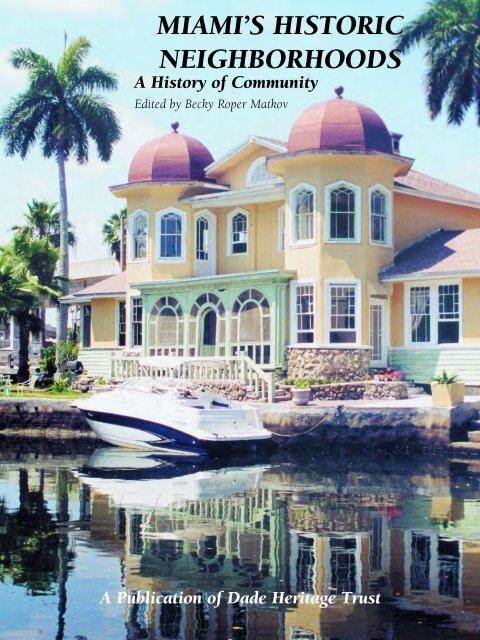
Miami's Historic Neighborhoods
An illustrated history of the city of Miami, Florida, paired with the histories of companies, families and organizations that make the region great.
An illustrated history of the city of Miami, Florida, paired with the histories of companies, families and organizations that make the region great.

Create successful ePaper yourself
Turn your PDF publications into a flip-book with our unique Google optimized e-Paper software.
MIAMI’S HISTORIC<br />
NEIGHBORHOODS<br />
A History of Community<br />
Edited by Becky Roper Matkov<br />
A Publication of Dade Heritage Trust
Thank you for your interest in this HPNbooks publication. For more information about other<br />
HPNbooks publications, or information about producing your own book with us, please visit www.hpnbooks.com.
MIAMI’S HISTORIC<br />
NEIGHBORHOODS<br />
A History of Community<br />
Edited by Becky Roper Matkov<br />
A Publication of Dade Heritage Trust<br />
<strong>Historic</strong>al Publishing Network<br />
A division of Lammert Publications, Inc.<br />
San Antonio, Texas
First Edition<br />
Copyright © 2001 <strong>Historic</strong>al Publishing Network<br />
All rights reserved. No part of this book may be reproduced in any form or by any means, electronic or mechanical, including photocopying, without permission in writing<br />
from the publisher. All inquiries should be addressed to <strong>Historic</strong>al Publishing Network, 8491 Leslie Road, San Antonio, Texas, 78254. Phone (210) 688-9008.<br />
ISBN: 1-893619-15-X<br />
Library of Congress Card Catalog Number: 2001087257<br />
Miami’s <strong>Historic</strong> <strong>Neighborhoods</strong>: A History of Community<br />
editor: Becky Roper Matkov<br />
contributing writers for<br />
sharing the heritage: Susan Cumins<br />
Paul Gereffi<br />
<strong>Historic</strong>al Publishing Network<br />
president: Ron Lammert<br />
vice president & project coordinator: Barry Black<br />
project representatives: E. “Tito” Berrios, Timothy Hemsoth, Bari Nessel,<br />
Flora Tartaglia, Ted del Valle, Jessica Vlasseman<br />
director of operations: Charles A. Newton, III<br />
administration: Angela Lake<br />
Donna Mata<br />
Dee Steidle<br />
graphic production: Colin Hart<br />
John Barr<br />
PRINTED IN SINGAPORE<br />
2 ✧ MIAMI’S HISTORIC NEIGHBORHOODS
CONTENTS<br />
4 ACKNOWLEDGMENTS<br />
5 FOREWORD<br />
by Governor Jeb Bush<br />
6 A SENSE OF COMMUNITY<br />
by Becky Roper Matkov<br />
10 HISTORY IS WHERE YOU FIND IT<br />
by Arva Moore Parks<br />
15 VOICES FROM THE PAST<br />
by Helen Muir<br />
18 MIAMI<br />
by Aristides Millas<br />
26 THE MIAMI RIVER<br />
by Robert S. Carr<br />
30 SPRING GARDEN<br />
by James Broton<br />
32 OVERTOWN<br />
by Dorothy Jenkins Fields<br />
35 MIAMI CITY CEMETERY<br />
by Penny Lambeth<br />
38 MORNINGSIDE AND BAY POINT<br />
by Gail Meadows and William E. Hopper, Jr.<br />
41 MIAMI BEACH<br />
by Howard Kleinberg<br />
48 MIAMI SHORES AND EL PORTAL<br />
by Seth Bramson<br />
50 NORTHEAST DADE: BISCAYNE PARK,<br />
FULFORD, NORTH MIAMI BEACH<br />
AND AVENTURA<br />
by Malinda Cleary<br />
57 OPA-LOCKA: A VISION OF ARABY<br />
by Thorn Grafton<br />
60 MIAMI LAKES AND THE DAIRIES<br />
THAT MADE DADE<br />
by Donald Slesnick<br />
63 HIALEAH<br />
by Horatio L. Villa<br />
66 MIAMI SPRINGS: GLEN CURTISS’ DREAM<br />
by Mary Ann Goodlett-Taylor<br />
70 NATIVE AMERICAN HERITAGE<br />
by Stephen Tiger<br />
72 BROWNSVILLE<br />
by Enid C. Pinkney<br />
76 RIVERSIDE AND SHENANDOAH<br />
by Paul S. George<br />
81 LITTLE HAVANA AND CALLE OCHO<br />
by Leslie Pantin, Jr.<br />
83 CLIFF HAMMOCK<br />
by Julia Hodapp Cohen<br />
87 COCONUT GROVE<br />
by David Burnett<br />
94 KEY BISCAYNE<br />
by Joan Gill Blank<br />
100 CORAL GABLES<br />
by Ellen Uguccioni<br />
106 CENTRAL MIAMI:<br />
“THE LOST PART OF CORAL GABLES”<br />
by Samuel D. LaRoue, Jr.<br />
109 SOUTH MIAMI<br />
by Susan Perry Reading<br />
114 PINECREST<br />
by Georgia Tasker<br />
118 KENDALL<br />
by Paul S. George<br />
123 OLD CUTLER AND THE DEERING ESTATE<br />
by Christopher R. Eck<br />
129 SOUTH DADE:<br />
HOMESTEAD, FLORIDA CITY, AND REDLAND<br />
by Robert J. Jensen and Larry Wiggins<br />
136 SHARING THE HERITAGE<br />
206 INDEX<br />
208 SPONSORS<br />
CONTENTS ✧ 3
ACKNOWLEDGMENTS<br />
With much appreciation, Dade Heritage Trust would like to thank<br />
the following for all their help:<br />
DEBORAH TACKETT, PHOTO EDITOR, for the vital role she played in helping locate,<br />
photograph and organize so many of the photos in this book.<br />
The CONTRIBUTING WRITERS, who gave so freely of their knowledge,<br />
historic resources, photographs, time and talent:<br />
Governor Jeb Bush<br />
Becky Roper Matkov<br />
Arva Moore Parks<br />
Helen Muir<br />
Aristides Millas<br />
Robert S. Carr<br />
James Broton<br />
Dorothy Jenkins Fields<br />
Penny Lambeth<br />
Gail Meadows and<br />
William Hopper<br />
Howard Kleinberg<br />
Seth Bramson<br />
Malinda Cleary<br />
Thorn Grafton<br />
Donald Slesnick, II<br />
Horatio Villa<br />
Mary Ann Taylor<br />
Stephen Tiger<br />
Enid Pinkney<br />
Paul George<br />
Leslie Pantin<br />
Julia Cohen<br />
David Burnett<br />
Joan Gill Blank<br />
Ellen Uguccioni<br />
Sam LaRoue<br />
Susan Redding<br />
Georgia Tasker<br />
Christopher Eck<br />
Robert Jensen and<br />
Larry Wiggins<br />
The PHOTOGRAPHERS whose donated work so enhanced this book:<br />
Deborah Tackett, Antoinette Naturale, Becky Roper Matkov, Lambeth & Nagle Communications, Elena Carpenter of the Brickell Post,<br />
Thorn Grafton, Dan Forer, Fernando Suco, Larry Wiggins, Julia Cohen, Randall Robinson, Malinda Cleary, William Hopper, Steven Brooke,<br />
John Gillan, Phil Brodatz, Michael Conway, Nesie Summers, Rudi Klein, Paulette Mortimer, Jack Goodier, Norman McGrath, Mark Greene,<br />
Charlie Williams, Mel Rea McGuire, Jose Gelabert-Navia<br />
ARCHIVAL AND PHOTOGRAPHIC RESOURCES:<br />
The Florida State Archives; The <strong>Historic</strong>al Association of Southern Florida; Dade Heritage Trust Archives; The Black Archives History and<br />
Research Foundation of South Florida; North Miami <strong>Historic</strong>al Society; The Collection of Arva Moore Parks; The Collection of Seth Bramson; The<br />
Collection of Sam LaRoue; The Collection of Joan Gill Blank; The Collection of Christopher Eck; The Collection of Bob Carr; The Collection of<br />
Carolyn Junkin; The Collection of the John Witty Family; The Collection of Helen Muir; William Jennings Bryan Library Archives; Overtown<br />
Main Street; Temple Israel; Miami-Dade <strong>Historic</strong> Preservation Division; Miami-Dade Park and Recreation Department; Miami-Dade Community<br />
College; Vizcaya Museum and Gardens; The Kampong; Fairchild Tropical Garden; Coconut Grove Arts Festival; Miami Downtown Development<br />
Authority; Metro-Dade Transit; Miami-Springs <strong>Historic</strong>al Museum; Miami-Dade Public Library System Romer Collection; Parrot Jungle and<br />
Gardens; Homestead Miami Speedway; Kiwanis Club of Little Havana; National Park Service; Biscayne National Park; Bill Baggs Cape Florida<br />
State Recreation Area; Arquitectonica; The Graham Companies; DEEDCO; Aventura Mall; Bal Harbour Shops; The Biltmore Hotel; R.J.<br />
Heisenbottle Architects, P.A.<br />
Ceci Williams, for handcoloring the photograph of the Ideal Model Home.<br />
Thomas J. Matkov, for his legal assistance.<br />
The Greater Miami Convention and Visitors Bureau, for the use of their map.<br />
The Board Members of Dade Heritage Trust, for all their support.<br />
Dade Heritage Trust Staff Members Luis Gonzalez and Katie Halloran.<br />
The staff of the <strong>Historic</strong>al Publishing Network, for all their assistance.<br />
The companies and individuals who purchased Profiles, especially those with J. Poole Associates, Inc., Realtors,<br />
who were the first to buy a profile—and have been so patient in waiting for this book.<br />
4 ✧ MIAMI’S HISTORIC NEIGHBORHOODS
FOREWORD ✧ 5
6 ✧ MIAMI’S HISTORIC NEIGHBORHOODS<br />
(COURTESY OF MIAMI DOWNTOWN DEVELOPMENT COMMITTEE)
After Hurricane Andrew, friends and neighbors worked together to clear roads and yards filled with limbs and debris. (PHOTOS BY BECKY ROPER MATKOV)<br />
A SENSE OF COMMUNITY<br />
B Y B ECKY R OPER M ATKOV<br />
In 1978, when we first moved to Miami<br />
from Richmond,Virginia, I enrolled our son in<br />
first grade, filled up our suburban look-alike<br />
kitchen with groceries, and set about to dis -<br />
cover the “heart” of our new community. That<br />
had been an easy task in Richmond, when<br />
your next door neighbor—who had lived in<br />
his old colonial for forty years—brought you<br />
roses and told you about the history of each<br />
house on the street and who was the best<br />
plumber to fix your leaky faucets and how the<br />
pharmacy three blocks away would deliver<br />
prescriptions and which were the proper<br />
clubs and churches to belong to and oh, yes,<br />
he would introduce you to “everyone.”<br />
It had not been an easy task in Northern<br />
Virginia, where I had been raised in the<br />
“metropolitan Washington area” of McLean.<br />
The rambling old farmhouses in the center<br />
of McLean had been torn down by the<br />
1960s, replaced first by gas stations, then by<br />
strip malls and chain restaurants, and then<br />
by office parks and mega-malls that gobbled<br />
up miles of rolling countryside. One subdivision<br />
blended into another, all united by<br />
endless traffic congestion.<br />
What I found in Miami at first glance<br />
seemed dismayingly similar. Old mansions<br />
along Brickell Avenue were being bulldozed<br />
daily for highrise office buildings. Expressways<br />
and I-95 were always under construction,<br />
making little improvement in traffic flow even<br />
when completed. Dade County seemed to<br />
spread out forever, with no defined bound -<br />
aries, no center, no history, no essence. There<br />
appeared to be “no ‘there’ there.”<br />
However, I soon learned that that was not<br />
the case. Vizcaya and the Barnacle showed<br />
me another world and time that once existed<br />
here. The Junior League’s Designer Show<br />
House in the French Village and a tour of the<br />
long-closed Biltmore introduced me to the<br />
charms of old Coral Gables. Photographing<br />
Downtown Miami for an architectural guidebook<br />
and writing a story on the Miami River<br />
intrigued me with the rejuvenation potential<br />
for the city’s tired central core. Then along<br />
came Dade Heritage Trust! Social events at<br />
beautiful old homes and landmarks, restoration<br />
projects, eye-opening conferences and<br />
seminars, and a chance to create and publish<br />
a magazine on historic preservation followed.<br />
And along the way, I learned something<br />
about Miami, this complex, diverse, multifaceted,<br />
far-flung, fast-changing, never-dull<br />
metropolis: Miami is not one place, but<br />
many. Not one story, but hundreds, thou -<br />
sands of stories.<br />
Professor Aristides Millas, in his chapter<br />
on the City of Miami, quotes Dr. William<br />
Davenport, who wrote in 1909, “Miami was<br />
a collection of strangers…. We had all come<br />
from someplace else.” In many ways, that<br />
has not changed. “Natives” are being born<br />
here every day, of course, but we have<br />
numerically many more people coming from<br />
afar, whether it’s Atlanta or Havana, New<br />
York or Rio, Washington or Kiev,<br />
Minneapolis or Port au Prince.<br />
Too few have shared their stories with<br />
others, and too few have listened to the stories<br />
of others. Residents of Miami Beach may<br />
seldom visit Homestead. People who live in<br />
Aventura may never go to Hialeah. Opa-locka<br />
and Key Biscayne may seem worlds apart.<br />
Newcomers from less unwieldly parts of the<br />
planet often remark that Miami is a confusing<br />
city to really get to know. It is a challenge to<br />
embrace all this geographic and demographic<br />
expanse as one’s own hometown.<br />
The role of historic preservation is to save<br />
physical remnants of our past so that people can<br />
understand that they are part of a continuum of<br />
civilization, a part of the ongoing story of where<br />
CHAPTER I ✧ 7
Matheson Hammock Marina was decimated by Hurricane Andrew on August 24, 1992.<br />
they are living. People lived along the Miami<br />
River and Biscayne Bay thousands of years before<br />
the first condo was ever built on Brickell Avenue.<br />
History books tell you that. The Miami Circle<br />
archeological site, saved by preservationists from<br />
being bulldozed into oblivion, can show you<br />
that. Hardy pioneers survived on Key Biscayne<br />
since 1825, long before the Rickenbacker<br />
Causeway made possible Mackle homes and the<br />
latest bumper crop of multi-million dollar man -<br />
sions. History books tell you that. The Cape<br />
Florida Lighthouse, restored by preservationists,<br />
shows you that.<br />
Walking into an historic building, or<br />
through an historic neighborhood, is a<br />
three-dimensional experience. No book, no<br />
photograph, no museum exhibit, can convey<br />
that experience as well as the reality of physically<br />
being there with the real thing.<br />
<strong>Historic</strong> preservation seeks to preserve<br />
the character of an older neighborhood and<br />
to make buildings past their prime once<br />
more appreciated and nurtured. <strong>Historic</strong><br />
preservation recycles structures and sites,<br />
restoring their youth, refreshening them for<br />
new lives and times.<br />
Preserving physical reminders of our<br />
communal past increases a sense of community<br />
for our city as a whole. It is a way of<br />
welcoming us, of informing us, of inviting us<br />
to be a part of this place called Miami,<br />
whether our grandparents lived here or we<br />
just arrived last week.<br />
Developing a sense of community is not<br />
an easy task. Festivals and celebrations like<br />
Dade Heritage Days and Calle Ocho and Art<br />
Deco Weekend expose thousands to differ -<br />
8 ✧ MIAMI’S HISTORIC NEIGHBORHOODS<br />
ent cultures and neighborhoods. A common<br />
history, as experienced by Cuban exiles or<br />
Holocaust survivors, binds people together.<br />
Civic associations and historic districts give<br />
residents of a neighborhood a forum and<br />
structure to develop ties with one another,<br />
whether for holiday parties, house tours,<br />
park preservation or political lobbying.<br />
A well-executed vision by the developers<br />
of a city, as seen in Coral Gables, Miami<br />
Springs, and Miami Shores, goes a long way<br />
in creating a sense of place. Incorporation<br />
into a separate municipality, as in Pinecrest<br />
and Key Biscayne, has given residents a sense<br />
of pride and participation missing before<br />
they had a clearly delineated community.<br />
And sometimes, calamities or perils that<br />
befall an area unite people who have been<br />
living as strangers in suburbia and transform<br />
them into a close-knit community of friends.<br />
That is what happened to neighborhoods<br />
all over Miami when Hurricane Andrew<br />
struck on August 24, 1992. For everyone in<br />
the county there was a break in the flow of<br />
life as as usual. For those closest to the eye of<br />
this storm—described by TV weatherman<br />
Brian Norcross as “the strongest hurricane to<br />
ever hit a major metropolitan area”—there<br />
was destruction beyond belief. The storm<br />
slashed everything from Key Biscayne south<br />
through Gables by the Sea, Pinecrest,<br />
Kendall, the Deering Estate, Cutler Ridge,<br />
Cauley Square, the Redland, Homestead and<br />
Florida City. The terrain looked like a nuclear<br />
bomb had leveled what had been the greenest<br />
and lushest part of Dade County. Trees<br />
were stripped of their leaves, their branches<br />
gnarled and twisted. Roofs were ripped off,<br />
windows and doors blasted out, mailboxes<br />
and lights smashed. Refrigerators were floating<br />
in flooded garages. Pools were filled with<br />
sludge and dead animals. Boats were blown<br />
from marina docks into mangrove swamps.<br />
Tall concrete utility poles were snapped like<br />
toothpicks. School gyms—and entire shopping<br />
centers—were devastated.<br />
Our neighborhood had no phones, no<br />
water, no security and no electricity for<br />
weeks. Air conditioning in the 90 degree<br />
heat was a luxury one could only dream<br />
about. Ice was a priceless commodity. Chain<br />
saws and generators were avidly sought<br />
after, as was plastic sheeting to cover up<br />
leaky roofs in the torrential downpours. The<br />
streets were lined with mountains of trash.<br />
The roof and second floor of this home blew away while a family of five huddled downstairs under a mattress.
Troops from the 82nd Airborne camped on<br />
the grounds of my daughter’s school.<br />
Helicopters droned overhead incessantly,<br />
evoking memories of the Vietnam War.<br />
But out of this destruction and disruption<br />
came something to treasure. As we emerged,<br />
dazed, from our houses after the storm had<br />
passed, we all met in the street. One family’s<br />
entire second floor had blown away, and the<br />
next door neighbors had rushed over to rescue<br />
them during the storm. People who barely<br />
knew each other were offering to share their<br />
homes, food and gasoline and were pitching<br />
in to clear each other’s yards. Fences had been<br />
blown down, literally and figuratively, and<br />
neighbors were talking to each other who had<br />
never even met before. On countless streets<br />
with broken traffic lights, drivers were unusually<br />
polite to each other, resulting in traffic<br />
flowing with amazing smoothness.<br />
Never had we seen such total blackness at<br />
night, without even a faint glow from distant<br />
city lights. So we fell into an old fashioned<br />
rhythm of rising with the sun and doing physical<br />
labor—lots of it!—early on to avoid the<br />
horrendous heat of the day. We talked with<br />
friends on the porch—the inside of the house<br />
was too hot!—and pooled our resources for<br />
communal cookouts with neighbors in the<br />
early evening. We used our flashlights to find<br />
our way to bed when darkness descended,<br />
with no computers, no answering machines,<br />
no videos and no television to distract us.<br />
Through the sweat and aggravation and<br />
distress, we were forced to take time to get to<br />
know each other. We cried at our losses of<br />
antiques or art or special family photo -<br />
graphs, but we laughed a lot too.<br />
Friendships were made which have lasted<br />
through the decade. We have shared reconstruction<br />
horror stories, weddings, puppies,<br />
margaritas, key lime bread, roses, a tragic<br />
funeral, birthdays, Christmas parties, a book<br />
signing, a bat mitzvah, progressive dinners<br />
and “Hurricane Andrew” anniversaries.<br />
Not only on our street, but throughout<br />
many streets in Miami-Dade, Hurricane<br />
Andrew forged a communal camaraderie.<br />
<strong>Neighborhoods</strong> became communities that<br />
cared and shared.<br />
When people get to know each other,<br />
bridges are built that unite groups and individuals.<br />
It is our hope that this book on<br />
Miami’s <strong>Historic</strong> <strong>Neighborhoods</strong> will introduce<br />
you to your neighbors and “build<br />
bridges” between different communities.<br />
There are countless neighborhoods and stories<br />
in Miami, and we’ve only highlighted a<br />
few—but we hope that these will make us all<br />
feel less like strangers, and more like friends.<br />
Houses and landscaping in the eye of the storm looked as though they had been bombed in a war zone.<br />
With no school, no air conditioning, and no television for weeks, neighborhood kids played card games to while away hot afternoons.<br />
Neighbors—who had become friends—celebrate with a “lights on” party when electricity was restored after three weeks.<br />
Reconstructing damaged homes took months, even years, longer.<br />
CHAPTER I ✧ 9
In the 1920s, developments boomed all over Dade County, offering the “ideal home and neighborhood.” (FLORIDA STATE ARCHIVES PHOTO HAND-COLORED BY CECI WILLIAMS)<br />
HISTORY IS WHERE YOU FIND IT<br />
B Y A RVA M OORE P ARKS<br />
“No place is a place until things that have happened in it are remembered.”<br />
—Wallace Stegner<br />
Nothing reveals Miami’s history better than<br />
its own, distinctive historic places. They store<br />
memories and events and safeguard the lessons<br />
of the past. They hold precious pieces of human<br />
life and connect generation to generation.<br />
Until recently, Miamians have had little<br />
interest in preservation. Instead of saving the<br />
best, each generation has thoughtlessly bulldozed,<br />
modernized or otherwise destroyed<br />
much of what they found when they arrived.<br />
As a result, many important landmarks have<br />
disappeared and the monuments to Miami’s<br />
founding can only be seen in old photographs.<br />
But perceptive eyes can still discover frag -<br />
ments of early days, and preservationists have<br />
helped save some of what remains. In an<br />
attempt to right past wrongs, they have also<br />
focused on preserving the more recent past<br />
and securing its future.<br />
Without landmarks, we can lose our way.<br />
Before we can look ahead, we must first look<br />
around and see where we are and where we<br />
have been. Only by doing this can we can<br />
become what author Wendell Berry calls a<br />
“placed person.”<br />
Place, after all, is the root of our existence.<br />
It marks our beginning and our end. It gives us<br />
identity and shapes our character. It grounds<br />
our memories. Place is our where: where we<br />
came from, where we live, where we work,<br />
where we met, where we have been, where we<br />
are going. Place brings continuity to our life. It<br />
joins past to present, present to future, and us<br />
to each other.<br />
Just as place defines us, we define place and<br />
give it meaning. We are place’s who: who came,<br />
who left, who lived, who died, who built, who<br />
conquered, who ruled, who pillaged, who<br />
destroyed and who restored. We make,<br />
change, and write place’s history.<br />
The place we live in today is Greater Miami.<br />
Our past may be someplace else but our today<br />
is here. We are Miami’s now. But we are not<br />
alone. All the people who lived here in the past<br />
or will live here in the future line up with us forever.<br />
Our feet walk the same special piece of<br />
earth where, eight millennia before our calendar<br />
began, others trod. Recent discoveries of the<br />
Miami Circle and the Deering Fossil Site have<br />
re-written what we thought we knew about the<br />
earliest people to call Miami home. As humans<br />
of the twenty-first century, our connection with<br />
Miami begins not with our arrival but with these<br />
people and all the rest who will follow us in the<br />
next millennium.<br />
Just 2l years after Columbus discovered<br />
what the Europeans called the New World,<br />
Juan Ponce de León sailed into Biscayne Bay<br />
and called the area Chequescha (Tequesta)<br />
presumably after the native people he<br />
encountered. In 1567, just two years after<br />
founding St. Augustine, the oldest perma -<br />
nent European settlement in what is now the<br />
United States, Pedro Menéndez de Avilés<br />
built a short-lived mission on the north bank<br />
of the Miami River near its mouth. During<br />
the next two centuries, Spain’s other two<br />
attempted settlements in the Miami area were<br />
also short-lived, but the Spanish remained<br />
friendly with the native people. When the<br />
English took control of Florida in 1763, most<br />
of the Tequesta Indians left with the Spanish<br />
for Havana.<br />
During this ten-year British period, and<br />
after Florida was returned to Spain,<br />
Bahamians moved into the Miami area but left<br />
no trace of their Cape Florida settlement.<br />
Although no buildings remain from the earliest<br />
Spanish and Bahamian settlements, arti -<br />
facts uncovered in various archaeological digs,<br />
including the one on the north bank of the<br />
Miami River, prove that they were here. These<br />
precious remnants of the past can be seen at<br />
the <strong>Historic</strong>al Museum of Southern Florida.<br />
In 1825, four years after Florida became a<br />
United States territory, the government built the<br />
Cape Florida Lighthouse on Key Biscayne in an<br />
effort to stop the frequent wrecks on the Great<br />
Florida Reef. In 1836, the Seminoles destroyed<br />
the light during the second in a series of three<br />
costly wars. The Cape Florida Lighthouse, which<br />
was re-built in 1845, is Miami’s oldest complete<br />
structure. Because most of the keepers of the<br />
Cape Florida Lighthouse traced their roots to the<br />
Bahamas, the lighthouse is the earliest link to our<br />
first permanent European and African settlers.<br />
Soon after the government built the light -<br />
house, South Carolinian Richard Fitzpatrick<br />
bought four tracts of land on the north and south<br />
bank of the Miami River from two Bahamian<br />
families, the Egans and the Lewises. When<br />
Florida became a territory of the United States in<br />
10 ✧ MIAMI’S HISTORIC NEIGHBORHOODS
1821, they had the distinction of being the only<br />
private landowners on the mainland. In 1838,<br />
two years after the 2nd Seminole War began, the<br />
U.S. opened Fort Dallas on Fitzpatrick’s property.<br />
At war’s end, Fitzpatrick sold his land to his<br />
nephew William F. English. English built a rock<br />
plantation house and a long building to serve as<br />
slave quarters on the north bank. In 1845,<br />
English also platted the Village of Miami just<br />
across the river. Unfortunately, the Seminoles<br />
forced English to flee before his dream for a new<br />
city could be realized. The U.S. Army returned<br />
and re-opened Fort Dallas. They completed the<br />
two rock buildings and used them as part of their<br />
military complex. As late as the 1890s, these two<br />
buildings were the only substantial structures on<br />
the north bank of the river.<br />
Following the Civil War, a visitor noted that<br />
the long building housed a motley crew of<br />
deserters and runaways. In the 1870s, it served<br />
as the Dade County Courthouse. In the early<br />
1900s it became a private residence and later a<br />
tea room. When the building was slated for<br />
demolition in 1925 to make way for the Robert<br />
Clay Hotel (now demolished), the Daughters<br />
of the American Revolution and the Miami<br />
Woman’s Club initiated Miami’s first preservation<br />
effort to save it. They raised the money to<br />
move what became known as Fort Dallas to<br />
Lummus Park, a city-owned park up river.<br />
Ft. Dallas still resides in Lummus Park along<br />
with Miami’s oldest house, the Wagner<br />
Homestead, built in 1858 by William Wagner, a<br />
sutler who remained in Miami when the last<br />
Seminole War was over. Dade Heritage Trust led<br />
the effort to move and reconstruct Wagner’s<br />
House in the park in 1979. Unfortunately, the old<br />
plantation house that also served as the home to<br />
Julia Tuttle, the “Mother of Miami,” was torn<br />
down in the 1920s without a whimper of protest.<br />
When Julia Tuttle arrived in 1891, what<br />
would become downtown Miami had changed<br />
very little since English’s time. William and<br />
Mary Brickell had a trading post on the south<br />
bank of the river and were doing a brisk busi -<br />
ness with the Indians. Brickell and his family<br />
had arrived two decades earlier and had pur -<br />
chased all of English’s land on the south side of<br />
the river extending to what would become<br />
Coconut Grove. Unfortunately, nothing remains<br />
of the Brickell trading post or their 1906 man -<br />
sion, torn down in 1963. Their greatest legacy is<br />
beautiful Brickell Avenue, platted by Mary<br />
Brickell in 1911. A monument to Mary Brickell<br />
in the median of Brickell Avenue between S.W.<br />
Sixth and Seventh Streets was dedicated by<br />
Dade Heritage Trust in 1998, thanks to the<br />
efforts of activist Carmen Petsoules.<br />
By 1891, Coconut Grove held the distinction<br />
of being the first real community in South<br />
The Mouth of the Miami River one hundred years ago, looking east toward Biscayne Bay from where the Brickell Bridge now<br />
spans the river. The 2000-year-old Miami Circle archeological site, discovered in 1998, is located behind the white building<br />
in the center of the photo. (COURTESY OF THE COLLECTION OF CHRISTOPHER ECK)<br />
Florida. It had a population of over fifty hearty<br />
souls, a six-year old hotel, a community Sunday<br />
school, the first school in what is now Dade<br />
County, a yacht club, a woman’s club and a general<br />
store. Ralph Munroe, who came from Staten<br />
Island, New York, had just completed his new<br />
home, called the Barnacle. Munroe also brought<br />
the first northern tourists into Miami to stay at<br />
Charles and Isabella Peacock’s Bay View Hotel,<br />
later the Peacock Inn. It stood on the ridge<br />
between two magnificent oaks in today’s Peacock<br />
Park. The inn spurred other development,<br />
including the founding of Kebo—Miami’s first<br />
black community—on today’s Charles Avenue.<br />
Although Coconut Grove has experienced<br />
enormous change in recent years, it still has the<br />
greatest concentration of historic sites linked to<br />
the romantic “Era of the Bay” before the railroad<br />
came to South Florida and closed the frontier.<br />
The 108-year-old Woman’s Club still sits on its<br />
corner of South Bayshore Drive and McFarlane<br />
Road in a 1921 building designed by renowned<br />
Miami architect Walter De Garmo. The 1882<br />
grave of Ralph Munroe’s first wife, Eva, is next to<br />
the Coconut Grove Library and is Miami’s oldest<br />
marked grave. The first Sunday school and<br />
schoolhouse [1887], which once stood behind<br />
the library, was moved to the grounds of<br />
Plymouth Congregational Church [1917]. The<br />
Biscayne Bay Yacht Club [1887] is located on the<br />
bayfront a short distance to the east in a 1932<br />
DeGarmo building. Charles Avenue, the first<br />
street in historic Kebo, still has some important<br />
historic sites including the E.W.F. Stirrup House<br />
[1897], the Mariah Brown House [c 1900] and<br />
the historic Bahamian-style cemetery, on the corner<br />
of Charles and Douglas Roads. The Barnacle,<br />
now a State of Florida historic site, sits just a<br />
short distance away off busy Main Highway. It<br />
still offers us a rare opportunity to re-enter this<br />
“Era of the Bay” and see what Coconut Grove<br />
offered its pioneers before there was a Miami.<br />
Lemon City, another pre-Miami community,<br />
grew up five miles north of the Miami River.<br />
Lemon City had the best dock in the area and by<br />
1892 was connected by a stage line to Lantana.<br />
Like Coconut Grove, Lemon City had a school, a<br />
church, a library and a growing population.<br />
Unfortunately, almost nothing remains from<br />
Lemon City except the Lemon City Drug Store<br />
and Post Office [1902] on the corner of N.E.<br />
Second Avenue and 6lst Street—now the heart of<br />
Little Haiti. One important link to old Lemon City<br />
stands proudly on NW Second Avenue and 62nd<br />
Street (formerly Avenue G and Pocomoonshine<br />
Road). Miami Edison Middle School traces its<br />
roots to the original Lemon City School and later<br />
Lemon City Agricultural High School. Significant<br />
portions of the 1928 former high school, gymnasium<br />
and auditorium have been painstakingly<br />
restored and joined to a beautiful new addition.<br />
The melding of the old with the new at Miami<br />
Edison Middle School, and the dialogue and connection<br />
of old timers with new comers that resulted,<br />
shines as a model for the future.<br />
South Florida’s other pre-railroad community<br />
grew up in far South Dade. In 1884,<br />
William Fuzzard opened the Cutler post office<br />
near what is now Coral Reef Drive (152nd<br />
Street). Fuzzard also chopped Old Cutler<br />
Road through the hammock to Coconut<br />
Grove. Remnants of the Cutler community<br />
and the original road are found on 168th<br />
Street and at the Charles Deering Estate. The<br />
site includes the historic Richmond Inn<br />
[1896] that was once a part of the town of<br />
CHAPTER II ✧ 11
Cutler. Carefully re-constructed after being<br />
almost totally destroyed by Hurricane Andrew,<br />
the Richmond Inn reminds us of the time<br />
when Cutler, like Coconut Grove and Lemon<br />
City, was a thriving pioneer settlement.<br />
As soon as Julia Tuttle arrived from<br />
Cleveland in 1891, she set about to transform<br />
a forgotten frontier into a new city. Like those<br />
who came before her, she knew that Miami<br />
would never develop until it became more<br />
accessible. Offering half her land to anyone<br />
who brought a railroad into Miami, Tuttle first<br />
sought the help of Henry Plant, who had<br />
extended his railroad as far south as Tampa.<br />
After a harrowing trip across the Everglades<br />
from Tampa to Miami, the Plant people<br />
quickly lost interest in Tuttle’s proposal. She<br />
then turned to Henry Flagler, whose railroad<br />
was steaming down the East Coast of Florida<br />
connecting his string of luxury hotels. Even<br />
though Flagler reached Palm Beach by 1894,<br />
he ignored Tuttle until the terrible freeze of<br />
1894-95 made him realize Miami’s potential<br />
as a winter fruit and vegetable center. The<br />
idea of bringing tourists in and vegetables out<br />
appealed to him. At Tuttle’s behest, Flagler<br />
finally came to see Miami. After a dinner at<br />
the Grove’s Peacock Inn and an offer of part of<br />
Brickell’s land to sweeten the pot, Flagler was<br />
ready to deal and the railroad was on its way!<br />
In April 1896, the first train chugged into<br />
Miami. A month later, Miami had its first<br />
newspaper, The Miami Metropolis, and by July<br />
had become an incorporated city with onethird<br />
of the incorporators African Americans.<br />
Five months later, much of the new “Magic<br />
City,” as it was called, burned to the ground in<br />
a disastrous Christmas night fire. Despite this<br />
setback, Flagler’s magnificent Royal Palm Hotel<br />
opened a month later at what is now the<br />
Dupont Plaza parking lot. Unfortunately, one<br />
of the only reminders of Miami’s founding<br />
years and Henry Flagler’s legacy is a simple<br />
house on the Miami River (Bijan’s Fort Dallas<br />
Restaurant & Raw Bar) that was moved just<br />
west of the Hyatt Hotel in 1979. Painted<br />
Flagler yellow, the distinctive color of all<br />
Flagler’s railroad stations and hotels, it was one<br />
of two blocks of Royal Palm Cottages that<br />
Flagler built for newcomers to his instant city.<br />
Flagler also donated the land on Flagler<br />
Street and SE Third Avenue for the First<br />
Presbyterian Church, dedicated in 1900. When<br />
it was torn down in the 1940s, the interior was<br />
reconstructed in the chapel of the new church<br />
on Brickell Avenue. Recently, one other frag -<br />
ment of Flagler’s Miami was discovered on the<br />
southwest corner of Flagler Street and SE/NE<br />
First Avenue. Although hidden behind a 1940s<br />
facade, Flagler’s 1897 brick Fort Dallas Building,<br />
home to his real estate division, still stands as a<br />
sort of “snail darter” link to Henry Flagler and<br />
the earliest days of the City of Miami.<br />
As the twentieth century began, Miami lost<br />
its frontier feeling. One- and two-story vernacular<br />
storefronts with arcaded sidewalks to protect<br />
the shopper from sun and rain gave downtown<br />
a tropical, small town atmosphere. A glimpse of<br />
this era can be seen at NE First Avenue and First<br />
Street. The old U.S. Post Office building, now<br />
Office Depot, and the buildings across the street<br />
including the Ralston Building, Miami’s first<br />
“skyscraper,” were built between 1912 and<br />
1917. Other buildings from this era include the<br />
Seminole [1913] and McCroy Hotels [1906] on<br />
Flagler Street between Miami and NE First<br />
Avenues. They still retain their distinctive pro -<br />
files even though some alterations have<br />
occurred as pioneer hotels turned into ten-cent<br />
and department stores.<br />
The most pristine vernacular arcaded storefront<br />
is at North Miami Avenue between<br />
Fourth and Fifth Streets. In 1991, preserva -<br />
tionists, citing Section 106 of the U.S. Federal<br />
Preservation Act, convinced the Federal<br />
Bureau of Prisons to retain and restore the front<br />
section of the entire block (Chaille Block and<br />
Dade Apartments) and incorporate it into the<br />
new Federal prison.<br />
Another unique pre-1920s building is Dr.<br />
James M. Jackson’s office (190 SE 12th<br />
Terrace), now the headquarters of Dade<br />
Heritage Trust. Originally built in 1905, the<br />
office, along with Dr. Jackson’s house, was<br />
moved from Flagler Street to its present site<br />
in 1917. A few blocks from Dr. Jackson’s<br />
office is Southside School [1914]. This little<br />
jewel, designed by Walter DeGarmo, sparkles<br />
amidst the rapidly re-developing Brickell<br />
area. Behind it sits the original Miami High<br />
School [1904] moved there in 1911 to<br />
become the original Southside School.<br />
Although now a private residence, the careful<br />
observer can recognize the typical school<br />
house windows and bell tower.<br />
The Miami River Inn, a restored complex<br />
of buildings in Riverside (Little Havana), one<br />
of Miami’s first suburbs, also recalls pre-<br />
Boom Miami. Little Havana has the largest<br />
concentration of Miami’s distinctive, coralrock-decorated<br />
vernacular bungalows and<br />
Mission style homes and storefronts. It is an<br />
important historic district waiting to happen.<br />
Spring Garden, another riverfront subdivi -<br />
sion [1918], is already a City of Miami<br />
<strong>Historic</strong> District.<br />
In this same era, when the twentieth century<br />
and the City of Miami were both<br />
teenagers, national industrialists and capitalists<br />
as well as a few well-heeled locals turned<br />
Brickell Avenue and Main Highway into<br />
Millionaire’s Row. Although most of these large<br />
estates have been broken up, a few notable<br />
ones remain. In 1916, James Deering of<br />
International Harvester completed his palatial<br />
Villa Vizcaya on former Brickell hammock<br />
land. It remains Miami’s most spectacular<br />
dwelling and is listed as a national landmark.<br />
A year later, John Bindley, president of<br />
Pittsburgh Steel, built the beautiful El Jardin,<br />
now Carrolton School, on Main Highway.<br />
Together these two buildings launched South<br />
Florida’s love affair with Mediterranean<br />
Revival architecture.<br />
A postcard from 1910 illustrates a view of Miami looking west from what is now 27th Avenue toward the drainage canal for<br />
the Miami River and the Everglades. (COURTESY OF THE COLLECTION OF BOB CARR)<br />
12 ✧ MIAMI’S HISTORIC NEIGHBORHOODS
Just east of Vizcaya, one can still get a<br />
glimpse of what Millionaire’s Row looked like<br />
more than 70 years ago. Villa Serena, built in<br />
1913 by three-time presidential candidate and<br />
U.S. Secretary of State William Jennings Bryan,<br />
sits next to the home of his cousin and former<br />
Florida governor William Sherman Jennings.<br />
In recent years, several magnificent new mansions<br />
have joined these and other historic<br />
homes, giving the street a singular ambience<br />
reminiscent of earlier halcyon days.<br />
Because law segregated the races, African-<br />
American communities developed separately.<br />
White Miami had its downtown, and African-<br />
American Miami had its Colored Town or<br />
Overtown. This vibrant African-American<br />
commercial and residential district developed<br />
around Avenue G, now NW Second Avenue.<br />
Cut up and mowed down in the 1960s by<br />
urban renewal and expressways, Overtown is<br />
making a comeback through efforts of the<br />
Black Archives History and Research<br />
Foundation, Inc., founded by Dr. Dorothy<br />
Fields. The restored Dr. William A. Chapman<br />
House [1923], the D.A. Dorsey House [1910-<br />
1914] and the Lyric Theater [1910-1914], as<br />
well as several historic churches, will give<br />
Overtown a new beginning as a <strong>Historic</strong><br />
Folklife Village.<br />
As Miami grew, Overtown became over -<br />
crowded but was not allowed to expand its<br />
borders. In response, developers created new<br />
black suburbs in Liberty City and Brownsville.<br />
Today, preservationists are also focusing on<br />
preserving the heart of these historic African-<br />
American neighborhoods.<br />
The 1920s brought dramatic change to the<br />
Magic City. In the span of just a few years, Miami<br />
quadrupled its population and evolved from a<br />
small southern town into a big city. The Boom<br />
with a capital “B” became a national phenomenon<br />
and its wild, no-holds-barred, get-rich-quick<br />
atmosphere attracted hordes of people from all<br />
over. As a result of the huge quantity of buildings<br />
from this era, Miami’s oldest and largest concentration<br />
of historic structures dates from the Boom.<br />
Notable downtown buildings include: the Miami<br />
News Tower [Freedom Tower-1925], the<br />
Olympia Theater and Office Building [Gusman<br />
Theater-1926], the Ingraham Building [1927],<br />
the Dade County Courthouse [1928], Central<br />
Baptist Church [1927] Gesu Church [1925],<br />
Trinity Episcopal Cathedral [1926], the Miami<br />
Woman’s Club [1925] and the Scottish Rite<br />
Temple [1922]. The recently restored Martin<br />
Hampton-designed Congress Building [1925] is<br />
the latest historic building to make a come back<br />
and once again brighten the skyline.<br />
One cannot write about the Boom without<br />
highlighting George Merrick, who had more to<br />
do with its creation than anyone else. In<br />
Merrick’s Coral Gables, one can find the greatest<br />
number of Boom-time (and new)<br />
Mediterranean Revival style buildings in<br />
Miami-Dade County. This is due to the fact that<br />
Coral Gables has made great strides in preserving<br />
this legacy and was the first community to<br />
pass a preservation ordinance [1973].<br />
Merrick, who moved to the area with his<br />
family in 1899 as a 13-year-old boy, grew up<br />
on his family’s grapefruit plantation. His talented<br />
mother Althea designed their rock<br />
home, which they named Coral Gables<br />
[1907]. After his father’s death in 1911,<br />
Merrick took over the groves and began planning<br />
his dream suburb around a Spanish/<br />
Mediterranean theme.<br />
In November 1921, after years of thoughtful<br />
study, Merrick sold the first lots in what became<br />
South Florida’s first planned city. For the next<br />
seven years, Merrick’s firm hand kept the Gables<br />
on track. With a strong belief that making a city<br />
beautiful was more important than making<br />
money, he spent millions on architectural fea -<br />
tures such as entry gates, plazas, fountains and<br />
major public and corporate buildings that set the<br />
tone for the whole community. Every structure,<br />
every color selection, every awning had to pass a<br />
strict architectural board made up of Merrick, his<br />
uncle Denman Fink and architect Phineas Paist.<br />
Although some of the wonderful small commercial<br />
buildings have been lost, Coral Gables is still<br />
know for its singular landmarks like the spectacular<br />
Biltmore Hotel [1926], The Colonnade<br />
[1926], The Douglas Entrance [Puerta del Sol,<br />
1927], City Hall [1928], Coral Gables<br />
Congregational Church [1924], Coral Gables<br />
Elementary School [1923] and the Venetian Pool<br />
[1924], as well as thousands of private homes<br />
and several themed villages.<br />
Merrick was not the only developer caught<br />
up in creating themed suburbs. James Bright<br />
and aviation luminary Glenn Curtiss created<br />
Hialeah and Miami Springs around a Mission<br />
and Pueblo Revival theme. Curtiss also built<br />
Opa-locka based on the Arabian Nights. Opalocka<br />
remains a unique piece of Boom-time<br />
fantasy architecture as seen in its restored City<br />
Hall and other designated buildings.<br />
The Boom also created other distinctive<br />
suburbs in the northeast quarter. Miami<br />
Shores, Coral Gables’ greatest rival, and<br />
Fulford by the Sea [North Miami Beach]<br />
were later incorporated into separate cities.<br />
Morningside, the City of Miami’s first his -<br />
toric district, is a planned bayfront development<br />
characterized by many beautiful<br />
Mediterranean Revival homes. Its wellorganized<br />
group of enthusiasts has returned<br />
it and Bayshore, to the south, into two of the<br />
City of Miami’s most beautiful neighbor -<br />
hoods. Nearby, the early suburb and onetime<br />
Town of Buena Vista is also being<br />
restored to its former glory. Thanks to the<br />
efforts of dedicated preservationists, restoration<br />
fever is spreading up Biscayne<br />
Boulevard as one historic neighborhood<br />
after another makes its comeback.<br />
Miami entered the Great Depression<br />
ahead of the rest of the nation. The Florida<br />
Boom and crash were a dress rehearsal for<br />
the stock market debacle that followed a few<br />
years later. Like the rest of America, Miami<br />
benefited by the numerous New Deal pro -<br />
grams created in the 1930s to help the nation<br />
out of depression. The Civil Conservation<br />
Corps built Matheson Hammock, Greynolds<br />
Park and Fairchild Tropical Garden with<br />
unique rock walls, pavilions and architectural<br />
features. The Public Works Administration<br />
built Liberty Square and several Miami<br />
schools, including Shenandoah Junior High<br />
and Miami Shores and Coral Way<br />
Elementaries. The old Coral Gables Police<br />
and Fire Station and the Miami Beach Post<br />
Office were but two of the public buildings<br />
constructed by the PWA. Uncle Sam also<br />
hired artists to beautify the new public buildings.<br />
Denman Fink, uncle of George Merrick<br />
and one of the principals in the design of<br />
Coral Gables, created one of the most cher -<br />
ished works—a mural in the Central<br />
Courtroom of the U.S. Federal Courthouse<br />
designed by Phineas Paist [1931].<br />
By the mid-1930s, when the rest of the nation<br />
was still wallowing in the slough of depression,<br />
Miami was on the way out. The Mediterranean<br />
Revival style architecture that marked the Boom<br />
was on the way out as well. “Art Moderne” and<br />
“Art Deco” were the new style of architecture in<br />
America. The Bessemer Corporation introduced<br />
the style in Miami as part of its ambitious<br />
Biscayne Boulevard development. Billed as<br />
Miami’s “Fifth Avenue,” this project was one of the<br />
few bright spots in the late 1920s. Today the Sears<br />
Tower [1929] and the Mahi Shrine Temple<br />
Headquarters [Boulevard Shops-1930] are the<br />
most important remaining buildings of this<br />
development. Other notable Art Deco buildings<br />
in Downtown Miami include the beautiful Alfred<br />
I. Dupont Building [1938], Walgreens (now<br />
Sports Authority) [1936] and Burdine’s [1936].<br />
The ultimate flowering of local Art Deco,<br />
however, occurred on Miami Beach.<br />
Despite the Depression, the 1930s brought<br />
new life to Miami Beach. No more ornate excess<br />
of 1920s consumption like the long-gone<br />
Nautilus, Flamingo and Roney Plaza; the new<br />
style was spare, sleek, inexpensive and thor -<br />
oughly modern. Most of all, Miami Beach’s<br />
CHAPTER II ✧ 13
tropical answer to Art Deco was fun. Glass<br />
block and murals, cavorting mermaids, danc -<br />
ing dolphins and smiling seahorses etched into<br />
glass with jig-saw puzzle floors in sleek terrazzo<br />
were all wrapped up in undulating facades<br />
pierced by a thousand portholes. Swaying palm<br />
fronds, rolling surf, and the famous Miami<br />
moon completed the scene and made it seem<br />
like Art Deco had been created especially for<br />
Miami Beach. Until World War II brought an<br />
end to the fun, Miami Beach was issuing building<br />
permits for new hotels at the rate of one<br />
every three days. Today, these small South<br />
Beach hotels and apartments make up Miami<br />
Beach’s famed Art Deco District.<br />
After the war, Miami Beach took on a new<br />
style (now called Miami Modern or MiMo) that<br />
reached its peak with the work of Morris<br />
Lapidus in the 1950s. For a while, the grandiose<br />
Fontainebleau, Eden Roc, Doral and Americana<br />
hotels as well as the fantasy motels on North<br />
Beach kept the tourists coming to Miami Beach.<br />
The beginning of what we call sprawl also<br />
came at war’s end as hundreds of thousands<br />
of GI’s came to Miami to start a new life.<br />
These post-war subdivisions are now reach -<br />
ing historic status along with other commercial<br />
buildings from that era. Hoping to avoid<br />
what happened in the past, preservationists<br />
are currently looking carefully at these<br />
resources to help make thoughtful decisions<br />
for their future.<br />
The 1960s brought even more change to<br />
Greater Miami. But then Miamians had always<br />
been accustomed to change. The city’s entire<br />
history had been written in short paragraphs.<br />
No one, however, was prepared for the<br />
changes the ’60s would bring.<br />
After Fidel Castro took over Cuba in 1959, a<br />
continuous stream of exiles flowed into Miami.<br />
When Castro announced his Communist leanings,<br />
the stream became a flood as hundreds of<br />
thousands of Cubans fled their homeland. The<br />
Cubans, often destitute, had to start their lives<br />
over again in a foreign land. They moved into the<br />
low-rent, older, declining neighborhoods of<br />
Riverside and Shenandoah, breathing in new life.<br />
Before long, the old Tamiami Trail became Calle<br />
The road from Miami to Cocoanut Grove was once a verdant, but lonely, trail. (COURTESY OF THE FLORIDA STATE ARCHIVES)<br />
Ocho, “Little Havana’s” Main Street. The Tower<br />
Theater [1926] was the gathering place and<br />
became the first theater in Miami to have Spanish<br />
sub-titles. Neighboring stores sported Spanish<br />
signs, yet the businesses remained remarkably<br />
similar to the pre-Cuban days and the whole area<br />
kept its strong historic Mom-and-Pop flavor.<br />
As “Little Havana” becomes a diverse “Latin<br />
Quarter,” and fast food and other chain “any -<br />
place” businesses move in, the visual landmarks,<br />
no matter how humble, of where the Cuban<br />
transformation of Miami began are disappearing.<br />
Like Henry Flagler’s Miami that vanished during<br />
the Boom, Little Havana will also pass into oblivion<br />
unless effort is made to preserve at least part<br />
of it as it was when the Cubans arrived. How well<br />
we know from past experience that once we can<br />
no longer see our history, we quickly forget it.<br />
We can learn about the past in history<br />
books or meet it face to place in historic buildings,<br />
schools, churches, homes and neighborhoods.<br />
Sadly, we will never really appreciate<br />
our history and become “placed people” if<br />
there is no place left to remember.<br />
Arva Moore Parks is a native Miamian who has spent more than 25 years researching and writing about her favorite city. But more than an historian, Parks is a<br />
leader, participating in many different arenas, learning firsthand what Miami and its people are all about. She is known as an indefatigable advocate for historic<br />
preservation, and her leadership has helped save many important landmarks. She has held both local and national preservation offices, and in 1995 President Bill<br />
Clinton appointed her to the Federal Advisory Council on <strong>Historic</strong> Preservation.<br />
She is author of numerous award-winning books, films and articles on Miami, including Miami: The Magic City, which was named the official history of the City of Miami,<br />
and Our Miami: The Magic City, a 60-minute video which won a Florida Emmy. Through Arva Parks & Company she is also known for her historical research and interpretive<br />
design, which includes Coral Gables’ Colonnade Hotel and the Harry Truman Little White House in Key West.<br />
She has been widely honored for her activism and her writing. The Coral Gables Chamber of Commerce named her their Robert B. Knight Outstanding Citizen in<br />
1983, and in 1985 she was inducted into the Florida Women’s Hall of Fame. In 1996, she was listed in the City of Miami Centennial Women’s Hall of Fame, and Barry<br />
University awarded her an Honorary Doctor of Laws. In 1997, the University of Florida named her one of 47 Women of Achievement honored at the fall celebration<br />
of 50 years of co-education.<br />
14 ✧ MIAMI’S HISTORIC NEIGHBORHOODS
The Brickell family, early pioneers who played key roles in shaping Miami’s future, pose on the porch of their stately home. William B. Brickell is seated on the veranda, so the photograph was<br />
taken before 1908, the year he died. The Brickell mansion was located on the south bank of the Miami River, where the Sheraton Biscayne Bay Hotel is today, and the grounds included what is<br />
now Brickell Park and the Miami Circle Archeological Site. (COURTESY OF THE FLORIDA STATE ARCHIVES)<br />
VOICES FROM THE PAST<br />
B Y H ELEN M UIR<br />
On the doorstep of the 21st century, we<br />
pause in Miami-Dade to consider how we<br />
arrived here. Voices from the Past ring in<br />
our ears.<br />
Certainly Mary Brickell and her husband,<br />
William Barnwell Brickell, left the family<br />
mark on South Florida. The story of all the<br />
Brickell daughters, none of whom married,<br />
holds elements of drama. Perhaps surprisingly,<br />
it is the words of their last offspring, known<br />
as Miss Maude, that linger in my mind.<br />
Miss Maude was christened Maudenella.<br />
“You know lawyers,” she explained. “Can’t<br />
tell them anything. They changed it to<br />
Maude E.” In any case, as Maudenella or<br />
Maude E., it was she who took over the care<br />
of the rose garden at the Royal Palm Hotel<br />
during the long hot summers because she<br />
fell in love with the roses and was rewarded<br />
with blooms for her own bedroom.<br />
Early in the 1950s I sat with Miss<br />
Maude on the wide porch of the house<br />
which has been described as a mansion. In<br />
my sense, the house fell short of the term<br />
except for the exterior view. In any case, I<br />
was questioning her as to accurate names<br />
of the Brickell “girls.” She gave them to me:<br />
Alice Amy, Edith Mary Kate and Belle<br />
Gertrude (Emma died in childhood of<br />
spinal meningitis).<br />
None of these Brickell daughters enjoyed<br />
anything like a social life as the term is<br />
understood today. The men in the family<br />
were sent away to school, but Mary Brickell<br />
once declared it was neither necessary nor<br />
appropriate for “the girls” to be so endowed.<br />
In our conversations we never touched on<br />
the body of myth that grew up about The<br />
Brickells, but one day I was permitted to enter<br />
the old place. Our small son, who accompanied<br />
me on these visits, was refused admittance<br />
to the interior of the house and was relegated<br />
to wait in the garden. Toby was advised<br />
to amuse himself by watching the monkeys in<br />
the vine covered trees. Meanwhile, the house<br />
CHAPTER III ✧ 15
enter the old place. Our small son, who<br />
accompanied me on these visits, was refused<br />
admittance to the interior of the house and<br />
was relegated to wait in the garden. Toby was<br />
advised to amuse himself by watching the<br />
monkeys in the vine covered trees.<br />
Meanwhile, the house was filled with dogs<br />
and cats and was a welter of confusion.<br />
Difficult to envision were “lavish parties” as<br />
described in earlier reports. The restrained<br />
words of Commodore Ralph M. Munroe,<br />
commenting on the glamorous history of the<br />
Brickells as described by Brickell himself,<br />
come to mind: “Brickell could not resist dramatic<br />
exaggeration.”<br />
Left to us is the image of Miss Belle carrying<br />
home heavy sacks of groceries on a<br />
scorching hot day all the way from Buena<br />
Vista because “a fellow owed her money” and<br />
she “was taking it out in trade.” Of course, we<br />
also have the picture of Miss Edith with a<br />
satchel of cash, doling it out to those in need.<br />
One day when Miss Maude went to sit<br />
on a neighbor’s porch a fire engine came<br />
charging into the area. “Wasting the taxpayer’s<br />
money,” Miss Maude said. A man<br />
came running down the street, swinging his<br />
arms in excitement. “One of the Brickell<br />
girls stepped on a live wire and got cut<br />
spang in two” he exclaimed. That was the<br />
end of Miss Alice, the only one with an<br />
education because she got it in Cleveland<br />
before the move to the Bay country.<br />
Miss Alice had organized Sunday School<br />
out under the orange trees to which<br />
Seminoles often came, had taught school at<br />
Lemon City and had been the official postmistress<br />
attached to the family trading post.<br />
It was during the Boom that Miss<br />
Maude suffered a disillusionment of substance<br />
when a fine looking, smooth-talking<br />
fellow to whom she rented a house swindled<br />
her out of $320,000 (in cash!) in<br />
order to “corner the market on copper.”<br />
The fellow had two names, it turned out,<br />
after the county solicitor’s office heard<br />
about the matter and investigated.<br />
Miss Maude’s final years as the sole<br />
occupant of the old Brickell house were<br />
fully occupied with her own funeral<br />
arrangements and before that with arranging<br />
burial places for others in the family.<br />
The funeral director reported that for fifteen<br />
years she concerned herself with how<br />
her hair should be arranged.<br />
When she died in 1960, the body lay in<br />
state at a Coral Gables funeral parlor in the<br />
bronze casket she selected, before being<br />
removed to Woodlawn Cemetery. Her official<br />
age at death was 89, three years older than her<br />
age as she gave it to me back in the 1950s.<br />
✧ ✧ ✧ ✧ ✧ ✧<br />
Eunice Merrick said that when she and<br />
her husband, George Edgar Merrick, decided<br />
to build their own residence in the City<br />
of Coral Gables, which he was creating, her<br />
mother showed concern. “Won’t you be terribly<br />
lonely out there all by yourself?” was<br />
the way the wife of Alfred Peacock put it.<br />
It held an echo of the Charles and Isabella<br />
Peacock decision, after their first glimpse of<br />
what would be called Coconut Grove, to<br />
move up to the mouth of the Miami River<br />
where there would be the Brickells, the Duke<br />
of Dade and the Lovelace family. Of course,<br />
they did later move to Coconut Grove where<br />
the brother of Charles, “Jolly Jack” Peacock,<br />
preceded them, and Isabella earned the title<br />
of “the Mother of Coconut Grove.”<br />
The day we chatted about pioneering<br />
experiences with Mrs. Alfred Peacock she<br />
was in her eighties, keeping a low-key<br />
appearance and preparing to celebrate<br />
Thanksgiving with daughter Eunice<br />
Merrick. The conversation turned to early<br />
Thanksgiving celebrations in Coconut<br />
Grove and, in particular, the 1887 occasion<br />
when the early settlers gathered for a program<br />
in the log cabin schoolhouse on the<br />
bluff looking down over Dinner Key.<br />
They were there because Euphemia<br />
Frow had threatened to leave the Grove if a<br />
school was not provided for the children.<br />
Lillian Frow Peacock recalled that she recited<br />
“the First Thanksgiving.” The Joseph<br />
Frows beamed at their offspring, and her<br />
sister, Grace, and brothers, Charlie and Joe,<br />
clapped their hands politely.<br />
They had walked over “the trail” to the<br />
thatch-covered cabin in the late afternoon.<br />
There were no refreshments because everyone<br />
had sat down to a hearty midday dinner.<br />
There were ten pupils in the cabin<br />
schoolhouse that day: the Frows, Anne<br />
Tavernier and Beverly, who were the children<br />
of John Thomas (“Jolly Jack”)<br />
Peacock, and Eddie, John, James (“Tiny”)<br />
and Renie Pent.<br />
✧ ✧ ✧ ✧ ✧ ✧<br />
The voice of one of the most colorful<br />
characters to be identified with Miami Beach<br />
has been all but stilled despite the splash he<br />
made in the spring and summer of 1935.<br />
Floyd Gibbons was a legendary figure long<br />
before he appeared on a visit to the Beach.<br />
As a war correspondent for the Chicago<br />
Tribune in Europe during World War I,<br />
Floyd Gibbons was awarded the Croix de<br />
Guerre and was made a chevalier of the<br />
Legion of Honor. He wore an eye patch<br />
after losing an eye in the Battle of Château<br />
Thierry, and,in the 1930s, when he arrived<br />
in Florida, he was a radio performer billed<br />
as the “Headline Hunter.”<br />
He was a star, even for those ignorant of<br />
his background, which included riding with<br />
Pancho Villa in 1915 in the Mexican<br />
Revolution and with General Pershing the<br />
following year and writing The Red Knight of<br />
Germany, the popular biography of German<br />
fighter ace Baron Manfred von Richthofen,<br />
and a successful novel, The Red Napoleon.<br />
Gibbons’ entrance on the Miami scene<br />
was applauded by everyone from Mayor<br />
Red Snedigar to newsmen reaching for stories,<br />
and the Headline Hunter did not fail.<br />
He fell in love with Miami and almost at<br />
once purchased a North Bay Road home,<br />
sending word to his sister, Zelda, to leave<br />
Boston and the popular dress shop she and<br />
her husband, Theodore Mayer, ran, to<br />
come help furnish it. When it was completed,<br />
he gave a big party for all those who<br />
had been knocking on his door.<br />
The next day as he sat under a palm tree<br />
recuperating, his eye flew open at the<br />
sound of a bullhorn pointing out his presence<br />
from a passing boat. A tourist guide<br />
was telling the world that “Here is the<br />
house purchased by Floyd Gibbons—and<br />
there he sits!”<br />
A cherished memory of mine is of a small<br />
dinner party on top of the Deauville Hotel. It<br />
brought together Eddie Rickenbacker, among<br />
other friends. There was no air conditioning at<br />
that time, but natural breezes from the ocean<br />
helped make it an unforgettable evening.<br />
Gibbons’ presence had brought Ernest<br />
Hemingway up from Key West for fishing<br />
expeditions, with Jed Kiley making it a trio.<br />
Once upon a time the three had fraternized<br />
in Paris. They were reunited in South<br />
Florida at a time gone but not forgotten by<br />
those who lived through it.<br />
A call to return to the earlier role of war<br />
correspondent put an end to this idyllic<br />
period. Gibbons’ death in 1939 at his<br />
Pennsylvania farm wrote finis to the life of<br />
this legendary man.<br />
✧ ✧ ✧ ✧ ✧ ✧<br />
Mrs. Jack Peacock offered a large dinner<br />
bell to Mrs. Stephen van Rensselaer<br />
Carpenter, the president of the Housekeeper’s<br />
Club, when the railroad extension began<br />
pushing in the direction of Coconut Grove.<br />
There were five daughters dwelling with their<br />
mother in the large house overlooking<br />
Biscayne Bay. Del, the son in the family, was<br />
off working on the railroad supply boat.<br />
People had begun to lock their doors,<br />
16 ✧ MIAMI’S HISTORIC NEIGHBORHOODS
and a warning bell could well prove to be a<br />
needed protective device. One daughter,<br />
Miss Hattie, had her own ideas for self protection.<br />
This schoolteacher, on her way to<br />
becoming the second principal of Miami<br />
High School, placed a pistol in the basket<br />
of her bicycle.<br />
One morning as she pedaled through<br />
the Punch Bowl District, a number of tough<br />
looking workmen blocked her way. Miss<br />
Hattie described how she dealt with the situation:<br />
“I lifted the pistol from the basket in<br />
one hand, and greeted the men. I smiled<br />
and said ‘Good morning boys.’” Laughter<br />
broke out among the line of extension<br />
workers and Miss Hattie continued on her<br />
way. No hesitation, ever, in the way Miss<br />
Hattie would proceed.<br />
She loved Miami High School. But<br />
when the School Board took steps she considered<br />
detrimental to the standards she<br />
held, she up and quit. But she wasn’t finished<br />
by any means. She moved over to<br />
Miami’s first newspaper, The Metropolis, to<br />
write editorials.<br />
Miss Hattie offered a wealth of insight<br />
and information to me in writing Miami<br />
USA, and, when it was brought out in 1953,<br />
I quite properly signed one of the first copies<br />
to her. Her response was characteristic. She<br />
sat down and wrote a two-page review of the<br />
book and sent it off to Henry Holt in New<br />
York, which had published the volume.<br />
The death of Miss Hattie Carpenter was<br />
a personal sorrow to me. It occurred one<br />
day as she bent over a garden bed attending<br />
to necessary weeding.<br />
✧ ✧ ✧ ✧ ✧ ✧<br />
During the first half of the 20th century, a<br />
man named Ben J. Fisher applied himself to<br />
the building of rock walls in Coconut Grove.<br />
Today, gazing at these lovely monuments to<br />
Ben, I recall the man and his many sides.<br />
Ben was black in a time when the word<br />
used was “colored.” He came into our family’s<br />
life when he built one of his walls for us.<br />
He was meticulous about the shape of each<br />
piece placed into the structure and won our<br />
admiration for his workmanlike precision<br />
and artistry.<br />
Our two small daughters formed an<br />
admiring audience for his efforts and the<br />
building of that wall constituted a happy<br />
time for all of us. One day when he heard<br />
that we were having a party he came to ask<br />
Floyd Gibbons, a dashing war correspondent, author and radio announcer, made headlines happen when he visited<br />
Miami in 1935. (COURTESY OF HELEN MUIR)<br />
if he could come and “help.” I said “yes,”<br />
not knowing what to expect, but when he<br />
arrived he presented a dazzling appearance.<br />
He was dressed in black trousers and a<br />
spanking white jacket and black necktie.<br />
He did more than “help.” He was an elegant<br />
addition to the event. He asked to<br />
serve the drinks and I ended up teaching<br />
him how to mix a proper dry martini. His<br />
eyes shone as he assured me “I get it. It’s<br />
just like mixing cement.”<br />
One evening toward dusk I received an<br />
unexpected telephone call from Ben. “Mrs.<br />
Muir, go get yourself a little drink and we’ll<br />
talk,” he urged. He continued to keep in<br />
touch and, several days following the 1944<br />
sudden death of our second daughter, he<br />
came to the house and made his presence<br />
known in a particular way.<br />
While my husband and I sat on the<br />
back porch overlooking the garden, Ben<br />
went to the garage and brought out a manual<br />
lawn mower. Understand, this was not<br />
a tool with which Ben associated himself,<br />
having advanced into an artisan role. We<br />
watched him slowly move the lawn mower<br />
back and forth. Finally, he stopped, and<br />
leaning against the pine tree under which<br />
our little girls had played, he said these<br />
words: “You can’t see her but she’s present<br />
in the Lord.”<br />
Life moved along and the day came<br />
when Ben was dying in his little house in<br />
Coconut Grove. I took our son and his<br />
Helen Muir is a longtime resident of Coconut Grove. She came to Miami in 1934 from the New York Journal to direct publicity at the Roney Plaza Hotel on Miami<br />
Beach. She was a columnist for both The Miami Herald and the Miami News and wrote for the Saturday Evening Post, Nation’s Business, Woman’s Day and This<br />
Week magazine. She is the author of numerous books, including MIAMI USA, The Biltmore: Beacon for Miami; and Frost in Florida. A leading supporter of public<br />
libraries, she has been honored with the Spirit of Excellence Award and has been named to the Florida Women’s Hall of Fame.<br />
CHAPTER III ✧ 17
The Halycon Hotel, built in 1905, was designed by Stanford White and constructed of native oolitic limestone. It was demolished in 1938,<br />
and the Alfred I. Dupont Building was built on its site. (COURTESY OF DADE HERITAGE TRUST)<br />
MIAMI<br />
B Y A RISTIDES J. MILLAS<br />
In 1870, William Brickell and his family<br />
arrived at Fort Dallas. He had decided to settle<br />
in this new country and bought two tracts of<br />
land south of the Miami River, of 640 acres<br />
each. The land was originally acquired under<br />
the Settlement Act of Congress. Mr. Brickell, a<br />
former resident of Cleveland, Ohio, built and<br />
operated on the south side of the river Miami’s<br />
first store, the only one in this vicinity until<br />
after the city was incorporated. He also built his<br />
home on what is now known as Brickell Point.<br />
In 1880, Mrs. Julia Tuttle and her ailing<br />
husband paid a visit to her father, Ephriam T.<br />
Sturtevant, who was then living near what is<br />
now Little River. Shortly afterwards Mrs. Tuttle<br />
returned to her home in Cleveland. After the<br />
death of her husband, she returned to Fort<br />
Dallas. She decided that this was the ideal<br />
place in which to live. She purchased 644 acres<br />
on the north side of the river at a cost of<br />
$12.40 per acre.<br />
By 1890, a small settlement had mush -<br />
roomed around Fort Dallas near the mouth of<br />
the Miami River. Mrs. Tuttle, hearing of the<br />
railroad Flagler was building as far south as<br />
West Palm Beach, made a trip up to see him<br />
and promised to hand over half of her exten -<br />
sive acreage if he would extend his railroad this<br />
far. His first answer was a refusal. Then came<br />
the “Big Freeze” of 1894-1895 when the ice<br />
was reported to be an inch thick in some parts<br />
of northern Florida. She again contacted<br />
Flagler, sending him flowers to prove that<br />
Miami was below the Freeze Line. This time,<br />
Flagler agreed to bring his railroad to Miami.<br />
Mr. Brickell also donated his share of the property;<br />
thus Flager’s property included half of the<br />
original townsite, 640 acres of the best land<br />
from what is now Flagler Street to the river,<br />
except the Dallas Park site. Work was immediately<br />
launched on extending the railroad,<br />
which arrived on April 15, 1896.<br />
A small town sprang up like a mushroom<br />
almost overnight. On July 28, 1896, Miami<br />
was incorporated as a city. Up until this time it<br />
had been named Fort Dallas.<br />
Naming the city created quite a discussion<br />
among the 480 inhabitants. Flagler and the railroad<br />
group wanted to call the city “Flagler.” Mrs.<br />
Tuttle and Mr. Brickell wanted it named “Miami,”<br />
an Indian word meaning “sweet water” after the<br />
Miami River. The name Miami was chosen.<br />
The “Magic City” was a phrase coined by<br />
pioneer journalist E. V. Blackman as he wrote<br />
for, and later edited, The Home Seeker, a magazine<br />
that Mr. Flagler was beginning to publish<br />
for the purpose of attracting people to the city<br />
his railway had placed on the map.<br />
Early Miami was an innocent city of houses<br />
and luxurious foliage amidst the church spires<br />
from six Christian denominations on lands<br />
donated by Mr. Flagler (with the exception of<br />
the Episcopal Church). The following was<br />
written by Mrs. J. N. Lummus in 1903: “I have<br />
been all over Florida and in no other town are<br />
the streets as clean and attractive as are found<br />
here. The sidewalks are made of the soft, white<br />
rock and are considered more enduring than<br />
asphalt. There are two newspapers published<br />
here, several large hotels besides Mr. Flagler’s<br />
palace hotel, the Royal Palm, built amid rich<br />
tropical flowers, beautiful palms and graceful<br />
coconut trees.”<br />
Dr. William Davenport, a dentist, would<br />
write in his recollections from 1909, “In spite<br />
of its cozy small-town appearance with ‘everyone<br />
knows everybody else’ connotations,<br />
Miami in its adolescent days under the coconut<br />
trees was largely a collection of strangers,<br />
strangers to the town and to each other. We<br />
had all come from someplace else….”<br />
A map of Miami in 1899 (three years after<br />
incorporation) which was compiled by the<br />
author from the fire insurance maps produced<br />
by the Sanborn Map Company shows the first<br />
buildings erected in early Miami. One hundred<br />
and ninety four structures can be counted.<br />
This included the Miami Hotel, which housed<br />
the workers for Flagler’s railroad, and the grand<br />
Royal Palm Hotel.<br />
18 ✧ MIAMI’S HISTORIC NEIGHBORHOODS
The remarkable Julia Tuttle, a visionary pioneer and real<br />
estate developer, is known as the “mother of Miami” for<br />
persuading Henry Flagler in 1895 to bring his railroad<br />
to the small settlement on the banks of the Miami River.<br />
(COURTESY OF FLORIDA STATE ARCHIVES)<br />
The first hardware store in Miami was built in 1899 by Frank T. Budge on Flagler Street and Miami Avenue.<br />
(COURTESY OF CAROLYN JUNKIN)<br />
The Royal Palm officially opened on January<br />
16, 1897 with much fanfare. It was sited at the<br />
confluence of the Miami River and Biscayne Bay to<br />
provide good air circulation for the nearly 600<br />
guests sitting there in their rocking chairs (hence<br />
the term “Rocking Chair Tourism”). This was a<br />
unique feature for the seventh hotel of the Flagler<br />
East Coast system, which many pronounced as the<br />
most beautiful hotel of all because of its splendid<br />
setting. It was painted in a bright ‘Flagler’ yellow<br />
with white trim, as were the Palm Beach hotels.<br />
The typical day for the guests at the Royal Palm<br />
would be one of continuous, almost exhausting,<br />
activity with a great deal of clothes changing.<br />
Clearly noted on the map are the rows of<br />
cottages Flagler constructed for his employees<br />
on present-day SE 1st and SE 2nd Streets, a<br />
swimming pool constructed in 1889, and the<br />
Dr. James Jackson, Miami’s pioneer doctor for whom Jackson Memorial Hospital is named, with his family on the porch of<br />
his early Miami home. (COURTESY OF DADE HERITAGE TRUST)<br />
Henry Flagler, the “father of Miami,” made millions as<br />
John D. Rockefeller’s partner in Standard Oil, then started<br />
building a railroad and grand hotels down the east coast<br />
of Florida in the 1880s and 1890s. In 1896 he brought<br />
the Florida East Coast Railroad to Miami, and in 1897 he<br />
opened the magnificent 400-room Royal Palm Hotel at<br />
the mouth of the Miami River.<br />
(COURTESY OF DADE HERITAGE TRUST)<br />
CHAPTER IV ✧ 19
Store owner Frank T. Budge with Billy Bowlegs and<br />
Tommy Tigertail in 1897. (COURTESY OF CAROLYN JUNKIN)<br />
Guests teeing off on the lawn of the Royal Palm Hotel, 1899, in Downtown Miami. (COURTESY OF THE FLORIDA STATE ARCHIVES)<br />
First Presbyterian Church and manse con -<br />
structed on the original hotel grounds north of<br />
the hotel. The 200-room Miami Hotel and<br />
adjacent buildings shown on the map, including<br />
the Miami Metropolis’ News, did not last<br />
long. They were burned in the second major<br />
fire of early Miami in November 1899 (the first<br />
was in December of 1896). The Royal Palm,<br />
which was the cornerstone for Miami’s growth,<br />
also had a short life. It was demolished in 1930<br />
and is still a parking lot today, 70 years later.<br />
In late 1899 Dr. James M. Jackson, Jr., Miami’s<br />
pioneer physician who came with Henry Flagler,<br />
built a house on the northeast corner of 2nd<br />
Avenue (then called Avenue B). He lived there<br />
until 1916 when the house was moved by barge<br />
to its present location at 186 SE 12th Terrace<br />
along with his old office, built in 1905. The office<br />
now serves as the headquarters for Dade Heritage<br />
Trust and is a National Register site.<br />
Also in 1899, the Dade County seat of government<br />
was moved from Juno, Florida to Miami.<br />
The growth of the City of Miami can essentially<br />
be described as occurring in three stages.<br />
The first stage would be the original platting of<br />
streets (the “Miami” subdivision) on the north<br />
side of the river on Julia Tuttle’s lands, and on<br />
the south side on William Brickell’s lands, covering<br />
approximately a two-square-mile area.<br />
This was the extent of the village at the time of<br />
incorporation on July 28, 1896.<br />
The second stage of growth occurred in<br />
1913, when the city expanded northwest and<br />
southward to cover an area of sixteen square<br />
miles. The southward expansion would<br />
include the James Deering estate, which would<br />
soon be constructed, eventually employing<br />
one thousand persons, including many<br />
The Dade County Courthouse, seen in this 1930 photo,<br />
was built between 1925 and 1929 by architect A. Ten<br />
Eyck Brown with August Geiger as associate.<br />
(COURTESY OF ARISTIDES MILLAS)<br />
When downtown Miami had a trolley… 1st Avenue and SE 1st Street in 1930. (COURTESY OF THE FLORIDA STATE ARCHIVES)<br />
20 ✧ MIAMI’S HISTORIC NEIGHBORHOODS
Gesu Catholic Church, built in 1922 at 140 NE 2nd<br />
Street, is the successor to Miami’s first religious<br />
congregation. The first church was a small wooden<br />
chapel constructed by William Wagner on his homestead<br />
in 1874. (COURTESY OF DADE HERITAGE TRUST)<br />
A policeman stands on a Downtown Miami street made of wooden blocks in front of the old post office, at 100 NE lst Street,<br />
which was built in 1912. (COURTESY OF THE FLORIDA STATE ARCHIVES)<br />
imported craftsmen. In the 1915 promotional<br />
booklet “Lure of the Southland, Miami and<br />
Miami Beach Florida” all the virtues and<br />
accomplishments of the “Magic City,” now at<br />
20,000 population and growing faster than any<br />
city in the South, would be stated.<br />
Especially noteworthy are photos of the<br />
early homes in the new residential sections of<br />
“Miramar” in the north, developed by<br />
Frederick H. Rand Jr., and “Pointview” in the<br />
south, developed by L. T. Highleyman. Both<br />
sections featured bulkheaded shorelines with a<br />
curving drive and walkway at the water’s edge.<br />
In Miramar, a concrete dock was constructed<br />
for use by all the residents. In 1912 the area on<br />
the bay north to 36th Street (the new city limits)<br />
would be platted and known as Edgewater,<br />
with some early structures still standing today.<br />
Beyond the new city limits would be the<br />
large Charles Deering estate, known as Bay<br />
Point today, and the “Buena Vista” neighbor -<br />
hood immediately to the west. In 1915 this<br />
was the terminus for the Dixie Highway with a<br />
large archway welcoming visitors to Miami.<br />
The final stage of growth for Miami would<br />
naturally occur in 1925 at the height of the<br />
“Boom.” Wrote Frederick Lewis Allen in Only<br />
Yesterday as he described the 1920s preceding<br />
the crash of 1929, “The whole city had become<br />
one frenzied real estate exchange. There were<br />
said to be 2000 real estate offices and 25,000<br />
agents marketing house lots or acreage.”<br />
In this stage of growth the city limits would<br />
expand to 43 squares and would include<br />
Miami Shores, Biscayne Park, El Portal, and<br />
North Bay Village. All of these later disannexed<br />
and became independent municipalities,<br />
giving Miami its present boundaries.<br />
In his Memories of Old Miami, Hoyt Frasure<br />
wrote of the Florida Boom at its height in<br />
1925, saying “packed trains brought hundreds<br />
of new people to Miami daily. The Florida East<br />
Coast unloaded up to 75 Pullmans a day at its<br />
depot near where a new skyscraper court -<br />
Carl Fisher created the concept of Dixie Highway to connect the Midwest to Miami. In October 1915, the Dixie Highway<br />
Pathfinders crossed the Buena Vista Arch near NE 40th Street and 2nd Avenue. (COURTESY OF ARVA PARKS & COMPANY)<br />
Students pose on the steps of Miss Harris’ School, located on Brickell Avenue, in 1922. (COURTESY OF THE FLORIDA STATE ARCHIVES)<br />
CHAPTER IV ✧ 21
To the north of the Miami River, in the<br />
bustling city center, the Wolpert Realty and<br />
Improvement Company was established in<br />
1923. Recalls young George Wolpert, whose<br />
family relocated here from Brooklyn, “The real<br />
estate boom was already in full swing and<br />
almost everyone in town was either buying,<br />
selling, or acting as a broker on lots, acreage or<br />
buildings…. That walk down Flagler Street<br />
became one of the most memorable days of my<br />
life. Walking east I passed the Hippodrome<br />
Theater and the Halcyon Hotel until I reached<br />
the end of Flagler Street. Built out over<br />
Biscayne Bay stood Elser Pier where they had a<br />
huge room for dancing and special events, souvenir<br />
shops, food stands, tourist information<br />
booth and stores.”<br />
The colorful tourist brochures of those boom<br />
days advertised, “Miami in a Coconut, the Land<br />
of Palms and Sunshine” and offered a “Seven<br />
Days in Miami” program. The first day would be<br />
getting acquainted with Miami, the “wonder city<br />
of America” or “America’s fastest growing city.”<br />
Offered would be three enchanting vistas in<br />
every direction. Northward on Bay Shore Drive<br />
(as it was called before Biscayne Boulevard was<br />
created), tourists would pass the panorama of<br />
yachts anchored in the bay and the municipal<br />
docks with the great steamships, going north to<br />
the exclusive “Miramar” subdivision or crossing<br />
over the county “cruiseway” to see luxurious<br />
homes on Miami Beach. Or tourists would be<br />
taken across the Miami River to stately Brickell<br />
Avenue, seeing the lovely homes of “Pointview”<br />
The Miami Daily News/Freedom Tower was built in 1925 by James M. Cox for his newspaper. It was designed by Schultze<br />
and Weaver and inspired by the Giralda Bell Tower in Seville, Spain. It became known as the Freedom Tower when it was<br />
used as a Cuban Refugee Center from 1962 to 1974. The Tower is now owned by the Mas family who are planning to turn it<br />
into a museum. (PHOTO BY DAN FORER, COURTESY OF R.J. HEISENBOTTLE ARCHITECTS, P.A.)<br />
house was being erected (over the existing<br />
1904 courthouse). People were pouring in at<br />
the rate of 2000 a day.” He continued,<br />
“Miami’s skyline looked like a whole city<br />
under construction—and it was. The first skyscraper,<br />
the 10-story McAllister Hotel, had<br />
just been completed in 1919. Now the steel<br />
frameworks of new skyscrapers were rising all<br />
over the downtown section.”<br />
The 28-story Dade County Courthouse was<br />
advertised in Atlantic Terra Cotta brochures as<br />
the tallest building south of Baltimore,<br />
Maryland. Its height would eclipse that of<br />
Miami’s architectural landmark, the 15-story<br />
Miami News building, patterned after the<br />
Giralda tower in Seville, Spain and completed in<br />
1925. However, all of this high-rise downtown<br />
activity was occurring north of the Miami River.<br />
To the south, the Brickell additions were<br />
receiving luxurious estate homes as<br />
“Millionaires’ Row” was being created in the<br />
vicinity of James Deering’s Villa Vizcaya. In<br />
1924, in the midst of the boom, the J. B.<br />
Forbes Plumbing and Heating company was<br />
established, having arrived from Columbus,<br />
Georgia, where it is still in business. James<br />
Forbes Jr. recalls vividly how he and other<br />
young boys would go quail and dove hunting,<br />
fishing and swimming in the canals in those<br />
Deering and Brickell area estates.<br />
Cuban refugees fleeing from the dictatorship of Fidel<br />
Castro received food, health care and financial assistance<br />
at the Freedom Tower, which became Miami’s Statue of<br />
Liberty and Ellis Island. (COURTESY OF DADE HERITAGE TRUST)<br />
22 ✧ MIAMI’S HISTORIC NEIGHBORHOODS
St. Sophia Greek Orthodox Church was built in 1948 along<br />
Coral Way in The Roads, an area once owned by William<br />
and Mary Brickell that is just west of Brickell Avenue.<br />
(PHOTO BY BECKY ROPER MATKOV)<br />
and “Millionaires’ Row” and visiting shady<br />
Coconut Grove, the home of celebrities. The second<br />
day would offer excursions on the water,<br />
ocean, and bay or up the Miami River to the<br />
Tropical Garden and Indian villages. The third<br />
day was devoted to the great outdoors, with<br />
every variety of sport, including golf, tennis,<br />
polo, bowling on the green, bridle paths for<br />
horse lovers, horseback and greyhound racing<br />
and the Basque game of Jai alai. The fourth day<br />
would be bathing under tropical skies at the<br />
many casinos and beaches. The fifth day would<br />
be deep-sea fishing. The sixth day featured a trip<br />
to the mysterious Everglades, and the seventh<br />
day—the “Aesthetic side of Miami.” This included<br />
religious services in the many churches, a visit<br />
to the estate of the late James Deering (deceased<br />
in 1925) which was open to the public on<br />
Sunday afternoons, or listening to music played<br />
by Arthur Pryor’s band under the palms in Royal<br />
Palm Park downtown.<br />
Of course the “Boom” ended, followed by<br />
the devastating Hurricane of 1926 (they did<br />
not name storms in those days) and the stock<br />
market crash of 1929.<br />
But as the rest of the country was sinking<br />
deeper into the Great Depression of the 1930s,<br />
Miami began to make a comeback. Tourists<br />
continued coming, and some new building was<br />
occurring. In 1931, the second U.S. Post Office<br />
and Courthouse was constructed, as well as the<br />
outstanding Alfred I. DuPont Building (1938)<br />
where the Halcyon Hotel had stood on Flagler<br />
Street. The 1939 WPA guide to Florida<br />
described Miami as having a “Manhattanish<br />
touch to the gleaming white and buff skyscrapers…and<br />
the effect of the skyline rising abruptly<br />
from the waterfront and flood lighted at<br />
night, is heightened by the flatness of the ter -<br />
rain.” It also describes Miami’s showcase street<br />
The lobby of the News Tower reflected the ornate interior of the Spanish Renaissance Revival style popular in the 1920s.<br />
(COURTESY OF DADE HERITAGE TRUST)<br />
Gusman Cultural Center was built in 1926 as the Olympia Theater. It was designed by Chicago architect John Eberson as the<br />
first of his many “atmospheric” theaters, with an interior resembling the walled garden of a Venetian palazzo, with twinkling<br />
stars in the ceiling. Gusman remains one of Downtown Miami’s architectural gems.<br />
(PHOTO BY DAN FORER, COURTESY OF R.J. HEISENBOTTLE ARCHITECTS, P.A.)<br />
CHAPTER IV ✧ 23
The Sears Roebuck Building, built in 1929, is the earliest known Art Deco building in the Miami area. It was the focal point<br />
for the traffic circle on Biscayne Boulevard at 13th Street, marking one of the most important intersections in the city at that<br />
time. Preservationists fought for years to prevent the demolition of the Sears Tower in the 1980s and 1990s. Plans now call<br />
for the Tower to be incorporated into the new Performing Arts Center complex. (COURTESY OF DADE HERITAGE TRUST)<br />
Biscayne Boulevard adorned with royal palms<br />
and fronting the beautifully landscaped<br />
Bayfront Park overlooking the Bay. These were<br />
the most significant civic improvements created<br />
during the peak of the Boom years.<br />
The 1957, 14th Edition of Highlights of<br />
Greater Miami devoted its 94 pages to all of<br />
Miami’s features and its history over the more<br />
than half century of the city’s existence. The<br />
creation of Bayfront Park is told in great<br />
detail. “Thirty-nine acres studded with trees,<br />
flowers and shrubs from tropical countries<br />
around the globe; 10,000 individual plants<br />
and trees…designed by Warren Henry<br />
Manning (world famous landscape artist) of<br />
Cambridge, Massachusetts.”<br />
World famous Biscayne Boulevard and the<br />
modernistic hotel row fronting it are carefully<br />
described. These hotels housed U.S. Naval personnel<br />
during the war. The 1957 guide continues,<br />
“On all sides building is soaring…new<br />
hotels, apartments, homes and commercial<br />
structures greet the eye in all sections of the<br />
city. Thousands of Latin Americans, finding<br />
Miami their most convenient shopping and<br />
play center, have joined the city’s annual pil -<br />
grimage of millions, thus giving a distinctive<br />
Latin note to its colorful cosmopolitan life.”<br />
In January 1957 Dade County metropolitan<br />
government established a home rule charter<br />
for the 20 existing municipalities. In 1943 during<br />
World War II, Miami, the central city, had<br />
63 percent of the county population. By 1960<br />
the city would have only 31 percent of the<br />
metropolitan population of 935,000, then one<br />
of the fastest growing regions in the nation.<br />
Today, the picture is problematical.<br />
Metropolitan government is struggling, and its<br />
accomplishments are marred by corruption<br />
and inefficiency. New breakaway communities<br />
have incorporated, with others waiting to do<br />
so. The traditional central city of Miami has<br />
recently tottered near bankruptcy, containing<br />
approximately 14 percent of the regional population.<br />
Still there is a great deal of activity in<br />
the downtown area.<br />
“Downtown Miami” today is defined more<br />
or less by the tax increment district that provides<br />
funding for the Downtown Development<br />
Authority (DDA), which coordinates and oversees<br />
development activity in the area. It is a<br />
very large area which includes a “core” area on<br />
the north side of the river, the Brickell area to<br />
the south, the Overtown/Park West area and<br />
the Omni area to the north. In 1987, the DDA<br />
announced the building of nearly 7 million<br />
square feet of new commercial office space, 1.3<br />
million square feet of new government office<br />
space and 1.4 million square feet of new retail<br />
space in addition to renovated office and retail<br />
space. Also announced were 3342 “new” hotel<br />
rooms and 2380 “new” dwelling units as a tenyear<br />
summary of Miami’s most intense period<br />
of new development, a decade of progress!<br />
The present skyline of Miami is the resulting<br />
achievement. The most dominant buildings are<br />
the 55-story original Southeast Financial Center<br />
(1984) by Skidmore Owings and Merrill (now<br />
First Union Building) and the 47-story original<br />
Centrust Tower(1987) by the renowned I. M. Pei<br />
Associates (now Bank of America). The romantic<br />
vernacular architecture, which dominated early<br />
Miami, has now been replaced by corporate banking<br />
icons, which boldly light up the Miami skyline<br />
at night. Most visible is the tower designed by Pei,<br />
which is ablaze nightly with different colored<br />
lights located on different levels, creating changing<br />
designs throughout the year for civic events.<br />
The Atlantis Condominium on Brickell Avenue, designed<br />
by the internationally renowned architectural firm<br />
Arquitectonica, was seen regularly by a national audience<br />
in the opening scenes of the 1980s TV series Miami Vice.<br />
(PHOTO ©NORMAN MCGRATH, COURTESY OF ARQUITECTONICA)<br />
24 ✧ MIAMI’S HISTORIC NEIGHBORHOODS
The mysterious Miami Circle archeological site on the Miami River in Downtown Miami is at least 2000 years old.<br />
(PHOTO BY BECKY ROPER MATKOV)<br />
The frenzy of new skyscraper construction is<br />
still rampant as cranes and skeleton structures<br />
fill the skyline and shoreline of Miami. The areas<br />
being transformed now are the Brickell<br />
Financial District, where new apartment build -<br />
ings, luxury condominiums, and new hotels<br />
join with the office buildings there. At the end of<br />
the century, the tallest residential building outside<br />
of New York City, the Santa Maria, will soon<br />
be eclipsed by the “Millennium” and other<br />
planned developments.<br />
Across the river, Flagler Street is still<br />
Miami’s “Main Street.” The Downtown Miami<br />
Main Street Program, a partnership of Miami’s<br />
Downtown Development Authority, Dade<br />
Heritage Trust, the Downtown Miami<br />
Partnership, and the City of Miami, has<br />
embarked on a series of major programs to<br />
provide marketing and a much-needed face-lift<br />
for the downtown. Recently the Congress<br />
Building was retrofitted for 128 residential<br />
dwelling units, with other residential projects<br />
planned. Storefronts and facades are also<br />
scheduled for improvement.<br />
Not much of the nineteenth century<br />
remains in Miami in the way of structures. Most<br />
of what does is now in Lummus Park, west of<br />
the Miami River. Located there is Miami’s first<br />
historic preservation project, the 1849 Fort<br />
Dallas Barracks, which was originally built near<br />
the mouth of the Miami River by pioneer<br />
William English. It was first used as slave quarters<br />
for his plantation, and then as an Army barracks<br />
during the Second and Third Seminole<br />
Wars. Julia Tuttle acquired all of the plantation<br />
in 1891, making it her home. The Daughters of<br />
the American Revolution saved the barracks<br />
from demolition in 1925, moving it to Lummus<br />
Park. Also in Lummus Park is the oldest house<br />
in Miami-Dade County, the 1858 homestead of<br />
William Wagner. It was moved in 1979 to the<br />
park and restored by Dade Heritage Trust.<br />
The oldest Florida East Coast building in<br />
downtown Miami was located at 134 SE 2nd<br />
Street but was moved in the 1980s to Fort Dallas<br />
Park and restored. It was built in 1897 and was<br />
part of a housing project of structures Flagler<br />
erected for his workers. The wood frame structure<br />
became known as the Butler Building after<br />
Raymond Butler, who later operated his insur -<br />
ance company there. It is now Bijan’s Restaurant.<br />
But the most amazing thing that has hap -<br />
pened in Miami’s traditional core at the beginning<br />
of the new millennium is the discovery,<br />
during excavations for a new high-rise development,<br />
of the “Miami Circle.” This intriguing<br />
archeological ruin, located on the south bank<br />
of the Miami River in downtown Miami, has<br />
drawn international attention. Proven by scientific<br />
testing to be at least 2000 years old, the<br />
Circle is a series of holes 37 feet in diameter<br />
carved four-feet deep into the limestone<br />
bedrock, with an east-west alignment to the<br />
equinox. It was probably used for ceremonial<br />
or astronomical purposes and displays a<br />
sophisticated understanding of geometry and<br />
astronomy. Some speculated that the mysterious<br />
relic was created by Mayans or other people<br />
from afar; other experts felt it to be the<br />
work of the now-extinct Tequesta Indians. But<br />
whatever the ultimate answer, the entire treasure<br />
would have been bulldozed into oblivion<br />
if Dade Heritage Trust had not led a fight to<br />
preserve it. Advocacy efforts on many fronts<br />
paid off with political and financial support<br />
from the State of Florida and Miami-Dade<br />
County, helped by a loan from the Trust for<br />
Public Land and private donations. The developer<br />
received $26.7 million for his prime real<br />
estate, and the State of Florida now owns the<br />
2.2 acre-site at the exact point where Miami’s<br />
history began. Plans are underway to preserve<br />
and showcase this very special place, which<br />
has been at the heart of human settlement for<br />
so long. It is truly Miami’s first neighborhood.<br />
Aristides J. Millas has been an associate professor at the University of Miami School of Architecture since 1974. He holds a bachelor’s degree of architecture from Carnegie-<br />
Mellon University and a master’s degree of architecture in urban design from Harvard University. He has also taught at Princeton University, the University of Pittsburgh and<br />
Carnegie-Mellon University. He has participated in numerous architectural and planning projects in Florida, Pennsylvania, New Jersey, Arizona and Athens, Greece, which included<br />
new towns, sports stadiums, inner city renewal projects, historic districts, university master plans and Greek Orthodox churches. He has served on the boards of Miami Design<br />
Preservation League and Dade Heritage Trust. Since 1986 Professor Millas has developed and taught “The Architectural History of South Florida,” and with university sponsored<br />
research has given many public seminars, presentations, and tours focusing on architectural history and development issues.<br />
CHAPTER IV ✧ 25
Flags fly along the riverfront during a Dade Heritage Days’ RiverDay event, held annually in early April. (PHOTO BY BECKY ROPER MATKOV)<br />
THE MIAMI RIVER<br />
B Y R OBERT S. CARR<br />
When Marjory Stoneman Douglas was<br />
asked in 1945 to write about the Miami River<br />
for the American River Series, she balked.<br />
Instead, she brilliantly suggested the Everglades<br />
as the South Florida book topic. Her book,<br />
Everglades: River of Grass , became a literary<br />
milestone that helped raise public support for<br />
creating Everglades National Park. However,<br />
the Miami River suffered from a community<br />
amnesia as Miami’s population moved away<br />
from downtown and into the suburbs.<br />
Perhaps the river’s relatively short length,<br />
only seven miles, was the reason for its low visibility.<br />
Perhaps it was the completion of the<br />
dredging of the Miami Canal in 1909, which<br />
poured tons of brown silt into the river when the<br />
dredge broke through the rocky ridge, plunging<br />
the river into darkness and filling it with acrid,<br />
dead sediments. The river, subdued by chan -<br />
neled canals, became the county’s toilet for toxic<br />
waste, sewage and rain run-off, generously tainted<br />
with oil and heavy metal pollutants.<br />
Looking today at what is largely a working<br />
river, crowded with boats and ships from<br />
across the Caribbean, one sees docks, lobster<br />
traps stacked high, and scrap metal yards, as<br />
well as parks and neighborhoods. It is a quilt<br />
of a crowded city pushing against the river. It<br />
is hard to imagine its pristine state of 100 years<br />
ago when only marsh, pineland and tropical<br />
hammock skirted its banks. The human sound<br />
was confined then to the plunk of a canoe paddle<br />
and human voices muffled by the soft buzz<br />
of birds and water gently rushing eastward.<br />
For at least 500 years the river had been the<br />
lifeline of Native people who used it to move<br />
between the Everglades and Biscayne Bay. The<br />
Miami River, or “Mayami” as it was known to the<br />
Tequesta Indians, meant “sweet water.” It poured<br />
millions of gallons of fresh water into Biscayne Bay<br />
for thousands of years. By the sixteenth century,<br />
the Tequesta was the dominant tribe in ancient<br />
Miami. Their villages and camps extended over<br />
300 miles along the coast from the present-day<br />
Broward County—Palm Beach County line<br />
southward to Key West, and westward across the<br />
Everglades. Hardly a high ridge, riverbank, or tree<br />
island existed that didn’t reflect either their com -<br />
merce or the refuse of earlier generations that had<br />
fished, laughed, prayed, and died in the Tequesta’s<br />
world of land and water.<br />
To the Tequesta, everything had its own<br />
spirit. Everything was alive. The Miami River<br />
was like the rattlesnake, with serpentine curves<br />
that cut their way to a depth of 15 feet into<br />
oolitic limestone. The snake’s mouth opens to<br />
the sea facing east. Its tail is at the rapids; you<br />
can hear its rattle within the roar of the water<br />
across the rocks. It faces west, towards the<br />
Everglades, where the waterworld of death,<br />
symbolized by the setting sun, goes on for eternity,<br />
and where Tequesta ghosts paddle their<br />
canoes in a world of plentiful fish and turtle.<br />
For the Tequesta, a canoe trip from the mouth<br />
of the Miami River to the Everglades takes about<br />
one and a half hours. The journey begins at the<br />
mouth of the river where the water is cool and<br />
fresh. The town of Tequesta lies on both sides of<br />
the river. The largest part of the town is pulled up<br />
along the river, leaving slippery troughs along the<br />
banks. The smell of rotting fish singes the nostril<br />
from the food refuse thrown into the river and the<br />
fish gruel strewn across the ground after midday<br />
meals. Two rows of circular thatched huts lie parallel<br />
to the riverbank 100 feet from the river.<br />
Clouds of acrid smoke curl into the humid morning<br />
air from cooking fires outside the huts.<br />
Dominating the town is a large mound looming<br />
25 feet above the village huts. On top of the<br />
mound is a rectangular structure facing a stairway<br />
of wooden trunks. This is the charnel house,<br />
where only priest and chief are allowed to enter.<br />
There they conduct prayers and ceremonies to<br />
sanctify the dead, whose bones are placed within<br />
26 ✧ MIAMI’S HISTORIC NEIGHBORHOODS
ornately carved wooden boxes placed on top of<br />
wooden shelves. The bones of the last dead<br />
cacique are with the others, and there is a beautiful<br />
porpoise carved and painted on two sides of<br />
this box. Inside the box are also two whale ear<br />
bones, each the size of a human hand. They symbolize<br />
power and an eternal supply of whale meat<br />
for the afterlife. Outside the charnel house, a large<br />
wooden buzzard sculpture adorns the top of a<br />
pole next to two smaller fish totems, the guardians<br />
of the dead. After one year the bones are placed<br />
inside a pit within this mound or any of the two<br />
mounds used for interring the dead on the south<br />
side of the Miami River.<br />
In contrast to the north bank, where dozens of<br />
people are busy with their daily tasks, the south<br />
bank is quiet, void of people. Only several round<br />
circular structures lie vacant near the bank, their<br />
thatched walls and roof stretching upward to a<br />
conical point. These structures are used for<br />
important council meetings and ceremonies at<br />
different times of the year when other caciques<br />
visit, and for the turtle feast that welcomes back<br />
the sea turtle’s annual egg-laying pilgrimage.<br />
Cut deep into the rock are the foundation<br />
holes to support the council house’s wooden<br />
posts. The structure’s footprint is a perfect 37 foot<br />
diameter. Each of the cardinal directions are<br />
marked by ritual rocks and other offerings that<br />
are placed within the holes. The council house<br />
represents the perfect balance between the river,<br />
land, sea and sky—a fulcrum for the natural<br />
forces to harmonize the human spirit. These cut<br />
holes and thousands of others would someday be<br />
uncovered by archaeologists at the end of the<br />
twentieth century, and the council house basin<br />
holes would become known as the Miami Circle.<br />
Although the Tequesta became extinct as a<br />
tribe in 1763, victims of European-introduced diseases<br />
and the enslavement by other tribes, the<br />
mouth of the river would not remain vacant of<br />
human activity for long. Bahamian seamen and<br />
British adventurers rendezvoused there. The<br />
Lewis and Hagan families were among the first of<br />
the English settlers. After the American acquisition<br />
of Florida in 1819, the first American pioneers<br />
began to settle at the river’s mouth, squeezing a<br />
livelihood from fishing and planting fruit trees.<br />
Here in 1836, at the outbreak of the Second<br />
Seminole War, the U.S. military built a fort and<br />
encampment called Ft. Dallas. But the Seminoles<br />
never really threatened the fort, and, in fact, never<br />
lived on the river until a commercial village near<br />
Musa Isle was opened in 1917 to satisfy tourist<br />
demands and curiosity to see real Seminoles.<br />
The American pioneers who settled at the<br />
mouth of the Miami River were a tough, oppor -<br />
tunistic lot, making money from the manufacture<br />
of arrowroot flour from the native coontie plant<br />
and salvaging the occasional shipwreck. Miami,<br />
The pristine beauty of the Miami River can be seen in this 1904 postcard showing visitors in a canoe near the rapids of the<br />
Miami River. The rapids were dynamited in 1909, changing forever the natural flow of fresh water from the Everglades.<br />
(COURTESY OF THE BOB CARR COLLECTION)<br />
Musa Isle,the first commercial Seminole village, opened in 1917 and became a popular tourist attraction, as seen in this<br />
vintage post card. It was located at NW 25th Avenue and l6th Street.<br />
(COURTESY OF DADE HERITAGE TRUST)<br />
The Frank T. Budge Home was built in 1905 on the Miami River, near Fort Dallas and the Royal Palm Hotel.<br />
(COURTESY OF CAROLYN JUNKIN)<br />
CHAPTER V ✧ 27
The Fort Dallas Barracks, originally located near the mouth of the Miami River, was built in 1849 as slave quarters<br />
by William English and was used by the U.S. military during the Seminole War. Constructed of native oolitic limestone,<br />
the building was moved in the 1920s up the river to Lummus Park by the Daughters of the American Revolution.<br />
It was <strong>Miami's</strong> first historic preservation project. (PHOTO BY THORN GRAFTON)<br />
Mrs. Charles Mann and daugher Louise with Seminole Indians in front of the Mann house in 1902. The Manns built the<br />
first house up the Miami River beyond Flagler Street (then 12th Street), about where the present curve is in the river at NW<br />
road that someday would cover the foot trail that<br />
connected the river to Coconut Grove. William<br />
Brickell leveled the sand burial mound on top of<br />
the bluff and built his home there. The Tequesta<br />
had become dust beneath their feet.<br />
Heading westward, the river bends to the<br />
right, leaving the town of Tequesta behind.<br />
Here a border of marsh skirts the right bank,<br />
and 100 feet behind the marsh, tall pine trees<br />
cut a soft green line against the sky. On the left<br />
the pines come up to the river’s edge, and a<br />
thick palmetto understory deters any inland<br />
trek. Someday the Miami Avenue Bridge will<br />
cross the river at Flagler’s railroad to capture a<br />
marketplace all the way to Key West.<br />
As the river bends again, this time to the left,<br />
we pass the opening and marsh at the mouth of a<br />
small creek on the river’s right bank. This creek<br />
drains the ridge northward from Allapatah Flats.<br />
An Indian canoe trail breaks through the marsh<br />
grass, undoubtedly leading to small camps up the<br />
creek. Someday the creek will have the namesake<br />
of the Wagner family, pioneers in the 1850s who<br />
will build a mill and Miami’s first Catholic Church.<br />
Eventually, the Wagners and their homestead will<br />
disappear beneath the Spring Garden sub-division.<br />
The creek will be dredged and the Wagner<br />
house will be wrapped in modern stucco and<br />
wood, preserved, until Metro-rail comes to the<br />
creek, and the time capsule Wagner house will be<br />
moved by Dade Heritage Trust to Lummus Park.<br />
As we paddle westward to present day 12th<br />
Avenue, the upland pine looms high above the<br />
left bank. There, a mysterious circular earthwork<br />
200 feet in diameter is cut into the bedrock. An<br />
earthen ridge in the form of a cross bisects the<br />
circle. What purpose this circle served is shrouded<br />
in mystery, and so ancient is it that large<br />
climax pine trees grow from on top of the earthwork,<br />
with thick palmetto clumps obscuring<br />
much of the elevated ridges and surrounding<br />
ditch. The Tequesta talk about old people, the<br />
ancient ones who built it and return there on certain<br />
nights. They hear the drum and no one goes<br />
there anymore. Someday a new road, present-<br />
4th Street. They operated a yacht basin there at least until 1915. (COURTESY OF THE FLORIDA STATE ARCHIVES)<br />
the frontier town, offered only two government<br />
positions, one being the postmaster charged with<br />
delivering the mail twice a month by way of Key<br />
West, and the other being the keeper for the Cape<br />
Florida Key Biscayne Lighthouse.<br />
In 1896 the City of Miami would be born.<br />
The town of Tequesta became the grounds for the<br />
Royal Palm Hotel and Dallas Park subdivision.<br />
The large mound would be leveled by workers to<br />
make way for the veranda of the Royal Palm, and<br />
hundreds of human bones would be collected in<br />
wooden barrels to be reburied. Thousands of<br />
tourists would sit in rocking chairs on that veranda,<br />
never knowing that their vacation in paradise<br />
was on one of the city’s most sacred sites.<br />
When William Brickell arrived from<br />
Cleveland, Ohio with his wife Mary and two children<br />
in 1871, he purchased the Hagan Donation,<br />
which encompassed all the land from the south<br />
bank of the Miami River to Coconut Grove. He<br />
built a house and a store, and the family name<br />
became the namesake for the broad commercial<br />
Built in 1922 by architects Kiehnel and Elliot, the<br />
Scottish Rite Masonic Temple overlooks Lummus Park<br />
and the Miami River. Its Egyptian-inspired features show<br />
early Art Deco influences. (PHOTO BY THORN GRAFTON)<br />
28 ✧ MIAMI’S HISTORIC NEIGHBORHOODS
narrow creek. Someday these white men also<br />
will leave when they discover that their mill<br />
and buildings are owned by another white<br />
man, and when they fear a Seminole attack.<br />
The military will arrive in 1849, and paradise<br />
will be dubbed “Fort Desolation” by one sol -<br />
dier. He will maintain watch from the mill’s<br />
loft, but he will never hear the dynamiting of<br />
the rapids by the dredgemen in 1909, nor see<br />
A tug pulls a ship heading for the Caribbean on the heavily trafficked Miami River. (PHOTO BY BECKY ROPER MATKOV)<br />
day 12th Avenue, will be built and the land will<br />
be cleared. The circle will disappear beneath the<br />
roar of the bulldozer. The Orange Bowl will<br />
become the new circle for sacred Sunday chants.<br />
The journey westward continues as the<br />
southern riverbank rises high, crowned with<br />
beautiful oak and tropical hammock. A Tequesta<br />
camp is on top of the ridge. In 1850, George<br />
Ferguson will build a homestead here, terracing<br />
the ridge to plant his gardens. His wooden house<br />
with a brick chimney is located about where<br />
Robert King High Senior Center now stands. A<br />
large ficus tree will someday grow up from the<br />
ruins of the brick chimney. In 1996, the center<br />
director will have the tree removed and destroy<br />
the Ferguson chimney foundation.<br />
The hot midday sun is uncompromising.<br />
The air is still and suffocating. Dragonflies<br />
skim the river surface as a crescendo of cicada<br />
burst chirping through the air. The sound of<br />
the chorus retreats into a lull as our canoe violates<br />
their territory.<br />
We are well past the halfway point of our journey,<br />
at about present-day 26th Avenue. We pull<br />
our canoe onto the left bank under an overhanging<br />
oak branch through a marsh for 20 feet and<br />
find a foot trail that leads to the top of the high<br />
ridge. There is a thatched hut where a Tequesta<br />
family is napping. Their shell tools lie upon the<br />
ground, and a rack covered with cut meat and<br />
fish is smoking from an adjacent fire. This beautiful<br />
rise will later be known as Musa Isle, home<br />
of the first commercial Seminole village.<br />
The Seminoles will be the new immigrants.<br />
Their Creek and Yamessee ancestors will first<br />
reach the Miami River in 1704, where they will<br />
attack the Tequesta, capturing hundreds of<br />
prisoners to sell as slaves for indigo plantations<br />
in South Carolina. The Seminoles will someday<br />
be a familiar sight on the river, after they too<br />
are victims of aggression, pushed southward<br />
by U.S. troops into the Everglades.<br />
We slide our canoe back into the river.<br />
Although still hot, the shadows are longer and it<br />
is easy to skirt beneath the shadows of the riverbank<br />
canopy. The water pushes against the bow<br />
as we get closer to the river’s source. Suddenly,<br />
we hear the dull roar of the rushing water and<br />
human voices. A chorus of women’s and chil -<br />
dren’s voices stirs the heavy air as an ever-increasing<br />
current pushes against our bow. As we round<br />
the bend, the water is running hard across outcrops<br />
of rock, the western shelf of the Atlantic<br />
Coastal Ridge, forming a rapids of churning<br />
water. At its foot a small creek converges into the<br />
river from the right where a deep slash has been<br />
cut into the bedrock from milennia of water flow.<br />
Three Tequesta women are standing at the<br />
creek’s mouth with a large net pulled from one<br />
bank to the other. Five boys and girls stand in the<br />
torrent of rushing water smacking the water with<br />
the wooden clubs as silvery fish leap towards the<br />
net. Their song wails above the roar.<br />
The net is woven from palmetto fibers by the<br />
women and their daughters. Each opening is<br />
about two inches, woven after carefully using a<br />
sea turtle shell net gauge. The net holds back the<br />
largest fish, allowing the smaller immature fish<br />
to swim through with the powerful current. The<br />
net is the contract between the Tequesta and the<br />
sea. It assures food for the village but also allows<br />
the survival of the smallest fish to reach maturity.<br />
The net bonds families and communities and<br />
its yield will be a story for each campfire meal.<br />
Someday the Tequesta will be gone, and the<br />
white men will build a coontie mill across the<br />
Students at a Dade Heritage Days’ RiverDay festival in<br />
Lummus Park enjoy the animals and historic re-enactments<br />
in front of the Wagner Homestead, Miami’s oldest house. The<br />
Wagner Homestead, built circa 1858, was moved by Dade<br />
Heritage Trust to the park and restored in the early 1980s.<br />
(PHOTO BY BECKY ROPER MATKOV)<br />
the trailer park nor the bar that will be built on<br />
top of the village.<br />
The river’s rapids, once the showpiece of<br />
Miami’s tourism in the early 1900s, today is a silted,<br />
deadened ditch. Where the Everglades began<br />
at the rapid’s edge, a telephone transmission tower<br />
now looms. A small city park is on the south bank<br />
and a paved parking lot hugs the north bank.<br />
The river is still and silent as we contemplate<br />
the next piece of the river’s surgery. Metro-rail will<br />
cross the rapids to add another layer of concrete<br />
and urban decibels. The few city parks along the<br />
river will tempt some city leaders to expand<br />
Miami’s tax rolls by selling them. Medium to high<br />
rise apartment boxes will be built close to the<br />
river, a testimony to a lack of planning vision.<br />
Someday, perhaps, the Miami River will be rediscovered<br />
by urban explorers who will restore old<br />
neighborhoods instead of bulldozing them, who<br />
will build bridges at a human scale instead of to<br />
engineering ideals, and who will treat the river as<br />
a lifeline and the city’s soul instead of as an economic<br />
opportunity. We hold the net. We are the<br />
fishermen, and we have the power to harvest our<br />
heritage instead of diminishing it.<br />
Robert S. Carr is a graduate of Florida State University with a master’s degree in science with a major in anthropology. He began directing archaeological projects<br />
in 1974, when he worked as an archaeologist for the State of Florida and searched for the remains of Fort Tonyn, Florida’s only Revolutionary War fort. While working<br />
for the National Park Service he participated in the archaeological survey of the Big Cypress National Preserve. In 1978 he began working for Miami-Dade County’s<br />
<strong>Historic</strong> Preservation Division, becoming the first County archaeologist and eventually the agency director. During that period, he excavated the 11,000-year-old Cutler<br />
Fossil Site, which produced some of the earliest evidence of human habitation in eastern North America. He also discovered and documented over 300 sites across<br />
Florida, discovered remains of the earliest English settlement in the Bahamas, and investigated the nation’s most southerly prehistoric site in Key West. Most recently,<br />
he was the co-discoverer of the Miami Circle and is directing the analysis of its artifacts and data. He has achieved numerous milestones within his professional community,<br />
including acting as editor of the Florida Anthropologist Council, and he was the recipient of Florida archaeology’s prestigious Bullen Award.<br />
CHAPTER V ✧ 29
John Seybold widened Wagner Creek, a tributary of the Miami River, turning it into the Seybold Canal for his Spring Garden development. (PHOTO BY THORN GRAFTON)<br />
SPRING GARDEN<br />
B Y J AMES G. BROTON<br />
It’s easy to overlook Spring Garden. People<br />
usually first drive through it by mistake while<br />
trying to take a shortcut, and then they find<br />
that the road they’re on doesn’t go straight<br />
through because the Miami River or the<br />
Seybold Canal gets in the way. And Spring<br />
Garden isn’t what you usually think of when<br />
considering historic neighborhoods in Miami.<br />
It’s not noted for having blocks of wellgroomed,<br />
well-maintained houses. Yet it does<br />
have fine examples of Mission Revival, Pueblo<br />
and Vernacular style homes dating from the<br />
late 1910s and early 1920s… and a few surprises.<br />
And it has a history to rival that of any<br />
other historic neighborhood in Miami.<br />
As a tree-lined residential area near downtown<br />
Miami, Spring Garden stands in sharp<br />
contrast to the office buildings and businesses<br />
around it. It exists as an oasis of greenery surrounded<br />
by water and concrete.<br />
The area that would be called Spring<br />
Garden can be seen on survey maps from the<br />
1840s. It is known that William English had a<br />
mill near the junction of the Miami River and<br />
the creek, where he made starch from coontie<br />
roots, as the cycad Zamia floridiana (Florida<br />
arrowroot) was called. Fresh water was needed<br />
to extract the poison from the mashed<br />
roots, and the creek was also located far<br />
enough from the river to hide the stench given<br />
off by the drying starch. By the 1880s,<br />
English’s mill was replaced by a steam-pow -<br />
ered mill owned by William Wagner, and the<br />
creek bears his name.<br />
As the supply of coontie roots dwindled by<br />
the turn of the twentieth century, Miami was<br />
led by the efforts of Henry Flagler to turn to<br />
tourism. Flagler had opened his Royal Palm<br />
Hotel at the mouth of the river in 1898 and<br />
had golf links built upriver.<br />
Entrepreneur Warren Frazee (“Alligator<br />
Joe”) took advantage of the situation, opening<br />
an attraction catering to Flagler’s winter visitors.<br />
Frazee’s alligator farm on Wagner Creek<br />
near the golf link was probably similar to one<br />
he had in Palm Beach, where he sold stuffed<br />
and live baby alligators and “captured” live<br />
adult ones with his bare hands. He alternated<br />
appearances at the two attractions, and a 1911<br />
Miami Herald article stated that “more visitors<br />
see Joe’s performances in Florida each winter<br />
than go to any other single attraction.” Frazee<br />
ventured to San Francisco in 1915 to display<br />
his saurians at the Panama-Pacific Exposition<br />
there. Not accustomed to the cold March<br />
weather, he contracted pneumonia and died.<br />
Around that time, the site of the alligator farm<br />
and the land around it were purchased by John<br />
Seybold. Seybold had made a name for himself<br />
in Miami as a baker, and after what he described<br />
as the most successful year of his career, he ventured<br />
into real estate. Seybold worked for five<br />
years to make Spring Garden a subdivision that<br />
would be something special. He widened<br />
Wagner Creek and made a turning basin at what<br />
is now NW 11th Street. He paved a road leading<br />
to it, and built a concrete bridge over the creek,<br />
now the Seybold Canal, to get to it. He planted<br />
royal palms and made stone benches at a<br />
then–divided street called Spring Garden Drive<br />
(NW 9th Court). And he installed water, elec -<br />
tricity and gas lines throughout Spring Garden<br />
before he sold any lots. He was hoping that these<br />
improvements, along with the nearness to the<br />
Miami River and the golf links just north, would<br />
attract the well-to-do to settle in the area. For<br />
himself, he built a house and a sales office in<br />
Spring Garden on the Seybold Canal Bridge on<br />
Seybold Drive (NW 7th Street Rd.).<br />
A major source of publicity for the as-yetunopened<br />
subdivision came with the shooting<br />
of scenes of a Fox film in January, 1919. Silent<br />
film actor William Farnum starred in The Lucky<br />
Charm (later released as The Jungle Trail). For<br />
the shooting, a Hindu Village set was con -<br />
structed on the canal at NW 8th Street Road.<br />
This included a Hindu Temple set at the turning<br />
basin of the Seybold Canal. During filming,<br />
Seybold invited onlookers to witness “this rare<br />
and interesting performance…. Before leaving<br />
the grounds, we would be pleased to have you<br />
drive through the various avenues of Spring<br />
Garden and view the building sites…. The<br />
opening of this high class residential section<br />
will take place in the future.”<br />
After the film crew left and the set was<br />
struck, Seybold opened the subdivision with<br />
much fanfare on Wednesday, February 5, 1919<br />
with a public auction of 20 lots and a raffle for<br />
$100 in gold. He also had a permanent resi -<br />
dence built in the style of the Hindu Temple.<br />
He commissioned well-known Miami architect<br />
30 ✧ MIAMI’S HISTORIC NEIGHBORHOODS
August Geiger to design it, and it was shown<br />
under construction in early advertisements for<br />
Spring Garden. When finished, the house was<br />
sold to the owner of Musa Isle fruit grove, an<br />
attraction upriver. Like the film set, this resi -<br />
dence is still known as the Hindu Temple.<br />
For a few years, it seemed like the promise<br />
in early advertisements for “Miami’s newest<br />
high-class subdivision” was beginning to come<br />
true. Spring Garden was attracting doctors,<br />
lawyers, and businessmen to settle among its<br />
shady oak and mahogany trees. In 1924,<br />
Seybold felt confident enough in his investment<br />
to expand Spring Garden westward to include<br />
more land on the Miami River and land which<br />
was within walking distance of the newlyopened<br />
Miami Country Club. Again, this<br />
“Country Club Addition” attracted several businessmen<br />
and professionals to Spring Garden.<br />
Then the hurricane came in 1926, and that was<br />
followed by the Great Depression. People who<br />
had purchased lots in Spring Garden were<br />
unable to build, and people with houses<br />
already built struggled to survive, or left.<br />
Spring Garden was rediscovered when the<br />
Miami area was used to train soldiers during<br />
World War II. Distinctively-designed houses<br />
sprung up, especially along Seybold Canal and in<br />
the Country Club Addition, reflecting post-war<br />
optimism with whimsical and creative designs.<br />
Residents raised families here, some sending their<br />
children to Highland Park Elementary School<br />
over the Seybold Bridge (affectionately called the<br />
Humpback Bridge). They found Spring Garden<br />
to be centrally located near their work.<br />
Now in its 80th year of existence as a subdivision,<br />
generations of resident “river rats” have<br />
reveled in the unique atmosphere of Spring<br />
Garden and have contributed to it. However,<br />
through the years there have been threats to its<br />
character, if not its very existence. As early as<br />
1924, a petition was circulated to turn NW 7th<br />
Street into a four-lane, sixty-foot road with a<br />
bridge crossing the Miami River. That idea was<br />
rejected in favor of a bridge over NW 5th Street.<br />
Most recently, in the 1990s, plans were drawn<br />
for an east-west extension of the Metrorail which<br />
would have run through Spring Garden. That<br />
plan was defeated, due in large part to neighborhood<br />
activism in Overtown and Spring Garden.<br />
Since 1997, Spring Garden has been a City<br />
of Miami <strong>Historic</strong> Neighborhood. This was due<br />
in large part to the effort of Spring Garden resident<br />
Dr. Ernest Martin and an active Spring<br />
Garden Civic Association. Martin first<br />
approached the residents with the idea of his -<br />
toric designation in 1986. But it took the intrusion<br />
of high-rise development on the edge of<br />
Spring Garden in1996 to spur the neighbor -<br />
hood to action. Now when such a develop -<br />
A resident leads visitors on a house tour of Spring Garden for Dade Heritage Days’ RiverDay. (PHOTO BY BECKY ROPER MATKOV)<br />
ment is proposed it must first be approved by<br />
the City of Miami <strong>Historic</strong> Preservation Board.<br />
The status of historic district designation has<br />
assisted neighborhood efforts to beautify and<br />
preserve the riverfront, Spring Garden’s most<br />
threatened asset. Working with the City of Miami<br />
and Miami-Dade County, the first result of that<br />
effort has been the recently opened Greenfield<br />
Garden, a heavily landscaped public area with<br />
beaches, a birdbath and a path to the river.<br />
Miami-Dade County and state efforts have also<br />
secured land on the Miami River at the site of<br />
Alligator Joe’s attraction, to be used as a park and<br />
educational center. A State of Florida Bureau of<br />
<strong>Historic</strong> Preservation grant has also been given to<br />
the Spring Garden Civic Association to create a<br />
walking tour brochure of Spring Garden. And<br />
Spring Garden has figured into plans for a new<br />
bridge at NW12th Avenue, slated for construction<br />
in 2003. Finally, incorporating all these<br />
efforts, Dr. Martin, Brenda Marshall and the Trust<br />
for Public Land are working to create a greenway<br />
along the Miami River, including an area running<br />
along NW North River Drive, through Spring<br />
Garden. Spring Garden is using its history to<br />
build its future.<br />
Dr. James G. Broton is a clinical neurophysiologist at The Miami Project to Cure Paralysis, located near<br />
Jackson Hospital. He has lived in the Spring Garden neighborhood for almost five years and is active in its<br />
Civic Association. His hobby is the study of Spring Garden and its surrounding area, and he has written the<br />
text for a walking tour brochure of Spring Garden. He believes that “if people who work in the Civic Center<br />
knew how nice it is to live so close to work, they’d see the benefit of living here. And they would have great<br />
old houses to live in.”<br />
“The Hindu Temple” house in Spring Garden is so named as its design was inspired by a Hindu Village movie set for The<br />
Jungle Trail, which was filmed in Spring Garden in 1919. Developer John Seybold commissioned architect August Geiger to<br />
design the house as an advertisement for Spring Garden. It is now undergoing restoration by its current owner, Krassi Ivanov.<br />
(PHOTO BY BECKY ROPER MATKOV)<br />
CHAPTER VI ✧ 31
This Colonial style residence was built in 1923 by Dr. William A. Chapman, Sr., the first African American medical doctor hired by the State Board of Health as a consultant for disease<br />
control. Located on the campus of Booker T. Washington High School, it is Miami-Dade County Public Schools’ Ethnic Heritage Children’s Folklife Center. (COURTESY OF THE BLACK ARCHIVES)<br />
OVERTOWN<br />
B Y D OROTHY J ENKINS F IELDS<br />
Over time, the natural environment was the<br />
common denominator for all who migrated to<br />
Miami-Dade County. The same brilliant sun<br />
greeted Indians, explorers, runaway slaves and<br />
colonists. Each group fought armies of mos -<br />
quitoes. Some of the groups returned to their<br />
homelands. Those who remained adapted to<br />
the dry season and hurricane winds. Survival<br />
in the wilderness, in concert with the natural<br />
environment, was a concern that was shared<br />
by those who first settled in Dade County.<br />
In the 1890s Coconut Grove became the<br />
first black settlement. The first arrivals worked<br />
and lived at the Peacock Inn, the first hotel on<br />
the South Florida mainland. Most of the early<br />
black settlers in Coconut Grove were<br />
Bahamians. They acquired land near the<br />
Peacock Inn on what later became Charles<br />
Avenue. Native black Americans from the<br />
Carolinas and other Southern states joined the<br />
black Bahamians in clearing land. E.W.F<br />
Stirrup, one of several black pioneers, acquired<br />
a sizable amount of land. By the 1920s it is<br />
believed that Stirrup owned much of what is<br />
now downtown Coconut Grove. He and other<br />
black pioneers built their homes themselves<br />
with the help of neighbors and friends. At least<br />
twelve black families were among the original<br />
settlers in this area. Most of those families<br />
remain in the houses that their ancestors built.<br />
Prior to the turn of the twentieth century,<br />
another community, Lemon City, developed.<br />
Located north of Coconut Grove near Biscayne<br />
Bay, this pioneer community divided itself into<br />
several subcommunities, including Knightsville,<br />
Bolestown and Nazarene. In the 1920s many of<br />
the pioneer families relocated either to Liberty<br />
City or to Colored Town/Overtown. As pioneer<br />
settlements, Coconut Grove and Lemon City<br />
were primarily residential.<br />
In addition to these areas, there were other<br />
black settlements scattered throughout Dade<br />
County. Alike in many ways, these areas were<br />
populated by black laborers from Southern<br />
states who followed the Florida East Coast railroad<br />
and black workers from the Bahamas and<br />
other islands in the West Indies. Each settle -<br />
ment had at least one church and several<br />
“mom and pop” stores. All of the settlements<br />
depended on the goods and services of the<br />
community located adjacent to downtown<br />
Miami, Colored Town/Overtown.<br />
Over time, black migrants settled in Miami’s<br />
Overtown from north Florida and other<br />
Southern states. Emigrants arrived from the<br />
Bahamas, Cuba, Haiti, Jamaica, Trinidad and<br />
Tobago, Barbados and other countries throughout<br />
the Western Hemisphere. Their common<br />
heritage: slave foreparents forced from Africa<br />
and left as cargo in various ports throughout<br />
the Americas. Different cultures developed in<br />
the various ports and some languages changed,<br />
but the common ground for all was race.<br />
Skilled, the migrants and emigrants arrived<br />
with determination to improve the economic<br />
conditions for their families. In turn, they<br />
helped build a tourist mecca for others to enjoy.<br />
The community that the migrants and emigrants<br />
built for themselves was geared toward<br />
tourism, too. It was self-sufficient, alive and<br />
well and busy every day. Around the clock<br />
business and cultural activities kept the lights<br />
32 ✧ MIAMI’S HISTORIC NEIGHBORHOODS
on and people involved. White tourists and<br />
white residents frequented this dynamic area<br />
to enjoy the entertainment, to partake of the<br />
exotic foods and to listen to music, especially<br />
jazz and gospel singing. At least one national<br />
convention was held annually in Overtown,<br />
when sufficient hotel rooms, restaurants and<br />
entertainment were in full supply. The repeat<br />
business brought by visitors helped stabilize<br />
the economy in this community, which in turn<br />
promoted pride in a people who were selfmotivated<br />
and self-sustaining.<br />
From the 1940s until the early 1960s the<br />
residents of Overtown continued to draw on<br />
their own resources, creating a “sense of place.”<br />
In addition to regular goods and services, there<br />
were several fine restaurants, a privately owned<br />
tennis court and several first class hotels in<br />
Overtown. One, the Mary Elizabeth, was a<br />
favorite retreat for such well-known personalities<br />
as United States Supreme Court Justice<br />
Thurgood Marshall, Congressman Adam<br />
Clayton Powell, labor leader A. Phillip<br />
Randolph, educator Dr. Mary McLeod<br />
Bethune, then president of Bethune Cookman<br />
College and the National Council of Negro<br />
Women, Dr. Carter G. Woodson, “the father of<br />
Negro History,” and W.E.B. DuBois, an internationally<br />
known intellectual and author.<br />
Like Broadway, Colored Town was aglow<br />
twenty-four hours a day. It was the “great black<br />
way.” Nearly all of the arts were available in<br />
Colored Town through touring music, dance<br />
and drama groups. Traveling literary artists<br />
who visited included poet Langston Hughes<br />
and folklorist Zora Neale Hurston. Paul<br />
Robeson and Marian Anderson were among<br />
the featured vocalists. Visitors included worldfamous<br />
Joe Louis and baseball greats Jackie<br />
Robinson and Roy Campanella. Local residents<br />
jammed until daybreak with entertainers like<br />
Count Basie, Ella Fitzgerald, Cab Calloway,<br />
Lena Horne, Josephine Baker, Billie Holiday,<br />
Sammy Davis Jr., the Inkspots, Louie<br />
“Satchmo” Armstrong, Nat “King” Cole, B.B.<br />
King, Aretha Franklin, Dionne Warwick and<br />
many others. Local resident and entertainment<br />
promoter Clyde Killens was primarily responsible<br />
for bringing the performers exclusively to<br />
Overtown from Miami Beach.<br />
Over the years Overtown lost its magic.<br />
Urban renewal, desegregation and the con -<br />
struction of two expressways destroyed the<br />
community and the once vibrant economic<br />
and cultural center.<br />
But Overtown is alive again, led by the<br />
Overtown Advisory Board, the Community<br />
Development Corporations (CDC’s), and other<br />
agencies. The need for housing is being met by<br />
the local churches, including St. John Baptist, Mt.<br />
<strong>Historic</strong> Mt. Zion Baptist Church, located at 301 NW 9th Street, was built in 1928 and is listed on the National Register of<br />
<strong>Historic</strong> Places. (PHOTO BY CHARLIE WILLIAMS, COURTESY OF CALVIN MARKS)<br />
Zion Baptist and Greater Bethel AME. The Black<br />
Archives, History and Research Foundation of<br />
South Florida, Inc., is developing the <strong>Historic</strong><br />
Overtown Folklife Village, a two-block area retail,<br />
cultural and entertainment district.<br />
The Folklife Village was designated a Main<br />
Street community in 1999 by Florida’s<br />
Secretary of State. The area will again become<br />
a tourist destination focusing on two themes:<br />
The African Diaspora, the resettlement of people<br />
from ports (countries in the Caribbean)<br />
where blacks were left as cargo, and the<br />
“Harlem Renaissance,” a self-definition of the<br />
black experience through the literary, visual<br />
and performing arts.<br />
<strong>Historic</strong> sites and new construction, in<br />
keeping with the historic character of the district,<br />
will become mixed-use facilities. Some<br />
housing will have lofts and flexible spaces;<br />
rehearsal and performing spaces for artists,<br />
artisans, craftspeople, inventors and entrepreneurs.<br />
Green spaces and landscaping will be<br />
designed to help promote a safe and creative<br />
environment. Restaurants, bed and breakfast<br />
For decades, Overtown’s nightlife featured stars of all ages, as seen in this billboard for a concert by Aretha Franklin for the<br />
Knight Beat Club in the Sir John Hotel. (COURTESY OF THE BLACK ARCHIVES)<br />
CHAPTER VII ✧ 33
The Lyric Theater, built in 1919 at 819 NW 2nd Avenue,<br />
was a major center of entertainment for the black<br />
community. After having been closed for forty years, the<br />
Lyric underwent a major restoration and re-opened in<br />
2000 as a centerpiece for community revitalization.<br />
(COURTESY OF OVERTOWN MAIN STREET)<br />
sites and a conference/family reunion center<br />
will again host national conventions and be<br />
available as an annual retreat.<br />
Five of the sites in the Village are listed on<br />
the National Register of <strong>Historic</strong> Places. An<br />
adjacent building is planned for the anchor<br />
site, the Lyric Theater, which opens into the<br />
Ninth Street pedestrian mall, a transportation<br />
corridor that connects Overtown to other historic<br />
sites in Miami-Dade County and the State<br />
of Florida through the Black Heritage Trail.<br />
After having been closed for forty years, the<br />
Lyric Theater re-opened in 2000. Exciting literary,<br />
visual and performing arts events are<br />
now scheduled throughout the year for tourists<br />
and residents at this centerpiece of Overtown.<br />
With a capacity of 400 seats, the Lyric Theater’s<br />
charming scale and plush, architecturally<br />
designed seats guarantee audiences an intimate<br />
and inviting experience.<br />
At the Grand Re-Opening of the Lyric<br />
Theater, John Hope Franklin, the James B.<br />
Duke Professor Emeritus of History at Duke<br />
University, was a special guest. In his lecture at<br />
Florida Memorial College on “The Impact of<br />
the Harlem Renaissance in American Culture,”<br />
Professor Franklin said, “this is a very histori -<br />
cal area. The very history of Miami is incom -<br />
plete without the history of Overtown.”<br />
A marching band leads a procession from St. Agnes Episcopal Church to the Miami City Cemetery along the streets of Overtown. (COURTESY OF DADE HERITAGE TRUST)<br />
Dorothy Jenkins Fields is a native Miamian whose maternal grandparents settled in Key West, Florida at the turn of the twentieth century, coming from the Bahamas by way<br />
of Haiti and Sierra Leone, West Africa. An educational specialist with Dade County Public Division of Multicultural Programs, Jenkins Fields is also the founder and archivist<br />
historian of the Black Archives, History and Research Foundation of South Florida, Inc. Other major accomplishments include the creation of Dade County’s Black Heritage Trail,<br />
the designation and restoration of the Lyric Theater and five other sites listed on the National Register of <strong>Historic</strong> Places, and the establishment of the <strong>Historic</strong> Overtown Folklife<br />
Village. A graduate of Spelman College and the University of Northern Colorado, she completed doctoral studies in Public History at the Union Institute, Cincinnati, Ohio.<br />
34 ✧ MIAMI’S HISTORIC NEIGHBORHOODS
The neoclassical Belcher mausoleum contains thirty-two crypts. (COURTESY OF LAMBETH & NAGLE COMMUNICATIONS)<br />
MIAMI CITY CEMETERY<br />
B Y P ENNY L AMBETH<br />
Tucked into a corner of downtown Miami is<br />
a window to our city’s past: The Miami City<br />
Cemetery at 1800 NE Second Avenue. Lush<br />
tropical trees shade the rows of headstones and<br />
ornate crypts dating back to 1896 when<br />
Miami’s pioneers settled the wild hardwood<br />
hammocks and pine rocklands that once covered<br />
the area.<br />
They came, these bold men and women, to<br />
a frontier settlement that was hardly more than<br />
an Indian trading post on an Everglades river.<br />
They set up their one-story dry goods stores,<br />
mom-and-pop bakery, feed store, downstairs<br />
doctor’s office, and even raised Miami’s first<br />
skyscraper, a three-story hardware store.<br />
Today their names are enshrined in many<br />
places in the modern metropolis that is their<br />
heritage—on massive department stores, on<br />
high-technology medical centers, on streets<br />
and highways that weave through the area.<br />
But their spirits are still here in a park-like setting<br />
of trees and pathways in the middle of<br />
their city where mausoleums and headstones<br />
mark their final resting place, the historic<br />
Miami City Cemetery.<br />
This 10-acre enclave came into being 103<br />
years ago, in 1897, when the officials of the<br />
new city decided it wasn’t proper to be burying<br />
people in helter-skelter fashion among the<br />
piney woods. They paid a whopping $750 for<br />
the ten acres to pioneer businesswoman Mary<br />
Brickell, who with her neighboring landowner,<br />
Julia Tuttle, was prominent in the early development<br />
of Miami.<br />
Officially, the first person to be buried in the<br />
new cemetery was H. Graham Branscombe, a<br />
feed store owner. Actually, folklore says that the<br />
first burial was that of a black man who died of<br />
dropsy and who rests in an unmarked location.<br />
Today the cemetery has nearly 9,000 graves.<br />
The story of those whose last resting place<br />
is the Miami City Cemetery reads like a Who’s<br />
Who of those pioneers who were symbolic of<br />
the spirit that has enlivened Miami through<br />
the decades.<br />
Julia Tuttle, who first bought land in Miami,<br />
was the 12th person to be buried in the new<br />
cemetery. It is said the whole town shut down<br />
the day of her funeral. Nearby is the grave of<br />
Dr. James M. Jackson, who made house calls in<br />
his horse and buggy starting in 1896 and<br />
whose legacy is today’s giant University of<br />
Miami/Jackson Memorial Hospital, one of this<br />
country’s most renowned medical treatment<br />
and research centers.<br />
In another section is the marble mausoleum<br />
of William Burdine, whose original dry goods<br />
store in Miami evolved into Florida’s largest<br />
chain of department stores. Just opposite is the<br />
imposing mausoleum of Sam Belcher, a frus -<br />
trated pineapple farmer who eventually struck<br />
it rich in the oil refinery business.<br />
Much of the history of Miami can be visualized<br />
from names on the headstones. Charles<br />
Peacock, Miami’s first innkeeper, opened his<br />
Peacock Inn long before Flagler’s ornate Royal<br />
Palm Hotel established Miami as a tourist<br />
mecca. Clifford H. Reeder, a three-time Miami<br />
mayor, was instrumental in persuading Pan<br />
American Airways to locate its base in Miami,<br />
establishing Miami as the “Gateway to the<br />
Americas.” John Sewell, an associate of Henry<br />
Flagler, became a mayor of Miami.<br />
John Seybold, a German who emigrated to<br />
Miami by way of France and Belgium, established<br />
CHAPTER VIII ✧ 35
Above: A marching band leads the procession into the Miami City Cemetery for the annual Dade Heritage Days Commemorative<br />
Service held in April. (COURTESY OF LAMBETH & NAGLE COMMUNICATIONS)<br />
body placed on a slab and covered with concrete.<br />
The inscription reads, “The body of Carrie<br />
Barrett Miller was molded in this solid block of<br />
concrete Dec. 4, 1926. After her body has gone<br />
to dust, her sleeping form will remain.”<br />
Those of all faiths have found sanctuary in<br />
Miami City Cemetery. As was the custom at that<br />
time, there is a white section, a black section, a<br />
Catholic section and a Jewish section. Veterans<br />
of the nation’s wars are honored in other quadrants.<br />
A.C. Lightbourne, a black man who was<br />
an educator, a minister and a political activist<br />
made history with his eloquent speech on the<br />
day Miami was incorporated.<br />
For most of Miami City Cemetery’s first 100<br />
years, it was an oasis of peace, solace and beauty<br />
as the city grew up around it. A profusion of<br />
trees and shrubs were planted and shaded<br />
walkways established.<br />
Much of the cemetery’s early enhancement<br />
was credited to Alex Korsakoff, known as “The<br />
Mad Russian,” who was hired as its sexton in<br />
the early 1930s. Korsakoff, a scientist and selftaught<br />
authority on sub-topical trees and<br />
plants, and his friend, David Fairchild, famed<br />
horticulturist, assembled a vast collection of<br />
trees, plants and shrubs. The efforts continued<br />
when he was succeeded as sexton by his friend<br />
and associate, Felix Cornejo.<br />
But toward the end of the twentieth century<br />
things had begun to change for the Miami<br />
City Cemetery, and not for the better. In recent<br />
years the final resting place of Miami’s pioneers<br />
had been the victim of vandalism. Though the<br />
city had maintained the grounds on a basic<br />
level, the outlying neighborhood’s decline had<br />
left its mark on the cemetery.<br />
Now, in a classic example of community<br />
progress that can be achieved through a partnership<br />
of dedicated volunteers and aware<br />
municipal officials, preservationists have<br />
begun to bring Miami City Cemetery back to<br />
its former glory. Work began with Enid<br />
Pinkney and the Dade Heritage Trust African-<br />
American Committee’s Commemorative<br />
Service at the cemetery and evolved into the<br />
vigorous Miami City Cemetery Task Force.<br />
This group is headed by Penny Lambeth, who<br />
created a plan to make this landmark one of<br />
the most beautiful in Miami, a place where<br />
Community leaders at the tombstone of Julia Tuttle pay<br />
respect to the memory of a visionary pioneer who helped<br />
change Miami’s history. (COURTESY OF DADE HERITAGE TRUST)<br />
a bakery business in 1897 that was a Miami fixture<br />
until well into the mid-1950s. John B.<br />
Reilly was the first mayor of Miami in 1896 and<br />
was thrice re-elected. William Mark Brown in<br />
1896 was Miami’s first banker as president of<br />
the Bank of Biscayne Bay. The Rev. Theodore<br />
Gibson was a renowned civil rights leader, as<br />
was Judge Lawson Thomas, the first black<br />
judge in south Florida, and Richard Toomey,<br />
Miami’s first black attorney. The roster goes on<br />
and on.<br />
One of the most unusual burials was that of<br />
Carrie Miller. Her husband, William, had her<br />
Cemetery Task Force Chairman Penny Lambeth and Dade Heritage Trust African American Committee Chairman Enid<br />
Pinkney at the Cemetery Commemorative Service. (PHOTO BY BECKY ROPER MATKOV)<br />
36 ✧ MIAMI’S HISTORIC NEIGHBORHOODS
160 native and flowering trees. Since that time,<br />
several more trees have been planted along<br />
with flowering bushes to attract butterflies and<br />
add color.<br />
So far, there have been more than a dozen<br />
volunteer clean-up days. The Task Force<br />
arranged an Eagle Scout project in which 535<br />
war veterans’ markers were hand-scrubbed<br />
with toothbrushes and other soft brushes to<br />
remove decades of grime that had collected.<br />
Another Eagle Scout project involved raking,<br />
fertilizing and mulching every tree in the<br />
cemetery. One of the Task Force Committee<br />
members has repaired more than 60 broken<br />
headstones. Police patrols around the ceme -<br />
tery’s neighborhood were activated. The Parks<br />
Department has installed a large functional and<br />
decorative lighting system. Business interests<br />
were contacted to provide support for the volunteers.<br />
Neighboring property owners have<br />
been encouraged improve their appearances.<br />
The transformation continues, making this site<br />
a sparkling gem in downtown Miami.<br />
Somewhere the spirits of Miami’s pioneer<br />
founders are smiling.<br />
Penny Lambeth of Lambeth & Nagle<br />
Communications is a specialist in public relations<br />
and marketing. She is on the executive committee of<br />
Dade Heritage Trust and chairs the Miami City<br />
Cemetery Task Force. She serves on the board of<br />
The City of Miami Beautification Committee and on<br />
the executive committee of TREEmendous Miami.<br />
She is a former board member of the Greater Miami<br />
Chamber of Commerce where she chaired an economic<br />
development committee. A member of The<br />
Villagers and The Miami Lakes Business<br />
Association, she was a finalist in the PaineWebber<br />
“Women of Influence” award competition.<br />
Temple Israel, the cornerstone of which was laid in 1922,<br />
is adjacent to the City Cemetery and has been very<br />
supportive of Task Force efforts to protect Miami’s most<br />
historic burial ground.<br />
(COURTESY OF TEMPLE ISRAEL OF GREATER MIAMI)<br />
residents, students and tourists can come to<br />
learn about Miami’s rich, diverse history and<br />
enjoy the beauty of a sub-tropical garden with<br />
all the trees identified with botanical and<br />
common names.<br />
The Task Force partnered with the City of<br />
Miami Parks Department to obtain $110,000<br />
in HUD funding for a new eight-foot security<br />
fence. The group rallied organizations such as<br />
the City of Miami Beautification Committee,<br />
led by Steve Pearson, the Flowering Tree<br />
Society, Trees for Dade and Hands On Miami.<br />
On a sunny September morning in 1997 more<br />
than 100 volunteers began planting more than<br />
Volunteers plant flowering trees in the City Cemetery during one of many beautification days.<br />
(COURTESY OF LAMBETH & NAGLE COMMUNICATIONS)<br />
CHAPTER VIII ✧ 37
A Morningside residence is decorated for Christmas, a time for frequent parties in the neighborhood. (COURTESY OF MICHAEL CONWAY)<br />
MORNINGSIDE AND BAY POINT<br />
B Y G AIL M EADOWS AND W ILLIAM E. HOPPER J R .<br />
Morningside dates back to Miami’s pioneer<br />
days, when the family of John Saunders, a<br />
Bahamas-born, Keys-reared entrepreneur,<br />
became squatters in what was to become<br />
Lemon City.<br />
Along with Coconut Grove to the south,<br />
Lemon City became the focal point of life on<br />
the swamp’s frontier, far more populous than<br />
Miami, with merchants, a library and a school.<br />
The community grew from a curve in the<br />
shoreline at Northeast 61st Street (Lemon<br />
Avenue) and Biscayne Bay that formed a bight<br />
and made 61st Street one of the few spots<br />
accessible through the dense mangroves that<br />
protected the shoreline.<br />
Saunders filed for homestead rights on 148<br />
acres on Sept. 17, 1883. He worked as a sailor,<br />
farmer and laborer in a starch mill until<br />
October 1889, when he began to sell portions<br />
of his property.<br />
By the 1920s, entrepreneurs were leaving<br />
their imprint on South Florida. Henry Flagler<br />
had brought the railroad south to Miami and<br />
Key West. James Deering had built Vizcaya, an<br />
Italian Renaissance villa, immediately south of<br />
what was to become downtown Miami. His<br />
half-brother Charles Deering had abandoned<br />
his vast acreage in Bay Point, immediately<br />
south of Morningside, for a settlement called<br />
Cutler, far south at today’s S.W. 168th Street.<br />
George Merrick was carving Coral Gables out<br />
of oolitic limestone.<br />
James H. Nunnally, a candy baron, founded<br />
the Bay Shore Investment Co. and began to<br />
plat Morningside from what is now Northeast<br />
55th Terrace to Northeast 60th Street, bounded<br />
on the east by Biscayne Bay. The “Bay Shore”<br />
subdivision, launched in 1922, was to be superior<br />
to any other being offered in South<br />
Florida. It was to have paved roads, sidewalks,<br />
swales, medians, underground wiring for telephones<br />
and electric lights, storm sewers, sanitary<br />
sewers, gas lines, street lights and fresh<br />
water through underground conduits from its<br />
wells and pumping station.<br />
Building plans had to be approved by the<br />
developer before construction could begin.<br />
Most homes were built out of what was called<br />
three-hole concrete, which weighs 46 pounds,<br />
as opposed to today’s two-hole concrete, which<br />
weighs 32 pounds. All had stucco, stone or<br />
ornamental cement exteriors and roofs of tile.<br />
Interior walls were made of two-coat plaster<br />
over cypress lath over studs of Dade County<br />
pine. Any proposals for structures out of wood<br />
only were rejected. These exacting standards<br />
were responsible for keeping many structures<br />
intact during hurricanes over the years.<br />
Before the first home was sold, Nunnally’s<br />
company planted 4,000 trees and lined the<br />
parkways with bougainvillea, palms, colea and<br />
St. Augustine grass. “An individual irrigation<br />
system keeps them constantly supplied with<br />
water,” one advertisement read. A master landscape<br />
architect drew up a plan that called for<br />
specific setbacks and lot frontage, which<br />
framed the house on each lot.<br />
Streets were given such names as Hibiscus<br />
Avenue (Northeast 58th Street), Albemarle<br />
Street (Northeast Fifth Avenue) and Toxaway<br />
Drive (Northeast Sixth Court). Lots were laid<br />
out with irregular lines to maximize breezes<br />
from the bay.<br />
By 1923, Nunnally had enlisted the real<br />
estate firm of Junkin & Erdmans to sell his<br />
homesites. In his sales brochure, he guaranteed<br />
superb settings, distinctive architecture and an<br />
unobstructed view of the bay.<br />
By February 1924, 3,500 people a day were<br />
visiting “model homes,” according to an extensive<br />
advertising campaign in the Miami Daily<br />
News and Metropolis. Some were transported<br />
via boat from downtown Miami; others were<br />
met by chauffeured cars. No house could be<br />
built that cost less than $7,000. “This restriction<br />
is an insurance to every purchaser that he<br />
will be as proud of his neighbor’s fine home as<br />
38 ✧ MIAMI’S HISTORIC NEIGHBORHOODS
High ceilings, arched passageways, wooden windows, hardwood floors, working fireplaces, cracked-tile stoops, and porches<br />
are architectural elements found in many of the homes in Morningside. (PHOTO BY DR. WILLIAM HOPPER)<br />
he is of his own,” one advertisement said. Deep<br />
lots fronting Biscayne Bay had to have houses<br />
costing at least $17,000. By January 12, 1925,<br />
sales reached $152,300 in one day.<br />
Early prominent architects included Robert<br />
Law Weed, who designed part of the Sears<br />
building that opened in 1929 north of downtown<br />
Miami; L. Murray Dixon, who worked<br />
extensively in Miami Beach; H. George Fink,<br />
who worked with Merrick in the Gables; the<br />
Pittsburgh firm of Kiehnel and Elliott, which<br />
designed Miami’s Scottish Rite Temple, the<br />
Beach’s Carlyle Hotel and the Gables’<br />
Congregational Church; V.H. Nellenbogen,<br />
who designed the Savoy Plaza and the redo of<br />
the Sterling Building in Miami Beach; and<br />
Marion Manley, Florida’s first woman to<br />
become a registered architect.<br />
Each home had high ceilings, arched pas -<br />
sageways, wooden windows, ceiling moldings,<br />
hardwood floors, working fireplaces, pushbutton<br />
light switches, cracked-tile stoops and<br />
porches and was built high off the flood plain.<br />
One house even had a basement.<br />
A 1925 map reveals that 27 houses had<br />
been built east of Flagler’s railroad tracks.<br />
Several were spec houses, and seven were west<br />
of what would become, in the next three<br />
decades, the “road to Miami Shores,” an everwidening<br />
“Dixie Boulevard.” The road, of<br />
course, became U.S. 1 (Biscayne Boulevard),<br />
which split a neighborhood that had been<br />
carefully envisioned. West of it today, one sees<br />
restoration underway on the sturdy craftsmanship<br />
that Nunnally so emphasized.<br />
The stellar work attracted any number of<br />
prominent citizens, including Miami Mayor<br />
Perrine Palmer and City Public Works Directors<br />
Frank Wharton and John Mays. Other notables<br />
who lived there were Sidney Meyer, who cofounded<br />
Wometco with Col. Mitchell Wolfson,<br />
Tilyou Christopher, who raced thoroughbreds<br />
at Hialeah Race Track, William Lehman, who<br />
became a U.S. congressman, and Paul Scott,<br />
president of the New Miami Shores Corp. and<br />
the Biscayne Boulevard Co.. Morningside resident<br />
Laura Cushman, whose father built an<br />
Italian Mediterranean Revival mansion on<br />
Northeast. 57th Street, founded the private<br />
Cushman School in 1924.<br />
In addition, more than half a dozen of the<br />
Morningside homes became parsonages—for<br />
the ministers of First United Methodist in<br />
downtown Miami, Church of the Incarnation<br />
in Liberty City, Westminster Presbyterian in<br />
Buena Vista and the Archbishop of the Roman<br />
Catholic Diocese, who, in 1987, hosted Pope<br />
John Paul II for an overnight visit to Miami..<br />
By 1926, about 41 houses had been built.<br />
After September 17-18, when a Category 4<br />
hurricane struck in the middle of the night,<br />
some were condemned and sat vacant for some<br />
time. But between 1927 and 1935, another 27<br />
houses went up. Nunnally kept his company<br />
moving despite the Depression and the bust in<br />
Miami real estate.<br />
In 1936, the neighborhood was enlarged;<br />
the blocks along present-day Northeast 55th<br />
Street and the south side of Northeast 55th<br />
Terrace were subdivided as Bay Shore Plaza by<br />
the company of Islands, Inc. Between 1936<br />
and December 1941, when the U.S. declared<br />
war, the area experienced its greatest building<br />
expansion. Deed restrictions similar to those of<br />
Bay Shore guaranteed a continuity in architectural<br />
integrity.<br />
Construction ground to a halt during the war,<br />
but picked up again in 1946. Since then, 71<br />
houses, representing Art Deco, Colonial Revival,<br />
Mission, Spanish Mediterranean, Vernacular<br />
Bungalow, Federal Revival, Streamline Moderne,<br />
Moorish Mediterranean, Masonry Vernacular,<br />
Italian Mediterranean and Classical Revival styles<br />
of design have been built.<br />
In 1951, Perrine Palmer engineered<br />
$300,000 from city coffers to launch the build -<br />
ing of Morningside Park, a 43-acre expanse on<br />
Biscayne Bay that now boasts tennis courts, soccer<br />
fields, baseball diamonds, a boat ramp and<br />
an Olympic-sized swimming pool. In the 1950s,<br />
it also had the world’s largest hibiscus garden.<br />
Friendships in the neighborhood were<br />
formed along the route families followed to<br />
the park. One couple, Delia and Abraham<br />
Barkett, reared six sons at 5550 N. Bayshore<br />
Dr., near the park’s main entrance. The boys<br />
refused to attend summer camp out of state<br />
because they had so many activities at their<br />
fingertips in the park.<br />
In the 1960s and 1970s, as expressways,<br />
malls and suburban subdivisions encouraged<br />
residents to flee city living, Morningside, like<br />
all urban areas, suffered. Spacious homes were<br />
neglected; grotesque alterations made.<br />
But the neighborhood was lucky. A handful<br />
of noisy, scrappy community activists led by<br />
Norah Schaefer, who later became president of<br />
Dade Heritage Trust, fought any attempt to<br />
“down-zone” the area into rooming houses and<br />
day-care centers. Their dogged determination<br />
paid off on December 20, 1984, when city<br />
fathers declared Morningside Miami’s first historic<br />
district. In 1992, additional recognition<br />
followed when the district won a spot on the<br />
National Register of <strong>Historic</strong> Places.<br />
Exotic flowers add tropical charm to an antique brick patio.<br />
(PHOTO BY DR. WILLIAM HOPPER)<br />
CHAPTER IX ✧ 39
First developed in the 1920s, the residential area of Morningside was landscaped with 4000 trees, bougainvillea, palms,<br />
colea and St. Augustine grass to create a lush setting still present today. (PHOTO BY CARL ROMER)<br />
An active civic association now sponsors an<br />
annual house tour, as well as numerous events<br />
that foster neighborhood pride and a deeper<br />
sense of community.<br />
Immediately south of Morningside, the<br />
neighborhood of Bay Point began to become a<br />
reality in the 1940s. Like Lemon City, Bay<br />
Point began with a bulge in the coastline just<br />
north of what is now 36th Street and the Julia<br />
Tuttle Causeway.<br />
The first settler in the “Point” was an immigrant<br />
from Alsace-Lorraine, on the border of<br />
France and Germany, named Michael Sears<br />
(sometimes called Zahr or Zair.) “French<br />
Mike,” as he was called, arrived with his family<br />
in 1858. He built a house, a dock and a<br />
small mill to grind “coontie,” a root starch that<br />
was a staple in all households. Like many<br />
squatters, though, he probably never learned<br />
of the federal Homestead Act of 1862 that<br />
offered 160 acres to any citizen who would<br />
stay on land for five years and develop it.<br />
In early 1866, the Freedman’s Bureau in<br />
Washington sent two men to Miami to determine<br />
whether the land could be turned into a colony<br />
for 50,000 former slaves. One of them was<br />
William H. Gleason, 36, who had already made<br />
and lost fortunes in New York and Wisconsin.<br />
Gleason knew how to read surveyors’<br />
reports and gauge improvements to land. He<br />
was educated, greedy and clever. In no time, he<br />
got himself appointed county clerk, county<br />
surveyor, tax assessor and school board member<br />
(even though there were no schools.) The<br />
area that included Bay Point—Section<br />
Nineteen on the plat books—had grown considerably<br />
since the previous survey in 1845.<br />
Mangroves had pushed new trees into place<br />
and hurricanes had brought fill that added to<br />
the land mass.<br />
Gleason homesteaded 160 acres and got an<br />
extra 40 in mangroves that hadn’t been sur -<br />
veyed. In 1870, he made a deal with Sears to let<br />
him continue living on the land, and in 1878,<br />
for $2, actually sold Sears 10 acres that he had<br />
been cultivating for 20 years. At the time, it was<br />
the largest cleared area along the bay.<br />
Until the early 1900s, Dade County<br />
stretched from the northern Keys to the northern<br />
reaches of Palm Beach County. It had only<br />
three voting precincts—in Juno, Hypoluxo,<br />
and—you guessed it—Sears.<br />
On election day, voters would sail to the<br />
polls and spend the day catching up with the<br />
news. Gleason got himself elected lieutenant<br />
governor, and then, unable to leave well<br />
enough alone, engineered impeachment proceedings<br />
against the governor and named himself<br />
governor. Even the boat that brought the<br />
mail was named the Governor Gleason.<br />
Eventually, the tide turned, and Gleason himself<br />
was impeached. The last elections held at<br />
Sears were in 1872 and 1876.<br />
Henry Flagler had a huge impact on Bay Point<br />
when he brought the railroad to Miami in 1896.<br />
By this time, Charles Deering, part of the family<br />
that owned the farm equipment giant,<br />
International Harvester, in Chicago, owned a vast<br />
amount of acreage in Bay Point that extended<br />
west past what is now the Sabal Palm Apartments<br />
at Northeast 53rd Street and Second Avenue.<br />
But the building boom that was to come left<br />
Deering cold. Unable to tolerate the noise the<br />
railroad brought, he sold his acreage and fled<br />
for the settlement of Cutler, far south, and<br />
began to build what’s now the Deering Estate<br />
along Biscayne Bay at S.W. 168th Street.<br />
In the 1920s, the Shoreland Company that<br />
planned Miami Shores wanted to build a grand<br />
boulevard to connect the property with Miami<br />
and wanted to locate it right through what had<br />
been Deering’s estate.<br />
After the 1926 hurricane, these plans were<br />
up in the air. Shoreland, like many other businesses,<br />
needed financial assistance to complete<br />
their projects. Bessemer Properties, a company<br />
owned by the wealthy Phipps family, took over.<br />
An aerial photograph in 1927 shows Bay<br />
Point as a bulkheaded shoreline with two<br />
canals connecting Sabal Lake with Biscayne<br />
Bay. Most of the streets are in a grid fashion,<br />
which changed, in later years, to the gently<br />
curving streets we see today. Plans called for a<br />
fine, walled community to be named Miami<br />
Plaza. It was not until 1940, however, that<br />
homes began to rise; Bessemer gave the development<br />
the name Bay Point.<br />
Today, the area is home to some of Miami’s<br />
most prominent citizens, who enjoy the convenient<br />
location and quiet streets. Though it is<br />
a far cry from Charles Deering’s day, Bay Point<br />
still has a feeling of a quaint, small town in the<br />
middle of a teeming metropolis.<br />
Gail Meadows and William Edward Hopper, Jr., have been activists in Morningside, the City of Miami’s first historic district, since the mid-1980s.<br />
Together, they have helped organize the annual tour of historic homes, produced a monthly neighborhood newsletter and served as officers in the<br />
Morningside Civic Association. Each owns a house designed by the renowned Pittsburgh architectural firm of Kiehnel and Elliott. Meadows and her husband,<br />
Bill Robertson, live in a 1925 Italian Mediterranean Revival manse, and Hopper owns an Art Deco house built in 1934.<br />
Hopper, a native of Tulsa, Oklahoma, is a chemistry professor at Florida Memorial College and choirmaster and organist at Trinity Episcopal<br />
Cathedral. He graduated from Oklahoma State University in Stillwater and earned a master’s and a Ph.D. degree in chemistry from the University of<br />
South Carolina. He is currently pursuing a second master’s degree, in environmental studies, at Florida International University.<br />
Meadows, who hails from Knoxville, Tennessee, is a reporter for The Miami Herald, covering the arts and philanthropy. She has a master’s degree in journalism from<br />
the University of Missouri in Columbia and began her career at the Democrat & Chronicle in Rochester, N.Y. From there, she became the first woman to be a city editor<br />
at Newsday, the Long Island daily.<br />
The late architect Keith Edward Soto, who died in 1996, compiled much of the information used in the Morningside segment. Longtime Bay Point<br />
resident Patricia F. Keen supplied the bulk of the information on Bay Point.<br />
40 ✧ MIAMI’S HISTORIC NEIGHBORHOODS
Visitors enjoy the oceanfront Roney Plaza Hotel in this photo from the mid-1950s. The design of the 1925-built hotel was influenced by the Giralda Bell Tower, as<br />
was the design of the Biltmore Hotel in Coral Gables and the Miami News Tower in Downtown Miami. Once considered the grande dame of Miami Beach, the<br />
elegant Roney Plaza Hotel was demolished in 1970. (COURTESY OF THE FLORIDA STATE ARCHIVES)<br />
MIAMI BEACH<br />
B Y H OWARD K LEINBERG<br />
“Meet me in Miami instead of Jacksonville.<br />
Nice little town.”<br />
Those words, wired in 1910 by engineer<br />
and friend John Levi to Carl Fisher in<br />
Indianapolis, led to the creation of Miami<br />
Beach. In less than two decades after Fisher<br />
joined Levi in Miami, the narrow strip of land<br />
had become America’s vacation land. Now,<br />
almost nine decades later, its South Beach<br />
ambience places it on a par with the shimmer<br />
of the most chic centers of Europe.<br />
Miami Beach is, perhaps, the most famous<br />
city in the world that still lacks an airport, a<br />
train station or a cemetery. Miami Beach is a<br />
mutation. It and its neighbors, Surfside and Bal<br />
Harbor, sit on what appears to be an island but<br />
really isn’t. The island part of it was manmade,<br />
as late as 1926, when the cut from the bay to<br />
the ocean was made at Haulover.<br />
Not only has it evolved through natural and<br />
development forces, but so has it architecturally<br />
and in the people who inhabit the place. From<br />
the indigenous Tequestas to the coconut planters<br />
to the opulent visitors of the 1920s, to the World<br />
War II GI’s in more than 300 of its hotels, to the<br />
Jewish migration from the northeast, to the<br />
Hispanics from the south, and to the trendy people<br />
of South Beach, this narrow strip of land has<br />
been both a playground and a workplace.<br />
Until three New Jersey investors decided, in<br />
1882, that what would become Miami Beach<br />
was a great place to grow coconuts commer -<br />
cially, the strip of land—a peninsula—was<br />
rarely visited. Tequestas had come there sea -<br />
sonally, as well as sponge-fisherman.<br />
Mainlanders, what few there were then, might<br />
take their boats across the bay, past the jungle of<br />
mangrove trees on the west, to loll in the sand<br />
and surf on the lower east side of the peninsula.<br />
By and large, however, it was ignored.<br />
Would-be coconut farmers Henry Lum, Ezra<br />
Osborn and Elnathan Field purchased almost all<br />
of the oceanfront land between Key Biscayne<br />
and Pompano Beach for no more than $1.25 an<br />
acre. In Miami Beach, they planted thousands of<br />
coconuts in neat rows on the beach side.<br />
Rabbits—long accustomed to settling for a diet<br />
of sea oats—found great flavor in the succulent,<br />
young coconut tree shoots, and consumed<br />
them. In time, all three abandoned the coconut<br />
planting business, leaving another New<br />
Jerseyite, John Collins, trying to protect what<br />
was a small investment he had in the group.<br />
Collins, a horticulturist, saw the futility of<br />
coconuts but sensed the soil would be good for<br />
avocados. In 1907, he planted 2,945 avocado<br />
trees on the east side of today’s Lake Pancoast<br />
CHAPTER X ✧ 41
Making money out of muck: Developers in the 1920s began<br />
building on manmade islands in Biscayne Bay between<br />
Miami Beach and the mainland. Looking east in this 1926<br />
photo one can see Biscayne Island in the foreground and<br />
San Marino and DiLido Islands in the distance.<br />
(COURTESY OF ARVA PARKS & COMPANY)<br />
Thousands of soldiers studied and drilled on Miami Beach during World War II, as can be seen in this 1943 postcard.<br />
(COURTESY OF JOHN WITTY, III)<br />
and Indian Creek. The trees were fruitful but<br />
Collins’ next problem was getting them to market;<br />
i.e., across the bay to the Miami train station.<br />
In 1911, he cut a canal from Lake Pancoast to the<br />
bay alongside what today is Dade Boulevard, the<br />
boulevard actually having its roots in the spoil<br />
banks created by digging the canal.<br />
Low on money, Collins soon turned to his<br />
New Jersey family for support. Their decision:<br />
while it’s nice to have a better way to get to<br />
market, that’s not our future. We’ll advance<br />
you money to finish the canal but we want to<br />
build a bridge all the way to Miami to open this<br />
land to development beyond farming.<br />
Having no real choice in the matter, Collins<br />
acquiesced. His son-in-law, Thomas Pancoast,<br />
took personal charge of the situation.<br />
Construction of the Collins Bridge began in<br />
1912 and was completed the following year. In<br />
the midst of the construction, however, a fate -<br />
ful encounter took place. Carl Fisher, coaxed<br />
by Levi’s telegram, adopted Miami as a winter<br />
home. His background was in development of<br />
automobile headlamps and the creation of the<br />
Indianapolis Speedway. When he visited<br />
Collins and Pancoast, he learned of the huge<br />
cost overruns they were experiencing on the<br />
Collins Bridge. To complete the job, Fisher<br />
loaned them $50,000 and, in turn, was given<br />
200 acres of land on the still-unnamed peninsula.<br />
(Early charts referred to it as “The Tongue<br />
of the Mainland.”)<br />
Carl Fisher’s foot was in the door and he<br />
would push the door further open in the years<br />
to come.<br />
The two-and-one-half-mile wooden Collins<br />
Bridge completed, the area generically called<br />
Ocean Beach now was open to a rush of lot<br />
sales and investment. Even before the bridge<br />
42 ✧ MIAMI’S HISTORIC NEIGHBORHOODS<br />
was built, the Lummus Brothers—J.E. and<br />
J.N.—both presidents of banks in Miami,<br />
established the Ocean Beach Realty Company<br />
on the most southerly portion, down to the<br />
1905-carved Government Cut. The<br />
Lummuses, who later would find need for cash<br />
from Fisher and, thus, would surrender some<br />
of their land in return, filed the first plat in<br />
today’s Miami Beach, on July 9, 1912. Fisher<br />
was not to file one until December.<br />
Simultaneously, three development companies—the<br />
Lummuses, Fisher’s midland Alton<br />
Beach Realty Company and Collins’ and<br />
Pancoast’s more northerly Miami Beach<br />
Improvement Company—were selling lots.<br />
Fisher took quick advantage of his property<br />
acquisitions by clearing land and extending the<br />
Collins Bridge terminus from Bull (Belle)<br />
Island to Miami Beach proper. The Lummus<br />
project to the south had 21 houses under construction<br />
by June, 1914. Fisher and Lummus<br />
both began dredging bay bottom to fill in the<br />
western side of their properties. Fisher was<br />
particularly interested in developing that portion<br />
as that is where he saw his hotels being<br />
built, as well as a boat-race course that would<br />
entice well-to-do visitors from the north.<br />
In March 1915, the three organizations,<br />
despite their land sales competitiveness, got<br />
together and incorporated their properties into<br />
the Town of Miami Beach. J.N. Lummus was<br />
elected first mayor by the 33 registered voters.<br />
Despite the land sales, no hotel had been built<br />
at the time of incorporation. A month later, a<br />
plumber announced that he would build one<br />
of less than 40 rooms, in the 100 block of<br />
Ocean Drive. William J. Brown, who was to go<br />
on to be a prominent Miami banker, opened<br />
the Atlantic Beach Hotel for the season of<br />
1915-1916. It later became known as Brown’s<br />
Hotel and survives to this day. Built of wood, it<br />
was later covered with stucco. During<br />
The Ziff Jewish Museum of Florida, home of the MOSAIC exhibit, is located in a former synagogue at 301 Washington<br />
Avenue on South Beach. (COURTESY OF THE ZIFF JEWISH MUSEUM)
Hurricane Andrew in 1992, some of the stuc -<br />
co was torn away to expose the wood. Its most<br />
recent name was the Star Apartments.<br />
Fisher built his first hotel two years later. It<br />
was the Lincoln Hotel and Apartments on the<br />
southwest corner of what now is Lincoln Road<br />
and Washington Avenue. The architect was<br />
August Geiger, who also designed Fisher’s Italian<br />
Renaissance home at the foot of Lincoln Road<br />
and the ocean. The Lincoln opened in 1917 and<br />
had two additions built in subsequent years<br />
before being purchased in 1940, torn down and<br />
replaced by the Mercantile Building. This first of<br />
four Fisher hotels in Miami Beach “restricted”<br />
their clientele, as did all of them.<br />
The Lummus Brothers, at the southern tip of<br />
the beach, their properties not as easily accessible,<br />
began a drive in 1916 to build a second<br />
bridge to Miami; a causeway from Fifth Street<br />
on the Beach to NE 13th Street in Miami. They<br />
convinced the voters of Dade County to<br />
approve, by a 2-1 margin, a $600,000 bond<br />
issue to build the County Causeway, renamed in<br />
1942 as the MacArthur Causeway. Work on the<br />
causeway began in January, 1917, but was interrupted<br />
by World War I and was not completed<br />
until February 1920. The raising of bay bottom<br />
also accidentally created two islands: Flagler<br />
Island and Star Island. That inspired others to<br />
create more islands in the bay, Palm and<br />
Hibiscus Island and the Venetian Islands, the<br />
latter the foundation for Venetian Way, a causeway<br />
that replaced the Collins Bridge in 1926.<br />
Miami Beach was beginning to look more<br />
like a town than the jungle it was carved from.<br />
Further north, in what would be Surfside, the<br />
Tatum Brothers began selling lots as the Ocean<br />
Park Company. Among their projects on the<br />
narrow strip of land was Altos del Mar.<br />
Meanwhile, Fisher was fulfilling another of his<br />
dreams in the construction of his first luxury<br />
hotel, the Flamingo, on the bayside at 10th<br />
Street. To design it, he went to Indianapolis<br />
and hired the firm of Rubbish and Hunter.<br />
What made the hotel unique was the dome at<br />
the top of its 11-story high central tower. Lit at<br />
night, with changing colors, it was a landmark<br />
that created a new image of opulence for<br />
Miami Beach, where just several years earlier,<br />
the ocean beat was a rabbit-infested jungle.<br />
The Flamingo opened on Dec. 31, 1920.<br />
All was not a bed of roses, however, not<br />
with the developers, not with the workers.<br />
Daily, blacks working on construction projects<br />
were having to be transported back and forth<br />
across the Collins Bridge from Miami. Fisher<br />
saw this as costly and ineffective; he<br />
announced that a community to house and<br />
provide services for his black laborers would<br />
be built. Cottages for black workers were built<br />
The 1930 Amsterdam Palace, at 1116 Ocean Drive, was a rundown apartment complex in 1992 when internationally<br />
famous fashion designer Gianni Versace purchased the building for $2.9 million. He enlarged the property and transformed<br />
it all into a dazzling palazzo named “Casa Casuarina.” Versace was murdered by a serial killer on the front steps in 1997.<br />
The mansion was sold for $l9 million in the summer of 2000. (PHOTO BY DEBORAH TACKETT)<br />
in the vicinity of 41st Street and Pine Tree<br />
Drive but were torn down several years later to<br />
make room for white development. What few<br />
blacks there were living on the beach were not<br />
living independently but in servants’ quarters.<br />
Unlike blacks, Jews were not totally excluded<br />
from Miami Beach facilities. They were able<br />
to buy property and to rent in the areas developed<br />
by Lummus, and there was no significant<br />
effort to keep them from bathing. Hungarianborn<br />
Joe and Rose Weiss arrived in Miami<br />
Beach in 1913. Shortly after arriving, Joe<br />
obtained work at Smith’s Casino at the tip of<br />
Miami Beach, ostensibly the first Jew to obtain<br />
employment or live there. The Weisses saved<br />
their money and eventually opened their own<br />
restaurant across the street: Joe’s Restaurant,<br />
later to be known as Joe’s Stone Crab. By 1921,<br />
there were an estimated 25 Jews living in the<br />
Lummus section of Miami Beach. This was not<br />
the case further north.<br />
One could try to say Fisher was a selective<br />
anti-Semite but that would just be muddling<br />
the issue. Fisher’s attitude toward Jews was<br />
dependent upon who they were, how much<br />
money they had in the bank and how they<br />
looked more than anything else. If they were<br />
what he considered “upper crust,” special considerations<br />
were given to them at his golf<br />
courses and hotels.<br />
The area north of Fifth Street, meanwhile,<br />
continued to be more attuned to the Christian<br />
Ocean Drive on South Beach features popular sidewalk cafes, clubs and trendy hotels. Decaying in the 1980s, the area<br />
was revitalized by historic preservationists who promoted and restored Art Deco and Streamline Moderne structures built<br />
in the 1930s and 1940s. (PHOTO BY ANTOINETTE NATURALE)<br />
CHAPTER X ✧ 43
Joe and Jennie Weiss stand in front of their Biscayne Street restaurant in 1918. In 1921, a visiting scientist asked Joe to cook<br />
a stone crab, a crustacean scorned by natives because of its odd taste. Joe cooked it, then chilled it, and that made all the<br />
difference. Joe’s Stone Crab is now a landmark on South Beach and an internationally known business enterprise.<br />
(COURTESY OF ARVA PARKS & COMPANY)<br />
affluent. Wealthy people were buying lots and<br />
building estates. Hotels, catering to a more<br />
restricted audience, were being constructed,<br />
and the Fisher and Pancoast interests contin -<br />
ued to promote their portions of Miami Beach<br />
as a mecca for a higher social stratum than they<br />
were seeing in South Beach. As 1923 dawned,<br />
there were signs that an economic depression<br />
that embraced the nation was rapidly lifting.<br />
The Tatums, who were developing Altos Del<br />
Mar in the northern portion of Miami Beach,<br />
advertised “The Boom Is On” and had 30 salesmen<br />
occupied by February. Building permits<br />
for January 1923 reached $198,000, compared<br />
to $41,000 for the same month the year before.<br />
A lawyer from New Jersey, N.B.T. Roney,<br />
became a South Florida real estate and development<br />
entrepreneur and, in 1925, began<br />
building the oceanfront Roney Plaza Hotel on<br />
Collins Avenue at 23rd Street. He also started<br />
Espanola Way off Washington Avenue, which<br />
he envisioned as an artists’ colony. It did not<br />
reach his expectation.<br />
In contrast, when determining where to<br />
build his latest hotel, Fisher again chose the<br />
bay side of Miami Beach. It was his idea to<br />
build hotels in places that were unlikely to be<br />
developed. The oceanside was seen as prime<br />
land for estates. The Nautilus opened its doors<br />
on Jan. 10, 1924.<br />
As the 1923-24 winter season approached,<br />
the Boom was in full bloom. Lots were selling<br />
quicker than you could say N.B.T. Roney, and<br />
new hotels were springing up. In addition to the<br />
Nautilus, another new hotel for the 1923-24 season<br />
was the Pancoast, a 122-room resort located<br />
on the ocean at 29th Street, built by J. Arthur<br />
Pancoast, grandson of John Collins. This was the<br />
pride of the Pancoast family. Restricted like<br />
Fisher’s hotels, it catered much to the wealthy and<br />
genteel. A Spanish theme was carried through -<br />
out, the idea of architect Martin L. Hampton, who<br />
Ocean Beach Realty Company employees and J.N. Lummus’ daughter Helen pose before raising the American flag in front<br />
of the company’s South Beach office on March l7, 1913. (COURTESY OF ARVA PARKS & COMPANY)<br />
had gone to Spain specifically to study designs he<br />
might incorporate into the hotel.<br />
With the Tatum Brothers succeeding at<br />
Altos del Mar, another real estate syndicate<br />
bought a mangrove patch called Mead Island,<br />
which ultimately turned into Normandy Isle.<br />
There was hardly a section of the peninsula<br />
that was not under construction. Retired realtor<br />
J. Perry Stolz came to Miami Beach on his<br />
yacht simply for a vacation and wound up<br />
building the Fleetwood Hotel at the bay and<br />
Eighth Street. With so much work going on,<br />
there was great need for building supplies. So<br />
overwhelmed was the Florida East Coast railroad<br />
by all this cargo that it put an embargo on<br />
such materials. The builders turned to ocean<br />
schooners, but that ended when one capsized<br />
in the Miami harbor in January 1926, effec -<br />
tively blocking all ships coming into or out of<br />
the harbor and marking the point at which the<br />
Boom became a Bust.<br />
The coup de grace came on the night of<br />
September 17-18 when, with little warning, a<br />
cataclysmic hurricane smashed into Miami<br />
Beach, downtown Miami and outlying Hialeah.<br />
Gusts in Miami Beach were recorded as peaking<br />
at 132 miles an hour. Since the start of its development,<br />
Miami Beach had not been visited by a<br />
hurricane. In its immediate aftermath, Miami<br />
Beach was isolated from the mainland, its streets<br />
filled with blown sand, water, rubble and abandoned<br />
automobiles, and many residents were<br />
dead or injured. An intense publicity campaign<br />
was waged soon afterwards to show that Miami<br />
Beach was recovering from the storm.<br />
Having sold $6 million worth of lots in<br />
1924 and quadrupling that in 1925, Fisher<br />
made a fatal misstep. He took his Miami Beach<br />
largess and began to create another major project<br />
in Montauk, N.Y., on the eastern end of<br />
Long Island. It was to prove a financial disaster<br />
and, with it, Fisher’s influence on Miami Beach<br />
began to wane. By mid-1938, he was running<br />
out of money, steam and time. Overwhelmed<br />
by a series of illnesses, Fisher died in July 1939.<br />
Between 1934 and 1940, hundreds of new<br />
hotels and apartment buildings, large and small,<br />
were built, most designed by relatively unknown<br />
architects who would remain obscure until they<br />
were posthumously discovered in the late 1970s.<br />
On the periphery of that group were already-recognized<br />
Florida architects such as August Geiger<br />
and Lester Pancoast. What developed from this<br />
new breed of architect were a variety of styles<br />
that now have come to be known, generically, as<br />
Art Deco. The full range included Zig Zag,<br />
Moderne, Streamline and Depression Moderne.<br />
Significant to these buildings was the muted pastel<br />
colors that graced their exteriors. Hundreds of<br />
buildings that still stand in Miami Beach, includ-<br />
44 ✧ MIAMI’S HISTORIC NEIGHBORHOODS
ing most apartment houses and hotels south of<br />
Lincoln Road and a few north of it, came from<br />
those schools of architecture.<br />
At the forefront of the new movements were<br />
men such as Roy France, Henry Hohauser, and L.<br />
Murray Dixon. France’s first noteworthy Miami<br />
Beach project was the 1936 Cavalier Hotel at 1320<br />
Ocean Drive. He would be responsible for at least<br />
four other Streamline hotels in Miami Beach: the<br />
St. Moritz (1939) at 1565 Collins Avenue, the<br />
Sands (1939) at 1601 Collins Avenue, the<br />
National (1940) at 1677 Collins Avenue and the<br />
Versailles (1940) at 3425 Collins Avenue.<br />
Hohauser’s firm is credited with designing<br />
more than 300 buildings in the Miami area.<br />
Among his Miami Beach accomplishments were<br />
the Edison Hotel (1935) at 960 Ocean Drive, the<br />
Essex House (1938) at 1001 Collins Avenue, the<br />
Century (1939) at 140 Ocean Drive, the Cardozo<br />
(1939) at 1300 Ocean Drive, the New Yorker<br />
(1940) at 1360 Collins Avenue, and the Warsaw<br />
Ballroom (1940) at 1450 Collins Avenue.<br />
Dixon, like Hohauser, was tremendously prolific.<br />
He is credited with at least 11 significant<br />
Miami Beach works, beginning with the Tides<br />
Hotel in 1936 at 1220 Ocean Drive. He also<br />
designed the Victor (1937) at 1144 Ocean Drive,<br />
and five 1939 hotels, all on Collins Avenue: the<br />
Marlin at 1200 Collins Avenue, the Nash at 1201<br />
Collins Avenue, the Tiffany at 801 Collins<br />
Avenue, the Tudor at 1111 Collins Avenue and<br />
the Palmer House at 1119 Collins Avenue.<br />
The demographics of Miami Beach were<br />
changing. The more southerly section of Miami<br />
Beach, whose properties, initiated by Lummus,<br />
had no restrictions on who might live there,<br />
Miami Beach developer Carl Fisher, wife Jane and son<br />
Jackie pose for a December 24, 1923 issue of the Miami<br />
Beach Register, which noted they were spending Christmas<br />
“at their beautiful Miami Beach home, The Shadows,”<br />
preferring poinsettias to the snows of Long Island.<br />
(COURTESY OF ARVA PARKS & COMPANY)<br />
A polo team of Cuban army officers came to Miami Beach to play an American team on February 23, 1921. The two<br />
squads are shown lined up before the match. (COURTESY OF ARVA PARKS & COMPANY)<br />
were fast becoming a tourist and residential<br />
haven for Jewish people. By 1940, most of the<br />
residences south of Lincoln Road were inhabited<br />
by Jews. The dominance reached almost but<br />
not quite to Lincoln Road. Two blocks south of<br />
it, an office building was occupied by people<br />
with last names such as Cohen, Schwartz, Blum<br />
and Epstein, while closer to the famed boulevard,<br />
within what was considered Fisher territory,<br />
people with names such as Gallagher,<br />
Kaiser, Mitchell, Beatty and Clifford held forth.<br />
Hardly could a day pass without an<br />
announcement in the local newspapers that a<br />
new hotel, apartment building or restaurant<br />
was being constructed. By November 1941, it<br />
was evident that Miami Beach was a runaway<br />
success; perhaps not the way Carl Fisher or<br />
Thomas Pancoast had planned it, but successful<br />
it was. In 1936, Miami Beach had 100<br />
hotels and other accommodations for about<br />
40,000 people. By late 1941, there were more<br />
than 300 hotels, making the city capable of<br />
accommodating 85,000 people. That availability<br />
of rooms was to prove to be a tremendous<br />
resource in the days just ahead—when<br />
America was plunged into World War II.<br />
The war filled Miami Beach’s hotels and apartment<br />
houses. First word of a major military presence<br />
in Miami Beach came in February 1942<br />
when it was announced that 4,000 men, in training<br />
to become administrative Army Air Corps officers,<br />
would soon arrive in Miami Beach. Miami<br />
Beach’s city council leased the municipal golf<br />
course—now known as Bayshore golf course—<br />
for $1 a year as the school’s headquarters and drill<br />
grounds. By February 23, the Army had taken<br />
over six hotels and, with the city commission’s<br />
approval, closed off certain streets in the vicinity of<br />
the school and training course. A strip of beach<br />
between Collins Avenue and the ocean north of<br />
Miami Beach was the site of the rifle practice<br />
range. Troops stood on the avenue side and fired<br />
at targets on an embankment just ashore of the<br />
ocean. Bullets flew in just one direction: seaward.<br />
By 1943, no less than 188 Miami Beach hotels<br />
had been taken over by the U.S. government. In<br />
addition to that, 109 apartment houses and 18<br />
private homes were requisitioned. Every hotel<br />
built by Fisher was among those taken over. The<br />
Nautilus, turned into a military hospital, never<br />
again would serve as a hotel; its total lifespan in<br />
that capacity was but 18 years. Immediately after<br />
the war, it became a veteran’s hospital. Ironically,<br />
this once-restricted hotel eventually became Mt.<br />
Sinai Hospital, a non-sectarian institution organized<br />
and financed by Jews.<br />
Even before the war ended, it became obvious<br />
that a boom similar to that which burst<br />
Miami Beach onto the national scene in the<br />
early ’20s could happen again. Many of the<br />
men who served here were returning to live.<br />
This led to housing projects springing up all<br />
along the southeast Florida coast. For the<br />
wealthy, Bal Harbour was being built.<br />
The city of Miami Beach, its population<br />
increasingly Jewish and incensed by “Gentiles<br />
Only” or “Restricted Clientele” signs posted on<br />
buildings, unanimously enacted an ordinance on<br />
April 17, 1947 which banned such signs as being<br />
discriminatory. It still would be all right to discriminate<br />
in actual rentals, but you just couldn’t<br />
put up a sign saying that’s what you were doing.<br />
Still, Miami Beach’s lifestyle was seasonal.<br />
Many of the hotels and restaurants continued to<br />
close for the summer months and homeowners<br />
either returned to their Northern homes, or<br />
went to the mountains of North Carolina until<br />
the summer heat and mosquitoes had subsided.<br />
But ways to beat the summer heat soon arrived;<br />
it would be revolutionary to the tourist industry.<br />
The first complete hotel air-conditioning system<br />
on Miami Beach was installed in 1946. Between<br />
then and 1955, every major hotel in Miami<br />
Beach converted to air conditioning.<br />
The war had not done much damage to the<br />
area’s criminal underbelly. In fact, it was during<br />
the war years that the S&G Syndicate, a local<br />
cartel of bookmakers, was formed. In 1944, five<br />
CHAPTER X ✧ 45
Residents and visitors alike enjoy exercising on the paths<br />
in Lummus Park along Ocean Drive.<br />
(PHOTO BY ANTOINETTE NATURALE)<br />
Miami Beach bookmakers agreed to eliminate<br />
competition among themselves and make the<br />
financing of other bookmakers their business.<br />
By 1948, this business, according to its own<br />
books, controlled concessions at 200 hotels and<br />
grossed over $26,500,000 in bets. In addition<br />
to the local syndicate, big-time racketeers made<br />
their headquarters in Miami Beach. Gambling<br />
flourished almost everywhere in South Florida:<br />
Sunny Isles, Miami, Surfside and Hallandale.<br />
Their downfall began with the famed<br />
Kefauver Committee, which came to Miami in<br />
the spring of 1950. Chaired by Sen. Estes<br />
Kefauver of Tennessee, who was building a<br />
crime-fighter reputation en route to two failed<br />
runs at the Democratic nomination for the<br />
presidency, the committee flushed out both<br />
racketeers and public officials who were being<br />
paid off. The upshot was that the big-time<br />
hoods from around the country laid low for a<br />
while, but the S&G was crushed.<br />
Already on the scene and owning small<br />
hotels in Miami Beach was a brash ex-New<br />
Yorker, Ben Novack. It was his ambition to cre -<br />
ate a grand hotel, a desire shared with a young,<br />
unheralded architect named Morris Lapidus,<br />
Russian-born and New York raised. Novack<br />
used Lapidus to design the interior of his new<br />
Sans Souci Hotel in 1949. Lapidus’ contribu -<br />
tion to the American scene is not so much<br />
measured in height as it is in sweeping curves,<br />
in poles disappearing into so-called “cheese<br />
holes” in the ceiling. After winning court battles<br />
to buy the old Firestone Estate on 43rd Street<br />
and Collins, Novack brought Lapidus to design<br />
the Fontainebleau Hotel. They fought often,<br />
with Lapidus saying he got what he wanted by<br />
making Novack believe it was Novack’s idea.<br />
The $15 million, 565-room hotel opened<br />
on Dec. 20, 1954 with pomp and ceremony.<br />
The Fontainebleau achieved immediate worldwide<br />
status and became Miami Beach’s signa -<br />
ture building. So well known was the<br />
Fontainebleau that until Steve Muss and the<br />
Hilton people took over the hotel, there was<br />
not even a sign in front showing its name.<br />
In 1960, Lapidus was to leave another mark<br />
on Miami Beach. It was the Lincoln Road Mall,<br />
a switchover from a two-way street for automobiles<br />
and pricey shops to a pedestrian mall in<br />
which the times, more likely than the design,<br />
spelled gloom for the historic boulevard.<br />
Ironically, it was a hotel not in Miami Beach<br />
but in two municipalities north—past Surfside,<br />
in Bal Harbour—that brought immense publicity<br />
to Miami Beach. It came in the form of radio<br />
and television broadcasts by Arthur Godfrey<br />
from Tom Raffington’s 1946-built Kenilworth<br />
Hotel near Baker’s Haulover Cut. In addition to<br />
the high visibility success Miami Beach publicity<br />
guru Hank Meyer reaped when he got Harry<br />
Truman to pose for photographers wearing one<br />
A yacht beckons in front of the Eden Roc Hotel. (PHOTO BY RANDALL ROBINSON)<br />
of his client’s loud cabana shirts, this was one of<br />
the publicist’s earliest giant successes.<br />
What Godfrey began, others began to<br />
duplicate. Other television shows started emanating<br />
from Miami Beach, always at the time of<br />
year when it was pleasant there and fiercely<br />
unfortunate elsewhere. Among them were Ed<br />
Sullivan, host of CBS’ “Talk of the Town”<br />
Sunday night variety show, and Jack Paar,<br />
whose NBC “Tonight” show was popular.<br />
National telecasts reached their peak a decade<br />
after Godfrey had begun his, highlighted by<br />
the appearance at Miami Beach’s Deauville<br />
Hotel of the Beatles on the Ed Sullivan show,<br />
and the move of Jackie Gleason’s comedy show<br />
from New York to Miami Beach.<br />
The area south of Lincoln Road always<br />
catered to moderate to lower income people,<br />
and it continued that way, not so much impacted<br />
by the Cubans, but by retired people who<br />
had come south, principally from New York, to<br />
live out their days in sunshine and warmth.<br />
The unique hotels on Ocean Drive had been<br />
taken over by the elderly. On any day, from the<br />
’50s to the ’80s, the sight of hundreds of<br />
retirees sitting on webbed chairs on the porches<br />
of these hotels was a familiar one. Derisively,<br />
the younger generation referred to those hotel<br />
porches as “God’s Waiting Room.”<br />
Transformation was becoming a prevailing<br />
word in the Miami Beach lexicon. The icons of<br />
early Miami Beach were coming down, being<br />
replaced by the new: not necessarily better but<br />
new. N.B.T. Roney’s magnificent hotel came<br />
down for an apartment house; Carl Fisher’s first<br />
Beach home gave way to a restaurant; Smith’s<br />
Casino was demolished for apartment houses;<br />
even Joe’s Stone Crab knocked down the Weiss<br />
family’s original house for parking space alongside<br />
the newer restaurant and living quarters.<br />
Like targets in a shooting gallery, early hotels<br />
such as the Flamingo, Fleetwood, Pancoast,<br />
Whitman-Robert Richter were knocked off in<br />
the name of progress. Almost miraculously,<br />
because the Art Deco movement had not yet<br />
begun, the small hotels of Ocean Drive remained<br />
relatively intact, awaiting their Renaissance.<br />
“Life’s a beach” on South Beach with sun, sand and<br />
colorful architecture. (PHOTO BY ANTOINETTE NATURALE)<br />
46 ✧ MIAMI’S HISTORIC NEIGHBORHOODS
On Jan. 1, 1959, Cuba’s Fulgencio Batista<br />
fled Havana ahead of a popular advancing<br />
rebel army headed by Fidel Castro. What followed<br />
was to forever change the history and<br />
lifestyle of South Florida. Much of professional<br />
Cuba was the first element of that island to<br />
seek sanctuary in South Florida. In those earliest<br />
years of the Cuban Diaspora, Miami Beach<br />
was far less affected than Miami until the<br />
Mariel Boatlift in 1980. At the time, South<br />
Beach was decaying, and the new refugees—<br />
far less financially-braced than the first wave in<br />
1960—drifted in to fill the vacancies of the<br />
declining South Beach hotels. With it came<br />
crime problems and, as a result, the elderly<br />
Jewish community began to emigrate from the<br />
area. Southern Miami Beach now would hear<br />
the strains of Latin rather than Yiddish music.<br />
At the same time, another remarkable transformation<br />
was taking place under the forceful<br />
prose of a former New York magazine writer,<br />
Barbara Baer Capitman. She and designer<br />
Leonard Horowitz spoke of their fondness for<br />
the 1930s-era hotel on the ocean front. Meetings<br />
were held, groups were organized and, voila!, the<br />
Art Deco Movement was formed with the purpose<br />
of saving and restoring the decaying hotels.<br />
Barbara Capitman led a revolution on<br />
Miami Beach that today is represented by the<br />
first registered historic district in Miami Beach.<br />
And Art Deco, a heretofore vague idiom created<br />
subsequent to the construction of buildings<br />
now described as being that, became a stock<br />
term among travel agents and tourists. In 1963,<br />
not only was Art Deco a non-existent term, but<br />
the myriad designs that came to be known by<br />
that name were so lightly regarded that a booklet<br />
published that year by the South Florida<br />
Chapter of the American Institute of Architects<br />
ran photographs of 80 examples of architecture<br />
in the Greater Miami area—and not one of<br />
them portrayed any of the buildings that later<br />
would be lumped together as Art Deco.<br />
Capitman’s Miami Design Preservation<br />
League pressured politicians and developers to<br />
see the latent value of the small hotels. At a<br />
hearing on Dec. 13, 1978, a state review board<br />
heard Capitman’s plea proposing National<br />
Register of <strong>Historic</strong> Places designation for the<br />
roughly 1,200-building district, which was<br />
bordered on the east by the ocean, on the<br />
south by Sixth Street, on the west by a line<br />
slightly east of Alton Road and by Washington<br />
Avenue north of Lincoln Road, and on the<br />
north roughly by the Collins Canal and 23rd<br />
A Miami Beach mansion provides impressive scenery for boaters. (PHOTO BY RANDALL ROBINSON)<br />
Street. The meeting turned out to be an Art<br />
Deco love-in. It opened with a City of Miami<br />
Beach proclamation honoring Capitman, then<br />
settled down as government officials, businessmen<br />
and architectural and artistic types<br />
praised Art Deco. On May 15, 1979, a photo of<br />
Barbara Capitman appeared in the Miami<br />
Herald. It showed her jubilant, with her face<br />
turned toward the heavens and her arms raised<br />
in joy. Behind her was the 1939 Hohauserdesigned<br />
Cardozo Hotel on Ocean Drive.<br />
Despite the powerful opposition, she won. The<br />
National Register of <strong>Historic</strong> Places designated<br />
the neighborhood as “Old Miami Beach.”<br />
Capitman and her son Andrew made a personal<br />
investment in the new district, purchasing<br />
the Victor Hotel at 1144 Ocean Drive and<br />
beginning a $75,000 restoration project in<br />
September 1980. The Victor, designed by L.<br />
Murray Dixon in 1937, reopened in December,<br />
with guests adorned in 1930s attire thus set -<br />
ting a style mood that was to become standard<br />
in the district. Despite this euphoria, several<br />
other buildings in the district were torn down<br />
for new projects. Despite those losses, her crusade<br />
was largely successful. Capitman died on<br />
March 29, 1990 at the age of 69.<br />
As a result of her persistence, the fact of the<br />
Cuban migration and a movement of young<br />
people to the city, Miami Beach’s demographics<br />
were turned topsy-turvy. Elderly people were<br />
forced out of their previously rental apartments<br />
by the high cost of the same apartment as a condominium.<br />
For all its pain and agony, for its<br />
internecine warfare, Miami Beach nevertheless<br />
was not only surviving its civic ordeals, but was<br />
prospering in spite of it. Throughout the world,<br />
it was being linked to the chic destinations of<br />
the rich and famous, utilized as a fashion-photo<br />
center by international houses and publications.<br />
Miami Beach has been a city driven by<br />
powerful people, not always powerful as in<br />
rich, but powerful, who have made great<br />
impacts in their day. And with each passing<br />
announcement or construction of a new hotel,<br />
towering apartment house or condominium,<br />
Miami Beach’s physical image rotates just a little<br />
more. When John Collins came to the ocean<br />
beach shortly after the turn of the century and<br />
wondered what to do about all the property he<br />
had obtained, he believed the answer was in<br />
avocados. At the time, he was right. What<br />
evolved from that, in such a relatively short<br />
time of the planet’s history, would have<br />
stunned him to his Quaker roots.<br />
The Shops of Bal Harbour, built on the the northern half<br />
of Miami Beach at 9700 Collins, was developed in the<br />
1960s by Stanley Whitman, who was “consumed with the<br />
idea of a location with the most beautiful shops in the<br />
world.” They offer a tranquil setting for upscale shopping.<br />
(COURTESY OF BAL HARBOUR SHOPS)<br />
Howard Kleinberg is a Miami historian and the author of three books, Miami: The Way We Were, The Florida Hurricane and Disaster/1992, and Miami Beach:<br />
A History. For 38 years he was with The Miami News, beginning as a sports writer and working his way up to editor, a post he held for the last twelve years of the<br />
newspaper’s existence. He is a national columnist for Cox Newspapers and also writes a weekly column for The Miami Herald based on his perspective of Miami history.<br />
He and his wife of 47 years live in South Dade. Their four children and nine grandchildren all live in South Florida.<br />
CHAPTER X ✧ 47
The Grand Concourse Apartments, completed in 1926, just before the real estate boom collapsed, were the first—and last—of a series of apartments and hotels planned for Miami Shores. The<br />
Mediterranean Revival structure was designed by noted architect Robert Law Weed. (COURTESY OF DADE HERITAGE TRUST)<br />
MIAMI SHORES AND EL PORTAL<br />
B Y S ETH B RAMSON<br />
While Miami Shores Village was incorporated<br />
on January 2, 1932, the community actually<br />
goes back to William Gleason, a New York entrepreneur<br />
who showed up in the area in the late<br />
1870s. He established his business and a post<br />
office at approximately what was to become NE<br />
12th Avenue and 99th Street.<br />
Gleason held a great deal of power in those<br />
days and seemed to control the county commission<br />
at the time. However, others were moving<br />
into the area, and farming was becoming both a<br />
cash crop and a subsistence issue. One of the<br />
major crops was the coontie, which, after substantial<br />
cooking, could be converted to starch. In<br />
fact, in 1904, coontie gave the area, by now<br />
known as Biscayne, one of its few industries<br />
when A.B. Hurst opened a starch factory and<br />
sawmill at what is now NE Second Avenue and<br />
103rd Street.<br />
When the first county road was built into the<br />
area in 1892, the Biscayne post office was<br />
opened, or re-opened, depending on the source.<br />
Old postmarks indicate that the name was in use<br />
in 1923. The post office was serviced by trains of<br />
the Florida East Coast Railway, which reached<br />
Miami in April of 1896. The FEC station was<br />
located at 103rd Street, and the tracks are now<br />
the site of the Miami Shores golf course.<br />
In 1901, Major Hugh Gordon, the son of<br />
Confederate General John B. Gordon, moved<br />
into the area and began planting large crops of<br />
tomato and pineapple and laying out what<br />
would become an extensive grapefruit grove. In<br />
1905, Miami furniture leader T.V. Moore bought<br />
the property owned by William and Mary<br />
Brooks and began planting grapefruit and<br />
pineapple on a large scale.<br />
By 1917, Lee T. Cooper, formerly of Dayton,<br />
Ohio, had quietly purchased much of the Moore<br />
property, and, along with other acreage, owned<br />
some 1300 acres in the area. Cooper would<br />
found the town of El Portal and would name part<br />
of his property Bay View Estates. It was Bay View<br />
Estates that, essentially, became Miami Shores.<br />
By 1923, just in time for what would become<br />
one of the greatest land selling booms in United<br />
States history, Cooper and his associate, Dayton<br />
druggist Harry Tressler, had platted 127 acres,<br />
mostly on both sides of West Dixie Highway<br />
(N.E. Second Avenue) between Little River and<br />
N.E. 95th Street.<br />
It was in this time frame that Hugh Anderson<br />
appeared on the scene. Though little has been<br />
written about him, Anderson was one of South<br />
Florida’s most unique characters and was a prime<br />
force in the development of what would become<br />
Miami Shores.<br />
Anderson had developed the Venetian Islands<br />
Company and was the builder of the Venetian<br />
Causeway, so he was intimately familiar with the<br />
Miami area. It was his belief in the future that led<br />
him to offer Cooper $2 million for his acreage.<br />
Cooper agreed, but kept what would become El<br />
Portal. Anderson, with his associates Roy C.<br />
Wright, Mrs. Ellen S. Harris, and J.B. Jeffries,<br />
formed the Miami Shores and Shoreland<br />
Companies. They believed that if George Merrick<br />
could do what he was doing with Coral Gables,<br />
creating “The City Beautiful,” they could develop<br />
“America’s Mediterranean” in Miami Shores.<br />
With millions of dollars in real estate sales in<br />
the mid-1920s, the future looked secure for the<br />
Shoreland Company. In fact, Anderson and his<br />
partners were so sure that the boom would continue<br />
indefinitely, that they committed to building<br />
a series of islands in Biscayne Bay, extending<br />
from the Venetian Islands north and connected<br />
by what was to be known as “The Mid Bay<br />
Causeway.” The plan was never executed.<br />
The Shoreland Company owned not only<br />
what was to become the Village of Miami Shores,<br />
but also extensive acreage in what is now North<br />
Miami. In fact, the original Shoreland Company<br />
property included what, years later, would<br />
become the Broad Causeway, as well as what was<br />
to become Indian Creek Island. Millions and<br />
millions of dollars were spent by the Shoreland<br />
Company, but it would all soon come to a crashing<br />
end.<br />
On February 5, 1925, the residents of what was<br />
then known as Arch Creek incorporated the area<br />
north of N.E. 121st Street as Miami Shores. That<br />
name in that area would last only seven years.<br />
On September 17th and 18th 1926, Miami’s<br />
most devastating hurricane put an end to the<br />
great boom, bringing down dozens, if not hundreds,<br />
of real estate schemes and developments,<br />
eventually including the Shoreland Company. By<br />
1928 Bessemer properties had taken control of<br />
the defaulted properties of the Miami Shores<br />
development.<br />
With Roy Hawkins (credited as the founder of<br />
today’s Miami Shores) at the helm, the Miami<br />
Shores area, which had actually been part of the<br />
City of Miami, petitioned the state legislature for<br />
de-annexation, as near-bankrupt Miami was simply<br />
unable to provide municipal services to the<br />
area north of N.E. 87th Street. In 1931, the legislature<br />
granted the petition of the Bessemer properties<br />
to become independent. Although a town of<br />
Miami Shores existed north of 121st Street, the<br />
48 ✧ MIAMI’S HISTORIC NEIGHBORHOODS
Designed by Kiehnel and Elliott, this Mediterranean Revival<br />
home was built in 1925-26 for Roy C. Wright, vice president<br />
of the Shoreland Development Company. Original antique<br />
Cuban roof tiles added to its Old World charm. The house is<br />
now being restored by its present owner, Perry Alexander.<br />
The Miami Shores Theater, erected in 1946, hosted many movie premieres. The theater was designed by Miami architect Harold P. Stewart.<br />
(COURTESY OF THE SETH BRAMSON COLLECTION)<br />
(PHOTO BY MARK GREENE)<br />
Hawkins petition for his community to become<br />
Miami Shores carried the day, with the argument<br />
that it had a prior claim to the name. With<br />
Hawkins’ clout, the Miami Shores name was given<br />
to the community now known as Miami Shores.<br />
The former town of Miami Shores became the<br />
Town, and later the City, of North Miami.<br />
The Story of Miami Shores, is of course,<br />
replete with tales, fables and anecdotes, but the<br />
success of the Village (the community has never<br />
This elegant Colonial-Revival style home graces NE 95th<br />
Street in Miami Shores. (COURTESY OF DADE HERITAGE TRUST)<br />
used any name but Village of Miami Shores) has<br />
been based as much on good fortune as on<br />
strong and strict enforcement of zoning codes.<br />
For many years, Lawton McCall served as the village<br />
manager, and, with only two exceptions, the<br />
management of the Village has been in strong<br />
and capable hands.<br />
Another facet of Village life was the Country<br />
Club. During the depression, in 1936, Bessemer<br />
donated 20 acres to the Village for use as a park.<br />
Built with the help of the WPA, this park would<br />
eventually become Miami Shores Country Club,<br />
for many years a fine and elegant private club,<br />
and the only municipally owned private club in<br />
the state of Florida. The club is now leased out<br />
and is no longer considered “private.”<br />
Today, Miami Shores is a “Village” of over<br />
10,000 people. It is the home of two highly regarded<br />
educational institutions: Miami Country Day<br />
School , started by the Miami Shores Presbyterian<br />
Church, and the co-educational Barry University,<br />
founded in 1940 as a Catholic college for women.<br />
Miami Shores prides itself on its “small town”<br />
feeling. Its streets are lined with many beautiful<br />
homes, no small number of them being meticulously<br />
maintained from the original Shoreland<br />
Company construction. Miami Shores, which<br />
refers to itself as “The Village Beautiful” retains a<br />
charm and grace that, sadly, has been lost in far<br />
too many other areas of Miami-Dade County.<br />
EL PORTAL<br />
Located adjacent to Miami Shores is the<br />
Village of El Portal, a charming residential neighborhood<br />
incorporated in 1938. It was originally<br />
a twenty-six acre estate purchased from Julia<br />
Tuttle for $l30,000 in 1898 by Ferney McVeigh,<br />
a botanist who transformed the property into a<br />
lush garden. In 1925, the land was purchased by<br />
D.C. Clarke, who envisioned turning it into<br />
“Miami’s most beautiful and picturesque subdivision.”<br />
The development originally was to have<br />
had an English theme, and was called Sherwood<br />
Forest. One English Tudor style home was constructed<br />
before the boom ended. The handsome<br />
house still survives, at 301 NE 86th Street, with<br />
a gabled roof, textured stucco exterior and halftimber<br />
detailing.<br />
El Portal stretches from 86th Street and<br />
Biscayne Boulevard, where it has footage for<br />
one block, west to NW 2nd Avenue. Its southern<br />
boundary is NE-NW 85th Street at Little<br />
River, and on the north it borders Miami Shores<br />
just north of 90th Street. Although the only<br />
business section of El Portal is the block that<br />
fronts on Biscayne Boulevard, El Portal does<br />
allow offices on NE 2nd Avenue that are compatible<br />
with the municipality.<br />
The Village of El Portal boasts the first archeological<br />
site to be preserved by Dade County.<br />
The El Portal Archeological Zone and Burial<br />
Mound is located on the northern bank of the<br />
Little River, situated on an elevated ridge at 370<br />
NE 86th Street to 500 NE 87th Street.<br />
It includes a prehistoric Indian burial<br />
mound, a prehistoric Indian village, a mid-nineteenth<br />
century pioneer homesite and a midnineteenth<br />
century coontie mill. The burial<br />
mound, an oval about fifty feet in diameter and<br />
four feet in height, represents nearly 1800 years<br />
of Indian habitation. The zone was dedicated as<br />
a public park in the 1920s and commemorated<br />
with a plaque originally placed by the Daughters<br />
of the American Revolution. It is still a well<br />
maintained public green space.<br />
The lights of Miami Shores Presbyterian Church, which<br />
founded Miami Country Day School, shine in the darkness.<br />
(COURTESY OF THE SETH BRAMSON COLLECTION)<br />
Seth Bramson came to Miami with his parents in 1946. The Miami Herald refers to him as “near-native,” and many refer to him as “Mr. Miami Memorabilia.” A professor<br />
at Johnson & Wales University, he is founder and current president of the Miami Memorabilia Collector’s Club and is the Company Historian of the Florida East Coast<br />
Railway. His book Speedway to Sunshine: The Story of the Florida East Coast Railway is the official history of the railroad. In addition to the book, he has written more<br />
than 70 articles on Florida local and transportation history, and his collections of FEC Railway memorabilia, Floridiana and Miamiana are legendary.<br />
CHAPTER XI ✧ 49
Students stand outside the Arch Creek School in 1906. (COURTESY OF THE WILLIAM JENNINGS BRYAN LIBRARY ARCHIVES)<br />
NORTHEAST DADE:<br />
BISCAYNE PARK, FULFORD-BY-THE-SEA, NORTH MIAMI AND AVENTURA<br />
B Y M ALINDA C LEARY<br />
In the America of the 1800s agriculture was<br />
dominant. Florida was blessed with cheap and<br />
abundant land and a ten-month growing sea -<br />
son. The adventurous hearty souls seeking new<br />
beginnings were welcomed to this Edenic environment.<br />
Isolated clusters of settlements began<br />
to increase in size and number. By the end of<br />
the 19th century, Henry Flagler’s Florida East<br />
Coast Railroad was the fertilizer for the sturdy<br />
settlement roots that blossomed into the<br />
uncontrolled land boom years of the 1920s.<br />
The F.E.C. enabled unprecedented population<br />
growth into South Florida and continuous<br />
shipment of the produce from the fruitful subtropical<br />
land to the north.<br />
As Flagler extended his railroad south of<br />
St. Augustine to the Florida extremities, the<br />
stations strategically located in northern Dade<br />
County began with Ojus; the Fulford station<br />
was a mile to the south. Arch Creek, Biscayne,<br />
Little River, Lemon City and Buena Vista completed<br />
the southern route for railroad stops.<br />
Though the areas around these station loca -<br />
tions had been settled by homesteaders long<br />
before the arrival of the railroad, at the beginning<br />
of the century the farmland was trans -<br />
formed by the railroad into the present dis -<br />
tinct areas of Biscayne Park, Fulford and<br />
North Miami.<br />
The most visual references to our past are the<br />
buildings created for specific purposes at relevant<br />
times. Miami’s architectural environment is<br />
relatively new to the span of its history, but it has<br />
emerged from a natural landscape to one of<br />
urban complexity. <strong>Historic</strong>al landmarks have<br />
materialized to become either venerated or<br />
destroyed from the often confusing and com -<br />
plex converging of the natural and the man -<br />
made. The survivors remain as symbols not only<br />
of their creators but also of the times in which<br />
they were created. While perhaps they are not<br />
necessarily tidings of antiquity, the isolated remnants<br />
do vitalize a memory of past struggles as<br />
well as grandeur. Biscayne Park, Fulford, and<br />
North Miami make their architectural contributions<br />
to the passing of time and the animation of<br />
Miami’s varied distinctive local histories.<br />
BISCAYNE PARK<br />
In the intricate composition that embodies<br />
Greater Miami, the small, triangular, residential<br />
area of Biscayne Park survives very much as it<br />
was originally created nearly seventy-five years<br />
ago. The “Park,” as it is more commonly called,<br />
is two-thirds of a square mile. It is bordered by<br />
the City of North Miami on the north, the<br />
Florida East Coast Railroad tracks on the east,<br />
and the Biscayne Canal on the west. The grid<br />
of thoroughfares is designed with numerous<br />
parkways and extensive medians, their green<br />
lawns and large trees giving the geometrically<br />
defined Village of Biscayne Park its distinctive<br />
park-like character.<br />
The Village is protected by its own police<br />
force and the watchful eyes of its citizens. It is a<br />
strictly residential community of a little more<br />
than 3,000 and is zoned for single family residences<br />
and duplexes. Its occasional apartment<br />
houses were built before the town was created<br />
in 1931 and before the 1945 zoning ordinances.<br />
In 1921, when Miami was preparing for the<br />
soon-to-arrive flood of land speculators, the area<br />
that was to become Biscayne Park was unincorporated,<br />
undeveloped and for the most part<br />
fields of tomatoes belonging to Arthur Mertlow<br />
Griffing. Griffing was originally from Norwich,<br />
New York and had settled in Florida in 1903 to<br />
manage the Little River nursery. He built a large<br />
home and established Griffing Tropical<br />
Nurseries and Groves in and around a sevenacre<br />
site that today is the Colonial Shopping<br />
Center along Dixie Highway and 125th Street in<br />
North Miami. Griffing was a landscaper for Carl<br />
Fisher’s Miami Beach projects. By 1917 the horticulturist<br />
changed hats to become a developer.<br />
By the 1920s, Griffing had acquired and<br />
began developing land along the Dixie<br />
50 ✧ MIAMI’S HISTORIC NEIGHBORHOODS
Highway north of Miami. The nursery was sold<br />
and the land subdivided and named Griffing<br />
Biscayne Park Estates. Griffing continued his<br />
love of landscaping by carefully planting the<br />
area with shrubs and trees so that Biscayne Park<br />
Estates resembled a huge botanical garden.<br />
Early in January 1923, Griffing began<br />
advertising in the Miami Daily Metropolis and<br />
set up a miniature of the Park on the grounds<br />
of the Halcyon Hotel on Flagler Street.<br />
Prospective buyers were shuttled from downtown<br />
Miami to the new “Gateway to Miami.”<br />
Griffing combined his land sales enthusiasm<br />
with his nursery promotions by offering free<br />
strawberry shortcake to potential buyers. They<br />
were promised a 100 to 300 per cent return on<br />
their investments as had those who bought<br />
only a few years before.<br />
One of Griffin’s earliest advertisements<br />
appearing in the Metropolis beckoned potential<br />
residents with the lure of “splendid rich soil<br />
almost free of rock.” Additional enticements<br />
promised that “a big kitchen garden and a yard<br />
full of clean healthy chickens are luxuries you<br />
can have at Biscayne Park.” Looking for young<br />
families to live in his new development,<br />
Griffing also provided a safe environment for<br />
children to play near their homes by creating<br />
many culs-de-sac. Today these same spaces<br />
continue as mini parks that inhibit a speedway<br />
for a volume of traffic Griffing could never<br />
have foreseen.<br />
The well-landscaped streets, medians and<br />
park areas laid out by Griffing set the stage for<br />
the first homes erected in the development,<br />
costing between $4,000 and $4,500. The<br />
Village homes were described in a Miami<br />
Herald advertisement in March 1923 as having<br />
“distinctividuality.” Within a year the firm<br />
The accents of Mission-style homes throughout Biscayne Park are easily recognized today by their simplicity of form, stuccoed walls<br />
and flat roofs fronted with parapets. (PHOTO BY MALINDA CLEARY)<br />
The Works Progress Administration built a log cabin for the Biscayne Park Village Hall , a reference to the Depression as well as<br />
to the simplicity of American frontier days. It officially opened in January, 1935 and is still used today. (PHOTO BY MALINDA CLEARY)<br />
reported three-fourths of the original development<br />
had been sold, and those interested in<br />
the remaining lots were urged to come before<br />
it was too late and prices increased. The strawberry<br />
shortcake incentive was upgraded to a<br />
mixed box of grapefruit and oranges.<br />
By 1929, the Park contained 62 homes, and<br />
through the 1930s, sixty more were built. In<br />
the Park, as well as in the greater Miami area,<br />
the years following the World War II were the<br />
most expansive. More than two hundred<br />
homes were added to the residential register<br />
during this period. The Park’s comfortable<br />
modest homes are a varied architectural mixture<br />
that reflects the decades in which they<br />
were created. The “distinctividuality” homes of<br />
the 1920s and 1930s are today a major contribution<br />
to the enchantment of Biscayne Park.<br />
Individualized Mission Revival Style homes are<br />
scattered throughout the Park, and one or<br />
more of these attractive, well-built homes can<br />
be found within any square block.<br />
The Mission/Mediterranean style was a natural<br />
for south Florida’s climate, which is similar<br />
to the areas around the Mediterranean Sea.<br />
The style was ideal for boom time conditions<br />
existing in south Florida in the 1920s. Homes<br />
as well as businesses could be built quickly at<br />
a minimum construction cost with the application<br />
of concrete and plaster applied to a wood<br />
frame and a few decorations and finishing<br />
touches. The accents of Mission—style homes<br />
throughout Biscayne Park are easily recognized<br />
by their simplicity of form, stuccoed surfaces<br />
and flat roofs fronted with parapets.<br />
By a vote of its 113 citizens, the Town of<br />
Biscayne Park was incorporated on December<br />
31, 1931, and, on June 16, 1933, a state charter<br />
was granted, changing the name to the Village of<br />
Biscayne Park. The Mission/Mediterranean style<br />
of the homes, which reflected America’s historical<br />
European connections, was not chosen for<br />
the Biscayne Park Village Hall. Rather, the<br />
Works Progress Administration built a log cabin,<br />
a clear and distinct reference to the Depression<br />
as well as to the simplicity of the American frontier<br />
days. On February 1, 1933, at the height of<br />
the Depression, the Federal Emergency Relief<br />
Program provided the labor for the Dade<br />
County pine construction. William Green, a resident<br />
of the Park, as well as a Councilperson,<br />
was a Regional Administrator for the Federal<br />
program and was certainly instrumental in the<br />
creation of the Park’s singular and distinctive<br />
public building.<br />
The charm and simplicity of the Log Cabin<br />
is matched with the economic austerity with<br />
which it was constructed. The major expenses<br />
of materials and labor were provided by the<br />
donations of Dade County pine logs by the<br />
county and of labor compliments of the Works<br />
Progress Administration. Actual expenses<br />
incurred were a grand total of $247.00, met by<br />
individual donations of $5-$20 and gifts from<br />
the Card Club that ranged from $10 to $22.<br />
The balance sheet of donations and expenditures<br />
begins February 1, 1933 and ends with<br />
the building’s completion in January of 1935. In<br />
light of today’s multiple million dollar projects,<br />
CHAPTER XII ✧ 51
The Florida East Coast Railroad opened up development of South Florida by hauling produce north and tourists south, as<br />
can be seen in this 1920s photo of the FEC loading platform at the Alabama Hotel in North Dade.<br />
(THELMA RIDDLE PHOTO, COURTESY OF THE SETH BRAMSON COLLECTION)<br />
these modest sums seem very quaint, but when<br />
held in the light of the circumstances in which<br />
they occurred during the national depression,<br />
they reflect generous and caring residents and a<br />
community project that was conscientious and<br />
carefully controlled.<br />
At a special ceremony on January 24, 1935<br />
the finished Log Cabin was officially turned<br />
over to the Village, and to this day has been a<br />
center for the daily operations of the Park.<br />
Since its creation in the Thirties, the Village<br />
Hall has been the prized symbol of Biscayne<br />
Park. Forty years after its creation the rever -<br />
ence for the cabin was assured by the Civic,<br />
Garden, and Women’s clubs seeking and<br />
obtaining historic designation for the building<br />
as a Dade County Landmark.<br />
As homeowners carry on the traditions of<br />
keeping Biscayne Park green and clean, Arthur<br />
Griffing’s Botanical Garden continues to thrive.<br />
All the residents, especially the younger families,<br />
appreciate the safe environment found<br />
within the confines of the triangular community.<br />
A walk in the park is possible for any resi -<br />
dent night and day, and it is not unusual to see<br />
a neighbor at 6:00 a.m. or 8:00 p.m. out for a<br />
daily constitutional.<br />
FULFORD-BY-THE-SEA<br />
In the early 1920s the city of North Miami<br />
Beach was better known as Fulford-by-the-Sea,<br />
an area west of the railroad tracks and Dixie<br />
Highway and in no way near the sea. Locally,<br />
and more truthfully, Fulford-by-the-Sea was<br />
named “Fulford-by-the-FEC” (Florida East<br />
Coast Railroad).<br />
The site was named after the popular<br />
Captain William Hawkins Fulford, the keeper<br />
of the House of Refuge, which had been created<br />
in 1876 at the New River inlet. The House<br />
of Refuge was one of five that the government<br />
had created to aid and support shipwrecked<br />
mariners. By the 1890s, due to improvements<br />
in navigational guides as well as ship construction,<br />
the purpose of the Houses of Refuge<br />
segued into one of hospitality. The genial and<br />
hospitable Captain Fulford and his wife had<br />
repeat customers who were subjects for newspaper<br />
articles appearing in the Metropolis<br />
social sections.<br />
Fulford-by-the-Sea was in no way by the sea, being west of the railroad tracks, but it was imaginatively promoted in the<br />
1920s, as can be seen by this bus for potential customers. (COURTESY OF THE HISTORICAL MUSEUM OF SOUTHERN FLORIDA)<br />
The town of Fulford was originally the hundred<br />
acres located near Snake Creek (presently<br />
the Oleta River area) which Captain William<br />
Hawkins Fulford had claimed for a homestead<br />
in October 1891. By 1900 Fulford was a thriving<br />
farm center with a railway depot, and by<br />
the early 1920s Lafe Allen and Joshua<br />
Reynolds began the 557-acre subdivision<br />
Fulford-By-The-Sea.<br />
Wide streets were a priority for the new<br />
boom-time city, with some of the streets in the<br />
business section to be 125 feet wide. Lots for<br />
Fulford-by-the-Sea began selling in 1922. Two<br />
years later the original development was<br />
bought out by Merle C. Tebbetts and his<br />
Florida Cities Finance Company. Tebbetts<br />
This eclectic neoclassical monument at NE 172 Street and 23<br />
Avenue is the only lasting memorial to Fulford by the Sea.<br />
(COURTESY OF THE HISTORICAL MUSEUM OF SOUTHERN FLORIDA)<br />
added a water plant, a community social hall,<br />
imposing stone gateways and a memorial fountain<br />
to the nascent development.<br />
Stiff competition for land sales created originality<br />
in promotions, and Merle Tebbetts was<br />
among the best of the dream merchants of the<br />
boom years. Tebbetts’ development began its<br />
1924 advertising campaign by boasting of a<br />
million-dollar improvement program. By the<br />
summer, additional improvements would<br />
make the development into a “High Class” residential<br />
subdivision. The sales offices at 145<br />
East Flagler Street included a lecture room and<br />
concert stage for a ten-piece orchestra to play<br />
two daily concerts.<br />
Tebbetts’ unbridled enthusiasm and magnanimity<br />
also made for an interesting footnote in<br />
the history of the University of Miami. As soon<br />
as the City of Miami obtained a charter for<br />
its university in 1925, four sites were under<br />
52 ✧ MIAMI’S HISTORIC NEIGHBORHOODS
consideration for its construction: Miami Beach,<br />
the northern section of Miami, the southeast<br />
section, and the southwest area where Florida<br />
International University is presently located. It<br />
seems likely that Tebbetts, as president of<br />
Florida Cities Finance Company, made an<br />
offer to the city fathers to sell them property to<br />
locate the new university in north Miami. When<br />
Coral Gables’ George Merrick’s more than gen -<br />
erous offer was quickly accepted, Tebbetts’ offer<br />
of land for the University of Miami quickly<br />
became his own design for a university in<br />
North Miami which he then boasted of as a<br />
potential recreational center of unparalleled<br />
beauty and wholesomeness.<br />
Tebbetts declared Fulford-By-The-Sea was<br />
not a “paper city,” and advertisements pro -<br />
claimed the development consisted of large<br />
parks, facilities for recreation and sports, broad<br />
landscaped streets, wide sidewalks, water service,<br />
and an adequate storm sewage system.<br />
Additionally, an electrical lighting system and<br />
all city services and facilities would be provid -<br />
ed. In reality, there were few if any of the amenities<br />
listed that were actually provided, and, following<br />
the 1926 disaster, postal authorities<br />
began legal proceeding against M.C. Tebbetts<br />
and the Florida Cities Finance Company for<br />
fraudulent use of the mails. The following April<br />
after he was arrested on the mail fraud charges,<br />
Tebbetts’ subdivision went bankrupt.<br />
Tebbetts’ one claim to fame is a North<br />
Miami Beach footnote known as “Fulford’s<br />
Folly.” Early in 1926 plans were announced for<br />
a 12,000-seat, wooden-banked auto track for a<br />
$30,000 race. Even though Fulford-By-The-<br />
Sea claimed a perfect zoning system that permanently<br />
protected residential property from<br />
business encroachment, the track was con -<br />
structed. Despite the rail embargo and scarce<br />
building supplies throughout Dade County,<br />
construction began August 24, 1925. The first<br />
300-mile race was on Washington’s Birthday<br />
February 22, 1926. Again, imagination and<br />
enthusiasm collided with reality, and prize<br />
money and crowd estimates were less than<br />
originally envisioned. In the one and only race,<br />
Peter De Paolo set a world average speed<br />
record of 129.29 miles per hour, and the fastest<br />
lap ever turned on a closed course, 142.91<br />
mph, was set by Bob McDonough.<br />
The new world records set that day rightly<br />
had witnesses believing that the new speedway<br />
would bring big-time auto-racing to South<br />
Florida. Plans were made for the new season<br />
and other racing events were projected for the<br />
fabulous Fulford oval. The high winds of the<br />
September 17th hurricane totally devastated<br />
the wooden structure. An incredible amount of<br />
time, talent and treasure had been spent for the<br />
The William Jennings Bryan Elementary School, built in 1930, stands on the site of the original 1905 Arch Creek School.<br />
(COURTESY OF THE WILLIAM JENNINGS BRYAN LIBRARY ARCHIVES)<br />
one and only event to be held at the racetrack.<br />
These plans also coincided with the demise<br />
of the Florida Cities Finance Company and the<br />
grand ambitions of M.C. Tebbetts: No race -<br />
track, no university, no beautiful modern city.<br />
The subdivision reverted to its previous owners,<br />
Lafe Allen and Joshua Reynolds, and in<br />
October 1926 the people voted to incorporate<br />
the area and name it simply Fulford. In 1931<br />
Fulford was renamed North Miami Beach. The<br />
only remaining sign of grandeur of the<br />
Fulford-By-The-Sea development is the eclectic<br />
neo-classical monument at NE 172 Street<br />
and 23 Avenue. The monument, marking the<br />
entrance of the subdivision, and the wide<br />
boulevard on which it stands are the lasting<br />
memorials to one of the more colorful cre -<br />
ations of the Florida boom years.<br />
NORTH MIAMI<br />
Today’s City of North Miami began as the<br />
general area around Arch Creek. The natural<br />
and abundant resources of the Arch Creek<br />
region had been available to mankind for thousands<br />
of years. Archeological digs have pointed<br />
to Indian habitation here from 500 B.C.<br />
through 1300 A.D. A military path cleared<br />
between Fort Lauderdale and Fort Dallas in<br />
Miami during the Seminole War of 1855-1858<br />
used the natural bridge over Arch Creek.<br />
The first settlers to claim the territory for<br />
any duration were Charles J. Ihle and his friend<br />
Henry John Burkhardt in the late 1880s.<br />
Newly discharged from the Marine Corps, they<br />
decided to return to the enjoyable environs of<br />
Florida. Burkhardt continued his wanderings,<br />
but Ihle called home the 80 acres of land he<br />
purchased from the State of Florida for one<br />
dollar an acre in the Arch Creek region.<br />
Ihle sold 40 acres and planted the other<br />
forty in tropical fruits and tomatoes, his pri -<br />
mary income crop. Surpluses were sent by<br />
schooner to Key West and then on to the<br />
north. As Flagler moved his railroad south in<br />
1896, he decided to place a station at Arch<br />
Creek. The station, built in 1903, was located<br />
where the present 125th Street crosses the railroad<br />
track. The FEC station additionally served<br />
as a community center for parties and gettogethers.<br />
For the most part the area remained<br />
farmland settled by men who saw the beauty<br />
and bounty of the land. Land speculation and<br />
development emerged twenty years later.<br />
By the 1920s, more families had moved into<br />
the Arch Creek area and to the newly created<br />
suburbs of Fulford-by-the-Sea and Griffing’s<br />
Biscayne Park Estates. In the midst of the<br />
Florida Boom years, the residents of the northern<br />
end of the county decided to incorporate. A<br />
meeting was held at Irons Manor, which had<br />
been a brief and unsuccessful development in<br />
the present 135th Street area. Thirty-eight voters<br />
decided to name the newly incorporated area<br />
Miami Shores. Its claim to the shore was its eastern<br />
border that went from the bay to the ocean.<br />
The southern limit was the city of Miami and<br />
the northern was Golden Glades Boulevard,<br />
three miles south of the Broward County line.<br />
Optimistically, the founders believed that Miami<br />
Shores would become one of the triple Miami<br />
cities—Miami, Miami Beach, Miami Shores.<br />
At the same time, about a mile south of the<br />
town of Miami Shores, the Shoreland Company<br />
named its newly created subdivision Miami<br />
Shores. Quite naturally there was much confusion<br />
between the town of Miami Shores and the<br />
subdivision also named Miami Shores. By 1931,<br />
the state legislature settled the conflict by pass -<br />
ing an act changing the name of the town of<br />
Miami Shores to North Miami and reserving the<br />
name Miami Shores for the subdivision, which<br />
would vote to incorporate on January 2, 1932.<br />
CHAPTER XII ✧ 53
The Natural Bridge at Arch Creek was used by the military during the Seminole War of 1855-58 and was a popular tourist<br />
destination in the early twentieth century. (COURTESY OF THE SETH BRAMSON COLLECTION)<br />
The James Matthews home, at 12615 Arch Creek Road, was built at the turn of the century of Dade County pine. It<br />
withstood the killer hurricane of 1926 while homes built of lath and plaster were destroyed and is well maintained today.<br />
(PHOTO BY MALINDA CLEARY)<br />
Goats, chickens, emus and sheep are part of the barn-yard attractions for school children at the “Little Farm” in the historic<br />
Lemon City area, now known as Little Haiti. (PHOTO BY BECKY ROPER MATKOV)<br />
The hurricane of 1926 was no less devas -<br />
tating in north Miami than the rest of the county.<br />
Many of the homes, especially those built of<br />
lath and plaster, were hard hit. The older<br />
homes, built of solid South Florida pine, withstood<br />
the brutal assault. The little home that<br />
remains today at 12615 Arch Creek Road is<br />
visible proof of Dade County pine’s durability.<br />
The home was built just at the turn of the century,<br />
one of four for the employees of a large<br />
fertilizer and packing plant that was located<br />
nearby. The Matthews family purchased the<br />
home in 1929, and it remains in the family<br />
today, lovingly maintained as a visual legacy of<br />
North Miami’s beginnings.<br />
By 1927 the city recognized a need for an<br />
official city hall. It was designed in the popular<br />
Mediterranean style and housed not only offices<br />
for city business but an area for two fire engines.<br />
The superintendent of construction was the<br />
then mayor, and the architect was W.P. Shappell.<br />
North Miami City Hall was dedicated in 1928.<br />
It fronted the only paved street in town at that<br />
time (125th Street) and could additionally boast<br />
of having the only telephone in town.<br />
In an 1959 interview for the Miami News,<br />
J.H. Gribble, a resident since 1908, recalled<br />
that when the phone rang a big gong was heard<br />
throughout the hall. It served the police and<br />
fire departments, the offices of the city and the<br />
700 residents. The public utility was as good as<br />
any reason to gather and chat with city officials<br />
and neighbors. Sadly, the two-storied medieval<br />
confection complete with a bell tower was<br />
replaced in 1964 with a new building. The<br />
telephone gong as well as the nest of white<br />
owls that called the cupola home were erased<br />
from the daily routine of North Miamians.<br />
A lasting landmark for North Miami has<br />
been William Jennings Bryan Elementary<br />
School. It stands on the site of the original<br />
1905 Arch Creek District School. The original<br />
12’ x 20’ classroom expanded to accommodate<br />
the growing student body, and in 1916 a larger<br />
structure was built for children from 79th street<br />
to the Broward Line on an eleven-and-a-halfacre<br />
site. A fire in 1928 destroyed that building.<br />
On January 13, 1930 the new school was dedicated<br />
and named in honor of a nationally prominent<br />
citizen and former resident of Miami,<br />
William Jennings Bryan, who had died in 1925.<br />
Mr. Bryan’s daughter, The Honorable Ruth Bryan<br />
Owens, a Florida Congressional representative,<br />
donated a painting of her father to the school at<br />
the dedication. The $l25,000 school was<br />
designed by E.L. Robertson and constructed by<br />
Henry Sprista. The Mediterranean design with<br />
an open courtyard provided excellent ventilation<br />
and modern equipment. A recent addition complements<br />
the historical style.<br />
54 ✧ MIAMI’S HISTORIC NEIGHBORHOODS
The Spanish Monastery, located at 16711 West Dixie Highway in North Miami, was originally built in Sacramenia, Spain in 1141. The abandoned structure was bought by William Randolph Hearst<br />
for his San Simeon, California estate but collected dust at a Brooklyn warehouse for 26 years. In 1952 it was shipped stone by stone to Miami and reassembled. It is now an Episopal Church.<br />
(COURTESY OF DADE HERITAGE TRUST)<br />
The 1926 hurricane narrowed the bound -<br />
aries of North Miami. The bridge from the<br />
mainland to the Haulover Surfside beach had<br />
been destroyed, and the residents withdrew to<br />
form their own city. Others set up their own<br />
municipalities, including the Village of<br />
Biscayne Park, Biscayne Gardens, North Miami<br />
Beach and the Graves tract (Interama).<br />
North Miami’s growth and development<br />
was slow and did not move forward with any<br />
momentum until after World War II, when all<br />
of Miami was again booming. From the end of<br />
the 1940s through the 1950s building permits<br />
were issued for more than $24 million and the<br />
population increased by nearly nine thousand.<br />
The “City of Progress” continues to grow<br />
today as innovations in civic and cultural entities<br />
boast of new and modern facilities. The city’s<br />
120 officers recently moved into their new<br />
39,000-square-foot, four-story complex that is a<br />
model for new station designs throughout the<br />
United States. In the area where the<br />
Mediterranean City Hall once stood is the<br />
impressive Joan Lehman Museum of<br />
Contemporary Art, an institution for major<br />
exhibitions and collections. The building was<br />
created by the renowned New York architect<br />
Charles Gawathmey with Miami’s Jose Gelabert-<br />
Navia Architects. The $3.5 million, 23,000-<br />
square-foot structure brings international recognition<br />
to North Miami as a focal point for cutting<br />
edge exhibitions, in contrast to the sur -<br />
rounding traditional main street storefronts.<br />
The historically rich and culturally diverse<br />
“City of Progress” is the fourth largest city in<br />
Miami -Dade County. If Mr. Ihle could return,<br />
he would be amazed at a population of 52,000<br />
and over 20,000 homes, as well as two major<br />
universities—Florida International University’s<br />
North Miami Campus and Johnson and Wales<br />
University for culinary arts. The one-room<br />
school house has grown to five elementary<br />
schools, three middle schools and one senior<br />
high school. The packing house and general<br />
store have been superseded by over 3,000<br />
businesses that are located within the city’s four<br />
business districts and industrial areas offering a<br />
varied spectrum of goods and services. Firmly<br />
rooted in the past, North Miami looks toward<br />
a bright and sunny future.<br />
AVENTURA<br />
When one speaks of Miami’s historic neighborhoods,<br />
Aventura does not immediately leap<br />
to the forefront of a list of distinguished and<br />
long established communities. Yet as earlier<br />
visionaries projected their ideals for a community<br />
onto undeveloped areas, so too did Donald<br />
Soffer, the creator and developer of Aventura.<br />
To most of the Miami-Dade County resi -<br />
dents living south of Flagler Street, Aventura<br />
simply means a shopping center. For the<br />
20,000 citizens living in the four square-mile<br />
area of Aventura, it is home. One of Miami-<br />
Dade County’s newest municipalities,<br />
Aventura’s borders are Broward County on the<br />
north, North Miami Beach on the south, the<br />
Intracoastal Waterway on the east and the<br />
Florida East Coast Railroad on the west.<br />
Aventura was officially incorporated as a city<br />
on November 7, 1995, when the residents<br />
unanimously approved the city’s charter. The<br />
incorporated City’s short history was preceded<br />
by a thirty-year work in progress.<br />
A man of action as well as vision saw the<br />
four-square-mile chunk of swampland in<br />
Northeast Dade County as a blank slate for the<br />
creation of an enclave of exclusive communities.<br />
Don Soffer came, saw and developed, just<br />
as some sixty years earlier Carl Fisher had<br />
Miami Edison Senior High School, alma mater for many<br />
Miami leaders, is now Miami Edison Middle School.<br />
Located in the Little Haiti area, the school has received a<br />
National Trust Award for its beautiful restoration.<br />
(PHOTO BY DAN FORER, COURTESY OF R.J. HEISENBOTTLE ARCHITECTS)<br />
CHAPTER XII ✧ 55
The Aventura Mall opened in 1983 and is one of the largest shopping centers in South Florida. A contemporary<br />
Mediterranean façade encloses a multi-level entertainment center. (COURTESY OF AVENTURA MALL)<br />
developed a mangrove swamp east of the city of<br />
Miami into a “Million Dollar Sandbar” called<br />
Miami Beach.<br />
Don Soffer and his father Harry had suc -<br />
cessfully created shopping centers in the<br />
Pittsburgh area. Their initial vision for the<br />
North Miami area was a shopping center in a<br />
tropical setting. The area at that time was designated<br />
Biscayne Village. Soffer thought his<br />
new development should convey a livelier,<br />
fun-filled designation, one of adventure.<br />
Biscayne Village became Aventura. By the early<br />
1970s the 785 acres initially purchased were<br />
morphed into a planned community that welcomed<br />
all ages and provided amenities that<br />
would attract those who were seeking the best<br />
in living conditions.<br />
The Soffers had to prepare their site as Carl<br />
Fisher and George Merrick had both done<br />
when they created Miami Beach and Coral<br />
Gables. Carl Fisher’s preparations involved<br />
moving six million cubic yards of bay bottom<br />
onto the land to create Miami Beach. George<br />
Merrick dug a twenty-mile canal connecting<br />
Coral Gables to the Bay area, thus giving him<br />
an advertising boast of having forty miles of<br />
waterfront property. The Soffers dredged and<br />
filled nine million cubic yards, creating a working<br />
base for the planned community.<br />
The next order of business, once Aventura’s<br />
foundation had been established, was the<br />
planting of 50,000 coconut trees from Jamaica.<br />
No image of a tropical experience is without<br />
graceful swaying palms and colorful flowers as<br />
icons for warm breezes and sunny skies that<br />
enhance and complement the architecture.<br />
Soffer insured future maintenance for the new<br />
tropical paradise by creating a permanent<br />
nursery on the premises for propagation of the<br />
community’s plants and shrubs.<br />
Don Soffer’s original plan to build a shopping<br />
mall was extended and modified until a<br />
city was created. When the simple vision<br />
became compound, Turnberry Associates was<br />
created and has in the last thirty years developed<br />
thousands of acres of land, more than<br />
fifteen million square feet of retail space and<br />
some 2,000 apartments and residences. The<br />
master plan for this luxury community began<br />
with residential construction to be followed<br />
by retail and commercial development. The<br />
community was built around a 241-acre<br />
“Central Park,” as Frederick Law Olmsted<br />
created for New York City in the 19th<br />
Century. The Central Park for this South<br />
Florida neighborhood featured two championship<br />
golf courses, which serve as a perfect<br />
backdrop for the high-rise buildings and<br />
breathtaking views.<br />
Moderate priced homes, as demanded by the<br />
market of the early 1970s, gave way to the full<br />
extent of the original visions. In the early 1980s,<br />
Turnberry Isle emerged with four high-rise towers<br />
on the Intracoastal Waterway. Newer projects<br />
followed throughout the next decades.<br />
Although Soffer sold property to other<br />
developers, and development continues today,<br />
Turnberry Isle set the initial style for accommodations<br />
of prosperity, combining modernity<br />
with Old World standards of hospitality.<br />
Located on 300 acres in the Aventura enclave,<br />
minutes away from either Ft. Lauderdale’s or<br />
Miami’s airport, Turnberry blends privacy, security<br />
and luxury. The thriving resort of Turnberry<br />
in the south-central area of Scotland holds the<br />
original lure for the best a resort can offer. The<br />
name was translated to equal if not superior<br />
recreation and spa area here in South Florida.<br />
The City of Aventura projects much of the<br />
idealism and excitement of Turnberry Isle.<br />
Development of Aventura continues at a<br />
record-setting pace. Abundant, easily accessible<br />
amenities are available for residents, most<br />
of whom live in mid- and high-rise buildings.<br />
Outdoor activities range from pleasant walking<br />
sites to professional golf and tennis facilities<br />
and indoor recreation. There are nineteen plastic/cosmetic<br />
surgery offices in the immediate<br />
area. Churches and schools are conveniently<br />
located and occupations at the professional<br />
level tip the scales.<br />
Preceding the incorporation of the City of<br />
Aventura, the Aventura Mall was opened in<br />
April 1983. It is a joint venture between the<br />
Simon Property Group, Inc. of Indianapolis<br />
and the Turnberry Associates, who manage the<br />
82.7 acres that the mall encompasses at 19501<br />
Biscayne Boulevard. It is a main street and center<br />
city for the surrounding residents as well as<br />
most of their neighbors in northeast Dade<br />
County. Aventura Mall, offering furs to furni -<br />
ture, soup to nuts and bolts, is one of the<br />
largest shopping centers in South Florida. A<br />
contemporary Mediterranean facade encloses<br />
the multilevel, 2.3. million square-foot mall<br />
with more than 250 specialty stores, six major<br />
department stores, a three-level entertainment<br />
component and a 24-screen AMC Theater.<br />
Nearly 6,000 employees are available to an<br />
estimated 20 million shoppers per year. Newer,<br />
smaller malls have been built to more than satisfy<br />
every need as well as whim. Aventura’s former<br />
identification as a shopping destination<br />
has within the last five years of its incorpora -<br />
tion been revised. It is today known as one of<br />
South Florida’s outstanding areas in which to<br />
live, play, shop, dine and do business.<br />
Malinda Cleary is a native Virginian and a resident of Miami for the past 25 years. A proponent and enthusiastic supporter of Miami’s history and historic preservation,<br />
she earned her master’s degree in art history from the University of Miami, focusing on local art and architecture. She has enjoyed promoting Miami-Dade<br />
County’s architectural and cultural legacies as a member of Dade Heritage Trust for the past twenty years. She is currently teaching art history at Florida International<br />
University and coordinating historically and architecturally-based Elderhostels for Barry University.<br />
56 ✧ MIAMI’S HISTORIC NEIGHBORHOODS
In the 1920s, Aviator Glenn Hammond Curtiss, the developer of Opa-locka, commissioned architect Bernhardt Muller to build a theme city. Inspired by The Arabian Knights, Muller constructed<br />
a Moorish town with streets named after characters in the stories. Costumed horsemen galloped out of the City Administration Building in 1927 to greet visitors and prospective buyers.<br />
(COURTESY OF THE HISTORICAL MUSEUM OF SOUTHERN FLORIDA)<br />
OPA-LOCKA: A VISION OF ARABY<br />
B Y T HORN G RAFTON<br />
The City of Opa-locka, in northwest<br />
Miami-Dade County, is one of the most unusual<br />
places one could encounter in urban<br />
America. Opa-locka is a name shortened from<br />
the original Seminole Indian word<br />
“Opatishawockalocka,” meaning “the high<br />
land north of the little river on which there is<br />
an old camping place.” This community,<br />
whose design was inspired by the Tales of the<br />
Arabian Knights, must really be seen to be<br />
believed. Although much has been written and<br />
documented about the history of the town, it is<br />
the actual experience of visiting Opa-locka that<br />
is so astounding.<br />
Opa-locka came on the radar screen of the<br />
preservation community in the late 1970s, but<br />
it would be the late 1980s before the two largest<br />
buildings were restored, with the assistance of<br />
the County and State. Opa-locka now appears<br />
to be poised for more positive change, and even<br />
the long awaited restoration of the railroad sta -<br />
tion appears to be right around the bend.<br />
Opa-locka was the third South Florida com -<br />
munity developed by aviation pioneer Glenn<br />
Curtiss after an amazing career. His numerous<br />
world records and “firsts” include the title of<br />
“Fastest Man of Earth,” after riding a motorcycle<br />
of his own construction one mile in 26 seconds,<br />
or 136 mph, at Ormond Beach, Florida in 1905.<br />
He built and sold the first commercial aircraft in<br />
the world, the Gold Bug, in 1900, landed an airplane<br />
on water for the first time in 1910, and<br />
received USA Pilot’s License Number One in<br />
1911. His commercial success was ensured in<br />
1917 when he was contracted to build 3,500<br />
airplanes for the US Government. By 1920, at<br />
the age of 42, he was so stressed from his business<br />
responsibilities that he “retired” to Florida,<br />
but soon jumped into real estate and developed<br />
Hialeah and Miami Springs.<br />
In 1925, Curtiss hired two professionals<br />
from his native New York—architect Bernhardt<br />
Muller, to design the buildings, and planner<br />
Clinton MacKenzie, to provide the town plan.<br />
MacKenzie previously worked for John Nolen,<br />
the “Dean of American Land Planners.”<br />
The very successful Opa-locka town plan<br />
was a reaction to the uncontrolled expansion<br />
of Curtiss’ Hialeah nucleus; here, everything<br />
within the borders of the town would appear<br />
on the plan. The streets remain virtually the<br />
same today; only the golf course, on the west<br />
side, was not completed, and the land became<br />
the general aviation airport of today. The<br />
Seaboard Airline Railroad defined the base of a<br />
triangle in the plan, and the rail passenger station<br />
MacKenzie located there was for a time the<br />
last stop before arriving at downtown Miami’s<br />
Flagler Street Station. Today, a Tri-Rail stop<br />
adjoins the historic railroad station. The triangle<br />
is wrapped by the curving Sharazad<br />
Boulevard, and outside the central triangle<br />
streets radiate in gentle spokes. The MacKenzie<br />
plan is a great functional and aesthetic asset to<br />
the community today.<br />
Muller’s thematic architecture is likely the<br />
largest concentrated collection of buildings in<br />
the “Moorish Revival” style in the country.<br />
Today, there are approximately twenty houses<br />
and nine commercial buildings that essentially<br />
retain their original design. Many original<br />
buildings have lost their character-defining<br />
CHAPTER XIII ✧ 57
The City Administration Building, designed with minarets,<br />
portals and shady courtyards, was restored in 1987.<br />
(PHOTO BY THORN GRAFTON)<br />
features. Stucco-covered wood frame domes<br />
that deteriorated were either roofed over or<br />
replaced with pitched roofs. Many metalcapped<br />
minarets (slender towers) toppled and<br />
were not replaced, although some still exist.<br />
Keyhole arches, crennelated parapets, stucco<br />
walls with zigzags, striped banding or coral<br />
rock rubble inserts, accents of polychrome<br />
ceramic tile, and other Moorish-Arabesque features<br />
help identify the original buildings.<br />
The definitive, must-read architectural history<br />
of the town is Dream and Substance: Araby and the<br />
Planning of Opa-locka by Catherine Lynn. Lynn’s<br />
deeply researched account weaves the ancient<br />
middle-eastern folklore through its incorporation<br />
into western culture and eventually into the inspiration<br />
for Muller’s designs of the various buildings.<br />
Like Princess Sheherazede’s (simplified to<br />
Sharazad for Opa-locka) nightly tales told to save<br />
her life at the hands of a brutal, bored king, the<br />
main buildings of the town are like stories within<br />
a story. Exactly how the Arabian Knights inspiration<br />
was transformed into an architectural con -<br />
cept, and who was involved, is described in three<br />
varying historic anecdotes, along with Lynn’s own<br />
perspective of the culture of the 1920s thematic<br />
real estate development in Florida.<br />
Muller appears to have been dissuaded<br />
from his first stylistic choice—a village of<br />
English thatched cottages. This is probably fortunate,<br />
because if the domes had trouble<br />
standing the test of time, imagine the thatched<br />
roofs. One variant on the style, Muller’s stark<br />
“Egyptian Bank,” which resembles an Egyptian<br />
Temple, actually opened as a church and still<br />
serves the needs of a local congregation today.<br />
In 1928, Curtiss had Muller working on<br />
designs for a Chinese-styled hotel, inspired by<br />
the tale of “Aladdin and his Lamp,” as prosperous<br />
times were beginning to wane.<br />
The pinnacle of Architect Muller’s work at<br />
Opa-locka is the City Administration Building,<br />
a whimsical assemblage of rocket-like<br />
minarets, domed volumes and arched portals<br />
revealing shady courtyards complete with<br />
white tiled fountains. Completed in late 1926<br />
after nine months of construction, this architectural<br />
tour-de-force is an apparition, a mirage<br />
at the end of Opa-locka Boulevard. A restoration<br />
designed by Beilinson Architects was completed<br />
in 1987. The building today houses city<br />
government and is the focus for the annual<br />
Arabian Knights Festival.<br />
Muller’s Hurt Building (originally a real<br />
estate office/auto service station/retail store/<br />
hotel) was in such decay that the City sold it to<br />
the Opa-locka Community Development<br />
Corporation (OLCDC) for one dollar. It was<br />
the subject of the second significant restoration<br />
in 1991, designed by my own firm. The<br />
restoration included reconstructing the main<br />
dome with a structure of bent steel pipe. The<br />
26-foot-wide diameter interior volume of the<br />
main dome is the reception area for the offices<br />
of the Opa-locka Community Development<br />
Corp. and State Representative Willie Logan.<br />
The initial construction boom in Opa-locka<br />
was so vibrant that the five-month-old town boasted<br />
30 residences and 60 buildings in mid-1926.<br />
The devastating September 1926 Hurricane was<br />
only a momentary setback (the New York papers<br />
falsely reported that Glenn Curtiss had died in the<br />
storm), with late 1926 a period of intense con -<br />
struction and real estate sales.<br />
By early 1927, Opa-locka had become a<br />
destination for socialites to the point that revelers<br />
in Arabic costumes would travel in open<br />
motorcars between Opa-locka and downtown<br />
or Coral Gables. Perhaps the biggest social<br />
event was the welcoming of Seaboard Airline’s<br />
“Orange Blossom Special” on its inaugural run<br />
from Miami to New York in January of 1927.<br />
As a centerpiece of this event, a horseman costumed<br />
as the “Grand Vizier of the Sheikdom of<br />
Opa-locka” galloped out the main portal of the<br />
City Administration Building, sword drawn<br />
overhead, on his way down to meet the great<br />
“iron horse” at the station. Perhaps the most<br />
famous photograph from Opa-locka’s history is<br />
this dramatic image.<br />
Frank Fitzgerald Bush, in his very personal,<br />
insider’s view of the city’s history called A<br />
Dream of Araby, argues that the spectacles were<br />
not only real estate hokum, but were a kind of<br />
theatrical entertainment greatly enjoyed by the<br />
residents who could participate.<br />
The magic of Opa-locka began to fade by<br />
the midsummer of 1927, as Opa-locka’s<br />
investors began to pull out. When the stock<br />
market crashed in 1928, even the driven<br />
Curtiss ended his spending on construction.<br />
The Dream essentially died when Curtiss did,<br />
in July 1930, in Buffalo, NY, of complications<br />
from appendicitis. Although Opa-locka boosterism<br />
continued during the Great Depression,<br />
Curtiss’ company sold its assets to the City<br />
and, in the late 1930s, to the US Government<br />
for a Naval Air Station.<br />
Recreational facilities already in place for military<br />
use included Curtiss’ Archery Club and an<br />
elaborate swimming pool where Johnny<br />
Weismuller (Tarzan) and “Jackie Ott the Aqua<br />
Tot” (also known as “The World’s Perfect Boy”)<br />
had performed on a regular basis during<br />
Muller’s Hurt Building was originally a real estate office and hotel. It is now the headquarters of the Opa-locka Community<br />
Development Corporation. (PHOTO BY THORN GRAFTON)<br />
58 ✧ MIAMI’S HISTORIC NEIGHBORHOODS
Opa-locka’s heyday. The impending threat of war<br />
brought on hasty changes by the Navy. Several<br />
acres of beautiful oak hammocks were bull -<br />
dozed, though a small remnant adjacent to the<br />
airport survives today. Barracks-style housing<br />
was built which persists today as affordable (subsidized)<br />
but unattractive housing. Modifications<br />
to the historic Archery Club/swimming pool<br />
complex were so heavy handed that in the 1980s<br />
the County Aviation Department staff swore they<br />
had no idea the structures were historic when<br />
they removed them.<br />
The Navy pulled out in 1945, and the economic<br />
tailspin resumed. The Navy built one<br />
remarkable steel frame blimp hangar whose<br />
vast sculptural skeleton lingered until the early<br />
1990s, when the Aviation Department demolished<br />
it for safety reasons.<br />
When I was in college in the early 1970s, I<br />
saw an art film that used the almost surreal and<br />
still declining backdrop of Opa-locka in a story<br />
about a traveling Bible salesman. In 1986, the<br />
late preservationist Barbara Baer Capitman persuaded<br />
me to help in efforts to “Rebuild the<br />
Dream” as they were billing the effort. Barbara<br />
and I joined with community preservation<br />
activists and concerned City and County offi -<br />
cials (particularly Helen Miller of Opa-locka,<br />
and Ernie Martin, of Metro-Dade Community<br />
Development) in several rounds of community<br />
planning and special events. Some of these<br />
activities included meetings at Amador’s<br />
Restaurant (still there), fundraising costume<br />
balls, the painting of artistic murals on con -<br />
struction walls, and geometric Moorish designs<br />
in traffic paint on street crosswalks. More formal<br />
revitalization plans were developed and publicized<br />
to capitalize on the unusual history of the<br />
place. Restoration and sympathetic infill con -<br />
struction were analyzed site by site. This series<br />
of ambitious plans has been slow to implement,<br />
but not for lack of merit. The city, like several<br />
other areas of the county in the 1980s, came<br />
under the siege of drug-related violence.<br />
The drug activity was not centered near<br />
Opa-locka’s historic core, and it created a sense<br />
of urgency for social programs and affordable<br />
housing focused away from the preservation<br />
and strengthening of the core. The city’s limited<br />
resources were stretched to the breaking point.<br />
Meanwhile, in the decade since, the several<br />
blocks of Opa-locka Boulevard downtown<br />
have themselves languished.<br />
Despite some façade treatments, stores have<br />
left. Into the void of several downtown blocks<br />
The Opa-locka Train Station opened in 1927 with the arrival of the “Orange Blossom Special” on its inaugural run from<br />
Miami to New York. (PHOTO BY THORN GRAFTON)<br />
recently cleared, state government agencies will<br />
build new offices incorporating features of<br />
Moorish Revival design. A sympathetic approach<br />
in the low-budget conversion of an existing 7-11<br />
storefront diagonally opposite the City<br />
Administration Building was designed by my<br />
firm, using understated yet whimsical graphic<br />
gestures referencing the Moorish Revival work of<br />
Muller. Unfortunately, the little building has not<br />
been well maintained, and commercial signage<br />
seems to spread like a fungus across the most<br />
well-intentioned facades, if code enforcement is<br />
lax on the issue. The police station on Ali-Baba<br />
Avenue has a new façade referencing the style,<br />
and other area buildings have tried this too. Opalocka<br />
is eclectic, with pieces borrowed from<br />
different contexts, yet still within a geo-cultural<br />
range. Obviously, to emulate an emulator without<br />
being a student of original architectural source<br />
risks trivializing the concept. On the other hand,<br />
the execution of designs at Muller’s level would<br />
raise the issue of confusing historic fabric with<br />
new construction and is not desirable either.<br />
The Arabian fantasy influence is seen in this Opa-locka residence designed by Bernhardt Muller. (PHOTO BY THORN GRAFTON)<br />
Hopefully, current Mayor Alvin Miller’s<br />
earnest beautification effort will begin to<br />
address issues deeper than paint colors. If “The<br />
Dream” is to be rebuilt, the historic core must<br />
have pedestrian scale and amenities; design<br />
character and integrity; retail and food uses on<br />
the sidewalks with viable housing above and<br />
behind; good transit connection; and… a<br />
touch of astonishment.<br />
Thorn Grafton is a third generation Miami architect whose grandfather, Russell Pancoast, established a firm on Miami Beach in 1925. He has been a principal in<br />
his own firms for over twenty years, specializing in work for historic, environmental and community resources. He and his firms have been the recipient of architectural<br />
and preservation awards from national, state and local organizations. Grafton is an officer of Dade Heritage Trust and participates in the activities of other preservation<br />
and environmental groups in South Florida. He lives with his wife Teresa and two children in a 1926 Dade County pine and limerock bungalow in Coconut Grove.<br />
CHAPTER XIII ✧ 59
Main Street in the Town Center of Miami Lakes seeks to capture the feel of a traditional small town. (COURTESY OF THE GRAHAM COMPANIES)<br />
MIAMI LAKES AND THE DAIRIES<br />
THAT MADE DADE<br />
B Y D ON S LESNICK<br />
The dairies of South Florida played a vital role in the history and growth of Greater Miami. In addition to producing a healthy food,<br />
they provided much needed jobs and contributed significantly to the local economy. In later years their pastures supplied the land<br />
for the homes to house the population explosion following World War II.<br />
—Bill Graham<br />
The cows and the pasture lands are all gone;<br />
in their place are homes, schools, industrial<br />
parks, parking lots and paved roads. From the<br />
start of the twentieth century to the 1950s,<br />
Dade County was home to as many as sixtyfour<br />
dairies stretching from the Broward<br />
County boundary line to the Keys. Dairies,<br />
many of which were small family operations,<br />
bore names such as Puritan, Dixie, Biltmore,<br />
Southern, Fairglade and Melrose. The milk<br />
industry became the source of wealth and<br />
political power for respected local families<br />
such as the Grahams, Dressels, and McArthurs.<br />
From the moment that South Florida’s pioneers<br />
arrived, dairy cows were an integral part<br />
of the Dade County landscape. By the last part<br />
of the nineteenth century, milk was an essential<br />
staple in the diet of Americans, including<br />
those along the Miami River frontier. Thus, it<br />
was not uncommon well into the first decade<br />
of the twentieth century for a family to have its<br />
own cow to provide fresh milk daily. Julia<br />
Tuttle arrived with two cows in tow, and Dr.<br />
James Jackson was known to graze his cow on<br />
the grounds of the Royal Palm Hotel. Mrs.<br />
William Hickman Chaille kept a cow named<br />
“Rose” whose milk she sold to raise money for<br />
the purchase of the new stained glass window<br />
in the Methodist Church. The first commercial<br />
deliveries were made by South Miami pioneer<br />
Wilson A. Larkins, who transported the milk<br />
in two dispensing tanks on either side of his<br />
bicycle. He rode into Miami twice a day to<br />
deliver the milk to various families and, during<br />
the winter tourist season, to his most<br />
important customer, the Royal Palm Hotel.<br />
In 1911 Frank Houghtaling purchased<br />
property in Little River for the purpose of<br />
establishing an idealistic, socialistic colony. It<br />
failed, and a dairy farm was begun instead.<br />
He had the first herd of Guernseys in South<br />
Florida. In the early 1920s, he advertised<br />
strawberries and cream for twenty-five cents<br />
a gallon and operated a golf driving range on<br />
part of the property. The location is the site of<br />
the present North Shore Hospital.<br />
Early dairies did not possess the technology<br />
to pasteurize their milk products, but sold raw<br />
milk, which had to reach the consumer without<br />
extended delay. Local historian Thelma<br />
Peters describes the first effort in Miami to<br />
eradicate diseases related to milk consumption:<br />
In 1909 with smallpox and yellow fever<br />
under control people everywhere were looking<br />
for ways to prevent tuberculosis. Coming<br />
under scrutiny was milk and how it was handled.<br />
In 1909 the majority of Miamians were<br />
getting milk from a can—to their benefit—for<br />
the only fresh milk was raw milk, which is safe<br />
60 ✧ MIAMI’S HISTORIC NEIGHBORHOODS
only when cows are healthy and sanitation the<br />
best. In 1909 ten percent of the cows in<br />
Florida were said to be tubercular and rules<br />
for sanitation almost nonexistent. One reason<br />
the well known Lemon City doctor, John G.<br />
DuPuis, started a model dairy was to provide<br />
pure milk, especially for children and invalids.<br />
The White Belt Dairy [named after the Dutch<br />
Belted cows with which it was started] set<br />
high standards for the care of milk, and soon<br />
sanitation ordinances were passed which<br />
forced other dairies to conform. [The White<br />
Belt Dairy was eventually home to a herd of 900<br />
cows spread across 2,000 acres.]<br />
During World War I many of the truck<br />
farms which had proliferated across the<br />
South Florida landscape began to shut down<br />
in favor of other uses. Some owners turned to<br />
dairy operations. By 1922, Madie C. Ives had<br />
established a herd of over 200 Jerseys and<br />
Holsteins. In that same year, Ives was the first<br />
dairy in Dade County to be awarded the title<br />
“certified” by a group of physicians, which<br />
was the equivalent of obtaining the “Good<br />
Housekeeping Seal of Approval” for cleanliness.<br />
By 1936 the dairy had grown to 400<br />
cows on 614 acres. Today, the Madie C. Ives<br />
Elementary School (located in the middle of<br />
a housing subdivision which sits on the former<br />
dairy site) honors the lady who set those<br />
high standards for the dairy industry.<br />
In 1922, J. Neville McArthur migrated to<br />
Miami to apply for a teaching job. He interviewed<br />
with dairyman Dr. John DuPuis, who<br />
was also a member of the school board and the<br />
originator of agricultural academic programming<br />
in the county’s public schools. He later<br />
remembered that when he met with DuPuis,<br />
the doctor was planting young coconut palms<br />
along the avenue across from his office in<br />
Little River. McArthur had to walk up and<br />
down the palm rows while Dr. DuPuis continued<br />
to dig holes and plant trees during the<br />
interview. McArthur was subsequently<br />
appointed principal of the Dade County<br />
Agricultural High School (later known as<br />
Miami Edison) where he directed an experimental<br />
farm located at 1895 NW 95th Street<br />
which included a modern dairy plant.<br />
In 1929 McArthur resigned his position to<br />
start his own dairy business with $4000,<br />
twenty Jersey cows and fifty acres in Broward<br />
County. McArthur, who at the beginning<br />
made his own deliveries, recalled in a 1958<br />
Miami Herald interview:<br />
My first route was from Miami Shores<br />
to Flagler Street. I traveled about 120 miles<br />
a day and worked seven days a week. It was<br />
hard to find customers even though milk<br />
was only six cents a quart.<br />
By the end of 1939 the McArthur Jersey<br />
Dairy Farm was milking 1,000 cows a day. The<br />
company’s main milk processing plant was<br />
built in 1951 at 6851 Northeast 2nd Avenue,<br />
and still functions at that location today. South<br />
Floridians find it difficult to dispute the company’s<br />
well-known musical slogan: “We all<br />
grew up on McArthur’s... McArthur’s Milk.”<br />
An outbreak of “undulant fever” in 1939<br />
brought the dairy industry to the forefront of a<br />
city-wide controversy. Faced with an estimated<br />
1,000 cases of this debilitating disease (which<br />
was transmitted in raw milk from cows suffering<br />
from brucelosis), The Miami Herald began a<br />
campaign for 100 percent pasteurization of all<br />
milk products sold in the city. The county<br />
health department revealed that since 1935<br />
Dairy farms such as that of the Curtiss-Bright Ranch in Hialeah, shown here in an old postcard, were precursors to many<br />
communities in Miami-Dade County. (COURTESY OF THE SETH BRAMSON COLLECTION)<br />
Lester Collins, renowned Washington, D.C. landscape<br />
architect and land planner, conceived the Miami Lakes<br />
master plan. He is pictured here in 1983 beside Miami<br />
Lakes’ signature bovines. (COURTESY OF THE GRAHAM COMPANIES)<br />
over 11,000 dairy cows had been slaughtered<br />
after testing positive for the dreaded disease.<br />
Additionally, some dairies were revealed to be<br />
selling raw milk that they advertised as pasteurized.<br />
However, the city’s powerful and popular<br />
Mayor Ev Sewell sided with his friends in the<br />
dairy industry and challenged the legitimacy of<br />
legislating the pasteurization of milk. After<br />
months of public debate, the electorate voted in<br />
a city-wide referendum, and the proponents of<br />
raw milk won. It was an empty victory however;<br />
the debate had made so many people afraid<br />
to drink raw milk that market demand eventually<br />
forced all dairies to pasteurize their products.<br />
Subsequently, the number of undulant<br />
fever cases in Dade County dropped to zero.<br />
As late as mid-century many of the smaller<br />
independents attempted to milk the cows,<br />
process the raw product, and distribute the<br />
milk directly to the retail customers. By the<br />
1950s economic pressures on the industry<br />
caused many of the independent dairy owners<br />
to sell off their processing and distribution<br />
operations to national companies like Borden<br />
or Foremost. During the same time frame, the<br />
pricing of milk became one of the hot political<br />
battles in Florida, pitting consumers, distributors<br />
and producers against one another.<br />
In 1956, the turmoil led to the founding of<br />
the Independent Dairy Farmers Association<br />
under the leadership of its first president, Bill<br />
Graham, whose father, State Senator Ernest<br />
Graham, founded the family dairy on land<br />
acquired from the bankrupt Pennsylvania<br />
Sugar Company in lieu of unpaid back wages.<br />
This organization (the predecessor of today’s<br />
Florida Dairy Farmers) became a potent political<br />
platform for some of these dairy farmers.<br />
Starting with the land boom of the 1920s,<br />
dairy land became a prime target in the cross-<br />
CHAPTER XIV ✧ 61
Cutting a cake in 1982 to celebrate the twentieth anniversary of Miami Lakes is Pat Graham, Carol Graham Wyllie,<br />
William A. Graham, Lou Rawls, Bob Graham, William E. Graham and Gerry Toms. (COURTESY OF THE GRAHAM COMPANIES)<br />
hairs of residential developers. One of the<br />
large land sales recorded in 1925 was that of<br />
485 acres of the Ives Dairy Farm purchased by<br />
Donnelly Realty Company and renamed<br />
“North Fulford.” [Fulford by The Sea later<br />
became North Miami Beach.] Forty years later<br />
(1965), The Miami Herald reported the purchase<br />
by Two Seasons, Inc. of 614 acres from<br />
the Ives Dairy holdings for development purposes.<br />
Miami-Dade County’s explosive urban<br />
sprawl of the last several decades has almost<br />
obliterated any evidence of the dairy farms.<br />
Just as suburbs have consumed the rural acres<br />
of other sections of our nation, so has South<br />
Florida’s spreading population recycled dairy<br />
lands into houses, shopping centers, sport<br />
complexes and office parks. The dwindling<br />
evidence of the dairy’s one time dominance of<br />
our county’s land mass is confined to street,<br />
school and housing subdivision names (such<br />
as Ives Dairy Road, Milam Elementary and<br />
Melrose Heights), and to a few contented<br />
bovines pastured in the green space near the<br />
“Main Street” Town Center of The Graham<br />
Companies’ Miami Lakes.<br />
While most dairies sold their land holdings<br />
to companies who specialized in developing<br />
suburbia, the Graham family took it<br />
upon themselves to convert their dairy’s<br />
vast fields into the planned community of<br />
Miami Lakes, one of the area’s most successful<br />
towns.<br />
Miami Lakes is a five-square-mile residential<br />
and business community that is home to<br />
23,000. A master-plan consistently followed<br />
since its inception thirty eight years ago by The<br />
Graham Companies has resulted in one of the<br />
nation’s finest examples of “New Urbanism.”<br />
62 ✧ MIAMI’S HISTORIC NEIGHBORHOODS<br />
Miami Lakes was designed by Lester<br />
Collins, Harvard professor of land planning<br />
and landscape architecture, as a “total living<br />
environment” at the behest of the Graham family.<br />
Early pioneers in Florida, the Graham family<br />
tree includes notables such as Florida State<br />
Senator Ernest “Cap” Graham, Washington Post<br />
publisher Phillip Graham, and Florida<br />
Governor and U.S. Senator Bob Graham.<br />
Collins’ goal was “to design a community<br />
that enhanced people’s lives,” rather than<br />
maximizing development on the land.<br />
Collins’ master plan for the “New Town” of<br />
Miami Lakes abandoned the traditional gridbased<br />
street plan. Using the nautilus shell as<br />
his inspiration, he called for curved streets,<br />
residential neighborhoods with culs-de-sac, a<br />
network of artificial lakes, three-way intersections,<br />
and areas specially set aside for schools,<br />
churches, recreation and shopping facilities.<br />
Miami Lakes is also a commercial success,<br />
with more than 7 million square feet of office,<br />
warehouse and light industrial buildings.<br />
Over four dozen regional, national and international<br />
firms lease or own buildings in<br />
Miami Lakes’ business parks.<br />
Much emphasis is placed on sustainable<br />
environmental practices such as recycling and<br />
landscaping that does not require too much<br />
water or artificial fertilizer. In its efforts to promote<br />
an environmentally green image, Miami<br />
Lakes has adopted as its unofficial mascot the<br />
dairy cow. It is common to see dairy cows<br />
grazing in fields throughout Miami Lakes,<br />
side-by-side with corporate office buildings<br />
and shopping centers. One reason the cows<br />
remain is because the people love them, especially<br />
the kids. Another is that the cows are<br />
part of Miami Lakes’ clever move to take<br />
advantage of Florida’s “green belt” law, which<br />
reduces property taxes on land used for agricultural<br />
purposes.<br />
From its inception, Miami Lakes has been<br />
a community based on stewardship of the<br />
land, of the environment and of the needs of<br />
the people who have chosen to live and work<br />
there. Its sound land-use plan, conservative<br />
financial management and carefully planned<br />
construction time-tables, calling for slow<br />
growth over its development period, has<br />
made Miami Lakes the successful community<br />
it is today.<br />
An aerial view of Miami Lakes in 1999 looking east from NW 87th Avenue. (COURTESY OF THE GRAHAM COMPANIES)<br />
Don Slesnick is a fifty-year resident of Miami-Dade County, a product of its public schools, and a graduate of the University of Florida Law School. He<br />
has served in the past as president of Dade Heritage Trust, chairman of the Miami-Dade County <strong>Historic</strong> Preservation Board and president of the Florida Trust<br />
for <strong>Historic</strong> Preservation. He was assisted in procuring information for this chapter by Arva Parks McCabe, Sandy Graham Younts and Danny Navarro.
Attending the races at Hialeah Park in the thirties was a not-to-be-missed event for socialites and tourists alike. (COURTESY OF DADE HERITAGE TRUST)<br />
HIALEAH<br />
B Y H ORATIO L. VILLA<br />
Perhaps the earliest history of Hialeah that<br />
might be verified goes back to the Tequesta<br />
Indians, who left their mark in this area, a part<br />
of a 4,000-square-mile broad, wide plain in<br />
South Florida. The Miami River ran from Lake<br />
Okeechobee to the coast, where Indian settlements<br />
were found by the early Spanish explorers.<br />
West of the river, the area was flooded year<br />
round and was actually part of the Everglades.<br />
The area east of the river was drier. It is here<br />
where traces of former Indian settlements or<br />
burial grounds were to be found.<br />
The Laramore Site is found on several lots<br />
east of what is now West 8th Avenue and 76th<br />
Street in Hialeah. It is the remains of a natural<br />
hammock, mostly large oak and gumbo limbo,<br />
with soil that varies from black humic soil at<br />
the north end to gray sandy soil to the south.<br />
The main site is located on the northern end of<br />
an oval island that originally presented an<br />
impressive elevation above the adjacent glades<br />
(now drained and developed).<br />
When the first development took place, no<br />
landfill was necessary. The site was originally<br />
examined by D.D. Laxson in 1960 and sur -<br />
veyed by Bob Carr, including test pitting in<br />
February 1979 with a detailed sketch map<br />
showing the site location, limits, and test<br />
squares. Indian relics and artifacts were found<br />
on the Fritz property and other sites. Among<br />
these were ceramics, marine shells, faunal<br />
bones plus fire pits, burial sites and post<br />
molds. Those artifacts are now in the <strong>Historic</strong>al<br />
Museum of South Florida. The island ham -<br />
mock was designated a historical site in 1991<br />
by the Hialeah <strong>Historic</strong> Preservation Board.<br />
Further archeological sites may be hidden in<br />
the Hialeah area known as Seminola. Steve<br />
Marshall, long time resident of the area, remembers<br />
that as a child, he and his friends would play<br />
in the area where we have Cotson Park and two<br />
churches and they would find bones, trinkets,<br />
and other items that looked like Indian artifacts.<br />
How much of the history of our earliest inhabi -<br />
tants lies buried under so many buildings?<br />
The Seminole Indians (the word Seminole<br />
means “run-away Creek”) did not reach this<br />
area until the 1800s. They had migrated into<br />
northern Florida, but after the Third Seminole<br />
Indian War, they sought refuge in the<br />
Everglades. It was the Seminoles who named<br />
the area HI-A-LE-AH, meaning “high prairie.”<br />
Another translation calls it “elevated plain of<br />
light”. The Seminoles would use the Miami<br />
River as their road out of the Everglades.<br />
James H. Bright, a Missouri rancher, first<br />
vacationed in the Miami area in 1901. He<br />
looked around, saw Hialeah, and liked what he<br />
saw. He immediately started planning to establish<br />
a ranch. In 1907 he bought some land and<br />
in 1909 another 10,000 acres east and north of<br />
the Miami River. First, the land had to be<br />
drained, so Bright befriended Governor Albert<br />
W. Gilchrist for his support.<br />
The draining of the Everglades had been<br />
started by Gov. Napoleon Bonaparte Broward,<br />
and it had been a slow process. The job was<br />
completed in 1909 and the area became<br />
known as the “Promised Land.” The draining<br />
of the land changed the Miami River to the<br />
Miami River Canal and made it possible for<br />
Bright to fulfill his dream.<br />
It was at this time that Bright brought from<br />
Missouri two of his best ranch hands, Ben<br />
Marshall and Jim Goodman. Ben became the<br />
unofficial caretaker and began to work on the<br />
ranch doing landscaping, maintenance, and<br />
many other jobs.<br />
Bright experimented with tropical grasses<br />
and introduced “para” grass from Cuba. He<br />
brought the Brahman cattle to South Florida.<br />
Eventually, his ranch became the largest in<br />
South Florida and supplied people in Miami<br />
with beef, milk poultry, goats, sheep, and even<br />
some vegetables. He also raised horses and deer.<br />
Bright lived in the City of Miami until 1917<br />
when he took up residence on his ranch. About<br />
this time Glenn H. Curtiss, already a famous<br />
aviator and inventor, approached Bright. Bright<br />
and Curtiss became good friends and partners.<br />
CHAPTER XV ✧ 63
This vintage postcard depicts a sugar mill in Hialeah, situated beside railroad tracks for easy shipment. Hialeah is now the second<br />
largest city in Miami-Dade County and is a major manufacturing center. (COURTESY OF THE HISTORICAL MUSEUM OF SOUTH FLORIDA)<br />
They created the Florida Ranch and Dairy Co.,<br />
whose holdings extended from Hialeah north<br />
to what is now Opa-locka—approximately<br />
120,000 acres of land. In 1917 Curtiss also<br />
established what later became the third airfield<br />
in the U.S., locating it on what is now Palm<br />
Avenue and 17th Street in Hialeah. Together,<br />
they created the Curtiss-Bright Land Company,<br />
which sold land to individuals and developers.<br />
This land would eventually become the cities of<br />
Hialeah, Miami Springs and Opa-locka.<br />
Everything was booming in the 1920s. Land<br />
sales were hectic. Milam and Dupuis estab -<br />
lished dairy farms. Seminole Chief Willy-Willy<br />
established an Indian post on the banks of the<br />
Miami River Canal. The platting of the area was<br />
concluded in 1921, and Bright and Curtiss<br />
donated land for Hialeah’s first post office,<br />
churches, parks, a city hall, a water plant, golf<br />
course, and race tracks, the first dog track in<br />
South Florida and the first jai-a-lai fronton in<br />
the U.S. An amusement park was included.<br />
In 1922 plans for a horse track began, and the<br />
Woman’s Club of Hialeah was founded by Lua<br />
Curtiss, Glenn’s mother. A movie studio was<br />
added, and the first Tarzan of the Apes movie was<br />
filmed in Hialeah. Leah Millard (the first child<br />
born in Hialeah) celebrated her first birthday. The<br />
first water plant in South Florida was built, with<br />
the title eventually being transferred to Miami,<br />
along with the golf course. Bright requested, and<br />
helped financially, the school board to build the<br />
first school west of 27th Avenue. It is now South<br />
Hialeah Elementary, well known for former students<br />
such as Senator Bob Graham and Bucky<br />
Dent. In 1923 a swing bridge was built over the<br />
Miami River Canal to connect Hialeah with the<br />
Country Club Estates. The following year Florida<br />
East Coast Railroad built a spur into Hialeah.<br />
The area of Seminola was established in<br />
1924 by Bright to provide a place to live for the<br />
black workers of the ranches, amusements,<br />
tracks, services and other enterprises, including<br />
Hialeah’s first manufacturer, a soap factory.<br />
Before that, many of the workers had to com -<br />
mute from Miami. Seminola City ran from near<br />
Palm Avenue to the area west of what is today<br />
West 8th Avenue and from north of 29th Street<br />
to the area south of 21st Street. Ben Marshall,<br />
Bright’s righthand worker, was given the original<br />
charter by Bright. The first black child born in<br />
Hialeah (Seminola) was Sarah Marshall Craig.<br />
The Jockey Club was inaugurated on January<br />
15, 1925. Hialeah Race Park would become the<br />
symbol and most famous landmark of this area.<br />
The trains would bring visitors from all over the<br />
A statue of the world famous racing champion “Citation”<br />
graces the lushly landscaped grounds of Hialeah Park,<br />
which include 220 acres of lawns, winding driveways<br />
lined with royal palms, flower beds, fountains, and the<br />
largest domestic flock of flamingos in the world.<br />
(PHOTO BY PHIL BRODATZ)<br />
country for a 51-day run at the new track. Built<br />
to hold 5,000 people, it was overwhelmed with<br />
a crowd of 17,000. Betting was not legal but<br />
those attending the track would establish a pool<br />
on their favorite horses, which would result in a<br />
gain or loss after the horses crossed the finish<br />
line. Pari-mutuel betting would not occur until<br />
seven years later. It was a great boom for Hialeah.<br />
Hialeah officially became a city in<br />
September 1925. The charter for the new city<br />
indicated 243 residents, but the numbers for<br />
the area were closer to 1,500. The land boom<br />
continued and Hialeah prospered. Over 75<br />
clubs, bars, gambling emporiums, and other<br />
(some very seedy) establishments flourished<br />
there. Some gained a reputation with the Palm<br />
Beach crowd, including the Moulin Rouge and<br />
the Follies. The best known drink during<br />
Prohibition got the name of “Hialeah Rye.”<br />
During this time, Miami’s Municipal Airport<br />
was established on what is now Amelia Earhart<br />
Park and areas to the east. One of the first radio<br />
communication centers in the U.S. was built<br />
by the United Fruit Company in Hialeah. More<br />
progress came when the Seaboard Railroad<br />
built tracks into Hialeah and built the first passenger<br />
station in 1927.<br />
In the ensuing years tragedy struck. First,<br />
there was the devastating hurricane of<br />
September 18th, 1926. It destroyed seventy<br />
percent of the city buildings. It affected people’s<br />
lives and employment. The dog track, the<br />
jai-a-lai fronton and the amusement parks<br />
were destroyed. The Jockey Club also suffered<br />
extensive damage. Hialeah had been one third<br />
black before the hurricane. By 1927, without<br />
jobs, few remained. An exodus started. The<br />
racetrack closed and did not reopen until<br />
1929. The crash of 1929 further affected<br />
Hialeah’s economy and growth. The main<br />
manufacturer in the city, the soap factory,<br />
burned down. However, the Bank of Hialeah,<br />
which was partially owned by Bright, was one<br />
of the few banks in the U.S. that did not close<br />
with the crash. And the Miami Municipal<br />
Airport was finally completed, and the first air<br />
show in the United States took place there.<br />
Joseph E. Widener started plans to rebuild<br />
new facilities at the track. He decided to bring<br />
from Cuba a flock of flamingos, but they all flew<br />
back to Cuba. He brought another 100 birds,<br />
and with clipped wings and mating they<br />
remained. The new track had a grand opening<br />
day that was a great success. During the running<br />
of the Florida Derby 25,000 attended, including<br />
sports figures, society families (the Vanderbilts,<br />
Whitneys, Barbara Hutton, Lily Pons, and many<br />
others) and many members of the U.S., Canada<br />
and the Bahamas business circle. By 1949<br />
Hialeah had the most complete thoroughbred<br />
64 ✧ MIAMI’S HISTORIC NEIGHBORHOODS
museum in the U.S., the best track conditions,<br />
and the best turf track. For many years the track<br />
was an Audubon Society preserve, with over<br />
700 native birds and an equal number from the<br />
U.S., Canada and Alaska, plus the magnificent<br />
flamingos which became a symbol, not only of<br />
Hialeah, but of South Florida.<br />
During World War II Hialeah’s Municipal<br />
Airport, from which Amelia Earhart embarked<br />
upon on her ill-fated flight in 1937, was used<br />
for military training. After the war it became an<br />
air base for the Navy and Marines until the<br />
1950s. Along the Miami River Canal, a prisoner<br />
of war camp was established in 1944.<br />
In 1925 Hialeah had 21 factories; in 1945 it<br />
had only 20. Henry Milander, elected Mayor in<br />
1947, was the catalytic agent that made<br />
Hialeah the City of Progress. He was instru -<br />
mental in a new building boom and, through<br />
tax incentives, attracted many manufacturers<br />
to the city. After World War II many who had<br />
trained in South Florida returned to the area.<br />
In 1945 the population of Hialeah was 4,900<br />
people. The population grew to 45,000 by<br />
1950. Elimination of the Municipal Inventory<br />
Tax in 1955 brought even more manufacturing<br />
plants. The proximity to Lindbergh Field (now<br />
Miami International Airport) encouraged Pan<br />
American, National and Eastern Airlines<br />
employees to live in Hialeah. In the 1950s<br />
Hialeah’s population was primarily white and<br />
Anglo, except for the small community of<br />
Seminola and a few Hispanics.<br />
Hialeah is now the largest industrial city in<br />
South Florida and is among the ten largest<br />
cities in the State of Florida. Due to the extensive<br />
manufacturing in the area, Hialeah has<br />
always attracted workers. Since the early 1960s<br />
the influx of Cubans fleeing Castro changed<br />
the face of Hialeah’s community. The census of<br />
that year listed the population of Hialeah at<br />
70,000. The Cuban immigrants were first<br />
attracted to Hialeah because of the availability<br />
of jobs within the city. Many decided to move<br />
to the area to be near their place of work. Over<br />
1,000 factories and over 10,000 businesses<br />
(including apparel, textile, fabricated metal,<br />
furniture and fixtures, printing and publishing,<br />
food, chemicals, electric and electronic, rubber<br />
and other) now employ thirty percent of<br />
Miami-Dade County’s workforce.<br />
Hialeah is quite active in cultural pursuits<br />
as well. In 1988 the Hialeah <strong>Historic</strong><br />
Preservation Board began to look around to<br />
save the heritage of the past and ensure its<br />
Native oolitic limestone, found locally, was used in the construction of this bungalow-style store and gas station in Hialeah.<br />
(COURTESY OF THE SETH BRAMSON COLLECTION)<br />
preservation for the future. Within several<br />
years, the Board designated as historic many<br />
sites: Hialeah Race Track, Triangle Park, the<br />
James Bright residence, the Swing Bridge,<br />
Hialeah Passenger Station, South Hialeah<br />
Elementary, the Water Plant, the old Dixie Mill<br />
Building and the Laramore Site. Many resi -<br />
dences built prior to 1926 have also been designated<br />
as historic. Examples of the variety of<br />
architecture to be found in the city include the<br />
masonry vernacular style of the James Bright<br />
residence (1921), the Alamo-Mission style of<br />
the G. Carl Adams residence, the Classical-<br />
Federal-Revival-style of the Emerson E. Snyder<br />
house, and the Belvedere frame-bungalow style<br />
of the Fred Harrington house.<br />
The Hialeah Arts Board, in existence 20<br />
years, conducts several yearly events. The<br />
Cultural Affairs Council is also active. Hialeah<br />
sponsors the Hialeah-Miami Lakes Community<br />
Theater, which performs several times a year at<br />
the Goodlet Theater. During Black History<br />
Month these groups also sponsor a Gospel<br />
Singing with groups from Seminola and from<br />
throughout Miami-Dade County.<br />
What is still lacking is a Museum of the City<br />
of Hialeah, which would include history, art,<br />
memorabilia, and Americana. This idea was<br />
first put forth in 1979 but has yet to happen.<br />
Hialeah is not just a racetrack; it is home<br />
and school, playground and business. It grows<br />
and grows. “Mr. Jimmie” Bright said it in a different<br />
way: “I have never fathomed the great<br />
idea of touring the world just to find a place to<br />
meet the desires of the human race—when<br />
there is Hialeah!”<br />
Hialeah Park was called “the most beautiful racetrack in the world.” (COURTESY OF DADE HERITAGE TRUST)<br />
Horatio L. Villa worked as an educator for thirty-five years, at Ransom-Everglades, Havana Business University, Santa Fe Community College and in the Dade<br />
County Public Schools, where he taught history and was a counselor. A native of Cuba, he received his B.A. degree from New York University and his master’s and Ph.D.<br />
degrees from the University of Florida. He served during World War II with combat engineers and the Air Corps. A resident of Hialeah since 1956, Dr. Villa has been<br />
active with the Boy Scouts, VFW, and the American Legion and has served as a member of the Hialeah <strong>Historic</strong> Preservation Board and the Cultural Affairs Council.<br />
CHAPTER XV ✧ 65
“Dar-Err-Aha” (House of Happiness) was built by Glenn Curtiss as his own residence. Located at 500 Deer Run, the Curtiss Mansion suffered from neglect and arson over the years. It was<br />
conveyed to the City of Miami Springs in 1998 by Sunburst Hospitality, and a major restoration effort was begun. (COURTESY OF DADE HERITAGE TRUST)<br />
GLENN CURTISS’ DREAM: MIAMI SPRINGS<br />
B Y M ARY A NN G OODLETT-TAYLOR<br />
The developer of Miami Springs was one of<br />
the most famous names in aviation history:<br />
Glenn Hammond Curtiss.<br />
Born in 1878 in the quiet little town of<br />
Hammondsport, New York, Curtiss opened the<br />
G. H. Curtiss Manufacturing Co. in 1901, turning<br />
out his own designs of Hercules bicycles and<br />
Curtiss motorcycles. In 1907 he became the<br />
“world’s fastest man” on his eight-cylinder motorcycle.<br />
He designed and built his own motorcycle<br />
engines and, later, aircraft engines, developing an<br />
efficient air-cooled engine. The dirigible California<br />
Arrow, powered by a Curtiss engine, won a<br />
$25,000 grand prize at the Louisiana Purchase<br />
Exposition of 1904. After becoming a member of<br />
the Aerial Experiment Association organized by<br />
Alexander Graham Bell in 1907, Curtiss began<br />
designing and building his own aircraft. In 1908<br />
he won the first leg of the Scientific American<br />
Trophy Race, the first public flight of one kilometer.<br />
In subsequent years, Curtiss won the other<br />
two legs of this race, thus, gaining permanent<br />
possession of the trophy.<br />
Curtiss, the only American entrant against the<br />
best pilots of Europe, won the Gordon Bennett<br />
Cup in 1909 in Rheims, France. In 1910 he flew<br />
from Albany, New York, down the Hudson River<br />
to New York City, winning the $10,000 grand<br />
prize. Curtiss was the recipient of the prestigious<br />
Gold Medal of the Aero Club of America for the<br />
“greatest advances in aviation” for the years 1911<br />
and 1912. In recognition of his achievements and<br />
the public demonstrations of his flights, he was<br />
awarded Aviator License #1 in 1911.<br />
Glenn Curtiss became the “Father of Naval<br />
Aviation” by designing a successful<br />
hydroplane, landing and taking off from water<br />
for the first time in history. A Curtiss NC-4 “flying<br />
boat” made the first airplane crossing of the<br />
Atlantic Ocean in 1919. During World War I,<br />
the Curtiss aircraft factories in Buffalo, New<br />
York, had huge contracts with the U.S.<br />
Government to build military planes. The<br />
famous Curtiss JN-4 “Jenny” was used to train<br />
ninety-five percent of the U.S. Army Air Corps<br />
pilots. After many years of trial and tribula -<br />
tions, often struggling just to make ends meet,<br />
Curtiss was finally enjoying financial success.<br />
With the hectic war years over, Curtiss’<br />
interests in the business end of his aviation<br />
empire began to wane. An international hero,<br />
with worldwide recognition as an airplane<br />
designer/builder and an extremely capable<br />
pilot, his creative genius was no longer ful -<br />
filled, so he turned his sights to the South<br />
Florida area. As early as 1912 Curtiss had been<br />
persuaded by Miami pioneer Everest Sewell to<br />
establish a flying school in Miami. A Curtiss<br />
land flying school was located at NW 17th<br />
Avenue and 20th Street, and hydroplane<br />
instruction was given on Biscayne Bay near the<br />
Royal Palm Hotel.<br />
Years later, when Curtiss wanted to move his<br />
flying schools to a less populated area, he was<br />
advised to contact James H. Bright, a dairyman<br />
with thousand of acres of land west of Miami.<br />
Bright, who came from Missouri in 1910, had<br />
bought land for pasture, which encompassed<br />
much of what was to become the City of<br />
Hialeah. The two men became good friends and<br />
later partners in the Curtiss-Bright Company.<br />
James H. Bright also had a significant historical<br />
impact on South Florida, through his<br />
interests in studying, propagating and planting<br />
many varieties of tame grasses to find those<br />
66 ✧ MIAMI’S HISTORIC NEIGHBORHOODS
est suited for livestock grazing. He also had a<br />
trading post on the Miami Canal and became a<br />
trusted friend of the local Seminole and<br />
Miccosukee Indians. He established his dairy<br />
ranch in 1914. It grew to include Holstein,<br />
Guernsey and Jersey cows for milk, as well as<br />
beef cattle and horses. Bright’s other claim to<br />
fame was the development of Hialeah Race<br />
Park for thoroughbred horse racing. Bright<br />
provided the land and helped develop the<br />
track in 1925.<br />
Curtiss and Bright invested one million dollars<br />
in the Curtiss-Bright Ranch Company and<br />
another million in the Florida Ranch and Dairy<br />
Corporation. These two versatile men then<br />
went on to develop the towns of Hialeah,<br />
Country Club Estates (now Miami Springs),<br />
and Opa-locka during the famous “land boom”<br />
of the 1920s.<br />
Beginning in the early 1920s, the Florida<br />
“land boom” was a hectic and exciting period of<br />
U.S. history, and Curtiss and Bright soon found<br />
themselves in the business of land sales and<br />
development. Countless acres of ranch land<br />
were sold to “get rich quick” visitors from all<br />
over the country, as everyone was eager to own<br />
a lot in “sunny” Florida. The land sold by the<br />
Curtiss-Bright Company eventually became the<br />
towns of Hialeah (incorporated in 1925),<br />
Country Club Estates (incorporated in 1926)<br />
and Opa-locka, also incorporated in 1926,<br />
which Curtiss planned as an Arabian-themed<br />
residential development just north of Hialeah.<br />
Lots that were originally purchased for $10.00<br />
an acre sometimes sold for as much as $3,500<br />
each. Fantastic wealth poured in on Curtiss and<br />
his partners.<br />
When Hialeah was sold out, Curtiss pur -<br />
chased land on the south side of the Miami<br />
Canal across from Hialeah, an area used as an<br />
aerial training “bombing range” by U.S. pilots<br />
during World War I. Here, Curtiss began to<br />
develop his well-planned residential community,<br />
Country Club Estates, using Coral Gables<br />
as a model. Since water was a crucial factor, he<br />
brought in engineers who found an inex -<br />
haustible supply of pure water under this land.<br />
Until recent years these deep wells supplied all<br />
of the water to the Miami area.<br />
Curtiss chose the “Pueblo Revival” style, a<br />
unique design concept, to attract attention to<br />
his Country Club Estates development. He<br />
wanted buildings that would revive the look of<br />
the homes of the Pueblo Indians in the<br />
American Southwest, a popular tourist destination<br />
of the 1920s. Curtiss had become aware of<br />
these unique Pueblo buildings as he traveled<br />
from Hammondsport, New York, to the San<br />
Diego, California, area where he carried out his<br />
hydroplane experiments during 1910-1911.<br />
Country Club Estates was to be a garden spot,<br />
with fine homes, wide boulevards, and only as<br />
much business as was necessary. Deed restrictions<br />
were rigid, and strict building and zoning guidelines<br />
called for masonry construction, tile roofs,<br />
proper setbacks and landscaping. Plans for individual<br />
construction had to be submitted to the<br />
Curtiss-Bright Company for approval. Lot prices<br />
were set at $1,000. Since this was expensive, lots<br />
sold slowly and most of the town’s first residents<br />
were relatives, friends and co-workers of Curtiss.<br />
To encourage construction, Curtiss gave away lots<br />
to some families who promised to build their<br />
homes immediately.<br />
Built in 1926 as the Hotel Country Club, commonly called the Pueblo Hotel, this is the largest, most extravagant project of<br />
Curtiss’ development in Miami Springs. In 1929, John Harvey Kellogg, of cereal products fame, purchased the building and<br />
converted it to the Miami Battle Creek Sanitarium. During World War II it served as a rest facility for soldiers, later as a<br />
health spa, and today is the FairHaven Retirement Home. (COURTESY OF THE SETH BRAMSON COLLECTION)<br />
World famous aviation pioneer Glenn Hammond Curtiss,<br />
at the controls of the Albany (Hudson) Flyer in May,<br />
1910, is joined by his wife Lena Neff Curtiss and Aero<br />
Club of America President Augustus Post. In the 1920s<br />
Curtiss partnered with James H. Bright to develop Miami<br />
Springs, Hialeah, and Opa-locka.<br />
(COURTESY OF THE MIAMI SPRINGS HISTORICAL MUSEUM)<br />
The Curtiss Bright Company built many<br />
large Pueblo Revival style homes and commercial<br />
buildings in the period between 1924 and<br />
1926. A “civic center,” which included the<br />
Clune Engineering Building, the Curtiss-Bright<br />
Administration Building, and the First State<br />
Bank of Hialeah, was developed on the “Circle”<br />
at the center of town.<br />
Inside the Circle stood a Pueblo-style bandstand<br />
where famed bandmaster, Arthur Pryor,<br />
conducted concerts. Two blocks west of the<br />
Circle stood the Pueblo-style Everglades<br />
Construction Corporation, which built all of the<br />
roads and sidewalks in Country Club Estates,<br />
Hialeah and Opa-locka. G. Carl Adams, the<br />
half-brother of Glenn Curtiss, was the President<br />
of the Everglades Construction Corporation.<br />
Curtiss also built homes for his mother, Lua<br />
Andrews Curtiss, and his half-brother, G. Carl<br />
Adams. These spacious two-story homes, as<br />
well as several other comparably sized homes,<br />
were built around the perimeter of a golf<br />
course with a country club building of Pueblo<br />
Revival design, also built during this period.<br />
Situated on large plots of land, these homes<br />
provided the occupants with a lovely vista of<br />
the gently rolling hills of the golf course. The<br />
Curtiss-Bright Company also built smaller single-story<br />
homes that sold at moderate prices.<br />
In 1925 Curtiss designed his own palatial<br />
Pueblo Revival mansion on a 9.33 acre site at<br />
the southeast corner of the golf course, and<br />
named this beautiful home “Dar-Err-Aha”<br />
(House of Happiness). The estate boasted its<br />
own man-made lake, which was stocked with<br />
many species of exotic water birds. The<br />
grounds were lushly landscaped with native<br />
and exotic species of trees and shrubs.<br />
The disastrous hurricane of September<br />
1926 brought most of the building “boom” in<br />
Country Club Estates and Dade County to a<br />
halt, but Curtiss had promised to develop a<br />
CHAPTER XVI ✧ 67
“The Alamo,” so named for its vague resemblance to the Texas landmark, was built in 1926. (PHOTO BY FERNANDO SUCO)<br />
hotel for his development. After some delay in<br />
getting building underway, the posh Hotel<br />
Country Club, built in the Pueblo Revival style<br />
at an estimated cost of $275,000, opened to<br />
rave reviews in December 1927. No expense<br />
was spared in making this splendid multi-storied<br />
edifice (commonly called the Pueblo<br />
Hotel) as authentic as possible. Furnishings<br />
were in the Pueblo Indian theme, and there<br />
were hand-woven Indian rugs on the floors.<br />
The Thunderbird motif (the Indian symbol for<br />
rain and prosperity) was on the front façade<br />
and was used as a decorative feature through -<br />
out the interior of the building.<br />
The hotel became a “white elephant” during<br />
the depression that followed the hurricane.<br />
Shortly before his untimely death in July 1930,<br />
Glenn Curtiss sold the hotel for a token sum to<br />
Dr. John Harvey Kellogg, world acclaimed<br />
physician and nutritionist. Dr. Kellogg<br />
reopened the hotel in 1930 as the Miami-Battle<br />
Creek Sanitarium, with a health regimen patterned<br />
after his famous sanitarium in Battle<br />
Creek, Michigan. Many illustrious individuals<br />
were patients at Miami-Battle Creek during its<br />
many years of operation. The extensive<br />
grounds surrounding this building were a<br />
showplace, thanks to the landscape design<br />
supervision by Dr. Kellogg and the famous<br />
botanist and plant collector, David Fairchild.<br />
Miami-Battle Creek was also the center of the<br />
social activities for the residents of Country<br />
Club Estates and Hialeah.<br />
In 1930 the name of Country Club Estates<br />
was changed to the Town of Miami Springs, in<br />
recognition of the natural springs of pure water<br />
located beneath the town. Miami Springs continued<br />
as a small, mostly residential community<br />
until after World War II. As the airline<br />
industry at 36th Street Airport began to<br />
expand, many airline employees were transferred<br />
to the area, and Miami Springs became a<br />
convenient location for them to live. A new<br />
“building boom” continued for many years.<br />
The airline industry was a major factor in the<br />
economic growth of the town. In 1962 the<br />
The grassy Circle park creates a pleasant setting for Miami Springs businesses. Just to the right of the gazebo is the 1925 Clune-<br />
Stadnik Building, which houses the Miami Springs Pharmacy. The Miami Springs <strong>Historic</strong>al Museum is located on the second floor<br />
in space donated by John Stadnik. (PHOTO BY FERNANDO SUCO)<br />
town was incorporated as the City of Miami<br />
Springs. Since that time, economic growth has<br />
remained stable.<br />
In 1982 the Miami Springs City Council<br />
adopted the City’s <strong>Historic</strong> Preservation<br />
Ordinance, and appointed a five-member<br />
<strong>Historic</strong> Preservation Board to serve in an advisory<br />
capacity to the City Council.<br />
Unfortunately, this Ordinance came too late to<br />
save some of the most significant Pueblo<br />
Revival style buildings that have been demolished<br />
over the past 40 years. The Miami<br />
Springs <strong>Historic</strong> Preservation Board worked<br />
diligently to save and protect the precious remnant<br />
of Glenn Curtiss’ vision; and in 1985 and<br />
1986 seven of these buildings were placed on<br />
the National Register of <strong>Historic</strong> Places. These<br />
included the Clune-Stadnik Building, the<br />
Oceola Apartment/Hotel (Azure Villas), Lua<br />
Curtiss House #1 and #2, G. Carl Adams<br />
House, Hequembourg House, and the Millard-<br />
McCarty House.<br />
Eight historic buldings and two historic<br />
bridges are locally designated and protected,<br />
including the Hotel Country Club (Fair Havens<br />
Center), 201 Curtiss Parkway; Glenn Hammond<br />
Curtiss Mansion, 500 Deer Run; Lua Curtiss<br />
House #2, 150 Hunting Lodge Drive; G. Carl<br />
Adams House, 31 Hunting Lodge Court; Millard-<br />
McCarty House, 424 Hunting Lodge Drive;<br />
Clune-Stadnik Building, 45 Curtiss Parkway;<br />
Warren Pony Swing Bridge, Miami Canal/Curtiss<br />
Parkway; Vertical Lift Bridge, Miami Canal/Hook<br />
Square; Hequembourg House, 851 Hunting<br />
Lodge Drive; and The Hunting Lodge, 281<br />
Glendale Drive.<br />
In 1987 the Miami Springs <strong>Historic</strong>al<br />
Society, a non-profit organization, was estab -<br />
lished to involve the community in preserving,<br />
protecting and documenting the past and present<br />
history of the City. The Society’s original<br />
goal was to save the City’s most historic building<br />
site—the Glenn Hammond Curtiss<br />
Mansion, which was deteriorating and was<br />
constantly vandalized. The Society also wanted<br />
to establish a local history museum to tell the<br />
incredible story of the life of Miami Springss’<br />
founding father, Glenn Hammond Curtiss, as<br />
well as the development of Hialeah, Miami<br />
Springs and Opa-locka.<br />
John Stadnik, a pharmacist and World War<br />
II veteran, came to Miami Springs in 1946 and<br />
opened Miami Springs’ first pharmacy in the<br />
historic Clune Engineering Building on the<br />
Circle, which he later purchased. He was<br />
enthusiastic about collecting and displaying<br />
old photos and memorabilia about Glenn<br />
Curtiss and the local history in his store windows.<br />
As a charter member of the Miami<br />
Springs <strong>Historic</strong>al Society, Mr. Stadnik<br />
68 ✧ MIAMI’S HISTORIC NEIGHBORHOODS
esponded to the need for a place to house historical<br />
memorabilia, and in the fall of 1987 the<br />
Miami Springs <strong>Historic</strong>al Museum was born,<br />
using space he donated on the second floor of<br />
his historic Clune-Stadnik building.<br />
Since 1987, Mr. Stadnik has graciously<br />
continued to donate the space and maintain<br />
the Museum, which has grown to encompass<br />
the entire second floor of the Clune-Stadnik<br />
building. The Miami Springs Pharmacy still<br />
operates on the first floor. The Museum has an<br />
extensive collection of photos, posters, scrapbooks,<br />
and other memorabilia which pertain<br />
to the development of Miami Springs,<br />
Hialeah, and Opa-locka, as well as the historic<br />
career of Glenn H. Curtiss, the founding father<br />
of these communities. The Glenn Curtiss<br />
Room displays the life, achievements and<br />
inventions of Curtiss and the history of Miami<br />
Springs. The Aviation Room contains historic<br />
memorabilia related to Eastern Air Lines, Pan<br />
American World Airways, and other local airlines,<br />
as well as other miscellaneous items<br />
associated with aviation. The Art Gallery dis -<br />
plays numerous pieces of artwork by local<br />
artists, depicting local historic sites. The<br />
museum is free of charge and is open on<br />
Tuesdays and Thursdays from 10:00 a.m. to<br />
12:00 noon, and from 1:00 to 4:00 p.m.<br />
Miami Springs Mayor Cliff Hurrell and Hialeah Mayor Henry Milander join others in a 1954 ribbon cutting to celebrate the<br />
moving of the 1927-built Parker Truss Vertical Lift Bridge. The bridge was moved to Miami Springs at Canal Street and<br />
Okeechobee to give egress from Miami Springs to Hialeah. (PHOTO BY LARRY MARTINEZ, COURTESY OF THE MIAMI SPRINGS HISTORICAL MUSEUM)<br />
Visitors enjoy a heritage tour of the house Glenn Curtiss built for his mother, Lua Curtiss. Located at 150 Hunting Lodge<br />
Drive, the spacious home was built around the perimenter of a golf course. (COURTESY OF THE MIAMI SPRINGS HISTORICAL MUSEUM)<br />
In August 1998 the historic Curtiss<br />
Mansion, on over three acres of land, was conveyed<br />
to the City of Miami Springs by its<br />
owner, Sunburst Hospitality. Shortly thereafter,<br />
Curtiss Mansion Incorporated (CMI), a nonprofit<br />
corporation, was established under<br />
Florida Law. CMI’s mission is to “identify, promote,<br />
receive and manage all private gifts and<br />
public grants from individuals, corporations,<br />
foundations, and local, state, and federal<br />
sources for the restoration, development and<br />
maintenance of the Glenn Curtiss Mansion<br />
site.” Since the Mansion had been consistently<br />
vandalized and was the victim of three arson<br />
fires, significant restoration efforts are needed.<br />
CMI’s goal is to raise public consciousness and<br />
promote responsive action and the enthusiasm<br />
from the community that is needed to bring<br />
this priceless historic house back to life.<br />
Miami Springs’ triangular boundaries<br />
include the Miami International Airport to the<br />
south, the Miami Canal to the north, and the<br />
Florida East Coast Railway canal on the west.<br />
These boundaries significantly limit expansion,<br />
and help “Beautiful Miami Springs” maintain<br />
the small-town atmosphere that is so desired<br />
and enjoyed by its residents. Concerned residents<br />
and a vigilant City Council strive to protect<br />
and maintain this quiet, tree-shaded, wellplanned<br />
residential community that Glenn<br />
Hammond Curtiss envisioned many years ago.<br />
Mary Ann Goodlett-Taylor shares a rich history with the City of Miami Springs where her family settled in the mid 1920s. She has served as the vice-chairman of<br />
the Miami Springs Preservation Board since its inception, serves as the curator of the Miami Springs <strong>Historic</strong>al Museum, and is a charter member of the Miami Springs<br />
<strong>Historic</strong>al Society. She is a recognized authority on the history of Glenn Curtiss and Miami Springs, often appearing on television in her capacity as city historian. She<br />
has been instrumental in helping to save and preserve the Glenn Curtiss Mansion. Her late husband, Francis S. Taylor, was a renowned wildlife conservationist in the<br />
Florida Everglades. She has four grown children who grew up in Miami Springs, and two still reside in Miami Springs.<br />
CHAPTER XVI ✧ 69
An early photo of a Native American canoeing with a pole through the saw grass of the Everglades. (COURTESY OF THE FLORIDA STATE ARCHIVES)<br />
NATIVE AMERICAN HERITAGE<br />
B Y S TEPHEN T IGER<br />
Legends of the Miccosukee give interesting<br />
explanations of their origins. One reports a<br />
people dropping from heaven into a lake in<br />
northern Florida, now called Lake Miccosukee,<br />
and swimming ashore to build a town. No<br />
early written records clarify the picture, but it<br />
is known that the Miccosukee were originally<br />
part of the Creek Nation.<br />
The Creek Nation was an association of clan<br />
villages in the areas now known as Alabama<br />
and Georgia. This territory was separated into<br />
two sections: the Upper Creeks, who lived in<br />
the mountains and spoke Muskogee, and the<br />
Lower Creeks, who spoke Hitchiti. Although<br />
the languages are closely related, they are mutually<br />
unintelligible. This hindered full communication<br />
between the two groups, who were constantly<br />
at war with each other. The Miccosukee<br />
are from the Lower Creek region and speak<br />
Mikasuki, which is derived from Hitchiti.<br />
The Miccosukee and other Lower Creek tribes<br />
lived together in harmony. They shared legends,<br />
religious practices and social gatherings, in addition<br />
to trade and traditional stickball games.<br />
They lived by hunting, fishing and growing<br />
crops, of which corn was most significant. The<br />
new harvest is still celebrated each year at the<br />
sacred Green Corn Dance.<br />
The arrival of the Europeans in the 1500s<br />
placed the Creek people in the center of a<br />
three-way struggle for colonial supremacy on<br />
the southern frontier. In the 1700s the<br />
Spaniards enticed some Lower Creeks to relocate<br />
into Spanish Florida and take up lands<br />
formerly occupied by Florida’s aboriginal<br />
tribes. The Miccosukee, who were familiar<br />
with the Florida peninsula through hunting<br />
and fishing expeditions, were among the first<br />
to arrive sometime after 1715 in an effort to<br />
escape both the encroaching whites and their<br />
Upper Creek brothers. Complex town life soon<br />
evolved into permanent settlements estab -<br />
lished in the Apalachee Bay Region and along<br />
the Chattahoochee and Apalachicola Rivers.<br />
Families built and occupied substantial<br />
dwellings, engaged in skilled handcrafts and<br />
participated in a sophisticated social life.<br />
Following the American Revolution, white<br />
settlers started pushing west and south, creating<br />
conflict with the Upper Creeks. These conflicts<br />
led to the Creek War of 1813 and later the<br />
so-called First Seminole War of 1818. The<br />
Miccosukee managed to stay in the Florida<br />
Panhandle for awhile, resisting the greedy settlers,<br />
American soldiers and crooked slave<br />
traders’ attacks on their towns. However, they<br />
eventually left the area to settle around Alachua,<br />
south of Gainesville and the Tampa Bay area.<br />
In 1821, when Spain sold Florida to the<br />
United States, Americans recognized the rights<br />
of Indians over much of the land in the peninsula.<br />
In 1823, they negotiated for the land in<br />
the Treaty of Moultrie Creek. The Indian leaders<br />
who signed the treaty wanted peace.<br />
Therefore, they agreed to pull their clans back<br />
to a reservation in Central Florida, where they<br />
would be allowed to live in peace for 20 years.<br />
By 1830, however, agitation by new<br />
American settlers led the U.S. to adopt the Indian<br />
Removal Act, which dictated that all Indians in<br />
the southeast had to move out west. This forced<br />
the Miccosukee to join the other Creek tribes in<br />
the wars known as the Second Seminole War,<br />
which lasted from 1835 to 1842, and the Third<br />
Seminole War, which lasted from 1855 to 1858.<br />
During these wars, the Miccosukee escaped by<br />
fighting and hiding in the Everglades. Present<br />
tribal members are descendants of some 50 people<br />
who eluded capture.<br />
To survive in this new environment, they<br />
had to adapt to living in small groups in temporary<br />
“hammock style” camps spread<br />
throughout the Everglades’ vast “river of grass.”<br />
Fishing and hunting continued to provide the<br />
70 ✧ MIAMI’S HISTORIC NEIGHBORHOODS
Airboats are used today to reach the traditonal Miccosukee chickee huts in the Everglades.<br />
(PHOTO © RUDI KLEIN, COURTESY OF THE MICCOSUKEE INDIAN VILLAGE & AIRBOAT RIDES)<br />
Miccosukee crafts are displayed at a Miami RiverDay festival. (PHOTO BY BECKY ROPER MATKOV)<br />
main staples of their diet. However they had to<br />
learn to harvest the native fruit of the ham -<br />
mocks along with the coontie and cabbage<br />
palm of higher ground.<br />
Corn, which plays the most important role<br />
in tribal customs, became very difficult to grow.<br />
By the 1870s, identifiable Miccosukee communities<br />
began to re-form. Game was abun -<br />
dant and there was a surplus of alligator skins,<br />
deer hides and feathers, which were traded in<br />
town for cloth, tools, guns, salt, and coffee.<br />
The test to adapt without becoming assimilated<br />
persisted throughout the 1900s. In the<br />
early 1900s, canals were cut to drain the<br />
northern and eastern Everglades for agriculture.<br />
This reduced the fish and game popula -<br />
tion drastically. Real estate booms changed<br />
Miami overnight into an expanding metropolis<br />
and the construction of the Tamiami Trail in<br />
1928 allowed non-Indians access to the fish<br />
and game. However, the most significant<br />
change came in 1947 when the U.S.<br />
Department of Interior declared most of the<br />
tribe’s ancestral land as part of Everglades<br />
National Park.<br />
In adapting to new ways, the Miccosukee<br />
have always managed to retain their own cul -<br />
ture. They have kept their language, medicine<br />
and clans. Some Miccosukee even prefer to live<br />
in chickees, thatched-roof houses on stilts,<br />
instead of modern housing. The Miccosukee<br />
Indian Village and Airboat Rides is an authentic<br />
family camp with sleeping and working chickees<br />
surrounding the cooking chickee, which has<br />
a symbolic star-shaped fire. The village includes<br />
a museum, boardwalk and alligator arena.<br />
Since the 1960s, the Miccosukee have had<br />
their own Constitution and Bylaws. The<br />
Miccosukee Tribe is in the continuous pursuit of<br />
economic self-sufficiency and self-determina -<br />
tion. Their goal of total independence has led to<br />
the tribe operating its own clinic, police department,<br />
court system, day-care center, senior program,<br />
Community Action Agency, educational<br />
system and other social services. These pro -<br />
grams, along with a restaurant, gift shop, general<br />
store and service station, are located on the<br />
Tamiami Trail Reservation, forty miles west of<br />
Miami. A gaming facility and tobacco shop are<br />
located on the Krome Avenue Reservation, at the<br />
intersection of Krome Avenue and Tamiami<br />
Trail, and a full service gas station and plaza are<br />
located on the Alligator Alley Reservation, west<br />
of Fort Lauderdale lying north and south of<br />
State Road 84.<br />
Membership in the Miccosukee Tribe of<br />
Indians of Florida is open to Indians who are onehalf<br />
Miccosukee Indian blood and are not enrolled<br />
members of any other tribe. The total population<br />
of the Miccosukee Service Area is 550.<br />
The Miccosukee way is best reflected in its<br />
yellow, red, black and white flag—colors that represent<br />
the circle of life: east, north, west and<br />
south. They view the whole universe as spinning<br />
slowly in a circle like the logs of their ceremonial<br />
fire. What was, will be and will cease to be again.<br />
Stephen Tiger is the former Public Relations Director for the Miccosukee Tribe of Indians of Florida Inc. Since 1989, he has successfully transformed the Miccosukee<br />
Indian Village and Airboat Rides into a major South Florida attraction. He served on the Board of Directors of the Florida Attractions Association and the EDA Grant<br />
Committee. His endeavors have showcased the Miccosukee tribe and the Everglades. Tiger is also an accomplished musician, singer, songwriter and author.<br />
CHAPTER XVII ✧ 71
Entertainers such as Billie Holiday, seen here, were guests at the historic Georgette’s Tea Room, 2540 NW 51st Street. (COURTESY OF THE BLACK ARCHIVES HISTORY AND RESEARCH FOUNDATION OF SOUTH FLORIDA)<br />
BROWNSVILLE<br />
B Y E NID C. PINKNEY<br />
According to Bill Gjebre in Miami’s<br />
<strong>Neighborhoods</strong>, Brownsville is bordered by the<br />
Airport Expressway on the south, NW 62nd<br />
Street on the north, NW 19th Avenue on the<br />
east and NW 36th Avenue on the west. The<br />
Brownsville Neighborhood Civic Association<br />
gives its boundaries as NW 54th Street on the<br />
north, NW 41st Street on the south, NW 27th<br />
Avenue on the east, and NW 36th Avenue on<br />
the west. For our purposes, we will accept the<br />
broader boundaries.<br />
The community of Brownsville was put on<br />
the map of Dade County in May 1916 by a<br />
black farmer, W.L. Brown, who recorded it as<br />
“Brown Subdivision.” Over the years the area<br />
came to be known as “Brownsville,” but many<br />
old-timers still refer to it as “Brownsub.” Much<br />
of the community was used for farming. Farmer<br />
Brown owned property west of 27th Avenue in<br />
the upper 40th Street area. He grew string beans<br />
and sugarcane. There were other farmers in the<br />
area who were pioneer settlers. Among them<br />
were John Howard Adams and J.D. Williams,<br />
who raised hogs. The Adams family moved into<br />
a house at what is now NW 24th Avenue and<br />
50th Street in 1916, several years before their<br />
son Neal was born. The area was known as<br />
Amos Town, named for Theodore Amos, a<br />
developer of the area.<br />
Neal Adams became a Dade County<br />
Commissioner and served the Brownsville<br />
Community and all of Dade County by bringing<br />
government services to the area. He was instrumental<br />
in having a Metrorail station built in<br />
Brownsville. He also worked to bring the Joseph<br />
Caleb Center to the neighborhood. Other Adams<br />
children were Richard, Lawrence, George, Earl,<br />
Howard, Renvy, Margie and Miriam.<br />
J. D. Williams, who was a bishop in the<br />
Church of God of Prophecy, moved from<br />
Overtown to Brownsville in the 1930s. He<br />
built a house out of coral rock on 27th Avenue<br />
near 51st Street where the Metrorail station is<br />
now located. Roger Williams, one of Bishop<br />
J.D. Williams’ sons, remembered the hogs digging<br />
up coral rocks out of the ground. He also<br />
remembered having to laboriously take the<br />
coral rocks to the area where their house<br />
would be built because they were used in the<br />
construction of the house.<br />
Bishop Williams was also a realtor and developer.<br />
He and Wesley Garrison developed<br />
“Home Owner’s Paradise,” which was bounded<br />
on the south by 48th Street, on the north by<br />
50th Street, on the east by 27th Avenue and on<br />
the west by 32nd Avenue. Both developers were<br />
registered Republicans because blacks could not<br />
register as Democrats during the 1930s in<br />
Miami. Bishop Williams started the Church of<br />
God of Prophecy on 27th Avenue and 50th<br />
Street. He later bought land on 51st Street near<br />
27th Avenue to move the church from the commercial<br />
and business area of 27th Avenue to<br />
where the church is now located. Bishop<br />
Williams was not only a minister and realtor, he<br />
was also a philanthropist, for he donated much<br />
of his personal wealth for the development of<br />
the church and to help its members. Other<br />
Williams children were Matthew, a postal<br />
employee; Carl, a teacher and realtor; Inez, an<br />
artist, and Erma, a registered nurse.<br />
Dr. William Sawyer was another developer<br />
in the Brownsville community. He was a doctor<br />
who played a major role in the building of<br />
the Christian Hospital. He built Alberta<br />
72 ✧ MIAMI’S HISTORIC NEIGHBORHOODS
Heights Apartments on 50th Street and 27th<br />
Avenue. It was named for his wife but com -<br />
monly called the Sawyer Apartments.<br />
Another community leader was Bruce<br />
Torres, who was from Cuba. He and H.E.S.<br />
Reaves, editor of the Miami Times, and Ozella<br />
Dunn, were listed in the Miami Times as the<br />
1946 Citizens of the Year. Mr. Torres was cited<br />
for his courageous stand against terror and<br />
mob threats in the defense of his home and the<br />
right of blacks to live in certain sections of the<br />
Brownsville settlement where whites once<br />
lived. Whites once lived in the area of 50th<br />
Street and 29th Avenue. Mr. Torres’ address<br />
was 3053 NW 50th Street.<br />
Jackie Torres Aranho, one of Mr. Torres’<br />
daughters, considered her father to be a Civil<br />
Rights worker. She remembered hearing her<br />
father talk about racial tensions in Brownsville<br />
in 1945. He often talked about the cross burning<br />
that took place in their front yard when the<br />
family lived on NW 50th Street. Her brother<br />
Martin Ellis now lives there. Even the mailbox<br />
was burned, she said. Mr. Torres waged his<br />
own battle to protect his home and neighborhood.<br />
Wesley Garrison, the realtor and developer,<br />
helped Mr. Torres to make contacts with<br />
whites for whom he worked to ask them to see<br />
what they could do to get the Ku Klux Klan to<br />
lessen their pressure on Mr. Torres. Mr. Torres<br />
also appealed to the NAACP for help in alleviating<br />
the racial tension in Brownsville.<br />
Brownsville consisted of single family homes<br />
until the mid 1960s, when the Dade Department<br />
on Housing and Urban Development started<br />
building low income family housing projects.<br />
The residents felt a need to become organized to<br />
protect themselves from the encroachment of<br />
Brownsville’s Lincoln Memorial Park Cemetery is the final<br />
resting place of D.A. Dorsey, Miami’s first black millionaire.<br />
(COURTESY OF METRO-DADE TRANSIT)<br />
low income housing in their residential community.<br />
The Brownsville Improvement Association<br />
was organized by Neal Adams and chartered in<br />
1938 to fight the county’s efforts to build even<br />
more low-income housing in Brownsville.<br />
Brownsville is now a neighborhood of both<br />
well-kept and run-down single-family homes<br />
and apartments. The Brownsville Neighborhood<br />
Civic Association has sought to keep the community<br />
a desirable place to live by fighting zoning<br />
variances that provide for apartments, junk<br />
yards, and businesses that bring crime, drugs,<br />
and other menaces to the community. It seeks to<br />
bring improvements in schools, lighting, streets,<br />
safety of citizens, cleanliness of the neighbor -<br />
hood, recreational facilities and the addition of<br />
sidewalks. Brownsville is a community with<br />
character and pride.<br />
Samuel Smith was another entrepreneur who<br />
lived in Brownsville. He and his wife, Leonie,<br />
reared seven children at their family homestead,<br />
The many churches in the area have always played an important role in the community. Greater Bethel AME Church,<br />
245 NW 8th Street, was built between 1927 and 1943. (PHOTO BY DEBORAH TACKETT)<br />
2735 NW 50th Street, where Mrs. Smith, 96,<br />
still lives. Their children are Birdie Anderson, a<br />
retired registered nurse, Adelle Smith, beautician<br />
(deceased), Samuel Smith Jr., retired postal<br />
worker, Lowell Smith, retired teacher, Victoria<br />
Byron, retired cashier and day care teacher, and<br />
Priscilla Rutledge, retired registered nurse.<br />
Brownsville has always been a place where families<br />
could grow and become productive. This<br />
family is but one example of family accomplishments<br />
in the Brownsville Community.<br />
The Brownsville Neighborhood Civic<br />
Association has participated in several neighborhood<br />
awareness and community projects. It<br />
participated in “Making Brownsville Home,” a<br />
project sponsored by Dade Heritage Trust,<br />
which featured such citizens as Ora Lee<br />
Adams, Jonathan Thurston, Earl Glenn, and<br />
One of the aspects of life that people of<br />
Brownsville are proud of is that it is a pleasant<br />
place to rear a family, and its citizens have made<br />
contributions to the neighborhood and the wider<br />
community. These leaders have included:<br />
Gwendolyn Sawyer Cherry, first African-American woman<br />
in the Florida State Legislature.<br />
Joe Lang Kershaw, first African American state legislator.<br />
Jefferson Reaves, state legislator and organizer of Brownsville<br />
Neighborhood Civic Association.<br />
Daryl Reaves, state legislator.<br />
James Bush, state legislator.<br />
Eugene Lowe, builder who constructed<br />
the Church of God of Prophecy.<br />
George Williams, builder who constructed his own home,<br />
Luscious Crawford, president of the<br />
Brownsville Neighborhood Civic Association.<br />
Gearge Kilpatrick , owner of Spic and Span Grocery<br />
Warren Welters, owner of the Brownsville Drug Store.<br />
James Everett, outstanding athlete, coach, and<br />
inductee into the Hall of Fame.<br />
Caroline Morley, businesswoman, civic and religious leader, and<br />
charter member of the Black Archives History and Research<br />
Foundation of South Florida.<br />
William Louis Generethe, manager and supervisor<br />
of the Miami District for Atlanta Life Insurance.<br />
Dr. Daniel T. Williams, archivist at Tuskegee Institute.<br />
Dr. Ronald R. Hopkins, retired deputy director of the Center<br />
for Disease Control, Atlanta, Georgia, who teaches and lectures<br />
around the world.<br />
Dr. Dorothy Jenkins Fields, founder and chief archivist of the Black<br />
Archives History and Research Foundation of South Florida, Inc.<br />
Judge L. Leo Adderly, municipal judge.<br />
Judge John D. Johnson, retired municipal judge.<br />
Everete Stewart, president, Brownsville Neighborhood<br />
Civic Association.<br />
Dr. Kelsey L. Pharr, civic leader, funeral home owner and licensed<br />
embalmer.<br />
Paul Moss, operator of home for delinquent students and musicians.<br />
Marjorie Wake, charter member of Black Archives,<br />
community and church leader.<br />
Eufaula Frazier, political leader, Democratic Committeewoman.<br />
Emanuel Hutcheson, businessman, civic leader.<br />
Isreal Milton, assistant county manager.<br />
Bishop Emanuel Rahming, and Wilbur Vickers, leader in<br />
Neighborhood Crime Watch and religious leaders.<br />
John R. Marks III, attorney and first African American<br />
Public Service Commissioner in the state of Florida.<br />
Ida Bell Jackson, founder of Jackson’s Toddle Inn nursery school.<br />
Mavis Martin, renowned opera singer.<br />
Gwendolyn Welters, school administrator and community worker.<br />
CHAPTER XVIII ✧ 73
as the Family Health Center, Claude Pepper<br />
and Ward Towers, housing for senior citizens,<br />
and the James E. Scott Community Association.<br />
The African Heritage Cultural Arts Center is<br />
located on 62nd Street and 22nd Avenue.<br />
Martin Luther King Park is located at NW 32nd<br />
Avenue and 62nd Street. All provide social, cultural,<br />
and physical activities for the community.<br />
<strong>Historic</strong>al sites in Brownsville include<br />
Georgette’s Tea Room, 2540 NW 51st Street, a<br />
13-room house built in the 1940s by Georgette<br />
Scott Campbell. It was a meeting and guest<br />
house for black celebrities and entertainers. It<br />
offered a quiet and pleasant alternative to larger<br />
hotels such as the Hampton House, also<br />
located in Brownsville, where famous black<br />
The Brownsville Community Center in Jefferson Reaves Park provides activities for local children. (PHOTO BY DEBORAH TACKETT)<br />
Isreal Milton, who talked about the growth and<br />
development of Brownsville. Dr, Richard K.<br />
Dozier, professor of Architecture at Florida<br />
A&M University was guest panelist on how<br />
other neighborhoods have preserved their heritage<br />
and communities.<br />
Members of the community have also participated<br />
in 12 television programs on Cable<br />
TAP 37 about the history of Brownsville. The<br />
series was entitled “<strong>Historic</strong>al Perspectives of<br />
Brownsville,” sponsored by Dade Heritage<br />
Trust and Barnett Bank, now Bank of America.<br />
The Museum of Science and Space<br />
Planetarium sponsored a reception honoring<br />
persons who participated in the television<br />
series at the Museum. Nationsbank has also<br />
given workshops on how to purchase a home<br />
and has assisted in the community clean-up<br />
campaigns. The community has also participated<br />
in a Main Street Workshop. This workshop<br />
helped the participants identify some of<br />
the goals that they would like to achieve in the<br />
community. A workshop on how the community<br />
could participate in the Main Street<br />
Program was conducted by consultant Joan<br />
Jefferson at Antioch Baptist Church.<br />
Some members of the Brownsville<br />
Community continue to attend church in<br />
Overtown and in other communities.<br />
The community has continued to grow and<br />
prosper. It has long ago outgrown its original<br />
roots as a farming community. There are governmental<br />
services and cultural buildings in<br />
the vicinity. One program brought to the community<br />
was the Model Cities Program. This<br />
program grew out of the 1966 Cities<br />
Demonstration and Metropolitan Development<br />
Act. It was designed to achieve maximum<br />
coordination of federal, state, local and private<br />
resources in a comprehensive plan to significantly<br />
improve the social and physical conditions<br />
of neighborhoods. One of the major<br />
achievements of the Model Cities Program is<br />
the Joseph Caleb Community Center, which<br />
opened its doors for service at 5400 NW 22nd<br />
Avenue on September 25, 1977. The Caleb<br />
Center houses a large auditorium, the Black<br />
Archives History and Research Foundation of<br />
South Florida, Inc., Child Development<br />
Services, Community Conflict Resolution<br />
Services, Community Clerk’s Office, Dade<br />
County Office of Emergency Assistance, James<br />
E. Scott Community Association Day Care<br />
Center, James E. Scott Community Association<br />
Home Visitor Program, Neighborhood<br />
Network North, New Century Development,<br />
North Central Manpower, State Attorney’s<br />
Office, a tag agency, Veterans’ Services, the<br />
Juvenile Court, a clinic, the Mental Health<br />
Center and offices for County Commissioner<br />
Barbara Carey and United States<br />
Congresswoman Carrie Meek.<br />
The area of 22nd Avenue and 54th Street is<br />
the location of other community agencies such<br />
Earlington Heights Elementary School, 4750 NW 22nd<br />
Avenue, is built of oolitic limestone, or coral rock, and is<br />
locally designated as historic. (PHOTO BY DEBORAH TACKETT)<br />
Entertainers Ossie Davis and Ruby Dee perform on the stage of the Joseph Caleb Community Center, located at 5400 NW<br />
22nd Avenue. Named for a black union leader, the Caleb Center hosts many civic events and is the headquarters for the<br />
Black Archives History and Research Foundation of South Florida. (COURTESY OF MIAMI-DADE PARKS)<br />
74 ✧ MIAMI’S HISTORIC NEIGHBORHOODS
The Brownsville Renaissance Shopping Center is a symbol of economic revitalization for the community. (PHOTO BY AERIAL PHOTOGRAPHY, INC., COURTESY OF DEEDCO)<br />
entertainers would stay when visiting Miami.<br />
Other historical sites are Lincoln Memorial<br />
Cemetery, one of the oldest black cemeteries in<br />
Dade County. It is the final resting place for<br />
many of Miami’s black pioneers such as Dr.<br />
William Sawyer, Henry E.S. Reeves, D.A.<br />
Dorsey and Dewey Knight.<br />
The Christian Hospital, previously located<br />
in Overtown, was at one time the only hospital<br />
that would admit African Americans.<br />
Earlington Heights Elementary School,<br />
4750 NW 22nd Avenue and Dr. DuPuis’ house<br />
at 3105 NW 62nd Street are listed on the<br />
Miami-Dade County <strong>Historic</strong> Registry.<br />
Community schools that provide education<br />
for the youth and space for evening meeting<br />
for adults are Lorah Park Elementary, Floral<br />
Heights Elementary and Kelsey L. Pharr<br />
Elementary. Brownsville Middle School is the<br />
only middle school in the community. Some<br />
students attend Miami Springs Middle School.<br />
There is no high school within the boundaries<br />
of the neighborhood. Residents of the community<br />
attend Northwestern, Jackson, Miami<br />
Springs and Central senior high schools.<br />
The community of Brownsville has had its trials<br />
and tribulations. It has seen riots and crime,<br />
and lives with debris on various corners and in<br />
front of homes. The Brownsville Neighborhood<br />
and Civic Association continues to work for<br />
community improvement. Members have<br />
appeared before the County Commissioners, the<br />
Zoning Appeals Board and other governmental<br />
agencies to sustain the single family housing zoning<br />
for the community and stop the proliferation<br />
of junk yards and other undesirable ventures.<br />
One of the outstanding ventures and positive<br />
changes that have come to the community is the<br />
Brownsville Renaissance Shopping Center. It is<br />
the result of community efforts and the Dade<br />
Employment and Economic Development<br />
Corporation, commonly referred to as DEED -<br />
CO. The shopping center is located at the intersection<br />
of NW 27th Avenue and 54th Street.<br />
This is the former site of the old Jet Drugstore, A.<br />
and G. Grocery Store and Tiny’s Liquors, which<br />
burned down during the 1980 riots. The new<br />
structure is approximately 27,000 square feet.<br />
Financing was secured with a $1.7 million construction<br />
loan from NationsBank and $750,000<br />
from Fannie Mae. Without this commitment by<br />
Fannie Mae to inner city development and revitalization,<br />
the project would not have been realized.<br />
It is hoped that this project will serve as a<br />
catalyst for the economic revitalization of<br />
Brownsville and will enhance the growth, development<br />
and quality of life of the community.<br />
The Brownsville Neighborhood and Civic Association has worked to preserve zoning for single family housing. Shown here is<br />
the home of Enid and Frank Pinkney. (PHOTO BY PAULETTE MORTIMER)<br />
Enid Curtis Pinkney was born in Miami in Overtown and graduated from Booker T. Washington High School. She received a B.A.degree from Talladega College and a<br />
M.S. degree from Barry University. She wrote “Fifth Court Revisited” for Miami South Florida magazine in 1982 and “Overtown Was My Town” in Miami the American<br />
Crossroad by Arva Moore Parks and Greg Bush. She conducted the African American research for Burials in the City Cemetery, 1896-1990, was featured in “Miami in<br />
Our Own Words” by The Miami Herald and the University of Miami’s Profiles of Miami, and has been a columnist for The Miami Times. She produced the television<br />
program Resurrection: Blacks Buried in the City Cemetery for Channel 35 and a twelve-part series on <strong>Historic</strong>al Perspectives of Brownsville for Channel 17.<br />
She has served as the first African American president of Dade Heritage Trust and of the Natives of Dade. She is a founder and charter member of the Church of<br />
the Open Door, United Church of Christ. She serves on the Executive Council of the United Church of Christ and the Miami-Dade County <strong>Historic</strong> Preservation Board.<br />
She has been honored with the “Distinguished Alumni Award” from the National Association for Equal Opportunity in Higher Education, the “Lay Woman of the Year”<br />
award from the Florida Conference of the United Church of Christ, and the “Essence of Quality” award from Alpha Kappa Alpha Sorority. She was inducted into the<br />
Hall of Fame of Sigma Gamma Rho Sorority and into the Talladega College Hall of Fame. She has been named a “Woman of Impact,” has received an “In The Company<br />
of Women” award from Miami-Dade County and has been sent a letter of commendation by the Queen of England.<br />
CHAPTER XVIII ✧ 75
Crowds enjoy Dade Heritage Days’ RiverDay 2000 in José Martí Park on the south side of the Miami River in East Little Havana. (PHOTO BY BECKY ROPER MATKOV)<br />
RIVERSIDE AND SHENANDOAH<br />
BY P AUL S. GEORGE<br />
As difficult as it is to imagine today, the community<br />
called Miami, or, more precisely, the<br />
settlement gracing the banks of the meandering<br />
Miami River, contained, according to the<br />
Florida State census for 1895, just nine people!<br />
Yet one year later, following the extension of<br />
Henry M. Flagler’s Florida East Coast Railway<br />
(FEC) from West Palm Beach to the Miami<br />
River, Miami claimed many hundreds of set -<br />
tlers. The story of the entry of the FEC Railway<br />
into Miami and the efforts of Julia Tuttle and<br />
William and Mary Brickell, the community’s<br />
most prominent settlers, in this process are<br />
familiar. Flagler, the multi-millionaire oil baron<br />
and industrialist, had extended his rail line<br />
from northeast Florida to West Palm Beach over<br />
a period of many years, arriving in the latter settlement<br />
in 1894. One year later, on the heels of<br />
two ruinous freezes that destroyed agricultural<br />
crops as far south as the Palm Beach area,<br />
Flagler decided, after meeting with Tuttle, to<br />
move his railroad to the Miami River.<br />
For Flagler, Miami offered the prospect of a<br />
frost-free area suitable for agriculture as well as<br />
a promising venue for tourism. For Tuttle, the<br />
prospects of the railroad’s entry meant that<br />
Miami would gain a long-awaited lifeline to the<br />
outside world and a jumpstart toward development.<br />
The announcement that the railroad was<br />
headed to Miami brought hundreds of settlers,<br />
many still reeling from the devastation of the<br />
recent freezes, to the shores of Biscayne Bay for<br />
a chance to begin anew in a milder clime.<br />
As part of his agreement with Tuttle and the<br />
Brickells, Flagler, in addition to extending his<br />
railroad to the Miami River, agreed to lay out a<br />
city site, and build a tourist hotel. In return,<br />
the railroad baron received hundreds of acres<br />
of choice land from Tuttle and the Brickells. By<br />
October 1895, a contract had been drawn setting<br />
forth the items previously agreed on<br />
among the principals to it. At the same time,<br />
Flagler’s surveyor, A.L. Knowlton, was in<br />
Miami studying the area in order to begin platting<br />
a town site.<br />
Using today’s street numbering system, the<br />
boundaries established by Knowlton included<br />
Eleventh Street on the north; on the west, NW<br />
7th Avenue (north of the Miami River); on the<br />
south, NW and SW 8th Avenue (south of the<br />
river), beginning at the intersection of SW 8th<br />
Avenue and SW 11th Street, running east<br />
along 11th Street to the intersection of 15th<br />
Road and following that artery southeast to a<br />
point two miles into Biscayne Bay. The eastern<br />
border was also set in the middle of the bay.<br />
The future Riverside, a thickly wooded area,<br />
virtually bereft of people, thus found itself<br />
within the proposed limits of the new city.<br />
With the arrival of hundred of workers to<br />
the area, many of the familiar trappings and<br />
institutions of fledgling settlements began to<br />
appear. Julia Tuttle’s Hotel Miami began to rise<br />
in early 1896 near the north bank of the Miami<br />
River. By then, several business houses,<br />
stretching from the north bank of the Miami<br />
River to today’s Southwest/Southeast 2nd<br />
Street, appeared along the community’s first<br />
street, Avenue D, today’s Miami Avenue. They<br />
included the Miami Metropolis, the first newspaper,<br />
which began publishing on May 15,<br />
1896, and the Bank of Bay Biscayne, which<br />
opened soon after. In its inaugural issue, the<br />
Metropolis called for the incorporation of the<br />
City of Miami. At the same time, the Flagler<br />
organization began preparing the community<br />
for this moment. On July 28, 1896, the City of<br />
Miami was incorporated and the above boundaries<br />
defined its size and shape.<br />
The nascent city grew quickly despite early<br />
problems. Its population rose to 1681 in 1900.<br />
76 ✧ MIAMI’S HISTORIC NEIGHBORHOODS
Two decades later, it claimed nearly 30,000<br />
residents. By then, tourism and real estate sales<br />
had joined agriculture as the major elements of<br />
its economy. Miami’s early population spurt<br />
pushed settlement beyond the confines of<br />
downtown. The city grew primarily north and<br />
west of the original core. The subdivisions on<br />
the west bank of the Miami River, corresponding<br />
to today’s East Little Havana, included<br />
Miami (A.L. Knowlton), Riverside, which later<br />
was expanded and became Riverview, and<br />
Lawrence Estate Land Company subdivision.<br />
They stretched from the Miami River west to<br />
today’s Twelfth Avenue and from today’s<br />
Southwest Eighth Street north to Northwest<br />
Seventh Street.<br />
Carved out of the piney woods and resting<br />
on an oolite limestone ridge, Riverside was<br />
located in a portion of the Rebecca Hagan<br />
Donation, a Spanish land grant emanating<br />
from the early nineteenth century. Riverside<br />
and the above-mentioned subdivisions were<br />
developed in the first two decades of this century.<br />
The entire area came to be called<br />
“Riverside” for its location near the stream and<br />
for the fact that one of its subdivisions bore<br />
that name. While Mary Brickell platted the<br />
Riverside subdivision, the most important<br />
developers were the Tatum Bothers: Bethel B.,<br />
John R., J. H., and Smiley, creators of the<br />
Lawrence Estate Land Company subdivision,<br />
which represented a sizable segment of<br />
Riverside. These colorful promoters came to<br />
Miami from Dawson, Georgia, in the 1890s.<br />
The neoclassical Warner House, at 111 SW 5th Avenue, was completed in 1912 as the Warner family home and floral business.<br />
One of the most elegant buildings in Riverside, it was restored in 1983 as an office building. (COURTESY OF DADE HERITAGE TRUST)<br />
Tatum in Riverside fetched $300 to $350 in<br />
1904. Tatum Brothers’ advertisements characterized<br />
the area as “The Beautiful Ridge” owing<br />
to its verdant, elevated terrain. In an advertisement<br />
appearing in 1906, J.H. Tatum and com -<br />
pany exhorted Miamians to “buy a lot in<br />
Riverside,” especially since “the electric trolley<br />
line will be completed through (Riverside) in<br />
90 days and the price of all lots will be<br />
increased 50%.”<br />
Riverside contained many elegant, two-story<br />
frame homes and other simpler residences. As<br />
the second and third decades of the twentieth<br />
century unfolded, many of the newer homes<br />
were bungalows. This style of architecture originated<br />
in British-controlled India and spread to<br />
other areas of the world, including the United<br />
States. Early on, Riverside’s residents included a<br />
roster of prominent entrepreneurs, politicians,<br />
and civic activists.<br />
The Riverside area was connected to nearby<br />
downtown by the 12th Street (later Flagler<br />
Street) bridge, which opened as a toll-roadway<br />
in 1905. The tolls were steep for that era: 10<br />
cents for a pedestrian; 25 cents (more than $6<br />
in today’s money) for a horse-drawn cart. In<br />
A bungalow style home, featuring coral rock and wood shingles, which was typical of many built in Riverside in the 1920s<br />
and 1930s. (COURTESY OF MIAMI-DADE HISTORIC PRESERVATION DIVISION)<br />
The Miami River Inn consists of a series of wood frame<br />
and masonry buildings dating to the early 1900s.<br />
(PHOTO © 1994 BY JOHN GILLAN)<br />
CHAPTER XIX ✧ 77
A statue of Mary holding baby Jesus graces the shade of a banyan tree in Little Havana. (PHOTO BY ANTOINETTE NATURALE)<br />
1909, the City of Miami purchased the facility<br />
and removed the tolls. Broad Flagler Street was<br />
Riverside’s most important thoroughfare. A<br />
Flagler Street trolley began operating in 1915,<br />
carrying passengers as far west as SW 12th<br />
Avenue. A car barn was located nearby. SW 6th<br />
Street also boasted a trolley line beginning in<br />
1925. This line rambled from downtown along<br />
6th Street to SW 16th Avenue, where it turned<br />
north and traveled as far as NW 7th Street.<br />
Businesses and splendid homes arose along<br />
both sides of West. Flagler Street in the early<br />
1900s. In later decades, parades sometimes<br />
spilled over the Flagler Street Bridge west to<br />
SW 12th Avenue and beyond. Located on<br />
thoroughfares north and south of 12th Street<br />
were additional homes occupied by many<br />
prominent Miamians. By the 1920s, Riverside<br />
reached beyond 8th, 12th, and 17th Avenues.<br />
(Much of the area between 12th and 17th<br />
Avenues had earlier hosted large citrus groves.)<br />
New thoroughfares, like SW 8th Street, which<br />
represents the easternmost portion of the<br />
Tamiami Trail, joined the aforementioned<br />
streets as major commercial arteries. That area,<br />
stretching from 8th Street to Coral Way and<br />
from 14th Avenue to roughly 27th Avenue,<br />
came to be known as Shenandoah, for several<br />
of its subdivisions located there bore the name<br />
of the beautiful valley that runs through a portion<br />
of Virginia. Shenandoah’s unofficial borders<br />
stretch from SW 12th to 27th Avenues<br />
and from 8th Street to Coral Way.<br />
The decade of the 1930s saw significant<br />
changes in the population of Riverside.<br />
Increasing numbers of Jews moved into the<br />
area. Their businesses, professional offices, and<br />
institutions accompanied them. The Jewish<br />
presence continued to grow and remained a<br />
major element of the population until the late<br />
1950s, when an era of postwar prosperity and<br />
population expansion brought another housing<br />
boom to Greater Miami. The boom<br />
prompted the migration of many Riverside residents<br />
to suburban developments throughout<br />
Dade County.<br />
Riverside’s population mix has undergone a<br />
remarkable change in the last half of the twentieth<br />
century as large numbers of Cubans,<br />
Nicaraguans, and other peoples from the<br />
Caribbean and Latin America poured into the<br />
quarter. The earliest known Cubans in Miami,<br />
were the family of Luis Gonzalez, who were<br />
already residing in the nascent city in 1896. In<br />
its inaugural edition of May 15, 1896, the<br />
Miami Metropolis reported that Luis Gonzalez,<br />
a Cuban-born, but longtime American resi -<br />
dent, had opened a cigar “factory” in Miami.<br />
According to historian Francis Sicius, the<br />
Gonzalez family probably moved to Miami<br />
from Key West, a bustling home to many<br />
Cubans in the nineteenth century. He was<br />
joined in 1896 by Jose Sanchez, who, following<br />
his arrival in Miami, became a foreman in<br />
a small cigar factory in the fledgling munici -<br />
pality. These Cubans were part of a small community<br />
of cigar makers. About fifteen Cubans<br />
were living in the Miami area according to the<br />
United States Census of 1900. One of those<br />
families were the Enscinosas, who, by 1920,<br />
were residing on SW 8th Street/Calle Ocho.<br />
The turbulence of Cuban politics led to the<br />
formation of a Cuban exile colony, primarily<br />
on Miami Beach, in the early decades of this<br />
century. The island’s political tumult increased<br />
in the final years of the regime of President<br />
Gerardo Machado in the early 1930s, when<br />
Greater Miami became the center of Cuban<br />
exile activity. By then, more than 1,000 Cuban<br />
exiles were huddled on the periphery of downtown<br />
Miami.<br />
The numbers of Cuban exiles grew dra -<br />
matically in the 1950s as many fled the dictatorship<br />
of Fulgencio Batista for Miami.<br />
(Ironically, Batista maintained a home in<br />
Spring Garden, on the north bank of the<br />
Miami River). Riverside and Shenandoah<br />
became home to many of these exiles whose<br />
numbers in Dade County reached 30,000 in<br />
that decade, according to historian Maria<br />
Cristina Garcia. Cuban radio programs and<br />
restaurants counted large numbers of enthusiastic<br />
listeners and patrons. By 1955, a shrine<br />
to Our Lady of Charity, the patron saint of<br />
Cuba, had risen west of Riverside in the<br />
Catholic parish of St. Michael the Archangel<br />
on West Flagler Street. Círculo Cubano, a<br />
Cuban Social Club, opened at 420 Southwest<br />
Eighth Street in 1955. It sponsored weekly<br />
dances for teenagers and adults. In the meantime,<br />
the Cuban community dined on native<br />
dishes at restaurants in the area and enjoyed<br />
Cuban pastries from nearby bakeries.<br />
By then, the physical components of the<br />
neighborhood had begun to change. In the<br />
period immediately after World War II, new<br />
structures arose throughout the quarter as large<br />
apartments, bearing bland architectural styles,<br />
increasingly replaced the quaint frame vernacular<br />
and bungalow homes of yesteryear.<br />
Additionally, many denizens of Riverside<br />
moved to new homes in burgeoning suburbs<br />
arising west of there.<br />
More remarkable was the change in<br />
Riverside’s population in the years and<br />
decades following Fidel Castro’s rise to power<br />
in Cuba in 1959, as many thousands of<br />
Cubans poured into the quarter. By the beginning<br />
of the 1980s, they were joined by<br />
Nicaraguans, Hondurans, and other Spanishspeaking<br />
persons from throughout the hemisphere.<br />
By the 1960s, “Little Havana” was a<br />
78 ✧ MIAMI’S HISTORIC NEIGHBORHOODS
Begun in 1978 as a way to unite the Miami community and to bring people to visit 8th Street, the “Calle Ocho” festival is now the biggest block party in the world.<br />
(COURTESY OF THE KIWANIS CLUB OF LITTLE HAVANA)<br />
CHAPTER XIX ✧ 79
The Art Deco building of Miami Shipyards stands on the<br />
corner of SE 2nd Avenue and South River Drive.<br />
(PHOTO BY MARTY STOFIK, COURTESY OF DADE HERITAGE TRUST)<br />
term commonly used to describe the<br />
Riverside and Shenandoah neighborhoods.<br />
“Calle Ocho,” or Eighth Street, again became<br />
a bustling thoroughfare closely associated<br />
with the Cuban economic “miracle.” Today’s<br />
East Little Havana is like an “Ellis Island,”<br />
since so many of its residents have fled the<br />
political and economic turmoil of the<br />
Caribbean and Latin America for new lives in<br />
the United States.<br />
In the 1980s, City of Miami planners divid -<br />
ed Little Havana into East and West sectors,<br />
with 12th Avenue serving as the dividing line<br />
between the two. While East Little Havana’s borders<br />
are clearly defined, incorporating, as they<br />
do, the former Riverside area, those of West<br />
Little Havana, which includes Shenandoah, are<br />
more vague, especially in the west, since some<br />
authorities consider Southwest/Northwest 27th<br />
or 37th Avenues as the border in that direction.<br />
Others maintain that the robust Cuban-driven<br />
Hispanic business corridor stretching along 8th<br />
Street, Flagler Street, and other thoroughfares<br />
deep into the western sectors of the county<br />
places the edge of West Little Havana in that<br />
direction, or many miles beyond the more conservative<br />
interpretation. The federal population<br />
for 1990, outdated as it is today, remains,<br />
nonetheless, the most accurate source for assessing<br />
the population of East Little Havana. (By<br />
2001, new census material will, of course, provide<br />
us with a much more complete and updated picture<br />
of the changing demographics of East Little<br />
Havana). According to that count, the quarter<br />
contained in 1990 about 20,000 residents, more<br />
than ninety-five percent of whom were Hispanic.<br />
(West Little Havana with its undefined western<br />
borders contains a much larger population,<br />
while the total population of the City of Miami<br />
in that decennial year was 358,548, of whom<br />
224,000 were Hispanics). The sector’s population<br />
has risen steadily since then, as the upcoming<br />
census will indicate. Today’s East Little<br />
Havana represents one of the most densely<br />
populated neighborhoods in the state.<br />
East Little Havana has much to offer resi -<br />
dents and visitors alike. It is the home of such<br />
singular institutions as the Lighthouse for the<br />
Blind and the Hope Center. It was also the<br />
birthplace of the Miami Jewish Home and<br />
Hospital for the Aged. Victoria Hospital operated<br />
there from its inception in 1924 until its<br />
closing earlier in this decade. The quarter contains<br />
two historic parks created in the early<br />
1900s, Henderson Park and Riverside Park,<br />
now named for Jorge Mas Canosa, which<br />
includes one of the most elevated areas in the<br />
city. Named for an early Miami mayor,<br />
Henderson Park was the site of many championship<br />
tennis tournaments and matches in the<br />
century’s middle decades. José Martí Park, a $5<br />
million waterfront park that opened in 1985,<br />
sits on the site of an ancient Tequesta Indian<br />
village. It offers visitors a stunning view of the<br />
bustling Miami River and the soaring buildings<br />
of downtown to the east.<br />
Some of the city’s oldest businesses, such as<br />
Biscayne Engineering (1905), McAllister<br />
Florists (1923), and Robert’s Drugstore (1921),<br />
still operate in the quarter. Teatro Martí has<br />
resided in the Riverside Mercantile Building<br />
since the early 1960s. The John B. Gordon<br />
Chapter 24 constructed this building, located<br />
on the southwest corner of SW 8th Avenue and<br />
4th Street, in 1926. Nearby stands Templo<br />
Adventista del Séptimo (1925), a textbook<br />
example of a mission style church. Another<br />
religious institution of landmark status is<br />
Riverside Methodist Church, which began in<br />
1921. Riverside Elementary School, one of the<br />
county’s oldest schools, is a bustling bi-racial<br />
cultural institution. Ada Merritt Junior High,<br />
the county’s first junior high school, opened in<br />
Riverside in 1923. Currently closed, it is destined<br />
to reopen in a new complex that will<br />
include the restored, historic Spanish Colonialstyled<br />
main building that hosted the original<br />
school. The Koubek Center, the University of<br />
Miami’s School of Continuing Studies, is located<br />
at 2705 SW 3rd Street and includes a beautifully<br />
restored home from the 1920s.<br />
The quarter also claims the Miami River<br />
Inn, consisting of a series of wood frame and<br />
masonry buildings, some of which were constructed<br />
in the early 1900s. Overlooking the<br />
Miami River, this quaint, beautiful facility is the<br />
area’s premier bed and breakfast establishment.<br />
Warner Place, standing one block west of the<br />
Miami River Inn and formerly known as the<br />
Warner House, is a stunning neoclassical structure<br />
built in 1912 as a home to the Warner<br />
family and their Miami Floral Company.<br />
The quarter contains many street vendors<br />
as well as produce trucks offering fresh vegetables<br />
and fruits. East Little Havana is dotted<br />
with small food emporiums and cafeterias,<br />
which offer a surprising variety of inexpensive<br />
food delights and, of course, Cafe Cubano. A<br />
restaurant in the quarter, La Esquina de Tejas,<br />
became famous when it hosted President<br />
Ronald Reagan for lunch in 1983 and Vice<br />
President George Bush for Cafe Cubano several<br />
years later. The quarter’s liveliest day is the<br />
second Sunday in March, when an estimated<br />
one million revelers crowd along the narrow<br />
parameters of Eighth Street in both sectors of<br />
Little Havana for the fabled Calle Ocho Open<br />
House. This nonpareil event marks the culmination<br />
of the eight-day Lenten Celebration<br />
known as Carnival.<br />
East Little Havana offers residents and visitors<br />
alike a wonderful window into yesterday’s<br />
Miami, as well as today’s bustling metropolis.<br />
Just as Miami’s suburban experience began<br />
with Riverside nearly 100 years ago, the city’s<br />
contemporary character has been, and continues<br />
to be, strongly influenced by East Little<br />
Havana, home to waves of recent arrivals chasing<br />
the American dream in their quest for freedom<br />
and opportunity.<br />
Paul S. George is an associate professor, senior, at Miami-Dade Community College, Wolfson Campus. A native Miamian, he is a graduate of Miami-Dade<br />
Community College and received a Ph.D. in history from Florida State University. He has taught at FSU, Florida A &M University, Florida Atlantic University and<br />
the University of Miami. The author of eight books and over 100 articles and book reviews, he is editor of Tequesta, the scholarly journal of the <strong>Historic</strong>al Association<br />
of Southern Florida, to which he is historian. He has served as president of the Florida <strong>Historic</strong>al Society, vice chairman of the City of Miami’s Heritage Conservation<br />
Board, and director of the <strong>Historic</strong> Broward County Preservation Board. He currently is a member of Miami-Dade County’s Preservation Board and is the president of<br />
the Louis Wolfson II Media History Center. He is well known for the thirty-five different history tours he conducts of Miami-Dade, Broward and Monroe Counties.<br />
80 ✧ MIAMI’S HISTORIC NEIGHBORHOODS
LITTLE HAVANA AND CALLE OCHO<br />
BY L ESLIE P ANTÍN, JR .<br />
Little Havana is the emotional center of<br />
Miami’s Hispanic community. In the early<br />
1960s, large groups of Cuban exiles settled in<br />
this area near downtown Miami, where housing<br />
was affordable (due to the movement to the<br />
suburbs) and close to the available jobs.<br />
The area came to be known as Little Havana.<br />
Its rough boundaries are the Miami River on<br />
two sides, and U.S. 1 and Coral Gables on the<br />
other sides. Southwest 8th Street, known as<br />
“Calle Ocho,” is Little Havana’s main street. It is<br />
also a main feeder to downtown Miami.<br />
You can be born and buried in Little Havana.<br />
You can get an education in Little Havana, from<br />
bilingual grade schools to college. South<br />
Florida’s oldest high school, Miami Senior, as<br />
well as campuses of Miami-Dade Community<br />
College (the nation’s largest community college)<br />
and the University of Miami are all in Little<br />
Havana. You can shop, bank and eat at great<br />
restaurants, and buy books and music all in<br />
Spanish. You can read Miami’s two Spanish-language<br />
dailies while sipping Cuban coffee at the<br />
many storefront cafes, and listen to one of the<br />
many radio stations that transmit music or talk<br />
from Little Havana. You can worship at one of<br />
the many churches, attend football or soccer<br />
games at the Orange Bowl, or watch soap operas<br />
(telenovelas) on the two Spanish language television<br />
networks, Univision and Telemundo, headquartered<br />
in Miami.<br />
The central part of Little Havana contains<br />
the “Latin Quarter,” where unique zoning and<br />
architectural standards give it a distinctive fla -<br />
vor that includes brick sidewalks, red barrel tile<br />
roofs and sidewalk cafes. Many Spanish-lan -<br />
guage works can be enjoyed at the numerous<br />
theaters in Little Havana, plus the Greater<br />
Miami Opera at the Dade County Auditorium.<br />
Today, Little Havana is also the home to residents<br />
of many Central and South American<br />
countries, adding to the Miami mosaic.<br />
Hispanics reside in every neighborhood, making<br />
South Florida (Miami, Ft. Lauderdale, the<br />
Palm Beaches and the Keys) the third most<br />
populated Hispanic center in the U.S., behind<br />
Los Angeles and New York. With over<br />
1,250,000 Hispanic residents (35% of the population),<br />
this market has a buying power of<br />
over eight billion dollars.<br />
The following walking tour gives a glimpse<br />
of the flavor of Little Havana, highlighting some<br />
typical establishments along Calle Ocho and<br />
several notable places that are a five-minute car<br />
drive from the walking tour.<br />
We start at the southwest corner of<br />
Southwest 8th Street (Calle Ocho) and 19th<br />
Avenue with Librería Cervantes, 1898 SW 8th<br />
Street. Named after the well known author of<br />
Don Quixote, this bookstore carries many titles<br />
by other great Hispanic authors, as well as the<br />
New York Times best-sellers that have been<br />
translated into Spanish.<br />
Florería El Camino, 1896 SW 8th Street. As<br />
you enter this multi-purpose shop, you will see<br />
a wide variety of Spanish language magazines.<br />
Some of you might recognize Spanish versions<br />
of Good Housekeeping or Popular Mechanics.<br />
Many others are original titles specifically edited<br />
for Hispanics. Along the reading area there<br />
are racks of used western paperbacks in<br />
Spanish, which are either sold or exchanged.<br />
On the opposite wall, there is a display of<br />
Santería paraphernalia. Santería is the Afro-<br />
Cuban religious cult developed by slaves in<br />
Cuba and practiced by many Cuban-<br />
Americans. Florería literally means flower shop,<br />
and indeed there are flowers sold here, for in<br />
Santería rituals are closely linked to color<br />
schemes for each “saint” and flowers and candles<br />
are utilized.<br />
As we walk down Calle Ocho towards the<br />
next stop, there is a coffee shop’s window open<br />
to the street, forming a countertop where Café<br />
Cubano, pastries, cigarettes, cigars and other<br />
items are sold. These are common and numerous<br />
in Hispanic areas, usually associated with a<br />
restaurant or grocery shop. It is a great place to<br />
have a 10-second breakfast on your way to<br />
work or for a quick break during the afternoon.<br />
Make sure you order a cafecito, or Cuban<br />
expresso coffee. It will give you enough of a<br />
“charge” to help you make it through the rest of<br />
your day.<br />
You will find clothing stores where you will be<br />
able to purchase a guayabera shirt, the official<br />
summertime attire for many Miami businessmen.<br />
Casa Prieto Bakery, 745 SW 8th Street. Feast<br />
your eyes on a display of colorful birthday<br />
cakes and Cuban pastries filled with guava,<br />
meat or cheese. Order a giant loaf of Cuban<br />
bread, or the distinctive Cuban crackers.<br />
Kings Ice Cream, 1831 SW 8th Street, is<br />
typical of the old Havana shops in that it has<br />
been family owned and operated for several<br />
generations. It offers tropical fruit ice cream<br />
made on the premises. There is a large mural<br />
depicting tropical fruits such as mamey, mango,<br />
tamarindo, guanabana and coco. Their ice<br />
creams and shakes are extremely popular, and<br />
during Miami’s few cold days they also serve<br />
hot chocolate with churros, the Spanish version<br />
of hot doughnuts.<br />
Do Re Mi Music Center, 1829 SW 8th Street,<br />
features thousands of recordings of popular<br />
Hispanic performers, both local and international.<br />
New Canton, 1823 SW 8th Street. Cuba,<br />
like many Caribbean islands, used to have a<br />
large Chinese community. Many of them also<br />
immigrated to Miami when Castro took over. In<br />
the menu, along with traditionally Chinese<br />
items you will find typical Cuban dishes.<br />
Little Havana’s “Latin Quarter” features brick sidewalks,<br />
red barrel tile roofs and sidewalk cafes.<br />
(PHOTO BY ANTOINETTE NATURALE)<br />
President Supermarket, 1895 SW 8th<br />
Street, is stocked with many Cuban specialty<br />
items not found in the average grocery store,<br />
plus many products originating in Central and<br />
South America.<br />
On 15th Avenue and SW 8th Street there<br />
is Domino Park, considered to be one of the<br />
most-used parks in the United States, if<br />
measured by square inch. This mini-park is a<br />
haven for the area’s senior citizens; it is a<br />
place where they can meet and play domi -<br />
noes and chess from dawn to dusk.<br />
Discussion and debate are as much part of<br />
CHAPTER XX ✧ 81
A perpetual torch burns at the Bay of Pigs Monument<br />
along Calle Ocho to honor those who died in the ill-fated<br />
1961 invasion to free Cuba from Castro’s dictatorship.<br />
(PHOTO BY ANTOINETTE NATURALE)<br />
the game as the game pieces. Topics may<br />
include daily updates of what is happening in<br />
Cuba and the possibilities of Castro’s demise.<br />
Arguments sometimes turn very lively in<br />
spite of the No Escándalos (No Scandals) and<br />
other signs that warn about discussing reli -<br />
gion or politics. There is a snack shop next to<br />
the park that offers fresh squeezed fruit<br />
juices, including the typical guarapo, a drink<br />
made from sugar cane.<br />
The Bay of Pigs Monument, 13th Avenue<br />
and 8th Street, has a perpetual torch dedicated<br />
to those who lost their lives in 1961 in the illfated<br />
invasion of Cuba by the anti-Castro 2506<br />
brigade, comprised mostly of Cuban exiles living<br />
in Miami.<br />
El Crédito Cigars, 1106 SW 8th Street, has<br />
expert workers who learned this complex art in<br />
Cuba, hand rolling cigars on the premises. The<br />
tobacco leaves are grown in Central America<br />
from Cuban Seeds, considered the best in the<br />
world. Cigar making has a long history in<br />
Florida. Factories used to flourish in Tampa<br />
and Key West, staffed by both Cuban and<br />
Spanish descendants. Old cigar rollers are a<br />
very educated group, because, in Cuba at the<br />
factories, they hired professional readers, who<br />
would read aloud from classic books whilst<br />
they were working. Cuban’s foremost patriot,<br />
José Martí, used to make a living as a reader.<br />
Finally, stroll around José Martí Park, SW<br />
4th Avenue and 4th Street. This riverfront park<br />
delivers a magnificent view of downtown<br />
Miami and gives you another chance to peek at<br />
Little Havana’s daily life.<br />
Visitors by the hundreds of thousands come<br />
to partake in the many festivals hosted by Little<br />
Havana. In early January, the Three Kings<br />
Parade preserves an old Cuban tradition.<br />
In his efforts to eradicate traditions, particularly<br />
those with religious roots, Castro eliminated<br />
many celebrations, including that of<br />
the Three Kings Day. The celebration of the<br />
Three Kings Day is widespread in the<br />
Hispanic world. This holiday commemorates<br />
the visit of the three wise men to baby Jesus<br />
in Bethlehem twelve days after Christmas.<br />
These wise men, also known as “The Three<br />
Kings,” brought gifts to baby Jesus, starting<br />
the tradition of giving presents to the children<br />
on January 6th.<br />
In Cuba it was customary for children to ask<br />
one of the Three Kings for a present. Children<br />
would pick their favorite King (Balthazar,<br />
Gaspar or Melchior) and request their desired<br />
gift. On the morning of January 6th the toys<br />
would magically appear in the child’s home.<br />
Many families placed a nativity scene under<br />
their Christmas trees, which displayed the figures<br />
surrounding the birth of Jesus, including<br />
the Three Kings.<br />
During the 1950s Santa Claus was also<br />
becoming popular at Christmas time. The celebration<br />
of Noche Buena on Christmas Eve, Santa<br />
Claus and Three Kings Day all led to a very<br />
enjoyable extended holiday season. In Miami<br />
Cuban-Americans have kept the tradition alive<br />
with an annual parade in Little Havana.<br />
In March, Carnaval Miami brings 10 days of<br />
partying and festivities, including the world’s<br />
largest block party: Calle Ocho Open House,<br />
sponsored by the Kiwanis Club of Little Havana.<br />
Calle Ocho’s beginning has an interesting<br />
story. It all started as a project in 1977 to unite<br />
the Miami community, with the co-sponsorship<br />
of The Miami Herald, led by John McMullen,<br />
and Frank Soler of el Nuevo Herald. After much<br />
brainstorming that included ideas such as a<br />
bicycle race, a concert and others, club member<br />
Willy Bermello, who had lived in Philadelphia,<br />
suggested a block party like many ethnic festivals<br />
held in that city.<br />
A year of planning brought together music,<br />
food, arts and crafts, boxing and folkloric<br />
groups. City officials were very skeptical, but<br />
finally acquiesced, and a few sponsors were<br />
found, including Bacardi.<br />
The festival was first called “Open House<br />
Eight, An Invitation to SW 8th Street,” so it<br />
would be language friendly, and it followed the<br />
United States custom of having an open house<br />
so your new neighbors would get to know newcomers.<br />
Oddly enough, it was the Englishspeaking<br />
guests who called it “Calle Ocho.”<br />
March of 1978 came around and members<br />
of the Kiwanis Club were working hard on the<br />
preparations and were very nervous about<br />
how many people would come; the most optimistic<br />
guess was 10,000. That Sunday morning,<br />
club members were up way before dawn,<br />
physically finishing the music stages and<br />
planting bushes.<br />
A system trolley was secured for guests to ride<br />
through the fifteen blocks of Calle Ocho. The<br />
sidewalks were lined with “art,” which included<br />
macrame hanging plants, food vendors, the<br />
musical and folkloric stage and the boxing ring.<br />
Kiwanis Club members were pleasantly sur -<br />
prised by the number of people who came early.<br />
An hour into the event, SW 8th Street was so<br />
crowded that the trolley was sent home. The<br />
next day, the Miami Herald headline shouted that<br />
100,000 had attended Calle Ocho!<br />
Since then, Calle Ocho has grown into the<br />
two-week festival called Carnaval Miami. It was<br />
at the behest of tourism offices that the event<br />
expanded, and it was television that made it<br />
known all over the Hispanic world. In 1981, the<br />
Mexican television show called Siempre en<br />
Domingo brought big name talent to Calle Ocho,<br />
including Julio Iglesias, and the show was televised<br />
to Latin America and the United States.<br />
Latin music stars have since then performed in<br />
Carnaval Miami events at the Orange Bowl and<br />
Bayfront Park. Landmarks have included the<br />
world’s largest Conga line (with over 119,000<br />
dancers) and the cancellation one year of the<br />
entire Carnaval Miami in honor of The Brothers<br />
to the Rescue planes shot down by Cuba.<br />
Carnaval Miami has grown into the largest<br />
Hispanic festival in the United States, and Calle<br />
Ocho is known as the biggest block party anywhere<br />
in the world. Most importantly, it brings<br />
Miami’s multi-cultural community together for<br />
a joyous celebration.<br />
Leslie Pantin, Jr. is founder and president of The Pantin Partnership, a leading public relations firm. He was born in Havana, Cuba, attended elementary<br />
school in Coral Gables and graduated from Florida State University business school. One of the founders of the “Calle Ocho” festival, he has<br />
also chaired the Orange Bowl Committee and co-chaired the Miami Centennial. A member of many community and statewide boards, he received the<br />
Miami Herald’s “Spirit of Excellence” Award in 1998.<br />
82 ✧ MIAMI’S HISTORIC NEIGHBORHOODS
The fresh water spring called “The Devil’s Punch Bowl,” bubbling up in a coral rock cliff by Biscayne Bay, has been sought out for centuries by Indians, pirates, pioneers and tourists. This landmark<br />
is behind a home in the Cliff Hammock neighborhood. (COURTESY OF THE FLORIDA STATE ARCHIVES)<br />
CLIFF HAMMOCK<br />
B Y J ULIA H ODAPP C OHEN<br />
The spot where I found Col. Harney camped could, with very little trouble, be converted onto a perfect Eden. The coconut, the banana, the orange, the lime,<br />
the tamarind flourished around us, in the spontaneous growth of the soil. Swarms of deer abounded in the forests close by; and the most delicious spring water<br />
flowed from the rock under the bluff of the shore. This was indeed the land of flowers, and no wonder the Seminoles desired to remain....<br />
—Jacob Rhett Motte<br />
By the mid 1830s,when Jacob Rhett Motte<br />
wrote the above description upon first seeing<br />
the “land of flowers,” South Florida was<br />
embroiled in the Second Seminole War, the<br />
longest Indian war in U.S. history. The area was<br />
still largely undeveloped, and largely untamed.<br />
The ‘Eden’ to which Mr. Motte alluded,<br />
however, was already a legendary site because<br />
of the freshwater spring that bubbled through<br />
it. The lure of springs on the mainland had<br />
attracted mariners from the Caribbean and<br />
Europe for hundreds of years. They came in<br />
search of the fountain of youth, or, if that<br />
failed, casks of fresh water that would allow<br />
them to journey across the ocean for trade. The<br />
most famous of these springs was the Devil’s<br />
Punch Bowl (or the Pirate’s Punch Bowl),<br />
which is said to have attracted travelers ranging<br />
from the Tequesta Indians (a tribe native to<br />
Southeast Florida prior to the first Spanish<br />
invasion) to Captain Cook and other smug -<br />
glers, buccaneers, and pirates.<br />
The Punch Bowl occupied a spot in what was<br />
once dense hammock on Biscayne Bay, in what<br />
is now the Cliff Hammock neighborhood, one of<br />
the most beautiful in South Florida. Mention of<br />
the Punch Bowl appears in accounts by white<br />
Bahamian farmers who settled here in the 1800s<br />
at the behest of the Spanish government, by later<br />
soldiers of the Seminole wars, and by tourists<br />
who came to Miami in the late nineteenth and<br />
early twentieth centuries. Over the years, the site<br />
has become less known to the general population,<br />
but is still of interest to historians. In addition,<br />
it is part of the traditions of the Miccosukee<br />
and Seminole tribes, who crowd the site for a<br />
nighttime ceremony every year.<br />
In the 1870s, the Brickell family, major<br />
landowners, embarked on a buying spree that<br />
would encompass property from Coconut Grove<br />
to the Miami River, including the Cliff Hammock<br />
neighborhood. In 1896, the same year Miami was<br />
incorporated, they converted the footpath that<br />
had once led to Coconut Grove into a wagon trail.<br />
In 1911, Mary Brickell, the matriarch, created<br />
Brickell Avenue, which ran from the Miami River<br />
south to today’s 15th Road. The road boasted a<br />
median (which she called a central park) and<br />
soon became the preferred address in the city.<br />
South of 15th Road, however, remained a<br />
dense hammock, with the original wagon road<br />
as the only land access. The “rubberneck wagons”<br />
(tour wagons) that went down the trail were<br />
popular with tourists, who turned out in droves<br />
to look at the Devil’s Punch Bowl and to listen to<br />
the enterprising, if not always accurate, tour<br />
wagon guides. One of the many tourists to come<br />
through was Mary Baird Bryan, wife of William<br />
Jennings Bryan, who was one of the most famous<br />
politicians in the United States at the time.<br />
CHAPTER XXI ✧ 83
Vizcaya, an Italian Renaissance villa and gardens, was designed by architects F. Burrall Hoffman, Paul Chalfin and Diego<br />
Suarez. Constructed from 1914-1916, Vizcaya is considered one of the most beautiful estates in America. Open to the public<br />
as a museum, Vizcaya is treasured by tourists and residents alike. (COURTESY OF VIZCAYA MUSEUM AND GARDENS)<br />
In the winter of 1911,the Bryans were vacationing<br />
in Jamaica. However, Mr. Bryan was<br />
called up to the north in February, and Mrs.<br />
Bryan came to Florida to explore the area with an<br />
eye to building a permanent winter home. After<br />
getting off the boat in Tampa and taking the train<br />
first to Orlando and slowly down the coast, she<br />
stepped off the train in Miami, then still a small<br />
village. She said “The railroad station was...a<br />
bower of flowers…. As soon as I breathed the<br />
balmy air of Miami, I knew this was the place.”<br />
When Mrs.Bryan took the rubberneck<br />
wagon, she was so charmed by the hammock by<br />
Biscayne Bay that she hired a surveyor the next<br />
day, and they spent two days together cutting<br />
though the undergrowth with a machete. When<br />
Mr. Bryan came and saw the town and the land<br />
his wife had selected, he was equally entranced.<br />
He soon purchased property between W.S.<br />
Jennings, who was the former governor of<br />
Florida (and Mr. Bryan’s cousin), and J.L.<br />
Billingsly, then City Attorney for Miami and later<br />
United States Attorney for South Florida. Mr.<br />
Bryan’s arrival delighted the citizens.<br />
Today, Mr. Bryan is remembered, and often<br />
reviled, for his role in the Scopes trial, wherein<br />
he represented Tennessee in the state’s fight<br />
against the teaching of evolution. However, in<br />
1912 he was a respected elder statesman, a<br />
three-time presidential candidate, and a moral<br />
leader. His presence affirmed Miami as a place<br />
where exciting and fashionable things were<br />
happening. On any given Sunday morning in<br />
the winter of 1912, several thousand people<br />
crowded into Royal Palm Park to hear the<br />
Sunday school class Mr. Bryan taught.<br />
In December of 1912, Bryan returned to<br />
Miami and began to break ground for “Villa<br />
Serena.” The jungle atmosphere was one of the<br />
land’s attractions, and he went to some lengths<br />
to preserve it, declaring that “nature is the best<br />
landscape architect when all is said and done.”<br />
He went to Budge’s Department Store downtown<br />
and bought an axe, which he used to<br />
clear ground and to help W.S. Jennings build a<br />
seawall along their properties and the property<br />
of J.L. Billingsly. A Hollywood film crew<br />
recorded the two men in action.<br />
By January 1913, preliminaries were underway,<br />
and Villa Serena was going up. The house<br />
was made of concrete strengthened with a steel<br />
understructure and was designed to capture<br />
Famous for his oratory, William Jennings Bryan is shown here teaching Bible class in the Royal Palm Park on December l7, 1922.<br />
(COURTESY OF THE FLORIDA STATE ARCHIVES)<br />
the maximum breeze from the bay. By<br />
December of 1913, Mr. and Mrs. Bryan had<br />
moved in. While Mr. Bryan oversaw the building,<br />
Mrs. Bryan had spared no effort on the<br />
details. She selected the roof tiles personally at<br />
a factory in Cuba. The doorknockers were also<br />
selected there. The enormous mantle pieces<br />
were rescued from a condemned mansion in<br />
Washington D.C.<br />
Although these events were capturing the<br />
attention of the city and the country, the most<br />
important project in the city’s architectural<br />
development was only getting started. In<br />
November of 1912, just a month before the<br />
work began on Villa Serena, James Deering<br />
bought 130 acres of bay front land from Mary<br />
Brickell for a thousand dollars an acre. He<br />
demanded that the road which ran through his<br />
property be closed, which angered the Coconut<br />
Grove Taxpayers’ Guild. Mary Brickell and<br />
James Deering, who had previously argued bitterly<br />
over the cost of the land, now joined forces<br />
to lobby for road closure. In the end, Mary<br />
Brickell built a new road, now Miami Avenue,<br />
at her own expense, and Brickell Avenue was<br />
closed off at Deering’s property.<br />
Deering originally intended to build a<br />
small, secluded retreat in the middle of the<br />
wilderness, only large enough for his inti -<br />
mates—a counterpoint to his house in Paris,<br />
his mansion in Chicago, and his flat in New<br />
York. The extra land would serve to protect his<br />
privacy. He chose the jungle between Miami<br />
and Coconut Grove, turning down an offer of<br />
free land on Miami Beach from his friend Carl<br />
Fisher. He selected Paul Chalfin, a young New<br />
York designer, to put up the small, Spanishstyle<br />
home he envisioned.<br />
Chalfin’s vision was different. He teamed up<br />
with a young architect, F. Burrall Hoffman, Jr.,<br />
and together they presented Deering with a<br />
plan for an Italianate villa, sprawling and airy.<br />
The home would be more than a masterpiece;<br />
it would be an architectual fantasy, designed to<br />
look as if it truly had been sitting on the shores<br />
for centuries, inhabited and furnished by a<br />
dozen generations. To this end, Deering and<br />
Chalfin went off on two trips to Italy, bringing<br />
back wrought iron gates, frames for the<br />
immense doors, several statues, and purchasing<br />
boatloads of furniture, accessories, and<br />
even building materials from Europe.<br />
While in Florence, Paul Chalfin met the<br />
man whom he would later commission to do<br />
the formal gardens. The man was Diego<br />
Suarez, who was born in Bogota, Colombia<br />
and educated in Italy. The gardens were modeled<br />
after the Italian style, and are designed on<br />
a slant running down to the villa on the bay.<br />
Suarez’s job, and the jobs of all of the builders,<br />
84 ✧ MIAMI’S HISTORIC NEIGHBORHOODS
A view of Vizcaya from the terraced gardens. (PHOTO BY DEBORAH TACKETT)<br />
was complicated by Deering’s insistence that<br />
the builders not cut down a single one of the<br />
great trees in the hammocks. Today, the visitor<br />
wanders through the dense growth on his or<br />
her way to the gates. The villa is designed<br />
around a central, covered patio, which allows<br />
air to circulate throughout the house.<br />
At the height of production, the project<br />
employed about a third of the working men in<br />
the city, and was by far its biggest employer.<br />
Artisans came from all over the country. James<br />
Orr, the first contractor brought in, traveled all<br />
up and down New England, on his honey -<br />
moon, looking for the last of a breed now all<br />
but extinct in the United States—artisans who<br />
still worked with hand tools. Paul Chalfin’s<br />
relentless perfectionism, which spread to the<br />
rest of the major workers, did not allow for the<br />
use of machines for jobs that could be done by<br />
men. This painstaking effort delayed the com -<br />
pletion of Vizcaya. The project was also delayed<br />
by the outbreak of World War I in Europe; even<br />
though the U.S was not yet in the fighting, the<br />
The magnificent Renaissance Hall at Vizcaya. (COURTESY OF VIZCAYA MUSEUM AND GARDENS)<br />
cost of imports from Europe had skyrocketed,<br />
and some things were unavailable altogether.<br />
Deering arrived at Vizcaya by yacht on<br />
Christmas Eve, 1916. The dramatic entrance<br />
he made was not, however, typical of his personal<br />
style, which ran towards the intimate<br />
dinner party or luncheon. Members of<br />
Deering’s inner circle of friends, whom he<br />
called the “regular,” included the Bryans and<br />
Jennings, as well as William K. Vanderbilt and<br />
his wife. The public was given tours of the<br />
house and grounds in the winter, and the gardens<br />
were open in the summer. The place<br />
became such an attraction that some citizens<br />
complained that the walls blocked their view<br />
of the house! Deering was loath to have his<br />
house displayed from the road, but he did not<br />
wish to offend the public. The compromise<br />
was the beautiful wall, with hand-etched<br />
designs and sconces for fountains, which still<br />
runs along part of Bayshore Drive.<br />
About the time Deering moved into Vizcaya<br />
in 1916, J.L. Billingsly’s “Indian Spring” was<br />
completed, at the north end of Villa Serena.<br />
Although he did not have an actual spring on<br />
his property, he compensated with a swimming<br />
pool, which was a rare luxury in that era, especially<br />
in south Florida, where much of the land<br />
was only a few feet above sea level. After<br />
Stanley Joyce bought the house in 1920, he<br />
replaced the pool with a new $200,000 pool<br />
and grotto, a present to his future ex-wife,<br />
Peggy Hopkins Joyce. Mrs. Joyce herself was<br />
one of the most interesting—not to say notorious—of<br />
the street’s residents. A barber’s daughter<br />
turned showgirl turned famous love interest,<br />
the eventual Peggy Upton Archer Hopkins<br />
Joyce Morner Easton Meyer was perhaps the<br />
This watercolor of James Deering, who built Villa Vizcaya<br />
as his winter home, was painted in 1917 by John Singer<br />
Sargent. (COURTESY OF VIZCAYA MUSEUM AND GARDENS)<br />
first “modern” celebrity, a person famous for<br />
her private life. During the 1920s and 1930s,<br />
she amassed five millionaire husbands and<br />
lovers who ranged from Walter Chrysler to<br />
Charlie Chaplin. She was a household name,<br />
but she died in obscurity in 1957, having been<br />
unlucky enough to outlive her sex appeal.<br />
Throughout the 1920s and 1930s, the<br />
neighborhood continued to be a fashionable<br />
one, and several beautiful homes were built<br />
during the period. The house to the north of<br />
“Indian Spring,” 3029 Brickell, was built in the<br />
Spanish style in 1928, and 1935 saw another<br />
home directly north of that, which includes, at<br />
its eastern edge, the famed Devil’s Punchbowl.<br />
In 1932, the widowed and crippled Mary Baird<br />
Bryan sold the Villa Serena to William F. Cheek,<br />
one of the heirs to the Maxwell House fortune.<br />
James Deering died in 1925 aboard the S.S.<br />
France, having only spent nine years at<br />
Vizcaya. His heirs, Mrs. Cyrus McCormick and<br />
Mrs. Richard Danielson, both grand-nieces,<br />
donated the house and 50 acres of the land to<br />
CHAPTER XXI ✧ 85
the city of Miami in 1952. Besides being a<br />
major tourist attraction, the home is open to<br />
civic groups and private individuals for parties,<br />
which helps to cover the cost of the upkeep.<br />
Besides the donation of Vizcaya, the history<br />
of the neighborhood is neither particularly<br />
interesting nor particularly well documented<br />
during the middle part of the century.<br />
However, the 1970s brought some changes. In<br />
1971, the Cheek estate sold the Villa Serena to<br />
Gaspar Nagymihaly for a reported $275,000.<br />
In 1975, Richard Danielson, the son of James<br />
The handsome residence of Adrienne Arsht and Michael Feldman, designed by architect Jose Gelabert-Navia, has replaced<br />
the “Indian Spring” estate, though the original pool and grotto have been restored. (PHOTO BY JULIA COHEN)<br />
Old Brickell Avenue still retains a shady, park-like ambiance. (PHOTO BY JULIA COHEN)<br />
Deering’s niece, built a mansion at 100<br />
Southeast Thirty-Second Street,on a small portion<br />
of the land once owned by Deering. The<br />
1970s also saw the establishment of Alice<br />
Wainwright Park at the north end of the neighborhood.<br />
The land had originally been zoned<br />
for construction, but the efforts of Claire<br />
Weintraub, a resident, and others stopped the<br />
building, which would have damaged much of<br />
the area’s beauty.<br />
The 1990s saw the neighborhood going<br />
through yet another flowering. Richard<br />
Danielson’s home was bought and occupied for<br />
a time by actor Sylvester Stallone and model<br />
Jennifer Flavin. In the 1990s, Mr. Stallone was<br />
in negotiations with a condominium developer<br />
who wished to build there, but the property<br />
was instead bought by businessman Leonard<br />
Abess and his family.<br />
Another celebrity to live on the street for<br />
awhile was Madonna, the singing star, who<br />
bought 3029 Brickell in 1992, and who recently<br />
sold her home to a rock band which is<br />
rumored to be using it as a headquarters. 1992<br />
also brought Hurricane Andrew to the area,<br />
86 ✧ MIAMI’S HISTORIC NEIGHBORHOODS<br />
which rendered Indian Spring unlivable. The<br />
current owners, Adrienne Arsht and Michael<br />
Feldman, have built a magnificent new house<br />
on the site and were able to salvage and restore<br />
the elaborate pool and grotto that Stanley Joyce<br />
gave to his bride.<br />
Another change in the neighborhood came<br />
at Alice Wainwright Park, which had become<br />
a center for drugs and vice during the 1980s.<br />
Through the determined efforts of a neighborhood<br />
association, the park has been once<br />
again made a safe place for the citizens of<br />
Miami to play. The adjoining hammock is kept<br />
as a conservation area and is one of the last<br />
such places on the South Florida coast.<br />
Opposite it on the street, the Villas of Vizcaya,<br />
a group of luxury homes, will bring new residents<br />
into the area without damaging the<br />
ambiance. With the exception of Indian<br />
Spring, the historic homes have remained<br />
intact, and the visitor can still drive along the<br />
wide, divided road, still much as Mary Brickell<br />
intended it. It is hoped that the Cliff<br />
Hammock neighborhood will remain a<br />
reminder of the richness of Miami’s history.<br />
The pool of Ca ’Ziff, one of the latest additions to the Cliff Hammock neighborhood, shimmers surrealistically,<br />
overlooking Biscayne Bay. (PHOTO BY DEBORAH TACKETT)<br />
Julia Hodapp Cohen has lived in Miami Beach all her life. She is currently a political science and economics student at Macalester College in Minnesota.
The Housekeeper’s Club was organized in 1891 by Flora McFarlane as “a bit of civilization in the wilderness.” It evolved into the Coconut Grove Woman’s Club. (COURTESY OF ARVA PARKS & COMPANY)<br />
COCONUT GROVE<br />
B Y D AVID B URNETT<br />
Until the mid-19th century the area of<br />
Coconut Grove was more commonly known as<br />
the “Little Hunting Grounds,” a Seminole<br />
appellation describing its remarkable abun -<br />
dance of tropical wildlife on land and sea. Most<br />
early settlers of the Little Hunting Grounds<br />
immigrated from the islands of the Bahamas<br />
and earned a modest living from the sea or in<br />
trade with a sizable population of Seminole<br />
Indians who exchanged pumpkins, sweet<br />
potatoes, venison and plumes for cash, manufactured<br />
goods, or hunting supplies.<br />
On November 14, 1868, Edmund<br />
“Alligator” Beasley submitted the first application<br />
for a claim of 160 acres of prime waterfront<br />
land located south of the Miami River. His claim<br />
included all of present day downtown Coconut<br />
Grove from 27th Avenue to Royal Road in addition<br />
to one and a half miles of waterfront land.<br />
Soon after, John Frow, a former keeper of the<br />
Cape Florida Lighthouse, purchased a 160-acre<br />
tract for $100 and almost immediately began to<br />
subdivide it into smaller lots. His claim com -<br />
prised all the land from present-day Frow Street<br />
to Grand Avenue in the north. Lastly, John and<br />
Edward Pent, the sons of a former lighthouse<br />
keeper, claimed a homestead in the area north of<br />
Grand Avenue adjacent to the Beasley grant.<br />
These three homesteads comprise the center of<br />
present-day Coconut Grove.<br />
On January 6, 1873 this dispersed collection<br />
of homesteads was christened “Cocoanut<br />
Grove” when Dr. Horace Porter, a Civil War veteran<br />
leasing land from the widow of Edmund<br />
Beasley, opened a post office by that name.<br />
Beyond this, Porter had little influence on the<br />
future development of Coconut Grove, aban -<br />
doning his lease one year later and all evidence<br />
of the post office disappearing. It was a northern<br />
sailing enthusiast, Commodore Ralph Munroe,<br />
and two English immigrants, Charles and<br />
Isabella Peacock, who transformed Coconut<br />
Grove into a vibrant local community and exotic<br />
tourist destination for northern visitors.<br />
Arriving from London in 1875, the<br />
Peacocks first earned a modest income, like<br />
most pioneers, in processing starch from the<br />
coontie root, a staple of the Caribbean diet that<br />
grew wild in the pinewoods of south Florida.<br />
In 1877 the Peacocks made the acquaintance<br />
of Munroe during his first sailing trip to south<br />
Florida from New England. Although the trip<br />
lasted only one month, Florida made a pro -<br />
found impression upon him. Munroe found<br />
there what he called a “simple and genuine<br />
life.” Munroe returned to Florida in 1881, hoping<br />
that the mild climate would rejuvenate his<br />
wife who was dying of tuberculosis. In spite of<br />
the generous care of Charles and Isabella<br />
Peacock and the friendship that developed<br />
among them, his wife died within the year and<br />
Munroe returned to his home of Staten Island.<br />
With the encouragement of Munroe, who<br />
promised to bring visitors, the Peacocks purchased<br />
31 acres from John Frow for $100 and<br />
during 1883 built the first hotel on the south<br />
Florida mainland, the Bay View House, which<br />
was later renamed the Peacock Inn. Located on<br />
a ridge overlooking the bay, the Peacock Inn was<br />
CHAPTER XXII ✧ 87
The Barnacle, located on Main Highway in downtown Coconut Grove and now a Florida State <strong>Historic</strong> Site, was built by<br />
Commodore Ralph Munroe in 1891. In 1908 Munroe raised the one-story wooden house to accommodate a lower story of<br />
rusticated concrete block. (COURTESY OF ARVA PARKS & COMPANY)<br />
88 ✧ MIAMI’S HISTORIC NEIGHBORHOODS<br />
actually a large home with extra rooms for<br />
guests, a store, and a post office. During 1884<br />
Munroe discovered in an old postal guide that<br />
10 years earlier a post office called “Cocoanut<br />
Grove” had existed four miles south of the<br />
Miami river. Reasoning that it was easier to reactivate<br />
a discontinued post office than to apply<br />
for a new one, Munroe re-christened the com -<br />
munity “Cocoanut Grove.” Within two years the<br />
Peacock Inn became a tourist attraction for distinguished<br />
northern visitors who spent the winter<br />
months exploring a tropical frontier. These<br />
visitors included writers, naturalists, intellectu -<br />
als and preachers, many of whom later made a<br />
permanent home in Coconut Grove. The success<br />
of the Peacock Inn necessitated its expan -<br />
sion and replacement by two larger buildings in<br />
1895. Until its closing in 1902, the Peacock Inn<br />
was the nucleus of the fledgling pioneer com -<br />
munity of Coconut Grove.<br />
In search of hotel employees, Charles<br />
Peacock traveled to Key West, where he hired<br />
Mariah Brown, a native of the Bahamian island<br />
of Eleuthera. Mariah Brown initially lived in a<br />
building on the grounds of the Peacock Inn<br />
and later moved to a nearby settlement located<br />
on a back road that linked Coconut Grove with<br />
the more remote farming community of Cutler<br />
towards the south. This road through the<br />
Peacock, Frow and Munroe homesteads was<br />
first called Evangelist street due to its abun -<br />
dance of churches. It was later renamed<br />
Charles Avenue by Joseph Frow, who sold its<br />
subdivided lots to a growing population of<br />
Bahamian immigrants of African descent who<br />
came to work at the Peacock Inn. Charles<br />
Avenue was the first African-American settle -<br />
ment in south Florida.<br />
Teaching easterners how to live in the tropics,<br />
the Bahamian pioneers of African descent<br />
made an enormous contribution to life on the<br />
Florida frontier. They supplied labor for development,<br />
introduced many early species of edible<br />
fruits and vegetables, explained how to cultivate<br />
agriculture in the rocky soil, and demonstrated<br />
how to build durable wood-framed<br />
structures capable of withstanding hurricanes.<br />
Their humble dwellings on Charles Avenue<br />
perpetuated the vernacular architectural tradition<br />
of the Bahamas.<br />
Ebeneezer Woodberry Frank Stirrup was<br />
among the most influential early residents of<br />
Charles Avenue. He arrived in Key West from<br />
the Bahamas in 1888 at the age of fifteen. After<br />
working as a carpenter’s apprentice, Stirrup<br />
moved north to Cutler, where he labored on<br />
pineapple plantations by day and cleared land<br />
by night. Paid in cash and land, he prudently<br />
saved this income. Honoring a deep personal<br />
conviction that every man should possess a<br />
home and garden, Stirrup invested his savings<br />
in land on Charles Avenue, where he built over<br />
one-hundred dwellings including his own in<br />
1897. Through the sale and rental of homes at<br />
a modest cost, Stirrup established an important<br />
precedent for African-American property ownership<br />
that directly contributed to the stability<br />
and survival of the Charles Avenue neighborhood.<br />
In the historic Charlotte Jane Memorial<br />
Cemetery on Charles Avenue, Bahamian-style<br />
gravesites commemorate the many contribu -<br />
tions of generations of African-American residents<br />
to the cultural life of Coconut Grove.<br />
Among the earliest surviving buildings from<br />
the pioneer era of Coconut Grove is a Sunday<br />
School building constructed in 1889 on land<br />
donated by Ralph Munroe with funds raised by<br />
Isabella Peacock, who spent two years collecting<br />
donations from hotel guests. Built entirely<br />
of lumber salvaged from wrecked ships, the<br />
Sunday School is a simple one-story one-room<br />
wood frame structure with a gable roof covered<br />
in wooden shingles. Its architectural details are<br />
a direct response to the exigencies of a tropical<br />
climate. Wooden shutters protect window<br />
openings from the high winds and driving rain<br />
The first Coconut Grove schoolhouse was built in 1889 and was moved to the grounds of Plymouth Congregational Church<br />
in 1969. (COURTESY OF DADE HERITAGE TRUST)<br />
of tropical storms, and cladding of vertical<br />
board and battens facilitate the drainage of rainwater<br />
from the walls.<br />
From 1889 to 1894 the building was leased<br />
to the school board, which organized there the<br />
first public school in Dade county, with a total<br />
enrollment of ten students. After 1902 the original<br />
Sunday School building had a succession of<br />
owners until Ryder Systems purchased the<br />
building in 1969 for $75,000 and, one year later,
transferred ownership to the Plymouth Church<br />
to insure its preservation. During the restoration<br />
process, additions built over the course of many<br />
years and many uses were removed and the original<br />
school bell was reinstalled.<br />
Among the most sophisticated vernacular<br />
buildings of the pioneer era is the residence of<br />
Ralph Munroe, known as “the Barnacle.” After<br />
1883 Munroe returned every winter from Staten<br />
Island to Coconut Grove until he finally decid -<br />
ed to make it his permanent home in 1889.<br />
Having already received four acres of land from<br />
the Peacocks as a token of appreciation for his<br />
assistance in the construction of the hotel,<br />
Munroe purchased an additional 40 acres south<br />
of the Peacock Inn from John Frow for $400.<br />
The first African-American settlement in South Florida was composed of Bahamians who resided on Charles Avenue in<br />
Coconut Grove. They are shown here in front of the Peacock Inn in the 1890s. (COURTESY OF THE FLORIDA STATE ARCHIVES)<br />
E.W.F. Stirrup was an influential early resident of<br />
Charles Avenue who built over l00 dwellings. He<br />
constructed his own house, shown here, in 1897 of pine<br />
cut from the site and milled at the Munroe sawmill. The<br />
original Bahamian style porch across the front was<br />
removed and an-L shaped wing was added in 1912.<br />
(COURTESY OF DADE HERITAGE TRUST)<br />
Before his death on August 30, 1933, Ralph<br />
Munroe made many contributions beyond<br />
architecture to life in Coconut Grove. In her<br />
seminal work, The Forgotten Frontier, historian<br />
Arva Moore Parks has eloquently chronicled<br />
these achievements. Munroe developed a<br />
national reputation as a designer of shoal-draft<br />
sailboats. His photographs provided the<br />
American scientific community with its first<br />
visual documents of the unique subtropical<br />
flora and fauna of south Florida. His outspo -<br />
ken advocacy for the preservation of the natural<br />
environment kept alive the pastoral tradi -<br />
tion of Coconut Grove long after the end of the<br />
Pioneer era.<br />
The future survival of the Barnacle was<br />
uncertain after the death of Ralph’s son, Wirth<br />
Munroe, in 1968 due to mounting economic<br />
pressure for real estate development. Civic<br />
spirit prevailed, and his heirs sold the Barnacle<br />
to the State of Florida in 1973 for a fraction of<br />
its market value to ensure its future preservation<br />
as a historic site and museum<br />
The Pagoda of the Ransom-Everglades<br />
School is another outstanding building in the<br />
vernacular tradition. Its builder, Paul Ransom<br />
initially visited Coconut Grove in February of<br />
1893, following the advice of his physician<br />
that he seek a mild climate to prolong his life.<br />
During a winter visit to Coconut Grove,<br />
After completing the construction of a twostory<br />
boathouse with upstairs living quarters in<br />
1889, Munroe built the first sawmill on the<br />
bay, the “Factory,” in 1890. One year later,<br />
Munroe constructed a home on a bayfront site<br />
with the advantages of a trail cleared through<br />
hammock land and a grove of exotic flowering<br />
and fruit trees.<br />
The Barnacle is a reflection of Munroe’s<br />
extensive knowledge of naval architecture. Built<br />
of wood salvaged from shipwrecks and cut to<br />
size, the original Barnacle was a one-story<br />
wooden frame structure covered by a large hip<br />
roof with generously overhanging eaves.<br />
In 1908 Munroe enlarged the Barnacle to<br />
accommodate his growing family. Ingeniously,<br />
Munroe jacked the original house one-story<br />
higher on temporary wooden stilts while he<br />
built a new first floor underneath. Concrete<br />
piers replaced the original wood foundation.<br />
Later, the exterior was stuccoed, wooden roof<br />
shingles replaced with tile, indoor bathrooms<br />
and a new kitchen installed, and in 1913 a semidetached<br />
library added on the northeast side.<br />
Plymouth Congregational Church was organized in 1897 by prominent citizens of Coconut Grove. Constructed of oolitic<br />
limestone, or coral rock, the sanctuary was erected in 1917 in a style inspired by a Spanish mission in Mexico.<br />
(PHOTO BY DEBORAH TACKETT)<br />
CHAPTER XXII ✧ 89
The “Pagoda,” at 3575 Main Highway, was built in 1902 and is now part of Ransom Everglades School.<br />
(COURTESY OF DADE HERITAGE TRUST)<br />
Ransom decided to open a winter camp for<br />
boys he had been tutoring. It proved to be the<br />
perfect vehicle for his enthusiasm for educa -<br />
tion and his reverence for the unspoiled out -<br />
doors. By 1901, improving health and increasing<br />
enrollment prompted Ransom to transform<br />
his winter tutoring camp into a full-fledged<br />
school. Ransom purchased seven and one-half<br />
acres of bayfront land covered in mangrove<br />
swamp along its coast and a forest of palmetto<br />
and pine further inland. He named the site<br />
“Pine Knot Camp” to commemorate these natural<br />
endowments.<br />
The most significant building constructed<br />
during campus improvements of 1902 is commonly<br />
known as the “Pagoda,” in reference to<br />
its stack of hip roofs that vaguely resemble the<br />
The clubhouse of the Coconut Grove Woman’s Club, which evolved from the Housekeeper’s Club, was designed by architect<br />
Walter DeGarmo in 1921. It is located on Bayshore Drive between the Coconut Grove Library and towering highrises.<br />
(COURTESY OF DADE HERITAGE TRUST)<br />
massing of an Asian reliquary. Designed by<br />
Green and Wicks of Buffalo, New York on the<br />
basis of sketches submitted by Ransom. The<br />
Pagoda became the nucleus of the resulting<br />
Florida-Adirondack School.<br />
Following the death of Paul Ransom in 1907,<br />
his widow and a board of trustees assumed leadership<br />
of the school until it closed temporarily in<br />
1942 and re-opened in 1949 as the Ransom<br />
School. In 1974 the institution merged with the<br />
nearby Everglades School for Girls to become<br />
Ransom-Everglades School of today.<br />
The construction of the first bridge across<br />
the Miami River in 1903 facilitated the expansion<br />
of residential subdivisions to the outskirts<br />
of the newly founded City of Miami. Among<br />
the earliest suburban neighborhoods for middle-class<br />
residents arriving via the railroad was<br />
the Bayview Road Subdivision in Coconut<br />
Grove. It supplied winter residences to<br />
Northern investors in a speculative real estate<br />
venture known as the Sunshine Fruit Company,<br />
founded in 1910 by Harold Debussy Justison<br />
from Cleveland, Ohio. A professor of forestry at<br />
the University of Miami by the name of John C.<br />
Gifford, who had been designing and building<br />
bungalows in Coconut Grove since 1903, convinced<br />
Justison of the potential profitability of<br />
owning, operating and managing the fruit<br />
groves of absentee landowners. Gifford himself,<br />
in collaboration with Beverly and Margarita<br />
Peacock, platted and developed the neighborhood<br />
of Silver Bluff in the northern portion of<br />
Coconut Grove.<br />
In 1911 the Sunshine Fruit Company purchased<br />
a lot from the original Ewan home -<br />
stead, platted the Bay View Road subdivision,<br />
and built several bungalows for employees.<br />
With its broad central avenue lined by<br />
Washingtonian palm trees and terminated in a<br />
circular court, the Bay View Road subdivision<br />
reflects the influence of the City Beautiful<br />
Movement of early 20th century America. The<br />
original Sunshine Inn, which provided temporary<br />
lodging for prospective investors between<br />
1915 and 1929, has survived to the present as<br />
a campus building of the Vanguard School.<br />
“El Jardín,” built in 1917 as the winter residence<br />
of the president of the Pittsburgh Steel<br />
Company, John Bindley, is one of many<br />
bayfront estates built by American business<br />
tycoons along the coast of Coconut Grove after<br />
the railroad. Others include the “Anchorage,”<br />
home of William Jennings Bryan (1908), and<br />
the “Four Way Lodge,” home of William<br />
Matheson (1911). The construction of magnificent<br />
resorts and residences to suit the taste of<br />
the magnates of industry brought the profession<br />
of architecture to south Florida. In their<br />
adaptation of European precedents to subtropical<br />
Florida, architects introduced an academicism<br />
previously unknown on the frontier.<br />
El Jardín is considered to be the earliest<br />
example of Mediterranean Revival architecture<br />
in southern Florida. It illustrates dramatic<br />
changes in the patronage, function and aes -<br />
thetics of architecture after the railroad.<br />
El Jardín was the first project in Florida<br />
designed by the Pittsburgh architectural firm of<br />
Kiehnel and Elliott. Its chief designer, Richard<br />
Kiehnel (1870-1944) also designed the Scottish<br />
Rite Masonic Temple in downtown Miami (1922),<br />
the Coral Gables Congregational Church (1925)<br />
and the Barclay Plaza Hotel of Miami Beach<br />
(1936). Since 1961, El Jardin has been used as a<br />
campus building of the Carrollton School for Girls<br />
by the Convent of the Sacred Heart.<br />
90 ✧ MIAMI’S HISTORIC NEIGHBORHOODS
The Coconut Grove Theater, located on Main Highway, first opened in 1926 as a movie palace with three floors of retail space.<br />
Architecturally altered over the years, it remains an important landmark for the community. (COURTESY OF ARVA PARKS & COMPANY)<br />
The construction of Plymouth Church from<br />
June 1916 to August 1916 by a congregation<br />
which only two decades earlier had regularly<br />
assembled in a one-room wooden building is<br />
further evidence of changes brought by the<br />
railroad. In 1915 the Reverend George<br />
Spalding, with the assistance of George E.<br />
Merrick, the developer of Coral Gables,<br />
acquired land in the center of Coconut Grove<br />
along Main Highway. To raise money for the<br />
construction of a new building to replace two<br />
outgrown chapels, the congregation subdivided<br />
and sold lots on the southernmost edge of<br />
its property. This neighborhood is known<br />
today as “Admiral’s Row,” in commemoration<br />
of the four retired admirals who purchased<br />
those lots.<br />
Designed by the New York architectural<br />
firm of Clinton McKenzie, Plymouth<br />
Congregational Church is among the earliest<br />
examples of Mission architecture in Florida.<br />
The aged and weathered appearance of the<br />
wall surfaces is the work of Felix Rebom, the<br />
stonemason who single-handedly laid the<br />
stonework of the building with primitive tools.<br />
In the years following 1947, growth of the<br />
congregation necessitated the physical expan -<br />
sion of the church. The architect Robert Law<br />
Weed performed a major renovation of the original<br />
single-aisled church, transforming its plan<br />
into a cruciform by the addition of a transept in<br />
1954. Five years later, classrooms, offices and a<br />
fellowship hall were built adjacent to the original<br />
church to create an open courtyard.<br />
In 1921 the Coconut Grove Woman’s Club<br />
also replaced their meeting house, erected only<br />
four years earlier, with a new one in the vocabulary<br />
of Mission architecture. This venerable<br />
social institution traces its beginnings to the<br />
Housekeeper’s Club organized by the schoolteacher<br />
Flora McFarlane in 1891 with the mission<br />
to gather the women of Coconut Grove<br />
together in study and fellowship.<br />
The designer of the Woman’s Club was<br />
Walter Charles De Garmo, who was among the<br />
earliest and most skillful professional architects<br />
in south Florida.<br />
In 1919, citizens voted to incorporate the<br />
“Town of Coconut Grove,” finally correcting the<br />
original spelling of Dr. Porter and dropping the<br />
“a” from “Coconut Grove.” The real estate developer<br />
Irving J. Thomas was elected as the first<br />
mayor. During the Florida Land Boom of the<br />
early 1920s, as real estate prices ballooned and<br />
negative publicity regarding land speculation<br />
gained momentum throughout America, the<br />
Town of Coconut Grove hired the Philadelphia<br />
architect John Irwin Bright to devise a comprehensive<br />
urban plan for its downtown.<br />
More than just an enticement to lure northern<br />
investors, the Bright Plan was a sincere<br />
expression of unbridled optimism regarding<br />
future economic prosperity. It proposed the<br />
creation of a grand city on the edge of Biscayne<br />
Bay with wide boulevards, reflecting pools and<br />
a crescent-shaped block of civic buildings in<br />
the Mediterranean tradition. It also proposed<br />
to transform the entire neighborhood of<br />
Charles Avenue into a golf course and relocate<br />
its inhabitants to a site west of the railroad<br />
tracks in a planned community. In its handling<br />
of ornament, the Bright plan was a decisive<br />
rejection of the austerity of Spanish Mission<br />
architecture for the pomp and rhetoric of the<br />
competing Mediterranean Revival style.<br />
Ultimately, the Bright Plan was the victim of<br />
its own ambition, being too impractical and<br />
elaborate to fully implement. Nevertheless, a<br />
few roads were widened and a few buildings<br />
were actually built in accordance with the Bright<br />
plan, such as the Coconut Grove Theater. The<br />
municipal independence of Coconut Grove<br />
ended abruptly on September 2, 1925 when it<br />
was annexed by the City of Miami along with<br />
Allapattah, Buena Vista, Lemon City and Silver<br />
Bluff. A later series of local and global misfortunes<br />
such as the 1929 Stock Market Crash in<br />
New York, the bust of the 1920s Florida Real<br />
Estate Boom, and the Hurricane of 1926 retarded<br />
the pace of development in Coconut Grove<br />
until the post WWII era. These misfortunes also<br />
precipitated the demise of the Mediterranean<br />
Revival language of architecture.<br />
The original Coconut Grove Theater, a culmination<br />
of the Mediterranean Revival style,<br />
was designed by the firm of Kiehnel & Elliott.<br />
Located at 3500 Pan American Drive, the City of Miami’s City Hall was originally the Pan American Seaplane Base and<br />
Terminal, built in 1931. (COURTESY OF ARVA PARKS & COMPANY)<br />
CHAPTER XXII ✧ 91
The streets of downtown Coconut Grove, lined with shops and sidewalk cafes, are a favorite spot for tourists and residents alike.<br />
(PHOTO BY DEBORAH TACKETT)<br />
It contained three floors of retail space and<br />
one floor of penthouse apartments in addition<br />
to the main theater. By the early 1950s the<br />
novelty of the theater had waned, and it<br />
resorted to second-run movie shows before<br />
declining attendance eventually forced its<br />
closing in May of 1954.<br />
The entrance to the Javanese-inspired house,The Kampong, built in 1928 at 4013 Douglas Road, overlooks Biscayne Bay.<br />
The land was homesteaded in 1892 by Captain Simmons and his wife, Dr. Eleanor Galt Simmons, South Florida’s first<br />
woman doctor. The estate was the home of the internationally renowned horticulturist Dr. David Fairchild, who planted<br />
tropical plants from around the world on the property. It was later owned by Dr. Katherine Hauberg Sweeney, who donated<br />
it to the National Tropical Botanical Garden. (COURTESY OF THE KAMPONG)<br />
One year later, the Coconut Grove Theater<br />
was purchased by Stanley Engle, who spent<br />
over one million dollars renovating it. He hired<br />
the architect Alfred Browning Parker, who<br />
reduced the size of the auditorium, refurbished<br />
the lobby interior, relocated the administrative<br />
offices, and transformed the residential apartments<br />
into guest suites for visiting performers.<br />
On January 3, 1956 the new Coconut Grove<br />
Playhouse officially opened with the premiere<br />
American performance of Waiting for Godot by<br />
Samuel Beckett. Seven years later, the Playhouse<br />
made an additional contribution to the bur -<br />
geoning arts community of Coconut Grove by<br />
sponsoring a sidewalk art sale which has<br />
evolved into the contemporary annual Coconut<br />
Grove Arts Festival.<br />
In June of 1928 Pan American Airlines<br />
moved its base of operations from Key West to<br />
the City of Miami. From its airport on NW<br />
36th Street, Pan Am launched its land-based<br />
planes, and from a channel in Biscayne Bay off<br />
the coast of Coconut Grove, its amphibian seaplanes.<br />
Commercial aviation brought an<br />
unprecedented scale of development to the<br />
Coconut Grove waterfront which has continued<br />
in the postwar era.<br />
Only two years earlier, Pan American<br />
Airways had been founded by Juan Terry<br />
Trippe, a charismatic twenty-eight-year-old<br />
pilot who opened for business with two planes<br />
and twenty-four employees. The birth of commercial<br />
aviation was a byproduct of the sponsorship<br />
of international air mail delivery by the<br />
United States government during the 1920s.<br />
Pan Am was the first company to receive a<br />
lucrative government contract for international<br />
mail carriage between Key West and Havana.<br />
Being a shrewd businessman, Trippe located<br />
the Pan Am seaplane operations on Dinner<br />
Key in Coconut Grove, because infrastructure<br />
for air transport had been built there ten years<br />
earlier by the United States military during<br />
World War I. During the pioneer era, Dinner<br />
Key was nothing more than a tiny spit of land<br />
barely above the water where sailing parties<br />
stopped to enjoy picnic dinners. On October<br />
20, 1917 the U.S. Navy and Marine Corps<br />
assumed custodianship of Dinner Key, then<br />
permanently joined it to the mainland with<br />
infill of sand and marl, transforming it into a<br />
thirty-one-acre peninsula with over twentyfive<br />
buildings, including four hangars for seaplanes.<br />
Thousands of WWI military pilots<br />
trained at Dinner Key. Immediately after the<br />
war, Coconut Grove residents lobbied for the<br />
closing of the air station on the grounds that its<br />
noise, air and water pollution posed a serious<br />
hazard to local real estate values and quality of<br />
life. The government complied and abandoned<br />
Dinner Key in 1919.<br />
After ten years of dormancy and one serious<br />
hurricane, Dinner Key needed refurbishment.<br />
Trippe spent over one million dollars in upgrading<br />
infrastructure, renovating existing buildings,<br />
and constructing three new airplane hangars.<br />
He was generously assisted by the U.S. Army<br />
92 ✧ MIAMI’S HISTORIC NEIGHBORHOODS
In 1933 Pan Am finally decided to invest in<br />
a permanent passenger facility. At the time of<br />
its construction, the Pan American Seaplane<br />
Base and Terminal Building was the largest and<br />
most modern marine air base in the world,<br />
serving as a model for later seaplane bases in<br />
Rio de Janeiro, New York and San Francisco.<br />
The new terminal, designed by the New york<br />
firm of Delano and Aldrich is a masterpiece of<br />
Art Deco design.<br />
By the end of World War II, Pan Am had<br />
flown over 90 million miles to fifty airports in<br />
fifteen nations for the U.S. government from<br />
Dinner Key. Immediately after World War II,<br />
Pan Am vacated Dinner Key, making its final<br />
landing of a Clipper ship on August 9, 1945.<br />
Seaplane aviation had been eclipsed by the rise<br />
in landplane usage during the war. In 1946, the<br />
City of Miami purchased the Dinner Key property<br />
for $1.1 million and transformed it into a<br />
marina, converting one hangar built by the<br />
Navy during WWII into the Dinner Key<br />
Convention Hall and using other hangars as<br />
dry-dock storage for small boats. In 1954, City<br />
Hall relocated to the Pan Am terminal building.<br />
During the 1960s skyscrapers began to<br />
appear along the edge of Dinner Key. During<br />
the 1970s, the Mayfair shopping complex<br />
opened in downtown Coconut Grove, later followed<br />
by CocoWalk. In the last two decades,<br />
the regional identity of Coconut Grove as a village<br />
apart has been steadily challenged by the<br />
forces of economics and population growth.<br />
Looking back on a lifetime in Florida and, having<br />
witnessed the bewildering growth of Miami<br />
from a remote town to a bustling metropolis,<br />
Marjory Stoneman Douglas astutely perceived<br />
the ultimate dilemma facing contemporary<br />
American neighborhoods in 1967; a dilemma<br />
that still faces the urban and architectural identity<br />
of Coconut Grove today.<br />
In Florida, especially, the people are<br />
being called on to choose between a blind<br />
obedience to the sheer increasing pressure<br />
of population and the vital necessity for<br />
building finer cities in a balanced and preserved<br />
natural background which alone<br />
can give them meaning and value. The<br />
future lies in them and in the strength with<br />
which man himself can set his powers of<br />
creation against his impulses for destruction.<br />
Perhaps this is the unending frontier.<br />
The Coconut Grove Arts Festival, which was started as a sidewalk art sale by the Coconut Grove Playhouse, is now a<br />
world-class annual event. (COURTESY OF THE COCONUT GROVE ARTS FESTIVAL)<br />
—Marjory Stoneman Douglas,<br />
Florida the Long Frontier<br />
Corps of Engineers, which dredged a one-milelong<br />
channel in Biscayne Bay for seaplane<br />
launches and landings. Trippe also invested over<br />
three million dollars in a fleet of “clippers,” huge<br />
passenger seaplanes that set a new standard of<br />
luxury in commercial travel. The name “clip -<br />
per,” borrowed from 19th century sailing ships,<br />
captured the spirit of romance and adventure<br />
that surrounded early aviation. With gourmet<br />
meals, exquisitely designed passenger cabins<br />
and a staff of impeccably dressed flight atten -<br />
dants, the clipper rivaled the contemporary<br />
ocean liner in its pampering of travelers.<br />
Between 1928 and 1931 Pan Am took over<br />
the routes of dozens of smaller airlines to<br />
become the undisputed leader in international<br />
aviation, regularly flying to destinations in the<br />
Caribbean, Mexico, Central and South<br />
America. Known as the “gateway to the<br />
Americas,” Dinner Key served as a laboratory<br />
for the development of commercial aviation.<br />
With its frequent and unpredictable tropical<br />
storms, the Caribbean was the most challenging<br />
aviation territory in the world. The fledgling<br />
Pan Am hired the aviation pioneer Charles<br />
H. Lindbergh to assist in the charting of potential<br />
air routes between the United States and<br />
Latin America. He was greeted by a crowd of<br />
50,000 spectators upon his arrival at Dinner<br />
Key on February 4, 1929 in a twin-engine<br />
amphibian seaplane. The expertise cultivated<br />
by Pan Am in transatlantic travel from Dinner<br />
Key laid the groundwork for its later domina -<br />
tion of Pacific and Atlantic routes.<br />
Coconut Grove resident Marjory Stoneman Douglas,<br />
world-famous environmentalist who wrote the best-selling<br />
book, The Everglades, River of Grass, stands at the door<br />
of the cottage she built in 1926 on Stewart Avenue. The<br />
house is being managed since her death by the Land Trust<br />
of Dade County, which is restoring it as a museum.<br />
(PHOTO BY NESIE SUMMERS)<br />
David Burnett received a master’s degree in architecture from the Graduate School of Design of Harvard University. He is currently a visiting lecturer on the<br />
faculty of the School of Architecture of the University of Miami.<br />
CHAPTER XXII ✧ 93
Ralph Munroe’s sharpie glides along Biscayne Bay in this vintage photo. Sailing was once a necessity to reach Key Biscayne; no bridge connected the island to the mainland until 1947.<br />
(COURTESY OF THE HISTORICAL ASSOCIATION OF SOUTHERN FLORIDA RALPH MUNROE COLLECTION)<br />
KEY BISCAYNE<br />
B Y J OAN G ILL B LANK<br />
Perhaps few other communities in the<br />
vicinity of Miami are characterized by so long<br />
a history of insularity as the barrier island of<br />
Key Biscayne. For more than fifteen hundred<br />
years, island visitors arrived with wet feet; they<br />
had to come by water because no bridge connected<br />
to the mainland until 1947. They also<br />
knew that the risks and the rhythms of life<br />
were different from those on the mainland.<br />
Either instinctively or by learning, they had to<br />
be attuned to the dangers of weather changes,<br />
listening to the wind, observing the skies, following<br />
the ebb and flow of the tides, because<br />
on an island there is no place to hide from the<br />
whirl of a waterspout or a thunderous crashing<br />
of waves or a howling hurricane. Yet the lowlying<br />
coastal island at the top of the Great<br />
Florida Reef, long hailed for its “tropical complexion,”<br />
has been attracting island dwellers<br />
and other visitors to its broad sandy beaches<br />
since prehistoric times.<br />
Because of geographic isolation, islanders<br />
the world-over have traditionally created selfsufficient<br />
communities. The first people to<br />
build on Key Biscayne, members of the<br />
Tequesta nation, arrived at least 1200 years ago<br />
by dugout, one of a number of prehistoric<br />
tribes who fished, hunted and lived in Florida.<br />
A versatile people, they adapted their lifestyle<br />
to different environmental and topographical<br />
conditions, whether sharpedged sawgrass in<br />
the glades, oolitic rock on the mainland, or<br />
coral rock and solid limestone formations on<br />
some of the lower keys. But when they arrived<br />
on Key Biscayne, their bare feet sank into a soft<br />
sandy beach. They were surrounded by salt<br />
water, yet when they dug below the surface,<br />
they found fresh water. Is it any wonder that<br />
they were drawn to the island’s ridges and<br />
coastal hammocks, finding them to be inviting<br />
building sites for seasonal and year-round fishing<br />
villages?<br />
From their island dwellings they launched<br />
their canoes and out-riggers with nets and gear<br />
aboard into the Atlantic Ocean, heading over<br />
crystal clear shallows and colorful underwater<br />
coral reef gardens, even daring to sail far out to<br />
the dark indigo-blue line where the Gulf<br />
Stream drops off for deep water fishing and<br />
whaling. For seafarers, swimmers, divers, and<br />
spearfishermen, the sea became their offshore<br />
“Hunting Grounds.”<br />
When onshore, the ocean beach was their<br />
“Main Street.” Young and old gathered to see<br />
their mariners set off, perhaps at sunrise, or<br />
according to phases of the moon and tides.<br />
When the great sun set in the west, they would<br />
94 ✧ MIAMI’S HISTORIC NEIGHBORHOODS
face east to watch for the return of the fishermen<br />
before darkness descended upon the<br />
waters. Here on the sandy beach, they lighted<br />
crackling fires, held celebrations, and per -<br />
formed sacred rituals.<br />
In fact, prehistoric burial mounds and middens,<br />
known to early observers and confirmed<br />
by the late twentieth century archeological<br />
findings of Robert S. Carr, show that prior to<br />
the arrival of Juan Ponce De León on Key<br />
Biscayne’s shores in 1513, the first villagers had<br />
settled the length of Key Biscayne from Bear<br />
Cut to Cape Florida. Future settlers would<br />
occupy distinct areas of the island.<br />
The island’s first named settler-of-record,<br />
Pedro Fornells (1760-1807), born on Minorca<br />
in the Balearic Islands, met the preliminary<br />
terms of possession for the earliest recorded<br />
Spanish Royal Land Grant made in South<br />
Florida when he landed on the isolated beach<br />
at Key Biscayne in 1805. His original petition<br />
had requested all the land around “Key Buskin<br />
Bay” but was later amended to include only the<br />
island itself.<br />
Fornells brought high hopes, his wife and<br />
family, and a sixteen-year-old African-American<br />
woman, the first recorded black to live on the<br />
island. They stayed for six months, to cultivate<br />
the land and build a wooden house to satisfy<br />
their grant, before making the 330-mile return<br />
sail to America’s and Florida’s oldest Spanish<br />
City, St. Augustine. They left behind one member<br />
of their party to fend off any person who<br />
might try to take over the newly acquired 175-<br />
acre tract. Inside the city walls of St. Augustine,<br />
then a community mostly of Minorcans,<br />
Fornells built a home of coquina rock. Still<br />
standing, it is now a registered historic house.<br />
Perhaps if they had found rock on Key Biscayne<br />
they might have built a lasting home there.<br />
Shortly after the Fornells left, persecuted<br />
Seminoles and their allies, the Black<br />
Seminoles, used Key Biscayne as their springboard<br />
to freedom. Before and after the<br />
Seminole Wars, “escaped Indians and run -<br />
aways” found respite on the island’s beaches as<br />
they awaited sailing ships from the Bahamas to<br />
take them to sanctuary across the Gulf Stream.<br />
When Florida became a Territory in 1821,<br />
its east coast became a valued asset but a sailing<br />
hazard for the new American government. The<br />
US Congress appropriated monies for three<br />
strategically located lighthouses, including one<br />
for Cape Florida. Built in 1825 of brick shipped<br />
by schooner from the northeast, this conical<br />
lighthouse reached 65-feet in height. It was heralded<br />
in the early years by international traders<br />
and foreign pirates alike as a lifesaving naviga -<br />
tional beacon warning of the dangerous off -<br />
shore reefs.<br />
Land for the tower and keeper’s cottage was<br />
purchased out of the 175-acre tract owned by<br />
Mary Ann Davis (1793-1885), who had paid<br />
$100 for the property from heirs of the<br />
Fornells. The “Mother of Key Biscayne” and<br />
her husband cleverly managed to make a profit<br />
from the government, which paid $225 for<br />
only three prized acres at the southernmost tip<br />
of the island.<br />
Interestingly, the first attempt at land development<br />
in South Florida was on Key Biscayne.<br />
In 1839, the Davis family laid out the first<br />
Town of Key Biscayne, which they hoped to<br />
develop as a port and community encircling<br />
the lighthouse. Lots were offered for $500;<br />
they closed on only two. Similarly, Dr. Henry<br />
Perrine’s proposal, set forth in the American<br />
Journal of Medical Sciences in 1841, to turn the<br />
island into a health spa, was unsuccessful.<br />
For some time to come, Key Biscayne<br />
remained a remote island where the lighthouse<br />
keepers’ families built their own self-sufficient<br />
unit, without neighbors, schools or shops.<br />
Beginning in 1825, with the large and the rambunctious<br />
family of the first keeper, John<br />
Dubose, these hardy souls relied on their own<br />
skills and ingenuity for gardening,<br />
fishing, boating, teaching their children,<br />
and, of course, maintaining a<br />
neat lighthouse and grounds. When<br />
Revenue Cutters, forerunners of the<br />
US Coast Guard, appeared on the<br />
horizon, the entire family watched<br />
their approach, hoping for basic<br />
provisions, from supplemental food<br />
stuffs and whale oil for the lanterns<br />
to kegs of gunpowder.<br />
Any real sense of long term community<br />
was maintained by the lighthouse<br />
keepers and their families<br />
(1825-1878), with the population of<br />
the island ebbing and flowing with<br />
temporary influctions of workers.<br />
When the Second Seminole War erupted,<br />
change came rapidly: the lighthouse and cottage<br />
were attacked and burned by warriors on July<br />
23, 1836. The abandoned grounds were taken<br />
over by US troops and a fort and hospital established<br />
(1838-1842) next to the hollowed-out<br />
shell of the tower.<br />
The lighthouse and cottage were rebuilt in<br />
1847, and returned to service. The US surveyors<br />
of the Army Corps of Topographical<br />
W.J. Matheson chats at a chowder party on February 22, 1929.<br />
(COURTESY OF THE MIAMI-DADE PUBLIC LIBRARY SYSTEM ROMER COLLECTION)<br />
Mashta House, overlooking Biscayne Bay, was built in the 1920s by W.J.<br />
Matheson on his 1700 acre Key Biscayne plantation. It was an entertainment<br />
mecca for the elite of Miami’s social colony, including the Vanderbilts, Mellons<br />
and Carnegies. (COURTESY OF THE MIAMI-DADE PUBLIC LIBRARY SYSTEM ROMER COLLECTION)<br />
Cape House, a tropical hideaway which stood 600 feet west of the Cape Florida Lighthouse, was built in the 1890s by<br />
Waters Smith Davis. Its architecture was inspired by Ralph Munroe’s “Barnacle” in Coconut Grove. Sadly, Cape House<br />
burned down in 1957. (COURTESY OF THE LARROCA/DAVIS COLLECTION FROM KEY BISCAYNE BY JOAN GILL BLANK © 1996 PINEAPPLE PRESS.)<br />
CHAPTER XXIII ✧ 95
Engineers headquartered as many as forty men<br />
on the lighthouse grounds from 1849 to 1856,<br />
to reconnoiter and take measure of surround -<br />
ing waters from the keys across the mainland.<br />
Surveyor teams were followed by the arrival of<br />
construction crews, who, under the orders of<br />
Lt. (later General) George G. Meade, raised the<br />
height of the tower to 95 feet and added a second-order<br />
Fresnel lens. Cape Florida was<br />
relighted in 1856.<br />
Mary Ann Davis would been pleased that her<br />
son, Waters Smith Davis (1829-1914), a resi -<br />
dent of Galveston, Texas, returned to the family<br />
property at the end of the 1800s to build him -<br />
self a homestead. He worked with Coconut<br />
Grove pioneer Commodore Ralph Munroe as<br />
his designer, and with a well-known engineer<br />
from Texas, all of them wise in the ways of barrier<br />
island living. The spacious two-story hideaway,<br />
Key Biscayne’s inaugural waterfront home,<br />
had verandas on three sides. “Cape House” was<br />
designed much like Munroe’s own home, “The<br />
Barnacle,” on the waterfront in Coconut Grove<br />
across the bay. Raised on stilts about ten feet<br />
above sea level, the Davis home was built of<br />
solid wood, some salvaged by Munroe from<br />
shipwrecks off Key Biscayne. A prime example<br />
of south Florida vernacular frame architecture,<br />
Cape House and its barn were significant landmarks<br />
to all who approached the island.<br />
When Waters Davis bought back his mother’s<br />
original three acres with the long aban -<br />
doned lighthouse and keeper’s cottage, the<br />
Cape Florida tract once again returned to pri -<br />
vate ownership. The south tip of the island surrounding<br />
the grand old lighthouse, connected<br />
by a coconut-lined path to Cape House with<br />
the grounds landscaped with flowering trees<br />
and palms, became known as “Davis Park” at<br />
Cape Florida. It was not the only part of Key<br />
Biscayne that would become a private estate.<br />
When W. J. Matheson (1856-1930) arrived<br />
early in the twentieth century, the middle and<br />
northern two-thirds of Key Biscayne, both<br />
of which he owned, began to take on the<br />
The oldest standing landmark in South Florida still stands tall and strengthened, a beacon for the future. Listed on the National Register of <strong>Historic</strong> Places, the venerable Cape Florida<br />
Lighthouse was originally built in 1825. In 1836 assistant keeper John Thompson and a black assistant, Aaron Carter, were victims of a siege by Seminole Indians from the mainland, who set<br />
fire to the lighthouse. Carter was killed, the lighthouse was gutted, and Thompson barely escaped with his life. The Lighthouse was rebuilt in 1846 and heightened in 1855. By the late 1980s,<br />
its deteriorating condition made it a public hazard. Dade Heritage Trust initiated and led an eight-year-long, $l.5 million “Save Our Lighthouse” campaign to restore the Lighthouse in time for<br />
the 1996 Miami Centennial. Now restored to its 1855-56 condition, the Lighthouse anchors the Key Biscayne Heritage Trail. A replica of the Keeper’s Cottage was renovated with displays and<br />
period furnishings by the Villagers, Inc. of Miami, in partnership with the State of Florida. The Cape Florida Lighthouse, with its coconut-lined walkway paved with commemorative bricks, is<br />
the one historic complex that has survived on Key Biscayne. (COURTESY OF THE BILL BAGGS CAPE FLORIDA STATE RECREATION AREA)<br />
96 ✧ MIAMI’S HISTORIC NEIGHBORHOODS
Birds on a sandbar at Crandon Park share the view with condominiums. (COURTESY OF THE BLANK COLLECTION)<br />
character of a South Seas island. Matheson<br />
established a coconut plantation and trans -<br />
formed the island community with acres of<br />
cultivated palms and a plant nursery for agricultural<br />
experimentation. Botanist Dr. David<br />
Fairchild advised him in the introduction to<br />
North America of many tropical plants and<br />
trees from the rain forests and other regions of<br />
the Americas, Asia and Africa, continuing a tradition<br />
of tropical plant introduction first begun<br />
by Dr. Henry Perrine at the Cape Florida lighthouse<br />
station in the early nineteenth century.<br />
(Several huge specimen trees stand tall on the<br />
present day Key Biscayne Village Green, wit -<br />
ness to the past.)<br />
Matheson’s “Mashta House,” with its<br />
unmatched view of Biscayne Bay and great<br />
sunsets, was built during the Roaring Twenties<br />
to serve as a gracious and exotic entertainment<br />
mecca. It was Moorish in design and style, its<br />
grand ballroom covered with a domed ceiling,<br />
Fighting an endless battle: A beach renourishment project in 1987.<br />
(PHOTO BY JOAN GILL BLANK, FROM HER BOOK KEY BISCAYNE ©1996 PINEAPPLE PRESS)<br />
A Key Biscayne plantation cottage damaged by Hurricane Donna. (PHOTO BY SANDY JORDAN, COURTESY OF THE BLANK COLLECTION)<br />
the arches of its loggia overlooking an azure<br />
atoll ringed with palm trees, with the bay just<br />
beyond. The Mathesons hosted the elite of<br />
Miami’s social colony who arrived by yachts,<br />
including the Vanderbilts, Mellons and<br />
Carnegies, to party on Key Biscayne, signaling<br />
the opening of the Winter Season. Many took<br />
the time to tour showcase gardens and coconut<br />
palm cultivation from bay to beach.<br />
The Mashta House estate included 1700<br />
acres, a big tile-roofed plantation barn, bath<br />
houses, lath houses, coconut-husking houses,<br />
packaging sheds, docks, water wheels, windmills,<br />
Dade County Pine houses, a commissary,<br />
a school house, cottages where black Bahamian<br />
workers lived with their families, and a<br />
Hurricane House constructed after the 1926<br />
storm. No one in the 1920s and ’30s would<br />
ever have imagined that these all would vanish<br />
by the end of the twentieth century. If this<br />
complex had survived, it would be a unique<br />
historic pioneer village or district of great longterm<br />
interest and value. The last plantation<br />
buildings, with the exception of the relocated<br />
CHAPTER XXIII ✧ 97
“Stiltsville,” a collection of weekend-retreats built in the waters of Biscayne Bay off the coast of Key Biscayne, dates back as a<br />
community to the 1930s. By 2000, only seven were still in existence. (PHOTO BY BECKY ROPER MATKOV)<br />
This map depicts the Key Biscayne Heritage Trail,<br />
created by Joan Gill Blank with grant support from the<br />
Village of Key Biscayne and the Bureau of <strong>Historic</strong><br />
Preservation, Division of <strong>Historic</strong>al Resources, Florida<br />
Department of State. It offers a self-guided tour of the<br />
island’s historic, cultural and environmental sites.<br />
Bahamian bachelor dormitory and school<br />
teachers cottage, were demolished in the 1980s<br />
to make room for a resort and oceanfront<br />
hotel. (These sites are marked on the Key<br />
Biscayne Heritage Trail by bronze markers put<br />
in place in 1997. The Crandon Park Master<br />
Plan designates the building of a model of the<br />
coconut plantation in Crandon Gardens,<br />
allowing a site for the two remaining frame<br />
structures, listed on the Dade County Register<br />
of <strong>Historic</strong> Places.)<br />
The Plantation was inherited by W.J.<br />
Matheson’s three children, Finlay, Hugh and<br />
Anna, who negotiated with the county to<br />
donate the northern one-third of the island for<br />
public parkland. The gift of the prime oceanto-bay<br />
parcel, 808.8 acres, included magnificent<br />
coconut groves, two miles of palm-fringed<br />
Atlantic beach, hardwood hammocks and<br />
ancient mangrove forest. It followed a bold<br />
proposal from County Commissioner Charles<br />
H. Crandon, who offered to build a causeway<br />
connecting the Key to the mainland. The deed<br />
was handed over in 1940, stipulating that the<br />
parcel be used for public park purposes only.<br />
Crandon Park (named after the commis -<br />
sioner) was opened in 1947. At last, visitors<br />
could come by automobile over a seven-mile<br />
long causeway (named after flying ace Eddie<br />
Rickenbacker) and two bridges spanning<br />
Biscayne Bay and Virginia Key. It was an exhilarating<br />
drive to the long-mysterious island of<br />
Key Biscayne. A carousel, a zoo and a minia -<br />
ture train ride complemented ocean swimming<br />
and picnicking in this serene setting with its<br />
rows of tropical palms.<br />
Following the opening of Crandon Park,<br />
the Mackle Brothers, who purchased land from<br />
the Mathesons in the mid-section of the island,<br />
built one hundred single-story cement block<br />
homes, followed by 250 more, a small shopping<br />
center, and an elementary school. This<br />
marked the beginning of residential development<br />
on Key Biscayne. Some envisioned Key<br />
Biscayne in the 1950s as a middle-class version<br />
of George Merrick’s Coral Gables. Churches,<br />
restaurants, and services were added, and custom-built,<br />
one-and two-story homes expanded<br />
the neighborhood. The Mackles’ own key<br />
Biscayne Hotel and Villas was the forerunner of<br />
oceanfront resorts along the tranquil beach.<br />
By the time President Richard Nixon chose<br />
the island as his Winter White House, it had<br />
become a special, out-of-the-way destination,<br />
just a twenty-minute drive from the Miami airport,<br />
ideal for the discriminating traveler.<br />
Some decided to stay year-round or buy vacation<br />
homes. The first of many highrises was<br />
built precariously close to the water in 1964,<br />
on the beach several miles north of the old<br />
lighthouse that had always been the tallest<br />
building in town.<br />
No open road led into the southern onethird<br />
of the island where the Cape Florida<br />
Lighthouse, in spite of serious erosion and long<br />
neglect, still stood. The property had been sold<br />
a number of times, and, after the bridge was<br />
built, it was billed as the largest tract of undeveloped<br />
ocean and bay frontage in the Miami<br />
area. Each time, some difficulty befell the<br />
developer and nothing was built.<br />
Then, in 1950 bulldozers and chain saws<br />
denuded all but a fringe of the entire historic<br />
tract, covering ancient native plants and wildlife<br />
habitats, desecrating prehistoric burial grounds,<br />
and covering ancient Tequesta fishing village<br />
sites and middens. Natural contours were leveled,<br />
wetlands and freshwater ponds filled with<br />
bay bottom, in preparation for building a<br />
bustling new resort city on the Cape. But it did<br />
not happen. As the land lay exposed, stripped of<br />
its native growth and canopy, the tenacious<br />
exotic Casuarinas (Australian pines) began to<br />
grow into an unchecked forest of whispering<br />
pines which would be completely swept away<br />
by a future hurricane, Andrew. Few noticed in<br />
1957 when Cape House, an architectural landmark<br />
from the 1890s, went up in flames.<br />
In 1964, when “a touch of paradise” was<br />
advertised for sale, the visionary editor of the<br />
Miami News, Bill Baggs, led a movement to<br />
purchase all Cape Florida with its irreplaceable<br />
tower. Community leaders, historians and others<br />
joined until forces. They triumphed in<br />
1966 when the entire 510 acres, plus some<br />
470 acres of submerged land, was bought by<br />
the State of Florida from the widow of Cuban<br />
exile Jose Aleman, with Baggs serving as<br />
matchmaker. For his key role, the area was<br />
named for Bill Baggs. The boarded-up tower<br />
was renovated, the keepers cottage replicated.<br />
Opened to the public in 1967, it is known<br />
today as Bill Baggs Cape Florida State<br />
Recreation Area.<br />
Both ends of the barrier island of Key<br />
Biscayne were now held in public trust. In the<br />
inhabited mid-section (with a population of<br />
over 4,000), construction workers cleared more<br />
land designated for residential/resort or com -<br />
mercial development. Key Biscayne was gov -<br />
erned by Dade County. Citizens were aroused<br />
when the County Commission seemed to be<br />
overly generous granting building permits with<br />
zoning variances, suggesting to many that the<br />
future held traffic and density challenges, matters<br />
of grave concern. “For sheer anti-highrise,<br />
anti-traffic, and environmental militancy, there<br />
was no more hard-nosed bunch then the<br />
defenders of Key Biscayne,” wrote Charles<br />
98 ✧ MIAMI’S HISTORIC NEIGHBORHOODS
Whited in the Miami Herald about the rising<br />
resistance to urban development.<br />
A brief respite occurred in 1972 when a<br />
building moratorium was enacted for the Key<br />
Biscayne beachfront. When a condominium<br />
developer, caught in the delay, agreed to underwrite<br />
a new water and sewer system, building<br />
resumed. The following decades saw buildings,<br />
condominiums and hotels steadily rise like castles-in-the-sand<br />
on the east side of the middle<br />
section of the island, and the tax base rose across<br />
the island as the value of home real estate soared<br />
on the small 1.25 square mile monopoly board.<br />
In 1991, with a population of nearly 9,000,<br />
residents managed enough votes to incorporate<br />
as an independent village. Key Biscayners elected<br />
a council, then a mayor, and selected a strong<br />
manager form of government, with its own<br />
police and fire-rescue departments. After the<br />
devastation of Hurricane Andrew, only one year<br />
after incorporation, there was much rebuilding,<br />
replanting and a new apparent understanding of<br />
the risk, including economic and environmental<br />
dangers, of choosing to live on a barrier island.<br />
An aerial view of Miami-Dade County’s Tennis Center at<br />
Crandon Park with a full center court.<br />
(COURTESY OF THE BLANK COLLECTION)<br />
The Palm Walkway to the restored Cape Florida Lighthouse begins with a path of commemorative bricks sold by Dade<br />
One of the early and important actions the<br />
Council took was to purchase a central area of<br />
9.5 acres as a Village Green. The area quickly<br />
became a site for play, sports, festivals and concerts,<br />
or just quiet contemplation by all ages of<br />
citizens. Among planned capital improvements<br />
are a community center and a village hall.<br />
During the last years of the twentieth century,<br />
the limited remaining supply of real estate<br />
on this half-mile wide island led to intense<br />
development. Affluent new buyers knocked<br />
down “humble houses” like “Mackles” and<br />
other early CBS tract homes, as well as less<br />
modest custom designed and award-winning<br />
homes. These older homes were replaced with<br />
more pretentious structures that some see as<br />
incompatible in a once homogeneous neigh -<br />
borhood. Others say that a more international<br />
population and less indigenous architectural<br />
style have not only raised the island’s profile,<br />
but have met new elevated flood plain requirements.<br />
Few argue that as the skyline crowds<br />
the sky as never before, concrete and population<br />
density are increasing and the land-tohuman<br />
ratio is decreasing. But the Village of<br />
Key Biscayne is acquiring new open spaces, the<br />
County and State Parks have both undertaken<br />
major ecological and historic restorations, and<br />
the new protected waters around the island<br />
may act as a safeguard against further exploitation<br />
of natural assets and resources.<br />
On Key Biscayne, where environmental<br />
wounds and legacy are inseparable, islanders are<br />
giving time and expertise to plan for the future<br />
health of the island. There is a renewal of a sense<br />
of islandhood, understood by the native people<br />
one thousand years ago, which is sparking a<br />
commitment to the past and future. Despite the<br />
impacts of overbuilding and burgeoning populations,<br />
despite hurricanes or storm surges, citizens<br />
are starting to shore up for coming generations<br />
Key Biscayne’s cultural, historical and environmental<br />
resources, lest they be washed away<br />
on the tides of indifference.<br />
Heritage Trust. (COURTESY OF BILL BAGGS CAPE FLORIDA STATE RECREATION AREA)<br />
Joan Gill Blank, a graduate of Sarah Lawrence College, has been a resident of Key Biscayne since 1951, raising her children in a 1917 Dade County pine cottage<br />
on the Matheson coconut plantation. She is married to Dr. Harvey Blank, founder of the Department of Dermatology at the University of Miami School of Medicine.<br />
As a writer, lecturer and environmentalist who was befriended by Marjorie Stoneman Douglas, she has been committed to interpreting, protecting and preserving<br />
Florida’s rich cultural, ecological and historic heritage. She is the author of Key Biscayne: A History of Miami’s Tropical Island and Cape Florida Lighthouse; The<br />
Florida <strong>Historic</strong>al and Environmental Calendar/Day Book and Born of the Sun, the Bicentennial history book of the State of Florida. Her preservation projects<br />
have included working on the Save Our Lighthouse Committee for Dade Heritage Trust, the Lightkeeper’s Cottage Restoration Project for the Villagers, Inc., and the<br />
State of Florida’s Half Moon underwater archeological preserve. She originated and designed the Key Biscayne Heritage Trail, a self-guided trail of historic, environmental<br />
and cultural sites, for which she received a 1998 award from the American Association for State and Local History.<br />
CHAPTER XXIII ✧ 99
The Coral Gables Congregational Church was built in 1923-25 on land donated by George Merrick, whose father had been a Congregational minister. It was the first church in Florida to be<br />
placed on the National Register of <strong>Historic</strong> Places. (COURTESY OF DADE HERITAGE TRUST)<br />
CORAL GABLES<br />
BY E LLEN J. UGUCCIONI<br />
A well planned city, beautiful homes,<br />
widest range of scholastic activities, with<br />
the material, the communal, the municipal,<br />
and the cultural phases of life fittingly<br />
rounded out by those religious organiza -<br />
tions, so especially a part of the foundation<br />
of American life and outlook—the whole<br />
developing a highly conscious citizenship.<br />
That is Coral Gables.<br />
—George Edgar Merrick,<br />
Coral Gables Facts, 1927<br />
Defining the City of Coral Gables as a<br />
neighborhood is a pleasurable task to undertake.<br />
Identities of neighborhoods can hinge<br />
upon the common characteristics of its resi -<br />
dents or the distinctive character of the place<br />
itself. I would suggest that the most compelling<br />
reason to set an area apart is a combination of<br />
personalities and place, leavened by a strong<br />
sense of shared history. And what a history it<br />
was! One runs out of superlatives when dis -<br />
cussing this unique city. The City of Coral<br />
Gables is deserving of its reputation, for the<br />
virtuosity demonstrated by its creators is<br />
unparalleled in the context of all other “Boomtime”<br />
communities.<br />
“Highly restricted, intelligently zoned, architecture<br />
and landscaping coordinated and con -<br />
trolled, every modern utility, recreational facilities,<br />
and hotel accommodations unsurpassed.”<br />
This was how the creators of the City of Coral<br />
Gables described their new enclave, which,<br />
while not incorporated until 1925, was begun in<br />
1921. The control of design in the development<br />
of a town or city is a luxury afforded very few<br />
communities. However, few communities were<br />
led by as beneficent an autocrat with as clear a<br />
vision as that held by George Edgar Merrick, the<br />
insightful poet of the tropical experience.<br />
Merrick had come to South Florida with his<br />
father, the Reverend Solomon Greasley<br />
Merrick and family in 1899. Beginning with a<br />
homestead of 160 acres, the Reverend Merrick<br />
began to farm the land and live off the profits<br />
from the sales of the produce. He envisioned<br />
the offer of similar “retirement packages” to<br />
other clergy who were ready to leave the ministry.<br />
When Reverend Merrick died in 1911,<br />
those plans would be changed and replaced<br />
with something on a far grander scale.<br />
Twenty-five-year-old George Edgar Merrick,<br />
who was away at law school in New York when<br />
his father passed away, returned back to the<br />
plantation to direct its operation. He was soon<br />
to become enmeshed in local real estate transactions<br />
in Miami, which would provide him the<br />
opportunity to refine his ideas for what would<br />
become a community uniquely his own.<br />
That community, which would become the<br />
City of Coral Gables, was controlled at every<br />
stage, with no digressions from the strict standards<br />
initially set out. T. H. Weigall, a British<br />
journalist who worked as a publicity writer for<br />
George Merrick, offered this portrait of him:<br />
Mr. Merrick, cloistered in his office high<br />
above the Central Administration Building,<br />
that office from which he could look out<br />
over almost the whole of this unbelievable<br />
creation that was his own, retained control<br />
with an iron hand. Nothing could be done<br />
without his approval, nothing could be<br />
held back when once he had ordered it<br />
should go forward. His will was absolute<br />
and immutable. (Boom in Paradise, 1932.)<br />
The guiding principles of the development<br />
were the spacious plazas, the long, winding<br />
boulevards, the vistas created by buildings set<br />
well back from those sweeping roadways, and<br />
the Mediterranean designs which made reference<br />
to centuries-old buildings in Italy, the French<br />
and Italian Riviera, the north coast of Africa, and<br />
Spain (both Castilian and Moorish). These were<br />
a product of the “ruling class,” a group of architects,<br />
artists, planners, engineers, landscape<br />
architects, and visionaries who set the priorities<br />
and insured that the developmental goals of the<br />
city were met. While first and foremost a residential<br />
community, the planners set aside a business<br />
area and a Crafts Section, so that the day-today<br />
needs of the citizens could be met.<br />
100 ✧ MIAMI’S HISTORIC NEIGHBORHOODS
The destiny of Coral Gables was guaranteed<br />
by this studied, programmed approach. But it<br />
was not solely the designers who can be cred -<br />
ited with the visual cohesiveness of this development.<br />
It was, in fact, the first City<br />
Commission, largely composed of officers of<br />
the Coral Gables Corporation, who advanced<br />
the continuity of design and development<br />
through regulation.<br />
In August of 1925, under the flamboyant<br />
Mayor Edward E. “Doc” Dammers, the City codified<br />
its first Building Code, which addressed the<br />
construction, rehabilitation, and (even at this<br />
tender age) demolition, of all buildings within<br />
the city. The provisions of this Code included a<br />
ban against frame construction, requirements<br />
that all doors, windows and vents be arched and<br />
that walls be constructed of coral rock or con -<br />
crete of “Spanish type,” and a requirement that<br />
all roofs be covered with clay or concrete tile.<br />
From the very beginning, all designs were<br />
required to have the approval of the City’s<br />
Supervising Architect Phineas Paist, and, by<br />
1925, that review was made a mandatory part<br />
of the city’s permit process. Every set of plans<br />
was scrutinized by Paist to insure that they met<br />
with the strict design standards established for<br />
the development.<br />
Paist was a native of Philadelphia who had<br />
attended the Drexel Institute of the<br />
Pennsylvania Academy of the Fine Arts. He<br />
came to Miami in 1918 at the request of Paul<br />
Chalfin, who asked him to become the supervising<br />
architect for James Deering’s winter<br />
estate, Villa Vizcaya. Soon thereafter, Paist was<br />
employed in the building of the new city of<br />
Coral Gables, first as the “Supervisor of Color”<br />
and later as “Supervising Architect”.<br />
Paist, writing for the National Builder in<br />
October 1924, had this to say about his employer:<br />
The Biltmore Hotel, built in 1925 as the centerpiece for Merrick’s planned city of Coral Gables, is a National <strong>Historic</strong><br />
Landmark and one of Florida’s greatest architectural treasures. (COURTESY OF THE BILTMORE HOTEL)<br />
George Merrick, whose remarkable<br />
business instinct and, strangely enough,<br />
whose inner self is mixed with poetry<br />
(actual saleable poetry) deserves commendation<br />
from architects, builders, and material<br />
men for the opportunity of building a<br />
town, a designed town, architecturally harmonious,<br />
and a town intelligently different<br />
from the average horribly discordant aberrations<br />
that are usual in new developments.<br />
He has had the vision and has obtained<br />
results for holding control of all architectural<br />
and landscape schemes and finally of<br />
all the local color of the town.<br />
Fairchild Tropical Garden was founded by Col. Robert Montgomery, who donated the first 58 acres of land in 1938. Located<br />
along Old Cutler Road, the garden was designed by landscape architect William Lyman Phillips and is renowned for its<br />
collection of palms. (COURTESY OF FAIRCHILD TROPICAL GARDEN)<br />
Every detail of the city was carefully considered,<br />
and “quality of life” amenities were keys to<br />
its success. Toward that end, Merrick promised<br />
that his community would offer the finest of<br />
educational, recreational, institutional, and religious<br />
facilities. His were not just promises, but<br />
convictions supported by actual investment.<br />
In a letter to the School Board dated June 5,<br />
1923, Merrick offered the land to build the<br />
Coral Gables Elementary School, valued at over<br />
$76,000, for only $10,000. He justified his<br />
most generous offer by explaining that the<br />
school was intended as a key building in a<br />
group of civic and community center buildings,<br />
which would include a library, bank, post office<br />
CHAPTER XXIV ✧ 101
The Coral Gables City Hall, designed by Phineas Paist and<br />
Denman Fink, was erected in 1927-28 and is listed on the National<br />
Register of <strong>Historic</strong> Places. (COURTESY OF DADE HERITAGE TRUST)<br />
and a $100,000 Community Congregational<br />
Church (Coral Gables Congregational). The<br />
master plan by architect Richard Kiehnel was<br />
“to be of such character and of such artistic<br />
architecture and setting as to be entirely unique<br />
among American communities.”<br />
George Merrick’s father, Solomon, built this home in the<br />
early 1900s out of oolitic limestone, or “coral rock,”<br />
covering its multi-gabled roof with coral-colored<br />
Ludowici tiles and naming it Coral Gables. George<br />
Merrick would later use the name for his 1920s real<br />
estate development. Coral Gables House, located at 907<br />
Coral Way, is now a museum.<br />
(COURTESY OF THE MIAMI-DADE HISTORIC PRESERVATION DIVISION)<br />
When the Riviera Section of the development<br />
was announced in May, 1925, one of its principal<br />
features was “a great open-air University.” One<br />
hundred and sixty acres (coincidentally the same<br />
number of the original plantation) were set aside<br />
by the Coral Gables Corporation, and Merrick<br />
personally endowed the University with five million<br />
dollars. The University of Miami was pro -<br />
jected to cost some fifteen million dollars, consist<br />
of twenty-two buildings and overlook an impressive<br />
lake. Phineas Paist, the “dean” of Coral<br />
Gables’ architects, Paul Chalfin (the artistic director<br />
for Villa Vizcaya) and Denman Fink (that<br />
remarkable painter and illustrator whose images<br />
on canvas were transformed in three dimensions)<br />
were all appointed to the Board of Consulting<br />
Architects for the University.<br />
Not surprisingly, the original architectural<br />
theme for the University was inspired by<br />
Spanish and Italian prototypes. (The collapse<br />
of the Boom and subsequent Depression<br />
stalled or prevented many of Merrick’s building<br />
projects from their realization. In the case of<br />
the University, which began in earnest following<br />
the Second World War, the campus was to<br />
be realized but in a decidedly International<br />
style, reflecting the then current aspirations<br />
and philosophy of its leaders.)<br />
The Riviera Section was also to include Coral<br />
Gables’ most venerated historic landmark, the<br />
Biltmore Hotel. After having directed his attention<br />
to creating ideal homes and educational<br />
and institutional facilities, Merrick began his<br />
plans for a grand hotel and country club. As<br />
early as February, 1924 Merrick announced his<br />
plans for the complex, illustrated with a draw -<br />
ing of the hotel by architect Martin Luther<br />
Hampton. When the prominent John McEntee<br />
Bowman, president of the “Bowman-Biltmore<br />
Hotels Corporation,” agreed to partner with<br />
Merrick some nine months later, the architec -<br />
tural firm of Schultze and Weaver was commissioned<br />
for the final design. The hotel opened<br />
with a dazzling spectacle on January 15, 1926.<br />
The Riviera Section has another part to its history,<br />
which today is unfitting and conflicts with<br />
our ideas about Merrick’s insightful and inspired<br />
efforts to create an ideal community. One can<br />
only acknowledge that during this stage of the<br />
nation’s history, prejudice against African-<br />
Americans was across-the-board, and, while this<br />
was an unconvincing and emotionally unsatisfactory<br />
response, that was just the way it was. The<br />
Riviera Section was home to many black pioneer<br />
families who made possible the construction of<br />
many enduring monuments. In 1925, Merrick,<br />
recognizing the requirement to segregate these<br />
families and maintain a cohesiveness to his development,<br />
offered a land swap to African-American<br />
home owners and moved the community just<br />
south of US 1 at LeJeune Road to an area platted<br />
as the MacFarlane Homestead Subdivision. Many<br />
of the homes can be characterized as either a bungalow<br />
or shot-gun type, reflecting the vernacular<br />
traditions of their builders. All of the deeds for<br />
homes constructed in the city had this provision:<br />
That no unlawful or immoral use<br />
shall be made of the premises hereby<br />
agreed to be conveyed nor, shall the same<br />
nor any part thereof nor any interest<br />
therein, be sold, leased or otherwise conveyed<br />
to any person other than of the<br />
Caucasian race, provided that nothing<br />
therein shall prevent the keeping and<br />
maintaining of servants on the said property<br />
for reasonable family use.<br />
This abhorrent regulation has long since<br />
been abolished, but its consequences are an<br />
important part of our history. That fact has been<br />
recognized by the city in the local historic landmark<br />
designation of the MacFarlane Homestead<br />
Subdivision <strong>Historic</strong> District. Later, as a result of<br />
a neighborhood initiative, the Federal government<br />
conferred the venerable status of National<br />
Register listing to this unique “neighborhood<br />
within a neighborhood.”<br />
Coral Gables Deverloper George Merrick discusses marketing plans with the straw-hatted “Doc” Dammers in an early office<br />
located in Downtown Miami. Even the “Coral Gables Water” cooler touts the benefits of the new city.<br />
(COURTESY OF THE SAM LAROUE COLLECTION)<br />
Always it seemed to me that there should<br />
be the same class of houses and surroundings<br />
which were along the shores of the<br />
Mediterranean. Geographically and climactically<br />
South Florida is identified with Spain,<br />
North Africa, and all that lies between them<br />
and the South Sea islands.<br />
(George Edgar Merrick, 1925)<br />
102 ✧ MIAMI’S HISTORIC NEIGHBORHOODS
While the architectural theme of the city<br />
overall was Mediterranean in character,<br />
Merrick introduced the idea of theme villages<br />
to add color diversity and a little surprise. In<br />
July 1925, Merrick conveyed title to large<br />
tracts of land earmarked for residential development<br />
to the Myers Y. Cooper Company,<br />
architect and builder for the American<br />
Building Company, both headquartered in<br />
Ohio. Although we commonly refer to all of<br />
these enclaves which have a specific architectural<br />
heritage as villages, some were originally<br />
referred to only by “type.”<br />
The Colonnade Building on Miracle Mile was built in 1926 as George Merrick’s sales office and was used for a pilot training<br />
center during World War II. The original building has now been incorporated into the highrise Colonnade Hotel complex.<br />
(PHOTO BY DEBORAH TACKETT)<br />
There has been much ink spilled, and<br />
countless intellectual arguments conducted, as<br />
to the proper term to describe the architecture<br />
of Coral Gables. Merrick himself is frequently<br />
quoted as describing the designs as “Spanish,”<br />
while others on the original team wax eloquent<br />
on the subject of Italian precedents. Clearly, the<br />
compositions by the original architects rely<br />
heavily on examples of buildings in the coun -<br />
tries that border the Mediterranean Sea.<br />
Because the expression of their art is extrapola -<br />
tion rather than invention, the term most widely<br />
applied is Mediterranean Revival, indicating<br />
the source of the inspiration, and acknowledging<br />
the long history of precedents that influ -<br />
enced the designs. The architects could easily<br />
have copied from centuries-old prototypes, but<br />
did not find it necessary.<br />
In an interview with Merrick by S.M.<br />
Shelton published in the November 1923 issue<br />
of Suniland Magazine, Shelton observes:<br />
In making Coral Gables a faithful reproduction<br />
of the best that is to be found in<br />
Old Spain and other countries on the<br />
Mediterranean, Mr. Merrick has employed<br />
a staff of architects familiar with European<br />
subjects…. From this it should not be<br />
judged that Coral Gables is copied exactly<br />
from the Spanish cities. The best ideas<br />
which could be obtained there have been<br />
brought to Florida and subjected to careful<br />
study…with the result that while modifications<br />
have frequently been made, the type<br />
of building has been preserved and numerous<br />
features have been added which have<br />
increased the comfort of the Spanish style<br />
houses of Coral Gables and added to their<br />
attractiveness. In other words, Coral<br />
Gables has neither borrowed or stolen, but<br />
it is the original work of skilled craftsmen<br />
who know how to combine the best.<br />
An example of the successful “hybridization”<br />
that occurred in the city is the Coral Gables City<br />
Hall Building. The building was designed by<br />
Phineas Paist and Harold Steward. The cornerstone<br />
was laid in November, 1927 and was formally<br />
opened on February 28, 1928. The most<br />
striking feature of the building is its two-story<br />
portico which is oriented towards a major intersection.<br />
The colonnaded porch turns back to<br />
ancient Greek and Roman examples, and indeed<br />
comes by way of a Neo-Classical tradition.<br />
Phineas Paist, who was born, raised and educated<br />
in Philadelphia, must have been tremen -<br />
dously impressed by the Merchants Exchange<br />
Building designed by William Strickland (1788-<br />
1854) at Third and Walnut Streets, and completed<br />
in 1824. The building, which housed the<br />
stock exchange and post office, has a more than<br />
striking similarity to Coral Gables’ City Hall.<br />
While the resemblance to the basic form of the<br />
Philadelphia structure is obvious, it is the subtlety<br />
with which Paist and Steward handle the detail<br />
that illustrates its transcendence into the subtropical<br />
realm. The Corinthian is exchanged for the<br />
Ionic order; a copper roof is replaced with tile,<br />
and a cylindrical cupola is replaced with a threestage<br />
rectangular bell tower, Coral rock, the<br />
indigenous stone of the area, clads the base of the<br />
building. Perhaps the most striking parallel is the<br />
significance placed on the siting of the building.<br />
Philadelphia’s Exchange Building occupies<br />
the focal point of a vast plaza within the intersection<br />
of three streets. The rotunda serves to<br />
direct one’s attention to the apex of that intersection,<br />
focusing the broad avenues as befits a structure<br />
of this symbolic magnitude. Similarly, Paist<br />
uses a triangular parcel of ground at the intersection<br />
of Coral Way, LeJeune Road and Biltmore<br />
Way to achieve a vista where the building can be<br />
seen in its most striking pose. The Philadelphia<br />
building has been transposed so that it boasts a<br />
provenance uniquely Coral Gables.<br />
Venetian Pool, at 2701 DeSoto Boulevard, was built in 1924-<br />
25 out of a quarry pit used to mine the oolitic limestone used<br />
in many of the early Coral Gables structures. William<br />
Jennings Bryan often gave speeches here, and orchestras<br />
provided entertainment for the crowds at the romantic<br />
lagoon. The pool is still a favorite recreational spot.<br />
(PHOTO BY DEBORAH TACKETT)<br />
Douglas Entrance, built in 1925-27 at Douglas Road and<br />
Tamiami Trail, is the most grand of Merrick’s gateways to<br />
Coral Gables. It consisted of a tower, gateway, shops,<br />
galleries and apartments. Slated to be demolished for a<br />
parking lot in the 1960s, it was saved by preservationists and<br />
is now part of a multi-use center blending the old and new.<br />
(PHOTO BY DEBORAH TACKETT)<br />
CHAPTER XXIV ✧ 103
The Chinese Village, along the 5100 block of Riviera<br />
Drive, was designed by Henry Killam Murphy in 1926.<br />
(PHOTO BY DEBORAH TACKETT)<br />
Blocks and blocks of land were set aside for<br />
the creation of these “anomalies.” Unfortunately,<br />
construction began at the end of the Boom, and<br />
fewer homes were constructed than planned.<br />
Those homes that were built are especially treasured,<br />
and are remarkable in their design and<br />
ornamentation. They are the Florida Pioneer<br />
Type (often referred to as the Southern Colonial<br />
Village) on Santa Maria Street, designed by John<br />
and Coulton Skinner, and the French 18th<br />
Century Village Type on Hardee Road. While<br />
the entire length of Hardee was to have con -<br />
tained these types, only two distinct villages<br />
were actually built, and we have used the adjectives<br />
city and country to distinguish the more<br />
formal examples from those that have a more<br />
rustic character. The French City Village in the<br />
1000 Block of Hardee Road was designed by<br />
Mott B. Schmidt and the French Country Village<br />
in the 500 Block by Frank Forster, Edgar<br />
Albright, and Phillip L. Goodwin.<br />
The other villages that were built include<br />
the Chinese Village, designed by Henry Killam<br />
Murphy, south of U.S. 1 at the 5100 block of<br />
Riviera Drive; the French Normandy Village<br />
designed by John and Coulton Skinner on<br />
Lejeune Road at Viscaya Avenue, the Dutch<br />
South African Village designed by Marion<br />
Syms Wyeth on LeJeune Road at Maya Avenue,<br />
and the Italian Village, (600 Block of Altara<br />
Avenue; and non-contiguous locations in the<br />
4200 and 4300 Block of Monseratte Street,<br />
4100-4400 Blocks of Palmarito, and sites on<br />
San Esteban and San Lorenzo Avenues),<br />
designed by John and Coulton Skinner, R.F.<br />
Ware, A.K. Klingbeil, and Robert Law Weed.<br />
The villages that were never built offer a<br />
glimpse into the fantastic variety and infinite<br />
creativity of the plan. They were the<br />
Neapolitan Baroque Type, the Spanish Bazaar<br />
and Town Type, the Persian Village type, the<br />
Mexican Pioneer or Hacienda type, and the<br />
Tangier Village type.<br />
Another great plan that was never realized<br />
was the most ambitious the development<br />
would offer: the Biscayne Bay Section, a sixmile<br />
stretch of bayfront property that con -<br />
tained over six thousand acres of land. Merrick<br />
and the design team had plans for another<br />
magnificent hotel (to be even bigger than the<br />
Biltmore), wide boulevards, lakes, and the construction<br />
of twelve islands that would be connected<br />
to the mainland by a series of bridges.<br />
The interior of this Coral Gables home, which predates the Mediterranean style of the 1920s, features beamed ceilings and<br />
coral rock walls. (COURTESY OF MEL REA MAGUIRE AND JOSE GELABERT-NAVIA)<br />
The French City Village, built in 1925-26 along the l000<br />
block of Hardee Road, was one of George Merrick’s<br />
themed “villages” scattered throughout the city to add<br />
architectural diversity to his predominantly<br />
Mediterranean-styled town. (PHOTO BY DEBORAH TACKETT)<br />
Though we can only imagine what that completed<br />
plan would have meant to Coral Gables,<br />
we can get a glimpse of what it would have<br />
been like through the legendary Tahiti Beach.<br />
Tahiti Beach was intended to provide guests<br />
from the Biltmore Hotel with a saltwater beach,<br />
and was connected to the hotel by the water -<br />
ways. When it opened in February 1926, guests<br />
were treated to the exoticism of the South Seas<br />
with thatched huts, an open-air dance pavilion<br />
and dining room. When these were destroyed by<br />
hurricanes, Tahiti Beach was a public swimming<br />
area until it was closed in the early ’70s when the<br />
land became the site of Cocoplum, one of the<br />
city’s most exclusive subdivisions.<br />
There are two enduring masterpieces in the<br />
Biscayne Bay subdivision that date from a later<br />
period in the City’s history: Matheson<br />
Hammock Park and Fairchild Tropical Garden.<br />
Matheson Hammock was the first public beach<br />
dedicated to the people of Dade County. The<br />
original 84 acres (later expanded to 520 acres)<br />
were a gift of William Matheson in 1930. In<br />
1933, under the New Deal’s Economic<br />
Recovery Act, the Civilian Conservation Corps<br />
(CCC) began dredging the swimming lagoon,<br />
quarried the native coral rock and built the<br />
bath house, concession buildings and bridges.<br />
Colonel Robert Montgomery and his wife,<br />
Nell, had an overwhelming interest in plant collecting<br />
(particularly palms and cycads), which<br />
led to the purchase of an estate in the southern<br />
part of Coral Gables. In 1938 Montgomery<br />
donated the first fifty-eight acres of land for the<br />
internationally renowned Fairchild Tropical<br />
Garden, named for David Fairchild, a friend of<br />
the Montgomery family and the first director of<br />
104 ✧ MIAMI’S HISTORIC NEIGHBORHOODS
the U.S. Department of Agriculture. The garden<br />
was designed by William Lyman Phillips, and<br />
the grounds, walls and Gate House were laid<br />
out and constructed by the CCC.<br />
While the grand scheme for Coral Gables as<br />
envisioned by George Merrick never saw completion,<br />
what was finished was sufficiently masterful<br />
to endure as a lasting monument to suburban<br />
design. In his book Boom in Paradise, author<br />
Weigall lamented: “It was rather unfortunate that<br />
the architectural restrictions of almost all of the<br />
‘ideal’ cities tended to prevent the evolution of any<br />
essentially Florida tradition.” Ironically perhaps,<br />
the exponents of the City’s boom have now<br />
become the standards upon which we have begun<br />
to judge “good” architecture, for those early buildings<br />
represent an historical truth, judged today<br />
from a substantial seventy-five year perspective.<br />
For as changing artistic values, burgeoning immigration<br />
and unyielding demands of growth have<br />
witnessed the erosion of a common tradition and<br />
uniform set of objectives, those early architectural<br />
masterworks have assumed a special importance.<br />
In fact it could be argued that the exponents<br />
of the master architects of the Boom spawned a<br />
tradition that could be considered archetypal.<br />
The reasons for this conclusion come not only<br />
from the individual examples of residences,<br />
public buildings, commercial buildings, educational<br />
and religious institutions, but also from<br />
those “impractical” and costly amenities such as<br />
plazas, entrances, fountains, landscape, special<br />
street lighting, pigmented sidewalks and boulevards<br />
with one hundred foot medians. Those<br />
elements reflected the paradigms of high-minded<br />
city planning.<br />
Largely due to the carefully orchestrated<br />
marketing campaign. Costing over five million<br />
dollars and conducted during the six months<br />
between October, 1923 and March, 1924,<br />
seven million dollars worth of property was<br />
sold. During that time, more than six hundred<br />
homes were constructed, sixty-five miles of<br />
roadway of crushed coral rock were laid, and<br />
over eighty miles of sidewalks were added. In<br />
addition, fifty thousand trees, shrubs and flowering<br />
plants were planted, and a system of<br />
lighting installed which covered over twentyeight<br />
miles of the city. Coral Gables experi -<br />
enced the phenomenon of a land boom which<br />
reflected the disposable income and aspira -<br />
tions of a public deeply ensconced in the pursuit<br />
of the American ideal.<br />
The identity of Coral Gables was further<br />
reinforced by creating at its edges monuments<br />
Matheson Hammock Park and Marina, located off tree-lined Old Cutler Road in South Gables, features a beautiful bayfront<br />
beach, a bike path through the mangroves, and picnic grounds in a natural oak hammock. The original 84 acres were<br />
donated to Dade County by William Matheson in 1930. (PHOTO BY BECKY ROPER MATKOV)<br />
that would act as portals to convey the visitor<br />
into this special place. Denman Fink, whose<br />
official title was “Artistic Advisor,” is credited<br />
with the concept of these great entryways.<br />
They are the Douglas Entrance (8th Street and<br />
Douglas Road,) the Commercial Entrance<br />
(Alhambra Circle and Douglas Road,) the<br />
Granada Entrance (Granada Boulevard and 8th<br />
Street,) and the Country Club Prado Entrance<br />
(Country Club Prado and 8th Street), which<br />
were completed before the end of the Boom.<br />
Tracing the history of the Boom in South<br />
Florida is similar to watching a soaring comet<br />
explode into the sky and then just as quickly<br />
disappear. When building materials failed to<br />
reach their destinations because of over-crowded<br />
railroad yards and harbors, when clouded<br />
titles resultant from the unrecorded multiple<br />
exchanges of property continued to be valued<br />
higher and higher so that their real value was<br />
over-inflated, when infrastructure improve -<br />
ments were unable to be made, when negative<br />
publicity started to come from outside of<br />
Florida, and when the hurricane of September,<br />
1926 struck, the Boom communities went into<br />
abrupt decline and, by 1927, virtually every -<br />
thing had come to a standstill.<br />
The phenomenon that is Coral Gables,<br />
and which set it apart from neighboring<br />
boom-time communities, is that the leaders<br />
who brought back the financial stability after<br />
the collapse recognized the aesthetic imperatives<br />
established by the creators. They understood<br />
that continuing that tradition was a<br />
sure way to proven success, and they chose<br />
not to diverge from a strictly regulated course.<br />
Other communities simply fell apart as their<br />
originating principles were not of such a comprehensive<br />
type and failed to capture suffi -<br />
cient interest.<br />
As we move further into this new century,<br />
the task will be to continue a discerning attitude<br />
when making decisions that address<br />
preservation and development issues. The City<br />
of Coral Gables offers a unique opportunity to<br />
encourage the retention of its neighborhood<br />
character, which so beautifully reflects the aspirations,<br />
values, and ideals of its creators. Our<br />
task will be to maintain the continuum of time<br />
treating with judicious respect the exponents of<br />
our past, and the expressions of our future.<br />
The Biscayne Cafeteria on Miracle Mile in Downtown<br />
Coral Gables has been a landmark for generations of<br />
residents seeking plentiful Southern cooking.<br />
(PHOTO BY DEBORAH TACKETT)<br />
Ellen J. Uguccioni directed the historic preservation office of the City of Coral Gables for fourteen years, serving as its first Director. She has lectured<br />
extensively on the subject to national, state, and local audiences. Ms. Uguccioni is a prodigious author, having written numerous articles throughout her<br />
career. She is the co-author (with Samuel D. LaRoue Jr.) of Coral Gables in Postcards. Ms. Uguccioni has served three terms as the Architectural Historian<br />
for the Florida National Review Board and has been a member of the adjunct faculty of the University of Miami’s School of Architecture for ten years.<br />
CHAPTER XXIV ✧ 105
Master salesman “Doc” Dammers is shown selling Coral Gables land in 1921. Note the woman in the left front holding grapefruit,a popular promotional gift.<br />
(COURTESY OF THE FLORIDA PHOTOGRAPHIC ARCHIVES)<br />
CENTRAL MIAMI<br />
“THE LOST PART OF CORAL GABLES”<br />
BY S AMUEL D. LA R OUE, JR .<br />
By 1924, the Florida land boom had<br />
reached an all-time high with seemingly no<br />
end of the good times in sight. Legendary land<br />
salesman Edward E. “Doc” Dammers, who was<br />
at the height of his career selling Coral Gables<br />
real estate, decided it was time for a change.<br />
Instead of acting as a salesman for other developers,<br />
he himself would become the developer<br />
who sold his own land.<br />
Dammers was born in Chelsea,<br />
Massachusetts, the son of Army Colonel James<br />
Dammers. He worked as an optician, where he<br />
earned the title “Doc,” and as a treasurer of a circus<br />
before going into the sale of real estate by auction.<br />
He sold much of the land around Los<br />
Angeles, California and Long Island, New York<br />
before coming to Florida in 1905. He then sold<br />
land in West Palm Beach, Miami Beach, Miami,<br />
and Coral Gables.<br />
For his own “pet” project, Dammers chose<br />
an area of approximately two square miles. It<br />
was located immediately west of Coral Gables,<br />
between Red Road on the east and SW 75th<br />
avenue on the west, Coral Way on the north<br />
(with the exception of Schenley Park and Coral<br />
Way Heights, which he did not own) and Bird<br />
Road on the south. He dubbed his new development<br />
“Central Miami,” and insisted it would<br />
soon become the center of Miami.<br />
This land had not previously been devel -<br />
oped under the all-important Homestead Act<br />
of 1862 because it was determined ineligible.<br />
The land was mainly low-lying prairie and was<br />
subject to seasonal rains, with flooding. This<br />
was also the case in much of what is now<br />
Greater Miami until reclamation of swamp<br />
lands began in the early 1900s under the provisions<br />
of Federal legislation. Construction of<br />
drainage canals, which began along the southeast<br />
coast of Florida in 1907, soon turned previously<br />
uninhabitable land into prime real<br />
estate. By the early 1920s, the land was dry<br />
and ripe for development.<br />
In October,1924, Dammers announced the<br />
formation of the Edward E. Dammers Realty<br />
Corporation, a million-dollar firm with a “sales<br />
force of 100 widely experienced real estate<br />
men.” Dammers was president, and vice president<br />
was Charles Flynn, then vice-president of<br />
the Bowman-Biltmore Hotel Company and<br />
responsible for the construction of the Miami-<br />
Biltmore Hotel. The new development was<br />
contiguous to Coral Gables but was not viewed<br />
as a competitor since Coral Gables developer<br />
George Merrick himself had a financial interest<br />
in Dammers’ project. “Doc,” of course, was also<br />
still closely involved with the sale of Coral<br />
Gables real estate and went on to be the new<br />
city’s first mayor.<br />
Central Miami was officially platted on<br />
December 13, 1924. The survey was done by<br />
Coral Gables surveyor W.C. Bliss. While Coral<br />
Gables was designed on a more or less<br />
north/south axis, Central Miami would be oriented<br />
east/west along the Coral Gables<br />
Waterway, which had been dug by George<br />
Merrick. On each side of the waterway, west of<br />
Red Road, a main thoroughfare called North<br />
and South Waterway Drive would take advantage<br />
of the scenic water view. At approximately<br />
SW 59th Avenue, the waterway would<br />
widen out to the north and south to form a<br />
yacht basin. West of SW 72nd Avenue would<br />
be what “Doc” Dammers called the “Lake<br />
Section,” an area of subsidiary canals forming a<br />
large “island area” and a nearby fifteen-acre<br />
Central Lake. The lake is not easily visible<br />
today because of the homes surrounding it.<br />
106 ✧ MIAMI’S HISTORIC NEIGHBORHOODS
The Miami Chamber of Commerce strongly<br />
objected to the name “Central Miami” because<br />
of its location outside the city limits and even to<br />
the west of Coral Gables. They feared this name<br />
might mislead visitors who were not familiar<br />
with the Miami area. According to the minutes<br />
of the Chamber of Commerce: “Chamber<br />
President E.G. Sewell reported that he had spoken<br />
to George Merrick and Telfair Knight about<br />
changing the name, but these gentlemen did not<br />
seem to desire to do so. The Executive Board<br />
moved that the President be so authorized to<br />
impress on Merrick and Dammers the immediate<br />
need for a change of name.” Dammers was<br />
unmoved by these objections and continued to<br />
advertise that the center of Miami was going to<br />
be at Coral Gables and west of Coral Gables.<br />
(This claim has been proven uncannily accurate,<br />
as today, the Central Miami area is nearly the<br />
center of population in Miami-Dade County.)<br />
Part One of the new development consisted<br />
of 525 lots and was offered for sale in January,<br />
1925. In an amazing eight hours all of the lots<br />
were sold. Dammers had promised that for<br />
every dollar sold, he would spend three in the<br />
development of Central Miami. Several weeks<br />
later, on February 5, 1925, Part Two of Central<br />
Miami, consisting of 330 lots, was offered for<br />
sale, with only about one-half of the offering<br />
being sold. The remainder was withdrawn when<br />
questions were raised as to why development<br />
work had not begun on February 2nd as prom -<br />
ised. Evidently “Doc” had been caught up in the<br />
delays of the delivery of building materials, one<br />
of the factors that ultimately led to the end of the<br />
land boom. The Southern Construction<br />
Dredging of the Coral Gables Waterway transformed low-lying, flood-prone land into prime real estate. This photo was<br />
taken March 27, 1924, looking east at Red Road. (COURTESY OF THE FLORIDA PHOTOGRAPHIC ARCHIVES)<br />
Company, hired by Dammers, was ready to<br />
work, but had nothing to work with. By<br />
September, however, Parts One through Five<br />
had been sold, and Part Six, known as the “Lake<br />
Section,” was scheduled for sale.<br />
As promised, some of the money collected<br />
from land sales was put into construction of a<br />
grand entrance to the new development. Most<br />
probably the entrance was designed by the<br />
well-known artist and illustrator Denman<br />
Fink, who was George Merrick’s uncle and the<br />
artistic advisor for Coral Gables. Fink is credited<br />
with the design of the Coral Gables<br />
Entrances, the Venetian Pool, and the Desoto<br />
Fountain. His lyrical paintings, turned into<br />
advertising images, were a great reason for the<br />
success of Coral Gables.<br />
Built in 1925, the entrance which used the<br />
Coral Gables Waterway as its center-piece featured<br />
a coral rock wall set back from the west<br />
side of Red Road, punctuated by eight<br />
medieval-looking towers. Towers flank the<br />
Coral Gables Waterway at the center and SW<br />
“Doc” Dammers walking in Central Miami after the 1920s land boom had ended. Much of the area looked this way until<br />
after World War II. (COURTESY OF THE HISTORICAL MUSEUM OF SOUTHERN FLORIDA)<br />
34th and 35th streets to each side of it. The wall<br />
then curves forward toward Red Road, terminating<br />
with two additional towers. The space<br />
encompassed by the wall creates a park in front.<br />
The square towers are a rough-textured<br />
stucco on a base of oolitic limestone (coral<br />
rock). The towers are not identical, as each terminates<br />
in its own unique way. The two central<br />
towers that flank the waterway have slightly<br />
projecting parapets with round turrets on all<br />
four corners. The pairs of towers on 34th and<br />
35th streets have their parapets pierced by<br />
three hearts on each side, while the end towers<br />
beside Red Road originally had conical roofs<br />
covered with shake shingles. The connecting<br />
walls have shallow concave arches punctuated<br />
by square piers with pyramidal caps. This<br />
design implies the crenellated tops of medieval<br />
battlement walls. Now known as Coral Gables<br />
Wayside Park, this entrance feature was designated<br />
as a Dade County <strong>Historic</strong> Landmark in<br />
October, 1987, and was listed in the National<br />
Register of <strong>Historic</strong> Places in 1988.<br />
By late 1925, contracts had been let to the<br />
Coral Gables Construction Company for one<br />
hundred homes and to the Coral Gables Utilities<br />
Company for electrical and water service. Plans<br />
were announced for an extension of the Florida<br />
East Coast Railway and the Seaboard Air Line<br />
Railroad through Central Miami, with the<br />
Seaboard building a station near the intersection<br />
of SW 72nd Avenue and Coral Way. The Coral<br />
Gables streetcar line would be extended west on<br />
Bird Road, then north through Central Miami<br />
along SW 68th Avenue and west on Coral Way<br />
to the new station.<br />
At this time, because of Dammers’ intimate<br />
association with Merrick, Dammers assigned to<br />
him over a million and a half dollars’ worth of<br />
contracts for purchase of property in Central<br />
Miami. These contracts would serve to underwrite<br />
two million dollars’ worth of first mortgage<br />
bonds for the construction of the Miami-<br />
Biltmore Hotel.<br />
Everything was going well, but then the<br />
inevitable happened. The overheated Florida<br />
land boom began to rapidly collapse. Northern<br />
CHAPTER XXV ✧ 107
Central Miami’s signature entrance towers flank the Coral Gables Waterway, with SW 34th and 35th Streets on either side.<br />
Built in 1925 and listed on the National Register of <strong>Historic</strong> Places, the towers are now in need of restoration.<br />
(PHOTO BY ANTOINETTE NATURALE)<br />
bankers in newspaper ads advised against<br />
investment in Florida. The sources of money to<br />
buy and build began to shrink. Speculators<br />
became more cautious, and when the hurri -<br />
cane of September, 1926, struck, it was nearly<br />
the final blow to the great ideas and ambitious<br />
plans of Merrick, Dammers and others.<br />
Individuals who had purchased much of the<br />
land for little actual cash investment began to<br />
miss mortgage and tax payments. “Doc”<br />
Dammers, whose health had begun to fail in<br />
the late 1920s, became less involved in the<br />
project, and found himself, like Merrick, in<br />
financial difficulty.<br />
In an apparent effort to bolster the potential<br />
tax base of Coral Gables and to make the<br />
Central Miami development more desirable,<br />
Merrick, in May, 1927, brought the entire<br />
Central Miami subdivision within the city limits<br />
of Coral Gables. The area became identified<br />
on maps as “Coral Gables Western Section.”<br />
For all practical purposes this move had little<br />
positive effect. With the exception of the<br />
grand entrance, some sidewalks and a handful<br />
of homes, little would happen in this area until<br />
after World War II.<br />
The year 1929 saw, also to little avail, the<br />
Edward E. Dammers Realty Corporation reorganize<br />
and change its name to the Central<br />
Miami Corporation. In March, 1930, “Doc”<br />
Dammers passed away at his summer home in<br />
Cochituate, Massachusetts, as the result of a<br />
stroke. During 1931, the Whitney Central<br />
Trust Company of New Orleans, Louisiana, as<br />
trustee of the mortgage bonds for the Miami-<br />
Biltmore Hotel, foreclosed on all of the Central<br />
Miami lots that had been pledged as collateral<br />
in 1925 to build the hotel. Payments on the<br />
mortgage had not been made. By 1934, Coral<br />
Gables was in desperate shape financially.<br />
Finding itself in bankruptcy, the City needed to<br />
reduce its liability for city services to areas outside<br />
the original city boundaries. Therefore, in<br />
1934, through a lawsuit, Central Miami was<br />
divorced from Coral Gables, and became a part<br />
of unincorporated Miami-Dade County.<br />
Finally, in 1936, it was all over. George<br />
Merrick and Telfair Knight as corporate trustees<br />
dissolved the Central Miami Corporation, and<br />
turned over its only tangible asset, the 1.4-acre<br />
grand entrance, to Dade County for perpetual<br />
use as a park. It was at this time that Dade<br />
County Commissioner Charles Crandon (1886-<br />
1979) purchased a 25-acre tract of land on the<br />
west side of Red Road between SW 36th Street<br />
and SW 40th Street which had not been included<br />
in the Central Miami subdivision. It was here<br />
that Crandon, who was a successful business -<br />
man and, for many years, a county commissioner<br />
best known as the “father” of the Dade County<br />
parks system, built his estate, a large Southern<br />
colonial style house he called Whitehall.<br />
In the late 1930s, individuals such as<br />
Charles Moon and J.J. Lamb began to acquire<br />
the various lots and clear the ownership of<br />
mortgage and tax liens.<br />
Thus, by the end of World War II, the<br />
Central Miami area was ready for the phenomenal<br />
building boom brought on by soldiers<br />
returning home and buying houses through<br />
US Veterans Administration guaranteed lowinterest<br />
financing. Home builders eagerly<br />
sought out this previously undeveloped land.<br />
The Mackle Brothers, for example, built<br />
dozens of homes as one of their first post<br />
World War II developments.<br />
Other development in the area included the<br />
City of Coral Gables warehouses and incinerator<br />
on the west side of SW 72nd Avenue. At the<br />
corner of SW 72nd Avenue and Coral Way was<br />
a football stadium for high school games. It<br />
was best known to students at the time as the<br />
“Garbage Bowl” due to its proximity to the<br />
incinerator. Later it was transformed into the<br />
current baseball fields known as the “Brothers<br />
to the Rescue” Memorial Park. Along SW 34th<br />
Street just west of Red Road was the City of<br />
Coral Gables plant nursery.<br />
In 1955, Charles Crandon took the land he<br />
owned on the northwest corner of Red Road<br />
and Bird Road (SW 57th Ave and SW 40th<br />
Street) and built one of the first modern suburban<br />
shopping centers that he called<br />
“Crandon Corners.” It was later sold to Arthur<br />
Vining Davis and the name was changed to<br />
Red Bird Shopping Center. Crandon died in<br />
1979, and his home, Whitehall, was later<br />
demolished to build a development of upscale<br />
homes called The Forest.<br />
Today, Central Miami is a fully built area of<br />
well-kept homes. It is a very desirable area to<br />
live in due to its central location convenient to<br />
shopping, expressways, Metrorail, and the airport.<br />
“Doc” Dammers, who was famous for his<br />
predictions, would be proud that Central<br />
Miami has lived up to his promises.<br />
This charming Central Miami residence is located on Red Road.<br />
(PHOTO BY ANTOINETTE NATURALE)<br />
Samuel D. LaRoue, Jr. is the Director of Admissions and Registration Services at Miami-Dade Community College. He is an avid local historian who has written<br />
Coral Gables in Postcards (with Ellen Uguccioni); A Sixty-Fifth Anniversary History of the Church of the Little Flower; and The Biltmore Hotel—A Legacy<br />
Restored. He has served as treasurer of Dade Heritage Trust and as a trustee of the <strong>Historic</strong>al Association of Southern Florida.<br />
108 ✧ MIAMI’S HISTORIC NEIGHBORHOODS
Dante Fascell Park on Red Road near North Kendall Drive is a popular South Miami recreational area. (PHOTO BY DEBORAH TACKETT)<br />
SOUTH MIAMI<br />
B Y S USAN P ERRY R EDDING<br />
What is now the City of South Miami, located<br />
southwest of the greater Miami area, was at<br />
the turn of the twentieth century part of Dade<br />
County’s last frontier. At the time pioneer settlers<br />
began to arrive in the region, “civilization”<br />
extended from Coconut Grove along the<br />
bayshore to Cutler. A wagon road that was later<br />
to become part of the Ingraham Highway<br />
extended as far south as Cocoplum Plaza. From<br />
there to Cutler was only a path.<br />
Early settlers during the period from 1884<br />
to 1896 included James Nugent, Adam<br />
Richards, the Trapp family, John Hinton, the<br />
Kingsley family, the Hardees, John Rogers,<br />
Captain Simmons (whose wife was a medical<br />
doctor), A.F. Long, the Ramseys, Captain J. J.<br />
Hayden (for whom the Hayden mango is<br />
named), and John Burtashaw. It was through<br />
John Burtashaw, Wilson Larkin’s father-in-law,<br />
that Larkins and his family came to the South<br />
Miami area.<br />
Wilson A. Larkins was born in 1860 in<br />
Tennessee. Wilson arrived in Rutland, Florida in<br />
his mid-twenties looking for work. Among the<br />
people he met there were the Burtashaw family<br />
and brothers, Archie and Marshall Ramsey.<br />
Wilson courted Katie “Essie” Burtashaw and<br />
married her in 1888, while Essie’s sister, Mary<br />
Comfort, married Archie Ramsey. The families<br />
farmed and entered other business ventures<br />
together as the years passed.<br />
In February of 1896, Central Florida’s citrus<br />
crop was completely wiped out by a late freeze.<br />
Wilson took his young family back to Tennessee,<br />
while the Burtashaws went south to the Miami<br />
area. John Burtashaw found work setting out a<br />
grove for Joe Jennings, so he bought a house on<br />
the west side of the trail to Cutler, just south of<br />
today’s Sunset Drive. In January of 1897, Wilson,<br />
Essie, five children, sixteen cows, three horses<br />
and all their household goods arrived in Miami<br />
by passenger and freight cars. Wilson later built<br />
a house on the east side of the Cutler Trail at 80th<br />
Street (Davis Drive). A barn for the horses and<br />
mules was built just to the west. A year later,<br />
Wilson built a store/trading post near the circle at<br />
Sunset Drive. Roads in Dade County were merely<br />
dirt trails through the trees and brush.<br />
Since settlers had to go to Cocoanut Grove for<br />
their mail and supplies, Wilson petitioned the<br />
government for a post office at the trading post<br />
he had established, and, when it was granted, the<br />
settlement was given the name “Larkins.” Wilson<br />
preferred “Manila,” “Cocoaplum” or “Elizabeth,”<br />
but accepted the government’s choice. On July 6,<br />
1899, Wilson Larkins was confirmed<br />
Postmaster, and Mattie Lou Burtashaw became<br />
the first postal clerk.<br />
Wilson, a tall man, had a special bicycle<br />
which was fitted with tanks to deliver milk and<br />
solid rubber tires to avoid blowouts. His major<br />
customer was the Royal Palm Hotel, and deliveries<br />
were made twice a day—morning and<br />
evening. The children fed the chickens and hogs<br />
even when they were still in diapers. All family<br />
members had chores, as their home was a farm,<br />
grove, dairy, moving company and trading post<br />
all in one. Life was hard but rewarding. There<br />
were no paved roads, no electricity—only the<br />
abundance of land and warmth.<br />
An earlier settler, Adam C. Richards, bought<br />
186 acres from the U.S. Government for seventy-five<br />
cents an acre in the late 1880s. As there<br />
was no school in the area, Richards deeded one<br />
acre to Dade County for a school in 1896. This<br />
was at the southwest corner of Sunset and Erwin<br />
Roads. Later the school was moved to its present<br />
site at Sunset and SW 52 Avenue.<br />
The second acre south on Erwin was deeded<br />
to Pinewood (or Cocoaplum) Cemetery Trustees.<br />
Wilson Larkins, Arthur Lang and Arthur<br />
Kingsley were the original trustees. It has been<br />
said that the land was unsuitable for farming,<br />
and was therefore used as a cemetery. Indeed,<br />
most graves were dug with dynamite, which<br />
shook the neighbors’ homes. Some years later,<br />
three more acres were added to the private cemetery.<br />
As years passed, the cemetery fell to vandalism<br />
and overgrowth. The last known burial was<br />
in 1944. However, since 1983 a strong effort has<br />
been made to restore Pinewood, and it is now a<br />
designated historic site. Exotic growth has been<br />
removed, native trees and shrubs have been<br />
CHAPTER XXVI ✧ 109
A beach party taking to the waters in style. (COURTESY OF THE HISTORICAL MUSEUM OF SOUTHERN FLORIDA)<br />
planted, and the replacement of markers and<br />
headstones continues. Through exhaustive<br />
research, most of which was done by Harriet<br />
Stiger Liles, 180 early pioneers have been found<br />
to have been buried there.<br />
When Henry Flagler extended the Florida<br />
East Coast Railway south from Miami to<br />
Homestead, it marked the beginning of the present<br />
South Miami. Weekly freight service began in<br />
1904, and two years later, Wilson Larkins bought<br />
property at the intersection of US 1 and Sunset<br />
Drive to take advantage of the rail transportation.<br />
Gables. Merrick gave permission to workmen to<br />
dismantle the house and reuse the lumber. That<br />
job became impossible because of the strength of<br />
the pine and solid construction. The house<br />
would not come apart, so it was bulldozed.<br />
The town of Larkins grew and thrived near<br />
the railroad station. Fruit and vegetable packing<br />
houses were full and busy. John Opsahl built a<br />
store and the Southern Pines Hotel. The Dorn<br />
brothers from Chicago built a drug store, bank<br />
and the new post office. The bank never opened<br />
because of the many bank failures at the time.<br />
Highway between Sunset and Red Road. The<br />
façade of the building had wide terraced steps<br />
and three arched entrances. The small archways<br />
on either side opened into stores, one occupied<br />
by Harold Dorn for his fruit crating and shipping<br />
business. The central arch opened into the theater,<br />
which had a gently sloping floor down to a<br />
cross aisle that led to side exits. The auditorium<br />
had padded seats for about 200 people. The<br />
exposed ceiling beams were painted in a vine<br />
motif. Unique floor tiles depicted various scenes<br />
in the story of Don Quixote and his squire,<br />
Sancho Panza. The pair appeared in nine oblong<br />
tiles and six square ones surrounded by a border<br />
of Moorish tiles in conventional design.<br />
The South Miami area was for many years referred to as<br />
Larkins, for the general store established in 1906 by Wilson<br />
Larkins at U.S. 1 and Sunset Drive near Flagler’s railroad.<br />
Shown here, a Larkins basketball team ready to play.<br />
(COURTESY OF THE HISTORICAL MUSEUM OF SOUTHERN FLORIDA)<br />
At the left of the auditorium, in front of the<br />
stage, was an imposing electric organ—the<br />
largest south of Atlanta—even larger than the<br />
Olympia’s in downtown Miami. Mr. Dorn had<br />
advertised for an organist in the northern papers,<br />
and the man he selected arrived two days before<br />
The rocky terrain of the early South Miami area made it a challenge to travel by horse and wagon.<br />
(COURTESY OF THE HISTORICAL MUSEUM OF SOUTHERN FLORIDA)<br />
He established a grocery and general supply store<br />
located on the site of what is today the historic<br />
Dorn-Martin Building. The railroad created an<br />
economic boon for all sorts of trade in produce<br />
and supplies for the growing community.<br />
Eventually, the center of the settlement moved<br />
west, and Larkins sold his house and farm to<br />
George Merrick as part of the new city of Coral<br />
Harold Dorn married Mable White in 1912, and<br />
Robert Dorn married Mary Wheeler in 1914.<br />
The Dorns invested heavily in the area and urged<br />
many others to come to Larkins. The Dorns also<br />
grew avocados and mangos, sold grower’s supplies,<br />
and also sold insurance of all kinds.<br />
Robert Dorn’s most elaborate venture was a<br />
large luxury theater building that faced Dixie<br />
A student works at a blackboard in the one-room<br />
Larkins schoolhouse.<br />
(COURTESY OF THE HISTORICAL MUSEUM OF SOUTHERN FLORIDA)<br />
110 ✧ MIAMI’S HISTORIC NEIGHBORHOODS
The beautiful Riviera Theater, opened in 1926 by pioneer Richard Dorn, featured the largest organ south of Atlanta. It closed<br />
after only a year when the Florida real estate boom collapsed. In 1934, the Fuchs family bought the building as the home for<br />
their Fuchs Baking Company, making Holsum Bread there until the company moved to Medley in 1983. The building was<br />
demolished and is now the site of The Shops at Sunset Place. (COURTESY OF THE HISTORICAL MUSEUM OF SOUTHERN FLORIDA)<br />
the opening of the theater. When he sat down to<br />
play, people from all over the town crowded the<br />
theater to listen. The theater opened on time,<br />
September 4, 1926, with the premiere of<br />
Universal Studio’s picture, Her Big Night, starring<br />
Laura LaPlante. The theater operated for about a<br />
year, until the boom went bust and the theater<br />
closed because no one could afford a twentyfive-cent<br />
movie.<br />
For every pioneer who came to South Florida<br />
and stayed, there were at least three who gave it<br />
a try and left. Francis Infinger came at the end of<br />
the Civil War. He was elected sheriff and tax collector<br />
of Dade County. John Perry Dowling<br />
worked for the Florida East Coast Railway and<br />
built the first house in what is now South Miami.<br />
Robert Shelley married Sue Ramsey and erected<br />
a building on Sunset Drive with an arched<br />
arcade. J.W. Barrs, a Dowling son-in-law, built<br />
the first store on the west side of the railroad<br />
tracks—The White Palace Grocery.<br />
In 1909, the Erwin family came from Indiana<br />
and bought the western half of Adam Richards’<br />
homestead, from Sunset to Davis Road. Mac<br />
Foster came in 1910, looking for a place for his<br />
wife’s parents, the Jordans, and purchased ten<br />
acres from Richards east of the Erwins. Robert<br />
Erwin built their home, which was purchased a<br />
few years later by the Dorns. John Opsahl took<br />
over the post office from Wilson Larkins, and<br />
bought the stock from his store. He then built his<br />
own store across the street—the first concrete<br />
block building in the area. William Laesch and<br />
his wife Katherine came from Michigan in 1899.<br />
They were soon growing guavas but were not<br />
able to sell or ship their fruit because it spoiled so<br />
fast. They later became wealthy and famous<br />
around the world for their guava jelly.<br />
South Miami has experienced stormy politics<br />
from its beginning. On March 6, 1926, an incorporation<br />
committee headed by J. Lamar Paxson<br />
succeeded in getting 69 of the 85 qualified electors<br />
in the proposed corporate limits to attend a<br />
meeting at the Methodist Episcopal Church. The<br />
first act of the assembly was to change the name<br />
from Larkins to South Miami. Judge W.A. Foster<br />
was elected mayor, and J.L. Paxson, John W.<br />
Barrs, J.B. Janes and Harold Dorn were elected<br />
aldermen. George Airey was appointed town<br />
clerk. The boundaries at incorporation were six<br />
square miles from Bird Road south on Red Road<br />
to 104 Street and North Kendall Drive, and west<br />
to Palmetto Road. Ten days after the 1926 hurricane,<br />
the train station burned to the ground and<br />
was not rebuilt except for a loading platform.<br />
A new charter was granted on June 24, 1927,<br />
changing from the Town of South Miami to the<br />
City of South Miami. Unfortunately, the stock market<br />
crash of 1929 turned many fortunes to dust.<br />
City coffers became dangerously low, and citizens<br />
were allowed to secede one property at a time. In<br />
1931, the residents voted to abolish the City of<br />
South Miami. However, in 1932, several citizens<br />
got a court order to force the City back into exis -<br />
tence, claiming there was no provision to take care<br />
of the existing debts incurred by such things as the<br />
new American LaFrance fire engine and the outstanding<br />
bills for street lights. It was later learned<br />
that J.L. Yarborough, who would become mayor in<br />
1935, had hidden the fire engine in his garage to<br />
keep it from being repossessed.<br />
In 1933, with a population of 1500 residents<br />
and 32 businesses, the City of South Miami’s area<br />
was trimmed to approximately four square<br />
miles. Other actions since then have changed the<br />
size of South Miami further. From Miller Road<br />
north to Bird Road, the city border resembles a<br />
checkerboard with few other than residents<br />
knowing whether their property is in or out of<br />
municipal jurisdiction.<br />
The population of South Miami in 1933 had<br />
grown to approximately 1,500, and the community<br />
was in need of a public park or recreation<br />
center. On January 1, 1935, the City Council<br />
passed ordinances dedicating land and appropriating<br />
$2350 for the purchase of materials and<br />
equipment for a community center. To cover<br />
labor costs, the city applied for funds from the<br />
Federal Emergency Relief Agency (FERA), one of<br />
President Franklin Roosevelt’s “alphabet soup<br />
agencies,” instituted to get the economy moving.<br />
About 16,000 Miamians received assistance from<br />
the agency, which was later known as the Works<br />
Progress Administration (WPA). (As a result of<br />
the WPA, many new buildings were constructed,<br />
including the Miami Beach Post Office, Miami<br />
Shores Golf Club, Coral Gables Fire and Police<br />
Station, Shenandoah Junior High School, Coral<br />
Way Elementary School, and an additional building<br />
at Jackson Memorial Hospital.)<br />
City Council minutes indicate that the<br />
Rhinhart-Vernet Company supplied the lumber<br />
and other building materials, while the American<br />
Terrazzo Tile and Marble Company installed the<br />
terrazzo flooring. The community center was<br />
located on shady grounds, where supervised<br />
play was arranged for children. It was equipped<br />
with an auditorium, stage, dressing rooms, a<br />
The Holsum Bakery was elaborately decorated every Christmas from 1940 through the 1970s, as seen in this 1949 postcard.<br />
(COURTESY OF THE SAM LAROUE COLLECTION)<br />
CHAPTER XXVI ✧ 111
The 1932 “Doc Thomas House” at 5530 Sunset Drive is now the headquarters for the Tropical Audubon Society.<br />
(PHOTO BY ANTOINETTE NATURALE)<br />
complete kitchen and sanitation facilities. The<br />
rental fee for an evening was $2.<br />
The building soon became the hub of social<br />
and civic activity. It has served as a meeting place<br />
for Boy and Girl Scouts, the Chamber of<br />
Commerce, the Woman’s Club, and a U.S.O.<br />
center for dances during World War II. It became<br />
the public library in 1958, and in 1977 reverted<br />
to its original use. In May of 1979, the City<br />
Commission unanimously voted to rename the<br />
center for long time resident and former city<br />
clerk, Sylva G. Martin.<br />
Sylva Graenicher Martin came to South<br />
Miami following her parents’ move in 1917.<br />
Her father, Dr. Graenicher, had a Ph.D. in biology,<br />
and received his M.D. in obstetrics and<br />
pediatrics. For their retirement, her parents<br />
bought ten acres on Sunset Drive. Sylva was 22<br />
years old when she first arrived, and she soon<br />
married Ray Martin, the local pharmacist at<br />
Dorn-Martin Drugs. The marriage did not last<br />
long, and Ray then married Helen Stang, sister<br />
of the prominent banker Omar Stang. Sylva<br />
was appointed city clerk in 1936, and retired in<br />
1957. She was also the tax assessor and collector.<br />
She knew everyone in town and all that was<br />
going on. The city was her family. Sylva stayed<br />
quite active in city life after her retirement and<br />
wrote a history of the city in 1947 for the Police<br />
and Fire Association’s Benefit Minstrel Show.<br />
A small area west of the railroad was designated<br />
a “Negro Settlement” by the City Council<br />
in 1926. Most black people living in the area<br />
worked for the railroad. The first black to buy<br />
land in Larkins was Marshall Williamson, a<br />
Georgia State College graduate and a carpenter.<br />
He came to the area in 1912 and later donated<br />
land for St. John’s A.M.E. church and for the<br />
J.R.E. Lee School. Williamson was known as<br />
the “Little Mayor” of South Miami, and worked<br />
constantly for the betterment of his people. In<br />
1975, a small park near the school was created<br />
in his honor.<br />
112 ✧ MIAMI’S HISTORIC NEIGHBORHOODS<br />
Sally Brown had the first grocery store in the<br />
section, and Sally’s cousin had the first baby born<br />
in Larkins—James Richardson, who later<br />
became a Pullman porter on the Florida East<br />
Coast Railway. C.D. Lawrence, a minister, and<br />
his wife Regina, a nurse-midwife, were also early<br />
arrivals. Regina worked with the white doctors of<br />
Larkins and delivered most of the babies in the<br />
neighborhood. Others came, stayed, and still<br />
have family in South Miami, notably, Lewis and<br />
Marie Richardson in 1913, Oubell Holmes in<br />
1922, Paul Lumpkins in 1921, John and Sarah<br />
Mozell in 1922, Abraham and Annie Mae Lamb<br />
in 1923 and John Kelly in 1923.<br />
The history of South Miami could never be<br />
complete without mention of the Fuchs Baking<br />
Company and its most famous product, Holsum<br />
Bread. Karl Theodor Fuchs was born in<br />
Germany, and moved to New York as a teenager.<br />
There he met and married Anna Theresa Linke.<br />
About 1895, the family moved to Milan,<br />
Tennessee, an area known as Germantown. In<br />
1903, Papa Fuchs was able to buy his own bakery,<br />
and later added a delicatessen. By 1910, the<br />
German residents of Milan were leaving, and<br />
while Fuchs’ health was not good, he was tempted<br />
to also leave. About this time, his wife’s brother,<br />
Fred, contacted them after many years of<br />
absence and said he was going to Florida and<br />
wanted the Fuchs to come along.<br />
The two men got off the train at Naranja in<br />
1912. Fuchs fell in love with the area, and bought<br />
a house near Homestead on Avocado Drive.<br />
Fuchs’ entire family moved south with him in<br />
April of 1912. He tried farming for a while, but in<br />
1913, opened Linke and Fuchs Homestead<br />
Bakery and Meat Market. Fuchs’ son Charlie<br />
came to South Miami in 1934 and negotiated the<br />
purchase of the Riviera Theater building, which<br />
had long been vacant. It became the new home of<br />
Fuchs Baking Company, making Holsum Bread.<br />
For many years, Fuchs Bakery sold hot bread<br />
right out of the oven. When the bread was baking,<br />
the aroma stopped traffic on Dixie Highway.<br />
Every Christmas, from 1940 until the 1970s, the<br />
old theater entrance was decorated with an elaborate<br />
Yule scene with costumed, animated figures<br />
in snow scenes. Holsum moved to new quarters<br />
in Medley in 1983, and the beautiful theater lost<br />
its life forever to a mall that failed and was also<br />
demolished after only ten years. This is now the<br />
site of the popular Shops of Sunset Place.<br />
At the end of the twentieth century, only two<br />
South Miami locations, the Sylva Martin<br />
Building and the Orr House, are designated as<br />
“historic.” Others have been lost, and with constant<br />
changes in county politics and demographics,<br />
many more may be lost.<br />
The Sylva Martin Center, located at 6130 Sunset Drive, was constructed of local oolitic limestone in 1935 and has been a<br />
hub of social and civic activity ever since. (PHOTO BY ANTOINETTE NATURALE)<br />
The first historic designation was the George<br />
Orr House. The five acres on Sunset Drive and<br />
SW 64th Court were originally owned by W.V.<br />
Webb, who had purchased them from George<br />
Merrick’s land company in 1917. The property<br />
was sold several times in the early twenties, until<br />
George E. Orr purchased it in 1926. The Orrs
The Shops at Sunset Place, covering the block from South Dixie Highway to Sunset along Red Road, have brought chain stores and<br />
nightlife to South Miami for the 21st century. (PHOTO BY DEBORAH TACKETT)<br />
were a well-known family whose members<br />
played prominent roles in Miami’s political and<br />
social affairs. Originally from Glasgow, Scotland,<br />
the family settled in Miami circa 1911. The three<br />
Orr brothers, George, Alexander and John, were<br />
all involved in the construction business in one<br />
aspect or another during South Florida’s real<br />
estate boom in the mid 1920s. John B. Orr,<br />
probably the best known of the three, was a talented<br />
stonemason. His company specialized in<br />
cutting and sculpture work of the beautiful<br />
Florida keystone. John worked on the Biltmore<br />
Hotel, Vizcaya, Douglas Entrance, the Scottish<br />
Rite Temple and several hotels on Miami Beach.<br />
He may be best remembered for his crime-fighting<br />
spree as chairman of the “Committee of<br />
100,” an organization that attempted to remove<br />
from the area such elements as the Al Capone<br />
mob. Orr was the Dade County Grand Jury<br />
Foreman when mobster Al Capone lived near<br />
him on Palm Island. One night, during an<br />
ambush, Orr was severely beaten, dying months<br />
later, at age 46.<br />
John’s oldest son, Jack, served as a representative<br />
in the Florida Legislature during the late<br />
1950s and was elected Mayor of Dade County in<br />
1972. His youngest son, George, was an assistant<br />
state attorney and later became circuit court judge.<br />
Another Orr brother, Alexander, was a<br />
plumbing and heating contractor. He served on<br />
the Miami City Commission, and, in 1940, he<br />
was elected Mayor of Miami. He was reportedly<br />
the richest of the Orrs, and socially prominent all<br />
his life. George E. Orr, the youngest of the brothers,<br />
was also a building contractor, as well as<br />
superintendent of John’s masonry company. He<br />
was the least known of the three, but nonetheless<br />
had a beautiful home built for him and his wife,<br />
Elizabeth, in 1935. It is a fine example of a home<br />
constructed using random-cut keystone, with<br />
many unique details. The property surrounding<br />
the home was later developed into a gated residential<br />
community. The Orr house has been<br />
beautifully renovated and is today a showplace.<br />
This area grew and prospered because the<br />
Larkins/South Miami pioneers were a hardy lot.<br />
They all had much to do each day, with few conveniences.<br />
Still, they found time on Sunday to go<br />
to church, eat hearty meals together, and visit.<br />
The women even found time to socialize at the<br />
“Thimble Club” after washing loads of clothes in<br />
a tub using a pitcher pump. Mosquitoes, snakes<br />
and wild animals greeted each of them, and still<br />
they stayed.<br />
Today, the City of South Miami, known as the<br />
city of “pleasant living,” is a fully modern municipality,<br />
respecting its past while dealing with<br />
today’s multi-faceted growth issues.<br />
The city’s founders, Wilson Alexander Larkins<br />
and his wife, Katie Estelle Burtashaw, had fifteen<br />
children—eleven of whom lived to adulthood. At<br />
a family reunion in South Dade in 1997, there<br />
were seventy-five descendants of the Larkins<br />
attending—still reveling in their heritage.<br />
The George E. Orr House was built of random cut keystone in 1935. The home has been renovated in the last few years and<br />
is the focal point for the “Orr’s Pond” gated residential development on Sunset Drive. (PHOTO BY DEBORAH TACKETT)<br />
Compiled by Susan Perry Redding with the generous assistance of Patricia Larkins, granddaughter of South Miami’s founder; Joan Yarborough, daughter of the fifth mayor;<br />
and Doris S. Silver, chronicler of the Fuchs’ family history.<br />
Susan Redding is a native Miamian, granddaughter of Mabel Davis and Cleveland H. Jones, Sr., founder of Jones Boat Yard on the Miami River; and Mary Emaline<br />
McWilliams and George Lafayette Perry, pioneer builders and yachtsmen of Coconut Grove. She has lived in South Miami since 1972 and helped create the <strong>Historic</strong><br />
Preservation Board for the city.<br />
CHAPTER XXVI ✧ 113
Inspired by English cottage design, this estate was built in 1926 by Florida pioneer John Warwick. Wild monkeys, foxes, bobcats, raccoons and possums roamed the grounds. Following Warwick’s<br />
death in the 1950s, “Forest View” was subdivided in 1962 and developed by Harril C. King into the residential neighborhood of “Devonwood,” which borders Old Cutler and Ludlam Road. King<br />
sought to maintain the area’s beauty by preserving as much as possible of the natural hammock. Many Devonwood homes are literally sculpted into the native foliage and coral rock.<br />
(PHOTO BY BECKY ROPER MATKOV)<br />
PINECREST<br />
B Y G EORGIA T ASKER<br />
The Village of Pinecrest is one of Miami-<br />
Dade County’s newest municipalities. It bor -<br />
ders South Miami and Coral Gables, nestled<br />
just south of Kendall Drive and north of<br />
Howard Drive, SW 136th Street. On its western<br />
border is busy US 1, Dixie Highway—<br />
where the Suniland Shopping Center has been<br />
its main commercial district for over thirty-five<br />
years. To the east is Red Road, following along<br />
the Snapper Creek Canal, and Old Cutler.<br />
Once a land of large avocado and mango<br />
groves carved out of pinelands, in the 1950s<br />
the area became a suburb of low, sprawling<br />
ranch homes. People were attracted by the lure<br />
of large residential lots—many an acre or<br />
more—and the visions of green lawns, dogs<br />
and ponies, and poolside cookouts. Airline<br />
pilots could live within five miles of the airport<br />
and fifteen miles of the city without the urban<br />
clatter—and with good schools for the kids,<br />
including Pinecrest Elementary and Palmetto<br />
Elementary, Middle and High Schools.<br />
Lawyers, doctors, business executives and<br />
sports figures live in Pinecrest, as once did<br />
Florida’s Governor Jeb Bush and his family.<br />
As Miami-Dade was transformed over the last<br />
half of the 20th Century, the area’s increasingly<br />
upscale residents felt the need to preserve a tranquil<br />
and secure way of life. Increased crime—the<br />
bane of contemporary America—zoning issues,<br />
frustration with governmental unresponsiveness,<br />
and a desire for a community identity other than<br />
“unincorporated Dade” galvanized the area’s<br />
18,000 residents to act. After a political battle, in<br />
1996 the Village of Pinecrest won its independence<br />
and was incorporated.<br />
Running through the heart of the village are<br />
two thoroughfares that speak of the past:<br />
Montgomery Drive and Chapman Field Drive.<br />
The first honors Col. Robert Montgomery, the tax<br />
executive who founded Fairchild Tropical Garden<br />
in the 1930s. The second is named for Chapman<br />
Field, the Army air base started in 1918 that sits<br />
just outside the village boundary and now is a<br />
USDA Subtropical Horticultural Research Station.<br />
In its short official history, the Village has<br />
drastically reduced crime, has planted thou -<br />
sands of trees along its streets and has purchased<br />
and transformed a trailer park into a landscaped<br />
public park. Plans call for the construction of a<br />
Town Hall. And on the docket is the purchase of<br />
one of its defining attractions, Parrot Jungle.<br />
Parrot Jungle, begun in Depression-era<br />
Miami, is world-renowned for its exotic birds<br />
and tropical gardens built in a cypress slough.<br />
The owners of Parrot Jungle are planning to<br />
relocate it in the near future to Watson Island<br />
in downtown Miami. Plans call for the current<br />
site to become a park, paid for partly by the<br />
Village of Pinecrest, which has set aside bond<br />
money and determination to buy the 22 acres<br />
in conjunction with Miami-Dade County.<br />
It was here at Parrot Jungle in 1946 that<br />
Winston Churchill posed with a sulfur-crested<br />
cockatoo named Butch, here that innumerable<br />
lesser-known children and grandchildren have<br />
posed with parrots on their heads and shoulders,<br />
here that flamingoes once marched on<br />
cue around a lake and thrilled visitors from<br />
around the world.<br />
Only fourteen of Parrot Jungle’s acres are historic,<br />
yet Pinecrest Mayor Evelyn Greer plans for<br />
the Village to purchase all 22 acres because of the<br />
need for open space. With it, the community will<br />
get a vision of a garden: winding paths through<br />
cypress and heliconia; southern live oaks fes -<br />
tooned with lavender, pink, and white orchids; a<br />
dramatic succulent garden; a magnificent talipot<br />
palm and dozens of beautiful understory palms.<br />
Parrot Jungle was begun by Franz Scherr,<br />
an Austrian who emigrated to America in 1911<br />
114 ✧ MIAMI’S HISTORIC NEIGHBORHOODS
when he was 25. He worked as a carpenter,<br />
moving around the country as a young man,<br />
working in construction in Chicago before<br />
coming to South Florida during the land boom<br />
of the 1920s.<br />
That land boom was followed by a bust,<br />
and Scherr and his family worked preparing<br />
fruit and vegetables for market in Homestead.<br />
Eventually, he started a feed and supply store<br />
there. Scherr, who loved hiking and nature,<br />
was known to spend Sundays in South Dade’s<br />
parks. He knew Joseph DuMond, owner of<br />
Monkey Jungle, where monkeys chittered in<br />
the trees as tourists gawked at them behind<br />
wire enclosures.<br />
Chapman Field was a U.S. Army air base and gunnery range established in 1918. It was named for Manual Chapman, the<br />
first American aviator killed in battle in World War I. In 1923, Chapman Field’s 850 acres were turned over by the military to<br />
the U.S. Department of Agriculture for a subtropical horticultural research station. Today, 210 acres, bordering on Old Cutler<br />
and Ludlam, are still used for agricultural research, and Chapman Field Drive is a major residential street in Pinecrest.<br />
(COURTESY OF ARVA PARKS & COMPANY)<br />
Britain’s great World War II leader Winston Churchill visited<br />
Parrot Jungle in 1946. (COURTESY OF PARROT JUNGLE AND GARDENS)<br />
Miami author and historian Helen Muir<br />
wrote about Parrot Jungle for the Saturday<br />
Evening Post in 1951. She described Scherr as<br />
“advising” DuMond on how he could improve<br />
his attraction by creating trails for tourists and<br />
guides to describe the vegetation. DuMond, who<br />
had been sitting up all night with a sick monkey,<br />
said impatiently, ‘Oh, go start your own jungle!’”<br />
Taking parakeets and lovebirds from his<br />
feed store in Homestead, and adding parrots<br />
from Texas (a first shipment of the birds died<br />
and a second group had to be supplied hastily<br />
for the opening), Scherr did indeed start his<br />
own jungle. He mortgaged his home, bought<br />
the site of a nudist colony and began to work.<br />
A nature trail was carved through the<br />
cypress slough—it remains the largest cypress<br />
slough south of Lake Okeechobee—and surrounding<br />
hammock. Parrot Jungle opened its<br />
doors in 1936, a year after Monkey Jungle and<br />
Cypress Gardens premiered as consummate<br />
Florida tourist havens.<br />
Today, there are more than 1000 birds and<br />
four daily shows: the trained bird show, a<br />
wildlife show, a rainforest adventure, and an<br />
educational show on primates. But for many<br />
Parrot Jungle, with its beautiful flamingos, parrots, alligators and wildlife and its lush tropical landscaping, has been a<br />
favorite attraction since it opened in 1936. (COURTESY OF PARROT JUNGLE AND GARDENS)<br />
The original entrance to Parrot Jungle was built by Franz Scherr during the Depression. Though a new entrance was added in 1955,<br />
the coral rock building remained a favorite stop for cyclists and joggers along the Red Road bike path until recent times. A fire and a<br />
rain-damaged roof have now left this landmark in danger of collapse. (COURTESY OF JOHN WITTY III)<br />
CHAPTER XXVII ✧ 115
Orchids bloom in a sunken garden at a Pinecrest home<br />
located on the coral rock ridge near Old Cutler Road.<br />
(PHOTO BY BECKY ROPER MATKOV)<br />
A 1930s house on Red Road once owned by Parrot Jungle<br />
now houses the Miami-Dade Fire Rescue Pinecrest Station.<br />
(PHOTO BY BECKY ROPER MATKOV)<br />
After the war, the Army quit using the facility,<br />
and it was a “military reservation.”<br />
In 1921 Fairchild began a campaign to<br />
acquire it for the United States Department of<br />
Agriculture. Fairchild had initiated the Office<br />
of Foreign Seed and Plant Introduction section<br />
of the USDA, opening a small garden on<br />
Brickell Avenue at Southeast 13th Street in<br />
1898 on seven acres donated by Henry Flagler,<br />
the railroad and oil baron. As the introductions<br />
grew in number and size, more than seven<br />
acres were needed, and Charles Deering put up<br />
25 acres in 1914 in Buena Vista. Still, a test<br />
orchard, arboretum, and open land were called<br />
for. When the airfield was abandoned after<br />
World War I, Fairchild wrote letter after letter.<br />
Finally, in 1923, Secretary of War John Weeks<br />
agreed to turn over the 850 acres to the USDA<br />
years, Parrot Jungle was devoted solely to the<br />
birds—cockatoos, macaws, toucans, tou -<br />
canettes, love birds, cranes, and flamingos.<br />
By 1950, the Flamingo Lake had been dug.<br />
The flock of flamingos began its daily march in<br />
1955, the same year the main entrance and<br />
parking lot were added. Hibiscus, bougainvillea,<br />
allamanda, and flame vines came on the<br />
scene in 1950 as well, and the jungle began its<br />
gradual transformation into a botanical garden.<br />
The famous banyan tree, which stretches<br />
across 125 feet, was planted in 1945 by Ralph<br />
Ruhle, who then supervised the grounds. Nat<br />
De Leon, who married Franz’s daughter Eileen,<br />
followed 10 years later as horticulturist, and<br />
under his care, the nature trail began to sprout<br />
De Leon’s famous hybrid aglaonemas, beautiful<br />
dieffenbachias, and orchids in the trees. More<br />
than 2,000 species of plants now comprise the<br />
gardens, including the state’s champion pond<br />
apple tree, a huge talipot palm with the plant<br />
kingdom’s largest leaves, and the famous<br />
sausage tree, which dangles its enormous<br />
sausage-like fruit from ropy stems.<br />
Franz Scherr died in 1973. His son Jerome<br />
(Eileen’s twin brother) was general manager—<br />
following a childhood spent giving tours on<br />
weekends and growing up among parrots and<br />
flowers. The flamingos stopped marching in<br />
1980 and began breeding, with the first chicks<br />
hatching in 1983. Gradually more than birds<br />
were needed to please the crowds, and a petting<br />
zoo was added in 1990. Hurricane<br />
Andrew blew away 60 percent of the canopy in<br />
1992, but chief horticulturist Jeff Shimonski<br />
righted many of the oaks and cypresses and by<br />
1998, the visitors numbered 320,000.<br />
Jerome Scherr died in 1998. But even prior<br />
to Jerome’s death, the place had been sold to a<br />
partnership that included Dr. Bern Levine. It is<br />
Levine who intends to move the attraction to<br />
Watson Island.<br />
Parrot Jungle’s stone building, its trails and<br />
gardens have brought pleasure to generations,<br />
not only of tourists but of the locals who often<br />
come just to have breakfast in the restaurant and<br />
watch people feed the birds. It is little wonder<br />
that Mayor Greer says Pinecrest has informally<br />
agreed to commit $2 million, in addition to<br />
bond money, to preserve the landmark location.<br />
A second landmark in the Pinecrest area sits<br />
just outside its borders, but feels very much a<br />
part of the neighborhood: The Subtropical<br />
Horticultural Research Station, known locally<br />
as Chapman Field.<br />
Begun in World War I as an Army airfield<br />
and gunnery range, Chapman Field was<br />
named for Manual Chapman, the first<br />
American aviator killed in battle in that war,<br />
according to the letters of David Fairchild.<br />
Large lots and quiet roads provided plenty of space for<br />
children and horses, as seen in this 1960s photo of Helen<br />
Harrison Witty and friends on 63rd Court.<br />
(COURTESY OF HELEN HARRISON WITTY)<br />
under a “revocable license”: Should the War<br />
Department ever need it again, it could have it.<br />
On the original airfield site there were 195<br />
acres of pine and 655 acres of lowland, of<br />
which eight were filled. Fairchild described it<br />
The produce stand on Red Road, which opened in 1948, is still a favorite stopping place to buy fresh fruit shakes.<br />
(PHOTO BY BECKY ROPER MATKOV)<br />
116 ✧ MIAMI’S HISTORIC NEIGHBORHOODS
as “one of the warmest spots on the whole<br />
peninsula.” Buildings included a hospital with<br />
an 80 by 20 foot ward, officers quarters and<br />
two mess halls. Today, those historic buildings<br />
are still in use. Several hundred acres of the<br />
land were leased by the University of Miami,<br />
and ended up being sold. There are 210 acres<br />
still used for agricultural research directed by<br />
the Agriculture Research Service of the USDA.<br />
The National Plant Germplasm System was<br />
formed in 1980, and Chapman Field’s “mis -<br />
sion” was modified from plant introduction to<br />
conservation of germplasm, tissue that can be<br />
used to reproduce plants. The genetic information<br />
needed for the task can be in the seeds,<br />
bulbs, plant parts or plant cells. The seeds of<br />
temperate plants, which often remain viable for<br />
years, are stored at some of the other seven<br />
germplasm centers in the national system, but<br />
seeds of tropical plants often are viable for only<br />
a few days or weeks, so the plants themselves<br />
are kept growing as a way to keep them for<br />
future needs.<br />
The neighborhood schools, like Pinecrest Elementary,<br />
have long been a source of academic pride to residents<br />
of the area. (PHOTO BY BECKY ROPER MATKOV)<br />
At the Miami station, germplasm is kept for<br />
mangoes, avocados, bananas, plantains,<br />
annonas, tripsacum, sugarcane, palms, lychees,<br />
guavas and carambolas.<br />
Some of the earliest mangos were trans -<br />
planted from the Brickell Avenue garden or<br />
sent to the station by Fairchild from his many<br />
travels. The Ameeri, brought to the United<br />
States in 1902 by Fairchild from Bombay,<br />
India, is still on the rolls. The Chino, planted<br />
in 1931, was collected from Cuba by Tom<br />
Fennell Sr., who was an early director of the<br />
During the 1990s a wide variety of architectural styles began to appear on the streets of Pinecrest, a trend which is<br />
accelerating. (PHOTO BY BECKY ROPER MATKOV)<br />
station. The late fruit expert Wilson Popenoe<br />
sent a mango called Aroemanis from<br />
Honduras—as well as many of the avocados.<br />
Fruit isn’t the only thing at Chapman Field,<br />
however. In its early years, tropical ornamental<br />
plants were sent from foreign shores to be<br />
planted and tried here. Ray Schnell, the station<br />
director, says there are some 60 species of ficus<br />
trees now at the station, and 40 rubber trees<br />
that are left from a World War II rubber-growing<br />
project. Nursery owners and homeowners<br />
in the region have many plants because they<br />
were introduced at Chapman Field: the Hong<br />
Kong orchid tree, the white Geiger, flame-ofthe-forest<br />
and African tulip tree among them.<br />
In 1994, a budget proposal to shut the station<br />
sent a scare not only though the scientific com -<br />
munity, but the entire South Florida area. One of<br />
19 stations proposed for closure around the country,<br />
Chapman Field was said to have been crippled<br />
by Hurricane Andrew and unworthy of restoring.<br />
It took two years of letter writing, campaigning<br />
and negotiations, much of which was coordinated<br />
by the late Frank Smathers Jr., a banker and tropical<br />
fruit aficionado, to save the place. An organization<br />
called Friends of Chapman Field was<br />
formed and continues to serve as liaison between<br />
the research station and the community.<br />
Today, $13 million has been earmarked for<br />
improvement of the facility. Schnell, the<br />
research leader, says ornamental plant intro -<br />
ductions again are a part of the station’s mis -<br />
sion. Maintaining the gene bank for tropical<br />
crops continues as a responsibility—with<br />
genetic fingerprinting playing a big and important<br />
part in identifying such useful traits as disease<br />
resistance, cold tolerance in citrus, and<br />
flood tolerance in sugarcane.<br />
Another endeavor has been the improve -<br />
ment of “post harvest” treatments, so that crops<br />
such as grapefruit and carambolas, once<br />
picked, are insect and disease free and can be<br />
shipped to markets around the world. This<br />
unit will focus on crop pests in the Caribbean<br />
and Central America and how to protect<br />
Florida farms from off-shore threats such as<br />
pink hibiscus mealy bug and the West Indies<br />
fruit fly. In addition, Chapman Field has a<br />
totally new hydrology unit that will look at<br />
water, and how agriculture and restoration of<br />
the Everglades can be sustained in the future.<br />
As David Fairchild wrote in 1923:<br />
Our children will see that we planned<br />
[the station] on a big scale and with an eye<br />
to the great future of this remarkable civilization<br />
down here, for that’s what it really<br />
is…. If we can build its intellectual center<br />
and train its youth and open the door that<br />
hides from the eyes of young America the<br />
wonders of the tropics, this will be the<br />
intellectual center of tropical horticulture.<br />
Georgia Tasker has been the garden writer for The Miami Herald since 1979-80. A cum laude graduate of Hanover College in Hanover, Indiana, she joined The Miami<br />
Herald in 1969, covering a variety of beats and writing features. She was a finalist for the Pulitzer Prize in 1987 for her stories about the loss of tropical forests and possible<br />
solutions. In 1987-88 she was a Knight Journalism Fellow at Stanford University and received an award by the Population Institute for the best individual reporting effort<br />
on population issues. In 1990 she went to El Salvador, Guatemala, Honduras and Nicaragua at the invitation of UNICEF to write about the effects of war, poverty and environmental<br />
degradation on children. In 1991 she won a fellowship from the Council for the Advancement of Science Writing to study agriculture in Mexico, Costa Rica,<br />
Venezuela, Colombia and Bolivia. After Hurricane Andrew in 1992, she received the Media Award of Highest Merit from the Florida Urban Forestry Council for her stories<br />
about saving trees. She has written three books: Wild Things, the Return of Native Plants; Enchanted Ground, Gardening with Nature in the Subtropics, and<br />
Florida Gardener’s Guide. In 1998 she received the Barbour Medal from Fairchild Tropical Garden for “vision and unselfish devotion to that vanishing Eden, South Florida.”<br />
CHAPTER XXVII ✧ 117
Former U.S. Attorney General Janet Reno, right, and her sister Maggie as children ride ponies in front of the Reno house on North Kendall Drive in an area now surrounded by apartments<br />
and townhouses. (COURTESY OF ARVA PARKS & COMPANY)<br />
KENDALL<br />
B Y P AUL S. GEORGE<br />
There are at least two Kendalls. In the public<br />
mind, Kendall represents a vast, sprawling unincorporated<br />
area in the southwest environs of<br />
Miami-Dade County that has undergone explosive<br />
growth in the past generation. This region<br />
of hundreds of thousands of residents (and<br />
seemingly even more automobiles!) stretches, in<br />
the public perception, ever more closely toward<br />
the eastern border of the Everglades, which<br />
stands west of Southwest (SW) 177th Avenue,<br />
or Krome Avenue. The federal and county governments,<br />
however, assess the size of Kendall,<br />
officially known as a Census Designated Place,<br />
in far more conservative terms.<br />
Yet there is agreement between these<br />
markedly different perceptions over Kendall’s<br />
northern boundary, which follows the path of<br />
Snapper Creek, running parallel to and just<br />
north of SW 88 Street before breaking in a fortyfive<br />
degree angle in a north-northwest direction<br />
at SW 97 Avenue. There is also considerable<br />
consensus over a major portion of the eastern<br />
border of Kendall, which follows the flow of<br />
U.S. 1, or the South Dixie Highway, as it moves<br />
deep into south Miami-Dade County. Where the<br />
consensus breaks down is over Kendall’s western<br />
and southern borders. For the 1990 census,<br />
the federal and county governments placed the<br />
western border of Kendall at SW 117 Avenue,<br />
and the southern boundary on a diagonal<br />
stretching from SW 152 Street in the east to<br />
about SW 134 Street in the west. The federal<br />
census for 1990 listed just 87,271 residents in<br />
its version of Kendall. Other Census Designated<br />
Places west of Kendall push the western borders<br />
of settlement to SW 157 Avenue.<br />
While the physical definitions of Kendall may<br />
vary, there is little disagreement over the claim<br />
that it represents the mighty northern anchor of<br />
south Miami-Dade County. (Homestead repre -<br />
sents the southern anchor of this region.)<br />
Kendall also possesses each of the major components<br />
of an “edge city,” an intriguing phrase and<br />
concept created by Joel Garreau, a writer and<br />
observer of urban America, used to characterize<br />
a new departure in the nation’s urban development.<br />
Garreau’s “edge city” is a reference to a<br />
cluster of tall, glittering office buildings, hotels<br />
and living quarters, in addition to stores and<br />
other amenities, conveniently placed at the<br />
nexus of a vast transportation network in a suburban<br />
locale far away from downtown. For<br />
Kendall, this network includes Metrorail, U.S. 1,<br />
Kendall Drive, and the Palmetto Expressway. For<br />
Garreau, the “edge city,” which had been farm -<br />
land (and, in the case of Kendall, horse country,<br />
too) only one generation earlier, is virtually a selfcontained<br />
city. As the 1990s have unfolded,<br />
Kendall has increasingly fulfilled this vision of<br />
Garreau’s while the number of “edge cities”<br />
nationally has grown significantly.<br />
The Kendall of yesteryear was, of course, as<br />
different from that of today as is horse country<br />
from the Dadeland Mall. While early peoples<br />
undoubtedly visited and hunted in today’s<br />
Kendall, an historical pattern does not emerge<br />
until the British took possession of Florida from<br />
the Spanish in 1763, as a result of the Seven Years<br />
War. Soon after the changing of flags, William<br />
Legge, the Second Earl of Dartmouh, received<br />
from the British government 40,000 acres of land<br />
in today’s Kendall and points south. This included<br />
118 ✧ MIAMI’S HISTORIC NEIGHBORHOODS
the ridge abutting Biscayne Bay, an area today that<br />
includes the Charles Deering Estate, the premier<br />
location in the county in terms of topography and<br />
location. Lord Dartmouth planned to devote a<br />
portion of the grant toward the creation of the<br />
Cape Florida Society, a community of “twenty<br />
households, made up of honest, industrious and<br />
resourceful” Protestants from several European<br />
countries. The plan, however, failed to materialize,<br />
and Florida soon afterwards again became a<br />
Spanish possession as a result of the Treaty of<br />
Paris, which marked the formal end of the<br />
American Revolutionary War in 1783.<br />
Little is known of the Kendall area in the<br />
century that followed. Besides the flourishing<br />
settlement of Cutler, on the site of today’s<br />
Charles Deering estate, South Dade hosted few<br />
other settlements in that era. In the middle of<br />
the nineteenth century, the United States<br />
Congress enacted into law the Swamp Act of<br />
1850, which awarded each state the right to<br />
select certain areas as swampland and to petition<br />
the federal government to transfer title of<br />
that land to them.<br />
The ramifications of the Swamp Act of 1850<br />
began to manifest themselves in the late nine -<br />
teenth century, setting the stage for vast developmental<br />
activity in the region encompassed in<br />
the grant in the following century. Under the<br />
terms of the Swamp Act, a state could exercise<br />
several options with the land it received from<br />
the federal government. It could sell the land to<br />
individuals, donate it to developers and entre -<br />
preneurs for construction of railways and<br />
canals, or reserve it for state use. All of the land<br />
west of today’s Red Road and north of the<br />
Perrine Grant to NW 7th Street was awarded to<br />
the state of Florida in 1880 and in 1903.<br />
In 1883, the state of Florida sold a vast area<br />
of land obtained under the terms of the act<br />
between today’s North Kendall Drive (SW 88th<br />
Street) and South Kendall Drive (SW l04th<br />
Street) to Sir Edward James Reed and the<br />
Florida Land and Mortgage Company. A member<br />
of the British Parliament, Reed had gained<br />
fame for his role in overseeing engineering and<br />
building projects for the governments of Japan<br />
and Russia. Reed’s land development company<br />
sent Henry John Boughton Kendall, one of its<br />
trustees, to manage its land holdings and operate<br />
company groves in the early 1900s.<br />
By then, a small number of settlers lived<br />
around Snapper Creek on the northern edge of<br />
today’s Kendall. One of them was Count James<br />
Nugent, a colorful, titled gentleman of French-<br />
Irish heritage who was a Cocoanut Grove resident<br />
at the time he acquired the property, in<br />
the 1880s, near the creek. The area of today’s<br />
northern Kendall also hosted two Seminole<br />
Indian settlements at the beginning of the<br />
Shorty’s, described in this old postcard as “10 miles south of Miami on Overseas Highway #1,” has been serving the public<br />
“open pit hickory cooked ribs and chicken and tender sweet corn on the cob” for decades, undeterred by trendy chain<br />
restaurants which have proliferated throughout the Kendall area. (COURTESY OF THE SAM LAROUE COLLECTION)<br />
1900s. The roots from a cycad plant, called<br />
comptie, or coontie, which were processed<br />
into starch, were plentiful in the region, luring<br />
there the Seminoles who were in quest of<br />
them. Still, nothing like the formation of a<br />
community was anywhere near reality.<br />
In April 1896, Henry M. Flagler, a wealthy<br />
industrialist, brought his Florida East Coast<br />
(FEC) Railway to the north bank of the Miami<br />
River from West Palm Beach. The entry of the<br />
railroad into Miami marked the beginning of<br />
the era of modern Miami. For the first time,<br />
Miami, whose population was minuscule until<br />
this point, possessed an overland connection<br />
to the outside world. Three months after the<br />
FEC Railway entered Miami, the community<br />
incorporated as a city of 700 to 800 persons,<br />
and it was soon calling itself the “Magic City.”<br />
In 1901, the long-anticipated extension of<br />
the railroad began, when the first train crossed<br />
the Miami River on its journey south. By 1903,<br />
the rail had entered the area now referred to as<br />
Kendall. In the following year, the train had<br />
reached the edge of the Florida peninsula. All<br />
along its right-of-way railroad towns emerged<br />
with such long ago names as Benson, Key,<br />
Rockdale, Peters, and Princeton, as well as<br />
more recognizable communities like Perrine,<br />
Goulds, and Homestead.<br />
Situated about ten miles south of the Miami<br />
River, Kendall was south Dade’s northernmost<br />
railroad town. Kendall received its name, of<br />
course, from the aforementioned Henry John<br />
Broughton Kendall. Kendall sat on the rim of the<br />
Everglades in a region thickly populated with tall<br />
pine trees. During the summer rainy season,<br />
however, much of Kendall was flooded. In 1904,<br />
the FEC Railway established the Kendall railroad<br />
station near today’s U.S. 1 and SW 98th Street.<br />
Around it arose a small but bustling farming<br />
community. The neighborhood claimed a post<br />
office and general store. One of the community’s<br />
proudest possessions was the Flagler Groves,<br />
seventy acres of citrus crops created by the great<br />
railroad baron on land given to the railroad by<br />
the state of Florida. The groves stood near today’s<br />
Ludlam Road and North Kendall Drive. The<br />
Flagler Groves were designed to illustrate the<br />
value of the agricultural land in the area.<br />
Kendall grew slowly. As late as the century’s<br />
second decade, Kendall still claimed as one of its<br />
most prominent settlements a Seminole Indian<br />
village near the site of today’s Baptist Hospital,<br />
while another, larger Indian village was located<br />
west of there. Between 1915 and 1916, Kendall’s<br />
population rose significantly with the entry of<br />
several prominent residents, including Dan<br />
Killian, J.J. Hinson, and William Mitchell. Killian<br />
and Hinson were businesssmen and members, at<br />
different times, of the Dade County<br />
Commission, while Mitchell was a successful<br />
farmer and retailer. Hinson, a giant of a man<br />
whom Flagler had hired to manage his Flagler<br />
Groves, also operated a popular general store,<br />
The intersection of U.S. 1, South Dixie Highway, and<br />
Kendall Drive, in 1959.<br />
(COURTESY OF THE SETH BRAMSON COLLECTION)<br />
which hosted a tiny branch of the United States<br />
Post Office. Kendall also boasted several packing<br />
houses, a dairy farm, and a variety of other small<br />
businesses, along with the residences of several<br />
farming families scattered throughout the area.<br />
Many of its businesses were located in or near an<br />
emerging community center, which sat east of<br />
the FEC Railway right of way near today’s U. S. 1<br />
and the Palmetto Expressway.<br />
CHAPTER XXVIII ✧ 119
The Rare Bird Farm, with its seven acres of subtropical foliage and exotic birds, was a popular tourist attraction from 1930<br />
until it closed in the 1970s. It was located on South Dixie Highway (U.S. 1) just south of today’s Palmetto Expressway.<br />
(COURTESY OF THE SAM LAROUE COLLECTION)<br />
West of this community center stood the<br />
coontie starch factory of Albert Baxter Hurst.<br />
Hurst had moved the factory from today’s Miami<br />
Shores to Kendall around 1910 because he<br />
wanted to be closer to a larger supply of coontie<br />
starch. By decade’s end, Hurst had erected a<br />
large corrugated iron building with machinery<br />
powered by an old fashioned steam boiler.<br />
Although the chief commercial products<br />
derived from the starch were crackers and cookies,<br />
the armed forces of the United States found<br />
a medicinal use for it in World War I. Victims of<br />
mustard gas, a horrifying weapon unleashed for<br />
the first time by Germany in that war, were<br />
unable to hold down any food except, as the<br />
medical community discovered, coontie starchbased<br />
foods. Accordingly, the armed forces<br />
turned to Hurst and other starch producers. The<br />
Hurst mill operated on an expanded work<br />
schedule in an attempt to meet the orders for<br />
starch from the federal government.<br />
In the decade following World War I,<br />
Florida was swept by the great real estate boom<br />
of the 1920s, a phenomenon that was characterized<br />
by a spiraling rise in the price of land<br />
and grandiose building projects. The boom<br />
Norman Brothers Produce still offers the fresh fruits and vegetables for which Kendall and<br />
South Dade were originally known. (PHOTO BY DEBORAH TACKETT)<br />
began in the early 1920s, crested in the middle<br />
years of the decade, and collapsed in 1926,<br />
when buyers disappeared and paper profits on<br />
real estate transactions were lost as investors<br />
defaulted on their payments. While the City of<br />
Miami was the storm center of the boom, every<br />
part of Dade County, including rural south<br />
Dade, felt its impact. Kendall’s most important<br />
building projects in this era were of an institutional<br />
nature. Through the influence of County<br />
Commissioner Killian, Kendall became the<br />
venue for the Dade County Home and<br />
Hospital. The county also created a prison<br />
work farm in the Kendall area with facilities for<br />
150 inmates. At the end of the decade,<br />
Kendall’s first public school was under con -<br />
struction. Kendall Elementary School, serving<br />
grades one through six, opened in 1930.<br />
Kendall and other parts of vast, sprawling<br />
Dade County suffered greatly from the killer<br />
hurricane of September 1926. The giant<br />
Flagler Groves lost its 7,000 citrus trees. By<br />
then, this community and the rest of the region<br />
had fallen into a severe economic depression.<br />
However, help was on the way in the early<br />
1930s, with the onset of President Franklin D.<br />
Roosevelt’s New Deal, a<br />
far-reaching program<br />
designed to lift the<br />
nation out of its eco -<br />
nomic morass through<br />
government-funded<br />
programs aimed at relief<br />
and recovery.<br />
One of the most<br />
noteworthy New Deal<br />
agencies was the<br />
Civilian Conservation<br />
Corps (CCC), which put<br />
jobless men between<br />
The Dice House, the oldest house in Kendall, today sits behind<br />
a chain link fence, awaiting restoration or demolition. It is<br />
located at 9840 SW 77th Avenue, near the intersection of South<br />
Dixie Highway and the Palmetto Expressway. The frame<br />
vernacular structure was built as a family home in 1920 by<br />
David Brantley Dice, who had farmed in the Little River area<br />
of north Miami from 1910 to 1916. Dice purchased the<br />
Kendall land from early settler John J. Hinson, manager of the<br />
Flagler Groves. Dice opened a store and was considered the<br />
unofficial mayor of the Kendall community for many years.<br />
(PHOTO BY BECKY ROPER MATKOV)<br />
ages eighteen and twenty-five to work in a host<br />
of environmental projects in the nation’s forested<br />
and park areas. Enrollees lived in camps,<br />
and received $30 monthly for their labors, $25<br />
of which was sent directly to their families.<br />
In 1933, the federal government transferred<br />
CCC workers from a camp in Missoula,<br />
Montana, to labor in south Dade County. The<br />
federal government built several wood barracks<br />
in the piney woods to house the workers<br />
in numerous reforestation projects. The camp<br />
stood near today’s George Williamson Cadillac<br />
in Kendall’s Dadeland area. The CCC in South<br />
Dade was responsible for many important forest-related<br />
improvement projects, but its most<br />
prominent achievement was the construction<br />
of beautiful Matheson Hammock, a marina<br />
and beach area located on Biscayne Bay on<br />
property donated to the county by the family<br />
of William Matheson.<br />
In the midst of the work of the CCC, a killer<br />
hurricane carrying winds of 200 miles per<br />
hour bore down on the Florida Keys and on<br />
parts of South Dade. While the worst damage<br />
was in the Keys where hundreds lost their<br />
lives, many groves in South Dade suffered<br />
heavy damage. Kendall’s Flagler Groves again<br />
suffered significant damage from a mighty hurricane,<br />
prompting its owners to abandon it as a<br />
grove and place the land upon which it stood<br />
on the market for sale. Soon the former showpiece<br />
property was converted for housing, with<br />
the construction on large lots of one and twobedroom,<br />
one-bath homes.<br />
Even in the era of the Great Depression,<br />
tourists continued to flock to Greater Miami. The<br />
120 ✧ MIAMI’S HISTORIC NEIGHBORHOODS
county offered a potpourri of tourist accommodations<br />
and facilities. Many visitors traveled on<br />
day-long excursions to South Dade, prompting<br />
the opening there of several new tourist attractions.<br />
Such venues were part of a statewide trend<br />
that saw the opening of new, unusual facilities<br />
aimed primarily at tourists. Located on U.S. 1<br />
south of today’s Palmetto Expressway, the Rare<br />
Bird Farm opened amid seven acres of subtropical<br />
foliage in 1930. This Kendall institution<br />
offered patrons the “World’s Rarest Birds,” and<br />
remained in business until the 1970s.<br />
An attraction of a different kind appeared in<br />
Kendall when, in 1939, two cattlemen, J.<br />
Pendray and George Larkins, established the<br />
P&L Ranch and opened a rodeo arena near<br />
today’s Baptist Hospital on North Kendall<br />
Road. The ranch drew large numbers of people<br />
for different events.<br />
Within the span of less than one decade, the<br />
nation careened from the worst economic<br />
depression in its history to an active role in<br />
World War II, history’s worst war. Several parts<br />
of South Dade hosted different elements of the<br />
war effort. Members of a South Miami unit of<br />
the Civil Air Patrol trained as enemy aircraft<br />
spotters from Brown’s Airport, a small airstrip in<br />
Kendall. Kendall’s Civilian Conservation Corps<br />
camp closed at the beginning of America’s entry<br />
into World War II in 1941. Soon after, the<br />
United States Army Ordnance Department<br />
moved into the old CCC barracks for a shortlived<br />
stay. In 1944, the federal government converted<br />
the facility into a German prisoner of<br />
war camp (POW), one of twenty-two such<br />
installations in Florida in World War II. Two<br />
hundred thirty-one men, captured by Allied<br />
forces in the North African Campaign and during<br />
the invasion of Normandy, were interned<br />
Baptist Hospital on North Kendall Drive opened in 1960, operated by downtown Miami’s historic Central Baptist Church.<br />
(PHOTO BY JOHN J. GILLAN, COURTESY OF BAPTIST HEALTH SYSTEMS)<br />
there. German prisoners labored as plumbers,<br />
mechanics, and farm hands in the area’s fields.<br />
They were not the only group engaged in<br />
agriculture in the area. Seminole residents of<br />
Kendall planted tomatoes to assist with the war<br />
cause, while, they, along with others throughout<br />
the county, stood in lines, awaiting their turn to<br />
acquire ration stamps for restricted goods.<br />
The postwar era brought great changes to the<br />
area, as it did to communities throughout the<br />
nation. Kendall, however, remained largely rural,<br />
while establishing a reputation as the center of<br />
the region’s horse country following the opening<br />
of the South Miami Riding Club in 1945. With<br />
ample facilities for horses, as well as a clubhouse,<br />
the Riding Club held some of the largest horse<br />
shows in the state. Kendall’s image began to<br />
change, however, after aluminum magnate,<br />
Arthur Vining Davis, moved to Dade County in<br />
1948, and began acquiring vast land holdings,<br />
including large portions of land there, as well as<br />
in other parts of south Dade. At the time that<br />
Davis placed thousands of acres of land in deep<br />
South Dade under cultivation, he was also<br />
investing heavily in property along North<br />
Miami-Dade Community College opened its Kendall campus in 1967 and now serves over 20,000 students.<br />
(PHOTO BY PHIL ROCHE, COURTESY OF MIAMI-DADE COMMUNITY COLLEGE)<br />
The Artists’ Showcase is held annually around the lake at<br />
Baptist Hospital. (COURTESY OF BAPTIST HEALTH SYSTEMS)<br />
Kendall Drive. In the decade following Davis’s<br />
death in 1962, his Arvida Corporation would<br />
build large housing developments in Kendall.<br />
As the 1960s dawned, Dade County’s rapid<br />
growth was more than ever before directly<br />
impacting South Dade, especially that region’s<br />
northern sectors. Dade’s population had soared<br />
from 495,000 in 1950 to nearly one million in<br />
1960, and it would increase by thirty-five percent<br />
to almost 1.3 million ten years later.<br />
Kendall grew rapidly in the 1960s, as governmental<br />
planners, institutional leaders, and<br />
entrepreneurs, aware of its location and developmental<br />
potential, weighed the needs of burgeoning<br />
Dade County and planted the seeds<br />
for its explosive development.<br />
Indeed, several major developments would<br />
initiate Kendall’s rapid transformation. In 1960,<br />
the Baptist Hospital, a beautiful Spanish-style<br />
institution operated by downtown Miami’s historic<br />
Central Baptist Church, opened on North<br />
Kendall Drive. In the following year, the<br />
Palmetto Expressway, which bifurcated a section<br />
of east Kendall and was linked to the new<br />
I-95 “superhighway,” was operating.<br />
CHAPTER XXVIII ✧ 121
Dadeland Shopping Center after it first opened in 1962. Critics at the time called it “Deadland” and ridiculed North Kendall Drive as<br />
the “Road to Nowhere.” Dadeland is now the busiest shopping center in the United States, and the sprawling suburb of Kendall contains<br />
nearly 250,000 residents. (COURTESY OF THE SETH BRAMSON COLLECTION)<br />
In 1962, the Dadeland Shopping Center<br />
opened on North Kendall Drive east of the<br />
Palmetto Expressway and one mile north of the<br />
Baptist Hospital. The shopping center stood<br />
near the site of the former CCC and German<br />
POW camps. Many critics scoffed at the opening<br />
of a shopping center so far from a major<br />
population center, branding it “Deadland,”<br />
while ridiculing North Kendall Drive, the thoroughfare<br />
that ran past its entrance, as “The<br />
Road to Nowhere.” But Burdines, south<br />
Florida’s oldest and largest department store,<br />
accurately assessed the area’s potential as a<br />
huge bedroom community and opened a<br />
branch store in the complex.<br />
Soon after the opening of Dadeland, North<br />
Kendall Drive was expanded into a four-lane<br />
highway. By the mid-1960s, developers had<br />
built several affordable subdivisions in<br />
Kendall, and homeowners, attracted not only<br />
by reasonable prices for housing, but also by a<br />
growing road system that made the region<br />
more accessible to downtown Miami and other<br />
areas of heavy employment, were flocking in<br />
droves to the area. Dadeland became a thriving<br />
retail outlet. By the end of the 1960s, Dadeland<br />
had expanded by 300,000 square feet, added<br />
air conditioning, and was enclosed and con -<br />
verted to a mall. The area along North Kendall<br />
Drive was considered, by the mid-1960s,<br />
“Dade’s Fastest Growing Area.”<br />
Adding to the rapid development of<br />
Kendall was the opening, in 1967, of a second<br />
campus of Miami-Dade Junior College along<br />
the Killian Parkway (South Kendall Drive).<br />
Already among the largest and finest commu -<br />
nity colleges in the United States, Miami-Dade<br />
thrived in Kendall. Today, the Kendall campus<br />
serves over 20,000 students.<br />
By the 1970s, Kendall had become Dade<br />
County’s fastest growing community. This trend<br />
accelerated in the 1980s and 1990s, as the sprawling,<br />
unincorporated community moved ever<br />
more deeply into western farmland. Giant housing<br />
developments with appealing names and a<br />
wide array of amenities arose, seemingly<br />
overnight, in former tomato and strawberry fields.<br />
Kendall’s meteoric growth has resulted from<br />
affordable housing, as well as the rush by salivating<br />
developers to take advantage of a strong<br />
demand for housing, and the area’s convenient<br />
access, through roadways and rapid transit sys -<br />
tems, to other areas of the county. By the late<br />
1970s, Kendall claimed more highways and<br />
expressways converging within its environs than<br />
any other area of Dade County. North Kendall<br />
Drive had grown to include six lanes, while the<br />
Homestead Extension of the Florida Turnpike was<br />
completed through West Kendall, setting the stage<br />
for the staggering growth that continues to define<br />
that region today. By 1978, Kendall claimed,<br />
according to one source, over 60,000 residents,<br />
and its population was increasing at a rate of 6,000<br />
new residents annually. By the mid-1990s, according<br />
of those observers who rejected a conservative<br />
western border for Kendall, the sprawling suburb<br />
contained nearly 250,000 residents.<br />
Kendall’s burgeoning population represented<br />
a huge retail market which the Dadeland<br />
Mall, the busiest shopping mall in the conti -<br />
nental United States, has been amply equipped<br />
to serve. Burdines, Dadeland’s flagship store, is<br />
the largest suburban department store in the<br />
nation. Dadeland’s success and Kendall’s<br />
growth spawned numerous strip shopping<br />
centers and office buildings along busy North<br />
Kendall Drive and many of the major western<br />
arteries intersecting it.<br />
In 1984, Kendall was connected more easily<br />
with downtown Miami and the Brickell<br />
Avenue financial corridor, where a sizable<br />
number of Kendall residents worked, with the<br />
opening of the southern leg of Metrorail, a<br />
county-managed rapid transit train system.<br />
The progressive development of Kendall and<br />
other parts of south Miami-Dade County was<br />
temporarily derailed in the early morning hours<br />
of August 24, 1992. The eye of Hurricane<br />
Andrew, a compact, powerful, category-four<br />
storm, carrying winds in excess of 140 miles per<br />
hour and gusts of 200 miles per hour, smashed<br />
into the region, bringing with it unprecedented<br />
damage and suffering. Hurricane Andrew was,<br />
for south Miami-Dade County, “The Big One,” a<br />
killer storm that, in the estimation of many oldtimers,<br />
surpassed all others in terms of its ferocity<br />
and destruction. Hurricane Andrew decimated<br />
Florida City, Homestead, and many other<br />
parts of the area. Even though Kendall stood<br />
much farther away from the eye of the hurricane<br />
than communities to the south, it was devastated,<br />
as one subdivision after another, containing<br />
homes with sparkling facades but with shoddy<br />
construction underneath, lay in ruin. Yet<br />
Kendall has rebounded relatively quickly from<br />
this destruction.<br />
Today’s Kendall stands poised to greet the<br />
new millennium with an even greater gusto than<br />
it has welcomed recent decades. Ambitious<br />
plans have been unveiled for creating, at last,<br />
something resembling a core or town center in<br />
the Dadeland area. Farther west at Kendall Drive<br />
and SW 157th Avenue, the Rouse Company,<br />
whose stunning festival marketplaces have<br />
helped to resuscitate moribund neighborhoods<br />
in many of America’s center cities, has<br />
announced that it will build its own open-air<br />
center, complete with a Main Street of shops and<br />
a town square where residents can socialize.<br />
In between these plans are the ever-expanding<br />
number of new subdivisions and strip<br />
shopping centers opening in the burgeoning<br />
western environs of Kendall, where growth<br />
shows no signs of slowing. Increasingly, this<br />
population, like that of the rest of the county,<br />
has taken on an Hispanic hue. While the city<br />
of Miami has prided itself, since its inception,<br />
on having risen out of a wilderness to instant<br />
city status in 1896, Kendall can make a similar<br />
claim one century later, for explosive growth<br />
has become its dominant theme.<br />
Paul S. George is an associate professor, senior, at Miami Dade Community College, Wolfson Campus. A native Miamian, he is a graduate of Miami Dade<br />
Community College and received a Ph.D. in history from Florida State University. He has taught at FSU, Florida A &M University, Florida Atlantic University and<br />
the University of Miami. The author of eight books and over 100 articles and book reviews, he is editor of Tequesta, the scholarly journal of the <strong>Historic</strong>al Association<br />
of Southern Florida, to which he is historian. He has served as president of the Florida <strong>Historic</strong>al Society, vice chairman of the City of Miami’s Heritage Conservation<br />
Board, and director of the <strong>Historic</strong> Broward County Preservation Board. He currently is a member of Miami-Dade County’s Preservation Board and is the president of<br />
the Louis Wolfson II Media History Center. He is well known for the thirty-five different history tours he conducts of Miami-Dade, Broward and Monroe Counties.<br />
122 ✧ MIAMI’S HISTORIC NEIGHBORHOODS
Samuel H. Richmond sits looking out over Biscayne Bay in this postcard from 1900-1910. In the background is the Richmond Cottage, which he built<br />
in 1900 as the area’s first hotel. A civil engineer, Richmond surveyed 150,000 acres of southern Dade County, including that of the Cutler area.<br />
(COURTESY OF THE ROBERT S. CARR COLLECTION)<br />
OLD CUTLER AND THE DEERING ESTATE<br />
B Y C HRISTOPHER R. ECK<br />
The Deering Estate at Cutler is, in the broadest<br />
sense, Miami-Dade County’s oldest neighborhood.<br />
For more than one hundred centuries people have<br />
lived, worked and died within its bounds.<br />
The first people moved into this neighbor -<br />
hood more than 10,000 years ago, at the end of<br />
the last ice age, known as the Pleistocene Epoch.<br />
South Dade was a very different place at the time<br />
these first residents arrived. Where hundreds of<br />
thousands of acres of the Everglades marsh and<br />
pinelands and hammocks spread into recent<br />
times, there previously existed a largely flat,<br />
broad and grassy savanna stretching from the tip<br />
of the Florida peninsula toward the northern part<br />
of the state.<br />
The dry environment of the time would have<br />
been reminiscent in many ways of the South<br />
African veldt, both in its flora and fauna, though<br />
many of the animals that once roamed here are<br />
now extinct. Mastodon and mammoth, distant relatives<br />
to modern elephants, shook the earth as<br />
they walked while giant condor flew overhead<br />
searching for carrion. Herds of huge bison, llama,<br />
and horses raised large dust clouds as they trampled<br />
by in the thousands. Giant ground sloths,<br />
standing taller than a human, would reach up for<br />
the tender leaves of the few trees that other animals<br />
could not reach, while short-faced bear, giant<br />
armadillo and a pig-like animal called the peccary,<br />
today found in Central and South America,<br />
tramped about on the ground. Keeping this<br />
menagerie in check were apex predators such as<br />
jaguars, saber-tooth cats, Florida panthers, dire<br />
wolves, and, lastly, humans.<br />
We know a great deal about these earliest<br />
inhabitants from a chance discovery in 1979 of a<br />
large solution hole, a naturally occurring welllike<br />
cavity in the surface of the area’s limestone<br />
bedrock. While wandering through the ham -<br />
mock of the Deering estate, a local cutler, David<br />
Simmons, and his wife, Wonda, accidentally<br />
came upon the spot while collecting wood for<br />
making handles for his custom knives. At first<br />
they thought that they had come upon some<br />
hard, strange wood while searching within the<br />
hole. However, upon closer examination,<br />
Simmons realized that he had found a number of<br />
strange bones, that he subsequently took to<br />
County Archaeologist Robert Carr for identification.<br />
Recognizing the antiquity of the animal<br />
bones, Carr shipped the bones for analysis to<br />
paleontologists at the University of Florida,<br />
where they were determined to be from a wide<br />
array of extinct animal species. The find, later<br />
dubbed the Cutler Fossil Site after the area in<br />
which it was found, was a tremendous discovery<br />
for improving the scientific understanding of<br />
South Florida’s ancient natural history.<br />
However, within a few years after its discovery,<br />
the Cutler Fossil Site was threatened with destruction.<br />
The property was being sold for development<br />
and looters were entering the site searching<br />
for fossils and artifacts. Concerned about further<br />
losses, Carr conducted emergency excavations<br />
beginning in 1985 to determine the extent of the<br />
damage and to recover those fossils that might be<br />
most vulnerable to trespassers. He also sought to<br />
reveal whether any human remains or artifacts<br />
were located within the site.<br />
The discovery of human burials within the<br />
solution hole itself brought to light the reverence<br />
and importance of the place to the ancient people.<br />
The human remains had been buried with<br />
numerous stone and bone tools and were in association<br />
with various extinct animal species.<br />
Radiocarbon dating of finds from the discovery<br />
demonstrated that the site was over 10,000 years<br />
old, making it one of the oldest sites known in the<br />
Southeastern United States and in the nation.<br />
With time these predecessors to the Tequesta<br />
adapted to significant changes in their environment.<br />
Shortly after their arrival before 8000 B.C.,<br />
the climate worldwide began to shift from being<br />
cooler and drier to one that was warmer and<br />
moist. The sea levels rose, as did the local water<br />
table, and the great grassy plains of South Florida<br />
turned into the marshy Everglades and broad pine<br />
CHAPTER XXIX ✧ 123
Looking out from the upstairs of the Deering house across the lawn to Biscayne Bay is a memorable sight.<br />
(COURTESY OF DADE HERITAGE TRUST)<br />
forests. These changes in the climate and land -<br />
scape brought hardship to the many large animals<br />
of the Pleistocene as their food sources disap -<br />
peared and they became vulnerable to hunting<br />
from a growing human presence. As a result,<br />
many of the larger animal species that had lived<br />
here became extinct and the resulting environ -<br />
ment brought about the plant and animal species<br />
we know today.<br />
The ancient Native Americans, though, adapted<br />
their culture to meet the changes that<br />
occurred. They began to hunt and fish in the fresh<br />
waters of the Everglades, the pinelands, the<br />
coastal hammock, and the waters of Biscayne Bay<br />
and the Atlantic. Their neighborhood along the<br />
ridge was no longer important as merely high<br />
ground to look out across the grasslands for large<br />
game, but became the high and dry wooded<br />
ground that was ideal for living between the rich<br />
resources of the Everglades and the sea.<br />
Today within the Deering Estate, several<br />
archaeological sites exist as mute testimony to the<br />
efficiency of the early Native Americans’ adapta -<br />
tion to their life in the hammock, near the<br />
Everglades, and along the mangrove shore. On a<br />
number of the Deering sites, the decayed remains<br />
of generations of shellfish harvesting (oysters,<br />
mussels, clams, conch, whelk), fishing (mullet,<br />
snapper, drum, shark, whale, sea turtle, lobster,<br />
crab), hunting (deer, rabbit, snake, opossum, alligator)<br />
and other daily activities have helped to<br />
form a thick, dark organic soil deposit known as a<br />
midden. This is where the property’s prehistoric<br />
residents made their homes, built their hearths, ate<br />
their meals, raised their families, crafted their tools<br />
and delicate artwork, and buried their dead.<br />
Though their lives were vastly different from our<br />
own, they were no less meaningful.<br />
Soon after the exploration of Florida by the<br />
Spanish in the early sixteenth century, the<br />
Tequesta people who were living in the area began<br />
to interact with the new arrivals. The Tequesta,<br />
whose chief settlement was along the Miami<br />
River, held sway over a territory that stretched<br />
from Boca Raton to Key Largo. Spanish archival<br />
documents indicate that a tempestuous relationship<br />
existed between the Spaniards and the<br />
Tequesta. Two unsuccessful attempts were made<br />
to establish Jesuit missions amidst the main<br />
Tequesta settlement along the north bank of the<br />
Miami River, the first between 1567 and 1570,<br />
and the second in 1743.<br />
Despite the failure of both attempts at proselytism,<br />
the two people continued to warily interact<br />
with one another for centuries largely as a result of<br />
the disastrous shipwrecks off the coast that cast<br />
crew members, ship passengers and goods ashore<br />
within the Tequesta’s domain. The Tequesta would<br />
sometimes rescue, sometimes ransom, and sometimes<br />
wreak havoc upon wreck survivors. Goods<br />
recovered by the Tequesta, such as iron tools, copper<br />
implements, ceramics and other objects,<br />
would be traded back to the Spanish, among tribal<br />
members, or to other tribes altogether. In 1998,<br />
archaeologist Richard Haiduven found evidence of<br />
the Tequesta’s use of Spanish-made goods while<br />
excavating on the Deering Estate. The recovered<br />
Spanish materials, which included fragments of<br />
both a seventeenth-century decorated ceramic<br />
plate and a glazed clay storage jar and a faceted<br />
carnelian bead, were contained within a Tequesta<br />
midden along with native-made pottery shards.<br />
These artifacts were of the same types as artifacts<br />
found at Spanish colonial sites in both St.<br />
Augustine and the north Florida missions.<br />
Although the Spanish never went to war<br />
against the Tequesta, the ravages of disease and<br />
conflict with other tribes took their toll. After centuries<br />
of living and using the lands of the area, by<br />
the mid-eighteenth century the Tequesta were in<br />
an irreversible decline. Spanish castaways, merchants<br />
and fishermen introduced the Tequesta<br />
and other Florida Indians to a number of diseases,<br />
particularly smallpox, for which they had no<br />
immunity. Additionally, natives allied with the<br />
English in the Carolinas, and later Georgia, began<br />
making deep incursions into the southern part of<br />
Florida as early as 1704 to attack local tribes.<br />
Although no records are known of a particular<br />
conflict with those Tequesta that lived within the<br />
confines of the Deering Estate, the social disruption<br />
that was generally caused by such warfare<br />
and disease would have exacted a heavy toll on<br />
the local population as well.<br />
It was at that time that Spanish officials in<br />
Havana began noting increasingly frequent migrations<br />
of South Florida Indians, such as the Tequesta<br />
and the Calusa, to Cuba. Sadly, the records indicate<br />
that most of those who migrated died of disease,<br />
starvation and alcoholism (since alcohol had previ-<br />
124 ✧ MIAMI’S HISTORIC NEIGHBORHOODS
ously never existed among the Native Americans of<br />
Florida) after reaching the island.<br />
In 1763, Florida passed from Spanish to<br />
English rule as a result of Spain’s alliance with the<br />
defeated French in the Seven Years War. That year,<br />
with diminished numbers and recalling that<br />
English-allied Indians had previously attacked<br />
them, the last remaining families of Tequesta,<br />
Calusa and other remnant South Florida tribes<br />
emigrated to Cuba aboard a Spanish vessel bound<br />
from Key West. For the first time in thousands of<br />
years, Native Americans were absent from South<br />
Florida, including the area of the Deering Estate.<br />
With the Tequesta gone, there no longer existed<br />
any threat of attack. Before long, English<br />
Bahamian loggers, fishermen and wreckers began<br />
moving into the Tequesta’s abandoned lands.<br />
Bahamian loggers had been traveling over to the<br />
Florida coast for decades to harvest choice tropical<br />
hardwoods, particularly live oak and mahogany,<br />
for use back in the Bahamas. Bahamian fishermen<br />
now frequented the teeming waters of Biscayne<br />
Bay for catching fish and sea turtles and setting up<br />
temporary camps along the bay’s shore while away<br />
from home. Lastly wreckers, those people who salvaged<br />
shipwreck materials for a fee or for a share<br />
of the goods recovered, regularly came to the area<br />
because of the numerous maritime accidents that<br />
occurred here. The long elevated and canopied<br />
shore of the Deering Estate undoubtedly served as<br />
a temporary home to many Bahamians who came<br />
to Biscayne Bay in the latter half of the eighteenth<br />
century for all of these purposes.<br />
In 1770-1771, the colonial Assistant Surveyor<br />
General of the Southern District, Bernard<br />
Romans, extensively surveyed the coasts of the<br />
Florida peninsula. His surveying expedition, to<br />
establish accurate land and coast surveys to<br />
encourage the development of colonial East<br />
Florida, led him to the coastal waters of Miami-<br />
Dade County. Throughout Biscayne Bay, Romans<br />
describes seeing evidence of the Bahamian presence:<br />
camps from the loggers, wreckers and fishermen<br />
and turtle crawls or pens on shore. He also<br />
describes a place for ships to acquire “fine fresh<br />
water” on the mainland (probably Deering Creek)<br />
in the vicinity of the estate. Additionally, he noted<br />
the abandoned remains of the Tequesta’s main village<br />
along the Miami River.<br />
Part of the impetus for Romans to survey the<br />
area was the existence of extensive land grants in<br />
Miami-Dade County by the crown. These included<br />
a 60,000-acre grant provided to William<br />
Legge, the Earl of Dartmouth, in 1770 that<br />
encompassed the entirety of the Deering Estate.<br />
Though Lord Dartmouth’s grant was never settled,<br />
there was a serious proposal in 1773 by the<br />
Cape Florida Society in England to establish a<br />
6,000-acre town for French Protestant families<br />
just west of the estate’s boundaries.<br />
Mark Duda and Deering Danielson inspect the archaeological discovery on the Deering grounds in 1985. The solution hole in<br />
the limestone bedrock contained prehistoric human burial remains and the bones of many extinct animal species. Radiocarbon<br />
dating demonstrated that the site was over l0,000 years old, making it one of the oldest in the Southeastern United States.<br />
(COURTESY OF THE HISTORICAL MUSEUM OF SOUTHERN FLORIDA)<br />
From 1783, when Florida reverted to the<br />
Spanish with Britain’s defeat in the American<br />
Revolution, to 1821, when the territory became<br />
part of the United States, only Bahamians and<br />
Seminoles frequented the area around the estate.<br />
Spanish colonists elsewhere in Florida com -<br />
plained to the colonial government of the need to<br />
establish an official presence in South Florida. In<br />
1790, a wealthy St. Augustine resident, Luis Fatio,<br />
wrote to the Spanish crown that the area around<br />
Biscayne Bay and Cape Florida would be ideal for<br />
cultivating crops such as sugar cane “but as there<br />
are no people settled in those localities no one<br />
ventures to risk his negroes and property to the<br />
inroads of the Indians, pirates, and rogues from<br />
the Bahamas who infest all these coasts.”<br />
Fatio had mentioned “Indians” because by the<br />
late eighteenth century Seminoles from northern<br />
Florida were coming down to Miami-Dade<br />
County for hunting and fishing. The Seminoles’<br />
use of the area surrounding the estate for catching<br />
game led it to being called the “Hunting Grounds”<br />
both by the early Bahamians described above and<br />
by the early American pioneers who began trickling<br />
into South Florida after Florida became a<br />
United States territory in 1821.<br />
Interest in the area increased when hostilities<br />
between Seminoles and white settlers again erupted<br />
into conflict. During the Second Seminole War,<br />
which lasted from 1835-1842, Indian warriors<br />
and American soldiers periodically visited the<br />
property while foraging, hunting or on patrol.<br />
Despite the threat from the war, Dr. Henry<br />
Perrine, an eminent American botanist and diplomat,<br />
entreated the federal government to provide<br />
him with a land grant, which included the Deering<br />
Estate, where he could cultivate and study tropical<br />
plants that may have a beneficial agricultural and<br />
commercial purpose for the United States.<br />
Unfortunately, the hostilities between the<br />
Seminoles and white settlers spilt over to Indian<br />
Key where he was living in July 1838. Seminole<br />
warriors killed him and a number of others in a<br />
raid in August 1840, before he was able to properly<br />
develop or settle the land grant.<br />
In 1992, Dr. Janet Matthews, a noted historian<br />
and Florida’s current State <strong>Historic</strong> Preservation<br />
Officer, prepared an extensive report on the history<br />
of the Deering Estate from the 1840s to the<br />
1920s. Her work noted that in 1843, four men<br />
from the Florida Keys submitted federal Armed<br />
Occupation Act land claims (each 160 acres) to<br />
the land encompassing and surrounding the<br />
modern Deering Estate. The four men, Antonio<br />
Giraldo, Francis Mabrity, Robert R. Fletcher, and<br />
John Walters, are said to have each built houses<br />
on their claims and jointly built a wharf into the<br />
bay. (Congress had passed the Armed Occupation<br />
The Deering Estate at Cutler is now owned by the State<br />
of Florida and managed by Miami-Dade County.<br />
Damaged severely by Hurricane Andrew in 1992, the<br />
estate has been restored and is once again open to the<br />
public for tours and special events.<br />
(COURTESY OF MIAMI-DADE COUNTY PARK AND RECREATION DEPARTMENT)<br />
CHAPTER XXIX ✧ 125
A view of the ballroom of the Deering stone house<br />
through a fisheye lens shows ornate wrought iron gates<br />
and a coffered ceiling.<br />
(COURTESY OF MIAMI-DADE COUNTY PARK AND RECREATION DEPARTMENT)<br />
Act in 1842 to encourage white settlement<br />
throughout Florida and to discourage Seminole<br />
hegemony over the territory by increasing the<br />
white population of men of fighting age throughout<br />
the peninsula.<br />
With the outbreak of the Civil War in 1861,<br />
United States armed forces occupied Key West and<br />
imposed a blockade upon local shipping along the<br />
coast. The blockade by the U.S. Navy was intended<br />
to prevent the acquisition of goods by<br />
Confederate forces in Florida (or elsewhere).<br />
Much of the contraband being sought by the<br />
Confederate States was being shipped through the<br />
Bahamas from England. The Bahamas were a part<br />
of the British Empire, which was neutral in the<br />
American conflict and sought to profit by trading<br />
with both governments and their citizens.<br />
Biscayne Bay became a haven for smuggling by<br />
Bahamian vessels known as blockade-runners.<br />
The blockade-runners often relied upon the local<br />
settlers for assistance, many of whom were rebel<br />
sympathizers, but, more often, felt an affinity to<br />
those Bahamians involved in the illicit trade.<br />
Robert Fletcher had two sons join the Confederate<br />
forces during the war and likely supported the<br />
smugglers. Others families along Biscayne Bay<br />
actively aided blockade-runners in landing contraband<br />
on the coast, providing them with foodstuffs<br />
and fresh water, and hiding smugglers from the<br />
federal search parties that came ashore.<br />
Toward the end of the Civil War, in 1864, a<br />
“Florida Cracker” family, the Addisons, settled at<br />
the Deering Estate. Cracker was the nickname<br />
given to families of Anglo-American Southern heritage<br />
that had emigrated into Florida during the<br />
eighteenth and nineteenth centuries from other<br />
states in the South. John and Mary Addison’s kin<br />
had first come into Tallahassee in the 1820s and<br />
then to Tampa Bay in the 1840s. Each time more<br />
land opened up following the end of a conflict<br />
with the Seminoles, the family had moved further<br />
into the peninsula. John Addison and his wife’s<br />
brother, Dave Townsend, had each served as militiamen<br />
in the Third Seminole War in the 1850s.<br />
Near the end of the Civil War they moved to Dade<br />
County and into the area of the Deering Estate.<br />
The land that the Addisons had entered onto,<br />
though, was still claimed by the Perrine family. The<br />
terms of Dr. Perrine’s original grant required the land<br />
to be surveyed and the grant to be in cultivation<br />
within two years. Due to his death and a personal<br />
appeal by his widow before Congress in 1841, the<br />
federal government permitted the Perrines to<br />
extend the terms of the deadline to eight years after<br />
the end of the Second Seminole War, in 1842. The<br />
original grant provided to Perrine and two others<br />
was for 230,000 acres, or 36 square miles!<br />
In 1847, government surveyors delineated the<br />
Perrine Grant. Following the survey, the Perrine<br />
family declared that the terms of the grant were<br />
being met and that they had settled 36 Bahamian<br />
families on the grant, or one per square mile. The<br />
family later claimed that fighting between the settlers<br />
and the Seminoles had driven the settlers away<br />
in 1848, and it was a subject of debate between<br />
later settlers and the Perrine family whether the<br />
family ever permanently settled anyone. It does<br />
appear that a few people were encouraged to stay<br />
temporarily with the promise that they would be<br />
rewarded with land from the grant claim.<br />
By the end of the Civil War, the Addisons were<br />
the only people living on the grounds. The 1870<br />
census notes that they were farmers and raisers of<br />
livestock. Beyond what they grew (squash, melons,<br />
corn, tomatoes, onions, orange, bananas,<br />
guava) and raised for themselves (pig, cattle,<br />
chicken), the Addisons supplemented their diet<br />
with what they could capture on land or in the bay<br />
(crane, quail, wild hog, deer, oyster, small fish,<br />
shark). In 1873 they are known to have killed a<br />
200-pound panther that was stalking the area.<br />
Already by the 1870s Florida was fast becoming<br />
a tourist destination for those who had read<br />
about its unique environment, climate and<br />
Seminoles. The families of those Seminoles who<br />
had managed to avoid relocation prior to the Civil<br />
War were on good terms with local white settlers<br />
by this time. The Addison homestead was a regular<br />
stop for both Seminoles and for those people<br />
cruising through Biscayne Bay by boat.<br />
In 1876, Henry Perrine, Jr., a lawyer living in<br />
New York and Dr. Perrine’s only son, came to the<br />
Addison homestead intending to settle the grant<br />
as required by Congress. Perrine came with two<br />
sons and a number of intended settlers from New<br />
York who he thought would help him establish<br />
his claim. He called his new settlement attempt<br />
“Perrineville” (locally called “Addisons Landing”)<br />
and spent a miserable year attempting to make it<br />
thrive during 1876-1877. It was a distressful period<br />
for Perrine and his group, marked by a hurricane,<br />
a freeze, hordes of mosquitoes, and poor<br />
food and quarters. By 1877, though he was promoting<br />
his land for speculation, he returned to<br />
“civilization” in New York.<br />
The same year that he arrived, Perrine excavated<br />
the center of a Tequesta burial mound on<br />
the property. Though untrained as an archaeologist,<br />
he did record a description of the mound and<br />
some of its contents. He described it as being built<br />
of limestone rocks and sand and that it contained<br />
a number of fragmentary human remains. This<br />
site was later visited successively by Miami pio -<br />
neer Ralph Munroe in the 1890s (who conducted<br />
a small amateur excavation in it), archaeologist<br />
Clarence Moore at the turn of the century,<br />
botanist John Kunkell Small in the 1920s, and<br />
archaeologist John Goggin in the 1940s.<br />
Despite Perrine’s several month sojourn, the<br />
Addisons continued to carve out a respectable life<br />
for themselves. John Addison had been elected a<br />
Dade County Commissioner in 1868 and continued<br />
to hold the position periodically through the<br />
years. By the 1880s, the Addison homestead had<br />
become a regular stop for visitors, receiving a good<br />
deal of notoriety, and resulting in the family<br />
becoming quite popular. John Addison was particularly<br />
well known for his skill at deer hunting and<br />
for his adept manner of story telling which regaled<br />
listeners with tales from the Seminole War. In<br />
1887, he even took part in a regatta held by local<br />
residents to celebrate Washington’s Birthday.<br />
Addison’s sailboat, Edna, won the race and soon<br />
thereafter he helped Ralph Munroe form the<br />
Biscayne Bay Yacht Club.<br />
In 1883 the man whose surname was eventually<br />
bestowed on the area around the Deering<br />
Estate, Dr. William Cutler, came to South Florida<br />
for the first time. Dr. Cutler was a homeopathic<br />
physician who was descended from an old<br />
Massachusetts family. He first visited the area to<br />
improve his health and so enjoyed the climate<br />
that he purchased 600 acres abutting the Perrine<br />
grant. Cutler became good friends with a number<br />
of families who settled on the Perrine grant as<br />
squatters. In the fall of 1884, when a new post<br />
office for the settlement was approved, the Postal<br />
Service’s name for the settlement became Cutler,<br />
with William Fuzzard, a neighbor of the<br />
Addisons, as postmaster.<br />
Fuzzard was also a native of Massachusetts<br />
who was entreated to settle in South Florida by<br />
Dr. Cutler. One of Fuzzard’s early tasks, besides<br />
setting up the post office for the settlement, was to<br />
blaze a road northwards through the tropical<br />
hardwood hammock along the ridge to the settlement<br />
at Coconut Grove. It was this trail that<br />
became known as Old Cutler Road and linked the<br />
southern part of the county with the area around<br />
126 ✧ MIAMI’S HISTORIC NEIGHBORHOODS
Miami. He also operated a coontie mill for<br />
making starch, operated a general store and raised<br />
pineapples, coconuts, oranges, bananas and other<br />
crops. As with many of South Florida’s early settlers,<br />
no opportunity was too mundane to help<br />
make a living in the “wilderness.”<br />
By the 1890s, the Perrine heirs were taking a<br />
keen interest in the grant and the principal reason<br />
was Henry M. Flagler, developer of the Florida<br />
East Coast Railway (FEC).<br />
The Perrine heirs contacted James E.<br />
Ingraham, who was in charge of land acquisition,<br />
in 1896 about selling their interests in the grant<br />
lands. The problem was that a number of people<br />
were living within the grant. By the mid-1880s,<br />
when the family started making moves to assert<br />
title to the property, about 75 settlers were established<br />
upon the grant. The settlers also formed an<br />
organization called the Squatters Union, the purpose<br />
of which was to lobby the federal govern -<br />
ment to prevent the heirs of Dr. Perrine from<br />
claiming any rights to the grant by recognizing the<br />
interests created in the land by the squatters<br />
through their establishment of houses, farms and<br />
other improvements. The settlers chose Dr. Cutler<br />
to represent their interests in Washington, D.C.<br />
The controversy over the competing claims<br />
between the Perrine heirs and the squatters lasted<br />
for a number of years but was settled by Congress<br />
in 1897. In the end, each Squatters Union family<br />
received 40 acres for their claim. The Addison and<br />
Fuzzard families each received 80 acres in recognition<br />
of the length and substance of their claims.<br />
By 1898, following the settlement and through<br />
Ingraham’s hard work, the FEC had acquired half<br />
the Perrine grant’s total acreage.<br />
One of the persons who became an integral<br />
part of the fledgling community of Cutler was<br />
Samuel H. Richmond. He was a civil engineer and<br />
surveyor by education and training who had<br />
moved to Dade County after losing a citrus farm<br />
in northern Florida in the same devastating freeze<br />
which had driven Flagler south in 1895.<br />
Richmond was soon hired by the FEC to survey<br />
their lands within the Perrine grant.<br />
In April 1896, he wrote to Ingraham that there<br />
was “a small amount of fine hammock land, [and] a<br />
good water front (at Cutler and Addisons).” He also<br />
stated, “There are many nice families, and young<br />
men, located on homestead claims which they hope<br />
to secure if thrown open by the Government, or<br />
placed on market by heirs and assigns.” By the time<br />
that he retired years later, Richmond had surveyed<br />
roughly 150,000 acres of southern Dade County,<br />
including that of the Cutler area.<br />
Not only were there several white families at<br />
Cutler in the mid-1890s, there was also one black<br />
family. E.W.F. “Abe” Stirrup had been born in the<br />
Bahamas in 1873 and lived in the Florida Keys prior<br />
to coming to the settlement at Cutler. In 1888, at age<br />
An aerial view of the Deering Estate in 1962 shows the Richmond Inn and the large stone house added by Charles Deering<br />
in 1922-23. Environmentally sensitive, Deering replanted in the 1920s portions of the native hammock which had been<br />
cleared by earlier property owners. (PHOTO BY JACK GOODIER)<br />
15, Stirrup had moved from Harbour Island in the<br />
Bahamas to train as a carpenter with an uncle who<br />
lived in Key West. Six years later and after his twenty-first<br />
birthday, he returned to Harbour Island to<br />
marry his childhood sweetheart, Charlotte Jane<br />
Sawyer. Soon thereafter they moved to Cutler—<br />
attracted by the “boom” in the development of the<br />
Perrine grant by the FEC and others following the<br />
settlement of claims—and built a house on their<br />
property; in 1896, a daughter was born to them at<br />
the settlement and named Kate Biscayne Stirrup.<br />
Abe Stirrup was industrious and determined<br />
to make a fine life for his family. During the day<br />
he worked in the pineapple fields around Cutler<br />
and at night he helped clear land for others developing<br />
the area. Because cash was scarce, he was<br />
often paid in land. Though by 1898, Abe Stirrup<br />
and his family had moved to Coconut Grove<br />
(eventually making a good deal of money through<br />
land purchases there), they would continue to<br />
maintain an interest in the settlement at Cutler<br />
because, through the 1980s, the family still<br />
owned a lot (and the original handwritten deed)<br />
that Abe Stirrup had received from Dr. Cutler.<br />
Stirrup would also later work for Charles Deering<br />
during his ownership of the estate.<br />
It was also at Cutler that the Dade County Fair<br />
was born in 1897. It was the brainchild of E.V.<br />
Blackman, the editor of the FEC land depart -<br />
ment’s magazine, and underwritten by Henry<br />
Flagler and the FEC. The fair not only showcased<br />
the agricultural productivity of the area but also<br />
promoted the FEC land department’s activities.<br />
Prizes were given out and participants came both<br />
from Cutler and from around the county.<br />
Several months after Dr. Cutler died in May<br />
1899, Richmond was at work building the<br />
Richmond Cottage, the area’s first hotel (attached to<br />
the house he had first built in 1896) and the most<br />
southerly hotel on the U.S. mainland. The hotel<br />
opened on April 7, 1900, and twenty guests registered<br />
in Mrs. Edith Richmond’s large red leather<br />
ledger; nearly all of them worked for the FEC. The<br />
hotel also boasted the area’s first telephone.<br />
Persons, goods and news were brought to the<br />
settlement by two daily steamship routes that<br />
were set up between Cutler and Miami. One ship,<br />
the Lake Worth, made two round-trips each day to<br />
Cutler; the other, the Comfort, made a single daily<br />
round-trip.<br />
By 1901, the settlement had a public school<br />
with 27 white students. A statewide policy of<br />
racial segregation in education led to the area’s few<br />
black students having to travel to study in<br />
Coconut Grove, where 16 children from around<br />
the county were being educated. By 1903<br />
Richmond and FEC workers had surveyed and<br />
laid out the planned railroad town of Perrine,<br />
which was several miles due west of Cutler. Not<br />
long thereafter, children in Cutler would be sent<br />
to school at Perrine.<br />
In the first decade of the twentieth century,<br />
Cutler residents were growing a wide variety of<br />
fruits and vegetables. Coconut, lime, orange,<br />
mango, avocado, guava, and sapodilla were<br />
among the many types of fruit trees cultivated.<br />
The tropical agricultural work envisioned for the<br />
area by Dr. Perrine was finally becoming a reality<br />
and the seeds of South Dade’s importance as the<br />
winter fruit and vegetable market for the rest of<br />
the country were being firmly planted.<br />
The Addisons were still holding on to their<br />
property in the first decade of the 1900s. Mary<br />
Addison died in September 1906, while in her<br />
70s. Within weeks John Addison sold his property<br />
to the Carter family and continued to live there<br />
as a boarder for several years before he died while<br />
visiting relatives in Fort Myers.<br />
In 1913, Charles Deering began purchasing<br />
land at Cutler. He was 61 years old and a suc -<br />
cessful business executive when he began to<br />
assemble his Cutler estate. Educated at the U.S.<br />
Naval Academy, with broad artistic and scientific<br />
interests, his family fortune had been made<br />
through his father’s development of the<br />
International Harvester Company. Charles<br />
Deering’s first purchase at Cutler was 10 acres of<br />
land originally settled by the Addisons. He<br />
acquired the Richmond Inn property in 1915.<br />
Deering was encouraged to assemble his estate<br />
property at Cutler as a result of his correspondence<br />
with botanists John Kunkel Small and David<br />
CHAPTER XXIX ✧ 127
Old Cutler Road, which connected settlers in Coconut Grove with the town of Cutler, is today a scenic roadway lined with<br />
overhanging trees and beautiful homes. (PHOTO BY ANTOINETTE NATURALE)<br />
Fairchild. Small had called Addisons Hammock,<br />
as it was known, “one of the finest natural parks in<br />
the United States ….” In 1917, Small also encouraged<br />
Deering to replant native hammock vegeta -<br />
tion south of the Richmond Cottage down to the<br />
road that ran east toward the bay; access to<br />
Deering’s assembled estate would be restricted by<br />
a long concrete wall that ran parallel to the north<br />
side of the road. The wall still exists today.<br />
By 1917, as Deering’s estate at Cutler steadily<br />
developed, he and friends began to spend more<br />
time there at the remodeled Richmond Cottage.<br />
That year Deering enjoyed the company of John<br />
Singer Sargent, the noted painter and portrait<br />
artist from Massachusetts. Deering had always<br />
enjoyed the company of artists and Sargent painted<br />
a portrait of Deering during his stay. They<br />
remained close friends and correspondents until<br />
Sargent’s death in 1925.<br />
Deering himself was an avid art connoisseur<br />
and collector. An immense and valuable collec -<br />
tion that he had acquired at his estate in Spain,<br />
Mar y Cel, was shipped to the United States<br />
between 1921-1922. The works were intended to<br />
complement what Small called the “rock house”<br />
and what was called by others the “stone house”<br />
or “new addition” that was being built in the summer<br />
of 1922. Much of the stone for the house was<br />
taken from rock walls built by the early settlers of<br />
the property and the village of Cutler. The rock<br />
house, which was to become the centerpiece of<br />
the estate, was designed by the masterful architect,<br />
Phineas Paist. Paist was the assistant architect<br />
for the design of Vizcaya, the Miami estate com -<br />
pleted in 1916 for Charles’ brother, James. The<br />
interior of the rock house was completed in 1923.<br />
Deering had an immense concern for the environment<br />
and the care of the estate’s natural setting.<br />
Besides replanting portions of the native<br />
hammock that had been cleared or disturbed by<br />
earlier property owners, he set about establishing<br />
nests and planting fruit-bearing bushes to encourage<br />
bird life. On his Buena Vista property in<br />
Miami, he had forbidden the use of spiked tree<br />
climbing shoes by workers that trimmed trees lest<br />
beetles and other wood boring insects take hold<br />
and kill the trees. He also continued to work with<br />
Small and continually sought the botanist’s advice<br />
for the Cutler property. Small supervised the<br />
estate’s plantings and structures. In July 1926,<br />
nearing the end of his life, Deering even participated<br />
in a lawsuit to prevent people from filling<br />
1,000 acres of submerged lands off Cape Florida<br />
in Biscayne Bay for development, citing irreparable<br />
damage to not only the scenic views but also<br />
to the natural actions of the ocean and bay waters.<br />
When the great hurricane of 1926 struck the<br />
area, Deering, who was ill at the time, slept.<br />
Although the rock house, made from native rock<br />
drawn from the estate, successfully weathered the<br />
storm, the event prompted his wife, Marion<br />
Deering, to make a large donation of art from the<br />
estate to the Art Institute of Chicago.<br />
Charles Deering died in February 1927 at age<br />
75. He had stayed at the estate nearly continu -<br />
ously from 1924 until that time. At his death he<br />
was one of the wealthiest men in America.<br />
As stipulated in Deering’s will, the estate was to<br />
remain within the family through the lives of his<br />
wife and children. Marion Deering continued to<br />
live on the estate through her death in 1943. A<br />
year-round staff maintained the estate for the family<br />
and cared for its valuable library and art. By the<br />
late 1970s, though, the family was using the property<br />
infrequently and the estate had been closed to<br />
the public since the 1960s.<br />
With the death of Barbara Deering Danielson,<br />
Charles and Marion Deering’s last surviving child<br />
and heir, the 346-acre estate passed to her children.<br />
The Danielson family negotiated a real<br />
estate development contract for the property with<br />
Cutler Development Corporation. Recognizing<br />
the Deering Estate’s uniqueness and the likely loss<br />
of its irreplaceable natural environment, historic<br />
buildings and archaeological sites, county and<br />
state officials moved to purchase the property for<br />
public ownership.<br />
In 1985, the property was purchased for<br />
$22.5 million with funding from the state<br />
Conservation and Recreational Lands (CARL)<br />
Program, the Internal Improvement Trust Fund<br />
and Metropolitan Dade County. A lease agreement<br />
was devised in 1987 that permitted the county,<br />
through its Parks and Recreation Department, to<br />
manage the property on the state’s behalf for the<br />
purposes of environmental protection, public<br />
recreation and other compatible activities.<br />
Not long after the estate opened, after decades<br />
of being closed to public access, it quickly became<br />
one of the most popular parks in southern Florida.<br />
Then the unimaginable occurred. In August 1992,<br />
just five years after the estate opened, Hurricane<br />
Andrew—the costliest natural disaster in American<br />
history—struck. The hurricane hit the area in the<br />
night and wreaked havoc on the estate with a monstrous<br />
storm surge and powerful winds.<br />
With the coming of dawn and the passing of<br />
the storm there was nothing but devastation. Just<br />
as in 1926, the soundness of Phineas Paist’s design<br />
for the stone house withstood its greatest test, but<br />
not without great and unavoidable damage. The<br />
force of the waves and wind had punched right<br />
through the doors and windows of the stone<br />
house, scouring it of much of its contents, but<br />
leaving its walls standing. The near-century- old<br />
Richmond Cottage was virtually leveled, its<br />
wooden walls and timbers cast about around its<br />
foundation like spilt matchsticks. The canopy of<br />
the hammock and pineland—so treasured by<br />
Deering and others—was nearly denuded.<br />
But as with other storms that have swept over<br />
the estate in prior years and centuries, life was<br />
bound to return. Under the direction of the<br />
Deering Estate’s director, Ivan Rodriguez, who<br />
also served as the county’s first <strong>Historic</strong><br />
Preservation Division director at the time of the<br />
property’s purchase in 1985, the estate has been<br />
revived to its former glory. In 1999, the park<br />
reopened to the public for the first time since the<br />
storm. Today, anyone can once again roam and<br />
enjoy the ancient ridge, densely tangled ham -<br />
mock, beautiful buildings, and storied grounds of<br />
Miami-Dade County’s oldest neighborhood.<br />
Christopher R. Eck is the director of the <strong>Historic</strong> Preservation Division of the Miami-Dade Office of Community and Economic Development and has a background in history,<br />
archaeology and law. A graduate of Loyola University of New Orleans, he has a Master of Arts degree from the University of Massachusetts-Boston. During college he became<br />
involved in archeological research in Boston, California and the Carolinas and worked on excavations throughout New England and in the U.S. Virgin Islands. While pursuing a<br />
Juris Doctor degree from the University of Miami School of Law, he founded the Cultural Heritage Legal Society and hosted a symposium to discuss legal issues surrounding shipwreck<br />
salvage off Florida’s coast. After graduating from law school, he practiced law and conducted archaeological and historical research as a private consultant throughout<br />
Florida. He has published numerous articles on historic preservation and has taught preservation law at the University of Miami School of Law.<br />
128 ✧ MIAMI’S HISTORIC NEIGHBORHOODS
South Dade borders on two national parks, the world-famous Everglades, Florida’s “River of Grass,” and Biscayne National Park, the nation’s largest marine park. Each attracts millions of<br />
tourists and is a priceless environmental treasure. (COURTESY OF THE NATIONAL PARK SERVICE)<br />
SOUTH DADE:<br />
HOMESTEAD, FLORIDA CITY, AND REDLAND<br />
B Y R OBERT J. JENSEN AND L ARRY W IGGINS<br />
The Homestead, Florida City and Redland<br />
communities have rich, but relatively short histories.<br />
The earliest settlers made their way to<br />
the Redland area just over 100 years ago. The<br />
adjoining cities of Homestead and Florida City<br />
owe their birth to the Florida East Coast<br />
Railway. Henry Flagler extended his railroad<br />
from Miami to its terminus in what was to<br />
become Homestead in 1904. Homestead,<br />
incorporated 1913, is today the second oldest<br />
city in Miami-Dade County (after Miami),<br />
while Florida City, incorporated 1914, is the<br />
third oldest.<br />
New settlers had been establishing homesteads<br />
in the Miami area for several years prior<br />
to the FEC Railway reaching Miami in 1896.<br />
After its arrival the wonders of Dade County’s<br />
remarkable climate, and perhaps more impor -<br />
tantly for South Dade, its extended growing season<br />
and rich soil, became widely known. Due in<br />
great part to the efforts of the publicity depart -<br />
ment of the FEC Railway, the land available for<br />
homesteading (as well as land for sale by the<br />
railroad) was heavily promoted to prospective<br />
farmers throughout the country. As the choice<br />
lands available for homesteading nearer to<br />
Miami became exhausted, land-seeking farmers<br />
ventured farther south to investigate the<br />
Redland district. The federal government<br />
opened the area east of today’s Krome Avenue<br />
for homesteading in 1898. Two years later the<br />
area west of Krome Avenue was opened.<br />
Congress passed the Homestead Act in the<br />
mid-1800s as a way to encourage the settlement<br />
of the country. A settler was allowed to file for<br />
up to 160 acres and agreed to improve a part of<br />
the land for agriculture and build a house. After<br />
living there for five years, the settler could<br />
“prove up” the homestead and obtain title to the<br />
land. The homesteader could obtain title sooner<br />
by purchasing the land outright at graduated<br />
prices after he had spent certain amounts of<br />
time living on and cultivating the land.<br />
The community named Silver Palm was the<br />
first to develop and was centered at SW 232<br />
Street and SW 157 Avenue. The earliest settlers<br />
named the area after the small palm with silverbacked<br />
fronds that covered the land. Shortly<br />
after Silver Palm, another settlement called<br />
Redland was established around the intersection<br />
of SW 248 Street and SW 187 Ave.<br />
Redland was given its name by Frank Kanen,<br />
an early homesteader, in honor of the fertile<br />
soil of the area. The redness of the clay and<br />
marl soil came from the oxidation of a small<br />
quantity of iron it contained. “Redland” was<br />
chosen to differentiate it from the then wellknown<br />
“Redlands” section of California.<br />
Eventually the entire area south of Cutler Ridge<br />
became known as the “Redland District.”<br />
By 1902, only a few families had settled in<br />
this area. The early homesteaders would plant<br />
tomatoes or other winter vegetables as a means<br />
of support while waiting the five years for<br />
newly planted citrus trees to mature and bear.<br />
Avocados, another popular crop, also took up<br />
to five years to bear. Prior to the arrival of the<br />
railroad in South Dade, homesteaders had to<br />
transport their harvest by mule cart to Cutler<br />
on Biscayne Bay, where it was transported by<br />
boat to Miami for further shipment by either<br />
train or ship to the markets in the north.<br />
Flagler announced in July 1902 that he would<br />
extend his railroad south to the heart of what<br />
was becoming known as “the homestead country.”<br />
With an assured easier way to ship crops<br />
out, the homesteading pace quickened<br />
throughout the entire southern part of the<br />
county. Late in 1903 the Miami Metropolis<br />
proclaimed, “there were upwards of 100 families<br />
located in the homestead country.”<br />
CHAPTER XXX ✧ 129
Florida City, incorporated in 1914, is the third oldest city in Miami-Dade County. This postcard shows an ice plant and<br />
packing house in Florida City along a canal that was completed in 1914. (COURTESY OF THE SETH BRAMSON COLLECTION)<br />
As the railroad tracks were being laid on the<br />
new extension, Flagler was looking still further<br />
south to Key West. He had surveys completed<br />
(under the supervision of William J. Krome) to<br />
determine whether a better route was via Cape<br />
Sable to Big Pine Key or directly south through<br />
today’s Homestead area to Key Largo. His decision<br />
to proceed south along the route of today’s<br />
US 1, and not the more westerly route, set the<br />
course for the Homestead area to become the<br />
business center of south Miami-Dade and thus<br />
retarded the commercial growth in the more<br />
The Redland Hotel was originally built by William D.<br />
Horne in 1904. It burned in 1913, was immediately rebuilt<br />
and served as Homestead’s most important lodging for<br />
many years. It is now undergoing restoration as an upscale<br />
hotel and restaurant. (COURTESY OF DADE HERITAGE TRUST)<br />
northern Silver Palm and Redland communities.<br />
William J. Krome went on to become the<br />
chief engineer for the completion of the rail -<br />
road to Key West. He decided to make<br />
Homestead his home, purchased land, and,<br />
along with his wife Isabel, became a leading<br />
figure in agriculture.<br />
William A. King, the FEC section foreman,<br />
moved his work camp to the Homestead site in<br />
late 1903 and began construction of the FEC<br />
depot and the homes for the station agent and<br />
the section foreman. The buildings were constructed<br />
of the durable Dade County pine,<br />
which was readily available throughout the<br />
area. They were completed in August of 1904.<br />
The depot was expanded in 1922 to include a<br />
Railway Express office, and along with the station<br />
agent’s house was later moved to 826<br />
North Krome Avenue in Florida City, where<br />
they housed the Florida Pioneer Museum. The<br />
depot was destroyed by Hurricane Andrew but<br />
has since been replicated. The station agent’s<br />
house, still proudly in its “Flagler yellow,” is a<br />
Miami-Dade historic site and listed on the<br />
National Register of <strong>Historic</strong> Places.<br />
Early survey maps needed to designate the<br />
end of the tracks as a destination, so the sur -<br />
veyors labeled it “homestead country,” and railroad<br />
workers wrote “Homestead Country” in<br />
chalk on railroad cars carrying supplies used<br />
during the construction of the extension.<br />
Homestead was given its name more officially<br />
in January, 1904, by Flagler at the suggestion of<br />
James E. Ingraham, third vice president of the<br />
FEC Railroad. Ingraham had charge of the various<br />
FEC land companies including the Model<br />
Land Company, which had begun selling lots in<br />
the company’s 600-acre plat of Homestead. The<br />
28-mile extension from downtown Miami was<br />
completed when the last rail was laid on July<br />
31, 1904, and the following day the first train<br />
steamed up to the depot.<br />
The first resident of the new town not associated<br />
with the railroad was William D. Horne,<br />
who purchased two lots south of the railway<br />
station. He built a store with living quarters on<br />
the second floor. Upon its completion in<br />
December of 1904, his wife Ida Campbell<br />
Horne arrived by train with their household<br />
possessions. The building burned in 1913 but<br />
was rebuilt the same year. Today known as the<br />
Redland Hotel and undergoing restoration, it<br />
was for many years Homestead’s most important<br />
place of lodging.<br />
A little more than two years after the completion<br />
of the railroad, all available homesteads were<br />
taken up within six miles of the Homestead town<br />
site. Newcomers now had to locate in the farthest<br />
reaches of the Redland area.<br />
The construction of the railroad extension<br />
from Homestead to Key West had begun in<br />
1905, and the resulting economic activity further<br />
boosted the area’s growth. Settlements<br />
were established in South Dade along the FEC<br />
tracks and included Goulds, Modello,<br />
Princeton, and Naranja, as well as Homestead<br />
and Florida City.<br />
Thriving African-American settlements<br />
were begun at Goulds, where William<br />
Randolph homesteaded and made available<br />
land at low cost to other African-Americans,<br />
many of whom worked for the railroad, had<br />
their own farms or labored for other home -<br />
steaders. Black Point and Princeton also had<br />
sizable African-American populations.<br />
Princeton, named for the alma mater of<br />
Gaston Drake, was a company town that grew<br />
up around the massive Drake Lumber Mill.<br />
Drake started the mill in 1904, and by 1912 it<br />
was the largest industrial concern in the county,<br />
employing 175 workers. The company paid<br />
homesteaders $2.50 per acre for the “Dade<br />
County pine” trees on their land. This was<br />
milled into lumber that was especially desirable<br />
due to its high resin content that hardened<br />
as it dried and repelled both rot and termites.<br />
Homestead had 16 or 17 children by the<br />
fall of 1907, enough to qualify for a Dade<br />
County school. The Model Land Company<br />
supplied a lot, the school board furnished the<br />
lumber, and a one-room schoolhouse was constructed.<br />
Two years later, an “L” shaped section<br />
was added for a second classroom.<br />
Early African-Americans settled in the<br />
southwest section of Homestead on land<br />
homesteaded and later subdivided by an<br />
African-American who was one of the mem -<br />
bers of the FEC survey crew that came in 1904.<br />
He donated an acre of his land for the St. Paul’s<br />
Missionary Baptist Church, which today is<br />
Homestead’s oldest church.<br />
The first white church established in<br />
Homestead was First Baptist Church, which<br />
was organized on September 5, 1909 with five<br />
founding members. The Methodist Episcopal<br />
Church South followed soon after. A Methodist<br />
Episcopal Church North was organized in<br />
1914. Homestead became famous in 1929<br />
when the two Homestead Methodist Episcopal<br />
churches became the first to “unite” since the<br />
split of the churches took place in 1844 over<br />
the issues of administration and slavery. This<br />
130 ✧ MIAMI’S HISTORIC NEIGHBORHOODS
uniting began the movement that spread across<br />
the country and is why the denomination is<br />
now known as the United Methodist Church.<br />
The first business district developed along<br />
Flagler Avenue on the south and east side of<br />
the FEC Railway tracks. If one thing later<br />
spurred the development of Krome Avenue as<br />
the main commercial artery, it was the con -<br />
struction of the Bank of Homestead at North<br />
Krome and Mowry in 1912. The building had<br />
a second story added in 1917. It was enlarged<br />
dramatically in 1925 when eighteen feet to the<br />
south was purchased from J.D. Redd and a<br />
large addition was constructed at the rear. The<br />
Bank of Homestead failed in June 1927, was<br />
reorganized twice and finally closed for good<br />
in 1931. A completely separate bank, The First<br />
National Bank of Homestead, was established<br />
in 1932 by Max Losner and other businessmen<br />
who purchased the Bank of Homestead building<br />
and fixtures. Max Losner had foreseen the<br />
problem of state chartered banks clearing<br />
through larger South Florida banks and<br />
planned as early as 1925 for a nationally chartered<br />
bank, which would clear checks through<br />
the Federal Reserve System. Today it is the<br />
home of the City of Homestead Police<br />
Department. The Bank of Homestead failed<br />
not because of its own problems, but because<br />
it had its cash reserves with the Bank of Bay<br />
Biscayne in Miami, which also failed.<br />
The Rev. J.A. Kahl, who helped found the<br />
Methodist Episcopal Church North in<br />
Homestead, established Homestead’s first<br />
newspaper, The South Florida Banner, on March<br />
15, 1912. The paper reported on the 1912<br />
Fourth of July celebration, typical of small<br />
town America at that time, which featured a<br />
Downtown Homestead’s Main Street has been beautifully landscaped since Hurricane Andrew devastated the area in 1992.<br />
(PHOTO BY LARRY WIGGINS)<br />
bicycle race, foot race, egg and spoon race,<br />
sack race, climbing greasy pole contest and<br />
three legged race.<br />
Rev. Kahl was instrumental in the incorpo -<br />
ration of Homestead as a town in 1913. All men<br />
(this was before women’s suffrage) were invited<br />
Built originally in 1904 in Homestead as the residence for Henry Flagler’s railroad foreman, this house was moved in 1964<br />
to Florida City and became the Florida Pioneer Museum. The Homestead Depot was relocated there as well in 1976. All<br />
have been restored following damage by Hurricane Andrew in 1992. (PHOTO BY LARRY WIGGINS)<br />
to a mass meeting in the schoolhouse on<br />
Tuesday, December 17, 1912 to discuss incor -<br />
poration. About forty men attended and all but<br />
one were in favor of incorporation. Rev. Kahl<br />
acted as temporary chairman and A.W.<br />
Chapman as temporary secretary. At the second<br />
meeting on January 27, 1913, 26 qualified voters<br />
responded to the roll call. Twenty-five voters<br />
were required to incorporate. By secret ballot,<br />
21 voted for and five against incorporation.<br />
When the Homestead community was<br />
about six years old, its neighbor to the south,<br />
Detroit, now known as Florida City, was born.<br />
It was a planned development of the four<br />
Tatum brothers of Miami who organized the<br />
Miami Land & Development Company in<br />
1908 and purchased about 25,000 acres to the<br />
south of Homestead. The brothers hired<br />
Edward Stiling, formerly of Detroit, Michigan,<br />
who platted the town site of Detroit just west<br />
of the FEC two miles from Homestead in 1910.<br />
Stiling planned the main east-west artery of the<br />
town, named Palm Drive, as a 100-foot wide<br />
boulevard with a wide median, later planted<br />
with palm trees. Stiling marketed the land to<br />
well-educated, near-retirement-age people in<br />
the Midwest, particularly Detroit, as a “gentleman<br />
farmer” community where, with each 10-<br />
acre tract, purchasers got a town lot thrown in.<br />
The plan called for the farmers to live in town<br />
and farm on outlying land. The farming land<br />
was located on the east glade, a low lying<br />
region east of the town and stretching toward<br />
Biscayne Bay that flooded nearly every year<br />
during the rainy season.<br />
The first group of new residents, about 30<br />
families, arrived in late 1910. They were less<br />
than pleased with what they found. The area<br />
was still virtually wild, and they had to secure<br />
lodging in Homestead and travel to their future<br />
home sites to prepare them to build or plant.<br />
Over the next few years, the MLDC began an<br />
extensive program to drain the east glade lands<br />
by digging a series of crisscrossed ditches. These<br />
ditches drained into a 30-foot wide canal, completed<br />
in 1914, stretching the nine miles from<br />
Biscayne Bay to the town site. The canal provided<br />
a way to ship crops to Miami at considerable<br />
savings over cost of freight via the railroad.<br />
The town grew to include about 41 houses<br />
by 1911, and a town hall was built by public<br />
subscription at a cost of $1,000. A turning<br />
basin was dug at the end of the canal in the socalled<br />
industrial area of the town, and a pavilion<br />
was built over the canal that provided a<br />
swimming hole during the hot summer days.<br />
After Homestead’s incorporation in 1913, its<br />
leaders started looking at the growth of Detroit<br />
CHAPTER XXX ✧ 131
Anderson’s Corner, at 5700 SW 232nd Street, was opened as a general store in the Silver Palm area in 1911. It was restored<br />
as a restaurant in 1985 but received severe damage in Hurricane Andrew in 1992 and has not been used since.<br />
(PHOTO BY ANTOINETTE NATURALE)<br />
Cauley Square, 22400 Old Dixie Highway, is a charming collection of historic buildings which were restored over the years<br />
by Mary Ann Ballard as a shopping village. Cauley Square’s folksy, unique stores are an antidote to big-city mall madness.<br />
(PHOTO BY ANTOINETTE NATURALE)<br />
with an eye towards incorporating its younger<br />
sibling into Homestead. This spurred the residents<br />
of Detroit into incorporating in their own<br />
right rather than be governed by their neigh -<br />
bor to the north. So on December 28, 1914,<br />
voters met in the town hall and incorporated<br />
the town, but not as Detroit. It seems that the<br />
residents were forever having their mail and<br />
other shipments end up in Detroit, Michigan.<br />
To alleviate this, the name Florida City was<br />
chosen, although technically the new municipality<br />
did not have the required 300 voters to<br />
incorporate as a city. The town proudly pro -<br />
moted itself as “The Farthest South Town.”<br />
The Miami Metropolis published a special<br />
supplement to the newspaper on November 2,<br />
1912 called the “Redland Edition.” The paper<br />
pointed out that there were about 300 homesteads<br />
in the region and all the available land<br />
for homestead purposes in the area had been<br />
taken up. Now settlers would either buy land<br />
that was formerly homesteaded or purchase<br />
some of the vast lands for sale by the FEC or<br />
the MLDC.<br />
The invention by Al Lindgren in 1915 of the<br />
scarifier, a tractor device that broke up the rocky<br />
soil, allowed much easier crop planting and thus<br />
larger farms. Prior to the scarifier, dynamite was<br />
used to open up holes in the ground. Another<br />
important use for the scarifier was in helping to<br />
build roads through the district. Trails that had<br />
been followed along township, range and section<br />
lines could now be graded. The early roads<br />
were named for settlers and many streets and<br />
avenues maintain those names today as part of a<br />
compromise between residents and Metro-Dade<br />
who tried to impose the numbering system solely<br />
on the roads in the early 1960s.<br />
Everglades National Park owes its existence<br />
in great part to the Florida Federation of<br />
Women’s Clubs and to the Woman’s Club of<br />
Homestead. May Mann Jennings, wife of former<br />
governor W.S. Jennings, took as a project for her<br />
presidency of the Florida Federation of Women’s<br />
Clubs the preservation of part of the Everglades<br />
as a state park. She was able to convince the<br />
widow of Henry Flagler to donate 960 acres of<br />
land at Paradise Key, just southwest of Florida<br />
City, for the park. The Florida State Legislature<br />
matched that donation. The Woman’s Club of<br />
Homestead was formed in October of 1914 in<br />
large part to support the efforts of the state<br />
organization in forming the park. The park was<br />
dedicated as a state park in 1916. The Florida<br />
Federation constructed a lodge in the park in<br />
1918 and managed the lodge and the state park<br />
until it was made into Everglades National Park<br />
on December 6, 1947.<br />
The 1915 state census showed Homestead<br />
having a population of 721 and Florida City<br />
with 368 residents. Several of Homestead’s wellknown<br />
landmarks today were built during this<br />
time period. Architect August Geiger’s revolu -<br />
tionary-designed, one-story Homestead school<br />
was built in 1913 as the town outgrew its earlier<br />
primitive building. Four years later, four additional<br />
rooms were added, bringing the number<br />
of classrooms to twelve, “all on one floor and an<br />
auditorium around which they cluster.” Now<br />
known as Neva King Cooper School, it is on the<br />
National Register of <strong>Historic</strong> Places.<br />
The Homestead town hall was built in 1917<br />
with about $5,000 out of a $40,000 bond issue.<br />
This building originally contained the city fire<br />
department and jail. It served the city until<br />
1975; it was the City of Homestead <strong>Historic</strong><br />
Preservation Board’s first historic designation<br />
and now serves as a meeting hall, city museum,<br />
and home to the Greater Homestead/Florida<br />
City Chamber of Commerce.<br />
The wood-framed Landmark Hotel, today a<br />
rooming house located at 55 South Flagler,<br />
also has a historic designation. The structure<br />
had its beginnings in Miami on Flagler Street<br />
next to Burdines in 1912 where it partially<br />
housed Capt. Thompson’s Big Fish, an<br />
embalmed 55-foot long whale shark that<br />
became a famous tourist attraction. By 1914 it<br />
had become the Airdome Theatre and in 1916<br />
it was dismantled and brought to Homestead<br />
by train to be re-erected as the Homestead<br />
Garden Theatre.<br />
132 ✧ MIAMI’S HISTORIC NEIGHBORHOODS
Coral Castle, listed on the National Register of <strong>Historic</strong> Places, is one of the most unusual sites in Florida. Singlehandedly<br />
and with limited tools Edward Leedskalnin, a tiny Latvian immigrant, sculpted moons and planets out of stone boulders<br />
weighing several tons each. He settled in Florida City in the early 1920s and began his labors as therapy for a lost love. In<br />
1937 he moved his monumental sculptures, at night, supposedly without assistance, to “Rock Gate,” a 10-acre tract at<br />
28655 South Federal Highway in Homestead, which he opened as a tourist attraction. The perimeter wall around Rock Gate<br />
has a nine-ton movable gate; one of the sculptures weighs 30 tons. When asked how he moved such heavy objects, he said he<br />
had learned the secrets of the Egyptian pyramid builders. (PHOTO BY ANTOINETTE NATURALE)<br />
Charles Fuchs’ Holsum Bakery had its<br />
beginnings in Homestead in 1913. He bought<br />
the existing bakery because “all the local bread<br />
tasted sour.” After relocating several times in the<br />
city, it was moved to South Miami in 1934 and<br />
grew into the largest independent bakery in the<br />
southeastern United States. Its original 1913<br />
home, the first concrete building in Homestead,<br />
was listed on the National Register in 1996.<br />
Another municipal incorporation took place<br />
in 1914, but only lasted for a few years. The town<br />
of Redland was established by a vote of 31 to 6.<br />
John Bauer was the first mayor. Un-incorporation<br />
came a dozen years later when residents decided<br />
that taxes in the town were too costly. Residents<br />
who were widely dispersed in South Dade did<br />
not have the time or necessary transportation to<br />
travel to larger towns for supplies. Local general<br />
stores met the needs of these settlers and served<br />
as gathering places. Anderson’s Corner, built at<br />
Silver Palm in 1912, is the only known example<br />
of these stores remaining in the county.<br />
The Redland Farm Life Consolidated<br />
School was built in 1916 and consolidated several<br />
smaller wooden schools throughout the<br />
region. The curriculum was agricultural based.<br />
Though damaged by Hurricane Andrew, plans<br />
are underway to renovate the building.<br />
Growth in South Dade continued even with<br />
the advent of the country’s entry into World<br />
War I. By 1920 Homestead had grown to 1307<br />
inhabitants. When word reached the infant<br />
cities of Homestead and Florida City that the<br />
war was over, it was celebrated by the ringing<br />
of bells, horns, and firing of guns. An<br />
impromptu parade began at the Homestead<br />
School and traveled to the school in Florida<br />
City and concluded back in Homestead in a<br />
mass meeting with prayer, addresses, and “the<br />
singing of patriotic songs.”<br />
Post-war prosperity began slowly but grew<br />
steadily into the frenetic Florida land sales and<br />
developing phenomenon known as “the Boom.”<br />
Many buildings in Homestead and Florida City<br />
date from this period. In 1922, electric lines were<br />
connected from Homestead’s power plant into<br />
Florida City, giving the latter town electricity.<br />
The year 1922 saw two of Homestead’s more<br />
formidable buildings rise facing each other. The<br />
Horne Building was the town’s first and only<br />
three-story building for many years. Directly<br />
across Krome Avenue from it was the Seminole<br />
Theatre, built to accommodate the growing<br />
crowds of fans of silent motion pictures.<br />
The following year the area got its second<br />
newspaper, The Homestead Leader, as well as<br />
one of its most attractive homes in the<br />
Lindeman-Johnson house designed by H.<br />
George Fink. This house was restored after the<br />
hurricane in 1993 with help from a grant<br />
administered by Dade Heritage Trust for his -<br />
toric buildings damaged by Hurricane Andrew.<br />
It now houses Girard Title.<br />
The Redland District Chamber of<br />
Commerce hosted the first Redland District<br />
Fruit Festival in 1924. The festival was held at<br />
the height of the harvesting season and featured<br />
fruits and vegetables grown in South Dade. A<br />
huge success, it grew into an annual event and<br />
lasted until 1948. The chamber was also<br />
responsible for acquiring land by donation and<br />
condemnation for a right of way for the<br />
Seaboard Railroad. The chamber convinced the<br />
line to extend its tracks from Miami to<br />
Homestead in 1928. The route of this train took<br />
a more westerly track through Silver Palm and<br />
Redland and provided the farmers an additional<br />
means of transportation to ship their crops.<br />
A tourist inspects an exotic fruit at the Redland Fruit and Spice Park, located at 24801 SW 187th Avenue. The park first opened in<br />
1944 and is now run by Miami-Dade County. (COURTESY MIAMI-DADE COUNTY PARK AND RECREATION DEPARTMENT)<br />
CHAPTER XXX ✧ 133
The Homestead Motorsports Complex was built in 1995 and now attracts<br />
thousands to its nationally renowned auto races.<br />
(COURTESY OF THE HOMESTEAD MIAMI SPEEDWAY, L.L.C)<br />
Two of the area’s interesting tourist attrac -<br />
tions got their start during this period. Lee A.<br />
Fennell purchased 20 acres of tropical ham -<br />
mock and planted orchids of breath-taking<br />
beauty in 1923. The following year he opened<br />
his hammock to visitors as Orchid Jungle.<br />
Sadly, the attraction never recovered from the<br />
devastation of Hurricane Andrew. A Latvian<br />
immigrant, Ed Leedskalnin began creating the<br />
stone marvel that would become known as<br />
Coral Castle in 1925, after being rejected by<br />
his “sweet sixteen” fiancée who would not<br />
immigrate to this country to marry him. He<br />
single-handedly quarried and carved the<br />
oolitic limestone on land southwest of Florida<br />
City. In 1937, he single-handedly moved the<br />
structure to its present location just north of<br />
Homestead. This tourist attraction was listed<br />
on the National Register in 1984.<br />
South Dade weathered the depression during<br />
the 1930s with a series of federal programs<br />
that boosted the local economies. There were<br />
several CCC camps and WPA projects. Among<br />
the WPA projects were an airport that was<br />
located near where the Homestead YMCA is<br />
today, the Florida City Farmers Market<br />
(1939), James Archer Smith Hospital (1941),<br />
Homestead’s Lily Lawrence Bow library<br />
(1939), now a city designated historic site,<br />
and the beginnings of Homestead Bayfront<br />
Park. The park was begun after James A.<br />
Sottille, Sr. had acquired the lands of the<br />
MLDC and used diesel pumps to help main -<br />
tain drainage of the agricultural area. He<br />
enticed many Italians to move to the area and<br />
become farmers. Sottille donated 640 acres of<br />
land for a proposed park on the bayfront east<br />
of the area. He also donated 200 additional<br />
acres for a beach for the area’s African-<br />
American population.<br />
Monkey Jungle is another<br />
popular tourist attraction in the<br />
Redland area. It had its beginnings<br />
in 1933 and officially<br />
opened in 1935 with the slogan<br />
“where the humans are caged<br />
and the monkeys run free.”<br />
Homestead’s 1921 Seminole<br />
theatre burned in 1940 and<br />
was promptly rebuilt as the<br />
city’s only Art Deco, Streamline<br />
Moderne-style building. It suffered<br />
for years after Hurricane<br />
Andrew left gaping holes in its<br />
roof, but now a determined<br />
group is planning to convert<br />
the building into an arts center.<br />
In 1940 efforts were begun<br />
to secure an Army or Navy airtraining<br />
field for the area. The<br />
county purchased a one-mile square area east of<br />
Homestead to lure a military airfield. In early May<br />
of 1941 crews began clearing the 600-acre tract.<br />
In November, 1942, the first aircraft, 33<br />
Douglas A20 medium bombers, were sent overseas<br />
via Homestead. The base served to receive,<br />
service and dispatch aircraft being ferried overseas<br />
until the end of the war, when it became a training<br />
base for Air Transport Command, a predecessor of<br />
Military Airlift Command.<br />
Homestead felt the beginning of World War<br />
II perhaps more deeply that any other community<br />
in South Florida as two of its citizens,<br />
Anderson Arrant and Earl Smith, both stationed<br />
on the USS Arizona, were killed at Pearl Harbor.<br />
Both had attended Homestead High School.<br />
Homestead VFW post 4127 was named in<br />
honor of the two.<br />
A prisoner of war camp containing mostly<br />
German captives was established about two<br />
miles east of Homestead. During harvest season<br />
many of the prisoners were made to work<br />
in the fields and packinghouses to help alleviate<br />
the labor shortage caused by the war.<br />
Redland Fruit and Spice Park opened to the<br />
public in 1944 to display collections of subtropical<br />
fruit trees to the pubic. It was created<br />
through purchases and donated land begin -<br />
ning in 1935.<br />
On the occasion of the dedication of<br />
Everglades National Park, Florida City was<br />
chosen to be the site for a First Day of Issue for<br />
a new three-cent postage stamp. Locals still<br />
recall the 500,000 pieces of mail that were<br />
carted about in washtubs and field crates and<br />
that needed to be postmarked and sorted.<br />
The annual Homestead Championship<br />
Rodeo was established in 1949, the year following<br />
the demise of the Redland Fruit<br />
Festival. The rodeo, held in late January, has<br />
grown into a weeklong celebration that<br />
includes a parade and a host of other events<br />
celebrating the pioneering spirit of the area.<br />
The decade of the 1950s brought considerable<br />
change to South Dade as roads were<br />
improved and more and more Americans took<br />
to the road. Tourism began to play a larger role<br />
in South Dade’s economy. Motels, tourist<br />
courts, restaurants and souvenir shops sprung<br />
up along South Dixie Highway to lure visitors<br />
on their way to the Keys or Everglades<br />
National Park. South Dade High School<br />
opened in 1951 to replace Homestead and<br />
Redland High Schools.<br />
Due in part to the Cold War, Homestead Air<br />
Force Base was re-established in 1953, but it<br />
was 1955 before work had reached the point<br />
that the first Strategic Air Command tactical aircraft,<br />
a B47 named City of Homestead, arrived.<br />
The base would see heavy use during the<br />
Cuban Missile Crisis of October 1962 and during<br />
the Vietnam War. Many retired military<br />
families located close to the base to take advantage<br />
of the military benefits. They inhabited<br />
newly established communities like Leisure<br />
City, a massive planned development that originally<br />
featured flat-topped “Sundeck Homes.”<br />
Later, thousands more retirees, both military<br />
and civilian, flocked to similar developments<br />
like Naranja Lakes and the many mobile home<br />
parks near the base.<br />
The Homestead “by-pass” was completed in<br />
1958 as South Dixie Highway was rerouted<br />
several blocks east of the business section of<br />
Homestead and Florida City. This spurred new<br />
development of shopping centers, fast food<br />
restaurants, motels, and automobile dealerships<br />
along the route while the Krome Avenue<br />
downtown began a long decline.<br />
Agriculturally, the area was stronger than ever,<br />
as South Dade became known as the nation’s<br />
“Winter Salad Bowl,” with 30,000 acres devoted<br />
to winter produce. Avocados, limes and mangos<br />
were also major crops. The largest tomato-packing<br />
house in the world was built in Princeton in<br />
1955; today it is a thriving weekend flea market<br />
and produce stand. More and more tourists and<br />
Miamians began discovering the many U-Pic<br />
fields along Krome Avenue. Upwards of 10,000<br />
largely Spanish-speaking migrant workers, mostly<br />
of Mexican origin, would inhabit the area during<br />
harvest season to work in the fields.<br />
The Homestead Extension of the Florida<br />
Turnpike was completed in 1974, cutting travel<br />
time to Miami and giving rise to the area being<br />
promoted as a bedroom community to Miami.<br />
Foremost in this promotion was the Villages of<br />
Homestead, located on 3300 acres that the city<br />
annexed in 1974. The annexation roughly doubled<br />
the size of the city. The $400 million project,<br />
134 ✧ MIAMI’S HISTORIC NEIGHBORHOODS
targeted to house 35,000 people and slated for<br />
completion in 2015, was the largest planned unit<br />
development in South Florida. Today the project<br />
is still being developed and contains the areas of<br />
the Villages, Keys Gate and the light-industry<br />
Park of Commerce. It was to become home to<br />
Homestead High School, Florida’s largest when it<br />
was built in 1980. In addition, the Homestead<br />
Sports Complex baseball facility, built in 1990,<br />
and the Homestead Motorsports Complex, built<br />
in 1995 and now host to a Winston Cup race, are<br />
located in this section of the city.<br />
Biscayne National Park, the largest marine<br />
park in the country, stretches from Key<br />
Biscayne to northern Key Largo. The 275-<br />
square mile area was created in 1980 and<br />
includes the coastal wetlands along South<br />
Dade’s eastern shore. The headquarters and<br />
main visitor center is located directly east of<br />
Homestead/Florida City. This park, along with<br />
Everglades National Park, gives South Dade<br />
the distinction of being the only area in the<br />
United States bordered on two sides by national<br />
parks. This is a leading factor in the area<br />
being boosted as an eco-tourism destination.<br />
When Hurricane Andrew slammed into the<br />
heart of South Dade just before daybreak on<br />
August 24, 1992, the area had about 90,000 residents.<br />
Its economy was likened to a three-legged<br />
stool supported by agribusiness, tourism, and<br />
the military (both active duty and retired) associated<br />
with Homestead Air Force Base. The hurricane<br />
caused $20 billion in damage and was the<br />
costliest natural disaster to hit the United States<br />
up to that time. In a matter of several hours the<br />
three legs of South Dade’s economy were blown<br />
away. In addition to the area-wide devastation,<br />
mango, lime and avocado trees were destroyed<br />
along with packinghouses and the State Farmer’s<br />
Market in Florida City. The 11,000 jobs indirectly<br />
related to the base were gone as thousands<br />
were transferred out of the area within days.<br />
Many of the retired military were among the<br />
30,000 predominately middle-class residents<br />
who permanently relocated away from South<br />
Dade after the storm. While the area’s rebuilding<br />
over the next 18 months created a brief business<br />
boom, the long-term effects of the storm are still<br />
evident, as the local economy is still struggling.<br />
Currently HAFB redevelopment remains stalled<br />
with two competing proposals, a commercial airport<br />
and an office park with convention center<br />
hotel and golf courses vying for the property.<br />
Biscayne National Park’s Convoy Point Visitor Center offers educational exhibits, lectures and boat trips. Over 200 species<br />
of fish call the Park’s coral reefs home. (PHOTO BY WALLACE, ROBERTS & TODD, COURTESY OF BISCAYNE NATIONAL PARK)<br />
In recent years, the area surrounding the<br />
conflux of the turnpike and US 1 in Florida<br />
City has seen a commercial building boom. The<br />
Florida City Outlet Mall opened in 1994 and a<br />
new Wal-Mart was built in 1999. A Home<br />
Depot is under construction and plans are<br />
underway for a $60 million water theme park.<br />
Homestead saw two large developments<br />
open in 1995, the $30 million fruitbowl-colored<br />
Homestead branch of Miami Dade<br />
Community College and a new state-of-the art<br />
YMCA facility.<br />
The Homestead Antique Federation, established<br />
in 1990, is an active association of the<br />
members in the antique district, located along<br />
Krome Avenue in the several blocks north and<br />
south of the Homestead Old Town Hall.<br />
Chosen as a Florida Mainstreet Community in<br />
1993, the area now contains a growing number<br />
of antique and collectible shops, specialty<br />
stores, and restaurants. Adjacent to historic<br />
downtown is a new development of singlefamily<br />
homes called Pioneer Village. It sits on<br />
the site of many of Homestead’s earliest homes<br />
that were destroyed by Andrew.<br />
The Redland Farming Centennial was celebrated<br />
during 1998. The yearlong series of<br />
events recognized the community’s historic<br />
roots and its 100 years of farming in the<br />
Redland area. Farming, or more correctly<br />
agribusiness, today has a billion-dollar impact<br />
on the Miami-Dade county economy and produces<br />
the equivalent of 23,000 full time jobs.<br />
As farming has grown into a year-round<br />
business, programs are under way to convince<br />
migrant farm workers to give up the migrant<br />
lifestyle and settle down in South Dade now that<br />
work is available in the many orchid, grove and<br />
ornamental plant nurseries located throughout<br />
the area all year long. Mexican heritage and culture<br />
are celebrated in the annual Cinco de Mayo<br />
festival. Many shops and fine Mexican restau -<br />
rants are located throughout the area.<br />
In the non-incorporated Redland communities,<br />
growth pressures are strong and residents<br />
are divided over zoning and development<br />
issues. The area is exploring incorporation as a<br />
means to ensure residents have a strong influence<br />
in its future. South Dade may soon be<br />
home, once again, to three municipalities.<br />
While South Dade’s economy has remained<br />
sluggish since the Andrew rebuilding boom,<br />
there is evidence that it is beginning to<br />
rebound. Population has now surpassed pre-<br />
Andrew levels. The factors figuring into the current<br />
growth are spacious open land and affordable<br />
neighborhoods, free from congestion and<br />
traffic, which allow a peaceful, quiet way of life.<br />
These are the same factors that have fueled the<br />
previous 100 plus years of settlement.<br />
Robert J. Jensen is a retired U.S. Naval officer and a semi-retired officer of The First National Bank of Homestead. Of the twenty-two years he has lived in South<br />
Dade, he has been president of the Florida Pioneer Museum Association twenty years. After serving seven years on the Miami-Dade County <strong>Historic</strong> Preservation Board,<br />
he moved to the Miami-Dade Cultural Affairs Council, where he is the longest serving member.<br />
Larry Wiggins was born in Ft. Myers, Florida in 1956. He graduated from the University of Miami with an accounting degree and is the controller for the South<br />
Dade News Leader, a local newspaper in Homestead, where he has resided since 1978. He has served on the City of Homestead <strong>Historic</strong> Preservation Board and is<br />
vice president of the Pioneer Museum of Homestead. His hobbies include genealogy, and he is an avid collector of old Miami and Miami Beach postcards.<br />
CHAPTER XXX ✧ 135
(COURTESY DADE HERITAGE TRUST)<br />
SHARING THE HERITAGE<br />
historic profiles of businesses,<br />
organizations, and families that<br />
have contributed to the development and<br />
economic base of Miami<br />
136 ✧ MIAMI’S HISTORIC NEIGHBORHOODS
The Jackson Family .....................................................................138<br />
Economic Opportunity Family Health Center, Inc. ............................142<br />
Florida Marlins Baseball Club ......................................................145<br />
Fuchs Baking Company/Holsum Bakery...........................................146<br />
Royal Caribbean Cruises, Ltd. ......................................................148<br />
Miami-Dade County Public Schools................................................150<br />
Town of Bay Harbor Islands .........................................................152<br />
Miami-Dade County Fair & Exposition...........................................154<br />
Antillean Marine Shipping Corporation Miami River ........................156<br />
Kubicki Draper ..........................................................................158<br />
Amtech/TVC Latin America ..........................................................160<br />
Palmer Trinity School..................................................................162<br />
Bal Harbour Village ....................................................................164<br />
Miami MetroZoo .........................................................................166<br />
The Floridean Nursing and Rehabilitation Center.............................168<br />
Assurant Group/American Bankers.................................................170<br />
Salussolia & Associates ...............................................................172<br />
The Sieger Suarez Architectural Partnership GS2 & EGS2 .................174<br />
Miami-Dade Community College....................................................176<br />
Keen Battle Mead & Associates .....................................................177<br />
Dade Heritage Trust....................................................................178<br />
Coconut Grove Playhouse .............................................................179<br />
The Biltmore Hotel, Coral Gables ..................................................180<br />
Maxim’s Import Corporation .........................................................181<br />
Casablanca on the Ocean .............................................................182<br />
Farrey’s Wholesale Hardware Company, Inc. ...................................183<br />
CORT Business Services Corporation ..............................................184<br />
Johnson & Wales University .........................................................185<br />
PineBank, N.A............................................................................186<br />
Florida Auto Rental ....................................................................187<br />
Florida Memorial College.............................................................188<br />
Onyx Insurance Group.................................................................189<br />
Village of Pinecrest .....................................................................190<br />
J Poole Associates, Inc., Realtors...................................................191<br />
The Related Group of Florida .......................................................192<br />
TotalBank ..................................................................................193<br />
The First National Bank of Homestead ...........................................194<br />
McArthur Dairy .........................................................................195<br />
Hyatt Regency Miami ..................................................................196<br />
Turnberry Associates ...................................................................197<br />
The Eaton Family .......................................................................198<br />
Morgan A. Gilbert & Bertha Kitchell Gilbert...................................199<br />
Village of El Portal .....................................................................200<br />
Alliance for Aging, Inc. ...............................................................201<br />
Miami Transfer Company .............................................................202<br />
Bunnell Foundation .....................................................................203<br />
Laura J. Mullaney, Realtor ...........................................................204<br />
Oscar L. Range Funeral Home ......................................................204<br />
Barry University ........................................................................205<br />
The University of Miami John J. Koubek Memorial Center .................205<br />
Gusman Center for the Performing Arts..........................................206<br />
SPECIAL<br />
THANKS TO<br />
City of South Miami<br />
Fair Haven Center<br />
Honor International, Inc.<br />
SHARING THE HERITAGE ✧ 137
DR. JAMES M.<br />
JACKSON AND<br />
THE HUTSON<br />
FAMILY<br />
✧<br />
“A Family of Doctors”—under the portrait<br />
of Dr. James Jackson are, left to right, back<br />
to front: Dr. Edward Douglas Hutson and<br />
Dr. Thomas W. Hutson, Jr., Dr. Thomas<br />
Hutson, Sr., and Dr. James Jackson Hutson;<br />
Dr. James Jackson Hutson, Jr., Dr. James<br />
Jackson Hutson (center), and Dr. Mark<br />
Woodward Hutson.<br />
MIAMI’S FIRST PHYSICIAN:<br />
JAMES MARY JACKSON<br />
By William M. Straight, M.D.,<br />
Medical Historian for Dade County Medical Society<br />
In 1885, 19-year-old James M. Jackson hankered<br />
to be a doctor. His physician father, James<br />
Madison Jackson, wanted him to take over<br />
management of the family’s citrus groves near<br />
Bronson (Levy County), Florida. His mother,<br />
Mary Glenn Jackson, nee Shands, thought he<br />
was “cut out to be a doctor.” So in the fall of<br />
1885, she sewed six hundred-dollar bills into<br />
the lining of his best coat, and bade him goodbye<br />
at the Bronson Station of the Florida<br />
Railway & Navigation Company, called the<br />
“Mullet Express” by locals. He was on his way<br />
to New York City to enroll in the Bellevue<br />
Hospital Medical School. This was the first successful<br />
medical school/hospital/dispensary in<br />
New York City, and its faculty included some of<br />
the leading physicians and surgeons of the day.<br />
At that time, there were no specific requirements<br />
for admission to medical school,<br />
although most applicants had attended high<br />
school. Jackson, who was better educated than<br />
many of his classmates, had completed a course<br />
at the East Florida Seminary, Gainesville, and<br />
had earned a Bachelor of Arts degree from<br />
Emory University at Oxford, Georgia.<br />
Medical students of that day were a boisterous<br />
lot, often priding themselves on hard drinking,<br />
heavy smoking and frolicking with women<br />
of doubtful virtue. Jackson, having been raised<br />
in a strict Methodist home, neither drank alcohol<br />
nor smoked. Nor, God forbid, did he cavort<br />
with loose women. After completing his first<br />
138 ✧ MIAMI’S HISTORIC NEIGHBORHOODS
year at Bellevue, Jackson returned to Florida<br />
and successfully passed the Medical Board<br />
Examination. He could now practice medicine,<br />
but he wanted the M.D. degree, which required<br />
a second year at Bellevue. He achieved this and<br />
returned to Bronson where he began practice<br />
with his father.<br />
On October 3, 1894, he married his<br />
childhood sweetheart, Ethel Barco, in<br />
Bronson. Their marriage was blessed with two<br />
daughters: Ethel (Mrs. Thomas Hutson, Sr.),<br />
born in 1897, and Helen (Mrs. Byron<br />
Freeland), born in 1901. They had a male<br />
child who died shortly after birth.<br />
This was a prosperous time, particularly<br />
for the citrus industry in Levy County. But<br />
three disastrous freezes in the winter of 1895-<br />
96 destroyed not only the year’s crop, but the<br />
trees, as well. People in the citrus industry left<br />
Florida in droves when their living was taken<br />
away, and now Levy County could barely support<br />
one doctor, much less two. James<br />
Jackson had to leave.<br />
Joseph F. Parrott, who was Henry Flagler’s<br />
right-hand man, offered him the position of<br />
railway surgeon in the nascent City of Miami.<br />
In early April 1896, he took a train to Fort<br />
Lauderdale, and then boarded a small steamer<br />
as far as the Miami River. He stepped ashore at<br />
the foot of Avenue D (today’s Miami Avenue),<br />
and in 45 minutes he had walked the length<br />
and breadth of Miami’s streets, which were<br />
unpaved and lined with tents and unpainted<br />
frame buildings. It was not for him! When he<br />
returned to the dock, the steamer had departed<br />
and he was stranded until April 15, 1896,<br />
when the first train arrived. In those few days,<br />
he met the city’s movers and shakers, and was<br />
infected with their enthusiasm. Three months<br />
later, when the city incorporated (July 28,<br />
1896), Jackson was the only physician living<br />
within the city limits.<br />
Jackson was of medium height, slender,<br />
and walked with a quick step. Very sociable<br />
and outgoing, he stopped to talk with friends,<br />
strangers and even children he met as he made<br />
his rounds on foot, bicycle, horse and buggy<br />
and, after October 1905, by automobile. A<br />
fussy dresser, in winter he wore dark suits, a<br />
vest, dark hat and shoes. White Palm Beach<br />
suits with stiffly starched shirts, a wing collar,<br />
and four-in-hand pique tie with a stickpin in<br />
the knot, and white socks and shoes were his<br />
summer garb. For better ventilation, he<br />
removed the crown of the stiff-brimmed straw<br />
hat he wore in summer. A flower—often white<br />
jasmine—customarily adorned his lapel.<br />
He drank coffee incessantly, but alcohol<br />
moderately. He was addicted to five-cent<br />
cigars—Cincos—which he called “stinkos.”<br />
His house call rounds could be traced by the<br />
telltale cigar butts he deposited on steps or<br />
porch rails before entering a patient’s house,<br />
and then forgot to collect.<br />
He was a leader of the medical profession<br />
in Dade County during the first quarter of the<br />
twentieth century. His fellow physicians<br />
remember him as a good observer, a good listener,<br />
a careful thinker and a man of sound<br />
medical judgment. He was a very capable surgeon<br />
for his day, maintaining the largest, most<br />
up-to-date medical library in the community,<br />
and going off to take medical education<br />
courses annually. Vitally interested in organized<br />
medicine, he was a founding member of<br />
the Dade County Medical Society (1903), and<br />
was its president three times. He served as<br />
president of the Florida Medical Association<br />
(1905), and president of the Southern<br />
Medical Association (1911).<br />
Jackson had good business judgment and<br />
unwavering faith in Miami’s future. He made<br />
several wise land purchases, and was a major<br />
✧<br />
Dr. Thomas Woodward Hutson and Ethel<br />
Jackson Hutson, Dr. Jackson’s daughter,<br />
in 1941.<br />
SHARING THE HERITAGE ✧ 139
✧<br />
Frank Borman, head of Eastern Airlines<br />
(right) congratulates James J. Hutson, M.D.<br />
on the thirtieth anniversary of Dr. Hutson’s<br />
service as the airline’s medical director.<br />
stockholder and chairman of the board of the<br />
Bank of Bay Biscayne. He was a staunch supporter<br />
of the Trinity Methodist Church and<br />
community organizations such as the YMCA<br />
and YWCA, the Boy Scouts and Girl Scouts,<br />
and the Miami Rotary Club. He was the first<br />
Worshipful Master of Miami’s Masonic Lodge.<br />
In August 1923, Jackson developed a<br />
pesky cough, which he thought was due to<br />
pneumonia caused by wearing an ice collar<br />
around his neck while operating. The usual<br />
treatments of the day had no effect; his conditioned<br />
worsened and he lost weight. Doctors<br />
at Johns Hopkins in Baltimore diagnosed a<br />
fungus infection of the lung and gave him<br />
intravenous Mercurochrome, the “new” drug<br />
of that day. This caused severe distress and,<br />
after three doses, Jackson left Baltimore and<br />
returned to Miami. He died April 2, 1924,<br />
probably of lung cancer, at his home on<br />
Brickell Avenue. Four days later, the City<br />
Commission called a special meeting, at<br />
which Miami City Hospital was renamed The<br />
James M. Jackson Memorial Hospital.<br />
THE HUTSON FAMILY<br />
DR. JACKSON’S LEGACY<br />
By Marta B. Hutson<br />
World War I brought many young men to<br />
Miami. They came for training and fell in love<br />
with its beaches and bay. As veterans, they<br />
returned to make Miami their homes. Among<br />
them was a young physician from Aiken,<br />
South Carolina, Dr. Thomas Woodward<br />
Hutson, who arrived in Miami to serve as a<br />
Navy flight surgeon for the pilots training in<br />
seaplanes at Dinner Key. A descendant of<br />
the first physician of the pre-colonial<br />
Carolinas, Hutson had trained with Dr.<br />
Halstead at Johns Hopkins University and was<br />
known as a superb surgeon. Following military<br />
service, he married Dr. Jackson’s daughter<br />
Ethel, and soon joined his father-in-law in<br />
medical practice.<br />
The young couple settled into their home<br />
on what later became the Omni property, and<br />
it was there that their first child was born.<br />
Named in honor of his illustrious grandfather,<br />
James Jackson Hutson would grow up to continue<br />
the family tradition of medical service to<br />
country and community. Dr. Jackson died<br />
soon after his grandson’s birth, but his example<br />
left a legacy that is still celebrated in<br />
Miami today.<br />
The small hospital, which was named for<br />
Jackson after his death, grew to keep pace<br />
with Miami’s booming population. The 24-<br />
bed building (now known as The Alamo)<br />
expanded to become Jackson Memorial<br />
Hospital, a county hospital where Thomas<br />
Hutson became chief-of-staff in the 1930s.<br />
The changing necessities of medical practice<br />
were already evident in these two generations<br />
140 ✧ MIAMI’S HISTORIC NEIGHBORHOODS
of physicians. Jackson had worked to establish<br />
the hospital, struggling with infectious diseases,<br />
including endemic yellow fever, in the<br />
days before mosquito control. Miami grew by<br />
giant steps measured by the extension of the<br />
railroad to the Florida Keys. In 1935, a hurricane<br />
struck Islamorada leaving hundreds of<br />
railroad workers dead or missing. Thomas<br />
Hutson, then railroad surgeon for the Florida<br />
East Coast Railway, had to deal with the medical<br />
crisis caused by this natural disaster.<br />
Three more children were born to Thomas<br />
and Ethel, and their grandfather’s example<br />
inspired them all to serve through the practice<br />
of medicine. Pat Sass became an X-ray technician,<br />
Douglas practiced obstetrics and gynecology,<br />
and Thomas became a surgeon. James,<br />
the eldest and namesake of Dr. Jackson, practiced<br />
general and aviation medicine.<br />
James J. Hutson completed his medical training<br />
at Duke University and entered the U.S.<br />
Navy. He served in World War II as a medical<br />
officer aboard a troop transport in the Pacific.<br />
Following his service, Hutson joined his father<br />
in private practice in Miami’s Ingraham<br />
Building. During the Korean War he was<br />
recalled to active duty as a flight surgeon and<br />
returned with experience in aviation medicine<br />
that would determine his future.<br />
A generation of Hutsons who were Dr.<br />
Jackson’s grandchildren grew up in a Miami that<br />
continually welcomed new families and new<br />
industries. Among these industries was Eastern<br />
Airlines, established by Eddie Rickenbacker. In<br />
1953 James J. Hutson was called to the Armco<br />
hangar at Miami International Airport to meet<br />
the legendary Rickenbacker. At the words, “OK,<br />
kid, you’re hired,” he began a service that lasted<br />
forty-two years.<br />
In its glory days, Eastern was Miami’s<br />
largest employer and Hutson, as its medical<br />
director, served the medical needs of fellow<br />
employees and Miamians. When a grateful<br />
patient asked what he could give as a gift of<br />
appreciation, Hutson replied, “Socks. I can<br />
always use a pair of socks!” The socks were<br />
given and accepted with delight, despite the<br />
fact that they were noticeably red. Before<br />
long, other patients joined this colorful tradition,<br />
and to this day Hutson boasts that he’s<br />
never had to buy a pair of socks.<br />
There were some heartbreaking days of<br />
medical service too, none more so than the<br />
crash of Eastern flight 401 in 1972. On that<br />
tragic night, many passengers and crew lost<br />
their lives over the Everglades. The injured<br />
were transported to Jackson Memorial<br />
Hospital, by then a major trauma center. The<br />
hospital named for his grandfather rallied into<br />
action while Hutson kept a prayerful vigil<br />
with the families and friends of victims.<br />
During the night he telephoned his son<br />
Jimmy to go to Roberts Drug Store for sedatives<br />
with which to treat his patients while<br />
they waited at the airport for news. Before any<br />
protocol had been established for handling<br />
aviation disasters, it was a moment-tomoment<br />
struggle as the magnitude of this<br />
tragedy unfolded.<br />
Hutson’s son Jimmy (James Jackson<br />
Hutson, Jr.) grew up with a love of aviation<br />
and a tradition of service to country. He met<br />
his childhood idol, Eddie Rickenbacker,<br />
during visits to Eastern with his dad, and was<br />
once awarded a “Rickenbacker dollar” by the<br />
“Ace of aces.” During the Vietnam War, Jimmy<br />
served as a combat assault helicopter pilot<br />
and received the Distinguished Flying Cross.<br />
After the war, he turned his attention to<br />
fulfilling his great grandfather Jackson’s<br />
legacy: service in medicine. Like his father<br />
and grandfather before him,<br />
James Hutson, Jr. was a flight<br />
surgeon. He served in the U.S.<br />
Coast Guard while on active<br />
duty with the U.S. Public Health<br />
Service. He currently practices<br />
orthopedic trauma with the<br />
University of Miami and Jackson<br />
Memorial Hospital at the Ryder<br />
Trauma Center.<br />
James M. Jackson came to<br />
Miami over a hundred years ago<br />
and established a tradition that<br />
his son-in-law, grandson and<br />
great grandson have continued<br />
to this day. Dr. Jackson’s family<br />
provided medical care to the<br />
early pioneers, railroad workers,<br />
airline workers and all the<br />
newcomers who continue to<br />
make Miami their home.<br />
✧<br />
Dr. James Jackson Hutson, retired corporate<br />
medical director of Eastern Airlines, and<br />
Dr. James Hutson, Jr., professor of orthopedic<br />
surgery, Univeristy of Miami, in front of<br />
Dade Heritage Trust Headquarters, the<br />
original office and surgery of pioneer<br />
Dr. James Jackson.<br />
SHARING THE HERITAGE ✧ 141
✧<br />
Above: Dr. Carol Tordi talks with patients.<br />
Opposite, top to bottom: Flamingo Plaza<br />
Health Center, the James E. Scott Center,<br />
and the Jefferson Reaves House for<br />
Substance Abuse Treatment.<br />
ECONOMIC<br />
OPPORTUNITY<br />
FAMILY HEALTH<br />
CENTER, INC.<br />
The Economic Opportunity Family Health<br />
Center, Inc. (EOFHC) is a Florida 501 (c) 3,<br />
not-for-profit, Federally Qualified Health<br />
Center, which has been serving the local community<br />
since 1968. EOFHC provides high<br />
quality comprehensive primary healthcare,<br />
mental health/substance abuse services to the<br />
multi-cultural, multi-racial, and multi-ethnic<br />
populations of Miami-Dade County. The company<br />
provides these services regardless of the<br />
patient’s immigration status or ability to pay.<br />
Prior to 1968, the only healthcare available to<br />
area residents was provided by the Jackson<br />
Memorial Hospital, which provided mainly<br />
emergency services. A small number of local<br />
doctors and dentists provided limited healthcare<br />
services as well. The situation changed<br />
dramatically when President Lyndon Johnson<br />
and the United States Congress passed the Equal<br />
Opportunity Act in 1967 to improve healthcare<br />
in inner city communities. As a result, funds<br />
were made available to build EOFHC’s first facility,<br />
Liberty City Medical Center.<br />
Today, EOFHC owns and operates twelve<br />
medical facilities, including four centers in public<br />
schools and one center at Florida Memorial<br />
College. A multi-cultural and multi-lingual staff<br />
of approximately 300 serves a diverse clientele<br />
of approximately 30,000 individuals who make<br />
over 100,000 visits per year. The company<br />
provides comprehensive services in eleven<br />
areas: Primary care, Dentistry, Psychology,<br />
Pharmacy, Laboratory Services, Substance<br />
Abuse Services, HIV Services, Case<br />
Management, Childcare, and Elementary<br />
School Dropout programs.<br />
EOFHC is a national leader in healthcare and<br />
one of the largest minority employers in the<br />
community. It was one of the first facilities of its<br />
kind in the country and one of the first in the<br />
State of Florida. Patients meeting eligibility<br />
requirements pay for services based on a sliding<br />
fee scale. In 1989, Family Health Center showed<br />
flexibility in meeting the needs of community<br />
residents by joining with the Dade County<br />
Public Schools in an effort to reduce teenage<br />
pregnancies. Together with the Dade County<br />
Public Schools, the company opened a medical<br />
center inside the Continuing Opportunities for<br />
Purposeful Education (COPE) North School,<br />
which provides comprehensive healthcare for<br />
teenaged mothers and their babies.<br />
In 1987, crack cocaine began to exert its grip<br />
on the community. EOFHC responded by opening<br />
the Jefferson Reeves House for crack-addicted<br />
women and their children. The Jefferson<br />
Reeves House was the first residential substance<br />
abuse program in Florida to accept pregnant<br />
women and their children. The program’s success<br />
was extraordinary. Since its opening in<br />
1987, Jefferson Reeves House has never had an<br />
infant born addicted to chemical substances. In<br />
1992, Family Health Center began operating a<br />
daycare facility named after one of the center’s<br />
visionary leaders, the late Ms. Jessie Trice.<br />
<strong>Historic</strong>ally, three distinct communities are<br />
represented in EOFHC’s service area: Liberty<br />
City, Hialeah and Little Haiti. Liberty City is<br />
predominantly African-American. Hialeah consists<br />
primarily of Cuban and other Hispanic<br />
immigrants from a variety of South American<br />
and Caribbean countries. Little Haiti has a predominantly<br />
Haitian population. This kind of<br />
diversity in the area and its populations presents<br />
a formidable challenge for EOFHC. It is a<br />
challenge that the organization has successfully<br />
met time and again.<br />
In 1998, Anthony E. Munroe became the new<br />
president and CEO of the EOFCH. He brought<br />
with him a new vision of expanding its services<br />
to better serve the community, reduce health<br />
142 ✧ MIAMI’S HISTORIC NEIGHBORHOODS
disparities and become more financially stable.<br />
The organization’s mission is to provide comprehensive<br />
healthcare in a holistic manner, assuring<br />
access and quality to people in the community.<br />
To this end, EOFHC opened two new medical<br />
centers in 1999. The Flamingo (Hialeah)<br />
Medical Center serves a predominantly Hispanic<br />
patient base, and the Family Health Center<br />
North serves a predominantly elderly population.<br />
These centers were opened to address<br />
growing segments of the population that have<br />
had little access to quality healthcare in the past.<br />
In addition to new facilities, the company<br />
has a capital improvement plan, which<br />
includes the renovation of its medical centers.<br />
Renovations have already begun on the company’s<br />
flagship Main Center, and work on the<br />
Scott Carver facility will follow. The Main<br />
Center’s renovations will provide patients<br />
with expanded waiting areas and treatment<br />
rooms, as well as state-of-the-art medical<br />
equipment and computer diagnostic tools.<br />
The facility includes a new “walk-in” center to<br />
reduce patient wait time and increase efficiency.<br />
It will also host a new state-of-the-art dental<br />
office and a mobile dental unit.<br />
One of EOFHC’s most ambitious plans is to<br />
build a new state-of-the-art chronic disease<br />
center. This center will provide the latest medical<br />
and psychological treatments for patients<br />
suffering from chronic diseases. It will combine<br />
traditional medicine with alternative and<br />
homeopathic medical treatments to offer a<br />
more holistic approach to treating patients.<br />
The goal is to treat the entire person, not just<br />
the illness. Other community-based organizations<br />
(CBO) will have offices inside the building,<br />
and provide non-clinical services such as<br />
legal assistance, immigration services and<br />
many others. Preventive care will be a primary<br />
focus of the new facility, with a focus on diet<br />
and exercise, as well as lifestyle choices.<br />
As part of the company’s goal of providing<br />
the community greater access to high quality<br />
healthcare services, EOFHC received a threeyear<br />
accreditation from the Joint Commission<br />
on Accreditation of Healthcare Organizations<br />
(JCAHO). JCAHO is the national organization<br />
that accredits healthcare organizations based<br />
on quality of service, and is the most stringent.<br />
JCAHO accreditation is part of the company’s<br />
SHARING THE HERITAGE ✧ 143
✧<br />
Above: A medical assistant giving a patient<br />
an immunization.<br />
Bottom: Dr. Edwin Bosa-Osorio examines a<br />
patient.<br />
focus on Performance Improvement (PI). The<br />
goal of the PI program is to provide higher<br />
quality care, improve efficiency and effectiveness,<br />
and become more proactive in its goal of<br />
reducing health disparities in the community.<br />
EOFHC programs are being considered as<br />
national models by JCAHO. EOFHC joins the<br />
nation’s most elite healthcare organizations,<br />
which are JCAHO accredited.<br />
The company was awarded a special grant<br />
from the U.S. Department of Health and Human<br />
Services to act as the lead organization of the<br />
Community Based Organization Resource<br />
Network (C-BORN) program. The company’s C-<br />
BORN program is part of a special U.S.<br />
Department of Health and Human Services<br />
grant designed to provide technical assistance,<br />
program funding and consultation services to<br />
Community Based Organizations (CBOs) that<br />
provide preventive and treatment services to<br />
people affected by HIV/AIDS. The EOFHC’s C-<br />
BORN program is one of only four in the entire<br />
nation, and spans all of Miami-Dade County.<br />
The company’s goals are to interconnect CBOs<br />
via a computer network, provide consulting and<br />
administrative assistance, increase CBO service<br />
capacity, create new HIV/AIDS-related CBOs,<br />
and provide funding where necessary. The program<br />
has a projected participation of fourteen<br />
Community Based Organizations the first year,<br />
and thirty-three by the third year.<br />
Economic Opportunity Family Health<br />
Center, Inc. was created to serve the community<br />
by providing quality healthcare services<br />
and acting as an economic engine for the<br />
community. Over the years the company has<br />
increased its commitment and its investment<br />
in the community through new medical centers,<br />
expanded services and increased<br />
employment opportunity. The company now<br />
owns and operates fourteen different facilities.<br />
In these troubled times, the organization is<br />
more committed than ever to providing quality<br />
healthcare services to all the residents of<br />
the community.<br />
144 ✧ MIAMI’S HISTORIC NEIGHBORHOODS
FLORIDA<br />
MARLINS<br />
BASEBALL<br />
CLUB<br />
Major League Baseball in South Florida was<br />
born on April 5, 1993, as the Florida Marlins<br />
defeated the Los Angeles Dodgers 5-3 to win<br />
their inaugural game before 42,334 spectators<br />
at Pro Player Stadium. Since that first game,<br />
the Florida Marlins Baseball Club has enjoyed<br />
a rich history, unparalleled by many professional<br />
sports teams born years earlier.<br />
The Marlins became the first team to<br />
improve its record in each of the first five<br />
years of its existence. The Marlins’ five-year<br />
plan culminated in the team’s first World<br />
Championship on October 26, 1997, achieving<br />
the ultimate prize faster than any baseball team<br />
in history. The Marlins also became the first<br />
Wild Card team to capture the World Series,<br />
winning with two outs in the bottom of the<br />
11th inning in Game 7. The victory marked<br />
Florida’s 29th win of the season in their final at<br />
bat, in just the third Game 7 in Series history to<br />
go into extra innings. The team’s never-say-die<br />
attitude was evident as the team came from<br />
behind to claim eight of its 11 postseason victories.<br />
Livan Hernandez became the second<br />
rookie to win the Series MVP award and the<br />
first rookie pitcher in 50 years to win two<br />
World Series starts. The Pro Player Stadium<br />
crowd of 67,498 in Game 6 was the largest to<br />
see a World Series game since 1954 and the<br />
Marlins became the first team ever to draw over<br />
500,000 in a single postseason.<br />
Led by new team Chairman John W. Henry,<br />
who acquired the team from H. Wayne<br />
Huizenga on January 19, 1999, the Florida<br />
Marlins are embarking on a new era, one<br />
which promises to be an exciting time for the<br />
team and its shareholders, the community. On<br />
the field, the Florida Marlins are a hard working<br />
team whose farm system is recognized for<br />
outstanding player development. At the ballpark,<br />
Florida Marlins fans enjoy a fun, familyoriented<br />
experience in a clean, safe, and<br />
friendly environment.<br />
The club plays an active role in the community.<br />
Players, coaches, front office staff, and<br />
spouses support youth, education and baseball<br />
through local organizations, schools, hospitals,<br />
civic groups, and charities. “I’ve told<br />
the organization that we’re going to redefine<br />
what a baseball team can mean to a community,”<br />
said Henry. “Sports teams can be leaders<br />
in providing a sense of community.”<br />
For more information, visit the Marlins’ web<br />
site at www.flamarlins.com or call the Florida<br />
Marlins Community Hotline at (305) 626-7470.<br />
✧<br />
Top: The Marlins celebrated their first<br />
World Series Championship in 1997.<br />
(PHOTOGRAPH COURTESY OF DENIS BANCROFT)<br />
Below: Marlins pitcher Alex Fernandez<br />
visited with students at Miami Lakes Middle<br />
School in Miami Lakes. Fernandez is a<br />
Miami Lakes resident and donated 550<br />
tickets to the school in May, 1999.<br />
(PHOTOGRAPH COURTESY OF MARYANN TATUM)<br />
SHARING THE HERITAGE ✧ 145
FUCHS BAKING COMPANY/HOLSUM BAKERY<br />
✧<br />
Above: Linke & Fuchs Homestead Bakery<br />
and Meat Market in 1913. The building still<br />
carried the name of W. Nobles, from whom<br />
it had just been purchased. Left to right:<br />
Doc the horse, Charles Fuchs, Charles<br />
Junior, Annie Linke Fuchs, Richard Linke,<br />
and Logan who is loading the truck.<br />
Below: In 1934, Holsum Bakery moved its<br />
working forces into what was once a plush<br />
movie theater on South Dixie Highway in<br />
South Miami, and converted it into one of<br />
the most modern bakeries in the South.<br />
Among the Europeans who emigrated to<br />
America during the nineteenth century were<br />
Charles Theodor Fuchs and Annie Linke,<br />
Germans who met and married in New York<br />
City in 1888. In 1912, Charles and Annie<br />
Fuchs moved to Homestead, Florida, with<br />
their five children. By 1913, the family had<br />
bought a store on Krome Avenue and started<br />
operating the Homestead Bakery and Meat<br />
Market. Soon the bakery was producing 200<br />
loaves a day under Charles T. Fuchs, Jr., who<br />
also delivered bread to homes in the area.<br />
The Homestead Bakery became well<br />
known for the quality and freshness of its<br />
products, and for good service. Two more<br />
Homestead locations were added in the<br />
1920s, and capital investors were brought in:<br />
Luther L. Chandler, a prosperous farmer; and<br />
Thomas J. Faust, a former schoolteacher, who<br />
was Charles Jr.’s brother-in-law.<br />
The business survived the 1926 hurricane,<br />
the upheavals of Prohibition, and the<br />
Depression. By 1931, its eight delivery routes<br />
extended well outside the Homestead area, so<br />
the Homestead Bakery’s name was changed to<br />
Fuchs Baking Company. When the family company<br />
became affiliated with the Long<br />
Foundation of Food Research of Chicago in<br />
1933, Fuchs began using “Holsum,” a Long<br />
trademark, on its bread wrappers. W. E. Long<br />
Company grew to be the largest cooperative of<br />
independent bakers in the United States, and<br />
its members still use the Holsum name on<br />
bread products sold throughout the country.<br />
During the years the bakery was headquartered<br />
in Homestead, Fuchs, Chandler, and<br />
Faust worked hard, borrowed money,<br />
constructed a new plant, and expanded distribution.<br />
They developed loyalty to Holsum<br />
bread through involvement in community<br />
activities and effective advertising. When its<br />
delivery area grew more toward Miami, the<br />
company bought an old theater building on<br />
U.S. 1 (South Dixie Highway) in South Miami.<br />
In 1934, operations were moved to the new<br />
location without missing a day of baking. Old<br />
timers still recall the delicious aroma of baking<br />
bread that wafted across Dixie Highway. During<br />
the 1940s and ’50s, families flocked to see the<br />
bakery’s animated displays at Christmas time.<br />
Fish fries there included tours of the bakery,<br />
and everyone went home with a loaf of Holsum<br />
bread. It was also well known for wedding and<br />
birthday cakes, and other sweet goods.<br />
A million-dollar addition completed in<br />
1948 made Fuchs Baking Company the most<br />
146 ✧ MIAMI’S HISTORIC NEIGHBORHOODS
automated facility in the United States, and a<br />
showplace for the industry. The bakery was such<br />
a marvel that the Southern Bakers Association<br />
held its annual meeting in Miami that year, so its<br />
450 delegates could tour Fuchs’ modern miracle<br />
of automation. A new era in the bread industry<br />
had been launched in South Florida.<br />
On the last day of 1949, Charles Fuchs, Jr.<br />
was killed in a hunting accident in the<br />
Everglades, but under the leadership of his<br />
heirs and the stockholders, the “Holsum family”<br />
bakery continued to flourish. His legacy of hard<br />
work, loyalty to employees and customers, and<br />
commitment to the highest quality in both service<br />
and products kept the business growing.<br />
Thrift stores and distribution centers spread<br />
from Key West to Daytona, from Orlando to<br />
Fort Myers. Presidents who followed Fuchs<br />
were Luther Chandler, Jodean Cash, Gene<br />
Chivers, Joe Grant, and Brian Wilson.<br />
George M. Wilson, Fuchs’ son-in-law,<br />
became CEO and chairman of the board in the<br />
1960s. Wilson continued and expanded the<br />
company’s tradition of community service. He<br />
was elected to the Coral Gables City<br />
Commission, and was active in Kiwanis<br />
and other civic groups. Wilson was elected<br />
chairman of the American Bakers Association<br />
(ABA), and served nine terms as chairman of<br />
the board of the W. E. Long Co-op.<br />
The company entered floats in Miami’s<br />
Orange Bowl Parade on New Year’s Eve, was<br />
one of the sponsors of the Dade County Youth<br />
Fair, and underwrote exhibitions at the Miami<br />
Museum of Science. It was a major corporate<br />
sponsor of the United Way campaign and the<br />
Florida Keys Fishing Tournament, among<br />
other activities.<br />
Fuchs Baking Company expanded to the<br />
south, distributing by air service to the<br />
Caribbean. Bakeries were opened in Freeport,<br />
Bahamas; Caracas, Venezuela; Curacao,<br />
Netherlands Antilles; and a flourmill in<br />
Bogotá, Colombia. After forty-eight years in<br />
the center of South Miami, it was time for a<br />
third move and another new plant. In 1982,<br />
Fuchs Baking Company built a state-of-theart<br />
facility off the Palmetto Expressway near<br />
South River Drive in Medley.<br />
During the 1990s, small independent<br />
companies of all kinds were squeezed out of<br />
business by mega stores or absorbed by large<br />
conglomerates. Bakeries were no exception.<br />
On June 11, 1994, Fuchs Baking Company<br />
was sold to Interstate Baking Company, one of<br />
the largest in the U.S. At this writing, some of<br />
the employees who baked for the Fuchs family<br />
still turn out loaves of Holsum bread for South<br />
Florida’s tables.<br />
Over a span of eighty-one years, four<br />
generations of the family had run the company:<br />
Charles T. Fuchs, Sr., Charles T. Fuchs,<br />
Jr., George M. Wilson (husband of Jane Fuchs<br />
Wilson), and their son Brian C. Wilson. The<br />
company and its dedicated employees made a<br />
lasting contribution to South Florida’s<br />
growth. The Holsum Story, a complete, illustrated<br />
history by Steve Sikes and Jane Fuchs<br />
Wilson, is available through Miami-Dade<br />
County public libraries.<br />
✧<br />
Above: In South Miami the bakery<br />
expanded to occupy almost all the property<br />
between US 1 and Red Road, Sunset Drive,<br />
and Southwest 58th Avenue. This photo,<br />
taken in 1978, shows U.S. 1 looking south.<br />
Below: A view of the Medley plant shortly<br />
after it opened in 1982. Tours of the plant,<br />
which is visible from the Palmetto<br />
Expressway, were popular field trips for<br />
school children.<br />
SHARING THE HERITAGE ✧ 147
ROYAL<br />
CARIBBEAN<br />
CRUISES, LTD.<br />
✧<br />
Voyager of the Seas’ arrival in Miami on<br />
November 11, 1999.<br />
When the magnificent Voyager of the Seas<br />
sailed its maiden voyage November 21, 1999,<br />
it marked the third time Royal Caribbean<br />
Cruises Ltd. unveiled against the Miami skyline<br />
a revolutionary design in cruise ships.<br />
Song of Norway (1970) and Sovereign of<br />
the Seas (1988) also made Miami debuts<br />
representing historic shifts in nautical design,<br />
now familiar to millions of cruise guests.<br />
Innovation marks every turn for the world’s<br />
second-largest cruise company, which operates<br />
two brands, Royal Caribbean International<br />
and Celebrity Cruises.<br />
By the end of 2000, 17 of the 19 ships in<br />
the company’s ultra-modern fleet will have<br />
been built since 1990. Eight additional ships<br />
are scheduled to launch by 2003. These luxury<br />
cruise liners feature state-of-the-art technology,<br />
creative guest programs, global itineraries<br />
and unparalleled service to almost two<br />
million guests annually.<br />
Royal Caribbean’s distinctive crown and<br />
anchor was first seen on Song of Norway. It<br />
sailed from Miami November 7, 1970, as the<br />
world’s first ship designed for warm-weather<br />
cruising instead of point-to-point ocean transport.<br />
An expansive pool deck lay below a cocktail<br />
lounge cantilevered from the rear of the<br />
smokestack—the Viking Crown Lounge, hallmark<br />
of each successive Royal Caribbean ship.<br />
As Royal Caribbean embarked on ambitious<br />
expansion in the late 1980s, Sovereign of<br />
the Seas made Miami home to the world’s<br />
largest purpose-built cruise ship. The 73,192-<br />
ton vessel, which first sailed January 16,<br />
1988, boasted the first five-deck Centrum, a<br />
design milestone with glass elevators, lush<br />
foliage, sweeping staircases and fountains in<br />
marble pools.<br />
With Voyager of the Seas, the first of three<br />
Eagle-class ships measuring 142,000 GRTs—<br />
the largest in the world—Royal Caribbean has<br />
arrayed features that exceed 20th Century<br />
imagination. The 3,114-passenger ship is a<br />
showcase of unique amenities, such as an iceskating<br />
rink, rock-climbing wall, and a fourdeck-high<br />
Royal Promenade shopping and<br />
entertainment mall with unprecedented atrium-view<br />
staterooms.<br />
This puts an exclamation point on a<br />
decade of spectacular growth. Nordic Empress<br />
(1990) was the first ship designed specifically<br />
for short cruises. With Monarch the Seas<br />
(1991) and Majesty of the Seas (1992), Royal<br />
Caribbean became the only cruise line with<br />
70,000-ton megaships based year-round in<br />
the three major Caribbean markets.<br />
Then in even more rapid expansion, Royal<br />
Caribbean gave birth to six Vision-class mega<br />
ships in three years. These “Ships of Light”<br />
were Legend of the Seas (1995), Splendour of<br />
the Seas (1996), Grandeur of the Seas (1996),<br />
Rhapsody of the Seas (1997), Enchantment of<br />
the Seas (1997), and Vision of the Seas (1998).<br />
In the midst of Project Vision, the company<br />
took an even bolder step June 16, 1997, with<br />
the $1.3-billion acquisition of premium brand<br />
Celebrity Cruises. Widely recognized for the<br />
148 ✧ MIAMI’S HISTORIC NEIGHBORHOODS
est cuisine at sea, Celebrity Cruises brought<br />
five gorgeous ships, including Century (1995),<br />
Galaxy (1996), and Mercury (1997).<br />
In designing a fleet for the 21st century,<br />
Royal Caribbean and Celebrity researched and<br />
developed new, environmentally sensitive<br />
technologies. Celebrity’s Millenium, the first of<br />
four new 91,000-ton ships for Celebrity<br />
Cruises, features the first cruise-ship application<br />
of gas turbine engines. Gas turbine<br />
engines require more refined fuel than dieselelectric<br />
systems but reduce airborne emissions<br />
by up to ninety percent. The engines<br />
were introduced this year.<br />
In 1998, Royal Caribbean International<br />
became the first to install on every ship a<br />
bilge-water treatment system called Marinfloc,<br />
which cleans waste water and reduces oil content<br />
to less than five parts per million. This is<br />
three times cleaner than the legal standard of<br />
fifteen parts per million—another example of<br />
the company’s “ABC” environmental policy—<br />
Above and Beyond Compliance.<br />
The company also takes a leadership role as<br />
a corporate citizen through a program called<br />
G.I.V.E.—Get Involved, Volunteer Everywhere.<br />
G.I.V.E reflects a major component of the company’s<br />
Vision Statement, that of “enhancing the<br />
well-being of our communities.”<br />
G.I.V.E. service projects have been conducted<br />
from the Caribbean islands to Alaska.<br />
Hundreds of shipboard and shore side volunteers<br />
participate annually in these outreach<br />
efforts, such as renovating a homeless shelter<br />
and soup kitchen in St. Thomas, U.S. Virgin<br />
Islands, and a child-care center in San Juan,<br />
or rebuilding softball fields in Haines and a<br />
skateboard park in Juneau. Volunteers perform<br />
painting, landscaping and beach<br />
cleanups among dozens of projects in Miami<br />
and Fort Lauderdale.<br />
The company also contributes to environmental<br />
protection through its Ocean Fund,<br />
which donated more than $2.5 million to<br />
marine conservation organizations from 1996<br />
to 2000. Among 30-plus grant recipients are<br />
The Nature Conservancy, Earthwatch<br />
Institute, Center for Marine Conservation,<br />
University of Florida and University of Miami.<br />
MAST Academy, a marine-science magnet high<br />
school on Key Biscayne, received $50,000 to<br />
convert a school bus (LandSHARC) into a<br />
computer-equipped mobile laboratory.<br />
Royal Caribbean Cruises Ltd. is publicly<br />
traded on the New York Stock Exchange<br />
(RCL) and the Oslo Exchange. In fiscal 1999,<br />
the company reported net income of $383.9<br />
million on operating revenue of $2.5 billion.<br />
✧<br />
Top: Centrum on the Voyager of the Seas.<br />
Below: Celebrity Cruises’ Century visiting<br />
Gythion, Greece.<br />
SHARING THE HERITAGE ✧ 149
MIAMI-DADE<br />
COUNTY<br />
PUBLIC<br />
SCHOOLS<br />
Before there was a Miami, there was Dade<br />
County Public Schools.<br />
The Dade school board first met in 1885,<br />
eleven years before Miami’s incorporation. That<br />
modest gathering changed South Florida forever.<br />
Said one historian: “Although frontier life would<br />
continue until [Henry Flagler’s] railroad arrived<br />
in 1896, the opening of the first public schools<br />
brought order and stability to the wilderness.”<br />
Today, Miami is 104 years old, no longer a<br />
frontier town but a frontier metropolis. Gateway<br />
to the Americas. Meeting ground, and sometime<br />
battleground, for diverse people of diverse cultures<br />
and dreams.<br />
But for all the changes of the past century, the<br />
role of Dade County Public Schools, now Miami-<br />
Dade County Public Schools, has stayed the<br />
same. More than any other institution, our<br />
schools bring order, stability, and civility to the<br />
lives of our students and the community.<br />
When the Dade school board first met, Dade<br />
County encompassed nearly half the state, from<br />
north of Lake Okeechobee to the Monroe<br />
County line. The population: less than 400.<br />
That year, Dade’s first public school opened<br />
in Lake Worth, now part of Palm Beach<br />
County. A year or two later, the first public<br />
school within Miami-Dade County’s current<br />
bounds opened in a palmetto-thatched log<br />
house near Dinner Key in Coconut Grove.<br />
The school board budgeted $175 to hire a<br />
teacher for a five-month contract. The number<br />
of students: 10, but just barely. The count<br />
included “Little Joe” Frow, too young for first<br />
grade but counted anyhow to meet the minimum<br />
enrollment for board funding, one of the<br />
few times a Dade superintendent would have to<br />
grapple with the problem of under-crowding.<br />
By 1889, the Coconut Grove School had<br />
moved to a new building. The one-room schoolhouse<br />
was said to have been built with lumber<br />
from a shipwreck. The building still stands today<br />
on the grounds of Sunset Elementary School.<br />
In late 1889, the school board hired a new<br />
teacher: Flora McFarland, an English sea captain’s<br />
daughter. Known as a “woman of strong<br />
character and opinions,” she came equipped<br />
with all the essentials for her job: slate and<br />
soapstone for writing; a jug of whiskey for<br />
snake bites and scorpion stings; and a shotgun<br />
for panthers prowling in the piney woods.<br />
As Dade grew, so did Dade County Public<br />
Schools. By 1896, the year of Miami’s incorporation,<br />
the Dade school board ran 15 schools.<br />
Miami may have been new, but it was still a<br />
bastion for old notions and old ways. It wasn’t<br />
until 1893, nearly a decade after the school<br />
board first met, that a public school for black<br />
children was established in old Dade. The first<br />
such school in the Miami area met at St. Paul’s<br />
A.M.E. Church on Charles Avenue in Coconut<br />
Grove. From then until the 1960s, Dade County<br />
Public Schools was really two separate school<br />
districts: one for whites, another for blacks.<br />
The turn of the century launched decades of<br />
phenomenal growth, for Miami and for Dade’s<br />
public schools. By 1924, it was clear: Miami was<br />
a boomtown, with 33 new schools to prove it.<br />
With the boom came the tourists, the residents,<br />
and the opportunists, all eager to take<br />
a bite of the Big Orange. The days were heady.<br />
Miami was America’s favorite backyard sandbox,<br />
and it seemed everybody stopped by to<br />
play—until 1926, when the boomtown went<br />
bust, its budding skyline blown away by the<br />
fiercest hurricane these parts had seen.<br />
But in the storm’s wake, and even through<br />
the bleak years of the Great Depression and<br />
World War II, Dade County Public Schools<br />
kept on growing. When the war ended and<br />
peace was finally at hand, the people of Dade<br />
150 ✧ MIAMI’S HISTORIC NEIGHBORHOODS
turned toward home, ready to broker a peace<br />
of a different kind: civil rights.<br />
It was Monday, September 7, 1959, when<br />
Jim Crow began to die in Dade. Twenty-five<br />
African-American children stepped onto the<br />
grounds of Orchard Villa and Air Base elementary<br />
schools, forever uniting Dade’s dual<br />
school systems into one. The desegregation of<br />
Dade County Public Schools would continue<br />
for decades. But on that singular day, four<br />
years after the U.S. Supreme Court’s landmark<br />
Brown versus the Board of Education<br />
decision, 25 brave children taught their<br />
neighbors a lesson we must never forget: that<br />
separate is not equal, and we are nothing if<br />
we are not one.<br />
Meanwhile, across the Caribbean, as Miami<br />
struggled to come together, Cuba struggled to<br />
stay whole. It was not to be. Torn apart by an<br />
impostor named Castro, Cuba’s people were<br />
cast to the wind and the waves, set adrift<br />
across the sea, toward a new home on Miami’s<br />
shores and in Dade’s public schools.<br />
To many of those first Cuban refugees,<br />
Dade County’s public schools were America: a<br />
place to learn, grow, speak and be free.<br />
That first wave triggered dynamic changes.<br />
Dade’s growth accelerated, and its culture and<br />
economy took on a new zest. Dade educators<br />
pioneered new ways of teaching, and new<br />
schools appeared all over the county, even in<br />
the western reaches once reserved for alligators<br />
and egrets. It was the ’60s, a time of<br />
experimentation, hope, and tumult, a time of<br />
televised classes, double sessions, faculty<br />
desegregation, bilingual education, and an<br />
unprecedented statewide teacher walkout.<br />
The ’70s brought open attitudes, open<br />
classrooms, and what looked like open-ended<br />
growth, until late in the decade when enrollment<br />
dropped and 11 schools were closed,<br />
signaling the end of double sessions, quinmesters,<br />
and other measures to ease crowding.<br />
The enrollment drop would not last. As the<br />
’80s began, Dade students who had once left<br />
for private schools switched back to public<br />
schools by the thousands. Their return reflected<br />
growing confidence in the school district<br />
and its new reform-minded school board.<br />
Throughout the ’80s, Dade’s schools won<br />
kudos across the nation for expertly assimilating<br />
wave after wave of new immigrants, particularly<br />
students from Nicaragua, Haiti, and the Cuban<br />
port of Mariel.<br />
The era was fraught with opportunity and<br />
challenge. Dade County Public Schools responded<br />
with innovation. The community and the<br />
nation took notice. When Liberty City was<br />
rocked by riots in 1980, building after building<br />
was vandalized or torched. One of the few left<br />
standing, without a scratch: Drew Elementary<br />
School, revered by her neighbors as a beacon of<br />
hope amid the despair.<br />
Meanwhile, the Dade school district emerged<br />
as a leader of America’s education-reform movement.<br />
The New York Times and the television networks<br />
touted our innovations. Schools around<br />
the nation followed our lead, teaching their students<br />
Dade County style. Educators from as far<br />
away as Japan dropped by to see for themselves.<br />
The tougher the challenge, the more creative<br />
and visionary the school district’s<br />
response. When Hurricane Andrew devastated<br />
South Dade in 1992, not only did the school<br />
board rebuild damaged schools, it revamped<br />
their curriculum, as well.<br />
By 1996, the board even revamped itself.<br />
Under pressure to boost minority representation,<br />
it expanded from seven to nine members,<br />
all elected for the first time from single-member<br />
districts. The number of black members doubled,<br />
and the number of Hispanic members<br />
quadrupled. With a new board, Miami-Dade<br />
County Public Schools headed in a new direction,<br />
more responsive than ever to the multicultural<br />
community it serves.<br />
Today, Miami-Dade County enters a new<br />
millennium, with infinite mystery and promise.<br />
As we explore the frontiers that lie ahead, one<br />
thing will stay constant: Miami-Dade County<br />
Public Schools, as always, the force that keeps<br />
us together—our source of order and stability<br />
in the wilderness.<br />
SHARING THE HERITAGE ✧ 151
✧<br />
A gem on Biscayne Bay.<br />
TOWN OF BAY HARBOR ISLANDS<br />
It is difficult to imagine that what is now<br />
the Town of Bay Harbor Islands in the heart of<br />
northeast Miami-Dade County was once a<br />
scrub-covered sand bar in Biscayne Bay called<br />
Bailey’s Island. In the mid-1940s, lawyerdeveloper<br />
Shepard Broad swapped his share of<br />
a downtown Miami office building for 253<br />
acres of partially submerged land and founded<br />
Bay Harbor Islands. Following his own visionary<br />
plan, he split the island off Miami Beach’s<br />
96th Street into two sections with a northsouth<br />
canal. Broad intended to develop the<br />
West Island with homes for year round residents,<br />
and envisioned the East Island as more<br />
urban, bisected by a concourse lined with<br />
shops and offices. On the East Island he<br />
planned apartments and duplexes for northern<br />
snowbirds. The town was incorporated in<br />
1947 and Broad, the town’s mayor from its<br />
inception until 1973, still lives on the West<br />
Island to this day.<br />
By the end of 1951, there were ninety-three<br />
single-family residences on the West Island.<br />
The East Island was taking shape with 19<br />
duplexes, 444 apartment units, a 50-room<br />
hotel, and a 32-unit apartment hotel.<br />
Commercial buildings lined Kane Concourse,<br />
the main business thoroughfare named for<br />
Benjamin N. Kane, who joined Broad in the<br />
development venture. A private school and a<br />
cabana club with swimming pool also graced<br />
the East Island by 1951. That same year, Broad<br />
Causeway opened to vehicular traffic. It quickly<br />
was recognized as the most convenient<br />
route from the mainland to Bay Harbor Islands<br />
and other beach communities and, as roads<br />
often do, it brought a boom to Bay Harbor<br />
Islands that doubled the population. By<br />
February 1952, the year-round population<br />
was over 1,000. The causeway remains a vital<br />
link—and a hurricane evacuation route—<br />
between the mainland and many waterfront<br />
areas of north Miami-Dade County. Causeway<br />
toll revenues are used to repay the bond issues<br />
that in 1951 and in 1989 financed the cause-<br />
152 ✧ MIAMI’S HISTORIC NEIGHBORHOODS
way and drawbridge, and to defray the<br />
expense of maintaining these scenic, functional<br />
transportation facilities.<br />
The town’s population of approximately<br />
4,700 has remained stable for the past twentyfive<br />
years but the demographics are changing.<br />
What was once a quiet retreat for older adults<br />
and retirees now is home to a younger population.<br />
Families of all ethnic groups send their<br />
children to the newly constructed Ruth K.<br />
Broad Bay Harbor Elementary School, and an<br />
influx of working professionals are joining<br />
seniors in the low-rise waterfront condominiums,<br />
whose heights had been limited by ordinance.<br />
In 1998, the town approved buildings<br />
up to fifteen stories, and the population base is<br />
expected to grow.<br />
Bay Harbor Islands provides its residents<br />
with all the services of larger municipalities,<br />
while it maintains the small-town touch of individual<br />
concern for each citizen. Two parks offer<br />
relaxing green space, a tot-lot playground<br />
is maintained for small children, and summer<br />
tennis camps for children are available at the<br />
Town’s three tennis courts. Bay Harbor Islands<br />
offers town socials with entertainment and<br />
refreshments for adults, and every year the<br />
police department and local chamber of<br />
commerce host a holiday party for underprivileged<br />
children. The ocean is just across the<br />
Indian Creek Bridge, and nearby Haulover Park<br />
includes golf, a marina, and a public beach.<br />
Residents can walk to many services, but<br />
for those who need motor transportation, the<br />
Town has operated a minibus for twenty-five<br />
years. For a nominal charge, it ferries residents<br />
to business and shopping districts in Bay<br />
Harbor Islands and other nearby cities. The<br />
minibus’ weekday 9-to-5 hours make it ideal<br />
for retirees, but people of all ages use it to get<br />
around. Bay Harbor Islands offers the security<br />
that living on an island ensures. Its excellent<br />
police force is on duty twenty-four hours a<br />
day, and it remains one of the most crime-free<br />
areas in the United States. Bay Harbor Islands<br />
operates under a Council-manager form of<br />
government, with seven elected officials and<br />
an appointed town manager.<br />
Bay Harbor Islands recently celebrated its<br />
fiftieth anniversary, and the Bay Harbor Islands<br />
Development Association, whose members are<br />
local business owners, raised substantial funds<br />
to purchase and install a sculpture—Robert<br />
Indiana’s “LOVE.” This well-known sculpture<br />
has become a new focal point for Kane<br />
Concourse, the community’s vibrant business<br />
district. In a town known for its fine art galleries,<br />
shopping, professional offices and<br />
restaurants, the new sculpture literally reflects<br />
the town’s benevolent, open-arms attitude<br />
toward residents and visitors alike.<br />
✧<br />
“…all the pleasures of small-town living with<br />
all the benefits of world-class cities nearby.”<br />
- The Miami Herald, August 1, 1999.<br />
SHARING THE HERITAGE ✧ 153
MIAMI-DADE<br />
COUNTY FAIR &<br />
✧<br />
Top: Agriculture has always been an<br />
important component of the Fair. This<br />
picture from 1969 shows Fair Queen Kate<br />
Reilly about to crown a champion bull being<br />
led by Fair King Craig Stevens.<br />
Below: Typical 1999 Fair crowd along Main<br />
Street, which connects the Midway with the<br />
exhibit buildings.<br />
EXPOSITION<br />
It started small in the early 1950s. A handful<br />
of adults wanted a wholesome, family<br />
event to promote agriculture in an increasingly<br />
urban area and to teach county youth farming<br />
and homemaking.<br />
The founders, mostly 4-H Club leaders,<br />
formed the non-profit Southeast Florida and<br />
Dade County Youth Fair. A major leader in<br />
the effort was J. Lawrence Edwards, an assistant<br />
county agent. Edwards died in 1953. An<br />
exhibition building is named in his honor.<br />
The first four-day Fair was in January,<br />
1952. Admission was free. Change was stirring:<br />
People were watching something called<br />
television—and rock and roll was almost here<br />
to stay.<br />
The first three years, the Fair was at Camp<br />
Tequesta, an isolated area on North Kendall<br />
Drive just west of two-lane U.S. 1. Dadeland<br />
Mall is now located at this site.<br />
Years four through six saw the Fair at<br />
Southwest Eighth Street and 112th Avenue,<br />
now home to Florida International<br />
University. In 1958, the Fair moves to county-owned<br />
land on North Kendall Drive and<br />
Southwest 97th Avenue. In the next few<br />
years, The Fair Association, working with the<br />
Kiwanis Club, forms Kiwanis Youth Land (K-<br />
Land) on the site.<br />
By 1962, the Youth Fair is packing them in<br />
with greased pig contests, a fat steer show,<br />
and a Twist Contest—“the latest dance craze.”<br />
Attendance is 19,841.<br />
W. B. Arnold, Jr. is Fair Board president<br />
and board members were given an office and<br />
a phone number: Newton 5-6114. Arnold<br />
remains a board member today—and Arnold<br />
Hall bears his name for his fine service.<br />
Fast forward to 1972, the first year in The<br />
Fair’s “permanent” new home. Fair officials<br />
sign a long-term lease with county commissioners<br />
to use 60 acres in the southeast corner<br />
of Tamiami Park. Today’s fairgrounds are born.<br />
By now, the Fair is in March (organizers<br />
discovered that South Florida’s coldest days<br />
occur in January). The Midway has grown to<br />
40 rides and the Fair lasts 11 days. More than<br />
$6,500 is given in student scholarships.<br />
Attendance is 203,828.<br />
There’s a paid staff, led by General Manager<br />
E. Darwin Fuchs, an ex-radio advertising<br />
account executive, who started as a fair volunteer<br />
in 1965 and became director in 1969.<br />
The decade from 1972 to 1982 is one of<br />
unprecedented growth. The Fair invests more<br />
than $3 million in capital improvements. It<br />
builds two exhibition halls, storage facilities<br />
and offices; paves roads; installs underground<br />
wiring and sewers in a Master Plan to create a<br />
park-like setting. The money comes from Fair<br />
revenue, not from any tax funds.<br />
In 1982, the Fair expands to 18 days.<br />
Attendance jumps this year to nearly<br />
800,000. More than 40,000 student exhibits<br />
are on display. Scholarships total $23,600 and<br />
premiums and awards exceed $70,000.<br />
154 ✧ MIAMI’S HISTORIC NEIGHBORHOODS
During the past decade, Greater Miami has<br />
been attracting immigrants from Cuba, the<br />
Caribbean, Central, and South America. A<br />
new local band, The Miami Sound Machine,<br />
appears at the Fair in 1985.<br />
By 1992, the Fair is reaching out to new<br />
markets and new cultures. Adults begin to<br />
exhibit in 1994 in 17 departments.<br />
A multimillion-dollar grounds expansion is<br />
begun in cooperation with FIU and the<br />
Miami-Dade County Commission. “Signature<br />
Corner” with its family sculpture debuts in<br />
1992 at Southwest 24th Street and 107th<br />
Avenue. Tamiami Stadium is moved west and<br />
renamed FIU Community Stadium. The Fair<br />
pays 50 percent of the $4 million cost and<br />
expands to 80 acres.<br />
FIU’s $17 million Performing Arts Center is<br />
completed on the northwest quadrant of Fair<br />
land. The Fair provides the space and initial<br />
funding of $1.4 million. It uses the center for<br />
performing arts competitions during fair time.<br />
Internally, the main entrance is expanded.<br />
“Youth” is dropped from the Fair’s name in<br />
1997 to indicate it’s an event for all ages. The<br />
facilities are named the Fair Expo Center and<br />
a staff is hired to book events throughout the<br />
year. A portion of these revenues goes to<br />
Miami-Dade County.<br />
The Fair now reaches throughout the<br />
county, sponsoring youth sports competitions<br />
year-round in conjunction with public, private<br />
and parochial schools and the county<br />
parks department.<br />
In 1999, the Fair awards $101,000 in<br />
scholarships, $114,000 in student premiums<br />
and trophies and $18,670 in adult premiums.<br />
The midway has grown to more than 100<br />
rides. There are 172 food booths and restaurants,<br />
170 shops, 45 games, more than 100<br />
free shows and 50,000 exhibits. Attendance is<br />
pushing one million.<br />
As the Fair nears its 50th anniversary in<br />
2001, it is building a third exhibition building,<br />
The Sunshine Pavilion, which will spotlight<br />
South Florida’s agri-business. The<br />
Pavilion is built to withstand sustained<br />
winds of 150 miles per hour and gusts up to<br />
175 mph. It will serve as a staging area,<br />
under the jurisdiction of the county manager,<br />
if Miami-Dade is again threatened by a<br />
major hurricane.<br />
What is Fuchs’ formula for success? “Our<br />
mission is to spotlight student and adult<br />
achievement, provide wholesome family<br />
entertainment and appeal equally to every<br />
segment of our multicultural community.<br />
This formula has worked in the past; it will<br />
fuel the future.”<br />
✧<br />
Top, left: Hialeah High students show their<br />
culinary skills at the 1999 Fair as part of<br />
the on-going exhibits demonstrations.<br />
Top, right: Irish step dancers in the Spirit of<br />
the Dance cast performed during the 1999<br />
Fair. All shows were free with admission.<br />
SHARING THE HERITAGE ✧ 155
ANTILLEAN<br />
MARINE<br />
SHIPPING<br />
CORPORATION<br />
MIAMI RIVER<br />
In 1960, the Babun brothers—Jose, Teofilo,<br />
and Abraham—fled Cuba’s communism and<br />
settled with their families in Miami leaving<br />
their successful lumber and cement businesses<br />
behind them, three years later, equipped with<br />
a single breakbulk ship the Babuns launched a<br />
liner service on the working river.<br />
Originally coming from Cuba, Antillean’s<br />
historic heritage has been preserved in the<br />
operations of the Babun family business.<br />
Dynamic young leadership embodied by<br />
Antillean’s president, Sara C. Babun, has<br />
assured that the company balances the value<br />
of its history with the demands of a state-ofthe-art<br />
shipping company.<br />
Antillean Marine Shipping Corporation is<br />
one of the Miami River “anchor” marine cargo<br />
companies handling over one million tons<br />
yearly. Antillean Marine has been providing<br />
regular liner service to ports in the Dominican<br />
Republic, Haiti twice weekly, non-stop, and<br />
Providenciales, in the Turks and Caicos Islands<br />
for over thirty-seven years.<br />
Contributing in a positive way to our<br />
industry environment, Antillean has participated<br />
locally with government agencies,<br />
businesses, and citizens working for the<br />
improvement of Miami’s working river environment.<br />
As a founding member of the<br />
Miami River Marine Group, a not-for-profit<br />
organization of river businesses, Antillean has<br />
been influential in shaping public policy for<br />
the improvement of the Miami River to the<br />
satisfaction of business and residents alike.<br />
Key among the issues undertaken by the<br />
Miami River Marine Group is the dredging of<br />
contaminated sediments that have accumulated<br />
along the sides of the river’s channel for<br />
close to sixty years. The quality and the<br />
quantity of these sediments pose both environmental<br />
and navigational hazards.<br />
The source of contamination affecting the<br />
river comes from a sixty-nine square mile waterbasin<br />
that has drained toxins into the river from<br />
storm water runoff and sewage contamination<br />
sparked by Miami’s development. “This is one<br />
piece of the river’s history that we don’t want to<br />
keep,” vows Sara C. Babun, “and we are determined<br />
through the work of the Miami River<br />
Marine Group to restore both the water quality<br />
and the river’s habitat.” It is important for the<br />
public to know that the source of the river’s contamination<br />
comes primarily from the roads and<br />
drainage systems of both the city and the county.<br />
Contemporary practices of the shipping<br />
industry are environmentally sound which is the<br />
way it should be. Antillean, like all the river terminals,<br />
is monitored closely by Miami-Dade<br />
County’s environmental agency, DERM, and<br />
guided by the Best Management Practices set<br />
forth in DERM’s Marine Operator Permit<br />
requirements. “The Miami River’s shipping<br />
industry is an important economic engine to our<br />
community,” notes Sara, “offering thousands of<br />
jobs with sustainable living wages to a multi-cultural<br />
population. We are delighted to be a part of<br />
156 ✧ MIAMI’S HISTORIC NEIGHBORHOODS
the solution that brings economic well-being<br />
and environmental values together in harmony.”<br />
Sara C. Babun also serves as Miami-Dade<br />
County’s appointed member at large to the<br />
Miami River Commission. This newly created<br />
group has focused on dredging the river, but<br />
also devotes itself to issues that affect the quality<br />
of life for the entire river community. Among<br />
these, Antillean participates in planning for the<br />
river greenway, which will assist in alleviating<br />
problems created by stormwater runoff.<br />
Antillean has been a starting player in the<br />
establishment of the Miami River Quality<br />
Action Team or QAT, led by the United States<br />
Coast Guard. This public-private partnership<br />
tackles problems related to environmental protection,<br />
marine safety, commercial viability and<br />
enforcement by government agencies. The<br />
results of these efforts are published in a written<br />
report, The Miami River Quality Action Team<br />
Annual Report, which has just undergone its<br />
third printing (1998-1999). As with the previous<br />
reports, Antillean donated significant<br />
underwriting to the cost of publication. A distribution<br />
of 2,000 copies to elected officials,<br />
local interests, and public-private concerns promotes<br />
continuous improvement and new goals<br />
for the river. The on-going program continues<br />
to be a priority for the company.<br />
Antillean’s corporate mission includes being<br />
a good neighbor, which it defines locally and<br />
internationally. South Florida’s marine trading<br />
partners located in the Caribbean and Central<br />
and South America are all within Antillean’s<br />
realm of influence. Acting as a good neighbor,<br />
the company undertook significant relief efforts<br />
after the recent devastation of the Caribbean<br />
and Central America by Hurricanes Georges<br />
and Mitch. Antillean’s fleet mobilized to ship<br />
without charge over one million pounds in supplies<br />
of food, clothing, medicine and equipment<br />
to those areas most in need. As a diverse<br />
company, Antillean also prides itself on seeking<br />
employment representation reflecting the heritage<br />
of the many countries the liner serves.<br />
Haiti and Little Haiti benefit from Antillean’s<br />
working partner relationships as well. Both in<br />
Haiti and Miami, the company supports the<br />
work of Operation Green Leaves, a non-profit<br />
organization devoted to the reforestation of<br />
the island nation and environmental education<br />
of the global Haitian population. As a member<br />
of Operation Green Leaves, Antillean Marine<br />
has sponsored its annual fundraising gala<br />
and its local Fet Champet celebration. In July<br />
1999, Antillean shipped two much-needed<br />
trucks to Port-au-Prince to serve the goals of<br />
hurricane preparedness on behalf of Operation<br />
Green Leaves.<br />
Antillean expanded its traditional contribution<br />
to the river community by becoming the<br />
Presenting Sponsor of RiverDay ’98, an effort<br />
to awaken interest about preserving the working<br />
river and its environs with a day of fun,<br />
entertainment, education, and festivities.<br />
Antillean’s team also helped to develop a<br />
Marine Expo and a host of activities.<br />
Giveaways of baseball caps, T-shirts, water<br />
bottles, and office supplies embossed with<br />
Antillean’s logo went home with most festivalgoers.<br />
Proceeds from the RiverDay festival<br />
were donated to Dade Heritage Trust for<br />
restoration of Wagner House and the improvement<br />
of Lummus Park in the Riverside district.<br />
As the Miami River is finally getting the<br />
attention it deserves, Antillean Marine plans<br />
to remain a vital part of its intense activity.<br />
The challenge for the future is like other<br />
preservation challenges our community has<br />
shared: how to bring about the improvement<br />
of the river without destroying its unique<br />
character. For Antillean Marine, that means<br />
preserving the working river as an economic,<br />
ecological and aesthetic enhancement for our<br />
entire community.<br />
✧<br />
Above: Sara C. Babun, president of<br />
Antillean Marine Shipping<br />
Corporation(right), receiving an award<br />
from Bruno Barreiro, Miami Dade<br />
commissioner, and Diane Johnson, City of<br />
Miami, for being the Presenting Sponsor of<br />
Miami River Day.<br />
Below: Antillean Marine Shipping<br />
Corporation’s modern day state-of-the-art<br />
equipment for handling cargo.<br />
Opposite, top: An early picture of an<br />
Antillean Marine ship loaded and plying<br />
its way up the Miami River.<br />
Opposite, bottom: An aerial view of the<br />
Antillean Marine Shipping Corporation<br />
complex on the Miami River.<br />
SHARING THE HERITAGE ✧ 157
KUBICKI DRAPER<br />
✧<br />
Left: Gene Kubicki.<br />
Right: Daniel Draper.<br />
Kubicki Draper is a law firm comprised of<br />
50-plus attorneys that represents corporations,<br />
insurance companies and individuals<br />
throughout South Florida. Founded in 1962<br />
by Gene Kubicki, the firm is headquartered in<br />
Miami, with branches in Fort Lauderdale and<br />
Palm Beach. Its attorneys litigate in State and<br />
Federal courts in effectively three-quarters of<br />
the State of Florida, covering the territory from<br />
Jacksonville to Key West and Tampa to Naples.<br />
Kubicki Draper has the top “av” rating in<br />
Martindale-Hubbell, and in 1992 International<br />
Corporate Law magazine ranked it the Number<br />
1 law firm in Florida in a nationwide survey of<br />
1000 in-house attorneys. The 1999 Bar<br />
Register of Preeminent Lawyers recognized the<br />
firm for its high professional legal standards<br />
and ethics.<br />
Its practice is concentrated in the litigation<br />
of property and casualty claims including<br />
premises, professional and product liabilities,<br />
automobile accidents, construction, environmental,<br />
toxic waste, worker’s compensation,<br />
admiralty, aviation, civil rights actions, contract<br />
disputes, discrimination complaints and<br />
municipal law. The firm also provides representation<br />
of private and institutional participants<br />
in complex commercial transactions (real<br />
estate and asset based), residential real estate<br />
closings, as well as, business acquisition and<br />
sale transactions. Kubicki Draper provides representation<br />
statewide for nationwide commercial<br />
lenders and borrowers in land acquisition,<br />
development and construction closings.<br />
Each year the firm tries in excess of 200<br />
cases, with an 80-plus percent success rate. Its<br />
appellate division successfully concludes at<br />
least 70 percent of its appeals each year. “We<br />
configured our staff so that it is strong in seasoned<br />
senior trial and appellate lawyers and a<br />
cost-effective support staff,” said Kubicki. “We<br />
are ready to go to trial, and always able to<br />
deliver a solid, cost-effective work product for<br />
our clients.”<br />
“We are proud of our successful track<br />
record,” Kubicki continued, “but it has<br />
become clear to us over the last few years that<br />
favorable results are not enough. In the competitive<br />
global economy, we have to contain<br />
our clients’ litigation costs if we are to serve<br />
their needs well.” To do this, the firm brought<br />
cost-cutting technologies right to each attorney’s<br />
desk, to maintain high levels of efficiency<br />
and productivity. Kubicki Draper’s offices in<br />
Miami, Fort Lauderdale, and Palm Beach are<br />
integrated through a highly efficient, timesaving<br />
Wide Area Network. “We developed a case<br />
management technology to automate document<br />
production, and to accumulate and manage<br />
significant information. Material can then<br />
be emailed to clients and associates anywhere<br />
in the world,” Kubicki said.<br />
The firm has represented major corporations,<br />
insurance companies, individuals, and profes-<br />
158 ✧ MIAMI’S HISTORIC NEIGHBORHOODS
sionals throughout Florida in virtually every category<br />
of general and commercial liability law,<br />
securities litigation and arbitration, D&O litigation,<br />
medical and professional malpractice,<br />
errors and omissions claims, insurance brokerage<br />
defense, employment practices litigation,<br />
mass tort litigation, class actions, intellectual<br />
property claims, administrative and regulatory<br />
actions, banking and financial institutions litigation,<br />
real estate, environmental and toxic waste<br />
litigation, aviation, and worker’s compensation.<br />
Over the years, the firm has represented<br />
public and private companies, including securities<br />
broker-dealers, insurance companies and<br />
agents, investment companies, law firms,<br />
financial institutions, accountants and doctors,<br />
healthcare providers, and virtually every<br />
other profession.<br />
It has experience in federal and state courts<br />
throughout Florida, litigating matters for federal<br />
and Florida securities law violations,<br />
common law fraud, breach of fiduciary duty,<br />
theft of trade secrets, negligence, breach of<br />
contract, tortious interference, RICO violations,<br />
patent infringement, slander and libel,<br />
civil conspiracy and civil theft.<br />
The firm is known for handling complicated<br />
securities brokerage cases of all kinds. Cases<br />
involving significant monetary awards include<br />
a $2.5 million arbitration award in what was<br />
reported to be the largest “raiding” award in<br />
New York Stock Exchange history, and a racketeering<br />
suit by more than 130 plaintiffs in<br />
which claims totaled more than $30 million.<br />
Kubicki Draper represented a Wall Street<br />
firm in Florida and obtained a $22 million<br />
judgment for civil theft and prejudgment interest<br />
against a former stockbroker who had<br />
embezzled $4.3 million from customers.<br />
Kubicki Draper has been part of the Miami-<br />
Dade County Public Schools Business<br />
Cooperative Education program since 1981,<br />
hiring high school students interested in law<br />
careers to work in various departments. The<br />
firm’s extensive involvement earned it the<br />
Business Cooperative Education’s “Employer of<br />
the Year” award in 1996 and again in 1998-99.<br />
Members of the firm take part in the annual<br />
March of Dimes walk for healthier babies, and<br />
participate in the annual Miami Corporate Run<br />
to support leukemia. Network Miami has benefited<br />
from Kubicki Draper’s substantial donations<br />
to the Spinal Muscular Atrophy and<br />
Children’s Scholarship funds. Each year the<br />
firm makes a substantial contribution to the<br />
Drug-Free Youth In Town Program. For its long<br />
history of providing significant pro bono representation,<br />
the firm was recognized by the Dade<br />
County Bar Association as the “Exceptional Law<br />
Firm 1999.” Its involvement in cultural and historic<br />
preservation programs is well known; one<br />
example is being a benefactor in the 1998 Dade<br />
County Courthouse Restoration.<br />
Kubicki Draper’s offices are at 25 West<br />
Flagler Street, in the City National Bank<br />
Building, in the heart of downtown Miami.<br />
✧<br />
Above: The headquarters of Kubicki Draper<br />
in Miami.<br />
SHARING THE HERITAGE ✧ 159
✧<br />
Above: Amtech offices located at 9750<br />
Northwest 17th Street, Miami.<br />
Bottom: TVC Latin America shows off its<br />
new logo.<br />
AMTECH/TVC LATIN AMERICA<br />
As the late 1990’s shifted toward the twenty<br />
first century, Miami-based American<br />
Technology Exporters, Inc. (Amtech) was<br />
transformed into Amtech-A TVC Company<br />
and, a year later, to TVC Latin America.<br />
With their 1998 merger, TVC and Amtech<br />
became the largest distributor of cable television<br />
equipment in Latin America. Today the<br />
company—known as TVC Latin America—<br />
supplies electronics, fiber optics, traditional<br />
cable TV products, aerial distribution, as well<br />
as underground construction equipment and<br />
services. From its Miami headquarters, the<br />
company provides clients with integrated<br />
business solutions that include engineering,<br />
logistics, inventory and warehousing, incountry<br />
training and financing. TVC Latin<br />
America has offices in Brazil, Mexico,<br />
Colombia, Guatemala, and Argentina and<br />
serves clients in more than 25 countries.<br />
Amtech began in 1984 as the dream<br />
of three industry pioneers, Rafael Russ, Wolf<br />
(Billy) Najman, and Yehudi Sabbagh. Amtech’s<br />
founders soon realized that the demand for<br />
reliable equipment was matched only by the<br />
need for advanced, dependable technical<br />
expertise. As the middle class in Latin America<br />
gained access to cable television, Amtech met<br />
the demand for innovative, dependable services,<br />
and opened a branch office in Guatemala in<br />
1986. Committed to representing only manufacturers<br />
who supplied quality goods, and<br />
who shared their own dynamic business attitudes,<br />
Amtech opened offices in Brazil and<br />
Chile in 1990, followed by Mexico in 1996,<br />
Colombia in 1998 and Argentina in 1999.<br />
The company expanded quickly from a small<br />
equipment showroom and warehouse to a<br />
multi-million dollar business, and the distribution<br />
giant it is today. Yet the leadership and<br />
vision remain focused on conducting business<br />
with honesty and integrity, and creating a safe,<br />
productive environment for employees.<br />
Amtech’s founder and Chief Operating<br />
Officer Rafael Russ shares his rules for success:<br />
“Get to know your market early and<br />
carve a solid niche, know your market well,<br />
and be a problem solver for your customers<br />
so they can concentrate on their core business.”<br />
TVC Latin America, as the company is<br />
now known, provides integrated services<br />
including product support, in-country training,<br />
computerized inventory management,<br />
warehousing, and financing. “We were, in<br />
some cases, the first company to make these<br />
technologies accessible in Latin American<br />
countries,” said Russ. “We not only helped<br />
establish a new industry in 1984, we secured<br />
our own market position.”<br />
Technical support is important, and the<br />
company’s personnel speak English, Spanish,<br />
and Portuguese. The ability to “speak their<br />
culture” is at least as important as speaking<br />
the language of a region, notes Russ, because<br />
customs and work habits vary from country to<br />
country. His staff members know and perform<br />
160 ✧ MIAMI’S HISTORIC NEIGHBORHOODS
usiness transactions in the way each customer<br />
is accustomed to, and this builds longterm<br />
business relationships. “We know Latin<br />
America is not a one-dimensional region. Our<br />
staff is multicultural and multilingual. They<br />
have a keen understanding of each country’s<br />
dynamics, and our staff themselves are from a<br />
dozen countries.”<br />
TVC Latin America’s effectiveness hinges on<br />
supplying the right technology to each country.<br />
Having pioneered the industry, it has extensive<br />
knowledge of each country’s infrastructure<br />
requirements, and its ability to supply the right<br />
inventory on a timely basis has been one of the<br />
keys to the company’s growth. “Accuracy is<br />
very important when you are shipping highly<br />
specific products to a destination that may only<br />
get deliveries once a week,” Russ pointed out.<br />
“Our computerized inventory management<br />
system and highly efficient back-office operations<br />
mean our customers can rely on us.”<br />
All regional sales managers have had eight<br />
to twelve years experience in the industry, and<br />
have learned about new products directly from<br />
the manufacturers. TVC Latin America’s staff<br />
also helps clients with installation and construction.<br />
“Technology is constantly revolutionizing<br />
our industry, and our role is to be<br />
ahead of the curve,” said Russ. His company<br />
has the products, services, and management<br />
resources to support customers as they address<br />
the challenges of converging technologies. That<br />
includes the phenomenon of telephony, video,<br />
and data all coming into the same networks via<br />
fiber optics and digital technology.<br />
TVC Communications, founded in 1952<br />
and headquartered in Annville, Pennsylvania,<br />
is a multinational distributor to the broadband<br />
and public data networks. The merger of<br />
Amtech and TVC in 1998 brought together a<br />
wealth of products, service and experience<br />
traditionally offered by TVC. The new entity<br />
has expanded its product line to include fiber<br />
optics and underground construction materials<br />
as well as RF, fiber optic, and test equipment.<br />
Communications Dynamics Inc., the<br />
parent company of TVC Communications,<br />
also owns and operates the Remote<br />
Technologies Group. RTG designs and supplies<br />
US Electronics brand multifunction universal<br />
remote controls, as well as customized<br />
private label infrared and RF remotes.<br />
Through business partnerships and public<br />
service, Amtech—now TVC Latin America—<br />
is making a significant mark on the communities<br />
it serves. The Miami executives and staff<br />
support a range of local and international<br />
organizations with both donations and volunteer<br />
work. Organizations that benefit children<br />
and homeless people are high on the list.<br />
✧<br />
Left: Rafael Russ, co-founder of Amtech.<br />
Right: Wolf (Billy) Najman, co-founder<br />
of Amtech.<br />
SHARING THE HERITAGE ✧ 161
PALMER<br />
TRINITY<br />
SCHOOL<br />
When the Palmer School and Trinity<br />
Episcopal School joined together as a single<br />
institution in 1991, the school was nestled<br />
comfortably on a beautiful 22-acre campus<br />
situated in a coastal hammock in southeast<br />
Florida, just outside Miami.<br />
It was here, less than a mile from Biscayne<br />
Bay, that Hurricane Andrew, the most destructive<br />
storm in United States history, struck the<br />
mainland in August 1992. Palmer Trinity<br />
School suffered a direct hit, and most of its<br />
buildings were severely damaged or destroyed.<br />
The roof was blown off the gymnasium, the<br />
athletic field was turned into a lake, the modular<br />
classroom simply disappeared, and the<br />
beautiful campus flora was in shambles. Even<br />
the school’s metal flagpole was bent to the will<br />
of the winds. Days after the storm, the<br />
National Guard set up a temporary station on<br />
the campus to assist area residents, while<br />
classes were held in tents for the beginning of<br />
the school year.<br />
Today, Palmer Trinity School and its lushly<br />
landscaped campus are fully recovered—<br />
proof of its traditional resilience, and of the<br />
perseverance of its faculty, staff and students.<br />
All the buildings have been repaired, and new<br />
ones have emerged. To date, the school has<br />
added a new Humanities building, an outdoor<br />
dining chickee, and a library. Construction<br />
has just been completed on a state-of-the-art<br />
Music Center, and a Math/Science Building,<br />
chapel, and cafeteria renovation are in the<br />
planning stages.<br />
Palmer Trinity School continues to grow<br />
and excel in providing an academically challenging<br />
program to more than 500 students in<br />
grades six through twelve. As an Episcopal<br />
day school, it provides a college preparatory<br />
education which fosters both the spiritual and<br />
physical well being of its students.<br />
Palmer Trinity prides itself on being a welcoming,<br />
student-centered community guided<br />
by dedicated professionals who teach and<br />
162 ✧ MIAMI’S HISTORIC NEIGHBORHOODS
model high academic and personal standards.<br />
Students are sought on the basis of personal<br />
character and academic promise, and they are<br />
inspired to make a positive contribution to<br />
society. After completing their education at<br />
Palmer Trinity, students are well prepared to<br />
succeed. Typically, 100 percent of Palmer<br />
Trinity’s graduates attend four-year colleges<br />
and universities.<br />
The school has a diverse student population<br />
from a variety of ethnic and socio-economic<br />
backgrounds. Palmer Trinity teaches<br />
traditional Judeo-Christian values in an ecumenical<br />
spirit of inclusivity that instills<br />
respect for the various religious traditions of<br />
the world. Students come from over twenty<br />
foreign nations, and Palmer Trinity believes<br />
that in diversity there is strength.<br />
To challenge this diverse student body,<br />
Palmer Trinity offers special programs in<br />
coordination with a well-rounded education.<br />
A wireless laptop program was introduced<br />
during the 1999-2000 school year, which<br />
allows students to access their course information<br />
and necessary resources from anywhere<br />
on the 22-acre campus. Another program<br />
is the English as a Second Language<br />
(ESL) program, which is the largest and most<br />
comprehensive of its kind among the independent<br />
schools in Miami-Dade County.<br />
Approximately ten percent of the student<br />
body participates in ESL.<br />
Each trimester the school offers over one<br />
hundred courses, both required and elective,<br />
with particular embracing of the liberal arts<br />
and science curriculum. The favorably low<br />
student/teacher ratio of nine-to-one permits<br />
students to work closely with faculty who are<br />
dedicated to their learning.<br />
Palmer Trinity offers a full range of varsity,<br />
junior varsity and middle school interscholastic<br />
teams in eleven sports. The school prides<br />
itself on maintaining a “no cut” policy in athletics,<br />
which allows all students an opportunity<br />
to learn, develop skills and embrace the joy<br />
of participating on one or more of the school’s<br />
30 athletic teams.<br />
Palmer Trinity students are held to a code<br />
of behavior which fosters a spirit of community<br />
conducive to mutual trust among students.<br />
An Honor System is administered and<br />
enforced by the students themselves. Service<br />
to the community is an integral part of<br />
Palmer Trinity School. Students are required<br />
to complete community service work each<br />
year within the school and in the Greater<br />
Miami community. From environmental<br />
hammock cleanup, to the Miami AIDS Walk,<br />
to an annual Christmas celebration for disadvantaged<br />
children, students learn that the<br />
greatest of all gifts comes from the satisfaction<br />
of service to others.<br />
Palmer Trinity is proud of its graduates.<br />
Many have gone on to be successful both in<br />
the local community and elsewhere.<br />
SHARING THE HERITAGE ✧ 163
BAL HARBOUR<br />
VILLAGE<br />
✧<br />
Top: Construction on Bal Harbour<br />
starts April 21, 1946. Present are (left to<br />
right) Robert C. Graham, developer of<br />
Bal Harbour; Herold T. Dickey, Bal<br />
Harbour’s first chief of police; J. Julian<br />
Southerland, Bal Harbour’s first mayor;<br />
Charles R. Graham, councilman;<br />
Colonel T. J. Christian; Dean Parmelee;<br />
Glenn E. Massnick, councilman; and<br />
Robert C. Graham, Jr.<br />
Bottom: Bal Harbour, 1949.<br />
Bal Harbour Village attracts the rich and<br />
famous from around the world, and yet it<br />
retains its small town charm. Former United<br />
States Senator Robert Dole and his wife<br />
Elizabeth are among the many worldrenowned<br />
individuals who maintain residences<br />
in this low-key, yet sophisticated town.<br />
Covering just less than one square mile,<br />
Bal Harbour is one of Miami-Dade County’s<br />
smallest and most affluent residential communities,<br />
as well as a complete resort area.<br />
Bordered by the Atlantic Ocean on the east<br />
and Biscayne Bay on the west, its walking and<br />
jogging path winds through dunes and along<br />
the mile-long beach. The city prides itself on<br />
its beaches. Re-nourishment projects were<br />
undertaken in 1959 and again in 1971. It has<br />
added enough sand to fill a standard football<br />
field to a height of 113 feet. The new sand<br />
more than doubles the beach area, making the<br />
Bal Harbour Village beach one of the most<br />
beautiful in the world.<br />
The Village is home to the Bal Harbour<br />
Shops, a unique collection of merchants that<br />
reads like a Who’s Who of fashion. Surrounded<br />
by an open-air tropical garden are exclusive<br />
shops such as Bulgari, Chanel, Christian Dior,<br />
Salvatore Ferragamo, Gucci, Prada, Gianni<br />
Versace, Hermes, Lacoste, Louis Vuitton,<br />
Pratesi, Sergio Rossi, Dolce & Gabbana, and<br />
Ermenegildo Zegna, anchored by Neiman<br />
Marcus and Saks Fifth Avenue. The Village’s<br />
main street, Collins Avenue, is lined with<br />
coconut palms in the center median and date<br />
palms on both sides of the street. At night, trees<br />
are brilliantly illuminated, transforming Bal<br />
Harbour Village into a tropical oasis.<br />
Directly on the ocean are high-rise luxury<br />
condominiums and rental buildings, and two<br />
fine hotels—the Sheraton Bal Harbour Beach<br />
Resort and the historic Sea View Hotel. Because<br />
of the Sheraton’s prime oceanfront location,<br />
guests can parasail high above the Atlantic,<br />
windsurf or jet ski, or sail a catamaran. Boats,<br />
water bikes, kayaking, and scuba diving are also<br />
available there. Bal Harbour Village also offers a<br />
wide selection of cafes, oceanfront lounges, and<br />
164 ✧ MIAMI’S HISTORIC NEIGHBORHOODS
sophisticated supper clubs–some offering dancing<br />
and live entertainment. The Sea View,<br />
opened in 1948 and completely renovated, has<br />
the charm and service of a smaller oceanfront<br />
hotel. The elite of international business and<br />
politics are frequent Sea View patrons.<br />
Across Collins Avenue to the west are lowrise<br />
residential buildings, which include individually<br />
owned units and some rentals. The<br />
entrance to Bal Harbour’s beautiful community<br />
of single-family homes is staffed twentyfour-hours<br />
a day, and a privately operated<br />
yacht basin is within the residential enclave.<br />
Bal Harbour Village has its own police department,<br />
with the very high ratio of one officer<br />
for every 132 residents. Officers patrol in cars,<br />
on motorcycles, and on bicycles, maintaining<br />
one of the lowest crime rates in South Florida.<br />
As early as the 1920s, the Detroit–based<br />
Miami Beach Heights Corporation owned 245<br />
acres of undeveloped, partially swampy land<br />
that stretched from the bay to the Atlantic.<br />
Robert C. Graham, who owned it together with<br />
Walter 0. Briggs and C. T. Fisher, assumed<br />
development duties for the parcel, and several<br />
plans were drawn up in the 1930s. These were<br />
put on hold when World War II began in 1940.<br />
Graham, as a good will gesture, rented the land<br />
to the U.S. Air Corps for $1 a year. The Air<br />
Corps used this land to train soldiers. The<br />
beachfront was a rifle range, and barracks were<br />
set up on the west side of Collins Avenue. The<br />
current Bal Harbour Shops location was a<br />
camp for prisoners of war.<br />
After the war, Graham converted the barracks<br />
buildings into apartment homes, and in<br />
1946, he had twenty-five families move into<br />
the apartments so that Bal Harbour would<br />
have enough registered voters residing in the<br />
area to qualify for incorporation as a city. He<br />
hired Willard Webb, a Miami Beach tax assessor,<br />
to draft a charter for the Village, which<br />
was incorporated in August 1946 under the<br />
city manager form of government. The land<br />
was filled, sea walls went up, and the yacht<br />
basin was created. Contracts were signed for<br />
the sewer system, water pumping stations and<br />
utilities. Bal Harbour was the first planned<br />
community in Florida to have its utilities<br />
placed underground.<br />
The municipality’s name was invented to<br />
represent the fact that it ran from the bay (B)<br />
to the Atlantic (AL), hence the coined word<br />
Bal. The first hotel built there was the<br />
Kenilworth By-the-Sea. Built by Tom<br />
Raffington and made famous by Arthur<br />
Godfrey, the hotel has since been demolished<br />
and the Kenilworth Condominium occupies<br />
that site today. Robert C. Graham, Jr., son of<br />
Bal Harbour’s original developer, built the first<br />
home at 160 Bal Cross Drive. Construction on<br />
the Sea View Hotel began that same year.<br />
In 1965, Stanley Whitman and his family<br />
built the Bal Harbour Shops. Whitman was<br />
one of the incorporators who had lived with<br />
his family in the converted Air Corps barracks<br />
apartments on the site.<br />
✧<br />
Above: Mayor J. Julien Southerland presents<br />
Bal Harbour’s corporate seal to Village<br />
Clerk Mary Wetterer as municipal<br />
operations begin. Also present are (second<br />
row, left to right) Harold Dickey, police<br />
chief; George Whittacker, councilman;<br />
Willard H. Webb, president of the council;<br />
and (third row, left to right) Bal Harbour<br />
Councilmen Charles R. Graham, Glenn E.<br />
Massnick, and Ray Semmes, Jr.<br />
Top, left: The 1965 groundbreaking<br />
ceremony for Bal Harbour Shops. Present<br />
are (left to right) Robert C. Graham,<br />
developer of Bal Harbour; Stanley<br />
Whitman, developer of Bal Harbour Shops;<br />
and Village Manager Willard H. Webb.<br />
Below: An aerial view of Bal Harbour’s<br />
oceanfront, showing the Sheraton Bal<br />
Harbour Resort.<br />
SHARING THE HERITAGE ✧ 165
✧<br />
MIAMI<br />
METROZOO<br />
(ALL PHOTOS COURTESY OF RON MAGILL)<br />
Miami Metrozoo is the United States’ only<br />
accredited zoo in the continental U.S. that is<br />
located in a subtropical climate. Since its grand<br />
opening in December 1981, it has grown into<br />
one of the largest zoos in the country. With<br />
nearly 300 developed acres on a 740-acre parcel<br />
of land, Metrozoo maintains an animal collection<br />
of approximately 200 species containing<br />
over 900 live specimens of reptiles, birds<br />
and mammals. In 1992, Hurricane Andrew<br />
devastated the facility at 12400 Southwest<br />
152nd Street in southern Miami-Dade County,<br />
but it has rebounded with 7,000 new trees,<br />
new exhibit areas, and a wide range of amenities<br />
and services for visitors.<br />
Metrozoo, voted in 1999 as one of the top<br />
ten zoos in the U.S. by Travel and Leisure<br />
Magazine, is open 365 days a year. Admission<br />
includes unlimited use of an elevated, air-conditioned<br />
monorail transportation system.<br />
Visitors find everything they need to take full<br />
advantage of the Metrozoo experience, from<br />
maps, first aid and information booths and<br />
shaded rest areas, to readily available rental<br />
strollers, video cameras and wheelchairs.<br />
Among the visitor-comfort features are seating<br />
areas in front of each exhibit, shade umbrellas,<br />
well-equipped playground areas for children,<br />
behind-the-scenes tram tours, several eating<br />
areas and gift shops. To help visitors keep<br />
cool, water misters and fans operate whenever<br />
the temperature reaches eighty-five degrees.<br />
Scheduled animal feedings throughout the day<br />
afford photo opportunities and a chance to<br />
meet the zookeepers.<br />
Special exhibits include Asian River Life,<br />
showcasing Asian river otters, clouded leopards,<br />
Asian water monitors, and primitive<br />
Muntjac deer. The multi-level immersion<br />
exhibit lets visitors walk among waterfalls,<br />
tropical mist and exotic sounds. The Falcon<br />
Batchelor Komodo Dragon Encounter exhibits<br />
a pair of the largest lizards on earth. Reaching<br />
a length of ten feet, the rarely seen Komodo<br />
Dragon was unknown outside its native<br />
Indonesia until the early 1900s. The spectacular<br />
Tiger Temple, inspired by ruins of<br />
Angkor Wat in Cambodia, houses Bengal<br />
tigers, including a rare white tiger.<br />
An African Plains exhibit houses a herd of<br />
reticulated giraffes, as well as zebras, gazelles,<br />
and ostriches. Gorilla, chimpanzee, and<br />
bongo exhibits represent the African forests.<br />
Also from the Dark Continent are exhibits<br />
that include the highly endangered black rhinoceros,<br />
the threatened African elephant, and<br />
wart hogs. Koalas, their marsupial cousins the<br />
kangaroos, diminutive red tree kangaroos,<br />
and wallabies reside in the zoo’s Australian<br />
lobe. At the Children’s Zoo, an Ecology<br />
Theater offers a close-up look at indigenous<br />
166 ✧ MIAMI’S HISTORIC NEIGHBORHOODS
South Florida animals such as the American<br />
alligator and gopher tortoise. Kids visiting the<br />
petting yard delightedly recall Timon from the<br />
movie The Lion King when they see the<br />
Meerkat exhibit.<br />
Major projects under way include a new<br />
education center with a gallery for traveling<br />
exhibitions, a multi-million-dollar free-flight<br />
aviary, and an internationally-focused<br />
“Tropical America” experience, which will<br />
open in phases over several years.<br />
The Zoological Society of Florida (ZSF) is<br />
the private, non-profit support organization of<br />
Metrozoo. It was founded in 1956 when the<br />
zoo was in Crandon Park on Key Biscayne.<br />
Starting in the mid-1960s, ZSF members spearheaded<br />
a campaign to include a bigger, better<br />
zoo in the Dade County “Decade of Progress”<br />
bond issues, resulting in today’s facility.<br />
Today, the ZSF is one of the largest membership<br />
organizations in South Florida. Its<br />
board of directors includes community leaders<br />
in Miami-Dade and Broward Counties who are<br />
committed to the education, conservation and<br />
recreation goals of Metrozoo. While Miami-<br />
Dade County operates and maintains the zoo,<br />
ZSF, backed by its strong membership, supports<br />
Metrozoo’s programs and enhancements.<br />
These include guided tours and education outreach<br />
programs staffed by volunteers, construction<br />
and renovation of exhibits, special<br />
events, travel programs, and scientific expeditions<br />
to enhance the curatorial staff’s animal<br />
management techniques and broaden their<br />
involvement in animal conservation.<br />
ZSF views Metrozoo as a vital public<br />
resource that is much more than a popular<br />
attraction. Metrozoo’s award-winning captivebreeding<br />
program has made it a sanctuary for<br />
endangered, rare, and threatened animals. It<br />
is active in over twenty Species Survival Plans,<br />
and cooperates with institutions around the<br />
world to help insure the survival of these<br />
species. An accredited member of the<br />
American Association of Zoos and Aquariums<br />
(AZA), Metrozoo has twice received the AZA’s<br />
Edward H. Bean Award, the zoological community’s<br />
most prestigious honor, for outstanding<br />
achievements in captive breeding<br />
and conservation programs.<br />
The zoo has helped to protect rare and<br />
endangered species in their native environments<br />
from Africa to Malaysia to Central<br />
America. It is also a recreational/educational<br />
center designed to teach the importance of<br />
preserving the creatures who share the planet<br />
with humans.<br />
Metrozoo provides extensive education programs<br />
for students and teachers. Student<br />
internships and programs both on and off the<br />
grounds provide direct experience. School<br />
break and summer camps, weekend programs<br />
including overnight and behind the scenes<br />
experiences and group picnics and parties are<br />
available for members, schools, scout troops,<br />
and community organizations. For information,<br />
call (305) 255-5551 or (305) 251-0400.<br />
SHARING THE HERITAGE ✧ 167
THE FLORIDEAN<br />
NURSING AND<br />
REHABILITATION<br />
CENTER<br />
✧<br />
Below: An early photograph of The<br />
Floridean at Northwest 32nd Place<br />
Bottom: The Floridean Nursing Home staff<br />
in the 1940s.<br />
Northwest 32nd Place, half a block north<br />
of West Flagler Street, was an agricultural area<br />
on the outskirts of Miami in 1944, the year<br />
Jack R. Rice, Sr. and his wife, Julia, founded<br />
The Floridean Nursing Home in that neighborhood.<br />
The oldest nursing home in Miami,<br />
it began as a business venture for Rice’s mother,<br />
Florence Dean, who was a practical nurse,<br />
and has been a family enterprise ever since.<br />
Today, at a time when chain-operated nursing<br />
homes with absentee owners are the norm,<br />
The Floridean is a rarity. It still occupies the<br />
building where it was founded, and is run<br />
by members of the same family and their<br />
descendants. Another aspect that has not<br />
changed is the vital service The Floridean provides<br />
to the community.<br />
Jack Rice, Sr. located a building that had<br />
once housed the Sunshine Hospital, a<br />
maternity hospital. Across the street stood<br />
the rectory for St. Michael’s Church, but the<br />
otherwise rural area was quiet and well suited<br />
for a nursing home. In those days, nursing<br />
homes were called “rest homes” and the<br />
going rate for a patient’s stay was $3.33 a<br />
day. The neighborhood today is completely<br />
residential, and far from rural. Miamians<br />
in their thirties and forties remember visiting<br />
their grandparents or other relatives at<br />
The Floridean.<br />
Flori Dean, as Jack, Sr.’s mother was<br />
known (and for whom the business is<br />
named), had cared for elderly patients in her<br />
home in Philadelphia. Today, the founders’<br />
son, Frank C. Rice, heads the skilled nursing<br />
facility, assisted by his daughter, Kelley Rice-<br />
Schild. Four generations of the Rice family<br />
have contributed their knowledge and experience,<br />
building The Floridean’s reputation<br />
as a first-rate healthcare facility. Florida’s<br />
Department of Health and Rehabilitative<br />
Services rated The Floridean as “Superior,”<br />
and physicians choose it for their own families.<br />
Miami Mayor William Wolfarth and his<br />
wife, Mary, were residents, and the list of current<br />
and past residents includes a “who’s who”<br />
of Miami—school principals, judges, attorneys,<br />
writers, and reporters.<br />
The Floridean is home to only sixty residents,<br />
so it is intimate enough for the staff to<br />
know each person and pay close attention to<br />
each individual’s needs. Liz Chapman, who<br />
has been a Floridean employee for more<br />
than twenty-five years, says it is unique in<br />
many ways and describes it as “more of a<br />
family type place than a nursing home.”<br />
That is why, for more than half a century,<br />
The Floridean has kept the word “home” in<br />
its name—because it is the residents’ home.<br />
The Floridean’s motto has always been<br />
“Where patients are guests.”<br />
The building’s modern new south wing was<br />
completed in 1991, and the original Sunshine<br />
Hospital/Floridean building was gutted and<br />
completely refurbished at that time. The architectural<br />
design of new wing coordinates with<br />
the Mission style of the original Sunshine<br />
Hospital building. The Floridean is one of the<br />
168 ✧ MIAMI’S HISTORIC NEIGHBORHOODS
most modern and up-to-date nursing homes<br />
in the area, offering the full spectrum of<br />
patient care services. James Jackson Hutson,<br />
M.D., has been medical director at The<br />
Floridean since the 1960s. Dr. Hutson is a pioneer<br />
of Miami’s medical community. His<br />
grandfather, Dr. James Jackson, for whom<br />
Jackson Memorial Hospital was named, was<br />
the city’s first doctor. Today, there are five<br />
separate departments with sixty employees to<br />
provide services. Physicians, licensed nurses,<br />
aides, pharmacists, therapists, administrators,<br />
housekeepers, dietary workers, social workers,<br />
activities directors, maintenance, and office<br />
workers all fill special needs in patient care at<br />
The Floridean.<br />
Jack Rice, Sr. was a pioneer in the nursing<br />
home industry. He was co-founder and first<br />
president of the Florida Nursing Home<br />
Association, now known as the Florida Health<br />
Care Association, which represents more than<br />
700 long-term care facilities in the state. The<br />
Floridean is also active in the American<br />
College of Health Care, the American Health<br />
Care Association, the Greater Miami Chamber<br />
of Commerce, and the Coral Gables Chamber<br />
of Commerce.<br />
The Floridean’s mission is to meet and<br />
exceed the expectations of its residents<br />
and their families by providing the highest<br />
quality care possible. “Our facility is their<br />
home,” observes Kelley Rice-Schild, administrator<br />
and great-granddaughter of the<br />
founder. “We are here to help our residents<br />
achieve and maintain their optimal levels of<br />
physical and mental health. For many of the<br />
residents, we are their family, and we hope to<br />
offer the emotional and spiritual support that<br />
is vital to their lives, as well as providing<br />
medical care.”<br />
✧<br />
Top: The Floridean Nursing and<br />
Rehabilitation Center as it appears today.<br />
Left: The Rice Family, August, 1988.<br />
SHARING THE HERITAGE ✧ 169
ASSURANT<br />
GROUP/<br />
AMERICAN<br />
BANKERS<br />
✧<br />
Right: Original offices in Landon Building.<br />
Below: Kirk A. Landon, founder.<br />
Bottom: R. Kirk Landon.<br />
Assurant Group SM was created in August<br />
1999 when Fortis, Inc. acquired Miami-based<br />
American Bankers Insurance Group, and<br />
merged it operationally with the member<br />
companies of Fortis-owned American Security<br />
Group of Atlanta, Georgia. Its member companies<br />
have more than 110 years of combined<br />
experience in the specialty insurance industry.<br />
Assurant Group’s focus is on excellence in<br />
serving clients and customers through innovation<br />
and leadership in services and product<br />
development for the banking, consumer<br />
finance, mortgage, sales finance, retail and<br />
utility industries.<br />
The history of American Bankers Insurance<br />
Group (ABIG), as the business was known<br />
prior to its 1999 merger into Assurant Group,<br />
is a success story in the true American tradition.<br />
It’s one that demonstrates the vitality of<br />
Miami-Dade’s business environment at the end<br />
of the 20th century. For nearly half a century,<br />
ABIG had been an integral part—and a driving<br />
force—in South Florida’s commercial development.<br />
Today’s Assurant Group remains one of<br />
Miami-Dade County’s largest employers, with<br />
a staff of 1700-plus in the Miami headquarters.<br />
Entrepreneur Kirk A. Landon sold a treasured<br />
stamp collection to capitalize a new<br />
insurance company, American Bankers<br />
Insurance Company of Florida, founded in<br />
1947. Operating from a three-room office<br />
suite in downtown Miami, it wrote automobile<br />
physical damage insurance for banks,<br />
finance and loan companies, automobile and<br />
mobile home dealers. The company’s new<br />
ideas would revolutionize the specialty insurance<br />
industry forever.<br />
His second company, American Bankers<br />
Life Assurance Company of Florida, was chartered<br />
in 1952. The two companies’ first international<br />
headquarters was constructed in the<br />
1960s on Brickell Avenue, a location that later<br />
became the heart of Miami’s financial district.<br />
In 1984, the founder’s son, R. Kirk Landon,<br />
then chairman and CEO of ABIG, moved the<br />
company and its 850 employees to a new 86-<br />
acre campus in south Miami-Dade County.<br />
The company and its employees have made<br />
an impact on Miami through their dedication<br />
to community service, encompassing cultural<br />
and charitable causes of all kinds. In the area<br />
of childcare, ABIG led what became a national<br />
trend when “A Child’s Place” first opened in<br />
the 1950s and later continued at its new inernational<br />
headquarters built in 1984. Three<br />
years later, the company became the first corporation<br />
in America with a public school on<br />
site for its employees’ children. In a joint venture<br />
with Miami-Dade County Public Schools,<br />
today’s Assurant Group provides the building,<br />
maintenance, utilities, and security. The school<br />
system supplies teachers, administration, and<br />
170 ✧ MIAMI’S HISTORIC NEIGHBORHOODS
educational materials for the students from<br />
kindergarten through 5th grade. Other companies<br />
all over the U.S. have since followed its<br />
lead with on-site public schools.<br />
The company also practices environmental<br />
awareness. When acreage for the headquarters<br />
was purchased, a small grove of pine trees<br />
existed there, and in it was a habitat for the<br />
endangered red shouldered hawk. This grove<br />
of pines was left undisturbed during construction<br />
and remains today.<br />
In 1992, Hurricane Andrew ravaged South<br />
Dade, including ABIG’s international headquarters<br />
and the homes of more than half its<br />
employees. Employees whose homes had been<br />
destroyed were paired with ABIG families who<br />
could take them in. “The caring and sharing<br />
among employees was heartwarming,” R. Kirk<br />
Landon said. Through inspiring teamwork and<br />
determination, the company relocated in temporary<br />
quarters and resumed operations within<br />
a matter of weeks. Claims were paid immediately.<br />
The hurricane-proof Technology<br />
Center, opened in 1993, is designed to withstand<br />
200-mile-per-hour winds.<br />
ABIG/Assurant Group’s success seems<br />
attributable to constant innovation in products<br />
and marketing, but the power of its<br />
credo, ingrained into each staff member must<br />
also be credited: “Quality is continually striving<br />
to exceed our customer’s needs and expectations<br />
and taking pride in doing the job right<br />
the first time.” At the time of its purchase by<br />
European-based Fortis in 1999, ABIG’s subsidiaries<br />
were dominant forces in the specialty<br />
insurance industry. The company has<br />
added subsidiaries throughout the United<br />
States, in the Caribbean, the United Kingdom,<br />
and Argentina.<br />
The union of American Bankers Insurance<br />
Group and American Security Group into the<br />
new Assurant Group SM is a well thought-out<br />
pairing destined to take advantage of each<br />
company’s unique strengths. “By pooling the<br />
two companies’ collective experience, we offer<br />
unmatched product choices, and have the<br />
resources to deliver solutions more quickly,”<br />
said Assurant Group president and CEO Ed<br />
O’Hare. “Our broader base gives us greater<br />
ability to meet our clients’ growing needs, and<br />
this translates to opportunities for our employees<br />
as well,” he continued. “We are a stronger,<br />
smarter, and nimbler leader in the specialty<br />
insurance products and services industry.”<br />
Fortis, Inc. is a financial services company<br />
that, through its operating companies and<br />
affiliates, provides specialty insurance and<br />
investment products to businesses, associations,<br />
financial service organizations, and<br />
individuals in the United States. The company<br />
owns or manages approximately $17<br />
billion in assets. Fortis, Inc. is part of the<br />
international Fortis group, which operates in<br />
the fields of insurance, banking, and investments,<br />
with assets in excess of $390 billion.<br />
Fortis’ listed companies are Fortis (B) of<br />
Belgium and Fortis (NL) of the Netherlands.<br />
✧<br />
Above: First headquarters on Brickell Avenue.<br />
Below: Assurant Group building, 1999.<br />
SHARING THE HERITAGE ✧ 171
SALUSSOLIA &<br />
ASSOCIATES<br />
✧<br />
Above: The condition of the Nolan<br />
Residence when Salussolia & Asociates<br />
purchased the property in 1993.<br />
Below: Artist’s rendering of Lupetto’s restoration,<br />
scheduled for completion in Spring 2001,<br />
reproduces the original design of the<br />
Nolan residence.<br />
Salussolia & Associates was founded by Piero<br />
Salussolia in 1994 to provide specialized services<br />
to an international clientele, delivering the highest<br />
quality legal representation possible. Piero<br />
Salussolia started the firm after a successful period<br />
as partner in the international tax division of Baker<br />
& McKenzie. “I wanted to offer clients the highly<br />
personalized service only a small firm can<br />
provide,” he explained. “Our professionals are<br />
responsive to each client’s specific concerns and<br />
requirements.” Salussolia & Associates has<br />
represented world renown companies and<br />
individuals, as well as the Italian Consulate in<br />
Miami. It specializes in consulting European and<br />
Latin American clients doing business in the<br />
United States and provides similar services to<br />
Americans doing business abroad through its<br />
network of correspondent offices throughout the<br />
Americas. Fields of concentration include<br />
international and domestic tax and estate<br />
planning, real estate and corporate law, intellectual<br />
property, commercial and immigration law.<br />
Salussolia & Associates professionals include:<br />
Piero Salussolia, born in Alice Castello, Italy,<br />
has practiced law in the United States since 1984<br />
and is a member of the Florida and California<br />
Bars. He holds a political science degree from<br />
Universita’ degli Studi, Turin, Italy; a Masters in<br />
political science from San Francisco State<br />
University; a JD from the University of San<br />
Francisco; and an LLM in taxation from New<br />
York University. A member of the Florida Bar Tax<br />
Section, he co-chaired the Foreign Tax<br />
Committee from 1989 to 1992. He also served as<br />
a director and executive vice president of the<br />
Italy-America Chamber of Commerce, of which<br />
he is a founding member. For these and other<br />
services to the local Italian community he was<br />
knighted by the president of the Italian Republic.<br />
Fluent in Italian, Spanish, French, and English,<br />
he frequently gives seminars in the United States<br />
and abroad, and has published extensively on<br />
international tax and related matters.<br />
Stefania Bologna, a member of the Florida<br />
Bar, received a Juris Doctor degree from the<br />
University of Rome, a JD and LLM degrees in<br />
Comparative Law from the University of Miami.<br />
Her practice includes corporate law, intellectual<br />
property, commercial, and immigration law.<br />
Marcella Manca, born in Sassari, Italy, is an<br />
Italian attorney, who practiced civil law in Italy<br />
before joining Salussolia & Associates. As a legal<br />
consultant she concentrates in corporate matters.<br />
To fullfill a need for real estate-related services<br />
commonly found amongst foreign investors,<br />
Piero Salussolia formed Lupetto, Inc. Since 1998<br />
this company has provided architectural, design,<br />
management coordination, and assistance to<br />
clients acquiring commercial and residential<br />
properties in the area.<br />
Piero Salussolia sees a parallel between law<br />
and architecture: laws, as well as spaces, must be<br />
mustered before they may be explained. He<br />
believes effective communication, either through<br />
172 ✧ MIAMI’S HISTORIC NEIGHBORHOODS
language or design, is the key to achieving this<br />
goal. “As an example,” he says, “ look to Picasso:<br />
he reduced the complex figure of a bull to few<br />
essential lines. Likewise, the attorney must<br />
reduce complex legal matters to clear simplicity.”<br />
Lupetto owns the George E. Nolan<br />
Residence at 1548 Brickell Avenue, a City of<br />
Miami designated historical structure.<br />
Approval is pending for its listing in the<br />
United States Register of <strong>Historic</strong> Places. The<br />
1925 Neoclassical-style house is one of the<br />
last remnants of Miami’s “Millionaire’s Row.”<br />
Barbara Dacquino, a brillant Italian<br />
architect, was summoned to coordinate the<br />
restoration of the Nolan House. Ms. Dacquino<br />
is fully responsible for the maintaining and<br />
integrating the original architectural elements<br />
with the post-modern addition and the interior<br />
design of the building.<br />
Michael Lewis was also fundamental in the<br />
achievement of the George E. Nolan Residence<br />
project. He is a tenth-generation Floridian and<br />
third-generation Miamian. He is a Certified Public<br />
Accountant, concentrating in taxation, financial<br />
planning and management services for U.S. and<br />
foreign individuals. Lewis’ great grandfather, T. V.<br />
Moore, came to Miami in 1899 and was known<br />
as Miami’s “Pineapple King.” His great grandmother,<br />
Jessie Smith McCoy, was Miss Florida<br />
1935 and Miami High’s 1933 valedictorian.<br />
When completed, the Nolan Residence will<br />
serve as the head office of Salussolia &<br />
Associates as well as offices to selected tenants.<br />
Prospective tenants include:<br />
Attorney Mark J. LaBate is fluent in English,<br />
Italian, Spanish, French, and German. A member<br />
of the Florida and Pennsylvania bars since 1988,<br />
with affiliates in Bologna. His practice is devoted<br />
to international matters, especially commercial,<br />
tax, and estate planning.<br />
Francesco Vaccarella of Brickell Capital Group<br />
represents a group of eight carefully selected,<br />
financially sound, reputable insurance and<br />
investment companies. Recognizing the choices<br />
that are available today, Brickell Capital creates<br />
custom-tailored financial strategies that meet its<br />
clients’ current and future goals. Brickell Capital<br />
has a wealth of expertise and specializes in<br />
providing first class advice and support in<br />
matters regarding estate planning, investment<br />
programs, pension plans, the funding of trusts,<br />
and corporate buy-sell and redemption agreements.<br />
Vaccarella is a registered representative<br />
with American General Securities Incorporated,<br />
a member of the NASD, SIPC.<br />
Securities are offered through American<br />
General Securities Incorporated, 2727 Allen<br />
Parkway, Houston, Texas 77019; (713) 831-<br />
3806. The Brickell Capital Group has offices<br />
located in Miami and Boca Raton and affiliates in<br />
New York City; (877} 476-8729. The Brickell<br />
Capital Group and AGSI are independent, nonrelated<br />
companies.<br />
✧<br />
Above: “They would tear down my home and<br />
put up an apartment building. I simply can’t<br />
let that happen! This place is the last remnant<br />
of an era that has passed. We hope to find a<br />
party that understands this and is willing to<br />
restore the home to its original grandeur.”<br />
—George Nolan<br />
Below: Salussolia & Associates staff members.<br />
SHARING THE HERITAGE ✧ 173
✧<br />
Above: Portofino Tower, South Beach.<br />
Developer: Marquesa Development<br />
Architect: The Sieger Suarez Architectural<br />
Partnership<br />
Landscape Architect: EGS2 Corp.<br />
(COURTESY OF JOHN GILLIAN,<br />
JOHN GILLIAN PHOTOGRAPHY)<br />
Bottom: Our Lady of the Holy Rosary<br />
Catholic Church & School in Miami,<br />
Florida (left) and the Madonna in the<br />
church’s meditation garden.<br />
Architect: The Sieger Suarez Architectural<br />
Partnership<br />
Landscape Architect: EGS2 Corp.<br />
Contractor: GS2 Corp.<br />
(COURTESY OF JOHN GILLIAN,<br />
JOHN GILLIAN PHOTOGRAPHY)<br />
THE SIEGER SUAREZ<br />
ARCHITECTURAL PARTNERSHIP<br />
GS2 & EGS2<br />
Every day, residents of South Beach, Aventura<br />
and Sunny Isles Beach view the creations of<br />
three prolific, related firms that provide<br />
architecture, landscape and construction. The<br />
group’s oldest component is The Sieger Suarez<br />
Architectural Partnership, established more<br />
than twenty-five years ago. The architects<br />
have designed more than a billion dollars<br />
of residential real estate properties from<br />
Miami Beach’s trendy<br />
South Beach to Las<br />
Vegas, Nevada.<br />
Partners in the<br />
architectural firm,<br />
Charles M. Sieger,<br />
F.A.I.A., and Jose J.<br />
Suarez, A.I.A., are also<br />
involved in the<br />
independent yet related<br />
firms, GS2 Corporation and EGS2 Corporation.<br />
In concert with their partners, William A. Eager<br />
and Ronald I. Gaines, the companies provide a<br />
full service design and construction partnership.<br />
The entity known as GS2 Corporation,<br />
established in 1991, with Ronald I. Gaines,<br />
CGC, is a corporate successor to AST<br />
Construction, which was founded in 1980.<br />
The company provides comprehensive<br />
construction services for new projects, and<br />
handles remodeling of existing high rise<br />
residential and commercial properties.<br />
Established in 1993 with William A. Eager IV,<br />
A.S.L.A., EGS2 provides comprehensive landscape<br />
architecture and land planning services for<br />
condominium projects, single-family homes and<br />
retail/commercial installations. The Pinnacle,<br />
Hidden Bay, Ocean One and Ocean Two are just<br />
a few of EGS2’s projects.<br />
The Sieger Suarez Architectural Partnership<br />
and EGS2 are proud of their role in Portofino<br />
Tower, a $55 million residential condominium at<br />
the southern tip of South Beach. Residences in<br />
the forty-five-story oceanfront tower features<br />
Sieger Suarez’s pioneering “floor-through/seethrough”<br />
design, which allows views in every<br />
direction from each unit. Portofino Tower, South<br />
Beach’s most recognizable landmark, greets cruise<br />
ships entering Miami’s busy seaport. The Tower<br />
has also served as the backdrop for Hollywood<br />
movies and music videos. The group’s latest jewel,<br />
Murano at Portofino will overlook the island from<br />
the other end of South Point Drive.<br />
Providing upscale living in one of the<br />
county’s newest cities, Aventura’s Mystic<br />
Pointe, Hidden Bay and the Aventura Bay<br />
Club, lead the way for others to follow. Strung<br />
like pearls along Sunny Isles Beach, Ocean<br />
One, Ocean Two and Ocean Three, Ocean<br />
Grande and The Pinnacle raise luxury ocean<br />
front living to a higher standard.<br />
174 ✧ MIAMI’S HISTORIC NEIGHBORHOODS
According to a November 1999, article in<br />
the Miami Herald, one-third of the seventyeight<br />
highrises counted at the time in Miami-<br />
Dade and Broward Counties involved The<br />
Sieger Suarez Architectural Partnership or<br />
adjunct companies GS2 and EGS2. The<br />
conglomerate has designed or built more than<br />
fifty thousand residential units.<br />
“Our proficiency and productivity have<br />
increased exponentially because we’re able to<br />
build what we design,” said Charles Sieger.<br />
“We believe in providing our clients and their<br />
potential buyers with the best product<br />
available. Striking and memorable design<br />
features are a standard for us, but a marketable<br />
product is a must to the client. We feel that we<br />
provide both.”<br />
✧<br />
Right: The Pinnacle, Sunny Isles Beach.<br />
Developer: J. Milton & Associates<br />
Architect: The Sieger Suarez Architectural Partnership<br />
Landscape Architect: EGS2 Corp.<br />
Contractor: GS2 Corp.<br />
(COURTESY OF ROBIN ARRINGTON)<br />
Below: Front row (from left to right): Javier Enriques, CFO;<br />
and Ronald I. Gaines, general contractor of GS2 Corp. Back<br />
row: Charles M. Sieger, F.A.I.A., president of The Sieger<br />
Suarez Architectural Partnership and GS2 Corp.; William A.<br />
Eager IV, A.S.L.A., president of EGS2 Corp.; Jose Suarez,<br />
A.I.A., vice president of the The Sieger Suarez Architectural<br />
Partnership and GS2.<br />
SHARING THE HERITAGE ✧ 175
MIAMI-DADE<br />
COMMUNITY<br />
COLLEGE<br />
Miami-Dade Community College is a statesupported<br />
community college with six campuses<br />
and an enrollment of more than 128,000<br />
students. It is the largest multi-campus, singledistrict<br />
community college in America and the<br />
second largest college or university in all of<br />
higher education.<br />
“With a diverse offering of academic and<br />
occupational programs, our goal is educating<br />
for life-long learning and citizenship,” declares<br />
College President Eduardo J. Padrón, Ph.D.<br />
Miami-Dade Community College, which<br />
opened in 1960, ranks number one for<br />
total degrees and liberal arts and sciences<br />
degrees awarded, as well as in degrees earned<br />
by minorities and Hispanics, and for nursing<br />
degrees, among other fields. There are close to<br />
80 different academic programs which award<br />
Associate in Arts degrees, transferable to the<br />
most prestigious colleges and universities.<br />
Associate in Science degrees are also available<br />
in approximately 80 career fields, training<br />
students for business, industry, and health<br />
professions. Additionally, there are about 50<br />
post-secondary vocational certificate programs<br />
that prepare students for immediate job entry.<br />
Dedicated to building strong community<br />
partnerships, Miami-Dade Community College<br />
maintains six Career Centers in collaboration<br />
with Miami-Dade/Monroe WAGES (Work And<br />
Gain Economic Self-Sufficiency) Coalition.<br />
These centers offer orientation and assessment,<br />
life skills, training, and job placement.<br />
All campuses are equipped with state-ofthe-art<br />
computer labs, the latest audiovisual<br />
learning devices, libraries, and athletic facilities.<br />
Beyond the traditional classroom, Miami-<br />
Dade Community College’s Virtual College<br />
provides the opportunity for students all over<br />
the world to benefit from the College’s outstanding<br />
educational programs. These courses<br />
are offered via a variety of technologies such<br />
as phone, voice mail, fax, the Internet, e-mail<br />
or postal mail and offer students the option of<br />
“going to school” at home, work or anywhere<br />
else they happen to be.<br />
The College plays a vital role in South<br />
Florida’s cultural life. Its world-renowned<br />
event, Miami Book Fair International, annually<br />
brings more than 250 authors from around the<br />
world and attracts more than half a million visitors.<br />
Other public programs include a variety<br />
of educational seminars and conferences,<br />
community-based activities, and visual and<br />
performing arts events.<br />
Miami-Dade Community College’s open<br />
admission policy makes college-level and community<br />
education classes available to all. For<br />
more information on Miami-Dade Community<br />
College’s programs, visit the web site at<br />
www.mdcc.edu or call 305-237-MDCC.<br />
176 ✧ MIAMI’S HISTORIC NEIGHBORHOODS
In the early decades of the twentieth century,<br />
George Keen, Ben Battle, and D. R. Mead<br />
each created independent insurance agencies to<br />
serve Miami’s growing population. Keen<br />
opened his firm in Hialeah, Battle on Miami<br />
Beach, and Mead in downtown Miami. By the<br />
1950s, the next generation of Keens and<br />
Battles—George, Jr. and Ben, Jr.—came on<br />
board, playing key roles during the period of<br />
unparalleled growth that, in 1971, resulted in a<br />
merger of the two firms. Eleven years later, they<br />
purchased D. R. Mead & Company, heralding<br />
another growth period that included the purchase<br />
of Schafer & Company, ChaseFed<br />
Insurance Agency and other acquisitions.<br />
One of the largest locally owned independent<br />
insurance companies in South Florida, Keen<br />
Battle Mead & Company remains oriented<br />
toward family values, and is still family-run.<br />
Ben’s four sons joined the firm, starting with<br />
Michael, followed by Timothy, then Robert and<br />
finally Patrick. The Battles built a five-story<br />
headquarters in Miami Lakes in 1984, and has<br />
branch offices in Vero Beach, Boca Raton,<br />
Naples, and Ocean Reef (Key Largo).<br />
The current generation still adheres to the<br />
principles of knowledge, accountability, vision,<br />
and service on which Keen Battle Mead &<br />
Company was founded more than seven<br />
decades ago. “Our philosophy is to treat each<br />
customer the way we would like to be treated—<br />
with integrity, honesty and professionalism,”<br />
agree the members of the third generation to<br />
lead the company. The community knows them<br />
as service-oriented citizens through their commitments<br />
to many organizations, including the<br />
American Cancer Society, <strong>Historic</strong>al Association<br />
of Southern Florida, College Assistance<br />
Program, Orange Bowl Foundation, Beaux Arts<br />
of the Lowe Art Museum, Junior League of<br />
Miami, and the annual Doral-Ryder Open.<br />
Because people’s circumstances, like everything<br />
in life, are constantly changing, insurance<br />
products also vary frequently. KBM’s professionals<br />
keep up with the industry to make certain<br />
each of their customers receives a cost-effective,<br />
comprehensive portfolio of insurance products<br />
and services to meet their individual needs.<br />
Keen Battle Mead covers Commercial, Personal,<br />
Life and Employee Benefits. The firm represents<br />
most major insurance companies, and combines<br />
KEEN BATTLE MEAD & COMPANY<br />
all the advantages of a major worldwide insurer<br />
with the service and trust its 8,000-plus customers<br />
have come to rely on. Its claims handling<br />
was tested in the aftermath of Hurricane<br />
Andrew, when KBM handled the crisis with efficiency,<br />
processing 5,000 claims in a timely way.<br />
They have grown with the community, and<br />
are an integral part of it. Knowledge, accountability,<br />
vision and service are the elements that<br />
make Keen Battle Mead & Company the<br />
respected, successful agency it is today.<br />
✧<br />
Above: The second and third<br />
generation executive team of Keen<br />
Battle Mead & Company.<br />
(COURTESY OF PAUL MORRIS PHOTOGRAPHY)<br />
Below: Keen Battle Mead’s headquarters in<br />
Miami Lakes.<br />
(COURTESY OF PAUL MORRIS PHOTOGRAPHY)<br />
SHARING THE HERITAGE ✧ 177
✧<br />
Above: Dade Heritage Trust Headquarters.<br />
(COURTESY OF KATIE PEARL HALLORAN)<br />
Top, left: The Cape Florida Lighthouse was<br />
restored by Dade Heritage Trust.<br />
(COURTESY OF LAMBETH & NAGEL COMMUNICATIONS)<br />
Below: A Dade Heritage Days tour at the<br />
Wagner Homestead.<br />
(PHOTO BY BECKY ROPER MATKOV)<br />
DADE<br />
HERITAGE<br />
TRUST<br />
Dade Heritage Trust (DHT) was founded in<br />
1972 as a nonprofit membership organization<br />
to preserve Dade County’s architectural, cultural<br />
and environmental heritage through<br />
advocacy, education and restoration. One of<br />
DHT’s first projects was the restoration of the<br />
original 1905 office of early pioneer Dr. James<br />
M. Jackson. Listed on the National Register of<br />
<strong>Historic</strong> Places, the neoclassical, wood frame<br />
building has been DHT’s Headquarters for<br />
over twenty years.<br />
A shining accomplishment of DHT was the<br />
restoration of the oldest structure in Dade<br />
County, the Cape Florida Lighthouse on Key<br />
Biscayne. The eight-year-long project involved<br />
thousands of volunteer hours and raised<br />
almost a million dollars. The Lighthouse<br />
Restoration culminated with a gala re-lighting<br />
ceremony in July 1996, capping Miami’s<br />
Centennial Celebration.<br />
For eighteen years, DHT has sought to<br />
“build bridges across cultural barriers” by<br />
presenting Dade Heritage Days, an eight-weeklong<br />
celebration of Miami’s cultural and<br />
environmental heritage. Over l00 different<br />
events, including Miami RiverDay, architectural<br />
lectures, boat trips, walking and bike tours,<br />
folk life festivals, and a preservation awards<br />
ceremony, seek to unite Miami-Dade’s<br />
multi-ethnic community through a shared<br />
appreciation of Miami’s heritage. An exciting<br />
heritage tourism program was initiated in 2000,<br />
offering historic tours throughout the year.<br />
In the early 1980s DHT saved the 1858<br />
Wagner Homestead, the oldest house in Dade<br />
County, by relocating it to Lummus Park and<br />
restoring it to its original appearance. DHT is<br />
currently working to secure Lummus Park as<br />
a cultural heritage center and to revitalize the<br />
adjoining neighborhood along the historic<br />
Miami River.<br />
In 1996 Dade Heritage Trust formed a task<br />
force to preserve the historic but neglected<br />
Miami City Cemetery and has vastly improved<br />
its security and beauty. The City Cemetery<br />
Commemorative Service, led by DHT’s<br />
African-American Committee, is a highlight of<br />
Dade Heritage Days. Dade Heritage Trust is<br />
also a partner in the Downtown Miami Main<br />
Street program working to revitalize the<br />
central business district.<br />
In 1999 Dade Heritage Trust spearheaded<br />
efforts to save the 2,000-year-old Miami<br />
Circle archeological site at the mouth of the<br />
Miami River from demolition for a high-rise<br />
development. Thanks to extensive advocacy<br />
and public relations efforts, which generated<br />
international media coverage, the county and<br />
state government were persuaded to intervene<br />
and preserve this mysterious, one-of-a-kind<br />
site for the future.<br />
Dade Heritage Trust annually presents a list<br />
of the “Ten Most Endangered <strong>Historic</strong> Sites in<br />
Miami-Dade County,” which has included<br />
such landmarks as the Freedom Tower,<br />
Virginia Key, and the Curtiss Mansion. Media<br />
coverage of this list has been extensive and<br />
has included a twelve-part DHT television<br />
series, resulting in progress being made in<br />
saving these historic resources.<br />
Dade Heritage Trust is supported entirely<br />
by donations, grants and fundraising events.<br />
Membership is open to all, and everyone is<br />
invited to join DHT in preserving the best of<br />
the past for the future.<br />
178 ✧ MIAMI’S HISTORIC NEIGHBORHOODS
The 1926 building that for more than four<br />
decades has housed the Coconut Grove<br />
Playhouse was born as a theater for vaudeville<br />
and motion pictures. But on January 3, 1956,<br />
limousines jammed Main Highway as Miamians<br />
arrived for the American premiere of Samuel<br />
Beckett’s Waiting for Godot. Bert Lahr and Tom<br />
Ewell starred in Godot, the Playhouse’s first legitimate<br />
theater production, and they were followed<br />
by a stellar succession including Tallulah<br />
Bankhead, Hume Cronyn, Jessica Tandy, Carol<br />
Channing, George C. Scott, Ethel Merman, Liza<br />
Minnelli, Jerry Herman, Tracey Ullman, Bea<br />
Arthur, Julie Harris, Kathleen Turner, Jack<br />
Klugman, and Tony Randall, to name a few.<br />
Actor-director Jose Ferrer was named<br />
Artistic Advisor in 1982, and brought national<br />
prominence to the Coconut Grove<br />
Playhouse as a not-for-profit regional theater.<br />
Ferrer, in concert with the Board of Directors,<br />
chose Arnold Mittelman as his successor in<br />
1985. Mittelman has created over 100<br />
Mainstage, Encore Room Theatre, and touring<br />
productions. World premieres presented at<br />
the Playhouse have enjoyed successful<br />
Broadway and multiple-city runs, confirming<br />
its important role in the nation’s theatrical life.<br />
“The Playhouse is dedicated to producing theater<br />
that enlightens, educates, and entertains our<br />
diverse audiences,” Arnold Mittelman observed.<br />
“We also develop new audiences through educational<br />
outreach programs that challenge young<br />
people to make sound, value-based choices.” The<br />
Playhouse’s educational and outreach programs<br />
include classes for children, teens and adults;<br />
interactive and play-reading programs, in-school<br />
performances, summer theater camps, an<br />
apprentice program, and master sessions.<br />
Like many historic structures, the<br />
Playhouse’s Spanish-style building is not without<br />
liabilities. During the course of building<br />
improvements supported by a $500,000 grant<br />
from the State of Florida, workers discovered<br />
“spalling”—salt from sea sand used in the original<br />
concrete mixture had begun to corrode<br />
metal structural elements.<br />
The Playhouse structure is stable, but is in<br />
dire need of repair. Plans for renovations and<br />
rebuilding are in process. The end result will<br />
be a theatrical facility designed to meet the<br />
demands of the twenty-first century, while<br />
maintaining its historic charm and integrity.<br />
The South Florida community is being asked<br />
to respond generously to the “Building for the<br />
Future Campaign.” Pulitzer prize-winning playwright<br />
and part-time Coconut Grove resident<br />
Edward Albee has urged patrons to preserve the<br />
landmark institution, noting, “the Coconut<br />
Grove Playhouse has been the home of more<br />
serious entertainments than any other metropolitan<br />
Florida theater.” Latin music stars Willy<br />
Chirino and Lissette, supporters of the<br />
Playhouse, led the Hispanic community with a<br />
concert benefiting the renovation campaign.<br />
To learn more about this not-for-profit state<br />
theater of Florida, visit www.cgplayhouse.com.<br />
COCONUT<br />
GROVE<br />
PLAYHOUSE<br />
✧<br />
Top: Kathleen Turner starring as Tallulah<br />
Bankhead in the Coconut Grove Playhouse’s<br />
American premiere of Tallulah.<br />
(PHOTOGRAPH COURTESY OF HARVEY BILT)<br />
Below: The Coconut Grove Playhouse has<br />
occupied the same building for more than<br />
four decades.<br />
SHARING THE HERITAGE ✧ 179
✧<br />
THE BILTMORE HOTEL, CORAL GABLES<br />
Above: The Biltmore’s Mediterraneanrevival<br />
style features stone columns,<br />
decorative hand painted ceilings, Italian<br />
marble floors and open-air courtyards<br />
with fountains.<br />
Bottom, right: The Biltmore Hotel is South<br />
Florida’s only National <strong>Historic</strong> Landmark<br />
resort. Its rich history dates back to the<br />
Roaring Twenties.<br />
In 1924, young George Merrick, founder of<br />
Coral Gables, joined forces with Biltmore Hotel<br />
magnate John McEntee Bowman to create a<br />
great hotel for the crowds that were thronging<br />
to Coral Gables. When the now four-star, fourdiamond<br />
hotel and resort opened in 1926, it<br />
hosted the likes of the Duke and Duchess of<br />
Windsor, Ginger Rogers, Judy Garland, Bing<br />
Crosby, Al Capone, and assorted Roosevelts<br />
and Vanderbilts. Fashion shows, gala balls, and<br />
weddings were as frequent then as they are<br />
now. Esther Williams was featured in aquatic<br />
shows in its vast pool, still the largest hotel<br />
pool in the continental U.S., according to<br />
Travel and Leisure magazine.<br />
Recognized today as one of the world’s<br />
leading resorts (Conde Nast Traveler has<br />
repeatedly voted it one of the “Best Places to<br />
Stay in the World”), the luxurious Biltmore<br />
also played important utilitarian roles during<br />
its long life. The War Department converted it<br />
into an Army Air Forces Regional Hospital<br />
during World War II. The Biltmore was the<br />
early site of the University of Miami’s School<br />
of Medicine, and then housed a VA Hospital<br />
until 1968. The City of Coral Gables was<br />
granted ownership control of The Biltmore in<br />
1973, through the <strong>Historic</strong> Monuments Act<br />
and Legacy of Parks program.<br />
A $55 million restoration in the mid-1980s<br />
brought the hotel back to its original splendor.<br />
In June 1992, a multinational consortium led<br />
by Seaway Hotels Corporation, a Florida hotel<br />
management company, officially became The<br />
Biltmore’s owners and operators. Seaway has<br />
since renovated the pool, furnishings and guest<br />
rooms, and the state-of-the-art health club and<br />
spa. The City of Coral Gables invested approximately<br />
$3 million to restore the adjacent<br />
eighteen-hole championship golf course.<br />
With its program of Michelin-rated guest<br />
chefs, The Biltmore’s La Palme d’Or restaurant<br />
has become a culinary focal point. The hotel’s<br />
Sunday brunches are legendary, and its Cellar<br />
Club is renowned among connoisseurs of fine<br />
wines and cigars. A $13 million high-tech executive<br />
learning facility, the Conference Center of<br />
the Americas, was inaugurated recently, increasing<br />
The Biltmore’s meeting and conference<br />
space to an impressive 76,000 square feet.<br />
In 1994, the Summit of the Americas brought<br />
thirty-three democratically elected presidents<br />
of western hemispheric countries, including<br />
President Clinton, to The Biltmore for the largest<br />
summit conference ever hosted by the U.S. In<br />
1996, The Biltmore’s architectural and historic<br />
significance was acclaimed, when it was designated<br />
a National <strong>Historic</strong> Landmark by the federal<br />
government. Only three percent of sites on<br />
the National Register of <strong>Historic</strong> Places are recognized<br />
as landmarks. Dade Heritage Trust<br />
offers Sunday guided tours of the property, highlighting<br />
its architectural features and its important<br />
role in South Florida’s history.<br />
180 ✧ MIAMI’S HISTORIC NEIGHBORHOODS
MAXIM’S<br />
IMPORT<br />
CORPORATION<br />
Maxim’s Import Corporation is an inspiring<br />
example of the success that a dedicated<br />
family of entrepreneurs can achieve in Miami.<br />
Luis Chi, his wife Maria, son Jose L. (Joe),<br />
and daughter Jeanny Lei, founded Maxim’s<br />
Import Corporation in 1977 to broker<br />
seafood, meat, and poultry. Today, it is an<br />
international import and export company<br />
that trades in a broad range of food products<br />
from Asia, Latin America, and the Caribbean,<br />
and continues to evolve and prosper.<br />
When Luis Chi left the People’s Republic of<br />
China in 1949 for Cuba, he did not anticipate<br />
fleeing to the United States in 1960 to escape<br />
Castro’s government. Finding himself in<br />
Miami with a wife, son, daughter, and father to<br />
support, he worked long hours in food service<br />
jobs, always saving toward the goal of opening<br />
his own business. In 1967, Luis Chi founded<br />
La Estrella Supermarket on Northwest 24th<br />
Street. The ethnic Spanish grocery store met a<br />
local need, and soon outperformed a nearby<br />
major chain supermarket. A laundromat, managed<br />
by Joe and Jeanny (who continue to work<br />
in Maxim’s Import Corporation) was added to<br />
the market, and eventually the family acquired<br />
the entire block.<br />
With no formal training, but a strong network<br />
of connections in Asia, Latin America<br />
and the Caribbean, the Chi family has forged<br />
a distinctive company culture that has thrust<br />
Maxim’s into the forefront of privately owned<br />
firms in the import/export industry. “Maxim’s<br />
Import is continually redefining its scope in<br />
response to an ever-changing marketplace,”<br />
noted Luis Chi. “The company could not<br />
have reached this stage without the efforts of<br />
customers, employees, and associates. But<br />
most of all, I am grateful for the dedication of<br />
my family,” Chi said.<br />
Joe shares his father’s energy, adding social<br />
causes to his business agenda. Joe is on several<br />
boards of directors, including CAMACOL,<br />
the Latin American Chamber of Commerce,<br />
Dade-Monroe County WAGES Coalition,<br />
Federal Enterprise Community Council and<br />
Melrose Citizens Advisory Committee as<br />
Chairman. He is a trustee of the South Florida<br />
Food Recovery Inc.; a regional food bank<br />
serving up to 150,000 recipients per week<br />
and in 1997 was elected Vice Chairman of the<br />
Dade-Monroe County Jobs and Education<br />
Partnership Board.<br />
✧<br />
Above: Luis Chi, founder of<br />
Maxim’s Import.<br />
Below: The Chi Family.<br />
(PHOTOGRAPH COURTESY OF CARLOS GASTELBONDO)<br />
SHARING THE HERITAGE ✧ 181
CASABLANCA ON THE OCEAN<br />
Miami Beach’s Casablanca Hotel was a popular<br />
destination for vacationers in the 1950’s. In<br />
late 1999, it became known as the Casablanca<br />
on the Ocean, a Golden Tulip Hotel, and is<br />
again a focal point for one of the world’s most<br />
sought-after resort areas. The Casablanca’s<br />
prime location directly on the beach in the<br />
heart of Millionaire’s Row at Collins Avenue and<br />
63rd Street make it convenient for guests who<br />
come from all over the world to enjoy its sleek<br />
retro look and endless comforts. Golden Tulip<br />
Hotels are a household name in Europe.<br />
Working with international travel agencies and<br />
KLM Royal Dutch Airways, the Casablanca on<br />
the Ocean hosts thousands of visitors from<br />
Europe, South America, Canada, and the<br />
United States every year.<br />
Completely renovated and restored in 1995,<br />
the new Casablanca on the Ocean is a Fifties<br />
era landmark that offers up-to-the-minute<br />
amenities for guests and owners. The property<br />
was converted to condominiums in 1995, years<br />
before developers in the rest of Miami began<br />
building and marketing waterfront properties<br />
this way. Fifty percent of the units belong to<br />
local residents, who use them as beach cottages<br />
during the summer, and during the winter season<br />
place them in a rental program through the<br />
Casablanca’s management.<br />
Guests and owners alike can relax in the<br />
oceanfront-heated swimming pool, where private<br />
cabanas and towel service are available.<br />
Strolls along the natural beaches where sea oats<br />
grow on the dunes, or a workout in the poolside<br />
gym are also options. Restaurants range<br />
from international cuisine to the casual ambience<br />
of the Tiki Bar. The elegant shops of Bal<br />
Harbour and the excitement of South Beach’s<br />
Art Deco district are each just a few minutes’<br />
drive in either direction, and access to the Port<br />
of Miami and Miami International Airport is<br />
quick and convenient.<br />
Accommodations include thirteen<br />
one- and two-bedroom townhouses<br />
and 275 deluxe studios, all<br />
with walk-in closets and fully<br />
equipped kitchens—from televisions<br />
and all appliances, right down<br />
to china and tableware. All rooms<br />
offer views of the Intracoastal<br />
Waterway or the Atlantic Ocean.<br />
The Casablanca’s meeting room will<br />
accommodate gatherings of up to<br />
fifty people.<br />
Like other Golden Tulip Hotels<br />
around the world, the Casablanca<br />
on the Ocean excels in personal<br />
service and strong individual character.<br />
It proudly represents the<br />
mid-twentieth century design style<br />
that today is becoming more<br />
appreciated than ever.<br />
182 ✧ MIAMI’S HISTORIC NEIGHBORHOODS
Farrey’s Wholesale Hardware Company,<br />
Inc., dba Farrey’s Lighting and Bath has<br />
weathered more storms than just the two<br />
major hurricanes that once struck its Miami<br />
enterprise. In 75 years of meeting its customers<br />
needs in a period that spans four<br />
generations in this family-owned and -operated<br />
business, Farrey’s has endured through<br />
some turbulent times and emerged stronger<br />
and more vibrant than ever.<br />
The humble beginning was in a 625<br />
square-foot storefront on Collins Avenue in<br />
Miami Beach back in 1924.<br />
But the Farrey family prevailed and<br />
today they run a $30 million a year showcase<br />
for top quality lighting, bath, hardware<br />
and home furnishings in a 131,000 squarefoot<br />
facility in North Miami. Featuring<br />
everything from lamps and chandeliers to<br />
faucets and marble whirlpools, bathroom<br />
fixtures and doorknobs, Farrey’s is prepared<br />
to outfit an entire home with the functional<br />
or the extraordinary.<br />
As Farrey’s has evolved into a megastore,<br />
they still maintain the personal touch<br />
that is missing at most big-box retailers.<br />
Farrey’s president, Bud Farrey, and his<br />
brother, Frank Farrey run the company<br />
with help from their father, Francis, the<br />
company chairman and son of founder<br />
John J. Farrey. Bud’s daughter, Paige, and<br />
son, Kevin, joined the staff several years<br />
ago and represent the fourth generation in<br />
the family business.<br />
Farrey’s opened its current location after<br />
disaster struck again when the 1980 riots<br />
wiped out their warehouse in Northwest<br />
Miami. It was a total loss, but 35 days later<br />
Farrey’s was back in business in its new<br />
location. In an unusual and compassionate<br />
gesture, Farrey’s kept all 100 employees on<br />
the payroll throughout the crisis, something<br />
his loyal staff will never forget. Twenty percent<br />
of their employees have been with the<br />
company for two decades or longer.<br />
Hurricane Andrew in 1992 could have<br />
dealt yet another blow to the business, but<br />
instead Farrey’s responded to customer<br />
needs and experienced a growth spurt while<br />
helping South Dade County residents<br />
rebuild their homes.<br />
What started as a “mom-and-pop” general<br />
store selling hardware and tools has now<br />
evolved into a showcase for high quality<br />
lighting and bath products. They have supplied<br />
hardware for many downtown Miami<br />
buildings. Schools and hospitals are typical<br />
commercial clients in addition to a variety of<br />
more esoteric customers. For example, every<br />
doorknob at Disney’s Epcot Center came<br />
from Farrey’s.<br />
Farrey’s also has upscale one-of-a-kind<br />
accessories and furnishings for its increasing<br />
clientele of celebrities and business<br />
tycoons, including some of Miami’s best<br />
known residents.<br />
Farrey’s latest addition is its 9,000 squarefoot<br />
location in historic Coral Gables.<br />
✧<br />
Below: Farrey’s Hardware Company, Inc.,<br />
storefront in 1934.<br />
FARREY’S<br />
WHOLESALE<br />
HARDWARE<br />
COMPANY, INC.<br />
Bottom: Farrey’s Hardware Company, Inc.,<br />
131,000 square-foot facility in North Miami.<br />
SHARING THE HERITAGE ✧ 183
CORT<br />
BUSINESS<br />
SERVICES<br />
CORPORATION<br />
Like its customers, CORT Business Services<br />
is on the move. It has become the #1 provider<br />
of rental furnishings, accessories, and related<br />
services by focusing on the service needs of<br />
corporate America and its employees.<br />
The CORT Furniture Rental Unit services<br />
a growing transitional workforce by furnishing<br />
offices and corporate apartments for companies<br />
and individuals. CORT has become<br />
the only national company in the rent-to-rent<br />
(versus low-end rent-to-own) furniture<br />
industry by providing innovative solutions to<br />
businesses and individuals. It operates 120<br />
showrooms and eighty-four furniture clearance<br />
centers in thirty-four states and the<br />
District of Columbia. The company also provides<br />
temporary furnishings to trade shows.<br />
Customers can select furniture from beautiful<br />
showroom displays, or access CORT’s website<br />
with online catalog at www.cort1.com.<br />
Since its inception in 1972, management<br />
has aimed to make CORT a one-stop shop for<br />
rental services. A single phone call can meet a<br />
customer’s entire temporary or permanent<br />
furnishing needs. Clients range from over<br />
eighty percent of the Fortune 500 giants to<br />
home office telecommuters, consultants and<br />
entrepreneurs. An important feature at CORT<br />
is personal service, with sales professionals<br />
acting as consultants. With the tremendous<br />
flux in workforces due to restructuring,<br />
downsizing and relocating, CORT has grown<br />
by moving swiftly to provide the furniture<br />
services a business needs to get up and running<br />
as quickly as possible.<br />
CORT’s sales staff can visit the workplace,<br />
do a needs analysis based on their experience<br />
with similar situations, and offer solutions on<br />
a one-on-one basis. It is this kind of individual<br />
attention, specifically tailored to the requirements<br />
of each client that sets CORT apart.<br />
Although corporate customers make up<br />
eighty percent of CORT’s business, it also<br />
provides furniture for students, first jobs,<br />
transfers, and others who need to furnish a<br />
permanent or temporary home or office.<br />
For businesses that require employees to<br />
stay for extended periods, it is often more cost<br />
effective, and more comfortable for the<br />
employee, to rent an apartment instead a hotel<br />
room. CORT can furnish an entire home, right<br />
down to pots, pans, linens, towels, and TVs<br />
with VCRs. The apartment can be set up and<br />
ready when the employee arrives.<br />
When the employee moves on, CORT will<br />
pack up and remove all the furniture and housewares,<br />
taking the hassle out of providing a temporary<br />
residence. CORT’s rental programs offer<br />
more flexibility than purchasing furniture, and a<br />
lot more customized service. And it only takes<br />
forty-eight hours to get furniture delivered.<br />
CORT’s national presence means it can<br />
bring the same level of service to any business<br />
or home location, all backed by its written<br />
Personal Service Guarantee.<br />
184 ✧ MIAMI’S HISTORIC NEIGHBORHOODS
Two women, Mary Johnson and Gertrude<br />
Wales, founded Johnson & Wales in 1914 in<br />
Providence, Rhode Island as a business<br />
school. It wasn’t until the 1970s that the private,<br />
non-profit, coeducational institution<br />
kicked-off its world famous culinary school.<br />
The North Miami campus opened in 1992<br />
with fewer than 100 students. By the year<br />
2000, enrollment at the North Miami campus<br />
topped 1,600, including students from thirtythree<br />
countries and twenty-four states.<br />
Johnson & Wales has sister campuses in<br />
Providence, Rhode Island; Charleston, South<br />
Carolina; Norfolk, Virginia; Denver,<br />
Colorado; and Gothenburg, Sweden.<br />
“Our graduates hold positions in some of<br />
the best organizations in the world, from<br />
strategic analyst for R&A Bailey Ltd. in<br />
Dublin, Ireland to general manager of<br />
Forestas Hotel & Kon-Forens in Stockholm,<br />
Sweden; from executive chef of the Diplomat<br />
Country Club and Resort to training officer at<br />
the Hilton Hotel in Malaysia,” said Dr. Donald<br />
G. McGregor, president of Johnson & Wales<br />
University-Florida Campus.<br />
Besides being one of the world’s foremost<br />
foodservice and hospitality educators, Johnson<br />
& Wales is dedicated to providing students<br />
with a well-rounded university education. The<br />
Florida campus offers Associate and Bachelor’s<br />
degrees in the College of Culinary Arts, the<br />
College of Business, and the Hospitality<br />
College. Ninety-eight percent of Johnson &<br />
Wales graduates from the fifty states seeking<br />
employment within sixty days of graduation<br />
are employed within that time, according to<br />
the 2000 Graduate Student Survey. “We are<br />
continuing the University’s commitment to<br />
educational excellence by establishing new<br />
business programs, while continuing our<br />
already exceptional culinary and hospitality<br />
programs,” McGregor continued.<br />
The Florida campus offers degree programs<br />
in majors such as accounting, business<br />
administration, criminal justice, marketing,<br />
retailing and travel-tourism management.<br />
“Together with our industry partners, we’ve<br />
worked diligently to refine the College of<br />
Business programs to meet the demands of<br />
the twenty-first century,” said Dr. Larry Rice,<br />
department chair of Academic Affairs.<br />
One of Johnson & Wales’ newest programs<br />
in Florida offers a bachelor’s degree in<br />
Sports/Entertainment/Events Management,<br />
with a concentration in golf. Courses include<br />
golf course design and construction, golf operations<br />
management, turf grass management<br />
and private club management. “Industry partners,<br />
including Arnold Palmer Golf<br />
Management, Doral Resort & Spa, and other<br />
Miami facilities have committed to making this<br />
program relevant while affording graduates an<br />
opportunity to pursue careers in this exciting<br />
industry,” McGregor said.<br />
Practical education translates classroom<br />
learning into hands-on experience for Johnson<br />
& Wales students, giving them a distinct<br />
advantage in the job arena. In 1999, Greater<br />
Miami and the Beaches Hotel Association<br />
awarded a Best Guest Service Award to the<br />
forty-five-room Bay Harbor Inn & Suites,<br />
which are a Johnson & Wales University hotel,<br />
restaurant and educational facility. “The hotel<br />
is a live classroom where the guest is the judge<br />
of service and level of skill the student and<br />
professional staff commands,” noted Lior<br />
Dagan, general manager of the Bay Harbor Inn<br />
& Suites. The Inn competed with over 900<br />
other hotels, resorts and cruise lines to capture<br />
this prestigious award.<br />
For information on current programs in<br />
North Miami and University scholarships,<br />
contact the Admissions Office at 1-800-232-<br />
2433 or 305-892-7600.<br />
JOHNSON &<br />
WALES<br />
UNIVERSITY<br />
SHARING THE HERITAGE ✧ 185
PINEBANK, N.A.<br />
✧<br />
PineBank located at 1001 Brickell<br />
Bay Drive.<br />
Nelson Pinheiro and his brother, Noberto,<br />
opened PineBank, N.A. in Miami in 1991,<br />
primarily to serve Brazilians and other Latin<br />
Americans who had businesses or second<br />
homes in Miami, and to finance the trade<br />
flows between Latin America and the rest<br />
of the world. The brothers, who own a<br />
majority of the bank’s stock, have long<br />
careers in global banking. They developed<br />
the concept of nationally-chartered PineBank<br />
as a “banker’s bank,” specializing in correspondent<br />
banking and trade finance activities.<br />
The founders’ experience in global<br />
banking has led to steady growth in its<br />
deposits, assets, capital, and profits each<br />
year. More than 200 correspondent banks in<br />
the United States and Latin America, and<br />
major international financial centers, do<br />
business with the FDIC-insured international<br />
division of PineBank.<br />
“All our decisions reflect the long term goals<br />
of the bank, and that prudence takes priority<br />
over short-term gains,” Nelson commented.<br />
PineBank’s staff members, who number<br />
more than 40 at its head office on Brickell Bay<br />
Drive, are carefully chosen for their expertise<br />
and for their dedication to customer service.<br />
The officers and staff members are bilingual,<br />
if not trilingual, so they are able to provide<br />
highly personalized service to its sophisticated<br />
clientele.<br />
PineBank’s private banking business has<br />
expanded to include a substantial client base<br />
domestically, as well as throughout Latin<br />
America. Typical deposits range from $25,000<br />
to $250,000, and PineBank’s deposits are<br />
insured by the FDIC. PineBank offers its<br />
depositors a full range of convenient electronic<br />
banking services, taking advantage of technology<br />
to improve customer service and<br />
increase efficiency. Customers may initiate<br />
transfers between accounts at PineBank, and<br />
transfer to beneficiaries anywhere in the world<br />
from those accounts. Correspondent banks<br />
and importers can open letters of credit electronically,<br />
clients may request bill payments,<br />
and the system accepts loan applications and<br />
e-mails from clients.<br />
Customers can get account balances online<br />
24 hours a day, review movement in their<br />
accounts, and monitor for receipt of incoming<br />
transfers and other transactions. PineLink, the<br />
bank’s on-line system, uses state-of-the-art<br />
encryption technology to ensure its clients’<br />
security and privacy.<br />
PineBank’s president, Raul Fernandez, is an<br />
advocate of local involvement by the institution<br />
and by its staff members. “The bank is<br />
proud to support the community by investing<br />
in housing bonds and by financing local<br />
exporters and community development associations,”<br />
he said. Staff members are generous<br />
with their time, supporting cultural organizations<br />
like the Brazilian Film Festival, and<br />
charitable causes that include Hands on<br />
Miami, the Children’s Home Society, and<br />
Habitat for Humanity.<br />
As Chairman Nelson Pinheiro points out,<br />
“PineBank has in place the products and service<br />
that our clients demand, and our systems<br />
have been upgraded to ensure efficient delivery.<br />
The bank’s controls are strong, and lending<br />
philosophies are conservative.” He credits<br />
the dedication, professionalism, and enthusiasm<br />
of PineBank’s directors, management, and<br />
staff with creating the assets that will ensure<br />
the enduring success of PineBank.<br />
186 ✧ MIAMI’S HISTORIC NEIGHBORHOODS
FLORIDA AUTO<br />
RENTAL<br />
In 1969 Walter Sonne acquired the A1A<br />
Regent Resort Hotel on Fort Lauderdale Beach.<br />
He owned and operated it until it was sold in<br />
1982. Sonne started Florida Auto Rental in<br />
1977, offering automobiles for hire and for<br />
replacement transportation related to insurance<br />
claims. “The Ford Mustang convertible is one of<br />
the most popular rental cars in South Florida,”<br />
said Walter Sonne. “Visitors like to rent the<br />
convertibles all year-round.”<br />
Florida Auto Rental is dedicated to providing<br />
the public with new auto rentals at low<br />
rates, and to providing good service. The<br />
business employs about sixty-five people, and<br />
caters to tourists from the United States,<br />
Europe, Central America and South America.<br />
Its headquarters are in Fort Lauderdale, with<br />
branches in Miami and Orlando. The company<br />
has undertaken an plan to expand into<br />
Florida’s west coast in the coming months.<br />
Florida Auto Rental also does business as<br />
Continental Rent-A-Car, and many tourists<br />
and travel agents access the company on the<br />
World Wide Web at www.autorent.com.<br />
Mr. Sonne served in the Korean War after<br />
immigrating to the United States from<br />
Germany. He is a member of the United States<br />
Navy League.<br />
✧<br />
Above: Walter Sonne shown here with one<br />
of his companies’ most popular rental cars:<br />
the Ford Mustang.<br />
Below: As Continental Rent-A-Car,<br />
tourist and travel agents rent vans<br />
to handle larger parties.<br />
SHARING THE HERITAGE ✧ 187
FLORIDA<br />
MEMORIAL<br />
COLLEGE<br />
✧<br />
Above: Dr. Albert E. Smith assumed the<br />
presidency of Florida Memorial College<br />
in 1993.<br />
Below: Florida Memorial College’s main<br />
campus is situated on a picturesque fortyfour-acre<br />
site in northwest Miami-Dade<br />
County. The William Lehman Aviation<br />
Center’s tower is visible in the upper left<br />
and the Nathan Collier Library and the<br />
J. C. Sams Activity Center surround the<br />
lake, which is in the campus’ center.<br />
Founded in 1879, Florida Memorial College<br />
is one of the state’s oldest private academic<br />
centers. The institution began as the Florida<br />
Baptist Institute in Live Oak, Florida, when the<br />
American Baptist Home Mission Society gave<br />
its support to the newly organized school. The<br />
school was formed to educate African-<br />
American students, and the first regular school<br />
year began in 1880.<br />
In 1882 the Florida Baptist Academy was<br />
established in Jacksonville, Florida. The<br />
Academy’s name was later changed to Florida<br />
Normal and Industrial Institute. The school<br />
was also supported by the Baptist church mission,<br />
and it was in Jacksonville at Florida<br />
Baptist Academy that two brothers, James<br />
Weldon Johnson and J. Rosamond Johnson,<br />
co-wrote the words and music to what has<br />
become known as the Negro National<br />
Anthem—Lift Ev’ry Voice and Sing—in 1900.<br />
In 1918 Florida Normal and Industrial<br />
Institute moved to St. Augustine, Florida. College<br />
historians state that on the property was a bell<br />
which was once used to call slaves for orders.<br />
These historians further state that the bell was cast<br />
at the same foundry as the Liberty Bell, which is<br />
enshrined in Philadelphia, Pennsylvania. The bell<br />
now rings each day on the current campus to<br />
remind students of their religious heritage and the<br />
sacrifices made by their ancestors in order for<br />
them to obtain an education.<br />
In 1941, the school in Live Oak and the<br />
school in St. Augustine merged, changing its<br />
limited offerings from the junior college classification<br />
to a four-year liberal arts institution.<br />
The college graduated its first four-year class in<br />
1945 and changed its name in 1950 to Florida<br />
Normal and Industrial Memorial College.<br />
In 1963 the charter was once again<br />
amended to change its name to Florida<br />
Memorial College and opened the institution<br />
to students of all races. Finally, in September<br />
1968, amidst the height and tension of<br />
the Civil Rights movement, the college<br />
moved to a new campus in northwest Miami-<br />
Dade near the grounds of Opa-locka Airport.<br />
The institution, which is accredited by<br />
the Southern Association of Colleges and<br />
Schools (SACS), has grown to its present<br />
enrollment of over two thousand students<br />
and offers Bachelor of Arts and Bachelor of<br />
Science degrees through its seven academic<br />
divisions which include: Airway and<br />
Computer Sciences, Business Administration,<br />
Education, Humanities, Natural Sciences and<br />
Mathematics, Social Sciences, and Extension<br />
and Continuing Education.<br />
As of January 2001, Florida Memorial<br />
College was in the midst of an extensive construction<br />
campaign that promises to transform<br />
the campus, and continue to provide<br />
quality education for its students in culturally<br />
diverse South Florida. FMC is South Florida’s<br />
only historically African-American college,<br />
and a member of The College Fund/UNCF.<br />
—by Retha S. Boone<br />
188 ✧ MIAMI’S HISTORIC NEIGHBORHOODS
Since its founding in 1981, Onyx<br />
Insurance Group has prospered by relying on<br />
flexibility and innovation, continuously<br />
developing new insurance products to meet<br />
the needs of Florida’s ever-changing population.<br />
Three siblings run the family owned and<br />
operated firm, headquartered in North Miami:<br />
Paul Fraynd is chief executive officer, Saul<br />
Fraynd is chief operating officer, and Fanny<br />
Fraynd is executive director for Public<br />
Relations and Government Affairs.<br />
Onyx offers a full line of insurance products—property,<br />
casualty, life and health<br />
insurance—through representatives from<br />
Pensacola to Key West. The Florida domestic<br />
insurer—one of the state’s top ten—has over<br />
500 employees, and more than 1,200 broker<br />
offices with 4,000 representatives.<br />
The Onyx Insurance Group’s mission, since<br />
its inception, has been to supply small to medium-sized<br />
customers with insurance products<br />
not readily available from national carriers. “We<br />
dedicate ourselves to finding gaps in the market,<br />
and to servicing those areas well,” Saul Fraynd<br />
said. “We respond to the needs of family-owned<br />
business, of mom-and-pop operations.” Florida’s<br />
cultural diversity, its ever-changing demographics,<br />
and Miami’s position as a bridge between<br />
North and South America have made this an<br />
area of tremendous growth for the Onyx Group.<br />
“New needs are developing constantly, and we<br />
have the ability to design products to meet market<br />
demands,” Fraynd continued.<br />
The Fraynds’ extended family enjoyed spending<br />
summers in Miami every year since 1965.<br />
Eventually, they moved from cities in Central and<br />
South America to make Miami their home. In<br />
1981, they began a premium financing business,<br />
then grew steadily as an insurer and underwriter.<br />
Today, Onyx Insurance Group owns multiple<br />
affiliates operating in Florida and other states.<br />
One subsidiary is Pennsylvania-based GreenTree<br />
Insurance Company, which was formed in 1784<br />
and is the second oldest insurance company in<br />
United States. Aries Insurance Company was<br />
formed in 1983, followed by Skyhawk Insurance<br />
Company in 1987.<br />
History is a family interest. Fanny Fraynd<br />
would like to set up an insurance museum in<br />
Florida, and has collected firemarks and other<br />
insurance-related memorabilia from Europe<br />
and the U.S. Pre-Hurricane Andrew photographs<br />
and surveys that Onyx preserved will<br />
also figure as historical records of Florida’s<br />
changing business environment.<br />
The importance of attracting young people<br />
to careers in the insurance industry is clear to<br />
the Fraynds. They have opened their operations<br />
to Dade County Schools through tours of<br />
their facilities, and by providing summer<br />
internships for high school students. The<br />
Fraynds helped to set up a business curriculum<br />
at the high school level to acquaint young people<br />
with property and casualty insurance fields.<br />
“It is a very technical career, but one in which<br />
there is tremendous growth,” Saul Fraynd said.<br />
The Onyx Insurance Group supports the<br />
Miami Museum of Science’s computer learning<br />
programs, another avenue for bringing new talent<br />
into the industry.<br />
ONYX<br />
INSURANCE<br />
GROUP<br />
SHARING THE HERITAGE ✧ 189
VILLAGE OF<br />
PINECREST<br />
✧<br />
Top: Neighborhood children are greeted by<br />
a Pinecrest police officer at Coral Pine<br />
Park, one of four recreational facilities<br />
in the Village.<br />
Below: Mayor Evelyn Langlieb Greer,<br />
members of the Village Council, and staff at<br />
the dedication of Pinecrest Parkway. The<br />
1999 Florida Legislature co-designated<br />
South Dixie Highway as Pinecrest Parkway.<br />
Former Pinecrest resident Governor Jeb<br />
Bush signed the bill into law.<br />
The Village of Pinecrest, Florida, has been<br />
an established residential community since the<br />
1930s and was incorporated as Miami-Dade<br />
County’s 29th municipality on March 12,<br />
1996. Pinecrest is one of the most beautiful<br />
residential areas of South Florida, with treelined<br />
streets, large estate lots, a low crime rate,<br />
public and private schools considered<br />
amongst the best in the county, a strategic<br />
location and a thriving commercial strip of<br />
over 600 businesses.<br />
Pinecrest is conveniently located 15 minutes<br />
from downtown Miami and Miami<br />
International Airport. The Village encompasses<br />
an 8.1 square mile area with approximately<br />
18,500 residents of great diversity. The boundaries<br />
are Snapper Creek Canal/North Kendall<br />
Drive to the north, Southwest 136 Street to the<br />
south, Red Road/ Old Cutler Road to the east,<br />
and Pinecrest Parkway (US 1) to the west.<br />
During the 1920s, Miami pioneer and railroad<br />
tycoon Henry Flagler used the property<br />
at US 1 and Southwest 102 Street as a staging<br />
area during the construction of the Overseas<br />
Railroad to the Florida Keys. In the 1930s, the<br />
area’s growth continued and the community<br />
began to evolve around one of the first tourist<br />
attractions established in the Miami vicinity—<br />
Parrot Jungle and Gardens. The Parrot Jungle<br />
was founded in 1936 by Franz and Louise<br />
Scherr on twenty acres of property located at<br />
Red Road and Southwest 111 Street. Over the<br />
years, it became a world famous tourist attraction<br />
whose visitors included Sir Winston<br />
Churchill. During the 1950s and 1960s the<br />
area flourished with the development and<br />
construction of ranch-style homes on acre<br />
lots, establishing the community’s rural and<br />
lushly landscaped residential character. Rapid<br />
population growth and the emergence of<br />
local issues during the 1990s inspired a<br />
movement led by residents Gary Matzner and<br />
Evelyn Langlieb Greer to incorporate the area.<br />
Greer became the Village’s first mayor in<br />
1996. She joined the first Village Council<br />
members Cindie Blanck, Barry Blaxberg,<br />
Leslie Bowe, and Robert Hingston, and Village<br />
Manager Peter G. Lombardi in establishing<br />
well-regarded municipal services including<br />
police, public works, parks, and building and<br />
planning services.<br />
Today, residents of the Village of Pinecrest<br />
benefit from one of the lowest municipal tax<br />
rates in the county and quality municipal<br />
and law enforcement services. Pinecrest’s<br />
outstanding schools include Miami Palmetto<br />
Senior High School, which was rated<br />
by Newsweek in 1998 as one of the top<br />
100 high schools in the United States. Pinecrestians<br />
enjoy a superior quality of life in a<br />
hometown rural atmosphere while also having<br />
access to all the amenities of the Greater<br />
Miami area.<br />
190 ✧ MIAMI’S HISTORIC NEIGHBORHOODS
TRADITIONAL VALUES IN<br />
A CHANGING WORLD<br />
People who love their communities make<br />
the best Realtors. J Poole Associates, Inc.<br />
Realtors, founded in 1990, is made up of caring<br />
people whose roots run deep in South<br />
Florida. Company president Jeanette Poole<br />
encourages her associates to get involved, and<br />
she sets the standard by serving on several<br />
business and civic boards, including Dade<br />
Heritage Trust, Palmer Trinity School, and<br />
Baptist Hospital Foundation.<br />
Jeanette Poole has made her company an<br />
integral part of the community it serves, but<br />
perhaps her chief corporate accomplishment<br />
lies in preserving the values of a gentler era<br />
while incorporating all the advantages of technology<br />
and sophisticated product knowledge.<br />
Full-service, independently owned J Poole<br />
Associates handles commercial brokerage and<br />
property management, as well as residential<br />
real estate from the Keys to Palm Beach County.<br />
Corporations seek its relocation services all<br />
over the world. Visit J Poole Associates on the<br />
World Wide Web at www.jpoole.com<br />
In an area where so many people are newcomers,<br />
over half of J Poole’s associates were<br />
actually born and raised in South Florida, and<br />
many others have long-standing associations<br />
with Miami.<br />
KAREN MCCAMMON,<br />
BROKER-ASSOCIATE<br />
“Bringing Miami Home to You” is the<br />
motto of Karen Corlett McCammon, a sixth<br />
generation Floridian who grew up in Coconut<br />
Grove. One of South Florida’s top relocation<br />
specialists for twenty years, Karen is intimately<br />
familiar with neighborhoods and community<br />
resources. She has assisted multinationals<br />
including Esso, Rolls Royce, Royal Bank of<br />
Canada, Bank of America, and Ernst & Young<br />
with major relocations. “This business is<br />
about people and relationships more than<br />
anything else,” Karen commented.<br />
She enjoys introducing others to Miami, and<br />
her professionalism and empathy consistently<br />
position her as one of South Florida’s most successful<br />
Realtors. Karen is active with the Master<br />
Brokers Forum, as well as the Junior League of<br />
Miami, Beaux-Arts, Leadership Miami, and<br />
St. Thomas Episcopal Parish.<br />
MICHAEL W. BEEMAN,<br />
REALTOR-ASSOCIATE<br />
“What drew me to Coral Gables is the richness<br />
of its history,” said Michael W. Beeman, a<br />
South Florida resident since 1948 who lives in a<br />
historically designated 1920’s home in Coral<br />
Gables. Michael shares his collection of anecdotes<br />
about the area during Dade Heritage Days<br />
bicycle tours and on frequent Sunday walking<br />
tours of the historic Biltmore Hotel.<br />
He is active in Citizen’s Crime Watch and<br />
Coral Gables Rotary, and served on the Board<br />
of Dade Heritage Trust.<br />
A licensed Realtor since 1977, Michael is in<br />
the top 2% of Realtors nationwide. His passion<br />
for local history finds its way into his<br />
work, with the result that fifty percent of the<br />
properties he sells are historic homes.<br />
REX WILKINSON, REALTOR-ASSOCIATE<br />
Rex Wilkinson’s interest in historic properties<br />
began in 1985, when he restored a turn of the<br />
century brownstone on Chicago’s north side.<br />
Fluent in French and Spanish, Rex has<br />
lived in France and Venezuela, and provides<br />
unparalleled service in South Florida’s multinational<br />
community.<br />
He moved to Coral Gables ten years ago,<br />
quickly establishing himself as an able<br />
Realtor- Associate. His interest in historic<br />
properties continued with the restoration of a<br />
1925 Old Spanish home and then a historically<br />
designated 1934 bungalow, both in<br />
Coral Gables. His love of local history and<br />
architecture make him an enthusiastic guide<br />
for home seekers, and his hands-on experience<br />
in restoring older homes gives buyers<br />
valuable insight into a property’s potential.<br />
Pinecrest Falls Office<br />
13611 South Dixie Highway<br />
Miami, Fl 33176<br />
(305) 253-2940<br />
South Miami/Coral Gables Office<br />
5830 Southwest 73rd Street<br />
South Miami, Fl 33143<br />
(305) 669-8118<br />
www.jpoole.com<br />
J POOLE<br />
ASSOCIATES, INC.<br />
✧<br />
Top to bottom:<br />
Jeanette Poole, President.<br />
REALTORS<br />
Karen McCammon, Broker-Associate.<br />
Michael W. Beeman, Realtor-Associate.<br />
Rex Wilkinson, Realtor-Associate.<br />
SHARING THE HERITAGE ✧ 191
THE RELATED<br />
GROUP OF<br />
FLORIDA<br />
✧<br />
Top: President Jorge M. Perez.<br />
Right: The Congress Building.<br />
Jorge M. Perez, president of The Related<br />
Group, is a former urban planner with a<br />
vision for Miami. “His restoration of the<br />
Congress Building is the kind of low profit<br />
redevelopment that benefits us all by bringing<br />
working class residents into the city. These are<br />
the kinds of pioneering projects that help us<br />
redefine our city and our civic pride,” wrote J.<br />
P. Faber, editor of Miami Business.<br />
“Building our historical district, brick by<br />
brick” was the theme of the Congress<br />
Building’s dedication ceremony. Originally<br />
constructed in 1926 at 111 Northeast Second<br />
Avenue, it was restored in 1999 as a joint<br />
effort between the Downtown Miami<br />
Community Development Coalition and The<br />
Related Group of Florida.<br />
This 129-unit, twenty-one-story building<br />
is north of the Brickell area, in the heart of the<br />
downtown commercial district. The low rents<br />
are subsidized by federal tax credits for<br />
investors, and the apartments are available<br />
only to low-income renters. A mile west of it<br />
is another residential building developed and<br />
managed by The Related Companies—West<br />
Brickell Apartments. The Blackstone<br />
Apartments in Miami Beach, a 131-unit building<br />
for low-income elderly, won awards for<br />
historic preservation when The Related Group<br />
rehabbed it in the early 1980s.<br />
By 1993, The Related Group had developed,<br />
bought or rehabbed approximately<br />
17,000 rental or for sale units. Its team knows<br />
the complex federal and state-housing<br />
requirements for developing government<br />
assisted housing, one of its areas of specialization.<br />
Related is the largest residential apartment<br />
developer in Miami-Dade County, and<br />
has built or rehabilitated more than 100 projects<br />
in Florida, Texas, California, New York,<br />
and Michigan.<br />
The Related Group’s consistently high performance<br />
and profitability in residential<br />
development reflects its ability to secure<br />
favorable locations and to produce quality<br />
housing for all income levels. Related’s luxury<br />
high-rise projects feature architecture on the<br />
cutting edge of design. These include Ocean<br />
One and Ocean Two in North Miami Beach,<br />
The Mark on Brickell Bay Drive, Portofino<br />
Tower, The Yacht Club at Portofino and<br />
Murano in South Beach.<br />
The Related Group of Florida is an integrated<br />
development organization that combines<br />
development expertise with financing<br />
and property management. It has developed<br />
strong relationships with some of the most<br />
respected financial institutions in the country.<br />
“Real estate will always be a business based on<br />
a focused vision, practical experience and personal<br />
trust,” said President Jorge M. Perez.<br />
192 ✧ MIAMI’S HISTORIC NEIGHBORHOODS
TotalBank, “Your Personal Bank,” has roots<br />
in Miami-Dade County dating back to 1974.<br />
One of Miami’s first Cuban-owned banks, it<br />
was chartered under the name The Americas<br />
Bank, and was opened in March 1974, by the<br />
Blanco and Lewis family partnership. It<br />
operated from a trailer at the construction site<br />
until its main office building at the corner of<br />
Coral Way and Southwest Twenty-seventh<br />
Avenue was completed.<br />
Inauguration of TotalBank’s flagship<br />
branch at 2720 Coral Way was in September<br />
1975. The five-floor building’s distinctive<br />
architecture, designed by architect Jose Luis<br />
Sierra, was dictated by zoning constraints on<br />
square footage. Views of the Miami skyline<br />
from the Penthouse level are legendary.<br />
For over twelve years, TotalBank remained<br />
under the leadership of its founder. In<br />
November 1986, Myer Feldman and<br />
Adrienne Arsht purchased TotalBank.<br />
They had a vision to grow through acquisitions,<br />
and in June 1996, TotalBank<br />
merged with Trade National Bank.<br />
Shortly thereafter, TotalBank acquired<br />
Universal National Bank (June 1997)<br />
and Florida International Bank (April<br />
1998). TotalBank now covers Miami-<br />
Dade County from Aventura to Perrine.<br />
TotalBank offers a comprehensive range<br />
of financial products, and business<br />
and personal banking services. It takes<br />
pride in its strength, independence, and<br />
responsiveness to its customers throughout<br />
Miami-Dade.<br />
TotalBank’s chairman of the board,<br />
Adrienne Arsht, is dedicated to the South<br />
Florida community. She has received<br />
numerous awards for her interests in<br />
promoting women’s issues and for her<br />
business acumen. Through Adrienne<br />
Arsht’s involvement with the Greater Miami<br />
Chamber of Commerce, as chair-elect of<br />
the Beacon Council, and her leadership in<br />
other community organizations, Arsht has<br />
brought TotalBank into the limelight in<br />
South Florida.<br />
In 2000, TotalBank received the<br />
Jeanne Bellamy Award from the Greater<br />
Miami Chamber of Commerce. This<br />
award recognizes companies for their<br />
accomplishments in improving opportunities<br />
for women, as well as for community involvement<br />
and business excellence.<br />
For over twenty-six years TotalBank has<br />
been successfully serving the South Florida<br />
community. It has remained a locally owned,<br />
full-service commercial bank while growing<br />
from three locations in 1974 to seventeen<br />
locations at the end of 2000. TotalBank has<br />
more than 250 employees and total assets of<br />
$500 million.<br />
The future of TotalBank is to continue its<br />
growth as a financially strong, profitable<br />
South Florida institution. TotalBank’s mission<br />
is to deliver the highest level of domestic and<br />
international banking services to owneroperated<br />
businesses, professionals, and<br />
community service organizations.<br />
TOTALBANK<br />
SHARING THE HERITAGE ✧ 193
THE FIRST<br />
NATIONAL<br />
BANK OF<br />
HOMESTEAD<br />
✧<br />
Top, right: Max Losner, founder of The First<br />
National Bank of Homestead.<br />
Above: Paul Losner.<br />
Below: William H. “Bill” Losner.<br />
The First National Bank of Homestead was<br />
founded in 1932 by Max Losner, who moved<br />
to the area in the early ’20s. Local farmers and<br />
merchants had founded state-chartered banks<br />
in 1912 and 1920, but these both failed in<br />
1926. Homestead, population 2130, was left<br />
with no bank until Max Losner assembled a<br />
group of shareholders and—with $35,000—<br />
opened the nationally-chartered First<br />
National Bank of Homestead on November 1,<br />
1932. The original offices were in the old<br />
Bank of Homestead building at 4 South<br />
Krome Avenue.<br />
The bank became a charter member of the<br />
FDIC in January 1934, and had the highest<br />
deposit growth in Dade County that year. By<br />
1939, it had more than $1 million in assets.<br />
Losner was a leader in banking and civic<br />
circles, serving on local and state banking<br />
boards and the Federal Reserve Board of<br />
Atlanta, Jacksonville Branch for three years.<br />
He served as a Homestead City Councilman<br />
and on various city finance committees.<br />
The bank opened a branch at Homestead<br />
Army Air Field in 1944. Managed by Max<br />
Losner’s son Paul, it was among the first branch<br />
banks in the country to operate on a military<br />
base. It reopened with Homestead Air Force<br />
Base during the Cold War, and operates today.<br />
The bank added three other branches in<br />
Homestead, Princeton and Perrine as the law<br />
was changed to permit them.<br />
William H. Losner, Paul’s son, worked for<br />
the bank part-time as a teenager while still<br />
in high school, and began his formal career in<br />
1960 at the Bank of Perrine. In 1968, he was<br />
elected advisory director of First National,<br />
and was elevated to director in 1972. He was<br />
also a founding officer and director of the<br />
holding company that owned Bank of Perrine<br />
and Bank of Cutler Ridge. In January 1980,<br />
William Losner was elected president of First<br />
National Bank of Homestead, and succeeded<br />
his father as chairman in 1989.<br />
When Hurricane Andrew demolished the<br />
market area in August 1992, the bank worked<br />
hand in hand with local businesses and residents<br />
to help rebuild the community. In 1994,<br />
the U.S. Comptroller of the Currency recognized<br />
the bank’s long history of community<br />
support, awarding it a coveted Community<br />
Reinvestment Act rating of “Outstanding,”<br />
which it retains today.<br />
William H. “Bill” Losner, president and<br />
chairman, commented, “Safety and soundness<br />
have been our strength from FDR’s time until<br />
today. And we intend to retain that focus as<br />
we move the bank into the 21st Century.”<br />
194 ✧ MIAMI’S HISTORIC NEIGHBORHOODS
J. N. McArthur started McArthur Jersey<br />
Dairy Farm in 1929 on fifty acres along<br />
Hollywood Boulevard, about a mile west of<br />
Highway 7 in southern Broward County. Jean<br />
McArthur Davis, daughter of the dairy’s<br />
founder, recalled that her father, with the help<br />
of two high school boys, milked the twenty<br />
Jersey cows, processed the milk and delivered<br />
it himself. J. N. McArthur traveled about 120<br />
miles a day, seven days a week, along his route<br />
from Miami Shores to Flagler Street, making<br />
collections and developing new customers as<br />
he did the rounds. It was the Depression, and<br />
many people could not afford the milk, even<br />
at six cents a quart.<br />
By 1937 McArthur’s business had grown to<br />
warrant renting a building at northeast<br />
Second Avenue and 62nd Street in Miami to<br />
distribute the milk. It was still processed<br />
and bottled in Hollywood, then packed in<br />
ice and trucked to Miami. Home delivery<br />
constituted sixty-five percent of the business<br />
until the mid-1950s, when McArthur’s<br />
market area—which stretched from Palm<br />
Beach County to southern Dade County—<br />
was too large for delivery trucks to cover<br />
efficiently. Distribution plants were opened<br />
in Perrine in 1956, and in summer 1961, in<br />
Belle Glade. A modern ice cream plant was<br />
built in Fort Lauderdale in 1962, supplanting<br />
the Miami ice cream production facility.<br />
The business had expanded north of the<br />
Palm Beach area, and, in 1962, a distribution<br />
plant was built in Fort Pierce. Ten years later<br />
McArthur Dairy bought T.G. Lee Dairy in<br />
Orlando, greatly increasing the company’s<br />
statewide presence. In December 1974 it<br />
bought Home Milk, a dairy-processing co-op<br />
in Miami.<br />
Dean Foods Company purchased the fiftyone-year-old<br />
family-owned company in August<br />
1980, and began operating McArthur Dairy as<br />
a very profitable, successful Florida Division of<br />
the Franklin Park, Illinois-based corporation.<br />
Milk production and marketing have<br />
changed radically since the days of J. N.<br />
McArthur and his twenty Jersey cows. Home<br />
delivery is uncommon in many areas. Over<br />
the years, the familiar McArthur’s Dairy label<br />
has been shifted from glass bottles to paper<br />
cartons, to plastic containers—and now<br />
appears on quart and pint plastic containers<br />
shaped just like the early glass milk bottles.<br />
Fluid milk competes for the consumer’s dollar<br />
with other beverages including soft drinks,<br />
beer and coffee, inspiring flavored versions of<br />
“nature’s most nearly perfect food,” and other<br />
new products.<br />
Members of the McArthur family made<br />
the dairy a part of South Floridians’ lives for<br />
half a century by getting involved in civic<br />
and charitable activities. Dean Foods has continued<br />
that support, donating milk for the<br />
Miami-Dade Fair’s fundraising milkshake<br />
sales, and sponsoring youth athletic leagues as<br />
well as the Florida Panthers Off-Ice Challenge.<br />
MCARTHUR<br />
DAIRY<br />
✧<br />
Below: From 1951 until today, this Miami,<br />
Florida facility has served as the main plant<br />
for McArthur Dairy.<br />
Bottom: Automation was a real boon to<br />
McArthur Dairy’s business. By the early<br />
1950s, quart bottles could be vacuum-filled<br />
at the rate of 120 per minute.<br />
SHARING THE HERITAGE ✧ 195
HYATT<br />
REGENCY<br />
MIAMI<br />
✧<br />
Below: The Hyatt Regency Miami is located<br />
on the north bank of the Miami River.<br />
Bottom: Guest room with a view of the<br />
Miami River.<br />
The Hyatt Regency Miami is at the very<br />
heart of the Capital of the Americas. Its distinctive<br />
character and locus define the spirit<br />
of internationalism and tropical ambience that<br />
is Miami. The Hyatt Regency Miami is this<br />
city’s true corazon.<br />
The Hyatt Regency Miami is located on<br />
the north bank of the Miami River, precisely<br />
where Miami began more than a century<br />
ago with an historic handshake between<br />
Julia Tuttle and Henry Flagler. Since the<br />
mid-1980s, its distinctive 24-story profile<br />
has been at the center of Miami’s everchanging<br />
skyline.<br />
The Hyatt Regency Miami is a preferred<br />
destination for Miami’s new wave of international<br />
business travelers, for its tourists<br />
and for the rapidly-growing population<br />
that lives and works in booming downtown<br />
Miami.<br />
Offering more than 600 guest rooms<br />
and suites, more than 100,000 square feet of<br />
function facility—27 meeting rooms, a<br />
ballroom, a 5,000-seat auditorium, and a<br />
28,000 square foot exhibition hall—Hyatt<br />
Regency Miami’s art deco lobby with its<br />
soaring atrium, sculptures and palms<br />
evokes the atmosphere of past times, while<br />
providing its clientele with the benefits of<br />
continual updating.<br />
The Hyatt Regency Miami’s multilingual<br />
staff is comprised of dedicated hoteliers<br />
trained to provide ultimate guest<br />
service in an atmosphere befitting the<br />
hotel’s vital position within the community.<br />
Located conveniently close to Miami<br />
International Airport and the Port of<br />
Miami, and within minutes of major business<br />
and tourist destinations, the Hyatt<br />
Regency Miami is at the geographical<br />
center of Miami and, by extension, at the<br />
center of the Americas.<br />
The Hyatt Regency Miami elegantly<br />
reflects the award from J. D. Power and<br />
Associates to Hyatt Hotels as “highest in<br />
guest satisfaction.” It consistently wins<br />
accolades from meeting and convention<br />
planners for its ability to create memorable<br />
events, and has been selected as a preferred<br />
hotel by major domestic and international<br />
airlines. Among its staff (it employs a 1:1<br />
staff-guest ratio) is the newly created position<br />
of “meeting concierge” to assure perfect<br />
conventions and social occasions.<br />
The Hyatt Regency Miami is owned and<br />
operated by Hyatt Hotels Corporation, which<br />
operates 100 hotels and resorts in the<br />
U.S., Canada and the Caribbean. Hyatt<br />
International, through its subsidiaries, operates<br />
76 hotels and resorts in 34 countries.<br />
There are 186 Hyatt hotels and resorts<br />
around the world.<br />
The Hyatt Regency Miami at Miami<br />
Convention Center is located at 400 Southeast<br />
Second Avenue, Miami, Florida, 33131.<br />
196 ✧ MIAMI’S HISTORIC NEIGHBORHOODS
As recently as the 1960s, South Florida<br />
was still attracting visionaries who could<br />
invent new communities near the shores of<br />
Biscayne Bay—places that drew people like a<br />
magnet, and where thousands now make their<br />
homes. Don Soffer created just such a town,<br />
and named it Aventura.<br />
Born in Duquesne, Pennsylvania, in 1932,<br />
Don Soffer began his real estate development<br />
career with a small shopping center he and his<br />
father built in Norwin, a small mill town near<br />
Pittsburgh. After developing several successful<br />
shopping malls and office building<br />
complexes in Pennsylvania, Soffer and his<br />
associates purchased 785 acres of swamp<br />
and marshland near the northern end of<br />
Miami-Dade County in 1967. Today, 257 of<br />
those acres are preserved as recreational open<br />
space, used primarily as a country club/resort<br />
and two championship golf courses.<br />
Commercial development occupies 198 acres,<br />
and 247 acres are dedicated to high-rise<br />
residential development.<br />
A Miami-Dade County regional library and<br />
a fire station now stand on land Soffer’s<br />
company donated to further the Aventura<br />
community’s cultural growth and safety. When<br />
a thirty-acre tract of land was required to connect<br />
Biscayne Boulevard to Miami Beach,<br />
Soffer oversaw the donation of land to complete<br />
the William Lehman Causeway project.<br />
As managing partner of Turnberry<br />
Associates, Soffer is involved with every aspect<br />
of his company’s extensive holdings and developments<br />
across the United States. Committed<br />
to making a positive contribution to his<br />
community, Soffer also dedicates substantial<br />
time and resources to philanthropy. He is a<br />
founder-level supporter of Brandeis University,<br />
the University of Pittsburgh, Mount Sinai<br />
Medical Center, Greater Miami Jewish<br />
Federation, the United Jewish Federation, and<br />
the Aventura/ Turnberry Jewish Center. He is a<br />
trustee of the Simon Wiesenthal Center and<br />
the Greater Miami Chamber of Commerce,<br />
and is a board member of the American<br />
Cancer Society.<br />
Soffer has been named “Man of the Year”<br />
by the City of Hope in Los Angeles, and<br />
“Honorary Chairman” of the Diabetes<br />
Research Institute in 1990. In 1999, he was<br />
honored at the National Parkinson Foundation’s<br />
Gala for Hope. Soffer is also a<br />
major contributor to the American Heart<br />
Association, Bar-llan University in Miami<br />
Beach, CaP-CURE in Santa Monica, the Mayo<br />
Foundation for Medical Education and<br />
Research, Miami Heart Institute, Sylvester<br />
Comprehensive Cancer Center, United Way<br />
of Miami, The University of Miami School<br />
of Medicine, and the Michael-Ann Russell<br />
Jewish Community Center in Aventura.<br />
TURNBERRY<br />
ASSOCIATES<br />
✧<br />
Don Soffer, managing partner of<br />
Turnberry Associates.<br />
SHARING THE HERITAGE ✧ 197
THE<br />
EATON<br />
FAMILY<br />
✧<br />
Above: Frank Wharton was mayor of<br />
Miami from 1907 to 1911, and later<br />
became its first city manager.<br />
Below: Wharton’s son-in-law Ian Douglas<br />
MacVicar was a chairman of the Miami<br />
City Commission.<br />
Miami resident Patricia MacVicar Eaton<br />
belongs to a family that has contributed many<br />
years of service to the community, particularly<br />
during its formative years. Her grandfather,<br />
Frank H. Wharton came to Florida from Ohio<br />
in 1897. He found a job clerking in a grocery<br />
store at Avenue D and Fourth Street (now<br />
Miami Avenue at Eighth Street), and in 1902 he<br />
bought the business. In 1903 Wharton became<br />
one of Miami’s first city councilmen. He served<br />
two terms as mayor 1907-1911, and returned<br />
to the council in 1915 for one year. When the<br />
commission form of city government was<br />
adopted in 1921, Wharton became Miami’s first<br />
city manager, serving a term in 1921, and again<br />
in 1930.<br />
In 1925, Wharton built one of the first<br />
homes in Morningside, and lived there until<br />
his death in 1957. He and his wife Ola had four<br />
daughters—Florence, Floy, Fanette, and<br />
Frankie. Florence married Ian Douglas<br />
MacVicar in 1922. They built a home in<br />
Allapattah where they lived for thirty years,<br />
before moving to South Miami. MacVicar<br />
worked for John B. Orr, Inc., then established<br />
MacVicar-Wells, Inc., a building materials business<br />
on North Miami Avenue at Thirty-fourth<br />
Street. He was elected to the Miami City<br />
Commission in May 1941. Having fought in<br />
World War I, he volunteered for service in<br />
World War II, and served in England, France<br />
and Germany. After his military service, he was<br />
elected to the Dade County Commission in<br />
November 1946, and served for ten years.<br />
MacVicar’s daughter Patricia married Joe O.<br />
Eaton, a native of Monticello, Florida. Eaton<br />
was a bomber pilot in the European theater<br />
during World War II, and participated in the<br />
Normandy invasion. From 1956 to 1960, he<br />
was Dade County’s sole State Senator. He was<br />
a State Circuit Judge for eight years. Eaton’s<br />
distinguished public career continued, as he<br />
was appointed U.S. District Court judge in<br />
1967 and served until 1992, acting as chief<br />
judge for three of those years.<br />
Patricia MacVicar Eaton was born at<br />
Jackson Memorial Hospital in 1925. Dr.<br />
Jackson himself, the hospital’s namesake,<br />
delivered Patricia Eaton’s mother there in<br />
1898, and the Eatons’ son Joel was born at<br />
Jackson Memorial in 1943. Patricia had a long<br />
career—from 1960 to 1987—as a registered<br />
nurse at Variety Children’s Hospital, renamed<br />
Miami Children’s Hospital during that period.<br />
198 ✧ MIAMI’S HISTORIC NEIGHBORHOODS
When Morgan A. Gilbert and Bertha Kitchell<br />
married in Miami in 1903, they could not have<br />
predicted the enormous transformation South<br />
Florida would undergo during their seventy<br />
years together. Nor could they imagine the city<br />
that their heirs would be experiencing the year<br />
2000 and beyond.<br />
Members of both the Gilbert and Kitchell<br />
families were pioneers, active in the vital<br />
transportation of people and goods in Florida<br />
in the nineteenth and early twentieth centuries.<br />
Pioneering was in the Kitchells’ blood, for their<br />
lineage can be traced to the English founders of<br />
Guildford, Connecticut in 1639.<br />
Long before railroads or cars were<br />
available, boats provided the region’s main<br />
commercial transportation. In the midnineteenth<br />
century, Bertha’s father William<br />
Kitchell ran the first ferry between Daytona<br />
Beach and the mainland. In the days when<br />
the railroad went only as far as Titusville, it<br />
was his steamer, Della, (named for Bertha’s<br />
sister) that carried Henry Flagler to Miami<br />
for the first time. Ironically, once Flagler<br />
extended the railroad all the way to Miami<br />
and Key West, demand for Kitchell’s<br />
steamboat dried up.<br />
Bertha Kitchell was born in Daytona,<br />
Florida, in 1883. When she was quite young,<br />
she lived in Miami as a companion to Isabella<br />
Peacock, who belonged to one of Coconut<br />
Grove’s founding families. She appears beside<br />
Peacock in a photograph taken circa 1898 at<br />
Julia Tuttle’s home. Bertha gave birth to twelve<br />
children, and was involved in many civic<br />
activities. She was a charter member of Unity of<br />
Hollywood, and in 1936 helped found the<br />
Miami Pioneers, in which her daughter, Mona<br />
Ball, remains active. In 1946 Bertha Gilbert<br />
gave the <strong>Historic</strong>al Association of Southern<br />
Florida her copy of the Halifax Journal,<br />
published in Daytona (Volusia County) on<br />
February 15, 1883. This remarkable document<br />
had been on cloth, because no paper was<br />
available in Daytona at the time. She died<br />
February 14, 1973, preceded in death by her<br />
husband Morgan who died on January 4, 1973.<br />
They are buried with other family members at<br />
Miami City Cemetery.<br />
The cemetery is across Northeast Second<br />
Avenue from the former site of Miramar<br />
Garage, which Morgan Gilbert opened in<br />
1925. His family had been riverboat captains<br />
and railroad engineers in Florida in the<br />
decades before automobiles became a viable<br />
mode of transportation. Morgan worked for<br />
the railway as a young man, then for the<br />
power company and the Miami Waterworks,<br />
before going into private business.<br />
MORGAN A. GILBERT &<br />
BERTHA KITCHELL GILBERT<br />
✧<br />
Above: Photo taken circa 1898 at Julia<br />
Tuttle’s home in Coconut Grove. Isabella<br />
Peacock is the lady in black on the far left.<br />
Bertha Kitchell is the girl in white beside<br />
her. Julia Tuttle is fourth from left, standing<br />
behind her son, Harry.<br />
Left: Present in this photograph are (from<br />
left to right) Bertha Kitchell, Charlie Frow,<br />
Henry Smith, and Lettie Richards Klopp.<br />
This photo was taken at the Peacock Inn.<br />
Bertha Kitchell was a companion to<br />
Isabella Peacock.<br />
SHARING THE HERITAGE ✧ 199
VILLAGE OF<br />
EL PORTAL<br />
The Village of El Portal was established<br />
in 1937. Property taxes remain the principal<br />
revenue source for this small, quiet municipality,<br />
which covers less than one square<br />
mile. With a population of around twenty-four<br />
hundred residents, El Portal is committed to<br />
positive growth and historic preservation.<br />
Its boundaries are roughly Little River Canal<br />
on the south, Northwest Ninety-first Street<br />
on the north, Northwest Fifth Avenue on the<br />
west and Little Farm Mobile Court to the<br />
east. Nearly eighty percent of the Village is<br />
occupied by single-family homes, one percent<br />
by commercial buildings, nine percent by<br />
multi-family/professional offices, and ten<br />
percent is taken up by roads and the Little<br />
River Canal. The Tequesta Indian Mound,<br />
believed to be thousands of years old, is a<br />
landmark in this small residential community.<br />
Many private homes in the Sherwood Forest<br />
subdivision are considered historical, and their<br />
owners have been careful to maintain the<br />
homes’ original architectural features.<br />
A sense of community is one of many<br />
aspects the residents prize, demonstrated in<br />
September 1999, when the El Portal Picnic<br />
Committee organized its First Annual Village<br />
Picnic. The El Portal Village Council has also<br />
formed a Beautification Committee to increase<br />
citizen involvement and strengthen civic pride.<br />
A five-member village council composed of<br />
a mayor, vice mayor, and three council members,<br />
governs the Village of El Portal. Its police<br />
department has a police chief, eight full time<br />
officers, and several part-time officers, all<br />
dedicated to maintaining the comfort and<br />
safety of El Portal’s quiet streets.<br />
Village officials are justifiably proud to<br />
have received grant funding from various<br />
governmental agencies. One of the latest grants<br />
was a $300,000 from the Florida Department<br />
of Environmental Protection. This grant will be<br />
used for renovations to the municipal building<br />
and for sidewalk improvements. Another grant<br />
received from the Florida Department of<br />
Environmental Protection assisted with the<br />
development of the El Portal Nature Trail.<br />
Located on the Village’s main thoroughfare<br />
(Eighty-seventh Street between Northwest<br />
Second and Third Avenues), the block-long<br />
Nature Trail was completed in 1999. It consists<br />
of a paved trail, a privacy fence to separate<br />
neighboring homes from the trail, and<br />
beautiful landscaping that includes some<br />
native plants. The trail is open to the public<br />
seven days a week, from sun up to sundown.<br />
200 ✧ MIAMI’S HISTORIC NEIGHBORHOODS
When the board of directors of the Alliance<br />
for Aging selected a new executive director in<br />
June 1992, they knew many challenges lay<br />
ahead. What they didn’t know was that a<br />
month and a half later, Hurricane Andrew was<br />
going to strike South Florida and be the most<br />
destructive storm in American history. Miami-<br />
Dade County bore the brunt of the storm’s<br />
wrath, and the Alliance spent the next three<br />
years helping elders recover.<br />
A staff of 30 oversees the Alliance for Aging,<br />
Inc., the federal and state designated Area<br />
Agency on Aging for Miami-Dade and Monroe<br />
Counties, and in 1999 they celebrated its 25th<br />
anniversary. A volunteer board of 27 community<br />
leaders governs the agency, and a 55-member<br />
Advisory Council provides counsel to the<br />
board and represents the community at large.<br />
The Alliance is part of a network of similar<br />
agencies created in 1973 under the Older<br />
Americans Act. Currently, there are 670 Area<br />
Agencies on Aging nationwide, serving the specific<br />
needs and concerns of Americans over 60<br />
years old. Its mission is to enable older persons<br />
to lead meaningful and dignified lives in their<br />
communities by providing leadership, direction<br />
and support for a comprehensive continuum<br />
of aging and long-term care services.<br />
In Miami, the Alliance for Aging, which<br />
had served as part of the United Way for 15<br />
years, became a separate not-for-profit organization<br />
in 1989. With a $36 million budget, it<br />
serves over 400,000 seniors in Miami-Dade<br />
and Monroe Counties, subcontracting with<br />
more than 30 provider agencies. There are 17<br />
states that do not have 400,000 seniors in<br />
their entire state.<br />
Services include in-home assistance such<br />
as home-delivered meals, personal care,<br />
homemakers, health visits and home-maintenance<br />
services. Community services encompass<br />
senior centers, day-care sites, legal aid,<br />
and congregate meals. The Alliance also acts<br />
as advocate for the elderly by working on<br />
preparing new legislation that is in the best<br />
interest of senior citizens.<br />
In Miami, the Alliance for Aging oversees<br />
41 comprehensive senior centers and 67 congregate<br />
meal sites, which serve over two million<br />
meals a year. Some are free and others are<br />
co-paid, depending on the ability of the individual<br />
in need.<br />
The Miami office receives over 1,000 calls<br />
per month at its Elder Helpline from concerned<br />
seniors seeking advice in various matters<br />
when they don’t know where to turn or<br />
get help. That’s why they’re there. The Elder<br />
Helpline is (305) 670-HELP [4357].<br />
ALLIANCE FOR AGING, INC.<br />
✧<br />
Above: The Alliance for Aging serves over<br />
400,000 seniors in Miami-Dade and<br />
Monroe Counties.<br />
Bottom: A volunteer board of 27 community<br />
members governs the Alliance for Aging.<br />
SHARING THE HERITAGE ✧ 201
✧<br />
This photograph is in the collection of the<br />
<strong>Historic</strong>al Association of Southern Florida.<br />
The label reads “First Street across from<br />
present Courthouse. Miami Transfer<br />
Company…. Circa 1896.”<br />
(COURTESY OF HISTORICAL ASSOCIATION OF<br />
SOUTHERN FLORIDA, NEGATIVE #59-5-1)<br />
MIAMI<br />
TRANSFER<br />
COMPANY<br />
Miami Transfer Company is probably the<br />
oldest continuously operated firm in Miami. It<br />
started in 1896, when Henry Flagler needed<br />
help hauling the heavy cargo his new railroad<br />
was bringing to South Florida. Georgia native<br />
George Coates formed Miami Transfer<br />
Company, and Flagler used the mules, horsedrawn<br />
wagons and carriages to move machinery<br />
and supplies brought by his trains to<br />
destinations in Dade and Monroe Counties.<br />
Early Miamians relied on Miami Transfer for<br />
conveyance of all kinds; at the turn of the<br />
Twentieth Century, the company had the only<br />
funeral hearse in town.<br />
George’s daughter, Ellie E. Coates, was<br />
born in 1896, just two months after Miami<br />
was incorporated as a city. When she died in<br />
1990, her obituary in the Miami Herald stated<br />
that she was “the first white woman born<br />
in Miami.” Her father’s company was at 229<br />
Twelfth Street, near what is now the Federal<br />
Courthouse in downtown Miami. A 1904<br />
directory lists the telephone number of Miami<br />
Transfer Company’s general office as “81”; its<br />
stables on nearby Eleventh Street could be<br />
reached by ringing up “74.”<br />
By the late 1930s, Frank R. May and his<br />
family owned Miami Transfer Company. After<br />
Frank May died in the early 1960s, E. R.<br />
Siddall and family took it over. Since 1985,<br />
members of the Utvich family have owned<br />
Miami Transfer Company and its affiliate,<br />
Florida Rigging and Crane. Michael Utvich,<br />
originally from the Buffalo, New York area<br />
and later Dayton, Ohio, is CEO. He and his<br />
wife, Lorna Randall Utvich, who is corporate<br />
secretary of the company, and their family,<br />
have lived in Coral Gables since 1966. Their<br />
sons Gregory, Daryl, and Michael Edward<br />
oversee daily operations of both companies<br />
throughout Florida. Their eldest son<br />
David Utvich, who is sales manager for<br />
Bellsouth Business Systems in Central<br />
Florida, serves on Miami Transfer<br />
Company’s Board of Directors.<br />
In addition to offices in Miami,<br />
the companies have divisions in<br />
Orlando, Fort Lauderdale and<br />
Tampa. Miami Transfer Company<br />
maintains over 250 pieces of heavyduty<br />
equipment to handle three distinct<br />
types of activities: heavy and<br />
specialized hauling, equipment and<br />
machinery moving, and rigging and<br />
cranes. Skilled and certified operators<br />
and personnel are provided with<br />
all equipment and services.<br />
“We moved the Miami Herald’s<br />
gigantic presses,” Michael Utvich<br />
recounted. “Florida Power & Light is<br />
one of our principal customers for<br />
moving large transformers, breakers<br />
and turbine engines. General Electric,<br />
Westinghouse, and Lockheed Martin<br />
are among the 1,500 large firms that<br />
have used the services of Miami Transfer<br />
Company,” he continued.<br />
Not all the machinery they move is for<br />
industrial use. “We pick up M.R.I. medical<br />
systems and similar equipment at ports of<br />
entry, etc. for Hitachi, Toshiba, Siemens, and<br />
others, and deliver them to hospitals and<br />
medical centers throughout Florida,” Utvich<br />
said. Now in its second century of service,<br />
Miami Transfer Company proudly continues<br />
the tradition of integrity that has been associated<br />
with its name for over a hundred years.<br />
202 ✧ MIAMI’S HISTORIC NEIGHBORHOODS
The Bunnell family’s name is embedded,<br />
quite literally, in Miami’s streets and waterways.<br />
George E. Bunnell, Inc. built Miami’s first sidewalks<br />
and curbs along Biscayne Boulevard.<br />
Today, grandsons Richard and Ted Bunnell<br />
continue in the business their grandfather<br />
started in 1911. George E. Bunnell and his son<br />
George A. Bunnell (Richard and Ted’s father)<br />
helped build the Key West extension of Henry<br />
Flagler’s railroad. They worked on Vizcaya,<br />
and for most of Miami’s pioneer families.<br />
George A.’s father was killed on a job in<br />
1935. After serving in World War II, George<br />
A. bought the company from his mother, and<br />
ran it until 1957, when he sold it to two of his<br />
employees. The family decamped to Naples<br />
to satisfy the non-compete agreement. They<br />
founded Bunnell Piling Company there, doing<br />
extensive flood control work for the U.S.<br />
Army Corps of Engineers and the South<br />
Florida Water Management District in the<br />
1960s throughout South Florida.<br />
The family returned to Miami in 1965.<br />
Richard Bunnell and his father re-entered<br />
Miami’s heavy construction field in 1971 as<br />
Bunnell Foundation, Inc. Business flourished, as<br />
condominium construction boomed and<br />
municipalities switched to modern sewage treatment<br />
plants. Bunnell Foundation, Inc. installed<br />
9,000 of 11, 000 concrete pilings and all crossings<br />
over water for Miami’s Metrorail system.<br />
Marine construction from Key West to Palm<br />
Beach is their niche. Following Hurricane<br />
Andrew, they rebuilt Dinner Key, Matheson<br />
Hammock and Crandon Park marinas for the<br />
City and County. Bunnell, known for its “three<br />
generations of excellence,” designs much of the<br />
marine work for the stars. Bunnell has<br />
constructed docks and marine facilities for<br />
Sylvester Stallone, Julio Iglesias, Tommy<br />
Mottola, and other notables. “We are<br />
recommended by engineers and architects,”<br />
said Richard Bunnell, “who rely on our quality,<br />
knowledge and professionalism.”<br />
Richard Bunnell supports Miami’s marine<br />
community by serving as treasurer of the Miami<br />
River Marine Group. He is past chairman of the<br />
city’s Waterfront Advisory Board, a member of<br />
the Marine Council and of the Miami River<br />
Commission, where he co-chairs the Dredging<br />
Committee. Bunnell also supports Shake A Leg<br />
(the not-for-profit that provides sailing<br />
experiences for handicapped individuals) by<br />
donating much of the design and construction<br />
work for its Coconut Grove facility.<br />
Technology has made foundation work<br />
more efficient. “We use less muscle and more<br />
hydraulics,” Bunnell said. “Although computers<br />
can design structures faster, we still and<br />
always will need qualified labor to build<br />
them.” Some key aspects may never change.<br />
“People are still the most important element<br />
of Bunnell Foundation.”<br />
Forty employees now work for Bunnell<br />
Foundation, whose offices are on the Miami<br />
River. “Some employees have been with the<br />
company for 18 to 20 years,” Bunnell said.<br />
Richard, Ted, and the employees of Bunnell<br />
Foundation hope to be part of Miami’s future<br />
for many years to come.<br />
✧<br />
BUNNELL<br />
FOUNDATION,<br />
INC.<br />
Above: This 1949 photo documents George E.<br />
Bunnell, Inc.’s construction of No Name<br />
Harbor at Bill Baggs State Park, Key Biscayne.<br />
Below: George A. Bunnell, at left, at the<br />
State Road Department’s first concrete<br />
highway beam test in 1950.<br />
SHARING THE HERITAGE ✧ 203
LAURA J. MULLANEY, REALTOR<br />
Homes are where the art is for Laura<br />
Mullaney, a Realtor with Coldwell Banker Real<br />
Estate who specializes in historic homes in Coral<br />
Gables. Mullaney studied painting at the<br />
University of Miami, but realized that few fine<br />
artists make it to the top of the economic ladder.<br />
When Mullaney turned to selling real estate, she<br />
found it was a good way to put bread on the table<br />
and use her artistic abilities at the same time.<br />
In 1984, after a year in residential real estate,<br />
Mullaney decided to focus exclusively on older<br />
homes in the Coral Gables area that had the character,<br />
charm, and architectural features she found<br />
fascinating. She made pen-and-ink drawings of<br />
homes she listed or sold, and later created watercolor<br />
paintings of them, as well. Mullaney uses<br />
her artwork in marketing materials, and often<br />
gives the originals to new homeowners.<br />
An active member of Dade Heritage Trust, the<br />
<strong>Historic</strong> Home Owners Association of Coral<br />
Gables, and the National Trust for <strong>Historic</strong><br />
Preservation, she has owned and renovated four<br />
1920s Gables homes herself. Artist-Realtor Laura<br />
Mullaney has painted the portraits of more than<br />
350 historic homes in Coral Gables, preserving<br />
the community’s legacy with her pen and paintbrush.<br />
Watercolors of some of the properties that<br />
inspire Mullaney are posted on her website at<br />
www.gableshistorichomes.com.<br />
OSCAR L. RANGE<br />
FUNERAL HOME<br />
The Oscar L. Range Funeral Home serves<br />
Miami’s Black community in ways that go<br />
beyond comforting bereaved families. Athalie<br />
Range and her husband, Oscar, founded the<br />
business in 1953. The funeral home opened at<br />
6705 Northwest Fifteenth Avenue, then moved<br />
to its present location at Northwest Seventeenth<br />
Avenue and Fifty-eighth Street with additional<br />
facilities in Coconut Grove and a viewing chapel<br />
in Homestead.<br />
When Oscar Range died in 1960, his wife<br />
took over the business. Today their eldest son,<br />
Patrick, is a licensed funeral director, Mrs.<br />
Range holds funeral director and embalming<br />
licenses, and their younger son, a computer<br />
specialist, works in administration. A daughter,<br />
Myrna, is in public education.<br />
“There was a need for somewhere to hold<br />
social teas, garden club meetings, and book<br />
reviews,” Athalie Range recalls. “We opened the<br />
chapel on Sunday afternoons for church<br />
groups and other organizations.” As other<br />
venues became available, the funeral home’s<br />
social role lessened, but Mrs. Range remained<br />
active in the community.<br />
As president of her children’s Parent Teacher<br />
Association, Range led over a hundred parents<br />
to a school board meeting unannounced. This<br />
impromptu assembly led to the board’s policy<br />
of requiring written requests prior to meeting<br />
appearances, and sparked a serious building<br />
program for Miami’s black students. Her<br />
leadership resulted in construction of Miami-<br />
Dade’s first new school in twenty years in a<br />
black neighborhood.<br />
In 1964 Athalie Range was elected the first<br />
black woman commissioner in the City of<br />
Miami. She served a full term, and in 1989 was<br />
appointed to fill an interim vacancy.<br />
As the Oscar L Range Funeral Home<br />
completes fifty years of service, the Range name<br />
occupies a respected place in Miami’s history.<br />
204 ✧ MIAMI’S HISTORIC NEIGHBORHOODS
“At sixty years old, Barry University is<br />
young. But ever since my religious Order, the<br />
Adrian Dominican Sisters, opened the university<br />
in 1940, our graduates have been among<br />
the best healers, teachers, social<br />
workers, and other professionals<br />
in South Florida,” says Sister<br />
Jeanne O’Laughlin, O.P., Ph.D.<br />
Founded as a Catholic women’s<br />
college in Miami Shores, Barry<br />
became coeducational in 1975 and<br />
currently has fifteen off-campus<br />
sites, including Barry University of<br />
Orlando School of Law.<br />
While society is often<br />
embroiled in controversial issues<br />
dealing with moral fiber, Barry<br />
University stands out, its alumni<br />
shining examples of the difference<br />
a religious dimension can make in<br />
a college education. The university’s<br />
ten schools provide bachelor’s,<br />
master’s, and six doctoral and professional<br />
degrees to more than<br />
8,000 students. Barry and its subsidiaries<br />
employ more than 1,700 full- and part-time<br />
faculty and staff and operate on an annual<br />
budget of more than $100 million.<br />
BARRY<br />
UNIVERSITY<br />
✧<br />
Cor Jesu Chapel, centerpiece of the Barry<br />
University campus in Miami Shores.<br />
In 1929, Austrian-born John J. Koubek built<br />
a handsome Spanish-Mediterranean style mansion<br />
for his wife, Rose Garibaldi, at 2705<br />
Southwest Third Street in Miami, between<br />
downtown and Coral Gables. Koubek donated<br />
the property to the University of Miami in 1942<br />
to be used in service to the community.<br />
The University of Miami built its commitment<br />
to South Florida’s diverse Hispanic<br />
community around the walls of this historic<br />
building. For more than thirty years, the<br />
Koubek Center has offered education programs,<br />
conferences, and cultural events in Spanish.<br />
More than 30,000 Hispanics visit the Koubek<br />
Center each year. The Center offers certificate<br />
programs in a wide range of professional fields,<br />
an array of personal enrichment programs, as<br />
well as housing the Institute for Hispanic-<br />
American Culture.<br />
An architectural landmark as well as a vital community<br />
resource, the mansion underwent a major<br />
restoration in 1997. The only historical building of<br />
its age and quality in the area, the mansion’s rich<br />
architectural details make it a sought-after setting<br />
for professional photo shoots and small meetings.<br />
The adjacent conference facilities and 200-<br />
seat auditorium, fully equipped with audiovisual<br />
and computer data display equipment,<br />
are available for rental to outside organizations<br />
for seminars, recitals, conferences, and<br />
cultural programs.<br />
To find out more about the Koubek<br />
Center’s history, programs, or facilities, please<br />
visit www.miami.edu/cstudies/koubek, or call<br />
305-649-6000.<br />
THE UNIVERSITY OF MIAMI<br />
JOHN J. KOUBEK MEMORIAL CENTER<br />
✧<br />
The exterior of the John J. Koubek<br />
Memorial Center.<br />
SHARING THE HERITAGE ✧ 205
GUSMAN<br />
CENTER<br />
FOR THE<br />
PERFORMING<br />
ARTS<br />
The Maurice Gusman Cultural Center, formerly<br />
the Olympia Theatre, is located on the<br />
southwest corner of downtown Miami’s busiest<br />
intersection at Flagler Street and Second<br />
Avenue, the original site of the Airdome<br />
Theatre. The theatre was built in 1926 by<br />
Paramount Enterprises at a cost of $1.5 million.<br />
John Eberson, who had designed the Majestic<br />
Theatre in Houston, Texas, was selected by<br />
Paramount as the architect. Eberson departed<br />
from the usual theatre-style building and created<br />
the first of many “atmospheric” theatres with<br />
Spanish-style turrets and towers. It was the most<br />
beautiful and elaborately-equipped theatre of its<br />
time and is believed to have been the first airconditioned<br />
theatre in the South.<br />
From 1929 to 1954, the Olympia hosted<br />
numerous stars of stage and screen, including<br />
Elvis Presley, Jackie Gleason, and Martha<br />
Raye. In 1954, the theatre was converted into<br />
a movie theater, a role the theatre played until<br />
the 1970s.<br />
In 1970 the theatre was purchased by Miami<br />
philanthropist Maurice Gusman in order to<br />
house the Miami Philharmonic Orchestra.<br />
Renovations totaling $5 million were performed<br />
under the watchful eye of famed Miami Beach<br />
architect Morris Lapidus. The theatre was<br />
renamed the Maurice Gusman Cultural Center.<br />
In 1975, Gusman donated the theatre to the<br />
City of Miami with the stipulation that the<br />
Center would be managed by the Department of<br />
Off-Street Parking, a semi-autonomous city<br />
agency. Gusman’s long friendship with Off-Street<br />
Parking Chairman Mitchell Wolfson was the<br />
basis for this unique arrangement. Under the<br />
new management, a two-year renovation of the<br />
theatre was initiated. The renovations included<br />
the restoration of the original Wurlitzer pipe<br />
organ. Subsequent improvements to the theatre<br />
have included the installation of a replica of the<br />
original 1925 ticket booth.<br />
The Center, now called the Gusman Center<br />
for the Performing Arts, was a venue house from<br />
1977 until 1984. In 1984 it presented its first<br />
season as a performing arts center. An architectural<br />
treasure, the Gusman Center is listed on<br />
the National Register of <strong>Historic</strong> Places.<br />
INDEX<br />
A<br />
Abess, Leonard, 86<br />
Adams, Earl, 72<br />
Adams, G. Carl, 65, 67, 68<br />
Adams, George, 72<br />
Adams, Howard, 72<br />
Adams, John Howard, 72<br />
Adams, Lawrence, 72<br />
Adams, Margie, 72<br />
Adams, Miriam, 72<br />
Adams, Neal, 72, 73<br />
Adams, Ora Lee, 74<br />
Adams, Renvy, 72<br />
Adams, Richard, 72<br />
Adderly, L. Leo, 73<br />
Addison, John, 126, 127<br />
Addison, Mary, 126, 127<br />
Airey, George, 111<br />
Albright, Edgar, 104<br />
Aleman, Jose, 98<br />
Alexander, Perry, 49<br />
Allen, Frederick Lewis, 21<br />
Allen, Lafe, 52, 53<br />
Amos, Theodore, 72<br />
Anderson, Birdie, 74<br />
Anderson, Hugh, 48<br />
Anderson, Marian, 33<br />
Armstrong , Louie “Satchmo”, 33<br />
Arrant, Anderson, 134<br />
Arsht, Adrienne, 86<br />
B<br />
Baggs, Bill, 98<br />
Baker, Josephine, 33<br />
Ballard, Mary Ann, 132<br />
Barkett, Abraham, 39<br />
Barkett, Delia, 39<br />
Barrs, J.W., 111<br />
Barrs, John W., 111<br />
Basie , William James “Count “, 33<br />
Batista, Fulgencio, 47, 78<br />
Beasley, Edmund, 87<br />
Beasley, Edmund “Alligator”, 87<br />
Beckett, Samuel, 92<br />
Belcher, Sam, 35<br />
Bennett, Gordon, 66<br />
Bermello, Willy, 82<br />
Berry, Wendell, 10<br />
Bethune , Mary McLeod, 33<br />
Billingsly, J.L., 84, 85<br />
Bindley, John, 12, 90<br />
Blackman, E.V., 18, 127<br />
Blank, Joan Gill, 3, 94, 98<br />
Bliss, W.C., 106<br />
Bow, Lily Lawrence, 134<br />
Bowlegs, Billy, 20<br />
Bowman, John McEntee, 102<br />
Bramson, Seth, 3, 48<br />
Branscombe, H. Graham, 35<br />
Brickell, Alice Amy, 15, 16<br />
Brickell, Belle Gertrude, 15, 16<br />
Brickell, Edith Mary Kate, 15, 16<br />
Brickell, Mary, 11, 15, 23, 28, 35, 76,<br />
77, 83, 84, 86<br />
Brickell, Maudenella “Miss Maude”,<br />
15, 16<br />
Brickell, William, 11, 18, 20, 23, 28, 76<br />
Brickell, William Barnwell, 15<br />
Bright, James, 13, 65<br />
Bright, James H., 63, 66, 67<br />
Bright, John Irwin, 91, 92<br />
Brooks, Mary, 48<br />
Brooks, William, 48<br />
Broton, James G., 3, 30, 31<br />
Broward, Napoleon Bonaparte, 63<br />
Brown, A. Ten Eyck, 20<br />
Brown, Mariah, 11, 88<br />
Brown, Sally, 112<br />
Brown, W.L., 72<br />
Brown, William J., 42<br />
Brown, William Mark, 36<br />
Bryan, Mary Baird, 85<br />
Bryan, William Jennings, 13, 53, 54,<br />
83, 84, 90, 103<br />
Budge, Frank T., 19, 20, 27<br />
Burdine, William, 35<br />
Burkhardt, Henry John, 53<br />
Burnett, David, 3, 87<br />
Burtashaw, John, 109<br />
Burtashaw, Katie “Essie”, 109<br />
Burtashaw, Katie Estelle, 113<br />
Burtashaw, Mary Comfort, 109<br />
Burtashaw, Mattie Lou, 109<br />
Bush, Frank Fitzgerald, 58<br />
Bush, George, 80<br />
Bush, James, 73<br />
Bush, Jeb, 3, 5, 114<br />
Butler, Raymond, 25<br />
Byron, Victoria, 74<br />
C<br />
Caleb, Joseph, 72, 74<br />
Calloway, Cab, 33<br />
Campanella, Roy, 33<br />
Campbell, Georgette Scott, 74<br />
Canosa, Jorge Mas, 80<br />
Capitman, Andrew, 47<br />
Capitman, Barbara Baer, 47, 59<br />
Capone, Al, 113<br />
Carpenter, Hattie, 16, 17<br />
Carpenter, Mrs. Stephen van<br />
Rensselaer, 16<br />
Carr, Robert S. “Bob”, 3, 26, 63, 95,<br />
123<br />
Carter, Aaron, 96<br />
Castro, Fidel, 14, 47, 78, 81, 82<br />
Chaille, Mrs. William Hickman, 60<br />
Chalfin, Paul, 84, 85, 101, 102<br />
Chaplin, Charlie, 85<br />
Chapman, A.W., 131<br />
Chapman, Manual, 115, 116<br />
Chapman, William A., 13, 32<br />
Cheek, William F., 85<br />
Cherry, Gwendolyn Sawyer, 73<br />
Christopher, Tilyou, 39<br />
Chrysler, Walter, 85<br />
Churchill, Winston, 114, 115<br />
Clarke, D.C., 49<br />
Cleary, Malinda, 3, 50<br />
Cohen, Julia Hodapp, 3, 83<br />
Cole , Nat “King”, 33<br />
Collins, John, 41, 42, 43, 47<br />
Collins, Lester, 61, 62<br />
Cook, James, 83<br />
Cooper, Lee T., 48<br />
Cooper, Neva King, 132<br />
Cornejo, Felix, 36<br />
Cox, James M., 22<br />
Craig, Sarah Marshall, 64<br />
Crandon, Charles, 108<br />
Crandon, Charles H., 98<br />
Crawford, Luscious, 73<br />
Curtiss, Glenn Hammond, 13, 57, 58,<br />
63, 64, 66, 67, 68, 69<br />
Curtiss, Lena Neff, 67<br />
Curtiss, Lua, 64, 68, 69<br />
Curtiss, Lua Andrews, 67<br />
Cushman, Laura, 39<br />
Cutler, William, 126<br />
D<br />
Dammers, 108<br />
Dammers, Edward E. “Doc”, 101,<br />
102, 106, 107<br />
Dammers, James, 106<br />
Danielson, Deering, 125<br />
Danielson, Barbara Deering, 128<br />
Danielson, Mrs. Richard, 85<br />
Danielson, Richard, 86<br />
Davenport, William, 7, 18<br />
Davis, Arthur Vining, 108, 121<br />
Davis, Mary Ann, 95, 96<br />
Davis, Ossie, 74<br />
Davis, Waters Smith, 95, 96<br />
De Garmo, John “Piper”, 17<br />
De Garmo, Walter, 11<br />
De Garmo, Walter Charles, 91<br />
De Leon, Nat, 116<br />
De Paolo, Peter, 53<br />
Dee, Ruby, 74<br />
Deering, Charles, 11, 21, 38, 40, 116,<br />
119, 127, 128<br />
Deering, James, 12, 20, 22, 23, 38,<br />
84, 85, 86, 101, 128<br />
Deering, Marion, 128<br />
DeGarmo, Walter, 12, 90<br />
Dent, Bucky, 64<br />
Dice, David Brantley, 120<br />
Dixon, L. Murray, 39, 44, 47<br />
Dorn, Harold, 110, 111<br />
Dorn, Robert, 110<br />
Dorsey, D.A., 13, 73, 75<br />
Douglas, Marjorie Stoneman, 26<br />
Douglas, Marjory Stoneman, 26, 93<br />
Dowling, John Perry, 111<br />
Dozier, Richard K., 74<br />
Drake, Gaston, 130<br />
206 ✧ MIAMI’S HISTORIC NEIGHBORHOODS
DuBois, W.E.B., 33<br />
Dubose, John, 95<br />
Duda, Mark, 125<br />
Duke, James B., 34<br />
DuMond, Joseph, 115<br />
Dunn, Ozella, 73<br />
DuPont, Alfred I., 18, 23<br />
DuPuis, John G., 61, 75<br />
E<br />
Earhart, Amelia, 64, 65<br />
Eberson, John, 23<br />
Eck, Christopher R., 3, 123<br />
Egan family, 10<br />
English, William F., 11, 25, 28, 30<br />
Erwin, Robert, 111<br />
Everett, James, 73<br />
F<br />
Fairchild, David, 36, 68, 92, 97, 104,<br />
116, 117, 127<br />
Farnum, William, 30<br />
Fatio, Luis, 125<br />
Feldman, Michael, 86<br />
Fennell, Tom, Sr., 117<br />
Fennell, Lee A., 134<br />
Ferguson, George, 29<br />
Field, Elnathan, 41<br />
Fields, Dorothy Jenkins, 3, 13, 32, 73<br />
Fink, Denman, 13, 102, 105, 107<br />
Fink, H. George, 39, 133<br />
Fisher, Ben J., 17<br />
Fisher, Carl, 21, 41, 42, 43, 44, 45,<br />
46, 50, 55, 56, 84<br />
Fisher, Jackie, 43<br />
Fisher, Jane, 43<br />
Fitzgerald, Ella, 33<br />
Fitzpatrick, Richard, 10<br />
Flagler, Henry M., 12, 14, 18, 19, 20,<br />
30, 35, 38, 40, 50, 53, 76, 110,<br />
116, 119, 127, 129, 130, 131, 132<br />
Flavin, Jennifer, 86<br />
Fletcher, Robert R., 125, 126<br />
Flynn, Charles, 106<br />
Forbes, J. B., 22<br />
Forbes, James, Jr., 22<br />
Fornells, Pedro, 95<br />
Forster, Frank, 104<br />
Foster, Mac, 111<br />
Foster, W.A., 111<br />
France, Roy, 44<br />
Franklin, Aretha, 33<br />
Franklin, John Hope, 34<br />
Frasure, Hoyt, 21<br />
Frazee, Warren “Alligator Joe”, 30<br />
Frazier, Eufaula, 73<br />
Frow, Charlie, 16<br />
Frow, Euphemia, 16<br />
Frow, Grace, 16<br />
Frow, Joe, 16<br />
Frow, John, 87, 89<br />
Frow, Joseph, 16, 88<br />
Fuchs, Charles, 133<br />
Fuchs, Charlie, 112<br />
Fuchs, Karl Theodor, 112<br />
Fulford, William Hawkins, 52<br />
Fuzzard, William, 11, 126<br />
G<br />
Garcia, Maria Cristina, 78<br />
Garreau, Joel, 118<br />
Garrison, Wesley, 72, 73<br />
Gawathmey, Charles, 55<br />
Geiger, August, 20, 31, 42, 44, 132<br />
George, Paul S., 3, 76, 118<br />
Generethe, William Louis, 73<br />
Gibbons, Floyd, 16, 17<br />
Gibson, Theodore, 36<br />
Gifford, John C., 90<br />
Gilchrist, Albert W., 63<br />
Giraldo, Antonio, 125<br />
Gjebre, Bill, 72<br />
Gleason, Jackie, 46<br />
Gleason, William H., 40, 48<br />
Glenn, Earl, 74<br />
Godfrey, Arthur, 46<br />
Goggin, John, 126<br />
Gonzalez, Luis, 78<br />
Goodlett-Taylor, Mary Ann, 3, 66<br />
Goodman, Jim, 63<br />
Goodwin, Phillip L., 104<br />
Gordon, Hugh, 48<br />
Gordon, John B., 48, 80<br />
Graenicher, Dr., 112<br />
Grafton, Thorn, 3, 57<br />
Graham, Bill, 61<br />
Graham, Bob, 62, 64<br />
Graham, Ernest “Cap”, 61, 62<br />
Graham, Pat, 62<br />
Graham, Phillip, 62<br />
Graham, William A., 62<br />
Graham, William E., 62<br />
Green, William, 51<br />
Greer, Evelyn, 114, 116<br />
Gribble, J.H., 54<br />
Griffing, Arthur, 52<br />
Griffing, Arthur Mertlow, 50<br />
H<br />
Hagan, Rebecca, 77<br />
Haiduven, Richard, 124<br />
Hampton, Martin Luther, 43, 102<br />
Harrington, Fred, 65<br />
Harris, Ellen S., 48<br />
Hawkins, Roy, 48, 49<br />
Hayden, J. J., 109<br />
Hearst, William Randolph, 55<br />
Hemingway, Ernest, 16<br />
High, Robert King, 29<br />
Highleyman, L. T., 21<br />
Hinson, John J., 119, 120<br />
Hinton, John, 109<br />
Hoffman, F. Burrall , Jr., 84<br />
Hohauser, Henry, 44<br />
Holiday, Billie, 33, 72<br />
Holmes, Oubell, 112<br />
Hopkins, Ronald R., 73<br />
Hopper, William E., Jr., 3, 38<br />
Horne, Ida Campbell, 130<br />
Horne, Lena, 33<br />
Horne, William D., 130<br />
Horowitz, Leonard, 47<br />
Houghtaling, Frank, 60<br />
Hughes, Langston, 33<br />
Hurrell, Cliff, 69<br />
Hurst, Albert Baxter, 48, 120<br />
Hurston, Zora Neale, 33<br />
Hutcheson, Emanuel, 73<br />
I<br />
Iglesias, Julio, 82<br />
Ihle, Charles J., 53, 55<br />
Infinger, Francis, 111<br />
Ingraham, James E., 127, 130<br />
Ives, Madie C., 61<br />
J<br />
Jackson, Ida Bell, 73<br />
Jackson, James M., 12, 19, 20, 35, 60<br />
Janes, J.B., 111<br />
Jefferson, Joan, 74<br />
Jeffries, J.B., 48<br />
Jennings, Joe, 109<br />
Jennings, May Mann, 132<br />
Jennings, William Sherman, 13, 84,<br />
132<br />
Jensen, Robert J., 3, 129<br />
John Paul II, 39<br />
Johnson, John D., 73<br />
Joyce, Peggy Hopkins, 85<br />
Joyce, Stanley, 85, 86<br />
Justison, Harold Debussy, 90<br />
K<br />
Kahl, J.A., 131<br />
Kanen, Frank, 129<br />
Kellogg, John Harvey, 67, 68<br />
Kelly, John, 112<br />
Kendall, Henry John Broughton, 119<br />
Kershaw, Joe Lang, 73<br />
Kiehnel, Richard, 90, 102<br />
Kiley, Jed, 16<br />
Killens, Clyde, 33<br />
Killian, Dan, 119, 120<br />
Kilpatrick, Gearge, 73<br />
King, Harril C., 114<br />
King, Martin Luther, 74<br />
King, Riley B. “B.B.”, 33<br />
King, William A., 130<br />
Kingsley, Arthur, 109<br />
Kleinberg, Howard, 3, 41<br />
Klingbeil, A.K., 104<br />
Knight, Telfair, 107, 108<br />
Knowlton, A.L., 76, 77<br />
Korsakoff, Alex, 36<br />
Krome, Isabel, 130<br />
Krome, William J., 130<br />
L<br />
Laesch, Katherine, 111<br />
Laesch, William, 111<br />
Lamb, Abraham, 112<br />
Lamb, Annie Mae, 112<br />
Lamb, J.J., 108<br />
Lambeth, Penny, 3, 35, 36<br />
Lang, Arthur, 109<br />
Lapidus, Morris, 14, 46<br />
LaPlante, Laura, 111<br />
Larkin, Wilson, 109<br />
Larkins, George, 121<br />
Larkins, Wilson Alexander, 60, 109,<br />
110, 111, 113<br />
LaRoue, Samuel D., Jr., 3, 106<br />
Lawrence, C.D., 112<br />
Lawrence, Regina, 112<br />
Laxson, D.D., 63<br />
Leedskalnin, Edward, 133, 134<br />
Legge, William, 118, 125<br />
Lehman, Joan, 55<br />
Lehman, William, 39<br />
Levi, John, 41, 42<br />
Levine, Bern, 116<br />
Lewis family, 10<br />
Lightbourne, A.C., 36<br />
Liles, Harriet Stiger, 110<br />
Lindbergh, Charles H., 93<br />
Lindgren, Al, 132<br />
Linke, Anna Theresa, 112<br />
Linke, Fred, 112<br />
Long, A.F., 109<br />
Losner, Max, 131<br />
Louis, Joe, 33<br />
Lowe, Eugene, 73<br />
Lum, Henry, 41<br />
Lummus, Helen, 42<br />
Lummus, J.E., 42<br />
Lummus, J.N., 18, 42, 45<br />
Lumpkins, Paul, 112<br />
Lynn, Catherine, 58<br />
M<br />
Mabrity, Francis, 125<br />
Machado, Gerardo, 78<br />
MacKenzie, Clinton, 57<br />
Madonna, 86<br />
Manley, Marion, 39<br />
Mann, Louise, 28<br />
Mann, Mrs. Charles, 28<br />
Manning, Warren Henry, 24<br />
Marks, John R. III, 73<br />
Marshall, Ben, 63, 64<br />
Marshall, Brenda, 31<br />
Marshall, Steve, 63<br />
Marshall, Thurgood, 33<br />
Martí, José, 76, 80, 82<br />
Martin, Ernest, 31, 59<br />
Martin, Mavis, 73<br />
Martin, Ray, 112<br />
Martin, Sylva G., 112<br />
Martin, Sylva Graenicher, 112<br />
Matheson, Anna, 98<br />
Matheson, Finlay, 98<br />
Matheson, Hugh, 98<br />
Matheson, William J., 90, 95, 96, 98,<br />
104, 120<br />
Matkov, Becky Roper, 3, 6<br />
Matthews, James, 54<br />
Matthews, Janet, 125<br />
Mayer, Theodore, 16<br />
Mayer, Zelda, 16<br />
Mays, John, 39<br />
McArthur, J. Neville, 61<br />
McCall, Lawton, 49<br />
McCormick, Mrs. Cyrus, 85<br />
McDonough, Bob, 53<br />
McFarlane, Flora, 87, 91<br />
McMullen, John, 82<br />
McVeigh, Ferney, 49<br />
Meade, George G., 96<br />
Meadows, Gail, 3, 38<br />
Meek, Carrie, 74<br />
Menéndez de Avilés, Pedro, 10<br />
Merrick, 108<br />
Merrick, Althea, 13<br />
Merrick, Eunice, 16<br />
Merrick, George Edgar, 13, 16, 38,<br />
39, 48, 53, 56, 91, 98, 100, 101,<br />
102, 103, 104, 105, 106, 107,<br />
108, 110, 113<br />
Merrick, Solomon Greasley, 100, 102<br />
Merritt, Ada, 80<br />
Meyer, Hank, 46<br />
Meyer, Peggy Upton Archer Hopkins<br />
Joyce Morner Easton, 85<br />
Meyer, Sidney, 39<br />
Milander, Henry, 65, 69<br />
Millard, Leah, 64<br />
Millas, Aristides, 3, 7, 18<br />
Miller, Alvin, 59<br />
Miller, Carrie Barrett, 36<br />
Miller, Helen, 59<br />
Miller, William, 36<br />
Milton, Isreal, 73, 74<br />
Mitchell, William, 119<br />
Montgomery, Nell, 104<br />
Montgomery, Robert, 101, 104, 114<br />
Moon, Charles, 108<br />
Moore, Clarence, 126<br />
Moore, T.V., 48<br />
Morley, Caroline, 73<br />
Moss, Paul, 73<br />
Motte, Jacob Rhett, 83<br />
Mozell, John, 112<br />
Mozell, Sarah, 112<br />
Muir, Helen, 3, 15, 17, 115<br />
Muir, Toby, 15<br />
Muller, Bernhardt, 57, 58, 59<br />
Munroe, Eva, 11<br />
Munroe, Ralph M., 11, 16, 87, 88, 89,<br />
94, 96, 126<br />
Munroe, Wirth, 89<br />
Murphy, Henry Killam, 104<br />
Muss, Steve, 46<br />
N<br />
Nagymihaly, Gaspar, 86<br />
Nellenbogen, V.H., 39<br />
Nixon, Richard, 98<br />
Nolen, John, 57<br />
Norcross, Brian, 8<br />
Nugent, James, 109, 119<br />
Nunnally, James H., 38<br />
O<br />
Olmsted, Frederick Law, 56<br />
Opsahl, John, 110, 111<br />
Orr, Alexander, 113<br />
Orr, Elizabeth, 113<br />
Orr, George E., 113<br />
Orr, Jack, 113<br />
Orr, James, 85<br />
Orr, John, 113<br />
Osborn, Ezra, 41<br />
Ott, Jackie, 58<br />
Owens, Ruth Bryan, 54<br />
P<br />
Paar, Jack, 46<br />
Paist, Phineas, 13, 101, 102, 103, 128<br />
Palmer, Perrine, 39<br />
Pancoast, J. Arthur, 43<br />
Pancoast, Lester, 44<br />
Pancoast, Thomas, 42, 45<br />
Pantin, Leslie, Jr., 3, 81<br />
Parker, Alfred Browning, 92<br />
Parks, Arva Moore, 3, 10, 89<br />
Paxson, J. Lamar, 111<br />
Paxson, J.L., 111<br />
Peacock, Alfred, 16<br />
Peacock, Beverly, 16, 90<br />
Peacock, Charles “Jolly Jack”, 11, 16,<br />
35, 87, 88<br />
Peacock, Isabella, 11, 16, 87, 88<br />
Peacock, John Thomas “Jolly Jack”, 16<br />
Peacock, Lillian Frow, 16<br />
Peacock, Margarita, 90<br />
Peacock, Mrs. Jack,, 16<br />
Pearson, Steve, 37<br />
Pei, I. M., 24<br />
Pendray, J., 121<br />
Pent, Edward, 16, 87<br />
Pent, James “Tiny”, 16<br />
Pent, John, 16, 87<br />
Pent, Renie, 16<br />
Perrine, Henry, 95, 97, 125<br />
Perrine, Henry, Jr., 126<br />
Pershing, John J., 16<br />
Peters, Thelma, 60<br />
Petsoules, Carmen, 11<br />
Pharr, Kelsey L., 73, 75<br />
Phillips, William Lyman, 101, 105<br />
Pinkney, Enid C., 3, 36, 72, 75<br />
Pinkney, Frank, 75<br />
Plant, Henry, 12<br />
Poe, Edgar Allen, 17<br />
Ponce de León, Juan, 10, 95<br />
Popenoe, Wilson, 117<br />
Porter, Horace, 87, 91<br />
Post, Augustus, 67<br />
Powell, Adam Clayton, 33<br />
Pryor, Arthur, 23, 67<br />
R<br />
Raffington, Tom, 46<br />
Rahming, Emanuel, 73<br />
Ramsey, Archie, 109<br />
Ramsey, Marshall, 109<br />
Ramsey, Sue, 111<br />
Rand, Frederick H., Jr., 21<br />
Randolph, A. Phillip, 33<br />
Randolph, William, 130<br />
Ransom, Paul, 89, 90<br />
Rawls, Lou, 62<br />
Reading, Susan Perry, 3, 109<br />
Reagan, Ronald, 80<br />
Reaves, Daryl, 73<br />
Reaves, H.E.S., 73<br />
Reaves, Jefferson, 73, 74<br />
Rebom, Felix, 91<br />
Redd, J.D., 131<br />
Reed, Edward James, 119<br />
Reeder, Clifford H., 35<br />
Reeves, Henry E.S., 75<br />
Reilly, John B., 36<br />
Reno, Janet, 118<br />
Reno, Maggie, 118<br />
Reynolds, Joshua, 52, 53<br />
Richards, Adam, 109, 111<br />
Richards, Adam C., 109<br />
Richardson, James, 112<br />
Richardson, Lewis, 112<br />
Richardson, Marie, 112<br />
Richmond, Edith, 127<br />
Richmond, Samuel H., 123, 127<br />
Rickenbacker, Eddie, 16, 98<br />
Robeson, Paul, 33<br />
Robinson, Jackie, 33<br />
Rockefeller, John D., 19<br />
Rodriguez, Ivan, 128<br />
Rogers, John, 109<br />
Romans, Bernard, 125<br />
Roney, N.B.T., 43, 46<br />
Roosevelt, Franklin D., 111, 120<br />
Ruhle, Ralph, 116<br />
Rutledge, Priscilla, 74<br />
S<br />
Sargent, John Singer, 85, 128<br />
Saunders, John, 38<br />
Sawyer, William, 72, 75<br />
Schaefer, Norah, 39<br />
Scherr, Eileen, 116<br />
Scherr, Franz, 114, 115, 116<br />
Scherr, Jerome, 116<br />
Schmidt, Mott B., 104<br />
Schnell, Ray, 117<br />
Scott, James E., 74<br />
Scott, Paul, 39<br />
Sears, Michael, 39, 40<br />
Sewell, Everest G., 61, 66, 107<br />
Sewell, John, 35<br />
Seybold, John, 30, 35<br />
Shappell, W.P., 54<br />
Shelley, Robert, 111<br />
Shelton, S.M., 103<br />
Shimonski, Jeff, 116<br />
Sicius, Francis, 78<br />
Simmons, Captain, 92, 109<br />
Simmons, David, 123<br />
Simmons, Eleanor Galt, 92<br />
Simmons, Wonda, 123<br />
Skinner, Coulton, 104<br />
Skinner, John, 104<br />
Slesnick, Donald, 3, 60<br />
Small, John Kunkel, 126, 127<br />
INDEX ✧ 207
Smathers , Frank , Jr., 117<br />
Smith, Adelle, 74<br />
Smith, Earl, 134<br />
Smith, James Archer, 134<br />
Smith, Leonie, 73, 74<br />
Smith, Lowell, 74<br />
Smith, Samuel, 73<br />
Smith, Samuel, Jr., 74<br />
Snedigar, Red, 16<br />
Snyder, Emerson E., 65<br />
Soffer, Don, 55, 56<br />
Soffer, Harry, 46, 48, 56<br />
Soler, Frank, 82<br />
Sottille, James A., Sr., 134<br />
Spalding, George, 91<br />
Stadnik, John, 68, 69<br />
Stallone, Sylvester, 86<br />
Stang, Helen, 112<br />
Stang, Omar, 112<br />
Stewart, Everete, 73<br />
Stewart, Harold P., 49<br />
Stiling, Edward, 131<br />
Stirrup, Ebeneezer Woodberry Frank<br />
“Abe”, 11, 88, 89, 127<br />
Stirrup, Kate Biscayne, 127<br />
Stolz, J. Perry, 43<br />
Strickland, William, 103<br />
Sturtevant, Ephriam T., 18<br />
Suarez, Diego, 84<br />
Sullivan, Ed, 46<br />
Sweeney, Katherine Hauberg, 92<br />
T<br />
Tasker, Georgia, 3, 114<br />
Tatum, Bethel B., 77<br />
Tatum, J. H., 77<br />
Tatum, John R., 77<br />
Tatum, Smiley, 77<br />
Tavernier, Anne, 16<br />
Tebbetts, Merle C., 52, 53<br />
Thomas, Lawson, 36<br />
Thompson, John, 96<br />
Thurston, Jonathan, 74<br />
Tiger, Stephen, 3, 70<br />
Tigertail, Tommy, 20<br />
Toms, Gerry, 62<br />
Toomey, Richard, 36<br />
Torres Aranho, Jackie, 73<br />
Torres, Bruce, 73<br />
Townsend, Dave, 126<br />
Tressler, Harry, 48<br />
Trippe, Juan Terry, 92<br />
Truman, Harry, 46<br />
Tuttle, Julia, 11, 12, 18, 19, 20, 25,<br />
35, 36, 39, 49, 60, 76<br />
U<br />
Uguccioni, Ellen, 3, 100<br />
V<br />
Vanderbilt, William K., 85<br />
Versace, Gianni, 45<br />
Vickers, Wilbur, 73<br />
Villa, Horatio L., 3, 63<br />
Villa, Pancho, 16<br />
von Richthofen, Manfred, 16<br />
W<br />
Wagner, William, 11, 21, 25, 30<br />
Wainwright, Alice, 86<br />
Wake, Marjorie, 73<br />
Walters, John, 125<br />
Ware, R.F., 104<br />
Warwick, Dionne, 33<br />
Warwick, John, 114<br />
Washington, Booker T., 32<br />
Webb, W.V., 113<br />
Weed, Robert Law, 39, 48, 91, 104<br />
Weeks, John, 116<br />
Weigall, T. H., 100, 105<br />
Weintraub, Claire, 86<br />
Weismuller, Johnny, 58<br />
Weiss, Jennie, 42<br />
Weiss, Joe, 42, 43<br />
Weiss, Rose, 43<br />
Welters, Gwendolyn, 73<br />
Welters, Warren, 73<br />
Wharton, Frank, 39<br />
Wheeler, Mary, 110<br />
White, Mable, 110<br />
Whited, Charles, 98<br />
Whitman, Stanley, 47<br />
Widener, Joseph E., 64<br />
Wiggins, Larry, 3, 129<br />
Williams, Carl, 72<br />
Williams, Daniel T., 73<br />
Williams, Erma, 72<br />
Williams, George, 73<br />
Williams, Inez, 72<br />
Williams, J.D., 72<br />
Williams, Matthew, 72<br />
Williams, Roger, 72<br />
Williamson, George, 120<br />
Williamson, Marshall, 112<br />
Willy-Willy, 64<br />
Witty, Helen Harrison, 116<br />
Wolfson, Mitchell, 39<br />
Wolpert, George, 22<br />
Woodson, Carter G., 33<br />
Wright, Roy C., 48, 49<br />
Wyeth, Marion Syms, 104<br />
Wyllie, Carol Graham, 62<br />
Y<br />
Yarborough, J.L., 111<br />
SPONSORS<br />
Alliance for Aging, Inc., 201<br />
Amtech/TVC Latin America, 160<br />
Antillean Marine Shipping Corporation Miami River, 156<br />
Assurant Group/American Bankers, 170<br />
Bal Harbour Village, 164<br />
Barry University, 205<br />
The Biltmore Hotel, Coral Gables, 180<br />
Bunnell Foundation, 203<br />
Casablanca on the Ocean, 182<br />
Coconut Grove Playhouse, 179<br />
CORT Business Services Corporation, 184<br />
Dade Heritage Trust, 178<br />
The Eaton Family, 198<br />
Economic Opportunity Family Health Center, Inc., 142<br />
Farrey’s Wholesale Hardware Company, Inc., 183<br />
The First National Bank of Homestead, 194<br />
Florida Auto Rental, 187<br />
Florida Marlins Baseball Club, 145<br />
Florida Memorial College, 188<br />
The Floridean Nursing and Rehabilitation Center, 168<br />
Fuchs Baking Company/Holsum Bakery, 146<br />
Gusman Center for the Performing Arts, 206<br />
Hyatt Regency Miami, 196<br />
J Poole Associates, Inc., Realtors, 191<br />
The Jackson Family, 138<br />
Johnson & Wales University, 185<br />
Keen Battle Mead & Associates, 177<br />
Kubicki Draper, 158<br />
Laura J. Mullaney, Realtor, 204<br />
Maxim’s Import Corporation, 181<br />
McArthur Dairy, 195<br />
Miami MetroZoo, 166<br />
Miami Transfer Company, 202<br />
Miami-Dade Community College, 176<br />
Miami-Dade County Fair & Exposition, 154<br />
Miami-Dade County Public Schools, 150<br />
Morgan A. Gilbert & Bertha Kitchell Gilbert, 199<br />
Onyx Insurance Group, 189<br />
Oscar L. Range Funeral Home, 204<br />
Palmer Trinity School, 162<br />
PineBank, N.A., 186<br />
The Related Group of Florida, 192<br />
Royal Caribbean Cruises, Ltd., 148<br />
Salussolia & Associates, 172<br />
The Sieger Suarez Architectural Partnership GS2 & EGS2, 174<br />
TotalBank, 193<br />
Town of Bay Harbor Islands, 152<br />
Turnberry Associates, 197<br />
The University of Miami John J. Koubek Memorial Center, 205<br />
Village of El Portal, 200<br />
Village of Pinecrest, 190<br />
208 ✧ MIAMI’S HISTORIC NEIGHBORHOODS
ISBN: 1-893619-15-X