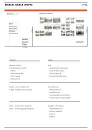
Struga I
Struga Atlanten
Struga Atlanten

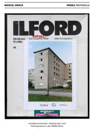
Create successful ePaper yourself
Turn your PDF publications into a flip-book with our unique Google optimized e-Paper software.
10. Wege und<br />
Straßen /Paths and<br />
Roads<br />
Weißwasser / Beła Woda<br />
Blatt-Nr. / Panel no. 625<br />
9. Waldeisenbahn /<br />
Forest railway<br />
Weißwasser / Beła Woda<br />
Blatt-Nr. / Panel no. 626<br />
Negativ-Nr. / Negative no.<br />
Kategorie / Category<br />
Negativ-Nr. / Negative no.<br />
Kategorie / Category<br />
20121020 42-12-01 N03<br />
Blickrichtung und GPS / Dev<br />
350°<br />
x-Wert 14,59537211<br />
y-Wert 51,50564510<br />
Alltag, Geschichte, Wald, Weg<br />
Everyday life, Forest, History, Path<br />
Notiz / Note<br />
Lesny puc: Abzweig des Waldweges in<br />
Richtung des Wanderweges zeleny puc<br />
Lesny puc: Branch of the forest path in<br />
direction of the hiking trail zeleny puc<br />
20121020 42-12-01 N04<br />
Blickrichtung und GPS / Dev<br />
330°<br />
x-Wert 14,59401562<br />
y-Wert 51,50919073<br />
Alltag, Bahn, Detail, Geschichte, Sorben,<br />
Wald, Weg<br />
Detail, Everyday life, Forest, History, Path,<br />
Railway, Sorbs<br />
Notiz / Note<br />
Handrijowy križ: Andreaskreuz mit<br />
Schienen der Waldeisenbahn entlang der<br />
Straße Trjebin–Beła Woda<br />
Handrijowy križ: level crossing with rails<br />
of the woodland railway alongside the<br />
Trjebin–Beła Woda road<br />
10. Wege und<br />
Straßen /Paths and<br />
Roads<br />
Weißwasser / Beła Woda<br />
Blatt-Nr. / Panel no. 627<br />
10. Wege und<br />
Straßen /Paths and<br />
Roads<br />
Weißwasser / Beła Woda<br />
Blatt-Nr. / Panel no. 628<br />
Negativ-Nr. / Negative no.<br />
Kategorie / Category<br />
Negativ-Nr. / Negative no.<br />
Kategorie / Category<br />
20121020 42-12-01 N05<br />
Blickrichtung und GPS / Dev<br />
150°<br />
x-Wert 14,59117381<br />
y-Wert 51,50805736<br />
Alltag, Detail, Geschichte, Wald, Weg<br />
Detail, Everyday life, Forest, History, Path<br />
Notiz / Note<br />
Lesny puc: Waldweg in Richtung holina<br />
mit hontwjernja<br />
Lesny puc: Forest path in direction of<br />
holina with hontwjernja<br />
20121020 42-12-01 N06<br />
Blickrichtung und GPS / Dev<br />
70°<br />
x-Wert 14,58928372<br />
y-Wert 51,50841929<br />
Alltag, Detail, Flora, Geschichte, Wald,<br />
Weg<br />
Detail, Everyday life, Flora, Forest, History,<br />
Path<br />
Notiz / Note<br />
Lesny puc: Waldweg mit verrottendem<br />
Baum zwischen Beła Woda und Trjebin<br />
mit verrottetem Baum<br />
Lesny puc: Forest path with rotting tree<br />
between Beła Woda and Trjebin<br />
5. Tagebauvorfeld /<br />
Open-cast mine<br />
perimeter<br />
Weißwasser / Beła Woda<br />
Blatt-Nr. / Panel no. 629<br />
6. Tiergarten und<br />
Eichwald/<br />
Zoological garden and<br />
Oak wood<br />
Weißwasser / Beła Woda<br />
Blatt-Nr. / Panel no. 630<br />
Negativ-Nr. / Negative no.<br />
Kategorie / Category<br />
Negativ-Nr. / Negative no.<br />
Kategorie / Category<br />
20121020 42-12-01 N07<br />
Blickrichtung und GPS / Dev<br />
160°<br />
x-Wert 14,58546505<br />
y-Wert 51,50543081<br />
Alltag, Geschichte, NSG, Tagebau, Trasse,<br />
Vattenfall, Wald, Weg<br />
Everyday life, Forest, History, Line, NCA,<br />
Open-cast mining, Path, Vattenfall<br />
Notiz / Note<br />
Jama, wuwozny móst – zeleny puc:<br />
Eingang zum devastierten Eichgarten,<br />
Tagebau mit Förderbrücke<br />
Jama, wuwozny móst – zeleny puc:<br />
Entrance to the devastated oak glade,<br />
open-cast mine with conveyor bridge<br />
20121020 42-12-01 N10<br />
Blickrichtung und GPS / Dev<br />
160°<br />
x-Wert 14,58546505<br />
y-Wert 51,50543081<br />
Alltag, Geschichte, NSG, Tagebau, Trasse,<br />
Vattenfall, Wald, Weg<br />
Everyday life, Forest, History, Line, NCA,<br />
Open-cast mining, Path, Vattenfall<br />
Notiz / Note<br />
Brunicowa wotkryta jama: Eingang<br />
zum devastierten Eichgarten, Tagebau<br />
mit Förderbrücke und Grünem Weg<br />
Brunicowa wotkryta jama: Entrance to<br />
the devastated oak glade, open-cast mine<br />
with conveyor bridge