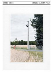
Struga I
Struga Atlanten
Struga Atlanten

Create successful ePaper yourself
Turn your PDF publications into a flip-book with our unique Google optimized e-Paper software.
27. Panoramen ii /<br />
Panoramas ii<br />
Trebendorf / Trjebin<br />
27. Panoramen ii /<br />
Panoramas ii<br />
Trebendorf / Trjebin<br />
Blatt-Nr. / Panel no. 445<br />
Blatt-Nr. / Panel no. 446<br />
Negativ-Nr. / Negative no.<br />
Kategorie / Category<br />
Negativ-Nr. / Negative no.<br />
Kategorie / Category<br />
20120721 29-12-06 N06<br />
Blickrichtung und GPS / Dev<br />
40°<br />
x-Wert 14,55319827<br />
y-Wert 51,52364835<br />
Gehöft, Geschichte, Ortschaft, Panorama,<br />
Sorben, Weg<br />
Farmstead, History, Locality, Panorama,<br />
Path, Sorbs<br />
Notiz / Note<br />
PAN 3 von 6 – Hinterberg 8:<br />
Straße und sorbischer Vierseitenhof<br />
[s. Blatt-Nr. 443–448]<br />
PAN 3 of 6 – Hinterberg 8: Road and Sorbian<br />
four-sided farmyard [see Panel no. 443–448]<br />
20120721 29-12-06 N07<br />
Blickrichtung und GPS / Dev<br />
20°<br />
x-Wert 14,55319827<br />
y-Wert 51,52364835<br />
Feld, Geschichte, Ortschaft, Panorama,<br />
Sorben, Stromnetz, Weg<br />
Field, History, Locality, Panorama, Path,<br />
Power network, Sorbs<br />
Notiz / Note<br />
PAN 4 von 6 – Hinterberg 8: Straße nach<br />
Slepo mit Getreidefeld und Strommast<br />
[s. Blatt-Nr. 443–448]<br />
PAN 4 of 6 – Hinterberg 8: Road to Slepo<br />
with grain field and electricity pylon<br />
[see Panel no. 443–448]<br />
27. Panoramen ii /<br />
Panoramas ii<br />
Trebendorf / Trjebin<br />
27. Panoramen ii /<br />
Panoramas ii<br />
Trebendorf / Trjebin<br />
Blatt-Nr. / Panel no. 447<br />
Blatt-Nr. / Panel no. 448<br />
Negativ-Nr. / Negative no.<br />
Kategorie / Category<br />
Negativ-Nr. / Negative no.<br />
Kategorie / Category<br />
20120721 29-12-06 N08<br />
Blickrichtung und GPS / Dev<br />
0°<br />
x-Wert 14,55319827<br />
y-Wert 51,52364835<br />
Feld, Flora, Ortschaft, Panorama,<br />
Stromnetz, Weg<br />
Field, Flora, Locality, Panorama, Path,<br />
Power network<br />
Notiz / Note<br />
PAN 5 von 6 – Hinterberg: Straße nach<br />
Slepo mit Getreidefeld und Strommast<br />
[s. Blatt-Nr. 443–448]<br />
PAN 5 of 6 – Hinterberg: Road to Slepo<br />
with grain field and electricity pylon<br />
[see Panel no. 443–448]<br />
20120721 29-12-07 N01<br />
Blickrichtung und GPS / Dev<br />
340°<br />
x-Wert 14,55319827<br />
y-Wert 51,52364835<br />
Feld, Flora, Ortschaft, Panorama, Weg<br />
Field, Flora, Locality, Panorama, Path<br />
Notiz / Note<br />
PAN 6 von 6 – Hinterberg: Straße nach<br />
Slepo, Feld vor der Ernte entlang<br />
der Lindenallee [s. Blatt-Nr. 443–448]<br />
PAN 6 of 6 – Hinterberg: Road to Slepo, field<br />
before the harvest alongside Lindenallee<br />
[see Panel no. 443–448]<br />
27. Panoramen ii /<br />
Panoramas ii<br />
Trebendorf / Trjebin<br />
27. Panoramen ii /<br />
Panoramas ii<br />
Trebendorf / Trjebin<br />
Blatt-Nr. / Panel no. 449<br />
Blatt-Nr. / Panel no. 450<br />
Negativ-Nr. / Negative no.<br />
Kategorie / Category<br />
Negativ-Nr. / Negative no.<br />
Kategorie / Category<br />
20120721 29-12-07 N02<br />
Blickrichtung und GPS / Dev<br />
330°<br />
x-Wert 14,55380238<br />
y-Wert 51,52080141<br />
Flora, Ortschaft, Panorama, Weg<br />
Flora, Locality, Panorama, Path<br />
Notiz / Note<br />
PAN 1 von 4 – Hinterberg 10: Hofeinfahrt<br />
und Hecken [s. Blatt-Nr. 449–452]<br />
PAN 1 of 4 – Hinterberg 10: Yard entrance<br />
and hedge [see Panel no. 449–452]<br />
20120721 29-12-07 N03<br />
Blickrichtung und GPS / Dev<br />
300°<br />
x-Wert 14,55380238<br />
y-Wert 51,52080141<br />
Devastation, Flora, Gehöft, Panorama,<br />
Weg<br />
Devastation, Farmstead, Flora, Panorama,<br />
Path<br />
Notiz / Note<br />
PAN 2 von 4 – Hinterberg 10: Hofeinfahrt,<br />
devastiertes Gehöft [s. Blatt-Nr. 449–452]<br />
PAN 2 of 4 – Hinterberg 10: Yard entrance,<br />
devastated farmstead [see Panel no. 449–452]