Vilas County Visitor Guide - 2019
Travel Guide.
Travel Guide.

Create successful ePaper yourself
Turn your PDF publications into a flip-book with our unique Google optimized e-Paper software.
GET THE MAP IT VILAS COUNTY TRAILS APP<br />
The free Map It <strong>Vilas</strong> <strong>County</strong> trails app is your key<br />
to discovering <strong>Vilas</strong> <strong>County</strong>’s trails. Here’s a quick<br />
guide to the app.<br />
Where to Ride<br />
1. BEFORE YOU GO: Download the Map It <strong>Vilas</strong> <strong>County</strong><br />
trails app at trails.vilas.org. The app is free and versions<br />
are available for Apple and Android devices.<br />
2. START DREAMING. The perfect trail is out there:<br />
use the app to find it. The app will show you all the<br />
public trails; the filters will help you zero in on one<br />
to explore. Select as many or as few options as you<br />
like; selecting more options will help you find just<br />
the right trail. For example, you can find hiking trails<br />
in Presque Isle that allow dogs, bike trails in Boulder<br />
Junction that are equipped with free repair stations<br />
and the snowmobile trails in Eagle River.<br />
3. MAKE IT HAPPEN! Use the app’s “Trail Information”<br />
section to find a trailhead and parking and see a helpful<br />
description of the trail. Once you’re on the trail, use<br />
the “Interactive Map” section to stay on the right path.<br />
A dot on the map will indicate your position—if you’re<br />
wondering how far you are from your car or campsite<br />
or if there’s a lake around the bend, just look at the<br />
app! The app will even display a trail map when<br />
there’s no cell service available.<br />
4. ENJOY. While the app is rich with trail details, the biggest<br />
benefit is what you’ll find off your device—an unforgettable<br />
wilderness experience. You’ll be able to navigate the<br />
backcountry like a local and find the beautiful hidden<br />
spots that make <strong>Vilas</strong> <strong>County</strong> trails so special.<br />
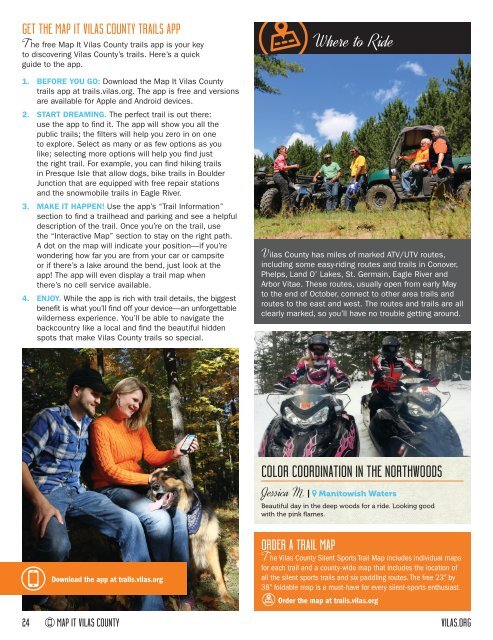
<strong>Vilas</strong> <strong>County</strong> has miles of marked ATV/UTV routes,<br />
including some easy-riding routes and trails in Conover,<br />
Phelps, Land O’ Lakes, St. Germain, Eagle River and<br />
Arbor Vitae. These routes, usually open from early May<br />
to the end of October, connect to other area trails and<br />
routes to the east and west. The routes and trails are all<br />
clearly marked, so you’ll have no trouble getting around.<br />
COLOR COORDINATION IN THE NORTHWOODS<br />
Jessica M. | Manitowish Waters<br />
Beautiful day in the deep woods for a ride. Looking good<br />
with the pink flames.<br />
Download the app at trails.vilas.org<br />
ORDER A TRAIL MAP<br />
The <strong>Vilas</strong> <strong>County</strong> Silent Sports Trail Map includes individual maps<br />
for each trail and a county-wide map that includes the location of<br />
all the silent sports trails and six paddling routes. The free 23” by<br />
38” foldable map is a must-have for every silent-sports enthusiast.<br />
Order the map at trails.vilas.org<br />
24 MAP IT VILAS COUNTY<br />
VILAS.ORG