Google Pilot / WEdge Viewer - United States Air Force Academy
Google Pilot / WEdge Viewer - United States Air Force Academy
Google Pilot / WEdge Viewer - United States Air Force Academy

Create successful ePaper yourself
Turn your PDF publications into a flip-book with our unique Google optimized e-Paper software.
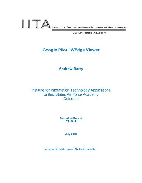
<strong>Google</strong> <strong>Pilot</strong> / <strong>WEdge</strong> <strong>Viewer</strong><br />
Andrew Berry<br />
Institute for Information Technology Applications<br />
<strong>United</strong> <strong>States</strong> <strong>Air</strong> <strong>Force</strong> <strong>Academy</strong><br />
Colorado<br />
Technical Report<br />
TR-09-4<br />
July 2009<br />
Approved for public release. Distribution unlimited.
The views expressed in this paper are those of the author and do not necessarily reflect the<br />
official policy or position of the Institute for Information Technology Applications, the Department<br />
of the <strong>Air</strong> <strong>Force</strong>, the Department of Defense or the U.S. Government.<br />
Comments pertaining to this report are invited and should be directed to:<br />
Sharon Richardson<br />
Director of Publications<br />
Institute for Information Technology Applications<br />
HQ USAFA/DFPS<br />
2354 Fairchild Drive, Suite 4L35F<br />
USAF <strong>Academy</strong> CO 80840-6258<br />
Tel. (719) 333-2746: Fax (719) 333-2945<br />
E-mail: sharon.richardson@usafa.edu<br />
2
Table of Contents<br />
About the Author 4<br />
Project Description 5<br />
Background Information 5<br />
Project Overview 7<br />
Conclusions 10<br />
Future Research 10<br />
About the Institute 11<br />
List of Figures<br />
Figure 1: FalconView screen capture showing Nellis <strong>Air</strong>space 6<br />
Figure 2: Previous <strong>Google</strong> <strong>Pilot</strong> Application - Running in <strong>Google</strong> Earth 7<br />
Figure 3: Cadet Coded Interface 8<br />
Figure 4: Module Decomposition 8<br />
Figure 5: Information Popup .9<br />
Figure 6: Full Cadet Code showing airfields 10<br />
3
Autobiography of the Author<br />
Lt Col Andrew J. “Skipper” Berry is an F-16 pilot with over 100 hours of combat time<br />
and 3500 hours total time. He is currently the director for Warfighter’s Edge at the<br />
Institute for Information Technology Applications (IITA), <strong>United</strong> <strong>States</strong> <strong>Air</strong> <strong>Force</strong><br />
<strong>Academy</strong> in Colorado Springs, Colorado. Lt Col Berry directs a team of eighteen on the<br />
technical coding, design and implementation of the program.<br />
A native of Denver, Colorado, Lt Col Berry is a Distinguished Graduate of Colorado<br />
State University <strong>Air</strong> <strong>Force</strong> ROTC Program. After receiving his commission in May<br />
1989, with a degree in Computer Science, he attended Undergraduate <strong>Pilot</strong> Training at<br />
Reese AFB, Lubbock, Texas. He earned his aeronautical rating in January 1991. From<br />
graduation until July 1996, Lt Col Berry was a T-37 Instructor <strong>Pilot</strong> where his programs<br />
earned four distinct benchmarks during a USAF inspection. From July 1996 to March<br />
1997 he attended F-16 RTU and had a follow on assignment to Hill AFB until February<br />
2000. After leaving the Active Duty in February 2000, Lt Col Berry went on to continue<br />
to fly F-16s at the Oklahoma <strong>Air</strong> National Guard, Tulsa, Oklahoma. There he specialized<br />
in a unique briefing system for flight briefing rooms and continued to improve and teach<br />
this technology to the <strong>Air</strong> National Guard. During April, 2005, during one of his<br />
presentations on this technology, he was hired by the <strong>Air</strong> <strong>Force</strong> Reserves to work at the<br />
Institute for Information Technology Applications, where the concept became a system of<br />
record for <strong>Air</strong> Combat Command. As the director of Warfighter’s Edge, IITA he has<br />
overseen three major programs included in the <strong>Air</strong> <strong>Force</strong> and continues to improve upon<br />
these products.<br />
4
Project Description<br />
<strong>Google</strong> <strong>Pilot</strong> / <strong>WEdge</strong> <strong>Viewer</strong><br />
This paper summarizes the activity of USAF <strong>Academy</strong> cadet work on the <strong>Google</strong> Earth<br />
project for the CS 453/454 capstone course. The <strong>Google</strong> <strong>Pilot</strong> cadet project was a<br />
computer science 453/454 year long capstone project. Lt Col Berry led the students in<br />
their creation of a formalized system realized by Capt Jacobson a C-17 pilot. This<br />
project was demonstrated to leadership in the <strong>Air</strong> <strong>Force</strong> and was selected to be included<br />
into the next version of PFPS (Portable Flight Planning Software) released in late 2010,<br />
now called the <strong>WEdge</strong> <strong>Viewer</strong>.<br />
Background Information<br />
<strong>Google</strong> Earth is a robust program that pilots have been using to obtain good imagery<br />
and information for years. Despite the DoD policies, pilots would still get information<br />
from the Internet from home or other locations. A natural follow on when obtaining<br />
imagery is trying to plot mission routes so pilots can view where they are going in a 3D<br />
world.<br />
Captain Mark Jacobson wrote the original “<strong>Google</strong> <strong>Pilot</strong>” program and his code and<br />
concepts can be found at www.googleearthpilot.com on the NIPRnet,<br />
gis.geoint.nga.smil.mil/<strong>Google</strong>Earth/googleearthpilot on SIPR and<br />
gis.geoint.nga.ic.gov/<strong>Google</strong>Earth/googleearthpilot for JWICS. With this application<br />
written by Captain Jacobson, the results were a KML file, forcing the user to open up the<br />
<strong>Google</strong> Earth thick client, and then read the KML file and display results. Additionally,<br />
automatic integration of DAFIF (Digital Aeronautical Flight Information File) data was not<br />
possible. Although this is a very popular product in use by units.<br />
From pilot planning to Special Operations including the Army, the FalconView product is<br />
used everywhere by combat forces. FalconView is a product created and maintained by<br />
Georgia Tech Research Institute that displays pilot mission planning information over a<br />
myriad of two dimensional maps displayed as the user desires.<br />
FalconView drawbacks include viewing things in a two dimensional system from a God’s<br />
eye view See Figure 1.<br />
5
Figure 1 - FalconView screen capture showing Nellis <strong>Air</strong>space<br />
While actually flying and combat is nothing like this view, the FalconView product was<br />
and continues to be an amazing product for our combat forces. The <strong>Google</strong> <strong>Pilot</strong><br />
application written by Captain Jacobson, allows for pilots to view their data in a 3D world,<br />
simply and effectively See Figure 2.<br />
6
Figure 2 - Previous <strong>Google</strong> <strong>Pilot</strong> Application - Running in <strong>Google</strong> Earth<br />
From this concept, the cadets were given a task to rewrite the C#.NET application<br />
originally written by Captain Jacobson and integrate it into a single solution that shows<br />
the view and interface together. Research on FalconView designs were required by the<br />
cadets to provide a familiar interface for those that have worked with FalconView.<br />
The cadets ended the year with a formal briefing to the Dean, Commandant, and<br />
General McCarthy.<br />
Project Overview<br />
The cadet project began with the Cadets creating a simple interface. They were<br />
instructed to include the <strong>Google</strong> API, which is written for a web application and does not<br />
require the full <strong>Google</strong> Earth product installed. On the left side of the application, click<br />
“find options” and capability was described. (See Figure 3) By clicking on a bar, the<br />
filtering options were present for the user. Clicking a simple on/off capability was<br />
described but never implemented.<br />
The primary data source defined was the DAFIF.mdb file inside FalconView. From that<br />
database, the cadets were able to convert that data into KML and interface with their<br />
own code structure and eventually to the display. A similar path was taken for route<br />
files, which require a 3 rd party application called the “route server” to be active. All<br />
interaction with FalconView routes was done through the route server. See Figure 4.<br />
7
Figure 3 - Cadet Coded Interface<br />
Interface Layer<br />
(<strong>Google</strong> Earth<br />
& user options)<br />
Business Layer<br />
(KML conversion)<br />
Data Layer<br />
(Query DB)<br />
Figure 4 ‐ Module Decomposition<br />
The final product included information about the airfield and other data. By clicking on<br />
an airfield, more information about the object is visible (see Figure 5). This<br />
demonstrates the cadet’s capability to obtain more information about the airfield than just<br />
the coordinates and plotting them on the map.<br />
8
Figure 5 - Information Popup<br />
Additional data sources were needed, but due to time constraints the cadets could not<br />
finish another source other than airfield information.<br />
The final cadet project was a functional interface for airfields, obtaining data from the<br />
DAFIF.mdb file and plotting that directly on a screen with <strong>Google</strong> Earth imbedded. See<br />
Figure 6.<br />
9
Conclusions<br />
Figure 6 - Full Cadet Code showing airfields<br />
By putting the development into the hands of the cadets, creative solutions were<br />
discovered. Research was required in determining how to integrate a <strong>Google</strong> Earth API<br />
into an executable solution when the API was designed for web use only. The cadets<br />
overcame this obstacle and generated a solution whereby the executable product<br />
emulates a web environment to host the API – ingenious.<br />
Additional research was done to determine how to get information from the FalconView<br />
DAFIF (Digital Aeronautical Flight Information File) and implement that in a 3D<br />
environment. The DAFIF information is ingested by FalconView and manipulated to the<br />
DAFIF.mdb database format. The overall concept of the <strong>Google</strong> Earth viewer was<br />
created by an <strong>Air</strong> <strong>Force</strong> pilot. While this is a highly effective thought, his time to maintain<br />
the code was diminishing and eventually overcome. Using the cadets to implement this<br />
solution is an outstanding avenue for getting products into the <strong>Air</strong> <strong>Force</strong>.<br />
Future Research<br />
The <strong>WEdge</strong> development team has taken ownership of this project and no future<br />
research will be required by the Institute for Information Technology Applications.<br />
However, future research by the <strong>WEdge</strong> team will be utilized through users of the <strong>Air</strong><br />
<strong>Force</strong> to identify other potential uses for geospatial information.<br />
For more information about this or any Warfighter’s Edge product, please contact us at<br />
info@wedge.hpc.mil<br />
10
ABOUT THE INSTITUTE<br />
The Institute for Information Technology Applications (IITA) was formed in 1998 to<br />
provide a means to research and investigate new applications of information technology.<br />
The Institute encourages research in education and applications of the technology to <strong>Air</strong><br />
<strong>Force</strong> problems that have a policy, management, or military importance. Research<br />
grants enhance professional development of researchers by providing opportunities to<br />
work on actual problems and to develop a professional network.<br />
Sponsorship for the Institute is provided by the Dean of Faculty at the U.S. <strong>Air</strong> <strong>Force</strong><br />
<strong>Academy</strong> among others. IITA coordinates a multidisciplinary approach to research that<br />
incorporates a wide variety of skills with cost-effective methods to achieve significant<br />
results. Proposals from the military and academic communities may be submitted at any<br />
time since awards are made on a rolling basis. Researchers have access to a highly<br />
flexible laboratory with broad bandwidth and diverse computing platforms.<br />
To explore multifaceted topics, the Institute hosts single-theme conferences to<br />
encourage debate and discussion on issues facing the academic and military<br />
components of the nation. More narrowly focused workshops encourage policy<br />
discussion and potential solutions. IITA distributes conference proceedings and other<br />
publications nation-wide to those interested or affected by the subject matter.<br />
11