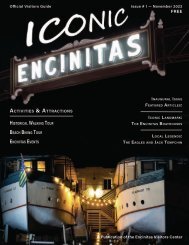
Historic Charleston: The First 225 Years
An illustrated history of Charleston, West Virginia, paired with the histories of local companies and organizations that made the city great.
An illustrated history of Charleston, West Virginia, paired with the histories of local companies and organizations that made the city great.

Create successful ePaper yourself
Turn your PDF publications into a flip-book with our unique Google optimized e-Paper software.
Thank you for your interest in this HPNbooks publication. For more information about other<br />
HPNbooks publications, or information about producing your own book with us, please visit www.hpnbooks.com.
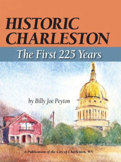
HISTORIC CHARLESTON<br />
<strong>The</strong> <strong>First</strong> <strong>225</strong> <strong>Years</strong><br />
by Billy Joe Peyton<br />
A publication of the City of <strong>Charleston</strong><br />
HPNbooks<br />
A division of Lammert Incorporated<br />
San Antonio, Texas
CONTENTS<br />
✧<br />
This c. 1850 single-span stone arch<br />
bridge carried the Point Pleasant Road<br />
over Kanawha Two Mile Creek at the<br />
Littlepage Farm. It still stands but was<br />
bypassed long ago.<br />
PHOTOGRAPH COURTESY OF THE HISTORIC<br />
GLENWOOD FOUNDATION.<br />
3 WELCOME FROM MAYOR DANNY JONES<br />
4 ACKNOWLEDGEMENTS<br />
5 CHAPTER 1 Prehistory and Early Settlement: to 1820<br />
17 CHAPTER 2 Town at the Mouth of Elk: 1820-1860<br />
31 CHAPTER 3 Civil War and Aftermath: 1860-1870<br />
49 CHAPTER 4 An Emerging Capital City: 1870-1900<br />
61 CHAPTER 5 Industrial Expansion and Growth: 1900-1970<br />
89 CHAPTER 6 Epilogue—A City in Transition: 1970-present<br />
102 BIBLIOGRAPHY<br />
103 SHARING THE HERITAGE<br />
151 SPONSORS<br />
152 ABOUT THE AUTHOR<br />
<strong>First</strong> Edition<br />
Copyright © 2013 HPNbooks<br />
All rights reserved. No part of this book may be reproduced in any form or by any means, electronic or mechanical, including photocopying, without permission in writing<br />
from the publisher. All inquiries should be addressed to HPNbooks, 11535 Galm Road, Suite 101, San Antonio, Texas, 78254. Phone (800) 749-9790, www.hpnbooks.com.<br />
ISBN: 978-1-939300-19-5<br />
Library of Congress Card Catalog Number: 2013952553<br />
<strong>Historic</strong> <strong>Charleston</strong>: <strong>The</strong> <strong>First</strong> <strong>225</strong> <strong>Years</strong><br />
author: Billy Joe Peyton<br />
contributing writer for “Sharing the Heritage”: Joe Goodpasture<br />
HPNbooks<br />
president: Ron Lammert<br />
project manager: Bob Sadoski<br />
administration: Donna M. Mata, Melissa G. Quinn<br />
book sales: Dee Steidle<br />
production: Colin Hart, Evelyn Hart, Glenda Tarazon Krouse, Tony Quinn<br />
H I S T O R I C C H A R L E S T O N<br />
2
WELCOME FROM MAYOR DANNY JONES<br />
WELCOME FROM MAYOR DANNY JONES<br />
I am blessed to be the mayor of my home town, the city where I grew up and learned so much<br />
about life, and I am pleased to greet you as you begin exploring the history of <strong>Charleston</strong> in the<br />
pages of this book. As you can see, <strong>Charleston</strong> has a very rich history over <strong>225</strong> years and counting.<br />
While neither you nor I can change anything that is part of our past, we can—and should—learn<br />
from it as we prepare for the future. As a student of history, I am fascinated to be able to look<br />
back and learn how situations developed, how people made decisions that shaped events and<br />
how people and events created the path to where we are now as a world, nation and city.<br />
We need to know where we have been to understand fully the direction in which we are heading.<br />
Our recent history has produced some exciting developments in <strong>Charleston</strong> that make me<br />
very hopeful about our future. Over the past decade, we have witnessed many new events<br />
and investments in <strong>Charleston</strong> that make our capital city a much more attractive place for people<br />
to live, visit and invest:<br />
• <strong>The</strong> opening of the Clay Center for the Arts and Sciences as a world class performance hall<br />
and activity center for people of all ages and interests;<br />
• Creation of FestivALL <strong>Charleston</strong>, which has become a ten-day celebration of art and culture<br />
and has led to the empowerment of our city’s artistic community throughout the year;<br />
• Development of Appalachian Power Park, which preserved professional baseball in our city<br />
as the home of the West Virginia Power and dozens of other community events every year;<br />
• Renovation of Haddad Riverfront Park with the new retractable canopy that makes events there<br />
more inviting and the addition of the Schoenbaum Stage that pays tribute to our sternwheeling<br />
history while hosting weekly free concerts Live on the Levee during the summer months;<br />
• Growth and expansion of the University of <strong>Charleston</strong> with seven new buildings on campus<br />
(including a new School of Pharmacy) and new investment both downtown (Graduate School<br />
of Business) and at Laidley Field (University of <strong>Charleston</strong> stadium);<br />
• Transformation of affordable housing in the city of <strong>Charleston</strong> from the former Spring Hill<br />
complex and Washington Manor to Orchard Manor, Littlepage Terrace and beyond, so that<br />
people in need have cleaner, safer and better places to call home;<br />
• Expansion of neighborhood organizations in four different parts of the city, including<br />
new Main Street organizations on both the East End and West Side, that have mobilized<br />
personal and financial investment in places throughout the city and encouraged people to<br />
follow their passions for projects that make for more business-friendly and neighbor-friendly<br />
neighborhoods; and<br />
• A plan for renovating the <strong>Charleston</strong> Civic Center to make it more inviting and user-friendly<br />
for the groups, events and visitors that hold the greatest promise for infusing new money into<br />
the local economy.<br />
Honestly, I could fill pages with other projects, special events and investments that people and<br />
businesses have made in our city in recent years. But for now, I invite you to explore <strong>Charleston</strong>’s<br />
history through this book as we look both back to the past and ahead to bright future.<br />
✧<br />
Mayor Danny Jones.<br />
W E L C O M E F R O M M A Y O R D A N N Y J O N E S<br />
3
ACKNOWLEDGEMENTS<br />
This work was carried out in cooperation with the <strong>Charleston</strong> <strong>Historic</strong> Landmarks<br />
Commission, to commemorate the founding of Fort Lee <strong>225</strong> years ago and the “town at mouth<br />
of Elk” six years later, as well as the West Virginia sesquicentennial. Many people have provided<br />
generous support and assistance on the project, especially the cheerful staff at the West Virginia<br />
State Archives; special recognition goes to Jerry Waters, who maintains a popular website<br />
brimming with rare and historic images of <strong>Charleston</strong> at www.mywvhome.com. Heartfelt thanks<br />
to the City of <strong>Charleston</strong> for showing confidence in me throughout the process, to <strong>Charleston</strong><br />
City Manager David Molgaard for his editorial assistance, and to Ron Lammert and the fine<br />
folks at <strong>Historic</strong>al Publishing Network for sticking with me as I completed the long-awaited<br />
manuscript. Your support is greatly appreciated.<br />
Finally, I dedicate this project to my amazingly talented wife, CJ, and our two children whom<br />
I love dearly. Cindie and Kendy, it is my sincere hope that you both grow to appreciate the rich<br />
history of <strong>Charleston</strong> as much as I do.<br />
Billy Joe Peyton<br />
June 2013<br />
H I S T O R I C C H A R L E S T O N<br />
4
C H A P T E R 1<br />
PREHISTORY AND<br />
EARLY SETTLEMENT: TO 1820<br />
Long before Europeans arrived, Native Americans knew about the area at the mouth of<br />
Elk River, a stream the Shawnee termed Tis-kel-wah, meaning “river of fat elk,” while the<br />
Delawares are said to have called it Pe-quo-ni, meaning “the walnut river.” It is unclear how the<br />
Kanawha River got its name. Some sources attribute it to the white explorers who named it after<br />
the Indians who lived along the river. Another possibility is that it was named after the island<br />
where the Piscataway Indians lived, “Conoy,” which may be a shortened form of “Kanawha,”<br />
pronounced as “Kanaw.” <strong>The</strong>re are also stories that the river was given its name by Native<br />
Americans as “Kanawah,” which meant “place of the white stones.” Apparently, the Shawnee<br />
people called the river ”Keninskeha,” which meant “river of evil spirits.” <strong>The</strong>re is some<br />
uncertainty about this story, as both names describe the New River more than the Kanawha.<br />
In fact, during colonial times, the New and Kanawha Rivers were considered to be the same<br />
waterway, and even sometimes called “Woods” River for Abraham Wood, who was responsible<br />
for early seventeenth century explorations of West Virginia. In 1671, Wood, along with a group<br />
that included Thomas Batts and Robert Fallam, discovered the river now called the New.<br />
✧<br />
Used to define the boundaries of the<br />
newly independent United States,<br />
the 1755 John Mitchell map is the most<br />
comprehensive map of eastern North<br />
America during the colonial era.<br />
WIKIPEDIA COMMONS, FROM LIBRARY OF CONGRESS.<br />
HTTP://COMMONS.WIKIMEDIA.ORG/WIKI/FILE:MITCHELL_<br />
MAP-06FULL2_COMPRESSED.JPG<br />
C H A P T E R 1<br />
5
✧<br />
In 1755, Shawnee captive Mary Ingles<br />
became the first documented non-Native<br />
American to make salt in the<br />
Kanawha Valley.<br />
MAP COURTESY OF THE AUTHOR’S COLLECTION.<br />
H I S T O R I C C H A R L E S T O N<br />
6<br />
Whatever name aboriginal people gave to<br />
the local waterway, they called the Kanawha<br />
Valley home for centuries before the first<br />
Europeans arrived. <strong>The</strong> area’s recorded history<br />
is less than two-and-a-half centuries old,<br />
but archaeological evidence reveals human<br />
habitation for 12,000 years before that. Native<br />
American occupation evolved through three<br />
progressive stages, from the Paleo-Indian to<br />
Archaic and Woodland cultures. Physical<br />
evidence of each culture has been discovered<br />
in the valley, but the most visible reminders<br />
are the burial mounds left by the Woodland<br />
peoples. In 1881 the Smithsonian Institution<br />
conducted archeological excavations relating<br />
to these prehistoric mound builders. By 1890<br />
about 100 mounds and earthworks had<br />
been identified in the Kanawha Valley, and<br />
among them was the Criel Mound in South<br />
<strong>Charleston</strong>, the second-largest burial mound<br />
in West Virginia.<br />
By the time European settlers crossed the<br />
Appalachian Mountains, virtually all Native<br />
American villages had been abandoned and<br />
the Kanawha and Elk valleys were used<br />
primarily as a hunting ground by the<br />
Shawnee, Cherokee, and Iroquois tribes. At<br />
the mouth of Campbell’s Creek, about five<br />
miles above Elk River, were salt springs that<br />
became known as the Great Buffalo Lick, or<br />
Kanawha Licks, that attracted buffalo, deer,<br />
and other game. Parties of Indians often came<br />
to hunt the abundant game and boil the brine<br />
to make salt, which was used for seasoning<br />
and food preservation.<br />
<strong>The</strong> first Europeans known to have viewed<br />
the future site of <strong>Charleston</strong> were Shawnee<br />
captives taken from their home at Draper’s<br />
Meadows (near present-day Blacksburg,<br />
Virginia) in July of 1755. Among them was<br />
twenty-four-year-old Mary Draper Ingles and<br />
her two young sons, aged four and two. <strong>The</strong><br />
group traveled on foot to Paint Creek, which<br />
they followed to its mouth on Kanawha River<br />
about twenty-two miles above <strong>Charleston</strong>. At<br />
the Kanawha Licks the party paused to make<br />
salt, which they took back to their Shawnee<br />
village near Chillicothe, Ohio. Mary Ingles’<br />
remarkable story ended with her daring escape<br />
and an epic 40-day, 400-mile trek in which
she followed the Ohio, Kanawha and New<br />
rivers back home. Although her trials ended<br />
in a joyous family reunion, Mary and William<br />
Ingles lost one son who probably died in<br />
captivity, while another son was adopted into<br />
a Shawnee family and did not see his<br />
biological parents for many years.<br />
Efforts to settle the trans-montane region of<br />
Virginia met with little success prior to the<br />
French and Indian War. Although optimism<br />
reigned after the British victory over France in<br />
1763, it did not immediately open the Kanawha<br />
Valley to permanent settlement. Shawnee Chief<br />
Cornstalk led bloody raids on the Greenbrier<br />
settlements shortly thereafter, which adversely<br />
impacted attempts to populate the region. In<br />
an effort to placate Native American claims<br />
and dissuade frontier violence, King George III<br />
issued a royal proclamation that prohibited<br />
settlement beyond the crest of the Alleghenies<br />
by declaring the area as an Indian Reserve.<br />
Persistent Cherokee and Iroquois claims in<br />
present-day West Virginia were permanently<br />
extinguished with the treaties of Hard Labor<br />
and Fort Stanwix in 1768, followed by<br />
the Treaty of Lochaber in 1770, but strong<br />
Shawnee claims remained unresolved and<br />
contributed to persistent attacks originating<br />
from Ohio.<br />
In 1770 speculators began claiming<br />
Kanawha lands. Among them was George<br />
Washington, who personally selected 23,000<br />
acres bordering Kanawha River and extending<br />
more than forty miles above its mouth. <strong>The</strong><br />
first residents ventured into the area in 1771,<br />
when Simon Kenton, George Strader and<br />
John Yeager built a cabin along Elk River<br />
about two miles above <strong>Charleston</strong> which they<br />
used as a base camp for hunting and trapping.<br />
Considered the first Europeans to actually live<br />
in the Kanawha Valley, the trio remained until<br />
March of 1773 when an Indian raiding party<br />
attacked them at camp. Yeager died in the<br />
ambush, while Kenton and Strader escaped<br />
on foot to Point Pleasant and did not return.<br />
Also in 1773, Walter Kelly established a<br />
settlement along Kelly’s Creek at present-day<br />
Cedar Grove, about twenty miles above<br />
<strong>Charleston</strong>. Settlers in his group assumed<br />
considerable risk because they had ventured<br />
far beyond the protection of volunteer militia<br />
units that guarded the Greenbrier settlements<br />
eighty miles to the east. In the spring and<br />
summer of that year, Shawnees launched raids<br />
from Ohio into West Virginia, prompting<br />
Kelly to send his family back to the safety of<br />
the Greenbrier settlements before being killed<br />
himself. In 1774, William Morris assumed<br />
Kelly’s claim. One of Morris’s sons settled on<br />
Lens Creek (Marmet), and another moved<br />
down the south side of Kanawha River<br />
opposite Campbell’s Creek. Within a short<br />
time, additional settlements had sprung up<br />
at Pratt, Hugheston, and Shrewsbury, while<br />
separate expeditions surveyed downriver<br />
lands at Nitro and St. Albans.<br />
Meanwhile, a veteran Virginia militiaman,<br />
Colonel Thomas W. Bullitt from Prince<br />
William County, appeared in the Kanawha<br />
Valley in the spring of 1773 while on<br />
an expedition bound for the Kentucky<br />
wilderness, where he made surveys of<br />
Frankfort and Louisville. Upon his return,<br />
Bullitt was granted acreage in the western<br />
territory as a reward for military and civil<br />
service to Virginia. He chose a favorable<br />
1,030-acre site at the mouth of Elk River that<br />
he believed best for future development. His<br />
claim began at a large sycamore tree at the<br />
junction of the Elk and Kanawha Rivers and<br />
ran nearly a mile up the Kanawha to the head<br />
of the bottom; it continued 330 feet to a<br />
“Spanish Oak at the base of the hills,” then<br />
followed a direct line just over two miles to<br />
Elk River before returning back to the starting<br />
point. Bullitt also claimed a second parcel<br />
consisting of 1,240 acres directly below the<br />
west bank of Elk River and extending down<br />
to a point beyond Kanawha Two-Mile Creek.<br />
Bullitt possibly made a “tomahawk claim” to<br />
the lands in 1774, but his actual survey dates<br />
to May 25, 1775. When Thomas Bullitt died<br />
in Fauquier County in 1778, his younger<br />
brother, Cuthbert Bullitt (1740-1791), a<br />
planter, lawyer and judge from Prince William<br />
County, inherited the Kanawha lands. On<br />
November 20, 1779, Cuthbert Bullitt received<br />
a formal patent signed by Virginia Governor<br />
Thomas Jefferson that granted him ownership<br />
“in consideration of military services performed<br />
by Thomas Bullitt in the late war between<br />
Great Britain and France.”<br />
✧<br />
Colonel Thomas Bullitt’s two surveys<br />
covered 2,270 acres of prime bottomland<br />
along the east and west banks of the<br />
Elk River.<br />
MAP COURTESY OF THE AUTHOR’S COLLECTION<br />
(FROM LAIDLEY, HISTORY OF CHARLESTON AND<br />
KANAWHA COUNTY).<br />
C H A P T E R 1<br />
7
✧<br />
Andrew Lewis led Virginia troops at the<br />
Battle of Point Pleasant. Lewis never lived<br />
in West Virginia, but he played a prominent<br />
role in its early history and development.<br />
PHOTOGRAPH COURTESY OF BILLY JOE PEYTON.<br />
H I S T O R I C C H A R L E S T O N<br />
8<br />
Upset by the frequency and severity of<br />
persistent Indian raids, and spurred on by<br />
speculators who hoped to gain from settling<br />
the western lands, Virginia’s royal governor,<br />
John Murray, launched an offensive against<br />
the Shawnee villages in Ohio in the autumn<br />
of 1774. Murray, who held title as the fourth<br />
Earl of Dunmore, assembled an army of<br />
around 1,200 men at Fort Dunmore (present<br />
Pittsburgh) and moved down the Ohio River.<br />
He intended to join forces with a second<br />
army of around 1,100 Virginians under<br />
Colonel Andrew Lewis, a Virginia militiaman<br />
and surveyor who had surveyed much of<br />
Greenbrier County and was a respected<br />
veteran of the French and Indian War. As<br />
Dunmore’s army moved down from the<br />
north, Lewis’s troops gathered at Fort Union<br />
(present-day Lewisburg) and on September 6<br />
began marching westward in successive<br />
waves over the trackless forest to a<br />
rendezvous point on Elk River.<br />
<strong>First</strong> to depart Fort Union<br />
was Colonel Charles Lewis<br />
(younger brother of Andrew<br />
Lewis) and 600 men of<br />
the Augusta Regiment, whose<br />
mission was “to proceed as far<br />
as the mouth of Elk, then to<br />
make canoes to take down the<br />
flour. He took with him 108<br />
beeves and 500 pack-horses<br />
carrying 54,000 pounds of<br />
flour.” Six days later, Colonel<br />
William Fleming and the<br />
Botetourt Regiment moved<br />
out with 18,000 pounds of<br />
flour. Fleming’s Botetourt force<br />
joined the Augusta troops<br />
at the mouth of Elk on<br />
September 22, “where both<br />
regiments engaged in making<br />
a store-house and building<br />
canoes for transporting supplies<br />
down the Great Kanawha.”<br />
<strong>The</strong> parole—a watchword or<br />
password issued by the<br />
commanding officer to the<br />
officers of the guard—for this<br />
day was “Charlestown,” a full<br />
fourteen years before the<br />
town at the mouth of the Elk was established.<br />
<strong>The</strong> word probably was in reference to<br />
Colonel Charles Lewis, but it would be<br />
interesting to know if it had any impact on<br />
the subsequent naming of the town that<br />
would develop later.<br />
Crews eventually constructed twentyseven<br />
canoes in about a week’s time at the<br />
mouth of Elk. At daybreak on September 30,<br />
the canoes were sent up Elk River about<br />
one-and-a half miles, where the river was<br />
“100 yards wide and there was a fording.”<br />
This would put the crossing near the<br />
mouth of Magazine Branch, about where<br />
Pennsylvania and Bigley Avenues converge<br />
today. In conditions described as “still dead<br />
running water,” cattle and packhorses were<br />
driven over first, followed by the army which<br />
crossed to a camp on the “level plain below<br />
the mouth of the Elk” on <strong>Charleston</strong>’s West<br />
Side. Incessant rains forced the men to remain<br />
in camp until October 2, when they resumed<br />
their march to the Ohio. It was during this<br />
extended encampment that Virginia soldiers<br />
first became acquainted with the fertile<br />
bottom land at the confluence of the Elk and<br />
Kanawha Rivers.<br />
Lewis’s army reached Point Pleasant on<br />
October 6, 1774. <strong>The</strong>re, on October 10, they<br />
were attacked by an equal force of Shawnees<br />
and their allies led by famed warrior, Chief<br />
Cornstalk. In a fierce day-long fight that<br />
descended into a hand-to-hand struggle, the<br />
Virginia militia prevailed after Cornstalk’s<br />
forces retreated across the Ohio River. Under<br />
terms of the Treaty of Camp Charlotte that<br />
ended Dunmore’s War, the Ohio River was<br />
recognized as the boundary between the<br />
Shawnee nation and British settlers, the<br />
Shawnee agreed to stop attacking travelers<br />
on the Ohio River, and Kentucky was closed<br />
to British settlement. Construction of Fort<br />
Randolph at Point Pleasant bolstered the<br />
sense of security for area residents. <strong>The</strong> treaty<br />
secured a temporary peace, and settlers<br />
streamed into the Kanawha Valley. Violence<br />
returned to the frontier following the brutal<br />
murder of Cornstalk at Fort Randolph in<br />
November 1777.<br />
Among the soldiers who camped at<br />
Elk River and fought at the 1774 Battle of
Point Pleasant were several sons of Charles<br />
Clendenin. Among them was George, who<br />
was born in Augusta County in 1746. <strong>The</strong><br />
Clendenin family had originally migrated to<br />
the Shenandoah Valley from Ulster, Northern<br />
Ireland, and Charles had moved his family<br />
to the Greenbrier Valley (present Pocahontas<br />
County) in 1771. Following his service in<br />
Dunmore’s War, George Clendenin represented<br />
Greenbrier County in the Virginia House of<br />
Delegates from 1781 to 1789. He helped<br />
establish the Old State Road from Lewisburg<br />
to <strong>The</strong> Boatyards (Cedar Grove) in 1786, and<br />
its extension to the mouth of the Elk River<br />
two years later. George Clendenin became a<br />
major landowner in Greenbrier County, with<br />
holdings individually and jointly in excess of<br />
30,000 acres. On December 28, 1787, while<br />
attending a legislative session in Richmond,<br />
George Clendenin purchased from Cuthbert<br />
Bullitt the 1,030-acre tract located along the<br />
Kanawha River that was part of the Thomas<br />
Bullitt survey. Clendenin later sold 507 acres<br />
to his brothers, William and Alexander.<br />
Eager to relocate to his new lands at the<br />
mouth of the Elk, Clendenin urged Virginia<br />
lawmakers to focus their attention on frontier<br />
defense. At the time, four forts existed in<br />
the entire Kanawha Valley—at Point Pleasant,<br />
the mouth of Coal River, opposite Campbell’s<br />
Creek, and on Kelly’s Creek. Each fort<br />
accommodated only about ten families, which<br />
was inadequate for reliable defense according<br />
to Clendenin—who asserted that all settlers<br />
would vacate their lands if they did not<br />
receive more protection. On January 30,<br />
1788, Virginia Governor Edmund Randolph<br />
directed George Clendenin to organize a<br />
company of rangers and to station them at<br />
a location he deemed to be most acceptable<br />
for the protection of Kanawha settlers. Not<br />
surprisingly, and with an eye to future<br />
settlement opportunities, Clendenin placed<br />
the company on his own lands near the<br />
mouth of Elk. He named his brother, William,<br />
also a veteran of the Battle of Point Pleasant,<br />
as captain, while another brother, Alexander,<br />
served as a private. At the outset, twentyseven<br />
rangers formed the militia company:<br />
George Clendenin led the first group of<br />
intrepid settlers into the Kanawha Valley in<br />
K A N A W H A M I L I T I A O R I G I N A L M U S T E R R O L L<br />
George Clendenin, colonel<br />
George Shaw, lieutenant<br />
Shadrach Harriman, sergeant<br />
John Tollypurt, private<br />
John Burns, private<br />
William Miller, private<br />
James Edgar, private<br />
Michael Newhouse, private<br />
Thomas Shirkey, private<br />
William Boggs, private<br />
Benjamin Morris, private<br />
William Morris, private<br />
William Turrell, private<br />
Alexander Clendenin, private<br />
April 1788. It is unclear whether he had<br />
recently laid eyes on his new land, but it<br />
probably changed little since 1774. Upon<br />
arrival at the Elk River, the forty-two-year-old<br />
Clendenin immediately set the Kanawha<br />
Rangers to work building a fortification which<br />
they completed in May. For the fort site, he<br />
chose a high bank overlooking Kanawha River<br />
about 125 feet above the present intersection<br />
of Brooks Street and Kanawha Boulevard.<br />
Informally called Clendenin’s Station, it<br />
offered a commanding view of the river in<br />
both directions, had a supply of fresh water<br />
nearby, and a natural ravine offered a good<br />
spot for a canoe landing. By 1792, the station<br />
had officially become Fort Lee, named in<br />
honor of Revolutionary War hero and former<br />
Virginia governor, Richard Henry Lee, father<br />
of Confederate General Robert E. Lee.<br />
<strong>The</strong> fortification itself consisted of a log<br />
stockade about 250 feet long and 175 feet<br />
wide, with two entry gates—one that opened<br />
on the river side and another on the hill<br />
side. Within the enclosure stood a two-story<br />
hand-hewn log structure that measured<br />
36 feet long, 18 feet wide and 18 feet high,<br />
with clapboard roof, whipsawed rafters<br />
and framing, puncheon (dirt) floor, and a<br />
fieldstone chimney on both ends. Built on a<br />
typical plan, it had two rooms and a hallway<br />
on the first floor and two rooms on the second<br />
floor. Known as the “Mansion House,” it<br />
William Clendenin, captain<br />
Francis Watkins, ensign<br />
Reuben Slaughter, sergeant<br />
Samuel Dunbar, private<br />
Isaac Snedicer, private<br />
John Buckle, private<br />
Robert Aaron, private<br />
William Carroll, private<br />
Nicholas Null, private<br />
Archer Price, private<br />
Levi Morris, private<br />
Joseph Burrell, private<br />
John Moore, private<br />
✧<br />
While serving in the Virginia state<br />
legislature, George Clendenin purchased<br />
the 1,030-acre Bullitt tract on<br />
December 28, 1787.<br />
PHOTOGRAPH COURTESY OF SOCIETY OF THE COLONIAL<br />
DAMES OF AMERICA IN THE STATE OF WEST VIRGINIA.<br />
C H A P T E R 1<br />
9
✧<br />
Below: Artist’s rendering of Clendenin’s<br />
Station, later renamed Fort Lee. <strong>The</strong> fort<br />
stood near present Kanawha Boulevard,<br />
between present Brooks and Morris Streets.<br />
ILLUSTRATION COURTESY OF THE AUTHOR’S COLLECTION<br />
(FROM COOK, THE ANNALS OF FORT LEE).<br />
Opposite, top: Postcard of Daniel Boone<br />
originally issued by Daniel Boone Hotel<br />
in <strong>Charleston</strong>.<br />
COURTESY OF THE AUTHOR’S COLLECTION.<br />
Opposite, bottom: In 1928, the Daughters<br />
of the American Revolution erected a stone<br />
marker to Daniel Boone at the base of a<br />
cave near the mouth of Campbell’s Creek.<br />
<strong>The</strong> cave was obliterated in the 1970s,<br />
and the marker now stands in<br />
Daniel Boone Park.<br />
PHOTOGRAPH COURTESY OF BILLY JOE PEYTON.<br />
served as the main residence for George<br />
Clendenin and his family. In addition, the<br />
rangers built a blockhouse about one mile<br />
upstream (in the vicinity of the Executive<br />
Mansion at the Capitol Complex) where<br />
William Clendenin and his family resided.<br />
Other scattered cabins stood on land cleared<br />
from the nearby forest.<br />
Today, near the corner of Brooks Street and<br />
Kanawha Boulevard stands a native stone<br />
marker placed in 1915 by the Kanawha Valley<br />
Chapter of the Daughters of the American<br />
Revolution to mark the site of the original<br />
Fort Lee building and stockade. Historian Roy<br />
Bird Cook surmised that the boulder stands a<br />
little in front of the actual building site.<br />
Charles Clendenin’s gravesite was somewhere<br />
in the 1200 block of Kanawha Boulevard.<br />
In 1917, the National Society of the Colonial<br />
Dames of America (NSCDA) in the State of<br />
West Virginia erected a marble-based sundial<br />
in the memory of Charles Clendenin, the<br />
father of George who died at Fort Lee in<br />
1790 and was buried within its stockade. <strong>The</strong><br />
sundial was moved to its present location<br />
opposite 1254 Kanawha Boulevard in 1988,<br />
and in 2012 underwent restoration under<br />
a joint effort of NSCDA-West Virginia, the<br />
<strong>Charleston</strong> Beautification Commission, and<br />
the <strong>Charleston</strong> Public Works Department.<br />
Danger took many forms in the exposed<br />
and vulnerable frontier settlements, but the<br />
most imminent and potentially lethal threat<br />
came from marauding bands of native<br />
warriors who hoped to roll back the tide of<br />
settlement. <strong>The</strong>y hoped to accomplish their<br />
goals by launching raids deep into the<br />
Kanawha Valley, where they stole horses,<br />
destroyed cabins and crops, took prisoners,<br />
and sometimes brutally murdered settlers.<br />
When the call went out to “fort up,” residents<br />
sought protection and the Kanawha Rangers<br />
sprang into action until danger had passed.<br />
Once, during construction of Fort Lee, a<br />
raiding party of twenty-two Indians appeared<br />
but quickly dispersed after the militia force<br />
showed itself in strength.Unfortunately, other<br />
clashes did not end so well.<br />
Local victims included James Hale, who<br />
was killed at Hale’s Branch on the south side<br />
of Kanawha River (near present South Side<br />
Bridge) in 1789 and buried in a small plot in<br />
the fort near the later grave of Charles<br />
Clendenin. In 1790 a deadly attack on Fort<br />
Tackett on Coal River (St. Albans) about<br />
twelve miles downstream sent survivors<br />
scurrying for refuge at Fort Lee. Shadrach<br />
Harriman, an original <strong>Charleston</strong> settler and<br />
member of the Kanawha Rangers, was killed<br />
near Venable Branch (now Mission Hollow)<br />
in 1791. Such persistent violence led George<br />
Clendenin to declare the Kanawha Valley<br />
as “one continual scene of depradation [sic]”<br />
by 1792.<br />
H I S T O R I C C H A R L E S T O N<br />
10
Following the erection of Fort Lee, the<br />
politically astute George Clendenin turned<br />
his attention to creating the framework for<br />
a permanent settlement at the mouth of Elk<br />
River. Largely through Clendenin’s efforts, on<br />
November 14, 1788, the legislature authorized<br />
the formation of Kanawha County from<br />
Greenbrier and Montgomery counties, with the<br />
actual formation set for October 1, 1789. <strong>The</strong><br />
new county encompassed most of the present<br />
southwestern portion of the state, including all<br />
or parts of nineteen modern counties and the<br />
entire Kanawha River. On October 5, 1789, the<br />
Kanawha County Court held its first session at<br />
George Clendenin’s residence inside Fort Lee.<br />
<strong>The</strong> justices recommended veteran frontiersman<br />
Daniel Boone to serve as lieutenant colonel of<br />
the county militia. This designation made<br />
Boone the third-ranking officer in the county,<br />
following Sheriff Thomas Lewis and militia<br />
commander, Colonel George Clendenin. By<br />
then, Daniel Boone had already made his<br />
reputation as a scout who blazed the Wilderness<br />
Road and led settlers into Kentucky.<br />
C H A P T E R 1<br />
1 1
Boone, his wife Rebecca, and their three<br />
youngest children, Daniel (b. 1769), Jesse<br />
(b. 1773), and Nathan (b. 1780), moved to<br />
Point Pleasant sometime in 1788, where<br />
the elder Daniel reputedly operated a small<br />
trading post, engaged in occasional surveying<br />
work, and hunted and trapped along<br />
Kanawha River. In years of living on the<br />
frontier, Boone had more than one narrow<br />
escape from Indians. In December 1789,<br />
a report circulated among the Kanawha<br />
settlements that Indians “have killed young<br />
Daniel Boone and took his father old<br />
Col. Boone prisoner.” With no evidence to<br />
the contrary, George Clendenin feared the<br />
news was true. In the end, the report proved<br />
false. <strong>The</strong> Boones had tarried to hunt and<br />
trap on a return trip from Philadelphia, and<br />
they eventually arrived safely home in early<br />
1790. On another occasion, when Boone<br />
failed to return as scheduled from his annual<br />
winter hunt in 1793, even his stalwart wife,<br />
Rebecca, began to worry. Local concern gave<br />
rise to a report in the United States Gazette<br />
from April 1793 that Boone had been “killed<br />
or taken.” Once again, the account of his<br />
demise proved premature when he returned<br />
unscathed to <strong>Charleston</strong>.<br />
Daniel Boone’s reputation as an intrepid<br />
frontiersman had already grown to mythical<br />
proportions when he decided to try his<br />
hand at political office. In the first elections<br />
in 1790, George Clendenin and Andrew<br />
Donnally represented Kanawha County in the<br />
Virginia Assembly. In April 1791, Daniel<br />
Boone traveled from his home at Point<br />
Pleasant to the polling place at Fort Lee,<br />
where he participated in an “open and fair<br />
election” to decide who would represent<br />
Kanawha County at the next legislative term<br />
in Richmond. By day’s end, George Clendenin<br />
and Daniel Boone had been chosen to<br />
represent the county. As the legislative session<br />
approached, Boone dutifully walked to<br />
Richmond and took his seat.<br />
While in Richmond, Boone negotiated a<br />
contract to provide ammunition and rations<br />
for militia units at Moorefield, Morgantown,<br />
Wheeling and elsewhere. After fulfilling those<br />
contracts he returned to Point Pleasant in<br />
April 1792 with insufficient supplies, which<br />
infuriated Hugh Caperton who commanded<br />
the rangers there. A heated argument ensued,<br />
in which Caperton accused Boone of incompetence<br />
for failing to bring the needed<br />
provisions to the fort. In a written report to<br />
the governor, George Clendenin blamed<br />
Boone for “total non-compliance” with respect<br />
to his contractual obligations, which resulted<br />
in Boone losing his supply contract and<br />
ultimately closing his store at Point Pleasant.<br />
In search of a simpler life free from legal<br />
and financial entanglements, Daniel and<br />
Rebecca Boone, their sons Nathan and Jesse,<br />
and Jesse’s wife, Chloe Van Bibber Boone,<br />
relocated sixty miles upriver to the mouth<br />
of Elk in 1791 or 1792. Boone knew the<br />
favorable natural attributes of the Upper<br />
Kanawha Valley, which appealed to him.<br />
He was personal friends with Simon Kenton,<br />
who had hunted and trapped along the<br />
Kanawha and Elk Rivers and had saved<br />
Boone’s life in Kentucky. Boone hunted and<br />
trapped in the area, and he well knew the<br />
famed salt marshes at Campbell’s Creek. In<br />
addition, he had rescued from captivity a local<br />
girl named Chloe Flinn, who had been taken<br />
when her parents were killed by Indians at<br />
their home near Cabin Creek (about twelve<br />
miles above <strong>Charleston</strong>) in 1786. Following<br />
her liberation, Daniel and Rebecca Boone<br />
raised the orphaned Chloe in their home.<br />
When they settled near Elk River, the<br />
Boone family took up residence in a cabin that<br />
stood on land owned by Andrew Donnally,<br />
Sr., on the south side of Kanawha River<br />
about four-and-a-half miles above Fort Lee.<br />
According to historian Roy Bird Cook in<br />
<strong>The</strong> Annals of Fort Lee (1935), “<strong>The</strong> Boone<br />
home was a double log house which stood in<br />
or near the upper end of Kanawha Avenue,<br />
in Kanawha City…and in sight of the capitol<br />
building of West Virginia.” Cook describes<br />
it “as a favorable place of residence,<br />
commanding a good view of a slight bend<br />
in the Kanawha River, and the mouth of<br />
Campbell’s Creek, where were located the<br />
celebrated salt licks later developed by the<br />
Dickinsons and others.” Although the cabin’s<br />
exact location is unknown, Cook surmises<br />
that it stood near the old Donnally family<br />
cemetery on the south side of Kanawha<br />
H I S T O R I C C H A R L E S T O N<br />
12
Avenue at Fifty-seventh Street. <strong>The</strong> old burial<br />
ground no longer exists, and the remains of<br />
those interred there were moved to the<br />
Old Circle section of Spring Hill Cemetery<br />
many years ago.<br />
Peace finally came to the Kanawha frontier<br />
when U.S. troops under General “Mad”<br />
Anthony Wayne defeated a Native American<br />
force in the Battle of Fallen Timbers, Ohio, on<br />
August 20, 1794, and the Treaty of Greenville<br />
was signed about a year later. Settlers<br />
welcomed the fact that defense was no longer<br />
their top priority, but it meant that Daniel<br />
Boone’s days as a border defender and<br />
member of the Virginia militia had ended. In<br />
1795, the sixty-year-old Boone, his wife<br />
Rebecca and their son Nathan packed their<br />
meager possessions and departed Fort Lee<br />
on a flatboat bound for Kentucky. Son Jesse<br />
and wife, Chloe, remained in the area until<br />
1797, when they joined the others. Later,<br />
Daniel Boone moved to Missouri, where the<br />
venerable patriarch died in 1820 at the age<br />
of eighty-five.<br />
After working out organizational details<br />
for Kanawha County, local officials turned<br />
their attention to erecting public buildings.<br />
A crude jail was built in 1792, followed by<br />
a courthouse in 1796 on a lot near the center<br />
of town purchased from George Alderson.<br />
<strong>The</strong> first county clerk’s office stood near the<br />
corner of present Hale Street and Kanawha<br />
Boulevard. When frontier hostilities ended,<br />
George Clendenin and other county officials<br />
urged the state to establish a permanent<br />
settlement. On December 19, 1794, the<br />
legislature complied by designating a fortyacre<br />
tract of George Clendenin’s land as the<br />
site of a town which Clendenin officially<br />
named Charlestown (or Charles Town) in<br />
honor of his father, Charles, who had died at<br />
Fort Lee in 1790 and was buried inside<br />
the stockade.<br />
Alexander Welch, surveyor for Greenbrier<br />
County, prepared the first plat with thirtysix<br />
lots for the “town at the mouth of Elk”<br />
before 1794. Reuben Slaughter, Kanawha<br />
County surveyor, later extended the Welch<br />
survey eastward to present Dunbar Street.<br />
<strong>The</strong> original town boundary started at the<br />
east bank of Elk River and extended to<br />
present Capitol Street. Two east-west running<br />
thoroughfares, Front Street (later Kanawha<br />
Street then Kanawha Boulevard) and Main<br />
Street (Virginia Street) ran the length of the<br />
town, bisected by five unnamed north-south<br />
streets. Purchasers of the first six town lots<br />
were Josiah Harrison, Francis Watkins,<br />
Charles McClung, Alexander Welch, John<br />
Edwards, and Shadrach Harriman, and<br />
the first trustees were Reuben Slaughter,<br />
Andrew Donnally, Sr., William Clendenin,<br />
John Morris, Abraham Baker, John Young,<br />
and William Morris.<br />
✧<br />
Engraving of an elderly Daniel Boone<br />
hunting in Missouri. He moved with his<br />
family to Missouri in 1799, and lived there<br />
until his death in 1820.<br />
COURTESY OF THE AUTHOR’S COLLECTION.<br />
C H A P T E R 1<br />
1 3
<strong>Charleston</strong> grew slowly in the early years.<br />
<strong>The</strong> estimated population stood at about<br />
35 residents in 1795, and expanded to twelve<br />
houses and 65 residents by 1800. By that<br />
time, George Clendenin had become disillusioned<br />
with the slow pace of development,<br />
and in 1796 he sold his acreage on Elk River<br />
to Joseph Ruffner. Clendenin and his wife<br />
then relocated to the east side of Ohio River<br />
near Point Pleasant, and George died the<br />
following spring while visiting his daughter<br />
in Marietta, Ohio.<br />
Samuel Williams, a resident of <strong>Charleston</strong><br />
from 1803-1810, penned a pleasant description<br />
of the little settlement which later<br />
appeared in serial form in the Ladies Repository<br />
under the title, “Leaves from a Portfolio”<br />
(1851-54):<br />
<strong>Charleston</strong> was at this time—1803—an<br />
inconsiderable village, with a population of<br />
about one hundred and fifty souls. <strong>The</strong><br />
houses were mostly constructed of hewn<br />
logs, with a few frame buildings, and, in the<br />
background, some small round-log cabins.<br />
<strong>The</strong> principal, or Front street, some sixty feet<br />
in width, was laid out on the beautiful bluff<br />
bank of the Kanawha River, which has an<br />
elevation of thirty or forty feet above low<br />
water. On the sloping bank between this<br />
street and the river, there were then no<br />
houses nor structures of any kind, as it was<br />
considered the common property of the town.<br />
On this street, of half a mile in length, stood<br />
about two-thirds of the houses composing the<br />
village. On another street, running parallel to<br />
this, and at a distance of some four hundred<br />
feet from it, and only opened in part, there<br />
were a few houses. <strong>The</strong> remainder lay upon<br />
cross streets, flanking the public square.<br />
<strong>The</strong> houses were constructed in plain,<br />
back-woods style; and to the best of my<br />
recollection, the painter’s brush had not<br />
passed upon any of them. <strong>The</strong> streets<br />
remained in their primitive state of nature,<br />
except that the timber had been cut off by<br />
the proprietor, who had originally cultivated<br />
the ground as a corn-field. But the sloping<br />
bank of the river, in front of the village, was<br />
still covered with large sycamore trees and<br />
paw-paw bushes. Immediately in the rear of<br />
the village lay an unbroken and dense forest of<br />
large and lofty beech, sugar, ash, and poplar<br />
timber, with thickets of paw-paw. Above, and<br />
H I S T O R I C C H A R L E S T O N<br />
14
adjoining it, lay the beautiful farms of the<br />
Ruffner family, extending in succession, three<br />
or four miles up the river, and covering the<br />
rich alluvial bottom. About a mile in the rear<br />
of the village, and near the base of the hills<br />
bounding the Valley, lay the farm and pleasant<br />
mansion of Colonel John Reynolds…. Below,<br />
at a distance of a quarter of a mile, the<br />
Elk River, flowing in at right angles, united<br />
its placid waters with those of the Kanawha.<br />
<strong>The</strong> space between the Elk River and the<br />
village was covered with a heavy growth of<br />
sycamore trees, and with paw-paw thickets.<br />
Williams described the public square,<br />
present site of the courthouse, as near the<br />
center of the village, without any enclosure<br />
and extending from Front to Second (now<br />
Virginia) Street. <strong>The</strong> courthouse was an<br />
unpainted log building that stood about<br />
30 feet back from Front Street and featuring<br />
a plain, unadorned courtroom. A few feet<br />
south of the courthouse, and about 30 feet<br />
farther back, stood the log jail with two<br />
cells—one for debtors and the other for<br />
criminals. Williams mockingly described<br />
“those ornaments of a refined and enlightened<br />
age—the whipping-post, pillory and stocks”<br />
which stood in front of the jail near the south<br />
end of the courthouse. Law officers utilized<br />
these remnants of a bygone era to mete out<br />
punishment ranging from public lashing to<br />
tossing rotten eggs at guilty perpetrators.<br />
Among the responsibilities of the county<br />
court in the early days was to set prices that<br />
innkeepers could charge for food and drink,<br />
and to authorize a bounty for wolf scalps.<br />
<strong>The</strong> court also heard a variety of legal cases,<br />
including one in 1796 for an individual<br />
found guilty of contempt for “profane<br />
swearing,” and an individual fined in 1797<br />
for “having hunted on the Sabbath and<br />
boasted about it.” Another 1797 case ordered<br />
protection for a slave named Ned, alias<br />
Dennis Canaday, who had apparently<br />
suffered physical abuse at the hands of his<br />
owner, Samuel Fuqua.<br />
Annual state elections were held each<br />
April with three days of voting at the<br />
courthouse. On those occasions, large crowds<br />
descended on the town to cast ballots and<br />
socialize. Only freeholders could legally vote<br />
under Virginia law, but there were so<br />
few property owners in Kanawha County that<br />
the requirement was waived by common<br />
consent, according to Williams. Although not<br />
strictly legal, he claimed that all white males<br />
could vote, along with minors and travelers<br />
who happened to pass through the area<br />
during elections.<br />
✧<br />
Opposite: Original plat as drawn by<br />
Alexander Welch before 1794.<br />
MAP COURTESY OF THE AUTHOR’S COLLECTION<br />
(FROM LAIDLEY, HISTORY OF CHARLESTON AND<br />
KANAWHA COUNTY).<br />
Above: A later published version titled<br />
Plan of Town at the Mouth of Elk.<br />
MAP COURTESY OF THE AUTHOR’S COLLECTION<br />
(FROM ATKINSON, HISTORY OF KANAWHA COUNTY).<br />
C H A P T E R 1<br />
1 5
✧<br />
Kanawha Courthouse remained the official<br />
postal designation until 1879, when the<br />
Post Office Department adopted <strong>Charleston</strong>.<br />
COURTESY OF THE LIBRARY OF CONGRESS,<br />
PRINTS AND PHOTOGRAPHS DIVISION,<br />
HTTP://WWW.LOC.GOV/PICTURES/ITEM/2011660250/<br />
<strong>The</strong> Post Office Department officially designated<br />
<strong>Charleston</strong> as Kanawha Courthouse<br />
when the first post office opened in 1801.<br />
Mail arrived once every two weeks, delivered<br />
on horseback from Lewisburg about 100<br />
miles distant. Families were often supplied<br />
with parcels of coffee, tea, spices, and other<br />
desirable household commodities delivered<br />
with the mail.<br />
<strong>Charleston</strong>’s early settlers were primarily<br />
yeoman farmers who pursued modest<br />
agricultural production. Corn and hogs<br />
made up the bulk of farm production, while<br />
hunting, trapping and fishing supplied food<br />
for the home table, as well as potential<br />
economic gain through sale or barter of any<br />
surplus. Modest growth raised <strong>Charleston</strong>’s<br />
population to about 100 residents and twenty<br />
houses in 1810. <strong>The</strong> town had the added<br />
advantage of being the seat of Kanawha<br />
County, which had suffered large territorial<br />
losses but increased overall population to<br />
3,866 white residents, 352 enslaved African<br />
Americans, and 46 “free persons, excluding<br />
Indians” by 1810, a net increase of about<br />
sixteen percent in a decade. Many landowners<br />
had begun to acquire sizable acreage and<br />
erect substantial dwellings, but overt class<br />
differences among whites were not obvious in<br />
the first decades of the 1800s.<br />
When the War of 1812 began, residents<br />
rallied to the patriotic cause. Troops led by<br />
local officers like Colonel David Ruffner,<br />
Major John Stark, Major Claudius Buster,<br />
Captain Silas Reynolds, and Captain John<br />
Wilson faithfully served in the conflict<br />
which lasted until early 1815. <strong>The</strong> war also<br />
launched a new industrial economy based<br />
on salt production. “Kanawha salt” gained<br />
a substantial share of the domestic market<br />
after the United States banned imports from<br />
British possessions in the Caribbean, which<br />
made it possible for local producers to<br />
take control of western markets that had<br />
previously been monopolized by West Indian<br />
salt. As a result of the booming salt industry,<br />
Malden emerged as the first center of<br />
industrial production in the Kanawha Valley,<br />
and, <strong>Charleston</strong> remained a relatively small<br />
county seat.<br />
H I S T O R I C C H A R L E S T O N<br />
16
C H A P T E R 2<br />
TOWN AT THE MOUTH OF ELK<br />
1820-1860<br />
<strong>The</strong> Kanawha salt industry traces its commercial origins to 1797, less than a decade after<br />
construction of Fort Lee. Colonel John Dickinson, a veteran of the Battle of Point Pleasant and<br />
resident of Bath County, Virginia, owned two tracts of land along the Kanawha River that he had<br />
surveyed in November 1784. One was 704 acres in the area of present Belle, and the other a 502-<br />
acre parcel at the mouth of Campbell’s Creek that included the famous brine springs where Mary<br />
Ingles’ Shawnee captors had stopped to make salt three decades earlier. In 1796, Dickinson sold<br />
the salt lands to Joseph Ruffner, Sr., from Massanutten, near Luray, in the Shenandoah Valley of<br />
Virginia. Elisha Brooks leased the salt spring from Ruffner in 1797, where he built a small furnace<br />
consisting of about two dozen kettles set in rows with a flue beneath them. Brooks<br />
sank hollow logs (or gums) into shallow wells and drew out enough brine with a “swape” (sweep)<br />
to make 150 pounds of salt a day, which he sold at the furnace for eight to ten cents a pound.<br />
When Joseph Ruffner, Sr., died in 1802, sons David and Joseph inherited his salt lands. <strong>The</strong><br />
pair made numerous advances in drilling technology, and in 1808 they sank deeper wells<br />
to hit stronger brine that yielded a bushel of salt for every 200 gallons of liquid, which raised<br />
capacity to 1,250 pounds per day and reduced the cost to four cents a pound. <strong>The</strong> Ruffner brothers<br />
continued to innovate, and on January 18, 1817, David and Joseph received a patent<br />
for a “mode of obtaining salt water.” Unfortunately, details were lost in a fire at the U.S. Patent<br />
Office in 1836. Later, David and Joseph Ruffner’s younger brother, Tobias, successfully used<br />
horsepower to sink a well to a depth of 410 feet, which tapped brine so strong that 45 gallons<br />
produced a bushel of salt. Technological improvements pioneered by the Ruffners, combined with<br />
increasing demand for salt in the Ohio and Mississippi valleys, led to a drilling frenzy along<br />
both sides of Kanawha River for ten miles between <strong>Charleston</strong> and Brownstown (present Marmet).<br />
✧<br />
Ashton Woodman Renier’s 1926 rendering<br />
of the Kanawha & James River Turnpike,<br />
which became known as the Midland Trail<br />
during the automobile era.<br />
MAP COURTESY OF THE AUTHOR’S COLLECTION,<br />
(FROM RENIERS, THE MIDLAND TRAIL TOUR).<br />
C H A P T E R 2<br />
1 7
✧<br />
This comprehensive map of Kanawha salt<br />
furnaces operating prior to the Civil War<br />
includes fifty-seven identified and<br />
eight unknown locations.<br />
MAP COURTESY OF THE AUTHOR’S COLLECTION.<br />
(FROM THE SALT INDUSTRY IN THE KANAWHA VALLEY).<br />
By 1815, some 52 furnaces lined both riverbanks<br />
and produced up to 3,000 bushels of<br />
salt daily, and three times that by the late<br />
1840s. With its center at Malden (or Kanawha<br />
Salines), Kanawha Valley salt became the<br />
major export commodity in all of trans-<br />
Allegheny Virginia.<br />
Production grew steadily until 1846,<br />
when area operations led the nation with a<br />
total yield of 3.2 million bushels. Salt making<br />
had a profound ripple effect on the local<br />
economy by spurring a number of ancillary<br />
industries and creating hundreds of jobs for<br />
coopers, boat builders, sawmill operators,<br />
and more. With tremendous industrial<br />
growth, practically all viable trees in close<br />
proximity to the furnaces had been cut and<br />
burned within a fairly short time, prompting<br />
operators to turn to coal as fuel. David Ruffner<br />
became the first operator to use coal, and<br />
virtually all operators converted to it by<br />
1822. As a result coal mines opened along<br />
Kanawha River to create the area’s first<br />
industrial mining jobs. Inventiveness led<br />
the way for other improvements in drilling<br />
and pumping technology. Local innovators<br />
included driller William “Uncle Billy” Morris<br />
who invented the “slips” or “jars,” a doubleacting<br />
bit that made deeper rock drilling<br />
possible. Jars became an industry standard<br />
and are still in use today. Edwin Drake<br />
employed well-diggers from Kanawha to<br />
make the first successful oil strike at<br />
Titusville, Pennsylvania.<br />
H I S T O R I C C H A R L E S T O N<br />
18
Another significant contribution of the<br />
Kanawha salt producers was a business innovation<br />
that is commonplace today but was<br />
unknown in the early 1800s. In an attempt to<br />
control output and markets, local producers<br />
created legal combinations that included<br />
output pools, lease contracts, joint stock<br />
companies, and a proposed trust that were<br />
the first of their type in the nation. <strong>The</strong>se<br />
efforts originated with over-expansion of<br />
the Kanawha Valley salt industry during the<br />
boom years surrounding the War of 1812. As<br />
a result, prices fell below manufacturing and<br />
distribution costs, causing salt companies<br />
to fail. At war’s end, vast amounts of imports<br />
from the West Indies flooded local markets<br />
and forced Kanawha producers to sell their<br />
salt at steeply reduced prices. To meet the<br />
revived competition, and help curtail overproduction,<br />
producers in 1817 formed the<br />
Kanawha Salt Company, an output pool and<br />
central sales agency for member producers<br />
that attempted to limit production and assign<br />
quotas to each member. Considered to be the<br />
earliest known output pool in the U.S., it met<br />
with varying levels of success and operated<br />
in some form or other for about fifteen years.<br />
<strong>The</strong> promise of economic gain enticed<br />
many individuals to enter the local salt<br />
business. By 1815 one source observed that<br />
area producers had “almost unbounded<br />
wealth.” Included among them were members<br />
of the Ruffner, Dickinson, Shrewsbury,<br />
Lewis, Brooks, Donnally, Quarrier, Noyes, and<br />
Tompkins families—not coincidentally, these<br />
would be the same names which dominated<br />
the region’s antebellum public and political<br />
life. It should come as no surprise that many<br />
of these pioneer families were among the first<br />
generation of entrepreneurs to also develop<br />
the region’s timber, coal, and natural gas<br />
resources, and remain local scions of industry<br />
(and philanthropy) to the present day.<br />
Antebellum salt-making enterprises obviously<br />
created opportunity and wealth for some<br />
residents, but prosperity came at a high price<br />
because the industry firmly established slavery<br />
as a primary source of labor in the antebellum<br />
period. To be sure, slavery had existed in<br />
Kanawha County since its founding, but the<br />
number of enslaved African Americans and<br />
white owners were both low, as indicated by<br />
the 1792 personal property list for the county<br />
which records 25 slaves above 16 years of age<br />
and only 17 slave owners. In that year, the<br />
estate of William Morris (who died in 1792)<br />
held four slaves, the highest number owned by<br />
one individual. By 1801, the total number of<br />
slaves over the age of 16 grew to 121 and those<br />
over 12 years of age increased to 27 individuals<br />
(148 total), while 70 whites owned slaves.<br />
In that year, seven different whites held more<br />
than five slaves, with Joseph Childers owning<br />
seven individuals.<br />
Prior to the War of 1812, salt producers<br />
had viewed “the hardy sons of yeomanry as<br />
best adapted to the toils and privations of the<br />
business.” However, a persistent labor shortage<br />
in the burgeoning industry made it possible<br />
for area salt makers to turn overwhelmingly<br />
to slavery. As a result, slave labor evolved<br />
into a dominant corporate enterprise by the<br />
mid-1800s; the largest and most influential<br />
salt operators had become big-time slave<br />
owners or lessees by 1850, when Kanawha<br />
County’s enslaved population reached an alltime<br />
high of 3,140 individuals. <strong>The</strong>y included<br />
the firm of Dickinson & Shrewsbury with 232<br />
slaves, John N. Clarkson with 153, Andrew<br />
Donnally & Company with 120, Joseph<br />
Friend and John D. Lewis with 109, and<br />
Samuel H. Early with 73 slaves. At least half of<br />
the county’s slaves worked in the salt industry.<br />
In addition to the stain of industrial slavery,<br />
the never-ending smoke emanating from<br />
the salt works led to environmental degradation<br />
in and around Malden. To escape the<br />
foul air and water, as well as the so-called<br />
“rough elements” around the furnaces, some<br />
salt makers began to relocate a few miles<br />
downriver (and upwind) to <strong>Charleston</strong> by the<br />
1820s, where they built large and stately<br />
homes along the waterfront. <strong>The</strong>se residents<br />
helped <strong>Charleston</strong> transition from a sleepy<br />
Southern village into a bustling river town<br />
with a growing number of churches, schools,<br />
businesses, and other amenities.<br />
One early observer of the salt operations<br />
was Anne Newport Royall, considered by<br />
some to be the first professional woman<br />
journalist in the United States. Anne relocated<br />
from Monroe County to <strong>Charleston</strong> after<br />
C H A P T E R 2<br />
1 9
✧<br />
Top, left: After the War of 1812, the<br />
Kanawha salt industry increasingly relied<br />
on slave labor to perform essential tasks,<br />
including working the furnaces, coopering,<br />
or packing and loading salt.<br />
COURTESY OF THE AUTHOR’S COLLECTION.<br />
(FROM KING, THE GREAT SOUTH).<br />
Top, right: At one time, John P. Hale owned<br />
the Betty Lovell, Snow Hill, White Hawk,<br />
and McMullins salt furnaces, which yielded<br />
1,500 bushels per day, making him the<br />
area’s leading producer.<br />
COURTESY OF THE AUTHOR’S COLLECTION.<br />
(FROM KING, THE GREAT SOUTH).<br />
Right: This courthouse was erected in 1817<br />
to replace the original 1796 log building.<br />
It stood until the present courthouse was<br />
constructed on the site in 1892.<br />
COURTESY OF THE AUTHOR’S COLLECTION.<br />
her husband, William Royall, died in 1812.<br />
She lived uneventfully in <strong>Charleston</strong> until<br />
about 1817, when she sold her house and<br />
two lots to fund a life-changing trip to<br />
Alabama, stating that “hitherto, I have only<br />
learned mankind in theory—but I am now<br />
studying him in practice.” She traveled<br />
extensively from Louisiana to Maine in the<br />
early 1820s and published her observations<br />
as Sketches of History, Life and Manners in the<br />
United States (1826), a work that firmly<br />
established her reputation. Anne settled in<br />
Washington and in 1831 published Paul Pry,<br />
a newspaper that exposed political corruption<br />
and fraud, followed by <strong>The</strong> Huntress in<br />
1836. For thirty years she struggled to keep<br />
the nation informed. A passionate patriot, her<br />
spirit and tenacity survive in her writings.<br />
Anne Royall died in 1854 and is buried in<br />
the Congressional Cemetery in Washington.<br />
In her travels through the Kanawha Valley in<br />
1823, she described the industrial scene at<br />
Kanawha Salines:<br />
In contrast, Royall described an altogether<br />
different landscape but a few miles downriver:<br />
Elks are often seen at the head of Elk river,<br />
which empties into Kenhawa [sic] river at a<br />
little town of <strong>Charleston</strong>, the seat of justice<br />
for this county…. In this town are four stores,<br />
two taverns, a court-house, a jail and an<br />
academy; the three last are of brick; and a<br />
post-office, a printing press and some very<br />
handsome buildings.<br />
H I S T O R I C C H A R L E S T O N<br />
20<br />
<strong>The</strong>se salt-works are dismal looking<br />
places; the sameness of the long low sheds;<br />
smoking boilers; men, the roughest that can<br />
be seen, half naked; hundreds of boat-men;<br />
horses and oxen, ill-used and beat by their<br />
drivers; the mournful screaking of the<br />
machinery, day and night; the bare, rugged,<br />
inhospitable looking mountain, from which<br />
all the timber has been cut, give to it a<br />
gloomy appearance.
At the time, <strong>Charleston</strong>’s population stood<br />
at around 500 residents. (Not before 1830<br />
would the town be designated separately<br />
from Kanawha County in the federal census.)<br />
Its transformation from a frontier village to a<br />
small, but modern, seat of government had<br />
begun in 1817, when the old log courthouse<br />
was replaced with a new and modern brick<br />
structure. With its population on the rise,<br />
<strong>Charleston</strong> gained legislative approval to<br />
extend its boundaries on February 4, 1825,<br />
and in 1833 to raise $10,000 by lottery for<br />
paving its streets. In 1829, a sturdy new jail<br />
was added to the courthouse complex.<br />
According to resident Joel Ruffner, “No one<br />
ever escaped from that jail except by means<br />
of the doorway.”<br />
<strong>Charleston</strong>’s transition from a struggling<br />
frontier outpost to a promising little village<br />
would not have been possible without internal<br />
improvements. As early as 1784, George<br />
Washington urged Governor Benjamin<br />
Harrison to link the eastern and western<br />
regions of Virginia with suitable transportation.<br />
At Harrison’s urging, the legislature<br />
chartered the James River and Kanawha<br />
Canal Company in 1785. Also, in that year, it<br />
authorized a state road to be constructed from<br />
Lewisburg to Kanawha Falls along the general<br />
path of the trail used by Andrew Lewis’ army<br />
on their march to Point Pleasant in 1774.<br />
<strong>The</strong> route had originated as a meandering<br />
game trail used by Native Americans to reach<br />
the Kanawha Licks on Campbell’s Creek. In<br />
1791, the road was improved to the head of<br />
navigation on Kanawha River at Kelly’s Creek,<br />
where westward travelers secured bateaux or<br />
flatboats to travel further downriver.<br />
Opened to the Ohio River by 1800, the<br />
Old State Road became a toll route in 1809.<br />
However, the growing importance of Kanawha<br />
salt soon required a more reliable all-weather<br />
passage, so Virginia in 1820 authorized the<br />
James River Company to construct a new<br />
overland route to Kanawha Falls as part of the<br />
James River and Kanawha Canal project. By<br />
1824, the James River and Kanawha Turnpike<br />
(or, Kanawha turnpike for short) ran from<br />
Lewisburg to the north bank of Kanawha<br />
River at Montgomery’s Ferry, twenty-five<br />
miles above <strong>Charleston</strong>. In 1829, the Virginia<br />
legislature authorized extending the route to the<br />
mouth of the Big Sandy River on the Ohio.<br />
Completed in 1832, it crossed the Kanawha<br />
River at <strong>Charleston</strong>, passed through Coalsmouth<br />
(St. Albans) and followed Teays Valley to the<br />
Mud River. It then bridged the Guyandotte<br />
River at Barboursville and terminated at<br />
Kenova on the Ohio, with a branch extending<br />
to nearby Guyandotte. A weekly stage line<br />
began operating between Lewisburg and<br />
<strong>Charleston</strong> in 1827, and service soon continued<br />
to Kentucky. Eventually, stages operated on<br />
a daily basis to Guyandotte on the Ohio River.<br />
In 1831, the stages began carrying the<br />
mail. Well-to-do travelers in finely adorned<br />
carriages shared the route with peddlers,<br />
beggars and immigrants on foot, but they<br />
all yielded to the great livestock drives that<br />
took place in the fall. Drovers moved an<br />
estimated 60,000 hogs annually over the<br />
road. Following the so-called ‘‘central line,’’<br />
the Kanawha Turnpike remained an important<br />
passage until completion of the Chesapeake<br />
and Ohio Railroad after the Civil War.<br />
✧<br />
Travelers commonly encountered large<br />
hog drives in the fall along the Kanawha<br />
Turnpike, which created traffic jams on<br />
the road.<br />
COURTESY OF THE AUTHOR’S COLLECTION, (FROM<br />
HARPER’S NEW MONTHLY MAGAZINE, OCTOBER 1857).<br />
C H A P T E R 2<br />
2 1
✧<br />
Above: Four-horsepower stagecoaches were<br />
a common site on the Kanawha Turnpike,<br />
but faster six-team “cannonball” stages<br />
caught the attention of bystanders when<br />
they thundered by.<br />
ILLUSTRATION COURTESY OF THE LIBRARY<br />
OF CONGRESS, AMERICAN MEMORY COLLECTION,<br />
HTTP://MEMORY.LOC.GOV/AMMEM/NDLPCOOP/MOAHTML/<br />
TITLE/SCMO_VOLS.HTML<br />
Right: April 2, 1828 edition of Western<br />
Virginian announcing new packet service<br />
between <strong>Charleston</strong> and Cincinnati.<br />
<strong>The</strong> Samuel Shrewbury house still<br />
stands at Belle.<br />
COURTESY OF THE AUTHOR’S COLLECTION.<br />
In addition to a growing network of overland<br />
routes, <strong>Charleston</strong> really came into its<br />
own as a river town. For many years flatboats<br />
moved downriver, and keelboats later traveled<br />
to and from <strong>Charleston</strong> with limited<br />
cargo and passengers. However, impediments<br />
on Kanawha River in the form of ten separate<br />
rapids or shoals between <strong>Charleston</strong> and<br />
Point Pleasant caused numerous wrecks,<br />
sometimes with loss of life and cargo.<br />
Johnson Shoals at Scary Creek and Red<br />
House Shoals between present Red House<br />
and Winfield were the most treacherous.<br />
<strong>The</strong> advent of steamboat technology led to<br />
calls for river improvements, and in 1819<br />
the legislature authorized a sluice navigation<br />
project to clear channels, dredge bars, and<br />
excavate “dug chutes” at dangerous locations.<br />
In December 1820, nine years after the<br />
advent of steamboat travel on the Ohio<br />
River, the 230-ton Andrew Donnally successfully<br />
H I S T O R I C C H A R L E S T O N<br />
22
navigated the Kanawha hazards and became<br />
the first steamboat to reach <strong>Charleston</strong>. Three<br />
years later, the sidewheeler Eliza duplicated<br />
the feat. Built for the salt trade, she took on a<br />
load of salt at Kanawha Salines and shipped<br />
it to Cincinnati. Although it would prove<br />
to be Eliza’s sole voyage up the Kanawha,<br />
steamboats regularly operated to the salt<br />
furnaces and packet boat service connected<br />
<strong>Charleston</strong> with Point Pleasant, Cincinnati,<br />
Parkersburg and Pittsburgh by 1825. River<br />
traffic increased steadily through the years,<br />
and in 1842 a total of 156 steamboats<br />
docked at the wharf. By then, <strong>Charleston</strong> had<br />
cemented its standing as a river destination.<br />
As with other towns and villages across<br />
Virginia, efforts to establish formal educational<br />
institutions in <strong>Charleston</strong> faced obstacles<br />
in the early 1800s. Persistent illiteracy<br />
stemmed in part from the harsh realities<br />
of life in a wilderness setting, as pioneer<br />
settlers came to place more value on knowledge<br />
and skills learned in the home, on<br />
the farm and in the forest, and less on<br />
formal education. In time, public apathy<br />
became commonplace.<br />
<strong>The</strong> historical record is vague on early<br />
education, but a school apparently existed at<br />
William Morris’s settlement on Kelly’s Creek<br />
by 1798. It was possibly the first school in<br />
the Kanawha Valley, and somewhat of an<br />
exception. Generally, students attended<br />
private subscription schools where parents or<br />
other subscribers had to pay tuition. School<br />
terms lasted about two months, and the quality<br />
of learning varied greatly. Educational<br />
opportunities for less economically advantaged<br />
children opened up in 1810, when<br />
Virginia established the Literary Fund which<br />
made money available for each county to<br />
educate the children of indigent families.<br />
Commissioners determined the number of<br />
eligible children typically between age seven<br />
to fifteen, and then made money available for<br />
them to attend existing subscription schools.<br />
In 1831, Kanawha County counted 350<br />
children eligible for literary funds, but only<br />
204 students attended the twenty existing<br />
schools an average of fifty-five days. School<br />
attendance remained low because parents<br />
either did not see the importance of formal<br />
education or would not accept what they<br />
viewed as charity.<br />
In 1829 the Virginia General Assembly<br />
introduced a new formula for free education<br />
when it established district free schools.<br />
Under the plan, counties were divided into<br />
school districts and a free school was created<br />
in each district. Unfortunately, Kanawha<br />
County opted not to participate in the<br />
program. Rather, Presbyterian minister and<br />
educator, Henry Ruffner, led the local fight for<br />
a free statewide school system. He proposed<br />
that schools be supported by a general property<br />
tax, with a state superintendent and<br />
teachers trained at state-supported normal<br />
schools. After much political debate, the legislature<br />
enacted a measure in 1846 to permit<br />
counties to vote on the question of free public<br />
schools. Kanawha County acted quickly to<br />
endorse the plan, and on April 23, 1847,<br />
voters overwhelmingly approved it. However,<br />
salt makers balked at the proposed plan due<br />
to added taxes they would be forced to pay. In<br />
1853 the salt making firm of Dickinson and<br />
Shrewsbury refused to pay the school tax,<br />
which lowered the funds available to<br />
Kanawha County. According to Charles<br />
Ambler in A History of Education in West<br />
Virginia from Colonial Times to 1949, these<br />
influential men still held the conservative<br />
belief that free schools saddled “the liberal<br />
and just” with the responsibility of educating<br />
“the parsimonious and niggardly.” As a result,<br />
free education remained unobtainable for<br />
many whites.<br />
White students who had the means and the<br />
motivation could continue their studies at one<br />
of several private academies located throughout<br />
the region. Founded in 1819, Mercer<br />
Academy was the first such institution of<br />
learning to offer more than a basic education<br />
in <strong>Charleston</strong>. In 1822, David Ruffner offered<br />
academy officials a lot on which to erect a new<br />
building near the corner of Hale and Quarrier<br />
Streets. Judge Lewis Summers recommended<br />
the highly qualified Henry Ruffner as the first<br />
teacher. Eager to see the school opened,<br />
Ruffner personally paid carpenters to finish<br />
the floors and build bench seats. Mercer<br />
Academy offered male students a curriculum<br />
of Greek, Latin, French, English grammar<br />
C H A P T E R 2<br />
2 3
✧<br />
Many <strong>Charleston</strong> families sent their sons<br />
to Buffalo Academy, established in 1849 at<br />
Buffalo in Putnam County. Like Mercer<br />
Academy, it offered a liberal education in<br />
the classics, languages, science, literature,<br />
and religion.<br />
COURTESY OF WEST VIRGINIA CYCLOPEDIA,<br />
HTTP://WWW.WVEXP.COM/INDEX.PHP/FILE:BUFFALO_<br />
ACADEMY.JPG<br />
H I S T O R I C C H A R L E S T O N<br />
24<br />
and composition, logic and rhetoric, general<br />
science, surveying, algebra, chemistry, astronomy,<br />
moral philosophy, political economy,<br />
and law. It prospered in the antebellum years<br />
and educated many of the valley’s leading<br />
male citizens until 1862, when Union forces<br />
burned it during the Battle of <strong>Charleston</strong>.<br />
Meanwhile, education of black children<br />
was prohibited under Virginia state law after<br />
the Nat Turner slave rebellion in Southampton<br />
County, in 1831. Fear of slave insurrections<br />
and the spread of abolitionist ideology and<br />
materials led to radical restrictions on gatherings,<br />
travel, and literacy. Slave ignorance was<br />
considered necessary to the security of their<br />
owners, therefore reading, writing and reflection<br />
were to be prevented at any cost, lest<br />
slaves begin to question their condition. In<br />
addition to slave proscriptions, the legislature<br />
passed laws restricting the rights of free people<br />
of color, who were excluded from bearing<br />
arms, serving in the militia, gaining an education,<br />
and assembling in groups. As a result,<br />
enslaved blacks often turned to religion to<br />
deliver them from their earthly troubles.<br />
Because simple survival required so much<br />
time and effort, worldly pursuits sometimes<br />
took precedence over spiritual organization. In<br />
many cases, residents remained steadfastly<br />
connected to the churches they or their families<br />
had known before arriving in the area,<br />
which provided a solid spiritual foundation<br />
during difficult times. By 1850, Kanawha<br />
County had 28 churches—12 Methodist, 11<br />
Baptist, three Episcopal and two Presbyterian.<br />
Baptist and Methodist faiths were the most<br />
popular, with the Baptists apparently organizing<br />
the first churches. <strong>The</strong> Morris family and<br />
other early settlers in the upper Kanawha<br />
Valley had originally come from Culpeper<br />
County, Virginia, a center of Baptist influence<br />
after 1765. <strong>The</strong>y took the lead in organizing<br />
the local church by encouraging John Alderson<br />
and James Johnston to establish a Baptist congregation<br />
at Crown Hill, near present Pratt, in<br />
1793. Although the Baptists had firmly established<br />
themselves throughout central West<br />
Virginia by the 1830s, <strong>Charleston</strong> did not get<br />
an official church until after the Civil War.<br />
In contrast to the slow growth of the Baptist<br />
faith, Methodism rapidly took hold in<br />
<strong>Charleston</strong>. One reason for success was that its<br />
organization allowed a small number of people<br />
to create a class led by a local lay leader and<br />
linked by ordained clergymen who regularly<br />
visited to lead worship services and administer<br />
the sacraments. Owing in large measure to the<br />
efforts of these dedicated itinerant circuit<br />
riders, the Methodists successfully took their<br />
spiritual message to the people. On January 1,<br />
1804, Reverend William Steele preached the<br />
first Methodist sermon on record at a private<br />
home in <strong>Charleston</strong>. Later that year, Marion<br />
County native Asa Shinn commenced riding<br />
the newly formed Guyandotte Circuit, a large<br />
and rugged route embracing settlements<br />
stretching from the Ohio River to the<br />
Guyandotte and Kanawha Valleys. In the<br />
1820s, Shinn joined with voices calling for<br />
reform in the Methodist Episcopal Church,<br />
and in 1829 he withdrew to become a leader<br />
in forming the Methodist Protestant Church.<br />
In 1814, Henry B. Bascom received an<br />
appointment to ride the Guyandotte Circuit.<br />
<strong>The</strong> eighteen-year-old circuit rider traveled an<br />
amazing 3,000 miles, preached 400 sermons,<br />
and organized the first Methodist society in<br />
<strong>Charleston</strong> that year. Services often included<br />
popular camp meetings that attracted hundreds<br />
of worshipers. Although Daniel Ruffner<br />
practiced the Presbyterian faith, he reportedly<br />
erected a large tent to accommodate 100<br />
persons and allowed pasturage of horses<br />
for Methodist camp meetings held in a field
on his farm up Ruffner Hollow<br />
(present Greenbrier Street)<br />
along Elk Two-Mile Creek.<br />
In 1821 the Methodists built<br />
their first house of worship, a<br />
log structure at the corner of<br />
Quarrier and Hale Streets.<br />
In 1834, the church constructed<br />
Asbury Chapel, where the<br />
congregation met until 1872.<br />
During that time the church<br />
split over issues of slavery and<br />
governance, creating a Southern<br />
branch which left and formed<br />
the <strong>First</strong> Methodist Episcopal<br />
Church, South. In 1872, the<br />
church built a new and larger<br />
house of worship at the corner of State (now<br />
Lee) and Court Streets (the site of Laidley<br />
Tower). Kanawha Presbyterian Church later<br />
purchased Asbury Chapel.<br />
In contrast to the Baptist and Methodist<br />
churches, which were less centrally organized<br />
and had great success in spreading their<br />
message in sparsely settled rural areas, the<br />
Presbyterians and Episcopalians focused their<br />
efforts in towns and cities with larger populations.<br />
As a result, <strong>Charleston</strong> did not get a<br />
Presbyterian minister until November 1815,<br />
when young Henry Ruffner delivered his<br />
first sermon. Henry was born in Luray,<br />
Virginia, in 1790 to Ann and David Ruffner,<br />
who later relocated to Malden, where David<br />
became a successful salt maker. Henry Ruffner<br />
studied at Lewisburg Academy under John<br />
McElhenney, pastor of the Old Stone Church<br />
in Lewisburg, and obtained his theology degree<br />
at Washington College (now Washington and<br />
Lee University) in Lexington, Virginia. After<br />
gaining his Presbyterian licensure in 1815,<br />
Ruffner became pastor-at-large who organized<br />
the Presbyterian denomination in the Kanawha<br />
Valley. His ordination came three years later,<br />
and on March 14, 1819, he organized the<br />
Kanawha Presbyterian Church with congregations<br />
at <strong>Charleston</strong> and Malden.<br />
<strong>Charleston</strong> congregants established what<br />
would become <strong>First</strong> Presbyterian Church.<br />
<strong>The</strong>y met at the Mercer Academy until 1830,<br />
when they completed their first building. In<br />
1872 the Kanawha church amiably split into<br />
two bodies, with members who had sided<br />
with the southern presbytery taking the name<br />
<strong>First</strong> Presbyterian Church and those who<br />
followed the northern assembly becoming<br />
Kanawha Presbyterian Church. In the ensuing<br />
property division, the southern church<br />
retained the original building lot, while the<br />
northern worshipers took possession of the<br />
manse and the lot on which it stood about<br />
two blocks to the west. Both congregations<br />
went on to construct iconic houses of worship<br />
on Virginia Street. Opened in 1885, Kanawha<br />
Presbyterian Church stands at 1009 Virginia<br />
Street East. <strong>First</strong> Presbyterian Church is at<br />
1101 Virginia Street East. Built in 1915, <strong>First</strong><br />
Presbyterian has been connected with the<br />
creation of at least two dozen churches<br />
throughout the Kanawha Valley.<br />
Episcopalian worship in the Kanawha<br />
Valley traces its origins to St. Mark’s Episcopal<br />
Church, founded in 1814 at Coalsmouth<br />
(St. Albans) by Joseph Willard, a missionary<br />
from Marietta, Ohio. Later, St. John’s in<br />
the Valley became a mission of the church.<br />
On January 13, 1823, members of the two<br />
Episcopal congregations met at Mercer<br />
Academy and established St. John’s vestry in<br />
<strong>Charleston</strong>. In 1839 members consecrated<br />
their first building, a brick structure that<br />
stood on the northwest corner of Virginia<br />
and McFarland Streets. After its use by<br />
the Union Army during the Civil War,<br />
the building was repaired and refurbished.<br />
<strong>The</strong>n, in 1888, the congregation moved<br />
✧<br />
Top: Engraving of a typical Methodist camp<br />
meeting in 1819.<br />
ENGRAVING COURTESY OF THE LIBRARY OF<br />
CONGRESS, PRINTS AND PHOTOGRAPHS DIVISION,<br />
HTTP://WWW.LOC.GOV/PICTURES/ITEM/98508274/<br />
Above: Henry Ruffner (1790-1861)<br />
served as president of Washington College<br />
from 1836 to 1848, then participated in<br />
the emancipation movement in<br />
Louisville, Kentucky<br />
PHOTOGRAPH COURTESY OF THE LEYBURN LIBRARY,<br />
WASHINGTON AND LEE UNIVERSITY.<br />
C H A P T E R 2<br />
2 5
✧<br />
Originally the Methodist Asbury Chapel<br />
(610 Virginia Street), this building housed<br />
Kanawha Presbyterian Church from 1873<br />
until the current church was completed<br />
in 1885.<br />
PHOTOGRAPH COURTESY OF THE KANAWHA COUNTY<br />
PUBLIC LIBRARY.<br />
H I S T O R I C C H A R L E S T O N<br />
26<br />
into the beautiful Gothic Revival edifice that it<br />
still occupies on the corner of Quarrier Street<br />
and Leon Sullivan Way. St. John’s Church has<br />
a distinguished history which includes many<br />
prominent names in <strong>Charleston</strong>’s past. <strong>The</strong>y<br />
include: Reverend James Craik, whose father<br />
was George Washington’s secretary during<br />
the president’s second term and whose grandfather<br />
was Washington’s personal physician;<br />
Colonel George S. Patton, a Confederate<br />
soldier and grandfather of World War II<br />
general George S. Patton; Dr. Spicer Patrick,<br />
a noted <strong>Charleston</strong> businessman; and Judge<br />
George W. Summers, a prominent politician<br />
and statesman.<br />
In addition to embracing religious diversity,<br />
<strong>Charleston</strong>ians have always valued the<br />
importance of a free press. Interest in political<br />
issues and current events led to a rapid expansion<br />
of newspapers during the late colonial<br />
and early national period. Shepherdstown<br />
established the first broadsheet in present-day<br />
West Virginia in 1790, followed by ones in<br />
Morgantown, Clarksburg, and Wheeling.<br />
<strong>Charleston</strong>’s first newspaper debuted on<br />
October 21, 1820, when Herbert P. Gaines<br />
published the Kenhawa [sic] Spectator. After<br />
Gaines became principal of Mercer Academy,<br />
Mason Campbell took charge in 1822 and continued<br />
publishing the Western Virginian and the<br />
Western Virginian and Kanawha County Gazette.<br />
Brothers James M. and Alexander T.<br />
Laidley bought the paper and<br />
published it as the Western Register<br />
until 1829, then as the Kanawha<br />
Register. Lewisburg published the<br />
only other newspaper in southern<br />
West Virginia before 1830. In that<br />
year, Mason Campbell and Ezra<br />
Walker bought the printing plant<br />
from the Laidleys and founded<br />
the Kanawha Banner, which they<br />
published for five years. A proliferation<br />
of regional newspapers after<br />
1830 echoed growing political<br />
sectionalism in Virginia and the<br />
United States. By 1860, at least<br />
thirty-nine West Virginia towns<br />
had at least one newspaper and ten<br />
of them were in southern counties.<br />
As sectional tensions escalated,<br />
<strong>Charleston</strong> newspapers became more politically<br />
active. Whig publications included the<br />
Kanawha Patriot and the Kanawha Republican,<br />
founded by Enos W. Newton in 1841.<br />
Newton ran the Republican until his death in<br />
1865 (it operated until 1871), and set a high<br />
standard which made it the finest antebellum<br />
newspaper in <strong>Charleston</strong>. Several publications,<br />
including the Kanawha Jeffersonian and<br />
the Western Virginian, offered political opposition<br />
to the Kanawha Republican but they<br />
never gained a high readership. Another, the<br />
Kanawha Valley Star, met with some success<br />
after its founding in Buffalo in 1855 and<br />
move to <strong>Charleston</strong> in 1857 as the Star of the<br />
Kanawha Valley. <strong>The</strong> Star espoused a staunchly<br />
Democratic, pro-Southern and states’<br />
rights viewpoint that made it popular with<br />
conservative readers. Its fiery publisher, John<br />
Rundle, joined the Confederate service and<br />
Union troops confiscated his press during the<br />
Civil War. Meanwhile, Kanawha County’s<br />
first official Republican newspaper was the<br />
West Virginia Journal, published from 1864<br />
until after the Civil War.<br />
<strong>Charleston</strong> gained a reputation for being<br />
an attractive village prior to the Civil War.<br />
In 1845 author and historian Henry Howe<br />
teamed with engraver John Warner Barber<br />
to publish <strong>Historic</strong>al Collections of Virginia.<br />
In it, Howe describes the picturesque town:
<strong>Charleston</strong>, the seat of justice for the<br />
county, is 308 miles W. of Richmond, and<br />
46 miles E. of the Ohio River. It is a neat<br />
and flourishing village on the north bank<br />
of the Kanawha…. <strong>The</strong>re are in the place,<br />
11 dry-goods and 6 grocery stores, 2 saw<br />
and grist mills, a newspaper printing-office,<br />
a branch of the Bank of Virginia, and a<br />
population of about 1,500. <strong>The</strong> district court<br />
of the United States is held at this place twice<br />
a year. Within the present century <strong>Charleston</strong><br />
has arisen from the wilderness. Where, within<br />
the memory of man, a few scattered log-huts<br />
once arrested the traveller’s [sic] eye, he now<br />
sees commodious and, in some instances,<br />
elegant buildings, the abodes of comfort and<br />
refinement. <strong>The</strong> Kanawha is here a beautiful<br />
sheet of water, more than 300 yards wide,<br />
and is navigated by steamboats. <strong>The</strong> state<br />
turnpike, the principal thoroughfare from<br />
Richmond to Guyandotte on the Ohio, passes<br />
through the town. Fine sandstone and bituminous<br />
coal abound in the vicinity. It is nearly<br />
20 miles below the falls before the Kanawha<br />
valley widens into something like a plain, and<br />
opens its beautiful vista to the eye. <strong>The</strong> mountains<br />
which enclose it on either side become<br />
gradually depressed into hills; and, for the first<br />
time, the dense, dark volumes of smoke which<br />
ascend from the salt-furnaces, announce the<br />
busy and bustling scene which enlivens the<br />
highway to the village of <strong>Charleston</strong>. What a<br />
scene of animation, indeed, contrasted with<br />
the deep solitudes from which the traveller<br />
[sic] has but just emerged. Here he is feasted<br />
with a continued succession of green meadows<br />
and cultivated fields, teeming with flocks and<br />
herds, and adorned by commodious and even<br />
elegant mansions.<br />
proposed a new state called “Appalachia” to<br />
be carved from the western counties.<br />
In 1851 state lawmakers adopted a new<br />
constitution that introduced major reforms,<br />
including universal white male suffrage<br />
without property qualifications. However,<br />
the “slavery defense” remained a significant<br />
obstacle to statewide unity in the decade<br />
before the Civil War. <strong>The</strong> general absence<br />
of slaves in northwestern counties caused<br />
residents there to align more closely with<br />
surrounding northern states. Believing that<br />
slavery was a deterrent to economic growth,<br />
many trans-Allegheny leaders supported a<br />
free labor economy. Westerners did not generally<br />
espouse radical abolitionist views, but<br />
many did favor gradual emancipation and<br />
supported the view that natural resources and<br />
✧<br />
St. John’s Episcopal Church at<br />
1105 Quarrier Street was consecrated in<br />
1888, and the parish house was completed<br />
in 1928. Both are listed on the National<br />
Register of <strong>Historic</strong> Places.<br />
PHOTOGRAPH COURTESY OF WIKIPEDIA COMMONS.<br />
Howe’s pleasant description of <strong>Charleston</strong><br />
does not betray a hint of ongoing sectional<br />
strife in Virginia. However, western residents<br />
had long been clamoring for change from<br />
Richmond on a number of issues, including<br />
internal improvements, state-sponsored free<br />
schools, banks to provide much-needed capital,<br />
universal white male suffrage without<br />
property qualifications, and more equal representation<br />
in the legislature. Enos W. Newton,<br />
editor of the Kanawha Republican, actually<br />
C H A P T E R 2<br />
2 7
✧<br />
Top, left: Henry Ruffner’s 1847<br />
Address to the People of West Virginia<br />
by a Slaveholder of West Virginia was<br />
roundly criticized in Southern circles and<br />
hailed by Northern abolitionists.<br />
COURTESY OF THE AUTHOR’S COLLECTION.<br />
free workers would attract capital, industry,<br />
and settlers, whereas continued dependence<br />
on slavery actually hampered economic<br />
development. In 1847, Reverend Henry Ruffner<br />
spoke out in favor of gradual emancipation<br />
at an address before the Franklin Society of<br />
Lexington, in which he blamed slavery for<br />
the economic problems plaguing Western<br />
Virginia. Ruffner also printed his remarks in a<br />
controversial anti-slavery treatise, An Address<br />
to the People of West Virginia by a Slaveholder<br />
of West Virginia (1847), commonly called the<br />
‘‘Ruffner Pamphlet.’’ His address made a<br />
reasoned and insightful argument for gradual<br />
emancipation for economic and social<br />
reasons, a bold pronouncement from a<br />
prominent member of an important Virginia<br />
slave-owning family.<br />
Amidst growing sectional strife in Virginia<br />
and nationwide, <strong>Charleston</strong> grappled with<br />
its own internal issues related to self-governance.<br />
Despite its growing status as a minimetropolis<br />
for the Kanawha Valley, the town<br />
suffered from a weak and unresponsive government<br />
legally bound to yield power to the<br />
county. An editorial in the February 3, 1857,<br />
issue of the Kanawha Valley Star revealed the<br />
perceived problem:<br />
We have a town, but it looks rather<br />
shabby…. We have a charter, but it has<br />
been forgotten—bylaws, but they have been<br />
lost…. <strong>The</strong> town seems actually to have<br />
become a waif, and has been taken up by<br />
the county court, and put under the county<br />
justices as derelict property.<br />
Top, right: This is an 1845 view of<br />
Kanawha Street at the intersection of<br />
Cox’s Lane (Capitol Street). Large buildings<br />
at right are the 1832 Bank of Virginia<br />
(at corner) and Kanawha Hotel. <strong>The</strong> Union<br />
Building now stands on the site of the<br />
Horse Boat Ferry.<br />
COURTESY OF THE AUTHOR’S COLLECTION, (FROM<br />
HOWE, HISTORICAL COLLECTIONS OF VIRGINIA, 1845).<br />
H I S T O R I C C H A R L E S T O N<br />
28
✧<br />
Of the many fine antebellum homes that<br />
once graced <strong>Charleston</strong>’s riverfront,<br />
four survive.<br />
Opposite, bottom: Cedar Grove at<br />
1506 Kanawha Boulevard, built in 1834<br />
by Augustus Ruffner.<br />
PHOTOGRAPH COURTESY OF BILLY JOE PEYTON.<br />
Top: Holly Grove at 1710 Kanawha<br />
Boulevard, built in 1815 by Daniel Ruffner<br />
and extensively remodeled in 1902.<br />
PHOTOGRAPH COURTESY OF BILLY JOE PEYTON.<br />
Middle: <strong>The</strong> Henry H. Wood House at<br />
6560 Roosevelt Avenue Southeast, built in<br />
1831 by Henry Hewitt Wood.<br />
PHOTOGRAPH COURTESY OF BILLY JOE PEYTON.<br />
Bottom: <strong>The</strong> McFarland-Hubbard House<br />
at 1310 Kanawha Boulevard, built in 1836<br />
by Norris Whitteker for Isaac Noyes.<br />
PHOTOGRAPH COURTESY OF BILLY JOE PEYTON.<br />
All are listed on the National Register of<br />
<strong>Historic</strong> Places.<br />
C H A P T E R 2<br />
2 9
✧<br />
This 1850 map contains the earliest detailed<br />
information about <strong>Charleston</strong>’s buildings<br />
and landmarks. It was part of a extensive<br />
survey to determine the future route of the<br />
C & O Railway.<br />
MAP COURTESY OF THE CHESAPEAKE AND<br />
OHIO HISTORICAL SOCIETY.<br />
H I S T O R I C C H A R L E S T O N<br />
30<br />
Although the newspaper called for a<br />
committee to address important issues, the<br />
immediate outcome is unknown. However, a<br />
municipal election on March 1, 1858, brought<br />
seven new council members into office, to<br />
which the Kanawha Star remonstrated that<br />
“there is much to be done, and now is a<br />
good time to begin.” By 1860, <strong>Charleston</strong> was<br />
ambiguously described as possessing the characteristics<br />
of both an “old southern town and<br />
a new western town.” Indeed, significant political<br />
changes loomed on the horizon, beginning<br />
with a Virginia law that gave <strong>Charleston</strong><br />
officials broader powers and extended town<br />
borders. This new governmental structure<br />
meant that <strong>Charleston</strong> would no longer be<br />
subject to decisions made by the county court.<br />
<strong>The</strong> act of the Virginia General Assembly,<br />
which took effect on March 21, 1861, created<br />
the office of mayor as the town’s chief executive,<br />
established a justice of the peace and chief<br />
of police. Legislation specified that the mayor,<br />
a recorder, and five members of the town<br />
council would serve as elected officials; it also<br />
created the offices of town sergeant, treasurer,<br />
commissioner of revenue, and overseer of the<br />
poor. Other important provisions gave town<br />
council the power to provide places of burial<br />
for the dead, issue licenses to owners of<br />
wagons, drays, carts, hacks and other wheeled<br />
carriages for public hire, and censorship power<br />
over performances, shows, or exhibitions<br />
“injurious to the morals or good order of the<br />
town.” In addition, the law provided for a major<br />
expansion of the corporate limit eastward to<br />
a point “opposite the line between Wilson’s<br />
graveyard and James B. Noyes,” present-day<br />
Bradford Street. On the eve of the Civil War<br />
officials had laid a solid foundation on which<br />
<strong>Charleston</strong> would be transformed into a small,<br />
but dynamic, town with responsible government.<br />
But, any positive action would be<br />
delayed, as a rapidly unfolding national political<br />
crisis soon overshadowed local events.
C H A P T E R 3<br />
CIVIL WAR AND ITS AFTERMATH:<br />
1860-1870<br />
Spurred on by westward expansion and the prospect of perpetuating the “peculiar institution”<br />
of slavery in the territories, sectionalism threatened to split the nation asunder. As the political<br />
rhetoric heated up, residents of Kanawha County and <strong>Charleston</strong> expressed divided loyalties.<br />
John Rundle, publisher of the pro-Southern Kanawha Valley Star, printed editorials in support of<br />
secession after John Brown’s failed raid on the federal arsenal at Harpers Ferry in October 1859.<br />
Although not a slaveholder himself, Rundle continued to call for Southern separation until it<br />
actually occurred. Meanwhile, other area residents reacted swiftly and vocally in support of<br />
“state’s rights.”<br />
On December 19, 1859, a rally took place in <strong>Charleston</strong> to address “encroachments upon<br />
the violations of the Constitutional Rights of Slaveholding States” by the North. As the Kanawha<br />
Valley Star reported, “the oldest, most eminent, and conservative men of the County” were in<br />
attendance. Some delivered speeches in support of Southern rights, and the group elected<br />
moderate slave-owning unionist George W. Summers as chair of the proceedings. A nine-member<br />
committee drafted resolutions for the group to express “the willingness of Kanawha to perform<br />
her part in effecting any measures that Virginia and her sister Southern States may deem proper<br />
and expedient to adopt for the purpose of protecting and defending the Rights, Persons, Property<br />
and Honor of Slave-holding States.” Committee members included Benjamin H. Smith, Spicer<br />
Patrick, James Madison Laidley, James H. Fry, Nicholas Fitzhugh, John D. Lewis, John S. Swann,<br />
Thomas L. Broun and Jacob Goshorn—seven of them owned slaves (only Broun and Goshorn did<br />
not). <strong>The</strong> committee pledged that Kanawha County would “sanction and approve all retaliatory<br />
measures against the non-slaveholding States which the wisdom of the General Assembly may<br />
see fit to enact.” Although the defense of state’s rights has been used to explain the secession<br />
movement, this resolution clearly indicates that the argument hinged on the dubious protection<br />
of one’s right to own another human being.<br />
✧<br />
View of <strong>Charleston</strong> from an 1854 Edward<br />
Beyer painting. At center is the city levee<br />
(Haddad Riverfront Park). At extreme left<br />
is the mouth of Elk River, and farm fields<br />
cover outlying areas.<br />
PHOTOGRAPH COURTESY OF THE WEST VIRGINIA<br />
STATE ARCHIVES.<br />
C H A P T E R 3<br />
3 1
✧<br />
Kanawha County had 2,184 slaves in 1860<br />
(13.7 percent of total population), second<br />
only in number and percentage to Jefferson<br />
for the counties that became<br />
West Virginia in 1863.<br />
MAP COURTESY OF THE LIBRARY OF CONGRESS,<br />
GEOGRAPHY AND MAP DIVISION,<br />
HTTP://WWW.LOC.GOV/ITEM/OCM25033787<br />
Much has been made of the strong<br />
southern sentiment that existed on the eve of<br />
the Civil War, but how strong was it locally?<br />
Virginia had the nation’s highest population<br />
of enslaved African Americans in 1860,<br />
nearly 500,000. By comparison, <strong>Charleston</strong>’s<br />
population numbered 1,630—1,208 whites,<br />
34 free blacks, and 388 slaves (Kanawha<br />
County counted 2,184 slaves). Of 230 white<br />
households in <strong>Charleston</strong>, 72 of them held<br />
slaves. Although slave holders represented<br />
about one-third of all white households,<br />
they controlled 52 percent of real property<br />
and 68 percent of personal property in 1860.<br />
<strong>The</strong> nascent secession movement took a<br />
dramatic turn with the 1860 presidential<br />
“election for disunion.” By a narrow margin,<br />
Virginia cast its lot with John Bell of the<br />
Constitutional Union Party. Not surprisingly,<br />
voters in Kanawha County, traditionally a<br />
Whig stronghold, supported Bell with 68<br />
percent of the vote. A former Whig, Bell ran<br />
on a platform that advocated compromise<br />
to save the Union. However, in an election<br />
where sectional interests prevailed, Abraham<br />
Lincoln gained the required electoral votes to<br />
become president without winning a single<br />
Southern state. His victory set the dominoes<br />
tumbling, and seven Southern states seceded<br />
by February 1861. Virginia would remain in<br />
the Union, at least temporarily.<br />
Following the 1860 election, <strong>Charleston</strong><br />
found itself at the center of the growing<br />
sectional crisis as residents divided along<br />
unionist and secessionist lines. Both sides<br />
held rallies for citizens to express their<br />
sentiments. One meeting in January 1861<br />
resulted in a resolution favoring perpetuation<br />
of the Union, while another in February<br />
discussed the option of secession.<br />
H I S T O R I C C H A R L E S T O N<br />
32
County voters traditionally supported the<br />
Whig Party and its successors, which promoted<br />
a platform of encouraging internal improvements<br />
and high protective tariffs. Although most<br />
residents responded to the growing political<br />
crisis with restraint and moderation, tensions<br />
ran predictably high when George W. Summers<br />
and Spicer Patrick, political moderates who<br />
owned large slave plantations west of Elk<br />
River, traveled to Richmond to represent<br />
Kanawha County at the Virginia Constitutional<br />
Convention (Secession Convention) in February<br />
1861. Patrick spoke infrequently at the<br />
proceedings, while the unabashedly vocal<br />
Summers openly clashed with proponents of<br />
secession with his vigorous and elegant defense<br />
of the Union. Delegates refused to support<br />
secession for several weeks, but the situation<br />
drastically changed after the fall of Fort Sumter<br />
and President Lincoln’s call for 75,000 federal<br />
volunteers to quell the rebellion. Blaming<br />
Lincoln for starting the war, extremist delegates<br />
took control of the Richmond convention<br />
and on April 17 the body voted in favor of<br />
a statewide secession ordinance. However,<br />
Western Virginia delegates voted against<br />
secession by a nearly two to one margin, and<br />
Summers and Patrick were among those who<br />
voted against it. Nevertheless, a statewide<br />
referendum on May 23 confirmed the outcome—Virginia<br />
would join the Confederacy.<br />
In the May secession referendum, most<br />
Kanawhans supported preserving the Union.<br />
Despite the disproportionately large number<br />
of slaves and their importance to the local<br />
economy, 1,695 voters in the county opposed<br />
secession and 531 supported it. Casting their<br />
ballots at the courthouse, <strong>Charleston</strong> residents<br />
echoed the county trend toward moderation by<br />
solidly rejecting secession on a 430 to 132 vote.<br />
✧<br />
Top, left: Glenwood Estate on Glenwood<br />
Orchard Street was built in 1852 by James<br />
Madison Laidley, and obtained by George<br />
and Amacetta Summers in 1857. It is on<br />
the National Register of <strong>Historic</strong> Places.<br />
PHOTOGRAPH COURTESY OF THE HISTORIC<br />
GLENWOOD FOUNDATION.<br />
Top, right: George W. Summers and<br />
Spicer Patrick (bottom) were unionists<br />
who lived on large slave plantations in<br />
the West Side hills; each lost a son in<br />
Confederate service during the Civil War.<br />
PHOTOGRAPHS COURTESY OF THE HISTORIC<br />
GLENWOOD FOUNDATION.<br />
Left: Kanawha County overwhelmingly<br />
rejected secession in the May 24, 1861, vote<br />
for ratification of the Virginia Ordinance<br />
of Secession.<br />
PHOTOGRAPH COURTESY OF THE WEST VIRGINIA<br />
STATE ARCHIVES.<br />
C H A P T E R 3<br />
3 3
✧<br />
Top: Elm Grove or Craik-Patton House was<br />
built in 1834 by James Craik and obtained<br />
by George and Susan Patton in 1858.<br />
It has been moved twice, and now stands<br />
in Daniel Boone Park.<br />
COURTESY OF THE AUTHOR’S COLLECTION.<br />
Above: George Smith Patton was born<br />
in Fredericksburg, Virginia, in 1833.<br />
After graduating from VMI, he studied law<br />
and moved to <strong>Charleston</strong> in 1856.<br />
Patton was killed in 1864.<br />
PHOTOGRAPH COURTESY OF THE VIRGINIA MILITARY<br />
INSTITUTE ARCHIVES.<br />
H I S T O R I C C H A R L E S T O N<br />
34<br />
As tensions escalated throughout the<br />
spring of 1861, both sides began to<br />
recruit troops for the impending fight.<br />
One local Confederate militia unit, the<br />
Kanawha Riflemen, had originally been<br />
organized by Captain George S. Patton<br />
as the Kanawha Minutemen in 1856.<br />
Patton, the grandfather of General<br />
George S. Patton of World War II fame,<br />
was a Richmond native and an 1852<br />
graduate of Virginia Military Institute.<br />
He moved to <strong>Charleston</strong> with his<br />
wife, Susan, in 1856, and entered into<br />
law practice with Thomas Broun. <strong>The</strong><br />
Pattons purchased a lovely 1834<br />
Federal-style residence near downtown<br />
known as Elm Grove. George became a<br />
popular citizen nicknamed “Frenchy”<br />
for the small moustache which he sported.<br />
Following Virginia’s secession, Captain Patton<br />
led the Kanawha Riflemen into active service<br />
as Company H of the 22nd Virginia Infantry<br />
Regiment, Confederates States of America.<br />
At the onset of hostilities, neither side<br />
would permit the other to raise a flag over<br />
<strong>Charleston</strong>, but Southern sympathizers<br />
organized quicker and more effectively than<br />
their opposition. <strong>The</strong>y sometimes harassed<br />
and arrested Unionists, forcing them to swear<br />
allegiance to Virginia. Meanwhile, Union<br />
supporters appealed to federal authorities for<br />
relief. Neutrality would be difficult to maintain,<br />
given <strong>Charleston</strong>’s location within a border<br />
state only fifty miles from northern soil.<br />
A neutralist faction did exist, however, led by<br />
Judge George W. Summers who had<br />
retired to his 366-acre Glenwood<br />
Estate in the West Side hills at the<br />
outbreak of war.<br />
As the federal government prepared<br />
to send volunteers from Ohio<br />
to protect Kanawha citizenry from<br />
the Rebels, loyal Virginians made<br />
plans to repel the Yankee aggressors<br />
and save the region for the<br />
Confederacy. Virginia Governor<br />
John Letcher called for loyal volunteers<br />
to protect the home state<br />
against the “insolent invaders” from<br />
the North. On May 3, 1861, Robert<br />
E. Lee placed Colonel Christopher<br />
Q. Tompkins in charge of military operations<br />
in the Kanawha Valley. Tompkins, a West<br />
Point graduate and instructor at the Virginia<br />
Military Institute, lived on an estate in the<br />
upper end of the valley above Gauley Bridge.<br />
Aiding him in the effort to muster local<br />
forces was Lt. John McCausland, a resident of<br />
Mason County. By late May, a sizable force<br />
consisting of seven infantry companies, three<br />
cavalry companies, and an artillery unit had<br />
assembled near St. Albans. Among the troops<br />
were the Kanawha Riflemen under the command<br />
of Captain George S. Patton, and the<br />
Kanawha Sharpshooters organized under<br />
Captain John S. Swann.<br />
George Summers had previously warned<br />
federal authorities that an influx of U.S.<br />
troops would be viewed as an invasion of a<br />
sovereign state and that residents of the<br />
Kanawha Valley would unite in repelling it.<br />
However, Colonel Tompkins voiced doubts<br />
about the commitment of area residents, stating<br />
that “except for a few loyal companies<br />
now mustered into service of the State, there<br />
are a few people who sympathize with the<br />
secession policy.” In a message to Virginia<br />
Governor Letcher, he expressed concern over<br />
“the disaffection of this population and the<br />
difficulty of obtaining reliable troops for the<br />
emergency.” His fears proved well founded, as<br />
Rebel leaders struggled to recruit a sizable<br />
force to meet the much-anticipated Yankee<br />
assault. As Tompkins attempted to rally local<br />
troops, former Virginia Governor Henry A. Wise<br />
gained a commission as brigadier general
in the provisional Confederate Army and<br />
received orders to go to Western Virginia and<br />
recruit a brigade for defense of the home<br />
state. An irascible, tactless, and untested<br />
military leader, Wise arrived in <strong>Charleston</strong> on<br />
June 26, 1861, escorted by the Richmond<br />
Light Infantry Blues, a well-known and highly<br />
regarded Virginia unit. He also recruited a<br />
brigade of his own troops, dubbed Wise’s<br />
Legion, between Richmond and the Kanawha<br />
Valley. Wise initially established barracks at<br />
the courthouse in <strong>Charleston</strong>, but moved a<br />
few days later to Camp Lee, also called Camp<br />
Two-Mile, in the fields of Adam Littlepage’s<br />
plantation on the west side of Elk River along<br />
Kanawha Two Mile Creek.<br />
General Wise came to the area with broad<br />
authority from Governor Letcher to recruit<br />
soldiers, confiscate military stores, seize<br />
weapons, and imprison disloyal citizens—<br />
powers that alienated him to many <strong>Charleston</strong><br />
residents who either did not openly support<br />
secession or desired to remain neutral. In<br />
a dispatch to General Lee, Wise wrote with<br />
disdain about the local situation:<br />
We are treading on snakes while aiming<br />
at the enemy. <strong>The</strong> grass of the soil we are<br />
defending is full of copperhead traitors.<br />
<strong>The</strong>y invite the enemy, feed him, and he arms<br />
and drills them.... A spy is on every hill top,<br />
at every cabin, and from <strong>Charleston</strong> to Point<br />
Pleasant they swarm.<br />
By early July 1861, Wise’s force numbered<br />
2,705 troops, many of whom were raw,<br />
untested and ill-equipped recruits who<br />
shouldered every type of firearm from flintlocks<br />
to squirrel guns. Nevertheless, patriotic<br />
Virginians prepared to defend <strong>Charleston</strong> and<br />
the Kanawha Valley.<br />
✧<br />
Above: This c. 1850 single-span stone arch<br />
bridge carried the Point Pleasant Road over<br />
Kanawha Two Mile Creek at the Littlepage<br />
Farm. It still stands near the entrance to<br />
Orchard Manor housing development,<br />
but was bypassed long ago.<br />
PHOTOGRAPH COURTESY OF THE HISTORIC<br />
GLENWOOD FOUNDATION.<br />
Left: <strong>The</strong> Littlepage Mansion,<br />
1809 Washington Street West, was built<br />
in 1845 and purchased by Adam Littlepage<br />
three years later. Rebecca Littlepage<br />
famously denied General Henry Wise’s use<br />
of the house in 1861, and he threatened to<br />
blow it down. Littlepage Mansion is on the<br />
National Register of <strong>Historic</strong> Places.<br />
PHOTOGRAPH COURTESY OF BILLY JOE PEYTON.<br />
C H A P T E R 3<br />
3 5
✧<br />
Former Virginia governors whose longstanding<br />
political rivalry contributed to a<br />
southern defeat in the Kanawha Valley:<br />
Left: Brigadier General John B. Floyd, CSA<br />
(1806-1863).<br />
PHOTOGRAPH COURTESY OF THE LIBRARY OF CONGRESS,<br />
PRINTS AND PHOTOGRAPHS DIVISION,<br />
HTTP://WWW.LOC.GOV/PICTURES/RESOURCE/CWPBH.01731/<br />
Right: Brigadier General Henry A. Wise,<br />
CSA (1806-1876).<br />
PHOTOGRAPH COURTESY OF WIKIPEDIA COMMONS,<br />
HTTP://EN.WIKIPEDIA.ORG/WIKI/FILE:<br />
HENRY_A_WISE_CDV.JPG<br />
H I S T O R I C C H A R L E S T O N<br />
36<br />
Meanwhile, the ever-cautious Union commander,<br />
Major General George B. McClellan,<br />
desired more information on enemy strength<br />
and movements before he would commit to<br />
an invasion. After recruiting Allan Pinkerton,<br />
head of the famed Pinkerton Detective<br />
Agency, to gather intelligence, a federal invasion<br />
force made its way to the Kanawha<br />
Valley in early July 1861, Three Ohio regiments<br />
and two from Kentucky launched the<br />
Union advance up the Kanawha River. Led<br />
by Brigadier General Jacob D. Cox, the force<br />
occupied Point Pleasant on July 10 and<br />
proceeded up the Kanawha aboard four<br />
steamers. Preliminary skirmishes took place<br />
at Barboursville and at the mouth of<br />
Pocatalico River. <strong>The</strong>n, on July 17, 1861,<br />
green troops on both sides experienced their<br />
baptism of fire when General Cox dispatched<br />
about 1,300 federals under the command of<br />
Colonel John W. Lowe of the 12th Ohio<br />
Infantry to engage approximately 900<br />
Confederates at Scary Creek, about fifteen<br />
miles below <strong>Charleston</strong>. A five-hour battle<br />
ensued, including several unsuccessful federal<br />
charges across the Scary Creek Bridge.<br />
George Patton led the local Virginia forces.<br />
During one Union advance the Confederates<br />
panicked and gave ground, but Patton rallied<br />
his Virginians before he fell<br />
wounded. Captain Albert Gallatin<br />
Jenkins assumed command and<br />
rallied his troops to claim one<br />
of the first Confederate victories<br />
of the war. Henry Wise<br />
declared the action a “glorious<br />
repulse of the enemy, if not a<br />
decided victory,” while George<br />
McClellan only admitted that<br />
Cox’s army had “fought something<br />
between a victory and<br />
a defeat.”<br />
Despite their victory at Scary<br />
Creek, Confederates were in<br />
danger of being cut off by<br />
superior Union forces and Wise<br />
ordered a “retrograde movement”<br />
out of the Kanawha<br />
Valley. His forces pulled out of<br />
<strong>Charleston</strong> on July 24, and<br />
reached Gauley Bridge two days<br />
later. On July 31, the retreating Virginians<br />
halted a few miles west of Lewisburg.<br />
Meanwhile, Cox’s army entered <strong>Charleston</strong><br />
on July 25, at which point the town’s first<br />
mayor, Jacob Goshorn, surrendered the town<br />
and quickly departed for Confederate territory.<br />
As reported in the Wheeling Intelligencer,<br />
<strong>Charleston</strong> residents heartily welcomed<br />
Union troops “with colors flying, and all<br />
stepping to martial music. Great cheering and<br />
excitement was manifested by the citizens<br />
while the column was passing.” Residents<br />
loyal to the Confederate cause feared the<br />
worst from their northern occupiers. In<br />
reality, Cox demanded a high level of discipline<br />
from his troops, and they apparently<br />
met his expectations. Still, loyal Virginians<br />
bristled at the thought of their lovely little<br />
town being occupied by a Yankee force.<br />
<strong>The</strong> immediate fate of <strong>Charleston</strong> and the<br />
Kanawha Valley was decided over the next<br />
few weeks, as Confederate General John B.<br />
Floyd proceeded west from Lewisburg with<br />
plans to occupy the heights above Gauley<br />
River and cut communications between Cox’s<br />
force in the Kanawha Valley and a second<br />
army under General William S. Rosecrans to<br />
the north. While Federal forces moved<br />
through the mountains, a personal drama
S O L D I E R S P U T T O D E A T H<br />
Many cruel and tragic incidents played out over the course of the Civil War. At least two occurred in <strong>Charleston</strong> during the<br />
early fighting. One took place in September 1861, when men of the <strong>First</strong> Kentucky Infantry Regiment went to a <strong>Charleston</strong> store<br />
and demanded beer from a storekeeper. When he refused to sell, some of the soldiers assaulted him. <strong>The</strong> man’s son, in an attempt<br />
to defend his father, made a grievous error by shooting a soldier in the leg. In a case of swift military justice, the son was tried<br />
and hanged. An officer noted that his men turned away in disgust, but the deed was done. A second incident happened on<br />
December 29, 1861, when Private Richard Gatewood of Company C, <strong>First</strong> Kentucky Regiment, U.S.A., was executed by a firing<br />
squad on the West Side. General Jacob Cox ordered his execution following a court martial in which Gatewood was found guilty<br />
of “desertion, mutiny, and a murderous assault upon another soldier.” A native of Louisville, Gatewood allegedly had wealth and<br />
respectable connections there. In his Military Reminiscences of the Civil War, General Jacob Cox described his somber duty:<br />
It is the military custom, in executions by shooting, to select the firing party from the regiment to which the condemned man belongs. To have<br />
changed the rule would have looked like timidity, and I determined that it must not be done, but resolved upon an order of procedure which<br />
would provide, as far as possible, against the chances of interference. On such occasions the troops are usually paraded upon three sides of a<br />
hollow square, without arms, the place of execution being in the middle of the open side, where the prisoner kneels upon his coffin. <strong>The</strong> place<br />
chosen was in the meadows on the lower side of the Elk River, opposite <strong>Charleston</strong>, a short distance from the regimental camp…. When the<br />
parade was formed, I took my place with my staff at the right of the line, and, as upon a review, rode slowly down the whole line, on the inside<br />
of the square. In going along the front of the <strong>First</strong> Kentucky, I took especial pains to meet the eyes of the men as they were turned to me in passing,<br />
desirous of impressing them with my own feeling that it was a solemn but inevitable duty. Immediately after we returned to our places, the music<br />
of the dead-march was heard, and an ambulance was seen approaching from the camp, escorted by the provost-marshal and the execution party<br />
with the music. <strong>The</strong> solemn strains, the slow funereal step of the soldiers, the closed ambulance, the statue-like stillness of the paraded troops<br />
made an impression deeper and more awful than a battle scene, because the excitement was hushed and repressed. <strong>The</strong> ambulance stopped,<br />
the man was helped out at the back, and led by the provost-marshal to his place upon the coffin, where he was blindfolded. <strong>The</strong> firing party<br />
silently took its place. <strong>The</strong> muskets were cocked and aimed, while the noise of the retiring ambulance covered the sound. <strong>The</strong> provost-marshal,<br />
with a merciful deception, told the prisoner he must wait a moment and he would return to him before the final order, but stepping quickly<br />
out of the range of the muskets, he gave the signal with his handkerchief, and the man fell dead at the volley, which sounded like a single<br />
discharge.... I confess it was a relief to have the painful task ended, and especially to have it ended in the most perfect order and discipline.<br />
General Jacob Dolson Cox<br />
Military Reminiscences of the Civil War<br />
was played out between Confederate General<br />
Wise, who resented being subordinate to<br />
Floyd, and General Floyd, who blamed Wise<br />
for losing the Kanawha Valley. <strong>The</strong> ongoing<br />
personal feud between these two ex-governors<br />
hindered Confederate efforts in the area.<br />
However, the Confederates did attempt to<br />
regain the Kanawha Valley. <strong>First</strong>, Floyd’s<br />
army crossed the Gauley River and defeated a<br />
small Union force at Kessler’s Cross Lanes in<br />
Nicholas County in late August; then,<br />
on September 10, Federals under General<br />
Rosecrans attacked Floyd’s defenses at<br />
Carnifex Ferry. Despite suffering more<br />
casualties than their foe, Union troops forced<br />
a Confederate retreat and <strong>Charleston</strong> and the<br />
Kanawha Valley remained firmly in Northern<br />
hands by the end of 1861.<br />
✧<br />
Private Richard Gatewood of the <strong>First</strong> Kentucky Regiment, U.S.A., was put to death by firing squad in a<br />
meadow on the West Side of Elk River shortly before Christmas in 1861.<br />
ILLUSTRATION COURTESY OF HARPER’S WEEKLY, DECEMBER 28, 1861.<br />
C H A P T E R 3<br />
3 7
In addition to feeling the ugly reality of<br />
war, <strong>Charleston</strong> was hit with record flooding<br />
on September 29, 1861, when the Kanawha<br />
River crested at a depth of 46.9 feet, or 16.9<br />
feet above flood stage. General Cox reported<br />
that water stood “four or five feet deep in<br />
the first story of dwelling houses built in<br />
what was considered a neighborhood safe<br />
from floods.” High water inundated salt<br />
furnaces up and down Kanawha River,<br />
putting many operations permanently out of<br />
business and severely damaging others.<br />
Flooding negatively impacted the already<br />
weakened industry, which went into steady<br />
decline after the war.<br />
Meanwhile, an uneasy peace settled over<br />
the Kanawha Valley by early 1862. Residents<br />
enjoyed relative quiet through the first half of<br />
the year, and the Union occupiers kept strict<br />
discipline. By late summer, the Confederacy<br />
had renewed optimism that they might recover<br />
the Kanawha Valley. <strong>The</strong>ir high expectations<br />
resulted from Thomas “Stonewall”<br />
Jackson’s successful Shenandoah Valley campaign<br />
and Union General Cox’s failed spring<br />
offensives against the Virginia and Tennessee<br />
Railroad. Activity picked up in late summer<br />
of 1862, when General Robert E. Lee threatened<br />
to invade Maryland in the now-famous<br />
Antietam Campaign. Cox was ordered to take<br />
half his troops out of the Kanawha Valley to<br />
defend the nation’s capital against Lee’s<br />
advances, which left an undersized Federal<br />
force of around 5,000 troops commanded by<br />
Colonel Joseph A. J. Lightburn. Confederate<br />
leaders seized the opportunity to retake<br />
the area and possibly recover the precious<br />
salt source needed for meat preservation.<br />
Brigadier General William W. Loring seized<br />
the momentum when he dispatched<br />
Brigadier General Albert G. Jenkins on a<br />
daring raid in August 1862 to the Tygart<br />
Valley, across north central West Virginia<br />
to the Ohio River, then across the Kanawha<br />
into southern West Virginia. <strong>The</strong> Jenkins<br />
raid proved that Union defenses in the<br />
Kanawha Valley were inadequate. When<br />
Jenkins reached Ravenswood, Lightburn<br />
moved his headquarters from Gauley Bridge<br />
to <strong>Charleston</strong> to avoid being cut off from<br />
a possible line of retreat to the Ohio.<br />
Meanwhile, on September 6, 1862, Loring led<br />
10,000 Confederates north from Pearisburg,<br />
Virginia, in hopes of confronting the weakened<br />
Federals and conquering the Kanawha<br />
Valley. <strong>The</strong> advancing army encountered the<br />
Union force near Fayetteville on September<br />
10 and drove them back toward <strong>Charleston</strong>.<br />
Action continued on September 11, as withdrawing<br />
Federals met the enemy along the<br />
James River and Kanawha Turnpike at Camp<br />
Piatt (present-day Belle). <strong>The</strong>se moves set the<br />
stage for a fight on the streets of <strong>Charleston</strong><br />
when Loring’s advance units arrived on the<br />
south side of Kanawha River just east of<br />
<strong>Charleston</strong>, near the present University of<br />
<strong>Charleston</strong> campus.<br />
Early in the morning on Saturday,<br />
September 13, 1862, townspeople in<br />
<strong>Charleston</strong> were aroused by the sound of<br />
Confederate artillery as it opened up on<br />
Union forces. Later, the guns were moved to<br />
the top of Fort Hill where they began<br />
a heavier bombardment. Federal forces<br />
countered with a weak bombardment from a<br />
six-pound gun stationed near a barn on the<br />
Ruffner estate east of town along the north<br />
side of Kanawha River. Lightburn deployed a<br />
force to Cox’s Hill (Spring Hill), and firing<br />
commenced from there as well. In the<br />
morning, a spirited ground engagement took<br />
place about a mile east of <strong>Charleston</strong> near<br />
the present State Capitol Complex. About<br />
11:30 a.m. Union troops withdrew to the<br />
center of town. Lightburn had notified<br />
civilians to evacuate the town, and personally<br />
warned the Ruffner family to leave their<br />
homes on the East End. Confederate forces<br />
reached downtown around 3:00 p.m. and<br />
captured the Union garrison flag.<br />
In anticipation of his withdrawal,<br />
Lightburn ordered a number of downtown<br />
buildings torched rather than have them<br />
fall into Rebel hands. Specifically, his men<br />
burned Asbury Chapel, which had served<br />
as a quartermaster’s store, the Kanawha<br />
House, Bank of Virginia, Mercer Academy,<br />
two stores, several warehouses and cavalry<br />
barns. Meanwhile, Federals retreated across<br />
the Elk River suspension bridge and cut the<br />
cables to slow the pursuing Confederates.<br />
Dueling artillery batteries kept up a fierce<br />
H I S T O R I C C H A R L E S T O N<br />
38
ombardment until 5:00 p.m., and<br />
infantry skirmishes continued until<br />
dark. <strong>The</strong> torched buildings lit<br />
up the night sky as darkness ended<br />
the Battle of <strong>Charleston</strong> and Southern<br />
forces occupied the town.<br />
In the ten-day Kanawha Valley<br />
Campaign that ended when “Lightburn’s<br />
Retreat” reached Point Pleasant,<br />
Confederate losses numbered 18 killed<br />
and 89 wounded while Union forces<br />
reported 25 killed, 95 wounded, and<br />
190 missing. Despite suffering a military<br />
defeat against superior odds, Lightburn<br />
is credited with maintaining a continual<br />
skirmish line for fifty miles while keeping<br />
his 700-wagon supply train worth<br />
an estimated one million dollars from<br />
falling into enemy hands. His actions<br />
are considered to be among the most<br />
significant Civil War events in the<br />
Kanawha Valley.<br />
As Lightburn’s force retreated<br />
toward Ravenswood, Union supporters<br />
joined them in fleeing the advancing<br />
Southern army. Victoria Hansford described<br />
the scene from her home in Coalsmouth<br />
(St. Albans):<br />
Such a sight, the river as far as the eye<br />
could see was covered with boats of all kinds.<br />
<strong>The</strong>re were flat boats, jerry boats, jolly boats,<br />
skiffs and canoes. In the boats were all kinds<br />
of people and all kinds of things…. A person<br />
could almost cross the river by jumping from<br />
one boat to another. <strong>The</strong>y were not soldiers<br />
but citizens who favored the North and<br />
thought it was wise to retreat from <strong>Charleston</strong><br />
with the Union army.<br />
An unknown number of liberated slaves<br />
also attached themselves to the Union army<br />
as it retreated to the Ohio. <strong>The</strong> auspicious<br />
event was noted by Nan Stewart, a former<br />
slave who was owned at the time by Holly<br />
Hunt, proprietor of a large agricultural<br />
plantation located between the estates of<br />
George Summers and Spicer Patrick. In 1937,<br />
the eighty-seven-year-old Ohio resident<br />
recounted the events in an interview from<br />
her Meigs County home:<br />
I was born <strong>Charleston</strong>, West Virginia, in<br />
February 1850. My mammy’s name…was<br />
Catherine Payne, and she was born down<br />
Jackson County, Virginia. My pappy was<br />
John James, a cooper and he was born at<br />
Rock Creek, Virginia. He came over here<br />
[to Ohio] with Lightburn’s Retreat. <strong>The</strong>y all<br />
crossed the river at Buffington’s Island<br />
[on the Ohio River above Ravenswood]….<br />
I remember very well the days the Yankees<br />
come. <strong>The</strong> slaves all come a runnin’ and<br />
yellin’: ‘Yankees is comin’, Yankee soldiers is<br />
comin’, hurrah.’ About two or three o’clock<br />
we heard bugles blowing and guns on<br />
Taylor Ridge. Kids was playin’ and all excited.<br />
Someone said, ‘Katherine somethin’ awful<br />
gonna happen;’ and someone else says:<br />
‘<strong>The</strong>y is the Yankees.’ <strong>The</strong> Yankee mens [sic]<br />
camp on our farm and buyed our butter,<br />
milk and eggs. Master Hunt, what you all call<br />
abolitionist and he was scared of southern<br />
soldiers and went out to the woods and laid<br />
behind a log for seven weeks and seven days,<br />
then he decided to go back home…. We took<br />
food and papers to Master Hunt while he<br />
was a’hidin’.<br />
✧<br />
Colonel Joseph A. J. Lightburn (1824-1901)<br />
was a Lewis County resident who<br />
commanded Union forces in the Kanawha<br />
Valley in 1862. He later became a<br />
Baptist preacher.<br />
PHOTOGRAPH COURTESY OF THE WEST VIRGINIA<br />
STATE ARCHIVES.<br />
C H A P T E R 3<br />
3 9
✧<br />
Colonel Rutherford B. Hayes commanded<br />
the 23rd Ohio Volunteer Infantry Regiment<br />
in <strong>Charleston</strong>.<br />
PHOTOGRAPH COURTESY OF THE RUTHERFORD B. HAYES<br />
PRESIDENTIAL CENTER, HTTP://WWW.RBHAYES.ORG/HAYES/<br />
After the battle, General Loring opted not<br />
to pursue the retreating Northern army, stating<br />
that his forces had come to the Kanawha<br />
Valley as liberators not invaders. While in<br />
<strong>Charleston</strong>, Southern troops set up a military<br />
government, took over the printing press of<br />
the Kanawha Star and published a pro-<br />
Southern newspaper called <strong>The</strong> Guerilla [sic]<br />
“Devoted to Southern Rights and Institutions.”<br />
<strong>The</strong>y also removed salt supplies and destroyed<br />
the salt works at Kanawha Salines.<br />
While many distressed unionists left town<br />
in fear of reprisals, the occupation was a<br />
happy homecoming for local troops with the<br />
22nd and 36th Virginia Infantry regiments<br />
who had not seen their families for more than<br />
a year. St. Albans resident Victoria Hansford<br />
wrote about her brother’s joyous return:<br />
Oh, how thankful we were to see him; it<br />
was the only time he got home during the war.<br />
We gave up to the enjoyment of the present,<br />
entertaining our soldier boys in our homes.<br />
We also made them clothes so they might be<br />
warm in the winter as we all knew they could<br />
not stay in the valley. <strong>The</strong>re was not enough to<br />
feed them and there was danger the Yankees<br />
would return and cut them off from the rest of<br />
the army.<br />
Sadly, the case of Private Sampson Deatherage<br />
did not end so happily. He was born in 1839 and<br />
lived with his family in Patrick County, Virginia,<br />
prior to enlisting in Co. K of the 50th Virginia<br />
Infantry Regiment, CSA, on April 1, 1862.<br />
Dear Friends!<br />
It becomes my painful duty to announce the<br />
death of Sampson Deatherage, who died on the<br />
13th inst. from a wound received at the battle<br />
of <strong>Charleston</strong>. I was with him from the time he<br />
was brought from the field and did all I could<br />
for his comfort and recovery. He however did<br />
not survive long. <strong>The</strong> wound was a mortal one<br />
entering his side under the arm and penetrating<br />
down through the stomach. After death I had<br />
him well shrouded and put in a coffin and burial<br />
services at the grave which is near the town<br />
of <strong>Charleston</strong>. <strong>The</strong> comfort which I would<br />
administer in his sad dispensation of an all wise<br />
providence is that you are prepared for a summons<br />
which sooner or later must come to us<br />
all. Go to Jesus. And give yourselves to his service.<br />
I got from the pocket of Mr. Deatherage<br />
$38.00 which you can obtain when asked for<br />
it. It will be delivered in your hands.<br />
H I S T O R I C C H A R L E S T O N<br />
40<br />
Affectionately, G. H. Denny<br />
Chaplain 50th Regt.
In recent years, Deatherage’s descendants<br />
traveled to <strong>Charleston</strong> in search of his final<br />
resting place without success. He may be<br />
among unknown Civil War soldiers who lie in<br />
Section 19 of the “Old Circle” at Spring Hill<br />
Cemetery, but no one knows for sure. Private<br />
Deatherage’s grave is unknown, but his name<br />
is listed on a bronze plaque honoring the<br />
Civil War dead of Patrick County, which<br />
is mounted in the county administration<br />
building at Stuart, Virginia.<br />
<strong>The</strong> 1862 Confederate occupation of<br />
<strong>Charleston</strong> lasted scarcely six weeks. In early<br />
October, General Lee ordered Loring to turn<br />
over his command to Brigadier General<br />
John Echols. Meanwhile, Union General Cox<br />
ordered two divisions to move up the<br />
Kanawha, while Brigadier General George<br />
Crook advanced from Weston to Gauley<br />
Bridge. Facing overwhelming opposition,<br />
Echols withdrew his infantry and wagon<br />
trains from <strong>Charleston</strong> and left Albert<br />
Gallatin Jenkins’ cavalry to defend the valley.<br />
After a brief skirmish at Tyler Mountain on<br />
October 29, Jenkins followed Echols’ force<br />
in retreat to Princeton, well beyond the<br />
reach of the advancing enemy. Southern<br />
forces never again seriously threatened the<br />
town. <strong>Charleston</strong> resident J. C. McFarland<br />
commented wryly on the impact of events<br />
of the previous six weeks: “by the coming<br />
in of the Confederates two things were<br />
accomplished, viz the getting of several<br />
thousand barrels of salt and the marriage of<br />
two young girls in town.”<br />
No major Confederate force remained in<br />
trans-Allegheny Virginia after 1862, and the<br />
absence of a concerted threat allowed the<br />
statehood movement to continue uninterrupted<br />
in Wheeling. Ultimately, on December<br />
31, 1862, President Abraham Lincoln signed<br />
the West Virginia statehood bill approving<br />
the creation of a loyal Union state without<br />
abolishing slavery. A formula for gradual<br />
emancipation was eventually added to the<br />
state constitution, and West Virginia became<br />
the thirty-fifth U.S. state on June 20, 1863.<br />
Its creation was the only permanent boundary<br />
change brought about by the Civil War.<br />
When the 23rd Ohio Volunteer Infantry<br />
Regiment marched into <strong>Charleston</strong> on<br />
March 15, 1863, they witnessed a desolate<br />
scene. According to J. C. McFarland, not a<br />
fence was left standing, sidewalks were<br />
ruined, teams grazed in the streets, and<br />
an entire block of downtown buildings lay<br />
in shambles. By his account, “our village<br />
presents a most forlorn and desolate appearance.”<br />
Colonel Rutherford B. Hayes commanded<br />
the 23rd Ohio, which established<br />
Camp White on the south side of Kanawha<br />
River near Ferry Branch. A lawyer by profession,<br />
after the war Hayes won election to the<br />
U.S. House of Representatives, followed by a<br />
stint as governor of Ohio, before running for<br />
president on the Republican ticket against<br />
Democrat Samuel Tilden in the contested<br />
election of 1876. Hayes became president in<br />
the controversial Compromise of 1877 that<br />
ended Reconstruction.<br />
Another future president, Second Lieutenant<br />
William McKinley, also served with the 23rd<br />
Ohio. McKinley’s career echoed Hayes’s in<br />
many ways; a lawyer in civilian life, the Niles,<br />
Ohio, native spent fourteen years in the<br />
U.S. House of Representatives before serving<br />
as two-term governor of Ohio. McKinley was<br />
elected president in 1896, and assassinated at<br />
the start of his second term in 1901.<br />
✧<br />
Second Lieutenant William McKinley<br />
served in the 23rd Ohio Volunteer Infantry<br />
Regiment which occupied <strong>Charleston</strong><br />
in 1863.<br />
PHOTOGRAPH COURTESY OF THE AUTHOR’S COLLECTION.<br />
C H A P T E R 3<br />
4 1
✧<br />
Map of Fort Scammon.<br />
COURTESY OF PAUL D. MARSHALL.<br />
In May of 1863, Hayes ordered his 23rd<br />
Ohio volunteers in <strong>Charleston</strong> to build<br />
an earthen fortification on the crest of a<br />
1,000-foot hill on the south side of Kanawha<br />
River, near where Confederate artillery<br />
had shelled Federal troops in 1862. Named<br />
for Brigadier General Eliakim P. Scammon,<br />
who commanded the 7,000 Union troops<br />
operating in the Kanawha Valley, Fort<br />
Scammon commanded the heights above<br />
Ferry Branch directly across from the<br />
confluence of the Kanawha and Elk Rivers.<br />
Fort Scammon provided a solid defense,<br />
and Hayes boldly claimed he could hold<br />
it against a strong assault. In fact, the fort<br />
was never attacked, due in part to the steep<br />
slopes surrounding it on three sides. <strong>The</strong> only<br />
documented firing of the fort’s guns occurred<br />
to jointly celebrate the Fourth of July and<br />
the Union victory at Vicksburg in 1863.<br />
Except for the threat of occasional<br />
Confederate raids and guerrilla activity, the<br />
Kanawha Valley proved a relatively safe theater<br />
of operations for Union forces in 1863. As<br />
a result, Rutherford Hayes’ wife Lucy, her<br />
mother, and the Hayes’ four sons (Birchard,<br />
Webb, Rutherford and Joseph) boarded a<br />
steamboat at Cincinnati and traveled upriver to<br />
<strong>Charleston</strong> in June of 1863. <strong>The</strong> group had just<br />
settled in for what was supposed to be an<br />
extended visit when eighteen-month-old “little<br />
Joseph” fell gravely ill from dysentery. Colonel<br />
Hayes recorded the sad events in his diary:<br />
Camp White (opposite <strong>Charleston</strong>), West<br />
Virginia, June 25, 1863—Last Monday, the<br />
15th, Lucy, Mother Webb, and “all the boys”<br />
came here from Cincinnati on the Market<br />
Boy. A few happy days, when little Joseph<br />
sickened and died yesterday at noon (12:40).<br />
Poor little darling! A sweet, bright boy,<br />
“looked like his father,” but with large,<br />
handsome blue eyes much like Webb’s….<br />
He died without suffering; lay on the table in<br />
our room in the Quarrier cottage, surrounded<br />
by white roses and buds all the afternoon,<br />
and was sent to Cincinnati…this morning.<br />
Within a week of young Joseph’s death,<br />
Lucy packed up her grieving family and<br />
returned to Cincinnati. Another entry in<br />
Hayes’ diary notes her painful departure:<br />
H I S T O R I C C H A R L E S T O N<br />
42
July 1, 1863—Lucy and the family left on<br />
the Marwood today. <strong>The</strong> visit has been a<br />
happy one, saddened though it is by the<br />
death of our beautiful little Joseph. Lucy has<br />
been cheerful since—remarkably so—but on<br />
leaving today without him she burst into<br />
tears on seeing a little child on the boat.<br />
In later years, Lucy Hayes stated that the<br />
“bitterest hour of her life” was when she<br />
stood by the door of her cottage at Camp<br />
White and saw “the boat bear the lonely<br />
little body away.” Lucy and her boys visited<br />
<strong>Charleston</strong> three more times during the Civil<br />
War. <strong>The</strong>ir final six-week stay began on<br />
March 11 and ended on April 29, 1864, the<br />
same day that Hayes’ command departed the<br />
Kanawha Valley in the army of General<br />
Crook. As usual, the family stayed in the<br />
Quarrier cottage on the South Side.<br />
<strong>The</strong>se early experiences in West Virginia<br />
profoundly influenced the Hayes boys, especially<br />
Webb, who was seven years old when<br />
he first visited his father and fondly recalled<br />
his time in <strong>Charleston</strong> as a glorious vacation.<br />
His pleasant memories helped account for his<br />
later years of service in the military, where he<br />
earned the Congressional Medal of Honor in<br />
the Philippines during the Spanish American<br />
War. Webb Hayes later co-founded National<br />
Carbon Company, a forerunner of Union<br />
Carbide Corporation, and served as its vice<br />
president for many years. He claimed that the<br />
Hayes family’s most vivid memories of the<br />
Civil War were the weeks they spent together<br />
along Kanawha River. While at Camp White,<br />
he became very close with Union commander<br />
George Crook, who was his godfather.<br />
Crook used the Kanawha Valley as a classroom<br />
to teach young Webb to hunt, fish, and<br />
survive in the wild. George Crook Hayes,<br />
the fifth child of Rutherford and Lucy Hayes,<br />
was named for the general.<br />
✧<br />
Left: Rutherford and Lucy Webb Hayes on<br />
their wedding day, December 30, 1852.<br />
PHOTOGRAPH COURTESY OF THE<br />
LIBRARY OF CONGRESS, PRINTS AND PHOTOGRAPHS<br />
DIVISION, HTTP://HDL.LOC.GOV/LOC.PNP/CPH.3A02665<br />
Below: It is reasonable to assume that<br />
the Hayes family stayed at the “Widow<br />
Quarrier” residence located opposite<br />
Goshorn Ferry while in <strong>Charleston</strong>.<br />
MAP COURTESY OF THE CHESAPEAKE AND OHIO<br />
HISTORICAL SOCIETY.<br />
C H A P T E R 3<br />
4 3
✧<br />
Right: George Crook. Webb Cook Hayes<br />
and George Crook became lifelong friends<br />
in <strong>Charleston</strong>. Later, the pair made annual<br />
trips to the Rocky Mountains for a big<br />
game hunt.<br />
PHOTOGRAPH COURTESY OF THE<br />
LIBRARY OF CONGRESS, PRINTS AND PHOTOGRAPHS<br />
DIVISION, HTTP://HDL.LOC.GOV/LOC.PNP/CWPBH.04032<br />
Below: Webb Cook Hayes.<br />
PHOTOGRAPH COURTESY OF CORNELL<br />
UNIVERSITY LIBRARY.<br />
H I S T O R I C C H A R L E S T O N<br />
44<br />
When General Crook’s army left the<br />
Kanawha Valley in April 1864, they set out to<br />
destroy the salt works at Saltville, Virginia, and<br />
strike the Virginia and Tennessee Railroad. On<br />
May 9, 1864, his troops defeated a Confederate<br />
force at Cloyd’s Mountain. Union General David<br />
Hunter used <strong>Charleston</strong> as an advance supply<br />
post for a raid that he launched into the<br />
Shenandoah Valley in early June 1864. His<br />
troops burned Lexington and engaged enemy<br />
forces from West Virginia at Lynchburg before<br />
pulling back on June 18. Hunter’s men ran out<br />
of food during the exhausting march back to<br />
<strong>Charleston</strong>, and averted disaster when muchneeded<br />
rations reached them on June 27.<br />
<strong>The</strong> haggard, but revived, Federal force<br />
pressed on until the grueling two-week expedition<br />
ended on July 1 after Hunter’s exhausted<br />
command reached Camp Crook “one mile<br />
below the mouth of Elk River on Judge<br />
[George] Summer’s farm” on the West Side.<br />
During the expedition, Union forces traveled<br />
over 650 miles on foot and by boat. After a<br />
brief rest at <strong>Charleston</strong>, Hunter arranged for<br />
boats to carry his weary men to Parkersburg<br />
where they boarded trains for transport back<br />
into the Shenandoah Valley. Although Hunter<br />
considered his raid a success, he has been<br />
strongly criticized for the great suffering<br />
endured by his men and the ruthless campaign<br />
of destruction he waged against civilian targets.<br />
After Hunter’s bedraggled army departed<br />
the area, military activity in the Kanawha Valley<br />
slowed down considerably. Although the war<br />
raged elsewhere, life in <strong>Charleston</strong> took on a<br />
more normal rhythm by early 1865. Union<br />
patrols dealt with bushwhackers and occasional<br />
guerrilla bands until news flashed by<br />
telegraph that Robert E. Lee’s army had<br />
surrendered to Ulysses S. Grant at Appomattox<br />
Courthouse on April 9, 1865. After Lee’s<br />
surrender, a parade took place on the streets of<br />
<strong>Charleston</strong> featuring an old hearse with<br />
“secession” painted in large letters on both<br />
sides, as well as a wagon featuring a sour<br />
apple tree from which hung an effigy of<br />
Jefferson Davis. Colonel John H. Ohley, commander<br />
of the 7th West Virginia Cavalry, led<br />
the procession to Cox’s Hill, where Battery A<br />
of the 1st West Virginia Artillery fired its guns<br />
to mark the fall of the Confederate capital.<br />
A northern victory in the Civil War broke<br />
the political and economic power of King<br />
Cotton, freed from bondage four million<br />
African Americans, abolished the cruel institution<br />
of slavery, and ultimately preserved<br />
the Union. It imbued citizens of the new state<br />
of West Virginia with renewed hope for the<br />
future, and a lofty expectation of long-sought<br />
economic progress. But, the conflict also<br />
resulted in over one million casualties in a<br />
nation of 31 million people. Total dead from<br />
all causes is estimated at 750,000—about twoand-a-half<br />
percent of the nation’s population.<br />
When peace came, <strong>Charleston</strong>’s citizens had<br />
endured four long years of war and weary<br />
veterans returned to heal their emotional and<br />
physical wounds. Whether they wore the<br />
blue or gray, West Virginians put aside their<br />
differences and worked to make a better life<br />
for themselves and their family in the new<br />
state. Some who lived through it talked or<br />
wrote about their experiences, while others<br />
took their memories to the grave.<br />
One persistent tale that has circulated for a<br />
century is the story of two female spies who<br />
were executed and buried up a hollow opposite<br />
downtown <strong>Charleston</strong>. In 1905, during<br />
construction of the carriage trail to Sunrise<br />
Mansion, ex-Governor William A. MacCorkle’s
home in South Hills, workers supposedly<br />
uncovered remains of two females, one<br />
blonde and one brunette. MacCorkle reinterred<br />
the bodies nearby and continued with<br />
construction. Meanwhile, he consulted longtime<br />
resident John Slack who had a detailed<br />
memory of area history. A Union veteran,<br />
Slack claimed that the women had been<br />
Union operatives accused of spying by the<br />
Confederate army, tried by a drumhead jury,<br />
and executed. Since their camp was nearby<br />
they were taken up the hollow and buried.<br />
Later, another of MacCorkle’s friends,<br />
Confederate veteran James Pauline, substantiated<br />
the execution story except he claimed<br />
the women were Union camp followers and<br />
Confederate spies. Finally, MacCorkle said<br />
that an unidentified Union veteran from<br />
Lincoln County had stated in a deathbed<br />
confession that he was on the firing squad<br />
which executed the women and it had<br />
haunted him his entire life. Today, a stone<br />
monument erected by MacCorkle stands<br />
near the bottom of Sunrise Carriage Trail as<br />
a memorial to these women whose identities<br />
remain a mystery.<br />
✧<br />
In 1905, workers discovered the remains of<br />
two women rumored to be executed Civil<br />
War spies. William A. MacCorkle erected a<br />
memorial to them on the Sunrise Carriage<br />
Trail. <strong>The</strong> true story of these unidentified<br />
women remains an unsolved mystery.<br />
PHOTOGRAPH COURTESY OF BILLY JOE PEYTON.<br />
C H A P T E R 3<br />
4 5
✧<br />
Above: John Whittier Messer Appleton was<br />
a white Massachusetts abolitionist and<br />
the first man commissioned in the<br />
54th Massachusetts Volunteer Regiment,<br />
U.S. Colored Troops.<br />
PHOTOGRAPH COURTESY OF THE<br />
STATE ARCHIVES OF FLORIDA, FLORIDA MEMORY,<br />
HTTP://FLORIDAMEMORY.COM/ITEMS/SHOW/1600<br />
Below: Recruiting poster for the famed<br />
54th Massachusetts Volunteer Infantry<br />
Regiment, c. 1863.<br />
POSTER COURTESY OF THE AUTHOR’S COLLECTION<br />
(FROM THE MASSACHUSETTS HISTORICAL SOCIETY).<br />
H I S T O R I C C H A R L E S T O N<br />
46<br />
One well-known veteran who relocated to<br />
<strong>Charleston</strong> in the post-bellum period was<br />
Major John W. M. Appleton, a Massachusetts<br />
native born in 1832. During the war,<br />
Appleton had served as recruiting officer<br />
for Major Henry Gould Shaw’s famed<br />
54th Massachusetts Volunteer Regiment,<br />
one of the first U.S. Colored Troops (USCT)<br />
mustered into the Union army and made<br />
famous in the 1989 film, Glory. <strong>The</strong> unit’s<br />
bravery proved that African American<br />
solders could and would fight with honor<br />
and distinction. Appleton was one of a few<br />
officers to survive the assault on Fort Wagner,<br />
South Carolina, where nearly half of the<br />
regiment were killed, wounded or captured.<br />
He came to <strong>Charleston</strong> in 1865 and lived on<br />
Virginia Street, where he engaged in numerous<br />
business ventures. Appleton rose to<br />
colonel in the West Virginia Militia and<br />
National Guard, and in 1897 was appointed<br />
state adjutant general. He served as Kanawha<br />
County school commissioner before moving<br />
to Monroe County in 1882, were he owned<br />
and operated Salt Sulphur Springs resort<br />
and served as postmaster. General Appleton<br />
died on his Monroe County farm in 1913<br />
after being gored by a bull and is buried in<br />
<strong>Charleston</strong>’s Spring Hill Cemetery.<br />
In March 1865, President Abraham<br />
Lincoln had pledged to win the postwar<br />
peace “With malice toward none, with charity<br />
for all.” Unfortunately, his assassination on<br />
April 14 derailed plans to “Reconstruct”<br />
the South. In West Virginia, Reconstruction<br />
policies required all voters to swear a loyalty<br />
oath proclaiming they had never taken up<br />
arms against the United States, Reorganized<br />
Government of Virginia, or West Virginia. An<br />
1866 law required potential voters to<br />
register, but denied registration to those who<br />
could not take the loyalty oaths. <strong>The</strong>se<br />
measures had the intended effect of<br />
disenfranchising ex-Confederates, most of<br />
whom were members of the Democratic<br />
Party, and keeping Republicans in power.<br />
Within a relatively short time, opposition<br />
to voting restrictions rose among both<br />
Democrats and Liberal Republicans. In his<br />
January 1870 address to the legislature,<br />
West Virginia Governor William E. Stevenson<br />
called for a more even-handed approach in<br />
order to advance the true interests of the<br />
state. At the Republican State Convention<br />
in 1870, former Confederate soldier and<br />
<strong>Charleston</strong> resident Thomas B. Swann called<br />
for fairness toward ex-Rebels in hopes of<br />
drawing them into the party.
In West Virginia, growing support for lifting<br />
voting restrictions on ex-Confederates, as well<br />
as the question of voting rights for African<br />
Americans, were significant political issues of<br />
the day. In 1869, the Fifteenth Amendment<br />
granted the right to vote to “all citizens regardless<br />
of race, creed, or condition of previous<br />
servitude.” However, many state politicians<br />
from both parties strongly opposed giving<br />
blacks the vote without guaranteeing it to<br />
white men denied the right because of their<br />
Confederate service. So, delegate William H. H.<br />
Flick, a liberal Republican from Pendleton<br />
County, proposed an amendment to the West<br />
Virginia constitution granting the vote to all<br />
males above twenty-one years of age, regardless<br />
of race or other factors. <strong>The</strong> so-called Flick<br />
Amendment met with stiff opposition and<br />
became a central issue in the 1870 election<br />
campaign. <strong>Charleston</strong> hosted the Democratic<br />
convention in June of that year, and the editor<br />
of the <strong>Charleston</strong> Courier did not mince words<br />
on the issue: “it was the duty of Democrats to<br />
maintain the honor and duty of the Caucasian<br />
race, and, as this is a white man’s country so<br />
it ought to be a white man’s government.”<br />
Meanwhile, at the Republic convention in<br />
Clarksburg, temporary chairman Lewis<br />
✧<br />
John P. Hale and other investors in the<br />
State House Company put up private funds<br />
to build <strong>Charleston</strong>’s landmark<br />
1870 capitol.<br />
PHOTOGRAPH COURTESY OF THE WEST VIRGINIA<br />
STATE ARCHIVES.<br />
C H A P T E R 3<br />
4 7
Ruffner, a former Democrat, openly invited<br />
black representation. In the end, U.S. District<br />
Court Judge John J. Jackson settled the issue<br />
before a vote could be taken when he ruled<br />
that the Fifteenth Amendment conferred voting<br />
rights on all black and white males—a<br />
move that allowed large numbers of ex-<br />
Confederates to cast ballots in the 1870 state<br />
election. As a result, Democratic gubernatorial<br />
candidate John J. Jacob narrowly bested<br />
Republican incumbent William E. Stevenson<br />
and Democrats gained majorities in both<br />
the Senate and House of Delegates. <strong>The</strong> 1870<br />
Democratic sweep also changed the political<br />
composition of Kanawha County, which had<br />
been primarily Republican up to that point.<br />
Democrat Spicer Patrick won a Senate seat,<br />
and Benjamin H. Smith and Dr. Albert E.<br />
Summers both replaced Republicans in the<br />
House of Delegates.<br />
Political fortunes shifted dramatically in<br />
West Virginia after legislative power began to<br />
favor the Democratic Party. One of the most<br />
obvious impacts came when the legislature<br />
moved to relocate the state capital from the<br />
Republican-dominated northern panhandle<br />
city of Wheeling to a more openly southern<br />
and Democrat-friendly <strong>Charleston</strong>, “where it<br />
will develop the natural resources of the State<br />
the most, and accommodate the largest number<br />
of inhabitants.” As a result, politicians and<br />
residents alike rallied to bring the capital to<br />
the Kanawha Valley. At a mass meeting on<br />
January 29, 1869, <strong>Charleston</strong>ians urged city<br />
council to offer the state $50,000 to construct<br />
public buildings, if their city should become<br />
the capital. City council approved a resolution<br />
tendering the offer, and lobbyists traveled to<br />
Wheeling to garner support for relocating<br />
the seat of government. <strong>The</strong> plan worked, as<br />
the House of Delegates approved moving the<br />
capital to <strong>Charleston</strong> on a vote of 29 to 23,<br />
while the Senate passed it on a 19 to 4 vote.<br />
Legislation to move the capital passed on<br />
February 26, 1869, with the transfer scheduled<br />
to take place April 1, 1870. <strong>Charleston</strong><br />
hurriedly made preparations to erect a suitable<br />
seat of government. Residents pledged $17,000<br />
for the project, and the privately-organized<br />
State House Company received a charter to<br />
issue $100,000 in capital stock. Officers of<br />
the company included: Benjamin H. Smith,<br />
president, Alexander T. Laidley, secretary, and<br />
John Slack, Sr., treasurer. Laidley and John D.<br />
Lewis made a large parcel of land available<br />
in the undeveloped north end of <strong>Charleston</strong><br />
(in the block bounded today by Capitol,<br />
Washington, Dickinson and Lee Streets) four<br />
blocks from downtown, at a cost of $5,000.<br />
Dr. John P. Hale was awarded the construction<br />
contract and ended up bearing most<br />
of its $80,000 cost by himself. Workers laid<br />
the cornerstone for the towering Italianate<br />
structure with Romanesque details on<br />
November 3, 1869. Stone for the new statehouse<br />
came from a quarry on the bluff at the<br />
north end of Cox’s Lane, a path used to drive<br />
livestock across the Cox farm to the river.<br />
<strong>The</strong> lane was renamed Capitol Street in 1870.<br />
Transfer of state government got underway<br />
at midnight on March 28, 1870, when<br />
Governor Stevenson and other officials boarded<br />
the steamboat, Mountain Boy, in Wheeling<br />
for the voyage to <strong>Charleston</strong>. A second steamer,<br />
Kanawha Belle, met the boat at Dunbar with<br />
a welcoming committee and brass band.<br />
At about noon on March 30, Mountain Boy<br />
docked at the levee (present Haddad Riverfront<br />
Park) to a rousing salute by an artillery unit.<br />
A large crowd gathered in front of Laidley’s<br />
Drug Store on Kanawha Street, where Mayor<br />
John W. Wingfield greeted the governor, who<br />
delivered a short address. Construction of the<br />
new capitol would not be complete for several<br />
months, so local banks offered space for<br />
executive offices while St. John’s Episcopal<br />
Church housed the state library in the interim.<br />
Finally, on December 6, 1870, John P. Hale<br />
hosted an elaborate reception at the new capitol<br />
for legislators and prominent area citizens.<br />
While <strong>Charleston</strong> residents reveled in the<br />
fact that their small town had become the seat<br />
of government for the new state, citizens of<br />
Wheeling expressed their displeasure. George<br />
W. Atkinson, editor of the West Virginia Journal<br />
published in <strong>Charleston</strong> and a future Republican<br />
governor, responded to the criticism with sardonic<br />
humor: “We have no doubt that even the<br />
members from Ohio County will find as good<br />
beef, whiskey, and wine, with as much genuine<br />
hospitality and refinement in <strong>Charleston</strong>, as<br />
they have been accustomed to in Wheeling.”<br />
H I S T O R I C C H A R L E S T O N<br />
48
C H A P T E R 4<br />
AN EMERGING CAPITAL CITY<br />
1870-1900<br />
Political winds shifted dramatically when the capital moved from the industrialized Upper Ohio<br />
Valley to the more rural and isolated Kanawha Valley in 1870. With a population 19,280, Wheeling<br />
boasted an impressive mix of commerce and industry, as well as a sophisticated transportation nexus<br />
that included the Ohio River, National Road, and Baltimore & Ohio Railroad. <strong>Charleston</strong>, on the<br />
other hand, had a navigable waterway but no railroad—prompting many around the state to<br />
negatively view the community of 3,200 as nothing more than a sleepy river town. <strong>The</strong> Kanawha<br />
Daily began publication as the first daily paper in Kanawha County in 1871, but it folded after only<br />
a few months because “the business of the town was not sufficient to support a daily paper.” Perhaps<br />
<strong>Charleston</strong>’s detractors had a point at the time, but it would soon become a bona fide capital city.<br />
✧<br />
About 3,000 people lived in <strong>Charleston</strong><br />
when this map came out. <strong>The</strong> newly built<br />
statehouse fronted Cox’s Lane, renamed<br />
Capitol Street in 1870, about four blocks<br />
north of Kanawha Street.<br />
COURTESY OF DAVID RUMSEY HISTORICAL MAP<br />
COLLECTION, HTTP://WWW.DAVIDRUMSEY.COM/<br />
C H A P T E R 4<br />
4 9
✧<br />
<strong>The</strong> Hale House, a thoroughly modern<br />
four-story hotel, opened in 1872.<br />
COURTESY OF THE AUTHOR’S COLLECTION.<br />
H I S T O R I C C H A R L E S T O N<br />
50<br />
In local politics, <strong>Charleston</strong> voters elected<br />
moderate mayors John A. Truslow, George<br />
Ritter, and John W. Wingfield immediately<br />
after the Civil War. More prominent individuals<br />
with ties to the salt industry and mercantile<br />
enterprises dominated the mayor’s<br />
office from 1871 to 1885. <strong>The</strong>y included:<br />
Henry C. Dickinson (who died in office);<br />
John P. Hale; Charles P. Snyder, who married<br />
into the Goshorn family; John C. Ruby, who<br />
married into the Noyes family; and John D.<br />
Baines, who married a daughter of James M.<br />
Laidley. With few exceptions, Democrats<br />
dominated the Kanawha County delegation<br />
in the state legislature until 1883.<br />
In 1870, <strong>Charleston</strong> was indeed a small<br />
town with big city dreams. As the seat of<br />
state and county government, it attracted a<br />
host of lawyers, politicians, and individuals<br />
who swarmed the resource-rich Kanawha<br />
Valley with endless plans for immediate<br />
wealth, some of which involved other people’s<br />
money. Commenting on the boomtown<br />
atmosphere, newspaperman David Hunter<br />
Strother reported that “<strong>Charleston</strong> is full of<br />
land speculators, schemers, stock jobbers,<br />
and people so occupied with their own affairs<br />
that they are oblivious and dreary, incapable<br />
of conversation on other subjects.”<br />
At the time, Kanawha Street featured three<br />
well-known houses of lodging—the Saint<br />
Albert Hotel, Laidley House and Kanawha<br />
House, which had been rebuilt after the<br />
Civil War. In 1872 John P. Hale opened the<br />
$150,000 Hale House, a thoroughly modern<br />
four-story hotel which boasted “100 bedrooms<br />
fitted up with elegance, a splendid<br />
office, bar and billiard room, barber shop and<br />
bathroom.” His fine establishment stood on<br />
the northwest corner of Hale and Kanawha<br />
Street, and it quickly became <strong>Charleston</strong>’s<br />
premier destination. Also in the same year,<br />
the city installed its first gas lights and<br />
awarded a long-term supply contract to the<br />
<strong>Charleston</strong> Gas Company, which Hale and<br />
others had formed. <strong>The</strong> city’s first fire company,<br />
the Steam Fire Engine Company, had<br />
organized by that time, as well. Although<br />
Kanawha Street remained the hub of commercial<br />
activity, development began creeping<br />
up Capitol Street where the Cotton Opera<br />
House had opened in 1870.<br />
In 1871, <strong>Charleston</strong> took a major step in<br />
its evolutionary process after the state legislature<br />
amended the city charter to allow for<br />
extension of the corporate limits. <strong>The</strong> new<br />
boundary created a third ward and expanded<br />
the city to the east and north, beginning at<br />
the dividing line of the Bradford<br />
estate (Bradford Street), and running<br />
up Cox’s Hill to Coal Branch, from<br />
Coal Branch down to Elk River, along<br />
the Elk to the Kanawha, and up the<br />
Kanawha to the starting point. Ward I<br />
was bounded by Kanawha, Court,<br />
Donnally Streets, and Elk River;<br />
Ward II covered a larger area bounded<br />
by Kanawha, Capitol, and Slack<br />
Street, then followed Elk River to<br />
Donnally and Court Streets; to the<br />
east Ward III ran along Kanawha<br />
Street to the city limit, which was<br />
just east of Bradford to take in<br />
residential properties fronting on the<br />
street, then up Spring Hill to Coal<br />
Branch and down Coal Branch to<br />
Slack Street, then to Piedmont Road<br />
and on to Capitol Street. Within the<br />
new ward were the state capitol and<br />
central business district.
Arguably, the greatest single event in<br />
<strong>Charleston</strong>’s development up to that time<br />
was completion of the Chesapeake and Ohio<br />
Railway on January 29, 1873. Jubilant residents<br />
celebrated with a bonfire in front of<br />
Hale House and a huge fireworks display<br />
to mark the arrival of the first train at the<br />
depot on the south side of Kanawha River.<br />
Other towns along the route held similar<br />
celebrations to commemorate the auspicious<br />
event. Formed in 1869 from several Virginia<br />
railroads, and led by industrialist Collis P.<br />
Huntington, the C & O stretched from<br />
Richmond to Huntington, a planned city<br />
named for its founder. <strong>The</strong> railroad followed<br />
Virginia’s “central line” that George<br />
Washington had first promoted as<br />
an east-west transportation corridor<br />
following the alignment of the James<br />
and Kanawha Rivers. Completion of<br />
the railroad made the long-held<br />
dream of linking the Tidewater region<br />
with the “western waters” a reality.<br />
Despite unbridled local enthusiasm,<br />
the Wheeling Intelligencer sardonically<br />
claimed that prosperity would elude<br />
<strong>Charleston</strong> because the railroad<br />
right-of-way was on the south bank<br />
of the Kanawha and no bridge<br />
spanned the river.<br />
It is no secret that natural resources<br />
have played a significant role in<br />
<strong>Charleston</strong>’s growth and development.<br />
However, few may realize that<br />
one resource that literally helped<br />
build the city is fire clay, which was<br />
found in abundance as “Kanawha<br />
Valley river clays” and formerly dug from clay<br />
mines on Elk Two Mile, Kanawha Two Mile,<br />
Ferry Branch and elsewhere. Abundant river<br />
clays, coupled with hometown ingenuity,<br />
enabled <strong>Charleston</strong> to lay down the first brick<br />
pavement in the nation in 1870, when local<br />
contractor Mordecai Levi placed a short<br />
experimental segment in the first block of<br />
Summers Street, in front of Gates Paint Store<br />
near the corner of Virginia Street. Three years<br />
later, the entire first block of Summers Street<br />
between Kanawha and Virginia Streets was<br />
paved by this method. Dr. John P. Hale, a<br />
business associate of Levi for many years,<br />
financed the project by public subscription.<br />
✧<br />
Above: <strong>Charleston</strong>’s original 1873 depot<br />
was replaced around 1890. In 1905 the<br />
present neo-Classical Revival depot opened<br />
for passenger service. It is on the National<br />
Register of <strong>Historic</strong> Places and is still<br />
served by Amtrak.<br />
PHOTOGRAPH COURTESY OF BILLY JOE PEYTON.<br />
Below: John P. Hale opened the Hale<br />
House in 1872. After it burned in 1885,<br />
the Ruffner Hotel rose on the site. It stood<br />
until 1970, when it was demolished for a<br />
parking lot.<br />
COURTESY OF THE AUTHOR’S COLLECTION.<br />
C H A P T E R 4<br />
5 1
✧<br />
Clockwise, starting at the right:<br />
John P. Hale.<br />
COURTESY OF THE AUTHOR’S COLLECTION.<br />
This historic brick paver was recently<br />
salvaged from a road construction project<br />
on <strong>Charleston</strong>’s East End. It measures<br />
9” x 4” x 3” and weighs about<br />
seven pounds.<br />
PHOTOGRAPH COURTESY OF BILLY JOE PEYTON.<br />
During his lifetime, Mordecai Levi received<br />
at least three patents for improved methods<br />
of brick paving. This is his first one granted<br />
on September 25, 1883.<br />
PHOTOGRAPH COURTESY OF THE<br />
U.S. PATENT AND TRADEMARK OFFICE.<br />
H I S T O R I C C H A R L E S T O N<br />
52<br />
Mordecai Levi’s methods proved extremely<br />
popular, and brick began being laid throughout<br />
the city. In 1881 and 1882, <strong>Charleston</strong><br />
constructed around 5,000 square yards of<br />
brick pavement on his plan. It proved so<br />
successful that on September 25, 1883, Levi<br />
and partner Virgil A. Gates received a patent<br />
for “certain new and useful improvements in<br />
street pavements.” <strong>The</strong>ir technique involved<br />
“laying a close board floor upon the prepared<br />
ground, and then covering the board floor<br />
with a layer of hard burned brick.” It could be<br />
laid down at the cost of seventy-two cents per<br />
square yard under favorable circumstances,<br />
an economical sum which made it a desirable<br />
alternative to other methods.<br />
One of the first successful commercial<br />
paving brick operations was formed by<br />
William D. Isaac, a native of Wales who came<br />
to <strong>Charleston</strong> around 1870 and started<br />
Kanawha Brick Company in 1883. Within<br />
a few short years bricks paved the streets<br />
of the nation. Although slow to adopt the<br />
technology, by 1900 Philadelphia had about<br />
135 miles of brick paved streets,<br />
the most extensive network in the<br />
country. In 1905, three plants<br />
produced building and paving<br />
brick in <strong>Charleston</strong>—West Virginia<br />
Clay Products Company, Standard<br />
Brick Company, and Kanawha<br />
Brick Company.<br />
Virgil Gates and Mordecai Levi<br />
incorporated the American Brick<br />
Paving Company of <strong>Charleston</strong> in<br />
1884 with the purpose of “contracting<br />
for and laying down street<br />
pavements and roadways.” Levi<br />
expanded on his original concept in<br />
1890, when he received another<br />
patent to add layers of substrata<br />
beneath the surface layer of hardburned<br />
brick, stone, paving-blocks,<br />
wood, or other suitable material.<br />
Not content to rest on his laurels,<br />
Levi received one more patent in<br />
1891 for base blocks with “grooves<br />
on their upper faces, combined<br />
with a surface block having a central<br />
projection adapted to pass between<br />
the walls of the base blocks.”<br />
<strong>Charleston</strong> continued paving with brick<br />
until around 1911, when concrete gained<br />
favor. Local manufacturers stopped producing<br />
paving brick after 1914, and today many of<br />
the old pavers are hidden under layers of<br />
asphalt. City streets that retain their historic<br />
brick pavement include portions of Chester<br />
Road, Maple Road, Somerset Drive, Springdale<br />
Drive and Valley Road, all within a half-mile<br />
radius on the West Side.<br />
John P. Hale (1824-1902) seemed to have<br />
a hand in every public improvement project<br />
during <strong>Charleston</strong>’s formative years. Among<br />
his accomplishments: physician, salt maker,<br />
Confederate veteran, contractor on the 1870<br />
capitol, paving the first brick street, owning<br />
the first gas company, mayor, coal mine<br />
operator, commercial developer, hotel owner,<br />
historian and writer. He is buried at Spring<br />
Hill Cemetery in a grave that was shaped<br />
on his orders to resemble a small mound,<br />
reflecting his interest in native cultures. To<br />
quote Gilbert & Sullivan, John P. Hale was<br />
“in matters vegetable, animal, and mineral...the<br />
very model of a modern Major-General.”<br />
John Hale’s contribution to <strong>Charleston</strong>’s<br />
early development is singularly unmatched,<br />
but another individual who left an indelible<br />
legacy is John Brisben Walker. Born near<br />
Pittsburgh, Pennsylvania, in 1847, Walker<br />
was educated at Georgetown College in<br />
Washington before receiving an appointment
to the U.S. Military Academy in 1865. He<br />
resigned without graduating in 1868 and<br />
traveled to China with the U.S. minister,<br />
John Ross Brown, where he worked with the<br />
Chinese military. Upon his return to the U.S.<br />
in 1870, Walker ventured to <strong>Charleston</strong> and<br />
immersed himself in the speculative atmosphere<br />
that permeated the new capital city.<br />
He quickly acquired a personal fortune as a<br />
real estate developer who owned over 2,000<br />
acres in the Kanawha Valley. Although he had<br />
interests elsewhere, Walker set his sights on<br />
developing the levels just west of Elk River,<br />
which he and partner John H. Playford had<br />
purchased from James and Sally Carr, 110<br />
acres of prime bottomland near the mouth of<br />
Elk. Walker purchased additional tracts from<br />
adjoining large landowners, Lewis Summers<br />
and Holly Hunt, and became principal developer<br />
of the J. B. Walker Addition, also called<br />
West End Extension. Ever the visionary,<br />
Walker laid out a town site on the flats<br />
with wide streets named for West Virginia<br />
counties and intersecting avenues named<br />
for U.S. states. With but few minor changes,<br />
his original layout survives today.<br />
✧<br />
Above: Original West End Extension as<br />
proposed by John B. Walker. Streets and<br />
avenues shown on the 1873 map are nearly<br />
identical to what exists today.<br />
MAP COURTESY OF THE HISTORIC<br />
GLENWOOD FOUNDATION.<br />
Left: John Brisben Walker touted the merits<br />
of his proposed West End Extension in a<br />
promotional publication titled Kanawha<br />
Valley 1872.<br />
COURTESY OF THE AUTHOR’S COLLECTION<br />
(FROM KANAWHA VALLEY 1872).<br />
C H A P T E R 4<br />
5 3
H I S T O R I C C H A R L E S T O N<br />
54
As part of his plan, Walker envisioned a<br />
public park extending from present Virginia<br />
Street (which he named Kanawha) to<br />
Berkeley Street, and from Delaware Avenue<br />
to present Vine Street (Walker’s Illinois<br />
Avenue). He called it Yuen-Ming-Yuen<br />
(Gardens of Perfect Brightness) in honor of<br />
the Old Summer Palace in Beijing, the complex<br />
of palaces, gardens, and art where<br />
Chinese emperors resided and Walker possibly<br />
explored while there. Unfortunately, the<br />
park never materialized.<br />
Walker recognized the potential problem<br />
of getting people from <strong>Charleston</strong> to his<br />
development across Elk River. At the<br />
time, access was limited to the 1852 cable<br />
suspension bridge along the <strong>Charleston</strong>-<br />
Point Pleasant Turnpike (present Washington<br />
Street). Walker hoped to improve his<br />
prospects by constructing a second span,<br />
which he did in 1873. Known as Keystone<br />
Bridge (possibly because it was fabricated<br />
by Andrew Carnegie’s Keystone Bridge<br />
Company), it carried present-day Virginia<br />
Street across Elk River.<br />
Prosperous and prominent by age twentyfive,<br />
Walker gained the Republican nomination<br />
for the U.S. House of Representatives in 1872<br />
but failed to win the election. Meanwhile, he<br />
continued his West End development efforts<br />
in partnership with Nicholas J. Bigley from<br />
the Pittsburgh area. <strong>The</strong> pair bought a tract<br />
north of Washington Street from Alethea<br />
Bream, daughter of Major James Bream, a<br />
prominent early West Side landowner. Called<br />
Bigley Addition, their holdings extended up<br />
Elk Valley to Magazine Branch (Garrison<br />
Avenue). In 1875, Walker and Bigley sold a<br />
parcel near the mouth of Magazine to the<br />
Kanawha Iron Company, which planned to<br />
erect a blast furnace to make iron from<br />
nearby ore beds.<br />
In 1871, John B. Walker courted and<br />
married his first wife, Emily Strother,<br />
daughter of the well-known writer and<br />
illustrator, David Hunter Strother, more<br />
familiarly known to his readers as Porte<br />
Crayon. Strother, a Martinsburg native,<br />
came to <strong>Charleston</strong> in 1870 at the behest of<br />
John P. Hale to write a descriptive pamphlet<br />
promoting the economic benefits of the<br />
region. While in <strong>Charleston</strong>, Strother received<br />
an offer from Walker to serve as editor of<br />
the <strong>Charleston</strong> Herald, a “liberal, progressive”<br />
newspaper devoted principally to the<br />
development of West Virginia. Strother<br />
accepted the job, but stayed in <strong>Charleston</strong><br />
only three months. His wife had refused to<br />
join him in the venture, so he brought his<br />
daughter, Emily, who arrived in <strong>Charleston</strong><br />
in January 1871. She met Walker shortly<br />
thereafter, and the couple got engaged about<br />
a month later. <strong>The</strong>y married in April of 1871<br />
and went on to have eight children before<br />
divorcing a few years later.<br />
Walker’s good fortune ran out when the<br />
Panic of 1873 ended his entrepreneurial<br />
ventures and left him deeply in debt. After<br />
losing most of his assets, he departed<br />
<strong>Charleston</strong> a short time later and went to<br />
work as a newspaper editor in Cincinnati and<br />
Pittsburgh before moving to Denver and<br />
regaining his fortune in real estate. Ever the<br />
visionary, Walker moved back east, bought<br />
the struggling Cosmopolitan Magazine in 1889<br />
and increasing its circulation from 16,000<br />
to 400,000 as editor and publisher. He sold<br />
the magazine in 1905 to William Randolph<br />
Hearst for an estimated $400,000 (about<br />
$10 million in 2012 dollars), divorced his wife<br />
Emily, married his secretary and returned<br />
✧<br />
Opposite: <strong>The</strong> 1873 Keystone Bridge greatly<br />
improved access to Walker’s West End<br />
Extension. <strong>The</strong> three unidentified boys are<br />
obviously pleased to get their picture taken!<br />
PHOTOGRAPH COURTESY OF THE WEST VIRGINIA<br />
STATE ARCHIVES.<br />
Above: “Mr. and Mrs. J. B. Walker.”<br />
Pictured is Mr. Walker’s second wife.<br />
Walker (1847-1931) made and lost a<br />
fortune in <strong>Charleston</strong> before age twenty-six.<br />
He departed the area in 1875 and pursued<br />
a variety of business ventures.<br />
PHOTOGRAPH COURTESY OF THE LIBRARY<br />
OF CONGRESS, PRINTS & PHOTOGRAPHS DIVISION,<br />
HTTP://WWW.LOC.GOV/PICTURES/RESOURCE/<br />
GGBAIN.13477/<br />
C H A P T E R 4<br />
5 5
✧<br />
Above: In 1831, Daniel Ruffner sold an<br />
acre of land to the town for use as a burial<br />
ground, with a reserved family plot. Now<br />
known as Ruffner Park, it remains a legal<br />
cemetery today.<br />
PHOTOGRAPH COURTESY OF BILLY JOE PEYTON<br />
AND THE KANAWHA COUNTY COURTHOUSE.<br />
to Colorado. He later purchased the Stanley<br />
Automobile Company, and remained a<br />
speculative businessman who hoped to turn<br />
dreams into reality until his death in Brooklyn,<br />
New York, at the age of eighty-three.<br />
As <strong>Charleston</strong> grew into a pleasantly<br />
small city for the living, its leaders faced<br />
the dilemma of finding a permanent resting<br />
place for the deceased. Early on, private<br />
burial grounds were scattered throughout the<br />
area. <strong>The</strong>n, in 1831, Daniel Ruffner sold to<br />
the town an acre of property (between 1578<br />
and 1596 Kanawha Boulevard) for $300, to<br />
be used as a public graveyard with the<br />
provision that a small plot be reserved for<br />
his family. By 1867 the site had become<br />
obsolete, so the town council appointed a<br />
five-member committee to procure a suitable<br />
cemetery “to meet the wants of our place for<br />
generations to come.” Despite the provision<br />
that the Ruffner burial ground remain in<br />
public use, the city tried to break the<br />
covenant and develop the property. Ruffner<br />
family members contested the decision, and<br />
ultimately prevailed in a state Supreme Court<br />
ruling which decreed it to still be a cemetery.<br />
A 1917 survey and map located in the city<br />
engineer’s office show 115 named gravesites<br />
in the one-acre parcel, and many remain.<br />
In 1869 city leaders established Spring<br />
Hill Cemetery on Cox’s Hill, also known as<br />
Spring Hill. <strong>The</strong> name Spring Hill, and<br />
likewise Spring Street, comes from the<br />
chalybeate, or iron, spring that spouted<br />
from the hillside near the cemetery road.<br />
<strong>Charleston</strong> acquired the first twenty acres<br />
for the burial ground in July 1869. Civil<br />
engineer A. J. Vosburg designed the Old<br />
Circle section of the cemetery, which<br />
incorporated beautiful geometric patterns<br />
for the walkways typical of the Victorian<br />
era. Today, the cemetery complex covers<br />
172 acres of shaded and landscaped hill<br />
terrain overlooking central <strong>Charleston</strong> and<br />
Right: Spring Hill Cemetery Park sits on a<br />
prominent knoll variously known as Cox’s<br />
Hill, Spring Hill, or Capitol Hill. Many<br />
prominent citizens lie in repose here.<br />
PHOTOGRAPH COURTESY OF<br />
THE FRIENDS OF SPRING HILL CEMETERY,<br />
HTTP://FRIENDSOFSPRINGHILLCEMETERY.ORG/<br />
HISTORIC-WALK/<br />
H I S T O R I C C H A R L E S T O N<br />
56
consisting of five separate cemeteries: Spring<br />
Hill, Mountain View, B’nai Israel, Lowenstein,<br />
and Mount Olivet. It is West Virginia’s largest<br />
cemetery complex, and is now listed on the<br />
National Register of <strong>Historic</strong> Places.<br />
As the capital city dealt with routine<br />
growing pains, citizens in the northern part<br />
of the state campaigned for the capital’s<br />
return to Wheeling, citing a lack of reliable<br />
communication or hotel facilities in<br />
<strong>Charleston</strong>. Area residents received the bad<br />
news on January 18, 1875; the legislature<br />
had voted to return the state capital to<br />
Wheeling within weeks. On May 21, officials<br />
journeyed north by steamboat; however,<br />
citizens in <strong>Charleston</strong> filed an injunction to<br />
keep state property from going to Wheeling.<br />
Meanwhile, plaintiffs appealed to the West<br />
Virginia Supreme Court of Appeals. <strong>The</strong> case<br />
was argued all summer and finally settled in<br />
favor of Wheeling on September 13, 1875.<br />
After months of paralysis, a steamboat and<br />
two barges transported government records<br />
to Wheeling and state officials returned to<br />
work. Angry <strong>Charleston</strong>ians lamented the<br />
loss, but the final act had yet to be staged in<br />
the “floating capital” saga.<br />
Following the return of state government<br />
to Wheeling, public sentiment began to<br />
favor selection of a permanent capital. <strong>The</strong><br />
legislature agreed to let the people decide<br />
its location on August 7, 1877, with the<br />
move set to occur in 1885. However, only<br />
<strong>Charleston</strong>, Clarksburg, and Martinsburg<br />
were considered, with Wheeling conspicuously<br />
absent. In the end, <strong>Charleston</strong> won the<br />
referendum with 41,243 votes, Clarksburg<br />
tallied 29,942 and Martinsburg 8,046. <strong>The</strong><br />
official transfer of the capital came on May 3,<br />
1885, when two steamboats and a barge<br />
docked at the levee in <strong>Charleston</strong> to offload<br />
their cargo of state officials and records.<br />
Onlookers lined the riverbank to observe the<br />
spectacle, which included a cannon salute<br />
and nearby riverboats sounding approval<br />
with blasts from their steam whistles.<br />
Construction began on West Virginia’s<br />
newest capitol in 1880. Erected on the exact<br />
site of the 1870 capitol and incorporating parts<br />
of it into the design, the majestic 230-foot long<br />
Gothic Revival structure stood three stories<br />
tall with 85 rooms and a central hall flanked<br />
by wings on either side. <strong>The</strong> impressive<br />
structure was topped by a 194-foot center<br />
clock tower that dominated the city’s skyline.<br />
All government offices remained in the<br />
building until 1903, when the state built a<br />
Beaux Arts-style annex directly across Lee<br />
Street between Hale and Dickinson Streets. It<br />
contained offices of the state auditor and<br />
treasurer, Supreme Court of Appeals, State Law<br />
Library, adjutant general, and state archives. All<br />
offices moved out of the Capitol Annex after<br />
construction of the current capitol in 1932.<br />
✧<br />
Top: Construction of the 1885 capitol is<br />
nearing completion in this scene. A close<br />
look reveals missing details like no clock in<br />
the tower, and no landscaping or fencing.<br />
PHOTOGRAPH COURTESY OF THE WEST VIRGINIA<br />
STATE ARCHIVES.<br />
Above: <strong>The</strong> Capitol Annex stood on<br />
Lee Street between Hale and Dickinson<br />
from 1903 until 1966, when it was razed<br />
to make room for Commerce Square<br />
(now Huntington Square).<br />
COURTESY OF THE AUTHOR’S COLLECTION.<br />
C H A P T E R 4<br />
5 7
✧<br />
<strong>Charleston</strong>’s East End <strong>Historic</strong> District<br />
encompasses 110 acres and over<br />
400 properties representing every popular<br />
architectural style from the late nineteenth<br />
century to World War II.<br />
PHOTOGRAPH COURTESY OF WIKIPEDIA COMMONS,<br />
HTTP://EN.WIKIPEDIA.ORG/WIKI/FILE:EAST_END_HOMES_<br />
APR_09.JPG<br />
H I S T O R I C C H A R L E S T O N<br />
58<br />
Lawmakers in 1885 experienced a much<br />
different <strong>Charleston</strong> from what had existed<br />
ten years earlier, as civic improvements<br />
virtually transformed the small city. In 1880,<br />
<strong>Charleston</strong> got Kanawha County’s first<br />
telephone service, which included long<br />
distance lines up to Paint Creek and down to<br />
Lock Six near Dunbar; the first public water<br />
system began operating in 1886, followed by<br />
the first electric lights in 1887; <strong>Charleston</strong><br />
erected its first city hall in 1885 and a new<br />
brick jail in 1888.<br />
A significant transportation milestone also<br />
occurred in 1888, when the first horse-drawn<br />
streetcars began operating in a loop through<br />
downtown and the East End. Later, a second<br />
line crossed the Keystone Bridge to West<br />
<strong>Charleston</strong> and proceeded to Patrick Street,<br />
while another extension ran along Washington<br />
Street eastward to the city limits at Bradford<br />
Street. In 1898 businessman W. W. Hazard<br />
obtained the streetcar line and set about<br />
electrifying and extending it. <strong>The</strong> company<br />
also constructed a car barn at 100 Virginia<br />
Street East, part of which still exists as<br />
the headquarters of Goodwill Industries.<br />
<strong>The</strong>n, on April 1, 1891, the South Side<br />
Bridge opened for traffic amidst speeches<br />
by prominent citizens, followed by a great<br />
fireworks display at night.<br />
<strong>Charleston</strong>’s population reached 6,742 in<br />
1890 which increased demand for convenient<br />
housing in close proximity to downtown.<br />
When prime farmland east of town was<br />
divided and sold as building lots to<br />
accommodate the growing number of people<br />
who worked in the city, property owners built<br />
large and elegant homes featuring ornate<br />
interiors, slate or tile roofs, and hand-crafted<br />
stained glass windows. <strong>The</strong>ir impeccable<br />
craftsmanship reflected the high social<br />
standing of owners, and an East End address<br />
became the most desirable in the city.<br />
As the city expanded, so did the need for<br />
healthcare. In 1897, officials passed a $25,000<br />
bond issue to construct the first medical facility,<br />
known as City Hospital (later <strong>Charleston</strong><br />
General), at a hilltop site near Spring Hill<br />
Cemetery. City Hospital admitted its first<br />
patients on August 17, 1898, at the request of<br />
Governor George W. Atkinson. <strong>The</strong> building<br />
had been completed for more than a year by<br />
then, but because of a debt on the building and<br />
no funds in the treasury, it had never opened for<br />
the care of the sick. Governor Atkinson made<br />
the request to open it after a severe outbreak of
typhoid fever developed in a company of West<br />
Virginia troops during the Spanish-American<br />
War who were awaiting orders to ship out to<br />
Cuba. <strong>The</strong> affected company was located at<br />
Camp Atkinson, which had been established<br />
in Glenwood Park west of Elk River.<br />
<strong>The</strong> 1890s was a period of continued<br />
expansion. West of Elk River, several<br />
antebellum farms were broken up and land<br />
sold for building lots. Among them was<br />
Glenwood, the 366-acre estate of the late Judge<br />
George W. Summers, whose son Lewis and wife<br />
Lucy Summers subdivided the acreage into<br />
separate developments known as Glenwood<br />
Heights (hill land) and Glenwood Addition<br />
(bottom land). Meanwhile, on the opposite end<br />
of town, Ruffner heirs had begun to break up<br />
their vast family estate that extended from<br />
Ruffner Avenue to Malden. Division began with<br />
Ruffner Addition in 1895. Earlier, in 1883,<br />
Joel Ruffner’s 115-acre estate was divided into<br />
twelve parcels with each of his eleven offspring<br />
receiving approximately 8½ acres with 39¼<br />
poles (about 648 feet) of river frontage, within<br />
that tract was the Ruffner Cemetery. One lot<br />
at the eastern edge of the division, was sold<br />
to settle outstanding debts. <strong>The</strong> Ruffner heirs<br />
opted not to break up the portion south of<br />
Washington Street with intersecting streets, an<br />
anomaly that resulted in the 1500 block of<br />
Kanawha, Virginia, Quarrier, Lee, and the<br />
south side of Washington Streets each being<br />
exceedingly long with no intersecting streets.<br />
A long-standing tradition claims that the<br />
1500 block of Kanawha Boulevard and/<br />
or Virginia Street is the longest in the<br />
world. But, is it true? In 1953, <strong>Charleston</strong><br />
newspaperman Sol Padlibsky contacted the<br />
city engineer’s office for clarification and<br />
was told that Kanawha Boulevard between<br />
Ruffner Avenue and Elizabeth Street,<br />
measures 2,313 feet. Followed by Virginia<br />
Street at 2,280 feet, then Quarrier, Lee<br />
and Washington Streets. One complete loop<br />
around the Kanawha-Virginia block measures<br />
5,143 feet—137 feet short of a mile. By<br />
comparison, the average city block in the<br />
U.S. is one-eighth mile long and one-quarter<br />
mile (1,320 feet) around, making the 1500<br />
block of Kanawha Boulevard about four times<br />
longer than average. In the final analysis,<br />
<strong>Charleston</strong> may actually claim four of the<br />
longest blocks in the world!<br />
A March 1890 Harper’s Weekly article<br />
described West Virginia’s capital city as “largely<br />
a town of old families; men who descended<br />
from the pioneer settler…. <strong>Charleston</strong>’s people<br />
are waking up, the shell of old traditions are<br />
[sic] cracking, new blood and money and<br />
energy are coming in, and the Kanawha Valley<br />
is rapidly coming to the front.” <strong>The</strong> area west<br />
of Elk River was most rapidly coming to the<br />
forefront. John Brisben Walker had seen its<br />
potential as early as the 1870s, but his efforts<br />
ended prematurely, in part because of no rail<br />
access. Completion of the first railroad bridge<br />
✧<br />
<strong>Charleston</strong>’s skyline changed dramatically<br />
after completion of a bridge across<br />
Kanawha River in 1891. It connected the<br />
C & O railway to town, and opened up<br />
the South Side.<br />
PHOTOGRAPH COURTESY OF STAN COHEN.<br />
C H A P T E R 4<br />
5 9
✧<br />
<strong>The</strong> 1883 Whipple truss bridge carried the<br />
Kanawha & Michigan Railway, and later<br />
the streetcar line, over Elk River. A heavier<br />
span later replaced it, but the landmark<br />
structure still stands.<br />
PHOTOGRAPH COURTESY OF THE WEST VIRGINIA<br />
STATE ARCHIVES.<br />
over Elk River came in 1883. <strong>The</strong> span, a<br />
historically significant Whipple Truss that still<br />
spans Elk River at Dryden Street (near Spring<br />
Street), provided a key element in the fiftymile<br />
Kanawha and Ohio Railway which<br />
linked the Kanawha and Ohio valleys. Built<br />
between 1884 and 1888, the K & O line<br />
originated at the base of Capitol Hill near<br />
Piedmont Road and crossed Elk River on<br />
the Whipple truss, then bisected the West<br />
Side flats en route to Point Pleasant. In 1890,<br />
the Kanawha and Michigan Railway acquired<br />
the right-of-way and extended its line east to<br />
Gauley Bridge in 1898. Shortly thereafter, the<br />
Kanawha and West Virginia Railroad linked to<br />
the K & M on the west bank of the Elk near<br />
the Whipple Truss and extended upriver to<br />
Blue Creek, Clendenin and beyond in 1907.<br />
Rail service to the north and west enhanced<br />
prospects for <strong>Charleston</strong>’s continued growth<br />
and development. Once a sparsely inhabited<br />
agricultural region, the area west of Elk River<br />
was rapidly being transformed into a denselypopulated<br />
industrial district known as Glen<br />
Elk. <strong>Charleston</strong> Street (now Washington<br />
Street) evolved as its main business corridor.<br />
A large number of fraternal organizations<br />
and lodge halls met in the upper stories<br />
of buildings there, which bear witness to<br />
the West Side’s working class roots. One<br />
noteworthy early business was a blacksmith<br />
shop owned by Mose Leftwich, a well-known<br />
African American citizen and former slave<br />
who performed smithing duties for many<br />
farmers along Kanawha Two Mile Creek.<br />
Other notable enterprises along the west side<br />
of Elk River included a barrel factory that<br />
packed and shipped Kanawha salt and a<br />
tobacco warehouse that shipped over 240,000<br />
pounds of locally-grown tobacco to English<br />
markets in 1873. Land was added and known<br />
as Upper Glen Elk in the 1880s. <strong>The</strong>n, in<br />
1891, Glen Elk, Lower Glen Elk, Upper Glen<br />
Elk, and John B. Walker’s former West End<br />
Extension combined to incorporate as Elk<br />
City. Population of the new town reached<br />
2,000 in 1892, when the municipality<br />
boasted a foundry, brick yard, saw and<br />
planing mills, as well as furniture and veneer<br />
factories. Elk City was a short-lived<br />
independent entity, as <strong>Charleston</strong> annexed it<br />
for the city’s sixth ward in 1895.<br />
H I S T O R I C C H A R L E S T O N<br />
60
C H A P T E R 5<br />
INDUSTRIAL EXPANSION AND GROWTH<br />
1900-1970<br />
In 1900, <strong>Charleston</strong> had grown into a small, bustling city of 11,099 with a reputation as a<br />
“jobbing town” due to the 35 wholesalers and more than 150 salesmen located there. It was<br />
also a promising center for retail trade. <strong>Charleston</strong>’s advantageous location in the middle of the<br />
rich Appalachian coal fields contributed to its expansion. In addition, significant industrial and<br />
commercial development followed four rail lines that ran through the city. <strong>The</strong>y included the<br />
Chesapeake & Ohio Railway from Newport News to Cincinnati and beyond; the Kanawha &<br />
Michigan Railway, completed westward to the Great Lakes and connecting with the C & O on<br />
the east at Gauley Bridge; the Coal & Coke Railway that ran through the state’s interior and<br />
followed the Elk River to <strong>Charleston</strong>, where it linked with the Baltimore & Ohio Railway to<br />
Baltimore and Pittsburgh; and the Kanawha & West Virginia line that reached into the southern<br />
coal fields of Raleigh County.<br />
✧<br />
By the turn of the twentieth century, an<br />
extensive rail network connected <strong>Charleston</strong><br />
to Eastern, Midwestern, and<br />
Great Lakes markets.<br />
PHOTOGRAPH COURTESY OF THE WEST VIRGINIA<br />
STATE ARCHIVES.<br />
C H A P T E R 5<br />
6 1
✧<br />
Below: Charles Ward (1841–1915) arrived<br />
in <strong>Charleston</strong> from England in 1871 to<br />
become superintendent of the <strong>Charleston</strong><br />
Gas Works. A year later he founded Ward<br />
Engineering Works.<br />
PHOTOGRAPH COURTESY OF THE WEST VIRGINIA<br />
HUMANITIES COUNCIL.<br />
Opposite, top: <strong>The</strong> Scott was built by<br />
Ward Engineering Works in 1930 for the<br />
U.S. Army Corps of Engineers. Later,<br />
<strong>Charleston</strong> river man Pete Denny bought<br />
the boat and piloted it to victory in the 1974<br />
<strong>Charleston</strong> Sternwheel Regatta Race.<br />
PHOTOGRAPH COURTESY OF THE AMERICAN<br />
STERNWHEEL ASSOCIATION.<br />
Opposite, bottom: After Denny’s death,<br />
Lawson Hamilton acquired the vessel and<br />
named it P. A. Denny after his friend.<br />
It was sold to an Ohio non-profit group in<br />
2004 and operated for several years as a<br />
floating classroom. A group of regional<br />
investors purchased the P. A. Denny<br />
in 2010.<br />
COURTESY OF THE AUTHOR’S COLLECTION.<br />
H I S T O R I C C H A R L E S T O N<br />
62<br />
For much of the 1800s, boats had to navigate<br />
a series of dangerous shoals between<br />
<strong>Charleston</strong> and Point Pleasant which caused<br />
numerous wrecks and deterred commercial<br />
traffic. Between 1875 and 1898, the federal<br />
government undertook a major project to<br />
construct ten low-lift wicket dams, the first<br />
in the nation, with single-lock chambers.<br />
It provided a consistent six-foot depth and<br />
made Kanawha River the first in the nation<br />
to be completely canalized with wicket<br />
dams. <strong>The</strong>n, in 1936, three high-lift rollertype<br />
dams with dual lock chambers replaced<br />
the old system of ten locks and dams, which<br />
improved navigation by raising the water<br />
level to nine feet. In recent years, the<br />
Winfield, Marmet and Gallipolis Locks and<br />
Dam have all been expanded to allow more<br />
barges to simultaneously pass through,<br />
saving time and lowering shipping costs.<br />
Spurred on by transportation improvements,<br />
<strong>Charleston</strong>’s population increased<br />
from 7,447 to 39,608 between 1890 and<br />
1920. As a result, the demand for residential<br />
and industrial development far outstripped<br />
the agricultural value of the precious land<br />
in the floodplain, which created hundreds<br />
of jobs, boosted the local economy and<br />
extended <strong>Charleston</strong>’s urban footprint. One<br />
of the first important manufactories was<br />
the Ward Engineering Works located on the<br />
south bank of the Kanawha River opposite<br />
downtown. In 1872, Charles Ward founded<br />
the company which became a premier<br />
manufacturer of patented water tube boilers,<br />
pioneered the tunnel stern propeller driven<br />
towboat, and was among the first to<br />
develop diesel-powered river towboats. Ward<br />
Engineering Works produced 89 hulls in a<br />
variety of designs including sternwheel tows,<br />
such as the Greenbrier (1924) and the Scott<br />
(1930) which later plied the Kanawha as<br />
the excursion boat P. A. Denny. <strong>The</strong> company<br />
operated until 1932 under the leadership of<br />
the founder’s son, Charles E. Ward. Several<br />
Ward boats are still in operation today, a<br />
tribute to the quality of their construction.<br />
<strong>The</strong> <strong>Charleston</strong> Regional Chamber of<br />
Commerce was founded on October 26,<br />
1900. At the outset, it worked on taxation<br />
adjustments, various infrastructure improvements<br />
and recruiting factories. In<br />
1903, the efforts of representatives<br />
Charles Capito and D. C. Boyce led<br />
to the acquisition of the Kelly Axe<br />
Manufacturing Company. Founder<br />
William C. Kelly began making axes<br />
in Kentucky in 1874 and later moved<br />
operations to Indiana. Drawn by the<br />
area’s excellent transportation facilities<br />
and abundant natural gas, he<br />
relocated his factory along Kanawha<br />
River just west of Patrick Street in<br />
1904. <strong>The</strong> plant, which manufactured<br />
axes and edge tools, employed<br />
950 workers on 25 acres by 1907 and<br />
was reputed to be the largest and<br />
best equipped factory of its type<br />
in the world. At its peak, Kelly<br />
Axe employed over 1,000 workers,<br />
including many Polish and Russian<br />
immigrants. It contained fifty buildings on 53<br />
acres, and produced around 40,000 finished<br />
tools daily which it shipped worldwide.<br />
Kelly became part of American Fork and<br />
Hoe Company in 1930, and in 1949 changed<br />
its name to True Temper. Production declined<br />
in the late 1960s and the facility permanently<br />
closed on May 28, 1982. Today, retail and<br />
commercial establishments occupy the old<br />
plant site, along with an oversized and<br />
underutilized surface parking lot.
C H A P T E R 5<br />
6 3
✧<br />
Above: At its peak, the sprawling Kelly Axe<br />
plant covered fifty-three acres and contained<br />
fifty buildings. It operated for over<br />
seventy-five years at the south end of<br />
Patrick Street on the West Side.<br />
PHOTOGRAPH COURTESY OF THE WEST VIRGINIA<br />
STATE ARCHIVES.<br />
Right: Postcard view of the two Kanawha<br />
City glass plants, c. 1925. <strong>The</strong> Owens-<br />
Illinois bottling plant is at left, and Libbey-<br />
Owens sheet glass factory is at right.<br />
MacCorkle Avenue bisects the two factories,<br />
identified by the twelve landmark<br />
smokestacks which towered above it. Today,<br />
the Shops at Kanawha share the site with<br />
offices and other retail establishments.<br />
COURTESY OF THE AUTHOR’S COLLECTION.<br />
Kanawha County residents responded<br />
with patriotic fervor during the World War I<br />
(then known as the Great War), and around<br />
125 of them lost their lives in service to the<br />
country. <strong>The</strong>ir sacrifice is remembered in a<br />
memorial that stands at the Lee Street<br />
Triangle. Despite the profound loss of life, the<br />
conflict marked a significant upturn in the<br />
region’s fortunes as industrial development<br />
occurred in South <strong>Charleston</strong>, Dunbar,<br />
Institute, Nitro and Belle. <strong>The</strong>se activities,<br />
in turn, bolstered <strong>Charleston</strong>’s status as a<br />
financial and commercial center. Much of<br />
the growth was attributed to cheap and<br />
abundant resources like natural gas, which<br />
became an important fuel source for the<br />
local glass industry. Industrial expansion<br />
increased the region’s ethnic diversity, as<br />
African Americans toiled as laborers, miners<br />
and railroaders; South <strong>Charleston</strong>’s Banner<br />
Window Glass Company was owned and<br />
mostly operated by Belgian workers, and<br />
Dunkirk Window Glass Company was a<br />
French-owned facility.<br />
Glass production began in <strong>Charleston</strong> in<br />
1917, when the Libbey-Owens Sheet Glass<br />
Company (later Libbey-Owens-Ford) erected<br />
a large plant on the upper south side in<br />
H I S T O R I C C H A R L E S T O N<br />
64
Kanawha City. <strong>The</strong> Libbey-Owens plant in<br />
Kanawha City manufactured window glass<br />
and plate glass blanks. Employment reached<br />
450 by the early 1920s. Edward Libbey and<br />
Michael Owens had formed the company<br />
earlier that year in Toledo, Ohio, and the<br />
<strong>Charleston</strong> operation was the company’s<br />
first plant. Owens, a native of nearby Mason<br />
County, began as a glassworker’s apprentice<br />
in Wheeling in 1869, and in 1888 went to<br />
work for Libbey in Toledo. Libbey-Owens<br />
became the first company to produce automotive<br />
laminated safety glass, and by the<br />
mid-1920s its U.S. operations had grown to<br />
thirteen plants, including ones at Fairmont,<br />
Clarksburg, Huntington, and <strong>Charleston</strong>. In<br />
1928, the company won a contract to supply<br />
the Ford Motor Company with automobile<br />
windshields, a development which led to<br />
the creation of Libbey-Owens-Ford Glass<br />
Company two years later.<br />
Before achieving financial success in the<br />
corporate world, Michael Owens invented<br />
an automatic glass bottle manufacturing<br />
machine that revolutionized the industry.<br />
As a result, in 1903 he joined with Libbey<br />
and others to form the Owens Bottle Machine<br />
Company. With continued development and<br />
improvements, Owens later patented a<br />
machine capable of producing four bottles<br />
per second. In 1917, the Owens Bottle<br />
Company (later Owens-Illinois) opened a<br />
bottling works directly across MacCorkle<br />
Avenue from the sheet glass plant. <strong>The</strong> bottle<br />
factory, which employed 211 workers in<br />
1922, initially produced fruit jars and jars<br />
for industrial products, plus beer bottles<br />
after Prohibition ended. By the 1930s, the<br />
Kanawha City facility was the largest bottlemaking<br />
operation in the world.<br />
<strong>Charleston</strong> residents generally failed to<br />
distinguish between the two factories that<br />
straddled MacCorkle Avenue, despite the fact<br />
that they were separate and independent<br />
establishments. Locals vaguely knew them<br />
as “the glass plants” as if they were one<br />
operation, easily recognizable by the long<br />
line of massive brick chimneys that dominated<br />
the Kanawha City skyline. <strong>The</strong>se tandem<br />
operations contributed to the development<br />
of nearby neighborhoods and remained<br />
important economic engines for decades.<br />
<strong>The</strong> bottling plant closed its doors in 1963<br />
and the glass plant followed in 1980.<br />
✧<br />
Mason County native Michael J. Owens<br />
(1859-1923) began a glassware<br />
apprenticeship in Wheeling at age ten.<br />
He later moved to Toledo, Ohio, and began<br />
working for Edward Libbey.<br />
PHOTOGRAPH COURTESY OF THE UNIVERSITY<br />
OF TOLEDO.<br />
C H A P T E R 5<br />
6 5
✧<br />
Below: View of an early streetcar operated<br />
by the <strong>Charleston</strong> Traction Company,<br />
c. 1910. This car is running the Virginia<br />
(now Tennessee) Avenue and Bigley route<br />
on the West Side.<br />
COURTESY OF THE AUTHOR’S COLLECTION.<br />
Opposite, top: <strong>The</strong> <strong>Charleston</strong><br />
Greyhound Terminal.<br />
COURTESY OF THE AUTHOR’S COLLECTION.<br />
Opposite, bottom: <strong>Charleston</strong>’s iconic<br />
Greyhound terminal featured a Vitrolite<br />
facade and glass block corner windows.<br />
One can envision its stunning appearance<br />
by comparing it to George Brown’s smaller<br />
Columbia, South Carolina, terminal,<br />
which still stands.<br />
PHOTOGRAPH COURTESY OF THE LIBRARY<br />
OF CONGRESS, PRINTS AND PHOTOGRAPHS DIVISION,<br />
HTTP://WWW.LOC.GOV/PICTURES/ITEM/SC0758.COLOR.570<br />
829C/RESOURCE/<br />
H I S T O R I C C H A R L E S T O N<br />
66<br />
Along with an expanding glass industry,<br />
area chemical production increased dramatically<br />
during the World War I era. Like salt<br />
production a century earlier, the war economy<br />
provided a catalyst for change. Specifically,<br />
U.S. support for the Allied cause against<br />
Germany in the Great War led to an embargo<br />
of chlorine and alkalis from the enemy nation,<br />
which broke U.S. dependence on German<br />
suppliers and spurred domestic chemical production.<br />
Once again, reliable transportation<br />
and abundant raw materials—salt brine, coal,<br />
natural gas, and oil—allowed the Kanawha<br />
Valley to emerge as a leader in the field.<br />
In 1920 the Carbide and Carbon Chemical<br />
Company, which later became the Union<br />
Carbide Corporation, opened the nation’s first<br />
commercial ethylene plant along Elk River in<br />
Clendenin. Five years later, the company<br />
moved to South <strong>Charleston</strong> for the manufacture<br />
of ethylene-based products, most<br />
importantly antifreeze, and two years later<br />
it purchased Blaine Island to expand petrochemical<br />
production. Union Carbide emerged<br />
as an industry leader by mid-century, with<br />
local plants at South <strong>Charleston</strong>, Alloy, and<br />
Institute. In 1949, South <strong>Charleston</strong> became<br />
home to Carbide’s Technical Center, the corporation’s<br />
largest research and development<br />
facility. Total revenues exceeded $10 billion<br />
by 1982, placing Union Carbide among the<br />
top ten companies in the United States.<br />
Bolstered by expansion in coal mining,<br />
manufacturing and chemical production,<br />
<strong>Charleston</strong>’s population mushroomed from<br />
22,996 in 1910 to 60,408 by 1930. By comparison,<br />
Kanawha County’s population nearly<br />
doubled, from 81,457 to 157,667, during the<br />
same period. Unparalleled post-war growth<br />
brought the need for new and improved<br />
modes of transportation. Like most U.S. cities,<br />
<strong>Charleston</strong> turned to mass transit in the form<br />
of electrified streetcars. W. W. Hazard founded<br />
the <strong>Charleston</strong> Traction Company in 1905 and<br />
established three streetcar routes: the Inner<br />
Loop ran east on Quarrier to Brooks Street,<br />
north on Brooks to Smith Street, and west on<br />
Smith to Capitol Street; the Middle Loop ran<br />
east on Virginia Street to Ruffner Avenue, from<br />
Ruffner north to Washington Street, and west<br />
on Washington to Capitol Street; the Outer<br />
Loop ran east on Washington to Duffy Street<br />
(which ran in front of the current West<br />
Virginia Culture Center, south on Duffy to<br />
Virginia Street, and west on Virginia<br />
to Capitol Street. Streetcars also ran<br />
the loop in the opposite direction,<br />
starting on Virginia Street and running<br />
to Washington Street. Within<br />
a short time, the line crossed Elk<br />
River to the West Side on the<br />
1883 Whipple Truss Bridge. In<br />
1910, local investors formed the<br />
<strong>Charleston</strong> Interurban Railroad<br />
Company and acquired the existing<br />
streetcar line. With an infusion of<br />
capital, service reached St. Albans,<br />
Dunbar, and Cabin Creek by 1916.<br />
By the mid-1920s the era of<br />
electric-powered streetcars was<br />
nearing an end. In 1925 the<br />
Midland Trail Transit Company, a<br />
subsidiary of the <strong>Charleston</strong> Transit<br />
Company, placed its first gasolinepowered<br />
buses in service from<br />
downtown to Crescent Road,<br />
Piedmont Road, and South Hills;<br />
many of the old streetcar routes
ceased to exist by the end of the<br />
decade. <strong>The</strong> insolvent Interurban<br />
Railroad went into receivership in<br />
1933, replaced by the <strong>Charleston</strong><br />
Transit Company in 1935. After streetcar<br />
service ended citywide in 1939,<br />
local bus service expanded westward<br />
to St. Albans-Nitro and eastward to<br />
Montgomery. In 1971, the Kanawha<br />
Valley Regional Transportation Authority<br />
(KRT) took over the county’s mass<br />
transit system.<br />
In addition to the local bus company,<br />
long-distance service was on<br />
the rise when Atlantic Greyhound<br />
Lines constructed a terminal in the<br />
heart of downtown in 1936. Located<br />
on Summers Street at present Slack<br />
Plaza, <strong>Charleston</strong>’s streamlined Art Moderne<br />
Terminal was designed by <strong>Charleston</strong> resident<br />
George D. Brown, an architect who worked<br />
for a succession of local firms before taking<br />
employment in the early 1930s with Atlantic<br />
Greyhound Corporation, founded and headquartered<br />
in <strong>Charleston</strong> His classic streamlined<br />
designs became synonymous with<br />
Greyhound. During a career that spanned two<br />
decades, Brown designed around sixty terminals<br />
throughout Atlantic Greyhound’s fourteen-state<br />
region. Unfortunately, <strong>Charleston</strong>’s<br />
iconic terminal was demolished in the early<br />
1980s, but outstanding examples of Brown’s<br />
work survive in Columbia, South Carolina,<br />
and Savannah, Georgia.<br />
C H A P T E R 5<br />
6 7
✧<br />
West Virginia’s magnificent 1885 capitol<br />
was destroyed by fire on January 3, 1921.<br />
<strong>The</strong> steam pumper engine in action at lower<br />
left is now in the lobby of <strong>Charleston</strong><br />
Civic Center.<br />
PHOTOGRAPH COURTESY OF THE WEST VIRGINIA<br />
STATE ARCHIVES.<br />
H I S T O R I C C H A R L E S T O N<br />
68<br />
Subdivision of East End land for residential<br />
and commercial development gained<br />
momentum in the early 1900s. <strong>The</strong> “Ruffner<br />
Brothers” additions permitted the extension<br />
of major through streets to near Elizabeth<br />
Street, and generally established the present<br />
grid pattern by 1907. Subdivision of the<br />
deGruyter Addition between Michigan and<br />
Chesapeake Avenues was undertaken as early<br />
as 1904, and the Comstock and Kanawha<br />
Additions east of California Avenue were<br />
laid out by 1914. With city population<br />
nearing 40,000 by 1920, optimism prevailed<br />
for continued growth and expansion in the<br />
public and private sectors.<br />
<strong>The</strong> city suffered an irreplaceable loss<br />
on January 3, 1921, when a disastrous fire<br />
consumed the elegant 1885 Victorian capitol<br />
building. <strong>The</strong> conflagration started shortly<br />
after 3:00 p.m. on a blustery winter day<br />
and spread rapidly. Although its origin is<br />
unknown, the blaze was thought to have<br />
started in an upper storage room used by<br />
the National Guard and State Police—which<br />
also contained thousands of rounds of<br />
ammunition which, when ignited, created<br />
a fiery spectacle that sent firefighters and<br />
onlookers scurrying for cover. <strong>The</strong> speed<br />
with which the flames spread made it<br />
impossible to save many valuable state<br />
records. One volunteer fireman died in the<br />
blaze, and by nightfall the elegant brick<br />
statehouse had been reduced to a smoldering<br />
ruin. Destruction of the landmark building<br />
was a shocking blow for area residents<br />
but the state’s insurance coverage paid for<br />
the physical loss. In the aftermath of the<br />
fire Clarksburg and Parkersburg attempted<br />
political maneuvers to wrest the seat of<br />
government from <strong>Charleston</strong>, but both failed.<br />
State officials immediately authorized construction<br />
of a temporary wood frame office<br />
building along Washington Street on the<br />
future site of Daniel Boone Hotel. Derisively
known as the “pasteboard capitol” for its<br />
simple and unadorned appearance, it took<br />
about six weeks to build and contained 166<br />
rooms. Meanwhile, the state legislature met as<br />
scheduled in regular session in late January,<br />
with meetings convened in the Capitol Annex<br />
and various locations throughout the city.<br />
Government offices remained in the temporary<br />
capitol until March 2, 1927, when a<br />
second fire of unknown origin completely<br />
destroyed it. No one died in the blaze, but<br />
state records were lost for the second time in<br />
six years. Fortunately, a portion of the new<br />
capitol on the East End was already in use by<br />
that time. <strong>The</strong> governor had also moved in<br />
1925 to a new Executive Mansion. Designed<br />
by local architect Walter F. Martens, the residence<br />
stands a short distance from the capitol.<br />
Selection of a new site began in the autumn<br />
of 1923 when Governor Ephraim Morgan<br />
appointed a State Capitol Commission to<br />
select a permanent location for a complex of<br />
administrative buildings intended to serve the<br />
present and future needs of state government.<br />
After reviewing several options, officials chose<br />
a roughly three square-block area in the heart<br />
of <strong>Charleston</strong>’s East End as the site of a new<br />
capitol. Noted architect Cass Gilbert received<br />
the commission to design the landmark<br />
structure, and he chose buff limestone in a<br />
neo-Classical style. <strong>The</strong> capitol was built as<br />
three interconnecting units—work on the<br />
west wing was begun in 1924 and occupied<br />
the following year, while the east wing was<br />
finished in 1927. Five years later, work ended<br />
on the connecting central domed segment.<br />
Dedication of the new seat of government<br />
took place on June 20, 1932.<br />
Construction was scheduled to take<br />
place on ground where a large number of<br />
nearly new homes stood. As a result<br />
enterprising realtors Bradford Noyes and<br />
A. E. Young bought twelve properties and<br />
hired the Eichleay Corporation of Pittsburgh,<br />
Pennsylvania, to move them about 500 feet<br />
down the street, load them onto a barge and<br />
float them across Kanawha River. <strong>The</strong> company<br />
moved the houses to South Ruffner as<br />
part of Beachview development, named for<br />
the nearby swimming hole located at Lick<br />
Branch. Eichleay charged Noyes and Young<br />
$3,500 per house, and $42,000 in all. A provision<br />
in the contract called for the firm to<br />
pay for any damages incurred, but Noyes<br />
later recounted that “they never had to pay us<br />
a dollar.” Noyes and Young made a handsome<br />
profit on the project and gained national<br />
publicity in the process, as Popular Mechanics<br />
and several other magazines and newspapers<br />
covered the event. Most of the homes transplanted<br />
to South Ruffner no longer exist,<br />
but at least three survive.<br />
As it turned out, the South Ruffner homes<br />
were not the only ones moved. In all, about<br />
fifty residences condemned by the state<br />
found new life elsewhere. Supposedly, one<br />
property had furniture left in place and china<br />
in the closets without suffering so much as a<br />
scratch! Master house mover John P. Eichleay<br />
engineered the feat, and he shared details<br />
of the successful operation in the April 1925<br />
edition of American magazine.<br />
✧<br />
<strong>The</strong> capitol’s 293-foot gold dome is five feet<br />
higher than the dome of the U.S. Capitol,<br />
and is gilded in twenty-three-and-a-half<br />
karat gold leaf applied to the copper and<br />
lead roof in tiny squares.<br />
PHOTOGRAPH COURTESY OF BILLY JOE PEYTON.<br />
C H A P T E R 5<br />
6 9
T W E L V E H O M E S F L O A T A C R O S S T H E K A N A W H A R I V E R<br />
“One of our largest house-moving operations,” Mr. Eichleay went on, “was that at <strong>Charleston</strong>, West Virginia, where a total of 50 detached houses<br />
were moved to make way for the new State Capitol. In January of 1921 the old Capitol burned, and in choosing a site for the building to replace<br />
it, the state officials selected one of the residential sections of the city. Fifty nice residences, many of them of stone, brick, or stucco were bought<br />
by the State and condemned. But before the tearing-down process was under way, some residents conceived the idea that the houses might be<br />
moved. Immediately the cry went up—as it invariably does in our work—that such an idea was ridiculous. Nevertheless, a number of the home<br />
owners went to the state officials and were permitted to repurchase their properties, conditional upon their removal. Our company was engaged,<br />
and we went to work.... Finally, all the houses were moved except twelve. All available lots in the district had been taken, and the questions arose,<br />
‘What shall we do with these extra houses? Why not start a new town with them across the river?’ we suggested. ‘We can take them over there as<br />
easily as anywhere.’ Real estate men, eager to develop the other shore of the Kanawha, at once fell in with the plan, and we were told to go ahead.<br />
We brought down two steel barges from Pittsburgh, and hitched them together, with a wooden barge between. This time—because of the number<br />
of houses to be moved—we built a more or less permanent trestle of truss-work and cross-piling from the curb of the street to our platform of cribbing<br />
on the barges, a distance of <strong>225</strong> feet. Railroad tracks were laid on this, and over it, and without the least trouble the houses were drawn, one<br />
at a time, by a horse-power capstan.... This job was a large one because of the number of houses involved, but it wasn’t an especially difficult one.”<br />
✧<br />
Right: Two houses on blocks—the houses<br />
were loaded in pairs onto a double river<br />
barge and then floated across the Kanawha<br />
River to their new location in South Ruffner.<br />
<strong>The</strong> old houses started life anew as part of<br />
the Beachview development, named for a<br />
nearby swimming hole at Lick Branch.<br />
PHOTOGRAPH COURTESY OF THE WEST VIRGINIA<br />
STATE ARCHIVES.<br />
Bottom, left and right: Eichleay Corporation<br />
successfully relocated fifty houses in 1923.<br />
<strong>The</strong> two pictured here are bound for South<br />
Ruffner. Now they face each other on<br />
opposite sides of Twentieth Street.<br />
PHOTOGRAPHS COURTESY OF BILLY JOE PEYTON.<br />
H I S T O R I C C H A R L E S T O N<br />
70
A gaping hole in the middle of<br />
downtown <strong>Charleston</strong> reminded<br />
residents of what had been lost in<br />
the capitol fire, but another iconic<br />
structure soon rose to fill the void.<br />
<strong>The</strong> twenty-story Kanawha Valley<br />
(now Sun Trust) Building was completed<br />
in 1929 as headquarters for<br />
Kanawha Valley Bank, with office<br />
space on the upper floors. For half<br />
a century the Kanawha Valley<br />
Building held title as the tallest<br />
building in West Virginia, until<br />
nearby Laidley Tower eclipsed it<br />
in 1980. Many of the city’s historic<br />
buildings were constructed between<br />
the world wars. At the time,<br />
<strong>Charleston</strong> had a number of fine<br />
lodging establishments, including<br />
the Ruffner Hotel, Kanawha Hotel,<br />
and Daniel Boone Hotel.<br />
<strong>Charleston</strong>’s citizens struggled<br />
with the effects of the Great<br />
Depression, but the city’s role as a regional<br />
hub for wholesale and retail commerce<br />
insulated residents from the extreme hardship<br />
experienced elsewhere. Leisure time<br />
gave the opportunity to catch a show at the<br />
Strand, Capitol, Rialto, Hippodrome, Grand,<br />
Virginian, or Kearse <strong>The</strong>aters. Downtown<br />
streets were thronged with shoppers day<br />
and night, especially during the Christmas<br />
holiday. Population rose from 60,408 in 1930<br />
to 67,914 in 1940—a 12.4 percent increase.<br />
Between 1935 and 1947, <strong>Charleston</strong> completed<br />
many construction and civic projects<br />
under the leadership of Mayor D. Boone<br />
Dawson. During his tenure, the city spent a<br />
million dollars on street paving and repairs,<br />
built four new fire stations and the first<br />
two federally-funded public housing projects<br />
in West Virginia (Littlepage Terrace and<br />
Washington Manor), and secured funding for<br />
a major sewer project.<br />
As <strong>Charleston</strong> grew, so, too, did the<br />
number of vehicles on city streets. Increasing<br />
traffic clogged downtown and created gridlock,<br />
a situation made worse during shift<br />
change at the large factories located on either<br />
end of the city. A <strong>Charleston</strong> Gazette editorial<br />
in 1936 summed up the vexing problem:<br />
For years our civic organizations have in<br />
vain sought a solution for a nasty, complicated<br />
local traffic situation, where a fast and solidlygrowing<br />
city is hemmed in by two rivers,<br />
two railroads with many crossings, and the<br />
mountains, with 13 state arterial highways<br />
centering here in a hub, pouring their daily<br />
increasing traffic load into our very doors,<br />
while we have sat complacently by and made<br />
no attempt at a sensible plan for avoiding the<br />
unnecessary parts of this city-bound swarm.<br />
It should seem wise to keep state traffic out of<br />
the middle of the city because, with our many<br />
crooked, narrow, dead-end streets, we will<br />
still always be hard pressed to take care of our<br />
own purely local situation.<br />
In 1936 city leaders proposed a bold<br />
solution for <strong>Charleston</strong>’s transportation woes.<br />
<strong>The</strong> plan called for a substantial upgrade of<br />
existing routes on either end of the city, and<br />
to connect them with a bypass that averted<br />
the most heavily congested streets. <strong>The</strong> grand<br />
plan actually involved four separate projects.<br />
<strong>First</strong> would be construction of a cut-off route<br />
from Dunbar to Kanawha Two-mile Creek,<br />
where the heavily traveled Point Pleasant<br />
road (U.S. 35) entered the city. Planners felt<br />
✧<br />
As shown on this 1936 state highway map,<br />
four U.S. routes (21, 35, 60 and 119) and<br />
several state and county routes ran through<br />
downtown contributing to gridlock that led<br />
to the Boulevard project.<br />
COURTESY OF THE AUTHOR’S COLLECTION.<br />
C H A P T E R 5<br />
7 1
✧<br />
Top: Capitol Street looking south from Fife<br />
Street (now Brawley Walkway), c. 1930.<br />
PHOTOGRAPH COURTESY OF THE WEST VIRGINIA<br />
STATE ARCHIVES.<br />
Right: Military units marching north along<br />
a congested Capitol Street in the 1931<br />
Christmas parade.<br />
PHOTOGRAPH COURTESY OF THE WEST VIRGINIA<br />
STATE ARCHIVES.<br />
H I S T O R I C C H A R L E S T O N<br />
72
it would yield immediate relief “for traffic all<br />
along <strong>Charleston</strong>, Washington, and even<br />
Lee, State, and Quarrier Streets.” Next would<br />
be a multi-lane bypass extending the length<br />
of the city along the north bank of Kanawha<br />
River. This massive public works project<br />
would necessitate removing all extant<br />
structures from the south (river) side of<br />
Kanawha Street, depositing millions of tons<br />
of earthen fill for a broad forty-foot right-ofway,<br />
and massive amounts of stone rip-rap<br />
to stabilize the riverbank. <strong>The</strong> third portion<br />
of the project involved a new bridge to carry<br />
the multi-lane bypass over Elk River. Finally,<br />
the connector would link to an upgraded<br />
segment of the Midland Trail (U.S. 60) east<br />
of <strong>Charleston</strong>. When completed, these four<br />
projects would create a continuous fourteenmile<br />
boulevard stretching from Malden<br />
to Dunbar.<br />
Implementing such a grandiose transportation<br />
plan was unprecedented for the<br />
Kanawha Valley, but other metropolitan<br />
areas, including New York and Detroit, were<br />
actively implementing similar projects to<br />
relieve major traffic problems. In <strong>Charleston</strong>,<br />
a local group known as the West Side<br />
Business Men’s Association played a significant<br />
role in conceptualizing the plan and<br />
combining the various elements into one<br />
comprehensive project deemed “breathtaking<br />
in its scope.” Funding for such an undertaking<br />
during the depths of the Great<br />
Depression would require a partnership<br />
between President Franklin Delano Roosevelt’s<br />
Public Works Administration (PWA), which<br />
provided federal grants, and the City of<br />
<strong>Charleston</strong>, which proposed a bond issue to<br />
make up the balance of the cost.<br />
<strong>The</strong> first funds became available in August<br />
1937, when President Roosevelt approved<br />
a $450,000 PWA grant to construct a<br />
500-foot bridge over Elk River, which consulting<br />
engineer C. P. Fortnoy claimed to be<br />
longest continuous girder span in the world.<br />
<strong>The</strong> PWA grant represented forty-five percent<br />
of the estimated cost of the structure. At the<br />
same time, <strong>Charleston</strong> received a second grant<br />
totaling $192,658 to offset forty-five percent<br />
of the cost for a municipal auditorium.<br />
✧<br />
Completed in 1939, the Municipal<br />
Auditorium was <strong>Charleston</strong>’s premier<br />
performance hall for many years.<br />
It is on the National Register of <strong>Historic</strong><br />
Places and still in operation.<br />
COURTESY OF THE AUTHOR’S COLLECTION.<br />
C H A P T E R 5<br />
7 3
✧<br />
Top: Back in the day, Kanawha Street was a<br />
tree-lined country lane.<br />
PHOTOGRAPH COURTESY OF STAN COHEN.<br />
Above: Construction of Kanawha Boulevard<br />
transformed it into a modern four-lane<br />
thoroughfare that expedited traffic flow.<br />
COURTESY OF THE AUTHOR’S COLLECTION.<br />
H I S T O R I C C H A R L E S T O N<br />
74<br />
Requests for bids on both projects were<br />
delivered from the PWA regional office in<br />
Chicago in mid-December 1937, with the bid<br />
opening set for January 6, 1938. At the<br />
opening the bridge came in under budget<br />
but the auditorium did not, so officials<br />
revised plans for it. By March of 1938, the<br />
city had acquired all rights-of-way for the<br />
bridge except the Dickinson parcel along<br />
Elk River. Workers poured the first concrete<br />
in mid-April, and in August 1938 the center<br />
span was raised. Meanwhile, work on the<br />
auditorium continued.<br />
<strong>Charleston</strong> residents went to the polls on<br />
September 19, 1938, and overwhelmingly<br />
approved $2,040,000 in low interest bonds to<br />
match PWA grants for five proposed projects.<br />
Despite the fact that the nation remained<br />
mired in the Great Depression, the boulevard<br />
project carried by a 7 to 1 margin and<br />
support for the other initiatives ran as high as<br />
10 to 1. Obviously, <strong>Charleston</strong> residents<br />
overwhelmingly supported the expenditure of<br />
public funds for projects that would forever<br />
alter their city.<br />
Work on the four-lane Kanawha Boulevard<br />
began with the purchase of rights-of-way in<br />
1938. By June 1939, reports claimed that the<br />
lack of funds for property purchases might<br />
necessitate leaving the Union Building standing<br />
at the south end of Capitol Street. Officials<br />
determined that it would not necessarily<br />
create an overt safety hazard if the city did<br />
not obtain the specified 60-foot right-of-way<br />
there, because a similar situation existed at<br />
the nearby South Side Bridge. <strong>The</strong> distance<br />
from the curb on the north side to the river<br />
bank pier on the opposite side of the street<br />
measured approximately 48 feet, the maximum<br />
possible width due to the new South<br />
Side Bridge Pier—a tight passage, but still<br />
ample for four lanes of traffic. In the end,<br />
clearance was about the same width at the<br />
Union Building and the bridge, which spared<br />
the Union Building. It endures as a defining<br />
feature of <strong>Charleston</strong>’s skyline, and it is<br />
difficult to imagine the city without it.<br />
Although the world stood on the brink<br />
of a disastrous war in the fall of 1939,<br />
<strong>Charleston</strong>ians had much to celebrate. <strong>The</strong>y<br />
witnessed the opening of the beautiful new<br />
Municipal Auditorium and paving of the last<br />
stretches of Kanawha Boulevard. In addition,<br />
a new thru-truss bridge spanned Elk River at<br />
Lee Street, and plans were revealed for a new<br />
and modern road between <strong>Charleston</strong> and<br />
Dunbar which was intended to eliminate a<br />
bottleneck at the old stone bridge over<br />
Kanawha Two-Mile Creek. Also, the highway<br />
on the opposite side of the river (MacCorkle<br />
Avenue) was improved and widened.<br />
As residents celebrated completion of<br />
numerous public works projects that brought<br />
<strong>Charleston</strong> into its modern era, the nation’s<br />
attention turned to cataclysmic events<br />
unfolding in Europe and the Pacific. On<br />
December 7, 1941, Japanese forces attacked<br />
the U.S. military base at Pearl Harbor,<br />
Hawaii, and within days the United States<br />
found itself at war with Japan and Germany.<br />
Like elsewhere, Kanawha Valley residents<br />
unhesitatingly contributed to the war effort.
Thousands served in the armed forces, while<br />
coal miners, chemical workers and others<br />
employed in essential industries remained on<br />
the job to provide needed material for the<br />
fight. Scores of area women proudly rolled<br />
up their sleeves and worked as a “Rosie the<br />
Riveter” in defense industry jobs that had<br />
been vacated by men in military service,<br />
while others willingly participated in scrap<br />
drives, bought War Bonds, complied with<br />
mandatory rationing, and otherwise contributed<br />
to the war effort. African Americans<br />
dutifully answered the call to service, as well,<br />
despite the fact that they were not afforded<br />
equal treatment at home.<br />
<strong>The</strong> essential war effort continued for<br />
three-and-a-half-years, until Germany surrendered<br />
on May 8, 1945, and Japan stopped<br />
fighting three months later. A spontaneous<br />
street party erupted in <strong>Charleston</strong> when<br />
residents learned of V-J Day on August 14,<br />
1945. DuPont employees were given a twoday<br />
holiday as were Carbiders, <strong>Charleston</strong><br />
city employees, postal workers and those<br />
employed in retail. On V-J Day, revelers<br />
paused in silence to read names of the<br />
fallen on a plaque erected downtown.<br />
Of the 218,665 West Virginians in<br />
military service during World War II,<br />
5,820 were killed or missing. Among<br />
that number were 500 Kanawha County<br />
residents, the most of any West Virginia<br />
county. Today, their supreme sacrifice is<br />
immortalized on three permanent public<br />
memorials. <strong>The</strong> oldest and most visible<br />
is the World War II memorial erected in<br />
1946 by the American Legion at the Lee<br />
Street Triangle; next is the Veteran’s<br />
Memorial at the State Capitol Complex,<br />
dedicated in 1995 to honor more than<br />
10,000 West Virginia men and women<br />
who died in twentieth century conflicts;<br />
third is the Female Veteran Memorial<br />
Statue, adjacent to the state Veteran’s<br />
Memorial and dedicated in 2011 to<br />
honor more than 11,000 West Virginia<br />
women who have served in defense of<br />
their country.<br />
Following World War II, returning<br />
veterans enrolled in college courses<br />
under the Servicemen’s Readjustment<br />
Act of 1944, commonly known as the GI Bill<br />
of Rights. But, opportunities for a college<br />
education were surprisingly limited in the<br />
capital city. <strong>Charleston</strong>’s first institution of<br />
higher learning was established in 1906 by<br />
Dr. William Sandheger ‘‘Sandy’’ Mason, an<br />
accomplished violinist and founder of the<br />
Mason Quartet, as well as a city symphony<br />
and civic chorus. Originally called the Mason<br />
School of Music and Fine Arts, it became<br />
the Mason College of Music and Fine Arts<br />
in 1936. <strong>The</strong> school, which offered classes<br />
for children, undergraduates, teachers, and<br />
adults, attracted talented teachers from<br />
here and abroad, including some who had<br />
fled Nazi persecution. Mason College drew<br />
promising students like Pulitzer Prize and<br />
Grammy-winning composer George Crumb<br />
of <strong>Charleston</strong>, who received his bachelor’s<br />
degree in 1950. In 1956, Mason College of<br />
Music and Fine Arts merged with Morris<br />
Harvey College, a private Methodist school<br />
founded in Barboursville in 1888 and which<br />
relocated to <strong>Charleston</strong> in 1935.<br />
✧<br />
Revelers thronged Capitol Street on V-J Day<br />
to celebrate the end of World War II.<br />
PHOTOGRAPH COURTESY OF CHARLESTON NEWSPAPERS.<br />
C H A P T E R 5<br />
7 5
✧<br />
Garnet High School opened in 1900 on<br />
Jacob Street, and moved to 422 Dickinson<br />
Street in 1929. <strong>The</strong> building is on the<br />
National Register of <strong>Historic</strong> Places.<br />
COURTESY OF THE AUTHOR’S COLLECTION.<br />
H I S T O R I C C H A R L E S T O N<br />
76<br />
Originally, Morris Harvey College was<br />
housed in the Capitol Annex at Lee and Hale<br />
Streets. <strong>The</strong> college shared the building with<br />
the Kanawha County Public Library and a<br />
two-year institution called Kanawha College.<br />
In 1939 the two schools merged, and three<br />
years later the college severed ties with<br />
the Methodist Church. Morris Harvey moved<br />
in 1947 to its current campus on the south<br />
bank of Kanawha River opposite the state<br />
capitol. In 1978 the institution became<br />
University of <strong>Charleston</strong>, which now offers<br />
undergraduate and graduate programs at<br />
campuses in <strong>Charleston</strong>, Beckley and<br />
Martinsburg, as well as online learning.<br />
<strong>The</strong> oldest institution of higher learning<br />
in the Kanawha Valley is West Virginia State<br />
University, founded in 1891 under the Second<br />
Morrill Land Grant Act to educate black<br />
West Virginians during the era of racial segregation.<br />
Originally known as the West Virginia<br />
Colored Institute, it became West Virginia<br />
State College in 1929 and West Virginia State<br />
University in 2004. State has a rich heritage<br />
as a historically black college which desegregated<br />
in reverse after the landmark 1954<br />
Brown v. Board of Education decision. Today,<br />
it is the largest and most diverse four-year<br />
public institution of higher education in the<br />
Kanawha Valley.<br />
Although educational opportunities have<br />
existed in one way or another for the area’s<br />
black population since the end of the Civil<br />
War, the harsh realities of black life in<br />
segregated <strong>Charleston</strong> remained less than<br />
ideal into the mid-twentieth century. African<br />
Americans have been a part of <strong>Charleston</strong>’s<br />
history since the beginning, and they have<br />
played a significant, if unheralded, role in the<br />
city’s collective heritage. In past years, many<br />
property deeds included a provision stating<br />
that the buyer “would not lease or sell any of<br />
said property to a negro or any person or<br />
persons of negro blood, all of which is a<br />
covenant that shall run with the land.” In<br />
select neighborhoods, such racial restrictions<br />
were common practice until passage of equal<br />
housing provisions under the Civil Rights Act<br />
of 1964. Despite obstacles to equality, West<br />
Virginia was more progressive than other<br />
southern states in terms of opportunities for<br />
black residents. It was the first state to<br />
provide equal salaries for white and black<br />
teachers with equal preparation and experience,<br />
as well as the first state to name an<br />
African American as state superintendent of<br />
its “Negro Schools.”<br />
Arguably, the most important center of<br />
<strong>Charleston</strong>’s African American community<br />
was Garnet High School, founded in 1900<br />
when twelve black pupils passed entrance<br />
examinations for high school work. Named<br />
for Henry Highland Garnett, an ex-slave,<br />
noted clergyman, abolitionist and diplomat,<br />
the school moved to its present location in<br />
1929. Interestingly, when workers cut the
name of the school into the cornerstone and<br />
arch over the entrance, they spelled Garnett<br />
with only one “t.” Instead of re-cutting<br />
the stone, the Board of Education adopted<br />
the new spelling as official. Garnet’s<br />
prominent graduates include: TV host<br />
Tony Brown; noted cardiothoracic surgeon<br />
Dr. John C. Norman; Reverend Leon Sullivan,<br />
whose Sullivan Principles helped dismantle<br />
apartheid in South Africa; and Lewis R.<br />
Smoot, Sr., president and CEO of Smoot<br />
Construction Company.<br />
<strong>The</strong> closing of Garnet High School in<br />
1956 had a tremendous impact on<br />
<strong>Charleston</strong>’s African American community.<br />
Former students attended either Stonewall<br />
Jackson or <strong>Charleston</strong> High School, both<br />
previously all-white schools. Gradually, black<br />
businesses surrounding Garnet High School<br />
closed and formerly black neighborhoods<br />
became integrated. While ending segregation<br />
was certainly warranted, the closing of<br />
Garnet High seemed to be the first step in<br />
the loss of identity for <strong>Charleston</strong>’s African-<br />
American community. <strong>The</strong> building itself<br />
remains in use, operated and funded by<br />
Kanawha County Schools as Garnet Career<br />
Center. It is the only surviving<br />
public school building in the<br />
downtown commercial center.<br />
Garnet High School’s doors<br />
opened directly onto Shrewsbury<br />
Street, historically a gathering<br />
place for the black community<br />
and just around the corner from<br />
“<strong>The</strong> Block,” where parades and<br />
other important events took place.<br />
At 1004-08 Washington Street<br />
was the Ferguson Hotel, built<br />
in 1922 by Captain Gurnett E.<br />
“Cap” Ferguson. Containing seventy<br />
rooms, it included a movie<br />
theater, cafe, pool room, barber<br />
shop, haberdashery, and convention<br />
hall. African Americans from<br />
near and far stayed there, since<br />
they were barred from whitesonly<br />
establishments. <strong>The</strong> Ferguson<br />
was demolished to make way<br />
for the Heart-O-Town Motor Inn<br />
in 1966.<br />
Religion has played a prominent place in<br />
the public life of the city’s black population<br />
since the end of the Civil War. Among the<br />
first African American houses of worship was<br />
<strong>First</strong> Baptist Church, established in 1868.<br />
<strong>The</strong> church first met in an academy building<br />
in the vicinity of Quarrier and Hale Streets,<br />
and then in a two-room public school<br />
erected on Quarrier Street by the Freedmen’s<br />
Bureau. By 1878, <strong>First</strong> Baptist Church had<br />
its own building on Washington Street near<br />
Shrewsbury. Dr. Mordecai Johnson served as<br />
pastor from 1917 to 1926, during which time<br />
the present church was built at the corner of<br />
Shrewsbury and Lewis Streets. Dr. Johnson<br />
helped found the <strong>Charleston</strong> Branch of the<br />
NAACP, which brought to the city outstanding<br />
black performers like Marian Anderson<br />
and Paul Robeson. Johnson resigned his<br />
<strong>Charleston</strong> ministry to become president of<br />
Howard University in Washington, D.C.<br />
Johnson’s <strong>Charleston</strong> successor was Reverend<br />
Vernon Johns, who pastored <strong>First</strong> Baptist<br />
Church in 1927-28 and again from 1937 to<br />
1941. After leaving <strong>Charleston</strong> the second time,<br />
Johns preceded Dr. Martin Luther King, Jr.,<br />
as pastor of the Dexter Avenue Baptist Church<br />
✧<br />
Above: Gurnett E. “Cap” Ferguson<br />
(1888-1982) served as a captain in<br />
World War I. He later taught school,<br />
worked in real estate, and owned the<br />
Ferguson Hotel.<br />
COURTESY OF THE AUTHOR’S COLLECTION.<br />
(FROM 1929 WEST VIRGINIA BLUE BOOK).<br />
Left: Located on Washington Street<br />
between Shrewsbury and Broad Streets<br />
(Leon Sullivan Way), <strong>The</strong> Block featured a<br />
number of black-owned establishments.<br />
Desegregation and urban renewal negatively<br />
impacted business and led to in <strong>The</strong> Block<br />
being demolished by the 1970s.<br />
COURTESY OF THE AUTHOR’S COLLECTION.<br />
(FROM 1933 SANBORN FIRE INSURANCE COMPANY MAP).<br />
C H A P T E R 5<br />
7 7
✧<br />
<strong>The</strong> Diamond, West Virginia’s largest<br />
department store, integrated its cafeteria<br />
and lunch counters in 1960 after<br />
West Virginia State College students<br />
staged a sit-down protest.<br />
COURTESY OF THE AUTHOR’S COLLECTION.<br />
H I S T O R I C C H A R L E S T O N<br />
78<br />
in Montgomery, Alabama, where he mentored<br />
Ralph Abernathy, Wyatt Walker, and others<br />
involved the Southern Christian Leadership<br />
Conference (SCLC), which played a leading<br />
role in the Civil Rights Movement.<br />
Simpson Memorial United Methodist<br />
Church is another significant religious institution.<br />
It traces its origins to black worshipers<br />
who organized their own Methodist<br />
congregation in 1865 in the basement of<br />
Asbury Chapel. Five years later, the congregants<br />
constructed a frame church at Quarrier<br />
and Dickinson Streets. After a fire destroyed<br />
the church in 1888, a new and larger house<br />
of worship took the name Simpson Methodist<br />
Episcopal Church in honor of Bishop<br />
Matthew Simpson, a supporter of the Union,<br />
emancipation, and President Lincoln. <strong>The</strong><br />
current church building at 607 Shrewsbury<br />
Street dates to 1915, and remains a viable,<br />
and vital, community resource.<br />
Unfortunately, the struggle for racial<br />
equality in <strong>Charleston</strong> is not well documented.<br />
Few folks know that on January 16, 1959,<br />
rookie basketball sensation Elgin Baylor boycotted<br />
his team’s regular season NBA game<br />
at the <strong>Charleston</strong> Civic Center. Most of the<br />
2,300 fans who witnessed the Minneapolis<br />
Lakers play the Cincinnati Royals thought the<br />
Lakers rookie sensation was ill or injured<br />
because Baylor dressed in street clothes and<br />
sat on the bench during the contest. After the<br />
game it was revealed that he had refused to<br />
play in protest because the Kanawha Hotel at<br />
Virginia and Summers Street would not allow<br />
Baylor and two other black players, Boo Ellis<br />
and Ed Fleming, to stay with the rest of the<br />
team. In response, all of the Lakers moved to<br />
Edna’s Tourist Court on Lewis Street, a hotel<br />
that accepted African Americans. Still, Baylor<br />
refused to play that evening’s game in protest.<br />
Apparently, Ellis and Fleming, who did play,<br />
attempted to change his mind; <strong>Charleston</strong><br />
native “Hot” Rod Hundley, who played for<br />
the Lakers at the time, also pleaded with<br />
Baylor, but to no avail. In the end, the Lakers<br />
lost the game 95-92.<br />
Baylor later said he would not have played<br />
the game even if it cost him his entire year’s<br />
salary. He also noted that “<strong>The</strong>y sent me to a<br />
colored restaurant and it wasn’t fit to eat in,”<br />
so he bought some food at a grocery store<br />
which he ate in his room at Edna’s. All of<br />
the Lakers stayed there after they discovered<br />
that their three black players could not<br />
register at the Kanawha Hotel. <strong>The</strong> protest<br />
made national news. <strong>Charleston</strong>’s American<br />
Business Club, which sponsored the game<br />
and lost money because of poor attendance,<br />
filed a protest with the NBA and the Lakers<br />
but both refused to discipline Baylor.<br />
Local civil rights efforts gained significant<br />
momentum when West Virginia’s first chapter<br />
of the Congress of Racial Equality (CORE)<br />
was formed in <strong>Charleston</strong> in 1958. For over<br />
two years, CORE led organized boycotts of<br />
well-known downtown stores that practiced<br />
segregationist policies. In April 1960, <strong>The</strong><br />
Diamond Department Store at Washington<br />
and Capitol Streets was the scene of a<br />
sit-down protest at its lunch counter by a<br />
group of students from West Virginia State<br />
College. Amidst mounting pressure, the store<br />
integrated its dining facilities on May 3, 1960.<br />
<strong>Charleston</strong> Mayor John Shanklin expressed<br />
gratification at the action, stating that:<br />
This indicates to me that the Mayor’s<br />
Commission of Human Relations has the<br />
confidence of all the citizens of <strong>Charleston</strong><br />
and that their approach to this very important<br />
question is the right way to accomplish it.
In announcing the decision to admit<br />
blacks to its cafeteria and lunch counters,<br />
company management said the action was in<br />
cooperation with the Mayor’s commission:<br />
<strong>The</strong> Diamond is endeavoring to comply<br />
with the policies of the Mayor’s Commission<br />
which have been endorsed by our governor,<br />
prominent citizens, and other public and<br />
religious leaders for the conducting of better<br />
civic relations in our city.<br />
Afterwards, other downtown establishments<br />
ended racial segregation, but some businesses<br />
and private clubs remained so for years.<br />
<strong>Charleston</strong>’s continued growth increased<br />
the urgency for additional public improvements.<br />
One badly-needed amenity was a<br />
reliable airfield. Public air service for the<br />
Kanawha Valley had begun in 1930 after the<br />
City of <strong>Charleston</strong> obtained land adjacent<br />
to West Virginia State College in Institute,<br />
which it leased to a group of businessmen<br />
who operated an airport called Wertz Field.<br />
Within a short time, the site had become<br />
too small to accommodate new and larger<br />
planes so city leaders began searching for<br />
a new location. In 1938, D. M. Giltinan,<br />
D. N. Mohler, D. C. Kennedy, Charles E. Hodges,<br />
Fred Alley and J. B. Pierce formed a committee<br />
to survey airport needs and study possible<br />
sites within a twenty-five-mile radius of<br />
<strong>Charleston</strong>. With no suitable land on the<br />
valley floor, a bold proposal made in 1940<br />
called for a new airport on the hilltops of<br />
Coonskin Ridge near Elk Two-Mile Creek.<br />
Meanwhile, in 1942 the city lost the use<br />
of Wertz Field when its approaches were<br />
blocked by the erection of a federallysupported<br />
synthetic rubber plant.<br />
Attempts to gain public funding for the<br />
airport project initially failed, but in 1943<br />
a large county bond issue passed by an<br />
overwhelming margin. Commitment of local<br />
dollars made it possible to leverage a federal<br />
appropriation, and ground was broken in<br />
October 1944. In the end, the decision was<br />
made to level three hills and fill intervening<br />
valleys for the “upstairs” airport. Construction<br />
of Kanawha Airport employed the latest in<br />
earthmoving technology to redistribute over<br />
9,000,000 cubic yards of earth and rock.<br />
As excavators dug down about 40 feet (an<br />
elevation of 1,030 feet), workmen uncovered<br />
millions of fossilized fern leaves which<br />
disintegrated shortly after exposure, followed<br />
by a deposit of large boulders, petrified tree<br />
trunks and a two-and-a-half foot seam of<br />
coal. At an elevation of 1,030 feet, the hilltop<br />
site had once been a low-lying swamp.<br />
✧<br />
Above: Today, a vintage P-51D Mustang<br />
bearing WVA ANG insignia serves as a gate<br />
guardian at the West Virginia Air National<br />
Guard headquarters near Coonskin Park.<br />
PHOTOGRAPH COURTESY OF<br />
THE WARBIRD INFORMATION EXCHANGE,<br />
HTTP://WARBIRDINFORMATIONEXCHANGE.ORG/PHPBB3/VI<br />
EWTOPIC.PHP?F=3&T=33150<br />
Below: On August 10, 1968, this Piedmont<br />
Airlines Model FH-227B Pacemaker propjet<br />
crashed at Kanawha Airport, killing thirtyfive.<br />
<strong>The</strong> aircraft had been in service for less<br />
than a year.<br />
PHOTOGRAPH COURTESY OF GARY C. ORLANDO,<br />
HTTP://FH227.RWY34.COM/RESULTS.PHP?SERIAL=557<br />
C H A P T E R 5<br />
7 9
✧<br />
<strong>Charleston</strong> lost one of its landmark churches<br />
in 2012, when the century-old Central<br />
United Methodist Church on Bigley Avenue<br />
was demolished to make way for a<br />
Family Dollar Store.<br />
PHOTOGRAPH COURTESY OF BILLY JOE PEYTON.<br />
H I S T O R I C C H A R L E S T O N<br />
80<br />
Dedication of Kanawha Airport (later<br />
renamed Yeager Airport in honor Lincoln<br />
County native and retired Brigadier General<br />
Charles “Chuck” Yeager, the first person to<br />
break the sound barrier) occurred on<br />
November 3, 1947. Earlier that year, the167th<br />
Fighter Squadron of the West Virginia Air<br />
National Guard (ANG) was established at the<br />
airport, with Colonel J. Kemp McLaughlin, Sr.,<br />
commanding. Initially, the squadron flew<br />
P-47 and P-51D fighter planes, both legendary<br />
aircraft which helped the Allies win World<br />
War II. <strong>The</strong> West Virginia ANG was the last<br />
Air Guard unit to utilize the legendary P-51D<br />
in squadron service, and the final aircraft was<br />
retired as a museum piece at Wright-Patterson<br />
Air Force Base on January 27, 1957.<br />
In 1955 the 167th was transferred to<br />
Martinsburg and Kanawha Airport became<br />
home to the 130th Troop Carrier Squadron,<br />
now the 130th Tactical Airlift Squadron. <strong>The</strong><br />
130th flies around the globe in support of<br />
the U.S. Air Force. Military aircraft commonly<br />
seen in the skies over <strong>Charleston</strong> in the past<br />
included the C-46, HU-16, and C-119 “Flying<br />
Boxcar.” According to retired Master Sergeant<br />
Walter V. Chapman, Jr., the 130th was the<br />
last military unit to fly the C-119, when on<br />
September 26, 1975, nine planes flew to the<br />
aviation boneyard at Davis-Monthan Air Base<br />
in Arizona. Chapman was among the crews<br />
on that historic mission. Today, the larger<br />
C-130E Hercules aircraft are familiarly seen<br />
and heard above <strong>Charleston</strong>.<br />
Since its opening in 1947, two major<br />
tragedies have involved aircraft bound for<br />
Kanawha (Yeager) Airport. On April 8, 1951,<br />
a planeload of airmen crashed near <strong>Charleston</strong>,<br />
killing 19 people and injuring 2. <strong>The</strong>ir C-47,<br />
carrying 9 officers and 12 enlisted airmen,<br />
clipped the top of a hill about eight miles<br />
northeast of the airport. It crashed in an<br />
isolated area, skidded, and burst into flames.<br />
<strong>The</strong> men were en route to <strong>Charleston</strong> from<br />
Godman Air Force Base in Kentucky to attend<br />
the funeral of a pilot who had died in a<br />
separate crash. A second catastrophe came<br />
twenty-one years later when, on August 10,<br />
1968, a Piedmont Airlines Fairchild twinengine<br />
propjet slammed into the hillside just<br />
short of the airport, then bounced and burned<br />
off the side of the main runway in a thick<br />
morning fog. <strong>The</strong> plane was traveling from<br />
Louisville, Kentucky, to Roanoke, Virginia,<br />
with scheduled stops in Cincinnati and<br />
<strong>Charleston</strong>. Thirty-two passengers and three<br />
crew members died in the fiery crash, and<br />
only two people survived. Four of the dead<br />
were West Virginians—all young servicemen<br />
coming home on leave. At the time, it was the<br />
worst aviation disaster in state history.<br />
<strong>Charleston</strong> is known for its landmark<br />
houses of worship which offer comfort and<br />
solace during times of suffering, like after<br />
the 1951 and 1968 plane crashes, or joy<br />
and inspiration in happier times. In 1910,<br />
the Northern branch of the Methodist<br />
Church completed a new edifice at Morris<br />
and Quarrier Streets. Two years later, the<br />
Southern Methodists erected a new church<br />
on the northeast corner of Washington and<br />
Dickinson Streets. When the northern and<br />
southern factions reunited in 1939, <strong>First</strong><br />
Methodist became Christ Church (United)<br />
Methodist and <strong>First</strong> Methodist South became
St. Mark’s (United) Methodist<br />
Church. After Christ Church<br />
suffered a disastrous fire in<br />
1969, the church rebuilt a<br />
modern sanctuary around the<br />
historic bell tower.<br />
Baptist congregations have<br />
existed in <strong>Charleston</strong> since<br />
before the Civil War, but the<br />
first church was not built<br />
until 1869. In 1905, worshipers<br />
built the old Baptist Temple<br />
at Washington and Capitol<br />
Streets, and in 1925 finished<br />
the current Baptist Temple at<br />
Morris and Quarrier Streets.<br />
<strong>Charleston</strong>’s Presbyterian<br />
Church has had a strong<br />
presence since antebellum<br />
times, also. When the church<br />
split into Northern and<br />
Southern denominations over<br />
secession, the <strong>Charleston</strong> church<br />
remained unaffiliated. In 1872 the majority<br />
of the congregation favored reestablishing<br />
an affiliation with a Presbytery or synod. A<br />
large number of members voted to join the<br />
Southern branch, while a small number preferred<br />
the Northern one. As a result, Southern<br />
members became the <strong>First</strong> Presbyterian Church,<br />
while Northern members retained their affiliation<br />
with the Kanawha Presbyterian Church.<br />
Opportunities for Catholic worship in<br />
<strong>Charleston</strong> began in 1866 when Father<br />
Joseph W. Stenger celebrated Sunday Mass<br />
in a store on Front Street. Shortly thereafter,<br />
the church acquired a two-story brick house<br />
at the corner of present Leon Sullivan Way<br />
and Quarrier Street to serve as a church<br />
and school. Three years later, a small frame<br />
church was built on Virginia Street. An 1892<br />
parish census counted 84 English families<br />
and 56 German families, with 90 pupils in<br />
school. On Christmas 1897 the current Sacred<br />
Heart Co-Cathedral held its first Mass. An<br />
influx of Polish workers at the Kelly Axe<br />
factory after 1907 led to creation of a church<br />
at Sixth and Russell Streets on the West Side<br />
that became Saint Anthony Parish, and<br />
Catholic workers from the glass plants in<br />
Kanawha City created Saint Agnes Parish.<br />
<strong>Charleston</strong> has benefitted tremendously<br />
from the contributions made by its Jewish<br />
community. Jewish-owned retail establishments<br />
have included: B & B Loans, Cohen<br />
Drug Store, Embees, Frankenberger’s, Galperin<br />
Jewelers, Silver Brand Clothes, <strong>Charleston</strong><br />
Department Store, Goldfarb Electric, and<br />
Shoney’s, to name but a few. <strong>The</strong> first major<br />
wave of Jewish migration to the U.S. occurred<br />
between 1840 and 1880, with immigrants<br />
coming mostly from Germany and the<br />
Germanic states. Jewish worship in <strong>Charleston</strong><br />
dates to 1856, when a small group of mainly<br />
German Jews from Bavaria informally met as<br />
B’nai Israel (Temple Israel). <strong>The</strong> cemetery<br />
dates to 1836, and is the oldest Jewish cemetery<br />
in West Virginia. In 1873, the congregation<br />
gained legal charter as the Hebrew<br />
Educational Society and sixteen members<br />
held services in rooms over a store on Capitol<br />
Street. In 1875 the congregation moved to a<br />
small temple on Lee Street, and in 1894 they<br />
dedicated a new temple in the 1100 block of<br />
Virginia Street. Services continued at that<br />
location until 1960, when work was completed<br />
on the current Temple Israel on Kanawha<br />
Boulevard East at Chesapeake Avenue. It is<br />
the largest Reform congregation in the state.<br />
✧<br />
Congregants held the first services in<br />
B’nai Jacob Synagogue on Rosh Hashanah<br />
in 1949. Today, it is the largest Jewish<br />
congregation and only traditional synagogue<br />
in the state.<br />
PHOTOGRAPH COURTESY OF BILLY JOE PEYTON.<br />
C H A P T E R 5<br />
8 1
✧<br />
Edgewood subdivision advertisement.<br />
<strong>Charleston</strong> got its first streetcar suburb in<br />
1906, when developer Steele Hawkins, Sr.,<br />
created Edgewood to offer buyers an<br />
“exclusive country home in a community of<br />
handsome residences.”<br />
PHOTOGRAPH COURTESY OF THE HISTORIC<br />
GLENWOOD FOUNDATION.<br />
A second major wave of Jewish immigration<br />
to the U.S. began with the Eastern<br />
Europe diaspora. Settlers began arriving<br />
in <strong>Charleston</strong> in the 1880s, principally<br />
from Russia, Poland, Hungary, Latvia, and<br />
Lithuania. <strong>The</strong>se Orthodox Jews first held<br />
religious services in private homes and then<br />
in a rented hall at Kanawha and Summers<br />
Streets. In an effort to form a congregation<br />
for worship in accordance with Jewish traditional<br />
practice, the B’nai Jacob Synagogue<br />
was formally established in 1897. By 1908<br />
the congregation had outgrown its quarters<br />
on Washington and Court Streets, and they<br />
purchased the former State Street Methodist<br />
Church at State (Lee) and Court Streets.<br />
Worship continued at this facility until 1949,<br />
when construction was completed on the<br />
present B’nai Jacob Synagogue in the 1500<br />
block of Virginia Street East, which includes<br />
a school, social center and gymnasium.<br />
As the pace of life quickened in the<br />
modern era, residents with leisure time and<br />
disposable income began to seek private<br />
recreational opportunities. Chartered on<br />
April 4, 1898, as Glenwood Athletic Club,<br />
the Edgewood Country Club is the oldest<br />
private country club in West Virginia. Its first<br />
clubhouse was located along Kanawha River<br />
near the intersection of Park Avenue and<br />
Kanawha Street, and the original golf course<br />
extended west from Delaware Avenue and<br />
south from Central Avenue. Subdivision of a<br />
portion of this land resulted in the country<br />
club relocating to the hills in the new<br />
Edgewood Addition in 1906. A year later the<br />
Glenwood Athletic Club became Edgewood<br />
Country Club. At first, Edgewood had tennis<br />
courts but no golf course. Later, approximately<br />
100 acres of land was purchased for<br />
construction of a course. A special streetcar<br />
traveled around the city picking up members<br />
H I S T O R I C C H A R L E S T O N<br />
82
and transporting them to the club<br />
for dances and other activities.<br />
Motorists could easily drive there<br />
after Edgewood Drive was paved<br />
in 1930, and bus service replaced<br />
streetcars in 1934. On Christmas<br />
night in 1935 the original clubhouse<br />
burned to the ground. <strong>The</strong><br />
present clubhouse was erected<br />
in 1936, and has been expanded<br />
throughout the years.<br />
In 1969, Edgewood Country<br />
Club developed a new 18-hole<br />
championship golf course on<br />
Derrick’s Creek near Sissonville.<br />
<strong>The</strong> City of <strong>Charleston</strong> then<br />
acquired the historic 9-hole<br />
course, now part of Cato Park,<br />
which is named for attorney<br />
Henry Cato who left his estate to<br />
the city for park development. Using $231,000<br />
available through Cato’s generosity, plus<br />
an additional $210,000 in federal funds,<br />
the city acquired the ninety-two-acre course<br />
and park site. Golfers who play Cato Park<br />
today experience the game on one of the<br />
state’s oldest courses.<br />
Aside from private clubs, working-class<br />
residents sought public recreational opportunities<br />
in close proximity to the city. By the<br />
1920s, Huntington, Parkersburg, Wheeling,<br />
and other West Virginia cities had developed<br />
large urban parks, but in 1940 <strong>Charleston</strong><br />
still only had the one-acre Ruffner Park on<br />
the East End and a comparably-sized pocket<br />
park in front of the downtown YMCA. In 1941,<br />
the West Virginia State Road Commission<br />
(now Division of Highways) constructed the<br />
state’s largest roadside park along U.S. Route<br />
60 just east of town. Originally intended for<br />
motorists, Daniel Boone Park quickly became<br />
a popular recreation spot for residents, too.<br />
Named for the pioneer settler who had once<br />
lived opposite it, the eleven-and-a-half-acre<br />
park had 47 tables, two shelters, 10 fireplaces,<br />
two charcoal stoves, a playground, drinking<br />
water, and toilet facilities. A superintendent<br />
and three caretakers maintained the facilities,<br />
which attracted up to 1,500 visitors per day<br />
on summer weekends in the 1960s. Daniel<br />
Boone Park still exists, primarily as a boat<br />
launch with trailer parking and limited<br />
picnic facilities. Sharing the grounds is the<br />
Boy Scouts of America’s Buckskin Council<br />
headquarters, reconstructed Ruffner log<br />
cabin, and relocated Craik-Patton House.<br />
Amusement parks gained popularity at the<br />
dawn of the twentieth century, as leisure time<br />
and disposable income became a reality for<br />
the nation’s working classes—and <strong>Charleston</strong><br />
was no exception. Streetcar service for the<br />
new suburb of Edgewood resulted in building<br />
the first public amusement park in the<br />
West Side hills. According to newspaperman<br />
George Summers, Edgewood Park opened in<br />
1906 on the same day that the first streetcar<br />
ran the Edgewood route.<br />
Real estate developer Steele Hawkins, Jr.,<br />
owned much of the park, which was operated<br />
by Fred and Dave McCutcheon. Perched<br />
on the steep hillside below the streetcar<br />
tracks and platform, the park featured shaded<br />
walkways, a carousel, shooting gallery,<br />
penny arcade, picnic areas, and casino.<br />
Park policeman Pat Nugent kept a small zoo<br />
that featured caged opossums, groundhogs,<br />
raccoons, guinea pigs, foxes, ferrets, and the<br />
occasional owl, with visitors paying a nickel<br />
to see his animals. Elsewhere, vendors had<br />
booths where they sold peanuts, popcorn,<br />
ice cream, pop, and other refreshments,<br />
while “barkers” attempted to lure potential<br />
✧<br />
Streetcar service ran to Edgewood Park<br />
and connected the Edgewood development to<br />
downtown. Motorists traveling up Edgewood<br />
Drive can still trace the old trolley right-ofway<br />
to the top of the hill.<br />
COURTESY OF THE AUTHOR’S COLLECTION.<br />
C H A P T E R 5<br />
8 3
✧<br />
Above: Short-lived Edgewood Park opened<br />
with the streetcar line in 1906, and closed<br />
around 1912. It was over the hill where<br />
modern Edgewood Drive begins its descent<br />
to Garrison Avenue.<br />
PHOTOGRAPH COURTESY OF STAN COHEN.<br />
Below: Luna Park opened in 1912 and<br />
burned in 1923. Hundreds of thousands of<br />
patrons visited the park in its short<br />
existence. On busy summer days and nights,<br />
as many as 15,000 people came though the<br />
entrance on Park Avenue.<br />
PHOTOGRAPH COURTESY OF THE WEST VIRGINIA<br />
HUMANITIES COUNCIL.<br />
customers. <strong>The</strong> featured attraction was<br />
the roller skating rink, complete with an<br />
in-house orchestra which accompanied<br />
skaters. Occasionally, park management<br />
booked professional skaters for exhibitions;<br />
ten-year-old twins, Gus and Okey Harmon,<br />
were local trick skaters who packed the<br />
rink. <strong>Charleston</strong> High School also played<br />
basketball on the versatile wooden floor.<br />
Business continued briskly at Edgewood<br />
Park for a few years, until a fight broke out<br />
between black and white youths at the skating<br />
rink one evening around 1912. <strong>The</strong> episode<br />
apparently ended in tragedy after a black man<br />
named Woods was killed by a shotgun blast.<br />
Later that night, fire destroyed the<br />
park. It is unknown whether the<br />
two events were related; however,<br />
the short history of Edgewood Park<br />
ended abruptly that night.<br />
In 1912, J. B. Crowley built a<br />
new and larger park along the<br />
north bank of Kanawha River on<br />
the west side of the Elk. It occupied<br />
a seven-acre tract of marshy, uneven<br />
ground delineated as “Reservation”<br />
and “Glenwood Park” on earlier<br />
maps, and most probably the site<br />
of Glenwood Athletic Club’s threehole<br />
golf course. Called Luna Park, it took<br />
its name from the spaceship in the 1901<br />
Pan-American Exposition ride “A Trip to<br />
the Moon” at Coney Island, New York;<br />
<strong>Charleston</strong>’s park shared the name with<br />
dozens of others that have been built on<br />
every continent except Antarctica since<br />
1903. Frederick Ingersoll opened Luna Parks<br />
in Pittsburgh and Cleveland in 1905, the<br />
first two amusement parks to be illuminated<br />
with electricity. He eventually opened 44<br />
Luna Parks worldwide, and Lunapark is now<br />
a synonym for amusement park in many<br />
languages. <strong>Charleston</strong>’s Luna Park may have<br />
been an Ingersoll design.<br />
Like so many others, Luna Park<br />
was a trolley park. <strong>Charleston</strong><br />
Interurban streetcars dropped visitors<br />
off at the main entrance on<br />
Park Avenue, while Park Drive<br />
(now incorporating parts of Lovell<br />
Drive, Park Drive and Grant Street)<br />
encircled the site in an amoeba-like<br />
pattern. Beyond the flag-adorned<br />
entrance, patrons walked on a footbridge<br />
that spanned the uneven terrain<br />
and led to the amusements,<br />
which included a merry-go-round,<br />
Ferris wheel, Royal Giant Dips<br />
Coaster, zoo, skating rink, boxing<br />
ring, and dance pavilion. A large<br />
“lumber and tin sheet” swimming<br />
pool was a major summer attraction.<br />
Visitors could play games of<br />
chance and skill on the midway, or<br />
picnic under shade trees. Other<br />
entertainment options included free<br />
H I S T O R I C C H A R L E S T O N<br />
84
outdoor movies, hot air balloon rides, and<br />
trapeze artists. As many as 15,000 patrons<br />
visited the park on a daily basis—some<br />
walked or rode streetcars, while others<br />
traveled by excursion boats from Gallipolis<br />
and Point Pleasant.<br />
Luna Park had been open for a little more<br />
than a decade when the end came.<br />
On May 4, 1923, welders started a<br />
disastrous blaze that consumed the<br />
wooden Royal Giant Dips coaster and<br />
destroyed much of the park. Despite<br />
the owner’s promise to rebuild, the<br />
damage proved too extensive and<br />
Luna Park passed into history.<br />
Eventually, the site was cleared and<br />
a residential subdivision laid out in<br />
late 1923 by the Luna Park Land<br />
Company. Streets were laid out on the<br />
alignment of existing park trails that<br />
were simply widened and paved, and<br />
two new thoroughfares, called Simms<br />
and Hall Streets, bisected the new<br />
development. From a nearby office,<br />
developers sold lots with specific<br />
“building and racial restrictions.”<br />
Today, the Luna Park neighborhood<br />
maintains the old layout which is<br />
clearly visible on a modern map.<br />
Optimism prevailed as economic<br />
expansion surged in the decades after<br />
World War II. <strong>Charleston</strong> continued<br />
to prosper as a commercial, financial,<br />
and political center, as population<br />
grew to 73,501 by 1950 and 85,796<br />
ten years later. (Kanawha County<br />
approached 253,000 residents in<br />
1960.) Optimistic estimates predicted<br />
the capital city would exceed<br />
100,000 residents within a short<br />
time—a number which has never<br />
been reached. In reality, negative<br />
changes had already begun to impact<br />
the area, as thousands of mining and<br />
railroad jobs were lost in the 1950s.<br />
<strong>The</strong>n, in the 1960s, urban renewal<br />
and interstate highway construction<br />
brought more reversals. Collectively,<br />
these factors contributed to a dramatic<br />
37 percent decrease in <strong>Charleston</strong>’s<br />
population between 1960 and 1990.<br />
In 1967, the city got its first modern<br />
high-rise office tower when National Bank<br />
of Commerce erected the seventeen-story<br />
Commerce Square (now Huntington Square)<br />
in the International Style on the site of the<br />
Capitol Annex, which was razed in 1966.<br />
However, the greatest change in the city’s<br />
✧<br />
Luna Park Land Company divided the park<br />
site into building lots in 1923. <strong>The</strong> old park<br />
boundary is visible in the pattern of modern<br />
streets that are in the Luna Park<br />
<strong>Historic</strong> District.<br />
MAP COURTESY OF THE CHARLESTON DAILY MAIL, AUGUST<br />
19, 1923, ACCESSED ON WWW.NEWSPAPERARCHIVES.COM<br />
C H A P T E R 5<br />
8 5
✧<br />
<strong>Charleston</strong>’s first urban renewal project<br />
cleared all the buildings in a three-block<br />
area to make way for new commercial<br />
development that included a hotel and<br />
bank tower.<br />
COURTESY OF THE AUTHOR’S COLLECTION.<br />
H I S T O R I C C H A R L E S T O N<br />
86<br />
physical appearance resulted from a federal<br />
program implemented during the Eisenhower<br />
administration that made direct federal loans<br />
and grants available for slum clearance and<br />
prevention through “urban renewal.” As early<br />
as 1952, city council had empaneled the<br />
<strong>Charleston</strong> Slum Clearance and Development<br />
Authority to purchase blighted buildings, tear<br />
them down and sell the land to private<br />
entities for redevelopment, an idea which<br />
gave rise to the <strong>Charleston</strong> Urban Renewal<br />
Authority (CURA). At the time, the federal<br />
government provided a planning grant to<br />
complete preliminary investigations, but city<br />
council beat down attempts to select a site to<br />
begin clearance, with some members calling it<br />
a “socialism scheme.” However, more enlightened<br />
progressives saw urban development as<br />
a means of reclaiming land, “whose use and<br />
value has declined, and turning it into new<br />
purposes. It also means providing traffic and<br />
parking facilities within such areas and offers<br />
a vista for the future.” Proponents pointed to<br />
the fact that only two buildings “of any size”<br />
had been built in <strong>Charleston</strong> in the last<br />
twenty-five years—JCPenney and Stone &<br />
Thomas department stores.<br />
CURA was revitalized in 1957 after<br />
federal funds became available. Developers<br />
sold lots with specific “building and racial<br />
restrictions.” In July of 1958 the agency<br />
unveiled plans for the city’s first urban<br />
renewal project, a three-block area of<br />
Kanawha Boulevard and Virginia Street<br />
between Capitol and Court Streets. <strong>The</strong><br />
controversial proposal envisioned wiping out<br />
old buildings with the city reselling the<br />
vacant land for its best use. Under the plan,<br />
certain buildings could be exempt from<br />
demolition, depending on their condition.<br />
City council president John Shanklin spoke<br />
in support of the project, saying the city<br />
had reached a “crossroads where we either<br />
must consider ourselves a small town forever<br />
or cooperate to build a greater <strong>Charleston</strong>.<br />
May the public never say of this council that<br />
we were derelict in our duty in trying to lift<br />
the face of <strong>Charleston</strong>.”<br />
Architect Clarence Moran headed the<br />
urban renewal effort, hailed as the state’s<br />
first to be implemented. An ardent supporter<br />
of the project, Moran also advocated preserving<br />
“historical residences and other sites”<br />
elsewhere. Many buildings in the target area<br />
were over 100 years old, but considered<br />
blighted fire traps. <strong>The</strong>y included the<br />
infamous “sin corner” on Summers Street,<br />
described by one writer as <strong>Charleston</strong>’s<br />
“Bowery,” a once-bustling commercial strip<br />
described as having “dingy buildings with<br />
turn of the century doorways, the dimly<br />
lit beer joints with raucous hillbilly music<br />
pouring out into the streets, the walk-up<br />
hotels with cramped, drab rooms, the steamy<br />
little restaurants with their kitchens just<br />
behind the counters.”<br />
In the end, city council voted 24-0 to<br />
approve the so-called “Summers Street plan,”<br />
which ultimately razed three city blocks,<br />
dislocated 137 families, and wiped out about<br />
fifty buildings—including some of the city’s<br />
most historic structures. Redevelopment<br />
would be limited to commercial uses only.
In June 1961, officials received confirmation<br />
of $4.5 million in federal grants and loans<br />
to implement the project. Following property<br />
acquisition, bulldozers leveled the site in<br />
1962 and 1963. <strong>The</strong> first new construction<br />
was the 12-story, 25-room <strong>Charleston</strong> House<br />
Holiday Inn (now Ramada Inn), which<br />
opened in 1967. <strong>Charleston</strong> National Bank<br />
followed with a 17-story building and plaza<br />
(now known as Chase Tower) in 1969. When<br />
the new facility opened, it cleared the way for<br />
demolition of the old bank at the corner of<br />
Capitol and Quarrier Streets, which allowed<br />
for the widening of Quarrier Street.<br />
Meanwhile in 1962 city officials laid plans<br />
for two more urban renewal projects; a 60-acre<br />
Triangle District redevelopment and 9-acre<br />
Government Square. Bounded generally by<br />
the Elk River, Washington Street, the K & M<br />
railroad right-of-way and Summers Street,<br />
the Triangle was considered dilapidated—<br />
officials claimed that more than ninety<br />
percent of the buildings were substandard,<br />
but a large percentage of the city’s African<br />
American population called the area home.<br />
Consequently, the Triangle redevelopment<br />
proposal met with fierce opposition.<br />
According to one former resident: “Black<br />
people were forced to move and they weren’t<br />
given anywhere to go. A way of life was being<br />
destroyed.” In the end, the Triangle District<br />
was segmented and its population dispersed.<br />
Some former residents moved to the East End<br />
or West Side, and others left the area. With<br />
their neighborhood gone—as blighted as it<br />
may have been—many former inhabitants<br />
harbored bitter resentment that heightened<br />
existing political and racial tensions over<br />
Vietnam, civil rights, and the assassination of<br />
Dr. Martin Luther King, Jr.<br />
✧<br />
This group of buildings at Court and<br />
Dryden Streets was among the dozens of<br />
structures demolished as part of the Triangle<br />
District redevelopment in the 1960s.<br />
PHOTOGRAPH COURTESY OF JERRY WATERS.<br />
HTTP://WWW.MYWVHOME.COM/FIFTIES/COURTST.HTML<br />
C H A P T E R 5<br />
8 7
✧<br />
Opened in 2003, the Clay Center for the<br />
Arts and Sciences houses performing arts,<br />
visual arts and science activities. It stands<br />
at the corner of Washington Street and<br />
Leon Sullivan Way.<br />
PHOTOGRAPH COURTESY OF WIKIPEDIA COMMONS,<br />
HTTP://EN.WIKIPEDIA.ORG/WIKI/FILE:CLAY_CENTER.JPG<br />
H I S T O R I C C H A R L E S T O N<br />
88<br />
<strong>The</strong> third urban renewal area was called<br />
Government Square, which planners envisioned<br />
as a grand plaza surrounded by<br />
several modern towers housing city, county,<br />
and federal courts and offices. One plan put<br />
the complex on land now occupied by the<br />
<strong>Charleston</strong> Town Center Mall. That proposal<br />
never materialized, but the project eventually<br />
cleared the way for office buildings like the<br />
United Center, Spilman Building, Robert C.<br />
Byrd Federal Courthouse, and about half the<br />
land for Town Center. Finally, CURA turned<br />
its attention to clearing twenty-five acres<br />
behind CAMC General Division for hospital<br />
expansion. Some of that land became Plaza<br />
East shopping center, and a parcel bordered<br />
by Lewis, Morris, Smith, and Brooks Streets is<br />
home to Appalachian Power Park.<br />
Around the same time the city’s first urban<br />
renewal plan started to take shape in 1958,<br />
the State Road Commission commenced<br />
studying options for routing Interstate 64<br />
through the capital city. Construction had<br />
begun on I-64 in Cabell County the previous<br />
year; by 1967, the highway reached Dunbar,<br />
about seven miles west of <strong>Charleston</strong>, where<br />
progress stalled for six years while officials<br />
decided whether the road should go through<br />
<strong>Charleston</strong> or around it. Several alternatives<br />
existed, including one that went north of the<br />
airport and the city, another that went south,<br />
and one that went through the heart of the<br />
city. In the end, the highway came right<br />
through the capital city.<br />
Today, nobody argues the<br />
utility of the interstate highway<br />
system because it has<br />
clearly reduced through travel<br />
time to a matter of minutes<br />
and spurred economic development<br />
in some areas. But, it<br />
also dislocated a large number<br />
of area residents and segmented<br />
many low to moderateincome<br />
neighborhoods. Nearly<br />
half a century has passed since<br />
their relocation, and some of<br />
those affected feel it could<br />
have been better planned to<br />
ease the hardship on individuals<br />
and businesses.<br />
Local entertainment options were greatly<br />
enhanced in January 1959, when the<br />
<strong>Charleston</strong> Civic Center opened on a formerly<br />
substandard parcel along the banks of<br />
Elk River between Lee and Quarrier Streets.<br />
Funding for the project came in a series<br />
of general obligation bonds approved by<br />
city voters. Originally, the Civic Center<br />
included a 6,000-seat arena and 750-seat<br />
Little <strong>The</strong>ater; expansion in 1964 added<br />
2,400 seats to the arena, as well as a paved<br />
parking lot and ice rink. A second, $20<br />
million upgrade became a reality in 1976,<br />
when city voters approved a bond sale<br />
matched by federal grant funds to build a<br />
13,000-seat coliseum, two-story lobby to<br />
connect the original facility with the new<br />
coliseum, and a new convention center. <strong>The</strong><br />
project was completed in 1980, two parking<br />
garages were added in 1983, and an exhibit<br />
hall replaced the outdated ice rink in 1994.<br />
Without a doubt, the Civic Center has<br />
greatly enhanced the quality of life for area<br />
residents who attend shows, concerts, and<br />
sporting events at the facility.<br />
Starting in 1962, <strong>Charleston</strong>’s schoolchildren<br />
have had the benefit of a local museum. For<br />
the first forty years, the former residence of<br />
Governor William A. MacCorkle housed the<br />
Sunrise Museum. Sunrise closed its doors in<br />
2003 after it became part of the Avampato<br />
Discovery Museum at the newly-opened<br />
Clay Center for the Arts and Sciences in<br />
downtown <strong>Charleston</strong>.
C H A P T E R 6<br />
EPILOGUE—THE CITY IN TRANSITION<br />
1970-PRESENT<br />
In the mid-1970s, an estimated 13,600 persons worked at ten principal chemical<br />
manufacturing facilities in the Kanawha Valley. <strong>The</strong>y included: the Diamond Shamrock and<br />
DuPont plants in Belle; NL Industries in <strong>Charleston</strong>, FMC in South <strong>Charleston</strong>; Monsanto,<br />
Fike Chemical, Allied Chemical, and Avtex in Nitro; and Union Carbide operations in<br />
South <strong>Charleston</strong> and Institute. <strong>Charleston</strong> has had relatively few chemical production facilities<br />
within its borders, but it has certainly benefited from their nearby presence. However, change<br />
was about to engulf the chemical industry, beginning with the Bhopal, India, tragedy in 1984<br />
that contributed to the eventual demise of Union Carbide. <strong>The</strong>n, in the face of intensified<br />
competition from foreign producers, some Kanawha Valley plants curtailed operations, obtained<br />
new owners, or closed. By 1996 employment in the region’s chemical industry had fallen<br />
below 6,000. In 1999 the Dow Chemical Corporation bought Union Carbide, resulting in<br />
the merger or elimination of product lines and job losses at the Technical Center and in<br />
production facilities.<br />
✧<br />
In this c. 1978 view, the new Civic Center,<br />
parking garage and Greyhound bus station<br />
are under construction in the foreground,<br />
while the future Town Center Mall site<br />
awaits its fate. Court Street runs<br />
horizontally across the top of<br />
the photograph.<br />
PHOTOGRAPH COURTESY OF JERRY WATERS,<br />
HTTP://WWW.MYWVHOME.COM/SEVENTIES/MALL.HTML<br />
C H A P T E R 6<br />
8 9
Meanwhile, in the 1960s and 1970s,<br />
CURA had begun clearing land between<br />
Summers Street and Elk River. For about a<br />
decade, a large parcel remained undeveloped<br />
as two companies battled over where to<br />
build an indoor mall for <strong>Charleston</strong>. Forest<br />
City Enterprises of Cleveland, Ohio, opted<br />
for a downtown location, while the Cafaro<br />
Company of Youngstown, Ohio, proposed<br />
a site several miles south of town where<br />
the Shops at Trace Fork are now located.<br />
With the aid of state and local politicians,<br />
Forest City and Cafaro eventually joined<br />
hands to erect Town Center Mall, the largest<br />
downtown-based shopping mall east of the<br />
Mississippi River. <strong>The</strong> sprawling 933,000<br />
square foot complex covers twenty-six<br />
acres bounded by Quarrier, Lee, Court, and<br />
Clendenin Streets; it was designed by<br />
RTKL, an architectural firm of Baltimore,<br />
Maryland, and built at the cost of $100<br />
million. When it opened, it featured over<br />
130 specialty stores on three levels, restaurants,<br />
two parking garages and four anchor<br />
department stores—JCPenney, Kaufman’s,<br />
Montgomery Ward, and Sears. Forest City<br />
Enterprises is the majority owner and<br />
mall manager.<br />
<strong>Charleston</strong> Town Center opened amidst<br />
much fanfare on November 4, 1983. Its four<br />
anchor stores remained unchanged until<br />
Montgomery Ward closed in 2000. After<br />
several failed attempts to fill the vacancy,<br />
BrickStreet Insurance located its offices there<br />
in 2006. A year later, Kaufmann’s became<br />
Macy’s after the acquisition of Kaufmann’s<br />
parent company. In 2011, WOWK-TV located<br />
its <strong>Charleston</strong> offices in the BrickStreet<br />
section of the mall.<br />
Some merchants and residents opposed<br />
the mall project at the outset, but public<br />
officials and business leaders embraced<br />
the plan as it moved forward. Downtown<br />
property owners and community leaders<br />
decided to act in order to prevent <strong>Charleston</strong><br />
from becoming a ghost town like so many<br />
other U.S. cities after mall construction. With<br />
help from the city and CURA, <strong>Charleston</strong><br />
Renaissance Corporation was created to<br />
oversee a number of projects intended to<br />
revitalize downtown, including creation of<br />
H I S T O R I C C H A R L E S T O N<br />
90
the Village District, Haddad Riverfront Park,<br />
Capitol Market, and Clay Center for the Arts<br />
and Sciences. Capitol Street demonstrates<br />
the positive changes brought about by<br />
<strong>Charleston</strong> Renaissance. Today, it bears little<br />
resemblance to how it looked in 1983, when<br />
concrete and inappropriate renovations<br />
dominated the streetscape. Capitol Street<br />
now features tree-lined, brick sidewalks<br />
and intersections, Victorian-era lampposts,<br />
and rehabilitated building façades that boast<br />
an appropriate historic appearance. A key<br />
element of the renaissance included design<br />
guidelines and a provision whereby business<br />
owners would agree to renovate their building<br />
façades in order to obtain a building<br />
permit. As part of revitalization efforts, the<br />
City of <strong>Charleston</strong> obtained a federal grant<br />
to construct Brawley Walkway, a pedestrian<br />
connector along the former Fife Street from<br />
Capitol Street to Town Center Mall. Although<br />
the plan had its detractors, in the end<br />
practically every building on Capitol Street<br />
underwent a substantial rehabilitation as<br />
part of the <strong>Charleston</strong> Village concept which<br />
laid the foundation for the vibrant mix of<br />
commercial, retail, and residential space that<br />
exists today.<br />
In 1974, <strong>Charleston</strong> found itself at the<br />
center of a major textbook controversy<br />
that divided the community and made<br />
national headlines. It began in the spring<br />
when the Kanawha County Board of<br />
Education recommended hundreds of books<br />
for use in public schools. <strong>The</strong> books were<br />
part of a new state curriculum that included<br />
for the first time the concepts of multiculturalism<br />
and egalitarianism in textbook<br />
writing. Most school board members saw no<br />
reason to question the state’s decision, but<br />
conservative board member Alice Moore<br />
was concerned by texts that she termed<br />
anti-Christian and un-American. Moore’s<br />
complaints included works by Allen<br />
Ginsberg, Sigmund Freud, and others, as well<br />
as titles like Animal Farm by George Orwell,<br />
<strong>The</strong> Crucible by Arthur Miller and <strong>The</strong><br />
Autobiography of Malcolm X.<br />
✧<br />
Opposite: During the 1974 Textbook War,<br />
a bomb damaged the Kanawha County<br />
Board of Education office on Elizabeth<br />
Street following a board meeting.<br />
Luckily, no one was hurt.<br />
PHOTOGRAPH COURTESY OF THE<br />
CHARLESTON NEWSPAPERS.<br />
Above: Capitol Market.<br />
PHOTOGRAPH COURTESY OF THE CHARLESTON,<br />
WEST VIRGINIA, CONVENTION AND VISITORS BUREAU.<br />
C H A P T E R 6<br />
9 1
✧<br />
Above: Brick sidewalks with Victorian-era<br />
lampposts, and rehabilitated building<br />
façades that boast an historic appearance.<br />
PHOTOGRAPH COURTESY OF THE CHARLESTON,<br />
WEST VIRGINIA, CONVENTION AND VISITORS BUREAU.<br />
Below: Quality public transportation for the<br />
residents of Kanawha County.<br />
PHOTOGRAPH COURTESY OF THE CHARLESTON,<br />
WEST VIRGINIA, CONVENTION AND VISITORS BUREAU.<br />
H I S T O R I C C H A R L E S T O N<br />
92<br />
<strong>The</strong> community took notice, and at the<br />
next school board meeting attended by<br />
hundreds of local residents members voted<br />
to approve the titles after a three-hour<br />
debate over the merits of teaching a liberal<br />
curriculum. Twenty-seven ministers publicly<br />
denounced the books, while ten other<br />
ministers and the West Virginia Council of<br />
Churches supported them. In general,<br />
those who opposed the books were from<br />
evangelical churches in rural parts of the<br />
county, whereas the ministers who supported<br />
the books mostly represented churches<br />
in <strong>Charleston</strong>.<br />
When the 1974 school year commenced,<br />
tensions escalated after conservative protestors<br />
called for a boycott of public schools. An estimated<br />
one-fifth of the county’s students stayed<br />
home from school, and thousands of miners,<br />
bus drivers, and other workers joined in the<br />
protest. Violence also increased, as radical protestors<br />
planted bombs at a school, dynamited<br />
another school, attacked school buses and the<br />
homes of children who continued to attend<br />
school. Even the Ku Klux Klan showed up to<br />
support the protestors. While most violent<br />
episodes occurred in outlying areas, fifteen<br />
sticks of dynamite were detonated at the<br />
Board of Education office on Elizabeth Street<br />
shortly after a board meeting had concluded.<br />
Miraculously, no one was injured in any of the<br />
incidents. However, area schools were closed<br />
several times to avoid further violence, and<br />
national media covered the events.<br />
Finally, on November 8, 1974, the Kanawha<br />
County School Board voted to reinstate the<br />
textbooks. <strong>The</strong> meeting was held at the<br />
<strong>Charleston</strong> Civic Center to accommodate the<br />
anticipated crowd, however, less than 100
people showed up. By then, the<br />
unrelenting violence and negative<br />
publicity had begun to take its toll<br />
on the protest movement. In the<br />
end, many of the controversial<br />
books were placed only in school<br />
libraries and required signed<br />
parental permission to be checked<br />
out, and individual schools gained<br />
veto power over individual titles.<br />
<strong>The</strong> result was that the most controversial<br />
books never entered schools in<br />
conservative areas that had objected to them.<br />
In the final analysis, scholars view the 1974<br />
textbook controversy as a defining moment in<br />
educational and political history, arguing that<br />
it was the first major victory for conservative<br />
evangelical Christians in the politically polarizing<br />
“culture wars” that emerged in response<br />
to 1960s liberalism. Perhaps the greatest<br />
long-term impact of the textbook controversy<br />
has been the proliferation of local faith-based<br />
Christian schools, including several located in<br />
<strong>Charleston</strong>, that stress conservative religious<br />
values in their teaching.<br />
Contrasting with the conservative reaction<br />
to the textbook controversy, which had a<br />
strong following in outlying rural areas,<br />
<strong>Charleston</strong> in the 1970s was a mainstream,<br />
mid-sized American city with a lively cultural<br />
and recreational life. In 1971 twelve-year-old<br />
Nelson Jones came up with the idea of a<br />
Sternwheel Regatta, which began as a three-day<br />
Labor Day river festival that attracted sternwheelers<br />
and other river craft. Within a few<br />
years, the Regatta exploded into a week-long<br />
party that attracted tens of thousands of revelers.<br />
Over time, the event became less about the<br />
river and more about the parties, which led to<br />
its ultimate demise in 2009. One enduring<br />
legacy of the Sternwheel Regatta is the fifteenmile<br />
<strong>Charleston</strong> Distance Run, which has been<br />
staged each Labor Day weekend since 1973.<br />
Amidst the youthful drug culture that<br />
flourished in the 1970s, <strong>Charleston</strong> gained<br />
legendary status after the infamous “pot<br />
plane crash” that took place on June 6, 1979.<br />
An old Douglas DC-6BF cargo plane carrying<br />
an estimated twelve tons of marijuana overran<br />
the runway at Kanawha (Yeager) Airport<br />
in the middle of the night and plummeted<br />
over the hillside, spilling hundreds of fiftypound<br />
bales of pot down the steep slope<br />
along Keystone Drive near Elk Two-Mile.<br />
When word about the mishap got out,<br />
pleasure seekers descended on the site in<br />
hopes of sampling the evidence—folks of a<br />
certain age still recall the memorable summer<br />
of 1979!<br />
✧<br />
<strong>The</strong>se contrasting images from 1890 and<br />
2012 depict <strong>Charleston</strong>’s evolution from a<br />
quiet river town to a vibrant capital city:<br />
Above: <strong>Charleston</strong>, 1890.<br />
PHOTOGRAPH COURTESY OF THE WEST VIRGINIA<br />
UNIVERSITY ARCHIVES.<br />
Below: <strong>Charleston</strong> now.<br />
PHOTOGRAPH COURTESY OF JERRY WATERS,<br />
HTTP://WWW.MYWVHOME.COM/PHOTOS/GALLERY004/IMG<br />
PAGES/IMAGE007.HTML<br />
C H A P T E R 6<br />
9 3
Law enforcement officials struggled for<br />
days to dispose of the huge amounts of pot.<br />
<strong>The</strong>y doused the bales with fuel oil trying<br />
to burn them, and sprayed the hillside with<br />
herbicide. National Guardsmen patrolled the<br />
site, and for days the aroma of pot smoke<br />
hung thick in the humid air. <strong>The</strong>n came the<br />
trials, as long-time <strong>Charleston</strong> Gazette editor,<br />
James Haught, recounts:<br />
Inside the plane were three young men in<br />
their 20s: <strong>The</strong> pilot, David Seesing, a former<br />
Eagle Scout, was a Texas aircraft salesman<br />
who lived with the daughter of President<br />
Nixon’s ambassador to Australia. <strong>The</strong> copilot,<br />
Dana Anderson, had previously served<br />
drug terms in Morocco and Colombia, and<br />
had vanished from New York after his name<br />
surfaced in the murder of a top model’s<br />
lover. Waiting on the ground in yellow<br />
Ryder rental trucks, ready to unload the<br />
cargo, were five others, including Leon<br />
Jacques Gast and Shahbaz “Shane” Zarintash.<br />
Gast was a movie producer who called his<br />
company Gassed Films. Zarintash was an<br />
Iranian immigrant who had attended West<br />
Virginia Tech and worked as an engineer<br />
for the state Division of Highways. Also nearby,<br />
in an unmarked police car, was Kanawha<br />
County Sheriff’s Deputy Mark Chadwick.<br />
His father, Sgt. Jim Chadwick, was at the<br />
county police headquarters.... Trials finally<br />
began the following winter. Four suspects<br />
pleaded guilty, including director Gast. He<br />
said he and Zarintash were trying to make a<br />
documentary movie about a boxing match by<br />
Muhammad Ali in Africa.... When the verdicts<br />
finally came down, four more smugglers were<br />
convicted, and all got five-year sentences.<br />
Sgt. Chadwick was found innocent, and his<br />
son’s trial ended with a hung jury.<br />
In a bizarre twist of fate, the would-be<br />
getaway truck driver-turned-movie director,<br />
Leon Gast, finally finished his film about<br />
Muhammad Ali, a chronicle of the legendary<br />
boxer’s 1974 “Rumble in the Jungle” versus<br />
George Foreman titled When We Were Kings—<br />
which won the 1996 Academy Award for best<br />
documentary! Shane Zarintash is credited as<br />
being “location sound recordist” on the film.<br />
In <strong>Charleston</strong> and elsewhere, the freewheeling<br />
culture of the 1970s gave way to a<br />
more conservative era which signaled a day<br />
of reckoning for some area lawbreakers.<br />
Among those brought down was <strong>Charleston</strong>’s<br />
mayor, Mike Roark, who resigned his post<br />
after pleading guilty to cocaine possession in<br />
1987. Roark was a former Kanawha County<br />
prosecutor and one-time assistant U.S. attorney<br />
in Pittsburgh who gained the nickname<br />
“Mad Dog” for his dogged pursuit of drug<br />
dealers. By the time he was elected mayor in<br />
1983, rumors spread of his own drug use.<br />
Despite the allegations, Roark won a second<br />
term but resigned shortly after reelection<br />
in 1987. City council then selected Chuck<br />
Gardner to fill the unexpired mayoral term.<br />
Following Mike Roark’s release from prison,<br />
he left the area and became an advocate for<br />
prison reform before his death in 1999.<br />
Although Kanawha County leans heavily<br />
Democrat in state elections, <strong>Charleston</strong><br />
has shown far more balance in local politics.<br />
<strong>The</strong> current city council prides itself in its<br />
H I S T O R I C C H A R L E S T O N<br />
94
ipartisan politics, and places strong emphasis<br />
on public art and planning efforts which<br />
are highly visible throughout the city.<br />
Mayoral elections between 1983 and 2011<br />
were won by Republicans Mike Roark (1983,<br />
1987), Kent Hall (1991), Democrats Kemp<br />
Melton (1995) and Jay Goldman (1999), and<br />
Republican Danny Jones (2003, 2007, 2011).<br />
In 2007 <strong>Charleston</strong> was selected to participate<br />
in the Home Rule Pilot Program authorized<br />
by the West Virginia Legislature to grant<br />
broad-based home rule authority to participating<br />
municipalities (Bridgeport, <strong>Charleston</strong>,<br />
Huntington, and Wheeling) by allowing them<br />
to implement ordinances, acts, resolutions,<br />
rules and regulations that have successfully<br />
increased revenue, streamlined administrative<br />
matters, strengthened city fee collections<br />
practices, simplified business licenses, and<br />
more. As a result, city leaders have taken<br />
significant steps to address unfunded pension<br />
liabilities and healthcare costs.<br />
After peaking at 85,796 in the 1960s,<br />
<strong>Charleston</strong>’s population steadily decreased to<br />
51,400 by 2012. Presented with the prospect<br />
of aging baby boomers and only a slight<br />
increase in young adult age groups, a number<br />
of recent projects have helped reshape<br />
<strong>Charleston</strong> into a smaller, yet vibrant, cultural,<br />
recreational, and commercial capital.<br />
Visible changes include dramatic lighting of<br />
downtown bridges, a public mural project<br />
utilizing interstate piers, an outdoor dining<br />
ordinance, dog parks, creation of a Land<br />
Trust Commission, a riverbank stabilization<br />
project with the U.S. Army Corps of<br />
Engineers, new hospital facilities, the Robert<br />
C. Byrd Federal Building, and two West Side<br />
elementary schools.<br />
Following the demise of the Sternwheel<br />
Regatta, the city launched FestivAll, which is<br />
held annually in June, as well as free concerts<br />
and other special events that draw large<br />
crowds to renovated Haddad Riverfront Park.<br />
In 2012, <strong>Charleston</strong> created a progressive<br />
tax incremental financing (TIF) district and<br />
later passed a half-cent sales tax to fund a<br />
$50 million addition and renovation to the<br />
✧<br />
Above: Haddad Riverfront Park hosts<br />
weekly Live on the Levee free concerts<br />
during the summer months.<br />
PHOTOGRAPH COURTESY OF THE<br />
CITY OF CHARLESTON, WEST VIRGINIA.<br />
Below: A public mural project utilizing<br />
interstate piers.<br />
C H A P T E R 6<br />
9 5
✧<br />
Above and below: Appalachian Power Park<br />
is the current home field for the West<br />
Virginia Power professional baseball team.<br />
PHOTOGRAPHS COURTESY OF THE<br />
CITY OF CHARLESTON, WEST VIRGINIA.<br />
<strong>Charleston</strong> Civic Center. At about the same<br />
time, some $50 million in private investments<br />
have resulted in significant renovations to the<br />
<strong>Charleston</strong> House Hotel, <strong>Charleston</strong> Town<br />
Center Mall, and several historic downtown<br />
properties. <strong>Charleston</strong> Renaissance Corporation,<br />
responsible for the transformation of Capitol<br />
Street in the 1980s, is now part of a larger<br />
organization known as <strong>Charleston</strong> Area<br />
Alliance that includes the former BIDCO and<br />
<strong>Charleston</strong> Area Chamber of Commerce.<br />
Increased attention has been directed to the<br />
Washington Street corridor renewal through<br />
the East End Main Street and West Side Main<br />
Street programs.<br />
Ever since the city’s first minor league<br />
game was played in 1910, area baseball fans<br />
have cheered the variously named Statesmen,<br />
Senators, Indians, Charlies, Alley Cats and<br />
Wheelers. In 2005, the West Virginia Power<br />
made its debut in a new East End ballpark,<br />
Appalachian Power Park, which preserved<br />
professional baseball in the city. <strong>The</strong> facility,<br />
which replaced the aging Watt Powell Park,<br />
incorporates the century-old Lewis, Hubbard<br />
and Company warehouse into its design.<br />
Attendance at the venue set a record of<br />
233,143 in 2005, eclipsing the old Watt<br />
Powell Park standard by about 48,000.<br />
H I S T O R I C C H A R L E S T O N<br />
96
✧<br />
Above: <strong>The</strong> Clay Center for<br />
the Arts and Sciences.<br />
C H A P T E R 6<br />
9 7
✧<br />
Completed in 1922, <strong>Charleston</strong> City Hall<br />
was designed by prominent local architect<br />
Rus Warne. It is an important architectural<br />
landmark that features heavy classical<br />
treatments, refined detail, and<br />
marked symmetry.<br />
PHOTOGRAPH COURTESY OF THE<br />
CITY OF CHARLESTON, WEST VIRGINIA.<br />
Public housing is also being transformed<br />
through de-densification and replacement<br />
housing. To achieve its goal, city leaders<br />
worked with a developer from Chicago, a<br />
metropolis which is at the forefront of a<br />
national trend to more pedestrian friendly<br />
transit-oriented townhouses, duplexes and<br />
private public housing. As a result, the<br />
former Spring Hill Apartments (Renaissance<br />
Circle) has been transformed into Vista View<br />
Apartments with new, cleaner, and more<br />
secure units. Likewise, Washington Manor,<br />
Littlepage Terrace, and Orchard Manor have<br />
seen similar transformations.<br />
Like cities nationwide, <strong>Charleston</strong> is paying<br />
increased attention to alternative modes<br />
of transportation and the quality of life benefits<br />
that come by emphasizing the needs of<br />
bicycle and pedestrian traffic. Since 2005, a<br />
contentious debate has simmered between<br />
the auto-centric world and those who<br />
endorse an alternative trend to emphasize<br />
complete streets with pedestrian and bicycle<br />
friendly amenities. A major disagreement is<br />
centered on the debate over recommendations<br />
to reduce the four-lane Kanawha<br />
Boulevard that parallels Kanawha River.<br />
Many would like to see it become more<br />
connected and accessible to pedestrians<br />
through traffic calming and other reducing<br />
measures. Supporters of an updated vision<br />
argue that construction of the interstate<br />
system through <strong>Charleston</strong> in the 1970s<br />
made the high capacity thoroughfare no<br />
longer relevant for its original purpose, a<br />
claim that is supported by recent daily traffic<br />
counts on two-lane Washington Street West<br />
that were three times higher than Kanawha<br />
Boulevard. Conversely, some opponents point<br />
to the convenience of zipping from one end<br />
of town to the other with few traffic signals,<br />
and others seek to preserve the boulevard’s<br />
historic significance. One compromise plan<br />
calls for two four-foot bicycle lanes to be<br />
H I S T O R I C C H A R L E S T O N<br />
98
constructed next to the existing pedestrian<br />
walkway from Patrick Street Plaza to Magic<br />
Island, while maintaining four vehicular<br />
lanes by reducing their significant width and<br />
eliminating the medians.<br />
Today, <strong>Charleston</strong> is a moderate-sized capital<br />
city with a small town ambience. Trade, utilities,<br />
government, medicine, and education<br />
play a central role in the economy. Downtown<br />
has been revitalized into a destination where<br />
traffic jams are a thing of the past, tree-lined<br />
streets shade historic buildings, and residents<br />
are known for their warmth and hospitality.<br />
<strong>Charleston</strong>ians value the past and proudly celebrate<br />
the rich heritage of our historic capital<br />
city, which has weathered great change over the<br />
past <strong>225</strong> years and remains a vibrant place to<br />
live, work and visit in the twenty-first century.<br />
✧<br />
North (rear) elevation of the<br />
West Virginia State Capitol, which was<br />
completed in 1932. <strong>The</strong> towering 293-foot<br />
dome pictured here is five feet higher than<br />
the dome of the U.S. Capitol.<br />
PHOTOGRAPH COURTESY OF THE CHARLESTON,<br />
WEST VIRGINIA, CONVENTION AND VISITORS BUREAU.<br />
C H A P T E R 6<br />
9 9
✧<br />
Dramatic night-time lighting<br />
of downtown bridges.<br />
PHOTOGRAPH COURTESY OF THE<br />
CITY OF CHARLESTON, WEST VIRGINIA.<br />
H I S T O R I C C H A R L E S T O N<br />
100
C H A P T E R 6<br />
1 0 1
BIBLIOGRAPHY<br />
Andre, Richard and Stan Cohen. Kanawha County Images. Volume 2. <strong>Charleston</strong>:<br />
Pictorial Histories Publishing Company, 2001.<br />
Atkinson, George W. History of Kanawha County from its Organization in 1789 until the<br />
Present Time. <strong>Charleston</strong>: West Virginia Journal, 1876. Reprint Elkview: West<br />
Virginia Genealogical Society, 1994.<br />
Bumgardner, Stan. <strong>Charleston</strong>, West Virginia: Postcard History Series. <strong>Charleston</strong>, South<br />
Carolina: Arcadia Publishing Company, 2006.<br />
Chambers, S. Allen, Jr. Buildings of West Virginia. Oxford: Oxford University Press, 2004.<br />
<strong>Charleston</strong> Chamber of Commerce. <strong>Charleston</strong> 1907: A Souvenir of the City of <strong>Charleston</strong>.<br />
<strong>Charleston</strong>, 1907.<br />
<strong>Charleston</strong> Daily Mail (West Virginia).<br />
<strong>Charleston</strong> Gazette (West Virginia).<br />
Cohen, Stan and Richard Andre, Research Associate. Kanawha County Images: A Bicentennial<br />
History, 1788-1988. <strong>Charleston</strong>: Pictorial Histories Publishing Company, 1987.<br />
Cohen, Stan, Richard Andre and William D. Wintz. Bullets and Steel: <strong>The</strong> Civil War in<br />
the Kanawha Valley. <strong>Charleston</strong>: Pictorial Histories Publishing Company, 1995.<br />
Cook, Roy Bird. <strong>The</strong> Annals of Fort Lee. <strong>Charleston</strong>: West Virginia Review Press, 1935.<br />
Cox, Jacob D. Military Reminiscences of the Civil War, 1900. http://www.gutenberg.org/<br />
ebooks/6961<br />
Dayton, Ruth Woods. Pioneers and <strong>The</strong>ir Homes on Upper Kanawha. <strong>Charleston</strong>: West<br />
Virginia Publishing Company, 1947. Reprint <strong>Charleston</strong>: Education Foundation,<br />
Inc., 1977.<br />
DeGruyter, Julius. <strong>The</strong> Kanawha Spectator. Volume I, <strong>Charleston</strong>: Jarrett Printing<br />
Company, 1953.<br />
DeGruyter, Julius. <strong>The</strong> Kanawha Spectator. Part II, Parsons: McClain Printing Company,<br />
1976.<br />
Eichleay Corporation. “How Did <strong>The</strong>y Do It? Twelve Homes Float Across the Kanawha<br />
River.” http://www.eichleay.com/history/charleston2.htm<br />
FMC Chemicals Division. <strong>The</strong> Salt Industry in the Kanawha Valley. n.d.<br />
Gibbons, J. A. <strong>The</strong> Kanawha Valley: Its Resources and Developments. <strong>Charleston</strong>: Gibbons,<br />
Atkinson & Co., 1872. Reprint Augusta Press, n.d.<br />
Hale, John P. History of the Great Kanawha Valley. 2 Volumes, Madison: Wisconsin:<br />
Brant, Fuller & Co., 1891. Reprint Bowie, Maryland: Heritage Books, Inc., 2000.<br />
Harris, V. B. Great Kanawha: An <strong>Historic</strong>al Outline. <strong>Charleston</strong>: Jarrett Printing Company,<br />
1976.<br />
Hale, John P. Trans-Allegheny Pioneers: <strong>Historic</strong>al Sketches of the <strong>First</strong> White Settlements<br />
West of the Alleghenies. Third edition, Radford, Virginia: Sheridan Books, Inc., 1971.<br />
History of the Presbytery of Kanawha, 1895-1956. <strong>Charleston</strong>: Jarrett Printing Co., 1956.<br />
Howe, Henry. <strong>Historic</strong>al Collections of Virginia: Containing a Collection of the Most<br />
Interesting Facts, Traditions, Biographical Sketches, Anecdotes. Babcock & Co., 1845.<br />
http://books.google.com/books/about/<strong>Historic</strong>al_Collections_of_Virginia.html?id<br />
=noHiPFl32X4C<br />
Kay, Trey, Deborah George and Stan Bumgardner. Books and Belief: <strong>The</strong> Kanawha County<br />
Textbook Wars. American RadioWorks, American Public Media. http://american<br />
radioworks.publicradio.org/features/textbooks/<br />
King, Edward. <strong>The</strong> Great South; A Record of Journeys in Louisiana, Texas, the Indian<br />
Territory, Missouri, Arkansas, Mississippi, Alabama, Georgia, Florida, South Carolina,<br />
North Carolina, Kentucky, Tennessee, Virginia, West Virginia, and Maryland. Hartford,<br />
Connecticut: American Publishing Company, 1875. http://books.google.com/books/<br />
about/THE_GREAT_SOUTH.html?id=sbSl5Ve83y8C<br />
Laidley, William S. History of <strong>Charleston</strong> and Kanawha County, West Virginia, and<br />
Representative Citizens. Chicago: Richmond-Arnold Publishing Company, 1911.<br />
Reprint Salem, Massachusetts: Higginson Book Company, Part I & II, n.d.<br />
Slave Narratives of the Federal Writer’s Project, 1936-38. Library of Congress, American<br />
Memory Collection. http://memory.loc.gov/ammem/snhtml/snhome.html<br />
Lowry, Terry, <strong>The</strong> Battle of Scary Creek: Military Operations in the Kanawha Valley, April-<br />
July 1861. <strong>Charleston</strong>: Quarrier Press, Inc., 1998.<br />
MacCorkle, William A. <strong>The</strong> Recollections of Fifty <strong>Years</strong>. New York: G. P. Putnam’s Sons, 1928.<br />
Morgan, John G. <strong>Charleston</strong> 175. <strong>Charleston</strong>: <strong>The</strong> <strong>Charleston</strong> Gazette, 1970.<br />
Peyton, Billy Joe. <strong>Charleston</strong>: <strong>The</strong>n & Now. <strong>Charleston</strong>, South Carolina: Arcadia<br />
Publishing Company, 2010.<br />
Reniers, Perceval and Ashton Woodman Reniers. <strong>The</strong> Midland Trail Tour in West Virginia.<br />
New York: <strong>The</strong> Midland Publications Company, 1926.<br />
Rice, Otis K. <strong>Charleston</strong> and the Kanawha Valley: An Illustrated History. Woodland Hills,<br />
California: Windsor Publications, 1981.<br />
Rice, Otis K. and Stephen W. Brown. West Virginia: A History. Lexington: University Press<br />
of Kentucky, 1993.<br />
Stealey, John E. III. <strong>The</strong> Antebellum Kanawha Salt Business and Western Markets. Lexington:<br />
University Press of Kentucky, 1993.<br />
Stutler, Boyd B., West Virginia in the Civil War. <strong>Charleston</strong>: Education Foundation, Inc., 1963.<br />
West Virginia Humanities Council. <strong>The</strong> West Virginia Encyclopedia (e-wv). www.wvenc<br />
clopedia.org<br />
Sutphin, Gerald W. and Richard Andre. Sternwheelers on the Great Kanawha River.<br />
<strong>Charleston</strong>: Pictorial Histories Publishing Company, 1991.<br />
Summers, George W. Pages from the Past: Recollections, Traditions and Old Timers’ Tales<br />
of Long Ago. <strong>Charleston</strong>: <strong>The</strong> <strong>Charleston</strong> Journal, 1935.<br />
Sunday Gazette-Mail (<strong>Charleston</strong>, West Virginia).<br />
West Virginia State Road Commission. Road Map of West Virginia. 1936.<br />
Wintz, William D. Annals of the Great Kanawha. <strong>Charleston</strong>: Pictorial Pictures Publishing<br />
Company, 1993.<br />
West Virginia Writers’ Project. West Virginia, A Guide to the Mountain State. New York:<br />
Oxford University Press, 1941.<br />
Williams, Samuel. “Leaves from a Portfolio,” <strong>The</strong> Ladies Repository (1851-54).<br />
Rutherford B. Hayes Presidential Center, Online Texts. http://www.rbhayes.org/hayes/<br />
United States Department of Commerce, United States Patent and Trademark Office.<br />
http://www.uspto.gov/patents/process/search/<br />
Yeager Airport, <strong>Charleston</strong>, West Virginia. http://www.yeagerairport.com/about.html<br />
West Virginia Air National Guard, 130th Tactical Airlift Wing. http://www.130aw.<br />
ang.af.mil/history/<br />
H I S T O R I C C H A R L E S T O N<br />
102
SHARING THE HERITAGE<br />
H i s t o r i c p r o f i l e s o f b u s i n e s s e s , o r g a n i z a t i o n s ,<br />
a n d f a m i l i e s t h a t h a v e c o n t r i b u t e d t o t h e<br />
d e v e l o p m e n t a n d e c o n o m i c b a s e o f C h a r l e s t o n<br />
Kanawha Stone Company, Inc.<br />
Terradon Corporation<br />
Terradon Communications Group, LLC .....................................1 0 4<br />
West Virginia State University ......................................................1 0 8<br />
<strong>Charleston</strong> Area Alliance..............................................................1 1 1<br />
William L. Harris, M.D., PLLC .....................................................1 1 2<br />
Karen H. Miller, Attorneys at Law .................................................1 1 5<br />
<strong>The</strong> Greater Kanawha Valley Foundation ........................................1 1 6<br />
Trivillian’s Pharmacy and Old Fashioned Soda Fountain ....................1 1 8<br />
Andrews Floor & Wall Covering Company .......................................1 2 0<br />
Appalachian Tire Products, Inc. ....................................................1 2 2<br />
<strong>Charleston</strong> Gazette......................................................................1 2 4<br />
<strong>Charleston</strong> Daily Mail .................................................................1 2 5<br />
MRC ®<br />
McJunkin Red Man Corporation .................................................1 2 6<br />
F. M. Pile Hardware Co., Inc. .......................................................1 2 8<br />
Agsten Construction Co., Inc. .......................................................1 3 0<br />
United Bankshares, Inc. ...............................................................1 3 2<br />
Saint Francis Hospital. ................................................................1 3 4<br />
Spilman Thomas & Battle, PLLC ...................................................1 3 6<br />
Holiday Inn & Suites <strong>Charleston</strong> West ............................................1 3 8<br />
Harris Brothers ..........................................................................1 4 0<br />
Dixon Hughes Goodman LLP .........................................................1 4 1<br />
Buzz Products, Inc. .....................................................................1 4 2<br />
Mardi Gras Casino & Resort .........................................................1 4 3<br />
Holroyd & Yost ...........................................................................1 4 4<br />
ZMM Architects & Engineers ........................................................1 4 5<br />
Columbia Gas/NiSource ...............................................................1 4 6<br />
E. L. Harris & Son, Inc. ..............................................................1 4 7<br />
Ernst & Young, LLP.....................................................................1 4 8<br />
BB&T Corporation ......................................................................1 4 9<br />
Embassy Suites ...........................................................................1 5 0<br />
SPECIAL<br />
THANKS TO<br />
Cyclops Industries, Inc.<br />
City of <strong>Charleston</strong><br />
S H A R I N G T H E H E R I T A G E<br />
1 0 3
KANAWHA STONE<br />
COMPANY, INC.<br />
✧<br />
Above: A reclamation project in Belle,<br />
West Virginia.<br />
Bottom, left: Art and Virginia King on their<br />
wedding day.<br />
Bottom, right: Art and Virginia King during<br />
the early days of the company.<br />
H I S T O R I C C H A R L E S T O N<br />
104<br />
Kanawha Stone Company,<br />
Inc., first began in March 1973<br />
when cofounder, Art King and<br />
his partner, Phil Currence,<br />
began excavating and crushing<br />
calcium sulfate (a type of gypsum)<br />
for use as road base. <strong>The</strong><br />
calcium sulfate was a byproduct<br />
of the chemical process used<br />
to produce hydrochloric acid,<br />
and was extracted from ponds<br />
created by Allied Chemical.<br />
Kanawha Stone’s operations<br />
and sales office was located<br />
at their plant in Nitro, West<br />
Virginia. Thus, the name “Kanawha Stone”<br />
came from its beginnings as a stone quarry.<br />
“In the early years there were seven<br />
employees in addition to Art and Phil and<br />
they all wore different hats,” recalls Virginia<br />
King, Art’s wife, who has been with the<br />
company from the early days. “On any given<br />
day, Art might be overseeing the office<br />
and quarry, crushing stone and loading<br />
customer’s trucks.” This multitasking ability<br />
continues to be a prominent feature of<br />
the company’s employees today. <strong>The</strong> first<br />
employee hired was Warren M. Skaggs, who<br />
is still with the company forty years later.<br />
When it became evident that excavating<br />
rock from the ponds and crushing it would<br />
not provide an adequate supply of stone to<br />
meet future demands, the company developed<br />
an innovative technique for its excavation<br />
methods—scientific blasting. Few companies<br />
used controlled blasting in those days, but<br />
Kanawha Stone was surrounded by three<br />
chemical plants and uncontrolled blasting was<br />
not an option.<br />
Throughout the 1970s, Kanawha Stone’s<br />
facilities consisted of the ponds, a crusher, a<br />
couple of loaders, an air track drill, and the<br />
scale house, which was a converted one-room<br />
mobile home that served as the office as well.<br />
<strong>The</strong> company began to abandon used equipment<br />
and purchase new and more sophisticated<br />
machines around 1975. One such piece of<br />
equipment was a set of computerized scales,<br />
which were state-of-the-art at the time. This<br />
encouraged the company to use current technologies<br />
to gain a competitive advantage.<br />
Kanawha Stone survived a dispute between<br />
its two owners in 1978 when Phil decided to<br />
move on to other ventures. After months of<br />
negotiation, Phil filed a minority stockholder<br />
suit against the company. In 1980, on March<br />
13, only one day before the company was to<br />
be put up for sale on the courthouse steps—<br />
Art bought Phil out at the price that had been<br />
offered eighteen months earlier.<br />
<strong>The</strong> company also faced other challenges at<br />
the time. Despite efforts to maintain the quarry,<br />
sales were declining at an alarming rate<br />
because the initial stock of one million cubic<br />
yards of calcium sulfate that came with the<br />
quarry was dwindling. Kanawha Stone could<br />
sell only that which it excavated itself. It<br />
became evident that the company needed to<br />
move in a new direction if it were to survive.<br />
Art saw construction as the new horizon.
In an effort to seek out new opportunities<br />
for the company, the Kings attended a meeting<br />
of the Contractors Association in Florida<br />
at the beginning of 1981. It was during this<br />
meeting that the company had its first opportunity<br />
to break into the construction market.<br />
During their absence, the office received only<br />
one phone call. However, that one call was<br />
the Department of the Interior’s Office of<br />
Surface Mining (OSM) contacting Kanawha<br />
Stone about a controlled blasting project.<br />
Reclamation of abandoned mines was a new<br />
field in 1981. A media spotlight on the subject<br />
soon created demands for cleaning up<br />
dangers left behind when mines closed. One<br />
such danger was at Tank Rock in Mingo<br />
County, West Virginia, where rocks left from<br />
mining threatened to topple and fall onto the<br />
neighborhood below.<br />
<strong>The</strong> project called for scientific blasting<br />
and Kanawha Stone was awarded the job. <strong>The</strong><br />
Tank Rock Project paved the way for many<br />
OSM jobs over the next few years. At the same<br />
time, the company obtained blasting, utility<br />
and tunneling jobs in conjunction with W. L.<br />
Thaxton Construction and affiliated company,<br />
A. L. King, Ltd. It was during this era that the<br />
company hired Delbert, Richard and Dwight<br />
Sayre as its first construction crew.<br />
At the suggestion of its bonding company,<br />
Kanawha Stone computerized its office in<br />
1983. <strong>The</strong> computers of that era were slow and<br />
difficult to operate by today’s standards, but the<br />
technology allowed the company to become<br />
much more efficient. With experienced<br />
personnel and technology, Kanawha<br />
Stone began to form departments with<br />
specific areas of expertise. In 1984,<br />
Virginia was in charge of accounting,<br />
and Art controlled equipment and<br />
operations. Danny R. Pritt, was hired<br />
that year as the company’s first professional<br />
project manager and estimator.<br />
As reclamation work began to<br />
decline, Kanawha Stone once again<br />
looked for new markets. Pritt introduced<br />
the company to construction<br />
opportunities by bidding on and<br />
receiving the company’s first highway<br />
construction job, the Capon Bridge at<br />
the mouth of the eastern panhandle.<br />
Disastrous floods hit West Virginia in<br />
November 1985 creating the state’s biggest<br />
cataclysm since the Civil War. With most of<br />
Pendleton County’s roads washed out by the<br />
floods, state officials abandoned the normal<br />
bid process and doled out clean-up jobs to all<br />
the contractors with equipment in the area.<br />
Kanawha Stone was given the job of rebuilding<br />
Route 33 and 220. George Phipps was<br />
hired on as superintendent and he recruited<br />
many experienced construction people like<br />
Ike Lewis to run work and Jed Rollins, Sr.,<br />
to do the blasting. <strong>The</strong> project enabled the<br />
company to triple its size in three weeks<br />
and elevated the company to one of the major<br />
highway construction firms in the area.<br />
In January 1986 the company moved from<br />
its office trailer on Allied Chemical’s property<br />
to their new office building at #4 Plant Road<br />
in Nitro, West Virginia.<br />
✧<br />
Above: Drilling rigs preparing a site for<br />
blasting operations.<br />
Below: Excavation for <strong>The</strong> Shops at Trace<br />
Fork in South <strong>Charleston</strong>, West Virginia.<br />
S H A R I N G T H E H E R I T A G E<br />
1 0 5
TERRADON<br />
CORPORATION<br />
✧<br />
Above: Excavation for the Nitro<br />
Marketplace Shopping Center in Kanawha<br />
County, West Virginia.<br />
Below: Nightshift mechanics working at<br />
<strong>The</strong> Summit Bechtel Family Scout Reserve<br />
project in Fayette County, West Virginia.<br />
PHOTOGRAPH BY GARY HARTLEY.<br />
H I S T O R I C C H A R L E S T O N<br />
106<br />
Kanawha Stone’s reputation for changing<br />
and adapting to the times was further<br />
enhanced in 1989 with the formation of<br />
Terradon Corporation. <strong>The</strong> Kings joined<br />
forces with Ron Potesta, former DNR Director<br />
for the State of West Virginia, an expert in<br />
environmental regulation and compliance.<br />
Initially, the idea was that Terradon would do<br />
work for Kanawha Stone and help generate<br />
environmental related construction work. But<br />
as the market for environmental consulting<br />
work expanded, it became evident that<br />
Terradon should grow in that direction.<br />
Potesta exited the business abruptly in 1997<br />
to start his own firm. Today, Terradon has<br />
incorporated engineering, landscape design,<br />
and surveying departments, in addition to<br />
performing environmental compliance work.<br />
This era also saw Kanawha Stone enter<br />
two additional markets; barge unloading and<br />
trucking. <strong>The</strong> company unloaded barges at<br />
Allied Chemical’s dock and trucked the material<br />
to its final destinations in West Virginia.<br />
<strong>The</strong> operation began in 1987 and expanded<br />
in 1988. During this era, the company began<br />
to focus on equipment management, adding<br />
Floyd “Pee Wee” Campbell and Steve Dolin<br />
to the employee roster.<br />
When Allied Chemical<br />
abandoned West Virginia<br />
in 1989, Kanawha Stone<br />
moved its operations to<br />
its current location at<br />
Rock Branch Industrial<br />
Park in Poca, West<br />
Virginia. <strong>The</strong> new facility<br />
provided a larger shop,<br />
larger offices, larger yard<br />
and river access with its<br />
own unloading dock.<br />
<strong>The</strong> early 1990s saw the addition of<br />
William H. Hilborn, Jr., as chief estimator<br />
and project manager. He pushed for<br />
computerized estimating for project bidding<br />
and a more structured safety program. It<br />
was during this period that Kanawha Stone<br />
began work on the Corridor G development<br />
area. <strong>The</strong> company went on to perform<br />
virtually all the site development work<br />
including the South Central Regional<br />
Jail, Postal Service Distribution Center and<br />
the entire Corridor G shopping mall<br />
areas—Southridge Center, Dudley Farms and<br />
Trace Fork.<br />
Increased competition that had an emphasis<br />
on gross sales over maximized profit<br />
margins resulted in lean years for Kanawha<br />
Stone from 1993 to 1995, but business<br />
began to turn around after 1996. During this<br />
period, Kanawha Stone’s operations grew<br />
into larger mass excavation projects. In 1998,<br />
David W. Lawman joined the company as<br />
Vice President of Estimating and he and his<br />
estimating group began pursuing larger site<br />
preparation, highway and landfill projects.<br />
In the early 2000s, Rockard H. Brogan, Jr.,<br />
headed up operations. Kanawha Stone surged<br />
forward with large excavation projects.<br />
<strong>The</strong> company saw revenues grow while<br />
working on West Virginia Department of<br />
Transportation projects, site development<br />
for private commercial industry, coal and<br />
landfill work. Among the firm’s high profile<br />
jobs were Corridor H and Route 35 for the<br />
West Virginia Department of Transportation.<br />
Impressive site preparation continued to be<br />
a key part of the company business, with<br />
completion of projects at University Towne<br />
Center Mall and surrounding areas in<br />
Morgantown, West Virginia.
During this period, Kings’ son, Tom<br />
Kittredge, was working on computer website<br />
design in Denver, Colorado, where he had<br />
graduated from the University of Denver. He<br />
was recruited to join Kanawha Stone but his<br />
dream was to start up a web company. <strong>The</strong><br />
Kings purchased a small company and created<br />
a division that developed websites and other<br />
computer-based projects. This firm was split<br />
off from Terradon Corporation in 2001 and<br />
became Terradon Communications Group,<br />
LLC (TCG). TCG operates as an affiliate, does<br />
website and content management design for<br />
such firms as Whirlpool and other Fortune 500<br />
companies as well as smaller, regional clients.<br />
In 2005, with market indications showing<br />
strong signs of an impending slowdown, the<br />
company formed an executive management team<br />
(EMT). Through strategic planning sessions, the<br />
EMT began implementing a plan to diversify the<br />
company’s services to offset the dwindling workload<br />
in the large excavation market. Kanawha<br />
Stone identified energy, utilities, and civil construction<br />
as potential markets. This strategy situated<br />
the company well to perform the work on<br />
the Boy Scouts of America camp, the Summit<br />
Bechtel Family Scout Reserve in Fayette County,<br />
West Virginia, a legacy project for the company.<br />
Throughout its history—and in all its division—Kanawha<br />
Stone has always maintained<br />
a strong emphasis on safety. As Virginia puts<br />
it, “Safety is our culture, not a regulation.”<br />
Kanawha Stone will never compromise when<br />
it comes to an employee’s safety and health.<br />
<strong>The</strong> company views safety not as an unachievable<br />
philosophy, but as a practical and manageable<br />
process. <strong>The</strong> strong safety culture at<br />
Kanawha Stone has resulted in an excellent<br />
safety record for four decades.<br />
“Our philosophy is based on respect,”<br />
explains Virginia. “We respect our employees,<br />
customers, subcontractors, and vendors.<br />
We are very dedicated to paying our vendors<br />
on time and not shopping our sub’s quoted<br />
prices. We try to be very respectful to local<br />
communities where we go and do work,<br />
and we always tell our employees to treat<br />
people fairly.”<br />
Kanawha Stone believes in giving back to<br />
the community and its first priority is programs<br />
that assist the children of employees,<br />
such as baseball leagues and school activities.<br />
<strong>The</strong> Kings are very involved with a number of<br />
community boards and organizations, which<br />
includes Art’s service as president of the<br />
Buckskin Council of the Boy Scouts and<br />
Virginia’s service on Marshall University’s Board<br />
of Governors for ten years. She currently serves<br />
on <strong>Charleston</strong>’s Clay Center Board of Directors<br />
and Art remains active with the Contractors<br />
Association of West Virginia (CAWV).<br />
<strong>The</strong> plan for the company’s future is to<br />
continue to be the “Company of Choice” for<br />
its customers and employees and to seek<br />
opportunities as a family-owned and operated<br />
enterprise. <strong>The</strong> company has a strong<br />
group of officers in Dave Lawman, Frank E.<br />
“Dusty” Williams and Howard T. Winters. A<br />
successful succession to the second generation<br />
is expected with their leadership and<br />
mentorship of Art and Virginia’s son, Tom,<br />
and two daughters, Ashley and Amelia, who<br />
plan to operate as a sibling team. <strong>The</strong> year<br />
2013 is Kanawha Stone’s fortieth anniversary.<br />
<strong>The</strong> company’s vision is now focused on the<br />
next forty years.<br />
For more information, check the company<br />
website at www.kanawhastone.com.<br />
TERRADON<br />
COMMUNICATIONS<br />
GROUP, LLC<br />
✧<br />
Bottom, left: A protective cover being placed<br />
at the <strong>Charleston</strong> landfill.<br />
Bottom, right: Erection of a bridge abutment<br />
frame before a concrete pour at <strong>The</strong> Bechtel<br />
Summit Reserve in Fayette County,<br />
West Virginia.<br />
PHOTOGRAPH BY GARY HARTLEY.<br />
S H A R I N G T H E H E R I T A G E<br />
1 0 7
WEST VIRGINIA STATE UNIVERSITY<br />
Founded in 1891 to provide<br />
agricultural and mechanical<br />
arts education for black citizens,<br />
West Virginia State University<br />
has evolved into a fully<br />
accessible, racially integrated<br />
and vibrant, multi-generational<br />
community in which those who<br />
work, teach, live and learn do<br />
so in an environment that<br />
reflects the diversity of America.<br />
West Virginia State University, located in<br />
Institute, offers its more than 3,200 students<br />
distinguished baccalaureate programs in<br />
business, liberal and creative arts, professional<br />
studies, sciences and social sciences. <strong>The</strong><br />
university offers Master’s Degree programs<br />
in media studies, biotechnology and law<br />
enforcement administration.<br />
<strong>The</strong> school has been described as, “A living<br />
laboratory of human relations,” a community<br />
of students, staff and faculty committed to academic<br />
growth, service, and preservation of the<br />
racial and cultural diversity of the institution.<br />
WVSU has a rich and colorful history that<br />
began with passage of the Morrill Act of 1890,<br />
which provided for establishment of landgrant<br />
institutions for black students in the<br />
seventeen states that had segregated schools at<br />
the time. <strong>The</strong> noted African-American educator<br />
and statesman, Booker T. Washington, was<br />
instrumental in having the institution located<br />
in the Kanawha Valley. Dr. Washington visited<br />
the campus often and was the speaker at the<br />
school’s first commencement program.<br />
<strong>The</strong> site chosen for the institution was in a<br />
community known as Piney Grove. <strong>The</strong> name<br />
was later changed to Institute, in honor of the<br />
new school.<br />
<strong>The</strong> school site itself has a colorful history<br />
worthy of a Hollywood movie. Institute, now<br />
the largest predominantly black town in West<br />
Virginia, is situated on the Kanawha River,<br />
nine miles west of <strong>Charleston</strong> on land that was<br />
once a plantation owned by Samuel Cabell.<br />
Cabell, a wealthy early settler, established<br />
the rich plantation and chose one of his<br />
slaves, Mary Barnes, for his lifelong mate. He<br />
and Mary had thirteen children and the white<br />
plantation owner took elaborate legal steps<br />
to guarantee that his slave and their mulatto<br />
children would inherit all his money and land.<br />
<strong>The</strong> situation created a scandal during<br />
those Civil War days and Cabell was killed by<br />
a mob of angry neighbors in 1865. From all<br />
indications, Cabell was devoted to his slave,<br />
remained loyal to her throughout his life,<br />
accepted her children proudly and went to<br />
great lengths to guarantee they had full legal<br />
rights as his sons and daughters. He wrote<br />
four different wills to protect his darkskinned<br />
family, and also filed papers setting<br />
each member free from slavery.<br />
From 1891 through 1915, the school—then<br />
known as West Virginia Colored Institute—<br />
provided the equivalent of a high school education,<br />
along with vocational training and<br />
teacher preparation for the segregated public<br />
schools of that era.<br />
Many of the innovative education techniques<br />
pioneered by Booker T. Washington at<br />
Tuskegee Institute in Alabama were utilized at<br />
the new West Virginia school. Students built<br />
all the buildings, performed janitorial duties<br />
and studied everything from agriculture to<br />
sewing. Dr. Washington was also influential in<br />
the selection of the Institute’s first president,<br />
noted educator Byrd Prillerman. It was during<br />
Prillerman’s presidency that the name of<br />
the college was changed to West Virginia<br />
Collegiate Institute. In 1915 the Institute was<br />
given authority to grant college degrees.<br />
H I S T O R I C C H A R L E S T O N<br />
108
Under the leadership of President John W.<br />
Davis, the academic program was expanded<br />
and new buildings were constructed. In 1927<br />
the institution was accredited by the North<br />
Central Association.<br />
<strong>The</strong> name of the institution was changed<br />
again in 1927 when it became known as<br />
West Virginia State College. Dr. Washington<br />
had such an influence on the development of<br />
the school that a bill was introduced in the<br />
West Virginia legislature in 1933 to change<br />
the name of the school to Booker T. Washington<br />
State College. <strong>The</strong> bill was defeated, however,<br />
because pride in the college was so tremendous<br />
that alumni, faculty and students vigorously<br />
protested the name change.<br />
Over the next few decades, WVSC became<br />
recognized as one of the leading public institutions<br />
of higher education for African-Americans.<br />
In 1939, WVSC became the first of six<br />
historically black colleges to be authorized by<br />
the Civil Aeronautics Authority to establish an<br />
aviation program. <strong>The</strong> program dramatically<br />
increased the small number of black pilots<br />
available to the Army Air Corps in 1939 to<br />
the thousands who were trained and fought<br />
during World War II. Several graduates<br />
from the WVSC program joined the famed<br />
Tuskegee Airmen during the war.<br />
<strong>The</strong> 1954, U.S. Supreme Court decision<br />
outlawing school segregation had a profound<br />
effect on WVSC. <strong>The</strong> school changed from a<br />
black college to an integrated institution serving<br />
a predominantly white, commuting and<br />
older student population. This shift in student<br />
population was due in part to demographics,<br />
and in part because of efforts by the college<br />
administration to reverse a decline in student<br />
enrollment during the early 1950s.<br />
Enrollment quadrupled during the<br />
following decades. However, WVSC<br />
lost its land grant status, in part due<br />
to desegregation efforts. Although land<br />
grant university funding is governed<br />
by federal laws, the federal aid is<br />
conditioned on matching state funds.<br />
<strong>The</strong> West Virginia State Board of<br />
Education voted to end the matching<br />
funds in 1957.<br />
With the assistance of West Virginia’s<br />
U.S. Senator, Robert C. Byrd, the land<br />
grant status was restored in 2001.<br />
<strong>The</strong> school’s community college,<br />
established in 1953, was separately accredited<br />
in 2003 as the West Virginia State Community<br />
College, but remained administratively linked<br />
to West Virginia State College.<br />
WVSC gained university status in 2004,<br />
becoming West Virginia State University,<br />
and began offering graduate degrees in<br />
Biotechnology and Media Studies.<br />
In 2008 the state legislature fully separated<br />
the community and technical college from the<br />
university, although both schools continued<br />
to share the same campus. <strong>The</strong> name of the<br />
community college was changed in 2009 to<br />
Kanawha Valley Community and Technical<br />
College and, in the fall of 2012, KVCTC moved<br />
to a new location in the former Dow Chemical<br />
research facility in South <strong>Charleston</strong>.<br />
S H A R I N G T H E H E R I T A G E<br />
1 0 9
Brian O’Harold Hemphill became the tenth<br />
president of West Virginia State University<br />
in May 2012 following a nationwide search.<br />
Hemphill’s predecessor, Hazo W. Carter, Jr.,<br />
the first to lead the school under university<br />
status, was named President Emeritus.<br />
West Virginia State University offers<br />
encouragement and education through flexible<br />
course offerings in traditional classrooms,<br />
in non-traditional education settings, and<br />
through distance learning technologies. With<br />
the goal of improving the quality of its student’s<br />
lives, as well as the quality of life for<br />
West Virginia’s citizens, the University forges<br />
mutually beneficial relationships with other<br />
educational institutions, businesses, cultural<br />
organizations, governmental organizations,<br />
and agricultural and extension partners.<br />
In addition to its academic pursuits,<br />
WVSU fields successful athletic teams in<br />
men’s football, baseball, basketball, golf, tennis<br />
and track & field; and women’s basketball,<br />
cheerleading, golf, softball, tennis, track &<br />
field and volleyball. <strong>The</strong> sports teams are<br />
known as the Yellow Jackets.<br />
<strong>The</strong> university is also well known for its<br />
music program, which includes the marching<br />
band, and wind and jazz ensembles. <strong>The</strong> band<br />
marches in ‘corps-style’ fashion, in contrast to<br />
the ‘show-style’ bands featured at other<br />
schools. Over the past few years, the Yellow<br />
Jackets March Band, known as the “Marching<br />
Swarm,” has broken enrollment records by<br />
more than 800 percent.<br />
<strong>The</strong> Symphonic Wind Ensemble performs<br />
concerts at the end of the Fall Semester and<br />
two during the Spring Semester. <strong>The</strong>re are<br />
also concerts for student conductors in the<br />
conducting programs.<br />
<strong>The</strong> Jazz Ensemble is one of the most visible<br />
groups performing for various events<br />
both on and off-campus. In 2007 the Jazz<br />
Ensemble traveled to Austria for concerts in<br />
Vienna, Graz and Salzburg. In 1912 the Jazz<br />
Ensemble played two concerts for the 150th<br />
Emancipation Day Celebrations at the Lincoln<br />
<strong>The</strong>atre in Washington, D.C.<br />
Notable graduates of West Virginia State<br />
University include Katherine Johnson, who<br />
has made significant contributions to America’s<br />
aeronautics and space exploration; jazz<br />
saxophonist Chu Berry; movie writer and<br />
director Antoine Fuqua; Earl Lloyd, the first<br />
African-American to play in the National<br />
Basketball Association; actor and theatrical<br />
director Lou Myers; Will Robinson, the<br />
first African-American Division I basketball<br />
coach; civil rights leader Leon Sullivan; jazz<br />
drummer Butch Miles; and Harriet Elizabeth<br />
Byrd, first African-American to serve in the<br />
Wyoming Legislature.<br />
H I S T O R I C C H A R L E S T O N<br />
110
Jobs. Community. People. <strong>The</strong>se are the<br />
building blocks of a brighter future, and<br />
these are what drive the <strong>Charleston</strong> Area<br />
Alliance, a multifaceted economic, business<br />
and community development organization as<br />
well as the largest regional Chamber of<br />
Commerce in West Virginia.<br />
<strong>The</strong> Alliance builds on the legacy of three<br />
organizations that came together in 2004 to<br />
promote economic opportunity and community<br />
enhancement in our region: Business &<br />
Industrial Development Corporation (BIDCO),<br />
<strong>Charleston</strong> Renaissance and the <strong>Charleston</strong><br />
Regional Chamber of Commerce.<br />
Now with more than 600 members representing<br />
40,000 employees, the Alliance provides<br />
a wide range of innovative programs,<br />
services and policy leadership to help people,<br />
businesses and community succeed. Our<br />
efforts are guided by Vision 2030, a twenty<br />
year roadmap to a stronger and more vibrant<br />
future that was developed with the input of<br />
more than 400 diverse community members.<br />
As the largest regional economic development<br />
organization in the state, the Alliance<br />
works to attract new jobs to our region and<br />
help existing businesses grow and prosper.<br />
Whether it is helping West Virginia companies<br />
identify export opportunities or guiding<br />
a start-up through licensing issues, the<br />
Alliance is a trusted partner for businesses of<br />
every age and size.<br />
<strong>The</strong> Alliance offices are located in the<br />
former <strong>Charleston</strong> Hardware building. <strong>The</strong><br />
four story warehouse now functions as a<br />
small business incubator, providing affordable<br />
rent, and access to the West Virginia<br />
Small Business Development Center, local<br />
offices of the U.S. Export Agency and other<br />
key government resources that are also<br />
located in the building.<br />
Recent renovations to the building include<br />
office expansions, conference room upgrades,<br />
energy-efficient improvements and other<br />
amenities to create a fresh and professional<br />
environment that promotes innovation and<br />
collaboration for businesses on the way up.<br />
Since the incubator opened its doors in<br />
September 1986, more than 130 companies<br />
have come through the incubator creating<br />
approximately 339 jobs.<br />
Creating a community that we can be<br />
proud to call home is central to our mission.<br />
<strong>The</strong> Alliance is a catalyst that brings government,<br />
business, community and citizens<br />
together to advance major initiatives that make<br />
<strong>Charleston</strong> a great place to live, work and<br />
play. Building on the legacy of our<br />
predecessor organization, <strong>Charleston</strong><br />
Renaissance, which spearheaded<br />
projects including the Capitol Market<br />
and Capitol Street renovations,<br />
the Alliance championed the Mary<br />
Price Ratrie Greenspace and is a<br />
leading partner with the City of<br />
<strong>Charleston</strong> on “Imagine <strong>Charleston</strong>,”<br />
the city’s comprehensive and downtown<br />
development plan.<br />
<strong>The</strong> Alliance also provides premier<br />
programs and networking opportunities<br />
that connect people, businesses<br />
and opportunity. <strong>The</strong>se include<br />
Generation <strong>Charleston</strong>, Elevations<br />
Professional Women’s Network,<br />
Inclusion=Innovation, Leadership<br />
Kanawha Valley, Speed Networking<br />
with the Stars, <strong>Charleston</strong> Business<br />
Showcase, to name just a few.<br />
At the <strong>Charleston</strong> Area Alliance,<br />
we understand that the future is too<br />
important to be left to chance, and are proud<br />
to carry on the tradition of those who came<br />
before us to forge a new path of opportunity<br />
and prosperity for the next generation.<br />
CHARLESTON<br />
AREA ALLIANCE<br />
S H A R I N G T H E H E R I T A G E<br />
1 1 1
WILLIAM L. HARRIS, M.D., PLLC<br />
When I think about cities, it has always<br />
been the capitol dome that sets <strong>Charleston</strong><br />
apart from the others. Most of West Virginia’s<br />
fine cities are like <strong>Charleston</strong>, built around<br />
confluences of rivers, destined to become<br />
hubs of commerce, agriculture, and industry.<br />
But it is <strong>Charleston</strong>’s unique place as our state<br />
capital and center of government that has<br />
beckoned the people to come down out of<br />
the mountains to taste, smell, see and feel her<br />
glory as a masterpiece of what hill people can<br />
accomplish in the nearly century and a half<br />
we have been a state.<br />
My connection with the city of <strong>Charleston</strong><br />
began at an early age. Even with a twin brother,<br />
I was the only one of four brothers who<br />
had to have braces on my teeth. I came every<br />
six months to the Medical Arts Building on<br />
Quarrier Street to see Dr. Cleek from the time<br />
I was five until I went away to West Virginia<br />
University. I had to get up early and leave by<br />
6 a.m. to make the first morning appointment.<br />
<strong>The</strong> old roads from my home in<br />
Fenwick, near Richwood, were narrow and<br />
curvy. By the time mother bounced me over<br />
Route 39 to reach Gauley Bridge, I was ready<br />
to upchuck, always near Glen Ferris where a<br />
retaining wall higher than the car prevented<br />
any chance of pulling off the road.<br />
Coming on down Route 60 beside the<br />
Kanawha River in thick morning fog, I was<br />
always delighted to turn that last curve and<br />
see through the haze a beaming capitol dome.<br />
‘Look, Mom! We’re here.’ What a wonderful<br />
day my mother, sometimes twin Bob, and<br />
I would spend in <strong>Charleston</strong>. After the<br />
orthodontist finished his ‘machinations,’ we<br />
were free to spend the day doing what my<br />
mother loved to do best—shop ‘til we<br />
dropped in <strong>Charleston</strong>’s great downtown.<br />
We put the car in the garage, Firestone,<br />
where it would be serviced and kept all<br />
day free of parking fees, and easily available<br />
to load up the back seat and trunk with<br />
every conceivable form of merchandise. <strong>The</strong><br />
anchor stores were first: JCPenney, Sears &<br />
Roebuck, Montgomery Ward, then off to<br />
mom’s favorites, <strong>The</strong> Diamond, Stone &<br />
Thomas, Frankenbergers, Cox’s, and always<br />
Fulwiders for her new pair of work shoes.<br />
In the middle of all this came lunch at the<br />
old Quarrier Diner where I was known as<br />
the funny kid who liked ketchup on his<br />
macaroni and cheese. At day’s end, the car<br />
overloaded, we would stop at Shoneys on<br />
the Boulevard or the Tip Top Drive-In just<br />
east of the city for our last meal of the day.<br />
Driving by the capitol dome on our way<br />
out of town, we could see her bask in the<br />
evening sunlight like a beacon for a city on<br />
the hill.<br />
I was thrilled when I found out I could<br />
spend my last two years of WVU’s medical<br />
school in <strong>Charleston</strong>. I felt like I was back<br />
home when <strong>Charleston</strong> Area Medical Center<br />
chose me for this newly created three-year<br />
residency in family medicine, a first for West<br />
Virginia. I was taught not only the science<br />
but also the art of medicine under the<br />
tutelage of two exceptional family physicians,<br />
Dr. Carl Tully and Dr. Marshall Carper.<br />
As one of three doctors, the first residencytrained<br />
family physicians in West Virginia,<br />
I began a love affair with private practice<br />
that has lasted thirty-five years. I have been<br />
privileged to treat governors, Supreme Court<br />
justices, many members of the state House<br />
and Senate, wealthy members of <strong>Charleston</strong>’s<br />
H I S T O R I C C H A R L E S T O N<br />
112
oldest families, famous people from all<br />
walks of life including world-renowned<br />
Union-Carbide engineers and Hollywood<br />
movie stars. I have found the same joy in<br />
serving the poor, the uninsured, and the<br />
unemployed coal miner. As my practice<br />
aged, I received further training and became<br />
board certified in geriatrics. I am now one of<br />
only 2,000 practicing geriatricians in the<br />
United States.<br />
as an editor for the Travel Channel in<br />
Washington, D.C., and gave us our eight<br />
month-old grandson. Will, Jr., our youngest,<br />
finished at Southern Methodist University<br />
in Dallas, Texas, the first master’s degree<br />
in video game development in the world.<br />
He now lives and works in San Diego, and<br />
is one of the contributing designers for<br />
the blockbusters, Call of Duty: World at War;<br />
Call of Duty: Black Ops; and Halo: Reach.<br />
I met my lovely wife Ann here. She was<br />
a clinical psychologist and went back to<br />
school at the University of <strong>Charleston</strong> to<br />
become a nurse in order to work by my<br />
side. All three of our children were born<br />
at <strong>Charleston</strong> Memorial Hospital, attended<br />
Kanawha City Elementary, Horace Mann,<br />
George Washington, and <strong>Charleston</strong> Catholic<br />
Schools. Like many West Virginia families,<br />
my wife and I have had to see our children<br />
leave the state for employment in their<br />
respective fields. Our daughter Jane, mother<br />
of our three and a half year old twin<br />
granddaughters, is an award-winning graphic<br />
design artist in Hollywood. Our middle<br />
son, Andrew, graduated with a master’s<br />
degree in screenwriting from the American<br />
Film Institute in Los Angeles. He works<br />
Living and raising our children in<br />
<strong>Charleston</strong> has been so wonderful for my<br />
wife and me. Through our involvement in<br />
politics, the arts, and the numerous charitable<br />
organizations of the community, we<br />
have had rich and rewarding experiences.<br />
We would never have believed we would<br />
someday have dinner with Don Knotts, Ella<br />
Fitzgerald, or Betty White, to name just a few,<br />
or to be trapped in a dressing room with<br />
President Gerald Ford for an hour during a<br />
security breach at the Civic Center. We could<br />
never have imagined I would someday headline<br />
a concert at the Clay Center, play the<br />
piano and sing You Are So Beautiful to Ann, a<br />
five year breast cancer survivor. We built our<br />
home and developed twenty-eight acres of<br />
forested yard and gardens on Chappell Road<br />
✧<br />
Left: William L. Harris, M.D.<br />
PORTRAIT PAINTED BY CHARLESTON ARTIST,<br />
ARTHUR EVANS.<br />
Right: Ann Harris, R.N.<br />
PORTRAIT PAINTED BY CHARLESTON ARTIST,<br />
ARTHUR EVANS.<br />
S H A R I N G T H E H E R I T A G E<br />
1 1 3
at the entrance to Foxchase. When we come<br />
down the street, the first thing we see is that<br />
beautiful capitol dome. We see it when we<br />
park our cars at CAMC, and we say good-bye<br />
to it in the evening before we come home to<br />
our little Garden of Eden.<br />
In the next thirty or so years, my wife and<br />
I will be taken back to the city of my birth,<br />
Richwood, and will be buried with generations<br />
of Harrises on the hill over-looking the<br />
town. We will leave behind the memories of<br />
our fruitful life in this great city. Our children<br />
love to come back to visit and bring the<br />
grandchildren. My son-in-law calls it “the<br />
West Virginia experience.” My descendants<br />
will come to see where their forefathers lived,<br />
prospered, and died. <strong>The</strong>y can enjoy the<br />
beauty of a city with its timeless monument,<br />
the capitol building with her splendid dome<br />
to shine and welcome them home.<br />
H I S T O R I C C H A R L E S T O N<br />
114
For nearly thirty years, the law firm of Karen H.<br />
Miller, Attorneys at Law has specialized in the area<br />
of labor and employment law in West Virginia.<br />
<strong>The</strong> lawyers at Karen H. Miller are knowledgeable<br />
in all types of general civil litigation<br />
in state and federal courts, including cases<br />
involving wrongful termination, breach of<br />
contract, business litigation, wage and hour<br />
matters, NLRA Act, medical malpractice<br />
defense, credentialing, worker’s compensation<br />
and occupational health and safety.<br />
<strong>The</strong> firm was founded by Karen H. Miller<br />
in 1984 after she received a master’s degree in<br />
Industrial Relations and a law degree from<br />
West Virginia University. She practiced for<br />
two years before starting her own law firm.<br />
A pioneer in her field, Miller was the only<br />
solo female law firm in the 1980s to defend<br />
corporations in employment and labor law<br />
matters. She also negotiated union contracts<br />
and enjoyed litigating human rights cases.<br />
During a period of intense labor unrest,<br />
including shootings and other violence, Miller<br />
was often present on the picket line with<br />
her clients. She even tried cases in Federal<br />
Court when Federal Marshalls were required<br />
because of fears that violence might spill over<br />
into the courtroom.<br />
Labor violence has lessened in recent years<br />
because of laws that now protect employees,<br />
and make unions less necessary. Accordingly,<br />
the Karen H. Miller firm has become more<br />
employment law oriented.<br />
Miller, the firm’s principal attorney, emphasizes<br />
in-house training and frequently presents<br />
seminars to companies and groups throughout<br />
the state. While the purpose of these seminars<br />
is lawsuit prevention, the firm also litigates<br />
when necessary. <strong>Historic</strong>ally, professionals<br />
have learned from these comprehensive seminars<br />
how to deal with distressing legal issues<br />
arising from everyday personnel matters such<br />
as hiring and firing, wrongful termination,<br />
sexual harassment, etc.<br />
In 1988, Miller showed her faith in<br />
<strong>Charleston</strong>’s Renaissance District (Capitol Street)<br />
by purchasing and renovating an old shoe store<br />
for her firm’s offices. Although the street was<br />
almost empty at the time, several other lawyers<br />
soon followed. Although her practice has since<br />
moved to the Miller Building on Hale Street,<br />
KAREN H. MILLER, ATTORNEYS AT LAW<br />
she is proud to have been an early supporter of<br />
<strong>Charleston</strong>’s efforts to rebuild its downtown area.<br />
<strong>The</strong> firm of Karen H. Miller currently consists<br />
of three attorneys, an investigator, an accountant<br />
and three support staff members. <strong>The</strong> firm<br />
strongly supports such community activities<br />
as <strong>The</strong> Gabriel Project, <strong>The</strong> WVU Foundation,<br />
Sacred Heart Cathedral, the Clay Center,<br />
<strong>Charleston</strong> Ballet, West Virginia Symphony<br />
League, West Virginia University College of<br />
Law, <strong>Charleston</strong> Catholic High School, and<br />
the American Heart Association. Miller is a<br />
past president of the Kanawha County Bar<br />
Association and has held several other offices<br />
in professional and civic organizations.<br />
For more information about Karen H.<br />
Miller, Attorneys at Law, check their website<br />
at www.karenmillerlaborlaw.com.<br />
✧<br />
Top and above: Karen H. Miller.<br />
S H A R I N G T H E H E R I T A G E<br />
1 1 5
THE GREATER<br />
KANAWHA VALLEY FOUNDATION<br />
For half a century, <strong>The</strong> Greater Kanawha<br />
Valley Foundation has granted approximately<br />
$90 million to various nonprofit agencies<br />
serving those in need, as well as providing<br />
scholarships for students to attend college.<br />
A charitable community trust, <strong>The</strong> Greater<br />
Kanawha Valley Foundation was organized<br />
in 1962 to accept contributions, create<br />
and administer funds, and make grants for<br />
the benefit of the people of the Greater<br />
Kanawha Valley. <strong>The</strong> Foundation is a collection<br />
of many separate funds varying in size<br />
from $10,000 to more than $7 million. Each<br />
fund, over 400, is separate with its own<br />
agreement, its own donors, and its own<br />
philanthropic purposes.<br />
<strong>The</strong> Foundation, through its trustee banks<br />
and managers, invests the principal of<br />
each fund for the continued production of<br />
distributable income. It distributes that<br />
income to a wide variety of organizations<br />
and individuals in accordance with the<br />
provisions of the instrument creating each<br />
fund. Areas in which the Foundation<br />
makes these grants include arts and culture,<br />
education, health, human services, land<br />
use, recreation, or other charitable areas<br />
of interest.<br />
<strong>The</strong> Foundation serves the counties of<br />
Boone, Clay, Fayette, Kanawha, Lincoln<br />
and Putnam.<br />
<strong>The</strong> Foundation was established on April 3,<br />
1962, with a single fund, the Frank A. Knight<br />
Memorial Fund, which was established with<br />
proceeds from the North-South Football<br />
Game. When the game was discontinued, its<br />
assets of about $45,000 were redirected to the<br />
Foundation by the Circuit Court of Kanawha<br />
County for the benefit of the Children’s<br />
Museum and Planetarium, now known as the<br />
Avampato Museum.<br />
During the past fifty years, the Frank A.<br />
Knight Memorial Fund has given away<br />
$146,937 to provide a children’s museum for<br />
the community. <strong>The</strong> principal, which cannot<br />
be spent, has grown from the original $45,000<br />
to more than $85,000.<br />
During 1971, fourteen new funds were<br />
established within the foundation by Fred<br />
Haddad, Stanley Loewenstein and Mr. and<br />
Mrs. W. E. Chilton, III. As a result of these<br />
H I S T O R I C C H A R L E S T O N<br />
116
and other gifts made to the Foundation, the<br />
assets were increased to more than $291,000.<br />
<strong>The</strong> Foundation’s 25th Annual Report<br />
in 1987 was dedicated to W. E. “Ned” Chilton<br />
(1921-1987) in appreciation of his efforts<br />
in promotion of the Foundation’s growth<br />
from its inception to the time of his<br />
death. Chilton not only made his own gifts<br />
to the Foundation, but encouraged the<br />
local newspaper to finance the cost of<br />
publishing the Annual Reports. Thirty new<br />
funds were established by the end of<br />
1987 and the Foundation’s assets exceeded<br />
$21 million.<br />
Twenty-five years later, the 2010 Annual<br />
Report reported assets of $133,099,970 and<br />
approximately 500 funds.<br />
In addition to granting approximately<br />
$90 million to various nonprofit agencies<br />
over the past fifty years, the Foundation<br />
has been fortunate to have a cadre of<br />
informed, connected and skilled donors.<br />
<strong>The</strong>se donors have reinforced the<br />
foundation’s values and culture and<br />
encouraged the Foundation to take the lead<br />
in a variety of community issues, ranging<br />
from providing a safety net for basic human<br />
needs in a six county region, to facilitating<br />
community development in the East End<br />
<strong>Historic</strong> District of <strong>Charleston</strong>, to helping<br />
build such facilities as the Schoenbaum<br />
Family Enrichment Center on the west side<br />
of <strong>Charleston</strong> and the Clay Center for the<br />
Arts and Sciences downtown.<br />
<strong>The</strong> Foundation offices are located in<br />
downtown <strong>Charleston</strong>, the capital city of<br />
West Virginia, and the organization is<br />
currently staffed by nine employees.<br />
<strong>The</strong> Greater Kanawha Valley Foundation<br />
is a ‘community foundation’ not only<br />
because of its service to the community, but<br />
also by definition. A ‘community foundation’<br />
is a collaboration of diverse interests,<br />
organized for permanence, which attempts<br />
to strengthen a geographically defined<br />
community by providing services and<br />
nurturing leadership among charitable<br />
donors, nonprofit organizations and the<br />
community at large. No one person, family,<br />
business or group can control the governance<br />
or activities of a community foundation.<br />
Community foundations are particularly<br />
suited to assume leadership roles because<br />
the donors, volunteer board and staff<br />
often have special insights into community<br />
issues and needs. <strong>The</strong> Foundation is<br />
pleased to have initiated a cross-sector<br />
partnership with the business community<br />
to work in a coordinated fashion to<br />
bring about growth and stability in<br />
our community.<br />
<strong>The</strong> Sustainable Kanawha Valley Initiative<br />
was created in 2005 by thirteen local<br />
funders to provide support for projects<br />
that simultaneously achieve economic,<br />
environmental and social goals. Aimed at<br />
Kanawha and Putnam Counties, the Initiative<br />
established three broad issue areas that<br />
would allow the communities to manage,<br />
protect and build upon the region’s<br />
unique social, ecological and economic<br />
assets. <strong>The</strong> issue areas are 1) community<br />
education and participation; 2) human<br />
dignity/human services; 3) open space and<br />
land use. <strong>The</strong> initiative has generated<br />
100 proposals since its inception, with<br />
sixty-four grants awarded for a total<br />
of $565,930.<br />
A “New <strong>Charleston</strong>” initiative has identified<br />
priority areas to improve the economic<br />
climate for the underserved. <strong>The</strong> goal is<br />
to make <strong>Charleston</strong> the commercial,<br />
educational and cultural capital of the<br />
Appalachian region.<br />
In addition the Foundation has revitalized<br />
the Council on Philanthropy and established<br />
a Safety Net Initiative in 2009 when the<br />
nation’s economic crisis was becoming a<br />
stark reality for the Greater Kanawha Valley.<br />
<strong>The</strong> Greater Kanawha Valley Foundation<br />
is poised to join with other sectors of the<br />
community in undertaking the long-term<br />
process of social change. It is no longer<br />
enough to fund an innovative solution<br />
created by a single nonprofit, or to build<br />
that organization’s capacity. Instead, the<br />
Foundation will create and sustain a<br />
collective process that will enable crosssector<br />
coalitions to arise and thrive.<br />
For more information about <strong>The</strong> Greater<br />
Kanawha Valley Foundation, check the website<br />
at www.tgkvf.org.<br />
S H A R I N G T H E H E R I T A G E<br />
1 1 7
TRIVILLIAN’S<br />
PHARMACY<br />
AND OLD<br />
FASHIONED<br />
SODA FOUNTAIN<br />
<strong>The</strong> pharmacy, now known as Trivillian’s,<br />
has been in the <strong>Charleston</strong> area in one form<br />
or another since 1896. <strong>The</strong> year before, in 1895,<br />
Fred G. Klostermeyer graduated pharmacy school<br />
in Ada, Ohio, and came to <strong>Charleston</strong> to open<br />
a pharmacy with George Ord at 1034 Quarrier<br />
Street. Four years later, in 1900, Klostermeyer<br />
became the sole owner of the pharmacy.<br />
While Klostermeyer was building his business,<br />
the second key player, Nick Trivillian, was<br />
born in March 1909 to an Italian family living<br />
in Cabin Creek, just up-river from <strong>Charleston</strong>.<br />
Nick’s childhood was uneventful until August 9,<br />
1916 when a disastrous flood swept through<br />
Cabin Creek and Nick’s mother and older sister,<br />
Mary, were killed along with seventy-one others.<br />
Shortly after, Nick’s father left for Italy to find<br />
another wife leaving his three surviving children<br />
in the care of a close friend in Cabin Creek.<br />
When he returned from Italy with his new<br />
bride, the family settled in South <strong>Charleston</strong>,<br />
a sparsely settled community adjacent to<br />
<strong>Charleston</strong>. Nick showed an early talent for<br />
business; his first job was in a bank. From there<br />
he went to Klostermeyer’s Pharmacy, where<br />
he started as a soda jerk at the fountain<br />
and stocking clerk. Throughout his tenure<br />
Klostermeyer trained Nick in all aspects of<br />
operating the pharmacy. At the end of the<br />
1930s, Klostermeyer offered the business to<br />
Nick if he would take over the debts the<br />
business had been accruing throughout the<br />
Depression. Sam Suppa, Sr., Nick’s brother-inlaw<br />
signed the note for Nick to get him started.<br />
Nick began building a staff, hiring Arch<br />
Kreig as his first pharmacist. He married<br />
Mary Agnes Young (Miss Mountain Lion from<br />
<strong>Charleston</strong> High School) the next year and<br />
she began her career as the bookkeeper for<br />
Trivillian’s. He added her father, Joe Young, who<br />
was working at Stowers Grocery as a butcher,<br />
as his cook. A few years later (1946) Nick<br />
knocked a hole through the wall of the pharmacy,<br />
adding more seating for his growing<br />
restaurant trade. <strong>The</strong> addition gave him<br />
another fifteen tables. Above the pharmacy,<br />
Nick added a little club room where doctors<br />
could gather, eat, make phone calls and get free<br />
coffee. When the doctors were not using it for<br />
lunch, Mary Agnes used the space for her office.<br />
Nick initiated the policy of handing out<br />
leather covered appointment books as<br />
Christmas presents to all the doctors in the<br />
Valley and had linen prescription books<br />
printed for each of them, which contained<br />
the directions on the bottom of the page to<br />
have the prescription filled at Trivillian’s.<br />
Business continued to grow and, within<br />
five years, Nick added Hollis Gray and Harry<br />
Lynch as pharmacists to work with Kreig who<br />
worked in the back compounding prescriptions.<br />
One of their major products contained<br />
charcoal and due to a quirk in the air conditioning<br />
system the charcoal was blown all<br />
around the room. Worse yet, another compound<br />
contained cocaine. So, by the end of<br />
the day, Kreig was black from the charcoal and<br />
smiling from ear to ear from the cocaine<br />
powder he had inhaled all day.<br />
Business was so good that Nick began<br />
looking for a second location where he might<br />
open another pharmacy. He found his<br />
H I S T O R I C C H A R L E S T O N<br />
118
location at the foot of the Thirty-fifth Street<br />
Bridge in Kanawha City where he opened the<br />
new Trivillian’s on December 2, 1950. Hollis<br />
Gray became the first pharmacist while Harry<br />
Lynch and Roger Griffith ran the Quarrier<br />
Street store. Mary Agnes said that the 1034<br />
location was the goose that laid the golden<br />
egg, which became the Kanawha City store.<br />
Nick continued to manage both stores. In<br />
1954, Suppa became the pharmacist for the<br />
Quarrier Street store. <strong>The</strong> next year Lynch left<br />
to open Lynch Pharmacy on Oakwood Road.<br />
Roger Griffith transferred to the Kanawha City<br />
store working with Gray. George Haddad<br />
and Findley Seldomridge were hired for the<br />
Quarrier Street store. Suppa left to open<br />
Sammy’s Pharmacy in Cabin Creek. Trivillian<br />
passed away in 1964. Findley Seldomridge<br />
bought the 1034 Quarrier Street store, renaming<br />
it Findley’s Pharmacy. Phil Haddad opened<br />
the Medicine Shop in Kanawha City with<br />
his brother George as the pharmacist. Griffith<br />
bought the Kanawha City Trivillian’s Store.<br />
In 1968, a young pharmacist, Paula<br />
Butterfield, came to work for Haddad at the<br />
Medicine Shop in Kanawha City. Paula, a native<br />
of Marmet, West Virginia, graduated from the<br />
Medical College of Virginia School of Pharmacy,<br />
and returned home in 1968. She worked for<br />
Haddad at the Medicine Shop for five years<br />
leaving to join Griffith in 1973. She worked<br />
for Trivillian’s until 1976 when she left for<br />
Youngstown, Ohio. Hearing that Griffith was trying<br />
to sell Trivillian’s, she returned to <strong>Charleston</strong><br />
and bought the store on September 20, 1978.<br />
In order to compete with the major chain<br />
pharmacies that were beginning to come into<br />
the area, Paula focused on providing top notch<br />
individualized service, which was Trivillian’s<br />
hallmark. She also began building the lunch<br />
trade, expanding the small soda fountain and<br />
bringing in Maida Sharp as her cook. Paula<br />
also began selling gifts and focused on compounding<br />
drugs for children, adults and pets,<br />
a skill that today is still relatively rare in<br />
drugstores. <strong>The</strong> combination of individualized<br />
service, compounding and high quality food<br />
has stood her in good stead over the years.<br />
In 2007, Paula began a major renovation of<br />
the pharmacy, installing new clean rooms for<br />
her compounding operation that had outgrown<br />
its space. She installed a robot for her most<br />
commonly dispensed drugs, created a more<br />
spacious working area for her staff and a more<br />
user-friendly area for pickup and delivery of<br />
orders. <strong>The</strong>se modernizations placed Trivillian’s<br />
at the leading edge of the independent pharmacies<br />
in the Kanawha Valley and bodes well<br />
for Trivillian’s Pharmacy’s continuing future<br />
and the perpetuation of the Trivillian name.<br />
✧<br />
Opposite, clockwise starting from the top:<br />
Nick Trivillian with his father and sisters<br />
before the flood.<br />
A birthday party for the boss at<br />
Trivillian’s Pharmacy.<br />
Paula Butterfield (third from right) visiting<br />
with Flossie Kourey (second from right)<br />
who was the best french fry cook at Kourey’s<br />
Restaurant on East Washington Street.<br />
Flossie along with her husband Louis<br />
ran their restaurant in the 1960s.<br />
Top: Trivillian’s Pharmacy as it looks today.<br />
Above: Compounding prescriptions.<br />
S H A R I N G T H E H E R I T A G E<br />
1 1 9
ANDREWS<br />
FLOOR & WALL<br />
COVERING<br />
COMPANY<br />
Andrews Floor & Wall Covering Company,<br />
a family owned business for more than sixty<br />
years, is the one-stop shop for carpet and<br />
flooring in the <strong>Charleston</strong> area.<br />
Andrews Floor & Wall Covering is committed<br />
to providing the same quality materials<br />
and professional installations <strong>Charleston</strong> area<br />
residents have depended on for six decades.<br />
We ensure complete customer satisfaction<br />
by always guaranteeing both the product and<br />
the installation.<br />
thing lacking was capital. You can make<br />
money and still go bankrupt. I substituted<br />
labor for capital. People would leave me to<br />
start a business, but they didn’t all make it.<br />
I made it because I worked myself to death.<br />
“I put a cot in the office when they started<br />
that plant in Ravenswood and were doing a<br />
lot of building up there. I would go up there<br />
and get back at 11:00 p.m. at night and go to<br />
sleep on the cot.<br />
“<strong>The</strong> local distributor wouldn’t sell to me<br />
because of another floor covering store in<br />
town. Another distributor would sell to me,<br />
but only on a cash basis. I had to prove that<br />
we were a qualified company with good<br />
installers. I learned that you have to be fair<br />
with people. Our policy has always been that<br />
customer satisfaction is key—we built a good<br />
trade. We have a good reputation.”<br />
Dewey Wilson Mann lived, practiced and<br />
taught by these principles: Work hard, be honest<br />
and fair, the customer is always right, give<br />
back to the community, treat employees with<br />
respect, don’t expect ‘something for nothing’,<br />
a hard day’s work is a good day, never overextend<br />
resources (don’t go into debt), be modest,<br />
practice a strong work ethic.<br />
✧<br />
Above: Prior location of Andrews Floor &<br />
Wall Covering Company in the early days<br />
on West Washington Street, 1950s.<br />
Right: Dewey W. Mann, president, with his<br />
wife of sixty plus years, Ruth Skaggs Mann.<br />
She has always been the “matriarch” of the<br />
Mann family at home and in business.<br />
H I S T O R I C C H A R L E S T O N<br />
120<br />
<strong>The</strong> company was founded in 1950 by<br />
Dewey Wilson Mann, a native of Oak Hill,<br />
West Virginia. A graduate of Hampden Sydney<br />
College, Mann fought with the U.S. Army’s<br />
36th Division in France, Germany, and Italy<br />
during World War II. Rising to the rank of<br />
Captain, Mann also led Company B of the<br />
142nd Infantry. After serving from 1941 to<br />
1945, he remained in the military as part of the<br />
occupation force in Japan from 1945 to 1949.<br />
Following his discharge from the Army,<br />
Mann returned to the United States and<br />
completed the first year of law school at West<br />
Virginia University. However, a summer job<br />
as a salesman with Andrews Floor & Wall<br />
Covering Company led to a complete change<br />
in his career plans and he purchased the<br />
company in July of 1950.<br />
In Mann’s own words: “I started out over<br />
on Virginia Street, across from Woodrum’s. I<br />
didn’t know a thing about the business. <strong>The</strong><br />
main way I learned was by doing. <strong>The</strong> only<br />
Mann married Ruth Ellen Skaggs on<br />
November 24, 1950, and her children say she<br />
is, and always will be, the matriarch of the<br />
family. Her children say that even though her<br />
age and health are beginning to show, their<br />
mother has always been the ‘silent partner’;<br />
not only in the success of Andrews Floor &
Wall Covering Company, but also at<br />
home. “<strong>The</strong> three of us were raised by<br />
the ‘pros’—we have been blessed and are<br />
ever so thankful,” say her children.<br />
In post-war America, families were<br />
working and living the American dream<br />
and Andrews Floor & Wall Covering<br />
grew in the thriving economy of the<br />
1950s, 1960s and 1970s. <strong>The</strong> Kanawha<br />
Valley was booming due to chemical<br />
industry giants such as Union Carbide,<br />
FMC, and Monsanto. Housing and building<br />
construction were at an all-time high<br />
and with no ‘box stores’ or wholesale<br />
distributors selling to the general public,<br />
Andrews Floor & Wall Covering did well.<br />
Some of the important individuals<br />
who helped the company grow in the early<br />
years were sales managers Denzil Stonestreet<br />
and Bruce Grady, accountant William Wyatt,<br />
business/sales manager Kenneth Mann<br />
(nephew), and office manager Virginia Janney.<br />
<strong>The</strong>y were assisted by many excellent and<br />
skilled professional floor installers, including<br />
Charles Lowther, Gary Gregg, George Shamblin,<br />
Scott Meadows, Kevin Holstine, and Kim Slater.<br />
Together, they have more than 150 years work<br />
experience with the company.<br />
<strong>The</strong> company moved to West Washington<br />
Street in 1956 and to its current location<br />
at 505 Central Avenue on the Westside/Five<br />
Corners in 1961.<br />
Mann always provided part-time summer<br />
jobs for his three children, nephews, nieces<br />
and grandchildren to teach them the value of<br />
working and developing a good work ethic. It<br />
is a trait all the family learned and practiced.<br />
Mann retired in 1994 and his nephew,<br />
Kenneth R. Mann, continued as the long-time<br />
store manager until his semiretirement in 2007.<br />
In 1993, Mann’s youngest daughter, Linda<br />
Mann Kelly, left her position as assistant state<br />
director of Adult Education with the West<br />
Virginia Department of Education, to manage<br />
the company and continue the business into<br />
the second generation.<br />
In 1997, daughter Ellen Mann, a dental<br />
hygienist by profession, began working parttime<br />
at Andrews Floor & Wall Covering and, in<br />
2000, Dr. Dewey Wilson Mann, DDS—the son<br />
of Dewey and Ruth and a dentist by profession,<br />
began to contribute to the continued success<br />
of the family business. Sales manager Chad<br />
Spencer, and a close family friend, joined the<br />
staff in 2007.<br />
In 2003 the three children assumed ownership<br />
and management of the firm, continuing<br />
the legacy of Andrews Floor & Wall Covering.<br />
<strong>The</strong> Kanawha Valley has lost thousands in<br />
population in recent years and competition<br />
and the cost of business has escalated greatly,<br />
but Andrews Floor & Wall Covering continues<br />
to thrive. “This small company supports<br />
twelve to fifteen families, pays its bills and<br />
has no debt,” comments Linda. “Our father<br />
taught us well, we learned from the best!”<br />
✧<br />
Above: A young Dewey W. Mann,<br />
president, Andrews Floor & Wall Covering<br />
Company, 1960s.<br />
Below: Current location of Andrews Floor &<br />
Wall Covering with Kenneth R. Mann<br />
nephew of Dewey W. Mann and sales<br />
manager for forty years, 1970s.<br />
S H A R I N G T H E H E R I T A G E<br />
1 2 1
APPALACHIAN<br />
TIRE PRODUCTS,<br />
INC.<br />
✧<br />
Above: Walter and Jennifer Dial.<br />
Appalachian Tire Products, where customers<br />
always find the right tire for the right price,<br />
was founded in Mount Hope, West Virginia, in<br />
1948 and opened its first store in Lewisburg,<br />
West Virginia.<br />
Walter Dial, who had been a Goodyear sales<br />
representative, joined ATP in 1959 when the<br />
company had only two stores. Dial moved the<br />
company’s home office to <strong>Charleston</strong> in 1962.<br />
Now eighty-seven years old, Walter serves as<br />
chairman of the board and is still active in the<br />
everyday operations of the business. Walter’s<br />
daughter, Jennifer Dial, joined ATP in 1997<br />
and became president in 2003.<br />
ATP now operates twenty-two stores in<br />
six states. Fifteen of the stores are located<br />
in West Virginia, including 2 in <strong>Charleston</strong>,<br />
1 in Pennsylvania, 1 in Tennessee, 1 in Ohio,<br />
2 in Kentucky, and 2 stores and a state-ofthe-art<br />
retread plant in Virginia.<br />
Eight stores are strictly retail, selling<br />
passenger and light truck tires and providing<br />
automotive repair services. <strong>The</strong> other stores<br />
also sell truck, industrial, farm, underground<br />
H I S T O R I C C H A R L E S T O N<br />
122
mining and earthmover tires. <strong>The</strong> customer<br />
base is primarily coal companies and firms<br />
engaged in construction and trucking.<br />
ATP’s full-service retail stores provide<br />
complete under-car and tire services including<br />
alignments, engine diagnostics, lube and<br />
oil services, tune-ups, air conditioning and<br />
brake service and many other services. ATP’s<br />
well-trained employees work hard to provide<br />
value composed of quality products, excellent<br />
service and a great price.<br />
In all its stores, Appalachian Tire Products<br />
strives to provide services in a clean, welcoming<br />
and comfortable atmosphere. <strong>The</strong> retail locations<br />
have flat screen televisions, Wi-Fi, and<br />
shuttle service to accommodate the customers.<br />
Most tire dealers specialize in either retail<br />
or commercial, but ATP sells anything from a<br />
4-inch wheelbarrow tire to a 57-inch earth<br />
mover tire that stands 12 feet high. Servicing<br />
large, off-the-road tires requires special<br />
equipment and highly trained technicians,<br />
and ATP maintains a large, well-equipped<br />
fleet to provide this service. ATP’s objective is<br />
to help customers achieve the lowest cost per<br />
hour or cost per ton for their tire and wheel<br />
expenditures. Tire surveys, pressure checks,<br />
work condition studies and custom wheel<br />
selection help ATP select the best tire, tread,<br />
compound and wheel for its customers.<br />
In the consumer line, ATP sells Goodyear,<br />
Michelin, Kelly, Toyo, Cordovan and all other<br />
brands available through wholesalers. In<br />
addition, ATP sells Goodyear, Kelly, Dunlop<br />
and Toyo medium commercial truck tires,<br />
Goodyear and Super Grip underground mine<br />
tires and Goodyear and Titan earthmover tires.<br />
A subsidiary, Mountain Mining and Supply,<br />
is located on Westmoreland Avenue in<br />
<strong>Charleston</strong> and wholesales the Super Grip<br />
underground mine tire line to customers<br />
throughout North America.<br />
Appalachian Tire also sells various types<br />
of industrial tires, including forestry tires,<br />
skid steer, solid tires, airport ground<br />
support equipment tires, even golf cart<br />
tires. Goodyear farm tires produced by<br />
Titan Tire come in a large array of sizes to<br />
meet any possible agricultural need. <strong>The</strong><br />
world’s largest OEMs, including John Deere,<br />
Case, AGCO and New Holland depend<br />
on Titan’s quality, durability and unique<br />
tread designs.<br />
Appalachian Tire Products has approximately<br />
240 employees and maintains a<br />
fleet of more than 120 vehicles. More than<br />
ten percent of the employees have been<br />
with ATP twenty years or longer, providing<br />
stability and expertise for the company.<br />
<strong>The</strong>ir longevity translates into knowledge,<br />
which is essential when working with<br />
larger tires. Heavy equipment must run on<br />
tires with the right tread and compound<br />
for the conditions and ATP associates<br />
are trained in the proper applications<br />
depending on the weights haul lengths and<br />
road conditions.<br />
ATP also provides its customers with fleet<br />
surveys and other computer-generated reports<br />
that track tire performance for medium<br />
commercial truck and earthmover tires. ATP’s<br />
philosophy is that if we can keep our<br />
commercial customer’s tire cost as low as<br />
possible, we should never lose that customer.<br />
S H A R I N G T H E H E R I T A G E<br />
1 2 3
CHARLESTON<br />
GAZETTE<br />
✧<br />
Above: A Gazette delivery truck from<br />
the 1930s is believed to be an REO<br />
Speedwagon model.<br />
Below: Gazette employees gather outside<br />
the newspaper office in this photo, believed<br />
to have been shot in the early years of<br />
the 1900s.<br />
H I S T O R I C C H A R L E S T O N<br />
124<br />
Charles B. Webb founded the weekly<br />
Kanawha Chronicle in April 1873, marking the<br />
beginning of the <strong>Charleston</strong> Gazette. Publication<br />
began at Kanawha and Summers Streets.<br />
In 1877, James Pemberton, later mayor of<br />
<strong>Charleston</strong>, and John W. Jarrett, bought the<br />
Chronicle and changed its name to <strong>The</strong><br />
Kanawha Gazette. About 1884, Moses W.<br />
Donnally, an oil well producer, acquired an<br />
interest in the paper and later purchased it<br />
from Pemberton. Operations<br />
were moved to 15 Summers Street<br />
and ultimately to 79 Capitol<br />
Street. <strong>The</strong> name was changed to<br />
<strong>The</strong> Daily Gazette.<br />
George Byrne became editor<br />
about 1901. In 1905 the<br />
<strong>Charleston</strong> Publishing Co. was<br />
formed. <strong>The</strong> paper’s name was<br />
changed to the <strong>Charleston</strong> Gazette<br />
on January 29, 1907.<br />
<strong>The</strong> Chilton family first acquired<br />
formal interest in the paper about<br />
1912. Incorporators of the Daily<br />
Gazette Co. that year were J. E. Chilton, Charles<br />
Ashcraft, T. S. Clark and former Governor<br />
William MacCorkle. Not listed was W. E.<br />
Chilton, who began a six-year term as U.S.<br />
Senator in 1911, and later became publisher.<br />
In November 1912 the newspaper moved<br />
to 909 Virginia Street East. On May 18, 1918,<br />
fire consumed the building, and the Gazette<br />
moved to 227 Hale Street, where it remained<br />
for more than forty-two years.<br />
W. E. Chilton, Jr., son of the senator,<br />
became president of <strong>The</strong> Daily Gazette Co. in<br />
1922 and managing editor in 1924. He died<br />
November 7, 1939.<br />
After World War II, Robert L. Smith, Sr.,<br />
was elevated to publisher after the death of<br />
W. E. Chilton, Jr., on September 21, 1950.<br />
On January 1, 1958, the Gazette entered<br />
into a consolidation agreement with the<br />
<strong>Charleston</strong> Daily Mail to form Newspaper<br />
Agency Corp. <strong>The</strong> name was changed to<br />
<strong>Charleston</strong> Newspapers on July 1, 1973.<br />
On September 6, 1960, the Gazette left 227<br />
Hale Street and moved into an addition of the<br />
Daily Mail Building at 1001 Virginia Street East.<br />
W. E. Chilton III succeeded Smith as<br />
publisher, following the latter’s death on<br />
October 6, 1961. William E. “Ned”<br />
Chilton III, whose self-professed<br />
sense of “sustained outrage” at<br />
government’s shortcomings shaped<br />
the Gazette into a crusading<br />
newspaper, died of a heart attack<br />
in 1987 at the age of sixty-five.<br />
Robert Smith, Jr., was named<br />
publisher and president of the<br />
Gazette in March 1987. In 1992,<br />
illness forced him to retire early.<br />
Smith was succeeded by CN<br />
general manager Craig Selby as<br />
publisher, and by Elizabeth E.<br />
Chilton as president. Smith died<br />
in June 1994 at 65.<br />
In May 2004 the Daily Gazette Co.<br />
purchased the economic interest in CN from<br />
Media News Group, followed in September<br />
2004 with the announcement that Elizabeth<br />
Chilton would be the Gazette’s publisher, a<br />
position she still holds today.
<strong>The</strong> <strong>Charleston</strong> Daily Mail’s oldest predecessor,<br />
the Evening Call, was founded by<br />
F. R. Swann and George Warren and began<br />
publication in June of 1881. <strong>Charleston</strong> only<br />
had about 5,000 residents at the time, but the<br />
population was growing and competition was<br />
fierce. <strong>The</strong> Evening Call was going toe-to-toe<br />
with no fewer than nine other newspapers.<br />
Stretched finances and high costs of production<br />
led several papers to consolidate.<br />
<strong>The</strong> Evening Call, renamed the <strong>Charleston</strong><br />
Star, merged first with the State Tribune in 1893<br />
and then later with the Daily Mail’s namesake<br />
paper around 1898. <strong>The</strong> consolidated Mail-<br />
Tribune’s major advantage in the market was<br />
ownership of a linotype machine, which greatly<br />
reduced the time and costs of production.<br />
<strong>The</strong> Daily Mail name would return later<br />
under the operation of Walter Eli Clark. Clark<br />
was a polymath who worked as a reporter, a<br />
teacher, a gold prospector and the governor of<br />
Alaska. He traveled to <strong>Charleston</strong> in the early<br />
1900s with the intent of buying a newspaper.<br />
<strong>The</strong> Mail-Tribune, renamed <strong>The</strong> News-Mail,<br />
was in dire straights before it was purchased<br />
by Clark on April 6, 1914.<br />
“It was in an awful state of bankruptcy,”<br />
Clark later wrote, “but I thought I could see<br />
why. It deserved to be so.”<br />
Despite its weak position at the time of<br />
purchase, the paper flourished under Clark’s<br />
management. It went through its last name<br />
change in 1920 when a Sunday edition was<br />
inaugurated, and <strong>Charleston</strong> Daily Mail became<br />
a permanent masthead. In 1927 the Daily Mail<br />
moved across the street into a new building at<br />
1001 Virginia Street, East.<br />
Clark continued to be involved with the<br />
paper until his death in 1950. His commitment<br />
to journalistic integrity was kept alive<br />
by his successors.<br />
Lyell B. Clay became publisher in 1968.<br />
Clay would later use proceeds from the sale<br />
of the Daily Mail to Thomson Newspapers<br />
to co-found the Clay Foundation, a group<br />
that contributed millions to fundraising and<br />
building efforts in the state.<br />
In 1975, Editor Jack Maurice won the<br />
Pulitzer Prize for a series of editorials about<br />
a Kanawha County school textbook controversy.<br />
Maurice is the only West Virginia<br />
journalist to receive this honor.<br />
<strong>The</strong> Daily Mail changed hands several<br />
times during the following decades but<br />
stayed true to Clark’s vision. Today, it is<br />
one of the state’s largest newspapers. <strong>The</strong><br />
paper’s dedication to fair journalism is<br />
summed up well by its longstanding motto<br />
chosen by Clark, which quotes Lord Byron’s<br />
Don Juan—“Without, or with, offence to<br />
friends or foes, I sketch the world exactly<br />
as it goes.”<br />
CHARLESTON<br />
DAILY MAIL<br />
✧<br />
Above: Walter Eli Clark.<br />
Below: <strong>The</strong> <strong>Charleston</strong> Daily Mail building<br />
at 1001 Virginia Street, East.<br />
S H A R I N G T H E H E R I T A G E<br />
1 2 5
MRC ®<br />
MCJUNKIN<br />
RED MAN<br />
CORPORATION<br />
McJunkin Supply Company was founded<br />
February 15, 1921, in <strong>Charleston</strong>, West<br />
Virginia. More than ninety years later the<br />
company still maintains deep roots in the<br />
community where it all began.<br />
Brothers-in-law Jerry McJunkin, Bernard<br />
Wehrle and George Herscher built a company<br />
based on integrity, hard work, and customer<br />
service. Descendants of the three founding<br />
families played leading roles in guiding the<br />
company’s prosperity for<br />
more than eight decades.<br />
Customers in the thriving<br />
oil and gas industry of<br />
the 1920s came to depend<br />
on the McJunkin Supply<br />
salesmen in their vehicles<br />
with bright red fenders<br />
to meet all their supply<br />
needs in the field.<br />
With this focus on customer service,<br />
McJunkin soon became a leading supplier of<br />
pipe and other products for the oil and gas<br />
industry, and the small, one room operation<br />
grew from its first location on Hansford<br />
Street to three branch offices, a forge shop<br />
and warehouse in only three years. <strong>First</strong> year<br />
sales totaled $450,000 and grew to one<br />
million dollars in the company’s second year.<br />
In 1934 the Great Depression hit the<br />
company and sales dropped dramatically<br />
until World War II helped the nation’s<br />
manufacturing sector rebound. By 1941,<br />
McJunkin’s locations had been repurposed to<br />
produce bomb casings and tracks for<br />
amphibious vehicles to support the war<br />
effort. This boost in manufacturing activity,<br />
allowed McJunkin to expand its existing<br />
operations in West Virginia and Kentucky by<br />
opening new locations in Ohio.<br />
<strong>The</strong> later part of the century proved to be<br />
full of growth. <strong>The</strong> company changed its name<br />
to McJunkin Corporation, expanded to twentynine<br />
branches in eighteen states by the end<br />
of the 1960s and in 1971 McJunkin established<br />
a central warehouse in Nitro, West Virginia.<br />
And, in 1982, the company moved into its<br />
new headquarters at 835 Hillcrest Drive in<br />
<strong>Charleston</strong>, West Virginia. But with all of<br />
this success, the McJunkin Corporation family<br />
also experienced heartbreak when a tragic<br />
corporate plane crash took the lives of four key<br />
executives and two company pilots in 1975.<br />
McJunkin Corporation continued to grow<br />
in the 1980s through three major acquisitions:<br />
Appalachian Oilfield Supply Company, Grant<br />
Supply and Republic Supply of California.<br />
<strong>The</strong>se three acquisitions gave McJunkin a<br />
H I S T O R I C C H A R L E S T O N<br />
126
strong presence across the United<br />
States. <strong>The</strong>n, in 2001 McJunkin<br />
solidified their position in the<br />
Midwest by acquiring Joliet Valves.<br />
<strong>The</strong> biggest change for the<br />
family-run business came in<br />
2007, when Goldman Sachs<br />
acquired a controlling interest<br />
in McJunkin Corporation. This<br />
paved the way for the next phase<br />
of significant growth. Shortly<br />
after, McJunkin Corporation<br />
entered into a “merger of equals”<br />
with Red Man Pipe & Supply Company.<br />
Red Man Pipe & Supply Company was<br />
founded in 1977 by Lewis ‘Lew’ Ketchum<br />
and his wife, Betty. Lew, a Delaware Tribe<br />
Native American Indian, saw an opportunity<br />
to give back to his community by providing<br />
careers and educational assistance for<br />
minorities through his company. With a rich<br />
heritage of customer service, integrity and<br />
community involvement, the two companies<br />
already had very similar cultures. Red Man<br />
also held a controlling interest in Midfield<br />
Supply in Canada.<br />
<strong>The</strong> resulting company, McJunkin Red Man<br />
Corporation (MRC) became the largest global<br />
distributor of pipe, valve and fitting products<br />
to the energy and industrial markets.<br />
Led by Chairman, President and CEO<br />
Andrew Lane, MRC will continue to focus<br />
on the business of distribution, which reflects<br />
the firm’s investments, growth and success.<br />
“MRC has faced many challenges during its<br />
long history, including the recent recession,”<br />
says Lane. “Through our employees’ hard<br />
work, we’ve always found a way to overcome<br />
these challenges and set MRC up for success.<br />
<strong>The</strong>re are not many companies that are<br />
leaders in their chosen field and have a nine<br />
decade history of successes to build on.”<br />
MRC’s growth has been strong and steady<br />
since the merger. In 2008, MRC exercised an<br />
option to purchase the remaining ownership<br />
of Midfield Supply and expand its territory<br />
across the Canadian border. That year they<br />
also acquired LaBarge Pipe and Steel, founded<br />
in 1952. <strong>The</strong> company’s customer service<br />
oriented culture meshed perfectly with MRC’s<br />
service-centered philosophy.<br />
A year later, in 2009, MRC acquired<br />
Transmark Fcx Group, a move that made MRC<br />
a global powerhouse in the PVF industry<br />
through a distribution network that now<br />
includes North America, Europe, Asia, Australia<br />
and the Middle East, a geographic presence<br />
unmatched by its competitors. Most recently,<br />
Stainless Steel Pipe and Fittings Australia joined<br />
the MRC family of companies in June 2011,<br />
and was quickly followed by the operations<br />
and assets of OneSteel Piping Systems in<br />
March 2012, also in Australia.<br />
In 2012, MRC became<br />
MRC Global Inc. and began<br />
trading on the New York<br />
Stock Exchange as a publicly<br />
traded company. <strong>The</strong><br />
company then made its<br />
debut appearance on the<br />
Fortune magazine “Fortune<br />
500” list of the 500 largest<br />
publically held companies<br />
in the United States. Today,<br />
nearly 300 people operate<br />
out of the <strong>Charleston</strong>, West<br />
Virginia, corporate office<br />
and an additional 100<br />
employees throughout the<br />
Kanawha Valley.<br />
“<strong>The</strong> company’s founders never had a<br />
limited vision of the company’s future,”<br />
Henry B. Wehrle, Jr., wrote in the foreword<br />
to McJunkin Corporation’s 2007 Pictorial<br />
History. “<strong>The</strong>y would of course be greatly<br />
pleased with the company’s extraordinary<br />
growth but would probably not be surprised.”<br />
For more information about MRC, please<br />
visit www.mrcglobal.com.<br />
S H A R I N G T H E H E R I T A G E<br />
1 2 7
F. M. PILE<br />
HARDWARE CO.,<br />
INC.<br />
✧<br />
Right: Inside F. M. Pile Hardware Co., Inc.,<br />
in the 1930s. Frank Marshall Pile is on the<br />
far left. William L., Sr., is third from left<br />
and Jack Pile, is on the far right.<br />
Below: Frank Marshall Pile and Sons.<br />
Top, left: Frank Lynn Pile<br />
Top, right: John (Jack) Pile.<br />
Bottom, left: William L. Pile, Sr.<br />
Bottom, right: Frank Marshall Pile.<br />
H I S T O R I C C H A R L E S T O N<br />
128<br />
F. M. Pile Hardware Co., Inc. is one of<br />
those uniquely American institutions: a<br />
hardware store where customers can find<br />
the tools and supplies that cannot be<br />
located elsewhere and where well-informed<br />
and experienced employees provide answers<br />
to most any hardware question.<br />
Family-owned and operated,<br />
F. M. Pile Hardware<br />
was founded in 1932<br />
by Frank Marshall Pile,<br />
who came to <strong>Charleston</strong><br />
from Radford, Virginia, and<br />
worked as a salesman<br />
for <strong>Charleston</strong> Hardware.<br />
Frank, along with his<br />
wife, Anna Letta, and son,<br />
Frank Lynn Pile, were the<br />
original stockholders of<br />
the corporation. Two other<br />
sons, William Landon Pile,<br />
Sr., and John (Jack) Pile,<br />
also worked in the business<br />
from early on.<br />
Upon the death of Frank<br />
Marshall in 1940, William,<br />
Sr., and Jack operated the<br />
store until 1967 when<br />
William assumed sole<br />
ownership. His son, William L. Pile, Jr.,<br />
began assisting with management in the<br />
mid-1960s and assumed ownership upon<br />
William, Sr.’s death in 1982. William, Jr.,<br />
still runs Pile Hardware, with the assistance<br />
of his wife, Sandra Jane and sons, Andrew<br />
Richard Pile, <strong>The</strong>odore Marshall Pile and<br />
William Landon Pile III.<br />
<strong>The</strong> hardware store’s first location was<br />
1541 West Washington Street in <strong>Charleston</strong>.<br />
This location went through several expansions<br />
and additions before 1979. In the summer<br />
of 1979, William, Sr., and William, Jr., moved<br />
into a new store at the current location of<br />
1625 West Washington Street. A service shop<br />
for small engines and power equipment was<br />
incorporated into the current location in 1991.<br />
During the Depression, a customer came<br />
into the store one day to buy a skeleton key<br />
but Frank did not have the right one in stock.<br />
However, he noticed the key was the same key<br />
used to lock the back door of the store. Without<br />
hesitation, Frank locked the back door and<br />
sold the customer the key to the store.<br />
Despite the poor economic conditions of<br />
the 1930s and the wartime shortages of the<br />
1940s, Pile Hardware prospered by offering<br />
a wide range of hardware and services for a<br />
variety of needs from plumbing to electrical<br />
to carpentry. In its eighty year history, Pile<br />
Hardware has earned a reputation as ‘the’<br />
place in <strong>Charleston</strong> to find items that cannot<br />
be found anywhere else.<br />
Pile Hardware has been associated with<br />
many brands throughout its history. Pride<br />
was taken in selling locally manufactured<br />
goods. Some of the local manufacturers Pile<br />
Hardware sold products for were Kelly Axe/<br />
True Temper, <strong>Charleston</strong> Broom (still in existence<br />
today), Gilbert & Bennett Fencing, and<br />
Williamson Paint.<br />
Over the years, Pile Hardware has been affiliated<br />
with a number of hardware wholesalers<br />
and suppliers. Local distributors <strong>Charleston</strong><br />
Hardware and Loewenstein & Sons and regional
distributors Belknap Hardware and the George<br />
Worthington Company supplied much of<br />
the goods sold in the store’s early days. Local<br />
distributors Kanawha Valley Distributors and<br />
Persinger Supply and national distributors<br />
Tru-Value Hardware, American Hardware,<br />
and Servistar Hardware supplied many of the<br />
goods during the store’s middle years.<br />
Pile Hardware is currently affiliated with<br />
Ace Hardware Corporation, the largest retailer-owned<br />
hardware cooperative in the industry.<br />
Ace began as a small chain of stores in<br />
1924 and has grown to include more than<br />
4,600 stores in all fifty states and more than<br />
seventy countries.<br />
In addition to basic hardware items, customers<br />
will find plumbing supplies, electrical<br />
supplies, paint and paint sundries, fasteners,<br />
hand and power tools, cleaning supplies,<br />
house wares, canning supplies, lawn and<br />
garden supplies, power equipment, gas<br />
stoves and inserts, coal stoves, electric<br />
fireplaces, stove pipe and parts, and wood<br />
stoves and inserts. F. M. Pile also operates a<br />
small—but growing—rental department.<br />
Pile Hardware’s long list of services<br />
includes assembly, battery testing, power<br />
equipment repair, knife and scissor sharpening,<br />
glass repair, glass and acrylic cutting,<br />
screen repair, pipe cutting and threading,<br />
lamp repair, electric cord repair, garden hose<br />
repair, key cutting, and paint mixing and<br />
matching. Special order services are available<br />
for more than 1,000,000 items.<br />
Over the years, Pile Hardware has been a<br />
dealer for a number of premium power equipment<br />
brands, including: Homelite, Lawn-Boy,<br />
Lawn Chief, McCulloch, Mantis, Poulan, Toro,<br />
Red Max and Husqvarna. <strong>The</strong> repair shop<br />
ensures that service is provided after the sale.<br />
Shop service does not stop at power equipment;<br />
kerosene heaters, torpedo heaters, gas heaters<br />
and wood stoves are all repaired in house.<br />
Pile Hardware and its employees are very<br />
active in the community, sponsoring youth<br />
sports teams, supporting local schools,<br />
religious organizations and community groups.<br />
<strong>The</strong> company and the Pile family support<br />
and actively participate in the West Side<br />
Neighborhood Association, Mountain Mission,<br />
and the West Side Main Street Project.<br />
Pile Hardware is unique and tailored to<br />
meet the needs of its community, a reminder<br />
of simpler days when customer service<br />
was more than a slogan. Pile Hardware is<br />
determined to be “<strong>The</strong> Helpful Place” by<br />
offering its customers knowledgeable advice,<br />
helpful service and quality products.<br />
As the helpful hardware folks in<br />
<strong>Charleston</strong>, Pile Hardware promises that,<br />
“Helping you is the most important thing<br />
we have to do today.” For all your hardware<br />
needs, visit Pile Hardware. You might be<br />
assisted by someone from the third or fourth<br />
generation of the Pile family, or a forty year<br />
associate of Pile Hardware.<br />
For more information, visit F. M. Pile<br />
Hardware Co., Inc. at www.pilehardware.com.<br />
✧<br />
Above: F. M. Pile Hardware Co., Inc.,<br />
in the 1970s.<br />
Below: <strong>The</strong> Pile Family in front of F. M. Pile<br />
Hardware Co., Inc., today. Front, left to<br />
right, William L., Jr., Sandra, and<br />
Andrew Pile. <strong>The</strong>odore Pile is in the back.<br />
S H A R I N G T H E H E R I T A G E<br />
1 2 9
AGSTEN<br />
CONSTRUCTION<br />
CO., INC.<br />
✧<br />
Above: Herman B. Agsten.<br />
<strong>The</strong> original Agsten Construction Company<br />
in West Virginia was formed in 1913 when<br />
Herman B. Agsten moved to <strong>Charleston</strong> from<br />
Pittsburgh. He brought his family, including<br />
three of his sons who joined him in construction<br />
work at very young ages. <strong>The</strong> company<br />
was named H. B. Agsten & Sons.<br />
Since that date, there have been five<br />
separate companies owned and operated<br />
by members of the Agsten family. <strong>The</strong>y are<br />
H. B. Agsten & Sons, H. B. Agsten, Jr., Inc.,<br />
Robert E. Agsten, Inc., Carlton, Inc., and<br />
now, Agsten Construction Co., Inc.<br />
For a number of years, from 1945 until<br />
the late eighties, it was not unusual for there<br />
to be two or three Agsten companies competing<br />
for the same jobs. When any of them<br />
was asked if they were friendly with each<br />
other, the reply was always, “Yes, except on<br />
bid day.” It is accurate to state that all of these<br />
companies, without exception, were known<br />
to be high quality builders with exceptionally<br />
high ethical standards and fair practices.<br />
Carl Agsten, the son of H. B. “Happy”<br />
Agsten, Jr., started Agsten Construction<br />
Company in 2000. Carl had been with his<br />
father’s firm for many years, and then owned<br />
and operated Carlton, Inc. He carries on with<br />
the same commitment to quality and fairness.<br />
<strong>The</strong> company’s Mission Statement reads:<br />
“Our company was formed to provide a<br />
vehicle for putting to use our knowledge,<br />
skills, reputation, respected family name, and<br />
true Christian principles such as the Golden<br />
Rule, in providing construction services to<br />
owners with a need for quality, timeliness and<br />
value, while earning a reasonable profit. <strong>The</strong><br />
company would also provide good paying<br />
jobs for others with good construction skills,<br />
or the desire and ability to learn them, who<br />
also share our goals and values.”<br />
<strong>The</strong> Agstens have built some of the<br />
region’s most significant buildings and Agsten<br />
Construction Company continues this tradition.<br />
<strong>The</strong>ir projects have included schools,<br />
banking facilities, large gaming centers,<br />
medical offices, golf and resort clubhouses,<br />
parking buildings, athletic facilities, resort<br />
swimming pools, maintenance facilities,<br />
manufacturing facilities, flood repair work,<br />
and remodeling of high-rise office buildings.<br />
H I S T O R I C C H A R L E S T O N<br />
130
Agsten has also earned a fabulous reputation<br />
for being a top-quality builder of high-end<br />
residential homes at <strong>The</strong> Greenbrier Sporting<br />
Club in White Sulphur Springs, West Virginia.<br />
All of the Agstens have employed union<br />
construction workers, knowing them to be<br />
the cream-of-the-crop in their working areas.<br />
Agsten Construction is no exception. <strong>The</strong>y<br />
have even negotiated special wage rates and<br />
working conditions for their residential<br />
workers. This gives the employees benefits,<br />
including healthcare, which are generally not<br />
provided by employers to non-union workers.<br />
<strong>The</strong> company prides itself on its strong<br />
design-build experience. Carl Agsten has a<br />
degree in architecture from the University<br />
of Cincinnati, which he believes helps him<br />
communicate ideas with designers on these<br />
type projects. He often says that he and his<br />
father were doing design-build work before<br />
that description was made popular.<br />
Agsten Construction Company is headquartered<br />
at 209 Washington Street West<br />
in <strong>Charleston</strong> and operates a branch office<br />
in White Sulphur Springs.<br />
If you ask anyone in the West Virginia<br />
building industry about Carl Agsten and<br />
Agsten Construction, you will hear the<br />
same words over and over: integrity, honesty,<br />
reputable, trustworthy. You will also hear<br />
such comments as, “My dad built three<br />
buildings with Agsten, all on a handshake.”<br />
S H A R I N G T H E H E R I T A G E<br />
1 3 1
UNITED<br />
BANKSHARES,<br />
INC.<br />
✧<br />
Above: Our banking home from<br />
June 1903 to September 1918.<br />
Right: Headquarters at 107 Capitol Street<br />
prior to moving to the new United Center.<br />
H I S T O R I C C H A R L E S T O N<br />
132<br />
United’s roots began with the opening of<br />
the Parkersburg branch of the Northwestern<br />
Bank of Virginia on St. Patrick’s Day in 1839.<br />
<strong>The</strong> bank was later chartered as <strong>The</strong><br />
Parkersburg National Bank during the Civil<br />
War when West Virginia became a state.<br />
After a change in West Virginia law, United<br />
Bankshares, Inc., was formed to enable the<br />
bank to expand into new markets as a<br />
registered bank holding company.<br />
United has had three acquisitions in the<br />
<strong>Charleston</strong> market and now holds the second<br />
largest market share position. United’s<br />
entrance into the <strong>Charleston</strong> MSA began with<br />
the acquisition of the United Bank of Dunbar<br />
in 1983. United’s next merger in this market<br />
was Eagle Bancorp Inc., which operated as<br />
<strong>First</strong> Empire Savings & Loan. This merger<br />
pushed UBSI to over $2.2 billion in assets<br />
and ranked United in the top 100 banking<br />
companies in the U.S. in terms of market<br />
capitalization at that time.<br />
July 1, 1986, United merged with<br />
Intermountain Bankshares, Inc, parent company<br />
of Kanawha Banking and Trust N.A.<br />
On December 31, 1986, KB&T began operating<br />
under the name United National Bank.<br />
At this time, the KB&T merger was the largest<br />
in the 147 year history of the bank and<br />
moved United up to the second largest and<br />
fastest growing bank in the state.<br />
KB&T had a rich history in the <strong>Charleston</strong><br />
market. On October 1, 1901, Kanawha<br />
Banking and Trust began business in a small<br />
room at 13 Capitol Street in <strong>Charleston</strong>. <strong>The</strong><br />
bank, with a total capitalization of $200,000<br />
and nineteen shareholders, held its first<br />
stockholders meeting on August 26, 1901. At<br />
that first meeting, the bank’s original by-laws<br />
were adopted and the following men were<br />
elected to the board of directors: Charles C.<br />
Lewis, W. M. O. Dawson, F. M. Staunton,<br />
J. L. Beury, D. G. Courtney, H. A. Robson,<br />
L. Prichard, M. T. Davis, Enoch Carver, and<br />
Harrison B. Smith.<br />
This original board elected Charles C. Lewis,<br />
the first president of KB&T, who served until<br />
1907. He was succeeded by F. M. Staunton,<br />
who served as president for nineteen years<br />
until his death in 1926. Upon the death of<br />
Staunton, the board elected I. N. Smith, Sr.,<br />
who served as president of KB&T for three<br />
and a half years until he died on June 24,<br />
1929. Smith was succeeded in office by<br />
Harrison B. Smith, who was one of the original<br />
board directors. He served the office until<br />
his death on October 18, 1942, and was succeeded<br />
by H. B. Lewis until his retirement in<br />
January of 1953, when I. Noyes Smith was<br />
elected to head the growing bank. Smith had<br />
been associated with the company since 1927<br />
having held positions of vice president,<br />
Secretary of the Trust Department, and was<br />
appointed as chairman of the board in March<br />
1967. In December 1967, William N. Shearer<br />
became the seventh president upon Smith’s<br />
death. <strong>The</strong>n, in 1982, Isaac “Ike” Noyes Smith,<br />
Jr., was named president, led KB&T through<br />
its merger with United in 1986, and continues<br />
to be a strong supporter of United today.<br />
During the current administration under<br />
the leadership of Chairman and Chief<br />
Executive Officer Richard M. Adams, United<br />
Bankshares has successfully completed<br />
twenty-eight acquisitions, growing from a<br />
$100 million bank to an $8.5 billion bank<br />
holding company, which is now the fortysixth<br />
largest in the nation.<br />
United, a Founding Member of <strong>The</strong><br />
Greenbrier Classic PGA Golf Tournament<br />
since its inception, continues to provide great
positive exposure for the State of West<br />
Virginia. United is also pleased to be the<br />
official sponsor and proud supporter of the<br />
West Virginia University Mountaineers and<br />
proud sponsor and supporter of the Marshall<br />
University Thundering Herd.<br />
As a company that has been blessed in<br />
many ways, United donates more than<br />
$2 million annually to worthwhile causes,<br />
making a difference in the lives of many<br />
people. United’s employees are deeply<br />
involved in community activities such as Kids<br />
Count Fund, United Way, WV Symphony<br />
Orchestra, the Salvation Army, Habitat for<br />
Humanity, and many others.<br />
“West Virginia has always been important<br />
to us,” says Adams. “It’s our home and it’s<br />
where it all began. <strong>The</strong> state is full of natural<br />
resources, hardworking people, and United<br />
has a strong commitment to the communities<br />
we serve.”<br />
United has more than 120 full-service<br />
offices throughout West Virginia, Virginia,<br />
Maryland, Pennsylvania, Ohio and<br />
Washington, D.C., and employs over 1,600<br />
experienced banking professionals.<br />
United has raised its dividends to shareholders<br />
for the thirty-eighth consecutive<br />
year—an achievement only one other major<br />
banking company in the nation has achieved.<br />
United has been a publicly traded company<br />
for over twenty-five years and is traded on<br />
the NASDAQ Global Select Market System<br />
under the quotation symbol “UBSI.”<br />
S H A R I N G T H E H E R I T A G E<br />
1 3 3
SAINT FRANCIS<br />
HOSPITAL<br />
Saint Francis Hospital, celebrating a century<br />
of service to the Kanawha Valley in<br />
2013, has become synonymous with comprehensive,<br />
faith-based healthcare. Saint Frances<br />
Hospital is committed to putting patients first<br />
and has earned an enviable reputation for<br />
compassionate, high quality healthcare with a<br />
human touch.<br />
<strong>The</strong> hospital was first organized in 1913<br />
when the twenty-five bed hospital was operated<br />
by the Sisters of Saint Francis of Perpetual<br />
Adoration from Williamsville, New York.<br />
Four years later, in 1917, a new<br />
hospital was opened with a bed<br />
capacity of forty-two. <strong>The</strong> Sisters<br />
of St. Francis were recalled to<br />
Williamsville in 1921 and the Sisters<br />
of Saint Joseph of Wheeling sent five<br />
sisters to administer the hospital.<br />
A second unit was added to the<br />
1917 structure, and a third unit was<br />
added in 1924. This addition brought<br />
the bed capacity to 75 and included<br />
nurses’ quarters with a capacity of 75,<br />
a large recreation room, a classroom<br />
that could seat 90, a demonstration<br />
room and clinical and dietary labs.<br />
During an era of racial tension<br />
in the early 1950s, twenty white<br />
nurses walked off their jobs when<br />
the Sisters refused to discharge three<br />
black nurses. Substitute nurses were<br />
flown in from other communities<br />
and the three black nurses continued<br />
their employment.<br />
Saint Francis Hospital expanded its services<br />
in 1967 with the opening of a 116 bed<br />
extended care unit. This was followed by<br />
a new east wing that was constructed in<br />
1971 beside the original red brick hospital.<br />
A new west wing was constructed and a<br />
Medical Office Building and parking garage<br />
were added in 1980. <strong>The</strong> One Day Surgery<br />
Center/Medical Office Building was constructed<br />
in 1985.<br />
<strong>The</strong> Saint Francis Hospital Center for<br />
Pain Relief offers advanced, minimally<br />
invasive treatments to patients for a life free<br />
of pain and addictive medications. Our<br />
cutting-edge treatment—including spinal<br />
cord stimulation (SCS), peripheral nerve<br />
stimulation (PNS) and minimally invasive<br />
lumbar decompression (MILD)—can improve<br />
your function and possibly eliminate the<br />
need for addictive medicines.<br />
Saint Francis Hospital’s orthopedics has<br />
been recognized as providing excellence in<br />
quality by CareChex, which provides a<br />
continuum of quality awards spanning from<br />
national to local levels of achievement.<br />
CareChex’s Medical Excellence & Patient<br />
Safety Award for Major Orthopedic Surgery:<br />
National Award, #1 in the State was presented<br />
to Saint Francis Hospital. <strong>The</strong> hospital<br />
also earned CareChex’s State Award and #1 in<br />
the Market in 2010.<br />
Saint Francis and Thomas Memorial<br />
Hospital were both designated as a Blue<br />
Distribution Center for knee and hip replacement<br />
by Highmark Blue Cross Blue Shield<br />
H I S T O R I C C H A R L E S T O N<br />
134
West Virginia. Saint Francis Hospital offers a<br />
comprehensive program for joint replacement<br />
for patients suffering from pain and decreased<br />
mobility from an impaired hip or knee.<br />
Our Joint Care Unit is a sixteen bed orthopedic<br />
unit designed especially for patients<br />
who have had joint replacement surgery.<br />
<strong>The</strong> unit is staffed by a team of nurses<br />
and therapists who specialize in joint replacement<br />
and work with the goal of providing<br />
‘Service from the Heart’. All of the staff are<br />
very knowledgeable and are trained to help<br />
patients through each stage of recovery. Our<br />
team approach leads to shorter stays and<br />
better outcomes for our patients.<br />
A focus on promoting healthy life styles<br />
begins with Prime of Life Health Screenings<br />
designed to keep our community healthy and<br />
active. Tests include free blood sugar and<br />
blood pressure tests, as well as five additional<br />
screenings for only ten dollars each. This preventive<br />
approach to healthcare is offered each<br />
month at Saint Francis, as well as Thomas<br />
Hospital, and at various community events.<br />
Saint Francis was one of three West<br />
Virginia hospitals involved in a pilot project<br />
to determine whether angioplasties—the procedure<br />
used to open clogged or narrowed<br />
arteries to the heart—could be performed<br />
safely at hospitals without open heart surgery<br />
backup. Because of the program’s success,<br />
Saint Francis now performs these procedures<br />
on a permanent basis<br />
<strong>The</strong> cardiac catheterization lab utilizes<br />
advanced technology to perform sophisticated<br />
procedures used to evaluate the condition of<br />
the heart and its blood vessels. Procedures are<br />
performed by trained cardiologists, assisted<br />
by certified technologists.<br />
<strong>The</strong> Thomas Health System Diabetes<br />
Center provides quality care to patients with<br />
diabetes, enabling them to learn how to best<br />
manage their diabetes so they enjoy positive<br />
health and well being.<br />
Saint Francis’ Advanced Women’s Imaging<br />
Center, provides a wide range of services,<br />
including full field digital mammography,<br />
which provides a number of image enhancing<br />
tools to better diagnose images. <strong>The</strong> Center<br />
also provides dexa scans; used to evaluate<br />
osteoporosis using low-dose x-ray, breast<br />
ultrasound to help evaluate breast abnormalities,<br />
and minimally invasive breast biopsies.<br />
St. Francis also operates a nine bed Skilled<br />
Nursing Unit designed to provide restorative<br />
or rehabilitative care to hospitalized patients<br />
who no longer need acute care services, yet<br />
require continued care prior to returning to<br />
the community. An interdisciplinary team of<br />
doctors, nurses, therapists, dieticians and<br />
others share the goal of helping each resident<br />
regain their independence.<br />
In 2007, Saint Francis was purchased by<br />
Thomas Memorial Hospital, becoming part of<br />
the newly organized Thomas Health System<br />
and returning to not-for-profit status.<br />
As it enters its second century of providing<br />
compassionate, faith-based healthcare in the<br />
Kanawha Valley, Saint Francis Hospital continues<br />
to offer high quality healthcare—with<br />
a human touch.<br />
S H A R I N G T H E H E R I T A G E<br />
1 3 5
SPILMAN<br />
THOMAS &<br />
BATTLE, PLLC<br />
more than 140 attorneys and<br />
seven offices in four states, the<br />
firm serves clients throughout<br />
the Appalachian region.<br />
✧<br />
Clockwise, starting from the top left:<br />
Benjamin Harrison Smith, co-founder of<br />
Spilman’s earliest predecessor,<br />
Smith & Knight.<br />
Edward Boardman Knight, co-founder of<br />
Spilman’s earliest predecessor,<br />
Smith & Knight.<br />
Robert S. Spilman, Sr., at his desk, in the<br />
Coyle Building at the corner of Capitol and<br />
Lee Streets, 1912.<br />
Spilman Thomas & Battle, PLLC has a<br />
shared history with the City of <strong>Charleston</strong>.<br />
Dating from 1864, Spilman is one of West<br />
Virginia’s oldest law firms. Currently with<br />
Spilman was forged from a<br />
friendship between Colonel<br />
Benjamin Harrison Smith (1797-<br />
1887) and Edward Boardman<br />
Knight (1834-1897). Colonel<br />
Smith began practicing law in<br />
the Kanawha Valley in 1822 and<br />
built his career around quieting<br />
land titles in West Virginia. In that era, conflicting<br />
land grants, absentee landowners and local<br />
squatters created a complicated and confusing<br />
business climate.<br />
H I S T O R I C C H A R L E S T O N<br />
136
Colonel Smith was a member of the<br />
1862 and 1872 West Virginia Constitutional<br />
Conventions and was instrumental in writing<br />
the land laws that clarified access to land<br />
titles. His post-Civil War vision led to laws<br />
allowing former Confederate soldiers to<br />
acquire land ownership. Colonel Smith’s land<br />
law suggestions also helped provide funding<br />
for the state’s public school system.<br />
Knight moved to <strong>Charleston</strong> in 1862<br />
where he practiced contract law and general<br />
litigation. He was also a member of the<br />
1872 Constitutional Convention. Colonel<br />
Smith and Knight shared a common interest<br />
in land law, and their partnership grew to<br />
include Colonel Smith’s son, Isaac Noyes<br />
Smith, and grandson, Harrison Brooks<br />
Smith. <strong>The</strong> partnership of Smith & Knight<br />
terminated upon the death of Isaac. When<br />
Knight formed a partnership with<br />
George S. Couch in 1883, the<br />
firm became Knight & Couch.<br />
In continuous operation<br />
since the Civil War, the modernday<br />
firm of Spilman Thomas &<br />
Battle is focused on clients in<br />
its Appalachian footprint and<br />
across North America. <strong>The</strong> firm<br />
provides legal assistance to<br />
businesses and individuals,<br />
with practice groups for<br />
banking and finance, litigation,<br />
construction, bankruptcy, consumer<br />
finance, energy, healthcare,<br />
insurance, natural resources,<br />
products liability, labor and<br />
employment, real estate, estate<br />
planning, tax, bonds, appellate<br />
work, intellectual property, and<br />
many other areas.<br />
Spilman is proud to be a<br />
regional law firm headquartered<br />
in <strong>Charleston</strong>. <strong>The</strong> firm is located<br />
in the Spilman Center at 300<br />
Kanawha Boulevard, East and<br />
in Morgantown, West Virginia;<br />
Wheeling, West Virginia;<br />
Roanoke, Virginia; Pittsburgh,<br />
Pennsylvania; Greater Harrisburg,<br />
Pennsylvania; and Winston-<br />
Salem, North Carolina.<br />
A distinct firm culture is evident: Spilman<br />
promotes and maintains an atmosphere of<br />
diversity, collegiality, integrity, and fairness in<br />
the workplace. It is passionate about advancing<br />
the potential of its lawyers and clients.<br />
Spilman lawyers and employees are deeply<br />
invested in their local communities and<br />
devote time as volunteers to economic development,<br />
charitable organizations, and youth<br />
sports. Such efforts demonstrate a commitment<br />
to helping communities thrive.<br />
Linked to the history of the City of<br />
<strong>Charleston</strong>, Spilman Thomas & Battle is<br />
celebrating an important milestone in 2014,<br />
its sesquicentennial. Throughout its 150-year<br />
history, the firm’s core ideology of giving good<br />
counsel and value to clients has produced<br />
a sustained, consistent transformation from<br />
land lawyers to a regional firm built to last.<br />
✧<br />
<strong>The</strong> Spilman Center opened in 1994.<br />
S H A R I N G T H E H E R I T A G E<br />
1 3 7
HOLIDAY INN & SUITES<br />
CHARLESTON WEST<br />
Holiday Inn & Suites <strong>Charleston</strong> West and<br />
<strong>Charleston</strong> Conference Center, a full-service<br />
hotel and conference center, provides the<br />
ideal setting for corporate meetings and conferences,<br />
association meetings and trade<br />
shows, or social gatherings.<br />
<strong>The</strong> facility has a proud history in the<br />
Kanawha Valley, beginning in 1972 when Leroy<br />
Rashid and his brother, Richard, partnered with<br />
Estill, Greenlee & Associates to build a 173<br />
room Ramada Inn in the <strong>Charleston</strong> area. <strong>The</strong><br />
hotel was built originally as a place for visitors<br />
coming to Union Carbide and other chemical<br />
and industrial plants in the area.<br />
A need for additional rooms prompted<br />
the purchase of a lot next door to the hotel<br />
and a Ramada Motor Inn was constructed to<br />
accommodate additional travelers. <strong>The</strong> facility<br />
became a favorite stopping place for tour<br />
bus groups and leisure travelers as well as<br />
corporate clients.<br />
As the business climate changed over the<br />
years with a decrease in travel by the chemical<br />
industry, the hotel expanded its focus to other<br />
corporate areas as well as government and<br />
group visitors. <strong>The</strong> motor inn was demolished<br />
and a Wingate Inn was built to accommodate<br />
corporate business travelers. With the addition<br />
of the Wingate and the renovation of meeting<br />
space, the hotel was able to host larger meetings<br />
and functions. <strong>The</strong> Wingate was renovated<br />
in 2011 to give it a more metropolitan look<br />
and feel to fit its corporate clientele.<br />
<strong>The</strong> company now owns three hotels: the<br />
150 room Holiday Inn & Suites <strong>Charleston</strong><br />
West, the 94 room Wingate by Wyndham and<br />
the 139 room Hampton Inn Southridge.<br />
In February 2012 the Ramada Plaza was<br />
completely renovated and rebranded as the<br />
Holiday Inn & Suites <strong>Charleston</strong><br />
West. <strong>The</strong> new brand allows the<br />
company a larger range of options<br />
for visitors to the <strong>Charleston</strong><br />
market and the full-service hotel<br />
was reborn in its current contemporary<br />
and comfortable form.<br />
<strong>The</strong> <strong>Charleston</strong> Conference<br />
Center is the meetings and banquets<br />
portion of the company,<br />
catering to a variety of functions<br />
ranging from four to 400. <strong>The</strong><br />
space is flexible and the rooms<br />
contain state-of-the-art audiovisual<br />
amenities. Whatever the<br />
occasion or interest, our facilities<br />
offer flexible venue options with<br />
a convenient location in the<br />
heart of the Kanawha Valley<br />
and only a few minutes from<br />
downtown <strong>Charleston</strong>.<br />
H I S T O R I C C H A R L E S T O N<br />
138
From impressive conferences<br />
and business meetings to breathtaking<br />
weddings and such special<br />
occasions as receptions and<br />
reunions, the Holiday Inn &<br />
Suites and <strong>Charleston</strong> Conference<br />
center will meet all your needs.<br />
<strong>The</strong> facilities offer a unique and<br />
contemporary venue for social<br />
and corporate events, retreats and<br />
meetings. With more than 12,500<br />
square feet of meeting space and<br />
an experienced and friendly convention<br />
sales staff, the Holiday Inn<br />
& Suites <strong>Charleston</strong> West is the<br />
perfect location for any occasion.<br />
Our meetings and occasions services<br />
include a wide variety of accessories and<br />
options to make your event unforgettable and<br />
productive. Complimentary items provided<br />
through the <strong>Charleston</strong> Conference Center<br />
include table lighting, decorative napkins<br />
in a variety of colors to match your event<br />
or company, mirror tile centerpieces, table<br />
linens in a variety of hues, glass centerpieces<br />
and a decorative punch fountain.<br />
A variety of options are available for rent,<br />
including the latest audio-visual equipment,<br />
sound equipment, conference supplies and<br />
administrative services. Facilities for groups<br />
and meetings also include rental of such<br />
equipment as podiums, flip charts, flags, risers<br />
and a dance floor. Ample exhibition<br />
space is available, along with breakout<br />
rooms for smaller meetings.<br />
Our in-house restaurant, Mosa Café<br />
& Grille, serves a wide variety of delicious<br />
food from appetizers, salads and<br />
soups to burgers and sandwiches to<br />
mouth-watering steaks. <strong>The</strong> Mosa Grill<br />
is also open for breakfast.<br />
<strong>The</strong> Holiday Inn & Suites <strong>Charleston</strong><br />
West won the 2012 Renovations Award<br />
from IHG Americas and the hotel’s<br />
restaurant has won the 2011 and 2012<br />
People’s Choice Award during the<br />
<strong>Charleston</strong> Area Alliance’s Business After<br />
Hours. <strong>The</strong> hotel has also won many<br />
Best in the Valley Awards throughout the<br />
years for the hotel, its restaurant and the<br />
Comedy Zone.<br />
<strong>The</strong> hotel and its employees are involved<br />
in a variety of charitable activities, with<br />
several staff members serving as board<br />
members for many area civic organizations.<br />
<strong>The</strong> hotel also hosts events such as Holiday<br />
in Pink, a breast cancer awareness event,<br />
Chamber Business After Hours and other<br />
events to support the community.<br />
With its latest renovation, the hotel continues<br />
to grow and improve in its efforts to<br />
offer the latest in travel amenities. At the<br />
Holiday Inn & Suites <strong>Charleston</strong> West and<br />
<strong>Charleston</strong> Conference Center, we strive to<br />
create a warm and welcoming environment<br />
for our hotel guests and meeting clients.<br />
For additional information, check our<br />
website at www.Discover<strong>Charleston</strong>WV.com.<br />
S H A R I N G T H E H E R I T A G E<br />
1 3 9
HARRIS<br />
BROTHERS<br />
✧<br />
Left to right: James L. “Buck”,<br />
Lillian K. and Calvin G. Harris.<br />
H I S T O R I C C H A R L E S T O N<br />
140<br />
For more than seventy-five years, Harris<br />
Brothers Roofing & Sheet Metal Company,<br />
Inc. has served the <strong>Charleston</strong> area with the<br />
finest in service and materials.<br />
<strong>The</strong> company was founded in 1936 by<br />
James L. “Buck” Harris, who came to<br />
<strong>Charleston</strong> in the mid-1920s seeking a better<br />
life and more opportunities. Born in Brunswick<br />
County, Virginia, in 1904, Buck was the son<br />
of a tobacco and cotton farmer and was no<br />
stranger to hard work. He found a job with a<br />
local roofing company soon after coming to<br />
<strong>Charleston</strong>, and then met and married Lillian<br />
Kennedy of <strong>Charleston</strong> in 1928.<br />
Buck opened Harris Roofing & Sheet Metal<br />
Company in 1936 on Dryden Street, now part<br />
of the Capital Market site. A brother moved to<br />
<strong>Charleston</strong> to work for the company a couple<br />
of years later, and the business name was<br />
changed to Harris Brothers. <strong>The</strong> brother<br />
worked with the company only a few years, but<br />
the name of the company has never changed.<br />
Harris Brothers moved to a new building<br />
at 1518 Hansford Street in 1945 and the<br />
complex has grown over the years to include<br />
three buildings and three parking lots.<br />
One of Buck’s nephews, Calvin Harris,<br />
moved to <strong>Charleston</strong> to work for the company<br />
after his discharge from the Navy in 1948.<br />
After a year on the job, Calvin confided in<br />
Buck that he felt he was not “cut out” for the<br />
roofing business. Since Calvin was involved<br />
with a project in progress at the time, Buck<br />
reminded him that he should not leave the<br />
job unfinished. Calvin finished the job, never<br />
mentioned leaving again, and remained with<br />
the company until his death in 2010.<br />
In 1951, shortly after his forty-seventh<br />
birthday, Buck died of a sudden heart attack<br />
and his widow, Lillian, was left with the difficult<br />
decision of what to do with the company.<br />
She received several offers from people wanting<br />
to buy the business but decided to keep it<br />
going on her own, even though she had no<br />
experience in business. When she met with<br />
the employees to tell them of her decision, she<br />
said she would understand if any felt they<br />
needed to leave because of uncertainty about<br />
the future. It is a tribute to Buck and Lillian’s<br />
reputation that none of the employees left.<br />
Lillian and Calvin, who had been with the<br />
company less than three years, met at her<br />
home every evening to plan the next day.<br />
Clifford “Barney” Repass, who had a lifetime<br />
of experience in the roofing business, was a<br />
tremendous help to Lillian in those years.<br />
In 1964, Lillian felt there was a need for<br />
additional help in managing the company<br />
and asked her son-in-law, Marshall Holcomb,<br />
if he would be interested in working at Harris<br />
Brothers. Holcomb agreed to leave his law<br />
practice and join the company.<br />
After their college graduations, Calvin’s<br />
son—Grey Harris—and Buck’s grandson—<br />
Jay Holcomb—became the third generation<br />
to be involved in the company. Lillian<br />
remained active in the firm until the age of<br />
eighty-one, handling all the financial and<br />
major business decisions.<br />
Two of Harris Brother’s better known<br />
projects in recent years were the metal repairs<br />
to the dome of the State Capitol building in<br />
<strong>Charleston</strong> and the roofing of Tamarack craft<br />
and artisan center in Beckley.
Dixon Hughes Goodman has a long and<br />
storied history in <strong>Charleston</strong> as an accounting<br />
and consulting firm with high integrity and<br />
great resources across its footprint. <strong>The</strong> firm<br />
cares about its community, and has built into<br />
its culture a “service above self” mentality<br />
among its professionals.<br />
Established in North Carolina more than<br />
fifty years ago, the firm’s <strong>Charleston</strong> roots date<br />
back to 1974 when Robert R. Simpson, Jr.,<br />
and Roger L. Osborne founded the certified<br />
public accounting firm of Simpson &<br />
Osborne, CPAs, A.C. From a small office with<br />
a couple of desks and a file drawer in<br />
<strong>Charleston</strong> almost forty years ago, Dixon<br />
Hughes Goodman (DHG) has grown into<br />
one of the largest firms in <strong>Charleston</strong>, the<br />
state of West Virginia…and the nation!<br />
With a cast of partners exceeding 250,<br />
DHG operates across the United States and<br />
is the largest firm emanating from the<br />
Southeast. <strong>The</strong> firm’s Managing Partner in<br />
the region and elected member to the firm’s<br />
Executive Committee, Rick Slater, credits the<br />
work of the partners around him and a<br />
fantastic client base for his firm’s tremendous<br />
success in <strong>Charleston</strong>: “<strong>Charleston</strong>, West<br />
Virginia is one of the many middle America<br />
sweet spots where our firm really enjoys<br />
doing business. <strong>The</strong> people are friendly,<br />
genuine and helpful. Any company looking<br />
to do business in a great place should<br />
definitely consider <strong>Charleston</strong>.”<br />
In addition to its office in West Virginia’s<br />
state capital of <strong>Charleston</strong>, the firm also<br />
maintains a very successful office in<br />
Morgantown, West Virginia, and continues<br />
to explore opportunities for expansion in<br />
and around <strong>Charleston</strong>. DHG’s employees<br />
cite the quality of life, low crime rate and<br />
excellent salaries and benefits as reasons why<br />
<strong>Charleston</strong> is a great place to raise a family.<br />
Bolstered by a civic-minded partner group<br />
and its philanthropic-minded associates, DHG<br />
pays it forward consistently by contributing<br />
cash, resources and services to a wide range of<br />
deserving causes and organizations. It is part<br />
of the great legacy passed along from previous<br />
partners and a legacy that the current partners<br />
want to make sure continues in <strong>Charleston</strong><br />
and the Greater Kanawha Valley.<br />
DIXON HUGHES GOODMAN LLP<br />
“Our core culture goes back to the history<br />
of our firm and those great entrepreneurs who<br />
took measured risks,” says Slater. “In today’s<br />
world and economic markets, it is never a bad<br />
thing to take a minute, look back in time and<br />
recollect what your mentors might have done<br />
during a period of uncertainty. At DHG, we<br />
value our history and the investments made by<br />
those before us. Luckily, our firm story is a very<br />
happy one…and a story that is continuing<br />
today right here in <strong>Charleston</strong>, West Virginia.”<br />
S H A R I N G T H E H E R I T A G E<br />
1 4 1
BUZZ PRODUCTS,<br />
INC.<br />
✧<br />
Above: Dick Gould, Jr., and his mother, Peg,<br />
pose with an early-model Buzz delivery<br />
truck in 1968.<br />
Below: Today, Buzz Food Service is the<br />
purveyor of choice for high quality meats,<br />
especially among chefs and fine dining<br />
establishments. Pictured, from left, are<br />
Dickinson Gould, president, Paul Smith,<br />
corporate chef, and John Haddy, Jr.,<br />
general manager.<br />
H I S T O R I C C H A R L E S T O N<br />
142<br />
Buzz Products, Inc. d/b/a Buzz Food Service<br />
produces the highest quality fresh cut steaks,<br />
chops and ground beef for fine dining establishments<br />
throughout West Virginia, Virginia,<br />
Kentucky, and Ohio. Trusted to sell the exclusive<br />
Certified Angus Beef brand, Buzz prides<br />
itself on a meat cutting operation that has<br />
no equal in West Virginia when it comes to<br />
experience, staff and equipment.<br />
Since its inception in 1938, the business has<br />
evolved from a simple producer of fresh and<br />
frozen hamburger patties to a full line foodservice<br />
distributor, capable of fulfilling any need of<br />
a commercial kitchen, from beef, lamb, pork and<br />
veal to a full line of fresh produce, dairy, bakery<br />
items, equipment and beyond. While<br />
the product offering has grown exponentially,<br />
the business has protected its<br />
niche as the trusted supplier of high<br />
quality proteins and customized service.<br />
A few years after establishing HY-<br />
Grade Sales in 1938 as a specialty producer<br />
of hamburger patties, founder<br />
Mark Hill developed a signature product<br />
that he called the Buzz Buttered<br />
Steak. Square, pure beef hamburger<br />
patties with a pat of real butter on<br />
top, Buzz Buttered Steaks were a tasty<br />
alternative that became wildly popular in the<br />
Appalachian coalfields as an affordable meal<br />
for the working man, and for kids it was<br />
“the first thing my mother ever let me cook.”<br />
Wide-reaching demand for Buzz Buttered<br />
Steaks was satisfied through a network of<br />
grocery distribution companies like Mountain<br />
State Packing, owned by Dick Gould in<br />
Logan, West Virginia. In 1968, when Hill chose<br />
retirement over reinvesting in the business to<br />
meet tough new USDA food safety regulations,<br />
it was Gould who persuaded him to<br />
sell the business rather than close and discontinue<br />
one of the region’s most beloved brand<br />
names. Gould’s next coup was convincing<br />
his twenty-four year old son to join this<br />
new venture. Along with two partners, the<br />
Goulds moved the business<br />
from Bullitt Street’s famed<br />
Diamond Ice Building to a<br />
new state-of-the-art meat<br />
processing facility across<br />
town. <strong>The</strong> name of the<br />
company was changed to<br />
Buzz Products, Inc.<br />
It was Dick Gould, Jr.’s<br />
vision and leadership that<br />
evolved a small maker of<br />
hamburger patties into a<br />
regional leader in foodservice<br />
distribution. From<br />
serving retail grocery<br />
stores exclusively, the firm grew to providing<br />
high-end meats to the finest restaurants,<br />
country clubs and hotels in the area. Dick, Jr.,<br />
passed away in 2006 and was succeeded<br />
by his son, Dickinson III, who has led the<br />
company to record sales in recent years.<br />
Today, Buzz Food Service employs more<br />
than forty people, including skilled meat<br />
cutters, knowledgeable salespeople and a<br />
friendly, professional delivery staff. <strong>The</strong><br />
company produces annual revenues of<br />
$12 million and plans for the future include<br />
continued focus on processing high quality<br />
proteins for high-end foodservice operators.
MARDI GRAS<br />
CASINO &<br />
RESORT<br />
From a simple Greyhound race track in<br />
the 1980s, Mardi Gras Casino & Resort has<br />
evolved into a world-class hotel, resort and<br />
casino in Cross Lanes, West Virginia.<br />
<strong>The</strong> current owners, Hartman & Tyner,<br />
Inc., of Southfield, Michigan, purchased the<br />
property in 1989, but the condition at that<br />
time was so substandard the new owners<br />
seriously considered padlocking the facility.<br />
Instead, the owners, led by Vice President<br />
Dan Adkins, committed to a major investment<br />
in the property, which resulted in today’s<br />
luxurious resort.<br />
<strong>The</strong> original facility consisted of a multilevel<br />
grandstand for the Greyhound races.<br />
Under Adkin’s watchful eye, the grandstand<br />
was connected to a new gaming facility that<br />
provided 46,000 square feet of gaming space.<br />
Included were additional slot machines, a<br />
fine dining restaurant, a café-style dining<br />
area, three bars and an entertainment stage<br />
that overlooked the entire gaming floor.<br />
<strong>The</strong> facility evolved over the years from<br />
Tri-State Greyhound Park in 1994 to Tri-State<br />
Racetrack & Gaming Center and then Mardi<br />
Gras Casino with the addition of poker in<br />
2008. Thirty-one table games were added<br />
in 2009, including Craps, Roulette and<br />
Blackjack, along with three-card and fourcard<br />
poker games. <strong>The</strong> number of slots available<br />
has grown from a few hundred to more<br />
than a thousand today. In August 2010 a<br />
luxurious hotel facility was added and Mardi<br />
Gras became a first-class resort. Now one of<br />
the leading resort hotels in West Virginia, the<br />
property boasts 150 lavish king and queen<br />
rooms, including twenty-one luxurious suites.<br />
<strong>The</strong> hotel is designed to pamper guests<br />
with such amenities as 24-hour room service<br />
and a concierge always on call to assist with<br />
every need. Expanded guest services are<br />
provided on a fourth floor concierge level.<br />
While the original layout of the casino floor<br />
has served as a footprint, there has been a<br />
constant evolution of the gaming space to<br />
add a more diversified choice of table games,<br />
including High Low, Mini Baccarat and Sic Bo.<br />
<strong>The</strong> Big Easy poker room, which first opened<br />
in 2008 with 24 live poker games and 24 tournament<br />
games, now offers more than 40 poker<br />
tables for live and tournament play, including<br />
Texas Hold’em, Omaha and Stud games.<br />
Mardi Gras Casino & Resort employs 850<br />
people in West Virginia. Employees are deeply<br />
involved in their communities and provide<br />
support for almost every nonprofit organization<br />
in their immediate area. <strong>The</strong> company<br />
and its employees contribute about $200,000<br />
each year to local civic and charitable activities.<br />
Whether it is a romantic getaway for two<br />
or a corporate retreat, Mardi Gras Casino &<br />
Resort offers full-scale entertainment and a<br />
resort lifestyle for any occasion. <strong>The</strong> service and<br />
amenities at Mardi Gras Casino & Resort sets<br />
it apart from all other hotels in West Virginia.<br />
For more information, check the website at<br />
www.mardigrascasinowv.com.<br />
S H A R I N G T H E H E R I T A G E<br />
1 4 3
HOLROYD &<br />
YOST<br />
H I S T O R I C C H A R L E S T O N<br />
144<br />
<strong>The</strong> Law Office of Holroyd & Yost has<br />
earned a reputation as “the place to go”<br />
when a union problem arises or when<br />
employment issues involving discrimination<br />
in age, race, sex, handicap, creed, color or<br />
religion occur. For nearly fifty years, Holroyd<br />
& Yost has provided clients in <strong>Charleston</strong><br />
and throughout West Virginia with comprehensive<br />
employment law and labor relations<br />
representation and guidance.<br />
<strong>The</strong> firm’s senior and managing partner,<br />
Fred F. Holroyd, II worked for the National<br />
Labor Relations Board as an investigator and<br />
hearing officer before opening a labor law<br />
practice in 1963. He received his B.A. and<br />
M.A. degrees from West Virginia University<br />
before receiving a law degree from West<br />
Virginia University College of Law.<br />
Brian D. Yost joined the firm after graduating<br />
from law school at West Virginia<br />
University and practicing briefly for the State<br />
of West Virginia, serving as counsel for the<br />
Commissioner of the Department of Finance<br />
and Administration.<br />
Holroyd & Yost became active in labor<br />
relations representation during the 1960s<br />
and 1970s, a period when organized labor<br />
was determined to organize all West Virginia<br />
employers. Holroyd was very successful in<br />
preventing a majority of hospitals, automobile<br />
dealers, manufacturing companies and<br />
other firms from being organized.<br />
Holroyd argued the Gissle case before the<br />
U.S. Supreme Court, a landmark case that<br />
resulted in the nation’s highest court reversing<br />
the NLRB and ruling that employees<br />
and employers are entitled to a secret ballot<br />
election, even when the union presents<br />
authorization cards from a majority of the<br />
employees. <strong>The</strong> Gissle decision is the reason<br />
for the recent Congressional Employee Free<br />
Choice Bill, which eliminates the right to a<br />
secret ballot election, if passed.<br />
Labor relations often became violent<br />
during this era because the courts did not<br />
protect employers who did not want to be<br />
unionized. Holroyd’s vehicles<br />
were frequently damaged as<br />
he crossed picket lines and<br />
his mail box was blown up by<br />
a quarter-stick of dynamite.<br />
For his protection, his home<br />
address was removed from<br />
the telephone directory and is<br />
still omitted today.<br />
When Human Rights legislation<br />
came into effect, it<br />
was a natural move for the<br />
firm to include those laws<br />
in its union related practice.<br />
In addition, when employment<br />
discrimination cases<br />
started in the late 1960s and<br />
early 1970s, the firm helped<br />
set the standards for the<br />
defense of such cases.<br />
<strong>The</strong> firm has grown from<br />
one lawyer to four and continues<br />
to grow. Tom Price and<br />
Rick Holroyd have been with the firm fifteen<br />
years and are well schooled in labor and<br />
employment law.<br />
Holroyd & Yost has always been located<br />
on the west side of <strong>Charleston</strong> and now<br />
occupies the entire third floor of the old Elk<br />
City Bank building at the corner of Tennessee<br />
Avenue and Washington Street.<br />
For more information, check the firm’s<br />
website at www.wvlaborlaw.com.
ZMM Architects & Engineers traces its<br />
history to April 1, 1959, when Ray Zando,<br />
Ken Martin, and Monty Milstead left another<br />
<strong>Charleston</strong> architectural firm and founded<br />
the partnership of Zando, Martin & Milstead,<br />
Architects and Engineers. Ray was responsible<br />
for architectural design and production,<br />
Ken was responsible for architectural production<br />
and specifications, and Monty was<br />
responsible for structural, mechanical and<br />
electrical engineering design.<br />
<strong>The</strong> firm’s original office was located at 608½<br />
Tennessee Avenue on <strong>Charleston</strong>’s West Side.<br />
<strong>The</strong> firm operated as a partnership through<br />
the 1960s before incorporating in 1970. In<br />
1981, Steve Branner (now retired) and Bob<br />
Doeffinger proposed that they be given an<br />
opportunity to run the business and, if<br />
successful, be allowed to purchase the firm.<br />
Steve and Bob purchased the firm from the<br />
original partners in July 1986.<br />
<strong>The</strong> company changed its name to ZMM,<br />
Inc., in 1986, and Rod Watkins (now retired),<br />
David Ferguson and Adam Krason joined in<br />
ownership of the firm in the early 2000s.<br />
<strong>The</strong> firm enjoyed positive growth from<br />
its very beginning, designing and engineering<br />
a number of increasingly complex projects<br />
throughout the region. By the late 1980s,<br />
the firm had outgrown its Tennessee Avenue<br />
offices and negotiated the purchase of a<br />
former state liquor store at 222 Lee Street<br />
West. <strong>The</strong> 12,000 square foot facility was<br />
renovated for ZMM’s use and the firm moved<br />
into the new facility in May 1991.<br />
From the design of Phillips Animal Hospital<br />
on Virginia Street during the firm’s first year<br />
to the most recent advances in sustainable,<br />
energy efficient projects, ZMM has earned a<br />
reputation for quality and innovation.<br />
Some of ZMM’s better known projects<br />
include the West Virginia State Office Buildings<br />
5, 6, and 7, industrial projects for Union<br />
Carbide Corp., West Virginia Regional Jails<br />
and Juvenile Centers, the Erma Byrd Center,<br />
Lincoln County High School, and the Regional<br />
Training Institute at Camp Dawson.<br />
In 2009, ZMM celebrated fifty years of providing<br />
quality architectural and engineering services<br />
for clients in West Virginia and throughout<br />
the eastern United States. <strong>The</strong> firm has been<br />
recognized by its peers for excellence in design<br />
with numerous West Virginia AIA Design Awards,<br />
including recent Merit Awards for the Gene<br />
Spadaro Juvenile Center in Mt. Hope, the CFMO<br />
Office for the West Virginia Army National<br />
Guard, and renovations to the tenth floor of State<br />
Office Building #5 for the State of West Virginia<br />
Office of Technology. Recent Honor Award<br />
winning projects include Lincoln County High<br />
School, the Erma Byrd Higher Education Center<br />
in Beaver, Hacker Valley Elementary School,<br />
Southside Elementary and Huntington Middle<br />
School, the West Virginia Housing Development<br />
Fund Office, and the Joint Interagency Training<br />
and Education Center at Camp Dawson.<br />
ZMM continues to give back to the community<br />
by supporting organizations that enhance<br />
the educational and cultural landscape in West<br />
Virginia, including their sponsorship of the ZMM<br />
Pops Series for the West Virginia Symphony<br />
Orchestra, West Virginia Public Broadcasting,<br />
the Clay Center for the Arts & Sciences, and the<br />
Kanawha County Public Library.<br />
ZMM<br />
ARCHITECTS &<br />
ENGINEERS<br />
✧<br />
Below: <strong>The</strong> West Virginia Housing<br />
Development Fund Office.<br />
S H A R I N G T H E H E R I T A G E<br />
1 4 5
COLUMBIA GAS/<br />
NISOURCE<br />
With great fanfare, on September 24,<br />
1956, the company celebrated the opening of<br />
its new eleven story office complex at 1700<br />
MacCorkle Avenue Southeast. Crowds packed<br />
the building for tours of what was then the<br />
second largest building in West Virginia, with<br />
only the state capitol being larger. With spectacular<br />
views of downtown <strong>Charleston</strong> and<br />
the state capitol, the “big blue building” has<br />
remained a <strong>Charleston</strong> landmark ever since.<br />
✧<br />
Above: Columbia’s history in <strong>Charleston</strong><br />
dates to 1903 when the United Fuel Gas<br />
Company was organized to explore and<br />
produce natural gas. <strong>The</strong> company moved<br />
to this office at Quarrier and Dunbar<br />
Streets in 1914, with the top four floors<br />
added in 1928.<br />
Right: <strong>First</strong> opening in 1956, the Columbia<br />
Gas/NiSource building has been modernized<br />
several times over the years, including a<br />
major addition added in the early 1980s.<br />
With spectacular views of downtown<br />
<strong>Charleston</strong> and the state capitol, this<br />
“big blue building” remains a<br />
<strong>Charleston</strong> landmark.<br />
Below: From sports teams to volunteer<br />
efforts, Columbia Gas/NiSource employees<br />
have been a part of the <strong>Charleston</strong><br />
community for more than a century.<br />
H I S T O R I C C H A R L E S T O N<br />
146<br />
One of <strong>Charleston</strong>’s oldest corporate citizens<br />
remains part of America’s most vital industries,<br />
as Columbia Gas Transmission (today part of<br />
the NiSource family of companies) plays a key<br />
role in helping bring affordable, domesticallyproduced<br />
energy to homes and industries<br />
from the Gulf Coast to the Midwest and across<br />
the eastern United States.<br />
Columbia’s history in <strong>Charleston</strong> began in<br />
1903 when the United Fuel Gas Company<br />
was organized to explore and produce natural<br />
gas. Originally housed at 923 Quarrier Street,<br />
the rapidly expanding company moved to a<br />
new three story office building at Quarrier<br />
and Dunbar Streets in 1914. Four additional<br />
stories were added to the building in 1928 as<br />
natural gas production continued to expand.<br />
By the early 1950s, United Fuel was again<br />
outgrowing its downtown space. Realizing the<br />
need for future expansion, the company<br />
acquired eighteen acres of property across the<br />
Kanawha River—land that once housed the<br />
Kanawha Valley Tennis Club, the South Ruffner<br />
Riding Academy and radio station WCAW.<br />
In the early 1970s, United Fuel Gas became<br />
Columbia Gas, and the company’s <strong>Charleston</strong><br />
location became the nerve center for<br />
Columbia’s vast natural gas production,<br />
transmission and storage operations. Today,<br />
<strong>Charleston</strong> remains home to Columbia Gas<br />
and NiSource team members involved in<br />
nearly all phases of the natural gas transmission,<br />
storage and midstream business.<br />
<strong>The</strong>se are exciting times in <strong>Charleston</strong>, as<br />
the Columbia/NiSource team is helping<br />
develop and deliver major infrastructure<br />
enhancement and growth projects designed<br />
to provide customers with significant new<br />
supplies of affordable, domestically produced<br />
natural gas. <strong>The</strong>se important initiatives,<br />
paired with the company’s unwavering<br />
commitment to environmental sustainability,<br />
safety and reliability, help make NiSource’s<br />
<strong>Charleston</strong> operations a vital contributor to<br />
NiSource’s vision of being North America’s<br />
Premier Energy Company.
E. L. HARRIS &<br />
SON, INC.<br />
William David Issac first came to<br />
<strong>Charleston</strong> in 1876 when he was working as<br />
a stonemason for the C&O Railroad. He and<br />
his brother, David, liked the area and its<br />
prospects and decided to stay and make it<br />
their home. <strong>The</strong>y began their life in the valley<br />
as stonemason contractors and one of their<br />
early projects was the Littlepage Stone Arch<br />
Bridge on West Washington Street.<br />
William began manufacturing brick in<br />
<strong>Charleston</strong> in 1884 while continuing his<br />
construction activities. David continued in<br />
the stone business and stone contracting,<br />
operating the stone quarry at Coal Branch<br />
Heights, site of the old city incinerator.<br />
E. L. Harris was born in Kentucky and<br />
came to <strong>Charleston</strong> in 1907 as a masonry<br />
foreman on two school projects. During<br />
the course of business, he met Annie Issac,<br />
William’s daughter, who was working at her<br />
father’s brick plant. <strong>The</strong>y married in 1909<br />
and started their family of three children.<br />
Evan L. Harris, Jr., was the first born.<br />
After Evan graduated from West Virginia<br />
University, he went to work for his father and<br />
they later became partners as E. L. Harris &<br />
Son. <strong>The</strong>ir first project as partners was the<br />
Stears Apartments, built at 1570 Kanawha<br />
Boulevard. Evan incorporated the firm after<br />
his father’s death in 1949.<br />
<strong>The</strong> General Contracting firm of E. L. Harris<br />
& Son, Inc. continued the family tradition<br />
of constructing many of the early and<br />
present commercial buildings in downtown<br />
<strong>Charleston</strong>, along with many structures<br />
throughout southern West Virginia.<br />
Notable buildings in downtown constructed<br />
by the firm include the Union Building<br />
on the Boulevard, the Terminal Building just<br />
across the street at Capital Street, plus many<br />
schools, churches and office buildings.<br />
In 1964 the firm had an opportunity to<br />
take an equity position in the construction<br />
of the Town House Apartment complex on<br />
the corner of Brooks Street and Kanawha<br />
Boulevard. <strong>The</strong> management company,<br />
Associated Properties, Inc., continues to<br />
operate and manage the property today.<br />
<strong>The</strong> significance of this property lies in the<br />
fact that during excavation for the structure,<br />
a dug well was unearthed several feet below<br />
ground. <strong>The</strong> well was quite deep to get below<br />
the water table and was stone lined. <strong>The</strong><br />
well has been depicted in several places—one<br />
being the book <strong>The</strong> Annuls of Fort Lee by<br />
Roy Bird Cook, another being a pen-and-ink<br />
sketch by Richard Andre.<br />
Other properties were constructed nearby<br />
under the direction of Richard Harris, the<br />
third generation of the Harris family to<br />
supervise the construction of many buildings<br />
in <strong>Charleston</strong>.<br />
In 2011, Richard gave up living “Up Elk”<br />
and moved into town, locating in the<br />
Town House Apartment building that was<br />
constructed on the historic site of Fort Lee,<br />
and was constructed by his company nearly<br />
fifty years earlier.<br />
S H A R I N G T H E H E R I T A G E<br />
1 4 7
ERNST &<br />
YOUNG, LLP<br />
✧<br />
Above: Paul Arbogast who served as<br />
<strong>Charleston</strong> office managing partner from<br />
1987 to 2001 and John Gianola who served<br />
as <strong>Charleston</strong> office managing partner since<br />
2001 welcomed Susan Wheeler to the<br />
partnership in 2012.<br />
Below: One of the many changes that has<br />
occurred over the sixty years that Ernst &<br />
Young has been in <strong>Charleston</strong> has been<br />
the increase in diversity of the professional<br />
staff and in particular the advancement of<br />
women into positions of leadership.<br />
Here, <strong>Charleston</strong> office managing partner<br />
John Gianola is shown with Senior Manager<br />
Shelley Norton, Audit Partner Susan<br />
Wheeler, and David Phillips, executive<br />
director in charge of tax.<br />
H I S T O R I C C H A R L E S T O N<br />
148<br />
Although it is one of the smallest offices<br />
in the global Ernst & Young organization,<br />
the <strong>Charleston</strong> office of the accounting firm<br />
of Ernst & Young provides sophisticated<br />
accounting, advisory and tax services to a<br />
wide range of companies ranging in size from<br />
small privately held entities to multinational<br />
companies with a worldwide footprint.<br />
<strong>The</strong> roots of Ernst & Young go back to<br />
the nineteenth century and its founders, Arthur<br />
Young and Alwin C. Ernst. A native of Scotland,<br />
Young moved to the U.S. in 1890 and formed<br />
an accounting firm with his brother, Stanley.<br />
Ernst, a native of Cleveland, Ohio, opened a<br />
small public accounting firm with his brother,<br />
<strong>The</strong>odore, in 1903.<br />
Curiously, Ernst and Young never met in<br />
life, but died within days of each other in<br />
1948. <strong>The</strong>ir philosophies of service to clients<br />
lived on, however, and the two firms were<br />
combined as Ernst & Young in 1989.<br />
<strong>The</strong> firm was still known as<br />
Ernst & Ernst when the office was<br />
opened in <strong>Charleston</strong> in 1952,<br />
primarily to serve the coal companies<br />
headquartered in the region.<br />
Paul Arbogast, who became managing<br />
partner in 1987, recalls<br />
there were only eight people in<br />
the office on Quarrier Street when<br />
he joined the firm. A merger with<br />
the local firm of Fitzhugh, Erwin,<br />
McKee and Hickman in 1973<br />
boosted the staff to seventy-five.<br />
That highly respected firm was<br />
headed by Willard Erwin, known as ‘Mr.<br />
Accounting’ in West Virginia business circles.<br />
“Our status as a national firm gave us the<br />
resources needed to serve large companies,”<br />
comments Arbogast. “We also had the flexibility<br />
to diversify among many industries.”<br />
John Gianola, managing partner since<br />
2001, saw the practice change significantly in<br />
the early 1980s when banking laws were<br />
changed and West Virginia banks became<br />
publically traded companies. Soon the firm<br />
was providing a full range of services for ten<br />
banks. <strong>The</strong> emphasis shifted to firms with<br />
international connections in the early 2000s.<br />
Gianola feels that Ernst & Young’s ability to<br />
adapt to changing business conditions has<br />
enabled it to stay ahead of its competition.<br />
Gianola has also found that the ability to<br />
provide high level services with today’s<br />
cutting-edge technology helps attract talented<br />
accountants who want the challenge of<br />
dealing with large companies while living in<br />
a relatively small city.<br />
Ernst & Young’s thirty-five current employees<br />
are involved in a number of important civic<br />
and charitable affairs, including EY Connect<br />
Day, a day set aside each year for employees<br />
to work with local charitable organizations.<br />
“As companies have become more complex,<br />
they need their professional service provider<br />
to be more sophisticated as well,” says Gianola.<br />
“Even though we’re in a smaller market, we<br />
are able to respond with the same resources<br />
and level of ability found in larger markets.<br />
That is what allows us to attract the best and<br />
brightest people to the firm and maintain a<br />
prestigious client base.”
BB&T Corporation, the ninth largest financial<br />
holding company in the U.S., employs<br />
more than a thousand West Virginians—the<br />
most among the state’s banking institutions.<br />
With assets of more than $100 billion,<br />
BB&T is rated as one of the nation’s safest<br />
and soundest financial institutions. BB&T’s<br />
mission is to make the world a better place by<br />
helping our clients achieve economic success<br />
and financial security.<br />
In addition, BB&T has the number one<br />
deposit market share in West Virginia, the<br />
most capital invested in the state’s businesses,<br />
and the most branch locations and ATMs.<br />
BB&T also contributes substantially to<br />
community support with annual contributions<br />
of more than $1.2 million to civic and<br />
charitable activities.<br />
BB&T has grown steadily since it began<br />
in eastern North Carolina in 1872, acquiring<br />
a variety of companies that enabled it to<br />
provide individual and business clients with a<br />
full range of financial services.<br />
In the aftermath of the Civil War, eastern<br />
North Carolina lay destitute, an easy mark for<br />
profiteers. <strong>The</strong>re was no money, no law and<br />
precious little trust or faith in the South’s once<br />
proud institutions.<br />
It was in this atmosphere that Alpheus<br />
Branch established a small mercantile business<br />
called Branch and Company in Wilson,<br />
North Carolina. In 1872, Branch joined forces<br />
with Thomas Hadley to create Branch and<br />
Hadley, a banking institution people could<br />
believe in. A few years later, Branch bought<br />
Hadley’s interest and changed the name to<br />
Branch and Company, Bankers.<br />
In 1900 the company was sold to Branch<br />
Banking and Company, holder of the state<br />
charter, and in 1912 the name was changed to<br />
Branch Banking and Trust Company.<br />
When the stock market collapsed in 1929,<br />
banks that had invested heavily in stocks began<br />
to fail. While the number of North Carolina<br />
banks fell from 489 to 287 between 1929<br />
and 1933, BB&T grew from five branches to<br />
eleven and assets increased to $13.7 million.<br />
BB&T, with sound, conservative leadership,<br />
continued to grow through World War II<br />
and on into the post-war period. Assets<br />
reached $10.5 billion by 1994 and BB&T was<br />
operating 263 offices in 138 cities in North<br />
and South Carolina.<br />
BB&T’s strong presence in West Virginia<br />
began with the acquisition of Matewan<br />
Bancshares in Williamson in 1999. This was<br />
followed by the sizable acquisition of One<br />
Valley Bancorp in 2000, which gave BB&T<br />
the state’s number one market share.<br />
One Valley Bank and BB&T share similar<br />
histories and values. One Valley Bank was<br />
founded in 1867 as Kanawha Valley Bank by<br />
John Q. Dickinson, Henry C. Dickinson and<br />
William Dickinson, Jr. Both banks were<br />
known as stable, profitable financial institutions<br />
that were good employers and offered<br />
customers friendly, courteous service. Both<br />
stayed strong through the 1931 banking crash<br />
and ensuing depression.<br />
Today, BB&T operates seventy-eight<br />
branches in West Virginia with 123 ATMs.<br />
<strong>The</strong>re are two BB&T community banking<br />
regions in West Virginia, one headquartered<br />
in <strong>Charleston</strong> and one in Morgantown.<br />
After more than a century of financial<br />
services experience, BB&T’s formula for<br />
success and a strong mission and values<br />
keeps it among the leaders of its industry<br />
and first in the minds of its individual and<br />
business clients.<br />
Additional information is available on the<br />
Internet at www.bbandt.com.<br />
BB&T<br />
CORPORATION<br />
S H A R I N G T H E H E R I T A G E<br />
1 4 9
EMBASSY<br />
SUITES<br />
When visiting the <strong>Charleston</strong> area, there is<br />
no better place to stay than the Embassy<br />
Suites, an all-suite hotel centrally located near<br />
four major Interstate links and less than<br />
fifteen minutes from Yeager Airport. Embassy<br />
Suites is also near downtown business and<br />
government offices and <strong>Charleston</strong> Town<br />
Center Mall.<br />
Embassy Suites, located at 300 Court Street,<br />
offers 253 two-room suites with plenty of<br />
room to stretch out and enjoy your stay.<br />
Embassy Suites are designed for elegance,<br />
as well as comfort, with separate bedrooms,<br />
sitting rooms and granite finished bathrooms.<br />
You can work at a spacious desk with highspeed<br />
Internet access, or relax with the family<br />
in a roomy suite with two televisions, so there<br />
is no squabbling over what to watch. You can<br />
keep favorite beverages cool in the refrigerator<br />
and fill your suite with the aroma of fresh<br />
coffee from the in-suite coffeemaker. Longstay<br />
guests and active families appreciate the<br />
onsite laundry. You can even upgrade to a<br />
three-room suite if extra space is needed.<br />
Guests may maintain any exercise routine<br />
or customize their workout programs with<br />
up-to-date cardio equipment, free weight<br />
room and pool in the hotel’s Fitness Center.<br />
You will enjoy a complimentary, cookedto-order<br />
breakfast each morning, as well as<br />
complimentary snacks and drinks each<br />
evening during the Manager’s Reception. You<br />
can also catch the action on large HD screens<br />
in the Athletic Club Bar & Grill, Embassy<br />
Suites’ onsite sports bar.<br />
If you are planning a meeting, Embassy<br />
Suites is prepared to host any function from a<br />
pre-meet briefing for sixteen to company<br />
seminars for 1,200 at the Embassy Suites<br />
<strong>Charleston</strong> Grand Ballroom, the largest ballroom<br />
in central <strong>Charleston</strong>. Our twenty-four<br />
hour BusinessLink Business Center makes<br />
presentations easy. Audio visual equipment is<br />
available for rent and videoconferencing is<br />
available to connect with colleagues around<br />
the world.<br />
Embassy Suites is also the perfect place for<br />
weddings, family reunions, athletic banquets<br />
and other special events.<br />
To learn more about Embassy Suites or to<br />
book a suite, visit www.embassysuites.com.<br />
H I S T O R I C C H A R L E S T O N<br />
150
SPONSORS<br />
Agsten Construction Co., Inc. . . . . . . . . . . . . . . . . . . . . . . . . . . . . . . . . . . . . . . . . . . . . . . . . 1 3 0<br />
Andrews Floor & Wall Covering Company . . . . . . . . . . . . . . . . . . . . . . . . . . . . . . . . . . . . . . . . 1 2 0<br />
Appalachian Tire Products, Inc. . . . . . . . . . . . . . . . . . . . . . . . . . . . . . . . . . . . . . . . . . . . . . . 1 2 2<br />
BB&T Corporation . . . . . . . . . . . . . . . . . . . . . . . . . . . . . . . . . . . . . . . . . . . . . . . . . . . . . . . 1 4 9<br />
Buzz Products, Inc. . . . . . . . . . . . . . . . . . . . . . . . . . . . . . . . . . . . . . . . . . . . . . . . . . . . . . . . 1 4 2<br />
<strong>Charleston</strong> Area Alliance . . . . . . . . . . . . . . . . . . . . . . . . . . . . . . . . . . . . . . . . . . . . . . . . . . . 1 1 1<br />
<strong>Charleston</strong> Daily Mail . . . . . . . . . . . . . . . . . . . . . . . . . . . . . . . . . . . . . . . . . . . . . . . . . . . . . 1 2 5<br />
<strong>Charleston</strong> Gazette . . . . . . . . . . . . . . . . . . . . . . . . . . . . . . . . . . . . . . . . . . . . . . . . . . . . . . . 1 2 4<br />
Columbia Gas/NiSource . . . . . . . . . . . . . . . . . . . . . . . . . . . . . . . . . . . . . . . . . . . . . . . . . . . . 1 4 6<br />
Dixon Hughes Goodman LLP . . . . . . . . . . . . . . . . . . . . . . . . . . . . . . . . . . . . . . . . . . . . . . . . . 1 4 1<br />
E. L. Harris & Son, Inc. . . . . . . . . . . . . . . . . . . . . . . . . . . . . . . . . . . . . . . . . . . . . . . . . . . . 1 4 7<br />
Embassy Suites . . . . . . . . . . . . . . . . . . . . . . . . . . . . . . . . . . . . . . . . . . . . . . . . . . . . . . . . . . 1 5 0<br />
Ernst & Young, LLP . . . . . . . . . . . . . . . . . . . . . . . . . . . . . . . . . . . . . . . . . . . . . . . . . . . . . . 1 4 8<br />
F. M. Pile Hardware Co., Inc. . . . . . . . . . . . . . . . . . . . . . . . . . . . . . . . . . . . . . . . . . . . . . . . . 1 2 8<br />
Harris Brothers . . . . . . . . . . . . . . . . . . . . . . . . . . . . . . . . . . . . . . . . . . . . . . . . . . . . . . . . . 1 4 0<br />
Holiday Inn & Suites <strong>Charleston</strong> West . . . . . . . . . . . . . . . . . . . . . . . . . . . . . . . . . . . . . . . . . . 1 3 8<br />
Holroyd & Yost . . . . . . . . . . . . . . . . . . . . . . . . . . . . . . . . . . . . . . . . . . . . . . . . . . . . . . . . . 1 4 4<br />
Kanawha Stone Company, Inc.<br />
Terradon Corporation<br />
Terradon Communications Group, LLC . . . . . . . . . . . . . . . . . . . . . . . . . . . . . . . . . . . . . 1 0 4<br />
Karen H. Miller, Attorneys at Law . . . . . . . . . . . . . . . . . . . . . . . . . . . . . . . . . . . . . . . . . . . . . 1 1 5<br />
Mardi Gras Casino & Resort . . . . . . . . . . . . . . . . . . . . . . . . . . . . . . . . . . . . . . . . . . . . . . . . 1 4 3<br />
MRC ® McJunkin Red Man Corporation . . . . . . . . . . . . . . . . . . . . . . . . . . . . . . . . . . . . . . . . . . . . 1 2 6<br />
Saint Francis Hospital. . . . . . . . . . . . . . . . . . . . . . . . . . . . . . . . . . . . . . . . . . . . . . . . . . . . . 1 3 4<br />
Spilman Thomas & Battle, PLLC . . . . . . . . . . . . . . . . . . . . . . . . . . . . . . . . . . . . . . . . . . . . . . 1 3 6<br />
<strong>The</strong> Greater Kanawha Valley Foundation . . . . . . . . . . . . . . . . . . . . . . . . . . . . . . . . . . . . . . . . 1 1 6<br />
Trivillian’s Pharmacy and Old Fashioned Soda Fountain . . . . . . . . . . . . . . . . . . . . . . . . . . . . . . 11 8<br />
United Bankshares, Inc. . . . . . . . . . . . . . . . . . . . . . . . . . . . . . . . . . . . . . . . . . . . . . . . . . . . . 1 3 2<br />
West Virginia State University . . . . . . . . . . . . . . . . . . . . . . . . . . . . . . . . . . . . . . . . . . . . . . . 1 0 8<br />
William L. Harris, M.D., PLLC . . . . . . . . . . . . . . . . . . . . . . . . . . . . . . . . . . . . . . . . . . . . . . . 1 1 2<br />
ZMM Architects & Engineers . . . . . . . . . . . . . . . . . . . . . . . . . . . . . . . . . . . . . . . . . . . . . . . . 1 4 5<br />
S P O N S O R S<br />
1 5 1
ABOUT THE AUTHOR<br />
B I L L Y J O E P E Y T O N<br />
Billy Joe Peyton grew up on <strong>Charleston</strong>’s West Side<br />
and is a proud 1975 graduate of Stonewall Jackson<br />
High School. He received his BA, MA, and Ph.D. in<br />
History from West Virginia University.<br />
Peyton has over twenty-five years of experience as a<br />
public historian, administrator and teacher. His varied<br />
career has included work as project manager for a coal<br />
mine stabilization project, historian on National Park<br />
Service recording projects, grant writer and historian for<br />
a PBS affiliate, associate director of the Institute for the<br />
History of Technology & Industrial Archaeology at West Virginia University, cultural resource<br />
specialist for a historic architect, and high school history teacher. In 2002, Peyton joined the<br />
faculty at West Virginia State University, where he is an Associate Professor of History and<br />
coordinator of the history program.<br />
Peyton’s publication credits include entries in the West Virginia Encyclopedia, a chapter in<br />
<strong>The</strong> National Road, and his own book titled <strong>Charleston</strong> <strong>The</strong>n and Now. He has also participated in<br />
numerous documentary films, such as Ghosts of Green Bottom, Red Salt & Reynolds, and <strong>The</strong> Midland Trail,<br />
and may be seen on the West Virginia installment of <strong>The</strong> 50 States series airing on the History Channel.<br />
Peyton is active in a number of local and regional history and preservation efforts. He is a former<br />
rugby player and a distance runner who enjoys traveling the world with his lovely wife, Christine.<br />
<strong>The</strong> pair lives with their two children, Cindie and Kendy, and a couple of unruly dogs in a<br />
100-year old home in <strong>Charleston</strong>’s East End <strong>Historic</strong> District.<br />
H I S T O R I C C H A R L E S T O N<br />
152