New ChalleNges with geotourism - Geopark Naturtejo
New ChalleNges with geotourism - Geopark Naturtejo
New ChalleNges with geotourism - Geopark Naturtejo

You also want an ePaper? Increase the reach of your titles
YUMPU automatically turns print PDFs into web optimized ePapers that Google loves.
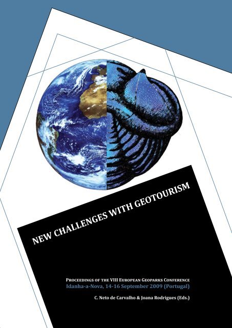
<strong>New</strong> <strong>ChalleNges</strong> <strong>with</strong> <strong>geotourism</strong><br />
Proceedings of the VIII European <strong>Geopark</strong>s Conference<br />
idanha-a-Nova, 4- 6 september 2009 (Portugal)<br />
C. Neto de Carvalho & Joana rodrigues (eds.)<br />
2
<strong>New</strong> <strong>ChalleNges</strong> <strong>with</strong> <strong>geotourism</strong><br />
Proceedings of the VIII European <strong>Geopark</strong>s Conference<br />
idanha-a-Nova, 4- 6 september 2009 (Portugal)<br />
C. Neto de Carvalho & Joana rodrigues (eds.)
hoNorary Committee<br />
margarete Patzak (Division of Ecological and Earth Sciences – UNESCO)<br />
Nickolas Zouros (EGN Coordinator/Petrified Forest of Lesvos <strong>Geopark</strong>/Aegean University)<br />
Patrick mc Keever (EGN vice-Coordinator/Geological Survey of Northern Ireland)<br />
Fernando andresen guimarães (President of UNESCO Portuguese Committee)<br />
Pedro machado (President of Centre of Portugal Tourism Region)<br />
antónio galopim de Carvalho (National Museum of Natural History, Lisbon)<br />
Joaquim morão (Mayor of Castelo Branco municipality and President of Association of<br />
Municipalities Natureza e Tejo)<br />
armindo Jacinto (President of <strong>Geopark</strong> <strong>Naturtejo</strong>/Vice-Mayor of Idanha-a-Nova municipality/<br />
Vice-President Centre of Portugal Tourism Region)<br />
Álvaro rocha (Mayor of Idanha-a-Nova municipality)<br />
gabriela tsukamoto (Mayor of Nisa municipality)<br />
José marques (Mayor of Oleiros municipality)<br />
João Paulo Catarino (Mayor of Proença-a-Nova municipality)<br />
maria do Carmo sequeira (Mayor of Vila Velha de Ródão municipality)
4<br />
orgaNiZiNg Committee<br />
armindo Jacinto<br />
Carlos Neto de Carvalho<br />
Joana rodrigues<br />
rafael andré<br />
rui tomás marques<br />
rita mota<br />
eliane antunes<br />
Cristina Preguiça<br />
manuela Catana<br />
tiago oliveira<br />
alice marcelo<br />
Fátima rodrigues
sCieNtiFiC Committee<br />
Carlos Neto de Carvalho (<strong>Naturtejo</strong> <strong>Geopark</strong>, Portugal)<br />
Joana rodrigues (<strong>Naturtejo</strong> <strong>Geopark</strong>, Portugal)<br />
maria Catana (<strong>Naturtejo</strong> <strong>Geopark</strong>, Portugal)<br />
rui tomás marques (<strong>Naturtejo</strong> <strong>Geopark</strong> /University of Lisbon/BlueEarth, Portugal)<br />
rafael andré (<strong>Naturtejo</strong> <strong>Geopark</strong> /Abilis, Portugal)<br />
tony ramsay (Fforest Fawr <strong>Geopark</strong>, Wales)<br />
Joan Poch (Sobrarbe <strong>Geopark</strong>, Aragon)<br />
mário Cachão (University of Lisbon, Portugal)<br />
José Brilha (University of Minho, Portugal)<br />
Vanda Santos (Natural History National Museum, Portugal)<br />
Nuno rodrigues (Natural History National Museum, Portugal)<br />
elizabeth silva (National Commission for UNESCO, Portugal)<br />
andrea Baucon (University of Milan, Italy)<br />
roigar lópez (University Bolivariana of Venezuela/Fundación Geoparques de Venezuela, Venezuela)<br />
Jesus salazar (University Bolivariana of Venezuela/Fundación Geoparques de Venezuela, Venezuela)
6<br />
LISt of rEVIEwErS for thE SubmIttEd PaPErS<br />
Carlos Neto de Carvalho (<strong>Naturtejo</strong> <strong>Geopark</strong>, Portugal)<br />
Joana rodrigues (<strong>Naturtejo</strong> <strong>Geopark</strong>, Portugal)<br />
ross Dowling (Edith Cowan University, Australia)<br />
maria Catana (<strong>Naturtejo</strong> <strong>Geopark</strong> Portugal)<br />
tony ramsay (Fforest Fawr <strong>Geopark</strong>, Wales)<br />
Joan Poch (Sobrarbe <strong>Geopark</strong>, Aragon)<br />
mário Cachão (University of Lisbon, Portugal)<br />
José Brilha (University of Minho, Portugal)<br />
andrea Baucon (University of Milan, Italy)<br />
Pablo rivas (Cabo de Gata-Níjar <strong>Geopark</strong>, Andaluzia)<br />
roigar lópez (University Bolivariana of Venezuela/Fundación Geoparques de Venezuela)
ForeworD<br />
Geotourism is a segment of tourism that has been developed worldwide in recent years. In<br />
fact, since long time ago people come to visit “geological wonders”, like mountains, caves,<br />
volcanoes, fossil remains and canyons. However, only in recent times there was a real<br />
challenge for this sector and a market <strong>with</strong> very specific and novel characteristics, based on<br />
research’s interpretation, protection of the geological heritage and edutainment, is being<br />
developed.<br />
Excellence in Nature Tourism is supported by the sustainable use of natural heritage,<br />
raising Nature awareness through news ways of interpretation. This niche of tourism<br />
has been growing worldwide in the last years and nature tourists look for certified, highquality<br />
destinations, as are the ones being developed by the <strong>Geopark</strong>s under the auspices<br />
of UNESCO. Geotourism is an emerging segment of Nature Tourism in which the main<br />
object is Geodiversity. A new niche was created for business <strong>with</strong> new specificities and<br />
new contingencies that accompanies not only the general trends of tourism but it is also<br />
imposing own trends. <strong>Geopark</strong>s are pioneers in Geotourism and an example of sustainable<br />
local development.<br />
Geotourism needs awareness for Geological Heritage. Geological processes <strong>with</strong> high<br />
scientific and educational interest can be associated to aesthetics/monumentality and<br />
become geosites <strong>with</strong> tourist potential. With Geotourism is intended to stimulate the<br />
knowledge of Geodiversity, Geoconservation and use them for sustainable development.<br />
It is crucial that Geotourism has other values than Geodiversity to diversify and enrich the<br />
offer: one site <strong>with</strong> rich geological heritage should have also cultural, historical and natural<br />
(bio and geo) points of interest and approaches. But it is also important to have good<br />
interpretation and supportive structures (lodging, restaurants, activities/events) to receive<br />
the high-demanding geotourists.<br />
The aim of the 8th European <strong>Geopark</strong>s Conference was to discuss new methodologies for<br />
developing Nature tourism sensu lato and Geotourism, to explore the establishment of<br />
<strong>Geopark</strong>s as high quality destinations for alternative sustainable tourism, to promote recent<br />
developments in protection and promotion of natural heritage in combination <strong>with</strong> local<br />
development as well as in management and operation of <strong>Geopark</strong>s. It was also intended to:<br />
• unify <strong>Geopark</strong>s for a stronger European <strong>Geopark</strong>s Network,<br />
• promote EGN towards local, national and international authorities,<br />
• project UNESCO <strong>Geopark</strong> brand as a reference in national and international tourism,<br />
• develop geoconservation measures for sustainable use of geosites,<br />
• raise awareness of EGN as example for the development of other continental networks.<br />
For the success of this Conference on “<strong>New</strong> Challenges <strong>with</strong> Geotourism” was highly<br />
important the key-note talks made by the distinguished coordinators of the European<br />
<strong>Geopark</strong>s Network (Prof. Nickolas Zouros and Dr. Patrick Mc Keever) and the Global <strong>Geopark</strong>s<br />
Network of UNESCO (Dr. Margarete Patzak), the world-known expert on Geotourism, Prof.<br />
Ross Dowling, and one of the most eminent researchers on Geonconservation, Prof. José<br />
Brilha. But more than 90 communications from researchers and territories from all over<br />
Europe and abroad, <strong>with</strong> a special note for the Brazilian experiences, made the <strong>Naturtejo</strong>’s<br />
European <strong>Geopark</strong>s Conference one of the most participated and lively discussed events<br />
from the European <strong>Geopark</strong>s Network. The subjects in discussion were:
1. <strong>Geopark</strong>s and tourism<br />
Geology and Tourism is a new combination that <strong>Geopark</strong>s are promoting. The territories<br />
need not only beautiful landscapes but also tourist strategies that promote regions in a<br />
responsible way. Geotourists ask for new challenges;<br />
2. Geotourism and local development<br />
Geotourism was born from a happy association of Geology <strong>with</strong> Tourism. It is a new kind of<br />
Nature Tourism that aspires being the solution for local development of rural areas and that<br />
involves several agents such as geoscientists, politicians and local managers;<br />
3. <strong>Geopark</strong>s and Science<br />
<strong>Geopark</strong>’s definition stands at the geodiversity concept. It is necessary to support the<br />
geotourist practices <strong>with</strong> scientific research to produce stronger knowledge about Geology.<br />
We can’t forget that Geology is a Science and we can’t promote Tourism if we don’t know<br />
deeply our territories;<br />
4. Geoconservation best practices and wrong ways<br />
Geoconservation is one of the main aims of a <strong>Geopark</strong>. Each EGN member has to find the<br />
best way to protect their geological heritage;<br />
5. marketing strategies for a strong EGN brand<br />
Marketing strategies must be a pillar in each <strong>Geopark</strong> for tourism development based on<br />
high-quality standards. It is necessary to create strategies to promote Geodiversity and land<br />
products that link the <strong>Geopark</strong>’s territories for a stronger EGN brand;<br />
6. man and Nature: cultural landscapes<br />
Local culture is important for sustainable development and <strong>geotourism</strong>. Traditions usually<br />
combine man and nature in a symbiotic approach. Man has been using nature by constantly<br />
interact <strong>with</strong> the environment for thousands of years;<br />
7. <strong>New</strong> <strong>Geopark</strong>s and their tutors<br />
It is not easy to develop new European and Global <strong>Geopark</strong>s. It is necessary to prepare a<br />
territory and to promote new strategies towards sustainable development using Geodiversity.<br />
EGN aks for a strongers and bigger network <strong>with</strong> new projects supported by experienced<br />
<strong>Geopark</strong>s in long-term projects.<br />
Established in 2000, the European <strong>Geopark</strong>s Network (EGN) aims to protect geodiversity,<br />
to promote geological heritage to the general public, as well as to support sustainable<br />
economic development of geopark territories, primarily through the development of<br />
geological tourism. The network has drawn together territories from across Europe that<br />
share these aims and now work together in an active and dynamic way in order to achieve<br />
them. Originally consisting of four territories, the network has been expanded to include,<br />
from April 2009, 34 territories across 13 European countries.<br />
Special thanks must be given to all the abstract reviewers for their kind cooperation and<br />
patience even when work throughout the weekend was needed. The IOP Publishing editors<br />
were as friendly as effective working against the (un)predictable delays to finish the book in<br />
time for the Conference. A special word of affection for all the anonymous collaborators and<br />
friends that supported <strong>with</strong> their unstoppable enthusiasm the success of this Conference. In<br />
fact, Geotourism, as life, is made of experiences and emotions to be shared.<br />
The Editors
from thE GEotourISt’S PoINt of VIEw<br />
[…]When we arrived to Penha Garcia we soon got started to take photos to the amazing<br />
landscape and then we went to the bathroom (…); the bathroom were clean, an impressive<br />
feature for those who live in the city where public toilets are always filthy. Meanwhile, a<br />
Geology and Biology teacher, now working as a ranger, came to us and we followed her<br />
up to the hill and to a museum, starting the Fossils Trail searching for trilobite vestiges.<br />
The trail starts in the old town. After the visit to the museum we went to lunch. Then, we<br />
climbed to the castle from where we could appreciate the views of the river gorge. We<br />
were following the trail and seeing rocks full of trace fossils, or the activity of living beings<br />
that once inhabited in this region and now we find them preserved in slates and quartzite<br />
outcrops of this river gorge. It was also in one of the gorge’s slopes, where traditional stonehouses<br />
were recently recovered, that we found Mr. Domingos Costa (…), storing the loosen<br />
trace fossil slabs. In this house arranged on the floor or in improvised shelves there are<br />
many Cruziana, which are fossils of typical trilobite behaviour showing how they moved in<br />
the water and burrowed into the mud for feeding themselves. Mr. Domingos Costa is not a<br />
scientist, but he is fascinated by this kind of traces: he searches for, collects and takes care<br />
of the trace fossils from the Ponsul valley. But besides the trace fossils here we were amazed<br />
by the quartzite folds and vertical beds. This outdoor exhibition is most important in the<br />
world for the comprehension of trilobites’ behaviour, and one of the few places in the world<br />
where one can find these trace fossils <strong>with</strong> such impressive preservation. Observing those<br />
traces and patterns is like diving into the Palaeozoic oceans. Studying the trilobite traces<br />
from Penha Garcia is a way to identify animal behaviours that only now are starting to be<br />
understood. Fossils such as these are truly time machines. This natural complex may have<br />
clues about the origin of life on Earth. Walking through the geological record of this book of<br />
Time written on the rocks may be useful and important for those who want to understand<br />
from where we came and to where we are going. What we have got in Penha Garcia is a<br />
first chapter of a much longer story being deciphered in the last two hundred years by the<br />
palaeontologists. A book where the last page may be forever missing, but also counting <strong>with</strong><br />
the contribution of the geologist for helping to understand a four-dimension puzzle, being<br />
Time the most significant element. In the Ponsul valley 400 m of sediment thickness are<br />
recorded and each single mud bed may comprehend dozens of thousands of years. In the<br />
Fossils Trail, the rocks are the tourism attraction. The remains found in these rocks dated<br />
from 480 million years ago, 250 million years before the first dinosaurs!<br />
Patrícia Santos<br />
16 years old<br />
Tomar<br />
9
0<br />
iNDiCe<br />
20 Key Note talKs<br />
9 Nickolas Zouros & Patrick mcKeever<br />
European <strong>Geopark</strong>s Network and Geotourism<br />
24 ross K. Dowling<br />
The Growth of Global Geotourism<br />
José Brilha<br />
Geological Heritage and Geoconservation in Portugal<br />
6 margarete Patzak<br />
UNESCO and the Global <strong>Geopark</strong>s Network - geological heritage and sustainable<br />
development world wide<br />
9 geoParKs aND tourism<br />
40 armindo Jacinto<br />
United by Nature for the people<br />
4 gilson Burigo guimarães, andre herzog Cardoso, Paulo César Boggiani,<br />
gil Piekarz, Kátia leite mansur, Carlos Fernando de moura Delphim, maria<br />
margareth escobar ribas lima, antonio theodorovicz, Úrsula azevedo<br />
ruchkys, osterne Feitosa Ferro Neto<br />
The rising of the <strong>Geopark</strong>s’ concept, activities and projects in Brazil<br />
4 Joana rodrigues & Carlos Neto de Carvalho<br />
Geotourist Trails in <strong>Naturtejo</strong> the <strong>Geopark</strong><br />
heinz a. Kollmann, reinhard mitterbäck & Katharina weiskopf<br />
Intellect and emotion: Water and Geotourism in the Eisenwurzen <strong>Geopark</strong><br />
2 mel Border,Carolyn Custerson & Nick Powe<br />
The English Riviera <strong>Geopark</strong> – Devon’s newest and most exciting new visitor<br />
attraction<br />
Keith hoole<br />
The International Appalachian Trail – Crossing the Atlantic<br />
4 m. burlando, m. firpo, C. Queirolo, m. Vacchi<br />
A new strategy to promote sustainable tourism in Beigua <strong>Geopark</strong> (Italy)<br />
John Conway<br />
Developing a virtual geopark – how Google software can be used to provide a<br />
geopark experience for disabled people <strong>with</strong> mobility problems
6 andrea Baucon<br />
TERRAGAZE mobile, a GPS-powered geological guide: information depending on<br />
where you are<br />
60 Chris woodley-stewart & elizabeth Pickett<br />
Interpretation in the North Pennines – “The Memory Making Business”<br />
6 maria manuela Catana & Daniela rocha<br />
The role of the Educational Programs on tourism development of <strong>Naturtejo</strong> and<br />
Arouca geoparks<br />
66 Francisco idalécio de Freitas, gabriela Karine rocha de Carvalho &<br />
maria helena hessel<br />
Amazing and rare fossils in Brazilian Northeast hinterland: the differential of the<br />
Araripe <strong>Geopark</strong><br />
mojca Kavčič, martina Stupar, martina Peljhan, bojan režun & uroš Eržen<br />
<strong>Geopark</strong> Idrija - thematic trails<br />
2 Pål thjømøe<br />
Magma <strong>Geopark</strong>: Cultural Highlights<br />
Juliane Nauck<br />
Participation of adolescents in European <strong>Geopark</strong>s<br />
giuseppe maria amato<br />
Relational Tourism in Rocca di Cerere European <strong>Geopark</strong><br />
6 C. Ferrari<br />
Adamello Brenta <strong>Geopark</strong> in the Dolomites World Heritage Site<br />
ferrari C. & masè V.<br />
Action Plan of the Adamello Brenta <strong>Geopark</strong><br />
0 GEotourISm aNd LoCaL dEVELoPmENt<br />
Chris woodley-stewart & elizabeth Pickett<br />
Towards a Geotourism Destination - thoughts from the North Pennines<br />
2 Joana rodrigues & Carlos Neto de Carvalho<br />
Geoproducts in the <strong>Naturtejo</strong> <strong>Geopark</strong><br />
Joseli maria Piranha, eliane aparecida del lama & Denise de la Corte Bacci<br />
Geotourism and Local Development – potentialities and risks<br />
9 Neda torabi Farsani, Celeste Coelho & Carlos Costa<br />
Geotourism as an opportunity for local communities’ participation in geoparks
2<br />
90 Νickolas C. Zouros<br />
Geotourism development in the Lesvos Petrified Forest <strong>Geopark</strong><br />
94 rafael Vaz andré<br />
<strong>Geopark</strong>: the right path to territorial competitiveness through Nature Tourism<br />
96 ana marija tomša, ljerka marjanac & tihomir marjanac<br />
Involvement of local community in setting up a geopark<br />
9 Claudia eckhardt<br />
<strong>Geopark</strong> on Site - Local Ambassadors for a Global Network - Residents’ Commitment<br />
in <strong>Geopark</strong> development<br />
99 m. burlando, m. firpo, C. Queirolo, m. Vacchi & m.C. bonci<br />
Geotourism and interpretation facilities in Beigua <strong>Geopark</strong> (Italy): the Visitor<br />
Centres and Information Points network<br />
00 João geraldes & rita Ferreira<br />
Tourism “Tectonics” and Geo-Bakery<br />
04 ricardo Fraga Pereira, José Brilha, augusto José Pedreira, Carlos<br />
schobbenhaus & ivo Karmann<br />
<strong>Geopark</strong> and <strong>geotourism</strong> in Chapada Diamantina (North-eastern Brazil): strategies<br />
and perspectives<br />
09 helena Couto & alexandre lourenço<br />
Valongo Palaeozoic Park – a Geotourism resource<br />
4 Jesús salazar, Francisco hurtado & roigar lópez<br />
Geotourist development of the Edge Upata – Km. 88, Bolívar state, Venezuela<br />
sara gentilini<br />
Geoturism and local development: The importance of becoming a partner<br />
michał Poros<br />
Abandoned quarries as a geotourist objects in municipal areas – example from the<br />
Kielce town (Holy Cross Mountains, Poland)<br />
20 sebastian willman, heikki Bauert & anto raukas<br />
Fostering <strong>geotourism</strong> on Central Baltic islands<br />
2 C. ferrari & V. masè<br />
Audio-video geoguide in the Adamello Brenta <strong>Geopark</strong><br />
2 C. ferrari & V. masè<br />
Via GeoAlpina in the Adamello Brenta <strong>Geopark</strong>
2 geoParKs aND sCieNCe<br />
26 murray gray<br />
Geodiversity as a basis for geoconservation, <strong>geotourism</strong> and geoparks<br />
2 tony ramsay<br />
Communicating the Story of Climate and Man<br />
elizabeth silva & maria helena henriques<br />
Implementation of the International Year of Planet Earth (2007-2009) in Portugal,<br />
in the framework of the United Nations Decade of Education for Sustainable<br />
Development<br />
andrea Baucon & Carlos Neto de Carvalho<br />
Psychedelic experiences <strong>with</strong> Geology: Geological Video Art at Boom Festival<br />
40 artur a. Sá, Juan C. Gutiérrez-marco, daniela rocha, manuel Valério,<br />
José Brilha & i. rábano<br />
Ordovician ichnofossils: a new scientific and educational resource for the Arouca<br />
<strong>Geopark</strong><br />
4 george iliopoulos, Kaliana svana & Charalampos Fassoulas<br />
Sirenian findings from the Psiloritis <strong>Geopark</strong>, Crete, Greece<br />
44 Daniel metodiev, José romão, rui Dias<br />
Vila Velha de Ródão Variscan complex syncline: stratigraphy and structure (Central<br />
Iberian Zone, Portugal)<br />
4 David appleton, mel Border & alan hart<br />
English Riviera European and Global <strong>Geopark</strong> - Hopes Nose Project<br />
4 N. Zouros, S. Pavlides, N. Soulakellis, a. Chatzipetros, K. Vasileiadou, I.<br />
Valiakos & K. Bentana<br />
Using active faults for raising public awareness and sensitisation on seismic<br />
hazard: a case study from Lesvos <strong>Geopark</strong>, NE Aegean Sea, Greece<br />
4 Giuseppe m. amato, m. Grasso, m.Viviana Ingrasciotta, rita ubriaco<br />
The Geosite Maps: an instrument of knowledge and planning, a feasible common<br />
instrument for the <strong>Geopark</strong><br />
timo Kluttig & melanie schnieders<br />
A media-box bringing <strong>Geopark</strong>-knowledge into schools<br />
6 Daniela rocha, marta Brandão & artur abreu sá<br />
Geoteca: learning Science through the Arouca <strong>Geopark</strong><br />
60 rosa mendoza Castellón, Pablo rivas, milagros Pérez Villalba<br />
Research in Cabo de Gata-Nijar <strong>Geopark</strong>
4<br />
6 João Carlos Nunes & eva almeida lima<br />
The “Ponta da Ferraria” Lava Delta Geosite: Scientific, Educational, Environmental,<br />
Historical and Economic (Geotourist) Value<br />
6 martina Peljhan, uroš Eržen, bojan režun, Jože Čar, mojca Kavčič<br />
<strong>Geopark</strong> Idrija – »The trail of natural scientist of Idrija«<br />
69 Plácido Cidade Nuvens, Francisco idalécio de Freitas, maria helena<br />
hessel & rafael Celestino soares<br />
Araripe <strong>Geopark</strong>: materialize a dream of thepaleontologists from Ceará, Brazil<br />
Baldomero moreno arroyo, alicia serna Barquero & luis rey<br />
Science in the Subbética <strong>Geopark</strong><br />
dražen balen, Goran radonić, Goran Pavić<br />
Tresnjevica geosites – volcano traces from the past<br />
6 João Carlos Nunes, José madeira & José Brilha<br />
The Azores archipelago in the America-Eurasia-Africa triple junction: a geological<br />
framework as the scientific background for the creation of the Azores <strong>Geopark</strong><br />
0 bojan režun, uroš Eržen, martina Peljhan, Jože Čar, mojca Kavčič<br />
<strong>Geopark</strong> Idrija – geological heritage of outstanding value<br />
miguel geraldes, marco Jorge & maria luísa rodrigues<br />
Geomorphosites: inventory and valorisation for geotourist purposes. A case study<br />
in the Serra de Candeeiros (Estremadura Limestone Massif, Portugal)<br />
4 tomáš Řídkošil, Vladislav rapprich, marcela Stárková<br />
Science as a tool for Geosites attractivity increase: Volcanology in the Bohemian<br />
Paradise <strong>Geopark</strong> (Czech Republic)<br />
6 GEoCoNSErVatIoN bESt PraCtICES aNd wroNG wayS<br />
alexandru andrasanu<br />
Geoeducation, <strong>Geopark</strong>s and Geoconservation<br />
Carlos Neto de Carvalho & Joana rodrigues<br />
Three successful cases of Geoconservation in the <strong>Naturtejo</strong> <strong>Geopark</strong><br />
94 Carlos Neto de Carvalho<br />
Opening of a Uranium-ore quarry: a serious threat to the <strong>Naturtejo</strong> <strong>Geopark</strong><br />
99 Dimitra mouriki & Charalampos Fassoulas<br />
Quantitative assessment of Psiloritis’ geotopes <strong>with</strong> emphasis on protection and<br />
<strong>geotourism</strong> (Crete, Greece)
20 lopes, m.e.; meixedo, J.P.; Pereira, s. F.; afonso, m.J. ; gomes, a; gama<br />
Pereira, l. C; trigo, J.F.C. & Chaminé, h.i.<br />
Geoconservation in North Portugal: different successfully examples of geo-heritage<br />
recovery processes<br />
202 eliane aparecida del lama, Joseli maria Piranha & Denise de la Corte<br />
Bacci<br />
<strong>Geopark</strong>s – strategy of geoconservation and development<br />
20 liliana Póvoas & César lopes<br />
Geological Heritage and Museology: challenges and concerns<br />
20 simon Bajada<br />
Promoting the geodiversity of the Maltese Archipelago – issues and challenges<br />
2 Francisco hurtado, roigar lópez & Jesús salazar<br />
Latin-American and Caribbean Network for the Defence and Conservation of the<br />
Geological, Mining-Metallurgical and Paleontological Heritage<br />
2 2 Joseli maria Piranha, Denise de la Corte Bacci & eliane aparecida del lama<br />
Education in Earth Sciences and <strong>Geopark</strong>s – a relationship of mutual importance<br />
2 4 Denise de la Corte Bacci<br />
Geosciences and Environmental Education: training professionals to develop<br />
education projects<br />
2 gonca gürler, ayhan ilgar, mutlu gürler, N. serkan Öztan, Bilge<br />
Karaman, m. fuat uğuz, ramazan Sarı<br />
Turkey Geologıcal Herıtage inventory; an example site Bıga Peninsula<br />
2 marKetiNg strategies For a stroNg egN BraND<br />
2 Patrick mc Keever<br />
European <strong>Geopark</strong>s Network revalidation procedures and the building of a strong<br />
brand for <strong>Geopark</strong>s<br />
2 9 rui tomás marques<br />
Developing Sustainable Tourism Products at <strong>Geopark</strong> <strong>Naturtejo</strong>: The Importance of<br />
Community Involvement<br />
222 wolfgang eder<br />
<strong>Geopark</strong>s of the World: Marketing through a <strong>New</strong> Book Series of Springer
6<br />
22 maN aNd NaturE: CuLturaL LaNdSCaPES<br />
224 Jutta weber<br />
Communicating man and nature in the European <strong>Geopark</strong> Bergstrasse-<br />
Odenwald (Germany)<br />
22 alexandru andrasanu & sylvie giraud<br />
European <strong>Geopark</strong> Cooperation project : Dialogues between Man and Earth<br />
229 K. lemon, a.-m. ward & r. watson<br />
Landscapes and Livelihoods: the cultural landscapes of Marble Arch Caves Global<br />
<strong>Geopark</strong><br />
2 0 eddy Chambino<br />
“The shepherd’s sky” Notes on the definition of a shepherd cosmovision<br />
2 4 elizabeth Pickett & Chris woodley-stewart<br />
The North Pennines – 500 million years in pictures, poems and performance<br />
2 Jonathan swale<br />
Shetland’s Cultural Landscape<br />
2 6 Candace slater<br />
<strong>Geopark</strong>s and Geo-Stories: Ideas of Nature Underlying the UNESCO Araripe Basin<br />
Project and Contemporary “Folk” Narratives<br />
2 rosa mendoza, maria Navarro & Pablo rivas<br />
Wind and water in the construction of a cultural landscape<br />
240 giuseppe maria amato & Beatrice Basile<br />
Lombardia Castle, new “house” of Rocca di Cerere European <strong>Geopark</strong><br />
24 alessandro torre, fabio torre & Gian Vito Graziano<br />
Bronzes and ceramics for valorization of <strong>Geopark</strong>s geological tracks<br />
242 <strong>New</strong> geoParKs aND their tutors<br />
24 eva almeida lima, João Carlos Nunes, manuel Paulino Costa, andrea Porteiro<br />
Azores <strong>Geopark</strong>: Valuing its Geosites<br />
24 Virginio mantesso-Neto, Úrsula ruchkys de azevedo, marcos antonio<br />
leite do Nascimento, antonio liccardo & rose lane guimarães<br />
Quadrilátero Ferrífero, Brazil: general information about a potential <strong>Geopark</strong><br />
2 4 Vesa Krökki<br />
Rokua – Heritage of the Ice Age
2 Jari Nenonen<br />
Rokua esker – a geological puzzle<br />
2 6 Janos tardy & imre szarvas<br />
Operation of the transboundary Novohrad-Nograd <strong>Geopark</strong> initiative<br />
260 heikki Bauert & anto raukas<br />
Island of Saaremaa (Estonia) – a prospective geopark<br />
262 roigar López, francisco hurtado, Jesús Salazar & Vladimir Sosa<br />
<strong>Geopark</strong> initiatives in Venezuela<br />
264 Gülpınar akbulut<br />
Suggested <strong>Geopark</strong>s in Turkey: Volcanic Mountains<br />
2 0 Carlos Cadete<br />
Protected Areas in Angola and <strong>Geopark</strong>s<br />
2 4 Jon Paul llordés & Juan ignacio Baceta<br />
Basque Coast <strong>Geopark</strong>: An Aspiring <strong>Geopark</strong><br />
2 9 mário Cachão<br />
The fractal dimension of geoparks: upsizing and downsizing its scope
Key Note talks
euroPeaN geoParKs NetworK aND <strong>geotourism</strong><br />
Nickolas Zouros & Patrick mcKeever 2<br />
1 University of the Aegean - Department of Geography 81100 Mytilene Greece; Natural History<br />
Museum of the Lesvos Petrified Forest, Sigri Lesvos, Greece. nzour@aegean.gr<br />
2 Geological Survey of Northern Ireland, Colby House, Stranmillis Court, Belfast, BT9 5BF, Ireland.<br />
Established in 2000, the European <strong>Geopark</strong>s Network (EGN) aims to protect geodiversity, to<br />
promote geological heritage to the general public, as well as to support sustainable economic<br />
development of geopark territories, primarily through the development of geological tourism.<br />
The Network has drawn together territories from across Europe that share these aims<br />
and now work together in an active and dynamic way in order to achieve them. Originally<br />
consisting of four territories, the network has been expanded to include, as of May 2009, 34<br />
territories across 13 European countries.<br />
In 2001 the European <strong>Geopark</strong>s Network signed a formal agreement <strong>with</strong> the UNESCO<br />
Division of Earth Sciences, whereby UNESCO gave the network its endorsement.<br />
A further agreement was signed <strong>with</strong> UNESCO in 2004 whereby the EGN was given the<br />
responsibility for regulating membership of European <strong>Geopark</strong>s in the UNESCO Global<br />
<strong>Geopark</strong>s Network. As a result the EGN acts as the European sector of GGN.<br />
The European <strong>Geopark</strong>s Network operates through continuous electronic communication,<br />
biannual coordination meetings and the establishment of common projects through which<br />
territories can exchange ideas, experience and best practices, thereby supporting each other<br />
on <strong>geotourism</strong> development.<br />
UNESCO recommends the creation of similar regional Networks, reflecting local conditions,<br />
elsewhere in the world. Today, except for the European <strong>Geopark</strong>s Network, the Asia-Pacific<br />
<strong>Geopark</strong>s Network (A.P.G.G.N.) formed in 2007 is also active and several other regional<br />
Networks are under consideration in Latin America, North America and Africa.<br />
The structure of the European <strong>Geopark</strong>s Network is relatively simple and comprises an<br />
Advisory Committee (11 members including representatives of UNESCO, IUGS and IUCN)<br />
and a Coordination Committee (comprising of two representatives from each member).<br />
Decisions concerning the network are only taken by the Coordination Committee. As part<br />
of the Coordination Committee, there is an elected EGN Coordinator and Vice Coordinator<br />
to represent the whole Network. They coordinate contacts <strong>with</strong> other international bodies<br />
(E.U., UNESCO, IUGS, IUCN, Council of Europe etc.) and prepare the agenda of the meetings<br />
in cooperation <strong>with</strong> the meeting hosts.<br />
The European <strong>Geopark</strong>s Network adopted a common logo which is registered in all<br />
European countries. An EGN member has the right to use the European <strong>Geopark</strong> logo in<br />
its communications thereby contributing over time to creating a common image of quality,<br />
linking the enhancement of European Earth heritage <strong>with</strong> sustainable development.<br />
Membership of the EGN entitles a <strong>Geopark</strong> to use the logo of the EGN in its promotional<br />
material and is entitled to call itself a European <strong>Geopark</strong>. According to the Madonie Declaration<br />
it is also entitled to use the appropriate logo of the Global Network of <strong>Geopark</strong>s. These logos<br />
must only be used on products produced directly by the <strong>Geopark</strong> management.<br />
In order to achieve high quality standards in <strong>Geopark</strong>s, the EGN decided to establish an<br />
evaluation procedure for all new applications. Evaluation missions are undertaken by two<br />
<strong>Geopark</strong> experts who are sent to the applicant territory to evaluate the application and to<br />
discuss the application <strong>with</strong> the relevant national and local authorities as well as stakeholders<br />
9
20<br />
and local communities. Furthermore, the evaluators are also requested to make comments<br />
on the integrity and future management of the proposed <strong>Geopark</strong>. These recommendations<br />
have been, in many cases, critical to strengthening the success of applications in the long<br />
run. With a view to ensuring a continuing high quality in the operation of a <strong>Geopark</strong> and<br />
the services provided to visitors, EGN membership is limited to a period of 4-years after<br />
which it can be renewed following the same procedure. The review will take the form of a<br />
revalidation process involving the submission of a revalidation dossier and questionnaire<br />
document and a visit by two evaluators from a different country nominated by the EGN CC<br />
and UNESCO, coming from a different state from the revalidating <strong>Geopark</strong>.<br />
Figure : Map showing the location<br />
of the 34 members of the European<br />
<strong>Geopark</strong>s Network as of April 2009. .<br />
Réserve Géologique de Haute - Provence–<br />
FRANCE, 2. Vulkaneifel European<br />
<strong>Geopark</strong> – GERMANY, . Petrified Forest<br />
of Lesvos – GREECE, 4. Maestrazgo<br />
Cultural Park – SPAIN, . Psiloritis<br />
Natural Park – GREECE, 6. Terra.Vita<br />
Naturpark – GERMANY, . Copper Coast<br />
<strong>Geopark</strong>–IRELAND, . Marble Arch Caves<br />
<strong>Geopark</strong>–N. Ireland, UK and IRELAND 9.<br />
Madonie <strong>Geopark</strong> –ITALY, 0. Rocca di<br />
Cerere <strong>Geopark</strong> – ITALY, . Naturpark<br />
Steirische Eisenwurzen – AUSTRIA,<br />
2. Naturpark Bergstrasse Odenwald<br />
– GERMANY, . North Pennines<br />
AONB – England UK, 4., Park Naturel<br />
Régional du Luberon – FRANCE, .<br />
North West Highlands – Scotland UK, 6.<br />
<strong>Geopark</strong> Swabian Albs – GERMANY, .<br />
Harz Braunschweiger Land Ostfalen–<br />
GERMANY, . Mecklenburg Ice Age<br />
Park – GERMANY, 9. Hateg Country<br />
Dinosaurs <strong>Geopark</strong> – ROMANIA, 20.<br />
Beigua <strong>Geopark</strong> – ITALY, 2 . Fforest<br />
Fawr <strong>Geopark</strong> – Wales UK, 22. Bohemian<br />
Paradise <strong>Geopark</strong> – CZECH REPUBLIC,<br />
2 . Cabo de Gata – Nijar Natural Park –<br />
Andalucia – SPAIN, 24. <strong>Naturtejo</strong> <strong>Geopark</strong><br />
– PORTUGAL, 2 . Sierras Subbeticas<br />
Natural Park – Andalucia – SPAIN, 26.<br />
Sobrarbe <strong>Geopark</strong> – Aragon – SPAIN, 2 .<br />
Gea Norvegica <strong>Geopark</strong> – NORWAY, 2 .<br />
Sardenia Geominerario Park – ITALY, 29.<br />
Papuk <strong>Geopark</strong> – CROATIA, 30. Lochaber<br />
<strong>Geopark</strong> – Scotland UK, . English<br />
Riviera <strong>Geopark</strong> - England UK, 2.<br />
Adamello-Brenda <strong>Geopark</strong> – ITALY, .<br />
Geo Mon <strong>Geopark</strong> -Wales UK, 4. Arouca<br />
<strong>Geopark</strong> PORTUGAL.<br />
A European <strong>Geopark</strong> integrates the range of resources found <strong>with</strong>in its broader region,<br />
including existing geological attractions and sites, landscapes, wetlands, sites of natural<br />
beauty and ecological value, as well as cultural monuments and traditions including<br />
gastronomy and local crafts and agricultural products.<br />
A broad range of activities combines the main components for the operation of each <strong>Geopark</strong>,<br />
including scientific research, the creation of an inventory and map of geological sites,<br />
protection of the geological heritage operation of thematic museums and interpretation<br />
centers, interpretation and promotion of geological sites, the conservation of fossils, the<br />
creation of parks for visitors, the establishment of a network of walking trails linking<br />
geological sites to ecotourism infrastructures, the development of environmental education
programmes on geological sites, the organization of scientific and cultural events, and the<br />
promotion of monumental geological sites.<br />
Geotourism activities in <strong>Geopark</strong>s include:<br />
• Creation of thematic geo-museums and interpretation centres,<br />
• Organization of temporary travelling exhibitions,<br />
• Exchange of know-how and best practice on <strong>geotourism</strong> development,<br />
• Creation of a <strong>geotourism</strong> data base describing tourism activities offered by the<br />
<strong>Geopark</strong>s (museums and info-centers, trails, events etc.),<br />
• Organization of <strong>geotourism</strong>-activities in <strong>Geopark</strong>s i.e.: exploring the geological<br />
history of the <strong>Geopark</strong>, nature observation, bird watching, conservation of fossils,<br />
mountain biking, trekking, rafting,<br />
• Organization of working holidays in <strong>Geopark</strong>s and volunteer activities,<br />
• Organization of conferences <strong>with</strong> a thematic focus on landscape, heritage<br />
interpretation and tourism,<br />
• Promotion of common <strong>geotourism</strong> packages and organization of events<br />
promoting alternative tourism in <strong>Geopark</strong>s,<br />
• Exchange of knowhow on geosite assessment, conservation and interpretation<br />
(e.g. publication of books and visitors guides, creation of interpretation panels,<br />
production of multimedia presentations and DVD’s) in order for visitors to explore<br />
the fascinating story preserved in the rocks and the landscape of the <strong>Geopark</strong>s.<br />
<strong>Geopark</strong>s also promote themselves as ideal destinations for educational activities. <strong>Geopark</strong><br />
activities focus on young European citizens, aiming at the promotion of a common European<br />
geological heritage as a key factor for environmental understanding and sensitisation on<br />
nature protection.<br />
Main target group for <strong>Geopark</strong>s are schoolchildren and University students. Ages ranged<br />
from 4 years upwards to university level and the interpretation and information material<br />
produced was tailored to the needs of each age group.<br />
Educational activities for universities and school classes include:<br />
• Preparation and organization of field trips for university students that included<br />
guided tours, provision of scientific data, organization of field work, organization<br />
of student camps, and the organization of research activities and projects related<br />
to the main scientific objectives present in the <strong>Geopark</strong> (e.g. palaeontological<br />
excavation works) as well as areas of conservation (wetlands, nature parks),<br />
• Organization of Intensive courses on <strong>Geopark</strong>s <strong>with</strong> the collaboration of academic<br />
staff. A special course for scientists and staff members working in <strong>Geopark</strong>s,<br />
technicians, rangers, postgraduate students as well as local enterprises wishing<br />
to improve their knowledge about the <strong>Geopark</strong>’s function and activities,<br />
• Establishment of children’s geology clubs in <strong>Geopark</strong>s, focusing on fun and<br />
discovery through activities suitable for children. There is an exchange of good<br />
practice in organising and promoting the clubs,<br />
• Organization of special educational programmes according to age (nursery<br />
school, primary school, secondary school, higher education college) including<br />
tools such as theatrical plays, puzzle constructions, and experiments,<br />
• Production of educational resource material for use by schools and colleges,<br />
• Creation of common thematic teaching kits that reflect the differing natures of each<br />
<strong>Geopark</strong>, e.g. kits on impact craters, volcanoes and the water cycle, which are either,<br />
shared or exchanged providing “A Trip through the Geological History of Europe”,<br />
2
22<br />
• Creation of teaching kit focusing on the geological history of each <strong>Geopark</strong><br />
including the production of information leaflets, special guides for teachers and<br />
students, maps, videos, and CD - ROMS.<br />
• Children’s books: Specially designed books for children in order to familiarize<br />
them <strong>with</strong> the geological history of Europe which illustrate the structures and<br />
processes that can be seen in the <strong>Geopark</strong>s,<br />
• Workbooks: Special workbooks for students of all grades. These workbooks will<br />
familiarize the reader <strong>with</strong> geological processes that lead to an understanding of<br />
the Earth’s history,<br />
• Educational CD-ROM will inform students in a clearly understandable format<br />
about the geological heritage of the <strong>Geopark</strong> (including photos, videos and<br />
maps) in an engaging manner,<br />
• Special guides for teachers will provide instructions on delivering classes on<br />
geology in order to familiarize pupils <strong>with</strong> geological processes,<br />
• Special publications on educational activities in <strong>Geopark</strong>s, natural monuments<br />
and museums in the <strong>Geopark</strong>s,<br />
• Training: Vocational training activities can offer an example of the potential of<br />
cooperation between <strong>Geopark</strong>s. Vocational Training Centres have been created <strong>with</strong><br />
the aim of training young unemployed people to cover new development needs.<br />
EGN Promotional activities and promotional tools:<br />
• Publication of the European <strong>Geopark</strong>s book, presenting the EGN operation as well<br />
as all European <strong>Geopark</strong>s. The book <strong>with</strong> a preface from the UNESCO DG and ADG is<br />
promoting the importance of geological heritage and the beauty of geological objects<br />
in order to attract people to conduct educational activities in the <strong>Geopark</strong>s,<br />
• EGN - Website: A common website (www.europeangeoparks.org) has been developed<br />
<strong>with</strong> links to all European <strong>Geopark</strong>s in order to promote their services and <strong>geotourism</strong><br />
products. The site is managed by the Network Coordination Committee.<br />
• European <strong>Geopark</strong>s Magazine is published once per year and distributed to<br />
universities, schools and agencies responsible for the promotion of geotouristic<br />
and educational activities <strong>with</strong>in the <strong>Geopark</strong>s. It includes articles on the Networks<br />
activities, on geo-tourism, on geological preservation and protection and educational<br />
activities in <strong>Geopark</strong>s. It also contains the profiles of the individual <strong>Geopark</strong>s. By<br />
2009, six issues had been published <strong>with</strong> a total print run of 15,000 copies per<br />
issue,<br />
• European <strong>Geopark</strong>s Week: Organization of a series of events in each <strong>Geopark</strong> to be<br />
organized during the first week of June and dedicated to <strong>geotourism</strong> and educational<br />
activities. During the EG Week, visitors in each <strong>Geopark</strong> participate in common<br />
events, and become familiar <strong>with</strong> other <strong>Geopark</strong>s in the Network at the same time,<br />
• Participation in Tourist Fairs and Events (e.g. ITB Berlin, ATB Salzburg, FITUR Madrid,<br />
“Reisepavillon” Hannover etc) offers to <strong>Geopark</strong>s contacts visibility among tourism<br />
enterprises and agencies. The participating <strong>Geopark</strong>s cover the participation costs<br />
for the promotion of the entire network,<br />
• Organization of promotional activities for local products and handcrafts. <strong>Geopark</strong>s<br />
organize agrotourism fairs and festival to promote quality local products (organic,<br />
traditional) produced <strong>with</strong>in their territory and to familiarize visitors <strong>with</strong> the way<br />
of life of local people,<br />
• Publication of <strong>Geopark</strong> books and field guides promoting and interpreting landscapes<br />
and geosites in each <strong>Geopark</strong>,
• <strong>Geopark</strong>s Corner - EGN Information point: Information points for visitors have been<br />
created in each <strong>Geopark</strong> providing information on the Network and its members<br />
common activities in the protection and promotion of our geological heritage, the<br />
possibilities of <strong>geotourism</strong> activities in the <strong>Geopark</strong>s, educational activities and<br />
programmes as tools of the <strong>Geopark</strong>s as well as the various products of individual<br />
<strong>Geopark</strong>s (fossil casts, books, leaflets, museum-kits etc.),<br />
• Common Information material such as leaflets, posters, tickers, calendars, postcard<br />
set, etc. has been published in different languages to promote the Network and its<br />
activities as well as the activities of the individual <strong>Geopark</strong>s members. Information<br />
and promotional material are distributed to tourist agencies and other interested<br />
enterprises including hotels, restaurants, airports, bus and train stations.<br />
<strong>Geopark</strong>s address the strong need for the effective management of important geological sites and<br />
for the sustainable economic development of rural areas through the development of <strong>geotourism</strong><br />
thus enhancing the value of their Earth heritage, landscapes and geological formations.<br />
The <strong>Geopark</strong>s initiative adds a new dimension to the 1972 Convention concerning the<br />
Protection of the World Cultural and Natural Heritage by highlighting the potential for<br />
interaction between socio-economic and cultural development and conservation of the<br />
natural environment.<br />
European <strong>Geopark</strong>s are potentially powerful new tools for a new holistic approach to nature<br />
conservation and sustainable economic development through <strong>geotourism</strong>.<br />
references<br />
European <strong>Geopark</strong>s Magazine. Issues 1-6 Published by the European <strong>Geopark</strong>s Network.<br />
Eder, F.W. 2004. The Global UNESCO Network of <strong>Geopark</strong>s. In: Zhao, X., Jiang, J., Dong, S., Li., & Zhao,<br />
T., (eds,), Proceedings of the First International Conference on <strong>Geopark</strong>s. Geological Publishing House,<br />
Beijing, 1-3.<br />
Eder, W. & Patzak, M. 2004. <strong>Geopark</strong>s - geological attractions: a tool for public education, recreation<br />
and sustainable economic development. Episodes, 27(3), 162–164.<br />
Fassoulas, C., Skoula, Z. & Patakos, D. (Ed.) 2006. Proceedings of the 4th European <strong>Geopark</strong>s Meeting.<br />
European <strong>Geopark</strong>s Network – Psiloritis <strong>Geopark</strong>, Crete, Greece, 144 p.<br />
Frey, M-L., Martini, G. & Zouros, N. 2001. European <strong>Geopark</strong> Charter, In: Frey, M-L., (Ed.), European<br />
<strong>Geopark</strong>s Magazine, , p. 28.<br />
Martini, G. (Ed.) 1993. Actes du Premier Symposium International sur la Protection au Patrimonie<br />
Géologique [Proceedings of the First Symposium on Earth Heritage Conservation], Digne, France, 11–16<br />
June 1991. Mémoires de la Societé Géologique de France, n.s. 6 , 276 p.<br />
Martini, G. & Zouros, N., 2001. European <strong>Geopark</strong>s: Geological Heritage & European Identity –<br />
Cooperation for a Common Future, In: Frey, M-L. (Ed.), European <strong>Geopark</strong>s Magazine, , p. 4.<br />
Mc Keever, P. & Zouros, N. 2005. <strong>Geopark</strong>s: Celebrating earth heritage, sustaining local communities.<br />
Episodes, 2 (4), 274-278.<br />
Mc Keever, Patrick J., Zouros, N. & Patzak, M. 2009. The UNESCO Global Network of National <strong>Geopark</strong>s.<br />
Proceedings of the Perth Conference on Geotourism (in press).<br />
Modica, R. (Ed.) 2006. Proceedings of the 5th European <strong>Geopark</strong>s Conference. Madonie <strong>Geopark</strong>,<br />
Petralia Sottana, 29-31 October 2004, p. 94.<br />
Zouros, N. & Martini, G., 2003. Introduction to the European <strong>Geopark</strong>s Network. In: Zouros, N., Martini,<br />
G. & Frey, M-L. (eds), Proceedings of the 2 nd European <strong>Geopark</strong>s Network Meeting: Natural History<br />
Museum of the Lesvos Petrifed Forest, Lesvos, 17-21.<br />
Zouros, N. 2004. The European <strong>Geopark</strong>s Network. Geological heritage protection and local<br />
development. Episodes, 2 (3), 165-171.<br />
Zouros, N. & McKeever, P. 2007. European <strong>Geopark</strong>s: Integrating earth heritage in nature conservation.<br />
The Lesvos petrified forest as a case study. Geoparque Arouca Workshop Proceedings, Portugal, 9-16.<br />
2
24<br />
the growth oF gloBal <strong>geotourism</strong><br />
ross K. dowling<br />
Resolve Global Pty Ltd. Foundation. Edith Cowan University, Australia,<br />
r.dowling@ecu.edu.au.<br />
. introduction<br />
Geotourism is emerging as a new global phenomenon (Dowling 2008a). Reflecting the<br />
explosive growth in global <strong>geotourism</strong> there has been a large number of conferences on the<br />
topic held in the last two years. They include the Inaugural Global Geotourism Conference held<br />
in Perth, Australia in August 2008; the World Heritage and Geotourism Conference hosted by<br />
the Geological Society of South Africa, held in Pretoria from 4-5 June 2009; Geotour 2009<br />
held in the High Tatra Mountains, Slovakia from 6-10 September 2009; and now the 8 th<br />
European <strong>Geopark</strong>s Conference held at <strong>Geopark</strong> <strong>Naturtejo</strong>. Planning is well underway for the<br />
Second Global Geotourism Conference which will be held on the island of Borneo, at Gunung<br />
Mulu World Heritage Region, Sarawak, Malaysia from 17-20 April 2010.<br />
Another development has been the establishment of the International Association for<br />
Geotourism (IAGt), set up in eastern Europe (www.iageotour.com). They recently announced<br />
plans to host what they have billed as the First World Congress of Geotourism next year. In<br />
addition there has been a number of books on the subject including Geotourism (Dowling &<br />
<strong>New</strong>some, 2006) and Geotourism in Ethiopia (Asrat et al. 2009). Two global books arising<br />
from the 2008 Inaugural Global Geotourism Conference will be published in 2010. They<br />
are Global Geotourism Perspectives and Geology and Geotourism: The Tourism of Geology and<br />
Landscape (both Dowling & <strong>New</strong>some, In Press, due April 2010).<br />
2. <strong>geotourism</strong><br />
Geotourism is sustainable tourism <strong>with</strong> a primary focus on experiencing the earth’s geological<br />
features in a way that fosters environmental and cultural understanding, appreciation and<br />
conservation, and is locally beneficial (Dowling & <strong>New</strong>some, 2006). It is about creating a<br />
<strong>geotourism</strong> product that protects geoheritage, helps build communities, communicates and<br />
promotes geological heritage and works <strong>with</strong> a wide range of different people. According<br />
to James & Hose (2008) <strong>geotourism</strong> is a form of special interest tourism and focuses on<br />
geology and the formation of landscapes. Tongkul (2006) defines it as utilization of geological<br />
heritage resources for education-based tourism.<br />
Whichever way it is defined or described, the ‘geo’ part in <strong>geotourism</strong> means geology<br />
and geomorphology. Geology is the study of the earth and geomorphology is the study of<br />
landforms. The natural resources includes landscapes, landforms, rock outcrops, rock types,<br />
sediments, soils and crystals. The ‘tourism’ part means visiting, learning from, appreciating<br />
and engaging in geosites. Overall, <strong>geotourism</strong> comprises the geological elements of ‘form<br />
and process’ combined <strong>with</strong> the components of tourism such as attractions, accommodation,<br />
tours, activities, interpretation and planning & management.<br />
. Principles of <strong>geotourism</strong><br />
Geotourism may be further described as having a number of essential characteristics.<br />
These elements combine to shape <strong>geotourism</strong> in its present form. It comprises a number<br />
of interrelated components all of which should be present for authentic <strong>geotourism</strong> to<br />
occur. There are five key principles which are fundamental to <strong>geotourism</strong>. They are that<br />
<strong>geotourism</strong> is geologically-based (that is, based on the earth’s geoheritage), sustainable
(ie: economically viable, community enhancing and fosters geoconservation), educative<br />
(achieved through geo-interpretation), locally beneficial, and generates tourist satisfaction.<br />
The first three characteristics are considered to be essential for a product to be considered<br />
‘<strong>geotourism</strong>’ while the last two characteristics are viewed as being desirable for all forms of<br />
tourism.<br />
1. Geologically Based<br />
Geotourism is based on the earth’s heritage <strong>with</strong> a focus on its geological forms (features)<br />
and/or processes (Fig. 1). Unlike ecotourism which occurs in, and depends on, a natural<br />
setting, <strong>geotourism</strong> may occur in either a natural or an urban setting. The focus on the<br />
earth and its geological features (at a range of scales from rock outcrops to entire landscape<br />
vistas), is essential to the planning, development and management of <strong>geotourism</strong>.<br />
figure 1: Geologically based Bridge Between Two Continents, Iceland (Left: North America, Right: Europe).<br />
2. Sustainable<br />
Geotourism fosters economic viability, community enhancement and geoconservation. The<br />
challenge to <strong>geotourism</strong> in any region or country is to develop its tourism capacity and the<br />
quality of its products <strong>with</strong>out adversely affecting the geo-environment that maintains<br />
and nurtures it. This involves ensuring that the type, location and level of <strong>geotourism</strong> use<br />
does not cause harm to geological features or their surrounding areas, especially in natural<br />
settings.<br />
3. Geologically Informative<br />
Earth education and geo-interpretation are important tools in creating an enjoyable and<br />
meaningful <strong>geotourism</strong> experience (Fig. 2). Geotourism attracts people who wish to interact<br />
<strong>with</strong> the earth environment in order to develop their knowledge, awareness and appreciation<br />
of it. By extension, <strong>geotourism</strong> should ideally lead to positive action for the earth by fostering<br />
enhanced conservation awareness.<br />
2
26<br />
figure 2: Geologically informative Roadside Geology Books, North America (Washington, Texas, Vermont & <strong>New</strong> Hampshire).<br />
4. Locally Beneficial<br />
The involvement of local communities not only benefits the community and the environment<br />
but also improves the quality of the tourist experience. Local communities can become<br />
involved in <strong>geotourism</strong> operations, and in the provision of knowledge, services, facilities and<br />
products. Geotourism can also generate income for resource conservation management in<br />
addition to social and cultural benefits. The contribution may be financial <strong>with</strong> a part of the<br />
cost of the tour helping to subsidize a geoconservation project. Alternatively it could consist<br />
of practical help in the field <strong>with</strong> the tourists being involved in geological data collection<br />
and/or analysis.<br />
5. Tourist Satisfaction<br />
Satisfaction of visitors <strong>with</strong> the <strong>geotourism</strong> experience is essential to the long-term viability<br />
of the <strong>geotourism</strong> industry. Included in this concept is the importance of visitor safety in<br />
regard to site visits. Information provided about <strong>geotourism</strong> opportunities should accurately<br />
represent the opportunities offered at particular <strong>geotourism</strong> destinations. The <strong>geotourism</strong><br />
experience should match or exceed the realistic expectations of the visitor. Client services<br />
and satisfaction should be second only to the conservation and protection of what they<br />
visit.<br />
4. <strong>geotourism</strong> Development<br />
Geotourism is about creating a place in which both locals and tourists are free to enjoy a<br />
region’s local geological landscapes (Dowling & <strong>New</strong>some 2008). It generates an experience<br />
which brings together the local landscape, the community and its visitors, all of whom have<br />
different interests in the earth’s formations. Local businesses and community groups work<br />
together to promote and provide a distinctive, authentic visitor experience. Geotourism<br />
places a major focus on informing tourists and local communities about the earth through<br />
geological interpretation and education. Geotourism businesses are usually operated by<br />
local communities and may include interpretation, tours, accommodation and food outlets.<br />
These in turn generate business for the local residents creating a larger workforce and<br />
economic aid. The goals of sustainable <strong>geotourism</strong> development are:<br />
1. To develop greater awareness and understanding of the significant contributions that<br />
<strong>geotourism</strong> can make to the environment, local communities and the economy<br />
2. To promote equity in geo-development<br />
3. To improve the quality of life to the host community
4. To provide a high quality of the geological experience for the visitor, and<br />
5. To maintain the quality of the geoheritage on which the foregoing objectives depend.<br />
. <strong>geotourism</strong> trends<br />
There are a number of key trends which are occurring in the development of <strong>geotourism</strong>.<br />
They include its unlimited potential, emerging partnerships, excellent interpretation, and<br />
UNESCO’s geoparks initiative.<br />
Unlimited Potential<br />
One of the key aspects of Geotourism is that it has unlimited potential. It can be developed<br />
on a range of scales from small to large, and unlike ecotourism it is not exclusively confined<br />
to natural areas. It can take the form of a sign at a roadside cutting, right through to be<br />
the underlying tool to foster development for a region. A number of countries around the<br />
world have considerable potential for <strong>geotourism</strong> development. Some examples include<br />
the granitic peaks and rock faces of Madagascar, mountainous scenery and show caves in<br />
the Sultanate of Oman, and proposals to develop <strong>geotourism</strong> in the Kamienna River Valley,<br />
Poland.<br />
Emerging Partnerships<br />
Partnerships are the key to successful <strong>geotourism</strong> growth and these can take on a range of<br />
styles including those involving governments, businesses and /or non-profit organisations.<br />
One example is the ‘Grand Canyon Sky Walk’ in the USA which lies on Indian lands outside<br />
the Grand Canyon National Park (Fig. 3). The skywalk was created for, and is owned by,<br />
the Hualapai Tribe, and since its opening in early 2007 it has become one of the biggest<br />
attractions at the canyon. The skywalk is a 130 foot horse-shoe shaped bridge cantilevered<br />
over the edge of the Grand Canyon suspended 4000 feet above the canyon floor. It has a glass<br />
bottom and visitors have a bird’s eye view of what the floor of the canyon actually looks like<br />
as well as viewing the different landforms and geological occurrences that the canyon has<br />
gone through. The Hualapai hope that by sharing this land and the breathtaking landscape<br />
they will provide their present and future generations <strong>with</strong> economic self sufficiency.<br />
figure 3: Emerging partnerships: Grand Canyon Skywalk, USA (Source: Lonely Planet, 2007).<br />
2
2<br />
Excellent Interpretation<br />
An emerging trend is the development of excellence in <strong>geotourism</strong> interpretation. One example<br />
is the ‘Roadside Geology’ series of North American <strong>geotourism</strong> guidebooks published in the<br />
United States. It contains 24 volume which describe different ‘geotourist trails’ in the USA<br />
and parts of Canada (Majka 2007). All of the books are written by professional geologists in<br />
a manner easily understandable by members of the general public. The books introduce the<br />
historical and regional geology, landforms of the area, and rocks and minerals which occur<br />
there. The books are well illustrated <strong>with</strong> maps, diagrams and photos. The majority of the<br />
trails can be covered in a car in one day <strong>with</strong> all sites along the trails being located near the<br />
road or close to parking lots.<br />
UNESCO’s <strong>Geopark</strong>s<br />
A major tool for geo-development can be fostered through UNESCO’s Global Network of<br />
National <strong>Geopark</strong>s (UNESCO 2006). It provides a platform for an active cooperation between<br />
experts and practitioners in geological heritage. Under UNESCO’s umbrella, and through<br />
exchange between the global network partners, important national geological sites gain<br />
worldwide recognition and profit through the exchange of knowledge, expertise, experience<br />
and staff <strong>with</strong> other <strong>Geopark</strong>s.<br />
6. <strong>geotourism</strong>’s Challenges<br />
As <strong>with</strong> any form of new tourism development, there are a number of issues related to its<br />
growth. They include the meaning ascribed to the word Geotourism, fostering community<br />
involvement, discerning geotourists, delivering quality products, and sustainability.<br />
The Name ‘Geotourism’<br />
An issue central to the development and growth of <strong>geotourism</strong> globally is the meaning<br />
ascribed to the word <strong>geotourism</strong>. Generally it is understood to be ‘geological’ tourism but<br />
the US National Geographic continues to use the word to mean ‘geographic’ tourism. Type<br />
the word <strong>geotourism</strong> into google and the first entry that comes up is wikipedia’s definition<br />
based on the National Geographic one. ‘Geotourism is best practice tourism that sustains,<br />
or even enhances, the geographical character of a place, such as its culture, environment,<br />
heritage, and the well-being of its residents. This definition is confusing to the movement<br />
and is completely out of sync <strong>with</strong> the rest of the world. I call on the <strong>geotourism</strong> leaders<br />
to right this error and approach Wikipedia to insert the more accepted and universally<br />
recognised definition of the term.<br />
Discerning Geotourists<br />
Geotourism is a new discipline and relatively little has been written about either its supply<br />
or demand sides. However, research has recently been undertaken to explore the potential<br />
market of geoscientists to test their interest in participating in commercial <strong>geotourism</strong><br />
products as a means of developing niche <strong>geotourism</strong> opportunities in Australia (Mao et al,<br />
2009). The findings show that potential geotourists are very discerning and already have<br />
learned a lot about their <strong>geotourism</strong> destination before visiting it (Fig. 4). They also wish<br />
to further increase their knowledge of geological sites and landforms whilst onsite. Key<br />
points to emerge from the study are that comprehensive information about the site should<br />
be provided to tourists before their visit by way of websites, in brochures or information
at visitor centre. During their visit they seek accurate, quality information in road signage,<br />
exhibit boards, maps and by tour guides.<br />
figure 4: Discerning Geotourists Purnululu World Heritage Region, Australia<br />
Delivering Quality Products<br />
Two examples of quality <strong>geotourism</strong> attractions are being developed in Iceland. They are<br />
‘Bridge Between Two Continents’ on the Reykjanes peninsula and the ‘World of Fire’ buried<br />
village, on Heimaey, in the Vestmannaeyjar Islands (Dowling 2008b). The Bridge Between<br />
Two Continents is situated on the lava-scarred peninsula where two of the Earth’s tectonic<br />
plates split. The ‘bridge’ spans the two continents and is situated in the Alfagja rift valley,<br />
a chasm marking the boundary of the Eurasian and North American continental tectonic<br />
plates. Crossing the bridge takes visitors from North America to Europe (Fig. 1).<br />
The ‘Eldheimar – World of Fire’ <strong>geotourism</strong> attraction is based on a 1973 eruption which<br />
continued for five months engulfing 400 houses in lava and tephra. The attraction aims<br />
to eventually excavate fourteen of the former buried houses which were buried in tephra<br />
by the eruption. At present excavations have commenced and the tops of some houses are<br />
exposed. Interpretive signs have been erected and it is already attracting many visitors. The<br />
excavation project has been called ‘The Pompeii of the North’.<br />
Sustainability<br />
Another key issue is that of environmental (ecological, cultural, and economic) sustainability.<br />
Since the natural environment underpins <strong>geotourism</strong>, it is essential that it be protected and<br />
conserved. Geotourism activity that degrades the environment, adversely affects the local<br />
community or fails to return worthwhile economic benefits, is not sustainable in the long<br />
term. Thus it is important that <strong>geotourism</strong> operators undertake best practice methods to<br />
minimise adverse environmental impacts caused by visitor activity, transport and facility<br />
use. In addition the need for environmental protection provides a compelling argument<br />
for governments to put more money and resources into geological conservation and<br />
protection.<br />
29
0<br />
. the Future<br />
I predict that the face of the future of tourism generally will be shaped by alternative forms<br />
of tourism especially <strong>geotourism</strong>, which I see as the ‘new’ ecotourism. Geotourism provides<br />
the opportunity for many countries and regions <strong>with</strong>in them to promote an identity that is<br />
unique to that place. It can create new and exciting tourism experiences, promote excellence<br />
in tourism, present and protect geoheritage, benefit local communities, and encourage<br />
commercially successful and environmentally sound tourism operations.<br />
Geotourism can also act as an exemplar for other forms of environmentally responsible<br />
tourism, promoting best practice in planning, design, management and operation. Any<br />
<strong>geotourism</strong> development should capture this vision by incorporating the following key<br />
elements:<br />
• <strong>geotourism</strong> is dependent on geoheritage,<br />
• geological protection and geoconservation are prerequisites for the development of a<br />
<strong>geotourism</strong> industry,<br />
• <strong>geotourism</strong> enhances awareness and appreciation of the geological environment,<br />
• <strong>geotourism</strong> should add to community wellbeing,<br />
• <strong>geotourism</strong> should add to a sustainable, viable tourism industry,<br />
• <strong>geotourism</strong> can be an exemplar for other forms of tourism.<br />
The key to capitalising on the potential benefits offered through <strong>geotourism</strong> development is<br />
to maximise the opportunities and minimise the adverse impacts through environmentally<br />
sustainable development planning and development. If this is carried out then a sound<br />
base will have been established for <strong>geotourism</strong> to flourish in harmony <strong>with</strong> the natural and<br />
cultural environments on which it depends.<br />
references<br />
Asrat, A., Demissie, M. & Mogessie, A. 2009. GeoTourism in Ethiopia. Shama Books, Ethiopia.Dowling,<br />
R.K. 2008a. The Emergence of Geotourism and <strong>Geopark</strong>s. Journal of Tourism, 9(2), 227-236.<br />
Dowling, R.K. 2008b. Geotourism in Iceland. In: Dowling, R.K. & <strong>New</strong>some, D. (eds.), Geotourism.<br />
Proceedings of the Inaugural Global Geotourism Conference, ‘Discover the Earth Beneath our Feet’,<br />
Fremantle, Western Australia, 17-20 August. Promaco Conventions Pty, 151-157.<br />
Dowling, R.K. & <strong>New</strong>some, D. (eds.) 2006. Geotourism. Elsevier, Oxford.<br />
Dowling, R.K. & <strong>New</strong>some, D. (eds.) 2008. Geotourism. Proceedings of the Inaugural Global<br />
Geotourism Conference, ‘Discover the Earth Beneath our Feet’, Fremantle, Western Australia, 17-20<br />
August. Promaco Conventions Pty, Ltd.<br />
James, H.C.L & Hose, T.A. 2008. Are We in Danger of Losing the “Geo” in Geotourism? An assessment of the<br />
geological potential of selected sites in southern-central Britain. In: Dowling, R.K. & <strong>New</strong>some, D. (eds.),<br />
Geotourism. Proceedings of the Inaugural Global Geotourism Conference, ‘Discover the Earth Beneath<br />
our Feet’, Fremantle, Western Australia, 17-20 August. Promaco Conventions Pty, Ltd., 199-208.<br />
Majka, J. 2007. Roadside Geology of… - how to easy visit the geotourist sights of North America.<br />
GeoTurystyka (Geotourism), 2(9), 61-62.<br />
Mao, I., Robinson, A.M. & Dowling, R.K. 2009. Potential Geotourists: An Australian Case Study.<br />
Journal of Tourism, 0(1).<br />
Tongkul, F. 2006. Geotourism in Malaysian Borneo’. In: Dowling, R.K. & <strong>New</strong>some, D. (eds.), Geotourism,<br />
Elsevier - Butterworth Heinemann, Oxford, UK, 26-41.<br />
UNESCO (2006) Global <strong>Geopark</strong>s Network. Paris: <strong>Geopark</strong>s Secretariat, Global Earth Observations<br />
Section, Division of Ecological and Earth Sciences, UNESCO.
GEoLoGICaL hErItaGE aNd GEoCoNSErVatIoN IN PortuGaL<br />
José brilha<br />
University of Minho and ProGEO-Portugal, jbrilha@dct.uminho.pt<br />
. introduction<br />
During the last decade, geoconservation in Portugal has begun to increase its importance<br />
and to make its appearance in different domains. Some of this successful approach is due<br />
to a more aware geological community working together under the scope of the national<br />
ProGEO group created in 2000. Slowly, geoconservation issues are being recognized by<br />
different sectors of Portuguese society, including politicians, teachers, park managers,<br />
geologists, etc. Nevertheless, geoconservationists still battle for the real involvement of the<br />
Institute of Nature Conservation and Biodiversity (INCB, the national institution responsible<br />
for protected areas management), which has no strategy for geoconservation. This paper<br />
aims to present a brief updated status of Portuguese geoconservation, emphasising the legal<br />
setting and the main initiatives.<br />
2. legal setting<br />
During the last forty years Portugal has implemented several laws supporting nature<br />
conservation denoting, not only a significant evolution of national policies, but also the need<br />
to integrate international and European legislation into the national legal framework.<br />
Showing a significant delay compared <strong>with</strong> other European countries, Portugal published<br />
its first nature conservation law in 1970, the European Year of Nature Conservation. One<br />
year later, the first protected area was created – the Peneda-Gerês National Park – about<br />
one century after the establishment of the Yellowstone National Park, considered the first<br />
national park in the world.<br />
Nevertheless, Portuguese environmental legislation began to include geoconservation<br />
principles only in 2000. The National Strategy of Nature Conservation and Biodiversity<br />
(2001) identifies the need to increase knowledge, conservation and interpretation of<br />
geological heritage. Also, the Land Use Policy National Program (2007) recommends direct<br />
action for the characterization and classification of geological heritage.<br />
But the really important legislation for geoconservation is the recent law on Nature<br />
Conservation and Biodiversity (2008). Following ProGEO-Portugal’s proposals, for the very<br />
first time “geosites” and “geological heritage” are correctly defined and their conservation<br />
justified as one of the aims for the management of protected areas. Damaging geosites inside<br />
protected areas is now considered a felony subject to penalties. In the Azores and Madeira<br />
Archipelagos there is also appropriate legislation for the conservation of geosites.<br />
As in many other countries, fossils are considered a cultural heritage and therefore are also<br />
protected under the respective law. Finally, the European Landscape Convention and the Natura<br />
2000 Network and National Ecological Network regulations achieve indirect geosites protection.<br />
. National initiatives<br />
3.1. Geosites inventory<br />
Present knowledge about Portuguese geological heritage is dispersed and incomplete<br />
justifying the urgent establishment of a geoconservation strategy by the geological community.<br />
For instance, a national geosites inventory has never been conducted using a systematic<br />
methodology by any institution <strong>with</strong> legal responsibility to accomplish this task. This is
2<br />
the main reason why a working group comprising geoscientists from twelve Portuguese<br />
institutions is developing a three-year project aimed at the identification, classification and<br />
conservation of the most relevant geosites by Portuguese authorities. Amongst the different<br />
outcomes expected for this project (sponsored by the national science agency) we emphasize<br />
the following: i) an on-line database of the geosites representative of the Portuguese<br />
geological frameworks; ii) legislative proposals focusing on geoconservation; iii) an<br />
inventory of the most important Portuguese geosites to be submitted to national authorities,<br />
requesting their classification and integration into the National Network of Protected Areas;<br />
iv) scientific cooperation between Portuguese and Spanish geoconservationists for the<br />
identification of geosites <strong>with</strong> Iberian relevance, according to the methodology proposed<br />
by IUGS and ProGEO. This ongoing project will also deliver some public outreach outcomes,<br />
namely: i) fieldtrips, conferences, brochures for non-specialists and a web-site; ii) lifelong<br />
learning actions on geoconservation addressed to secondary school teachers; iii) report on<br />
geoconservation and <strong>geotourism</strong> to be submitted to all national authorities involved <strong>with</strong><br />
nature conservation, land-use planning and tourism; iv) publication of an illustrated book<br />
about the Portuguese geological heritage.<br />
The first aim of this geoconservation strategy is complete <strong>with</strong> the definition of the frameworks<br />
representing the most important geological features in Portugal and covering the different types<br />
of geoheritage, e.g. palaeontological, petrological, geomorphological, tectonic or stratigraphic<br />
heritage. Twenty-nine frameworks were defined, according to their scientific value, at both<br />
national and international levels, resulting from a discussion forum <strong>with</strong>in the working group.<br />
The geological frameworks <strong>with</strong> international relevance were defined in a previous work<br />
(Brilha et al., 2005) and have been reconsidered and included in this approach.<br />
This inventory aims to be the most complete and up-to-date information about the Portuguese<br />
geological heritage, including the list of the most relevant geosites for scientific, educational<br />
and tourism uses, and sorted according to their importance and need of conservation.<br />
Constituting the background for a national policy for geoconservation and for the acceptance<br />
of geoheritage issues in nature conservation and land-use strategies, it is also expected that<br />
this work will contribute to the enhancement of public awareness of geological heritage as<br />
an important natural resource <strong>with</strong> major strategic importance for every country.<br />
The scientific characterization of each framework is also now complete, <strong>with</strong> the identification<br />
of the most representative geosites, which are proposed by geoscientists <strong>with</strong> expertise in<br />
each geological context.<br />
In the Azores, the Working Group on Volcanic Caves of Azores (GESPEA), created in 2002 by<br />
the Regional Government joining experts from the local university and NGOs, is responsible<br />
for the inventory of volcanic caves in the territory. Almost 300 caves are included in the<br />
Azorean Speleological Inventory database. The inventory of geosites located inside Azorean<br />
protected areas is also complete (Lima, 2007); 59 geosites were identified, most of them<br />
<strong>with</strong> national and international scientific relevance. Regarding the Madeira Archipelago, its<br />
geological heritage is presently under study promoted by a Regional Government initiative.<br />
3.2. Geosites conservation<br />
Protected areas<br />
The protected areas network covers about 8% of the surface of Portugal’s mainland. Presently,<br />
there are 32 protected areas <strong>with</strong> national relevance and managed by the INCB: one National<br />
Park, nine Natural Reserves, thirteen Natural Parks, two Protected Landscapes and seven<br />
Natural Monuments. The autonomous regions of Azores and Madeira have special legislation and<br />
consequently the protected areas on these archipelagos have a slightly different categorization.<br />
Moreover, about 20% of the Portuguese territory is included in the Natura 2000 Network.
All seven Natural Monuments have been designated for their geological features. Dinosaur<br />
footprints at Ourém, Carenque, Lagosteiros, Pedra da Mua, and Pedreira do Avelino Natural<br />
Monuments; Jurassic sedimentary record of worldwide significance for Cabo Mondego Natural<br />
Monument; and Ordovician quartzite ridges for Portas de Ródão Natural Monument. Also the<br />
Protected Landscape of the Fossil Cliff of Costa da Caparica was created for geomorphological<br />
reasons. Many other protected areas present interesting geological features but, in most cases,<br />
they are not included in the management plans or conservation projects.<br />
Geoconservation Award<br />
Considering that the Portuguese municipalities are being more active in geoconservation compared<br />
<strong>with</strong> the INCB, the ProGEO national group implemented in 2004 the Geoconservation Award (GA)<br />
addressed to local administrations. This symbolic award aims: i) to recognise the best practices of<br />
geoconservation promoted by municipalities; ii) to foster discussion on the need for geological<br />
heritage protection; iii) to encourage municipalities to adopt strategies and procedures on geosites;<br />
iv) to raise awareness <strong>with</strong>in society about the need for integration of geological heritage in nature<br />
conservation and land-use policies; and v) to promote geology in the media agenda.<br />
The criteria taken into account in making the award to a municipality are based on the following<br />
actions: i) geosites inventorying and corresponding scientific support; ii) implementation of<br />
geosite conservation actions; and iii) valuing and interpretation strategies. Six municipalities<br />
have already received the award. The “Natureza e Tejo” Municipalities Association (2007)<br />
and the Arouca Municipality (2008) were recognized for their initiatives related <strong>with</strong> the<br />
creation of geoparks. Idanha-a-Nova Municipality (2004) was given the award after the<br />
implementation of geoconservation initiatives at Penha Garcia, a well-known geosite for its<br />
paleontological relevance. Valongo Municipality (2005) received the GA for the creation of a<br />
municipal park (Valongo Paleozoic Park) where the occurrence of trilobite fossils <strong>with</strong> high<br />
scientific value co-exists <strong>with</strong> remains of Roman mining works. Cantanhede Municipality<br />
(2006) was rewarded for the “Stone Museum”, an interpretation centre devoted to all aspects<br />
related <strong>with</strong> limestone (science, geological heritage, uses, etc.). Finally, Porto Municipality<br />
received this distinction in 2009 for the conservation and interpretation facilities of the<br />
urban geosite “Foz do Douro Metamorphic Complex”.<br />
3.3. Education and training<br />
One of the most remarkable aspects of Portuguese geoconservation is related to educational<br />
issues. The secondary school curriculum integrates the concepts of geosite and geological<br />
heritage in the Geology course. In several universities, undergraduate degrees in Geology,<br />
Geography and Biology have also some modules on geoconservation. At the University of<br />
Minho, a Masters course on Geological Heritage and Geoconservation has been available<br />
since 2005 (Pereira et al., 2008). In other universities, master courses on Geology and<br />
Geography offer optional geoconservation modules. PhD theses related <strong>with</strong> geoheritage<br />
are also being produced pushing forward the research in such domains.<br />
Contact <strong>with</strong> the general public is also promoted. Presently, several educational and<br />
interpretation facilities are available in Portugal (table 1), despite the fact that, for some of<br />
them, the link <strong>with</strong> geoconservation is not clearly expressed.<br />
3.4. <strong>Geopark</strong>s<br />
As in many other countries, geoparks are not clearly defined in the Portuguese legal<br />
framework. Nevertheless, the recent law on Nature Conservation and Biodiversity<br />
acknowledges areas that are recognized by international institutions such as UNESCO (Man
4<br />
and Biosphere areas, Ramsar areas, geoparks, etc.) which is already a good starting point for<br />
a future official definition.<br />
In 2003, Portugal started the process to create its first geopark. The <strong>Naturtejo</strong> <strong>Geopark</strong> was<br />
later integrated in the EGN/GGN (2006), being one of the largest and most active geoparks<br />
in Europe. By the middle of 2009, the Arouca <strong>Geopark</strong> was the second Portuguese geopark<br />
to enter these networks, following preparatory work started three years before. Presently,<br />
new geoparks are being created, namely the Azores <strong>Geopark</strong> (under the leadership of the<br />
Secretary of Environment of the Azorean Regional Government) and the Porto Santo <strong>Geopark</strong><br />
in the Madeira Archipelago (under the direction of the respective municipality), both <strong>with</strong><br />
the support of national universities and <strong>Naturtejo</strong> and Arouca <strong>Geopark</strong>s.<br />
FaCilities loCatioN theme<br />
Algar do Carvão Terceira island (Azores) Volcanology<br />
Algar do Pena Alcanede Karstic caves<br />
Carsoscópio (Ciência Viva Centre of Alviela) Alcanena Karst features<br />
Caves and Volcanism Centre São Vicente (Madeira) Volcanology<br />
Cova dos Mouros Mining Park Alcoutim Mining<br />
Ciência Viva Centre of Estremoz Estremoz Geology<br />
Geological Interpretation Centre of Canelas Arouca Giant trilobite fossils<br />
Geological Museum Lisboa (Geological Survey)<br />
Mineral, rock and fossil<br />
samples<br />
Geological Museum<br />
Vila Real (University of Trás-os-<br />
Montes e Alto Douro)<br />
Mineral, rock and fossil<br />
samples<br />
Interpretation Centre of Capelinhos Volcano Faial island (Azores) Volcanology<br />
Interpretative Centre of Foz do Douro Geological<br />
Trail<br />
Porto<br />
Pre-Cambrian metamorphic<br />
complex<br />
Iron Museum Torre de Moncorvo Mining heritage<br />
Lime Route and Museum São Vicente (Madeira)<br />
Limestone (science/<br />
applications)<br />
Lourinhã Museum Lourinhã Dinosaur fossils<br />
Machado Fagundes Volcanological Museum Terceira island (Azores) Volcanology<br />
Mineralogical and Geological Museum Coimbra (University of Coimbra)<br />
Mineral, rock and fossil<br />
samples<br />
Mountain House Pico island (Azores) Volcanology<br />
National Natural History Museum Lisboa<br />
Mineral, rock and fossil<br />
samples<br />
Ourém/Torres Novas Natural Monument Fátima Dinosaur footprints<br />
Palaeozoic Park Valongo<br />
Trilobite fossils and mining<br />
heritage<br />
Serra da Estrela Interpretation Centre Seia<br />
Granitic landscape and glacial<br />
morphology<br />
Stone Museum Cantanhede<br />
Limestone (science/<br />
applications)<br />
Torres Cave Pico island (Azores) Volcanology (lava tubes)<br />
Volcanological and Geothermal Observatory of<br />
Azores<br />
São Miguel island (Azores) Volcanology<br />
table 1: Portuguese educational and interpretational facilities, directly and indirectly, related <strong>with</strong> geological heritage.
4. Final considerations<br />
Little by little geoconservation in Portugal is gaining strength: the geological community is<br />
considering this new topic as an applied science <strong>with</strong> relevance for research and teaching;<br />
the legal tools are now more suitable for the protection of geological heritage; students in<br />
schools and universities come in contact <strong>with</strong> relevant concepts; there is specific training<br />
for geoconservation experts; park managers and local politicians are more aware of this<br />
subject; and the general public is more receptive to the geosciences. All these successful<br />
steps are due to the development of collaborative work between experts from different<br />
institutions grouped together under the ProGEO-Portugal structure. Nevertheless, there are<br />
still two major faults: there is no structured strategy integrating the inventory, conservation,<br />
valuing, interpretation and monitoring of geosites, and there is no proper national institution<br />
responsible for the implementation of such a geoconservation strategy. Despite this, the first<br />
flaw is being taken care of by an ongoing research project; the second one is more difficult to<br />
resolve because it is entirely dependent on political decisions.<br />
acknowledgements<br />
This work is sponsored by the Fundação para a Ciência e a Tecnologia (Portugal), under<br />
the scope of the Centro de Geologia da Universidade do Porto and the research project<br />
“Identification, characterisation and conservation of geological heritage: a geoconservation<br />
strategy for Portugal” (PTDC/CTE-GEX/64966/2006). The author also thanks Prof. Murray<br />
Gray for the English corrections.<br />
references<br />
Brilha, J., Andrade, C., Azerêdo, A., Barriga, F.J.A.S., Cachão, M., Couto, H., Cunha, P.P., Crispim, J.A.,<br />
Dantas, P., Duarte, L.V., Freitas, M.C., Granja, M.H., Henriques, M.H., Henriques, P., Lopes, L., Madeira,<br />
J., Matos, J.M.X., Noronha, F., Pais, J., Piçarra, J., Ramalho, M.M., Relvas, J.M.R.S., Ribeiro, A., Santos, A.,<br />
Santos & V., Terrinha, P. 2005. Definition of the Portuguese frameworks <strong>with</strong> international relevance<br />
as an input for the European geological heritage characterisation. Episodes, 2 (3), 177-186.<br />
Lima, E. 2007. Património geológico dos Açores: valorização de locais com interesse geológico das<br />
áreas ambientais, contributo para o ordenamento do território. Tese de Mestrado em Ordenamento do<br />
Território e Planeamento Ambiental, Univ. dos Açores, 106 p.<br />
Pereira, D., Brilha, J. & Dias G. 2008. Master’s course on Geological Heritage and Geoconservation.<br />
European Geologist, 26, 29-31.
6<br />
uNesCo aND the gloBal geoParKs NetworK - geologiCal<br />
hErItaGE aNd SuStaINabLE dEVELoPmENt worLd wIdE<br />
margarete Patzak<br />
Division of Ecological and Earth Sciences, UNESCO, 1, rue Miollis, 75732 Paris Cedex 15.<br />
m.patzak@unesco.orq<br />
UNESCO, the United Nations Educational, Scientific and Cultural Organization is currently<br />
establishing an international network of national <strong>Geopark</strong>s to promote territories around<br />
the world which integrate significant examples of the Earth’s geological heritage in a strategy<br />
for regional economic sustainable development. The Global Network of National <strong>Geopark</strong>s<br />
or short Global <strong>Geopark</strong>s Network (GGN) (Fig.1) provides a platform of cooperation and<br />
exchange between experts and practitioners in geological heritage on a world wide scale.<br />
Under the umbrella of UNESCO and through cooperation <strong>with</strong> global network partners,<br />
important national geological sites gain worldwide recognition and profit though exchange<br />
of knowledge and expertise <strong>with</strong> other <strong>Geopark</strong>s. The establishment of <strong>Geopark</strong>s on country<br />
level is based on a strong concept and political will, financial long-term support, and sound<br />
professional management structures.<br />
figure 1: Global <strong>Geopark</strong>s Network logo.<br />
The issue of protecting and developing geological heritage <strong>with</strong>in the <strong>Geopark</strong>s initiative is<br />
of special interest to UNESCO due to the fact that it is an excellent tool for educating the broad<br />
public in an ‘easy manner’ about the environment and the Earth sciences. Furthermore, the<br />
record of the Earth’s history must be conserved because of its aesthetic, cultural, scientific<br />
significance and its potential to generate income through sustainable economic development.<br />
UNESCO enjoys the unique position of being the only agency <strong>with</strong>in the United Nations<br />
System to have a specific programme on Earth sciences and capacity building in geosphere–<br />
related areas. Its new Division of Ecological and Earth sciences - in cooperation <strong>with</strong><br />
international partners - is committed to support ad hoc efforts <strong>with</strong>in individual Member<br />
States as appropriate. It is against this background that <strong>Geopark</strong>s activities and the creation<br />
of a UNESCO Network of National <strong>Geopark</strong>s can to be considered as complementary to the<br />
‘World Heritage’ and the ‘Man and the Biosphere Reserve’ programmes.<br />
The concept of the <strong>Geopark</strong>s initiative is directly in line <strong>with</strong> the mandate of UNESCO (the<br />
united Nations educational, scientific and Cultural organization) as it is striving to combine<br />
science, culture, education and communication under a new innovative concept:<br />
education - Popularization of science and a broad range of educational activities are going<br />
on in all <strong>Geopark</strong>s for all groups of populations. Programmes for pupils and adults are<br />
informing about geology and Earth history, general environmental matters, like climate<br />
change or biodiversity, but also cultural history and local traditions.
science - The science part is represented by geological settings and academic backing-up of<br />
research going on in <strong>Geopark</strong>s.<br />
Culture - Cultural aspects, significance and traditions of a region are of high importance<br />
for the concept of <strong>Geopark</strong>s and while preparing a <strong>Geopark</strong> project. Tangible culture, local<br />
products, as well as intangible culture like traditions, customs, music, are an integrate part<br />
of the holistic concept of <strong>Geopark</strong>s.<br />
Communication – Without a sound communication concept all the above cannot function.<br />
Communication is therefore an essential part <strong>with</strong>in <strong>Geopark</strong>s and members of the Global Network<br />
are not just members of a simple list but actively communicating/networking <strong>with</strong> each other<br />
across geological and continental borders, leading to cooperation projects, and true exchange.<br />
In 2000, the European <strong>Geopark</strong>s Network (EGN) was founded, four years before the GGN<br />
came alive <strong>with</strong>in UNESCO and already 34 European members are participating in the GGN,<br />
following an official agreement whereby the EGN was given responsibility for regulating<br />
membership for the Global <strong>Geopark</strong>s Network in Europe. The growing interest in the<br />
<strong>Geopark</strong>s initiative makes the Global <strong>Geopark</strong>s Network community gaining in weight and<br />
numbers. More and more countries are interested in the <strong>Geopark</strong>s idea and are planning<br />
<strong>Geopark</strong> projects. Although currently only 18 countries have established<br />
<strong>Geopark</strong>s all over the world, many new regions are in the process of preparing <strong>Geopark</strong>s<br />
which will spread the network over continents like the Americas or Africa.<br />
UNESCO provides the global framework to protect and guide the global activities, <strong>with</strong><br />
respect to Member States’ interest. UNESCO has the chance to be in the driver’s seat and<br />
lead this very attractive and popular (geo-scientific) outreach initiative which has the power<br />
to release the Earth sciences from their ivory tower and make them a living, dynamic force.<br />
To host the ‘Global Network of National <strong>Geopark</strong>s’ at UNESCO assures the guiding role of<br />
this UN-Organization on the political level, as standard setter. The <strong>Geopark</strong>s concept is truly<br />
innovative for education, science, culture and communication, which integrates sustainable<br />
development of local communities.<br />
Network members (July 2009):<br />
• Australia (1)<br />
Kanawinka<br />
• Austria (1)<br />
Nature Park Eisenwurzen<br />
• Brazil (1)<br />
Araripe <strong>Geopark</strong><br />
• PR China (20)<br />
Mount Lushan <strong>Geopark</strong><br />
<strong>Geopark</strong> Wudalianchi<br />
Songshan <strong>Geopark</strong><br />
Yuntaishan <strong>Geopark</strong><br />
Danxiashan <strong>Geopark</strong><br />
Shilin <strong>Geopark</strong><br />
Zhangjiajie <strong>Geopark</strong><br />
Huangshan <strong>Geopark</strong><br />
Xingwen National <strong>Geopark</strong><br />
Hexigten National <strong>Geopark</strong><br />
Yandangshan National <strong>Geopark</strong><br />
Taining National <strong>Geopark</strong><br />
Fangshan <strong>Geopark</strong><br />
Leiqiong <strong>Geopark</strong><br />
Funiushan <strong>Geopark</strong><br />
Wangwushan-Daimeishan <strong>Geopark</strong><br />
Jingpohu <strong>Geopark</strong><br />
Taishan <strong>Geopark</strong><br />
Longhushan <strong>Geopark</strong><br />
Zigong <strong>Geopark</strong>
• Croatia (1)<br />
Papuk <strong>Geopark</strong><br />
• Czech Republic (1)<br />
Bohemian Paradise <strong>Geopark</strong><br />
• France (2)<br />
Reserve Geologique de Haute Provence<br />
Park Naturel Regional du Luberon<br />
• Greece (2)<br />
Petrified Forest of Lesvos<br />
Psiloritis Natural Park<br />
• Germany (6)<br />
Vulkaneifel European <strong>Geopark</strong><br />
Nature park Terra Vita European <strong>Geopark</strong><br />
<strong>Geopark</strong> Swabian Albs<br />
<strong>Geopark</strong> Harz Braunschweiger Land Ostfalen<br />
Mecklenburg Ice age Park<br />
European <strong>Geopark</strong> Bergstrasse-Odenwald<br />
• Iran (1)<br />
Qeshm Island<br />
• Italy (4)<br />
Madonie Natural Park<br />
Parco del Beigua<br />
Parco Geominerario Sardegna<br />
Adamello-Brenta <strong>Geopark</strong><br />
Rocca di Cerere<br />
• Malaysia (1)<br />
Langkawi <strong>Geopark</strong><br />
• Norway (1)<br />
Gea-Norvegica<br />
• Portugal (2)<br />
<strong>Naturtejo</strong> <strong>Geopark</strong><br />
Arouca <strong>Geopark</strong><br />
• Republic of Ireland (1)<br />
Copper Coast<br />
• Rumania (1)<br />
Hateg Country Dinosaur <strong>Geopark</strong><br />
• Spain (4)<br />
Maestrazgo Cultural Park<br />
Subeticas <strong>Geopark</strong><br />
Sobrarbe <strong>Geopark</strong><br />
Capo de Gata<br />
• United Kingdom (7)<br />
Marble Arch Caves & Cuilcagh Mountain Park<br />
North Pennines AONB <strong>Geopark</strong><br />
North West Highlands - Scotland<br />
Fforest Fawr <strong>Geopark</strong> - Wales<br />
Lochaber - Scotland<br />
English Riviera <strong>Geopark</strong> - England<br />
Geo Mon <strong>Geopark</strong> - Wales
. geoparks and tourism
40<br />
uNiteD By Nature For the PeoPle<br />
armindo Jacinto<br />
<strong>Geopark</strong> <strong>Naturtejo</strong> Meseta Meridional. Rua Conselheiro Albuquerque, n.º4 cave C, 6000 Castelo<br />
Branco Idanha-a-Nova Municipality, armindo.palma@netvisao.pt.<br />
The <strong>Geopark</strong> <strong>Naturtejo</strong> Meseta Meridional has an entirely new concept in the view of the<br />
Portuguese tourism. This destination of Nature Tourism seeks to promote the bonds of<br />
communion between culture and landscapes linking the Municipalities of Castelo Branco,<br />
Idanha-a-Nova, Nisa, Oleiros, Proença-a-Nova and Vila Velha de Ródão, in favour of a<br />
sustainable development. An apparent monotony of flatness, broken only by the harsh<br />
mountains and the depth of their river valleys, the <strong>Geopark</strong> <strong>Naturtejo</strong> leads us to discover<br />
the landscape that characterized the 4600 Km 2 of its territory, and which now wishes to be<br />
extended to the territory of Portalegre municipality, in the continuity of the Alto Alentejo,<br />
that only the Municipality of Nisa represents. This significant land area has a main role in<br />
Portuguese Centre and Alentejo Tourism.<br />
The <strong>Geopark</strong> offers today a vast and rich Natural, Historical and Cultural Heritage, natural<br />
destinations, 16 geomonuments that contextualize 600 million years of Earth’s dynamics,<br />
protected areas due to their biological diversity, Schist Villages, Historical Villages and 70<br />
classified monuments, reporting an ancient unity between Men and Nature.<br />
A territorial unit as large as diverse in the points of view of geological and geomorphological<br />
evolution of the landscapes, their biodiversity, history, its architecture, traditions and customs<br />
of their people that enriches the immaterial patrimony widespread in their language, art<br />
and music. This heritage is an important part of the Portuguese culture and contributes<br />
during millennia until today for their enrichment and distribution in the world. All these<br />
are assets that <strong>Naturtejo</strong> as a promotional tourism company, responsible by the <strong>Geopark</strong><br />
<strong>Naturtejo</strong>, give to know to Europe and the World also.<br />
This concept of <strong>Geopark</strong>, rather than the classification method that characterizes the area,<br />
<strong>with</strong> well defined limits, is a project of sustainable development, based on its heritage, to<br />
create wealth, influence the territory’s GDP (PIB), create jobs and ensure the preservation<br />
of that heritage for future generations. The geosites that characterize the <strong>Geopark</strong> as well as<br />
the biodiversity and historical and cultural heritage, are those values to be preserved <strong>with</strong><br />
the action of local people and the union of public and private actors, nurture and preserve<br />
what we have of more genuine and authentic. Goals such as sustainable development,<br />
training, conservation and scientific development, education, exploring excellent methods<br />
and activities organization for all the people, communicating knowledge and practice of<br />
environmental and cultural concepts, all of this is so fundamental in defining the foundation<br />
bases of <strong>Naturtejo</strong> <strong>Geopark</strong>.
thE rISING of thE GEoParKS’ CoNCEPt, aCtIVItIES aNd<br />
ProJeCts iN BraZil<br />
Gilson burigo Guimarães , andre herzog Cardoso 2 , Paulo César<br />
boggiani , Gil Piekarz 4 , Kátia Leite mansur , Carlos fernando de<br />
moura delphim 6 , maria margareth Escobar ribas Lima , antonio<br />
theodorovicz , Úrsula azevedo ruchkys 9 , osterne feitosa ferro Neto 0<br />
1 Department of Geosciences, State University of Ponta Grossa, Ponta Grossa, Paraná, 84030-900,<br />
Brazil (gburigo@ig.com.br). 2 State University of Ceará – UECE, Fortaleza, Ceará, 60740-903, Brazil.<br />
3 Institute of Geosciences, University of São Paulo – USP, São Paulo, 05508-080, Brazil. 4 Minerais<br />
do Paraná S. A. – Geological Survey of Paraná State, Curitiba, Paraná, 82630-900, Brazil. 5 DRM-RJ<br />
– Geological Survey of Rio de Janeiro State, Niterói, Estado do Rio de Janeiro, 24030-060, Brazil<br />
(kmansur@drm.rj.gov.br). 6 IPHAN – Brazilian National Historical and Artistical Heritage Institute,<br />
Management of Historic Gardens, Natural Heritage and Cultural Landscapes, Brazil. 7 IPHAN/MS<br />
– Brazilian National Historical and Artistical Heritage Institute, Campo Grande, Mato Grosso do Sul,<br />
79002-010, Brazil. 8 Geological Survey of Brazil – CPRM, São Paulo, SP, 01304-010, Brazil (theodoro@<br />
sp.cprm.gov.br). 9 FAPEMIG – State of Minas Gerais Research Foundation, Belo Horizonte, Minas<br />
Gerais, Brazil. 10 Ceará State Tourism Secretariat, Fortaleza, Ceará, 60839-900, Brazil<br />
The acceptance of <strong>Geopark</strong> Araripe (Herzog et al., 2008) as an effective member of UNESCO<br />
Global <strong>Geopark</strong>s Network, the first in the Americas and Southern Hemisphere, has gained<br />
notoriety in Brazil and raised the interest about this new kind of protection of natural<br />
and cultural heritage under UNESCO auspices, mainly dedicated to geological heritage<br />
conservation, Earth Sciences education, and local sustainable development.<br />
In 2007, the Ministry of Culture honoured the set of activities of <strong>Geopark</strong> Araripe <strong>with</strong> the<br />
Brazilian most prestigious cultural prize, the Rodrigo Mello Franco de Andrade Prize, in the<br />
natural and archaeological heritage preservation category.<br />
All of these activities raise the attention and interest of individuals who are working<br />
in different institutions and states of Brazil, in the subject of protection and diffusion of<br />
Brazilian geological heritage. In addition, this Earth heritage (including all the branches, like<br />
geomorphology and paleontology) had not yet been explicitly identified as cultural heritage.<br />
Also the “geopark” brand begins to be viewed as a good pathway to overcome an unbalanced<br />
situation, where the geological heritage is less recognized than the biological counterpart,<br />
probably one of the reasons that Brazil is worldwide known mainly as the country of megabiodiversity.<br />
This growing interest conducted to a series of qualified events, <strong>with</strong> the frequent participation<br />
of members of the Global <strong>Geopark</strong>s Network. Started in Rio de Janeiro and São Paulo, these<br />
first short events quickly expanded to conferences, courses and workshops devoted to<br />
specific topics of <strong>Geopark</strong>s and the discussion of new projects in Brazil. We can cite the<br />
follow examples:<br />
a) a thematic symposium at the 44 th Brazilian Geological Congress (Curitiba, Paraná<br />
State, October 2008), entitled Geological Monuments, Geoconservation, Geotourism<br />
and <strong>Geopark</strong>s, <strong>with</strong> 61 scientific contributions and the special participation of the<br />
European <strong>Geopark</strong> Network Coordinator. Also during this event, the short-course<br />
The process of a <strong>Geopark</strong> creation was conducted by a representative of the <strong>Geopark</strong><br />
Araripe;<br />
b) an International Seminar on <strong>Geopark</strong>s and Geotourism (Fortaleza, Ceará State,<br />
November 2008);<br />
c) workshops dedicated to the discussion of the Bodoquena-Pantanal <strong>Geopark</strong> project,<br />
4
42<br />
first at Bonito town (September 2007) and recently at Campo Grande City (June<br />
2009), both in Mato Grosso do Sul State, and of the Quadrilátero Ferrífero geopark<br />
project, at Belo Horizonte City (June 2008). At the Bonito meeting was produced<br />
the document “Serra da Bodoquena Chart” (or “Cultural Landscapes and <strong>Geopark</strong>s<br />
Chart”);<br />
d) a workshop entitled <strong>Geopark</strong>: strategy of geoconservation and educational projects,<br />
promoted by the state universities of São Paulo State, at São Paulo City (July 2009),<br />
focused on the educative mission of the geoparks;<br />
e) intensive courses to improve the understanding of basic topics like Earth Heritage,<br />
Geoconservation and Geotourism, conducted by top-skilled professors from the<br />
Master Course on Geological Heritage and Geoconservation of the Minho University<br />
(Portugal). These courses have been promoted in several Brazilian states (Bahia,<br />
Rio de Janeiro, Paraná, Santa Catarina) from the initiative of federal and state<br />
universities.<br />
Inspired by the successful pioneer project <strong>Geopark</strong> Araripe, national and local initiatives over<br />
Brazil are now working to establish new geoparks in the country, where the most advanced<br />
projects are the Bodoquena-Pantanal, the Campos Gerais, the Quadrilátero Ferrífero and the<br />
Alto Vale do Ribeira. The main geological features of these areas are:<br />
1) Bodoquena-Pantanal (Mato Grosso do Sul State)<br />
The area of this potential geopark is partially superposed <strong>with</strong> the so-called Pantanal<br />
wetlands, recognized as a World Natural Heritage site. Here we can find the geological record<br />
of the terminal Neoproterozoic Era as well as the Quaternary evolution of the Pantanal and<br />
the karstic landforms of the Serra da Bodoquena, <strong>with</strong> seven points accepted by the Brazilian<br />
Commission of Geological and Paleobiological Sites (SIGEP) (Boggiani & Lima, 2008).<br />
Diamictites and iron formations (these <strong>with</strong> mining activities) are attributed to the Marinoan<br />
glacial event, <strong>with</strong> some authors interpreting them in the context of the “Snowball-Earth”<br />
Theory. The first steps of the diversification of metazoan life are represented by Late<br />
Ediacaran fossils Corumbella and Cloudina, while stromatolites exemplify the predominant<br />
life-style in the Precambrian times. Crystalline streams, abundant carbonate tufas in<br />
rivers and hypersaline lakes in the Pantanal, all of them testify aspects of the rich water<br />
resources.<br />
2) Campos Gerais (Paraná State)<br />
The “Campos Gerais do Paraná” is located at the dip slope of a cuesta landform, around<br />
the regional cliff that defines the “Segundo Planalto Paranaense” border to the east, at the<br />
central portion of the Paraná State (Guimarães et al., 2008). This region has a very special<br />
geodiversity, <strong>with</strong> a geological heritage composed by: Devonian marine fossils (invertebrates<br />
of the Malvinokaffric Realm and ichnofossils like Cruziana, Rusophycus, Planolites etc.); a<br />
great number of stratotypes from Paleozoic units of the Paraná Basin (one of the principal<br />
intracratonic basins of South American Platform); a very well preserved record of the<br />
Gondwana glaciogenic features of Permo-Carboniferous age (diamictites, striated pavements,<br />
dropstones).<br />
But more spectacular is the geomorphological heritage, <strong>with</strong> tectono-magmatic controlled<br />
canyons (Cretaceous dyke swarm, faults and fractures related to the South-Atlantic opening),<br />
hundred meters high escarpments, a lot of rapids and falls, and a world-level example of<br />
quartz-sandstone regional karstic landscape, <strong>with</strong> features like ruiniform relief, underground<br />
segments of water streams, and sinkholes, among others.
3) Quadrilátero Ferrífero (Minas Gerais State)<br />
The name of the area of this probable geopark (and also the proper state name) points to the<br />
deep connection <strong>with</strong> the geodiversity. Here is an excellent window to the beginning of the<br />
geological history of the Earth, <strong>with</strong> very good expositions of Archean and Paleoproterozoic<br />
rocks.<br />
Undoubtedly the geological relevance of the “Quadrilátero Ferrífero” is strongly related to<br />
the iron and gold mineralization (and other ores, like manganese), <strong>with</strong> a very rich mining<br />
heritage. Another important group of Earth heritage is the mountain ranges that individualize<br />
the landscape of this segment of Minas Gerais State.<br />
4) Alto Vale do Ribeira (São Paulo and Paraná States)<br />
Situated at the region of the political boundaries of the São Paulo (at south) and Paraná<br />
States, the area covers a wide span of the geological time table, being of great relevance for<br />
the understanding of the Brazilian Precambrian tectonic evolution (Theodorovicz, 2008).<br />
The predominance of metalimestone rocks led to the development of a huge concentration<br />
of caves, <strong>with</strong> a didactic, scientific, ecological, geotourist and aesthetic valuable karstic<br />
landscapes. Also gold and lead-silver-zinc mineralization, <strong>with</strong> a long history of mining<br />
activity (now almost totally inactive), complete a scenery where the geological and the<br />
history of mining heritages overlap.<br />
But if a high valuable set of geological attributes are critical to the existence of a geopark,<br />
also it is not sufficient. There is the necessity of a linkage <strong>with</strong> the people who live at the<br />
territory, <strong>with</strong> educational and tourist activities, besides the valuing of intangible concerns,<br />
all playing a decisive role to reach the objective of harmonic development.<br />
The present stage of elaboration of geopark projects in Brazil mirrors the concerns above<br />
mentioned where the headers of the proposals belong to universities and science agencies,<br />
and state or national geological surveys and cultural institutes.<br />
An interesting example where we can find a connection <strong>with</strong> cultural aspects is the planning<br />
of an essentially urban geopark, the Baía da Guanabara <strong>Geopark</strong> in the Rio de Janeiro<br />
State, highly focused on the concept of Cultural Landscape. 600 million years of geological<br />
history, since a continental collision, passing by the opening of the Atlantic Ocean, up to the<br />
modern processes of landscape modeling, bring together an augen gneiss, diabase dykes<br />
and landforms like the iconic tourist sites of the “Pão de Açúcar” and “Corcovado”.<br />
This entire geological heritage must be seen closely associated <strong>with</strong> the cultural heritage,<br />
since they: a) build a local and national identities; b) are used, mainly the augen gneiss from<br />
quarries, as an important dimension stone in architectural monuments of the Rio de Janeiro<br />
City; or c) controlled, at the early beginning, the so distinctive Brazilian cultural expression:<br />
the “samba”! It was at sculptured stairs on this particular rock-type (at the “Pedra do Sal”<br />
site) that slavers gathered, including to religious ceremonies and to sing their traditional<br />
and new songs (Mansur et al., 2008).<br />
The activities above cited have contributed to the dissemination of the geopark concept in<br />
Brazil and to the promotion of new projects. Some of the next steps include the adjustment<br />
and equalization of procedures and public talks from the people who are elaborating some<br />
geopark proposals. Exchange of well-suited experiences and the identification of common<br />
difficulties will serve to the consolidation of the present projects and will guide new works.<br />
These appointments strongly show how pertinent and necessary is the creation of a national<br />
geoparks network. One movement in this direction was the establishment of a discussion<br />
group at the world wide web (hosted at http://groups.google.com.br/group/rede-brasileirade-geoparques),<br />
dedicated to the formation of a Brazilian <strong>Geopark</strong>s Network.<br />
4
44<br />
references<br />
Boggiani, P. & Lima, M.M.E.R. 2008. Serra da Bodoquena and Pantanal <strong>Geopark</strong> – a proposed geopark<br />
in the most important natural touristic area of Brazil. 3rd International UNESCO Conference on<br />
<strong>Geopark</strong>s, Osnabrück, 23-23.<br />
Guimarães, G.B., Melo, M.S., Moreira, J.C., Piekarz, G.F., Fernandes, l.A. & Liccardo, A. Campos Gerais<br />
<strong>Geopark</strong>, Paraná State, Southern Brazil: an aspiring member of the <strong>Geopark</strong> community. 3rd<br />
International UNESCO Conference on <strong>Geopark</strong>s, Osnabrück, 47-48.<br />
Herzog, A., Sales, A. & Hillmer, G. 2008. The UNESCO Araripe <strong>Geopark</strong> – a short story of the evolution<br />
of life, rocks and continents. Expressão, Fortaleza, 80 p.<br />
Mansur, K.L., Carvalho, I.S., Delphim, C.F.M. & Barroso, E.V.O. 2008. Gnaisse Facoidal: a mais carioca<br />
das rochas. Anuário do Instituto de Geociências - UFRJ, Rio de Janeiro, (2), 9-22.<br />
Theodorovicz, A. 2008. Alto Vale do Ribeira <strong>Geopark</strong>: an option to preserve the naturally rich<br />
patrimony and to develop one of the most beautiful, fragile and poor areas of Brazil. 3rd International<br />
UNESCO Conference on <strong>Geopark</strong>s, Osnabrück, 111-112.
geotourist trails iN geoParK NaturteJo<br />
Joana rodrigues & Carlos Neto de Carvalho 2<br />
<strong>Geopark</strong> <strong>Naturtejo</strong> da Meseta Meridional – UNESCO European and Global <strong>Geopark</strong>. Geology and<br />
Paleontology Office of Centro Cultural Raiano. Avenida Joaquim Morão, 6060-101, Idanha-a-Nova,<br />
Portugal. 1 joana225@sapo.pt. 2 carlos.praedichnia@gmail.com.<br />
. Pedestrian trails<br />
<strong>Geopark</strong> <strong>Naturtejo</strong> promotes geodiversity through 16 geomonuments or geosites <strong>with</strong><br />
high relevance and monumental character, which represent the geological dynamics of the<br />
region since Proterozoic (ca. 600 million years) times. This outstanding geodiversity can be<br />
discovered through signalled pedestrian trails, boat and kayak trips, mountain bike rides,<br />
adventure sports (slide, rappel, hiking), thematic visits (Visit to the Granite Boulders, Visit<br />
to the Roman Gold Mine, Visit to the Holy Waters, etc) and educational programmes.<br />
Pedestrian trails are a nature-friendly activity made in natural or traditional paths and<br />
signalized allowing to the trekkers to walk through mountains, valleys, plains, forests, and<br />
farms and, at the same time, evolving them in the Nature. This activity has been growing very<br />
fast in Portugal and almost all the municipalities are investing to develop trail networks, one<br />
of the best ways to really and deeply know a territory, its nature and history.<br />
Pedestrian trails make the pedestrianists raise awareness for Geodiversity which composes<br />
the landscapes. Sometimes these trails are the unique access to some important geosites,<br />
which tell the geological history of a region.<br />
2. geotourist trails<br />
In the <strong>Geopark</strong> <strong>Naturtejo</strong>, there are 439 km of signalled pedestrian trails and footpaths<br />
along all the multiple richness of the territory, including geodiversity, biodiversity, history<br />
and culture. As one of the most important trekking areas in Portugal, these paths transport<br />
the visitors not only through the landscapes but also into Time...<br />
Of these 439 km, 103 km have relevant geological interest – Geotourist Trails (Table 1)<br />
and can be explored in educational programs and geotourist routes(Fig.1), being mainly<br />
dedicated to geological themes, such as fossils, mines or landforms. In these specific trails<br />
not only the Geodiversity is exploited but also the related historical and cultural aspects and<br />
the biodiversity which altogether compound the <strong>Geopark</strong>’s territory.<br />
2. . interpretation<br />
The interpretation is essential in this strategy and can be done through guided visits that give<br />
to the visitor a personalized visit, full of personal stories <strong>with</strong> the interpretation adjusted to<br />
the specificities, or through panels in signalled trails. The trekker finds all over the trails signs<br />
from the Portuguese Pedestrianism Federation and also some interpretative panels that add<br />
information and help the visitor to learn the landscape (Fig.2). The panels, the leaflets and the<br />
signs provide information and interpretation to the trekker in a self-guided visit.<br />
. local development through Pedestrian trails<br />
Pedestrian trails are somewhat a new niche in Portugal that is acquiring increasing number of<br />
participants that come not only from all the country but also abroad. These trekkers come to<br />
<strong>Geopark</strong> <strong>Naturtejo</strong> from everywhere <strong>with</strong> the propose of walk and for this they need tourist<br />
infrastructures like restaurants, tourism offices, lodging, shops to support their visit.<br />
The “Fossils Trail” in Penha Garcia was the beginning of several improvements in the village<br />
tourist infrastructures. The trail was created in 2003 and, in the year of 2008, was visited by<br />
4
46<br />
11500 trekkers. During the last years several traditional houses and the Templar castle were<br />
recovered, the “Casa de Santa Margarida” guest house was opened by a local entrepreneur,<br />
and the Outdoor Company “Trilobite.Aventura” has started.<br />
Castelo Branco km<br />
PR1 CTB Rota da Gardunha 17,5<br />
PR2 CTB Caminho do Xisto de Martim Branco 9,5<br />
PR3 CTB Caminho do Xisto de Sarzedas 15<br />
Total<br />
idanha-a-Nova<br />
42<br />
PR1 IDN Rota dos Abutres 10,5<br />
PR2 IDN Rota da Egitânia 8,5<br />
PR3 IDN Rota dos Fósseis 3<br />
PR4 IDN Rota das Minas 10<br />
PR5 IDN Rota dos Barrocais 7<br />
GR12 IDN Rota da Idanha 80<br />
GR22 Rota das Aldeias Históricas 50<br />
GR29 Rota dos Veados 30<br />
Total<br />
oleiros<br />
199<br />
PR1 OLR Caminho do Xisto de Álvaro 7,3<br />
PR2 OLR Caminho de Xisto de Álvaro 6,3<br />
PR3 OLR GeoRota do Orvalho 9<br />
Total<br />
Proença-a-Nova<br />
22,6<br />
PR1 PRN A história na Paisagem 8,3<br />
PR2 PRN Os Segredos de Vale Mourão 6,5<br />
PR3 PRN Rota das Conheiras 10,6<br />
PR4 PRN Pela linha da Defesa 14,5<br />
PR5 PRN Rota dos Recantos e Encantos 11,4<br />
PR6 PRN Viagem pelos Ossos da Terra 18<br />
PR7 PRN Rota dos Estevais 7,8<br />
PR8 PRN Caminho do Xisto de Figueira 6<br />
Total<br />
Nisa<br />
83,1<br />
PR1 NIS Trilhos das Jans 12,6<br />
PR2 NIS Descobrir o Tejo 4,3<br />
PR3 NIS Olhar sobre a Foz 5,8<br />
PR4 NIS Trilhos do Conhal 9,8<br />
PR5 NIS À descoberta de S. Miguel 9,2<br />
PR6 NIS Rota dos Açudes 10,6<br />
PR7 NIS Entre as Azenhas 6,5<br />
PR8 NIS Trilhos do Moinho Branco 14<br />
Total<br />
Vila Velha de ródão<br />
72,8<br />
PR1 VVR Rota das Invasões 8<br />
PR3 VVR Caminho do Xisto “Voo do Grifo” 11<br />
Total 19<br />
total km<br />
Castelo Branco 42<br />
Idanha-a-Nova 199<br />
Nisa 72,8<br />
Olerios 22,6<br />
Proença-a-Nova 83,1<br />
Vila Velha de Ródão 19<br />
438,5<br />
Pedestrian trails 438,5 km<br />
geotourist trails 102,4 km<br />
table 1: List of the Pedestrian Trails in the <strong>Naturtejo</strong><br />
<strong>Geopark</strong>.
figure 1: Geotourist Map of <strong>Naturtejo</strong> <strong>Geopark</strong> <strong>with</strong> Geotourist Trails localization.<br />
In Orvalho village it was recently opened the trail “GeoRota do Orvalho” that is bringing<br />
cents of people to a village <strong>with</strong> two geomonuments among an important natural heritage<br />
but <strong>with</strong>out tourist infrastructures. Nowadays, several investors are preparing strategies to<br />
receive these visitors all over the year. It is already being prepared a new pedestrian trail to<br />
increase the offer to this kind of geotourists.<br />
a<br />
figure 2: <strong>Geopark</strong> trails: a –Signalization on Gardunha Trail,<br />
b – interpretative panel in the Fossils Trail..<br />
B<br />
4
4<br />
4. geotourist trails<br />
4. .gardunha trail (17,4 km)<br />
Geological interest points: boulder fields, granite morphologies, water springs, Ocreza<br />
valley, Cordilheira Central mountain range. This trail takes to the top of Serra da Gardunha,<br />
passing by rocks sculpted by weathering and erosion agents, pure and cold water springs,<br />
and waterfalls showing crystal-like water running and by water mills hidden by lush flora.<br />
4.2.Fossils trail (3 km)<br />
Geological interest points: trace fossils, Ponsul fluvial gorge, Penha Garcia-Cañaveral<br />
Syncline, tectonic folds and faults, sedimentary structures. Walking through Penha Garcia<br />
village and Ponsul river valley is possible to understand the profusion of marine life that<br />
inhabited Earth, in this area, almost 500 million years ago. From Ocean to the mountain, the<br />
geological evolution of a unique landscape, from history of people and from a special culture<br />
rooted in Nature.<br />
4. . mines trail (10 km)<br />
Geological interest points: mines, washing plant, mineralization, metamorphic contact<br />
granite-schist, Segura Fault. Through Erges river steeps the visitor finds ancient mining<br />
ore of tungsten, tin, lead, gold, barite and sees traces of technological evolution for mining<br />
exploitation.<br />
4.4. Boulders trail (7 km)<br />
Geological interest points: inselberg, granite morphologies at meso- to mega-scales, chemical<br />
weathering, Castelo Branco Plain Surface, granite lithofacies. Walking through the typical<br />
granite landscapes <strong>with</strong> boulders of Monsanto visitor finds amazing and imposing landforms<br />
sculpted by erosion across times. Starting from the “Most Portuguese Village” it unravels all<br />
the evolution that granite rocks suffered since their formation deep in Earth, until their final<br />
exposure in a granite “archipelago” that stands slashed from the schist acrid plain.<br />
4. . “Conhal” trails (9,8 km)<br />
Geological interest points: Tejo epigenic gorge, iron and gold mines, Ponsul Fault, Arneiro<br />
Graben, quartzite ridges, arkoses and fluvial terraces. Crossing hills, contemplating the<br />
silent flight of birds and appreciating geological phenomena of Serra de S. Miguel is what<br />
the visitor can do along this trail, while appreciating Tejo valley, Portas do Rodão Natural<br />
Monument and Roman remains of the giant Conhal do Arneiro gold mine.<br />
4.6. Secrets from almourão Valley (6,5 km)/travel across the Bones of earth<br />
(18 km)<br />
Geological interest points: Variscan tectonics (folds and faults), Ródão Syncline, Ocreza<br />
River gorge, mines, fossils. There is no better perspective of the deep Almourão gorge and<br />
of the Portas do Almourão Geomonument than from these trails, by the marvelous natural<br />
landscapes viewed from thematic viewpoints. Quartzite shows up here as a powerful<br />
upstanding rock, <strong>with</strong> an ancient history that reveals the build of a mountain that Ocreza<br />
river ripped in his path, across time.<br />
4.7.Schist’s Path “Vultures flight” (11 km)<br />
Geological interest points: tectonic folds and faults, Ocreza fluvial canyon, fossils, Talhadas<br />
mountain. This is a trail trough outstanding natural landscapes framed by Talhadas mountain<br />
incised by Ocreza river valley through the geomonument Portas de Almourão, a site <strong>with</strong><br />
rocks of about 500 million years old filled <strong>with</strong> traces of an Ocean that once existed here.
4. . orvalho trail (7 km)<br />
Geological interest points: Fraga da Água d’Alta waterfalls, Água d’Alta stream, “Laurissilva”<br />
forest remains, Cabeço Mosqueiro viewpoint, Penedo das Sardas Rock. Walking along this<br />
trail the visitor crosses Água d’Alta stream valley <strong>with</strong> the last remnants of “Laurissilva”<br />
pre-Glaciar forest and a succession of cascades in Fraga da Água d’Alta, where the water<br />
was stronger than the rock. The energy spent by climb to the Cabeço Mosqueiro viewpoint<br />
is rewarded <strong>with</strong> the magnificent scenery over the surrounding mountains Alvelos, Açor,<br />
Estrela and Moradal.<br />
4.9. Conheiras trail (10,6 km)<br />
Geological interest points: gold mines, quartzite ridges, fluvial terraces, deep-incised Ocreza<br />
valley. Along this trail you can discover the history of Ocreza River incision while you walk<br />
among the Roman remains of gold exploitation.<br />
. Conclusions<br />
The growth of pedestrian trails is creating a strong trend inside nature tourism market. In<br />
<strong>Naturtejo</strong> <strong>Geopark</strong> there is a regular schedule of pedestrian trails involving groups from 40 to<br />
650 participants coming from the territory but also from abroad. These trail parties involve<br />
local community and usual have local guides/story tellers apart from <strong>Geopark</strong> guides. There<br />
are regular participants that make more than 300 km to come to such events which join<br />
the sport <strong>with</strong> cultural and natural approaches. There are also specific groups coming from<br />
Spain (e.g. Madrid) by specialized tour operator partners to be amazed by, at least some of<br />
the <strong>Naturtejo</strong> <strong>Geopark</strong>’s 439 km trails going into the most remote and fascinating spots of<br />
this special place of Earth.<br />
49
0<br />
a<br />
c<br />
b<br />
d<br />
figure 3: a - “Fossils Trail”; b - Guided pedestrian trail in the “Fossils Trail”; c - “Conhal Trails”; d - “Secrets from Almourão Valley”.
INtELLECt aNd EmotIoN: watEr aNd GEotourISm IN thE<br />
eiseNwurZeN geoParK<br />
heinz a. Kollmann, reinhard mitterbäck & Katharina weiskopf<br />
Naturpark Steirische Eisenwurzen, Austria, h.kollmann@eisenwurzen.com,<br />
r.mitterbaeck@eisenwurzen.com, k.weiskopf@eisenwurzen.com<br />
With few exceptions, the satisfactions gained by the achievements of knowledge and<br />
by tourism affect totally different levels of our consciousness. The first is an intellectual<br />
procedure, the second emotionally controlled. Any form of science-based tourism needs<br />
therefore media to bridge this gap. This is also the case in Geotourism if it is understood as<br />
a touristic offer which includes the deliberate reception of geological features. Caves, large<br />
fossils of all kinds, and water exert great fascination on visitors of all ages. They are ideal<br />
media to communicate geology and meet therefore basic demands of Geotourism.<br />
Morphological features due to water activities are among the most important geotouristic<br />
sites of the Eisenwurzen Nature Park. They comprise karstic structures including springs,<br />
caves and exogenic features, gorges and wide-spread river deposits, especially from the Great<br />
Ice Age. The geological background is communicated in general by conventional methods:<br />
By museal approaches in exhibitions and by programs for various target groups at trails and<br />
other natural sites.<br />
Besides these Park-specific methods, communication <strong>with</strong> the public is done in the following<br />
ways:<br />
GeoRafting. It combines sports and the fun of white-water rafting <strong>with</strong> explanations of the<br />
geological features along the river by especially trained raft-guides.<br />
Interactive methods. Computer-based installations in cooperation <strong>with</strong> our GeoLine partner,<br />
the adjacent Gesaeuse National Park, demonstrate that geological processes are dynamic.<br />
The playful approach: The Water Adventure Park Eisenwurzen. It is the blockbuster of the<br />
Park which mobilizes over 50.000 annual visitors, mainly families <strong>with</strong> children. Many of<br />
them have come over quite large distances. On a vast area, the visitor may joyfully experience<br />
the physical and biological properties of water by canoeing, operating locks in small streams,<br />
using all sorts of technical devices and experiencing the importance of water for historical<br />
workshops and manufactories for which the Eisenwurzen region was famous up to the 19th<br />
century.<br />
An 11 x 9 m landscape model represents the geological approach to water activities. A<br />
thunderstorm is triggered by pushing a button. The rising of the water table in the mountains<br />
may be observed through peep-holes and springs begin to release water at hill-sides. Streams<br />
merge to rivers which finally open out into the sea. Visitors may step on the model, they may<br />
add sand to the water and get a feeling of sedimentation in rivers and estuaries. The water<br />
flow can be regulated <strong>with</strong> locks and inundations prevented <strong>with</strong> sand-bags. The model is<br />
therefore an experimental playground which has immediately been accepted by children<br />
and adults.<br />
Special touristic packages for all ages including the visit of natural sites and the Water<br />
Adventure Park contribute to the joyful experience of water in the Eisenwurzen <strong>Geopark</strong>.
2<br />
thE ENGLISh rIVIEra GEoParK –<br />
dEVoN’S NEwESt aNd moSt ExCItING NEw VISItor attraCtIoN<br />
mel border , Carolyn Custerson 2 & Nick Powe<br />
1 English Riviera <strong>Geopark</strong> Office, The Seashore Centre, Tanners Rd, Paignton, TQ4 6LS, m.border@<br />
englishrivierageopark.org.uk. 2 Close Focus Tourism Consultancy, Kingsbridge, TQ7 1RR. 3 English<br />
Riviera <strong>Geopark</strong> Organisation, Kents Cavern, Ilsham Rd, Torquay, TQ1 2JF<br />
In September 2007 the area of Torbay in Devon, UK became the 32 nd member of the<br />
European <strong>Geopark</strong>s Network (EGN). The Torbay <strong>Geopark</strong> is known as the English Riviera<br />
<strong>Geopark</strong> (ERG) and has a strong urban characteristic <strong>with</strong> a population of 134,000 in an<br />
area of 62km 2 and 42km 2 of sea.<br />
The <strong>Geopark</strong> territory has a rich and well-exposed geological heritage, from Devonian reefs<br />
to Pleistocene bone-caves. This geology has strong links to the history of the science and<br />
culture, not least as Torbay includes sites crucial to the initial characterisation of the Devonian<br />
Period. The area includes one of the highest concentrations of protected geological sites in<br />
the UK <strong>with</strong> 11 nationally protected sites (‘SSSIs’) and 15 regionally important sites (‘RIGS’).<br />
A single organisation has direct responsibility for the management of the majority of these<br />
sites, as well as a range of educational and community functions linked to the sustainable<br />
use of Torbay’s natural heritage.<br />
In December 2008, the local government administrative authority, Torbay Council, engaged<br />
Close Focus Tourism Marketing Consultancy to review its current tourism strategy and<br />
develop a five year tourism strategy to arrest the decline and reinforce the perception of the<br />
English Riviera as a leading destination.<br />
In the review, the consultants identified the English Riviera <strong>Geopark</strong> as Devon’s new, iconic<br />
and all year round visitor attraction and a very special place to visit. The <strong>Geopark</strong> is an integral,<br />
not separate, component of the English Riviera Brand and the review clearly identifies the<br />
<strong>Geopark</strong> as one of the core growth areas for the next 5 years for the English Riviera. The will<br />
now be promoted as Devon’s newest and most exciting new visitor attraction.<br />
The unique combination of a superb geological resource, a well established and mature<br />
tourism infrastructure, an innovative conservation trust <strong>with</strong> well-developed partnerships<br />
<strong>with</strong> public, private and voluntary sectors, makes the English Riviera <strong>Geopark</strong> well placed to<br />
develop in a dynamic and successful way <strong>with</strong>in the Global <strong>Geopark</strong> Network.
thE INtErNatIoNaL aPPaLaChIaN traIL –<br />
CrossiNg the atlaNtiC<br />
Keith hoole<br />
Lochaber <strong>Geopark</strong> Association,Fulton House,Gordon Square,Fort William,Inverness-shire, Scotland<br />
PH33 6XY, keith@lochabergeopark.org.uk<br />
The key note speech by Klaus Liedtke of the National Geographic Magazine at the 2008<br />
Osnabruck Global <strong>Geopark</strong> conference was a call to inspire the public’s imagination. His<br />
theme of marketing was based on the creation of relationships between iconic ideas, Geology,<br />
and <strong>Geopark</strong>s.<br />
The proposal to ‘cross the Atlantic’ <strong>with</strong> a world renowned footpath using Geology as the link<br />
is more than just a superb marketing opportunity. This is a chance to explain the creation of<br />
the North Atlantic, to increase the awareness and interest in geological processes and to the<br />
raise profile of the <strong>Geopark</strong> movement.<br />
North America’s longest National Park is the Appalachian Trail. This 2,175 mile footpath<br />
runs along the eastern US states from Georgia to Maine and was originally conceived in 1921<br />
but not completed until 1937. It has recently been estimated that there are 40 million visits<br />
to hike some of the Appalachian Trail every year!<br />
In 1994 the idea of an International Appalachian Trail was proposed to ...’connect two<br />
countries and cultures’ linking together the bioregion on both sides of the US – Canada<br />
border. Since 1995 the trail has continued to be extended northwards and in 2009 a link in<br />
the underlying Geology brought about the idea of extending it across the Atlantic.<br />
Lochaber <strong>Geopark</strong>, North West Highlands <strong>Geopark</strong> and the British Geological Survey are<br />
working <strong>with</strong> enthusiasts, outdoor professionals and politicians to examine the possibility<br />
of extending this iconic brand of the Appalachian Trail into Scotland. The introduction of this<br />
idea could affect present identification and there is, therefore, a need for careful assimilation<br />
into the existing footpath recognition.<br />
This presentation looks at the story of the International Appalachian Trail and to examine<br />
how Geology provided a vital key to making a ‘tectonic’ shift in the idea of linking countries<br />
and cultures.
4<br />
a <strong>New</strong> strategy to Promote sustaiNaBle tourism iN<br />
bEIGua GEoParK (ItaLy)<br />
m. burlando , m. firpo 2 , C. Queirolo , m. Vacchi 2<br />
1 Beigua Regional Nature Park – European & UNESCO Global <strong>Geopark</strong> – Via Marconi 165, 16011<br />
Arenzano (GE), Italy, direttore@parcobeigua.it. 2 Dip.Te.Ris. Università di Genova – Corso Europa 26,<br />
16100 Genova, Italy, firpo@dipteris.it.<br />
On becoming an international recognized <strong>Geopark</strong> (member of the European <strong>Geopark</strong>s<br />
Network and of the Global <strong>Geopark</strong>s Network assisted by UNESCO) in 2005 the Beigua<br />
territory has obtained increasing attention from local authorities, tourism organization and<br />
operators, entrepreneurs, farmers, universities and research institutions, schools, volunteers<br />
and environmental associations.<br />
A new local territorial framework needs a new strategy to promote sustainable tourism. In<br />
that direction Beigua <strong>Geopark</strong> launched a well-organized network of touristic offers as a<br />
result of a cooperative and participate debate <strong>with</strong> all the stakeholders in the area.<br />
Connecting landscape, cultural heritage, speciality traditional foods, sports facilities <strong>with</strong><br />
unique geological and geomorphological features, Beigua <strong>Geopark</strong> presents multiple<br />
services to encourage regional economical development.<br />
Several actions have been developed to promote alterative opportunity for sustainable and<br />
responsible (geo)tourism. In the Beigua <strong>Geopark</strong> outdoor sports find wonderful and well<br />
equipped training grounds for hiking, nordic walking, orienteering, climbing, bouldering,<br />
canyoning (Fig. 1), paragliding, horse trekking, mountain-bike, etc.<br />
figure 1: “Canyoning activity in Beigua <strong>Geopark</strong>”<br />
Monumental buildings, historical houses,<br />
castles and rural architecture increase<br />
cultural tourism and give additional<br />
opportunities <strong>with</strong> gastronomy and local<br />
products.<br />
Educational programmes on a regular<br />
basis, school field trips and scientific<br />
training courses extend and deseasonalize<br />
the tourism offer in the area.<br />
<strong>New</strong> flexible transport services and a<br />
quality network of touristic facilities<br />
(promoted and monitored by the <strong>Geopark</strong><br />
authority) guarantee best performances<br />
and customer satisfaction.<br />
Beigua <strong>Geopark</strong> is also strongly involved<br />
in coming projects to promote its territory<br />
in collaboration <strong>with</strong> the Regional Tourism<br />
Agency acting through innovative tools<br />
and methodologies.<br />
Finally a renewing challenge to<br />
emphasize and increase (geo)tourism in Beigua <strong>Geopark</strong> as alternative opportunity to give<br />
benefits at a local and regional level, <strong>with</strong> a stronger chance to combine the enhancement<br />
and the conservation of the geological, cultural and traditional heritage of the area.
dEVELoPING a VIrtuaL GEoParK – how GooGLE SoftwarE<br />
CaN bE uSEd to ProVIdE a GEoParK ExPErIENCE for<br />
DisaBleD PeoPle <strong>with</strong> moBility ProBlems.<br />
John Conway<br />
Royal Agricultural College, Cirencester, UK. john.conway@rac.ac.uk<br />
Most <strong>Geopark</strong> events and activities involve physical activity, whilst the majority of resources<br />
(maps, guide books, trail leaflets etc.) are designed to ensure that ramblers or walkers will<br />
be able to understand the geoheritage they are crossing, or to guide them to specific sites<br />
or features. However many elderly or disabled people are not able to visit the real thing, yet<br />
may well have an interest in the landscape and geology not only of their local area, but of<br />
areas across Europe.<br />
This paper presents work using Google Maps, Google Earth and Picasa online software to<br />
create a virtual <strong>Geopark</strong> for Geomon/Anglesey <strong>Geopark</strong>. Trail leaflets have been converted<br />
to virtual tours, individual sites are illustrated using images and descriptions, and a<br />
forthcoming book following the long distance coastal footpath around the perimeter of the<br />
<strong>Geopark</strong> is transformed into a virtual tour of the coastline.<br />
The creation of these online resources is relatively simple, following some of the basic rules<br />
of HTML, the internet source language, and the tools contained <strong>with</strong>in the software itself.<br />
An image bank or photo-album has been created using online tools like Picasa or Flickr from<br />
which images can be inserted into the Google Earth resource.<br />
Users simply install a KML or KMZ file from the Geomon website and upload the information<br />
onto Google Earth (or map) and can then view any of the sites or follow trails.<br />
There is an increasing need to provide resources for disabled people following the second<br />
Disability Discrimination Act passed by the UK parliament in 2005, the adoption of sections<br />
of the EU Human Rights Directive across member states, and the UN Convention on the<br />
Rights of Persons <strong>with</strong> Disabilities which has been signed by 139 countries worldwide, but<br />
not too many EU member states as yet!
6<br />
TERRAGAZE mobilE, a GPS-PowErEd GEoLoGICaL GuIdE:<br />
iNFormatioN DePeNDiNg oN where you are<br />
andrea baucon<br />
, 2<br />
1 UNESCO <strong>Geopark</strong> <strong>Naturtejo</strong> Meseta Meridional, Geology and Paleontology Office, Centro Cultural<br />
Raiano.Av. Joaquim Morão 6060-101 Idanha-a-Nova, Portugal. 2 University of Milan. Department of<br />
Earth Sciences, via Celoria, 22, 20133 Milan (Italy). andrea@tracemaker.com; www.terragaze.com.<br />
. introduction<br />
To the geologist’s mind, the landscape comes alive and talk. Every stone, every form of cost or<br />
mountain or valley tells its story, evoking the vicissitudes of its history and its becoming.<br />
- Michele Gortani (1956), pioneer of Italian Geology<br />
Every geologist felt the emotion of Gortani’s words when interpreting a landscape. Indeed<br />
geologists read intriguing stories through the rocks, and understand the millernary processes<br />
that shaped the Earth.<br />
Few tourists own the scientific and cultural tools for interpreting autonomously the<br />
landscape. Consequently, a question might arise: how to render these emotions during an<br />
outdoor geotourist experience?<br />
Traditional media fails to fulfill this target:<br />
• Printed field guides (books, pamphlets,...) provide limited multimedia experiences,<br />
as texts and pictures are the only possible media. Moreover, the information is not<br />
geolocalized. Indeed books don’t provide specific content depending on where<br />
visitors are, and what they are viewing;<br />
• Panels indicate geological features on the field, but they invalidate the wilderness<br />
of an area and oblige the tourist to visit a defined set of geotopes. Moreover, they<br />
represent a notable break in the outdoor experience;<br />
• Museums and interpretative centers provide interesting multimedia experiences<br />
and prepare the tourists to the outdoor activities. Nevertheless, they are still indoor<br />
experiences and for this reason they lack of the magic of a walk in the wilderness.<br />
2. TERRAGAZE mobile: an overview<br />
The previous point highlighted a gap in outdoor geotourist experiences. Indeed a<br />
comprehensive tool for outdoor geoturism is lacking. With this evidence in mind, TERRAGAZE<br />
mobile has been developed (Baucon & Neto de Carvalho, 2008).<br />
TERRAGAZE mobile (Fig. 1) is a portable multimedia system directed specifically to <strong>geotourism</strong><br />
and geoscience education. It is a geological guide running on a consumer electronics device,<br />
capable of displaying several kinds of media (texts, audio, pictures and animations; Fig. 1a).<br />
TERRAGAZE mobile is dedicated to outdoor enthusiasts interested in visiting geologically<br />
significant locations. It is a great tool to accompany hikers and trekkers, but its flexibility<br />
finds use also in cycling and automotive <strong>geotourism</strong>.<br />
Recently, TERRAGAZE mobile has been improved <strong>with</strong> GPS support. With this technology,<br />
TERRAGAZE mobile provides specific content to visitors depending on where they are, and<br />
what they are viewing.
figure 1: TERRAGAZE mobile: a. TERRAGAZE mobile is a pocket multimedia hand. Its technical specifications (width: 120 mm,<br />
height: 76 mm, weight: 180 g) make it ideal for outdoor <strong>geotourism</strong>. b. Close-up of a device powered by TERRAGAZE mobile.<br />
3. Location-based media: specific geological information depending on your position<br />
GPS technology allows precise determining of one’s position by accurately timing the signals<br />
sent by the GPS satellites high above the Earth.<br />
GPS support allows TERRAGAZE mobile to provide relevant information to tourists depending<br />
on their location. In other words, specific information (texts, audio files, pictures, animations)<br />
automatically begins to play when the visitor pass by a geological point of interest.<br />
With location-based media, TERRAGAZE mobile creates immersive geotourist experiences<br />
and allows geotourists to interpret autonomously the cultural and natural heritage (Fig. 2).<br />
Together <strong>with</strong> this revolutionary function, TERRAGAZE mobile offers great tools for route<br />
planning:<br />
• It finds the closest geosite respect to the visitor’s position,<br />
• geological information is browsable off-place (the visitor can plan its route depending<br />
on what features he intends to visit).<br />
figure 2: TERRAGAZE mobile: the ideal solution for geotourist hiking. a. TERRAGAZE mobile is designed for accompanying<br />
hikers trough the exploration of the geological heritage. b. With a GPS-powered geological guide in the palm of their hands,<br />
visitors receive content tailored to their current location.
4. realizing a TERRAGAZE mobile solution: field data acquisition<br />
Every TERRAGAZE mobile solution is specifically tailored to client’s <strong>Geopark</strong> as it represents<br />
a custom geological guide. To achieve this result, a detailed geotourist survey is a key-phase<br />
in the realisation of a TERRAGAZE-powered multimedia guide.<br />
The geotourist survey consists of three phases:<br />
1. Survey design is the key consideration in ensuring a successful geotourist program in<br />
any application. All components in the survey are carefully considered, including survey<br />
dimensions, geological heritage, project target (i.e. hikers or cyclists), accessibility,<br />
geoconservation issues, topography, and other parameters.<br />
2. Data acquisition involves all aspects related to physical acquisition of high-quality<br />
geotourist data. GPS coordinates; photos, movies and audio are collected for including in<br />
the final multimedia guide.<br />
3. Quality assurance services are rendered in the field for ensuring that all results are of the<br />
highest quality before departing the project area. All data are checked and verified to ensure<br />
that errors are minimized - thereby maximizing survey value.<br />
Only after field data acquisition, software engineering is performed to develop the final<br />
product (more information at www.terragaze.com).<br />
. applications<br />
TERRAGAZE mobile delivers all the essential tools for today’s field geotourists, including<br />
hikers, cyclists, drivers. For instance, the TERRAGAZE-powered players attach easily to the<br />
stem or handlebars of your bike and they are also designed for various kinds of automotive<br />
veichles (cars, motorbikes, ...).<br />
This section collects a number of such inspiring applications of TERRAGAZE mobile:<br />
. . walking <strong>with</strong> TERRAGAZE mobile<br />
Hikers come in the interpretative center of your <strong>Geopark</strong> where a multimedia guide (powered<br />
by TERRAGAZE mobile) is given for rent. This is the standard application of TERRAGAZE<br />
mobile: accompanying hikers and delivering information on the geological heritage of a<br />
specified area. With a GPS-powered geological guide in the palm of their hands, visitors<br />
receive content tailored to their current location. Walking <strong>with</strong> TERRAGAZE mobile is an<br />
intense experience as it is capable of creating engaging activities:<br />
• leading folks to items of interest,<br />
• expanding on various attractions or geosites by running related multi-media audio<br />
and picture clips,<br />
• threading stories around exhibits and attractions, injecting them <strong>with</strong> new energy,<br />
• generating pop-ups indicating show start-times or even cafeteria specials,<br />
• overlaying new tours on existing content to provide fresh experiences thereby<br />
encouraging repeat visitors,<br />
• absorbing people of all ages in entertaining contests and games.
.2. geological bike tour<br />
It is a leisure travel activity which involves travelling by bicycle and exploring the geological<br />
heritage of your <strong>Geopark</strong> (Fig. 3).<br />
The idea is to rent out bicycles equipped <strong>with</strong> TERRAGAZE mobile and deliver to your visitors<br />
an exciting mixture of outdoor sports, <strong>geotourism</strong> and innovative technology. With GPSsupport,<br />
TERRAGAZE mobile provides site-specific information. Imagine: when the cyclist<br />
crosses a geological point of interest, relevant information (texts, audio and visual data) is<br />
automatically displayed. A great way to diversify your tourist offer and attract new tourists<br />
to a <strong>Geopark</strong>.<br />
figure 3: TERRAGAZE mobile and cyclotourism. a. Geological bike tour powered by TERRAGAZE mobile.<br />
b. TERRAGAZE mobile attach easily to the stem or handlebars of bicycles.<br />
. . geologic location-based games, geocaching and alternate reality games<br />
A location-based game is one in which the game play evolves via a player’s location, turning<br />
the entire <strong>Geopark</strong> in a gigantic game board. For those who are familiar <strong>with</strong> videogames,<br />
imagine to play “the Secret of Monkey Island” in the real word.<br />
How does it work?<br />
Imagine to play a high-tech treasure hunting game where clues are given by the<br />
TERRAGAZE mobile unit. For instance, the “treasure” could be a geomonument to find by<br />
solving geological riddles and quests. Create interactive narratives that use the real world<br />
as a platform to tell a story that may be affected by participants’ actions. You can even<br />
set the story in the Ice Age: for instance, when the player reaches a moraine, TERRAGAZE<br />
mobile displays that place 10.000 years ago.<br />
With this concept in mind, TERRAGAZE mobile could be also used for Geocaching, a game<br />
played throughout the world by adventure seekers equipped <strong>with</strong> GPS devices.<br />
With TERRAGAZE mobile, creativity is the only limit!<br />
references<br />
Baucon, A. & Neto de Carvalho, C. 2008. Taking Ichnology to the general public: the experience of<br />
TERRAGAZE and TERRAGAZE mobile. In: Avanzini M., Petti F. (Ed.), Italian Ichnology. Studi Trent.<br />
Sci. Nat. Acta Geol., , 31-41.<br />
Gortani, M. 1956. A che fa pensare la Geologia. Natura e Montagna, 3(2-3).<br />
9
60<br />
INtErPrEtatIoN IN thE North PENNINES – “thE mEmory<br />
maKiNg BusiNess”<br />
Chris woodley-Stewart & Elizabeth Pickett<br />
North Pennines AONB Partnership, 1 Martin Street, Stanhope, County Durham UK, DL13 2UY,<br />
chris@northpenninesaonb.org.uk, elizabeth@northpenninesaonb.org.uk,<br />
Interpreting the natural world is one of the most important aspects of the working life of a<br />
<strong>Geopark</strong>. This presentation looks at the different and often innovative techniques used by<br />
the <strong>Geopark</strong> team and their partners in the North Pennines.<br />
The presentation covers more traditional forms of interpretation using print and face to face<br />
techniques, as well as new (and now not so new) media such as audio, film, soundscapes,<br />
animation and puppetry. It also makes links between our educational programmes<br />
and interpretive activities, interpretation and tourism and also interpretation and<br />
conservation.<br />
See women in beards, adults dressed as fairies, a human boat and more, as we explore why<br />
it’s important that our <strong>Geopark</strong>s are places where interpreters lead as well as follow, and<br />
how great interpretation can leave lasting memories for people.
the role oF the eDuCatioNal Programs oN tourism<br />
dEVELoPmENt of NaturtEJo aNd arouCa GEoParKS<br />
maria manuela Catana & daniela rocha 2<br />
1<br />
<strong>Naturtejo</strong> <strong>Geopark</strong> – Geology and Palaentology Office, Centro Cultural Raiano. Av. Joaquim Morão,<br />
6060-101 Idanha-a-Nova, Portugal. Email: mmcatana@gmail.com<br />
2<br />
Arouca <strong>Geopark</strong>. Rua Alfredo Vaz Pinto. 4540-118 Arouca, Portugal.<br />
Email: drocha@geoparquearouca.com<br />
. introduction<br />
<strong>Naturtejo</strong> and Arouca geoparks are the two Portuguese geoparks integrated in the European<br />
and Global UNESCO <strong>Geopark</strong>s Network since 2006 and 2009, respectively.<br />
<strong>Naturtejo</strong> <strong>Geopark</strong> is located in central Portugal near the eastern Portuguese-Spanish<br />
border. The <strong>Naturtejo</strong>’s territory comprises 4617 km 2 and includes six municipalities:<br />
Idanha-a-Nova, Castelo Branco, Proença-a-Nova, Oleiros, Vila Velha de Ródão and Nisa, <strong>with</strong><br />
96 337 inhabitants (Census, 2001). The management structure of the <strong>Naturtejo</strong> <strong>Geopark</strong><br />
– “<strong>Naturtejo</strong> – Empresa de Turismo” (Tourism Company) - is an intermunicipal major stateowned<br />
company <strong>with</strong> 7 public institutions and 25 private enterprises, established in 2004.<br />
Arouca <strong>Geopark</strong> is located in the north of Portugal and has an area of 328 Km 2 , corresponding<br />
to the area of the municipality of Arouca. According to the data from Statistics National<br />
Institute (2001), Arouca has got a population of 24.228 inhabitants. AGA – Arouca <strong>Geopark</strong><br />
Association - is an entity created in 2008 to manage the Arouca <strong>Geopark</strong>. It is constituted by<br />
18 associates (7 public institutions and 11 private companies).<br />
This work aims to give an idea about the applicability of the Educational Programs in the<br />
Portuguese EGN geoparks, and their positive impact on tourism, geosciences education,<br />
nature’s preservation and the sustainable economic development of their territories.<br />
2. the educational Programs of <strong>Naturtejo</strong> and arouca geoparks<br />
2. . educational Programs characterization<br />
According to the EGN and GGN, a <strong>Geopark</strong> is a territory <strong>with</strong> well defined boundaries comprising<br />
a wide area which allows a local sustainable social, economic, cultural and environmental<br />
development. These territories must include geosites of scientific, educational and aesthetic<br />
relevance, of rare occurrence, associated to ecologic, archaeologic, historic and cultural values<br />
(Zouros, 2004; 2006; Eder & Patzak, 2004). In order to preserve geological heritage we must<br />
educate and raise the scholar public’s awareness for the preservation and respect for nature/<br />
wildlife <strong>with</strong>in a holistic perspective. Thus, <strong>with</strong> the goal of approximating schools and calling<br />
the educational community’s attention for the natural and cultural treasures from <strong>Naturtejo</strong><br />
and Arouca geoparks, Educational Programs were created by those geoparks in the school<br />
years of 2007/2008 and 2008/2009, respectively. To conceive the mentioned programs, one<br />
has regarded the curricula programs from the Portuguese Ministry of Education <strong>with</strong> the aim<br />
of complementing them and providing teachers and pupils <strong>with</strong> useful tools.<br />
Two types of educational programs were created by the <strong>Naturtejo</strong> <strong>Geopark</strong>: “<strong>Geopark</strong> Goes to<br />
School” (GGS) and “School Meets the <strong>Geopark</strong>” (SMG), in October 2007. The Arouca <strong>Geopark</strong><br />
in November 2008 decides to adopt these two types of programs, but <strong>with</strong> adaptations. In<br />
the first program, the geopark’s team goes to a school and operates activities inside the<br />
classroom or in an outdoor area near the school building. In the second one, the teachers<br />
and their pupils go to specific places of the geopark and take part in field trips organized<br />
by the geopark trained staff. Both programs are addressed to teachers and pupils from the<br />
Nursery School level, the 1 st , 2 nd and 3 rd levels of Primary School; the Secondary level, the<br />
Professional Teaching and also from the University. Those schools belong to the <strong>Geopark</strong>s’<br />
territory, to the ones from the rest of the national territory and those from abroad. Therefore,<br />
6
62<br />
there is an urge for an adjustment and adaptation of language and scientific content to the<br />
school level. The monitors of the Educational Programs are qualified technicians <strong>with</strong> a degree<br />
and pedagogic training in Geosciences and/or Geological Heritage. Despite the focus on Earth<br />
Sciences, the programs approach is a multidisciplinary one, once Biology, Wildlife Conservation,<br />
History, Physical Education, Tourism and Culture, among others, are also mentioned subjects.<br />
Each <strong>Geopark</strong> has created its own booklet for the promotion of the Educational Programs<br />
which were sent to Portuguese schools in 2008 via mail or presented in both <strong>Geopark</strong><br />
websites: www.geoparknaturtejo.com and www.geoparquearouca.com.<br />
<strong>Naturtejo</strong> <strong>Geopark</strong> has implemented its Educational Programs in the school year of<br />
2007/2008, starting in October 2007 (Catana & Caetano Alves, 2008). In the two kinds of<br />
programs the <strong>Naturtejo</strong> <strong>Geopark</strong> provides one qualified Monitor for each 30 pupils. That<br />
same school year, the Educational Program School Meets the <strong>Geopark</strong> comprised five<br />
interdisciplinary field trips: A – “In the fossils trail of Penha Garcia searching for the trilobite<br />
trace fossils”; B- “In the granitic inselberg of Monsanto”; C- “The Penha Garcia fossils and the<br />
granitic boulders of Monsanto”; D- “The Natural Monument of Portas de Ródão and the Tagus<br />
valley” ; E- “The forest in the Living Science Centre, the secrets of the Mourão Valley and the<br />
fossil trunks on the Tagus House of Arts and Culture” (Catana, 2008). During the school year<br />
of 2008/2009 four new field trips were added: F- “Meeting the singular granitic forms of<br />
Castelo Velho at Serra da Gardunha (Gardunha’s Mountain Ridge)”; G- “Exploring the trails<br />
that lead to the Roman gold mine of Conhal do Arneiro”; H- “Searching for the Waters”; I-<br />
“Searching for the Rocks”. The field trips can last for half day, one or two or even more days. As<br />
far as the other educational program is concerned – <strong>Geopark</strong> Goes to School – a proposal for<br />
a field trip was presented and named J- “Geodiversity around our School”, free from charge<br />
and addressed to schools from the <strong>Naturtejo</strong> territory (Catana, 2008a). Those schools are<br />
invited to participate actively in the celebrations of thematic days and in the activities of<br />
the European <strong>Geopark</strong>s Week (Catana & Caetano Alves, 2008a). This way, schools are able<br />
to develop their annual Educational Projects (e.g. Project Anim’a Rocha). In the school year<br />
of 2008/2009 the <strong>Naturtejo</strong> <strong>Geopark</strong> has developed two annual projects called Discover<br />
the Geosites in your Municipality and the Workshop Rock Detectives. The first project was<br />
put into practice <strong>with</strong> the collaboration of Idanha-a-Nova Municipality and eight of its 1 st<br />
level Primary Schools. The pupils had a pre-field trip class at school, a field trip to meet<br />
some geosites in the Municipality of Idanha-a-Nova, a workshop on fossils moulding and an<br />
Environmental Festivity in the Inselberg of Monsanto, on the International Environment Day<br />
(<strong>with</strong> all the participants in the project - pupils and teachers). The Workshop Rock Detectives<br />
was organized by the <strong>Naturtejo</strong> <strong>Geopark</strong> in collaboration <strong>with</strong> the Studies of High Tagus<br />
Association for pupils of the 2 nd level of Primary School from the Municipality of Vila Velha<br />
de Ródão. The activities comprised a pre-field trip class and a field trip about the geological<br />
heritage of Portas do Ródão. During the school year that pupils were invited in the Visual<br />
and Technological Education discipline to develop the illustrations for the book “Ródão – A<br />
mais fantástica viagem de um grão de areia” (= Ródão – The most amazing travel of a sand<br />
grain) recently published about the newly protected Portas de Ródão Natural Monument.<br />
On the 24 th November 2008 – the National Day of Scientific Culture – the Educational<br />
Programs of Arouca <strong>Geopark</strong> were officially implemented. However, since the beginning of<br />
the school year, much before the date above-mentioned, the <strong>Geopark</strong> monitors had already<br />
developed some educational activities.<br />
Regarding the Educational Program “School Meets the <strong>Geopark</strong>”, there are five one-day field<br />
trips and one visit for two days. The former were entitled: A- “Discovering the Geological<br />
Heritage of Arouca <strong>Geopark</strong>”; B- “Serra da Freita: endless landscapes”; C- “The mines of<br />
Regoufe and of Rio de Frades: enemies joined by wolfram”; D- “The Palaeozoic trail”; E-<br />
“Arouca <strong>Geopark</strong>: stories of the Gondwana and the Pangaea”. The field trip F organized for
two days was also named after the field trip A. This is a program which reunites several<br />
visiting points from the one-day scheduled visits (Rocha, 2008).<br />
As far as the Educational Program “<strong>Geopark</strong> Goes to School” is concerned, Arouca <strong>Geopark</strong> organized<br />
six thematic meetings fitting different school levels <strong>with</strong> the duration of approximately 1H30. They<br />
were called “Let’s find Arouca <strong>Geopark</strong>!”, “Build your Trilobite!”, “The <strong>Geopark</strong> and the Natural Heritage<br />
of Arouca”, “Trilobites: three times older than the Dinosaurs!”, “The <strong>Geopark</strong> and the Conservation of<br />
the Geological Heritage of Arouca” and “Geoconservation in Portugal” (Rocha, 2008).<br />
Throughout the school year an Educational Project named “Geoteca” (”Geolibrary”) was<br />
developed. With it the <strong>Geopark</strong> trained staff aimed at going to 1 st level school libraries and<br />
creating a physical area devoted to Geology and Arouca <strong>Geopark</strong>.<br />
2.2. Presentation and analysis of the educational Programs data<br />
The number of participants on both <strong>Geopark</strong>s Educational Programs is shown on the tables<br />
below (School Meets the <strong>Geopark</strong> – SMG and <strong>Geopark</strong> goes to School – GGS).<br />
Number of participants in the Educational Programs of <strong>Naturtejo</strong> <strong>Geopark</strong><br />
school year Pupils teachers<br />
smg ggs smg + ggs smg ggs smg + ggs<br />
2007/2008<br />
732 186 918 66 17 83<br />
2008/2009<br />
1950 567 2517 148 147 295<br />
total 26 2 4 2 4 64<br />
table i<br />
Number of participants in the Educational Programs of arouca <strong>Geopark</strong><br />
school year Pupils teachers<br />
2008/2009<br />
smg ggs smg + ggs smg ggs smg + ggs<br />
3078 878 3956 277 54 331<br />
table ii<br />
On the analysis of tables I and II, one may conclude that the number of pupils and teachers<br />
who have taken part in the program “School Meets the <strong>Geopark</strong>” is higher compared to the<br />
program “<strong>Geopark</strong> Goes to School” in both geoparks. This happens because the latter was<br />
not too much put into action at schools, especially those outside their territories and also<br />
because the majority of schools requested to visit the geoparks.<br />
Considering the capacity of attracting tourists, both programs have a great potential, but one<br />
has decided to make a careful data analysis on the program “School Meets the <strong>Geopark</strong>, once the<br />
number of participants is more significant and that the program seems to be more appealing,<br />
since the participants get in touch <strong>with</strong> wildlife and have the opportunity to explore the geosites,<br />
which enables them to apply the theoretical knowledge learnt in the classroom along <strong>with</strong> the<br />
practice of Nature sports. They are able to spread the word about something they have already<br />
experienced, which will be more effective in others as far as promotion is concerned. Moreover,<br />
some schools belong to the <strong>Geopark</strong>s territory and others come from other places, allowing<br />
a wide geographic promotion, both in Portugal and abroad. The participants in the Program<br />
“<strong>Geopark</strong> Goes to School” are mainly from schools of the <strong>Geopark</strong>s territory.<br />
During the school year of 2007/2008, between February and July 2008, there were 18 field<br />
trips in the <strong>Naturtejo</strong>’s territory. The participants from 15 different schools belonged to 4<br />
6
64<br />
Portuguese districts. They came from Castelo Branco (nine field trips=FT), Braga (five FT),<br />
Lisbon (three FT) and from the district of Aveiro (one FT).<br />
In the school year of 2008/2009, between November 2008 and June 2009, <strong>Naturtejo</strong><br />
<strong>Geopark</strong> has already organized 44 field trips, <strong>with</strong> participants from 48 schools belonging<br />
to 9 Portuguese districts and 3 from Spain. There again the majority of participants came<br />
from the district of Castelo Branco (20 field trips), then from the districts of Santarém (four<br />
FT), Lisbon (three FT), Portalegre (two FT), Leiria (two FT), Braga (two FT), Beja (two FT),<br />
Setúbal (two FT) and Coimbra (one FT). From Spain came the students and their teachers<br />
from the Universities of Madrid (three FT) and Murcia (two FT) and a group of teachers<br />
from Extremadura (one FT).<br />
Arouca <strong>Geopark</strong> organized 61 field trips during the school year of 2008/2009, between<br />
September 2008 and June 2009, <strong>with</strong> participants from 46 different schools belonging to<br />
8 districts: Aveiro (20 field trips), Porto (19), Braga (9), Viseu (4), Coimbra (3), Viana do<br />
Castelo (3), Lisbon (2), Leiria (1). We therefore deduce that the Arouca <strong>Geopark</strong> welcomed<br />
visitors from a range of 300 km.<br />
Data shown in the graph below (Fig. 1 and Fig. 2) contain the number of participants in the<br />
program “School Meets the <strong>Geopark</strong>”<br />
figure 1: Number of participants in the program “School Meets the <strong>Geopark</strong>” (School years of 2007/2008 and 2008/2009).<br />
A total of 798 pupils and teachers engaged in the Program “School Meets the <strong>Geopark</strong>” of<br />
<strong>Naturtejo</strong> <strong>Geopark</strong>, but the number rise to 1948 participant pupils and teachers in the school<br />
year of 2008/2009. From the data analysis one can see an increase of 144% of that number,<br />
when comparing the second year <strong>with</strong> the first one of that program’s implementation.<br />
This occurs due to the fact that there was a higher participation in more months thanks<br />
to the promotion of the Educational Programs prior to the beginning of the school year of<br />
2008/2009. This numbers are impressive since <strong>Naturtejo</strong> <strong>Geopark</strong> is at least 250 km away<br />
from the biggest and over populated cities of the Portuguese coast.<br />
figure 2: Number of participants in the program “School Meets the <strong>Geopark</strong>” (School year of 2008/2009)
A total of 3078 pupils and 277 teachers engaged in the program “School Meets the <strong>Geopark</strong>”<br />
of Arouca <strong>Geopark</strong> and after an analysis of the frequency all through the school year<br />
depicted in the graph of Fig. 2, one can infer that, despite rare exceptions due to schooling<br />
restrictions, there was a gradual increase of the school visitors number to Arouca <strong>Geopark</strong>.<br />
This increment makes us predict that the successful program is firmly expanding.<br />
. Conclusion<br />
In the end of each field trip both pupils and teachers fill in a questionnaire on it, leading<br />
to its subsequent improvement. The geopark’s promotional materials, such as geographic<br />
maps, a geotourist map, and promotion leaflets <strong>with</strong> the distinctive types of the geopark’s<br />
heritage are taken by pupils and teachers and shared <strong>with</strong> their families and friends. They<br />
are also invited to visit the geopark’s website as well as both EGN and GGN ones. A booklet<br />
<strong>with</strong> programs for tourists is handed out to teachers and schools.<br />
After a data analysis of the two Educational Programs one may infer that the participants who<br />
come from different Portuguese districts or from Spain may be elements for the promotion<br />
of the <strong>Geopark</strong>s. They lead to a rise of the tourist flows that visit them and stay there,<br />
increasing their economic status. Furthermore, the participants in the Educational Program<br />
“School Meets the <strong>Geopark</strong>” contribute directly for a sustainable economic development of<br />
geopark territories, through the use of restaurants, accommodation, museums, handcraft,<br />
traditional products along <strong>with</strong> the practice of Nature sports.<br />
Today’s pupils and teachers will certainly be tomorrow’s tourists bringing their families and<br />
another friend!<br />
references<br />
Catana, M.M. 2008. Valorizar e Divulgar o Património Geológico do <strong>Geopark</strong> <strong>Naturtejo</strong>. Estratégias para<br />
o Parque Icnológico de Penha Garcia. Tese de Mestrado em Património Geológico e Geoconservação,<br />
Universidade do Minho. Vol. 1, 279 p + Vol. 2, 160 p. + 1 DVD.<br />
Catana, M.M. (Coord.) 2008a. Os Programas Educativos do <strong>Geopark</strong> <strong>Naturtejo</strong>/Los Programas<br />
Educativos del <strong>Geopark</strong> <strong>Naturtejo</strong>. <strong>Naturtejo</strong> EIM, 60 p.<br />
Catana, M.M. & Caetano Alves M.I. 2008. School meets the <strong>Geopark</strong> and the <strong>Geopark</strong> goes to school: a<br />
<strong>Naturtejo</strong> <strong>Geopark</strong> developing Educational Project. In: H. Escher, J.W. Härtling, T. Kluttig, H. Meuser &<br />
K. Mueller (Eds.), Proceedings 3 rd International UNESCO Conference on <strong>Geopark</strong>s. Osnabrück, p. 30.<br />
Catana, M.M. & Caetano Alves, M.I. 2008a. Los Programas Educativos del <strong>Geopark</strong> <strong>Naturtejo</strong> (Portugal)<br />
para Escuelas: Un aprendizage significativo en el campo. In: A. Calonge, L. Rebollo; M.D. López-Carrillo,<br />
A. Rodrigo & I. Rábano (Eds.). Actas del XV Simposio sobre Enseñanza de la Geología, Publicaciones del<br />
Instituto Geológico y Minero de España. Série: Cuadernos del Museo Geominero, Madrid, , 73-81.<br />
Eder, W. & Patzak, M. 2004. <strong>Geopark</strong>s – geological attractions: A tool for public education, recreation<br />
and sustainable economic development. Episodes. 2 (3), 162-164.<br />
Rocha D. (Coord.) 2008. Programas Educativos do Geoparque Arouca 2008/2009. AGA-Associação<br />
Geoparque Arouca, Arouca, 30 p.<br />
Zouros N. 2004. The European <strong>Geopark</strong>s Network, Geological heritage protection and local<br />
development. Episodes, 2 (3), 165-171.<br />
Zouros N. 2006. The European <strong>Geopark</strong>s Network: Geological Heritage protection and local<br />
development – A tool for <strong>geotourism</strong> development in Europe. In: C. Fassoulas, Z. Skoula & D. Pattakos<br />
(Eds), 4 th European <strong>Geopark</strong>s Meeting – Proceedings volume. European <strong>Geopark</strong>s Network – Psiloritis<br />
Natural Park, Anogia, Crete, Greece. October 2003, 15-24.<br />
6
66<br />
amaZiNg aND rare Fossils iN BraZiliaN Northeast<br />
hINtErLaNd: thE dIffErENtIaL of thE ararIPE GEoParK<br />
francisco Idalécio de freitas , Gabriela Karine rocha de Carvalho 2 ,<br />
maria helena hessel<br />
1 Araripe <strong>Geopark</strong>, Crato, CE, Brazil, idalecio@geoparkararipe.org .<br />
2 Araripe <strong>Geopark</strong>, Crato, CE, Brazil, decarvalho_gabi@hotmail.com.<br />
3 Universidade Federal do Ceará, Juazeiro do Norte, CE, Brazil, mhhessel@gmail.com<br />
. introduction<br />
The Araripe <strong>Geopark</strong> is located in the Brazilian northeast hinterland, a semi-arid region of<br />
tropical climate <strong>with</strong> marked seasonality, ranging from torrential short-term rainfall to prolonged<br />
caustic dryness. The dominant vegetation is the caatinga of scattered shrubs <strong>with</strong> twisted trunks,<br />
cactaceans and spiny bromeliaceans that grow in poor stony soils. The landscape is bright and<br />
greyish, typical of areas of adverse climate… This is the Brazilian northeast hinterland.<br />
But, in this hinterland, in the old region inhabited by the brave indigenous ‘Cariri’, because<br />
of its distinct geological features, there are several crystalline water springs and a forest<br />
<strong>with</strong> species, the ‘jatobás’, ‘paus-d’arco’, ‘muricis’ and ‘janagubas’. The native trees of this<br />
forest produce sweet fruits, as ‘mangaba’, ‘cajuí’ and ‘pequizeiro’, frequently used in the<br />
local gastronomy. Present day fauna is not very diverse, but it includes rare species of birds<br />
(as the red-hawk and the ‘soldadinho-do-araripe’), small mammals (anteaters, brushcats,<br />
armadillos and raccoons), strange lizards and chameleons, and a countless variety of<br />
beetles and other insects. The height of a sandstone plateau provides an amazing view of the<br />
magnificent settings that occur during Summer. Without atmospheric pollution, moonlight<br />
nights are fantastically illuminated. The symphony of the singing birds at dawn enchants<br />
any attempt ear. It is wonderful!<br />
This land is inhabited for a humble and friendly people, always ready to laugh, to dance and<br />
to amuse themselves during traditional ‘festejos juninos’ (June parties). They are also very<br />
religious, an inheritance of their, predominantly, aboriginal origin and the Portuguese Jesuitical<br />
colonization. The colourful of the life is in the typical clothes, in the dishes of the centennial<br />
culinary art, in banderoles hanging along the streets and in an open soul and heart to receive<br />
all <strong>with</strong> harmful affection. The population is long-known to have special economical needs,<br />
and their illiteracy index is high (32%, according to Aguiar et al., 2006). Thus, their life is<br />
simple, the houses are modest, and the streets are narrow and poorly preserved.<br />
Privileged by Nature, the economy of the region is based on the exploitation of quarries for<br />
gypsum and laminated limestone, and on the cultivation of rice, beans, maize and sugar cane.<br />
The regional cuisine is composed of cakes and candies made <strong>with</strong> maize, ‘rapadura’ (brown<br />
sugar cane blocks), manioc and coconut: ‘pés-de-moleque’ (a cake of ‘puba’ and rapadura<br />
<strong>with</strong> cashew chestnut), cakes of creamy maize, ‘grudes’ of tapioca gum, ‘quebra-queixos’ of<br />
coconut and ‘rapadura’, ‘broas’ (little breads) of maize and ‘fubá’ or of coconut and cheese,<br />
etc. Meals are composed by equally genuine and flavourful dishes, as the ‘paçoca’ of dry<br />
meat and crackling, the ‘mungunzá’ of pig and maize, the ‘baião-de-dois’ of beans and rice,<br />
banana, and rapadura, the ‘pequizada’ <strong>with</strong> cream, etc.<br />
The Araripe <strong>Geopark</strong> is located in this nice and singular region, true tropical oasis in full<br />
Brazilian northeastern ‘caatinga’. But natural and beautiful landscapes and secular cultures<br />
also occur in many parts of the world, always interesting and worthy of our admiration.<br />
Thus, what makes the Araripe <strong>Geopark</strong> such a special territory?
2. the paleobiota to take off the breath<br />
What the Araripe <strong>Geopark</strong> territory has of exceptional in relation to other regions is the<br />
exceptional taphonomic conditions that led to the unique occurrence of conservations and<br />
mineralization of fishes and other vertebrates that inhabited our planet 110 million years<br />
ago, preserved in three dimensions (and not deformed as normally occur <strong>with</strong> these types of<br />
fossils). And more: these fossils are so abundant and well preserved a real lagerstatten, that<br />
it is almost impossible to visit a limestone quarry in the region <strong>with</strong>out finding one!<br />
The fossils are part of the life of all children who inhabit this region. They get used to play<br />
<strong>with</strong> ‘pedras-de-peixe’, sometime asking their parents and teachers how the fish of the river<br />
end up inside the rocks. Most probably, this same question also occurred to the indigenous<br />
‘Cariri’, that since the XVII, if not before, inhabit the Brazilian northeast hinterland. In fact,<br />
their name may derive from the aboriginal term ‘cariré’ that, according to Sobrinho (1941),<br />
means fish (‘cari’) + different (‘ré’). Fossil fishes found in the rocks are very different from<br />
the fishes found in the waters which they could eat! Thus, the ‘carirés’ may have, most<br />
probably, intrigued the ‘Cariris’, converting them as the first Brazilian paleontologists, while<br />
attempting to find an explanation for these curious occurrences.<br />
For decades, the paleofauna of the Araripe has intrigued both geologists and paleontologists,<br />
Brazilians and foreigners. The three-dimensional form of fossilization, the phosphatized<br />
conservation of delicate antennas and legs of minute arthropods (ostracodes), the<br />
preservation of fine and coloured wings of dragonflies, muscles of pterosaurs, petals of<br />
the primitive flowers that blunted in terrestrial biota, everything is difficult to explain.<br />
Martill (1989) coined the term `Medusa effect’ for a geologically instantaneous petrifaction<br />
responsible for the extraordinary preservation of the fishes in the Araripe concretions,<br />
similarly to what occurred to all who dared to look directly into the eyes of the Greek goddess<br />
Medusa. Only a paleoenvironment <strong>with</strong> large paleobiodiversity together <strong>with</strong> oxygen-free<br />
very calm waters and fast chemical dynamics could favour the preservation of this life that<br />
blossomed long before mankind. And these remains were kept almost intact by natural<br />
diagenic processes during more than 100 million years, allowing us to contemplate them…<br />
in the Araripe <strong>Geopark</strong>.<br />
The fossils are mainly found in two levels of the stratigraphic Cretaceous unit denominated<br />
Santana Formation. The oldest are the minute fishes Dastilbe crandalli Jordan 1910, that<br />
occur in large quantities in limestone laminae, locally called ‘pedra-cariri’. Other larger fossil<br />
fishes, reaching 1.8m in length, occur in the above marls, inside carbonate concretions, the<br />
ictioliths. Its paleobiodiversity include as many bony fishes (18 species) as cartilaginous<br />
fishes, namely the ray Iansan beurleni (Silva Santos 1968) and the shark Tribodus limae Brito<br />
& Ferreira 1989. Between the bony fishes, there are fossils of large coelacanths (Mawsonia<br />
gigas Woodward 1907 and Axelrodichthys araripensis Maisey 1986).<br />
More than 20 different species of pterosaurs, some <strong>with</strong> a wing span of 5.5m (e.g.<br />
Tropeognathus mesembrinus Wellnhofer 1987), overflew the region at that time and were<br />
preserved in such a detail that reveal anatomical structures unknown to other recovered<br />
specimens around the world. Their variety is so large, that the region is internationally<br />
known as ‘pterosaurs paradise’. The oldest sea turtle, Santanachelys gaffneyi Hirayama 1998,<br />
<strong>with</strong> the still mobile metacarpi, also occur in the Araripe Basin, as well as remains of small<br />
dinosaurs, diverse crocodiles and frogs.<br />
The Cretaceous arthropods are found in the Santana Formation <strong>with</strong> an abundance, diversity<br />
and preservation never before observed in other known fossiliferous sites. So far about<br />
280 species of insects were already recognized, belonging to the groups of the ensifera<br />
(crickets), ephemeroptera (ephemera), hemiptera (chinch-bugs), hymenoptera (wasps and<br />
ants), neuroptera (wing ants), blatoptera (cockroaches), isoptera (termites), dermaptera<br />
6
6<br />
(centipedes), coleoptera (beetles), lepidoptera (butterflies), tricoptera (small butterflies),<br />
celifera (grasshoppers) and diptera (flies and mosquitos). To this adds the occurrence of<br />
other invertebrates, as spiders, crabs, scorpions, shells and sea-urchins. Some fossils show<br />
a quality and richness of morphologic details not expected for forms that lived millions<br />
of years ago, such as the coloration of the wings and the ocular or the digestive system<br />
structure. And this paleobiota is available to visitation in the Araripe <strong>Geopark</strong>…<br />
As in all ecological systems nature includes not only animals but also plants. These are also<br />
present in the Araripe Basin, from simple and delicate algae to vascular plants <strong>with</strong> their<br />
trunks, ramifications, leaves and fruits. Fragments of uncommon gymnosperms, conifers,<br />
primitive angiosperms and ferns are easily found in the laminated limestones of the Santana<br />
Formation. Some specimens show the complete plant, <strong>with</strong> their foliar tissues, roots,<br />
reproductive structures and pollen grains fossilized together. Delicate flowers of the oldest<br />
known angiosperms are preserved together <strong>with</strong> pollinator insects, as the hymenoptera and<br />
lepidoptera, suggesting that these organisms already interacted <strong>with</strong> plants since Cretaceous<br />
times. In older Jurassic sedimentary levels (Missão Velha Formation) occur silicified conifers<br />
trunks of the genus Dadoxylon, some <strong>with</strong> more than 2 m in length and 1,2 m in diameter.<br />
. arariPe geoParK aND its geotoPes<br />
This exuberant Cretaceous paleobiota preserved in around 8000km 2 of the Brazilian<br />
northeast hinterland led UNESCO to consider important the creation of a <strong>Geopark</strong> on the<br />
region, allowing this paleontological wonder to be preserved and visited. It also offers<br />
the opportunity for the socio-economic development of the local population through<br />
research, educational and tourist activities, establishing connection between geological and<br />
paleontological natural history and the cultural history, as Weber (2008) pointed out.<br />
For the creation of the Araripe <strong>Geopark</strong>, several locations of the south of the Ceará State<br />
were integrated. Of the nine geotopes that composes the Araripe <strong>Geopark</strong>, only three<br />
property show the above described paleobiota: the Missão Velha Geotope, the <strong>New</strong> Olinda<br />
Geotope and the Santana Geotope (Fig.1). In these three geotopes the visitor can observe the<br />
rocks and the fossils in loco, the local workers in their practices, either cultivating the soil<br />
or breaking rocks and cutting the limestones. Biologists and geographers from the Regional<br />
University of Cariri (URCA) guide the visitors to these geotopes, explaining the geologic<br />
history related to the sedimentary deposition and the occurrence of fossils.
figure 1: Localization of the Araripe Basin in the south of the Ceará State, Brazil, and of the three very fossiliferous geotopes<br />
(red points) of the Araripe <strong>Geopark</strong>.<br />
The Missão Velha Geotope is an outcrop located at the margins of the streamlet Olho D’água<br />
Comprido, located in the area named Grota Funda, in the Missão Velha District. Between<br />
the red sandstones and conglomerates, many fragments of silicified woods of Jurassic<br />
gymnosperms occur, testemonies of a forest of high conifers intersected by rivers, that<br />
carried the fallen trunks to lower plains, where they were rapidly covered by sands, and<br />
thus fossilized.<br />
The Nova Olinda Geotope is a small portion of the Pedra Branca mine, located to the left of the<br />
road between Nova Olinda and Santana do Cariri, in the Nova Olinda District. In the greyishclear<br />
laminated limestones abundant remains of algae, small fishes, and varied arthropods<br />
can be preserved. Fossils of other vertebrates and vascular plants are less frequent. This<br />
geotope records the Cretaceous biota that lived in a shallow fresh water lagoon and in<br />
adjacent flood plains. These limestones locally called ‘pedra cariri’ are usually extracted by<br />
the population to build their houses.<br />
Another Cretaceous geotope <strong>with</strong> abundant fossils is the Santana Geotope, located in the<br />
Cana Brava ranch, agricultural zone of the Santana do Cariri District. In the quarries, it<br />
can be observed sandstones, shales, and marls where abundant carbonate fossiliferous<br />
concretions occur. This sedimentary sequence and their fossilifereous content register the<br />
paleoenvironmental characteristics of ancient coastal lagoons, influenced by transgressive<br />
marine episodes. Located 3km from the city Santana do Cariri, the local Museum of<br />
Paleontology is close to the geotope and in it is possible to see all the rich and exuberant<br />
paleobiodiversity of the Araripe Basin.<br />
The Museum of Paleontology of URCA in Santana do Cariri was created in 1985 by inspiration<br />
of the mayor of the city, the sociologist and professor Plácido Cidade Nuvens. With the effort<br />
of the local and regional communities and the support of diverse Brazilian paleontologists<br />
and entities, Dr. Plácido compiled a collection of almost 7000 specimens, which has<br />
continuously prospered <strong>with</strong> the contribution of the most diverse segments of the society. In<br />
1988, this museum was donated to the Regional University of Cariri, becoming a reference<br />
point for visitation, not only by scientists and students, but by the general public, as well,<br />
69
0<br />
curious by the Ceará subsoil mysteries. The exhibition of rare fossils of the Araripe Basin<br />
and the local dinosaurs and pterosaurs reconstructions attracts about 20 000 scholars,<br />
students, researchers and tourists each year. Currently this museum is being modernized<br />
and enlarged.<br />
4. Conclusions<br />
The Araripe <strong>Geopark</strong> has the privilege to be located in a rich region <strong>with</strong> exceptional and<br />
quite diverse fossils, such as fishes, saurians and other vertebrates, as well as insects,<br />
other invertebrates and plants, from algae to angiosperms. Almost 400 different species<br />
were already recognized and innumerable anatomical structures rarely preserved on these<br />
fossils allows to better understand the evolution of these organisms and to better describe<br />
the Mesozoic geological history of our planet. Many of these specimens can be appreciated<br />
at the Museum of Paleontology of URCA in Santana do Cariri, associated <strong>with</strong> the Santana<br />
Geotope of the Araripe <strong>Geopark</strong>. The occurrence of these fossils can be observed in loco<br />
in outcrops or in quarries, through a visit to the Santana, Nova Olinda and Missão Velha<br />
geotopes, guided by Araripe <strong>Geopark</strong> monitors.<br />
The region of the Ceará hinterland, where the Araripe <strong>Geopark</strong> is located, possesses a<br />
charming nature, clear skies and wonderful moonlight nights, <strong>with</strong> innumerable crystalline<br />
water sources feeding a forest of native fruitful trees, a caatinga oasis incrusted in the<br />
Brazilian northeast semiarid areas. The colonial gastronomic culture and the traditional<br />
popular festivities fill all those visiting the region <strong>with</strong> joy and color. The simple life of the<br />
farmers and miners take <strong>with</strong> optimism the sustainable development that the UNESCO<br />
<strong>Geopark</strong> will be able to generate.<br />
The main concern of the Araripe <strong>Geopark</strong> will be the paleontological study of the outcrops,<br />
the main subject for <strong>geotourism</strong> in the region. Without a better knowledge on the regional<br />
geology to establish the sequence of past events, the fossil assemblages and the taphonomic<br />
processes they endured and <strong>with</strong>out measures for their protection and conservation in<br />
the museums of the region, it is not possible to show the true exceptionality of the Araripe<br />
<strong>Geopark</strong> to the tourists, researchers and visitors. The formation of human resources in<br />
Paleontology is crucial to the popularization and decoding of the scientific data for students<br />
and the general people. The Araripe <strong>Geopark</strong> must also prioritize alphabetization of the<br />
farm and quarry workers in order to promote the socio-economic and cultural development<br />
of the region.<br />
The Araripe <strong>Geopark</strong> cannot offer at its current stage of development sumptuousness and<br />
much comfort to its visitors, but it can offer truly exceptional records of the life that millions<br />
of years ago inhabited our planet and a gentile and cordial reception, by simple and warm<br />
people who has in their soul the daily hinterland wisdom!<br />
references<br />
Aguiar, R.R., Gomes, I.F. & Campos, M.O.C. 2006. Educação de qualidade: começando pelo começo.<br />
Fortaleza, Assembléia Legislativa do Estado do Ceará, 206 p.<br />
Martill, D.M. 1989. The Medusa effect: Instantaneous fossilization. Geology Today, (6), 201-205.<br />
Pompeu Sobrinho, T. 1941. Estrutura geológica do Ceará. Revista do Instituto do Ceará, Fortaleza, 9,<br />
159-175.<br />
Weber, J. 2008. Connecting earth history, nature, culture and arts in a holistic approach: Examples<br />
from the <strong>Geopark</strong> Beerstrasse-Odenwald (Germany). International UNESCO Conference on <strong>Geopark</strong>s,<br />
Osnabrück, Proceedings, Universität Osnabrück, 122-123.
GEoParK IdrIJa - thEmatIC traILS<br />
mojca Kavčič , martina Stupar 2 , martina Peljhan , bojan režun & uroš Eržen<br />
1 Idrija Municipality, Mestni trg 1 , Idrija, Slovenia, mojca.kavcic@gmail.com. 2 Institute of the<br />
Republic of Slovenia for Nature Conservation, Regional Unit Nova Gorica, Slovenia. 3 Idrija Mercury<br />
Mine Ltd. – Information and research centre for Mercury (IRC Hg), Idrija, Slovenia.<br />
Idrija Municipality has extremely rich geological history, which we wish to present to broader<br />
public <strong>with</strong> the project <strong>Geopark</strong>. By attractive and popular presentation of the heritage, we<br />
will encourage naturalistic education of all generations and increase the interest for visiting<br />
the future <strong>Geopark</strong>. On the basis of the inventory of geological heritage in Idrija Municipality<br />
we organised some thematic and school trails on our well-known cyclist and tracking trails.<br />
Thematic trails include geological, morphological and hydrological as well as botanic,<br />
zoological, tree and other natural particularities. The trails are suitable for a wide range of<br />
visitors: school groups, families, mountaineers, cyclists and also as a field work for students<br />
of natural sciences.<br />
The main thread of the <strong>Geopark</strong> is one of the oldest mercury mines in the world as the main<br />
factor in formation of Idrija town’s history. Antony’s main road, the oldest part of the mine,<br />
was renovated in 1994 and is now open for visitors. This 300 m long gallery, dug in 1500,<br />
was used as the main entrance for miners to the cave and back for almost half a century.<br />
The Idrija Municipal Museum offers a rich geological collection of minerals and fossils from<br />
Idrija and Cerkljansko region. The visitors have the opportunity to observe the story about<br />
the origin of the mercury ore deposit in the Mine Geological collection near the Francis’s<br />
shaft, however there are numerous historical and technical monuments in the town, devoted<br />
to mining.<br />
From geographical aspect, the area of Idrija is placed at the crossing of two gigantic mountain<br />
ranges: the Dinaric Mountain Range and the Alpine range. It is precisely this crossing, which<br />
enables exceptional natural phenomena – various minerals discovered in remarkable<br />
stratigraphic sections, different tectonic phenomena, mineral and fossil deposits. Water is<br />
also extremely important, since it contributes to the variety of the terrain <strong>with</strong> numerous<br />
sources, running waters and karst features. Due to the complexity of the terrain we organised<br />
several thematic units, represented in various thematic trails through the whole area of<br />
geopark. The total length of all thematic trails is approximately 70 km.<br />
In the proximity of the town a visitor has the opportunity to observe all minerals forming<br />
the terrain of Idrija - from the oldest carbon slate-pits, formed almost 300 million years ago<br />
to the youngest Paleocene-Eocene flysch, being “only” 55 to 35 million years old. The terrain<br />
has a typical over - thrust structure, where minerals are thrusted one over another in such<br />
way that older minerals often cover younger ones. The trail concludes <strong>with</strong> a remarkable<br />
view on the famous Idrija fault, which is one of the most important faults in the Southern<br />
Alps, visible also on the satellite pictures.<br />
The next thematic trail leads us to a stirred terrain of the Zgornja Idrijca Landscape Park.<br />
Besides the geological profiles the trail along the Idrijca and Belca River offers some<br />
marvellous gorges, water-falls and sources of excellent drinking water. Here the visitor can<br />
calm down, take a deep breath and admire the nature or observe numerous technical and<br />
historical monuments in the natural park, mostly related to mining.<br />
Hikers, mountaineers and cyclists can find especially attractive thematic trails, connecting<br />
small villages and distant farms on tablelands. The karst tableland is covered <strong>with</strong> sinkholes,<br />
dry small valleys and various swallets, which give this region its typical appearance.<br />
If we climb up to the mountain tops, the views on the Julian Alps in the North and Southwest<br />
to the Adriatic Sea will repay all our effort.
2<br />
maGma GEoParK: CuLturaL hIGhLIGhtS<br />
Pål thjømøe<br />
Magma <strong>Geopark</strong> AS, www.magmageopark.com.<br />
Magma <strong>Geopark</strong> is establishing 45 geopark locations in its area. Several of these locations<br />
combine a variety of themes including geology, landscape, nature and cultural heritage.<br />
Magma <strong>Geopark</strong> is using these locations to promote the themes and the geopark together<br />
<strong>with</strong> a variety of partners. It is also an important issue in the establishment of a sustainable<br />
economy for the company Magma <strong>Geopark</strong> AS.<br />
Together <strong>with</strong> three partners, the geopark has established the company “Kulturopplevelser<br />
AS” = Cultural Highlights (CHL). CHL will develop packages involving courses and conferences<br />
for companies in the region, and packages for tourists that visit the geopark for a shorter<br />
time, typically 2-3 days. The partners that own CHL together <strong>with</strong> Magma <strong>Geopark</strong> are an<br />
event company (Dalane Opplevelser), a hotel (Grand Hotell, Egersund) and an old farmhouse<br />
(Pittergarden). Other partners that have businesses in the area, involving e.g. local food and<br />
transport, will also be involved. Establishment and development of CHL has been supported<br />
by a grant of 100.000 euros from Innovation Norway. Each of the four owner companies has<br />
contributed 5000 euros and many hours of work.<br />
CHL has so far developed four packages and, together <strong>with</strong> local companies, is now testing<br />
them. CHL desires to make the special quality of the region better known, and to develop<br />
quality products. Traditions, storytelling, the environment and genuine adventures are<br />
important. To provide this, the packages combine cultural adventures, promote teambuilding,<br />
and include visits to geopark locations. The main contents of the four packages<br />
are:<br />
Package No. 1: egersund and geology. Day one; GeoBike to four geosites, course/conference<br />
and lunch at the hotel, treasure hunt in the old town of Egersund, wine tasting, dinner and<br />
overnight stay at the hotel. Day two; Team-building at a geopark location <strong>with</strong> rock climbing<br />
etc.<br />
Package No 2: egersund and local traditions. Day one; historic play at geopark location<br />
“Bakkebø”, course at the hotel and making your own local food. Day two; course/conference,<br />
walk in the geopark location “the old town of Egersund”, and visit the chocolate factory.<br />
Package No 3: explore lake Ørsdalen and the mining history of Ørsdalen. Day one;<br />
course/conference at the hotel, dinner and line dance at Pittergarden, overnight stay at the<br />
hotel. Day two; boat trip on Lake Ørsdalen, historic play, visit the geopark location Ørsdalen<br />
old tungsten mine and climb to the top mine.<br />
Package No 4: Bjerkreim and the sheep. Day one; course/conference and overnight stay<br />
at the hotel. Day two; local traditions; team-building, local food (including lamb; Bjerkreim<br />
is the municipality in Norway <strong>with</strong> the largest number of sheep), storytelling, wood nymph,<br />
dairymaid, music and line dance at Pittergarden.
PartiCiPatioN oF aDolesCeNts iN euroPeaN geoParKs<br />
Juliane Nauck<br />
Bornemannstr. 6, 13357 Berlin, Jule.Nauck@web.de<br />
Adolescents are the future advocates, multiplicators, researchers and managers of geoparks.<br />
To involve and encourage them to participate in nature protection, regional development<br />
and related fields is essential to create our future according to our vision of a sustainable<br />
lifestyle. The way adults sometimes describe adolescents as superficial, lazy, consumptionoriented,<br />
and fixated only on their own benefit and optimization of pleasure is contrary<br />
to the high expectations to live up to that vision. Keupp (2000) shows that our vision of a<br />
civil society based on the voluntary and social involvement of our citizens does indeed suit<br />
our young citizens but that the structures of organizations complaining on a decline in civil<br />
engagement often do not.<br />
<strong>Geopark</strong>s provide an ideal environment not only to experience environmental protection<br />
hands-on, but also to take an active part in regional development. While the need for<br />
participation of the local community in protected areas is widely being acknowledged and<br />
put into practice, adolescents are often not involved as stakeholders. If we want our future<br />
generations to further implement our vision of a sustainable development, we need to<br />
integrate them more into the discourse.<br />
What role does participation play in European <strong>Geopark</strong>s? What possibilities do adolescents<br />
have to take an active part? What potential does the participation of adolescents in European<br />
<strong>Geopark</strong>s have? These questions are being answered during author’s ‘Diplomarbeit’ (equates<br />
to master thesis): It combines secondary data on participatory approaches in protected<br />
areas – in general and in regard to adolescents – <strong>with</strong> surveys and interviews (primary data)<br />
on participation of adolescents in European <strong>Geopark</strong>s. Our interest lies in how far the public<br />
is being involved and what role the participation of adolescents’ plays. Are they involved as<br />
stakeholders or participate in other ways? What experiences have been made?<br />
Why <strong>Geopark</strong>s? <strong>Geopark</strong>s are areas that work to “conserve and valorise their geological<br />
heritage through the integrated and sustainable development of their territories” (www.<br />
europeangeoparks.org). Integrated and sustainable development can be supported<br />
in various ways: These include the involvement of the local communities to increase<br />
understanding for and acceptance of the <strong>Geopark</strong>s’ concept (cf. Stoll-Kleemann & Welp,<br />
2006). Megerle & Vogt (2006) argue that an important factor and foundation of geoparks<br />
is the human need for regional identity. This is supported by the high value of regional<br />
activities in the ‘implementation’ of sustainable development. Adolescents growing up in<br />
rural areas (which applies for most <strong>Geopark</strong>s) often lack a positive view on their area and<br />
long for the more adventurous life in the cities or have to focus on moving to the cities due to<br />
little possibilities of getting a job in the area. During the project “Meet your <strong>Geopark</strong>” (Fig.1)<br />
it could be observed, that adolescents realising an own project in cooperation <strong>with</strong> the<br />
geopark do not only get to know the area they live in better, but can also identify themselves<br />
more <strong>with</strong> it due to the wonders they have discovered in their backyard.<br />
The involvement of the local communities is more and more being realised as an important<br />
factor of the work in protected areas. Adolescents are often not involved in this process.<br />
To strengthen participation of adolescents in <strong>Geopark</strong>s it is necessary to first evaluate the<br />
current participation. Berghöfer & Berghöfer (2006) propose four defining questions to
4<br />
serve as axes: (1) Who participates?, (2) In what dimension?, (3) How does the process take<br />
place?, and (4) For what purpose? Furthermore factors in participation of adolescents in<br />
geoparks leading to a mutual benefit need to be identified to serve as a guideline for future<br />
projects. It is hoped that an increase in the participation of adolescents in geoparks leads to<br />
a higher interest in protected areas and Earth Sciences in general, as well as motivates more<br />
adolescents to participate in their local community and <strong>Geopark</strong>.<br />
After presenting the current status of author’s thesis we would like to present some ideas of<br />
how the EGN could involve adolescents. One project already being realised in some <strong>Geopark</strong>s<br />
is setting up Youth Groups. Another idea is a Voluntary Service, exchanging young volunteers<br />
between European <strong>Geopark</strong>s to combine the international experience <strong>with</strong> experiencing a<br />
different <strong>Geopark</strong> from the one they live in.<br />
figure 1: “Meet your <strong>Geopark</strong>” in Osnabrück in 2008 © Christian Hammermann<br />
references:<br />
Berghöfer, U. & Berghöfer, A. 2006. Participation in development thinking-coming to grips <strong>with</strong> a<br />
truism and its critiques. In: S. Stoll-Kleemann & M. Welp (Eds.), Stakeholder Dialogues in Natural<br />
Resources Management. Springer-Verlag, Berlin Heidelberg, 79–116.<br />
Keupp, H. 2000. Eine Gesellschaft der Ichlinge? Zum bürgerschaftlichen Engagement Heranwachsender,<br />
München.<br />
Stoll-Kleemann, S. & Welp, M. 2006. Towards a more effective and democratic natural resources<br />
management. . In: S. Stoll-Kleemann & M. Welp (Eds.), Stakeholder Dialogues in Natural Resources<br />
Management. Springer-Verlag, Berlin Heidelberg, 17 – 40.<br />
Vogt, J. & Megerle, A. 2006. <strong>Geopark</strong>s – Ausdruck sich ändernder gesellschaftlicher Rahmenbedingungen<br />
und potenzieller Baustein für ein innovatives Naturschutzsystem, in: Erdmann, K.-H.; Bork, H.-R.;<br />
Hopf, T. (Eds.), Naturschutz im gesellschaftlichen Kontext, Bonn. Naturschutz und biologische Vielfalt,<br />
, 231 – 244.
elatioNal tourism iN roCCa Di Cerere euroPeaN geoParK<br />
Giuseppe maria amato<br />
Rocca di Cerere European <strong>Geopark</strong>. Rocca di Cerere <strong>Geopark</strong> Castello di Lombardia, Viale Nino<br />
Savarese 1, 94100 Enna, info@roccadicerere.eu; amatogresti@hotmail.com<br />
The Rocca di Cerere <strong>Geopark</strong> European has recently developed a new strategy for tourism<br />
based on the finding that the territory of the park is crossed by a major influx of tourists in<br />
Sicily, <strong>with</strong> an average of 500,000/800,000 visitors a year, mainly directed to Villa Romana<br />
del Casale, World Heritage, and to Piazza Armerina.<br />
The flow is considered completely detached from the remainder of the tour of the area and<br />
is characterized by a strong component of all visitors not informed in the same context.<br />
Obviously the <strong>Geopark</strong> will consider not target the entire contingent of visitors, but an<br />
emphasis on those parts of the quota that may be interested in diversifying their way of<br />
living on the land and the relationship <strong>with</strong> it.<br />
Precisely in this sense, the <strong>Geopark</strong> has funded 9 new B & B “quality standard”, which already<br />
in the last year have been crucial in the stabilization of new tourism experiences capable of<br />
raising the residential and relational tourism.<br />
In this first stage is bound to create a seal of quality “Flavors of Demeter” <strong>with</strong> exhibitors<br />
and specially designed packaging and a communication plan for major impact.<br />
The area identified as <strong>Geopark</strong> is proposed as a place of human relations, scientific discovery,<br />
sport and entertainment (sports Structure of Lake Nicoletti).<br />
The <strong>Geopark</strong> through the GAL Rocca di Cerere designs a new development plan to be<br />
implemented by 2013 <strong>with</strong> the following major aspects: STRATEGY Culture, tourism,<br />
environment and rural heritage in the Rocca di Cerere European <strong>Geopark</strong>: meeting, promotion<br />
and development system of the land for economic and social development integrated and<br />
harmonious.<br />
The strategic aspect of the project expressed by the PSL GAL Rocca di Cerere is just putting a<br />
system of wealth of this land. This strategy is implemented through the following key issue:<br />
CENTRAL THEME systematization and integration of tourism and promotion of multienterprises<br />
for a renewed economic structure in rural Rocca di Cerere GAL.<br />
This strategy has been presented during the last European <strong>Geopark</strong> week in Rocca di Cerere<br />
<strong>Geopark</strong> <strong>with</strong> new paths, events, activities and other (Fig. 1).<br />
figure1: Concert in Pupi Ballerini Geosite during last European <strong>Geopark</strong> WeeK
6<br />
aDamello BreNta geoParK iN the Dolomites worlD<br />
heritage site<br />
C. ferrari<br />
Adamello Brenta Nature Park, Via Nazionale, 24, 38080 Strembo (TN) Tel: +390465806666.<br />
claudio.ferrari@pnab.it.<br />
On the 26 th June 2009 Dolomites has been inscribed on UNESCO’s World Heritage List (Fig.<br />
1). The World Heritage Committee’s decision, holding its 33rd session in Siviglia, has been<br />
taken unanimously, recognizing the values’ irreplaceable universal importance which they<br />
were candidate for: the extraordinary natural beauty and the outstanding representativeness<br />
for the Earth Sciences.<br />
Figure 1. The Dolomites World Heritage sites (in orange) and the protected areas (in purple). (Map by C. Micheletti).<br />
After the Dolomites’ awarded as World Heritage, a rich and deep discussion has developed,<br />
which has been able to take back in the foreground (had the merit of bring back as first rate)<br />
the fundamental topics of landscape and environment in our culture and economy: this<br />
is an extraordinary change to think about the mountain, our territory’s specificity and the<br />
possible different pattern’s tourism. These subjects need to be faced <strong>with</strong> a new awareness<br />
and responsibility in order to guarantee for a long time all these values declared as universal.<br />
However, in the debate has not pointed out to the role of Parks for the protection and<br />
valorisation of the extraordinary Dolomites territory. It is good to remember that, since a long<br />
time, a complex system of 10 protected areas is involved in the management of this territory,<br />
even if instituted and operating in different ways: for Bolzano Province the Nature Parks of<br />
Sciliar-Catinaccio, Puez-Odle, Fanes-Senes-Braies, Dolomiti di Sesto and the geologic Park<br />
Bletterbach di Redagno/Aldino; for Veneto the Dolomiti Bellunesi National Park and Dolomiti<br />
d’Ampezzo Park; for Friuli the Dolomiti Friulane Nature Park; finally, for Trento Province, the<br />
Paneveggio-Pale di San Martino Nature Park and Adamello Brenta Nature Park.<br />
The awarded is also the demonstration of an overall correct past territory management: farseeing<br />
choices has been taken and also the institution of protected areas played a role in the<br />
safeguard of the “Stone Giants”.<br />
In this context Parks’ preconceptions need to fall down; sometimes Parks are considered as<br />
a limit and a threat for the development of people living in, or as “glass bell”, according to an
idea now overcame by the history. On the contrary, is time to think of protected areas <strong>with</strong><br />
different eyes, recognizing that numerous Parks, especially in Italy, are excellence places,<br />
engines for a sustainable development, where there is not only territory’s protection, but<br />
the man is in the centre of a management strategy that aims to the life quality of people<br />
through an equilibrate and keeping <strong>with</strong> nature development.<br />
To testify this, is useful to cite the result of a recent survey, committed by the Nature<br />
Conservation Service of the Trento Autonomous Province, from which it emerges that<br />
90% of the Trento Mayors consider “well-balanced” the relation between protection and<br />
economic development in the management of protected areas.<br />
This dynamic and vital Parks’ presence played an important role also in the candidature of<br />
Dolomites as Unesco heritage, as additional security element for a responsible and respectful<br />
territorial management.<br />
For example, IUCN (International Union for Conservation of Nature), that took care of<br />
technical investigation for the evaluation, considered really opportune the participation of<br />
Adamello Brenta Nature Park in the European and Global Network of <strong>Geopark</strong>s recognized<br />
by Unesco, that took place by the 26 th June 2008, as occasion of intelligent valorisation of the<br />
landscape and geologic heritage, and therefore as a laboratory for good practices of tourist<br />
valorisation, useful for the Dolomites Heritage itself (Fig. 2).<br />
figure 2. Campanil Basso, in the core of the Brenta Dolomites (Photo by L. Herbert).<br />
Without fears and <strong>with</strong> pride, therefore, protected areas may today propose themselves as<br />
additional value of the extraordinary reality of Dolomites, bring a dowry of its contribute of<br />
management and project assessment experience to the Foundation which will take care of the<br />
Heritage, providing also new instruments for the realization of new sustainable development.<br />
Good examples could be the “European Charter of Sustainable Tourism”, instrument of<br />
shared tourism planning, already applied from tens of European protected areas, and the<br />
<strong>Geopark</strong> Action Plan, for the valorisation of the geological heritage and the development of<br />
the so called “<strong>geotourism</strong>”.<br />
These instruments teach as nature, landscape, and also geology, may become factors of local<br />
development: this is demonstrated also by the several initiatives concluded by Adamello<br />
Brenta Nature Park in the 2009, that has been declared by ONU as “International Year of Planet<br />
Earth”: the Brenta Dolomites Trek, a long loop crossing Brenta Dolomites, the Via GeoAlpina,<br />
the international trail promoted in Italy by ISPRA (Institute for Protection and Environmental<br />
Research), which connects the geologic treasures of Alps, from Marittime to Giulie Alps,<br />
crossing also Adamello and Brenta territory, and the Adamello Brenta <strong>Geopark</strong> Action Plan.
aCtioN PlaN oF the aDamello BreNta geoParK<br />
C. ferrari & V. masè 2<br />
Adamello Brenta Nature Park, Via Nazionale, 24, 38080 Strembo (TN) Tel: +390465806666.<br />
1 claudio.ferrari@pnab.it. 2 vajolet.mase@pnab.it.<br />
The Adamello Brenta Natural Park was recognized in 2008 as international “<strong>Geopark</strong>”<br />
included in the European <strong>Geopark</strong>s Network and the UNESCO Global Network of <strong>Geopark</strong>s,<br />
thanks to the peculiarities of its geological heritage, the policy of sustainable development<br />
implemented through the European Charter for Sustainable Tourism action programme,<br />
environmental education, training and scientific research activities aimed at promoting<br />
sustainable <strong>geotourism</strong>. To safeguard and to increase the value of a geological-environmental<br />
heritage represents an important challenge and a considerable commitment, which imply<br />
an adequate action planning.<br />
For this reason the Park has worked out an Action Plan (Fig. 1) in order to develop a<br />
programme aimed to:<br />
• support and encourage the admission and the identity of the Adamello<br />
Brenta <strong>Geopark</strong> during its start-up phase;<br />
• improve its performances;<br />
• grant the confirmation of the recognition at the end of the 4 years of<br />
validity.<br />
As well as representing a sort of guideline for the implementation of a 4-year programme,<br />
the Action Plan define a global action programme which, if necessary, can include also<br />
the extraordinary projects which could be financed as part of the activities of the EGN (i.e.<br />
Interreg).<br />
figure 1: Special number of the Park’s magazine dedicated to the Action Plan.<br />
In particular the Action Plan will have to pursue the following goals:<br />
• the balance among the different sectors (conservation, research and development);<br />
• identification of the actions to undertake in the <strong>Geopark</strong> area and definition<br />
of the priorities;<br />
• resources planning.<br />
A multi-year, concrete, realistic and shared action plan is an instrument of primary<br />
importance in a complex organisation such as the one of the Park.
The Action Plan will necessarily have to fit in the different programme tools of the Park,<br />
becoming a sort of referee in order to assure the implementation of a strategy of valorisation<br />
of the <strong>Geopark</strong> over time.<br />
It is not by chance, in fact, that the recent variant of the Park Plan has included the Action Plan<br />
as one of the projects of the Park Plan (art. 4.2.11 of the Provisions for Implementation).<br />
Moreover, considering that the Adamello Brenta <strong>Geopark</strong> is part of the more general policy of<br />
sustainable tourism development defined by the European Charter for Sustainable Tourism,<br />
the <strong>Geopark</strong> Action Plan shall be considered integral part of the tourism strategy, too (Fig.<br />
2).<br />
figure 2: Geotourists in front of an interpretative panel (Photo by G. Alberti).<br />
Last but not least, the Action Plan will have to follow the main guidelines of the Plan of<br />
Environmental Interpretation. The proposals of this document are that of planning and<br />
organizing<br />
the activities related to the promotion of the territory, the welcoming, the information and<br />
the environmental education (Fig. 3).<br />
Thanks to the Action Plan, the <strong>Geopark</strong> is officially recognized as a strategic tool for the<br />
global planning of the Park; the main planned actions will be part of the Annual Programme<br />
of Management like the actions scheduled for the other sectors.<br />
figure 3: Children during the activity “Geolaboratory: from the Mother Earth” (Photo by V. Masè).<br />
9
<strong>geotourism</strong> and local development
towardS a GEotourISm dEStINatIoN - thouGhtS from thE<br />
North PeNNiNes<br />
Chris woodley-Stewart &Elizabeth Pickett<br />
North Pennines AONB Partnership, 1 Martin Street, Stanhope, County Durham UK, DL13 2UY,<br />
chris@northpenninesaonb.org.uk, elizabeth@northpenninesaonb.org.uk,<br />
One of the most important aspects of <strong>Geopark</strong>s is that they should be a focus for<br />
nature and culture based tourism, <strong>with</strong> a strong emphasis on using our geodiversity to<br />
support sustainable development. <strong>Geopark</strong>s are at different stages of development -<br />
some are established tourism destinations and some are working towards this goal.<br />
There seem to be many different approaches to tourism in <strong>Geopark</strong>s and aspirant<br />
<strong>Geopark</strong>s, and there is merit in exploring how people promote their areas, what they<br />
see as ‘doing tourism’, the role they think they should have in the tourism industry and<br />
how their interpretation, events and educational programmes contribute to the visitor<br />
economy. Using an example from the North Pennines, this contribution considers how<br />
far down the road this <strong>Geopark</strong> has got towards becoming a ‘<strong>geotourism</strong> destination’.<br />
We’ll also look at the role the <strong>Geopark</strong> team plays in marketing the area versus the role<br />
others might play, issues surrounding pre and post-arrival information, and how<br />
interpretation and education are parts of the visitor economy (but only when done well).<br />
Do you really ‘do tourism’ in your organisation?<br />
Come along to this presentation ready to be challenged to go out and make memories<br />
for people, and to take the next (or maybe first) steps down the road to building an<br />
‘environment-based economy’ in your <strong>Geopark</strong>.
2<br />
geoProDuCts iN geoParK NaturteJo<br />
Joana rodrigues & Carlos Neto de Carvalho 2<br />
<strong>Geopark</strong> <strong>Naturtejo</strong> da Meseta Meridional – UNESCO European and Global <strong>Geopark</strong>. Geology and<br />
Paleontology Office of Centro Cultural Raiano. Avenida Joaquim Morão, 6060-101, Idanha-a-Nova,<br />
Portugal. 1 joana225@sapo.pt. 2 carlos.praedichnia@gmail.com.<br />
<strong>Geopark</strong> <strong>Naturtejo</strong> has a strong project centred in Geological Heritage <strong>with</strong> promotion<br />
and local economic development through <strong>geotourism</strong>. The European and Global <strong>Geopark</strong><br />
networks to which <strong>Geopark</strong> <strong>Naturtejo</strong> belongs have common goals and exchange information<br />
and good practices developing common strategies. Geological Heritage must be protected<br />
and managed in sustainable ways and transnational networking of geoparks enables to<br />
enlarge the scale of the projects.<br />
The Geological Heritage is a new socio-economic value that can and must be exploited by<br />
tourism. Geotourism is an emergent segment of tourism based on Geodiversity. Humans<br />
always travelled to see geological wonders, but only now there is a really chance in this<br />
sector. It is being created a new niche <strong>with</strong> new specificities and new contingencies that<br />
follow the general trends of tourism (like lodging and restaurants) but that also have its<br />
own trends.<br />
To promote the local development through Geodiversity, <strong>Naturtejo</strong> <strong>Geopark</strong> encourages local<br />
companies to innovate, investing and contributing for the development of the local economy.<br />
These local companies that engage several sectors, such as restaurants, lodging or outdoor<br />
activities play a very important role developing the basis of each geotourist strategy. But a<br />
<strong>Geopark</strong> is a new concept of a special and privileged territory to remind the Earth, where<br />
we can combine Science and Development. Soon, in <strong>Naturtejo</strong> <strong>Geopark</strong>, some innovative<br />
products were born that are contributing actively for the growth of local economy and<br />
also to raise awareness for Geodiversity – the geoproducts. These Geoproducts combine<br />
traditional products <strong>with</strong> new concepts and interpretations.<br />
It is very important to understand that Geotourism is much more than Geodiversity. It is<br />
important to cover also biodiversity, history and culture, <strong>with</strong> the main propose of local<br />
development. The more high-quality offer diversity exists the more rich and appealing is the<br />
destination. Geoproducts must have an important role in <strong>geotourism</strong> projects. More than<br />
products they are strategies to raise awareness for Geodiversity, they are a different approach<br />
that provides new experiences to the geotourist at the same time that they promote the local<br />
development.<br />
In Monsanto Village, “the most Portuguese village of Portugal”, sorrowed by granite boulders,<br />
there is the first GeoRestaurant - “Petiscos & Granitos” (meaning Dainty & Granites) presenting<br />
Boulders Soup or Marble Cake <strong>with</strong> the very traditional “Burlhões”, a sausage of goat and<br />
peppermint (Fig.1). This GeoRestaurant, a balcony for the landscape’ vastness, takes place<br />
in a traditional granite building in the middle of gigantic granite boulders, holding a natural<br />
“cave”, a perfect scenery to have a GeoDinner. Even in the bathroom you can find boulders<br />
in the wall and every wall are written <strong>with</strong> geological citations from famous Portuguese<br />
writers like José Saramago or Fernando Namora.
Foto de João Geraldes<br />
figure 1: GeoRestaurant “Petiscos & Granitos”. a - Balcony over the <strong>Geopark</strong> landscape, b - terrace and “cave”,<br />
c - Geo Bathroom, d - GeoRestaurant dishes.<br />
a<br />
Almost in the extreme of the <strong>Geopark</strong> there is Casa do Forno, a GeoBakery and guest house,<br />
perhaps the first in the world (Fig.2). The GeoBakery has a very busy traditional oven that<br />
cooks besides traditional bread, Trilobite and Granulite cookies. After seeing the fossils in<br />
their context in the <strong>Geopark</strong> trails, why not taste them? But to understand the geological<br />
history of the territory, Casa do Forno suggests “The Slices of Earth” (tectonic pizzas on the<br />
plate) and Orogenic toasts for all the <strong>Geopark</strong> episodes (Cadomian, Variscan and Alpine).<br />
Casa do Forno, the guest house, offers not only comfort and rest but also geotourist activities,<br />
such as water trails, mining routes and reconstitutions of the traditional episodes, such as<br />
the smugglers route made by the Portuguese for centuries by crossing the Erges River. Here<br />
it is possible to have a delicious GeoDinner where you can start <strong>with</strong> Salted Schist’s and<br />
finish <strong>with</strong> egg cream Cliffs.<br />
a b<br />
c<br />
b<br />
b<br />
d
4<br />
Foto: João Geraldes<br />
figure 2: “Casa do Forno”. a – Trilobite’s cookies, b - Slices of Earth (tectonic pizzas), c - pedestrian trails, d - live reconstitutions.<br />
Another revolutionary concept concerning GeoMarketing was the company Trilobite.<br />
Aventura (meaning Trilobite.Adventure) <strong>with</strong> outdoor activities, such as pedestrianism,<br />
slide, rappel, climbing, in the quartzite rocks <strong>with</strong> fossils from Penha Garcia. An innovative<br />
Geoproduct was the paintball championship – TriloPaint. This common outdoor activity<br />
was adopted and transformed in a typical product from the <strong>Geopark</strong>. Trilobite.Aventura<br />
also manages a bar located near the Fossils Trail, in a traditional quartzite building in the<br />
medieval core of Penha Garcia village. In February 2009 the company celebrated its first<br />
anniversary <strong>with</strong> a GeoCake illustrating the suggestive logo of Trilobite.Aventura. This<br />
trilobite-moving based on the outstanding trilobite trace fossils from the Ichnological park<br />
of Penha Garcia was transformed in logo and is always present in the trilobite team uniform<br />
(Fig. 3) and company’s image.<br />
figure 3: a - Trilibite.Aventura anniversary cake, b - The Trilobites’ uniform<br />
c d<br />
a b<br />
Incentivos Outdoor (Fig. 4) company arrived at the <strong>Naturtejo</strong> territory in the beginning of<br />
the <strong>Geopark</strong> project and always worked in order to prepare GeoProducts to the tourists that<br />
visit this specific territory.<br />
Foto: João Geraldes
c<br />
a<br />
figure 4: Incentivos Outdoor activities. a - GeoKayak, b - “There is gold at the Foz!” , c - Pedestrian Trails leaflet for GeoTrekking,<br />
d - boat trip in the Portas de Ródão Natural Monument.<br />
It is an outdoor company which runs the boat trips to the Portas de Ródão Natural Monument<br />
and the Neolithic Tejo Rock Art. This visit along the quartzite crests and deeply-incised<br />
Tejo valley meets not only the Geodiversity but also the important avifauna, the historical<br />
and archaeological heritage. Besides these traditional boat trips Incentivos Outdoor also<br />
endorses GeoKayak in Portas de Ródão, in the Tejo River, but also in the Zêzere River<br />
meanders. In Foz do Cobrão Schist Village the company promotes a panning for gold activity<br />
<strong>with</strong> the local community. This activity called “There is gold at the Foz!” recreates the gold<br />
mining activity coming from Roman times until the the 1 st half of the 20 th century. The<br />
visitors are invited to take off the shoes, enter in the river and look for gold nuggets. In this<br />
village, the company runs a restaurant, in a traditional schist building <strong>with</strong> tasty traditional<br />
food and local products. Incentivos Outdoor presents also GeoTrekking and GeoCircuitos<br />
(GeoTrails) Programmes.<br />
There are also traditional products produced since a long time ago directly related <strong>with</strong><br />
Geodiversity, such as the Ródão products that use the Portas de Ródão geomonument as a<br />
brand (Fig. 5).<br />
d<br />
b
6<br />
a<br />
figure 5: Ródão traditional products using the geomonument as brand. a – olive oil, b – cheese.<br />
Every year <strong>Geopark</strong> <strong>Naturtejo</strong> promotes a calendar of GeoProgrammes, such as the<br />
GeoDinners or the GeoTrails, which has the acme during the European <strong>Geopark</strong>s Week (Fig.<br />
6), all <strong>with</strong> Geodiversity as scenery and taking many public (social) and private (economic)<br />
institutions to get involved.<br />
The sustainable local economy involves the creation of tourism backup infrastructures,<br />
namely lodging, restaurants, cultural animation, museums, exomuseums and interpretive<br />
centers and infopoints, outdoor activities and shops. It is important a good <strong>geotourism</strong><br />
strategy <strong>with</strong> intervenients from different sectors of society. <strong>Geopark</strong>s need a strong<br />
commitment of the local community through local administration, local NGOs and local<br />
companies.<br />
<strong>Naturtejo</strong> encourages new projects in the territory and promote them in its activities. This<br />
is as long-term project and very innovative because the geological features that have been<br />
always present in the region for the local people now can be economically exploited through<br />
new opportunities for business and sustainable explored for the benefit of people .<br />
figure 6: GeoTrails created for the BOOM Festival 2008.<br />
b
GEotourISm aNd LoCaL dEVELoPmENt – PotENtIaLItIES aNd<br />
risKs<br />
Joseli maria Piranha , Eliane aparecida del Lama 2 & denise de la Corte<br />
bacci<br />
1 Departamento de Química e Ciências Ambientais – DQCA. Instituto de Biociências, Letras e Ciências<br />
Exatas – UNESP. Universidade Estadual Paulista. Rua Cristóvão Colombo,2265. Jardim Nazareth. São<br />
José do Rio Preto – SP. CEP: 15054-000. joseli@ibilce.unesp.br. 2 Departamento de Mineralogia e<br />
Geotectônica – GMG. Instituto de Geociências – IGc/USP. Universidade de São Paulo. Rua do Lago,<br />
562. Cidade Universitária. São Paulo – SP. CEP: 05508-080. edellama@igc.usp.br. 3 Departamento de<br />
Geologia Sedimentar e Ambiental – GSA. Instituto de Geociências – IGc/USP. Universidade de São<br />
Paulo. Rua do Lago, 562. Cidade Universitária. São Paulo – SP. CEP: 05508-080. bacci@igc.usp.br<br />
Geotourism, at the same time that offers the visitor a deepening of the environment origins,<br />
based in geologic information and knowledge, also constitutes an essential element to<br />
include people in the context of discussions and reflexions which deal <strong>with</strong> the conflicting<br />
relationship between man and the planet where he lives (MINEROPAR, 2008).<br />
In this sense, the potential development of Geotourism from <strong>Geopark</strong>s implantation needs<br />
special attention, considering it involves material and immaterial components, which<br />
articulate themselves under reflex of an incorporated history and the perspective of new<br />
models for the development of certain regions and spaces.<br />
In this field emerge, beyond landscapes which geodiversity shape and makes beautiful,<br />
social environmental and economical problems, mixing several and sometimes antagonic<br />
interests.<br />
Developmental practices based in extrativist models, despite the evolution of environmental<br />
sciences and increasing understanding of the interdependence between the different<br />
systems in which the planetary matter organizes itself (Capra 2004; Williams 2000) remain<br />
active and widely spread, underlying the base of human settlement on the planet.<br />
The exploration of the geotourist potential of a given region when based and fostered by<br />
the economic component, even when justified by the social aspect, can be predatory to the<br />
environment, putting under threat the geological heritage, the local geodiversity and the<br />
community itself which longs for a development which can enable life quality improvement.<br />
It matters considering that a <strong>Geopark</strong> is a territory <strong>with</strong> management based in the<br />
existence of an admirable geological heritage, support of a set of initiatives which enable<br />
the improvement of the life quality of its inhabitants, under a sustainable development<br />
perspective (Pereira et al. 2008).<br />
It is essential therefore, that prior to creating a <strong>Geopark</strong>, there are comprehensive and deep<br />
discussions involving the community, researchers and the government searching for an only<br />
language, which promotes the understanding of Geosciences concepts, the preservation of<br />
the natural and cultural heritage, the search for the regional identity, and last, but not least,<br />
the development of <strong>geotourism</strong>.<br />
Pereira et al (2008) point out that special attention should be given to this kind of tourism,<br />
so that it does not become a mass tourism, under risk of losing its sustained character.<br />
The sustainability of the very geotourist enterprise depends on and demands protection<br />
actions to both the material and immaterial heritage of the region. The protection to the<br />
local culture and traditions, to the different ethnics and regional groups, to geosites and<br />
landscapes, associated <strong>with</strong> educational policies able to motivate development based on<br />
ethic and democratic basis, are a must to the implementation of fostering strategies to<br />
Geotourism.
Without observing such measures, aiming at promoting the harmonization of interests<br />
and fostering practices of environmental management which match development <strong>with</strong> the<br />
communities´ desires, the risks of Geotourism failure are high and it loses its potential value<br />
to geoconservation and to development.<br />
references<br />
Capra, F. 2004. A teia da vida. Uma nova compreensão científica dos sistemas vivos. Cultrix, São Paulo,<br />
256p.<br />
Eder, F.W., Patzak, M. 2004. <strong>Geopark</strong>s – geological attraction: a tool for the public education, recreation<br />
and sustainable economic development. Episodes, 2 (3), 162-164.<br />
MINEROPAR - Minerais do Paraná . 2008. Geoturismo em Curitiba. Curitiba, 122p.<br />
Pereira, D., Brilha, J. & Pereira, P. 2008. Geodiversidade (booklet). Universidade do Minho, Braga.<br />
Williams, Jr. R.S. 2000. A modern Earth narrative: what will be the fate of the biosphere? Technology<br />
in Society, 22, 303-339.
<strong>geotourism</strong> as aN oPPortuNity For loCal CommuNities’<br />
PartiCiPatioN iN geoParKs<br />
Neda torabi farsani , Celeste Coelho 2 & Carlos Costa<br />
1 PhD. Student in Tourism Management, University of Aveiro, Portugal, ntorabi@ua.pt.<br />
2 Department of Environment & Planning, University of Aveiro, Portugal. 3 Department of<br />
Economics, Management and Industrial Engineering, University of Aveiro, Portugal<br />
In recent decade “<strong>geotourism</strong>” has emerged as a much talked about topic that is<br />
frequently linked to the term “sustainable tourism”. Moreover geopark as an innovation<br />
for the protection of natural and geological heritages has an important role in<br />
<strong>geotourism</strong> development. By attracting increasing numbers of visitors, a geopark<br />
stimulates local socio-economic development through the promotion of a quality label<br />
linked to the local natural heritage. It encourages the creation of local enterprises and<br />
cottage industries involved in <strong>geotourism</strong> and geoproducts. This paper discusses the<br />
vital role of indigenous people in geoparks through analyzing three geoparks strategies<br />
and innovations in two countries of Europe and Iran.<br />
At present, UNESCO declaration about geopark as a new form of protected area has<br />
been highly evolved the strategy of local communities’ participation in protected areas.<br />
<strong>Geopark</strong> states that indigenous people should not be removed from the lands where<br />
they live, since the locals’ knowledge and traditional style of their life play a vital role in<br />
environmental management. <strong>Geopark</strong> encourages the local communities to follow<br />
cultural interchange and identity preservation. It also motivates the local people to<br />
effectively participate in achieving sustainable development and sustainable tourism.<br />
Moreover geopark leads to stimulate the local economy through <strong>geotourism</strong> and<br />
conservation activities. Managers of geopark try to improve welfare of indigenous<br />
communities through innovative activities and consulting <strong>with</strong> local businessmen, local<br />
tour operators, private sectors, local accommodation facilities, local restaurants and<br />
producers. Besides, they involve locals in conservation and educational activities and<br />
imparting the indigenous knowledge.<br />
Concerning the present situation and potentials in every geopark, the managers have<br />
taken some positive measures toward stimulating local’s participation. For instance,<br />
Qeshm <strong>Geopark</strong> creates seasonal and part time jobs for locals through conservation<br />
activities and <strong>geotourism</strong>. Besides <strong>Naturtejo</strong> <strong>Geopark</strong> plays a vital role in consulting<br />
<strong>with</strong> locals and suggesting innovative ideas to them - geobakery and family house,<br />
georestaurant - <strong>with</strong> the goal of economy improvement in geopark territory. It also has<br />
close cooperation <strong>with</strong> schools, outdoor companies and family houses. Subsequently,<br />
Réserve Géologique de Haute-Provence <strong>Geopark</strong> attempts to develop network, local<br />
nature guides and innovative activities - Georium and products based on the geological<br />
elements- in geopark.<br />
Thus geoparks, pursuant to accomplishing their targets – <strong>geotourism</strong>, conservation and<br />
education- try to involve local people in geopark activities. For locals’ involvement not<br />
only improves the local economy but develops utilization of indigenous knowledge.<br />
9
90<br />
GEotourISm dEVELoPmENt IN thE LESVoS PEtrIfIEd forESt<br />
geoParK<br />
Νickolas C. Zouros<br />
Department of Geography, University of the Aegean, GR – 81100, Greece Natural History Museum of<br />
the Lesvos Petrified Forest, Lesvos, GR – 81112, Greece, nzour@aegean.gr,<br />
. lesvos geopark<br />
The island of Lesvos, situated in the northeast Aegean Sea, is the third largest island in<br />
Greece at 1630 km 2 . On its western side one can find the Lesvos Petrified Forest <strong>Geopark</strong>,<br />
the very first Greek geopark, comprised of large accumulations of exposed fossilised tree<br />
trunks. A protected natural monument (Presidential Decree 433/1985), the Lesvos Petrified<br />
Forest consists of four major terrestrial and marine fossil sites lying on an area of 15.000<br />
hectares. The area of the Petrified Forest also belongs to the NATURA 2000 network due to<br />
its exceptional natural characteristics (fossils, flora and fauna).<br />
The Lesvos Petrified Forest <strong>Geopark</strong> includes a core zone (15,000 hectares of the Petrified<br />
Forest protected area) and a broad buffer zone (more than 20,000 hectares of the central<br />
volcanic terrain).<br />
The Natural History Museum of the Lesvos Petrified Forest was founded in 1994 to protect<br />
and efficiently manage the Petrified Forest. It is a non-profit organisation that defines the<br />
management structure of the Lesvos Petrified Forest <strong>Geopark</strong>. Its seven-member board<br />
encompasses representatives of the central government (Ministries of Culture and Forestry),<br />
the local authorities (Municipality of Eressos-Antissa (Sigri), universities (Universities of<br />
Athens and the Aegean) and the local community. Its scientific, technical and administrative<br />
staff includes 9 permanent and 25 temporary employees. Systematic scientific research and<br />
excavations have been carried out over the last decade by the Natural History Museum in<br />
order to gain a better understanding of the geological evolution of the island and the origin<br />
of the Petrified Forest.<br />
The main components of the operation of the Lesvos <strong>Geopark</strong> include scientific research,<br />
creation of the geosite inventory, protection, interpretation and promotion of geosites,<br />
conservation of fossils, creation of visiting parks, establishment of a network of walking<br />
trails linking sites of interest <strong>with</strong> ecotourism infrastructures, development of environmental<br />
educational programmes on geosites, organisation of scientific and cultural events, and<br />
promotion of monumental geosites.<br />
The <strong>Geopark</strong>’s management plan is the main tool for the operation of the Lesvos <strong>Geopark</strong>.<br />
The management plan, linking geoconservation and promotion of geosites, natural and<br />
cultural heritage <strong>with</strong> the development of <strong>geotourism</strong>, includes nine components:<br />
• Geosite identification and assessment,<br />
• Enhancing the natural and cultural heritage,<br />
• Geosite protection and geoconservation,<br />
• <strong>Geopark</strong> infrastructure and land management,<br />
• Geotourist and promotional activities,<br />
• Educational activities and tools,<br />
• Supporting local business,<br />
• Implementation, monitoring and review,<br />
• International cooperation and EU funding.<br />
During the last seven years the Lesvos <strong>Geopark</strong> has been following the provisions of its<br />
management plan and has implemented a range of activities aimed at the further improvement<br />
of its infrastructure, services, activities and promotion. The results of the implementation
of the management plan have been a significant increase in the number of visitors, the<br />
enrichment of its offer and services to visitors, and improvement of its operations.<br />
2. <strong>geotourism</strong> infrastructure<br />
The Lesvos Petrified Forest <strong>Geopark</strong> has developed a range of tourist infrastructures to<br />
serve its visitors. The Natural History Museum of the Lesvos Petrified Forest in Sigri village<br />
is at the core of these infrastructures. This state-of-the-art museum has become a key factor<br />
in attracting visitors to this part of the island.<br />
Museum exhibitions present the evolution of plant life on Earth, the flora of the Petrified<br />
Forest <strong>with</strong> fossil remains of over 40 different species found and identified in the broader<br />
area of western Lesvos, as well as the volcanic activity related to the formation of the Petrified<br />
Forest and the evolution of the Aegean area.<br />
Within the Petrified Forest’s protected area, the main fossil sites are fenced and safeguarded,<br />
and five visiting parks have been established, attracting thousands of visitors each year.<br />
These include the Petrified Forest Park, the Sigri Park, the Plaka Park, the Nisiopi Park and<br />
the Skamiouda Park. Several other areas will become visiting parks during the next years, as<br />
the Museum has already begun the necessary procedures.<br />
Another main infrastructure is the “Lava Paths” that lead visitors down the ancient paths<br />
of the pyroclastic flows from the main volcanoes to the Petrified Forest. Equipped <strong>with</strong><br />
information panels that explain the various geosites, these footpaths link the existing visiting<br />
parks, wetlands, sites of natural beauty and ecological value, as well as cultural monuments<br />
(the Sigri castle, the Ypsilou monastery, the Eressos acropolis), picturesque villages and<br />
other sites of interest throughout the <strong>Geopark</strong>. Along the main roads crossing the Lesvos<br />
<strong>Geopark</strong> area, informative panels and road signs direct visitors towards the Petrified Forest<br />
and demarcate the borders of the protected area. Walking trails start from different points<br />
along the main road.<br />
The <strong>Geopark</strong> has also established two information centres to inform visitors about the<br />
geotourist and educational activities in Lesvos. The first centre in Mytilene, the capital of<br />
the island, includes a small exhibition centre. The second information centre operates in the<br />
village of Eressos during the summer.<br />
There is also an information point in the Odysseas Elytis Airport of Mytilene.<br />
. <strong>geotourism</strong> activities<br />
A broad range of activities accomplish the task of attracting and informing visitors.<br />
Lectures and multimedia presentations at the Museum are used to familiarise visitors <strong>with</strong><br />
the geological processes related to the origin of the Petrified Forest, the diversity of fossil<br />
plants, and the geological evolution and natural heritage of the Aegean.<br />
Guided tours in the Petrified Forest parks, thematic guided walks, guided trekking and<br />
various recreation activities in the vicinity of geosites help raise public awareness about the<br />
values of geosites.<br />
Furthermore, a series of scientific and cultural events is organized and hosted every<br />
year in the Petrified Forest to attract the attention of the broader public to this unique<br />
natural monument. The range of events includes scientific lectures, slide projections,<br />
documentary films, natural science oriented temporary exhibitions, book presentations,<br />
painting – sculpture – photo and video-art exhibitions, music and dance events, theatrical<br />
plays and happenings. Through these events the <strong>Geopark</strong> draws large audiences of people<br />
who may have low or no interest in natural heritage, thus creating new opportunities for<br />
sensitisation.<br />
The <strong>Geopark</strong> also organizes several thematic events to celebrate special events or<br />
international days (i.e. Museums International Day, Day of Monuments, Day of the Earth,<br />
Day of the Environment, European Heritage days, European <strong>Geopark</strong>s Week, Earth Fest -<br />
summer festival).<br />
9
92<br />
Temporary exhibitions on the Lesvos Petrified Forest circulating through the larger cities<br />
and museums in Greece and abroad contribute significantly to the promotional work of the<br />
Lesvos Petrified Forest <strong>Geopark</strong>.<br />
International and national scientific conferences and meetings are also hosted in the<br />
Museum’s conference centre. Such events bring scientists from all over the world to the<br />
<strong>Geopark</strong>, helping to raise the Petrified Forest’s profile in the academic community and<br />
to promote the use of its existing infrastructure for the hosting of other academic and<br />
educational activities (i.e. research groups, educational visits, student field work). As a result,<br />
several universities have started to organize student visits and field work in the <strong>Geopark</strong>.<br />
The promotion of the Petrified Forest occurs through print and television media. <strong>New</strong><br />
excavation findings have attracted the attention of local and national media to this exceptional<br />
natural monument. A number of articles in national newspapers and magazines as well as<br />
radio and TV programmes have referred to the Petrified Forest, the new excavation findings<br />
and the importance of the monument. Research results have been presented in numerous<br />
scientific meetings in Greece and abroad, and several multimedia presentations on the<br />
Lesvos Petrified Forest have been organized in Athens, Thessaloniki, Crete and in the main<br />
towns of Lesvos.<br />
The <strong>Geopark</strong> has also produced a series of informative scientific and popular publications<br />
for visitors such as coffee-table books, field guides, magazines, conference proceedings,<br />
brochures, leaflets, posters etc.<br />
4. <strong>geotourism</strong> and local economy<br />
The <strong>Geopark</strong> has created links <strong>with</strong> local tourist enterprises, restaurants and small hotels in<br />
order to provide the necessary infrastructure to meet the needs of the increasing number of<br />
park visitors. The majority of visits to the <strong>Geopark</strong> occur during the summer period (July –<br />
September), but the aim is to extend the visiting period to the spring and autumn seasons.<br />
In the village of Sigri, the number of “Bed and Breakfast” accommodations has doubled over<br />
the last few years in order to meet the increasing demand. More importantly, visitors have<br />
increased the duration of their visit to the <strong>Geopark</strong> area. As a result the majority of the new<br />
enterprises established in western Lesvos are connected <strong>with</strong> the activities of the Lesvos<br />
<strong>Geopark</strong>.<br />
The <strong>Geopark</strong> also supports the making of local handicrafts such as the production of fossil<br />
casts and souvenirs by local enterprises. These items are on sale in the Museum shop along<br />
<strong>with</strong> a variety of other locally made products. Lesvos has a long tradition in pottery and<br />
wood carving and the <strong>Geopark</strong> promotes these products to its visitors.<br />
The Lesvos <strong>Geopark</strong> also collaborates closely <strong>with</strong> women’s agrotourist cooperatives and<br />
local organic food producers to offer its visitors the opportunity to taste and buy local food<br />
products (pasta, organic olive oil, wine, ouzo, liquors, traditional sweets and marmalades<br />
etc). The catering for all <strong>Geopark</strong> events (conferences, meetings etc.) is supplied by the<br />
women’s cooperatives using the local traditional recipes. Their products are also sold in the<br />
Museum snack-bar.<br />
Every summer the <strong>Geopark</strong> organizes an Agrotourist festival (attended by 28000 visitors<br />
in 2007), which promotes quality local products, food and drinks prepared by the women’s<br />
cooperatives. The Agrotourist festival includes a variety of presentations, events and<br />
happenings as well as an exhibition fair of local products. The event brings local producers<br />
and potential customers together. In this way <strong>Geopark</strong> visitors experience not only the rich<br />
natural heritage of the area and sites of high ecological and aesthetic value, but also the<br />
culture, tradition, and local production of the region. The Women’s agrotourist cooperative<br />
found that this festival provided them <strong>with</strong> an excellent opportunity to promote their<br />
products and their success lead to the creation of similar cooperatives in other villages.<br />
The Lesvos <strong>Geopark</strong> contributes significantly to territorial development by directly and<br />
indirectly creating new jobs. Since 1995 people have been finding employment <strong>with</strong>in its<br />
activities, such as the 25 seasonal positions (8 months per year) and 8 permanent positions.<br />
This has to be added to the 5 existing positions in the Petrified Forest Park. But what is
even more important for the employment in the area is the number of other employment<br />
opportunities which have been created in tourist enterprises, small hotels, guest houses,<br />
restaurants and other activities connected <strong>with</strong> the increase of tourist flow in the <strong>Geopark</strong><br />
area. Several other local artisans, such as makers of handicrafts and ceramic fossil casts,<br />
carpenters, and blacksmiths, are permanent collaborators <strong>with</strong> the <strong>Geopark</strong>.<br />
<strong>Geopark</strong>s address the strong need for effective management of important geosites and<br />
sustainable development of rural areas through the development of <strong>geotourism</strong> which<br />
enhances the value of the Earth heritage, its landscapes and geological formations, key<br />
witnesses to the history of life. The <strong>Geopark</strong>s initiative adds a new dimension to the 1972<br />
Convention concerning the Protection of the World Cultural and Natural Heritage by<br />
highlighting the potential for interaction between socio-economic and cultural development<br />
and conservation of the natural environment.<br />
. Conclusions<br />
The Lesvos Petrified Forest <strong>Geopark</strong> integrates the range of resources found in its broader<br />
region, including the existing geological tourist attractions (the Petrified Forest Park,<br />
the museum, the Sigri Park and the Plaka Park), the various interpreted geosites, unique<br />
landscapes, wetlands, sites of natural beauty and ecological value, as well as cultural<br />
monuments, picturesque villages, traditional gastronomy and local products.<br />
A broad range of activities combine the main components for the operation of the Lesvos<br />
<strong>Geopark</strong>, including scientific research, the creation of the geosite inventory and map,<br />
the protection, interpretation and promotion of geosites, the conservation of fossils, the<br />
creation of visiting parks, the establishment of a network of walking trails linking geosites to<br />
ecotourism infrastructures, the development of environmental education programmes on<br />
geosites, the organisation of scientific and cultural events, and the promotion of monumental<br />
geosites.<br />
The results of its operation prove the potential of <strong>Geopark</strong>s to become powerful new tools<br />
for sustainable rural development through <strong>geotourism</strong>.<br />
The positive results of Lesvos <strong>Geopark</strong> operation on <strong>geotourism</strong> development have been<br />
already recognized. Lesvos <strong>Geopark</strong> won the SKAL International Ecotourism Award 2008 in<br />
the category “general countryside”. SKAL International is the largest organization of travel<br />
and tourism professionals in the world.<br />
In 2009 Lesvos island was declared as the first Greek Tourism Destination by the Greek<br />
Ministry of Tourism Development. The award was given in the frame of the European<br />
Campaign EDEN: European Destinations of Excellence. The theme of 2009 campaign was<br />
‘Tourism and Protected areas”. The award was given to Lesvos due to the operation and<br />
activities of the Lesvos Petrified Forest <strong>Geopark</strong>.<br />
9
94<br />
GEoParK: thE rIGht Path to territorial<br />
ComPEtItIVENESS throuGh NaturE tourISm<br />
rafael Vaz andré<br />
<strong>Geopark</strong> <strong>Naturtejo</strong> Meseta Meridional. Rua Conselheiro Albuquerque, n.º4, cave C, 6000 Castelo<br />
Branco. Portugal. Abilis Consulters. vazandre@yahoo.com<br />
The birth of a <strong>Geopark</strong> allows a territory to belong to a network of <strong>Geopark</strong>s around<br />
the world, <strong>with</strong> a vast accumulated knowledge in management of geological heritage,<br />
in a tourist and scientific perspective, and, at the same time, be supported on a strong,<br />
solid, believable brand such as UNESCO.<br />
Frequent asked Questions<br />
- What is the right way to take advantage of opportunities brought by a <strong>Geopark</strong><br />
creation?<br />
- How should the population be involved in such a powerful and demanding<br />
process?<br />
- What’s the role of the political entities?<br />
- How does economical growth, through Nature Tourism, can be taken as a raise of<br />
development levels to local population?<br />
Points to be followed<br />
Strategy<br />
- To push and manage all the different actors, either belonging to public or<br />
private sector, that perform or that in a more or less deep way are connected to<br />
the Environmental/Geological, historic and cultural heritage to give their active<br />
contribution in the implementation and development and consolidation of a<br />
sustainable strategy based on the heritage valorization.<br />
- Ensure the productive capacity, respecting the heritage qualification principles,<br />
allowing the diversification of touristic products, aiming in particular to the innovation<br />
in supply through the incorporation of new methods, ensuring tan attractiveness<br />
raise and, therefore, a more competitive territory.<br />
Definition of Development Goals<br />
- To protect and promote the natural and cultural-historical heritage through<br />
sustainable models of management;<br />
- Focus on innovative products, market niches, certification and research on the<br />
framing of a Sustainable Tourism.<br />
- To promote the articulation and harmony between National Touristic Strategic Plans<br />
and a balanced development in the context of the European Funds and policies.<br />
A Nature Tourism icon<br />
- Nature Tourism concept has its basis in the premise that projects and activities<br />
should give its share to local and regional sustainable development. Having these<br />
guidelines in mind it is easy to conclude that planning and touristic development<br />
should embrace, in harmony, the following 4 levels of interest:
• Receiving population (hosts);<br />
• Tourists (guests);<br />
• Tourism;<br />
• Natural environment;<br />
• Developed and implemented tools in the management of visitors:<br />
• Agreements <strong>with</strong> tour operators over the number and size of ups to bring;<br />
• Application of systematic environmental, social and cultural act assessment on<br />
all proposed development. This is also concerned <strong>with</strong> details of what is offered to<br />
visitors, such as the choice of products to them (for example avoiding artifacts <strong>with</strong><br />
a sacred significance) or use of inappropriate sources of fuel;<br />
- Codes of conducts for visitors;<br />
- Zoning both <strong>with</strong>in and outside protected areas. This should cover both the<br />
sitting of facilities and the degree of access allowed. In some locations, village<br />
communities have identified specific zones for ecotourism, both <strong>with</strong> respect to<br />
facility provision and wildlife.<br />
- Conservation measures. A common approach is to locate tourist lodges some<br />
distance away from community villages.<br />
9
96<br />
INVoLVEmENt of LoCaL CommuNIty IN SEttING uP a GEoParK<br />
ana marija tomša , Ljerka marjanac & tihomir marjanac 2<br />
1 ProGEO-Croatia, Horvatovac 102a, 10 000 Zagreb, Croatia 2 Dept. of Geology, Faculty of Science,<br />
Univ. of Zagreb, Horvatovac 102a, Croatia, udruga@progeo-croatia.hr<br />
A process of establishing a geopark can be a very difficult undertaking if simply forced upon<br />
a local community <strong>with</strong> no previous groundwork. Based on our five-years experience <strong>with</strong><br />
the project <strong>Geopark</strong> - Island of Rab, we conclude that a local community in the area aspiring<br />
to become a geopark can be divided into several segments, all of which need to be given<br />
attention separately, thoroughly and continuously:<br />
. administration (e.g. of a city, county)<br />
The administration needs to know both short-term and long-term results expected to come<br />
out of the geopark project, what the benefits (consequences) of having a geopark are in the<br />
terms of finances and legal status. The project idea has to be adjusted to the local needs<br />
and realistic abilities. Frequent meetings between geopark project executives and the local<br />
administration are necessary to pre-empt any possible problems that may arise.<br />
2. tourist board and tourist workers<br />
Close cooperation <strong>with</strong> the tourist board of the area is needed and desired while creating<br />
and distributing geopark promotional materials. Also, the geopark website, coordination<br />
<strong>with</strong> local folklore (heritage) clubs and similar, and geopark promotional events may be<br />
more easily managed <strong>with</strong> the help of the tourist board. Tourist workers (e.g. hotel and<br />
pansions owners) should be informed about the geopark project from the beginning through<br />
presentations, workshops and similar, and consulted if needed.<br />
. businesses, shops, restaurants, etc.<br />
For the local businesses it is important to know what the geopark will mean in the terms<br />
of income, customers, new business options. This can be accomplished through public<br />
presentations, lectures, printed publications, etc.<br />
4. mountaineering club, nature-oriented Ngos, etc.<br />
Cooperation <strong>with</strong> any organization whose main activity is in one way or another connected<br />
to nature can be of great help during the initial phase of establishing a geopark, and later<br />
once the geopark starts “living” on its own. Their members can offer valuable hands-on<br />
help, experience, ideas, and knowledge of the area, all of which can be used to improve the<br />
process of geopark’s development.<br />
. children, teens, schools/school teachers<br />
Children are the most perceptive age-group, and they tend to pass on the knowledge they<br />
gathered to their parents and friends. That is why organizing popular-scientific lectures,<br />
workshops and field trips for schoolchildren and their teachers is an excellent way to inform<br />
a significant part of the local community about the geopark, what it means, how it works and<br />
what the scientific basis is.<br />
6. media (local radio station, tV station, newspaper/magazine)<br />
Local media should be informed (and kept informed) from the beginning about a geopark<br />
project, any new developments and significant events.
. local experts/scientists (geology, history/archaeology, biology, etc.)<br />
Every community has a number of qualified experts in various scientific fields. Geoscientists,<br />
biologists, archaeologists and others who were not the part of the initial geopark idea, should<br />
be included into the process of its establishment and development, adding their expertise<br />
and especially the knowledge of the local natural and cultural heritage.<br />
. others<br />
Other members of the local community who do not fit into any of these above categories, can<br />
be informed about a geopark development and its scientific basis through public lectures and<br />
exhibitions, through the media (newspaper, magazines, radio) and geopark publications.<br />
9
9<br />
GEoParK oN SItE - LoCaL ambaSSadorS for a GLobaL NEtworK<br />
RESidENTS’ CommiTmENT iN GEoPARk dEvEloPmENT<br />
Claudia Eckhardt<br />
Global and European <strong>Geopark</strong> Bergstrasse-Odenwald, Nibelungenstr. 41, D-64653 Lorsch,<br />
c.eckhardt@geo-naturpark.de<br />
The <strong>Geopark</strong> Bergstrasse-Odenwald is located in the south of Germany between the two<br />
European Metropolitan Areas Frankfurt Rhein-Main and Rhein- Neckar. The territory<br />
offers a broad variety of locations of geological and cultural importance, highlighted by<br />
three UNESCO World Heritage Sites. Since 2002, the <strong>Geopark</strong> is a member of the European<br />
<strong>Geopark</strong>s Network, since 2004 part of the Network of Global <strong>Geopark</strong>s of UNESCO.<br />
As an active member of the GGN and EGN, the <strong>Geopark</strong> is committed to implement the<br />
message and underlying concept of these networks by the communication of geological<br />
and cultural heritage to the general public and the provision of contributions to sustainable<br />
regional development.<br />
The size of the territory (3,500 km²) and the high number of residents (about 1 million)<br />
has been one of the biggest challenges <strong>with</strong>in the implementation of the regional <strong>Geopark</strong><br />
concept - in the physical landscape as well as in the perception of the general public.<br />
With its “<strong>Geopark</strong>-on-Site “- Programme, the <strong>Geopark</strong> Bergstrasse-Odenwald has developed<br />
a targeted approach in order to enhance a regional network of committed local stakeholders<br />
and to communicate authentically the territory’s geological and cultural identity to the public.<br />
The “<strong>Geopark</strong>-on-Site” concept addresses residents who are interested in the presentation<br />
of their direct local environment to visitors. Local groups are invited to join the <strong>Geopark</strong>-on-<br />
Site network and to participate in a training offered by the <strong>Geopark</strong> administration. Currently,<br />
more than 150 active <strong>Geopark</strong>-on-Site guides as part of the <strong>Geopark</strong>’s visitor service provide<br />
a substantial contribution to the public profile of the <strong>Geopark</strong>. Visitors are attracted by the<br />
special combination of scientific information <strong>with</strong> on-Site authenticity and local knowledge. At<br />
the same time, hidden knowledge and passive expertise of the region is being reactivated and<br />
hereby preserved for future generations – a sustainable contribution to the reinforcement of<br />
regional identity. “<strong>Geopark</strong>-on-Site” is promoting regional economy and typical products by<br />
linking tour offers <strong>with</strong> visits of regional enterprises (restaurants, farms, handcrafts). The<br />
dissemination of the message of GGN/EGN is an obligatory part of the presentations of the<br />
on-Site guides.<br />
On the organisational level all <strong>Geopark</strong>-on-Site groups are closely linked to the <strong>Geopark</strong><br />
administration: e.g. by vocational training offers, by a regular newsletter, by exchange<br />
meetings and by provision of program leaflet layouts in the <strong>Geopark</strong> CI. Of course the on-<br />
Site groups are presented on the <strong>Geopark</strong> homepage.<br />
The <strong>Geopark</strong>–on-Site concept integrates local stakeholders as ambassadors of the GGN/EGN<br />
message and is linking local commitment and local knowledge directly to the development<br />
and promotion of the <strong>Geopark</strong>. This approach is likely to work out worldwide: in each region<br />
you would find local traditions, customs and products as well as residents who would be<br />
proud and happy to present these values. Existing examples from different Global <strong>Geopark</strong>s<br />
are proving this statement.
<strong>geotourism</strong> aND iNterPretatioN FaCilities iN Beigua<br />
GEoParK (ItaLy): thE VISItor CENtrES aNd INformatIoN<br />
PoiNts NetworK<br />
m. burlando , m. firpo 2 , C. Queirolo , m. Vacchi 2 & m.C. bonci 2<br />
1 Beigua Regional Nature Park – European & UNESCO Global <strong>Geopark</strong> – Via Marconi 165, 16011<br />
Arenzano (GE), Italy, direttore@parcobeigua.it. 2 Dip.Te.Ris. Università di Genova – Corso Europa 26,<br />
16100 Genova, Italy, firpo@dipteris.it.<br />
During the last five years Beigua <strong>Geopark</strong> has developed several projects and has acted to<br />
raise public awareness about nature conservation and to enhance the geological heritage at<br />
a local, national and international level.<br />
Thanks to effective partnership and operative collaboration <strong>with</strong> geoscientists, local<br />
authorities and tourism organizations Beigua <strong>Geopark</strong> set up around the territory a<br />
structured network of interpretation facilities to support <strong>geotourism</strong> activities. The network<br />
consists of:<br />
1. “Palazzo Gervino” Visitor Centre (Sassello Municipality) – it is entirely dedicated to the<br />
theme of Geology and Geomorphology (Fig.1). Thanks to the latest multimedia equipment,<br />
the Visitor Centre can supply information regarding features of the Beigua <strong>Geopark</strong>, as well<br />
as the international <strong>Geopark</strong> network (The European <strong>Geopark</strong> Network and the Global<br />
<strong>Geopark</strong> Network, supported by UNESCO). There is a particularly interesting fossil exhibition<br />
here, such as finds of Antracotherium, an Artiodactyl mammal widespread in Europe, Asia,<br />
and probably Africa between the Eocene and Oligocene periods (50-23 million years ago).<br />
There are also paleontological exhibits regarding two specific sites: Ponte Prina (Sassello)<br />
and Santa Giustina (Stella). These show evidence of the geological evolution which took<br />
place in the Park territory during the Oligocene period, around 28-30 million years ago. The<br />
historical mansion of Palazzo Gervino also houses an Information and Tourist Office.<br />
2. “Villa Bagnara” Visitor Centre (Masone Municipality) – the priority theme of the Centre<br />
is related to the traditional local trades and typical farming products <strong>with</strong>in the Park area,<br />
but a “<strong>Geopark</strong> Corner” and information boards <strong>with</strong> multimedia links to all sites of major<br />
geological interest in Beigua’s territory is available.<br />
3. “Vaccà” Ornithological and Educational Centre (Arenzano Municipality) – located in the<br />
Lerone Regional Forest and mostly dedicated to ornithology, the Centre offers a geological<br />
laboratory <strong>with</strong> learning kits which explain the geological and geomorphological processes<br />
<strong>with</strong>in the surrounding area.<br />
4. “Bruno Bacoccoli” Information Point (Cogoleto Municipality) – it is situated in the heart of<br />
the Park, at an altitude of 1,100 m above sea level, supplies tourist information and displays<br />
a lithology exhibition related to the Park, exhibiting a variety of outcropping rocks to be<br />
found in the Beigua <strong>Geopark</strong>. An outdoor “Stones garden” shows different pattern of rocks<br />
belonging to the ophiolite area in Beigua <strong>Geopark</strong>.<br />
5. “Banilla” Information Point (Tiglieto Municipality) – the information point hosts a variety<br />
of local activities and offers information regarding tourist facilities and attractions <strong>with</strong>in<br />
the <strong>Geopark</strong>.<br />
6. “Alpicella” Museum (Varazze Municipality) – it presents a permanent geo-archaeological<br />
exhibition referring <strong>Geopark</strong> territory.<br />
99
00<br />
tourISm “tECtoNICS” aNd GEo-baKEry<br />
João Geraldes & rita ferreira<br />
Casa do Forno de Salvaterra, Lda., Salvaterra do Extremo-Portugal, geogeraldes@gmail.com,<br />
www.casadoforno.com.pt.<br />
Casa do Forno, an ancient community oven that was almost down to ruins two years<br />
ago… “Saved” by a couple of geologists and their family, it was turned it into cosy<br />
accommodation and a Geo-Bakery.<br />
After abandon our “normal” mining jobs in the Gobi desert we started a new project in a<br />
completely different business: tourism. We really like our B&B and traditional bakery, but<br />
a collection of rocks and minerals in the corridor wasn’t enough for us, geologists. So, we<br />
started to change a few details, and to be inside <strong>Naturtejo</strong> <strong>Geopark</strong> was the perfect excuse!<br />
The “schists” were our first geoproduct just by changing the original name, because<br />
they already existed and looked like schist. Then we transformed the shape of little<br />
cakes and call them “Trilobites” (Fig.1).<br />
figure 1: “Trilobite” cakes.<br />
Our planet is our source of inspiration and geodynamics can be just amazing. The<br />
Earth crust is broken in several pieces, tectonic plates… like “Slices of the Earth”…<br />
(Fig. 2) like slices of pizza! The flavour of our Slices of the Earth change depending<br />
on the actual location of a determinate plate<br />
figure 2: Variscan and Alpine Toasts
Orogeny, collision, stress. Picture two continents colliding like two slices of bread,<br />
and the sediments of the sea that are in the middle like slices of cheese and smoked<br />
ham…What are you going to have at the end of this Wilson’s cycle? Correct! Orogenic<br />
toasts (Fig. 3)!!!<br />
All this is fun and great, but it is a big challenge as well. It is not easy to put people<br />
asking for a Pizza Nazca or a Cadomian Toast.<br />
figure 3: “Slices of the Earth”<br />
But Casa do Forno is not just a Geo-Bakery alone (Fig. 4)…<br />
“In “Casa do Forno” you’ll wake up in the morning <strong>with</strong> the flavour of fresh baked bread.<br />
You’ll go down to the breakfast room and there it is, tempting us, <strong>with</strong> homemade jams<br />
joining it. In here you can enjoy a familiar environment of calm and relaxation, enjoy<br />
the garden and the pool, or just sit to enjoy a cup of coffee or tea while reading a<br />
book. The wide balcony opens up for privileged view! First, the cosy garden <strong>with</strong> fluffy<br />
grass where the Salvaterra’s granite emerges, and in the background the wavy scenery<br />
molded by the rivers on the schist substract...The surrounding have plenty of areas yet<br />
to explore which makes Salvaterra do Extremo an exciting destination... Abandoned<br />
mines, roman gold mines, fossils, hills and valleys that tell us stories from 600 million<br />
years, narrow and deep river canyons, vultures, deers, foxes, landscapes impregnated<br />
<strong>with</strong> stories of smuggling shepherds and an exuberant flora during the spring...”<br />
Casa do Forno organizes some outdoor activities where we show people the<br />
Geodiversity of Salvaterra do Extremo surroundings. These are the perfect<br />
opportunity for use our geo-products on a small meal (Fig. 5).<br />
That is how we create a complete geotourist experience.<br />
0
02<br />
figure 4: Geo-bakery brochure. Geological section from the Geological Map 1:50000 of Salvaterra do Extremo,<br />
sheet 25 B, published by Instituto Geológico e Mineiro.
figure 5: Geo-Menu. Extract from the Geological Map 1:50000 of Salvaterra do Extremo, sheet 25 B,<br />
published by Instituto Geológico e Mineiro.<br />
0
04<br />
GEoParK aNd GEotourISm IN ChaPada dIamaNtINa (North-<br />
EaStErN braZIL): StratEGIES aNd PErSPECtIVES<br />
ricardo fraga Pereira , José brilha 2 , augusto José Pedreira , Carlos<br />
Schobbenhaus 4 & Ivo Karmann<br />
1 Centro de Geologia da Universidade do Porto/Universidade do Minho, Portugal.<br />
terraquatro@yahoo.com.br). 2 Centro de Geologia da Universidade do Porto/Universidade do<br />
Minho, Portugal, jbrilha@dct.uminho.pt. 3 CPRM - Serviço Geológico do Brasil,<br />
apedreira@sa.cprm.gov.br. 4 CPRM - Serviço Geológico do Brasil, schobben@df.cprm.gov.br.<br />
5 Instituto de Geociências da Universidade de São Paulo, Brasil, ikarmann@usp.br.<br />
. geological settings<br />
The Chapada Diamantina region comprises a group of mountains, plateaus and karst<br />
reliefs located in the center of Bahia State, north-eastern Brazil, occupying an area of<br />
around 65.000 km 2 , in the middle of the São Francisco craton (Fig. 1). This region is<br />
constituted by low-grade metamorphosed volcanic and sedimentary siliciclastic and<br />
carbonate rocks from the Proterozoic Eon.<br />
figure 1: Location of the Chapada Diamantina and São Francisco Craton<br />
in the Brazilian territory. The photo illustrates one example of the local<br />
landscape.<br />
These rocks are stratigraphically divided into four groups as follows: Rio dos Remedios<br />
Group (Paleoproterozoic), Paraguaçu and Chapada Diamantina Groups (Mesoproterozoic)<br />
and the Una Group (Neoproterozoic). The Rio dos Remédios and Paraguaçu groups were<br />
deposited inside an aborted rift valley and the Chapada Diamantina Group, as a sag basin.<br />
The set is shaped as a “bovine head” basin and exhibits nowadays an average thickness of<br />
more than 1.000 m. According to Dominguez (1993) the deposition of these rocks started<br />
1,7 Ga. ago and lasted for around 700 million years (Pedreira, 1997).<br />
The region has high hydrological and hydrogeological relevance, as the main rivers of the<br />
Bahia State start on these mountains and plateaus, which drives it to be considered as a<br />
natural reservoir. This situation reinforces its importance for conservation practices as<br />
we could say that the protection of that landscape and its geological heritage is also the<br />
protection of the water resources that feeds the main cities of the Bahia State, which includes<br />
around 13 million people.
2. Geoconservation in Chapada diamantina: present situation and future<br />
perspectives<br />
The Geological Survey of Brazil is proposing the creation of four geoparks in the region<br />
of Chapada Diamantina, which are supposed to integrate the UNESCO´s Global <strong>Geopark</strong><br />
Network. Presently, 33 geosites were identified under the scope of an ongoing PhD’s thesis<br />
project, carried out by the first author of this resume, which will contribute to support the<br />
creation of these geoparks. This inventory is evaluating the interests associated to each<br />
geosite, their potential uses, influence and the situation in respect to the nature conservation<br />
and protected areas.<br />
Nowadays, there is already a network of 12 protected areas in the region, focused on<br />
the conservation of the biodiversity, but also considering some aspects or elements of<br />
geodiversity in their creation acts. Most of these protected areas are not fully operational<br />
and they cannot ensure the conservation of the geosites included inside their borders. There<br />
are also some private initiatives to protect localities that are object of intensive visitation<br />
(more than 10.000 visitors per year), which most of the time, can guarantee the protection<br />
of some geosites.<br />
Preliminary considerations show that the set of protected areas occupies around 4000 km 2<br />
of Chapada Diamantina´s territory, which corresponds to 6% of the total area estimated<br />
for the region. It was also detected that 50% of the inventoried places are located inside<br />
protected areas and around 10% of the inventoried geosites are protected and used by<br />
private initiatives, namely local population that owns the land and control the visitors’<br />
access to geosites.<br />
The creation of geoparks in Chapada Diamantina would be a good strategy to protect<br />
geosites, to establish <strong>geotourism</strong> initiatives in the region and to publicize Earth Sciences in<br />
the country. Nevertheless, an important debate concerning the management structure of<br />
these geoparks, facing the huge geographical dimension of the area and difficulties related<br />
<strong>with</strong> municipality management, must be taken into account. The creation of an association<br />
of existing NGO´s and administrative institutions could be a good starting point to manage<br />
these geoparks.<br />
. evaluation of the local geological heritage, geosites and <strong>geotourism</strong><br />
During the 18th and 19th centuries, the mining of gold and diamonds was the main economic<br />
activity at Chapada Diamantina. With the depletion of reserves, most of the population<br />
migrated away. Nowadays, tourism and an intensive farming raised the local economy,<br />
converting the region in one of the major nature tourism destinations of South America.<br />
Although the main tourist attractions are represented by geosites (waterfalls, caves and<br />
canyons), most of the tourists do not have the perception of their scientific or didactic<br />
relevance, as Earth Sciences are not a very popular topic in Brazil.<br />
Considering that the geological heritage is already the main touristic attractiveness of<br />
Chapada Diamantina, which brings most of the tourists to the region, one could say that<br />
the present tourism activity in the region could be considered as <strong>geotourism</strong>. Nevertheless,<br />
there is a lack of interpretative information available to visitors and no coordination to<br />
ensure geosites management. The strategy to implement and handle the <strong>geotourism</strong> at<br />
Chapada Diamantina should integrate the guidelines to protect the geological heritage and<br />
the production of interpretative materials about the geosites, aiming to raise the visitors’<br />
awareness about the evolution of the regional landscape and Earth history.<br />
0
06<br />
Preliminary results of the ongoing inventory shows that the main interests related <strong>with</strong><br />
geosites are geomorphological, tectonic and hydrological ones. Tourism is their main potential<br />
use, followed by the scientific use. In terms of its influence, field observations shows that 3<br />
geosites are considered of international relevance and 4 of them are considered of national<br />
interest; the remaining geosites are considered of regional or local relevance.<br />
The ensemble of geosites inventoried until now is representative of the regional geodiversity.<br />
Geosites are related <strong>with</strong> rocks that crop out in the region, their geomorphological features<br />
and <strong>with</strong> the ancient mining activity from the 19 th century. These geosites reinforce the<br />
didactic value of Chapada Diamantina associated <strong>with</strong> sedimentary paleoenvironments,<br />
including marine, fluvio-deltaic, glacial and desert deposition and also geomorphological<br />
processes related <strong>with</strong> the landscape evolution, including karstic systems. Furthermore,<br />
the Chapada Diamantina’s geological heritage is related <strong>with</strong> the mining history from the<br />
Brazilian colonial period, including the mining of gold and diamonds.<br />
Many of the geosites are already used by the ongoing touristic activity, due to their aesthetical<br />
appeal and some of them, that are located at the eastern border of Chapada Diamantina, are<br />
visited by more than 10.000 persons per year, based on the information collected in the<br />
field. As an example, Fig. 2 presents a scheme of the Cachoeira da Fumaça waterfall that is<br />
400 m high and located inside the Chapada Diamantina National Park being one of its main<br />
touristic attractions, visited by 16.000 people in the year of 2008, from different parts of the<br />
world, according to the local guides association that controls the access to the geosite.<br />
Taking into account that tourism is already an important economical activity in the region, the<br />
production of interpretative material of the local geological heritage, followed by the creation<br />
of geotouristic routes and the reinforcement of the ancient local mining culture would drive<br />
the <strong>geotourism</strong> as an economical alternative to some cities of Chapada Diamantina, turning<br />
this activity as the basis for the sustainable development of the region.<br />
figure 2: Scheme of Cachoeira da Fumaça waterfall and its geological context. The geosite is located <strong>with</strong>in the Chapada<br />
Diamantina National Park and is one of its main touristic attractions.
4. Geoconservation and <strong>geotourism</strong> in Chapada diamantina: strategies and<br />
perspectives<br />
According to the UNESCO´s definition (UNESCO, 2009), a <strong>Geopark</strong> is a territory containing<br />
a number of geoheritage sites of particular importance, rarity or aesthetic appeal. These<br />
sites are part of an integrated concept of protection, education and sustainable development<br />
through <strong>geotourism</strong>. A geoconservation plan for Chapada Diamantina must ensure the<br />
conservation of its geological heritage and the definition of the main geosites that can be<br />
interpreted and publicized. It is necessary to define routes and sets of geosites that would<br />
be elucidative of the region’s geological and geomorphlogical evolution and also interesting<br />
to illustrate the Earth history and the geological evolution of the São Francisco craton.<br />
The geoconservation plan must also define the boundaries of the potential geoparks and<br />
submit them to UNESCO´s Global <strong>Geopark</strong> Network, considering its basic strategies of<br />
conservation, education and <strong>geotourism</strong>, Facing this situation, the main strategies that are<br />
in course of action to reach these goals are described below:<br />
• inventory of geosites: the systematic inventory of geosites adopted the methodology<br />
of reconnaissance inventories (Sharples, 2002) and the selection of superlative sites<br />
(Wimbledon, 1999). In this first stage, geologists from the Geological Survey of<br />
Brazil, who worked on the geological mapping of the region, helped in the selection<br />
of the geosites. These geosites include places that are already subjected to touristic<br />
visitation and also the ones that gather scientific interest to explain the regional<br />
geological evolution.<br />
• Quantitative geosites assessment: a specific quantitative methodology for the<br />
area is being developed. This will help to prioritize the geoconservation actions for<br />
the inventoried geosites, considering the information available and the protection<br />
and vulnerability of each place.<br />
• Propose geotouristic routes: some geotourist thematic routes will be proposed<br />
and interpretative and educational material will be prepared for each one of them.<br />
• Delimitation of geoparks: UNESCO´s <strong>Geopark</strong>s will be proposed, following the<br />
project of the Geological Survey of Brazil. Due to the wide area of Chapada Diamantina,<br />
the present discussions about the creation of geoparks in this region are related<br />
<strong>with</strong> the number of geoparks to be created and their management structure.<br />
Considering the aesthetic appeal of the area, its geological heritage and the ongoing nature<br />
tourism demand, the perspectives for the region is that <strong>geotourism</strong> can be a very good<br />
alternative to foster the sustainable development in Chapada Diamantina. The creation<br />
of the <strong>Geopark</strong>s can also bring to the visitors and local population some knowledge about<br />
Earth history and the awareness that the natural resources must be exploited respecting<br />
natural limits and facing the social demands.<br />
It must be considered that, in spite of the splendored mining history of the region, nowadays it<br />
presents some of the worse social index of the Bahia state, which means that this exploitation<br />
did not bring the expected development to the region. Even the ongoing tourism did not<br />
bring yet the expected benefits for the local population.<br />
0
0<br />
acknowledgments<br />
Developed <strong>with</strong> the support of Program Alβan, high level scholarship program<br />
from the European Union for Latin America (scholarship N E07D400904BR) and<br />
Fundação para a Ciência e Tecnologia (Portugal).<br />
references<br />
Dominguez, J.M.L. 1993. As coberturas do Craton do São Francisco: uma abordagem do ponto de vista<br />
da análise de bacias. In: Dominguez,J.M.L. & Misi, A. (Eds.). O Craton do São Francisco, II Simpósio sobre<br />
o Craton do São Francisco, Salvador, Bahia, 8 e 9 de Maio de 1992. Salvador: SBG, 1993, 137-159.<br />
Pedreira, A.J. 1997. Sistemas Deposicionais da Chapada Diamantina Centro-Oriental, Bahia. Revista<br />
Brasileira de Geociências, 2 (3), 229-240.<br />
Sharples, C. 2002. Concepts and principles of geoconservation. Published electronically on the<br />
Tasmanian Parks & wildlife service website. May 21, 2008 <br />
UNESCO 2009. UNESCO´s Global Network of National <strong>Geopark</strong>s.<br />
http://portal.unesco.org/science/en/ev.php-URL_ID=6400&URL_DO=DO_TOPIC&URL_<br />
SECTION=201.html, June 8th, 2009.<br />
Wimbledon, W.A.P., Andresen, S., Cleal, C.J., Cowie, J.W., Erikstad, L., Gonggrijp, G.P., Johansson, C.E.,<br />
Karis, L.O., Suominen, V. 1999. Geological World Heritage: GEOSITES – a global comparative site<br />
inventory to enable prioritsation for conservation. Mem. Descr. Carta Geol. D´It. LIV (1999), 45-60.
VaLoNGo PaLaEoZoIC ParK – a GEotourISm rESourCE<br />
helena Couto ,<br />
& alexandre Lourenço 2,<br />
1<br />
Departamento de Geologia da Faculdade de Ciências da Universidade do Porto, hcouto@fc.up.pt.<br />
.<br />
2<br />
Reitoria da Universidade do Porto<br />
.<br />
3Centro de Geologia da Universidade do Porto,<br />
aafonso@reit.up.pt.<br />
. introduction<br />
The Valongo Palaeozoic Park, resulting from the partnership between the Municipality of<br />
Valongo and the Faculty of Sciences of the University of Porto, constitutes from 1998 an<br />
educative and environmental resource, where the geology advertising and awareness to<br />
natural environment next to schools and to general public promote <strong>geotourism</strong>.<br />
This work aims at protecting, promote and valuing a great Geological Heritage which occurs<br />
in Valongo area, <strong>with</strong>in the scope of a sustainable development. The project started in<br />
1995 and was financed by a European Community LIFE Programme. Since 2000 through<br />
a protocol of cooperation between the City Council of Valongo and the Faculty of Sciences<br />
of University of Porto, the Geology Centre provides assistance and scientific support in the<br />
Valongo Palaeozoic Park. Among the geodiversity of the Palaeozoic Park, the internationally<br />
recognized Ordovician fossil-rich beds and the gold mineralization (exploited since Roman<br />
times) must be emphasised. Among the proposals of the Portuguese Group of ProGEO for the<br />
Definition of Portuguese Geological Categories of International Relevance to be integrated<br />
into the European Geological Heritage, the Palaeontological Heritage of the Valongo region<br />
– “Ordovician fossils from Valongo Anticline” – was one of the frameworks proposed (Brilha<br />
et al. 2005). The geological heritage of Valongo Palaeozoic Park includes significant values<br />
that have also deserved the attention of scientists and authorities that carried out initiatives<br />
of preservation, divulgation and raising awareness of this heritage which led the Portuguese<br />
Group of ProGEO to assign to the Municipality of Valongo the Geoconservation Award 2005.<br />
The 2 nd prize of “Eurosite Green Days Award” was also received by this Municipality for the<br />
campaigns towards raising awareness, preserving and promoting projects in natural areas<br />
classified as Natura 2000 Network.<br />
The Palaeozoic Park is located south the city of Valongo, about 15km from the city of Porto<br />
and covers “Serra de Santa Justa” and part of “Serra de Pias”, enclosing part of the Ferreira<br />
valley located between the two mountains. It can be accessed through one of the three<br />
entrances of the Park.<br />
2. geodiversity<br />
Concerning geodiversity, we emphasize the palaeontological values among many others.<br />
Scientific interest of Ordovician fossils occurring in the region is internationally recognised.<br />
The Palaeozoic of the area is represented by Precambrian(?) and/or Cambrian to<br />
Carboniferous metassediments, showing variations in sedimentary environments (changing<br />
from seas to lakes or rivers) and climate changes (glacial climate and equatorial climate).<br />
Particularly Ordovician shows different and interesting values (Romano & Diggens 1974;<br />
Couto et al. 2003; Couto & Borges 2005) (figs. 1-4). Traces of significant mining activities for<br />
gold and antimony show the mining wealth of the region already known by the Romans in<br />
the 1 st century (Ferreira et al. 1971; Couto, 1993, 2002). The slate, an important geological<br />
resource is still exploited.<br />
09
0<br />
figure 1: Nobiliasaphus - trilobite of the Middle<br />
Ordovician.<br />
figure 3: - Lower Ordovician quartzite ridges in the<br />
inverse limb of Valongo Anticline (Fragas do Diabo).<br />
figure 2: Folds in the Lower Ordovician: alternations<br />
of phyllites and quartzites in the inverse limb of Valongo<br />
Anticline.<br />
figure 4: Ripple-marks in the Lower Ordovician quartzites<br />
indicating shallow marine environments.<br />
The significant geological structure known as “Valongo Anticline” shows interesting<br />
evidences of tectonic action (Ribeiro et al. 1987) and remarkable features related <strong>with</strong><br />
geomorphology (Rebelo 1975).<br />
Besides the geological values the Park also presents important aspects concerning the<br />
landscape, biology and cultural values.<br />
figure 5: Couce, a small rural village in the heart of the Valongo Palaeozoic Park.
In our activities an effort is made to involve the local community that becomes more and<br />
more interested in their own heritage.<br />
. infrastructures and visits<br />
An interpretative circuit <strong>with</strong> three geo-trails (green, red and yellow trails) was established<br />
showing different aspects of the natural heritage and, in particular, of the geological<br />
heritage (Couto, 2005; Couto & Lourenço, 2005). In the last year the Municipality of Valongo<br />
established an “ecological corridor” profiting the green geo-trail of Palaeozoic Park and<br />
linking the urban area to the field.<br />
In the Interpretative Environmental Centre (Fig. 6) a small library is provided <strong>with</strong> scientific<br />
and didactic papers related to the geology of the region, topographic and geological maps,<br />
leaflets, CD-ROMs and videos. Other didactic materials are available namely advertising<br />
posters (Fig. 7), a three-dimensional representation of the present day geology and<br />
geomorphology of the region and its evolution throughout the times and a binocular<br />
magnifying lens that allows the observation of fossils and minerals <strong>with</strong> identification<br />
cards.<br />
A permanent exhibition of Palaeozoic fossils and ores of the region <strong>with</strong> summary<br />
information also exists (Fig. 7).<br />
figure 6: Environmental Interpretative Centre. figure 7: Guided visit: thematic posters and fossils<br />
exhibitions can be observed.<br />
In the aim of environmental education, visits to trails or to mines are guided by elements of<br />
Department or Centre of Geology of the University of Porto promoting the geological heritage<br />
as an integrate part of natural heritage. The visits begin in the Interpretative Environmental<br />
Centre where the most relevant aspects of geological history of Valongo are taught using the<br />
didactic materials.<br />
The visits are flexible in character, depending on the interests expressed by visitors and on<br />
the level of their knowledge. Information about the evolution of life on Earth, about internal<br />
and external geodynamics, about the Theory of Plate Tectonics and its close relationship<br />
<strong>with</strong> the formation of oceans and mountains, relevant episodes of the geological history,<br />
including the fact that this region was covered by sea, since for at least about 540 M.a.<br />
until about 350 M.a., the existence of submarine volcanism related <strong>with</strong> the gold (Couto<br />
et al., 2003), the existence of a great paleobiodiversity particularly represented by marine<br />
invertebrates different from present forms, like trilobites and graptolites (Delgado, 1908;
2<br />
Couto et al., 1987; Couto & Lourenço, 2008), the existence of icebergs in the seas of Valongo<br />
440 M.a. ago (Couto, 1993), the existence of quartz auriferous veins exploited by the Romans<br />
in the I, II and III century A.D. are transmitted to the visitor (figs. 8-9).<br />
It is also transmitted to the people the evolution of scientific knowledge, stressing that<br />
knowledge is, as Planet Earth, a dynamic process <strong>with</strong> a strong historical component.<br />
figure 8: “Fojo das Pombas”, a Roman dismounting of<br />
an auriferous quartz vein.<br />
figure 9: Roman gallery accessing to “Fojo das Pombas”.<br />
Guided visits for schools arise on Wednesdays and to the general public on the first Sunday<br />
of each month. Apart from regular guided visits, training for teachers, scientific excursions<br />
<strong>with</strong>in formation courses for teachers and national and international scientific meetings have<br />
been realized in the Valongo Palaeozoic Park. Since 1998 under the “Geology in the Summer”<br />
an initiative of “Ciência Viva” and more recently, since 2005, in the aim of “Universidade<br />
Júnior” of the University of Porto, a diversity of initiatives have been undertaken not only to<br />
advertise the geological and palaeontological heritage but also to divulgate the geomining<br />
heritage of the region.<br />
Palaeozoic Park has an internet page (www.paleozoicovalongo.com).<br />
Conclusions<br />
With the work developed in the Valongo Palaeozoic Park we intend to make geology more<br />
accessible to everyone and to promote the environmental education and <strong>geotourism</strong> in the<br />
region.
In addition to the items already available to the visitors, three books geared to different kind<br />
of public (children, students and public in general) are in press, in the scope of a “Ciência<br />
Viva” Project, aiming that scientific information can be easily understood by everyone.<br />
references<br />
Brilha, J., Andrade, C., Azerêdo, A., Barriga, F.J.A.S., Cachão, M., Couto, H., Cunha, P.P., Crispim, J.A.,<br />
Dantas, P., Duarte, L.V., Freitas, M.C., Granja, M.H., Henriques, M.H., Henriques, P., Lopes, L., Madeira,<br />
J., Matos, J.M.X., Noronha, F., Pais, J., Piçarra, J., Ramalho, M.M., Relvas, J.M.R.S., Ribeiro, A., Santos, A.,<br />
Santos, V., Terrinha, P. 2005. Definition of the Portuguese frameworks <strong>with</strong> international relevance as<br />
an input for the European geological heritage characterisation. Episodes. 2 (3), 177-186.<br />
Couto, H. 1993. As mineralizações de Sb-Au da região Dúrico-Beirã. Ph.D. Thesis, 2 Vols. (Vol. Text; Vol.<br />
Anexos: 32 Estampas and 7 Maps), Faculdade de Ciências da Universidade do Porto, 607 p.<br />
Couto, H. 2002. Património Mineiro do Parque Paleozóico de Valongo. Livro de Actas do Congresso<br />
Internacional sobre Património Geológico e Mineiro, Lisboa, 501-507.<br />
Couto, H. 2005. Parque Paleozóico de Valongo. Preservar porquê e para quê? V.O. Jorge (Ed.), Conservar<br />
para quê?, Faculdade de Letras da Universidade do Porto, Centro de Estudos Arqueológicos, Porto-<br />
Coimbra, 199-211.<br />
Couto, H. & Lourenço, A. 2005. The Valongo Palaeozoic Park: Geodiversity and the importance of<br />
valuing and conserving the Geological, Palaeontological and Geomining Heritage. In: D. Pereira & P.<br />
Pereira (Eds.), Geology as background for a top-class geological and cultural heritage in the Douro<br />
region (Northern Portugal). Field Trip Guide Book, IV International Symposium ProGEO on the<br />
Conservation of the Geological Heritage, Braga, 21-55.<br />
Couto, H. & Lourenço, A. 2008. Ordovician Trilobites from Valongo Anticline: an historical and scientific<br />
heritage. Fourth International Trilobites Conference Trilo 08. I Rábano, R. Gonzalo & D. García-Bellido<br />
(Eds.), Advances in Trilobite research. Cuadernos del Museu Geominero, 9, Madrid, 79-83.<br />
Couto, H. & Borges, F.S. 2005. Stratiform Sb and Au mineralizations in the Hercynian Dúrico-Beirã area<br />
(North Portugal). J. Mao & F.P. Bierlein (Eds.), Mineral Deposit Research: Meeting the Global Challenge.<br />
Proceedings of the Eighth Biennial SGA Meeting, Beijing, China, Chapter 2-5, 97-99.<br />
Couto, H., Roger, G., & Sodré Borges, F. 2003. Mina das Banjas: contributos para o conhecimento do<br />
Ordovícico do Anticlinal de Valongo. Ciências da Terra (UNL), Lisboa, nº esp. V, CD-ROM, C28-C31.<br />
Delgado, J.F.N. 1908. Système Silurique du Portugal. Étude de Stratigraphie Paléontologique. Commission<br />
du Service Geológique du Portugal, 245 p.<br />
Ferreira, M.P., Oliveira, J.M.S. & Andrade, R.S. 1971. Ocorrências de antimónio no Norte de Portugal.<br />
Congr. Hispano Luso-Americano de Geologia Económica (1º-Madrid; Lisboa - 1971). Secç. 4 -<br />
Investigação Mineira, T.1, 597-617.<br />
Rebelo, F. 1975. Serras de Valongo. Estudo geomorfológico. Biblos, 9, Coimbra.<br />
Ribeiro, A., Dias, R., Pereira, E., Merino, H., Sodré Borges, F., Noronha, F. & Marques, M. 1987. Guide book<br />
for the Miranda do Douro-Porto excursion. In: Conference on Deformation and Plate Tectonics, Gijon-<br />
Oviedo (Spain), 25 p.<br />
Romano, M. & Diggens, J.N. 1974. The stratigraphy and structure of Ordovician and associated rocks<br />
around Valongo, North Portugal. Comunicações dos Serviços Geológicos de Portugal, Lisboa, , 23-<br />
50.
4<br />
GEotourISt dEVELoPmENt of thE EdGE uPata – Km. 88,<br />
boLíVar StatE, VENEZuELa<br />
Jesús Salazar, francisco hurtado & roigar López<br />
Fundación Geoparques de Venezuela, Calle San Lourenzo, Residencias Aguamarina Suites, C-410,<br />
Pampatar, Isla de Margarita, Venezuela, geoparquesdevenezuela@gmail.com<br />
The edge Upata – Km 88 is a long and straight road through 330 km in the south of<br />
Venezuela. It is part of the normal way to get to Canaima National Park, a World Heritage<br />
Natural Site, chosen because of its geological and ecological features. The world’s famous<br />
highest waterfalls Kerekupai Vená (Angel Falls) are inside the park, and it is the second<br />
tourist destiny in Venezuela, after Margarita Island. The edge Upata – Km. 88 has a constant<br />
flux of tourists the whole year, and it is also the main road that connects Venezuela and the<br />
Federative Republic of Brazil.<br />
The area is composed of different communities adjacent to the edge (Upata, Guasipati, El<br />
Callao, Tumeremo, Km. 88, etc.) They are low-density communities suffering economical<br />
depression. The <strong>geotourism</strong> in this area can help to the valorisation of the local geoheritage<br />
and cultural heritage, and to develop and strength the communal organization through the<br />
figure of community councils, a new way of popular power supported by the government.<br />
In this presentation, a resume of the management driven by the Fundación Geoparques<br />
de Venezuela in the “Geotourist Development of the Edge Upata – Km. 88”, will be shown.<br />
Strategies, designs, projections and goals of this project will be discussed. This Project is<br />
supported by the Main Gold-Mining Venezuelan Company CVG-Minerven.
GEoturISm aNd LoCaL dEVELoPmENt:<br />
the imPortaNCe oF BeComiNg a PartNer.<br />
Sara Gentilini<br />
Gal Appennino Bolognese, bonsai80@tiscali.it.<br />
The Gal Appennino Bolognese, from Bologna, Italy, represents one of the five associations<br />
selected by the Emilia Romagna Region (Fig. 1) <strong>with</strong>in the European Programme called:<br />
Leader and Leader Plus. The Program was finalized to the development of rural areas into<br />
“Asse 4”. From 1996 until now, the Association has been organized to direct a lot of interesting<br />
activities addressed to the increase of economic and cultural tourism, like the development<br />
of the paleontological site of Sasso Marconi, the reconstruction of the whale’s fossil found in<br />
Pianoro some years ago and the web-site called Geoagritur dedicated to the geological farm<br />
holidays.<br />
figure 1: Emilia Romagna region <strong>with</strong> Bologna’s provincial area (detailed on the right).<br />
Gal Appennino Bolognese cooperated from 1996 <strong>with</strong> other Italian public and private<br />
Institutions for the achievement of the specific target explained in Action Number 3 and<br />
7 of the PAL (Local Action Plan). The Action number 3 wants to create a coherent political<br />
system in the area (Fig. 2) for the improvement of tourist attractions and the development<br />
of facilities.<br />
figure 2: Gal Appennino Bolognese’s AREA, on detail.<br />
The specific aim of the creation of the Appennino Bolognese<br />
<strong>Geopark</strong> is directly connected to the specific plan of Action<br />
7: “The creation of one demonstration Program for the<br />
geological, natural, and cultural interesting Site Valuation<br />
of the Appennino Bolognese.<br />
On the project we are introducing the Gal Appennino Bolognese association as the leader of<br />
synergy among institutions working in the area to achieve a standard target for the creation<br />
of a common developing system.<br />
We believe that our Group as to behave as the manager of European administrator of the<br />
geological natural and historical heritage for the local authorities, which have been supported<br />
by the Gal over the last few years. To obtain membership of the Unesco Global <strong>Geopark</strong><br />
Network is becoming an absolute priority, aware as we are of the need to enter into a Global<br />
Geo Tourism System, the real engine of territorial development. The chance to enter in the<br />
most prestigious <strong>Geopark</strong>s Network presenting the geological features as a groundbreaking<br />
interpretation of the area would enable us to reach a sustainable development which the<br />
European Institutions recommend as the only one possible. Below we list the partners of the<br />
project, the actions in connection <strong>with</strong> their future political plans and their determination to<br />
work together to create and manage the future <strong>Geopark</strong>.
6<br />
• emilia romagna region was the first Italian region to have passed the law valorizing the<br />
geological diversity of the local heritage. This law was created in 1996, identifying the public<br />
interest in safeguarding the management and the increase of specific geological regional<br />
qualities as secretary an aid to promoting scientific environmental, tourist and cultural<br />
values. The main aims since 2006 have been identified in the development of knowledge of<br />
the geological heritage and its promotion <strong>with</strong> the development of information provision for<br />
the public of the sites paying attention to the area’s improvement on tourism.<br />
Through the POR (Regional Operating Plan), the Region outlined the main guide lines to the<br />
2007-2012 Program, showing the development of geological tourism as a key point closely<br />
correlated <strong>with</strong> the development of local government. The Region put the management’s to<br />
the area’s assets into the hands of Gal Appennino Bolognese. The important role assigned by<br />
the Region to its invaluable Geological heritage is clearly evident.<br />
• seismic and soil survey of emilia romagna is working on the area through its scientific<br />
activities, focused on limitation of risk and the development of information to the public<br />
for the protection and promotion of the regional geological heritage. In the area of Gal<br />
Appennino Bolognese’s competence, it had found specific geosites <strong>with</strong> on deep interest.<br />
Among them are the ones registered in Fig. 3.<br />
All these geosites denote a great natural wealth able for tourist attractions and opportunities<br />
for the diffusion of information, in some cases already introduced into a Natural Park protected<br />
by local environmental laws. The survey has also developed other important scientific<br />
collaboration <strong>with</strong> foreign and Italian universities. Some months ago, in cooperation <strong>with</strong><br />
the Geology Department of Urbino University, some paleontological educational pathways<br />
were created directly connected <strong>with</strong> local actions of the Gal Appennino Bolognese in the<br />
same area.<br />
• the environmental department of Bologna’s provincial local authority has shown<br />
full collaboration for the environment and the parks of its competence which make the area<br />
very interesting. It envisages important economic results and local improvement in the<br />
quality of life.<br />
• university of Bologna through the Geological Museum “G. Capellini” numbered among<br />
Italy’s best ones has expressed a wish to collaborate on the project. This standard of excellence<br />
is already active in the area <strong>with</strong> other university involvement in the Archeological Museums<br />
in Bologna, Marzabotto and Monterenzio.
figure 3: Some already identified geosites in the area (from left to right, from up to the bottom): Contrafforte’s Pliocene;<br />
Calanchi dell’Abbadessa; Emiliana gypsum outcrop; sandstones from Vidiciatico al Corno alle Scale.
aBaNDoNeD Quarries as a geotourist oBJeCts iN muNiCiPal<br />
arEaS – ExamPLE from thE KIELCE towN (hoLy CroSS<br />
mouNtaINS, PoLaNd)<br />
michał Poros<br />
<strong>Geopark</strong> Kielce, Strycharska 6, 25-659 Kielce, Poland, michal.poros@um.kielce.pl.<br />
The area of the Kielce town has a specific geographical location <strong>with</strong> regard to the primary<br />
geological structure of Europe. The town area is situated in the western part of the Holy<br />
Cross Mountains, in the margin part of the Caledonian-Variscan Orogenic Massif, <strong>with</strong>in the<br />
border zone <strong>with</strong> the Precambrian East European Platform (Dadlez, 2001). The tectonic<br />
position and geological history of this area expressed in great variety the sedimentary rock<br />
representing almost all periods from stratigraphic chart (<strong>with</strong>out Jurassic and Cretaceous).<br />
Numerous natural resources and abandoned quarries at which they have been worked<br />
are an important aspect of geodiversity and geotourist potential of this area. An impact of<br />
open pit mining activity on the city landscape is especially noticeable <strong>with</strong>in ranges and<br />
elevations build of Middle and Upper Devonian carbonate rocks, ex. Kadzielniańskie Range.<br />
The Devonian massive limestones and dolomites have been quarried on a large scale in<br />
the several localizations: Wietrznia, Kadzielnia, Grabina (Czarnów Quarry) and Ślichowice<br />
(two quarries on Ślichowica Hill). Most of these outcrops, after the end of exploitation in<br />
the quarries were taken into protection as nature reserves: Wietrznia Nature Reserve of Z.<br />
Rubinowski Memory, Kadzielnia Nature Reserve, Skalny (Ślichowice) Nature Reserve of. J.<br />
Czarnocki Memory and Biesak-Białogon Nature Reserve (Urban, Wróblewski, 1999). There<br />
is also one nature (landscape) reserve <strong>with</strong> numerous remnants of the lead ore mining<br />
situated on Karczówka Hill. Four of these localizations (Wietrznia, Kadzielnia, Ślichowice,<br />
Biesak-Białogon) were proposed as a representative geosites to European Network of<br />
Geosites (Urban, Gągol, 2008; Alexandrowicz, 2006).<br />
The principal problems <strong>with</strong> protection of geodiversity and on the other hand adaptation<br />
the geosites to public access are entered to the field of interest different organizations, at the<br />
national and local level. At the local level, promotion and management the inanimate nature<br />
reserves <strong>with</strong>in the Kielce town is the main aim of <strong>Geopark</strong> Kielce – institution funded by<br />
local government in 2003. Since that moment several initiatives, such an arrangement the<br />
touristic paths and observation points (Kadzielnia, Ślichowice) or provision interpretative<br />
panels and publishing leaflets, have been realized. Nowadays, opening post-mining, protect<br />
areas up for the <strong>geotourism</strong> are being realized in a few ways. One of the examples is a creation<br />
the geo-educational centre in Wietrznia which will be connected by educational trials <strong>with</strong><br />
other geological and archeological sites in the Kielce town and the Holy Cross Region (it’s a<br />
part of large project The Holly Cross Archeo-Geological Trail). Other initiative is preparation<br />
the combined caves in the Kadzielnia quarry for public access. From the local development<br />
point of view, the important aim of the Kielce <strong>Geopark</strong> and other institutions or local scientific<br />
organizations, is the foundation of the Świętokrzyski (Holy Cross Mountains) <strong>Geopark</strong> and its<br />
adoption to the European <strong>Geopark</strong>s Network. Situated the Kielce agglomeration <strong>with</strong>in the<br />
area of the projected <strong>Geopark</strong> giving the chance to increase the educational and protective<br />
ability the quarries as a geotourist attractions and geosites function in regional thematic<br />
network.
eferences<br />
Alexandrowicz, Z. 2006. Framework of European geosites in Poland. Nature Conservation, 62, 63-87.<br />
Dadlez, R. 2001. Holy Cross Mts area – crustal structure, geophysical data and general geology.<br />
Geological Quarterly, 4 , 99-106.<br />
Urban, J., Wróblewski, T. 1999. Representative geosites of the Góry Świętokrzyskie (Holy Cross Mts)<br />
and Nida Basin, Central Poland. Polish Geological Institute, Sp. Papers, 2, 61- 70.<br />
Urban, J., Gągol, J. 2008. Geological heritage of the Świętokrzyskie (Holy Cross) Mountains (Central<br />
Poland). Geological Review, 6, 618-628.<br />
9
20<br />
FosteriNg <strong>geotourism</strong> oN CeNtral BaltiC islaNDs<br />
Sebastian willman , heikki bauert 2 & anto raukas 2<br />
1 Department of Earth Sciences, Uppsala University, Sebastian.Willman@geo.uu.se. 2 NGO Geoguide<br />
Baltoscandia<br />
The major islands in the Central Baltic area are Gotland on the Swedish side, Åland islands,<br />
belonging to Finland, and the Estonian islands of Saaremaa and Hiiumaa. Although the<br />
islands in the area have a common geological as well as historical background, very little<br />
attention has been paid to develop and promote <strong>geotourism</strong> activities on these islands.<br />
The joint collaborative project “Fostering <strong>geotourism</strong> on Central Baltic islands”, funded by<br />
ERDF through Central Baltic INTERREG IV A Programme 2007-2013 and implemented by<br />
the Department of Earth Sciences at Uppsala University and NGO Geoguide Baltoscandia,<br />
aims at preparing a solid foundation for nature tourism development on major Central<br />
Baltic islands. Within the three year project period we intend to produce well-illustrated,<br />
full-colour travel guides and educational video films on six topics. These <strong>geotourism</strong> topics<br />
describe both the common features of Central Baltic islands as well as bring up uniqueness<br />
of natural and cultural heritage on some islands. Additionally we would like to carry out a<br />
survey on nature tourism marketing experiences in Nordic countries in order to identify<br />
areas of interest, hold a training seminar and field trip as well as hold conclusive exhibitions<br />
in Estonia and Sweden to introduce the project and Central Baltic <strong>geotourism</strong> destinations<br />
to a wider audience in both countries. The material produced during the project will be<br />
distributed free of charge to the local authorities, tourism experts/agencies and educational<br />
leaders in order to create and further manage both site-specific and cross-border nature<br />
tourism activities. On that ground, new cross-border <strong>geotourism</strong> routes on exploring<br />
meteorite craters, fossils and sedimentary rocks, and diverse coastal landscapes of the Baltic<br />
Sea can be developed by local tourism experts. The travel guides will be published in English<br />
to maximise the impact of the promoting material produced. All this should attract tourists<br />
to visit promoted areas and to explore new <strong>geotourism</strong> routes.<br />
The goal of the project is to collect and analyse nature tourism practises from different<br />
countries in the Baltic Sea region and to provide local people <strong>with</strong> information on the<br />
wonders of nature in their area and give ideas about how they can develop this tourism<br />
sector on Central Baltic islands.
audIo-VIdEo GEoGuIdE IN thE adamELLo brENta GEoParK<br />
C. ferrari & V. masè 2<br />
Adamello Brenta Nature Park, Via Nazionale, 24, 38080 Strembo (TN) Tel: +390465806666.<br />
1 claudio.ferrari@pnab.it, 2 vajolet.mase@pnab.it.<br />
Flying over the Adamello Brenta <strong>Geopark</strong> like an eagle, passing through valleys and<br />
glaciers, winging waterfalls and very high peaks and then diving in enchanted alpine lakes,<br />
approaching the magmatic rocks of the Adamello-Presanella massif for then flying to the<br />
sedimentary ones of the Brenta Dolomites. This is possible <strong>with</strong> the new software which<br />
allows the three-dimensional navigation and visualization: Geobrowser 3D developed by<br />
the “Fondazione Graphitech” (Povo – TN). It is also possible to activate and deactivate many<br />
geographical information layers like the boundary of the Park, the geosites, the paths, the<br />
Sites of Community Interest (pSCI) and the Special Protection Zones (SPZ), the aerial photos<br />
and the trekking map Tabacco (1:50.000). Free download of the software Geobrowser 3D is<br />
possible in the website of the Park www.pnab.it.<br />
In order to get people know and appreciate the territory of the <strong>Geopark</strong>, a film has been<br />
realized by means of the software 3D Real Time Exploration (Fig. 1). This simulate a virtual<br />
flight over the protected area and the “visitor” will be taken nearby the most relevant<br />
Geosites of the <strong>Geopark</strong>, and will have the possibility to increase its knowledge thanks to<br />
contents which pop up while stopping in the interested spot. In this way he or she can visit<br />
all the territory flying over the two main mountain groups: the Adamello-Presanella and the<br />
Brenta Dolomites.<br />
figure 1: The 3D video over the Adamello Brenta <strong>Geopark</strong>.<br />
Besides, the “virtual hiker” can experience a guided tour in one of the most beautiful valleys<br />
of the Park: an MP3 audio and video guide lasting 40 minutes will describe the beauty of<br />
the Genova Valley, 40 “treasures” of nature, history, geology, culture and art (Fig. 2). Those<br />
who want to visit the “Versailles of Italy” (so was defined the alpine valley by the English<br />
explorer Douglas William Freshfield) will be able to download for free the audio files of the<br />
guide and the map <strong>with</strong> the 40 spots. These are then transferable on an mp3 player or on a<br />
mobile phone.<br />
2
22<br />
figure 2: The map <strong>with</strong> the 40 treasures of Genova Valley downloaded from www.pnab.it.<br />
The Adamello Brenta <strong>Geopark</strong> territory will be visited at any time and condition and from<br />
every place of the world. In this way many visitors will be attracted by the great beauty of<br />
the Park, they will get to know it better and will also have the possibility of planning some<br />
excursions in order to discover its mountains, its territory and its people.
VIa GEoaLPINa IN thE adamELLo brENta GEoParK<br />
C. ferrari & V. masè 2<br />
Adamello Brenta Nature Park, Via Nazionale, 24, 38080 Strembo (TN)<br />
Tel: +390465806666. 1 claudio.ferrari@pnab.it, 2 vajolet.mase@pnab.it.<br />
The Via GeoAlpina is a project that involves six countries of the Alpine Chain: Austria, France,<br />
Germany, Italy, Slovenia and Switzerland. It is an initiative that has the purpose of spreading<br />
the geological culture through some of routes and also other cross-national connections.<br />
In particular guidebooks will be done and printed, in order to illustrate by an easy and<br />
accessible - but strictly scientific – language, geological features of some of the most<br />
suggestive Alps’ landscape. Everything will be available and downloadable (from) by a<br />
specific web site, or it will be possible to request all the information to Tourism Offices,<br />
Parks and other Organizations that have supported to the initiative. The Via GeoAlpina’s<br />
route crossing the heart of Adamello Brenta Nature <strong>Geopark</strong> goes from Tonale Pass to Tovel<br />
Lake (Fig. 1). It is about an itinerary split up in four stages crossing granite and carbonate<br />
massifs, in the presence of the largest plateau glacier of Italian Alps, trough unmistakable<br />
glacier tracks and wonderful karst landscapes.<br />
The Via GeoAlpina in the Adamello Brenta <strong>Geopark</strong> is so divided:<br />
• First stage: from Tonale Pass to Mandrone refuge, through Maroccaro Pass;<br />
• Second stage: from Mandrone refuge to Carisolo village along Genova<br />
Valley;<br />
• Third stage: from Carisolo village to Grostè Pass, following the most of the<br />
trail called “Dolomiti Brenta Trek”;<br />
• Fourth stage: from Grostè Pass to Terres village, crossing the Tovel Lake.<br />
figure 1: Map of the Via GeoAlpina in the Adamello Brenta <strong>Geopark</strong>.<br />
The trail is particular interesting in both a geological and geomorphological points of view,<br />
because it allows noticing rocks of extremely different nature and spectacular types of actual<br />
and old periglacial and glacial landscapes. It is possible also to see the Adamello Glacier, the<br />
largest plateau Glacier of the Italian Alps.<br />
2
24<br />
figure 2: Along the Via GeoAlpina guided by a geologist during the EGN week organized in the Adamello Brenta <strong>Geopark</strong>.<br />
Along this trail is particularly evident the geodiversity phenomenon. The suggested<br />
routes develop in two distinct areas, <strong>with</strong> different geological features: the Brenta one,<br />
characterized by sedimentary carbonate and dolomite rocks, and the Adamello one, where<br />
crystalline rocks emerge. The two environments, even if close to each other and subjecting<br />
to the same past and present climatic conditions, show extremely different landscapes. The<br />
strictly karst landscape’s shape, which characterizes the Brenta massif, carved by spires,<br />
towers, and almost devoid of superficial hydrography, is contrasted <strong>with</strong> the severe and<br />
sometimes monotonous glacial environment of Adamello, furrowed by several streams,<br />
canyons and waterfalls. The geodiversity key-reading of this itinerary’s landscapes has also<br />
a strict connection <strong>with</strong> the biodiversity, which rules the natural development of endemism<br />
and typical vegetal associations.<br />
Throughout the entire trail, there are also specifically structures established to disseminate<br />
the knowledge about mountain environment and, particularly, on its geology. Strictly closed<br />
to geoconservation purposes are the aims of “Adamello study centre – Julius Payer”, located<br />
between the first and the second stage. It can be found on the Tovel Lake, towards to the end<br />
of the itinerary, the limnological station of the Natural Science Trento Museum, a similar<br />
station centre to the one before, but focused on Geological and Biological Sciences.<br />
In this place it is the end of the Via GeoAlpina’s route crossing the whole Adamello Brenta area,<br />
full of testimonies and ideas that are well fitted <strong>with</strong> the purposes of the Via GeoAlpina.
. geoparks and science
26<br />
GEodIVErSIty aS a baSIS for GEoCoNSErVatIoN, GEotourISm<br />
aND geoParKs<br />
murray gray<br />
Department of Geography, Queen Mary, University of London,UK - j.m.gray@qmul.ac.uk<br />
The developing international paradigm of “geodiversity” is often loosely applied yet it has a<br />
specific meaning, viz. the diversity of abiotic nature (Gray, 2004). Several countries, including<br />
UK, Ireland, USA, Italy, Spain, Portugal have used, or are using, this principle in selecting<br />
geoconservation sites, i.e. the aim is to conserve representative examples of the country’s<br />
geodiversity. UNESCO/IUCN are also increasingly applying the geodiversity principle in<br />
developing the World Heritage List of geoscience sites. Geodiversity is also a fundamental<br />
basis for <strong>geotourism</strong> and many leisure/sporting activities. Most geoparks are also promoting<br />
the variety of geological and geomorphological features <strong>with</strong>in their areas in order to attract<br />
visitor numbers. Thus geodiversity is an important basis for geoconservation, <strong>geotourism</strong><br />
and geoparks, and this presentation will explore these issues.<br />
references<br />
Gray, M. 2004. Geodiversity: valuing and conserving abiotic nature. John Wiley, Chichester, UK.
CommuNiCatiNg the story oF Climate aND maN<br />
tony ramsay<br />
Forest Fawr <strong>Geopark</strong>, Brecon Beacons National Park Authority and School of Earth Ocean and<br />
Planetary Science, Cardiff University, tonhel@btinternet.com.<br />
From the beginning the story of humans and their primate ancestors was closely related<br />
<strong>with</strong> global climate change. The earliest primates, including lemurs, tarsiers and monkeys<br />
appeared and evolved in the warm, wet and forested world which existed between 65 and<br />
10 million years ago.<br />
The marked cooling and drying of the Earth’s climate from approximately 9 million years<br />
coincided <strong>with</strong> the near-synchronous expansion of savannah grasslands (Fig. 1) in different<br />
geographical locations (Osborne & Beerling, 2005). The progressive expansion of Africa’s<br />
grasslands favoured the evolution of hominids leading to the emergence of the genus Homo<br />
at approximately 1.99 million years ago.<br />
figure 1. Typical savannah vegetation in the Masai Mara Game Park, Kenya. Photo Steven Ramsay.<br />
With the onset of significant global cooling 2.6 million years ago, the African savannah<br />
expanded and contracted inversely <strong>with</strong> repeated glacial and interglacial cycles (Osborne &<br />
Beerling, 2005). The emergence of new, more successful human species appears to coincide<br />
<strong>with</strong> glacial intervals.<br />
figure 2. Ranges of species assigned to the genus Homo (Sarmiento et al., 2007) and suggested times for their migration out<br />
of Africa (Oppenheimer, 2003) compared <strong>with</strong> a composite marine record for Oxygen 18 (0 -2.5 million years) derived by<br />
averaging data from the Ocean Drilling Project (Corfield, 2003). The Oxygen 18 record is a proxy for global ice volume changes.<br />
2
2<br />
Downward trends in the curve reflect increasing ice volumes on land, the yellow shading highlights interglacial warm periods,<br />
the blue shading indicates a glacial period. Proposed times of species migrations are represented by colour coded arrows<br />
Homo erectus (green), Homo heidelbergensis (black) and Homo sapiens (red).<br />
The migration routes taken out of Africa by Homo heidelbergensis and H. sapiens were<br />
determined by glacial – interglacial cycles. The availability of a northern route across the<br />
Sahara through the Levant and into Eurasia coincided <strong>with</strong> the expansion of grasslands during<br />
warm interglacial periods. This route was used successfully by groups of H. heidelbergensis,<br />
but an out of Africa migration by H. sapiens at 120, 000 years ago terminated in the Levant<br />
due to the onset of a glaciation in which descendants of the migrants died out (Oppenheimer,<br />
2003). During ice ages, humans crossed at the Gate of Grief at the southern end of the Red<br />
Sea and followed a southern route into Asia. Genetic evidence indicates that our species,<br />
Homo sapiens, pursued the southern route during a glacial interval approximately 80, 000<br />
years ago arriving in Australia at about 70, 000 years ago. Europe, Eurasia and Central Asia<br />
were colonized during a warm interval between 46, 000 - 50, 000 years ago by a group which<br />
migrated northward out of Kurdistan (Oppenheimer, 2003). Thus warming of the global<br />
climate coincided <strong>with</strong> expansion into new territories, the spread of new technologies, e.g.<br />
Lower Middle and Upper Palaeolithic, and the peopling of the world (Fig. 3).<br />
figure 3. Migration routes used by our species H. sapiens based on mutation patterns in maternally transmitted<br />
mitochondrial DNA (Oppenheimer, 2003).<br />
The ever increasing size of the global population, the development of a complex global<br />
economy and the rising demand for energy derived from burning hydrocarbons has led to<br />
significant changes in the chemistry of the atmosphere and ocean and to anthropogenic<br />
related global warming. A palaeoclimate record based on ice core data from Antarctica<br />
shows that the greenhouse gases, carbon dioxide and methane, co-varied <strong>with</strong> Antarctic<br />
temperatures during glacial-interglacial cycles over a period of approximately 650, 000<br />
years (Fig. 4). The level of these gases is now higher than at any time during the past 650, 000<br />
years (Fig. 5). Global climate projections indicate that rising levels of greenhouse gases will<br />
profoundly affect surface temperature, rainfall and sea level by the end of the 21 st Century<br />
(Meehl & Stocker, 2007).
figure 4. Variations in concentrations of Deuterium (green) and the greenhouse gases carbon dioxide (red) and methane<br />
(orange) from air trapped in Antarctic ice cores (Eystein & Overpeck, 2007). Deuterium is used as a proxy for local temperature.<br />
The last 5 interglacial periods are shaded yellow.<br />
figure 5. Atmospheric concentrations of the greenhouse gases carbon dioxide and methane compared <strong>with</strong> the temperature<br />
record for the last 1000 years. The figure combines greenhouse gas data from Fig. 1 (Forster and Ramaswamy, 2007) <strong>with</strong><br />
the record of Northern Hemisphere temperature variations during the last 1, 000 years from Fig. 6.10 (Eystein & Overpeck,<br />
2007).<br />
In 2007 scientists involved in the Intergovernmental Panel on Climate Change warned of<br />
an increasing risk of species extinctions as a consequence of continued global warming.<br />
It is suggested that 20-30% of plant and animal species assessed so far are at greater risk<br />
of extinction <strong>with</strong> increases in global average temperatures above 1.5 to 2.5˚ compared to<br />
1980-1999 levels. The acidification and reduced levels of dissolved oxygen in the ocean,<br />
both the result of global warming, will probably lead to a fall in marine biodiversity. Thus the<br />
rapid rate of man made global warming in response to rising concentrations of greenhouse<br />
gases could potentially result in an extinction event similar to the extinction or mass<br />
extinction events in the geological record (Fig. 6). Figure 6 shows that the end Ordovician,<br />
mid Carboniferous and end Eocene extinctions were associated <strong>with</strong> glaciation, and that<br />
the end Devonian, end Permian and end Triassic extinctions were associated <strong>with</strong> reduced<br />
levels of atmospheric oxygen. Thus warming of the global climate, which once played a major<br />
role in our peopling the world, now poses a potential threat to our political stability and to<br />
sustaining a growing population.<br />
29
0<br />
figure 6. Mass extinction events, continental glaciations (grey shading), occurrence of ice rafted debris and variations in<br />
atmospheric oxygen (yellow shading). Data derived from Wikipedia (the free encyclopedia), Figure 6.1 of Eystein & Overpeck<br />
(2007) and Berner (1999). The 5 major extinctions include the Cretaceous/Tertiary (K/T), end Triassic (End T), end Permian<br />
(End P), Late Devonian (Late D) and end Ordovician (End O). The end Eocene (End Eoc) and middle Carboniferous (Mid C) are<br />
also shown.<br />
It is now, more than ever, imperative that the story of mankind, our cultural development<br />
and the significance of the impact of our achievements on the climate and biodiversity of the<br />
Earth should be told and understood. <strong>Geopark</strong>s can play a significant role in communicating<br />
the story of how changes in global climate made it possible for our species to migrate out of<br />
an “African Eden’’ to populate the Earth, to become the last humans, and how as a result of<br />
this amazing success story we are now profoundly affecting global climate and biodiversity.<br />
<strong>Geopark</strong>s are ideally suited to raise awareness of our need to manage and love the Earth.<br />
references<br />
Berner, R. A. 1999. Atmospheric oxygen over Phanerozoic time. Proceedings of the National Academy<br />
of Sciences of the United States of America, 96, 10955-10957.<br />
Bernstein, L. & Bosch, P. et al. 2007.Climate Change 2007: Synthesis Report Summary for Policymakers.<br />
An Assessment of the Intergovernmental Panel on Climate Change This summary, approved in detail<br />
at IPCC Plenary XXVII (Valencia, Spain, 12-17 November 2007).<br />
Corfield, R. 2003. Signatures of Time. www. Rsc.org/chemistry world/Issues2003/November/<br />
signaturesasp.<br />
Eystein, J. & Overpeck, J. et al 2007. Palaeoclimate. In: Climate Change 2007. The Physical Science<br />
Basis. Contribution of Working Group 1 to the Fourth Assessment Report of the Intergovernmental<br />
Pane.l on Climate Change, Cambridge University Press, 435–497.<br />
Forster, P. & Ramaswamy V. et al. 2007. Changes in Atmospheric Constituents and in Radiative Forcing.<br />
In: Climate Change 2007. The Physical Science Basis. Contribution of Working Group 1 to the Fourth<br />
Assessment Report of the Intergovernmental Pane.l on Climate Change, Cambridge University Press,<br />
129–234.<br />
Meehl, G.A. & Stocker T.F. et al. 2007. Global Climate Projections. In: Climate Change 2007. The<br />
Physical Science Basis. Contribution of Working Group 1 to the Fourth Assessment Report of the<br />
Intergovernmental Pane.l on Climate Change, Cambridge University Press, 747–843.<br />
Oppenheimer, S. 2003. Out of Eden The peopling of the World. Constable & Robinson Ltd. 440 pp.<br />
Osborne, C.P. & Beerling, D.J. 2006. Nature’s green revolution: the remarkable evolutionary rise of C 4<br />
plants. Philosophical Transactions of the Royal Society London. B Biol Sci., 29, 173–194.<br />
Sarmiento, E., Sawyer, G.J. & Milner, R. 2007. The Last Human. A guide to twenty two species of extint<br />
humans. Yale University Press, 256pp.
imPlemeNtatioN oF the iNterNatioNal year oF PlaNet<br />
Earth (2007-2009) IN PortuGaL, IN thE framEworK of thE<br />
uNiteD NatioNs DeCaDe oF eDuCatioN For sustaiNaBle<br />
dEVELoPmENt<br />
Elizabeth Silva ,2 & maria helena henriques 2,<br />
1 Portuguese Commission for UNESCO. elizabeth.silva@unesco.pt. 2 Portuguese Committee for IYPE.<br />
3 University of Coimbra.<br />
In the framework of the United Nations Decade of Education for Sustainable Development<br />
(2005-2014), the Portuguese National Commission for UNESCO decided to implement the<br />
aims and objectives of the International Year of Planet Earth - IYPE (2007-2009) at the<br />
national level.<br />
In doing so, the Portuguese National Commission for UNESCO tried to highlight the role of<br />
Earth Scientists as key players in building a sustainable world and also to show to society at<br />
large how Earth Sciences can help future generations meet the challenge of ensuring a safer<br />
and more prosperous world, since they can promote a wise sustainable use of Earth materials<br />
and encourage better planning and management to reduce risks for the world’s inhabitants.<br />
The Portuguese Committee for the International Year of Planet Earth was thus created by<br />
the Portuguese National Commission for UNESCO, in April 2007, <strong>with</strong> a view to promote the<br />
Scientific and Outreach Programmes of the IYPE.<br />
The Scientific Programme consists of 10 relevant, multidisciplinary themes: Health and Earth; Climate<br />
Change; Groundwater; Ocean; Soils; Deep Earth; Megacities; Hazards; Resources; and Life and Earth.<br />
These 10 themes provide the operational framework for the Year’s Scientific Programme.<br />
Due to the importance of the 12 brochures produced for each theme by the Corporation<br />
IUGS-UNESCO, the full set of these brochures, available only in English, was translated into<br />
Portuguese by the Portuguese National Committee for the IYPE.<br />
The Portuguese brochures were officially presented at the Launch Event of the IYPE in<br />
Portugal, jointly organised by the Portuguese National Commission for UNESCO and the<br />
Portuguese Committee for the IYPE, in Lisbon (at the Knowledge Pavilion), on 10 November<br />
2007, on the occasion of the World Science Day for Peace and Development, <strong>with</strong> the<br />
participation of around 3000 people.<br />
A website was specially created and developed by the Portuguese IYPE Committee (www.<br />
anoplanetaterra.org) for the triennium and all brochures can be downloaded from there.<br />
The translation and publication of the brochures (5000 brochures) in Portuguese meant a<br />
major effort from the Portuguese National Commission for UNESCO and from the Portuguese<br />
IYPE Committee since a significant amount was required. In fact, it was only possible because<br />
it was sponsored by five Portuguese companies and one from Brazil. The goal was to reach<br />
all sectors of the Portuguese society and also to reach the African Portuguese-Speaking<br />
Countries, Brazil and East Timor, a community of 230 million people.<br />
For the implementation of the Outreach Programme, further to the referred Portuguese<br />
website (a very useful platform), leaflets were also produced, containing general information
2<br />
about the IYPE, as well as an itinerary exhibition about the themes of the IYPE (which has<br />
been presented all over the country, starting at the Portuguese Parliament and then from<br />
schools to museums, city halls, geoparks, etc.); posters, DVDs and books were also produced<br />
(for example, two books were published especially for children, entitled “Tales by Ms. Earth”<br />
and “Big mess among the rubbish”, <strong>with</strong> also a Braille version) and other materials, such<br />
as special stamps and special Port Wine <strong>with</strong> the IYPE label; IYPE has also been presented<br />
in TV and Radio programmes, and articles in local and national newspapers; outreach also<br />
included the promotion of international student contests, the organisation of Conferences,<br />
workshops, the launch of the Springer Journal “Geoheritage”, the participation of artists and<br />
ballet dancers in a special ballet dedicated to the IYPE, etc.<br />
The Portuguese Committee for the IYPE, created <strong>with</strong> the aim to disseminate the IYPE<br />
objectives at the national level, works under the high patronage of the President of the<br />
Portuguese Republic, and it is composed by a Committee of Honour, an Executive Committee<br />
and a Committee of Representatives.<br />
The Committee of Honour comprises all major governmental representatives, such as the<br />
Prime-Minister, several Ministers and Secretaries of State, the President of the UNESCOrelated<br />
Group of Members of Parliament, and Presidents of the Calouste Gulbenkian<br />
Foundation and Mário Soares Foundation.<br />
The Executive Committee is composed by five representatives of Portuguese Universities located<br />
throughout Portugal; the President of the Portuguese Geological Society and three members<br />
of the Portuguese National Commission for UNESCO (the President, the Executive Secretary<br />
and the Programme Specialist – Science), as well as of four observers from the Ministries of<br />
Environment, Education and Science and also an observer from the public Television (RTP).<br />
National Geographic – Portugal and the Public television channel (RTP) are media partners<br />
of the Portuguese Committee for the IYPE.<br />
The Portuguese sponsors of the Committee are: CARRIS, BAYER – Portugal, Águas de<br />
Portugal, EDM, and EDP- Portugal. PETROBRAS is the international sponsor (Brazil).<br />
The Committee of Representatives is composed by 370 members belonging to different<br />
sectors, namely universities (public and private universities), research centres, schools,<br />
foundations, institutes, municipalities, national committees of UNESCO Programmes (IHP,<br />
MAB, IOC), private sector, a ballet company, NGOs, associations, museums, the Portuguese<br />
<strong>Geopark</strong> <strong>Naturtejo</strong> and <strong>Geopark</strong> Arouca, agencies, Academy of Science and other Academies,<br />
Ciência Viva – Science Alive and Science Alive Centres, UNESCO clubs, individuals, etc. This<br />
number is still growing everyday and all these members join in on a voluntary basis. The<br />
Portuguese Committee is thus open to all who want to develop the aims and themes of the<br />
IYPE and special attention is paid to civil society, as highlighted by the subtitle of the IYPE:<br />
Earth Sciences for Society.<br />
All members of the Portuguese IYPE Committee insert directly in the IYPE Portuguese<br />
website the list of events/activities that they are organising on one or more themes of the<br />
IYPE. It is therefore possible to know who is doing what, when and where, in Portugal.<br />
This kind of membership has allowed for useful synergies and interesting partnerships to<br />
be created and has stimulated an increasing number of events, based on a multiplying factor<br />
of best practices and shared experiences.
The Portuguese National Commission for UNESCO considers that all these partnerships are<br />
very positive since they allow the dissemination of the aims and goals of the IYPE through<br />
all levels of society and it strongly believes that all actors involved in the promotion of the<br />
IYPE themes should be encouraged to join the referred platform.<br />
The major achievement in this project is the sharing of experiences and good practices<br />
between all members and the networking between them.<br />
Since its creation, in April 2007, the Portuguese Committee for IYPE has carried out around<br />
478 events, 86% of which under the Outreach Programme, mainly implemented by public<br />
organisations (76%).<br />
In some cases, the Portuguese National Commission for UNESCO participates directly in the<br />
organisation of IYPE events/activities or gives its institutional support to major events, including<br />
their promotion at its own website (www.unesco.pt) and the dissemination of documentation.<br />
At the international level, the Portuguese IYPE Committee has participated in the Global Launch<br />
in Paris, February 2008; cooperation <strong>with</strong> the other 4 National Committees for IYPE of the<br />
Community of Portuguese-Speaking Countries (Angola, Brazil, Mozambique and Cape Verde)<br />
has been strongly supported due to the above-mentioned edition in Portuguese of the 12 IYPE<br />
Brochures, available online, and to the organisation of the First International Conference on<br />
the Development of Geosciences in the Community of Portuguese-Speaking Countries, held in<br />
Coimbra, Portugal, in October 2008, where the Coimbra Declaration was approved.<br />
A mission to Cape Verde was also organised, to participate in the official launch of the Cape<br />
Verde National Committee for the IYPE (October, 2008) and to promote an educational<br />
project in Fogo Island, in the framework of the UN Decade of Education for Sustainable<br />
Development and the IYPE.<br />
The Portuguese National Commission for UNESCO has also supported the creation of the<br />
National IYPE Committees of Angola and Cape Verde.<br />
Although we have registered many activities and events, it is not easy to evaluate whether<br />
we have contributed to the change of behaviour of all actors involved in this project and if<br />
we have changed their point of view regarding the role of geosciences, especially among<br />
students, teachers and decision-makers, but a public fact should be highlighted: all vacancies<br />
in public universities in the field of geosciences were occupied this year, and this is a very<br />
important figure compared <strong>with</strong> last year’s performance. There is seemingly an increasing<br />
number of students interested in geosciences. Also, young Portuguese geoscientists are<br />
being looked for by many companies, especially from Brazil and Africa.<br />
When evaluating the increasingly number of members who have joined the Portuguese<br />
Committee for the IYPE and the events that have been promoted at the national level, one<br />
can say that the IYPE has been a great success in Portugal. The creation of the referred<br />
platform made it possible to reach many different actors (including media), to involve them<br />
in the IYPE themes and to promote the role of geoscientists.<br />
As regards evaluating the increasingly number of articles in local newspapers, TV and radio<br />
programmes dedicated to the IYPE themes, the effort done by teachers and municipalities<br />
to work together in this field, the number of books published by many Portuguese scientists,<br />
and of companies publicly vouching their social responsibility, it appears that gradually the<br />
IYPE issues are being included in the environmental, social and economic agenda.
4<br />
With the promotion of the IYPE, the Portuguese Commission for UNESCO was able to reach<br />
politicians, local authorities, civil society, the private sector, the media and geoscientists and<br />
to make them talk about IYPE issues.<br />
Seminars, conferences, workshops were also promoted and supported, <strong>with</strong> the main<br />
objective to reach civil society and where geoscientists could explain in a very simple way<br />
how they can help <strong>with</strong> their knowledge, highlighting the urgency of changing our behaviour<br />
in order to have a more sustainable future.<br />
In terms of obstacles, it is still difficult to reach the media at a national level and to get them<br />
involved in this process. The same obstacles apply to decision-makers, but efforts continue<br />
to be done to try to work closer <strong>with</strong> them.<br />
The Portuguese National Commission for UNESCO has cooperated in this filed <strong>with</strong> other<br />
NatComs, especially those from the Portuguese-Speaking African Countries, mainly by<br />
sending documentation about these issues in Portuguese. The above-mentioned itinerary<br />
exhibition will also be shown in those countries by the end of this year.<br />
The Portuguese NatCom has also worked very closely <strong>with</strong> the two Portuguese <strong>Geopark</strong>s<br />
belonging to the UNESCO Global <strong>Geopark</strong>s Network on these issues and a very positive<br />
partnership was developed. <strong>Geopark</strong>s are a privileged place where the IYPE issues can be<br />
promoted and where education for sustainable development can be implemented.<br />
Once more it is important to highlight the work done by local newspapers and local radio<br />
programmes which have been greatly involved in this project and have been very active<br />
covering all major activities, as well as the links that have been created by other institutions<br />
to our website, that have multiplied the information available on the IYPE.<br />
Our project can be an example of a good practice because the partnerships and synergies<br />
created during these three years (2007-2009) allowed us to largely promote at the national<br />
and international levels the aims of the United Nations Decade of Education for Sustainable<br />
Development and those of the International Year of Planet Earth.<br />
There are still other potential partners who want to participate in the Portuguese Committee for<br />
IYPE and others who have contacted us to encourage us to continue this work beyond 2009.<br />
We know who is doing what, where and when is taking place, and in this sense we have<br />
created a useful tool <strong>with</strong> this database.<br />
With the celebration of the IYPE we have also promoted the UNESCO Networks, such as the<br />
Biosphere Reserves and <strong>Geopark</strong>s. We have likewise contributed for the multiplication of<br />
many activities under the framework of the UNDESD and the IYPE. We have furthermore<br />
inspired other National Committees for IYPE which have being doing similar activities.<br />
Due to our success and dynamics we have been invited by the UNESCO-IUGS Corporation to<br />
organise and host the International Event of the IYPE, which will take place in Lisbon, from<br />
20 to 22 November 2009.<br />
In this event, especial attention will be paid to members, sponsors, partners, and networks<br />
that have been created throughout these three years.<br />
One thing is for sure: the Portuguese Commission for UNESCO will continue <strong>with</strong> this work<br />
and give growing visibility to the UNDESD and IYPE issues in the forthcoming years.
PSyChEdELIC ExPErIENCES wIth GEoLoGy: GEoLoGICaL VIdEo<br />
art at boom fEStIVaL<br />
andrea baucon , 2 & Carlos Neto de Carvalho<br />
1 UNESCO <strong>Geopark</strong> <strong>Naturtejo</strong> Meseta Meridional, Geology and Paleontology Office, Centro Cultural<br />
Raiano.Av. Joaquim Morão 6060-101 Idanha-a-Nova, Portugal. 2 University of Milan. Department of<br />
Earth Sciences, via Celoria, 22, 20133 Milan (Italy). andrea@tracemaker.com; www.terragaze.com.<br />
1. boom festival: not just trance music<br />
The Boom Festival is a biennial festival which takes place in Idanha-a-Nova (Portugal), at the<br />
core of the UNESCO <strong>Geopark</strong> <strong>Naturtejo</strong> Meseta Meridional. The first Boom Festival happened<br />
in 1997 as an electronic music festival, but the present-day Boom is a multidisciplinary<br />
event (Silva, 2008). Bringing together the latest inspirations in psychedelic audio and<br />
visuals, Boom Festival features music, paint, sculpture, video art, theatre and various kinds<br />
of workshops (Fig. 1).<br />
<strong>Geopark</strong> <strong>Naturtejo</strong> started to develop a series of projects in order to promote geological<br />
heritage in the Boom Festival 2008. Among these projects, Andrea Baucon authored a Video<br />
Art installation named Geodelia, linking Geology, Art and psychedelic culture.<br />
figure 1:Images of the Boom Festival 2008, taken from www.boomfestival.org. Courtesy of Jorge Fialho. a. the dancefloor. b.<br />
Theatrical performance. c. Night snapshot of “The Sacred Fire”, a thematical area of the festival. d. People of the Boom Festival.<br />
2. the concept of geodelia: the exuberance of the mind meets geology<br />
Geodelia is based on moving pictures and comprises video and audio data, but it does not<br />
rely on the conventions that define theatrical cinema. It does not employ the use of actors,<br />
it contains no dialogue, it has no discernible plot, and it does not adhere to the most of the<br />
other conventions that define motion pictures as entertainment.<br />
Geodelia derives its name from the term “psychedelia”, which derives from the Greek<br />
words for “soul,” ψυχή (psyche), and “manifest,” δήλος (delos). The term was coined by the
6<br />
psychiatrist Humphry Osmond (1957) and defines the perception of aspects of one’s mind<br />
previously unknown, or by the creative exuberance of the mind.<br />
Therefore Geodelia invokes Geology as a mechanism for obtaining aesthetic inspiration. The<br />
animated compositions of Geodelia are an expression of geological objects but they may exist<br />
<strong>with</strong> a degree of independence from visual references in the world. Indeed Geodelia features<br />
the element of surprise, unexpected juxtapositions and non-sense. There is no didascalic<br />
purpose in Geodelia, the focus is only on the beauty of geological shapes.<br />
. Geodelia: an hypnotic travel trough Geology<br />
Geodelia is also known as “Geodelica Trilogy” because it is constituted by three groups of<br />
visuals, furtherly explained trough selected examples.<br />
. . aesthetics of geology<br />
The first section of Geodelia introduces the visitor to the aesthetics of Geology. The visual<br />
“You Can’t Eat a Trilobite” (Fig. 2) pertains to this section and represents a grotesque and<br />
surreal exploration of palaeontology. People were asked to say the word “trilobite” in front<br />
of a video-camera (Fig. 2a, b); their reactions built the central core of this complex, colourful,<br />
and harmoniously patterned visual. It is a cross-pollination of texts, paleontological<br />
engravings from the 19 th century, fossils and the mentioned real-life videos.<br />
figure 2: Snapshots from the visual “You can’t eat a trilobite”. a. Real-life videos (a grasshopper) are blended <strong>with</strong> paleontological<br />
texts from the 19th century. b. People were approached and asked to say “trilobite”. c. “You can’t eat a trilobite!” d. “You Can’t Eat<br />
a Trilobite” featured a fossil trilobite into a steel cage.<br />
Another interesting visual from this section is “You Were Snow, You Were Sea, You Were<br />
Trilobite”. In this video, the hydrological cycle meets philosophy and metaphysics. Water<br />
moves continually through a cycle of evaporation, evapotranspiration, precipitation, and<br />
runoff, usually reaching the sea. Before being in a human individual, a water molecule was<br />
already river, snow, rain, cloud, lake. And it was already in other organisms too. The author<br />
presented this work <strong>with</strong> the following words:
you were a glacier during Ice Age. 500,000,000 years ago you were a trilobite. Much of the Universe’s<br />
water may be produced as a by-product of star formation, because its components, hydrogen and<br />
oxygen, are among the most abundant elements in the universe. You were a star. >><br />
Is this a sort of “material reincarnation”? Does life begin or is it a continuous process?<br />
Probably this video does not answer to these questions, but it highlights the intimate<br />
relationship between the geological and the biological realms.<br />
.2 the psychedelic colours of geology<br />
The second section of Geodelia deals <strong>with</strong> the psychedelic colours of Geology. An important<br />
part of this section is represented by a new concept to Video Art: petrographic thin<br />
sectioning (Fig. 3). This technique – largely known by geologists – consists of cutting a thin<br />
sliver of rock <strong>with</strong> a diamond saw or a laser. The sliver is mounted on a glass slide and<br />
then smoothed using progressively finer abrasive grit until the sample is only 0.03 mm<br />
thick. The thin section is ready to be examined under the light of polarizing microscope.<br />
Thin sections are prepared by geologists in order to investigate the minerals constituting the<br />
rocks; as different minerals have different optical properties, most rock forming minerals<br />
can be identified by their colour. For instance, quartz is white under plane polarized light,<br />
and smoky under crossed polarizers. Clinopyroxene is tan to green under plane polarized<br />
light, and it is a vibrant blue, pink, or green when viewed under crossed polarizers.<br />
Until now, this technique has been domain of geologists, but this installation brings thin<br />
sections to a new dimension: aestethics. This is the first appearance of “petrographic thin<br />
sectioning” in Video Art – ever.<br />
figure 3: A consistent part of Geodelica is realized <strong>with</strong> a technique directly brought from Geology: petrographic thin<br />
sectioning. a. “Dance of the Plagioclases”: title intro. b. Bright-coloured geological texts comment the vibrant colours of thin<br />
sections. c. Rotating thin section. d. The lettering of “There Were Not Only Pyroxenes” was inspired from the 8-bit era of<br />
videogaming.<br />
Another intriguing visual of the second section is “Hypnotic Dreams of Miss Trilobite” (Fig. 4). It creates<br />
kaleidoscopic visions inspired by one of the first sophisticated visual systems: the eyes of trilobites. Some
of the “Psychedelic Dreams of Miss Trilobite” are created <strong>with</strong> fractal geometries, geometric shapes<br />
that can be split into parts, each of which is (at least approximately) a reduced-size copy of the whole<br />
(Fig. 4b, c). Fractals are too irregular to be easily described in traditional Euclidean geometric language.<br />
Many approximate fractals can be found in nature (clouds, snowflakes, trees, ferns, broccoli...), <strong>with</strong><br />
special regard to geological landscapes (crystals, mountain ranges, river networks, coastlines...).<br />
“Hypnotic dreams of miss trilobite” shows the important role of digital media in production of the<br />
Geodelia. In fact Geodelia features many fractal patterns designed by computer graphics, while reallife<br />
videos are integrating digital technologies. Digital Art has allowed for an even greater and more<br />
profuse expression of psychedelic vision, blending it harmonically <strong>with</strong> geological features.<br />
figure 4: Hypnotic Dreams of Miss<br />
Trilobite. a. Kaleidoscopic trilobites. b. An<br />
oniric trilobite floating. c. Miss Trilobite<br />
staring at fractal patterns. d. Fractal<br />
patterns.<br />
. geological landscapes and humankind<br />
The third section of Geodelia is dedicated to the relationship between humankind and<br />
geological landscapes. This relationship is often contrasting and dramatic, as expressed by<br />
“Destiny*Yesterday”. In this visual, the screen is divided in two parts. The left side shows<br />
the beauty of geological landscapes, gradually disappearing under the growing pressure of<br />
human pollution (right side). The limited availability of resources is took into account also<br />
by “Prometheus’ Kitchen” by using the metaphor of a kitchen.<br />
figure 5: Destiny*Yesterday. a. Biological landscape.<br />
b. Geological landscape, inspired by a geosite of<br />
<strong>Geopark</strong> <strong>Naturtejo</strong> (Penha Garcia) c. Geothermal<br />
phenomena (Azores), symbolically invaded by the<br />
effects of pollution. d. Pollution progressively invades<br />
the natural and geological landscape.<br />
Humankind is constantly consuming resources<br />
causing instability, disorder, harm and discomfort to<br />
the physical and biological systems of our planet.
4. Discussion<br />
One of the key-concepts of Geodelica is the lack of perceptive narratives. Geological<br />
features evolve on the screen, and shapes and colours seethe and morph hypnotically <strong>with</strong><br />
hallucinogenic flowing colors. As geologic patterns materialize on the screen, the colors<br />
undulate, in a harmonic array of mind-blowing morphologies.<br />
A question might arise: Why choosing dazzling geological patterns and not a traditional<br />
educational video? Is it useful to embrace a non-didascalic approach to Earth Sciences?<br />
The essential factor in both cases is the public. Boomers – the participants to the psychedelic<br />
event – demonstrated an encouraging attitude towards Geodelia and supported the expressive<br />
power of Video Art (Fig. 6). For this reason, Geodelia is educational even <strong>with</strong>out a didascalic<br />
intention. Geodelia acknowledges the emotional power of Geology and demonstrates the<br />
charm and the beauty of geological shapes by a variety of mesmerising geological patterns.<br />
figure 6: Geodelica: psychedelia meets Geology. a. The participants of the demonstrated interest and awe for Geodelica.<br />
Courtesy of Jorge Fialho. b. The author of Geodelica designed a vinyl sculpture to physically introduce his Video Art. The<br />
sculpture is inspired by an asaphid trilobite and its associated trace fossil, Cruziana.<br />
references<br />
Osmond, H. 1957. A review of the clinical effects of Psychotomimetic Agents. Annals of the <strong>New</strong> York<br />
Academy of Sciences, 66, 418-434<br />
Silva, A. 2008. Psy Pioneers in Portugal. Salmi M. Trancer’s Guide to the Galaxy. Mushroom<br />
Magazine, Chaishop Jankowski I.C., Germany.<br />
9
40<br />
ordoVICIaN IChNofoSSILS: a NEw SCIENtIfIC aNd<br />
eDuCatioNal resourCe For the arouCa geoParK<br />
artur a. Sá , Juan C. Gutiérrez-marco 2 , daniela rocha , manuel Valério 4 ,<br />
José brilha & I. rábano 6<br />
1 Departamento de Geologia, Universidade de Trás-os-Montes e Alto Douro, Ap. 1013, P-5001-<br />
801 Vila Real, Portugal; asa@utad.pt. 2 Instituto de Geología Económica (CSIC-UCM), José António<br />
Novais, 2, E-28040 Madrid, Spain; jcgrapto@geo.ucm.es. 3 Associação Geoparque Arouca, R. Alfredo<br />
Vaz Pinto, P-4540-118 Arouca, Portugal; drocha@geoparquearouca.com. 4 Centro de Interpretação<br />
Geológica de Canelas, Alto do Campêlo, Canelas de Cima, CxP 213, P-4540-252 Arouca, Portugal;<br />
ardosiasvf@mail.telepac.pt. 5 Departamento de Ciências da Terra, Universidade do Minho, Campus<br />
de Gualtar, P-4710 - 057 Braga, Portugal; jbrilha@dct.uminho.pt. 6 Museo Geominero (IGME), Ríos<br />
Rosas, 23, E-28003 Madrid, Spain; i.rabano@igme.es.<br />
In the area of Arouca <strong>Geopark</strong> 41 geosites were identified, mainly related <strong>with</strong><br />
Pre-Variscan and Variscan geological occurrences (Sá et al., 2008). One of the most<br />
impressive geopark’ geosites is the “Valério’s Quarry”, where samples of the the<br />
biggest trilobite fossils have been recovered during the latest years (Gutiérrez-<br />
Marco et al., 2009). Regarding Variscan occurrences, geosites are mostly associated<br />
<strong>with</strong> plutonic rocks and <strong>with</strong> gold and wolfram mineralisation (Sá et al., 2008). From<br />
a paleontological point of view, Middle Ordovician and Lower Silurian invertebrate<br />
remains (Gutiérrez-Marco & Sá, 2006, 2008), as well as some trace fossils from the<br />
“Armorican Quartzite” (Gutiérrez-Marco & Sá, 2006; Sá et al., 2006, 2007; Aceñolaza<br />
et al., 2008) constitutes the most important fossil record of the Arouca <strong>Geopark</strong>.<br />
Inside the European <strong>Geopark</strong>s Network, Paleozoic trace fossils have also particular<br />
scientific, educational importance in the <strong>Naturtejo</strong> <strong>Geopark</strong> (Ordovician, Portugal)<br />
and in the English Riviera <strong>Geopark</strong> (Permian, UK). Regarding the Arouca <strong>Geopark</strong>,<br />
previous and recent research shows that the Ordovician trace fossils have high<br />
scientific and educational value because they supply important data about the<br />
behaviour of organisms that lived more than 465 million years ago. In the Arouca<br />
<strong>Geopark</strong> seven geosites <strong>with</strong> trace fossils have been identified so far, six of them in<br />
Lower Ordovician rocks (Meitriz, Mourinha, Cabanas Longas, Vilarinho, Gralheira<br />
d’Água and Vila Cova) and one in Middle Ordovician rocks (Valério’s Quarry).<br />
The Floian (Lower Ordovician) icnofossils occur in the Santa Justa Formation (a local<br />
equivalent of the Armorican Quartzite) developed <strong>with</strong>in the Skolithos and Cruziana<br />
ichnofacies. This formation was deposited in coastal marine environments <strong>with</strong><br />
shallow waters during a transgressive event. The ichnological record corresponds to<br />
diverse ichnogenera interpreted as locomotion, feeding, dwelling and resting traces,<br />
such as Arenicolites, Bergaueria, Cruziana, Daedalus, Didymaulichnus, Diplocraterion,<br />
Monocraterion, Monomorphichnus, Palaeophycus, Planolites, Rosselia, Rusophycus and<br />
Skolithos. Amongst these traces, the ones <strong>with</strong> particular interest are Cruziana imbricata,<br />
a rare age-diagnostic Floian form, and Rosselia socialis because it represents the second<br />
Portuguese record of the ichnospecies. Some of these occurrences were identified in<br />
vertical strata forming hypichnial surfaces of several square meters, which allow the<br />
visitors to understand the intense biological activity on the old marine bottom.<br />
The rocks of the Valongo Formation (Darriwilian, Middle Ordovician) are represented<br />
by massive shales and slates formed in neritic, disaerobic environments, that<br />
gradually changed to more oxygen-rich conditions. The trace fossils recorded in
the slates are concentric pascichnia traces (Rotundusichnium), complex branched<br />
burrows (Chondrites, Cladichnus?, Phycodes), single burrows sometimes <strong>with</strong><br />
meniscate infill (Taenidium) and aggregates of fecal pellets (Tomaculum). In more<br />
oxygenated sediments the trace fossils assemblage changed into single, burrows<br />
(Palaeophycus, Sericichnus?), irregular burrows coloured by iron oxides (Trichichnus),<br />
and intricate<br />
figure 1: Ordovician ichnofossils of the Arouca <strong>Geopark</strong>. - Vertical hypicnial surface covered by Cruziana ispp.; 2 -<br />
Bergaueria radiata Alpert, 1973 (x 0,6); - Rusophycus carleyi (James, 1885) (x 0,4); 4 - Rosselia socialis Dahmer, 1937 (x 0,5);<br />
- Cruziana rugosa d’Orbigny, 1842 (x 0,1); 6 - Skolithos linearis Haldeman, 1840 (x 0,2); - Rutundusichnium isp. (x 0,3);<br />
and 9 - Phycodes noha Mikulás, 1992 (8, x 25; 9, x 0,2); 0 - Taenidium cf. planicostatum (Ksiazkiewicz, 1977) (x 0,8);<br />
- Arachnostega gastrochaenae Bertling, 1992 (x 0,5); 2 - Praedichnion indet. (x 0,8).<br />
4
42<br />
galleries (Arachnostega), the last ones excavated in the infilling of mollusc shells<br />
and trilobites. There are also some evidences of bioerosion, represented by<br />
triangular bite marks on trilobites and mollusc remains, probably made by large<br />
predators like the orthoconic nautiloids. Among the mid-Darriwilian ichnofossils<br />
two ichnotaxa deserve special interest. The first one represents the oldest record<br />
for Rotundusichnium, a trace fossil previously known in deep sediments from Upper<br />
Cretaceous to Eocene. Thus, the Arouca record precludes in about 400 million years<br />
the normal record of the ichnogenus. The second remarkable trace fossil is Phycodes<br />
noha, an ichnospecies being so far recorded in the Klabava Formation (Floian – early<br />
Darriwilian) of Bohemia (Czech Republic). The Arouca specimens of P. noha are<br />
partially infilled by Tomaculum problematicum, which represents a novelty regarding<br />
the Bohemian specimens.<br />
The richness and diversity of the Ordovician trace fossils (Fig.1) has a particular<br />
importance for science and for the new educational programs that will be implemented<br />
in the near future in the Arouca <strong>Geopark</strong>. The possibility for students and general<br />
public to act like “geodetectives” discovering not only the fossil organisms but also<br />
their behaviour throughout the study of its characteristic living traces, constitutes a<br />
major attraction that will be used to enhance the educational and touristic programs<br />
at the Arouca <strong>Geopark</strong>.<br />
acknowledgments<br />
This work is a contribution to projects PTDC/CTE-GEX/64966/2006 (Portugal) and<br />
CGL2006-07628/BTE (Spain).<br />
references:<br />
Aceñolaza, G.F., Sá, A.A. & Gutiérrez-Marco, J.C. 2008. Cruziana yini Yang, a peri-gondwanan trilobite<br />
trace <strong>with</strong> new records in the Ordovician of South America and Iberia. In: I. Rábano, R. Gozalo &<br />
D. García-Bellido (Eds.). Advances in trilobite research. Cuadernos del Museo Geominero, Instituto<br />
Geológico y Minero de España, 9, Madrid, 19-26.<br />
Gutiérrez-Marco, J.C. & Sá, A.A. 2006. Icnofósseis. In: A.A. Sá & J.C. Gutiérrez-Marco (Eds.), Trilobites<br />
gigantes das ardósias de Canelas (Arouca). Ardósias Valério & Figueiredo, Lda., 163-179.<br />
Gutiérrez-Marco, J.C. & Sá, A.A. 2008. Nota preliminar sobre los icnofósiles de la Formación Valongo<br />
(Ordovícico Medio) en la sección de Canelas (Geoparque Arouca, norte de Portugal). In: J.I. Ruiz-<br />
Omeñaca, L. Piñuela & J.C. García-Ramos (Eds.), Libro de Resúmenes de las XXIV Jornadas de la Sociedad<br />
Española de Paleontología. Museo del Jurásico de Asturias, Colunga, 37-38.<br />
Gutiérrez-Marco, J.C., Sá, A.A., García-Bellido, D.C., Rábano, I. & Valério, M. 2009. Giant trilobites and<br />
trilobite clusters from the Ordovician of Portugal. Geology, (5), 443-446; doi: 10.1130/G25513A.<br />
Sá, A.A., Brilha, J., Rocha, D., Couto, H., Rábano, I., Medina, J., Gutiérrez-Marco, J.C., Cachão, M. & Valério,<br />
M. 2008. Geoparque Arouca. Geologia e Património Geológico. Câmara Municipal de Arouca, 127 p.<br />
Sá, A.A., Gutiérrez-Marco, J.C., Rábano, I. & Valério, M. 2007. Paleontology and stratigraphy of the<br />
Ordovician of Arouca region (Central Portugal). Acta Paleontologica Sinica, 46 (suppl.), 434-439.<br />
Sá, A.A., Valério, M., Santos, C., Magalhães, T. & Almeida, P. 2006. Novos dados para o conhecimento<br />
dos icnofósseis da Formação Santa Justa (Arenigiano, Ordovícico Inferior) na região de Arouca (Zona<br />
Centro-ibérica, Portugal Central). Geonovas, 20, 17-32.
sireNiaN FiNDiNgs From the Psiloritis geoParK, Crete,<br />
greeCe<br />
George Iliopoulos , Kaliana Svana & Charalampos fassoulas 2<br />
1 Natural History Museum of Crete, University of Crete, PO Box 2208, 71409, Irakleio Crete,<br />
gi6@nhmc.uoc.gr, kaliana22@hotmail.com. 2 Psiloritis Natural Park, Natural History Museum of<br />
Crete, University of Crete, Heraklion, 71409, Crete, Greece; fassoulas@nhmc.uoc.gr<br />
In the last decade 21 localities <strong>with</strong> Sirenian remains have been found in Neogene<br />
sediments all around Crete Island, rendering the island as one of the most important<br />
areas of Europe Sirenian research. Six of these localities are situated <strong>with</strong>in the<br />
boundaries of the Psiloritis <strong>Geopark</strong>. These are the sites: Panassos, Panassos<br />
2, Ampelouzos, Kefala, Psalidha and Apomarma. The localities of Psalidha and<br />
Apomarma were the first ones to be found in the area of the geopark (Markus Reuter,<br />
personal communication). The most important findings, however, are the two<br />
post cranial skeletons found in the localities of Panassos and Panassos 2 near the<br />
village of Panassos, Rouvas municipality. The most recent findings not thoroughly<br />
studied yet, are situated in two fossiliferous sites near Zaros village (Ampelouzos<br />
and Kefala). The preliminary morphological and metrical study of the remains from<br />
Panassos, and their comparison <strong>with</strong> other findings from Crete, as well as <strong>with</strong><br />
Sirenian material from other European localities (like in Haute Provence <strong>Geopark</strong>,<br />
France), has shown that all studied individuals belong to the species Metaxytherium<br />
cf. medium (Desmarest 1822). The age of the studied Cretan Sirenian material has been<br />
determined as Late Miocene (Tortonian) and the presence of Sirenia in Crete indicates the<br />
prevalence of shallow and warm marine environments in coastal areas, rich in sea weeds.<br />
4
44<br />
VILa VELha dE ródão VarISCaN ComPLEx SyNCLINE:<br />
StratIGraPhy aNd StruCturE (CENtraL-IbErIaN ZoNE,<br />
PortuGaL)<br />
daniel metodiev , José romão & rui dias 2<br />
Geology Depart., LNEG (ex-INETI), Apartado 7586, 2721-866 Alfragide, Lisbon, Portugal, daniel.<br />
metodiev@ineti.pt, manuel.romao@ineti.pt. 2 Geosciences Depart., Évora University, Largo dos<br />
Colegiais, 2-Apartado 94, 7002-554 Évora, Portugal, rdias@uevora.pt.<br />
The complex syncline of Vila Velha de Ródão is located in the Central-Iberian Zone<br />
(CIZ), SW sector. The studied lithostratigraphic succession is situated above the<br />
unconformity that separates the Beiras Group (BG) shale and greywacke complex<br />
from the Armorican Quartzite Fm (AQF). This study shows the geological relationship<br />
between the Ordovician-Silurian lithostratigraphic succession and the Variscan<br />
structure, which is based on new data that the review of geological mapping on the<br />
1/25000 scale allowed to establish.<br />
The revision of Vila Velha de Ródão geological mapping emphasizes the presence of a<br />
lithostratigraphic succession <strong>with</strong> Lower to Middle Paleozoic age, already recognized<br />
in the Amêndoa-Carvoeiro synform (Romão, 2000, 2001, 2006).The stratigraphic<br />
series is represented from the basis to the top, by: Beiras Group, BG (Ediacaran to<br />
Cambrian) - the shale and greywacke complex contacting <strong>with</strong> Lower Paleozoic<br />
through angular unconformity and faulting surface. Ordovician-Silurian succession<br />
- Armorican Quartzite Fm, AQF (80m) - massive coarse-grained sandstones <strong>with</strong><br />
conglomerates and fine laminated quartzites <strong>with</strong> Skolithos and Cruziana; Brejo<br />
Fundeiro Fm, BFF (120m) - pelites and siltstones <strong>with</strong> Didymograptus and trilobites<br />
(Ribeiro et al., 1965, 1967; Teixeira, 1981); Monte de Sombadeira Fm, MSF (15m)<br />
- impure quartzites <strong>with</strong> storm characteristics; Fonte da Horta Fm, FHF (15m) and<br />
Ribeira do Casalinho Fm, RCF (10m) - pelites and quartz-sandstones; Cabeço do<br />
Peão Fm, CPF (25m) - bioturbated pelites and sandstones; Ribeira de Laje Fm, RLF<br />
(5m) - micaceous impure sandstones and arkoses; Casal Carvalhal Fm, CCF (50m)<br />
- pelite-siltitic sediments <strong>with</strong> glaciogenic genesis; Vale da Ursa Fm, VUF (20m) -<br />
gray massive quartzites <strong>with</strong> aggregates of pyrite; Aboboreira Fm, AF (10m) - dark<br />
laminated graphitic pelites <strong>with</strong> Monograptus (Romão, 2000, 2001, 2006).<br />
The main syncline structure ends in SSE <strong>with</strong> a monocline (Campos & Pereira, 1991)<br />
in the Serra de São Miguel. The NNW final part of this macrostructure culminates<br />
in a triangular zone (Foz do Cobrão), limited to SW by a forethrust and to NE by<br />
a backthrust, <strong>with</strong> opposite facings. Their SW limb is imbricated by the Vinagra-<br />
Foz do Cobrão forethrust, which is characterized by a duplex geometry (Ramsay &<br />
Huber, 1987) and it is caused the displacement of the BG metasediments above the<br />
AQF quartzites. The forethrust and backthrust terms are related <strong>with</strong> the dominant<br />
regional facing of the thrust-fold system; where their interference originates a<br />
triangular zone and it suggests that there may exists a décollement in depth of thinskinned<br />
type (Butler, 1982).<br />
The macrostructure of the Vila Velha de Ródão syncline was affected by a progressive<br />
superposition of Variscan deformation events. The Variscan D1a event induces early<br />
overthrusts <strong>with</strong> NE facing, coeval of the primary folds <strong>with</strong> a penetrative axial<br />
planar S1 foliation, giving rise to a L1 intersection lineation, sub-parallel to the fold
axis. The Variscan D1b event retakes the early D1a overthrusts and generates larger<br />
forethrusts (Fig.1): Vinagra-Foz do Cobrão; Portas do Ródão-Perdigão, Vale do<br />
Cobrão forethrusts, <strong>with</strong> duplex geometries. All of them show NE facing and induce<br />
displacements in the Beiras Group and in the Ordovician-Silurian succession. The<br />
Variscan D1c event generates backfolds and backthrusts <strong>with</strong> SW facing: Chão das<br />
Servas-Carregais backthrust, induced by the superposition of the Beiras Group above<br />
the quartzites of the AQF on the NE board. The forethrusts and backthrusts system<br />
form the Foz do Cobrão triangular structure and induces a décollement in depth of<br />
thin-skinned type.<br />
figure 1: Schematic framework and geological cross sections of the Vila Velha de Ródão complex syncline.<br />
The Vila Velha de Ródão complex syncline is affected by two generations of late-<br />
Variscan faults: the first <strong>with</strong> a NNE-SSW orientation could be interpreted as domino<br />
structures. Among them stands out the Ponsul fault (Ribeiro, 1943; Dias & Cabral,<br />
1989), which was reactivated as a reverse fault during the Alpine movements and<br />
is responsible for the overlapping of the Variscan substrate upon the continental<br />
Tertiary deposits. The second, probably later <strong>with</strong> a WNW-ESE orientation is a<br />
dextral strike-slip system, cutting the entire Variscan structure.<br />
The Ordovician-Silurian succession of the Vila Velha de Ródão syncline was<br />
deposited during a major sedimentary cycle <strong>with</strong> duration of <strong>with</strong>in 50Ma (Romão &<br />
Oliveira, 1997; Romão, 2000, 2006): transgression - from Arenigian to Dobrotivian;<br />
condensation - near the basis of Caradocian and regression - from Lower/Middle<br />
Caradocian to Lower Silurian. The fold’s geometry and attitude, as well as the S1<br />
4
46<br />
foliation are compatible <strong>with</strong> a maximum NE-SW compression during the D1<br />
phase. The sub-vertical stretching (sub-parallel to the kinematic a axis) indicates<br />
a vertical escape of material (Ribeiro et al., 1990; Romão, 2000); the stress field is<br />
thus characterized by horizontal shortening and vertical stretching. The studied<br />
thrust-fold system indicates that the deformation gradually continues during the D1<br />
later events, induced by a similar stress field, but <strong>with</strong> one slight rotation of the<br />
compression towards ENE-WSW due to the progressive deformation of the Iberian-<br />
Armorican Arc (Ribeiro et al., 2007).<br />
references:<br />
Butler, R.W.H. 1982. The terminology of structures in thrust belts. Jour. Structural Geology, 4(3), 239-245.<br />
Campos, A. & Pereira, G. 1991. Aspectos da estrutura do Complexo Xisto-Grauváquico ante-Ordovícico<br />
e do Ordovícico da Serra de São Miguel-Nisa (Alto Alentejo). Mem. Not. Publ. Mus. Lab. Min. Geol., 2,<br />
81-97.<br />
Dias, R. & Cabral, J. 1989. Neogene and Quaternary Reactivation of the Ponsul Fault in Portugal. Comun.<br />
Serv. Geol. Portugal, Lisboa, , 3-28.<br />
Ramsay, J. & Huber, M. 1987. The techniques of modern structural geology. Folds and fractures. London,<br />
522 p.<br />
Ribeiro, A., Quesada, C. & Dallmeyer, R.D. 1990. Geodynamic evolution of the Iberian Massif. In: Dallmeyer,<br />
R.D. & Martinez Garcia, E. (Eds.), Pre-Mesozoic Geology of Iberia, Springer-Verlag, 399-410.<br />
Ribeiro, A., Munhá, J., Dias, R., Mateus, A., Pereira, E., Ribeiro, L., Fonseca, P., Araújo, A., Oliveira, T.,<br />
Romão, J., Chaminé, H., Coke, C. & Pedro, J. 2007. Geodynamic evolution of SW Europe Variscides.<br />
Tectonics, 26, TC6009.<br />
Ribeiro, O. 1943. Evolução da falha de Ponsul. Comun. Serv. Geol. Portugal, Lisboa, 24, 109-123.<br />
Ribeiro, O., Teixeira, C., Carvalho, H., Peres, A. & Fernandes, H. P. 1965. Carta Geológica de Portugal,<br />
escala 1:50 000. Notícia explicativa da folha 28-B (Nisa). Serv. Geol. Portugal, Lisboa, 29 p.<br />
Ribeiro, O., Teixeira, C. & Ferreira, C.R. 1967. Notícia Explicativa da Folha 24-D, Castelo Branco. Serv.<br />
Geol. Portugal, Lisboa, 24p.<br />
Romão, J. 2000. Estudo tectono-estratigráfico de um segmento do bordo SW da Zona Centro-Ibérica, e<br />
as suas relações com a Zona Ossa Morena. Dissertação de Doutoramento em Geologia, Fac. Cien., Univ.<br />
Lisboa, 322 p.<br />
Romão, J. 2001. O Paleozóico no bordo SW da Zona Centro Ibérica. Geonovas, , 33-43.<br />
Romão, J. 2006. Notícia explicativa da folha 28-A Mação. Carta Geol. Portugal 1:50 000, Inst. Geol. Min.,<br />
Lisboa.<br />
Romão, J. & Oliveira, J.T. 1997. Geoquímica dos diamictitos glaciomarinhos da Formação de Casal<br />
Carvalhal na estrutura sinclinal Amêndoa-Carvoeiro. XIV Reunião Geol. do Oeste Penisular, 215-216.<br />
Teixeira, C. 1981. Geologia de Portugal. Fundação Calouste Gulbenkian, Lisboa, vol. i, 333-337.
ENGLISh rIVIEra EuroPEaN aNd GLobaL GEoParK - hoPES<br />
Nose ProJeCt<br />
david appleton , mel border 2 & alan hart<br />
1 Natural England, Level 10, Renslade House, Bonhay Road, Exeter, EX4 3AW. 2 <strong>Geopark</strong> Coordinator,<br />
English Riviera <strong>Geopark</strong> Office, The Seashore Centre, Tanners Rd, Paignton,TQ4 6LP. 3 Head of<br />
Collections, Mineralogy Department, The Natural History Museum, London<br />
The English Riviera <strong>Geopark</strong>, situated in Torbay, South Devon, UK, joined the European and<br />
Global <strong>Geopark</strong> network in September 2007 and is active and dynamic in all areas of its<br />
work. The status has helped raise the profile of the geological importance of the area and<br />
as a result the <strong>Geopark</strong> is now actively engaged in the successful facilitation of an exciting<br />
partnership research, rescue and interpretation project <strong>with</strong> the Natural History Museum,<br />
London, renowned for its unrivalled collections and internationally important research<br />
programmes and Natural England the key national body responsible for conserving and<br />
enhancing the natural environment in England.<br />
Native gold was discovered in narrow carbonate veins which cut through Middle<br />
Devonian limestone’s of Hope’s Nose by Gordon in 1922 whilst undertaking a<br />
student geological field excursion. Subsequent collecting visits by Sir Arthur Russell<br />
in 1929 revealed the gold to be of the form of dramatic fern-like aggregates and<br />
distinct crystals. Research in the early 1990’s revealed the deposit to also contain a<br />
unique assemblage of base metal and selenide minerals, unique to the British Isles.<br />
Since the 1970’s the deposit has attracted the unwelcome attention of opportunistic<br />
illegal collectors.<br />
It is fortuitous that in our time, this deposit is accessible, the current erosion level<br />
revealing the associated mineralogy. The mineralised horizons are deemed to be<br />
small in a vertical plane and ultimately the natural processes of weathering will<br />
erode them completely.<br />
Using a variety of cutting edge techniques over the summer months, the project partners have<br />
worked together to assess the unique geology of the site to further scientific understanding<br />
of the mineralization and associated geology, and assist the future management of the site.<br />
The development of educational opportunities and future interpretation in the public<br />
domain is fundamental to this project <strong>with</strong> an active communications and profile building<br />
campaign being developed through a variety of media outlets.<br />
4
4<br />
uSING aCtIVE fauLtS for raISING PubLIC awarENESS aNd<br />
SENSItISatIoN oN SEISmIC haZard: a CaSE Study from LESVoS<br />
geoParK, Ne aegeaN sea, greeCe<br />
N. Zouros , S. Pavlides 2 , N. Soulakellis , a. Chatzipetros , K. Vasileiadou 4 ,<br />
I. Valiakos . & K. bentana<br />
1 Dept. of Geography, University of the Aegean, Mytilene, Greece. 2 Professor, Dept. of Geology,<br />
Aristotle University of Thessaloniki, Greece, pavlides@geo.auth.gr. 3 Dept. of Geology, Aristotle<br />
University of Thessaloniki, Greece, ac@geo.auth.gr. 4 Natural History Museum of the Lesvos Petrified<br />
Forest, Lesvos, Greece. 5 Natural History Museum of the Lesvos Petrified Forest, Lesvos, Greece,<br />
lesvospf@otenet.gr.<br />
The North Aegean region is a geotectonically complex area, because its geodynamic status is<br />
directly affected by the North Anatolian Fault Zone (NAFZ), its westward continuation in the<br />
Aegean Sea, known as the North Aegean Trough (NAT) and the West Anatolia Graben System<br />
(WAGS) in Asia Minor <strong>with</strong> significant historical seismicity (Papazachos & Papazachou,<br />
1989; Kiratzi & Louvari, 2003; Papazachos & Kiratzi, 1996). As a result of the interaction<br />
between those tectonic systems, there is a strong diversity in fault trending and character<br />
(Koukouvelas & Aydin, 2002; Kreemer et al., 2004; Papanikolaou et al., 2006). These faults are<br />
located on islands as well as offshore, where they define seafloor morphology. Furthermore,<br />
the faults on the Turkish coast should not be ignored in a seismic hazard analysis of the<br />
area, as they are situated in short distance from residential areas and are possible seismic<br />
sources.<br />
According to the Greek National Statistic Agency (2001 consensus), the population of North<br />
Aegean Prefecture is 204,108 residents while the population of Turkish coast cities and<br />
towns is several million. The definition of active faults and their seismic potential is therefore<br />
of paramount importance for seismic hazard assessment and civil protection (Pavlides et al.<br />
2009). The risks that earthquakes pose to society of the NE Aegean, including death, injury,<br />
and economic loss, can be greatly reduced by better planning, construction, and mitigation<br />
practices before earthquakes happen, and providing critical and timely information to<br />
improve response after they occur. Further more social awareness and education on natural<br />
hazards is a crucial factor leading to enhance public safety and to reduce losses.<br />
The research project “Use of modern research tools in geosciences in seismic hazard<br />
management <strong>with</strong> emphasis on the urban areas in NE Aegean islands” which was financed<br />
by the Greek General Secretary of Research and Technology and curried out in the frame of<br />
the North Aegean Region Operation Programme 2000-2006, included an important session<br />
on public awareness activities on seismic hazard which took place in the main NE islands,<br />
including thematic exhibitions, seminars and educational programs for schools.<br />
. active faults<br />
North Aegean faults are variable in strike and character. A large percentage of them are<br />
affected by the local shear stress field, showing predominantly horizontal displacement, as<br />
derived from the focal mechanism of shallow earthquakes in the area. However, there are<br />
also many normal faults, while the majority of all faults are either normal <strong>with</strong> left-lateral<br />
component or right-lateral component.<br />
In this complex tectonic environment, the determination of the fault activity and the fault<br />
classification in active or possibly active faults is based on the following criteria (Fig. 1):<br />
Fault geometry: the relation between the fault strike and the local stress field is very important<br />
for possible future reactivations. Geological age: the age of the last reactivation of the fault<br />
is the one of the most recent deformed material. Faults that deform Upper Pleistocene –<br />
Holocene sediments are a priori active.
The morphologic impact on relief: the identification of past earthquake ground ruptures,<br />
easily affected by exogenic procedures, is valuable indicator of recent fault activity;<br />
its weathering degree is directly dependant to the elapsed time since the last reactivation.<br />
Morphotectonic signatures may also be various other structures, such as sharp fault scarps,<br />
the differential and intense deep erosion at the upper part of a fault scarp, an observed<br />
linear arrangement of recent geomorphic features, etc. Analysis and evaluation of the<br />
morphologic impact requires careful study of geomorphic features and their association (or<br />
not) to faults.<br />
figure 1: Procedure flow diagram for the characterization of active faults (Pavlides et al. 2009).<br />
The seismotectonic characteristics: some faults are associated to historic or instrumental<br />
seismicity; in this case they are classified as active. In cases they produced surface<br />
ruptures during an event, it is easy to correlate them <strong>with</strong> specific tectonic structures.<br />
The determination of seismic faults that have not produced surface effects is based on the<br />
association of focal mechanisms <strong>with</strong> already mapped faults. The morphotectonic indices:<br />
the morphotectonic indices are strong proof for the activity level of a fault zone. This kind<br />
of indices can be fault scarp sinuosity, drainage basin asymmetry, valley width/height ratio,<br />
etc. There are many indices that can be used for drawing conclusions in tectonically active<br />
regions, but in all cases they must be used in combination <strong>with</strong> geologic and tectonic data<br />
(Pavlides, 2003).<br />
49
0<br />
figure: 2: Overview map of NE Aegean and its main faults. Thick lines indicate active or possibly active faults, while thin<br />
lines indicate the remaining mapped faults of the area. (Pavlides et al. 2009).<br />
After applying the above mentioned criteria to individual faults, together <strong>with</strong> field<br />
confirmation, they can be characterized as active, possibly active or inactive. This classification<br />
refers to fault zones and not individual fault planes (Pavlides et al. 2009).<br />
All active faults in the study area are presented in (Fig. 2), as well as in more detailed maps for<br />
each island. In each island’s map, expected magnitude and displacement are also presented.<br />
They were estimated using Pavlides and Caputo (2004) relationships. It is important to note<br />
that the faults depicted in the maps should rather be considered as fault zones, instead of<br />
individual faults. Their exact trace has been identified by comparing various published data<br />
<strong>with</strong> field results. Faults located at Turkey were mainly extracted from Şaroğlu et al. (1992).<br />
2. active faults on lesvos island<br />
Lesvos island is the most populated island in the NE Aegean sea and is the capital of the N.<br />
Aegean Region and Lesvos Prefecture, so its seismic potential has special social-economic<br />
meaning not only regionally but also broadly.<br />
Lesvos, the third largest Greek island, is dominated by Neogene volcanic rocks which form<br />
its characteristic landforms and landscapes. On its western side an entire Miocene fossilized<br />
forest has been unearthed, the well-known “Petrified Forest of Lesvos”, a protected natural<br />
monument covering an area of 15.000 hectares.<br />
On Lesvos island the most significant faults – potential seismic sources (Fig. 3) are the<br />
following (Soulakellis et al., 2006):<br />
• The right-lateral Aghia Paraskevi fault (Fytikas et al., 1999) was the one activated when<br />
the 1867 earthquake (magnitude 6.8) occurred. It cuts off the central part of the island<br />
from N to S, while its visible length onshore has earthquake potential 6.7. This means<br />
that it continues to the sea, to the Kalloni gulf possibly, as it arises from the microseismic<br />
epicenters distribution;<br />
• The NW-SE trending faults on the southern shore of the island play an important role<br />
in shaping the coastal morphology. According to the length, the maximum earthquake<br />
potential is 6.6-6.8. Their SW dip direction, however, reduces the seismic risk for the<br />
island’s settlements;
• The faults in the Gulf of Gera comprise a zone that has particular importance because<br />
of the short distance from the town of Mytilene. The earthquake potential reaches the<br />
value of 6.5.<br />
figure 3: Lesvos Island fault map. Numbers indicate the expected earthquake magnitude and displacement (m, in<br />
parenthesis) in case of potential activation of specific faults.<br />
. seismic hazard awareness in lesvos geopark<br />
Aiming at the Lesvos Petrified Forest protection and efficient management, the Natural<br />
History Museum of the Lesvos Petrified Forest, founded in 1994, is the management body<br />
of the Lesvos Petrified Forest <strong>Geopark</strong>. The Lesvos <strong>Geopark</strong>, the very first Greek <strong>Geopark</strong>,<br />
already counts one decade of successful operation.<br />
Educational activities lie at the core of the Lesvos <strong>Geopark</strong>’s operation. Environmental<br />
education programmes organized for elementary and high school students cover a broad<br />
range of activities aiming at raising the awareness of the local inhabitants diffusing of<br />
geoscientific knowledge at large on various issues such us: understanding of natural<br />
processes, geoforms and landscapes, the importance of the environmental protection and<br />
management, the conservation of the Earth’s heritage and natural hazards (Fig. 4).<br />
Thematic exhibitions accompanied by educational programmes introduce young students<br />
to the “secrets” of geo-scientific research and geoconservation through a variety of activities<br />
accompanied by educational tools and publications.
2<br />
figure 4: Students participating in educational program on earthquakes (from left to right): students getting information<br />
sitting on the seismic table modified as a classroom;. during the simulation of a strong earthquake protect themselves<br />
under the tables.<br />
The educational activity “Earthquakes: natural processes and hazards on planet Earth<br />
– Living on an earthquake island” aims to familiarize students and citizens living on the<br />
Aegean islands <strong>with</strong> earthquakes, active faults and seismic hazard.<br />
The activity was organized by the Natural History Museum of the Lesvos Petrified Forest<br />
and uses the scientific results of the research project.<br />
This educational activity includes six main stages:<br />
a. a multimedia presentation on earthquakes and active faults,;<br />
b. an exhibition on active seismicity in the Aegean, including activities for the<br />
familiarisation of the participants <strong>with</strong> educational seismograph and the observation<br />
of the Seismological Station of Sigri which is connected at a telemetric network of<br />
the Seismological Station of the Aristotle University of Thessaloniki consisting of 14<br />
permanent regional stations, covering the entire region of northern Greece;<br />
c. a thematic exhibition on seismic hazard on the Aegean islands presenting data from the<br />
seismic history of the area, the active faults, the results of the historical earthquakes,<br />
and the new active fault and seismic hazard maps of the North Aegean islands;<br />
d. field observation of active faults, their morphological characteristics, geometry and<br />
appearance;<br />
e. simulation of several recent strong earthquakes in Greece and abroad by using the<br />
Museums seismic table;<br />
f. educational activities of the participants.<br />
The results of this educational activity which was carried out during 2009 was surprising<br />
positive. More than 3000 students participate, gaining new experiences thus contributing in<br />
better understanding earthquakes and Earth’s natural processes.<br />
acknowledgements<br />
This paper is the result of a research project co-financed 75% by the European Regional<br />
Development Fund and 25% by Greek state funds in the frame of North Aegean Regional<br />
Operational Program of the 3 rd C.S.F. 2000-2006. Interactive fault maps of the area are<br />
available at http://naseismic.geo.aegean.gr<br />
references<br />
Fytikas, M., Lombardi, S., Papachristou, M., Pavlides, S., Zouros N., & Soulakellis N. 1999. Investigation<br />
of the 1867 Lesbos (NE Aegean) earthquake fault pattern based on geochemical data. Tectonophysics,<br />
0 , 249-261<br />
Kiratzi, A. & Louvari, E. 2003. Focal mechanisms of shallow earthquakes in the Aegean Sea and the<br />
surrounding lands determined by waveform modelling: A new database. Journal of Geodynamics,<br />
6(1-2), 251-274.
Koukouvelas, I.K. & Aydin, A. 2002. Fault structure and related basins of the North Aegean Sea and its<br />
surroundings. Tectonics, 2 (5).<br />
Kreemer, C., Chamot-Rooke, N. & Le Pichon, X. 2004. Constraints on the evolution and vertical<br />
coherency of deformation in the Northern Aegean from a comparison of geodetic, geologic and<br />
seismologic data. Earth and Planetary Science Letters, 22 (3-4), 329-346.<br />
Papanikolaou, D., Alexandri, M. & Nomikou, P. 2006. Active faulting in the north Aegean basin.<br />
Geological Society of America, Special Paper 409, 189-209.<br />
Papazachos, C.B. & Kiratzi, A.A. 1996. A detailed study of the active crustal deformation in the Aegean<br />
and surrounding area, Tectonophysics, 2 (1-2), 129-153.<br />
Papazachos, B. & Papazachou, K. 1997. Earthquakes of Greece, Ziti Editions (new edition), Thessaloniki,<br />
Greece.<br />
Pavlides, S. 2003. Geology of Earthquakes. University Studio Press, Thessaloniki, Greece.<br />
Pavlides, S. & Caputo, R. 2004. Magnitude versus faults’ surface parameters: quantitative relationships<br />
from the Aegean Region. Tectonophysics, 0, 159-188.<br />
Pavlides, S., Mountrakis, D., Kilias, A. & Tranos, M. 1990. The role of strike-slip movements in the<br />
extensional area of Northern Aegean (Greece). A case of transtensional tectonics. Annales Tectonicae,<br />
4(2) (Special Issue), 196-211.<br />
Pavlides, S., Tsapanos, T., Zouros, N., Sboras, S., Koravos, G. & Chatzipetros, A. 2009. Using active fault<br />
data for assessing seismic hazard: a case study from NE Aegean sea, Greece. Earthquake Geotechnical<br />
Engineering Satellite Conference, XVII International Conference on Soil Mechanics & Geotechnical<br />
Engineering, 2-3. 10. 2009, Alexandria, Egypt (in press).<br />
Şaroğlu, F., Emre, Ö., E. & Kuşçu, I. 1992. Active fault map of Turkey (1:2,000,000 scale), MTA Publishing<br />
Office, Ankara, Turkey.<br />
Soulakellis, Ν., Novak, Ι., Zouros, N, Lowman, P. & Yates, J. 2006. Fusing Landsat-5/TM imagery and<br />
shaded relief maps in tectonic and geomorphic mapping: Lesvos Island, Greece. Photogrammetric<br />
Engineering and Remote Sensing, 6, 693-700.
4<br />
thE GEoSItE maPS: aN INStrumENt of KNowLEdGE aNd<br />
PlaNNiNg, a FeasiBle CommoN iNstrumeNt For the<br />
geoParK<br />
Giuseppe m. amato , m. Grasso 2 , m.Viviana Ingrasciotta , rita ubriaco .<br />
1 CEA Alexander von Humboldt, Enna (Italy), amatogresti@hotmail.com. 2 Dipartimento di Scienze<br />
Geologiche, Università di Catania (Italy), geogaia@tin.it.<br />
A field study <strong>with</strong> the aim of knowing the many Geosites spread in the vast territory of the<br />
park has been conducted in the <strong>Geopark</strong> “Parco Culturale Rocca di Cerere”, since last spring.<br />
The study, which starts from the file cards prepared for the classification of the Geosites<br />
<strong>with</strong>in the “Geosites” project, has improved the classification and investigation methods of<br />
the planning skill. This has resulted in the detection of other fields of knowledge and then<br />
the connection between geological heritage and natural, cultural and landscape heritage<br />
in general. That has suggested the work group to define a complex and complete reading<br />
chart of the single site. The expected result will not only concern the deep and scientific<br />
knowledge, thus opening new research perspectives for the interested Universities, but<br />
also and above all the definition of the procedures in protecting and enhancing the listed<br />
Geosites. The next step to be taken would be that of discussing each time the conservation<br />
measures, the improvement strategies, and the limitations and proposals to “<strong>geotourism</strong>”<br />
aims.<br />
The research work has been equipped <strong>with</strong> an original database programme, suitable <strong>with</strong><br />
systems different from Microsoft and based on the freedom of research typical of LINUX.<br />
This choice makes the database translatable in every possible language <strong>with</strong> the simple<br />
processing of file fields. <strong>Geopark</strong> “Parco Culturale Rocca di Cerere”, together <strong>with</strong> the “Centro<br />
di Educazione Ambientale Alexander von Humboldt”, responsible for the research, make<br />
this instrument available to the <strong>Geopark</strong>s on the net.
a mEdIa-box brINGING GEoParK-KNowLEdGE INto SChooLS<br />
timo Kluttig & melanie Schnieders 2<br />
1 Natur- und <strong>Geopark</strong> TERRA.vita, Am Schölerberg 1, 49082 Osnabrück, Germany.<br />
2 In der Dodesheide 95, 49088 Osnabrück<br />
In the frame of a diploma thesis, written by Melanie Schnieders, landscape engineer in<br />
Osnabrück, a media-box was developed, that aims to transport main aspects of Earth History,<br />
Sedimentology, Tectonics and Glacial processes into Geography school lessons. The TERRA.<br />
vita <strong>Geopark</strong> is taken as an example to explain how layers of rock form, why they contain<br />
so much information about former periods and how orogenesis and erosion can expose old<br />
sediments to the surface again. The media box aims to help teachers, explaining geological<br />
processes using the surrounding landscape as an example, instead of talking about distant<br />
and exotic places, that are out of reach for most of the pupils.<br />
A prototype of the box was already built as a part of the thesis and contains several useful<br />
things to explain the geological processes: a little collection of rocks shows the varying<br />
sediments of different ages, that can be found in the region, a puzzle explains continental<br />
movement, while another puzzle builds up to show today’s position of the rock layers in<br />
TERRA.vita. Several mechanical models reconstruct the Africa-Europe collision leading to<br />
the rise of the alps and also the TERRA.vita-mountain-ridges in a distance as well as the<br />
uplift of the Teutoburger Wald <strong>with</strong> old layers becoming visible at the surface again.<br />
The set is completed by a detailed guidebook, that is handed out to the pupils. A guideline<br />
for teachers and a short introduction film helps getting started <strong>with</strong> the box.<br />
In spring 2009 the environmental foundation of the Osnabrück county decided to finance<br />
the construction of ten boxes and the print of 1000 guidebooks. Starting in spring 2010,<br />
schools can lend out the boxes to integrate them into the Geography lessons. TERRA.vita<br />
volunteers will accompany the teachers when they use the box the first time.
6<br />
GEoTECA: LEarNING SCIENCE throuGh thE arouCa GEoParK<br />
daniela rocha , marta brandão 2 & artur abreu Sá<br />
1 Arouca <strong>Geopark</strong>. Rua Alfredo Vaz Pinto. 4540-118 Arouca, Portugal; drocha@geoparquearouca.<br />
com. 2 School libraries of Arouca. Agrupamento de Escolas de Arouca, Avenida dos Descobrimentos,<br />
4540-104 Arouca, Portugal; martaarc@hotmail.com. 3Departamento de Geologia, Universidade de<br />
Trás-os-Montes e Alto Douro, Ap. 1013, P-5001-801 Vila Real, Portugal; asa@utad.pt<br />
The Arouca <strong>Geopark</strong> was recently integrated in the European and Global <strong>Geopark</strong>s Network<br />
and it is recognized for his exceptional geological heritage and for its efforts on the local<br />
socio-economical-educational development.<br />
During the school year of 2008/2009, the Arouca <strong>Geopark</strong> developed <strong>with</strong> the Primary<br />
Schools of the territory a pioneer project called “Geoteca”. This project, initially developed<br />
by the school libraries, has as the most important aim the creation of a resources centre of<br />
Geology in these libraries in the context of the Arouca <strong>Geopark</strong>.<br />
The main goals of “Geoteca – geological resources centre of the Arouca <strong>Geopark</strong>” are:<br />
i) improve the knowledge of students and teachers about the Arouca <strong>Geopark</strong>; ii) aware the<br />
student population of the need to protect the heritage of the Arouca <strong>Geopark</strong>; iii) encourage<br />
students to study the heritage values of <strong>Geopark</strong>; iv) promote the execution of activities <strong>with</strong><br />
the Arouca <strong>Geopark</strong>; and v) bring the school community to the <strong>Geopark</strong>.<br />
The “Geoteca” Project has started in the beginning of the school year of 2008/2009 <strong>with</strong><br />
a “Thematic Session” given by the technicians of the Arouca <strong>Geopark</strong> to the students of<br />
Primary schools of the area which have school libraries: School E.B.1/JI of Boavista (Fig. 1a)<br />
and School E.B.1/JI of Alvarenga (Fig. 1b). This session entitled “Discover your <strong>Geopark</strong>!”<br />
has involved 220 students and 18 teachers. Besides the introduction of the project and the<br />
awareness of the students and teachers to the aims and importance of the preservation of<br />
the Arouca <strong>Geopark</strong>, this lecture also incited the knowledge of geosciences in the context of<br />
the <strong>Geopark</strong>.<br />
After the first lecture, the students of both schools (Boavista and Alvarenga) created a<br />
box/suitcase allusive to Arouca <strong>Geopark</strong> and entitled “Animaleta do Geoparque Arouca”.<br />
The box/suitcase was made by the students and decorated <strong>with</strong> the most relevant <strong>Geopark</strong><br />
motifs such as Trilobites, Rocks delivering stones, Paiva River and Pedestrian Trails. Inside<br />
the box/suitcase, it was filled <strong>with</strong> books and resources related to the geology of Arouca<br />
and its values (Fig. 1c). This was achieved during the length of the school year, starting <strong>with</strong><br />
a bibliographic research to books of geology, biology and culture and then to books on the<br />
touristic interests of the Arouca <strong>Geopark</strong> territory (Fig. 1d).<br />
During the scholar year, there were more lectures/thematic sessions about key areas of<br />
the Arouca <strong>Geopark</strong>, which have contributed for the increase in knowledge of students<br />
and teachers. For example, subjects such as “Adventure Sports” in Paiva River (Fig. 1e) and<br />
“Pedestrian Trails” in the <strong>Geopark</strong> territory (Fig. 1f) were approached. In order to do that,<br />
several specialised speakers were invited to give those lectures. These sessions were of<br />
great importance for both students and teachers to understand that the Arouca <strong>Geopark</strong><br />
incorporates far more than just its geological heritage. Parallel to those sessions, it was<br />
created and organized files and materials aimed to support the curriculum of the students<br />
based on the concepts developed by the project. These files which were filled in by the<br />
students were then incorporated in the “Animaleta do Geoparque Arouca” box/suitcase that<br />
was mentioned before.<br />
Another activity organized by this project and <strong>with</strong> great impact, was the field trips to the<br />
most important geosites of the <strong>Geopark</strong>. The participants of this activity had the opportunity<br />
to made contact and learn about the fossils of Canelas, specially the Trilobites and also the<br />
rock delivering stones of Castanheira.
a<br />
c d<br />
e f<br />
g h<br />
figure 1: Developed activities during the “Geoteca” Project. a, Thematic Session “Discover your <strong>Geopark</strong>!” in Library Primary<br />
School of Boavista; b, Thematic Session “Discover your <strong>Geopark</strong>!” in Library Primary School of Alvarenga; c, First resource<br />
of “Geoteca” – the box/suitcase; d, Children found books about Geology; e, Thematic Session of Adventure Sports in Library<br />
Primary School of Boavista; f, Thematic Session of Pedestrian Trails in Library Primary School of Alvarenga; g, Workshop<br />
“Make your own Trilobite!” in Primary School of Vila Cova; h, Workshop “Make your own Trilobite!” in Primary School of Ponte<br />
de Telhe.<br />
b
After visiting the “Geological Interpretative Centre of Canelas”, it was also created the<br />
workshop “Make your own Trilobite!” in the school context, in which the students made<br />
their own trilobites based on mould of Trilobites (Fig 1). Once finished, they could paint<br />
the trilobites and bring them home. This workshop has reinforced the knowledge of the<br />
students about Trilobites. They learnt mostly about the morphology of the Trilobite body,<br />
but also their way of living. They made comparison between the Trilobites and the animals<br />
of today.<br />
a b<br />
c d<br />
e f<br />
figure 2: Carnival 2009. Children dressed up as: a-b, Hikings; c-d, Raft-boats; e-f, Trilobites; g, Arouca <strong>Geopark</strong> custom.<br />
g
Some of these activities were extended to other schools of the area of <strong>Geopark</strong> that specifically<br />
have asked for that.<br />
The peak of this activity occurred during the Carnival 2009, when several students of the<br />
primary schools of Arouca disguised <strong>with</strong> themes allusive to the activities generated by the<br />
“Geoteca” Project (Fig. 2).<br />
The “Geoteca” project had a strong commitment of the educational community of Arouca,<br />
even though had originally started in only two schools that have school libraries. At the end<br />
of the present school year, the materials generated by this project were exhibited in Arouca<br />
and also outside Arouca in the following events:<br />
• Cultural week of Arouca , Arouca, 27 May- 7 June, 2009,<br />
• Conference “in the school <strong>with</strong> science”, EuroParque, Feira, 28-29 June 2009.<br />
In January 2009, the “Geoteca” Project was submitted to the “Merit Prize” of the Portuguese<br />
School Libraries Network. This project was distinguished, among a great number of<br />
submitted projects, by the level of involvement <strong>with</strong> the local values and communities. This<br />
prize in the value of 3.500€ will be dedicated to the acquisition of material to improve the<br />
“Geoteca” project.<br />
9
60<br />
rESEarCh IN Cabo dE Gata-NIJar GEoParK<br />
rosa mendoza Castellón , Pablo rivas , milagros Pérez Villalba<br />
1 Cabo de Gata-Nijar <strong>Geopark</strong>. rosam.mendoza@juntadeandalucia.es,<br />
pablo.rivas.ext@juntadeandalucia.es. 2 Coordinator Andalucía <strong>Geopark</strong>s,<br />
milagros.perez.villalba@juntadeandalucia.es.<br />
During the last 22 years, since the designation in 1987 of this exceptional territory as a<br />
Nature Park, the area has been the subject of more than 250 research studies as well as<br />
projects concerning biological and geological diversity.<br />
During the early years the majority of these studies were dedicated to investigating bird<br />
ecosystems and steppe habitats. Subsequent studies focussed on plant communities,<br />
marine habitats, and geological resources and processes. All these investigations resulted<br />
in a number of publications.<br />
These research activities resulted in the international recognition of different aspects of<br />
the Cabo de Gata-Nijar Natural Park. In 1989 Cabo de Gata-Nijar was declared as a Special<br />
Protected Area for Birds (SPA), The salt pans (salinas) <strong>with</strong>in the coastal depression at<br />
the southwestern slopes of the Sierra de Gata mountains were included in the RAMSAR<br />
Convention (The Convention on Wetlands of International Importance) in 1990, and in<br />
1997 Cabo de Gata-Nijar became a member of UNESCO’s World Network of Biosphere<br />
Reserves. During 2001 Cabo de Gata-Nijar was included in the SPAMI (Specially Protected<br />
Areas of Mediterranean Importance) List. From 2006 this territory has been a member of<br />
the Natura 2000 Network, a Europe-wide network of sites dedicated to the protection of the<br />
natural heritage, and of the European and Global <strong>Geopark</strong>s Networks. Finally in 2008 the<br />
Sustainable Tourism European Charter was awarded to the Cabo de Gata-Nijar <strong>Geopark</strong>.<br />
The extensive research activity during the last 22 years resulting in international recognition<br />
was authorized by the environmental administration.. In addition other research initiatives<br />
have been concerned <strong>with</strong> the environmental and cultural aspects of this unique area.<br />
These initiatives resulted in specialized publications, such as the exceptional literary or<br />
photographic works of Juan Goytisolo, Jose Angel Valente, Jeanne Chevalier, Manuel Falces,<br />
Perez Siquier, etc. Nevertheless, the results of the scientific research form the the major<br />
component of the publications on the Cabo de Gata-Nijar .<br />
All the research work provides updated information on the territory and has helped to<br />
supply Cabo de Gata-Nijar <strong>with</strong> useful environmental data. Approximately 12 new research<br />
projects are authorized annually.<br />
Finally it is important to emphasize that, after three years of collaboration <strong>with</strong> Almeria<br />
University, an Evaluation and Monitoring Center for Global Change has been established in<br />
the <strong>Geopark</strong>, and over the next years a crucial project “Evaluation and Monitoring Project<br />
for the Global Change effects in arid and littoral areas, GLOCHARIDS” will be developed
thE “PoNta da fErrarIa” LaVa dELta GEoSItE: SCIENtIfIC,<br />
EduCatIoNaL, ENVIroNmENtaL, hIStorICaL aNd ECoNomIC<br />
(GEotourISt) VaLuE<br />
João Carlos Nunes & Eva almeida Lima 2<br />
Departamento de Geociências, Univ. Açores; 1 jcnunes@uac.pt, 2 evalima@uac.pt<br />
1. Introduction: General Setting<br />
Ponta da Ferraria is located at the westernmost end of S. Miguel Island and was formed at<br />
the base of the Sete Cidades Volcano western sea cliffs. It is located at about 25 km from the<br />
island’s main, town Ponta Delgada.<br />
Sete Cidades Volcano is one of the four silicic polygenetic volcanoes <strong>with</strong> caldera of the S.<br />
Miguel Island. With a 14 km average base diameter, an area of about 122 km 2 , a 40 km 3 volume<br />
and maximum high of 2,700 m above the surrounding seafloor, Sete Cidades Volcano is a 800<br />
ka inferred age stratovolcano, <strong>with</strong> a 5.3 km average diameter and 620 m maximum depth<br />
summit caldera (Nunes et al., 2004). The erupted products includes basaltic s.l. lava flows<br />
and pyroclasts (e.g. its basement), trachytic s.l. lava flows, domes and pumice fall deposits,<br />
and pyroclastic flow deposits such as ignimbrites, surges and lahar deposits. The latest<br />
eruptions include 13 intra-caldera traquitic and explosive events, some of hydromagmatic<br />
nature in relation <strong>with</strong> lakes inside the caldera (e.g. Lagoa Verde-Lagoa Azul volcanic lake).<br />
2. geological synopsis of Ponta da Ferraria geosite<br />
Ponta da Ferraria is a basaltic s.s. lava delta, <strong>with</strong> a typical triangular shape, a finger-like<br />
shoreline contour, an area of about 0.1 km 2 and altitude of about 15 m in its central part<br />
(Fig. 1). The lava delta shoreline is characterized by vertical, plunging sea cliffs in most of<br />
its contour.<br />
figure 1: Aerial view of Ponta da Ferraria – Pico das Camarinhas geosite. Courtesy of “Direcção de Serviços de Cartografia e<br />
Informação Geográfica” (Azores Government). Cam- Pico das Camarinhas scoria cone; C- craters; D- trachyte lava dome; l-<br />
littoral cone; s- natural thermal swimming pool; t- thermal building; V- Várzea scoria cone (mantled by pumice). Dashed line<br />
indicates the general boundary of the Ponta da Ferraria lava delta.<br />
6
62<br />
The lava flow that build that flatten coastal area (named “fajã” in Azores Islands) was<br />
extruded from Pico das Camarinhas, one of the 46 flank eruptions of Sete Cidades Volcano<br />
(Nunes et al., 2004). Pico das Camarinhas basaltic scoria cone has a summit multiple crater,<br />
elongated like the cone along a general W-E trend, which defines a radial tectonic alignment<br />
of the central volcano of Sete Cidades. According to 14 C age determinations done by Moore<br />
(1991), the strombolian-type volcanic eruption responsible for the formation of Pico das<br />
Camarinhas scoria cone and the Ponta da Ferraria lava delta took place 840 ± 60 years B.P.<br />
(e.g. around the year 1140 A.D.).<br />
The aa-type lava flow from Pico das Camarinhas monogenetic volcano moved in a westerly<br />
direction, down the steep sea cliffs and into the Atlantic Ocean, originating the lava delta<br />
of Ponta da Ferraria and preserving the shoreline prior to the eruption as a fossil sea cliff<br />
(about 400 m long, 100 m high and average slope of 35º), where the geological formations of<br />
Sete Cidades Volcano can be observed. Among these are basaltic and trachitic s.l. lava flows,<br />
lapilli and pumice deposits, ignimbrites and sub-vertical dykes (Fig. 2). Moore (1991) reports<br />
a 74,000 ± 6,000 years B.P. K-Ar age for a tristanite flow at the base of the Southernmost part<br />
of the fossil sea cliff, near the natural thermal swimming pool.<br />
figure 2: <strong>New</strong> geological map of Ponta da Ferraria area. Topographic map by INOVA (2007); scale 1/2,000, Local Datum<br />
“São Brás” (see also Fig. 1).<br />
According to information gathered from boreholes done in 2003 at the Ponta da Ferraria lava<br />
delta for thermal water exploitation purposes (Fig. 3), the Pico das Camarinhas lava flow as a<br />
thickness of about 20 m at Ponta da Ferraria, <strong>with</strong> top and bottom clinkery layers (Carvalho<br />
et al., 2009). As the lava flow moved over the sea water, it formed a small pyroclastic cone at<br />
the surface of the lava delta, called a littoral cone (or pseudocrater – Fig. 1 and 4), since it does<br />
not have a deep feeding conduit and it was formed by small explosions of steam accumulated<br />
underneath the lava flow as a result of the contact between the base of the lava flow and the<br />
sea water. That littoral cone is one of the few and the best preserved landform of that type in<br />
the all Archipelago.<br />
The Ponta da Ferraria/Pico das Camarinhas lava flow is very enriched in xenoliths/cumulates<br />
(Fig. 5), <strong>with</strong> a relatively homogeneous mineralogical composition (e.g. plagioclase and
amphiboles) but <strong>with</strong> very diversified textures. Also, at the north sector of the fossil sea cliff<br />
and dispersed in the ankaramitic lava flow and scoria deposit of the Várzea Cone (aged 5<br />
ka to 15 ka – Almeida, 2001 – Fig. 1), there are ultramafic xenoliths of granular rocks rich<br />
in olivine and pyroxene (mainly of spinel harzburgites and subordinately of spinel wehrlites,<br />
-lherzolites and –dunites), which were formed at depth in the mantle, and were brought to<br />
surface by subsequent eruptions.<br />
figure 4: Ponta da Ferraria geosite. L- littoral cone; T-<br />
thermal building; F- fossil sea-cliff.<br />
figure 3: Geology of the AC2 thermal water well. At- landfill;<br />
β- basalt s.s.; clk- clinker; τ- trachyte s.l.; ig- ignimbrite; (py ?)-<br />
probably pumice lapilli/ash fall deposits; N.D.- no drilling core.<br />
figure 5: Cumulates (C) in the Pico das Camarinhas-Ponta da<br />
Ferraria basaltic lava flow.<br />
The trachytic dome located immediately East of Pico das Camarinhas scoria cone (see Fig.<br />
1) is emplaced on the same radial fracture of the Sete Cidades Volcano, and it is formed by<br />
trachytic lava flows erupted prior to the Pico das Camarinhas cone, as they are mantled by<br />
its basaltic scoria.<br />
In June 1811 A.D., at the sea and about one mile away/West from Ponta da Ferraria lava<br />
delta, a volcanic island was formed during a basaltic s.l. surtseyan type eruption. That island,<br />
that disappeared in middle October due to sea erosion, was named “Ilha Sabrina” (Sabrina<br />
island) by Capt. Tillard, the commander of the British frigate Sabrina sailing nearby: the<br />
toponomies in the area (e.g. Sabrina street and Sabrina belvedere) still recall the 1811<br />
volcanic eruption.<br />
The Ferraria thermal water emerges at the sea level <strong>with</strong> maximum temperature of ca. 62ºC,<br />
is of sodium chloride type (as the result of seawater mixing) and has supplied the nearby<br />
thermal building during its running (1880-1983). Nowadays, two thermal water wells<br />
managed by INOVA Institute will ensure the water supply to the old thermal building that is<br />
6
64<br />
presently under reconstruction. The therapeutic properties of the thermal waters are referred<br />
by Medeiros (1964).<br />
3. Valuing Ponta da ferraria Geosite<br />
Ponta da Ferraria – Pico das Camarinhas area was classified as a Regional Natural Monument<br />
in 2005 (Decreto Legislativo Regional n.º 3/2005/A, 11 th May) due to its unique geological<br />
heritage and its historical, geographical, biologic, scenic and socio-economic importance<br />
(Braga et al., 1988). Since 2008 this area is also part of the S. Miguel Island Natural Park,<br />
under management of the regional department of Environment (Decreto Legislativo<br />
Regional n.º 19/2008/A, 8 th July).<br />
Thus, besides its relevance in terms of geology and volcanology as shown on the previous<br />
section, this area has also high value in what concerns namely:<br />
i) Flora: Pico das Camarinhas cone has one of the last formations of Myrica faya - Erica<br />
azorica (faya tree and Azorean heather) on the island; littoral vegetation (as Festuca petraea<br />
– “Bracel-da-rocha”) and other endemic species (as Erica scoparia ssp. Azorica – “urze”) are<br />
also present;<br />
ii) History: as the closest site to the 1811 A.D. Sabrina submarine eruption (Figure<br />
6) and is well known due to its natural thermal waters (referenced since the XVI century<br />
Gaspar Fructuoso´s book “Saudades da Terra”) and the thermal building, in activity since<br />
1880 A.D.;<br />
iii) Tourism: being one of the most visited places of S. Miguel island and, together <strong>with</strong> Vista<br />
do Rei belvedere (over the Sete Cidades caldera) the major ex-libris of the Western sector of the<br />
island; besides its scenic beauty and wild quietness, Ponta da Ferraria visitors usually search for<br />
the talassoterapy properties of its warm and healthy waters (Figure 7);<br />
iv) Education: as a site visited by several students and classes, to observed and interpret<br />
in general the volcanic phenomena and in particularly the eruptive history of Sete Cidades<br />
Volcano;<br />
v) Recreation: at the site there is a climbing wall (on the ignimbrite formation) and<br />
walking trails to Pico das Camarinhas cone and surrounding areas;<br />
vi) Research: recent studies revealed the presence of extremophile micro-organism<br />
(e.g. bacteria) in this thermal water (Aguiar, 2005) <strong>with</strong> great scientific importance and<br />
potential economic interest, since these microbes might be valuable, namely on food and<br />
drugs industries and genetic engineering.<br />
According to Lima (2007), that analyzed 59 sites <strong>with</strong> geological interest among the<br />
environmental areas of the Azores, the Ponta da Ferraria/Pico das Camarinhas area occupies<br />
the 17 th position among the 36 geosites <strong>with</strong> national or international importance. Its Q=44<br />
relevance or value factor (<strong>with</strong> the highest value being for Furnas Volcano, Q=51) is correlated<br />
to its uniqueness, for being an excellent site in terms of educational and scientific purposes,<br />
by the associations <strong>with</strong> other important natural elements (like the endemic flora), for its<br />
high potential to promote several Nature activities and its good accessibility and excellent<br />
observation conditions.
figure 6: Sabrina submarine eruption (1811 A.D.) seen by<br />
Capt. Tillard, the commander of the British frigate Sabrina<br />
(in: Chaves, 1920).<br />
figure 7: Ponta da Ferraria natural swimming pool, at the South<br />
end of the lava delta (cf. Figs. 1-2). Thermal water spring location is<br />
indicated by “S”.<br />
At the site there is a well located and excellent viewpoint all over the entire area, and a<br />
secondary road allowing good (and possibly controlled in the future) access to the area.<br />
Furthermore, major investments on infrastructures (e.g. visitor’s reception center and a<br />
new thermal building, <strong>with</strong> SPA, restaurant and logging) and recovery/improvement of the<br />
environmental and safe conditions in the area are on-going, that for sure will enhance the<br />
<strong>geotourism</strong> in the area.<br />
Those improvements (cf. ~4 M€ investment) include new sanitary and dressing facilities<br />
close to the natural swimming pool, building of a Wastewater Treatment Plant (e.g. “ETAR”)<br />
and, most important, the definition of the land use of the all area, <strong>with</strong> better defined parking<br />
and meals areas, walking trails and protection of the natural values such as the littoral cone,<br />
araucaria trees and the littoral vegetation and other geological features (including the<br />
cumulates).<br />
Nevertheless, the scientific, educational, environmental, historical and economic value of<br />
Ponta da Ferraria/Pico das Camarinhas area surely justifies the investments of the public<br />
authorities as long as they promote the (geo)conservation of the geosite and contribute to<br />
its valorization.<br />
acknowledgements<br />
The present paper is a contribution to the Project “Azores <strong>Geopark</strong>”, of the Azores University<br />
(LAGE- Laboratório de Geodiversidade dos Açores/Departamento de Geociências), financed<br />
by the Azores Government (Secretaria Regional do Ambiente e do Mar). Thanks are due to<br />
INOVA – Instituto de Inovação Tecnológica dos Açores for providing data on mapping and<br />
drilling cores.<br />
references<br />
Aguiar, P. 2005. Microbial ecology of azorean hot springs revealed by culture and molecular techniques.<br />
Doctoral Thesis on Environmental Sciences and Resource Biology, Portland State University, 234p.<br />
Almeida, M.H. 2001. A fonte mantélica na região dos Açores: constrangimentos impostos pelas características<br />
geoquímicas de rochas vulcânicas e de xenólitos ultramáficos. Tese de Doutoramento em Vulcanologia.<br />
Departamento de Geociências, Universidade dos Açores, 274p.<br />
Braga, T., Nunes, J.C., Constância, J.P. & SILVA, L., 1988. Proposta de classificação do Pico das Camarinhas<br />
– Ponta da Ferraria como área protegida. Relatório. Amigos dos Açores-Associação Ecológica, Pico da<br />
Pedra, S. Miguel, Outubro; 14p.<br />
Carvalho, M.R., Mateus, A., Nunes, J.C. & Carvalho, J.M. 2009. Controls on the Ferraria thermal water<br />
composition, S. Miguel Island, Azores. Proceedings “VII Congreso Ibérico e X Congreso Nacional de<br />
Geoquímica”, Soria, Espanha. In press.<br />
6
66<br />
Chaves, F.A. 1920. Erupções submarinas nos Açores. Arquivo dos Açores. Universidade dos Açores<br />
(Edição 1983), , 53-60.<br />
Lima, E.A. 2007. Património geológico dos Açores: Valorização de Locais com Interesse Geológico das<br />
Áreas Ambientais, Contributo para o Ordenamento do Território. Tese de Mestrado em Ordenamento<br />
do Território e Planeamento Ambiental. Departamento de Biologia. Universidade dos Açores, 106 p.<br />
Medeiros, C.P. 1964. O roteiro hidrológico de S. Miguel. Insulana, 20, 128-139.<br />
Moore, R.B., 1991. Geologic Map of São Miguel, Azores. Escala 1:50 000. In: Miscellaneous Investigation<br />
Series. U. S. Department of the Interior, U. S. Geological Survey (Ed.).<br />
Nunes, J.C., França, Z., Forjaz, V.H., Macedo, R. & Lima, E.A. 2004. Poligenetic volcanoes of Azores archipelago<br />
(Portugal): size, nature, eruptive styles and related volcanic hazard. 32 nd International Geological Congress<br />
– Abstracts (part 1). Firenze, Italy, p. 336.
GEoParK IdrIJa – »thE traIL of NaturaL SCIENtISt of IdrIJa«<br />
martina Peljhan , uroš Eržen , bojan režun , Jože Čar 2 , mojca Kavčič<br />
1 Idrija Mercury Mine Ltd. – Information and research centre for Mercury, Idrija, Slovenia. 2<br />
Beblerjeva 2 , Idrija, Slovenia. 3 Idrija Municipality, Mestni trg 1 , Idrija, Slovenia, martina.rzs.idrija@s5.net<br />
Until the middle of 18th century Idrija and its mercury mine was the centre of natural<br />
science development in Slovenia. Natural scientists were coming to Idrija because of the<br />
mine and they worked as doctors, pharmacists, botanists or in mine administration. Here<br />
they wrote numerous works from the area of geology, metallurgy, chemistry and botanic,<br />
which represent the basis of modern research and are still used today. Many botanic and<br />
animal species as well as cultural and natural attractions in Idrija were named after the<br />
beginners of Slovene and European natural science development.<br />
The development of natural science in Idrija started already in 16 th century, when a famous<br />
doctor and botanist Pier andrea mattioli worked in Idrija, who along <strong>with</strong> many others<br />
studied vegetation in Slovenia. The first doctor in Idrija and a well known naturalistic<br />
polymath in Europe Joannes antonius scopoli worked in Idrija between 1754 in 1769. This<br />
was a very successful period for his scientific and publicity work. He was doing research in<br />
the area of botanic, zoology, chemistry, mineralogy, geology and set the basis of European<br />
occupational medicine. During his stay in Idrija he corresponded <strong>with</strong> the famous Swedish<br />
naturalist Carl Linné and wrote some of his most important works. In 1766 a naturalist<br />
Balthasar hacquet came to Idrija and worked as a surgeon and doctor until 1773, when he<br />
continued his work as a professor at the Ljubljana lyceum.<br />
In 1774 Johann Jacob Ferber contributed the first coherent geological description of<br />
the Idrija region. His study surpasses the local Idrija borders, since he also studied the<br />
geological composition of broader Slovene territory. However, the author of the main work<br />
on Idrian geology is marko Vincenc Lipold, the manager of Idrija mine. With his thorough<br />
field work he already determined the basic characteristics of Idrija ore deposit and made<br />
the first detailed geological map of Idrija region, which obtained a special award at the<br />
Work exhibition in Vienna in 1873. The Idrija region was studied throughout the history<br />
by numerous Austrian geologists, although its final composition was analysed by Slovene<br />
geologists in the seventies. In this period the “Geologic school of Idrija” was founded in<br />
Idrija, well known in Slovenia as well as in other parts of the world.<br />
Today, the town of Idrija and its habitants keep memory of the researchers of Idrija in the<br />
collections of Idrija Municipal Museum and Mercury Mine of Idrija. Six memorial plates <strong>with</strong><br />
dedications were raised in the centre of the town in front of the warehouse in honour of the<br />
researchers in Idrija and a square in the neighbourhood is named after Scopoli.<br />
Near the water channel »Rake«, which pumped water for 350 years <strong>with</strong> large wheels or<br />
»kamšt« a school trail named »the trail of natural scientists of idrija« was arranged, going<br />
from the town Idrija to the Wild Lake. scopoli memorial garden is situated at the beginning<br />
of Rake and at the same time represents the entrance to the Zgornja idrijca landscape<br />
Park. The trail reveals colourful mineral structure, vegetation and botanic particularities<br />
as well as the history of the town related to mining. One especially interesting topic for<br />
school groups is the relation between minerals and vegetation, in other words between<br />
living and non-living nature. After two and a half kilometres the trail passes a Wild Lake, the<br />
biggest karst source in Slovenia. The water springs at the bottom of the lake from a steep<br />
cave passage. In spring time the area is covered <strong>with</strong> flowers, which were analysed already<br />
by the first naturalists and were named after them, such as “tevje” (Hacquetia epipactis)<br />
and “kranjska bunika or volčič” (Scopolia carniolica). However, the most important flower is<br />
autochthonic “kranjski jeglič« (Primula carniolica), analysed by Hacquet.<br />
6
6<br />
These trails have been preserved for centuries. In the past naturalists of Idrija have been<br />
walking along them and today they invite us to stop and discover the things that amazed<br />
them and encouraged their research already centuries ago.
thE braZILIaN ararIPE GEoParK:<br />
the materialiZatioN oF a Dream For CearÁ PaleoNtologists<br />
Plácido Cidade Nuvens , maria helena hessel 2 , francisco Idalécio de<br />
freitas & rafael Celestino Soares<br />
1 Universidade Regional do Cariri, Crato, CE, Brazil, placido@urca.br. .2 Universidade Federal do<br />
Ceará, Juazeiro do Norte, CE, Brazil, mhhessel@gmail.com . 3 Araripe <strong>Geopark</strong>, Crato, CE, Brazil,<br />
idalecio@geoparkararipe.org.<br />
. introduction<br />
The Araripe <strong>Geopark</strong> has as major natural attraction the abundant and well-preserved<br />
Cretaceous fossil assemblages of fishes, pterosaurs, insects, plants among others, that occur<br />
in the Araripe sedimentary basin. This <strong>Geopark</strong> is located in the south of the Ceará State,<br />
Brazil, and has geotopes <strong>with</strong> carbonate concretions and limestone lamina containing the<br />
splendid paleobiodiversity of the region around 110 million years ago. Harder than the<br />
marls and shales in which they occur, the carbonate concretions tend to detach by erosion<br />
and accumulate along roads, margins of rivulets and ravines. Traditionally these concretions<br />
are locally called ‘pedras-de-peixe’ (fish-stones) while the laminated limestones are called<br />
as ‘lajes’ (flagstones), and ‘pedra cariri’ as a natural stone. The fossilized minute fishes that<br />
occur in them are popularly called ‘piabinhas’. Everybody from the region, children or adults,<br />
illiterates or scientists, rich or poor. know these fossils, but few know its cultural and natural<br />
value or how these fishes fossilized into these rocks.<br />
Brazil was still a Portuguese colony, when the carioca naturalist João da Sylva Feijó published,<br />
at the Royal Press of Rio de Janeiro, his “Preâmbulo para um ensaio filosófico e político sobre<br />
a capitania do Ceará para ser usado em sua história geral” (Preamble for a philosophical<br />
and politician assay on the captainship of the Ceará to be used in its general history). In<br />
this assay from 1810, Feijó, a member of the Royal Sciences Academy of Lisbon, described<br />
his expedition to the south of the Ceará between 1799 and 1800, during which he collected<br />
petrified fishes in the Gameleira mill, between the Missão Velha and Milagres villages.<br />
Records show Feijó sent a copy of his work to the Ceará governor, annexing a collection of<br />
‘pedras-de-peixe’ (Antunes et al., 2005).<br />
During Brazil Empire, many Ceará entities tried to call the attention of the scientific community<br />
to the fossiliferous wealth of the Cariri subsoil. Prestiged politicians and academics, as<br />
Senator Thomaz Pompeu de Souza Brazil (1863), Deputy Marco Antônio de Macêdo (1878),<br />
Senator Francisco de Paula Pessôa (1905) and Professor Thomaz Pompêo de Sousa Brasil<br />
(1909), published documents stressing the value of these rare fossil occurrences. The<br />
Historical Institute of the Ceará continued this task, publishing in its quarterly magazine,<br />
the letters of João da Sylva Feijó on geologic aspects of the Araripe (1912).<br />
2. the people from Ceará and the araripe paleontology<br />
Although natural and abundant, the occurrence of the fossils in the region of the Araripe was<br />
never seen by Ceará populations as a natural heritage resource to be valued and protected.<br />
Only during the 1960’s, the priest Neri Feitosa, a Ceará vicar from Jamacaru, an almost<br />
forgotten village in the Brazilian northeast hinterland, near to the place where Feijó collected<br />
fossil fishes, initiated another collection of Cariri fossils, <strong>with</strong> the laborious contribution of<br />
his parishioner. Thus, the village of Jamacaru, in the Missão Velha District, hosted the first<br />
paleontological collection of Ceará, in a building close to the local church. After collecting<br />
more than 6 000 specimens and <strong>with</strong>out resources to expand its installations and welcome<br />
more visitors priest Neri Feitosa claimed, already in 1971, the development of an outdoor<br />
park in his District, where people could observe the fossilized fishes, the pterosaur bones,<br />
69
0<br />
and the petrified trunks in the geological formations in which they occur. This became the<br />
visionary seed for the creation of a <strong>Geopark</strong> in the Araripe region aiming the preservation<br />
and popularization of its important fossil assemblages. Priest Neri Feitosa tried to get<br />
aid next to the governmental authorities to materialize this idea, but his initiative did not<br />
prosper. Later, in 1978, the Ceará professor and historian Geraldo da Silva Nobre, member<br />
of the Historical Institute of the Ceará, published the book “João da Silva Feijó: A naturalist<br />
in the Ceará”, in which he rescued for the current generations the important contribution of<br />
this naturalist for the Araripe Paleontology.<br />
In 1985, the 9 th Brazilian Congress of Paleontology took place at the Federal University of<br />
the Ceará in Fortaleza, congregating a lot of national scientists to discuss the results of their<br />
research on Brazilian fossils, including the south of the Ceará. In the same year and <strong>with</strong><br />
intention to value and to divulge the fossils among his fellow citizens, the mayor of Santana<br />
do Cariri, the sociologist Plácido Cidade Nuvens created a paleontological museum in this<br />
city, during the centenarian commemorations of the District. With the support of diverse<br />
segments of the local society and national paleontologists, this museum prospered slowly<br />
and continuously, becoming a reference point for visitation, not only for scientists and<br />
students, but also for the general public, curious about the mysteries of the Ceará subsoil.<br />
Later, <strong>with</strong> a collection of almost 7 000 specimens, this museum was donated to the Regional<br />
University of Cariri (URCA). As part of the National Department of the Mineral Production, a<br />
geologist from Ceará, José Ferreira de Souza created at the Crato city the ‘Centro de Pesquisas<br />
Paleontológicas da Chapada do Araripe’ (Center of Paleontological Research of the Araripe<br />
Plateau), inaugurated one year later. Slowly and discreetly, <strong>with</strong> a small exhibition of fossils<br />
from the Araripe Basin, this center became another point of obligator visitation for students<br />
and researchers interested in local paleontology. In 1988, the geologist Maria Somália Sales<br />
Viana publishes her initial contribution on the fossilization processes of the Araripe fossil<br />
fishes. Subsequent research gave her the title of Doctor in Sciences in 1999, being the first<br />
person from Ceará to have a PhD on the study of the Cariri fossils.<br />
In the decade of 90, through the initiative of the Regional University of the Cariri, three<br />
important paleontological events mobilized Crato population: at 1990 and 1997, the<br />
‘Simpósios sobre a Bacia do Araripe e Bacias Interiores do Nordeste’ (Symposiums on the<br />
Araripe Basin and Interior Northeast Basins) and, at 1999, the 16 th Brazilian Congress of<br />
Paleontology. With the affluence of famous national and foreign scientists to the region<br />
where still occurs wonderful fossils of unknown fauna and flora, the Araripe was never the<br />
same in geo-paleontological terms. Many paleontologists started to dispute the fossils of the<br />
Araripe Basin to study them and the local academic community started involving <strong>with</strong> the<br />
geoconservation and protection of the fossils that had always been part of their lives.<br />
Together <strong>with</strong> the scientific presentations from several Ceará geologists, as Eva Batista Caldas<br />
and Maria Somália Sales Viana, Ceará José Arthur Ferreira Gomes de Andrade, Alexandre<br />
Magno Feitosa Sales and Antonio Álamo Feitosa Saraiva, popularizing publications were<br />
also produced. These include ‘Pedras de peixes de Santana’ (Stony fishes from Santana) of<br />
Plácido Cidade Nuvens (1994), for an adult public, and ‘Viagem ao Cretáceo’ (Journay to<br />
the Cretaceous) of Francisco Assis Bezerra da Cunha and Francisco Willian Brito Bezerra<br />
(1997), for children.<br />
With the arrival of the new millennium, Ceará researchers and other authors, during previous<br />
decades committed to the preservation of the Araripe paleontological heritage, continued<br />
to participate on scientific conferences, producing new documents on these fossiliferous<br />
occurrences, stressing the importance of the Cariri museums and thematic parks. The<br />
geologist Alexandre Magno Feitosa Sales (Sales, 2005) and the biologist Antonio Álamo<br />
Feitosa Saraiva (Saraiva, 2008) obtained their PhDs <strong>with</strong> dissertations based on taphonomic<br />
aspects of the fossils from the Santana Formation, the most fossiliferous unit of the Araripe<br />
Basin. In this same year the Ceará geologist Francisco Idalécio de Freitas produced a Master
on the silicified trees from the Jurassic forest of the Araripe Basin, (Freitas, 2008).<br />
It become also important to recover the history of the study and research of the fossils of<br />
this region before these discoveries and the naturalists that made them became forever<br />
forgotten. Francisco Idalécio de Freitas, together <strong>with</strong> the Portuguese paleontologists Miguel<br />
Telles Antunes and Ausenda Balbino, contributed to this task (Antunes et al., 2005).<br />
3. materializing a dream: the araripe <strong>Geopark</strong><br />
The creation of Araripe <strong>Geopark</strong> meets a long waited desire of the community of politicians<br />
and academics from Ceará, and more specifically of the Cariri community. The creation of<br />
an in situ park to show to the world the beauty and rareness of the Araripe Basin fossils was<br />
already been announced half century ago, by the voice of the priest Neri Feitosa. However,<br />
the interest of a recognized international institution, the UNESCO, was fundamental to make<br />
it an effective movement to make this dream come true.<br />
The Araripe <strong>Geopark</strong> integrates three highly fossiliferous geotopes, site locations of<br />
the stratigraphic units that contributed the most to the local museums paleontological<br />
collections. The Missão Velha Geotope contains large petrified trunks of conifers of a Jurassic<br />
forest that once covered the Araripe hills. The Nova Olinda Geotope registers the existence<br />
of the numerous shoals of minute fossil fishes that dwelled on a shallow and calm lagoon,<br />
bordered by swamps and marshes <strong>with</strong> pioneering vegetation. Frogs, geckos, insects and<br />
other small animals were the possible base of the food web for a varied fauna of large and<br />
strange pterosaurs, the lords of the Cariri Cretaceous skies (Kellner, 2006). And the Santana<br />
Geotope <strong>with</strong> its paleobiota of a coastal lagoonal system in contact <strong>with</strong> the Cretaceous<br />
warm seas, populated by several species of fishes, crocodiles and turtles, warming along its<br />
shores, full of ferns and other lower plants, and overflied by amazing pterosaurs.<br />
Associated to the Santana Geotope, the Museum of Paleontology of the URCA in Santana do<br />
Cariri, displays fossils of organisms that after millions of years can be appreciated by the<br />
human eye. One of its goals is to show the importance of the paleontological natural heritage<br />
of the Ceará region, and implement into the children and young students the interest to learn<br />
about the fossils of the Araripe Basin. One of the Araripe <strong>Geopark</strong> initiatives was to train<br />
young guides among the students of Santana do Cariri and Jardim, to present the museum<br />
specimens to visitors, and provide detailed scientific information about the fossils, a task<br />
they have been carrying out <strong>with</strong> much joy and a legitimate pride of the natural richness of<br />
their land.<br />
Human resources on Paleontology are still scarce in this region and further scientific research<br />
must continue. However, there are several students from local universities who have shown<br />
interest in becoming paleontologists and in dedicating themselves to the research of Cariri<br />
paleobiota. In this aspect, the Araripe <strong>Geopark</strong> has been an important agent in promoting and<br />
motivating the creation of new human resources. These resources are critical to accompany<br />
all exhibitions related to scientific events and lectures held at colleges and institutions, on<br />
all districts around the geotopes., The Araripe <strong>Geopark</strong> team provides to all Crato visiting<br />
students a series of initiatives to show the importance, the variety and the rarity of the<br />
fossils of the region, motivating new vocations.<br />
The dream to see the Araripe fossils recognized as a major value of the Brazil is close to be<br />
accomplished. and the Araripe <strong>Geopark</strong> young team is working hard to materialize it. The<br />
small team of professionals and the reduced available financial resources have not been<br />
an obstacle to promote and to value what it is the uniqueness of the Araripe <strong>Geopark</strong>, the<br />
exceptional and abundant Cretaceous fossils of the Ceará!
2<br />
4. Conclusion<br />
Brazil is a rich country on natural resources, despite not always being recognized as such<br />
by its inhabitants. A group of Ceará born men of vision, despite their diverse professions,<br />
became worried on the fate of the natural heritage known since the time of the Cariri<br />
indigenous populations, alerting their communities about the fossilized animals and plants<br />
that were found in limestones and other rocks around the Araripe plateau,.<br />
These fossils disclose unknown stories from a time that precedes man. Books and articles<br />
have been published, museums, collections, expositions, scientific gatherings were organized,<br />
masters and PhDs have been made based on them. Thus, slowly the Paleontology of the<br />
Cariri is being developed at Ceará.<br />
With the creation of Araripe <strong>Geopark</strong>, the dream becomes true: to train and constitute a<br />
specialized staff, to be able to study its natural paleontological heritage <strong>with</strong> modern<br />
research methods and to present to the world all the splendid paleobiodiversity of the<br />
Araripe Basin.<br />
Located in one of the richest and most interesting Cretaceous areas of the world, the Araripe<br />
<strong>Geopark</strong> allows all visitors to see and touch fossils that registered the life that inhabited the<br />
quite distinct ancient environments that once existed in the region. These fossil are witnesses<br />
of climatic dynamics helping us better understand the planet we live on. And reflect on how<br />
ephemeral life is, while invites us all to live harmoniously <strong>with</strong> nature, as in the old days…<br />
references<br />
Antunes, M.T., Balbino, A.C. & Freitas, F.I. 2005. Early (18th century) discovery of Cretaceous fishes<br />
from the chapada do Araripe, Ceará, Brazil: Specimens kept at the ‘Academia das Ciências de Lisboa’<br />
Museum. Comptes Rendus Palevol, Amsterdam, 4(4), 375-384.<br />
Brazil, T.P.S. 1863. Ensaio estatístico da província do Ceará, v.1. Fortaleza, Typographia B. de Mattos,<br />
67 p.<br />
Brasil, T.P.S. 1909. O Ceara no começo do seculo XX. Fortaleza, Typo-Lithographia a Vapor, 779 p.<br />
Cunha, F.A.B. & Brito [Bezerra], F.W. 1997. Viagem ao Cretáceo. Recife, Bagaço, 28 p.<br />
Feijó, J.S. 1810. Preâmbulo para um ensaio filosófico e político sobre a capitania do Ceará para ser<br />
usado em sua história geral. Rio de Janeiro, Imprensa Regia, 32 p.<br />
Feijó, J.S. 1912. Cartas de João da Sylva Feijó. Revista Trimestral do Instituto do Ceará, Fortaleza, 26:<br />
361-363.<br />
Freitas, F.I. 2008. Contexto geológico da distribuição de madeiras fósseis da Formação Missão Velha, Bacia<br />
do Araripe, Ceará. Universidade Federal do Ceará, Fortaleza, Master thesis, 103 p. (unpublished).<br />
Kellner, A.W.A. 2006. Pterossauros: os senhores do céu do Brasil. Rio de Janeiro, Vieira & Lent, 175 p.<br />
Macedo, M.A. 1878. Observações sobre as seccas do Ceara e meios de augmentar o volume das águas<br />
nas correntes do Cariry. Rio de Janeiro, Tipografia Nacional, 54 p.<br />
Nobre, G.S. 1978. João da Silva Feijó: um naturalista no Ceará. Fortaleza, Instituto Histórico do Ceará,<br />
256 p.<br />
Nuvens, P.C. 1994. Pedras de peixes de Santana: uma introdução à paleontologia da Formação Santana.<br />
Crato, Gráfica Universitária, 132 p.<br />
Pessôa, F.P. 1905. Um notavel peixe fossil (Notelops brama). Renascença, Rio de Janeiro, 2(14), 177-179.<br />
Sales, A.M.F. 2005. Análise tafonômica das ocorrências fossilíferas de macroinvertebrados do Membro<br />
Romualdo (Albiano) da Formação Santana, Bacia do Araripe, NE do Brasil: significado estratigráfico e<br />
paleoambiental. São Paulo, Universidade de São Paulo, PhD Dissertation, 160 p. (unpublished).<br />
Saraiva, A.A.F. 2008. Considerações paleoambientais e tafonômicas da Formação Romualdo, bacia<br />
sedimentar do Araripe, CE. Recife, Universidade Federal de Pernambuco, Doctor Dissertation, 97 p.<br />
Viana, M.S.S. 1988. Peixes fósseis do Cretáceo do nordeste do Brasil. Revista de Geologia, Fortaleza,<br />
(2), 135-142.<br />
Viana, M.S.S. 1999. Estudo paleoambiental na parte superior da Formação Santana (Cretáceo da Bacia<br />
do Araripe, Nordeste do Brasil): natureza dos sedimentos e tafonomia. Porto Alegre, Universidade<br />
Federal do Rio Grande do Sul, PhD Dissertation, 124 p. (unpublished).
sCieNCe iN the suBBétiCa geoParK<br />
baldomero moreno arroyo , alicia Serna barquero 2 & Luis rey<br />
Geoparque de la Subbética, 1 C/ Sto Tomás de Aquino s/n, 7ª Planta, 14071, Córdoba,<br />
baldomero.moreno.arroyo@juntadeandalucia.es. 2 Avda Los Aguijones s/n Local 8- Edificio Alarife,<br />
14011, Córdoba, asbarquero@yahoo.es<br />
The Subbetic Mountain Ranges (Fig.1) offer wide rocky outcrops, mainly Jurassic and<br />
Cretaceous, where an important part of the History of the Betic Mountain Range and the<br />
Tethys Sea can be read.<br />
figure 1: Subbetic Mountain Ranges at Subbética <strong>Geopark</strong>.<br />
The Subbética <strong>Geopark</strong> supposes the most representative stretch of the External Subbetic<br />
Domain.<br />
Since the end of the XIX century, the Córdoba Subbetic has attracted the attention of<br />
numerous researchers interested in different fields of Geology (Regional Geology, Karstic<br />
Geomorphology, Stratigraphy and Sedimentology, Paleontology and Biostratigraphy).<br />
Among these fields of research, Palaeontology has had, and still has a special importance.<br />
The continuity of the stratigraphical record (Fig.2) and the abundance of a special fossil<br />
group, the ammonites, that suffered a very rapid evolution, offer the possibility of making<br />
high resolution biostratigraphy and paleoenvironmental studies.<br />
figure 2: Jurassic beds, in Cabra.
4<br />
A great number of PhD thesis on ammonites include many outcrops of the <strong>Geopark</strong>. Many<br />
new taxa have been defined, using local names of the Subbetica.<br />
Ammonites represent the symbol of the Subbética <strong>Geopark</strong>. Their wide occurrence and<br />
abundance supposes an additional attraction for the territory.<br />
Their attractive shapes (Fig. 3) can be used for the design of original merchandising<br />
products.<br />
figure 3: Jurassic Subbetic ammonite<br />
As geological techniques progress, studies in<br />
new fields have arisen in recent decades in the<br />
territory (hydrogeological and hydrochemical,<br />
mineralogical, palaomagnetic, radiometric<br />
measurement, etc).<br />
Additionally, important advances in other fields<br />
related to Geology stand out in the Subbética<br />
<strong>Geopark</strong>:<br />
The numerous cavities in the <strong>Geopark</strong> (more<br />
than 850 inventoried) offer a very complete<br />
record of the human history. The Neolithic has<br />
special relevance in the Bat’s Cave (Fig.4). This Natural Monument offers the oldest record<br />
of this period in Andalusia.<br />
Still many caves and galleries are being discovered, and a great quantity of raw material is<br />
available for future archaeological investigations.<br />
figure 4: The Bat’s Cave.<br />
During the last two decades, important<br />
discoveries on Mycology have permitted<br />
the definition of numerous new fungi taxa,<br />
especially truffles. Likewise, the development<br />
of new techniques for mycological cultivation<br />
is permitting new possibilities of agriculture<br />
and use of land, as a way to enhance local<br />
sustainable development.<br />
As a <strong>Geopark</strong>, the Subbética commits itself<br />
to exploit the deep scientific knowledge of<br />
the territory and transform it in an available<br />
language for the general public, it’s to say, to<br />
put Science at the disposal of the local people, enterprises and visitors, for use and enjoyment<br />
of society.<br />
In this sense, new fields of investigation arise:<br />
• Transformation of scientific knowledge into an understandable, but precise language;<br />
• Development of didactic tools based on the Geology and Nature of the Subbética <strong>Geopark</strong>;<br />
• Study of the estate and the potential of uses of geological sites as geo-resources (touristic,<br />
scientific, didactic, etc);<br />
• Development of new tools for conservation;<br />
• Development of marketing strategies.
trESNJEVICa GEoSItES – VoLCaNo traCES from thE PaSt<br />
dražen balen , Goran radonić 2 , Goran Pavić 2<br />
1 University of Zagreb, Faculty of Science, Horvatovac 102A, HR-10000 Zagreb, Croatia,<br />
drbalen@public.srce.hr. 2 Papuk <strong>Geopark</strong>, Stjepana Radića 46, HR-34330 Velika, Croatia,<br />
kontakt@papukgeopark.com<br />
Papuk Mountain is made mostly of metamorphic and igneous pre-Alpine rocks. One of three<br />
igneous – metamorphic complexes which can be found on Papuk Mt. is “Papuk complex”<br />
composed of migmatites, paragneisses and granitoids where Tresnjevica geosites are<br />
situated.<br />
At the Tresnjevica geosites the volcanic rock dike swarms cut the older igneous complex and<br />
geological peculiarity of these geosites can be found in the surprisingly numerous varieties<br />
of rocks – Rhyolite, Andesite, Basalt, Tuff, Granite, Pegmatite, Gneiss and Migmatites.<br />
Tresnjevica geosites, which occurred in a disused quarry, represent outstanding geological<br />
site very suitable for education purposes considering igneous and metamorphic rocks.<br />
Geological exposure is well visible and site provides useful information about different types<br />
of rocks, their mineralogical contents, textures, forms of occurrence as well as geological<br />
settings between them. Due to all that Tresnjevica geosites are a valuable resource for<br />
introducing geology to the general public which illustrate a varied and interesting Papuk<br />
geology.
6<br />
thE aZorES arChIPELaGo IN thE amErICa-EuraSIa-afrICa<br />
trIPLE JuNCtIoN: a GEoLoGICaL framEworK aS thE<br />
sCieNtiFiC BaCKgrouND For the CreatioN oF the aZores<br />
geoParK<br />
João Carlos Nunes , José madeira 2 & José brilha<br />
1 Departamento de Geociências, Univ. Açores; jcnunes@uac.pt. 2 LATTEX-IDL (L.A.) e Departamento<br />
de Geologia, Fac. Ciências Univ. Lisboa; jmadeira@fc.ul.pt. 3 Departamento de Ciências da Terra, Univ.<br />
Minho: jbrilha@dct.uminho.pt<br />
The Azores Archipelago (a Portuguese Autonomous Region) is located on the triple<br />
junction between the North American, Eurasian and African (or Nubian) plates (Laughton<br />
& Whitmarsh, 1974; Searle, 1980; Vogt & Jung, 2004). In general terms, the intervening<br />
plate boundaries are the Mid-Atlantic Rift (MAR), separating the American plate from the<br />
Eurasian and African plates, and the Azores-Gibraltar Fault Zone (AGFZ), bounding the latter<br />
two plates (Fig. 1).<br />
In the Azores area, the MAR trends N-S to N20E and is divided by transform faults into<br />
seven short segments (Luis et al., 1994). The western AGFZ segment, in the Azores region,<br />
<strong>with</strong> a WNW-ESE general trend, is oblique to the spreading direction allowing magmatic<br />
intrusion along faults, feeding the volcanism that built the islands (Lourenço et al., 1998).<br />
Volcanic and tectonic activities are well displayed in the geomorphology of the islands, the<br />
former includes 26 eruptions since the settlement of the islands in the early 15 th century<br />
(Zbyszewski, 1963; Weston, 1963/64; Queiroz et al., 1995; Madeira & Brum da Silveira,<br />
2003). Earthquakes reaching magnitude 7 that caused about 6,350 deaths, and successive<br />
pre-historic surface fault ruptures, that produced well-developed fault scarps, represent<br />
seismotectonic and neotectonic activity (Madeira & Ribeiro, 1990; Nunes et al., 2001;<br />
Madeira & Brum da Silveira, 2003; Nunes, 2008).<br />
figure 1: Azores Plateau bathymetry, after Miranda et al. (1998), left and location of the Azores Islands in the Atlantic Ocean<br />
and its general tectonic setting, modified from Madeira & Brum da Silveira (2003), right. MAR- Mid Atlantic Ridge; EAFZ- East<br />
Azores Fracture Zone; GF- GLORIA Fault. Shaded area is the shear zone that constitutes the Azorean segment of the Eurasia<br />
- Africa plate boundary.<br />
The Azores Islands are formed by 16 major polygenetic volcanoes, most of them silicic and<br />
<strong>with</strong> summit subsidence calderas. Nine of these polygenetic volcanoes are active and are<br />
located on the islands of S. Miguel, Terceira, Graciosa, Pico, Faial and D. João de Castro Bank.<br />
Moreover, there are about 1750 monogenetic volcanoes in the archipelago, either dispersed<br />
along the flanks and inside the summit depression of the polygenetic volcanoes, either<br />
belonging to the 11 basaltic fissural volcanic systems located in different islands (Nunes &<br />
Lima, 2008). These monogenetic eruptive centres include domes and coulées, tuff rings and<br />
tuff cones, maars, scoria and spatter cones, and eruptive fissures.<br />
Many of those features may be considered as geosites, together <strong>with</strong> other volcanic<br />
structures (such as historical eruptive centres and products, hydrothermal fields, pillow lava<br />
and prismatic jointing outcrops, volcanic caves and primary pyroclastic deposit exposures),
tectonic structures (fault scarps, sag ponds), sedimentary deposits (fossiliferous marine deposits<br />
of Miocene to Quaternary age, flood deposits, secondary lahars), and littoral features (e.g. littoral<br />
platforms of volcanic or landslide origin – locally called “fajãs”). Additionally, some offshore sites<br />
are also worth mentioning, such as the Lucky Strike and Menez Gwen submarine hydrothermal<br />
fields and the D. João de Castro Bank submarine volcano that erupted in 1720 A.D., whose<br />
summit, at a depth of 12 m, presents an impressive fumaroles field (Nunes et al. 2003).<br />
Thus, the Azores may be considered a natural laboratory of international relevance <strong>with</strong><br />
regard to active volcanism, volcanic and tectonic landforms, global plate tectonics, and<br />
neotectonics (Figs 2-3). The archipelago displays varied and abundant geological features<br />
of scientific, educational, scenic, socio-cultural and economic (touristic) interest, both on<br />
the islands and at sea, whose intrinsic value is under evaluation.<br />
figure 2: Examples of volcanic features and landforms from the Azores Islands: a- Lava delta and tuff cone (Velas, S. Jorge<br />
Island); b- Prismatic jointining (Ribeira do Maloás, S. Maria Island); c- Maar (Caldeira Negra, Flores Island); d- Subsidence<br />
caldera (Caldeirão, Corvo Island); e- Stratovolcano (Pico Mountain, Pico Island); f- Boiling water-type fumarole (Furnas, S.<br />
Miguel Island); g- Silica stalactites (Algar do Carvão volcanic pit, Terceira Island); h- Slumping marks (Monte da Guia, Faial<br />
Island); i- Volcanic neck (Ilhéu da Baleia, Graciosa Island). Photos by J.C. Nunes, except (a), by J. Madeira and (g), by “Os<br />
Montanheiros” SEE.<br />
The international relevance of the Azorean geodiversity, the high number and quality of<br />
its geosites and the undoubted importance of its geological heritage (Brilha et al., 2005;<br />
Lima, 2007), together <strong>with</strong> the rich biological and cultural heritage, all supported on a<br />
major effort of the Azores Government to implement Geoconservation and Environmental<br />
Education policies, strongly justifies the creation of the Azores <strong>Geopark</strong> and its application<br />
to the UNESCO’s Global <strong>Geopark</strong> Network. The future Azores <strong>Geopark</strong> will also be supported<br />
on the strategic decision of the regional and local authorities to develop Nature Tourism<br />
policies based on the most effective touristic icon of Azores: its volcanic landscape.
figure 3: Examples of tectonic features of the Azores Islands. a- Oblique slip (dextral/normal) faulting in a scoria cone (Cabeço<br />
Vermelho, Pico Island); b- Fault scarps of Pedro Miguel graben – north sector (Faial Island); c- Lagoa do Capitão fault scarp and<br />
sag pond (Pico Island). Photos by J. Madeira (a, b) and J.C. Nunes (c).<br />
acknowledgements<br />
The present paper is a contribution to the Project “Identificação, Caracterização e Conservação<br />
do Património Geológico: uma Estratégia de Geoconservação para Portugal”, Projecto PTDC/<br />
CTE-GEX/64966/2006 financed by the FCT- Fundação para a Ciência e Tecnologia.<br />
references<br />
Brilha, J., Andrade, C., Azerêdo, A., Barriga F.J.A.S., Cachão, M., Couto, H., Cunha, P.P., Crispim, J.A.,<br />
Dantas, P., Duarte, L.V., Freitas, M.C., Granja, M.H., Henriques, M.H., Henriques, P., Lopes, L., Madeira,<br />
J., Matos, J.M.X., Noronha, F., Pais, J., Piçarra, J., Ramalho, M.M., Relvas, J.M.R.S., Ribeiro, A., Santos, A.,<br />
Santos, V. & Terrinha, P. 2005. Definition of the Portuguese frameworks <strong>with</strong> international relevance<br />
as an input for the European geological heritage characterisation. Episodes, 2 (3), 177-186.<br />
Laughton, A.S. & Whitmarsh, R.B. 1974. The Azores-Gibraltar plate boundary. In: Kristjansson, L. (Ed.),<br />
Geodynamics of Iceland and the North Atlantic Area. D. Reidel Publ. Co., Dordrecht, 63-81.<br />
Lima, E.A. 2007. Património geológico dos Açores: Valorização de Locais com Interesse Geológico das<br />
Áreas Ambientais, Contributo para o Ordenamento do Território. Tese de Mestrado em Ordenamento<br />
do Território e Planeamento Ambiental. Departamento de Biologia. Universidade dos Açores, 106 p.<br />
Luis, J.F., Miranda, J.M., Galdeano, A., Patriat, P., Rossignol, J.C. & Mendes-Victor, L.A. 1994. The Azores<br />
triple junction evolution since 10 Ma from an aeromagnetic survey of the Mid-Atlantic Ridge. Earth<br />
and Planetary Science Letters, 2 , 439-459.<br />
Lourenço, N., Miranda, J.M., Luis, J.F., Ribeiro, A., Mendes-Victor, L.A., Madeira, J. & Needham, H.D.<br />
1998. Morpho-tectonic analysis of the Azores Volcanic Plateau from a new bathymetric compilation<br />
of the area. Marine Geophysical Researches, 20, 141-156.<br />
Madeira, J. & Ribeiro, A. 1990. Geodynamic models for the Azores triple junction: a contribution from<br />
tectonics. Tectonophysics, 4(3/4), 405-415.<br />
Madeira, J. & Brum da Silveira, A. 2003. Active tectonics and first paleoseismological results in Faial,<br />
Pico and S. Jorge islands (Azores, Portugal). In: Pantosti, D., Berryman, K., Yeats, R.S. & Kinugasa, Y.<br />
(Eds.), Ten Years of Paleoseismology in the ILP: Progress and prospects. Annals of Geophysics 46(5),<br />
733-761.<br />
Miranda, J.M., Mendes-Victor, L.A., Simões, J.Z., Luis, J.F., Matias, L., Shimamura, H., Shiobara, H.,<br />
Nemoto, H., Mochizuki, H., Hirn, A. & Lépine, J.C. 1998. Tectonic setting of the Azores Plateau deduced<br />
from a OBS survey. Marine Geophysical Researches, 20, 171-182.<br />
Nunes, J.C. 2008. Caracterização sumária da sismicidade da Região dos Açores. In: C.S. Oliveira, A.<br />
Costa & J.C. Nunes (Eds.), Sismo 1998 - Açores. Uma Década Depois. Governo dos Açores/SPRHI, S.A.,<br />
59-72.<br />
Nunes, J.C., Forjaz, V.H. & FRANÇA, Z. 2001. Principais sismos destrutivos no arquipélago dos Açores<br />
– uma revisão. In: M.R. Fragoso (Ed.), 5º Encontro Nacional de Sismologia e Engenharia Sísmica. Ponta<br />
Delgada (Açores). Laboratório Regional de Engenharia Civil, 119-131.<br />
Nunes, J.C., Forjaz, V.H., Alves, J.L. & Bernardes, A.C. 2003. Caracterização vulcanológica do Banco D. João de<br />
Castro (Açores): novos dados. Ciências da Terra (UNL), nº esp. V, CD-ROM, D55-D58.<br />
Nunes, J.C. & LIma, E.A. 2008. Paisagens Vulcânicas dos Açores: valor intrínseco enquanto recurso<br />
natural e Património Geológico. Livro de Resumos – IV Congresso Nacional de Geomorfologia, Braga,<br />
Outubro, p. 31.
Queiroz, G., Gaspar, J.L., Cole, P.D., Guest, J.E., Wallenstein, N., Duncan, A.M. & Pacheco, J. 1995. Erupções<br />
vulcânicas no vale das Furnas (ilha de S. Miguel, Açores) na primeira metade do século XV. Açoreana,<br />
(1), 159-165.<br />
Searle, R. 1980. Tectonic pattern of the Azores spreading centre and triple junction. Earth and<br />
Planetary Science Letters, , 415- 434.<br />
Vogt, P.R. & Jung, W.Y. 2004. The Terceira Rift as hyper-slow, hotspot-dominated oblique spreading<br />
axis: a comparison <strong>with</strong> other slow spreading plate boundaries. Earth and Planetary Science Letters,<br />
2 , 77-90.<br />
Zbyszewski, G. 1963. Les phénomènes volcaniques modernes dans l’archipel des Açores. Comunicações<br />
dos Serviços Geológicos de Portugal, 4 , 227 p.<br />
Weston, F.S. 1963/64. List of recorded volcanic eruptions in the Azores <strong>with</strong> brief reports. Boletim do<br />
Museu e Laboratório Mineralógico e Geológico da Faculdade de Ciências de Lisboa, 0(1), 3-18.<br />
9
0<br />
GEoParK IdrIJa – GEoLoGICaL hErItaGE of outStaNdING VaLuE<br />
bojan režun , uroš Eržen , martina Peljhan , Jože Čar 2 , mojca Kavčič<br />
1 Idrija Mercury Mine Ltd. – Information and research centre for Mercury, Idrija, Slovenia,<br />
bojan.rzs.idrija@s5.net. 2 Beblerjeva 2, Idrija, Slovenia. 3 Idrija Municipality, Mestni trg 1, Idrija,<br />
Slovenia.<br />
The Idrija region is situated at the crossing of the Alpine and the Dinaric world and<br />
this to a great extent affects its basic natural properties. The area <strong>with</strong> its typical<br />
gorges, steep slopes and tablelands surrounded by mountain tops <strong>with</strong> magnificent<br />
views is extremely dynamic and picturesque.<br />
The morphology of the region is a consequence of geo-morphological processes<br />
and diverse lithological composition. The process of superficial washing and river<br />
erosion affected the impermeable rocks; meanwhile the dissolution and denudation<br />
processes influenced karstified limestone and dolomites.<br />
The most important geological phenomenon of the presented region is the mercury<br />
ore deposit, which is a consequence of turbulent geological past. The ore deposit<br />
in the Idrija region developed in the remote geological past, in the tectonically and<br />
volcanically active Ladinian stage, some 230 million years ago. A real rarity of the<br />
ore is its sin sedimentary origin and native mercury.<br />
A very interesting tectonic composition of the region contains four thrusted units.<br />
These units are built of various beds, from the oldest Carboniferous to the youngest<br />
Eocene strata, which are part of today’s Idrija region.<br />
98 % of the rocks on the surface are composed by sediments, from clastic to carbonate<br />
rocks. The so called “Tratnik landslide” is among the most representative Carnian<br />
sediments in Slovenia, where clastic Julian layers are most visible.<br />
In the last period of of the Alps build up, approximately 5 million years ago, the<br />
Idrija region was divided <strong>with</strong> numerous faults in the NW-SE direction. The most<br />
powerful among them was Idrija fault, which we can follow over complete Slovenian<br />
territory.<br />
And the right combination of the position of permeable and impermeable sediments<br />
together <strong>with</strong> tectonics is the main cause for a heterogeneous morphology of the<br />
region, the phenomenon of Wild Lake and its shape. The ground is composed by<br />
impermeable flysch sediments dating from Eocene <strong>with</strong> carbonate rocks from the<br />
Lower Cretaceous period thrusted on top of them. The hinterland of the Wild Lake<br />
is composed by strongly karstified carbonate sediments, where we can find various<br />
precipices, sinkholes, “škraplje” and other Karst phenomena.<br />
All the described phenomena and the already initiated activities have encouraged<br />
us to start thinking about the foundation of <strong>Geopark</strong> Idrija, which would present<br />
this heritage in a popular way and encourage the visitors to think about nature and<br />
naturalistic science.
GEomorPhoSItES: INVENtory aNd VaLorISatIoN for<br />
geotourist PurPoses. a Case stuDy iN the serra De<br />
CaNdEEIroS (EStrEmadura LImEStoNE maSSIf, PortuGaL)<br />
miguel Geraldes , marco Jorge & maria Luísa rodrigues ,2<br />
1 Portuguese Geotourism Association (APGeotur), mgeraldes@campus.ul.pt;<br />
marco_gjv@hotmail.com. 2 Geographic Studies Centre of the Lisbon University (CEG-UL); TERRITUR<br />
and Research Group on Geodiversity, Geotourism and Geomorphologic Heritage (GEOPAGE);<br />
rodrigues.mluisa@gmail.com.<br />
. structural framework of the area<br />
The study is located in the Estremadura Limestone Massif (ELM), a small mountain system<br />
in the occidental border of the Portuguese Western Mesocenozoic Basin, which is a distinct<br />
geomorphological unit from its surrounding areas: the Cretaceous basins of Leiria and<br />
Ourém to the North and NW and the Cenozoic Basin of the Tagus River to the SE and the old<br />
Plio-Pleistocene coastal platform shore platform to the W. As we can see in Fig. 1, the study<br />
area is formed by materials of the Middle (Dogger) and Upper Jurassic.<br />
figure 1: Location sketch of the Estremadura Limestone Massif (ELM).<br />
The ELM is probably the most important limestone unit <strong>with</strong>in Portugal, not really in terms of<br />
area it occupies, but for the diverse range of structural forms, and erosive karstic forms that<br />
it displays (Rodrigues, 1998), sharing its paleogeographic evolution as Mesocenozoic Basin.<br />
Among a set of original geological, geomorphological and hydromorphological features,<br />
we highlight the absence or near absence of permanent surface subaerial drainage, as a<br />
result of the typical permeability of limestone rocks (Ferreira et al., 1988) and the multitude<br />
of exsurgences in the periphery of the Massif, the most important located in the western<br />
border in the contact, by overthrust, <strong>with</strong> the Tagus Basin.<br />
Differential erosion is due to different resistance to mechanical erosion of limestone.<br />
Compared <strong>with</strong> the surrounding material’s altitude, it contributes to emphasize the Massif’s<br />
altitude (Fig. 2), which explains the almost precise coincidence between hypsometry and<br />
the spots of Jurassic limestones. In terms of tectonics, the faults seem to command the<br />
relief, structurally conditioning the Massif’s volumetry (Ferreira et al., 1988), which thus<br />
represents, in general, a raised block between two major peripheral accidents <strong>with</strong> Betic<br />
orientation: the accident of Nazaré (Lousã-Pombal-Nazaré) and the alignment of Serra de<br />
Montejunto-Serra de Aire, which is the overthrust (reverse fault) of the Jurassic compartment<br />
over the detrital Tagus terrains. Rodrigues (1998) also mentions other accidents <strong>with</strong> major<br />
morphological expression in the ELM: fault scarps, overthrust scarps, anticlinal structures,<br />
horsts and grabens, and so on which form the major sub-units <strong>with</strong>in the ELM.
2<br />
figure 2: Location of the study area.<br />
Most of our interest, because the studied area is inserted therein, is the complex tectonic<br />
accident of the Serra de Candeeiros, sometimes referred to in the literature as an anticlinal<br />
NNE-SSW oriented, but “appears rather to be a semifold consisting mainly of Dogger<br />
limestone, <strong>with</strong> faults, especially the eastern side, limited by the Fonte da Bica-Porto de Mós<br />
diapiric valley” (Ferreira et al., 1988).<br />
The materials have been deposited in subsiding ditches during the Mesozoic, and the<br />
compartments correspond to more recent movements along late-Variscan strike-slips that<br />
divided the craton at the end of the Paleozoic (Ribeiro et al., 1979), twisting the material in<br />
folds, faults and mixed accidents, but <strong>with</strong> strong influences of diapirism due to the existence<br />
of an Hetangian clay evaporitic complex (see Figure 3), lying under the hard sedimentation<br />
of Jurassic limestones, contributing to understand that the material is Oxfordian in the<br />
tectonically depressed areas in comparison to the Dogger limestones (Ferreira et al., 1988;<br />
Rodrigues, 1998).<br />
figure 3: Geological profile of the ELM western sector, after the Carta Geológica de Portugal, sheet 27-A.<br />
2. aims<br />
Identification of geomorphosites, its inventory and quality evaluation, aiming:<br />
I) to build an integrated database of sites <strong>with</strong> geomorphological interest <strong>with</strong>in Serras de<br />
Aire and Candeeiros Natural Park, enhancing the recovery of natural abiotic heritage<br />
and contributing to the development of a strategy for integrated management of the<br />
natural heritage of the park;<br />
II) to create a flexible geotourist route, integrated in the tourism promotion strategies of the<br />
park;<br />
III) to better understand the evolution of Quaternary geomorphology of that sector, which is<br />
rich in morphological and sedimentological indicators, the morphodynamic proxies<br />
and the local and regional morphotectonics;<br />
IV) to create a solid knowledge on the actual value of geomorphosites that allow a sustainable<br />
management of geoheritage;<br />
V) to carry out a detailed field survey (at 1:5000 scale), to map and identify the<br />
geomorphological assets.
. methodology<br />
We used large scale mapping and detailed field survey to carry out the geomorphological<br />
map. In recent years, several contributions to methodologies for assessing the geoheritage<br />
were made. The common denominator to these proposals is series of four steps: identify,<br />
assess, classify and promote the geoheritage.<br />
So we picked medium scale mapping (Geological Chart at 1:50 000 scale), large scale (1:10<br />
000 from Military Charter at 1:25 000) and detailed (orthophotomaps <strong>with</strong> contours at an<br />
interval of 10 m), and built partial applied maps, based on field surveys. In the field we<br />
worked on a scale of ca. 1:2000 not to miss potential geoheritage (e.g. small scale Karren).<br />
Back in the office we turned the collected information back into 1:10 000 scale, <strong>with</strong><br />
everything already spotted. The scale that we believe good enough to mark geosites and<br />
geomorphosites was ca. 1:10 000. But we chose a larger scale for to map the Vale Maior<br />
valley due to its importance to understand the Quaternary geomorphological evolution of<br />
the Serra de Candeeiros.<br />
4. results<br />
The survey resulted in the identification of 17 geosites. The characterization of the identified<br />
features led to the selection of a set of 15 geomorphosites, which by its educational, scientific,<br />
cultural and scenic value (Gray, 2004; Rodrigues and Fonseca, 2008), are to be considered<br />
geoheritage.<br />
The inventory contains: a valley, a coal mine, a quarry and an interfluve, two dolines, two ponds<br />
unique in the Massif context, a strongly consolidated crioclastic deposit, a sandy deposit,<br />
four Karren fields consisting of Grubchenkarren, Deckenkarren, kamenitzas, Karrentisch or<br />
Flachkarren, Spitzkarren and Rinnenkarren, a fault <strong>with</strong> morphological expression, and a<br />
series of cornices.<br />
The potential for <strong>geotourism</strong> is high, and so is the risk of obliteration by limestone quarries<br />
prospecting and exploitation, so we urge local officials to develop a geotourist route<br />
concerning a sustained development policy and avoiding the depletion of such valuable<br />
non-renewable resources, unique in the country.<br />
references<br />
Ferreira, A.B., Rodrigues, M.L. & Zêzere, J.L. 1988. Problemas de evolução geomorfológica no Maciço<br />
Calcário Estremenho. Finisterra, 2 (45), 5-28.<br />
Gray, M. 2004. Geodiversity: Valuing and Conserving Abiotic Nature. Wiley, Chichester.<br />
Ribeiro, A., et al. 1979. Introduction à la géologie génerale du Portugal. Serviços Geológicos de Portugal,<br />
Lisboa.<br />
Rodrigues, M.L. 1998. Evolução geomorfológica quaternária e dinâmica actual. Aplicações ao<br />
Ordenamento do Território. Exemplos do Maciço Calcário Estremenho. Dissertação de Doutoramento,<br />
Universidade de Lisboa.<br />
Rodrigues, M.L. & Fonseca, A. 2008. A valorização do geopatrimónio no desenvolvimento sustentável<br />
de áreas rurais. VII CIER – Cultura, Inovação e Território, Coimbra, Outubro de 2008, 23-25 http://<br />
www.sper.pt/actas7cier/PFD/Tema%20II/2_14.pdf [24th January 2009].
4<br />
SCIENCE aS a tooL for GEoSItES attraCtIVIty INCrEaSE:<br />
VoLCaNoLoGy IN thE bohEmIaN ParadISE GEoParK (CZECh<br />
rEPubLIC)<br />
tomáš Řídkošil , Vladislav rapprich 2,<br />
& marcela Stárková 2<br />
1Bohemian Paradise <strong>Geopark</strong> o.p.s., Skálova 71, 511 01 Turnov, Czech Republic, ridkosil@muzeumturnov.cz.<br />
2Czech Geological Survey, Klárov 3, 118 21 Praha, Czech Republic. 3Faculty of Science,<br />
Charles University, Albertov 6, Praha, Czech Republic<br />
Bohemian Paradise and tourism evolved over time, beginning in the late nineteenth century.<br />
Region is widely popular and offers to tourists exciting visual attractions and activities such<br />
as hiking, trekking or climbing.<br />
The Bohemian Paradise <strong>Geopark</strong> is fortunate to have a spectacular landscape built on<br />
a foundation of diverse rock types. Historically, a few iconic “Rock Cities” were the main<br />
attractions for the many thousands of tourists that visited each year. The igneous rock and<br />
lava flows are also highly sought after attractions. This region has a large variety of volcanic<br />
landscapes including cinder cones and columnar jointed lavas.<br />
The following list presents a number of volcanic features as example for volcanic environments<br />
in Bohemian Paradise <strong>Geopark</strong>, which are actively promoted for tourism:<br />
• Lava-filled volcanic crater (Kumburk Hill);<br />
• Columnar jointing or basalt columns (e.g. Smrčí, Trosky);<br />
• Scoria cones, Spatter cones, Tuff cones;<br />
• Root-less cones;<br />
• Pillow lavas;<br />
• Mantle xenoliths and gems;<br />
• Volcanic veins.<br />
Systematic volcanological research in the Bohemian Paradise started in 2007 (Rapprich et<br />
al., 2007, Rapprich, 2008) and already the first results have shown that there is much more<br />
to be presented in popular form to common visitors.<br />
The Permian volcanism displays variability in eruptive styles as well. Lavas were emplaced<br />
in both subaerial and subaquatic environments. Ropy structures on pahoe-hoe subaerial<br />
lava were documented on one site and pillow lavas associated <strong>with</strong> hyaloclastic breccias on<br />
two localities. The eruptions were of Hawaiian, Strombolian and phreato-magmatic styles<br />
(Rapprich, 2008, Stárková & Rapprich, 2009).<br />
The scattered isolated Cenozoic volcanic bodies present in the Bohemian Paradise <strong>Geopark</strong><br />
were traditionally interpreted as remnants of volcanic conduits exposed by selective<br />
erosion. The interest paid to Permian volcanism wasn’t much higher, and the bodies were<br />
divided among two groups: lavas and intrusions giving no information on eruptive styles.<br />
Individual sites were presented to tourist on very simple panels. The information on these<br />
panels was usually focused on detailed petrography, which is in fact boring for common<br />
people. Many of the Cenozoic volcanic bodies have presented the superficial facies, hence<br />
the eruptive style can be reconstructed and compared <strong>with</strong> modern volcanoes. Volcanism<br />
here is characterized by the presence of small monogenetic volcanoes and three types of<br />
these monogenetic volcanoes were distinguished: cinder cone, tuff cone and lava-filled<br />
maar. The eruptive style was influenced by pre-volcanic hydrogeology and hydrology. The<br />
cinder cones have formed where Cretaceous sandstones formed table-rocks, the tuff cones<br />
where marches formed over the Cretaceous marlstones and maar eruptions took place<br />
where basaltic magma penetrated hydrogeologically distinct Upper-Paleozoic Formations.<br />
Most of the visitors are also interested in the age of the volcanic activity. The ongoing research
continuously extends the number of volcanic bodies dated by the K-Ar method. Currently<br />
available data show, there were two main events of the Cenozoic volcanic activity. The first<br />
event took place ca 17 Ma and the second ca 4.5 Ma (Cajz et al., 2009). The older activity is<br />
characterized by the presence of scattered monogenetic volcanoes, whereas a single scoria<br />
cone resulted from the younger activity. The 4.5 Ma scoria cone (Prackov Volcano) produced<br />
several kilometres long lava flow which entered Paleo-Jizera valley. On contact <strong>with</strong> water<br />
saturated gravels, root-less cone has formed. Just this single volcano provides variety of<br />
volcanic features (changes in eruptive style, Earth-mantle xenoliths, and root-less eruption),<br />
those can be explained to visitors in attractive form.<br />
The prerequisite for volcano tourism are features such as volcanic landforms, rock formations<br />
and other phenomena, preferably in area <strong>with</strong> easy road access and other necessary<br />
infrastructure. Czech geologists are engaged in the process of sustainable <strong>geotourism</strong><br />
development. Geotourism is tourism related to geological sites and features, including<br />
geomorphological sites and landscapes. A remarkable part of <strong>geotourism</strong> addressees are<br />
non-professionals.<br />
In 2008, a project managed by the Czech Geological Survey was started. The Czech Ministry<br />
of Environment decided to financially support Geological research in the Bohemian Paradise<br />
focused on creation of Geo-informative system presenting to visitors the interesting sites,<br />
their setting and origin. Scientific contribution <strong>with</strong>in the geopark and protected areas<br />
is extremely important. The science is essential for gathering the information required<br />
to manage the park, understanding geological processes and its effects, and advance our<br />
understanding of geology and ecology. Science can help protected areas by analyzing and<br />
sharing information, and building credible constituencies. Geotourism is closely tied to<br />
education.<br />
The research on volcanic activity in the Bohemian Paradise is supported by the project VaV<br />
SP/2e6/97/08 granted by the Czech Ministry of Environment, by the project AA300130612<br />
granted by the Grant Agency of the Czech Academy of Sciences and by ROP NUTS II.<br />
CZ.1.13/3.2.00/02.00200.<br />
references<br />
Cajz, V., Rapprich, V., Schnabl, P. & Pécskay, Z. 2009. Proposal for lithostratigraphy of Cenozoic volcanic<br />
rocks in Eastern Bohemia. Geoscience Research Reports for 2008.<br />
Rapprich, V. 2008. Accretionary lapilli in melaphyres of the Krkonoše Piedmont Basin. Geoscience<br />
Research Reports for 2007: 39-41.<br />
Rapprich, V., Cajz, V., Košťák, M., Pécskay, Z., Řídkošil, T., Raška, P. & Radoň, M. 2007. Reconstruction<br />
of eroded monogenic Strombolian cones of Miocene age: A case study on character of volcanic<br />
activity of the Jičín Volcanic Field (NE Bohemia) and subsequent erosional rates estimation. Journal<br />
of Geosciences, 2: 169–180.<br />
Stárková, M. & Rapprich, V. 2009. Eruptive styles of monogenetic Levín Volcanic Field (Rotliegend,<br />
Krkonoše Piedmont Basin). Geoscience Research Reports for 2008.
. geoconservation best<br />
pratices and wrong ways
GEoEduCatIoN, GEoParKS aNd GEoCoNSErVatIoN<br />
alexandru andrasanu<br />
Hateg Country Dinosaurs <strong>Geopark</strong>, University of Bucharest, 1, N. Balcescu, urban district 1, 010041,<br />
Bucharest, Romania, mesajalex@yahoo.com<br />
Geoconservation can be defined according to Sharples (2002) as the conservation of the<br />
diversity of geological, geomorphological and soil features, assemblages and systems.<br />
Geoconservation seeks to prevent or minimize degradation of geodiversity in order to<br />
protect the natural and intrinsic values of bedrock, landforms and soils, rather than only to<br />
maintain their usefulness to humans.<br />
A broader view consider geoconservation being more than protection and conservation<br />
of the non–living entities for their intrinsic or aesthetic value which is rather a static or<br />
defensive position against economical use of natural resources or landscape degradation due<br />
to human activities. In this perspective geoconservation is considered a new and developing<br />
area of applied geology aiming to assure a holistic approach of nature conservation and to<br />
offer new tools in sustainable use of the natural resources for socio-economic development<br />
(Andrasanu, 2007). The author has identified the basic concepts, of which few of them were<br />
already known for a long time but now integrated into a logical and coherent framework.<br />
These concepts are: geodiversity evaluation, <strong>geotourism</strong>, geopark and geoeducation. In this<br />
sense geoconservation requires a new type of specialist: geoconservationist.<br />
This paper presents geoeducation as part of the geoconservation activities, its structure,<br />
educational packages for secondary schools and university curricula (Andrasanu, 2005).<br />
The methodology used includes research studies of national curricula, student opinion<br />
analysis, case studies from Romania and other countries, development of new educational<br />
tools, and basic requirements for specialists in geoconservation.<br />
Geoeducation has to be considered in a broader perspective as part of education for nature<br />
conservation and ultimately part of education for sustainable development. An educational<br />
strategy is required to be set-up in partnership <strong>with</strong> schools, universities, and local councils,<br />
in order to develop training packages and courses for local teaching staff and students, to<br />
organize events for public awareness for natural and cultural heritage.<br />
references<br />
Andrasanu, A. 2007. Basic concepts in geoconservation. Mesozoic and Cenozoic vertebrates and<br />
Paleoenvironments - Tributes to the career of Dan Grigorescu. Editura Ars Docendi, 37-41, Bucharest.<br />
Andrasanu, A. 2005. The <strong>Geopark</strong> – Framework for research, education and training in sustainable<br />
development. Second Conference on the Geoheritage of Sebia, Proceedings, Belgrade, 171–175.<br />
Sharples, C., 2002, Concepts and principles of geoconservation, Tasmanian Parks & Wildlife Service.<br />
www.xbiblio.ecologia.edu.mx/biblioteca/Cursos/Manejo/Geoconservation.pdf
thrEE CaSES of SuCCESSfuL GEoCoNSErVatIoN IN thE<br />
NaturtEJo GEoParK (PortuGaL)<br />
Carlos Neto de Carvalho & Joana rodrigues<br />
<strong>Geopark</strong> <strong>Naturtejo</strong> Meseta Meridional - UNESCO European and Global <strong>Geopark</strong>. Geology and<br />
Paleontology Office, Centro Cultural Raiano, Av. Joaquim Morão, 6060-101 Idanha-a-Nova,<br />
Portugal, carlos.praedichnia@gmail.com.<br />
. introduction<br />
<strong>Geopark</strong>s are mainly social/political commitments and not strictly geologist projects.<br />
They must include local communities that everyday experience, but usually have only<br />
empiric inherited knowledge about their Geodiversity. The Geologist work is simply to<br />
learn from the <strong>Geopark</strong>’ rocks and then place gently, but firmly and progressively,<br />
important issues of the geological landscape on people’s culture, educating<br />
consciousness and opening new opportunities for local economy development. It is to<br />
follow local decision-makers and the needs of populations from direct contact, giving<br />
advice and guiding in decisions concerning the protection of Geological Heritage and<br />
the interpretation of Geodiversity. The Geoconservationist work is fundamental to find<br />
the equilibrium between population wishes and environmental wealth mostly<br />
appreciated by ecotourists that can be the last solution for deprived local economies.<br />
With the communication strategy being applied every day and invariant concerning the<br />
scale of action, from local to national, interest by Society is kept high, and visitors<br />
increasingly arrive, both national and international ones. But their interest on the<br />
<strong>Geopark</strong> must surpass during the visit by other means the idea they got from<br />
promotion. So, promotion must be followed <strong>with</strong> a good communication (signing)<br />
strategy that easily takes people to visit the best of the <strong>Geopark</strong>. Being here, visitors<br />
must find the best conservation efforts and facilities to understand easily and fully enjoy<br />
geological attractions and all heritages. This is the way to transform curious visitors in<br />
recurrent happy tourists. This is the way to foster local economy and proud among<br />
local communities. The protection and interpretation of ecosystems, including<br />
geodiversity that supports the biodiversity where Man is part of, is a fundamental part<br />
of the <strong>Geopark</strong>’s daily life.<br />
<strong>Geopark</strong> <strong>Naturtejo</strong> Meseta Meridional was integrated in the European and Global<br />
<strong>Geopark</strong> Networks in 2006 before the protection of geological heritage was defined in<br />
the National Law. The pioneering work of geologists and geoconservationists starting<br />
from the seventies and mostly during the nineties led to protection of geosites <strong>with</strong> the<br />
support of society and created the basic conditions to develop such kind of <strong>Geopark</strong><br />
project for the first time in Portugal. <strong>Naturtejo</strong> <strong>Geopark</strong> born from the social/political<br />
need to protect the important trilobite trace fossils from Penha Garcia. In those times<br />
(after 2000) the national Cultural Law was preferably used, by its speedy wide range<br />
application, to protect geosites and to manage them from municipalities. The work the<br />
Portuguese geoconservationists and ProGEO-Portugal, the existence of <strong>Naturtejo</strong><br />
<strong>Geopark</strong> as part of European <strong>Geopark</strong>s Network which is closely cooperating <strong>with</strong> the<br />
Institute for Nature Conservation and the Environment Ministry since almost its early<br />
beginning and the huge success of the celebrations of the International Year of Planet<br />
Earth changed the national Nature Conservation Law. The newly published Decree-<br />
Law 142 of 24th July that defines the political standards for environment establishes the<br />
new juridical regime of Nature Conservation in Portugal. Geosites, Geological Heritage<br />
and Natural Values (including geosites) are herein defined. The Law also creates the<br />
Fundamental Network for Nature Conservation including the National Network of
Protected Areas and areas protected under international agreements <strong>with</strong> Portugal.<br />
<strong>Geopark</strong>s are also included in this Law and have now proper integration and rules<br />
under the status of Areas <strong>with</strong> Conservation Designations of Supranational Importance,<br />
i.e., the Decision of the Executive Council of UNESCO (161 Ex/Decisions, 3.3.1),<br />
adopted in Paris in 2001, related <strong>with</strong> Geosites and <strong>Geopark</strong>s.<br />
At the information organizational level, this Law creates the Natural Heritage<br />
Information System that fosters the inventory of geosites in the country and in waters<br />
under Portuguese jurisdiction. Also, the development of a National Inventory of<br />
Protected Natural Values archives all the information about geosites. Both operational<br />
instruments promote scientific research and knowledge about natural heritage, as well<br />
as monitoring of geosites as far as the recognition by Society of the intergenerational,<br />
economic and social heritage value of biodiversity and geological heritage.<br />
But Nature Conservation goes beyond laws. It is the vision of some for the long-term<br />
benefit of many. But there are cases where short-term big investments, neglect or just<br />
lack of vision are constantly threaten special areas for Nature such as <strong>Geopark</strong>s. Here<br />
we present a resume of the work done (and the main responsible) for the successful<br />
protection of three geomonuments in the <strong>Naturtejo</strong> <strong>Geopark</strong>. Resulting from this work<br />
was the two Geoconservation Prizes attributed to the territory by ProGEO-Portugal and<br />
National Geographic-Portugal in 2004 and 2007.<br />
2. Portas de ródão Natural monument<br />
Portas de Ródão is a Natural Monument extending for 965 ha. Portas de Ródão was<br />
considered the most important Portuguese geomonument, at the landscape level, by<br />
the pioneer geoconservationist Prof. Galopim de Carvalho. “And the river (Tagus), at<br />
that point, forcing its narrow, deep, and angry course between lofty and precipitous<br />
banks, which rise into Brown and barren mountains, forms a grand imposing picture…”<br />
writes Moyle Sherer, at the end of the 18th century, about Portas de Ródão.<br />
The request for protection of Portas de Ródão started many years ago but only after<br />
the development of <strong>Naturtejo</strong> <strong>Geopark</strong> municipalities reunited to work together for the<br />
cause of Portas de Ródão, since ancient times an axis mundi for these people. During<br />
the UNESCO <strong>Geopark</strong>s Conference in Belfast (2006), and following the integration of<br />
<strong>Naturtejo</strong> in the European <strong>Geopark</strong>s Network, the State Secretary of Environment<br />
approved the protection of Portas de Ródão. The application was coordinated<br />
successfully by Dr. Jorge Gouveia from the local Association for Studies of High Tejo<br />
NGO on behalf of the municipalities of Vila Velha de Ródão and Nisa, <strong>with</strong> the<br />
multidisciplinary scientific cooperation of the <strong>Naturtejo</strong> <strong>Geopark</strong> and several other<br />
regional and national institutions (natural parks, universities) and was finished in 2005.<br />
In these studies and besides Portas de Ródão geomorphosite itself, the inventory<br />
includes: 32 geosites of geological, geomorphological, palaeontological and geomining<br />
interest; 10 EU Habitats <strong>with</strong> 2 Priority Habitats (temporary Mediterranean ponds and<br />
fluvial forests of Alnus glutinosa), 119 species of birds (15 endangered), 20 of<br />
mammals (1 endangered), 10 of river fish (3 endangered), 10 of amphibians (1<br />
endangered) and 12 of reptiles (1 endangered); 26 archeological to historical sites from<br />
Lower Paleolithic to modern times; and, 13 legends. After a meeting between the<br />
<strong>Geopark</strong>’s managers and the State Secretary of Environment, Dr. Humberto Rosa, and<br />
the successful integration of the <strong>Geopark</strong> <strong>Naturtejo</strong> in the EGN finally the first<br />
Portuguese geomorphosite was declared protected under the Law for Nature<br />
Conservation in 2009 and a management plan will be prepared. With the Institute for<br />
Nature Conservation, Vila Velha de Ródâo and Nisa municipalities will manage the<br />
Natural Monument <strong>with</strong> the commitment of <strong>Naturtejo</strong>. This the 7th national Natural<br />
Monument in Portugal and the first not mainly related <strong>with</strong> paleontological findings.<br />
9
90<br />
figure 1: “Rock Detectives” visiting the newly declared Portas de Ródão Natural Monument (left). Black stork (Ciconia<br />
nigra) is increasing its number in Portas de Ródão, an Important Bird Area.<br />
3. the flooding of Portas de almourão geomonument by the building of alvito<br />
dam: an old quest won<br />
In September 2007 the Government presented the new Dam National Plan. This<br />
presents the project to build 10 new big dams until 2020 in order to face the high<br />
energetic dependency on fossil fuels, whose prices increase every day, substituting by<br />
renewable sources of energy. One of these dams will be the long expected Alvito<br />
Reservoir, at the <strong>Naturtejo</strong> <strong>Geopark</strong>. This dam was to be built in the Ocreza river right<br />
in the Portas do Almourão geomonument! The project to build it started during the<br />
forties <strong>with</strong> the idea of creating a concrete monster 140 m high. The new project<br />
intended to create a dam wall right before or after the geomonument changing forever<br />
and for sure one of the finest cultural landscapes of the <strong>Geopark</strong>. It is an investment of<br />
67 million Euros and this reservoir will produce 48 MW of installed energy and 62<br />
Gigawatt/year, which means 5 million Euros per year of energy. The reservoir would<br />
have 209 million cubic liters implying submersion of the valley along several dozens of<br />
kilometers.<br />
The dam is considered a strategic investment for the region for the next ten years. The<br />
mayors from the affected municipalities were very glad because they were promised<br />
environmental, tourist, water for agriculture and human consumption opportunities.<br />
However, there’s still missing the studies of environmental impact. According to the<br />
study about the viability of the project, natural values in the building area are<br />
unimportant (flora, fauna among others). Among others are the outstanding geological<br />
heritage of Portas de Almourão (Fig. 2), one of the most important geomonuments of<br />
the <strong>Naturtejo</strong> <strong>Geopark</strong> and responsible for the integration of the territory in the<br />
European <strong>Geopark</strong>s Network under the auspices of UNESCO, which would be drilled<br />
and “concreted” forever. Concerning biodiversity, the area is part of an internationallyrecognized<br />
Important Bird Area (PT037), where several endangered bird species are<br />
nesting in the area, like the Bonelli-Eagle or the Black Stork and the Griffon Vulture,<br />
which will be disturbed and probably gone during 4-5 years of work for building the<br />
dam. Some of their habitats are Priority for EU concerning protection. In cause is the<br />
total eradication of one of the last natural corners of <strong>Naturtejo</strong> <strong>Geopark</strong> but all the<br />
politics and people agreed in favor of the dam. Only the people that live nearby, in the<br />
Foz do Cobrão schist village and Sobral Fernando, did not want the dam. The building<br />
of the dam goes against the ongoing development of nature tourism in these villages,<br />
disturbs deeply local ecosystems and local life, changes weather conditions for<br />
traditional use of land and the right to the landscape of their ancestors is condemned.
The building of these ten dams implies the non-emission of 570000 tons of CO2 to the<br />
atmosphere each year. In the next 10 years the demand for energy will not stop, for<br />
sure. The electricity business is also a fast growing one in Portugal and it needs power<br />
to be competitive. Building dams give a lot of money to the electricity and building<br />
companies and generally only has impacts on local economy during the building period<br />
(no more than 6 years for a big dam, less than one for small ones). There are almost<br />
no new jobs coming <strong>with</strong> the concrete. Tourism may be locally fostered by the<br />
existence of an artificial lake but in Portugal hinterland areas hope to bring closer the<br />
sun & beach tourism which are destroying the coast <strong>with</strong> resorts. Most of our dams are<br />
just deserted areas <strong>with</strong>out people. Only very few dams represented substantial<br />
development of local economy through tourism. In the <strong>Geopark</strong> there are already 5 big<br />
dams and not a single one enabled the development of tourism. The agriculture is just<br />
a dream in our country of very old farmers and water has poor quality for bathing or<br />
consumption. The quality of the landscape built by thousands of years of local culture<br />
and millions of years of Earth dynamics, during Variscan and Alpine orogenies, and<br />
Life evolution, were about to be submerged or severely injured.<br />
The Vale Mourão citizen meeting reunites one night every month in the small Schist<br />
Village of Foz do Cobrão to discuss the main issues of local society <strong>with</strong> the support of<br />
Incentivos Outdoor tourism company. For the second time, the theme was the<br />
destruction of Portas do Almourão geomonument by the Government decision of<br />
building a dam. People were first enthusiastic <strong>with</strong> the idea <strong>with</strong>out knowing the real<br />
unsustainable environmental problems of building a dam. But this time the well<br />
informed Friends of Foz do Cobrão NGO, <strong>with</strong> the support of the Association for the<br />
Studies of High Tejo and <strong>Naturtejo</strong> <strong>Geopark</strong>, brought positive reinforcements to the<br />
discussion. In the meeting was shown unequivocally how the geological importance of<br />
Portas de Almourão prevented its destruction by the building of a dam: there are too<br />
many active faults in the area to fill <strong>with</strong> concrete! Later, the Mayor of Vila Velha de<br />
Ródão presented the new decision of the Government to build a smaller dam 1,6 km<br />
upstream from the Portas de Almourão, not interfering <strong>with</strong> the fascinating cultural<br />
landscape surrounding the geomonument. The cause of this sudden change on the<br />
plans was assumed recently in the newspapers by the director of the National Electrical<br />
Company: in cause was the protection of Almourão geomonument included in the<br />
<strong>Naturtejo</strong> European <strong>Geopark</strong>!<br />
Nowadays the National Electricity Company is working <strong>with</strong> all local stakeholders to<br />
respect the demands of local people concerning their needs, as well as natural and<br />
cultural heritage protection. Quercus NGO - the national association for nature<br />
conservation and <strong>Geopark</strong> <strong>Naturtejo</strong> Meseta Meridional, <strong>with</strong> the strong support of<br />
Association for Studies of High Tejo and University of Minho, started an application to<br />
protect Portas de Almourão as Regional Natural Park. There were already inventoried<br />
29 geosites and the protecting area for geoconservation was defined. This work sums<br />
to the biodiversity inventory developed by Quercus, the archaeological cartography<br />
already done by the Association for Studies of High Tejo, and to the cultural inventory<br />
made some years ago by the Group of Friends of Foz do Cobrão local association. The<br />
municipalities of Vila Velha de Ródão and Proença-a-Nova, local NGO’s and<br />
companies, <strong>with</strong> the support of <strong>Naturtejo</strong> <strong>Geopark</strong>, developed geo-related short trails<br />
(Secrets of the Almourão Valley, Foz do Cobrão Schist Trail, Travel to the Bones of<br />
Earth and Roman mines Trail) to explore the geomonument (Fig. 2).<br />
9
92<br />
figure 2: Portas de<br />
Almourão geomonument<br />
and setting, <strong>with</strong>out the dam<br />
(left). Searching for<br />
gold as star-tourism product<br />
of this area (right).<br />
4. fraga da Água d’alta: the last remains of the tertiary subtropical forest<br />
Before the <strong>Geopark</strong> first inventory to characterize geosites Fraga da Água d’Alta<br />
waterfalls were almost forgotten and invaded by the threatening Acacia neophyte.<br />
<strong>Naturtejo</strong> <strong>Geopark</strong> elevated this differentially-eroded lithological isocline scarp 50 m<br />
high divided by waterfalls (Fig. 3), in the Moradal quartzite ridge, to the condition of one<br />
of the 16 <strong>Geopark</strong>’ geomonuments. Paulo Urbano, the president of the small village of<br />
Orvalho, took the right opportunity to benefit the area building accessibilities for the<br />
increasing number of visitor (more than 4000 in 2008!), cleaning old rubbish and<br />
controlling Acacia which gave space again for the autochthonous forest to flourish.<br />
After 4 years-long project Paulo Urbano launched the Orvalho GeoTrail, the thematic<br />
visit to Orvalho geosites and one of the most fascinating trails in the <strong>Geopark</strong>. Orvalho<br />
village organizes an annual event under the European Earth Festival <strong>with</strong> the support<br />
of <strong>Naturtejo</strong> <strong>Geopark</strong>. In this launching year more than 600 participants between 4 and<br />
80 years old discovered a new world in Oleiros municipality! 7 km of hidden beauty,<br />
explanations about the Fraga de Água d’Alta waterfall and Cabeço Mosqueiro<br />
geomorpholoical viewpoint and the revival of Orvalho traditions of linen embroidery<br />
fulfilled the curiosity of all. On the top of the Mosqueiro mountain the Orvalho village<br />
prepared a cultural night <strong>with</strong> the Medieval Dinner and Celtic-derived rhythms at the<br />
sunset. Recently, researchers from the Institute for Nature Conservation visited the<br />
Água d’Alta deep valley and found a hidden treasure: in this mist environment<br />
protected from sunlight, in silica-rich soils one of the largest populations of Prunus<br />
lusitanica lusitanica still persists. The Prunus habitats are one of the most important<br />
from EU Habitat Directive (Code 5230). From the subspecies lusitanica less than 6000<br />
trees exist in the world. Here researchers were marvelled to find more than 200<br />
coexisting <strong>with</strong> Viburnum tinus (Fig. 3), Alders and the small fern Omphalodes nitida,<br />
an Iberian endemism. Altogether and Arbutus unedo, whose fruits are used in local<br />
production of jams and liquors, represent some of the last remains of the “Laurissilva”<br />
subtropical forest that during the Mio-Pliocene covered the SW of Europe and still<br />
persist mostly in some Macaronesian islands like La Gomera, in Canary Islands.<br />
Geodiversity and Biodiversity of Fraga da Água d’Alta deserves now to be protected as<br />
Natural Monument.
figure 3: Fraga da Água d’Alta waterfall (left). Orvalho GeoTrail by the Água d’Alta deep valley surrounded by large numbers<br />
of the very rare Prunus lusitanica lusitanica. Photos: João Geraldes.<br />
<strong>Naturtejo</strong> <strong>Geopark</strong> is special for its geodiversity and people living there know their rocks<br />
better than any geologist…well, at least in their own ways! They are proud users of their<br />
geological legacy and they honestly ask for help concerning protecting and managing of<br />
geosites for local development. Since <strong>Naturtejo</strong> began the project to create a <strong>Geopark</strong> it plays<br />
fair firstly <strong>with</strong> the locals, but also <strong>with</strong> the institutional supporters, service enterprises and<br />
evaluators. <strong>Naturtejo</strong> <strong>Geopark</strong> is part of UNESCOassisted European and Global Networks<br />
<strong>with</strong>out having used others for comparison, asked for favors or acted <strong>with</strong> influences to reach<br />
international recognition. <strong>Naturtejo</strong> is a European <strong>Geopark</strong> after much work still ongoing,<br />
interest of local people and politicians, and several right decisions. And do not ever forget: a<br />
<strong>Geopark</strong> is never the will of only a bunch of geologists, usually outsiders; locals shall desire<br />
to be deeply involved, and we are all working for a common goal which is local development:<br />
Geology is just another weapon…well, in our case and for now, the chosen weapon!<br />
9
94<br />
oPENING of a uraNIum-orE Quarry: a SErIouS thrEat to<br />
the NaturteJo geoParK<br />
Carlos Neto de Carvalho<br />
<strong>Geopark</strong> <strong>Naturtejo</strong> Meseta Meridional - UNESCO European and Global <strong>Geopark</strong>. Geology and<br />
Paleontology Office, Centro Cultural Raiano, Av. Joaquim Morão, 6060-101 Idanha-a-Nova, Portugal<br />
. introduction<br />
The uranium ore of Nisa, in the south of <strong>Naturtejo</strong> <strong>Geopark</strong>, is the most important one found<br />
in Portugal and has been causing strong controversy among the public opinion. The uranium<br />
price reached historical maxima in recent times <strong>with</strong> the increasing demand of countries<br />
such China and India and the projected building of 90 new nuclear plants all over the world.<br />
Moreover the fast increase of oil prices and the climate changes resulting from fossil fuel<br />
burning stimulate among EU energetic diversification and use of renewable sources of energy.<br />
The “Empresa de Desenvolvimento Mineiro” (EDM=Mining Development Enterprise) is the<br />
public institution that inherited more than 100 years of diversified geological resources<br />
exploitation and 175 abandoned private and public mines which oblige to heavy investments<br />
(118 million euros until 2013) to mitigate enormous environmental damages. Resulting from<br />
the generalize increase of the price of mineral resources, an unrecorded charm operation<br />
among public was set by EDM <strong>with</strong> the environmental qualifying of Urgeiriça uranium<br />
mines and few others. EDM is now preparing to be part of a joint-venture <strong>with</strong> one of 10<br />
multinational companies interested to exploit uranium in Nisa. The application dossier for<br />
the international public competitive examination by invitation is now ready. This dossier<br />
obliges the starting payment of 5 million euros to Portuguese State for concession rights, the<br />
sharing of 25 to 40% of partnership capital to EDM, as well as the payment of 2,5 to 6,5%<br />
on the annual ore selling. This excuse will led to privatization in a good moment of EDM, the<br />
only entity in Portugal <strong>with</strong> responsibilities in environmental mitigation of mines.<br />
The history of uranium mining in Portugal and the project for the Mining Enterprise of Nisa<br />
show the irrelevance of these mines to national economy or local development and the<br />
serious environmental and public health damages, <strong>with</strong> regional range and still unknown<br />
consequences for thousands of years. Recent integration of <strong>Geopark</strong> <strong>Naturtejo</strong> da Meseta<br />
Meridional composed by 6 municipalities including Nisa, under the <strong>Geopark</strong>s Network<br />
<strong>with</strong> the support of UNESCO, was officially declared by the coordination commission of the<br />
Centre Region as the umbrella for development based on Tourism. <strong>Naturtejo</strong> <strong>Geopark</strong> is now<br />
included in the National Strategic Plan for Tourism Development as 1 st priority concerning<br />
Nature Tourism projects. Environmental degradation and lost of geodiversity by the opening<br />
of the Nisa gigantic uranium quarry will affect irremediably all the <strong>Geopark</strong> and the quality<br />
image of the remaining EGN.<br />
2. historical review of uranium exploitation in Portugal and the importance of Nisa<br />
In 2007 was celebrated 100 years on the discover of the first uranium-radium ore in Portugal.<br />
But already in 1905 studies were performed by Marie Curie on uranium minerals collected<br />
in Portugal. The most important uranium mine from Portugal, Urgeiriça (Viseu), opened in<br />
1913, becoming the factory centre to prepare and export uranium. The exclusive interest<br />
for uranium ore starts in 1944, anticipating the nuclear holocaust in Japan. The destiny of<br />
Portuguese uranium is marked in 1949, <strong>with</strong> the signing of an agreement <strong>with</strong> the old allied<br />
England just before the beginning of the Cold War. In total, there were exploited 4370 tons<br />
of uranium oxides in 61 mines spread by the districts of Guarda, Viseu and Coimbra, the<br />
majority small mines being nowadays all closed and dangerously abandoned.
And what are the environmental impacts resulting from decades of uranium mining in<br />
Portugal?<br />
- Existence of poor level ore, unprofitable uranium phosphates, as well as radioactive dust<br />
and muds;<br />
- Percolation of acid waters contaminated <strong>with</strong> Radium (radioactive element) and heavy<br />
metals in quarries;<br />
- Existence of enormous piles of chemical rejected, <strong>with</strong> 85% maximum of radioactive ore;<br />
- Adulteration of the landscape by rock piles and giant quarry holes.<br />
Nisa reservoir was discovered in 1957 and was never exploited due to economical<br />
impracticability despite of several attempts, the last one in 1999. The last uranium mine<br />
operating in Portugal closed the doors in the same year.<br />
The lower prices trend during the last 30 years Portugal finished uranium production in<br />
2001 and led to the bankruptcy of Empresa Nacional do Urânio (ENU= National Uranium<br />
Company) during the next year. Then, a study presented by Eng. Belarmino Silveira, former<br />
president of EDM and ENU, showed that “Considering size and contents of the Portuguese<br />
uranium reservoirs and the context of the international uranium market there is no<br />
justification to pursuit the ENU activity,(…), after equating the problem of environmental<br />
impact, the most important one is the radioactive impact”. Belarmino emphasizes still that<br />
“(…) there are good conditions for contamination of food chain which can be irreversible<br />
<strong>with</strong> time” (Silveira, 2001). By closing ENU remained 13 million tons of dangerous wastes<br />
near the town of Canas de Senhorim and the mining galleries of Urgeiriça were submerged<br />
during the abandonment process, allowing the local contamination of underground water.<br />
Concerning public health surrounding the mines the radioactive pollution already occurs in a<br />
moderate range but <strong>with</strong> a fast aggravation, according to MinUrar project studies conducted<br />
by the Geological Survey and several Health institutions and presented in 2006 (Falcão et al.,<br />
2006 and references there). Contamination can be made by air, water and food chain. The<br />
most capable agent to spread faster and longer radioactive elements from the mine hole is<br />
wind. Uranium insoluble compounds install in lungs by simple inhalation and radioactive<br />
emission develops cell mutation and cancer development. On the other hand, rock faults and<br />
fractures mineralized <strong>with</strong> uranium enable deep percolation of acidic waters contaminated<br />
<strong>with</strong> uranium soluble compounds. Their ingestion and travel through the human food chain<br />
cause a double risk of chemical and radioactive toxicity. For José Delgado Domingos, former<br />
Senior Professor of the Instituto Superior Técnico University, in a testimony presented in<br />
the book “Nuclear: the debate on the new energetic model for Portugal”, our country might<br />
be considered a world example of irresponsibility by the way uranium exploitation was<br />
performed <strong>with</strong>out the accomplishment of EU or any environmental norms (Domingos,<br />
2006). The ex-State Secretary of Environment Carlos Pimenta goes further saying that the<br />
legacy from those times is a case for Court (Publico newspaper, 18 th January 2008).<br />
However, after 2004 the uranium prices jumped to the historical 135 dollars per pound<br />
(about 453g) of uranium oxides (July 2007). Living a time of “fat cows”, EDM developed an<br />
innovative project for remedying the radioactive waste piles and muds from Urgeiriça trying<br />
to clean the image of environmental and public health degradation of past uranium mines.<br />
This project for confining and sealing radioactive wastes, as well as for neutralizing acid<br />
waters cost 6000000€ to Portugal, but was well considered by the inspectors of EURATOM.<br />
Despite of this effort, only 2 of more than 3 million tons of wastes were controlled in the<br />
Barragem Velha da Urgeiriça. There are still more than 60 mines and 10 million tons of<br />
radioactive wastes waiting for mitigation work <strong>with</strong> an estimated cost of 60 million euros,<br />
which by the way must be immediate, due not only to the impact seriousness, but also for<br />
their proximity <strong>with</strong> towns. According to Dr. Delfim de Carvalho, the Presidente da EDM,<br />
these works can “last for many years”.<br />
9
96<br />
. the mining enterprise of Nisa<br />
The biggest uranium reservoir of Portugal, <strong>with</strong> estimated reserves of 3080 tons is only an<br />
insignificant part of the world uranium production. Canadá and Austrália have together 52%<br />
of the annual production of Uranium and 1/3 of the known and exploitable reservoirs (in a<br />
total of 4,7 million tons). Nisa ore is distributed by 8 zones between Nisa and the Portuguese<br />
borderland, following the brecciated and weathered metamorphic aureole of Nisa Granite in<br />
the Neoproterozoic metassedimentary rocks for 5 km, being less than 400 m wide. Uranium<br />
occurs disseminated by the rocks as yellow, green or dark “dusty” minerals. These colors<br />
show diversified composition of uranium minerals in Nisa, such as Autunite, Torbernite,<br />
Sabugalitem, or the “Nisaíte” here described during the seventies. The most relevant<br />
concession is only 2 km W from Nisa, between this town and Montes Claros village. It has an<br />
exploitable size of 33 soccer fields, almost all the area belonging to National Ecological and<br />
Agriculture Reserves. Despite of the high content in radioactive minerals, soils there act like<br />
a filter, enabling high natural radioactivity in this region to be lower than the health limits<br />
considered for inhabited areas.<br />
In 1999 the project Mining Enterprise of Nisa was presented. This project, valid still today<br />
despite of economically unprofitable then, shows that mining exploitation will run for 6 to<br />
10 years, creating 71 new direct jobs, very few of them for non-specialized workers such<br />
as the ones find in Nisa region. The quarry will be a gigantic open-sky hole, reaching 30 m<br />
deep, and being estimated the extraction of 6300000 tons of rock and 650 tons of uranium<br />
oxides <strong>with</strong> a total value of 53 million Euro by the present price (June 2009). In one year<br />
the estimated value of uranium oxide reserves in Nisa decreased in 16 million Euro due<br />
to the descreasing trend of U 3 O 8 price. The estimated investment will be of 5000000€,<br />
<strong>with</strong> only 1000000€ for buildings and environment(!). The exploitation methods, contrary<br />
to the affirmed by EDM in the Environmental Impact Study, concerning experience and<br />
environmental best practices, consist in an open-sky quarry <strong>with</strong> rubbish piles. Such kind<br />
of large-size quarry enables the transport of mining-resulted dust by the wind, spreading<br />
radioactive compounds and exhalations of the dangerous Radon gas by a vast area. It is<br />
important to emphasize that, from the three radioactive ways resulting from the natural<br />
transformation of Uranium in Lead, the most persistent emissions are of γ radiation that<br />
reach the surface only through a mining quarry. Ore will be lixiviated <strong>with</strong> sulfuric acid<br />
and the resulting “liquors” will be transported to Urgeiriça, leading to the opening of the<br />
old washing factory complex. This mining process using large water resources substitutes<br />
the expensive operation of bulldozing responsible for important emissions of green-house<br />
gases to atmosphere. The resulting concentrates have less than 5% of Radium, Thorium<br />
and Polonium. This means that mine wastes reunite more than 95% of these unprofitable<br />
radioactive chemical elements. The Study considers the opening of a station for effluents<br />
cleaning. However, the fact that the waste piles cannot be rendered impermeable may lead<br />
to deep contamination of municipal underground water resources, including also Montes<br />
Claros dam and Nisa thermal springs. According to the Fonte Nova newspaper, presidents<br />
of S. Matias and Arez villages are very worried because location of the dam and municipal<br />
water springs are just downstream in the drainage area of the projected mine, conducting<br />
most probably to contamination of waters as it happens already in Urgeiriça and Cunha<br />
Baixa mines and confirmed by the MinUrar studies (Falcão et al., 2006). Concluding, the<br />
uranium mine in Nisa will never be “the solution for the big problem Nature created in the<br />
region”, as pointed out recently by the president of EDM in an advertising supplement of<br />
Primeiro de Janeiro newspaper.<br />
Uranium price recorded historical peaks never imagined in the last years, fueling 10<br />
multinationals in the contest for the now most wanted Nisa vein. Nevertheless, the UxC<br />
Nuclear Fuel Price Indicators show that the uranium price swung like a pendulum, decreasing
almost 100 dollars in 1 year to 36,89 €/lb by 29 th June. Nisa ore is valuing currently 53<br />
million Euro but the market is very variable. It is also important to remember that, only in<br />
the year of 2006, the Neves-Corvo mines in the Iberian Pyrite Belt produced copper and<br />
zinc valuing 388 million Euro, being the most lucrative Portuguese mine. Based on INE, in<br />
2005 the total lucrative amount of the Mining Industry in Portugal was 1096 million Euro,<br />
corresponding to 1% of the Country productiveness.<br />
4. geodiversity makes difference in the National strategy for tourism and is defended<br />
by local politicians and Nisa population<br />
Geodiversity is outstanding at the <strong>Naturtejo</strong> <strong>Geopark</strong>! Granites and schists, quartzites and<br />
sandstones, greywackes, conglomerates or breccia: there so many types of rocks. Weird<br />
granite morphologies, beautiful deep valleys carved in schist and quartzites, gigantic faults<br />
and folds or fossils dated to 600 million years old; millenary cultures non-invasive to Nature,<br />
rock art, megaliths, sacred fountains and legendary rocks or troglodytic houses. There are<br />
plenty to dig out from the landscape puzzle of this particularly pleasant corner of Europe.<br />
This geodiversity is also the reason for biodiversity exuberance. Soils, orography and sociopolitical<br />
history made <strong>Naturtejo</strong> <strong>Geopark</strong> a unique place where species and traditions long<br />
lasts. It happened <strong>with</strong> the elephant Elephas antiquus in Vila Velha de Ródão 33500 years<br />
ago as still occurs <strong>with</strong> some of the most genuine Portuguese culture. Tejo Internacional<br />
Natural Park, close to Nisa, is a European-level sanctuary for endangered bird species and<br />
all the Natura 2000 sites from Nisa and Castelo Branco are just small ecological breaths in<br />
an injured Planet.<br />
But in the present world, geodiversity can be also be a threat for the ecological effort in the<br />
sustainable survival of Human populations. Since the seventies Nisa suffers by anticipation<br />
<strong>with</strong> existence of the most important uranium ore in Portugal. In the near future, all this<br />
geological richness may mean one (possible more) gigantic scar(s) in the pristine landscape,<br />
<strong>with</strong> regional consequences for environment and public health. There will by profits to share<br />
between the State and one multinational for less than 10 years and a heavy heritage for<br />
decades of environmental degradation and expropriation of the people’s right to their own<br />
cultural landscape. It will be a true topocide in Nisa, as defined by the anthropologist Paulo<br />
Castro Seixas (Seixas, 1999). A uranium quarry will lead to a rupture of socio-cultural (and<br />
environmental) integrity of the landscape, <strong>with</strong> its consequent annihilation. How much will<br />
be the real cost of this business to all the interested parts? Will 1 million Euro be sufficient to<br />
reestablish environmental and landscape conditions? Or may the State have to pay heavily<br />
again to confront EU demands, as it happens already in Urgeiriça and will be multiplied by<br />
almost 200 abandoned mines. What are the real gains for Nisa population and surrounding<br />
region necessarily affected by contamination of air, waters and…vision?<br />
The possible opening of a uranium mine in Portugal can be fuel to fire the already started<br />
discussion on the building of a Nuclear Plant in Portugal (Rodrigues & Azevedo, 2006). In the<br />
present where solutions are needed to face the energetic crisis, and considering the strong<br />
dependency of Portugal on fossil fuels, it would be expectable to have a coherent politics of<br />
energy efficiency, still almost inexistent. On the other hand, there are immense potentialities<br />
for the implement of renewable energies in Nisa and <strong>Naturtejo</strong> <strong>Geopark</strong>. However, despite of<br />
abounding wind mill parks and dams in the territory, there is still a long way to develop solar<br />
potentialities and to profit from the forest biomass, as well as from biofuels and individual<br />
production of energy.<br />
Local Agenda 21 developing for Nisa considers thermalism, traditional products and<br />
rural tourism as the best support for sustainable development under the umbrella of the<br />
label <strong>Naturtejo</strong> <strong>Geopark</strong> supported by UNESCO. The local politicians, farmers, associative<br />
delegates and general public from Nisa do not thrust in the Mining Enterprise of Nisa project<br />
which comes against the sustainable development strategy embraced in the last years.<br />
9
9<br />
Population created a movement (No for the Uranium from Nisa Movement) and associations<br />
(Associação Terra, Nisa.Com and Associação de Desenvolvimento de Nisa) to fight for their<br />
rights. In January 2008 the movement sent a petition to the President of the Republic<br />
Assembly. In February 2008 the Municipal Assembly of Nisa voted for a position against<br />
the Uranium exploitation in its territory. ProGEO-Portugal, the Portuguese delegation of<br />
the European Association for Protection of the Geological Heritage sent an official letter in<br />
May 2008 supporting the claims of Nisa and <strong>Naturtejo</strong> <strong>Geopark</strong>. The National Association<br />
for Nature Conservation - Quercus-organized <strong>with</strong> local NGOs and the ex-workers from<br />
Urgeiriça organized the National Workshop against Uranium Mining last September 2008<br />
and several local information meetings. The investment in the new Iberian-class thermal<br />
complex is about to be openedin Fadagos a de Nisa, a financial effort of 9 million euros<br />
challenged by Nisa municipality that will create 80 direct and 300 indirect but healthy jobs<br />
for the population. There are many other sustainable projects being carried out for Nisa, in<br />
all the municipal area, through the Tourist development Plan of the <strong>Naturtejo</strong> <strong>Geopark</strong>, such<br />
as technological and interpretive centers and museums and protection of the geosites under<br />
national laws (e.g., the recently declared Portas de Ródão Natural Monument).<br />
The future of Nisa and its uranium, as well as the future of the <strong>Naturtejo</strong> <strong>Geopark</strong> projects,<br />
are waiting now and only for the Government final decision. It is not expected the attribution<br />
of mining concession before the end of 2009, and only after the Elections.<br />
references<br />
Domingos, J.D. 2006. Uma falsa questão para Portugal. In: Rodrigues, J.N. & Azevedo, V. (Eds.), Nuclear:<br />
o debate sobre o novo modelo energético em Portugal. Centro Atlântico, Lisboa, 101-122.<br />
Falcão, J.M., Carvalho, F.P., Leite, M.M., Alarcão, M., Cordeiro, E., Ribeiro, J., Pinto, E.M. & Ferreira, N. 2006.<br />
MinUrar - Minas de Urânio e seus resíduos: efeitos na saúde da população. Estudo da distribuição dos<br />
metais e outros contaminantes químicos no Ambiente. In: J. Mirão & A. Balbino (Eds.), VII Congresso<br />
Nacional de Geologia, livro de resumos, vol. II, 29 June-13 July 2006, Estremoz, 347-350.<br />
Rodrigues, J.N. & Azevedo, V. (Eds.) 2006. Nuclear: o debate sobre o novo modelo energético em<br />
Portugal. Centro Atlântico, Lisboa, 279 p.<br />
Seixas, P.C. 1999. Outros mapas: impactes sócio-culturais e Antropologia de urgência. Trabalhos de<br />
Antropologia e Etnologia, 9(3-4), 45-59.<br />
Silveira, B.C. 2001. Impacte radiológico da exploração de urânio em Portugal. Geonovas, , 71-86.
QuaNtItatIVE aSSESSmENt of PSILorItIS’ GEotoPES wIth<br />
EmPhaSIS oN ProtECtIoN aNd GEotourISm (CrEtE, GrEECE)<br />
dimitra mouriki & Charalampos fassoulas 2<br />
1 Department of Biology, University of Crete, Heraklion, 71409, Crete, Greece; dmouriki@gmail.com.<br />
2 Psiloritis Natural Park, Natural History Museum of Crete, University of Crete, Heraklion, 71409,<br />
Crete, Greece; fassoulas@nhmc.uoc.gr.<br />
Assessment of geodiversity’s value has gradually been studied on a scientific base during the<br />
last two decades. Starting from Australia, Tanzania and other central European countries<br />
this effort was first based on the description of the different features of geodiversity and on<br />
the determination of the qualitative value that certain geotopes may have at certain places.<br />
However, for the purposes of comparisons and monitoring of the geotopes in recent years<br />
new models to quantitatively evaluate geotopes have been published using approaches<br />
developed for the evaluation of geomorphosites and landscape. Regardless the scientific<br />
value that these assessments may add to a territory, quantitative evaluation of geotopes<br />
should be a strong tool for the management and conservation of a geopark and a basic<br />
constituent of a realistic action plan.<br />
Till now similar efforts have been carried out in some Spanish geoparks, as well as for<br />
Lesvos Petrified Forest. In Psiloritis Natural Park a qualitative assessment of the known<br />
geotopes had been elaborated several years ago in order to identify their value and define<br />
their potential contribution to scheduled educational and geotourist initiatives. This early<br />
study was the base for the detailed quantitative assessment presented here, that was<br />
carried out during the preparation of the park’s new action plan. A sum of 63 main geotopes<br />
was used which refer to the great variety of Psiloritis geodiversity, including landforms,<br />
fossil sites, water resources, caves and other karstic features, tectonic structures, as well<br />
as cultural landscapes. The necessary input data were taken by the geopark’s data base<br />
and were additionally enriched by field observations and published data helping to update<br />
conservation and environmental status.<br />
In order to assess the geotopes a certain methodology had to be developed. This was produced<br />
after comparing and testing several models proposed to evaluate either the touristic value<br />
or the conservation status of landforms and geomorphosites, as well as similar models<br />
developed in other geoparks, like the one for the Lesvos Petrified Forest. However, all these<br />
models seem to be dependent on the specific nature of the studied sites or/and to certain<br />
protection environments, and couldn’t be applied to an extended, multi-protected and much<br />
varied in geotopes territory, like Psiloritis Mountains. Hence, our methodology is based on<br />
earlier proposed criteria combined in such a way that can be applied to all kind of geotopes<br />
and be used to assess all the aspects of geotopes’ value. Defined criteria are separated in<br />
six main groups: 1) “scientific”, 2) “ecological and protection”, 3) “cultural”, 4) “aesthetic”,<br />
5) “economic” and 6) “potential of use”. Each main group is comprised by a number of subcriteria,<br />
and for each one a common scoring system (ranging from 1 to 10) is applied.<br />
The application of this methodology to the 63 Psiloritis’ geotopes resulted in the recognition<br />
of some very important geotopes which fit well to the previously suggested as of international<br />
or national importance sites, where as others having lower score can be assigned to those<br />
regarded previously as of regional or national importance.<br />
Finally, in order to fulfil the purposes of this assessment a new formula had to be produced<br />
in order to estimate the touristic, economic and educational value of each geotope, as<br />
well as the need of protection. To test the formula we used about 15 geotopes for which<br />
their individual values are known and well established in local societies. These are open<br />
to public caves, sites <strong>with</strong> intense educational and scientific activity, or even very remote<br />
99
200<br />
and inaccessible to the majority of the visitors. The suggested formula is thus based on a<br />
combination of the afford mentioned criteria groups using for each different weighting<br />
coefficients depending on the studying value. For the educational value we combine the<br />
scoring of scientific, cultural and aesthetic criteria, for the touristic value we combine the<br />
scoring of aesthetic, cultural, potential of use and economic criteria and for the need of<br />
conservation the scoring of scientific criteria plus a factor presenting the protection status.<br />
This elaboration of the 15 used geotopes gave very sufficient results and can be regarded as<br />
the most reliable from the five produced.<br />
Applying this methodology on geoparks’ geotopes certain and compact results can be<br />
delivered, useful both for comparisons and future planning, as well as for monitoring<br />
purposes. The only individual decision that a geopark has to take is where to set the base<br />
line for the selection of geotopes suitable for tourism or educational development or for<br />
those requiring conservation measures.
GEoCoNSErVatIoN IN North PortuGaL: dIffErENt<br />
SuCCESSfuLLy ExamPLES of GEo-hErItaGE rECoVEry ProCESSES<br />
Lopes, m.E. 1 ; meixedo, J.P. 1,2 ; Pereira, S. f. 1 ; afonso, m.J. 1,4 ; Gomes, a. 3 ;<br />
Gama Pereira, L. C. ; trigo, J.f.C. 1 & Chaminé, h.I. 1,4<br />
1 Laboratório de Cartografia e Geologia Aplicada (Labcarga), Instituto Superior de Engenharia<br />
do Porto. Rua do Dr. António Bernardino de Almeida, 431; 4200-072 Porto, Portugal. E-mail:<br />
mel@isep.ipp.pt. 2 Centro de Investigação em Geo-ambiente e Recursos (Cigar), Universidade do<br />
Porto, Portugal. 3 Departamento de Geografia (Centro CEGOT), Universidade do Porto, Portugal. 4<br />
GeoBioTec Centre (Georesources, Geotechnics & Geomaterials Research Group), Universidade de<br />
Aveiro, Portugal. 5 Departamento das Ciências da Terra (Centro CGUC), Universidade de Coimbra.<br />
This work emphasizes the importance of combining different scientific disciplines in a jointly<br />
approach towards the recovery of geo-archeological sites of cultural relevance. Two distinct<br />
successfully case studies, one in the countryside and the other in an urban environment will<br />
be presented. The first study is concerned <strong>with</strong> the importance of recovering abandoned<br />
mining heritage into geo-mining museums, as an example of an organization transformative<br />
process towards a second life-cycle. Such interventions represent important measures for<br />
sustainability, to both the organization itself and the surrounding environment. At a socialeconomic<br />
level, the main advantage is the promotion of regions where economy has been<br />
supported heavily on the exploitation of mineral resources, and where huge investments<br />
have been made for the extraction of raw materials, produced from the excavation of<br />
underground galleries and the construction of railway lines, roads and buildings. The<br />
Aveleiras Mine is an old wolfram mine (ca. 1940-1962), belonging to the St. Martin of Tibães<br />
Monastery, near Braga (NW Portugal). By initiative of the Tibães Monastery, this mine will<br />
be rehabilitated, partially, into a geosite and, in the near future into a geomining museum.<br />
Based on geotechnical and geomechanical studies, a stabilization plan is suggested towards<br />
the protection and security of the Aveleiras Mine, to be defined in agreement <strong>with</strong> materials,<br />
tools and equipments used during the excavation of the mine. Subsequently, specific actions<br />
will be developed to rehabilitate some areas, in order to facilitate their inclusion in selective<br />
classified itineraries. The second study is focused in an urban area – Porto City (NW Portugal)<br />
– and is directly connected <strong>with</strong> the ancient water supply system that was performed, for<br />
more than six centuries, through fountains fed by numerous springs. Several underground<br />
galleries were excavated throughout the centuries to conduct the groundwater of these<br />
springs. A geoenvironmental approach will be applied to the recovery of c. 3,2km long of<br />
the tunnels system, to allow hydrogeological and geotechnical tours. Both studies already<br />
led to cultural actions, namely a trail inside the Monastery of Tibães Fence, where aspects of<br />
geodiversity, particularly, a visit to the Aveleiras Mine were emphasized, and regular tours in<br />
the ancient underground water-supply galleries. These events were both integrated in the<br />
Geology Activities in the Summer by Ciência Viva program (http://www.cienciaviva.pt/).<br />
20
202<br />
GEoParKS – StratEGy of GEoCoNSErVatIoN aNd dEVELoPmENt<br />
Eliane aparecida del Lama , Joseli maria Piranha 2 & denise de la Corte bacci<br />
1 Departamento de Mineralogia e Geotectônica – GMG. Instituto de Geociências – IGc/USP. Universidade<br />
de São Paulo. Rua do Lago, 562. Cidade Universitária. São Paulo – SP. CEP: 05508-080. edellama@<br />
igc.usp.br. 2 Departamento de Química e Ciências Ambientais – DQCA. Instituto de Biociências, Letras<br />
e Ciências Exatas – UNESP. Universidade Estadual Paulista. Rua Cristóvão Colombo,2265. Jardim<br />
Nazareth. São José do Rio Preto – SP. CEP: 15054-000. joseli@ibilce.unesp.br. 3 Departamento de<br />
Geologia Sedimentar e Ambiental – GSA. Instituto de Geociências – IGc/USP. Universidade de São<br />
Paulo. Rua do Lago, 562. Cidade Universitária. São Paulo – SP. CEP: 05508-080. bacci@igc.usp.br<br />
After the creation of Global <strong>Geopark</strong>s Network – GGN by UNESCO in 2004 (Eder & Patzak, 2004),<br />
the interest in the creation and implementation of geoparks have been increasing worldwide.<br />
In 2006 the first Brazilian geopark was created, the Araripe <strong>Geopark</strong> in Ceará State - (it is<br />
the first of the Americas). Since then, other initiatives for creation of geoparks have emerged<br />
in different regions of the country, showing the geological community interest in preserving<br />
the geological heritage and yet fostering development.<br />
Recently, the Brazilian Geological Survey – CPRM created the <strong>Geopark</strong>s Project aiming to identify,<br />
classify, catalogue and georeference the geological heritage of Brazil, as well as to define guidelines<br />
for its sustainable development. This activity will have to be developed by CPRM together <strong>with</strong><br />
universities and other institutions or federal and state entities, which may have common interests,<br />
and in accordance <strong>with</strong> local communities. This project presents circa 50 potential areas for the<br />
creation of geoparks, scattered around the different Brazilian geological provinces.<br />
There are several proposals going on: Alto Ribeira (SP state), Campos Gerais (PR state),<br />
Quadrilátero Ferrífero (MG state) and Serra da Bodoquena-Pantanal (MS state) among others.<br />
These areas constitute geological contexts of special heritage value and are highlighted in<br />
the Geodiversity map of the Brazilian States (CPRM, 2008).<br />
Presumably the creation of <strong>Geopark</strong>s can contribute to the protection of geosystems in<br />
regions of special interest for geodiversity studies, for <strong>geotourism</strong> and geoconservation,<br />
including paleontological and mining heritage, natural monuments and scenic landscapes.<br />
In the elaboration of different proposals for geoparks creation in Brazil, the geological community<br />
points out the importance of the implications and potentialities that geoparks aggregate,<br />
considering three standing pillars of such strategy: conservation, education and <strong>geotourism</strong>.<br />
On an educational approach, the public universities of São Paulo State will promote a<br />
symposium in São Paulo city in July, 2009, <strong>with</strong> invited lecturers from Brazil and abroad,<br />
regarding educational projects on geoparks issues.<br />
Pereira et al (2008) define geoparks as: “Territories where the geological heritage is the<br />
foundation for a strategy which promotes the populations´ well being, keeping the outmost<br />
respect for the environment”. This way it strengthens the understanding of an integrated<br />
concept of protection, education and development.<br />
One recognizes, therefore, that the creation and implantation of geoparks constitute valuable<br />
tools or resources for the geoconservation and development. However, this initiative is<br />
covered <strong>with</strong> many complex implications and aspects, which demand vast considerations,<br />
studies and planning of concrete actions, so that its potential value for development may not<br />
be hindered by risks, also potential, which its sudden implantation allows for.<br />
references<br />
CPRM, 2008. Geodiversidade do Brasil: conhecer o passado, para entender o presente e prever o futuro.<br />
In: C. R. Silva (ed.). Rio de Janeiro, 264 p.<br />
Eder, F.W. &, Patzak, M. 2004. <strong>Geopark</strong>s – geological attraction: a tool for the public education,<br />
recreation and sustainable economic development. Episodes, 2 (3), 162-164.<br />
Pereira, D., Brilha, J. & Pereira, P. 2008. Geodiversidade. Braga: Universidade do Minho, Braga.
GEoLoGICaL hErItaGE aNd muSEoLoGy: ChaLLENGES aNd<br />
CoNCerNs<br />
Liliana Póvoas & César Lopes 2<br />
Museu Nacional de História Natural, 1 lipovoas@fc.ul.pt, 2 cllopes@fc.ul.pt.<br />
Since the beginning of the nineties the National Museum of Natural History has been<br />
promoting the preservation and musealization of geological sites. This work led to a reflexion<br />
about the implications of our intervention on the geological sites and on the landscape.<br />
First evidence is, as we all know, that Geotourism is a meaningful contribution to local<br />
development, mainly if it is included in an integrated development project. The geological<br />
heritage is a way of attracting tourists, of involving and fixing populations. It can also acts<br />
as a central project promoting the regional planning of the territory in which it is inserted<br />
and contributes to an approach of sustainable development supported on and valorising the<br />
characteristics of the region.<br />
And we can also consider the geological heritage contribution for the development in a<br />
more wide approach once it allows an easier contact between citizens and science as the<br />
geological objects and features are in their natural context allowing a better communication.<br />
In fact, the public understanding of science in this realm is a fundamental tool when we need<br />
to be aware about natural resources management or to understand the role we must play<br />
face to the fragile balances of the Earth system.<br />
In fact to understand how mountains were built or destroyed, how oceans opened and<br />
closed, how climates changed, how, as a result of these processes, living beings disappeared<br />
or evolved along thousands or millions years until the forms <strong>with</strong> whom we share the<br />
planet today, may be a way to understand that we, human, are no more than a short and<br />
passing moment between past and future. But, at the same time, that we are powerful (and<br />
sometimes dangerous) actors in the Earth-Life system change.<br />
Perhaps by this way we can discover that only a sustainable development (as it considers<br />
environmental and social elements) will avoid a global disaster.<br />
But when we manage the geological sites in order to make easier to the publics contemplation<br />
or interaction or observation, even if it is a minimal intervention, we are putting a sign, a<br />
brand of a time and a cultural belonging. To begin, the site selection itself is according <strong>with</strong><br />
today’s understanding about what is meaningful or represents moments of Earth history that<br />
we want to interpret, is according <strong>with</strong> the state of art of the knowledge on these thematic<br />
and <strong>with</strong> the expected level of the public’s information on these subjects. In other epochs the<br />
selection may be done according <strong>with</strong> other criteria.<br />
In other hand, as in every process of (re)building a memory of the past we have not<br />
information about the totality of facts or phenomena happened. And we know, also, that<br />
the evolution of science leads to new approaches and readings of the phenomena in the<br />
future. Those will come after us will have another tools, other accumulated knowledge,<br />
briefly, other means to look again to the same geological features and make new or deeper<br />
interpretations. So it is important that the geological record may go on. The processes of<br />
protection and musealization in situ contribute to the preservation of objects in context to<br />
future research. And also by this way they are contributing to development.<br />
20
204<br />
Because of all of these questions we must be prudent when we use the “power” of the<br />
museologist or cultural manager. Because it is the power of remembering what we find<br />
meaningful or forgetting what we don’t find important. Because we are making of these sites<br />
places of memory but, at the same time, places of forgetfulness. And we need to remember<br />
that they are places for contemplation, places to the relationship <strong>with</strong> time. A time bigger<br />
than the time we know at the level of the human scale or of the historical scale: it is the<br />
time of the Earth. The time that allows to feel the true dimension of our presence in the<br />
Universe.<br />
As the geological sites allow a better understanding of the world in which we live, of the<br />
space in relationship <strong>with</strong> time and, even, for certain cases, a clearer vision about what<br />
natural resources are and how they must be managed in a more correct way according<br />
<strong>with</strong> environmental and social implications, they allow, also, a deeper awareness about the<br />
meaning of the Geological Heritage and the acquisition of a Memory of Earth.<br />
And, as in all processes, recognizing a heritage and acquiring a memory leads to the assumption<br />
of a collective identity. In this case it should be our collective identity of biological species<br />
resulting from a long chain of interactions between lithosphere, hydrosphere, atmosphere<br />
and biosphere conditioning the development of life on Earth until the species we know<br />
today and ourselves.<br />
By this way perhaps we can find a way of life not against, but more in harmony <strong>with</strong> the rules<br />
of Earth system.
PromotING thE GEodIVErSIty of thE maLtESE arChIPELaGo<br />
– ISSuES aNd ChaLLENGES<br />
Simon bajada<br />
University of Malta. simon.bajada@um.edu.mt,<br />
. introduction<br />
In spite of the small land area of the Maltese Archipelago, 316 km 2 , it is surprisingly rich<br />
in geodiversity as this paper will highlight. It consists of Oligo-Miocene limestone rock<br />
formations of marine origins and their associated clays, marls and conglomerate beds; and<br />
scattered Quaternary beds of terrestrial, aeolian and alluvial origins. Landforms range from<br />
Coralline limestone plateaus; Coralline limestone cliffs; karstic caves; Blue Clay slopes;<br />
boulder scree slopes or as locally known rdum areas; Globigerina hills and plains; dry valleys<br />
or as locally known widien; dolines; low rocky coasts; and sandy pocket beaches. Soils are<br />
also diverse represented by seven different soil types (Paskoff, 1985; Pedley et al., 2002; and<br />
Vella, 2003).<br />
Pedley (in Bajada, 2005) points out three main areas in the Maltese Archipelago of geological<br />
and geomorphological significance. These include Il-Qammieh Horst, Id-Dwejra Dolines<br />
and Il-Maghlaq Fault Coastline. All three sites feature distinctive geoheritage in terms of<br />
stratigraphy, landforms and palaeontological features of intrinsic, scientific, ecological and<br />
educational importance, as well as aesthetic beauty amongst their many other environmental<br />
and cultural values. These three sites have the potential to be become <strong>Geopark</strong>s under the<br />
initiative of the European <strong>Geopark</strong>s Network. In this way they can be enjoyed by the wider<br />
public and tourist alike whilst conserving their distinctive geodiversity. The issues and<br />
challenges involved in the protection and promotion of the Maltese geodiversity are also<br />
discussed in this paper.<br />
2. geography<br />
The Maltese Archipelago is well known for its rich archaeological and historical heritage<br />
(Schembri, 1994) but not for its geoheritage. The Maltese Archipelago consists of three main<br />
islands, Malta (the main island), Gozo (mostly rural) and Comino (almost uninhabited). It is<br />
located at the center of the Mediterranean Sea, 96 km south of Sicily and 320 km north of the<br />
North African coast. In total, the Maltese Archipelago has a land area of only 316 km 2 and a<br />
coastline stretching for 272 km. Lengthwise the Archipelago stretches for a maximum of 44<br />
km and has a maximum width of 16 km.<br />
. the geodiversity of the maltese archipelago<br />
In spite of its small land area, the Maltese Archipelago is surprisingly rich in geodiversity,<br />
exhibiting a diversity of sedimentary rocks, landforms and soils. The geology of the Archipelago<br />
has attracted the attention of many scholars for many years, unlike geomorphology and<br />
soils (Magri, 2001). Much less attention has been given to the conservation of geoheritage.<br />
So far, much of the geoheritage of the Maltese Archipelago has been coincidentally protected<br />
by the designation of protected areas to safeguard the Archipelago’s biodiversity. Such trend<br />
is also experienced on the global scale (Gray, 2004, 2008).<br />
3.1 The diversity of rocks<br />
The Maltese Archipelago consists mainly of Oligo-Miocene limestone rock formations<br />
of marine origins and associated clays, marls and conglomerate beds. Spratt (1843) first<br />
established the general stratigraphy of the Maltese Archipelago. This consists of (i) the<br />
Lower Coralline Limestone, the oldest rock formation, (ii) the Globigerina Limestone,<br />
20
206<br />
(iii) the Blue Clay, (iv) the Greensand and (v) the Upper Coralline Limestone, the last rock<br />
formation to be deposited before the Maltese Archipelago was uplifted above sea level during<br />
the Pliocene Epoch some 10 million years ago. Pedley (1978) further classified these rock<br />
formations into different Members and Beds, accounting to 23 in all, and this, highlights<br />
further the diversity of the Maltese lithostratigraphy. Such diversity is attributed to the<br />
changing palaeo-environmental conditions of the central Mediterranean region through<br />
the geological timescale, which is well recorded by the different composition, structure and<br />
texture of these rock formations (Pedley et al., 2002).<br />
Numerous values can be ascribed to the Maltese rock formations, including intrinsic,<br />
scientific and utilitarian values (Bajada, 2005). The intrinsic value simply relates to the<br />
existence of the Maltese rock formations. The scientific value arise from the similarity of<br />
local rocks to the carbonate rock formations of the Hyblean region in south-east Sicily, and<br />
to the Apulian plateau and Istrian promontory (Alexander, 1988). This provides valuable<br />
scientific information in reconstructing the geological history and palaeo-environmental<br />
conditions. Locals attach a more utilitarian value to local rocks especially to the Globigerina<br />
limestone, Il-Franka, which supplies most of the building stone of the Archipelago, as its<br />
‘soft’ nature easily enables its extraction and shaping. This practice has persisted since the<br />
Megalithic period cir. 3,000 years BC when local rocks were used to build temples, which are<br />
now part of World Heritage.<br />
Being sedimentary in type, and therefore permeable, the rock succession of the Maltese<br />
Archipelago provides a favourable hydrogeological system, which as <strong>New</strong>bery (1968)<br />
claims could be attributed as a factor in the rich history of the Maltese Archipelago when<br />
compared to the other Pelagic Islands which are composed of impermeable volcanic rock.<br />
Two aquifers the Oligo-Miocene succession supports include (i) the mean sea level aquifer<br />
contained <strong>with</strong>in the Lower Coralline Limestone, accounting for almost half of the drinking<br />
water supply and (ii) the perched aquifer contained <strong>with</strong>in the Blue Clay, which accounts for<br />
all the agriculture irrigation demand. This further adds to the utilitarian value of the Maltese<br />
rock succession.<br />
Other types of rocks occur in the Maltese Archipelago and these consist of scattered<br />
Pleistocene rock deposits of terrestrial, aeolian and alluvial origins. The karstic caves, most<br />
importantly Ghar Dalam in the south of Malta, preserved very well much of these deposits<br />
due to their characteristic stable environmental conditions. These rock deposits are of<br />
high scientific value as they yield much of the information about the climatic conditions of<br />
Quaternary Malta through their contained fossils.<br />
. . the diversity of fossils<br />
Each rock formation is associated <strong>with</strong> specific fossil types. Fossil corals and remains of<br />
marine calcareous/coralline algae are the main fossils found <strong>with</strong>in both the Lower and<br />
Upper Coralline Limestone formation. The Scutella Bed, in the Lower Coralline Limestone<br />
formation, is a prominent echinoid fossil horizon consisting of a great concentration of large<br />
flat sub-circular shells of burrowing sea-urchins.<br />
Remains of Globigerinae and Orbulina spp. are the main fossils <strong>with</strong>in the Globigerina<br />
limestone formation, which consist of microscopically small fossil shells of planktonic<br />
foraminiferans (Pedley et al., 2002). Scallop shells, molluscs, echinoids, and extensive<br />
thalassinoidean burrow systems are also found <strong>with</strong>in this rock formation.<br />
Other fossils that are found <strong>with</strong>in the Oligo-Miocene succession include a variety of fish<br />
skeletons, dugongs, dolphins, manatees, shark teeth, remains of Tryonyx (turtle) and
Tomistoma (crocodile). More exotic fossils were found <strong>with</strong>in the terrestrial Pleistocene<br />
deposits of karstic caves and these include remains of the European pygmy elephants,<br />
hippopotamus and deer (Shaw, 1951). The epicontinental land bridge that emerged between<br />
Malta and Sicily during the Pleistocene sea level fluctuations facilitated the migration of such<br />
exotic fauna to Malta (Pedley et al., 2002). These fossils all provide valuable information<br />
about the palaeoenvironmental conditions of the central Mediterranean region.<br />
3.2 The diversity of landforms<br />
Tectonics, climate and hydrology have played a major role in contributing to the geodiversity<br />
of the Maltese Archipelago whose different actions on the bedrock produced a wide diversity<br />
of landforms. Paskoff (1985) and Pedley et al., (2002) give detailed accounts about the<br />
formation of these landforms, including the Coralline limestone plateaus, Coralline limestone<br />
cliffs, karstic caves, Blue Clay slopes, rdum areas, flat-floored limestone basins, Globigerina<br />
limestone hills and plains, widien, dolines, low rocky coasts and sandy pocket beaches. These<br />
landforms have an important ecological value as they provide diverse physical settings for<br />
several ecosystems to flourish.<br />
The tectonics of central Mediterranean meant that the Maltese Archipelago is heavily<br />
faulted by two sets of normal faults (Pedley et al., 2002). The first system consists of the<br />
NE-SW trending faults, which are today extinct, and give rise to the typical horst and graben<br />
landscape of the northern region of the Archipelago. This system is also responsible for<br />
separating the islands of Gozo and Comino from mainland Malta. The Great Fault of Malta<br />
is the main feature of this system. It bisects Malta at its maximum width and displaced the<br />
land by over 200m creating a huge escarpment along which the British colonial rulers built<br />
the Victoria Lines as part of their military efforts in defending Malta. The second system<br />
consists of the NW-SE trending faults, which are associated <strong>with</strong> the Pantelleria rift system<br />
that is still active today.<br />
These fault systems have influenced the hydrology of the Maltese Archipelago, <strong>with</strong> the main<br />
widien draining rainwater during the wet season in a north-eastern direction.<br />
3.3 The diversity of soils<br />
The diversity of soils of the Maltese Archipelago has been the target of the MALSIS Project that<br />
was launched in 2002 <strong>with</strong> the help of funds from the European Union’s Life III programme.<br />
On the basis of previous work by Lang (1960), who defined only three main categories of<br />
soil types, the MALSIS Project outlined seven major soil reference groups. These include<br />
the Calcisols, Leptosols, Vertisols, Luvisols, Cambisols, Regosols and Arenosols whose<br />
distribution is greatly influenced by the parent material and anthropogenic activities (Vella,<br />
2003). Information about the distribution and quality of these soils are nowadays contained<br />
in the National Soil Information System, which is updated constantly, in an attempt to<br />
facilitate the conservation of soils of the Maltese Archipelago (Vella, 2003).<br />
4. Protection of geological heritage in the maltese archipelago<br />
Geological heritage in the Maltese Archipelago has been protected by a series of legal<br />
instruments since the early 20 th century, first by the Preservation of Antiques Ordinance<br />
(1910) and then <strong>with</strong> the Antiquities Protection Act (1925) (The Superintendence of Cultural<br />
Heritage, 2003). In 1990, the Structure Plan for the Maltese Islands provided protection for<br />
geological and geomorphological sites of importance through the establishment of Sites of<br />
Scientific Importance (SSI). Another complimentary system was recently being developed,<br />
based on the Earth Conservation Strategy of the UK Nature Conservancy Council. Yet these<br />
attempts remained largely on paper.<br />
20
20<br />
Current protection is provided by three different legal instruments. Through the Environment<br />
Protection Act (1991) nature reserves for species of national and global importance can be<br />
designated. Alternatively the Development Planning Act (1992) provides for the protection<br />
of remains of geological, palaeontological, archaeological, architectural importance as well<br />
as areas of natural beauty, ecological or scientific value. The Cultural Heritage Act (2002)<br />
considers geological heritage as part of the national cultural heritage and extends protection<br />
to geological sites and deposits, landscapes, groups of buildings, scientific collections,<br />
manuscripts, books, archives, audio-visual material and reproductions. Consequently, the<br />
legal framework for the protection of local geoheritage and designation of nature reserves<br />
exists. Yet there is no strategy in place and no initiatives taken to effectively conserve and<br />
manage the geoheritage of the Maltese Archipelago.<br />
4.1. Potential areas for the designation of <strong>Geopark</strong>s<br />
Designating <strong>Geopark</strong>s is one effective way of protecting and enhancing geoheritage whilst<br />
stimulating local economic development (Gray, 2004). Pedley (in Bajada, 2005) pointed out<br />
three main areas in the Maltese Archipelago that could be designated as <strong>Geopark</strong>s for their<br />
geological and geomorphological importance. These include Il-Qammieh Horst, Dwejra<br />
Solution Subsidence Hollows and Il-Maghlaq Fault Coastline, which all feature distinctive<br />
landforms of scientific, ecological and educational importance as well as of aesthetic beauty<br />
amongst their many other valuable environmental and cultural attributes. Such designation<br />
ensures that these sites are protected for their geoheritage while they are appreciated<br />
and enjoyed by the public and tourist alike. In this regard, very positive results have been<br />
obtained through the research carried out by Bajada (2005). This research shows that the<br />
public is keen in seeing the establishment of a local geopark.<br />
4. . il-Qammieh horst<br />
Il-Qammieh horst is located on the north-west coast of Malta. Its geological significance<br />
is attributed to the Oligo-Miocene lithostratigraphic section which is entirely exposed at<br />
Il-Qammieh in just one easily accessible location from the land (Bajada, 2005). This site<br />
therefore gives the opportunity to the public to appreciate and learn about the different<br />
rocks of the Archipelago <strong>with</strong>out having to travel from one place to the other. There are<br />
other features of significance at Il-Qammieh amongst which there are the spectacular Blue<br />
Clay slopes that descend the Upper Coralline Limestone plateau down to the sea level, at<br />
which point, massive Coralline limestone boulders litter the coast to form a typical rdum<br />
area.<br />
4. .2 id-Dwejra Dolines<br />
Id-Dwejra dolines are located on the western coast of Gozo. The geological significance of<br />
this site is attributed to the concentration of twelve dolines in this area; three of which are<br />
well visible offering spectacular views to the public. These dolines formed by cavern roof<br />
collapse and are characterized by sub-circular land depressions, forming the large Qawra<br />
depression which trapped Quaternary deposits inside, an inland sea where seawater enters<br />
the doline through a cave in its wall and two adjacent round-shaped bays. Within this area<br />
there is also a natural sea arch, the Azure Window, which is one of the most popular touristic<br />
sites in Gozo.<br />
4. . il-maghlaq Fault Coastline<br />
Il-Maghlaq fault coastline is located on the western coast of Malta. Its geological significance<br />
is attributed to the still active fault line trending in a north-east south west direction, forming<br />
part of the eastern flank of the Pantelleria rift system. With its movement, this fault tilted<br />
the Maltese Archipelago to the north-east, forming cliffs of up to 252m high on the southwest<br />
coast (highest point of the Archipelago) and drowned the widien along the eastern
coast of Malta, including the natural Grand Harbour of Malta. Rocks at Il-Maghlaq coast are<br />
heavily deformed and are tilted in an almost vertical position from their original horizontally<br />
position. Other important landforms are the remnant sea caves which are now exposed high<br />
above the present sea level.<br />
4.2. Issues and Challenges in protecting the geoheritage of the Maltese Archipelago<br />
Issues range from legal to technical to administrative issues. Although there are legal<br />
mechanisms in place, they still need refinement, enforcement and implementation to<br />
protect the geodiversity effectively. This is in part because there are insufficient technical<br />
and professional experts in the field of geology, geomorphology and geoconservation in the<br />
Maltese Archipelago. Insufficient financial resources further worsen the problem as the lack<br />
of funds limit the extent of protected areas and their management, <strong>with</strong> priority being given<br />
to the protection of biodiversity and thus neglecting the need to protect the geodiversity.<br />
Consequently, these issues prove to be a hurdle in designating <strong>Geopark</strong>s locally. Lastly, and<br />
perhaps the most challenging issue, is the low public awareness on the values of geodiversity<br />
(Bajada, 2005). This is mainly due to the fact that knowledge regarding the local geodiversity<br />
has so far been limited to scholars and academics (Grima in The Superintendence of Cultural<br />
Heritage, 2003).<br />
. Concluding remarks<br />
To promote the geodiversity of the Maltese Archipelago the issues and challenges outlined<br />
in Section 4.2 must be addressed immediately to avoid further destruction of the local<br />
geoheritage. The development of a geoconservation strategy and the designation of a local<br />
<strong>Geopark</strong> is here believed to be the way forward in ensuring the protection and conservation of<br />
the geodiversity of the Maltese Archipelago. A <strong>Geopark</strong> initiative would help by (i) protecting<br />
specific geological monuments and sites through the establishment of a geological protected<br />
area; (ii) stimulating research about the values of the local geodiversity (iii) enhancing<br />
the geodiversity of the site through the establishment of geological trails and informative<br />
panels; (iv) raising awareness among the local public about the local geodiversity through<br />
the educational opportunities associated <strong>with</strong> <strong>Geopark</strong>s; (v) stimulating local economic<br />
development though the income generated by the increasing visitors; (vi) developing<br />
<strong>geotourism</strong> which at present time is locally non-existent and (vi) creating an employment<br />
opportunity for geo-conservationists and protected area managers.<br />
references<br />
Alexander, D. 1988. A review of the physical geography of Malta and its significance for tectonic<br />
geomorphology. Quaternary Science Reviews, , 41-53.<br />
Bajada, S. 2005. Raising awareness on the geodiversity of the Maltese Archipelago through the proposal<br />
of a geopark at Il-Qammieh. Unpublished undergraduate thesis, University of Malta, Malta.<br />
Cultural Heritage Act (2002). Chapter 445 of the Laws of Malta.<br />
Developing Planning Act (1992). Chapter 356 of the Laws of Malta.<br />
Environment Protection Act (2001). Chapter 435 of the Laws of Malta.<br />
Gray, M. 2004. Geodiversity: Valuing and conserving the abiotic nature, Wiley, Chichester.<br />
Gray, M. 2008. Geodiversity: developing the paradigm. Proceedings of the Geologists Association, 9,<br />
287-298.<br />
Magri, O. 2001. Slope instability along the north-west coast in Malta. Unpublished M.Sc thesis,<br />
University of Durham, UK.<br />
<strong>New</strong>bery, J. 1968. The perched water table in the upper limestone aquifer of Malta. J. Inst. Water Eng.,<br />
22, 551-570.<br />
Paskoff, R. 1985. ‘Malta’ in Bird, E. C. And Schwartz, M. (Eds.) The World’s Coastline, Van Nostrand<br />
Reinhold Press, <strong>New</strong> York, 431-437.<br />
Pedley, H.M. 1978. A new lithostratigraphical and palaeoenvironmental interpretation for the coralline<br />
limestone formations of the Maltese Islands.<br />
209
2 0<br />
Pedley, M., Clarke, M. & Galea, P. 2002. Limestone Isles in a Crystal Sea, PEG Publications, Malta.<br />
Planning Authority. 1990. The Structure Plan for the Maltese Islands, Planning Authority, Floriana.<br />
Schembri, P.J. 1994. ‘Natural heritage’ in Frendo, H. and Friggieri, O. (Eds.), Malta Culture and Identity.<br />
Ministry of the Youths and Arts, Malta, 74-110.<br />
Shaw, T.R. 1951. Ghar Dalam, Malta. Cave Science, 2, 304 308.<br />
Spratt, T.A.B. 1843. ‘On the Geology of the Maltese Islands.’ Proceedings of the Geological Society,<br />
London, 4(97), 225-230.<br />
The Superintendence of Cultural Heritage. 2003. State of the Heritage Reports, The Superintendence<br />
of Cultural Heritage, Valletta.<br />
Vella, S.J. 2003. Soil Survey and Soil Mapping in the Maltese Islands: the 2003 Position. National Soil<br />
Unit, Ministry for Rural Affairs and the Environment, Malta.
LatIN-amErICaN aNd CarIbbEaN NEtworK for thE<br />
dEfENCE aNd CoNSErVatIoN of thE GEoLoGICaL, mININGmetallurgiCal<br />
aND PaleoNtologiCal heritage<br />
francisco hurtado, roigar López & Jesús Salazar<br />
Fundación Geoparques de Venezuela, Calle San Lourenzo, Residencias Aguamarina Suites, C-410,<br />
Pampatar, Isla de Margarita, Venezuela, geoparquesdevenezuela@gmail.com<br />
The processes that led to the creation of the Latin-American and Caribbean Network for<br />
the Defence and Conservation of the Geological, Mining-Metallurgical and Paleontological<br />
Heritage (REDGEMP) will be explained. The necessity of the creation of this network, its<br />
organizational form, and protocols for cooperation, constitution, benefits and future projects<br />
will be shown.<br />
REDGEMP was created on March 20th, 2009 during the celebration of the 1st Latin-American<br />
and Caribbean Congress on Geotourism Initiatives in Margarita Island, Venezuela and it was<br />
organized by the Fundación Geoparques de Venezuela. The main objective of this network is<br />
to develop international cooperation mechanisms in order to achieve common goals on the<br />
protection and rational use of the regional geoheritage.<br />
2
2 2<br />
eDuCatioN iN earth sCieNCes aND geoParKs<br />
a relatioNshiP oF mutual imPortaNCe<br />
Joseli maria Piranha , denise de la Corte bacci 2 & Eliane aparecida del Lama<br />
1 Departamento de Química e Ciências Ambientais – DQCA. Instituto de Biociências, Letras e<br />
Ciências Exatas – UNESP. Universidade Estadual Paulista. Rua Cristóvão Colombo,2265. Jardim<br />
Nazareth. São José do Rio Preto – SP. CEP: 15054-000. joseli@ibilce.unesp.br.. 2 Departamento de<br />
Geologia Sedimentar e Ambiental – GSA. Instituto de Geociências – IGc/USP. Universidade de São<br />
Paulo. Rua do Lago, 562. Cidade Universitária. São Paulo – SP. CEP: 05508-080.<br />
bacci@igc.usp.br. 3 Departamento de Mineralogia e Geotectônica – GMG. Instituto de Geociências<br />
– IGc/USP. Universidade de São Paulo. Rua do Lago, 562. Cidade Universitária. São Paulo – SP. CEP:<br />
05508-080. edellama@igc.usp.br.<br />
Without the educational foundation it is not possible the interaction between economical<br />
and cultural development and the environment conservation, necessary in the creation of a<br />
geopark, according to UNESCO´s concept.<br />
It is understood that for constituting a multidisciplinary field, the Earth Sciences enables<br />
the teaching of science in a contextualized and globalized way, in which information and<br />
knowledge can awake, beyond a bigger interest in learning, values and competences for<br />
citizenship (Piranha, 2006).<br />
In consonance <strong>with</strong> programmes of international institutions (UN, UNESCO, IYPE) for<br />
scientific education and for popularization of knowledge on the planet Earth for a sustainable<br />
culture, the teaching of Earth Sciences allows the understanding of natural processes as well<br />
as the evolution of landscapes and environments, <strong>with</strong> time.<br />
Scientific education is then recognized for the benefits it brings to individuals, families and<br />
communities; among such benefits are: self-esteem development, the notion of individual and group<br />
empowerment development and responsibilities, the development of competences of creativity<br />
and critical thinking, the increase of the capacity to participate politically and consequently to<br />
participate in the democratic process. It contributes, therefore, for a culture that facilitates the<br />
sharing and transformation of values, attitudes and behaviour, through critical reflexion and the<br />
development of relevant social and ethical values (UNESCO, 2003, 2004, 2006).<br />
Thus, making use of the holistic, historical and systemic condition which the Science of<br />
the Earth aggregates, the educational process can get new and wide resources, facing the<br />
conception, preparation and application of innovative teaching practices, which promote<br />
the differentiated and pertinent teaching of Science.<br />
The United Nations Education Decade (Literacy), 2003-2012 shows a collective wish of the<br />
international community in promoting a literate environment for all, not only in developed<br />
but also in developing countries. In order to reach the aims and purposes of the Education<br />
Decade, UNESCO created, as a global strategy and operational mechanism, a 10-year<br />
campaign of cooperative work – the Literacy Initiative for Empowerment (LIFE) (UNESCO<br />
2006). Among other strategies the campaign highlights the importance of innovating. The<br />
educational practices and policies imply the support to existing qualities as well as the<br />
access to information and construction of knowledge.<br />
It depends on education the role of extreme relevance as the revitalizer of the social-cultural<br />
memory and promoter of innovations legitimated by the communities, which constitute the<br />
immaterial heritage of geoparks.<br />
Despite the fundamental role that geodiversity plays, a geopark gets richer as it aggregates<br />
more and more of other kinds of heritage, either in biodiversity, or cultural (Pereira et al,<br />
2008). On the other hand, while the geopark promotes the heritage conservation it not only<br />
uses and implements educational strategies to involve and value communities, but it also<br />
enables new possibilities for local development.
In educational terms, the primary and secondary education syllabuses in Brazil do not cover<br />
satisfactorily geoscientific concepts in forming individuals, what may explain a great difficulty<br />
of citizens in understanding how the planet where they live works (Carneiro et al., 2004). This<br />
lack of information reflects directly on the low value concerning the geological and natural<br />
heritage of the country and on the destruction of it in general terms (Reys et al., 2007).<br />
Thus, it is considered that, in order to change this picture and to have a fair valuing of the natural<br />
heritage, it is necessary to address appropriately the concepts related to the Science of the Earth<br />
in the syllabuses. Beside schools, geoparks are adequate sites in order to promote the heritage<br />
education and popularization of geological knowledge. Over the last years, universities, aware<br />
of these questions, have created graduation courses to graduate professionals able to teach<br />
geoscientific questions in formal and non-formal education (Bacci, 2009).<br />
Education focused on Geosciences can constitute the best form of preserving cultural and<br />
environmental heritage, contributing effectively to sustainability. Given its importance,<br />
while one of the dimensions related to geoparks themes, it deserves and needs to be better<br />
and thoroughly thought over and considered.<br />
Zouros (2004) points that European geoparks have an active function in the organizing of<br />
activities of education and training in all educational levels in Earth Sciences, in valuing the<br />
natural environment and in the sustainable development policies.<br />
An important differential between geoparks and North American parks in that they constitute<br />
important means for education in Geosciences (Nowlan et al., 2004).<br />
In such context education understood, above all, as an element of transformation and<br />
promotion of quality to development, desirably sustainable, shows that the strategies of<br />
geological heritage protection enable the conservation of unique elements of geodiversity, at<br />
the same time that allow the creation of new cultural and developmental paradigms, which<br />
contribute to the quality and sustainability of life on the planet.<br />
references<br />
AIPT. Ano Internacional do Planeta Terra 2007. O Planeta Terra nas nossas mãos . 10 Feb. 2009.<br />
Bacci, D.D.L. 2009. Geosciences and Environmental Education: training professionals to develop education<br />
projects. In: C. Neto de Carvalho & Joana Rodrigues (eds.), 8 th European <strong>Geopark</strong>s Conference (this volume).<br />
Carneiro, C.D.R., Toledo, M.C.M. & Almeida, F.F.M. 2004. Dez motivos para a inclusão de temas de<br />
Geologia na Educação Básica. Revista Brasileira de Geociências, 4(4), 553-560.<br />
Nowlan, G.S., Bobrowsky, P. & Clague, J. 2004. Protection of geological heritage: a North American<br />
Perspective on <strong>Geopark</strong>s. Episodes, 2 (3), 172-176.<br />
Pereira, D., Brilha, J. & Pereira, P. 2008. Geodiversidade (booklet). Universidade do Minho, Braga.<br />
Piranha, J.M. 2006. O ensino de Geologia como instrumento formador de uma cultura de sustentabilidade:<br />
o Projeto Geo-Escola em São José do Rio Preto, SP. Campinas. Inst. Geoc., Unicamp (Tese Dout. Geoc., 2<br />
CD-ROMs incl.), 105p.<br />
Reys, A.C., Del Lama, E.A. & Dehira, L.K. 2007. Monumentos da cidade de São Paulo: formas de alteração<br />
e conservação. Revista CPC (Centro de Preservação Cultural da USP), , 93-122.<br />
http://www.usp.br/cpc/v1/php/wf07_revista_interna.php?id_revista=9&id_conteudo=22&tipo=7<br />
Toledo, M.C.M. de, Macedo, A.B., Machado, R., Martins, V.T.de S., Riccomini, C., Santos, P.R. dos, Silva &<br />
M.E. da, Teixeira, W. 2005. Projeto de Criação do Curso de Licenciatura em Geociências e Educação<br />
Ambiental – Instituto de Geociências/USP. Geologia USP – Pub. Especial, , 1-12.<br />
UNESCO 2003. Literacy, a UNESCO Perspective.<br />
. 17 Feb. 2009.<br />
UNESCO 2004. The plurality of Literacy and its implications for policies and programmes. . 17 Feb. 2009.<br />
UNESCO 2006. Iniciativa de Alfabetización para el Potenciamento 2005-2015. Perspectivas y Estrategias<br />
(2 nd Ed.) . 17 Feb. 2009.<br />
Zouros, N. 2004. The European <strong>Geopark</strong>s Network. Geological heritage protection and local<br />
development. Episodes, 2 (3), 165-171.<br />
2
2 4<br />
GEoSCIENCES aNd ENVIroNmENtaL EduCatIoN: traINING<br />
ProfESSIoNaLS to dEVELoP EduCatIoN ProJECtS<br />
denise de la Corte bacci<br />
Docente do Departamento de Geologia Sedimentar e Ambiental – GSA. Instituto de Geociências<br />
– IGc/USP. Universidade de São Paulo. Rua do Lago, 562. Cidade Universitária. São Paulo – SP. CEP:<br />
05508-080. bacci@igc.usp.br<br />
<strong>Geopark</strong>s are centers for instruction and diffusion in Earth Sciences. They are visited by<br />
people from different cultural levels and ages that search for knowledge and funny activities<br />
on Geology, Paleontology, Archaeology, History and Environment. Receiving heterogeneous<br />
public is a challenge. To satisfy interests ranging from simple curiosity to the science<br />
education and from new scientific research, it is necessary the presence of a professional who<br />
works in the interface between Education and Geosciences. To form professionals capable of<br />
executing the work described above, the University of São Paulo (USP) was the pioneering<br />
institution in Brazil to consider an undergraduate course in Geosciences and Environmental<br />
Education Teaching Degree (Toledo et al 2005). The course was created in 2003 and is the<br />
only one in which the main focus is the geosciences educator. This professional is able to<br />
provide a complex view of nature, especially <strong>with</strong> respect to the relationship between the<br />
history of life and the geological history of planet Earth. The course is based on lectures that<br />
address Geological and Environmental Sciences, allowing students to learn the strategies and<br />
applied methodologies of Geosciences Education using field activities and environmental<br />
studies applied to the environmental education (Compiani 2002). To Compiani (1996)<br />
geology knowledge is related to action of the society in nature and it permits social inclusion<br />
by means of science understanding, promoting a real perception of the world.<br />
The organization of the first <strong>Geopark</strong> in Brazil - Araripe <strong>Geopark</strong>, in 2006, known by the<br />
fossil assemblages and preservation, requires a professional <strong>with</strong> a new profile. This person<br />
must be able to work <strong>with</strong> the public, developing research, teaching to other professionals<br />
methods for working on Environmental Sciences, especially in local scope. Such an action<br />
contributes for spreading the culture on the environmental heritage represented by the<br />
<strong>Geopark</strong>s and in the awareness on the importance of preservation of the natural resources.<br />
The creation of the Araripe <strong>Geopark</strong> and the perspective of more other four geoparks, brings<br />
an excellent perspective of regional development for Brazil, for which USP can contribute<br />
through the formation of specialized professionals.<br />
references<br />
Compiani, M.& Gonçalves, P.W. 1996. Epistemologia e Historia de La Geologia como fuentes para la<br />
seleccion y organizacion del curriculum. Enseñanza de lãs Ciências de La Tierra, 4(1), 38-45.<br />
Compiani, M. 2002. Formação de professores, professionales críticos, em la enseñanza de geociencias<br />
frente a los problemas socio-ambientales. Ensenãnza de las Ciencias de la Tierra, 0(2), 162-172,<br />
Toledo, M.C.M, Macedo, A.B., Machado, R., Martins, V.T.S, Riccomini, C, Santos, P.R., Silva, M.E. & Teixeira,<br />
W. 2005. Projeto Pedagógico do Curso de Licenciatura em Geociências e Educação Ambiental- LiGEA<br />
– Revista Geociências. Instituto de Geociências/USP, 1-11.
turKEy GEoLoGICaL hErItaGE INVENtory; aN ExamPLE SItE<br />
Biga PeNiNsula<br />
Gonca Gürler , ayhan Ilgar 2 , mutlu Gürler , N. Serkan Öztan 4 , bilge<br />
Karaman , m. fuat uğuz 6 & ramazan Sari<br />
Türkiye Jeolojik Miras Ulusal Envanteri Proje Koordinatörü, MTA Genel Müd. Jeoloji Etüt. Dai, UA ve<br />
CBS Koor. CBS Birimi /Ankara, 1 gurler@mta.gov.tr, 2 ayhanilgar@yahoo.com. 3 mutlugurler@gmail.<br />
com. 4 serkanoztan@hotmail.com, 5 bkaraman@mta.gov.tr, 6 uguzmf@hotmail.com ,<br />
7 b.kesir@mta.gov.tr<br />
“Determination of Geological Heritage Sites” studies which was launched in 2003 by General<br />
Directorate of Mineral Exploration and Research (MTA), started to take a new direction in<br />
2009. At the beginning of the project, <strong>geotourism</strong> maps were prepared after determining<br />
the main features such as geosites, stop points, <strong>geotourism</strong> routes, sight watching locations<br />
and other resource values, <strong>with</strong>in two study sites, transformed to Geographic Information<br />
System.<br />
In 2007 a collaboration protocol was signed among two governmental institutions (MTA,<br />
General Directorate of Nature Protection and Natural Parks (DKMPGM)) and a willing<br />
establishment (Nature and Environment Society). The Additional Protocol was signed in<br />
2009 and explains duties and responsibilities of protocol partners. Thus an institutional<br />
structure has been created to be able to serve the scope of the geological heritage inventory<br />
in Turkey. According to the protocol, sites and structures will be determined by MTA and<br />
taken under protection in described form <strong>with</strong>in maximum two years by DKMPGM. At the<br />
end of the project, “Turkey Geosite Data Bank” and a “Turkey Geosite Atlas” will be created.<br />
While the Turkey Geological Heritage Inventory is produced, at the same time those studies<br />
which have been carried out in the study sites are proceeding. Moreover the data which<br />
were obtained in the last studies will also be a source to the inventory studies. One example<br />
of these studies, which is also a subject of this article, is Biga Peninsula. It is located in the<br />
North-east Turkey between Aegean and Marmara seas <strong>with</strong> an approximate area of 133.100<br />
hectare.<br />
Since the Paleolithic era, many civilizations passed by Biga Peninsula as an important<br />
settlement place, not only underground and aboveground geological features richness<br />
but also occupying geographical position. The ancient mine quarries, which were source<br />
of richness of settled civilizations in the area, are the main resources value of the area.<br />
Especially, there are ancient granite quarries which have invulnerable massive columns<br />
(Fig. 1). The significance of these columns came from multiplicity of technical handwork.<br />
Besides, <strong>with</strong>in the area there are different geological features such as volcanic structures<br />
as basalt columns, sedimentary structures as delta systems and tide sediments, waterfalls<br />
and canyons (Fig. 1), Gelibolu natural sandstone statues (Fig. 1), hot water resources, salt<br />
formation sites, coast lines where mammal fossils can be seen and ancient cities as Truva<br />
(Fig. 1).<br />
As a result Biga Peninsula has a big <strong>geotourism</strong> potential. Determining geosites of Biga<br />
Peninsula will be evaluated in the inventory project, some of them will be taken under<br />
protection and as well as the planning study will be made for <strong>geotourism</strong> in the area.<br />
2
2 6<br />
figure 1: Biga Peninsula Sites, from left to right, from top to down: Koçali Ancient Granite Column Quarry; Sütüveren waterfall<br />
and canyon. The ancient city of Truva; Gelibolu natural sandstone statues.
. marketing strategies for a<br />
strong egN brand
2<br />
EuroPEaN GEoParKS NEtworK rEVaLIdatIoN ProCEdurES<br />
aND the BuilDiNg oF a stroNg BraND For geoParKs<br />
Patrick mc Keever<br />
Marble Arch Caves European & Global <strong>Geopark</strong>, Geological Survey of Northern Ireland, Colby House,<br />
Stranmillis Court, BELFAST, BT9 5BS, Ireland. patrickgsni@yahoo.ie<br />
In 2000, a new heritage brand was created in Europe - geoparks. In the nine years that have<br />
passed, this label has developed from being one that was completely unknown to a brand<br />
that is becoming increasingly recognized and respected as representing a high quality brand<br />
of ecotourism based on the heritage of our Earth (<strong>geotourism</strong>). The use of the geopark label,<br />
including both the logos of the European and Global <strong>Geopark</strong> Networks is strictly controlled<br />
and both are legally protected. However, the continuing use of the <strong>Geopark</strong> brand must be<br />
continually monitored to ensure that the quality image the brand is intended to portray is<br />
not only maintained but that it is enhanced.<br />
Every four years all members of the European and Global <strong>Geopark</strong> Networks undergo<br />
a revalidation procedure. Central to this procedure is an evaluation of the use of the<br />
geopark brand and an evaluation of the efforts of each geopark to help in its promotion<br />
and enhancement. <strong>Geopark</strong>s do not exist in isolation as many other heritage designations<br />
or brands do. <strong>Geopark</strong>s form a network and it is the responsibility of all geoparks to<br />
work together in marketing and promoting the core ideas of the network and its quality<br />
image. <strong>Geopark</strong>s wish to portray themselves as areas of excellence in terms of sustainable<br />
ecotourism based on their geological heritage. As such the revalidation procedure has been<br />
designed to evaluate their efforts. A crucial part of this is an evaluation of the visibility of<br />
the geopark identity and whether that visibility is to the benefit or detriment of the geopark<br />
brand as a whole.<br />
We examine the revalidation procedure for geoparks and in particular discuss the issues<br />
around the visibility of the geopark identity in members of the European and Global <strong>Geopark</strong><br />
Networks.
dEVELoPING SuStaINabLE tourISm ProduCtS at GEoParK<br />
NaturtEJo: thE ImPortaNCE of CommuNIty INVoLVEmENt<br />
rui tomás marques<br />
Blue Earth Consulting Europe. Faculdade de Ciências da Universidade de Lisboa. <strong>Geopark</strong> <strong>Naturtejo</strong><br />
da Meseta Merdional, rui.marques@bluearth.com.<br />
. introduction<br />
<strong>Geopark</strong> <strong>Naturtejo</strong> Meseta Meridional (GNMM), the first in Portugal under the auspices of<br />
UNESCO, established a sustainable development strategy, <strong>with</strong> lines of action geared towards<br />
qualification and heritage of its population, based on the consolidation of activities related<br />
to Nature Tourism, through the design of innovative tourism certified products, leading to<br />
increased efficiency and competitiveness of public and private institutions.<br />
The relevance of an installation and development of a matrix of internal networks, based<br />
on the lines of strengths identified in the territory and introducing the concept adopted by<br />
the European <strong>Geopark</strong>s Network has high chances of success, and is a crucial and unique<br />
opportunity to its implementation.<br />
The coordinated integration of local staff, according to the “vision” designed here, is involving<br />
the technical training and its reversion to the follow-up sessions (diagnosis, construction,<br />
information and entertainment network, induction of ranks, construction and project<br />
support, continuous assessment process).<br />
The strategy behind the development of the <strong>Geopark</strong> <strong>Naturtejo</strong> is to:<br />
1 - Stimulate and coordinate the various stakeholders - both public and private - who act<br />
or are related direct and/or indirectly <strong>with</strong> the Environmental/Geological, Historical and<br />
Cultural heritage by committing them to contribute and be pro-active in the development<br />
and implementation, in the formation and consolidation of the proposed network;<br />
2 - Enhance the capacity of the territory, respecting the principles of classification of assets<br />
already assimilated and promoted by <strong>Naturtejo</strong>, allowing the perspective of the diversification<br />
of tourism products, <strong>with</strong> a particular focus on the skills of traditional products, through<br />
innovation in the supply markets and the production and acquisition of knowledge. Ensuring<br />
the contribution of these to increase the attractiveness and competitiveness of the territory<br />
and act effectively in the promotion and distribution, applying the same philosophy of the<br />
network mentioned.<br />
GNMM has a certain number of geological sites of particular importance in terms of their<br />
scientific quality, rarity, aesthetic appeal and educational value. GNMM has also a strong<br />
historical, cultural and human component connected <strong>with</strong> nature, promoting the integrated<br />
development of tourism. GNMM is a stronger partnership of municipalities and local players<br />
for developing innovative synergies in local economy and sustainable development.<br />
<strong>Geopark</strong> <strong>Naturtejo</strong> has an active role in the economic development of the territory through<br />
enhancement of a general image linked to the geological heritage and the development of<br />
Geotourism, Nature Tourism and Ecotourism.<br />
GNMM is having a direct impact on the territory by influencing its inhabitants to recover<br />
the values of the <strong>Geopark</strong> heritage and actively participate in the territory’s cultural<br />
revitalization as a whole.<br />
2 9
220<br />
<strong>Naturtejo</strong> worked from an early stage <strong>with</strong> local companies who can provide not only<br />
investment but also skills, such as foreign languages and specialised knowledge. <strong>Naturtejo</strong><br />
establishes linkages between the community and the national and international tourism<br />
market.<br />
The Strategic Plan for the Establishment of <strong>Geopark</strong> and even the Tourist Development<br />
Plan and the Marketing Plan, were followed and monitored by the Forum that assessed and<br />
analysed the various lines of action and projects, giving suggestions and involving the people<br />
of the territory in order to them feel totally involved in the actions undertaken.<br />
It should be noted, that in addition to the active participants in <strong>Naturtejo</strong>, who finally have<br />
the opportunity to influence the strategy for the integration of all their views <strong>with</strong>in the<br />
Forum, <strong>Naturtejo</strong> promotes sessions and dissemination of information <strong>with</strong> minimum<br />
monthly intervals throughout the territory.<br />
Nature and Sustainable Tourism is a niche market that is showing significant growth rates,<br />
both domestically and in other markets issuers. Increasing the capacity of accommodation<br />
and training of operators in the domestic market, including the growth and consolidation<br />
that has occurred <strong>with</strong>in the local companies, confirm this trend.<br />
The strategy of developing a Nature Tourism product relies primarily on the existence of a<br />
particular environmental context in which the natural characteristics are preserved and are<br />
likely to be tourist resources and cultural elements that are interesting and representative of<br />
a certain region. Accordingly, the “original offer” supported by those local resources, should<br />
be promoted and consolidated.<br />
The concept of Nature Tourism assumes that the project should contribute for sustainable<br />
development of the location or region where it installs. In this vein, the planning and<br />
development of tourism must necessarily integrate the compatibility of the following 4<br />
levels of interest: 1. The population receiving (hosts); 2. tourists (guests); 3. tour operators;<br />
4. natural environment.<br />
The philosophy of Nature Tourism relies on recovery, use and improvement of natural and<br />
cultural systems, but also on building and launching of innovative and creative activities<br />
compatible <strong>with</strong> the sustainable use of components of biological and cultural diversity.<br />
<strong>Naturtejo</strong> Strategic Development Project is based on the definition of a particular<br />
context of environmental, natural and cultural conditions <strong>with</strong> characteristics of strong<br />
traditional components, taking into account the actions proposed by Centre of Portugal<br />
Tourism Agency and the priorities selected by the Tourism National Strategy Programme.<br />
It is intended that <strong>Naturtejo</strong> must be a consolidated and innovative touristic destination,<br />
under the Strategic Tourism Plan and representing an additional “apport” of quality in<br />
tourism development through the implementation of the following objectives:<br />
• GNMM as a touristic destination, clarifying the emphasis on increasing tourist demand;<br />
• Increasing the range of provision of tourism products based on the main drivers of <strong>Naturtejo</strong><br />
and that are in its Strategic Development Plan;<br />
• Consolidating the role of GNMM on the EGN and GNN, including <strong>with</strong> Spanish <strong>Geopark</strong>s,<br />
<strong>with</strong> whom <strong>Naturtejo</strong> set up an Iberian network;<br />
• Improving products and services related <strong>with</strong> nature and cultural tourism;<br />
• Restoring and enhancing the natural, historical and cultural heritage;
• Promoting tourism and cultural programming, bearing in mind the regional and national<br />
planning for this area;<br />
• Increasing the level of use of equipment and services and cultural tour to both the resident<br />
population and the tourists, developing networks<br />
Local leaders became the “movers and shakers: and the “spark plugs” providing the driving<br />
force for programs, festival and special events. They provide leadership and in terms of<br />
strengthening relationships, get others actively involved and coordinate activities of different<br />
agencies and organizations.<br />
Reliance on volunteers is critical to an event’s or program success. The success of many<br />
projects has rested upon the demonstration capacity of local leaders and officials to<br />
coordinate efforts among local residents and both local and outside agencies. As volunteers<br />
working <strong>with</strong> volunteers, such leaders unselfishly work on key committees throughout the<br />
year, up-front or behind-the-scenes.<br />
The result of this process of overall involvement and strengthening relationships can be<br />
understood as a global ownership of a festival, a special event or program by whole the<br />
community.<br />
22
222<br />
GEoParKS of thE worLd: marKEtING throuGh a NEw booK<br />
series oF sPriNger<br />
wolfgang Eder<br />
International Year of Planet Earth, Department of Earth Sciences, University Munich, Luisenstr. 37,<br />
80333 Muenchen, Germany, w.eder-geo@hotmail.de; w.eder-geo@iaag.geo.uni-muenchen.de<br />
. introduction<br />
The <strong>Geopark</strong> initiative is booming! Spectacular geomorphological landscapes and regions<br />
<strong>with</strong> special geological features or mining sites, notably promoted through “<strong>Geopark</strong>s”, have<br />
proven to be excellent tools to educate the public about “Earth Sciences”. Moreover, <strong>Geopark</strong>s<br />
involved in the networks of EGN and GGN can also be shown to be areas for recreation and<br />
significant sustainable economic development through <strong>geotourism</strong>. More and more national<br />
and international stakeholders are engaged in projects related to “Geoconservation”,<br />
“<strong>Geopark</strong>s” and “Geotourism” and have thus positively influenced the general perception of<br />
modern Earth sciences, remarkably.<br />
The “International Year of Planet Earth” (IYPE) also served as a strong platform for the<br />
launch of several international initiatives, and often provided the “label” for many countries<br />
to create new ‘<strong>Geopark</strong>s’ as a generic Earth Sciences vehicle for global geology.<br />
In order to develop further the understanding of Earth Sciences in general and to elucidate the<br />
importance of Earth Sciences for Society it is envisioned to launch a new geo-scientific book<br />
series “<strong>Geopark</strong>s of the world: development and management” under the professional<br />
supervision of “Springer Publishing Company”, (Springer Verlag, Heidelberg, Germany). The<br />
new book series is considered to be complementary to the new Springer-Journal “Geoheritage”.<br />
2. aims & scope<br />
The series aims to provide a place for in-depth presentations of existing and potential<br />
<strong>Geopark</strong>s and the developmental and management issues that surround them. The series<br />
should complement rather than detract from the Geoheritage Journal, providing a level of<br />
detail which is not suited to journal articles.<br />
While it is foreseen that the majority of the books will deal <strong>with</strong> individual <strong>Geopark</strong>s or<br />
regions, the series may also include general books on <strong>Geopark</strong> development/management<br />
and also the proceedings from scientific meetings focussing on <strong>Geopark</strong>/tourism/<br />
conservation issues.<br />
• The target groups are natural and environmental scientists, planners and politicians.<br />
• The main language of the series will be English. However, in each case licenses to<br />
translate and publish each volume by local publishers will be provided. Where<br />
appropriate bi-lingual volumes can also be produced.<br />
• For each book, organisations involved in the books preparation will have the<br />
opportunity to buy bulk orders of the books at 40% of the list price for orders of 50<br />
copies or more. However, this is not mandatory.<br />
• The inclusion of more than 20% colour images/figures will require financial support<br />
or can be offset by a larger bulk order.<br />
An Editorial Board shall be established to acquire and review manuscripts for the series.<br />
The first volume of the “<strong>Geopark</strong>s of the World: Development and Management” book series<br />
will be provided by Danxiashan <strong>Geopark</strong>, China (Author: Peng Hua).
. man and Nature: cultural landscapes
224<br />
CommuNiCatiNg maN aND Nature iN the euroPeaN geoParK<br />
bErGStraSSE-odENwaLd (GErmaNy)<br />
Jutta weber<br />
European <strong>Geopark</strong> Bergstrasse-Odenwald, Germany, j.weber@geo-naturpark.de<br />
The relationship between man and nature is one of the most vivid and fascinating topics for<br />
<strong>Geopark</strong> territories.<br />
Telling this multifaceted story creates fascination and attracts the people, which is one of our<br />
most important objectives. The European <strong>Geopark</strong> Bergstrasse-Odenwald has developed a<br />
wide range of special tools to communicate this relationship (Weber, 2008a).<br />
During the last years, the <strong>Geopark</strong> also has created a variety of cooperation projects, which<br />
combine Earth history, man and nature.<br />
In close cooperation <strong>with</strong> the Bergstrasse wine growers, the wine and rocks adventure trail,<br />
which has been implemented 2 years ago, has been extended by a Mediterranean garden<br />
<strong>with</strong> arboretum, and arts trail <strong>with</strong> focus on the relationship between man and nature. One<br />
art piece inside a vineyard made of wood, steel and sandstone, which is called “Thanks to<br />
the grapes”, symbolizes a wine grower, working hard for his grapes (Fig. 1). This art piece<br />
by itself communicates an intense message, which touches the viewers and gives them an<br />
impression about their own position in nature (Weber, 2009).<br />
figure1: “Thanks to the grapes”, sculpture by<br />
Alfred Wolf (Photo: Jutta Weber).<br />
Additionally, a new vineyard has<br />
been planted in the area of the wine<br />
and rocks trail, which represents a<br />
range of old, autochthonous grape<br />
varieties from the medieval age. All<br />
grapes can tell a fascinating story of<br />
wine growing, climate and landscape<br />
cultivation in former times. At the<br />
same time, the vineyard represents<br />
an important genetic resource<br />
for future generations, which is<br />
strongly connected <strong>with</strong> the aims of the Agenda 21 process (Fig. 2). Telling the medieval<br />
story, connected <strong>with</strong> the Agenda 21 aims, enjoying the special vineyard atmosphere in<br />
combination <strong>with</strong> local wine is a very attractive approach and a successful event.<br />
figure 2: The Agenda 21 vineyard (Photo: Jutta Weber).<br />
Another important tool to communicate the<br />
vivid relationship between man and nature is the<br />
implementation of “Geopoints”, which are single<br />
locations <strong>with</strong> a special story. This story is multifaceted<br />
– it contains Earth history and connects<br />
it <strong>with</strong> local history and tradition. This year, an<br />
abandoned quarry has been implemented as<br />
Geopoint. Integrated in the quarry, there is a sculptor<br />
studio and an outdoor museum <strong>with</strong> some relics of the former quarrying equipment (Fig.<br />
3). Additionally, the <strong>Geopark</strong> has delivered geological information telling the volcanological
story of the site (Permian porphyric volcanoes from the Variscan Orogeny) and connected<br />
it <strong>with</strong> the local quarrying history and the faunistic aspects of recultivation. The outcome<br />
is a “historical adventure quarry”, which has the potential to give a holistic view of the<br />
interconnected processes between man and nature.<br />
figure 3: Geopoint “historical adventure quarry”<br />
(Photo: Jutta Weber).<br />
This year, the <strong>Geopark</strong> has integrated a<br />
new member into the regional network:<br />
the <strong>Geopark</strong> information center<br />
“Bioversum”, museum of biological<br />
variety. The museum has implemented<br />
an interactive and educational exhibition,<br />
which tells two stories.<br />
The one is the story of the direct<br />
environment – the biodiversity in our<br />
territory. The other story tells the influence of trading and international travelling on our<br />
flora and fauna. It shows how neophytes could enter new biotopes, displacing local flora.<br />
Both parts of the exhibition are connected <strong>with</strong> educational tools and games, where kids<br />
as well as adults can experience surprising new aspects of their home territory, and learn<br />
a lot about global processes. At a market place <strong>with</strong> a wide range of fruits, vegetables and<br />
other goods, the fascinating provenance story of each single product can turn out to a trip<br />
around the world - a real global approach. An important part of the exhibition deals <strong>with</strong> the<br />
question of our role as human being in influencing and changing processes in nature.<br />
The exhibition is accompanied by an experimental laboratory for workshops (families and<br />
school classes) <strong>with</strong> modern equipment for exciting investigations (e.g. microscopes).<br />
With this wide range of different opportunities - exhibitions, events, workshops,<br />
presentations, meetings – the Bioversum is a location, where people can discover the<br />
connection between man and nature in many intellectual, but also emotional ways (Fig 4).<br />
figure 4: Discover nature in the “Bioversum” – <strong>Geopark</strong><br />
information centre and museum of biodiversity<br />
(Photo: Bioversum).<br />
The time and space cycles of Earth and nature are<br />
inspiration for man since ages. The International<br />
Forest Art Association as close cooperation<br />
partner of the <strong>Geopark</strong> develops every two<br />
years a special Forest Art Trail <strong>with</strong> artists from<br />
all over the world, who realize their art pieces<br />
as interconnection between nature and human<br />
beings in the forest. The artists live and work in<br />
the forest for 3 weeks, which is a concentrated,<br />
contemplative as well as exciting experience<br />
(Fig.5). This spirit will be transported to the<br />
visitor during the directly following 4 weeks<br />
symposium and exhibition. The <strong>Geopark</strong> delivers<br />
information and communication, and co-<br />
22
226<br />
organizes events (e.g. the International Forest Art Conference, Ritschel & Weber, 2008) and<br />
connects Forest Art <strong>with</strong> partners of the Global <strong>Geopark</strong>s Network. Forest Art touches the<br />
people and allows a deeper understanding of our own place on Earth and our responsibility<br />
to care for it (Weber, 2008b).<br />
figure 5: “Float” – Forest Art sculpture by Megan Lotts (USA) (Photo: Jutta Weber).<br />
For the <strong>Geopark</strong> Bergstrasse-Odenwald, this special combination of information,<br />
emotion and experience is the most important approach to communicate messages. Man<br />
and nature – this important relationship is an integral part of the <strong>Geopark</strong> philosophy<br />
and therefore we use each opportunity, to communicate it through our projects, events<br />
and presentations.<br />
references:<br />
Ritschel, U. & Weber, J. 2008. 2 nd International Forest Art Conference. 4th International Forest Art<br />
Trail “Cycles and Systems”, Darmstadt, 14-15.<br />
Weber, J. 2008a. Erdgeschichte, Natur und Kunst zur Vermittlung von Landschaftserlebnissen<br />
im Geo-Naturpark Bergstrasse-Odenwald. SDGG Hannover, 6, 225-231.<br />
Weber, J. 2008b. 2 nd International Forest Art Conference. 4th International Forest Art Trail “Cycles<br />
and Systems”, Darmstadt, p. 53.<br />
Weber, J. 2009. Art and music as intuitive communicators of Earth history and nature. EGN<br />
Magazine, 6, (in press).
EuroPEaN GEoParK CooPEratIoN ProJECt: dIaLoGuES<br />
BetweeN maN aND earth<br />
alexandru andrasanu & Sylvie Giraud2 1Hateg European <strong>Geopark</strong> – Romania, aalex@geo.edu.ro.<br />
2<br />
Réserve Géologique de Haute Provence<br />
<strong>Geopark</strong> – France, sy.giraud@free.fr.<br />
Two <strong>Geopark</strong> members of European <strong>Geopark</strong> Network and Global <strong>Geopark</strong> Network have<br />
decided, in the frame of the celebration of the International Year of Planet Earth, to work on<br />
a common project and to realize an exhibition to illustrate the dialogue between Man and<br />
The Earth. They have integrated in the project another territory from France.<br />
1. Shared approach: three different Exhibitions<br />
Exploring the bonds between The Man and The Earth has been the main goal of three<br />
European territories. The same questions gave birth to three different exhibitions: Hateg<br />
Country (Romania), Geological Reserve of Haute Provence – (France) and Fédération<br />
Châtaigneraie Limousine (France). Each of these lands made use of the same types of<br />
artifacts and designed three different exhibitions, each of them <strong>with</strong> their own approach<br />
according to the local culture and the scenographer’s design. The objects, each <strong>with</strong> its own<br />
geological tale, depicted a part of our planet as a whole (Fig.1).<br />
figure 1: Location Map<br />
2. Shared Idea: from the item to the material<br />
Either valuable or ordinary items, most of the objects surrounding us are made from<br />
materials of the Earth crust: rocks, minerals, metals. Millions or hundreds of millions of<br />
years have passed since the formation of the raw material until the moment when the Man<br />
turned it into objects. The relationship between the material and the object has actually<br />
been the materialization of the Man-Earth relationship.<br />
. From the h-earth Custom to the earth<br />
The notion ‘hearth custom’ makes us think about something specific and particular. The<br />
geology of a location is by definition particular. Its elements have influenced the History,<br />
Culture and Local Traditions. The Earth’s History has been the same, as such has the Cultural<br />
History been, but these histories are the sum of local particular histories.<br />
22
22<br />
4. inter-Cultural Dialogue<br />
Exploring the dialogue Man-Earth, as well as the differences and resemblances between the<br />
local and the universal, is not the outcome of a solitary reflection. On the contrary, it requested<br />
shared stamina. People, countries, various cultures and people <strong>with</strong> various knowledge,<br />
preoccupations and sensitivities have been involved: researchers, artists, scenographers,<br />
teachers and peasants.<br />
. three exhibitions in brief...<br />
5.1. Telluriques: «du terroir à la Terre»<br />
«The analysis on the local specificity of Châtaigneraie Limousine, as well as the scenographer’s<br />
preferences, led to the idea of displaying the Earth’s surface as converging point between the<br />
theme and the display. The surface is not seen as a frontier, but as a space where the worlds<br />
of animals, of plants and minerals meet. The exhibition intends to catch the viewer’s eye<br />
gradually, beyond the surface, making him discover the earth’s guts.» (Extract of «Regards<br />
croisés sur la relation de l’Homme à la Terre» - GAL Châtaigneraie Limousine creation book<br />
(Fig.2).<br />
figure 2: Exhibition Telluriques.<br />
5.2. Util Y Terre<br />
The Haute Provence Geological Reserve has suggested<br />
a cinematographic approach whose gist points to the<br />
relationship object – raw material, connected by the<br />
time line, common to the Earth’s and Man’s history. The<br />
School of Belle Arts of Digne les Baines has joined in <strong>with</strong><br />
a series of sculptures and paintings (Fig.3).<br />
figure 3: Exhibition Util Y Terre<br />
5.3. memory – dialogue between The man and The<br />
Earth<br />
The exhibition opened in Hateg has focused on the<br />
memory of the places and the dialogue between Man<br />
and Earth. It has tried to highlight the shapes and<br />
aesthetics of the items, as the geological history has just<br />
been sketched in an introduction into the natural and<br />
cultural environment of the three regions. The items<br />
have been grouped according to the role they played in<br />
the traditional economy, from utilitarian to artistic.<br />
The cooperation has been a complete success which will<br />
definitely induce other shared projects.<br />
These project events have been promoted by PUZZLE – National Cultural Project of Romania<br />
dedicated to the European Year of Inter-Cultural Dialogue and by LEADER + program for the<br />
French partners.
LaNdSCaPES aNd LIVELIhoodS: thE CuLturaL LaNdSCaPES of<br />
marbLE arCh CaVES GLobaL GEoParK<br />
K. Lemon , a.-m. ward 2 & r. watson<br />
1 Cavan County Council, Belturbet Area Office, Belturbet, Co. Cavan, Ireland. 2 Cavan County Council,<br />
Farnham Street, Cavan, Co. Cavan, Ireland. 3 Marble Arch Caves, Florencecourt, Co. Fermanagh,<br />
Northern Ireland, U.K.<br />
Marble Arch Caves Global <strong>Geopark</strong> has changed dramatically in the past few years. Firstly,<br />
<strong>with</strong> an expansion further into County Fermanagh in Northern Ireland (U.K.) and secondly,<br />
<strong>with</strong> an expansion across the international border <strong>with</strong> the Republic of Ireland into County<br />
Cavan. This expansion has not only taken the <strong>Geopark</strong> from being one of smallest <strong>with</strong>in the<br />
European <strong>Geopark</strong>s Network, to being one of the largest, but it also gained the accolade of<br />
being the first international cross-border <strong>Geopark</strong> in the world!<br />
The most apparent reason for expanding the <strong>Geopark</strong> on such a mammoth scale is the<br />
geodiversity of the region. The increase in size not only means that the geological story of<br />
the region is no longer only half told, but it has also added a much greater diversity of sites<br />
to the geological repertoire of the <strong>Geopark</strong>.<br />
Perhaps less well known is the addition of a wealth of cultural heritage sites to the <strong>Geopark</strong>,<br />
ranging from Mesolithic hunting sites right up to farmers crofts abandoned as recently as<br />
the 1950’s. The entire span of Irish history is represented <strong>with</strong>in the <strong>Geopark</strong>; Neolithic<br />
megalithic tombs, Bronze Age cairns, Iron Age forts, early Christian monastic sites, Plantation<br />
Castles, Irish famine roads and 18 th & 19 th Century farming heritage.<br />
The amount of cultural heritage preserved <strong>with</strong>in the <strong>Geopark</strong> is certainly not by chance.<br />
The landscapes and natural resources found in the region made it an ideal place for many<br />
settlements over the millennia. Ranging from the abundant water sources found in the many<br />
glacially-carved lake valleys, and the meandering rivers used as trade routes during Early<br />
Christian times, to the beds of chert used as tools during the Mesolithic period and the glacial<br />
erratics used as raw materials in the construction of megalithic tombs. The underlying<br />
geology has been instrumental in the livelihoods that developed.<br />
The cultural heritage of the region is now an integral part of the <strong>Geopark</strong> landscape, acting<br />
as a demonstration of how generations of people have lived in harmony <strong>with</strong> the world<br />
around them. It is therefore imperative that we encourage and promote such heritage, not<br />
only increasing the understanding and awareness of such heritage but also using it as an<br />
example of best practice from our ancestors!<br />
229
2 0<br />
“the shePherD’s sKy”<br />
NotES oN thE dEfINItIoN of a ShEPhErd CoSmoVISIoN<br />
Eddy Chambino<br />
Município de Idanha-a-Nova/<strong>Geopark</strong> <strong>Naturtejo</strong> Meseta Meridional. Centro Cultural Raiano, Av.<br />
Joaquim Morão 6060-101 Idanha-a-Nova, Portugal. eddychamb@hotmail.com<br />
The Idanha-a-Nova region has an historical relation between its vast territory and the<br />
ancient shepherd activity and, thus, it is assumed as a land of shepherds. Within this context<br />
and due to permanent mobility and loneliness, the shepherd developed a millenary culture<br />
where the surrounding natural environment knowledge assumed a special relevance in<br />
the everyday’s life. He learned how to read and locate himself by the natural cycles, by the<br />
Sun, Moon and stars “trajectories”, and to make “magical” conjugations remitting to an<br />
archaic period, a time dominated by animism. This contribution leads towards the archaic<br />
shepherd cosmovision in 2009, declared by the United Nations as the International Year of<br />
Astronomy.<br />
. introduction<br />
The Idanha-a-Nova municipality is located in the far Southeast of the Centre region, belonging<br />
to the Castelo Branco district. It is inserted in a remote and heterogeneous region named<br />
Baixa Baixa (Beira Interior Sul), described by Orlando Ribeiro as “as a scraps blanket, some<br />
already estremenhos or alentejanos, a juxtaposition of units well delimited in the landscape<br />
and the daily life of the inhabitants” (Ribeiro, 1995, p. 431). Historically is a territory related<br />
<strong>with</strong> cattle breeding, which is confirmed by the oldest records as was shown by Orlando<br />
Ribeiro: “The Idanha plains breed more sheep than all Estrela Range (96849 sheep, 347 per<br />
100 inhabitants, in the municipality of Idanha-a-Nova”; Ribeiro, 1941, p. 88). Concerning the<br />
most recent data on the General Agriculture Census from 1999, in the Idanha-a-Nova was<br />
registered 87 954 sheep and 7 679 goats. Thus, it is referenced as an intrinsically shepherd<br />
region.<br />
The shepherd activity in the municipality of Idanha-a-Nova is intimately connected to<br />
traditional route shepherd and the cultivation of cereals. This strong symbiosis between<br />
cereals and cattle breeding is associated to the extensive exploitation of grasses, which<br />
defines the shepherd way of life. Thus, it involves movements of sheep flock followed by the<br />
shepherds. From this archaic mode of life rhythmicallized by the infinite movement of the<br />
sheep flock, sleeping and eating in the deepest loneliness, the shepherd created one of the<br />
most ancestral arts, the art of being shepherd.<br />
2. “the Shepherd’s sky”: shepherd cosmovisions<br />
The secluded and remote life of shepherds, away from the rhythms of the village´s bell and<br />
the common clock, made them excellent observers of their natural environment, leading<br />
to assimilate a recreate other time based fundamentally on the natural cycles, the Sun<br />
“movements” and the Moon stages. In this way, shepherds developed a whole deepened<br />
knowledge of the surrounding natural elements learning how to read the involved landscape<br />
taking from it, besides resources, know-how, purposes, omens, adages and, sometimes, even<br />
prays; they learn to read time using Sun, to orientate by the stars, to make weather forecasts<br />
through innumerous relations based on the daily experience <strong>with</strong> the involving environment<br />
and cattle management.<br />
About the millenary shepherd knowledge, magical in a certain way, we may say that above<br />
all reveals archaic reminiscences close to “primeval people”, as it is described by the<br />
anthropologist Eliseo Cuesta:
“The shepherd thought has characteristics found in primitive people (…) defined by<br />
intuition and animism. Intuition is clearly observed in certain processes of knowledge, such<br />
as climatology, the prediction is made by previously experienced association of perceptions<br />
not logically connected. As an example ‘sheep bring wind when jump, or bring rain when<br />
stay close to the pen wall’. It is a intuitive process connected to other feature of the primitive<br />
thought: the animism or, in a egocentric way, the projection of own behavioral trends to the<br />
animals and things, thus animated by the same purposes as Man” (Cuesta, 1983).<br />
3. “Guessing weather”: weather forecast<br />
“When the Moon has a ring around after three days will rain, or if the Royal Owl fly Tejo River<br />
and starts to “sing” in the hills, after three days will rain, or when sheep wool is cut, if they lay<br />
down for a long time, the next day will rain. My father was who teach me this and he was also<br />
shepherd.” (Rui Sanches, 26 years old, shepherd, Rosmaninhal).<br />
“My father guided the weather already by the Moon. He said that when the Moon was turned<br />
would rain. Here, we have the experience when crows are there looking around and singing,<br />
quá, quá, quá and the clock from Soalheiras or Cegonhas sound, the weather changes quickly,<br />
or the wind will be stronger or clouds will appear or cold starts or rain will come. I already<br />
told many times to my daughter: she is Isabel and in former years the clock of the village of<br />
Soalheiras and the crows seemed only to guess water and this year they only guess wind and.<br />
But it is for sure!” (Maria Caldeira, 69 years old, shepherd lady, Rosmaninhal).<br />
“When herons come from the river or bring water or cold. This year they came many times, but<br />
only brought cold. When Moon is turned to Tejo River it is sign of water.” (Clementina Magro,<br />
77 years old, shepherd lady, Soalheiras).<br />
“When we get up in the morning and the sky is open from clouds to the South and the clouds<br />
appear here on top of the hill, that day it rains; when it is to dark down to South and clear in<br />
the hill, it doesn’t rain. When the Moon is small and has the two tips pointing up, water does not<br />
fall down, but when goes somewhat inclined brings water. When toads “sing” also guess water,<br />
the goats also guess water, when it is raining they move more arrumaçadinhas (closer to each<br />
others)” (Ti Domingos “Menoucho”, 79 years old, goat shepherd, Penha Garcia).<br />
“By the shack of the goat bells at night we know that is going to rain in the next day. This<br />
happens when they shack themselves a lot during the night. When cattle are moving too close<br />
to each other also guess rain. When the Moon is blurred and has a ring, the water is far away;<br />
when it is close we only can see a mist in its centre, which is sign of rain.” (António Santos<br />
“Cacarne”, 85 years old, retired shepherd, Idanha-a-Nova).<br />
“The cattle predict water, when is about to rain they shack the bells more, we note by the sound<br />
of the bells. Also say when the Moon is turned upside down we get water. The piquençarobacorero<br />
bird also guesses water when it starts to sing a lot.” (João Pires, 73 years old,<br />
shepherd, Idanha-a-Velha).<br />
“We looked to that set of dark clouds that appears under the hill, if it appears suddenly under<br />
the hill, it rains. Some days ago I noticed, the dark set came, I said, today is raining and during<br />
the afternoon it rained! The Moon, they say when it is upside down gives water, when it turns<br />
right does not give water. The birds also guess water, when we pass in a stream and they are<br />
taking bath is because it will rain; the chicken when search a lot for bugs in their bodies and<br />
swell also will rain; when swallows fly flat in the middle of the cattle also guess water.” (João<br />
Chambino, 67 years old, retired shepherd, Rosmaninhal).<br />
2
2 2<br />
“It is the Moon that commands all! It is cold due to the Moon, In ten days weather gets warm<br />
when the new Moon comes. It always makes a small revolution or much ice will come, much<br />
hot or much cold, much wind or much rain.” (Joaquim dos Santos, 62 years old, shepherd,<br />
Salvaterra do Extremo).<br />
“Guessing water through the Moon, my mother already told: Moon circle from far water from<br />
close. When the wind is low we look to the cock from the tower: when it is directed to Idanha<br />
will rain, if it is turned to Gata Range is even worse.” (Ifisénia Maria, 85 years old, retired,<br />
Proença-a-Velha).<br />
“When the Moon goes inclined sends water, when goes straight it rains. When the Royal Owl<br />
flies along the hills, it rains or if the Cotovia bird is in the Holm-oaks guesses water.” (Ti Marcos,<br />
74 years old, shepherd, Cegonhas).<br />
4. orienting by the stars<br />
“Once there were no clocks, only by the stars in the sky we were guided. During the sowing we<br />
woke up to see how the “seven-star”* were going to lead the cattle to food. We saw three stars<br />
in a queue, called cachero, and regulate by the shepherd’s cachero.” (Clementina Magro, 77<br />
years old, shepherd lady, Soalheiras).<br />
* Reference to Plêiades. This term is also in the Bible, Book of Jó: 9-9 “[…] who made the bear,<br />
Orion, the seven-star and the rechambers of Sun.”; 38-31 “Or could you tie the chains of the<br />
seven-star, or release the ties of Orion.” José Leite Vasconcelos describes the term: “The<br />
people call seven-star or seven-stars [star is masculine] to Pleiades. To this constellation<br />
the following songs are dedicated: The seven-stars fo high/Miss, go to bed: That I’ll do the<br />
same/That I have to wake up early; The seven-star fell down/On a rock, was limping: The lily<br />
was missing/soon dressed purple; The seven-star goes high/Even higher goes the Moon/<br />
Higher goes happiness/Which God has to give me; Stars from the sky come to Earth/I want<br />
to choose mine: From four I want the biggest/From three the smallest.” (Vasconcelos, 1986,<br />
p.63).<br />
“To know the Moon we need to sleep outside, many people know nothing because never slept out<br />
of doors. As soon as we could see the morning star we know what time was it.” (José Lourenço,<br />
90 years old, former transhumant shepherd, Manteigas).<br />
“When at night I followed the stars, we called the seven-star, when they were about to appear,<br />
we said it is that time and never failed. To wake up in the morning, I looked first to the sevenstar<br />
to know what time was it. During the day, I was oriented by the shadow of the Holm-oaks.<br />
I did like this: when I found someone <strong>with</strong> clock I would ask what time is it and then I looked to<br />
the shadows of the Holm-oaks and made there a mark. As soon as I passed by this place by the<br />
signalled hour I looked to the mark to know exactly the hour. Even today, already <strong>with</strong> clock,<br />
I use to do the same. It may be broken and thus I know! I mark the place, if by any chance the<br />
shadow is before the mark it is because is sooner, if passes is because it is later. I know the exact<br />
hour in the mark.” (João Chambino, 67 years old, retired shepherd, Rosmaninhal).<br />
5. other influences from moon<br />
“All moons have four quarters, two from new Moon and two from the old Moon. I learned this<br />
<strong>with</strong> my father in the field, it was their rule. The elders knew better than us, now everyone<br />
knows to read, if they don’t read they are incapable of see anything. Os antigos traziam aquilo<br />
mais que a gente, agora tudo sabe ler, se não lerem não A man that does not how to read, how<br />
does he know this? I know this by heart and don’t know how to read. All the quarters have seven<br />
days, each seven days the Moon turns, now is only to count the quarters, every month have four
quarters, every quarter changes, one because is new Moon, other because is decreasing Moon<br />
and other because is full Moon. This was used for us to make the cattle. I was to cut the balls<br />
of lamb and couldn’t be in the new Moon, it would have to be in the old Moon. The old Moon<br />
always get shorter, if you cut yourself in the arm, if it is new Moon, the infection is bigger than<br />
during the old Moon, everyday shorter. But in the new Moon is always growing to reach the<br />
full Moon. Doctors must know also those things! To give a male to a female is the same, the<br />
decreasing quarter in everything. If we go to sow some greens, if it is during the increasing<br />
quarter soon it will ear, the decreasing quarter is stronger. If a man goes to a women in a<br />
decreasing quarter it will be female, if in a decreasing quarter will be male, it never fails!”<br />
(Joaquim Folgado “Carrapato”, 71 years old, retired shepherd, Rosmaninhal).<br />
“Moon has many influence on the animals,when is full Moon they reproduce, become further on<br />
or late, if by any chance if they reproduce in the increasing quarter, they become later on, if it is<br />
during the decreasing quarter, they get late.” (João Chambino, 67 years old, retired shepherd,<br />
Rosmaninhal)<br />
references<br />
- Agriculture General Census 1999.<br />
Cuesta, E. 1983. El primitivismo de los pastores de la Sierra de Gádor. Gazeta de Antropologia<br />
http://www.ugr.es/npwlac/G02_07Eliseo_Fernandez-Cuesta.html. 8 June 2007.<br />
Ribeiro, O. 1995. Opúsculos Geográficos. Estudos Regionais. Fundação Calouste Gulbenkian, 6, Lisboa.<br />
Ribeiro, O. 1941. Contribuição para o estudo do pastoreio na Serra da Estrela. Imprensa Nacional de<br />
Lisboa, Lisboa.<br />
Vasconcelos, J.L. de, 1986. Tradições populares de Portugal. In: M. Viegas Guerreiro (Ed.), Imprensa<br />
Nacional-Casa da Moeda, Lisboa.<br />
2
2 4<br />
thE North PENNINES – 500 mILLIoN yEarS IN PICturES, PoEmS<br />
aND PerFormaNCe<br />
Elizabeth Pickett & Chris woodley-Stewart<br />
North Pennines AONB Partnership, 1 Martin Street, Stanhope, County Durham UK, DL13 2UY,<br />
elizabeth@northpenninesaonb.org.uk, chris@northpenninesaonb.org.uk<br />
Geological evolution of the North Pennines – from 500 million years ago to today – is used<br />
as a way of showing some of the interpretive and educational projects done in the North<br />
Pennines AONB and European <strong>Geopark</strong>.<br />
The story of the North Pennines – like any other landscape – is a long and fascinating one.<br />
From the ancient ocean of Iapetus 500 million years ago, to the landscape and communities<br />
we know today, there is much to tell and many different ways of doing it. Many of the rocks<br />
formed in Carboniferous tropical seas and rainforests. With their teeming life and vivid<br />
colours they make superb subjects for paintings and models. The layers in the landscape are<br />
reflected in a sculpture which is built as a traditional dry stone wall. The rich mineral veins<br />
that thread through the landscape and lives of North Pennine people are animated in a film<br />
made by a local school, to show how they formed from hot water and a buried granite. The<br />
movement of vast ice sheets is re-enacted by children <strong>with</strong> white sheets, and the intrusion<br />
of the Whin Sill is illustrated <strong>with</strong> modelling clay and toothpaste. Children whose ancestors<br />
once worked deep underground act out the lives of lead mining families from the past.<br />
Still images in a powerpoint presentation cannot do justice to all of these but, using the<br />
area’s geological past, it will be given a flavour of some of the ways in which we interpret<br />
and illustrate our landscape and tell its stories. I hope this may give you some ideas – and I<br />
would love to hear about projects that have worked well in your areas.
shetlaND’s Cultural laNDsCaPe<br />
Jonathan Swale<br />
<strong>Geopark</strong> Shetland / Scottish Natural Heritage, Jonathan.Swale@snh.gov.uk<br />
Shetland is a group of islands lying 140km north of the Scottish mainland, at latitude of 60°<br />
North. Its rocks are extremely diverse for such a small area, but are predominantly hard<br />
and acidic, giving rise to poor, infertile soils on which extensive areas of blanket bog have<br />
developed as a result of the hyper-oceanic climate. The response of human populations to<br />
these environmental constraints over the past six millennia has given the islands a distinctive<br />
culture and landscapes.<br />
Climate and poor soils limit agricultural potential, and this, together <strong>with</strong> isolation from<br />
potential markets meant that largely subsistence agriculture continued until well into the<br />
20 th century. Agricultural units are traditionally small “crofts”, consisting of one or more<br />
strips of better quality land and share of the common grazings on moorland. This creates<br />
a landscape of small settlements on cultivable land that is divided into strips or “rigs” and<br />
separated from the surrounding moorland by a “hill dyke”. Many hill dykes date back over a<br />
thousand years. More recent stone walls are associated <strong>with</strong> the clearance of small tenants<br />
from parts of Shetland to make way for large sheep farms as improved communications <strong>with</strong><br />
Scotland in the 19th century led to the development of exports of meat and wool.<br />
Shetland once had extensive areas of scrubby woodland, however this has all but gone due<br />
to a combination of early clearance of better soils for agriculture, climatic decline leading<br />
to the spread of blanket bog, and grazing by livestock preventing regeneration. In a treeless<br />
landscape, stone has long been the main building material and peat the only local source of<br />
fuel.<br />
The absence of agricultural intensification until recently has allowed the survival in the<br />
landscape of features of earlier occupation and agricultural practices. These include many<br />
Neolithic homesteads and boundary walls, some of which have been overwhelmed by the<br />
spread of peat and are now being uncovered by peat working.<br />
The island of Unst has the highest density of Norse building remains to be found anywhere,<br />
principally because of the use of stone, rather than wood, which was the normal material<br />
used in Scandinavia.<br />
Shetland is well known globally as a tourist venue and was judged the 3rd best island<br />
destination in the world by National Geographic magazine in 2007. Visitors are drawn by<br />
the wildlife, particularly the birds, archaeology and historical connections and the unique<br />
landscape. Until recently the islands’ geology was largely overlooked as an attraction,<br />
however over the past three years the establishment of <strong>Geopark</strong> Shetland by Shetland<br />
Amenity Trust <strong>with</strong> broad community support has changed this. The geology of Shetland<br />
is now being recognised as fundamental to the understanding of the islands’ natural and<br />
cultural heritage and is being used as the unifying factor in interpreting those themes.<br />
The story of Shetland is written in its landscapes.<br />
2
2 6<br />
GEoParKS aNd GEo-StorIES: IdEaS of NaturE uNdErLyING<br />
the uNesCo arariPe BasiN ProJeCt aND CoNtemPorary<br />
“foLK” NarratIVES<br />
Candace Slater<br />
Department of Spanish and Portuguese, University of California, Berkeley, cslater@berkeley.edu.<br />
Detailed scientific descriptions of fossils, sediments, and tectonic movements that<br />
shape geological formations <strong>with</strong> complicated Latinate names. Stories of enchanted<br />
orchards that appear and disappear, of stones on which holy figures write at will, of<br />
petrified creatures left over from the time of Noah’s Ark that will one day resume<br />
their rudely interrupted lives. Both sets of narratives describe the area contained<br />
<strong>with</strong>in the UNESCO Araripe Basin <strong>Geopark</strong>, which in 2006 became the first of these<br />
geological preserves to be established in the Americas. Located in the Cariri, a part<br />
of the Northeast Brazilian backlands best known for its economic backwardness<br />
and religious mysticism, this fossil-rich tableland occupies an area of approximately<br />
3000 square miles.<br />
At first glance, the two groups of stories appear so divergent in terms of both language<br />
and conception that they would seem to be describing not a single rocky landscape<br />
but completely separate planets. And yet, despite real and often dramatic differences,<br />
these narrative clusters—one primarily composed of academic-sounding documents<br />
including charts, maps, and photos; the other comprising generally oral, “traditional”<br />
stories—reveal similarities far beyond those that first meet the eye. It is argued here<br />
that both sets of narratives treat the natural world as ancient, fluid, composed of<br />
interrelated elements, mysterious, and deeply worthy of protection. Both recognize<br />
the special character of a portion of Northeast Brazil called the Cariri after the native<br />
residents whom early Portuguese colonists encountered. Long known to specialists<br />
as a paleontological treasure trove, this oasis set amidst the sun-baked backlands<br />
or sertão, is also regularly described as “um grande celeiro da cultura popular” or “a<br />
great storehouse of popular culture.”<br />
The two groups of stories share conceptions of nature that are of more than<br />
academic interest. They have policy implications of deep importance in strategizing<br />
a sustainable tourism that will preserve the region’s geological and cultural heritage<br />
while bringing economic benefits to the local population—the primary goal of all<br />
UNESCO <strong>Geopark</strong>s. A successful policy must include not just well-to-do outsiders<br />
<strong>with</strong> environmental interests (the so-called eco-tourists who comprise the target<br />
audience for the overwhelming majority of <strong>Geopark</strong>s), but also a multitude of much<br />
poorer religious visitors.<br />
These pilgrims or romeiros pour into the Cariri each year to honor a Roman Catholic<br />
priest named Padre Cícero Romão Batista (1844-1934) who has long functioned as<br />
an unofficial saint. It is they who constitute the bedrock of the “local” population<br />
to which the UNESCO program guidelines repeatedly refer. It is also they who<br />
have been excluded over the centuries from political power and from a long line<br />
of development projects mounted in their name. The following pages suggest that<br />
seemingly unrelated accounts of nature can be “translated” or made mutually<br />
intelligible through a highlighting of their underlying similarities. In addition, they
insist that the chances for the success of the Araripe <strong>Geopark</strong> will hinge on alliances<br />
made possible through such translations.<br />
Here, it is not simply underscoring the well-documented benefits of including local<br />
stakeholders in environmental projects. Rather it is asserted the ways in which<br />
the systematic recognition of underlying similarities in different types of literary<br />
texts can highlight potential areas of cooperation. In the Cariri, as in many other<br />
places, cultural aspects are all too likely to serve as decorative add-ons to “the<br />
real business” of economic advancement and scientific preservation. However, the<br />
active participation of local populations—made possible through an awareness of<br />
those shared features highlighted in the two sets of stories—offers hope that the<br />
Araripe <strong>Geopark</strong> will succeed and thereby become a model for future <strong>Geopark</strong>s in<br />
the Americas.<br />
2
2<br />
wiND aND water iN the CoNstruCtioN oF a Cultural<br />
laNDsCaPe<br />
Pablo rivas<br />
Cabo de Gata-Níjar <strong>Geopark</strong>, pablo.rivas.ext@juntadeandalucia.es.<br />
. introduction<br />
Wind and water have, throughout time, contributed to the unique nature of the natural and<br />
cultural landscapes of Cabo de Gata region. The nature of the cultural landscape is one of the<br />
most significant features of the <strong>Geopark</strong> and the influence of various cultures and how they<br />
exploited the natural resources is clearly evident.<br />
In order to understand the climate features that conditioned how people occupied Cabo de<br />
Gata´s area we have to explain the <strong>Geopark</strong>’s geological origin. It is also of great importance<br />
to explain the particular climatology features of this <strong>Geopark</strong> and also explain them in a<br />
geological key. The most relevant climate features are: Mediterranean sub-desert climate;<br />
ten months per year considered arid; average temperatures between 15ºC and 22ºC; no<br />
frost and no thermal winter; average rainfall of 140 l/m 2 ; less than 30 rain days per year;<br />
relative humidity above 70%; around 3000 hours of sunshine per year.<br />
Geological key for Cabo de Gata´s climate is the Betic Range, the volcanic range and the<br />
Foehn effect. A Foehn wind or föhn wind is a type of dry down slope wind which occurs<br />
in the lee side of a mountain range (Fig. 1). It is a rain shadow wind which results from the<br />
subsequent adiabatic warming of air which has dropped most of its moisture on windward.<br />
As a consequence of the different adiabatic lapse rates of moist and dry air, the air on the<br />
leeward slopes becomes warmer than equivalent elevations on the windward slopes. Föhn<br />
winds can raise temperatures as much as 30°C in just a matter of hours.<br />
figure 1: Model for the Foehn wind.<br />
So, we have two geological explanations for understanding the climate and occupation in<br />
this area: the Betic range and Cabo de Gata´s volcanic range, and both are related to the very<br />
same tectonic process. The clash and subduction of the African plate under the Eurasian<br />
plate.<br />
This isolated region, one of the few European semi-desert areas, has an extreme climate<br />
characterized by powerful winds, few continuously flowing streams and a lack of fertile<br />
soils. Consequently, settlers in this region constructed a system of water wheels, wells and<br />
windmills to extract water and cisterns to store it. In 2001, 145 widely dispersed sites of<br />
extraction (windmills) and storage of water (cisterns) were registered in the General<br />
Catalogue of the Historical Heritage of Andalusia.
The necessity for a conservation program concerned <strong>with</strong> the restoration of the traditional<br />
architecture of Cabo de Gata has resulted from the collaboration between Culture and<br />
Environmental’s Ministries.<br />
Cisterns (Aljibes) are one of the most abundant architectural features in Cabo de Gata’s<br />
landscape and were built to store rainwater derived from rare torrential downpours and<br />
floods. They were constructed <strong>with</strong>in small natural basins and stream beds from stonework,<br />
unrelated to rock from the local areas, and consist of vaults of differing shapes <strong>with</strong><br />
whitewashed inner and outer walls. The insides of the vaults were painted <strong>with</strong> red iron<br />
oxides to prevent leakage. These structures, the majority of which are still in use, are well<br />
preserved owing to the simplicity of their construction and to the continued maintenance<br />
by the owners.<br />
Water wheels were used to extract groundwater and were sited close to the courses of<br />
ephemeral streams. They are known as blood wheels as they were turned by animals.<br />
Generally a wheel consisted of two large hardwood wheels constructed above a wheel <strong>with</strong> a<br />
stone surround. One wheel, the water wheel, turned in a vertical plane and raised the water<br />
from the well in clay bowls secured to the wheel. The water was poured into a drainpipe and<br />
carried to a nearby pool where it was stored. The water wheel was turned by another wheel<br />
which revolved in a horizontal plane and was driven by mules or donkeys. The platform,<br />
used by the animals, is nowadays the only remaining evidence for the existence of a water<br />
wheel.<br />
The windmills, classified as Mediterranean Windmills <strong>with</strong> Sails (Fig. 2), are located in<br />
the windiest positions on the tops of hills or on plains. The windmills have not been used<br />
since the middle of the 20th century. Only two mills contain some of the original machinery<br />
structure. Recently a restoration project is being carried out and the reason stems both<br />
from their significance in the history of the development of the landscape and because they<br />
comprise the mayor group of windmills in Andalusia.<br />
figure 2: The last windmills.<br />
2 9
240<br />
lomBarDia Castle, <strong>New</strong> “house” oF roCCa Di Cerere<br />
euroPeaN geoParK<br />
Giuseppe maria amato & beatrice basile 2<br />
1 Rocca di Cerere European <strong>Geopark</strong>, 2 Cultural and Environmental heritages for province of Enna,<br />
info@roccadicerere.eu, amatogresti@hotmail.com. 2 Rocca di Cerere <strong>Geopark</strong> Castello di Lombardia,<br />
Viale Nino Savarese 1, 94100 Enna.<br />
The holistic approach underlying the programming policy of the European Rocca di Cerere<br />
<strong>Geopark</strong> has in June of 2009 a new goal.<br />
The scientific staff of the <strong>Geopark</strong>, not interested exclusively to the knowledge of the geology<br />
but the whole body of the assets of the territory, has developed a system of interpretation of<br />
the great teaching of Lombardia Castle, in Enna (Fig.1). Built at the Acropolis of the ancient<br />
city of Henna, the Castle is the largest part of the Themenos of Ceres, the peak sacred to the<br />
ancient Goddess, eponymous site of the park.<br />
Today the fortress is one of the largest in Europe, <strong>with</strong> over 3 hectares of walled area,<br />
and finally can be visited <strong>with</strong> a complex series of scientific panels that illustrate history,<br />
structures, characteristics, myths, archaeological researches and results.<br />
Just inside the castle was then open the new home of the <strong>Geopark</strong>, housed in a barracks of<br />
the Spanish seventeenth century.<br />
The headquarters was inaugurated on 29 June 2009 <strong>with</strong> a public event appreciated by the<br />
inhabitants of Enna.<br />
All panels are in two languages, Italian and English.<br />
This is the first step of a new deal that <strong>Geopark</strong> become for knowledge and interpretation of<br />
Cultural heritage in the area.<br />
figure 1: Particular of Lombardia Castle in Enna
oNZES aNd CEramICS for VaLorIZatIoN of GEoParKS<br />
geologiCal traCKs<br />
alessandro torre, fabio torre & Gian Vito Graziano 2<br />
1 Haliotis Association. 2 Sicilian Order of Geologists, grazianoemasi@libero.it.<br />
Geological tracks founded in Madonie <strong>Geopark</strong> have the logistic function to permit enjoyment<br />
in territory, using geology like an added value.<br />
Five are already the founded tracks, whose two urban ones maybe unique in the European<br />
<strong>Geopark</strong>s Network.<br />
Main reflection of operating who has constructed tracks about better utilization of posters<br />
and notice boards to permit to <strong>Geopark</strong> visitors the independency from an official guide in<br />
covering one or many tracks in absolute autonomy.<br />
A different story has been undertaken in the urban geological tracks (Sclafani Bagni and<br />
Petralia Sottana), <strong>with</strong> the regular realization of a geological run in their historical centre.<br />
These two urban centers in Madonie Park, through geology, are included in Madonie<br />
<strong>Geopark</strong>.<br />
The problem of Haliotis Association, the promoters of the tracks, was to make a poster in<br />
traditional ways and include them into historical centers submitted to landscapist bound, or<br />
to be inspired by alternative methodologies, the starting point of an old plan, the so-called<br />
Vie dell’Arte (the Art Road), where many modern artists were involved in works of art to<br />
landscape valorization and where art became access key in landscape reading.<br />
Two Madonie artists were interested to make special signs, which should enable the<br />
identification of the urban track, but at the same time they should became attractive elements<br />
themselves.<br />
Fruitful connected work between geologists and artists (a bronze’s sculptor and a ceramist)<br />
resulted in ideas such as: concrete in ceramics tables for Slafani Bagni and bronze studies<br />
for Petralia Sottana.<br />
The final product became a beautiful story of geology, art, anthropological learning and<br />
valorization of historical centers by eco-friendly and eco-compatible plans.<br />
24
. <strong>New</strong> geoparks and their tutors
aZorES GEoParK: VaLuING ItS GEoSItES<br />
Eva almeida Lima , João Carlos Nunes , manuel Paulino Costa 2 , andrea<br />
Porteiro<br />
1 Universidade dos Açores – Departamento de Geociências, evalima@uac.pt,<br />
jcnunes@uac.pt. 2 Secretaria Regional do Ambiente e do Mar;<br />
manuel.ps.costa@azores.gov.pt. 3 Centro de Interpretação do Vulcão dos<br />
Capelinhos, andrea.mm.porteiro@azores.gov.pt.<br />
1. Introduction: General Setting<br />
The Azores archipelago, located in the North Atlantic, at the triple junction of Eurasian,<br />
North American and African tectonic plates, is composed by nine islands, some islets and<br />
the surrounding seafloor (e.g. the Azores Plateau). The islands compose three groups: the<br />
Western group <strong>with</strong> Corvo and Flores islands, the Central Group <strong>with</strong> Faial, Pico, São Jorge,<br />
Graciosa and Terceira islands and the Eastern Group <strong>with</strong> the islands of São Miguel and<br />
Santa Maria (Fig. 1).<br />
figure 1: Geographic setting of the Azores archipelago.<br />
The islands have a wide range of landscapes, forms and structures derived namely<br />
from the types of eruption, its dynamics and the subsequent action of weathering. This<br />
geomorphological factor together <strong>with</strong> the insular dispersion, isolation and the Atlantic<br />
climate, create distinctive ecological conditions (Nunes, 2002; Lima, 2007).<br />
2. the azores geopark<br />
The Azores geodiversity is characterized by elements closely linked to the dynamics of Planet<br />
Earth, and in particular to the volcanism and geotectonics of this region. Its landscapes include<br />
24
244<br />
different types of volcanoes and rocks, hydrothermal fields, volcanic ridges, volcanic lakes,<br />
black sand beaches and volcanic caves, among others (Fig. 2).<br />
The imposing volcanic landscapes of the Azores archipelago and the value of their geosites,<br />
justify the establishment of a <strong>Geopark</strong> in this autonomous region, being a strategic goal of<br />
the Azores Regional Government.<br />
Given the archipelagic nature of the region, the “Azores <strong>Geopark</strong>” will stand on a network of<br />
areas spread over the nine islands and the surrounding sea, representative of the geodiversity<br />
that characterizes the Azorean territory and its geological history. So its geosites will be valued<br />
and integrated in a supranational context of geoconservation (e.g. the European and Global<br />
<strong>Geopark</strong>s Networks – EGN and GGN) (Costa et al., 2008).<br />
Caldeirão subsidence caldera<br />
(Corvo island)*<br />
Montanha stratovolcano (Pico<br />
island)***<br />
Ilhéus das Cabras surtseyan tuff cone<br />
(Terceira island)*<br />
Rocha dos Bordões prismatic jointing<br />
(Flores island)*<br />
“Fajãs” dos Cubres and S to . Cristo<br />
coastal lagoon (São Jorge island)*<br />
Lagoa do Fogo lake and caldera<br />
(São Miguel island)***<br />
Vulcão dos Capelinhos 1957/58<br />
historic eruption (Faial island)***<br />
Furna do Enxofre lava cave<br />
(Graciosa island)**<br />
Barreiro da Faneca weathering horizon<br />
(Santa Maria island)*<br />
figure 2: Some volcanic landscapes of the Azorean islands. Photos by: * Eva Lima; ** João Carlos Nunes; *** Centro<br />
Interpretativo dos Capelinhos.<br />
Thus, the following general approach is being applied on the establishment of the “Azores<br />
<strong>Geopark</strong>”:<br />
1. Inventory and selection of geosites to be included in the “Azores <strong>Geopark</strong>”;<br />
2. Definition of the management structure (association, company, foundation, etc.);<br />
3. Elaboration of the geopark management plan;<br />
4. Establishment of the “Azores <strong>Geopark</strong>” and beginning of its activities;<br />
5. Preparation and submission (expectable in 2010) of the “Azores <strong>Geopark</strong>” application<br />
to the EGN and GGN.
For now the motto is “9 ilhas – 1 geoparque” (9 islands – 1 geopark), based on a regional<br />
network of geosites <strong>with</strong> common strategies of preservation and promotion, a set of 2 to 5<br />
geosites “anchors” on each island, and a management structure <strong>with</strong> support in all islands.<br />
. Protection of Natural heritage and geoconservation<br />
The conservation and management of the natural heritage are important issues in<br />
environmental and land planning policies. The integration of the geological heritage and its<br />
conservation strategies in these policies promote its valorisation (Lima, 2007).<br />
The Azores geological heritage was, until recently, poorly known because of the traditional<br />
concept of nature conservation focused mainly on biodiversity issues, and the lack of<br />
implementation of strategies for geoconservation.<br />
Accordingly to Brilha (2005), an adequate strategy for geoconservation is supported on a<br />
methodology based on several stages including: geosites inventory; quantify their value or<br />
relevance and their categorization; its classification (e.g. protected areas); its conservation<br />
(e.g. vulnerability assessment); enhancement and dissemination of the geological heritage;<br />
and monitoring of the geosites.<br />
4. methodology and tasks performed for the selection and valuing of geosites to be<br />
part of the “azores geopark”<br />
The inventory and selection of geosites should call for objective criteria, accepted by consensus.<br />
It is also important to ensure the involvement of a significant number of geologists and other<br />
Natural Sciences experts in the proposal of areas to join the regional network of geosites of the<br />
“Azores <strong>Geopark</strong>”, valuing the intrinsic knowledge of these sites by the experts.<br />
Thus, the “Azores <strong>Geopark</strong>” working group involved in these tasks is composed by geologists from<br />
the Azores University (e.g. a volcanologist and a geological heritage, land and environmental<br />
planning geologist) and the Regional Secretariat of Environment and Sea (e.g. the Department<br />
of Nature Conservation and the Interpretative Centre of Capelinhos Volcano).<br />
The starting point of the work done by this group was the inventory carried out by Lima<br />
(2007) for the Azores Environmental Protected Areas, in which 59 geosites were identified.<br />
This list is being extended and updated to the whole archipelago, based on the knowledge of<br />
the insular territory by the working group and the compilation of information gathered from<br />
different sources (namely academic work, geo-environmental maps and itineraries). Today, that<br />
provisional list includes about 105 sites of geological interest dispersed by the nine islands<br />
and surrounding seafloor (Fig. 3).<br />
The main criteria that guided this pre-selection includes: i) knowledge and scientific value of<br />
the site, ii) its representation across the archipelago, iii) its overall integrity and iv) its privileged<br />
or essential position for observation key features and elements of the regional geology and<br />
volcanology, taking into account its aesthetic, pedagogic and economic (tourist) values.<br />
Work in progress includes the call for collaboration to other researchers and experts, in<br />
fields such as environmental, coastal and applied geology, neotectonics and hydrogeology<br />
and deeply familiar <strong>with</strong> the Azorean territory. All the received contributions, both as new<br />
sites or as improvements to the provisional list of sites, will be adequately analyzed and<br />
included, if suitable, on the regional network of sites, among which are the selected geosites<br />
to integrate the “Azores <strong>Geopark</strong>”.<br />
After this exhaustive inventory, each area/site will be characterized in detail based on objective<br />
and universally accepted criteria, as done by Lima (2007) for the Azorean protected areas<br />
and following the methodology of quantification by Brilha (2005). Thus, it will be possible to<br />
determine the quantitative value or relevance (Q) for each geosite and their raking.<br />
The geosites that show international relevance or those who, for a given category (e.g.<br />
historical eruptions, volcanic caves, calderas, surtseyan cones, etc.), have the highest value<br />
will be selected to be part of the “Azores <strong>Geopark</strong>”.<br />
24
246<br />
Being this an open and participative methodology it is foreseen that in a later stage the<br />
publish geosites list might be subject to adjustments, namely through new proposals (by<br />
persons or institutions) of sites of geological interest to be included in the “Azores <strong>Geopark</strong>”.<br />
All eventual proposal and new sites/locations will be subject to an evaluation of its value or<br />
relevance (Q), using the methodology above mentioned.<br />
figure 3: Location map of potential geosites to incorporate the Azores <strong>Geopark</strong>.<br />
4. Conclusions<br />
The “Azores <strong>Geopark</strong>” should assert itself as an area that combines the protection and<br />
promotion of their geological heritage <strong>with</strong> the sustainable development of the territory and<br />
its population. The selected geosites will be part of an integrated concept of geoconservation,<br />
education and sustainable territorial development.<br />
The inventory, ranking and selection of geosites should call for objective criteria, accepted<br />
by consensus. Therefore, the working group involved on those and other tasks regarding the<br />
submission of the “Azores <strong>Geopark</strong>” application to the European and the Global <strong>Geopark</strong>s<br />
Network is following a well known and constrained methodology, that ensures a wide open<br />
and participative process and, thus, a less subjective value judgment.<br />
The next steps will be the development of a proper model for the geosites management<br />
and its implementation and monitoring. Thematic mapping, as done for the Santa Maria<br />
geosites (Nunes et al., 2009) and a database of the “Azores <strong>Geopark</strong>” geosites will also be<br />
developed.<br />
. acknowledgements<br />
The present paper is a contribution to the Project “Azores <strong>Geopark</strong>”, of the Azores University<br />
(LAGE- Laboratório de Geodiversidade dos Açores/Departamento de Geociências), financed<br />
by the Azores Government (Secretaria Regional do Ambiente e do Mar).
eferences<br />
Brilha, J. 2005. Património geológico e geoconservação: a conservação da natureza na sua vertente<br />
geológica. Palimage Editores, Viseu, 190 p.<br />
Costa, M.P., Lima, E.A., Nunes, J.C. & Porteiro, A.M. 2008. Geoparque dos Açores – proposta. Livro de<br />
resumos - V Seminário Recursos Geológicos, Ambiente e Ordenamento do Território, Vila Real 16-18<br />
Outubro, Portugal, 233-238.<br />
Lima, E.A. 2007. Património geológico dos Açores: Valorização de Locais com Interesse Geológico das<br />
Áreas Ambientais, Contributo para o Ordenamento do Território. Tese de Mestrado em Ordenamento<br />
do Território e Planeamento Ambiental. Departamento de Biologia. Universidade dos Açores, 106 p.<br />
Nunes, J.C., 2002. Novos Conceitos em Vulcanologia: Erupções, Produtos e Paisagens Vulcânicas.<br />
Geonovas, 6, 5-22.<br />
Nunes, J.C., Lima, E.A. & Medeiros, S. 2008. Carta de Geossítios da Ilha de Santa Maria. Escala 1/50.000.<br />
Universidade dos Açores, Departamento de Geociências (Ed.).<br />
24
24<br />
QuadrILÁtEro fErrífEro, braZIL: GENEraL INformatIoN<br />
aBout a PoteNtial geoParK<br />
Virginio mantesso-Neto , Úrsula ruchkys de azevedo 2 , marcos antonio<br />
Leite do Nascimento , antonio Liccardo 4 & rose Lane Guimarães<br />
1 virginio@uol.com.br. 2 FAPEMIG – Projeto Patrimônio Geológico e Geoconservação no Quadrilátero<br />
Ferrífero. 3 CPRM - Serviço Geológico do Brasil. 4 Depto. Geologia UFPR. 5 FAPEMIG – Projeto<br />
Patrimônio Geológico e Geoconservação no Quadrilátero Ferrífero.<br />
. introduction<br />
Brazil discovered in 1500 was a Portuguese colony until 1822. During that period of years<br />
various natural resources were extracted: initially brasilwood, then sugar cane and, in the<br />
1700’s, gold, diamonds and other precious stones. Mining activities were relatively limited<br />
during the 19 th century, but in the early 1900’s iron ore began to be increasingly mined,<br />
along <strong>with</strong> other mineral resources. Since its beginnings, a good portion of Brazil’s mineral<br />
production came from an area now called the Iron Quadrangle (Quadrilátero Ferrífero, QF),<br />
which Barbosa & Rodrigues (1967) define as a block of Precambrian structures, elevated in<br />
its four sides by differential erosion. Located in the central-southeastern part of the State<br />
of Minas Gerais, this area of about 7000km 2 is surrounded by crests <strong>with</strong> altitudes of 1300-<br />
1600m, belonging to four mountain ranges.<br />
Rich in mineral wealth, scenic landscapes, and geological and human history, the QF is the<br />
subject matter of a project for the creation of a <strong>Geopark</strong>, operated by a Forum supported<br />
by various institutions: the State Government; the State Research Supporting Foundation<br />
(FAPEMIG-Project APQ-6671-5.02/07: Patrimônio Geológico e Geoconservação no<br />
Quadrilátero Ferrífero: uma proposta para implantação de sítios pilotos); Polo Mineral-<br />
SECTES (mineral technology); universities (PUC/MG, UFOP, UFMG); CPRM-Brazilian<br />
Geological Service; IEF/SEMAD (environmental agency); IEPHA (cultural heritage); and<br />
SETUR (tourism).<br />
2. overview of regional geology<br />
Rock formations in QF date from the Archean to the Paleoproterozoic, covering a bracket<br />
from 3.3Ga to 1.7Ga, and are representative of various, diversified geological processes and<br />
events, some of them meaningful in the global geological evolution. Briefly, its geodiversity<br />
includes 3 extensive complexes of rocks:<br />
1) Metamorphic complexes of Archean crystalline rocks: gneisses, and sudsidiarily granites,<br />
granodiorites, amphibolites and ultramafics;<br />
2) Archean greenstone belt-type rocks: Rio das Velhas Supergroup, <strong>with</strong> phyllites, schists,<br />
metagraywackes, mafics/ultramafics, metadolomites, quartzites; the rocks in this supergroup<br />
hold the principal gold deposits;<br />
3) Paleo- and Mesoproterozoic metasedimentary sequences: Minas Supergroup, Sabará<br />
Group, Itacolomi Group and Espinhaço Supergroup, including phyllites, quartzites,<br />
metaconglomerates, dolomites, and metagraywackes. These rocks carry extensive bodies of<br />
banded-iron formation (BIF), <strong>with</strong> alternating millimetric-to-centimetric layers of hematite<br />
and silicates, usually quartz or reddish chert (less commonly, dolomitic itabirites occur<br />
too). This world-known itabirite (named after the peak originally called Itabira), is the main<br />
ore in this area and, along <strong>with</strong> the quartzites, is responsible for the mountain ranges that<br />
surround and characterize the QF. Some of these sequences are cut by Paleoproterozoic<br />
basic and metabasic intrusives.<br />
Younger geological units or features do occur, including Tertiary basins, “canga” (local name<br />
for a surficial or subsurficial reddish-brown unstratified rock made up of well-cemented
chunks of itabirite, very tough and erosion-resistant, which covers extensive areas and<br />
is responsible for many topographical features), and Quaternary alluvial deposits. An<br />
interesting aspect is that, by consensus, these units (except, in some cases, the canga) are<br />
not represented in geological maps and stratigraphic columns.<br />
.history<br />
This region was initially occupied by the Portuguese in the mid-1600’s, who came prospecting<br />
for mineral resources, pressed by the economical and financial crisis that affected Portugal<br />
caused, among other factors, by the decreasing activity of the sugar industry. Gold found in<br />
1694 triggered a century-long period of extensive mining and the founding of small villages,<br />
including Mariana, Ouro Preto, Sabará (present names).<br />
table 1: Quadrilátero Ferrífero heritage<br />
Geosites of geoecological interest 22 Meta-volcanics archeological sites<br />
1 Itacolomi quartzites 23 Gandarela Basin 42 Rancharia stone bridges<br />
2 Silvery phyllite 24 Viana waterfall 43 Morro da Queimada<br />
3 Rio das Velhas Supergroup / Minas Supergroup<br />
contact<br />
25 Sansa waterfall 44 Morro de Santo Antônio<br />
4 Bação Complex 26 Itabirito peak 45 Morro de Santana<br />
5 Stromatolites 27 Serra de Ouro Branco (mountain range) 46 Bicame de Pedra (stone acqueduct)<br />
6 Engenho fault SITES ASSOCIATE TO MINING HISTORY active<br />
mine inactive mine<br />
47 Gongo Soco ruins<br />
7 Frazão peak 28 Capão do Lana mine 48 “illegal mint”<br />
8 View of the Mariana anticline 29 Chico Rei mine 49 Barão de Eschwege’s iron smelting plant<br />
9 Cartuxa peak 30 Old mine LOCALITIES<br />
10 Sanctuary of Serra do Caraça 31 Fonte do Meu Bem Querer mine 50 São Bartolomeu<br />
11 Carbonatic rocks 32 Passagem mine 51 Glaura<br />
12 Ultramafic rocks 33 Germano’s mine ROADS<br />
13 Santo Antônio waterfall 34 Córrego do Meio mine 52 Royal Road (Caminho Real) in Sabará<br />
14 Serra da Piedade itabirites 35 Cuiabá mine SITES OF RELIGIOUS-CULTURAL INTEREST<br />
15 Metavolcanoclastic felsic rocks 36 Morro Velho mine 53 Nossa Senhora da Lapa grotto<br />
16 Sabará Group 37 Águas Claras mine 54 Pedra Pintada archaelogical site<br />
17 Belo Horizonte Complex 38 Cata Branca mine PALEONTOLOGICAL SITES<br />
18 Ibirité schists MUSEUMS 55 Fonseca’s Paleontological Sites<br />
19 Canga, Serra do Rola Moça 39 UFOP’s Museum of Science and Technology Sources: Alkmin (1987), Barbosa (1967),<br />
20 Quartzites and basal conglomerates 40 Gold Museum<br />
CPRM, Dorr (1969), Ladeira (1988), Noce<br />
21 Meta-sandstones 41 Mineralogy Museum Prof. Djalma<br />
(2005), Renger (1994), Rosière (2005),<br />
Guimarães<br />
Ruchkys (2007), Schobbenhaus (2002),<br />
SIGEP (Map and compilation by Rose Lane<br />
Guimarães)<br />
Throughout the 1800’s, Portugal virtually sustained itself from these riches. Besides the<br />
official shipments of gold, smuggling activities were strong, making it difficult to compile<br />
trustworthy statistics. Carrara (2009, p. 21), estimates that about 800 metric tons arrived<br />
in Portugal. Gomes (2009) raises that number to 3 thousand tons. The region had so many<br />
mines that it came to be known as “Minas Gerais”, “general mines”. Gold was also used<br />
to practically line the walls of many local churches, which were the hub of the luxurious<br />
life in the new villages. Beautiful homes were built, as well as impressive buildings that,<br />
besides housing administrative offices, also had the purpose of outwardly affirming the<br />
presence of the Portuguese Crown’s power and control. Arts flourished, from music and<br />
poetry to painting, sculpture and stonemasonry, making the 18 th century a landmark in<br />
Brazilian cultural history. The Historic Town of Ouro Preto and the Sanctuary of Bom Jesus<br />
do Congonhas (Baroque church and sculptures) are UNESCO’s World Heritage Sites.<br />
249
2 0<br />
Barbosa & Rodrigues (1967) describe 4 phases of gold mining in QF, the first 3 in the colonial<br />
period, the last one in the imperial period (1822-1889). During the 1 st phase, extraction was<br />
done directly from the river bed. As the gold dwindled, prospectors started going uphill,<br />
reaching terraces 30/40m above the river, which is characterized as the 2 nd phase. In some<br />
places a 3 rd phase occurred in terraces at 60/80m. The gold content eventually decreased, and<br />
as the technical resources were primitive, the bonanza ended in the 1790’s. Industrial scale<br />
mining, the 4 th phase, was started by British companies in the early 1800’s (see below, Sites<br />
Related to Mining). Brazilian gold, directed to Britain on account of Portugal’s debts to that<br />
country, was an important factor in leveraging the Industrial Revolution, thus contributing<br />
towards worldwide development.<br />
According to Rosière et al (2005), iron mining in small scale in QF started during the gold<br />
cycle. Although very little information has been found so far, Landgraf et al (1994) refer that<br />
the knowledge of metallurgy brought by African slaves was a meaningful contribution. The<br />
development of iron mining and related activities came <strong>with</strong> the founding, in 1875, of the<br />
Escola de Minas (School of Mines) in Ouro Preto, whose graduates acted both regionally and<br />
throughout the country. An important side effect of the establishment of this Escola de Minas was<br />
the production of extensive technical literature published both locally and abroad. Today Minas<br />
Gerais is one of the wealthiest states in the country, and a world leader in iron ore production.<br />
During the 1900’s, iron, gold, and precious stones were the main stakes of the mining<br />
industry, central to in Minas Gerais’ economy. More recently, tourism activities related in<br />
various ways to that industry have grown significantly, and this is one of the factors that will<br />
contribute to the creation of the proposed <strong>Geopark</strong>.<br />
4. the royal road (estrada real) and gold trail (Caminho do ouro) through QF<br />
Initially Paraty, and later on Rio de Janeiro, were the ports which connected that part of<br />
Brazil to Portugal. Of course, there was a need to transport the gold (and, later, the diamonds<br />
discovered further North) safely to the coast. The extensive set of roads/trails developed<br />
for that purpose came to be called The Royal Road (Estrada Real), <strong>with</strong> some local names:<br />
Gold Trail (Caminho do Ouro), <strong>New</strong> Road (Estrada Nova), Diamond Trail (Caminho dos<br />
Diamantes). In the 18 th century, the Estrada Real became the main communication artery<br />
in Brazil, and many other roads were built connecting important areas to it. In its heyday<br />
it collected diamonds from as far away as Bahia’s hinterland, which was much closer to<br />
the coast - but those diamonds had to travel through Minas Gerais to be accounted for and<br />
submitted to the heavy taxes levied by the Portuguese Crown.<br />
A well-established tourist route, highly prized by Brazilian and foreign tourists, the Estrada<br />
Real crosses the very heart of QF, in a N-S direction, for about 180 km (including branchouts),<br />
and is integrated to the QF <strong>Geopark</strong> project as a very important asset.<br />
There are a series of unique geological features of QF that can be classified as geosites. As<br />
examples, these are some that contain elements that help in understanding the geoecological<br />
history of the Earth:<br />
− Basement: Gneisses of the tonalite-trondhjemite-granodiorite (TTG) suites, along <strong>with</strong><br />
greenstone belt-type sequences, are characteristic components of Archean cratons. The first<br />
continental crusts and protocratonic nuclei that started to take shape 4Ga ago were made<br />
up of this kind of gneisses. Various representative outcrops of such rocks can be found in<br />
the QF; for example, a good exposure exists in an inactive quarry in Brumadinho, near the<br />
Instituto Inhotim (an institution dedicated to environmental and heritage education).<br />
− Rio das Velhas Supergroup: a greenstone belt-type sequence, characterized by vulcanosedimentary<br />
cycles, including komatiites, which are considered as characteristically Archean,<br />
and an important source of information about the geodynamic and physico-chemical<br />
conditions of magma generation for that eon. Good outcrops can be seen near Crucilândia, in
the Morro do Onça. An interesting site, in the Serra do Andaime, presents meta-sandstones<br />
which indicate a coastal environment, <strong>with</strong> ripple-marks and cross-stratification.<br />
− Minas Supergroup: good outcrops of metasedimentary occur in the Serra da Moeda, a<br />
well-known scenic area. The Cauê Formation is characterized by the presence of the abovementioned<br />
itabirite BIF’s. Besides helping in the understanding of the atmosphere, oceans<br />
and phenomena that led to the evolution of life in the Precambrian, the itabirites have<br />
an important economic role, as the main ore mined in the QF. Meaningful outcrops occur<br />
in many places, being noteworthy the Serra da Piedade (Piety Hill), a natural monument<br />
<strong>with</strong> strong religious and tourist appeal. In some areas, the presence of carbonate rocks<br />
indicates a paleoenvironment in which the dissolution of atmospheric gases in the bodies of<br />
water led to the formation of carbonic acid, which eventually, after evaporation, caused the<br />
precipitation of carbonates. In some places these carbonates include stromatolites, fossil<br />
structures produced by the activity of ancient cyanobacteria.<br />
− Itacolomi Group: essentially made up of quartzites, which form the crests of important<br />
hills which are referential landmarks in the QF, particularly the Serra de Ouro Preto and<br />
Serra de Ouro Branco. These two ranges are protected by law, classified as “conservation<br />
units” (“unidades de conservação”).<br />
− Rola Moça Mountain Range: meaningful canga outcrops. The canga, a sort of ferruginous<br />
laterite, originates from weathering of the itabirite, a process which in tropical areas can<br />
lead, mostly by dissolution of the silica by rainwater, to a concentration of up to 95% of<br />
limonite, a complex mixture of hydrated iron oxides.<br />
The QF is also a producer of various gems of high economic, social and cultural importance,<br />
associated to pegmatitic intrusions and/or hydrothermal processes. Some are very rare, like<br />
the imperial topaz (not yet found anywhere else on Earth) and the alexandrite (a variety of<br />
chrysoberyl); other gems include beryl (emerald, aquamarine, heliodor, morganite), euclase,<br />
quartz, etc. Visits to inactive gold mines and gem-producing sites are a well established<br />
tourist activity, and many geosites can be established in these environments.<br />
. sites related to mining<br />
With QF’s long mining history, many of the tourism and cultural sites are related to this<br />
activity, such as:<br />
• Ruins of the “illegal mint” in the city of Moeda (“Coin”, literally!!): in the early 1700’s, as an<br />
attempt to dodge the 20% tax on gold, which was levied when raw gold was taken to the official<br />
mints to be turned into coins, some people started turning gold into coins, thus establishing<br />
a sort of “illegal mint”. This site, one of the few where it has been proven that such a “mint”<br />
operated, is extremely important for the history of mining and for economic history as well,<br />
constituting a unique testimonial to the “alternative” routes of our Colonial economy.<br />
• Fábrica Patriótica, in Congonhas: opened in 1812, classified as a historical heritage site as<br />
the first industrial iron smelting facility in Brazil.<br />
• Passagem Mine: a good example of the use of old mines for <strong>geotourism</strong>. Visitors learn about<br />
the mine’s history, see some pieces of mining equipment, and can even try some panning for<br />
gold, in a tank <strong>with</strong> water, gravel, sand, and some gold powder. They also go down the inclined<br />
tunnel in a cable trolley, visit some large man-made caves and see a beautiful underground<br />
lake. The site also offers the possibility of underground diving into the galleries and tunnels<br />
which are flooded as a result of being below the water table level.<br />
• Cata Branca Mine: close to Itabirito Peak, this gold mine was opened in the early 1800’s,<br />
and at its peak productivity had a workforce of 450 slaves. After its shaft collapsed in 1844,<br />
it was re-opened and closed a number of times; presently inactive, it still exhibits many<br />
features of its previous history, such as shafts, tunnels, galleries, plus equipment, documents,<br />
etc., <strong>with</strong> great educational and geotourist potential.<br />
2
2 2<br />
• Morro Velho Mine: <strong>with</strong> its origins in 1725, and since the early 1800’s one of the fundamental<br />
examples of the British presence in Minas Gerais, this mine has experienced the evolution of<br />
gold mining technology more than any other in the QF; it was the world’s deepest mine (over<br />
2700m), and the most productive in Brazil, for many years. In the history of gold mining, it<br />
is a world-renowned landmark.<br />
6. interface between geoconservation, <strong>geotourism</strong> and the mining Community<br />
Considered the heart of the QF, Itabira is one of the world’s largest iron ore mines. It’s a<br />
unique man-made landscape, carved for decades out of large mountains, <strong>with</strong>out any<br />
concern for (geo)conservation - which is a recent social concept and concern -, and it has an<br />
important socio-economic and cultural meaning.<br />
In this context, it is important to discuss the relative importance of the mining industry and<br />
that of the efforts to protect the environment and the scenic beauty of the landscape. In<br />
the opinion of the Authors, given the economic realities of the region, simply to establish a<br />
dichotomy between “mining vs. no-mining” is not the best option; what should be discussed,<br />
instead, is the possibility of applying the concept of sustainability. This is a new social<br />
concept, which may be used here to try to bring an urgently needed solution to a hitherto<br />
undervalued, but now strongly felt, contradiction in modern society. A possible alternative<br />
would be to create a certain “range” of landscape classification, containing several values<br />
representing different options <strong>with</strong>in a continuum. Opponents may classify it as unfeasible,<br />
others may see it as unnatural or even immoral, but modern society has to create new ways<br />
of handling new - or apparently new - challenges. There are already some drafts of projects<br />
attempting to create new options, including this “scale of landscape importance”.<br />
. historical, architectural, and Cultural attractions, and Conservation units<br />
A general overview of other attractions in the QF area can be helpful for the general picture.<br />
Historical tourism has been a common practice in QF for a long time: old towns <strong>with</strong> colonialtime<br />
houses and churches, art to be seen in museums but also in the open air, traditional<br />
cuisine, local handicraft, frequent religious events, 18 th century Brazilian music played in<br />
18 th -century organs, and an overall feeling of tranquility form a perfect tourist cluster.<br />
Stonemasonry, a technique brought by the Portuguese, flourished during the rich times. The<br />
variety of available rocks allowed their use for all kinds of purposes: from structural support<br />
of the buildings, to decoration of church entrances, to religious sculptures, and clear down<br />
to household items, like pots and pans. This traditional craft was almost extinct, but now<br />
some projects are under way, to recover, register, preserve and transmit it as an Intangible<br />
Cultural Heritage.<br />
Conservation units of various kinds, some reaching various municipalities, include:<br />
Itacolomi State Park (Ouro Preto, Mariana); Serra do Rola Moça State Park (Belo Horizonte,<br />
Brumadinho, Ibirité, Nova Lima); Tripuí Ecological Station (Ouro Preto); Mangabeiras Park<br />
(Belo Horizonte); Fechos Ecological Station (Nova Lima); Environmental Protection Area<br />
(APA) Seminário Menor de Mariana (Mariana); APA Cachoeira das Andorinhas (Ouro Preto);<br />
APA Sul (Belo Horizonte, Brumadinho, Caeté, Ibirité, Itabirito, Nova Lima, Rio Acima, Santa<br />
Bárbara, Raposos, Mário Campos, Sarzedo).<br />
. Final remarks<br />
QF is a region <strong>with</strong> many attractions, suitable, and already used, for many types of tourism,<br />
to which the concepts and activities of <strong>geotourism</strong> may be applied to perfection. By making<br />
good use of its rich geodiversity, and caring for its geoconservation, a world-class <strong>Geopark</strong><br />
can be created there, providing visitors <strong>with</strong> natural scenery of exceptional beauty and a<br />
variety of natural, historical, and cultural contents, fully capable of enriching humanity’s<br />
heritage, while at the same time promoting the region’s sustainable development.
eferences<br />
Barbosa, G.V. & Rodrigues, D.M.S. 1967. Quadrilátero Ferrífero. Universidade Federal de Minas Gerais,<br />
Belo Horizonte.<br />
Carrara, A.A. 2008. A peso de ouro. Revista de História da Biblioteca Nacional, Rio de Janeiro, Ano 4(38).<br />
Gomes, L. n/d. A idade do ouro e do contrabando. http://historia.abril.uol.com.br/economia/idadeouro-contrabando-474572.shtml,<br />
15th May 2009.<br />
Landgraf, F.J.G., Tschiptschin, A.P., & Goldstein, H. 1994. Notas sobre a história da metalurgia no Brasil,<br />
1500-1850. In: Vargas, M. (Ed.), História da Técnica e da Tecnologia no Brasil. UNESP, São Paulo, 107-129.<br />
Pereira, C.A., Liccardo, A. & Silva, F.G. 2007. A Arte da Cantaria. ComArte, Belo Horizonte, 146 p.<br />
Rosière, C.A., Renger, F.E., Piuzana, D. & Spier, C.A. 2005. Pico de Itabira, MG - Marco estrutural,<br />
histórico e geográfico do Quadrilátero Ferrífero. In: Winge, M., Schobbenhaus, C., Berbert-Born, M.,<br />
Queiroz, E.T., Campos, D.A., Souza, C.R.G. & Fernandes, A.C.S. (Eds) Sítios Geológicos e Paleontológicos<br />
do Brasil. (http://www.unb.br/ig/sigep/sitio042/sitio042.pdf, 20 June 2009).<br />
Ruchkys, U.A. de. 2007. Patrimônio Geológico e Geoconservação do Quadrilátero Ferrífero, Minas<br />
Gerais: Potencial para Criação de um Geoparque da UNESCO. Tese de Doutorado, Inst. Geociências,<br />
UFMG, Belo Horizonte, 211 p.<br />
http://www.bibliotecadigital.ufmg.br/dspace/bitstream/1843/MPBB-76LHEJ/1/tese_ursula_<br />
ruchkys.pdf, 20 June 2009.<br />
2
2 4<br />
roKua – hErItaGE of thE ICE aGE<br />
Vesa Krökki<br />
Humanpolis Rokua - Centre of Expertise, Kiviharjunlenkki 4, 90220 Oulu, FINLAND,<br />
vesa.krokki@humanpolis.fi<br />
Finnish heritage of the ice age, Rokua is a unique combination of geology, nature and culture<br />
on the Northern hemisphere not far away from the Arctic Circle. The characteristic features of<br />
the area are the landforms shaped by the ice age: glacial ridges, pine and lichen-clad heaths,<br />
kettle holes and small ponds filled <strong>with</strong> crystal clear water. In addition to the incomparable<br />
environment, the area tells the story of a prehistoric settlement of the human being and of<br />
the ever since flourishing culture.<br />
For the European <strong>Geopark</strong>s Network Rokua offers a new northern dimension and an<br />
interesting geology of the island that the glacial sea once abandoned. Area’s special arctic<br />
character, long winter and Finnish traditions make it interesting for diverse visitors to<br />
experience. During the winter months, in the middle of a snowy landscape and frozen lakes,<br />
you are able to get a touch of a way of life and scenery of the ice age.<br />
The proposed Rokua <strong>Geopark</strong> covers an area of 1326 km². The area includes three scenic<br />
areas, Rokua esker and dune formation, the Oulujoki river valley and Lake Oulujärvi. These<br />
areas have a common geological, natural and human history starting from the last ice age,<br />
about 10000 years ago.<br />
Rokua area hosted an advisory visit by the European <strong>Geopark</strong>s Network on October 2008.<br />
The visit was made by Mr Richard Watson from the Marble Arch <strong>Geopark</strong>. The results of the<br />
visit were positive, in his report Mr Watson stated that: “In many respects the Rokua region<br />
could almost be regarded as de facto <strong>Geopark</strong>” The report also noted some points that<br />
needed strengthening, for example producing more geological interpretation, expanding<br />
the existing education program, preparing a <strong>Geopark</strong> management structure and marketing<br />
and business plans.<br />
After the visit several actions have been taken in order to improve the preconditions of a<br />
<strong>Geopark</strong> area. A new business plan has been made for Humanpolis Rokua, a restoration<br />
work of the old fire watchers tower and routes has started, including the making of several<br />
new geological and cultural information panels. Marketing has been strengthened by<br />
planning a <strong>Geopark</strong> logo and theme. <strong>Geopark</strong> project website has been opened at address:<br />
www.rokuageopark.fi. <strong>New</strong> information has also been gained of the esker formation and the<br />
surrounding areas by starting a mapping project <strong>with</strong> the Geological survey of Finland and<br />
by starting a geological research project <strong>with</strong> the University of Oulu.<br />
Rokua’s application is going to be submitted on November 2009 by a partnership of<br />
Humanpolis Rokua and Metsähallitus. Humanpolis Rokua is a developing organisation<br />
financed by the municipalities and companies of the Rokua area. Metsähallitus is an<br />
organisation governing the state owned forests and national parks. Besides Metsähallitus<br />
and Humanpolis also the Geological Survey of Finland is actively involved in the preparation<br />
of the application and the actual <strong>Geopark</strong> site. The National UNESCO committee has also<br />
given its approval to the <strong>Geopark</strong> project.
oKua ESKEr – a GEoLoGICaL PuZZLE<br />
Jari Nenonen<br />
Geological Survey of Finland, B.O. Box 1237, FI-70211 Kuopio, FINLAND, jari.nenonen@gtk.fi<br />
Finland has excellent possibilities for geoparks in different geological main themes such as<br />
bedrock, quaternary deposits or peat landscape. Rokua esker ridge and the surrounding<br />
area is a very good candidate for quaternary based geopark.<br />
The esker landscape of Rokua is a combination of landforms produced by geological processes<br />
which are linked to one another in a puzzle-like manner. From the pieces a complete, unique<br />
natural feature has been formed, which records in its details, the stages of development<br />
from the compression of the glacier ice-sheet until the present day.<br />
Rokua is part of a chain of esker ridges deposited during the last period of glacial melting<br />
12,000 to 10,000 years ago. The chain stretches all the way from the island of Hailuoto near<br />
Oulu to Ilomantsi in eastern Finland. To the North-West of Rokua, the ridge runs through an<br />
area where the bedrock consists of young sandstone and claystone. The glaciers and melt<br />
waters loosened homogenous material from the easily crumbling and weathered surface<br />
of the bedrock, which the glaciers carried away towards the South-East. This explains the<br />
preponderance of sand in the Rokua ridge formation.<br />
The esker core, which consists of gravel, and overlying delta sand form together the first<br />
piece of the Rokua landscape puzzle. The esker core and delta sand were formed in glacial<br />
tunnels from rock and sand material transported by flowing melt waters 11000–10400<br />
years ago.<br />
A formation developed from the melting of ice from the coarse esker core and the overlying<br />
delta sand flowed onto the bottom of the ancient Ancylus lake. The pieces of ice buried by<br />
the sand mass began to melt. Due to the melting of the sand formations the level surface<br />
subsided forming multishaped kettle holes and hummocky terrain. It forms the second piece<br />
of the Rokua landscape puzzle.<br />
Land uplift was rapid. In a few centuries the summit of the hill rose to form a bank in the open<br />
sea of the Ancylus lake. During the following 1000 years, from the exposure of the summit,<br />
wave-action worked systematically through the sandy ridges of Rokua forming them into a<br />
series of beach ridges. They form the third piece of the landscape puzzle.<br />
The waves followed the wind. It transported material of even quality from sandy beaches<br />
lacking in vegetation that had been freed from the water, heaping it into dunes elongated<br />
parallel to the shoreline and curved parabolic dunes. Finally, the vegetation bound to the<br />
sand and from the dunes was fossilised. The dunes form the fourth piece of the puzzle.<br />
Peat lands form the last piece of the Rokua landscape puzzle. Peat began to form in the damp<br />
depressions of the lower ridges immediately these were raised above the water surface.<br />
The original esker plain, kettles and esker mounds, shore features, wind deposits and bogs<br />
form together the landscape puzzle of Rokua, and at the same time the framework of the<br />
landscape.<br />
Rokua esker area is surrounded by basal and superficial till areas <strong>with</strong> typical moraine<br />
features like drumlins, end moraines and hummocky moraines. These, together <strong>with</strong> the<br />
parts of Rokua puzzle, make the suggested geopark area even more interesting.<br />
2
2 6<br />
oPEratIoN of thE traNSbouNdary NoVohrad-NoGrad<br />
GEoParK INItIatIVE<br />
Janos tardy & Imre Szarvas 2<br />
1 Committee of the Novohrad-Nógrád <strong>Geopark</strong>, Environment Protection Committee of the<br />
Hungarian Academy of Sciences, ECNC, jtardy@t-online.hu. 2 Bükk National Park Directorate,<br />
imreszarvas@hotmail.com<br />
. Brief summary of the geopark<br />
The territory of the transborder Novohrad – Nógrád <strong>Geopark</strong> initiative is a part of the<br />
Pannonian basin in Central Europe. The area spans from the southern edge of the Western<br />
Carpathians to the North Hungarian Mountains (Fig.1). It is landlocked and dominated by<br />
hills, divided by valleys and basins. The area’s varied history is reflected in a unique landscape<br />
comprising rolling hills, volcanic plateaus and lowlands overshadowed by volcanic peaks.<br />
figure 1: Maps of the locality.<br />
Small villages typify the <strong>Geopark</strong>’s settlement structure and in most of the dwellings, the<br />
population is below 1000. Due to high unemployment rates the number of population is<br />
stagnant. Approximately 150000 people live <strong>with</strong>in the whole area of the <strong>Geopark</strong>.<br />
It comprises the administrative area of 63 settlements in Hungary (including urban county<br />
Salgótarján) and 28 settlements in Slovakia. The Southern part of the <strong>Geopark</strong> can be<br />
reached by car in an hour from the Hungarian capital Budapest. Lučenec is the biggest<br />
Slovak city close to the <strong>Geopark</strong>.<br />
The total administrative area of the <strong>Geopark</strong> is<br />
1587 km 2 (1251 km 2 in Hungary and 336 km 2 in<br />
Slovakia). Novohrad-Nógrád <strong>Geopark</strong> comprises<br />
every settlement of two micro-regions in Hungary<br />
(Salgótarján and Szécsény) plus some settlements<br />
from the micro-regions of Balassagyarmat,<br />
Bátonyterenye, and Pásztó. In Slovakia the<br />
proposed <strong>Geopark</strong> incorporates the southern<br />
parts of the districts Rimavská Sobota, Lučenec<br />
and Veľký Krtíš, the settlements of Velických<br />
jazerách, Obručná, Pod Bučeňom and Medveš<br />
micro-regions (Fig.2).<br />
figure 2: Map of the NNG_mikroregions.
Being a transnational <strong>Geopark</strong>, the name comes from the Slovak and Hungarian names of<br />
the County, where the proposed <strong>Geopark</strong> is located. The emblem of the <strong>Geopark</strong> depicts the<br />
Somoska/Somoskő Castle. At the very foot of the castle marked the border line between<br />
Slovakia and Hungary after the First World War, separating communities from each other<br />
and artificially the landscape for 85 years. The castle stands on a basalt outcrop which<br />
represents beautifully the human interaction <strong>with</strong> the geological past (Fig.3).<br />
figure 3: NNG logo<br />
The region is famous for its archaeological finds, important<br />
type localities preserve traces of Bronze-Age cultures on<br />
both sides of the border. Slovak and Hungarian citizens,<br />
partly as minorities live on both sides of the border and<br />
gypsy population stands high in some villages.<br />
The counties’ unemployment rate is one of the highest in<br />
both countries, economic depression reached records in<br />
2009. The Palóc are an ethnic group inhabiting the area and they maintain multicoloured<br />
traditions despite long-term changes in life-style. The area is an important centre for Palóc<br />
folk art. Hollókő <strong>with</strong> its unique Palóc architecture and environment is on UNESCO’s World<br />
Cultural Heritage List, but other settlements also maintain their own special folklore which<br />
is recognized world-wide.<br />
The geological heritage of the Novohrad - Nógrád <strong>Geopark</strong> has a special significance. The<br />
area’s stratigraphy represents deposition over the last 30 million years commencing <strong>with</strong><br />
the initial opening of the Pannonian basin. The geology of the region is the product of a<br />
series dynamic of Earth processes. These processes include the collision of accreted terrains<br />
resulted in highly complex volcanism spanning 20 million years, the destruction and<br />
reactivation of marine basins, burial and the conservation of palaeohabitats.<br />
The outstanding geological heritage of the region is a treasure to both the inhabitants and<br />
visitors It’s value was recognised even by earth scientists who started to reveal its secrets<br />
three centuries ago, when the geological research first began in the area .<br />
The huge variety of volcanic processes preserved in the rock record of the area is outstanding.<br />
These include pumice flows, rhyolitic ignimbrites, dacite and andesite stratovolcanoes<br />
formed both in submarine and terrestrial environment under the sea and on land, dyke<br />
swarms and laccoliths, a basalt plateau which is noted amongst the largest uninterrupted<br />
examples in Europe, deeply eroded vents of andesite and basalt volcanoes, maar diatremes<br />
and not only columnar basalt but also rare examples of slow cooled columnar andesite.<br />
The rich fossil assets of the <strong>Geopark</strong> span the last 30 million years of the Carpathian basin.<br />
Most of the non volcanic geosites represent fossil resources in abundance as well. Beside in<br />
situ fossil localities, important collections exist in museums and depositories found <strong>with</strong>in<br />
the <strong>Geopark</strong>. For example, at Rákóczibánya, a building complex stores - beside eventual<br />
fossils - the North Hungarian deep drilling core samples of the last 40 years.<br />
The most famous fossil site of the <strong>Geopark</strong> is the Ipolytarnóc Fossils (http://ipolytarnoc.<br />
kvvm.hu), which is a world-recognised “Prehistoric Pompeii” due to a volcanic catastrophe,<br />
which destroyed and at the same time conserved a terrestrial paleohabitat (Fig.4).<br />
2
2<br />
figure 4: Picture of ITT logo.<br />
The 510-hectare large area is managed by the Bükk National<br />
Park Directorate. The site received national protection in<br />
1944, and in 1995 it officially became a part of the Pan-<br />
European Natural Heritage, when it was awarded the<br />
European Diploma by the Council of Europe. Its inner core<br />
-- under the name of The Palaeohabitat of Tarnóc -- is on the Tentative List of the World<br />
Heritage sites.<br />
The Bone Ravine – SE of the Hajnáčka village - is the most important fossil locality on<br />
the Slovakian side. Animals got trapped in a Pliocene maar-lake and their skeletons got<br />
fossilised. Predominantly mastodons, rhinoceroses and tapirs, but rare finds of the panda<br />
bear, remnants of monkey, hyena bones were also excavated. First mentioned in 1861, the<br />
locality was reiteratively investigated by renowned palaeontologists. It is a type locality for<br />
NM 16 zone of the European Neogene Biostratigraphic Scale.<br />
2. the management of the Novohrad-Nógrád geopark<br />
The <strong>Geopark</strong> is managed by a cross-border partnership between two national organisations<br />
registered in each of the partner countrie (Fig.5). Each of the organizations acts on their own<br />
national territory and can apply for financing in their country. In addition, each organisation<br />
represents the <strong>Geopark</strong> <strong>with</strong> respect to their own national representatives, institutions and<br />
organisations.<br />
During the first two years of its operation, until 2011, the <strong>Geopark</strong>’s activities will concentrate<br />
around the headquarters, slowly extending its functionality to the whole territory of the<br />
<strong>Geopark</strong>.<br />
figure 5: Picture of the NNG structure<br />
. Description of the Novohrad-Nógrád geopark organization (crossborder)<br />
This cross-border partnership represents the Novohrad – Nógrád <strong>Geopark</strong> at the international<br />
level. It ensures continued development of the <strong>Geopark</strong>, co-ordination and implementation<br />
of all international relations and activities, including other international projects. Each side<br />
delegates 4 members for the term of 4 years to the Committee, which is presided over by a<br />
president and will employ a voting system requiring a two third majority. There are experts<br />
working for the Committee, who may represent the <strong>Geopark</strong> during local and international<br />
consultations.
4. Description of the Nógrád geopark organization (hungarian side)<br />
The Nógrád <strong>Geopark</strong> Nonprofit kft was founded by the micro-regions, representing the<br />
63 municipalities on the Hungarian side and by private investors to lead the administrative<br />
work of the <strong>Geopark</strong>. Its headquarters is in Salgótarján. The director of the organization is<br />
delegated to the Committee of the transborder geopark <strong>with</strong> one of the founders.<br />
The Nógrád geopark association represents NGOs, universities, the Bükk National Park<br />
Directorate, tourism organizations, experts and different stakeholders who are willing to cooperate<br />
on <strong>Geopark</strong> issues. The Association delegates two members to the Committee.<br />
The Association maintains close ties <strong>with</strong> the Slovakian partner and leads widespread<br />
consultation among governmental and private entities.<br />
. Description of the Novohrad geopark organization (slovakian side)<br />
The Novohrad tourist information Centre is the main <strong>Geopark</strong> office and the visitor<br />
centre at the same time. It is located in Fiľakovo and run by the municipality.<br />
The office delegates one member to the Committee of the trans-boundary <strong>Geopark</strong> due to<br />
the fact, that it represents the 28 municipalities of the Slovakian side.<br />
The geopark Novohrad-Nógrád association is an autonomous corporate body, independent<br />
of the political and state institutions. It delegates 3 members to the international <strong>Geopark</strong>’s<br />
committee. Its mission and aims are co-operation among all of the partners <strong>with</strong> the aim of<br />
sustainable development of the whole territory in the field of tourism (<strong>geotourism</strong>) together<br />
<strong>with</strong> the preservation of natural and cultural values.<br />
6. activity of the geopark organizations<br />
The geopark project started in 2005 and the database of the area was accomplished on<br />
both sides by the end of 2007. The headquarters of the Slovakian part was established in<br />
Filakovo in early 2008. In January 2009 the Novohrad-Nógrád <strong>Geopark</strong> applied for the EGN<br />
membership.<br />
Even before the official formation of the joint organization, the partners took an active role<br />
in promoting the geopark idea by introducing the Novohrad-Nógrád <strong>Geopark</strong> to the widest<br />
audience during the PlanetEarth events, later held geopark days and organized competitions<br />
for schools.<br />
Since the creation of the <strong>Geopark</strong> its organizations have brought the different stakeholders<br />
together on several occasions for workshops and have given presentations to the public. The<br />
Novohrad-Nógrád <strong>Geopark</strong> will have and exhibition and stand during the GEOEXPO event<br />
held in the Hungarian Natural History Museum, Budapest between 1st-4th October.<br />
This grassroots movement, inspired by enthusiastic locals, has been building on the rich<br />
geological, natural and cultural heritage of the area.<br />
By linking these attractions in an effective network, harmonious living can be achieved. The<br />
Novohrad – Nógrád <strong>Geopark</strong> initiative (http://nogradgeopark.eu/) wants to build on this<br />
recognition, to reunite people and landscape again.<br />
2 9
260<br />
ISLaNd of SaarEmaa (EStoNIa) – a ProSPECtIVE GEoParK<br />
heikki bauert & anto raukas 2<br />
NGO GEOGuide Baltoscandia, Tallinn, Estonia, 1 baltoscandia@yahoo.com,<br />
2 Anto.Raukas@mail.ee<br />
The island of Saaremaa (Ösel in German and Swedish) is one of the largest Baltic Sea islands,<br />
covering an area of 2,673 km 2 . It belongs to the West Estonian Archipelago. The capital of<br />
Saaremaa is Kuressaare <strong>with</strong> about 15,000 inhabitants, while the whole island has about<br />
40,000 inhabitants. Saaremaa has a wide variety of rare wildlife species and geosites. The<br />
island is made up by Silurian limestones and dolostones. More than 10,000 years ago the first<br />
land areas of Saaremaa emerged from the Baltic Ice Lake. The land uplift here is continuing<br />
even today, some 2 mm per year.<br />
The nature of Saaremaa is rich and diverse. It offers the most delightful geological sights in<br />
the Baltic Sea islands. The island’s rugged coastline is characterized by either sandy, gravelly,<br />
morainic or rocky shores, whereas coastal cliffs may rise up to 21 m in height. This series<br />
of Silurian carbonate rock cliffs, rich in fossils, extend from Saaremaa to Gotland island in<br />
Sweden as a well-developed undersea escarpment. Typical landscape elements in Saaremaa<br />
are alvars – limestone plateaus covered <strong>with</strong> thin soil and specific plant assemblages.<br />
Here can be seen a wide variety of both ice-shaped landforms as well as ancient coastal<br />
landscapes designated by boulder accumulations, scarps and bluffs, spits and raised beach<br />
ridges. Especially impressive coastal features were generated during the transgressions of<br />
the Ancylus Lake and Litorina Sea. The most unique geological monuments on the island are<br />
Kaali meteorite craters, formed by nine meteorite impacts. The main crater measures 110<br />
meters in diameter <strong>with</strong> an inner small lake (Lake Kaali). The meteorite impact that caused<br />
the craters is estimated to have occurred about 7500 years ago. There are also numerous<br />
folk legends related to the craters.<br />
figure 1: Ninase seashore cliff, NW Saaremaa<br />
Saaremaa has a rich flora – here are represented 80% of the plant species found in Estonia.<br />
Altogether 1200 species of vascular plants are known in Saaremaa, whereas about 120<br />
species are rare ones which are under protection. The island lies on the main east-Atlantic
ird migration route to Arctic breeding grounds. There are also a great number of cultural<br />
heritage sites and architectural monuments, including medieval churches and the Kuressaare<br />
Castle on Saaremaa. All those natural and cultural heritage sites make the Saaremaa island<br />
a prospective place for a new geopark.<br />
figure 2: Kaali meteorite crater, Saaremaa<br />
26
262<br />
GEoParK INItIatIVES IN VENEZuELa<br />
roigar López, francisco hurtado, Jesús Salazar & Vladimir Sosa<br />
Fundación Geoparques de Venezuela, Calle San Lourenzo, Residencias Aguamarina Suites, C-410,<br />
Pampatar, Isla de Margarita, Venezuela, geoparquesdevenezuela@gmail.com<br />
<strong>Geopark</strong>s are well defined areas <strong>with</strong> particular geological features and a strong<br />
management structure that supports the communitarian organization <strong>with</strong> two specific<br />
goals: geoconservation and <strong>geotourism</strong> development. <strong>Geopark</strong>s are not only for geologists<br />
but an Earthpark, where the geoscientific knowledge about the area may be used to attract<br />
local people, schools and tourists in a persuasive symbiosis between education and leisure.<br />
Venezuela has countless areas of geological interest which are apt for the development of<br />
<strong>Geopark</strong>s, due to the possibility of creating investment which will secure itself financially for<br />
generations. The objective will include geologists who promote the necessity of securing a<br />
future for the geological beauty of Venezuela. The methodology developed by the Fundación<br />
Geoparques de Venezuela in each one of the current projects will be explained.<br />
The methodology consists of three stages:<br />
1. Geological context: inventorying of geological interest sites and a the design of a geotourist<br />
map (Fig. 1);<br />
figure 1: Fragment of the Cubagua Island’s geotourist map (Kum & López, 2007).<br />
2. Social context: to determine the main necessities of the communities of the area, <strong>with</strong><br />
the help of social psychologists, sociologists and anthropologists. Also diagnosis of socioenvironmental<br />
problems has been made <strong>with</strong> the support of the Universidad Bolivariana de<br />
Venezuela;<br />
3. Management: formation of the <strong>geotourism</strong> guides, creation of the geological interpretation<br />
trails, support to the local communities to develop cooperatives related to the services<br />
needed by the tourism market and promotion of the geopark.
Three years of research in this field of study has indicated a series of conclusions; all of which<br />
led to the urgent need of creating foundations that will protect the future of sustainable<br />
development of the geological treasures in our country. Education is the essential tool in<br />
establishing an open discussion between the interested parties who in turn have the power<br />
to initiate such a project.<br />
references<br />
Kum, L. &. López, R. 2007. Diseño de un Geoparque en la isla de Cubagua, estado Nueva Esparta.<br />
Universidad Central de Venezuela, Facultad de Ingeniería, Escuela de Geología, Minas y Geofísica.<br />
26
264<br />
SuGGEStEd GEoParKS IN turKEy: VoLCaNIC mouNtaINS<br />
Gülpinar akbulut<br />
Inonu University Education Faculty, gakbulut@inonu.edu.tr<br />
. introduction<br />
<strong>Geopark</strong>s were defined as a geographical area where geological and geomorphological<br />
heritage sites are part of a holistic concept involving conservation of all natural and cultural<br />
heritages, where socio-economic development, education, sustainable tourism and sites of<br />
ecological, archaeological, historical and/or cultural value are included.<br />
At first, geopark concept was explained during the First International Geology Heritage’s<br />
Protect Symposium in France in 1991. It was from this background that the idea of <strong>Geopark</strong>s<br />
developed in 1996. At the 30th International Geological Congress in Beijing, discussions<br />
between Nickolas Zouros (Greece) and Guy Martini (France) on ways to simultaneously<br />
protect and promote European geological heritage and sustainable local economic<br />
development led to the creation of the new geopark concept in which the needs of the<br />
communities living in areas of rich geological heritage would be addressed (Martini & Zouros,<br />
2001 referred by McKeever & Zouros, 2005). By June 2000 representatives of four European<br />
territories, which had separately been promoting geological conservation and sustainable<br />
development, came together in Greece to discuss their common socio-economic problems<br />
(stagnant economic development, high unemployment, rural depopulation and ageing of<br />
the remaining population) and how to address these problems through the protection of<br />
geological heritage and the promotion of geological tourism. The result was the signing<br />
of a convention declaring the creation of the European <strong>Geopark</strong>s Network. The purpose<br />
of this new designation was to provide a network <strong>with</strong>in which to share information and<br />
expertise, and to define common tools in addressing the above objectives (Zouros & Martini,<br />
2003 in McKeever & Zouros, 2005). In November 2000, the four members of the new<br />
network, Réserve Géologique de Haute-Provence (France), Lesvos Petrified Forest (Greece),<br />
Maestrazgo Cultural Park (Spain), and Vulkaneifel (Germany) invited interested regions and<br />
organisations from across Europe to join them in learning more about geoparks and to apply<br />
for membership of the new network. From its formal beginnings in June 2000, the European<br />
<strong>Geopark</strong>s Network has now expanded from consisting of four member territories to thirty<br />
four members in thirteen countries. In 2000, when a special zone includes more than one<br />
particularly rare or beautiful and geologically significant feature, it is also referred to as a<br />
‘‘geopark’’ by UNESCO (Wartiti, 2007). But what actually is a <strong>Geopark</strong>? A <strong>Geopark</strong> is not just<br />
a collection of geological sites, but it is a territory <strong>with</strong> a particular geological heritage and<br />
<strong>with</strong> a sustainable territorial development strategy. It must have clearly defined boundaries<br />
and a sufficient area to allow for true territorial economic development, primarily through<br />
tourism (McKeever & Zouros, 2005).<br />
There are many criteria for classifying geoparks as outstanding. More than a single criterion<br />
may be required for a geopark to be declared worthy of being considered part of our heritage.<br />
A combination of criteria is usually considered (Aguirre, 2000 in Wartiti, 2007). Here is list<br />
of selection criteria for geoparks (Aguirre, 2000 in Wartiti, 2007):<br />
• scientific value,<br />
• <strong>geotourism</strong> appeal,<br />
• educational value,<br />
• historic value,<br />
• cultural, spiritual, and social value,<br />
• international significance,
• link to biodiversity,<br />
• sanctuary for rare or endangered species,<br />
• aesthetic value,<br />
• accessibility.<br />
The goals of the geoparks must always be kept in mind. <strong>Geopark</strong>s are part of the UNESCOassisted<br />
“Global Network of National <strong>Geopark</strong>s” that was launched in 2004 to provide a<br />
landscape approach which strives to:<br />
• preserve their geoheritage for present and future generations;<br />
• educate the general public about issues in geological sciences and their relation to<br />
environmental matters;<br />
• ensure sustainable socio-economic and cultural development;<br />
• foster multi-cultural cooperation for heritage and conservation and the maintenance of<br />
geological and cultural diversity, using participatory schemes and co-partnerships;<br />
• stimulate research when appropriate;<br />
• contribute actively to the life of the Network through joint initiatives (e.g.<br />
communication, publications, exchange of information, twinning, participation in<br />
meetings) (Zouros, 2004; Wartiti, 2007; Grosbois, A.N & Eder, W., 2008).<br />
Today geoparks are a part of the <strong>geotourism</strong> which is rapidly being recognized as an<br />
exciting new direction for tourism involving geological and geomorphology attractions<br />
and destinations, to be concerned <strong>with</strong> sustaining or enhancing a destination’s geographic<br />
character (Wartiti et al., 2007). In particularly, it uses through tourism, education and<br />
sustainable development of a territory in Europe. Many tourists visit geoparks every year.<br />
The types of this tourist who are visiting these places are also different.<br />
Turkey is a Eurasian country that stretches across the Anatolian peninsula in western Asia<br />
and Thrace in the Balkan region of south-eastern Europe. Turkey is a peninsula which is<br />
bordered the Black Sea, the Mediterranean and the Aegean. It has a total coastline of 8,333<br />
km including the Marmara Sea. Turkey also shares borders of 269 km <strong>with</strong> Bulgaria and 203<br />
km <strong>with</strong> Greece to the northwest; 276 km <strong>with</strong> Georgia, 325 km <strong>with</strong> Armenia, 18 km <strong>with</strong><br />
Azerbaijan (Nahjivan) to the northeast; 529 km <strong>with</strong> Iran to the east; 378 km <strong>with</strong> Iraq to<br />
the southeast and 877 km <strong>with</strong> Syria to the south. Turkey is a big country <strong>with</strong> the area of<br />
814,578 km² and has a population of over 70 million people. The highest mountain in Turkey<br />
is Ağrı Mountain <strong>with</strong> 5,137 m followed by Buzul Mountain (4,116 m), Uludoruk (4,135 m),<br />
Süphan Mountain (4,058 m), Erciyes Mountain (3,917 m) and Small Mount Ararat (3,896<br />
m). Its biggest lake is Lake Van <strong>with</strong> 3,712 km². This is followed by Lake Tuz <strong>with</strong> 1,500 km².<br />
Its longest river is Kızılırmak <strong>with</strong> 1,355 km. and after its 1,263 km of the Euphrates River<br />
and 523 km of the Tigris, both of which originate in Turkey, are located <strong>with</strong>in the country’s<br />
borders (Doğanay, 1994, Akbulut, 2009).<br />
Turkey, which is located in the Alpine-Himalayan orogenic belt, has a very rugged and high<br />
topographic structure. The geological structure in Turkey is complex. Main causes of these<br />
situations are related to orogenic movements that occurred during the Cenozoic Era and<br />
epirogenic and volcanic activities that took place between the Tertiary and Quaternary times<br />
(Atalay, 2002), so Turkey has an important richness from geological and geomorphology<br />
heritage resources points of view, so it has an important potential for geoparks, but geopark<br />
concept still hasn’t developed in Turkey and it has not been defined in National Parks. This<br />
paper tries to present general information about Turkey’s volcanic mountains and places<br />
where they occur, as well as some examples of geoparks products. However, it is clear that<br />
the future development of geoparks requires a comprehensive inventory and detailed<br />
planning.<br />
26
266<br />
2. Suggested <strong>Geopark</strong>s in turkey: Volcanic mountains<br />
The mountains in Turkey can be divided into three groups in terms of their formation: orogenic,<br />
volcanic and horst mountains. Orogenic mountains extend both in the northern and southern<br />
section of Anatolia. The northern ranges are called Northern Anatolia Mountains and the<br />
southern ranges are named the Taurus Mountains. Horsts, which occurred as uplifted blocks<br />
along the normal faults, are common in the western part of Anatolia. Volcanic mountains in<br />
Anatolia have formed <strong>with</strong> the accumulation of lavas and fine and coarse materials such as<br />
tuffs, volcanic sands, ash and gravels. Between the highest volcanic mountains in Turkey are<br />
the Ağrı Mountain, Süphan and Erciyes (Atalay, 2002). Mountain areas in Turkey lead to the<br />
altitude ecological belts and have very big potential from endemic or relic animal and plants<br />
points of view. At the same time, these areas provide irrigation of the agricultural lands<br />
and drinking water of the urban centres. Mountains covering above half of Turkey are also<br />
important resources for <strong>geotourism</strong> because of nature structures, local architecture, culture<br />
features and mountain sports such as mountain biking and parachute of slope (Akbulut,<br />
2009). For example, Ağrı Mountain (Ararat) which is a young stratovolcano that formed in<br />
the Pliocene, is the highest mountain of Turkey <strong>with</strong> its peak of 5,137 m and above the height<br />
of 4,200 m has many geopark characteristics such as Cehennem Valley, Lawrence Cave, the<br />
Fountain of Prophet and Cow Valley (Güner, 2000). Ağrı Mountain, which is called Kuh-i<br />
Nus by Iranians, is still known as “Ararat” in the Western world. Ararat is not a concept from<br />
Armenian language, it is the name given to Urartu Country by Asurians. It is highly probable<br />
that the name “Ağrı” came from Turkish of Shamanizm period. For in the Dictionary of<br />
Yakut Language written by Pekarsky, “Ağr” or “Ağrı” means “Huge” or “God” (Güner , 2000).<br />
Furthermore Ağrı Mountain is important for both national and international dimensions.<br />
The mountain is sacred for three important religions, so many people has been believed<br />
that there is Noah’s ark, which was a large wooden ship built by Noah in order to save his<br />
family and one male and one female of every type of animal when the world was covered by<br />
a flood, in the Ağrı Mountain. Some researchers have come to examine about this subject to<br />
Ağrı Mountain (Arınç & Kaya, 2004). In addition to these attractions, there are also touristic<br />
attractive such as Fish Lake, Ice Cave, a meteor depression, İshak Paşa Palace and Bayezit<br />
Mosque in the near of Ağrı Mountain (Arınç & Kaya, 2004).<br />
From the mountain areas of Anatolia, Nemrut Volcanic Mountain is the other example.<br />
Nemrut Volcanic Mountain, which was called after King Nimrod who lived in this area about<br />
2100 BC, is on the west coast of Van Lake, a soda lake covering a surface of 3574 km2, in the<br />
East Anatolia Region of Turkey. This mountain is a stratovolcano and continued to be active<br />
until 1597 A.D (Aydar et al., 2003). There is caldera, lakes, mineral spring and trees such as<br />
oak and birch in the Nemrut Mountain. The Nemrut Caldera is one of the largest calderas<br />
in the world. The caldera was formed by the collapse of the peak of the cone of the volcano.<br />
It can be seen that emissions from several outlets took place in the caldera. There is still<br />
one outlet from where emission of gas continues. The depth of the caldera is approximately<br />
450-500 m. There are two lakes in the caldera. One of them is located the western part of the<br />
caldera. The other is also a small hot lake which temperature reaches 60°C (Gürbüz, 1995).<br />
This temperature shows that the volcanic activity continues The Nemrut Caldera (Fig.1) is<br />
very interesting <strong>with</strong> its natural and beautiful look. This situation makes it very important<br />
from the touristic point of view. In addition to these heritage areas, there are many volcanic<br />
mountains such as Süphan, Tendürek and Small Ağrı in the East Anatolia Region of Turkey<br />
(Akbulut, 2009).<br />
There are also many volcanic mountains such as Erciyes, Hasan, Karacadağ and Karadağ in<br />
the Inner Anatolia Region of Turkey. Erciyes Mountain which is a young stratovolcano is the<br />
highest mountain of this region <strong>with</strong> its summit at 3616 m. There are many small volcanoes<br />
cones around this mountain. Erciyes mountain has varied biogeographical features and it<br />
is near to Kayseri city. Hasan Mountain (Fig.2) is the second highest mountain in the Inner
Anatolia of Turkey <strong>with</strong> its peak of 3268 m and its area is about 982 km² . Besides Hasan<br />
and Erciyes mountains in the Inner Anatolia, there are about 20 volcano cones (Kopar,<br />
2007). In this geography, there are also different geological structures of volcanic origin<br />
and geomorphological features including the “fairy chimneys”. Fairy Chimneys are quite a<br />
rare landform all over the world. The geological history of the region is based on volcanic<br />
events from Oligocene times, approximately 38 million years ago (Bowen, 1990: 35, Tosun,<br />
1998). Göreme, Zelve, Kızıl, Güllüdere, Bağlıdere, Killik, Görkün creek, Zemi creek, Pancarlık<br />
and Halac creek valleys between Göreme, Ürgüp and Avonos and in their near surrounding<br />
are mostly attractive points for tourism (Doğaner, 1995: 25). This area has some problems<br />
related to environment.<br />
figure 1: Nemrud Mountain and Caldera (http://www.fotokritik.com/157224 Abdurrahman Aksoy).<br />
figure 2: The view of Hasan Mountain (Akbulut,2005).<br />
A further example is Kula volcanics which can be an area of interest for a geopark <strong>with</strong> its<br />
volcanic formations and structures that meet the expectations of people <strong>with</strong> its cultural<br />
values, potentially important for tourism of Turkey (Koçman & Koçman, 2006, Inaner et al.,<br />
26
26<br />
2004). The area between Kula and Karataş settlement and Demirköprü dam-lake has been<br />
formed by extensional tectonics and represents a landscape <strong>with</strong> volcanic elements, such as<br />
volcanic cones, explosive craters, lava flows and tuff covers which have the footprints of the<br />
prehistoric man. All these features are dominant on the landscape and structural surface.<br />
The features have attracted scientific attention since the beginning of the Christian era. The<br />
well-known historian Strabon visited the area about the time of the birth of Christ and in<br />
his book Geographica, named the land “Katakekaumene” (Koçman, 2004). In addition to<br />
these areas, there are different volcano features in Turkey such as maar and caldera lakes<br />
(Somuncu, et al., 2004).<br />
. Conclusions<br />
Nowadays Turkey has important resources concerning geological and geomorphology<br />
heritage. These resources are not used for tourism, so it should be determine main aims for<br />
geoparks.<br />
First, Turkey has to determine geopark policies, where it can establish geopark resources<br />
and protect their geoheritage for present and future generations.<br />
Second, geoparks ensure sustainable socio-economic and cultural development for local<br />
people. Geological heritage sites, when properly managed, can generate employment and<br />
new economic activities, especially in regions in need of new or additional sources of<br />
income (Tosun, 1998). Local people need to be educated about subjects such as geography,<br />
geological sciences and their relation to environmental matters. They also serve a sustainable<br />
development and for illustrating methods of site conservation as well as remembering that<br />
rocks, minerals, fossils, soils, landforms form an integral part of the natural world. Education<br />
and training courses should be open. Children must be given environmental education<br />
(Akbulut, 2009).<br />
Third, while geoparks provide business for local people, it also brings negative environmental<br />
consequences, so they should be organised for this and investments must be considered in<br />
the long term for tourism locations.<br />
Fourth, local government must advertise these heritages in Turkey. They can use modern<br />
information technology such as Internet and documentaries. Cultural ambassadors must<br />
provide information to other countries.<br />
Finally, if Turkey can use its potential <strong>geotourism</strong> sites and the geological and geomorphology<br />
attractions can be protected, it can contribute successfully for a sustainable Turkish<br />
tourism.<br />
references<br />
Aguirre, P. 2000. Les Sites D’InteretGeologıque(SIG). Rapport de la convention relative a`la conservation<br />
de la vie sauvage et du milieu naturel de l’Europe, Strasbourg.<br />
Akbulut, G. 2009. The Main Geotourism Resources of Turkey. Celebrating Geographical Diversity: a<br />
HERODOT Conference, 28-31 May 2009, Ayvalık.<br />
Arınç, K. & Kaya, F. 2004. Doğubayazıt İlçesi’nin Turizm Potansiyeli. Güneşin Doğduğu Yer: Doğubayazıt<br />
Sempozyumu, Çekül Vakfı, 433-450.<br />
Atalay, İ. 2002. Türkiye’deki Dağlık Alanların Oluşumu, Yapısal ve Ekolojik Özellikleri, Türkiye Dağları.<br />
I. Ulusal Sempozyumu, (25-27 Haziran 2002), Orman Bakanlığı Yayınları, , 12-23.<br />
Aydar, E., Gourgaud, A., Ulusoy, I., Digonnet, F., Labazuy, P., Sen, E., Bayhan, H., Kurttaş, H. & Tolluoglu, A.Ü.<br />
2003. Morphological analysis of active Mount Nemrut stratovolcano, eastern Turkey: evidences and<br />
possible impact areas of future eruption. Journal of Volcanology and Geothermal Research, 2 , 301–312.<br />
Bowen, R. 1990. The Future of the past at Göreme in Turkey. Environmental Geology and Water<br />
Sciences, 6, 35-41.<br />
Doğanay, H. 1994. Türkiye Beşeri Coğrafyası, Gazi Büro Kitapevi, İstanbul.<br />
Doğaner, S. 1995. Peribacalarının Turizm Bakımından Önemi. Türk Coğrafya Dergisi, 0, 25-39.<br />
Grosbois, A.N. & Eder, W. 2008. www.unesco.org/science/earth/geoparks, 23.04.2008.
Güner, İ. 2000. Touristic Potential of Ağrı Mountain. Eastern Geographical Review, 4, 385-387.<br />
Gürbüz, O. 1995. Turizm Coğrafyası Açısından Nemrut Kalderası. Türk Coğrafya Dergisi, 0, 255-265.<br />
http://www.fotokritik.com/157224, 14.06.2009.<br />
İnaner, H., Tokçaer, M., Kaya, T., Somuncu, M., Çalapkulu, F. & Akkoç, N. 2005. A Potential <strong>Geopark</strong><br />
Area Kula (Katakekaumene) Volcanic Region in Western Turkey. Ten Years of Geological Heritage in SE<br />
Europe, ProGeo WG-1 Subregional Meeting and Field Trip,Proceedings, 2 , Tirana, Albania.<br />
McKeever, P.J. & Zouros, N. 2005. <strong>Geopark</strong>s: Celebrating Earth heritage, sustaining local communities.<br />
Episodes, 28(4), 274-278.<br />
Koçman, A. & Koçman Ö. 2006. Burnt Land “Katakekaumene”: Evaluations on Geotourism in Kula<br />
Volcanic Area. Geçmişten Geleceğe Köprü: Yanık Ülke Kula sempozyumu.<br />
Koçman, A. 2004. Yanık Ülke”nin Doğal Anıtları: Kula Yöresi Volkanik Oluşumları (Natural Wonders of<br />
the “Burnt Land (Katakekaumene)” : Volcanic Features of Kula Area). Ege Coğrafya Dergisi, , 5-15.<br />
Kopar, İ. 2007. Hasan Dağı ve Yakın Çevresinin Fiziki Coğrafyası,Gündüz Yayıncılık, Ankara.<br />
Martini, G. & Zouros, N., 2001. European <strong>Geopark</strong>s: Geological Heritage & European Identity –<br />
Cooperation for a Common Future. In: Frey, M.-L., (Ed.), European <strong>Geopark</strong>s Magazine, , p. 4.<br />
Somuncu, M., İnaner, H. & Çiçek, İ. 2004. An example of geological and geomorphological heritage to<br />
be protected: Gölcük caldera (Isparta-southwestern Turkey). 5th International Symposium on Eastern<br />
Mediterranean Geology, Thessaloniki, Greece, 14-20 April 2004, 427-429.<br />
Tosun, C., 1998. Roots of unsustainable tourism development at the local level: the case of Urgup in<br />
Turkey. Tourism Management, 9(6), 595-610.<br />
Wartiti, M., Malaki, A., Zahraoui, M., Ghannouchi, A. & Gregorio, F. 2007. Geosites inventory of the<br />
northwestern Tabular Middle Atlas of Morocco. Environment Geology, 2-7.<br />
Zouros, N. & Martini, G. 2003. Introduction to the European <strong>Geopark</strong>s Network, In: Zouros, N., Martini,<br />
G., & Frey, M.-L., (Eds.), Proceedings of the 2nd European <strong>Geopark</strong>s Network Meeting, Lesvos, Natural<br />
History Museum of the Lesvos Petrifed Forest, 17-21.<br />
Zouros, N. 2004. European <strong>Geopark</strong>s Network: Geoconservation, Promotion, Education and Local<br />
Development. 5th International Symposium on Eastern Mediterranean Geology, Thessaloniki, Greece,<br />
14-20. April 2004.<br />
269
2 0<br />
ProteCteD areas iN aNgola aND geoParKs<br />
Carlos Cadete<br />
Ministery of Environment of Angola. carloscadete@hotmail.com<br />
The National Parks, Integral Nature Reserves and Protected Areas of Angola are: Bicuar,<br />
Búfalo, Cameia, Cangandala, Cimalavera, Ilhéu dos Pássaros, Iona, Luando, Luiana, Mavinga,<br />
Mupa, Namibe and Quissama (Fig. 1).<br />
figure 1: Distribution of Protected Areas in Angola. Circles refer to proposed <strong>Geopark</strong>s<br />
The National Parks being protected areas may be at the same time GEOPARKS. The proposals<br />
of Angola to candidate National and Nature Parks to the Global <strong>Geopark</strong>s Network whose<br />
conditions fit in the principles established by UNESCO are Iona and Kangandala national<br />
parks, Luando Reserve, Tundavala Protected Area in Lubango and The Great Forest of<br />
Mayombe, the second in the world and the first in Africa.<br />
– iona National Park<br />
Origin - This protected area was established as Hunting Reserve in 02-10-1937. Classification<br />
- National Park, II, since 26-12-1964. Location - Iona National Park is located in the South<br />
of Angola, in the Province of Namibe, between the Atlantic Ocean and Cunene and Curoca
ivers. Area - 15.150 km². Geographic limits - 15 44’ to 17 16’ Latitude South and 11 44’ to<br />
13 14’ Longitude East. Natural boundaries - The National Park is limited at North by Curoca<br />
River, at South by Cunene River, at West by the Atlantic Ocean and at East, by Elefantes River.<br />
Description - The Iona National Park (Fig. 2) spreads out from sand dunes close to the sea<br />
to the mountains of Tchamalinde, to East. The core of the Park is open planes. The average<br />
annual precipitation varies between 100 mm and 500 mm, increasing to the hinterland.<br />
There are 31 natural springs included in the Park. There are three types of vegetation:<br />
“anharas”, dunes <strong>with</strong> bushes and savannah planes <strong>with</strong> small bushes. Welvitschia mirabilis<br />
abounds, a plant that can grow for more than one thousand years. There are mammals like<br />
the elephant, olongo (Strepsiceros strepsiceros - kudu), lion, black rhino, onça, hyena, ostrich<br />
(Struthio camelus), guelengue (Oryx gazella blainei) and several species of zebra. Visitors<br />
- The National Park started to receive visitors in 2001, in organized tours coming from<br />
Namibia.<br />
figure 2: Iona National Park.<br />
2 – Kangandala National Park and luando reserve<br />
origin - Established and Integral Natural Reserve in 25-05-1963. Classification - National<br />
Park, II, since 25-06-1970. location - The National Park is located at the Province of Malanje.<br />
2
2 2<br />
area - 630 km². geographic limits - 09 09’to 10 02’ Latitude South and 16 34’ to 16 52’<br />
Longitude East. Natural boundaries - At North and NE the Park is delimited by Camifundi,<br />
Cuije and Caculo rivers. At South by Maubi, Candua and Camifundi rivers. To East and SW by<br />
Caculo and Cuije rivers, Dumba Kicala, Picada Calamungia, Maubi Calongo to Cuque and Lussa<br />
rivers. Description - The average annual precipitation is 1350 mm and the temperature<br />
21,5°C. There are no big water courses and life flourishes in ponds and lakes formed during<br />
the rain season. Vegetation is open forest and dry savannah. In 1963 the discovery of Palanca<br />
Negra Gigante (Hippotragus niger) lead to the protection of Kangandala National Park (Fig.<br />
3). Nowadays, the numbers of this species are unknown. There is a project to save Palanca<br />
Negra Gigante from extinction and its protection in a specific protected area that is being<br />
developed by an international team of researchers (from Angola and South Africa).<br />
figure 3: Palanca Negra Gigante<br />
– tundavala Protected area in lubango<br />
Located 8 Km close to the city of Lubango in a tourist area, the Tundavala Crack is estimated<br />
to be 2.500 m deep (to the present date there are no precise information about someone<br />
that reach the bottom of this rare geological crack; Fig. 4). The protected area connects <strong>with</strong><br />
Leba mountain.<br />
figure 4: 4 Tundavala Crack
4 - strategies and actions to recover National and Nature Parks and Protected areas<br />
The strategies and actions planned to recover National and Nature Parks and Protected<br />
Areas in Angola are:<br />
• Development of a Socio-Economic Viability Plan and models of sharing management of<br />
National Parks and the redefinition of strategies and politics about Protected Areas and/or<br />
Conservation areas;<br />
• Elaboration of plans and actions of recovering/rehabilitation of National Parks <strong>with</strong><br />
attractive projects and adequate infrastructures, in order to transform/elevate Angola as<br />
tourism destination, <strong>with</strong> strategies for Nature Tourism, Ecotourism, Tourism activities,<br />
Lodging Brand and other tourist activities that result in revenues for the State and<br />
Communities;<br />
• Politics involving local communities from the Parks and surroundings - involving them in<br />
the Parks’ management (shared management), and to foster Biological Agriculture, regulated<br />
Sport and Local Chasing, “Porta” handicraft, etc..<br />
– Conclusions and recommendations<br />
• Angola is certain about the world-class of its Parks, Nature Reserves and remaining<br />
Protected Areas and for environmental protection and conservation (geological, geographic<br />
and biological outstanding diversity of Parks and Integral Reserves);<br />
• Several Parks in Angola fulfill necessary criteria to be included in the Global <strong>Geopark</strong>s<br />
Network of UNESCO and to contribute significantly for the establishment of a African<br />
Network of <strong>Geopark</strong>s;<br />
• Angola needs support from European <strong>Geopark</strong>s Network and Global <strong>Geopark</strong>s Network<br />
to develop 4 Parks and Protected Areas as <strong>Geopark</strong>s and the applications to UNESCO<br />
<strong>Geopark</strong>s;<br />
• Support can be achieved by financial, material and human donations for rehabilitation<br />
and recovering of infrastructures to contribute and develop necessary conditions to<br />
internationalize Sustainable and Harmonious Development through <strong>Geopark</strong>s.<br />
2
2 4<br />
baSQuE CoaSt GEoParK: aN aSPIrING GEoParK<br />
Jon Paul Llordés & Juan Ignacio baceta 2<br />
1 Ruta del Flysch (Coastal Flysch Route). Ategorrieta, 59; G-IIE-20013 San Sebastián -<br />
Guipúzcoa,Spain, jpllordes@yahoo.com. 2 Departamento de Estratigrafía y Paleontología, Facultad<br />
de Ciencia y Tecnología, Universidad del País Vasco UPV-EHU Barrio Sarriena, s/n E-48940 Leioa<br />
– Bizkaia, Spain, juanignacio.baceta@ehu.es.<br />
. Natural heritage for all to enjoy<br />
The central part of the Basque coastline and surrounding inland areas in the north-west of<br />
the province of Gipuzkoa (Autonomous Region of the Basque Country, Spain; Fig. 1) is an<br />
area of great geological interest. The land is known for its diverse stratigraphic and<br />
palaeontological record, <strong>with</strong> sedimentary rocks deposited under the sea, dating from<br />
between the Jurassic period (150 million years ago) and the Middle Eocene epoch (45<br />
million years ago). The region in question plays a key role in our understanding of the<br />
processes which marked the evolution of the western part of the Pyrenean orogen. We<br />
can identify two main areas <strong>with</strong>in the region: the southern area, where a series of hills<br />
and mountains is characterised by carbonate rocks dating from the Jurassic and Early<br />
Cretaceous periods; and the northern area, characterised by a more gentle relief on flysch<br />
rocks dating from the Late Cretaceous and Early Palaeogene (Fig. 2).<br />
figure 1: Location maps of the <strong>Geopark</strong> in Gipuzcoa Province of Spain <strong>with</strong> the included municipalities.<br />
Most of the studies carried out in the area have looked at the flysch sequences visible on the<br />
surface around the coastline between the towns of Deba and Getaria. The focus on this<br />
particular area is due to the excellent quality of the coastal outcrops, and the fact that it is<br />
possible to study an almost unbroken sequence more than 5000 m thick, where we can<br />
see a practically continuous record, layer by layer, outlining 60 million years of the<br />
history of our planet and some of the physical and biological episodes which have marked<br />
its development. The international scientific community has known about all of this for
several decades, and geology specialists from around the world continue to visit and study<br />
the area today. Specifically, the research carried out here has played an important role in<br />
backing up the catastrophist hypothesis proposed by Alvarez et al., which suggests that the<br />
mass extinction at the end of the Mesozoic Era was caused by Earth being hit by an asteroid<br />
or comet shower (Fig. 2).<br />
figure 2: Zumaia outcrop <strong>with</strong> the Cretaceous-Palaeogene boundary.<br />
As such, from a stratigraphic point of view, the section of flysch at Zumaia, which contains<br />
an excellent, complete record of the important boundaries between different geological<br />
periods (e.g. the Cretaceous-Tertiary and the Palaeocene-Eocene), as well as the official<br />
stratotypes of the two boundaries <strong>with</strong>in the Palaeocene (Danian-Selandian and<br />
Selandian-Thanetian), is particularly relevant. This area is home to one of the outcrops<br />
<strong>with</strong> the greatest concentration of analysable chronostratigraphic boundaries in the world.<br />
Another highly relevant feature of this region is its geomorphology, which,<br />
generallyspeaking, is made up of two key elements: firstly, the coastal relief (Fig. 3),<br />
<strong>with</strong> flysch sequences where horizontal or intertidal abrasion platforms form, as well<br />
as numerous promontories, coves, etc…; and secondly, the various karst landforms of<br />
the Early Cretaceous inland limestone massifs, both endokarstic (caves, chasms, springs,<br />
etc…) and exokarstic (limestone pavements, poljes, etc…). The area is also home to a<br />
great many caves of high palaeontological value, one of which, the Ekain Cave in Deba, which<br />
contains one of the best sets of painted horses in all Quaternary art, has been declared a<br />
World Heritage Site. In addition, the region is known for its many places of geocultural<br />
interest, and a large number of myths, legends and sacred elements are related to its<br />
geological features. Furthermore, there are a number of thermal springs in the area, which<br />
have been used for more than two centuries and were some of the first tourist attractions<br />
in the Basque Country, as well as numerous natural spaces included in the Natura 2000<br />
network.<br />
2
2 6<br />
figure 3: Coastal relief.<br />
Moreover, the area’s geological and natural value led to the stretch of coastline between<br />
Deba and Zumaia being declared a Protected Biotope by the Basque Government this<br />
year. The University of the Basque Country recently carried out a study on this part of the<br />
coastline, cataloguing its geological features, and creating an inventory of around one<br />
hundred geosites.<br />
Fortunately, over the last decade, knowledge and awareness of the geological features of<br />
the area have ceased to be the exclusive preserve of academic or scientific spheres, and<br />
have reached the public domain. This successful public exposure is due, in great part, to<br />
the interest of most of the area’s media, which have written about the importance of the<br />
region’s characteristic geological elements. And it seems that the media and the general<br />
public’s interest in this geological heritage are set to continue to grow. Furthermore, a<br />
documentary film is currently being made which examines the area’s geology and its<br />
global context, and a number of scientists of national and international renown are<br />
contributing to its production.<br />
The educational value and potential of this environment are also very important, as shown<br />
by the success currently being enjoyed by initiatives like the Algorri Interpretation Centre in<br />
Zumaia or the Nautilus Fossil Museum in Mutriku. The area’s features offer up a wide<br />
range of different possibilities, and hold two advantages which make it easier to attract the<br />
general public; firstly, the themes that can be examined here are universal and affect us<br />
all; and secondly, the area’s geology can provide us <strong>with</strong> information about the past which<br />
continues to be important for us today in a modern context. In short, the ability to draw<br />
comparisons between past extinctions and climate changes and the problems we are<br />
facing today is a powerful tool which can be used to promote awareness amongst the<br />
general public.
The region also provides an example of successful <strong>geotourism</strong>, a sector which first began<br />
to develop in the area some eight years ago. In 2002, geological walking tours began to be<br />
run from Zumaia, taking in nearby points of interest such as the K-T boundary (or, more<br />
specifically, the K-Pg boundary), as well as guided tours exploring the main coastal<br />
outcrop (Fig. 4). Since then, and given the increasing success of these initiatives, the<br />
programme has been extended and new tours have been offered each year. In addition,<br />
since 2006, guided boat tours have been run so that visitors can take in the views of the<br />
coastal outcrop from the sea. Gradually, Zumaia’s neighbouring municipalities, such as<br />
Deba and Mutriku, have joined the initiative and begun developing and promoting their<br />
natural resources, such as fossils, etc…<br />
figure 4: Geotourism activities in the area.<br />
A further milestone was reached in 2008, when the municipalities of Zumaia, Deba and<br />
Mutriku signed a collaborative agreement to set up a joint <strong>geotourism</strong> route, known as the<br />
Coastal Flysch Route (www.flysch.com), <strong>with</strong> a view to bringing together and promoting all<br />
of the area’s geological, natural and cultural attractions (Fig. 5). One of the main activities<br />
carried out to develop and promote the area’s geological heritage and inject new energy<br />
into the region has been the running of scheduled guided tours by tourist offices. There is<br />
now a complete annual programme of scheduled <strong>geotourism</strong> activities, most of which go<br />
beyond mere sightseeing and actually examine the origins and significance of the area’s<br />
features. In addition, support has been given to “a la carte” group tours run by private<br />
initiatives. Results so far have been very positive, <strong>with</strong> 11,500 people taking part in these<br />
<strong>geotourism</strong> activities in 2008. Finally, a full calendar of 150 <strong>geotourism</strong> and nature<br />
activities has been drawn up for 2009, and an online booking and payment system<br />
for <strong>geotourism</strong> tours was set up in spring 2009, making it much easier for visitors to sign<br />
up for the activities on offer.<br />
2
2<br />
figure 5: Coastal Flysch Route brochure.<br />
2. the geopark proposal<br />
The importance of the area’s geological resources and the work carried out over the last<br />
few years have led to some reflection and debate about the strategy that should be<br />
implemented in the region in the immediate future, and examples from around the<br />
world which could support that strategy have been sought. Having studied a number of<br />
different possible labels, we have reached the conclusion that the <strong>Geopark</strong> concept is the<br />
best one for the area for two reasons: firstly, because our knowledge of the place tells us<br />
that the area is in a good position to meet the criteria for becoming an EGN <strong>Geopark</strong>;<br />
and secondly, because the innovative philosophy behind the <strong>Geopark</strong> concept, amongst<br />
other factors, means that this may be the most appropriate way to promote and develop<br />
the region. In conclusion, creating a geopark on the Basque Coast could not only boost the<br />
sustainable socioeconomic development of the area, it could also teach new, important<br />
lessons to the people who live in the region and those that visit it.
thE fraCtaL dImENSIoN of GEoParKS: uPSIZING aNd<br />
DowNsiZiNg its sCoPe<br />
mário Cachão<br />
Centro de Geologia da Universidade de Lisboa. Dep. Geology Fac. Sciences Univ. Lisbon, C6 Campo<br />
Grande, 1749-016 Lisboa, Portugal<br />
.introduction<br />
Is geopark a fractal? It may well have an underlying nonlinear dynamics since it integrates<br />
economy and social sciences. Probably it is not a true fractal. Its degree of complexity may<br />
change from local to national, to European or to the Global scale. It may be a multifractal<br />
entity if its perspective differs somehow when applied to different continents, Europe, Asia,<br />
Americas or Africa. The importance of this theoretical analogy is that if geopark is a fractal,<br />
i.e. scale invariant, it can be downsized to the local scale or upsized to the entire planet<br />
<strong>with</strong>out losing its fundamental properties.<br />
2. Downsizing<br />
Portugal has embraced the concept of geopark to promote a sustainable management of<br />
its geological heritage. First <strong>Naturtejo</strong> and this year Arouca are two Portuguese European<br />
geopark members. Others (Azores, Porto Santo) are in the horizon. For Portuguese aspiring<br />
geoparks to become a European geopark is an all-or-nothing process. In some countries,<br />
like Portugal there are no intermediate categories to consolidate the geopark institution at<br />
local and national levels, as happened to the first fourth founding geoparks of the European<br />
<strong>Geopark</strong> Network. Before establishing this European network, the Reserve Geologique de<br />
Haute-Provence (France), the Natural History Museum of the Lesvos Petrified Forest (Greece),<br />
the <strong>Geopark</strong> Gerolstein/Vulkaneifel (Germany) and the Maestrazgo Cultural Park (Spain) had<br />
first to become a reality at a local scale and then to the scale of their respective countries.<br />
This is a sustainable bottom-up strategy for implementing a geopark.<br />
<strong>Naturtejo</strong> and Arouca benefited from favourable political and management local conditions<br />
that immediately understood the scope and benefits of a geopark and immediately promoted<br />
and consolidated the idea among the local populations, following a top-down strategy: it has<br />
been recognized at an European and Global scale, so must be important and useful for the<br />
local populations.<br />
Ten years ago we proposed on a local information journal (Rodrigues, 1999) a geopark<br />
for Porto Santo (Autonomous Region of Madeira, Portugal) but only last year it was<br />
internationally presented as an aspiring European <strong>Geopark</strong> (Cachão & Dias, 2008). Arisen<br />
difficulties showed us the usefulness of returning to the origins and apply the original and<br />
fundamental rule: a geopark must be a local and national reality first, for at least a couple<br />
of years, before applying to the international geopark family. In countries such as Germany<br />
and Switzerland, for a long time national geoparks are realities. Some evolved to become<br />
European and Global <strong>Geopark</strong>s, others may do it others not. Having European <strong>Geopark</strong>s<br />
<strong>with</strong>out having intermediate stages, e.g. skipping national implementation is like competing<br />
for UEFA Euro or FIFA World Cup <strong>with</strong>out national teams and national championships to<br />
establish the who’s better and before those regional teams to recruit local new talents.<br />
A certain territory can become a geopark at a local scale if the structure (public, private<br />
or mixed) that manages it recognizes and promotes its natural geological heritage. It can<br />
evolve to a national level if the geopark is recognized as the (national) strategy for the<br />
sustainable development of that territory. Several national geoparks should then exist and<br />
cooperate (just like the geopark founders) before some of them achieve being recognized at<br />
a European (and Global) scale by the importance of the natural heritage values they possess<br />
2 9
2 0<br />
but also by the success in implementing its sustainable management policies locally.<br />
Due to a considerable lack of knowledge on Earth subject both natural and cultural heritage<br />
managers, some even related to other UNESCO world heritage entities, when dealing <strong>with</strong><br />
geological entities only consider, at best, simplified versions of the total scope of activities<br />
and processes that can be implemented on a geopark. Geological heritage protection is<br />
still a strange concept to apply to entities commonly considered as eternal. When present,<br />
geological popularization is mostly restricted to a few basic activities: a general landscape<br />
description on a leaflet; a sign pointing to a geosite; an information board on the beginning<br />
of a track <strong>with</strong> a short general sentence about the geology of a place. This generally exhausts<br />
the total range of initiatives on what concerns geoconservation. For this reason is useful to<br />
characterize the degree of involvement in geoconservation of a certain Municipality through<br />
a Geological heritage invaluing index (GeoVal) ranging in crescent terms of importance, from<br />
I to VII:<br />
I) – Geosite identification and characterization (e.g. ProGEO-Portugal form);<br />
II) – Implementation of trails, signs and information panels about <strong>geotourism</strong>;<br />
III) – Leaflets and books edition, webpages and downloadable pdf documentation on<br />
popularizing geology;<br />
IV) – Recruitment of specialized geo-rangers (<strong>with</strong> a degree or post-graduation on Earth<br />
Sciences) to conduct <strong>geotourism</strong> activities;<br />
V) – Classification of geosites by local and/or national authorities in environment and<br />
natural resources;<br />
VI) – Protection measures of geoconservation on Municipal Management Plans or National<br />
Environmental policies;<br />
VII) – <strong>Geopark</strong> as the integrated and sustainable development strategy of the region.<br />
. upsizing<br />
Upsizing geopark to become the environmental, ecological and conservationist policy of<br />
sustainable development of a Nation, a Continent, an Ocean, or the entire World is also<br />
conceivable. If this is stretching geoparks to far out, it should be stressed that a Portuguese<br />
ecological association, Quercus, already launched a similar idea, the Earth Condominium.<br />
On Article 2 (Object) of their constitutive declaration (GAIA), Earth Condominium is clearly<br />
defined it “aspires to harmonize the internal organization of the human societies <strong>with</strong> the<br />
interdependent and global functioning of [only] the Biosphere”. And while Article 3 (General<br />
Principle) recognizes that “The Planet Earth is indivisible” in Article 9 (On the Common Parts)<br />
it only recognizes Atmosphere and Hydrosphere. Not a world for the obvious Geosphere; it<br />
fails the big picture.<br />
Individuals, cities or nations have always coveted land. Legislation distinguishes soil from subsoil<br />
as a way to specify what can and cannot be owned by privates. But, can an individual or nation<br />
own Geological Heritage as has being done <strong>with</strong> Earth resources? Or should the Geological<br />
Heritage belong to the entire Humankind, if not, to the entire vernadskyian Biosfere?<br />
We submit that the <strong>Geopark</strong> is a better concept to manage the world and the geologists<br />
(<strong>with</strong>out the mad ruler-of-the-world laugh) are better positioned to do so. Geologists value<br />
land <strong>with</strong>out converting it into numbers other than age. Geologists are traditionally trained<br />
in multidisciplinary approaches and integration. They are used to be on both sides of the<br />
trench. They work in extracting industries (i.e. quarries, oil) but also know how to value<br />
their scars on the landscape as windows of geological knowledge. These attributes are fused<br />
and re-crystallized as geopark sparkling facets, making it the best tool to manage the entire<br />
Planet because, for instance:<br />
i) Completely integrate local populations and value their local traditions, handicraft,<br />
gastronomy, etc.;
ii) Value all Natural and Cultural heritages <strong>with</strong>out discrimination, in a complementary and<br />
integrated way;<br />
iii) Create new sustainable and environmental friendly development strategies that promote<br />
life quality for the populations while preserve ecosystems and geosystems;<br />
iv) Promote <strong>geotourism</strong>, health practices mostly in counter-cycle <strong>with</strong> the main seasonal<br />
touristic (Sun & beach) activities.<br />
references<br />
Rodrigues, D. 1999. Projecto “<strong>Geopark</strong>”. A conservação do património geológico. Saber (Madeira) Ano<br />
III, 2 , 36-39.<br />
Cachão, M & Dias, V. 2008. A geopark as a (geo)tourism sustainable solution for the development<br />
of Porto Santo (Madeira archipelago, Portugal). Proceedings 3 rd International UNESCO Conference on<br />
<strong>Geopark</strong>s, Osnabruck, 29-30.<br />
www.earth-condominium.com/gaiadeclaration.pdf. April 11, 2009.<br />
2
2 2
2 4
title<br />
<strong>New</strong> Challenges <strong>with</strong> Geotourism<br />
Editors<br />
Carlos Neto de Carvalho & Joana Rodrigues<br />
Edition<br />
Idanha-a-Nova Municipality/ <strong>Geopark</strong> <strong>Naturtejo</strong> da Meseta Meridional<br />
Photos<br />
The photos are from the entire responsibility of the proceedings authors. All rights reserved.<br />
th european geoparks Conference logo by<br />
Andrea Baucon<br />
design and Graphic Composition<br />
ESCALA VERTICAL, Lda.<br />
cristinafatela@gmail.com<br />
Printed and bounding by<br />
PRINTMOR IMPRESSORES, Lda.<br />
Copies<br />
500 ex.<br />
Legal deposit<br />
29 9 0/09<br />
isBN<br />
978-972-8285-52-4<br />
2
2 6<br />
<strong>New</strong> <strong>ChalleNges</strong> <strong>with</strong> <strong>geotourism</strong> geoParK NaturteJo meseta meriDioNal