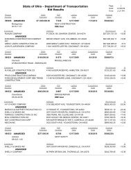
Environmental Site Assessment Guidelines - Ohio Department of ...
Environmental Site Assessment Guidelines - Ohio Department of ...
Environmental Site Assessment Guidelines - Ohio Department of ...

Create successful ePaper yourself
Turn your PDF publications into a flip-book with our unique Google optimized e-Paper software.
may also be conducted to determine the location <strong>of</strong> all or part <strong>of</strong> a UST system so that it may be<br />
avoided during drilling activities. A geophysical survey utilizes non-intrusive techniques to<br />
delineate these subsurface objects. In some instances, it may be used to delineate subsurface<br />
features such as contaminant plumes. Geophysical methods that may be employed include<br />
ground penetrating radar, electromagnetic conductivity testing, and magnetometer surveys.<br />
The results <strong>of</strong> the geophysical survey can be used to adjust soil boring/monitoring well locations<br />
in the field to better address the site’s resource areas. The geophysical survey is conducted<br />
prior to Phase II ESA field activities and is included in the Phase II ESA report.<br />
If a geophysical survey is proposed on a parcel, then this section should include a detailed<br />
discussion <strong>of</strong> the investigative technique and its limitations, equipment description, and<br />
potential interferences. In addition, mapping must be provided which delineates the area <strong>of</strong> the<br />
geophysical survey, the proposed ROW, any structures on the parcel, and any features which<br />
may be related to the use, storage, and/or disposal <strong>of</strong> hazardous substances and regulated<br />
wastes (i.e. underground storage tanks, drums, etc).<br />
8.1.3 Parcel Diagrams<br />
A diagram for each parcel proposed for investigation should be included which indicates the<br />
sampling locations and delineates the location <strong>of</strong> potential contamination sources (USTs, drums,<br />
sumps, lagoons, etc.) and the proposed geophysical survey area (if applicable) in relation to the<br />
proposed and/or existing ROW limits and proposed work involving earth disturbing activities<br />
(installation <strong>of</strong> storm/sanitary sewers, foundations for signal poles, catch basins, etc.). Diagrams<br />
are not required to be drawn to scale; however, approximate distances <strong>of</strong> proposed sampling<br />
locations and potential contamination sources in relation to the transportation project should be<br />
provided (see Appendix H).<br />
8.1.4 Project Management Plan<br />
A Project Management Plan should be prepared, including a listing <strong>of</strong> all key administrative and<br />
technical personnel to be used during the investigation and their duties.<br />
43