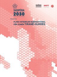
Integrated Cross-Sectorial Plan of Tirana-Durres Area
The Albanian Government and the National Spatial Plan have identified the Tiranë-Durrës area, as one of the most important economic areas of the country, and of the Balkan region. To ensure a sustainable territorial and urban development of this area, the Ministry of Urban Development in cooperation with the National Territorial Planning Agency has taken the initiative to draft a Cross-sectoral Integrated Plan for the economic area Tiranë – Durrës. The metropolitan region under study includes territories administered by 5 municipalities: Tiranë, Durrës, Vorë, Shijak, Kamëz.
The Albanian Government and the National Spatial Plan have identified the Tiranë-Durrës area, as one of the most important economic areas of the country, and of the Balkan region. To ensure a sustainable territorial and urban development of this area, the Ministry of Urban Development in cooperation with the National Territorial Planning Agency has taken the initiative to draft a Cross-sectoral Integrated Plan for the economic area Tiranë – Durrës. The metropolitan region under study includes territories administered by 5 municipalities: Tiranë, Durrës, Vorë, Shijak, Kamëz.
You also want an ePaper? Increase the reach of your titles
YUMPU automatically turns print PDFs into web optimized ePapers that Google loves.
The gradual shift and continuity <strong>of</strong> green<br />
infrastructure should be developed from<br />
“green areas” to the “gray areas” <strong>of</strong> urban<br />
centres covered with concrete.<br />
Integration <strong>of</strong> this infrastructure into gray<br />
areas will allow the development <strong>of</strong> missing<br />
green spaces in urban centres.<br />
The municipalities are suggested to use<br />
unused urban areas for this purpose, by<br />
creating green spaces to the benefit <strong>of</strong> the<br />
environment and ecosystem, which will<br />
serve to reduce infrastructural costs in the<br />
sewerage network. These facilities will serve<br />
to protect the territory from flooding as well as<br />
to improve conditions for dealing with climate<br />
change.<br />
Suburban gardens, residential areas and<br />
parking lots should be made available to the<br />
development <strong>of</strong> this infrastructure, creating<br />
the necessary network to bring the natural<br />
ecosystem within the urban centres.<br />
EP4- Risk management from natural<br />
disasters<br />
Raising the awareness <strong>of</strong> the population on<br />
natural emergencies, under climate change<br />
conditions, takes a special meaning in the<br />
administration <strong>of</strong> the territories from local<br />
units. Information should be accompanied by<br />
maps <strong>of</strong> flood areas and areas <strong>of</strong> landslides<br />
or other hazards. It is necessary to inform<br />
residents on the measures to be taken in the<br />
early hours. An increased focus in the annual<br />
counselling, should be placed on schools<br />
and rural areas, where life is more closely<br />
associated with nature and public investments<br />
may not be at the optimal required conditions.<br />
Increased focus should be directed towards<br />
informal settlements built on former<br />
agricultural lands and near riverbeds,<br />
natural landslide areas and areas identified<br />
as danger areas near dams or tectonic<br />
zones. Identification <strong>of</strong> high-risk houses<br />
must be accompanied by displacement and<br />
resettlement opportunities in safe territories,<br />
providing s<strong>of</strong>t loans or partnership schemes.<br />
<strong>Area</strong>s <strong>of</strong> increased risk:<br />
Floods<br />
Increased risk from the presence <strong>of</strong> water basin<br />
dams:<br />
Gjepalaj, Xhafzotaj, Sukth, Katund i Ri, coastal<br />
area, Breg Shkoze, Bubq, Gramez<br />
Landslide<br />
<strong>Area</strong>s with increased seismic presence:<br />
Kryezi, Vrap, Dorez, Baldushk, Kuraten,<br />
Shkrete, Cudhi-Zall<br />
Table 4.30 <strong>Area</strong>s at risk<br />
Civil emergencies at the national and local<br />
level for the protection <strong>of</strong> the population,<br />
should administer and manage territories<br />
under a special financial budget for natural<br />
hazards with a focus on the displacement <strong>of</strong><br />
the residents from risky areas. In the medium<br />
and long term, the special financial budget<br />
must ensure the construction <strong>of</strong> infrastructure<br />
for social housing to cope with in cases <strong>of</strong><br />
natural hazards.<br />
161


