Kalia-Fort DeRussy Wastewater System Improvements DEA (AFNSI
Kalia-Fort DeRussy Wastewater System Improvements DEA (AFNSI
Kalia-Fort DeRussy Wastewater System Improvements DEA (AFNSI

You also want an ePaper? Increase the reach of your titles
YUMPU automatically turns print PDFs into web optimized ePapers that Google loves.
APPLICANT ACTIONS<br />
SECTION 343-5(C), HRS<br />
PUBLICATION FORM (JULY 2012 REVISION)<br />
Project Name: <strong>Kalia</strong>-<strong>Fort</strong> <strong>DeRussy</strong> <strong>Wastewater</strong> <strong>System</strong> <strong>Improvements</strong><br />
Island: Oahu<br />
District: Waikiki<br />
TMK: (1) 2-6-005:001 (por.), <strong>Kalia</strong> Road, Ala Moana Boulevard, Kalakaua Avenue<br />
Permits: Special District (Minor)<br />
Approving Agency:<br />
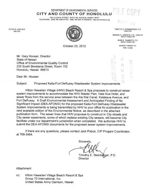
City and County of Honolulu, Department of Environmental Services<br />
1000 Uluohia Street, Suite 308<br />
Kapolei, Hawaii 96707<br />
Contact: Jack Pobuk, CIP Program Coordinator<br />
(808) 768-3464<br />
Applicant:<br />
Hilton Hawaiian Village® Beach Resort & Spa (Applicant)<br />
2005 <strong>Kalia</strong> Road<br />
Honolulu, Hawaii 96815<br />
Contact: Gerard C. Gibson, Area Vice President<br />
(808) 949-4321<br />
Consultant:<br />
Group 70 International, Inc.<br />
925 Bethel Street, 5th Floor<br />
Honolulu, Hawaii 96813<br />
Contact: Jeffrey H. Overton, AICP, LEED AP<br />
(808) 523-5866<br />
Status (check one only):<br />
_X_<strong>DEA</strong>-<strong>AFNSI</strong> Submit the approving agency notice of determination/transmittal on agency letterhead, a hard copy<br />
of <strong>DEA</strong>, a completed OEQC publication form, along with an electronic word processing summary<br />
and a PDF copy (you may send both summary and PDF to oeqc@doh.hawaii.gov); a 30-day<br />
comment period ensues upon publication in the periodic bulletin.<br />
__FEA-FONSI Submit the approving agency notice of determination/transmittal on agency letterhead, a hard copy<br />
of the FEA, an OEQC publication form, along with an electronic word processing summary and a<br />
PDF copy (send both summary and PDF to oeqc@doh.hawaii.gov); no comment period ensues<br />
upon publication in the periodic bulletin.<br />
__FEA-EISPN Submit the approving agency notice of determination/transmittal on agency letterhead, a hard copy<br />
of the FEA, an OEQC publication form, along with an electronic word processing summary and<br />
PDF copy (you may send both summary and PDF to oeqc@doh.hawaii.gov); a 30-day consultation<br />
period ensues upon publication in the periodic bulletin.<br />
__Act 172-12 EISPN Submit the approving agency notice of determination on agency letterhead, an OEQC publication<br />
form, and an electronic word processing summary (you may send the summary to<br />
oeqc@doh.hawaii.gov). NO environmental assessment is required and a 30-day consultation<br />
period upon publication in the periodic bulletin.<br />
__DEIS The applicant simultaneously transmits to both the OEQC and the approving agency, a hard copy<br />
of the DEIS, a completed OEQC publication form, a distribution list, along with an electronic word<br />
processing summary and PDF copy of the DEIS (you may send both the summary and PDF to<br />
oeqc@doh.hawaii.gov); a 45-day comment period ensues upon publication in the periodic bulletin.<br />
__FEIS The applicant simultaneously transmits to both the OEQC and the approving agency, a hard copy<br />
of the FEIS, a completed OEQC publication form, a distribution list, along with an electronic word<br />
processing summary and PDF copy of the FEIS (you may send both the summary and PDF to<br />
oeqc@doh.hawaii.gov); no comment period ensues upon publication in the periodic bulletin.<br />
__ Section 11-200-23<br />
Determination The approving agency simultaneous transmits its determination of acceptance or nonacceptance<br />
(pursuant to Section 11-200-23, HAR) of the FEIS to both OEQC and the applicant. No comment<br />
period ensues upon publication in the periodic bulletin.
__Statutory hammer<br />
Acceptance The approving agency simultaneously transmits its notice to both the applicant and the OEQC that<br />
it failed to timely make a determination on the acceptance or nonacceptance of the applicant's FEIS<br />
under Section 343-5(c), HRS, and that the applicant’s FEIS is deemed accepted as a matter of law.<br />
__Section 11-200-27<br />
Determination The approving agency simultaneously transmits its notice to both the applicant and the OEQC that<br />
it has reviewed (pursuant to Section 11-200-27, HAR) the previously accepted FEIS and<br />
determines that a supplemental EIS is not required. No EA is required and no comment period<br />
ensues upon publication in the periodic bulletin.<br />
__Withdrawal (explain)<br />
Summary (Provide proposed action and purpose/need in less than 200 words. Please keep the<br />
summary brief and on this one page):<br />
The City and County of Honolulu, Department of Environmental Services has identified sewer system improvements to<br />
accommodate the Hilton Hawaiian Village (HHV) Master Plan, Hale Koa Hotel and sewer flows from the service area<br />
between the Ala Wai Canal, Kalakaua Avenue and <strong>Fort</strong> <strong>DeRussy</strong>. The proposed system improvements include:<br />
• The existing 1950’s 12-inch diameter sewer line in <strong>Kalia</strong> Road will be replaced with a new 21-inch diameter<br />
sewer line. The replacement sewer line will begin at the intersection of Paoa Place and Kälia Road and end at the<br />
intersection of Ala Moana Boulevard and <strong>Kalia</strong> Road. The existing 16-inch diameter sewer line, which traverses<br />
across <strong>Fort</strong> <strong>DeRussy</strong> in a sewer line easement, would be cut and plugged at the Ala Moana Boulevard and Kälia<br />
Road intersection.<br />
• The existing 1960's 24-inch diameter sewer line on Ala Moana Boulevard and Kalakaua Avenue will be replaced<br />
by a 30-inch diameter sewer line. The replacement sewer line will begin at the intersection of <strong>Kalia</strong> Road and Ala<br />
Moana Boulevard and end at the <strong>Fort</strong> <strong>DeRussy</strong> WWPS. Work at <strong>Fort</strong> <strong>DeRussy</strong> will be contained within a City<br />
sewer line easement.<br />
The project will help the City to meet the 2010 <strong>Wastewater</strong> Consent Decree with U.S. Environmental Protection Agency.<br />
The project will also provide capacity for the HHV Master Plan improvements, including a new Timeshare Tower.
Draft Environmental Assessment for the<br />
<strong>Kalia</strong>-<strong>Fort</strong> <strong>DeRussy</strong> <strong>Wastewater</strong> <strong>System</strong> <strong>Improvements</strong><br />
Waikiki, Oahu, Hawaii<br />
Prepared for:<br />
City and County of Honolulu, Department of Environmental Services<br />
Hilton Hawaiian Village® Beach Resort & Spa<br />
U.S. Army Garrison, Hawaii<br />
Prepared by:<br />
Group 70 International, Inc.<br />
October 2012<br />
Abstract:<br />
This environmental assessment is an evaluation of the proposal to construct the <strong>Kalia</strong>-<strong>Fort</strong> <strong>DeRussy</strong><br />
<strong>Wastewater</strong> <strong>System</strong> <strong>Improvements</strong> in Waikiki, on the island of Oahu, Hawaii.
Draft Environmental Assessment<br />
for the Proposed Construction of the<br />
<strong>Kalia</strong>-<strong>Fort</strong> <strong>DeRussy</strong> <strong>Wastewater</strong> <strong>System</strong> <strong>Improvements</strong><br />
Waikiki, Oahu, Hawaii<br />
This environmental document is prepared in accordance with the requirements of<br />
the National Environmental Policy Act (NEPA) and Chapter 343, HRS and<br />
Hawaii Administrative Rules, Title 11, Department of Health.<br />
Applicant:<br />
Hilton Hawaiian Village® Beach Resort & Spa<br />
2005 <strong>Kalia</strong> Road<br />
Honolulu, Hawaii 96815<br />
Approving Agency:<br />
City and County of Honolulu<br />
Department of Environmental Services<br />
1000 Uluohia Street, Suite 308<br />
Kapolei, Hawaii 96707<br />
Cooperating Agency:<br />
United States Army Garrison, Hawaii<br />
947 Wright Avenue<br />
Schofield Barracks, Hawaii 96857<br />
Prepared by:<br />
Group 70 International, Inc.<br />
925 Bethel Street, 5 th Floor<br />
Honolulu, HI 96813<br />
October 2012<br />
Aloha mai kakou. While we greatly respect and honor the Hawaiian language as ka olelo makuahine o Hawaii (the<br />
mother tongue of Hawaii) and recognize it is one of two official languages in the State of Hawaii, we acknowledge that<br />
the global use and readability of diacritical markers (the kahako and okina – macron and glottal stop, respectively) in<br />
electronic formatting may cause words to display incorrectly when presented in different documentation formats.<br />
Diacritical markers have been omitted from Hawaiian words and place names in this report and we apologize for its<br />
non-inclusion in this draft. Mahalo for your understanding in this regard.
KALIA-FORT DERUSSY WASTEWATER SYSTEM IMPROVEMENTS<br />
DRAFT ENVIRONMENTAL ASSESSMENT<br />
ENVIRONMENTAL ASSESSMENT ORGANIZATION<br />
This Environmental Assessment addresses the Proposed Action to construct certain improvements<br />
(described below) to the City of Honolulu’s wastewater system in Waikiki, Oahu, Hawaii, in the area lying<br />
generally between the Ala Wai Canal, Kalakaua Avenue, and <strong>Fort</strong> <strong>DeRussy</strong> (referred to herein as the<br />
<strong>Kalia</strong>-<strong>Fort</strong> <strong>DeRussy</strong> <strong>Wastewater</strong> Service District” or the “Service District”), which includes the Hale Koa<br />
Hotel and the Hilton Hawaiian Village. The Proposed Action consists of the following: (1) replacement of<br />
an existing 12-inch diameter sewer line along <strong>Kalia</strong> Road (between Paoa Place and Ena Road) with a new<br />
21-inch diameter sewer line in <strong>Kalia</strong> Road, (2) replacement of an existing 24-inch diameter sewer line<br />
located within the area of a City easement across portions of the <strong>Fort</strong> <strong>DeRussy</strong> property fronting Ala<br />
Moana Boulevard and Kalakaua Avenue with a new 30-inch diameter sewer line, (3) cutting and plugging<br />
an existing 16-inch diameter sewer line traversing diagonally across <strong>Fort</strong> <strong>DeRussy</strong>, and (4) replacing<br />
sewer lines between existing manholes at or in the vicinity of the <strong>Fort</strong> <strong>DeRussy</strong> wastewater pumping<br />
station. As required by Environmental Analysis of Army Actions (32 Code of Federal Regulations, Part<br />
351), National Environmental Policy Act, and Chapter 343, Hawaii Revised Statutes, the potential<br />
environmental, cultural and socioeconomic impacts of the Proposed Action are analyzed in this<br />
document.<br />
An EXECUTIVE SUMMARY briefly describes the Proposed Action (Preferred Alternative) and No Action<br />
Alternatives, including the environmental and socioeconomic consequences of each, and certain<br />
mitigation measures that will be implemented. The term Proposed Action will be used to describe the<br />
Preferred Alternative throughout this document. Alternatives to the Proposed Action are considered in<br />
this Environmental Assessment.<br />
TABLE OF CONTENTS<br />
SECTION 1.0: PURPOSE, NEED, AND SCOPE is a summary of the purpose of and need for the<br />
Proposed Action and a description of the scope of the environmental impact analysis process.<br />
This section includes a discussion of the Proposed Action (Preferred Alternative) and the No<br />
Action Alternatives.<br />
SECTION 2.0: AFFECTED ENVIRONMENT AND ENVIRONMENTAL CONSEQUENCES describes the<br />
existing environmental and socioeconomic setting in Waikiki, on the island of Oahu. The section<br />
also identifies potential effects of implementing the Proposed Action (Preferred Alternative) and<br />
No Action Alternative, and summarizes the resulting environmental effects.<br />
SECTION 3.0: CUMULATIVE IMPACTS identifies potential cumulative effects of implementing the<br />
Proposed Action and other known or contemplated actions and summarizes the resulting<br />
environmental effects.<br />
SECTION 4.0: APPLICABLE LAND USE PLANS AND POLICIES provides an analysis of the project’s<br />
consistency with applicable land use policies.<br />
OCTOBER 2012 EA ORG - 1
KALIA-FORT DERUSSY WASTEWATER SYSTEM IMPROVEMENTS<br />
DRAFT ENVIRONMENTAL ASSESSMENT<br />
SECTION 5.0: OTHER REQUIRED NEPA AND HRS CHAPTER 343 ANALYSIS is concerned with the<br />
relationship between local short-term uses and long-term productivity and includes any<br />
irreversible and irretrievable commitment of resources. The anticipated determination of the<br />
project’s environmental impact analysis and reasons for its believed outcome are also discussed.<br />
SECTION 6.0: LIST OF REFERENCES are bibliographical information for cited sources.<br />
SECTION 7.0: LIST OF PREPARERS AND PARTICIPANTS are persons who prepared the document.<br />
SECTION 8.0: LIST OF AGENCIES, ORGANIZATIONS, AND INDIVIDUALS RECEIVING COPIES OF THE<br />
EA are those consulted during the Environmental Assessment process.<br />
APPENDICES<br />
A Agency Consultation: Comment Letters and Responses<br />
B Preliminary Engineering Report - Belt Collins Hawaii, LLC<br />
C Construction Traffic Impact Report - Wilson Okamoto Corporation<br />
D Acoustic Study - Y. Ebisu and Associates<br />
E Air Quality Impact Assessment - ARCADIS U.S. Inc.<br />
F Existing Tree /Palm Inventory and Planting Plan - McCelvey Associates, Inc.<br />
G Arborist Assessment - Steve Nimz and Associates, Inc.<br />
H Archaeological Literature Review and Field Inspection - Cultural Surveys Hawaii, Inc.<br />
I Cultural Impact Assessment - Cultural Surveys Hawaii, Inc.<br />
OCTOBER 2012 EA ORG - 2
EXECUTIVE SUMMARY
KALIA-FORT DERUSSY WASTEWATER SYSTEM IMPROVEMENTS<br />
DRAFT ENVIRONMENTAL ASSESSMENT<br />
EXECUTIVE SUMMARY<br />
This Environmental Assessment (EA) addresses the environmental impacts of the Proposed Action to<br />
construct certain improvements to the City and County of Honolulu (City) wastewater collection system<br />
(sewer) along a portion of <strong>Kalia</strong> Road and within an easement area covering portions of the <strong>Fort</strong><br />
<strong>DeRussy</strong> property fronting on Ala Moana Boulevard and Kalakaua Avenue in Waikiki, Oahu, Hawaii.<br />
The purpose of the Proposed Action is to increase the capacity of wastewater collection lines along <strong>Kalia</strong><br />
Road and portions of <strong>Fort</strong> <strong>DeRussy</strong> fronting on Ala Moana Boulevard and Kalakaua Avenue. The<br />
improvements are required to reduce the risk of overflows during periods of heavy rain and to<br />
accommodate additional flows from future development in the area, including implementation of the<br />
Hilton Hawaiian Village (HHV) Master Plan. Completion of these sewer improvements will fulfill a City<br />
condition of the Planned Development-Resort (PD-R) and Special Management Area (SMA) Use permits<br />
(2011) issued for the HHV Master Plan.<br />
This EA has been developed in accordance with the National Environmental Policy Act (NEPA) of 1969,<br />
42 US Code (USC), Section 4321 et seq.; the Council on Environmental Quality (CEQ) regulations for<br />
implementing NEPA, 40 Code of Federal Regulations (CFR) Parts 1500-1508: Environmental Analysis of<br />
Army Actions (32 CFR 651) and the State of Hawaii, Environmental Review Process, Chapter 343, Hawaii<br />
Revised Statutes (HRS); Hawaii Administrative Rules (HAR), Title 11, Department of Health (DOH). The<br />
purpose of the EA is to analyze the environmental impacts of the Proposed Action and project<br />
alternatives, present the findings, and solicit public input in order for the City, Department of<br />
Environmental Services (ENV) and United States Army Garrison, Hawaii (USAG-HI) to make an informed<br />
decision on future action. This EA provides a focused and site-specific analysis of the potential<br />
environmental impacts of constructing the proposed sewer improvements. Additionally, the EA<br />
considers impacts at this Oahu location that would result from the Proposed Action.<br />
Proposed Action (Preferred Alternative): Construct Sewer <strong>Improvements</strong> along <strong>Kalia</strong> Road and<br />
portions of <strong>Fort</strong> <strong>DeRussy</strong> fronting Ala Moana Boulevard and Kalakaua Avenue and make<br />
certain other improvements<br />
The Proposed Action is for the City or its designee to construct the following improvements to the City’s<br />
sewer system (the “<strong>Kalia</strong>-<strong>Fort</strong> <strong>DeRussy</strong> <strong>Wastewater</strong> <strong>System</strong> <strong>Improvements</strong>” or KDWSI):<br />
1. An existing 12-inch diameter sewer pipe (installed c. 1950s) along <strong>Kalia</strong> Road will be replaced with a<br />
new 21-inch diameter sewer line from a point near Paoa Place to a point near the intersection of<br />
<strong>Kalia</strong> Road, Ena Road and Ala Moana Boulevard. The new line will be located just east of the existing<br />
line. A trench will be excavated to accommodate the new line. Following completion of the new line,<br />
sewer laterals from HHV that connect to the existing 12-inch diameter sewer line will be connected<br />
to the new 21-inch diameter sewer line. The 12-inch diameter sewer line will be removed or grout<br />
filled, and abandoned in place. Upon completion, the 21-inch diameter sewer line trench will be<br />
backfilled, and existing surface improvements and landscaping will be restored.<br />
OCTOBER 2012 ES - 1
KALIA-FORT DERUSSY WASTEWATER SYSTEM IMPROVEMENTS<br />
DRAFT ENVIRONMENTAL ASSESSMENT<br />
2. An existing 24-inch diameter sewer line located within the boundaries of a City easement on<br />
federally owned land at <strong>Fort</strong> <strong>DeRussy</strong>, will be replaced with a new 30-inch diameter sewer line<br />
running along Ala Moana Boulevard from a point near <strong>Kalia</strong> Road to a point near the intersection of<br />
Ala Moana Boulevard and Kalakaua Avenue, and then along Kalakaua Avenue to a point near the<br />
existing <strong>Fort</strong> <strong>DeRussy</strong> wastewater pumping station (WWPS). The new line will be located in the same<br />
easement which contains the existing sewer line. Trenches will be excavated to expose the existing<br />
line, which will be bypassed by a temporary line to allow for the removal of the existing line and the<br />
installation of the new line. Upon completion of the new line, the new line will be connected to the<br />
new 21-inch <strong>Kalia</strong> Road line (described in item 1 above) and, by way of the new line described in<br />
item 3 below, to the <strong>Fort</strong> <strong>DeRussy</strong> WWPS. Following this, the bypass will be disconnected and<br />
removed, the trench will be backfilled, and existing surface improvements and landscaping in the<br />
easement area will be restored.<br />
3. An existing 24-inch diameter sewer line within the <strong>Fort</strong> <strong>DeRussy</strong> WWPS, between sewer manhole<br />
(9004) and sewer manhole (9003) and between sewer manhole (9003) and the <strong>Fort</strong> <strong>DeRussy</strong> WWPS<br />
wet well (0000), will be replaced with a new 30-inch diameter sewer line.<br />
4. In addition, an existing 16-inch diameter sewer line crossing <strong>Fort</strong> <strong>DeRussy</strong> from the intersection of<br />
<strong>Kalia</strong> Road and Ala Moana Boulevard intersection to the <strong>Fort</strong> <strong>DeRussy</strong> WWPS will be cut and plugged<br />
with grout.<br />
The KDWSI will expand the capacity of the City’s wastewater system in a portion of the service area<br />
between the Ala Wai Canal, Kalakaua Avenue, and <strong>Fort</strong> <strong>DeRussy</strong> (the “<strong>Kalia</strong>-<strong>Fort</strong> <strong>DeRussy</strong> <strong>Wastewater</strong><br />
Service Area” or simply the “Service Area”), which includes the Hale Koa Hotel (HKH) and the HHV.<br />
The construction of the KDWSI will be scheduled to meet the development timeline for the completion<br />
of the new HHV Timeshare Tower 1 (which is currently scheduled for late 2015). Where potentially<br />
significant impacts might result from the Proposed Action, mitigation measures will be taken to reduce<br />
the impact to less-than-significant levels.<br />
In addition to providing additional capacity to serve existing and future development within the Service<br />
Area, including implementation of the HHV Master Plan, installation of the KDWSI may help the City<br />
satisfy the strict mandates set under the 2010 <strong>Wastewater</strong> Consent Decree agreed upon by the United<br />
States (U.S.) Environmental Protection Agency (EPA), the State of Hawaii and the City.<br />
The environmental impact of the Proposed Action (Preferred Alternative) is expected to be less than the<br />
impact of the No Action Alternative, as described below.<br />
No Action Alternative<br />
The No Action Alternative is a benchmark against which the Preferred Alternative can be evaluated.<br />
Under the No Action Alternative, the existing sewer system servicing the HHV, HKH, and other parts of<br />
the Service Area would remain unchanged and unimproved. The existing system is intended to provide<br />
capacity for existing peak wet weather flows, which is a combination of the maximum flow and the wet<br />
weather infiltration/inflow. Without improvements such as the KDWSI, the City’s wastewater system<br />
will not be sufficient to accommodate the increased flows that will be produced from implementation of<br />
the approved HHV Master Plan, including the construction of the new Timeshare Tower 1.<br />
OCTOBER 2012 ES - 2
KALIA-FORT DERUSSY WASTEWATER SYSTEM IMPROVEMENTS<br />
DRAFT ENVIRONMENTAL ASSESSMENT<br />
The No Action Alternative is evaluated in the environmental consequences section of this EA and<br />
addresses the potential impacts of the No Action Alternative on the baseline conditions identified in the<br />
affected environment section of the document.<br />
Summary of Environmental and Socioeconomic Impacts<br />
Under the Proposed Action, less than significant impacts are identified for most categories of<br />
environmental and socioeconomic impact, as summarized in the following table.<br />
SUMMARY OF POTENTIAL IMPACTS FOR NO ACTION ALTERNATIVE AND PROPOSED ACTION<br />
(PREFERRED ALTERNATIVE)<br />
Impact Area<br />
No Action<br />
Alternative<br />
Cumulative<br />
Proposed Action<br />
(Preferred Alternative)<br />
Land Use No impact No impact No impact<br />
Socioeconomic No impact Beneficial Beneficial<br />
Traffic and Roadways No impact<br />
Significant impact but mitigable<br />
to less than significant<br />
Significant impact but mitigable<br />
to less than significant<br />
Noise No impact<br />
Significant impact but mitigable<br />
to less than significant<br />
Significant impact but mitigable<br />
to less than significant<br />
Air Quality No impact Less than significant impact Less than significant impact<br />
Geology, Soils and Seismicity No impact Less than significant impact Less than significant impact<br />
Natural Hazards No impact No impact No impact<br />
Water Resources No impact<br />
Beneficial/<br />
Less than significant impact<br />
Beneficial/<br />
Less than significant impact<br />
Hazardous Materials No impact No impact No impact<br />
Public Facilities, Services,<br />
and Utilities<br />
No impact<br />
Beneficial/<br />
Less than significant impact<br />
Beneficial/<br />
Less than significant impact<br />
Biological Resources No impact Less than significant impact Less than significant impact<br />
Cultural Resources No impact<br />
Significant impact but mitigable<br />
to less than significant<br />
Significant impact but mitigable<br />
to less than significant<br />
Visual Resources No impact Less than significant impact Less than significant impact<br />
Environmental Justice No impact Beneficial Beneficial<br />
Note: In cases when there would be both beneficial and adverse impacts, both are shown on this table.<br />
Proposed Action (Preferred Alternative): Construct the <strong>Kalia</strong>-<strong>Fort</strong> <strong>DeRussy</strong> <strong>Wastewater</strong> <strong>System</strong> <strong>Improvements</strong><br />
Under the Proposed Action, beneficial impacts can be expected for socioeconomics, water resources,<br />
public facilities, services and utilities, and environmental justice.<br />
The Proposed Action will have short-term and long-term beneficial effects on the local economy. There<br />
will be short-term increases in employment, income and tax revenue during the construction period. In<br />
addition, construction of the proposed sewer line improvements will allow for the development of<br />
improvements and expansion projects under the approved HHV Master Plan. These projects will result<br />
in beneficial long-term indirect economic and fiscal impacts relating to employment, income, taxes, and<br />
additional consumer expenditures.<br />
OCTOBER 2012 ES - 3
KALIA-FORT DERUSSY WASTEWATER SYSTEM IMPROVEMENTS<br />
DRAFT ENVIRONMENTAL ASSESSMENT<br />
Implementation of the Proposed Action will have beneficial impacts on water quality since the sewer<br />
improvements will serve to minimize problems that occur from wet weather infiltration/inflow to the<br />
system. The project will not increase the volume of peak stormwater runoff or contribute additional<br />
contaminants to stormwater runoff. Upon completion of the sewer improvements, pavements,<br />
groundcover and landscaping disturbed during construction will be repaired to model pre-construction<br />
conditions, eliminating discernible long-term adverse impact.<br />
By increasing the capacity of the City’s sewer collection system along <strong>Kalia</strong> Road and the portions of <strong>Fort</strong><br />
<strong>DeRussy</strong> fronting Ala Moana Boulevard and Kalakaua Avenue, the KDWSI may help the City comply with<br />
the mandates of the 2010 <strong>Wastewater</strong> Consent Decree with the EPA. The Proposed Action will have a<br />
long-term beneficial impact on public utilities by improving the existing wastewater system, and a longterm<br />
beneficial impact to surface water quality.<br />
The Proposed Action will directly result in beneficial short-term and long-term impacts through the<br />
creation of jobs opportunities for low-income or minority groups. Temporary new jobs will be created<br />
during the construction period of the Proposed Action. The sewer expansion will also allow for<br />
construction jobs associated with the new Timeshare Tower 1 and various Master Plan projects. By<br />
allowing for completion of Timeshare Tower 1 and other elements of the HHV Master Plan, the<br />
Proposed Action will aid in the creation of additional long-term jobs associated with those projects.<br />
The Proposed Action will have no impacts on Land Use and Hazardous Materials. Less than significant<br />
impacts are expected for air quality, geology, soils and seismicity, water resources, public facilities,<br />
services and utilities, biological resources, and visual resources, all of which will be temporary and<br />
limited to the period during and immediately following construction.<br />
The Proposed Action will have less than significant adverse impacts on air quality from air pollutants or<br />
greenhouse gases. The air quality issues are related to construction activities, and include fugitive dust<br />
and emissions from construction equipment engine exhaust. Impacts will be temporary and mitigated<br />
through the implementation of best management practices (BMPs), such as dust minimization, to<br />
ensure that air quality standards are met.<br />
Short-term adverse impacts from erosion will be mitigated during construction and during the period<br />
immediately after construction, through the implementation of erosion and sediment control BMPs. The<br />
Proposed Action will not increase impervious area at the project areas. The potential for water quality<br />
degradation due to sediment-laden runoff from disturbed areas during construction will be mitigated<br />
through the implementation of BMPs for erosion and sediment control (construction) and stormwater<br />
management. As a result, the Proposed Action is expected to temporarily generate less than significant<br />
impacts to geology, soils, and water quality.<br />
Construction of the Proposed Action will have a less than significant impact on public services (police<br />
protection, solid waste management, etc.) and existing utility infrastructure located near the project<br />
areas. The Proposed Action will not directly increase energy and potable water consumption,<br />
wastewater generation, stormwater generation, or demands on communication systems (except to a<br />
limited and less-than-significant degree during construction). Therefore, impacts on all of these are<br />
anticipated to be less than significant.<br />
OCTOBER 2012 ES - 4
KALIA-FORT DERUSSY WASTEWATER SYSTEM IMPROVEMENTS<br />
DRAFT ENVIRONMENTAL ASSESSMENT<br />
There will be less than significant impacts on biological resources. The Proposed Action may affect the<br />
manuoku (White Fairy Tern, Gygis alba) particularly during the construction period. However, impacts to<br />
this seabird are considered to be less than significant because there is abundant alternative tree canopy<br />
habitat for this species in the adjacent areas. The adverse effects from construction are expected to be<br />
temporary and minor. Temporary site clearing in <strong>Fort</strong> <strong>DeRussy</strong> will have a less than significant impact on<br />
biological resources. Upon completion of the sewer improvements, the affected area will be repaired<br />
and landscaped to model pre-construction conditions.<br />
During construction, there will be short-term adverse impacts on the visual character of the site and<br />
surroundings resulting from a visible increase in traffic from project vehicles, the operation and storage<br />
of equipment and materials during demolition and construction, and a decrease in visibility from fugitive<br />
dust. These short-term adverse impacts on the visual landscape of the project areas will be limited and<br />
temporary, and are expected to be less than significant.<br />
Significant impacts but mitigable to less than significant are expected for traffic and circulation, noise<br />
and cultural resources, all of which will be temporary and limited to the period during and immediately<br />
following construction.<br />
Under the Proposed Action, there will be short-term impacts to traffic and roadways during construction<br />
of the sewer improvements. Lane closures and potential traffic diversions will be required. However,<br />
construction work areas will be phased along the project alignment to minimize impact to vehicular and<br />
pedestrian traffic. The traffic control plans will include phased work areas and detours for lane and<br />
sidewalk closures. Construction scheduling will be coordinated with the City Department of Planning and<br />
Permitting (DPP), City Department of Transportation Services (DTS), and State Department of<br />
Transportation (DOT) Highways Division in an effort to minimize these impacts. While the potential<br />
impacts on traffic and roadways could be significant in the absence of mitigating action, the impacts can<br />
be mitigated, and it is anticipated that coordination with City and State agencies will result in mitigation<br />
measures that will reduce these impacts to a level that is below what would be considered significant.<br />
The Proposed Action will introduce temporary noise from construction of the sewer improvements.<br />
However, these noise levels will not exceed applicable regulatory standards. In addition, typical<br />
construction noise mitigation measures will be utilized to reduce the adverse noise impact to a level that<br />
is below what would be considered less than significant.<br />
Based on historic documents and archaeological investigations, the Proposed Action may have a<br />
significant impact on archaeological resources; however, compensatory mitigation will be included to<br />
reduce the level of impact to below significant levels. The project team has engaged and is working<br />
closely with cultural and lineal descendants of the <strong>Kalia</strong> area to learn about the area’s history, build<br />
relationships, promote dialogue among the parties, and address potential impacts on cultural resources.<br />
This collaboration is leading to the formulation of a Plan of Action (POA) to protect cultural resources. In<br />
addition, an archaeological monitoring program will be implemented as an appropriate mitigation<br />
measure for ground disturbance conducted within the study area. Trenching for the Proposed Action<br />
will be within or adjacent to areas that were previously trenched to install or repair the existing lines.<br />
Nonetheless, expansion of the trench areas to accommodate the larger pipes presents some risk that<br />
human remains or other culturally sensitive items not previously identified will be disturbed. Should<br />
human remains (iwi kupuna), cultural sites, or artifacts be uncovered during construction; actions will be<br />
OCTOBER 2012 ES - 5
KALIA-FORT DERUSSY WASTEWATER SYSTEM IMPROVEMENTS<br />
DRAFT ENVIRONMENTAL ASSESSMENT<br />
undertaken for either preservation in place or relocation, under a plan of action following respective<br />
cultural protocol. With these measures in place to mitigate project actions, it is anticipated that the<br />
Proposed Action will not have a significant cumulative impact on cultural resources.<br />
It is anticipated that the owner of the HHV will fund, design and construct the KDWSI, which will allow it<br />
to construct Timeshare Tower 1 and other additions and improvements to the HHV property<br />
contemplated by the recently approved HHV Master Plan. This investment in the City’s infrastructure is<br />
expected to have an overall beneficial impact, not only for the HHV, but also for the Waikiki community<br />
and the visitors and general public that it serves. The construction timetable for the sewer<br />
improvements is planned to meet the programmed completion of the HHV Master Plan Timeshare<br />
Tower 1 in late 2015. The impacts of the Proposed Action are analyzed in this EA. The project details<br />
described in this EA may change as technical requirements and designs are refined, and this EA may be<br />
revised, if appropriate, to address material changes. Additionally, unanticipated issues may delay the<br />
construction schedule.<br />
No Action Alternative<br />
Under the No Action Alternative, the existing conditions would not change and improvements to the<br />
sewer lines serving HHV, HKH and other parts of the Service Area would not occur. The HHV Timeshare<br />
Towers would not be built because the existing sewer system would not be able to accommodate<br />
additional flows. Development and operations employment related to the HHV Master Plan project and<br />
Proposed Action would also not be available. The City would need to expend additional public funds to<br />
make improvements to the existing wastewater system to meet the requirements of the 2010<br />
<strong>Wastewater</strong> Consent Decree with the U.S. EPA. Without improvements to the existing system, the risk of<br />
wastewater system overflows would not be reduced. While sewer improvements under the Consent<br />
Decree may still take place without the Proposed Action, it would occur at a later point.<br />
The No Action Alternative would have no significant impact on land use, socioeconomic characteristics,<br />
traffic and roadways, noise, air quality, geology, soils, and seismicity, natural hazards, water resources,<br />
hazardous materials, public, facilities, services and utilities, biological resources, cultural resources,<br />
visual resources and environmental justice. However, the No Action Alternative would not mitigate<br />
potential adverse impacts on water resources, resulting from the lack of wastewater system<br />
improvements, and would not result in any improvement to public services and utilities. The benefits to<br />
socio-economic and environmental justice resources would also not occur.<br />
OCTOBER 2012 ES - 6
TABLE OF CONTENTS
TABLE OF CONTENTS<br />
Section Page<br />
ENVIRONMENTAL ASSESSMENT ORGANIZATION<br />
EXECUTIVE SUMMARY<br />
TABLE OF CONTENTS ............................................................................................................................. i<br />
LIST OF FIGURES .................................................................................................................................. iv<br />
LIST OF TABLES ................................................................................................................................... iv<br />
LIST OF APPENDICES ............................................................................................................................. v<br />
LIST OF ABBREVIATIONS/ACRONYMS ..................................................................................................... vi<br />
1.0 PURPOSE, NEED, AND SCOPE .................................................................................................. 1-1<br />
1.1 Introduction ..................................................................................................................... 1-1<br />
1.2 Project Information Summary ......................................................................................... 1-1<br />
1.3 Purpose and Need of the Proposed Action ..................................................................... 1-3<br />
1.4 Scope and Organization of the Document ...................................................................... 1-4<br />
1.5 Public Involvement .......................................................................................................... 1-5<br />
1.6 Listing of Required Government Permits and Approvals ................................................ 1-6<br />
1.7 Description of the Proposed Action and Alternatives ..................................................... 1-7<br />
1.7.1 Project Description ............................................................................................. 1-7<br />
1.7.1.1 Project Location ..................................................................................... 1-8<br />
1.7.1.2 Project Utilities and Infrastructure ........................................................ 1-8<br />
1.7.1.3 Construction Characteristics ................................................................ 1-10<br />
1.7.1.4 Project Implementation ...................................................................... 1-10<br />
1.7.2 Alternatives Development ................................................................................ 1-11<br />
1.7.3 Proposed Action – Construct Sewer <strong>Improvements</strong> at <strong>Kalia</strong> Road and <strong>Fort</strong><br />
<strong>DeRussy</strong> Fronting Ala Moana Boulevard and Kalakaua Avenue (Preferred<br />
Alternative) ....................................................................................................... 1-11<br />
1.7.4 No Action Alternative ...................................................................................... 1-12<br />
1.7.5 Alternatives Considered but Eliminated from Further Analysis ....................... 1-12<br />
2.0 AFFECTED ENVIRONMENT AND ENVIRONMENTAL CONSEQUENCES ..................................... 2-1<br />
2.1 Introduction ..................................................................................................................... 2-1<br />
2.1.1 Chapter Organization .......................................................................................... 2-1<br />
2.1.2 Terminology ........................................................................................................ 2-2<br />
2.1.3 Summary of Impacts ........................................................................................... 2-2<br />
2.2 Land Use........................................................................................................................... 2-3<br />
2.2.1 Affected Environment ........................................................................................ 2-3<br />
2.2.2 Environmental Consequences ............................................................................ 2-5<br />
OCTOBER 2012 i
TABLE OF CONTENTS (CONTINUED)<br />
Section Page<br />
2.3 Socio-Economic Characteristics ....................................................................................... 2-6<br />
2.3.1 Affected Environment ........................................................................................ 2-6<br />
2.3.2 Environmental Consequences ............................................................................ 2-8<br />
2.4 Traffic and Roadways ..................................................................................................... 2-10<br />
2.4.1 Affected Environment ...................................................................................... 2-10<br />
2.4.2 Environmental Consequences .......................................................................... 2-13<br />
2.5 Noise .............................................................................................................................. 2-20<br />
2.5.1 Affected Environment ...................................................................................... 2-20<br />
2.5.2 Environmental Consequences .......................................................................... 2-21<br />
2.6 Air Quality ...................................................................................................................... 2-23<br />
2.6.1 Affected Environment ...................................................................................... 2-23<br />
2.6.2 Environmental Consequences .......................................................................... 2-25<br />
2.7 Geology, Soils and Seismicity ......................................................................................... 2-29<br />
2.7.1 Affected Environment ...................................................................................... 2-29<br />
2.7.2 Environmental Consequences .......................................................................... 2-31<br />
2.8 Natural Hazards ............................................................................................................. 2-32<br />
2.8.1 Affected Environment ...................................................................................... 2-32<br />
2.8.2 Environmental Consequences .......................................................................... 2-34<br />
2.9 Water Resources ............................................................................................................ 2-36<br />
2.9.1 Affected Environment ...................................................................................... 2-36<br />
2.9.2 Environmental Consequences .......................................................................... 2-36<br />
2.10 Hazardous Materials ...................................................................................................... 2-38<br />
2.10.1 Affected Environment ...................................................................................... 2-38<br />
2.10.2 Environmental Consequences .......................................................................... 2-39<br />
2.11 Public Facilities, Services and Utilities ........................................................................... 2-40<br />
2.11.1 Affected Environment ...................................................................................... 2-40<br />
2.11.2 Environmental Consequences .......................................................................... 2-44<br />
2.12 Biological Resources ...................................................................................................... 2-46<br />
2.12.1 Affected Environment ...................................................................................... 2-46<br />
2.12.2 Environmental Consequences .......................................................................... 2-47<br />
2.13 Cultural Resources ......................................................................................................... 2-50<br />
2.13.1 Affected Environment ...................................................................................... 2-50<br />
2.13.2 Environmental Consequences .......................................................................... 2-56<br />
2.14 Visual Resources ............................................................................................................ 2-60<br />
2.14.1 Affected Environment ...................................................................................... 2-60<br />
2.14.2 Environmental Consequences .......................................................................... 2-61<br />
2.15 Environmental Justice .................................................................................................... 2-66<br />
2.15.1 Affected Environment ...................................................................................... 2-66<br />
2.15.2 Environmental Consequences .......................................................................... 2-68<br />
3.0 CUMULATIVE IMPACTS ........................................................................................................... 3-1<br />
3.1 Introduction ..................................................................................................................... 3-1<br />
3.2 Land Use........................................................................................................................... 3-2<br />
OCTOBER 2012 ii
TABLE OF CONTENTS (CONTINUED)<br />
Section Page<br />
3.3 Socio-Economics .............................................................................................................. 3-2<br />
3.4 Traffic ............................................................................................................................... 3-2<br />
3.5 Noise ................................................................................................................................ 3-2<br />
3.6 Air Quality ........................................................................................................................ 3-3<br />
3.7 Geology, Soils, and Seismicity .......................................................................................... 3-3<br />
3.8 Natural Hazards ............................................................................................................... 3-3<br />
3.9 Water Resources .............................................................................................................. 3-3<br />
3.10 Hazardous Materials ........................................................................................................ 3-4<br />
3.11 Public Facilities, Services, and Utilities ............................................................................ 3-4<br />
3.12 Biological Resources ........................................................................................................ 3-4<br />
3.13 Cultural Resources ........................................................................................................... 3-5<br />
3.14 Visual Resources .............................................................................................................. 3-5<br />
3.15 Environmental Justice ...................................................................................................... 3-5<br />
4.0 APPLICABLE LAND USE PLANS AND POLICIES .......................................................................... 4-1<br />
4.1 Introduction ..................................................................................................................... 4-1<br />
4.2 Hawaii State Plan ............................................................................................................. 4-1<br />
4.3 Hawaii State Land Use District Boundaries ..................................................................... 4-3<br />
4.4 Hawaii Coastal Zone Management Program ................................................................... 4-3<br />
4.5 Hawaii 2050 Sustainability Plan ....................................................................................... 4-8<br />
4.6 City and County of Honolulu General Plan ...................................................................... 4-8<br />
4.7 City and County of Honolulu - Primary Urban Center Development Plan ...................... 4-9<br />
4.8 Waikiki Special District ................................................................................................... 4-10<br />
4.9 Special Management Area ............................................................................................ 4-11<br />
5.0 OTHER REQUIRED NEPA AND HRS CHAPTER 343 ANALYSIS ....................................................... 5-1<br />
5.1 Introduction ..................................................................................................................... 5-1<br />
5.2 Relationship Between Local Short-Term Uses of the Environment and Long-Term<br />
Productivity ...................................................................................................................... 5-2<br />
5.3 Irreversible and Irretrievable Commitments of Resources ............................................. 5-2<br />
5.4 Anticipated Determination .............................................................................................. 5-2<br />
5.5 Reasons Supporting the Anticipated Determination ...................................................... 5-3<br />
5.6 Summary .......................................................................................................................... 5-5<br />
5.7 Agency Consultation ........................................................................................................ 5-5<br />
6.0 LIST OF REFERENCES .............................................................................................................. 6-1<br />
7.0 LIST OF PREPARERS AND PARTICIPANTS.................................................................................... 7-1<br />
8.0 LIST OF AGENCIES, ORGANIZATIONS, AND INDIVIDUALS RECEIVING COPIES OF THE EA ................... 8-1<br />
OCTOBER 2012 iii
LIST OF FIGURES<br />
Figure Page<br />
1-1 Project Location .......................................................................................................................... 1-16<br />
1-2 City and County of Honolulu, Tax Map Key Parcels ................................................................... 1-17<br />
1-3 State Land Use Districts Designation .......................................................................................... 1-18<br />
1-4 City and County of Honolulu Zoning and Waikiki Special District Designations ........................ 1-19<br />
1-5 City and County of Honolulu, Primary Urban Center Land Use Designation ............................. 1-20<br />
1-6 City and County of Honolulu, Special Management Area .......................................................... 1-21<br />
1-7 Federal Emergency Management Agency Flood Zone and Tsunami Evacuation Zone ............. 1-22<br />
1-8 <strong>Kalia</strong>-<strong>Fort</strong> <strong>DeRussy</strong> <strong>Wastewater</strong> Service District ........................................................................ 1-23<br />
1-9 Conceptual Sewer Line Alignment ............................................................................................. 1-24<br />
2-1 Existing Midday and PM Peak Hour Traffic ................................................................................ 2-12<br />
2-2 Projected Midday and PM Peak Hour with Traffic Diversion ..................................................... 2-15<br />
2-3 Soils ............................................................................................................................................. 2-30<br />
2-4 Previous Archaeological Studies within the Study Area or Immediate Vicinity ......................... 2-52<br />
2-5 Site Photo Key ............................................................................................................................. 2-62<br />
2-6A View of Paoa Place Looking East Towards <strong>Kalia</strong> Road ................................................................ 2-63<br />
2-6B View of <strong>Kalia</strong> Road Looking North Towards Ala Moana Boulevard............................................ 2-63<br />
2-6C View of Ala Moana Boulevard/<strong>Fort</strong> <strong>DeRussy</strong> Looking East Towards Kalakaua Avenue ............. 2-64<br />
2-6D View of Kalakaua Avenue/<strong>Fort</strong> <strong>DeRussy</strong> Looking South ............................................................. 2-64<br />
LIST OF TABLES<br />
Table Page<br />
1-1 Listing of Required Government Permits and Approvals ............................................................. 1-6<br />
1-2 Sewer Line Capacities ................................................................................................................... 1-8<br />
1-3 Sewer Line Costs ......................................................................................................................... 1-10<br />
2-1 Summary of Potential Impacts for No Action Alternative and Proposed Action<br />
(Preferred Alternative) ................................................................................................................. 2-2<br />
2-2 Summary of Potential Impacts on Land Use ................................................................................ 2-5<br />
2-3 Waikiki vs. Oahu Population and Demographics, 2010 ................................................................ 2-7<br />
2-4 Population Trends, 1970-2010 ..................................................................................................... 2-8<br />
2-5 Occupied Housing Units, 1960-2010 ............................................................................................ 2-8<br />
2-6 Summary of Potential Socio-Economic Impacts ........................................................................... 2-9<br />
2-7 Existing Intersection LOS Traffic Operating Conditions .............................................................. 2-11<br />
2-8 Summary of Potential Traffic Impacts ........................................................................................ 2-14<br />
2-9 Existing and Projected (2-Lane Closure) Midday and PM Intersection LOS Traffic Operating<br />
Conditions ................................................................................................................................... 2-16<br />
2-10 Existing and Projected (2-Lane Closure with Traffic Diversion) Midday and PM Intersection<br />
LOS Traffic Operating Conditions................................................................................................ 2-16<br />
2-11 Existing and Projected (3-Lane Closure) Midday and PM Intersection LOS Traffic Operating<br />
Conditions ................................................................................................................................... 2-17<br />
2-12 Existing and Projected (3-Lane Closure with Traffic Diversion) Midday and PM Intersection<br />
LOS Traffic Operating Conditions................................................................................................ 2-18<br />
OCTOBER 2012 iv
LIST OF TABLES (CONTINUED)<br />
Table Page<br />
2-13 Ranges of A-Weighted Sound Levels of Construction Equipment at 50-Foot Distance ............. 2-20<br />
2-14 Summary of Existing Ambient Noise Levels ............................................................................... 2-21<br />
2-15 Summary of Potential Noise Impacts ......................................................................................... 2-21<br />
2-16 Range of Ambient and Trenching Noise Levels .......................................................................... 2-22<br />
2-17 Air Quality Standards Attainment Status for Hawaii .................................................................. 2-24<br />
2-18 Summary of Potential Air Quality Impacts ................................................................................. 2-26<br />
2-19 Estimated Proposed Construction Emissions (Tons per Year) ................................................... 2-26<br />
2-20 Estimated Proposed Construction Emissions (Pounds per Day) ................................................ 2-26<br />
2-21 Summary of Potential Impacts on Geological Resources ........................................................... 2-31<br />
2-22 Summary of Potential Impacts from Natural Hazards................................................................ 2-34<br />
2-23 Summary of Potential Water Resources Impacts ....................................................................... 2-37<br />
2-24 Summary of Potential Impacts from Hazardous Materials ........................................................ 2-39<br />
2-25 Summary of Potential Impacts on Public Facilities, Services, and Utilities ................................ 2-44<br />
2-26 Existing Tree Species ................................................................................................................... 2-47<br />
2-27 Summary of Potential Impacts on Biological Resources ............................................................ 2-48<br />
2-28 Previous Archaeological Studies within the Study Area and Immediate Vicinity ...................... 2-53<br />
2-29 Summary of Potential Impacts on Cultural Resources ............................................................... 2-58<br />
2-30 Summary of Potential Impacts on Visual Resources .................................................................. 2-65<br />
2-31 Race, Ethnicity, and Poverty Status and Trends for Honolulu County, Hawai‘i, and the United<br />
States, 2007, 2008, and 2009 ..................................................................................................... 2-67<br />
2-32 Poverty Rates and Trends for City and County of Honolulu, Hawaii and the United States,<br />
2007, 2008, and 2009 ................................................................................................................. 2-67<br />
2-33 Summary of Potential Environmental Justice Impacts ............................................................... 2-68<br />
LIST OF APPENDICES<br />
Appendix Page<br />
A Agency Consultation: Comment Letters and Responses<br />
B Preliminary Engineering Report (Belt Collins Hawaii, LLC)<br />
C Construction Traffic Impact Report (Wilson Okamoto Corporation)<br />
D Acoustic Study (Y. Ebisu and Associates)<br />
E Air Quality Impact Assessment (ARCADIS U.S., Inc.)<br />
F Existing Tree/Palm Inventory and Planting Plan (McCelvey Associates, Inc.)<br />
G Arborist Assessment (Steve Nimz and Associates, Inc.)<br />
H Archaeological Literature Review and Field Inspection (Cultural Surveys Hawaii, Inc.)<br />
I Cultural Impact Assessment (Cultural Surveys Hawaii, Inc.)<br />
OCTOBER 2012 v
ABBREVIATIONS/ACRONYMS<br />
Abbreviation Definition<br />
BMPs Best Management Practices<br />
BWS Board of Water Supply<br />
CAA Clean Air Act<br />
CEQ Council on Environmental Quality<br />
CERCLA Comprehensive Environmental Response, Compensation, and Liability<br />
CFR Code of Federal Regulations<br />
CIA Cultural Impact Assessment<br />
City City and County of Honolulu<br />
CO Carbon Monoxide<br />
CZM Coastal Zone Management<br />
CZMA Coastal Zone Management Act<br />
dBA A-Weighted Decibels<br />
DBEDT Department of Business, Economic Development, and Tourism<br />
DOH Department of Health<br />
DPP Department of Planning and Permitting<br />
DTS Department of Transportation Services<br />
EA Environmental Assessment<br />
EIS Environmental Impact Statement<br />
EMS Emergency Medical Services<br />
ENV Department of Environmental Services<br />
EPA Environmental Protection Agency<br />
FONSI Finding of No Significant Impact<br />
GHG Greenhouse Gases<br />
H2S Hydrogen Sulfide<br />
HAR Hawaii Administrative Rules<br />
HFD Honolulu Fire Department<br />
HHV Hilton Hawaiian Village<br />
Hilton Hilton Hawaiian Village Beach Resort and Spa<br />
HKH Hale Koa Hotel<br />
HPD Honolulu Police Department<br />
HRS Hawaii Revised Statutes<br />
HTCO Hawaiian Telcom<br />
JaC Jaucas Sand<br />
KDWSI <strong>Kalia</strong>-<strong>Fort</strong> <strong>DeRussy</strong> <strong>Wastewater</strong> <strong>System</strong> <strong>Improvements</strong><br />
LCA Land Commission Award<br />
LOS Level of Service<br />
LUC Land Use Commission<br />
LUO Land Use Ordnance<br />
MBR Membrane Bioreactors<br />
mgd Million Gallons per Day<br />
NAAQS National Ambient Air Quality Standards<br />
NAGPRA Native American Graves Protection and Repatriation Act<br />
NEPA National Environmental Policy Act<br />
OCTOBER 2012 vi
NHPA National Historic Preservation Act<br />
NO2<br />
Nitrogen Dioxide<br />
NPDES National Pollutant Discharge Elimination <strong>System</strong><br />
NRHP National Registry of Historic Places<br />
O3<br />
Ozone<br />
OEQC Office of Environmental Quality Control<br />
Pb Lead<br />
PM Particulate Matter<br />
PUC Primary Urban Center<br />
PUCDP Primary Urban Center Development Plan<br />
ROH Revised Ordinances of Honolulu<br />
ROI Region of Influence<br />
SAAQS State Ambient Air Quality Standards<br />
SHPD State Historic Preservation Division<br />
SMA Special Management Area<br />
SO2<br />
Sulfur Dioxide<br />
tpy Tons per Year<br />
U.S. United States<br />
USAG-HI United States Army Garrison Hawaii<br />
USC United States Code<br />
UST Underground Storage Tank<br />
VECs Valued Environmental Components<br />
WSD Waikiki Special District<br />
WWPS <strong>Wastewater</strong> Pump Station<br />
OCTOBER 2012 vii
1.0 PURPOSE, NEED, AND SCOPE
1.1 INTRODUCTION<br />
KALIA-FORT DERUSSY WASTEWATER SYSTEM IMPROVEMENTS<br />
DRAFT ENVIRONMENTAL ASSESSMENT<br />
SECTION 1.0<br />
PURPOSE, NEED AND SCOPE<br />
On behalf of the City and County of Honolulu (City), Department of Environmental Services (ENV), in<br />
coordination with the United States Army Garrison, Hawaii (USAG-HI) and Hilton Hawaiian Village Beach<br />
Resort and Spa (Hilton), an Environmental Assessment (EA) is being prepared. This EA addresses the<br />
environmental impacts of constructing the proposed sewer improvements along <strong>Kalia</strong> Road and<br />
portions of <strong>Fort</strong> <strong>DeRussy</strong> fronting Ala Moana Boulevard and Kalakaua Avenue in Waikiki, Oahu, Hawaii.<br />
This EA has been prepared in accordance with the requirements of the National Environmental Policy<br />
Act (NEPA) of 1969, 42 United States Code (USC), Section 4321 et seq.; the Council on Environmental<br />
Quality (CEQ) regulations for implementing NEPA, 40 Code of Federal Regulations (CFR), Parts 1500-<br />
1508, and Environmental Analysis of Army Actions (32 CFR, Part 651). This EA has also been prepared in<br />
accordance with the requirements of Chapter 343, Hawaii Revised Statutes (HRS) and Hawaii<br />
Administrative Rules (HAR), Title 11, Department of Health (DOH), which set forth the requirements for<br />
the preparation of State EAs.<br />
The purposes of the EA are to analyze the environmental impacts of the Proposed Action (described<br />
below) and certain alternative actions, including the No Action Alternative, to present findings, and to<br />
solicit public input in order for the USAG-HI and City ENV to determine if the Proposed Action would<br />
produce significant impacts that necessitate an Environmental Impact Statement (EIS). This EA provides<br />
a focused and site-specific analysis of the potential environmental impacts of the Proposed Action.<br />
1.2 PROJECT INFORMATION SUMMARY<br />
Project Name: <strong>Kalia</strong>-<strong>Fort</strong> <strong>DeRussy</strong> <strong>Wastewater</strong> <strong>System</strong> <strong>Improvements</strong> (KDWSI)<br />
Involved Parties: City and County of Honolulu,<br />
Department of Environmental Services<br />
1000 Uluohia Street, Suite 308<br />
Kapolei, Hawaii 96707<br />
Contact: Jack Pobuk, CIP Program Coordinator<br />
(808) 768-3464<br />
Hilton Hawaiian Village® Beach Resort & Spa (Applicant)<br />
2005 <strong>Kalia</strong> Road<br />
Honolulu, Hawaii 96815<br />
Contact: Gerard C. Gibson, Area Vice President<br />
(808) 949-4321<br />
OCTOBER 2012 1 - 1
KALIA-FORT DERUSSY WASTEWATER SYSTEM IMPROVEMENTS<br />
DRAFT ENVIRONMENTAL ASSESSMENT<br />
United States Army Garrison, Hawaii<br />
851 Wright Avenue<br />
Schofield Barracks, Hawaii 96857<br />
Contact: Dale Kanehisa-Lam, Environmental Protection Specialist<br />
(808) 656-5670<br />
Agent: Group 70 International, Inc.<br />
925 Bethel Street, 5 th Floor<br />
Honolulu, Hawaii 96813<br />
Contact: Jeffrey H. Overton, AICP, LEED AP<br />
(808) 523-5866<br />
Approving Agency NEPA: United States Army Garrison, Hawaii<br />
Approving Agency<br />
Ch. 343, HRS:<br />
Class of Action NEPA: Use of Federal Lands<br />
Class of Action<br />
Ch. 343, HRS:<br />
City and County of Honolulu, Department of Environmental Services<br />
Use of State Lands, Use of Historic Site or District, Use of Land in the<br />
Waikiki District<br />
Project Location: Waikiki, Oahu, Hawaii (Figure 1-1)<br />
Tax Map Key: (1) 2-6-005:001 (por.), <strong>Kalia</strong> Road, Ala Moana Boulevard, Kalakaua<br />
Avenue (Figure 1-2)<br />
Landowner: United States of America ((1) 2-6-005:001 por.)<br />
City and County of Honolulu (various roadways)<br />
Project Area: Approximately 2,600 linear feet of land along or adjacent to <strong>Kalia</strong> Road,<br />
Ala Moana Boulevard and Kalakau Avenue<br />
State Land Use District: Urban District (Figure 1-3)<br />
City Zoning: Waikiki Special District (WSD), Resort Mixed Use Precinct and Public<br />
Precinct (Figure 1-4)<br />
Primary Urban Center<br />
Development Plan (PUCDP):<br />
Special Management Area<br />
(SMA):<br />
Resort and Major Parks and Open Space (Figure 1-5)<br />
Not in the SMA (Figure 1-6)<br />
Flood Zone: Zone AO and AE (Figure 1-7)<br />
Anticipated Determination: Finding of No Significant Impact (FONSI)<br />
OCTOBER 2012 1 - 2
KALIA-FORT DERUSSY WASTEWATER SYSTEM IMPROVEMENTS<br />
DRAFT ENVIRONMENTAL ASSESSMENT<br />
1.3 PURPOSE AND NEED OF THE PROPOSED ACTION<br />
The purpose of the Proposed Action is to make necessary upgrades to existing sewer lines in the project<br />
area to reduce the risk of wastewater system overflow in periods of wet weather conditions and to<br />
accommodate additional wastewater flows anticipated to result from future development in the nearby<br />
community, including the construction of new timeshare towers and additional retail space<br />
contemplated by the recently approved Hilton Hawaiian Village (HHV) Master Plan. The need for the<br />
Proposed Action is that HHV Master Plan improvements, and in particular, Timeshare Tower 1, cannot<br />
be built until these wastewater improvements are made. The Proposed Action will fulfill a City condition<br />
to the HHV Master Plan approval. The HHV Master Plan contemplates the construction of two new<br />
timeshare towers and the addition of approximately 14,359 square feet of retail space to the HHV<br />
campus. Timeshare Tower 1, with 418 units, is proposed over the existing HHV bus loading area<br />
adjacent to Tapa Tower at the corner of <strong>Kalia</strong> Road and Paoa Place. Timeshare Tower 2, with 132 units<br />
and 14,359 square feet of retail space, is proposed over the existing Rainbow Bazaar. Timeshare Tower<br />
1 is scheduled to be completed in late 2015. Timeshare Tower 2 is scheduled to be completed in 2020.<br />
The increased capacity of the City’s sewer system will also serve the needs of the broader area bounded<br />
by the Ala Wai Canal, Kalakaua Avenue, and <strong>Fort</strong> <strong>DeRussy</strong> (the “<strong>Kalia</strong>-<strong>Fort</strong> <strong>DeRussy</strong> <strong>Wastewater</strong> Service<br />
Area” or “Service Area”). Completion of the Proposed Action may help support the City’s compliance<br />
with the <strong>Wastewater</strong> Consent Decree entered into in 2010 between the U.S. Environmental Protection<br />
Agency (EPA), the City and the State of Hawaii. Once constructed, the upgraded sewer line<br />
improvements will be dedicated to the City.<br />
The Proposed Action is for the City or its designee to construct the following improvements to the City’s<br />
sewer system (KDWSI):<br />
1. An existing 12-inch diameter sewer pipe (installed c. 1950s) along <strong>Kalia</strong> Road will be replaced<br />
with a new 21-inch diameter sewer line from a point near Paoa Place to a point near the<br />
intersection of <strong>Kalia</strong> Road, Ena Road and Ala Moana Boulevard. The new line will be located just<br />
east of the existing line. A trench will be excavated to accommodate the new line. Following<br />
completion of the new line, sewer laterals from HHV that connect to the existing 12-inch<br />
diameter sewer line will be connected to the new 21-inch diameter sewer line. The 12-inch<br />
diameter sewer line will be removed or grout filled, and abandoned in place. Upon completion,<br />
the 21-inch diameter sewer line trench will be backfilled, and existing surface improvements<br />
and landscaping will be restored.<br />
2. An existing 24-inch diameter sewer line located within the boundaries of a City easement on<br />
federally owned land at <strong>Fort</strong> <strong>DeRussy</strong>, will be replaced with a new 30-inch diameter sewer line<br />
running along Ala Moana Boulevard from a point near <strong>Kalia</strong> Road to a point near the<br />
intersection of Ala Moana Boulevard and Kalakaua Avenue, and then along Kalakaua Avenue to<br />
a point near the existing <strong>Fort</strong> <strong>DeRussy</strong> wastewater pumping station (WWPS). The new line will<br />
be located in the same easement which contains the existing sewer line. Trenches will be<br />
excavated to expose the existing line, which will be bypassed by a temporary line to allow for<br />
the removal of the existing line and the installation of the new line. Upon completion of the<br />
new line, the new line will be connected to the new 21-inch <strong>Kalia</strong> Road line (described in item 1<br />
above) and, by way of the new line described in item 3 below, to the <strong>Fort</strong> <strong>DeRussy</strong> WWPS.<br />
OCTOBER 2012 1 - 3
KALIA-FORT DERUSSY WASTEWATER SYSTEM IMPROVEMENTS<br />
DRAFT ENVIRONMENTAL ASSESSMENT<br />
Following this, the bypass will be disconnected and removed, the trench will be backfilled, and<br />
existing surface improvements and landscaping in the easement area will be restored.<br />
3. An existing 24-inch diameter sewer line within the <strong>Fort</strong> <strong>DeRussy</strong> WWPS, between sewer<br />
manhole (9004) and sewer manhole (9003) and between sewer manhole (9003) and the <strong>Fort</strong><br />
<strong>DeRussy</strong> WWPS wet well (0000), will be replaced with a new 30-inch diameter sewer line.<br />
4. In addition, an existing 16-inch diameter sewer line crossing <strong>Fort</strong> <strong>DeRussy</strong> from the intersection<br />
of <strong>Kalia</strong> Road and Ala Moana Boulevard to the <strong>Fort</strong> <strong>DeRussy</strong> WWPS will be cut and plugged with<br />
grout.<br />
After considering alternate routes and construction methods (which are discussed in the “Alternatives<br />
Considered” portion of this report), the City ENV and Department of Planning and Permitting (DPP) has<br />
selected the KDWSI as their preferred alternative for improving the wastewater system in this portion<br />
of the Service Area and to accommodate the additional wastewater needs of the HHV Master Plan<br />
development. The new <strong>Kalia</strong> Road sewer line is expected to accommodate 3.07 million gallons per day<br />
(mgd), and the new sewer line along Ala Moana Boulevard and Kalakaua Avenue is expected to provide<br />
capacity of 8.1 mgd. The City has determined that the capacity of these two (2) sewer lines will<br />
accommodate existing improvements, Hale Koa Hotel (HKH), the HHV Master Plan improvements,<br />
potential future development capacity of HHV, plus 15 percent excess capacity. Replacing the two<br />
sewer lines between the manholes at the <strong>Fort</strong> <strong>DeRussy</strong> WWPS is expected accommodate 9.11 mgd and<br />
9.33 mgd, respectively.<br />
In addition, the City will design and construct the certain upgrades to the <strong>Fort</strong> <strong>DeRussy</strong> WWPS and<br />
Kalakaua Avenue sewer force main, to be conducted as required repair and maintenance activities.<br />
These repairs are planned to be completed in the same timetable as the KDWSI.<br />
Hilton is required to make the sewer line upgrades along <strong>Kalia</strong> Road, Ala Moana Boulevard and Kalakaua<br />
Avenue to support the HHV Master Plan improvements. It is anticipated that Hilton will fund, design and<br />
construct the KDWSI as a condition to obtaining Building Permits and a Sewer Connection Permit for the<br />
construction of Timeshare Tower 1 and other improvements contemplated by the HHV Master Plan.<br />
This significant investment in the City’s infrastructure will have a beneficial impact, not only for HHV,<br />
but also for the wider Waikiki community and the visitors and general public that it serves.<br />
1.4 SCOPE AND ORGANIZATION OF THE DOCUMENT<br />
In accordance with the requirements of NEPA and Chapter 343, HRS, this EA is being prepared because<br />
the project: (a) is located on Federal and County lands, (b) increases the capacity of the City sewer<br />
system, and (c) is located within Waikiki. This Draft EA will be published in the Office of Environmental<br />
Quality Control (OEQC) Environmental Notice, which will commence a 30-day public review period.<br />
Upon acceptance of the Final EA, a FONSI is anticipated.<br />
This EA analyzes the anticipated impact of two primary alternatives: the Proposed Action (which is the<br />
“Preferred Alternative” and is described in Section 1.7.3) and the No Action Alternative. The No Action<br />
Alternative serves as a benchmark against which the Preferred Alternative and other alternatives<br />
considered can be evaluated. Other alternatives considered and eliminated through the application of<br />
screening criteria are discussed in Section 1.7.5.<br />
OCTOBER 2012 1 - 4
KALIA-FORT DERUSSY WASTEWATER SYSTEM IMPROVEMENTS<br />
DRAFT ENVIRONMENTAL ASSESSMENT<br />
The EA describes the existing conditions of valued environmental components (VECs) within the project<br />
area at <strong>Kalia</strong> Road, <strong>Fort</strong> <strong>DeRussy</strong> (fronting Ala Moana Boulevard), and Kalakaua Avenue. The EA analyzes<br />
the environmental impacts on VECs that would result from the Proposed Action (Preferred Alternative)<br />
and the No Action Alternative, as described in Section 2.0, Affected Environment and Environmental<br />
Consequences. Along with information presented for the No Action Alternative, existing conditions of<br />
the VECs constitute the baseline against which the impacts of the Proposed Action are evaluated. The<br />
VECs described in Section 2.0 are as follows:<br />
• Land Use;<br />
• Socioeconomics Characteristics;<br />
• Traffic and Roadways;<br />
• Noise;<br />
• Air Quality;<br />
• Geology, Soils and Seismicity;<br />
• Natural Hazards<br />
• Water Resources<br />
• Hazardous Materials<br />
• Public Facilities, Services and Utilities;<br />
• Biological Resources;<br />
• Cultural Resources;<br />
• Visual Resources;<br />
• Environmental Justice.<br />
Section 3.0 describes the cumulative impacts of the Proposed Action, when considered in the context of<br />
other past, present, and reasonably foreseeable future actions, regardless of whether they are Federal<br />
or not. Actions and measures that can be taken to mitigate impacts are identified, where appropriate.<br />
Section 4.0 provides a discussion of the project’s relationship to Federal, State and County land use<br />
designations and regulations. The anticipated determination and reasons for the anticipated outcome (a<br />
FONSI) are detailed in Section 5.0. References cited or used in developing the EA, a list of preparers, and<br />
an updated list of agencies, organizations, and individuals that participated in the preparation or review<br />
of the EA are detailed in Section 6.0, 7.0 and 8.0, respectively.<br />
1.5 PUBLIC INVOLVEMENT<br />
In accordance with 32 CFR, Part 651, and Chapter 343, HRS, opportunities for the public to participate in<br />
the NEPA and State Environmental Review process are provided to promote open communication and<br />
to improve the decision making process. All persons and organizations having potential interest in the<br />
Proposed Action are encouraged to participate in the environmental analysis process. The formal<br />
opportunity to comment involves a 30-day period for public review of the Draft EA and draft FONSI. A<br />
notice of availability of the Draft EA and draft FONSI will be published in the State of Hawai‘i’s OEQC<br />
Bulletin, The Environmental Notice. Also, a notice will be published in the local newspaper to ensure<br />
that interested persons and organizations are notified.<br />
OCTOBER 2012 1 - 5
KALIA-FORT DERUSSY WASTEWATER SYSTEM IMPROVEMENTS<br />
DRAFT ENVIRONMENTAL ASSESSMENT<br />
In addition, copies of the EA will be provided to libraries in the vicinity of the project, selected Federal,<br />
State, and City government agencies and, on request, copies will be mailed to interested individuals,<br />
organizations and Native Hawaiian organizations. Comments received during the public comment<br />
period will be reviewed, considered and reflected in the draft FONSI (Final EA). Through the EA process,<br />
the USAG-HI and ENV will determine whether the Proposed Action may have potentially significant<br />
impacts that could not be reduced to less than significant levels with appropriate mitigation.<br />
If impacts are found to have the potential to be significant after the application of mitigation, the USAG-<br />
HI would publish a notice of intent in the Federal Register to prepare an EIS. Similarly, the ENV, as the<br />
approving agency, would not issue a FONSI and would request that an EIS be prepared. If it were<br />
determined that no significant impacts would result from implementing the Proposed Action, the USAG-<br />
HI and ENV will prepare and sign a FONSI, and the Proposed Action will be permitted to proceed.<br />
A Pre-Consultation Memo and Participant Letter were sent in June 2012 to a variety of agencies and<br />
other parties to initiate the environmental review process. These are included as Appendix A. A list of<br />
agencies and other parties that were presented notice of the proposed project or were contacted<br />
during the pre-consultation period of the Draft EA is provided in Section 8.0 of this document. A listing<br />
of those agencies that will be provided an opportunity to review the EA is also provided in Section 8.0.<br />
1.6 LISTING OF REQUIRED GOVERNMENT PERMITS AND APPROVALS<br />
Table 1-1 identifies the major State and County permits and approvals that are anticipated to be<br />
required to implement the Proposed Action.<br />
Table 1-1 LISTING OF REQUIRED GOVERNMENT PERMITS AND APPROVALS<br />
Approving Authorities Permit or Approval<br />
Federal<br />
Department of the Army<br />
Jurisdictional Determination and Section 10 permit, Rivers<br />
and Harbors Act of 1899 (if required)<br />
Department of the Army<br />
State<br />
Archaeological Resources Protection Act Permit<br />
Department of Health National Pollutant Discharge Elimination <strong>System</strong> Permit<br />
Department of Health Community Noise Permit for Construction activities<br />
Department of Health<br />
National Pollutant Discharge Elimination <strong>System</strong><br />
Construction Dewatering Permit<br />
Department of Health<br />
National Pollutant Discharge Elimination <strong>System</strong><br />
Construction Stormwater Discharge<br />
Department of Land and Natural Resources, Archaeological Inventory Survey Plan, Conclusion of<br />
State Historic Preservation Division<br />
City and County of Honolulu<br />
Historic Preservation Review Process (HRS 6E-42)<br />
Department of Planning and Permitting Building Permit<br />
Department of Planning and Permitting Grubbing, Grading and Stockpiling Permit<br />
Department of Planning and Permitting Trenching Permit<br />
Department of Planning and Permitting Permit to Excavate Public Right-of-Way<br />
Department of Planning and Permitting Construction within a Flood Hazard District approval<br />
Department of Transportation Services Street Usage Permit<br />
OCTOBER 2012 1 - 6
KALIA-FORT DERUSSY WASTEWATER SYSTEM IMPROVEMENTS<br />
DRAFT ENVIRONMENTAL ASSESSMENT<br />
1.7 DESCRIPTION OF THE PROPOSED ACTION AND ALTERNATIVES<br />
Two alternatives are fully examined in this EA: the Proposed Action (construction of the <strong>Kalia</strong>-<strong>Fort</strong><br />
<strong>DeRussy</strong> <strong>Wastewater</strong> <strong>System</strong> <strong>Improvements</strong>) and the No Action Alternative.<br />
1.7.1 Project Description<br />
The City ENV has identified the KDWSI as necessary and appropriate to improve the wastewater sewer<br />
system serving the <strong>Kalia</strong>-<strong>Fort</strong> <strong>DeRussy</strong> <strong>Wastewater</strong> Service Area and to accommodate future sewer<br />
flows expected from the HKH and implementation of the HHV Master Plan (Figure 1-8). Completion of<br />
the KDWSI has been established as a condition to HHV’s ability to obtain Building Permits and a Sewer<br />
Connection Permit for Timeshare Tower 1. The KDWSI includes: 1) a new 21-inch diameter sewer line in<br />
<strong>Kalia</strong> Road (945 linear feet) and 2) a new 30-inch diameter sewer line inside the <strong>Fort</strong> <strong>DeRussy</strong> property<br />
within a City easement area that runs along Ala Moana Boulevard and Kalakaua Avenue (a total of 1,618<br />
linear feet). In addition to the two new lines, an existing 16-inch diameter sewer line traversing<br />
diagonally across <strong>Fort</strong> <strong>DeRussy</strong> from a point near the intersection of <strong>Kalia</strong> Road and Ala Moana<br />
Boulevard to the <strong>Fort</strong> <strong>DeRussy</strong> WWPS will be cut and plugged at <strong>Kalia</strong> Road, and the line will be<br />
abandoned in place. Finally, the pipe replacements between the existing manholes described in part 1.3<br />
above will be completed. Refer to Figure 1-9.<br />
1. The existing 1950s 12-inch diameter sewer line in <strong>Kalia</strong> Road will be replaced with a new 21-inch<br />
diameter sewer line to accommodate peak wet weather flow rate of 3.07 mgd. The required<br />
flow rate includes capacity for the HKH, HHV Master Plan improvements (including Timeshare<br />
Tower 1), the future development capacity of HHV property, and 15 percent excess capacity.<br />
The replacement sewer line will begin at the intersection of Paoa Place and <strong>Kalia</strong> Road and end<br />
at the intersection of Ala Moana Boulevard and <strong>Kalia</strong> Road. The new line will be located just<br />
east of the existing line. A trench will be excavated to accommodate the new line. Following<br />
completion of the new line, the existing sewer laterals from HHV that connect to the existing<br />
12-inch diameter sewer line will be connected to the new 21-inch diameter sewer line. The 12inch<br />
diameter sewer line will be removed or grout filled, and abandoned in place. Upon<br />
completion, the 21-inch diameter sewer line trench will be backfilled, and existing surface<br />
improvements and landscaping will be restored.<br />
2. An existing 1960s 24-inch diameter sewer line located within the boundaries of a City easement<br />
on federally owned land at <strong>Fort</strong> <strong>DeRussy</strong>, will be replaced with a new 30-inch diameter sewer<br />
line running along Ala Moana Boulevard from a point near <strong>Kalia</strong> Road to a point near the<br />
intersection of Ala Moana Boulevard and Kalakaua Avenue, and then along Kalakaua Avenue to<br />
a point near the existing <strong>Fort</strong> <strong>DeRussy</strong> WWPS. The new line will be located in the same<br />
easement which contains the existing sewer line. This system will provide capacity for the HKH,<br />
HHV Master Plan improvements (including Timeshare Tower 1), the future development<br />
capacity of HHV property, other projects known by the City to be planned in the area, and 15<br />
percent excess capacity. The new 30-inch diameter sewer line will accommodate a peak wet<br />
weather flow of 8.1 mgd. Trenches will be excavated to expose the existing line, which will be<br />
bypassed by a temporary line to allow for the removal of the existing line and the installation of<br />
the new line. Upon completion of the new line, the new line will be connected to the new 21inch<br />
<strong>Kalia</strong> Road line (described in item 1 above) and, by way of the new line (described in item 3<br />
below), to the <strong>Fort</strong> <strong>DeRussy</strong> WWPS. Following this, the bypass will be disconnected and<br />
OCTOBER 2012 1 - 7
KALIA-FORT DERUSSY WASTEWATER SYSTEM IMPROVEMENTS<br />
DRAFT ENVIRONMENTAL ASSESSMENT<br />
removed, the trench will be backfilled, and existing surface improvements and landscaping in<br />
the easement area will be restored.<br />
3. An existing 24-inch diameter sewer line within the <strong>Fort</strong> <strong>DeRussy</strong> WWPS, between sewer<br />
manhole (9004) and sewer manhole (9003) and between sewer manhole (9003) and the <strong>Fort</strong><br />
<strong>DeRussy</strong> WWPS wet well (0000), will be replaced with a new 30-inch diameter sewer line.<br />
4. In addition, an existing 16-inch diameter sewer line crossing <strong>Fort</strong> <strong>DeRussy</strong> from the intersection<br />
of <strong>Kalia</strong> Road and Ala Moana Boulevard intersection to the <strong>Fort</strong> <strong>DeRussy</strong> WWPS will be cut and<br />
plugged with grout.<br />
The work within the <strong>Fort</strong> <strong>DeRussy</strong> property will be contained within a sewer line easement granted to<br />
the City (1958). See Table 1-2 for sewer line capacities.<br />
Table 1-2 SEWER LINE CAPACITIES<br />
Location<br />
Pipe Diameter<br />
(Inches)<br />
Slope<br />
(minimum)<br />
Full Flow Q<br />
(mgd)<br />
Required Q<br />
(mgd)<br />
<strong>Kalia</strong> Road 21 0.0092 3.07 2.70<br />
Ala Moana Blvd/<br />
Kalakaua Avenue<br />
30 0.0092 8.10 8.10<br />
<strong>Fort</strong> <strong>DeRussy</strong> WWPS 30 0.00118 9.11 9.11<br />
<strong>Fort</strong> <strong>DeRussy</strong> WWPS 30 0.00124 9.34 9.33<br />
1.7.1.1 Project Location<br />
The project area in which the KDWSI will be completed includes land owned by the State and City within<br />
the <strong>Kalia</strong> Road right-of-way between Ena Road and Paoa Place, federally-owned land inside <strong>Fort</strong><br />
<strong>DeRussy</strong> within an easement granted to the City. The easement runs along and adjacent to Ala Moana<br />
Boulevard and Kalakaua Avenue, and City-owned land within the Kalakaua Avenue right-of-way. These<br />
areas are located in Waikiki, on the Island of Oahu, State of Hawaii (Figure 1-1). Access to the area will<br />
be modified temporarily during construction. Long-term access will not change.<br />
1.7.1.2 Project Utilities and Infrastructure<br />
Off-Site Sewer Lines<br />
<strong>Wastewater</strong> flow from the majority of the HHV campus flows in a northerly direction toward the Ala<br />
Moana Boulevard and <strong>Kalia</strong> Road intersection through a 15-inch diameter sewer line. At this<br />
intersection, wastewater from the 15-inch diameter sewer line is combined with flows from other<br />
properties north of the HHV through a 24-inch diameter sewer line (c.1960), which extends from the<br />
intersection, along Ala Moana Boulevard and Kalakaua Avenue, to the <strong>Fort</strong> <strong>DeRussy</strong> WWPS through an<br />
easement just inside the <strong>Fort</strong> <strong>DeRussy</strong> Property. A second 24-inch diameter sewer line (2004) located in<br />
Ala Moana Boulevard and Kalakaua Avenue, parallels the 24-inch diameter sewer line (c.1960), and<br />
conveys wastewater from areas north-east of the HHV to the <strong>Fort</strong> <strong>DeRussy</strong> WWPS. The older 24-inch<br />
pipe is to be replaced with a new 30-inch pipe pursuant to the Proposed Action. The newer 24-inch<br />
diameter sewer line (2004) will not be altered or replaced by the Proposed Action. The locations of the<br />
existing sewer lines are shown in Appendix B.<br />
OCTOBER 2012 1 - 8
KALIA-FORT DERUSSY WASTEWATER SYSTEM IMPROVEMENTS<br />
DRAFT ENVIRONMENTAL ASSESSMENT<br />
<strong>Wastewater</strong> from the south side of the HHV campus is conveyed through sewer laterals to 8- and 10inch<br />
diameter sewer lines running under Paoa Place, which connects to a 12-inch diameter sewer line in<br />
<strong>Kalia</strong> Road. <strong>Wastewater</strong> from the east side of the HHV campus is conveyed through sewer laterals to<br />
the 12-inch diameter sewer line in <strong>Kalia</strong> Road. <strong>Wastewater</strong> from the HKH, including Ilima Tower,<br />
restaurants and banquet facilities, also discharges into the 12-inch diameter sewer line in <strong>Kalia</strong> Road.<br />
This combined wastewater from HKH and the south and east sides of HHV flows through the 12-inch<br />
diameter sewer line in <strong>Kalia</strong> Road, to a point of connection with an existing 16-inch diameter sewer line,<br />
which carries the combined flow to the <strong>Fort</strong> <strong>DeRussy</strong> WWPS through an easement which traverses<br />
diagonally through <strong>Fort</strong> <strong>DeRussy</strong> from the Ala Moana Boulevard and <strong>Kalia</strong> Road intersection to the <strong>Fort</strong><br />
<strong>DeRussy</strong> WWPS. Portions of the 16-inch diameter sewer line are located under existing structures on<br />
<strong>Fort</strong> <strong>DeRussy</strong>.<br />
The existing 12-inch diameter sewer line will be replaced with a new 21-inch diameter sewer line as part<br />
of the Proposed Action. Instead of connecting to the existing 16-inch diameter sewer line, the new line<br />
will connect to the new 30-inch diameter sewer line referred to above, and the 16-inch diameter sewer<br />
line will be plugged with grout at the current point of connection. As a result, flow from HKH and the<br />
south and east sides of HHV will be carried to the <strong>Fort</strong> <strong>DeRussy</strong> WWPS through the new 30-inch<br />
diameter sewer line, in the easement that runs along Ala Moana Boulevard and Kalakaua Avenue,<br />
instead of through the easement currently occupied by the 16-inch diameter sewer pipe.<br />
Downstream of the <strong>Fort</strong> <strong>DeRussy</strong> WWPS, within Kalakaua Avenue, a 12-inch diameter relief sewer line<br />
connects the 24-inch diameter sewer line (2004) to the Waikiki Relief Sewer, a 24-inch diameter sewer<br />
line. The invert elevation of the 12-inch diameter relief sewer line is at elevation -6.10, and the capacity<br />
of the 12-inch diameter relief sewer line is 1.93 mgd. The Waikiki Relief Sewer 24-inch diameter sewer<br />
line flows eastward along Kuhio Avenue and connects to the Beach Walk <strong>Wastewater</strong> Pump Station.<br />
<strong>Fort</strong> <strong>DeRussy</strong> <strong>Wastewater</strong> Pump Station and Force Main<br />
The <strong>Fort</strong> <strong>DeRussy</strong> WWPS is located near Kalakaua Avenue in a City easement area on the <strong>Fort</strong> <strong>DeRussy</strong><br />
property. The <strong>Fort</strong> <strong>DeRussy</strong> WWPS was constructed in 1967 and houses three (3) pumps, two (2) for<br />
peak flow operations and one (1) for standby. The pumps are 2,755 gallons per minute Morris pumps<br />
with 20-inch diameter impellers. Two (2) motors are 75 horsepower variable speed motors, and one (1)<br />
motor is a 50 horsepower constant speed motor.<br />
In 2012, R.M. Towill Corporation calculated the operating capacity of the <strong>Fort</strong> <strong>DeRussy</strong> WWPS, based on<br />
the pump curves and two pumps operating, as 6.95 mgd. The theoretical capacity of the <strong>Fort</strong> <strong>DeRussy</strong><br />
WWPS is 7.6 mgd if all three pumps are operating. In November 2011, the City conducted a verification<br />
pump flow test at the <strong>Fort</strong> <strong>DeRussy</strong> WWPS and determined a flow of approximately 4.77 mgd with a<br />
single pump running during the test. Refer to Appendix B for the pump, alarm settings and overflow for<br />
the <strong>Fort</strong> <strong>DeRussy</strong> WWPS.<br />
Within the <strong>Fort</strong> <strong>DeRussy</strong> WWPS site, wastewater is discharged from the pump station in a 16-inch<br />
diameter force main, then through a 12-inch venturi flow tube which connects to a 20-inch diameter<br />
force main (Appendix B). The 20-inch diameter force main extends north along Kalakaua Avenue,<br />
crossing the Ala Wai Canal in three 10-inch diameter pipes. After Ala Wai Canal, the three 10-inch<br />
diameter pipes merge back into a 20-inch diameter force main, which increases to a 24-inch diameter<br />
force main that extends to Kanunu Street, where it discharges into a gravity sewer system.<br />
OCTOBER 2012 1 - 9
KALIA-FORT DERUSSY WASTEWATER SYSTEM IMPROVEMENTS<br />
DRAFT ENVIRONMENTAL ASSESSMENT<br />
In April 2012, V&A Consulting Engineers conducted field tests to assess the condition of the sewer force<br />
main within the <strong>Fort</strong> <strong>DeRussy</strong> WWPS site at the request of the City ENV (Appendix B). ENV requested<br />
three (3) locations of the force main pipe to be tested; 1) at the discharge pipe within the pump station<br />
building, 2) within the venturi meter vault located between the pump station building and Kalakaua<br />
Avenue, and 3) at a point between the pump station and the venturi meter vault. Based on the<br />
condition of the force main, the City is proceeding with improvements to the <strong>Fort</strong> <strong>DeRussy</strong> WWPS and<br />
force main. The improvements at the <strong>Fort</strong> <strong>DeRussy</strong> WWPS and force main will be designed to include<br />
the wastewater flows from the proposed HHV improvements.<br />
1.7.1.3 Construction Characteristics<br />
The construction of the KDWSI will be completed using an open trench method. In general, open cut<br />
trenching involves excavation of earth along the entire proposed sewer line alignment. The trench<br />
width extends approximately 1.0 feet on either side of the pipe or manhole, and extends about 1.0 feet<br />
below the bottom of the pipe. An excavator or backhoe is used to dig the trench, assist in pipe<br />
installation and backfilling the trench. Open cut trenching allows a visual inspection of material<br />
removed from the trench as construction progresses.<br />
For <strong>Kalia</strong> Road, a new trench will be excavated parallel to the existing sewer line. New pipe will be<br />
installed and existing manholes will be re-channelized and connected to the new pipe. This open trench<br />
construction method allows for the installed sewer line to be inspected, resulting in the detection of<br />
defects and better grade control.<br />
For the alignment in <strong>Fort</strong> <strong>DeRussy</strong> fronting Ala Moana Boulevard and Kalakaua Avenue, the existing<br />
trench that houses the 24-inch sewer line will be opened. The 24-inch sewer line will be bypassed and<br />
removed and the trench will be widened to accommodate the new 30-inch sewer line. New pipe will be<br />
installed and either new manholes installed or existing manholes will be re-channelized and connected<br />
to the new pipe, following which the bypass will be removed and the trench will be backfilled.<br />
1.7.1.4 Project Implementation<br />
Due to the development timeline for Timeshare Tower 1 of the HHV Master Plan, the proposed sewer<br />
improvements are scheduled to be completed prior to operations and occupancy of the tower in late<br />
2015. Construction of the sewer improvements is expected to commence in 2013.<br />
As shown in Table 1-3, the project is expected to cost approximately $13.6 million.<br />
Table 1-3 SEWER LINE COSTS<br />
Sewer Line Length (LF) Cost<br />
21-inch diameter in <strong>Kalia</strong> Road 945 $4,808,000<br />
30-inch diameter in Ala Moana Boulevard/Kalakaua Avenue 1,618 $8,837,000<br />
Total Estimated Costs $13,645,000<br />
OCTOBER 2012 1 - 10
1.7.2 Alternatives Development<br />
KALIA-FORT DERUSSY WASTEWATER SYSTEM IMPROVEMENTS<br />
DRAFT ENVIRONMENTAL ASSESSMENT<br />
In accordance with NEPA and HRS, Chapter 343, the USAG-HI, City ENV, and Hilton have evaluated the<br />
following scenarios for improving the existing sewer collection system to accommodate flows from the<br />
HHV Master Plan, HKH, and the service area between the Ala Wai Canal, Kalakaua Avenue and <strong>Fort</strong><br />
<strong>DeRussy</strong>.<br />
• Proposed alignment and open trench construction for sewer improvements at <strong>Kalia</strong> Road and<br />
<strong>Fort</strong> <strong>DeRussy</strong> fronting Ala Moana Boulevard and Kalakaua Avenue (Preferred Alternative);<br />
• Alternate alignments for the sewer improvements; and<br />
• Alternate construction methods for the sewer improvements.<br />
To determine which scenario would best achieve the purpose and need for the project improvements,<br />
the project team considered potential methods and alignments that would provide the most efficient<br />
and cost-effective method that would meet applicable City design standards. It was determined that the<br />
sewer improvements should also be implemented in a manner that is culturally sensitive to the historic<br />
nature of the <strong>Kalia</strong>, Waikiki area.<br />
The USAG-HI, City, and Hilton applied the following screening criteria to the potential alternatives:<br />
• Meets City ENV flow requirements and accommodates the approved HHV Master Plan project,<br />
and other contributing sources in the service area.<br />
• Ensures construction of the sewer improvements does not result in significant adverse<br />
environmental, cultural, and socioeconomic impacts.<br />
• Meets the development timeline for the construction for occupancy of the HHV Master Plan<br />
Timeshare Tower 1 by late 2015.<br />
1.7.3 Proposed Action – Construct Sewer <strong>Improvements</strong> at <strong>Kalia</strong> Road and <strong>Fort</strong> <strong>DeRussy</strong> Fronting<br />
Ala Moana Boulevard and Kalakaua Avenue (Preferred Alternative)<br />
Under the Proposed Action, the sewer improvements would be constructed at <strong>Kalia</strong> Road and on<br />
portions of the <strong>Fort</strong> <strong>DeRussy</strong> property fronting Ala Moana Boulevard and Kalakaua Avenue to<br />
accommodate flows from the HHV Master Plan, HKH, and the service area between the Ala Wai Canal,<br />
Kalakaua Avenue and <strong>Fort</strong> <strong>DeRussy</strong>. The existing 12-inch diameter sewer line in <strong>Kalia</strong> Road would be<br />
replaced with a new 21-inch diameter sewer line, the existing 16-inch diameter sewer line traversing<br />
across <strong>Fort</strong> <strong>DeRussy</strong> would be cut and plugged at the Ala Moana Boulevard and <strong>Kalia</strong> Road intersection,<br />
and the existing 24-inch diameter sewer line installed on the <strong>Fort</strong> <strong>DeRussy</strong> property in the 1960s along<br />
Ala Moana Boulevard and Kalakaua Avenue (but not the 2004 sewer line in the streets) will be replaced<br />
by a 30-inch diameter sewer line. Open cut trenching would be used for construction of the sewer line<br />
improvements.<br />
Construction of the sewer improvements would be scheduled to meet the development timeline for the<br />
completion of the HHV Master Plan Timeshare Tower 1 in late 2015. There is the potential that the<br />
project schedule could change, or the project could be abandoned or replaced with a different project.<br />
The impacts of the Proposed Action as described in Section 1.7.1 are analyzed in this EA. Some project<br />
details presented in this EA may be changed as the technical system requirements and designs are<br />
refined.<br />
OCTOBER 2012 1 - 11
KALIA-FORT DERUSSY WASTEWATER SYSTEM IMPROVEMENTS<br />
DRAFT ENVIRONMENTAL ASSESSMENT<br />
USAG-HI, City, and Hilton could make changes in the Proposed Action in response to relevant<br />
environmental concerns, or could identify new circumstances or information relevant to environmental<br />
concerns that bear on the Proposed Action and its impacts. If either were to happen, USAG-HI, City and<br />
Hilton would review the changes and new circumstances to determine if supplemental NEPA or State EA<br />
documentation must be completed, as required by 32 CFR, Part 651 and Chapter 343, HRS.<br />
1.7.4 No Action Alternative<br />
The No-Action Alternative is the baseline against which other alternatives are measured. “No Action” is<br />
not considered a feasible alternative. The existing sewer system servicing the <strong>Kalia</strong>-<strong>Fort</strong> <strong>DeRussy</strong><br />
<strong>Wastewater</strong> Service Area currently lacks the capacity necessary to accommodate Timeshare Tower 1 or<br />
other elements of the approved HHV Master Plan. Under the No-Action Alternative, the existing<br />
wastewater system in the vicinity of the project would continue to operate near capacity.<br />
Although the No-Action alternative would eliminate short-term construction related impacts in the<br />
project area, a system failure may be more likely to occur which would result in adverse impacts to<br />
coastal resources and public health that are considered far greater than the temporary and limited<br />
impact of the Preferred Alternative.<br />
1.7.5 Alternatives Considered but Eliminated from Further Analysis<br />
Other alternatives were initially considered but were abandoned as infeasible, or because they failed to<br />
meet all screening criteria, or because they posed greater environmental, social or cultural impact than<br />
the Proposed Action, or because they required greater cost without significantly reducing<br />
environmental, cultural or social impact when compared to the Proposed Action. The rejected<br />
alternatives include: (a) constructing alternate sewer lines in other locations, (b) employing alternate<br />
construction techniques (pipe bursting, microtunneling, horizontal directional drilling) for the KDWSI;<br />
and (c) employing alternative technology, such as on-site wastewater treatment and reuse disposal. The<br />
reasons for dismissing these alternatives are discussed in further detail below.<br />
Use Alternate Alignments for Sewer <strong>Improvements</strong><br />
Various on-site and off-site sewer line routing alternatives were considered in this EA, as summarized<br />
below.<br />
Routing wastewater flows within the HHV campus from Timeshare Tower 1 was considered as an<br />
alternative that would limit the need to make sewer line improvements in <strong>Kalia</strong> Road. Routing<br />
wastewater flows within the HHV campus to the north end, along Ala Moana Boulevard would have<br />
required installation of a wastewater holding tank and pump station within the basement of Timeshare<br />
Tower 1 (or another building) and construction of a new sewer force main through the campus. The<br />
costs and complexities of maintaining the pump station, and the risk of pump failure and wastewater<br />
release in an occupied building, were determined to present a far greater risk to Hilton and the<br />
community than placing a less complicated, new gravity sewer line in <strong>Kalia</strong> Road. Moreover, the limited<br />
space available on the HHV campus presented considerable challenges to routing a new sewer force<br />
main that would not disrupt operations.<br />
Off-site sewer line routes were considered through <strong>Fort</strong> <strong>DeRussy</strong> to the WWPS, including (1)<br />
replacement of the 16-inch diameter sewer line that runs diagonally through <strong>Fort</strong> <strong>DeRussy</strong> from a point<br />
near the intersection of <strong>Kalia</strong> Road and Ala Moana Boulevard to the existing <strong>Fort</strong> <strong>DeRussy</strong> WWPS , (2) a<br />
OCTOBER 2012 1 - 12
KALIA-FORT DERUSSY WASTEWATER SYSTEM IMPROVEMENTS<br />
DRAFT ENVIRONMENTAL ASSESSMENT<br />
new sewer line running south of the existing HKH parking structure, (3) a new sewer line adjacent to the<br />
existing 24-inch diameter sewer line (1960) on either the north or south side of the existing easement<br />
and sewer line, and (4) a new sewer line running north of the existing HKH parking structure, positioned<br />
between the existing 16-inch diameter sewer line and the 24-inch diameter sewer line that is to be<br />
replaced as part of the KDWSI.<br />
Installing a new sewer line through <strong>Fort</strong> <strong>DeRussy</strong> would require an approval by the U.S. Congress in<br />
order to grant the City a new easement over the <strong>Fort</strong> <strong>DeRussy</strong> property. The time required to obtain<br />
such an easement posed challenges to the project schedule. In addition, it was determined that the risk<br />
of impact to areas of archaeological or cultural significance from installing one or more new lines in<br />
locations that had not previously been trenched was significantly greater than the impact that would be<br />
expected from trenching on land that had already been disturbed, and there would likely be no savings<br />
in cost, effort, or impact in terms of dust, noise, visual impairment or risk to natural resources when<br />
compared to the Proposed Action. Trenching over existing lines was determined to be superior to<br />
trenching in new locations, and trenching over the existing 16-inch diameter sewer line running<br />
diagonally through <strong>Fort</strong> <strong>DeRussy</strong> was determined to be impractical because that line runs under one or<br />
more existing buildings.<br />
In short, construction of these alignments would have resulted in one or more of the following: (1)<br />
complexities that would significantly disrupt the existing HHV campus and pose a significant risk to<br />
public health if the technologies failed, (2) significantly greater risks of adverse impacts to cultural and<br />
archaeological resources, (3) the uncertainty of obtaining Congressional approval and an easement for<br />
new sewer lines within the <strong>Fort</strong> <strong>DeRussy</strong> property (and the challenge of obtaining such an easement<br />
within the development timeline for Timeshare Tower 1) and (4) increased costs due to the need to<br />
work around existing buildings or other improvements.<br />
For these reasons, the alternatives described above were dismissed.<br />
Use Alternate Construction Method for Sewer <strong>Improvements</strong><br />
Various construction methods were considered for constructing the KDWSI in the project area. These<br />
include pipe bursting, micro-tunneling, and horizontal directional drilling.<br />
Pipe bursting is a trenchless method of construction which involves an expander head which is pulled<br />
through the pipe to be replaced and breaks the existing pipe into small pieces. The new pipe is pulled<br />
behind the expander head, replacing the existing pipe. This method of construction is typically used to<br />
replace old pipe with new pipe of the same diameter or one size larger. This construction method was<br />
determined to be unfeasible for this project because the existing 24-inch diameter sewer line is<br />
reinforced concrete pipe, which cannot be easily burst due to the reinforcing steel, and because<br />
replacement of the existing 12-inch diameter pipe in <strong>Kalia</strong> Road with a 21-inch diameter pipe is too<br />
large of an expansion, which would cause upheaval of the ground.<br />
OCTOBER 2012 1 - 13
KALIA-FORT DERUSSY WASTEWATER SYSTEM IMPROVEMENTS<br />
DRAFT ENVIRONMENTAL ASSESSMENT<br />
Microtunneling is another trenchless method of construction that utilizes a laser-guided steerable<br />
boring machine. A cutting and crusher head is pushed forward from a jacking unit located within an<br />
excavated jacking shaft to an excavated receiving shaft. As the head moves forward, lengths of pipe are<br />
pushed behind the boring machine, while liquefied excavated material is pumped from the<br />
microtunneled alignment to an above ground separation plant. Excavated material is removed as the<br />
cutting head advances using a “slurry system” that liquefies the excavated material into a slurry form<br />
for pumping to an above ground separation plant, where the excavated spoils are removed and<br />
dewatered for disposal. The jacking and receiving shafts are typically located at or adjacent to existing<br />
manholes. Microtunneling also requires a jet grout silo, approximately ten (10) feet wide by 120 feet<br />
long. Jet grouting would create three (3) feet diameter earth grout columns spaced approximately two<br />
and one-half (2.5) feet apart. The contractor would jet grout the shafts, install sheet piles and open cut<br />
excavate the pits. The jet grouting and sheet piles would cut off water from the excavation and allow<br />
the construction to proceed without dewatering.<br />
Horizontal directional drilling is a trenchless method of construction where a pilot hole is drilled from<br />
the ground surface down to the design depth and along the proposed alignment. A larger cutting head<br />
(a back reamer) is passed through the pilot hole to enlarge the hole. The pipe is pulled behind the<br />
reamer. During the drilling a viscous fluid of water and bentonite or polymer is pumped to the drilling<br />
head to facilitate removal of cuttings. Drill cuttings are pumped to a reclaimer for separation from the<br />
fluid.<br />
Several alternative construction methods were considered for sewer line improvements along <strong>Kalia</strong><br />
Road and <strong>Fort</strong> <strong>DeRussy</strong>, including trenchless construction methods. While there are many advantages<br />
for utilizing trenchless construction, these alternative methods were deemed unacceptable for the<br />
Proposed Action because of the potential for significant adverse impacts to archaeological/cultural<br />
resources. Using trenchless technologies, such as pipe bursting, microtunneling, or horizontal<br />
directional drilling, would require major excavation areas at either end of the alignment to create<br />
jacking and receiving work pits. For this project, these work pit excavations would affect areas shown in<br />
studies to have very high potential for undisturbed archaeological/cultural resources, and possibly<br />
including human burials. Additionally, the trenchless alternative would also require trenching across<br />
<strong>Kalia</strong> Road in three (3) locations to allow for the extension of Hilton’s lateral service connections to the<br />
current 12-inch sewer. Jet grouting would also be required along the alignment, which involves vertical<br />
drilling and grout placement every 10-15 feet, which would also pose additional potential for adverse<br />
impacts to cultural resources.<br />
Use Alternate On-site <strong>Wastewater</strong> Treatment and Reuse Disposal <strong>System</strong><br />
Another alternative for collecting, treating and re-using wastewater in this portion of the Service Area<br />
would be the use of membrane bioreactor (MBR) technology. MBR wastewater treatment facilities are<br />
potentially applicable to projects that have large areas of land available for the construction of an onsite<br />
treatment facility, and for storage and disposal (reuse) of treated wastewater via landscape<br />
irrigation. MBR systems have been shown to provide treatment levels that satisfy State DOH<br />
requirements for irrigation disposal. The MBR system alternative could also produce irrigation water<br />
savings for HHV, the City and <strong>Fort</strong> <strong>DeRussy</strong>. The only nearby area large enough to develop the MBR<br />
system, however, would be the open space area within the <strong>Fort</strong> <strong>DeRussy</strong> property. The new MBR<br />
system would require project teaming of the Army with Hilton and the City for the long-term<br />
wastewater treatment and disposal use. In addition, it would require a new multi-year process to obtain<br />
Congressional approval for the new easement. Several acres of land would be committed to this long-<br />
OCTOBER 2012 1 - 14
KALIA-FORT DERUSSY WASTEWATER SYSTEM IMPROVEMENTS<br />
DRAFT ENVIRONMENTAL ASSESSMENT<br />
term wastewater treatment function, at a site located in the middle of Waikiki and very near the beach<br />
and ocean. The MBR facility would exclude future uses of a portion of <strong>Fort</strong> <strong>DeRussy</strong> and create new<br />
environmental risks.<br />
Other drawbacks to this alternative would be the increased subsurface disturbance involved with the<br />
new treatment facility, along with excavation for sewer lines leading to this new facility. Further, an<br />
effluent disposal system would need to be provided, involving the installation of new subsurface lines<br />
for an irrigation system serving the <strong>Fort</strong> <strong>DeRussy</strong> grounds. The State DOH would also require 30 days of<br />
effluent storage and backup disposal system, likely an injection well. These systems would require more<br />
land to be affected, posing new risks to subsurface cultural resources, and the injection disposal system<br />
could pose the potential for affecting near shore water quality in Waikiki. Aside from land area<br />
limitations, this alternative would not avoid the need to replace the existing pipe under <strong>Kalia</strong> Road, nor<br />
would it eliminate the need to upgrade the 1960s era 24-inch diameter sewer line around <strong>Fort</strong> <strong>DeRussy</strong>.<br />
The alternative would also impair the government’s ability to use the affected land for other purposes<br />
(making approval of the necessary easement more challenging). Because of the cost and uncertainty of<br />
implementing this alternative within the project timeline, this alternative was dismissed.<br />
OCTOBER 2012 1 - 15
KALIA-FORT DERUSSY WASTEWATER SYSTEM IMPROVEMENTS<br />
DRAFT ENVIRONMENTAL ASSESSMENT<br />
PROJECT LOCATION<br />
KALIA-FORT DERUSSY WASTEWATER SYSTEM IMPROVEMENTS FIGURE 1-1<br />
OCTOBER 2012 1 - 16
KALIA-FORT DERUSSY WASTEWATER SYSTEM IMPROVEMENTS<br />
DRAFT ENVIRONMENTAL ASSESSMENT<br />
CITY AND COUNTY OF HONOLULU, TAX MAP KEY PARCELS<br />
KALIA-FORT DERUSSY WASTEWATER SYSTEM IMPROVEMENTS FIGURE 1-2<br />
OCTOBER 2012 1 - 17
KALIA-FORT DERUSSY WASTEWATER SYSTEM IMPROVEMENTS<br />
DRAFT ENVIRONMENTAL ASSESSMENT<br />
STATE LAND USE DISTRICTS DESIGNATION<br />
KALIA-FORT DERUSSY WASTEWATER SYSTEM SEWER IMPROVEMENTS FIGURE 1-3<br />
OCTOBER 2012 1 - 18
KALIA-FORT DERUSSY WASTEWATER SYSTEM IMPROVEMENTS<br />
DRAFT ENVIRONMENTAL ASSESSMENT<br />
CITY AND COUNTY OF HONOLULU ZONING AND WAIKIKI SPECIAL DISTRICT DESIGNATIONS<br />
KALIA-FORT DERUSSY WASTEWATER SYSTEM IMPROVEMENTS FIGURE 1-4<br />
OCTOBER 2012 1 - 19
KALIA-FORT DERUSSY WASTEWATER SYSTEM IMPROVEMENTS<br />
DRAFT ENVIRONMENTAL ASSESSMENT<br />
Source: City and County of Honolulu, PUCDP<br />
CITY AND COUNTY OF HONOLULU, PRIMARY URBAN CENTER LAND USE DESIGNATION<br />
KALIA-FORT DERUSSY WASTEWATER SYSTEM IMPROVEMENTS FIGURE 1-5<br />
OCTOBER 2012 1 - 20
KALIA-FORT DERUSSY WASTEWATER SYSTEM IMPROVEMENTS<br />
DRAFT ENVIRONMENTAL ASSESSMENT<br />
CITY AND COUNTY OF HONOLULU, SPECIAL MANAGEMENT AREA<br />
KALIA-FORT DERUSSY WASTEWATER SYSTEM IMPROVEMENTS FIGURE 1-6<br />
OCTOBER 2012 1 - 21
KALIA-FORT DERUSSY WASTEWATER SYSTEM IMPROVEMENTS<br />
DRAFT ENVIRONMENTAL ASSESSMENT<br />
FEDERAL EMERGENCY MANAGEMENT AGENCY FLOOD ZONE AND TSUNAMI EVACUATION ZONE<br />
KALIA-FORT DERUSSY WASTEWATER SYSTEM IMPROVEMENTS FIGURE 1-7<br />
OCTOBER 2012 1 - 22
KALIA-FORT DERUSSY WASTEWATER SYSTEM IMPROVEMENTS<br />
DRAFT ENVIRONMENTAL ASSESSMENT<br />
KALIA-FORT DERUSSY WASTEWATER SERVICE DISTRICT<br />
KALIA-FORT DERUSSY WASTEWATER SYSTEM IMPROVEMENTS FIGURE 1-8<br />
OCTOBER 2012 1 - 23
KALIA-FORT DERUSSY WASTEWATER SYSTEM IMPROVEMENTS<br />
DRAFT ENVIRONMENTAL ASSESSMENT<br />
CONCEPTUAL SEWER LINE ALIGNMENT<br />
KALIA-FORT DERUSSY WASTEWATER SYSTEM IMPROVEMENTS FIGURE 1-9<br />
OCTOBER 2012 1 - 24
2.0 AFFECTED ENVIRONMENT AND ENVIRONMENTAL CONSEQUENCES
KALIA-FORT DERUSSY WASTEWATER SYSTEM IMPROVEMENTS<br />
DRAFT ENVIRONMENTAL ASSESSMENT<br />
SECTION 2.0<br />
AFFECTED ENVIRONMENT AND ENVIRONMENTAL CHARACTERISTICS<br />
2.1 INTRODUCTION<br />
This chapter provides an overview of the baseline physical, biological, social, and economic conditions<br />
of VECs that occur within the region of influence (ROI) of the Proposed Action. This chapter also<br />
contains the evaluation of the potential impacts on the VECs of the Proposed Action and No Action<br />
Alternatives. Relevant environmental and socioe-conomic conditions to the Proposed Action are<br />
described, including the following resource or condition categories:<br />
2.2 Land Use<br />
2.3 Socioeconomics Characteristics<br />
2.4 Traffic and Roadways<br />
2.5 Noise<br />
2.6 Air Quality<br />
2.7 Geology, Soils and Seismicity<br />
2.8 Natural Hazards<br />
2.9 Water Resources<br />
2.10 Hazardous Materials<br />
2.11 Public, Facilities, Services and Utilities<br />
2.12 Biological Resources<br />
2.13 Cultural Resources<br />
2.14 Visual Resources<br />
2.15 Environmental Justice<br />
The impact analysis includes beneficial and adverse impacts on the human environment, including<br />
short-term and long-term impacts, direct and indirect impacts, and cumulative impacts. The analysis of<br />
impacts on resources focuses on environmental issues in proportion to their potential effects. Detailed<br />
consideration is given to resources or areas that have a potential for environmental impacts. Impacts<br />
under the No Action Alternative are compared against the baseline condition of each resource or<br />
condition category.<br />
2.1.1 Chapter Organization<br />
Each section details the methods used for impact analysis and those factors used to determine the<br />
significance of impacts (40 CFR 1508.8). Impacts are described where they occur for each resource or<br />
condition, including both direct and indirect impacts (direct impacts are caused by the Proposed Action<br />
and occur at the same time and place, while indirect impacts are caused by the Proposed Action and<br />
occur later or at a distance from the Proposed Action). Section 3.0 discusses cumulative effects and<br />
examines whether the Proposed Action will contribute to cumulative impacts on each resource or<br />
condition category.<br />
OCTOBER 2012 2 - 1
2.1.2 Terminology<br />
KALIA-FORT DERUSSY WASTEWATER SYSTEM IMPROVEMENTS<br />
DRAFT ENVIRONMENTAL ASSESSMENT<br />
To determine whether an impact is major, CEQ regulations require the consideration of context and<br />
intensity of impacts (40 CFR 1508.27). Context typically refers to the setting, whether the impact is<br />
local or regional, and intensity refers to the severity and duration of the impact. The potential conflicts<br />
between the Proposed Action and the objectives of Federal, State, and Local plans and policies for the<br />
area concerned (40 CFR 1502.16 C) are also discussed.<br />
Impacts are described by the following levels of significance:<br />
• Significant impact;<br />
• Significant impact but mitigable to less than significant;<br />
• Less than significant impact; or<br />
• No impact.<br />
An impact may be described as beneficial or adverse. There may be both adverse (defined as<br />
significant, significant but mitigable, and less than significant) and beneficial impacts within a single<br />
resource category. Where there are adverse and beneficial impacts, both are described. Mitigation is<br />
identified where it may reduce the significance of an impact.<br />
2.1.3 Summary of Impacts<br />
Table 2-1 presents the environmental, cultural, and socio-economic impacts of the No Action<br />
Alternative and the Proposed Action. Less than significant impacts were identified for most resource<br />
areas.<br />
Table 2-1 SUMMARY OF POTENTIAL IMPACTS FOR NO ACTION ALTERNATIVE AND<br />
PROPOSED ACTION (PREFERRED ALTERNATIVE)<br />
Impact Area No Action Alternative<br />
Proposed Action<br />
(Preferred Alternative)<br />
Land Use No impact No impact<br />
Socioeconomic No impact Beneficial<br />
Traffic and Roadways<br />
No impact Significant impact but mitigable<br />
to less than significant<br />
Noise<br />
No impact Significant impact but mitigable<br />
to less than significant<br />
Air Quality No impact Less than significant impact<br />
Geology, Soils and Seismicity No impact Less than significant impact<br />
Natural Hazards No impact No impact<br />
Water Resources No impact Beneficial/Less than significant impact<br />
Hazardous Materials No impact No impact<br />
Public Facilities, Services and Utilities No impact Beneficial/Less than significant impact<br />
Biological Resources No impact Less than significant impact<br />
Cultural Resources<br />
No impact Significant impact but mitigable<br />
to less than significant<br />
Visual Resources No impact Less than significant impact<br />
Environmental Justice No impact Beneficial<br />
Note: In cases when there would be both beneficial and adverse impacts, both are shown on this table.<br />
OCTOBER 2012 2 - 2
2.2 LAND USE<br />
2.2.1 Affected Environment<br />
Introduction and Region of Influence<br />
KALIA-FORT DERUSSY WASTEWATER SYSTEM IMPROVEMENTS<br />
DRAFT ENVIRONMENTAL ASSESSMENT<br />
This section summarizes the affected environment in the context of the Proposed Action. For the<br />
purpose of this evaluation, the ROI is defined as <strong>Kalia</strong> Road and the portions of <strong>Fort</strong> <strong>DeRussy</strong> fronting<br />
Ala Moana Boulevard and Kalakaua Avenue, in Waikiki, Oahu.<br />
Additional discussion relating to the Proposed Action’s consistency with applicable land use policies set<br />
forth in the Hawaii State Plan, State Land Use Law, State Coastal Zone Management (CZM) Program,<br />
Hawaii 2050 Sustainable Plan, City and County of Honolulu General Plan, PUCDP), WSD, and SMA is<br />
provided in Section 4.0 of this EA.<br />
Regulatory Framework<br />
The following laws and governmental policies affect the analysis of the Proposed Action and No Action<br />
Alternative:<br />
Coastal Zone Management Act<br />
The Coastal Zone Management Act of 1972 (CZMA), as amended (16 USC, Section 145 et seq.),<br />
encourages coastal states to manage and conserve the coastal area as a unique irreplaceable resource.<br />
Federal activities that affect land or water uses or natural resources of the coastal zone must be carried<br />
out in compliance with the enforceable policies of federally approved state coastal zone management<br />
programs. For the Proposed Action, a Federal consistency determination is not required because the<br />
Proposed Action is not located in the City designated SMA and will have no potential adverse impacts<br />
on coastal resources. However, the sewer system will connect with existing laterals located within the<br />
SMA to serve approved developments. In addition, the CZMA states that land subject solely to the<br />
discretion of the Federal government, such as federally owned or leased property like <strong>Fort</strong> <strong>DeRussy</strong>, is<br />
excluded from the State and County’s coastal zone.<br />
Hawaii State Plan<br />
Under HRS Chapter 226 (Hawaii State Planning Act), the Hawaii State Plan serves as a guide for the<br />
future long-range development of the State. The Hawaii State Plan identifies the goals, objectives,<br />
policies, and priorities for the State; provides a basis for determining priorities and allocating limited<br />
resources, such as public funds, services, human resources, land, energy, water, and other resources;<br />
improves coordination of Federal, State, and County plans, policies, programs, projects, and regulatory<br />
activities; and establishes a system for plan formulation and program coordination to provide for an<br />
integration of all major State and County activities. Act 181, Session Laws of Hawaii 2011, was signed<br />
into law on July 5, 2011. Act 181 provides an update to HRS, Chapter 226 by adding a new section to<br />
Part III.<br />
The State shall strive to improve the quality of life for Hawaii’s present and future population through<br />
the pursuit of desirable courses of action in six major areas of statewide concern which merit priority<br />
attention: economic development, population growth and land resource management, affordable<br />
housing, crime and criminal justice, quality education, and principles of sustainability.<br />
OCTOBER 2012 2 - 3
City and County of Honolulu General Plan<br />
KALIA-FORT DERUSSY WASTEWATER SYSTEM IMPROVEMENTS<br />
DRAFT ENVIRONMENTAL ASSESSMENT<br />
Adopted in 1977, the 1992 revised edition of the General Plan for the City sets forth the long-range<br />
objectives for the general welfare and prosperity of the people of Oahu and broad policies to attain<br />
those objectives. The General Plan provides objectives and policies intended to guide and coordinate<br />
City land use planning and regulation, and budgeting for operations and capital improvements.<br />
Primary Urban Center Development Plan<br />
The PUCDP was developed by the City’s DPP in 2004 as a way to shape the growth and development of<br />
the Honolulu Primary Urban Center (PUC) over 20 years. The planning goal of the PUCDP is to enhance<br />
the livability of the PUC while accommodating a moderate amount of growth. The PUCDP establishes<br />
the region’s role in Oahu’s development pattern by establishing policies in the following areas:<br />
• Natural, historic, cultural and scenic resources<br />
• Parks and recreation areas<br />
• Lower- and higher-density residential neighborhoods<br />
• Commercial and visitor industry facilities<br />
• Military installations, transportation centers and industrial areas<br />
• Design of streets and buildings<br />
• Neighborhood planning<br />
• Transportation networks and systems<br />
Waikiki Special District<br />
As a recognized resort destination, Waikiki continues to attract visitors from all parts of the world,<br />
serving as the foundation for the state's tourist industry, identified as a major and vital employment<br />
sector, and home for thousands of full-time residents. As such, in the City’s commitment to maintain<br />
the socio-economic vitality of Waikiki, the area is designated as a Special District, with specific design<br />
standards and guidelines established to direct its future growth (Land Use Ordnance [LUO], Sec. 21-<br />
9.80). The establishment of the WSD was largely a response to the rapid development of the 1960s and<br />
1970s, and the physical and social changes attributed to that development. The LUO’s WSD Guidelines<br />
are a planning tool aimed at restoring the basic appeal of Waikiki as a pedestrian-friendly environment.<br />
To complement the strong urban image that Waikiki possesses, emphasis is placed on developing<br />
creative and functional uses of the ground-level open space. The focus of open space helps to define a<br />
“Hawaiian sense of place” as stated in the objectives of the WSD Guidelines that are enumerated in<br />
Section 7.80-1 of the LUO.<br />
Overview of Valued Environmental Component<br />
The proposed project area is located in Waikiki, Oahu. The existing land uses within the ROI are public<br />
streets, sidewalks, and landscaped areas, along with urban development, defined as a mix of buildings<br />
that vary in height, mass and use. This built landscape is complemented by open space areas, such as<br />
<strong>Fort</strong> <strong>DeRussy</strong> Park.<br />
The land uses bordering the project sites are all classified by the State Land Use Commission (LUC) as<br />
State Land Use Urban District (Figure 1-3). Land uses to the west and southeast include the HHV<br />
campus and HKH, respectively. Various apartment buildings, condominiums, hotels and retail areas are<br />
located to the north and east of the project areas. These adjacent land areas are designated as<br />
OCTOBER 2012 2 - 4
KALIA-FORT DERUSSY WASTEWATER SYSTEM IMPROVEMENTS<br />
DRAFT ENVIRONMENTAL ASSESSMENT<br />
Apartment Precinct, Apartment Mixed Use Sub-precinct, Resort/Commercial Precinct, and Resort Mixed<br />
Use Precinct by the City (Figure 1-4). The proposed sewer alignment also borders <strong>Fort</strong> <strong>DeRussy</strong> Armed<br />
Services Recreation Center which is designated as Public Precinct (Figure 1-8). The Proposed Action and<br />
use of the site for the wastewater system improvements is consistent with the existing zoning of the<br />
property and surrounding area.<br />
2.2.2 Environmental Consequences<br />
Impact Methodology<br />
Impacts on land use were assessed based on review and analysis of applicable Federal, State and City<br />
land use plans, ordinances, and regulations. Policies applicable to the Proposed Action were identified<br />
to determine the potential impacts the Proposed Action would have on policies and regulations.<br />
Compliance with regulatory and environmental regulations and policies was analyzed, as required by<br />
the NEPA of 1969, AR 200-1: Environmental Protection and Enhancement, and by 32 CFR 651,<br />
Environmental Analysis of Army Actions. In addition, potential impacts on surrounding land uses and<br />
land use policies and provisions were analyzed.<br />
Factors Considered for Impacts Analysis<br />
The evaluation of potential impacts on land use was based on the following:<br />
• Existing land uses at the project area;<br />
• Consistency with adopted Federal, State, and City ordinances and land use plans; and<br />
• Unique characteristics of the geographical area (40 CFR, Section 1508.27), such as parks,<br />
reserves, or prime farmlands.<br />
Summary of Impacts<br />
Table 2-2 is a summary of land use impacts of the Proposed Action and the No Action Alternative.<br />
Table 2-2 SUMMARY OF POTENTIAL IMPACTS ON LAND USE<br />
Impact Issues No Action Alternative<br />
Proposed Action<br />
(Preferred Alternative)<br />
Land use No impact No impact<br />
Proposed Action (Preferred Alternative)<br />
The Proposed Action will not result in significant impacts to land use. The proposed uses of these areas<br />
are consistent with designated Federal, State and County SMA, land use and zoning districts. Section<br />
4.0 of this EA provides additional discussions on the Proposed Action and its consistency with applicable<br />
land use plans and policies.<br />
Based on the parameters of this project, a Federal consistency determination is not required because<br />
potential impacts on the coastal zone are negligible. The Proposed Action is not located in the City’s<br />
designated SMA, but roughly parallels the SMA boundary along the <strong>Kalia</strong> Road alignment. The project<br />
will affect lands within the SMA boundary by replacing existing sewer laterals to serve approved<br />
developments. Furthermore, the CZMA states that land subject solely to the discretion of the Federal<br />
government, such as Federal-owned or leased property like <strong>Fort</strong> <strong>DeRussy</strong>, is excluded from the State<br />
and County’s coastal zone.<br />
OCTOBER 2012 2 - 5
KALIA-FORT DERUSSY WASTEWATER SYSTEM IMPROVEMENTS<br />
DRAFT ENVIRONMENTAL ASSESSMENT<br />
As classified by the State LUC, the project areas are situated within the State Urban District. The<br />
proposed uses are consistent with permitted uses for the Urban District, and will not require district<br />
reclassification or boundary amendment. The project areas are located in the WSD’s Resort Mixed Use<br />
Precinct and Public Precinct. The proposed sewer improvements are consistent with permitted uses of<br />
these precincts. No change in the existing land use designation will be required for the Proposed<br />
Action. The Proposed Action is also consistent with the Hawaii State Plan, City and County of Honolulu<br />
General Plan and City’s PUCDP. The project is consistent with the surrounding properties and will<br />
improve wastewater the service area between the Ala Wai Canal, Kalakaua Avenue and <strong>Fort</strong> <strong>DeRussy</strong>,<br />
and sewer flows from the HKH and the HHV Master Plan.<br />
No Action Alternative<br />
The No Action Alternative would result in no change to the land uses at <strong>Kalia</strong> Road, <strong>Fort</strong> <strong>DeRussy</strong><br />
fronting Ala Moana Boulevard, and Kalakaua Avenue. There would be no impacts on the land use goals<br />
and policies of the Federal CZMA or State and County land plans. However, the No Action Alternative<br />
would not support plan goals relating to maintaining and implementing wastewater collection system<br />
improvements to provide adequate service and sound facilities to existing neighborhoods and timely<br />
increases in system capacity to areas planned to undergo improvement or change in use. Without<br />
replacement of the existing sewer lines, the City’s sewer collection system for the <strong>Kalia</strong>-<strong>DeRussy</strong> Service<br />
District may require additional costly maintenance, or otherwise experience failure over time.<br />
2.3 SOCIO-ECONOMIC CHARACTERISTICS<br />
2.3.1 Affected Environment<br />
Introduction and Region of Influence<br />
The Proposed Action is located in the Waikiki community of Honolulu. Waikiki is a densely populated<br />
area located on the south shore of the island of Oahu. The project area is located in Waikiki<br />
Neighborhood Board No. 9, comprised of six census tracts: 18.01, 18.03, 18.04, 19.01, 19.02, 19.03,<br />
20.03, 20.04, 20.05, and 20.6. Waikiki is considered to be both a residential and resort community<br />
where visitors and residents interact as they carry out their respective activities.<br />
The ROI for socio-economic conditions is the Waikiki community of Honolulu. The Proposed Action and<br />
the No Action are reviewed and evaluated to identify potential beneficial or adverse impacts in the ROI.<br />
The socio-economic indicators used for this study are population, employment levels, income, housing,<br />
and quality of life. These indicators characterize the ROI.<br />
Overview of Valued Environmental and Social Component<br />
Population and Demographics<br />
In 2010, Waikiki had a residential population of approximately 20,095, which was approximately 2.1% of<br />
Oahu’s total population. The average daily visitor population of Waikiki consists of approximately<br />
72,000 visitors and 56,000 visitor industry jobs (Department of Business, Economic Development, and<br />
Tourism [DBEDT], 2003). As shown in Table 2-3, Waikiki’s population is generally older than the Oahu<br />
population; and has a racial mix with proportionately more Caucasians and Asians and fewer Native<br />
Hawaiian or Pacific Islanders in comparison to the rest of Oahu’s population. Proportionately,<br />
homeownership rates were higher and vacancy rates lower than the island-wide rates. Many vacant<br />
units in Waikiki are held for occasional use as timeshares or second homes. Most Waikiki residents are<br />
apartment dwellers, almost half of which are single occupants.<br />
OCTOBER 2012 2 - 6
KALIA-FORT DERUSSY WASTEWATER SYSTEM IMPROVEMENTS<br />
DRAFT ENVIRONMENTAL ASSESSMENT<br />
Table 2-3 WAIKIKI VS. OAHU POPULATION AND DEMOGRAPHICS, 2010<br />
Waikiki Oahu<br />
Total Population 20,095 953,207<br />
Age (% of Total Population)<br />
Under 5 Years 3.3% 6.4%<br />
5-19 Years 8.2% 18.3%<br />
20-64 Years 70.3% 60.8%<br />
65 Years and Older 18.0% 14.5%<br />
Median Age 43.2 yr 37.8 yr<br />
Race (% of Total Population)<br />
White (alone) 41.2% 20.8%<br />
Asian (alone) 37.9% 43.9%<br />
Native Hawaiian and other Pacific Islander (alone) 4.5% 9.5%<br />
Other Races (alone) 1.2% 1.1%<br />
Two or More Races 12.8% 22.3%<br />
Housing Occupancy and Tenure<br />
Total Housing Units 22,750 336,899<br />
Occupied Units 72.1% 92.3%<br />
By Owner (% of all occupied units) 38.6% 56.1%<br />
By Renter 61.4% 43.9%<br />
Vacant Units 27.9% 7.7%<br />
Household Type<br />
For Rent 8.3% 2.6%<br />
For Sale Only 0.8% 0.6%<br />
For Seasonal, Recreational, or Occasional Use 17.0% 2.6%<br />
Other Vacant 1.4% 1.5%<br />
Total Occupied Households 16,393 311,047<br />
Family Households 39.8% 70.0%<br />
Married Couple Family (% of All Family Households) 29.5% 51.8%<br />
With Own Children Under 18 (% of All Married) 7.4% 21.2%<br />
Other Family (% of All Family Households) 10.4% 18.2%<br />
Male householder, no Wife Present (% of All Other Family) 3.2% 5.5%<br />
Female Householder, No Husband Present 7.1% 12.7%<br />
Non-family Households 60.2% 30.0%<br />
Average Persons per Household 1.87 2.95<br />
Source: US Census Bureau. 2010 Decennial Census<br />
Over the last 40 years, Waikiki’s residential population growth rate increased sharply in the 1970’s and<br />
1980’s and leveled off in the 1990’s (Table 2-4). Following the 1990’s, the residential population growth<br />
rate in Waikiki essentially stopped and decreased slightly. From 2000 to 2010, Waikiki’s population<br />
began to grow again, increasing by 1.90%.<br />
OCTOBER 2012 2 - 7
KALIA-FORT DERUSSY WASTEWATER SYSTEM IMPROVEMENTS<br />
DRAFT ENVIRONMENTAL ASSESSMENT<br />
Table 2-4 POPULATION TRENDS, 1970-2010<br />
Total Population 1970 1980 1990 2000 2010<br />
Waikiki 13,124 17,384 19,768 19,720 20,095<br />
Percent Growth - 32.45% 13.71% -0.24% 1.90%<br />
Oahu 630,528 762,565 836,231 876,156 953,207<br />
Percent Growth - 20.94% 9.66% 4.77% 8.79%<br />
Source: DBEDT Data Book, 2010<br />
Housing Characteristics<br />
The total occupied housing units in Waikiki experienced a steady rise between 1970 and 1990 as<br />
indicated in Table 2-5. Housing units generally grew faster than the overall population in Waikiki which<br />
reflects a decline in average household size. This trend is particularly noticeable in the 1970s, when<br />
much of the earlier single-family housing stock was cleared and replaced by condo and apartment units.<br />
Rates of ownership rose steadily in Waikiki into the early 1990s, which leveled off through this decade.<br />
From 2000 to 2010, the total number of occupied housing units in Waikiki grew significantly by about<br />
44%, reflecting a large increase in timeshare units in Waikiki.<br />
Table 2-5 OCCUPIED HOUSING UNITS, 1960-2010<br />
Total Occupied Housing Units 1970 1980 1990 2000 2010<br />
Waikiki 6,830 9,852 11,408 11,397 16,393<br />
Percent Growth N/A 44.25% 15.79% -0.1% 43.83%<br />
Oahu 164,763 230,214 265,304 286,450 311,047<br />
Percent Growth N/A 39.72% 15.24% 7.97% 8.58%<br />
Source: US Census Bureau. 2010 Decennial Census<br />
Economic Characteristics<br />
Waikiki is a significant asset to the State, as it supports around 10% of all State civilian jobs, as well as<br />
12% of Hawaii’s State and local taxes. Approximately $3.6 billion (or 46%) of tourism’s statewide<br />
economic contribution comes from Waikiki -based visitor activity. Tourism related activities in Waikiki<br />
account for an estimated 8% or Hawaii’s Gross State Product. Waikiki is the most important tourist<br />
destination in the State, with around 72,000 visitors per day, accounting for 45% of the state’s total<br />
yearly visitors (DBEDT, 2010). Visitor industry firms account for more than 122,000 jobs statewide, with<br />
nearly half (an estimated 56,000) in Waikiki. Jobs related either directly or indirectly to the visitor<br />
industry accounted for nearly 161,000 jobs statewide, with an estimated 73,000 jobs around the State<br />
due to activities in Waikiki alone. It is estimated that more than $432 million in tax revenue (a<br />
substantial portion from property taxes) are generated by the businesses associated with Waikiki-based<br />
visitor industry (DBEDT, 2010).<br />
2.3.2 Environmental Consequences<br />
Impact Methodology<br />
The No Action Alternative and Proposed Action are reviewed and evaluated to identify potential<br />
beneficial or adverse impacts on conditions in the ROI. For the Proposed Action, impacts on population,<br />
housing, employment, and quality of life were evaluated.<br />
OCTOBER 2012 2 - 8
Factors Considered for Impacts Analysis<br />
KALIA-FORT DERUSSY WASTEWATER SYSTEM IMPROVEMENTS<br />
DRAFT ENVIRONMENTAL ASSESSMENT<br />
Factors considered in determining if an alternative would have a significant impact on socio-economics<br />
include the extent to which its implementation would change the following:<br />
• Population;<br />
• Economics, including employment, income and tourism,<br />
• Fiscal, including taxes and government revenues.<br />
Summary of Impacts<br />
Table 2-6 is a summary of the potential impacts on socio-economics.<br />
Table 2-6 SUMMARY OF POTENTIAL SOCIO-ECONOMIC IMPACTS<br />
Impact Issues No Action Alternative<br />
Proposed Action<br />
(Preferred Alternative)<br />
Population No impact No impact<br />
Economics: Employment, Income, and Tourism No impact Beneficial<br />
Fiscal: Taxes and Government Revenues No impact Beneficial<br />
Proposed Action (Preferred Alternative)<br />
The total estimated cost for the Proposed Action is approximately $13.6 million. Long-term and shortterm<br />
beneficial impacts will occur by implementing the Proposed Action. Direct benefits will result from<br />
materials procurement for construction of the proposed wastewater system improvements and<br />
associated state excise tax on those materials. The projected construction expenditures for the new<br />
sewer lines will increase employment and income in the ROI during the construction period, and will<br />
have a short-term beneficial economic impact. Local communities, such as Waikiki and the greater<br />
Honolulu, may benefit from economic activity generated by the purchase of services, manufactured<br />
goods, and equipment from local business during the construction period.<br />
Construction of the proposed sewer line improvements may help the City comply with the 2010 EPA<br />
<strong>Wastewater</strong> Consent Decree. This will also allow for the development of the approved HHV Master<br />
Plan (which includes 550 new timeshare units and 14,359 square feet of retail space). The HHV Master<br />
Plan project will generate significant on-going economic and fiscal benefits, including long term<br />
employment and consequent income and taxes. Additionally, by attracting new visitors to Oahu, the<br />
new Timeshare Tower and HHV Master Plan will create long-term beneficial impacts to socio-economic<br />
conditions, including additional consumer expenditures, employment opportunities, personal income,<br />
and government revenue enhancement as detailed below.<br />
No Action Alternative<br />
Under the No Action Alternative, no impacts would occur because the existing conditions would not<br />
change. <strong>Improvements</strong> to the sewer lines serving HHV, HKH and the service area between the Ala Wai<br />
Canal, Kalakaua Avenue and <strong>Fort</strong> <strong>DeRussy</strong> would not occur. The HHV Timeshare Towers would not be<br />
built because the existing sewer system would not be able to accommodate additional flow, meaning<br />
the socio-economic benefits from the Timeshare Towers would not be produced. Development and<br />
operations employment related to the HHV Master Plan project and Proposed Action would not be<br />
available. In addition, the City may need to make improvements to the existing wastewater system to<br />
meet the requirements of the 2010 <strong>Wastewater</strong> Consent Decree, requiring the use of City funds.<br />
OCTOBER 2012 2 - 9
2.4 TRAFFIC AND ROADWAYS<br />
KALIA-FORT DERUSSY WASTEWATER SYSTEM IMPROVEMENTS<br />
DRAFT ENVIRONMENTAL ASSESSMENT<br />
A Construction Traffic Impact Report was prepared by Wilson Okamoto Corporation to identify and<br />
assess potential impacts of the Proposed Action on roadways and traffic conditions (Appendix C).<br />
2.4.1 Affected Environment<br />
Introduction and Region of Influence<br />
This section examines the movement of vehicles and pedestrians along existing roadways. The ROI<br />
includes the roadways next to and in the vicinity of the Proposed Action sites.<br />
The installation of the proposed sewer lines will require a minimum closure of two (2) travel lanes on<br />
<strong>Kalia</strong> Road to accommodate construction activities. In addition, due to the alignment of the sewer line<br />
along the centerline of that roadway, a third lane may be required periodically during construction. As<br />
such, this report includes an analysis of both a two (2)-lane and a three (3)-lane closure on <strong>Kalia</strong> Road.<br />
Lane closures are not anticipated to be required along Ala Moana Boulevard and Kalakaua Avenue.<br />
Overview of Valued Environmental Component<br />
<strong>Kalia</strong> Road is a predominantly four (4)-lane, two (2)-way roadway that extends from Ala Moana<br />
Boulevard to approximately 450 feet south of Lewers Street. Currently, the roadway carries<br />
approximately 10,000 vehicles per day in the project vicinity with heavy northbound and southbound<br />
traffic volumes of about 950 vehicles and 1,100 vehicles observed during the AM and PM peak periods,<br />
respectively. The posted speed limit on <strong>Kalia</strong> Road is 25 miles per hour.<br />
Ala Moana Boulevard is a predominantly five-lane (two lanes eastbound, three lanes westbound), twoway<br />
roadway in the vicinity of the proposed project extending from downtown Honolulu to Kalakaua<br />
Avenue. Currently the roadway carries approximately 18,000 vehicles per day in the project vicinity<br />
with heavy through volumes of about 1,800 vehicles per hour observed in the AM peak hour. The<br />
posted speed on Ala Moana Boulevard is 35 miles per hour in the project vicinity.<br />
Rainbow Drive is a predominantly two-lane, two-way local roadway that provides access to the HHV.<br />
The roadway currently carries approximately 3,300 vehicles per day with volumes of about 400 vehicles<br />
per hour observed in the PM peak hour. The speed limit on Rainbow Drive is 15 miles per hour.<br />
Kahanamoku Street is a two (2)-lane, two (2)-way roadway that provides access to the HHV and<br />
Rainbow Drive via Lagoon Drive. Currently the roadway carries approximately 2,800 vehicles per day<br />
with volumes of about 300 vehicles per hour observed in the AM peak hour. The posted speed limit on<br />
Kahanamoku Street is 15 miles per hour.<br />
Existing Traffic Volumes and Levels of Service<br />
Traffic counts were conducted in January and June 2012 during the midday peak hours of 11:00 AM and<br />
1:00 PM, and between the afternoon peak hours of 2:00 PM and 5:00 PM at each of the eight (8)<br />
intersections:<br />
OCTOBER 2012 2 - 10
KALIA-FORT DERUSSY WASTEWATER SYSTEM IMPROVEMENTS<br />
DRAFT ENVIRONMENTAL ASSESSMENT<br />
• Ala Moana Boulevard, Ena Road and <strong>Kalia</strong> Road<br />
• Ala Moana Boulevard and Kahanamoku Street<br />
• Ala Moana Boulevard, Kalakaua Avenue, and Niu Street<br />
• Ala Moana Boulevard, Kalakaua Avenue, and Pau Street<br />
• Kalakaua Avenue, Saratoga Road and Kalaimoku Street<br />
• <strong>Kalia</strong> Road and Rainbow Drive<br />
• <strong>Kalia</strong> Road and Maluhia Road<br />
• <strong>Kalia</strong> Road and Saratoga Road<br />
Level of service (LOS) is a qualitative measure describing the condition of traffic flow, ranging from ideal<br />
or free-flow traffic operating conditions at LOS “A” to unacceptable or potentially congested traffic<br />
operating conditions at LOS “F”. The City has established LOS “D”, which is typically recognized as the<br />
minimum satisfactory LOS in most urban areas, as the minimum acceptable LOS for its intersections.<br />
The existing midday and afternoon non-commuter (referred to as PM) peak period traffic volumes and<br />
traffic operating conditions are shown in Figure 2-1 and summarized in Table 2-7. The midday peak<br />
hour of traffic generally occurs between the hours of II:00 AM and 12:00 PM. During the afternoon, the<br />
PM peak hour of traffic generally occurs between the hours of 2:30 PM and 3:30 PM. The analysis is<br />
based on these peak hour time periods for each intersection to identify the construction traffic impacts<br />
resulting from the proposed project. It should be noted, construction activities are generally not<br />
expected to overlap with commuter peak periods with work hours most likely being designated as<br />
between 8:30 AM and 3:30 PM. LOS calculations are included in Appendix C.<br />
Table 2-7 EXISTING INTERSECTION LOS TRAFFIC OPERATING CONDITIONS<br />
Intersection<br />
Midday<br />
Delay* LOS<br />
PM<br />
Delay* LOS<br />
Ala Moana Blvd/Kahanamoku St 7.2 A 7.8 A<br />
Ala Moana Blvd/Ena Rd/<strong>Kalia</strong> Rd 42.4 D 44.5 D<br />
<strong>Kalia</strong> Rd/Rainbow Dr 4.7 A 4.6 A<br />
<strong>Kalia</strong> Rd/Maluhia Dr 13.4 B 15.2 B<br />
<strong>Kalia</strong> Rd/Saratoga Rd 4.8 A 4.0 A<br />
Kalakaua Ave/Saratoga Rd/Kalaimoku St 9.8 A 9.4 A<br />
Ala Moana Blvd/Kalakaua Ave/Pau St 9.4 A 11.3 B<br />
Ala Moana Blvd/Kalakaua Ave/Niu St 14.3 B 16.7 B<br />
*Seconds per vehicle<br />
OCTOBER 2012 2 - 11
KALIA-FORT DERUSSY WASTEWATER SYSTEM IMPROVEMENTS<br />
DRAFT ENVIRONMENTAL ASSESSMENT<br />
EXISTING MIDDAY AND PM PEAK HOUR TRAFFIC<br />
(SOURCE: WILSON OKAMOTO CORPORATION) FIGURE 2-1<br />
OCTOBER 2012 2 - 12
Public Transit Service: TheBus<br />
KALIA-FORT DERUSSY WASTEWATER SYSTEM IMPROVEMENTS<br />
DRAFT ENVIRONMENTAL ASSESSMENT<br />
The project areas are serviced by several transit lines operated by the City Department of<br />
Transportation Services (DTS). The following 11 bus routes serve the study area:<br />
• Route E (Country Express) - Ewa Beach to the Honolulu Zoo.<br />
• Route 8 - Ala Moana Shopping Center to Kapiolani Park/Honolulu Zoo<br />
• Route 19 - Hickam Air Force Base to Kapiolani Park/Honolulu Zoo<br />
• Route 20 - Pearlridge Shopping Center to Kapiolani Park/Honolulu Zoo.<br />
• Route 23 - Ala Moana Shopping Center to Sea Life Park.<br />
• Route 24 - Ala Moana Shopping Center to Aina Haina.<br />
• Route 42 - Kapahulu area to the Ewa area.<br />
• Route 98A - Kunia Drive to Kapiolani Park/Honolulu Zoo in Waikiki.<br />
• Route 201 & 202 (Express) - Ewa area to the Waikiki area.<br />
• Route 203 (Express) - Kalihi area to the Waikiki area.<br />
Public Transit Service: TheHandi-Van<br />
TheHandi-Van is a public transit service provided by DTS for persons with disabilities who are unable to<br />
use the City’s bus service. TheHandi-Van provides comfortable, safe, and reliable curb-to-curb service.<br />
Coordination of its operations is handled by trained Mobility Coordinators who help identify public<br />
transit options. Individuals interested in using the TheHandi-Van service must participate in an inperson<br />
interview. Service is generally available island-wide from approximately 4:00 AM to 1:00 AM<br />
daily. 24-hour service is available in areas within three-quarters of a mile of TheBus Routes 2 and 40.<br />
Pedestrian and Bicycle Facilities<br />
The proposed sewer improvements are located near the HHV campus in a park-like setting accented by<br />
an urban fringe that leads in to the central core of Waikiki. Most pedestrian foot traffic along and<br />
through <strong>Kalia</strong> Road and <strong>Fort</strong> <strong>DeRussy</strong> fronting Ala Moana Boulevard and Kalakaua Avenue emanates<br />
from various hotel, retail, dining, and recreational activities from nearby hotels, parks, beaches, and<br />
commercial establishments. These roadways do not have designated bike paths, however, bicyclist<br />
typically use either the roadways or the sidewalk/landscaped area in <strong>Fort</strong> <strong>DeRussy</strong>.<br />
2.4.2 Environmental Consequences<br />
Impact Methodology<br />
Impacts on roadways, pedestrian and bicycle safety in the ROI of the Proposed Action were evaluated.<br />
Factors Considered for Impacts Analysis<br />
Factors considered in determining whether an alternative would have a significant impact include the<br />
extent to which its implementation would cause or result in the following:<br />
• Increases in vehicle trips on local roads that would disrupt local circulation patterns;<br />
• Lane closures or impediments that would disrupt local circulation patterns;<br />
• Activities that would create potential traffic safety hazards;<br />
• Conflicts with pedestrian and bicycle routes or fixed-route transit;<br />
• Increases in demand on public transportation;<br />
OCTOBER 2012 2 - 13
Summary of Impacts<br />
KALIA-FORT DERUSSY WASTEWATER SYSTEM IMPROVEMENTS<br />
DRAFT ENVIRONMENTAL ASSESSMENT<br />
Table 2-8 summarizes transportation impacts from the Proposed Action and the No Action Alternatives.<br />
Table 2-8 SUMMARY OF POTENTIAL TRAFFIC IMPACTS<br />
Impact Issues No Action Alternative<br />
Proposed Action<br />
(Preferred Alternative)<br />
Increases in vehicle trips No impact Less than significant impact<br />
Intersection operations<br />
No impact Significant impact but mitigable<br />
to less than significant<br />
Lane closures<br />
No impact Significant impact but mitigable<br />
to less than significant<br />
Conflicts with pedestrian or bicycle facilities No impact Less than significant impact<br />
Public transportation No impact Less than significant impact<br />
Proposed Action (Preferred Alternative)<br />
During the construction period, there will be short-term, less than significant impacts from an increase<br />
in construction-related vehicles and activities near the project areas. The construction of the proposed<br />
project will require a minimum closure of two (2) lanes with the potential for an occasional closure of a<br />
third lane. As such, this traffic analysis assesses the following scenarios:<br />
• Two (2)-lane closure on <strong>Kalia</strong> Road (with and without the traffic diversion)<br />
• Three (3)-lane closure on <strong>Kalia</strong> Road (with and without the traffic diversion)<br />
The anticipated lane closures along <strong>Kalia</strong> Road during construction are anticipated to cause congestion<br />
along that roadway even with the restriction of construction activities to off-peak periods. A potential<br />
management strategy to alleviate anticipated congestion is the closure of Rainbow Drive to minimize<br />
traffic volumes along <strong>Kalia</strong> Road. The existing traffic along Rainbow Drive will be diverted along internal<br />
roadways within the HHV to Kahanamoku Street. Traffic will be diverted from Rainbow Drive to<br />
Kahanamoku Street based on the existing distribution of traffic at the intersections of <strong>Kalia</strong> Road with<br />
Ala Moana Boulevard and Rainbow Drive. The diverted midday and PM peak hour traffic conditions are<br />
shown on Figure 2-2 and the traffic diversion calculation worksheets are included in Appendix C.<br />
OCTOBER 2012 2 - 14
KALIA-FORT DERUSSY WASTEWATER SYSTEM IMPROVEMENTS<br />
DRAFT ENVIRONMENTAL ASSESSMENT<br />
PROJECTED MIDDAY AND PM PEAK HOUR WITH TRAFFIC DIVERSION<br />
(SOURCE: WILSON OKAMOTO CORPORATION) FIGURE 2-2<br />
OCTOBER 2012 2 - 15
<strong>Kalia</strong> Road Two (2)-Lane Closure<br />
Without Traffic Diversion<br />
KALIA-FORT DERUSSY WASTEWATER SYSTEM IMPROVEMENTS<br />
DRAFT ENVIRONMENTAL ASSESSMENT<br />
The projected midday and PM peak period traffic volumes and traffic operating conditions with the<br />
proposed two (2)-lane closure are summarized in Tables 2-9.<br />
Table 2-9 EXISTING AND PROJECTED (2-LANE CLOSURE) MIDDAY AND PM INTERSECTION<br />
LOS TRAFFIC OPERATING CONDITIONS<br />
Midday Intersection PM Intersection<br />
Intersection<br />
Existing 2-Lane Existing 2-Lane<br />
Delay* LOS Delay* LOS Delay* LOS Delay* LOS<br />
Ala Moana Blvd/Kahanamoku St 7.2 A 7.2 A 7.8 A 7.8 A<br />
Ala Moana Blvd/Ena Rd/<strong>Kalia</strong> Rd 42.4 D 43.9 D 44.5 D 47.0 D<br />
<strong>Kalia</strong> Rd/Rainbow Dr 4.7 A 5.2 A 4.6 A 6.2 A<br />
<strong>Kalia</strong> Rd/Maluhia Dr 13.4 B 13.4 B 15.2 B 15.2 B<br />
<strong>Kalia</strong> Rd/Saratoga Rd 4.8 A 4.8 A 4.0 A 4.0 A<br />
Kalakaua Ave/Saratoga Rd/Kalaimoku St 9.8 A 9.8 A 9.4 A 9.4 A<br />
Ala Moana Blvd/Kalakaua Ave/Pau St 9.4 A 9.4 A 11.3 B 11.3 B<br />
Ala Moana Blvd/Kalakaua Ave/Niu St<br />
*Seconds per vehicle<br />
14.3 B 14.3 B 16.7 B 16.7 B<br />
The proposed closure will reduce the number of lanes along <strong>Kalia</strong> Road to one (1) northbound lane and<br />
one (1) southbound lane. At the intersection of <strong>Kalia</strong> Road with Ala Moana Boulevard, the northbound<br />
approach is assumed to have an exclusive left-turn lane and a shared all-way lane. As shown in Table 2-<br />
9, the study intersections are expected to operate at levels of service similar to existing conditions<br />
during the midday and PM peak hours with the proposed two (2)-lane closure along <strong>Kalia</strong> Road between<br />
the weekday hours of 8:30 AM and 3:30 PM. As such, the proposed two (2)-lane closure along <strong>Kalia</strong><br />
Road is not expected to have a significant impact on traffic operations in the project vicinity.<br />
With Traffic Diversion<br />
The projected midday and PM peak period traffic volumes and traffic operating conditions with the<br />
proposed two (2)-lane closure and traffic diversion are summarized in Table 2-10.<br />
Table 2-10 EXISTING AND PROJECTED (2-LANE CLOSURE WITH TRAFFIC DIVERSION)<br />
MIDDAY AND PM INTERSECTION LOS TRAFFIC OPERATING CONDITIONS<br />
Midday Intersection PM Intersection<br />
Intersection<br />
Existing 2-Lane w/Div Existing 2-Lane w/Div<br />
Delay* LOS Delay* LOS Delay* LOS Delay* LOS<br />
Ala Moana Blvd/Kahanamoku St 7.2 A 9.1 A 7.8 A 11.9 B<br />
Ala Moana Blvd/Ena Rd/<strong>Kalia</strong> Rd 42.4 D 39.7 D 44.5 D 41.6 D<br />
<strong>Kalia</strong> Rd/Rainbow Dr 4.7 A 3.4 A 4.6 A 3.4 A<br />
<strong>Kalia</strong> Rd/Maluhia Dr 13.4 B 13.4 B 15.2 B 15.2 B<br />
<strong>Kalia</strong> Rd/Saratoga Rd 4.8 A 4.8 A 4.0 A 4.0 A<br />
Kalakaua Ave/Saratoga Rd/Kalaimoku St 9.8 A 9.8 A 9.4 A 9.4 A<br />
Ala Moana Blvd/Kalakaua Ave/Pau St 9.4 A 9.4 A 11.3 B 11.3 B<br />
Ala Moana Blvd/Kalakaua Ave/Niu St<br />
*Seconds per vehicle<br />
14.3 B 14.3 B 16.7 B 16.7 B<br />
OCTOBER 2012 2 - 16
KALIA-FORT DERUSSY WASTEWATER SYSTEM IMPROVEMENTS<br />
DRAFT ENVIRONMENTAL ASSESSMENT<br />
The proposed closure will reduce the number of lanes along <strong>Kalia</strong> Road to one (1) northbound lane and<br />
one (1) southbound lane. At the intersection of <strong>Kalia</strong> Road with Ala Moana Boulevard, the northbound<br />
approach is assumed to have an exclusive left-tum lane and a shared all-way lane. As shown in Table 2-<br />
10, with the two (2)-lane closure and the internal diversion of traffic from Rainbow Drive to<br />
Kahanamoku Street, the study intersections are expected to operate at levels of service similar to<br />
existing conditions with the exception of the intersection of Ala Moana Boulevard and Kahanamoku<br />
Street, which is expected to operate at LOS "B" during the PM peak period. As such, the proposed two<br />
(2)-lane closure along <strong>Kalia</strong> Road with traffic diversion is not expected to have a significant impact on<br />
traffic operations in the project vicinity.<br />
<strong>Kalia</strong> Road Three (3)-Lane Closure<br />
Without Traffic Diversion<br />
The projected midday and PM peak period traffic volumes and traffic operating conditions with the<br />
proposed three (3)-lane closure are summarized in Tables 2-11.<br />
Table 2-11 EXISTING AND PROJECTED (3-LANE CLOSURE) MIDDAY AND PM INTERSECTION<br />
LOS TRAFFIC OPERATING CONDITIONS<br />
Midday Intersection PM Intersection<br />
Intersection<br />
Existing 3-Lane Existing 3-Lane<br />
Delay* LOS Delay* LOS Delay* LOS Delay* LOS<br />
Ala Moana Blvd/Kahanamoku St 7.2 A 7.2 A 7.8 A 7.8 A<br />
Ala Moana Blvd/Ena Rd/<strong>Kalia</strong> Rd 42.4 D 59.8 E 44.5 D 66.5 E<br />
<strong>Kalia</strong> Rd/Rainbow Dr 4.7 A 5.7 A 4.6 A 6.8 A<br />
<strong>Kalia</strong> Rd/Maluhia Dr 13.4 B 13.4 B 15.2 B 15.2 B<br />
<strong>Kalia</strong> Rd/Saratoga Rd 4.8 A 4.8 A 4.0 A 4.0 A<br />
Kalakaua Ave/Saratoga Rd/Kalaimoku St 9.8 A 9.8 A 9.4 A 9.4 A<br />
Ala Moana Blvd/Kalakaua Ave/Pau St 9.4 A 9.4 A 11.3 B 11.3 B<br />
Ala Moana Blvd/Kalakaua Ave/Niu St<br />
*Seconds per vehicle<br />
14.3 B 14.3 B 16.7 B 16.7 B<br />
The proposed three (3)-lane closure reduces the number of lanes on <strong>Kalia</strong> Road to one (1) northbound<br />
lane. At the intersection of <strong>Kalia</strong> Road with Ala Moana Boulevard, the northbound approach is assumed<br />
to have one shared all-way lane. As shown above in Table 2-11, the study intersections are expected to<br />
operate at levels of service similar to existing conditions with the exception of the intersection of <strong>Kalia</strong><br />
Road with Ala Moana Boulevard. Due to the reduction in lanes along <strong>Kalia</strong> Road, this intersection is<br />
expected to deteriorate to LOS "E" during both peak periods. In addition, an assessment of the<br />
projected queuing along <strong>Kalia</strong> Road as a result of these lane reductions indicates that the proposed<br />
three (3)-lane closure will result in significantly longer queue lengths on the <strong>Kalia</strong> Road approach of that<br />
intersection. As such, the proposed closure may impact traffic operations along <strong>Kalia</strong> Road and at the<br />
intersection with Ala Moana Boulevard during the construction period. This significant impact would be<br />
mitigated to less than significant by the reduction of traffic volumes along <strong>Kalia</strong> Road by diverting traffic<br />
accessing the HHV.<br />
OCTOBER 2012 2 - 17
With Traffic Diversion<br />
KALIA-FORT DERUSSY WASTEWATER SYSTEM IMPROVEMENTS<br />
DRAFT ENVIRONMENTAL ASSESSMENT<br />
The projected midday and PM peak period traffic volumes and traffic operating conditions with the<br />
proposed three (3)-lane closure and traffic diversion are summarized in Table 2-12.<br />
Table 2-12 EXISTING AND PROJECTED (3-LANE CLOSURE WITH TRAFFIC DIVERSION)<br />
MIDDAY AND PM INTERSECTION LOS TRAFFIC OPERATING CONDITIONS<br />
Midday Intersection PM Intersection<br />
Intersection<br />
Existing 3-Lane w/Div Existing 3-Lane w/Div<br />
Delay* LOS Delay* LOS Delay* LOS Delay* LOS<br />
Ala Moana Blvd/Kahanmoku St 7.2 A 9.1 A 7.8 A 11.9 B<br />
Ala Moana Blvd/Ena Rd/<strong>Kalia</strong> Rd 42.4 D 45.0 D 44.5 D 52.3 D<br />
<strong>Kalia</strong> Rd/Rainbow Dr 4.7 A 3.7 A 4.6 A 3.9 A<br />
<strong>Kalia</strong> Rd/Maluhia Dr 13.4 B 13.4 B 15.2 B 15.2 B<br />
<strong>Kalia</strong> Rd/Saratoga Rd 4.8 A 4.8 A 4.0 A 4.0 A<br />
Kalakaua Ave/Saratoga Rd/Kalaimoku St 9.8 A 9.8 A 9.4 A 9.4 A<br />
Ala Moana Blvd/Kalakaua Ave/Pau St 9.4 A 9.4 A 11.3 B 11.3 B<br />
Ala Moana Blvd/Kalakaua Ave/Niu St 14.3 B 14.3 B 16.7 B 16.7 B<br />
*Seconds per vehicle<br />
The proposed three (3)-lane closure reduces the number of lanes on <strong>Kalia</strong> Road to one (1) northbound<br />
lane and one (1) southbound lane. At the intersection of <strong>Kalia</strong> Road with Ala Moana Boulevard, the<br />
northbound approach is assumed to have one (1) shared all-way lane. As shown above in Table 2-12,<br />
the study intersections are expected to operate at levels of service similar to existing conditions with<br />
the exception of the intersection of <strong>Kalia</strong> Road with Ala Moana Boulevard, which is expected to operate<br />
at LOS "D" during the PM peak period. Therefore, the proposed three (3)-lane closure along <strong>Kalia</strong> Road<br />
with traffic diversion is not expected to have a significant impact on traffic operations in the project<br />
vicinity.<br />
Public Transit Service<br />
Less than significant impacts to the existing public transit operations will occur during the construction<br />
phase of the project. The Contractor will coordinate with the City DTS, Public Transit Division and Oahu<br />
Transit Services, Inc., prior to construction, to minimize impacts on bus routes, bus stops and<br />
paratransit operations. The Contractor will identify the scope of work, location, duration and proposed<br />
closure of any street, traffic lane and bus stop.<br />
Pedestrian and Bicycle Facilities<br />
Existing sidewalks, particularly at <strong>Fort</strong> <strong>DeRussy</strong> fronting Ala Moana Boulevard and Kalakaua Avenue, will<br />
be impacted by during the construction phase of the project. Prior to construction, the Contractor will<br />
coordinate with the City DTS to minimize impacts on sidewalks and walkway areas. There will be<br />
rerouting of pedestrian traffic during construction periods along <strong>Kalia</strong> Road, Ala Moana Boulevard and<br />
Kalakaua Avenue. The Contractor will identify the scope of work, location, duration and proposed<br />
closure of any sidewalks or pedestrian facilities that may be affected by the project, and offsetting<br />
mitigation, as practical.<br />
OCTOBER 2012 2 - 18
Proposed Traffic Impact Mitigation<br />
KALIA-FORT DERUSSY WASTEWATER SYSTEM IMPROVEMENTS<br />
DRAFT ENVIRONMENTAL ASSESSMENT<br />
The Proposed Action will likely result in impacts to existing traffic conditions. An impact is considered<br />
significant but mitigable if the result of the Proposed Action will have a significant impact on traffic and<br />
roadways but compensatory mitigation is included to reduce the level of impact to below significant<br />
levels. Based on the analysis of the traffic data and scenarios above, the following mitigation measures<br />
are recommended for the construction of the <strong>Kalia</strong>-<strong>DeRussy</strong> <strong>Wastewater</strong> <strong>System</strong> <strong>Improvements</strong>:<br />
General Recommendations<br />
• A Construction Management Plan for the Proposed Action will be prepared and implemented,<br />
and will include the anticipated construction schedule and phasing, traffic circulation, traffic<br />
control, parking, and conflicts with public transportation and pedestrian/bicycle facilities during<br />
the construction period.<br />
• In general, lane closures along <strong>Kalia</strong> Road will be limited to two (2)-lane closures wherever<br />
possible to minimize the impacts on traffic operations in the project vicinity.<br />
• Bus stops are located along both sides of <strong>Kalia</strong> Road. The contractor will coordinate with the<br />
City DTS to ensure continued transit service along that roadway. Temporary relocation of the<br />
bus stops may be required to accommodate the anticipated work areas.<br />
2-Lane Closure Recommendations<br />
• Provide one northbound and one southbound lane along <strong>Kalia</strong> Road.<br />
• At the intersection of <strong>Kalia</strong> Road with Ala Moana Boulevard, provide an exclusive left-turn lane<br />
and a shared all-way lane on the northbound approach of <strong>Kalia</strong> Road.<br />
3-Lane Closure Recommendations<br />
• Provide one northbound lane along <strong>Kalia</strong> Road.<br />
• At the intersection of <strong>Kalia</strong> Road with Ala Moana Boulevard, provide one (1) shared all-way lane<br />
the northbound approach of <strong>Kalia</strong> Road.<br />
• Reduce traffic volumes along <strong>Kalia</strong> Road by diverting traffic accessing the HHV from Rainbow<br />
Drive to Kahanamoku Street. A special duty officer may need to be stationed at the intersection<br />
of Kahanamoku Street with Ala Moana Boulevard to assist pedestrians and vehicular traffic.<br />
The construction of the Proposed Action will require a minimum closure of two (2) travel lanes on <strong>Kalia</strong><br />
Road with the occasional closure of a third lane due to the proposed sewer line alignment. The<br />
proposed two (2)-lane closure along <strong>Kalia</strong> Road is not expected to have a significant impact on traffic<br />
operations or pedestrian/bicycle facilities in the project vicinity. However, if the closure of a third lane<br />
is needed, additional mitigation measures will be implemented to reduce traffic volumes along <strong>Kalia</strong><br />
Road. Therefore, the Proposed Action is expected to have a significant impact but mitigable to less than<br />
significant on traffic and roadways.<br />
No Action Alternative<br />
Under the No Action Alternative, there would be no wastewater system improvements and thus no<br />
construction that would impact traffic on existing roadways.<br />
OCTOBER 2012 2 - 19
2.5 NOISE<br />
2.5.1 Affected Environment<br />
KALIA-FORT DERUSSY WASTEWATER SYSTEM IMPROVEMENTS<br />
DRAFT ENVIRONMENTAL ASSESSMENT<br />
A study of current and projected noise conditions was conducted by Y. Ebisu & Associates and is<br />
included in Appendix D.<br />
Introduction and Region of Influence<br />
Noise is defined as unwanted sound. Sound may be classified as noise when it damages hearing ability,<br />
causes other bodily effects detrimental to health and safety, disturbs sleep and rest, interferes with<br />
conversation or other forms of communication, or is simply annoying or irritating. The ROI for the noise<br />
includes the areas surrounding <strong>Kalia</strong> Road, the portions of the <strong>Fort</strong> <strong>DeRussy</strong> property fronting Ala<br />
Moana Boulevard and Kalakaua Avenue, and other areas where sound generated by the Proposed<br />
Action is audible. Generally, the ROI extends no more than a half mile to a mile from the project area,<br />
depending on the sound source.<br />
Overview of the Valued Environmental Component<br />
The State DOH regulates noise from construction activities under Chapter 46, Community Noise Control,<br />
Title 11, Administrative Rules, DOH. Within the ROI, the applicable daytime and nighttime noise limits<br />
are 60 and 50 A-Weighted decibels (dBA), respectively. Diesel-powered construction equipment cannot<br />
be expected to emit noise levels below 60 to 50 dBA at a 50 foot distance, which will be required to<br />
fully comply with the daytime and nighttime DOH noise limits for hotel, commercial, and apartment<br />
zones along the project corridor. Typical diesel-powered equipment and trucks will exceed these DOH<br />
noise limits by 20 to 40 dBA as shown in Table 2-13.<br />
Table 2-13 RANGES OF A-WEIGHTED SOUND LEVELS OF CONSTRUCTION<br />
EQUIPMENT AT 50-FOOT DISTANCE<br />
Equipment<br />
Sound Levels (dBA)<br />
Minimum/Maximum<br />
Hopto, Loader, Trencher 72/93<br />
Compactors (rollers) 72/88<br />
Compressors 68/87<br />
Concrete Mixers 72/90<br />
Cranes 65/85<br />
Generators 60/82<br />
Jackhammers and Drills 75/98<br />
Pavers 82/92<br />
Vibrating Hammers 85/100<br />
Pumps 70/80<br />
Rollers 65/90<br />
Saws 68/93<br />
Scrapers, Graders 76/95<br />
Tractors 73/95<br />
Trucks 70/95<br />
Tampers 50/80<br />
Welder/Cutting Torches 65/75<br />
Fans, Pumps, Power Tools 45/80<br />
OCTOBER 2012 2 - 20
KALIA-FORT DERUSSY WASTEWATER SYSTEM IMPROVEMENTS<br />
DRAFT ENVIRONMENTAL ASSESSMENT<br />
Recognizing that the 60 dBA daytime limit is difficult to meet for a construction project involving<br />
earthwork and the use of heavy equipment, DOH administers a permit system where noisy construction<br />
activities are permitted to occur during the following periods: 7:00 am to 6:00 pm, Monday through<br />
Friday, excluding holidays; and 9:00 am to 6:00 pm on Saturday. Noisy construction work during other<br />
periods, and specifically during the nighttime hours, is not permitted unless a noise variance from the<br />
applicable rules is granted by DOH. For projects of this type, DOH will balance the interests of the<br />
traveling public and businesses within the ROI with the health and welfare of those residents and hotel<br />
guests who may be affected by excessive construction noise.<br />
Major contributions to the existing background ambient noise levels within the ROI is due to local and<br />
distant traffic noise. Existing noise levels were measured from Midnight to Midnight (January 2012) as<br />
detailed in Table 2-14. The noise level range represents the minimum and maximum average noise<br />
levels recorded during each period.<br />
Table 2-14 SUMMARY OF EXISTING AMBIENT NOISE LEVELS<br />
Location of Measurement Average dB Range Average dB Range Average dB Range<br />
6:00 PM - Midnight Midnight to 6:00 AM (6:00 AM to 6:00 PM)<br />
Kalakaua Ave. at Luana<br />
Waikiki Hotel<br />
66/74 63/70 70/75<br />
Ala Moana Blvd. at Alana<br />
Waikiki Hotel<br />
66/69 58/62 66/72<br />
<strong>Kalia</strong> Rd. at Tapa Tower 61/66 55/59 58/64<br />
2.5.2 Environmental Consequences<br />
Impact Methodology<br />
Potential effects of the Proposed Action and No Action Alternative on noise were evaluated by<br />
examining the typical noise generated by construction compared to applicable State DOH regulatory<br />
standards regarding noise exposure and distance to nearby sensitive receptors.<br />
Factors Considered for Impacts Analysis<br />
Factors considered in determining if an alternative would have a significant impact include the extent to<br />
which its implementation would generate temporary noise during construction or long-term noise<br />
during operation that would exceed applicable State regulatory standards.<br />
Summary of Impacts<br />
Table 2-15 is a summary of the potential noise impacts.<br />
Table 2-15 SUMMARY OF POTENTIAL NOISE IMPACTS<br />
Impact Issues No Action Alternative<br />
Proposed Action<br />
(Preferred Alternative)<br />
Construction Noise No Impact<br />
Significant impact but mitigable<br />
to less than significant<br />
Operations Noise No Impact No impact<br />
OCTOBER 2012 2 - 21
Proposed Action (Preferred Alternative)<br />
Construction Noise<br />
KALIA-FORT DERUSSY WASTEWATER SYSTEM IMPROVEMENTS<br />
DRAFT ENVIRONMENTAL ASSESSMENT<br />
The ROI consists of noise sensitive structures which are closest to the sewer line improvements: Alana<br />
Waikiki Hotel; Inn on the Park Condominium; Canterbury Place Condominium; <strong>Kalia</strong> Tower of the HHV,<br />
and the Diamond Head Apartments on Paoa Place. Tables 2-16 present the range of anticipated<br />
construction noise levels at these and other nearby structures during the noisier phases of construction<br />
work. The background noise levels are exceeded approximately ten (10) percent of the time.<br />
Location of Work<br />
Along <strong>Kalia</strong> Rd. from<br />
Paoa Pl. to Ala<br />
Moana Blvd.<br />
Ala Moana Blvd.<br />
from <strong>Kalia</strong> Rd. to<br />
Kalakaua Ave.<br />
Along Ala Moana<br />
Blvd. from <strong>Kalia</strong> Rd.<br />
to Kalakaua Ave.<br />
Along Kalakaua Ave.<br />
from Ala Moana<br />
Blvd. to Ft. <strong>DeRussy</strong><br />
WWPS<br />
Table 2-16 RANGE OF AMBIENT AND TRENCHING NOISE LEVELS<br />
dBA Range<br />
Background Ambient<br />
6:00 PM to Midnight to<br />
Midnight 6:00 PM<br />
dBA Range<br />
Sheet Pile Construction<br />
6:00 PM to Midnight to<br />
Midnight 6:00 PM<br />
dBA Range<br />
Sheet Trench Construction<br />
6:00 PM to Midnight to<br />
Midnight 6:00 PM<br />
61 to 74 58 to 72 62 to 82 62 to 82 58 to 78 58 to 78<br />
65 to 80 61 to 82 64 to 81 64 to 81 60 to 77 60 to 77<br />
65 to 80 61 to 82 64 to 81 64 to 81 60 to 77 60 to 77<br />
68 to 80 65 to 82 55 to 82 55 to 82 51 to 78 51 to 78<br />
The Proposed Action is expected to have a significant impact but mitigable to less than significant, on<br />
existing noise levels. The risk of noise impacts during the noisier construction activities, such as sheet<br />
pile driving and/or trenching, will be lowest along Kalakaua Avenue due to the relatively high<br />
background noise levels along this roadway. Risks of noise impacts are higher during construction work<br />
along Ala Moana Boulevard, due to the lower background noise levels. Along <strong>Kalia</strong> Road, risks of<br />
potential noise impacts from construction are highest, since construction work during the evening,<br />
nighttime, and early morning hours will likely be necessary. In addition, background noise levels are<br />
lower along <strong>Kalia</strong> Road. To minimize the intrusiveness of the construction work along <strong>Kalia</strong> Road, the<br />
noisier construction activities will be scheduled during the daytime and early nighttime hours, and the<br />
quieter construction activities will be scheduled during the late night and early morning hours.<br />
Typical construction noise mitigation measures that may be utilized particularly during the nighttime<br />
and early morning hours are performing quieter construction activities, such as plate welding, pipe<br />
laying, backfilling and use of smaller equipment during the 6:00 pm to 6:00 am time period. Other<br />
mitigation measures include the use of quieter equipment (light towers, generators, and bypass pumps<br />
with sound attenuation kits); the use of flag men in place of back up beeper alarms; and the scheduling<br />
of the noisier activities and equipment (pile driving, saws, jackhammer, etc.) to the evening and early<br />
nighttime hours.<br />
OCTOBER 2012 2 - 22
Operations Noise<br />
KALIA-FORT DERUSSY WASTEWATER SYSTEM IMPROVEMENTS<br />
DRAFT ENVIRONMENTAL ASSESSMENT<br />
Upon completion of the Proposed Action, noise levels will be reduced back to pre-construction levels.<br />
The improved sewer lines will be gravity fed, requiring no operating mechanical equipment, and are not<br />
expected to add to ambient noise.<br />
No Action Alternative<br />
The No Action Alternative would not change or augment existing noise sources within the ROI. No<br />
impacts would result from the No Action Alternative.<br />
2.6 AIR QUALITY<br />
An Air Quality Impact Assessment was performed for the Proposed Action by ARCADIS (Appendix E).<br />
This study identified and evaluated the local, State and Federal regulatory requirements pertaining to<br />
Air Emissions.<br />
2.6.1 Affected Environment<br />
Introduction and Region of Influence<br />
Air quality in Hawaii is generally some of the best in the nation, with ambient air quality concentrations<br />
well below federal and state standards. This situation is primarily due to the tendency for pollutants to<br />
disperse offshore with the trade winds and the limited number of emission sources on each island. The<br />
ROI for this analysis is the location of the Proposed Action and surrounding areas in the vicinity.<br />
Overview of Valued Environmental Component<br />
The ambient air quality in an area can be characterized in terms of whether it complies with National<br />
Ambient Air Quality Standards (NAAQS) and State Ambient Air Quality Standards (SAAQS), where<br />
applicable. The Clean Air Act (CAA) (42 USC 7401 et seq.) requires the EPA to set national standards for<br />
emissions that are considered harmful to public health and the environment (criteria pollutants). The<br />
seven criteria pollutants are: Carbon Monoxide (CO), Nitrogen Dioxide (NO2), Sulfur Dioxide (SO2), Lead<br />
(Pb), Ozone (O3), and particulate matter (PM10 and PM2.5) less than 10 and 2.5 microns. Hawaii also has<br />
a state ambient air standard for Hydrogen Sulfide (H2S).<br />
Areas where air quality is equal to or better than the ambient air quality standards are identified as<br />
attainment areas and areas where air quality is worse are identified non-attainment areas. Areas that<br />
have been classified as non-attainment in the past but are currently in attainment are called<br />
maintenance areas, and areas of uncertain status are designated as unclassifiable. Based on air<br />
monitoring data, Hawaii is currently classified as attainment for all Federal and State standards, except<br />
for 1-hour NO2, for which attainment status is currently unclassified. Table 2-17 presents the NAAQS<br />
and SAAQS for each criteria pollutant and the 2011 attainment designations for the State of Hawaii.<br />
OCTOBER 2012 2 - 23
KALIA-FORT DERUSSY WASTEWATER SYSTEM IMPROVEMENTS<br />
DRAFT ENVIRONMENTAL ASSESSMENT<br />
Table 2-17 AIR QUALITY STANDARDS ATTAINMENT STATUS FOR HAWAII<br />
Parameter State Standard Federal Standard<br />
Ozone (O3) 8-Hour 0.080 ppm Attainment 0.075 ppm Attainment<br />
Carbon Monoxide<br />
(CO)<br />
Nitrogen Dioxide<br />
(NO2)<br />
Sulfur Dioxide<br />
(SO2)<br />
Particulate Matter<br />
(PM10)<br />
Particulate Matter<br />
Fine (PM2.5)<br />
Lead (Pb)<br />
Hydrogen Sulfide<br />
(H2S)<br />
1-Hour 9 ppm Attainment 35 ppm Attainment<br />
8-Hour 4.4 ppm Attainment 9 ppm Attainment<br />
1-Hour -- 0.100 ppm Unclassified<br />
Annual Arithmetic Mean 0.040 ppm Attainment 0.053 ppm Attainment<br />
1-Hour -- 75 ppb Attainment<br />
3-Hour 0.5 ppm Attainment --<br />
24-Hour 0.14 ppm Attainment 0.14 ppm Attainment<br />
Annual Arithmetic Mean 0.030 ppm 0.030 ppm Attainment<br />
24-Hour 150 µg/m3 Attainment 150 µg/m3 Attainment<br />
Annual Arithmetic Mean 50 µg/m3 Attainment --<br />
24-Hour -- 35 µg/m3 Attainment<br />
Annual Arithmetic Mean -- 15 µg/m3 Attainment<br />
30 day Average 1.5 µg/m3 Attainment --<br />
Rolling 3-Month Avg. -- 0.15 µg/m3 Attainment<br />
1-Hour 0.025 ppm Attainment<br />
Existing Air Quality<br />
The State DOH, Clean Air Branch has been monitoring ambient air quality in the State of Hawaii since<br />
1957. The network is comprised of 14 monitoring stations on the islands of Oahu, Kauai, Maui, and<br />
Hawaii. The purpose of the network is to measure ambient air concentrations of the six criteria<br />
pollutants that the EPA has promulgated NAAQS.<br />
The DOH Air Monitoring Station nearest Waikiki is located on the roof top of the DOH main building<br />
(Kinau Hale) at 1250 Punchbowl Street. This station was established to monitor SO2, CO, and PM10 and<br />
PM2.5. Between 1996 and 1997, Pb concentrations were monitored as well but have since been<br />
discontinued. A monitoring station in Kapolei measures NO2 and a station on Sand Island measures O3<br />
concentrations.<br />
Present air quality in the project area is mostly affected by air pollutants from motor vehicles due to the<br />
urban setting. Natural sources of air pollution emissions that could affect the project area at times but<br />
cannot be quantified very accurately include the ocean (sea spray), plants (aero-allergens), wind-blown<br />
dust, and perhaps distant volcanoes on the Hawaii Island. In summary, the State of Hawaii AAQS for<br />
SO2, NO2, PM10, PM2.5, O3 and Pb are currently being met in the project area. While CO measurements<br />
at the downtown Honolulu monitoring station suggest that concentrations are within the State and<br />
National standards, local “hot spots” may exist near traffic-congested intersections.<br />
OCTOBER 2012 2 - 24
KALIA-FORT DERUSSY WASTEWATER SYSTEM IMPROVEMENTS<br />
DRAFT ENVIRONMENTAL ASSESSMENT<br />
Clean Air Act Conformity<br />
Under the authority of the CAA, the EPA has promulgated the general conformity rule, which requires<br />
that Federal agencies in nonattainment and maintenance areas perform a general conformity analysis<br />
and, where emissions could exceed specified thresholds, prepare a formal conformity determination<br />
document. Because Hawai‘i is in attainment for all pollutants, a general conformity analysis is not<br />
required for the Proposed Action.<br />
2.6.2 Environmental Consequences<br />
Impact Methodology<br />
Emissions were calculated using the URBEMIS 2007 (version 9.2.4) environmental management<br />
software. The URBEMIS model provides a platform to calculate construction emissions using<br />
equipment emission factors (mass of emissions per unit time) from sources such as EPA, California Air<br />
Resources Board and site-specific information. URBEMIS also provides default values when site-specific<br />
information is not available.<br />
Construction phases will consist of site mobilization, digging the new pipeline trench, installing the new<br />
pipeline, backfilling the trench, and paving, landscaping or concrete laying activities where required. It<br />
is assumed the old pipeline will be abandoned in place.<br />
Preliminary estimates are for construction activities to last approximately one year, with construction<br />
activities beginning in March 2014. Activities in 2014 will consist of three weeks of site mobilization and<br />
staging, six months of trenching, and three months of pipe installation. Activities in 2015 will consist of<br />
up to two months of asphalt paving and concrete finishing activities.<br />
To calculate pollutant emissions resulting from soil hauling, it is assumed that earth and material<br />
removed from the trench will be hauled to a stockyard located approximately five miles away for<br />
temporary storage. This material will be hauled back to the site for backfilling once the new trench is<br />
installed. It is also assumed that the trench will be excavated to an average depth of 12 feet and width<br />
of four feet, for a length of 2,600 feet. The volume of soil to be removed from the trench will be<br />
approximately 4,600 cubic yards.<br />
Paving and concrete finishing activities are expected to be fairly minimal, as it will be restricted to<br />
narrow areas along <strong>Kalia</strong> Road, and short stretches along Paoa Place, Ala Moana Boulevard and<br />
Kalakaua Avenue.<br />
The URBEMIS software lets users select pre-programmed “Mitigations” to control certain emissions.<br />
The measures selected and assumed to be implemented are:<br />
• replacing ground cover in disturbed areas quickly<br />
• using water to control dust during loading and unloading activities<br />
• applying water to disturbed surfaces and haul roads three times per day, and reducing speed on<br />
unpaved roads to < 15 miles per hour<br />
These measures are all common practices that are required by local and State regulations to control<br />
dust and prevent storm water pollution.<br />
OCTOBER 2012 2 - 25
Factors Considered for Impacts Analysis<br />
KALIA-FORT DERUSSY WASTEWATER SYSTEM IMPROVEMENTS<br />
DRAFT ENVIRONMENTAL ASSESSMENT<br />
Factors considered in determining if the Proposed Action or No Action Alternatives would have a<br />
significant impact on air quality are as follows:<br />
• If it were to generate significant quantities of “criteria pollutant” emissions (as defined in<br />
Section 2.6.1) in a manner that could contribute to local or regional exceedances of NAAQS or<br />
SAAQS, or<br />
• If it were to generate significant quantities of greenhouse gas (GHG) emissions (see below).<br />
Summary of Impacts<br />
Table 2-18 is a summary of the potential impacts on air quality.<br />
Table 2-18 SUMMARY OF POTENTIAL AIR QUALITY IMPACTS<br />
Impact Issues No Action Alternative<br />
Proposed Action<br />
(Preferred Alternative)<br />
Air Pollutants No impact Less than significant impact<br />
Greenhouse Gases (GHG) No impact Less than significant impact<br />
Proposed Action (Preferred Alternative)<br />
Construction Impacts<br />
Under the Proposed Action, air quality impacts will be intermittent and short-term. Construction will<br />
generate emissions of the criteria pollutants, as well as CO2. A summary of the site-specific information<br />
used in the construction emissions calculations, including activity durations, types of equipment, and<br />
shift length are provided in Appendix E. Annual emissions calculated from URBEMIS are summarized<br />
below (Table 2-19 and 2-20). Emissions for the Proposed Action are minimal due to the small scale and<br />
low intensity of construction activities. Modeling assumptions and results are presented in Appendix E.<br />
Construction<br />
Table 2-19 ESTIMATED PROPOSED CONSTRUCTION EMISSIONS (TONS PER YEAR)<br />
Annual Emissions (tons per year)<br />
Year VOCs NO2 CO SO2 PM10 PM2.5 CO2<br />
2014 0.27 2.85 1.39 0.00 9.09 1.98 433<br />
2015 0.03 0.18 0.16 0.00 0.01 0.01 21.5<br />
Construction<br />
Table 2-20 ESTIMATED PROPOSED CONSTRUCTION EMISSIONS (POUNDS PER DAY)<br />
Maximum Emissions (pounds per day)<br />
Year VOCs NO2 CO SO2 PM10 PM2.5 CO2<br />
2014 3.06 30.91 15.54 0.00 137 29.6 4,671<br />
2015 1.23 7.37 6.20 0.00 0.59 0.54 860<br />
Potential short-term direct and indirect impacts on air quality are primarily related to project<br />
construction. Air pollution emissions that may directly result in short-term air quality impacts during<br />
project construction include: (1) fugitive dust from vehicle movement and excavation; and (2) exhaust<br />
emissions from on-site construction equipment. Indirectly, there also may be short-term impacts from<br />
slow-moving construction equipment traveling to and from the project site, from a temporary increase<br />
in local traffic caused by commuting construction workers, and from the disruption of normal traffic<br />
flow caused by roadway lane closures.<br />
OCTOBER 2012 2 - 26
KALIA-FORT DERUSSY WASTEWATER SYSTEM IMPROVEMENTS<br />
DRAFT ENVIRONMENTAL ASSESSMENT<br />
Fugitive dust emissions may arise from the excavating activities associated with site preparation work.<br />
The EPA has an estimated standard for uncontrolled fugitive dust emissions from construction activity in<br />
the range of 1.2 tons per acre per month under conditions of "medium" activity, moderate soil silt<br />
content (30%), and precipitation/evaporation index of 50. Uncontrolled fugitive dust emissions<br />
occurring as a result of the Proposed Action will likely be somewhere near that level or less, depending<br />
on the amount of rainfall that occurs. Additionally, State of Hawaii Air Pollution Control Regulations<br />
prohibit visible emissions of fugitive dust from construction activities at the property line. Therefore, an<br />
effective dust control plan for the project construction phase is essential and will be developed.<br />
Mobile and stationary construction equipment also will emit air pollutants from engine exhausts. The<br />
largest emission sources are usually from diesel-powered equipment. Nitrogen oxides emissions from<br />
diesel engines can be relatively high compared to gasoline-powered equipment. However, the annual<br />
standard for NO2 is not likely to be violated by short-term construction equipment emissions. Also, the<br />
new short-term (1-hour) standard for NO2 is based on a three-year average; therefore, it is equally<br />
unlikely that relatively short-term construction emissions will exceed the standard CO emissions from<br />
diesel engines are low and should be relatively insignificant compared to vehicular emissions on nearby<br />
roadways.<br />
Finally, increased vehicular emissions due to disruption of traffic by construction equipment and/or<br />
commuting construction workers will be alleviated by moving equipment and personnel to the site<br />
during off-peak traffic hours.<br />
The State DOH, Clean Air Branch is the permitting authority for new and existing sources of pollutant<br />
emissions. ARCADIS performed a regulatory review of Hawaii Administrative Rules Title 11 Chapters<br />
60.1, 260, 451, and 453, and 40 CFR 52.21, 40 CFR 60, and 40 CFR 63. Based on the type of project and<br />
low emissions during construction, the Proposed Action is exempt from any permitting considerations.<br />
Further, based on a review of State and Federal Regulations and preliminary emission calculations<br />
(Appendix E), no significant emissions that will cause or contribute to appreciable impacts to local or<br />
regional air quality are anticipated. If significant changes to the proposed construction or operation of<br />
the project alter the potential to emit, or if the DOH imparts additional restrictions, the air quality<br />
impacts may need to be re-evaluated for compliance.<br />
Criteria Pollutants<br />
Table 2-19 summarizes criteria pollutant emissions from construction and construction-related traffic.<br />
CAA conformity analysis criteria do not formally apply to the Proposed Action; nevertheless, the general<br />
conformity for maintenance areas of 100 tons per year (tpy) of any criteria pollutant can be a useful<br />
indicator of significant emissions that could exceed NAAQS or SAAQS. For each pollutant, the total<br />
emissions are an order of magnitude below 100 tpy. The Proposed Action is expected to be in<br />
compliance with both NAAQS and SAAQS and will result in a less than significant impact on air quality.<br />
This is because the anticipated quantities of construction emissions will be relatively low, temporary,<br />
and dispersed throughout the project area by trade winds. In general, Hawaii is in attainment for all<br />
criteria pollutants.<br />
OCTOBER 2012 2 - 27
Greenhouse Gas Emissions<br />
KALIA-FORT DERUSSY WASTEWATER SYSTEM IMPROVEMENTS<br />
DRAFT ENVIRONMENTAL ASSESSMENT<br />
GHG are pollutants of concern for air quality and climate change. GHG include water vapor, CO2,<br />
methane, N2O, O3, and several chlorofluorocarbons. Water vapor is a naturally occurring GHG and<br />
accounts for the largest percentage of the greenhouse effect. Next to water vapor, CO2 is the second<br />
most abundant GHG and is typically produced from human-related activities. The largest source of CO2<br />
emissions globally is the combustion of fossil fuels such as coal, oil, and gas in power plants,<br />
automobiles, industrial facilities and other sources. Additionally, a number of specialized industrial<br />
production processes and product uses such as mineral production, metal production and the use of<br />
petroleum-based products can also lead to CO2 emissions.<br />
Although regulatory agencies are taking actions to address GHG effects, there are no State or Federal<br />
standards or regulations limiting CO2 emissions and concentrations in the ambient air. In response to<br />
the FY2008 Consolidated Appropriations Act (House Resolution 2764; Public Law 110–161), EPA issued<br />
the Final Mandatory Reporting of Greenhouse Gases Rule (GHG Reporting Rule). The GHG Reporting<br />
Rule requires annual reporting of GHG emissions to the EPA from large sources and suppliers in the U.S.,<br />
including suppliers of fossil fuels or industrial GHGs; manufacturers of vehicles and engines; and<br />
facilities that emit greater than 25,000 metric tpy each of CO2 and other GHGs. The intent of the rule is<br />
to collect accurate and timely emissions data to inform future policy decisions and programs to reduce<br />
emissions, as well as fight against the effects of climate change. Additionally, in September 2009, the<br />
EPA proposed, under the CAA, new thresholds for GHG that will require that facilities subjected to the<br />
New Source Review and Title V operating permit programs to obtain permits and will cover nearly 70<br />
percent of the nation’s largest stationary source GHG emitters—including power plants, refineries, and<br />
cement production facilities, while shielding small businesses and farms from permitting requirements.<br />
The Final Rule, known as the GHG Tailoring Rule, affects sources with the potential to emit 100,000 tpy<br />
or greater of GHGs.<br />
Construction of the proposed project will result in very low, short term emissions of GHGs resulting<br />
from the combustion process in fuel-burning construction equipment. As shown in Table 2-19, the<br />
maximum annual emissions of CO2 are projected to be 433 tons. Methane and other GHGs were not<br />
included in the analysis but are expected to be much lower than emissions of CO2.<br />
Operations<br />
Upon completion of the Proposed Action, air emission levels will be reduced back to pre-construction<br />
levels. The improved sewer lines will operate by gravity flow underground, without the assistance of<br />
fuel-burning equipment, and will not result in impacts to ambient air quality.<br />
No Action Alternative<br />
Under the No Action Alternative current emissions would continue unchanged within the ROI.<br />
<strong>Improvements</strong> to the existing wastewater system would not occur and the approved HHV Master Plan<br />
Timeshare Tower would not be developed. Without replacement of the existing sewer lines, the City’s<br />
sewer collection system for the <strong>Kalia</strong>-<strong>DeRussy</strong> Service District may require additional costly<br />
maintenance, or otherwise experience failure over time.<br />
OCTOBER 2012 2 - 28
2.7 GEOLOGY, SOILS AND SEISMICITY<br />
2.7.1 Affected Environment<br />
Introduction and Region of Influence<br />
KALIA-FORT DERUSSY WASTEWATER SYSTEM IMPROVEMENTS<br />
DRAFT ENVIRONMENTAL ASSESSMENT<br />
The ROI for the geologic and soil impacts of the project lies where ground disturbing activities would<br />
occur under the Proposed Action.<br />
Overview of Valued Environmental Component<br />
Geology<br />
The geological formation of the Hawaiian archipelago is the result of volcanism. Each island protrusion<br />
from the ocean is the summit of a volcanic mountain rising from the ocean floor. The geologic creation<br />
of Oahu is a result of the Earth’s crust, comprised of irregular rigid segments, known as plates, moving<br />
over a hot spot of upwelling lava, which has remained relatively stationary for many millions of years.<br />
The plate under which Oahu lies is known as the Pacific plate, which has slowly moved over this span of<br />
time towards the northwest. Oahu was created through several stages of activity emanating from two<br />
volcanic domes. Through various stages of eruptions, erosion and land movement, the volcanic forms<br />
became what are known today as the Waianae and Koolau mountain ranges (Macdonald, 1983).<br />
The project areas are situated on relatively flat land in Waikiki. Waikiki is situated upon a reef<br />
formation that extends from Kakaako to the base of Leahi (Diamond Head) crater. Due to its location at<br />
the base of a once vast tributary system and in close proximity to Leahi crater, an alluvial mantle on a<br />
coral foundation covered the area. As early as 1909, drilling data showed that there is a regular<br />
deposition of terrigeneous clay and limestone overlying a substrate layer of coral, coralline algae, and<br />
shells. Additionally, the soil contains volcanic ash, olivine, and other lava residue (Carlquist, 1992). The<br />
project sites sit on a thick coastal caprock formation comprised of marine (calcareous) sediments, some<br />
of which have been imported to fill marshes and other local depressions.<br />
Soils<br />
The project area consists of two soil types (Figure 2-3). According to the Oahu soil survey, the<br />
underlying site soils consist of Fill land mixed and Jaucas Sand (JaC). Fill land mixed-type soils consist of<br />
material dredged from the ocean or hauled from nearby areas. This soil type is typically used for urban<br />
development. JaC-type soils consist of excessively drained calcareous soils that occur as narrow strips<br />
on coastal plains adjacent to the ocean. This soil type developed in wind- and water-deposited sand<br />
from coral and seashells and is generally nearly level to strongly sloping. Permeability is rapid, runoff is<br />
slow, water erosion is slight, and wind erosion is severe where areas of vegetation have been removed.<br />
(U.S. Department of Agriculture Soil Conservation Service, 1972)<br />
OCTOBER 2012 2 - 29
KALIA-FORT DERUSSY WASTEWATER SYSTEM IMPROVEMENTS<br />
DRAFT ENVIRONMENTAL ASSESSMENT<br />
SOILS<br />
KALIA-FORT DERUSSY WASTEWATER SYSTEM IMPROVEMENTS FIGURE 2-3<br />
OCTOBER 2012 2 - 30
Seismicity<br />
KALIA-FORT DERUSSY WASTEWATER SYSTEM IMPROVEMENTS<br />
DRAFT ENVIRONMENTAL ASSESSMENT<br />
The majority of earthquakes in Hawaii are directly related to volcanic activity, particularly to the<br />
movement of magma beneath Kilauea and Mauna Loa, on the island of Hawaii. Other earthquakes are<br />
the result of exerted pressures released by magma that never reaches the surface. The United State<br />
Geological Survey conducted a probabilistic seismic-hazards assessment for the State of Hawaii, in 1997.<br />
From this assessment, seismic zones were re-assigned for each county.<br />
The entire City lies in a seismic zone designated as Zone 2A. Under the United Building Code seismic<br />
provisions, a Zone 2A area could experience seismic activity between .075 and .10 of the earth’s<br />
gravitational acceleration. In comparison, the County of Hawaii, with its ongoing volcanic activity, is<br />
designated as Zone 4, the highest seismic zonation, demonstrating that the island of Hawaii could<br />
experience severe seismic activity between .30 and .40 of the earth’s gravitational acceleration.<br />
2.7.2 Environmental Consequences<br />
Impact Methodology<br />
The Proposed Action and No Action Alternatives were evaluated for adverse effects on people and the<br />
environment in the context of geologic conditions within the ROI. The Proposed Action and No Action<br />
Alternatives were evaluated to determine the significance of the change to the geologic environment<br />
with respect to the factors identified below.<br />
Factors Considered in the Impact Analysis<br />
Factors considered in determining if the Proposed Action and No Action Alternatives would have a<br />
significant impact on geology are the extent to which its implementation would result in the following:<br />
• Increase the exposure of people or structures to geologic hazards;<br />
• Cause a substantial loss of soil; or<br />
• Alter the function of the landscape (i.e. altering drainage patterns through excavation, filling, or<br />
leveling).<br />
Summary of Impacts<br />
Table 2-21 provides a summary of the potential impacts on geology, soils, and seismicity.<br />
Table 2-21 SUMMARY OF POTENTIAL IMPACTS ON GEOLOGICAL RESOURCES<br />
Impact Issues No Action Alternative<br />
Proposed Action<br />
(Preferred Alternative)<br />
Erosion No impact Less than significant impact<br />
Seismicity No impact No impact<br />
Proposed Action (Preferred Alternative)<br />
Erosion<br />
During construction, approximately 2,563 linear feet of ground disturbance will occur on existing<br />
roadways, sidewalks and landscaped areas for the sewer line improvements. Project construction will<br />
involve land disturbing activities that result in soil erosion, such as the removal of existing asphalt,<br />
paving and vegetation (clearing and grubbing), grading, excavation, trenching and infilling of soil. During<br />
construction, soil erosion will be minimized through compliance with the City’s grading ordinance, and<br />
OCTOBER 2012 2 - 31
KALIA-FORT DERUSSY WASTEWATER SYSTEM IMPROVEMENTS<br />
DRAFT ENVIRONMENTAL ASSESSMENT<br />
the applicable provisions of the DOH’s Water Quality Standards (Chapter 11-54, HAR) and Water<br />
Pollution Control requirements (Chapter 11-55, HAR). In addition, the effects will temporary and will be<br />
reduced by implementing standard Best Management Practices (BMPs). These BMPs will be detailed in<br />
subsequent construction plans, and may include phasing of construction activities, stationing water<br />
trucks onsite during construction to provide immediate sprinkling in active construction zones if<br />
needed, use of temporary screens, and thorough covering open construction areas after activity has<br />
ceased for the day and on weekends.<br />
Seismicity<br />
The Proposed Action will be designed according to City’s standards for protection from seismic hazards,<br />
which will reduce the potential for impacts from seismic events.<br />
No Action Alternative<br />
Under the No Action Alternative, the proposed sewer improvements would not occur and no large-scale<br />
ground-disturbing activities would occur. No adverse impacts on the geology, soils, and seismicity<br />
would occur under the No Action Alternative.<br />
2.8 NATURAL HAZARDS<br />
2.8.1 Affected Environment<br />
Introduction and Region of Influence<br />
The following section addresses natural hazard conditions, such the threat of floods, hurricanes and<br />
tsunamis, within the ROI. For the purpose of this evaluation, the ROI is defined as the Proposed Action<br />
and areas within the vicinity of the proposed improvements.<br />
Overview of Valued Environmental Component<br />
Natural hazards associated with the Proposed Action and its vicinity includes the potential for flooding,<br />
hurricanes and tropical storms and tsunamis to occur. These natural hazards are discussed in greater<br />
detail below.<br />
Flooding<br />
The proposed sewer improvements areas lie within the areas designated as AO and AE on the National<br />
Flood Insurance Rate Maps (#15003 C0370F, 0365F) (Figure 1-7). The AO designation is the 100-year<br />
flood zone with a base flood elevation between one (1) and three (3) feet above the geographic<br />
elevation. Flooding in these areas is typically shallow and consists of sheet flow on sloping terrain. The<br />
AE zone is a special flood area which has the potential to be inundated with a 100-year flood. For AE<br />
designations, base flood elevations are determined for each specific geographical area. Within the<br />
project site, areas designated as part of the AE zone have a base flood elevation identification of 5 feet<br />
above the geographic elevation.<br />
OCTOBER 2012 2 - 32
Hurricanes and Tropical Storms<br />
KALIA-FORT DERUSSY WASTEWATER SYSTEM IMPROVEMENTS<br />
DRAFT ENVIRONMENTAL ASSESSMENT<br />
Hurricanes and tropical storms are giant whirlwinds in which air moves around a center of low pressure,<br />
reaching maximum velocity in a circular band. Tropical storms are categorized as an organized system<br />
of strong thunderstorms with defined circulation and maximum sustained winds of 39 to 73 miles per<br />
hour. Hurricanes are intense tropical weather systems with well-defined circulation and maximum<br />
sustained winds of 74 miles per hour or more. These intense storms are often accompanies by heavy<br />
rainfall and flash flooding.<br />
In the Northern Hemisphere, a hurricane's circulation includes low pressure and counter-clockwise<br />
inflow at the surface, and high pressure and clockwise outflow at upper levels. The overall diameter of<br />
the hurricane circulation is typically between 300 and 600 miles. A hurricane or tropical storm may<br />
create hazardous conditions from high winds, torrential rainfall, coastal and inland flooding and erosion,<br />
high surf, and storm surge, which may damage or destroy property and/or threaten lives. The general<br />
season for these storms is between the months of June to December.<br />
Hurricanes are considered to be relatively rare events in the Hawaiian Islands. Records show that<br />
strong wind storms have struck all major Hawaiian Islands. The first officially recognized hurricane in<br />
Hawaiian waters was Hurricane Hiki in August 1950. Since that time, five hurricanes have caused<br />
serious damage in Hawaii: Nina (1957), Dot (1959), Iwa (1982), Estelle (1986), and Iniki (1992).<br />
Tsunami Inundation<br />
Tsunamis are caused by a sudden and typically violent movement of the sea floor that generates a wave<br />
or a series of great waves which travel across the ocean until they reach a coast. Sea floor movements<br />
may include earthquake faulting, submarine land sliding, or submarine volcanic eruptions. Submarine<br />
faulting, often consisting of the vertical movement of a block of oceanic crust, may cause earthquakes.<br />
Tsunamis are characterized by great speeds (up to 590 miles per hour), long wave length (up to 120<br />
miles), long periods between successive crests (ranging from minutes to a few hours), and low height in<br />
the open sea. Upon reaching a coastline, a tsunami can become a wall of water reaching heights of 30<br />
feet or more and capable of moving inland several hundred feet.<br />
In Hawaii, tsunamis have accounted for more lost lives than the total of all other local natural disasters.<br />
In the 20 th century, an estimated 221 people have been killed in Hawaii by tsunami events. Historically,<br />
the south shore of Oahu, including Waikiki, has been affected only minimally by tsunamis. Known<br />
major tsunami events in Hawaii, per the Pacific Disaster Center, include the areas of Hilo (1946), North<br />
Shore Oahu (1952), Laie Point (1957), Hilo (1960), Halape Beach Park, Hawaii Island (1975), Kona Coast,<br />
Hawaii Island (2011).<br />
According to the City’s tsunami evacuation maps, the proposed sewer improvements along <strong>Kalia</strong> Road<br />
and a portion of the improvements in <strong>Fort</strong> <strong>DeRussy</strong> fronting Ala Moana Boulevard is located within the<br />
tsunami evacuation zone (Figure 1-7).<br />
OCTOBER 2012 2 - 33
2.8.2 Environmental Consequences<br />
Impact Methodology<br />
KALIA-FORT DERUSSY WASTEWATER SYSTEM IMPROVEMENTS<br />
DRAFT ENVIRONMENTAL ASSESSMENT<br />
Numerous federal, state, and local laws exist to help prevent and abate hazardous conditions, and their<br />
primary goal is to protect human health and safety. The methods for assessing potential hazardous<br />
conditions and related impacts generally include the following:<br />
• Assessing the compliance of the Proposed Action with applicable, site specific, standard<br />
operating procedures and health and safety plans in order to avoid potential hazards; and<br />
• Assessing causes and impacts of natural hazards conditions (floods, hurricanes and tsunamis) in<br />
conjunction with established management protocols.<br />
Factors Considered for Impacts Analysis<br />
Numerous federal, state, and local laws regulate the storage, use, recycling, disposal, and<br />
transportation of hazardous materials and waste. Similar laws exist to help prevent and abate<br />
hazardous conditions, and their primary goal is to protect human health and safety. The methods for<br />
assessing potential hazardous materials and conditions impacts generally include the following:<br />
• Comparing the location of the Proposed Action with data of known natural hazard area (i.e.<br />
flood zones, tsunami evacuation zone);<br />
• Assessing the compliance of the Proposed Action with applicable Federal, State and County<br />
rules and regulations and standard operating procedures during a natural hazard for the health<br />
and safety of the public.<br />
Summary of Impacts<br />
Table 2-22 provides a summary of the potential impacts occurring from natural hazards.<br />
Table 2-22 SUMMARY OF POTENTIAL IMPACTS FROM NATURAL HAZARDS<br />
Impact Issues No Action Alternative<br />
Proposed Action<br />
(Preferred Alternative)<br />
Location of known natural hazard areas No impact No impact<br />
Compliance with rules and regulations and<br />
standard operating procedures<br />
No impact No impact<br />
Proposed Action (Preferred Alternative)<br />
Flooding<br />
The proposed sewer improvements will meet the flood hazard requirements in accordance with current<br />
Federal, State and County standards, including rules and regulations of the National Flood Insurance<br />
Program presented in 44 CFR. The project will occur within the City’s Flood Hazard District. The area is<br />
regulated under by the LUO, Chapter 21, Article 9 Special District Regulation of the Revised Ordinance<br />
of Honolulu (ROH). The project will comply with development standards as described in section 21-<br />
9.10-4, particularly:<br />
OCTOBER 2012 2 - 34
KALIA-FORT DERUSSY WASTEWATER SYSTEM IMPROVEMENTS<br />
DRAFT ENVIRONMENTAL ASSESSMENT<br />
(h) For new or replacement sanitary sewer system and waste disposal system, be designed, located and<br />
constructed so as to minimize impairment to them or contamination from them during and subsequent<br />
to flooding by regulatory flood.<br />
The Flood Fringe District is a lower risk area than the floodway district, allowing uses in the underlying<br />
zoning districts, provided such uses, improvements, structures and utilities complies with the provisions<br />
of LUO Sections 21-9.10 through 21-9.10-14. To provide flood protection, the Proposed Action will also<br />
comply with LUO Section 21-9.10-6. The project contractor will monitor wet weather conditions and<br />
prepare the work area to prevent flood damage, prevent sewage overflows and maintain continuity of<br />
wastewater services. The contactor will also provide sewage bypass pumps sized for peak wet weather<br />
sewage flows and backup bypass pumps. Due to modern collection system design, this replacement<br />
sewer system will be much less susceptible to inflow/infiltration than the current system.<br />
In the event of an emergency situation resulting from flood inundation, typically the City designates<br />
evacuation shelters to be selectively opened depending upon the severity of the damage. Shelter<br />
designations and schedules are broadcast on local radio and television stations.<br />
Hurricane and Tropical Storm<br />
Since 1955, five major hurricanes or tropical storms have caused major damage to Hawaii. The effects<br />
of these past storm events have caused minimal to no damage in the project area. The future threat of<br />
hurricanes in the project area cannot be estimated beyond the fact that hurricanes will probably hit<br />
Hawaii as frequently as they have in the past.<br />
Tsunami Inundation<br />
In general, all coastal areas of Oahu are vulnerable to impacts resulting from a tsunami. The actual<br />
impacts of tsunamis upon a particular area cannot be estimated beyond the possibility of the area<br />
sustaining heavy damage. The capacity of a structure to withstand the effects of a tsunami is<br />
dependent upon several factors including: the size and speed of the wave as it is transformed while<br />
approaching the shore, the type of structure, the site design and orientation of the structure and its<br />
surroundings, and the amount of debris that is swept in the movement of the wave. Similar to other<br />
natural hazard events, the City has an emergency operations plan for evacuating potentially affected<br />
areas. Inland shelters have been identified. Tsunami Warning signals from the State Civil Defense sirens<br />
will be audible during a tsunami alert event.<br />
The proposed sewer improvements will be installed underground and will not be impacted by natural<br />
hazards such as flooding, hurricanes and tropical storms, and tsunamis. However, during construction<br />
in the event of a natural disaster, the contractor will have an evacuation plan to ensure the safety of all<br />
workers.<br />
No Action Alternative<br />
Under the No Action Alternative, there would be no change to the conditions affecting natural hazards.<br />
No impacts would be anticipated under this alternative.<br />
OCTOBER 2012 2 - 35
2.9 WATER RESOURCES<br />
2.9.1 Affected Environment<br />
Introduction and Region of Influence<br />
KALIA-FORT DERUSSY WASTEWATER SYSTEM IMPROVEMENTS<br />
DRAFT ENVIRONMENTAL ASSESSMENT<br />
Water resources include surface water and groundwater. The ROI for surface water and groundwater<br />
resources is the watersheds and areas within the vicinity of the proposed improvements, as well as<br />
down-gradient areas in hydraulic contact with these places.<br />
Overview of Valued Environmental Component<br />
Surface Water<br />
There are no natural occurring sources of surface water present near the project areas. Significant land<br />
alterations, including the dredging of the Ala Wai Drainage Canal at the turn of the 20 th Century, have<br />
affected the natural tributary and outflow systems that were once present.<br />
Groundwater<br />
Groundwater lies at approximately four feet below grade. Groundwater resources beneath the project<br />
areas emanate from in two distinct aquifers within the Palolo Aquifer <strong>System</strong>. The shallow aquifer is<br />
classified as a basal, unconfined, sedimentary aquifer, occurring in non-volcanic lithology. The<br />
groundwater protection status is reported as potentially usable, however, it is not considered<br />
ecologically important, nor will it be recommended for use as drinking water. The groundwater within<br />
this aquifer is described as moderate salinity (1,000-5,000 milligrams per liter of chlorine), replaceable,<br />
with a high vulnerability to contamination. The deeper aquifer is classified as a basal, confined, flank<br />
aquifer, occurring in horizontally extensive lavas. The groundwater protection status is reported as<br />
being currently used for drinking water purposes. The groundwater within this aquifer is described as<br />
fresh (
KALIA-FORT DERUSSY WASTEWATER SYSTEM IMPROVEMENTS<br />
DRAFT ENVIRONMENTAL ASSESSMENT<br />
• Degradation of surface or groundwater quality that will reduce the existing or potential<br />
beneficial uses of the water;<br />
• Alteration of the pattern of surface or groundwater flow or drainage that will adversely affect<br />
the uses of the water within or outside the project region;<br />
• Noncompliance with existing or proposed water quality standards or with other regulatory<br />
requirements related to protecting or managing water resources.<br />
Summary of Impacts<br />
Table 2-23 provides a summary of the potential impacts on water resources.<br />
Table 2-23 SUMMARY OF POTENTIAL WATER RESOURCE IMPACTS<br />
Impact Issues No Action Alternative<br />
Proposed Action<br />
(Preferred Alternative)<br />
Surface water runoff and erosion No impact Beneficial/Less than significant impact<br />
Water quality No impact Beneficial/Less than significant impact<br />
Proposed Action (Preferred Alternative)<br />
Surface Water<br />
The proposed project will not increase the long-term volume of peak stormwater runoff or contribution<br />
of contaminants to stormwater runoff. There will be short-term runoff contributions, and the project<br />
will restore pavements, groundcover and landscaping disturbed during construction. Implementation of<br />
the Proposed Action will have beneficial impacts on water quality since the sewer improvements will<br />
serve to minimize problems that may occur from wet water infiltration/inflow.<br />
Materials that may affect surface water quality as the result of the construction work include soils from<br />
excavation and material stockpiles, particles from asphalt concrete pavement materials, fuel and oil<br />
from construction equipment. Short-term construction related impacts to surface water quality will be<br />
mitigated by employing BMPs such as erosion control measures, maintaining the construction to<br />
minimize contaminants in stormwater runoff, and treating dewatering effluent discharges. Silt fences<br />
and sediment trapping drain inlet filters will be used to minimize the entry of contaminants through<br />
storm drain inlets. Construction will be phased to limit the exposure of bare ground and minimize<br />
erosion from rainfall and stormwater runoff.<br />
Excavation during construction may require dewatering, which will be managed following the conditions<br />
of approval for a National Pollutant Discharge Elimination <strong>System</strong> (NPDES) Construction Dewatering<br />
from the State DOH, Clean Water Branch. The NPDES permit conditions will be administered in<br />
association with County permits for Excavation and Grading. The contractor will be required to treat<br />
the dewatering effluent using appropriate BMP methods. Water quality testing will be performed as<br />
required to comply with requirements of the NPDES general permit. Dewatering effluent contaminated<br />
with sewage will be discharged to the sewer system. Accidental sewage spills that occur during<br />
construction will be reported in accordance with standard DOH rules and regulations. The contractor<br />
will be required to submit a spill mitigation plan prior to commencing work.<br />
OCTOBER 2012 2 - 37
KALIA-FORT DERUSSY WASTEWATER SYSTEM IMPROVEMENTS<br />
DRAFT ENVIRONMENTAL ASSESSMENT<br />
Groundwater<br />
The Proposed Action is not expected to significantly impact groundwater quantity or quality within, or<br />
down-gradient from, the project sites. Implementation of the Proposed Action will have beneficial<br />
impacts on water quality since the sewer improvements will serve to minimize problems that may occur<br />
from wet water infiltration/inflow. During construction, contractors will minimize spillage of sewage on<br />
the streets to avoid potential groundwater contamination. BMPs that may be implemented include<br />
dewatering effluent contaminated with sewage to be discharged to the sewer system and performing<br />
groundwater water quality testing during the design phase to verify that hazardous constituents are not<br />
present in the discharge. Potential impacts relating to contamination of groundwater in the pipe<br />
trenches are not anticipated to be significant, since little or no contamination water will exfiltrate<br />
(groundwater will be entering the trench) into the surrounding soil during trench dewatering. BMPs<br />
implemented will minimize potentially adverse impacts to groundwater quality. Therefore, mitigation<br />
measures are not proposed.<br />
No Action Alternative<br />
The No Action Alternative would not result in impacts affecting water resources because they would<br />
remain the as they are under existing conditions. However, under this alternative, improvements to the<br />
existing sewer lines serving HHV, HKH and portions of the service area between the Ala Wai Canal,<br />
Kalakaua Avenue and <strong>Fort</strong> <strong>DeRussy</strong> would not occur. The HHV Timeshare Towers would not be built<br />
because the existing sewer system would not be able to accommodate additional flows.<br />
2.10 HAZARDOUS MATERIALS<br />
2.10.1 Affected Environment<br />
Introduction and Region of Influence<br />
The following section addresses hazardous materials and conditions, such as the use and storage of<br />
hazardous materials and wastes, and the threat of floods, hurricanes and tsunamis, within the ROI. For<br />
the purpose of this evaluation, the ROI is defined as the Proposed Action areas within the vicinity of the<br />
proposed improvements.<br />
Overview of Valued Environmental Component<br />
According to the Comprehensive Environmental Response, Compensation, and Liability Act (CERCLA), a<br />
hazardous substance can be defined as any substance that, due to its quantity, concentration, or<br />
physical and chemical characteristics, poses a potential hazard to human health and safety or to the<br />
environment. CERCLA has created national policies and procedures to identify and remediate sites<br />
contaminated by hazardous substances. Hazardous waste is defined as having a chemical composition<br />
or containing other properties that make it capable of causing illness, death, or some other harm to<br />
humans and other life forms when mismanaged or released into the environment.<br />
<strong>Kalia</strong> Road, Ala Moana Boulevard and Kalakaua Avenue has been active roadways for many years.<br />
Automotive repair shops and fueling stations have been located in the vicinity of these roadways. Upon<br />
examination of the State DOH Underground Storage Tank (UST) Database, there are several USTs<br />
located in the vicinity of the project area. The closest active UST is located at 2025 Kalakaua Avenue,<br />
where the existing Aloha Petroleum is situated. Two (2) other 12,000-gallon USTs are also located at<br />
the HHV. These USTs are located in the tour bus parking area on the eastern corner of the property and<br />
were once used for the storage of diesel fuel for the HHV boilers. These USTs are planned for future<br />
removal.<br />
OCTOBER 2012 2 - 38
KALIA-FORT DERUSSY WASTEWATER SYSTEM IMPROVEMENTS<br />
DRAFT ENVIRONMENTAL ASSESSMENT<br />
<strong>Fort</strong> <strong>DeRussy</strong>, and particularly the area fronting Ala Moana Boulevard, is part of a large open park. This<br />
area is not known to contain hazardous materials.<br />
2.10.2 Environmental Consequences<br />
Impact Methodology<br />
Numerous federal, state, and local laws regulate the storage, use, recycling, disposal, and<br />
transportation of hazardous materials and waste. Similar laws exist to help prevent and abate<br />
hazardous conditions, and their primary goal is to protect human health and safety. The methods for<br />
assessing potential hazardous materials and conditions impacts generally include the following:<br />
• Reviewing and evaluating the Proposed Action to identify its potential to use hazardous or toxic<br />
materials or to generate hazardous waste, based on the activities proposed;<br />
• Comparing the location of the Proposed Action with baseline data on known or potentially<br />
contaminated areas;<br />
• Assessing the compliance of the Proposed Action with applicable Federal, State, and County<br />
rules and regulations, standard operating procedures and health, and safety plans in order to<br />
avoid potential hazards.<br />
Factors Considered for Impacts Analysis<br />
Regulatory standards and guidelines have been applied to determine the significance of each<br />
alternative’s potential impact from hazardous materials and waste. Factors considered in determining<br />
whether an alternative would have a significant hazardous materials and conditions impact include the<br />
extent to which its implementation would result in the following:<br />
• Hazardous or acutely hazardous waste, resulting in increased regulatory requirements over the<br />
long term;<br />
• A spill or release of a hazardous substance (as defined by 40 CFR, Part 302, of CERCLA, or<br />
Sections 110, 112, 116, and 117 of the Clean Water Act);<br />
• Exposure to the environment or public to any hazardous condition through release or disposal;<br />
• The impacts occurring from USTs;<br />
• The accidental release of asbestos during construction demolition.<br />
Summary of Impacts<br />
Table 2-24 provides a summary of the potential impacts from hazardous materials.<br />
Table 2-24 SUMMARY OF POTENTIAL IMPACTS FROM HAZARDOUS MATERIALS<br />
Impact Issues No Action Alternative<br />
Proposed Action<br />
(Preferred Alternative)<br />
Hazardous waste resulting in increased<br />
regulatory requirements<br />
No impact No impact<br />
A spill or release of a hazardous substance No impact No impact<br />
Exposure to the environment or public to<br />
hazardous conditions<br />
No impact No impact<br />
Impacts from USTs No impact No impact<br />
Accidental release of asbestos No impact No impact<br />
OCTOBER 2012 2 - 39
Proposed Action (Preferred Alternative)<br />
KALIA-FORT DERUSSY WASTEWATER SYSTEM IMPROVEMENTS<br />
DRAFT ENVIRONMENTAL ASSESSMENT<br />
Based on the project’s distance from known sources of hazardous materials, it is unlikely that<br />
contaminated soil or groundwater will be encountered during soil disturbance activities. While unlikely,<br />
it is possible that contaminated groundwater may be encountered in areas where soil disturbance<br />
occurs. Waste generated will be handled in accordance with State solid waste disposal laws.<br />
Appropriate worker protection procedures will be implemented during construction of the sewer<br />
improvements. This includes wearing proper personal protective equipment, dust and runoff controls,<br />
and soil and groundwater handling and disposal procedures. A contingency plan may also be<br />
implemented to address contaminated soil or groundwater encountered during excavation activities.<br />
Construction of the Proposed Action will not involve hazardous waste. Some hazardous materials will<br />
be used in the course of construction, such as fuels and lubricants. These materials will be managed<br />
properly by the contractor to avoid an accidental release to the environment.<br />
No Action Alternative<br />
The No Action Alternative would not change the existing conditions within the ROI. <strong>Improvements</strong> to<br />
the existing wastewater system would not occur and the approved HHV Master Plan Timeshare Tower<br />
would not be developed, therefore, no impacts relating to hazardous materials would result from the<br />
No Action Alternative.<br />
2.11 PUBLIC FACILITIES, SERVICES AND UTILITIES<br />
2.11.1 Affected Environment<br />
Introduction and Region of Influence<br />
This resource is evaluated to determine if the Proposed Action will result in impacts to the existing<br />
utility infrastructure. For this evaluation, the ROI is defined as the project areas and its immediate<br />
vicinity. Public facilities, services and utilities include educational facilities, recreational facilities, police,<br />
fire, emergency medical services and hospital services, solid waste management, and infrastructure for<br />
water, wastewater, storm water and drainage, electricity, telephone and natural gas.<br />
Overview of Valued Environmental Component<br />
Public Facilities and Services<br />
Schools<br />
The Waikiki community is part of the State Department of Education’s Honolulu school district. The<br />
Honolulu School District is comprised of fifty-five elementary, middle, and high schools; two special<br />
schools and the Hawaii Center for Deaf and Blind. The public schools closest to the project areas<br />
include: Ala Wai Elementary; Jefferson Elementary; Washington Middle School; Kaimuki High School;<br />
and McKinley High School.<br />
Public Parks<br />
Public parks provide open space and a natural outdoor environment for both residents of Hawaii and<br />
tourists to enjoy. The following State and City public parks are within Waikiki and walking distance to<br />
the project area: Ainahou Triangle park; Duke Kahanamoku Beach Park; <strong>Fort</strong> <strong>DeRussy</strong> Beach Park; Ala<br />
Moana Regional Park; Ala Wai Community Park; Ala Wai Neighborhood Park; Ala Wai Promenade, Don<br />
Ho Memorial Park (formerly known as Beach Walk Triangle); King Kalakaua Park; Kuhio Avenue Mini<br />
Park; Kuhio Beach Park; Honolulu Zoo, Kapiolani Park, and Princess Kaiulani Triangle.<br />
OCTOBER 2012 2 - 40
KALIA-FORT DERUSSY WASTEWATER SYSTEM IMPROVEMENTS<br />
DRAFT ENVIRONMENTAL ASSESSMENT<br />
Police Protection<br />
The Waikiki region is under the protection of the Honolulu Police Department (HPD). The area is part of<br />
HPD District 6, which extends across the Waikiki peninsula from the Ala Wai Canal to Diamond Head<br />
and consists of twelve beats (650 to 662). The Village is within District 6, Sector 1, Beat 653, which<br />
includes the area makai of Ala Moana Boulevard and Kalakaua Avenue to Saratoga Avenue.<br />
The HPD Waikiki substation is located on Kalakaua Avenue at Prince Kuhio Beach. The district's<br />
Burglary-Theft Detail and Crime Reduction Unit occupy office space on the fourth floor of the Royal<br />
Hawaiian Center. The Crime Reduction Unit concentrates on drugs, prostitution, violent crimes, and<br />
other quality-of-life cases. In addition, the District’s Bicycle All-Terrain Vehicle Detail is a detail that<br />
provides high visibility and mobility on beaches and in parks. The Beach Detail continues patrols on the<br />
beach from the Duke Kahanamoku Lagoon to the Natatorium.<br />
Each year, Waikiki is host to over a hundred events including numerous parades, surfing contests,<br />
marathons, Sunset on the Beach, Waikiki Hoolaulea, and other cultural and community events. District<br />
officers work with community partners including the Visitor Aloha Society of Hawaii, Business Watch,<br />
Hawaii Hotel Security Association, Waikiki Business Improvement District, and others, to create a safe<br />
environment for Waikiki residents and guests.<br />
Fire Protection<br />
The Waikiki region is in the 2 nd Battalion area designated by the Honolulu Fire Department (HFD). The<br />
region is served by three fire stations, which include:<br />
• Station 2: The Pawaa Fire Station is located at Makaloa Street near Don Quijote. It has a ladder<br />
company, an engine company, and a rescue company.<br />
• Station 7: The Waikiki Fire Station is located at the corner of Kapahulu Avenue and Paki Street.<br />
It has a ladder and engine company.<br />
• Station 29: The Moilili Fire Station is located on Date Street, between University Avenue and<br />
Kapiolani Boulevard. It has a ladder and engine company.<br />
First response for medical and fire emergencies at the project sites and the surrounding area is provided<br />
by HFD Station 2. The other stations will respond in case of a need for additional support for first<br />
response or alarm fire. HFD works with the City Emergency Medical Services (EMS) and Emergency<br />
Medical Dispatch in providing first response to emergencies.<br />
Emergency Medical Services and Hospital Services<br />
EMS provides pre-hospital emergency medical care and emergency ambulance service on Oahu. In<br />
2009, Emergency Medical Dispatch accepted 79,101 calls through the 911 system. This led to 66,047<br />
EMS responses, from which 48,573 patients were transported to hospitals, with the major cause of<br />
injury being falls and vehicle accidents. EMS has 19 Advanced Life Support Ambulance units and two (2)<br />
Rapid Response Paramedic units on the island, which are assigned to two (2) districts. Waikiki is under<br />
District 2 and is covered by an EMS unit at the Waikiki Fire Station.<br />
A Straub Doctors on Call clinic is located on the second floor of the Rainbow Bazaar. Straub Doctors on<br />
Call offers a broad range of non-emergency medical care services, including 24-hour physician services,<br />
laboratory, and x-ray for visitors and employees. Additionally, the Waikiki Health Clinic is a private nonprofit<br />
community health center that provides non-emergency comprehensive services. Kapiolani<br />
OCTOBER 2012 2 - 41
KALIA-FORT DERUSSY WASTEWATER SYSTEM IMPROVEMENTS<br />
DRAFT ENVIRONMENTAL ASSESSMENT<br />
Medical Center for Women and Children, and the Queen’s Medical Center are the two primary main<br />
healthcare and emergency facilities that service guests or visitors at the Village. Waikiki Health Clinic is<br />
located approximately one mile from the Village in Waikiki on Oahu Avenue; Kapiolani Medical Center<br />
for Women and Children is located approximately 1.2 miles on Punahou Street, while Queen’s Medical<br />
Center is approximately 3 miles on Punchbowl Street near the State Capitol building.<br />
Solid Waste Management<br />
Solid waste generated in the vicinity of the Proposed Action is collected and hauled to the City’s H-<br />
Power waste-to-energy plant and its Waimanalo Gulch landfill, as well as the privately owned PVT<br />
Landfill in Nanakuli and various recycling facilities.<br />
Public Utilities<br />
Potable Water Supply<br />
The BWS provides potable water for most of Oahu. The BWS water system in the vicinity consists of a<br />
12-inch main along the mauka side of Ala Moana Boulevard; a 4-inch service line along the makai side of<br />
Ala Moana Boulevard; an 8-inch main in <strong>Kalia</strong> Road; a 12-inch water main along Kahanamoku Street;<br />
and an 8-inch main that reduces to a 4-inch service line within Paoa Place. Fire hydrants are located<br />
along the mauka side of Ala Moana Boulevard and <strong>Kalia</strong> Road, spaced approximately 300-feet apart.<br />
Fire hydrants are located along Kahanamoku Street, spaced approximately 250-feet apart. Water for<br />
fire protection is serviced from the 12-inch main in Ala Moana Boulevard with a secondary connection<br />
to the 8-inch main in <strong>Kalia</strong> Road.<br />
<strong>Wastewater</strong><br />
The Proposed Action will improve the existing City wastewater system to accommodate the HHV<br />
Master Plan, HKH and surrounding area users. The City wastewater system near HHV consists of 18inch<br />
and 12-inch sewer lines along Ala Moana Boulevard, which connect to a 24-inch sewer line (1960)<br />
at the <strong>Kalia</strong> Road intersection, a 12-inch sewer line in <strong>Kalia</strong> Road, 8-inch and 12-inch sewer lines in<br />
Kahanamoku Street, and a sewer line in Paoa Place that varies in size from 8-inch to 10-inch.<br />
<strong>Wastewater</strong> from the majority of the HHV campus flows in the mauka direction toward the Ala Moana<br />
Boulevard and <strong>Kalia</strong> Road intersection in a 15-inch diameter sewer line. <strong>Wastewater</strong> flows through a<br />
24-inch diameter sewer line (1960) in an expired easement through <strong>Fort</strong> <strong>DeRussy</strong> along Ala Moana<br />
Boulevard and Kalakaua Avenue to the <strong>Fort</strong> <strong>DeRussy</strong> WWPS. The City is currently negotiating a renewal<br />
of this easement. A second 24-inch diameter sewer line (2004) located in Ala Moana Boulevard and<br />
Kalakaua Avenue parallels the 24-inch diameter sewer line (1960) conveying wastewater from areas<br />
north of the HHV to the <strong>Fort</strong> <strong>DeRussy</strong> WWPS.<br />
Sewer laterals convey wastewater from the south and east sides of the remainder of the HHV campus<br />
to 8- and 10-inch diameter sewer lines in Paoa Place, and a12-inch diameter sewer line in <strong>Kalia</strong> Road,<br />
respectively. <strong>Wastewater</strong> from the HKH, including Ilima Tower (420 rooms), restaurants and banquet<br />
facilities, discharges into the 12-inch diameter sewer line in <strong>Kalia</strong> Road. <strong>Wastewater</strong> from HHV and HKH<br />
flows from the 12-inch diameter sewer line in <strong>Kalia</strong> Road through a 16-inch diameter sewer line through<br />
an easement which traverses diagonally through <strong>Fort</strong> <strong>DeRussy</strong> from the Ala Moana Boulevard and <strong>Kalia</strong><br />
Road intersection to the <strong>Fort</strong> <strong>DeRussy</strong> WWPS. Portions of the 16-inch diameter sewer line are located<br />
under existing structures on <strong>Fort</strong> <strong>DeRussy</strong>.<br />
OCTOBER 2012 2 - 42
KALIA-FORT DERUSSY WASTEWATER SYSTEM IMPROVEMENTS<br />
DRAFT ENVIRONMENTAL ASSESSMENT<br />
Within Kalakaua Avenue, a 12-inch diameter relief sewer line connects the 24-inch diameter sewer line<br />
(2004) to a “Waikiki Relief Sewer” 24-inch diameter sewer line which traverses along Kuhio Avenue and<br />
connects to the Beach Walk <strong>Wastewater</strong> Pump Station. The capacity of the 12-inch diameter relief<br />
sewer line is 1.93 mgd.<br />
The <strong>Fort</strong> <strong>DeRussy</strong> WWPS pumps the effluent to the City’s sewage pump station at Ala Moana Beach<br />
Park which is conveyed to the Sand Island Treatment Plant, where it is treated and discharged through a<br />
deep ocean outfall.<br />
Storm water and Drainage<br />
The existing conditions of surface runoff, storm water discharge and drainage are linked to existing<br />
infrastructure currently in-place. A 5 feet × 3 feet box drain on the mauka side of Ala Moana Boulevard,<br />
which originates at the <strong>Kalia</strong> Road intersection, conveys storm water in the ewa direction. The drainage<br />
system along <strong>Kalia</strong> Road consists of an 18-inch line from Paoa Place extending to the ewa side of the<br />
Rainbow Drive intersection, where the drain system increases to two 18-inch lines and extends to the<br />
Ala Moana Boulevard intersection. At this intersection, this drainage system increases to a 24-inch<br />
drain line which connects to the 5 feet × 3 feet box drain in Ala Moana Boulevard. Catch basins along<br />
Ala Moana Boulevard and <strong>Kalia</strong> Road capture the roadway storm water runoff for conveyance through<br />
the pipes and box drain.<br />
Storm water runoff from the mauka half of Paoa Place is captured in a catch basin near the intersection<br />
of <strong>Kalia</strong> Road that drains to the 18-inch line along <strong>Kalia</strong> Road to Ala Moana Boulevard. Storm water<br />
runoff from the makai half of Paoa Place is captured in inlets and conveyed through a 6-inch line to the<br />
makai end of Paoa Place, where the runoff flows through a 3 feet × 1 foot concrete box drain to a 15inch<br />
drain line, and discharges to the ocean at Port Hilton. A catch basin on <strong>Kalia</strong> Road, ewa of Paoa<br />
Place, conveys storm water through an 18-inch drain line that extends across Paoa Place to a 36-inch<br />
drain line that runs along the Diamond Head side of Paoa Place. A 5 feet × 3 feet concrete box drain<br />
along the ewa side of Kahanamoku Street extends from the mauka side of Ala Moana Boulevard and<br />
discharges to the Ala Wai Yacht Harbor.<br />
Electricity<br />
The area in the vicinity of the Proposed Action is presently served from Hawaiian Electric Company’s<br />
Ena Substation located on Ena Road across from the Hobron Lane intersection.<br />
Communications<br />
The area in the vicinity of the Proposed Action is presently serviced from Hawaiian Telcom’s (HTCO)<br />
Punahou Central Office located on Young Street, near McCully Street. HTCO’s main duct lines and<br />
cables are located along Ala Moana Boulevard. Oceanic Time Warner Cable facilities, in many cases, are<br />
collocated with HTCO’s duct system. Since the completion of the <strong>Kalia</strong> Road Re-alignment project by<br />
the Federal Government, there have been on-going discussions regarding the jurisdiction and<br />
ownership of the duct system on <strong>Kalia</strong> Road. The <strong>Kalia</strong> Road Re-alignment Site <strong>Improvements</strong> and<br />
Utilities Package #1 drawings indicate that the communications duct lines were constructed on the<br />
north-east side of <strong>Kalia</strong> Road within Federal property.<br />
Natural Gas<br />
The Gas Company has existing gas lines within Ala Moana Boulevard, <strong>Kalia</strong> Road, Paoa Place,<br />
Kahanamoku Street, and within the site. A 4-inch gas line extends along the mauka sides of Ala Moana<br />
OCTOBER 2012 2 - 43
KALIA-FORT DERUSSY WASTEWATER SYSTEM IMPROVEMENTS<br />
DRAFT ENVIRONMENTAL ASSESSMENT<br />
Boulevard and <strong>Kalia</strong> Road. A 2-inch gas line extends along Paoa Place and Kahanamoku Street. The Gas<br />
Company gas lines within the Village are interconnected with gas lines along <strong>Kalia</strong> Road, Paoa Place and<br />
Kahanamoku Street.<br />
2.11.2 Environmental Consequences<br />
Impact Methodology<br />
The methods used to determine if a project alternative would have a significant impact on public<br />
services and utilities are as follows:<br />
• Evaluate existing activities to identify the action’s potential to affect public services and utilities;<br />
• Evaluate each project alternative to identify the action’s potential to affect public services and<br />
utilities; and<br />
• Assess the compliance of the proposed alternative with applicable Federal, State, or County<br />
regulations and guidelines.<br />
This section analyzes potential impacts educational facilities, recreational facilities, police, fire,<br />
emergency medical services, solid waste management, potable water, wastewater, stormwater and<br />
drainage, electricity, communications, and natural gas utilities infrastructure. Potential infrastructure<br />
shortfalls, inconsistencies, inadequacies, or deficiencies identified between the infrastructure and the<br />
requirements of a project alternative are all characterized as potential effects.<br />
Factors Considered for Impacts Analysis<br />
Factors considered in determining if an alternative would have a significant impact on public services<br />
and utilities include the extent to which its implementation would result in the following:<br />
• Disrupt public utility service, as a result of physical displacement and subsequent relocation of<br />
public utility infrastructure, to the extent that the result would be a direct long-term service<br />
interruption or permanent disruption of essential public utilities; or<br />
• Require an increase in demand for public facilities and services or utilities beyond the capacity<br />
of the provider, to the extent that additional facilities or increased staffing would be necessary.<br />
Summary of Impacts<br />
Table 2-25 summarizes the potential impacts on public facilities, services and utilities.<br />
Table 2-25 SUMMARY OF POTENTIAL IMPACTS ON PUBLIC FACILITIES, SERVICES, AND UTILITIES<br />
Impact Issues No Action Alternative<br />
Proposed Action<br />
(Preferred Alternative)<br />
Public facilities and services No impact Less than significant impact<br />
Potable water supply No impact No impact<br />
<strong>Wastewater</strong> No impact Beneficial<br />
Stormwater and drainage No impact Less than significant impact<br />
Electricity No impact No impact<br />
Communications No impact No impact<br />
Natural Gas No impact No impact<br />
OCTOBER 2012 2 - 44
Proposed Action (Preferred Alternative)<br />
Public Facilities and Services<br />
KALIA-FORT DERUSSY WASTEWATER SYSTEM IMPROVEMENTS<br />
DRAFT ENVIRONMENTAL ASSESSMENT<br />
Schools and Public Parks<br />
The Proposed Action is located away from most school facilities and is not expected to result in<br />
significant adverse impacts.<br />
Most of the public parks are also located away from the Proposed Action, with the exception of Ainahau<br />
Triangle Park. In the short-term, the proposed sewer improvements may have impacts on air quality,<br />
noise, and traffic. Construction work areas will be phased along the project alignment to minimize<br />
these impacts to the extent possible. Upon completion of the project, no impacts to schools and public<br />
parks are anticipated.<br />
Police Protection, Fire Protection, Emergency Medical Services and Hospital Services<br />
In the short-term the Proposed Action may have less than significant impacts on public services. These<br />
include the use of police officers to manage traffic and construction related accidents that could impact<br />
the health care system, and emergency personnel. In addition, a delay in response time relating to<br />
police, fire and EMS may occur due to vehicular and pedestrian traffic. These are potential unavoidable<br />
impacts can affect all construction activities. During construction, safety requirements and procedures<br />
will be implemented during construction to all to reduce the risk of accidents. Traffic control plans will<br />
be prepared as part of the construction plans for the sewer line to address vehicular and pedestrian<br />
traffic during the construction activities. Construction work areas will be phased along the project<br />
alignment to minimize impact to vehicular and pedestrian traffic. Once the construction of the<br />
proposed wastewater system improvements is completed, no significant impacts to these services are<br />
anticipated. Long-term impacts on existing public services are not anticipated.<br />
Solid Waste Management<br />
Solid waste will be generated during the construction of the proposed wastewater system<br />
improvements, particularly relating to demolition and opening of the paved areas and removal of the<br />
existing sewer line in <strong>Fort</strong> <strong>DeRussy</strong>. The existing pipe along <strong>Kalia</strong> Road will remain below ground and<br />
will not require disposal. Solid waste disposal will be carried out in accordance with the established<br />
guidelines set forth by the City. Upon completion of the Proposed Action, there will be no net increase<br />
in solid waste disposal.<br />
Public Utilities<br />
Potable Water Supply<br />
Implementation of the Proposed Action will not increase the existing water demand. The project as<br />
proposed will improve the integrity of the existing wastewater system. Upon completion of the project,<br />
potable water will not be utilized; therefore, no mitigation measures are required.<br />
<strong>Wastewater</strong><br />
The Proposed Action will increase the capacity of the sewer conveyance system along <strong>Kalia</strong> Road, <strong>Fort</strong><br />
<strong>DeRussy</strong> fronting Ala Moana Boulevard and Kalakaua Avenue. The project is designed to help the City<br />
comply with the 2010 <strong>Wastewater</strong> Consent Decree with the EPA. The installation of the larger capacity<br />
sewer pipelines will provide adequate capacity to meet peak wet weather event, as well as meet 2030<br />
peak flows. The project will have a beneficial impact by improving the existing wastewater system;<br />
therefore, no mitigation measures are required.<br />
OCTOBER 2012 2 - 45
KALIA-FORT DERUSSY WASTEWATER SYSTEM IMPROVEMENTS<br />
DRAFT ENVIRONMENTAL ASSESSMENT<br />
Stormwater and Drainage<br />
Drainage problems have been historically reported along <strong>Kalia</strong> Road due to off-site flow. As part of the<br />
HHV Master Plan project, drainage improvements will be made along <strong>Kalia</strong> Road to alleviate the<br />
flooding conditions at the entrance of HHV during high rainfall events. The Proposed Action will not<br />
result in long-term impacts on drainage and storm water runoff at the project areas or the nearby<br />
vicinity. Upon completion of the sewer improvements, the affected area will be repaired and<br />
landscaped to model pre-construction conditions. Therefore, will be no increases in paved areas for<br />
existing conditions.<br />
Electricity, Communications and Natural Gas<br />
The network of underground utilities could be impacted particularly in the vicinity of the larger capacity<br />
pipe and bypass pipe construction areas. The project engineers will coordinate with the various utility<br />
companies to ensure service interruption is avoided to the extent possible during construction, and all<br />
necessary safety precautions are met. No significant impacts to these systems are anticipated.<br />
No Action Alternative<br />
The No Action Alternative would not result in impacts affecting public facilities, services and utilities<br />
because they would remain as they are under existing conditions. However, improvements to the<br />
sewer lines serving HHV, HKH and the service area between the Ala Wai Canal, Kalakaua Avenue and<br />
<strong>Fort</strong> <strong>DeRussy</strong> would not occur, which could have a negative impact on public utilities. The HHV<br />
Timeshare Towers would not be built because the existing sewer system would not be able to<br />
accommodate additional flows.<br />
2.12 BIOLOGICAL RESOURCES<br />
A landscaping inventory and description was conducted by McCelvey Associates and is included as<br />
Appendix F. An arborist assessment was completed by Steve Nimz & Associates, which provides<br />
recommendations regarding tree preservation, relocation, removal, and replacement. This report is<br />
included as Appendix G.<br />
2.12.1 Affected Environment<br />
Introduction and Region of Influence<br />
This section is a description of the biological resources found in or near the ROI. Biological resources<br />
include plant and animal species and the habitats or communities in which they live. The ROI for<br />
biological resources is the area of impact for the Proposed Action.<br />
Overview of Valued Environmental Component<br />
Flora<br />
The majority of the landscaping in the vicinity of the Proposed Action consists of tropical species. The<br />
existing tree and palm inventory calculated 112 trees, palms and shrubs in the designated inventory<br />
area. An overview of species type inventoried is provided in Table 2-26. Detailed tree disposition plans<br />
are provided in Appendix F.<br />
OCTOBER 2012 2 - 46
Fauna<br />
KALIA-FORT DERUSSY WASTEWATER SYSTEM IMPROVEMENTS<br />
DRAFT ENVIRONMENTAL ASSESSMENT<br />
Table 2-26 EXISTING TREE SPECIES<br />
Common Name No. of Trees Inventoried<br />
Banyan 5<br />
MacArthur Palm 3<br />
Shrub 3<br />
Coconut 91<br />
Monkeypod 7<br />
Date Palm 1<br />
Brassaia 1<br />
Tree 1<br />
TOTAL 112<br />
Common Terrestrial Animals and Birds<br />
Existing terrestrial fauna within the near vicinity is limited to primarily introduced pests species<br />
common to urban environments. These include rats, mice, and feral cats. Birds that flock or reside<br />
within the project area include many common introduced species such mynah, cardinals, pigeons,<br />
doves, house finches, and rice birds. These common birds are found throughout the urban areas of<br />
Honolulu.<br />
Observations of Indigenous Manuoku within the Vicinity<br />
In addition to the common species of birds found in the vicinity, the manuoku (White Fairy Tern, Gygis<br />
alba) has been observed nesting near the project area and within the HHV. The manuoku is indigenous<br />
to Hawaii and is on the State threatened list. It is also the official bird of the City. The manuoku is<br />
found mainly in the Northwest Hawaiian Islands as well as the island of Oahu. Their flight is buoyant<br />
and characterized by erratic changes in direction and speed. Manuoku typically feed by surface diving<br />
over the ocean, preying on mostly juvenile goatfish and flying fish.<br />
Estimates are that there are approximately 15,000 breed pairs throughout the Hawaiian Archipelago<br />
with over 250 pairs on Oahu, mainly observed between Kapiolani Park and Iolani Palace. Most of the<br />
Oahu manuoku population will breed and roost exclusively in large trees, such as banyans,<br />
monkeypods, mahogany, or kukui trees. Breeding adults remain close their brooding sites year round.<br />
The manuoku typically remain paired for several seasons and will often return to the same site. Primary<br />
threats to the manuoku include introduced predators like rats and feral cats, introduced insects such as<br />
big-headed ants (Pheidole megacephala) and issues related to areas being overfished, thereby limiting<br />
the ability of the manuoku to feed.<br />
2.12.2 Environmental Consequences<br />
Impact Methodology<br />
Impacts on biological resources were assessed based on whether the Proposed Action is consistent with<br />
natural resource protections in the ROI. Another factor for assessing impacts was if the Proposed<br />
Action were evaluated in accordance with the applicable provisions of Federal and State regulations.<br />
OCTOBER 2012 2 - 47
Factors Considered for Impacts Analysis<br />
KALIA-FORT DERUSSY WASTEWATER SYSTEM IMPROVEMENTS<br />
DRAFT ENVIRONMENTAL ASSESSMENT<br />
An action is considered to have a significant adverse impact on biological resources if it would result in<br />
the following:<br />
• Result in the impact of a highly sensitive resource, such as a threatened and endangered or<br />
special status species;<br />
• Reduce the population of a sensitive species, as designated by Federal and State agencies, or a<br />
species with regional and local significance.<br />
• Damage or degrade wetlands or habitat regulated by the local, state, or federal government or<br />
another sensitive habitat, such as designated critical habitat, identified in local or regional plans,<br />
policies, or regulations or by the USFWS;<br />
• Interfere with the movement of any native resident or migratory wildlife species (including<br />
aquatic species) or with established native resident or migratory wildlife corridors;<br />
• Alter or destroy habitat that would prevent biological communities in the area from<br />
reestablishing themselves;<br />
• Introduce or increase the prevalence of undesirable nonnative species; or<br />
• Cause long-term loss or impairment of a substantial portion of habitat that species depend on.<br />
An impact is considered significant but mitigable if the result of the Proposed Action would have a<br />
significant impact on biological resources but compensatory mitigation is included to reduce the level of<br />
impact to below significant levels.<br />
Summary of Impacts<br />
Table 2-27 provides a summary of the potential impacts on biological resources.<br />
Table 2-27 SUMMARY OF POTENTIAL IMPACTS ON BIOLOGICAL RESOURCES<br />
Impact Issues No Action Alternative<br />
Proposed Action<br />
(Preferred Alternative)<br />
Reduce population or impact sensitive species No impact No impact<br />
Damage or degrade wetlands habitat No impact No impact<br />
Interfere with movement of native resident or<br />
migratory wildlife species<br />
No impact Less than significant impact<br />
Alter or destroy sensitive species habitat No impact Less than significant impact<br />
Introduce or increase the prevalence of<br />
undesirable nonnative species<br />
No impact No impact<br />
Proposed Action (Preferred Alternative)<br />
Flora<br />
There will be a less than significant impact from the temporary loss of a minimal amount of landscaped<br />
area at <strong>Fort</strong> <strong>DeRussy</strong> under the Proposed Action. The short-term less than significant impacts from<br />
construction will result from demolishing existing sidewalk and removing landscaping and vegetation at<br />
<strong>Fort</strong> <strong>DeRussy</strong>. Upon completion of the sewer improvements, the affected area will be repaired and<br />
landscaped to model pre-construction conditions.<br />
Certified Arborist Steve Nimz reviewed the project area during a site inspection and identified nine (9)<br />
Coconut palms that are within the proposed excavation boundaries. The nine (9) Coconut palms are<br />
OCTOBER 2012 2 - 48
KALIA-FORT DERUSSY WASTEWATER SYSTEM IMPROVEMENTS<br />
DRAFT ENVIRONMENTAL ASSESSMENT<br />
recommended for temporary relocation during the construction period to an appropriate location on<br />
the <strong>Fort</strong> <strong>DeRussy</strong> site or holding nursery Coconut palms will be replanted as detailed in the proposed<br />
Planting Plan when the project improvements are completed (Appendix F). Additional conflicts along<br />
the sewer alignment include the crown of Ficus growing low over the sidewalk at Kalakaua Avenue<br />
which may interfere with construction and the use of excavation equipment. Mitigation for this tree<br />
will require crown raising to provide clearance. At the <strong>Fort</strong> <strong>DeRussy</strong> WWPS, a Brassaia tree is growing<br />
against the wall and the root structure is growing around the manhole covers. It is recommended that<br />
this tree be removed due to potential damages that may occur to the wall and conflict with the<br />
manholes and excavation.<br />
Large canopy Monkeypod and Ficus trees on Ala Moana Boulevard are located next to the wall and<br />
outside the excavation area. Select canopies extend over the excavation site. Roots maybe impacted<br />
during excavation. The impact will be minimal to the trees with proper root pruning procedures<br />
implemented during excavation. A general Tree Protection Plan, Tree Protection Notes and proposed<br />
Planting Plan are provided in Appendix F and G.<br />
In general, dust and debris from construction and demolition could also damage vegetation in the<br />
vicinity of the project activities. The use of standard BMPs for construction will minimize these<br />
potential impacts. BMPs include limiting staging in areas not currently in heavy use, controlling surface<br />
water runoff, and implementing BMPs for toxic substances cleanup. Construction staging areas will be<br />
in already disturbed areas near the proposed improvements.<br />
Because there are no special status plants or exceptional trees in the ROI, there will be no impacts<br />
occurring from the Proposed Action.<br />
Fauna<br />
During construction, a portion of the landscaped area in <strong>Fort</strong> <strong>DeRussy</strong> fronting Ala Moana Boulevard will<br />
be removed to allow for the sewer improvements to be made. Upon completion of the project, the<br />
affected area will be repaired and landscaped to pre-construction conditions. Construction and<br />
demolition for the Proposed Action will also increase the amount of traffic, noise, and general human<br />
activity, which will deter most wildlife in and around the project area. However, since the area is<br />
already highly developed, human-tolerant species will not likely be greatly disturbed. Habitat within the<br />
ROI is for the most part disturbed natural and introduced landscapes. Activities will mostly affect<br />
nonnative species adapted to stressed or nonnative environments.<br />
There will be limited short term-related impacts to the manuoku habitat as a result of the Proposed<br />
Action. However, there is abundant alternative habitat for this species in the adjacent areas, and the<br />
adverse effects from construction will be temporary and less than significant. Once construction is<br />
completed, the manuoku can return to the area. As necessary, measures will be place during to<br />
construction to ensure the birds are not significantly impacted. Additionally, ongoing eradication and<br />
control measures for pest species such as rats and feral cats will continue to be utilized. Similar<br />
conscientious measures have proven successful within other nearby Waikiki development projects.<br />
As described above, there will be less than significant impacts from the Proposed Action on the<br />
manuoku, which is on the State threatened list. Other than the manuoku, there are no protected or<br />
sensitive wildlife species that are likely to occur in the ROI.<br />
OCTOBER 2012 2 - 49
KALIA-FORT DERUSSY WASTEWATER SYSTEM IMPROVEMENTS<br />
DRAFT ENVIRONMENTAL ASSESSMENT<br />
Since there are no designated wetlands within the vicinity of the Proposed Action, there will be no<br />
impacts to wetlands from the construction of the sewer improvements. In addition, since there is no<br />
federally designated critical habitat or sensitive habitats within the vicinity of the Proposed Action, no<br />
impacts on critical habitats are anticipated.<br />
No long-term impacts to biological resources are expected to occur under the Proposed Action.<br />
Potential impacts will be short-term, and will last only throughout the project’s construction period.<br />
No Action Alternative<br />
The No Action Alternative would be a continuation of existing conditions; therefore there would be no<br />
construction and no impact on vegetation, wildlife, or habitats.<br />
2.13 CULTURAL RESOURCES<br />
Cultural Surveys Hawaii prepared both an Archaeological Literature Review and Field Inspection report<br />
and a Cultural Impact Assessment (CIA), which are included as Appendices H and I, respectively.<br />
2.13.1 Affected Environment<br />
Introduction and Region of Influence<br />
Cultural resources consist of archaeological resources, Native Hawaiian traditional material, resources<br />
and sacred sites, and built environment resources, such as historic buildings, structures, districts, and<br />
landscapes. Resources are often categorized by their time period association, with the most prominent<br />
reference being either prehistoric (pre-Contact) or historic (post-Contact), indicative of whether a site<br />
or documented practice was present prior to or after the arrival of westerners in 1778. The term<br />
“historic properties” refers to cultural resources that are eligible for listing on or that are listed on the<br />
National Register of Historic Places (NRHP). Traditional resources or sacred sites that are historic<br />
properties are referred to as traditional cultural properties. In general cultural resources must be a<br />
minimum of 50 years old to be considered historic, but considerations may be made for resources that<br />
have achieved national significance in the past 50 years.<br />
There are numerous cultural resource laws and regulations that govern the management of cultural<br />
resources. The Proposed Action is subject to Hawai‘i State environmental and historic preservation<br />
review legislation (HRS Chapter 343 and HRS 6E-8/HAR Chapter 13-275, respectively). Due to the<br />
involvement and use of Federal lands (U.S. Army <strong>Fort</strong> <strong>DeRussy</strong> military reservation), the Proposed<br />
Action is also subject to Federal cultural resource management regulations including Section 106 of the<br />
National Historic Preservation Act (NHPA), the Archaeological Resources Protection Act, the American<br />
Indian Religious Freedom Act, the Native American Graves Protection and Repatriation Act (NAGPRA),<br />
EO 13007 (Indian Sacred Sites), EO 13175 (Consultation and Coordination with Indian Tribal<br />
Governments), Curation of Federally Owned and Administered Collections (36 CFR, Part 79), and the<br />
Secretary of the Interior’s Standards for Treatment of Historic Properties (36 CFR, Part 68), DOD<br />
guidelines, including Army regulations.<br />
The ROI for cultural resources is equivalent to the area of potential effect under Section 106 of the<br />
NHPA. The ROI for the Proposed Action has been defined as the project area and includes areas<br />
immediately subjected to any direct ground disturbance during project implementation. The area of<br />
potential effect includes the proposed width of open trench activity, which for the 21 inch diameter<br />
sewer line is 3.75 feet and for the 30 inch diameter sewer line is 4.75 feet. The area of potential effect<br />
includes the area of anticipated surface level disturbance due to construction related activity and<br />
OCTOBER 2012 2 - 50
KALIA-FORT DERUSSY WASTEWATER SYSTEM IMPROVEMENTS<br />
DRAFT ENVIRONMENTAL ASSESSMENT<br />
movement, which is estimated to be an area 10 to 15 feet adjacent to the trench. The area of potential<br />
effect also includes the construction staging area for personnel and equipment, which for all intents and<br />
purposes would be a selected single lane along <strong>Kalia</strong> Road, Ala Moana Boulevard, or Kalakaua Avenue<br />
adjacent to ongoing project construction activity. An off-site baseyard would be utilized to store and<br />
transfer construction materials and equipment daily to the construction site.<br />
For the purposes of the CIA, the study area also included the entire modern ahupuaa (land division<br />
usually extending from the uplands to the sea) of Waikiki Kai.<br />
Overview of Valued Environmental Component<br />
Archaeological Literature Review and Field Inspection<br />
While the Archaeological Literature Review and Field Inspection investigation does not fulfill the<br />
requirements of an archaeological inventory survey investigation (per HAR Chapter 13-276), it serves as<br />
a document to facilitate the Proposed Action’s planning and supports historic preservation review<br />
compliance by assessing if there are major archaeological concerns within the study area and to<br />
develop data on the general nature, density and distribution of archaeological resources.<br />
The fieldwork component for this Literature Review and Field Inspection was conducted on January 24,<br />
2012 by Cultural Surveys Hawaii project managers Matt McDermott, M.A. and David Shideler, M.A.<br />
Fieldwork consisted of the systematic traverse of the study area to investigate for any surface historic<br />
properties and the photographic documentation of the surface landscape and any above-ground<br />
structures. Refer to Appendix H.<br />
Based on a review of historic documents, the study area, which is located within the ili (land district) of<br />
<strong>Kalia</strong> within the larger ahupuaa (district) of Waikiki, was greatly utilized during the pre-Contact and early<br />
post-Contact period as an area of rich wetland resources. The waters of Piinaio Stream and the natural<br />
coastal wetlands were modified into a complex system of interlocking fishponds and ‘auwai (irrigation<br />
channels) behind the sandy dunes and swales of the coast. During the Mahele, land divisions of the<br />
mid-1800s Land Commission Awards (LCAs) dotted the drier lands of the area. Within the study area,<br />
only two LCAs were awarded (LCA #2511 and LCA #2083), both described as house lots.<br />
During the post-Contact period, land use patterns began to shift towards residential and commercial<br />
development. The early 1900s saw the most dramatic changes to the study area with the development<br />
of <strong>Fort</strong> <strong>DeRussy</strong> military reservation and the associated in-filling of the <strong>Kalia</strong> ponds as well as the 1920s<br />
Waikiki land reclamation efforts, which filled in the wetlands and streams of Waikiki.<br />
Within the past three decades, numerous previous archaeological investigations have been conducted<br />
within the study area and the immediate vicinity (Figure 2-4 and Table 2-28). These studies have<br />
provided fairly extensive documentation of the subsurface stratigraphy within the study area and<br />
indicate that subsurface cultural and historical deposits continue to exist beneath the numerous fill<br />
layers associated with modern development.<br />
Archaeological finds documented during these studies include: human burials, pre- and post-Contact<br />
cultural layers, buried fishponds, ditches, and other remains of extensive wetland agriculture, historic<br />
trash pits, and construction debris. In particular, archaeological deposits documented within the study<br />
area or immediate vicinity include remnants of the Loko Kaipuni complex of ponds (SIHP #-4573) along<br />
with probable ‘auwai, historic cultural layers and trash pit features (SIHP #-2780), and human burials,<br />
including burial complexes (SIHP #-2780; -4570; -7087).<br />
OCTOBER 2012 2 - 51
KALIA-FORT DERUSSY WASTEWATER SYSTEM IMPROVEMENTS<br />
DRAFT ENVIRONMENTAL ASSESSMENT<br />
PREVIOUS ARCHAEOLOGICAL STUDIES WITHIN THE STUDY AREA OR IMMEDIATE VICINITY<br />
(SOURCE: CULTURAL SURVEYS HAWAII) FIGURE 2-4<br />
OCTOBER 2012 2 - 52
KALIA-FORT DERUSSY WASTEWATER SYSTEM IMPROVEMENTS<br />
DRAFT ENVIRONMENTAL ASSESSMENT<br />
Table 2-28 PREVIOUS ARCHAEOLOGICAL STUDIES WITHIN THE STUDY AREA AND IMMEDIATE VICINITY<br />
Reference Nature of Study SIHP #50-80-14 Findings<br />
Neller 1980 Inadvertent -2780 Inadvertent burial discovery within the southeastern<br />
Discovery Report<br />
corner of HHV (area of Tapa Tower). Three (3) disturbed<br />
burials postulated as likely of Hawaiian ethnicity and<br />
post-1850, SIHP # -2780.<br />
Hurlbett et Archaeological -2780 Fifteen (15) subsurface pit features associated with post-<br />
al. 1992 Monitoring<br />
contact trash disposal were observed. Features were<br />
incorporated into SIHP # -2780.<br />
Carlson et al. Data Recovery “Burial Area 6” Biosystems Analysis excavated human remains found<br />
1994<br />
and “Burial during realignment of <strong>Kalia</strong> Road. Burial Area six (6)<br />
Area 7”<br />
included 27 – 34 individuals in a common pit feature<br />
(no SIHP #s located just SE of the intersection of Paoa Place and Kālia<br />
assigned) Rd. Burial Area seven (7) included four (4) individuals in<br />
association with a cultural layer located in the vicinity of<br />
the Army Museum.<br />
McMahon Inadvertent<br />
Inadvertent discovery of a single burial of indeterminate<br />
1994 Discovery Report<br />
ethnicity.<br />
Denham and Archaeological -4570 ; -4574; Three (3) historic properties observed: SIHP #-4574,<br />
Pantaleo Monitoring -4966<br />
consisting of fishpond sediments (Loko Paweo I), three (3)<br />
1997a<br />
historic trash pits, and two (2) burials; SIHP #-4570<br />
consisting of a historic trash pit, four (4) fire pits, an ash<br />
lens, and an unknown number of human burials; and SIHP<br />
#-4966 comprised of pre-contact features and burials<br />
representing at least five (5) individuals found in the Koko<br />
Head portion of <strong>Fort</strong> <strong>DeRussy</strong>.<br />
Denham and Data Recovery -4570; -4575; Five previously identified sites investigated.<br />
Pantaleo<br />
-4576; -4579;<br />
1997b<br />
-4970<br />
Putzi and Archaeological -4573, -6399 Monitoring of force drain line and sewer relief line. Pond<br />
Cleghorn Monitoring<br />
sediments, organic sediments, and JaC documented<br />
2002<br />
beneath fill layers along Ala Moana Blvd. and Kalakaua<br />
Ave. Two (2) features were identified: a portion of Loko<br />
Kaipuni (SIHP #-4573) and a basalt alignment of<br />
indeterminate date. Five (5) post-contact pit features<br />
were documented in HHV grounds (SIHP #-6399).<br />
Rasmussen Archaeological N/A No historic properties observed.<br />
2005 Monitoring<br />
Mooney et Archaeological -7086, -7087 Documented one (1) previously disturbed burial, SIHP #<br />
al. 2009 Monitoring<br />
50-80-14-7087, near the intersection of <strong>Kalia</strong> Road and<br />
Ala Moana Blvd., consisting of a near complete cranium<br />
and cranial fragments. The remains were sealed and left<br />
in situ. Also documented a large historic trash feature<br />
complex, SIHP #-7086, along the north side of the HHV.<br />
Tulchin et al. Archaeological -2780 Twenty (20) test trenches placed within the area of<br />
2011 Inventory Survey<br />
Rainbow Drive and the bus depot terminal in the<br />
southeastern corner of the HHV complex documented a<br />
discontinuous A-horizon beneath fill layers. This buried<br />
A-horizon (SIHP #-2780) was determined to be the<br />
remnants of a stable post-contact historic land surface<br />
significantly disturbed by modern development.<br />
OCTOBER 2012 2 - 53
Cultural Impact Assessment<br />
KALIA-FORT DERUSSY WASTEWATER SYSTEM IMPROVEMENTS<br />
DRAFT ENVIRONMENTAL ASSESSMENT<br />
A CIA was prepared in accordance with the regulatory requirements of HRS Chapter 343 as amended by<br />
H.B. No. 2895, H.D. 1 of the State of Hawaii Twentieth Legislature and approved as Act 50. Act 50<br />
requires consideration of a proposed project’s effects on cultural practices and resources as part of a<br />
State environmental review. Through document research and ongoing cultural consultation efforts, the<br />
CIA (Appendix I) provides information pertinent to the assessment of the Proposed Action’s impacts to<br />
cultural practices and resources which may include Traditional Cultural Properties of ongoing cultural<br />
significance that may be eligible for inclusion on the State Register of Historic Places, in accordance with<br />
Hawai‘i State Historic Preservation Statute (Chapter 6E) guidelines for significance criteria according to<br />
HAR §13-275 and §13-284 under Criterion E.<br />
Background Research<br />
Research for the Proposed Action yielded the following results:<br />
1. Waikiki was comprised of a vast system of irrigated taro fields which spanned from Waikiki Kai<br />
to the valleys of Manoa. The Waikiki marshland was an excellent place to grow taro, even<br />
better than the revered areas of Kaneohe and Kahaluu on the windward side of Oahu.<br />
2. The Waikiki area was full of aquatic resources including hundreds of fishponds that dotted the<br />
shoreline of the ahupuaa.<br />
3. Six heiau (Hawaiian spiritual and religious structural features) are said to have been associated<br />
with the Waikiki area: Papaenaena Heiau, Helumoa Heiau, Kapua Heiau, Kupalaha Heiau,<br />
Kamauakapu Heiau, and Kulanihakoi Heiau. The “Wizard Stones of Kapaemahu” at Waikiki was<br />
also mentioned as unearthed in the late 1800s on the premises of the Cleghorn family.<br />
According to moolelo (oral traditions), four (4) seers from the court of a Tahitian king came to<br />
Hawaii and helped to heal many people. Four (4) large stones were gathered from the vicinity<br />
of a “bell rock” in Kaimuki and erected in Waikiki to commemorate them–two (2) at their<br />
habitation and two (2) at their bathing place in the sea. The chief of these reference “wizards”,<br />
Kapaemahu, named his stone after himself, and a young chiefess was sacrificed and placed<br />
beneath the stone. Today, these stones are located at Kuhio Beach Park. None of these known<br />
heiau are within the immediate project area or in close proximity to the project area.<br />
4. During the first decade of the twentieth century, the U.S. War Department acquired more than<br />
70 acres in the <strong>Kalia</strong> portion of Waikiki for the establishment of a military reservation called <strong>Fort</strong><br />
<strong>DeRussy</strong>, named in honor of Brig. Gen. R.E. <strong>DeRussy</strong> of the Army Corps of Engineers. A<br />
hydraulic dredger was used to pump fill from the ocean continuously for nearly a year in order<br />
to build up an area on which permanent military structures could be built. This is the beginning<br />
of significant landscape transformation within this section of Waikiki.<br />
5. In 1980, three (3) partial sets of human remains (SIHP #50-80-14-2780) and three (3) subsurface<br />
features were inadvertently discovered during construction at the southeastern corner of the<br />
HHV Tapa Tower. Subsurface features consisted of pit features pre-dating the construction of<br />
the Ala Wai Canal. However, two pits had undetermined features, assumed to be filled-in<br />
irrigation ditches. The third pit was a trash pit consisting of ceramic and glass artifacts dating to<br />
the late 1890s. The burials were reinterred in 1991 on HHV property and remain in long-term<br />
curation and stewardship under Hilton management.<br />
OCTOBER 2012 2 - 54
KALIA-FORT DERUSSY WASTEWATER SYSTEM IMPROVEMENTS<br />
DRAFT ENVIRONMENTAL ASSESSMENT<br />
6. In 1993, archaeological monitoring was conducted by Biosystems Analysis, Inc. along <strong>Kalia</strong> Road<br />
at <strong>Fort</strong> <strong>DeRussy</strong> Military Reservation. Of note, SIHP #50-80-14-4574 consisted of fishpond<br />
sediments (Loko Paweo I), three (3) historic trash pits, and two (2) burials. SIHP #50-80-14-4570<br />
consisted of a historic trash pit, four (4) fire pits, an ash lens, and an unknown number of human<br />
burials (in six (6) distinct features).<br />
7. In 1992, archaeological data recovery was conducted at <strong>Fort</strong> <strong>DeRussy</strong>. Five (5) previously<br />
identified sites were investigated (SIHP #50-80-14-4570). SIHP #50-80-14-4970 consisted of an<br />
irrigation ditch and bund system. SIHP #50-80-14-4579 revealed numerous features related to<br />
permanent historic occupation and possible intermittent prehistoric use (five (5) fire pits, two<br />
(2) historic middens, and a human burial). In addition, three (3) fishponds, Loko Paweo I (-<br />
4574), Loko Kaihikapu (-4575), and Loko Paweo II (- 4576) were identified.<br />
8. In 2009, Pacific Legacy, Inc. conducted an archaeological monitoring for the HHV Grand<br />
Waikikian Development Project. A previously disturbed human burial (- 7087) was found on the<br />
mauka side of the intersection of Ala Moana Boulevard and <strong>Kalia</strong> Road. The remains were<br />
sealed and left in situ.<br />
9. An oral history compilation was conducted by the University of Hawaii’s Center for Oral History<br />
in 1985 to capture the voices of several people with extensive knowledge of the history and<br />
culture of Waikiki. These oral histories describe the <strong>Kalia</strong> area as excellent grounds for<br />
aquaculture including fishing and gathering of limu (seaweed). According to Mr. John C.<br />
Ernstberg, various limu, including manauea, lipoa, and wawaeiole, could be found in the coastal<br />
waters off Waikiki. Mr. Earle “Liko” Vida recalls fishing for opelu (mackerel), ulua (jack), and<br />
papio (juvenile jack) in the <strong>Kalia</strong> area.<br />
Community Consultation<br />
Native Hawaiian organizations, agencies and community members were contacted to identify<br />
individuals with cultural expertise and/or knowledge of the proposed project areas and the vicinity. The<br />
agencies and organizations consulted included the State Historic Preservation Division (SHPD), the<br />
Office of Hawaiian Affairs, the Oahu Island Burial Council, Hui Malama I Na Kupuna O Hawaii Nei, the<br />
Waikiki Hawaiian Civic Club, and several community members within the Waikiki ahupuaa. Of the 123<br />
community members, cultural descendants, and government agency and community organization<br />
representatives contacted, there were 15 responses with five (5) kupuna (elders) and/or kamaaina<br />
(Native-born) willing to participate in formal interviews for more in-depth contributions to the CIA.<br />
Shared thoughts relative to the immediate <strong>Kalia</strong> area included the following:<br />
1. Mr. Halealoha Ayau of Hui Malama I Na Kupuna O Hawai‘i Nei states that the organization has<br />
conducted two reburials in the area: one at the HHV and the other at <strong>Fort</strong> <strong>DeRussy</strong>. He suggests<br />
that both be re-identified so they are not disturbed.<br />
2. Mr. Greg Kashiwa of Kupuna LLC, recalls surfing and fishing in the <strong>Kalia</strong> and <strong>Fort</strong> <strong>DeRussy</strong> area.<br />
A platform once existed off shore where swimmers could congregate. After the tsunami of<br />
1946 the platform disappeared. During Mr. Kashiwa’s service in the Army, his unit conducted<br />
an annual sand replenishment project fronting the HKH. During a routine replenishment, a D9<br />
Cat fell into the ocean causing a coral shelf to collapse. Upon retrieval, a local diver felt fresh<br />
OCTOBER 2012 2 - 55
KALIA-FORT DERUSSY WASTEWATER SYSTEM IMPROVEMENTS<br />
DRAFT ENVIRONMENTAL ASSESSMENT<br />
water flowing from the rubble. The diver suggested the coral shelf was actually a lava tube<br />
connected to the Moiliili fresh water karst and cave system. The Army did not want to draw<br />
attention to the problem and did not pursue investigation. Mr. Kashiwa suggests the area “is<br />
worth seeing and archaeological traces may remain” within the karst and cave system.<br />
3. In a written response, Kamana’opono Crabbe, Office of Hawaiian Affairs Administrator, states<br />
that “existing documentation from separate projects conducted in the area detail the presence<br />
of burials and cultural deposits in the vicinity of the instant project area.” Mr. Crabbe<br />
recommends archaeological monitoring during all project activities.<br />
4. Mr. Clarence Medeiros, Jr. describes his great-grandfather, Zen Man Sing (also known as “Zane<br />
Man Sing”), a Chinese immigrant who arrived in Hawai‘i in 1888. Mr. Medeiros’ greatgrandfather,<br />
worked in Waikiki planting rice and taro with relatives. He describes Waikiki being<br />
“all water, swampland” and having “all loi [irrigated terrace] kind of land around 1890s.”<br />
5. Mr. Richard Paglinawan shares the history behind Na Pohaku Ola Kapaemahu, or the Life-giving<br />
Stones or Kapaemahu and Kapuni, commonly referred to as the Wizard Stones. He also traces<br />
the royal lineages of alii (chiefs) in Waikiki. Mr. Paglinawan and his family gathered limu and<br />
caught hee (octopus), mullet (amaama), papio, uhu (parrotfish), and hinalea (wrasse).<br />
2.13.2 Environmental Consequences<br />
Impact Methodology<br />
The methods for assessing potential impacts on cultural resources include identifying significant cultural<br />
resources in the ROI under the Proposed Action and determining potential direct and indirect impacts<br />
on these resources. Identified resources are described above.<br />
Impacts on cultural resources are evaluated in terms of significance. A significant impact on cultural<br />
resources is defined as expected and unmitigable impacts on known cultural resources. A significant<br />
but mitigable to less than significant impact is defined as impacts on known cultural resources or likely<br />
impacts on unknown cultural resources that are mitigable. This category also includes unlikely or<br />
unanticipated impacts on known or unknown cultural resources that could be mitigated. A less than<br />
significant impact is defined as an impact upon NRHP-ineligible cultural resources or cultural resources<br />
not of concern to Native Hawaiians or historical societies or agencies. If during project construction no<br />
cultural resources were identified or discovered, then the project would not have any impacts on<br />
cultural resources.<br />
Factors Considered for Impacts Analysis<br />
The factors that determine the significance of potential impacts on cultural resources in the ROI are<br />
determined and based on the Federal and State regulatory controls that set standards for cultural<br />
resources protection.<br />
Under NHPA Section 106, Federal agencies must consider the possible effects of their actions on NRHPeligible<br />
properties within their boundaries. Eligible properties include, in addition to archaeological and<br />
other cultural sites, those considered significant to Native Hawaiian groups. Under Section 106, an<br />
undertaking is considered to have an adverse effect on a historic property when it diminishes the<br />
integrity of the property’s location, design, setting, materials, workmanship, feeling, or association.<br />
OCTOBER 2012 2 - 56
Adverse effects include the following:<br />
KALIA-FORT DERUSSY WASTEWATER SYSTEM IMPROVEMENTS<br />
DRAFT ENVIRONMENTAL ASSESSMENT<br />
• Physical destruction, damage, or alteration of all or part of the property;<br />
• Isolation of the property or alteration of the property’s setting when that character contributes<br />
to the property’s qualifications for the NRHP;<br />
• Introduction of visual, audible, or atmospheric elements that are out of character with the<br />
property, or changes that may alter its setting;<br />
• Neglect of a property, resulting in its deterioration or destruction; and<br />
• Transfer, lease, or sale of a property without adequate provisions to protect its historic<br />
integrity.<br />
For the project, the protection of known ancestral burial sites within the <strong>Kalia</strong> corridor, the avoidance<br />
and elimination of impacts is the most sensitive and critical issue. This project will require compliance<br />
to and completion of Federal and State regulatory controls that ensure the protection and mitigation<br />
that leads to the effectual treatment and care of ancestral burials and other cultural and historic<br />
resources.<br />
For ancestral burials either identified or encountered along Federally-owned portions of the project,<br />
compliance to and completion of NAGPRA will be required; for non-Federal lands, compliance to and<br />
completion of HRS 6E-42 and 6E-43 will be required. Under NAGPRA regulations (43 CFR 10, subsection<br />
10.3), the US Army as the Federal proponent must complete necessary consultation with Native<br />
Hawaiian Organizations (NHOs) that can establish “cultural affiliation” by means of a “preponderance of<br />
evidence”. Following consultation, a written Plan of Action (POA) is required, which contains a<br />
prescribed set of actions for the planned archaeological recording; treatment, care, and handling; and<br />
disposition of ancestral human remains, funerary objects, sacred objects, or objects of cultural<br />
patrimony. Concomitantly, the Plan of Action will be referenced under the review and completion of<br />
the Section 106 consultation process. In late September 2012, the US Army conducted its first NAGPRA<br />
POA meeting with potential cultural descendants whose families could qualify as a NHO with cultural<br />
affiliation. Currently, the process is underway to review claims provided to verify NHO qualification. A<br />
subsequent meeting is planned for mid-November 2012 with recognized NHO claimants to<br />
development the POA for this project.<br />
Under HRS 6E-42, SHPD is to be afforded an opportunity for review and comment on the effect of the<br />
proposed project on historic properties, including burials prior to any State or County approval or<br />
issuance of a permit, license, certificate, land use change, or any other entitlement for use. Under HRS<br />
6E-42, the State historic preservation review process includes a phase of identification, evaluation of<br />
significance, and agreed-to mitigation commitments that either eliminate or minimize known impacts to<br />
cultural resources. Under HRS 6E-43, additional guidance and requirements are provided as to the<br />
determination of preservation in place or relocation of burials that are discovered or known to exist on<br />
non-Federal lands.<br />
The concerns expressed by involved stakeholders such as recognized cultural practitioners; recognized<br />
cultural descendants under State burial law; and other Native Hawaiian families, organizations, or<br />
individuals during previous analyses emphasized the following needs:<br />
OCTOBER 2012 2 - 57
KALIA-FORT DERUSSY WASTEWATER SYSTEM IMPROVEMENTS<br />
DRAFT ENVIRONMENTAL ASSESSMENT<br />
• Continuing access to traditional and religious sites which can include shoreline areas that<br />
provide visual alignments and connections for ceremonial purposes as well as maintaining<br />
gathering practices of littoral resources.<br />
• Protecting and preserving archaeological sites, with specific emphasis on the long-term<br />
stewardship and curation of ancestral burials.<br />
• Interpreting significance based on Native Hawaiian tradition and the knowledge of community<br />
elders and community involvement in defining appropriate management of these resources.<br />
Summary of Impacts<br />
Table 2-29 is a summary of the potential impacts on cultural resources.<br />
Table 2-29 SUMMARY OF POTENTIAL IMPACTS ON CULTURAL RESOURCES<br />
Impact Issues No Action Alternative<br />
Proposed Action<br />
(Preferred Alternative)<br />
Archaeological resources No impact<br />
Significant impact but mitigable<br />
to less than significant<br />
Traditional Native Hawaiian resources No impact<br />
Significant impact but mitigable<br />
to less than significant<br />
Proposed Action (Preferred Alternative)<br />
Constructing the wastewater system improvements under the Proposed Action will result in significant<br />
impacts, but mitigable to less than significant impacts on archaeological and traditional (cultural)<br />
resources within the ROI. The City ENV, Hilton, and US Army will continue its consultation requirements<br />
to develop and integrate the necessary mitigation steps and BMPS pertaining to cultural resources into<br />
the implementation phase of the Proposed Action to minimize and/or eliminate impacts to cultural<br />
resources.<br />
Archaeological Resources<br />
The study area has been the focus of numerous previous archaeological studies which have covered<br />
almost the entire length of the study corridor or areas immediately adjacent. Accordingly, the previous<br />
archaeological documentation provides this EA with an extensive overview of the subsurface<br />
stratigraphy within the majority of the study area. For this reason a subsurface archaeological inventory<br />
survey is not considered necessary for the majority of the study area. However, due to the<br />
concentration of pre-Contact and post-Contact cultural and historical deposits within the immediate<br />
area, and in particular the potential for human burials, an archaeological monitoring program has and<br />
will continue to be implemented as an appropriate mitigation measure for ground disturbance<br />
conducted within the study area. Archaeological monitoring will facilitate the identification and<br />
treatment of any burials that might be discovered during project construction, and will mitigate the<br />
project’s effect on non-burial archaeological deposits. Under State historic preservation administrative<br />
rules, “archaeological monitoring may be an identification, mitigation, or post-mitigation contingency<br />
measure. Monitoring shall entail the archaeological observation of, and possible intervention with, ongoing<br />
activities which may adversely affect historic properties” (HAR Chapter 13-279-3). Archaeological<br />
monitoring has already commenced with the approval of SHPD and concurrence of OHA for soil boring<br />
activities which were recently concluded. There were no finds of iwi kupuna during the course of the<br />
soil boring activity and the only cultural resources to note were related with known and anticipated<br />
elements of the associated landscape of the area’s once predominant fishpond and auwai<br />
characteristics. Due to the lack of significant findings, the completed monitoring will be included in an<br />
overall archaeological monitoring report for the entire project, upon its completion.<br />
OCTOBER 2012 2 - 58
KALIA-FORT DERUSSY WASTEWATER SYSTEM IMPROVEMENTS<br />
DRAFT ENVIRONMENTAL ASSESSMENT<br />
Background research documents a burial reinterment location (“Burial 11”) within the southernmost<br />
portion of the study area (located at the intersection of <strong>Kalia</strong> Road and Paoa Place). Since the precise<br />
location of this reinterment site is not known and may lie within the proposed path of ground<br />
disturbance, as part of the project’s archaeological monitoring program, careful subsurface probing in<br />
the southernmost portion of the project area is warranted. Both cadaver-sniffing dogs and Ground<br />
Penetrating Radar study (March 2012) was utilized within this sensitive zone with no conclusive results<br />
verifying or validating this burial’s location.<br />
It is very likely that ground disturbance within the study area may affect some other areas that were not<br />
previously excavated (i.e. the widening or deepening of extant sewer line trenches), which may expose<br />
similar cultural and historic deposits. Therefore, the cultural resources impact of the Proposed Action is<br />
considered significant but mitigable. This impact classification is assigned as the result of the Proposed<br />
Action results in a significant impact on archaeological resources but the planned courses of action<br />
including the development of the POA, a possible need for a memorandum of agreement under NHPA<br />
Section 106, and other ongoing consultation under HRS 6E and integration of those recommendations<br />
and requirements during project implementation should reduce the level of impact to below significant<br />
levels.<br />
Traditional Native Hawaiian (Cultural) Resources<br />
Based on the information gathered for the cultural and historic background and community<br />
consultation detailed in the CIA, the Proposed Action may potentially impact Native Hawaiian burials<br />
and cultural beliefs. There is sufficient documentation of past findings to conclude that iwi kupuna may<br />
be present within or near adjacent to the proposed project area, and land-disturbing activities during<br />
construction may uncover presently undetected burials or other cultural finds. Additionally, the project<br />
area consists of Jaucas sand deposits, which is known as a common soil substrate composition type for<br />
traditional burial practices, which thereby increases the likelihood of potential encounters with<br />
unmarked or unknown burials. Therefore, the impact of the Proposed Action is considered significant<br />
but mitigable on traditional Native Hawaiian (Cultural) resources, but compensatory mitigation will be<br />
required and developed in both Federal and State processes of historic preservation review to minimize<br />
the level of impact below significant levels or eliminate the impact all together.<br />
Personnel involved in the construction activities of the proposed sewer improvements project will be<br />
informed of the possibility of inadvertent cultural finds, including human remains. Should any burials or<br />
other cultural finds be identified during ground disturbance, the construction contractor will<br />
immediately cease all work and the appropriate agencies will be notified pursuant to applicable law.<br />
The agreed-to terms of the NAGPRA Plan of Action and/or findings and implementing actions of a State<br />
archaeological monitoring plan will be administered. Consultation with recognized cultural descendants<br />
and Native Hawaiian Organizations has and will continue through project development.<br />
No Action Alternative<br />
Under the No Action scenario, improvements to the sewer lines serving HHV, HKH and the service area<br />
between the Ala Wai Canal, Kalakaua Avenue and <strong>Fort</strong> <strong>DeRussy</strong> would not occur and the HHV<br />
Timeshare Towers would not be built because the existing sewer system would not be able to<br />
accommodate additional flows. Under the No Action Alternative, no demolition, construction, or<br />
ground-disturbing activities would occur in relationship to the Hilton redevelopment and expansion.<br />
Eventually, the City may need to increase maintenance activities, respond to an increased possibility of<br />
OCTOBER 2012 2 - 59
KALIA-FORT DERUSSY WASTEWATER SYSTEM IMPROVEMENTS<br />
DRAFT ENVIRONMENTAL ASSESSMENT<br />
emergency repair, and/or upgrade the sewer collection system at a future date. An established<br />
mitigation program to adequately and proactively address the stewardship and curation of unknown<br />
but possible iwi kupuna and other cultural resources would not be adopted and in place for any<br />
increased maintenance or emergency related activities.<br />
2.14 VISUAL RESOURCES<br />
2.14.1 Affected Environment<br />
Introduction and Region of Influence<br />
This section describes the visual resources associated with the Proposed Action. Visual resources are<br />
the visible physical features on a landscape, such as land, water, vegetation, animals, and structures.<br />
The ROI for visual resources is the project areas and areas adjacent to these sites.<br />
Designated as a Special District, guidelines and requirements have been established to maintain the<br />
vitality of Waikiki. The WSD Design Guidelines provide design standards relating to building design,<br />
urban design controls and historic structures, with a focus of maintaining the socio-economic vitality of<br />
Waikiki and a “Hawaiian sense of place”.<br />
Overview of Valued Environmental Component<br />
The Proposed Action is located in the Waikiki. Within the objectives of the City’s LUO, there is an<br />
emphasis placed upon maintaining and improving the mauka views from public viewing areas in Waikiki,<br />
especially from public streets. Additional emphasis is placed upon preserving a visual relationship with<br />
the ocean from Kalakaua Avenue, <strong>Kalia</strong> Road, and Ala Moana Boulevard. Further, views of Diamond<br />
Head are to also be protected and maintained from the Punchbowl Lookout. The LUO also identifies<br />
significant public views of Waikiki landmarks, the ocean, and the mountains from public vantage points.<br />
The following list of streets and locations identify these prominent view corridors:<br />
• Intermittent ocean views from <strong>Kalia</strong> Road across <strong>Fort</strong> <strong>DeRussy</strong> Park from the Ala Wai Bridge on<br />
Ala Moana Boulevard.<br />
• Continuous ocean views along Kalakaua Avenue, from Kuhio Beach to Kapahulu Avenue.<br />
• Ocean views from Ala Wai Yacht Harbor.<br />
• Ocean views from Kuhio Beach Park.<br />
• Views of the Ala Wai Yacht Harbor from Ala Moana Park (Magic Island Park).<br />
• Mauka views from portions of the streets ma uka of Kuhio Avenue: Nohonani Street, Nahua<br />
Street, Kanekapolei Street, Kaiolu Street, Lewers Street, Walina Street, and Seaside Avenue.<br />
• View of Diamond Head from Ala Wai Boulevard between McCully Street and Kapahulu Avenue.<br />
Figure 2-5 provides an aerial perspective of the general area. The proposed wastewater system<br />
improvements will be located below ground along <strong>Kalia</strong> Road, <strong>Fort</strong> <strong>DeRussy</strong> fronting Ala Moana<br />
Boulevard and Kalakaua Avenue (Figure 2-6A through 2-6D). The visual landscape is largely<br />
characterized by urban development and defined as a balanced mix of buildings that vary in height and<br />
mass. This built landscape is complemented by open space areas, such as <strong>Fort</strong> <strong>DeRussy</strong> Park that avail<br />
various views corridors. Views toward the ocean along Ala Moana Boulevard are restrictive due to the<br />
presence of existing structures within and outside the project area and along the shoreline. A limited<br />
ocean view is accessible along <strong>Kalia</strong> Road primarily from the end of Paoa Place. Views of the ocean<br />
along <strong>Kalia</strong> Road open up beyond the HKH in the Diamond Head direction, near <strong>Fort</strong> <strong>DeRussy</strong> Park.<br />
OCTOBER 2012 2 - 60
2.14.2 Environmental Consequences<br />
Impact Methodology<br />
KALIA-FORT DERUSSY WASTEWATER SYSTEM IMPROVEMENTS<br />
DRAFT ENVIRONMENTAL ASSESSMENT<br />
Potential impacts on visual resources are based on a review of existing site conditions, of applicable<br />
guidelines pertaining to visual resources, and of proposed changes to the visual landscape (described in<br />
the description of the Proposed Action). Various actions that may change the basic landscape elements<br />
were considered in identifying potential impacts on visual resources. Impacts on visual resources can<br />
be either positive or negative, depending on the type and degree of visual contrasts introduced to a<br />
landscape. When modifications repeat the general elements of the landscape, the degree of visual<br />
contrast is lower, and is therefore perceived less negatively. Where modification introduces significant<br />
changes to existing conditions, impacts are often perceived more negatively.<br />
Factors Considered for Impacts Analysis<br />
Factors considered in determining whether an alternative would have a significant impact are the<br />
extent or degree to which its implementation would cause or result in the following:<br />
• Conflict with established regulations and policies governing visual resources;<br />
• Degrade the visual character or quality of the site and its surroundings;<br />
• Disrupt views or reduce public opportunities to view scenic resources; or<br />
• Create a new source of light or glare.<br />
OCTOBER 2012 2 - 61
KALIA-FORT DERUSSY WASTEWATER SYSTEM IMPROVEMENTS<br />
DRAFT ENVIRONMENTAL ASSESSMENT<br />
SITE PHOTO KEY<br />
KALIA-FORT DERUSSY WASTEWATER SYSTEM IMPROVEMENTS FIGURE 2-5<br />
OCTOBER 2012 2 - 62
KALIA-FORT DERUSSY WASTEWATER SYSTEM IMPROVEMENTS<br />
DRAFT ENVIRONMENTAL ASSESSMENT<br />
VIEW OF PAOA PLACE LOOKING EAST TOWARDS KALIA ROAD FIGURE 2-6A<br />
VIEW OF KALIA ROAD LOOKING NORTH TOWARDS ALA MOANA BOULEVARD FIGURE 2-6B<br />
OCTOBER 2012 2 - 63
KALIA-FORT DERUSSY WASTEWATER SYSTEM IMPROVEMENTS<br />
DRAFT ENVIRONMENTAL ASSESSMENT<br />
VIEW OF ALA MOANA BOULEVARD/FORT DERUSSY LOOKING EAST TOWARDS KALAKAUA AVENUE FIGURE 2-6C<br />
VIEW OF KALAKAUA AVENUE/FORT DERUSSY LOOKING SOUTH FIGURE 2-6D<br />
OCTOBER 2012 2 - 64
Summary of Impacts<br />
KALIA-FORT DERUSSY WASTEWATER SYSTEM IMPROVEMENTS<br />
DRAFT ENVIRONMENTAL ASSESSMENT<br />
Table 2-30 provides a summary of the potential impacts on visual resources.<br />
Table 2-30 SUMMARY OF POTENTIAL IMPACTS ON VISUAL RESOURCES<br />
Impact Issues No Action Alternative<br />
Proposed Action<br />
(Preferred Alternative)<br />
Conflict with visual resource regulations No impact No impact<br />
Degrade the visual character or quality of<br />
the site and its surroundings<br />
No impact Less than significant impact<br />
Disrupt views No impact No impact<br />
Create a new source of light or glare No impact Less than significant impact<br />
Proposed Action (Preferred Alternative)<br />
There will be a less than significant impact on visual resources within the ROI. The Proposed Action will<br />
create short-term adverse effects during the construction phase, affecting receptors sensitive to visual<br />
resources. These receptors are located on the properties that border the sewer line improvement<br />
areas and those people who are travel in the vicinity of the project.<br />
Various guidelines and requirements affect the visual resources of the Waikiki. The WSD Design<br />
Guidelines provide design standards relating to building design, urban design controls and historic<br />
structures, with a focus of maintaining the socio-economic vitality of Waikiki and a “Hawaiian sense of<br />
place”. There will be no long-term impacts on visual resources from conflicts with visual resource<br />
regulations.<br />
During construction, there will be short-term adverse impacts on the visual character of the site and<br />
surrounding area. Impacts include a visible construction area on the roadway and <strong>Fort</strong> <strong>DeRussy</strong> fronting<br />
Ala Moana Boulevard and Kalakaua Avenue, increase in traffic in the vicinity, and an increase in activity<br />
and equipment from construction. Temporary staging areas will likely be confined to areas adjacent to<br />
the actual project sites. These adverse impacts on the visual landscape of the project sites will be less<br />
than significant because they will be limited to the duration of construction. Once the sewer line<br />
improvements are constructed underground, the existing roadways, sidewalks, and landscaped areas<br />
impacted by the Proposed Action will be returned to pre-disturbance conditions. No long-term impacts<br />
to visual resources are anticipated.<br />
If construction takes place during night time hours, there will be increase in light and glare. The degree<br />
of adverse impacts will vary, depending on screening objects, such as landscaping, and viewer<br />
sensitivity. To minimize short-term impacts from lighting, the Proposed Action will implement BMPs<br />
that include using proper outdoor temporary lighting that will keep stray light from illuminating<br />
unnecessary areas and provide light only when necessary. Therefore, less than significant impacts from<br />
light and glare are anticipated.<br />
The Proposed Action will not disrupt existing views. The sewer improvements will be underground and<br />
will not affect prominent view corridors identified in the LUO.<br />
OCTOBER 2012 2 - 65
No Action Alternative<br />
KALIA-FORT DERUSSY WASTEWATER SYSTEM IMPROVEMENTS<br />
DRAFT ENVIRONMENTAL ASSESSMENT<br />
No impacts would be expected to occur under the No Action Alternative. Construction of the<br />
wastewater system improvements would not occur, and the sites for the Proposed Action would<br />
remain unchanged.<br />
2.15 ENVIRONMENTAL JUSTICE<br />
2.15.1 Affected Environment<br />
Introduction and Region of Influence<br />
The ROI for issues related to environmental justice is the City on Oahu because this is where potential<br />
impacts would most likely be realized. The Proposed Action and No Action Alternative are reviewed<br />
and evaluated to identify potential beneficial or adverse impacts on conditions in the ROI. The<br />
environmental justice indicators used for this study were minority and low-income populations and the<br />
population of children in the ROI. The baseline year for environmental justice data is 2009, the most<br />
recent year that data are reasonably available. Information in this analysis was obtained from the U.S.<br />
Census Bureau.<br />
Overview of Valued Environmental Component<br />
Environmental Justice<br />
Executive Order 12898 was issued in 1194, as Federal Actions to Address Environmental Justice in<br />
Minority and Low-Income Populations designed to focus the attention of Federal agencies on the<br />
human health and environmental conditions in minority and low-income communities. Environmental<br />
Justice analyses are performed to identify potential adverse impacts that may result from Proposed<br />
Actions, and to identify alternatives that could mitigate these impacts. Minority populations included in<br />
the census are identified as Black or African American, American Indian and Alaska Native, Asian, Native<br />
Hawaiian and other Pacific Islander, Hispanic or Latino, Some Other Race, and Two or More Races.<br />
Poverty status, used in this analysis to define low-income status, is reported as the number of persons<br />
with income below the poverty level. The U.S. Census Bureau calculates annual poverty rates using the<br />
sum of family income over the year, divided by the sum of poverty thresholds that can change from<br />
month to month if the family composition changes.<br />
Populations<br />
The demographic profiles of the ROI are presented in Table 2-31. The ROI has larger Asian and Native<br />
Hawaiian and Other Pacific Islander populations. These groups accounted for 41.7 percent and 8.2<br />
percent of the total population of the City in 2009. This represents a slight decrease from 2007 for the<br />
Asian group, which comprised 44.2 percent of the population, and about the same representation for<br />
the Native Hawaiian and Other Pacific Islander group, which comprised 8.2 percent of the population in<br />
2007. Other increases in ethnic groups between 2007 and 2009 include Black or African American,<br />
American Indian and Alaskan Native, Hispanic or Latino, and Two or More Races.<br />
OCTOBER 2012 2 - 66
KALIA-FORT DERUSSY WASTEWATER SYSTEM IMPROVEMENTS<br />
DRAFT ENVIRONMENTAL ASSESSMENT<br />
Table 2-31 RACE, ETHNICITY, AND POVERTY STATUS AND TRENDS FOR HONOLULU COUNTY, HAWAI‘I,<br />
AND THE UNITED STATES, 2007, 2008 AND 2009<br />
Race/Ethnicity City and County of Honolulu Hawaii United States<br />
2007 2008 2009 2007 2008 2009 2007 2008 2009<br />
White 22.3% 23.0% 23.0% 26.6% 27.1% 26.9% 73.9% 75.1% 74.8%<br />
Black or<br />
African<br />
American<br />
2.9% 3.1% 3.0% 2.2% 2.4% 2.3% 12.4% 12.4% 12.4%<br />
Indian and<br />
Alaska Native<br />
0.2% 0.2% 0.3% 0.3% 0.2% 0.3% 0.8% 0.8% 0.8%<br />
Asian<br />
Native<br />
44.4% 43.5% 41.7% 38.8% 38.5% 37.1% 4.4% 4.4% 4.5%<br />
Hawaiian and<br />
Other Pacific<br />
Islander<br />
Hispanic or<br />
8.2% 8.5% 8.2% 8.5% 9.1% 8.8% 0.1% 0.1% 0.1%<br />
Latino<br />
(of any race)<br />
7.4% 7.9% 8.1% 8.2% 8.7% 9.0% 15.1% 15.4% 15.8%<br />
Some Other<br />
Race<br />
1.5% 1.1% 0.8% 1.3% 1.4% 1.0% 6.2% 4.9% 4.9%<br />
Two or More<br />
Races<br />
20.6% 20.5% 22.9% 22.3% 21.3% 23.6% 2.2% 2.3% 2.4%<br />
Total<br />
Population<br />
905,601 905,034 907,574 1,283,388 1,288,198 1,295,178 301,621,159 304,059,727 307,006,556<br />
Source: U.S. Census Bureau, 2010<br />
Note: Numbers do not add up to 100 percent because persons of Hispanic origin can be of any race and are also included in categories for Some<br />
Other Race and More Races.<br />
Poverty Rate<br />
The Census Bureau bases the poverty status of families and individuals on 48 threshold variables,<br />
including income, family size, number of family members under the age of 18 and over 65, and amount<br />
spent on food. The poverty rates for City, Hawaii, and the U.S. for the years 2007, 2008, and 2009 are<br />
presented in Table 2-32. In 2009, approximately 9.9 percent of all people and 7.5 percent for all<br />
families with children under the age of 18 residing in the City were classified as living in poverty. This is<br />
equivalent to the State’s poverty rate and less than the U.S. poverty rate, at 7.5 percent and 10.5<br />
percent, respectively (Table 2-32). This is also higher than the poverty rate for City and the State of<br />
Hawaii in 2008.<br />
Table 2-32 POVERTY RATES AND TRENDS FOR CITY AND COUNTY OF HONOLULU, HAWAII AND THE<br />
UNITED STATES, 2007, 2008, AND 2009<br />
Poverty Rate City and County of<br />
Honolulu<br />
Hawaii United States<br />
2007 2008 2009 2007 2008 2009 2007 2008 2009<br />
All Families 4.8% 5.8% 7.5% 5.4% 5.9% 7.5% 9.5% 9.8% 10.5%<br />
All People 7.6% 8.7% 9.9% 8.0% 9.2% 10.4% 13.0% 13.3% 14.3%<br />
Source: U.S. Census Bureau, 2010<br />
Protection of Children<br />
Executive Order 13045, Protection of Children from Environmental Health and Safety Risks, requires<br />
Federal agencies, to the extent permitted by law and mission, to identify and assess environmental<br />
health and safety risks that might disproportionately affect children.<br />
OCTOBER 2012 2 - 67
KALIA-FORT DERUSSY WASTEWATER SYSTEM IMPROVEMENTS<br />
DRAFT ENVIRONMENTAL ASSESSMENT<br />
Children are often present at <strong>Fort</strong> <strong>DeRussy</strong> mostly as visitors to the area. The <strong>Fort</strong> <strong>DeRussy</strong> Park is a<br />
popular family gathering place. Within the park there is a large grassy area with picnic tables and<br />
barbeques, the U.S. Armed Forces HKH, and the U.S. Army Museum of Hawaii. According to the Census<br />
Bureau, there are approximately 210,500 children under the age of 18 in the City (U.S. Census, 2010).<br />
2.15.2 Environmental Consequences<br />
Impact Methodology<br />
The ROI is defined to include the City. The Proposed Action and the No Action Alternative are evaluated<br />
to identify potential beneficial or adverse impacts on conditions within the ROI. Potential<br />
disproportionate effects on low-income or minority populations and the potential for increased adverse<br />
health risks to children have been assessed to evaluate potential environmental justice impacts.<br />
To determine if low-income and minority populations could be disproportionately affected by the<br />
Proposed Action, the proportion of low-income people and minorities in the areas surrounding the<br />
Proposed Action site were identified. If high percentages of low-income and minority populations were<br />
identified, then the potential was assessed for construction or operational activities to cause these<br />
populations to be displaced, their income or employment to be lost, or their health or environmental<br />
condition to be adversely affected. To evaluate if children would encounter disproportionate<br />
environmental health or safety effects, the population under the age of 19 surrounding the Proposed<br />
Action area was analyzed. The potential environmental health and public safety risks identified for the<br />
Proposed Action and the No Action Alternative was then evaluated for proximity to populations of<br />
children.<br />
Factors Considered for Impacts Analysis<br />
Factors considered in determining if an alternative would have a significant impact on environmental<br />
justice include the extent to which its implementation would result in the following:<br />
• Change any social, economic, physical, environmental, or health conditions to<br />
disproportionately affect a particular low-income or minority group, or<br />
• Disproportionately endanger children in areas on or near the installations.<br />
Summary of Impacts<br />
Table 2-33 is a summary of Environmental Justice impacts.<br />
Table 2-33 SUMMARY OF POTENTIAL ENVIRONMENTAL JUSTICE IMPACTS<br />
Impact Issues No Action Alternative<br />
Proposed Action<br />
(Preferred Alternative)<br />
Low-income or minority groups No impact Beneficial<br />
Endangerment to children No impact No impact<br />
OCTOBER 2012 2 - 68
Proposed Action (Preferred Alternative)<br />
Effects on Low-Income or Minority Groups<br />
KALIA-FORT DERUSSY WASTEWATER SYSTEM IMPROVEMENTS<br />
DRAFT ENVIRONMENTAL ASSESSMENT<br />
The Proposed Action will not result adverse impacts on low-income or minority populations within the<br />
ROI. However, it may result in beneficial short-term and long-term impacts through the creation of jobs<br />
if low-income or minority residents within the ROI were hired. New job opportunities will be created<br />
during the construction period of the Proposed Action, and subsequent employment related to<br />
construction of Hilton’s Timeshare Tower 1 and various Master Plan projects. In addition, long-term<br />
operation jobs associated with the HHV and Timeshare Tower 1 will also be provided. No long-term<br />
impacts on social, economic, physical, environmental, or health-related conditions will occur from the<br />
Proposed Action. Therefore, the Proposed Action will not impact low-income or minority groups in the<br />
ROI.<br />
Endangerment of Children<br />
During construction of the proposed sewer improvements, standard safety measures will be followed<br />
and related BMPs implemented, to protect the health and safety of residents, including children.<br />
Therefore, the Proposed Action will have no impacts on children.<br />
No Action Alternative<br />
Under the No Action Alternative, the existing conditions would not change; therefore, there would be<br />
no disproportionate impacts on low-income or minority populations or children. However, with no<br />
changes to the existing conditions, improvements to the sewer lines serving HHV, HKH and portions of<br />
the service area between the Ala Wai Canal, Kalakaua Avenue and <strong>Fort</strong> <strong>DeRussy</strong> would not occur. The<br />
HHV Timeshare Towers would not be built because the existing sewer system would not be able to<br />
accommodate additional flows. Employment related to the HHV Master Plan project and Proposed<br />
Action would not be available, which could eliminate job opportunities for low-income or minority<br />
groups.<br />
OCTOBER 2012 2 - 69
3.0 CUMULATIVE IMPACTS
3.1 INTRODUCTION<br />
KALIA-FORT DERUSSY WASTEWATER SYSTEM IMPROVEMENTS<br />
DRAFT ENVIRONMENTAL ASSESSMENT<br />
SECTION 3.0<br />
CUMULATIVE IMPACTS<br />
Cumulative impacts are the direct and indirect effects of a proposed project’s incremental impacts<br />
when they are added to other past, present, and reasonably foreseeable actions, regardless of who<br />
carries out the action (40 CFR, 1508.7). Guidance for implementing NEPA recommends that Federal<br />
agencies identify the temporal and geographic boundaries of the potential cumulative effects of a<br />
proposed action (CEQ 1997). For the purposes of this EA, the temporal boundary of analysis is from<br />
approximately 2012 to 2015. This boundary encompasses a range within which data are reasonably<br />
available and forecasts can be reasonably made, and corresponds to the current project development<br />
timetable.<br />
The geographic boundaries of analysis vary, depending on the resource and potential effects. For most<br />
resources, the ROI for cumulative impacts is the same as the ROI used for analyzing the effects from the<br />
Proposed Action and No Action Alternatives. Resources with farther-reaching impacts, such as air<br />
quality or socioeconomics, are analyzed with a more regional perspective. The analysis area is described<br />
under each resource. Specific projects that are similar in size or scope or have the potential to<br />
cumulatively affect the resources evaluated for the project are identified below. Some resources would<br />
be affected by several or all of the described activities, while others could be affected very little or not<br />
at all.<br />
Approximately 108 projects are underway focused on Oahu’s wastewater treatment plants, pump<br />
stations and collection system. These projects are part of $610 million of ongoing wastewater projects,<br />
including planning, designing, construction, project management and equipment project phases.<br />
Currently, there are several ongoing projects in Waikiki, and those planned to be developed at the same<br />
time as the Proposed Action which include:<br />
• Beachwalk <strong>Wastewater</strong> Pump Station to Ala Moana Park Sewer Phase I, Force Main <strong>System</strong> -<br />
Installation of a new sewer line along Ala Moana Boulevard (between Atkinson Drive and Ala<br />
Wai Canal) and along Ala Wai Boulevard (between Kalakaua Avenue to the dead end of Ala Wai<br />
Boulevard.<br />
• Kalakaua Avenue Sewer Rehabilitation – Replacement of 1,500 lineal feet of 6- and 8-inch sewer<br />
pipe along Kalakaua Avenue between Philip Street and Kapiolani Boulevard.<br />
• Waikiki Sewer Rehabilitation – Sewer rehabilitation work along Kuhio Avenue between Kuamoo<br />
Street and Kaiulani Avenue. HHV Timeshare Tower One (1) – Construction of the new Timeshare<br />
Tower, above the existing tour bus/loading area at HHV, will extend from 2014 to 2016.<br />
OCTOBER 2012 3 - 1
3.2 LAND USE<br />
KALIA-FORT DERUSSY WASTEWATER SYSTEM IMPROVEMENTS<br />
DRAFT ENVIRONMENTAL ASSESSMENT<br />
The Proposed Action will result in the wastewater system improvements consistent with the State and<br />
County land use plans and policies. The Proposed Action will not change existing land uses, particularly<br />
after construction is completed, or land use impacts on surrounding areas. Therefore, the Proposed<br />
Action will have no impact on cumulative land uses.<br />
3.3 SOCIO-ECONOMICS<br />
Past, present, and future projects will cumulatively increase economic activity and demand for services<br />
within the ROI in the short-term and long-term. The ROI for the cumulative impacts on socio-economics<br />
is the overlap of the ROIs of the Proposed Action and the areas affected by the cumulative projects<br />
listed in above and any other past, present, or reasonably foreseeable future action.<br />
In the short-term, these projects will contribute to the regional economy through increased income,<br />
employment, and increased tax revenue through an increase in sales volume in the ROI during<br />
construction. In the long-term, these projects could allow for some modest increase in the resident and<br />
visitor population in the ROI by providing increased wastewater capacity. Construction of the proposed<br />
sewer line improvement projects will upgrade the City’s wastewater system to comply with State of<br />
Hawaii and EPA standards, and allow for the development of approved land uses such as the HHV<br />
Master Plan. Consequently, this will result in cumulative beneficial long-term economic and fiscal<br />
impacts relating to employment, income, taxes, and additional consumer expenditures within the ROI.<br />
3.4 TRAFFIC<br />
The construction phase of the projects listed above will have less than significant, short-term impacts<br />
on existing vehicular, pedestrian, and bicycle circulation for the duration of each construction period.<br />
These projects will implement mitigation measures to minimize impacts to below significant levels. As a<br />
result of proposed lane closures during the construction period, the Proposed Action will have a<br />
significant impact but will implement mitigation measures to reduce impacts to less than significant.<br />
Therefore, past, present, and reasonably foreseeable future actions, combined with the Proposed<br />
Action, will have a significant impact but mitigable to less than significant on existing traffic. Upon<br />
completion of these projects, traffic will continue to operate at pre-construction levels; therefore, no<br />
cumulative long-term impacts on traffic, pedestrian and bicycle circulation are anticipated.<br />
3.5 NOISE<br />
The ROI for cumulative impacts is the area surrounding Proposed Action and extending out about a mile<br />
from the project areas. Existing noise levels in the ROI are controlled by local and distant traffic. The<br />
background noise levels are exceeded approximately ten percent of the time. During construction,<br />
significant noise impacts will likely occur; however, typical construction noise mitigation measures will<br />
be employed particularly during the nighttime and early morning hours, to reduce impacts to less than<br />
significant levels. Therefore, past, present, and reasonably foreseeable future actions, when combined<br />
with the Proposed Action, will result in significant impacts but mitigable to less than significant. Upon<br />
completion of the construction phase, noise levels will be reduced to pre-construction levels. Therefore,<br />
no cumulative long-term impacts existing noise levels in the ROI are anticipated.<br />
OCTOBER 2012 3 - 2
3.6 AIR QUALITY<br />
Criteria Pollutants<br />
KALIA-FORT DERUSSY WASTEWATER SYSTEM IMPROVEMENTS<br />
DRAFT ENVIRONMENTAL ASSESSMENT<br />
Cumulative air quality impacts occur when multiple projects affect the same geographic areas at the<br />
same time, or when sequential projects extend the duration of air quality impacts on a given area over<br />
a longer period. The air quality impacts of the Proposed Action are primarily due to temporary<br />
construction. Temporary construction-related air quality issues include local fugitive dust. More regional<br />
air quality issues relate to ozone precursor emissions from construction equipment engine exhaust.<br />
Emissions from cumulative projects will affect the local area; however, impacts are expected to be<br />
minimal with the implementation of BMPs such as dust minimization to ensure that projects comply<br />
with air quality standards. Thus, cumulative air quality impacts from the Proposed Action and other<br />
regional projects are considered to be less than significant.<br />
Greenhouse Gas Emissions<br />
GHG emissions from sources associated with the Proposed Action will combine with the GHG emissions<br />
from other cumulative projects. State and Federal agencies have not yet established impact significance<br />
criteria for GHG emissions. However, given the relatively small quantities of criteria pollutant emissions<br />
estimated for the Proposed Action, the project’s GHG emissions will not significantly contribute to<br />
global climate change, and is not expected to contribute considerably to cumulative GHG emissions.<br />
3.7 GEOLOGY, SOILS, AND SEISMICITY<br />
The Proposed Action includes erosion and sediment control measures to minimize erosion impacts.<br />
Erosion and sediment control measures will be applied, as appropriate, to surrounding project locations<br />
where land-disturbing activities will take place to prevent significant erosion impacts from occurring.<br />
Less than significant cumulative impacts with respect to geology, topography, and soils are expected.<br />
3.8 NATURAL HAZARDS<br />
The Proposed Actions and cumulative projects will comply with applicable regulations relating to flood<br />
and other natural hazards. The Proposed Action installed underground and will not be impacted by<br />
natural hazards such as flooding, hurricanes and tropical storms, and tsunamis. Therefore, the Proposed<br />
Action will have no impact on cumulative natural hazards.<br />
3.9 WATER RESOURCES<br />
No significant cumulative impacts on water resources are anticipated. Implementation of the Proposed<br />
Action Alternative will have beneficial impacts on water quality since the sewer improvements will<br />
serve to minimize problems that may occur from wet water infiltration/inflow. However, during<br />
construction of the improvements, there will be a slight increased potential for water quality<br />
degradation due to silt runoff from disturbed areas at the construction site. Implementing BMPs for<br />
erosion control will minimize localized silt runoff from reaching receiving waters. Similar measures are<br />
expected to be used at construction sites for other projects, such as those listed in Section 3.1, to<br />
prevent significant water quality degradation from construction from occurring.<br />
OCTOBER 2012 3 - 3
3.10 HAZARDOUS MATERIALS<br />
KALIA-FORT DERUSSY WASTEWATER SYSTEM IMPROVEMENTS<br />
DRAFT ENVIRONMENTAL ASSESSMENT<br />
Cumulative projects will comply with applicable regulations and policies governing the use and storage<br />
of hazardous materials. Therefore, no cumulative impacts on hazardous materials from conflicts with<br />
applicable regulations are anticipated. While construction of the Proposed Action will not involve<br />
hazardous waste, BMPs will be implemented, including appropriate worker protection procedures. No<br />
significant short-term or long-term impacts are expected.<br />
3.11 PUBLIC FACILITIES, SERVICES, AND UTILITIES<br />
The ROI for the cumulative impacts on public facilities, services and utilities is the overlap of the ROIs of<br />
the Proposed Action and the areas affected by the cumulative projects listed in Section 3.1 and any<br />
other past, present, or reasonably foreseeable future action. The Proposed Action and cumulative<br />
projects could have a short-term, less than significant impact on public services (police protection, solid<br />
waste management, etc.) and existing utility infrastructure located near the project areas during the<br />
construction period. However, these projects are not expected to directly increase energy and potable<br />
water consumption, wastewater generation, stormwater generation, or demands on communication<br />
systems. No significant long-term cumulative impacts are anticipated since these projects will not alter<br />
existing public facilities, services and utilities after construction is completed. Indirect cumulative<br />
impacts may occur as future projects, such as the approved HHV Master Plan are developed, thereby<br />
increasing the demand for public facilities, services and utilities within the ROI. Long-term beneficial<br />
impacts to public utilities will result from the improvements to the City’s wastewater collection system.<br />
3.12 BIOLOGICAL RESOURCES<br />
The Proposed Action and cumulative projects will follow applicable regulations and policies identified to<br />
protect biological resources; therefore, there will be no cumulative impacts on biological resources. The<br />
cumulative projects will involve construction and an increase in human presence, noise, erosion, dust.<br />
However, mitigation measures will be implemented to reduce the level of impact to below significant<br />
levels. Construction-related impacts could be adverse for biological resources in the vicinity of the<br />
project. With exception of the manuoku, (White Fairy Tern, Gygis alba), the ROI does not have special<br />
status biological resources. The area is highly disturbed and developed; however, the health of the<br />
overall environment and potential increases in degradation of habitat may contribute cumulatively to<br />
the impact on biological resources. Impacts will likely be less than significant since the biological<br />
resources affected by the Proposed Action alternatives are limited, so its contribution to the overall<br />
cumulative impact will be minor.<br />
Cumulative impacts will be greater if the cumulative projects were to involve new activities on highvalue<br />
habitat, instead of on existing disturbed areas, which will create little change to an area’s current<br />
habitat. Due to the highly disturbed setting of the cumulative projects, cumulative impacts are expected<br />
to be less than significant. The effects of the Proposed Action alternative will not cause the significance<br />
level to rise above a less than significant status.<br />
OCTOBER 2012 3 - 4
3.13 CULTURAL RESOURCES<br />
KALIA-FORT DERUSSY WASTEWATER SYSTEM IMPROVEMENTS<br />
DRAFT ENVIRONMENTAL ASSESSMENT<br />
In general, projects involving construction, demolition, and ground-disturbing activities, have the<br />
potential to impact archaeological, traditional Native Hawaiian (cultural) resources. Based on historic<br />
documents and past and current archaeological investigations, the Proposed Action will have a<br />
significant impact on archaeological resources, but compensatory mitigation will be included to reduce<br />
the level of impact to below significant levels. The project team will continue to consult with cultural<br />
descendants and/or lineal descendants, to develop a Plan of Action and cultural preservation plan to<br />
appropriately treat any findings of human remains, cultural sites, or artifacts during construction.<br />
Therefore, cumulative impacts to cultural resources are expected to be significant but mitigable to less<br />
than significant. Construction activities for other projects must also comply with Federal and State laws<br />
to preclude significant impacts to cultural resources.<br />
3.14 VISUAL RESOURCES<br />
Cumulative projects will comply with applicable regulations and policies governing visual resources.<br />
Cumulative projects will have cumulative impacts on the visual character of sites and surroundings from<br />
construction. Less than significant short-term impacts are expected, as the visual character of the site<br />
and surrounding area will be temporarily affected during construction. BMPs will be implemented to<br />
reduce associated impacts to visual resources.<br />
Cumulative projects will have cumulative impacts on the visual character of sites and surroundings, and<br />
light and glare if construction takes place during night time hours. These impacts are similar to those<br />
described above. To minimize short-term impacts from lighting and glare, the Proposed Action will<br />
include BMPs, such as using proper outdoor temporary lighting that will keep stray light from<br />
illuminating unnecessary areas, and provide light only when necessary. Therefore, less than significant<br />
impacts from light and glare are anticipated.<br />
Although short -term adverse cumulative effects could occur, there will be no area-wide cumulative<br />
impacts. The cumulative projects do no involve the conversion of undeveloped areas to developed<br />
areas, which could more substantially affect local aesthetics and visual resources will be more<br />
substantial. The proposed alternatives will not cause the significance level of visual resource impacts to<br />
rise above a less than significant status.<br />
3.15 ENVIRONMENTAL JUSTICE<br />
When compared to past, present, and reasonably foreseeable actions, the Proposed Action will not<br />
impact minority or low-income populations, and will not contribute to a cumulative impact on<br />
environmental justice. In fact, the Proposed Action will create new short-term and long-term, direct and<br />
indirect job opportunities for low-income or minority groups, thereby contributing to the cumulative<br />
beneficial impacts on environmental justice. In addition, the Proposed Action will not contribute to<br />
adverse impacts relating to the endangerment of children.<br />
OCTOBER 2012 3 - 5
4.0 APPLICABLE LAND USE PLANS AND POLICIES
4.1 INTRODUCTION<br />
KALIA-FORT DERUSSY WASTEWATER SYSTEM IMPROVEMENTS<br />
DRAFT ENVIRONMENTAL ASSESSMENT<br />
SECTION 4.0<br />
APPLICABLE LAND USE PLANS AND POLICIES<br />
In this chapter, the project’s consistency with applicable land use policies set forth in the Hawaii State<br />
Plan, State Land Use Law, State CZM Program, Hawaii 2050 Sustainable Plan, City and County of<br />
Honolulu General Plan, PUCDP, and WSD, and SMA.<br />
4.2 HAWAII STATE PLAN<br />
In 1978, the Hawaii State Legislature found a need to improve the planning process in the State, to<br />
increase the effectiveness of government and private actions, to improve the coordination among<br />
different agencies and levels of government, and to provide for the wise use of Hawaii’s resources to<br />
guide the future development of the State. Under HRS Chapter 226 (Hawaii State Planning Act), the<br />
Hawaii State Plan serves as a guide for the future long-range development of the State. The Hawaii<br />
State Plan identifies the goals, objectives, policies, and priorities for the State; provides a basis for<br />
determining priorities and allocating limited resources, such as public funds, services, human resources,<br />
land, energy, water, and other resources; improves coordination of Federal, State, and County plans,<br />
policies, programs, projects, and regulatory activities; and establishes a system for plan formulation and<br />
program coordination to provide for an integration of all major State and County activities. Act 181,<br />
Session Laws of Hawaii 2011, was signed into law on July 5, 2011. Act 181 provides an update to HRS,<br />
Chapter 226 by adding a new section to Part III.<br />
The State shall strive to improve the quality of life for Hawaii’s present and future population through<br />
the pursuit of desirable courses of action in six major areas of statewide concern which merit priority<br />
attention: economic development, population growth and land resource management, affordable<br />
housing, crime and criminal justice, quality education, and principles of sustainability. These will be<br />
discussed as they relate to the proposed project.<br />
It is the goal of the State, under the Hawaii State Planning Act (Chapter 226, HRS), to achieve the<br />
following:<br />
• A strong, viable economy, characterized by stability, diversity, and growth, that enables the<br />
fulfillment of the needs and expectations of Hawaii present and future generations.<br />
• A desired physical environment, characterized by beauty, cleanliness, quiet, stable natural<br />
systems, and uniqueness, that enhances the mental and physical well-being of the people.<br />
• Physical, social, and economic well-being, for individuals and families in Hawaii, that<br />
nourishes a sense of community responsibility, of caring, and of participation in community<br />
life (Chapter 226-4, HRS).<br />
OCTOBER 2012 4 - 1
KALIA-FORT DERUSSY WASTEWATER SYSTEM IMPROVEMENTS<br />
DRAFT ENVIRONMENTAL ASSESSMENT<br />
Specific objectives and policies of the State Plan that pertain to the project are as follows:<br />
Section 226-13 Objectives and policies for the physical environment--land, air, and water quality.<br />
(a) Planning for the State's physical environment with regard to land, air, and water quality shall be<br />
directed towards achievement of the following objectives:<br />
(1) Maintenance and pursuit of improved quality in Hawaii’s land, air and water resources<br />
(b) To achieve the land, air, and water quality objectives, it shall be the policy of this State to:<br />
(2) Promote the proper management of Hawaii's land and water resources.<br />
(3) Promote effective measures to achieve desired quality in Hawaii’s surface, ground and<br />
coastal waters.<br />
Discussion<br />
The Proposed Action will be located over 1,200 feet away from the shoreline. BMPs will be<br />
implemented during construction to reduce erosion of soils and fugitive dust from occurring. The<br />
Proposed Action will protect coastal resources and water quality by improving the existing wastewater<br />
system and reducing the potential for future system failures.<br />
Section 226-15 Objectives and policies for facility systems--solid and liquid wastes.<br />
(a) Planning for the State's facility systems with regard to solid and liquid wastes shall be directed<br />
towards the achievement of the following objectives:<br />
(1) Maintenance of basic public health and sanitation standards relating to treatment and<br />
disposal of solid and liquid wastes.<br />
(2) Provision of adequate sewerage facilities for physical and economic activities that alleviate<br />
problems in housing, employment, mobility, and other areas.<br />
(b) To achieve solid and liquid waste objectives, it shall be the policy of this State to:<br />
(1) Encourage the adequate development of sewage facilities that complement planned growth.<br />
Discussion<br />
The Proposed Action will decrease the risk of future sewage spills and system failures, thereby providing<br />
for the maintenance of public health and sanitation standards. The improvements and expansion made<br />
to the existing sewer lines will also accommodate the approved planned growth of the HHV, HKH, and<br />
portions of the service area between the Ala Wai Canal, Kalakaua Avenue and <strong>Fort</strong> <strong>DeRussy</strong>.<br />
Section 226-20 Objectives and policies for socio-cultural advancement - health<br />
(a) Planning for the State's socio-cultural advancement with regard to health shall be directed<br />
towards the achievement of the following objectives:<br />
(2) Maintenance of sanitary and environmentally healthful conditions in Hawaii’s communities.<br />
(b) To achieve the health objectives, it shall be the policy of this State to:<br />
(5) Provide programs, services, and activities that ensure environmentally healthful and sanitary<br />
conditions.<br />
Discussion<br />
The Proposed Action will meet the needs of the service area between the Ala Wai Canal, Kalakaua<br />
Avenue and <strong>Fort</strong> <strong>DeRussy</strong>, and will help to support the maintenance of sanitary and environmentally<br />
healthful conditions in Hawaii’s communities.<br />
OCTOBER 2012 4 - 2
KALIA-FORT DERUSSY WASTEWATER SYSTEM IMPROVEMENTS<br />
DRAFT ENVIRONMENTAL ASSESSMENT<br />
4.3 HAWAII STATE LAND USE DISTRICT BOUNDARIES<br />
Under the Chapter 205, HRS, all lands of the State are to be classified in one of four categories: urban,<br />
rural, agricultural, and conservation lands. The State LUC, an agency of the State DBEDT, is responsible<br />
for each district’s standards and for determining the boundaries of each district (Chapter 205-2(a), HRS).<br />
The LUC is also responsible for administering all requests for district reclassifications and/or<br />
amendments to district boundaries, pursuant to Chapter 205-4, HRS, and the HAR, Title 15, Chapter 15<br />
as amended. Under this Chapter, all lands in Hawaii are classified into four land use districts: (1)<br />
Conservation, (2) Agricultural; (3) Urban, and (4) Rural.<br />
Discussion<br />
As classified by the LUC, the project area is situated within the State Urban District (Figure 1-3). The<br />
proposed improvements are consistent with permitted uses for the Urban District, and will not require<br />
district reclassification or boundary amendment.<br />
4.4 HAWAII COASTAL ZONE MANAGEMENT PROGRAM<br />
The CZMA (16 USC, Section 1451), as amended through Public Law 104-150, created the CZM Program<br />
and the National Estuarine Research Reserve system. The coastal states are authorized to develop and<br />
implement a State CZM program. The Hawaii CZM Program received Federal approval in the late 1970s.<br />
The objectives of the CZM Program, as defined in Section 205A-2, HRS, are to protect valuable and<br />
vulnerable coastal resources such as coastal ecosystems, special scenic and cultural values and<br />
recreational opportunities. The objectives of the program are also to reduce coastal hazards and to<br />
improve the review process for activities proposed within the coastal zone. Each County is responsible<br />
for designating a SMA that extends inland from the shoreline. Development within the SMA is subject to<br />
County approval to ensure the proposal is consistent with the policies and objectives of the Hawaii CZM<br />
Program. Program objectives and applicability to the Proposed Action are discussed below.<br />
Recreational Resources<br />
Objective: Provide coastal recreational opportunities accessible to the public.<br />
Policy A: Improve coordination and funding of coastal recreational planning and management; and<br />
Policy B: Provide adequate, accessible, and diverse recreational opportunities in the coastal zone<br />
management area by:<br />
(i) Protecting coastal resources uniquely suited for recreational activities that cannot be<br />
provided in other areas;<br />
(ii) Requiring replacement of coastal resources having significant recreational value, including<br />
but not limited to surfing sites, fishponds, and sand beaches, when such resources will be<br />
unavoidably damaged by development; or requiring reasonable monetary compensation to<br />
the State for recreation when replacement is not feasible or desirable;<br />
(iii) Providing and managing adequate public access, consistent with conservation of natural<br />
resources, to and along shorelines with recreational value;<br />
(iv) Providing an adequate supply of shoreline parks and other recreational facilities suitable for<br />
public recreation;<br />
(v) Ensuring public recreational uses of County, State, and Federally owned or controlled<br />
shoreline lands and waters having recreational value consistent with public safety standards<br />
and conservation of natural resources;<br />
OCTOBER 2012 4 - 3
KALIA-FORT DERUSSY WASTEWATER SYSTEM IMPROVEMENTS<br />
DRAFT ENVIRONMENTAL ASSESSMENT<br />
(vi) Adopting water quality standards and regulating point and nonpoint sources of pollution to<br />
protect, and where feasible, restore the recreational value of coastal waters;<br />
(vii) Developing new shoreline recreational opportunities, where appropriate, such as artificial<br />
lagoons, artificial beaches, and artificial reefs for surfing and fishing; and<br />
(viii)Encouraging reasonable dedication of shoreline areas with recreational value for public use<br />
as part of discretionary approvals or permits by the land use commission, board of land and<br />
natural resources, and County authorities; and crediting such dedication against the<br />
requirements of section 46-6.<br />
Discussion:<br />
The Proposed Action is not within the SMA as delineated by the City and as such does not require an<br />
additional review under State CZM and County SMA rules (Figure 1-6). However, the sewer will affect<br />
lands within the SMA boundary with the replacement of existing sewer laterals to serve approved<br />
developments. The Proposed Action will be located 1,200 feet away from the shoreline; therefore, it is<br />
anticipated that there will be no effect on existing coastal recreational resources. The project as<br />
proposed is located within the <strong>Kalia</strong> Road, the <strong>Fort</strong> <strong>DeRussy</strong> property along Ala Moana Boulevard and<br />
Kalakaua Avenue, and should not impact the recreational resources associated with the Ala Wai Canal,<br />
an inland waterway.<br />
Historic Resources<br />
Objective: Protect, preserve and, where desirable, restore those natural and manmade historic and<br />
prehistoric resources in the coastal zone management area that are significant in Hawaiian and<br />
American history and culture.<br />
Policy A: Identify and analyze significant archaeological resources;<br />
Policy B: Maximize information retention through preservation of remains and artifacts or salvage<br />
operations; and<br />
Policy C: Support State goals for protection, restoration, interpretation, and display of historic<br />
resources.<br />
Discussion:<br />
On-site archaeological monitoring will be conducted throughout the project area, following an<br />
approved Plan of Action and SHPD guidelines. Should archaeological or cultural remains be encountered<br />
during construction, work in the immediate vicinity will cease and the SHPD will be contacted in<br />
accordance with Chapter 6E, HRS. Contemporary or continuing cultural practices at the project area will<br />
not be adversely affected by the Proposed Action.<br />
Scenic and Open Space Resources<br />
Objective: Protect, preserve and, where desirable, restore or improve the quality of coastal scenic and<br />
open space resources.<br />
Policy A: Identify valued scenic resources in the coastal zone management area;<br />
Policy B: Ensure that new developments are compatible with their visual environment by designing<br />
and locating such developments to minimize the alteration of natural landforms and existing<br />
public views to and along the shoreline;<br />
Policy C: Preserve, maintain, and, where desirable, improve and restore shoreline open space and<br />
scenic resources; and<br />
Policy D: Encourage those developments which are not coastal dependent to locate in inland areas.<br />
OCTOBER 2012 4 - 4
KALIA-FORT DERUSSY WASTEWATER SYSTEM IMPROVEMENTS<br />
DRAFT ENVIRONMENTAL ASSESSMENT<br />
Discussion:<br />
The Proposed Action will be located over 1,200 feet away from the shoreline. Additionally, BMPs will be<br />
employed to reduce erosion of soils and fugitive dust during construction. No effects on the quality of<br />
the coastal scenic resources are anticipated. The project is expected to protect coastal resources by<br />
improving the existing City wastewater system and reducing the potential for system failures.<br />
Coastal Ecosystems<br />
Objective: Protect valuable coastal ecosystems, including reefs, from disruption and minimize adverse<br />
impacts on all coastal ecosystems.<br />
Policy A: Exercise an overall conservation ethic, and practice stewardship in the protection, use, and<br />
development of marine and coastal resources;<br />
Policy B: Improve the technical basis for natural resource management;<br />
Policy C: Preserve valuable coastal ecosystems, including reefs, of significant biological or economic<br />
importance;<br />
Policy D: Minimize disruption or degradation of coastal water ecosystems by effective regulation of<br />
stream diversions, channelization, and similar land and water uses, recognizing competing water<br />
needs; and<br />
Policy E: Promote water quantity and quality planning and management practices that reflect the<br />
tolerance of fresh water and marine ecosystems and maintain and enhance water quality<br />
through the development and implementation of point and nonpoint source water pollution<br />
control measures.<br />
Discussion:<br />
BMPs will be employed during construction to reduce erosion of soils and fugitive dust from occurring.<br />
Sewer system failures in the Waikiki area have occasionally occurred in the past, which resulted in<br />
temporary reduction to water quality impacting the coastal ecosystem. The Proposed Action is<br />
expected to reduce the potential for sewer system failures to occur. Over the long term, it is anticipated<br />
that there will be no adverse effects of the Proposed Action on the quality of the coastal ecosystems.<br />
Economic Uses<br />
Objective: Provide public or private facilities and improvements important to the State’s economy in<br />
suitable locations.<br />
Policy A: Concentrate coastal dependent development in appropriate areas;<br />
Policy B: Ensure that coastal dependent development such as harbors and ports, and coastal related<br />
development such as visitor industry facilities and energy generating facilities, are located,<br />
designed, and constructed to minimize adverse social, visual, and environmental impacts in the<br />
coastal zone management area; and<br />
Policy C: Direct the location and expansion of coastal dependent developments to areas presently<br />
designated and used for such developments and permit reasonable long-term growth at such<br />
areas, and permit coastal dependent development outside of presently designated areas when:<br />
(i) Use of presently designated locations is not feasible;<br />
(ii) Adverse environmental effects are minimized; and<br />
(iii) The development is important to the State's economy.<br />
OCTOBER 2012 4 - 5
KALIA-FORT DERUSSY WASTEWATER SYSTEM IMPROVEMENTS<br />
DRAFT ENVIRONMENTAL ASSESSMENT<br />
Discussion:<br />
The Proposed Action will have a beneficial impact the State economy. The Proposed Action will result in<br />
short-term positive impacts on the local economy by providing new jobs for contractors and<br />
construction workers. In addition, the City will gain a well-maintained wastewater system that will<br />
require fewer service and traffic disruptions for repairs. This system will also support the economic wellbeing<br />
of the surrounding neighborhood.<br />
Coastal Hazards<br />
Objective: Reduce hazard to life and property from tsunami, storm waves, stream flooding, erosion,<br />
subsidence, and pollution.<br />
Policy A: Develop and communicate adequate information about storm wave, tsunami, flood,<br />
erosion, subsidence, and point and non-point source pollution hazards;<br />
Policy B: Control development in areas subject to storm wave, tsunami, flood, erosion, hurricane,<br />
wind, subsidence, and point and non-point source pollution hazards;<br />
Policy C: Ensure that developments comply with requirements of the Federal Flood Insurance<br />
Program; and<br />
Policy D: Prevent coastal flooding from inland projects.<br />
Discussion:<br />
Most of the proposed improvements will be located entirely underground. During construction, BMPs<br />
will be employed to reduce non-point source pollution caused by the erosion of soils and fugitive dust.<br />
The Proposed Action will improve and upgrade part of the existing City wastewater system, thereby<br />
reducing the potential for future pollution from sewer system failures.<br />
Managing Development<br />
Objective: Improve the development review process, communication, and public participation in the<br />
management of coastal resources and hazards.<br />
Policy A: Use, implement, and enforce existing law effectively to the maximum extent possible in<br />
managing present and future coastal zone development;<br />
Policy B: Facilitate timely processing of applications for development permits and resolve<br />
overlapping or conflicting permit requirements; and<br />
Policy C: Communicate the potential short and long-term impacts of proposed significant coastal<br />
developments early in their life cycle and in terms understandable to the public to facilitate<br />
public participation in the planning and review process.<br />
Discussion:<br />
As with all construction projects that cause soil disturbance, there is the potential for the creation of<br />
non-point source pollution. The project will include BMPs to reduce potential adverse effects to coastal<br />
areas. The project is not considered a “significant coastal development” since it is located inland.<br />
This EA studies the potential short and long-term impacts of the Proposed Action on the environment.<br />
Procedurally, this EA conforms to NEPA and HRS Chapter 343. The OEQC Environmental Notice publishes<br />
notice of the EA availability for public review. The public is allowed up to 30-days to submit comments<br />
on the EA. During NEPA consultation and pre-scoping, agencies, organizations, and persons were<br />
consulted and will continue to be informed throughout the planning process. In addition, the project<br />
development and planning process will include notification of Neighborhood Board No. 9 (Waikiki).<br />
OCTOBER 2012 4 - 6
KALIA-FORT DERUSSY WASTEWATER SYSTEM IMPROVEMENTS<br />
DRAFT ENVIRONMENTAL ASSESSMENT<br />
There are numerous County approvals and permits required and processing will be conducted to<br />
facilitate timely processing.<br />
Public Participation<br />
Objective: Stimulate public awareness, education, and participation in coastal management.<br />
Policy A: Promote public involvement in coastal zone management processes;<br />
Policy B: Disseminate information on coastal management issues by means of educational materials,<br />
published reports, staff contact, and public workshops for persons and organizations concerned<br />
with coastal issues, developments, and government activities; and<br />
Policy C: Organize workshops, policy dialogues, and site- specific mediations to respond to coastal<br />
issues and conflicts.<br />
Discussion:<br />
This EA provides a means for public input. Copies of the EA were distributed to agencies noted in<br />
Section 8.0, and were made available at public libraries.<br />
Beach Protection<br />
Objective: Protect beaches for public use and recreation.<br />
Policy A: Locate new structures inland from the shoreline setback to conserve open space,<br />
minimize interference with natural shoreline processes, and minimize loss of improvements<br />
due to erosion;<br />
Policy B: Prohibit construction of private erosion-protection structures seaward of the shoreline,<br />
except when they result in improved aesthetic and engineering solutions to erosion at the<br />
sites and do not interfere with existing recreational and waterline activities; and<br />
Policy C: Minimize the construction of public erosion-protection structures seaward of the<br />
shoreline.<br />
Discussion:<br />
The proposed improvements are located away from the ocean and public beaches. Due to the distance<br />
from the shoreline, no adverse impact to area beaches is anticipated. The Proposed Action will improve<br />
and expand the existing wastewater system to reduce the potential for future system failures that could<br />
impact beach areas.<br />
Marine Resources<br />
Objective: Promote the protection, use, and development of marine and coastal resources to assure their<br />
sustainability.<br />
Policy A: Ensure that the use and development of marine and coastal resources are ecologically<br />
and environmentally sound and economically beneficial;<br />
Policy B: Coordinate the management of marine and coastal resources and activities to improve<br />
effectiveness and efficiency;<br />
Policy C: Assert and articulate the interests of the State as a partner with Federal agencies in the<br />
sound management of ocean resources within the United States exclusive economic zone;<br />
Policy D: Promote research, study, and understanding of ocean processes, marine life, and other<br />
ocean resources in order to acquire and inventory information necessary to understand how<br />
ocean development activities relate to and impact upon ocean and coastal resources; and<br />
OCTOBER 2012 4 - 7
KALIA-FORT DERUSSY WASTEWATER SYSTEM IMPROVEMENTS<br />
DRAFT ENVIRONMENTAL ASSESSMENT<br />
Policy E: Encourage research and development of new, innovative technologies for exploring,<br />
using, or protecting marine and coastal resources.<br />
Discussion:<br />
The proposed project improvements are located away from the coastline. Therefore, impacts to marine<br />
resources are not anticipated. By carrying out the Proposed Action, the potential for future sewer<br />
system failures within the project area would be reduced, furthering the City’s commitment to protect<br />
the environment and public health, as well as helping to meet elements of the 2010 EPA <strong>Wastewater</strong><br />
Consent Decree.<br />
4.5 HAWAII 2050 SUSTAINABILITY PLAN<br />
The Hawaii 2050 Sustainability Plan as a long-term strategy has as its main goals and objectives respect<br />
for culture, character, beauty, and history of the state’s island communities; balance among economic,<br />
community, and environmental priorities; and an effort to meet the needs of the present without<br />
compromising the ability of future generations to meet their own needs.<br />
The 2050 Plan delineates five goals toward a sustainable Hawaii accompanied by strategic actions for<br />
implementation and indicators to measure success or failure. The goals and strategic actions that are<br />
pertinent to the project are as follows.<br />
• Goal One: Living sustainably is part of our daily practice in Hawaii.<br />
• Goal Two: Our diversified and globally competitive economy enables us to meaningfully live,<br />
work, and play in Hawaii.<br />
• Goal Three: Our natural resource are responsibly used, replenished and preserved for future<br />
generations.<br />
• Goal Four: Our community is strong, healthy, vibrant and nurturing, providing safety nets<br />
for those in need. Strengthen social safety nets.<br />
• Goal Five: Our Kanaka Maoli and island cultures and values are thriving and perpetuated.<br />
Discussion:<br />
Although the Proposed Action does not directly relate to the goals of the 2050 Sustainability Plan, the<br />
project improvements will protect coastal resources and water quality by improving the existing sewage<br />
conveyance system and reducing the potential for future system failures. BMPs will also be employed to<br />
reduce erosion and runoff from occurring during construction.<br />
4.6 CITY AND COUNTY OF HONOLULU GENERAL PLAN<br />
Adopted by Resolution in 1977, the 1992 revised edition of the General Plan for the City sets forth the<br />
long-range objectives for the general welfare and prosperity of the people of Oahu, and broad policies<br />
to attain those objectives. The General Plan provides objectives and policies intended to guide and<br />
coordinate City land use planning and regulation, and budgeting for operations and capital<br />
improvements.<br />
The project is consistent with the applicable objectives and policies of the City and County of Honolulu<br />
General Plan, as described below.<br />
OCTOBER 2012 4 - 8
KALIA-FORT DERUSSY WASTEWATER SYSTEM IMPROVEMENTS<br />
DRAFT ENVIRONMENTAL ASSESSMENT<br />
Natural Environment<br />
Objective A: To protect and preserve the natural environment.<br />
Policy 7: Protect the natural environment from damaging levels of air, water, and noise pollution.<br />
Transportation and Utilities<br />
Objective B: To meet the needs of the people of Oahu for an adequate supply of water and for<br />
environmentally sensitive waste collection and waste disposal.<br />
Policy 5: Provide safe, efficient, and environmentally sensitive wastewater collection and waste<br />
disposal services.<br />
Objective C: To maintain a high level of services for all utilities.<br />
Policy 1: Maintain existing utility systems in order to avoid major breakdowns.<br />
Discussion:<br />
The Proposed Action will upgrade the existing sewer collection lines serving the HHV, HKH and a portion<br />
of the service area between the Ala Wai Canal, Kalakaua Avenue and <strong>Fort</strong> <strong>DeRussy</strong>. The project supports<br />
the General Plan policies above by improving the existing wastewater system, thereby decreasing the<br />
risk of sewage spills and water pollution.<br />
4.7 CITY AND COUNTY OF HONOLULU – PRIMARY URBAN CENTER DEVELOPMENT PLAN<br />
The PUCDP by the City DPP establishes policy to shape the growth and development of the PUC over<br />
the next 20 years. The planning goal of the PUCDP is to enhance the livability of the PUC while<br />
accommodating a moderate amount of growth. The PUCDP establishes the region’s role in Oahu’s<br />
development pattern by establishing policies in the following areas:<br />
• Natural, historic, cultural and scenic resources<br />
• Parks and recreation areas<br />
• Lower- and higher-density residential neighborhoods<br />
• Commercial and visitor industry facilities<br />
• Military installations, transportation centers and industrial areas<br />
• Design of streets and buildings<br />
• Neighborhood planning<br />
• Transportation networks and systems<br />
A relevant policy is included in Section 4.2.2<br />
• Implement wastewater collection system improvements to provide adequate service and<br />
sound facilities to existing neighborhoods and timely increases in system capacity to areas<br />
planned to undergo improvement or change in use.<br />
• Implement adequate and timely upgrades/expansion of wastewater treatment facilities to<br />
meet the growth demands of the PUC.<br />
OCTOBER 2012 4 - 9
KALIA-FORT DERUSSY WASTEWATER SYSTEM IMPROVEMENTS<br />
DRAFT ENVIRONMENTAL ASSESSMENT<br />
Discussion:<br />
The Proposed Action is located in the Resort and Major Parks and Open Space on the PUC Land Use<br />
Designation Map (Figure 1-5). The proposed project is designated to improve the existing wastewater<br />
collection system to ensure adequate service to the HHV, HKH and a portion of the service area<br />
between neighborhoods near the Ala Wai Canal, Kalakaua Avenue and <strong>Fort</strong> <strong>DeRussy</strong>.<br />
4.8 WAIKIKI SPECIAL DISTRICT<br />
The purpose of the LUO is to regulate land use in a manner that will encourage orderly development in<br />
accordance with adopted land use policies, including the City and County of Honolulu General Plan and<br />
the PUCDP. The LUO also promotes and protects public health, safety, and welfare by:<br />
• Minimizing adverse effects resulting from the inappropriate location, use or design of sites<br />
and structures;<br />
• Conserving the city's natural, historic and scenic resources and encouraging design which<br />
enhances the physical form of the city; and<br />
• Assisting the public in identifying and understanding regulations affecting the development<br />
and use of land.<br />
The LUO also provides reasonable development and design standards that are applicable to the<br />
location, height, bulk and size of structures, yard areas, off-street parking facilities, and open spaces,<br />
and the use of structures and land for agriculture, industry, business, residences or other purposes<br />
(ROH, Chapter 21).<br />
As a recognized resort destination, Waikiki continues to attract visitors from all parts of the world,<br />
serving as the foundation for the State's tourist industry, identified as a major and vital employment<br />
sector, and home for thousands of full-time residents. As such, in the City’s commitment to maintain<br />
the socio-economic vitality of Waikiki, the area is designated as a Special District, with specific design<br />
standards and guidelines established to direct its future growth (LUO, Sec. 21-9.80).<br />
The establishment of the WSD was largely a response to the rapid development of the 1960s and 1970s,<br />
and the physical and social changes attributed to that development. As a sophisticated urban resort,<br />
diversity and contrast characterize Waikiki. The LUO’s WSD Guidelines are a planning tool aimed at<br />
restoring the basic appeal of Waikiki as a pedestrian-friendly environment. To complement the strong<br />
urban image that Waikiki possesses, emphasis is placed on developing creative and functional uses of<br />
the ground-level open space. The focus of open space helps to define a “Hawaiian sense of place” as<br />
stated in the objectives of the WSD Guidelines that are enumerated in Section 7.80-1 of the LUO.<br />
Discussion:<br />
The Proposed Action is located in the WSD, Resort Mixed Use Precinct and Public Precinct (Figure 1-4).<br />
The proposed wastewater system improvements will support the HHV, HKH and a portion of the service<br />
area between the Ala Wai Canal, Kalakaua Avenue and <strong>Fort</strong> <strong>DeRussy</strong>. Development standards and<br />
design guidelines associated with the WSD, Resort Mixed Use Precinct and Public Precinct are not<br />
directly applicable to the project.<br />
OCTOBER 2012 4 - 10
4.9 SPECIAL MANAGEMENT AREA<br />
KALIA-FORT DERUSSY WASTEWATER SYSTEM IMPROVEMENTS<br />
DRAFT ENVIRONMENTAL ASSESSMENT<br />
The SMA for each island was established to preserve, protect, and where possible, to restore the<br />
natural resources of the coastal zone of Hawaii. Special controls on developments within the SMA area<br />
are necessary to avoid permanent loss of valuable resources and foreclosure of management options.<br />
The review guidelines of Section 25-3.2 of the ROH are used by DPP and the City Council for the review<br />
of developments proposed in the SMA. These guidelines are derived from Section 205A-26 HRS.<br />
Discussion:<br />
The Proposed Action is not located within the County’s SMA delineation; therefore approval of an SMA<br />
Use Permit is not required (Figure 1-6). The project will affect lands within the SMA boundary with the<br />
replacement of existing sewer laterals to serve approved developments. These proposed sewer<br />
improvements were addressed as part of the EIS and SMA for the HHV Master Plan <strong>Improvements</strong><br />
project (2011). The Proposed Action is also excluded from consideration as “development” subject to<br />
approval of the SMA Use Permit. The ROH Section 25-1.3.2D reads:<br />
“Development does not include the following: The repair and maintenance of underground utility lines,<br />
including but not limited to water, sewer, power and telephone and minor appurtenant structures such<br />
as pad mounted transformers and sewer pump stations,”<br />
OCTOBER 2012 4 - 11
5.0 OTHER REQUIRED NEPA AND HRS CHAPTER 343 ANALYSIS
5.1 INTRODUCTION<br />
KALIA-FORT DERUSSY WASTEWATER SYSTEM IMPROVEMENTS<br />
DRAFT ENVIRONMENTAL ASSESSMENT<br />
SECTION 5.0<br />
OTHER REQUIRED NEPA AND HRS CHAPTER 343 ANALYSIS<br />
In addition to the analyses discussed in Chapter 2, NEPA and HRS Chapter 343 also require additional<br />
evaluation of the project’s impacts.<br />
As detailed in Section 5.2 and 5.3, NEPA requires additional analysis with regard to the following:<br />
• The relationship between local short-term uses of the environment and long-term productivity<br />
and<br />
• Any irreversible or irretrievable commitment of resources.<br />
As detailed in Section 5.5, HRS Chapter 343 requires additional evaluation of the project with regarding<br />
to the 13 significance criteria outlined in Section 11-200-12, HAR:<br />
1. Involves an irrevocable commitment to loss or destruction of any natural or cultural resources;<br />
2. Curtail the range of beneficial uses of the environment;<br />
3. Conflicts with the State’s long-term environmental policies or goals and guidelines as expressed<br />
in Chapter 344, HRS; and any revisions thereof and amendments thereto, court decisions, or<br />
executive orders;<br />
4. Substantially affects the economic or social welfare of the community or state;<br />
5. Substantially affects public health;<br />
6. Involves secondary impacts such as population changes or effects on public facilities;<br />
7. Involves a substantial degradation of environmental quality;<br />
8. Is individually limited but cumulatively has considerable effect upon the environment or involves<br />
a commitment for larger actions;<br />
9. Substantially affects a rare, threatened, or endangered species or its habitat;<br />
10. Detrimentally affects air or water quality or ambient noise levels;<br />
11. Affects or is likely to suffer damage by being located in an environmentally sensitive area such as<br />
a flood plain, tsunami zone, beach, erosion-prone area, geologically hazardous land, estuary,<br />
freshwater, or coastal waters;<br />
OCTOBER 2012 5 - 1
KALIA-FORT DERUSSY WASTEWATER SYSTEM IMPROVEMENTS<br />
DRAFT ENVIRONMENTAL ASSESSMENT<br />
12. Substantially affects scenic vista and view plane identified in county or state plans or studies;<br />
13. Requires substantial energy consumption.<br />
NEPA and HRS Chapter 343 also require that an EA include a discussion of the agencies consulted during<br />
preparation of the document.<br />
5.2 RELATIONSHIP BETWEEN LOCAL SHORT-TERM USES OF THE ENVIRONMENT AND LONG-TERM<br />
PRODUCTIVITY<br />
Short-term damage to the environment from the Proposed Action will be limited. No significant impacts<br />
have been identified. The Proposed Action will involve short-term uses of the environment during the<br />
construction phase having both positive and negative impacts. Construction activities associated with<br />
the Proposed Action will create temporary adverse impacts, including increased noise, airborne dust<br />
and traffic disruptions. The Proposed Action will also provide positive economic benefits resulting from<br />
construction expenditures both through the purchase of materials from local suppliers and through the<br />
employment of local labor. Indirect economic impacts to local retail businesses from construction<br />
activities may also occur as a result of the Proposed Action.<br />
In the long-term, the Proposed Action will have beneficial impacts on the maintenance of the sewer<br />
system and enhancement of the environment, including improvements to coastal water quality,<br />
ecosystems, public health, and safety. The sewer improvements will improve system reliability and<br />
reduce the risk of future wastewater spills. The Proposed Action is designed to help the City meet its<br />
current and future infrastructure needs in support of the Waikiki community, its residents, businesses,<br />
and its natural environment.<br />
5.3 IRREVERSIBLE AND IRRETRIEVABLE COMMITMENTS OF RESOURCES<br />
NEPA requires an analysis of the extent to which the proposed project’s primary and secondary effects<br />
would commit resources to uses that would be irretrievable in the future. Implementing the Proposed<br />
Action will require committing energy and material resources for the construction of the sewer<br />
improvements, such as the fuel used by construction vehicles, the materials to construct the<br />
improvements, and the resources to maintain and operate the overall infrastructure.<br />
A substantial amount of financial resources also will be required to construct, operate, and maintain the<br />
proposed improvements. Hilton will provide the funds for these specific City sewer improvements to<br />
support implementation of their HHV Master Plan projects. Once the project is completed, annual<br />
operating and maintenance costs associated with the proposed improvements will be provided by the<br />
City.<br />
5.4 ANTICIPATED DETERMINATION<br />
Based on the information and analysis disclosed in this EA, the project will not have significant adverse<br />
impacts to the natural, built, or social environment. As such, it is determined that an EIS is not required<br />
and a FONSI is anticipated for this project.<br />
OCTOBER 2012 5 - 2
KALIA-FORT DERUSSY WASTEWATER SYSTEM IMPROVEMENTS<br />
DRAFT ENVIRONMENTAL ASSESSMENT<br />
5.5 REASONS SUPPORTING THE ANTICIPATED DETERMINATION<br />
In determining whether an action may have significant impact on the environment, the applicant must<br />
consider all phases of the project, its expected primary and secondary consequences, the cumulative<br />
impacts with other projects, and its short and long-term effects. The potential effects of the proposed<br />
project are evaluated based on the significance criteria identified in the Chapter 343, HRS, and Section<br />
11-200-12, HAR. The following is a summary of the potential effects of the project.<br />
1. Involves an irrevocable commitment to loss or destruction of any natural or cultural resources;<br />
The proposed sewer improvements will take place within <strong>Kalia</strong> Road, <strong>Fort</strong> <strong>DeRussy</strong> fronting Ala Moana<br />
Boulevard and Kalakaua Avenue. There are no significant biological resources within the area where<br />
improvements are proposed, including threatened or endangered species or their habitats. No<br />
contemporary or continuing cultural practices occur at the project area. On-site archaeological<br />
monitoring will be conducted through the entire construction process, with particular attention where<br />
excavation occurs near the more sensitive areas of resource concern. Therefore, the Proposed Action<br />
will not involve an irrevocable commitment to loss or destruction of any natural or cultural resource.<br />
2. Curtail the range of beneficial uses of the environment;<br />
The Proposed Action will not permanently curtail the beneficial uses of the environment. The project<br />
improvements will occur within defined utility corridors along <strong>Kalia</strong> Road, and <strong>Fort</strong> <strong>DeRussy</strong> fronting Ala<br />
Moana Boulevard and Kalakaua Avenue. The project area involving underground utilities presents no<br />
other alternative beneficial uses.<br />
3. Conflicts with the State’s long-term environmental policies or goals and guidelines as expressed<br />
in Chapter 344, HRS; and any revisions thereof and amendments thereto, court decisions, or<br />
executive orders;<br />
The Proposed Action will be in conformance with Chapter 344, HRS, which establishes a State policy to<br />
encourage productive and enjoyable harmony between people and their environment, promotes<br />
efforts to prevent or eliminate damage to the environment, and stimulate community health and<br />
welfare. The project will also improve system reliability and reduce the risk of future wastewater spills.<br />
4. Substantially affects the economic or social welfare of the community or state;<br />
The Proposed Action is not anticipated to have significant effects on the economic and social welfare of<br />
the community or State. Construction will have short-term air, noise, and traffic impacts which will be<br />
minor or mitigated to less than significant levels. However, the project will have beneficial long-term<br />
impacts to the economic and social environments by providing properly functioning wastewater<br />
collection infrastructure, reducing sewer maintenance costs, and providing new construction jobs.<br />
5. Substantially affects public health;<br />
OCTOBER 2012 5 - 3
KALIA-FORT DERUSSY WASTEWATER SYSTEM IMPROVEMENTS<br />
DRAFT ENVIRONMENTAL ASSESSMENT<br />
The Proposed Action will have a positive impact on public health by reducing the risk of potential<br />
wastewater spills into waterways, with direct benefits to public safety and health. Adverse effects on<br />
public health are not anticipated to occur as a result of the project.<br />
6. Involves secondary impacts such as population changes or effects on public facilities;<br />
The project is not anticipated to result in substantial secondary impacts. The Proposed Action will not<br />
result in a population increase or affect the demand for public facilities or utilities.<br />
7. Involves a substantial degradation of environmental quality;<br />
The project is not anticipated to involve degradation of environmental quality. Construction impacts<br />
related to traffic, noise, and air quality will be temporary. These short-term impacts will be mitigated<br />
through phased construction, traffic management, equipment noise attenuation, and the use of BMPs.<br />
Completion of the sewer line improvements project will have long-term beneficial impacts on the<br />
environmental quality.<br />
8. Is individually limited but cumulatively has considerable effect upon the environment or involves<br />
a commitment for larger actions;<br />
The Proposed Action is limited in scope to the improvements of the existing sewer lines, and is part of<br />
the City’s effort to improve Honolulu’s sewer system. The project will have a long-term beneficial<br />
impact on the environment.<br />
9. Substantially affects a rare, threatened, or endangered species or its habitat;<br />
The Proposed Action is not anticipated to affect rare, threatened, or endangered species or habitat. The<br />
project areas area urbanized, and there are no significant biological resources located in the area of the<br />
sewer system improvements.<br />
10. Detrimentally affects air or water quality or ambient noise levels;<br />
The Proposed Action will result in fugitive dust and noise generation during construction. However,<br />
BMPs and adherence to applicable controls will be implemented to minimize these short-term impacts.<br />
In the long-term, the Proposed Action will have beneficial impacts on air and water quality by reducing<br />
the risk of wastewater backups and spills from occurring.<br />
11. Affects or is likely to suffer damage by being located in an environmentally sensitive area such as<br />
a flood plain, tsunami zone, beach, erosion-prone area, geologically hazardous land, estuary,<br />
freshwater, or coastal waters;<br />
The underground utility corridor and the sewer alignment route are not in an environmentally sensitive<br />
area. <strong>Kalia</strong> Road and a portion of <strong>Fort</strong> <strong>DeRussy</strong> fronting Ala Moana Boulevard are located in the City’s<br />
designated tsunami evacuation zone. However, the replacement sewer system will be located<br />
underground, and is not anticipated to be directly affected by a tsunami. BMPs will be implemented<br />
during construction to minimize potential water quality impacts.<br />
OCTOBER 2012 5 - 4
KALIA-FORT DERUSSY WASTEWATER SYSTEM IMPROVEMENTS<br />
DRAFT ENVIRONMENTAL ASSESSMENT<br />
12. Substantially affects scenic vista and view plane identified in County or State plans or studies;<br />
The most of the project improvements will be located underground; therefore, impacts to scenic vistas<br />
or view planes are not anticipated.<br />
13. Requires substantial energy consumption.<br />
The Proposed Action will not require substantial energy consumption. While energy will be consumed<br />
during construction of the project, the project improvements will decrease long-term energy<br />
consumption associated with ongoing maintenance of the City’s sewer facilities.<br />
5.6 SUMMARY<br />
Based on the above findings, the Proposed Action will not generate significant adverse socio-economic<br />
or environmental impacts. The EA recommends mitigation measures to alleviate potential impacts<br />
when such impacts are identified.<br />
The project is consistent with the Hawaii State Land Use District Boundaries; the Hawaii State Plan and<br />
Functional Plans; the 2050 Sustainable Plan, the Hawaii CZM Program, the City and County of Honolulu<br />
General Plan and Development Plan; the City’s Zoning Ordinance, and SMA.<br />
The Proposed Action will help to upgrade and expand the existing sewer lines serving the HHV campus,<br />
HKH and portion of the service area between the Ala Wai Canal, Kalakaua Avenue and <strong>Fort</strong> <strong>DeRussy</strong>.<br />
The sewer improvements will improve system reliability and reduce the risk of future wastewater spills.<br />
The Proposed Action is designed to help the City meet its current and future infrastructure needs in<br />
support of the Waikiki community, its residents, businesses, and its natural environment. The project<br />
will help the City in meeting a portion of their requirements under the 2010 EPA <strong>Wastewater</strong> Consent<br />
Decree.<br />
5.7 AGENCY CONSULTATION<br />
The following Federally-recognized Native Hawaiian Organizations will be consulted in compliance with<br />
NEPA Section 106 of the NHPA:<br />
• Hawai‘i State Historic Preservation Officer<br />
• Office of Hawaiian Affairs<br />
• Waikiki Hawaiian Civic Club<br />
• Hui Malama I Na Kupuna O Hawaii Nei<br />
• Oahu Island Burial Council<br />
Copies of the letters and the responses received are included in Appendix A of this EA.<br />
Other agencies, organizations, and individuals that will be consulted as part of the project’s compliance<br />
with NHPA Section 106 and HRS Chapter 343, are detailed in Section 8.0.<br />
OCTOBER 2012 5 - 5
6.0 LIST OF REFERENCES
DOCUMENTS<br />
KALIA-FORT DERUSSY WASTEWATER SYSTEM IMPROVEMENTS<br />
DRAFT ENVIRONMENTAL ASSESSMENT<br />
SECTION 6.0<br />
LIST OF REFERENCES<br />
AECOM (2010). Final Environmental Assessment, Waiau Area Sewer Rehabilitation Reconstruction.<br />
Prepared for the City and County of Honolulu, Department of Design and Construction, <strong>Wastewater</strong><br />
Division.<br />
Belt Collins Associates (2011). Preliminary Engineering Report for Hilton Hawaiian Village Master Plan.<br />
Carlquist, Sherwin (1992). Hawaii: A Natural History. Pacific Tropical Botanical Garden: Lawai, Kauai, HI.<br />
City and County of Honolulu. (2003). Multi-Hazard Pre-Disaster Mitigation Plan for the City & County of<br />
Honolulu. Prepared by: Martin & Chock, Inc.<br />
_______. (1999) Land Use Ordinance. Department of Planning & Permitting.<br />
_______. (1997). Waikiki Special District Design Guidelines. Department of Land Utilization.<br />
_______. (1992). Primary Development Urban Plan. Department of Planning & Permitting.<br />
_______. (1992). General Plan. Department of General Planning.<br />
_______. Revised Ordinances of the City and County of Honolulu, Chapter 25, Special Management Area.<br />
Fukunaga and Associates, Inc. (2010). Ala Moana <strong>Wastewater</strong> Pump Station Force Main #3 and 4, Final<br />
Environmental Assessment. Prepared for the City and County of Honolulu, Department of Design<br />
and Construction, <strong>Wastewater</strong> Division.<br />
Group 70 International, Inc. (June 2011). Hilton Hawaiian Village, Village Master Plan Final<br />
Environmental Impact Statement.<br />
John M. Knox & Associates, Inc. (2010). Socio Economic Context: Hilton Hawaiian Village Master Plan<br />
<strong>Improvements</strong>.<br />
Macdonald, Gordon A., Abbott, Agatin T., and Peterson, Frank L. (1983). Volcanoes in the Sea: The<br />
Geology of Hawaii 2 nd Edition.<br />
Mikiko Corporation (2010). Economic and Fiscal Impact Assessment for the Hilton Hawaiian Village<br />
Master Plan, Island of Oahu.<br />
OCTOBER 2012 6 - 1
KALIA-FORT DERUSSY WASTEWATER SYSTEM IMPROVEMENTS<br />
DRAFT ENVIRONMENTAL ASSESSMENT<br />
Mink, John F. and Lau, L. Stephen. (1990). Aquifer Identification and Classification for Oahu:<br />
Groundwater Protection Strategy for Hawaii. Revised. Tech. Report No. 179. Honolulu: Univ. of<br />
Hawaii, Water Resources Research Center. February.<br />
PBR Hawaii & Associates, Inc. (2011). Moiliili-Kapahulu Sewer Rehabilitation/Reconstruction, Final<br />
Environmental Assessment. Prepared for the City and County of Honolulu, Department of Design<br />
and Construction, Planning Branch, <strong>Wastewater</strong> Division.<br />
State of Hawaii. (1996). Hawaii Revised Statutes, Chapter 226, Hawaii State Plan. Department of<br />
Business, Economic Development & Tourism, Office of State Planning.<br />
_______. Hawaii Revised Statutes, Chapter 205-A, Coastal Zone Management Act.<br />
_______. Hawaii Revised Statutes, Chapter 174-C, State of Hawaii Water Code.<br />
_______. Hawaii 2050 Sustainability Plan.<br />
United States Department of Agriculture, Soil Conservation Service, Soil Survey for the Islands of Kauai,<br />
Oahu, Maui, Molokai, and Lanai, State of Hawaii, August 1972.<br />
U.S Army Corps of Engineers, Honolulu District (2011). Environmental Assessment for the Proposed<br />
Construction and Use of a U.S. Army Combat Aviation Brigade Complex at Wheeler Army Airfield.<br />
Prepared for the U.S. Army Garrison, Hawaii.<br />
WEBSITES<br />
City and County of Honolulu, TheBus. Oahu transit services, routes and schedules. Retrieved from:<br />
http://www.thebus.org/<br />
City and County of Honolulu, Honolulu Police Department. Honolulu Police Department 2008 Annual<br />
Report [Data File]. Retrieved from: http://www.honolulupd.org/<br />
State of Hawaii, Department of Business, Economic Development & Tourism. 2008 State of Hawaii Data<br />
Book [Data File] Retrieved from:<br />
http://hawaii.gov/dbedt/info/economic/databook/db2008/index_html/view?searchterm=2008%20<br />
Data%20Book%20pdf<br />
State of Hawaii, Department of Business, Economic Development & Tourism. 2003. The Economic<br />
Contribution of Waikiki. [Data File] Retrieved from:<br />
http://www.state.hi.us/dlnr//occl/files/Waikiki/econ_waikiki.pdf<br />
State of Hawaii, Department of Business, Economic Development & Tourism. Monthly Visitor Statistics.<br />
2008 Monthly Final [Data File] Retrieved from: http://hawaii.gov/dbedt/info/visitor-stats/tourism/<br />
State of Hawaii, Department of Business, Economic Development & Tourism. Visitor Plant Inventory<br />
2008 [Data File] Retrieved from: http://hawaii.gov/dbedt/info/visitor-stats/visitor-plant/<br />
OCTOBER 2012 6 - 2
KALIA-FORT DERUSSY WASTEWATER SYSTEM IMPROVEMENTS<br />
DRAFT ENVIRONMENTAL ASSESSMENT<br />
State of Hawaii, Department of Education. School District data. Retrieved from:<br />
http://doe.k12.hi.us/index.php<br />
State of Hawaii Department of Health. Clean Air Branch. 2008 Annual Summary- Hawaii Air Quality Data<br />
[Data File] Retrieved from: http://hawaii.gov/health/environmental/air/cab/cabmaps/report.html<br />
State of Hawaii Department of Health. Solid and Hazardous Waste Branch. Underground Storage Tank<br />
Data Files [Data File] Retrieved from: http://hawaii.gov/health/environmental/waste/ust/data.html<br />
State of Hawaii, Department of Land and Natural Resources, Division of Forestry and Wildlife. Manu-oku<br />
or White (Fairy) Tern Species Status. Retrieved from:<br />
http://www.state.hi.us/dlnr/dofaw/cwcs/files/3.29.05%20Fact%20Sheets/White_fairy_tern.pdf<br />
United States Geological Survey. Water Data Report 2009 [Data File]. Retrieved from:<br />
http://wdr.water.usgs.gov/wy2009/search.jsp<br />
United States Census Bureau, American Fact Finder (2010). 96815 Demographic Profile Data. [Data File].<br />
Retrieved from:<br />
http://hawaii.gov/dbedt/info/census/Census_2010/demographic/demo_profile_zipcode/2010dp_9<br />
6815.pdf<br />
United States Census Bureau, American Fact Finder (2010). Hawaii ACS Demographic and Housing<br />
Estimates: 2009. [Data File]. Retrieved from:<br />
http://factfinder2.census.gov/faces/tableservices/jsf/pages/productview.xhtml?pid=ACS_09_1YR_C<br />
P5&prodType=table<br />
United States Census Bureau, American Fact Finder (2010). Hawaii Selected Economic Characteristics:<br />
2009. [Data File]. Retrieved from:<br />
http://factfinder2.census.gov/faces/tableservices/jsf/pages/productview.xhtml?pid=ACS_09_1YR_C<br />
P3&prodType=table<br />
United States Census Bureau, American Fact Finder (2010). Honolulu County ACS Demographic and<br />
Housing Estimates: 2009. [Data File]. Retrieved from:<br />
http://factfinder2.census.gov/faces/tableservices/jsf/pages/productview.xhtml?pid=ACS_09_1YR_C<br />
P5&prodType=table<br />
United States Census Bureau. Honolulu County Age Groups and Sex 2010 [Data File]. Retrieved from:<br />
http://hawaii.gov/dbedt/info/census/Census_2010/demographic/demo_profile/2010demoprof_ho<br />
n_cnty.pdf<br />
United States Census Bureau, American Fact Finder (2010). Honolulu County, Hawaii: Profile of General<br />
Population and Demographic Profile Data 2010. [Data File]. Retrieved from:<br />
http://factfinder2.census.gov/faces/tableservices/jsf/pages/productview.xhtml?pid=ACS_09_1YR_C<br />
P5&prodType=table<br />
OCTOBER 2012 6 - 3
KALIA-FORT DERUSSY WASTEWATER SYSTEM IMPROVEMENTS<br />
DRAFT ENVIRONMENTAL ASSESSMENT<br />
United States Census Bureau, American Fact Finder (2010). Honolulu County Selected Economic<br />
Characteristics: 2009. [Data File]. Retrieved from:<br />
http://factfinder2.census.gov/faces/tableservices/jsf/pages/productview.xhtml?pid=ACS_09_1YR_C<br />
P3&prodType=table<br />
United States Census Bureau, American Fact Finder (2010). United States ACS Demographic and Housing<br />
Estimates: 2009. [Data File]. Retrieved from:<br />
http://factfinder2.census.gov/faces/tableservices/jsf/pages/productview.xhtml?pid=ACS_09_1YR_C<br />
P5&prodType=table<br />
United States Census Bureau, American Fact Finder (2010). United States Selected Economic<br />
Characteristics: 2009. [Data File]. Retrieved from:<br />
http://factfinder2.census.gov/faces/tableservices/jsf/pages/productview.xhtml?pid=ACS_09_1YR_C<br />
P3&prodType=table<br />
United States Census Bureau. Population Statistics 2009 [Data File]. Retrieved from:<br />
http://factfinder.census.gov/<br />
GEOGRAPHICAL INFORMATION SYSTEMS DATA<br />
Maps produced using GIS are based on source data provided from the Federal Government, State of<br />
Hawaii and City and County of Honolulu resources. The data layers used to create the maps are used “as<br />
is” and are not manipulated or edited for visual improvement. Source map data meet the minimum<br />
mapping requirements as set forth by the United States Geological Survey in the National Map Accuracy<br />
Standards.<br />
Aquifers<br />
DLNR/DOWALD, updated with tabular info by CWRM, Oct 2008<br />
Ahupuaa<br />
Office of Hawaiian Affairs, October 2009<br />
Flood/Tsunami<br />
DFIRM - FEMA/Pacific Disaster Center, 2005<br />
Tsunami - Pacific Disaster Center, 2010<br />
Location<br />
ESRI Street Map Data, 2008<br />
Project Area<br />
Project Area - Group 70, GIS, Jan 2010<br />
Soils<br />
Soils - USDA NRCS, 1972<br />
OCTOBER 2012 6 - 4
KALIA-FORT DERUSSY WASTEWATER SYSTEM IMPROVEMENTS<br />
DRAFT ENVIRONMENTAL ASSESSMENT<br />
Special District/Height Limit<br />
Zoning Special District - Land Information <strong>System</strong> (HOLIS), C&C of Honolulu, December, 2009<br />
Zoning Map Height Limit - Information <strong>System</strong> (HOLIS), C&C of Honolulu, December, 2009<br />
Special Management Area<br />
Special Management Area - Information <strong>System</strong> (HOLIS), C&C of Honolulu/ Office of Planning, State<br />
of Hawaii, December 2009<br />
State Land Use Division<br />
Office of Planning, State of Hawaii, June 2009<br />
Tax Map Key<br />
Oahu TMK - Honolulu Land Information <strong>System</strong> (HOLIS), C&C of Honolulu, March, 2010<br />
Urban Center<br />
Map from C&C Honolulu, DPP, Primary Urban Center Development Plan, June 2004 Zoning<br />
Zoning - Honolulu Land Information <strong>System</strong> (HOLIS), C&C of Honolulu, July, 2008<br />
MAPS<br />
Aerial base - Google Imagery, Sept 28, 2008<br />
Oahu TMK - Honolulu Land Information <strong>System</strong> (HOLIS), C&C of Honolulu, March, 2010<br />
Oahu Streets - Honolulu Land Information <strong>System</strong> (HOLIS), C&C of Honolulu, January, 2008<br />
Project Area - Group 70 International, Inc. GIS, January 2010<br />
OCTOBER 2012 6 - 5
7.0 LIST OF PREPARERS AND PARTICIPANTS
KALIA-FORT DERUSSY WASTEWATER SYSTEM IMPROVEMENTS<br />
DRAFT ENVIRONMENTAL ASSESSMENT<br />
SECTION 7.0<br />
LIST OF PREPARERS AND PARTICIPANTS<br />
United States Army Garrison, Hawaii (Cooperating Agency)<br />
Mr. Robert Eastwood Director of Public Works<br />
Mr. Peter Yuh Chief of the Conservation Branch<br />
Ms. Dale Kanehisa-Lam Environmental Protection Specialist<br />
Ms. Laurie Lucking Chief of the Cultural Resource Section<br />
Mr. Richard Davis Archaeologist<br />
City and County of Honolulu, Department of Environmental Services (Cooperating Agency)<br />
Mr. Tim Steinberger Director<br />
Mr. David Nagamine Executive Assistant I<br />
Mr. Jack Pobuk CIP Program Coordinator<br />
Ms. Lisa Kimura Engineer<br />
Hilton Worldwide (Applicant)<br />
Mr. Gerard Gibson Area Vice President<br />
Mr. Stephen Jacobson Senior Director, Project Management<br />
Mr. Jeffrey Overton Principal<br />
Ms. Tracy Furuya Planner<br />
Group 70 International, Inc. (Environmental Consultant)<br />
Mr. Kawika McKeague Cultural Planner<br />
Ms. Stephanie Saephan GIS Specialist<br />
Technical Specialists Responsibilities<br />
Arcadis U.S., Inc.<br />
Mr. Jeffrey Morrell, Principal Environmental Engineer<br />
Mr. Scott Sevadjian, Senior Staff Scientist<br />
Belt Collins Hawaii, LLC<br />
Ms. Cheryl Palesh, Chairman/Director of Engineering<br />
Mr. Alan Kato, Project Manager/Civil Engineer<br />
Cultural Surveys Hawaii, Inc.<br />
Mr. David Shideler, Director, Oahu Office<br />
Ms. Nicole Ishihara, Cultural Researcher<br />
Mr. Matt McDermott, Project Manager<br />
Wilson Okamoto Corporation<br />
Mr. Pete Pascua, Vice-President and Director of Traffic Engineering<br />
Air Impact Analysis<br />
Preliminary Engineering<br />
Report: Water, Sewer,<br />
Drainage, Traffic, Electrical<br />
Archaeological Literature<br />
Review and Field Inspection<br />
and Cultural Impact<br />
Assessment<br />
Construction Traffic<br />
Impact Analysis<br />
OCTOBER 2012 7 - 1
KALIA-FORT DERUSSY WASTEWATER SYSTEM IMPROVEMENTS<br />
DRAFT ENVIRONMENTAL ASSESSMENT<br />
Technical Specialists (continued) Responsibilities (continued)<br />
McCelvy Associates, Inc.<br />
Mr. Shelli McCelvey, President<br />
Steve Nimz and Associates, Inc.<br />
Mr. Steve Nimz, Consulting Arborist<br />
Geolabs<br />
Mr. Robin Lim, Vice President<br />
Mr. Satoshi Tanaka, Senior Project Engineer<br />
Control Point<br />
Mr. Ed Yeh, President<br />
Y. Ebisu and Associates<br />
Mr. Yoichi Ebisu, Principal<br />
Aukahi<br />
Ms. Lani Maa Lapilio, Principal<br />
Landscape<br />
Arborist Assessment<br />
Geotechnical Investigation<br />
Land Survey,<br />
Topographic Survey<br />
Acoustical Study<br />
Cultural Resource Planning<br />
and Consultation Services<br />
OCTOBER 2012 7 - 2
8.0 LIST OF AGENCIES, ORGANIZATIONS, AND INDIVIDUALS<br />
RECEIVING COPIES OF THE EA
KALIA-FORT DERUSSY WASTEWATER SYSTEM IMPROVEMENTS<br />
DRAFT ENVIRONMENTAL ASSESSMENT<br />
SECTION 8.0<br />
LIST OF AGENCIES, ORGANIZATIONS, AND INDIVIDUALS<br />
RECEIVING COPIES OF THE EA<br />
Respondents and Distribution<br />
Federal Agencies<br />
Advisory Council on<br />
Historic Preservation<br />
Armed Forces Recreation Center, The<br />
Hale Koa Hotel at <strong>Fort</strong> <strong>DeRussy</strong><br />
United States (U.S.) Army Corps of<br />
Engineers, Honolulu District<br />
U.S. Army Family & Morale, Welfare &<br />
Recreation Army Community Service<br />
HRS Ch. 343<br />
Pre-<br />
Consultation<br />
NEPA<br />
Section 106<br />
Consultation<br />
Pre-<br />
Consultation<br />
Comments<br />
Received<br />
Receiving<br />
Draft EA<br />
X X<br />
X X<br />
X X X<br />
X X<br />
U.S. Army Museum of Hawaii X X<br />
U.S. Department of Defense, Asia<br />
Pacific Center for Security Studies<br />
X X<br />
U.S. DOI, Fish and Wildlife X X<br />
U.S Environmental Protection Agency,<br />
Pacific Islands Contact Office<br />
State of Hawaii Agencies<br />
Department of Accounting and<br />
General Services<br />
Department of Agriculture X<br />
Department of Business, Economic<br />
Development & Tourism (DBEDT)<br />
DBEDT, Energy Division X<br />
DBEDT, Office of Planning X<br />
DBEDT, Tourism Liaison X X<br />
Department of Defense X X<br />
Department of Education X<br />
Department of Hawaiian Home Lands X<br />
Department of Health, Environmental<br />
Planning Office<br />
Department of Health, <strong>Wastewater</strong><br />
Branch<br />
X X X<br />
Draft EA<br />
Comments<br />
Received<br />
Receiving<br />
Final EA/<br />
FONSI<br />
OCTOBER 2012 8 - 1<br />
X<br />
X<br />
X<br />
X X<br />
Department of Human Services X
Respondents and Distribution<br />
Department of Labor and Industrial<br />
Relations<br />
Department of Land and Natural<br />
Resources (DLNR)<br />
KALIA-FORT DERUSSY WASTEWATER SYSTEM IMPROVEMENTS<br />
DRAFT ENVIRONMENTAL ASSESSMENT<br />
HRS Ch. 343<br />
Pre-<br />
Consultation<br />
NEPA<br />
Section 106<br />
Consultation<br />
Pre-<br />
Consultation<br />
Comments<br />
Received<br />
Receiving<br />
Draft EA<br />
X X X X<br />
DLNR, Aquatic Resources Division X X<br />
DLNR, Boating and Ocean Recreation<br />
Division<br />
Draft EA<br />
Comments<br />
Received<br />
Receiving<br />
Final EA/<br />
FONSI<br />
OCTOBER 2012 8 - 2<br />
X<br />
X X<br />
DLNR, Engineering Division X X<br />
DLNR, Land Division, Oahu District X X<br />
DLNR, State Historic Preservation<br />
Division (SHPD)<br />
DLNR, SHPD<br />
(Kawika Farm, Burial Specialist)<br />
DLNR, SHPD<br />
(Nona Naboa, Oahu Archaeologist)<br />
DLNR, SHPD<br />
(Susan Lebo, Oahu Archaeologist)<br />
X X X<br />
Department of Transportation X X X<br />
Hawaii Housing Finance &<br />
Development Corporation<br />
Hawaii Visitors and Convention<br />
Bureau<br />
X<br />
X<br />
X<br />
X X<br />
Hawaii Tourism Authority X X<br />
Oahu Island Burial Council (OIBC)<br />
(Hinaleimoana Kalu, Chair)<br />
X X X X<br />
OIBC (Jonathan Scheuer, Vice-Chair) X X<br />
Oahu Visitors Bureau X X<br />
Office of Environmental Quality<br />
Control<br />
X X<br />
Office of Hawaiian Affairs (OHA) X X X X<br />
OHA (Keola Lindsey) X X<br />
University of Hawaii, Environmental<br />
Center<br />
City and County of Honolulu<br />
Board of Water Supply X X X<br />
Department of Community Services X<br />
Department of Design and<br />
Construction<br />
Department of Environmental<br />
Services<br />
X X X<br />
X X<br />
X<br />
X
Respondents and Distribution<br />
KALIA-FORT DERUSSY WASTEWATER SYSTEM IMPROVEMENTS<br />
DRAFT ENVIRONMENTAL ASSESSMENT<br />
HRS Ch. 343<br />
Pre-<br />
Consultation<br />
NEPA<br />
Section 106<br />
Consultation<br />
Pre-<br />
Consultation<br />
Comments<br />
Received<br />
Receiving<br />
Draft EA<br />
Department of Facility Maintenance X X X<br />
Department of Planning and<br />
Permitting<br />
X X X<br />
Department of Parks and Recreation X<br />
Department of Transportation<br />
Services<br />
Department of <strong>Wastewater</strong><br />
Management<br />
X X X<br />
X X<br />
Fire Department X X X<br />
Managing Director’s Office X X<br />
Police Department X X X<br />
Waikiki Neighborhood Board (No. 9) X X<br />
Elected Officials<br />
Governor Neil Abercrombie,<br />
Office of the Governor<br />
State Senator Brickwood Galuteria,<br />
12th Senatorial District<br />
State Senator Maile Shimabukuro,<br />
21st Senatorial District<br />
State House of Representative Calvin<br />
Say, 20th Representative District<br />
State House of Representative Tom<br />
Brower, 23rd Representative District<br />
State House of Representative Joey<br />
Manahan, 29th Representative Dist.<br />
Mayor Peter Carlisle,<br />
Office of the Mayor<br />
Councilmember Stanley Chang,<br />
District 4<br />
Libraries<br />
X X<br />
X X<br />
X X<br />
X X<br />
X X<br />
X X<br />
X X<br />
X X<br />
Hawaii State Library X<br />
Public Utilities<br />
Hawaiian Electric Company X X X<br />
Community Interest Groups and Individuals<br />
Hawaii Building and<br />
Construction Trades Council<br />
X X<br />
The Outdoor Circle X X X<br />
Waikiki Improvement Association X X<br />
Draft EA<br />
Comments<br />
Received<br />
Receiving<br />
Final EA/<br />
FONSI<br />
OCTOBER 2012 8 - 3
Respondents and Distribution<br />
KALIA-FORT DERUSSY WASTEWATER SYSTEM IMPROVEMENTS<br />
DRAFT ENVIRONMENTAL ASSESSMENT<br />
HRS Ch. 343<br />
Pre-<br />
Consultation<br />
NEPA<br />
Section 106<br />
Consultation<br />
Pre-<br />
Consultation<br />
Comments<br />
Received<br />
Receiving<br />
Draft EA<br />
Waikiki Residents Association X X<br />
Cultural Community Consultation<br />
A. Van Horn Diamond X X<br />
Adam Hai, Jr. X<br />
Adrian Kealoha Keohokalole X X X<br />
Alika Luka X<br />
Amelia Gora X<br />
Angela Malo X<br />
Ashford Kekaula X X X<br />
Betty Keanaaina X X X<br />
Carolyn Keala Norman X X X<br />
Chase Keliipaakaua X X X<br />
Clarence Medeiros, Jr. X<br />
Clarence Medeiros, Sr. X X X<br />
Clarence Moses Hukiku X<br />
Cy K. Harris X X X<br />
Cynthia Ku X<br />
Dana Hall X X X<br />
Darren Hukiku Lopes X<br />
David Medeiros X<br />
Debbie Norman Kini X X X<br />
Dennis Kaiminaauao Keohokalole X<br />
Eileen Norman X<br />
Emalia Keohokalole X X X<br />
Haumea Lew X<br />
Hui Malama I Na Kupuna O Hawaii Nei<br />
(Edward Halealoha Ayau)<br />
Hui Malama I Na Kupuna O Hawaii Nei<br />
(Kihei Nahale-a)<br />
Julia Puaala Romero X<br />
Kaimana Gasper X<br />
X X X<br />
X X X<br />
Kaleo Norman X X X<br />
Draft EA<br />
Comments<br />
Received<br />
Receiving<br />
Final EA/<br />
FONSI<br />
OCTOBER 2012 8 - 4
Respondents and Distribution<br />
KALIA-FORT DERUSSY WASTEWATER SYSTEM IMPROVEMENTS<br />
DRAFT ENVIRONMENTAL ASSESSMENT<br />
HRS Ch. 343<br />
Pre-<br />
Consultation<br />
NEPA<br />
Section 106<br />
Consultation<br />
Pre-<br />
Consultation<br />
Comments<br />
Received<br />
Receiving<br />
Draft EA<br />
Kanaloa Koko X X X<br />
Kapiolani Ku Naiwi X<br />
Kareen Medeiros X<br />
Kealoha Kuhea X<br />
Kehaulani Souza X<br />
Keliinui Norman X<br />
Kepoo Keliipaakaua X<br />
Kihei Keanaaina X<br />
Kolomana Wilson Ku X X X<br />
Jacob and Trina Ku, Jr. X<br />
Jacob Medeiros X<br />
Jacqueline & Thomas Shirai, Jr. X X X<br />
Jacquelyn Ku X X X<br />
Jaimison Medeiros X<br />
Jaycine Hicks Ku X<br />
Jayla Medeiros X<br />
Jim Medeiros X X X<br />
Julie Romero X<br />
Justin Kepoo Keliipaakaua X<br />
Lachelle Kapunani Ku X<br />
Lauren-Stephanie Mapuana Ku X<br />
LeeAnna Roberts X<br />
Leinaala & Poonui Lopes X X X<br />
Lena Estaban Ku X<br />
Lincoln Medeiros X<br />
Lowens Kapu Ku X<br />
Luther Keanaaina X X X<br />
Manuel Kuloloio X X X<br />
Marshall Paul Ku Robinson X<br />
Mary Keanaaina X<br />
Draft EA<br />
Comments<br />
Received<br />
Receiving<br />
Final EA/<br />
FONSI<br />
OCTOBER 2012 8 - 5
Respondents and Distribution<br />
KALIA-FORT DERUSSY WASTEWATER SYSTEM IMPROVEMENTS<br />
DRAFT ENVIRONMENTAL ASSESSMENT<br />
HRS Ch. 343<br />
Pre-<br />
Consultation<br />
NEPA<br />
Section 106<br />
Consultation<br />
Michelle Keanaaina X<br />
Miles and Tracy Takaki X<br />
Moani Soares X<br />
Moses Takaki X<br />
Nalani Kini X<br />
Pre-<br />
Consultation<br />
Comments<br />
Received<br />
Receiving<br />
Draft EA<br />
Nalani Olds X X X<br />
Nalani Wilson Ku X<br />
Napua Alvina Puaoi X<br />
Nicole Kotrys Ku<br />
Noelani Keanaaina X<br />
Norman Miyasato X<br />
Ohana Kaleikini X X X<br />
Ohana Keliinoi X X X<br />
Paula Ku X<br />
Richard Likeke Papa, Jr. X X X<br />
Regina Keanaaina X<br />
Regina Rash X<br />
Roland Medeiros X<br />
Ruby Keanaaina McDonald X<br />
Ryan Fenton Koma-Waikenekona X<br />
Ted Kekua Norman X<br />
Tercia Ku X<br />
Vicky Keanaaina X<br />
Violet Medeiros Mamac X<br />
Waikiki Hawaiian Civic Club<br />
(Malia Nobrega, President)<br />
X X X<br />
William Haole X X X<br />
William Hoohuli X<br />
William Keanaaina X<br />
Draft EA<br />
Comments<br />
Received<br />
Receiving<br />
Final EA/<br />
FONSI<br />
OCTOBER 2012 8 - 6
APPENDIX A<br />
AGENCY CONSULTATION: COMMENT LETTERS AND RESPONSES
NEPA SECTION 106 CONSULTATION
NHPA Section 106 Consultation<br />
In compliance with the NEPA and the National Historic Preservation Act, the U.S. Army Garrison,<br />
Hawaii’s letter initiating the Section 106 consultation process will be sent to agencies,<br />
organizations and individuals noted in Section 8.0 of this Draft Environmental Assessment.<br />
Copies of the letter and responses received will be included in the Final Environmental<br />
Assessment.
PRE-CONSULTATION MEMO AND PARTICIPANT LETTER
June 8, 2012<br />
Subject: Pre-Consultation for Chapter 343, HRS Environmental Assessment<br />
Kälia-<strong>Fort</strong> <strong>DeRussy</strong> <strong>Wastewater</strong> <strong>System</strong> <strong>Improvements</strong><br />
TMK: (1) 2-6-005:001 por., Kälia Road, Ala Moana Blvd., Kalakaua Avenue<br />
(Waikïkï, Oÿahu, Hawaiÿi)<br />
Dear Participant:<br />
On behalf of the City and County of Honolulu, Department of Environmental Services,<br />
United States Army Garrison–Hawaiÿi and Hilton Worldwide, Group 70 International is<br />
currently undertaking the preparation of an Environmental Assessment (EA) pursuant to<br />
the National Environmental Policy Act (NEPA) and Chapter 343, Hawaiÿi Revised<br />
Statutes (HRS), for the proposed Kälia-<strong>Fort</strong> <strong>DeRussy</strong> <strong>Wastewater</strong> <strong>System</strong> <strong>Improvements</strong>,<br />
located in Waikïkï, Oÿahu, Hawaiÿi.<br />
A pre-consultation process is being conducted to engage agencies and interested parties<br />
in the environmental review process. Enclosed, for your review and comment, is a<br />
project information summary and overview of the proposed action.<br />
Please provide comments via telephone, email, fax, or U.S. Mail regarding the scope of<br />
this EA. We would like to receive these comments no later than July 9, 2012.<br />
Comments received subsequent to this deadline will still be considered.<br />
Group 70 International, Inc.<br />
925 Bethel Street, Fifth Floor<br />
Honolulu, HI 96813-4307<br />
Attn: Jeff Overton<br />
Email: <strong>Kalia</strong><strong>DeRussy</strong>WW@Group70int.com<br />
Tel: (808) 523-5866 Ext. 104<br />
Fax: (808) 523-5874<br />
Thank you for participating in pre-consultation for this environmental review process.<br />
Sincerely,<br />
GROUP 70 INTERNATIONAL, INC.<br />
Jeffrey H. Overton, AICP, LEED AP<br />
Principal, Environmental Planner<br />
Enclosed: Pre-Consultation Handout
KÄLIA-FORT DERUSSY WASTEWATER SYSTEM IMPROVEMENTS<br />
Pre-Assessment Consultation Package for Environmental Assessment<br />
PROJECT INFORMATION SUMMARY<br />
Project Name: Kälia Road-<strong>Fort</strong> <strong>DeRussy</strong> <strong>Wastewater</strong> <strong>System</strong> <strong>Improvements</strong><br />
Applicant: Hilton Hawaiian Village ® Beach Resort & Spa<br />
2005 Kälia Road<br />
Honolulu, Hawaiÿi 96815<br />
Contact: Gerard C. Gibson, Area Vice President<br />
Approving Agency<br />
NEPA: United States Army Garrison, Hawaiÿi (USAG-HI)<br />
947 Wright Avenue<br />
Schofield Barracks, Hawaiÿi 96857<br />
Contact: Douglas S. Mulbury, Colonel<br />
Approving Agency<br />
Ch. 343, HRS: City and County of Honolulu<br />
Department of Environmental Services<br />
1000 Uluohia Street, Suite 308<br />
Kapolei, Hawaiÿi 96707<br />
Contact: Jack Pobuk, CIP Program Coordinator<br />
Class of Action NEPA: Use of Federal Lands<br />
Class of Action Ch 343, HRS: Use of State Lands<br />
Project Location: Waikïkï, Oÿahu, Hawaiÿi<br />
Tax Map Key: (1) 2-6-005:001 por., Kälia Rd., Ala Moana Blvd., Kalakaua Ave.<br />
Landowner: United States of America ((1) 2-6-005:001 por.)<br />
City and County of Honolulu (various roadways)<br />
Project Area: 2,600 linear feet alignment<br />
State Land Use District: Urban District<br />
City & County of Honolulu<br />
Zoning: Waikïkï Special District, Resort Mixed Use Precinct<br />
and Public Precinct<br />
Primary Urban Center<br />
Development Plan: Resort and Major Parks and Open Space<br />
Special Management Area (SMA): Not in SMA<br />
Flood Zone: Zone AO and AE<br />
Ch. 343, HRS: Finding of No Significant Impact (FONSI)<br />
1
PROJECT SITE<br />
KÄLIA-FORT DERUSSY WASTEWATER SYSTEM IMPROVEMENTS<br />
Pre-Assessment Consultation Package for Environmental Assessment<br />
The proposed Kälia-<strong>Fort</strong> <strong>DeRussy</strong> <strong>Wastewater</strong> <strong>System</strong> <strong>Improvements</strong> project is located within the<br />
City and County of Honolulu’s Kälia Road right-of-way between Ena Road and Paoa Place, and<br />
adjacent to Ala Moana Boulevard and Kalakaua Avenue, fronting the <strong>Fort</strong> <strong>DeRussy</strong> property. These<br />
areas are located in Waikïkï, on the Island of Oÿahu, State of Hawaiÿi (Figure 1).<br />
The project consists of replacement of approximately 2,600 linear feet of gravity sewer line, which<br />
connects to the <strong>Fort</strong> <strong>DeRussy</strong> <strong>Wastewater</strong> Pump Station. The wastewater line alignment is bounded<br />
by <strong>Fort</strong> <strong>DeRussy</strong> on the south, the Hilton Hawaiian Village to the west and Ala Moana Boulevard to<br />
the north, and Kalakaua Avenue to the east. Various hotels and residential condominiums lie<br />
beyond Ala Moana Boulevard and Kalakaua Avenue to north and east of the gravity sewer alignment.<br />
OVERVIEW OF PLANNED PROJECT<br />
The City and County of Honolulu, Department of Environmental Services has identified sewer system<br />
improvements to accommodate the Hilton Hawaiian Village Master Plan and Hale Koa Hotel and<br />
sewer flows from the service area between the Ala Wai Canal, Kalakaua Avenue and <strong>Fort</strong> <strong>DeRussy</strong>.<br />
The proposed system improvements include:<br />
The existing 1950’s 12-inch diameter sewer line in Kälia Road will be replaced with a new<br />
21-inch diameter sewer line. The replacement sewer line will begin at the intersection of<br />
Paoa Place and Kälia Road and end at the intersection of Ala Moana Boulevard and Kälia<br />
Road. The existing 16-inch diameter sewer line, which traverses across <strong>Fort</strong> <strong>DeRussy</strong> in a<br />
sewer line easement, would be cut and plugged at the Ala Moana Boulevard and Kälia Road<br />
intersection.<br />
The existing 1960's 24-inch diameter sewer line on Ala Moana Boulevard and Kalakaua<br />
Avenue will be replaced by a 30-inch diameter sewer line. The replacement sewer line will<br />
begin at the intersection of Kälia Road and Ala Moana Boulevard and end at the <strong>Fort</strong><br />
<strong>DeRussy</strong> WWPS. Work at <strong>Fort</strong> <strong>DeRussy</strong> will be contained within a City sewer line easement.<br />
The Kälia-<strong>Fort</strong> <strong>DeRussy</strong> <strong>Wastewater</strong> <strong>System</strong> <strong>Improvements</strong> project will help the City to meet the<br />
2010 <strong>Wastewater</strong> Consent Decree with U.S. Environmental Protection Agency to upgrade the<br />
wastewater system by 2020 to accommodate projected 2030 peak wet weather flows. The project<br />
will provide capacity for the Hilton Hawaiian Hawaiian Village Master Plan improvements,<br />
including a new Timeshare Tower.<br />
PURPOSE OF ENVIRONMENTAL ASSESSMENT<br />
This Environmental Assessment (EA) is being prepared pursuant to State and Federal laws. The EA<br />
will comply with Hawaiÿi’s Environmental Review Process, Hawaiÿi Revised Statutes (HRS), Chapter<br />
343, which requires that any project that proposes the use of State land must undergo an<br />
environmental review. Since a portion of the Kälia-<strong>Fort</strong> <strong>DeRussy</strong> <strong>Wastewater</strong> <strong>System</strong> <strong>Improvements</strong><br />
project is also located on Federal land (<strong>Fort</strong> <strong>DeRussy</strong>), this document also meets the requirements of<br />
a National Environmental Policy Act (NEPA) EA. The EA examines the potential environmental<br />
impacts of the project and seeks agency and public comment on subject areas that should be<br />
addressed.<br />
2
KÄLIA-FORT DERUSSY WASTEWATER SYSTEM IMPROVEMENTS<br />
Pre-Assessment Consultation Package for Environmental Assessment<br />
Project Location<br />
Kälia-<strong>Fort</strong> <strong>DeRussy</strong> <strong>Wastewater</strong> <strong>System</strong> <strong>Improvements</strong><br />
(Source: Belt Collins, 2012)<br />
3
PRE-CONSULTATION COMMENT LETTERS AND RESPONSES
October 26, 2012<br />
Mr. George P. Young, P.E.<br />
Chief, Regulatory Branch<br />
Department of the Army<br />
U.S. Army Corps of Engineers, Honolulu District<br />
<strong>Fort</strong> Shafter, Hawaii 96858-5440<br />
Subject: Pre-Consultation for Chapter 343, HRS Environmental Assessment<br />
<strong>Kalia</strong>-<strong>Fort</strong> <strong>DeRussy</strong> <strong>Wastewater</strong> <strong>System</strong> <strong>Improvements</strong><br />
TMK: (1) 2-6-005:001 por., <strong>Kalia</strong> Road, Ala Moana Blvd., Kalakaua Avenue<br />
(Waikiki, Oahu, Hawaii)<br />
Dear Mr. Young:<br />
Thank you for your comment letter dated June 26, 2012 concerning the Pre-Consultation for<br />
Chapter 343, HRS Environmental Assessment (EA) for the <strong>Kalia</strong>-<strong>Fort</strong> <strong>DeRussy</strong> <strong>Wastewater</strong><br />
<strong>System</strong> <strong>Improvements</strong> project (File No. POH-2012-00164). The following responses are<br />
offered to your comments.<br />
We appreciate your determination that the proposed action will not require a Department of<br />
Army (DA) Section 10 permit authorization since it is absent of navigable waters subject to the<br />
Corps jurisdiction.<br />
Construction of the proposed project improvements will not result in the discharge of<br />
dredged material into waters of the U.S., including wetlands. Excess materials from the<br />
project’s construction will be disposed of off-site by the contractor at an appropriate location.<br />
There are no water bodies in the vicinity of the proposed improvements, including wetlands,<br />
drainage ditchers, gulches, stream, etc. The project will upgrade existing sewer lines in <strong>Kalia</strong><br />
Road, <strong>Fort</strong> <strong>DeRussy</strong> fronting Ala Moana Boulevard and Kalauaka Avenue. No aquatic features<br />
will be impacted; therefore an aquatic resource survey is not applicable.<br />
We appreciate your participation in the environmental review process. Please contact us if<br />
you have questions or require additional information.<br />
Sincerely,<br />
GROUP 70 INTERNATIONAL, INC.<br />
Jeffrey H. Overton, AICP, LEED AP<br />
Principal, Chief Environmental Planner<br />
cc: Jack Pobuk, ENV<br />
Dale Kahehisa-Lam, USAG-HI
October 26, 2012<br />
Ms. Laura Leialoha Philips McIntyre, Office Manager<br />
State of Hawaii<br />
Department of Health<br />
Environmental Health Administration<br />
Environmental Planning Office<br />
P.O. Box 3378<br />
Honolulu, HI 96801-3378<br />
Subject: Pre-Consultation for Chapter 343, HRS Environmental Assessment<br />
<strong>Kalia</strong>-<strong>Fort</strong> <strong>DeRussy</strong> <strong>Wastewater</strong> <strong>System</strong> <strong>Improvements</strong><br />
TMK: (1) 2-6-005:001 por., <strong>Kalia</strong> Road, Ala Moana Blvd., Kalakaua Avenue<br />
(Waikiki, Oahu, Hawaii)<br />
Dear Ms. Mclyntyre:<br />
Thank you for your comment letter dated June 13, 2012 concerning the Pre-Consultation for<br />
Chapter 343, HRS Environmental Assessment (EA) for the <strong>Kalia</strong>-<strong>Fort</strong> <strong>DeRussy</strong> <strong>Wastewater</strong><br />
<strong>System</strong> <strong>Improvements</strong> project.<br />
We appreciate the resources you have provided relating to Standard Comments and the<br />
Environmental Protection Agency’s strategies and principals relating to Water Infrastructure<br />
and Moving Toward Sustainability.<br />
We appreciate your participation in the environmental review process. Please contact us if you<br />
have questions or require additional information.<br />
Sincerely,<br />
GROUP 70 INTERNATIONAL, INC.<br />
Jeffrey H. Overton, AICP, LEED AP<br />
Principal, Chief Environmental Planner<br />
cc: Jack Pobuk, ENV<br />
Dale Kahehisa-Lam, USAG-HI
October 26, 2012<br />
Ms. Sina Pruder, Acting Chief<br />
State of Hawaii<br />
Department of Health<br />
<strong>Wastewater</strong> Branch<br />
P.O. Box 3378<br />
Honolulu, HI 96801-3378<br />
Subject: Pre-Consultation for Chapter 343, HRS Environmental Assessment<br />
<strong>Kalia</strong>-<strong>Fort</strong> <strong>DeRussy</strong> <strong>Wastewater</strong> <strong>System</strong> <strong>Improvements</strong><br />
TMK: (1) 2-6-005:001 por., <strong>Kalia</strong> Road, Ala Moana Blvd., Kalakaua Avenue<br />
(Waikiki, Oahu, Hawaii)<br />
Dear Ms. Pruder:<br />
Thank you for your comment letter dated July 6, 2012 concerning the Pre-Consultation for<br />
Chapter 343, HRS Environmental Assessment (EA) for the <strong>Kalia</strong>-<strong>Fort</strong> <strong>DeRussy</strong> <strong>Wastewater</strong><br />
<strong>System</strong> <strong>Improvements</strong> project.<br />
We acknowledge that the Department of Health, <strong>Wastewater</strong> Branch has no comments on the<br />
project since it involves improvements to the City and County of Honolulu sewer system.<br />
We appreciate your participation in the environmental review process. Please contact us if you<br />
have questions or require additional information.<br />
Sincerely,<br />
GROUP 70 INTERNATIONAL, INC.<br />
Jeffrey H. Overton, AICP, LEED AP<br />
Principal, Chief Environmental Planner<br />
cc: Jack Pobuk, ENV<br />
Dale Kahehisa-Lam, USAG-HI
October 26, 2012<br />
Russell Y. Tsuji, Land Administrator<br />
State of Hawaii<br />
Department of Land and Natural Resources<br />
Land Division<br />
Post Office Box 621<br />
Honolulu, HI 96809<br />
Subject: Pre-Consultation for Chapter 343, HRS Environmental Assessment<br />
<strong>Kalia</strong>-<strong>Fort</strong> <strong>DeRussy</strong> <strong>Wastewater</strong> <strong>System</strong> <strong>Improvements</strong><br />
TMK: (1) 2-6-005:001 por., <strong>Kalia</strong> Road, Ala Moana Blvd., Kalakaua Avenue<br />
(Waikiki, Oahu, Hawaii)<br />
Dear Mr. Tsuji:<br />
Thank you for your comment letter dated July 6, 2012 concerning the Pre-Consultation for<br />
Chapter 343, HRS Environmental Assessment (EA) for the <strong>Kalia</strong>-<strong>Fort</strong> <strong>DeRussy</strong> <strong>Wastewater</strong><br />
<strong>System</strong> <strong>Improvements</strong> project.<br />
We acknowledge that the Department of Land and Natural Resources, Land Division, has no<br />
comments on the subject matter other than comments from the Land Division – Oahu District,<br />
Engineering Division, Division of Boating & Ocean Recreation, and Division of Aquatic<br />
Resources. We will respond to the comments of each division in separate correspondences.<br />
We appreciate your participation in the environmental review process. Please contact us if you<br />
have questions or require additional information.<br />
Sincerely,<br />
GROUP 70 INTERNATIONAL, INC.<br />
Jeffrey H. Overton, AICP, LEED AP<br />
Principal, Chief Environmental Planner<br />
cc: Jack Pobuk, ENV<br />
Dale Kahehisa-Lam, USAG-HI
October 26, 2012<br />
Mr. Timothy Chee<br />
State of Hawaii<br />
Department of Land and Natural Resources<br />
Land Division – Oahu District<br />
Post Office Box 621<br />
Honolulu, HI 96809<br />
Subject: Pre-Consultation for Chapter 343, HRS Environmental Assessment<br />
<strong>Kalia</strong>-<strong>Fort</strong> <strong>DeRussy</strong> <strong>Wastewater</strong> <strong>System</strong> <strong>Improvements</strong><br />
TMK: (1) 2-6-005:001 por., <strong>Kalia</strong> Road, Ala Moana Blvd., Kalakaua Avenue<br />
(Waikiki, Oahu, Hawaii)<br />
Dear Mr. Chee:<br />
Thank you for your comment letter dated June 13, 2012 concerning the Pre-Consultation for<br />
Chapter 343, HRS Environmental Assessment (EA) for the <strong>Kalia</strong>-<strong>Fort</strong> <strong>DeRussy</strong> <strong>Wastewater</strong><br />
<strong>System</strong> <strong>Improvements</strong> project.<br />
We acknowledge that the Department of Land and Natural Resources, Land Division – Oahu<br />
District has no comments to offer at this time.<br />
We appreciate your participation in the environmental review process. Please contact us if you<br />
have questions or require additional information.<br />
Sincerely,<br />
GROUP 70 INTERNATIONAL, INC.<br />
Jeffrey H. Overton, AICP, LEED AP<br />
Principal, Chief Environmental Planner<br />
cc: Jack Pobuk, ENV<br />
Dale Kahehisa-Lam, USAG-HI
October 26, 2012<br />
Mr. Carty Chang, Chief Engineer<br />
State of Hawaii<br />
Department of Land and Natural Resources<br />
Engineering Division<br />
Post Office Box 621<br />
Honolulu, HI 96809<br />
Subject: Pre-Consultation for Chapter 343, HRS Environmental Assessment<br />
<strong>Kalia</strong>-<strong>Fort</strong> <strong>DeRussy</strong> <strong>Wastewater</strong> <strong>System</strong> <strong>Improvements</strong><br />
TMK: (1) 2-6-005:001 por., <strong>Kalia</strong> Road, Ala Moana Blvd., Kalakaua Avenue<br />
(Waikiki, Oahu, Hawaii)<br />
Dear Mr. Chee:<br />
Thank you for your comment letter dated June 13, 2012 concerning the Pre-Consultation for<br />
Chapter 343, HRS Environmental Assessment (EA) for the <strong>Kalia</strong>-<strong>Fort</strong> <strong>DeRussy</strong> <strong>Wastewater</strong><br />
<strong>System</strong> <strong>Improvements</strong> project.<br />
We are aware that according to the Flood Insurance Rate Map (FIRM), the project site is<br />
located in Zones AE and AO, area which are regulated by the National Flood Insurance Program<br />
(NFIP). The project improvements will be comply with the rules and regulations of the NFIP<br />
presented in Title 44 of the Code of Federal Regulations (44CFR) as noted in Section 3.8 of the<br />
Draft EA.<br />
We appreciate your participation in the environmental review process. Please contact us if you<br />
have questions or require additional information.<br />
Sincerely,<br />
GROUP 70 INTERNATIONAL, INC.<br />
Jeffrey H. Overton, AICP, LEED AP<br />
Principal, Chief Environmental Planner<br />
cc: Jack Pobuk, ENV<br />
Dale Kahehisa-Lam, USAG-HI
October 26, 2012<br />
Mr. Edward Underwood, Administrator<br />
State of Hawaii<br />
Department of Land and Natural Resources<br />
Division of Boating & Ocean Recreation<br />
Post Office Box 621<br />
Honolulu HI 96809<br />
Subject: Pre-Consultation for Chapter 343, HRS Environmental Assessment<br />
<strong>Kalia</strong>-<strong>Fort</strong> <strong>DeRussy</strong> <strong>Wastewater</strong> <strong>System</strong> <strong>Improvements</strong><br />
TMK: (1) 2-6-005:001 por., <strong>Kalia</strong> Road, Ala Moana Blvd., Kalakaua Avenue<br />
(Waikiki, Oahu, Hawaii)<br />
Dear Mr. Underwood:<br />
Thank you for your comment letter dated June 13, 2012 concerning the Pre-Consultation for<br />
Chapter 343, HRS Environmental Assessment (EA) for the <strong>Kalia</strong>-<strong>Fort</strong> <strong>DeRussy</strong> <strong>Wastewater</strong><br />
<strong>System</strong> <strong>Improvements</strong> project.<br />
We acknowledge that the Department of Land and Natural Resources, Division of Boating &<br />
Ocean Recreation has no comments to offer at this time.<br />
We appreciate your participation in the environmental review process. Please contact us if you<br />
have questions or require additional information.<br />
Sincerely,<br />
GROUP 70 INTERNATIONAL, INC.<br />
Jeffrey H. Overton, AICP, LEED AP<br />
Principal, Chief Environmental Planner<br />
cc: Jack Pobuk, ENV<br />
Dale Kahehisa-Lam, USAG-HI
October 26, 2012<br />
Administrator<br />
State of Hawaii<br />
Department of Land and Natural Resources<br />
Division of Aquatic Resources<br />
Post Office Box 621<br />
Honolulu, HI 96809<br />
Subject: Pre-Consultation for Chapter 343, HRS Environmental Assessment<br />
<strong>Kalia</strong>-<strong>Fort</strong> <strong>DeRussy</strong> <strong>Wastewater</strong> <strong>System</strong> <strong>Improvements</strong><br />
TMK: (1) 2-6-005:001 por., <strong>Kalia</strong> Road, Ala Moana Blvd., Kalakaua Avenue<br />
(Waikiki, Oahu, Hawaii)<br />
Dear Administrator:<br />
Thank you for your comment letter dated June 13, 2012 concerning the Pre-Consultation for<br />
Chapter 343, HRS Environmental Assessment (EA) for the <strong>Kalia</strong>-<strong>Fort</strong> <strong>DeRussy</strong> <strong>Wastewater</strong><br />
<strong>System</strong> <strong>Improvements</strong> project.<br />
We acknowledge that the Department of Land and Natural Resources, Division of Aquatic<br />
Resources has no comments to offer at this time.<br />
We appreciate your participation in the environmental review process. Please contact us if you<br />
have questions or require additional information.<br />
Sincerely,<br />
GROUP 70 INTERNATIONAL, INC.<br />
Jeffrey H. Overton, AICP, LEED AP<br />
Principal, Chief Environmental Planner<br />
cc: Jack Pobuk, ENV<br />
Dale Kahehisa-Lam, USAG-HI
October 26, 2012<br />
Glenn Okimoto, Ph.D.<br />
Director of Transportation<br />
State of Hawaii<br />
Department of Transportation<br />
869 Punchbowl Street<br />
Honolulu, HI 96813-5097<br />
Subject: Pre-Consultation for Chapter 343, HRS Environmental Assessment<br />
<strong>Kalia</strong>-<strong>Fort</strong> <strong>DeRussy</strong> <strong>Wastewater</strong> <strong>System</strong> <strong>Improvements</strong><br />
TMK: (1) 2-6-005:001 por., <strong>Kalia</strong> Road, Ala Moana Blvd., Kalakaua Avenue<br />
(Waikiki, Oahu, Hawaii)<br />
Dear Dr. Okimoto:<br />
Thank you for your comment letter dated June 25, 2012 concerning the Pre-Consultation for<br />
Chapter 343, HRS Environmental Assessment (EA) for the <strong>Kalia</strong>-<strong>Fort</strong> <strong>DeRussy</strong> <strong>Wastewater</strong><br />
<strong>System</strong> <strong>Improvements</strong> project. The following responses are offered to your comments.<br />
The contractor will obtain the proper permits required for the transport of<br />
oversized/overweight equipment and loads within State highway facilities. The contractor will<br />
adhere to the individual permit conditions relating to State Highway operations.<br />
At the appropriate time, construction plans will be submitted to the Department of<br />
Transportation, Highways Division for work done within the State highway right-of-way.<br />
We appreciate your participation in the environmental review process. Please contact us if you<br />
have questions or require additional information.<br />
Sincerely,<br />
GROUP 70 INTERNATIONAL, INC.<br />
Jeffrey H. Overton, AICP, LEED AP<br />
Principal, Chief Environmental Planner<br />
cc: Jack Pobuk, ENV<br />
Dale Kahehisa-Lam, USAG-HI
October 26, 2012<br />
Kamanaopono M. Crabbe, Ph.D.<br />
Ka Pouhana, Chief Executive Officer<br />
State of Hawaii<br />
Office of Hawaiian Affairs<br />
711 Kapiolani Boulevard, Suite 500<br />
Honolulu, HI 96813<br />
Subject: Pre-Consultation for Chapter 343, HRS Environmental Assessment<br />
<strong>Kalia</strong>-<strong>Fort</strong> <strong>DeRussy</strong> <strong>Wastewater</strong> <strong>System</strong> <strong>Improvements</strong><br />
TMK: (1) 2-6-005:001 por., <strong>Kalia</strong> Road, Ala Moana Blvd., Kalakaua Avenue<br />
(Waikiki, Oahu, Hawaii)<br />
Dear Dr. Crabbe:<br />
Thank you for your comment letter dated June 26, 2012 concerning the Pre-Consultation for<br />
Chapter 343, HRS Environmental Assessment (EA) for the <strong>Kalia</strong>-<strong>Fort</strong> <strong>DeRussy</strong> <strong>Wastewater</strong><br />
<strong>System</strong> <strong>Improvements</strong> project.<br />
The forth coming EA will be incompliance with the applicable requirements of the National<br />
Environmental Policy Act (NEPA) and Chapter 343, Hawaii Revised Statues. The presence of<br />
historic, cultural and archaeological resources has been evaluated for proposed project, and is<br />
addressed in Draft EA, Section 2.13 and Appendix H and I. As detailed in existing<br />
documentation, the proposed project improvements are located in a sensitive cultural area.<br />
Therefore, archeological monitoring will be carried out during construction of the sewer line<br />
improvements. Representatives of the City, Army, and Hilton have worked closely with cultural<br />
community and lineal descendants of the <strong>Kalia</strong> area to formulate a Plan of Action for the<br />
treatment of cultural resources that may be affected by the construction of this sewer system<br />
improvement. In the event that iwi kupuna, cultural items, or sub-surface cultural deposits are<br />
encountered during ground disturbing activities associated with the project, work in the<br />
immediate vicinity of the discovery will immediately cease and the appropriate agencies,<br />
organizations and/ or individuals will be notified.<br />
We appreciate your participation in the environmental review process. Please contact us if you<br />
have questions or require additional information.<br />
Sincerely,<br />
GROUP 70 INTERNATIONAL, INC.<br />
Jeffrey H. Overton, AICP, LEED AP<br />
Principal, Chief Environmental Planner<br />
cc: Jack Pobuk, ENV<br />
Dale Kahehisa-Lam, USAG-HI
October 26, 2012<br />
Susan Uyesugi, Program Administrator<br />
City and County of Honolulu<br />
Board of Water Supply<br />
630 South Beretania Street<br />
Honolulu, HI 96843<br />
Subject: Pre-Consultation for Chapter 343, HRS Environmental Assessment<br />
<strong>Kalia</strong>-<strong>Fort</strong> <strong>DeRussy</strong> <strong>Wastewater</strong> <strong>System</strong> <strong>Improvements</strong><br />
TMK: (1) 2-6-005:001 por., <strong>Kalia</strong> Road, Ala Moana Blvd., Kalakaua Avenue<br />
(Waikiki, Oahu, Hawaii)<br />
Dear Ms. Uyesugi:<br />
Thank you for your comment letter dated June 28, 2012 concerning the Pre-Consultation for<br />
Chapter 343, HRS Environmental Assessment (EA) for the <strong>Kalia</strong>-<strong>Fort</strong> <strong>DeRussy</strong> <strong>Wastewater</strong><br />
<strong>System</strong> <strong>Improvements</strong> project.<br />
Construction drawings will be submitted for your review at the appropriate time. A<br />
construction schedule will also be coordinated to minimize impacts to the water system.<br />
We appreciate your participation in the environmental review process. Please contact us if<br />
you have questions or require additional information.<br />
Sincerely,<br />
GROUP 70 INTERNATIONAL, INC.<br />
Jeffrey H. Overton, AICP, LEED AP<br />
Principal, Chief Environmental Planner<br />
cc: Jack Pobuk, ENV<br />
Dale Kahehisa-Lam, USAG-HI
October 26, 2012<br />
Lori M. K. Kahikina P.E., Director<br />
City and County of Honolulu<br />
Department of Design and Construction<br />
650 South King Street, 11 th Floor<br />
Honolulu, HI 96813<br />
Subject: Pre-Consultation for Chapter 343, HRS Environmental Assessment<br />
<strong>Kalia</strong>-<strong>Fort</strong> <strong>DeRussy</strong> <strong>Wastewater</strong> <strong>System</strong> <strong>Improvements</strong><br />
TMK: (1) 2-6-005:001 por., <strong>Kalia</strong> Road, Ala Moana Blvd., Kalakaua Avenue<br />
(Waikiki, Oahu, Hawaii)<br />
Dear Ms. Kahikina:<br />
Thank you for your comment letter dated July 6, 2012 concerning the Pre-Consultation for<br />
Chapter 343, HRS Environmental Assessment (EA) for the <strong>Kalia</strong>-<strong>Fort</strong> <strong>DeRussy</strong> <strong>Wastewater</strong><br />
<strong>System</strong> <strong>Improvements</strong> project.<br />
We acknowledge the Department of Design and Construction has no comments on the<br />
project.<br />
We appreciate your participation in the environmental review process. Please contact us if<br />
you have questions or require additional information.<br />
Sincerely,<br />
GROUP 70 INTERNATIONAL, INC.<br />
Jeffrey H. Overton, AICP, LEED AP<br />
Principal, Chief Environmental Planner<br />
cc: Jack Pobuk, ENV<br />
Dale Kahehisa-Lam, USAG-HI
October 26, 2012<br />
Westley K.C. Chun, Ph.D., P.E., BCEE<br />
Director and Chief Engineer<br />
City and County of Honolulu<br />
Department of Facility Maintenance<br />
1000 Uluohia Street<br />
Kapolei Hale, Suite 215<br />
Kapolei, HI 96707<br />
Subject: Pre-Consultation for Chapter 343, HRS Environmental Assessment<br />
<strong>Kalia</strong>-<strong>Fort</strong> <strong>DeRussy</strong> <strong>Wastewater</strong> <strong>System</strong> <strong>Improvements</strong><br />
TMK: (1) 2-6-005:001 por., <strong>Kalia</strong> Road, Ala Moana Blvd., Kalakaua Avenue<br />
(Waikiki, Oahu, Hawaii)<br />
Dear Dr. Chun:<br />
Thank you for your comment letter dated June 28, 2012 concerning the Pre-Consultation for<br />
Chapter 343, HRS Environmental Assessment (EA) for the <strong>Kalia</strong>-<strong>Fort</strong> <strong>DeRussy</strong> <strong>Wastewater</strong><br />
<strong>System</strong> <strong>Improvements</strong> project.<br />
The project team is aware of the 18-inch and 24-inch drain lines in <strong>Kalia</strong> Road, between Ala<br />
Moana Boulevard and Paoa Place. We have engaged Belt Collins to conduct the Preliminary<br />
Engineering assessment and design for the proposed wastewater system improvements. The<br />
design and construction activities will take measures to avoid impacts to the City’s drainage<br />
infrastructure during construction.<br />
We appreciate your participation in the environmental review process. Please contact us if<br />
you have questions or require additional information.<br />
Sincerely,<br />
GROUP 70 INTERNATIONAL, INC.<br />
Jeffrey H. Overton, AICP, LEED AP<br />
Principal, Chief Environmental Planner<br />
cc: Jack Pobuk, ENV<br />
Dale Kahehisa-Lam, USAG-HI
October 26, 2012<br />
Mr. Jiro A. Sumada, Acting Director<br />
City and County of Honolulu<br />
Department of Planning and Permitting<br />
650 South King Street, 7 th Floor<br />
Honolulu, HI 96813<br />
Subject: Pre-Consultation for Chapter 343, HRS Environmental Assessment<br />
<strong>Kalia</strong>-<strong>Fort</strong> <strong>DeRussy</strong> <strong>Wastewater</strong> <strong>System</strong> <strong>Improvements</strong><br />
TMK: (1) 2-6-005:001 por., <strong>Kalia</strong> Road, Ala Moana Blvd., Kalakaua Avenue<br />
(Waikiki, Oahu, Hawaii)<br />
Dear Mr. Sumada:<br />
Thank you for your comment letter dated June 25, 2012 concerning the Pre-Consultation for<br />
Chapter 343, HRS Environmental Assessment (EA) for the <strong>Kalia</strong>-<strong>Fort</strong> <strong>DeRussy</strong> <strong>Wastewater</strong><br />
<strong>System</strong> <strong>Improvements</strong> project. The following responses are offered to your comments.<br />
1. Artillery District of Honolulu. As you have noted, a portion of the proposed<br />
improvements are located in the “Artillery District of Honolulu” as listed on the National<br />
Register of Historic Places. The project will be reviewed by the Advisory Council on<br />
Historic Preservation and the State Historic Preservation Officer.<br />
2. Federal Funds. Federal funding will not be used for this sewer project. Hilton will fund<br />
the design and construction costs of the project and transfer the completed project to the<br />
City and County of Honolulu.<br />
3. “High Cultural Sensitivity” area. We understand the proposed project improvements are<br />
located in a “High Cultural Sensitivity” area as determined by SHPD. The presence of<br />
cultural resources as well as Native Hawaiian burials has been evaluated for the proposed<br />
project, and addressed in the Draft EA, Section 2.13 and Appendix I. Please note that<br />
Hilton, the U.S. Army Garrison-Hawaii (USAG-HI), the County ENV, and its consultants<br />
have been closely coordinating and consulting with the State Historic Preservation<br />
Division (SHPD), the Oahu Island Burial Council, and State-recognized cultural<br />
descendants to <strong>Kalia</strong> and the greater Waikiki ahupuaa. As this project traverses across<br />
Federal and non-Federal lands, the fulfillment of consultation and mitigation<br />
commitments under applicable cultural resource management regulations will be met.<br />
These applicable regulations include: Section 106 consultation under the National Historic<br />
Preservation Act; consultation and development of a Plan of Action regarding the<br />
treatment and disposition of cultural resources, including ancestral human remains, as<br />
identified under the Native American Graves Protection and Repatriations Act; if<br />
necessary, permit acquisition to conduct an archaeological investigation under the<br />
Archaeological Resources Protection Act; the completion of the State historic<br />
preservation review process as outlined under HRS 6E-42 (review of proposed projects);
Letter to Jiro A. Sumada, Acting Director<br />
Department of Planning and Permitting<br />
October 26, 2012<br />
Page 2 of 2<br />
and if applicable, compliance to 6E-43 (prehistoric and historic burial sites), and 6E-43.6<br />
(inadvertent discovery of burial sites).<br />
4. Special District Permit. Your comment has been noted. An inventory of trees in the<br />
vicinity of the project was completed by Landscape Architect Shelli McCelvey. We have<br />
also engaged Steve Nimz, Certified Arborist, to conduct a tree assessment to addresses<br />
major trees and palms that may be affected by the project improvements. A Special<br />
District Permit will be obtained for the removal or relocation of trees with a trunk<br />
diameter of six (6) inches or greater.<br />
5. Class of Action. Your comment has been noted. The Class of Action for Chapter 343, HRS<br />
will include “use of historic site or district” and “use of land in the Waikiki district” in the<br />
Draft EA.<br />
6. Special Management Area. The proposed sewer line improvements are not located in<br />
the Special Management Area as designated by the City and County of Honolulu. Please<br />
refer to Figure 1-6 of the Draft EA. There are existing laterals extending along <strong>Kalia</strong> Road<br />
from Hilton Hawaiian Village to the <strong>Kalia</strong> Road gravity sewers which cross through the<br />
SMA. These services laterals will be replaced in this project.<br />
We appreciate the efforts of your review and input during the environmental review process.<br />
Please contact us if you have questions or require additional information.<br />
Sincerely,<br />
GROUP 70 INTERNATIONAL, INC.<br />
Jeffrey H. Overton, AICP, LEED AP<br />
Principal, Chief Environmental Planner<br />
cc: Jack Pobuk, ENV<br />
Dale Kahehisa-Lam, USAG-HI
October 26, 2012<br />
Mr. Wayne Yoshioka, Director<br />
City and County of Honolulu<br />
Department of Transportation Services<br />
650 South King Street, 3 rd Floor<br />
Honolulu, HI 96813<br />
Subject: Pre-Consultation for Chapter 343, HRS Environmental Assessment<br />
<strong>Kalia</strong>-<strong>Fort</strong> <strong>DeRussy</strong> <strong>Wastewater</strong> <strong>System</strong> <strong>Improvements</strong><br />
TMK: (1) 2-6-005:001 por., <strong>Kalia</strong> Road, Ala Moana Blvd., Kalakaua Avenue<br />
(Waikiki, Oahu, Hawaii)<br />
Dear Mr. Yoshioka:<br />
Thank you for your comment letter dated June 29, 2012 concerning the Pre-Consultation for<br />
Chapter 343, HRS Environmental Assessment (EA) for the <strong>Kalia</strong>-<strong>Fort</strong> <strong>DeRussy</strong> <strong>Wastewater</strong><br />
<strong>System</strong> <strong>Improvements</strong> project. The following responses are offered to your comments.<br />
• Traffic Impact Assessment Report. Section 2.4 of the Draft EA addresses potential<br />
construction-related traffic impacts on the roadway system within the project vicinity,<br />
and identifies appropriate mitigation measures to address adverse traffic impacts to the<br />
immediate roadway system during construction. Field work for the proposed sewer<br />
improvements will be phased to minimize impacts to traffic and pedestrian activity. A<br />
construction traffic impact analysis report was prepared by Wilson Okamoto Corporation<br />
and is included as Appendix C of the Draft EA.<br />
Traffic control plans will be prepared as part of the construction plans for the sewer line<br />
to address vehicular and pedestrian traffic during the construction activities.<br />
Construction work areas will be phased along the project alignment to minimize impact to<br />
vehicular and pedestrian traffic. The traffic control plans will include the phased work<br />
areas and detours for lane and sidewalk closures. The traffic control plans will be<br />
reviewed and approved by the City and County of Honolulu Department of Planning and<br />
Permitting and the State Department of Transportation Highways Division, for the City<br />
and State streets, respectively.<br />
• Neighborhood Board. Hilton has met with the Waikiki Neighborhood Board No. 9 and<br />
provided presentations on the Village Master Plan throughout the entitlements process<br />
for the project. The Neighborhood Board was also included as a consulted party for the<br />
Kaila-<strong>Fort</strong> <strong>DeRussy</strong> <strong>Wastewater</strong> <strong>System</strong> <strong>Improvements</strong> EA Pre-Consultation process. The<br />
Waikiki Neighborhood Board No. 9 will continue to be informed of the project, and<br />
particularly potential impacts to adjoining streets in the area.
Letter to Wayne Yoshioka, Director<br />
Department of Transportation Services<br />
October 26, 2012<br />
Page 2 of 2<br />
• Street Usage Permit. At the appropriate time, a street usage permit will be obtained<br />
from your Department for work that impacts City streets.<br />
• Construction Equipment. Construction equipment and materials will be transported to<br />
and from the project site during off-peak hours between 9:00 AM to 3:00 PM and<br />
between 8:00 PM to 4:00 AM to minimize traffic impacts.<br />
• Public Transit Services. The Draft EA provides information on Public Transit services and<br />
operations in the vicinity of the project and potential impacts on the Public Transit bus<br />
and paratransit operations during construction. Please refer to Section 2.4 of the Draft<br />
EA.<br />
• Bus Stops/Routes. We understand the City has two bus stops along the affected portion<br />
of <strong>Kalia</strong> Road near Paoa Place and another located on Kalakaua Avenue at Pau Street.<br />
These stops service many bus routes. The Contractor will coordinate with the City<br />
Department of Transportation Services, Public Transit Division and Oahu Transit Services,<br />
Inc. at the earliest possible date, prior to construction, to minimize impacts on bus routes,<br />
bus stops and paratransit operations. The Contractor will identify the scope of work,<br />
location, duration and proposed closure of any street, traffic lane, sidewalk and bus stop.<br />
• Website for Basic Information. We appreciate you providing the website address<br />
reference to obtain Public Transit Service information.<br />
• Construction Notes. Construction notes will include the note you reference in your letter<br />
regarding transit services.<br />
We appreciate the efforts of your review and input during the environmental review process.<br />
Please contact us if you have questions or require additional information.<br />
Sincerely,<br />
GROUP 70 INTERNATIONAL, INC.<br />
Jeffrey H. Overton, AICP, LEED AP<br />
Principal, Chief Environmental Planner<br />
cc: Jack Pobuk, ENV<br />
Dale Kahehisa-Lam, USAG-HI
October 26, 2012<br />
Kenneth G. Silva, Fire Chief<br />
City and County of Honolulu<br />
Honolulu Fire Department<br />
636 South Street<br />
Honolulu, HI 96813-5007<br />
Subject: Pre-Consultation for Chapter 343, HRS Environmental Assessment<br />
<strong>Kalia</strong>-<strong>Fort</strong> <strong>DeRussy</strong> <strong>Wastewater</strong> <strong>System</strong> <strong>Improvements</strong><br />
TMK: (1) 2-6-005:001 por., <strong>Kalia</strong> Road, Ala Moana Blvd., Kalakaua Avenue<br />
(Waikiki, Oahu, Hawaii)<br />
Dear Chief Silva:<br />
Thank you for your comment letter dated July 3, 2012 concerning the Pre-Consultation for<br />
Chapter 343, HRS Environmental Assessment (EA) for the <strong>Kalia</strong>-<strong>Fort</strong> <strong>DeRussy</strong> <strong>Wastewater</strong><br />
<strong>System</strong> <strong>Improvements</strong> project.<br />
We acknowledge that the Fire Department has no comments to offer on the project at this<br />
time since no significant impacts to fire services are anticipated.<br />
We appreciate your participation in the environmental review process. Please contact us if<br />
you have questions or require additional information.<br />
Sincerely,<br />
GROUP 70 INTERNATIONAL, INC.<br />
Jeffrey H. Overton, AICP, LEED AP<br />
Principal, Chief Environmental Planner<br />
cc: Jack Pobuk, ENV<br />
Dale Kahehisa-Lam, USAG-HI
October 26, 2012<br />
Louis M. Kealoha, Chief of Police<br />
City and County of Honolulu<br />
Police Department<br />
801 South Beretania Street<br />
Honolulu, HI 96813<br />
Subject: Pre-Consultation for Chapter 343, HRS Environmental Assessment<br />
<strong>Kalia</strong>-<strong>Fort</strong> <strong>DeRussy</strong> <strong>Wastewater</strong> <strong>System</strong> <strong>Improvements</strong><br />
TMK: (1) 2-6-005:001 por., <strong>Kalia</strong> Road, Ala Moana Blvd., Kalakaua Avenue<br />
(Waikiki, Oahu, Hawaii)<br />
Dear Chief Kealoha:<br />
Thank you for your comment letter dated July 2, 2012 concerning the Pre-Consultation for<br />
Chapter 343, HRS Environmental Assessment (EA) for the <strong>Kalia</strong>-<strong>Fort</strong> <strong>DeRussy</strong> <strong>Wastewater</strong><br />
<strong>System</strong> <strong>Improvements</strong> project.<br />
We understand that during the construction phase of the project, there is potential for delays<br />
in police response time due to vehicular and pedestrian traffic. Traffic control plans will be<br />
prepared as part of the construction plans for the sewer line to address vehicular and<br />
pedestrian traffic during the construction activities. Construction work areas will be phased<br />
along the project alignment to minimize impact to vehicular and pedestrian traffic.<br />
Once the construction of the proposed wastewater system improvements is completed, no<br />
significant impacts to the facilities or services of the Honolulu Police Department are<br />
anticipated.<br />
We appreciate your participation in the environmental review process. Please contact us if<br />
you have questions or require additional information.<br />
Sincerely,<br />
GROUP 70 INTERNATIONAL, INC.<br />
Jeffrey H. Overton, AICP, LEED AP<br />
Principal, Chief Environmental Planner<br />
cc: Jack Pobuk, ENV<br />
Dale Kahehisa-Lam, USAG-HI
October 26, 2012<br />
Mr. Rouen Q. Q. Liu, Permits Engineer<br />
Hawaiian Electric Company<br />
Engineering Department<br />
P.O. Box 2750<br />
Honolulu, HI 96840<br />
Subject: Pre-Consultation for Chapter 343, HRS Environmental Assessment<br />
<strong>Kalia</strong>-<strong>Fort</strong> <strong>DeRussy</strong> <strong>Wastewater</strong> <strong>System</strong> <strong>Improvements</strong><br />
TMK: (1) 2-6-005:001 por., <strong>Kalia</strong> Road, Ala Moana Blvd., Kalakaua Avenue<br />
(Waikiki, Oahu, Hawaii)<br />
Dear Mr. Liu:<br />
Thank you for your comment letter dated July 10, 2012 concerning the Pre-Consultation for<br />
Chapter 343, HRS Environmental Assessment (EA) for the <strong>Kalia</strong>-<strong>Fort</strong> <strong>DeRussy</strong> <strong>Wastewater</strong><br />
<strong>System</strong> <strong>Improvements</strong> project.<br />
We acknowledge that Hawaiian Electric Company has no objections to the project, and will<br />
require continuous access to HECO facilities during the construction period.<br />
We appreciate your participation in the environmental review process. Please contact us if you<br />
have questions or require additional information.<br />
Sincerely,<br />
GROUP 70 INTERNATIONAL, INC.<br />
Jeffrey H. Overton, AICP, LEED AP<br />
Principal, Chief Environmental Planner<br />
cc: Jack Pobuk, ENV<br />
Dale Kahehisa-Lam, USAG-HI
Tracy Furuya<br />
From: Bob <br />
Sent: Thursday, June 21, 2012 3:05 PM<br />
To: <strong>Kalia</strong><strong>DeRussy</strong>WW<br />
Subject: <strong>Kalia</strong>-<strong>Fort</strong> <strong>DeRussy</strong> <strong>Wastewater</strong> <strong>System</strong> <strong>Improvements</strong><br />
To: Jeff Overton and Tracy Furuya<br />
Aloha Jeff and Tracy,<br />
I am writing to request that The Outdoor Circle become a consulting party on the <strong>Kalia</strong>-<strong>Fort</strong> <strong>DeRussy</strong><br />
<strong>Wastewater</strong> <strong>System</strong> Improvement project.<br />
This project is located at essentially the gateway to Waikiki and as such is one of the island’s most visually<br />
sensitive areas. As you know, through years of effort and considerable expense the project area has been turned<br />
into one of the most beautifully landscaped parcels in our community. The trees and other landscape features at<br />
this location make Ft. <strong>DeRussy</strong> a treasure that must be vigilantly preserved.<br />
We strongly believe that any damage or altering of this area that might occur as a result of this project must be<br />
fully disclosed and vetted through all required approval processes. All damage or altering of the landscaped<br />
area must be countered with mitigation that has the approval of community stakeholders. As Hawaii’s strongest<br />
and longest-standing advocate for protection of the visual environment of our islands we humbly request that<br />
The Outdoor Circle be included in all phases of all approval processes. Our voice represents a constituency of<br />
thousands of residents who expect The Outdoor Circle to protect their interest in preserving the landscape of the<br />
project area.<br />
We look forward to working with you and the other parties on a plan that meets the needs this project is<br />
intended to address, while preserving this priceless gateway to the most important economic engine in the State<br />
of Hawaii—Waikiki.<br />
Bob Loy<br />
Director of Environmental Programs<br />
1314 South King St. Ste 306<br />
808.593.0300 work<br />
386.6588 mobile<br />
593.0525 fax<br />
1
October 26, 2012<br />
Mr. Bob Loy, Director of Environmental Program<br />
The Outdoor Circle<br />
1314 South King Street, Suite 306<br />
Honolulu, HI 96814<br />
Subject: Pre-Consultation for Chapter 343, HRS Environmental Assessment<br />
<strong>Kalia</strong>-<strong>Fort</strong> <strong>DeRussy</strong> <strong>Wastewater</strong> <strong>System</strong> <strong>Improvements</strong><br />
TMK: (1) 2-6-005:001 por., <strong>Kalia</strong> Road, Ala Moana Blvd., Kalakaua Avenue<br />
(Waikiki, Oahu, Hawaii)<br />
Dear Mr. Loy:<br />
Thank you for your comment letter dated June 21, 2012 concerning the Pre-Consultation for<br />
Chapter 343, HRS Environmental Assessment (EA) for the <strong>Kalia</strong>-<strong>Fort</strong> <strong>DeRussy</strong> <strong>Wastewater</strong><br />
<strong>System</strong> <strong>Improvements</strong> project.<br />
We acknowledge your request that The Outdoor Circle be a consulted party on the proposed<br />
project. We have engaged Steve Nimz, Certified Arborist, to conduct a tree assessment to<br />
addresses major trees and palms that may be impacted by the proposed project improvements.<br />
Please refer to Section 2.12 of the Draft EA and Appendix G for additional details.<br />
We appreciate your participation in the environmental review process. Please contact us if you<br />
have questions or require additional information.<br />
Sincerely,<br />
GROUP 70 INTERNATIONAL, INC.<br />
Jeffrey H. Overton, AICP, LEED AP<br />
Principal, Chief Environmental Planner<br />
cc: Jack Pobuk, ENV<br />
Dale Kahehisa-Lam, USAG-HI
Francis S. Oda, Arch.D., FAIA, AICP,<br />
LEED AP<br />
Norman G.Y. Hong, AIA<br />
Sheryl B. Seaman, AIA, ASID, LEED AP<br />
Hitoshi Hida, AIA<br />
Roy H. Nihei, AIA, CSI, LEED AP<br />
Ralph E. Portmore, AICP<br />
James I. Nishimoto, AIA<br />
Stephen Yuen, AIA<br />
Linda C. Miki, AIA<br />
George I. Atta, AICP, LEED AP<br />
Charles Y. Kaneshiro, AIA, LEED AP<br />
Jeffrey H. Overton, AICP, LEED AP<br />
Christine Mendes Ruotola, AICP LEED AP<br />
James L. Stone, AIA, LEED AP<br />
Katherine M. MacNeil, AIA, LEED AP<br />
Tom Young, MBA, AIA<br />
Paul T. Matsuda, PE, LEED APIA, LEED AP<br />
CONFERENCE REPORT<br />
Group 70 International, Inc. ● Sustainable Development ● Architecture ● Planning & Environmental Services ● Interior Design ● Assets Management<br />
925 Bethel Street, Fifth Floor ● Honolulu, Hawai’i 96813-4307 ● PH: (808) 523-5866 ● FAX: (808) 523-5874<br />
TO: Files<br />
FROM: Jeff Overton<br />
DATE: June 12, 2012<br />
PROJECT: <strong>Kalia</strong>-<strong>Fort</strong> <strong>DeRussy</strong> <strong>Wastewater</strong><br />
<strong>System</strong> <strong>Improvements</strong><br />
SUBJECT: Record of Conversation for EA<br />
PROJECT NO: 201001-02<br />
LOCATION: Via telephone NO. OF PAGES: 1<br />
THOSE<br />
PRESENT:<br />
Jeff Overton (Group 70)<br />
A. Vanhorn Diamond<br />
SUMMARY:<br />
A. Vanhorn Diamond phoned Jeff Overton at Group 70 to comment on the proposed <strong>Kalia</strong>-<strong>Fort</strong> <strong>DeRussy</strong><br />
<strong>Wastewater</strong> <strong>System</strong> <strong>Improvements</strong> project. He asked questions about the scope of the project and what is<br />
being ascertained to guarantee that ancient remains found along the sewer pipelines are treated in a culturally<br />
appropriate manner. Mr. Overton described the mitigation planning for cultural resources. Mr. Diamond<br />
stated that he has no problem with the planning sewer improvements project.<br />
UNLESS WRITTEN OBJECTION IS RECEIVED WITHIN SEVEN DAYS, WE ASSUME STATEMENTS CONTAINED WITHIN ARE ACCEPTED
APPENDIX B<br />
PRELIMINARY ENGINEERING REPORT<br />
(BELT COLLINS HAWAII, LLC)
KALIA–FORT DERUSSY<br />
WASTEWATER SYSTEM IMPROVEMENTS<br />
PRELIMINARY ENGINEERING REPORT<br />
Prepared by:<br />
Belt Collins Hawaii LLC<br />
2153 North King Street, Suite 200<br />
Honolulu, Hawaii 96819<br />
September 2012<br />
_____________________________<br />
THIS WORK WAS PREPARED BY ME<br />
OR UNDER MY SUPERVISION<br />
April 30, 2014<br />
EXPIRATION DATE OF THE LICENSE
<strong>Kalia</strong>–<strong>Fort</strong> <strong>DeRussy</strong> Preliminary Engineering Report<br />
<strong>Wastewater</strong> <strong>System</strong> <strong>Improvements</strong><br />
1. Purpose<br />
The purpose of this <strong>Kalia</strong>–<strong>Fort</strong> <strong>DeRussy</strong> <strong>Wastewater</strong> <strong>System</strong> <strong>Improvements</strong><br />
Preliminary Engineering Report (PER) is to address existing sewer system<br />
conditions, proposed sewer system improvements, alternatives considered,<br />
the potential impacts, and mitigations to accommodate the master plan<br />
improvements at the Hilton Hawaiian Village (HHV) by the year 2020. 1<br />
The HHV master plan improvements include two timeshare towers and retail<br />
spaces. Timeshare Tower 1, with 418 units, is proposed over the existing<br />
HHV bus loading area adjacent to Tapa Tower at the corner of <strong>Kalia</strong> Road<br />
and Paoa Place. Timeshare Tower 2, with 132 units and 14,359 square feet<br />
of retail space, is proposed over the existing Rainbow Bazaar. Timeshare<br />
Tower 1 is scheduled to be completed in late 2015. Timeshare Tower 2 is<br />
scheduled to be completed in 2020. 350 future timeshare units, located off of<br />
Paoa Place, are also considered for construction after 2020.<br />
A sewer connection application for the HHV Master Plan improvements,<br />
including 550 new timeshare units (300 units Tower 1 and 250 units Tower 2)<br />
and 14,359 square feet of retail space, was submitted to the City Department<br />
of Planning and Permitting (DPP) in 2010. Subsequent development of the<br />
project resulted in a redistribution of the timeshare units to 418 units for<br />
Tower 1 and 132 units for Tower 1. In addition, DPP <strong>Wastewater</strong> Branch was<br />
informed of 350 future timeshare units, off of Paoa Place.<br />
The City Department of Environmental Services (ENV) and DPP identified the<br />
following required off-site sewer system improvements. These improvements<br />
were determined after various alternate routes and construction methods<br />
were considered. The routes and construction methods are discussed in the<br />
Alternatives Considered portion of this report.<br />
1. A new <strong>Kalia</strong> Road sewer line to replace the existing 1950’s 12-inch<br />
diameter sewer line to accommodate 2.7 million gallons per day (mgd).<br />
The required flow rate includes capacity for the master plan<br />
improvements (Tower 1), the 350 future timeshare units, and 15<br />
percent excess capacity.<br />
2. The 16-inch diameter sewer line crossing <strong>Fort</strong> <strong>DeRussy</strong> from the <strong>Kalia</strong><br />
Road and Ala Moana Boulevard intersection to the <strong>Fort</strong> <strong>DeRussy</strong><br />
<strong>Wastewater</strong> pump station (FDWWPS) should be cut and plugged.<br />
1 The City and County of Honolulu’s Global Consent Decree with the U.S. Environmental<br />
Protection Agency and the State Department of Health requires the City to upgrade the <strong>Fort</strong><br />
<strong>DeRussy</strong> <strong>Wastewater</strong> Pump Station by June 20, 2020 to accommodate the projected year 2030<br />
peak wet weather flow.<br />
Belt Collins Hawaii LLC 1 September 2012
<strong>Kalia</strong>–<strong>Fort</strong> <strong>DeRussy</strong> Preliminary Engineering Report<br />
<strong>Wastewater</strong> <strong>System</strong> <strong>Improvements</strong><br />
3. Replace the existing 1960’s 24-inch diameter sewer line in Ala Moana<br />
Boulevard and Kalakaua Avenue to accommodate 8.1 mgd. The<br />
required flow rate includes capacity for the master plan improvements,<br />
the 350 future timeshare units, other area projects known by the City to<br />
be planned in the area, and 15 percent excess capacity.<br />
4. Replace the 24-inch diameter sewer line within the FDWWPS between<br />
sewer manhole (9004) and sewer manhole (9003) and between sewer<br />
manhole (9003) and the FDWWPS wet well (0000) to accommodate<br />
9.11 mgd and 9.33 mgd, respectively.<br />
5. FDWWPS and sewer force main upgrades are required to<br />
accommodate the HHV improvements. Due to the deteriorated<br />
condition of the force main, the City will design and construct the<br />
required upgrades to the pump station and sewer force main as an<br />
emergency repair activity.<br />
Hilton is required to make the sewer line upgrades along <strong>Kalia</strong> Road, Ala<br />
Moana Boulevard and Kalakaua Avenue to support the proposed master plan<br />
improvements and the 350 future timeshare units.<br />
2. Existing Sewer <strong>System</strong> Conditions<br />
2.1. Off-Site Sewer Lines<br />
<strong>Wastewater</strong> from the majority of the HHV campus flows in a northerly<br />
direction toward the Ala Moana Boulevard and <strong>Kalia</strong> Road intersection<br />
through a 15-inch diameter sewer line. See figure 1 – Existing Sewer <strong>System</strong><br />
following the text of this report. At this intersection, wastewater from the 15inch<br />
diameter sewer line is combined with flows from other properties north of<br />
the HHV through a 24-inch diameter sewer line (c. 1960) in an expired<br />
easement 2 through <strong>Fort</strong> <strong>DeRussy</strong> along Ala Moana Boulevard and Kalakaua<br />
Avenue to the FDWWPS. A second 24-inch diameter sewer line (2004)<br />
located in Ala Moana Boulevard and Kalakaua Avenue parallels the 24-inch<br />
diameter sewer line (c. 1960) and conveys wastewater from areas north-east<br />
of the HHV to the FDWWPS.<br />
<strong>Wastewater</strong> from the south side of the HHV campus is conveyed through<br />
sewer laterals to 8- and 10-inch diameter sewer lines running under Paoa<br />
Place, which connects to a 12-inch diameter sewer line in <strong>Kalia</strong> Road.<br />
<strong>Wastewater</strong> from the east side of the HHV campus is conveyed through<br />
sewer laterals to the 12-inch diameter sewer line in <strong>Kalia</strong> Road. <strong>Wastewater</strong><br />
from the Hale Koa Hotel (HKH), including Ilima Tower (420 rooms),<br />
2<br />
The City ENV is in the process of renewing the easement with the Army at the time of the<br />
writing of this report.<br />
Belt Collins Hawaii LLC 2 September 2012
<strong>Kalia</strong>–<strong>Fort</strong> <strong>DeRussy</strong> Preliminary Engineering Report<br />
<strong>Wastewater</strong> <strong>System</strong> <strong>Improvements</strong><br />
restaurants and banquet facilities, also discharges into the 12-inch diameter<br />
sewer line in <strong>Kalia</strong> Road. This combined wastewater from HKH and the south<br />
and east sides of HHV flows through the 12-inch diameter sewer line in <strong>Kalia</strong><br />
Road, to a point of connection with the an existing 16-inch diameter sewer<br />
line, which carries the combined flow to the FDWWPS through an easement<br />
which traverses diagonally through <strong>Fort</strong> <strong>DeRussy</strong> from the Ala Moana<br />
Boulevard and <strong>Kalia</strong> Road intersection to the FDWWPS. Portions of the 16inch<br />
diameter sewer line are located under existing structures on <strong>Fort</strong><br />
<strong>DeRussy</strong>.<br />
Outside the FDWWPS, within Kalakaua Avenue, a 12-inch diameter relief<br />
sewer line connects the 24-inch diameter sewer line (2004) to a “Waikiki<br />
Relief Sewer” 24-inch diameter sewer line. The invert elevation of the 12-inch<br />
diameter relief sewer line is (-)6.10, and the capacity of the 12-inch diameter<br />
relief sewer line is 1.93 mgd. The “Waikiki Relief Sewer” 24-inch diameter<br />
sewer line traverses along Kuhio Avenue and connects to the Beach Walk<br />
<strong>Wastewater</strong> Pump Station.<br />
2.2. <strong>Fort</strong> <strong>DeRussy</strong> <strong>Wastewater</strong> Pump Station and Force Main<br />
The FDWWPS is located along Kalakaua Avenue in an easement on the <strong>Fort</strong><br />
<strong>DeRussy</strong> property. The FDWWPS was constructed in 1967 and houses three<br />
(3) pumps, two (2) for peak flow operations and one (1) for standby. The<br />
pumps are 2,755 gallon per minute (gpm) Morris pumps with 20-inch diameter<br />
impellers. Two (2) motors are 75 horsepower (hp) variable speed motors,<br />
and one (1) motor is a 50 hp constant speed motor.<br />
R.M. Towill Corporation calculated the operating capacity of the FDWWPS,<br />
based on the pump curves and two pumps operating, as 6.95 million gallons<br />
per day (mgd) in the Memorandum Hilton Hawaiian Village – <strong>Fort</strong> <strong>DeRussy</strong><br />
WWPS Study dated April 24, 2011. The theoretical capacity of the FDWWPS<br />
is 7.6 mgd if all three pumps are operating. On November 4, 2011, the City<br />
conducted a verification pump flow test at the FDWWPS and determined a<br />
flow of about 4.77 mgd 3 with a single pump running during the test.<br />
The pump, alarm settings and overflow for the FDWWPS are shown in Table<br />
1:<br />
3 The Technical Services Branch, Division of <strong>Wastewater</strong> Treatment and Disposal, ENV, City and<br />
County of Honolulu advised that the actual capacity of the FDWWPS may be more than the<br />
tested 4.77 mgd based on the liquid level within the wet well, which when at higher levels<br />
provides additional head and pumping capacity.<br />
Belt Collins Hawaii LLC 3 September 2012
<strong>Kalia</strong>–<strong>Fort</strong> <strong>DeRussy</strong> Preliminary Engineering Report<br />
<strong>Wastewater</strong> <strong>System</strong> <strong>Improvements</strong><br />
Table 1 - FDWWPS Pump and Alarm Settings<br />
Alarms Pump 1 (Lead) Pump 2 Pump 3 Overflow<br />
-3.16 – High<br />
Level Alarm<br />
-4.60 – Off<br />
-6.74 – Off<br />
-7.88 – Low<br />
Level Alarm<br />
-5.39 – On<br />
-7.54 - Off<br />
-5.40 – On<br />
-7.10 – Off<br />
-4.08 – On<br />
-6.60 - Off<br />
Within the FDWWPS site, wastewater is discharged from the pump station in<br />
a 16-inch diameter force main, then through a 12-inch venturi flow tube which<br />
connects to a 20-inch diameter force main. The 20-inch diameter force main<br />
extends north along Kalakaua Avenue to the Ala Wai Canal where it crosses<br />
the Ala Wai Canal in three 10-inch diameter pipes. After Ala Wai Canal, the<br />
three 10-inch diameter pipes merge back into a 20-inch diameter force main,<br />
which increases in size to a 24-inch diameter force main that extends to<br />
Kanunu Street, where it discharges into a gravity sewer system.<br />
On April 18, 2012, V&A Consulting Engineers, under contract through Hilton,<br />
conducted field tests to assess the condition of the sewer force main within<br />
the FDWWPS site at the request of the City ENV. ENV requested three<br />
locations of the force main pipe to be tested; 1) at the discharge pipe within<br />
the pump station building, 2) within the venturi meter vault located between<br />
the pump station building and Kalakaua Avenue, and 3) a point between the<br />
pump station and the venturi meter vault. Ultrasonic thickness testing of the<br />
pipe at the pump station building and the venturi meter vault indicated the<br />
force main pipe to have lost up to 92% of the wall thickness. ENV staff<br />
excavated for the force main pipe between the pump station building and the<br />
venturi meter, but would not allow testing of the pipe due to the corroded<br />
condition of the pipe. Based on the deteriorated condition of the force main,<br />
the City is proceeding with emergency improvements to the FDWWPS and<br />
force main. The improvements at the FDWWPS and force main will be<br />
designed to include the wastewater flows from the proposed HHV<br />
improvements.<br />
3. Proposed Sewer <strong>System</strong> <strong>Improvements</strong><br />
To accommodate the HHV development, the proposed off-site sewer lines are<br />
1) 945 linear feet of new 21-inch diameter sewer line in <strong>Kalia</strong> Road and 2)<br />
Belt Collins Hawaii LLC 4 September 2012<br />
-6.1
<strong>Kalia</strong>–<strong>Fort</strong> <strong>DeRussy</strong> Preliminary Engineering Report<br />
<strong>Wastewater</strong> <strong>System</strong> <strong>Improvements</strong><br />
1,618 linear feet of new 30-inch diameter sewer line along Ala Moana<br />
Boulevard and Kalakaua Avenue. See Figure 2 – Proposed Sewer <strong>System</strong><br />
following the text of this report. The existing 16-inch diameter sewer line<br />
traversing diagonally across <strong>Fort</strong> <strong>DeRussy</strong> will be cut and plugged at <strong>Kalia</strong><br />
Road.<br />
The <strong>Kalia</strong> Road 21-inch diameter sewer line, with a minimum slope of<br />
0.00092 4 feet per feet, will accommodate 3.07 mgd, which exceeds the<br />
required 2.7 mgd. The 21-inch diameter sewer line at the <strong>Kalia</strong> Road and<br />
Paoa Place intersection will be relocated east of the existing 12-inch diameter<br />
sewer line to accommodate the new Timeshare Tower 1 foundation. The new<br />
21-inch diameter sewer line will be constructed adjacent to the existing 12inch<br />
diameter sewer line along <strong>Kalia</strong> Road. After completion of the new 21inch<br />
diameter sewer line, sewer laterals from HHV which connect to the<br />
existing 12-inch diameter sewer line will be connected to the new 21-inch<br />
diameter sewer line and the 12-inch diameter sewer line will be demolished<br />
and removed or abandoned in place.<br />
The Ala Moana Boulevard and Kalakakaua Avenue 30-inch diameter sewer<br />
line, with a minimum slope of 0.00093 feet per feet, will accommodate the<br />
required 8.1 mgd. The new 30-inch diameter sewer line will be constructed<br />
along the existing (c. 1960) 24-inch diameter sewer line alignment. A 30-inch<br />
diameter sewer line in the FDWWPS site with minimum slopes of 0.00118<br />
and 0.00124 feet per feet, will accommodate the required 9.11 mgd and 9.33<br />
mgd, respectively. <strong>Wastewater</strong> in the existing 24-inch diameter sewer line will<br />
have to be by-passed during construction to allow the removal of the existing<br />
24-inch diameter sewer line and installation of the new 30-inch diameter<br />
sewer line. See Table 2 for sewer line capacities and Table 3 for sewer line<br />
cost.<br />
Location<br />
Table 2 – Sewer Line Capacities<br />
Pipe<br />
Diameter<br />
(Inches)<br />
n<br />
Slope<br />
(minimum)<br />
Full Flow<br />
Q<br />
(mgd)<br />
Required<br />
Q<br />
(mgd)<br />
<strong>Kalia</strong> Road 21 0.013 0.0092 3.07 2.7<br />
Ala Moana Blvd<br />
and<br />
Kalakaua Avenue<br />
30 0.013 0.0092 8.10 8.1<br />
FDWWPS 30 0.013 0.00118 9.11 9.11<br />
FDWWPS 30 0.013 0.00124 9.34 9.33<br />
4 Sewer line minimum full flow velocity is 2.0 feet per second. For a 21-inch diameter sewer line, the<br />
minimum pipe slope to meet the minimum velocity is 0.00092 feet per feet.<br />
Belt Collins Hawaii LLC 5 September 2012
<strong>Kalia</strong>–<strong>Fort</strong> <strong>DeRussy</strong> Preliminary Engineering Report<br />
<strong>Wastewater</strong> <strong>System</strong> <strong>Improvements</strong><br />
Table 3 – Sewer Line Cost<br />
Sewer Line Cost<br />
945 LF of 21-inch diameter in <strong>Kalia</strong> Road $4,808,000<br />
1,618 LF of 30-inch diameter in Ala Moana Boulevard<br />
and Kalakaua Avenue<br />
$8,837,000<br />
TOTAL $13,645,000<br />
Note: Cost includes construction, design, permitting, project management, escalation to January 2014<br />
and contingency.<br />
4. Alternatives Considered<br />
4.1. Sewer Line Routing<br />
Various on-site and off-site sewer line routing alternatives were considered to<br />
minimize sewer system improvements and potential impacts from the project.<br />
Routing wastewater flows within the HHV campus from Timeshare Tower 1<br />
was considered to limit sewer line improvements in <strong>Kalia</strong> Road. Routing<br />
wastewater flows within the HHV campus to the north end would require a<br />
pump station within the basement of the tower and a new sewer force main<br />
through the campus. Maintenance of a pump station and the limited space to<br />
route a sewer force main through the campus were determined unacceptable<br />
in comparison with a gravity sewer line connection to the sewer line in <strong>Kalia</strong><br />
Road.<br />
Off-site sewer line routes considered through <strong>Fort</strong> <strong>DeRussy</strong> to the FDWWPS<br />
included 1) the existing 16-inch diameter sewer line alignment diagonally<br />
through <strong>Fort</strong> <strong>DeRussy</strong>, 2) a new sewer line south of the existing Hale Koa<br />
parking structure, 3) a new sewer line adjacent to the existing 24-inch<br />
diameter sewer line (c. 1960) on either the north or south side and 4) a new<br />
sewer line north of the existing Hale Koa parking structure between the<br />
existing 16-inch diameter sewer line and the existing 24-inch diameter sewer<br />
line (c. 1960). Any new sewer line routing through <strong>Fort</strong> <strong>DeRussy</strong> would<br />
require an easement and approval by the United States Congress.<br />
Archaeological concerns also deemed any new sewer line route through <strong>Fort</strong><br />
<strong>DeRussy</strong> unacceptable by the Directorate of Public Works U.S. Army<br />
Garrison Hawaii Environmental Division. The only acceptable sewer line<br />
routing through <strong>Fort</strong> <strong>DeRussy</strong>, from an archaeological perspective, was<br />
determined to be the replacement of existing sewer lines. The replacement of<br />
the 16-inch diameter sewer line diagonally through <strong>Fort</strong> <strong>DeRussy</strong> was<br />
determined unfeasible due to existing buildings over the line. The remaining<br />
acceptable alignment was the replacement of the existing 24-inch diameter<br />
sewer line (c. 1960) along Ala Moana Boulevard and Kalakaua Avenue.<br />
Belt Collins Hawaii LLC 6 September 2012
<strong>Kalia</strong>–<strong>Fort</strong> <strong>DeRussy</strong> Preliminary Engineering Report<br />
<strong>Wastewater</strong> <strong>System</strong> <strong>Improvements</strong><br />
Along <strong>Kalia</strong> Road, the new 21-inch diameter sewer line will follow the existing<br />
12-inch diameter sewer line alignment, from Paoa Place to Ala Moana<br />
Boulevard. The exact location and alignment will be determined after field<br />
topographic surveys are completed and the sewer line will have to be<br />
designed to conform to clearance requirements from other existing utilities.<br />
4.2. Construction Methods<br />
Various construction methods were considered in addition to alignments,<br />
including open cut trenching and trenchless construction. Trenchless<br />
construction methods considered included pipe bursting, microtunneling, and<br />
horizontal directional drilling.<br />
Open cut trenching involves excavating the ground along the entire proposed<br />
sewer line alignment. The trench width extends approximately a foot on<br />
either side of the pipe or manhole and extends about a foot below the bottom<br />
of the pipe. An excavator or backhoe is typically used to dig the trench, assist<br />
in pipe installation and backfilling the trench. Open cut trenching disturbs the<br />
largest area of the various construction methods. Open cut trenching allows<br />
a visual inspection of material removed from the trench as construction<br />
progresses. Due to the construction required along the entire alignment,<br />
open cut trenching has the greatest surface area impact. However, the<br />
majority of the construction will occur along existing sewer alignments which<br />
have previously been disturbed and excavated.<br />
Pipe bursting is a trenchless method of construction which involves an<br />
expander head which is pulled through the pipe to be replaced and breaks the<br />
existing pipe into small pieces. The new pipe is pulled behind the expander<br />
head, replacing the existing pipe. This method of construction is typically<br />
used to replace old pipe with new pipe of the same diameter or one size<br />
larger. This construction method was determined to be unfeasible due to the<br />
existing pipe material and the large increase in pipe size. The existing 24inch<br />
diameter sewer line is reinforced concrete pipe, which cannot be easily<br />
burst due to the reinforcing steel. The replacement of the existing 12-inch<br />
diameter pipe with a 21-inch diameter pipe is too large of an expansion, which<br />
would cause upheaval of the ground.<br />
Microtunneling is another trenchless method of construction which utilizes a<br />
laser-guided steerable boring machine. A cutting and crusher head is pushed<br />
forward by a jacking unit located within an excavated jacking shaft to an<br />
excavated receiving shaft. Lengths of pipe are pushed behind the boring<br />
machine, while liquefied excavated material is pumped from the<br />
microtunneled alignment to an above ground separation plant. The<br />
excavated material is dewatered and disposed. The jacking and receiving<br />
shafts are typically located at or adjacent to the locations of manholes.<br />
Belt Collins Hawaii LLC 7 September 2012
<strong>Kalia</strong>–<strong>Fort</strong> <strong>DeRussy</strong> Preliminary Engineering Report<br />
<strong>Wastewater</strong> <strong>System</strong> <strong>Improvements</strong><br />
Horizontal directional drilling is a trenchless method of construction where a<br />
pilot hole is drilled from the ground surface down to the design depth and<br />
along the proposed alignment. A larger cutting head, back reamer, is passed<br />
through the pilot hole to enlarge the hole. The pipe is pulled behind the<br />
reamer. During the drilling a viscous fluid of water and bentonite or polymer<br />
is pumped to the drilling head to facilitate removal of cuttings. Drill cuttings<br />
are pumped back to a reclaimer for separation from the fluid.<br />
Any cultural or archaeological resources along a microtunneled or horizontal<br />
directional drilled alignment would be pulverized during the construction. The<br />
potential loss of cultural and archaeological resources using these two<br />
methods of construction deemed these methods unacceptable.<br />
5. Potential Impacts<br />
Potential impacts due to the sewer system improvements project will occur<br />
during construction and include impacts to 1) surface water and drainage, 2)<br />
potential subsurface archaeological/cultural resources, 3) landscape trees,<br />
plants and public area hardscape, 4) vehicular and pedestrian traffic, 5) noise<br />
and 6) air quality. No long term impacts are anticipated as the sewer line<br />
alignment follows previously disturbed and excavated alignments, and the site<br />
areas will be restored after construction<br />
6. Mitigation Measures<br />
To mitigate the potential impacts during construction of the project the<br />
following measures will be taken:<br />
6.1. Surface Water and Drainage<br />
Erosion controls and best management practices will be included in the<br />
construction plans and implemented during construction. A National Pollutant<br />
Discharge Elimination <strong>System</strong> (NPDES) General Permit coverage authorizing<br />
discharges of storm water associated with construction activities will be<br />
obtained for the project from the State of Hawaii Department of Health and<br />
the conditions of the permit will be complied with to minimize impacts on<br />
surface water and drainage during construction. Existing pavement and<br />
landscaping will be restored after the construction is completed.<br />
6.2. Potential Subsurface Archaeological/Cultural Resources<br />
Open cut trench excavation is proposed to allow visual observation of<br />
material removed during construction. The majority of the construction will<br />
occur along existing sewer alignments which have previously been disturbed<br />
and excavated. A predetermined action plan will be prepared to address any<br />
Belt Collins Hawaii LLC 8 September 2012
<strong>Kalia</strong>–<strong>Fort</strong> <strong>DeRussy</strong> Preliminary Engineering Report<br />
<strong>Wastewater</strong> <strong>System</strong> <strong>Improvements</strong><br />
archaeological/cultural resources that may be encountered during<br />
construction.<br />
6.3. Landscape Trees/Plants and Public Area Hardscape<br />
There will be trees and plants affected by the sewer line construction, in some<br />
cases requiring trimming, relocation or replacement. A certified arborist has<br />
been consulted to address affected trees along the project route. Public area<br />
hardscape affected by the construction will be restored.<br />
6.4. Vehicular and Pedestrian Traffic<br />
Traffic control plans will be prepared as part of the construction plans for the<br />
sewer line to address vehicular and pedestrian traffic during the construction<br />
activities. Construction work areas will be phased along the project alignment<br />
to minimize impact to vehicular and pedestrian traffic. The traffic control<br />
plans will include the phased work areas and detours for lane and sidewalk<br />
closures. The traffic control plans will be reviewed and approved by the City<br />
and County of Honolulu Department of Planning and Permitting and the State<br />
Department of Transportation Highways Division, for the City and State<br />
streets, respectively.<br />
Construction equipment and materials will be transported to and from the<br />
project site during off-peak traffic hours, between 9 am to 3 pm and between<br />
8 pm to 4 am.<br />
The Contractor will coordinate with the City Department of Transportation<br />
Services, Public Transit Division and Oahu Transit Services, Inc. at the<br />
earliest possible date, prior to construction, to minimize impacts on bus<br />
routes, bus stops and paratransit operations. The Contractor will identify the<br />
scope of work, location, duration and proposed closure of any street, traffic<br />
lane, sidewalk and bus stop.<br />
6.5. Noise<br />
Short–term temporary noise impacts would occur during construction.<br />
Construction work will be conducted in compliance with applicable State<br />
Department of Health noise regulations.<br />
6.6. Air Quality<br />
Short-term potential impacts to air quality will be mitigated by complying with<br />
State of Hawaii Air Pollution Control regulations during construction.<br />
Belt Collins Hawaii LLC 9 September 2012
Ena Road<br />
S18" S18"<br />
S18" S18"<br />
Ilikai<br />
S15" S15"<br />
S12" S12"<br />
S18" S18"<br />
S18" S18"<br />
S12" S12"<br />
S18" S18"<br />
S12" S12"<br />
S10" S10"<br />
S8" S8"<br />
Kahanamoku Street<br />
S18" S18"<br />
S12" S12"<br />
S8" S8"<br />
S18" S18"<br />
S12" S12"<br />
S12" S12"<br />
S10" S10"<br />
S12" S12"<br />
S12" S12"<br />
S12" S12"<br />
S18" S18"<br />
S24" S24"<br />
S24" S24"<br />
S18" S18"<br />
S12" S12"<br />
Grand<br />
Waikikian<br />
Tower<br />
S12" S12"<br />
S20" S20"<br />
S24" S24"<br />
S12" S12"<br />
S15" S15"<br />
S15" S15"<br />
S24" S24" (2004) (2004)<br />
S24" (1960)<br />
S6" S6"<br />
Lagoon Tower<br />
Ala Moana Boulevard<br />
S15" S15"<br />
Kalakaua Ave<br />
Easement<br />
(Expired)<br />
S16"<br />
S16" S16"<br />
S18" S8" S8"<br />
S18" S18"<br />
S18" S18" S18"<br />
S18" S18"<br />
S12" S12"<br />
S24" S24"<br />
S24" (1960)<br />
S12" S12" S12" S12"<br />
S4" S4"<br />
Mid Paci�c Conference<br />
Center and<br />
Parking Garage<br />
Duke<br />
Kahanamoku<br />
Lagoon<br />
S6" S6"<br />
S18"<br />
Great<br />
Lawn<br />
<strong>Kalia</strong><br />
Tower<br />
Hilton Hawaiian Village<br />
Lagoon Drive<br />
S10" S10"<br />
S24" S24"<br />
S12" S12"<br />
ESFM20" ESFM20"<br />
SF4" SF4"<br />
Easement<br />
<strong>Kalia</strong> Road<br />
Rainbow Bazaar<br />
S15" S15" S18"<br />
S12" S12"<br />
S6" S6"<br />
S16"<br />
S12" S12"<br />
Rainbow Drive<br />
S8"<br />
S8" S8"<br />
S8"<br />
S15" S15"<br />
S6" S6"<br />
S12" S12"<br />
S12" S12" S12"<br />
S12" S12"<br />
S10" S10"<br />
S24" S24"<br />
S12"<br />
Rainbow Tower<br />
Venturi<br />
S12" S12"<br />
S6" S6"<br />
S12" S12"<br />
S24" S24"<br />
Existing<br />
<strong>Fort</strong> <strong>DeRussy</strong><br />
<strong>Wastewater</strong><br />
Pump Station<br />
S4" S4"<br />
S8" S8"<br />
S6" S6"<br />
S8" S8"<br />
Lobby<br />
<strong>Fort</strong> <strong>DeRussy</strong><br />
S6" S6"<br />
S10" S10"<br />
S12" S12"<br />
Tapa Tower<br />
S6" S6"<br />
S24" S24"<br />
Super<br />
Pool<br />
S16" S16"<br />
Hale Koa Hotel<br />
Parking Garage<br />
S12" S12"<br />
S6" S6"<br />
S6" S6"<br />
S24" S24"<br />
©2012 Belt Collins Hawaii LLC K 2011.33.3200/002-1 dky 2012Aug1 4<br />
S12" S12"<br />
S24" S24"<br />
S6" S6"<br />
Diamond Head Tower<br />
Alii Tower<br />
S12" S12"<br />
S24" S24"<br />
S14" S14"<br />
S12" S12"<br />
S6"<br />
S6"<br />
S6" S6"<br />
Diamond<br />
Head<br />
Apartments<br />
S24" S24"<br />
S10" S10"<br />
S10" S10"<br />
S10" S10"<br />
S8" S8"<br />
S8" S8"<br />
Paoa Place<br />
Wet Well (0000)<br />
S4" S4"<br />
S12" S12"<br />
SMH (9003)<br />
SMH (9004)<br />
Abandoned Abandoned S12" S12"<br />
S14" S14"<br />
Waikiki Relief<br />
Sewer to<br />
Beach Walk<br />
<strong>Wastewater</strong><br />
Pump Station<br />
Hale Koa Hotel<br />
S14" S14"<br />
Note: Sewer lines shown are schematic and<br />
based on topographic survey from<br />
Alcon & Associates, Inc., no date.<br />
Figure 1<br />
EXISTING SEWER SYSTEM<br />
LEGEND<br />
Sewer Line/Size/Direction<br />
S12" S12"<br />
<strong>Kalia</strong>-<strong>Fort</strong> <strong>DeRussy</strong> <strong>Wastewater</strong> <strong>System</strong> <strong>Improvements</strong><br />
Preliminary Engineering Report<br />
August 2012<br />
Sewer Manhole<br />
0 125 250<br />
Sewer Force Main/Size/Direction<br />
ESFM20" ESFM20"<br />
NORTH SCALE IN FEET
Ena Road<br />
S18" S18"<br />
S18" S18"<br />
Ilikai<br />
S15" S15"<br />
S12" S12"<br />
S18" S18"<br />
S18" S18"<br />
S12" S12"<br />
S18" S18"<br />
S12" S12"<br />
S10" S10"<br />
S8" S8"<br />
Kahanamoku Street<br />
S18" S18"<br />
S12" S12"<br />
S8" S8"<br />
S18" S18"<br />
S12" S12"<br />
S12" S12"<br />
S10" S10"<br />
S12" S12"<br />
S12" S12"<br />
S12" S12"<br />
S18" S18"<br />
S24" S24"<br />
S24" S24"<br />
S18" S18"<br />
S12" S12"<br />
Grand<br />
Waikikian<br />
Tower<br />
S12" S12"<br />
S20" S20"<br />
S12" S12"<br />
S15" S15"<br />
S15" S15"<br />
S24" S24" (2004) (2004)<br />
S30" S30" S30" S30"<br />
S6" S6"<br />
Lagoon Tower<br />
Ala Moana Boulevard<br />
S15" S15"<br />
S30" S30"<br />
Kalakaua Ave<br />
Easement<br />
(Expired)<br />
S16"<br />
S16" S16"<br />
S18" S8" S8"<br />
S18" S18"<br />
S18" S18" S18"<br />
S18" S18"<br />
S12" S12"<br />
S24" S24"<br />
S21" S21"<br />
S12" S12" S12" S12"<br />
S4" S4"<br />
Mid Paci�c Conference<br />
Center and<br />
Parking Garage<br />
S30" S30"<br />
Duke<br />
Kahanamoku<br />
Lagoon<br />
S6" S6"<br />
S18"<br />
Great<br />
Lawn<br />
<strong>Kalia</strong><br />
Tower<br />
Hilton Hawaiian Village<br />
S24" S24"<br />
Lagoon Drive<br />
S10" S10"<br />
New 30"<br />
Sewer Line<br />
S12" S12"<br />
ESFM20" ESFM20"<br />
SF4" SF4"<br />
S30" S30"<br />
Easement<br />
<strong>Kalia</strong> Road<br />
Rainbow Bazaar<br />
S15" S15" S18"<br />
S12" S12"<br />
S6" S6"<br />
S16"<br />
S12" S12"<br />
Rainbow Drive<br />
S8"<br />
S8" S8"<br />
S8"<br />
S15" S15"<br />
S30" S30"<br />
Cut<br />
and<br />
Plug<br />
Existing 12"<br />
Sewer Line to<br />
be Abandoned<br />
or Demolished/<br />
Removed<br />
Proposed<br />
Tower 2<br />
S6" S6"<br />
S12" S12"<br />
S12" S12" S12"<br />
S12" S12"<br />
S10" S10"<br />
S12"<br />
Rainbow Tower<br />
Venturi<br />
S12" S12"<br />
S6" S6"<br />
S8" S8"<br />
S12" S12"<br />
S6" S6"<br />
S24" S24"<br />
Existing<br />
<strong>Fort</strong> <strong>DeRussy</strong><br />
<strong>Wastewater</strong><br />
Pump Station<br />
S4" S4"<br />
S8" S8"<br />
Lobby<br />
<strong>Fort</strong> <strong>DeRussy</strong><br />
New 21" Sewer<br />
Line (Schematic<br />
Alignment)<br />
S6" S6"<br />
S10" S10"<br />
S12" S12"<br />
Tapa Tower<br />
S21" S21"<br />
S6" S6"<br />
S24" S24"<br />
S30" S30"<br />
Super<br />
Pool<br />
S16" S16"<br />
Hale Koa Hotel<br />
Parking Garage<br />
S12" S12"<br />
S6" S6"<br />
S6" S6"<br />
S24" S24"<br />
©2012 Belt Collins Hawaii LLC K 2011.33.3200/002-2 dky 2012Aug1 3<br />
S12" S12"<br />
S24" S24"<br />
S6" S6"<br />
Proposed<br />
Tower 1<br />
Diamond Head Tower<br />
Alii Tower<br />
S12" S12"<br />
S30" S30"<br />
S14" S14"<br />
Existing 12" Sewer Line<br />
to be Abandoned or<br />
Demolished/Removed<br />
S21" S21"<br />
S12" S12"<br />
S6"<br />
S6"<br />
S6" S6"<br />
Diamond<br />
Head<br />
Apartments<br />
S24" S24"<br />
S10" S10"<br />
S10" S10"<br />
S10" S10"<br />
S8" S8"<br />
S8" S8"<br />
Paoa Place<br />
Wet Well (0000)<br />
S4" S4"<br />
S12" S12"<br />
SMH (9003)<br />
SMH (9004)<br />
Abandoned Abandoned S12" S12"<br />
S14" S14"<br />
Waikiki Relief<br />
Sewer to<br />
Beach Walk<br />
<strong>Wastewater</strong><br />
Pump Station<br />
Hale Koa Hotel<br />
S14" S14"<br />
Note: Sewer lines shown are schematic and<br />
based on topographic survey from<br />
Alcon & Associates, Inc., no date.<br />
Figure 2<br />
PROPOSED SEWER SYSTEM<br />
New Sewer Line/Size Direction<br />
LEGEND<br />
Sewer Line/Size/Direction<br />
S21"<br />
S12" S12"<br />
<strong>Kalia</strong>-<strong>Fort</strong> <strong>DeRussy</strong> <strong>Wastewater</strong> <strong>System</strong> <strong>Improvements</strong><br />
Preliminary Engineering Report<br />
August 2012<br />
0 125 250<br />
New Sewer Manhole<br />
Sewer Manhole<br />
Sewer Force Main/Size/Direction<br />
ESFM20" ESFM20"<br />
NORTH SCALE IN FEET
APPENDIX C<br />
CONSTRUCTION TRAFFIC IMPACT REPORT<br />
(WILSON OKAMOTO CORPORATION)
Construction Traffic Impact Report<br />
<strong>Kalia</strong>-<strong>Fort</strong> <strong>DeRussy</strong> <strong>Wastewater</strong> <strong>System</strong> <strong>Improvements</strong><br />
Prepared for:<br />
Group 70 International<br />
Prepared by:<br />
Wilson Okamoto Corporation<br />
July 2012<br />
Updated August 2012
CONSTRUCTION TRAFFIC IMPACT REPORT<br />
for<br />
<strong>Kalia</strong>-<strong>Fort</strong> <strong>DeRussy</strong><br />
<strong>Wastewater</strong> <strong>System</strong> <strong>Improvements</strong><br />
Prepared for:<br />
Group 70 International<br />
925 Bethel Street, 5 th Floor<br />
Honolulu, HI 96813<br />
Prepared by:<br />
Wilson Okamoto Corporation<br />
1907 South Beretania Street, Suite 400<br />
Honolulu, Hawaii 96826<br />
WOC Ref: 8088-03<br />
July 2012<br />
Updated August 2012
Construction Traffic Impact Report<br />
<strong>Kalia</strong>-<strong>Fort</strong> <strong>DeRussy</strong> <strong>Wastewater</strong> <strong>System</strong> <strong>Improvements</strong><br />
TABLE OF CONTENTS<br />
Page<br />
I. Introduction ………………………………………….………..………………. 1<br />
A. Purpose of Study …………………………………..….………………... 1<br />
B. Scope of Study ………………………………….….………………….. 1<br />
II. Project Description …………………………………………..………………… 1<br />
III. Existing Traffic Conditions …………………………………..…..…………… 2<br />
A. Area Roadway <strong>System</strong> ………………………………….….………….. 2<br />
B. Traffic Volumes and Conditions ……………………...……..………… 6<br />
1. General ………………………………………………..………... 6<br />
a. Field Investigation ……………………...……..……….. 6<br />
b. Capacity Analysis Methodology ……………….……… 8<br />
2. Existing Peak Hour of Traffic …..….……………………..……. 8<br />
IV. Projected Traffic Conditions …………………………………………………... 10<br />
A. General ………………………………………………………………… 10<br />
B. Traffic Diversion ……….…………………………………….………… 10<br />
C. <strong>Kalia</strong> Road 2-Lane Closure ….………………………………………… 12<br />
1. Without Traffic Diversion……………………………………… 12<br />
2. With Traffic Diversion ………………………………………… 13<br />
D. <strong>Kalia</strong> Road 3-Lane Closure ….………………………………………… 14<br />
1. Without Traffic Diversion……………………………………… 14<br />
2. With Traffic Diversion ………………………………………… 16<br />
V. Recommendations …..……………………………………………………….…. 17<br />
VI. Conclusion ……………….………………………………………………….…. 18<br />
Page i
Construction Traffic Impact Report<br />
<strong>Kalia</strong>-<strong>Fort</strong> <strong>DeRussy</strong> <strong>Wastewater</strong> <strong>System</strong> <strong>Improvements</strong><br />
LIST OF EXHIBITS<br />
FIGURE 1 Location Map<br />
FIGURE 2 Vicinity Map<br />
FIGURE 3 Proposed Site Plan<br />
FIGURE 4 Existing Lane Configurations<br />
FIGURE 5 Existing Midday and PM Peak Hour<br />
FIGURE 6 Projected Midday and PM Peak Hour with Traffic Diversion<br />
LIST OF APPENDICES<br />
APPENDIX A Existing Traffic Count Data<br />
APPENDIX B Level of Service Definitions<br />
APPENDIX C Capacity Analysis Calculations<br />
Existing Peak Hour Traffic Analysis<br />
APPENDIX D Traffic Diversion<br />
APPENDIX E Capacity Analysis Calculations<br />
Projected Peak Hour Traffic Analysis<br />
2- Lane Closure<br />
APPENDIX F Capacity Analysis Calculations<br />
Projected Peak Hour Traffic Analysis<br />
3-Lane Closure<br />
Page ii
Construction Traffic Impact Report<br />
<strong>Kalia</strong>-<strong>Fort</strong> <strong>DeRussy</strong> <strong>Wastewater</strong> <strong>System</strong> <strong>Improvements</strong><br />
I. INTRODUCTION<br />
A. Purpose of Study<br />
The purpose of this study is to identify and assess the traffic impacts resulting<br />
from the construction of the proposed City <strong>Kalia</strong>-<strong>Fort</strong> <strong>DeRussy</strong> <strong>Wastewater</strong> <strong>System</strong><br />
<strong>Improvements</strong> project in Waikiki on the island of Oahu. The proposed project entails<br />
the replacement of gravity sewer lines in the vicinity of the resort to accommodate the<br />
proposed renovations at the Hilton Hawaiian Village and other uses in the service<br />
area.<br />
B. Scope of Study<br />
This report presents the findings and conclusions of the traffic study, the<br />
scope of which includes:<br />
1. Description of the proposed project.<br />
2. Evaluation of existing roadway and traffic operations in the vicinity.<br />
3. Analysis of projected roadway and traffic conditions with the proposed<br />
project.<br />
4. The identification and analysis of construction traffic impacts resulting<br />
from the proposed project.<br />
5. Recommendations of improvements, if appropriate, that would<br />
mitigate the construction traffic impacts resulting from the proposed<br />
project.<br />
II. PROJECT DESCRIPTION<br />
The existing Hilton Hawaiian Village is located adjacent to <strong>Kalia</strong> Road between Ala<br />
Moana Boulevard and Paoa Place in Waikiki on the island of Oahu. The Master Plan for the<br />
resort includes improvements to the main entry, retail areas, recreational areas, and existing<br />
towers, as well as, the development of new timeshare towers. To support the planned<br />
improvements and upgrade the capacity and integrity of the system, the proposed project<br />
entails the replacement of approximately 2,600 linear feet of gravity sewer line connecting to<br />
the <strong>Fort</strong> <strong>DeRussy</strong> <strong>Wastewater</strong> Pump Station including the following:<br />
• Replacement of the existing 1950’s 12-inch diameter sewer line along <strong>Kalia</strong> Road with a<br />
new 21-inch diameter sewer line. The replacement sewer line will begin at the<br />
intersection of <strong>Kalia</strong> Road and Paoa Place and end at the intersection of Ala Moana<br />
Boulevard and <strong>Kalia</strong> Road. The existing 16-inch diameter sewer line, which traverses<br />
Page 1
Construction Traffic Impact Report<br />
<strong>Kalia</strong>-<strong>Fort</strong> <strong>DeRussy</strong> <strong>Wastewater</strong> <strong>System</strong> <strong>Improvements</strong><br />
across <strong>Fort</strong> <strong>DeRussy</strong> in a sewer line easement, would be cut and plugged at the<br />
intersection of <strong>Kalia</strong> Road and Ala Moana Boulevard.<br />
• Replacement of the existing 1960's 24-inch diameter sewer line along Ala Moana<br />
Boulevard and Kalakaua Avenue with a 30-inch diameter sewer line. The replacement<br />
sewer line will begin at the intersection of <strong>Kalia</strong> Road and Ala Moana Boulevard and end<br />
at the <strong>Fort</strong> <strong>DeRussy</strong> WWPS. Work at <strong>Fort</strong> <strong>DeRussy</strong> will be contained within a City and<br />
County of Honolulu sewer line easement.<br />
Location and vicinity maps are shown in Figures 1 and 2, and a schematic alignment of<br />
the proposed sewer project is shown in Figure 3.<br />
The installation of the proposed sewer lines will require a minimum closure of two<br />
travel lanes on <strong>Kalia</strong> Road to accommodate construction activities between the weekday<br />
hours of 8:30 AM and 3:30 PM. Lane closures are not anticipated along Ala Moana<br />
Boulevard and Kalakaua Avenue. In addition, due to the alignment of the sewer line along<br />
the centerline of that roadway, a third lane may be required periodically during construction.<br />
As such, this report includes an analysis both a two-lane and a three-lane closure on <strong>Kalia</strong><br />
Road.<br />
III. EXISTING TRAFFIC CONDITIONS<br />
A. Area Roadway <strong>System</strong><br />
<strong>Kalia</strong> Road is a predominantly four-lane, two-way roadway that extends from<br />
Ala Moana Boulevard to approximately 450 feet south of Lewers Street. Currently,<br />
the roadway carries approximately 10,000 vehicles per day in the project vicinity<br />
with heavy northbound and southbound traffic volumes of about 950 vehicles and<br />
1,100 vehicles observed during the AM and PM peak periods, respectively. The<br />
posted speed limit on <strong>Kalia</strong> Road is 25 miles per hour.<br />
Ala Moana Boulevard is a predominantly five-lane (two lanes eastbound,<br />
three lanes westbound), two-way roadway in the vicinity of the proposed project<br />
extending from downtown Honolulu to Kalakaua Avenue. Currently the roadway<br />
carries approximately 18,000 vehicles per day in the project vicinity with heavy<br />
through volumes of about 1,800 vehicles per hour observed in the AM peak hour.<br />
The posted speed on Ala Moana Boulevard is 35 miles per hour in the project<br />
vicinity.<br />
Page 2
WILSON OKAMOTO<br />
CORPORATION<br />
Sewerline Project<br />
Alignment<br />
0 500 1000<br />
2000 Feet<br />
KALIA – FORT DERUSSY WASTEWATER SYSTEM IMPROVEMENTS<br />
LOCATION MAP<br />
Project Site<br />
Island of Oahu<br />
FIGURE<br />
1
WILSON OKAMOTO<br />
CORPORATION<br />
KALIA – FORT DERUSSY WASTEWATER SYSTEM IMPROVEMENTS<br />
VICINITY MAP<br />
KALAIMOKU ST<br />
FIGURE<br />
2
WILSON OKAMOTO<br />
CORPORATION<br />
KALIA – FORT DERUSSY WASTEWATER SYSTEM IMPROVEMENTS<br />
PROJECT SITE PLAN<br />
FIGURE<br />
3
Construction Traffic Impact Report<br />
<strong>Kalia</strong>-<strong>Fort</strong> <strong>DeRussy</strong> <strong>Wastewater</strong> <strong>System</strong> <strong>Improvements</strong><br />
Rainbow Drive is a predominantly two-lane, two-way local roadway<br />
that provides access to the Hilton Hawaiian Village. The roadway currently<br />
carries approximately 3,300 vehicles per day with volumes of about 400<br />
vehicles per hour observed in the PM peak hour. The speed limit on Rainbow<br />
Drive is 15 miles per hour.<br />
Kahanamoku Street is a two-lane, two-way roadway that provides<br />
access to the Hilton Hawaiian Village and Rainbow Drive via Lagoon Drive.<br />
Currently the roadway carries approximately 2,800 vehicles per day with<br />
volumes of about 300 vehicles per hour observed in the AM peak hour. The<br />
posted speed limit on Kahanamoku Street is 15 miles per hour.<br />
Figure 4 shows the existing intersection configurations for the<br />
intersections within the study area.<br />
B. Traffic Volumes and Conditions<br />
1. General<br />
a. Field Investigation<br />
Field investigations were conducted during January and June<br />
2012 and consisted of manual turning movement count surveys and<br />
traffic flow assessments during the midday peak hours of 11:00 AM<br />
and 1:00 PM, and between the afternoon peak hours of 2:00 PM and<br />
5:00 PM at the following intersections:<br />
• Ala Moana Boulevard, Ena Road, and <strong>Kalia</strong> Road<br />
• Ala Moana Boulevard and Kahanamoku Street<br />
• Ala Moana Boulevard, Kalakaua Avenue, and Niu Street<br />
• Ala Moana Boulevard, Kalakaua Avenue, and Pau Street<br />
• Kalakaua Avenue, Saratoga Road, and Kalaimoku Street<br />
• <strong>Kalia</strong> Road and Rainbow Drive<br />
• <strong>Kalia</strong> Road and Maluhia Road<br />
• <strong>Kalia</strong> Road and Saratoga Road<br />
Appendix A includes the existing traffic count data.<br />
Page 6
WILSON OKAMOTO<br />
CORPORATION<br />
KALIA-FORT DERUSSY WASTEWATER SYSTEM IMPROVEMENTS<br />
EXISTING LANE CONFIGURATIONS<br />
FIGURE<br />
4
Construction Traffic Impact Report<br />
<strong>Kalia</strong>-<strong>Fort</strong> <strong>DeRussy</strong> <strong>Wastewater</strong> <strong>System</strong> <strong>Improvements</strong><br />
b. Capacity Analysis Methodology<br />
The highway capacity analysis performed in this study is based<br />
upon procedures presented in the “Highway Capacity Manual”,<br />
Transportation Research Board, 2000, and the “Synchro”, developed<br />
by Trafficware. The analysis is based on the concept of Level of<br />
Service (LOS).<br />
LOS is a quantitative and qualitative assessment of traffic<br />
operations. Levels of Service are defined by LOS “A” through “F”;<br />
LOS “A” representing ideal or free-flow traffic operating conditions<br />
and LOS “F” representing unacceptable or potentially congested<br />
traffic operating conditions.<br />
“Volume-to-Capacity” (v/c) ratio is another measure indicating<br />
the relative traffic demand to the roadway carrying capacity. A v/c<br />
ratio of one (1.00) indicates that the roadway is operating at or near<br />
capacity. A v/c ratio of greater than 1.00 generally indicates that the<br />
traffic demand exceeds the road’s carrying capacity. The LOS<br />
definitions are included in Appendix B.<br />
2. Existing Peak Hour Traffic<br />
The existing midday and afternoon non-commuter (hereinafter referred<br />
to as PM) peak period traffic volumes and traffic operating conditions are<br />
shown in Figure 5 and summarized in Table 1. The midday peak hour of<br />
traffic generally occurs between the hours of 11:00 AM and 12:00 PM.<br />
During the afternoon, the PM peak hour of traffic generally occurs between<br />
the hours of 2:30 PM and 3:30 PM. The analysis is based on these peak hour<br />
time periods for each intersection to identify the construction traffic impacts<br />
resulting from the proposed project. It should be noted, construction activities<br />
are generally not expected to overlap with commuter peak periods with work<br />
hours most likely being designated as between 8:30 AM and 3:30 PM. LOS<br />
calculations are included in Appendix C.<br />
Page 8
WILSON OKAMOTO<br />
CORPORATION<br />
KALIA – FORT DERUSSY WASTEWATER SYSTEM IMPROVEMENTS<br />
EXISTING MIDDAY AND PM PEAK HOUR<br />
FIGURE<br />
5
Construction Traffic Impact Report<br />
<strong>Kalia</strong>-<strong>Fort</strong> <strong>DeRussy</strong> <strong>Wastewater</strong> <strong>System</strong> <strong>Improvements</strong><br />
Table 1: Existing Intersection LOS Traffic Operating Conditions<br />
Intersection<br />
Midday PM<br />
Delay* LOS Delay* LOS<br />
Ala Moana Blvd/Kahanamoku St 7.2 A 7.8 A<br />
Ala Moana Blvd/Ena Rd/<strong>Kalia</strong> Rd 42.4 D 44.5 D<br />
<strong>Kalia</strong> Rd/Rainbow Dr 4.7 A 4.6 A<br />
<strong>Kalia</strong> Rd/Maluhia Dr 13.4 B 15.2 B<br />
<strong>Kalia</strong> Rd/Saratoga Rd 4.8 A 4.0 A<br />
Kalakaua Rd/Saratoga Rd/Kalaimoku St 9.8 A 9.4 A<br />
Ala Moana Blvd/Kalakaua Ave/Pau St 9.4 A 11.3 B<br />
Ala Moana Blvd/Kalakaua Ave/Niu St<br />
*Seconds per vehicle<br />
14.3 B 16.7 B<br />
IV. PROJECTED TRAFFIC CONDITIONS<br />
A. General<br />
The construction of the proposed project will require a minimum closure of<br />
two lanes with the potential for an occasional closure of a third lane. As such, the<br />
traffic analysis included in this report assesses the following scenarios:<br />
• 2-lane closure on <strong>Kalia</strong> Road (with and without the traffic diversion)<br />
• 3-lane closure on <strong>Kalia</strong> Road (with and without the traffic diversion)<br />
B. Traffic Diversion<br />
The anticipated lane closures along <strong>Kalia</strong> Road during construction area<br />
anticipated to cause congestion along that roadway even with the restriction of<br />
construction activities to off-peak periods. A potential management strategy that<br />
could be implemented to alleviate this anticipated congestion is the closure of<br />
Rainbow Drive to minimize traffic volumes along <strong>Kalia</strong> Road. The existing traffic<br />
along Rainbow Drive would be diverted along internal roadways within the Hilton<br />
Hawaiian Village to Kahanamoku Street. Traffic was diverted from Rainbow Drive<br />
to Kahanamoku Street based on the existing distribution of traffic at the intersections<br />
of <strong>Kalia</strong> Road with Ala Moana Boulevard and Rainbow Drive. The diverted midday<br />
and PM peak hour traffic conditions are shown on Figure 6 and the traffic diversion<br />
calculation worksheets are included in Appendix D.<br />
Page 10
WILSON OKAMOTO<br />
CORPORATION<br />
KALIA – FORT DERUSSY WASTEWATER SYSTEM IMPROVEMENTS<br />
PROJECTED MIDDAY AND PM PEAK HOUR<br />
WITH TRAFFIC DIVERSION<br />
FIGURE<br />
6
Construction Traffic Impact Report<br />
<strong>Kalia</strong>-<strong>Fort</strong> <strong>DeRussy</strong> <strong>Wastewater</strong> <strong>System</strong> <strong>Improvements</strong><br />
C. <strong>Kalia</strong> Road 2-Lane Closure<br />
1. Without Traffic Diversion<br />
The projected midday and PM peak period traffic volumes and traffic<br />
operating conditions with the proposed 2-lane closure are summarized in<br />
Tables 2 and 3. The existing conditions are provided for comparison<br />
purposes. LOS calculations are included in Appendix E.<br />
Table 2: Existing and Projected (2-Lane Closure) Midday Intersection<br />
LOS Traffic Operating Conditions<br />
Intersection<br />
Exist 2-Lane<br />
Delay* LOS Delay* LOS<br />
Ala Moana Blvd/Kahanamoku St 7.2 A 7.2 A<br />
Ala Moana Blvd/Ena Rd/<strong>Kalia</strong> Rd 42.4 D 43.9 D<br />
<strong>Kalia</strong> Rd/Rainbow Dr 4.7 A 5.2 A<br />
<strong>Kalia</strong> Rd/Maluhia Dr 13.4 B 13.4 B<br />
<strong>Kalia</strong> Rd/Saratoga Rd 4.8 A 4.8 A<br />
Kalakaua Rd/Saratoga Rd/Kalaimoku St 9.8 A 9.8 A<br />
Ala Moana Blvd/Kalakaua Ave/Pau St 9.4 A 9.4 A<br />
Ala Moana Blvd/Kalakaua Ave/Niu St<br />
*Seconds per vehicle<br />
14.3 B 14.3 B<br />
Table 3: Existing and Projected (2-Lane Closure) PM Intersection<br />
LOS Traffic Operating Conditions<br />
Intersection<br />
Exist 2-Lane<br />
Delay* LOS Delay* LOS<br />
Ala Moana Blvd/Kahanamoku St 7.8 A 7.8 A<br />
Ala Moana Blvd/Ena Rd/<strong>Kalia</strong> Rd 44.5 D 47.0 D<br />
<strong>Kalia</strong> Rd/Rainbow Dr 4.6 A 6.2 A<br />
<strong>Kalia</strong> Rd/Maluhia Dr 15.2 B 15.2 B<br />
<strong>Kalia</strong> Rd/Saratoga Rd 4.0 A 4.0 A<br />
Kalakaua Rd/Saratoga Rd/Kalaimoku St 9.4 A 9.4 A<br />
Ala Moana Blvd/Kalakaua Ave/Pau St 11.3 B 11.3 B<br />
Ala Moana Blvd/Kalakaua Ave/Niu St<br />
*Seconds per vehicle<br />
16.7 B 16.7 B<br />
The proposed closure would reduce the number of lanes along <strong>Kalia</strong><br />
Road to two northbound lanes and one southbound lane. At the intersection<br />
Page 12
Construction Traffic Impact Report<br />
<strong>Kalia</strong>-<strong>Fort</strong> <strong>DeRussy</strong> <strong>Wastewater</strong> <strong>System</strong> <strong>Improvements</strong><br />
of <strong>Kalia</strong> Road with Ala Moana Boulevard, the northbound approach is<br />
assumed to have an exclusive left-turn lane and a shared all-way lane. As<br />
shown in the above tables, the study intersections are expected to operate at<br />
levels of service similar to existing conditions during the midday and PM<br />
peak hours with the proposed 2-lane closure along <strong>Kalia</strong> Road between the<br />
weekday hours of 8:30 AM and 3:30 PM. As such, the proposed 2-lane<br />
closure along <strong>Kalia</strong> Road is not expected to have a significant impact on<br />
traffic operations in the project vicinity.<br />
2. With Traffic Diversion<br />
The projected midday and PM peak period traffic volumes and traffic<br />
operating conditions with the proposed 2-lane closure and traffic diversion are<br />
summarized in Tables 4 and 5. The existing conditions are provided for<br />
comparison purposes. LOS calculations are included in Appendix E.<br />
Table 4: Existing and Projected (2-Lane Closure with Traffic Diversion)<br />
Midday Intersection LOS Traffic Operating Conditions<br />
Intersection<br />
Exist 2-Lane w/ Div<br />
Delay* LOS Delay* LOS<br />
Ala Moana Blvd/Kahanamoku St 7.2 A 9.1 A<br />
Ala Moana Blvd/Ena Rd/<strong>Kalia</strong> Rd 42.4 D 39.7 D<br />
<strong>Kalia</strong> Rd/Rainbow Dr 4.7 A 3.4 A<br />
<strong>Kalia</strong> Rd/Maluhia Dr 13.4 B 13.4 B<br />
<strong>Kalia</strong> Rd/Saratoga Rd 4.8 A 4.8 A<br />
Kalakaua Rd/Saratoga Rd/Kalaimoku St 9.8 A 9.8 A<br />
Ala Moana Blvd/Kalakaua Ave/Pau St 9.4 A 9.4 A<br />
Ala Moana Blvd/Kalakaua Ave/Niu St<br />
*Seconds per vehicle<br />
14.3 B 14.3 B<br />
Page 13
Construction Traffic Impact Report<br />
<strong>Kalia</strong>-<strong>Fort</strong> <strong>DeRussy</strong> <strong>Wastewater</strong> <strong>System</strong> <strong>Improvements</strong><br />
Table 5: Existing and Projected (2--Lane Closure with Traffic Diversion)<br />
PM Intersection LOS Traffic Operating Conditions<br />
Intersection<br />
Exist 2-Lane w/ Div<br />
Delay* LOS Delay* LOS<br />
Ala Moana Blvd/Kahanamoku St 7.8 A 11.9 B<br />
Ala Moana Blvd/Ena Rd/<strong>Kalia</strong> Rd 44.5 D 41.6 D<br />
<strong>Kalia</strong> Rd/Rainbow Dr 4.6 A 3.4 A<br />
<strong>Kalia</strong> Rd/Maluhia Dr 15.2 B 15.2 B<br />
<strong>Kalia</strong> Rd/Saratoga Rd 4.0 A 4.0 A<br />
Kalakaua Rd/Saratoga Rd/Kalaimoku St 9.4 A 9.4 A<br />
Ala Moana Blvd/Kalakaua Ave/Pau St 11.3 B 11.3 B<br />
Ala Moana Blvd/Kalakaua Ave/Niu St<br />
*Seconds per vehicle<br />
16.7 B 16.7 B<br />
The proposed closure would reduce the number of lanes along <strong>Kalia</strong><br />
Road to two northbound lanes and one southbound lane. At the intersection<br />
of <strong>Kalia</strong> Road with Ala Moana Boulevard, the northbound approach is<br />
assumed to have an exclusive left-turn lane and a shared all-way lane. As<br />
shown in the above tables, with the 2-lane closure and the internal diversion<br />
of traffic from Rainbow Drive to Kahanamoku Street, the study intersections<br />
are expected to operate at levels of service similar to existing conditions with<br />
the exception of the intersection of Ala Moana Boulevard and Kahanamoku<br />
Street which is expected to operate at LOS “B” during the PM peak period.<br />
As such, the proposed 2-lane closure along <strong>Kalia</strong> Road with traffic diversion<br />
is not expected to have a significant impact on traffic operations in the project<br />
vicinity.<br />
D. <strong>Kalia</strong> Road 3-Lane Closure<br />
1. Without Traffic Diversion<br />
The projected midday and PM peak period traffic volumes and traffic<br />
operating conditions with the proposed 3-lane closure are summarized in<br />
Tables 6 and 7. The existing conditions are provided for comparison<br />
purposes. LOS calculations are included in Appendix F.<br />
Page 14
Construction Traffic Impact Report<br />
<strong>Kalia</strong>-<strong>Fort</strong> <strong>DeRussy</strong> <strong>Wastewater</strong> <strong>System</strong> <strong>Improvements</strong><br />
Table 6: Existing and Projected (3-Lane Closure) Midday Intersection<br />
LOS Traffic Operating Conditions<br />
Intersection<br />
Exist 3-Lane<br />
Delay* LOS Delay* LOS<br />
Ala Moana Blvd/Kahanamoku St 7.2 A 7.2 A<br />
Ala Moana Blvd/Ena Rd/<strong>Kalia</strong> Rd 42.4 D 59.8 E<br />
<strong>Kalia</strong> Rd/Rainbow Dr 4.7 A 5.7 A<br />
<strong>Kalia</strong> Rd/Maluhia Dr 13.4 B 13.4 B<br />
<strong>Kalia</strong> Rd/Saratoga Rd 4.8 A 4.8 A<br />
Kalakaua Rd/Saratoga Rd/Kalaimoku St 9.8 A 9.8 A<br />
Ala Moana Blvd/Kalakaua Ave/Pau St 9.4 A 9.4 A<br />
Ala Moana Blvd/Kalakaua Ave/Niu St<br />
*Seconds per vehicle<br />
14.3 B 14.3 B<br />
Table 7: Existing and Projected (3-Lane Closure) PM Intersection<br />
LOS Traffic Operating Conditions<br />
Intersection<br />
Exist 3-Lane<br />
Delay* LOS Delay* LOS<br />
Ala Moana Blvd/Kahanamoku St 7.8 A 7.8 A<br />
Ala Moana Blvd/Ena Rd/<strong>Kalia</strong> Rd 44.5 D 66.5 E<br />
<strong>Kalia</strong> Rd/Rainbow Dr 4.6 A 6.8 A<br />
<strong>Kalia</strong> Rd/Maluhia Dr 15.2 B 15.2 B<br />
<strong>Kalia</strong> Rd/Saratoga Rd 4.0 A 4.0 A<br />
Kalakaua Rd/Saratoga Rd/Kalaimoku St 9.4 A 9.4 A<br />
Ala Moana Blvd/Kalakaua Ave/Pau St 11.3 B 11.3 B<br />
Ala Moana Blvd/Kalakaua Ave/Niu St<br />
*Seconds per vehicle<br />
16.7 B 16.7 B<br />
The proposed 3-lane closure reduces the number of lanes on <strong>Kalia</strong><br />
Road to one northbound lane and one southbound lane. At the intersection of<br />
<strong>Kalia</strong> Road with Ala Moana Boulevard, the northbound approach is assumed<br />
to have one shared all-way lane. As shown in the above tables, the study<br />
intersections are expected to operate at levels of service similar to existing<br />
conditions with the exception of the intersection of <strong>Kalia</strong> Road with Ala<br />
Moana Boulevard. Due to the reduction in lanes along <strong>Kalia</strong> Road, the<br />
intersection with Ala Moana Boulevard is expected to deteriorate to LOS “E”<br />
Page 15
Construction Traffic Impact Report<br />
<strong>Kalia</strong>-<strong>Fort</strong> <strong>DeRussy</strong> <strong>Wastewater</strong> <strong>System</strong> <strong>Improvements</strong><br />
during both peak periods. In addition, an assessment of the projected queuing<br />
along <strong>Kalia</strong> Road as a result of these lane reductions indicates that the<br />
proposed 3-lane closure will result in significantly longer queue lengths on the<br />
<strong>Kalia</strong> Road approach of that intersection. As such, the proposed closure is<br />
expected to impact traffic operations along <strong>Kalia</strong> Road and at the intersection<br />
with Ala Moana Boulevard. This impact could be mitigated by the reduction<br />
of traffic volumes along <strong>Kalia</strong> Road by diverting traffic accessing the Hilton<br />
Hawaiian Village.<br />
2. With Traffic Diversion<br />
The projected midday and PM peak period traffic volumes and traffic<br />
operating conditions with the proposed 3-lane closure and traffic diversion are<br />
summarized in Tables 8 and 9. The existing conditions are provided for<br />
comparison purposes. LOS calculations are included in Appendix F.<br />
Table 8: Existing and Projected (3-Lane Closure with Traffic Diversion)<br />
Midday Intersection LOS Traffic Operating Conditions<br />
Intersection<br />
Exist 3-Lane w/ Div<br />
Delay* LOS Delay* LOS<br />
Ala Moana Blvd/Kahanamoku St 7.2 A 9.1 A<br />
Ala Moana Blvd/Ena Rd/<strong>Kalia</strong> Rd 42.4 D 45.0 D<br />
<strong>Kalia</strong> Rd/Rainbow Dr 4.7 A 3.7 A<br />
<strong>Kalia</strong> Rd/Maluhia Dr 13.4 B 13.4 B<br />
<strong>Kalia</strong> Rd/Saratoga Rd 4.8 A 4.8 A<br />
Kalakaua Rd/Saratoga Rd/Kalaimoku St 9.8 A 9.8 A<br />
Ala Moana Blvd/Kalakaua Ave/Pau St 9.4 A 9.4 A<br />
Ala Moana Blvd/Kalakaua Ave/Niu St<br />
*Seconds per vehicle<br />
14.3 B 14.3 B<br />
Table 9: Existing and Projected (3--Lane Closure with Traffic Diversion)<br />
PM Intersection LOS Traffic Operating Conditions<br />
Intersection<br />
Exist 3-Lane w/ Div<br />
Delay* LOS Delay* LOS<br />
Ala Moana Blvd/Kahanamoku St 7.8 A 11.9 B<br />
Ala Moana Blvd/Ena Rd/<strong>Kalia</strong> Rd<br />
*Seconds per vehicle<br />
44.5 D 52.3 D<br />
Page 16
Construction Traffic Impact Report<br />
<strong>Kalia</strong>-<strong>Fort</strong> <strong>DeRussy</strong> <strong>Wastewater</strong> <strong>System</strong> <strong>Improvements</strong><br />
Table 9: Existing and Projected (3--Lane Closure with Traffic Diversion)<br />
PM Intersection LOS Traffic Operating Conditions (Cont’d)<br />
Intersection<br />
Exist 3-Lane w/ Div<br />
Delay* LOS Delay* LOS<br />
<strong>Kalia</strong> Rd/Rainbow Dr 4.6 A 3.9 A<br />
<strong>Kalia</strong> Rd/Maluhia Dr 15.2 B 15.2 B<br />
<strong>Kalia</strong> Rd/Saratoga Rd 4.0 A 4.0 A<br />
Kalakaua Rd/Saratoga Rd/Kalaimoku St 9.4 A 9.4 A<br />
Ala Moana Blvd/Kalakaua Ave/Pau St 11.3 B 11.3 B<br />
Ala Moana Blvd/Kalakaua Ave/Niu St<br />
*Seconds per vehicle<br />
16.7 B 16.7 B<br />
The proposed 3-lane closure reduces the number of lanes on <strong>Kalia</strong><br />
Road to one northbound lane and one southbound lane. At the intersection of<br />
<strong>Kalia</strong> Road with Ala Moana Boulevard, the northbound approach is assumed<br />
to have one shared all-way lane. As shown in the above tables, the study<br />
intersections are expected to operate at levels of service similar to existing<br />
conditions with the exception of the intersection of <strong>Kalia</strong> Road with Ala<br />
Moana Boulevard which is expected to operate at LOS “B” during the PM<br />
peak period. As such, the proposed 3-lane closure along <strong>Kalia</strong> Road with<br />
traffic diversion is not expected to have a significant impact on traffic<br />
operations in the project vicinity.<br />
V. RECOMMENDATIONS<br />
Based on the analysis of the traffic data, the following are the recommendations of<br />
this study associated with the construction of the Hilton Hawaiian Village <strong>Wastewater</strong><br />
<strong>System</strong> <strong>Improvements</strong>:<br />
General Recommendations<br />
1. Prepare a Construction Management Plan (CMP) for the proposed <strong>Wastewater</strong><br />
<strong>System</strong> <strong>Improvements</strong> project which includes discussions regarding the anticipated<br />
construction schedule and phasing, as well as, traffic circulation, traffic control,<br />
parking, and conflicts with public transportation during the construction period.<br />
Page 17
Construction Traffic Impact Report<br />
<strong>Kalia</strong>-<strong>Fort</strong> <strong>DeRussy</strong> <strong>Wastewater</strong> <strong>System</strong> <strong>Improvements</strong><br />
2. In general, lane closures along <strong>Kalia</strong> Road should be limited to 2-lane closures<br />
wherever possible to minimize the impact of the project on traffic operations in the<br />
project vicinity.<br />
3. There are bus stops located along both sides of <strong>Kalia</strong> Road in the vicinity of the<br />
Hilton Hawaiian Village. The contractor should coordinate with the City and County<br />
of Honolulu Department of Transportation Services to ensure continued transit<br />
service along that roadway. Temporary relocation of the bus stops may be required to<br />
accommodate the anticipated work areas.<br />
2-Lane Closure Recommendations<br />
1. Provide two northbound and one southbound lane along <strong>Kalia</strong> Road.<br />
2. At the intersection of <strong>Kalia</strong> Road with Ala Moana Boulevard, provide an exclusive<br />
left-turn lane and a shared all-way lane on the northbound approach of <strong>Kalia</strong> Road.<br />
3-Lane Closure Recommendations<br />
1. Provide one northbound and one southbound lane along <strong>Kalia</strong> Road.<br />
2. At the intersection of <strong>Kalia</strong> Road with Ala Moana Boulevard, provide one shared allway<br />
lane the northbound approach of <strong>Kalia</strong> Road.<br />
3. Reduce traffic volumes along <strong>Kalia</strong> Road by diverting traffic accessing the Hilton<br />
Hawaiian Village from Rainbow Drive to Kahanamoku Street. A special duty officer<br />
may need to be stationed at the intersection of Kahanamoku Street with Ala Moana<br />
Boulevard to assist pedestrians and vehicular traffic at that intersection due to the<br />
anticipated increases in traffic volumes.<br />
VI. CONCLUSION<br />
The proposed project involves the upgrade of the City sewer system to support<br />
existing and planned uses in the service district, including Hilton Hawaiian Village, Hale<br />
Koa Hotel and surrounding areas. The construction of the improvements will require a<br />
minimum closure of two travel lanes on <strong>Kalia</strong> Road with the occasional closure of a third<br />
lane due to the proposed sewer line alignment. The proposed 2-lane closure along <strong>Kalia</strong><br />
Road is not expected to have a significant impact on traffic operations in the project vicinity.<br />
However, the closure of a third lane will require additional mitigative measures to reduce<br />
traffic volumes along <strong>Kalia</strong> Road.<br />
Page 18
AM Hour<br />
Diversion 69 38 5<br />
Count 57 50 5<br />
Ala Moana Blvd Diversion Count Count Diversion<br />
Diversion Count Count Diversion 66 53 65 65<br />
874 939 768 680 671 650 400 429<br />
132 67 78 131 255 276 122 93<br />
PM Hour<br />
Total<br />
Count 64 102 Count 358 53 84 495<br />
Percent 72% 11% 17%<br />
From RD 88 13 21<br />
Diversion 152 179 Diversion 282 40 63<br />
Kahanamoku St<br />
Diversion Count<br />
Rainbow Dr 0 121<br />
0 44<br />
From Ala Moana<br />
From EB 65 211<br />
From WB 29 93<br />
From SB 12 38<br />
0 388<br />
24% 76% Total<br />
106 344 450<br />
12 387<br />
0 399<br />
Diversion 60 39 4<br />
Count 41 58 4<br />
Ala Moana Blvd Diversion Count Count Diversion<br />
Diversion Count Count Diversion 74 55 48 48<br />
882 1000 800 709 727 700 453 494<br />
198 80 100 175 297 370 129 88<br />
Total<br />
Count 100 150 Count 378 81 112 571<br />
Percent 66% 14% 20%<br />
From RD 91 19 27<br />
Diversion 191 241 Diversion 302 62 85<br />
Kahanamoku St<br />
Diversion Count<br />
Rainbow Dr 0 137<br />
0 45<br />
C - 2<br />
From Ala Moana<br />
From EB 118 252<br />
From WB 41 88<br />
From SB 19 39<br />
0 427<br />
32% 68% Total<br />
179 382 561<br />
15 439<br />
0 454
APPENDIX D<br />
ACOUSTIC STUDY<br />
(Y. EBISU AND ASSOCIATES)
APPENDIX E<br />
AIR QUALITY IMPACT ASSESSMENT<br />
(ARCADIS U.S., INC.)
Group 70 International, Inc.<br />
Air Quality Impact Assessment<br />
<strong>Kalia</strong> – <strong>Fort</strong> <strong>DeRussy</strong> <strong>Wastewater</strong> <strong>System</strong><br />
<strong>Improvements</strong><br />
July 6, 2012<br />
Imagine the result
Scott Sevadjian<br />
Staff Environmental Scientist<br />
Bryan Chen<br />
Senior Environmental Engineer<br />
Air Quality Impact<br />
Assessment<br />
<strong>Kalia</strong> – <strong>Fort</strong> <strong>DeRussy</strong><br />
<strong>Wastewater</strong> <strong>System</strong><br />
<strong>Improvements</strong><br />
Prepared for:<br />
Group 70 International, Inc.<br />
Prepared by:<br />
ARCADIS U.S., Inc.<br />
220 South King Street<br />
Suite 1290<br />
Honolulu<br />
Hawaii 96813<br />
Tel 808.522.0321<br />
Fax 808.522.0366<br />
Our Ref.:<br />
HI011165.0000<br />
Date:<br />
July 6, 2012<br />
This document is intended only for the<br />
use of the individual or entity for which it<br />
was prepared and may contain<br />
information that is privileged, confidential<br />
and exempt from disclosure under<br />
applicable law. Any dissemination,<br />
distribution or copying of this document is<br />
strictly prohibited.<br />
i
Air Quality Impact Assessment<br />
<strong>Kalia</strong> – <strong>Fort</strong> <strong>DeRussy</strong> <strong>Wastewater</strong><br />
<strong>System</strong> <strong>Improvements</strong><br />
Executive Summary 1<br />
1. Introduction 1<br />
2. Project Description 2<br />
3. Environmental Setting 2<br />
3.1 Project Location 2<br />
3.2 Climate 3<br />
3.2.1 Regional 3<br />
3.2.2 Local 3<br />
3.3 Ambient Air Quality 4<br />
4. Emissions Evaluation 5<br />
4.1 Construction Emissions 5<br />
4.2 Greenhouse Gas Emissions 7<br />
5. Air Permitting Considerations 8<br />
6. Conclusions 8<br />
Appendices<br />
A URBEMIS 2007 Emissions Model Inputs and Results
Executive Summary<br />
1<br />
Air Quality Impact Assessment<br />
<strong>Kalia</strong> – <strong>Fort</strong> <strong>DeRussy</strong> <strong>Wastewater</strong><br />
<strong>System</strong> <strong>Improvements</strong><br />
ARCADIS performed a review of applicable federal, state and local regulations relating to the construction of<br />
the proposed <strong>Kalia</strong>-<strong>Fort</strong> <strong>DeRussy</strong> wastewater system improvements project (the project) located in<br />
Honolulu, Hawaii. Based on information provided to ARCADIS, the project involves the installation and<br />
replacement of approximately 2,600 feet of sewer line which connects to the <strong>Fort</strong> <strong>DeRussy</strong> <strong>Wastewater</strong><br />
Pump Station.<br />
Impacts to air quality during construction will consist of emissions of fugitive dust, including particulate matter<br />
less than 10 microns (PM10), and less than 2.5 microns (PM2.5), and the criteria pollutants carbon monoxide<br />
(CO), nitrogen dioxide (NO2), sulfur dioxide (SO2), and volatile organic compounds (VOCs).<br />
ARCADIS has conducted an emissions analysis to quantify the total emissions of criteria pollutants, as well<br />
as carbon dioxide (CO2), during construction of the project. Operational, or post-construction emissions,<br />
were not considered because they will not change from pre-project levels. Emission sources are assumed to<br />
be fugitive dust from soil hauling and handling, construction equipment exhaust, and off-gassing of<br />
pollutants from asphalt paving operations.<br />
Emissions of the criteria pollutants were found to be very low. NO2 and PM10 accounted for the majority of<br />
the emissions. The maximum emissions of NO2 and PM10 were estimated to be 2.85 and 9.09 tons,<br />
respectively, emitted in 2014. Daily maximum emissions of NO2 were 31 pounds, emitted in March 2014 and<br />
daily maximum emissions of PM10 were 136 pounds, emitted in the fourth quarter (Q4) of 2014. Emissions<br />
of CO2 were also found to be quite low, with an annual maximum total of 433 tons emitted in 2014.<br />
The low levels of pollutant emission emissions during the construction of the proposed project will not result<br />
in any significant impacts to air quality or trigger any permit requirements.<br />
1. Introduction<br />
The purpose of this Air Quality Impact Assessment is to evaluate whether emissions from the proposed<br />
Hilton Hawaiian Village Master Plan sewer line improvement project (the project) would cause or contribute<br />
to the deterioration of the air quality in the area. The impacts are evaluated by qualitatively assessing the air<br />
pollutant emissions resulting from the construction of the proposed project. Emissions include construction<br />
equipment exhaust, fugitive dust associated with soil handling and hauling, and off-gassing from paving<br />
activities. The emission rates will be compared to the applicable local, state and federal regulatory<br />
requirements pertaining to air quality.
2. Project Description<br />
2<br />
Air Quality Impact Assessment<br />
<strong>Kalia</strong> – <strong>Fort</strong> <strong>DeRussy</strong> <strong>Wastewater</strong><br />
<strong>System</strong> <strong>Improvements</strong><br />
The proposed project consists of the replacement of approximately 2,600 linear feet of gravity sewer line,<br />
which connects to the <strong>Fort</strong> <strong>DeRussy</strong> <strong>Wastewater</strong> Pump Station. The wastewater line alignment is bounded<br />
by <strong>Fort</strong> <strong>DeRussy</strong> on the south, the Hilton Hawaiian Village to the west, and Ala Moana Boulevard to the<br />
north, and Kalakaua Avenue to the north and east.<br />
The proposed project will include:<br />
� Replacement of the existing 1950’s 12-inch diameter sewer line in <strong>Kalia</strong> Road with a new 21-inch<br />
diameter sewer line beginning at the intersection of Paoa Place and <strong>Kalia</strong> Road and ending at the<br />
intersection of Ala Moana Boulevard and <strong>Kalia</strong> Road. The existing 16-inch diameter sewer line,<br />
which traverses across <strong>Fort</strong> <strong>DeRussy</strong> in a sewer line easement, would be cut and plugged at the<br />
Ala Moana Boulevard and <strong>Kalia</strong> Road intersection.<br />
� Replacement of the existing 1960’s 24-inch diameter sewer line on Ala Moana Boulevard and<br />
Kalakaua Avenue with a 30-inch diameter sewer line beginning at the intersection of <strong>Kalia</strong> Road<br />
and Ala Moana Boulevard and ending at the <strong>Fort</strong> <strong>DeRussy</strong> waste water pump station.<br />
The purpose of the improvements is to accommodate the Hilton Hawaiian Village Master Plan and Hale Koa<br />
Hotel, and sewer flows from the service area between the Ala Wai Canal, Kalakaua Avenue, and <strong>Fort</strong><br />
<strong>DeRussy</strong>.<br />
3. Environmental Setting<br />
3.1 Project Location<br />
The project site is located along the west, north, and east perimeter of <strong>Fort</strong> <strong>DeRussy</strong>, in the Waikiki District<br />
of the south shore of Oahu. The site is located approximately 0.5 miles east of the Ala Moana boat harbor.<br />
The site is surrounded by high-rise resort hotels, mid-rise apartment buildings, and parks.<br />
The <strong>Fort</strong> <strong>DeRussy</strong> wastewater pump station is located at the northern boundary of the project site. Portions<br />
of the project are located in the right-of-way of <strong>Kalia</strong> Road and Kalakaua Avenue.
3.2 Climate<br />
3.2.1 Regional<br />
3<br />
Air Quality Impact Assessment<br />
<strong>Kalia</strong> – <strong>Fort</strong> <strong>DeRussy</strong> <strong>Wastewater</strong><br />
<strong>System</strong> <strong>Improvements</strong><br />
Hawaii is comprised of several islands with diverse topography, but is generally classified as mountainous.<br />
These factors contribute to a mixture of climate regimes that exist within the island chain. Diverse climates<br />
can exist within relatively short distances on the same island due to topographical effects on wind direction<br />
and speed and rainfall patterns.<br />
Oahu is the third-largest of the Hawaiian Islands. The Ko’olau Range, at an average elevation of 2,000 feet,<br />
parallels the northeastern coast. The Wai’anae Mountains, somewhat higher in elevation, parallel the west<br />
coast. Honolulu International Airport, the business and Waikiki districts, and a number of Honolulu’s<br />
residential areas lie along the southern coastal plain.<br />
The predominant winds that affect the island are the trade winds that generally flow from the northeast,<br />
although its average frequency varies from 80 to 90 percent during the summer to only 50 percent in<br />
January. Lighter southeasterly winds prevail in the cooler winter months, with occasional strong wind events<br />
from winter storms.<br />
The moderate temperature range is associated with the small seasonal variation in energy received from the<br />
sun and the tempering effect of the surrounding ocean. Honolulu International Airport has recorded<br />
temperatures as high as the lower 90s and as low as the lower 50s.<br />
Heavy mountain rainfall sustains agricultural irrigation and Honolulu’s water supply. The high elevations of<br />
the Ko’olau Mountains are extremely wet year-round, averaging over 200 inches per year. O’ahu is driest<br />
along the coast west of the Wainae Mountains, where rainfall drops to about 20 inches a year. Daytime<br />
showers, usually light, often occur while the sun continues to shine.<br />
Intense rains in the October to April winter season sometimes causes serious flash flooding. Thunderstorms<br />
are infrequent and usually mild, and hail seldom occurs. Infrequently, a small tornado or waterspout may<br />
cause some damage. Only a few tropical cyclones have struck Hawaii, although others have come near<br />
enough for their outlying winds, waves, clouds, and rain to affect the islands.<br />
3.2.2 Local<br />
The Hilton Hawaiian Village Sewer Line Improvement Project site is located in the highly developed Waikiki<br />
district in the City of Honolulu. The Site is flat with an elevation of approximately six feet above mean sea<br />
level (MSL), and is located approximately 1,200 feet northeast of the shoreline. The City of Honolulu
4<br />
Air Quality Impact Assessment<br />
<strong>Kalia</strong> – <strong>Fort</strong> <strong>DeRussy</strong> <strong>Wastewater</strong><br />
<strong>System</strong> <strong>Improvements</strong><br />
averages approximately 91 days of rain and 21 inches of rain per year. Light to moderate trade winds typical<br />
of the island are common in the Waikiki district.<br />
3.3 Ambient Air Quality<br />
The ambient air quality in an area can be characterized in terms of whether it complies with National<br />
Ambient Air Quality Standards (NAAQS) and State Ambient Air Quality Standards (SAAQS), where<br />
applicable. The Clean Air Act (42 U.S.C. 7401 et seq.) requires the U.S. Environmental Protection Agency<br />
(USEPA) to set national standards for emissions that are considered harmful to public health and the<br />
environment (criteria pollutants). The seven criteria pollutants are: carbon monoxide (CO), nitrogen dioxide<br />
(NO2), sulfur dioxide (SO2), lead (Pb), ozone (O3), and particulate matter (PM10 and PM2.5). Hawaii also has<br />
a state ambient air standard for hydrogen sulfide (H2S). Based on air monitoring data, Hawaii is currently<br />
classified as attainment for all Federal and State standards, except for 1-hour NO2, for which attainment<br />
status is currently unclassified. Table 3-1 presents the NAAQS and SAAQS for each criteria pollutant and<br />
the 2011 attainment designations for the State of Hawaii.<br />
Table 3-1 Air Quality Standards Attainment Status for Hawaii<br />
Parameter State Standard Federal Standard<br />
Ozone 8-Hour 0.080 ppm Attainment 0.075 ppm Attainment<br />
Carbon Monoxide 1-Hour 9 ppm Attainment 35 ppm Attainment<br />
8-Hour 4.4 ppm Attainment 9 ppm Attainment<br />
Nitrogen Dioxide 1-Hour -- 0.100 ppm Unclassified<br />
Annual Arithmetic Mean 0.040 ppm Attainment 0.053 ppm Attainment<br />
Sulfur Dioxide 1-Hour -- 75 ppb Attainment<br />
3-Hour 0.5 ppm Attainment --<br />
24-Hour 0.14 ppm Attainment 0.14 ppm Attainment<br />
Annual Arithmetic Mean 0.030 ppm 0.030 ppm Attainment<br />
Particulate Matter<br />
24-Hour 150 µg/m<br />
(PM10)<br />
3 Attainment 150 µg/m 3 Attainment<br />
Annual Arithmetic Mean 50 µg/m 3 Attainment --<br />
Particulate Matter – Fine 24-Hour -- 35 µg/m<br />
(PM2.5)<br />
3 Attainment<br />
Annual Arithmetic Mean -- 15 µg/m 3 Attainment<br />
Lead 30 day Average 1.5 µg/m 3 Attainment --<br />
Rolling 3-Month Avg. -- 0.15 µg/m 3 Attainment<br />
Hydrogen Sulfide (H2S)<br />
Notes:<br />
-- no standard available<br />
µg/m<br />
1-Hour 0.025 ppm Attainment --<br />
3 = micrograms per cubic meter<br />
ppm = parts per million
Sources: HAR 11-59; 40 CFR Part 50<br />
4. Emissions Evaluation<br />
4.1 Construction Emissions<br />
5<br />
Air Quality Impact Assessment<br />
<strong>Kalia</strong> – <strong>Fort</strong> <strong>DeRussy</strong> <strong>Wastewater</strong><br />
<strong>System</strong> <strong>Improvements</strong><br />
Under the proposed scenario, air quality impacts would be intermittent and short term. Construction would<br />
generate emissions of the criteria pollutants, as well as CO2 (Appendix A). Emissions were calculated using<br />
the URBEMIS 2007 v. 9.2.4 environmental management software. The URBEMIS model provides a<br />
platform to calculate construction emissions using equipment emission factors (mass of emissions per unit<br />
time) from sources such as USEPA, California Air Resources Board (CARB) and site-specific information.<br />
URBEMIS also provides default values when site-specific information is not available. Table 4-1 summarizes<br />
the site-specific information used in the construction emissions calculations, including activity durations,<br />
types of equipment, and shift length.<br />
Construction phases will consist of site mobilization, digging the new pipeline trench, installing the new<br />
pipeline and backfilling the trench, and paving or concrete laying activities where required. It was assumed<br />
the old pipeline will be abandoned in place.<br />
Preliminary estimates are for construction activities to last one year, with construction activities beginning in<br />
March, 2014. Activities in 2014 will consist of three weeks of site mobilization and staging, six months of<br />
trenching, and three months of pipe installation. Activities in 2015 will consist of two months of asphalt<br />
paving and concrete finishing activities.<br />
To calculate pollutant emissions resulting from soil hauling, it was assumed that trench spoils will need to be<br />
hauled to a stockyard located approximately five miles away for temporary storage, and will be hauled back<br />
to the site for backfilling once the new trench is installed. It was also assumed that the trench would be<br />
excavated to an average depth of 12 feet and width of four feet, for a length of 2,600 feet. The volume of soil<br />
to be removed from the trench would thus be approximately 4,600 cubic yards.<br />
Paving and concrete finishing activities are expected to fairly minimal, as it will be restricted to narrow areas<br />
along <strong>Kalia</strong> Road, and short stretches along Paoa Place and Kalakaua Avenue.<br />
The URBEMIS software allows the user to select pre-programmed “Mitigations” to control certain emissions.<br />
The measures selected and assumed to be implemented are:<br />
� replacing ground cover in disturbed areas quickly<br />
� using water to control dust during loading and unloading activities<br />
� applying water to disturbed surfaces and haul roads three times per day, and
� reducing speed on unpaved roads to < 15 miles per hour<br />
6<br />
Air Quality Impact Assessment<br />
<strong>Kalia</strong> – <strong>Fort</strong> <strong>DeRussy</strong> <strong>Wastewater</strong><br />
<strong>System</strong> <strong>Improvements</strong><br />
These measures are all common practices that are required by local and state regulations to control dust<br />
and prevent storm water pollution.<br />
Table 4-1 Construction Details by Activity<br />
Diesel Construction<br />
Hours per<br />
Day Daily<br />
Activity Start Duration Equipment Construction Workers Soil Hauling<br />
Site Mobilization Q2 2014 3 weeks 1 forklift 8 hours
Table 4-3 Estimated Proposed Construction Emissions (Pounds per Day)<br />
Construction Year<br />
Maximum Emissions (pounds per day)<br />
7<br />
Air Quality Impact Assessment<br />
<strong>Kalia</strong> – <strong>Fort</strong> <strong>DeRussy</strong> <strong>Wastewater</strong><br />
<strong>System</strong> <strong>Improvements</strong><br />
VOCs NO2 CO SO2 PM10 PM2.5 CO2<br />
2014 3.06 30.91 15.54 0.00 137 29.6 4,671<br />
2015 1.23 7.37 6.20 0.00 0.59 0.54 860<br />
Notes: Detailed annual results presented in Appendix A.<br />
Reactive organic gas (ROG) emissions reported in URBEMIS is used as a surrogate for VOCs in this analysis.<br />
Nitrogen oxide (NOx) emissions reported in URBEMIS is used as a surrogate for NO2 in this analysis.<br />
4.2 Greenhouse Gas Emissions<br />
Greenhouse gases (GHGs) are pollutants of concern for air quality and climate change. GHGs include water<br />
vapor, CO2, methane, N2O, O3, and several chlorofluorocarbons. Water vapor is a naturally occurring GHG<br />
and accounts for the largest percentage of the greenhouse effect. Next to water vapor, CO2 is the secondmost<br />
abundant GHG and is typically produced from human-related activities. The largest source of CO2<br />
emissions globally is the combustion of fossil fuels such as coal, oil, and gas in power plants, automobiles,<br />
industrial facilities and other sources. Additionally, a number of specialized industrial production processes<br />
and product uses such as mineral production, metal production and the use of petroleum-based products<br />
can also lead to CO2 emissions.<br />
Although regulatory agencies are taking actions to address GHG effects, there are currently no state or<br />
Federal standards or regulations limiting CO2 emissions and concentrations in the ambient air. In response<br />
to the FY2008 Consolidated Appropriations Act (House Resolution 2764; Public Law 110–161), USEPA<br />
issued the Final Mandatory Reporting of Greenhouse Gases Rule (GHG Reporting Rule), which became<br />
effective on January 1, 2010. The GHG Reporting Rule requires annual reporting of GHG emissions to the<br />
USEPA from large sources and suppliers in the United States, including suppliers of fossil fuels or industrial<br />
GHGs; manufacturers of vehicles and engines; and facilities that emit greater than 25,000 metric tons per<br />
year (mtpy) (27,558 tons per year [tpy]) each of CO2 and other GHGs. The intent of the rule is to collect<br />
accurate and timely emissions data to inform future policy decisions and programs to reduce emissions, as<br />
well as fight against the effects of climate change.<br />
Additionally, on September 30, 2009, USEPA proposed, under the Clean Air Act (CAA), new thresholds for<br />
GHG that would require that facilities subjected to the New Source Review and Title V operating permit<br />
programs to obtain permits and would cover nearly 70 percent of the nation’s largest stationary source GHG<br />
emitters—including power plants, refineries, and cement production facilities, while shielding small<br />
businesses and farms from permitting requirements. The Final Rule, known as the GHG Tailoring Rule,<br />
affects sources with the potential to emit 100,000 tpy or greater of GHGs.<br />
Construction of the proposed project will result in very low, short term emissions of GHGs resulting from the<br />
combustion process in fuel-burning construction equipment. As shown in Table 4-2, the maximum annual
8<br />
Air Quality Impact Assessment<br />
<strong>Kalia</strong> – <strong>Fort</strong> <strong>DeRussy</strong> <strong>Wastewater</strong><br />
<strong>System</strong> <strong>Improvements</strong><br />
emissions of CO2 are project to be 433 tons. Methane and other GHGs were not included in the analysis but<br />
are expected to be much lower than emissions of CO2.<br />
5. Air Permitting Considerations<br />
The State of Hawaii Department of Health (DOH) Clean Air Branch (CAB) is the permitting authority for new<br />
and existing sources of pollutant emissions. ARCADIS performed a regulatory review of Hawaii<br />
Administrative Rules Title 11 Chapters 60.1, 260, 451, and 453, and Code of Federal Regulations 40 CFR<br />
52.21, 40 CFR 60, and 40 CFR 63. Based on the type of project and low emissions during construction, the<br />
project is exempt from any permitting considerations.<br />
6. Conclusions<br />
Based on a review of State and Federal Regulations and preliminary emission calculations (Appendix A),<br />
there do not appear to be any significant emissions that would cause or contribute to any appreciable impact<br />
to local or regional air quality. If any significant changes to the proposed construction or operation of the<br />
project alter the potential to emit, or if the DOH imparts additional restrictions, the air quality impacts may<br />
need to be re-evaluated for compliance.
KÄLIA-FORT DERUSSY WASTEWATER SYSTEM IMPROVEMENTS<br />
Pre-Assessment Consultation Package for Environmental Assessment<br />
Project Location<br />
Kälia-<strong>Fort</strong> <strong>DeRussy</strong> <strong>Wastewater</strong> <strong>System</strong> <strong>Improvements</strong><br />
(Source: Belt Collins, 2012)<br />
3
Appendix A<br />
URBEMIS 2007 Emissions Model<br />
Inputs and Results
Page: 1<br />
7/6/2012 04:25:50 PM<br />
Urbemis 2007 Version 9.2.4<br />
Summary Report for Annual Emissions (Tons/Year)<br />
File Name: C:\Users\sasevadj\AppData\Roaming\Urbemis\Version9a\Projects\Hilton Ft <strong>DeRussy</strong> 7-03-12.urb924<br />
Project Name: Ft. <strong>DeRussy</strong> <strong>Wastewater</strong> <strong>Improvements</strong><br />
Project Location: California State-wide<br />
On-Road Vehicle Emissions Based on: Version : Emfac2007 V2.3 Nov 1 2006<br />
Off-Road Vehicle Emissions Based on: OFFROAD2007<br />
CONSTRUCTION EMISSION ESTIMATES<br />
ROG NOx CO SO2 PM10 Dust PM10 Exhaust Total PM10 PM2.5 Dust PM2.5 Total PM2.5 CO2<br />
Exhaust<br />
2014 TOTALS (tons/year unmitigated) 0.27 2.85 1.39 0.00 28.52 0.11 28.63 5.96 0.10 6.06 432.76<br />
2014 TOTALS (tons/year mitigated) 0.27 2.85 1.39 0.00 8.98 0.11 9.09 1.87 0.10 1.98 432.76<br />
Percent Reduction 0.00 0.00 0.00 0.00 68.53 0.00 68.26 68.53 0.00 67.36 0.00<br />
2015 TOTALS (tons/year unmitigated) 0.03 0.18 0.16 0.00 0.00 0.01 0.01 0.00 0.01 0.01 21.50<br />
2015 TOTALS (tons/year mitigated) 0.03 0.18 0.16 0.00 0.00 0.01 0.01 0.00 0.01 0.01 21.50<br />
Percent Reduction 0.00 0.00 0.00 0.00 0.00 0.00 0.00 0.00 0.00 0.00<br />
0.00
Page: 1<br />
7/6/2012 04:25:57 PM<br />
Urbemis 2007 Version 9.2.4<br />
Detail Report for Annual Construction Mitigated Emissions (Tons/Year)<br />
File Name: C:\Users\sasevadj\AppData\Roaming\Urbemis\Version9a\Projects\Hilton Ft <strong>DeRussy</strong> 7-03-12.urb924<br />
Project Name: Ft. <strong>DeRussy</strong> <strong>Wastewater</strong> <strong>Improvements</strong><br />
Project Location: California State-wide<br />
On-Road Vehicle Emissions Based on: Version : Emfac2007 V2.3 Nov 1 2006<br />
Off-Road Vehicle Emissions Based on: OFFROAD2007<br />
CONSTRUCTION EMISSION ESTIMATES (Annual Tons Per Year, Mitigated)<br />
ROG NOx<br />
CO SO2 PM10 Dust PM10 Exhaust PM10 Total PM2.5 Dust PM2.5 Exhaust PM2.5 Total CO2<br />
2014 0.27 2.85 1.39 0.00 8.98 0.11 9.09 1.87 0.10 1.98 432.76<br />
Mobilization 03/07/2014-03/28/2014 0.00 0.01 0.01 0.00 0.00 0.00 0.00 0.00 0.00 0.00 1.25<br />
Mobilization Dust 0.00 0.00 0.00 0.00 0.00 0.00 0.00 0.00 0.00 0.00 0.00<br />
Mobilization Off Road Diesel 0.00 0.01 0.01 0.00 0.00 0.00 0.00 0.00 0.00 0.00 1.05<br />
Mobilization On Road Diesel 0.00 0.00 0.00 0.00 0.00 0.00 0.00 0.00 0.00 0.00 0.00<br />
Mobilization Worker Trips 0.00 0.00 0.00 0.00 0.00 0.00 0.00 0.00 0.00 0.00 0.20<br />
Trenching 03/28/2014-09/28/2014 0.17 1.82 0.86 0.00 4.49 0.07 4.56 0.94 0.06 1.00 276.50<br />
Trenching Dust 0.00 0.00 0.00 0.00 4.49 0.00 4.49 0.94 0.00 0.94 0.00<br />
Trenching Off Road Diesel 0.17 1.77 0.79 0.00 0.00 0.07 0.07 0.00 0.06 0.06 260.54<br />
Trenching On Road Diesel 0.00 0.04 0.01 0.00 0.00 0.00 0.00 0.00 0.00 0.00 9.26<br />
Trenching Worker Trips 0.00 0.00 0.05 0.00 0.00 0.00 0.00 0.00 0.00 0.00 6.70<br />
Pipe Installation 09/29/2014-12/29/2014 0.10 1.02 0.51 0.00 4.49 0.04 4.53 0.94 0.04 0.98 154.15<br />
Pipe Installation Dust 0.00 0.00 0.00 0.00 4.49 0.00 4.49 0.94 0.00 0.94 0.00<br />
Pipe Installation Off Road Diesel 0.10 0.98 0.46 0.00 0.00 0.04 0.04 0.00 0.04 0.04 139.83<br />
Pipe Installation On Road Diesel 0.00 0.04 0.01 0.00 0.00 0.00 0.00 0.00 0.00 0.00 9.26<br />
Pipe Installation Worker Trips 0.00 0.00 0.04 0.00 0.00 0.00 0.00 0.00 0.00 0.00 5.06<br />
Asphalt 12/30/2014-03/11/2015 0.00 0.01 0.01 0.00 0.00 0.00 0.00 0.00 0.00 0.00 0.86<br />
Paving Off-Gas 0.00 0.00 0.00 0.00 0.00 0.00 0.00 0.00 0.00 0.00 0.00<br />
Paving Off Road Diesel 0.00 0.01 0.01 0.00 0.00 0.00 0.00 0.00 0.00 0.00 0.76<br />
Paving On Road Diesel 0.00 0.00 0.00 0.00 0.00 0.00 0.00 0.00 0.00 0.00 0.00<br />
Paving Worker Trips 0.00 0.00 0.00 0.00 0.00 0.00 0.00 0.00 0.00 0.00 0.10<br />
2015 0.03 0.18 0.16 0.00 0.00 0.01 0.01 0.00 0.01 0.01 21.50<br />
Asphalt 12/30/2014-03/11/2015 0.03 0.18 0.16 0.00 0.00 0.01 0.01 0.00 0.01 0.01 21.50<br />
Paving Off-Gas 0.00 0.00 0.00 0.00 0.00 0.00 0.00 0.00 0.00 0.00 0.00<br />
Paving Off Road Diesel 0.03 0.18 0.14 0.00 0.00 0.01 0.01 0.00 0.01 0.01 18.88<br />
Paving On Road Diesel 0.00 0.00 0.00 0.00 0.00 0.00 0.00 0.00 0.00 0.00 0.06<br />
Paving Worker Trips 0.00 0.00 0.02 0.00 0.00 0.00 0.00 0.00 0.00 0.00 2.56
Page: 1<br />
7/6/2012 04:25:57 PM<br />
Construction Related Mitigation Measures<br />
The following mitigation measures apply to Phase: Fine Grading 3/7/2014 - 3/28/2014 - Site Mobilization<br />
For Soil Stablizing Measures, the Replace ground cover in disturbed areas quickly mitigation reduces emissions by:<br />
PM10: 5% PM25: 5%<br />
For Soil Stablizing Measures, the Water exposed surfaces 3x daily watering mitigation reduces emissions by:<br />
PM10: 61% PM25: 61%<br />
For Soil Stablizing Measures, the Equipment loading/unloading mitigation reduces emissions by:<br />
PM10: 69% PM25: 69%<br />
For Unpaved Roads Measures, the Reduce speed on unpaved roads to less than 15 mph mitigation reduces emissions by:<br />
PM10: 44% PM25: 44%<br />
For Unpaved Roads Measures, the Manage haul road dust 3x daily watering mitigation reduces emissions by:<br />
PM10: 61% PM25: 61%<br />
The following mitigation measures apply to Phase: Fine Grading 3/28/2014 - 9/28/2014 - Trenching<br />
For Soil Stablizing Measures, the Replace ground cover in disturbed areas quickly mitigation reduces emissions by:<br />
PM10: 5% PM25: 5%<br />
For Soil Stablizing Measures, the Water exposed surfaces 2x daily watering mitigation reduces emissions by:<br />
PM10: 55% PM25: 55%<br />
For Soil Stablizing Measures, the Equipment loading/unloading mitigation reduces emissions by:<br />
PM10: 69% PM25: 69%<br />
The following mitigation measures apply to Phase: Fine Grading 9/29/2014 - 12/29/2014 - Pipe Installation and Backfilling<br />
For Soil Stablizing Measures, the Replace ground cover in disturbed areas quickly mitigation reduces emissions by:<br />
PM10: 5% PM25: 5%<br />
For Soil Stablizing Measures, the Water exposed surfaces 2x daily watering mitigation reduces emissions by:<br />
PM10: 55% PM25: 55%<br />
For Soil Stablizing Measures, the Equipment loading/unloading mitigation reduces emissions by:<br />
PM10: 69% PM25: 69%<br />
Phase Assumptions<br />
Phase: Fine Grading 3/7/2014 - 3/28/2014 - Site Mobilization<br />
Total Acres Disturbed: 0<br />
Maximum Daily Acreage Disturbed: 0<br />
Fugitive Dust Level of Detail: High<br />
Onsite Haulage: 0 ton-miles/day; Offsite haulage: 0 ton-mils/day<br />
On Road Truck Travel (VMT): 0<br />
Off-Road Equipment:<br />
1 Forklifts (145 hp) operating at a 0.3 load factor for 8 hours per day
Page: 1<br />
7/6/2012 04:25:57 PM<br />
Phase: Fine Grading 3/28/2014 - 9/28/2014 - Trenching<br />
Total Acres Disturbed: 0.36<br />
Maximum Daily Acreage Disturbed: 0.02<br />
Fugitive Dust Level of Detail: High<br />
Onsite Haulage: 0 ton-miles/day; Offsite haulage: 351 ton-mils/day<br />
On Road Truck Travel (VMT): 35.11<br />
Off-Road Equipment:<br />
1 Excavators (168 hp) operating at a 0.57 load factor for 8 hours per day<br />
1 Forklifts (145 hp) operating at a 0.3 load factor for 8 hours per day<br />
1 Generator Sets (549 hp) operating at a 0.74 load factor for 8 hours per day<br />
1 Tractors/Loaders/Backhoes (108 hp) operating at a 0.55 load factor for 7 hours per day<br />
Phase: Fine Grading 9/29/2014 - 12/29/2014 - Pipe Installation and Backfilling<br />
Total Acres Disturbed: 0.36<br />
Maximum Daily Acreage Disturbed: 0.02<br />
Fugitive Dust Level of Detail: High<br />
Onsite Haulage: 0 ton-miles/day; Offsite haulage: 697 ton-mils/day<br />
On Road Truck Travel (VMT): 69.7<br />
Off-Road Equipment:<br />
1 Air Compressors (106 hp) operating at a 0.48 load factor for 8 hours per day<br />
1 Excavators (168 hp) operating at a 0.57 load factor for 8 hours per day<br />
1 Forklifts (145 hp) operating at a 0.3 load factor for 8 hours per day<br />
1 Generator Sets (549 hp) operating at a 0.74 load factor for 8 hours per day<br />
1 Plate Compactors (8 hp) operating at a 0.43 load factor for 8 hours per day<br />
1 Tractors/Loaders/Backhoes (108 hp) operating at a 0.55 load factor for 7 hours per day<br />
Phase: Paving 12/30/2014 - 3/11/2015 - Paving/Concrete Finishing<br />
Acres to be Paved: 0.1<br />
Off-Road Equipment:<br />
1 Cement and Mortar Mixers (10 hp) operating at a 0.56 load factor for 6 hours per day<br />
1 Pavers (100 hp) operating at a 0.62 load factor for 7 hours per day<br />
1 Rollers (95 hp) operating at a 0.56 load factor for 7 hours per day<br />
1 Skid Steer Loaders (44 hp) operating at a 0.55 load factor for 8 hours per day
Page: 1<br />
7/6/2012 04:25:21 PM<br />
Urbemis 2007 Version 9.2.4<br />
Summary Report for Summer Emissions (Pounds/Day)<br />
File Name: C:\Users\sasevadj\AppData\Roaming\Urbemis\Version9a\Projects\Hilton Ft <strong>DeRussy</strong> 7-03-12.urb924<br />
Project Name: Ft. <strong>DeRussy</strong> <strong>Wastewater</strong> <strong>Improvements</strong><br />
Project Location: California State-wide<br />
On-Road Vehicle Emissions Based on: Version : Emfac2007 V2.3 Nov 1 2006<br />
Off-Road Vehicle Emissions Based on: OFFROAD2007<br />
CONSTRUCTION EMISSION ESTIMATES<br />
ROG NOx CO SO2 PM10 Dust PM10 Total PM10 PM2.5 Dust PM2.5 Total PM2.5 CO2<br />
Exhaust<br />
Exhaust<br />
2014 TOTALS (lbs/day unmitigated) 3.06 30.91 15.54 0.00 432.18 1.29 433.47 90.26 1.19 91.45 4,671.34<br />
2014 TOTALS (lbs/day mitigated) 3.06 30.91 15.54 0.00 136.02 1.29 137.31 28.41 1.19 29.60 4,671.34<br />
2015 TOTALS (lbs/day unmitigated) 1.23 7.37 6.20 0.00 0.01 0.58 0.59 0.00 0.53 0.54 860.00<br />
2015 TOTALS (lbs/day mitigated) 1.23 7.37 6.20 0.00 0.01 0.58 0.59 0.00 0.53 0.54 860.00
Page: 1<br />
7/6/2012 04:25:42 PM<br />
Urbemis 2007 Version 9.2.4<br />
Detail Report for Summer Construction Mitigated Emissions (Pounds/Day)<br />
File Name: C:\Users\sasevadj\AppData\Roaming\Urbemis\Version9a\Projects\Hilton Ft <strong>DeRussy</strong> 7-03-12.urb924<br />
Project Name: Ft. <strong>DeRussy</strong> <strong>Wastewater</strong> <strong>Improvements</strong><br />
Project Location: California State-wide<br />
On-Road Vehicle Emissions Based on: Version : Emfac2007 V2.3 Nov 1 2006<br />
Off-Road Vehicle Emissions Based on: OFFROAD2007<br />
CONSTRUCTION EMISSION ESTIMATES (Summer Pounds Per Day, Mitigated)<br />
ROG NOx<br />
CO SO2 PM10 Dust PM10 Exhaust PM10 Total PM2.5 Dust PM2.5 Exhaust PM2.5 Total CO2<br />
Time Slice 3/7/2014-3/27/2014 Active Days: 0.13 0.91 0.98 0.00 0.00 0.05 0.05 0.00 0.04 0.04 156.37<br />
Mobilization 03/07/2014-03/28/2014 0.13 0.91 0.98 0.00 0.00 0.05 0.05 0.00 0.04 0.04 156.37<br />
Mobilization Dust 0.00 0.00 0.00 0.00 0.00 0.00 0.00 0.00 0.00 0.00 0.00<br />
Mobilization Off Road Diesel 0.12 0.90 0.77 0.00 0.00 0.05 0.05 0.00 0.04 0.04 130.80<br />
Mobilization On Road Diesel 0.00 0.00 0.00 0.00 0.00 0.00 0.00 0.00 0.00 0.00 0.00<br />
Mobilization Worker Trips 0.01 0.01 0.20 0.00 0.00 0.00 0.00 0.00 0.00 0.00 25.57<br />
Time Slice 3/28/2014-3/28/2014 Active Days: 2.73 28.65 14.12 0.00 68.50 1.09 69.60 14.31 1.01 15.31 4,377.72<br />
Mobilization 03/07/2014-03/28/2014 0.13 0.91 0.98 0.00 0.00 0.05 0.05 0.00 0.04 0.04 156.37<br />
Mobilization Dust 0.00 0.00 0.00 0.00 0.00 0.00 0.00 0.00 0.00 0.00 0.00<br />
Mobilization Off Road Diesel 0.12 0.90 0.77 0.00 0.00 0.05 0.05 0.00 0.04 0.04 130.80<br />
Mobilization On Road Diesel 0.00 0.00 0.00 0.00 0.00 0.00 0.00 0.00 0.00 0.00 0.00<br />
Mobilization Worker Trips 0.01 0.01 0.20 0.00 0.00 0.00 0.00 0.00 0.00 0.00 25.57<br />
Trenching 03/28/2014-09/28/2014 2.60 27.74 13.15 0.00 68.50 1.05 69.55 14.31 0.96 15.27 4,221.35<br />
Trenching Dust 0.00 0.00 0.00 0.00 68.49 0.00 68.49 14.30 0.00 14.30 0.00<br />
Trenching Off Road Diesel 2.53 27.06 12.11 0.00 0.00 1.02 1.02 0.00 0.94 0.94 3,977.68<br />
Trenching On Road Diesel 0.05 0.64 0.23 0.00 0.00 0.02 0.03 0.00 0.02 0.02 141.37<br />
Trenching Worker Trips 0.02 0.04 0.81 0.00 0.00 0.00 0.01 0.00 0.00 0.00 102.29<br />
Time Slice 3/31/2014-9/26/2014 Active Days: 2.60 27.74 13.15 0.00 68.50 1.05 69.55 14.31 0.96 15.27 4,221.35<br />
Trenching 03/28/2014-09/28/2014 2.60 27.74 13.15 0.00 68.50 1.05 69.55 14.31 0.96 15.27 4,221.35<br />
Trenching Dust 0.00 0.00 0.00 0.00 68.49 0.00 68.49 14.30 0.00 14.30 0.00<br />
Trenching Off Road Diesel 2.53 27.06 12.11 0.00 0.00 1.02 1.02 0.00 0.94 0.94 3,977.68<br />
Trenching On Road Diesel 0.05 0.64 0.23 0.00 0.00 0.02 0.03 0.00 0.02 0.02 141.37<br />
Trenching Worker Trips 0.02 0.04 0.81 0.00 0.00 0.00 0.01 0.00 0.00 0.00 102.29<br />
Time Slice 9/29/2014-12/29/2014 Active Days: 3.06 30.91 15.54 0.00 136.02 1.29 137.31 28.41 1.19 29.60 4,671.34<br />
Fine Grading 09/29/2014-12/29/2014 3.06 30.91 15.54 0.00 136.02 1.29 137.31 28.41 1.19 29.60 4,671.34<br />
Pipe Installation Dust 0.00 0.00 0.00 0.00 136.00 0.00 136.00 28.40 0.00 28.40 0.00<br />
Pipe Installation Off Road Diesel 2.93 29.58 13.87 0.00 0.00 1.24 1.24 0.00 1.14 1.14 4,237.30<br />
Pipe Installation On Road Diesel 0.09 1.27 0.45 0.00 0.01 0.05 0.06 0.00 0.04 0.05 280.60
Page: 1<br />
7/6/2012 04:25:42 PM<br />
CONSTRUCTION EMISSION ESTIMATES (Summer Pounds Per Day, Mitigated)<br />
ROG NOx<br />
CO SO2 PM10 Dust PM10 Exhaust PM10 Total PM2.5 Dust PM2.5 Exhaust PM2.5 Total CO2<br />
Pipe Installation Worker Trips 0.04 0.06 1.21 0.00 0.01 0.00 0.01<br />
0.00 0.00 0.01 153.44<br />
Time Slice 12/30/2014-12/31/2014 Active 1.34 7.84 6.33 0.00 0.01 0.63 0.64 0.00 0.58 0.59 859.97<br />
Asphalt 12/30/2014-03/11/2015 1.34 7.84 6.33 0.00 0.01 0.63 0.64 0.00 0.58 0.59 859.97<br />
Paving Off-Gas 0.01 0.00 0.00 0.00 0.00 0.00 0.00 0.00 0.00 0.00 0.00<br />
Paving Off Road Diesel 1.31 7.79 5.52 0.00 0.00 0.63 0.63 0.00 0.58 0.58 755.39<br />
Paving On Road Diesel 0.00 0.01 0.00 0.00 0.00 0.00 0.00 0.00 0.00 0.00 2.30<br />
Paving Worker Trips 0.02 0.04 0.81 0.00 0.00 0.00 0.01 0.00 0.00 0.00 102.29<br />
Time Slice 1/1/2015-3/11/2015 Active Days: 1.23 7.37 6.20 0.00 0.01 0.58 0.59 0.00 0.53 0.54 860.00<br />
Asphalt 12/30/2014-03/11/2015 1.23 7.37 6.20 0.00 0.01 0.58 0.59 0.00 0.53 0.54 860.00<br />
Paving Off-Gas 0.01 0.00 0.00 0.00 0.00 0.00 0.00 0.00 0.00 0.00 0.00<br />
Paving Off Road Diesel 1.20 7.33 5.45 0.00 0.00 0.58 0.58 0.00 0.53 0.53 755.39<br />
Paving On Road Diesel 0.00 0.01 0.00 0.00 0.00 0.00 0.00 0.00 0.00 0.00 2.30<br />
Paving Worker Trips 0.02 0.04 0.75 0.00 0.00 0.00 0.01 0.00 0.00 0.00 102.32<br />
Construction Related Mitigation Measures<br />
The following mitigation measures apply to Phase: Fine Grading 3/7/2014 - 3/28/2014 - Site Mobilization<br />
For Soil Stablizing Measures, the Replace ground cover in disturbed areas quickly mitigation reduces emissions by:<br />
PM10: 5% PM25: 5%<br />
For Soil Stablizing Measures, the Water exposed surfaces 3x daily watering mitigation reduces emissions by:<br />
PM10: 61% PM25: 61%<br />
For Soil Stablizing Measures, the Equipment loading/unloading mitigation reduces emissions by:<br />
PM10: 69% PM25: 69%<br />
For Unpaved Roads Measures, the Reduce speed on unpaved roads to less than 15 mph mitigation reduces emissions by:<br />
PM10: 44% PM25: 44%<br />
For Unpaved Roads Measures, the Manage haul road dust 3x daily watering mitigation reduces emissions by:<br />
PM10: 61% PM25: 61%<br />
The following mitigation measures apply to Phase: Fine Grading 3/28/2014 - 9/28/2014 - Trenching<br />
For Soil Stablizing Measures, the Replace ground cover in disturbed areas quickly mitigation reduces emissions by:<br />
PM10: 5% PM25: 5%<br />
For Soil Stablizing Measures, the Water exposed surfaces 2x daily watering mitigation reduces emissions by:<br />
PM10: 55% PM25: 55%<br />
For Soil Stablizing Measures, the Equipment loading/unloading mitigation reduces emissions by:<br />
PM10: 69% PM25: 69%<br />
The following mitigation measures apply to Phase: Fine Grading 9/29/2014 - 12/29/2014 - Pipe Installation and Backfilling<br />
For Soil Stablizing Measures, the Replace ground cover in disturbed areas quickly mitigation reduces emissions by:<br />
PM10: 5% PM25: 5%<br />
For Soil Stablizing Measures, the Water exposed surfaces 2x daily watering mitigation reduces emissions by:<br />
PM10: 55% PM25: 55%<br />
For Soil Stablizing Measures, the Equipment loading/unloading mitigation reduces emissions by:<br />
PM10: 69% PM25: 69%
Page: 1<br />
7/6/2012 04:25:42 PM<br />
Phase Assumptions<br />
Phase: Fine Grading 3/7/2014 - 3/28/2014 - Site Mobilization<br />
Total Acres Disturbed: 0<br />
Maximum Daily Acreage Disturbed: 0<br />
Fugitive Dust Level of Detail: High<br />
Onsite Haulage: 0 ton-miles/day; Offsite haulage: 0 ton-mils/day<br />
On Road Truck Travel (VMT): 0<br />
Off-Road Equipment:<br />
1 Forklifts (145 hp) operating at a 0.3 load factor for 8 hours per day<br />
Phase: Fine Grading 3/28/2014 - 9/28/2014 - Trenching<br />
Total Acres Disturbed: 0.36<br />
Maximum Daily Acreage Disturbed: 0.02<br />
Fugitive Dust Level of Detail: High<br />
Onsite Haulage: 0 ton-miles/day; Offsite haulage: 351 ton-mils/day<br />
On Road Truck Travel (VMT): 35.11<br />
Off-Road Equipment:<br />
1 Excavators (168 hp) operating at a 0.57 load factor for 8 hours per day<br />
1 Forklifts (145 hp) operating at a 0.3 load factor for 8 hours per day<br />
1 Generator Sets (549 hp) operating at a 0.74 load factor for 8 hours per day<br />
1 Tractors/Loaders/Backhoes (108 hp) operating at a 0.55 load factor for 7 hours per day<br />
Phase: Fine Grading 9/29/2014 - 12/29/2014 - Pipe Installation and Backfilling<br />
Total Acres Disturbed: 0.36<br />
Maximum Daily Acreage Disturbed: 0.02<br />
Fugitive Dust Level of Detail: High<br />
Onsite Haulage: 0 ton-miles/day; Offsite haulage: 697 ton-mils/day<br />
On Road Truck Travel (VMT): 69.7<br />
Off-Road Equipment:<br />
1 Air Compressors (106 hp) operating at a 0.48 load factor for 8 hours per day<br />
1 Excavators (168 hp) operating at a 0.57 load factor for 8 hours per day<br />
1 Forklifts (145 hp) operating at a 0.3 load factor for 8 hours per day<br />
1 Generator Sets (549 hp) operating at a 0.74 load factor for 8 hours per day<br />
1 Plate Compactors (8 hp) operating at a 0.43 load factor for 8 hours per day<br />
1 Tractors/Loaders/Backhoes (108 hp) operating at a 0.55 load factor for 7 hours per day
Page: 1<br />
7/6/2012 04:25:42 PM<br />
Phase: Paving 12/30/2014 - 3/11/2015 - Paving/Concrete Finishing<br />
Acres to be Paved: 0.1<br />
Off-Road Equipment:<br />
1 Cement and Mortar Mixers (10 hp) operating at a 0.56 load factor for 6 hours per day<br />
1 Pavers (100 hp) operating at a 0.62 load factor for 7 hours per day<br />
1 Rollers (95 hp) operating at a 0.56 load factor for 7 hours per day<br />
1 Skid Steer Loaders (44 hp) operating at a 0.55 load factor for 8 hours per day
APPENDIX F<br />
EXISTING TREE/PALM INVENTORY AND PLANTING PLAN<br />
(MCCELVEY ASSOCIATES, INC.)
Status Plan # General Location Common Name Height Spread Caliper Condition<br />
E Existing Tree to Remain<br />
R Relocate Tree<br />
D Demolish and Replace<br />
E 001 <strong>Kalia</strong> Road Banyan 30' 36" Good Condition, Nice Tree<br />
E 002 <strong>Kalia</strong> Road Banyan 30' 42" Good Condition, Nice Tree<br />
E 003 <strong>Kalia</strong> Road MacArthur Palm 10' Weak, Spindly<br />
E 004 <strong>Kalia</strong> Road MacArthur Palm 10' Weak, Spindly<br />
E 005 Ala Moana Blvd MacArthur Palm 25' Weak, Spindly<br />
E 006 <strong>Kalia</strong> Road Shrub<br />
E 007 <strong>Kalia</strong> Road Shrub<br />
E 008 <strong>Kalia</strong> Road Shrub<br />
E 009 Ala Moana Blvd Coconut 25' 12" Fair<br />
E 010 Ala Moana Blvd Coconut 25' 12" Fair<br />
E 011 Ala Moana Blvd Coconut 20' 10" Slight Hourglassing<br />
R 012 Ala Moana Blvd Coconut 22' 12" Good<br />
R 013 Ala Moana Blvd Coconut 30' 18" Good<br />
E 014 Ala Moana Blvd Monkeypod 25' 45' 18" Good, Nice Tree<br />
E 015 Ala Moana Blvd Monkeypod 25' 50' 24" Fair<br />
R 016 Ala Moana Blvd Coconut 25' 14" Good<br />
E 017 Ala Moana Blvd Coconut 25' 18" Good<br />
E 018 Ala Moana Blvd Coconut 30' 16" Good<br />
E 019 Ala Moana Blvd Coconut 35' 16" Slight Hourglassing<br />
E 020 Ala Moana Blvd Monkeypod 25' 60' 24" Good, Nice Tree<br />
R 021 Ala Moana Blvd Coconut 35' 18" Good<br />
E 022 Ala Moana Blvd Coconut 25' 14" Good<br />
E 023 Ala Moana Blvd Coconut 25' 14" Good<br />
E 024 Ala Moana Blvd Banyan 40' 75' 60" Good, Multitrunk<br />
E 025 Ala Moana Blvd Coconut 30' 18" Slight Hourglassing<br />
E 026 Ala Moana Blvd Coconut 30' 18" Slight Hourglassing<br />
E 027 Ala Moana Blvd Coconut 30' 18" Slight Hourglassing<br />
R 028 Ala Moana Blvd Coconut 20' 14" Good<br />
R 029 Ala Moana Blvd Coconut 25' 16" Good<br />
E 030 Ala Moana Blvd Monkeypod 20' 35' 30" Fair, Poorly Pruned in Past<br />
E 031 Ala Moana Blvd Coconut 35' 15" Good<br />
E 032 Ala Moana Blvd Coconut 30' 16" Good<br />
E 033 Ala Moana Blvd Monkeypod 20' 50' 24" Good, Nice Tree<br />
E 034 Ala Moana Blvd Coconut 25' 18" Good<br />
E 035 Ala Moana Blvd Coconut 30' 18" Hourglassing at top<br />
E 036 Ala Moana Blvd Coconut 25' 14" Slight Hourglassing<br />
E 037 Ala Moana Blvd Monkeypod 25' 55' 24" Good, on mound<br />
R 038 Ala Moana Blvd Coconut 30' 14" Good<br />
R 038A Ala Moana Blvd Coconut 30' 15" Stressed, Replace<br />
E 039 Ala Moana Blvd Coconut 30' 18" Fair<br />
E 040 Ala Moana Blvd Banyan 30' 50' 48" Good, Nice Tree<br />
E 041 Ala Moana Blvd Coconut 30' 18" Good, Slight Hourglassing<br />
R 042 Ala Moana Blvd Coconut 20' 15" Good<br />
E 043 Ala Moana Blvd Monkeypod 25' 45' 18" Good<br />
E 044 Ala Moana Blvd Date Palm 40' 24" Bending Trunk<br />
E 045 Ala Moana Blvd Coconut 40' 24" Poor, Hourglassing<br />
E 046 Ala Moana Blvd Coconut 35' 14" Poor, Severe Hourglassing<br />
E 048 Ala Moana Blvd Coconut 40' 24" Fair, Slight Hourglassing<br />
E 049 Ala Moana Blvd Coconut 40' 24" Fair, Slight Hourglassing<br />
E 050 Ala Moana Blvd Coconut 60' 24" Fair, Tall<br />
E 051 Ala Moana Blvd Coconut 25' 24" Fair<br />
E 052 Ala Moana Blvd Coconut 40' 24" Good<br />
E 053 Ala Moana Blvd Coconut 60' 24" Fair, Tall<br />
E 054 Ala Moana Blvd Coconut 60' 24" Fair, Tall<br />
E 055 Ala Moana Blvd Coconut 60' 24" Fair, Tall<br />
E 056 Ala Moana Blvd Coconut 50' 24" Good, Leaning Trunk<br />
E 057 Ala Moana Blvd Coconut 40' 24" Good, Leaning Trunk<br />
E 058 Ala Moana Blvd Coconut 60' 24" Fair, Tall, Leaning<br />
E 059 Ala Moana Blvd Coconut 60' 24" Fair, Tall, Leaning<br />
E 060 Ala Moana Blvd Coconut 25' 24" Fair, Thin Trunk<br />
E 061 Ala Moana Blvd Coconut 50' 24" Fair<br />
E 062 Ala Moana Blvd Coconut 40' 24" Good<br />
E 063 Kalakaua Avenue Coconut 60' 18" Fair, Tall, Leaning<br />
E 064 Kalakaua Avenue Coconut 70' 18" Fair, Tall, Leaning<br />
E 065 Kalakaua Avenue Coconut 65' 18" Fair, Tall<br />
E 066 Kalakaua Avenue Coconut 65' 18" Fair, Tall, Leaning<br />
E 067 Kalakaua Avenue Coconut 40' 18" Good, Leaning<br />
E 068 Kalakaua Avenue Coconut 40' 18" Fair, Hourglassing, Leaning<br />
E 069 Kalakaua Avenue Coconut 30' 18" Fair<br />
E 070 Kalakaua Avenue Coconut 30' 18" Fair<br />
E 071 Kalakaua Avenue Coconut 25' 18" Fair<br />
E 072 Kalakaua Avenue Coconut 40' 18" Fair<br />
E 073 Kalakaua Avenue Coconut 40' 18" Good<br />
E 074 Kalakaua Avenue Coconut 30' 18" Fair<br />
E 075 Kalakaua Avenue Coconut 30' 18" Fair<br />
E 076 Kalakaua Avenue Coconut 30' 18" Fair<br />
E 077 Kalakaua Avenue Coconut 40' 16" Slight Hourglassing<br />
E 078 Kalakaua Avenue Coconut 35' 14" Slight Hourglassing<br />
E 080 Kalakaua Avenue Coconut 30' 12"<br />
E 081 Kalakaua Avenue Coconut 30' 18" Fair, Slight Hourglassing<br />
E 082 Kalakaua Avenue Coconut 30' 14" Fair, Slight Hourglassing<br />
E 083 Kalakaua Avenue Coconut 32' 15" Stressed<br />
E 084 Kalakaua Avenue Coconut 35' 16" Fair, Hourglassing<br />
E 085 Kalakaua Avenue Coconut 30' 14" Fair, Hourglassing<br />
E 086 Kalakaua Avenue Coconut 25' 13" Fair, Hourglassing<br />
E 087 Kalakaua Avenue Tree 10' 15' 6" Small<br />
E 088 Kalakaua Avenue Coconut 40' 18" Fair, Thin Bending Trunk<br />
E 089 Kalakaua Avenue Coconut 40' 18" Fair, Bending Trunk<br />
E 090 Kalakaua Avenue Coconut 40' 18" Fair, Thin Trunk<br />
E 091 Kalakaua Avenue Coconut 35' 18" Fair, Gouge in Trunk<br />
E 092 Kalakaua Avenue Coconut 25' 18" Fair, Bending Trunk<br />
E 093 Kalakaua Avenue Coconut 25' 18" Fair, Bending Trunk<br />
E 095 Kalakaua Avenue Coconut 25' 18" Good<br />
E 095 Kalakaua Avenue Coconut 30' 18" Good<br />
E 096 Kalakaua Avenue Coconut 30' 18" Good<br />
E 097 Kalakaua Avenue Coconut 25' 18" Good<br />
E 098 Kalakaua Avenue Coconut 45' 18" Fair<br />
E 099 Kalakaua Avenue Coconut 45' 18" Fair, Bending Trunk<br />
E 100 Kalakaua Avenue Coconut 45' 18" Fair<br />
E 101 Kalakaua Avenue Coconut 25' 18" Fair<br />
E 102 Kalakaua Avenue Coconut 40' 18" Fair<br />
E 103 Kalakaua Avenue Coconut 20' 18" Fair, Thin Trunk<br />
E 104 Kalakaua Avenue Coconut 20' 18" Fair<br />
E 105 Kalakaua Avenue Coconut 20' 18" Good<br />
E 106 Kalakaua Avenue Coconut 30' 18" Fair, Bending Trunk<br />
E 107 Kalakaua Avenue Coconut 30' 18" Fair<br />
E 108 Kalakaua Avenue Coconut 30' 18" Fair<br />
E 109 Kalakaua Avenue Coconut 30' 18" Fair<br />
E 110 Kalakaua Avenue Coconut 30' 18" Fair<br />
E 111 Kalakaua Avenue Coconut 30' 15" Fair<br />
D 112 Kalakaua Avenue Brassaia 24" Demolish, Do Not Replace<br />
E 113 Kalakaua Avenue Banyan Prune to raise canopy
APPENDIX G<br />
ARBORIST ASSESSMENT<br />
(STEVE NIMZ AND ASSOCIATES, INC.)
Shelli McCelvey<br />
McCelvey Associates, Inc.<br />
442 Ulunui Street # A<br />
Kailua, Hawaii 96734<br />
July 27, 2012<br />
Re: <strong>Kalia</strong>/Ft <strong>DeRussy</strong> WW Improvement Project<br />
Dear Ms. McCelvey:<br />
The following comments are regarding the <strong>Kalia</strong>/Ft <strong>DeRussy</strong> WW Improvement<br />
Project. After discussion with Shelli McCelvey related to my report dated July 2,<br />
2012 regarding the trenching alignment, it appears additional Coconut Palms will be<br />
impacted. Shelli has the most recent detailed drawings to work off.<br />
Near <strong>Kalia</strong> Road on Ala Moana Boulevard, four (4) additional palms # 2, # 3, # 4 and<br />
# 8 will need to be added to the original five (5) palms identified for relocation.<br />
Coconut palm # 18 is stressed, but still an acceptable candidate for relocation onsite.<br />
If you have any questions, please contact my office at 808-734-5963.<br />
Respectfully yours,<br />
Steve Nimz,<br />
ASCA Consulting Arborist ISA Certified Arborist # WE- 0314AM<br />
ISA PNW Certified Tree Risk Assessor # 419<br />
CC: Tracy Furuya- Group 70 International
Tracy A. Furuya<br />
Group 70 International<br />
925 Bethel Street, 5 th Floor<br />
Honolulu, Hawaii 96813<br />
July 2, 2012<br />
Re: <strong>Kalia</strong>-<strong>Fort</strong> <strong>DeRussy</strong> <strong>Wastewater</strong> <strong>System</strong> <strong>Improvements</strong><br />
Dear Mr. Furuya:<br />
The following tree assessment addresses trees and palms impacted by the proposed<br />
thirty (30) inch <strong>Kalia</strong>-<strong>Fort</strong> <strong>DeRussy</strong> <strong>Wastewater</strong> <strong>System</strong> Improvement-NEPAEA<br />
Project.<br />
Tracy Furuya from Group 70 International requested a review of the alignment in<br />
relation to the existing impact to trees and palms. Group 70 International provided a<br />
site map that identified the route of the sewer line in red with orange colored<br />
highlighter. The construction will consist of an open trench excavation from <strong>Kalia</strong><br />
Street along the Ala Moana Boulevard around to Kalakaua Avenue (site map). The<br />
majority of the four-foot wide trench will be in the sidewalk. The Ala Moana<br />
Boulevard sidewalk meanders in a free flow design. The relative straight line trench<br />
will be extremely close to select Coconut palms. The final marked alignment of the<br />
dig line will determine exactly which palms will be impacted. The minimum distance<br />
required for trenching adjacent to palms is twenty-four inches from the edge of the<br />
trunk to the edge of the trench on one side of the palm only.<br />
I have numbered the trees and palms within the project work boundaries (site map)<br />
that corresponds to the spreadsheet providing tree number, species, size (diameter,<br />
height and crown spread, health and structural rating, mitigation (prune, remove,<br />
transplant), photographs and comments).<br />
Reviewing the site map and observation during my site inspection; I identified a<br />
minimum of five (5) Coconut palms # 11, # 12, # 17, # 18 and # 19 that appear to be<br />
within the minimum required excavation boundaries. Coconut palm # 18 was not<br />
identified on the original site map.<br />
Additional Palm
Page # 2<br />
<strong>Kalia</strong>-<strong>Fort</strong> <strong>DeRussy</strong> <strong>Wastewater</strong> <strong>System</strong> <strong>Improvements</strong><br />
The five (5) Coconut palms are transplantable. I would recommend relocating to a<br />
more appropriate permanent location on the <strong>Fort</strong> <strong>DeRussy</strong> site. If this cannot be<br />
accomplished the other two options include: remove and replace with new Coconut<br />
palms or transplant to a holding nursery area and replant when project is completed.<br />
Additional conflicts include the crown of Ficus # 29 growing low over Kalakaua<br />
Avenue sidewalk which will interfere with excavation equipment. Mitigation would<br />
require crown raising to provide clearance.<br />
At the end of the project where the lines connect to the pumping station. Brassaia<br />
tree # 30 is growing against the wall and the root structure is growing around the<br />
manhole covers.<br />
It is my opinion the tree should be removed because of potential damage to the wall,<br />
conflict with the manholes and excavation.
Page # 3<br />
<strong>Kalia</strong>-<strong>Fort</strong> <strong>DeRussy</strong> <strong>Wastewater</strong> <strong>System</strong> <strong>Improvements</strong><br />
Large canopy Monkeypod and Ficus trees on Ala Moana Boulevard are next to the<br />
wall and outside the excavation area. Select canopies extend over the excavation<br />
site. Roots maybe impacted during excavation. The impact will be minimal to the<br />
trees with proper root pruning procedures implemented during excavation.<br />
A general Tree Protection Plan is provided with this report. Site specific<br />
requirements will be developed after a final site inspection is conducted with design<br />
and construction team to determine the exact alignment and marked out.<br />
If you have any questions, please contact my office at 808-734-5963.<br />
Respectfully yours,<br />
Steve Nimz,<br />
ASCA Consulting Arborist ISA Certified Arborist # WE- 0314AM<br />
ISA PNW Certified Tree Risk Assessor # 419<br />
Attachments: Spreadsheet<br />
Site map<br />
Photographs
<strong>Kalia</strong>-<strong>Fort</strong> <strong>DeRussy</strong> <strong>Wastewater</strong> <strong>System</strong> <strong>Improvements</strong><br />
Photo # 1 Photo # 2 Photo # 3<br />
Photo # 4 Photo # 5 Photo # 6<br />
Photo # 7 Photo # 8 Photo # 9<br />
Photo # 10 Photo # 11 Photo # 12
Photo # 13 Photo # 14 Photo # 15<br />
Photo # 16 Photo # 17 Photo # 18<br />
Photo # 19 Photo # 20 Photo # 21<br />
Photo # 22 Photo # 23 Photo # 24
Photo # 25 Photo # 26<br />
Photo # 27 Photo # 28
<strong>Kalia</strong>- <strong>Fort</strong> <strong>DeRussy</strong> <strong>Wastewater</strong> Treatment <strong>System</strong> Improvement<br />
Prune, Remove,<br />
Transplant Photo Comments<br />
Structural<br />
Condition<br />
Health<br />
Condition<br />
Crown<br />
Spread<br />
Height<br />
(feet)<br />
Diameter<br />
(inches)<br />
Tree # Species<br />
1 Coconut palm 10 20 Good Good 1 Slight hourglassing<br />
2 Coconut palm 12 22 Good Good 1<br />
3 Coconut palm 14 30 Good Good 2<br />
4 Coconut palm 14 25 Good Good 3<br />
5 Coconut palm 18 35 Good Good 3 Slight hourglassing<br />
6 Coconut palm 16 30 Good Good 4<br />
7 Coconut palm 16 35 Good Good 5 Slight hourglassing<br />
8 Coconut palm 18 35 Good Good 6<br />
9 Coconut palm 14 25 Good Good 7<br />
10 Coconut palm 14 25 Good Good 8<br />
11 Coconut palm 14 20 Good Good Transplant? 9<br />
12 Coconut palm 16 25 Good Good Transplant? 10<br />
13 Coconut palm 15 35 Good Good 11<br />
14 Coconut palm 16 30 Good Good 11<br />
15 Coconut palm 18 25 Good Good 12<br />
16 Coconut palm 14 25 Good Good 13 Slight hourglassing<br />
17 Coconut palm 14 25 Good Good Transplant 14<br />
18 Coconut palm 15 30 Fair Good Transplant 15 Stressed, smaller fronds, slight hourglassing<br />
19 Coconut palm 15 20 Good Good Transplant? 16<br />
20 Coconut palm 14 35 Fair Fair-Poor 17, 18 Severe hourglassing, curved upper trunk<br />
21 Coconut palm 16 40 Fair Fair 19 Slight hourglassing<br />
22 Coconut palm 14 35 Fair Fair 19 Slight hourglassing<br />
23 Coconut palm 12 30 Fair Fair 20 Slight hourglassing, curved trunk<br />
24 Coconut palm 14 30 Good Fair 20 Slight hourglassing<br />
25 Coconut palm 15 32 Fair Fair 21 Stressed<br />
Steve Nimz Associates Inc.<br />
7/2/2012
<strong>Kalia</strong>- <strong>Fort</strong> <strong>DeRussy</strong> <strong>Wastewater</strong> Treatment <strong>System</strong> Improvement<br />
Prune or<br />
Remove Photo Comments<br />
Structural<br />
Condition<br />
Health<br />
Condition<br />
Crown<br />
Spread<br />
Height<br />
(feet)<br />
Diameter<br />
(inches)<br />
Tree # Species<br />
26 Coconut palm 16 35 Fair Fair 21 Hourglassing<br />
27 Coconut palm 14 30 Fair Fair 22 Hourglassing<br />
28 Coconut palm 13 25 Fair Fair 22 Hourglassing<br />
29 Ficus 60 35 60 Good Good Prune 23, 24 Prune and raise off sidewalk<br />
30 Brassaia 24 15 25 Good Good Remove? 25, 26, 27 Growing against wall, aggressive roots growing around manhole covers<br />
Steve Nimz Associates Inc.<br />
7/2/2012
APPENDIX H<br />
ARCHAEOLOGICAL LITERATURE REVIEW AND FIELD INSPECTION<br />
(CULTURAL SURVEYS HAWAII, INC.)
DRAFT<br />
Archaeological Literature Review and Field Inspection for<br />
the Kālia-<strong>Fort</strong> <strong>DeRussy</strong> <strong>Wastewater</strong> <strong>System</strong> <strong>Improvements</strong>,<br />
Waikīkī Ahupua‘a, Honolulu (Kona) District, O‘ahu Island<br />
TMK: [1] 2-6-005:001 por. + easements<br />
O‘ahu Office<br />
P.O. Box 1114<br />
Kailua, Hawai‘i 96734<br />
Ph.: (808) 262-9972<br />
Fax: (808) 262-4950<br />
Prepared for<br />
Group 70 International, Inc.<br />
Prepared by<br />
Ena Sroat, B.A.,<br />
And<br />
Matt McDermott, M.A.,<br />
Cultural Surveys Hawai‘i, Inc.<br />
Kailua, Hawai‘i<br />
(Job Code: WAIKIKI 64)<br />
August 2012<br />
www.culturalsurveys.com<br />
Maui Office<br />
1860 Main St.<br />
Wailuku, Hawai‘i 96793<br />
Ph: (808) 242-9882<br />
Fax: (808) 244-1994
Cultural Surveys Hawai‘i Job Code: WAIKIKI 64 Management Summary<br />
Management Summary<br />
Reference Archaeological Literature Review and Field Inspection for the Kālia-<br />
<strong>Fort</strong> <strong>DeRussy</strong> <strong>Wastewater</strong> <strong>System</strong> <strong>Improvements</strong>, Waikīkī Ahupua‘a,<br />
Honolulu (Kona) District, O‘ahu Island TMK: [1] 2-6-005:001 por. +<br />
easements (Sroat et al. 2012)<br />
Date August 2012<br />
Project Number (s) Cultural Surveys Hawai‘i, Inc. (CSH) Job Code: WAIKIKI 64<br />
Investigation<br />
Permit Number<br />
Archaeological Literature Review and Field Inspection for the Kālia-<strong>Fort</strong> <strong>DeRussy</strong> <strong>Wastewater</strong> <strong>System</strong><br />
<strong>Improvements</strong>, Waikīkī Ahupua‘a, Honolulu (Kona) District, O‘ahu Island<br />
TMK: [1] 2-6-005:001 por. + easements<br />
CSH conducted the archaeological fieldwork for this investigation<br />
under state archaeological permit number 12-04, issued by State of<br />
Hawai‘i Department of Land and Natural Resources / State Historic<br />
Preservation Division (DLNR / SHPD)<br />
Project Location Kālia Road (between Paoa Place and Ala Moana Boulevard); Ala<br />
Moana Boulevard (between Kālia Road and Kalākaua Avenue);<br />
Kalākaua Avenue (between Ala Moana Boulevard and Kuhiō<br />
Avenue); and the <strong>Fort</strong> <strong>DeRussy</strong> Waste Water Pump Station (WWPS).<br />
The project area is depicted on the 1998 U.S. Geological Survey 7.5-<br />
Minute Series Topographic Map, Honolulu Quadrangle.<br />
Land Jurisdiction City & County of Honolulu (City); United States Army (Army)<br />
Agencies SHPD/DLNR, City, Army<br />
Project Description This Project involves improvements to existing City wastewater<br />
collection system along a portion of Kālia Road and a portion of <strong>Fort</strong><br />
<strong>DeRussy</strong>. The planned improvements will accommodate sewer flows<br />
from the Hale Koa Hotel, the Hilton Hawaiian Village and the service<br />
area between the Ala Wai Canal, Kalākaua Avenue and <strong>Fort</strong> <strong>DeRussy</strong>.<br />
The proposed Kālia Road Sewer Line will replace the existing 12-inch<br />
sewer line with a 21-inch sewer line. The Project area will begin at the<br />
intersection of Paoa Place and Kālia Road and end at the intersection<br />
of Ala Moana Boulevard and Kālia Road. The existing 16-inch<br />
diameter sewer line, which traverses across <strong>Fort</strong> <strong>DeRussy</strong> in a sewer<br />
line easement, will be cut and plugged at the Ala Moana Boulevard<br />
and Kālia Road intersection. The existing 24-inch sewer line located<br />
on Ala Moana Boulevard and Kalākaua Avenue will be replaced with<br />
a 30-inch sewer line. The Project area will begin at the intersection of<br />
Kālia Road and Ala Moana Boulevard and end at the <strong>Fort</strong> <strong>DeRussy</strong><br />
Waste Water Pumping Station. The work within the <strong>Fort</strong> <strong>DeRussy</strong><br />
property will be contained within a City and County of Honolulu<br />
sewer line easement.<br />
Project Acreage Approximately 1.15 acres.<br />
Area of Potential<br />
Effect (APE) and<br />
Survey Acreage<br />
For the purposes of this archaeological literature review and field<br />
inspection, the area of potential effect is considered to be the entire<br />
approximately 1.15-acre study area.<br />
i
Cultural Surveys Hawai‘i Job Code: WAIKIKI 64 Management Summary<br />
Historic<br />
Preservation<br />
Regulatory Context<br />
Archaeological Literature Review and Field Inspection for the Kālia-<strong>Fort</strong> <strong>DeRussy</strong> <strong>Wastewater</strong> <strong>System</strong><br />
<strong>Improvements</strong>, Waikīkī Ahupua‘a, Honolulu (Kona) District, O‘ahu Island<br />
TMK: [1] 2-6-005:001 por. + easements<br />
The proposed project is subject to Hawai‘i State environmental and<br />
historic preservation review legislation [Hawai‘i Revised Statutes<br />
(HRS) Chapter 343 and HRS 6E-8/Hawai‘i Administrative Rules<br />
(HAR) Chapter 13-275, respectively]. Due to the involvement of<br />
federal lands (U.S. Army <strong>Fort</strong> <strong>DeRussy</strong> military reservation) the<br />
project is also subject to the federal historic preservation and<br />
environmental review process, requiring compliance with Section 106<br />
of the National Historic Preservation Act (NHPA) and the National<br />
Environmental Policy Act (NEPA).<br />
While this investigation does not fulfill the requirements of an<br />
archaeological inventory survey investigation (per HAR Chapter 13-<br />
276), it serves as a document to facilitate the proposed project’s<br />
planning and supports historic preservation review compliance by<br />
assessing if there are major archaeological concerns within the study<br />
area and to develop data on the general nature, density and distribution<br />
of archaeological resources.<br />
Fieldwork Effort The fieldwork component for this Literature Review and Field<br />
Inspection (LRFI) was conducted on January 24, 2012 by CSH project<br />
managers Matt McDermott, M.A. (principal investigator) and David<br />
Shideler, M.A. This fieldwork consisted of the systematic traverse of<br />
the study area to investigate for surface historic properties and the<br />
photographic documentation of the surface landscape and aboveground<br />
structures. Additionally, as will be reported in the final version<br />
of this LRFI report prepared to support the project’s final EA,<br />
fieldwork for the final LRFI will include the results of archaeological<br />
monitoring of several geotechnical borings that are required for project<br />
engineering.<br />
Results Summary Based on a review of historic documents, the study area, which is<br />
located within the ‘ili (land district) of Kālia within the larger<br />
ahupua‘a (district) of Waikīkī, was greatly utilized during the pre-<br />
Contact and early post-Contact period as an area of rich wetland<br />
resources. The waters of Pi‘inaio Stream and the natural coastal<br />
wetlands were modified into a complex system of interlocking<br />
fishponds and ‘auwai (irrigation channels) behind the sandy dunes and<br />
swales of the coast.<br />
During the Māhele land divisions of the mid-1800s Land Commission<br />
Awards (LCAs) dotted the drier lands of the area. Within the study<br />
area only two LCAs were awarded (LCA #2511 and LCA #2083), both<br />
described as house lots.<br />
During the post-Contact period land use patterns began to shift towards<br />
residential and commercial development. The early 1900s saw the<br />
most dramatic changes to the study area with the development of <strong>Fort</strong><br />
<strong>DeRussy</strong> military reservation and the associated in-filling of the Kālia<br />
ii
Cultural Surveys Hawai‘i Job Code: WAIKIKI 64 Management Summary<br />
Archaeological Literature Review and Field Inspection for the Kālia-<strong>Fort</strong> <strong>DeRussy</strong> <strong>Wastewater</strong> <strong>System</strong><br />
<strong>Improvements</strong>, Waikīkī Ahupua‘a, Honolulu (Kona) District, O‘ahu Island<br />
TMK: [1] 2-6-005:001 por. + easements<br />
ponds as well as the 1920s Waikīkī land reclamation efforts which<br />
filled in the wetlands and streams of Waikīkī.<br />
Within the past three decades numerous previous archaeological<br />
investigations have been conducted within the study area and the<br />
immediate vicinity. These studies have provided fairly extensive<br />
documentation of the subsurface stratigraphy within the study area and<br />
indicate that subsurface cultural and historical deposits continue to<br />
exist beneath the numerous fill layers associated with modern<br />
development. Archaeological finds documented during these studies<br />
include: human burials, pre- and post-Contact cultural layers, buried<br />
fishponds, ditches, and other remains of extensive wetland agriculture,<br />
historic trash pits, and construction debris.<br />
In particular, archaeological deposits documented within the study area<br />
or immediate vicinity include: remnants of the Loko Kaipuni complex<br />
of ponds (SIHP #-4573) along with probable ‘auwai, historic cultural<br />
layers and trash pit features (SIHP #-2780), and numerous human<br />
burials, including burial complexes (SIHP #-2780; -4570; -7087).<br />
In conclusion, it is very likely that any ground disturbance within the<br />
study area that impacts areas not previously excavated (i.e. the<br />
widening or deepening of extant sewer line trenches) may expose<br />
similar cultural and historic deposits.<br />
Recommendations The study area has been the focus of numerous previous archaeological<br />
studies which have covered almost the entire length of the study<br />
corridor or the areas immediately adjacent. Accordingly, previous<br />
archaeological documentation has provided a fairly extensive overview<br />
of the subsurface stratigraphy within the majority of the study area. For<br />
this reason a subsurface archaeological inventory survey is not<br />
considered necessary for the project area. However, due to the<br />
concentration of pre-Contact and post-Contact cultural and historical<br />
deposits within the immediate area, and in particular the potential for<br />
human burials, an archaeological monitoring program is warranted as<br />
an appropriate mitigation measure for the project’s ground disturbance.<br />
Background research documents a burial reinterment location (“Burial<br />
11”) within the southernmost portion of the study area, located at the<br />
intersection of Kālia Road and Paoa Place. Because the precise<br />
location of this reinterment site is not known and may lie within the<br />
proposed path of ground disturbance, as part of the project’s<br />
archaeological monitoring program careful subsurface probing in the<br />
southernmost portion of the project area is warranted.<br />
iii
Cultural Surveys Hawai‘i Job Code: WAIKIKI 64<br />
Archaeological Literature Review and Field Inspection for the Kālia-<strong>Fort</strong> <strong>DeRussy</strong> <strong>Wastewater</strong> <strong>System</strong><br />
<strong>Improvements</strong>, Waikīkī Ahupua‘a, Honolulu (Kona) District, O‘ahu Island<br />
TMK: [1] 2-6-005:001 por. + easements<br />
Table of Contents<br />
Management Summary ............................................................................................................ i<br />
Section 1 Introduction ............................................................................................................. 1<br />
1.1 Project Background ....................................................................................................................... 1<br />
1.1.1 Project Description ................................................................................................................. 1<br />
1.1.2 Historic Preservation Regulatory Context .............................................................................. 1<br />
1.2 Scope of Work ............................................................................................................................... 1<br />
1.3 Environmental Setting ................................................................................................................... 5<br />
1.3.1 Natural Environment............................................................................................................... 5<br />
1.3.2 Built Environment................................................................................................................... 6<br />
Section 2 Methods .................................................................................................................... 8<br />
2.1 Field Methods ................................................................................................................................ 8<br />
2.2 Document Review ......................................................................................................................... 8<br />
Section 3 Background Research ............................................................................................. 9<br />
3.1 Traditional and Historical Background .......................................................................................... 9<br />
3.1.1 Waikīkī Pre-Contact to 1800s ................................................................................................. 9<br />
3.1.2 Mid- to late-1800s ................................................................................................................. 13<br />
3.1.3 1900s ..................................................................................................................................... 17<br />
3.1.4 Modern Land Use ................................................................................................................. 29<br />
3.2 Previous Archaeological Research .............................................................................................. 30<br />
3.2.1 Previous Archaeology within the Study Area and Immediate Vicinity ................................ 30<br />
3.2.2 Previous Archaeology in the Wider Vicinity of the Project Area ......................................... 38<br />
3.2.3 Hale Koa Hotel ..................................................................................................................... 41<br />
3.2.4 Hilton Hawaiian Village ....................................................................................................... 41<br />
3.2.5 <strong>Fort</strong> <strong>DeRussy</strong> ........................................................................................................................ 42<br />
Section 4 Results of Fieldwork .............................................................................................. 44<br />
Section 5 Summary and Recommendations ........................................................................ 49<br />
5.1 Study Area Summary ................................................................................................................... 49<br />
5.2 Recommendations ........................................................................................................................ 50<br />
Section 6 References Cited .................................................................................................... 51<br />
Appendix A Land Commission Awards ................................................................................. 1<br />
A.1 LCA 2511 ..................................................................................................................................... 1<br />
A.3 LCA 2083 ..................................................................................................................................... 2<br />
iv
Cultural Surveys Hawai‘i Job Code: WAIKIKI 64<br />
Archaeological Literature Review and Field Inspection for the Kālia-<strong>Fort</strong> <strong>DeRussy</strong> <strong>Wastewater</strong> <strong>System</strong><br />
<strong>Improvements</strong>, Waikīkī Ahupua‘a, Honolulu (Kona) District, O‘ahu Island<br />
TMK: [1] 2-6-005:001 por. + easements<br />
List of Figures<br />
Figure 1. 1998 U.S. Geological Survey 7.5-Minute Series Topographic Map, Honolulu<br />
Quadrangle, showing the location of the study area ............................................................2<br />
Figure 2. Tax Map Key (TMK) 2-6-005 showing the location of the study area ............................3<br />
Figure 3. Aerial photograph (GoogleEarth), showing the location of the study area ......................4<br />
Figure 4. Overlay of Soil Survey of the State of Hawai‘i (Foote et al. 1972) showing sediment<br />
types within the study area (base GoogleEarth aerial photograph) .....................................7<br />
Figure 5. 19th century photo of Waikīkī and fishponds, likely taken from Kālia (Hawai‘i State<br />
Archives) ............................................................................................................................12<br />
Figure 6. 1853 sketch of Waikīkī with view to Diamond Head, (University of Chicago) (note:<br />
close proximity of houses to the shore) .............................................................................12<br />
Figure 7. Photo of rice fields in Waikīkī; mauka is Mānoa Valley ...............................................15<br />
Figure 8. 1881 Hawaiian Government survey map by S.E. Bishop showing the location of Land<br />
Commission Awards within the study area .......................................................................16<br />
Figure 9. 1887 Hawaiian Government Survey map of Honolulu by W.A. Wall , showing the<br />
study area in relation to Pi‘inaio Stream, the fishponds of Kālia, and Waikīkī Road (later<br />
renamed Kalākaua Avenue) ...............................................................................................18<br />
Figure 10. 1897 map by M.D. Monsarrat, showing the study area in relation to Pi‘inaio Stream,<br />
the fishponds of Kālia, and the growing road network including, Waikīkī Road (Kalākaua<br />
Avenue), Beach Road (Ala Moana Blvd.), and Kālia Road ..............................................19<br />
Figure 11. Portion of 1910 U.S. Engineers map of Waikīkī with location of study area. Note the<br />
in-filling of the fishponds within the southern portion of <strong>Fort</strong> <strong>DeRussy</strong> ...........................20<br />
Figure 12. 1919 War Department topographic map, Honolulu Quadrangle, with the location of<br />
the study area. Note the remaining fishponds and Pi‘inaio Stream within the northeastern<br />
corner of the survey area ....................................................................................................21<br />
Figure 13. 1927-1928 U.S. Geological Survey Honolulu Quad Map showing the survey area and<br />
the complete in-filling of the Kālia wetlands .....................................................................22<br />
Figure 14. 1943 War Department topographic map, Honolulu Quadrangle, with location of<br />
survey area indicated..........................................................................................................23<br />
Figure 15. 1953 Army Map Service topographic map, Honolulu Quadrangle, with location of<br />
study area indicated............................................................................................................24<br />
Figure 16. 1978 aerial photograph showing the location of the study area (source: USGS<br />
orthophoto quadrangle) ......................................................................................................25<br />
Figure 17. Creation of the Ala Wai Canal, showing floating dredge line, circa 1924 (Bishop<br />
Museum Archive) ..............................................................................................................27<br />
Figure 18. 1927 aerial photo of the completed Ala Wai Canal, showing the reclamation of the<br />
Kālia area within Waikīkī with coral fill (dredge and pipe in foreground). The filled-in<br />
northwestern portion of <strong>Fort</strong> <strong>DeRussy</strong> is visible just mauka of the residential cluster and<br />
Kālia Road in the central/lower right of the photograph (Bishop Museum Archive) .......28<br />
Figure 19. Aerial of the site of Hilton Hawaiian Village in Waikīkī in 1961 (Star Advertiser) ....29<br />
Figure 20. Previous archaeological studies within the study area and immediate vicinity. Note:<br />
Inadvertent discoveries of human skeletal remains were also documented during<br />
unmonitored construction projects, located in the area of the Tapa Tower (Neller 1980)<br />
and the intersection of Kalākaua Avenue and Kuamo‘o Street (McMahon 1994) ............33<br />
v
Cultural Surveys Hawai‘i Job Code: WAIKIKI 64<br />
Figure 21. Historic properties within the study area and immediate vicinity shaded in yellow,<br />
Note: SIHP labels for the different historic properties were omitted to keep burial<br />
location information confidential. ......................................................................................34<br />
Figure 22.<br />
Previous archaeological studies in the wider vicinity of the study area, including the<br />
areas of <strong>Fort</strong> <strong>DeRussy</strong>, the Hilton Hawaiian Village, and Kalākaua Avenue ...................40<br />
Figure 23. View of the <strong>Fort</strong> <strong>DeRussy</strong> <strong>Wastewater</strong> Pump Station (right) and the study area along<br />
Kalākaua Avenue, showing manicured grass and coconut trees .......................................45<br />
Figure 24. Photograph of Kalākaua Avenue sidewalk along the northern border of <strong>Fort</strong> <strong>DeRussy</strong>,<br />
showing manicured park with coconut trees ......................................................................45<br />
Figure 25. View of the study area at the corner of Kalākaua Avenue and Ala Moana Boulevard 46<br />
Figure 26. Photograph of the study area adjacent to Ala Moana Boulevard showing the perimeter<br />
barrier boulders along <strong>Fort</strong> <strong>DeRussy</strong> and manicured sidewalk area..................................46<br />
Figure 27. Photograph showing the perimeter barrier wall of <strong>Fort</strong> <strong>DeRussy</strong> along the Ala Moana<br />
Boulevard sidewalk ............................................................................................................47<br />
Figure 28. Photograph showing the corner of Kālia Road and Paoa Place, in the vicinity of the<br />
reinterment location for “Burial 11” ..................................................................................47<br />
Figure 29. Photograph showing the corner of Kālia Road and Paoa Place, in the vicinity of the<br />
reinterment location for “Burial 11” ..................................................................................48<br />
Figure 30. Photograph of the makai end of the project area, located at the head of Paoa Place ...48<br />
Archaeological Literature Review and Field Inspection for the Kālia-<strong>Fort</strong> <strong>DeRussy</strong> <strong>Wastewater</strong> <strong>System</strong><br />
<strong>Improvements</strong>, Waikīkī Ahupua‘a, Honolulu (Kona) District, O‘ahu Island<br />
TMK: [1] 2-6-005:001 por. + easements<br />
List of Tables<br />
Table 1. Land Commission Awards Located Within the Study Area............................................14<br />
Table 2. Previous Archaeological Studies Within the Study Area and Immediate Vicinity .........30<br />
Table 3. Previous Archaeological Studies in the Vicinity of the Study Area ................................38<br />
vi
Cultural Surveys Hawai‘i Job Code: WAIKIKI 64 Introduction<br />
Section 1 Introduction<br />
1.1 Project Background<br />
At the request of Group 70 International, Inc., Cultural Surveys Hawai‘i, Inc. (CSH)<br />
completed an archaeological literature review and field inspection for the Kālia-<strong>Fort</strong> <strong>DeRussy</strong><br />
<strong>Wastewater</strong> <strong>System</strong> <strong>Improvements</strong>, Waikīkī Ahupua‘a, Honolulu (Kona) District, O‘ahu Island,<br />
TMK [1] 2-6-005:001 por. + easements. The study area consists of a linear corridor of proposed<br />
sewer line improvements located along Kālia Road (between Paoa Place and Ala Moana<br />
Boulevard), Ala Moana Boulevard (between Kālia Road and Kalākaua Avenue), Kalākaua<br />
Avenue (between Ala Moana Boulevard and Kuhiō Avenue), and the <strong>Fort</strong> <strong>DeRussy</strong> Waste Water<br />
Pumping Station. The survey area is depicted on a U.S. Geological Survey (USGS) Topographic<br />
Map (Figure 1), a Tax Map Key (TMK) (Figure 2), and on an aerial photograph (Figure 3).<br />
1.1.1 Project Description<br />
This Project involves improvements to existing City and County of Honolulu wastewater<br />
collection system along a portion of Kālia Road and a portion of <strong>Fort</strong> <strong>DeRussy</strong>. The planned<br />
improvements will accommodate sewer flows from the Hale Koa Hotel, the Hilton Hawaiian<br />
Village and the service area between the Ala Wai Canal, Kalākaua Avenue and <strong>Fort</strong> <strong>DeRussy</strong>.<br />
The proposed Kālia Road Sewer Line will replace the existing 12-inch sewer line with a 21-inch<br />
sewer line. The Project area will begin at the intersection of Paoa Place and Kālia Road and end<br />
at the intersection of Ala Moana Boulevard and Kālia Road. The existing 16-inch diameter sewer<br />
line, which traverses across <strong>Fort</strong> <strong>DeRussy</strong> in a sewer line easement, will be cut and plugged at<br />
the Ala Moana Boulevard and Kālia Road intersection. The existing 24-inch sewer line located<br />
on Ala Moana Boulevard and Kalākaua Avenue will be replaced with a 30-inch sewer line. The<br />
Project area will begin at the intersection of Kālia Road and Ala Moana Boulevard and end at the<br />
<strong>Fort</strong> <strong>DeRussy</strong> Waste Water Pumping Station. The work within the <strong>Fort</strong> <strong>DeRussy</strong> property will be<br />
contained within a City and County of Honolulu sewer line easement.<br />
1.1.2 Historic Preservation Regulatory Context<br />
The proposed project is subject to Hawai‘i State environmental and historic preservation review<br />
legislation [Hawai‘i Revised Statutes (HRS) Chapter 343 and HRS 6E-8/Hawai‘i Administrative<br />
Rules (HAR) Chapter 13-275, respectively]. Due to the involvement of federal lands (U.S. Army<br />
<strong>Fort</strong> <strong>DeRussy</strong> military reservation) the project is also subject to the federal historic preservation<br />
and environmental review process, requiring compliance with Section 106 of the National<br />
Historic Preservation Act (NHPA) and the National Environmental Policy Act (NEPA).<br />
1.2 Scope of Work<br />
This study was not intended to meet the requirements of an archaeological inventory-level<br />
survey per the rules and regulations of the State Historic Preservation Division/Department of<br />
Land and Natural Resources (SHPD/DLNR). However, the level of work is sufficient to address<br />
archaeological site types and locations, and allow for future work recommendations. The<br />
literature review and field inspection includes a report detailing research methods and findings.<br />
Archaeological Literature Review and Field Inspection for the Kālia-<strong>Fort</strong> <strong>DeRussy</strong> <strong>Wastewater</strong> <strong>System</strong><br />
<strong>Improvements</strong>, Waikīkī Ahupua‘a, Honolulu (Kona) District, O‘ahu Island<br />
TMK: [1] 2-6-005:001 por. + easements<br />
1
Cultural Surveys Hawai‘i Job Code: WAIKIKI 64 Introduction<br />
Figure 1. 1998 U.S. Geological Survey 7.5-Minute Series Topographic Map, Honolulu<br />
Quadrangle, showing the location of the study area<br />
Archaeological Literature Review and Field Inspection for the Kālia-<strong>Fort</strong> <strong>DeRussy</strong> <strong>Wastewater</strong> <strong>System</strong><br />
<strong>Improvements</strong>, Waikīkī Ahupua‘a, Honolulu (Kona) District, O‘ahu Island<br />
TMK: [1] 2-6-005:001 por. + easements<br />
2
Cultural Surveys Hawai‘i Job Code: WAIKIKI 64 Introduction<br />
Figure 2. Tax Map Key (TMK) 2-6-005 showing the location of the study area<br />
3<br />
Archaeological Literature Review and Field Inspection for the Kālia-<strong>Fort</strong> <strong>DeRussy</strong> <strong>Wastewater</strong> <strong>System</strong><br />
<strong>Improvements</strong>, Waikīkī Ahupua‘a, Honolulu (Kona) District, O‘ahu Island<br />
TMK: [1] 2-6-005:001 por. + easements
Cultural Surveys Hawai‘i Job Code: WAIKIKI 64 Introduction<br />
Figure 3. Aerial photograph (GoogleEarth), showing the location of the study area<br />
Archaeological Literature Review and Field Inspection for the Kālia-<strong>Fort</strong> <strong>DeRussy</strong> <strong>Wastewater</strong> <strong>System</strong><br />
<strong>Improvements</strong>, Waikīkī Ahupua‘a, Honolulu (Kona) District, O‘ahu Island<br />
TMK: [1] 2-6-005:001 por. + easements<br />
4
Cultural Surveys Hawai‘i Job Code: WAIKIKI 64 Introduction<br />
The goal was to identify, if possible, any cultural resources documented in historical and<br />
archival record.<br />
Scope of Work<br />
1. Historical research to include study of archival sources, historic maps, Land Commission<br />
Awards and previous archaeological reports to construct a history of land use and to<br />
determine if archaeological sites have been recorded on or near this property.<br />
2. Limited field inspection of the project area to identify any surface archaeological features<br />
and to investigate and assess the potential for impact to such sites. This assessment will<br />
identify any sensitive areas that may require further investigation or mitigation before the<br />
project proceeds. Additionally, as will be reported in the final version of this LRFI report<br />
prepared to support the project’s final EA, fieldwork for the final LRFI will include the<br />
results of archaeological monitoring of several geotechnical borings that are required for<br />
project engineering.<br />
3. Preparation of a report to include the results of the historical research and the limited<br />
fieldwork with an assessment of archaeological potential based on that research, with<br />
recommendations for further archaeological work, if appropriate. It will also provide<br />
mitigation recommendations if there are archaeologically sensitive areas that need to be<br />
taken into consideration.<br />
1.3 Environmental Setting<br />
1.3.1 Natural Environment<br />
The study area is located along the southeastern coast of O‘ahu. The Honolulu leeward coastal<br />
plain is stratified with late-Pleistocene coral reef substrate overlaid with calcareous marine beach<br />
sand, terrigenous sediments, and/or stream-fed alluvial deposits (Armstrong 1973:36).<br />
Terrigenous sediments are formed and deposited on land, or are materials derived from land<br />
mixed with purely marine material. The modern Honolulu shoreline configuration is primarily<br />
the result of three factors: the rising sea level following the end of the Pleistocene (Stearns<br />
1978); the 1.5-2.0 meter high-stand of the sea during the mid to late Holocene; and pre- and post-<br />
Contact human landscape modification. Lands within the study area are relatively level with an<br />
elevation of 3 ft above mean sea level (AMSL).<br />
The study area receives between 23 and 31 inches (600-800 millimeters) of rainfall per year<br />
(Giambelluca et al. 1986). Despite the relatively low rainfall, during pre-Contact and early post-<br />
Contact times the natural landscape was rich in water resources in the form of Pi‘inaio Stream,<br />
which descended from the Ko‘olau mountains and formed a ribboned delta as it entered the sea<br />
in the ‘ili (land district) of Kālia in the western portion of Waikīkī, and the surrounding marshy<br />
lands behind the dunes and swales of the coastline. Natural vegetation would have consisted of<br />
coastal marshland species.<br />
According to U.S. Department of Agriculture (USDA) soil survey data, sediments within the<br />
survey area consist primarily of Fill Land (FL) with a portion of Jaucuas Sand (JaC) along the<br />
makai (seaward) segment of the project area along <strong>Kalia</strong> Road (Foote et al. 1972) (Figure 4).<br />
The following is a synopsis of each soil series:<br />
Archaeological Literature Review and Field Inspection for the Kālia-<strong>Fort</strong> <strong>DeRussy</strong> <strong>Wastewater</strong> <strong>System</strong><br />
<strong>Improvements</strong>, Waikīkī Ahupua‘a, Honolulu (Kona) District, O‘ahu Island<br />
TMK: [1] 2-6-005:001 por. + easements<br />
5
Cultural Surveys Hawai‘i Job Code: WAIKIKI 64 Introduction<br />
Fill is described as a land type occurring mostly near Pearl Harbor and in<br />
Honolulu, adjacent to the ocean. It consists of areas filled with material dredged<br />
from the ocean or hauled from nearby areas, garbage, and general material from<br />
other sources. (Foote et al. 1972)<br />
Jaucas series consists of excessively drained, calcareous soils that occur as narrow<br />
strips on coastal plains, adjacent to the ocean…developed in wind and water<br />
deposited sand from coral and seashells…used for pasture, sugarcane, truck crops,<br />
alfalfa, recreational areas, wildlife habitat, and urban development. (Foote et al.<br />
1972)<br />
1.3.2 Built Environment<br />
The first major modifications to the natural landscape of the study area within Kālia were<br />
undertaken following the translocation of the O‘ahu royal seat to Waikīkī in the 1400s. The<br />
natural wetlands of Waikīkī were transformed into a large network of fishponds, ‘auwai<br />
(irrigation ditches), bunds, and agricultural fields, such as taro lo‘i, banana and sugarcane<br />
plantings, and coconut groves. Within the study area an interlocking complex of small fishponds<br />
known as the Loko Kaipuni Fishponds were created and remained extant up until the late 1920s.<br />
The large Loko Paweo I Fishpond was also in the immediate vicinity.<br />
Subsequent intensive historic development of the project area has resulted in an entirely<br />
modified landscape in which the original wetlands have been filled in and surfaced with paved<br />
asphalt roads, concrete walkways, and manicured landscaping.<br />
Archaeological Literature Review and Field Inspection for the Kālia-<strong>Fort</strong> <strong>DeRussy</strong> <strong>Wastewater</strong> <strong>System</strong><br />
<strong>Improvements</strong>, Waikīkī Ahupua‘a, Honolulu (Kona) District, O‘ahu Island<br />
TMK: [1] 2-6-005:001 por. + easements<br />
6
Cultural Surveys Hawai‘i Job Code: WAIKIKI 64 Introduction<br />
Figure 4. Overlay of Soil Survey of the State of Hawai‘i (Foote et al. 1972) showing sediment<br />
types within the study area (base GoogleEarth aerial photograph)<br />
Archaeological Literature Review and Field Inspection for the Kālia-<strong>Fort</strong> <strong>DeRussy</strong> <strong>Wastewater</strong> <strong>System</strong><br />
<strong>Improvements</strong>, Waikīkī Ahupua‘a, Honolulu (Kona) District, O‘ahu Island<br />
TMK: [1] 2-6-005:001 por. + easements<br />
7
Cultural Surveys Hawai‘i Job Code: WAIKIKI 64 Methods<br />
Section 2 Methods<br />
2.1 Field Methods<br />
The fieldwork component of this literature review and field inspection was carried out under<br />
archaeological research permit number 12-04, issued by the Hawai‘i State Historic Preservation<br />
Division/Department of Land and Natural Resources (SHPD/DLNR), per Hawai‘i<br />
Administrative Rules (HAR) Chapter 13-13-282. Fieldwork was conducted on January 24, 2012<br />
by two CSH project managers, Matt McDermott, M.A. (principal investigator) and David<br />
Shideler, M.A.<br />
In general, the purpose of the field inspection was to identify any surface archaeological<br />
features and to investigate and assess the potential for impact to such sites. Fieldwork consisted<br />
of the systematic traverse of the study area and photographic documentation of the landscape and<br />
any above-ground structures.<br />
As noted in the Scope of Work, fieldwork for this investigation will include the results of<br />
archaeological monitoring of several geotechnical borings that are required for project<br />
engineering. These archaeological monitoring results have not yet occurred and will be reported<br />
in the final version of this LRFI report prepared to support the project’s final EA. Methods for<br />
this geotechnical boring archaeological monitoring will include recording stratigraphic<br />
observations of the sediments extracted from the approximately 6-inch diameter geotechnical<br />
borings. Photos of the geotechnical boring process will be taken and any archaeological results<br />
noted.<br />
2.2 Document Review<br />
Background research included: a review of previous archaeological studies on file at SHPD;<br />
review of documents at Hamilton Library of the University of Hawai‘i, the Hawai‘i State<br />
Archives, the Mission Houses Museum Library, the Hawai‘i Public Library, and the Archives of<br />
the Bishop Museum; study of historic photographs at the Hawai‘i State Archives and the<br />
Archives of the Bishop Museum; and study of historic maps at the Survey Office of the<br />
Department of Land and Natural Resources. Historic maps and photographs from the CSH<br />
library were also consulted. In addition, Māhele records were examined from the Waihona ‘Aina<br />
database ().<br />
This research provided the environmental, cultural, historic, and archaeological background<br />
for the study area. The sources studied were used to formulate a predictive model regarding the<br />
expected types and locations of historic properties in the study area.<br />
Archaeological Literature Review and Field Inspection for the Kālia-<strong>Fort</strong> <strong>DeRussy</strong> <strong>Wastewater</strong> <strong>System</strong><br />
<strong>Improvements</strong>, Waikīkī Ahupua‘a, Honolulu (Kona) District, O‘ahu Island<br />
TMK: [1] 2-6-005:001 por. + easements<br />
8
Cultural Surveys Hawai‘i Job Code: WAIKIKI 64 Methods<br />
Section 3 Background Research<br />
3.1 Traditional and Historical Background<br />
The study area is located in the ‘ili (land division) of Kālia within the ahupua‘a (larger land<br />
division) of Waikīkī, O‘ahu. The area of Kālia abutted the ‘ili of Kewalo on the west and<br />
extended along the coast to the ‘ili of Helumoa, encompassing the ribboned delta of Pi‘inaio<br />
Stream.<br />
3.1.1 Waikīkī Pre-Contact to 1800s<br />
By the time of the arrival of Europeans in the Hawaiian Islands during the late eighteenth<br />
century, Waikīkī had long been a center of population and political power on O‘ahu. According<br />
to Martha Beckwith (1940), by the end of the fourteenth century Waikīkī had become “the ruling<br />
seat of the chiefs of Oahu.” The preeminence of Waikīkī continued into the eighteenth century<br />
and is betokened by Kamehameha’s decision to reside there upon wresting control of O‘ahu by<br />
defeating the island’s chief, Kalanikūpule. The 19th-century Hawaiian historian John Papa ‘Ī‘ī<br />
(1959:17), himself a member of the ali‘i (chiefly class), described the king’s Waikīkī residence:<br />
Kamehameha’s houses were at Puaaliilii, makai (towards the ocean) of the old<br />
road, and extended as far as the west side of the sands of ‘Apuakehau. Within it<br />
was Helumoa where Ka‘ahumanu mā (and company) went to while away the<br />
time. The king built a stone house there, enclosed by a fence . . . (‘Ī‘ī 1959:17).<br />
‘Ī‘ī further noted that the “place had long been a residence of chiefs. It is said that it had been<br />
Kekuapoi’s home, through her husband Kahahana, since the time of Kahekili” (‘Ī‘ī 1959:17).<br />
Chiefly residences, however, were only one element of a complex of features that<br />
characterized Waikīkī during pre-contact. Beginning in the fifteenth century, a vast system of<br />
irrigated taro fields was constructed, extending across the littoral plain from Waikīkī to lower<br />
Mānoa and Pālolo valleys. This field system – an impressive feat of engineering the design of<br />
which is traditionally attributed to the chief Kalamakua – took advantage of streams descending<br />
from Makiki, Mānoa and Pālolo valleys that also provided ample fresh water for the Hawaiians<br />
living in the ahupua‘a (land division). Water was also available from springs in nearby Mō‘ili‘ili<br />
and Punahou. Closer to the Waikīkī shoreline, coconut groves and fishponds dotted the<br />
landscape. A sizeable population developed amidst this Hawaiian-engineered abundance.<br />
Captain George Vancouver (1798:161-164), arriving at “Whyteete” in 1792, captured something<br />
of this profusion in his journals:<br />
On shores, the villages appeared numerous, large, and in good repair; and the<br />
surrounding country pleasingly interspersed with deep, though not extensive<br />
valleys; which, with the plains near the sea-side, presented a high degree of<br />
cultivation and fertility.<br />
[Our] guides led us to the northward through the village, to an exceedingly wellmade<br />
causeway, about twelve feet broad, with a ditch on each side.<br />
This opened our view to a spacious plain, which, in the immediate vicinity of the<br />
village, had the appearance of the open common fields in England; but, on<br />
Archaeological Literature Review and Field Inspection for the Kālia-<strong>Fort</strong> <strong>DeRussy</strong> <strong>Wastewater</strong> <strong>System</strong><br />
<strong>Improvements</strong>, Waikīkī Ahupua‘a, Honolulu (Kona) District, O‘ahu Island<br />
TMK: [1] 2-6-005:001 por. + easements<br />
9
Cultural Surveys Hawai‘i Job Code: WAIKIKI 64 Methods<br />
advancing, the major part appeared to be divided into fields of irregular shape and<br />
figure, which were separated from each other by low stone walls, and were in a<br />
very high state of cultivation. These several portions of land were planted with the<br />
eddo or taro root, in different stages of inundation; none being perfectly dry, and<br />
some from three to six or seven inches under water. The causeway led us near a<br />
mile from the beach, at the end of which was the water we were in quest of. It was<br />
a rivulet five or six feet wide, and about two or three feet deep, well banked up,<br />
and nearly motionless; some small rills only, finding a passage through the dams<br />
that checked the sluggish stream, by which a constant supply was afforded to the<br />
taro plantations.<br />
[We] found the plain in a high state of cultivation, mostly under immediate crops<br />
of taro; and abounding with a variety of wild fowl, chiefly of the duck kind . . .<br />
The sides of the hills, which were at some distance, seemed rocky and barren; the<br />
intermediate vallies, which were all inhabited, produced some large trees, and<br />
made a pleasing appearance. The plain, however, if we may judge from the labour<br />
bestowed on their cultivation, seemed to afford the principal proportion of the<br />
different vegetable productions on which the inhabitants depend for their<br />
subsistence.<br />
Further details of the exuberant life that must have characterized the Hawaiians use of the<br />
lands that included the ahupua‘a of Waikīkī are given by Archibald Menzies (1920:23-24), a<br />
naturalist accompanying Vancouver’s expedition:<br />
The verge of the shore was planted with a large grove of cocoanut palms,<br />
affording a delightful shade to the scattered habitations of the natives. Some of<br />
those near the beach were raised a few feet from the ground upon a kind of stage,<br />
so as to admit the surf to wash underneath them. We pursued a pleasing path back<br />
to the plantation, which was nearly level and very extensive, and laid out with<br />
great neatness into little fields planted with taro, yams, sweet potatoes and the<br />
cloth plant. These, in many cases, were divided by little banks on which grew the<br />
sugar cane and a species of Draecena [ti or kī] without the aid of much cultivation,<br />
and the whole was watered in a most ingenious manner by dividing the general<br />
stream into little aqueducts leading in various directions so as to be able to supply<br />
the most distant fields at pleasure, and the soil seemed to repay the labour and<br />
industry of these people by the luxuriancy of its productions. Here and there we<br />
met with ponds of considerable size, and besides being well stocked with fish,<br />
they swarmed with water fowl of various kinds such as ducks, coots, water hens,<br />
bitterns, plovers and curlews.<br />
However, the traditional Hawaiian focus on Waikīkī as a center of chiefly and agricultural<br />
activities on southeastern O‘ahu was soon to change – disrupted by the same Euro-American<br />
contact which produced the first documentation (including the records cited above) of that<br />
traditional life. The ahupua‘a of Honolulu - with the only sheltered harbor on O‘ahu - became<br />
the center for trade with visiting foreign vessels, drawing increasing numbers of Hawaiians away<br />
from their traditional environments. Kamehameha himself moved his residence from Waikīkī to<br />
the coast near Honolulu harbor, likely in order to maintain his control of the lucrative trade in<br />
Archaeological Literature Review and Field Inspection for the Kālia-<strong>Fort</strong> <strong>DeRussy</strong> <strong>Wastewater</strong> <strong>System</strong><br />
<strong>Improvements</strong>, Waikīkī Ahupua‘a, Honolulu (Kona) District, O‘ahu Island<br />
TMK: [1] 2-6-005:001 por. + easements<br />
10
Cultural Surveys Hawai‘i Job Code: WAIKIKI 64 Methods<br />
sandalwood that had developed. By 1828, the missionary Levi Chamberlain (1957:26),<br />
describing a journey into Waikīkī, would note:<br />
Our path led us along the borders of extensive plats of marshy ground, having<br />
raised banks on one or more sides, and which were once filled with water, and<br />
replenished abundantly with esculent fish; but now overgrown with tall rushes<br />
waving in the wind. The land all around for several miles has the appearance of<br />
having once been under cultivation. I entered into conversation with the natives<br />
respecting this present neglected state. They ascribed it to the decrease of<br />
population. (Chamberlain 1957:26)<br />
Tragically, the depopulation of Waikīkī was not simply a result of the attractions of Honolulu<br />
(where, by the 1820s, the population was estimated at 6,000 to 7,000) but also of the European<br />
diseases that had devastating effects upon the Hawaiian population.<br />
3.1.1.1 Kālia<br />
A Hawaiian saying talks about the pleasant portion of the coast of Kālia in Waikīkī (Pukui<br />
1983:186):<br />
Ke kai wawalo leo le‘a o Kālia The pleasing, echoing sea of Kālia.<br />
The ribboned delta of Pi‘inaio Stream entered the ocean here, bringing fresh waters from the<br />
mountain valleys and creating an area of abundance. The plentiful land and marine resources<br />
attracted utilization and settlement of the area (Figure 6 and Figure 7). In oral history interviews<br />
of residents who lived in Waikīkī before the construction of the Ala Wai Canal, the abundant<br />
resources of the area are described (Social Science Research Institute 1985):<br />
We lived at <strong>Kalia</strong>, where my dad was a net fisherman. He caught kala, mullet, and<br />
weke. He also caught squid [octopus]. There was limu eleele where Pi‘inaio<br />
Stream entered the ocean. Towards <strong>Fort</strong> <strong>DeRussy</strong> there was limu manauea and<br />
limu huluhulu waena and a lot of wana. We caught lobsters using nets at night.<br />
We used to catch a lot of kala. Where the stream entered the ocean, there was a lot<br />
of mud, and there were clams in the mud. We caught opae and oopu in the stream.<br />
We fished for papio and white eels. We caught two types of crabs, aama and<br />
alamihi. On the reef my dad dived for uhu and kumu, and we did torch fishing at<br />
night for mullet, uhu, and kumu. (Fred Paoa, Vol.II)<br />
Limu manauea, limu lipoa, and limu wawaeiole, and big schools of manini were<br />
found at <strong>Kalia</strong>. (John Ernstberg, Vol. I)<br />
Kālia is also a place where ‘alamihi crabs were once plentiful, leading to a play on the word<br />
‘ala-mihi (path of repentance), indicating someone who is in a repentant mood (Pukui 1983:110):<br />
Ho‘i i Kālia ka ‘ai ‘alamihi. Gone to Kālia to eat ‘alamihi crabs.<br />
Kālia was also known for a fishing technique used to catch schools of mullet. When a school<br />
of mullet appeared, a bag net was set and the men swam out in a row, surrounded the fish, and<br />
slapped the water together and kicked their feet, thus driving the frightened fish into the opening<br />
of their bag net. The fishermen of Kālia became known as human fishnets (Pukui 1983:150):<br />
Ka i‘a pīkoi kānaka o Kālia; The fish caught by the men of Kālia;<br />
Archaeological Literature Review and Field Inspection for the Kālia-<strong>Fort</strong> <strong>DeRussy</strong> <strong>Wastewater</strong> <strong>System</strong><br />
<strong>Improvements</strong>, Waikīkī Ahupua‘a, Honolulu (Kona) District, O‘ahu Island<br />
TMK: [1] 2-6-005:001 por. + easements<br />
11
Cultural Surveys Hawai‘i Job Code: WAIKIKI 64 Methods<br />
Figure 5. 19th century photo of Waikīkī and fishponds, likely taken from Kālia (Hawai‘i State<br />
Archives)<br />
Figure 6. 1853 sketch of Waikīkī with view to Diamond Head, (University of Chicago) (note:<br />
close proximity of houses to the shore)<br />
Archaeological Literature Review and Field Inspection for the Kālia-<strong>Fort</strong> <strong>DeRussy</strong> <strong>Wastewater</strong> <strong>System</strong><br />
<strong>Improvements</strong>, Waikīkī Ahupua‘a, Honolulu (Kona) District, O‘ahu Island<br />
TMK: [1] 2-6-005:001 por. + easements<br />
12
Cultural Surveys Hawai‘i Job Code: WAIKIKI 64 Background Research<br />
he kānaka ka pīkoi, men are the floaters<br />
he kānaka ka pōhaku. men are the sinkers<br />
Kālia is also mentioned in a story about a woman who left her husband and children on<br />
Kīpahulu, Maui, to go away with a man of O‘ahu. Her husband missed her and went to see a<br />
kahuna (priest) who was skilled in hana aloha (prayer to evoke love) sorcery. The kahuna told<br />
the man to find a container with a lid and then speak into it of his love for his wife. The kahuna<br />
then uttered an incantation into the container, closed it, and threw it into the sea. The wife was<br />
fishing one morning at Kālia, O‘ahu, and saw the container. She opened the lid, and was<br />
possessed by a great longing to return to her husband. She walked until she found a canoe to take<br />
her home (Pukui 1983:158):<br />
Ka makani kā‘ili aloha o The love-snatching wind<br />
o Kīpahulu. of Kīpahulu<br />
Pi‘inaio Stream played a vital role in the geography, and almost certainly the cultural usage,<br />
of the ‘ili of Kālia. The meaning of Pi‘inaio is uncertain but it could be an allusion to going<br />
inland (pi‘i), to the location of a naio (bastard sandalwood; Myoporum sandwicense) tree, as may<br />
have commonly grown in the vicinity, to a stream crossing place. The name of the area “Kālia”<br />
translated as “waited for” has a sense of “waiting”, “loitering”, or “hesitating.” While the nuance<br />
is uncertain one could imagine that the mouth of the Pi‘inaio Stream would be a logical place for<br />
travelers to pause.<br />
The shallow relatively protected reefs of Waikīkī and the availability of the riparian resources<br />
of the Pi‘inaio estuary and the back dune ponds that were easily adaptable into fish ponds (the<br />
Loko Pāweo and Loko Kaipuni fishpond complexes) would have made the vicinity particularly<br />
desirable for Polynesian settlement.<br />
Waikīkī was famous for its fishponds with one listing citing 45 ponds – several of which were<br />
at Kālia (Bishop Museum 1989: III 8). John Papa ‘Ī‘ī (1959:49) relates an account from the early<br />
1800s of a catch at a Kālia fishpond: “so large that a great heap of fish lay spoiling upon the bank<br />
of the pond.” The waste was disapproved of. This abundance of fishponds may have required<br />
significant maintenance and would have provided a potentially huge source of food for<br />
distribution at chiefly discretion.<br />
3.1.2 Mid- to late-1800s<br />
As the 19th century progressed, Waikīkī was becoming a popular site among foreigners –<br />
mostly American – who had settled on O‘ahu. An 1865 article in the Pacific Commercial<br />
Advertiser mentioned a small community that had developed along the beach. The area<br />
continued to be popular with the ali’i and several notables had residences there. A visitor to<br />
O‘ahu in 1873 described Waikīkī as “a hamlet of plain cottages, whither the people of Honolulu<br />
go to revel in bathing clothes, mosquitoes, and solitude, at odd times of the year” (Bliss 1873).<br />
Other developments during the second half of the 19th century, that would form a prelude of<br />
changes that would dramatically alter the landscape of Waikīkī during the 20th century, include<br />
the improvement of the road connecting Waikīkī to Honolulu (Waikīkī Road, the route of the<br />
present Kalākaua Avenue), the building of a tram line between the two areas, and the opening of<br />
Archaeological Literature Review and Field Inspection for the Kālia-<strong>Fort</strong> <strong>DeRussy</strong> <strong>Wastewater</strong> <strong>System</strong><br />
<strong>Improvements</strong>, Waikīkī Ahupua‘a, Honolulu (Kona) District, O‘ahu Island<br />
TMK: [1] 2-6-005:001 por. + easements<br />
13
Cultural Surveys Hawai‘i Job Code: WAIKIKI 64 Background Research<br />
Kapi‘olani Park on June 11, 1877. Traditional land-uses in Waikīkī were abandoned or modified.<br />
By the end of the 19th century most of the fishponds that had previously proliferated had been<br />
neglected and allowed to deteriorate. The remaining taro fields were planted in rice to supply the<br />
growing numbers of immigrant laborers imported from China and Japan, and for shipment to the<br />
west coast of the United States (Coulter & Chun 1937).<br />
As the sugar industry throughout the Hawaiian kingdom expanded in the second half of the<br />
19th century, the need for increased numbers of field laborers prompted passage of contract labor<br />
laws. In 1852, the first Chinese contract laborers arrived in the islands. Upon completion of their<br />
contracts, a number of the immigrants remained in the islands, many becoming merchants or rice<br />
farmers. As was happening in other locales, in the 1880’s, groups of Chinese began leasing and<br />
buying (from the Hawaiians of Waikīkī) former taro lands for conversion to rice farming<br />
(Coulter & Chun 1937). By 1892, Waikīkī had 542 acres planted in rice, representing almost<br />
12% of the total 4,659 acres planted in rice on O‘ahu (Figure 3).<br />
3.1.2.1 The Māhele<br />
The Organic Acts of 1845 and 1846 initiated the process of the Māhele, the division of<br />
Hawaiian lands, which introduced private property into Hawaiian society. In 1848, the crownand<br />
the ali‘i received their land titles. The maka‘āinana (common people) received their kuleana<br />
awards (individual land parcels) in 1850. It is through records for Land Commission Awards<br />
(LCAs) generated during the Māhele that the first specific documentation of life in Hawai‘i, as it<br />
had evolved up to the mid-nineteenth century come to light. Although many Hawaiians did not<br />
submit or follow through or were not granted the claims for their lands, the distribution of LCAs<br />
can provide insight into patterns of residence and agriculture. Many of these patterns of<br />
residence and agriculture probably had existed for centuries past. By examining the patterns of<br />
kuleana (commoner) LCA parcels in the vicinity of the survey area, insight can be gained to the<br />
likely intensity and nature of Hawaiian activity in the area.<br />
A review of an 1881 Hawaiian Government survey map by S.E. Bishop indicates two LCAs<br />
within the study area (LCA 2511 and LCA 2083:2) (Figure 8). Both LCAs were utilized for<br />
house sites (see Appendix A). Additionally, immediately adjacent to the makai end of the study<br />
area, was located a third LCA (LCA 2033 to Umi), described as a house and small pond. The<br />
majority of the study area, however, appears to have been located within or along the perimeters<br />
of a concentration of fishponds (the Loko Kaipuni complex) and ‘auwai (irrigation ditches).<br />
Table 1. Land Commission Awards Located Within the Study Area<br />
Land<br />
Claim #<br />
Claimant ‘Ili Land Use Landscape Description<br />
2511 Alapai Kālia Coconut grove, Bounded by a pond and house to the east, a<br />
house lot Government road to the north, a<br />
2083:2 Kahiloaho Kālia house lot<br />
government wall to the west and unused<br />
land to the south.<br />
“an idle land”<br />
Archaeological Literature Review and Field Inspection for the Kālia-<strong>Fort</strong> <strong>DeRussy</strong> <strong>Wastewater</strong> <strong>System</strong><br />
<strong>Improvements</strong>, Waikīkī Ahupua‘a, Honolulu (Kona) District, O‘ahu Island<br />
TMK: [1] 2-6-005:001 por. + easements<br />
14
Cultural Surveys Hawai‘i Job Code: WAIKIKI 64 Background Research<br />
Figure 7. Photo of rice fields in Waikīkī; mauka is Mānoa Valley<br />
Archaeological Literature Review and Field Inspection for the Kālia-<strong>Fort</strong> <strong>DeRussy</strong> <strong>Wastewater</strong> <strong>System</strong><br />
<strong>Improvements</strong>, Waikīkī Ahupua‘a, Honolulu (Kona) District, O‘ahu Island<br />
TMK: [1] 2-6-005:001 por. + easements<br />
15
Cultural Surveys Hawai‘i Job Code: WAIKIKI 64 Background Research<br />
Figure 8. 1881 Hawaiian Government survey map by S.E. Bishop showing the location of Land Commission Awards within the study<br />
area<br />
16<br />
Archaeological Literature Review and Field Inspection for the Kālia-<strong>Fort</strong> <strong>DeRussy</strong> <strong>Wastewater</strong> <strong>System</strong><br />
<strong>Improvements</strong>, Waikīkī Ahupua‘a, Honolulu (Kona) District, O‘ahu Island<br />
TMK: [1] 2-6-005:001 por. + easements
Cultural Surveys Hawai‘i Job Code: WAIKIKI 64 Background Research<br />
3.1.3 1900s<br />
Development of the Kālia area of Waikīkī rapidly gained momentum in the twentieth century.<br />
In particular, the development of <strong>Fort</strong> <strong>DeRussy</strong> military reservation, the Ala Wai Canal, major<br />
vehicular thoroughfares, and ultimately resort development, dramatically changed the landscape<br />
of the survey area. As seen in Figure 9 and Figure 10, the fishponds of Kālia remained largely<br />
intact up through the late 1800s and early 1900s. However, by 1928 the last of the Kālia<br />
fishponds had been filled in, and by 1953, Ala Moana Boulevard had been extended along the<br />
previous Pi‘inaio Stream and connected to Kalākaua Avenue (see discussion and figures below).<br />
3.1.3.1 <strong>Fort</strong> <strong>DeRussy</strong><br />
During the first decade of the 20th century, the U.S. War Department acquired more than 70<br />
acres in the Kālia portion of Waikīkī for the establishment of a military reservation called <strong>Fort</strong><br />
<strong>DeRussy</strong>, named in honor of Brig. Gen. R.E. <strong>DeRussy</strong> of the Army Corps of Engineers. The<br />
development of <strong>Fort</strong> <strong>DeRussy</strong> significantly transformed the landscape.<br />
On 12 November 1908, a detachment of the 1st Battalion of Engineers from <strong>Fort</strong><br />
Mason, California, occupied the new post...<br />
Between 1909 and 1911 the engineers were primarily occupied with mapping the<br />
island of O‘ahu. At <strong>DeRussy</strong> other activities also had to be attended to -<br />
especially the filling of a portion of the fishponds which covered most of the <strong>Fort</strong>.<br />
This task fell to the Quartermaster Corps, and they accomplished it through the<br />
use of an hydraulic dredger which pumped fill from the ocean continuously for<br />
nearly a year in order to build up an area on which permanent structures could be<br />
built. Thus the Army began the transformation of Waikīkī from wetlands to solid<br />
ground. (Hibbard & Franzen 1986:79)<br />
Initial development of <strong>Fort</strong> <strong>DeRussy</strong> focused on the filling in of fishponds near the coast<br />
(Loko Kaihikapu, Loko Kapu‘uiki, a portion of Loko Paweo I, and possibly Loko Waiku‘apu‘u)<br />
(Davis 1989:19). A 1910 U.S. Engineer’s map of Waikīkī shows the development of roads and<br />
open space in the southern half of <strong>Fort</strong> <strong>DeRussy</strong>, although the northern ponds (including those in<br />
the study area) were still present (Figure 11). Filling and development proceeded at a rapid pace;<br />
a 1919 War Department map shows a network of roads and buildings on <strong>Fort</strong> <strong>DeRussy</strong>, with<br />
only a portion of the Kaipuni fishponds still remaining in the northern portion of the study area<br />
(Figure 12). In 1928, the last of the fishponds (a portion of the Kaipuni complex) at <strong>Fort</strong><br />
<strong>DeRussy</strong> were filled with coral spoil from the reef areas at the mouth of the Ala Wai Canal<br />
(Nakamura 1979:107) (Figure 13). Between 1943 and 1953 the northern portion of <strong>Fort</strong> <strong>DeRussy</strong><br />
had been further developed and Ala Moana Boulevard (previously known as Beach Road) had<br />
been extended from Kālia Road to Kalākaua Avenue (Figure 14, Figure 15). A 1978 aerial<br />
photograph of the survey area shows the dramatic alteration of the landscape of Kālia over the<br />
course of less than a century (Figure 16).<br />
Archaeological Literature Review and Field Inspection for the Kālia-<strong>Fort</strong> <strong>DeRussy</strong> <strong>Wastewater</strong> <strong>System</strong><br />
<strong>Improvements</strong>, Waikīkī Ahupua‘a, Honolulu (Kona) District, O‘ahu Island<br />
TMK: [1] 2-6-005:001 por. + easements<br />
17
Cultural Surveys Hawai‘i Job Code: WAIKIKI 64 Background Research<br />
Figure 9. 1887 Hawaiian Government Survey map of Honolulu by W.A. Wall , showing the<br />
study area in relation to Pi‘inaio Stream, the fishponds of Kālia, and Waikīkī Road<br />
(later renamed Kalākaua Avenue)<br />
Archaeological Literature Review and Field Inspection for the Kālia-<strong>Fort</strong> <strong>DeRussy</strong> <strong>Wastewater</strong> <strong>System</strong><br />
<strong>Improvements</strong>, Waikīkī Ahupua‘a, Honolulu (Kona) District, O‘ahu Island<br />
TMK: [1] 2-6-005:001 por. + easements<br />
18
Cultural Surveys Hawai‘i Job Code: WAIKIKI 64 Background Research<br />
Figure 10. 1897 map by M.D. Monsarrat, showing the study area in relation to Pi‘inaio Stream, the fishponds of Kālia, and the<br />
growing road network including, Waikīkī Road (Kalākaua Avenue), Beach Road (Ala Moana Blvd.), and Kālia Road<br />
19<br />
Archaeological Literature Review and Field Inspection for the Kālia-<strong>Fort</strong> <strong>DeRussy</strong> <strong>Wastewater</strong> <strong>System</strong><br />
<strong>Improvements</strong>, Waikīkī Ahupua‘a, Honolulu (Kona) District, O‘ahu Island<br />
TMK: [1] 2-6-005:001 por. + easements
Cultural Surveys Hawai‘i Job Code: WAIKIKI 64 Background Research<br />
Figure 11. Portion of 1910 U.S. Engineers map of Waikīkī with location of study area. Note the<br />
in-filling of the fishponds within the southern portion of <strong>Fort</strong> <strong>DeRussy</strong><br />
Archaeological Literature Review and Field Inspection for the Kālia-<strong>Fort</strong> <strong>DeRussy</strong> <strong>Wastewater</strong> <strong>System</strong><br />
<strong>Improvements</strong>, Waikīkī Ahupua‘a, Honolulu (Kona) District, O‘ahu Island<br />
TMK: [1] 2-6-005:001 por. + easements<br />
20
Cultural Surveys Hawai‘i Job Code: WAIKIKI 64 Background Research<br />
Figure 12. 1919 War Department topographic map, Honolulu Quadrangle, with the location of<br />
the study area. Note the remaining fishponds and Pi‘inaio Stream within the<br />
northeastern corner of the survey area<br />
Archaeological Literature Review and Field Inspection for the Kālia-<strong>Fort</strong> <strong>DeRussy</strong> <strong>Wastewater</strong> <strong>System</strong><br />
<strong>Improvements</strong>, Waikīkī Ahupua‘a, Honolulu (Kona) District, O‘ahu Island<br />
TMK: [1] 2-6-005:001 por. + easements<br />
21
Cultural Surveys Hawai‘i Job Code: WAIKIKI 64 Background Research<br />
Figure 13. 1927-1928 U.S. Geological Survey Honolulu Quad Map showing the survey area and<br />
the complete in-filling of the Kālia wetlands<br />
Archaeological Literature Review and Field Inspection for the Kālia-<strong>Fort</strong> <strong>DeRussy</strong> <strong>Wastewater</strong> <strong>System</strong><br />
<strong>Improvements</strong>, Waikīkī Ahupua‘a, Honolulu (Kona) District, O‘ahu Island<br />
TMK: [1] 2-6-005:001 por. + easements<br />
22
Cultural Surveys Hawai‘i Job Code: WAIKIKI 64 Background Research<br />
Figure 14. 1943 War Department topographic map, Honolulu Quadrangle, with location of survey area indicated<br />
23<br />
Archaeological Literature Review and Field Inspection for the Kālia-<strong>Fort</strong> <strong>DeRussy</strong> <strong>Wastewater</strong> <strong>System</strong> <strong>Improvements</strong>, Waikīkī<br />
Ahupua‘a, Honolulu (Kona) District, O‘ahu Island<br />
TMK: [1] 2-6-005:001 por. + easements
Cultural Surveys Hawai‘i Job Code: WAIKIKI 64 Background Research<br />
Figure 15. 1953 Army Map Service topographic map, Honolulu Quadrangle, with location of<br />
study area indicated<br />
Archaeological Literature Review and Field Inspection for the Kālia-<strong>Fort</strong> <strong>DeRussy</strong> <strong>Wastewater</strong> <strong>System</strong><br />
<strong>Improvements</strong>, Honolulu (Kona) District, O‘ahu Island<br />
TMK: [1] 2-6-005:001 por. + easements<br />
24
Cultural Surveys Hawai‘i Job Code: WAIKIKI 64 Background Research<br />
Figure 16. 1978 aerial photograph showing the location of the study area (source: USGS<br />
orthophoto quadrangle)<br />
Archaeological Literature Review and Field Inspection for the Kālia-<strong>Fort</strong> <strong>DeRussy</strong> <strong>Wastewater</strong> <strong>System</strong><br />
<strong>Improvements</strong>, Honolulu (Kona) District, O‘ahu Island<br />
TMK: [1] 2-6-005:001 por. + easements<br />
25
Cultural Surveys Hawai‘i Job Code: WAIKIKI 64 Background Research<br />
3.1.3.2 Ala Wai Drainage Canal<br />
During the 1920’s Waikīkī landscape would be transformed when the construction of the Ala<br />
Wai Drainage Canal – begun in 1921 and completed in 1928 – resulted in the draining and filling<br />
in of the remaining ponds and irrigated fields of Waikīkī (Figure 17, Figure 18). Dredging for the<br />
project was performed by Hawaiian Dredging Company, owned by Walter F. Dillingham, who<br />
then sold the dredged sediments to Waikīkī developers. The dredge produced fill for the<br />
reclamation of over 600 acres of land in the Waikīkī vicinity, the Waikīkī Land Reclamation<br />
project.<br />
The canal was one element of a plan to urbanize Waikīkī and the surrounding districts:<br />
The [Honolulu city] planning commission began by submitting street layout plans<br />
for a Waikīkī reclamation district. In January 1922 a Waikīkī improvement<br />
commission resubmitted these plans to the board of supervisors, which, in turn,<br />
approved them a year later. From this grew a wider plan that eventually reached<br />
the Kapahulu, Mō‘ili‘ili, and McCully districts, as well as lower Makiki and<br />
Mānoa.<br />
The standard plan for new neighborhoods, with allowances for local terrain, was<br />
to be that of a grid, with 80-foot-wide streets crossing 70-foot-wide avenues at<br />
right angles so as to leave blocks of house lots about 260 by 620 feet. Allowing<br />
for a 10-foot-wide sidewalk and a 10-foot right-of-way [alley] down the center of<br />
each block, there would be twenty house lots, each about 60 by 120 feet, in each<br />
block. (Johnson 1991:311)<br />
Within the Kālia area in which the study area is located, the dredge from the construction of<br />
the Ala Wai Canal was utilized to fill in Pi‘inaio Stream, the surrounding wetlands and areas of<br />
the coast. A local resident, Fred Paoa, who was interviewed by the University of Hawai‘i’s<br />
Social Science Research Institute regarding the area of Kālia in the early twentieth century,<br />
described the changes to Kālia:<br />
Well, after they reclaimed all that land, all the ponds were filled with part of the<br />
[dredged] coral…including the strip that they dredged outside the <strong>DeRussy</strong> and<br />
[where] the Hilton Hawaiian Village and ‘Ilikai [are now]. They used all to fill the<br />
[land on which] Ala Moana Center now [stands]. All that [was] swamp land. And<br />
the Hobron Estate which was across from where we lived, all of that was filled in.<br />
Even the stream, Pi‘ināi‘o River, was filled in. (UHCOH 1985, Vol. II: 550-1)<br />
3.1.3.3 Development of Waikīkī<br />
Newly created land tracts following the Ala Wai Canal’s construction spurred a rush to<br />
development in the 1930’s. An article in the Honolulu Star-Bulletin in 1938 extolled the area’s<br />
progress:<br />
The expansion of apartment and private residence construction is no secret.<br />
Examination of building permits will show that more projects have been<br />
completed during the past year, and more are now underway in this area, than in<br />
any other section of the territory. (Newton 1939: 10)<br />
Archaeological Literature Review and Field Inspection for the Kālia-<strong>Fort</strong> <strong>DeRussy</strong> <strong>Wastewater</strong> <strong>System</strong><br />
<strong>Improvements</strong>, Honolulu (Kona) District, O‘ahu Island<br />
TMK: [1] 2-6-005:001 por. + easements<br />
26
Cultural Surveys Hawai‘i Job Code: WAIKIKI 64 Background Research<br />
Figure 17. Creation of the Ala Wai Canal, showing floating dredge line, circa 1924 (Bishop<br />
Museum Archive)<br />
Archaeological Literature Review and Field Inspection for the Kālia-<strong>Fort</strong> <strong>DeRussy</strong> <strong>Wastewater</strong> <strong>System</strong><br />
<strong>Improvements</strong>, Honolulu (Kona) District, O‘ahu Island<br />
TMK: [1] 2-6-005:001 por. + easements<br />
27
Cultural Surveys Hawai‘i Job Code: WAIKIKI 64 Background Research<br />
Figure 18. 1927 aerial photo of the completed Ala Wai Canal, showing the reclamation of the<br />
Kālia area within Waikīkī with coral fill (dredge and pipe in foreground). The filled-in<br />
northwestern portion of <strong>Fort</strong> <strong>DeRussy</strong> is visible just mauka of the residential cluster<br />
and Kālia Road in the central/lower right of the photograph (Bishop Museum Archive)<br />
Archaeological Literature Review and Field Inspection for the Kālia-<strong>Fort</strong> <strong>DeRussy</strong> <strong>Wastewater</strong> <strong>System</strong><br />
<strong>Improvements</strong>, Honolulu (Kona) District, O‘ahu Island<br />
TMK: [1] 2-6-005:001 por. + easements<br />
28
Cultural Surveys Hawai‘i Job Code: WAIKIKI 64 Background Research<br />
The entrance of the United States into World War II following the Japanese bombing of Pearl<br />
Harbor on December 7, 1941 put on hold plans for the development of Waikīkī as a tourist<br />
destination. Until the war’s end in 1945, the tourist trade was non-existent “...since the Navy<br />
controlled travel to and from Hawai‘i and did not allow pleasure trips” (Brown 1989: 141). For<br />
the duration of the war, Waikīkī was transformed into a recreation area for military personnel.<br />
It was not the same Waikīkī as before the war, though; barbed wire barricades<br />
now lined its sands, and there were other changes too. <strong>Fort</strong> <strong>DeRussy</strong> became a<br />
huge recreation center, with a dance hall called Maluhia that attracted thousands<br />
of men at a time. The Moana Hotel continued to function, but many other<br />
establishments and private homes in the area were taken over by the military.<br />
(Brown 1989:141)<br />
3.1.4 Modern Land Use<br />
3.1.4.1 Post 1950 Modern Land Use<br />
By the mid-1950s there were more than fifty hotels and apartment buildings from the Kālia<br />
area to the Diamond Head end of Kapi‘olani Park. The Waikīkī population, by the mid-1950s,<br />
was not limited to transient tourists but included 11,000 permanent residents living in 4,000<br />
single dwellings and apartments in stucco or frame buildings (Figure 6). The intensification of<br />
urban dwellings and tourist infrastructure has continued to the present day.<br />
Figure 19. Aerial of the site of Hilton Hawaiian Village in Waikīkī in 1961 (Star Advertiser)<br />
Archaeological Literature Review and Field Inspection for the Kālia-<strong>Fort</strong> <strong>DeRussy</strong> <strong>Wastewater</strong> <strong>System</strong><br />
<strong>Improvements</strong>, Honolulu (Kona) District, O‘ahu Island<br />
TMK: [1] 2-6-005:001 por. + easements<br />
29
Cultural Surveys Hawai‘i Job Code: WAIKIKI 64 Background Research<br />
3.2 Previous Archaeological Research<br />
3.2.1 Previous Archaeology within the Study Area and Immediate Vicinity<br />
Archaeological studies in the immediate vicinity of the current study area are shown in Figure<br />
20 and listed in Table 2, below. Historic properties in relation to the project area are shown in<br />
Figure 21. Archaeological monitoring programs, investigations, data recovery, or inventory<br />
surveys have previously been conducted along the majority of the study area. Archaeological<br />
finds documented during these studies include: human burials, pre- and post-Contact cultural<br />
layers, buried fishponds, ditches, and other remains of extensive wetland agriculture, trash pits,<br />
and construction debris.<br />
Table 2. Previous Archaeological Studies Within the Study Area and Immediate Vicinity<br />
Reference Nature of Study SIHP #50-80-14 Findings<br />
Neller 1980 Inadvertent -2780 Inadvertent burial discovery within the<br />
Discovery Report<br />
southeastern corner of the Hilton<br />
Hurlbett et al. Archaeological -2780<br />
Hawaiian Village (area of Tapa Tower).<br />
Three disturbed burials postulated as<br />
likely of Hawaiian ethnicity and post-<br />
1850, SIHP # -2780.<br />
15 subsurface pit features associated<br />
1992 Monitoring<br />
with post-contact trash disposal were<br />
observed. Features were incorporated<br />
into SIHP # -2780<br />
Carlson et al. Data Recovery “Burial Area 6” Biosystems Analysis excavated human<br />
1994<br />
and “Burial Area remains found during realignment of<br />
7” (no SIHP #s Kālia Road. Burial Area 6 included 27 –<br />
assigned) 34 individuals in a common pit feature<br />
located just SE of the intersection of<br />
Paoa Place and Kālia Rd. Burial Area 7<br />
included 4 individuals in association<br />
with a cultural layer located in the<br />
vicinity of the Army Museum.<br />
McMahon Inadvertent<br />
Inadvertent discovery of a single burial<br />
1994 Discovery Report<br />
of indeterminate ethnicity<br />
Archaeological Literature Review and Field Inspection for the Kālia-<strong>Fort</strong> <strong>DeRussy</strong> <strong>Wastewater</strong> <strong>System</strong><br />
<strong>Improvements</strong>, Honolulu (Kona) District, O‘ahu Island<br />
TMK: [1] 2-6-005:001 por. + easements<br />
30
Cultural Surveys Hawai‘i Job Code: WAIKIKI 64 Background Research<br />
Reference Nature of Study SIHP #50-80-14 Findings<br />
Denham and<br />
Pantaleo<br />
1997a<br />
Denham and<br />
Pantaleo<br />
1997b<br />
Putzi and<br />
Cleghorn<br />
2002<br />
Rasmussen<br />
2005<br />
Mooney et al.<br />
2009<br />
Archaeological<br />
Monitoring<br />
Archaeological Literature Review and Field Inspection for the Kālia-<strong>Fort</strong> <strong>DeRussy</strong> <strong>Wastewater</strong> <strong>System</strong><br />
<strong>Improvements</strong>, Honolulu (Kona) District, O‘ahu Island<br />
TMK: [1] 2-6-005:001 por. + easements<br />
-4570 ; -4574;<br />
-4966<br />
Data Recovery -4570; -4575; -<br />
4576; -4579;<br />
Archaeological<br />
Monitoring<br />
Archaeological<br />
Monitoring<br />
Archaeological<br />
Monitoring<br />
-4970<br />
Three historic properties observed: SIHP<br />
#-4574, consisting of fishpond<br />
sediments (Loko Paweo I), three historic<br />
trash pits, and two burials; SIHP #-4570<br />
consisting of a historic trash pit, four fire<br />
pits, an ash lens, and an unknown<br />
number of human burials; and SIHP #-<br />
4966 comprised of pre-contact features<br />
and burials representing at least five<br />
individuals found in the Koko Head<br />
portion of <strong>Fort</strong> <strong>DeRussy</strong><br />
Five previously identified sites<br />
investigated<br />
-4573, -6399 Monitoring of force drain line and sewer<br />
relief line. Pond sediments, organic<br />
sediments, and Jaucas sand documented<br />
beneath fill layers along Ala Moana<br />
Blvd. and Kalākaua Ave. Two features<br />
were identified: a portion of Loko<br />
Kaipuni (SIHP #-4573) and a basalt<br />
alignment of indeterminate date. Five<br />
post-contact pit features were<br />
N/A<br />
documented within the Hilton Hawaiian<br />
Hotel grounds (SIHP # -6399).<br />
No historic properties observed<br />
-7086, -7087 Documented one previously disturbed<br />
burial, SIHP # 50-80-14-7087, near the<br />
intersection of Kālia Road and Ala<br />
Moana Blvd., consisting of a near<br />
complete cranium and cranial fragments.<br />
The remains were sealed and left in situ.<br />
Also documented a large historic trash<br />
feature complex, SIHP #-7086, along the<br />
north side of the Hilton Hawaiian<br />
Village<br />
31
Cultural Surveys Hawai‘i Job Code: WAIKIKI 64 Background Research<br />
Reference Nature of Study SIHP #50-80-14 Findings<br />
Tulchin et al.<br />
2011<br />
Archaeological<br />
Inventory Survey<br />
Archaeological Literature Review and Field Inspection for the Kālia-<strong>Fort</strong> <strong>DeRussy</strong> <strong>Wastewater</strong> <strong>System</strong><br />
<strong>Improvements</strong>, Honolulu (Kona) District, O‘ahu Island<br />
TMK: [1] 2-6-005:001 por. + easements<br />
-2780 20 test trenches placed within the area of<br />
Rainbow Drive and the bus depot<br />
terminal in the southeastern corner of<br />
the Hilton Hawaiian Village complex<br />
documented a discontinuous A-horizon<br />
beneath fill layers. This buried Ahorizon<br />
(SIHP #-2780) was determined<br />
to be the remnants of a stable postcontact<br />
historic land surface that has<br />
been significantly disturbed by modern<br />
development<br />
3.2.1.1 Neller 1980<br />
In 1980, three partial sets of human remains were inadvertently discovered during<br />
construction activities within the southeastern corner of the Hilton Hawaiian Village [i.e.<br />
construction of Tapa Tower]. All three sets of remains had been disturbed by construction<br />
activities and were removed from their primary burial context before SHPD archaeologists could<br />
document their stratigraphic provenience. The burials were determined to be of Hawaiian<br />
ethnicity and post-1850 in age based on a reconstruction of historic period shorelines. The<br />
burials were designated SIHP # 50-80-14-2780.<br />
In addition to the three burials, three subsurface features, consisting of pit features pre-dating<br />
the construction of the Ala Wai Canal, were also observed. Two of the features had an<br />
undetermined function; however Neller (1980) suggested that they may have been filled-in<br />
irrigation ditches. A “coffee bean” sinker, used for octopus lures, was collected from the pit fill<br />
of one of these possible ditches. The sinker was constructed of pink granite, an imported material<br />
which dated the traditional Hawaiian artifact to the post-contact period. The third documented pit<br />
feature consisted of a trash pit containing refuse (ceramic & glass artifacts) dated to the late<br />
1890s.<br />
The general stratigraphy observed in this southeastern corner of the Hilton Hawaiian Village<br />
consisted of several layers of fill overlying several natural strata: an A-horizon containing<br />
charcoal and basalt, a stratum of pale brown Jaucus sand shading into coarser grained gray sand,<br />
overlying the coral limestone.<br />
3.2.1.2 Hurlbert et al. 1992<br />
In 1992, PHRI completed archaeological monitoring of mechanical loop excavations at the<br />
Hilton Hawaiian Village. During the course of monitoring, 15 horizontal pit features were<br />
observed. Twelve of the pit features consisted of post-contact trash pits, with the remaining three<br />
consisting of historic to modern filled-in trenches. All of the artifacts collected from the trash pits<br />
were dated to the late 19 th and early 20 th centuries. The pit features were incorporated into SIHP -<br />
2870, previously identified by Neller in 1980.<br />
32
Cultural Surveys Hawai‘i Job Code: WAIKIKI 64 Background Research<br />
Figure 20. Previous archaeological studies within the study area and immediate vicinity. Note:<br />
Inadvertent discoveries of human skeletal remains were also documented during<br />
unmonitored construction projects, located in the area of the Tapa Tower (Neller 1980)<br />
and the intersection of Kalākaua Avenue and Kuamo‘o Street (McMahon 1994)<br />
Archaeological Literature Review and Field Inspection for the Kālia-<strong>Fort</strong> <strong>DeRussy</strong> <strong>Wastewater</strong> <strong>System</strong><br />
<strong>Improvements</strong>, Honolulu (Kona) District, O‘ahu Island<br />
TMK: [1] 2-6-005:001 por. + easements<br />
33
Cultural Surveys Hawai‘i Job Code: WAIKIKI 64 Background Research<br />
Figure 21. Historic properties within the study area and immediate vicinity shaded in yellow,<br />
Note: SIHP labels for the different historic properties were omitted to keep burial<br />
location information confidential.<br />
Archaeological Literature Review and Field Inspection for the Kālia-<strong>Fort</strong> <strong>DeRussy</strong> <strong>Wastewater</strong> <strong>System</strong><br />
<strong>Improvements</strong>, Honolulu (Kona) District, O‘ahu Island<br />
TMK: [1] 2-6-005:001 por. + easements<br />
34
Cultural Surveys Hawai‘i Job Code: WAIKIKI 64 Background Research<br />
A total of 3,819 artifacts were collected within the study area. All artifacts, with the<br />
exception of those collected from the pit features, were situated within disturbed sediments. It<br />
was determined that all of the artifacts originated from either household refuse or from<br />
construction debris originating from successive periods of demolition and construction<br />
conducted within the study area. The artifact assemblage consisted primarily of late 19 th to early<br />
20 th century luxury items associated with health (medicine bottles) and diet (beverage and sauce<br />
bottles).<br />
In general, the documented stratigraphy for the Hilton Hawaiian Village property consisted<br />
of multiple fill layers (predominantly disturbed sand with smaller portions of Ala Wai dredge<br />
material and crushed coral) overlying a culturally sterile sand layer, which was determined to be<br />
associated with the historic filling of the coral reef for artificial shoreline/beach expansion.<br />
Naturally deposited sediments were observed near the eastern edge of the study area. Limestone<br />
bedrock, possibly associated with formerly exposed tidal flats, was observed in the western half<br />
of the study area.<br />
3.2.1.3 Carlson et al. 1994<br />
In 1993, Biosystems Analysis excavated human remains found during realignment of Kālia<br />
Road. Burial Area 6 included 27 – 34 individuals in a common pit feature located just southeast<br />
of the intersection of Paoa Place and Kālia Rd., approximately 20 to 25 m east of the east corner<br />
of the Hilton Hawaiian Village campus. Denham and Pantaleo 1997a provide an SIHP citation of<br />
50-80-14-4570:8 for what Carlson et al. 1994 call “Burial Area 6”. The study concludes this was<br />
a hasty, mass interment and “may well represent the remains of Hawaiian warriors who died in<br />
one of the battles of the interisland wars of conquest which occurred during the reign of King<br />
Kamehameha I.” (Carlson et al. 1994:70). Burial Area 7 included 4 individuals in association<br />
with a cultural layer located in the vicinity of the Army Museum just southwest of the<br />
intersection of Kālia Road and Saratoga Road. Sediments associated with Loko Paweo I fishpond<br />
(SIHP # 50-80-14-4574) were also encountered.<br />
3.2.1.4 McMahon 1994<br />
On April 28, 1994, an inadvertent discovery of human skeletal remains was uncovered in a<br />
backdirt pile during excavation for a waterline at the intersection of Kalākaua Ave and Kuamo‘o<br />
Street just mauka of the current study area. These remains represented a single individual of<br />
indeterminate ethnicity.<br />
3.2.1.5 Denham and Pantaleo 1997a<br />
In 1993, Biosystems Analysis, Inc. conducted archaeological monitoring along the Kālia<br />
Road Realignment Project at <strong>Fort</strong> <strong>DeRussy</strong> Military Reservation. These results were written up<br />
by Garcia and Associates nearly four years later (Denham and Pantaleo 1997a). Given the<br />
passage of time and the different companies involved, it is perhaps no surprise that the data<br />
provided is frustratingly incomplete. It appears clear, however, that the descriptions of “Burial”<br />
designations in Denham and Pantaleo 1997a correspond directly with the locations provided in<br />
Carlson et al. (1994:72). During the monitoring of utility trenches, 10 subsurface features and 9<br />
Burials and Burial Areas were recorded. These were grouped into three sites in the Denham and<br />
Pantaleo 1997a report. The sites are discussed below in the order presented.<br />
Archaeological Literature Review and Field Inspection for the Kālia-<strong>Fort</strong> <strong>DeRussy</strong> <strong>Wastewater</strong> <strong>System</strong><br />
<strong>Improvements</strong>, Waikīkī Ahupua‘a, Honolulu (Kona) District, O‘ahu Island<br />
TMK: [1] 2-6-005:001 por. + easements<br />
35
Cultural Surveys Hawai‘i Job Code: WAIKIKI 64 Background Research<br />
SIHP # 50-80-14-4574, consisted of fishpond sediments (Loko Paweo I), three historic trash<br />
pits, and two burials (authors did not determine the burials’ age). The two burials (designated as<br />
“4574:5”) appear to have been north of the intersection of Kālia Road and Saratoga Road and not<br />
in the immediate vicinity of the current study area (Denham and Pantaleo 1997a: 19-20).<br />
SIHP # 50-80-14-4570, consisted of a historic trash pit (-4570:1) dating to the late nineteenth<br />
to early twentieth centuries, four fire pits (-4570:2, 4-6), an ash lens (-4570:3), and an unknown<br />
number of human burials (in six distinct features) found in the sand dunes on the makai side of<br />
Loko Paweo I in the vicinity of the current study area (# -4570:7-12). The burials were<br />
previously disturbed, incomplete, and some appeared to contain multiple burials. One of these<br />
six burial features (SIHP # 50-80-14-4570:8; aka “Burial Area 6”) was the focus of the Carlson<br />
et al. 1994 study. No information appears to be provided regarding SIHP# -4570:7 “Burials 3<br />
&4”, but these are shown as just mauka of the Hilton Hawaiian Village campus across Kālia<br />
Road. SIHP # -4570:9 “Burial 8”, a pre-Contact or early historic interment which was left in situ,<br />
is described as “just west of the newly constructed entrance driveway to the Hilton Hawaiian<br />
Village” (Denham and Pantaleo 1997a:36). SIHP # -4570:10 “Burial 9”, is another pre-Contact<br />
or early historic interment also left in situ seemingly located on the other side of a trench profile<br />
“across from Feature 4570:9” (Denham and Pantaleo 1997a:38). SIHP # -4570:11 is another pre-<br />
Contact or early historic burial described as within “the west face of the trench”, presumably<br />
within the same trench as SIHP # -4570:9, 10. SIHP # -4570:12 consisted of a human burial<br />
located in “the landscaped area between the new Paoa Place extension and the driveway for the<br />
Hilton Hawaiian Hotel” (Denham and Pantaleo 1997a:38). This burial discovery area is located<br />
within the current study area and within the pathway of Kālia Road prior to its realignment in<br />
1995. The disturbed remains were collected and reinterred in the base of the excavation.<br />
3.2.1.6 Denham and Pantaleo 1997b<br />
In 1992, Garcia and Associates conducted archaeological data recovery at <strong>Fort</strong> <strong>DeRussy</strong>.<br />
Five previously identified sites were investigated. One site (SIHP # 50-80-14-4570) was<br />
characterized by such features as a firepit, coral rock concentration, and postholes. An ‘auwai<br />
and bund system (SIHP # 50-80-14-4970) revealed two channels, three bunds, and a charcoal<br />
stain. Another site (SIHP # 50-80-14-4579) revealed a number of features related to permanent<br />
historic occupation and possible intermittent prehistoric use, such as five fire pits, two historic<br />
middens, and a human burial (the burial encountered in “Area A” well inland of Kālia Road was<br />
designated site 4579:4). In addition, three fishponds, Loko Paweo I (SIHP # 50-80-14-4574),<br />
Loko Ka‘ihikapu (SIHP # 50-80-14-4575), and Loko Paweo II (SIHP # 50-80-14-4576), were<br />
identified.<br />
3.2.1.7 Putzi & Cleghorn 2002<br />
In 2002, Pacific Legacy, Inc. completed archaeological monitoring of sewer connections<br />
associated with Hilton Hawaiian Village improvements. Excavations were monitored within the<br />
northern portion of the Hilton Hawaiian Village complex for a force drain line and along Ala<br />
Moana Boulevard and Kalākaua Avenue for a 24-inch sewer relief line. The changing<br />
stratigraphy along the sewer line excavation was extensively documented. Along the Ala Moana<br />
Boulevard portion of the sewer line, varying layers of fill deposits overlay extensive, but<br />
discontinuous, areas of fishpond sediments. Along the Kalākaua Avenue portion of the sewer<br />
line, an area of fishpond sediment (Feature 1) was documented in the central section (in the area<br />
Archaeological Literature Review and Field Inspection for the Kālia-<strong>Fort</strong> <strong>DeRussy</strong> <strong>Wastewater</strong> <strong>System</strong><br />
<strong>Improvements</strong>, Waikīkī Ahupua‘a, Honolulu (Kona) District, O‘ahu Island<br />
TMK: [1] 2-6-005:001 por. + easements<br />
36
Cultural Surveys Hawai‘i Job Code: WAIKIKI 64 Background Research<br />
of Manhole 6) (SIHP #50-80-14-4573) as well as extensive areas of sand and a section of black<br />
organic silty clay containing ash and charcoal. A basalt cobble and boulder alignment of<br />
indeterminate age (Feature 2) was documented midway between Manholes 5 and 6. In addition<br />
to the sewer line excavation, a sump pit was excavated approximately 10 m south of the sewer<br />
line excavation, near Manhole 1 and the intersection of Kālia Road and Ala Moana Boulevard, in<br />
what was thought to be the interior of Loko Paweo I. The sump pit exposed a thick layer of<br />
fishpond sediment over coral bedrock. Significantly, the sump pit strata documented the<br />
complete absence of the varied layers evident within the sewer line excavation. This was<br />
believed to indicate the likelihood that the area excavated along Ala Moana Boulevard and<br />
Kalākaua Avenue represented the border of the Kaipuni fishpond complex and/or the area<br />
between Loko Kaipuni and Auwai Alanaio. The report authors also surmised that as the<br />
excavations appeared to be along the stream bank walls of the Loko Kaipuni complex, the area<br />
likely would not have been utilized for human burials. The areas of sand deposits and other soils<br />
were interpreted as representative of the ends of ‘auwai dikes and beds that flowed into Kahawai<br />
Alanaio.<br />
3.2.1.8 Rasmussen 2005<br />
In 2005, the International Archaeological Research Institute, Inc. conducted an archaeological<br />
monitoring program for the Asia-Pacific Center for Security Studies Perimeter Barrier Wall<br />
project. No significant finds were documented. Stratigraphy observed within the deeper auger<br />
excavations for bollard installation consisted mostly of coralline fill overlying either clay (pond<br />
sediment) or sand deposits.<br />
3.2.1.9 Mooney et al. 2009<br />
Between 2005 and 2008, Pacific Legacy, Inc. conducted an archaeological monitoring<br />
program for the Hilton Hawaiian Village Grand Waikīkīan Development Project, including the<br />
construction of a new Grand Waikīkīan Tower, improvements to the Rainbow Tower loading<br />
dock and Lagoon Tower entrance, and excavations for utilities. A previously disturbed human<br />
burial, consisting of a near complete cranium and cranial fragments, designated SIHP # 50-80-<br />
14-7087, was encountered on the mauka side of the intersection of Ala Moana Boulevard and<br />
Kālia Road. The remains were sealed and left in situ. Additionally, a large historic trash feature<br />
complex, SIHP # 50-80-14-7086, was found dating from the mid-1800s to mid-1900, yielding<br />
nearly 800 artifacts. This complex extended into the makai portion of the elbow turn of Ala<br />
Moana Boulevard within the current project area. A large number of features contained historic<br />
East Asian ceramic fragments, which was speculated to have been associated with the Japanese<br />
Tea House of the early 1900s.<br />
An analysis of observed stratigraphy and archival records led to the conclusion that the pre-<br />
1880 shoreline lay approximately 10 to 20 meters makai of the present-day Lagoon Drive. This<br />
locates the pre-1800 shoreline 60 to 80 meters closer to the present shoreline than was postulated<br />
by Neller (1980). Further archaeological monitoring was recommended for all future ground<br />
disturbing activities in areas mauka of Lagoon Drive, where the pre-contact shoreline is believed<br />
to have been located.<br />
Archaeological Literature Review and Field Inspection for the Kālia-<strong>Fort</strong> <strong>DeRussy</strong> <strong>Wastewater</strong> <strong>System</strong><br />
<strong>Improvements</strong>, Waikīkī Ahupua‘a, Honolulu (Kona) District, O‘ahu Island<br />
TMK: [1] 2-6-005:001 por. + easements<br />
37
Cultural Surveys Hawai‘i Job Code: WAIKIKI 64 Background Research<br />
3.2.1.10 Tulchin et al. 2011<br />
In 2010, CSH conducted an Archaeological Inventory Survey for the Hilton Hawaiian<br />
Village Master Plan <strong>Improvements</strong> Project. Subsurface test excavations consisted of 20 linear<br />
trenches, clustered primarily in the southeastern corner within the bus depot lot and centrally<br />
along Rainbow Drive. In general, stratigraphy within the project area consisted of the present<br />
resort infrastructure-related ground surface overlying a variable series of relatively thick, often<br />
compacted fill layers, a discontinuous, previously disturbed A-horizon, and a previously<br />
disturbed or in situ sand and sandy loam to the water table.<br />
Within the southeastern corner of the Hilton Hawaiian Village, just makai of the current<br />
study area at the intersection of Kālia Road and Paoa Place, thick layers of fill and a high water<br />
table sandwiched the presence of natural sediments. In 5 of the 11 trenches excavated within this<br />
area, an A-horizon was encountered. Bulk sediment samples collected from the A-horizon<br />
documented the presence of fragmentary historic and modern debris. This buried A-horizon<br />
(SIHP #50-80-14-2870), found discontinuously within the project area, was determined to be the<br />
remnants of a stable post-contact historic land surface that has been significantly disturbed by<br />
modern development.<br />
3.2.2 Previous Archaeology in the Wider Vicinity of the Project Area<br />
Numerous archaeological studies have been conducted in the wider area surrounding the<br />
study area, including further archaeological investigations within the Hilton Hawaiian Village<br />
complex, the larger <strong>Fort</strong> <strong>DeRussy</strong> area, and along Kalākaua Avenue. Additional previous<br />
archaeological studies in these areas are included in Figure 22 and Table 3, below.<br />
Table 3. Previous Archaeological Studies in the Vicinity of the Study Area<br />
Reference Nature of Study SIHP #50-80-14 Findings<br />
Kimble 1976 -9500 (BPBM # 5 pre-Contact or early historic bundle<br />
Oa-A4-25) burials and a sixth possibly twentieth<br />
century human burial was encountered<br />
during construction of the Hale Koa<br />
Hotel on beach at <strong>Fort</strong> <strong>DeRussy</strong><br />
Sinoto 1977 Archaeological<br />
Reconnaissance<br />
Survey<br />
N/A No historic properties observed<br />
Rosendahl Archaeological N/A Documented a disturbed cultural layer<br />
1989a &<br />
1989b<br />
Inventory Survey<br />
with historic artifacts<br />
Davis 1989 Archaeological -4570, -4573 Fishponds and other subsurface features<br />
Reconnaissance thru -4577 observed. Sites # -4573 thru # -4577 are<br />
Survey<br />
fishponds, # -4570 is a remnant cultural<br />
deposit<br />
Davis 1991 Archaeological N/A A burial observed south of Battery<br />
Monitoring<br />
Randolph/Army Museum<br />
Streck 1992 Data Recovery -9550 One pre-Contact burial identified (SIHP<br />
#5 0-80-14-9550)<br />
Archaeological Literature Review and Field Inspection for the Kālia-<strong>Fort</strong> <strong>DeRussy</strong> <strong>Wastewater</strong> <strong>System</strong><br />
<strong>Improvements</strong>, Waikīkī Ahupua‘a, Honolulu (Kona) District, O‘ahu Island<br />
TMK: [1] 2-6-005:001 por. + easements<br />
38
Cultural Surveys Hawai‘i Job Code: WAIKIKI 64 Background Research<br />
Reference Nature of Study SIHP #50-80-14 Findings<br />
Simons et al.<br />
1995<br />
Ashbury-<br />
Smith and<br />
Dega 1998<br />
Perzinski et<br />
al. 1999<br />
Archaeological Literature Review and Field Inspection for the Kālia-<strong>Fort</strong> <strong>DeRussy</strong> <strong>Wastewater</strong> <strong>System</strong><br />
<strong>Improvements</strong>, Waikīkī Ahupua‘a, Honolulu (Kona) District, O‘ahu Island<br />
TMK: [1] 2-6-005:001 por. + easements<br />
Data Recovery -4574, -4576,<br />
-4579, -4970<br />
Archaeological<br />
Monitoring<br />
Archaeological<br />
Monitoring<br />
Roberts and Archaeological<br />
Bower 2001 Monitoring<br />
Corbin 2001 Archaeological<br />
Inventory Survey<br />
Elmore and<br />
Kennedy<br />
2002<br />
Jourdane and<br />
Dye 2006<br />
Tulchin and<br />
Hammatt<br />
2007<br />
Archaeological<br />
Monitoring<br />
Archaeological<br />
Monitoring<br />
Archaeological<br />
Inventory Survey<br />
3.2.2.1 Kalākaua Avenue area<br />
Three previously identified historic<br />
properties encountered: Loko Paweo I<br />
(SIHP #-4574), Loko Paweo II (SIHP #<br />
-4576), and SIHP # 50-80-14-4579, a<br />
subsurface cultural layer associated with<br />
LCA 1785 and containing one set of<br />
fragmented skeletal remains. A newly<br />
identified ‘auwai system was also<br />
discovered (SIHP # 50-80-14-4970).<br />
N/A No historic properties observed<br />
-5744 Two pre-contact or early post-contact<br />
Native Hawaiian burials observed (SIHP<br />
#-5744<br />
N/A No historic properties observed<br />
N/A The stratigraphic sequence consisted of<br />
imported fill layers (asphalt, clay loam,<br />
crushed coral fill) overlying disturbed<br />
sand deposits<br />
N/A No historic properties observed<br />
N/A No historic properties were observed.<br />
Documented stratigraphy consisted of<br />
fill deposits associated with previous<br />
development of the area<br />
N/A No historic properties were observed<br />
Perzinski et al. 1999<br />
In 1999, two human burials were inadvertently encountered near the intersection of ‘Ena<br />
Road and Kalākaua Avenue during excavation for the first phase of the Waikīkī Anti-Crime<br />
Lighting <strong>Improvements</strong> Project. Both appeared to be pre-Contact (possibly early post-Contact)<br />
Native Hawaiian burials. These burials (SIHP #50-80-14-5744) were not associated with any<br />
cultural remains.<br />
39
Cultural Surveys Hawai‘i Job Code: WAIKIKI 64 Background Research<br />
Figure 22. Previous archaeological studies in the wider vicinity of the study area, including the<br />
areas of <strong>Fort</strong> <strong>DeRussy</strong>, the Hilton Hawaiian Village, and Kalākaua Avenue<br />
Archaeological Literature Review and Field Inspection for the Kālia-<strong>Fort</strong> <strong>DeRussy</strong> <strong>Wastewater</strong> <strong>System</strong><br />
<strong>Improvements</strong>, Waikīkī Ahupua‘a, Honolulu (Kona) District, O‘ahu Island<br />
TMK: [1] 2-6-005:001 por. + easements<br />
40
Cultural Surveys Hawai‘i Job Code: WAIKIKI 64 Background Research<br />
Tulchin and Hammatt 2007<br />
In 2007, CSH conducted an archaeological inventory survey for the 1944 Kalākaua Avenue<br />
Project on the mauka side of the intersection of Ala Moana Boulevard and Kalākaua Avenue. A<br />
total of 17 backhoe trenches were excavated down to the water table. Documented stratigraphy<br />
consisted of varying fill layers, including historic fill associated with the draining and filling of<br />
Waikīkī, overlying naturally occurring alluvial sediment. It is believed that the historic fill layers<br />
consist of dredge material collected during the construction of the Ala Wai Canal. Two types of<br />
dredge material were observed; a thick layer of crushed coral fill overlying a thinner layer of<br />
pump dredge, consisting of wet clays containing abundant micro striations, which is indicative of<br />
pump dredge deposits. No subsurface historic properties were observed.<br />
3.2.3 Hale Koa Hotel<br />
Bishop Museum (Kimble) 1976<br />
Denham and Pantaleo (1997a:9, citing Kimble 1976) relate that in 1976: “Five prehistoric or<br />
late-historic [sic.?] period bundle burials were recovered from a sand deposit” during<br />
construction of Hale Koa Hotel on the beach at <strong>Fort</strong> <strong>DeRussy</strong>. A sixth burial was also reported,<br />
seemingly from a different context and possibly just pre-dating 1948. The Federal Register<br />
“Notice of Inventory Completion for Native American Human Remains and Associated Funerary<br />
Objects from the Island of Oahu” (Bishop Museum NAGPRA inventory) of January 28, 1998<br />
makes no mention of these remains as in the museum collection at that time which is consistent<br />
with Neller’s (1980: 7) account: “All were reburied near the hotel.” Denham and Pantaleo<br />
(1997a:33) provide the detail the re-burial site is north of the Hale Koa Hotel and is marked by a<br />
stand of red ti plants.<br />
Rosendahl 1989a & 1989b<br />
PHRI carried out an archaeological subsurface inventory survey for a new pool location<br />
(Rosendahl 1989a) at the Hale Koa Hotel, Finds were minimal and no human skeletal remains<br />
were encountered. A similar study for a Hale Koa Hotel luau facility (Rosendahl 1989b)<br />
encountered a disturbed buried cultural layer with associated historic artifacts.<br />
3.2.4 Hilton Hawaiian Village<br />
Sinoto 1977<br />
In 1977, the Bishop Museum conducted an archaeological reconnaissance survey of the<br />
southeast corner of the Hilton Hawaiian Village grounds. No map indicating the specific study<br />
area was included with the report, thus making it difficult to pinpoint the exact boundaries of the<br />
survey. No historic properties were identified during the surface reconnaissance, however it was<br />
noted that the presence of subsurface cultural deposits in the form of human burials and filled-in<br />
fishponds were likely. Thus it was recommended that all excavations conducted within the<br />
survey area be monitored by an archaeologist.<br />
Corbin 2001<br />
In 2001, PHRI completed a subsurface archaeological inventory survey for the northern strip<br />
of the Hilton Hawaiian Village complex. The investigation consisted of the excavation of 21<br />
backhoe trenches. In general, the stratigraphic sequence consisted of imported fill layers (asphalt,<br />
clay loam, crushed coral fill) overlying disturbed sand deposits. Observed disturbances were<br />
associated with prior development of the area (i.e. subsurface utilities and prior building<br />
Archaeological Literature Review and Field Inspection for the Kālia-<strong>Fort</strong> <strong>DeRussy</strong> <strong>Wastewater</strong> <strong>System</strong><br />
<strong>Improvements</strong>, Waikīkī Ahupua‘a, Honolulu (Kona) District, O‘ahu Island<br />
TMK: [1] 2-6-005:001 por. + easements<br />
41
Cultural Surveys Hawai‘i Job Code: WAIKIKI 64 Background Research<br />
demolition and construction). No historic properties or significant cultural deposits were<br />
observed.<br />
Jourdane and Dye 2006<br />
In 2006, T.S. Dye & Colleagues, Archaeologists, Inc. completed archaeological monitoring<br />
for the construction of the Best Bridal Wedding Chapel at the Hilton Hawaiian Village. No<br />
historic properties were observed. Documented stratigraphy consisted of fill deposits associated<br />
with previous development of the area.<br />
3.2.5 <strong>Fort</strong> <strong>DeRussy</strong><br />
Kimble 1976<br />
Five pre-Contact or early historic bundle burials and a sixth possibly twentieth century human<br />
burial was encountered during construction of the Hale Koa Hotel on the beach at <strong>Fort</strong> <strong>DeRussy</strong><br />
(referenced in Davis 1989 and Denham and Pantaleo 1997a).<br />
Davis 1989<br />
In 1989, the International Archaeological Research Institute, Inc. conducted a reconnaissance<br />
survey at <strong>Fort</strong> <strong>DeRussy</strong>. Eleven test trenches were excavated in widespread locations of inland<br />
<strong>Fort</strong> <strong>DeRussy</strong> and nine trenches were excavated in the south coastal portion of <strong>Fort</strong> <strong>DeRussy</strong><br />
lands. Subsurface testing within the northwestern area of <strong>Fort</strong> <strong>DeRussy</strong> (Trenches 1-5, 6-7) in the<br />
vicinity of the current study area documented buried fishpond sediments and ‘auwai (irrigation<br />
ditch) sediments.<br />
Davis 1991<br />
In 1991, the International Archaeological Research Institute, Inc. monitored an environmental<br />
baseline survey for a <strong>Fort</strong> <strong>DeRussy</strong> Military Reservation. While twelve bore holes were<br />
monitored in two general areas no archaeological remains were recovered from the coring<br />
process. However, based on the excavations conducted in the extreme southern tip of <strong>Fort</strong><br />
<strong>DeRussy</strong> lands where intact deposits and features (dating to the 15th century A.D.) were<br />
previously noted, it was concluded that nearly continuous, intact prehistoric and early historic<br />
cultural deposits underlie the entire area between Battery Randolph and the beach. Davis (1989:<br />
33) reports one burial find, seemingly from his “Burial Pit R” in his “Grid 7” located in LCA<br />
1515:2 which appears to have been located just south (makai/Diamond Head) of the Battery<br />
Randolph Army Museum. Davis thought this burial dated to circa 1840s/1850s.<br />
Streck 1992<br />
In 1992, Bio<strong>System</strong>s Analysis, Inc. discovered the remains of one post-contact individual<br />
(SIHP # 50-80-14-9550) between a probable late pre-Contact burial at the mauka end of the<br />
Kuroda Parade Ground at <strong>Fort</strong> <strong>DeRussy</strong>. Streck (1992:3) notes: “the location of the burial is<br />
somewhat unusual for the Waikiki area” in being so far inland (well mauka of Kālia Road).<br />
Simons et al. 1995<br />
In 1992, Bio<strong>System</strong>s Analysis, Inc. conducted data recovery excavations at <strong>Fort</strong> <strong>DeRussy</strong> in<br />
anticipation of new building construction. Three previously identified historic properties were<br />
encountered: Loko Paweo I (SIHP # 50-80-14-4574), Loko Paweo II (SIHP # 50-80-14-4576),<br />
and SIHP # 50-80-14-4579, a subsurface cultural layer associated with LCA 1785 and containing<br />
one set of fragmented skeletal remains. In addition, a newly identified ‘auwai system was<br />
discovered (SIHP # 50-80-14-4970).<br />
Archaeological Literature Review and Field Inspection for the Kālia-<strong>Fort</strong> <strong>DeRussy</strong> <strong>Wastewater</strong> <strong>System</strong><br />
<strong>Improvements</strong>, Waikīkī Ahupua‘a, Honolulu (Kona) District, O‘ahu Island<br />
TMK: [1] 2-6-005:001 por. + easements<br />
42
Cultural Surveys Hawai‘i Job Code: WAIKIKI 64 Background Research<br />
Ashbury-Smith and Dega 1998<br />
Scientific Consultant Services conducted monitoring for a shallow water-sprinkler line (30<br />
cmbs), concrete curbing (20 cmbs), and 19 tree holes (120-140 cmbs) within the northern portion<br />
of <strong>Fort</strong> <strong>DeRussy</strong> just south of Ala Moana Boulevard. Within the tree hole excavations only<br />
varying fill layers were encountered.<br />
Roberts and Bower 2001<br />
In 2000, Garcia and Associates monitored excavation associated with the installation of a<br />
security fence for the Asia-Pacific Center of <strong>Fort</strong> <strong>DeRussy</strong>. Seventeen fence postholes (12 inches<br />
in diameter and 24 to 36 inches in depth) were excavated. No archaeological resources were<br />
identified.<br />
Elmore and Kennedy 2002<br />
Archaeological monitoring was required for the installation of a security fence for the Asia-<br />
Pacific Center at <strong>Fort</strong> <strong>DeRussy</strong> and was carried out in 2002<br />
Archaeological Literature Review and Field Inspection for the Kālia-<strong>Fort</strong> <strong>DeRussy</strong> <strong>Wastewater</strong> <strong>System</strong><br />
<strong>Improvements</strong>, Waikīkī Ahupua‘a, Honolulu (Kona) District, O‘ahu Island<br />
TMK: [1] 2-6-005:001 por. + easements<br />
43
Cultural Surveys Hawai‘i Job Code: WAIKIKI 64 Results of Fieldwork<br />
Section 4 Results of Fieldwork<br />
A field inspection of the study area was conducted on January 24, 2012 by CSH project<br />
managers Matt McDermott, M.A., and David Shideler, M.A. The complete length of the study<br />
area was traversed and investigated for any surface historic structures or landscape features.<br />
Documentary photographs of the study area were taken and are included below (Figure 23<br />
through Figure 30).<br />
Given the dramatic modifications to the natural landscape within the twentieth century, in the<br />
form of the in-filling of Waikīkī’s wetlands and streams and the development of <strong>Fort</strong> <strong>DeRussy</strong>,<br />
Ala Moana Boulevard, Kalākaua Avenue, and Kālia Road, the study area consisted of manicured<br />
park land, concrete sidewalks, and asphalt road surfacing. Along Kalākaua Avenue the study<br />
area runs from the <strong>Fort</strong> <strong>DeRussy</strong> <strong>Wastewater</strong> Pumping Station through the level grass park area<br />
of <strong>Fort</strong> <strong>DeRussy</strong> to the corner of Ala Moana Boulevard (Figure 23Figure 24). At the intersection<br />
of Kalākaua Avenue and Ala Moana Boulevard a manicured grassy area fronts a rock wall<br />
signpost for the “<strong>Fort</strong> <strong>DeRussy</strong> Armed Services Recreation Area” (Figure 25). Turning<br />
southwest along Ala Moana Boulevard the study area consists of concrete sidewalk and grass<br />
lawn bounded by the <strong>Fort</strong> <strong>DeRussy</strong> perimeter barrier wall and alignment of large boulders<br />
(Figure 26, Figure 27). As the study area turns southeast onto Kālia Road the proposed area of<br />
the waste-water replacement line cuts into Kālia Road itself for a majority of the way before<br />
entering the makai sidewalk near the Hilton Hawaiian Village bus depot exit, cutting across the<br />
landscaped corner of Kālia Road and Paoa Place, and ending within the asphalt roadway of Paoa<br />
Place (Figure 28, Figure 29, Figure 30). Although documentation within the archaeological<br />
monitoring report by Denham and Pantaleo (1997) described the reinterment of an inadvertent<br />
discovery (SIHP #-4570:12; i.e. “Burial 11”) within a trench in “the landscaped area between the<br />
new Paoa Place extension and the driveway for the Hilton Hawaiian Hotel” (Denham and<br />
Pantaleo 1997a:38), no specific indicator of the location of the reinterment was visible (Figure<br />
28, Figure 29).<br />
Archaeological Literature Review and Field Inspection for the Kālia-<strong>Fort</strong> <strong>DeRussy</strong> <strong>Wastewater</strong> <strong>System</strong><br />
<strong>Improvements</strong>, Waikīkī Ahupua‘a, Honolulu (Kona) District, O‘ahu Island<br />
TMK: [1] 2-6-005:001 por. + easements<br />
44
Cultural Surveys Hawai‘i Job Code: WAIKIKI 64 Results of Fieldwork<br />
Figure 23. View of the <strong>Fort</strong> <strong>DeRussy</strong> <strong>Wastewater</strong> Pump Station (right) and the study area along<br />
Kalākaua Avenue, showing manicured grass and coconut trees<br />
Figure 24. Photograph of Kalākaua Avenue sidewalk along the northern border of <strong>Fort</strong> <strong>DeRussy</strong>,<br />
showing manicured park with coconut trees<br />
Archaeological Literature Review and Field Inspection for the Kālia-<strong>Fort</strong> <strong>DeRussy</strong> <strong>Wastewater</strong> <strong>System</strong><br />
<strong>Improvements</strong>, Waikīkī Ahupua‘a, Honolulu (Kona) District, O‘ahu Island<br />
TMK: [1] 2-6-005:001 por. + easements<br />
45
Cultural Surveys Hawai‘i Job Code: WAIKIKI 64 Results of Fieldwork<br />
Figure 25. View of the study area at the corner of Kalākaua Avenue and Ala Moana Boulevard<br />
Figure 26. Photograph of the study area adjacent to Ala Moana Boulevard showing the perimeter<br />
barrier boulders along <strong>Fort</strong> <strong>DeRussy</strong> and manicured sidewalk area<br />
Archaeological Literature Review and Field Inspection for the Kālia-<strong>Fort</strong> <strong>DeRussy</strong> <strong>Wastewater</strong> <strong>System</strong><br />
<strong>Improvements</strong>, Waikīkī Ahupua‘a, Honolulu (Kona) District, O‘ahu Island<br />
TMK: [1] 2-6-005:001 por. + easements<br />
46
Cultural Surveys Hawai‘i Job Code: WAIKIKI 64 Results of Fieldwork<br />
Figure 27. Photograph showing the perimeter barrier wall of <strong>Fort</strong> <strong>DeRussy</strong> along the Ala Moana<br />
Boulevard sidewalk<br />
Figure 28. Photograph showing the corner of Kālia Road and Paoa Place, in the vicinity of the<br />
reinterment location for “Burial 11”<br />
Archaeological Literature Review and Field Inspection for the Kālia-<strong>Fort</strong> <strong>DeRussy</strong> <strong>Wastewater</strong> <strong>System</strong><br />
<strong>Improvements</strong>, Waikīkī Ahupua‘a, Honolulu (Kona) District, O‘ahu Island<br />
TMK: [1] 2-6-005:001 por. + easements<br />
47
Cultural Surveys Hawai‘i Job Code: WAIKIKI 64 Results of Fieldwork<br />
Figure 29. Photograph showing the corner of Kālia Road and Paoa Place, in the vicinity of the<br />
reinterment location for “Burial 11”<br />
Figure 30. Photograph of the makai end of the project area, located at the head of Paoa Place<br />
Archaeological Literature Review and Field Inspection for the Kālia-<strong>Fort</strong> <strong>DeRussy</strong> <strong>Wastewater</strong> <strong>System</strong><br />
<strong>Improvements</strong>, Waikīkī Ahupua‘a, Honolulu (Kona) District, O‘ahu Island<br />
TMK: [1] 2-6-005:001 por. + easements<br />
48
Cultural Surveys Hawai‘i Job Code: WAIKIKI 64 Summary and Interpretation<br />
Section 5 Summary and Recommendations<br />
5.1 Study Area Summary<br />
During pre-Contact times the ahupua‘a of Waikīkī, was an intensely utilized area with<br />
abundant natural and cultivated resources that supported a large population. Multiple heiau were<br />
built throughout the area and traditional accounts refer to the practice of traditional activities,<br />
such as surfing and wrestling. Waikīkī also supported a vast network of irrigated taro fields and<br />
fishponds, and was an area utilized by the ali‘i as a place of residence.<br />
Within the western portion of Waikīkī in the ‘ili of Kālia, in which the study area is located,<br />
the waters of Pi‘inaio Stream entered the coastal region and transformed into a ribboned delta.<br />
The abundant waters created an area of natural wetlands behind the coastal beach dunes which<br />
were subsequently modified during pre-Contact times into a complex of loko (fishponds) and<br />
‘auwai (irrigation channels) (see Figure 8, Figure 9). Notably, within or immediately adjacent to<br />
the current study area, were located the complex of fishponds known as Loko Kaipuni, the large<br />
fishpond Loko Paweo I, the large irrigation channel ‘Auwai Alanaio, various lesser ‘auwai, and<br />
berms surrounding the wetlands.<br />
A review of an 1881 Hawaiian Government survey map by S.E. Bishop indicates 2 LCAs<br />
within the study area (LCA 2083 to Kahiloaho & LCA 2511 to Alapai) (see Figure 8). Both<br />
LCAs were located along the edges of the fishpond complex and were described as house lots.<br />
A series of historic maps from 1881 to 1953 illustrate the dramatic changes that occurred<br />
within the study area as post-Contact commercial and military development supplanted the<br />
traditional Native Hawaiian way of life (see Figure 8 through Figure 15). Of particular note is the<br />
in-filling of the fishponds and waterways of Kālia within the study area during the development<br />
of <strong>Fort</strong> <strong>DeRussy</strong> beginning in 1908 and the Waikīkī land reclamation efforts of the 1920s. A<br />
series of roadways was also developed in tandem with the development of Waikīkī, including:<br />
Kalākaua Avenue (the old Waikīkī Road), Ala Moana Boulevard (the old Beach Road which<br />
turned up along the path of the old Pi‘inaio Stream), and Kālia Road.<br />
In the past three decades the study area has undergone fairly extensive archaeological<br />
investigations in the form of archaeological monitoring programs, data recovery efforts,<br />
inventory surveys, and investigations of several inadvertent discoveries of human remains.<br />
Archaeological finds documented during these studies include: human burials, pre- and post-<br />
Contact cultural layers, buried fishponds, ditches, and other remains of extensive wetland<br />
agriculture, historic trash pits, and construction debris. Thus, despite the dramatic modifications<br />
to the landscape within the twentieth century, archaeological work has documented the continued<br />
existence of subsurface cultural deposits and landscape features beneath the extensive fill layers<br />
associated with urban development.<br />
Specifically, and of particular note, previous archaeological research within the study area or<br />
immediate vicinity has documented remnants of the Loko Kaipuni complex of ponds (SIHP #-<br />
4573) and probable ‘auwai (Putzi & Cleghorn 2002), historic cultural layers and trash pit<br />
features (SIHP #-2780) (Hurlbett et al. 1992; Tulchin et al. 2011), and numerous human burials,<br />
Archaeological Literature Review and Field Inspection for the Kālia-<strong>Fort</strong> <strong>DeRussy</strong> <strong>Wastewater</strong> <strong>System</strong><br />
<strong>Improvements</strong>, Waikīkī Ahupua‘a, Honolulu (Kona) District, O‘ahu Island<br />
TMK: [1] 2-6-005:001 por. + easements<br />
49
Cultural Surveys Hawai‘i Job Code: WAIKIKI 64 Summary and Interpretation<br />
including burial complexes (SIHP #-2780; -4570; -7087) (Neller 1980; Carlson et al. 1994;<br />
McMahon 1994; Mooney et al. 2009; and Denham & Pantaleo 1997).<br />
In conclusion, archaeological observations have documented the continued subsurface<br />
presence of human burials, the pre-1900s modified wetland complex of Kālia, and historic<br />
cultural layers and features within the study area. Thus, it is very likely that any ground<br />
disturbance within the study area that impacts areas not previously excavated (such the widening<br />
or deepening of extant sewer line trenches) may expose similar cultural and historic deposits.<br />
Evidence of pre-Contact land use could be in the form of human burials, midden deposits,<br />
artifacts (i.e. stone tools), and landscape modifications (i.e. berms, ‘auwai, ponds). Evidence of<br />
post-Contact land use could be in the form of human burials, trash pits, and construction debris.<br />
5.2 Recommendations<br />
The study area has been the focus of numerous previous archaeological studies which have<br />
covered almost the entire length of the study corridor or the areas immediately adjacent.<br />
Accordingly, previous archaeological documentation has provided a fairly extensive overview of<br />
the subsurface stratigraphy within the majority of the study area. For this reason, a subsurface<br />
archaeological inventory survey is not considered necessary for the project area. The abundant<br />
existing archaeological information for the project area is sufficient to assess the likelihood of<br />
archaeological historic properties in the project area, to assess project effect on these<br />
archaeological resources, and make project mitigation recommendations.<br />
Due to the concentration of pre-Contact and post-Contact cultural and historical deposits<br />
within the immediate area, and in particular the potential for human burials, an archaeological<br />
monitoring program is warranted as an appropriate mitigation measure for ground disturbance<br />
conducted within the study area. Archaeological monitoring will facilitate the identification and<br />
treatment of any burials that might be discovered during project construction, and will mitigate<br />
the project’s effect on non-burial archaeological deposits. Under Hawai‘i State historic<br />
preservation legislation, “Archaeological monitoring may be an identification, mitigation, or<br />
post-mitigation contingency measure. Monitoring shall entail the archaeological observation of,<br />
and possible intervention with, on-going activities which may adversely affect historic<br />
properties” (HAR Chapter 13-279-3).<br />
While archaeological monitoring is recommended for the entire project area, the southernmost<br />
portion of the study area, which traverses a landscaped corner at the intersection of Kālia Road<br />
and Paoa Place, is considered an area of particular sensitivity due to the presence of a<br />
documented reinterment location (“Burial 11”) (Denham and Pantaleo 1997). Because the<br />
precise location of this reinterment site is unmarked and therefore of some concern, careful<br />
subsurface probing in the southernmost portion of the project area is recommended as part of the<br />
project’s archaeological monitoring program.<br />
Archaeological Literature Review and Field Inspection for the Kālia-<strong>Fort</strong> <strong>DeRussy</strong> <strong>Wastewater</strong> <strong>System</strong><br />
<strong>Improvements</strong>, Waikīkī Ahupua‘a, Honolulu (Kona) District, O‘ahu Island<br />
TMK: [1] 2-6-005:001 por. + easements<br />
50
Cultural Surveys Hawai‘i Job Code: WAIKIKI 64 References Cited<br />
Section 6 References Cited<br />
Ashbury-Smith, Pamela and Michael F. Dega<br />
1998 Archaeological Monitoring During Landscaping Activities at the U.S. Army For<br />
<strong>DeRussy</strong> Installation, O‘ahu Island, Hawai‘i. Scientific Consultant<br />
Services/Cultural Resource Management Services, Honolulu, Hawai‘i.<br />
Beckwith, Martha<br />
1940 Hawaiian Mythology. Yale University Press, New Haven, Connecticut.<br />
Bliss, William R.<br />
1873 Paradise in the Pacific. Sheldon & Co., New York City.<br />
Brown, DeSoto<br />
1989 Hawaii Goes to War: Life in Hawaii from Pearl Harbor to Peace. Editions<br />
Limited, Honolulu.<br />
Carlson, Ingrid K., Sara Collins, and Paul L. Cleghorn<br />
1994 Report of Human Remains Found During the Realignment of <strong>Kalia</strong> Road <strong>Fort</strong><br />
<strong>DeRussy</strong>, Waikiki, Oahu, Biosystems Analysis, Inc., Kailua, Hawai‘i.<br />
Chamberlain, Levi<br />
1957 “Tour Around O‘ahu: 1828.” In Sixty-Fifth Annual Report of the Hawaiian<br />
Historical Society for the Year 1956, pp. 2541. Hawaiian Historical Society,<br />
Honolulu.<br />
Coulter, John W., and Chee K. Chun<br />
1937 Chinese Rice Farmers in Hawai‘i. UH Research Publications, Number 16,<br />
University of Hawai‘i, Honolulu.<br />
Corbin, Alan B.<br />
2001 Subsurface Archaeological Inventory Survey, Hilton Waikikian Property, Land of<br />
Waikiki, Honolulu (Kona) District, Island of O‘ahu (TMK: 2-6-9: 2, 3, 10). Paul<br />
H. Rosendahl Ph.D. Inc., Hilo, Hawai‘i.<br />
Davis, Bertell D.<br />
1989 Subsurface Archaeological Reconnaissance Survey and Historical Research at<br />
<strong>Fort</strong> <strong>DeRussy</strong>, Waikīkī, Island of O‘ahu, Hawai‘i. International Archaeological<br />
Research Institute, Inc., Honolulu, Hawai‘i.<br />
1991 Archaeological Monitoring of Environmental Baseline Survey and Excavations in<br />
Hawaiian Land Commission Award 1515 (Apana 2) at <strong>Fort</strong> <strong>DeRussy</strong>, Waikīkī, O<br />
O‘ahu. (Draft). International Archaeological Research Institute, Inc., Honolulu,<br />
Hawai‘i.<br />
Denham, Timothy P., and Jeffrey Pantaleo<br />
1997a Archaeological Monitoring and Investigations During Phase 1: Kālia Road<br />
Realignment and Underground Utilities, <strong>Fort</strong> <strong>DeRussy</strong>, Waikīkī, O‘ahu. Garcia<br />
and Associates, Honolulu, Hawai‘i.<br />
Archaeological Literature Review and Field Inspection for the Kālia-<strong>Fort</strong> <strong>DeRussy</strong> <strong>Wastewater</strong> <strong>System</strong><br />
<strong>Improvements</strong>, Waikīkī Ahupua‘a, Honolulu (Kona) District, O‘ahu Island<br />
TMK: [1] 2-6-005:001 por. + easements<br />
51
Cultural Surveys Hawai‘i Job Code: WAIKIKI 64 References Cited<br />
1997b Archaeological Data Recovery Excavations at the <strong>Fort</strong> <strong>DeRussy</strong> Military<br />
Reservation, Waikīkī, Island of O‘ahu, State of Hawai‘i. Garcia and Associates,<br />
Honolulu, Hawai‘i.<br />
Elmore, Michelle, and Joseph Kennedy<br />
2002 An Archaeological Monitoring Report for the Installation of a Security Fence at<br />
<strong>Fort</strong> <strong>DeRussy</strong>, Waikīkī Ahupua‘a, Honolulu District, Island of O‘ahu.<br />
Archaeological Consultants of the Pacific, Inc., Hale‘iwa, Hawai‘i.<br />
Foote, D.E., E.L. Hill, S. Nakamura, and F. Stephens<br />
1972 Soil Survey of the Islands of Kauai, Oahu, Maui, Molokai, and Lanai, State of<br />
Hawaii. U.S. Department of Agriculture, Soil Conservation Service, Government<br />
Printing Office, Washington, D.C.<br />
Hurlbett, Robert, Laura Carter, and Susan T. Goodfellow<br />
1992 Archaeological Monitoring of Mechanical Loop Excavations, Hilton Hawaiian<br />
Village, Land of Waikiki, Honolulu (Kona) District, Island of O‘ahu. Paul H.<br />
Rosendahl Ph.D. Inc., Hilo, Hawai‘i.<br />
‘Ī‘ī, John P.<br />
1959 Fragments of Hawaiian History (Pukui Translation). Bishop Museum Press,<br />
Honolulu.<br />
Jourdane, Elaine H.R., and Thomas S. Dye<br />
2006 Archaeological Monitoring for the Best Bridal Wedding Chapel at Hilton<br />
Hawaiian Village, Land of Waikīkī, Honolulu (Kona) District, Island of O‘ahu<br />
(TMK: 2-6-008:034). T.S. Dye & Colleagues, Archaeologists, Inc. Honolulu,<br />
Hawai‘i.<br />
Kimble, R.<br />
1976 Memo for the Record (Regarding the burials found during the construction of the<br />
Hale Koa Hotel). On file State Historic Preservation Office, Kapolei, Hawai‘i.<br />
McMahon, Nancy<br />
1994 Inadvertent Burial Discovery on April 28, 1994: Intersection of Kalakaua and<br />
Kuamo‘o Streets, Waikīkī, Kona, O‘ahu. State Historic Preservation Office,<br />
Kapolei, Hawai‘i.<br />
Menzies, Archibald<br />
1920 Hawaii Nei 128 Years Ago. Unknown Publisher, Honolulu.<br />
Mooney, Kimberly M., Caleb C. Fechner, and Paul L. Cleghorn<br />
2009 Archaeological Monitoring Report for the Hilton Hawaiian Village Grand<br />
Waikīkīan Development Project, Waikīkī Ahupua‘a, Kona District, Island of<br />
O‘ahu [TMK (1)2-6-8:1-3, 5, 7, 12, 19-21, 23, 24, 27, 31, 34, 37, 38, and (1)2-6-<br />
9:1-3, 7, 9, 10-13]. Pacific Legacy, Inc., Kailua, Hawai‘i.<br />
Nakamura, Barry<br />
1979 The Story of Waikīkī and the “Reclamation” Project Masters of Arts in History,<br />
University of Hawai‘i.<br />
Archaeological Literature Review and Field Inspection for the Kālia-<strong>Fort</strong> <strong>DeRussy</strong> <strong>Wastewater</strong> <strong>System</strong><br />
<strong>Improvements</strong>, Waikīkī Ahupua‘a, Honolulu (Kona) District, O‘ahu Island<br />
TMK: [1] 2-6-005:001 por. + easements<br />
52
Cultural Surveys Hawai‘i Job Code: WAIKIKI 64 References Cited<br />
Neller, Earl<br />
1980 The <strong>Kalia</strong> Burial Site: #50-OA-2870, Rescue Archaeology in Waikiki, Hawaii.<br />
State Historic Preservation Program, Department of Land & Natural Resources,<br />
Honolulu, Hawai‘i.<br />
Newton, L.C.<br />
1939 Who’s who of the Island of Hawaii, [1938]: a biographical and statistical record<br />
of men and women on the Island of Hawaii, Territory of Hawaii, U.S.A. edited by<br />
L.C. Newton. Honolulu.<br />
Perzinski, David, Matt McDermott, Rodney Chiogioji, and Hallett H. Hammatt<br />
1999 Archaeological Monitoring Report for Anti-Crime Street Lighting <strong>Improvements</strong><br />
along Portions of Ala Wai Boulevard, Kālakaua Avenue, Ala Moana Boulevard<br />
and Ena Road, Waikīkī, O‘ahu. Cultural Surveys Hawai‘i, Inc., Kailua, Hawai‘i.<br />
Pukui, Mary K.<br />
1983 ‘Ōlelo No‘eau, Hawaiian Proverbs & Poetical Sayings. Bernice P. Bishop<br />
Museum Special Publication No. 71, Bishop Museum Press, Honolulu.<br />
Putzi, Jeffrey L., and Paul L. Cleghorn<br />
2002 Archaeological Monitoring of Trench Excavations for Sewer Connections<br />
Associated with the Hilton Hawaiian Village <strong>Improvements</strong>, Waikīkī, Honolulu,<br />
Island of O‘ahu. Paul H. Rosendahl Ph.D. Inc., Hilo, Hawai‘i.<br />
Rasmussen, Coral M.<br />
2005 Archaeological Monitoring for the Asia-Pacific Center for Security Studies<br />
Perimeter Barrier Wall at <strong>Fort</strong> <strong>DeRussy</strong>, Waikīkī, Kona, Island of O’ahu.<br />
International Archaeological Research Institute, Inc., Honolulu, Hawai‘i.<br />
Roberts, Alice K. S., and Patrick Bower<br />
2001 Archaeological Monitoring During Installation of Security Fence at the Asia-<br />
Pacific Center <strong>Fort</strong> <strong>DeRussy</strong>, O’ahu Island, Hawai‘i (Contract No. DACA83-00-<br />
P-0053). Garcia and Associates, Honolulu, Hawai‘i.<br />
Rosendahl, Paul, H.<br />
1989a Archaeological Subsurface Inventory Survey, Proposed New Pool Location, Hale<br />
Koa Hotel Site, Kālia, Waikīkī. PHRI Inc. Hilo, Hawai‘i.<br />
1989b Hale Koa Hotel Subsurface Inventory Survey, Luau Facility, Kālia, Land of<br />
Waikīkī, District of Kona, Island of Oahu. PHRI Inc. Hilo, Hawai‘i.<br />
Simons, Jeannette A., Paul L. Cleghorn, Robert J. Jackson, and Thomas L. Jackson<br />
1995 Archaeological Data Recovery Excavations at <strong>Fort</strong> <strong>DeRussy</strong>, Waikīkī, O‘ahu,<br />
Hawai‘i. Bio<strong>System</strong>s Analysis, Santa Cruz, California.<br />
Sinoto, Aki<br />
1977 Archaeological Reconnaissance Survey on Grounds of Hilton Hawaiian Village<br />
Hotel, Waikiki, Oahu. Bishop Museum, Honolulu, Hawai‘i.<br />
Star Advertiser<br />
1961 Aerial of the site of Hilton Hawaiian Village in Waikīkī.<br />
Archaeological Literature Review and Field Inspection for the Kālia-<strong>Fort</strong> <strong>DeRussy</strong> <strong>Wastewater</strong> <strong>System</strong><br />
<strong>Improvements</strong>, Waikīkī Ahupua‘a, Honolulu (Kona) District, O‘ahu Island<br />
TMK: [1] 2-6-005:001 por. + easements<br />
53
Cultural Surveys Hawai‘i Job Code: WAIKIKI 64 References Cited<br />
Streck, Charles<br />
1992 Human Burial Discovery during Archaeological Data Recovery Excavations at<br />
<strong>Fort</strong> <strong>DeRussy</strong>, Waikīkī, O‘ahu Island, Hawai‘i. Bio<strong>System</strong>s Analysis, Inc., Santa<br />
Cruz, California.<br />
Tulchin, Jon and Hallett H. Hammatt<br />
2007 Archaeological Assessment for the 1944 Kalākaua Avenue Project Waikīkī<br />
Ahupua‘a, Kona District, O‘ahu (TMK: [1] 2-6-014: 001, 004, 006, 007, 008,<br />
019, & 058). Cultural Surveys Hawai‘i, Inc., Kailua, Hawai‘i.<br />
Tulchin, Jon, Trevor Yucha, David W. Shideler, and Hallett H. Hammatt<br />
2011 Archaeological Inventory Survey For the Hilton Hawaiian Village Master Plan<br />
<strong>Improvements</strong> Project, Waikīkī Ahupua‘a, Kona District, O‘ahu Island TMK: [1]<br />
2-6-008:001-003, 005, 007, 012, 019-021, 023, 024, 027, 034, 038 & [1] 2-6-<br />
009:001-007, 009-013. Cultural Surveys Hawai‘i, Inc., Kailua, Hawai‘i.<br />
University of Hawai‘i Center for Oral Histories (UHCOH)<br />
1985 Waikīkī, 1900 – 1985: Oral Histories. University of Hawaii at Manoa, Honolulu.<br />
Vancouver, George<br />
1798 A Voyage of Discovery to the North Pacific Ocean, and Round the World . . .<br />
Performed in the Years 1790-1795. Robinson and Edwards, London.<br />
Archaeological Literature Review and Field Inspection for the Kālia-<strong>Fort</strong> <strong>DeRussy</strong> <strong>Wastewater</strong> <strong>System</strong><br />
<strong>Improvements</strong>, Waikīkī Ahupua‘a, Honolulu (Kona) District, O‘ahu Island<br />
TMK: [1] 2-6-005:001 por. + easements<br />
54
Cultural Surveys Hawai‘i Job Code: WAIKIKI 64 Appendix A: Land Commission Awards<br />
Appendix A Land Commission Awards<br />
A.1 LCA 2511<br />
Archaeological Literature Review and Field Inspection for the Kālia-<strong>Fort</strong> <strong>DeRussy</strong> <strong>Wastewater</strong> <strong>System</strong><br />
<strong>Improvements</strong>, Waikīkī Ahupua‘a, Honolulu (Kona) District, O‘ahu Island<br />
TMK: [1] 2-6-005:001 por. + easements<br />
A-1
Cultural Surveys Hawai‘i Job Code: WAIKIKI 64 Appendix A: Land Commission Awards<br />
A.3 LCA 2083<br />
Archaeological Literature Review and Field Inspection for the Kālia-<strong>Fort</strong> <strong>DeRussy</strong> <strong>Wastewater</strong> <strong>System</strong><br />
<strong>Improvements</strong>, Waikīkī Ahupua‘a, Honolulu (Kona) District, O‘ahu Island<br />
TMK: [1] 2-6-005:001 por. + easements<br />
A-2
Cultural Surveys Hawai‘i Job Code: WAIKIKI 64 Appendix B:<br />
Archaeological Literature Review and Field Inspection for the Kālia-<strong>Fort</strong> <strong>DeRussy</strong> <strong>Wastewater</strong> <strong>System</strong><br />
<strong>Improvements</strong>, Waikīkī Ahupua‘a, Honolulu (Kona) District, O‘ahu Island<br />
TMK: [1] 2-6-005:001 por. + easements<br />
B-3
APPENDIX I<br />
CULTURAL IMPACT ASSESSMENT<br />
(CULTURAL SURVEYS HAWAII, INC.)
Cultural Impact Assessment for the<br />
Kālia-<strong>Fort</strong> <strong>DeRussy</strong> <strong>Wastewater</strong> <strong>System</strong> <strong>Improvements</strong><br />
Waikīkī, Honolulu (Kona) District, O‘ahu<br />
TMK: [1] 2-6-005:001 + easements<br />
O‘ahu Office<br />
P.O. Box 1114<br />
Kailua, Hawai‘i 96734<br />
Ph.: (808) 262-9972<br />
Fax: (808) 262-4950<br />
Prepared for<br />
Group 70 International, Inc.<br />
Prepared by<br />
Nicole Ishihara, B.A.<br />
and<br />
Hallett H. Hammatt, Ph.D.<br />
Cultural Surveys Hawai‘i, Inc.<br />
Kailua, Hawai‘i<br />
(Job Code: WAIKIKI 65)<br />
July 2012<br />
www.culturalsurveys.com<br />
Maui Office<br />
1860 Main St.<br />
Wailuku, Hawai‘i 96793<br />
Ph: (808) 242-9882<br />
Fax: (808) 244-1994
Cultural Surveys Hawai‘i Job Code: WAIKIKI 65 Prefatory Remarks on Language and Style<br />
Prefatory Remarks on Language and Style<br />
A Note about Hawaiian and other non-English Words:<br />
Cultural Surveys Hawai‘i (CSH) recognizes that the Hawaiian language is an official<br />
language of the State of Hawai‘i, it is important to daily life, and using it is essential to<br />
conveying a sense of place and identity. In this report, CSH uses italics to identify and highlight<br />
all foreign (i.e., non-English and non-Hawaiian) words. Italics are only used for Hawaiian words<br />
when citing from a previous document that italicized them. CSH parenthetically translates or<br />
defines in the text the non-English words at first mention, and the commonly-used non-English<br />
words and their translations are also listed in the Glossary of Hawaiian Words (Appendix A) for<br />
reference.<br />
A Note about Plant and Animal Names:<br />
When community participants mention specific plants and animals by Hawaiian, other non-<br />
English or common names, CSH provides their possible scientific names (Genus and species) in<br />
the Common and Scientific Names of Plants and Animals Mentioned in Interviews (Appendix B).<br />
CSH derives these possible names from authoritative sources, but since the community<br />
participants only name the organisms and do not taxonomically identify them, CSH cannot<br />
positively ascertain their scientific identifications. CSH does not attempt in this report to verify<br />
the possible scientific names of plants and animals in previously published documents; however,<br />
citations of previously published works that include both common and scientific names of plants<br />
and animals appear as in the original texts.<br />
CIA for the Kālia-<strong>Fort</strong> <strong>DeRussy</strong> <strong>Wastewater</strong> <strong>System</strong> <strong>Improvements</strong> i<br />
TMK [1] 2-6-005:001 + easements
Cultural Surveys Hawai‘i Job Code: WAIKIKI 65 Management Summary<br />
Management Summary<br />
Reference Cultural Impact Assessment (CIA) for the Kālia-<strong>Fort</strong> <strong>DeRussy</strong><br />
<strong>Wastewater</strong> <strong>System</strong> <strong>Improvements</strong>, Waikīkī Ahupua‘a, Honolulu<br />
(Kona) District, Tax Map Key: [1] 2-6-005:001 + easements (Ishihara<br />
and Hammatt 2012)<br />
Date July 2012<br />
Project Number (s) Cultural Surveys Hawai‘i (CSH) Job Code: WAIKIKI 65<br />
Agencies City and County of Honolulu, Department of Environmental Services;<br />
State Historic Preservation Division (DLNR/SHPD); State Office of<br />
Environmental Quality Control (OEQC)<br />
Project Location <strong>Kalia</strong> Road (between Paoa Place and Ala Moana Boulevard); Ala<br />
Moana Boulevard (between Kālia Road and Kalākaua Avenue); and<br />
Kalākaua Avenue (between Ala Moana Boulevard and Kuhiō Avenue)<br />
Land Jurisdiction City and County of Honolulu, United States Army (<strong>Fort</strong> <strong>DeRussy</strong>)<br />
Project Description This Project involves improvements to existing City and County of<br />
Honolulu wastewater collection system along a portion of Kālia Road<br />
and a portion of <strong>Fort</strong> <strong>DeRussy</strong>. The planned improvements will<br />
accommodate sewer flows from the Hale Koa Hotel, the Hilton<br />
Hawaiian Village and the service area between the Ala Wai Canal,<br />
Kalākaua Avenue and <strong>Fort</strong> <strong>DeRussy</strong>. The proposed Kālia Road Sewer<br />
Line will replace the existing 12-inch sewer line with a 21-inch sewer<br />
line. The Project area will begin at the intersection of Paoa Place and<br />
Kālia Road and end at the intersection of Ala Moana Boulevard and<br />
Kālia Road. The existing 16-inch diameter sewer line, which traverses<br />
across <strong>Fort</strong> <strong>DeRussy</strong> in a sewer line easement, will be cut and plugged<br />
at the Ala Moana Boulevard and Kālia Road intersection. The existing<br />
24-inch sewer line located on Ala Moana Boulevard and Kalākaua<br />
Avenue will be replaced with a 30-inch sewer line. The Project area<br />
will begin at the intersection of Kālia Road and Ala Moana Boulevard<br />
and end at the <strong>Fort</strong> <strong>DeRussy</strong> Waste Water Pumping Station. The work<br />
within the <strong>Fort</strong> <strong>DeRussy</strong> property will be contained within a City and<br />
County of Honolulu sewer line easement.<br />
Area of Potential<br />
Effect (APE)<br />
CIA for the Kālia-<strong>Fort</strong> <strong>DeRussy</strong> <strong>Wastewater</strong> <strong>System</strong> <strong>Improvements</strong> ii<br />
TMK [1] 2-6-005:001 + easements<br />
For the purposes of this CIA, the APE is defined as the Project area.<br />
While this investigation focused on the Project APE, the study area<br />
included the entire modern ahupua‘a (land division usually extending<br />
from the uplands to the sea) of Waikīkī Kai.
Cultural Surveys Hawai‘i Job Code: WAIKIKI 65 Management Summary<br />
Document Purpose The Project requires compliance with the State of Hawai‘i<br />
environmental review process (Hawai‘i Revised Statutes [HRS]<br />
Chapter 343), which requires consideration of a proposed project’s<br />
effect on cultural practices and resources. Group 70 International, Inc.<br />
requested CSH conduct this CIA. Through document research and<br />
ongoing cultural consultation efforts, this report provides information<br />
pertinent to the assessment of the proposed Project’s impacts to<br />
cultural practices and resources (per the Office of Environmental<br />
Quality Control’s Guidelines for Assessing Cultural Impacts) which<br />
may include Traditional Cultural Properties of ongoing cultural<br />
significance that may be eligible for inclusion on the State Register of<br />
Historic Places, in accordance with Hawai‘i State Historic Preservation<br />
Statute (Chapter 6E) guidelines for significance criteria according to<br />
Hawai‘i Administrative Rules (HAR) §13-275 and §13-284 under<br />
Criterion E. The document is intended to support the Project’s<br />
environmental review and may also serve to support the Project’s<br />
historic preservation review under HRS Chapter 6E and HAR Chapter<br />
13-275 and 13-284. This CIA investigation may also be used to<br />
support the National Historic Preservation Act Section 106 and the<br />
National Environmental Policy Act (NEPA) consultation, but does not,<br />
in itself, satisfy the cultural consultation requirements of either Section<br />
106 or NEPA.<br />
Consultation Effort Hawaiian organizations, agencies and community members were<br />
contacted in order to identify individuals with cultural expertise and/or<br />
knowledge of the permanent Project footprint and the vicinity. The<br />
organizations consulted included the State Historic Preservation<br />
Division, the Office of Hawaiian Affairs (OHA), the O‘ahu Island<br />
Burial Council (OIBC), Hui Mālama I Nā Kūpuna O Hawai‘i Nei, the<br />
Waikīkī Hawaiian Civic Club, and community members of Waikīkī<br />
Ahupua‘a.<br />
Results of<br />
Background<br />
Research<br />
CIA for the Kālia-<strong>Fort</strong> <strong>DeRussy</strong> <strong>Wastewater</strong> <strong>System</strong> <strong>Improvements</strong> iii<br />
TMK [1] 2-6-005:001 + easements<br />
Background research for this Project yielded the following results<br />
(presented in approximate chronological order):<br />
1. Waikīkī was comprised of a vast system of irrigated taro fields<br />
which spanned from Waikīkī Kai to the valleys of Mānoa. The<br />
Waikīkī marshland was an excellent place to grow taro, even<br />
better than the revered areas of Kāne‘ohe and Kahalu‘u on the<br />
windward side of O‘ahu.<br />
2. The Waikīkī area was full of aquatic resources including<br />
hundreds of fishponds that dotted the shoreline of the ahupua‘a.<br />
3. Six heiau (pre-Christian place of worship) are said to have been<br />
associated with the Waikīkī area: Papa‘ena‘ena Heiau,
Cultural Surveys Hawai‘i Job Code: WAIKIKI 65 Management Summary<br />
CIA for the Kālia-<strong>Fort</strong> <strong>DeRussy</strong> <strong>Wastewater</strong> <strong>System</strong> <strong>Improvements</strong> iv<br />
TMK [1] 2-6-005:001 + easements<br />
Helumoa Heiau, Kapua Heiau, Kūpalaha Heiau, Kamauakapu<br />
Heiau, and Kulanihakoi Heiau (Thrum 1907:44). Thrum also<br />
mentions the Wizard Stones of Kapaemāhū at Waikīkī. The<br />
Wizard Stones were unearthed in the late 1800s on the<br />
premises of the Cleghorn family. According to mo‘olelo (oral<br />
traditions), four soothsayers from the court of a Tahitian king<br />
came to Hawai‘i and helped to heal many people. Four large<br />
stones were gathered from the vicinity of a “bell rock” in<br />
Kaimukī and erected in Waikīkī to commemorate them–two at<br />
their habitation and two at their bathing place in the sea. The<br />
chief of the wizards, Kapaemahu, named his stone after<br />
himself, and a virtuous young chiefess was sacrificed and<br />
placed beneath the stone. Today they are located at Kūhiō<br />
Beach Park (Thrum 1907:139–141).<br />
4. During the first decade of the twentieth century, the U.S. War<br />
Department acquired more than 70 acres in the Kālia portion of<br />
Waikīkī for the establishment of a military reservation called<br />
<strong>Fort</strong> <strong>DeRussy</strong>, named in honor of Brig. Gen. R.E. <strong>DeRussy</strong> of<br />
the Army Corps of Engineers. Between 1909 and 1911 the<br />
engineers were primarily occupied with mapping the island of<br />
O‘ahu. At <strong>DeRussy</strong> other activities also had to be attended to,<br />
especially the filling of a portion of the fishponds which<br />
covered most of the <strong>Fort</strong>. The Quartermaster Corps took on the<br />
job, accomplishing it through the use of a hydraulic dredger<br />
that pumped fill from the ocean continuously for nearly a year<br />
in order to build up an area on which permanent structures<br />
could be built. Thus the Army began the transformation of<br />
Waikīkī from wetlands to solid ground (Hibbard and Franzen<br />
1986:79).<br />
5. In 1980, three partial sets of human remains (State Inventory of<br />
Historic Properties [SIHP] #50-80-14-2780) and three<br />
subsurface features were inadvertently discovered during<br />
construction at the southeastern corner of the Hilton Hawaiian<br />
Village Tapa Tower (Neller 1980). Subsurface features<br />
consisted of pit features pre-dating the construction of the Ala<br />
Wai Canal. Two pits had undetermined features; however,<br />
Neller suggested they were filled-in irrigation ditches. The<br />
third pit was a trash pit consisting of ceramic and glass artifacts<br />
dating to the late 1890s. A “coffee bean” sinker used for<br />
octopus lures was collected from one the pits. The sinker was<br />
made of pink granites, an imported material, dating the<br />
traditional artifact to the post-Contact period.<br />
6. In 1993, archaeological monitoring was conducted by<br />
Biosystems Analysis, Inc. along Kālia Road at <strong>Fort</strong> <strong>DeRussy</strong>
Cultural Surveys Hawai‘i Job Code: WAIKIKI 65 Management Summary<br />
Results of<br />
Community<br />
Consultation<br />
CIA for the Kālia-<strong>Fort</strong> <strong>DeRussy</strong> <strong>Wastewater</strong> <strong>System</strong> <strong>Improvements</strong> v<br />
TMK [1] 2-6-005:001 + easements<br />
Military Reservation. Results were written by Garcia and<br />
Associates almost four years later (Denham and Pantaleo<br />
1997a). SIHP #50-80-14-4574 consisted of fishpond sediments<br />
(Loko Paweo I), three historic trash pits, and two burials. SIHP<br />
#50-80-14-4570 consisted of a historic trash pit, four fire pits,<br />
an ash lens, and an unknown number of human burials (in six<br />
distinct features).<br />
7. In 1992, archaeological data recovery was conducted at <strong>Fort</strong><br />
<strong>DeRussy</strong> (Denham and Pantaleo 1997b). Five previously<br />
identified sites were investigated (SIHP #50-80-14-4570).<br />
SIHP #50-80-14-4970 consisted of an irrigation ditch and bund<br />
system. SIHP #50-80-14-4579 revealed numerous features<br />
related to permanent historic occupation and possible<br />
intermittent prehistoric use (five fire pits, two historic middens,<br />
and a human burial). In addition, three fishponds, Loko Paweo<br />
I (-4574), Loko Ka‘ihikapu (-4575), and Loko Paweo II (-<br />
4576) were identified.<br />
8. In 2009, Pacific Legacy, Inc. conducted an archaeological<br />
monitoring for the Hilton Hawaiian Village Grand Waikīkīan<br />
Development Project. A previously disturbed human burial (-<br />
7087) was found on the mauka side of the intersection of Ala<br />
Moana Boulevard and Kālia Road.<br />
9. An oral history compilation was conducted by the University of<br />
Hawai‘i’s Center for Oral History (UHCOH) in 1985 to capture<br />
the voices of several people with extensive knowledge of the<br />
history and culture of Waikīkī. These oral histories describe the<br />
Kālia area as excellent grounds for aquaculture including<br />
fishing and gathering of limu (seaweed). According to Mr.<br />
John C. Ernstberg, various limu, including manauea, līpoa, and<br />
wāwae‘iole, could be found in Waikīkī. Mr. Earle “Liko” Vida<br />
recalls fishing for ‘ōpelu (mackerel), ulua (jack), and pāpio<br />
(juvenile jack) in the Kālia area.<br />
CSH attempted to contact 123 community members, cultural<br />
descendants, and government agency and community organization<br />
representatives. Of the 15 people that responded, five kūpuna (elders)<br />
and/or kama‘āina (Native-born) participated in formal interviews for<br />
more in-depth contributions to the CIA. This community consultation<br />
indicates:<br />
1. In a written testimony, Mr. Halealoha Ayau of Hui Mālama I<br />
Nā Kūpuna O Hawai‘i Nei states that the organization has<br />
conducted two reburials in the area. One at the Hilton Hawaiian<br />
Village and the other at <strong>Fort</strong> <strong>DeRussy</strong>. He suggests that both be<br />
identified so they are not disturbed.
Cultural Surveys Hawai‘i Job Code: WAIKIKI 65 Management Summary<br />
CIA for the Kālia-<strong>Fort</strong> <strong>DeRussy</strong> <strong>Wastewater</strong> <strong>System</strong> <strong>Improvements</strong> vi<br />
TMK [1] 2-6-005:001 + easements<br />
2. Mr. Greg Kashiwa of Kupuna LLC, recalls surfing and fishing<br />
in the Kālia and <strong>Fort</strong> <strong>DeRussy</strong> area. A platform once existed off<br />
shore where swimmers could congregate. After the tsunami of<br />
1946 the platform disappeared.<br />
3. During Mr. Kashiwa’s service in the Army, his unit conducted<br />
an annual sand replenishment project fronting the Hale Koa<br />
hotel. During a routine replenishment, a D9 Cat fell into the<br />
ocean causing a coral shelf to collapse. Upon retrieval, a local<br />
diver felt fresh water flowing from the rubble. The diver<br />
suggested the coral shelf was actually a lava tube connected to<br />
the Mō‘ili‘ili fresh water karst and cave system. The Army did<br />
not want to draw attention to the problem and did not pursue<br />
investigation. Mr. Kashiwa suggests the area “is worth seeing<br />
and archaeological traces may remain” within the karst and<br />
cave system.<br />
4. In a written response, Kamana‘opono Crabbe of OHA states<br />
that “existing documentation from separate projects conducted<br />
in the area detail the presence of burials and cultural deposits in<br />
the vicinity of the instant project area.” Mr. Crabbe<br />
recommends archaeological monitoring during all project<br />
activities.<br />
5. Mr. Clarence Medeiros, Jr. describes his great-grandfather, Zen<br />
Man Sing (also known as “Zane Man Sing”), a Chinese<br />
immigrant who arrived in Hawai‘i in 1888. Mr. Medeiros’<br />
great-grandfather, worked in Waikīkī planting rice and taro<br />
with relatives. He describes Waikīkī being “all water,<br />
swampland” and having “all lo‘i [irrigated terrace] kind of land<br />
around 1890s.”<br />
6. Ms. Sylvia Krewson-Reck lived in Kalihi Valley but spent most<br />
of her time in Waikīkī during the late 1930s. Ms. Krewson-<br />
Reck became close friends with Joseph Kaopuiki. His<br />
nickname was “Scooter Boy.” He was a well-known surfer<br />
during that time who was known for riding the biggest wave on<br />
the North Shore. He was also Ms. Krewson-Reck’s tandem<br />
surfing partner.<br />
7. During Ms. Krewson-Reck’s childhood, she recalls going to<br />
classmate Lorna Prendergast’s home in Kapālama. During this<br />
visit, she was introduced to Lorna’s grandmother named Ellen.<br />
It wasn’t until a decade ago that Ms. Krewson-Reck realized<br />
that Lorna’s grandmother was Ellen Wright Prendergast, Queen<br />
Lili‘uokalani’s close friend and the woman who wrote<br />
“Kaulana Nā Pua” or “Famous are the Children,” a symbolic
Cultural Surveys Hawai‘i Job Code: WAIKIKI 65 Management Summary<br />
CIA for the Kālia-<strong>Fort</strong> <strong>DeRussy</strong> <strong>Wastewater</strong> <strong>System</strong> <strong>Improvements</strong> vii<br />
TMK [1] 2-6-005:001 + easements<br />
song of the Hawaiian independence movement.<br />
8. Mr. Richard Paglinawan shares the history behind Nā Pōhaku<br />
‘Ola Kapaemahu, or the Life-giving Stones or Kapaemahu and<br />
Kapuni, commonly referred to as the Wizard Stones. He also<br />
traces the royal lineages of ali‘i (chiefs) in Waikīkī.<br />
9. Mr. Paglinawan’s family regularly visited Waikīkī on Sundays<br />
where they visited the zoo, listened to the Royal Hawaiian<br />
Band at the Kapi‘olani Park bandstand, swam at San Souci<br />
Beach, dove off the diving board at the Natatorium, and<br />
listened to music at the International Marketplace in the<br />
evenings.<br />
10. Mr. Paglinawan and his family gathered limu and caught he‘e<br />
(octopus), mullet (‘ama‘ama), pāpio, uhu (parrotfish), and<br />
hīnālea (wrasse).<br />
11. Mr. Becket led CSH to two cultural sites within the broader<br />
landscape of Waikīkī. The first site is located between Wa‘ahila<br />
Ridge and the area known as Kānewai. The site is nestled<br />
between a rock face and a steep drop-off. Distinct features such<br />
as terracing, a po‘o pōhaku (a stone with an outcropping that<br />
looks like a head), and scattered cobbles and boulders make-up<br />
the site. The site commands an impressive view of Waikīkī Kai.<br />
The second site is located in Kamanele Park in Mānoa Valley.<br />
The site is on the makai (towards the ocean) side of the park<br />
below the gated grounds of Mid-Pacific Institute. A large<br />
natural stone outcropping is noticed at first glance. Behind the<br />
large outcropping lies distinct artificial terracing, a possible ahu<br />
(altar), and a small rock overhang. A significant feature that<br />
Mr. Becket pointed out was an upright stone representing a<br />
nanahoa (phallic formation) and two stones below representing<br />
a kohe (vagina). Both heiau have distinct features that indicate<br />
they are most likely pre-Contact.
Cultural Surveys Hawai‘i Job Code: WAIKIKI 65 Management Summary<br />
Impacts and<br />
Recommendations<br />
CIA for the Kālia-<strong>Fort</strong> <strong>DeRussy</strong> <strong>Wastewater</strong> <strong>System</strong> <strong>Improvements</strong> viii<br />
TMK [1] 2-6-005:001 + easements<br />
Based on the information gathered for the cultural and historic<br />
background and community consultation detailed in this CIA report,<br />
the proposed Project may potentially impact Native Hawaiian burials<br />
and cultural beliefs. CSH identifies these potential impacts and makes<br />
the following recommendations:<br />
1. Mr. Halealoha Ayau and Mr. Kamana‘opono Crabbe’s state<br />
that iwi kūpuna (ancestral remains) are located in the Project<br />
area, and previous findings in the Project area include three<br />
burials and three subsurface features (SIHP #50-80-14-2780;<br />
Neller 1980); ten subsurface features and an unknown number<br />
of burials (4574 and -4570; Denham and Pantaleo 1997a); an<br />
‘auwai (ditch) and bund system (-4970), a permanent historic<br />
occupation site with firepits, midden, and burials (-4579), and<br />
three fishponds (-4574 to -4576; Denham and Pantaleo 1997b).<br />
In addition, the Project area consists of Jaucas sand deposits,<br />
which increases the likelihood of unmarked burials. Further,<br />
two additional burials were found in Jaucas sand deposits less<br />
than 500 meters south of the Project area, and an additional<br />
four burials were found less than 500 meters north of the<br />
Project area. From these findings, there is a high possibility<br />
that iwi kūpuna may be present within the Project area, and that<br />
land-disturbing activities during construction may uncover<br />
presently undetected burials or other cultural finds.<br />
2. Personnel involved in the construction activities of the Project<br />
should be informed of the possibility of inadvertent cultural<br />
finds, including human remains. Should any burials or other<br />
cultural finds be identified during ground disturbance, the<br />
construction contractor should immediately cease all work and<br />
the appropriate agencies notified pursuant to applicable law.<br />
3. CSH and Group 70 International, Inc., should consult with<br />
cultural descendants of Waikīkī and/or lineal descendants<br />
connected to the Project area, to develop a reinterment plan and<br />
cultural preservation plan in the event that any human remains,<br />
cultural sites, or artifacts are uncovered during construction for<br />
the Project.
Cultural Surveys Hawai‘i Job Code: WAIKIKI 65<br />
CIA for the Kālia-<strong>Fort</strong> <strong>DeRussy</strong> <strong>Wastewater</strong> <strong>System</strong> <strong>Improvements</strong> ix<br />
TMK [1] 2-6-005:001 + easements<br />
Table of Contents<br />
Prefatory Remarks on Language and Style ............................................................................ i<br />
Management Summary ........................................................................................................... ii<br />
Section 1 Introduction ............................................................................................................. 1<br />
1.1 Project Background ....................................................................................................................... 1<br />
1.2 Document Purpose ......................................................................................................................... 5<br />
1.3 Scope of Work ............................................................................................................................... 5<br />
1.4 Environmental Setting ................................................................................................................... 6<br />
1.4.1 Natural Environment............................................................................................................... 6<br />
1.4.2 Built Environment .................................................................................................................. 6<br />
Section 2 Methods .................................................................................................................... 8<br />
2.1 Archival Research .......................................................................................................................... 8<br />
2.2 Community Consultation ............................................................................................................... 8<br />
2.2.1 Sampling and Recruitment ...................................................................................................... 8<br />
2.2.2 Informed Consent Protocol ..................................................................................................... 9<br />
2.2.3 Interview Techniques ............................................................................................................ 10<br />
2.3 Compensation and Contributions to Community ........................................................................ 10<br />
Section 3 Traditional Background ........................................................................................ 12<br />
3.1 Overview ...................................................................................................................................... 12<br />
3.2 Place Names ................................................................................................................................. 12<br />
3.3 Aquaculture .................................................................................................................................. 16<br />
3.4 Agriculture and Subsistence ........................................................................................................ 16<br />
3.5 Royal Residences ......................................................................................................................... 20<br />
3.6 Mo‘olelo ...................................................................................................................................... 21<br />
3.6.1 The Legend of Kawelo ......................................................................................................... 21<br />
3.6.2 Surfing with Kelea ................................................................................................................ 22<br />
3.6.3 Legend of ‘Ōlohe .................................................................................................................. 23<br />
3.6.4 Ka‘opulupulu ........................................................................................................................ 23<br />
3.7 ‘Ōlelo No‘eau of Kālia ................................................................................................................ 25<br />
3.8 Heiau and Other Religious Sites .................................................................................................. 26<br />
3.8.1 Helumoa Heiau ..................................................................................................................... 26<br />
3.8.2 Papa‘ena‘ena Heiau .............................................................................................................. 27<br />
3.8.3 Kapua Heiau ......................................................................................................................... 27<br />
3.8.4 Kūpalaha Heiau .................................................................................................................... 27<br />
3.8.5 The Wizard Stones of Kapaemāhū at Waikīkī ...................................................................... 28<br />
3.9 Human Sacrifices in Waikīkī ....................................................................................................... 31<br />
3.10 Accounts of Battles at Waikīkī .................................................................................................. 32<br />
3.10.1 Kahekili’s Invasion of O‘ahu circa 1783 ............................................................................ 33<br />
3.10.2 Account of the Invasion of Kamehameha, circa 1795 ........................................................ 34<br />
3.10.3 Burials ................................................................................................................................. 34<br />
3.11 Trails .......................................................................................................................................... 39<br />
Section 4 Historical Background .......................................................................................... 40
Cultural Surveys Hawai‘i Job Code: WAIKIKI 65<br />
4.1 Late Pre-Contact/Early Historic Period ....................................................................................... 40<br />
4.2 Mid- to late-1800s ........................................................................................................................ 42<br />
4.2.1 The Māhele ........................................................................................................................... 42<br />
4.3 1900s ............................................................................................................................................ 49<br />
4.3.1 World War II ......................................................................................................................... 50<br />
4.3.2 Tourism in Waikīkī ............................................................................................................... 50<br />
4.4 Historic Maps ............................................................................................................................... 50<br />
Section 5 Previous Oral History Research ........................................................................... 61<br />
5.1 John C. Ernstberg ......................................................................................................................... 61<br />
5.2 Lemon “Rusty” Holt .................................................................................................................... 61<br />
5.3 Earle “Liko” Vida ........................................................................................................................ 62<br />
Section 6 Community Consultation ...................................................................................... 64<br />
6.1 State Historic Preservation Division ............................................................................................ 81<br />
6.2 Office of Hawaiian Affairs .......................................................................................................... 81<br />
6.3 Greg Kashiwa .............................................................................................................................. 81<br />
6.4 Paulette Kaleikini and the Kaleikini ‘Ohana ............................................................................... 82<br />
6.5 Dr. Lynette Cruz .......................................................................................................................... 83<br />
Section 7 Interviews ............................................................................................................... 87<br />
7.1 Acknowledgements ...................................................................................................................... 87<br />
7.2 Clarence Medeiros, Jr. ................................................................................................................. 87<br />
7.3 Sylvia Krewson-Reck .................................................................................................................. 89<br />
7.4 Van Horn Diamond ...................................................................................................................... 94<br />
7.5 Richard Paglinawan ..................................................................................................................... 95<br />
7.6 Jan Becket .................................................................................................................................... 96<br />
Section 8 Cultural Landscape of the Project Area ............................................................ 106<br />
8.1 Wahi Pana and Mo‘olelo ........................................................................................................... 106<br />
8.2 Plant Gathering and Cultivation ................................................................................................ 108<br />
8.3 Marine and Freshwater Gathering ............................................................................................. 108<br />
8.4 Surfing and Ocean Recreation ................................................................................................... 109<br />
8.5 Burials ........................................................................................................................................ 109<br />
8.6 Cultural and Historic Features ................................................................................................... 110<br />
Section 9 Summary and Recommendations ...................................................................... 111<br />
9.1 Results of Background Research ............................................................................................... 111<br />
9.2 Results of Community Consultation .......................................................................................... 112<br />
9.3 Cultural Impacts and Recommendations ................................................................................... 114<br />
Section 10 References Cited ................................................................................................ 115<br />
Appendix A Glossary of Hawaiian Words ......................................................................... A-1<br />
Appendix B Common and Scientific Names for Plants and Animals Mentioned in<br />
Interviews................................................................................................................................... B-1<br />
Appendix C Authorization and Release Form .................................................................. C-1<br />
CIA for the Kālia-<strong>Fort</strong> <strong>DeRussy</strong> <strong>Wastewater</strong> <strong>System</strong> <strong>Improvements</strong> x<br />
TMK [1] 2-6-005:001 + easements
Cultural Surveys Hawai‘i Job Code: WAIKIKI 65<br />
CIA for the Kālia-<strong>Fort</strong> <strong>DeRussy</strong> <strong>Wastewater</strong> <strong>System</strong> <strong>Improvements</strong> xi<br />
TMK [1] 2-6-005:001 + easements<br />
List of Figures<br />
Figure 1. Portion of the 1998 United States Geological Survey (USGS) 7.5-minute series<br />
topographic map, Honolulu Quadrangle, showing the Project area ....................................2<br />
Figure 2. Aerial photograph showing the location of the Project area, including the proposed <strong>Fort</strong><br />
<strong>DeRussy</strong> <strong>Wastewater</strong> Pumping Station (Google Earth 2008) .............................................3<br />
Figure 3. Tax Map Key (TMK): (1) 2-6-005 showing the location of the Project area (Hawai‘i<br />
Tax Map Key Service 2011) ................................................................................................4<br />
Figure 4. Portion of the 1998 USGS 7.5-minute series topographic map, Honolulu Quadrangle,<br />
showing the Project area with soil overlay (Foote el al. 1972) ............................................7<br />
Figure 5. ‘Ili of Waikīkī; the Project area is located in the ‘ili of Kālia (Google Earth 2008) ......15<br />
Figure 6. View of Diamond Head across taro fields circa 1900 (University of Hawai‘i at Mānoa<br />
Digital Collection 2012) ....................................................................................................18<br />
Figure 7. Photo of Waikīkī rice fields circa 1890; view looking mauka towards Mānoa (Hawai‘i<br />
State Archives) ...................................................................................................................19<br />
Figure 8. Photo of ‘Āinahau Estate circa 1915, the Cleghorn residence; home of Governor<br />
Archibald Scott Cleghorn, Princess Miriam Likelike, and their daughter Princess Victoria<br />
Ka‘iulani (Hawai‘i State Archives) ...................................................................................30<br />
Figure 9. Photo of Waikīkī Wizard Stones, n.d. (Hawai‘i State Archives) ...................................30<br />
Figure 10. Previous archaeology within Project area and in the vicinity of (base map, a portion of<br />
the 1998 USGS 7.5 minute topographic Honolulu quadrangle) ........................................38<br />
Figure 11. Trails on the southwest coast of O‘ahu ca. 1810 (Sketch by Gerald Ober; reprinted in<br />
‘Ī‘ī 1959:93; not to scale), showing locations of some place names in Waikīkī ...............39<br />
Figure 12. LCAs and fishponds in the vicinity of Project area; LCAs within the Project area are<br />
highlighted (Registered Map 1398, Bishop 1881) .............................................................48<br />
Figure 13. Portion of 1887 Hawaiian Government Survey map of Honolulu by W.A. Wall,<br />
showing the location of the Project area (Library of Congress, Geography and Map<br />
Division, Washington, D.C.)..............................................................................................52<br />
Figure 14. Portion of 1897 M.D. Monsarrat map of Honolulu with location of Project area<br />
indicate (Reg. Map No. 1910, Hawai‘i Land Survey Division) ........................................53<br />
Figure 15. Portion of 1910 U.S. Army Engineer District, Honolulu map of Waikīkī, with location<br />
of Project area indicate (U.S. Army Engineer District Honolulu) .....................................54<br />
Figure 16. 1919 U.S. War Department topographic map, Honolulu Quadrangle, with location of<br />
Project area indicated (USGS Information Services) ........................................................55<br />
Figure 17. 1927-28 USGS topographic map, Honolulu Quadrangle, with location of Project area<br />
indicated (USGS Information Services) ............................................................................56<br />
Figure 18. 1933 USGS topographic map, Honolulu Quadrangle, with location of Project area<br />
indicated (USGS Information Services) ............................................................................57<br />
Figure 19. 1943 U.S. War Department topographic map, Honolulu Quadrangle, with location of<br />
Project area indicated (USGS Information Services) ........................................................58<br />
Figure 20. 1953 Army Map Service topographic map, Honolulu Quadrangle, with location of<br />
Project area indicated (USGS Information Services) ........................................................59<br />
Figure 21. 1978 USGS Orthoimagery topographic map, Honolulu Quadrangle, with location of<br />
Project area indicated (USGS Information Services) ........................................................60<br />
Figure 22. Response from Kamana‘opono Crabbe, CEO of OHA ................................................86
Cultural Surveys Hawai‘i Job Code: WAIKIKI 65<br />
Figure 23. Photograph of trolley on Waikīkī Road circa 1940 described by Mrs. Krewson-Reck<br />
in her interview (photograph courtesy Hawai‘i State Archives) .......................................92<br />
Figure 24. View of Diamond Head from McCully Street showing fields of lo‘i kalo circa 1940<br />
described by Mrs. Krewson-Reck in her interview (photograph courtesy of Kamehameha<br />
Schools’ Baker Collection 1826–1940) .............................................................................92<br />
Figure 25. Kuluwaimaka, the court chanter for Kalākaua, at the Lālani Village (Hibbard and<br />
Franzen1986:130) ..............................................................................................................93<br />
Figure 26. Photograph of Aunt Sylvia Krewson-Reck with Joseph “Scooter Boy” Kaopuiki circa<br />
1945 (photograph courtesy of Aunt Sylvia Krewson-Reck) ..............................................93<br />
Figure 27. Po‘o Pōhaku in foreground at Wa‘ahila Ridge overlooking Waikīkī Ahupua‘a (Jan<br />
Becket 2012) ......................................................................................................................99<br />
Figure 28. Po‘o Pōhaku at unnamed site; in the back of the pōhaku lies a fenced area with rebar<br />
and liter; a homeless camp dominates the site (Jan Becket 2012) ...................................100<br />
Figure 29. The unnamed site circa 1998 (Jan Becket 1998) ........................................................101<br />
Figure 30. Sketch of Site 5463 prior to destruction by mountain bikers and squatters (Rosendahl<br />
1996) ................................................................................................................................102<br />
Figure 31. Immediate backside of the large natural outcropping at Kamanele Park in Mānoa (Jan<br />
Becket 2012) ....................................................................................................................103<br />
Figure 32. Makai of the large natural outcropping lays a hill with artificial terracing, overgrown<br />
with vines and dotted with trees (Jan Becket 2012) ........................................................104<br />
Figure 33. Mr. Becket pointed out this significant feature of what represents male and female<br />
reproductive organs; the upright stone in the middle represents a nanahoa (phallic<br />
symbol); the two flat stones on both sides of the upright and the outcropping below<br />
represent a kohe (vagina); also known as a Papa/Wākea feature (Jan Becket 2012) ......105<br />
CIA for the Kālia-<strong>Fort</strong> <strong>DeRussy</strong> <strong>Wastewater</strong> <strong>System</strong> <strong>Improvements</strong> xii<br />
TMK [1] 2-6-005:001 + easements<br />
List of Tables<br />
Table 1. List of SIHPs found within and in the vicinity of Project area ........................................36<br />
Table 2. Land Commission Awards in the Kālia area; LCA number, claimant, ahupua‘a, ‘ili, and<br />
notes on land use ................................................................................................................44<br />
Table 3. Results of Community Consultation ................................................................................64
Cultural Surveys Hawai‘i Job Code: WAIKIKI 65 Introduction<br />
Section 1 Introduction<br />
1.1 Project Background<br />
At the request of Group 70 International, Inc., on behalf of the City and County of Honolulu,<br />
Department of Environmental Services, Cultural Surveys Hawai‘i Inc. (CSH) is conducting a<br />
Cultural Impact Assessment (CIA) for the proposed Kālia-<strong>Fort</strong> <strong>DeRussy</strong> <strong>Wastewater</strong> <strong>System</strong><br />
<strong>Improvements</strong>, Waikīkī Ahupua‘a, Honolulu (Kona) District, O‘ahu Island, Tax Map Key: [1] 2-<br />
6-005:001 + easements. This CIA investigation may also be used to support the National Historic<br />
Preservation Act Section 106 and the National Environmental Policy Act (NEPA) consultation,<br />
but does not, in itself, satisfy the cultural consultation requirements of either Section 106 or<br />
NEPA.<br />
This Project involves improvements to existing wastewater collection system along a portion<br />
of Kālia Road and a portion of <strong>Fort</strong> <strong>DeRussy</strong>. The planned improvements will accommodate<br />
sewer flows from the Hale Koa Hotel, the Hilton Hawaiian Village and the service area between<br />
the Ala Wai Canal, Kalākaua Avenue and <strong>Fort</strong> <strong>DeRussy</strong>.<br />
The proposed Kālia Road Sewer Line will replace the existing 12-inch sewer line with a 21inch<br />
line. The Project area will begin at the intersection of Paoa Place and Kālia Road and end at<br />
the intersection of Ala Moana Boulevard and Kālia Road. The existing 16-inch diameter sewer<br />
line, which traverses across <strong>Fort</strong> <strong>DeRussy</strong> in a sewer line easement, will be cut and plugged at<br />
the Ala Moana Boulevard and Kālia Road intersection.<br />
The existing 24-inch sewer line located on Ala Moana Boulevard and Kalākaua Avenue will<br />
be replaced with a 30-inch sewer line. The Project area will begin at the intersection of Kālia<br />
Road and Ala Moana Boulevard and end at the <strong>Fort</strong> <strong>DeRussy</strong> Waste Water Pumping Station<br />
(Figure 1, Figure 2, Figure 3). The work within the <strong>Fort</strong> <strong>DeRussy</strong> property will be contained<br />
within a City and County of Honolulu sewer line easement.<br />
CIA for the Kālia-<strong>Fort</strong> <strong>DeRussy</strong> <strong>Wastewater</strong> <strong>System</strong> <strong>Improvements</strong> 1<br />
TMK [1] 2-6-005:001 + easements
Cultural Surveys Hawai‘i Job Code: WAIKIKI 65 Introduction<br />
Figure 1. Portion of the 1998 United States Geological Survey (USGS) 7.5-minute series<br />
topographic map, Honolulu Quadrangle, showing the Project area<br />
CIA for the Kālia-<strong>Fort</strong> <strong>DeRussy</strong> <strong>Wastewater</strong> <strong>System</strong> <strong>Improvements</strong> 2<br />
TMK [1] 2-6-005:001 + easements
Cultural Surveys Hawai‘i Job Code: WAIKIKI 65 Introduction<br />
Figure 2. Aerial photograph showing the location of the Project area, including the proposed <strong>Fort</strong><br />
<strong>DeRussy</strong> <strong>Wastewater</strong> Pumping Station (Google Earth 2008)<br />
CIA for the Kālia-<strong>Fort</strong> <strong>DeRussy</strong> <strong>Wastewater</strong> <strong>System</strong> <strong>Improvements</strong> 3<br />
TMK [1] 2-6-005:001 + easements
Cultural Surveys Hawai‘i Job Code: WAIKIKI 65 Introduction<br />
Figure 3. Tax Map Key (TMK): (1) 2-6-005 showing the location of the Project area (Hawai‘i Tax Map Key Service 2011)<br />
CIA for the Kālia-<strong>Fort</strong> <strong>DeRussy</strong> <strong>Wastewater</strong> <strong>System</strong> <strong>Improvements</strong> 4<br />
TMK [1] 2-6-005:001 + easements
Cultural Surveys Hawai‘i Job Code: WAIKIKI 65 Introduction<br />
1.2 Document Purpose<br />
The Project requires compliance with the State of Hawai‘i environmental review process<br />
[Hawai‘i Revised Statutes (HRS) Chapter 343], which requires consideration of a proposed<br />
Project’s effects on cultural practices. CSH is conducting this CIA at the request of Group 70<br />
International, Inc. Through document research and ongoing cultural consultation efforts this draft<br />
report provides preliminary information pertinent to the assessment of the proposed Project’s<br />
impacts to cultural practices and resources (per the Office of Environmental Quality Control’s<br />
Guidelines for Assessing Cultural Impacts), which may include Traditional Cultural Properties<br />
(TCP) of ongoing cultural significance that may be eligible for inclusion on the State Register of<br />
Historic Places, in accordance with Hawai‘i State Historic Preservation Statute (Chapter 6E)<br />
guidelines for significance criteria (HAR §13–275–6) under Criterion E which states to be<br />
significant an historic property shall:<br />
Have an important value to the Native Hawaiian people or to another ethnic group<br />
of the state due to associations with cultural practices once carried out, or still<br />
carried out, at the property or due to associations with traditional beliefs, events or<br />
oral accounts—these associations being important to the group’s history and<br />
cultural identity.<br />
The document is intended to support the Project’s environmental review and may also serve<br />
to support the Project’s historic preservation review under HRS Chapter 6E–42 and Hawai‘i<br />
Administrative Rules Chapter 13–275. This CIA investigation may also be used to support the<br />
National Historic Preservation Act Section 106 and the National Environmental Policy Act<br />
(NEPA) consultation, but does not, in itself, satisfy the cultural consultation requirements of<br />
either Section 106 or NEPA.<br />
1.3 Scope of Work<br />
The scope of work for this CIA includes:<br />
1. Examination of cultural and historical resources, including Land Commission documents,<br />
historic maps, and previous research reports, with the specific purpose of identifying<br />
traditional Hawaiian activities including gathering of plant, animal, and other resources<br />
or agricultural pursuits as may be indicated in the historic record.<br />
2. Review of previous archaeological work at and near the subject parcel that may be<br />
relevant to reconstructions of traditional land use activities; and to the identification and<br />
description of cultural resources, practices, and beliefs associated with the parcel.<br />
3. Consultation and interviews with knowledgeable parties regarding cultural and natural<br />
resources and practices at or near the parcel; present and past uses of the parcel; and/or<br />
other practices, uses, or traditions associated with the parcel and environs.<br />
4. Preparation of a report that summarizes the results of these research activities and<br />
provides recommendations based on findings.<br />
CIA for the Kālia-<strong>Fort</strong> <strong>DeRussy</strong> <strong>Wastewater</strong> <strong>System</strong> <strong>Improvements</strong> 5<br />
TMK [1] 2-6-005:001 + easements
Cultural Surveys Hawai‘i Job Code: WAIKIKI 65 Introduction<br />
1.4 Environmental Setting<br />
1.4.1 Natural Environment<br />
The Project area is situated along the southeastern coast of O‘ahu. The Honolulu leeward<br />
coastal plain is stratified with late-Pleistocene coral reef substrate overlaid with calcareous<br />
marine beach sand, terrigenous sediments, and/or stream-fed alluvial deposits (Armstrong<br />
1973:36). Terrigenous sediments are formed and deposited on land, or are materials derived from<br />
land mixed with purely marine material. The Project area receives between 23 and 31 inches<br />
(600 and 800 millimeters) of rainfall per year (Giambelluca et al. 1986).<br />
Lands within the Project area are relatively level with an elevation of three ft. above mean sea<br />
level (AMSL). According to U.S. Department of Agriculture (USDA) soil survey data, sediments<br />
within the Project area consist almost exclusively of Jaucas Sand (JaC), with small pockets of<br />
Fill Land (FL) located along the western portion of the Project area (Foote et al. 1972) (Figure<br />
4). As discussed in more detail below, Jaucas sands have been shown to contain many unmarked<br />
burials from pre-Contact and early historic times throughout Waikīkī and elsewhere on O‘ahu<br />
and other islands. The following is a synopsis of each soil series:<br />
Jaucas series consists of excessively drained, calcareous soils that occur as narrow<br />
strips on coastal plains, adjacent to the ocean…developed in wind and water<br />
deposited sand from coral and seashells…used for pasture, sugarcane, truck crops,<br />
alfalfa, recreational areas, wildlife habitat, and urban development. (Foote et al.<br />
1972)<br />
Fill is described as a land type occurring mostly near Pearl Harbor and in<br />
Honolulu, adjacent to the ocean. It consists of areas filled with material dredged<br />
from the ocean or hauled from nearby areas, garbage, and general material from<br />
other sources. (Foote et al. 1972)<br />
During pre-Contact and early post-Contact times, natural vegetation would have consisted of<br />
coastal marshland species, but the original wetlands have been filled and replaced with an<br />
entirely modified landscape and manicured landscaping.<br />
1.4.2 Built Environment<br />
The entire Project area has been artificially modified as a result of resort development. High-<br />
and low-rise buildings are present throughout the Project area, as well as concrete and asphalt<br />
paved roads and walkways. Landscaped trees and hedges are also present throughout the Project<br />
area.<br />
CIA for the Kālia-<strong>Fort</strong> <strong>DeRussy</strong> <strong>Wastewater</strong> <strong>System</strong> <strong>Improvements</strong> 6<br />
TMK [1] 2-6-005:001 + easements
Cultural Surveys Hawai‘i Job Code: WAIKIKI 65 Introduction<br />
Figure 4. Portion of the 1998 USGS 7.5-minute series topographic map, Honolulu Quadrangle,<br />
showing the Project area with soil overlay (Foote el al. 1972)<br />
CIA for the Kālia-<strong>Fort</strong> <strong>DeRussy</strong> <strong>Wastewater</strong> <strong>System</strong> <strong>Improvements</strong> 7<br />
TMK [1] 2-6-005:001 + easements
Cultural Surveys Hawai‘i Job Code: WAIKIKI 65 Methods<br />
Section 2 Methods<br />
2.1 Archival Research<br />
Historical documents, maps and existing archaeological information pertaining to Waikīkī<br />
Ahupua‘a, Honolulu (Kona) District and the Project area vicinity—including Honolulu—were<br />
researched at the CSH library and other archives including the University of Hawai‘i at Mānoa’s<br />
Hamilton Library, the State Historic Preservation Division (SHPD) library, the Hawai‘i State<br />
Archives, the State Land Survey Division, and the archives of the Bishop Museum. Previous<br />
archaeological reports for the area were reviewed, as were historic maps and photographs and<br />
primary and secondary historical sources. Information on LCAs was accessed through Waihona<br />
‘Āina Corporation’s Māhele Data Base (www.waihona.com) and the Office of Hawaiian Affairs’<br />
Papakilo Database (www.papakilodatabase.com) as well as a selection of CSH library<br />
references.<br />
The definitive source for Hawaiian place names is Pukui et al.’s (1974) Place Names of<br />
Hawai‘i, but additional place-name translations and interpretations were also gleaned from<br />
historical maps, Land Commission documents available at the Hawai‘i State Archives or on the<br />
internet at www.waihona.com and www.papakilodatabase.com, and from other place-name texts<br />
such as Clark (1977). Some place names in this report—discussed in the next section—were also<br />
gathered from USGS 7.5-Minute Series topographic maps.<br />
Research for the Traditional Background section centered on Hawaiian activities including:<br />
religious and ceremonial knowledge and practices; traditional subsistence land use and<br />
settlement patterns; gathering practices and cultivation pursuits; as well as Hawaiian place names<br />
and mo‘olelo (oral traditions), mele (song), oli (chants), ‘ōlelo no‘eau (proverb) and more. The<br />
Historic Background section research focused on land transformation, development and<br />
population changes beginning in the early post–European Contact era to the present day.<br />
2.2 Community Consultation<br />
2.2.1 Sampling and Recruitment<br />
A combination of qualitative methods, including purposive, snowball, and expert (or<br />
judgment) sampling, were used to identify and invite potential participants to the study. These<br />
methods are used for intensive case studies, such as ethnohistoric studies, to recruit people that<br />
are hard to identify, or are members of elite groups (Bernard 2006:190). Our purpose is not to<br />
establish a representative or random sample. It is to “identify specific groups of people who<br />
either possess characteristics or live in circumstances relevant to the social phenomenon being<br />
studied. This approach to sampling allows the researcher deliberately to include a wide range of<br />
types of informants and also to select key informants with access to important sources of<br />
knowledge” (Mays and Pope 1995:110).<br />
We began with purposive sampling informed by referrals from known specialists and relevant<br />
agencies. For example, we contacted the SHPD, the Office of Hawaiian Affairs (OHA), O‘ahu<br />
Island Burial Council (OIBC), and community and cultural organizations in and around Waikīkī<br />
CIA for the Kālia-<strong>Fort</strong> <strong>DeRussy</strong> <strong>Wastewater</strong> <strong>System</strong> <strong>Improvements</strong> 8<br />
TMK [1] 2-6-005:001 + easements
Cultural Surveys Hawai‘i Job Code: WAIKIKI 65 Methods<br />
for their brief response/review of the Project and to identify individuals with cultural expertise<br />
and/or knowledge of the Project area and vicinity, cultural and lineal descendants, and other<br />
appropriate community representatives and members. Based on their in-depth knowledge and<br />
experiences, these key respondents then referred CSH to additional potential participants who<br />
were added to the pool of invited participants. This is snowball sampling, a chain referral method<br />
that entails asking a few key individuals (including agency and organization representatives) to<br />
provide their comments and referrals to other locally recognized experts or stakeholders who<br />
would be likely candidates for the study (Bernard 2006:192). CSH also employs expert or<br />
judgment sampling which involves assembling a group of people with recognized experience and<br />
expertise in a specific area (Bernard 2006:189–191). CSH maintains a database that draws on<br />
over two decades of established relationships with community consultants: cultural practitioners<br />
and specialists, community representatives and cultural and lineal descendants. The names of<br />
new potential contacts were also provided by colleagues at CSH and from the researchers’<br />
familiarity with people who live in or around the Project area. Please refer to Table 3, Section 6<br />
for a complete list of individuals and organizations who participated in this cultural impact<br />
assessment.<br />
CSH focuses on obtaining in-depth information with a high level of validity from a targeted<br />
group of relevant stakeholders and local experts. Our qualitative methods do not aim to survey an<br />
entire population or subgroup. A depth of understanding about complex issues cannot be gained<br />
through comprehensive surveying. Our qualitative methodologies do not include quantitative<br />
(statistical) analyses, yet they are recognized as rigorous and thorough. Bernard (2006:25)<br />
describes the qualitative methods as “a kind of measurement, an integral part of the complex<br />
whole that comprises scientific research.” Depending on the size and complexity of the Project,<br />
CSH reports include in-depth contributions from about one-third of all participating respondents.<br />
Typically this means three to 12 interviews.<br />
2.2.2 Informed Consent Protocol<br />
An informed consent process was conducted as follows: (1) before beginning the interview,<br />
the CSH researcher explained to the participant how the consent process works, the Project<br />
purpose, the intent of the study and how his/her information will be used; (2) the researcher gave<br />
him/her a copy of the Authorization and Release Form to read and sign (Appendix C); (3) if the<br />
person agreed to participate by way of signing the consent form or by providing oral consent, the<br />
researcher started the interview; (4) the interviewee received a copy of the Authorization and<br />
Release Form for his/her records, while the original is stored at CSH; (5) after the interview was<br />
summarized at CSH (and possibly transcribed in full), the study participant was afforded an<br />
opportunity to review the interview notes (or transcription) and summary and to make any<br />
corrections, deletions or additions to the substance of their testimony/oral history interview; this<br />
was accomplished primarily via phone, post or email follow-up and secondarily by in-person<br />
visits; (6) participants received the final approved interview, photographs and the audiorecording<br />
and/or transcripts their interview if it was recorded. They were also given information<br />
on how to view the draft report on the Office of Environmental Quality Control (OEQC) website<br />
and offered a hardcopy of the report once the report is a public document.<br />
CIA for the Kālia-<strong>Fort</strong> <strong>DeRussy</strong> <strong>Wastewater</strong> <strong>System</strong> <strong>Improvements</strong> 9<br />
TMK [1] 2-6-005:001 + easements
Cultural Surveys Hawai‘i Job Code: WAIKIKI 65 Methods<br />
2.2.3 Interview Techniques<br />
To assist in discussion of natural and cultural resources and cultural practices specific to the<br />
Project area, CSH initiated unstructured and semi-structured interviews (as described by Bernard<br />
2006) asking questions from the following broad categories: gathering practices and resources,<br />
burials, trails, historic properties and wahi pana (storied place). The interview protocol is tailored<br />
to the specific natural and cultural features of the landscape in the Project area identified through<br />
archival research and community consultation. These interviews and oral histories supplement<br />
and provide depth to consultations from government agencies and community organizations that<br />
may provide brief responses, reviews and/or referrals gathered via phone, email and occasionally<br />
face-to-face commentary.<br />
2.2.3.1 In-depth Interviews and Oral Histories<br />
Interviews are conducted with individuals or in focus groups comprised of kūpuna (elder) and<br />
kama‘āina (Native-born) who have a similar experience or background (e.g., the members of an<br />
area club, elders, fishermen, hula dancers). Interviews were conducted initially at a place of the<br />
study participant’s choosing (usually at the participant’s home or at a public meeting place)<br />
and/or—whenever feasible—during site visits to the Project area. Generally, CSH’s preference is<br />
to interview a participant individually or in small groups (two–four); occasionally participants<br />
are interviewed in focus groups (six–eight). Following the consent protocol outlined above,<br />
interviews may be recorded on tape or a digital audio device and in handwritten notes, and the<br />
participant photographed. The interview typically lasts one to four hours, and records the “who,<br />
what, when and where” of the interview. In addition to questions outlined above, the interviewee<br />
is asked to provided biographical information (e.g., connection to the Project area, genealogy,<br />
professional and volunteer affiliations, etc.).<br />
2.2.3.2 Field Interviews<br />
Field interviews are conducted with individuals or in focus groups who have a similar<br />
experience or background (e.g., the members of an area club, elders, fishermen, hula dancers)<br />
and who are physically able and interested in visiting the Project area. In some cases, field visits<br />
are preceded with an off-site interview to gather basic biographical, affiliation and other<br />
information about the participant. Initially, CSH researchers usually visit the project area to<br />
become familiar with the land and recognized (or potential) cultural places and historic<br />
properties in preparation for field interviews. All field activities are performed in a manner so as<br />
to minimize impact to the natural and cultural environment in the project area. Where<br />
appropriate, Hawaiian protocol may be used before going on to the study area and may include<br />
the ho‘okupu (offering) of pule (blessing), and oli. All participants on field visits are asked to<br />
respect the integrity of natural and cultural features of the landscape and not remove any cultural<br />
artifacts or other resources from the area.<br />
2.3 Compensation and Contributions to Community<br />
Many individuals and communities have generously worked with CSH over the years to<br />
identify and document the rich natural and cultural resources of these islands for cultural impact,<br />
ethno–historical and, more recently, Traditional Cultural Property studies. CSH makes every<br />
CIA for the Kālia-<strong>Fort</strong> <strong>DeRussy</strong> <strong>Wastewater</strong> <strong>System</strong> <strong>Improvements</strong> 10<br />
TMK [1] 2-6-005:001 + easements
Cultural Surveys Hawai‘i Job Code: WAIKIKI 65 Methods<br />
effort to provide some form of compensation to individuals and communities who contribute to<br />
cultural studies. This is done in a variety of ways: individual interview participants are<br />
compensated for their time in the form of a small honorarium and/or other makana (gift);<br />
community organization representatives (who may not be allowed to receive a gift) are asked if<br />
they would like a donation to a Hawaiian charter school or nonprofit of their choice to be made<br />
anonymously or in the name of the individual or organization participating in the study;<br />
contributors are provided their transcripts, interview summaries, photographs and—when<br />
possible—a copy of the cultural impact assessment report; CSH is working to identify a public<br />
repository for all cultural studies that will allow easy access to current and past reports; CSH<br />
staff do volunteer work for community initiatives that serve to preserve and protect historic and<br />
cultural resources (for example in, Lāna‘i, Waimānalo, and Kaho‘olawe). Generally our goal is<br />
to provide educational opportunities to students through internships, share our knowledge of<br />
historic preservation and cultural resources and the State and Federal laws that guide the historic<br />
preservation process, and through involvement in an ongoing working group of public and<br />
private stakeholders collaborating to improve and strengthen the Chapter 343 environmental<br />
review process.<br />
CIA for the Kālia-<strong>Fort</strong> <strong>DeRussy</strong> <strong>Wastewater</strong> <strong>System</strong> <strong>Improvements</strong> 11<br />
TMK [1] 2-6-005:001 + easements
Cultural Surveys Hawai‘i Job Code: WAIKIKI 65 Traditional Background<br />
Section 3 Traditional Background<br />
3.1 Overview<br />
The historic land division of Waikīkī extends on the west from the land called Kou<br />
(traditional name for Honolulu) to Lē‘ahi (Diamond Head) in a strip along the coast. In modern<br />
times, the area identified as Waikīkī generally extends from Kalākaua Avenue on the west, from<br />
King Street/Wai‘alae Avenue on the mauka (towards the mountain) side, to Diamond Head on<br />
the east side, and to the sea coast on the makai (towards the sea) side. A distinction is sometimes<br />
made between Waikīkī Kai, the coastal area on the makai side of the Ala Wai Canal—within<br />
which the current Project area is located—and Waikīkī Waena (middle), the mauka lands<br />
between King Street/Wai‘alae Avenue and Ala Wai Boulevard.<br />
Large portions of Waikīkī were once part of a wide marshland—including areas along the<br />
mauka border of the current Project area and inland from there, which extended as far east as the<br />
volcanic craters of Lē‘ahi and the Kaimukī dome (where the present day Kaimukī fire station is<br />
built). This marshy area was once about three miles long and one mile wide, enclosing<br />
approximately 2,000 acres (Kanahele 1995:5–6).<br />
Historic maps shows numerous inland fishponds in the ‘ili (subdivision) of Kālia, including<br />
Kaihikapu (or Ka‘ihikapu), Kaipuni and Paweo (or Pāweo) among others. Prior to the<br />
formalization of these fishponds, which would have required extensive social organization and<br />
management, it is likely that the area immediately inland of the current Project area was part of a<br />
vast natural wetland habitat for shorebirds, fish, and other estuary resources.<br />
Several royal residences (e.g., Kamehameha I and Kamehameha V) and other residential<br />
compounds belonging to various ali‘i (chiefly classes) were once located in the area of<br />
‘Āpuakēhau and Helumoa (currently the Royal Hawaiian Hotel), and extending further to the<br />
southeast.<br />
3.2 Place Names<br />
The name Waikīkī translates as “water spurting from many sources,” and reveals the<br />
character of the intact watershed system of Waikīkī prior to European contact, where water from<br />
the valleys of Mānoa and Pālolo gushed forth from underground. Before the construction of the<br />
Ala Wai Canal, these streams did not merge until deep within Waikīkī. As they entered the flat<br />
plain of Waikīkī, the names of the streams changed: Mānoa Stream became Kālia Stream and<br />
Pālolo Stream became Pāhoa Stream. They joined in the ‘ili of Hamohamo (rub gently [as the<br />
sea on the beach]) and then divided into three new streams that flowed into the sea—<br />
Kuekaunahi, ‘Āpuakēhau, and Pi‘inaio. The land between these three streams was called<br />
Waikolu, meaning “three waters” (Kanahele 1995:7–8).<br />
Waikīkī Kai was once divided into smaller ‘ili lands, including (listed generally from west to<br />
east) Kālia (waited for), Pau (finished), Niukukahi (coconut standing alone), Loko Mo‘o,<br />
Keōmuku (the shortened sand), Helumoa (chicken scratch), Ulukou (kou tree grove),<br />
Mookahi, Kaluaokau, Auaukai, Hamohamo, Uluniu (coconut grove), Kapuni (the<br />
CIA for the Kālia-<strong>Fort</strong> <strong>DeRussy</strong> <strong>Wastewater</strong> <strong>System</strong> <strong>Improvements</strong> 12<br />
TMK [1] 2-6-005:001 + easements
Cultural Surveys Hawai‘i Job Code: WAIKIKI 65 Traditional Background<br />
surrounding), Kekio, Kāneloa (tall Kāne), Kapua (the flower), and Kaluahole (the āhole fish<br />
cavern) (Figure 5; ‘Ī‘ī 1959:92–94).<br />
Kālia ‘Ili, located in the western section of Waikīkī, is a name used for the central portion of<br />
Mānoa Stream and the name of the coastal area where the Pi‘inaio Stream emptied into the<br />
ocean. The exact meaning of Pi‘inaio is unknown, but pi‘ina means “climb or ascend” (Pukui<br />
and Elbert 1986:327). The stream’s mouth was on the western end of the Waikīkī coast, where<br />
the Ala Moana Shopping Center is now located, west of Duke Kahanamoku Beach and Lagoon.<br />
Kaluaokau ‘Ili is in the central area of Waikīkī. There are several possible meanings of<br />
Kaluaokau depending on pronunciation and combination of root words, most of which suggest a<br />
place deeply connected to the mana (power) of the Waikīkī ali‘i as indicated by interpretations of<br />
human sacrifice. The term may commemorate the sacrifice of Kauhi-a-Kama, as in “the pit of<br />
Kau” (Ka-lua-o-Kau), “the pit of Kauhi-a-Kama” (Ka-lua-o-Kauhi-a-Kama), or the “baking of<br />
Kauhi-a-Kama” (Kālua-o-Kauhi-a-Kama). The term may also translate as “strike lua of kau<br />
[hanging]” (ka-lua-o-kau) in reference to a special technique of public execution and sacrifice by<br />
strangling (McKinzie 2005:24–28). It may also translate as “the grave of Ka‘u” (ka-lu‘a-o-ka‘u)<br />
(Thrum 1922:641). ‘Āpuakēhau Stream, literally “basket [of] dew”, flowed through this ‘ili<br />
(see 3.6.3, for the mo‘olelo of ‘Ōlohe at ‘Āpuakēhau). The stream was also possibly named for a<br />
rain or an abundance of ti, hau (beach hibiscus), and palm plants which lined the banks of the<br />
stream (McKinzie and Campbell 2005:17; Pukui et al. 1974).<br />
Helumoa ‘Ili, located in the central makai section of Waikīkī, translates as “chicken scratch,”<br />
a reference to mo‘olelo about the bodies of sacrificial victims being pecked over for maggots.<br />
Two foci of chiefly residence were at places called Helumoa, now the site of the Royal Hawaiian<br />
Hotel, and Ulukou, now the site of the Moana Hotel (Hibbard and Franzen 1986:2).<br />
‘Āpuakēhau Stream emptied into the ocean between these two centers. Kawehewehe,<br />
sometimes synonymous with the mouth of ‘Āpuakēhau Stream and also the name of the reef<br />
entrance and channel at what is known today as Grey’s Beach (just east of the contemporary<br />
Halekūlani Hotel), translates as “the removal,” which appears to refer to the water’s famous<br />
healing powers for removing sickness and forgiving of sins (Pukui et al. 1974:99). A famous<br />
surfing spot called Kalehuawehe was located at the mouth of ‘Āpuakēhau Stream (Hibbard and<br />
Franzen 1986:2).<br />
Kapua ‘Ili, located in the eastern section of Waikīkī, was an ancient surfing area, now filled<br />
in and part of Kapi‘olani Park (Finney and Housten 1966:28). In 1809, Kamehameha put his<br />
nephew, Kanihonui, to death who committed adultery with Ka‘ahumanu, and placed his remains<br />
at Papa‘ena‘ena Heiau. As Ka‘ahumanu’s “wrath was aroused,” she began to make plans to take<br />
the kingdom from Kamehameha by force when she pronounced a surfing holiday at Kapua, since<br />
“the surf was rolling fine then” (‘Ī‘ī 1959:51). Kapua was also a site where “bone-breaking<br />
wrestlers” engaged in their sport (Kamakau 1992:72).<br />
While many other place names in Waikīkī have been lost to antiquity, a song composed by<br />
Kawelo during the reign of Kākuhihewa (see Section 3.6) provides a glimpse into other place<br />
names of Waikīkī and the emotions they once evoked. After Kawelo surfed and participated in<br />
wrestling matches at the coconut grove of Helumoa, he sang the following love song for Kou, his<br />
sweetheart from Waikīkī, upon his departure to his homeland of Kaua‘i:<br />
CIA for the Kālia-<strong>Fort</strong> <strong>DeRussy</strong> <strong>Wastewater</strong> <strong>System</strong> <strong>Improvements</strong> 13<br />
TMK [1] 2-6-005:001 + easements
Cultural Surveys Hawai‘i Job Code: WAIKIKI 65 Traditional Background<br />
Aloha Kou e, Aloha Kou, Farewell to thee, farewell Kou,<br />
Ke aloha mai nei Kou ia‘u The love of Kou is within me,<br />
Ka hoa hele i ka makani, My companion of the windy days<br />
I ka ‘āpa‘apa‘a anu o Ahulu nei. And the cold of Ahulu.<br />
E ualo mai ana ia‘u nā niu o Pai, The coconut trees of Pai are calling me<br />
back,<br />
E ‘ena‘ena mai ana i ku‘u maka, They appear as raging fire to my eyes,<br />
Ke a‘ā o Kuamānu‘unu‘u, Like the volcanic rocks at Kuamānu‘unu‘u<br />
‘I‘iau e ki‘i, e kui, a lei—e I am tempted to get them, to string them,<br />
and to wear them,<br />
Nā‘ākulikuli papa o Huia nei la, The ‘ākulikuli blossoms there at Huia<br />
E ualo mai ana ia‘u—e For they are calling me back there<br />
CIA for the Kālia-<strong>Fort</strong> <strong>DeRussy</strong> <strong>Wastewater</strong> <strong>System</strong> <strong>Improvements</strong> 14<br />
TMK [1] 2-6-005:001 + easements<br />
(Hibbard and Franzen 1986:7)
Cultural Surveys Hawai‘i Job Code: WAIKIKI 65 Traditional Background<br />
Figure 5. ‘Ili of Waikīkī; the Project area is located in the ‘ili of Kālia (Google Earth 2008)<br />
CIA for the Kālia-<strong>Fort</strong> <strong>DeRussy</strong> <strong>Wastewater</strong> <strong>System</strong> <strong>Improvements</strong> 15<br />
TMK [1] 2-6-005:001 + easements
Cultural Surveys Hawai‘i Job Code: WAIKIKI 65 Traditional Background<br />
3.3 Aquaculture<br />
Fishponds were one of the most important traditional resources for the Hawaiian community<br />
in Waikīkī. Historic maps and images depict the locations of numerous loko i‘a (fishpond) in<br />
Waikīkī and historic documents describe “several hundred” and “innumerable” artificial<br />
freshwater fishponds extending a mile inland from the shore (Bloxam 1925:35–36, cited in<br />
McAllister 1933:76). Two studies by the U.S. Commission of Fish and Fisheries (Bowers<br />
1902:429; Cobb 1902, cited in McAllister 1933:76) listed extant fishponds in Kālia in 1901,<br />
including Ka‘ihikapu (the taboo sacredness), Kūwili (stand swirling), Kaipuni (1 and 2),<br />
Paweo (1 and 2), Kapu‘uiki, Kapaakea, Maalahia, Opu, and Opukaala, as well as several<br />
fishponds with undocumented names. In addition, historic maps provide the locations of several<br />
of these and other fishponds: Kaohai, Oo, Halemauuola, Moo, Kuilei (lei stringing), and<br />
Kaheana.<br />
The fame of Kālia’s fishponds are attested to in a mo‘olelo recounted by John Papa ‘Ī‘ī (in<br />
Wyban 1992) that deals with prohibitions against wasting food:<br />
Once Kinopu gave a tribute of fish to Kamehameha’s son Kinau, at Moehonua’s<br />
fishpond in <strong>Kalia</strong>. While Kinau and his wife Kahukuhaakoi (Wahine-pio) were<br />
going to Waikiki from Honolulu, the sea came into the pond and fishes of every<br />
kind entered the sluice gate. Kinopu ordered the keepers of the pond to lower fish<br />
nets and the result was a catch so large that a great heap of fish lay spoiling upon<br />
the bank of a pond.<br />
The news of the huge catch reached Kamehameha, who was then with<br />
Kalanimoku, war leader and officer of the king’s guard. The king said nothing at<br />
the time, but sat with bowed head and downcast eyes, apparently disapproving of<br />
such reckless waste. (Wyban 1992:87)<br />
Archaeological excavations of several of these loko have uncovered alluvial sediments.<br />
Excavated sediments of four loko in <strong>Fort</strong> <strong>DeRussy</strong>—Ka‘ihikapu (SIHP 50-80-14-4575, Denham<br />
and Pantaleo 1997b), Kaipuni (SIHP 50-80-14-4573, Denham and Pantaleo 1997b), Kapu‘uiki<br />
(SIHP 50-80-14-4577, Denham and Pantaleo 1997b), and Loko Paweo I (SIHP 50-80-14-4574,<br />
Denham and Pantaleo 1997a, 1997b), have radiocarbon dated to approximately A.D. 1400–1700,<br />
and indicate inland burning associated with clearance of land for agriculture.<br />
3.4 Agriculture and Subsistence<br />
For spiritual and dietary reasons, kalo (taro) was a sacred staple in the Hawaiian diet and way<br />
of life. According to Hawaiian mythology, man was born from the taro plant. According to the<br />
Kumulipo (origin, genesis), Hāloa, “he of the long breath”, is the second son of Wākea (Father<br />
Sky) and Papa (Mother Earth). Wākea and Papa’s first born, Hāloa-naka was born premature and<br />
died shortly after his birth (Kanahele 1995:17). After burying Hāloa-naka, a taro plant sprouted<br />
at his grave. Shortly after, a second son (Hāloa) was born. A human child, Hāloa symbolizes taro<br />
and man. Taro is a metaphor for life, Kanahele explains:<br />
In the mythologies of many cultures, plants have been used to symbolize human<br />
spiritual growth. Hawaiians made taro a metaphor for life because, like the taro<br />
CIA for the Kālia-<strong>Fort</strong> <strong>DeRussy</strong> <strong>Wastewater</strong> <strong>System</strong> <strong>Improvements</strong> 16<br />
TMK [1] 2-6-005:001 + easements
Cultural Surveys Hawai‘i Job Code: WAIKIKI 65 Traditional Background<br />
plant, it needs to be rooted in good soil and to be constantly nourished with the<br />
waters of Kāne. As the stalk grows taller with its leaves reaching toward the light<br />
of the sun, symbolized by Wākea, so Hawaiians grow aspiring to be closer to their<br />
heavenly spirit. Just as every young shoot can become a full-grown plant, so can<br />
they become gods as descendants of Hāloa. As every plant must die, however,<br />
they too must die. And from the remains a new plant lives again. In this continuity<br />
of life, both plant and man repeat the mystery of the unending cycle. (Kanahele<br />
1995:18)<br />
The Waikīkī marshland was thought of an ideal place for taro cultivation, providing an<br />
abundance of water and sunlight (Figure 6). Taro grown under sunnier conditions matures<br />
noticeably faster, thus making Waikīkī a key area for cultivation and an even better place for<br />
growing taro than the revered ahupua’a of Kāne‘ohe and ‘ili of ‘Āhuimanu in Kahalu‘u<br />
(Kanahele 1995:22). ‘Uala (sweet potato) and the prized ipu (gourd) were also abundant in the<br />
lower Waikīkī marshlands (Kanahele 1995:35).<br />
The settlers of Waikīkī had to travel mauka to the foothills of Mānoa and the valley of Pālolo<br />
to gather grasses, vines, and other fauna (Figure 7). Pili grass could be found in the drier areas of<br />
Mānoa as well as Kapahulu and Kaimukī (Kanahele 1995:24). Pili grass was used primarily to<br />
thatch homes. Along stream banks grew hau. The tree’s wood proved excellent for outrigger<br />
canoe frames and kite supports; the bark was used for ropes, nets, and kapa (cloth); while the<br />
flowers were used for medicine (Kanahele 1995:25). Kukui (candlenut) trees could be found<br />
mid-way in Mānoa Valley (Kanahele 1995:26). The kernels were used to make ‘inamona (relish)<br />
and the oily nut could also be used for stone lamps. The flowers, leaves, branches, and bark were<br />
used for medicinal purposes, curing a range of ailments from sore throats to bouts of constipation<br />
(Kanahele 1995:26). ‘Ōhia ‘ai (mountain apple) could also be found mid-way in Mānoa Valley<br />
(Kanahele 1995:26).<br />
CIA for the Kālia-<strong>Fort</strong> <strong>DeRussy</strong> <strong>Wastewater</strong> <strong>System</strong> <strong>Improvements</strong> 17<br />
TMK [1] 2-6-005:001 + easements
Cultural Surveys Hawai‘i Job Code: WAIKIKI 65 Traditional Background<br />
Figure 6. View of Diamond Head across taro fields circa 1900 (University of Hawai‘i at Mānoa<br />
Digital Collection 2012)<br />
CIA for the Kālia-<strong>Fort</strong> <strong>DeRussy</strong> <strong>Wastewater</strong> <strong>System</strong> <strong>Improvements</strong> 18<br />
TMK [1] 2-6-005:001 + easements
Cultural Surveys Hawai‘i Job Code: WAIKIKI 65 Traditional Background<br />
Figure 7. Photo of Waikīkī rice fields circa 1890; view looking mauka towards Mānoa (Hawai‘i<br />
State Archives)<br />
CIA for the Kālia-<strong>Fort</strong> <strong>DeRussy</strong> <strong>Wastewater</strong> <strong>System</strong> <strong>Improvements</strong> 19<br />
TMK [1] 2-6-005:001 + easements
Cultural Surveys Hawai‘i Job Code: WAIKIKI 65 Traditional Background<br />
3.5 Royal Residences<br />
There is a large body of oral-historical information about royal residences and other<br />
residential compounds belonging to various ali‘i. According to Martha Beckwith (1940:383), by<br />
the end of the fourteenth century, Waikīkī had become “the ruling seat of the chiefs of O‘ahu.”<br />
Ma‘ilikukahi, the first mō‘ī (island-wide chief) of O‘ahu, moved the capital of the islands from<br />
‘Ewa and Waialua to Waikīkī in this period. About AD 1350, he constructed a heiau (place of<br />
worship) at Helumoa for the Makahiki festival. Two idols, the long god and the short god, were<br />
carried on a circuit of the islands, each carried in the opposite direction and meeting again at<br />
Kualoa on the windward coast of O‘ahu. The pre-eminence of Waikīkī continued into the<br />
eighteenth century and is confirmed by the decision of Kamehameha I, in the midst of unifying<br />
control of the islands, to reside there after wresting control of O‘ahu by defeating the island’s<br />
chief, Kalanikūpule. The nineteenth-century Hawaiian historian John Papa ‘Ī‘ī (1959:17),<br />
himself a member of the ali‘i, described the king’s Waikīkī residence:<br />
Kamehameha’s houses were at Puaaliilii, makai of the old road, and extended as<br />
far as the west side of the sands of Apuakehau. Within it was Helumoa, where<br />
Kaahumanu ma [mā–and others] went to while away the time. The king built a<br />
stone house there, enclosed by a fence . . . (‘Ī‘ī 1959:17)<br />
‘Ī‘ī further noted that the “. . . place had long been a residence of chiefs. It is said that it had<br />
been Kekuapoi’s home, through her husband Kahahana, since the time of Kahekili” (‘Ī‘ī<br />
1959:17). Kamehameha lived here from 1795 to 1809. Puaaliilii has two meanings depending on<br />
pronunciation. Pua ali‘ili‘i translates as “flower of the exalted royalty.” With the ‘okina (glottal<br />
stop) in a different position, the name pua‘a li‘ili‘i means “little pig.” Since the pig was a sacred<br />
animal, both meanings may be correct since both could refer to a royal residence (Acson<br />
1983:19).<br />
Before Kamehameha’s victory at Nu‘uanu, which led to his conquest of O‘ahu, he had<br />
promised the mo‘o (water spirit) goddess Kihawahine that he would build her a special dwelling<br />
called a hale puaniu, a place at which offerings of bananas, coconuts, and ‘awa (kava) were kept<br />
to deify a deceased person and make him or her into a mo‘o or goddess (Pukui and Elbert<br />
1986:347; Kanahele 1995:92):<br />
Walinu‘u, Walimanoanoa, and Kalamainu‘u were ‘aumakua [deified ancestor]<br />
with many bodies. A certain chiefess of the island of Maui named Kihawahine<br />
was transfigured into (kaku‘ai ‘ia iloko o) Kalamainu‘u, and she became a<br />
goddess with the body of a mo‘o. Kihawahine was a famous mo‘o, perhaps<br />
because she had been a chiefess and an ancestor of chiefs, and had been born a<br />
real human being. But when she was transfigured she turned into an ‘e‘epa, a<br />
mo‘o. She was deified by the chiefs of Maui and Hawaii with kapus [taboo,<br />
prohibitions], with the setting up of kapu sticks [pulo‘ulo‘u], and with the kapus<br />
of the chiefess Kihawahine . . . when Kamehameha added her to his gods, she was<br />
one of his gods that united the kingdom from Hawaii to Kauai. He said: “If you<br />
take [‘ai] Oahu, I will build a house for your akua [god] in the calm of Waikiki—<br />
a puaniu house [house for defying the dead] for Kalamainu‘u, the akua of<br />
Kihawahine.” (Kamakau 1991:85)<br />
CIA for the Kālia-<strong>Fort</strong> <strong>DeRussy</strong> <strong>Wastewater</strong> <strong>System</strong> <strong>Improvements</strong> 20<br />
TMK [1] 2-6-005:001 + easements
Cultural Surveys Hawai‘i Job Code: WAIKIKI 65 Traditional Background<br />
There are many references to royal residences for this portion of Waikīkī. ‘Āpuakēhau Stream<br />
is one of the two branches of the united Mānoa-Pālolo Stream which once flowed past taro<br />
patches and fishponds. The mouth of the stream once emptied out into the ocean at the present<br />
location of the east side of the Outrigger Hotel and the west side of the (Sheraton) Moana Hotel.<br />
Land on the west side of the stream was known as Kahaloa, “the long place,” and on the east,<br />
Ulukou, “the kou tree grove.” The stream carved a small channel in the seabed where it emptied<br />
out in the ocean, creating a special surf, called the “Cornucopia,” due to the shape of the<br />
breaking waves (Clark 1977:55).<br />
The village of Waikīkī probably centered around the mouth of ‘Āpuakēhau Stream, near the<br />
present Royal Hawaiian Hotel. There was a heiau and an athletic field in the village called<br />
‘Āpuakēhau on the land known as Helumoa. The athletic field was called Kahuamokomoko,<br />
meaning a “sports field for boxing.” It was probably used for other types of games also such as<br />
the maika game where stones were rolled to hit a target. Several of the stones used in this game,<br />
called ‘ulu maika, have been uncovered in this area (Acson 1983:20).<br />
Chiefs who lived at Ulukou included the following individuals: Kahekili, ruler of Maui, who<br />
lived his final days here in 1794; Kamehameha I, who lived in a grass shack and later a lava<br />
stone house between 1795 and 1809; Kamehameha V, who called his thatch-roofed stone house<br />
Kealohilani, meaning “the royal brightness;” and King Kalākaua, who called his home<br />
Ke‘elanihakoi (Acson 1983:21). Princess Ka‘iulani had a residence on the eastern side of<br />
‘Āpuakēhau. This area was called ‘Au‘aukai by the Hawaiians, which means “to bathe in the<br />
sea.” Her home was called ‘Āinahau (hau tree land) around the turn of the century when her<br />
mother Princess Likelike and her father Governor Archibald Cleghorn lived there.<br />
3.6 Mo‘olelo<br />
3.6.1 The Legend of Kawelo<br />
In the “Legend of Kawelo,” two boys are born on the same day—Kawelo-lei-makua, called<br />
Kawelo, the great nephew of the king of Kaua‘i, and Kawelo-aikanaka, called ‘Aikanaka, the<br />
grandson of the king. Kawelo’s older brothers and his parents soon moved from Kaua‘i to live at<br />
Waikīkī in O‘ahu near the ruling chief of O‘ahu, Kākuhihewa. The older brothers of Kawelo<br />
often challenged a famous wrestler living with Kākuhihewa, but they could never beat him.<br />
A he mea mau i na kaikuaana o Kawelo ka heenalu, i ka nalu o Kalehuawehe, a<br />
pau ka heenalu, hoi aku la a ka muliwai o Apuakehau auau, a pau, hoi aku la a ka<br />
hale mokomoko, aole nae he hina o ke kanaka o Kakuhihewa i na kaikuaana o<br />
Kawelo.<br />
The brothers of Kawelo were great surf riders, and they often went to ride the surf<br />
at Kalehuawehe [near the present Seaside Hotel in Waikīkī]. After the surf ride<br />
they would go to the stream of Apuakehau and wash, and from there they would<br />
go to the shed where the wrestling bouts were held and test their skill with<br />
Kakuhihewa’s strong man; but in all their trials they never once were able to<br />
throw him. (Fornander 1918:4)<br />
CIA for the Kālia-<strong>Fort</strong> <strong>DeRussy</strong> <strong>Wastewater</strong> <strong>System</strong> <strong>Improvements</strong> 21<br />
TMK [1] 2-6-005:001 + easements
Cultural Surveys Hawai‘i Job Code: WAIKIKI 65 Traditional Background<br />
When the king of Kaua‘i died, ‘Aikanaka became the new king. The grandparents, who<br />
longed to see their other children, traveled with Kawelo to O‘ahu, to Ulukou in Waikīkī, near the<br />
mouth of the stream ‘Āpuakēhau, where his elder brother and parents had been living. His<br />
grandparents later took him just inland of the coast. While Kawelo was working in the fields, he<br />
heard some shouting from the beach, and asked his grandparents, “What is that shouting down<br />
yonder?” (Fornander 1918:5). The grandparents answered that his older brothers had just<br />
finished surfing and must have challenged the king’s strong man. The shouting indicated one of<br />
them must have been thrown. Next day, Kawelo went down to the beach, went surfing with his<br />
brothers, and then bathed in the freshwater stream of ‘Āpuakēhau. He challenged the strong man<br />
to a match, even though his brothers mocked him, saying “Are you strong enough to meet that<br />
man? If we whose bones are older cannot throw him, how much less are the chances of yourself,<br />
a mere youngster?” (Fornander 1918:6). The strong man, impressed by Kawelo’s courage, said:<br />
“Ina wau e kahea penei, ‘Kahewahewa, he ua!’ alaila, kulai kaua.” Hai aku la no<br />
hoi o Kawelo i kana olelo hooulu, penei: “Kanepuaa! Ke nahu nei! Alia! Alia i<br />
oki ka aina o Kahewahewa, he ua!”<br />
“If I should call out ‘Kahewahewa, it is raining,’ then we begin.” Kawelo then<br />
replied in a mocking way: “Kanepuaa, he is biting, wait awhile, wait awhile.<br />
Don’t cut the land of Kahewahewa, it is raining.” (Fornander 1918:6)<br />
Kawelo won the match, shaming his older brothers so much that they returned to Kaua‘i. In<br />
another version (Thrum 1923:154), the strong man was from Halemano [central O‘ahu], and was<br />
killed by a mighty blow from Kawelo. The man’s body was given to the king of O‘ahu, and was<br />
carried as a sacrifice to the gods to a heiau in Lualualei, Wai‘anae.<br />
3.6.2 Surfing with Kelea<br />
Surfing was one of the main attractions of Waikīkī to ali‘i and maka‘āinana (commoner). One<br />
day a beautiful chiefess with “clear skin and sparkling eyes” who resided on the ‘Ewa plain<br />
visited Waikīkī with a few of her ladies-in-waiting (Moser 2008:21). Her name was<br />
Keleanuinoho‘ana‘api‘api (“Great Kelea who flutters”). She was offered coconuts from the<br />
residents of the area. “This is the most pleasant place we have seen,” remarked the chiefess<br />
(Moser 2008:21–22). The kama‘āina (native born) retorted, “This is a place for enjoyment. Over<br />
there is a kou grove of Kahaloa where one may view the surfing of the chiefs and of the ali‘i nui<br />
Kalamakua.” Delighted by the thought of surfing, Kelea said to her companions, “Let us go on.”<br />
They entered the kou grove of Kahaloa and watched the ali‘i surfing in. Kelea asked the<br />
kama‘āina, “Is it possible to obtain a surfboard for the asking?” The kama‘āina were surprised<br />
because as someone from the ‘Ewa plain, they thought she was adept at “slicing mo‘okilau ferns<br />
and pōpolo [black nightshade] stalk,” not surfing (Kanahele 1995:58). They did not know that<br />
their visitor was originally from Maui where she surfed with all the chiefs. Too beautiful to<br />
refuse, someone gave her a board.<br />
Before entering the water, she “rubbed off the red dirt of ‘Ewa from her feet so as to look<br />
fresh,” and then paddled off into the surf like an expert. As Kelea reached the break, she paddled<br />
a little further and waited for a good wave. As she caught the wave, she showed her skill and<br />
grace. Those that watched her from onshore cheered in unison.<br />
CIA for the Kālia-<strong>Fort</strong> <strong>DeRussy</strong> <strong>Wastewater</strong> <strong>System</strong> <strong>Improvements</strong> 22<br />
TMK [1] 2-6-005:001 + easements
Cultural Surveys Hawai‘i Job Code: WAIKIKI 65 Traditional Background<br />
The chief Kalamakua was working in his field while Kelea was surfing. The shouting from<br />
the shoreline startled the chief who asked his men, “What is that shouting reverberating from the<br />
seashore?” “It is probably because of a skilled woman surfer,” they answered.<br />
Kalamakua left his field and stood on the shore to watch Kelea. As she rode in on a wave,<br />
Kalamakua ran to shore to meet her. When she reached the sand, Kalamakua took her board and<br />
asked, “Are you Kelea?” “Yes,” she answered. Kelea stood naked. Kalamakua removed his kīhei<br />
(cape) and wrapped it around her as a pa‘u (skirt). Kelea went on to marry Kalamakua.<br />
3.6.3 Legend of ‘Ōlohe<br />
‘Āpuakēhau is mentioned in another legend as the home of the cruel chief ‘Ōlohe, a master of<br />
the lua wrestling or bone breaking. The defeat of this chief led to the naming of the area now<br />
covered by Kapi‘olani Park as Ka-lua-‘Ōlohe, or “the lua fighting of ‘Ōlohe” (Pukui et al.<br />
1974:79):<br />
Loheloa came from Waipio on a huge log. He came first to Makapuu and then to<br />
Keauau Point, now called Leahi. He saw a strange glow like a ball of fire there.<br />
He asked for the chief Olohe and was told that the light was his.<br />
He saw some fishermen who told him to go away for he was scaring the fish. He<br />
called to Ku and Hina to bring them a school of fish which they did. The natives<br />
were grateful. He lifted his huge canoe and rested one end at Haula and the other<br />
at Namahana, against the hill. He told the people that he wanted to wrestle with<br />
their chief Olohe, a dogman who lived at Apuakehau, Waikiki. A messenger came<br />
to tell the chief who accepted the challenge. In the meantime the men were busy<br />
catching fish brought to them by Loheloa. A messenger was sent to bring Loheloa<br />
to the chief and Loheloa suggested that they wrestle in the open where they can be<br />
seen. He would bet his bones and his canoe on himself.<br />
Olohe and Loheloa fought on the field now known as Kapiolani Park. Olohe<br />
punched and raised a gale that flattened the ilima bushes. Loheloa slapped his ear<br />
hard enough to throw him in the air. The place he fell is called Kalua-Olohe<br />
(Olohe’s pit) to this day. Loheloa won and the people shouted with joy over the<br />
defeat and death of their cruel chief. (Hainakolo, Hawaii Holomua, July 21, 1912,<br />
Oahu Place Names, cited in Sterling and Summers 1978:279)<br />
3.6.4 Ka‘opulupulu<br />
Thrum (1998:203–214) recounts the legend of the kahuna nui (highest priest), of O‘ahu,<br />
Ka‘opulupulu, who lived in Waimea, O‘ahu. He had a son named Kahulupu‘e, who he taught all<br />
the traditions and rituals of the priestly caste. At this time, the ali‘i aimoku (ruler) of O‘ahu was<br />
Kumuhana, a cruel chief who terrorized his people and would not listen to the counsel of his<br />
priest, Kahulupu‘e. Kumuhana was finally driven off the island by the people and the lesser<br />
chiefs. When Kahekili, the king of Maui, heard this news, he sent his foster son, Kahahana<br />
(brother of Kumuhana), to rule O‘ahu in Kumuhana’s place (ca. 1773). Kahahana chose a grove<br />
of coconut and kou trees, called Ulukou, located on the Waikīkī coast as his place of residence,<br />
and many ali‘i gathered in that place around him. One day, Kahahana sent a messenger to<br />
Ka‘opulupulu to attend him at Ulukou, who traveled from his home in Waimea and was greeted<br />
CIA for the Kālia-<strong>Fort</strong> <strong>DeRussy</strong> <strong>Wastewater</strong> <strong>System</strong> <strong>Improvements</strong> 23<br />
TMK [1] 2-6-005:001 + easements
Cultural Surveys Hawai‘i Job Code: WAIKIKI 65 Traditional Background<br />
by the retainers of the king when he reached the mouth of the stream ‘Āpuakēhau. At first<br />
Kahahana valued the wisdom of the priest, but after several years, Kahahana began to be as cruel<br />
to the people as his predecessor, Kumuhana. In protest, the priest Ka‘opulupulu left Waikīkī to<br />
return to his home in Waimea, where he tattooed his knees, a sign that Kahahana had turned a<br />
deaf ear to his advice. This angered the king, who sent messengers to order Ka‘opulupulu and his<br />
son, Kahulupu‘e, to come to Wai‘anae, where Kahahana then resided.<br />
At Wai‘anae, the two men were placed into a special grass hut, one tied to the end post and<br />
one tied to the corner post. The next day, Kahahana ordered his men to torture the son, stabbing<br />
his eyes and stoning him while his father watched. When Ka‘opulupulu saw this, he commanded<br />
his son to flee into the sea, saying these words which contained a prophecy:<br />
E nui ke aho, e ku‘u keiki, Take a deep breath, my son, and<br />
a moe i ke kai, no ke kai la lay yourself in the sea, for then<br />
ho‘i ka ‘āina. the land shall belong to the sea. (Pukui 1983:44)<br />
Ka‘opulupulu was taken by the soldiers to Pu‘uloa (Pearl Harbor), at ‘Ewa, and slain before<br />
the king. His body was put into a canoe and taken to Waikīkī, where it was placed high in the<br />
coconut trees at Kukaeunahi (at the heiau of Helumoa), so that the flesh would decompose and<br />
fall to the sand. When the king of Maui, Kahekili, heard this news he grieved for Ka‘opulupulu<br />
and turned against his foster son. With his warriors, he set out over the sea for Waikīkī to take<br />
back the rulership of O‘ahu under his own authority. This fulfilled the prophecy of<br />
Ka‘opulupulu. According to S. M. Kamakau and David Malo, this saying was also in keeping<br />
with a prophecy by Kekiopilo presaging the arrival of the islands by Westerners, which would<br />
lead to “the foreigners possess[ing] the land” (Thrum 1998:214).<br />
Helumoa means “chicken scratch.” In one version, this name refers to the legendary rooster<br />
Ka‘au-helu-moa that lived up in Pālolo Valley and came down to this land and scratched for<br />
food. According the Legend of Ka‘opulupulu, the name refers to chickens scratching to find the<br />
maggots that fell from victims placed in the trees who were human sacrifices at the heiau of<br />
‘Āpuakēhau (Pukui et al. 1974:44):<br />
The seer, together with the body of the son, was brought to Waikiki, to the<br />
coconut grove at the place called Helu-moa. There he was slain and the two<br />
bodies hung upon coconut trees. The place was named from the scratching of the<br />
chickens about the place where the maggots fell from the bodies of the two men.<br />
Before his death, Ka‘opulupulu uttered this prophecy: -“At the place where my<br />
body hangs and its fat flows, chiefs and commoners shall be slain and here shall<br />
be the chief-destroying sands of Kakuhihewa.” These words were fulfilled soon<br />
after, when Kahekili, ruling chief of Maui, conquered the island. But the bitter<br />
result did not end there. They were again fulfilled in the time of Kamehameha<br />
when, after he had conquered Oahu at the battle of Nuuanu, he went back to<br />
Waikiki with his followers and many were stricken with the disease called okuu<br />
[possibly cholera] and many died. (Green and Pukui 1936:122–123)<br />
The sand of Helumoa was known as Ke one‘ai ali‘i o Kākuhihewa (The Chief Devouring<br />
Sand of Kākuhihewa) because of the curse placed by the kahuna nui Ka‘opulupulu. When<br />
Ka‘opulupulu was brought with his son, Kahulupu‘e, to be executed at Waikīkī, he cursed the<br />
CIA for the Kālia-<strong>Fort</strong> <strong>DeRussy</strong> <strong>Wastewater</strong> <strong>System</strong> <strong>Improvements</strong> 24<br />
TMK [1] 2-6-005:001 + easements
Cultural Surveys Hawai‘i Job Code: WAIKIKI 65 Traditional Background<br />
place where his hinu (body grease) should drip upon the sand. This curse was upon the chiefs<br />
and the people (Hibbard and Franzen 1986:5).<br />
This curse continued to have an effect for the descendants of Kamehameha. Kamehameha II<br />
died in England. From the warning of this curse by the kahuna (priest), Luau-nui-a-lepokapo,<br />
Kauikeaouli, Kamehameha III, transferred the seat of the government from O‘ahu to Lahaina in<br />
1938. He later reconsidered moving back to O‘ahu. His kahuna counseled him:<br />
“O chief! This land of Oahu of Lua is made bitter by the fat of the man of god and<br />
his words lie like a squirming maggot for Kakuhihewa. If you listen to those who<br />
ask that the government be taken back to Oahu, it will become a maggot which<br />
will consume your race.” (Green and Pukui 1936:123)<br />
However, Kauikeaouli ignored the advice, and the prophecy was fulfilled by the smallpox<br />
epidemic of 1852-3.<br />
3.7 ‘Ōlelo No‘eau of Kālia<br />
The seaweed called limu ‘ele‘ele was plentiful near the stream’s outlet. A Hawaiian saying<br />
talks about this pleasant portion of the coast (Pukui 1983:186):<br />
Ke kai wawalo leo le‘a o Kālia The pleasing, echoing sea of Kālia.<br />
Kālia is also a place where ‘alamihi crabs (common black crab) were once plentiful, leading<br />
to a play on the word ‘ala-mihi (path of repentance), indicating someone who is in a repentant<br />
mood (Pukui 1983:110):<br />
Ho‘i i Kālia ka ‘ai ‘alamihi. Gone to Kālia to eat ‘alamihi crabs.<br />
Kālia was also known for a fishing technique used to catch schools of mullet. When a school<br />
of mullet appeared, a bag net was set and the men swam out in a row, surrounded the fish, and<br />
slapped the water together and kicked their feet, thus driving the frightened fish into the opening<br />
of their bag net. The fishermen of Kālia became known as human fishnets (Pukui 1983:150):<br />
Ka i‘a pīkoi kānaka o Kālia; The fish caught by the men of Kālia;<br />
he kānaka ka pīkoi, men are the floaters,<br />
he kānaka ka pōhaku. men are the sinkers.<br />
Kālia is also mentioned in a story about a woman who left her husband and children on<br />
Kīpahulu, Maui to go away with a man of O‘ahu. Her husband missed her and went to see a<br />
kahuna who was skilled in hana aloha (sorcery for love making potions with herbs, prayers and<br />
even hypnosis). The kahuna told the man to find a container with a lid and then speak into it of<br />
his love for his wife. The kahuna then uttered an incantation into the container, closed it, and<br />
threw it into the sea. The wife was fishing one morning at Kālia, O‘ahu, and saw the container.<br />
She opened the lid, and was possessed by a great longing to return to her husband. She walked<br />
until she found a canoe to take her home (Pukui 1983:158):<br />
Ka makani kā‘ili aloha o The love-snatching wind<br />
o Kīpahulu. of Kīpahulu<br />
CIA for the Kālia-<strong>Fort</strong> <strong>DeRussy</strong> <strong>Wastewater</strong> <strong>System</strong> <strong>Improvements</strong> 25<br />
TMK [1] 2-6-005:001 + easements
Cultural Surveys Hawai‘i Job Code: WAIKIKI 65 Traditional Background<br />
‘Āpuakēhau Stream has sometimes been referred to as the muliwai (river mouth) of<br />
Kawehewehe. The place name Kawehewehe, cited by ‘Ī‘ī (1959:93) and in the Māhele records,<br />
is also of note. It does not only identify a land area in Waikīkī; according to Hawaiian scholars, it<br />
also names:<br />
[The] Reef entrance and channel off Grey’s Beach, just east of the Hale-kū-lani<br />
Hotel, Wai-kīkī, Honolulu. The sick were bathed here as treatment. The patient<br />
might wear a seaweed (limu-kala) lei and leave it in the water as a request that his<br />
sins be forgiven, the lei being a symbol. Lit., the removal. (Pukui et al. 1974:99)<br />
The līpōa seaweed of Waikīkī, especially at Kawehewehe, was so fragrant that one could<br />
smell it while standing on the shore. It was often mentioned in mo‘olelo about Waikīkī,<br />
including the following saying (Pukui 1983:246):<br />
Na līpoa ‘ala The fragrant līpōa<br />
O Kawehewehe. of Kawehewehe.<br />
3.8 Heiau and Other Religious Sites<br />
Six heiau are said to have been associated with the Waikīkī area: Papa‘ena‘ena Heiau (also<br />
known as Diamond Head), Helumoa Heiau, Kapua Heiau, Kūpalaha Heiau, Kamauakapu Heiau<br />
and Kulanihakoi Heiau (Thrum 1907:44). Thrum also mentions the Wizard Stones of<br />
Kapaemāhū at Waikīkī described below in this section.<br />
3.8.1 Helumoa Heiau<br />
Helumoa Heiau, also known as ‘Āpuakēhau Heiau, was once located near the muliwai of<br />
‘Āpuakēhau Stream in Waikīkī. According to Thrum, portions the Royal Hawaiian Hotel are<br />
built on the former site of Helumoa Heiau. Thrum continued that the Royal Hawaiian Hotel was<br />
also built on the site of a former athletic field of the ali‘i. When the excavations for the hotel<br />
were made, many ‘ulumaika (game stones) were found (Thrum 1907:79). Thrum described<br />
Helumoa Heiau as:<br />
Heiau pookanaka, the place of sacrifice of Kauhi-a-Kama, the defeated moi<br />
[mō‘ī] of Maui, in his raid on Oahu about 1610, in the reign of Kaihikapu. (Thrum<br />
1907:44)<br />
Pookanaka or po‘okanaka classification heiau, as mentioned by Thrum above, are<br />
ceremoniously used as sacrificial heiau to include human sacrifices (Stokes 1991:24). Fornander<br />
continues:<br />
Kauhiakama, the son of Kamalalawalu was carried prisoner from Maui by the<br />
Oahu chiefs and burnt at Apuakehau, in Waikiki, and his skull was used as an ipu<br />
honowa (excrement receptacle), hence the vindictiveness of Kahekili to the Oahu<br />
chiefs (Fornander 1919:321).<br />
Primarily a war temple, this sacrificial heiau was where Ka‘opulupulu—the last O‘ahu-born<br />
Kahuna Nui of O‘ahu—was laid after being slain in Wai‘anae by Kahahana (or Kahāhana).<br />
Eventually, Kahahana, himself, was also sacrificed at Helumoa Heiau by Kahekili’s invading<br />
army from Maui (Thrum 1904:112–113).<br />
CIA for the Kālia-<strong>Fort</strong> <strong>DeRussy</strong> <strong>Wastewater</strong> <strong>System</strong> <strong>Improvements</strong> 26<br />
TMK [1] 2-6-005:001 + easements
Cultural Surveys Hawai‘i Job Code: WAIKIKI 65 Traditional Background<br />
3.8.2 Papa‘ena‘ena Heiau<br />
Papa‘ena‘ena Heiau was once located on the Honolulu side of Lē‘ahi (Diamond Head). Its<br />
walls could be seen from Waikīkī and it was visited and described by many early voyagers to<br />
Hawai‘i (McAllister 1933:71). According to Thrum (1907:44), Papa‘ena‘ena Heiau was of<br />
po‘okanaka class. Thrum describes the heiau as:<br />
…130x70 feet in size; a walled and paved structure of opened terrace front,<br />
destroyed by Kanaina about 1856, the stones used to enclose Queen Emma’s<br />
premises and for road work. This heiau is the supposed place of a number of<br />
sacrifices by Kam. I. [Kamehameha I] at the opening of last century… (Thrum<br />
1907:44)<br />
Surfing was so important that a heiau was dedicated to the nalu (surf) and he‘e nalu (surf<br />
rider). Papa‘ena‘ena Heiau was built at the foot of Diamond Head (Kanahele 1995:56). The site<br />
overlooked the break what surfers call “First Break” today. “First Break” began at the<br />
Kalehuawehe surfing course and extended toward Kawewehi (the deep, dark surf) at Kālia<br />
(Feeser 2006:15–16). Today, the Hawai‘i School for Girls at La Pietra is located on the former<br />
site of Papa‘ena‘ena Heiau (Becket 1999:x)<br />
3.8.3 Kapua Heiau<br />
Kapua Heiau was also mentioned by Thrum as being po‘okanaka class and described as<br />
follows:<br />
Near Kapiolani Park, opposite Camp McKinley. Heiau pookanaka. Fragments of<br />
its walls torn down in 1860, show it to have been about 240 feet square; said to be<br />
the place of sacrifice of Kaolohaka, a chief from Hawaii, on suspicion of being a<br />
spy. (Thrum 1907:44)<br />
3.8.4 Kūpalaha Heiau<br />
The classification of Kūpalaha Heiau is unknown according to Thrum, but was closely<br />
associated with Papa‘ena‘ena Heiau. The location of Kūpalaha Heiau was at Kapi‘olani Park in<br />
Waikīkī near the Cunha cottages (Thrum 1907:44). According to the University of Hawai‘i’s<br />
Center for Oral History’s (UHCOH) Waikīkī, 1900–1985: Oral Histories, the Cunha Cottages<br />
were located “at the corner of Lemon Road and Kapahulu Avenue” (UHCOH 1985:924).<br />
Kākuhihewa, mō‘ī of O‘ahu circa 1540–1634, attempted to sacrifice a man from Honolulu<br />
named Kapo‘i at Kūpalaha Heiau for consecrating a heiau called Manu‘a on a day that the mō‘ī<br />
had made kapu. Kākuhihewa’s warriors were then attacked by owls from Moloka‘i, Lana‘i,<br />
Maui, Hawai‘i, O‘ahu, Kaua‘i and Ni‘ihau at the order of Kapo‘i’s ‘aumakua, which was an owl<br />
or pueo. The owls defeated Kākuhihewa’s warriors in the mo‘olelo known as the “Battle of the<br />
Owls.” Kākuhihewa acknowledged that Kapo‘i’s akua or god was a powerful one and from that<br />
time, the owl has been recognized as one of the many deities venerated by the Hawaiian people<br />
(Thrum 1905:200–202). The failed attempt to sacrifice Kapo‘i at Kūpalaha Heiau may indicate<br />
that this heiau was of po‘okanaka class.<br />
CIA for the Kālia-<strong>Fort</strong> <strong>DeRussy</strong> <strong>Wastewater</strong> <strong>System</strong> <strong>Improvements</strong> 27<br />
TMK [1] 2-6-005:001 + easements
Cultural Surveys Hawai‘i Job Code: WAIKIKI 65 Traditional Background<br />
3.8.5 The Wizard Stones of Kapaemāhū at Waikīkī<br />
This ancient mo‘olelo tells of the Wizard Stones of Kapaemāhū at Waikīkī. According to<br />
Thrum (1907) the legend begins in the land of Tahiti:<br />
From the land of Moaulanuiakea (Tahiti) there came to Hawaii long before the<br />
reign of King Kakuihewa [Kākuhihewa], four soothsayers from the Court of the<br />
Tahitian King. Their names were: Kapaemahu, Kahaloa, Kapuni and Kinohi.<br />
They were received as became their station, and their tall stature, courteous ways<br />
and kindly manners made them soon loved by the Hawaiian people. The<br />
attractiveness of their fine physique and gentle demeanor was overshadowed by<br />
their low, soft speech which endeared them to all with whom they came in<br />
contact. They were unsexed by nature, and their habits coincided with their<br />
feminine appearance, although manly in stature and general bearing. After a long<br />
tour of the islands this quartette of favorites of the gods settled at Ulukou,<br />
Waikiki, near the site of the present Moana Hotel.<br />
The wizards or soothsayers proved to be adepts in the science of healing, and<br />
many wonderful cures by the laying on of hands are reported to have been<br />
effected by them, so that their fame spread all over this island (Oahu), as the<br />
ancients say, “from headland to headland.” Their wisdom and skill was shown by<br />
many acts which gave them prestige among the people.<br />
In course of time, knowing that their days among their Hawaiian friends were<br />
drawing to a close, they caused their desire for recognition for past services to be<br />
remembered in some tangible form, or manner, so that those who might come<br />
after, could see the appreciation of those who had been succored and relieved of<br />
pain and suffering by their ministrations during their sojourn among them. As an<br />
enduring reminder, the wizards agreed among themselves that the people should<br />
be asked to erect four monumental tablets, two to be placed on the ground of the<br />
habitation, and two at their usual bathing place in the sea. They gave their<br />
decision to the people as a voice from the gods, and instructed that the stones be<br />
gathered from the vicinity of the historic “bell rock,” at Kaimuki, on the Waialae<br />
road.<br />
The night of “Kane” was the time indicated for the commencement of the work of<br />
transportation and thousands responded to aid in the labor. Four large selected<br />
rocks, weighing several tons each, were taken to the beach lot at Ulukou, Waikiki,<br />
two of which were placed in position where their house stood, and the other two<br />
were placed in their bathing place in the sea. The Chief of the wizards,<br />
Kapaemahu, had his stone so named, and with incantations and ceremonies<br />
transferred his withcraft [witchcraft] powers thereto, and sacrifice was offered of<br />
a lovely, virtuous young chiefess, and her body placed beneath the stone. Idols<br />
indicating the hermaphrodite sex of the wizards were also placed under each stone<br />
and tradition tells that the incantations, prayers and fastings lasted one full moon.<br />
Tradition further states, as is related in the old-time meles of that period, that,<br />
after the ceremonies which included the transfer of all their powers, by each of the<br />
wizards to the stones thus placed, that they vanished, and were seen no more, but<br />
CIA for the Kālia-<strong>Fort</strong> <strong>DeRussy</strong> <strong>Wastewater</strong> <strong>System</strong> <strong>Improvements</strong> 28<br />
TMK [1] 2-6-005:001 + easements
Cultural Surveys Hawai‘i Job Code: WAIKIKI 65 Traditional Background<br />
the rocks having lately been discovered they have been exhumed from their bed<br />
of sand and placed in position in the locality found, as tangible evidence of a<br />
Hawaiian tale. (Thrum 1907:139–141)<br />
In addition to Thrum’s findings, researcher Theodore Kelsey adds that these rituals, prayers,<br />
and the celebration took place during the time of “Maweke and Muliealiialii” (Gutmanis<br />
1986:34). James H. Boyd, a cousin of the Cleghorn family, said the rocks were “re-discovered”<br />
at the turn of the twentieth century. It was around 1907 when Governor Cleghorn had the rocks<br />
exhumed from a bed of sand and positioned in the same locality. His son, Thomas Alexander<br />
Cleghorn, recalls playing near and on the stones:<br />
My father built a two-story dwelling and had the Wizard Stones on our property<br />
facing Kalakaua...As a child I played on and around the stones, knowing they held<br />
some strange and exciting mana—always respecting the lore connected with<br />
them. (Gutmanis 1986:35)<br />
Governor Cleghorn equally respected the Wizard Stones even citing in his will that “it is my<br />
wish and I hereby direct that the historical stones now upon the premises last above mentioned<br />
shall not be defaced or removed from said premises” (Gutmanis 1986:35). After Cleghorn’s<br />
death in 1910, the stones were offered to Bishop Museum whom refused them. Later in 1941, the<br />
Cleghorn property was leased for a bowling alley (Figure 8). During the construction of the<br />
bowling alley, the stones were broken into several pieces during the excavation (Gutmanis<br />
1986:35). In 1958, the area was taken over by the City and County of Honolulu for a park. When<br />
the demolition of the bowling alley began in 1958, the largest stone, Kapaemāhū, was found.<br />
Eventually the other three stones were found. Because of their historical significance, the City<br />
and County of Honolulu’s Board of Parks and Recreation decided to keep the stones in the area<br />
(Figure 9) (Gutmanis 1986:35–36).<br />
CIA for the Kālia-<strong>Fort</strong> <strong>DeRussy</strong> <strong>Wastewater</strong> <strong>System</strong> <strong>Improvements</strong> 29<br />
TMK [1] 2-6-005:001 + easements
Cultural Surveys Hawai‘i Job Code: WAIKIKI 65 Traditional Background<br />
Figure 8. Photo of ‘Āinahau Estate circa 1915, the Cleghorn residence; home of Governor<br />
Archibald Scott Cleghorn, Princess Miriam Likelike, and their daughter Princess<br />
Victoria Ka‘iulani (Hawai‘i State Archives)<br />
Figure 9. Photo of Waikīkī Wizard Stones, n.d. (Hawai‘i State Archives)<br />
CIA for the Kālia-<strong>Fort</strong> <strong>DeRussy</strong> <strong>Wastewater</strong> <strong>System</strong> <strong>Improvements</strong> 30<br />
TMK [1] 2-6-005:001 + easements
Cultural Surveys Hawai‘i Job Code: WAIKIKI 65 Traditional Background<br />
3.9 Human Sacrifices in Waikīkī<br />
Hawaiian authors in the nineteenth and twentieth centuries have emphasized that victims for<br />
sacrifice were “criminals,” “wrongdoers,” or “individuals who had broken tabu, or rendered<br />
themselves obnoxious to the chiefs” (Kanahele 1986:116). Another major category of human<br />
sacrifice victims was the kauwā. Pukui and Elbert (1986:128) translate kauwā as “Untouchable,<br />
outcast, pariah: a caste which lived apart and was drawn on for sacrificial victims.”<br />
Waikīkī was famous for the drowning of kauwā with the same formulaic phrase, “Moe mālie i<br />
ke kai o ko haku,” (‘Lie still in the waters of your superior’) used for kauwā drowning at<br />
Kawailumaluma‘i, Kewalo, and Kualoa. An account of sacrificial drowning of kauwā at Waikīkī<br />
appeared in the Hawaiian language newspaper Ka Loea Kālai‘āina:<br />
A penei na‘e i kauwā loa [sic. “loa‘a”] ai. Aia a mana‘o ke Ali‘i Nui (Mō‘ī) e<br />
‘au‘au kai i Waikīkī. Eia ka nīnau a ke Ali‘i Nui i ke ali‘i ma lalo iho ona, “Pehea<br />
āu mau wahi lepo kanu o Pu‘u Ku‘ua? ‘A‘ole paha he mau wahi pōhuli?”<br />
Eia ka pane a ke ali‘i ma lalo iho ona, “He Pōhuli nō.” ‘O ke kauoha ia akula nō<br />
ia e ki‘i.<br />
‘Oiai ko kāne me ka wahine e nanea ana me nā keiki, a hiki ‘ana ke ki‘i i mau<br />
keiki. ‘O ke kū a‘ela nō ia o ka makuakāne a lawe ‘ana i kāna mau keiki a hiki i<br />
Waikīkī.<br />
Aia ho‘i a hiki i ka wā a ke Ali‘i e hele ai i ka ‘au‘au kai, a laila, hoouna ‘ia mai<br />
ke kahu e ki‘i mai i ua keiki a lawe aku ia ma kahi pāpa‘u o ke kai, ma kahi a ke<br />
Ali‘i nui e hele kū ‘ana, a laila kau nā lima o ka Mō‘ī i luna o kahi keiki a me kahi<br />
keiki, ma nā ‘ā‘ī o nā keiki a pa‘a ai.<br />
‘O ka hua ‘ōlelo ma ka waha o ke Ali‘i nui e ‘ōlelo ai, “‘A‘ole pau ku‘u loa!<br />
‘A‘ole pau ku‘u loa!” ‘Oiai ‘o ia e ‘au ana me ka pa‘a nō o nā lima i nā keiki a<br />
hiki i ka umauma ke kai o ke ali‘i.<br />
Ua lana a‘ela nā keiki i luna o ka ‘ilikai, aia ke alo i lalo. Eia ho‘i ka ‘ōlelo a ka<br />
makuakāne ma kula aku nei, “Moe mālie i ke kai o ko Haku,” a pēlā aku.<br />
‘O ke kai o Waikīkī ke kai i ‘ōlelo ‘ia he kai lumaluma‘i kanaka o ka lua, aia i<br />
Kualoa.<br />
Translation:<br />
When the ruling chief wished to go to Waikīkī for sea bathing he asked the chief<br />
just below him in rank, “How are my planting places at Pu‘u Ku‘ua, [a place in<br />
the Wai‘anae Range famous as a kauwā residence and place of mixed caste], have<br />
they not produced young suckers?” The chief next to him answered, “There are<br />
some suckers,” and sent someone for them. When the men, women and children<br />
least expected it, the messenger came to get some of the children. The father stood<br />
up and took his sons to Waikīkī.<br />
Then, when the ruling chief went sea bathing, he sent an attendant to get the boys<br />
and take them to a shallow place where the ruling chief would come. Then the<br />
CIA for the Kālia-<strong>Fort</strong> <strong>DeRussy</strong> <strong>Wastewater</strong> <strong>System</strong> <strong>Improvements</strong> 31<br />
TMK [1] 2-6-005:001 + easements
Cultural Surveys Hawai‘i Job Code: WAIKIKI 65 Traditional Background<br />
ruler placed a hand on each of the boys, holding them by the necks. The words he<br />
uttered were, “My height has not been reached! My height has not been reached!”<br />
He advanced and held onto the boys until the sea was up to his chest. The boys<br />
floated on the water face down. The father on shore called out, “Lie still in the sea<br />
of your Lord,” and so on.<br />
The Sea of Waikīkī is said to have been used to kill men in and the other place is<br />
Kualoa. (Ka Loea Kālai‘āina newspaper, July 8, 1899, translation in Sterling and<br />
Summers 1978:33)<br />
No specific location at Waikīkī is indicated as the sacrificial site. Numerous accounts of<br />
human sacrifice (or near sacrifice) at Waikīkī have a mythopoeic quality for which the historical<br />
basis is uncertain.<br />
Papa‘ena‘ena, certainly the most famous, was located at the foot of Diamond Head crater in<br />
the environs of the present La Pietra Estates condominium development (Section 3.8.2).<br />
Papa‘ena‘ena Heiau is traditionally associated with Kamehameha I who was said to have visited<br />
the heiau before setting off to battle for Ni‘ihau and Kaua‘i in 1804. Five years later, according<br />
to John Papa ‘Ī‘ī, Kamehameha placed at Papa‘ena‘ena the remains of an adulterer – “all<br />
prepared in the customary manner of that time” (‘Ī‘ī 1959:50–51). This would have been one of<br />
the last human sacrifices in the kingdom.<br />
In the “Legend of Kapo‘i,” a man from Makiki built a heiau in Mānoa in response to his<br />
‘aumakua (family or personal god), the pueo (owl). Kamakau (1991b:23) gives an account of the<br />
near sacrifice of Kapo‘i at Kūpalaha Heiau.<br />
Kuku‘i akula a lohe ke ali‘i ‘o Kākuhihewa, e noho ana i Waikīkī, me ka ‘ōlelo ‘ia<br />
aku, ua kapu mai nei kekahi kanaka i ka heiau o kona akua, a ua noa. He kānāwai<br />
kapu; inā e kūkulu kekahi ali‘i a kanaka paha i ka heiau, a kapu ē ma mua , a<br />
noa, ‘a‘ole na‘e i noa ke kapu heiau a ke ali‘i ‘ai moku, a laila, he kipi ‘ia a<br />
ho‘okahi ona hope ‘o ka make. (Kamakau, Ka Nūpepa Kū‘oko‘a, July 22, 1865)<br />
Translation:<br />
Word came to the chief Kākuhihewa, who was living in Waikīkī, that a man had<br />
dedicated a heiau to his god and had freed the kapu. Kākuhihewa had issued a<br />
decree that no chief or man (kanaka) was to build a heiau and dedicate it and free<br />
it before the heiau of the ali‘i ai moku, the paramount chief himself, had been<br />
dedicated and freed. This would be an act of rebellion and death would be the<br />
penalty. Therefore, Kapo‘i, the wrongdoer, was fetched and led to the heiau of<br />
Kūpalaha in Waikīkī. (Kamakau 1991:23)<br />
3.10 Accounts of Battles at Waikīkī<br />
The following section is a summary of ancient battles associated with Waikīkī according to<br />
Kamakau.<br />
CIA for the Kālia-<strong>Fort</strong> <strong>DeRussy</strong> <strong>Wastewater</strong> <strong>System</strong> <strong>Improvements</strong> 32<br />
TMK [1] 2-6-005:001 + easements
Cultural Surveys Hawai‘i Job Code: WAIKIKI 65 Traditional Background<br />
3.10.1 Kahekili’s Invasion of O‘ahu circa 1783<br />
In 1867, Kamakau wrote the following account of the invasion of the island of O‘ahu by the<br />
Maui ruling chief, Kahekili:<br />
I ka pae ‘ana o Kahekili a me nā ‘au wa‘a kaua o nā li‘i o Maui, ma Waikīkī, e<br />
noho ana nō ka Mō‘ī Kahahana ma Kawānanakoa, ma Nu‘uanu, ma uka o<br />
Honolulu. I ka lohe ‘ana o Kahahana, ua hiki mai ‘o Kahekili me nā ‘au wa‘a i<br />
lako i nā mea kaua. Ua piha ho‘i mai Ka‘alāwai a hiki i Kawehewehe ka pa‘a i<br />
nā wa‘a kaua o Kahekili mai Maui, Moloka‘i a me Lāna‘i mai, no laila, maka‘u<br />
honua ‘ē wale ihola nō ‘o Kahahana, a ho‘ākoakoa a‘ela i kona po‘e ali‘i a me<br />
nā koa . . . ‘ewalu ko lākou nui i hele i ke kaua. Ua komo loa kēia po‘e ‘ewalu i<br />
loko o ‘Āpuakēhau, i laila kahi i kaua ai me ke koa launa ‘ole, a ua ho‘opuni ‘ia<br />
mai lākou a puni e nā koa o Maui, a laila, wāhi a‘ela kēia po‘e ‘ewalu i loko o ka<br />
puoko o ke kaua , a nahā a‘ela ka po‘e i ho‘opuni ai iā lākou nei. I ko lākou luli<br />
‘ana a‘e na‘e e ho‘i mai, ua piha loa ‘o mua i nā koa, ‘a‘ohe wahi ka‘awale o<br />
Kawehewehe, e hiolo ana nā pololū e like me nā paka ua, akā, ‘a‘ohe na‘e he<br />
wahi mea a pō‘ino ‘o kēia po‘e ‘ahi kananā, akā, ‘o kēlā po‘e koa o Maui ua pau<br />
i ka make. I ka hiki ‘ana i kuāuna o Punalu‘u, e iho mai ai i Luahinewai, e hiki<br />
mai ai i nā niu a Kuakuaaka . . . ‘Ekolu ho‘ouka kaua ‘ana o nā ‘ao‘ao ‘elua, a<br />
ua make like nō.<br />
I ka malama o Ianuari 1, o ka A. D. 1783, ua ‘ākoakoa nā ali‘i a me nā pūkaua,<br />
nā pū‘ali a me nā koa o Kahekili, a māhele ‘ia ihola ‘elua po‘e kaua. Mahele 1.<br />
‘O Kahekili ka pūkaua. Mahele 2. ‘O Hū‘eu ka pūkaua. ‘O kā Hū‘eu po‘e kaua,<br />
ma uka o Kānelāau a me Kapapak�lea, ma uka o Pūowaina. ‘O ka m�hele mua,<br />
ma luna o Hekili a hiki i Kahēhuna a me ‘Auwaiolimu. ‘O Kaheiki ke kahua kaua.<br />
Ma kēia ho‘ouka kaua ‘ana, ua lilo ka wai o ke kahawai o Kaheiki i koko, no ke<br />
āhau lālā kukui o ka heana i ka wai, no ka mea ua kūmano ‘ia ke kahawai i ke<br />
kino o nā kānaka i make i ke kaua. ‘O ke kaua ma luna iho o ka haiau ‘o Kaheiki<br />
ke kaua i he‘e ai, no ka mea, ua pi‘i a‘ela kekahi kaua ma ke kualapa pili o<br />
Pauoa, a iho ma Kapena, a uluāo‘a a‘ela ka ho‘ouka ‘ana o ke kaua . . . Lilo<br />
ihola ke aupuni o O‘ahu a me Moloka‘i. (Kamakau, Ka Nūpepa Kū‘oko‘a, March,<br />
30, 1867)<br />
Translation:<br />
Kahahana, [ruling chief of O‘ahu] who was then living at Kawānanakoa in<br />
Nu‘uanu, back of Honolulu, was filled with consternation when he heard that<br />
Kahekili had come with a fleet of war canoes that reached from Ka‘alāwai to<br />
Kawehewehe, and he rallied his warriors about him [but] eight of the warriors . . .<br />
went to ‘Āpuakēhau and fought against the whole host, and when they found<br />
themselves surrounded by the Maui warriors they broke through the front lines,<br />
only to find their way of retreat bristling with more warriors and no way to turn in<br />
all of Kawehewehe. Spears fell upon them like rain, but it was they who slew the<br />
warriors of Maui. At the border of Punalu‘u, on the way down to Luahinewai and<br />
CIA for the Kālia-<strong>Fort</strong> <strong>DeRussy</strong> <strong>Wastewater</strong> <strong>System</strong> <strong>Improvements</strong> 33<br />
TMK [1] 2-6-005:001 + easements
Cultural Surveys Hawai‘i Job Code: WAIKIKI 65 Traditional Background<br />
the coconut grove of Kuakuaaka [there was fighting] . . . Three times both sides<br />
attacked, and three times both were defeated.<br />
In January 1783, a decisive battle was fought with Kaheiki as the battlefield.<br />
Kahekili’s forces were divided into two companies, one under Hū‘eu’s leadership<br />
stationed at Kānelā‘au and Kapapakōlea back of Pūowaina and the other under his<br />
own command stationed from above Hekili to Kahēhuna and ‘Auwaiolimu.<br />
In this battle the waters of the stream of Kaheiki ran red with blood from the<br />
heaps of broken corpses . . . on the ridge facing Pauoa and from thence down to<br />
Kapena another attack was made against the defense stationed back of the heiau<br />
of Kaheiki . . . thus O‘ahu and Molokai were taken. (Kamakau 1992:135–137)<br />
A reconstruction of Kamakau’s account of Kahekili’s attack definitely suggests battle<br />
casualties in Waikīkī.<br />
3.10.2 Account of the Invasion of Kamehameha, circa 1795<br />
In 1867, Samuel M. Kamakau wrote the following account of the invasion of the island of<br />
O‘ahu by the ruling chief, Kamehameha:<br />
Holo akula ho‘i ka ‘au wa‘a kaua o Kamehameha a pae i Waikīkī, a ua pani ‘ia<br />
mai Wai‘alae a Waikīkī e nā ‘au wa‘a kaua o Kamehameha.<br />
‘O Kalanikūpule ho‘i a me kona mau ali‘i, e noho ana lākou ma Nu‘uanu,<br />
Kanoneakapueo, Kahapa‘akai, Luakaha, Kawānakoa, Kaukahōkū, Kapaeli,<br />
Kaumuohena a me Pū‘iwa n� kahua kaua. (Kamakau, Ka Nūpepa Kū‘oko‘a, June<br />
8, 1867)<br />
Translation:<br />
Kamehameha’s fleet landed at Waikīkī where it covered the beaches from<br />
Wai‘alae to Waikīkī. Kalanikūpule and his chiefs were stationed at strategic<br />
points in Nu‘uanu at Kanoneakapueo, Kahapa‘akai, Luakaha, Kawananakoa,<br />
Kaukahoku, Kapa‘eli, Kaumu‘ohena a me Pu‘iwa, where the fighting began.<br />
(Kamakau 1992:172)<br />
This account emphasizes that the main fighting started in the uplands, but fighting at Waikīkī<br />
is certainly not to be ruled out.<br />
3.10.3 Burials<br />
Our present evaluation of the Waikīkī burials is much more mundane than battle deaths or<br />
human sacrifices - namely that the vast majority of the deceased were the common people of<br />
Waikīkī. Withington, probably referring to the ‘ōku‘u (disease at time of Kamehameha, perhaps<br />
cholera or dysentery) plague (circa 1804), says: “A few years of peace settled over the Islands.<br />
Kamehameha and other warring chiefs took this opportunity to re-establish their forces, which<br />
had been greatly reduced through war and disease. A terrible epidemic of measles had attacked<br />
the people of the islands. It is claimed that more than three hundred bodies were carried out to<br />
sea from Waikīkī in one day,” (Withington 1953:16). Possibly many of the Waikīkī burials relate<br />
to such early depopulation by introduced diseases.<br />
CIA for the Kālia-<strong>Fort</strong> <strong>DeRussy</strong> <strong>Wastewater</strong> <strong>System</strong> <strong>Improvements</strong> 34<br />
TMK [1] 2-6-005:001 + easements
Cultural Surveys Hawai‘i Job Code: WAIKIKI 65 Traditional Background<br />
Rank seems to have had profound influences on places available for disposal. A king’s body,<br />
or those of his attendants, could be placed within the district of the king’s authority. Many<br />
geographical features were available. Fewer were available to lesser chiefs and their attendants,<br />
who were presumably limited to their own districts. The number of geographical features<br />
available for disposal seems to have decreased as rank decreased. Disposal for members of an<br />
extended family living in an ‘ili was restricted to those geographical features located within the<br />
land unit, whether broken lava flats, lava tubes, earth plains, or sand dunes (Bowen 1961:21).<br />
According to Bowen (1961:21), most Hawaiians in the pre-Contact period belonged to the<br />
maka‘āinana or commoner class and their bones were usually buried in no other area than their<br />
particular ‘ili; this particular practice is reflected in a Hawaiian term for one’s natal locality —<br />
kulāiwi meaning “plain of one’s bones” (Cleghorn 1987:41).<br />
Burials are commonly reported from clean, consolidated sand deposits, clearly a common<br />
place of interment practiced by Hawaiians (Cleghorn 1987:42). One of the earliest references to<br />
burials was made by Urey Lisiansky (1814:122), who visited Hawai‘i in June, 1804. He notes:<br />
“The poor are buried anywhere along the beach . . .”<br />
Commenting on the nature of burial areas and body positions used in burial, Ellis says:<br />
The common people committed their dead to the earth in a most singular manner.<br />
The body was flexed, bound with cord, wrapped in a coarse mat, and buried one<br />
or two days after death. Graves were . . . either simply pits dug in the earth, or<br />
large enclosures . . . Occasionally they buried their dead in sequestered places at a<br />
short distance from their habitations, but frequently in their gardens and<br />
sometimes in their houses. Their graves were not deep and the bodies were<br />
usually placed in them in a sitting posture. (Ellis 1827:361–363)<br />
Regarding the Castle burials, in Waikīkī, Bowen goes on to report: “Concerning the<br />
circumstances of burial, Emerson says: ‘From the absence of fractures and marks of violence in<br />
the bones I have examined, such as might have been caused in battle, I am inclined to think that<br />
the site where they were found was at one time a Hawaiian cemetery” (Bowen 1961:149)<br />
Areas immediately inland and adjacent to the Project area have yielded a large number of<br />
burials from both pre-Contact and early historic times. Many archaeological studies have<br />
documented burials in both Jaucas sand deposits and in more terrigenous sediments throughout<br />
Waikīkī.<br />
In 1993, archaeological monitoring was conducted by Biosystems Analysis, Inc. along Kālia<br />
Road at <strong>Fort</strong> <strong>DeRussy</strong> Military Reservation. Results were written by Garcia and Associates<br />
almost four years later (Denham and Pantaleo 1997a). SIHP #50-80-10-4570 consisted of a<br />
historic trash pit, four fire pits, an ash lens, and an unknown number of human burials (in six<br />
distinct features). SIHP #50-80-14-4574 consisted of fishpond sediments from Loko Paweo I,<br />
three historic trash pits, and two burials (authors did not determine burials’ age).<br />
In 1992, Garcia and Associates conducted archaeological data recovery at <strong>Fort</strong> <strong>DeRussy</strong>. Five<br />
previously investigated. SIHP #50-80-14-4570 was characterized by features such as a firepit,<br />
coral rock concentration, and postholes. An irrigation ditch and bund system (-4970) revealed a<br />
number of features related to permanent historic occupation and possible intermittent prehistoric<br />
use including five firepits, two historic middens, and a human burial. In addition, three<br />
CIA for the Kālia-<strong>Fort</strong> <strong>DeRussy</strong> <strong>Wastewater</strong> <strong>System</strong> <strong>Improvements</strong> 35<br />
TMK [1] 2-6-005:001 + easements
Cultural Surveys Hawai‘i Job Code: WAIKIKI 65 Traditional Background<br />
fishponds, Loko Paweo I (-4574), Loko Ka‘ihikapu (-4575), and Loko Paweo II (-4576) were<br />
identified (Denham and Pantaleo 1997b).<br />
In 2009, Pacific Legacy, Inc. conducted an archaeological monitoring for the Hilton Hawaiian<br />
Village Grand Waikīkīan Development Project (Mooney et al. 2009). A previously disturbed<br />
human burial (-7087) was found on the mauka side of the intersection of Ala Moana Boulevard<br />
and Kālia Road. The remains were sealed and left in situ.<br />
Table 1 is a listing of SIHPs found within and in the vicinity of the Project area. Figure 10<br />
displays previous archaeology done in the immediate and in the vicinity of the Project area.<br />
Table 1. List of SIHPs found within and in the vicinity of Project area<br />
SIHP Number Author Year Findings Notes<br />
-2780 Neller 1980 Human burials<br />
and 19 th<br />
-4570 Denham<br />
and<br />
Pantaleo<br />
-4573 Putzi and<br />
Cleghorn<br />
-4574 Denham<br />
and<br />
Pantaleo<br />
-4575 Denham<br />
and<br />
Pantaleo<br />
-4576 Denham<br />
and<br />
Pantaleo<br />
-4579 Denham<br />
and<br />
Pantaleo<br />
CIA for the Kālia-<strong>Fort</strong> <strong>DeRussy</strong> <strong>Wastewater</strong> <strong>System</strong> <strong>Improvements</strong> 36<br />
TMK [1] 2-6-005:001 + easements<br />
1997a<br />
1997b<br />
century<br />
artifacts<br />
Historic trash<br />
pit, four fire<br />
pits, ash lens,<br />
and human<br />
burials<br />
Construction of Tapa Tower at<br />
Hilton Hawaiian Village near <strong>Fort</strong><br />
<strong>DeRussy</strong><br />
Unknown number of human<br />
burials<br />
2002 Fishpond Loko Kaipuni (filled, now <strong>Fort</strong><br />
<strong>DeRussy</strong>)<br />
1997a Fishpond Loko Paweo I (filled, now <strong>Fort</strong><br />
<strong>DeRussy</strong>)<br />
1997b Fishpond Loko Ka‘ihikapu (filled, now <strong>Fort</strong><br />
<strong>DeRussy</strong>)<br />
1997b Fishpond Loko Paweo II (filled, now <strong>Fort</strong><br />
<strong>DeRussy</strong><br />
1997b Fire pits,<br />
midden, and a<br />
human burial<br />
Features related to permanent<br />
historic occupation and possible<br />
intermittent prehistoric use (five<br />
fire pits, two historic middens, and<br />
a human burial
Cultural Surveys Hawai‘i Job Code: WAIKIKI 65 Traditional Background<br />
SIHP Number Author Year Findings Notes<br />
-4890 McMahon,<br />
Nancy<br />
-4966 Denham<br />
and<br />
Pantaleo<br />
-4970 Denham<br />
and<br />
Pantaleo<br />
-5744 (1 & 2) Perzinski et<br />
al.<br />
-6873 Bell and<br />
McDermott<br />
-7087 Mooney et<br />
al.<br />
CIA for the Kālia-<strong>Fort</strong> <strong>DeRussy</strong> <strong>Wastewater</strong> <strong>System</strong> <strong>Improvements</strong> 37<br />
TMK [1] 2-6-005:001 + easements<br />
1994 Human<br />
remains<br />
1997a Pre-contact<br />
features and<br />
burials<br />
1997b Previously<br />
identified<br />
historic<br />
property<br />
1999<br />
Two pre-<br />
Contact or<br />
early post-<br />
Contact Native<br />
Hawaiian<br />
burials<br />
2006 Isolated<br />
traditional<br />
Hawaiian<br />
burial<br />
2009 Previously<br />
disturbed<br />
human burial<br />
-9500 Kimble 1976 Five pre-<br />
Contact<br />
Human burials<br />
-9550 Streck 1992 One pre-<br />
Contact burial<br />
Mauka of Kalākaua Avenue near<br />
Kuamo‘o Street, burial found in<br />
back pile of fill; right femur,<br />
radius, tibia, fibula, rib and bone<br />
fragments<br />
At least five individuals were<br />
found in the Koko Head portion of<br />
<strong>Fort</strong> <strong>DeRussy</strong><br />
Irrigation ditch and bund system<br />
N/A<br />
Undetermined age<br />
Near complete cranium and cranial<br />
fragments; near intersection of<br />
Kālia Road and Ala Moana<br />
Boulevard; remains were sealed<br />
and left in situ<br />
From construction of Hale Koa<br />
Hotel on beach fronting <strong>Fort</strong><br />
<strong>DeRussy</strong><br />
N/A
Cultural Surveys Hawai‘i Job Code: WAIKIKI 65 Traditional Background<br />
Figure 10. Previous archaeology within Project area and in the vicinity of (base map, a portion of<br />
the 1998 USGS 7.5 minute topographic Honolulu quadrangle)<br />
CIA for the Kālia-<strong>Fort</strong> <strong>DeRussy</strong> <strong>Wastewater</strong> <strong>System</strong> <strong>Improvements</strong> 38<br />
TMK [1] 2-6-005:001 + easements
Cultural Surveys Hawai‘i Job Code: WAIKIKI 65 Traditional Background<br />
3.11 Trails<br />
In Fragments of Hawaiian History, ‘Ī‘ī described the “Honolulu trails of about 1810” (‘Ī‘ī<br />
1959:89), including the trail from Honolulu to Waikīkī (Figure 11):<br />
The trail from Kawaiahao which led to lower Waikiki went along Kaananiau, into<br />
the coconut grove at Pawaa, the coconut grove of Kuakuaka, then down to<br />
Piinaio; along the upper side of Kahanaumaikai’s coconut grove, along the border<br />
of Kaihikapu pond, into Kawehewehe; then through the center of Helumoa of<br />
Puaaliilii, down to the mouth of the Apuakehau stream; along the sandy beach of<br />
Ulukou to Kapuni, where the surfs roll in; thence to the stream of Kuekaunahi; to<br />
Waiaula . . . (‘Ī‘ī 1959:92)<br />
Figure 11. Trails on the southwest coast of O‘ahu ca. 1810 (Sketch by Gerald Ober; reprinted in<br />
‘Ī‘ī 1959:93; not to scale), showing locations of some place names in Waikīkī<br />
CIA for the Kālia-<strong>Fort</strong> <strong>DeRussy</strong> <strong>Wastewater</strong> <strong>System</strong> <strong>Improvements</strong> 39<br />
TMK [1] 2-6-005:001 + easements
Cultural Surveys Hawai‘i Job Code: WAIKIKI 65 Historical Background<br />
Section 4 Historical Background<br />
4.1 Late Pre-Contact/Early Historic Period<br />
Waikīkī, by the time of the arrival of Europeans in the Hawaiian Islands during the late<br />
eighteenth century, had long been a center of population and political power on O‘ahu.<br />
According to Martha Beckwith (1940), by the end of the fourteenth century, Waikīkī had become<br />
“the ruling seat of the chiefs of O‘ahu.” Waikīkī also became a popular area for chiefly<br />
residences from the reign of Ma‘ilikukahi, the first mō‘ī (island-wide chief) of O‘ahu (see<br />
Section 3.5 for an expanded account).<br />
Chiefly residences, however, were only one element of a complex of features which were able<br />
to sustain a large population that characterized Waikīkī up to pre-Contact times. Waikīkī was a<br />
sacred place rich in aquaculture and sea harvesting as well as a favored area for habitation and<br />
surfing. Beginning in the fifteenth century, a vast system of irrigated taro fields was constructed,<br />
extending across the littoral plain from Waikīkī to lower Mānoa and Pālolo valleys. This field<br />
system—an impressive feat of engineering of which is traditionally attributed to the chief<br />
Kalamakua–took advantage of streams descending from Makiki, Mānoa, and Pālolo valleys<br />
which also provided ample fresh water for the Hawaiians living in the ahupua‘a. Water was also<br />
available from springs in nearby Mō‘ili‘ili and Punahou. Closer to the Waikīkī shoreline,<br />
coconut groves and fishponds dotted the landscape. A sizeable population developed amidst this<br />
Hawaiian-engineered abundance. Captain George Vancouver, arriving at “Whyteete” in 1792,<br />
captured something of this profusion in his journals:<br />
On shores, the villages appeared numerous, large, and in good repair; and the<br />
surrounding country pleasingly interspersed with deep, though not extensive<br />
valleys; which, with the plains near the sea-side, presented a high degree of<br />
cultivation and fertility.<br />
[Our] guides led us to the northward through the village, to an exceedingly wellmade<br />
causeway, about twelve feet broad, with a ditch on each side.<br />
This opened our view to a spacious plain, which, in the immediate vicinity of the<br />
village, had the appearance of the open common fields in England; but, on<br />
advancing, the major part appeared to be divided into fields of irregular shape and<br />
figure, which were separated from each other by low stone walls, and were in a<br />
very high state of cultivation. These several portions of land were planted with the<br />
eddo or taro root, in different stages of inundation; none being perfectly dry, and<br />
some from three to six or seven inches under water. The causeway led us near a<br />
mile from the beach, at the end of which was the water we were in quest of. It was<br />
a rivulet five or six feet wide, and about two or three feet deep, well banked up,<br />
and nearly motionless; some small rills only, finding a passage through the dams<br />
that checked the sluggish stream, by which a constant supply was afforded to the<br />
taro plantations.<br />
[We] found the plain in a high state of cultivation, mostly under immediate crops<br />
of taro; and abounding with a variety of wild fowl, chiefly of the duck kind...The<br />
CIA for the Kālia-<strong>Fort</strong> <strong>DeRussy</strong> <strong>Wastewater</strong> <strong>System</strong> <strong>Improvements</strong> 40<br />
TMK [1] 2-6-005:001 + easements
Cultural Surveys Hawai‘i Job Code: WAIKIKI 65 Historical Background<br />
sides of the hills, which were at some distance, seemed rocky and barren; the<br />
intermediate vallies, which were all inhabited, produced some large trees, and<br />
made a pleasing appearance. The plain, however, if we may judge from the labour<br />
bestowed on their cultivation, seemed to afford the principal proportion of the<br />
different vegetable productions on which the inhabitants depend for their<br />
subsistence. (Vancouver 1798:161–164)<br />
Further details of the exuberant life that must have characterized the Hawaiians use of the<br />
lands that included the ahupua‘a of Waikīkī are given by Archibald Menzies, a naturalist<br />
accompanying Vancouver’s expedition:<br />
The verge of the shore was planted with a large grove of coconut palms, affording<br />
a delightful shade to the scattered habitations of the natives. Some of those near<br />
the beach were raised a few feet from the ground upon a kind of stage, so as to<br />
admit the surf to wash underneath them. We pursued a pleasing path back to the<br />
plantation, which was nearly level and very extensive, and laid out with great<br />
neatness into little fields planted with taro, yams, sweet potatoes and the cloth<br />
plant. These, in many cases, were divided by little banks on which grew the sugar<br />
cane and a species of Draecena without the aid of much cultivation, and the<br />
whole was watered in a most ingenious manner by dividing the general stream<br />
into little aqueducts leading in various directions so as to be able to supply the<br />
most distant fields at pleasure, and the soil seemed to repay the labour and<br />
industry of these people by the luxuriancy of its productions. Here and there we<br />
met with ponds of considerable size, and besides being well stocked with fish,<br />
they swarmed with water fowl of various kinds such as ducks, coots, water hens,<br />
bitterns, plovers and curlews. (Menzies 1920:23–24)<br />
However, the traditional Hawaiian focus on Waikīkī as a center of chiefly and agricultural<br />
activities on southeastern O‘ahu was soon to change, disrupted by the same Euro-American<br />
Contact which produced the first documentation (including the records cited above) of that<br />
traditional life. The ahupua‘a of Honolulu, with the only sheltered harbor on O‘ahu, became the<br />
center for trade with visiting foreign vessels, drawing increasing numbers of Hawaiians away<br />
from their traditional environments. The shift in pre-eminence is illustrated by the fact that<br />
Kamehameha moved his residence from Waikīkī to Honolulu. Indeed, by 1828, Levi<br />
Chamberlain describing a journey into Waikīkī would note:<br />
Our path led us along the borders of extensive plats of marshy ground, having<br />
raised banks on one or more sides, and which were once filled with water, and<br />
replenished abundantly with esculent fish; but now overgrown with tall rushes<br />
waving in the wind. The land all around for several miles has the appearance of<br />
having once been under cultivation. I entered into conversation with the natives<br />
respecting this present neglected state. They ascribed it to the decrease of<br />
population. (Chamberlain 1957:26)<br />
Tragically, the depopulation of Waikīkī was not simply a result of the attractions of Honolulu<br />
(where, by the 1820s, the population was estimated at 6,000 to 7,000) but also of the European<br />
diseases that had devastating effects upon the Hawaiian populace.<br />
CIA for the Kālia-<strong>Fort</strong> <strong>DeRussy</strong> <strong>Wastewater</strong> <strong>System</strong> <strong>Improvements</strong> 41<br />
TMK [1] 2-6-005:001 + easements
Cultural Surveys Hawai‘i Job Code: WAIKIKI 65 Historical Background<br />
4.2 Mid- to late-1800s<br />
As the nineteenth century progressed, Waikīkī was becoming a popular site among<br />
foreigners—mostly American—who had settled on O‘ahu. An 1865 article in the Pacific<br />
Commercial Advertiser mentioned a small community that had developed along the beach. The<br />
area continued to be popular with the ali‘i and several notables had residences there.<br />
Other developments during the second half of the nineteenth century, a prelude of changes<br />
that would dramatically alter the landscape of Waikīkī during the twentieth century, include the<br />
improvement of the road connecting Waikīkī to Honolulu (the route of the present Kalākaua<br />
Ave.), the building of a tram line between the two areas, and the opening of Kapi‘olani Park on<br />
June 11, 1877. Traditional land-uses in Waikīkī were abandoned or modified. By the end of the<br />
nineteenth century most of the fishponds that had previously proliferated had been neglected and<br />
allowed to deteriorate. The remaining taro fields were planted in rice to supply the growing<br />
numbers of immigrant laborers imported from China and Japan, and for shipment to the west<br />
coast of the United States (Coulter and Chun 1937).<br />
As the sugar industry throughout the Hawaiian kingdom expanded in the second half of the<br />
nineteenth century, the need for increased numbers of field laborers prompted passage of<br />
contract labor laws. In 1852, the first Chinese contract laborers arrived in the islands. Upon<br />
completion of their contracts, a number of the immigrants remained in the islands, many<br />
becoming merchants or rice farmers. As was happening in other locales in the 1880s, groups of<br />
Chinese began leasing and buying (from the Hawaiians of Waikīkī) former taro lands for<br />
conversion to rice farming (Coulter and Chun 1937). By 1892, Waikīkī had 542 acres planted in<br />
rice, representing almost 12% of the total 4,659 acres planted in rice on O‘ahu.<br />
4.2.1 The Māhele<br />
To try to maintain sovereignty of the land, the Mō‘ī, Kauikeaouli (Kamehameha III) in 1846–<br />
1848 supervised the Māhele—the division of Hawaiian lands—that transformed the land system<br />
in Hawai‘i from collective to private ownership. Modeled after Western concepts, certain lands<br />
to be reserved for himself and the royal house were known as Crown Lands, lands claimed by<br />
ali‘i and their konohiki were called Konohiki Lands, and lands set aside to generate revenue for<br />
the government were known as Government Lands. In 1850, these three categories of land were<br />
subject to the rights of the maka‘āinana and other tenants (naturalized foreigners, non-Hawaiians<br />
born in the islands, or long-term resident foreigners), who could make claims for their habitation<br />
and agricultural plots, known as kuleana (Native land rights) parcels (Chinen 1958:8–15).<br />
Under the Kuleana Act of 1850, the maka‘āinana were required to file their claims with the<br />
Board of Commissioners to Quiet Land Titles (Land Commission) within a specified time period<br />
in order to apply for fee-simple title to their lands. The claim could only be filed after the<br />
claimant arranged and paid for a survey, and two witnesses testified that they knew the claimant<br />
and the boundaries of the land, knew that the claimant had lived on the land since 1939, and<br />
knew that no one had challenged the claim. Then, the maka‘āinana could present their claims to<br />
the Land Commission to receive their Land Commission Award (LCA) (Kame‘eleihiwa 1992).<br />
Not everyone who was eligible to apply for kuleana lands did so and not all of those claims<br />
were awarded. Some claimants failed to follow through and come before the Land Commission,<br />
CIA for the Kālia-<strong>Fort</strong> <strong>DeRussy</strong> <strong>Wastewater</strong> <strong>System</strong> <strong>Improvements</strong> 42<br />
TMK [1] 2-6-005:001 + easements
Cultural Surveys Hawai‘i Job Code: WAIKIKI 65 Historical Background<br />
some did not produce two witnesses, and some did not get their land surveyed. In addition, some<br />
maka‘āinana may have been reluctant to claim ‘āina that had been traditionally controlled by<br />
their ali‘i, some may have not been familiar with the concept of private land ownership, and<br />
some may have not known about the Māhele, the process of making claims (which required a<br />
survey) or the strict deadline for making claims. Further, the Land Commission was comprised<br />
largely of foreign missionaries, so the small number of claimants and awards may reflect only<br />
those maka‘āinana who were in good standing with the church. Significantly, the surveying of<br />
the land was not standardized (Kame‘eleihiwa 1992:296–297).<br />
A total of 14,195 claims were filed and 8,421 awards were approved to about 29 percent of<br />
the 29,220 adult Native Hawaiian males living at the time of the Māhele, averaging three acres<br />
each (Kame‘eleihiwa 1992:295). Out of the potential 2,500,000 acres of Crown and Government<br />
lands, 28,658 acres of land were awarded to the maka‘āinana, less than one percent of the total<br />
acreage of Hawai‘i (Kame‘eleihiwa 1993:295). The small number of kuleana awards and their<br />
small size prevented the maka‘āinana from maintaining their independent subsistence, often<br />
forcing them to abandon their newly acquired property (Chinen 1958:32).<br />
Although many Hawaiians did not submit or follow through on claims for their lands, the<br />
distribution and written testimonies of LCAs can provide insight into patterns of residence and<br />
agriculture. Many of these patterns probably had existed for centuries. By examining the patterns<br />
of kuleana LCA parcels in the vicinity of the Project area, insight can be gained to the likely<br />
intensity and nature of Hawaiian activity in the area at the time.<br />
Table 2 displays Land Commission Awards granted in the Kālia area. The table includes land<br />
commission number, awardee, ahupua‘a, ‘ili, and notes on land use. Research efforts yielded the<br />
area was rich in taro farming and aquaculture. Many awardees were granted portions of<br />
fishponds to raise fish or part of a stream to help irrigate their land. Figure 12 is Registered Map<br />
1398 (Bishop 1881) overlaid with the Project area. This particular map displays LCAs that are<br />
within the Project area and illustrates the extensive cultural landscape of fishponds and water<br />
ways that once existed in Waikīkī.<br />
CIA for the Kālia-<strong>Fort</strong> <strong>DeRussy</strong> <strong>Wastewater</strong> <strong>System</strong> <strong>Improvements</strong> 43<br />
TMK [1] 2-6-005:001 + easements
Cultural Surveys Hawai‘i Job Code: WAIKIKI 65 Historical Background<br />
Table 2. Land Commission Awards in the Kālia area; LCA number, claimant, ahupua‘a, ‘ili, and notes on land use<br />
LCA Claimant Ahupua‘a ‘Ili Notes<br />
CIA for the Kālia-<strong>Fort</strong> <strong>DeRussy</strong> <strong>Wastewater</strong> <strong>System</strong> <strong>Improvements</strong> 44<br />
TMK [1] 2-6-005:001 + easements<br />
LCAs in the Project area<br />
2083 Kahiloaho Waikīkī Kālia, Kamo‘okahi, Moaiki Moaiki ‘āpana (portion): One lo‘i (irrigated terrace) kalo<br />
Kamo‘okahi ‘āpana: Two lo‘i kalo<br />
Kālia ‘āpana: house lot<br />
2511 Alapai Waikīkī Kālia No information available<br />
LCAs in the vicinity of the Project area<br />
5FL Kapilimanu Waikīkī Kālia, Pahupahupua‘a Kālia ‘āpana: two house lots; two sections of streams; one fishpond<br />
Pahupahupua‘a ‘āpana: four lo‘i kalo; one ‘auwai (ditch)<br />
6FL Wa‘a Waikīkī Waiala, Kālia, Haole Kula ‘āina (plain); one lo‘i kalo; section of a stream<br />
7FL Namalie Waikīkī Waiala, Haole, Kālia Kula ‘āina; two lo‘i kalo; ‘auwai; one fishpond<br />
8FL Kuaiwahie Waikīkī Kālia One house lot; kula ‘āina; section of a stream; one fishpond; two lo‘i<br />
kalo<br />
31FL Waihinano Waikīkī Kālia, Pawa‘a Pawa‘a ‘āpana: 22 lo‘i and kula ‘āina<br />
Kālia ‘āpana: house lot<br />
32FL Kunewa, E.K. Waikīkī Kālia, Haole Haole ‘āpana: two lo‘i<br />
Kālia ‘āpana: Section of a stream; house lot; two fishponds
Cultural Surveys Hawai‘i Job Code: WAIKIKI 65 Historical Background<br />
LCA Claimant Ahupua‘a ‘Ili Notes<br />
35FL Mahuka Waikīkī Kālia, Kanukuaula, Kaolokohonu,<br />
Kaikahi<br />
CIA for the Kālia-<strong>Fort</strong> <strong>DeRussy</strong> <strong>Wastewater</strong> <strong>System</strong> <strong>Improvements</strong> 45<br />
TMK [1] 2-6-005:001 + easements<br />
No information available<br />
99FL Uma Waikīkī Kālia House lot and fishpond<br />
100FL Kekaula Waikīkī Kālia Two fish ponds; five kiopua (pool for raising fish); one lo‘i; house lot;<br />
piece of land<br />
101FL Kaluaoku Waikīkī Kālia Two fishponds; three kiopua; one lo‘i<br />
104FL Kekuanaoa, M. Waikīkī Kālia, Kaukahoku, Kuhimana, Alewa,<br />
Kuanwai, Kuwili, Pi‘inaio, Kapuni,<br />
Kamanolepo<br />
No information available<br />
1268 Nakai Waikīkī Kālia, Kiki, Waiaka, Kanainui One house lot with fence; five lo‘i kalo<br />
1275 Mo‘okini Waikīkī Kālia, Kapa‘akea, Kiki Stone fence with house lot; nine lo‘i kalo; claimant had lands since<br />
the time of Kamehameha I<br />
1409 Nakoko Waikīkī Kālia, Aikahi Kālia ‘āpana: One house lot partly fenced; claimant had lands since<br />
the time of Ka‘ahumanu<br />
1410 Paele Waikīkī Kālia, Kuilei Kālia ‘āpana: One house lot, not fenced; three lo‘i kalo; Keolaloa<br />
gave these lands to claimant in the time of Ka‘ahumanu<br />
1436 Kaleipapopao Waikīkī Kālia, Kahakai, Nukunukuaula,<br />
Kanukuaula<br />
One lo‘i kalo; house lot; and a stream<br />
1437 Kaohulenui Waikīkī Kālia, Pahupahupua‘a, Hamohamo House lot in Hamohamo; kula ‘āina in Pahupahupua‘a; and kalo<br />
patches in Kālia<br />
1510 Kaluahinenui Waikīkī Kālia, Kanukuaula House lot in Makalie; one kalo patch in Kanukuaula; one patch in<br />
Kaikapai; one patch in Waealae Kiki; Ka‘ahumanu gave these lands<br />
to the claimant
Cultural Surveys Hawai‘i Job Code: WAIKIKI 65 Historical Background<br />
LCA Claimant Ahupua‘a ‘Ili Notes<br />
1512 Nalaweha Waikīkī Kālia, Kanukuaula House lot<br />
1514 Nalaweha Waikīkī Kālia, Kanukuaula, Pahupahupua‘a One house lot partly fenced<br />
1515 Kaihuolua Waikīkī Kālia, Kahakai Three lo‘i kalo; one house lot enclosed; claimant had lands since the<br />
time of Ka‘ahumanu<br />
1736 Kuaiwa Waikīkī Kālia Two lo‘i kalo; claimant had the land from Kanahi in the time of Kinau<br />
(circa 1840)<br />
1737 Kapaole Waikīkī Kālia, Piliamo‘o, Kiokapu Consists of several lots; two fenced house lots; two lo‘i kalo<br />
1758 Kalaione Waikīkī Kālia, Kamoku One lo‘i kalo; claimant received land from Kulewailehua in 1836;<br />
claimant is the son in law of Kulewailehua<br />
1765 Kaihikaele and<br />
Kamaile<br />
CIA for the Kālia-<strong>Fort</strong> <strong>DeRussy</strong> <strong>Wastewater</strong> <strong>System</strong> <strong>Improvements</strong> 46<br />
TMK [1] 2-6-005:001 + easements<br />
Waikīkī Kālia No information available<br />
1775 Pawa Waikīkī Kālia One house lot; claimant received land from Ka‘ahumanu<br />
1816 Ka‘aha Waikīkī Kālia, Kapa‘akea, Hopoe, Pau Claimant died in 1848; daughter (Kahele) lives on the land with her<br />
husband Ka‘ana‘ana; kalo and kula in one piece; seven lo‘i kalo;<br />
claimant received lots from Kanaina in the time of Ka‘ahumanu<br />
1999 Nalimu Waikīkī Kālia Fenced house lot; claimed land through his wife, Kamakani, who<br />
obtained it from her ancestors who lived in this place from the time of<br />
Kamehameha I<br />
2077 Kanakaole Waikīkī Kālia, Kamo‘okahi, Kaluahole One lo‘i kalo; claimant had the land from the time of Kamehameha I<br />
2079 Kauhola Waikīkī Kālia, Makiki, Mokahi, Hohe,<br />
Kawaia‘ala, Kaluahole<br />
No information available<br />
2081 Kaoneanea Waikīkī Kālia, Kamo‘okahi Two lo‘i kalo; fish pond
Cultural Surveys Hawai‘i Job Code: WAIKIKI 65 Historical Background<br />
LCA Claimant Ahupua‘a ‘Ili Notes<br />
2082 Kuene (John<br />
Needles)<br />
CIA for the Kālia-<strong>Fort</strong> <strong>DeRussy</strong> <strong>Wastewater</strong> <strong>System</strong> <strong>Improvements</strong> 47<br />
TMK [1] 2-6-005:001 + easements<br />
Waikīkī Kālia, Kamo‘okahi Four lo‘i kalo; house lot<br />
2549 Luaiku Waikīkī Maulukikepa, Kālia No information available<br />
6450 Kaunuohua Waikīkī Mokauea, Pu‘ulena, Kālia, Kiokapu Land was given to claimant from Kamehameha III in 1848<br />
6616 Nu‘uanu Waikīkī Kālia, Kaluahole, Kanewai No information available<br />
7597 Kamaukoli,<br />
Anederea<br />
Waikīkī Auaukai, Kālia, Nanapua Kālia ‘āpana: Three lo‘i kalo; kula mahi‘ai (farming plains)<br />
8023 Aua Waikīkī Auauakai, Kālia, Keomuku No information available<br />
9532 Kapapa Waikīkī Kālia No information available<br />
9533 Kaluaoku Waikīkī Kālia No information available<br />
9538 Waialala Waikīkī Kālia No information available<br />
9983 Lilikalani Waikīkī Kālia, Kauamoa No information available
Cultural Surveys Hawai‘i Job Code: WAIKIKI 65 Historical Background<br />
Figure 12. LCAs and fishponds in the vicinity of Project area; LCAs within the Project area are highlighted (Registered Map 1398,<br />
Bishop 1881)<br />
CIA for the Kālia-<strong>Fort</strong> <strong>DeRussy</strong> <strong>Wastewater</strong> <strong>System</strong> <strong>Improvements</strong> 48<br />
TMK [1] 2-6-005:001 + easements
Cultural Surveys Hawai‘i Job Code: WAIKIKI 65 Historical Background<br />
4.3 1900s<br />
During the first decade of the twentieth century, the U.S. War Department acquired more than<br />
70-acres in the Kālia portion of Waikīkī for the establishment of a military reservation called<br />
<strong>Fort</strong> <strong>DeRussy</strong>, named in honor of Brig. Gen. R.E. <strong>DeRussy</strong> of the Army Corps of Engineers.<br />
On 12 November 1908, a detachment of the 1st Battalion of Engineers from <strong>Fort</strong><br />
Mason, California, occupied the new post...<br />
Between 1909 and 1911 the engineers were primarily occupied with mapping the<br />
island of O‘ahu. At <strong>DeRussy</strong> other activities also had to be attended to -<br />
especially the filling of a portion of the fishponds which covered most of the <strong>Fort</strong>.<br />
This task fell to the Quartermaster Corps, and they accomplished it through the<br />
use of an hydraulic dredger which pumped fill from the ocean continuously for<br />
nearly a year in order to build up an area on which permanent structures could be<br />
built. Thus the Army began the transformation of Waikīkī from wetlands to solid<br />
ground. (Hibbard and Franzen 1986:79)<br />
During the 1920s Waikīkī landscape would be transformed when the construction of the Ala<br />
Wai Drainage Canal—begun in 1921 and completed in 1928—resulted in the draining and filling<br />
in of the remaining fishponds and irrigated fields of Waikīkī. The canal was one element of a<br />
plan to urbanize Waikīkī and the surrounding districts:<br />
The [Honolulu city] planning commission began by submitting street layout plans<br />
for a Waikīkī reclamation district. In January 1922 a Waikīkī improvement<br />
commission resubmitted these plans to the board of supervisors, which, in turn,<br />
approved them a year later. From this grew a wider plan that eventually reached<br />
the Kapahulu, Mō‘ili‘ili, and McCully districts, as well as lower Makiki and<br />
Mānoa.<br />
The standard plan for new neighborhoods, with allowances for local terrain, was<br />
to be that of a grid, with 80-foot-wide streets crossing 70-foot-wide avenues at<br />
right angles so as to leave blocks of house lots about 260 by 620 feet. Allowing<br />
for a 10-foot-wide sidewalk and a 10-foot right-of-way [alley] down the center of<br />
each block, there would be twenty house lots, each about 60 by 120 feet, in each<br />
block. (Johnson 1991:311)<br />
Newly created land tracts following the Ala Wai Canal’s construction spurred a rush to<br />
development in the 1930s. An article in the Honolulu Star-Bulletin in 1938 extolled the area’s<br />
progress:<br />
The expansion of apartment and private residence construction is no secret.<br />
Examination of building permits will show that more projects have been<br />
completed during the past year, and more are now underway in this area, than in<br />
any other section of the territory.<br />
These developments are being made by island residents who have recognized the<br />
fact that Waikīkī presents the unparalleled possibility for safe investment with<br />
excellent return. (Newton 1939:10)<br />
CIA for the Kālia-<strong>Fort</strong> <strong>DeRussy</strong> <strong>Wastewater</strong> <strong>System</strong> <strong>Improvements</strong> 49<br />
TMK [1] 2-6-005:001 + easements
Cultural Surveys Hawai‘i Job Code: WAIKIKI 65 Historical Background<br />
4.3.1 World War II<br />
The entrance of the United States into World War II following the Japanese bombing of Pearl<br />
Harbor on December 7, 1941 put on hold plans for the development of Waikīkī as a tourist<br />
destination. Until the war’s end in 1945, the tourist trade was non-existent “...since the Navy<br />
controlled travel to and from Hawai‘i and did not allow pleasure trips” (Brown 1989:141). For<br />
the duration of the war, Waikīkī was transformed into a recreation area for military personnel.<br />
It was not the same Waikīkī as before the war, though; barbed wire barricades<br />
now lined its sands, and there were other changes too. <strong>Fort</strong> <strong>DeRussy</strong> became a<br />
huge recreation center, with a dance hall called Maluhia that attracted thousands<br />
of men at a time. The Moana Hotel continued to function, but many other<br />
establishments and private homes in the area were taken over by the military.<br />
(Brown 1989:141)<br />
4.3.2 Tourism in Waikīkī<br />
By the mid-1950s there were more than 50 hotels and apartment buildings from the Kālia area<br />
to the Diamond Head end of Kapi‘olani Park. The Waikīkī population, by the mid-1950s, was<br />
not limited to transient tourists but included 11,000 permanent residents living in 4,000 single<br />
dwellings and apartments in stucco or frame buildings.<br />
Between 1954 and 1955, Henry J, Kaiser and Fritz Burns purchased the Niumalu Hotel and its<br />
surrounding lots, which were located adjacent to the current Project area (Hibbard and Franzen<br />
1986:144). The duo commissioned architects Welton Beckett and Ed Bauer, and landscape<br />
architect Richard Tongg to design the hotel. When the hotel was completed, it was called the<br />
Kaiser Hawaiian Village. It was a complex of 24 thatched roofed guest cottages and boasted<br />
three below sea level salt water swimming pools that contained continuously flowing and filtered<br />
ocean water (Hibbard and Franzen 1986:145). In 1961, hotelier Conrad N. Hilton purchased<br />
Kaiser’s interest in the hotel. The name Hilton was added to the hotel. Today, the 22-acre<br />
complex consists of six towers with guest accommodations, 20 restaurants, 90 shops, an artificial<br />
lagoon, four pools, a branch of the Bishop Museum, and a concierge with guest activities (Feeser<br />
and Chan 2006:39).<br />
Development of hotel properties in Waikīkī during the 1950s raised concern over public rights<br />
of way for access to the Waikīkī beach which, like all of Hawai‘i’s beaches, is public from the<br />
ocean to the high water mark. The population in 2000 included 13,124 residents in the Waikīkī-<br />
Kālia area, 17,216 in the McCully/Kapahulu neighborhoods, 13,877 in the combined<br />
Punahou/Mō‘ili‘ili area, 13,712 in the Kapahulu/Diamond Head areas, and 16,529 persons in the<br />
Kaimukī area (Schmitt 1977:18–19).<br />
4.4 Historic Maps<br />
A series of historic maps from 1887 to 1953 illustrate the dramatic changes that occurred<br />
within the Project area as Western commercial interests supplanted the traditional Native<br />
Hawaiian way of life. Of note is the artificial extension of the coastline and successive waves of<br />
resort development.<br />
CIA for the Kālia-<strong>Fort</strong> <strong>DeRussy</strong> <strong>Wastewater</strong> <strong>System</strong> <strong>Improvements</strong> 50<br />
TMK [1] 2-6-005:001 + easements
Cultural Surveys Hawai‘i Job Code: WAIKIKI 65 Historical Background<br />
An 1887 Hawaiian Government Survey map of Honolulu indicates that the Project area is<br />
adjacent to Waikīkī Road and was partially built over a grouping of fishponds (Figure 13).<br />
An 1897 map of Honolulu by M.D. Monsarrat indicates the various ‘ili of Waikīkī (Figure<br />
14). The ‘ili mentioned on this map are from west to east; Kālia, Helumoa, Kaluaokau, Uluniu,<br />
Hamohamo, Kekio and Kāneloa. The northeast portion of the Project area is adjacent to Waikīkī<br />
Road. The northwestern portion of the Project area covers Pi‘inaio Stream and a few unnamed<br />
fishponds. The southwestern portion of the Project area covers Kālia Road and fronts a couple of<br />
properties. The entire Project area surrounds Paweo Fishpond. Kanikapu Fishpond neighbors<br />
Paweo Fishpond on the Diamond Head side.<br />
A 1910 U.S. Engineers map of Waikīkī indicates that the Project area now surrounds <strong>Fort</strong><br />
<strong>DeRussy</strong> (Figure 15).<br />
A 1919 War Department topographic map shows extensive development, in the form of roads<br />
and dwellings, both within and in the immediate vicinity of the Project area (Figure 16).<br />
Additionally, a large pier is shown extending from the northwestern portion of the Project area<br />
into the ocean. Of note is the absence of any remnant of aquaculture or agriculture in the<br />
immediate area. Also all that remains of Pi‘inaio Stream is a small wetland area.<br />
A 1927-28 USGS topographic map indicates extensive development within and in the vicinity<br />
of the Project area (Figure 17). Almost the entire Project area has been filled in with dwellings.<br />
All ponds and marsh lands have been filled-in and drained, likely associated with the<br />
construction of the Ala Wai Canal which is now indicated to the north and east of the Project<br />
area. The pier that once stood southwest of the Project area on the beach is now gone. The Royal<br />
Hawaiian Hotel grounds are depicted on this map and the ‘Āpuakēhau Stream has been filled in,<br />
which will later be called Princess Ka‘iulani Avenue.<br />
A 1933 War Department topographic map shows a little more development within the vicinity<br />
of the Project area (Figure 18).<br />
A 1943 War Department topographic map shows little change within the Project area from the<br />
late 1920s (Figure 19). However, it appears that the coastline has been slightly expanded within<br />
the northwestern portion of the Project area. The Ala Wai Golf Course is depicted on this map.<br />
A 1953 Army Map Service topographic map shows development along the coastline of the<br />
Project area (Figure 20). A pier is shown jutting out from the northwest. Just north of the pier,<br />
the coastline appears to have been modified for the creation of a small boat harbor, likely used to<br />
drop off passengers to the resort. Construction of the boat harbor probably entailed extensive<br />
dredging and the fortification of the coastline with some sort of retaining walls. Also of note is<br />
the development of a yacht harbor northwest of the Project area. Southeast of the Project area is<br />
the Natatorium.<br />
A 1978 USGS topographic map indicates several roads that traverse over the Ala Wai Canal<br />
(Figure 21). The Waikīkī area is heavily urbanized. The pier and boat harbor to the northwest of<br />
the Project area is heavily populated with boats. Just south of the boat harbor is the Hilton<br />
Hawaiian Village and man-made lagoon.<br />
CIA for the Kālia-<strong>Fort</strong> <strong>DeRussy</strong> <strong>Wastewater</strong> <strong>System</strong> <strong>Improvements</strong> 51<br />
TMK [1] 2-6-005:001 + easements
Cultural Surveys Hawai‘i Job Code: WAIKIKI 65 Historical Background<br />
Figure 13. Portion of 1887 Hawaiian Government Survey map of Honolulu by W.A. Wall,<br />
showing the location of the Project area (Library of Congress, Geography and Map<br />
Division, Washington, D.C.)<br />
CIA for the Kālia-<strong>Fort</strong> <strong>DeRussy</strong> <strong>Wastewater</strong> <strong>System</strong> <strong>Improvements</strong> 52<br />
TMK [1] 2-6-005:001 + easements
Cultural Surveys Hawai‘i Job Code: WAIKIKI 65 Historical Background<br />
Figure 14. Portion of 1897 M.D. Monsarrat map of Honolulu with location of Project area indicate (Reg. Map No. 1910, Hawai‘i Land<br />
Survey Division)<br />
CIA for the Kālia-<strong>Fort</strong> <strong>DeRussy</strong> <strong>Wastewater</strong> <strong>System</strong> <strong>Improvements</strong> 53<br />
TMK [1] 2-6-005:001 + easements
Cultural Surveys Hawai‘i Job Code: WAIKIKI 65 Historical Background<br />
Figure 15. Portion of 1910 U.S. Army Engineer District, Honolulu map of Waikīkī, with location<br />
of Project area indicate (U.S. Army Engineer District Honolulu)<br />
CIA for the Kālia-<strong>Fort</strong> <strong>DeRussy</strong> <strong>Wastewater</strong> <strong>System</strong> <strong>Improvements</strong> 54<br />
TMK [1] 2-6-005:001 + easements
Cultural Surveys Hawai‘i Job Code: WAIKIKI 65 Historical Background<br />
Figure 16. 1919 U.S. War Department topographic map, Honolulu Quadrangle, with location of<br />
Project area indicated (USGS Information Services)<br />
CIA for the Kālia-<strong>Fort</strong> <strong>DeRussy</strong> <strong>Wastewater</strong> <strong>System</strong> <strong>Improvements</strong> 55<br />
TMK [1] 2-6-005:001 + easements
Cultural Surveys Hawai‘i Job Code: WAIKIKI 65 Historical Background<br />
Figure 17. 1927-28 USGS topographic map, Honolulu Quadrangle, with location of Project area<br />
indicated (USGS Information Services)<br />
CIA for the Kālia-<strong>Fort</strong> <strong>DeRussy</strong> <strong>Wastewater</strong> <strong>System</strong> <strong>Improvements</strong> 56<br />
TMK [1] 2-6-005:001 + easements
Cultural Surveys Hawai‘i Job Code: WAIKIKI 65 Historical Background<br />
Figure 18. 1933 USGS topographic map, Honolulu Quadrangle, with location of Project area<br />
indicated (USGS Information Services)<br />
CIA for the Kālia-<strong>Fort</strong> <strong>DeRussy</strong> <strong>Wastewater</strong> <strong>System</strong> <strong>Improvements</strong> 57<br />
TMK [1] 2-6-005:001 + easements
Cultural Surveys Hawai‘i Job Code: WAIKIKI 65 Historical Background<br />
Figure 19. 1943 U.S. War Department topographic map, Honolulu Quadrangle, with location of Project area indicated (USGS<br />
Information Services)<br />
CIA for the Kālia-<strong>Fort</strong> <strong>DeRussy</strong> <strong>Wastewater</strong> <strong>System</strong> <strong>Improvements</strong> 58<br />
TMK [1] 2-6-005:001 + easements
Cultural Surveys Hawai‘i Job Code: WAIKIKI 65 Historical Background<br />
Figure 20. 1953 Army Map Service topographic map, Honolulu Quadrangle, with location of<br />
Project area indicated (USGS Information Services)<br />
CIA for the Kālia-<strong>Fort</strong> <strong>DeRussy</strong> <strong>Wastewater</strong> <strong>System</strong> <strong>Improvements</strong> 59<br />
TMK [1] 2-6-005:001 + easements
Cultural Surveys Hawai‘i Job Code: WAIKIKI 65 Historical Background<br />
Figure 21. 1978 USGS Orthoimagery topographic map, Honolulu Quadrangle, with location of<br />
Project area indicated (USGS Information Services)<br />
CIA for the Kālia-<strong>Fort</strong> <strong>DeRussy</strong> <strong>Wastewater</strong> <strong>System</strong> <strong>Improvements</strong> 60<br />
TMK [1] 2-6-005:001 + easements
Cultural Surveys Hawai‘i Job Code: WAIKIKI 65 Previous Oral History Research<br />
Section 5 Previous Oral History Research<br />
The following section draws from previous oral history research conducted by the University<br />
of Hawai‘i’s Center for Oral History (UHCOH) in 1985 to highlight the voices of several people<br />
who have or have had deep knowledge of the culture and history of the ahupua‘a of Waikīkī. The<br />
UHCOH’s Waikīkī, 1900–1985: Oral Histories Project was originally conceived as a one year<br />
project, but extended to three to more adequately cover the topics under the study. This oral<br />
histories project consisted of four researchers/interviewers and three transcribers over a period of<br />
three years. Summaries and excerpts from this vast collection of oral histories are presented<br />
below in this section. Please note that diacritical marks for Hawaiian words are presented as they<br />
appeared in the actual UHCOH’s Waikīkī, 1900–1985: Oral Histories Project.<br />
5.1 John C. Ernstberg<br />
The UHCOH’s Waikīkī, 1900–1985: Oral Histories Project interviewed Mr. John C.<br />
Ernstberg on March 15, 1985 at his home in Waikīkī. Mr. Ernstberg was born in 1910 in<br />
Kahului, Maui and is a former Waikīkī beach boy, musician and a retired Honolulu City and<br />
County lifeguard. In his interview with UHCOH, Mr. Ernstberg described the various ocean<br />
resources in Waikīkī during his youth:<br />
The limu [seaweed] was there. You want limu. You need limu now. All the<br />
Hawaiian[s] do. I do. My wife needs limu because she’s got goiter, in that for the<br />
throat and things like that. Before all the limu, all the līpoa and everything i can<br />
get here manauea, līpoa, wāwae‘iole and eh, everything you like. All kinds of<br />
limu. You like līpoa?<br />
You like manini (reef surgeonfish)? I love manini, one, two manini. I go out there,<br />
see, I go on the reef over there when the tide coming up. You go out there with<br />
your net, walk outside on the reef, flat reef, you wait over there. Soon as the tide<br />
starts coming up, you see the manini. All big schools come up. They go on top of<br />
the reef. When the wave break, you can see them—all that green. You stay up<br />
there. You wait, wait, wait, wait till they all come on the flat one time. Throw.<br />
You look, you see the all green and spiral. You go in there and pick ‘em up little<br />
by little now. Go pick up, put ‘em all in your bag. You look—full, ‘nough. Going<br />
home. (UHCOH 1985:125)<br />
5.2 Lemon “Rusty” Holt<br />
The UHCOH’s Waikīkī, 1900–1985: Oral Histories Project interviewed Mr. Lemon “Rusty”<br />
Holt on March 15, 1985 at his home in Wilhemina Rise in Honolulu. Mr. Holt was born and<br />
raised in Waikīkī in 1904. Mr. Holt graduated from Kamehameha Schools in 1928 and later from<br />
the University of Hawai‘i. Later he became a postmaster, personnel department head, and store<br />
and apartment manager. In his interview with UHCOH, Mr. Holt described his experiences with<br />
the dangers of gathering wana (sea urchin) in Waikīkī during his youth:<br />
The best wana grounds is at where Queen’s Surf is. There’s a little channel, and<br />
right next to the channel is a reef. Wana growing underneath running water or<br />
CIA for the Kālia-<strong>Fort</strong> <strong>DeRussy</strong> <strong>Wastewater</strong> <strong>System</strong> <strong>Improvements</strong> 61<br />
TMK [1] 2-6-005:001 + easements
Cultural Surveys Hawai‘i Job Code: WAIKIKI 65 Previous Oral History Research<br />
(white) waves breaking is supposed to be fat. Good wana. Worthwhile getting and<br />
eating. You pick them in the month of October. They’re fatter then.<br />
Well, one day we went out, and (who was) steering, I forget. I was in the middle.<br />
We had gotten what wana we wanted—three or four gunny sack bags, filled up.<br />
They were in the front of me, at the bow was my sister Dawn Kinney, who just<br />
recently passed away. So in coming in, we caught a wave, a good sized wave. We<br />
shouldn’t have. We shouldn’t have, but we did. I can’t remember now who was<br />
steering. Anyway, we caught the wave and as we came in, it ran into white water.<br />
The spray, came into the boat. My sister, who was sitting at the bow, when the<br />
spray came in, leaned back. When she leaned back, she leaned back onto the wana<br />
(bags), into the spears. Those spears are deadly because they break off. You can’t<br />
get them out unless you use tweezers right away. I don’t know how many hours it<br />
took for somebody to pick out all they could find.<br />
Years later, quite a few years later, I can’t remember how many years later, my<br />
sister complained of her big toe hurting. So somebody got a razor and started to<br />
scrape around where she said it was hurting because they could feel it was hard.<br />
Then somebody got a pair of tweezers, and they opened it up a little bit, and they<br />
pulled out the tip of one of those wana spears.<br />
After all those years, one of them came out in her big toe. It was white in color,<br />
being in the stream, the bloodstream, all that time. But they could see, they could<br />
tell that it was still in the shape of the wana point. (UHCOH 1985:808–809)<br />
5.3 Earle “Liko” Vida<br />
UHCOH also interviewed Earl “Liko” Vida for the Waikīkī, 1900–1985: Oral Histories<br />
Project. Earle “Liko” Vida was interviewed on March 21, 1985 at his home in Wai‘alae. Mr.<br />
Vida was born on October 23, 1901 at 1713 Ala Moana Road (formerly Kaiser Hospital,<br />
currently the location of the Hawai‘i Prince Hotel). He was raised in the Kālia area of Waikīkī.<br />
His father, Henry Cornwall Vida, was a superintendent for Hawaiian Dredging Company, and<br />
supervised the construction of the Ala Wai Canal during the 1920s. His mother was Lena Hart<br />
Vida from Waimea, Kaua‘i.<br />
Mr. Vida recalls the Jarrett family living makai of him; the Paoa family near <strong>Fort</strong> <strong>DeRussy</strong>;<br />
and between those two areas lived the Clarks, Nauweles, Campbells, Vidas, Harbottles, and<br />
Simersons. He states that they “were all practically one family.”<br />
Mr. Vida describes fishing with Kaimi, an old local fisherman who lived in the Kālia area,<br />
and the types of fish they would catch:<br />
‘Ōpelu, and go out and get ulua, pāpio. He’ll get the pāpios right in the waves. As<br />
the waves break, you can see them. He goes in his little canoe, and he has a drag<br />
line all the time with floaters. And when the float comes in on the wave, bang,<br />
then he pulls it in. So, he was a crackerjack. I used to do the same thing and<br />
watched him. I’d go into the channels with my little outboard motor. Of course,<br />
he never had an outboard motor. He always paddled his canoe. (UHCOH<br />
1985:582)<br />
CIA for the Kālia-<strong>Fort</strong> <strong>DeRussy</strong> <strong>Wastewater</strong> <strong>System</strong> <strong>Improvements</strong> 62<br />
TMK [1] 2-6-005:001 + easements
Cultural Surveys Hawai‘i Job Code: WAIKIKI 65 Previous Oral History Research<br />
On gathering sustenance in the Kālia area:<br />
All of us that lived on the beach, our food (came) right from the ocean. Of course,<br />
we raised pigs and stuff like that. I had a little piggery there that I raised (pigs),<br />
and Mother would kālua [to bake in an underground oven] a pig. And we had our<br />
chickens. It was just like a regular farm. (UHCOH 1985:586)<br />
CIA for the Kālia-<strong>Fort</strong> <strong>DeRussy</strong> <strong>Wastewater</strong> <strong>System</strong> <strong>Improvements</strong> 63<br />
TMK [1] 2-6-005:001 + easements
Cultural Surveys Hawai‘i Job Code: WAIKIKI 65 Community Consultation<br />
Section 6 Community Consultation<br />
Throughout the course of this assessment, an effort was made to contact and consult with<br />
Hawaiian organizations, agencies, and community members including cultural descendants of<br />
Waikīkī, in order to identify potentially knowledgeable individuals with cultural expertise and/or<br />
knowledge of the ahupua‘a of Waikīkī. CSH initiated the outreach effort in February 2012<br />
through letters, email, telephone calls, and in-person contact. CSH completed the community<br />
consultation in April 2012. In the majority of cases, CSH presented community members with a<br />
letter, an aerial photograph, and map of the Project area. In most cases, two to three attempts<br />
were made to contact individuals, organizations, and agencies. Community outreach letters were<br />
sent to a total of 123 individuals or groups, 15 responded, and five of these kama‘āina and/or<br />
kūpuna met with CSH for more in-depth interviews. The results of the community consultation<br />
process are presented in Table 3. The interview summaries are presented in Section 7<br />
Table 3. Results of Community Consultation<br />
Name Affiliation Comments<br />
Agard, Louis “Buzzy” Resident CSH sent email February 13, 2012<br />
CIA for the Kālia-<strong>Fort</strong> <strong>DeRussy</strong> <strong>Wastewater</strong> <strong>System</strong> <strong>Improvements</strong> 64<br />
TMK [1] 2-6-005:001 + easements<br />
CSH sent 2 nd email March 13, 2012<br />
Ahlo, Charles Cultural Descendent CSH sent letter February 14, 2012<br />
Ailā, William Hui Mālama I Nā Kūpuna<br />
O Hawai‘i Nei<br />
CSH sent 2 nd letter March 7, 2012<br />
CSH sent email February 13, 2012<br />
Aiu, Pua Administrator, SHPD CSH sent email on June 6, 2012<br />
Among, Les A. Waikīkī Neighborhood<br />
Board<br />
Apaka, Jeff Waikīkī Neighborhood<br />
Board<br />
CSH sent a 2 nd letter with revised<br />
Project area on June 22, 2012<br />
CSH sent email February 13, 2012<br />
CSH sent 2 nd email March 13, 2012<br />
CSH sent email February 13, 2012<br />
CSH sent 2 nd email March 13, 2012<br />
Arcalas, Cara Cultural Descendent CSH sent letter February 14, 2012<br />
Letter was returned February 27, 2012
Cultural Surveys Hawai‘i Job Code: WAIKIKI 65 Community Consultation<br />
Name Affiliation Comments<br />
Ayau, Halealoha Hui Mālama I Nā Kūpuna<br />
O Hawai‘i Nei<br />
CIA for the Kālia-<strong>Fort</strong> <strong>DeRussy</strong> <strong>Wastewater</strong> <strong>System</strong> <strong>Improvements</strong> 65<br />
TMK [1] 2-6-005:001 + easements<br />
CSH sent email February 13, 2012<br />
Mr. Ayau responded to CSH via email<br />
on February 14, 2012:<br />
Hui Mālama I Na Kupuna O Hawai'i<br />
Nei has conducted two reburials in this<br />
area, one at the Hilton Hawaiian Village<br />
(near <strong>Kalia</strong> Road) and the other at <strong>Fort</strong><br />
<strong>DeRussy</strong>. Both should be marked on<br />
maps by the respective<br />
landowners. Both need to be identified<br />
as to location so that they are not<br />
disturbed. Please advise, mahalo.<br />
Bates, Cline Cultural Descendent CSH sent letter February 14, 2012<br />
CSH sent 2 nd letter March 7, 2012<br />
Bates, Ke‘ala Cultural Descendent CSH sent letter February 14, 2012<br />
CSH sent 2 nd letter March 7, 2012<br />
Battle, Cherie Kahealani Cultural Descendent CSH sent letter February 14, 2012<br />
Letter was returned February 27, 2012
Cultural Surveys Hawai‘i Job Code: WAIKIKI 65 Community Consultation<br />
Name Affiliation Comments<br />
Becket, Jan Photographer, author CSH sent email February 13, 2012<br />
Bissen, Tony Cultural Historian at the<br />
Moana Surfrider Hotel<br />
Blaisdell, Dr. Kekuni Professor Emeritus,<br />
kupuna<br />
Boyd, Manu Kumu hula, composer,<br />
chanter, cultural specialist,<br />
Cultural Director at Royal<br />
Hawaiian Shopping<br />
Center<br />
Brown, Desoto Bishop Museum<br />
Archivist, specializes in<br />
20 th Century Waikīkī and<br />
tourism in Waikīkī<br />
CIA for the Kālia-<strong>Fort</strong> <strong>DeRussy</strong> <strong>Wastewater</strong> <strong>System</strong> <strong>Improvements</strong> 66<br />
TMK [1] 2-6-005:001 + easements<br />
Mr. Becket replied on February 16,<br />
2012:<br />
Got the letter and would be happy to<br />
contribute whatever, probably images. I<br />
know of two cultural sites directly above<br />
Waikiki, one of which is the heiau up at<br />
Wa'ahila. Let's plan a huaka'i [trip]. I<br />
have my two-week spring break coming<br />
up at the end of March, but it could also<br />
be on a weekend before then. Not too<br />
sure of my schedule at this point,<br />
though.<br />
CSH accompanied Mr. Becket on a site<br />
visit to Wa‘ahila Ridge and Kamanele<br />
Park on April 28, 2012<br />
Mr. Becket approved interview<br />
summary on April 16, 2012<br />
CSH sent letter February 14, 2012<br />
CSH sent 2 nd letter March 7, 2012<br />
CSH sent email February 13, 2012<br />
Email was returned Februrary 13, 2012,<br />
mailbox too full<br />
CSH sent letter February 14, 2012<br />
CSH sent 2 nd letter March 7, 2012<br />
CSH sent email March 6, 2012
Cultural Surveys Hawai‘i Job Code: WAIKIKI 65 Community Consultation<br />
Name Affiliation Comments<br />
Cameron, Reginald<br />
“Sam”<br />
Cayan, Phyllis<br />
“Coochie”<br />
CIA for the Kālia-<strong>Fort</strong> <strong>DeRussy</strong> <strong>Wastewater</strong> <strong>System</strong> <strong>Improvements</strong> 67<br />
TMK [1] 2-6-005:001 + easements<br />
Cultural Descendent CSH sent letter February 14, 2012<br />
History & Cultural Branch<br />
Chief, SHPD<br />
Crabbe, Kamana‘opono Chief Executive Officer,<br />
OHA<br />
CSH sent 2 nd letter March 7, 2012<br />
CSH sent email February 13, 2012<br />
CSH sent 2 nd email April 9, 2012<br />
CSH sent 3 rd email May 9, 2012<br />
CSH sent a 4 th email on June 6, 2012<br />
CSH sent an email to Momilani Lazo,<br />
assistant to Mr. Crabbe, on June 6, 2012<br />
Ms. Lazo requested that CSH send all<br />
Project details by mail on June 6, 2012<br />
CSH sent a hard copy on June 7, 2012<br />
CSH sent a letter with revised Project<br />
area on June 22, 2012<br />
OHA responded to CSH on June 26,<br />
2012 (see Section 6.2)<br />
Cruz, Dr. Lynette Anthropology Professor CSH called and left a message on April<br />
5, 2012<br />
CSH received an email response April 6,<br />
2012; see written response<br />
Del Toro, Bejamin Cultural Descendent CSH sent letter February 14, 2012<br />
Del Toro, Daniel Cultural Descendent CSH sent letter February 14, 2012<br />
Del Toro, Rachel Cultural Descendent CSH sent letter February 14, 2012<br />
Del Toro, Samuel Cultural Descendent CSH sent letter February 14, 2012
Cultural Surveys Hawai‘i Job Code: WAIKIKI 65 Community Consultation<br />
Name Affiliation Comments<br />
Diamond, Van Horn Cultural Descendent,<br />
former OIBC Chair<br />
CIA for the Kālia-<strong>Fort</strong> <strong>DeRussy</strong> <strong>Wastewater</strong> <strong>System</strong> <strong>Improvements</strong> 68<br />
TMK [1] 2-6-005:001 + easements<br />
CSH sent email February 13, 2012<br />
CSH conducted interview by phone<br />
March 23, 2012; Mr. Diamond gave<br />
permission to re-use portions of<br />
previously conducted interview<br />
CSH sent a letter with revised Project<br />
area on June 22, 2012<br />
Downing, George Legendary waterman CSH sent email February 13, 2012<br />
CSH sent 2 nd email March 13, 2012<br />
Falemei, Hina Wong OIBC Chair CSH sent letter February 14, 2012<br />
Finley, Bob Waikīkī Neighborhood<br />
Board<br />
CSH sent 2 nd letter March 7, 2012<br />
CSH sent email February 13, 2012<br />
Mr. Finley responded to CSH via email<br />
on February 13, 2012:<br />
I lack any historical or cultural<br />
information to oppose this project. It<br />
seems to be a logical one that simply<br />
replaces something that has been in<br />
existence for decades in Waikiki and<br />
common sense (the Kaiolu Street<br />
Disaster) dictates that aging pipes must<br />
be replaced or upgraded to meet sewage<br />
requirements.<br />
Hopefully this project will be done<br />
during the upcoming Hilton Master Plan<br />
Project and the Ft. <strong>DeRussy</strong><br />
improvements.<br />
I will pass this on to my board members<br />
for further comment.<br />
Gomes, Phoebe Cultural Descendent CSH sent letter February 14, 2012<br />
CSH sent 2 nd letter March 7, 2012
Cultural Surveys Hawai‘i Job Code: WAIKIKI 65 Community Consultation<br />
Name Affiliation Comments<br />
Gomes Jr., Robert Cultural Descendent CSH sent letter February 14, 2012<br />
CIA for the Kālia-<strong>Fort</strong> <strong>DeRussy</strong> <strong>Wastewater</strong> <strong>System</strong> <strong>Improvements</strong> 69<br />
TMK [1] 2-6-005:001 + easements<br />
CSH sent 2 nd letter March 7, 2012<br />
Gomes, Robin Cultural Descendent CSH sent letter February 14, 2012<br />
Gon, Sam Senior Scientist and<br />
Cultural Advisor, The<br />
Nature Conservancy of<br />
Hawai‘i<br />
CSH sent 2 nd letter March 7, 2012<br />
CSH sent email April 12, 2012<br />
Gora, Amelia K. Cultural Descendent CSH sent email February 13, 2012<br />
Email was returned Februrary 16, 2012<br />
CSH sent a 2 nd letter with revised<br />
Project area on July 10, 2012<br />
Grace, Nadine Cultural Descendent CSH sent letter February 14, 2012<br />
Ha‘ole, William<br />
Papa‘iku<br />
Mo‘olelo, ukulele teacher,<br />
and docent at ‘Iolani<br />
Palace<br />
CSH sent 2 nd letter March 7, 2012<br />
CSH sent email February 13, 2012<br />
CSH sent 2 nd email March 13, 2012<br />
Harris, Cy K. Cultural Descendent CSH sent email February 13, 2012<br />
CSH sent 2 nd email March 13, 2012<br />
Hatchie, Andrew Cultural Descendent CSH sent letter February 14, 2012<br />
CSH sent 2 nd letter March 7, 2012<br />
Hukiku, Clarence Moses Cultural Descendent CSH sent letter February 15, 2012<br />
CSH sent 2 nd letter March 7, 2012<br />
Ka‘awakauo, Emma Cultural Descendent CSH sent letter February 14, 2012<br />
CSH sent 2 nd letter March 7, 2012
Cultural Surveys Hawai‘i Job Code: WAIKIKI 65 Community Consultation<br />
Name Affiliation Comments<br />
Kahanamoku, Samuel<br />
A.<br />
(contact person is Greg<br />
Kashiwa)<br />
CIA for the Kālia-<strong>Fort</strong> <strong>DeRussy</strong> <strong>Wastewater</strong> <strong>System</strong> <strong>Improvements</strong> 70<br />
TMK [1] 2-6-005:001 + easements<br />
Kama‘āina of Kālia,<br />
employed by Kupuna<br />
LLC<br />
CSH sent email Feburary 13, 2012<br />
Mr. Kashiwa replied on behalf of Mr.<br />
Kahanamoku on February 14, 2012; see<br />
written response.<br />
Kaleikini, Ali‘ikaua Cultural Descendent CSH mailed letter February 14, 2012<br />
Ms. Paulette Kaleikini replied on behalf<br />
of the Kaleikini ‘Ohana on February 22,<br />
2012 via email; see written response.<br />
Kaleikini, Haloa Cultural Descendent Ms. Paulette Kaleikini replied on behalf<br />
of the Kaleikini ‘Ohana on February 22,<br />
2012 via email; see written response.<br />
Kaleikini, Kala Cultural Descendent CSH mailed letter February 14, 2012<br />
Ms. Paulette Kaleikini replied on behalf<br />
of the Kaleikini ‘Ohana on February 22<br />
Kaleikini, Mahiaimoku Cultural Descendent Ms. Paulette Kaleikini replied on behalf<br />
of the Kaleikini ‘Ohana on February 22<br />
Kaleikini, Moehonua Cultural Descendent Ms. Paulette Kaleikini replied on behalf<br />
of the Kaleikini ‘Ohana on February 22<br />
Kaleikini, No‘eau Cultural Descendent CSH mailed letter February 14, 2012<br />
Ms. Paulette Kaleikini replied on behalf<br />
of the Kaleikini ‘Ohana on February 22
Cultural Surveys Hawai‘i Job Code: WAIKIKI 65 Community Consultation<br />
Name Affiliation Comments<br />
Kaleikini, Paulette Cultural Descendent CSH sent email February 13, 2012<br />
CIA for the Kālia-<strong>Fort</strong> <strong>DeRussy</strong> <strong>Wastewater</strong> <strong>System</strong> <strong>Improvements</strong> 71<br />
TMK [1] 2-6-005:001 + easements<br />
Email was returned on February 13,<br />
2012<br />
CSH sent a letter on Feburary 14, 2012<br />
Ms. Paulette Kaleikini replied on behalf<br />
of the Kaleikini ‘Ohana on February 22,<br />
2012 via email<br />
CSH sent a letter with revised Project<br />
area on June 22, 2012<br />
Kaleikini, Tuahine Cultural Descendent Ms. Paulette Kaleikini replied on behalf<br />
of the Kaleikini ‘Ohana on February 22<br />
Kam, Thelma Director of Cultural<br />
Services at Starwood<br />
Hotels, Waikīkī<br />
Kāne, Shad OIBC; Cultural<br />
Consultant for the<br />
Association of Hawaiian<br />
Civic Club’s Historic<br />
Preservation Committee<br />
CSH sent letter February 14, 2012<br />
CSH sent 2 nd letter March 7, 2012<br />
CSH sent email April 12, 2012<br />
Keana‘āina, Betty Cultural Descendent CSH sent letter February 14, 2012<br />
CSH sent 2 nd letter March 7, 2012<br />
Keana‘āina, Kīhei Cultural Descendent CSH sent letter February 14, 2012<br />
CSH sent 2 nd letter March 7, 2012<br />
Keana‘āina, Luther Cultural Descendent CSH sent letter February 14, 2012<br />
CSH sent 2 nd letter March 7, 2012<br />
Keana‘āina, Michelle Cultural Descendent CSH sent letter February 14, 2012<br />
CSH sent 2 nd letter March 7, 2012
Cultural Surveys Hawai‘i Job Code: WAIKIKI 65 Community Consultation<br />
Name Affiliation Comments<br />
Keana‘āina, Noelani Cultural Descendent CSH sent letter February 14, 2012<br />
CIA for the Kālia-<strong>Fort</strong> <strong>DeRussy</strong> <strong>Wastewater</strong> <strong>System</strong> <strong>Improvements</strong> 72<br />
TMK [1] 2-6-005:001 + easements<br />
CSH sent 2 nd letter March 7, 2012<br />
Keana‘āina, Regina Cultural Descendent CSH sent letter February 14, 2012<br />
CSH sent 2 nd letter March 7, 2012<br />
Keana‘āina, Vicky Cultural Descendent CSH sent letter February 14, 2012<br />
CSH sent 2 nd letter March 7, 2012<br />
Keana‘āina, Wilsam Cultural Descendent CSH sent letter February 14, 2012<br />
CSH sent 2 nd letter March 7, 2012<br />
Kekaula, Ashford Cultural Descendent CSH sent email February 13, 2012<br />
Kekaula, Mary K. Cultural Descendent CSH sent letter February 14, 2012<br />
Keli‘inoi, Kalahikiola Cultural Descendent CSH sent letter February 14, 2012<br />
Ms. Paulette Kaleikini replied on behalf<br />
of the Kaleikini ‘Ohana on February 22;<br />
see written response.<br />
Keli‘inoi, Moani Cultural Descendent CSH sent letter Feburary 14, 2012<br />
Keli‘ipa‘akaua, Chase Cultural Descendent CSH sent letter February 14, 2012<br />
CSH sent 2 nd letter March 7, 2012<br />
Keli‘ipa‘akaua, Justin Cultural Descendent CSH sent letter February 14, 2012<br />
CSH sent 2 nd letter March 7, 2012<br />
Keohokālole, Adrian K. Cultural Descendent CSH sent letter February 15, 2012<br />
CSH sent 2 nd letter March 7, 2012<br />
Keohokālole, Dennis Cultural Descendent CSH sent letter February 14, 2012<br />
CSH sent 2 nd letter March 7, 2012
Cultural Surveys Hawai‘i Job Code: WAIKIKI 65 Community Consultation<br />
Name Affiliation Comments<br />
Keohokālole, Emalia E. Cultural Descendent CSH sent letter February 14, 2012<br />
Keohokālole, James<br />
Hoapili<br />
Keohokālole, Joseph<br />
Moses Keaweheulu<br />
CIA for the Kālia-<strong>Fort</strong> <strong>DeRussy</strong> <strong>Wastewater</strong> <strong>System</strong> <strong>Improvements</strong> 73<br />
TMK [1] 2-6-005:001 + easements<br />
CSH sent 2 nd letter March 7, 2012<br />
Cultural Descendent CSH sent letter February 14, 2012<br />
CSH sent 2 nd letter March 7, 2012<br />
Letter was returned to on March 13,<br />
2012<br />
Cultural Descendent CSH sent letter February 14, 2012<br />
CSH sent 2 nd letter March 7, 2012<br />
Letter was returned on March 13, 2012<br />
Keohokālole, Lori Lani Cultural Descendent CSH sent letter February 14, 2012<br />
Letter was returned on February 27,<br />
2012<br />
Kini, Debbie Cultural Descendent CSH sent letter February 15, 2012<br />
CSH sent 2 nd letter March 7, 2012<br />
Kini, Nalani Cultural Descendent CSH sent letter February 15, 2012<br />
CSH sent 2 nd letter March 7, 2012<br />
Koko, Kanaloa Cultural Descendent CSH sent letter February 15, 2012<br />
CSH sent 2 nd letter March 7, 2012<br />
Krewson-Reck, Sylvia Grew up in Waikīkī CSH conducted phone interview March<br />
23, 2012; Ms. Krewson-Reck gave<br />
permission to re-use portions of<br />
previously conducted interview<br />
CSH sent a letter with revised Project<br />
area on June 22, 2012
Cultural Surveys Hawai‘i Job Code: WAIKIKI 65 Community Consultation<br />
Name Affiliation Comments<br />
Kruse, T. Kehaulani OIBC Kona<br />
Representative<br />
CIA for the Kālia-<strong>Fort</strong> <strong>DeRussy</strong> <strong>Wastewater</strong> <strong>System</strong> <strong>Improvements</strong> 74<br />
TMK [1] 2-6-005:001 + easements<br />
CSH sent letter February 15, 2012<br />
CSH sent 2 nd letter March 7, 2012<br />
Kuloloio, Manuel Cultural Descendent CSH sent letter February 15, 2012<br />
CSH sent 2 nd letter March 7, 2012<br />
Letter was returned to March 13, 2012<br />
Lew, Haumea Cultural Descendent CSH sent letter February 15, 2012<br />
CSH sent 2 nd letter March 7, 2012<br />
Lindsey, Keola OHA CSH sent email February 13, 2012<br />
Mr. Lindsey replied to CSH via email on<br />
Feburary 13, 2012:<br />
I will take a look at the CIA consultation<br />
request attached to your email. Will a<br />
hardcopy follow via US Mail (just so I<br />
can be on the look out for it). I ran into<br />
Hal Hammatt last week Wednesday<br />
outside of the DLNR building when the<br />
OIBC meeting was cancelled. I am sure<br />
CSH had several items on the agenda. I<br />
also saw someone from the USAG-HI<br />
who mentioned they were there for this<br />
specific project because a portion of it is<br />
on federal lands (I think?).<br />
CSH sent 2 nd email April 9, 2012<br />
Lopes, Kamaha‘o Cultural Descendent CSH mailed letter February 15, 2012<br />
Letter was returned to CSH on February<br />
27, 2012<br />
Lopes, Leina‘ala Cultural Descendent CSH sent letter February 15, 2012<br />
CSH sent 2 nd letter March 7, 2012
Cultural Surveys Hawai‘i Job Code: WAIKIKI 65 Community Consultation<br />
Name Affiliation Comments<br />
Lopes, Puahone Kini Cultural Descendent CSH sent letter February 15, 2012<br />
CIA for the Kālia-<strong>Fort</strong> <strong>DeRussy</strong> <strong>Wastewater</strong> <strong>System</strong> <strong>Improvements</strong> 75<br />
TMK [1] 2-6-005:001 + easements<br />
Letter was returned to CSH on February<br />
27, 2012<br />
Luka, Alika Cultural Descendent CSH mailed letter February 15, 2012<br />
Mamac, Violet L.<br />
Medeiros<br />
McDonalad, Ruby<br />
Keana‘āina<br />
CSH sent 2 nd letter March 7, 2012<br />
Cultural Descendent CSH sent letter March 7, 2012<br />
Cultural Descendent CSH sent letter February 15, 2012<br />
CSH sent 2 nd letter March 7, 2012
Cultural Surveys Hawai‘i Job Code: WAIKIKI 65 Community Consultation<br />
Name Affiliation Comments<br />
Medeiros Jr., Clarence Cultural Descendent CSH sent letter February 15, 2012<br />
CIA for the Kālia-<strong>Fort</strong> <strong>DeRussy</strong> <strong>Wastewater</strong> <strong>System</strong> <strong>Improvements</strong> 76<br />
TMK [1] 2-6-005:001 + easements<br />
CSH sent 2 nd letter March 7, 2012<br />
CSH contacted Mr. Medeiros via email<br />
on March 13, 2012 and March 15, 2012<br />
Mr. Medeiros responded to CSH on<br />
March 17, 2012:<br />
You may use my previous statement and<br />
I do have new mana'o. My great-great<br />
grandfather immigrated from China and<br />
lived in the Waikiki area when rice was<br />
being cultivated there. His family were<br />
merchants and owned stores in<br />
Waikiki. Call me if you want/need more<br />
info.<br />
CSH emailed Mr. Medeiros on March<br />
18, 2012 to discuss new mana‘o<br />
CSH emailed Mr. Medeiros with<br />
revisions to interview summary on<br />
March 21, 2012<br />
Mr. Medeiros approved interview<br />
summary on March 27, 2012<br />
CSH sent a letter with revised Project<br />
area on June 22, 2012<br />
Medeiros, David Cultural Descendent CSH sent letter February 15, 2012<br />
Letter was returned to CSH on February<br />
28, 2012<br />
Medeiros, Jacob L. Cultural Descendent CSH sent letter February 15, 2012<br />
CSH sent 2 nd letter March 7, 2012<br />
Medeiros, Jamison K. Cultural Descendent CSH sent letter February 15, 2012<br />
CSH sent 2 nd letter March 7, 2012
Cultural Surveys Hawai‘i Job Code: WAIKIKI 65 Community Consultation<br />
Name Affiliation Comments<br />
Medeiros, Jayla A. Cultural Descendent CSH sent letter February 15, 2012<br />
CIA for the Kālia-<strong>Fort</strong> <strong>DeRussy</strong> <strong>Wastewater</strong> <strong>System</strong> <strong>Improvements</strong> 77<br />
TMK [1] 2-6-005:001 + easements<br />
CSH sent 2 nd letter March 7, 2012<br />
Medeiros, Jim Cultural Descendent CSH sent 2 nd letter March 7, 2012<br />
Medeiros, Roland Cultural Descendent CSH sent letter February 15, 2012<br />
Miller, ‘Ihilani Silva<br />
Former entertainer at the<br />
Moana Surfrider<br />
Naguwa, Joan Waikiki Community<br />
Center Executive Director<br />
Nobrega, Malia<br />
Pelekikena<br />
Waikīkī Hawaiian Civic<br />
Club<br />
CSH sent 2 nd letter March 7, 2012<br />
CSH sent letter February 15, 2012<br />
CSH sent 2 nd letter March 7, 2012<br />
CSH sent e-mail February 13, 2012<br />
CSH sent 2 nd letter March 7, 2012<br />
CSH sent e-mail February 13, 2012<br />
CSH sent 2 nd letter March 7, 2012<br />
Norman, Carolyn Cultural Descendent CSH sent e-mail February 13, 2012<br />
CSH sent 2 nd letter March 7, 2012<br />
Norman, Eileen Cultural Descendent CSH sent letter February 15, 2012<br />
CSH sent 2 nd letter March 7, 2012<br />
Norman, Kaleo Cultural Descendent CSH sent letter February 15, 2012<br />
CSH sent 2 nd letter March 7, 2012<br />
Norman, Keli‘inui Cultural Descendent CSH sent letter February 15, 2012<br />
CSH sent 2 nd letter March 7, 2012<br />
Norman, Theodore Cultural Descendent CSH sent letter February 15, 2012<br />
CSH sent 2 nd letter March 7, 2012<br />
Olds, Nalani Cultural Descendent CSH sent letter February 15, 2012<br />
CSH sent 2 nd letter March 7, 2012
Cultural Surveys Hawai‘i Job Code: WAIKIKI 65 Community Consultation<br />
Name Affiliation Comments<br />
Paglinawan, Richard<br />
Paoa, Clarke<br />
Papa, Jr., Richard<br />
Likeke<br />
CIA for the Kālia-<strong>Fort</strong> <strong>DeRussy</strong> <strong>Wastewater</strong> <strong>System</strong> <strong>Improvements</strong> 78<br />
TMK [1] 2-6-005:001 + easements<br />
Queen Lili‘uokalani<br />
Children’s Center<br />
CSH sent letter February 15, 2012<br />
CSH sent 2 nd letter March 7, 2012<br />
CSH called and left a message March<br />
15, 2012<br />
CSH conducted a phone interview on<br />
March 16, 2012; Mr. Paglinawan gave<br />
permission to re-use portions of<br />
previously conducted interviews<br />
CSH sent a letter with revised Project<br />
area on June 22, 2012<br />
Kama‘āina of Kālia CSH sent letter February 15, 2012<br />
CSH sent 2 nd letter March 7, 2012<br />
Cultural Descendent CSH sent letter February 15, 2012<br />
CSH sent 2 nd letter March 7, 2012<br />
Pascua, Bruce H. Cultural Descendent CSH sent letter February 15, 2012<br />
Peters, David Queen Lili‘uokalani<br />
Estate trustee<br />
CSH sent 2 nd letter March 7, 2012<br />
CSH sent letter February 15, 2012<br />
CSH sent 2 nd letter March 7, 2012<br />
Rash, Regina Cultural Descendent CSH sent letter February 15, 2012<br />
Rochlen, Lillian<br />
Keanuenue Kaeo<br />
CSH sent 2 nd letter March 7, 2012<br />
Artist CSH sent letter February 15, 2012<br />
CSH sent 2 nd letter March 7, 2012<br />
Roy, Corbett Cultural Descendent CSH sent letter February 15, 2012<br />
CSH sent 2 nd letter March 7, 2012
Cultural Surveys Hawai‘i Job Code: WAIKIKI 65 Community Consultation<br />
Name Affiliation Comments<br />
Shirai, Jacqueline Cultural Descendent CSH sent letter February 15, 2012<br />
CIA for the Kālia-<strong>Fort</strong> <strong>DeRussy</strong> <strong>Wastewater</strong> <strong>System</strong> <strong>Improvements</strong> 79<br />
TMK [1] 2-6-005:001 + easements<br />
CSH sent 2 nd letter March 7, 2012<br />
Shirai, Jr., Thomas T. Cultural Descendent CSH sent letter February 15, 2012<br />
CSH sent 2 nd letter March 7, 2012<br />
Silva, Lisa Gomes Cultural Descendent CSH sent letter February 15, 2012<br />
Soares, Moani Cultural Descendent Ms. Paulette Kaleikini replied on behalf<br />
of the Kaleikini ‘Ohana on February 22;<br />
see written response.<br />
Souza, William D.<br />
Royal Order of<br />
Kamehameha, Kūhiō<br />
Chapter<br />
CSH sent letter February 15, 2012<br />
CSH sent 2 nd letter March 7, 2012<br />
Spinney, Charles Cultural Descendent CSH sent letter February 15, 2012<br />
CSH sent 2 nd letter March 7, 2012<br />
Suzuki, Ashley Cultural Descendent CSH sent letter February 15, 2012<br />
Letter was returned to CSH on February<br />
27, 2012<br />
Suzuki, Kimberly Cultural Descendent CSH sent letter February 15, 2012<br />
Letter was returned to CSH on February<br />
27, 2012<br />
Takaki, Miles Cultural Descendent CSH sent letter February 15, 2012<br />
CSH sent 2 nd letter March 7, 2012<br />
Takaki, Moses Cultural Descendent CSH sent letter February 15, 2012<br />
CSH sent 2 nd letter March 7, 2012<br />
Takaki, Tracy Cultural Descendent CSH sent letter February 15, 2012<br />
CSH sent 2 nd letter March 7, 2012
Cultural Surveys Hawai‘i Job Code: WAIKIKI 65 Community Consultation<br />
Name Affiliation Comments<br />
Theone, Nicole Gulia Cultural Descendent CSH sent letter February 15, 2012<br />
CIA for the Kālia-<strong>Fort</strong> <strong>DeRussy</strong> <strong>Wastewater</strong> <strong>System</strong> <strong>Improvements</strong> 80<br />
TMK [1] 2-6-005:001 + easements<br />
Letter was returned to CSH on February<br />
27, 2012<br />
Wagner, Pat (Low) Cultural Descendent CSH sent letter February 15, 2012<br />
Waikīkī Community<br />
Center Kūpuna<br />
Williams, Evern Pālolo/Kaimukī<br />
Community Media Center<br />
at Jarrett Middle School<br />
CSH sent 2 nd letter March 7, 2012<br />
Community center CSH sent e-mail February 13, 2012<br />
CSH sent e-mail February 13, 2012<br />
CSH sent 2 nd letter March 7, 2012<br />
Yokooji, Dayleen Cultural Descendent CSH sent letter February 15, 2012<br />
CSH sent 2 nd letter March 7, 2012
Cultural Surveys Hawai‘i Job Code: WAIKIKI 65 Community Consultation<br />
6.1 State Historic Preservation Division<br />
CSH contacted Phyllis “Coochie” Cayan, former History and Culture Branch Chief of SHPD,<br />
on the following dates: February 1; April 9; May 9; and June 6, 2012. CSH also contacted Pua<br />
Aiu, Administrator of SHPD, on June 6 and 22, 2012. CSH did not receive a response from<br />
SHPD.<br />
6.2 Office of Hawaiian Affairs<br />
CSH contacted Keola Lindsey of the Office of Hawaiian Affairs, on February 13 and April 9,<br />
2012. CSH also contacted Momilani Lazo, assistant to Kamana‘opono Crabbe (CEO of OHA),<br />
on June 6, 2012. Ms. Lazo requested all information regarding the Project be sent via mail. CSH<br />
sent a letter and aerials of the Project area to Ms. Lazo on June 7, 2012 and subsequently on June<br />
22, 2012. CSH received a response from Mr. Crabbe on June 26, 2012 (Figure 22).<br />
Documentation from separate projects conducted in the area detected “the presence of burials<br />
and cultural deposits in the vicinity of the instant project area.” OHA recommends that<br />
archaeological monitoring is warranted involving all project activities. During excavation, if any<br />
“iwi kūpuna [ancestral remains], cultural items, or sub-surface cultural deposits are encountered<br />
during any ground disturbing activities associated with this project, OHA will expect all work in<br />
the immediate vicinity of the discovery to immediately cease and the appropriate agencies,<br />
organizations or individuals notified and afforded the opportunity to participate in consultation to<br />
determine appropriate treatment pursuant to the requirements of applicable Federal of State law.”<br />
OHA recognizes the intent of the project is necessary regarding improvements and upgrades to<br />
the current waste water system to ensure adequate protection for natural and cultural resources.<br />
OHA has no referrals for consultation.<br />
6.3 Greg Kashiwa<br />
CSH contacted Samuel A. “Bunny” Kahanamoku of Kupuna LLC, on February 13, 2012.<br />
Greg Kashiwa of Kupuna LLC, replied with the following statement:<br />
My memories of the Ft <strong>DeRussy</strong> area come from my childhood memories surfing<br />
and fishing in the area. The first thing I remember, there used to be a large<br />
raft/platform anchored off shore where swimmers could go to. After the tsunami<br />
of 1946, it was gone. Further there was a large concrete shore battery<br />
emplacement on shore. The Hale Koa hotel site contained the officers club and<br />
related facilities. I further recall during my army service that my unit the 411th<br />
Engineers did an annual sand replenishment project for the beach frontage<br />
there. We would haul sand from Nanakuli and spread it along the shoreline. This<br />
usually took several weekends. On one such event we lost a D9 Cat that fell into<br />
the ocean when a coral shelf collapsed. During retrieval one of our local divers<br />
mentioned that he thought the collapsed area was actually a lava tube coming<br />
from the Moiliili area, and he could feel fresh water flowing from the<br />
rubble. This was never pursued because the army didn’t want to draw attention to<br />
the problem. In those days there were no regulations like now. While<br />
unconfirmed, I assume that tube system is still connected to the tubes beneath<br />
CIA for the Kālia-<strong>Fort</strong> <strong>DeRussy</strong> <strong>Wastewater</strong> <strong>System</strong> <strong>Improvements</strong> 81<br />
TMK [1] 2-6-005:001 + easements
Cultural Surveys Hawai‘i Job Code: WAIKIKI 65 Community Consultation<br />
Moiliili that exist today. Have you seen it?? It is worth seeing and archaeological<br />
traces may remain down there. The tubes are connected to the Willows and flows<br />
under the Ala Moana center. It is worthy of study, and tell Hal I know a guy who<br />
can get you in there.<br />
Mr. Kashiwa referred CSH to Samuel “Bunny” Kahanamoku. Mr. Kahanamoku’s family is from the<br />
Kālia area and was connected to the beach boy society in Waikīkī. Due to time constraints, CSH was<br />
unable to contact Mr. Kahanamoku.<br />
6.4 Paulette Kaleikini and the Kaleikini ‘Ohana<br />
CSH contacted Paulette Kaleikini, a cultural descendent of Waikīkī, via email on February 13,<br />
2012. The email was returned to CSH the same day. CSH sent a letter to Ms. Kaleikini on<br />
February 14, 2012. Ms. Kaleikini responded via email to CSH on February 22, 2012 with the<br />
following statement:<br />
Aloha no e Nicole,<br />
This is in response to your inquiry at the request of Group 70 International for the<br />
county's proposed Hilton Hawaiian Village/<strong>Fort</strong> <strong>DeRussy</strong> <strong>Wastewater</strong> <strong>System</strong><br />
<strong>Improvements</strong> Project.<br />
The project will take place on land situated in an area and ahupuaa that has been<br />
impacted and its cultural, historic and archaeological sites destroyed by<br />
overdevelopment. There are countless books and printed information containing<br />
the information you seek of this area and these should suffice. Any additional<br />
traditional gathering or cultural practices which have not yet been documented,<br />
should remain with its kahu or keeper.<br />
Our immediate concern is that there be an archaeological inventory survey<br />
conducted at this project site and completed before any work begins. We request<br />
to be informed should there be an AIS and to be kept abreast of further<br />
development of this project.<br />
Let me know if you have any questions.<br />
This email is in response for the following concerned individuals:<br />
Paulette Ka'anohi Kaleikini<br />
Moani Soares<br />
Tuahine Kaleikini<br />
Kala Kaleikini<br />
Kalahikiola Keliinoi<br />
Kilinahe Keliinoi<br />
Aliikaua Kaleikini<br />
No'eau Kaleikini<br />
CIA for the Kālia-<strong>Fort</strong> <strong>DeRussy</strong> <strong>Wastewater</strong> <strong>System</strong> <strong>Improvements</strong> 82<br />
TMK [1] 2-6-005:001 + easements
Cultural Surveys Hawai‘i Job Code: WAIKIKI 65 Community Consultation<br />
Haloa Kaleikini<br />
Mahiaimoku Kaleikini<br />
Moehonua Kaleikini<br />
6.5 Dr. Lynette Cruz<br />
CSH contact Dr. Lynette Cruz, an anthropology professor at Hawai‘i Pacific University, via<br />
phone on April 5, 2012. Dr. Cruz emailed CSH with the following response regarding “The<br />
Changing of the Season”, an event that takes place in Waikīkī Ahupua‘a to watch the sun set<br />
over Pu‘u o Kapolei (Honouliuli Ahupua‘a). Although Pu‘u o Kapolei is outside of Waikīkī<br />
Ahupua‘a, the event commemorates and perpetuates an event practiced pre-Contact. Dr. Cruz’s<br />
response follows:<br />
If you talked with Brian about the event that happens in Waikiki, right next to the<br />
Waikiki Aquarium, then it’s the one now being called ‘the changing of the<br />
seasons,’ during which time the sun changes direction (from our point of view on<br />
the ground) going west and heads back toward the east. Essentially, when viewed<br />
from Waikiki, the sun sets further and further west until it falls into the crater<br />
called Puu o Kapolei (or pu‘u pa la‘ila‘i, depending on who’s telling the story).<br />
That crater no longer exists, as it was bulldozed long ago for development.<br />
However, from Waikiki, you can see, more or less, where the crater would have<br />
been and the sun falls into it. There is a ceremony that was practiced in ancient<br />
times to mark that change. On or about May 1, the event happens and thereafter,<br />
the sun moves toward the east. In Waikiki, it is marked by ceremony that usually<br />
begins around 5:30, so people can watch the change happen. Sam Gon and others<br />
from kumu John Lake’s halau do the ceremony. It’s free. I hope to make it this<br />
year. You folks should go, too! And bring your dinner, a mat or chair to sit on<br />
and your camera.<br />
Dr. Cruz responded again on April 12, 2012:<br />
And just fyi, Shad Kane and other practitioners from Kapolei area have been<br />
holding a ceremony there for the last few years that coincides with the Waikiki<br />
one at the same day/time. you might want to add that to the report. He probably<br />
has more to share with you. I have tons of photos from the past ‘changing of the<br />
seasons’ events, as I believe we’re the ones who started the original<br />
commemorations back in the mid 1990s. A friend who used to work there, Mark<br />
Heckman, sent out an announcement of the history of that area and I took that to<br />
kumu John Lake to ask him if he knew about it. He said yes, he had done<br />
research on that many years ago, but no one had ever asked him or his hālau to<br />
perform until I brought that info to his house. That was the first year we did it, in<br />
front of the Waikiki Natatorium because some other group was using the<br />
aquarium for a party that same evening. We heard all their noise and music, but<br />
the aquarium staff was more interested in what we were doing. About 100 people<br />
showed up at our event just from word-of-mouth and email notices. One of the<br />
staff persons came outside and invited us to do the ceremonies inside the<br />
CIA for the Kālia-<strong>Fort</strong> <strong>DeRussy</strong> <strong>Wastewater</strong> <strong>System</strong> <strong>Improvements</strong> 83<br />
TMK [1] 2-6-005:001 + easements
Cultural Surveys Hawai‘i Job Code: WAIKIKI 65 Community Consultation<br />
aquarium the following year, which we did. That continued for several years until<br />
the aquarium got a new director who didn’t think cultural stuff was important, so<br />
they booted us out, basically, and we’ve been next to the Aquarium (town side)<br />
ever since. Sam Gon, who took over after kumu Lake passed, can probably give<br />
you the whole rundown, including the chants that they use.<br />
CIA for the Kālia-<strong>Fort</strong> <strong>DeRussy</strong> <strong>Wastewater</strong> <strong>System</strong> <strong>Improvements</strong> 84<br />
TMK [1] 2-6-005:001 + easements
Cultural Surveys Hawai‘i Job Code: WAIKIKI 65 Community Consultation<br />
CIA for the Kālia-<strong>Fort</strong> <strong>DeRussy</strong> <strong>Wastewater</strong> <strong>System</strong> <strong>Improvements</strong> 85<br />
TMK [1] 2-6-005:001 + easements
Cultural Surveys Hawai‘i Job Code: WAIKIKI 65 Community Consultation<br />
Figure 22. Response from Kamana‘opono Crabbe, CEO of OHA<br />
CIA for the Kālia-<strong>Fort</strong> <strong>DeRussy</strong> <strong>Wastewater</strong> <strong>System</strong> <strong>Improvements</strong> 86<br />
TMK [1] 2-6-005:001 + easements
Cultural Surveys Hawai‘i Job Code: WAIKIKI 65 Interviews<br />
Section 7 Interviews<br />
7.1 Acknowledgements<br />
The authors and researchers of this report extend our deep appreciation to everyone who took<br />
time to speak and share their mana‘o (thought) with CSH whether in interviews or brief<br />
consultations, including contacts who opted not to contribute to the current cultural impact<br />
assessment, but nevertheless spent time explaining their position on the proposed projects. We<br />
request that if these interviews are used in future documents, the words of contributors are<br />
reproduced accurately and not in any way altered, and that if large excerpts from interviews are<br />
used, report preparers obtain the express written consent of the interviewee/s.<br />
7.2 Clarence Medeiros, Jr.<br />
CSH talked with Mr. Clarence Medeiros, Jr. on March 12, 2012, to follow-up on a previously<br />
conducted interview in Kailua-Kona, Hawai‘i on May 27, 2010 (Cruz and Hammatt 2011) and<br />
by phone on December 29, 2004 for a cultural evaluation of the International Market Place<br />
(Mitchell et al. 2005). In this interview and in the past statements regarding projects in Waikīkī,<br />
which Mr. Medeiros approved to be re-used, he details his ‘ohana (family) links to Waikīkī as<br />
well as provide comments specific to this Project. He has four documented genealogical<br />
connections with Waikīkī.<br />
Mr. Medeiros was born in 1952 in South Kona to Clarence Medeiros Sr. and Pansy Hua<br />
Kalalahua. He served in the United States Army from 1969 to 1972, including a tour of duty in<br />
Vietnam. Mr. Medeiros is married to his wife, Nellie, and they tend to a coffee, taro, and<br />
macadamia nut farm on Hawai‘i Island. They have two children: Jacob, 36, and Kareen, 38.<br />
Mr. Medeiros’ interest in his genealogy was sparked when he first saw a picture of his<br />
grandmother, Violet Leihulu Mokuohai Parker. Grandma Violet was tall, fair and had green<br />
eyes. But inside, she was pure Hawaiian. Mr. Medeiros grew up learning about his grandmother<br />
through stories from his parents, kūpuna, and from his grand-uncle, the famed canoe carver<br />
Charles Mokuohai Parker, the brother of Grandma Violet. Grand-uncle Charles made canoes for<br />
canoe clubs throughout the islands. By the time Mr. Medeiros was in his 20s, he had spent many<br />
hours documenting his family connections. Using sources such as oral history, Mormon<br />
genealogical records and scholarly works, he outlined four connections to the Waikīkī area.<br />
Mr. Medeiros states that the Project area involves Waikīkī Kai, and is part of Honolulu<br />
district. While showing CSH a map of 1874 Waikīkī, he notes that “Mānoa, Makiki, and Pauoa<br />
ahupua‘a all take care of the Waikīkī area. Most of the land we are talking about went through<br />
Kamehameha IV. Kamehameha IV owned several big portions.”<br />
Stating that he has Hawaiian, Portuguese, English, Scottish, Spanish and Chinese in his<br />
background, Mr. Medeiros explains that his first connection to Waikīkī is through his greatgreat-great<br />
grandfather, Samuel Puhalahua. He documented that LCA 1268 was awarded to<br />
Nakai and it involved 1.60 acres and 23/100 acres in Waikīkī waena, not at the beach area of<br />
Waikīkī. The land consisted of a lo‘i. Nakai conveyed the land to William Smith who later<br />
CIA for the Kālia-<strong>Fort</strong> <strong>DeRussy</strong> <strong>Wastewater</strong> <strong>System</strong> <strong>Improvements</strong> 87<br />
TMK [1] 2-6-005:001 + easements
Cultural Surveys Hawai‘i Job Code: WAIKIKI 65 Interviews<br />
conveyed it to Naomi Nakuapa Puhalahua, the wife of Kuwalu Puhalahua. Kuwalu, the father of<br />
Samuel Puhalahua, was Mr. Medeiros’ great-great-great-great grandfather.<br />
Samuel Puhalahua married Kanika and they had a son named John Mokuohai Puhalahua, the<br />
great-great-grandfather of Mr. Medeiros. Mr. Puhalahua married a half-English, half-Hawaiian<br />
woman named Kaehamalaole Elemakule Clark. They had one child, Abigail Mokuohai, who is<br />
the great-grandmother of Mr. Medeiros. Abigail married William Parker Jr. and they had two<br />
children, one of them was Violet Leihulu Mokuohai Parker, who was the grandmother of Mr.<br />
Medeiros and whose picture first inspired his genealogical interest when he was a young boy.<br />
As for the second connection to the Waikīkī area, Mr. Medeiros describes his greatgrandfather,<br />
Zen Man Sing, (also known as “Zane Man Sing”), who is connected to Mr.<br />
Medeiros’ maternal side. His great-grandfather was Chinese and arrived in Hawai‘i in 1888.<br />
Shortly after his arrival, Mr. Medeiros’ great-grandfather worked in Waikīkī with relatives<br />
planting rice and taro and working in the Sun/Soong stores which were owned by his mother’s<br />
family. Mr. Medeiros states the following:<br />
It was all water, swampland. Waikīkī was all lo‘i kind of land around 1890s. Life<br />
was kind of hard then. But they [great-grandfather and family] are Chinese; they<br />
are business-minded. They are looking to get better. After five years of planting<br />
rice, great-grandpa came to Kona, hearing stories that coffee would make money.<br />
He went to Ho‘okena where he met my great-grandmother, Kaaumoana Niau.<br />
They got married and ended up in Kalahiki. Then he moved back to O‘ahu. All<br />
his kids were raised in Kalahiki as well as O‘ahu. Now they are all over Honolulu.<br />
From this union, Mr. Medeiros’ grandma, Annie, was born in Waiea, South Kona. Her full<br />
name was Annie Man Sing Zen, and she did not follow her parents and siblings when they later<br />
moved to Honolulu. Instead, she stayed behind and lived with different family members in<br />
Ki‘ilae, Honaunau, Kēōkea and Kalahiki. Grandma Annie married her first husband, Charles<br />
Hua, the grandfather of Mr. Medeiros. After his death, Annie married Charles Weeks.<br />
In 1975, Mr. Medeiros went to a family reunion and spent time with his grandma Annie and<br />
other relatives:<br />
My grandma was still alive at that time. In her 90s, and also one of her brothers.<br />
We got to talk about their life in Kalahiki and O‘ahu…They remembered going to<br />
school in Kalahiki and Ho‘okena; [they] walked to school, fished, worked in the<br />
farm and picked coffee. When they moved to O‘ahu, they worked in a hotel. The<br />
older ones liked the old-time life, fishing, hunting which they could do in<br />
Kalihiki, but not in O‘ahu.<br />
Regarding the third connection to Waikīkī, Mr. Medeiros explains that his grand-aunt Miriam<br />
Peleuli Crowingburg Amalu owned several parcels of choice land in Waikīkī. She and Mr.<br />
Medeiros share the same bloodline through a relative named Kameeiamoku. Miriam was a close<br />
friend and relative of Queen Lili‘uokalani and often visited the palace to see the queen. She later<br />
had her properties auctioned off and conveyed to others. It was from Miriam’s grandson that<br />
some properties were conveyed to Mr. Medeiros. These properties included 1¼ of an acre in<br />
Ho‘okena Beach and 300-plus acres in Waiea on Hawai‘i Island.<br />
CIA for the Kālia-<strong>Fort</strong> <strong>DeRussy</strong> <strong>Wastewater</strong> <strong>System</strong> <strong>Improvements</strong> 88<br />
TMK [1] 2-6-005:001 + easements
Cultural Surveys Hawai‘i Job Code: WAIKIKI 65 Interviews<br />
His fourth connection to the ahupua‘a of Waikīkī is from the Portuguese side of his family.<br />
When Mr. Medeiros was around seven years old, he attended school in O‘ahu. He first lived with<br />
his great-grandmother Mary Costa Pimental. Great-grandma Mary was married three times: her<br />
first marriage was to Marion Medeiros, whose son was Frank Medeiros. Frank Medeiros had<br />
married Grandma Violet, who was a direct descendant of Samuel Puhalahua who owned land in<br />
the middle part of Waikīkī (see above).<br />
Mr. Medeiros’ great-grandma Mary’s maiden name was “Pacheco” and she came from a<br />
Portuguese-Italian background. During the year he visited and lived with them in their home on<br />
Birch St., Mr. Medeiros would watch his great-grandpa by marriage, Frank Pimental, play bocci<br />
(ancient game stemming from the Roman Empire which resembled bowling) along with other<br />
elderly men. He and great-grandma Mary would bake bread every Thursday. All the great-aunts<br />
would converge to help with the baking of bread and malassadas (sweet doughnuts originating<br />
from a Portuguese colony), and they would hug and squeeze their eight-year-old great-nephew<br />
until he was blue.<br />
While his father worked for the survey of the Wilson Tunnel, Mr. Medeiros went to Lanakila<br />
School in Kalihi. His father also worked part-time for former Mayor Frank Fasi as a truck driver.<br />
Mr. Medeiros remembered old landmarks of Honolulu during his time there, like the old<br />
Honolulu Stadium and Ft. <strong>DeRussy</strong> where his great-grandpa played bocci. In Kalihi, there was a<br />
wigwam store that is no longer there. The remaining eight months of that year, Mr. Medeiros<br />
lived with his father’s half-sister who was also named Violet. Her neighbors were relatives of<br />
Mr. Medeiros’ mother. Kalihi had a river, and there he used to catch tilapia with relatives and<br />
friends.<br />
When asked if he had any specific concerns or recommendations for the proposed Hilton<br />
Hawaiian Village/<strong>Fort</strong> <strong>DeRussy</strong> <strong>Wastewater</strong> <strong>System</strong> <strong>Improvements</strong> Project, Mr. Medeiros<br />
expressed that he does not have any objections to the Project and he gave approval to use a<br />
previous statement related to his connections to Waikīkī.<br />
7.3 Sylvia Krewson-Reck<br />
CSH interviewed Mrs. Sylvia Krewson-Reck by phone on October 18, 2011 and previously at<br />
her home in Kahalu‘u on the windward side of O‘ahu on March 23, 2010 (Cruz and Hammatt<br />
2010). Aunt Sylvia, as she is affectionately known, was born in 1929. When she was seven years<br />
old she and her family moved to O‘ahu to a small home in Kalihi Valley. She spent childhood<br />
time in the Waikīkī area beginning at the age of eight. Two years later, she and her siblings were<br />
put into the custody of the St. Mary’s Orphanage on King Street in Mō‘ili‘ili, where they spent<br />
the next five years:<br />
…we were placed in the St. Mary’s Orphanage; we attended Lunalilo School in<br />
Honolulu. We still had visits from our parents every now and then but we<br />
continued to stay at St Mary’s. I was lucky enough to be named “Princess O‘ahu”<br />
on May 1, 1941 for Lunalilo School…I don’t know how that happened but there I<br />
was, “Princess O‘ahu” with the flowers and all on May Day. I was taught a poem<br />
to give the aging Hawaiians at the Lunalilo Home for the Elders.<br />
CIA for the Kālia-<strong>Fort</strong> <strong>DeRussy</strong> <strong>Wastewater</strong> <strong>System</strong> <strong>Improvements</strong> 89<br />
TMK [1] 2-6-005:001 + easements
Cultural Surveys Hawai‘i Job Code: WAIKIKI 65 Interviews<br />
I remember riding the trolley from the orphanage into Waikīkī. As we rode on<br />
McCully Street heading towards Waikīkī, on the left hand side or the Diamond<br />
Head side of McCully Street, were all these fishponds and lo‘i [<br />
Figure 23 and Figure 24]. Didn’t have all the buildings like now. It was taro and<br />
fishponds but I guess they all got filled in.<br />
In 1932, George P. Mossman opened Lālani Hawaiian Village in Waikīkī to demonstrate<br />
traditional hula in tribute to the monarchy. The presence of Kuluwaimaka, the former chanter for<br />
Kalākaua, lent the village much credibility (Figure 25). After spending five years at St. Mary’s,<br />
Aunt Sylvia attended the Lālani Hawaiian Village in Waikīkī, at the corner of Kalākaua Avenue<br />
and Kapahulu Boulevard:<br />
I became a student at Lālani Hawaiian Village. That’s where I started learning<br />
about the Hawaiian culture and specific dance for the royalty. It was right near the<br />
beach in Waikīkī. I believe the person that ran the village was George Mossman.<br />
He even created a place in the village that I believe was a heiau. There was a<br />
Hawaiian cultural feel to the place. I danced hula there. Our hālau [hula group]<br />
was called “Ho‘o Na‘auao Hawai‘i o Mokīmana.” It means “Spread Knowledge<br />
of Hawai‘i” (through the dance). My kumu hula [hula teacher] was Pualani,<br />
Leilani, and Pi‘ilani Mossman, they were wonderful people.<br />
Often her parents took her to play at Waikīkī beach, where she enjoyed the beaches and<br />
surfed:<br />
When my father used to take us kids with him, he would bring us to the beach at<br />
Waikīkī. He would hang out at this bar called the Waikīkī Tavern. It was right on<br />
the beach, so he’d be at the beer garden and us kids would be on the beach. So we<br />
basically grew up on Waikīkī beach. All the old timers were there. Folks like<br />
George Downing was there. My surfing partner was Joseph Kaopuiki [Figure 26].<br />
His nick name was “Scooter Boy.” He was known at that time as the surfer who<br />
rode the biggest wave on the North Shore. Everyone knew him. He was Cherokee<br />
Hawaiian. He was a really close friend of mine, he was a little older than me but<br />
we were really close. He would take me tandem surfing all the time. We were best<br />
friends but he never made a move on me, I’ll never forget that [smiling as she said<br />
that]. I think he respected me too much. He was such a good man…quiet…and<br />
very respectful.<br />
Anyway, while we were at the beach my dad was at the Tavern. Richard Kauhi<br />
was a musician upstairs at the Tavern. He played the piano and sang. He was so<br />
good. When I hear his songs now, it brings back those memories, he died very<br />
young.<br />
Aunt Sylvia elaborated about the Hawaiian music scene in Waikīkī when she was<br />
growing up:<br />
At night in Waikīkī, there were all these Hawaiian music entertainers. It was<br />
before Don Ho’s time. Under the big Banyan tree at Kūhiō Beach, the Kalima<br />
Brothers used to play for the crowds and they’d pass a bucket around for<br />
CIA for the Kālia-<strong>Fort</strong> <strong>DeRussy</strong> <strong>Wastewater</strong> <strong>System</strong> <strong>Improvements</strong> 90<br />
TMK [1] 2-6-005:001 + easements
Cultural Surveys Hawai‘i Job Code: WAIKIKI 65 Interviews<br />
donations. They were really great musicians. At night, you could hear the music<br />
and people would follow the music and that’s where the party was.<br />
Gabby Pahinui was also playing. His gig was at this hotel called Niumalu Hotel.<br />
He played with Pua Alameida, I remember they were good. It was before Gabby<br />
was big time. They played at this dinner and dance place. I used to go there on<br />
dates.<br />
After the illegal overthrow of the Hawaiian Kingdom in 1893, members of the Royal<br />
Hawaiian Band visited Ellen Wright Prendergast, a close friend of Queen Lili‘uokalani, and<br />
expressed their unhappiness with the takeover of the Hawaiian Kingdom. At her father’s home in<br />
Kapālama, Ms. Prendergast put the band member’s feelings into the song “Kaulana Nā Pua,” or<br />
“Famous are the Children.” Today, this song continues to be symbolic of the Hawaiian<br />
independence movement. Aunt Sylvia shared a story of Ms. Prendergast during her teen years:<br />
I had a classmate and her name was Lorna Prendergast. One day after school we<br />
went to her home in Kapālama. While there, he grandmother, an older woman,<br />
came through the kitchen. Lorna introduced her grandmother to us. She was very<br />
nice to us and they had a piano in which we played and sang songs. This was in<br />
1947.<br />
One day about ten years ago, I recalled that day in 1947 and it was then that I<br />
realized that Lorna’s grandmother was Ellen Wright Prendergast, the woman who<br />
wrote Kaulana Nā Pua. On that day at Lorna’s house, we never heard of that song<br />
so we just played on the piano and had fun.<br />
Aunt Sylvia also recalls that in Hawaii’s Story (1898), Lili‘uokalani wrote that she<br />
delighted in seeing people of opposite political views enjoy themselves at Hamohamo,<br />
her seaside estate (now Kuhiō Beach). To Aunt Sylvia, these people were most<br />
magnanimous.<br />
Aunty Sylvia does not have any concerns or recommendations regarding the Project or<br />
the Project area.<br />
CIA for the Kālia-<strong>Fort</strong> <strong>DeRussy</strong> <strong>Wastewater</strong> <strong>System</strong> <strong>Improvements</strong> 91<br />
TMK [1] 2-6-005:001 + easements
Cultural Surveys Hawai‘i Job Code: WAIKIKI 65 Interviews<br />
Figure 23. Photograph of trolley on Waikīkī Road circa 1940 described by Mrs. Krewson-Reck<br />
in her interview (photograph courtesy Hawai‘i State Archives)<br />
Figure 24. View of Diamond Head from McCully Street showing fields of lo‘i kalo circa 1940<br />
described by Mrs. Krewson-Reck in her interview (photograph courtesy of<br />
Kamehameha Schools’ Baker Collection 1826–1940)<br />
CIA for the Kālia-<strong>Fort</strong> <strong>DeRussy</strong> <strong>Wastewater</strong> <strong>System</strong> <strong>Improvements</strong> 92<br />
TMK [1] 2-6-005:001 + easements
Cultural Surveys Hawai‘i Job Code: WAIKIKI 65 Interviews<br />
Figure 25. Kuluwaimaka, the court chanter for Kalākaua, at the Lālani Village (Hibbard and<br />
Franzen1986:130)<br />
Figure 26. Photograph of Aunt Sylvia Krewson-Reck with Joseph “Scooter Boy” Kaopuiki circa<br />
1945 (photograph courtesy of Aunt Sylvia Krewson-Reck)<br />
CIA for the Kālia-<strong>Fort</strong> <strong>DeRussy</strong> <strong>Wastewater</strong> <strong>System</strong> <strong>Improvements</strong> 93<br />
TMK [1] 2-6-005:001 + easements
Cultural Surveys Hawai‘i Job Code: WAIKIKI 65 Interviews<br />
7.4 Van Horn Diamond<br />
CSH interviewed Van Horn Diamond by phone on October 18, 2011 and previously on June<br />
21, 2010 in Honolulu (Cruz and Hammatt 2011). Mr. Diamond was born and raised in Waikīkī.<br />
Mr. Diamond served six years on the OIBC and is the former OIBC chairperson. His family’s<br />
residence was on Kānekapōlei Street, named after one of the wives of Kamehameha I. Mr.<br />
Diamond adds that most of the place names in Waikīkī, including the street names, were<br />
associated with Kamehameha I or the ali‘i class in general.<br />
Mr. Diamond describes his mother’s occupation during his youth:<br />
My mom was a schoolteacher and played music. My grandmother had a hula<br />
troupe and her sister had a hula troupe. My grandmother’s hula troupe was the<br />
Honolulu Girls. They called it glee clubs at the time. Her sister’s one was the<br />
Royal Hawaiian Girls Glee Club. The Royal Hawaiian Girls Glee Club was the<br />
ones that maintained and performed at the Kodak Hula show all these years.<br />
Mr. Diamond describes his childhood home on Kānekapōlei Street:<br />
It was pretty much urbanized by then. When I was growing up there was a fence<br />
line. On the other side of the fence were date trees. And the other side of the fig<br />
trees there were bachelors’ quarters, Filipino workers for the hotels. And the<br />
community shower and there were these banyan trees. That was Supervisor’s<br />
Road. And where the parking lot is, it connects to Kānekapōlei, that part of the<br />
parking lot, there was a platform. It could’ve been… Now, in retrospect, it<br />
could’ve been a platform for iwi [bone], for whatever. What I saw there was, they<br />
had like, rotted out, badminton net kind of situation. And they had backboard for<br />
basketball. That’s all there was. But thinking about it now, it could’ve been a<br />
platform. And the banyan tree was right there.<br />
Where we lived, I go the ball game, I walk home. Cheaper than riding the bus.<br />
Take too long the bus. Gotta get on the bus in front of the stadium, go all the way<br />
to Pāwa‘a, where Cinerama was, get off there, get on another bus and we’d get on<br />
the bus that came from Mānoa, then it’d take you down around by Fisherman’s<br />
Wharf and come all the way and then up along the Ala Wai. Or take the bus that<br />
went right down through Waikīkī and ended up by the Moana Hotel, Moana<br />
Surfrider, then walk home. Too long! So we just got off, walk down.<br />
During his childhood, Mr. Diamond listened to the musicians who played at the International<br />
Market Place, including Don Ho. He has fond memories of the group, “Hawaii Calls,” which<br />
broadcast its radio show from the banyan tree inside the Moana Hotel. Musicians in Waikīkī<br />
during the 1940s and 1950s were unionized already. Mr. Diamond shares some insight into what<br />
it was like for his mother being a musician in the union:<br />
There was a union, but they didn’t pay that much attention to it. Some were<br />
unionized, some were not. My mom got kicked out of the union because she<br />
wouldn’t stop playing for her mother. She knew who the union president was and<br />
one day she was playing at the Royal Hawaiian Hotel on arrival day, or boat day<br />
and the union president showed up. He was wondering what she was doing. She<br />
CIA for the Kālia-<strong>Fort</strong> <strong>DeRussy</strong> <strong>Wastewater</strong> <strong>System</strong> <strong>Improvements</strong> 94<br />
TMK [1] 2-6-005:001 + easements
Cultural Surveys Hawai‘i Job Code: WAIKIKI 65 Interviews<br />
said, “Oh, I got kicked out of the union.” So he got her back in. She got back in<br />
after she saw him.<br />
Mr. Diamond has no concerns or recommendations regarding the current Project or Project<br />
area.<br />
7.5 Richard Paglinawan<br />
CSH interviewed Richard Paglinawan in Waimānalo on September 20, 2011. Mr. Paglinawan,<br />
who was born in 1936 and raised in Waiāhole Ahupua‘a, is a special assistant at the Queen<br />
Emma Foundation and was formerly the administrator of OHA. He had previously prepared the<br />
following documents for the Queen Emma Land Company, which he shared with CSH: Some<br />
Notes on the Nā Pohaku ‘Ola Kapaemahu a Kapuni Restoration Project (1997) and Waikiki<br />
Then and Waikiki Now (2008).<br />
Mr. Paglinawan describes the history of Nā Pōhaku ‘Ola Kapaemahu a Kapuni, or the Lifegiving<br />
Stones of Kapaemahu and Kapuni, commonly referred to as the Wizard Stones.<br />
According to Mr. Paglinawan’s summary of various mo‘olelo, four healers gifted in medicinal<br />
practices once came from Kahiki (the ancestral homeland of the Hawaiians), most likely the<br />
sacred land of Raiatea. While some sources claim that they were homosexuals, Tūtū (grandma)<br />
Mary Kawena Pukui asserts that they were gender neutral. The wizards included Kapaemahu,<br />
who, due to his impartial gender, could examine and heal both men and women, Kahoe, a<br />
diagnostician who could determine illness just by visual assessment, Kahaloa, who was able to<br />
breathe life into ill patients, and Kapuni, who could envelope his patients with his mana (power)<br />
to overcome their illness.<br />
When the four healers returned to Kahiki, they had stones placed to commemorate their<br />
existence. They were most likely quarried from a site in Kaimuki near the present-day<br />
intersection of Wai‘alae Avenue and 5 th Avenue, and then transported to Waikīkī. The coastal<br />
and inland region of Waikīkī was dominated by lo‘i, which would have made the movement of<br />
these pōhaku difficult, but, according to Dr. George S. Kanahele, the stones may have been<br />
moved on a 12-foot wide causeway that extended between Mānoa and Waikīkī, which was<br />
observed by George Vancouver in 1792.<br />
Two of the commemorative stones were placed at the healers’ residences, and two were<br />
placed in their bathing place in the sea. The Honorable A.S. Cleghorn unearthed an eight-ton<br />
stone at his residence close to the Moana Hotel in 1905. Another stone weighing ten tons was<br />
uncovered by Mr. Lutted, and two more were excavated in a straight line with the others.<br />
Underneath the ten-ton stone Mr. Cleghorn uncovered a female jaw bone and some crude<br />
images, which he later cemented onto the stone. In 1941, the Waikiki Bowling Alley was<br />
constructed with the stones serving as part of the foundation, but were then uncovered in 1958<br />
when the building was razed. In 1963 the stones were located together on the beach, and in 1980<br />
they were relocated to their present site near the police substation. The location of Mr.<br />
Cleghorn’s cement casings indicated that the stones had been positioned incorrectly; however, a<br />
decision was reached to leave them as they had been placed.<br />
Mr. Paglinawan also traces royal lineages in Waikīkī. The ali‘i Mā‘ilikūkahi, born at the<br />
sacred site of Kūkaniloko in the fifteenth century, was installed as the mō‘ī at the heiau of<br />
CIA for the Kālia-<strong>Fort</strong> <strong>DeRussy</strong> <strong>Wastewater</strong> <strong>System</strong> <strong>Improvements</strong> 95<br />
TMK [1] 2-6-005:001 + easements
Cultural Surveys Hawai‘i Job Code: WAIKIKI 65 Interviews<br />
Kapukapuākea, after which he moved to the lands of Helumoa in Waikīkī. This marked a shift in<br />
royal residence to Waikīkī. In the eighteenth century, Kahekili, the ruling chief of O‘ahu,<br />
stipulated that his nephew and mō‘ī of O‘ahu, Kahāhana, should give him the lands of Kualoa.<br />
Kahāhana’s priest, Ka‘ōpulupulu, was strongly opposed to forsaking the sovereignty of O‘ahu,<br />
but when Kahāhana did not listen to his advice, Ka‘ōpulupulu prophesized their deaths and the<br />
future invasion of ruling chiefs from Hawai‘i Island (Kamehameha) and foreigners, resulting in<br />
the loss of O‘ahu (and Hawaiian) sovereignty:<br />
According to Tūtū’s [Mary Kawena Pukui] version, which is interesting,<br />
Ka‘ōpulupulu, when making that prophecy, was in Nānākuli. What he did was to<br />
tattoo his knee. And in tattooing his knee, because he had given advice to<br />
Kahāhana [who] did not heed his advice, he tattooed his knee so that when people<br />
would look and say “Ka‘ōpulupulu, how come your knee is tattooed?”, he said<br />
“My chief was deaf, kuli, to my advice.” And the prophecy that he gave that he<br />
would be killed, Ka‘ōpulupulu would be killed, and that Kahāhana himself would<br />
also be killed and offered as a human sacrifice on the same heiau. To seal that<br />
fate, he had told his son, Kahulupue, to go out on Pōka‘ī Bay and drown himself.<br />
Now it’s very rare to see [a] Hawaiian drown himself because they're good<br />
fishermen. So he must have swam way the hell out. But did, in fact, drown<br />
himself. And according to Ka‘ōpulupulu the prophecy was sealed at that time.<br />
Ka‘ōpulupulu, who was slain by Kahāhana at ‘Āpuakēhau Heiau, was strung up on a tree,<br />
such that chickens were eating maggots that fell from the rotting bodies, hence the name Helumoa,<br />
or “chicken scratch.” After the death of Ka‘ōpulupulu, Kahekili invaded O‘ahu in 1780 to<br />
overthrow Kahāhana (who was later sacrificed on the same heiau as Ka‘ōpulupulu), clogging the<br />
streams of ‘Ewa with bodies of the slain chiefly lines, and settling in Helumoa.<br />
Then, Kamehameha invaded O‘ahu in 1795 from Hawai‘i Island, landing 10,000 canoes with<br />
30,000 troops in Waikīkī, to defeat Kalanikupule, the son of Kahekili. Kamehameha’s warriors<br />
were housed and fed on the only upraised land in Waikīkī—the land of Helumoa (near the<br />
International Market Place). Epidemics in the 1800s may have resulted in many Hawai‘i Island<br />
ali‘i buried in the area.<br />
Mr. Paglinawan’s family regularly came to Waikīkī on Sundays, where they visited the zoo,<br />
listened to the Royal Hawaiian Band at the bandstand, swam at San Souci Beach, dove off a<br />
diving board at the Natatorium, and listened to the music at the International Market Place in the<br />
evenings. In the tidal pools by the Natatorium, he and his family also gathered limu and caught<br />
he‘e (octopus), mullet (‘ama‘ama), pāpio, uhu (parrotfish), and hīnālea (wrasse), and consumed<br />
the fish that same day.<br />
Mr. Paglinawan does not have any concerns for the proposed Project at the Hilton Hawaiian<br />
Village/<strong>Fort</strong> <strong>DeRussy</strong>.<br />
7.6 Jan Becket<br />
Jan Becket is a teacher with Kamehameha Schools who is well-recognized for his black-andwhite<br />
photographic documentation of sacred sites. He has conducted extensive archival research<br />
on sites of cultural significance, learned from kūpuna, and photographed many undocumented<br />
CIA for the Kālia-<strong>Fort</strong> <strong>DeRussy</strong> <strong>Wastewater</strong> <strong>System</strong> <strong>Improvements</strong> 96<br />
TMK [1] 2-6-005:001 + easements
Cultural Surveys Hawai‘i Job Code: WAIKIKI 65 Interviews<br />
sites on O‘ahu, which resulted in a co-written book, Pana O‘ahu (Becket and Singer 1999). He is<br />
a member of the Committee for the Preservation of Cultural Sites and Properties under the O‘ahu<br />
Council of Hawaiian Civic Clubs, and reports back to the chair of the committee (Shad Kāne) on<br />
issues concerning cultural sites in the Kona district of O‘ahu.<br />
On March 28, 2012, Mr. Becket led CSH on a site visit to two cultural sites within the broad<br />
cultural landscape of Waikīkī (Figure 27, Figure 28, Figure 29). One cultural site is located in the<br />
center of Wa‘ahila Valley on the lower slope of Wa‘ahila Ridge. This site, nestled between a<br />
rock face, a steep drop-off and three low, basalt walls, would command an impressive view of<br />
Waikīkī were it not for the unchecked vegetation. The site is now composed two small terraces<br />
built upon natural rock, a po‘o pōhaku (a stone with an outcropping that looks like a head), and<br />
an area of loose cobbles and boulders. An enclosing wall runs along the makai side of the site.<br />
Based on a previous visit, Mr. Becket points out how mountain bikers ten years ago had used the<br />
stones from the mauka wall of the enclosure to make a pavement that allowed them to actually<br />
ride across the site and jump off the po‘o pōhaku. While Mr. Becket helped bring awareness of<br />
this site destruction to the State that eventually led to the closing of the biker’s access trail, there<br />
is currently a homeless person living within this site.<br />
Paul Rosendahl assessed this cultural site (no excavations) as part of an archaeological<br />
inventory survey in a nearby area in 1996 (Figure 30). Designated as Site 5463, Rosendahl<br />
(1996:22) described it as “an area used for agriculture, with some potential for containing<br />
habitation features,” that was likely associated with pre-Contact activity.<br />
Mr. Becket and other members of the Committee for the Preservation of Cultural Sites and<br />
Properties, under the O‘ahu Council of Hawaiian Civic Clubs, collectively felt that Site 5463<br />
may be a possible heiau. In a letter to the DLNR in 2001, the preservation committee explains<br />
their reasoning:<br />
…It is the only ancient structure in that area, with no features usually associated<br />
with agriculture (‘auwai, lo‘i) either in the surrounding forest or within the<br />
structure itself. Although the structure sits on marginal upland soil, it lies above<br />
the Mānoa/Mō‘ili‘ili plain, one of the richest growing areas on O‘ahu. This<br />
unusual placement raises the question of which crops might have been raised so<br />
far from habitations and from other, far more productive cultivation areas. No<br />
house platforms are evident within the enclosure.<br />
On the other hand, no information about the rectangular enclosure contradicts the<br />
interpretation of its function as ceremonial. It looks out over Waikiki, directly<br />
over the ancient seat of political power for the entire island since the time of<br />
Ma‘ilikukahi: Helumoa (or ‘Apuakehau), now the location of the Royal Hawaiian<br />
Hotel. Often, heiau were deliberately placed so that they would command such<br />
sweeping views. Furthermore, at the center of the enclosure lies an unusual and<br />
prominent stone [the po‘o pōhaku]. Our cultural resource experts tell us that<br />
some heiau were constructed around such prominent stones, which were the focus<br />
of the structures, their reason for existing. Although no one can be absolutely<br />
sure at this point, the enclosure does appear to be constructed around such a stone,<br />
although the archaeological survey makes no mention of it.<br />
CIA for the Kālia-<strong>Fort</strong> <strong>DeRussy</strong> <strong>Wastewater</strong> <strong>System</strong> <strong>Improvements</strong> 97<br />
TMK [1] 2-6-005:001 + easements
Cultural Surveys Hawai‘i Job Code: WAIKIKI 65 Interviews<br />
The preservation committee elaborates how the area surrounding Site 5463 is culturally<br />
significant in several ways. The ridge of Wa‘ahila is a wao nahele (upland forest zone) close to<br />
the city that is available for gathering and other cultural activities. The ridge is also associated<br />
with one of the early gods—Kauhi, whose form can be seen along the ridgeline from Mānoa.<br />
This wahi pana of Kauhi makes the ridge, to some degree, a wai akua (abode of the gods),<br />
according to the preservation committee.<br />
The other cultural site is located in Kamanele Park in Mānoa Valley (Figure 31, Figure 32).<br />
Situated on the makai side of the park just below the grounds of the Mid-Pacific Institute is, at<br />
first glance, a large natural stone outcropping. An archaeologist had previously pointed out to<br />
Mr. Becket that the grains of most of these large stones, remnants of a basalt lava flow that<br />
cooled in an unusual way, run in the same direction, indicating that this is a natural formation.<br />
Behind this massive feature and along its sides, however, are several areas of distinct artificial<br />
terracing, as well as a small rock overhang. After clearing some vegetation, Mr. Becket indicated<br />
an alignment of stones that is possibly an ahu. He noted how an upright stone rises above two<br />
stones that form a kohe, with a small terrace below it (Figure 33); a similar Papa/Wākea feature<br />
exists at a recorded heiau in Hālawa Valley, in the complex under the H-3 Freeway and at a site<br />
at Maunawili, O‘ahu, according to Mr. Becket.<br />
Mr. Becket also recalls that an early twentieth century article titled “Where Fact and Fancy<br />
Meet,” published in The Mid-Pacific Student (1907, Vol. VI, No. 7) described three heiau in<br />
Mānoa Valley—Ka-ua-laa (the sacred rain), Ka-uwalo-malie (the place of the silent crying), and<br />
Ka-ui-o-Mānoa (the beauty of Mānoa). The description of the latter heiau as being located on<br />
“the rounded knoll” on the Mid-Pacific property may refer to the Kamanele Park cultural site,<br />
according to Mr. Becket.<br />
Mr. Becket also shared (with the permission of the chair of the Committee) a report from the<br />
Committee for the Preservation of Cultural Sites and Properties to the O’ahu Council of<br />
Hawaiian Civic Clubs in 2011 regarding the cultural significance of this site. The Committee<br />
noted that an old City and County map labeled the site as a heiau, and explained their rationale<br />
for why this cultural site was pre-Contact: The features include stone-faced terraces, small<br />
platforms and enclosures. In 2011, the Committee report to the O‘ahu Council of Hawaiian Civic<br />
Clubs reiterated their statement that this culturally significant site was likely a pre-Contact<br />
structure. The report elaborated that although questions had been previously raised about the<br />
name of the structure, the primary issue surrounding this unrecorded site is its origin and<br />
function. The Committee’s cultural experts observed that pre-Contact use of existing natural rock<br />
formations was not unusual and can be seen in several major heiau on O‘ahu, and that both ends<br />
of this outcrop appear to have been modified, in addition to the features described above.<br />
Mr. Becket does not have any concerns or recommendations about the Hilton Hawaiian<br />
Village/<strong>Fort</strong> <strong>DeRussy</strong> waste water treatment Project.<br />
CIA for the Kālia-<strong>Fort</strong> <strong>DeRussy</strong> <strong>Wastewater</strong> <strong>System</strong> <strong>Improvements</strong> 98<br />
TMK [1] 2-6-005:001 + easements
Cultural Surveys Hawai‘i Job Code: WAIKIKI 65 Interviews<br />
Figure 27. Po‘o Pōhaku in foreground at Wa‘ahila Ridge overlooking Waikīkī Ahupua‘a (Jan Becket 2012)<br />
CIA for the Kālia-<strong>Fort</strong> <strong>DeRussy</strong> <strong>Wastewater</strong> <strong>System</strong> <strong>Improvements</strong> 99<br />
TMK [1] 2-6-005:001 + easements
Cultural Surveys Hawai‘i Job Code: WAIKIKI 65 Interviews<br />
Figure 28. Po‘o Pōhaku at unnamed site; in the back of the pōhaku lies a fenced area with rebar and liter; a homeless camp dominates<br />
the site (Jan Becket 2012)<br />
CIA for the Kālia-<strong>Fort</strong> <strong>DeRussy</strong> <strong>Wastewater</strong> <strong>System</strong> <strong>Improvements</strong> 100<br />
TMK [1] 2-6-005:001 + easements
Cultural Surveys Hawai‘i Job Code: WAIKIKI 65 Interviews<br />
Figure 29. The unnamed site circa 1998 (Jan Becket 1998)<br />
CIA for the Kālia-<strong>Fort</strong> <strong>DeRussy</strong> <strong>Wastewater</strong> <strong>System</strong> <strong>Improvements</strong> 101<br />
TMK [1] 2-6-005:001 + easements
Cultural Surveys Hawai‘i Job Code: WAIKIKI 65 Interviews<br />
Figure 30. Sketch of Site 5463 prior to destruction by mountain bikers and squatters (Rosendahl 1996)<br />
CIA for the Kālia-<strong>Fort</strong> <strong>DeRussy</strong> <strong>Wastewater</strong> <strong>System</strong> <strong>Improvements</strong> 102<br />
TMK [1] 2-6-005:001 + easements
Cultural Surveys Hawai‘i Job Code: WAIKIKI 65 Interviews<br />
Figure 31. Immediate backside of the large natural outcropping at Kamanele Park in Mānoa (Jan Becket 2012)<br />
CIA for the Kālia-<strong>Fort</strong> <strong>DeRussy</strong> <strong>Wastewater</strong> <strong>System</strong> <strong>Improvements</strong> 103<br />
TMK [1] 2-6-005:001 + easements
Cultural Surveys Hawai‘i Job Code: WAIKIKI 65 Interviews<br />
Figure 32. Makai of the large natural outcropping lays a hill with artificial terracing, overgrown with vines and dotted with trees (Jan<br />
Becket 2012)<br />
CIA for the Kālia-<strong>Fort</strong> <strong>DeRussy</strong> <strong>Wastewater</strong> <strong>System</strong> <strong>Improvements</strong> 104<br />
TMK [1] 2-6-005:001 + easements
Cultural Surveys Hawai‘i Job Code: WAIKIKI 65 Interviews<br />
Figure 33. Mr. Becket pointed out this significant feature of what represents male and female<br />
reproductive organs; the upright stone in the middle represents a nanahoa (phallic<br />
symbol); the two flat stones on both sides of the upright and the outcropping below<br />
represent a kohe (vagina); also known as a Papa/Wākea feature (Jan Becket 2012)<br />
CIA for the Kālia-<strong>Fort</strong> <strong>DeRussy</strong> <strong>Wastewater</strong> <strong>System</strong> <strong>Improvements</strong> 105<br />
TMK [1] 2-6-005:001 + easements
Cultural Surveys Hawai‘i Job Code: WAIKIKI 65 Cultural Landscape<br />
Section 8 Cultural Landscape of the Project Area<br />
Discussions of specific aspects of traditional Hawaiian culture as they may relate to the<br />
permanent Project footprint are presented below. This section integrates information from<br />
Sections 3-7 in order to examine cultural resources and practices identified within or in<br />
proximity to the permanent Project footprint in the broader context of the encompassing<br />
landscape of Waikīkī Ahupua‘a.<br />
The lands of Waikīkī were once well-watered with fishponds and streams that were of great<br />
importance to the Hawaiian community. The fishponds, lo‘i kalo, and other cultivations were<br />
vital in comprising the cultural landscape of Waikīkī. These former lands, once rich in Hawaiian<br />
culture, have largely been filled in due to recent urban developments. The Ala Wai Canal project<br />
in the early 1920s produced enough dredged material to fill in every waterway, pond or stream in<br />
Waikīkī. By 1926, the well-watered lands of Waikīkī no longer existed.<br />
8.1 Wahi Pana and Mo‘olelo<br />
There is a large body of oral-historical information about royal residences and other<br />
compounds belonging to various ali‘i in the Waikīkī area. Waikīkī had become “the ruling seat<br />
of the chiefs of O‘ahu.” In January of 1783, Kahekili traveled from Maui with his warriors to<br />
O‘ahu and invaded the island. Nearly ten years later, Kamehameha and his forces invaded the<br />
island of O‘ahu. Landing from Wai‘alae to Waikīkī, Kamehameha’s army began their battle<br />
against Kalanikūpule, the son of Kahekili, in Waikīkī and ended over the Nu‘uanu Pali. Mr.<br />
Richard Paglinawan has added that many of Kamehameha’s warriors were housed and fed on the<br />
only upraised land in Waikīkī—the land of Helumoa (near the International Market Place). It is<br />
believed that due to epidemics in the 1800s, many ali‘i from Hawai‘i Island were buried in the<br />
area.<br />
Āpuakēhau Stream is also associated with the “Legend of Kawelo.” This mo‘olelo is about<br />
two boys born on the same day, Kawelo-lei-makua, called Kawelo, the great nephew of the king<br />
of Kaua‘i, and Kawelo-aikanaka, called ‘Aikanaka, the grandson of the king. Kawelo’s older<br />
brothers and his parents soon moved from Kaua‘i to live at Waikīkī near the ruling chief of<br />
O‘ahu, Kākuhihewa. The older brothers of Kawelo often challenged a famous wrestler living<br />
with Kākuhihewa, but they could never beat him. When Kawelo’s older brothers returned from<br />
surfing at Kalehuawehe in Waikīkī, they would wash off at Āpuakēhau Stream, from there they<br />
would go to the shed where the wrestling bouts were held and test their skill with Kākuhihewa’s<br />
strong man. In all their trials, Kawelo’s brothers were unable to throw him.<br />
While Kawelo was working in the fields, he heard some shouting from the beach, and asked<br />
his grandparents, “What is that shouting down yonder?” (Fornander 1918:5). The grandparents<br />
answered that his older brothers had just finished surfing and must have challenged the king’s<br />
strong man. The shouting indicated one of them must have been thrown. Next day, Kawelo went<br />
down to the beach, went surfing with his brothers, and then bathed in the freshwater stream of<br />
‘Āpuakēhau. He challenged the strong man to a match, even though his brothers mocked him,<br />
saying “Are you strong enough to meet that man? If we whose bones are older cannot throw him,<br />
how much less are the chances of yourself, a mere youngster?” (Fornander 1918:6). Kawelo won<br />
the match, shaming his older brothers so much that they returned to Kaua‘i.<br />
CIA for the Kālia-<strong>Fort</strong> <strong>DeRussy</strong> <strong>Wastewater</strong> <strong>System</strong> <strong>Improvements</strong> 106<br />
TMK [1] 2-6-005:001 + easements
Cultural Surveys Hawai‘i Job Code: WAIKIKI 65 Cultural Landscape<br />
Mr. Paglinawan describes the history of Nā Pōhaku ‘Ola Kapaemahu a Kapuni, or the Lifegiving<br />
Stones of Kapaemahu and Kapuni, commonly referred to as the Wizard Stones.<br />
According to Mr. Paglinawan’s summary of various mo‘olelo, four healers gifted in medicinal<br />
practices once came from Kahiki (the ancestral homeland of the Hawaiians), most likely the<br />
sacred land of Raiatea. While some sources claim that they were homosexuals, Tūtū Mary<br />
Kawena Pukui asserts that they were gender neutral. The wizards included Kapaemahu, who, due<br />
to his impartial gender, could examine and heal both men and women, Kahoe, a diagnostician<br />
who could determine illness just by visual assessment, Kahaloa, who was able to breathe life into<br />
ill patients, and Kapuni, who could envelope his patients with his mana to overcome their illness.<br />
When the four healers returned to Kahiki, they had stones placed to commemorate their<br />
existence. They were most likely quarried from a site in Kaimuki near the present-day<br />
intersection of Wai‘alae Avenue and 5th Avenue, and then transported to Waikīkī. Moving these<br />
pōhaku was deemed difficult due to the makeup of the landscape. But according to Dr. George S.<br />
Kanahele, the stones may have been moved on a 12-foot wide causeway that extended between<br />
Mānoa and Waikīkī, which was observed by George Vancouver in 1792. Two of the<br />
commemorative stones were placed at the healers’ residences, and two were placed in their<br />
bathing place in the sea. The Honorable A.S. Cleghorn unearthed an eight-ton stone at his<br />
residence close to the Moana Hotel in 1905. Another stone weighing ten tons was uncovered by<br />
Mr. Lutted, and two more were excavated in a straight line with the others. Underneath the tenton<br />
stone Mr. Cleghorn uncovered a female jaw bone and some crude images, which he later<br />
cemented onto the stone. In 1941, the Waikiki Bowling Alley was constructed with the stones<br />
serving as part of the foundation, but were then uncovered in 1958 when the building was razed.<br />
In 1963 the stones were located together on the beach, and in 1980 they were relocated to their<br />
present site near the police substation. The location of Mr. Cleghorn’s cement casings indicated<br />
that the stones had been positioned incorrectly; however, a decision was reached to leave them as<br />
they had been placed.<br />
Mr. Paglinawan also traces royal lineages in Waikīkī. The ali‘i Mā‘ilikūkahi, born at the<br />
sacred site of Kūkaniloko in the fifteenth century, was installed as the mō‘ī at the heiau of<br />
Kapukapuākea, after which he moved to the lands of Helumoa in Waikīkī. This marked a shift in<br />
royal residence to Waikīkī. In the eighteenth century, Kahekili, the ruling chief of O‘ahu,<br />
stipulated that his nephew and mō‘ī of O‘ahu, Kahāhana, should give him the lands of Kualoa.<br />
Kahāhana’s priest, Ka‘ōpulupulu, was strongly opposed to forsaking the sovereignty of O‘ahu,<br />
but when Kahāhana did not listen to his advice, Ka‘ōpulupulu prophesized their deaths and the<br />
future invasion of ruling chiefs from Hawai‘i Island (Kamehameha) and foreigners, resulting in<br />
the loss of O‘ahu (and Hawaiian) sovereignty:<br />
Ka‘ōpulupulu, who was slain by Kahāhana at ‘Āpuakēhau Heiau, was strung up on a tree,<br />
such that chickens were eating maggots that fell from the rotting bodies, hence the name Helumoa,<br />
or “chicken scratch.” After the death of Ka‘ōpulupulu, Kahekili invaded O‘ahu in 1780 to<br />
overthrow Kahāhana (who was later sacrificed on the same heiau as Ka‘ōpulupulu), clogging the<br />
streams of ‘Ewa with bodies of the slain chiefly lines, and settling in Helumoa.<br />
CIA for the Kālia-<strong>Fort</strong> <strong>DeRussy</strong> <strong>Wastewater</strong> <strong>System</strong> <strong>Improvements</strong> 107<br />
TMK [1] 2-6-005:001 + easements
Cultural Surveys Hawai‘i Job Code: WAIKIKI 65 Cultural Landscape<br />
8.2 Plant Gathering and Cultivation<br />
Waikīkī was thought of an ideal place for taro cultivation providing an abundance of water<br />
and sunlight. Taro grown under sunnier conditions matures noticeably faster, thus making<br />
Waikīkī a key area for cultivation and in respect, an even better place for growing taro than the<br />
revered ahupua’a of Kāne‘ohe and ‘ili of ‘Āhuimanu in Kahalu‘u (Kanahele 1995:22). ‘Uala and<br />
the prized ipu were also abundant in the lower Waikīkī marshlands (Kanahele 1995:35).<br />
The settlers of Waikīkī had to travel mauka to the foothills of Mānoa and the valley of Pālolo<br />
to gather grasses, vines, and other fauna. Along stream banks grew hau. Kukui trees could be<br />
found mid-way in Mānoa Valley (Kanahele 1995:26). ‘Ōhia ‘ai could also be found mid-way in<br />
Mānoa Valley (Kanahele 1995:26).<br />
Mr. Clarence Medeiros, Jr. describes his great-grandfather, Zen Man Sing, (also known as<br />
“Zane Man Sing”) who arrived from China in 1888. He describes that shortly after his arrival,<br />
Mr. Medeiros’ great-grandfather worked in Waikīkī with relatives planting rice and taro and<br />
working in the Sun/Soong stores which were owned by his mother’s family. He recalls a story<br />
that Waikīkī was “all lo‘i kind of land around 1890s” and that his great-grandfather planted rice.<br />
Ms. Sylvia Krewson-Reck recalls the riding a trolley into Waikīkī and describes the Diamond<br />
Head side of McCully Street full of fishponds and lo‘i. Buildings didn’t exists like today in the<br />
area. Now the fishponds and lo‘i are filled in.<br />
8.3 Marine and Freshwater Gathering<br />
Fishponds were one of the most important traditional resources for the Hawaiian community<br />
of Waikīkī. Historic maps and documents depict several loko i‘a in Waikīkī. Historical<br />
documentation describe “several hundred” and “innumerable” artificial freshwater fishponds<br />
extending a mile inland from the shore (Bloxam 1925:35–36, cited in McAllister 1933:76).<br />
According to a study conducted by the U.S. Commission of Fish and Fisheries, several fishponds<br />
were listed in the Kālia area in 1901 including: Ka‘ihikapu, Kūwili, Kaipuni 1 and 2, Kapu‘uiki,<br />
Kapa‘akea, Ma‘alahia, Opu, and Opuka‘ala, and others that with undocumented names. In<br />
addition, historic maps provide the locations of these fishponds and others including Kaohai,<br />
O‘o, Halemau‘uola, Mo‘o, Kuilei, and Kaheana (Bishop 1881).<br />
In an UHCOH interview, Mr. John C. Ernstberg recalls gathering various ocean resources<br />
during his youth in Waikīkī. He describes limu being readily available for food and medicinal<br />
purposes. Varieties such as manauea, līpoa, and wāwae‘iole were available on the shores of<br />
Waikīkī. Fish such as manini were available on the reef and could be caught when the tide was<br />
rising.<br />
Mr. Lemon “Rusty” Holt also participated in UHCOH project. He was interviewed for the<br />
project and recalls the best wana grounds in Waikīkī is Queen’s Surf. He describes a channel<br />
near Queen’s Surf. To the right of the channel is a reef where the wana grow on the underside<br />
where the surf breaks. He continues:<br />
Wana growing underneath running water or (white) waves breaking is supposed<br />
to be fat. Good wana. Worthwhile getting and eating. You pick them in the month<br />
of October. They’re fatter then. (UHCOH 1985:808–809)<br />
CIA for the Kālia-<strong>Fort</strong> <strong>DeRussy</strong> <strong>Wastewater</strong> <strong>System</strong> <strong>Improvements</strong> 108<br />
TMK [1] 2-6-005:001 + easements
Cultural Surveys Hawai‘i Job Code: WAIKIKI 65 Cultural Landscape<br />
Mr. Earle “Liko” Vida was interviewed for the UHCOH project on March 21, 1985. Mr. Vida<br />
grew up in the Kālia area of Waikīkī. He describes fishing with Kaimi, an old local fisherman<br />
who lived in the Kālia area, and the various fish they would catch:<br />
‘Ōpelu, and go out and get ulua, pāpio. He’ll get the pāpios right in the waves. As<br />
the waves break, you can see them. He goes in his little canoe, and he has a drag<br />
line all the time with floaters. And when the float comes in on the wave, bang,<br />
then he pulls it in. So, he was a crackerjack. I used to do the same thing and<br />
watched him. I’d go into the channels with my little outboard motor. Of course,<br />
he never had an outboard motor. He always paddled his canoe. (UHCOH 1985:<br />
582)<br />
Mr. Vida continues that all families that lived on the beach, most of their food came from the<br />
ocean. In addition to ocean resources for sustenance, they also raised their own pigs and chickens<br />
“just like a regular farm.”<br />
8.4 Surfing and Ocean Recreation<br />
Mr. Greg Kashiwa of Kupuna LLC, fondly recalls surfing and fishing in the <strong>Fort</strong> <strong>DeRussy</strong><br />
area. During his youth, there was a large platform anchored off-shore where swimmers would<br />
congregate. However, after a tsunami in 1946, the platform vanished.<br />
Ms. Kreson-Reck retells a story of her surfing partner during the Waikīkī beach boy era:<br />
My surfing partner was Joseph Kaopuiki. His nick name was “Scooter Boy.” He<br />
was known at that time as the surfer who rode the biggest wave on the North<br />
Shore. Everyone knew him. He was Cherokee Hawaiian. He was a really close<br />
friend of mine, he was a little older than me but we were really close. He would<br />
take me tandem surfing all the time. We were best friends but he never made a<br />
move on me, I’ll never forget that [smiling as she said that]. I think he respected<br />
me too much. He was such a good man…quiet…and very respectful.<br />
8.5 Burials<br />
Numerous sources indicate sacrificial drownings, sacrificial offerings, executions, and deaths<br />
during battles in the coastal Waikīkī area. Royalty and commoners may have also buried their<br />
dead in the Jaucus sand deposits. Excavations have yielded numerous burial concentrations and<br />
individual concentrations. In the vicinity of the Project area two burials and one isolated femur<br />
have been discovered to date within the current Project area.<br />
In 1980, during construction of the Tapa Tower at Hilton Hawaiian Village in the<br />
southeastern corner of the subject parcel (specifically, at the corner of <strong>Kalia</strong> and Paoa Place),<br />
these burials—determined by the SHPD to be Native Hawaiian individuals from post-Contact<br />
(historic-era) times—were removed and relocated to a reburial site on the resort grounds (Neller<br />
1980:6). The general location of the reinterment site is in the southeastern corner of the parcel. A<br />
more specific understanding of the location of the reinterment site is known by the owner of the<br />
Hilton Hawaiian Village, former staff of the SHPD, former members of the O‘ahu Island Burial<br />
Council (OIBC) and descendents, as memorialized in a 1991 reburial agreement between the<br />
State Historic Preservation Officer and the landowner.<br />
CIA for the Kālia-<strong>Fort</strong> <strong>DeRussy</strong> <strong>Wastewater</strong> <strong>System</strong> <strong>Improvements</strong> 109<br />
TMK [1] 2-6-005:001 + easements
Cultural Surveys Hawai‘i Job Code: WAIKIKI 65 Cultural Landscape<br />
8.6 Cultural and Historic Features<br />
Six heiau are said to have been associated with the Waikīkī area: Papa‘ena‘ena Heiau<br />
(Lē‘ahi), Helumoa Heiau, Kapua Heiau, Kūpalaha Heiau, Kamauakapu Heiau and Kulanihakoi<br />
Heiau (Thrum 1907:44). Thrum also mentions the Wizard Stones of Kapaemāhū at Waikīkī.<br />
Mr. Kashiwa retells a story about the Mō‘ili‘ili karst and cave system and the connection to<br />
the Waikīkī area. During his service in the Army, his unit conducted an annual sand<br />
replenishment project in front of the Hale Koa Hotel. This required hauling sand from Nanakuli<br />
and spreading it along the shoreline. During a routine replenishment, a D9 Cat fell into the ocean<br />
causing a coral shelf to collapse. During retrieval of the D9, a diver “could feel fresh water<br />
flowing from the rubble.” The diver believed that the collapsed coral shelf was actually a lava<br />
tube that was connected to the Mō‘ili‘ili fresh water karst and cave system. Mr. Kashiwa adds<br />
that “it is worth seeing and archaeological traces may remain” suggesting the lava tube possibly<br />
connects Waikīkī Kai to the Mō‘ili‘ili area. Mr. Jan Becket led CSH on a site visit to two cultural<br />
sites within the broad cultural landscape of Waikīkī. One cultural site is located between<br />
Wa‘ahila Ridge and Kānewai, near the University of Hawai‘i at Mānoa, Hawaiian Studies<br />
building. The site is nestled between a rock face and a steep drop-off. The site is made up of two<br />
small terraces built upon natural rock, a po‘o pōhaku which stands at the front of the heiau, and<br />
loose cobbles and stones scattered on the outskirts of the heiau. The site commands an<br />
impressive view of Waikīkī, however, the area is tremendously overgrown and neglected.<br />
The second site is located at Kamanele Park in Mānoa Valley. The site is situated on the<br />
makai side of the park just below the gated grounds of Mid-Pacific Institute. At first glance is a<br />
large natural stone outcropping. Behind the massive formation lies distinct artificial terracing and<br />
a small rock overhang. A possible ahu and an upright stone feature, also known as a Papa/Wakea<br />
feature, exist at the site. Both sites have distinct features which indicate they are most likely pre-<br />
Contact heiau.<br />
CIA for the Kālia-<strong>Fort</strong> <strong>DeRussy</strong> <strong>Wastewater</strong> <strong>System</strong> <strong>Improvements</strong> 110<br />
TMK [1] 2-6-005:001 + easements
Cultural Surveys Hawai‘i Job Code: WAIKIKI 65 Summary and Recommendations<br />
Section 9 Summary and Recommendations<br />
CSH undertook this CIA at the request of Group 70 International, Inc., on behalf of the City<br />
and County of Honolulu, Department of Environmental Services. The cultural survey broadly<br />
included the entire ahupua‘a of Waikīkī.<br />
9.1 Results of Background Research<br />
Background research for this Project yielded the following results (presented in approximate<br />
chronological order):<br />
1. Waikīkī was comprised of a vast system of irrigated taro fields which spanned from<br />
Waikīkī Kai to the valleys of Mānoa. The Waikīkī marshland was an excellent place to<br />
grow taro, even better than the revered areas of Kāne‘ohe and Kahalu‘u on the windward<br />
side of O‘ahu.<br />
2. The Waikīkī area was full of aquatic resources including hundreds of fishponds which<br />
dotted the shoreline of the ahupua‘a.<br />
3. Six heiau are said to have been associated with the Waikīkī area: Papa‘ena‘ena Heiau,<br />
Helumoa Heiau, Kapua Heiau, Kūpalaha Heiau, Kamauakapu Heiau and Kulanihakoi<br />
Heiau (Thrum 1907:44). Thrum also mentions the Wizard Stones of Kapaemāhū at<br />
Waikīkī. The Wizard Stones were unearthed in the late 1800s on the premises of the<br />
Cleghorn family. According to mo‘olelo, four soothsayers from the court of a Tahiti king<br />
came to Hawai‘i and helped to heal many people. Four large stones were gathered from<br />
the vicinity of a “bell rock” in Kaimukī and erected in Waikīkī to commemorate them,<br />
two at their habitation and two at their bathing place in the sea. The chief of the wizards,<br />
Kapaemahu, named his stone after himself, and a virtuous young chiefess was sacrificed<br />
and placed beneath the stone. Today they are located at Kūhiō Beach Park (Thrum<br />
1907:139–141).<br />
4. During the first decade of the twentieth century, the U.S. War Department acquired more<br />
than 70 acres in the Kālia portion of Waikīkī for the establishment of a military<br />
reservation called <strong>Fort</strong> <strong>DeRussy</strong>, named in honor of Brig. Gen. R.E. <strong>DeRussy</strong> of the<br />
Army Corps of Engineers. Between 1909 and 1911 the engineers were primarily<br />
occupied with mapping the island of O‘ahu. At <strong>DeRussy</strong> other activities also had to be<br />
attended to - especially the filling of a portion of the fishponds which covered most of<br />
the <strong>Fort</strong>. The Quartermaster Corps took on the job, accomplishing it through the use of a<br />
hydraulic dredger which pumped fill from the ocean continuously for nearly a year in<br />
order to build up an area on which permanent structures could be built. Thus the Army<br />
began the transformation of Waikīkī from wetlands to solid ground. (Hibbard and<br />
Franzen 1986:79). In 1980, three partial sets of human remains (State Inventory of<br />
Historic Properties [SIHP] #50-80-14-2780) and three subsurface features were<br />
inadvertently discovered during construction at the southeastern corner of the Hilton<br />
Hawaiian Village Tapa Tower (Neller 1980). Subsurface features consisted of pit<br />
CIA for the Kālia-<strong>Fort</strong> <strong>DeRussy</strong> <strong>Wastewater</strong> <strong>System</strong> <strong>Improvements</strong> 111<br />
TMK [1] 2-6-005:001 + easements
Cultural Surveys Hawai‘i Job Code: WAIKIKI 65 Summary and Recommendations<br />
features pre-dating the construction of the Ala Wai Canal. Two pits had undetermined<br />
features; however, Neller suggested they were filled-in irrigation ditches. The third pit<br />
was a trash pit consisting of ceramic and glass artifacts dating to the late 1890s. A<br />
“coffee bean” sinker used for octopus lures was collected from one the pits. The sinker<br />
was made of pink granites, an imported material, dating the traditional artifact to the<br />
post-Contact period.<br />
5. In 1993, archaeological monitoring was conducted by Biosystems Analysis, Inc. along<br />
Kālia Road at <strong>Fort</strong> <strong>DeRussy</strong> Military Reservation. Results were written by Garcia and<br />
Associates almost four years later (Denham and Pantaleo 1997a). SIHP #50-80-14-4574<br />
consisted of fishpond sediments (Loko Paweo I), three historic trash pits, and two<br />
burials. SIHP #50-80-14-4570 consisted of a historic trash pit, four fire pits, an ash lens,<br />
and an unknown number of human burials (in six distinct features).<br />
6. In 1992, archaeological data recovery was conducted at <strong>Fort</strong> <strong>DeRussy</strong> (Denham and<br />
Pantaleo 1997b). Five previously identified sites were investigated (SIHP #50-80-14-<br />
4570). SIHP #50-80-14-4970 consisted of an irrigation ditch and bund system. SIHP<br />
#50-80-14-4579 revealed numerous features related to permanent historic occupation and<br />
possible intermittent prehistoric use (five fire pits, two historic middens, and a human<br />
burial). In addition, three fishponds, Loko Paweo I (-4574), Loko Ka‘ihikapu (-4575),<br />
and Loko Paweo II (-4576) were identified.<br />
7. In 2009, Pacific Legacy, Inc. conducted an archaeological monitoring for the Hilton<br />
Hawaiian Village Grand Waikīkīan Development Project. A previously disturbed human<br />
burial (-7087) was found on the mauka side of the intersection of Ala Moana Boulevard<br />
and Kālia Road.<br />
8. An oral history compilation was conducted by the University of Hawai‘i’s Center for<br />
Oral History (UHCOH) in 1985 to capture the voices of several people with extensive<br />
knowledge of the history and culture of Waikīkī. These oral histories describe the Kālia<br />
area as excellent grounds for aquaculture including fishing and gathering of limu<br />
(seaweed). According to Mr. John C. Ernstberg, various limu including manauea, līpoa,<br />
and wāwae‘iole could be found in Waikīkī. Mr. Earle “Liko” Vida recalls fishing for<br />
‘ōpelu, ulua, and pāpio in the Kālia area.<br />
9.2 Results of Community Consultation<br />
CSH attempted to contact 123 community members and government agency and community<br />
organization representatives for this CIA report; of those, 15 responded and five participated in<br />
formal interviews for more in-depth contributions to the CIA. This community consultation<br />
indicates:<br />
1. In a written testimony, Mr. Halealoha Ayau of Hui Mālama I Nā Kūpuna O Hawai‘i Nei<br />
states that the organization has conducted two reburials in the area. One at the Hilton<br />
Hawaiian Village and the other at <strong>Fort</strong> <strong>DeRussy</strong>. He suggests that both be identified so<br />
they are not disturbed.<br />
CIA for the Kālia-<strong>Fort</strong> <strong>DeRussy</strong> <strong>Wastewater</strong> <strong>System</strong> <strong>Improvements</strong> 112<br />
TMK [1] 2-6-005:001 + easements
Cultural Surveys Hawai‘i Job Code: WAIKIKI 65 Summary and Recommendations<br />
2. Mr. Greg Kashiwa of Kupuna LLC, recalls surfing and fishing in the Kālia and <strong>Fort</strong><br />
<strong>DeRussy</strong> area. A platform once existed off shore where swimmers could congregate.<br />
After the tsunami of 1946 the platform disappeared.<br />
3. During Mr. Kashiwa’s service in the Army, his unit conducted an annual sand<br />
replenishment project fronting the Hale Koa hotel. During a routine replenishment, a D9<br />
Cat fell into the ocean causing a coral shelf to collapse. Upon retrieval, a local diver felt<br />
fresh water flowing from the rubble. The diver suggested the coral shelf was actually a<br />
lava tube connected to the Mō‘ili‘ili fresh water karst and cave system. The Army did not<br />
want to draw attention to the problem and did not pursue investigation. Mr. Kashiwa<br />
suggests the area “is worth seeing and archaeological traces may remain” within the karst<br />
and cave system.<br />
4. In a written response, Kamana‘opono Crabbe of OHA states that “existing documentation<br />
from separate projects conducted in the area detail the presence of burials and cultural<br />
deposits in the vicinity of the instant project area.” Mr. Crabbe recommends<br />
archaeological monitoring during all project activities.<br />
5. Mr. Clarence Medeiros, Jr. describes his great-grandfather, Zen Man Sing (also known as<br />
“Zane Man Sing”), a Chinese immigrant who arrived in Hawai‘i in 1888. Mr. Medeiros’<br />
great-grandfather, worked in Waikīkī planting rice and taro with relatives. He describes<br />
Waikīkī being “all water, swampland” and having “all lo‘i [irrigated terrace] kind of land<br />
around 1890s.”<br />
6. Ms. Sylvia Kreson-Reck lived in Kalihi Valley but spent most of her time in Waikīkī<br />
during the late 1930s. Ms. Krewson-Reck became close friends with Joseph Kaopuiki.<br />
His nickname was “Scooter Boy.” He was a well-known surfer during that time that was<br />
known for riding the biggest wave on the North Shore. He was also Ms. Krewson-Reck’s<br />
tandem surfing partner.<br />
7. During Ms. Krewson-Reck’s childhood, she recalls going to classmate Lorna<br />
Prendergast’s home in Kapālama. During this visit, she was introduced to Lorna’s<br />
grandmother named Ellen. It wasn’t until a decade ago that Ms. Krewson-Reck realized<br />
that Lorna’s grandmother was Ellen Wright Prendergast, Queen Lili‘uokalani’s close<br />
friend and the woman who wrote “Kaulana Nā Pua” or “Famous are the Children,” a<br />
symbolic song of the Hawaiian independence movement.<br />
8. Mr. Richard Paglinawan shared the history behind Nā Pōhaku ‘Ola Kapaemahu, or the<br />
Life-giving Stones or Kapaemahu and Kapuni, commonly referred to as the Wizard<br />
Stones. He also traces the royal lineages of ali‘i in Waikīkī.<br />
9. Mr. Paglinawan’s family regularly visited Waikīkī on Sundays where they visited the<br />
zoo, listened to the Royal Hawaiian Band at the Kapi‘olani Park bandstand, swam at San<br />
Souci Beach, dove off the diving board at the Natatorium, and listened to music at the<br />
International Marketplace in the evenings.<br />
CIA for the Kālia-<strong>Fort</strong> <strong>DeRussy</strong> <strong>Wastewater</strong> <strong>System</strong> <strong>Improvements</strong> 113<br />
TMK [1] 2-6-005:001 + easements
Cultural Surveys Hawai‘i Job Code: WAIKIKI 65 Summary and Recommendations<br />
10. Mr. Paglinawan and his family would gather limu and caught he‘e, mullet, pāpio, uhu,<br />
and hīnālea.<br />
11. Mr. Becket led CSH to two cultural sites. The first between Wa‘ahila Ridge and the area<br />
known as Kānewai. The site is nestled between a rock face and a steep drop-off. Distinct<br />
features such as terracing, a po‘o pōhaku, and scattered cobbles and boulders make-up<br />
the site. The site commands an impressive view of Waikīkī. The second site is located in<br />
Kamanele Park in Mānoa Valley. The site is on the makai side of the park below the<br />
gated grounds of Mid-Pacific Institute. A large natural stone outcropping is noticed at<br />
first glance. Behind the large outcropping lies distinct artificial terracing, a possible ahu,<br />
and a small rock overhang. A significant feature that Mr. Becket pointed out was an<br />
upright stone representing a nanahoa and two stones below representing a kohe. Both<br />
heiau have distinct features which indicate they are most likely pre-Contact.<br />
9.3 Cultural Impacts and Recommendations<br />
Based on the information gathered for the cultural and historic background and community<br />
consultation detailed in this CIA report, the proposed Project may potentially impact Native<br />
Hawaiian burials and cultural beliefs. CSH identifies these potential impacts and makes the<br />
following recommendations:<br />
1. Mr. Halealoha Ayau and Mr. Kamana‘opono Crabbe’s state that iwi kūpuna (ancestral<br />
remains) are located in the Project area, and previous findings in the Project area include<br />
three burials and three subsurface features (SIHP #50-80-14-2780; Neller 1980); ten<br />
subsurface features and an unknown number of burials (4574 and -4570; Denham and<br />
Pantaleo 1997a); an ‘auwai (ditch) and bund system (-4970), a permanent historic<br />
occupation site with firepits, midden, and burials (-4579), and three fishponds (-4574 to -<br />
4576; Denham and Pantaleo 1997b). In addition, the Project area consists of Jaucas sand<br />
deposits, which increases the likelihood of unmarked burials. Further, two additional<br />
burials were found in Jaucas sand deposits less than 500 meters south of the Project area,<br />
and an additional four burials were found less than 500 meters north of the Project area.<br />
From these findings, there is a high possibility that iwi kūpuna may be present within the<br />
Project area, and that land-disturbing activities during construction may uncover<br />
presently undetected burials or other cultural finds.<br />
2. Personnel involved in the construction activities of the Project should be informed of the<br />
possibility of inadvertent cultural finds, including human remains. Should any burials or<br />
other cultural finds be identified during ground disturbance, the construction contractor<br />
should immediately cease all work and the appropriate agencies notified pursuant to<br />
applicable law.<br />
3. CSH and Group 70 International Inc., should consult with the cultural and/or lineal<br />
descendants to develop a reinterment plan and cultural preservation plan in the event that<br />
any human remains, cultural sites, or artifacts be uncovered during construction for the<br />
Project.<br />
CIA for the Kālia-<strong>Fort</strong> <strong>DeRussy</strong> <strong>Wastewater</strong> <strong>System</strong> <strong>Improvements</strong> 114<br />
TMK [1] 2-6-005:001 + easements
Cultural Surveys Hawai‘i Job Code: WAIKIKI 65 References Cited<br />
Section 10 References Cited<br />
Acson, Veneeta<br />
1983 Waikiki: Nine Walks Through Time. Island Heritage Limited, Norfolk Island,<br />
Australia.<br />
Armstrong, R. Warwick<br />
1973 Atlas of Hawai‘i. University of Hawaii Press, Honolulu.<br />
Becket, Jan<br />
1999 Pana O‘ahu: Sacred Stones, Sacred Land. University of Hawaii Press, Honolulu.<br />
Beckwith, Martha<br />
1940 Hawaiian Mythology. Yale University Press, New Haven, Connecticut.<br />
Bell, Matthew J. and Matt McDermott<br />
2006 Archaeological Inventory Survey Report for the Allure Waikīkī Development,<br />
Waikīkī Ahupua‘a, Honolulu (Kona) District, O‘ahu Island, TMK [1] 2-6-13: 1,<br />
3, 4, 7, 8, 9, 11 and 12. Cultural Surveys Hawai‘i, Inc., Kailua, Hawai‘i.<br />
Bernard, H. Russell<br />
2006 Research Methods in Anthropology: Qualitative and Quantitative Approaches,<br />
Fourth Edition. Rowman Altamira, Lanham, Maryland.<br />
Bishop, S. E.<br />
1881 Map of Waikīkī showing the locations of LCAs within the Project area. On file at<br />
the Hawai‘i Land Survey Division, Department of Accounting and General<br />
Services, 1151 Punchbowl St., Room 210, Honolulu.<br />
Bloxam, Andrew<br />
1925 Diary. Bernice P. Bishop Museum, Special Publication 10. Quoted in McAllister<br />
(Archaeology of Oahu, Bernice P. Bishop Museum, Honolulu, 1933), 76.<br />
Bowen, Robert N.<br />
1961 Hawaiian Disposal of the Dead. M.A. Thesis, University of Hawai‘i, Honolulu.<br />
Bowers, George M. (U.S. Commission of Fish and Fisheries)<br />
1902 Report of the Commissioner, the Year Ending June 30, 1901, Part XXVII.<br />
Government Printing Office, Washington, D.C.<br />
Brown, DeSoto<br />
1989 Hawaii Goes to War: Life in Hawaii from Pearl Harbor to Peace. Editions<br />
Limited, Honolulu.<br />
Chamberlain, Levi<br />
1957 Tour Around O‘ahu: 1828. In Sixty-fifth Annual Report of the Hawaiian<br />
Historical Society for the Year 1956, pp. 2541. Hawaiian Historical Society,<br />
Honolulu.<br />
Chinen, Jon J.<br />
1958 The Great Māhele, Hawai‘i’s Land Division of 1848. University of Hawai‘i Press,<br />
Honolulu.<br />
CIA for the Kālia-<strong>Fort</strong> <strong>DeRussy</strong> <strong>Wastewater</strong> <strong>System</strong> <strong>Improvements</strong> 115<br />
TMK [1] 2-6-005:001 + easements
Cultural Surveys Hawai‘i Job Code: WAIKIKI 65 References Cited<br />
Clark, John R. K.<br />
1977 The Beaches of O‘ahu. University of Hawai‘i Press, Honolulu.<br />
Cleghorn, June<br />
1987 Hawaiian Burial Reconsidered: An Archaeological Analysis. M.A. Thesis,<br />
University of Hawai‘i, Honolulu.<br />
Cobb, J.N.<br />
1902 Commercial Fisheries of the Hawaiian Islands: U.S. Fish Commission, Report for<br />
1901, 1902. Quoted in McAllister (Archaeology of Oahu, Bernice P. Bishop<br />
Museum, Honolulu, 1933), 76.<br />
Cruz, Brian Kawika and Hallett H. Hammatt<br />
2011 Ethnohistoric Study of Kamehameha Schools’ Lands in Waikīkī, Kona District,<br />
O‘ahu, With Particular Emphasis on the Lands of Helumoa, TMK [1] 2-6-<br />
002:005 & 018. Cultural Surveys Hawai‘i, Inc., Kailua, Hawai‘i.<br />
Denham, Timothy P., and Jeffrey Pantaleo<br />
1997a Archaeological Monitoring and Investigations During Phase 1: Kālia Road<br />
Realignment and Underground Utilities, <strong>Fort</strong> <strong>DeRussy</strong>, Waikīkī, O‘ahu. Garcia<br />
and Associates, Honolulu.<br />
1997b Archaeological Data Recovery Excavations at the <strong>Fort</strong> <strong>DeRussy</strong> Military<br />
Reservation, Waikīkī, Island of O‘ahu, State of Hawai‘i. Garcia and Associates,<br />
Honolulu.<br />
Ellis, William<br />
1827 Narrative of a Tour through Hawaii, or Owhyhee; With Observations on the<br />
Natural History of the Sandwich Islands, and Remarks on the Manners, Customs,<br />
Traditions, History, and Language of their Inhabitants. Printed for B.J.<br />
Holdsworth, London.<br />
Feeser, Andrea<br />
2006 Waikīkī: A History of Forgetting and Remembering. University of Hawai‘i Press,<br />
Honolulu.<br />
Finney, Ben and James D. Houston<br />
1966 Surfing – A History of the Ancient Hawaiian Sport. Pomegranate Books, Rohnert<br />
Park, California.<br />
Foote, Donald E., Elmer L. Hill, Sakuichi Nakamura, and Floyd Stephens<br />
1972 Soil Survey of the Islands of Kauai, Oahu, Maui, Molokai, and Lanai, State of<br />
Hawaii. U.S. Department of Agriculture, Soil Conservation Service, Government<br />
Printing Office, Washington, D.C.<br />
Fornander, Abraham<br />
1918 Fornander Collection of Hawaiian Antiquities and Folklore. T.G. Thrum edit.,<br />
Memoirs of the Bernice P. Bishop Museum (Vol. V, Part I), Bishop Museum<br />
Press, Honolulu.<br />
1919 Fornander Collection of Hawaiian Antiquities and Folklore. T.G. Thrum edit.,<br />
Memoirs of the Bernice P. Bishop Museum (Vol. V, Part II), Bishop Museum<br />
Press, Honolulu.<br />
CIA for the Kālia-<strong>Fort</strong> <strong>DeRussy</strong> <strong>Wastewater</strong> <strong>System</strong> <strong>Improvements</strong> 116<br />
TMK [1] 2-6-005:001 + easements
Cultural Surveys Hawai‘i Job Code: WAIKIKI 65 References Cited<br />
Giambelluca, Thomas W., Michael A. Nullett and Thomas A. Schroeder<br />
1986 Rainfall Atlas of Hawai‘i. Department of Land and Natural Resources. State<br />
Historic Preservation Division/ Department of Land and Natural Resources, State<br />
of Hawai‘i, Honolulu.<br />
Google Earth<br />
2008 Aerial image. Electronic document, http://www.google.com, accessed September<br />
1, 2011<br />
Green Laura C. S., and Mary K. Pukui<br />
1936 The Legend of Kawelo and other Hawaiian Folk Tales. Territory of Hawaii,<br />
Honolulu.<br />
Gutmanis, June<br />
1986 Pohaku: Hawaiian Stones. Pamphlets of Polynesia. Bringham Young University–<br />
Hawai‘i Campus, Lā‘ie, Hawai‘i.<br />
Hawai‘i Holomua<br />
1912 Article, July 21, 1912, Translation in Sterling and Summers (Sites of Oahu, Bernice<br />
P. Bishop Museum, Honolulu, 1978).<br />
Hawai‘i State Archives<br />
n.d. Photo of Waikīkī Wizard Stones. Original photograph on file at the Hawai‘i State<br />
Archives, Honolulu.<br />
1890 Photo of Waikīkī rice fields circa 1890; view looking mauka towards Mānoa.<br />
Original photograph on file at the Hawai‘i State Archives, Honolulu.<br />
1915 Photo of ‘Āinahau Estate, the Cleghorn residence; home of Governor Archibald<br />
Scott Cleghorn, Princess Miriam Likelike, and their daughter Princess Victoria<br />
Ka‘iulani. Original photograph on file at the Hawai‘i State Archives, Honolulu.<br />
1940 Photo of trolley on Waikīkī Road. Original photograph on file at the Hawai‘i State<br />
Archives, Honolulu.<br />
Hawai‘i Tax Map Key Service<br />
2011 Tax Map Key [1] 2-6-005. On file at Hawai‘i TMK Service, 222 Vineyard<br />
Boulevard, Suite 401, Honolulu.<br />
Hibbard, Don, and David Franzen<br />
1986 The View from Diamond Head Royal Residence to Urban Resort. An Editions<br />
Limited Book, Honolulu.<br />
Hoover, J.P.<br />
1993 Hawai‘i’s Fishes. A Guide for Snorkelers Divers and Aquarists. Mutual<br />
Publishing, Honolulu.<br />
‘Ī‘ī, John Papa<br />
1959 Fragments of Hawaiian History (Pukui Translation). Bishop Museum Press,<br />
Honolulu.<br />
Johnson, Donald D.<br />
1991 The City and County of Honolulu: A Governmental Chronicle. University of<br />
Hawai‘i Press, Honolulu.<br />
CIA for the Kālia-<strong>Fort</strong> <strong>DeRussy</strong> <strong>Wastewater</strong> <strong>System</strong> <strong>Improvements</strong> 117<br />
TMK [1] 2-6-005:001 + easements
Cultural Surveys Hawai‘i Job Code: WAIKIKI 65 References Cited<br />
Ka Loea Kālai‘āina<br />
1899 Article, July 8, 1899, Translation in Sterling and Summers (Sites of Oahu, Bernice<br />
P. Bishop Museum, Honolulu, 1978).<br />
Kamakau, Samuel M.<br />
n.d. Extracts from Kuakoa, translated by T.G. Thrum, manuscripts in Bernice P.<br />
Bishop Museum. Quoted in McAllister (Archaeology of Oahu, Bernice P. Bishop<br />
Museum, Honolulu, 1933), 74, 78.<br />
1991 The People of Old. Ka Po‘e Kahiko. Bishop Museum Press, Honolulu.<br />
1992 Ruling Chiefs of Hawai‘i. Revised Edition. The Kamehameha Schools Press,<br />
Honolulu.<br />
Kame‘eleihiwa, Lilikalā<br />
1992 Native Land and Foreign Desires: Pehea Lā E Pono Ai? Bishop Museum Press,<br />
Honolulu.<br />
Kamehameha Schools Archive<br />
n.d. View of Diamond Head from McCully Street showing fields of lo‘i kalo circa<br />
1940. Original photograph on file at Kamehameha Schools Archives, Honolulu.<br />
Kanahele, George S.<br />
1995 Waikīkī 100 B.C. to 1900 A.D. An Untold Story. Queen Emma Foundation,<br />
Honolulu.<br />
Kimble, R.<br />
1976 Memo for the Record (Regarding the burials found during the construction of the<br />
Hale Koa Hotel). On file State Historic Preservation Office, Kapolei, Hawai‘i.<br />
Lisiansky, Urey<br />
1814 A Voyage Around the World in the Years 1803, 1804, 1805, and 1806 . . . in the<br />
Ship Neva. Longmans, London.<br />
Mays, Nicholas, and Catherine Pope<br />
1995 Rigour and qualitative research. British Medical Journal 311:109–112.<br />
McAllister, Gilbert J.<br />
1933 Archaeology of Oahu. Bernice P. Bishop Museum, Honolulu.<br />
McKinzie, Edith K.<br />
2005 Ka-lua-o-kau: A Royal Lineage. Edith Kawelohea McKinzie, Honolulu.<br />
McMahon, Nancy<br />
1994 Inadvertent Burial Discovery on April 28, 1994: Intersection of Kalakaua and<br />
Kuamo‘o Streets, Waikīkī, Kona, O‘ahu. State Historic Preservation Office,<br />
Kapolei, Hawai‘i.<br />
Menzies, Archibald<br />
1920 Hawai‘i Nei 128 Years Ago. The New Freedom, Honolulu.<br />
Mitchell, Auli‘i, Rodney Chiogioji, and Hallett H. Hammatt<br />
2005 Cultural Impact Evaluation for the International Market Place Parcel, Waikīkī<br />
Ahupua‘a, Kona District, O‘ahu TMK: (2-6-22: 36, 37, 38, and 43). Cultural<br />
Surveys Hawai‘i, Inc., Kailua, Hawai‘i.<br />
CIA for the Kālia-<strong>Fort</strong> <strong>DeRussy</strong> <strong>Wastewater</strong> <strong>System</strong> <strong>Improvements</strong> 118<br />
TMK [1] 2-6-005:001 + easements
Cultural Surveys Hawai‘i Job Code: WAIKIKI 65 References Cited<br />
Monsarrat, M. D.<br />
1897 Honolulu, Hawaiian Islands, map by M. D. Monsarrat. Registered Map No. 1910.<br />
On file at Hawai‘i Land Survey Division, Department of Accounting and General<br />
Services, Honolulu.<br />
Mooney, Kimberly M., Caleb C. Fechner, and Paul L. Cleghorn<br />
2009 Archaeological Monitoring Report for the Hilton Hawaiian Village Grand<br />
Waikīkīan Development Project, Waikīkī Ahupua‘a, Kona District, Island of<br />
O‘ahu [TMK [1] 2-6-8:1-3, 5, 7, 12, 19-21, 23, 24, 27, 31, 34, 37, 38, and (1)2-6-<br />
9:1-3, 7, 9, 10-13]. Pacific Legacy, Inc., Kailua, Hawai‘i.<br />
Moser, Patrick<br />
2008 Pacific Passages: An Anthology of Surf Writing. University of Hawai‘i Press,<br />
Honolulu.<br />
Neller, Earl<br />
1980 The <strong>Kalia</strong> Burial Site: Rescue Archaeology in Waikiki, Hawaii. State Historic<br />
Preservation Division, Honolulu.<br />
Newton, L.C.<br />
1939 Who’s who of the Island of Hawaii, [1938]: a biographical and statistical record<br />
of men and women on the Island of Hawaii, Territory of Hawaii, U.S.A. edited by<br />
L.C. Newton. Honolulu.<br />
Oahu Place Names<br />
1912 Hainakolo, Hawaii Holomua, July 21. Quoted in Sterling and Summers (Sites of<br />
Oahu, Department of Anthropology, Bernice P. Bishop Museum, Honolulu,<br />
1978), 279.<br />
Office of Hawaiian Affairs<br />
2012 Papakilo Database, Office of Hawaiian Affairs cultural and historical database.<br />
Electronic document, http://papakilodatabase.com/main/index.php, accessed<br />
December 1, 2011.<br />
Paglinawan, Richard<br />
1997 Some Notes on the Nā Pohaku ‘Ola Kapaemahu a Kapuni Restoration Project.<br />
Queen Emma Foundation, Honolulu.<br />
2008 Waikiki Then and Waikiki Now. Queen Emma Foundation, Honolulu.<br />
Perzinski, David, Matt McDermott, Rodney Chiogioji, and Hallett H. Hammatt<br />
1999 Archaeological Monitoring Report for Anti-Crime Street Lighting <strong>Improvements</strong><br />
along Portions of Ala Wai Boulevard, Kālakaua Avenue, Ala Moana Boulevard<br />
and Ena Road, Waikīkī, O‘ahu. Cultural Surveys Hawai‘i, Inc., Kailua, Hawai‘i.<br />
Pukui, Mary K.<br />
1983 ‘Ōlelo No‘eau, Hawaiian Proverbs & Poetical Sayings. Bernice P. Bishop<br />
Museum Special Publication No. 71, Bishop Museum Press, Honolulu.<br />
Pukui, Mary Kawena and Samuel H. Elbert<br />
1986 Hawaiian Dictionary. University of Hawai‘i Press, Honolulu.<br />
CIA for the Kālia-<strong>Fort</strong> <strong>DeRussy</strong> <strong>Wastewater</strong> <strong>System</strong> <strong>Improvements</strong> 119<br />
TMK [1] 2-6-005:001 + easements
Cultural Surveys Hawai‘i Job Code: WAIKIKI 65 References Cited<br />
Pukui, Mary K., Samuel H. Elbert, and Esther Mookini<br />
1974 Place Names of Hawaii. University of Hawai‘i Press, Honolulu.<br />
Rosendahl, Paul<br />
1992 Archaeological Monitoring of Mechanical Loop Excavations Hilton Hawaiian<br />
Village. Pacific Health Research Institute, Hilo, Hawai‘i.<br />
1996 Archaeological Inventory Survey of the Kamoku-Pukele 138-kV Transmission<br />
Line Alignments, Lands of Mānoa, Pālolo, and Waikīkī, Honolulu District, Island<br />
of Oahu. Pacific Health Research Institute, Hilo, Hawai‘i.<br />
Schmitt, Robert C.<br />
1977 Historical Statistics of Hawaii. The University of Hawai‘i Press, Honolulu.<br />
Simons, Jeannette A., Paul L. Cleghorn, Robert J. Jackson, and Thomas L. Jackson<br />
1995 Archaeological Data Recovery Excavations at <strong>Fort</strong> <strong>DeRussy</strong>, Waikīkī, O‘ahu,<br />
Hawai‘i. Bio<strong>System</strong>s Analysis, Santa Cruz, California.<br />
Sterling, Elspeth P. and Catherine C. Summers<br />
1978 Sites of Oahu. Bernice P. Bishop Museum, Honolulu.<br />
Stokes, John F.G.<br />
1991 Heiau of the Island of Hawai‘i. Bishop Museum Press, Honolulu.<br />
Streck, Charles<br />
1992 Human Burial Discovery during Archaeological Data Recovery Excavations at<br />
<strong>Fort</strong> <strong>DeRussy</strong>, Waikīkī, O‘ahu Island, Hawai‘i. Bio<strong>System</strong>s Analysis, Inc., Santa<br />
Cruz, California.<br />
The Mid-Pacific Student<br />
1907 Where Fact and Fancy Meet. The Mid-Pacific Student Vol. VI(7).<br />
Thrum, Thomas G.<br />
1904 Hawaiian Almanac and Annual for 1904. Thomas G. Thrum Publishing,<br />
Honolulu.<br />
1905 Hawaiian Almanac and Annual for 1905. Thomas G. Thrum Publishing,<br />
Honolulu.<br />
1907 Hawaiian Almanac and Annual for 1907. Thomas G. Thrum Publishing,<br />
Honolulu.<br />
1922 Hawaiian Place Names. In A Dictionary of the Hawaiian Language, by Lorin<br />
Andrews. Thomas G. Thrum Publishing, Honolulu.<br />
1923 More Hawaiian Folk Tales. A Collection of Native Legends and Traditions. A.C.<br />
McClurg & Co., Chicago.<br />
1998 Hawaiian Folk Tales, A Collection of Native Legends. Mutual Publishing,<br />
Honolulu.<br />
University of Hawai‘i at Mānoa Digital Collection<br />
1900 View of Diamond Head across taro fields. Original photograph on file at<br />
University of Hawai‘i at Mānoa, Honolulu.<br />
CIA for the Kālia-<strong>Fort</strong> <strong>DeRussy</strong> <strong>Wastewater</strong> <strong>System</strong> <strong>Improvements</strong> 120<br />
TMK [1] 2-6-005:001 + easements
Cultural Surveys Hawai‘i Job Code: WAIKIKI 65 References Cited<br />
University of Hawai‘i Center for Oral Histories (UHCOH)<br />
1985 Waikīkī, 1900 – 1985: Oral Histories. University of Hawaii at Mānoa, Honolulu.<br />
U.S. Army Engineer District Honolulu<br />
1910 U.S. Army Engineer District Honolulu topographic map, <strong>Fort</strong> <strong>DeRussy</strong>,<br />
Honolulu.<br />
U.S. Army Mapping Service<br />
1953 U.S. Army Map, Honolulu Quadrangle, showing Project area location. On file at<br />
USGS Information Services, Box 25286, Denver, Colorado.<br />
U.S. Geological Survey (USGS)<br />
1927-28 U.S. Geological Survey 7.5 Minute Series Topographic Map, Honolulu<br />
Quadrangle, showing Project area location. On file at USGS Information<br />
Services, Box 25286, Denver, Colorado.<br />
1933 U.S. Geological Survey 7.5 Minute Series Topographic Map, Honolulu<br />
Quadrangle, showing Project area location. On file at USGS Information<br />
Services, Box 25286, Denver, Colorado.<br />
1977-78 U.S. Geological Survey 7.5 Minute Series Topographic Map, Honolulu<br />
Quadrangle, showing Project area location. On file at USGS Information<br />
Services, Box 25286, Denver, Colorado.<br />
1998 U.S. Geological Survey 7.5 Minute Series Topographic Map, Honolulu<br />
Quadrangle. On file at USGS Information Services, Box 25286, Denver,<br />
Colorado.<br />
2005 U.S. Geological Service Orthoimagery, Honolulu Quadrangle. Aerial photograph.<br />
Available at National Oceanic and Atmospheric Administration (NOAA)<br />
Biogeography Program.<br />
U.S. War Department<br />
1919 U.S. War Department Fire Control Map, Diamond Head Quadrangle, showing<br />
Project area location. On file at USGS Information Services, Box 25286, Denver,<br />
Colorado.<br />
1943 U.S. War Department Map, Diamond Head Quadrangle, showing Project area<br />
location. On file at USGS Information Services, Box 25286, Denver, Colorado.<br />
Vancouver, George<br />
1798 A Voyage of Discovery to the North Pacific Ocean, and Round the World<br />
Performed in the years 1790-1795. Robinsons and Edwards, London.<br />
Waihona ‘Aina<br />
2000 Waihona ‘Aina Māhele Database. Electronic document,<br />
http:///www.waihona.com, accessed May 20, 2011.<br />
Wall, W. A.<br />
1887 Honolulu and Vicinity. Map by W. A. Wall. On file at Library of Congress,<br />
Geography and Map Division, Washington, D.C.<br />
CIA for the Kālia-<strong>Fort</strong> <strong>DeRussy</strong> <strong>Wastewater</strong> <strong>System</strong> <strong>Improvements</strong> 121<br />
TMK [1] 2-6-005:001 + easements
Cultural Surveys Hawai‘i Job Code: WAIKIKI 65 References Cited<br />
Withington, Antoinette<br />
1953 The Golden Cloak: The Romantic Story of Hawai‘i’s Monarchs. Mutual<br />
Publishing, Honolulu.<br />
Wyban, Carol A.<br />
1992 Tide and Current, Fishponds of Hawai‘i. University of Hawaii Press, Honolulu.<br />
CIA for the Kālia-<strong>Fort</strong> <strong>DeRussy</strong> <strong>Wastewater</strong> <strong>System</strong> <strong>Improvements</strong> 122<br />
TMK [1] 2-6-005:001 + easements
Cultural Surveys Hawai‘i Job Code: WAIKIKI 65 Glossary of Hawaiian Words<br />
Appendix A Glossary of Hawaiian Words<br />
To highlight the various and complex meanings of Hawaiian words, the complete translations<br />
from Pukui and Elbert (1986) are used unless otherwise noted. In some cases, alternate<br />
translations may resonate stronger with Hawaiians today; these are placed prior to the Pukui and<br />
Elbert (1986) translations and marked with “(common).”<br />
Diacritical markings used in the Hawaiian words are the ‘okina and the kahakō. The ‘okina, or<br />
glottal stop, is only found between two vowels or at the beginning of a word that starts with a<br />
vowel. A break in speech is created between the sounds of the two vowels. The pronunciation of<br />
the ‘okina is similar to saying “oh-oh.” The ‘okina is written as a backwards apostrophe. The<br />
kahakō is only found above a vowel. It stresses or elongates a vowel sound from one beat to two<br />
beats. The kahakō is written as a line above a vowel.<br />
Hawaiian Word English Translation<br />
Ahupua‘a Land division usually extending from the uplands to the sea<br />
‘Alamihi Common black crab<br />
Ali‘i, ali‘i aimoku Chief, chiefess, ruler, monarch<br />
‘Āpana Portion<br />
‘Auwai Ditch<br />
Hālau Long house for canoes or hula instruction<br />
Hana aloha Love magic, to practice love magic<br />
He‘e nalu To ride a surfboard; surfing; surf rider<br />
Heiau Pre-Christian place of worship, shrine; some heiau were<br />
elaborately constructed like a stone platforms or a simple earth<br />
terrace<br />
Hinu Body grease<br />
Huaka‘i Trip, voyage<br />
‘Ili Land section, a subdivision of an ahupua‘a<br />
‘Inamona Relish made of the cooked kernel of the candlenut (kukui),<br />
mashed with salt<br />
CIA for the Kālia-<strong>Fort</strong> <strong>DeRussy</strong> <strong>Wastewater</strong> <strong>System</strong> <strong>Improvements</strong> A-1<br />
TMK [1] 2-6-005:001 + easements
Cultural Surveys Hawai‘i Job Code: WAIKIKI 65 Glossary of Hawaiian Words<br />
Hawaiian Word English Translation<br />
Ipu Bottle gourd<br />
Iwi Bones<br />
Iwi kūpuna Ancestral remains<br />
Kahu Guardian, keeper<br />
Kahuna Priest, sorcerer<br />
Kahuna nui High priest<br />
Kalo Taro<br />
Kālua To bake in an underground oven<br />
Kama‘āina Native-born; literally translating to “land child”<br />
Kapa Tapa, as made from wauke or māmaki bark; clothes or<br />
bedclothes of any kind<br />
Kapu Taboo, prohibited<br />
Kauwā Outcast, pariah, slave, untouchable, menial; a caste which lived<br />
apart and was drawn on for human sacrifices<br />
Kīhei Shawl, cape<br />
Kinolau Body forms<br />
Kiopua Pond used to raise fish<br />
Kohe Vagina<br />
Konohiki Headman of an ahupua‘a under the chief<br />
Kula Plain, field<br />
Kula ‘āina Upland<br />
Kuleana Right, privilege, concern, responsibility<br />
Kumu hula Hula teacher<br />
CIA for the Kālia-<strong>Fort</strong> <strong>DeRussy</strong> <strong>Wastewater</strong> <strong>System</strong> <strong>Improvements</strong> A-2<br />
TMK [1] 2-6-005:001 + easements
Cultural Surveys Hawai‘i Job Code: WAIKIKI 65 Glossary of Hawaiian Words<br />
Hawaiian Word English Translation<br />
Kumulipo Origin, genesis<br />
Kupuna (Kūpuna, plural) Grandparent, elder<br />
Limu Seaweed<br />
Lo‘i Irrigated terrace, especially for taro but also for rice<br />
Loko i‘a Fish pond<br />
Māhele Portion, division; land division of 1848 known as The Great<br />
Māhele<br />
Makai Towards the ocean<br />
Maka‘āinana Commoner<br />
Mana Power<br />
Mana‘o Thought, idea, belief<br />
Manini Reef surgeonfish<br />
Mauka Toward the mountain<br />
Mele Song, anthem<br />
Mō‘ī King, sovereign, monarch<br />
Moku District<br />
Mo‘o Narrow strip of land, smaller than an ‘ili<br />
Mo‘olelo Story, tale, myth<br />
Nalu Wave, surf<br />
Nanahoa Phallic rock<br />
Nuku Moutain pass or gap<br />
‘Ohana Family<br />
‘Ōhi‘a ‘ai Mountain apple<br />
CIA for the Kālia-<strong>Fort</strong> <strong>DeRussy</strong> <strong>Wastewater</strong> <strong>System</strong> <strong>Improvements</strong> A-3<br />
TMK [1] 2-6-005:001 + easements
Cultural Surveys Hawai‘i Job Code: WAIKIKI 65 Glossary of Hawaiian Words<br />
Hawaiian Word English Translation<br />
‘Okina Glottal stop<br />
‘Ōku‘u Squatting; disease at time of Kamehameha I, perhaps cholera or<br />
dysentery; people were squatting (‘ōku‘u) to defecate<br />
‘Ōlelo no‘eau Proverb, wise saying<br />
Oli Chant that was not danced to, especially with prolonged phrases<br />
chanted in one breath, often with a trill (i‘i) at the end of each<br />
phrase<br />
‘Ōpelu Mackerel scad<br />
Pāpio Fish, Juvenille jack<br />
Pa‘u Skirt<br />
Pōhaku Rock, stone<br />
Po‘okanaka Classification of a heiau; sacrificial heiau<br />
Po‘o pōhaku Head stone with outcropping, usually found at a heiau<br />
Pōpolo The black nightshade; often used for medicinal purposes in<br />
Hawaiian culture<br />
Tūtū Grandma<br />
‘Uala Sweet potato<br />
Ulua Fish, Jack<br />
‘Ulu maika Stone used in maika game; bowling, bowling ball<br />
Waena Middle<br />
Wahi pana Legendary place<br />
Wana Sea urchin<br />
Wao nahele Upland forest zone<br />
CIA for the Kālia-<strong>Fort</strong> <strong>DeRussy</strong> <strong>Wastewater</strong> <strong>System</strong> <strong>Improvements</strong> A-4<br />
TMK [1] 2-6-005:001 + easements
Cultural Surveys Hawai‘i Job Code: WAIKIKI 65 Common and Scientific Names for Plants and Animals<br />
Appendix B Common and Scientific Names for Plants and<br />
Animals Mentioned in Interviews<br />
Common Names Possible Scientific Names Source<br />
Hawaiian Other Genus Species<br />
‘Ama‘ama Striped mullet Mugil cephalus Hoover 1993<br />
He‘e Octopus multiple families and species Pukui and Elbert 1986<br />
Hinalea Wrasse multiple families and species Hoover 1993<br />
Limu Seaweed, algae Asparagopsis taxiformis Hoover 1993<br />
Pāpio Juvenille bigeye<br />
jack Caranx sexfasciatus Hoover 1993<br />
Uhu Parrotfish multiple families and species Hoover 1993<br />
CIA for the Kāia-<strong>Fort</strong> <strong>DeRussy</strong> <strong>Wastewater</strong> <strong>System</strong> <strong>Improvements</strong> B-1<br />
TMK [1] 2-6-005:001 + easements
Cultural Surveys Hawai‘i Job Code: WAIKIKI 65 Authorization and Release Form<br />
Appendix C Authorization and Release<br />
Form<br />
CIA for the Kālia-<strong>Fort</strong> <strong>DeRussy</strong> <strong>Wastewater</strong> <strong>System</strong> <strong>Improvements</strong> C-1<br />
TMK [1] 2-6-005:001 + easements