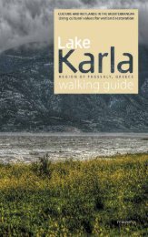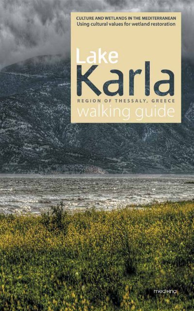
Karla Lake Walking Guide
Lake Karla used to be one of the most diverse Mediterranean wetlands; a productive ecosystem of significant ecological, economic and socio-cultural value. The lake, as it originally was, was drained in the 1960s, with terrible consequences. Nowadays, Lake Karla is once more becoming an important part of the region’s everyday life. This walking guide tells the story of Lake Karla, both as it was and as it is today.
Lake Karla used to be one of the most diverse Mediterranean wetlands;
a productive ecosystem of significant ecological, economic and socio-cultural value. The lake, as it originally was, was drained in the 1960s, with terrible consequences. Nowadays, Lake Karla is once more becoming an important part of the region’s everyday life. This walking guide tells the story of Lake Karla, both as it was and as it is today.

You also want an ePaper? Increase the reach of your titles
YUMPU automatically turns print PDFs into web optimized ePapers that Google loves.
231
2
Culture and wetlands in the Mediterranean<br />
Using cultural values for wetland restoration<br />
<strong>Lake</strong> <strong>Karla</strong><br />
walking guide<br />
Mediterranean Institute<br />
for Nature and Anthropos<br />
Med-INA, Athens<br />
2014<br />
3
Edited by<br />
Stefanos Dodouras, Irini Lyratzaki and Thymio Papayannis<br />
Contributors:<br />
Charalampos Alexandrou, Chairman of Kerasia Cultural Association<br />
Maria Chamoglou, Ichthyologist, Managing Authority of the<br />
Eco-Development Area of <strong>Karla</strong>-Mavrovouni-Kefalovryso-Velestino<br />
Antonia Chasioti, Chairwoman of the Local Council of Kerasia<br />
Stefanos Dodouras, Sustainability Consultant PhD, Med-INA<br />
Andromachi Economou, Senior Researcher,<br />
Hellenic Folklore Research Centre, Academy of Athens<br />
Vana Georgala, Architect-Planner, Municipality of Rigas Feraios<br />
Ifigeneia Kagkalou, Dr of Biology, Polytechnic School,<br />
Department of Civil Engineering, Democritus University of Thrace<br />
Vasilis Kanakoudis, Assistant Professor,<br />
Department of Civil Engineering, University of Thessaly<br />
Thanos Kastritis, Conservation Manager, Hellenic Ornithological Society<br />
Irini Lyratzaki, Anthropologist, Med-INA<br />
Maria Magaliou-Pallikari, Forester, Municipality of Rigas Feraios<br />
Sofia Margoni, Geomorphologist PhD,<br />
School of Engineering, University of Thessaly<br />
Antikleia Moudrea-Agrafioti, Archaeologist, Department of History,<br />
Archaeology and Social Anthropology, University of Thessaly<br />
Triantafyllos Papaioannou, Chairman of the Local Council of Kanalia<br />
Aikaterini Polymerou-Kamilaki, Director of the Hellenic Folklore Research<br />
Centre of the Academy of Athens<br />
Aris Psilovikos, Assistant Professor, Department of Ichthyology and Aquatic<br />
Environment, University of Thessaly<br />
Pantelis Sidiropoulos, Civil Engineer, Managing Authority of the<br />
Eco-Development Area of <strong>Karla</strong>-Mavrovouni-Kefalovryso-Velestino<br />
Markos Vaxevanopoulos, PhD candidate-Geologist, Volos Natural History Museum<br />
Published by:<br />
Mediterranean Institute for Nature and Anthropos (Med-INA), Athens, Greece<br />
Funded by:<br />
MAVA Foundation, Gland, Switzerland<br />
Copyright:<br />
© Med-INA, except where indicated by the authors’ names<br />
Citation: Dodouras, S., Lyratzaki, I. and Papayannis, T. (ed.) (2014),<br />
<strong>Lake</strong> <strong>Karla</strong> <strong>Walking</strong> <strong>Guide</strong>, Med-INA, Athens<br />
English language editing: Julian Hoffman<br />
Greek language editing: Theotokis Theodoulou<br />
Translation services: Aggelos Georgakis<br />
Art direction<br />
Pavlina Alexandropoulou<br />
Coordinators:<br />
Stefanos Dodouras and Irini Lyratzaki<br />
Printed by:<br />
Bibliosynergatiki AEPEE<br />
ISBN: 978-960-89972-5-7<br />
Available from:<br />
Med-INA<br />
23 Voucourestiou Street, 10671 Athens, Greece<br />
T: +30 210 3600711-4, F: +30 210 3629338<br />
E: secretariat@med-ina.org W: www.med-ina.org<br />
4
<strong>Lake</strong> <strong>Karla</strong> used to be one of the most diverse Mediterranean wetlands;<br />
a productive ecosystem of significant ecological, economic<br />
and socio-cultural value. The lake, as it originally was, was purposefully<br />
drained in the 1960s, with terrible consequences. Nowadays,<br />
<strong>Lake</strong> <strong>Karla</strong> is once more becoming an important part of the region’s<br />
everyday life, while the construction of a shallow artificial wetland<br />
area on its northern shores will further assist in protecting and promoting<br />
the local natural and cultural heritage. This walking guide<br />
tells the story of <strong>Lake</strong> <strong>Karla</strong>, both as it was and as it is today.<br />
Figure 0.1:<br />
Panoramic view<br />
of <strong>Lake</strong> <strong>Karla</strong><br />
from the hill<br />
of Agios<br />
Athanasios<br />
5
Map 1:<br />
<strong>Lake</strong> <strong>Karla</strong>,<br />
area map<br />
Source:<br />
D+D Consulting<br />
Engineers<br />
Map 2:<br />
Map of Greece,<br />
geographical<br />
location of<br />
<strong>Lake</strong> <strong>Karla</strong><br />
66
Map 3:<br />
<strong>Lake</strong> <strong>Karla</strong><br />
before and after<br />
its drainage<br />
Source:<br />
Directorate<br />
of Secondary<br />
Education<br />
of Larissa<br />
7
Acknowledgements<br />
Apart from the efforts of the Med-INA Scientific Secretariat, the success of<br />
any project depends largely on the encouragement and assistance of many<br />
others. We would like to take this opportunity to express our gratitude to the<br />
people who have been instrumental in the successful completion of this<br />
guide. We are grateful to the Managing Authority of the Eco-Development<br />
Area of <strong>Karla</strong>-Mavrovouni-Kefalovryso-Velestino for supplying to us digital<br />
data sets on the current and future developments around <strong>Lake</strong> <strong>Karla</strong>. The<br />
expert advice from the Municipality of Rigas Feraios, the Hellenic Ornithological<br />
Society, the Hellenic Folklore Research Centre of the Academy of Athens<br />
and academics at the University of Thessaly proved to be invaluable. We<br />
are also grateful to the Stournaras, Tloupas and Xenos families for generously<br />
providing us with photos, past and present, of the greater <strong>Lake</strong> <strong>Karla</strong><br />
area. Representatives of the local authorities as well as Thymios Dodouras<br />
and Stathis Stamatiou shared their knowledge, ideas and time over the<br />
course of numerous trips, all of which culminated in the completion of this<br />
walking guide.<br />
8
Contents<br />
Forewords 12<br />
1 Introduction 20<br />
2 Region of Thessaly 32<br />
3 <strong>Lake</strong> <strong>Karla</strong> 48<br />
3.1 The archaeology of mythology 50<br />
3.2 Historical narratives 60<br />
3.3 Human habitation 78<br />
3.4 Social beliefs and practices 90<br />
3.5 Ecosystems 110<br />
3.6 Partial restoration of the wetland 120<br />
4 <strong>Walking</strong> trails 132<br />
4.1 Ano Kerasia-Kerasia (MAP 1 – Trail 1) 136<br />
4.2 Ano Kerasia-Flamouri Monastery (MAP 1 – Trail 2) 140<br />
4.3 Kerasia-Sourvia Monastery (MAP 1 – Trail 3) 144<br />
4.4 Keramidi-Palaioskala (MAP 1 – Trail 4) 150<br />
4.5 Ano Kanalia-Pyrgos (MAP 1 – Trail 5) 156<br />
4.6 Glafyres-Saint Nikolaos of Kanalia (MAP 2 – Trail 6) 162<br />
4.7 Kanalia-Drakopigado (MAP 2 – Trail 7) 168<br />
4.8 Chatzimisiotiki Magoula-Agios Athanasios hill (MAP 2 – Trail 8) 172<br />
4.9 Stefanovikeio-Petra (Skala) (MAP 2 – Trail 9) 176<br />
4.10 Kato Kalamaki-<strong>Lake</strong> <strong>Karla</strong>’s artificial wetland (MAP 2 – Trail 10) 180<br />
5 Epilogue 184<br />
6 Useful information 192<br />
7 Appendices 202<br />
8 References 216<br />
Photo credits 225<br />
Figure 0.2:<br />
Panoramic view<br />
of <strong>Lake</strong> <strong>Karla</strong><br />
from the hill<br />
above Kanalia<br />
9
Figure 0.3:<br />
A typical day<br />
on <strong>Lake</strong> <strong>Karla</strong><br />
in 1953<br />
Source:<br />
Takis Tloupas,<br />
Photographic<br />
Archives of<br />
Vania Tloupa<br />
10
11
Figure 0.4:<br />
Including both<br />
dense and<br />
sparse stands<br />
of vegetation,<br />
the <strong>Lake</strong> <strong>Karla</strong><br />
area provides<br />
food and cover<br />
for many species<br />
of birds<br />
This walking guide is especially notable because, above all, it highlights<br />
Greece’s natural and cultural heritage. Specifically, it focuses on the protected<br />
area of <strong>Lake</strong> <strong>Karla</strong>, a wetland which was recently restored, bringing life to the<br />
greater area again. A wide variety of flora and fauna –including numerous<br />
species of migratory birds– cultural expressions, social perceptions and natural<br />
places are all intertwined there, creating the environmental, social, economic<br />
and ethnographic web of <strong>Lake</strong> <strong>Karla</strong>, around which several generations<br />
have lived and prospered.<br />
For the Municipality of Rigas Feraios, <strong>Lake</strong> <strong>Karla</strong> is the benchmark for all human<br />
actions, education and research, ecology, culture, and traditional human activities<br />
such as agriculture and fishing. It is the natural and cultural resource that<br />
gives meaning to the present and future of our region.<br />
Needless to say, there are still many outstanding tasks that need to be addressed<br />
in order to utilise and expand the development prospects that this special wetland<br />
has to offer. But these are matters for local and state authorities, together<br />
with other relevant bodies.<br />
12
…the natural and<br />
cultural resource<br />
that gives meaning<br />
to the present<br />
and future<br />
of our region…<br />
E. Laitsou<br />
For many years, scientists, researchers, scholars and other specialists have been<br />
trying to trace <strong>Lake</strong> <strong>Karla</strong>’s rich history and reveal its hidden aspects. But what<br />
has been missing until now is a guide, a compass for those people who want to<br />
experience the lake, taste its wild beauty and discover some of its secrets. This<br />
publication serves that purpose in the most balanced, objective and scientifically<br />
comprehensive manner.<br />
As soon as you flip through the first few pages and see the beautiful images<br />
of <strong>Lake</strong> <strong>Karla</strong>, you will set off on an imaginary journey through the history of<br />
the area, quickly becoming acquainted with the wetland and surroun -<br />
ding region.<br />
The <strong>Lake</strong> <strong>Karla</strong> <strong>Walking</strong> <strong>Guide</strong> respectfully contributes to the promotion of<br />
<strong>Lake</strong> <strong>Karla</strong>, reinforcing the need to protect our natural and cultural resources,<br />
while attracting new visitors and ventures.<br />
Many congratulations to those who have worked so hard on this effort.<br />
Eleni Laitsou<br />
Mayor of the Municipality of Rigas Feraios<br />
Velestino, May 2013<br />
13
Figure 0.5:<br />
<strong>Lake</strong> <strong>Karla</strong> in<br />
the early 2000s<br />
In an era dominated by new technology and novel opportunities, it is worth reflecting<br />
upon the idea that the future is increasingly a matter of human choice.<br />
Emphasis should be placed on developing practical responses to the large environmental<br />
challenges facing us, not only in Greece, but across all of Europe. In<br />
this context, the topic of European wetlands reaching a level of ‘good ecological<br />
status’ should be urgently revisited, while the need for integrated approaches to<br />
sustainable wetland management is an issue of the utmost importance.<br />
The current financial and environmental crises are the two sides of the same<br />
coin, given that the economy and the environment are simply partners rather<br />
than competitors. The uncertainty posed by global environmental pressures<br />
such as climate change, depletion of non-renewable energy sources and consumption<br />
patterns calls for carefully planned actions. Sustainable development<br />
seeks to make the competing goals of economic growth and environmental protection<br />
compatible. Is this possible?<br />
Given that special emphasis should be placed on the development of integrated<br />
approaches with regard to the numerous and interrelated environmental, economic,<br />
social and cultural aspects of sustainability, ecosystem management is<br />
understood as a dynamic process that involves numerous stakeholders and requires<br />
action at all levels.<br />
Wetlands, in particular, are beautiful and inspiring places, of great significance<br />
to both humans and wildlife. Wetlands and wetland functions are inextricably<br />
linked to their surroundings, biodiversity, human health and world economies.<br />
<strong>Lake</strong> <strong>Karla</strong> used to be one of the most important wetlands in the Mediterranean.<br />
It was a lake of rich biodiversity, a wildlife haven for many birds and other<br />
14
…time to plan and<br />
implement schemes<br />
specifically designed to<br />
protect and promote<br />
its unique values<br />
and functions…<br />
I. Kagkalou<br />
species, and supported vibrant local communities. It performed a dazzling array<br />
of ecological functions, which were violently degraded and disrupted in the<br />
1960s through drainage. However, any drainage scheme not fully accepted and<br />
embraced by the local community is sure to fail, and the loss of <strong>Lake</strong> <strong>Karla</strong>’s rich<br />
natural and cultural heritage called for immediate action. Such action came almost<br />
four decades later, but better late than never.<br />
Now that <strong>Lake</strong> <strong>Karla</strong> is being partially restored we are obliged to acknowledge<br />
the complexity of the task. It is time to plan and implement schemes<br />
specifically designed to protect and promote its unique values and functions;<br />
not only for our own good but also for that of future generations.<br />
One of the main goals of environmental interpretation is to help humans<br />
understand the natural world and re-establish their relationship with nature;<br />
to experience and understand its functions. This walking guide is an<br />
essential tool in the effort to recognise, interpret and appreciate the values<br />
and services related to the protected area of <strong>Lake</strong> <strong>Karla</strong>. This guide is addressed<br />
to local residents and potential visitors with a view to assist them in<br />
rediscovering the thread that leads to the wetland and learning to know,<br />
love and protect it.<br />
As President of the Managing Authority of the Eco-Development Area of <strong>Karla</strong>-<br />
Mavrovouni-Kefalovryso-Velestino, I would like to express my sincere gratitude<br />
for the publication of <strong>Lake</strong> <strong>Karla</strong>’s <strong>Walking</strong> <strong>Guide</strong>, hoping that it will serve as a<br />
reminder and an indication that the conservation and management of our natural<br />
resources is not a luxury that can be dismissed or ignored. Rather, it is a basic<br />
prerequisite for a different, sustainable, development.<br />
Ifigeneia Kagkalou<br />
President of the Managing Authority of the<br />
Eco-Development Area of <strong>Karla</strong>-Mavrovouni-Kefalovryso-Velestino<br />
Stefanovikeio, March 2013<br />
15
Figure 0.6:<br />
The artificial<br />
reservoir of<br />
<strong>Lake</strong> <strong>Karla</strong>,<br />
viewed from<br />
the hill of Agios<br />
Athanasios<br />
The numerous and diverse aspects of wetlands have been artfully blended in<br />
this publication. While flicking through the pages of this guide there’s always<br />
something to make you stop, look and wonder. The guide encourages potential<br />
visitors to use their senses while exploring <strong>Lake</strong> <strong>Karla</strong>: to listen to the songs of<br />
birds, feel the bark of trees, smell the fragrance of flowers, watch for as much<br />
wildlife as possible, touch the walls of the humble or stately houses, talk to the<br />
locals and taste the delicacies of the place. This walking guide does great justice<br />
to <strong>Lake</strong> <strong>Karla</strong>.<br />
The photographs modestly reflect the splendour of the local nature and culture,<br />
whereas the various wetland features have been combined in the text to portray<br />
the visible and hidden –the tangible and intangible– beauties of the entire area.<br />
<strong>Lake</strong> <strong>Karla</strong> is at the centre of the stage, the main protagonist.<br />
You can also go back in time, getting a feel for the historical evolution of a<br />
much afflicted place, which along the way has experienced times of great contradiction.<br />
It’s been through periods of great flourishing, become bogged<br />
down in dubious politics and bureaucratic manoeuvres, and is now trying to<br />
16
…<strong>Lake</strong> <strong>Karla</strong> is<br />
at the centre<br />
of the stage,<br />
the main<br />
protagonist…<br />
V. Kanakoudis<br />
get back up on its feet again. Today, during these difficult times, the restoration<br />
of <strong>Lake</strong> <strong>Karla</strong> is an excellent opportunity to prove that when nature is<br />
treated with the respect it deserves, it can assist in the socio-cultural regeneration<br />
of local communities.<br />
A walking guide about the cultural aspects of <strong>Lake</strong> <strong>Karla</strong> seems like a tribute to<br />
a bygone era. But that isn’t the case. Sometimes it’s easy to think that you<br />
know a place well because you’ve been there a number of times. But, in truth,<br />
you never really discover a place completely. That is how I felt when I read this<br />
guide. It reveals truths that will partially help heal the wetland’s painful past.<br />
This guide gave me the confidence to try again. I must get to know the area…<br />
because it’s worth it.<br />
I’d like to congratulate those who initiated the idea of creatively developing this<br />
innovative walking guide to <strong>Lake</strong> <strong>Karla</strong>. The lasting taste this guide left in my<br />
mouth (and I believe this will be the case for all future readers) is the need to acknowledge<br />
the area; to try to understand and appreciate it. This is the greatest<br />
reward for Med-INA’s difficult and beautiful efforts.<br />
Assistant Professor Vasilis Kanakoudis<br />
Department of Civil Engineering,<br />
University of Thessaly<br />
Volos, March 2013<br />
17
Figure 0.7:<br />
Hundreds of<br />
species of birds<br />
have been<br />
spotted at<br />
<strong>Lake</strong> <strong>Karla</strong><br />
since its partial<br />
restoration<br />
In all traditions and religions, water symbolises strength and life, ensuring immortality<br />
as the ‘living water’ or the ‘fountain of youth’ according to many cosmologies.<br />
In ancient Greece, the list of myths about ‘orkia’ and ‘stygia’ (haunted)<br />
waters, nymphs and water demons is virtually endless. Water holds the same<br />
prominent position in Judaic mythology, which was eventually passed on to<br />
Christianity; it is considered a blessing of God, the beginning of creation. Islam<br />
also celebrates water as God’s gift and a means of purification.<br />
When I first saw the shocking photograph taken by Takis Tloupas –‘the photographer<br />
of <strong>Lake</strong> <strong>Karla</strong>’s life’– of a dry, eroded lake bed with a surreal and out of<br />
place boat, I searched in the Book of Revelation to see how the demon of drought<br />
was described: ‘…here’s the earth standing in front of you, like a mother who no<br />
longer has milk in her breasts. And just as those mothers offer death instead of<br />
life to infants, the earth is showing us its aquifers without any trace of moisture,<br />
its grass that is drying out and threatening us with famine and death.’<br />
The area of <strong>Lake</strong> Voeveis-<strong>Karla</strong> was often described by writers and travellers as an<br />
earthly paradise, the mythical kingdom of Admetus and Alcestis, where until a few<br />
decades ago rural life still thrived. The co-existence of local people and nomadic<br />
tribes was not always easy, but it was a necessary relationship based on the rules<br />
of a trading economy. Wheat for cheese, wool for olive oil, meat for fish, as well as<br />
chestnuts and cherries were some of the main products that were transported between<br />
the mountainous villages of Mt Pelion and those on the plain of Thessaly.<br />
Malaria tormented the local communities, however. While the 20 th century saw<br />
some of humankind’s greatest advances, in Greece the need to create new agricultural<br />
land and eradicate malaria led to the development of poorly planned<br />
and badly implemented measures. Several wetlands were drained, disrupting<br />
their natural ecological balance and delivering none of the expected benefits.<br />
18
…just as they once did,<br />
the surrounding<br />
mountains are reflected<br />
in the lake’s waters,<br />
birds have found their<br />
long-lost nests…<br />
A.Polymerou-Kamilaki<br />
Thessaly, a Neolithic granary with many lakes and water basins and a great river,<br />
the Peneus, was the obvious and easy choice for implementing drainage projects:<br />
<strong>Lake</strong> Kallipefki or Nezeros, <strong>Lake</strong> Xiniada, <strong>Lake</strong> <strong>Karla</strong>…<br />
I grew up in Pelion, where we used to trade olive oil, apples, chestnuts and beans<br />
for ‘karliotika’ fish (always cheaper and thicker than the fish of the sea) and reeds<br />
for our gardens. I remember the reaction of a lot of people around Pelion when<br />
they were told about the draining of <strong>Lake</strong> <strong>Karla</strong>. The grown-ups frequently said it<br />
was nonsense and spoke of how it would dramatically affect the water table of<br />
the entire region. Yet, the euphoria around the creation of new arable land covered<br />
up these dissenting voices. The elders, who sensed the lake’s fairies, knew<br />
that soon the demon of drought would strike the weak crops in the newly reclaimed<br />
land. Etauros, the lake’s beast, was calling for his home in the dark reedy<br />
chambers around the lake’s shores.<br />
Today, everything seems to fall into place again. Just as they once did, the surrounding<br />
mountains are reflected in the lake’s waters, birds have found their long-lost<br />
nests and aquatic plants are decorating the landscape. All these are good reasons<br />
for those who visit the greater area to approach <strong>Lake</strong> <strong>Karla</strong> and hear its breath; to<br />
apologise for all the irrational human deeds that transformed a magnificent wetland<br />
(the region’s jewel which filled the land’s veins with water and sustained a considerable<br />
number of families through its fisheries) into a useless field. We can all gain<br />
by learning from our mistakes, especially when these also affect future generations.<br />
I would like to congratulate Med-INA’s team of researchers who worked with<br />
great sensitivity to create this excellent guide. The choice of <strong>Lake</strong> <strong>Karla</strong>, a wetland<br />
that has experienced violent human interventions but was able to be restored,<br />
gives me hope that this is but the beginning of further future restorations,<br />
starting with the gorgeous <strong>Lake</strong> Kallipefki.<br />
Aikaterini Polymerou-Kamilaki<br />
Director of the Hellenic Folklore Research Centre of the Academy of Athens<br />
Athens, May 2013<br />
19
Figure 1.1:<br />
Sunset over<br />
<strong>Lake</strong> <strong>Karla</strong><br />
20
1<br />
Introduction<br />
Greek wetlands…water and earth meet in the marshes, in the shallow<br />
lakes…at the mouths of rivers and in lagoons…everything combines<br />
to create a landscape of great beauty.<br />
Dimitris Talianis and Giannis Rouskas, 1996<br />
21
Figure 1.2:<br />
Many lowland<br />
bird species<br />
favour nesting<br />
in the marshes<br />
of <strong>Lake</strong> <strong>Karla</strong><br />
Wetland services and pressures<br />
Although they are often relatively unexplored, wetlands are places with<br />
unique natural and cultural values. Some wetlands have been intact for millennia,<br />
while others have completely disappeared, or been altered because<br />
of natural and, more often, human-related causes. Wetlands are beneficial to<br />
both nature and humans, providing a variety of useful resources. In other<br />
words, wetlands ‘work’ for society as they maintain environmental quality,<br />
sustain livelihoods and support biodiversity.<br />
More specifically, wetland services can be described as:<br />
i. provisioning services, providing us with such resources as fresh water<br />
and salt, fish and agriculture, biomass for livestock grazing, and the raw<br />
materials to be used in anything from construction to medicine;<br />
ii. regulating services, like the benefits derived from the processes of ecosystem<br />
maintenance such as water filtration, microclimate regulation,<br />
flood protection and sediment control;<br />
iii. cultural services, including such non-material benefits as aesthetic, educational,<br />
spiritual, biodiversity, tourism, recreational and psychological<br />
values; and<br />
iv. supporting services, relating to the major environmental cycles connected<br />
to hydrology, nutrient flows and soil formation, which are essential for<br />
maintaining all services included in the previous categories (MEA, 2005).<br />
Safeguarding the benefits of wetland services for society must be weighed<br />
against the potential benefits of development. But making such decisions is<br />
difficult. Besides physical, economic and socio-cultural factors, the impact of<br />
any changes on stakeholders at all levels –local, regional and global– must<br />
be considered for the wise use of wetlands.<br />
22
Wetlands are cradles of biodiversity, providing the resources and services<br />
upon which countless species –including humans– depend for survival. The<br />
biota of wetlands consists mainly of fish, amphibians, reptiles, birds and<br />
mammals. The presence of humans in such areas –either as fishermen, farmers,<br />
shepherds or hunters– can be traced back to prehistoric times. Hippocrates<br />
noted the city of Phasis in Colchis –founded in the 7 th or 6 th century<br />
BC– that stood amongst marshes; Aeschylus in his play Persians described<br />
the settlements of <strong>Lake</strong> Kerkini; and Herodotus mentioned the settlements<br />
of <strong>Lake</strong> Doiran during Darius’ expedition to Greece in 513 BC, as well as the<br />
tribes of Paeonians and Doberes who dwelt along the banks of the rivers<br />
Aliakmon and Strymon, respectively. Archaeological work in Central America<br />
has indicated that Mayan wetland agriculture dates back 3,000 years.<br />
Similarly, in Southeast Asia and Pacific regions, staple crops –adapted to<br />
wetland conditions– have been cultivated for thousands of years, while<br />
modern cities such as Amsterdam, New York, Shanghai, Tunis and Venice<br />
were established on the shores of wetlands (Ramsar COP8, 2002).<br />
Wetlands are under threat from pressures ranging from habitat pollution,<br />
land use changes and water extraction to urban development, tourism<br />
growth and climate change (Table 1). Despite this, a shared vision for wetlands<br />
does not exist, primarily because their management is often guided<br />
by the vested interests of a particular sector (Papayannis and Pritchard,<br />
2011). A basic prerequisite for the sustainable management of these vulnerable<br />
ecosystems is the kind of commitment from human societies that<br />
stems from a strong sense of local identity and lifestyle, and which is consistent<br />
with the ecological characteristics of the area and seeks to challenge<br />
the wider community on environmental ethics and social responsibility<br />
(Apitz et al. 2006).<br />
23
Drivers<br />
Climate change<br />
Flood area creation<br />
Food shortages<br />
Hydropower<br />
Land uses and reforms<br />
Market incentives<br />
Population growth and/or migration<br />
Mass tourism<br />
Urbanisation<br />
Pressures<br />
Aquaculture growth<br />
Drainage and land settlement<br />
Fire<br />
Geomorphological changes<br />
Hydrological changes<br />
Intensified agriculture and/or grazing<br />
New infrastructures<br />
Pollution<br />
Transformation of vegetation<br />
Table 1: Main drivers and pressures of wetland transformation<br />
Source: Wood and Van Halsema, 2008<br />
Figure 1.3:<br />
In mythology,<br />
the god Apollo<br />
pastured the<br />
flocks of<br />
King Admetus<br />
at <strong>Lake</strong> <strong>Karla</strong><br />
According to the Ramsar 1 Scientific and Technical Review Panel, emphasis<br />
should be placed on the creation of sustainable ecosystems, as measured by<br />
a human timescale of current and future generations, to improve the ecological<br />
character and enhance the socio-economic role of a given wetland<br />
(Zalidis et al. 2002). Even though such efforts can be complex in terms of the<br />
time and resources required, such processes should be primarily motivated<br />
by the importance of restoring the natural –and associated cultural– values<br />
of wetlands. Management goals, for example, may aim to redress ecosystem<br />
damage created by human and natural disturbances, e.g. Sulaibiya Reserve<br />
(Kuwait), <strong>Lake</strong> Ellesmere (New Zealand); maintain or recover habitats, e.g.<br />
Santa Barbara (USA), <strong>Lake</strong> Kolleru (India); support societal goals, e.g. Quito<br />
(Ecuador), Hadejia-Nguru (Nigeria); restore culturally significant natural<br />
sites, e.g. Tsurui (Japan), River Ganges Delta (Bangladesh); and protect or<br />
support indigenous cultures, e.g. Gwaii Haanas (Canada), Esmeraldas Province<br />
(Ecuador) (IUCN, 2012).<br />
24
Cultural aspects of Greek wetlands<br />
Wetlands are diverse ecosystems, ranging from rivers and lakes to desert<br />
oases and underground karstic systems. Until the early 20 th century, the<br />
geographical distribution of malaria 2 and some other diseases was linked<br />
specifically with wetlands, ultimately driving people away from them.<br />
More than 50% of wetlands in Europe, North America, Australia and New<br />
Zealand were lost, converted or degraded during the 20 th century (MEA,<br />
2005). Since 1971, the Ramsar Convention has made significant progress in<br />
highlighting the crucial environmental functions and socio-cultural benefits<br />
of wetlands. Their dynamic nature can be described in terms of ecology,<br />
hydrology and geomorphology, but also spatially –as a place to live or<br />
as a destination– and even economically, as they provide ample opportunities<br />
for farming, forestry, fishing and recreation, as well as other activities<br />
(Davis 1994; Barbier et al. 1997). The cultural aspects of wetlands, in particular,<br />
have added a new dimension to their diversity. The Ramsar Convention<br />
recognises the need to highlight the cultural aspects of wetlands,<br />
safeguard wetland-related cultural landscapes, learn from traditional approaches<br />
and encourage cooperation across different sectors (i.e. COP<br />
Resolutions VIII.19 and IX.21).<br />
According to the United Nations, sustaining cultures within modern life is<br />
an issue of co-existence and progress rather than just a matter of preserving<br />
the past (Casimir, 2008). Culture –while it includes traditions and customs–<br />
is, first and foremost, about the changing dynamic of how people<br />
live their lives, individually and collectively. When it comes to wetlands,<br />
cultural heritage reveals itself through the practices of salt harvesting, fishing,<br />
the weaving of nets, rice growing, boat building, animal grazing, and<br />
the building of huts and fish-traps with reeds, amongst other things. These<br />
everyday activities are some of the cultural aspects deeply entwined with<br />
Mediterranean wetlands.<br />
Figure 1.4:<br />
The ruins<br />
of old fishing<br />
settlements<br />
can be seen<br />
around Skala,<br />
a small hill<br />
near Petra<br />
25
Figure 1.5:<br />
Flamouri<br />
Monastery,<br />
near <strong>Lake</strong> <strong>Karla</strong>,<br />
is one of the<br />
most significant<br />
religious sites in<br />
the Regional Unit<br />
of Magnesia<br />
The cultural aspects of Greek wetlands, in particular, can be found in:<br />
• Mythology. Artemis, the goddess of nature, was occasionally called Limnaia<br />
3 , Limnatis, Lousia and Potamia. Narcissus was mesmerised by his own<br />
reflection in the waters of a lake and eventually died on its shores. Odysseus<br />
described the eternal punishment of Tantalus who had to stand in a pool of<br />
water beneath a fruit tree, both of which forever eluded his grasp. Hercules’<br />
labours included the cleaning of Avgias’ stables by diverting the flow of the<br />
Alfios and Peneus Rivers, a contest with the waters of the Acheloos River, as<br />
well as the killing of Hydra in the swamps of Lerne and the man-eating<br />
Stymphalian birds in <strong>Lake</strong> Stymphalia. Wetlands were also considered to be<br />
divine places in myth, including the entrance to Hades in <strong>Lake</strong> Acherousia<br />
and nymphs in both <strong>Lake</strong> Koroneia and <strong>Lake</strong> <strong>Karla</strong>.<br />
• Archaeology. Some of the most important of Greece’s archaeological sites<br />
have been found near major wetlands, such as prehistoric remnants in the<br />
estuaries of the Acheloos and Acheron Rivers, Neolithic settlements at Dispilio<br />
(<strong>Lake</strong> Orestias) and <strong>Lake</strong> Kerkini, Mycenaean tombs in <strong>Lake</strong> <strong>Karla</strong>, Roman<br />
(the ancient city of Nicopolis) and Byzantine remnants in the Amvrakikos<br />
Gulf and the Kalamas wetlands, medieval sites in the estuary of<br />
the Evros River, as well as monasteries and hermitages in the estuary of the<br />
Nestos River and around the Prespa <strong>Lake</strong>s.<br />
• History. Many wetlands have been sites of conflict and war, such as the<br />
battle of Byzantines and Normans in <strong>Lake</strong> Orestias, the clash between the<br />
Roman armies of Brutus and Cassius against those of Marc Anthony and<br />
Octavian in the swamps of Tenagi, the siege of Messolonghi during the<br />
years of Ottoman occupation, the Macedonian guerrilla conflicts near<br />
<strong>Lake</strong> Giannitsa, Greek resistance struggles in World War II at <strong>Lake</strong> <strong>Karla</strong> and<br />
the fierce fighting around the Prespa <strong>Lake</strong>s during the Greek Civil War.<br />
• Folklore and language. The intimate relationship between humans and<br />
wetlands can be observed in folk architecture, hydraulic works, transport<br />
systems, songs, and local products and festivities, whilst the strong connection<br />
is further reflected in the roots and history of the names of lakes,<br />
rivers, caves, cisterns, huts, boats and artefacts.<br />
26
• Recreation. Mostly sports and tourism, such as rafting on the Aoos River,<br />
water sports on <strong>Lake</strong> Volvi, bird watching around the Porto Lagos lagoon<br />
at the outflow of <strong>Lake</strong> Vistonida and alternative tourism on the artificial<br />
<strong>Lake</strong> Plastiras.<br />
• Arts and philosophy. Hesiod in Theogony argued about the older gods<br />
which appeared in pairs of opposites, such as earth and sky, freshwater<br />
(rivers and springs) and saltwater (oceans and seas). Plato and Heraclitus<br />
referred to the basic elements of water, earth, air and fire. Demokritus and<br />
Thalis believed that all living beings originated from water. Theophrastus,<br />
a botanist of the 4 th century BC, described the flora of various Greek wetlands,<br />
including <strong>Lake</strong>s Voeveis (<strong>Karla</strong>) and Nessonis (Mavrolimni or Kara-<br />
Tsair) in Thessaly. Pausanias spoke of paintings and sculptures depicting<br />
several divine creatures such as the statues of the Alfios and Peneus Rivers.<br />
Further references to wetlands can be found 4 in contemporary poetry<br />
and literature.<br />
Figure 1.6:<br />
Remains of<br />
traditional<br />
fishing huts<br />
on display in<br />
the main square<br />
of Kanalia<br />
An overview of Greek wetlands in the 20 th century<br />
Culture and nature are interwoven, and the factors that threaten one will<br />
eventually jeopardise the other. In Greece, land reclamation projects have<br />
been undertaken since antiquity. Homer, Hesiod and Strabo noted drainage<br />
works at <strong>Lake</strong> Kopais 5 , while Philip II, King of Macedonia, had allegedly developed<br />
plans for the drainage of the Tenagi swamps. In more recent times,<br />
land use changes and reforms, intensification of agriculture, overgrazing,<br />
excessive aquaculture, uncontrolled tourism development, mishandling of<br />
urban planning issues and a lack of awareness has contributed to the dramatic<br />
degradation of many Greek wetland ecosystems. During the last century,<br />
approximately 60% of the country’s wetlands were drained, including<br />
<strong>Lake</strong> Kallipefki in Larissa (1907), <strong>Lake</strong> Xinias in Fthiotida (1924), Tenagi<br />
swamps in Kavala (1930s), <strong>Lake</strong>s Artzan and Amatovou in Kilkis (1935), <strong>Lake</strong><br />
Achinou in Serres (1936), <strong>Lake</strong> Giannitsa in Pella (1937), <strong>Lake</strong> Meliti in<br />
27
Figure 1.7:<br />
Now dried up,<br />
the Hypereia<br />
Krini in Velestino,<br />
a spring ‘loved by<br />
the gods’ (nama<br />
theofilestaton)<br />
according to<br />
Sophocles<br />
Aitoloakarnania (1950s), Sari Giol in Kozani (1951), <strong>Lake</strong>s Laggasta and Lapsista<br />
in Ioannina (1960s), <strong>Lake</strong> <strong>Karla</strong> in Magnesia and Larissa (1960s), <strong>Lake</strong> Mavri<br />
in Preveza (1960), <strong>Lake</strong>s Lantza and Maurouda in Thessaloniki (1960) and <strong>Lake</strong>s<br />
Mouria, Agoulinitsa and Kasta in Ilia (1969). The previous figure of drainage<br />
ranges from 33% in the Peloponnese to 95% in Thessaly (Kovani, 2002). In<br />
other words, during the inter-war period, drainage works resulted in the loss<br />
of 900 km 2 of wetlands; in the 1950s, such schemes led to the complete or<br />
partial disappearance of 4,500 km 2 of wetlands while, in the 1960s, an additional<br />
1,440 km 2 of wetlands were destroyed (Papayannis, 1992b).<br />
In the 1930s, the riverbeds of the Strymon, Louros and Arachos Rivers were<br />
altered and rearranged. In the 1950s, hydro-electric dams were erected on<br />
the Acheloos, Tavropos, Aliakmon and Axios Rivers, while the riparian forest<br />
of the Nestos River was destroyed to reclaim land for corn plantations. In the<br />
1960s, small-scale drainage works were carried out on <strong>Lake</strong> Vistonis, the Evros<br />
River and the Amvrakikos Gulf. Velestino’s Hypereia Krini spring dried up<br />
due to uncontrolled drilling; mass deaths of birds have been recorded in<br />
<strong>Lake</strong> Koroneia due to a dramatic drop in water levels; while untreated industrial<br />
waste has led to the Asopos River being heavily polluted (Polymerou-<br />
Kamilaki, 1990; 1994; Printzos, 1994; Tsouni, 1998). Also, <strong>Lake</strong> <strong>Karla</strong> and the<br />
Pagasitikos Gulf are threatened by agrochemical runoff as well as domestic<br />
and farm waste, whilst the controversial diversion of the Acheloos River has<br />
never been satisfactorily justified 6 . In many cases, regional authorities are<br />
powerless in practice, with only a limited scope of responsibility, while many<br />
existing regulatory instruments are neither properly implemented nor monitored<br />
(WWF Greece, 2007).<br />
Michel Sivignon (2007) summarised the story of Greek wetlands in four distinct<br />
periods:<br />
• 1925-1940, when several drainage projects were carried out to create new<br />
agricultural land, especially for the Asia Minor 7 refugees, and to ensure<br />
flood protection;<br />
28
• 1948-1960, when further radical measures were introduced to increase<br />
cultivated areas and cope with war-related issues such as increased poverty<br />
and the abandonment of traditional rural activities;<br />
• 1960-1995, when land consolidation became compulsory for all properties<br />
within the territory of government reclamation projects; and<br />
• 1995 onwards, when the need to drain and then reclaim a wetland began<br />
to be questioned.<br />
The ecological parameters of wetlands cannot be managed unless the human<br />
culture that shaped them is appreciated (Gerakis and Koutrakis, 1996).<br />
Strategic wetland management, therefore, should not concentrate on shortterm<br />
plans based upon the past, but instead focus on integrated approaches<br />
that point to the relationship between nature and man, or anthropos in<br />
Greek (Dodouras and Lyratzaki, 2012).<br />
An innovative walking guide<br />
The history of <strong>Lake</strong> <strong>Karla</strong> reveals how the connections between local people and<br />
the natural environment of their communities have been severed. <strong>Lake</strong> <strong>Karla</strong><br />
was once one of the most celebrated of Mediterranean wetlands, renowned for<br />
its high biodiversity and vibrant local culture, especially noticeable in the fishing<br />
communities of the area. But the lake was drained in the 1960s to provide land<br />
for agriculture. As a result, the local community that depended on the lake for its<br />
livelihood was destroyed, large populations of migratory birds disappeared and<br />
the area’s microclimate was affected, leading to increased frost, cracks in the<br />
land and lower humidity levels. A dramatic drop in the level of the area’s aquifers<br />
and the intrusion of salt water led to poor agricultural productivity and, eventually,<br />
land abandonment, while pollution from agricultural and industrial run-off,<br />
initially filtered by the wetland, caused serious eutrophication problems in the<br />
form of severe algae blooms in the Pagasitikos Gulf. So, what exactly had to be<br />
developed at the expense of the socio-cultural fabric of the region? The drainage<br />
of <strong>Lake</strong> <strong>Karla</strong> did not adequately answer this question, but its partial restoration<br />
should attempt to respond to it.<br />
<strong>Lake</strong> <strong>Karla</strong> is located at the northern end of the Regional Unit of Magnesia, in<br />
the Region of Thessaly, and is bordered by the Regional Unit of Larissa to the<br />
west. In Magnesia, tourism is a key aspect of the regional economy; the area<br />
hosts the traditional settlements of Mt Pelion, the exquisite natural environment<br />
of the Northern Sporades islands and the unique cultural character of<br />
Volos. <strong>Lake</strong> <strong>Karla</strong>, however, does not play an integral role in the regional tourism<br />
industry. There is not a single road sign guiding visitors to the site, while<br />
the area is poorly represented by tourism services. Furthermore, major negative<br />
changes –both biotic and abiotic– were caused by the abandonment of<br />
fishing, agricultural practices, excessive grazing and hunting. The local economy<br />
is also underdeveloped and consequently suffers from structural unemployment<br />
and domestic migration. The area’s particular problem is common<br />
to many regions that have experienced environmental degradation, sociocultural<br />
change and economic reforms, and which were unable to develop<br />
and promote a new image or reassert their original identity (Boniface, 1995).<br />
29
Quality alternative tourism –such as ecotourism and cultural tourism– can act<br />
as a safeguard for the wise management of <strong>Lake</strong> <strong>Karla</strong>. Tourism of this type can<br />
include such activities as cultural ecotours, fishing, hiking, riding, bird watching<br />
and other events oriented around nature and culture. Carefully managed,<br />
small-scale tourism developments –where local people are in control– can foster<br />
sustainability by enabling resident communities to improve their well-being,<br />
maintain their traditional socio-cultural values and promote them as part<br />
of the area’s identity. In this context, <strong>Lake</strong> <strong>Karla</strong> can be a vehicle for positive<br />
change as long as it is portrayed as a guardian of local culture and nature. Integrated<br />
strategies are the essence of this potential, focusing neither on the<br />
assumptions of development nor on nostalgic notions of the past, but trying<br />
to promote sustainability through the character and history of a place.<br />
Figure 1.8:<br />
<strong>Lake</strong> <strong>Karla</strong>’s<br />
artificial wetland<br />
area will be<br />
constructed on<br />
its northwestern<br />
shore<br />
This innovative walking guide has been created in collaboration with local and<br />
regional authorities, civil society, academia and other key stakeholders. It aims<br />
to record, celebrate and publicise knowledge of the area’s natural and cultural<br />
heritage, assist in the development of alternative types of tourism and, ultimately,<br />
promote sustainability. Along with studying the history of <strong>Lake</strong> <strong>Karla</strong>,<br />
a number of example ecosystems from around the world have been considered<br />
in the selection of characteristic walking routes. These trails, embracing<br />
the local flora and fauna, archaeology, history, religious sites, traditional activities,<br />
and cultural and aesthetic landscapes, have been carefully chosen and<br />
described to best reflect the area. In the long term, such a guide can –indirectly–<br />
contribute to developments that act in harmony with the culture and<br />
nature of the area, including opportunities for leisure and recreation, enhancement<br />
of the area’s biodiversity, and the promotion of environmental education<br />
programmes designed to encourage visits from schools, social groups<br />
and other concerned individuals. Applying innovative ideas for the protection<br />
of wetlands by capitalising on the natural and cultural heritage of the area<br />
may offer a window of opportunity for sustainable regional development. The<br />
big challenge remains whether such ideas will be embraced by local societies<br />
to gradually become a permanent feature of their traditions.<br />
30
1 The Convention on Wetlands (Ramsar, Iran, 1971) –otherwise known as the Ramsar Convention– is an intergovernmental<br />
treaty that embodies the commitments of its member states to maintain the ecological<br />
character of their wetlands, especially those of International Importance, and plan their sustainable management.<br />
The Ramsar Convention works closely with other environment-related global and regional convention<br />
bodies. It has Joint Work Plans with the Conventions on Biological Diversity, Combating Desertification,<br />
Migratory Species and World Heritage, as well as UNESCO’s Man and Biosphere programme.<br />
2 In 1867, diversion works took place on the Krafsidon torrent in Volos, which was a major source of<br />
malaria (Chastaoglou, 2004a). In 1939, Ethnos newspaper (6.5.1939) noted the progress of the antimalaria<br />
campaign in Thessaly where locals were suffering from influenza, pneumonia and –‘the<br />
scourge of God’– mosquitoes (Lefousis, 1995). Evidence of malaria attacks was found during research<br />
on prehistoric human skeletons in the Lerne swamps, while in 1940 Vafiadis stated that the<br />
villages around Lesser Prespa <strong>Lake</strong> suffered heavily from malaria and that the problem would disappear<br />
only when the lake was drained (in Papayannis, 1992a).<br />
3 Limnaia was the former name of <strong>Lake</strong> Amvrakia in Aitoloakarnania, whereas a sanctuary in ancient<br />
Sparta and a temple near the Larnaka Salt <strong>Lake</strong>s of Cyprus were dedicated to Artemis Limnaia.<br />
4 Especially, The free besieged by Dionysios Solomos, In the ruins of an ancient temple by Yannis Ritsos,<br />
Wherever I travel Greece wounds me by Giorgos Seferis in poetry; Around the lake by Alexandros Papadiamantis,<br />
The secrets of the swamp by Penelope Delta, Journeys by Kostas Ouranis, From Greece by<br />
Stratis Myrivilis, The village by the lake by Foteini Zorba-Archonta, The rustling of the reeds by Magda<br />
Ellina in literature; The river by Nikos Koundouros, The flower of the lake by Stamatis Tsarouchas in<br />
film; paintings of <strong>Lake</strong>s Kopais and Pamvotis by Karl Rottmann and William Page, respectively, and<br />
photo books by Dimitris Letsios, Giannis Rouskas and Takis Tloupas.<br />
5 In antiquity, Alexander the Great tried to drain <strong>Lake</strong> Kopais, whereas Thucydides described its economy.<br />
Nonetheless, <strong>Lake</strong> Kopais in Voiotia was first drained by the Minyas in the 25 th century BC and<br />
re-flooded during the years of the Ottoman occupation. In 1884 it was completely drained, but the<br />
French company responsible for its management declared bankruptcy and the lake was flooded<br />
again in 1887. Immediately afterwards, another contract was signed between the Greek government<br />
and a British firm, <strong>Lake</strong> Copais Co. Ltd., which carried out the necessary drainage works and was<br />
granted ownership of 80 km 2 . In 1953, the land was expropriated and distributed to more than<br />
12,000 farming families (Papayannis, 1992b).<br />
6 According to Greek mythology, the Acheloos River was the god of all flowing waters and the father of<br />
the nymphs. The Peneus River (also known as argyrodinis, or silver-flowing, by Homer because of its<br />
crystal clear waters –a fact also noted by Ovid, Strabo and Plinius) was the son of Oceanus, whereas the<br />
waters of Onochonos (one of its tributaries) were exhausted by the Persian army of Xerxes. In modern<br />
Greece, both rivers display characteristic examples of development practices that do not seem to<br />
comply with EU environmental policy principles. River diversions that contribute to the waste of irrigated<br />
water do not put into practice the ‘sustainable use of natural resources’, whereas treating polluted<br />
waters (in this case the Peneus River) with the waters of another river (the Acheloos River) is<br />
neither a precautionary nor a problem-solving action. The valley and estuary of the Acheloos River<br />
have been included in the European Natura 2000 network, listed as Special Protection Areas (European<br />
Birds Directive 79/409/EEC) and identified as important habitats for several species, including otter<br />
(Lutra lutra), trout (Salmo trutta), dipper (Cinclus cinclus), grey wolf (Canis lupus), wildcat (Felis silvestris)<br />
and roe deer (Capreolus capreolus). The Acheloos River diversion scheme aimed to extend the irrigated<br />
land in the plain of Thessaly, replenish its overexploited aquifer, increase the flow of the Peneus River<br />
and provide water to the urban areas of the region. This idea was first conceived in 1925; yet, at that<br />
time, Greece lacked both the technical and financial means necessary for such a project. The first feasibility<br />
studies, carried out in 1968 and 1972, concluded that such a project was not economically viable.<br />
In 1988, the Greek government presented the scheme as solely an energy project, only to be denied<br />
by two independent firms that arbitrated the proposal on behalf of the European Commission.<br />
Furthermore, the costs of hydroelectric plants, irrigation, drainage works and operating expenses, as<br />
well as the loss of biodiversity, were not taken into account. Thus, the €4.5 million project was annulled<br />
in 1994. In the following years, the Greek government decided to curtail the project (a ‘soft’ or ‘ecological’<br />
diversion, as it was proclaimed) by reducing the amount of the river’s diverted water, involving<br />
fewer reservoirs and refraining from any extension of irrigation. Once again, the scheme was cancelled<br />
by the Council of State. The idea appeared again in 2001, this time in relation to the partial restoration<br />
of <strong>Lake</strong> <strong>Karla</strong>. Apparently, the ‘soft’ diversion was a manoeuvre that concealed the whole picture. Although<br />
nobody knows exactly the project’s scope, cost and time frame, the diversion of the Acheloos<br />
River could have serious adverse sustainability impacts, including biodiversity destruction, microclimate<br />
and hydrological alterations, excessive construction works, land use changes, landscape degradation<br />
and the loss of cultural monuments (WWF Greece et al. 1993; Hadjibiros, 2010).<br />
7 The term Asia Minor Disaster refers to the expulsion of the Greek population from the eastern Aegean<br />
and Black Sea coasts of Asia Minor after the defeat of the Greek Army, in August 1922, by the<br />
forces of Mustafa Kemal Ataturk.<br />
31
Figure 2.1:<br />
Livestock on the<br />
south-eastern<br />
shore of<br />
<strong>Lake</strong> <strong>Karla</strong><br />
32
2<br />
Region<br />
of Thessaly<br />
...myriad stars flickering and shining down on the lake…walking<br />
joyfully on thick grass, your feet sinking into the mud…for you, that<br />
was a picture of perfect harmony...<br />
Alexandros Papadiamantis, 1892<br />
33
Figure 2.2:<br />
The refilled<br />
<strong>Lake</strong> <strong>Karla</strong><br />
Thessaly consists of four Regional Units –Karditsa, Larissa, Magnesia and Trikala.<br />
It stretches across central-eastern Greece, meeting Epirus in the west, Sterea<br />
Hellas to the south and Macedonia in the north. The high range of mountains<br />
to the east, of Olympus, Ossa (Kissavos), Mavrovouni and Pelion, allows limited<br />
access to the Aegean Sea 1 . The region’s unique geographic relief, which resembles<br />
a basin-like shape, lends itself to being the country’s most fertile<br />
plain, a fact noted by Isocrates, Plutarch, Apollonius of Rhodes, Xenophon<br />
and Ovid, among others 2 . Thessaly’s mountainous areas are actually more<br />
extensive (6,390 km 2 ) than its plains (5,139 km 2 ), while the region’s remaining<br />
2,508 km 2 are covered by semi-mountainous landscapes (Petrou, 2010).<br />
Tradition has it that Thessaly was once a large lake. The legend of Deucalion<br />
and Pyrrha begins at Thessaly; it was there that Mt Olympus and Mt Ossa<br />
were parted, allowing water to pour into the sea and for the Vale of Tempe to<br />
be created 3 . Thereafter, Herodotus, Euripides, Archinoos and Strabo noted<br />
that two lakes were left behind, Voeveis and Nessonis, remnants of the once<br />
great Thessalian lake. In scientific terms, Thessaly consists of a large intermountain<br />
trough which is separated into smaller plains rather than being<br />
united geomorphologically. Its wetlands were created after the immersion<br />
of its basin due to tectonic activity and the separation of Mt Pelion from Mt<br />
Othrys and the Halkidiki peninsula, which took place more than 150,000<br />
years ago, during the Middle Pleistocene (Demitrack, 1986).<br />
Thessaly has since time immemorial been associated with the gods of Mt<br />
Olympus, the titans of Mt Othrys, the centaurs of Mt Pelion, the nymphs of<br />
the Pindos mountain range and, of course, the local people that exploited its<br />
fertile plain or explored new horizons opened up by the sea. The region is<br />
connected to the fable of Titanomachy, the expedition of the Argonauts and<br />
the Trojan War. The ancient town of Alos, located near Almyros, was founded<br />
34
y King Athamas and nymph Nefeli, whose children, Phrixus and Elli, had<br />
flown on a golden-haired ram to Colchis. Another local hero was Aristaeus,<br />
who was credited with the discovery of many useful arts such as apiculture.<br />
Aristaeus was the son of Apollo and Cyrene, the daughter of Hypseus, the first<br />
king of the Lapiths. The battles of the Lapiths and centaurs 4 are represented in<br />
the Parthenon marbles in the British Museum, the temple of Theseion in Athens<br />
and the temple of Zeus in Olympia (Region of Thessaly, 2009).<br />
Mt Pelion was praised by Homer for its dense forests (einosifyllon), Pindar<br />
spoke of its strong winds (anemosfarago), while Hesiod and Heraclides noted<br />
its soaring cliffs (pelethronion) and the sheer plenitude of medicinal herbs<br />
and plants (polyfarmakon), respectively. Dicaearchus described the habitat<br />
of the centaurs and its flora (beech, apple, olive, fig, vines, laurels, daffodils<br />
and oleanders) and mentioned a temple dedicated to Zeus Actaeus as well as<br />
Chiron’s cave, both of which occupied the mountain summit. Euripides referred<br />
to it in his Medea while Herodotus talked about ancient Ipnoi, the area<br />
of sea near Zagora where the Persian fleet was largely destroyed after a catastrophic<br />
storm in 480 BC. Also, Mt Pelion witnessed the marriage of Pelias<br />
and the nereid Thetis, whose son, Achilles, became the king of the Thessalian<br />
tribe of Myrmidons 5 . During their wedding, the goddess Iris produced the<br />
apple of discord, the cause of the Trojan War. Philoctetes, the famous Greek<br />
archer and king of the Thessalian town of Melivia, fought in the Trojan War,<br />
whereas Protesilaos, the leader of the Thessalian towns of Fylaki and Pyrasos,<br />
is known as the first man to have disembarked and been killed in Troy after<br />
ignoring the relevant oracle (Kakrides, 1986; Rouskas, 2001).<br />
Sesklo, one of the first Neolithic settlements in Europe, was inhabited as far<br />
back as 7500 BC. Located west of the city of Volos, the first excavations of the<br />
site took place in 1901. The findings originate from an early, non-ceramic<br />
35
period, and provide rich information about housing, trade (obsidian imported<br />
from the island of Milos), agriculture and animal-raising (wheat, barley,<br />
beans, peas, oats and cattle breeding), pottery and idol-making. Archaeological<br />
findings in nearby Dimini revealed key information on architecture,<br />
economy, ceramics, jewellery and other customs such as writing and painting<br />
on stone objects with symbols of Linear B script, one of the earliest attested<br />
forms of the Greek language 6 (Avdikos, 2010; Botsi et al. 2010).<br />
Around 1800 BC, the tribe of Minyas settled in Iolkos, a city that was quickly<br />
transformed into a powerful commercial and cultural centre. Homer referred<br />
to Iolkos as euktimenin, or well-built, Pindaur as eudeielon, or sunny, and Athenaeus<br />
IV as polivotys, or expansive vineyards. Iolkos flourished until the end<br />
of the 7 th century BC, when Pagases became the key port through which all<br />
Thessalian trade was conducted. In 1125-1100 BC, the tribe of Magnetes<br />
settled on Mt Pelion, Mt Mavrovouni and the Northern Sporades islands 7 ,<br />
while the tribes of Perraivoi and Achaeans remained in the Vale of Tempe<br />
and southern Thessaly, respectively. Around 700 BC, Thessaly was divided<br />
into four tribal states 8 , also known as tetrarchies, namely Pelasgiotis, Hestiaeotis,<br />
Thessaliotis and Phthiotis, and formed the Thessalian Alliance. In 352<br />
BC, when the Macedonian King Philip II became the ruler of Thessaly, Fthiotides<br />
Thebes –located near today’s Nea Aghialos– became the region’s new<br />
socio-cultural centre. The nearby city of Demetrias was founded in 293 BC by<br />
Demetrius the Besieger. In 197 BC, following the Macedonians’ defeat at Kynos<br />
Kefales, Roman control was firmly established over the entire region of<br />
Thessaly (Lazarou, 1981; Decourt et al. 2004).<br />
Figure 2.3:<br />
Prehistoric<br />
settlement<br />
at Palaioskala,<br />
on the northeastern<br />
shore<br />
of <strong>Lake</strong> <strong>Karla</strong><br />
Christianity was introduced into Thessaly in the mid-1 st century AD by Herodionas,<br />
one of the Seventy Apostles. Despite the efforts of Julian the Apostate<br />
(331-363), Justinianus (483-565) completed the work of Theodosius the Great<br />
(347-395) and all remaining pagan temples were replaced by Christian churches.<br />
In the following years, Thessaly suffered from invasions by the Ostrogoths<br />
(269), Visigoths (380, 395, 482), Huns (447, 539, 559), Slavs (527, 547-552, 758),<br />
36
Saracens (896, 904, 976), Arabs (901-902), Bulgarians (918, 986, 1025, 1040,<br />
1044), Normans (1082-1083) and Catalans (1309-1311). In 1204, the Franks<br />
conquered Constantinople and became the rulers of Thessaly until 1215 when<br />
the region was annexed to the Despotate of Epirus. In 1333, the Byzantine Emperor<br />
Andronicus III secured the extension of Byzantine control over Thessaly.<br />
Then, in 1348, Stefan Dushan, the ‘mighty’ King of Serbs, conquered Thessaly,<br />
except Mt Pelion and Pteleos which remained in Catalan and Venetian hands,<br />
respectively (Avramea, 1974; Papathanasiou, 1998; Papantoniou, 2004).<br />
The gravity of the Ottoman danger had not been accurately gauged by the Byzantine<br />
rulers, whose main efforts were taken up by conducting wars amongst<br />
themselves. In 1396, the Ottomans crossed over into Thessaly and laid the region<br />
to waste. They settled mainly around Larissa, which was renamed Yenisehir,<br />
or New Town. Three years later, the Ottomans withdrew from Thessaly as Tamerlane<br />
–a Mongol-Turkish ruler– started a war with Sultan Bayezid I on the empire’s<br />
eastern borders. However, in 1423, Thessaly was conquered by Sultan Murat II<br />
and became part of the Ottoman Empire. The Hasan Baba Tekke (15 th century<br />
AD), located in the Vale of Tempe and allegedly built upon the ruins of an ancient<br />
Greek temple dedicated to the goddess Aphrodite, is one of the first monuments<br />
of Ottoman rule in Thessaly 9 . In 1492, when the Jews of Spain were<br />
forced to abandon their homes and businesses, many of them migrated to Thessaly.<br />
During the Venetian-Turkish War (1645-1669), the food supplies required by<br />
the army of Sultan Ibrahim I were shipped from the port of Volos (Liapis, 2004).<br />
The outbreak of several epidemics (1667, 1719, 1742, 1768, 1787 and 1813)<br />
and the devastating floods of the Peneus River (1647, 1684 and 1729) wiped<br />
out a large proportion of Thessaly’s population. Not wanting to encourage<br />
the formation of a national consciousness which might challenge Ottoman<br />
rule in any part of the empire, the Sublime Gate –the central office of Ottoman<br />
government in Istanbul– permitted a degree of religious and cultural<br />
continuity among various ethnic groups, while also allowing their incorporation<br />
into the Ottoman administration.<br />
Figure 2.4:<br />
Several<br />
Mycenaean<br />
tombs have<br />
been discovered<br />
near a stone<br />
quarry on the<br />
southern shores<br />
of <strong>Lake</strong> <strong>Karla</strong><br />
37
Macedonia<br />
Thessaly<br />
Epirus<br />
Map 4: The region of Thessaly in 1740, by anonymous<br />
The Russo-Ottoman wars of the 18 th century and the accelerating decline of<br />
the Ottoman Empire resulted in a notable weakening of the previously<br />
maintained policy of religious tolerance, as Ottoman pressure on the Christian<br />
population intensified. During the Orloff Revolt of 1770-1774, Thessaly<br />
again suffered under the Ottomans, who destroyed several Christian settlements,<br />
whereas the Russian fleet twice attacked the port of Volos (November<br />
1771 and February 1772), capturing a number of large freighters carrying<br />
beans and cereals. Also, the Turko-Albanian Tepelenli Ali Pasha became<br />
the despot of both Epirus and a part of Thessaly for more than 40 years<br />
(1778-1821), turning vengefully against centres of Greek resistance.<br />
The beginning of the 18 th century also marked Thessaly’s spiritual awakening<br />
10 as many local scholars and intellectuals such as Daniel Filippidis<br />
(1750-1832), Rigas Feraios (Antonios Kiriazis, born in Velestino, 1757-1798),<br />
Anthimos Gazis (1758-1828), Grigorios Konstantas (1758-1844), Georgakis<br />
Olympios (1772-1821), Theoklitos Farmakidis (1784-1860) and Filippos Ioannou<br />
(1803-1880), inspired the uprising of such Greek revolutionaries as Kyriakos<br />
Basdekis, Giorgis Damtsas, Nikolaos and Dimitris Filaretos, Garefis Garefis,<br />
Georgios Grizanos, Georgios Karaiskakis and the Moschovakis family, who<br />
were born in Keramidi near <strong>Lake</strong> <strong>Karla</strong>. With the beginning of the Greek revolution<br />
in March 1821, the villages of Mt Pelion revolted and fought on the<br />
side of the rebels. The Ottomans managed to repress the riots by forcing the<br />
Greeks to flee to the islands of the Northern Sporades. The subsequent revolts<br />
of 1822-23, 1854 and 1877-78 proved largely unsuccessful. The northern<br />
borders of the Greek state remained along the Amvrakikos Gulf-Pagasitikos<br />
Gulf line as determined by the London Protocol signed in September<br />
1831 (Kordatos, 1995).<br />
In the 19 th century, such European travellers as Jacob Bartholdy, Felix Beaujour<br />
and Francois Pouqeuville noticed the region’s socio-cultural awakening<br />
(Simopoulos, 2001). In 1810, the British traveller William Leake stated<br />
38
that contrary to the prosperous villages of Mt Pelion, the small town of<br />
Volos was insignificant and contained poor houses and dirty roads. Thirty<br />
years later, the French consul in Thessaloniki noted the city’s commercial<br />
settlements and busy markets as well as the numerous trade ships gathered<br />
in the Pagasitikos Gulf (Paliouras, 2004). Volos’ geographical importance,<br />
as a point of access to the fertile plain of Thessaly and the region’s<br />
only natural harbour, attracted the interest of merchants from Thessaly<br />
and elsewhere, who took advantage of the administrative reforms of the<br />
Ottoman Empire and were granted permission in 1841 to build a new city<br />
on the east side of the castle of Volos 11 . Local products such as tobacco,<br />
tanned leather goods, wheat, olive oil, figs, barley, beans, chestnuts, wine,<br />
fruits and fine silk were exported from Volos to Austria, Cyprus, Egypt,<br />
France, Germany, Great Britain, Hungary, Italy, Holland, Romania, Russia<br />
and Turkey (Skouvaras and Markis, 1958).<br />
Figure 2.5:<br />
Sourvia<br />
Monastery,<br />
Mt Pelion<br />
The disintegration of the Ottoman Empire caused alarm among the Great<br />
Powers of Europe. On March 3 rd 1878, the Russo-Ottoman War ended with<br />
the Treaty of San Stefano, which was revised by the Berlin Congress. The<br />
loss of territory for the Ottoman Empire was enormous, including as it did<br />
Romania, Serbia, Montenegro, Bosnia-Herzegovina, Bulgaria, Thessaly and<br />
parts of Anatolia and Cyprus. All in all, the Ottoman Empire lost about a<br />
third of its territory and over 20% of its population. The Convention of Istanbul<br />
signed on July 2 nd 1881 put into effect the decisions of the Berlin<br />
Congress and, as such, Thessaly (the region of Elassona was excluded) was<br />
liberated after 458 years of Ottoman occupation and incorporated into the<br />
independent Greek state.<br />
After 1881, the Greek state grew considerably in both territory and population.<br />
In 1882, the urban plan for Volos aimed to ‘westernise’ the city (Kafkoula<br />
et al. 1990), a principle that was also adopted in the urban plans for<br />
Karditsa (1882), Larissa (1883), Trikala (1885), Farsala (1887) and Velestino<br />
39
(1888). The same year, the Greek government of Harilaios Trikoupis approved<br />
the plan for the development of the Thessalian railway network. In<br />
1884, the railway connection between Volos and Larissa via Velestino was<br />
completed, while the railway connection between Velestino and Kalambaka<br />
via Farsala, Karditsa and Trikala was finished by 1886. Also, Evaristo de<br />
Chirico, the father of the famous painter Giorgio de Chirico, designed one<br />
of Europe’s finest railway lines 12 , crossing the south-eastern slopes of Mt<br />
Pelion and including a number of arched bridges, tunnels and pedestrian<br />
passages that blended perfectly with the area’s landscapes. Another development<br />
that contributed to the region’s agricultural and commercial<br />
growth was the improvement works in the port of Volos. Started in 1873,<br />
they were gradually completed by 1912 (Fotou, 2004). Such initiatives offered<br />
new economic possibilities to the region, which attracted many<br />
Greeks living in Macedonia, Epirus, and Sterea Hellas, as well as foreigners<br />
working in the transport and maritime industries (Chastaoglou, 2004b).<br />
Furthermore, the consulates of many Western European countries, including<br />
Austria, France, Italy and Great Britain, were opened in Volos where<br />
upper middle-class society had adopted a cosmopolitan attitude and lifestyle<br />
13 . This atmosphere had a positive effect not only on entrepreneurial<br />
activity in the case of banks, tax bureaus, post offices and several industries,<br />
including gas, electricity, iron, steel, copper, textiles, silk, soap, tobacco,<br />
pottery, oil, food and distilleries, but also on cultural development, particularly<br />
in the areas of schools, theatres, libraries and concerts. This financial<br />
and socio-cultural blossoming reached its peak between 1881-1912,<br />
only to be interrupted by the 1897 Greco-Turkish War, swiftly followed by<br />
the Balkan Wars.<br />
Figure 2.6:<br />
Sculpture of the<br />
mythical Argo in<br />
the port of Volos<br />
In 1881, Thessaly’s population was approximately 262,000 inhabitants 14 .<br />
The majority of these were Orthodox Christians, whereas Muslims, predominantly<br />
living in Larissa, and Jews, many of whom lived in Volos, accounted<br />
for 9% and 1% of the population, respectively. At around 21 residents<br />
per km 2 , Thessaly’s population density was low in comparison to<br />
40
the country’s average density of 32 residents per km 2 . In 1890, Larissa<br />
had a population of 13,610, followed by Trikala (12,662), Volos (11,029)<br />
and Karditsa (6,792). The departure of the Ottomans began before the<br />
Convention of Istanbul in 1881, but the majority of Turkish residents left<br />
after the Greco-Turkish War. The 1907 census revealed a large gulf between<br />
the literacy levels of eastern and western Thessaly, showing 44%<br />
and 25% of people were literate in the provinces of Volos and Karditsa,<br />
respectively. The poor living conditions of the rural population and the<br />
insecurity of the borders were hardly favourable conditions for the development<br />
of a modern education system across the region. Also, the region<br />
was weakened by high taxes, migration owing to the insecurity of the<br />
borders and low agricultural productivity, as well as financial difficulties<br />
brought about by the introduction of Greek legislation which resulted in<br />
a climate of economic worry (Prontzas, 2004). As such, land distribution<br />
–which became commonly known as the Agrarian Problem– soon became<br />
the primary demand of the agricultural associations that began appearing<br />
in Thessaly on the eve of the 20 th century. The peasants’ revolt<br />
against the landowners developed from a single rural protest to a regional<br />
movement and, eventually, resulted in the expropriation of the<br />
chifliks, the private estates of the ruling classes.<br />
The Balkan Wars of 1912-13 ended Ottoman rule in the region, leading to a<br />
succession of ethnic and religious conflicts throughout the 20 th century. In<br />
1914, when World War I broke out, the Greek government of Eleftherios<br />
Venizelos actively sought entry into the war on the side of the Entente Forces<br />
and, as a result of this, primarily French troops were stationed in Thessaly<br />
from 1917 to 1920. After the Asia Minor Disaster, tens of thousands of refugees<br />
from Cappadocia, Constantinople, Gialova, Ikonio, Kaisareia, Nicomedeia,<br />
Prousa, Smyrna, Thrace and elsewhere arrived in Thessaly in three different<br />
waves –in 1921, 1922 and 1924– and settled in different parts of the<br />
region (Chastaoglou, 2004c).<br />
Figure 2.7:<br />
The Kileler<br />
memorial<br />
commemorates<br />
the early 20 th<br />
century uprising<br />
of the peasants<br />
of Thessaly<br />
41
Figure 2.8:<br />
Ano Kerasia,<br />
World War II<br />
memorial<br />
In April 1941, the Nazis occupied Thessaly. In June of that year, Alkiviadis<br />
Diamantis, Nikolaos Matousis and Vasilis Rapoutikas appeared as the ‘princes<br />
of Pindos’ and founded the ‘Roman Legion’, declaring at a time of war and<br />
famine that Kutsovlachs should form their own independent state in Thessaly,<br />
Epirus and Macedonia. This small minority of Greeks co-operated with<br />
the Nazis, but their attempt to create an independent state based on their<br />
supposedly different identity proved to be wishful thinking (Psirras, 2008). In<br />
general, the local population actively participated in the Greek resistance,<br />
and in the summer of 1941 the plateau of Nevropolis, near Karditsa, began<br />
functioning as an airport for the Allied Forces. Also, the port of Volos was one<br />
of the Allies’ gateways to the Middle East and Asia Minor. In the autumn of<br />
1944, Thessaly was liberated, but the region continued to suffer from the<br />
subsequent, highly polarised struggles of the Greek Civil War 15 . The Greek<br />
Communist Party encouraged its supporters to boycott the 1946 national<br />
elections –the highest rates of abstention in the country were registered in<br />
Thessaly– and decided to organise an armed struggle against the official<br />
state regime (Nikolakopoulos, 2012).<br />
From the early 1950s, the region gradually began to regain the old rhythms<br />
of its socio-economic life as a result of rising industrial activity. Thessaly’s<br />
economic decline since the late 1970s can be briefly explained in terms of<br />
de-industrialisation, the abandonment of traditional activities and outward<br />
migration. Stelios Alamanis (1976), former Minister of Finance, argued that it<br />
was the lack of irrigation networks in Thessaly that was the main reason for<br />
its underdeveloped economy, whereas new initiatives such as the construction<br />
of dams and the pumping of groundwater sources would result in the<br />
progressive increase in the number of irrigated fields, which in turn would<br />
lead to rapid economic growth. Today, even though the Peneus River creates<br />
a complicated hydrological network through its large number of tributaries,<br />
Thessaly still suffers from severe water problems, including water salinisation,<br />
illegal drilling, over-pumping and landslides (Ministry of Environment,<br />
Physical Planning and Public Works, 2003; 2008).<br />
42
1951 1961 1971 1981 1991 2001 2011*<br />
Greece 7,632,801 8,388,553 8,768,641 9,740,417 10,264,156 10,964,020 11,329,600<br />
Region of<br />
Thessaly<br />
Regional Unit<br />
of Karditsa<br />
Regional Unit<br />
of Larissa<br />
Regional Unit<br />
of Magnesia<br />
622,884 695,385 659,913 695,654 729,268 740,115 730,730<br />
138,786 152,543 133,776 124,930 123,202 120,265 113,070<br />
202,063 237,776 232,226 254,295 271,786 282,156 284,420<br />
153,808 162,285 161,392 182,222 196,252 205,005 203,540<br />
Regional Unit<br />
of Trikala<br />
NOTE: *Last update July 2011<br />
128,227 142,781 132,519 134,207 138,028 132,689 129,700<br />
Table 2: Population census, Region of Thessaly<br />
Source: National Statistical Service of Greece, 2012<br />
In 2001, Thessaly’s population breakdown was 61% urban and 39% rural, while<br />
the corresponding national figures were 73% and 27%, respectively. In employment<br />
terms, the region’s breakdown was 28% of the population working<br />
in the primary sector, 19% in the secondary sector and 49% in the tertiary sector,<br />
in comparison with the corresponding national figures of 15%, 21% and<br />
59%, respectively. In 2011, Thessaly’s population reached an estimated<br />
730,730 inhabitants, or 6.4% of the nation’s entire population (Table 2). In<br />
1997, the Greek government introduced the Kapodistrias Plan that saw the<br />
merging of local authorities in an attempt to regenerate the primary level of<br />
municipal government. The subsequent Kallikratis Plan 16 is considered to be<br />
an extension of the previous administrative reform. The main element of the<br />
Kallikratis Plan is to decentralise administration by replacing the 76 Prefectures<br />
with 13 larger regions, and to consolidate 1034 municipalities in approximately<br />
325 new, and much larger, municipal authorities. In 2010, a whole array of<br />
responsibilities was added to these new municipalities’ portfolios without corresponding<br />
funding and it would seem that these reforms need to overcome<br />
a number of teething problems in regards to planning, finances and legislative<br />
provisions before they live up to their expectations.<br />
In Magnesia, in particular, there are several places of interest to be found<br />
around the Pagasitikos Gulf. The <strong>Karla</strong>-Mavrovouni-Kefalovryso-Velestino area<br />
(GR1420004), Mt Pelion and its coastal zone (GR1430001) and Mt Mavrovouni<br />
(GR1420006) have been included in the European Natura 2000 network. Areas<br />
of rich wildlife include, among others, Sarakinos-Kaliakouda near Makrinitsa<br />
(27.5 km 2 ), Flamouri Monastery near <strong>Lake</strong> <strong>Karla</strong> (18 km 2 ) and the forest of Palia<br />
Mitzela near Zagora (24 km 2 ). <strong>Lake</strong> <strong>Karla</strong>, as well as Mt Othrys, Mt Pelion and Mt<br />
Mavrovouni, have been declared as Important Bird Areas. Also, the Greek Ministry<br />
of Environment, Energy and Climate Change has designated 66 new Special<br />
Protection Areas –including <strong>Lake</strong> <strong>Karla</strong>– adding significantly to the European<br />
Natura 2000 network (Kloutsinioti, 2009). Nonetheless, the turbulent history of<br />
<strong>Lake</strong> <strong>Karla</strong> can be attributed primarily to the fact that its distinct natural and cultural<br />
features have never been utilised as features of sustainable development.<br />
43
Figure 2.9:<br />
<strong>Lake</strong> <strong>Karla</strong><br />
is threatened<br />
by farm and<br />
municipal waste<br />
According to the Ramsar Scientific and Technical Review Panel, adaptive<br />
management should be applied to wetland restoration projects, which<br />
might require modifying to accommodate unforeseen developments and<br />
utilise interdisciplinary knowledge. In turn, this approach would result in<br />
making more informed decisions about wetland functions (Zalidis et al.<br />
2004). The draining of <strong>Lake</strong> <strong>Karla</strong> resulted in the complete loss of the natural<br />
and cultural values of the area without any subsequent economic benefits.<br />
In the forty years since then, there have been several unsuccessful attempts<br />
to establish innovative agricultural practices. Plans for the restoration of<br />
<strong>Lake</strong> <strong>Karla</strong> came much later, part of a ploy to push forward with the Acheloos<br />
River diversion scheme, and overlooked several crucial wetland functions,<br />
making the long-term viability of the restored lake questionable. Today, in<br />
addition to playing a crucial role in biodiversity protection, the partially restored<br />
<strong>Lake</strong> <strong>Karla</strong> is capable of providing a wide range of other benefits and<br />
services. Even though formal apologies for the harm done by government<br />
policies and practices would have provided space for socio-cultural healing,<br />
the wounds will not improve if left unattended, and the road to sustainability<br />
is a long and difficult one. Sustainable wetland management in <strong>Lake</strong> <strong>Karla</strong><br />
must take into account both the tangible and intangible aspects of this fragile<br />
ecosystem, which in turn can help overcome the perception of culture as<br />
being only a thing of the past or associated with modern leisure activities.<br />
1 The Vale of Tempe has been declared an ‘Area of Outstanding Natural Beauty’ (Ministerial Decision<br />
25777/68) while a great part of Mt Ossa has been recognised as an ‘Aesthetic Forest’ (Ministerial<br />
Decision 175/D/77) and been included in the European Natura 2000 network. According to mythology,<br />
Mt Ossa and Mt Pelion played an important part in Titanomachy (the battle between the titans<br />
and the Olympian gods, which led to the predominance of the latter) as the titans piled one upon<br />
the other to scale Mt Olympus and ease their access to heaven.<br />
2 Homer referred to Thessaly as erivolaka, Thucydides as aristi, Euripides as eukarpia and Horatio as opima,<br />
which all mean fertile, whereas Strabo described Thessaly in Geographica (1 st century AD) as a<br />
particularly fruitful land –except for areas flooded by rivers– and flat, besides Mt Pelion and Mt Ossa.<br />
44
3 Diodorus of Sicily, Lucius Annaeus Seneca and Claudius Aelianus, among others, referred to the<br />
Peloria festival that was instigated in Thessaly in honour of Zeus Pelorios, who had separated the<br />
Vale of Tempe by means of an earthquake, allowing the region’s stagnant waters to find a passage<br />
to the Aegean Sea and thereby leaving behind an extensive and fertile plain. During the Peloria<br />
festival strangers were offered shelter, prisoners were released and slaves were invited to dinner.<br />
4 The kingdom of the Lapiths was located along the valley of the Peneus River. The mythical centaurs<br />
(part human, part horse) had a negative reputation due to their violent behaviour. Their<br />
fight with the Lapiths was caused by their attempt to abduct Hippodamia, the bride of King Pirithous<br />
of the Lapiths, on their wedding day. With the help of Theseus, Pirithous drove the centaurs<br />
out of his kingdom. Yet the most famous centaur in Greek mythology was Chiron, a centaur-scholar<br />
who studied nature, medicine, arts and philosophy on Mt Pelion. Achilles, Asclepius, Castor,<br />
Hippoletus, Orfeas, Polydeykes, Theseus and others were also brought up and educated by centaur<br />
Chiron.<br />
5 After their lavish wedding ceremony, Thetis attempted to render her son, Achilles, invulnerable by<br />
dipping him in the sacred waters of the River Styx, holding him by one heel, which remained vulnerable.<br />
Ovid noted that the name Myrmidons was derived from the Greek word murmex , meaning<br />
ant, as they were skilled warriors and industrious people. Furthermore, according to a relevant oracle,<br />
Troy would be defeated if the Greeks acquired the poisonous arrows of Heracles that were in<br />
Philoctetes’ possession, steal the Palladium (which led to the building of the Trojan Horse) and persuade<br />
Achilles’ son, Neoptolemus, to participate in the war. Philoctetes was stranded on the island<br />
of Lemnos as he received a wound on his foot; he was eventually cured using a medicinal soil called<br />
Lemnian Earth and joined the war. At the end of the Trojan War, Neoptolemus denounced Apollo,<br />
holding him responsible for the death of his father, and then destroyed the Delphi sanctuary, eventually<br />
becoming the King of Epirus. His son, Molossus, was the ancestor of Olympiada, the mother of<br />
Alexander the Great.<br />
6 Linear B is a syllabic script used for writing Mycenaean Greek. It represents the oldest known Greek<br />
dialect, elements of which survived in Homer’s language as a result of the long oral tradition of epic<br />
poetry. Linear A is attested on Crete and on some Aegean islands from approximately 1850 to 1400<br />
BC. The approximate phonetic values of most syllabic signs used in Linear A are known from Linear<br />
B, but the language written in Linear A remains unknown. Linear B is an adapted form of Linear A,<br />
which was borrowed from the Minoans by the Mycenaeans, probably about 1600 BC.<br />
7 Skiathos is the island of Staphylos and Bacchus and the birthplace of Alexandros Papadiamantis.<br />
The island of Skopelos, or ancient Peparethos, was in antiquity a meeting place of civilisations. Alonissos<br />
is the only inhabited island within the limits of the National Sea Park (Presidential Decree<br />
25/5/1992) that was created for the protection of unique species of flora and fauna, including kermew<br />
oak, wild olives, Phoenician juniper, red coral (Coralium rubrum), Mediterranean monk seal<br />
(Monachus monachus), Audouin’s gull (Larus audouinii), striped dolphin (Stenella coeruleoalba) and<br />
wild goat (Capra aegagrus). Findings from the Early Stone Age, such as inscribed potsherds and clayware<br />
pieces (6000-5500 BC) bearing writing on one side (similar to those of Dispilio in Kastoria), as<br />
Figure 2.10:<br />
Pelicans<br />
often fish<br />
in cooperative<br />
groups together<br />
with cormorants,<br />
<strong>Lake</strong> <strong>Karla</strong><br />
45
Figure 2.11:<br />
<strong>Lake</strong> <strong>Karla</strong>’s<br />
partial restoration<br />
project – early<br />
construction<br />
works<br />
well as several shipwrecks dating from the 5-4 th century BC, were discovered on the deserted islands<br />
of Selinounta, Jura and Ikos near Alonissos.<br />
8 Each of these tribal states promoted their own particular interests and, as such, according to Demosthenes,<br />
the Thessalians were untrustworthy. In 480 BC at Thermopylae they fought alongside the<br />
Persians, in 476 BC they supported the Athenians in the battle of the Strymon River against the<br />
Persian army, and in 457 BC at Tanagra the Thessalian cavalry was sent to support the Athenians but<br />
eventually fought alongside the Spartans. An important contingent in the army of Alexander the<br />
Great was the Thessalian cavalry, serving him during his campaign in Asia.<br />
9 Another such monument is the Cursum Mosque and the mausoleum of Osman Shah in Trikala,<br />
which have been included in UNESCO’s World Heritage List. They were built in the mid-16 th century<br />
on the banks of the Lithaios River by Sinan Pasha, possibly the greatest architect of the Islamic<br />
world, and who also designed several caravanserais, bridges, baths and mosques in Kosovo, Thessaloniki,<br />
Belgrade, Istanbul and elsewhere. The domes of both structures are covered with lead, or<br />
cursum in Turkish.<br />
10 From the mid-17 th century, small Greek schools began appearing in Epirus, Macedonia, Thessaly<br />
and elsewhere. In 1611, Dionysios the Philosopher (rebuked as Skylosofos, skylos meaning dog),<br />
the bishop of Thessaly, organised a revolt which almost managed to capture Ioannina. However,<br />
he failed and was skinned alive. Consequently, many people from Thessaly migrated to Macedonia<br />
to avoid Ottoman revenge. Kozani, one of Macedonia’s major cities at the time, received the<br />
majority of the refugees; the city enjoyed a period of economic prosperity that was reflected in<br />
the promotion of education, including the founding in 1665 of the Greek school of Kozani (Papaioannou,<br />
1989, Mandrikas, 1992). According to the German historian, Georg Gottfried Gervinus,<br />
the spiritual spark that flared on Mt Pelion in the early 18 th century put an end to the Greek medieval<br />
period (Kordatos, 1983; Michalaros, 2010). Zagora, for example, is known for hosting the oldest<br />
Greek school on Mt Pelion, first established in the mid-17 th century and including literature,<br />
mathematics, physics, astronomy, geography, history, philosophy and foreign languages in its<br />
curriculum. Among the many who studied there were Rigas Feraios, Anthimos Gazis, Grigorios<br />
Konstantas and Filippos Ioannou. Other elementary schools established on Mt Pelion included<br />
those of Makrinitsa (1743), Drakeia (1760), Agios Laurentios (1766), Kissos (1777), Portaria (1778),<br />
Tsagarada (1781) and Milies (1815). Also, Nea (New) Mitzela (otherwise known as Amaliapolis,<br />
named after Amalia, the first queen of the Greek state in the 1840s), is found in the western part<br />
of the Pagasitikos Gulf. Palia (Old) Mitzela was the northernmost border village of the newly independent<br />
Greek state, set on the north-eastern slopes of Mt Pelion. In the early 19 th century more<br />
than 800 people lived there, working –especially after the 1774 Treaty of Küçük Kainarji– in the<br />
local shipyards. The village was burned to the ground by the Ottomans in 1828 and its residents<br />
moved to the new location.<br />
11 The seat of the Ottoman administration in Volos was the area’s medieval castle. For the construction<br />
of the new city of Volos –built, for security reasons, 600 metres from the castle– materials from the<br />
46
abandoned ancient city of Demetrias were sadly used (Chastaoglou, 2004a). Furthermore, the Ottomans<br />
used to control the city’s main geographical borders, the torrents Krafsidon and Anavros,<br />
and taxed all traded goods. The locals often pretended to have Austrian citizenship in order to avoid<br />
paying the tax and, as such, they are still nicknamed ‘Austrians’ (Akrivos, 2007). In 1883, the Municipality<br />
of Pagases (later to become the Municipality of Volos) was founded. Presumably the name<br />
Volos is another word for its castle, called ‘Golos’ by the Ottomans (Pornalis, 2004). In 1889, the decision<br />
of the Greek government of Trikoupis (Official Journal of the Government 272/2.10.1887) to<br />
demolish the castle of Volos, a 6 th century Byzantine monument (originally built in what is today’s<br />
Palia area), was justified on the grounds that anything of oriental character and reminiscent of the<br />
Ottoman Empire should be destroyed (Liapis, 2004).<br />
12 The construction of the Mt Pelion railway line began in 1893 (Volos-Ano Lechonia, 13 km, Official<br />
Journal of the Government 108/10.6.1893). In 1903, the Greek government of Georgios Theotokis<br />
extended the railway line to Milies, a decision that was confronted by huge protests given that<br />
Greece was still recovering from the 1897 Greco-Turkish War. Also, Giorgio de Chirico (1888-1978),<br />
one of the greatest painters of the 20 th century, was born in Volos on July 7 th 1888, and in 1906, following<br />
the death of his father, his family moved to Munich. The movie Aenigma Est tells his life story,<br />
beginning in Volos and ending in Rome.<br />
13 After 1881, Greek banks opened branches in Volos, Larissa and Trikala. Furthermore, the pioneering<br />
methods of the Public School for Girls (1908) in Volos, which included the teaching of<br />
the Greek demotic language by Alexandros Delmouzos and the cultivation of a sense of women’s<br />
independence and an anti-authoritarian relationship between teachers and students, incited<br />
the city’s conservative classes and clergy against the school and ended with the trial of<br />
the so-called ‘Atheist Affairs’, damaging the image of both the city and the Orthodox Church. In<br />
1886, Zosimas Esfigmenitis published the first magazine in Volos and by 1897 more than 25<br />
different newspapers were in circulation. On the eve of the 20 th century, the liberation movements<br />
in Macedonia and Epirus, as well as the peasants’ riots in Thessaly, were decisively supported<br />
and occasionally sponsored by the local press, such as the Thessalia and National Greatness<br />
(Panagiotou, 2004).<br />
14 The nomadic populations of Vlachs and Sarakatsani were unknown as the census took place during<br />
the summer season when they were in the mountain pastures of Macedonia, a Turkish province at<br />
the time.<br />
15 In the early 1960s, the reservoir of Tavropos –artificial <strong>Lake</strong> Plastiras– was created on the plateau of<br />
Nevropolis. In the late 1930s, 1940s and early 1950s, the island of Trikeri (ancient Kikynithos, located<br />
at the southern tip of the Pelion peninsula) was used as a concentration camp for female political<br />
activists.<br />
16 Kapodistrias and Kallikratis Plans are the common names of Laws 2539/1997 and 3852/2010, respectively,<br />
which reorganised the country’s administrative system.<br />
Figure 2.12:<br />
<strong>Lake</strong> <strong>Karla</strong>,<br />
Regional Unit<br />
of Magnesia<br />
47
Figure 3.1:<br />
Scale model<br />
of <strong>Lake</strong> <strong>Karla</strong><br />
life prior to<br />
the 1960s,<br />
North Pelion<br />
Information<br />
Centre<br />
48
3<br />
<strong>Lake</strong> <strong>Karla</strong><br />
One evening, do you remember? We were sailing in silence, hearing<br />
across the waters and beneath the heavens only the distant rhythmic<br />
beat of oarsmen on your harmonious waves…Oh lake! Wordless rocks!<br />
Caves! Dark forest! You who are untouched or made young again by<br />
time, cherish, fair nature, cherish at least the memory of that night…let<br />
the moaning wind, the sighing reed, the gentle scents of your fragrant<br />
air, let all that is heard, seen or breathed, let all say: ‘They have loved!’<br />
Le Lac (The <strong>Lake</strong>) by Alphonse Marie Louis de Prat de Lamartine, 1817<br />
49
3.1<br />
The archaeology of mythology<br />
…hateful man! Let me remind you that I saved your life when you came on<br />
that ship, Argo…by killing the sleepless dragon that guarded the Golden<br />
Fleece…it was I who betrayed my father to come with you to Pelion Iolkos,<br />
not moved by a mind but by a mindless heart…<br />
Euripides’ Medea, 431 BC<br />
Historic <strong>Lake</strong> <strong>Karla</strong> was found beside the foothills of Mt Pelion and Mt Mavrovouni,<br />
in the south-east corner of the plain of Thessaly. Its waters came<br />
mainly from the Peneus River and its tributaries, Amyros and Revenikos, as<br />
well as from the Asmaki torrent, Velestino’s Hypereia Krini spring and other<br />
nearby mountain sources. Although <strong>Lake</strong> <strong>Karla</strong> had no outlet to the sea, the<br />
wetland naturally turned to marsh and pasture over the course of the seasons,<br />
partially drying in the summer sun. The lake’s watershed is made up<br />
mostly of limestone, marble and slate; as limestone is easily dissolved by surface<br />
water, from time to time the ground opened up, and these ancient sinkholes,<br />
otherwise known as dolines, were responsible for swallowing several<br />
creatures that were living at the time. Fossilised animal bones from the Pleistocene<br />
have been found near Velestino and <strong>Lake</strong> <strong>Karla</strong>’s drainage channel<br />
(Managing Authority of the Eco-Development Area of <strong>Karla</strong>-Mavrovouni-<br />
Kefalovryso-Velestino, 2006).<br />
<strong>Lake</strong> <strong>Karla</strong> is strongly associated with a great deal of Greek history and mythology<br />
1 . Hellinas, the original ancestor of the Hellenes, or the Greeks, was<br />
50
the son of Deucalion and Pyrrha, the first humans after the great flood unleashed<br />
by Zeus. Aeolus, the son of Hellinas, was the founder of the Aeolian<br />
race and ruler of Thessaly. Aeolus’ offspring, Magnes and Makedon, were the<br />
mythical ancestors of the Magnetes –who settled, primarily, in what is today’s<br />
Regional Unit of Magnesia– and the Macedonians, respectively. <strong>Lake</strong><br />
<strong>Karla</strong>’s original name was supposedly Voeveis as it was dedicated to the god<br />
Apollo, also known by the name Phoebus, and his grandmother Phoebe,<br />
the goddess of light. ‘Ph’ was replaced by ‘V’ according to the linguistic idiom<br />
in Thessaly. Other narratives refer to Voivos, son of Glaphyrus, from<br />
whom the Thessalian town of Voeveis took its name. Glaphyrus was the son<br />
of Magnes and founder of the ancient town of Glafyres that was located<br />
near <strong>Lake</strong> <strong>Karla</strong>; a village in the area, otherwise known as Kapourna, still<br />
carries the same name.<br />
Figure 3.2:<br />
Prehistoric<br />
settlement<br />
at Palaioskala<br />
near Kalamaki,<br />
<strong>Lake</strong> <strong>Karla</strong><br />
Apollonius of Rhodes, Diodorus of Sicily and Callimachus, among others,<br />
talked about Cyrene, the princess of the Lapiths, who used to tend her father’s<br />
flocks around <strong>Lake</strong> Voeveis. Apollo fell in love with Cyrene and then<br />
kidnapped her, taking her to North Africa where Apollo founded the city of<br />
Cyrene (in today’s Libya) in her honour. The goddess Athena is also said to<br />
have bathed in the lake. Vrimo, also known as Feraia as she was mainly<br />
worshipped in the ancient city of Feres, was an underworld goddess closely<br />
associated with Hermes, who was also worshipped in the area (Exarchopoulos,<br />
1999).<br />
Hesiod and Pindar described how Coronis, the daughter of King Flegyas of<br />
the Lapiths, used to bathe on the shores of <strong>Lake</strong> Voeveis. Apollo fell in love<br />
with her, and their relationship produced Asclepius, the first Greek doctor,<br />
who was able to resurrect the dead, including Glafkos, Kapaneas, and Theseus’<br />
son, Hippoletus. However, as his healing actions were seen to work<br />
51
against the natural order, Hades complained to Zeus, who then killed Asclepius<br />
with a thunderbolt. The death of his son infuriated Apollo, who in turn<br />
killed the Cyclops, the providers of Zeus’ thunderbolts. As punishment, Apollo<br />
was sent to serve Admetus, King of Feres, and watch his flocks as a mortal<br />
slave. While Apollo served his sentence, he tried to seduce nymph Daphne,<br />
who was transformed by her mother Gaia, or Earth, into a laurel tree. From<br />
that moment Apollo was always crowned with laurel wreaths.<br />
Admetus’ kingdom –named after his father, Feres– extended around <strong>Lake</strong><br />
Voeveis. In the myth, Pelias, the King of Iolkos, declared that his divine<br />
daughter, Alcestis, should marry the first man to yoke a lion and a boar to<br />
a chariot. Admetus, with the help of Apollo, completed Pelias’ task. However,<br />
having been forgotten at a sacrifice by him, the goddess Artemis instead<br />
wanted Admetus dead. Once again, Apollo persuaded Artemis to<br />
reprieve him if Admetus could find someone to take his place in the underworld.<br />
Euripides referred to Alcestis’ courage and love for her husband as<br />
unmatched as she volunteered to take his place, only to be rescued from<br />
Hades by Hercules as a token of appreciation for Admetus’ hospitality<br />
(Kakrides, 1986).<br />
Figure 3.3:<br />
‘The building<br />
of Argo,’ artist<br />
unknown<br />
(1 st century AD).<br />
Athena, on the<br />
left, adjusts the<br />
sail while Argos,<br />
on the right, sits<br />
across the stern<br />
<strong>Lake</strong> <strong>Karla</strong> is also closely connected with the expedition of the Argonauts.<br />
Aeson, Feres and Amythaon were the sons of Kretheas and Tyrro. Kretheas,<br />
one of Aeolus’ sons, was the king and founder of Iolkos. Tyrro had two other<br />
sons, Neleus and Pelias, with the god Poseidon. Pelias, with the help of his<br />
father, succeeded Kretheas to the throne by pushing aside the first-born Aeson.<br />
Jason, the deposed king’s son, was brought up and educated by the<br />
centaur Chiron on Mt Pelion. An oracle had told Pelias that he would be overthrown<br />
by a stranger wearing only one sandal. On his way to Iolkos, Jason<br />
lost his sandal in the mud of the Anavros torrent while helping an old woman,<br />
who was in fact the goddess Hera in disguise. Hera’s love for Jason,<br />
52
combined with her hatred of Pelias, set the stage for the quest for the Golden<br />
Fleece. When Jason returned to Iolkos to demand the throne, Pelias<br />
forced Jason to prepare the expedition of the Argonauts 2 , and to satisfy the<br />
wish of the Olympian gods by travelling to Colchis to bring back the remains<br />
of Phrixus and the Golden Fleece. According to Apollonius of Rhodes, the<br />
50-oared ship made of pine from the northern slopes of Mt Pelion, the Argo,<br />
was constructed by Phrixus’ son, Argonaut Argos (Psimopoulos, 2001). The<br />
story of the Argonauts came to symbolise an age of Greek colonisation<br />
around the shores of the Black Sea. In that part of the world, people were<br />
accustomed to using fleeces to collect tiny particles of gold from running<br />
streams; the fleeces would then be hung to dry before the gold was combed<br />
out. One account of this practice dates back to the 5 th century BC and comes<br />
from Georgia in the Caucasus region of Eurasia (Wood, 2007).<br />
<strong>Lake</strong> <strong>Karla</strong> was once a sanctuary for several demigods and heroes, such as<br />
Theseus and Hercules, whereas according to Plutarch, the Amazons<br />
stopped in Kynos Kefales on the western side of the lake, before attacking<br />
Athens. Homer, in the Iliad, noted that Prothoos, the king of <strong>Lake</strong> Voeveis’<br />
north-eastern region, travelled to Troy with forty manned ships. Eumelus,<br />
Admetus’ son, commanded the men who lived in Feres, Voeveis and<br />
Glafyres (the ancient settlements fronting <strong>Lake</strong> <strong>Karla</strong>) and he was among<br />
those who hid in the Trojan Horse along with Odysseus. Homer also spoke<br />
of the ancient town of Voeveis that was situated on top of a hill (today’s<br />
Ano Kanalia), sloping gradually towards the plain on the eastern side of the<br />
lake. The settlement was more than two miles in circumference and possibly<br />
fortified, and at a later stage became dependent upon the Byzantine<br />
town of Demetrias. No significant vestiges of ancient Voeveis can be found<br />
today; most likely, the town was relocated beside the lake during Byzantine<br />
times, later to be succeeded by a fishing settlement, possibly today’s<br />
village of Kanalia (Psimenos, 2005).<br />
Figure 3.4:<br />
Ruins of the<br />
16 th century<br />
monastery<br />
at Sourvia,<br />
North Pelion<br />
53
Traces of other settlements –most likely from the Mesolithic (8000-7000 BC)<br />
period– have been found near Samari, on the southern shore of <strong>Lake</strong> <strong>Karla</strong>.<br />
Remains of a Bronze Age (2600-1100 BC) cemetery, as well as fortifications<br />
from the Neolithic (6500-3000 BC) period, have been identified in Ano Kanalia.<br />
William Leake and Alfred Mezieres noted that they were identical to those<br />
of ancient Sparta; most of these findings, unfortunately, have vanished since<br />
1873 due to illicit excavations (Lefousis, 1997). Archaeological evidence from<br />
the Classical (510-323 BC) and Hellenistic (323-31 BC) periods provides further<br />
hints of human settlements around <strong>Lake</strong> <strong>Karla</strong>, such as those in Saint<br />
Tryfon and Metochi near Kanalia, and Syrtada near Glafyres.<br />
Figure 3.5:<br />
The formerly<br />
inhabited islet<br />
of Petra was<br />
probably<br />
abandoned<br />
around 1250 BC<br />
Most likely, the lake’s three former islets of Petra, Chatzimisiotiki Magoula<br />
and Sifritzali were inhabited by the same tribes who founded Sesklo and<br />
Dimini (7500-4500 BC). Petra was excavated in the late 1950s by Vladimir<br />
Milojčić from the University of Heidelberg. It seems to have had a long history<br />
of human habitation and was possibly fortified. The full perimeter of<br />
Petra’s fortification wall, which was identical to those of ancient Tiryntha and<br />
Mycenae, measured up to 4.5 km. In Chatzimisiotiki Magoula, Neolithic terracotta<br />
figurines and traces of human habitation from the Neolithic to the<br />
Byzantine period have been identified. Remains of human settlements and a<br />
cemetery with vaulted tombs, or tholos (plural tholoi), from the Mycenaean<br />
era have been unearthed in Sifritzali and Koryfoula, near <strong>Lake</strong> <strong>Karla</strong>. In Thessaly,<br />
Mycenaean refinement spread inland, principally from Iolkos and Feres,<br />
which were the northernmost cradles of Mycenaean civilisation (Apostolopoulou-Kakavogianni,<br />
1986).<br />
During earthworks carried out for the lake’s partial restoration project, a<br />
settlement at Palaioskala, dating back to the Late Neolithic (4500-3200<br />
BC) period, was brought to light at the foot of Mt Mavrovouni on the<br />
eastern shore of <strong>Lake</strong> <strong>Karla</strong>. Remnants of traditional human activities in<br />
54
<strong>Lake</strong> <strong>Karla</strong> suggest that there were permanent prehistoric settlements,<br />
otherwise known as magoula (plural magoules), equal to some of the<br />
world’s first human settlements around the Euphrates River in Mesopotamia.<br />
The lake would have played a crucial role in the growth of such communities<br />
in an area that was ideal for the development of agriculture,<br />
livestock and fishing.<br />
Hesiod, in Theogony, stated that the Pelasgians were the first tribe to settle<br />
in Thessaly. Apart from them, several other Indo-European tribes, or Protohellenes,<br />
such as the Dolopes, Ainians, Fthioi and others, appeared in Thessaly<br />
during the Early (3200-2000 BC) and Middle (2000-1600 BC) Bronze<br />
Age. Feres became one of the most important and prosperous towns of the<br />
region during the Late Bronze Age (1600-1100 BC). A group of seven vaulted<br />
tombs cut into the bedrock and containing chiefly gold jewellery and<br />
seal stones (11 th -8 th centuries BC) have been unearthed near Chloe; remains<br />
of houses and cobbled paths from the Late Hellenistic (150-31 BC) and Early<br />
Roman (31 BC-235 AD) periods have been found on the southern shores of<br />
<strong>Lake</strong> <strong>Karla</strong>; and parts of ancient temples and limestone quarries have been<br />
identified at Mt Chalkodonion. The acropolis of Feres was located near Velestino<br />
(Table 3). The temple of Zeus Thaulios, situated at the edge of the<br />
ancient town of Feres, dates back to the Late Classical (380-323 BC) period.<br />
On the north-western side of the Hypereia Krini spring, a cluster of Mycenaean<br />
vaulted tombs, parts of buildings from the Classical period and remains<br />
of a Hellenistic house carved into the rock, are preserved in excellent<br />
condition. Remnants of human habitation have been unearthed in Platomagoules<br />
near Rizomilos (from Neolithic to Early Bronze Age) and Karamourlar<br />
Magoula (from Neolithic to post-Byzantine era). Most of these<br />
findings are exhibited in the Athanasakeio Archaeological Museum of Volos<br />
(Region of Thessaly, 2009).<br />
Figure 3.6:<br />
Battles of the<br />
Lapiths and<br />
centaurs,<br />
Parthenon<br />
marbles<br />
55
Figure 3.7:<br />
Mycenaean<br />
tombs have<br />
been unearthed<br />
in a stone quarry<br />
near <strong>Lake</strong> <strong>Karla</strong><br />
Thessaly was long divided by domestic feuds, with its main cities battling for<br />
supremacy. In 469 BC, the prominent Thessalian Alliance came to an end, but<br />
it was re-established in 360 BC with the city of Feres excluded from its ranks.<br />
In the mid-4 th century BC, when the Macedonians conquered Thessaly, King<br />
Philip II re-instated all tribal states into the alliance. According to myth, Philip<br />
II and his Thessalian mistress, Nicesipolis from Feres, had their daughter<br />
named Thessaloniki (meaning Thessalian Victory) to commemorate the victory<br />
of the Macedonians and the Thessalian Alliance over the allied forces of<br />
the Phocians in the battle of Crocus Field (353 BC) (Region of Thessaly, 2009).<br />
In 336 BC, the Thessalians revolted following the news of the assassination of<br />
Philip II. Alexander the Great responded quickly and entered Thessaly from<br />
the north. He ordered his men to pass over Mt Ossa and continue towards<br />
<strong>Lake</strong> <strong>Karla</strong> as the Thessalian army had occupied the pass between Mt Olympus<br />
and Mt Ossa. When the Thessalians found that the Macedonians were<br />
behind them, they promptly surrendered. Allegedly, when Xerxes invaded<br />
Greece in 480 BC, the allied Greek forces were sent to the Vale of Tempe with<br />
the intention of defending the same pass. Having realised there was another<br />
pass into Thessaly, they withdrew to Thermopylae. Much later, in 1083, Byzantine<br />
Emperor Alexios I marched against the Normans, who had invaded<br />
Thessaly. In similar fashion, the Byzantine army progressed towards Larissa,<br />
traversing the Vale of Tempe and continuing over Mt Ossa. The Byzantines<br />
camped near <strong>Lake</strong> <strong>Karla</strong> and eventually recaptured the towns of Trikala and<br />
Larissa (Savvides, 2007).<br />
After the death of Alexander the Great, many of his offspring became rulers<br />
of Thessaly. The Macedonian regents, Antipatros and Krateros, successfully<br />
faced the revolts in Thessaly that constituted the Lamian War (323-322 BC),<br />
in which southern Greeks attempted to re-assert their independence. When<br />
Demetrius the Besieger founded Demetrias, he forced residents of nearby<br />
56
areas such as Voeveis, Neleia, Iolkos and Olizona to relocate to this new socio-economic<br />
centre. In 198 BC, the tribe of Athamanes from south-eastern<br />
Epirus and western Thessaly attempted to capture Kerkineio and ravaged<br />
the greater area of <strong>Lake</strong> <strong>Karla</strong>. A year later, they fought alongside the Roman<br />
army of Titus Quinctius Flamininus against the Macedonian forces of Philip V<br />
in the battle of Kynos Kefales, which marked the passing of imperial power<br />
from the successors of Alexander the Great to Rome. It appears that the<br />
kingdom of Feres was continuously inhabited from the Late Neolithic period<br />
(also known as Dimini Culture, 5300-4500 BC) to the early years of Roman<br />
occupation, when it was most likely abandoned (Managing Authority of the<br />
Eco-Development Area of <strong>Karla</strong>-Mavrovouni-Kefalovryso-Velestino, 2006).<br />
Figures 3.8:<br />
Flamouri<br />
Monastery,<br />
dedicated to the<br />
Transfiguration<br />
of the Saviour<br />
Figures 3.9:<br />
The stonearched<br />
bridge<br />
of Kerasia<br />
57
MONUMENT LOCATION COMMENTS<br />
Archaeological site of<br />
Amygdali<br />
Amygdali Prehistoric settlements, 15 th Ephorate of Prehistoric and<br />
Classical Antiquities, Decision No 6445/96<br />
Monastery of Virgin Mary Elafos 19 th century, Kampana Monastery<br />
Syrtada, Agios<br />
Athanasios and Samari<br />
Glafyres,<br />
Kanalia<br />
Settlements of the Bronze, Neolithic and Classical<br />
periods, 13 th Ephorate of Prehistoric and Classical<br />
Antiquities, Decisions No 329/96 and 870/96<br />
Palaioskala Kalamaki Prehistoric settlements, 15 th Ephorate of Prehistoric and<br />
Classical Antiquities, Decision No 6445/96<br />
Caves in the greater Kanalia Speleology, undeclared status<br />
Kanalia area<br />
Chatzidima cistern Kanalia Traditional hydraulic system<br />
Liolios and Vaira<br />
mansions<br />
Kanalia Traditional architecture<br />
Church of Saint<br />
Nicholas<br />
Saint Tryfon,<br />
Paliokastro,<br />
Metochi<br />
Kanalia<br />
Kanalia<br />
12 th century Byzantine church, declared<br />
a historical monument by the 7 th Ephorate<br />
of Byzantine Antiquities<br />
Middle Bronze Age, Classical and Hellenistic settlements,<br />
13 th Ephorate of Prehistoric and Classical Antiquities,<br />
Decisions No 329/96 and 870/96<br />
Gouva Kastri Byzantine settlements, 7 th Ephorate of Byzantine<br />
Antiquities, Decisions No 1554/2.7.1996 and<br />
1649/12.7.1996<br />
Neochori<br />
(Plasia)<br />
Kastri<br />
Ancient town of <strong>Lake</strong>reia, 6 th -5 th century BC,<br />
15 th Ephorate of Prehistoric and Classical Antiquities,<br />
Decision No 6445/96<br />
Ancient Kasthanea Keramidi Early Hellenistic settlements<br />
Konstantaras and Keramidi Traditional architecture<br />
Papaioannou mansions<br />
Church of Saint George Keramidi Traditional 18 th century architecture<br />
Trani cistern Keramidi Traditional hydraulic system<br />
Stone-arched bridge Kerasia Traditional 19 th century architecture<br />
Flamouri Monastery Kerasia 16 th century monastery, declared<br />
a historical monument by the 7 th Ephorate<br />
of Byzantine Antiquities<br />
Caves in the Velestino<br />
area<br />
Caves in the<br />
Rizomilos area<br />
Ovria, Delichani and<br />
Karapatia Magoules<br />
Mikro<br />
Perivolaki<br />
Rizomilos<br />
Speleology, undeclared status<br />
Speleology, undeclared status<br />
Rizomilos, Archaeological site, Ministerial Decision<br />
Stefanovikeio 27944/1428/3.7.1996, Official Journal of the<br />
Government 648/Β/30.7.1996<br />
Church of Saint Apostles Sklithro Traditional 19 th century architecture<br />
Figure 3.10:<br />
The ancient<br />
temple of<br />
Zeus Thaulios,<br />
Velestino<br />
58
MONUMENT LOCATION COMMENTS<br />
Alerani<br />
(Aerani)<br />
Chatzimisiotiki<br />
Magoula<br />
Karamourlar Magoula<br />
Petra<br />
(Adatepe)<br />
Platomagoules<br />
Sifritzali<br />
Acropolis<br />
(ancient Feres)<br />
Bas Baze<br />
(ancient Feres)<br />
Karakaxes<br />
(Rematia)<br />
Kastraki Hill<br />
(ancient Feres)<br />
Kefalovryso’s Spring<br />
(Hypereia Krini)<br />
Kokkina cistern,<br />
Kranovo aqueduct<br />
and Pantos watermill<br />
Stefanovikeio Cemetery of the Hellenistic period, Ministerial Decision<br />
62739/3457/7.11.1997<br />
Stefanovikeio Neolithic and Early Bronze Age settlements, declared<br />
an archaeological site by the 7 th Ephorate of Byzantine<br />
Antiquities<br />
Stefanovikeio Early Neolithic period settlements, Ministerial Decision<br />
62739/3457/7.11.1997<br />
Stefanovikeio Middle and Late Bronze Age settlements, declared an<br />
archaeological site by the 13 th Ephorate of Prehistoric<br />
and Classical Antiquities<br />
Stefanovikeio Neolithic and Early Bronze Age settlements, 13 th<br />
Ephorate of Prehistoric and Classical Antiquities,<br />
Decisions No 329/96 and 870/96<br />
Stefanovikeio Prehistoric settlements, Ministerial Decision<br />
9448/19.4.1963, Official Journal of the Government<br />
172/Β/24.4.1963<br />
Velestino Ancient settlements, defensive works, Ministerial<br />
Decision 9448/19/4/1963, Official Journal of the<br />
Government 172/Β/24.4.1963<br />
Velestino Hall of the Hellenistic period, Ministerial Decision<br />
9448/19/4/1963, Official Journal of the Government<br />
172/Β/24.4.1963<br />
Velestino,<br />
Chloe<br />
Geometric vaulted tombs, Ministerial Decision<br />
15952/870/30.3.1995, Official Journal of the<br />
Government 310/Β/20.4.1995<br />
Velestino Archaeological site, Ministerial Decision 9448/19/4/1963,<br />
Official Journal of the Government 172/Β/24.4.1963<br />
Velestino Archaeological site, Ministerial Decision<br />
9448/19/4/1963, Official Journal of the Government<br />
172/Β/24.4.1963<br />
Velestino Traditional hydraulic systems<br />
Mati Magoula Velestino Neolithic and Early Bronze Age settlements, Ministerial<br />
Decision 29071/ 1356/24.10.1990, Official Journal of the<br />
Government 766/Β/5.12.1990<br />
Agios Charalampos<br />
(Zeus Thaulios)<br />
Presentation of Christ<br />
Church<br />
Velestino<br />
Veneto<br />
Archaeological site, Ministerial Decision<br />
9448/19/4/1963, Official Journal of the Government<br />
172/Β/24.4.1963<br />
Traditional 19 th century architecture<br />
Table 3: Selected monuments in the <strong>Lake</strong> <strong>Karla</strong> area<br />
Source: Kamilakis and Polymerou-Kamilaki, 1990; Karaberopoulos and Kakavogianni, 1994;<br />
Karaberopoulos, 2002; 2005; Managing Authority of the Eco-Development Area of <strong>Karla</strong>-<br />
Mavrovouni-Kefalovryso-Velestino, 2006; Ministry of Culture, 2012<br />
59
3.2<br />
Historical narratives<br />
Its Christian communities reached their golden age during the mid-18 th century<br />
when Mt Pelion was, perhaps, the richest and, definitely, the most<br />
densely populated area (613 residents per km 2 compared to 300 per km 2 in<br />
the Peloponnese) in occupied Greek territory.<br />
Daniel Filippidis and Grigorios Konstantas, 1791<br />
Thessaly used to be one of the main administrative divisions –known as Themata–<br />
of the Byzantine Empire. Written accounts from the 5 th century AD<br />
document the appearance of Christianity in Magnesia. During the Fourth<br />
Crusade, the greater area of <strong>Lake</strong> <strong>Karla</strong> fell under the rule of Count Berhold<br />
von Kartzenellenbogen, a Rhenish warlord who had given the signal to set<br />
fire to Constantinople (Miller, 1990). In the 11 th century, Mt Pelion, or Mount<br />
of the Cells, appeared as a monastic community 3 . It was also noted as monastir<br />
(monastery) on several maps that were published during the 15 th and<br />
16 th centuries, including those of Francis de Gezanis (1421), Marco Sadeler<br />
(1500) and Jacob Castaldi (1575) (Sfyroeras et al. 1985). In the following centuries,<br />
with the resettling of populations from the coastal areas and plains of<br />
Thessaly, new self-governed villages were developed around these monastic<br />
communities. From the mid-14 th century, the Ottomans were able to take<br />
advantage of rising socio-economic and religious discontent within the Byzantine<br />
Empire to gradually take over its territories, including Thessaly itself.<br />
Although most Byzantine sites are located in the coastal zone of Magnesia,<br />
the Church of Saint Nikolaos is one of the region’s most significant<br />
60
mo nu ments from that era and is found on the south-eastern shore of <strong>Lake</strong><br />
<strong>Karla</strong>, an area shown by archaeological remains to have been continuously<br />
inhabited. The fashion for decorating the external brick walls of most 12 th<br />
century Byzantine churches (the bricks are roughly carved and set so as to<br />
make ornamental bands) is also apparent in the Church of Saint Nikolaos.<br />
Dating from the 13 th and 17 th centuries, its notable frescoes depict, among<br />
other things, everyday events around <strong>Lake</strong> <strong>Karla</strong> (Saint Nikolaos is the patron<br />
saint of fishermen) and horrific scenes from Hell, where devils are portrayed<br />
in a similar fashion to the satyrs of ancient Greece. The elements of<br />
this iconography, common to Byzantine monuments of the period, bring<br />
together components of classicism in the Byzantine arts as well as symbolic<br />
representations of divine life and human destiny. Until the early 1940s, a<br />
large area of land around Saint Nikolaos was covered with vineyards, almonds,<br />
pears, apricots and other fruit trees, while a fruit market was regularly<br />
held nearby. Unfortunately, this historic religious monument has been<br />
poorly preserved. Its roof has collapsed, the interior is in poor condition,<br />
and its walls are collapsing. Unless immediate restoration works take place<br />
it will inevitably fall soon (Mamaloukos, 2004). Maintenance and supervision<br />
of this important site are likely to strengthen the level of historical<br />
consciousness and symbolise the need for protection of the region’s cultural<br />
heritage.<br />
Figure 3.11:<br />
E.L.A.N.<br />
(Greek People’s<br />
Liberation Navy)<br />
partisans attempt<br />
to unload<br />
a German,<br />
medium-calibre,<br />
cannon during<br />
winter 1943-44<br />
in Koulouri,<br />
near Veneto<br />
Source:<br />
Stournaras<br />
Photographic<br />
Archives<br />
The Monastery of the Transfiguration of the Saviour in Flamouri, located<br />
near Veneto on the eastern slopes of Mt Pelion, was founded in the 16 th century<br />
by the ‘barefoot and loin-clothed’ Father Simeon. He began his ascetic<br />
life in Komnineio Monastery on Mt Ossa where he was ordained as a deacon.<br />
Then, as the spiritual leader of Filotheou Monastery on Mt Athos, Father<br />
Simeon imposed a code of strict discipline on the community. This came as<br />
a great discomfort to some of the monks, who subsequently had him<br />
61
imprisoned in the monastery. Father Simeon managed to escape and travelled<br />
to northern Pelion, where for some years he lived in the woods. A number<br />
of monks gathered around him and assisted in building the Church of<br />
the Transfiguration of the Saviour. Its architectural type is cruciform basilica,<br />
otherwise known as the Athonite type (Kizis, 2004). Despite primitive conditions,<br />
Father Simeon’s group of loyal monks grew larger and he eventually<br />
journeyed to Istanbul to seek the guidance and economic assistance of Ecumenical<br />
Patriarch Kallinikos III (born in Zagora, Mt Pelion). At that time, the<br />
daughter of Sultan Suleiman the Magnificent was seriously ill. Father Simeon<br />
miraculously healed her and, in return, the Sultan agreed to financially support<br />
the construction of the monastery. Flamouri Monastery is considered to<br />
be one of the most significant monastic communities in Magnesia.<br />
Saint Dionysios of Olympus was a prototype anchorite as well as a coenobitic<br />
monk. He departed for the Great Meteoron Monastery in Meteora at a<br />
very young age before moving on to Mt Athos. A few years later, he was installed<br />
at the Monastery of Timios Prodromos in Veroia. In order to avoid his<br />
election as bishop, and wishing to pursue his ascetic life, Saint Dionysios secretly<br />
fled to Mt Olympus, continuing on to Mt Pelion, where he founded the<br />
Monastery of the Holy Trinity in Sourvia (1540). Gerasimus of Leondarion,<br />
born in the Peloponnese in the mid-17 th century, made a pilgrimage to Jerusalem<br />
and upon his return in 1740 he devoted himself to asceticism in Sourvia<br />
Monastery. After his death in 1794, the Saint Gerasimus Monastery (1795)<br />
was founded in Makrinitsa and residents from Velestino, Agios Georgios,<br />
Kanalia and Kerasia regularly referred to the miracles he performed. On the<br />
day of mid-Pentecost, the icon of Saint Gerasimus is carried in processions as<br />
a blessing for the agricultural harvest of north-western Pelion.<br />
Map 5: <strong>Lake</strong> <strong>Karla</strong> in 1820, by Francois Pouqueville<br />
62
On Mt Mavrovouni, the village of Elafos (also known as Voulgarini) derives its<br />
name from a legend involving a deer, or elafi in Greek, that emerged from<br />
the forest behind the Church of the Assumption of Virgin Mary on the<br />
church’s saint’s day. A traditional feast takes place every year on August 15 th<br />
in the abandoned 19 th century Monastery of the Virgin Mary of Kampana.<br />
Nearby, in the area known as Skotomenoi, there is a monument to local leaders<br />
killed by the Ottomans in 1878. The diaries kept by the monks of these<br />
monasteries provide useful information on various activities (for example, in<br />
1730, 1764 and 1775 the locals suffered from poor agricultural yields), disasters<br />
(in 1739, 1742 and 1748 famine led to depopulation in the villages<br />
around the lake) and weather conditions (in 1688, 1728 and 1782 many people<br />
and animals died as a result of <strong>Lake</strong> <strong>Karla</strong> freezing over) (Lefousis, 1997).<br />
Today, the male-only Flamouri Monastery is still active, while the other two<br />
monasteries have been abandoned.<br />
In the late 18 th century, Veli Pasha of Trikala decided to deepen the Peneus<br />
River’s natural channel so that any stagnant water would be drawn off into<br />
the Asmaki torrent, from where it would travel to <strong>Lake</strong> <strong>Karla</strong> (Georgiadis,<br />
1995). As a result, during the summer season, <strong>Lake</strong> <strong>Karla</strong> became an insufferable<br />
place because of ‘its green, rotten waters where the mosquitoes<br />
blurred the horizon like a black cloud.’ In winter, the lake’s ‘black and muddy<br />
waters, as well as the bad odours from the nearby cow and pig farms,’ made<br />
it an equally nightmarish place (Lefousis, 1995). Around that time, Ecumenical<br />
Patriarch Kallinikos III spoke of carrying out drainage works on <strong>Lake</strong><br />
<strong>Karla</strong> in order to eliminate malaria and reclaim the land for agriculture<br />
(Skouvaras and Makris, 1958).<br />
Map 6: <strong>Lake</strong> <strong>Karla</strong> in 1826, by George Dimakopoulos<br />
63
Route taken by<br />
Pasha Machmud<br />
Dramalis in 1821<br />
Route taken by<br />
Resit Kutahi<br />
Pasha in 1823<br />
Position of the<br />
Ottoman army<br />
and navy on the<br />
Makrinitsa-<br />
Glafyres-Kerasia<br />
axis and the<br />
coastline of Mt<br />
Pelion, in 1878<br />
Position of the<br />
Greek rebels<br />
in 1878<br />
Map 7: <strong>Lake</strong> <strong>Karla</strong> and the Greek War of Independence during the 19 th century<br />
Unlike the self-administration privileges of Mt Pelion, the Christian communities<br />
of <strong>Lake</strong> <strong>Karla</strong> were ruled by an Ottoman Bey. In 1787, Tepelenli Ali Pasha<br />
gathered a large group of Turkish and Albanian soldiers to accompany him during<br />
his expedition to Thessaly, where he ravaged the greater area of <strong>Lake</strong> <strong>Karla</strong>.<br />
In 1809, William Leake stated that poverty-stricken peasants were dying of malaria<br />
and famine around <strong>Lake</strong> <strong>Karla</strong>, but the French historian Alfred Mezieres<br />
noted that because of its fisheries and clean waters <strong>Lake</strong> <strong>Karla</strong> was the region’s<br />
most beautiful wetland. In 1813, Argyris Filippidis argued that the lake had<br />
three small ports –Aerani, Petra and Fournos– which supplied fish for all of<br />
Thessaly. Aerani served most of the villages of Mt Pelion as well as Volos, Velestino<br />
and Almyros. Merchants from Tyrnavos, Larissa, Karditsa, Farsala and Trikala<br />
used to go to Petra to buy their fish, whereas Fournos served the villages of<br />
Mt Ossa and Mt Olympus (Sperantzas, 1978). In 1836, Ioannis Leonardos from<br />
Ambelakia referred to the great abundance of medicinal Mediterranean herbs<br />
found around <strong>Lake</strong> <strong>Karla</strong>, while the Greek scholar Antonios Miliarakis noted its<br />
tranquil wetland landscapes (Spanos, 1992). A few decades later, in 1874, Nikolaos<br />
Rimatisides stated that on occasion the lake completely dried up, while the<br />
area was renowned for its quality agricultural products (Lefousis, 1997).<br />
In the late 17 th century the fortunes of the Ottoman Empire began to wane,<br />
especially after the Ottoman defeat at Vienna in 1683. Ottoman repression<br />
of the Greeks eventually sparked the War of Independence in 1821. In Thessaly,<br />
the Greek revolution began in Milies, having as its leader the locally-born archimandrite<br />
Anthimos Gazis, who gave the signal for revolt on May 7 th 1821. The<br />
Greek rebels were unable to force the Ottomans out of the castle of Volos but<br />
they did manage to capture Velestino 4 , where they established the Parliament<br />
of Thessalomagnesia. Anthimos Gazis and Filippos Ioannou were elected its<br />
president and secretary, respectively, and proclaimed Magnesia part of Greek<br />
national territory. The revolution was brutally repressed in August 1821 when<br />
64
Pasha Machmud Dramalis, together with thousands of armed Ottomans, arrived<br />
from neighbouring Larissa. En route to Volos, Dramalis’ forces destroyed<br />
the villages of Kileler, Armenio, Velestino and Kerasia near <strong>Lake</strong> <strong>Karla</strong>, where<br />
the Greeks tried unsuccessfully to defend themselves. Many rebels sought refuge<br />
in the remote areas of Keramidi, while local chieftains Chatzikiriazis and<br />
Chatzinikolas from Kanalia (they were members of the Society of Friends, a<br />
secret 19 th century organisation whose purpose was to establish an independent<br />
Greek state) managed to escape to Trikeri (Mougogiannis, 2004).<br />
Figure 3.12:<br />
Part of<br />
Rigas Feraios’<br />
twelve-sheet<br />
map, known as<br />
Charta (1797)<br />
In 1822, Greek chieftain Tassos Karatassos and his troops from Western<br />
Macedonia crossed over into Thessaly and another revolt broke out; a year<br />
later a peace treaty was signed between Karatassos and Resit Kutahi Pasha,<br />
primarily because the help which Karatassos’ troops had expected from the<br />
rebels of southern Greece never came. Once more, the villages around <strong>Lake</strong><br />
<strong>Karla</strong> suffered from attacks carried out by Ottoman troops under Resit Kutahi<br />
Pasha. Another insurrection flared up in 1854 and spread rapidly. The Greeks,<br />
under the command of Nikolaos Filaretos, camped in Sourvia Monastery<br />
and liberated the area around <strong>Lake</strong> <strong>Karla</strong>. Furthermore, the rebel groups of<br />
local chieftain Dimitris Dianellos organised several attacks on the Ottoman<br />
villages around <strong>Lake</strong> <strong>Karla</strong> and burned down the Tekke of Tourkochori (today’s<br />
Neromyloi). The revolt, however, did not live up to expectations due<br />
to a series of intrigues between the Greek rebels, coupled with the antirevolutionary<br />
attitude of Gavriel, the Bishop of Demetrias (Thomas, 2004).<br />
When another insurrection broke out in December 1877, it had the active support<br />
of the Church of Demetrias, together with the Greek and Italian consulates<br />
in Volos. The Greeks had initially barricaded themselves inside Sourvia Monastery<br />
as assistance from southern Greece was thought to be arriving in Kamari. A<br />
provisional government was appointed with Ieronymos Kassavetis, a cotton<br />
65
Figure 3.13:<br />
The area around<br />
Glafyres is rich in<br />
caves and other<br />
karstic features<br />
merchant in Egypt who was originally from Zagora, and local chieftain Zisis Basdekis<br />
as president and vice-president, respectively. Once again the organisation<br />
proved to be unequal to the task. In January 1878, the Ottomans took up<br />
positions on the Makrinitsa-Glafyres-Kerasia axis and surrounded the monastery<br />
at Sourvia. The battle that followed was critically uneven in terms of troops<br />
and weaponry. After two days, the situation for the Greeks became serious and<br />
they were forced to withdraw to Pouri while the monastery was set on fire by<br />
the Ottomans. Meanwhile, Pasha Chovart’s navy vessels blockaded the coastline<br />
of Mt Pelion and Mt Kissavos so that no further assistance to the rebels<br />
could be provided. In June 1878, after the intervention of the British Consulate,<br />
a peace treaty was signed and the Bishop of Demetrias, Grigorios IV, was exiled<br />
as a result of his active role in the revolt (Tsivilidis, 2004). Three years later, on<br />
November 2 nd 1881, the Greek army entered the city of Volos.<br />
The introduction of Greek legislation to the newly annexed region of Thessaly<br />
took place with the publication of several decrees, the circulation of Greek currency<br />
and the establishment of prefectures, provinces and administrative agencies.<br />
In spite of the socio-economic flourishing of Volos since the mid-19 th century,<br />
the associated cumulative effects in the small provincial towns of the region<br />
were insignificant due to political and economic uncertainty. On April 21 st<br />
1883, the Volos-Velestino railway line 5 was completed and then extended north<br />
over the following months to Armenio and Larissa. Unfortunately, the railway<br />
company did not always pay its employees according to their agreements,<br />
while occasionally they refused to pay the obligatory taxes on raw materials<br />
extracted from the Xerias torrent on the plain of Velestino. Furthermore, and to<br />
the dismay of locals, the majority of the employees were foreigners; several<br />
complaints were also made to the local press regarding the appointment of a<br />
‘foreign’ engineer, Evaristo de Chirico. The consequent conflicts occasionally resulted<br />
in the sabotage of railway lines and the derailment of trains (Fotou, 2004).<br />
During the Greco-Turkish War of 1897, the local economy went through its<br />
greatest ordeal due to the collapse of its commercial functions. The primary<br />
cause of the war was the desire of the majority of the population on the island<br />
66
of Crete for union with Greece. The Ottoman Empire reinforced its borders in<br />
Thessaly as a reaction to the Cretan rebellion and the assistance sent by the<br />
Greek State. On March 27 th 1897, Greek irregulars crossed the Ottoman borders<br />
into Macedonia and war was declared on Greece by the empire on April<br />
5 th 1897. A fortnight later, on April 20 th 1897, the Ottomans occupied Volos. On<br />
May 5 th 1897, the Ottomans attacked Armenio, capturing the southern part of<br />
the plain near <strong>Lake</strong> <strong>Karla</strong> and advancing on Rizomilos and surrounding Velestino.<br />
The next day ‘…began in the most glorious summer weather as the sun<br />
gleamed on the broad surface of <strong>Lake</strong> <strong>Karla</strong> and lit up the snowy summit of distant<br />
Mt Olympus…considerable reinforcements of Turkish infantry and cavalry could<br />
be seen along the shore of <strong>Lake</strong> <strong>Karla</strong> and by the edge of the woods…’ (Christmas,<br />
2005, p. 229-230). These Ottoman troops were to be defeated after a heavy<br />
battle in Velestino, the only Greek victory in a war that lasted thirty days. Although<br />
Greece was forced to concede minor border areas and pay heavy reparations,<br />
the 1897 conflict is regarded as the seed that led to the 1912-13 Balkan<br />
Wars, when Greece ultimately doubled its territorial size.<br />
Figure 3.14:<br />
Cave known as<br />
the ‘Dragon’s<br />
hole,’ near the<br />
village of<br />
Glafyres<br />
The so-called Agrarian Problem of the early 20 th century was not completely<br />
new to the region of Thessaly, as similar events had taken place in antiquity. In<br />
404 BC, the poorer social classes of Thessaly responded to the calls of the tyrant<br />
Lykofron of Feres by revolting against the region’s nobility. In Larissa, Aristippos,<br />
the leader of the nobility, tried to repress the riots together with the help<br />
of the Macedonians after many years of bloody hostilities. Aristotle noted that<br />
during this period all the ravens of Greece gathered in Thessaly to feed on the<br />
corpses. In 1333, after the death of the feudal lord Stefanos Gavrilopoulos,<br />
Thessaly suffered severe social unrest that pitted the peasants against the nobles.<br />
When Byzantine Emperor Ioannis Katakouzinos came to the throne, he<br />
ruled in favour of the Thessalian nobility. Also, there are several myths regarding<br />
the expropriation of land after the liberation of Thessaly in 1881. Local feudal<br />
lord Pavlos Stefanovik Skylitsis reputedly took over the estates of a Turkish<br />
landlord in a game of cards and then donated them to the Greek state; hence<br />
the name of the village, Stefanovikeio, located near <strong>Lake</strong> <strong>Karla</strong> (Psirras, 2008).<br />
67
According to the Convention of Istanbul, however, Ottoman nationals were<br />
able to maintain ownership over their private estates in Thessaly as the<br />
Greek government pledged not to nationalise them. Fearing this obligation<br />
would not be fulfilled, many Ottoman landlords rushed to sell their properties,<br />
which eventually passed into the hands of the Greek nobility. When Marinos<br />
Antipas, a journalist born in Kefallonia in 1872, visited his uncle Skiadaresis’<br />
estates, he incited the peasants to rise up against the landowners. His<br />
role in Thessaly’s agrarian troubles annoyed the landowners to such a degree<br />
that they had him killed on March 7 th 1907 in Pyrgetos. Antipas quickly<br />
became a hero to the peasants and his assassination led to the bloody riots<br />
of 1910, when two people were shot dead and many others injured after<br />
soldiers opened fire during large protests held by peasants in Larissa, Farsala<br />
and Kileler near <strong>Lake</strong> <strong>Karla</strong>. These incidents had a strong impact on public<br />
opinion, initially forcing the Greek government of Eleftherios Venizelos<br />
(1911), and later that of Nikolaos Plastiras (1923), to meet some of the protestors’<br />
basic demands (Vrachniaris, 1985; Karaberopoulos, 2003).<br />
COUNTIES<br />
OF VOLOS<br />
NUMBER OF<br />
REFUGEES<br />
COUNTIES<br />
OF VOLOS<br />
NUMBER<br />
OF REFUGEES<br />
1923 1928 1923 1928<br />
Municipality of Volos 1,129 6,779 Lafkos 15 ---<br />
Settlement of Nea Ionia --- 5,166 Makrinitsa --- 16<br />
Agia Paraskevi 140 27 Makrirachi 7 3<br />
Agios Georgios Feres 14 7 Metochi 30 7<br />
Agios Georgios Nileias 159 59 Mikro Perivolaki --- 1<br />
Agios Laurentios 45 30 Milies 306 34<br />
Agios Onoufrios 176 29 Milina 97 ---<br />
Agios Vlasios --- 10 Mouressi 1 1<br />
Agria 707 377 Neochori 37 6<br />
Alli Meria 283 33 Niaou (Afetes) --- 3<br />
Anakasia 284 50 Pinakates 88 6<br />
Ano Lechonia 323 88 Portaria 53 44<br />
Argalasti 84 37 Pouri 4 4<br />
Baxedes 132 65 Promiri 6 9<br />
Dimini 36 26 Sesklo --- 4<br />
Drakeia 37 21 Stagiates --- 6<br />
Kala Nera 88 38 Tsagarada 37 27<br />
Kanalia 12 9 Trikeri 43 2<br />
Katichori 44 11 Velestino 463 248<br />
Kato Lechonia 167 57 Vizitsa 139 13<br />
Keramidi --- 9 Xourichti 3 3<br />
Kissos 8 9 Zagora 54 3<br />
TOTAL 15,441 refugees in 1923 TOTAL 13,411 refugees in 1928<br />
Table 4: Refugees in the counties of Volos 1923-1928<br />
Source: Kontaxi, 2004<br />
68
In the early 20 th century, clan rivalry and banditry were endemic to the<br />
mountains around <strong>Lake</strong> <strong>Karla</strong>. By virtue of their defiance and disregard for<br />
the upper classes and the established state authorities, the bandits captured<br />
the popular imagination of the region, often surfacing in myths, stories and<br />
folk songs. The most famous bandit groups near <strong>Lake</strong> <strong>Karla</strong> were based<br />
around Zagora, Sourvia Monastery, Ano Kerasia, Ano Kanalia, Keramidi and<br />
Elafos, and included such notorious figures as Balatsos, Doulas, Golemas and<br />
Tsamis. Such groups of irregulars survived until the late 1920s, by which time<br />
they had become nothing more than hunted outlaws, survivors of a bygone<br />
era (Koliopoulos, 1987). In 1922, the Asia Minor Disaster resulted in the exchange<br />
of populations between Greece and Turkey. The resettlement of refugees<br />
in Thessaly brought to light issues such as agricultural reform, minority<br />
policy, external borrowing and administrative reforms (Prontzas, 2004).<br />
According to the 1928 census (Table 4), Volos received the largest number of<br />
refugees (13,411 when the city’s total population was only 47,892 people),<br />
equal to the number of refugees in many Macedonian towns. Larissa accepted<br />
4,400 refugees (total population 25,861 residents) whereas Trikala (total<br />
population 22,117 residents) and Karditsa (total population 13,883 residents)<br />
received 632 and 327 refugees, respectively (Chastaoglou, 2004b).<br />
During the inter-war period the issue of <strong>Lake</strong> <strong>Karla</strong>’s drainage surfaced from<br />
time to time. Many local farmers, who were suffering from the devastating<br />
loss of crops and income because of flooding, were in favour of the scheme;<br />
they even petitioned the Greek Ministry of Agriculture with formal complaints,<br />
seeking a ‘voice of understanding’ for their troubles (Lefousis, 1995).<br />
While some saw <strong>Lake</strong> <strong>Karla</strong> as a useless, disease–ridden swamp, the wetland’s<br />
game and fisheries saved many people from starvation throughout<br />
Thessaly, Macedonia and Sterea Hellas when the region was occupied by the<br />
Nazis. According to local tradition, the wetland looked after its local people<br />
by often reaching peak fish productivity during periods of famine, war and<br />
disaster. As such, fish production (generally of small fish locally called ‘bises’)<br />
Figure 3.15:<br />
A theatre<br />
production for<br />
E.L.A.S. partisans<br />
in the main<br />
square of<br />
Ano Kerasia,<br />
September 1944.<br />
At the top-centre<br />
of the photo, the<br />
flags of the Allies<br />
–Great Britain,<br />
United States and<br />
the Soviet Union–<br />
can be seen<br />
Source:<br />
Stournaras<br />
Photographic<br />
Archives<br />
69
Figure 3.16:<br />
Greek partisans<br />
and local people<br />
in the destroyed<br />
Church of Saint<br />
Apostles in<br />
Ano Kerasia,<br />
April 1944<br />
Source:<br />
Stournaras<br />
Photographic<br />
Archives<br />
in <strong>Lake</strong> <strong>Karla</strong> during the first years of World War II was extremely good, perhaps<br />
the highest ever. The nearby streams of Danilis, Fragmeni Spilia and<br />
Papa-Pigadi, as well as the Bampani, Trantos, Delichani and Skylovrachos<br />
caves, acted as hiding places for numerous Greek bandits in the early 20 th<br />
century, as well as for Greek partisans during World War II (Lefousis, 1995).<br />
On the eve of World War II, Flamouri and Sourvia Monasteries renewed their<br />
spiritual guidance after the intervention of the Bishop of Demetrias, Ioakim<br />
Alexopoulos (1935-1957), who appointed educated monks as their leaders.<br />
After the collapse of the Allied front, local monks contributed, in collaboration<br />
with the Bishop of Demetrias, in rescuing many captured Greek and Allied<br />
soldiers, as well as several members of the Jewish community in Volos<br />
(Vovolinis, 2002). The National Liberation Front (E.A.M.) played a leading role<br />
in the creation of committees in the villages around <strong>Lake</strong> <strong>Karla</strong>, which were<br />
responsible for the distribution of agricultural products and the provision of<br />
military equipment to the Greek People’s Liberation Army (E.L.A.S.). On December<br />
31 st 1942, Greek partisans appeared for the first time in Kanalia.<br />
On June 15 th 1943, Italian troops set Kanalia on fire, while on November 16-17 th<br />
1943 German forces destroyed several houses and churches in the village, murdering<br />
seven local citizens because of their active participation in the Greek<br />
Resistance (Lefousis, 1997). In 1943, the 54 th E.L.A.S. Regiment was founded on<br />
Mt Pelion, establishing its headquarters in Ano Kerasia. After the dispersal of<br />
the Italian Army in September 1943, the 24 th Italian Infantry Division Pinerolo,<br />
which was based in Thessaly, surrendered its arms and joined E.L.A.S. in their<br />
fight against the Germans (Alexandrou, 2008). Cultural activities –remnants of<br />
the region’s socio-cultural prosperity in previous decades– served to uphold<br />
the morale of the partisans and the local rural population. As an example, on<br />
March 7 th 1943, the Youth Intellectual Choir, the choir of the 54 th E.L.A.S. regiment,<br />
gave a performance that included a concert and a theatre production in<br />
honour of the wounded, whilst the free printing press of E.A.M. in Thessaly operated<br />
out of Sourvia Monastery (Drigiannakis, 2004; Panagiotou, 2004). When<br />
70
the occupation forces were gone, Greece entered a period of civil war, clearly<br />
not a time suitable for further intellectual and cultural pursuits.<br />
During the Greek Civil War (1945-1949), the area around <strong>Lake</strong> <strong>Karla</strong> was one of<br />
the partisans’ primary routes from south-eastern Greece to the north of the<br />
country. By the end of 1946, the Greek Democratic Army of the partisans<br />
(G.D.A.) had established its headquarters in the rugged terrain of Mt Grammos<br />
and Mt Vitsi in Western Macedonia. Greek government troops, with the promise<br />
of US assistance, went on the offensive in early 1947. Their main aim was to<br />
clear Sterea Hellas and Thessaly of the G.D.A.’s guerrilla fighters and then carry<br />
on northwards. In early 1948, the G.D.A. mobilised hundreds of partisans as<br />
reinforcements, who marched approximately 1,000 km from Sterea Hellas to<br />
the north-western borders of Greece. The vast majority of them –bare-foot<br />
and unarmed– did not survive this long march, being either killed or captured,<br />
while ‘others died from cold weather and hunger in the shallow and muddy<br />
waters of <strong>Lake</strong> <strong>Karla</strong>’ (Chouliaras, 2006, pp. 566; Kostopoulos, 2006, pp. 120).<br />
Figure 3.17:<br />
Axis soldiers<br />
who defected<br />
to E.L.A.S in<br />
Ano Kerasia,<br />
September 1944<br />
Source:<br />
Stournaras<br />
Photographic<br />
Archives<br />
After the Greek Civil War, the political climate of the country resulted in the<br />
excessive centralisation of political powers in Athens. Local authorities were<br />
pushed aside with regard to all decisions that determined the country’s<br />
post-war evolution. In Thessaly, the local economy collapsed in the early<br />
post-war period due to the implementation of counter-inflationary policies,<br />
mass migration and unemployment. Since the mid-1980s, new investment<br />
schemes in the secondary sector, the founding of the University of Thessaly<br />
in 1985 as well as changes in legislation concerning local authorities –which<br />
were called upon to manage EC projects– were crucial steps for the region’s<br />
socio-economic development (Dimoglou, 2004). In <strong>Lake</strong> <strong>Karla</strong>, irrigation and<br />
drainage works resulted in the increased salinity of its waters, having an extremely<br />
negative effect on fish productivity. The lake was eventually drained<br />
in the 1960s. The restoration works began in 1999 and the project was meant<br />
to be completed within three years. Yet it remains unfinished and delayed<br />
due to significant economic and administrative obstacles.<br />
71
Figure 3.18:<br />
The liturgy in<br />
the Church of<br />
Saint Apostles in<br />
Ano Kerasia,<br />
April 1944, the<br />
day after the<br />
village was<br />
destroyed by<br />
the Nazis<br />
Source:<br />
Stournaras<br />
Photographic<br />
Archives<br />
72
Nazi operations in northern Pelion<br />
during the final stages of World War II<br />
by Charalampos Alexandrou, Chairman of Kerasia Cultural Association, April 2013<br />
It has been nearly seventy years since the Nazis carried out mop-up operations<br />
in northern Pelion. The German troops began the wave of destruction<br />
on March 19 th 1944, and by the beginning of April they had entered the village<br />
of Ano Kerasia, where the 54 th Regiment of E.L.A.S. (Greek People’s Liberation<br />
Army) was based, in a desperate attempt to cleanse the area. At that<br />
time, much of the peninsula was held by E.L.A.S. The Germans controlled<br />
only one route between Volos and Pliasidi, which passed through Portaria,<br />
and even that was not completely safe from partisan attacks. The partisans<br />
controlled the remainder of the mountainous area, which formed an integral<br />
part of the liberated zone across the country known as ‘Liberated Greece.’<br />
According to Chris Woodhouse: ‘…having acquired control of almost the<br />
whole country –except the principal communications used by the Germans–<br />
they (the partisans) had given it things that it had never known before. Communications<br />
in the mountains by wireless courier and telephone had never been<br />
so good before or since; even motor roads were mended...the benefits of civilisation<br />
and culture trickled into the mountains for the first time. Schools, local government,<br />
law courts and public utilities which the war had ended, worked again.<br />
Theatres, factories, parliamentary assemblies, began for the first time. Communal<br />
life was organised...E.A.M./E.L.A.S. set the stage in the creation of something<br />
that the governments of Greece had neglected: an organised state in the Greek<br />
mountains.’ Although his relationship with E.L.A.S. was certainly strained,<br />
Chris Woodhouse, head of the British Military Mission in Greece at the time,<br />
described sincerely the conditions that predominated in Liberated Greece,<br />
including Mt Pelion and particularly Ano Kerasia.<br />
German mop-up operations<br />
German operations on Mt Pelion in the final stages of the war were categorised<br />
by two distinct phases. Phase one included mopping up and beating<br />
off any partisan attacks in the mountainous area from Portaria to Zagora and<br />
towards southern Pelion. Having completed phase one, the Germans moved<br />
into northern Pelion, and more specifically towards Kanalia, Ano Kerasia-<br />
Kokkinogia (a highland area about one thousand metres in altitude) and by<br />
sea towards Mt Pelion’s eastern coastline near Koulouri and Veneto.<br />
Partisan forces were primarily located in northern Pelion. The 2 nd Battalion of<br />
E.L.A.S. was stationed in Ano Kerasia and its administration headquarters<br />
were in Veneto. Parts of the 3 rd Battalion of E.L.A.S. were based on Mt Mavrovouni<br />
and the area between Ano Kerasia and Veneto. Southern Magnesia<br />
and Mt Othrys came under the responsibility of the 1 st Battalion of E.L.A.S.,<br />
which was stationed in Gioura, today’s village of Anavra.<br />
Phase two of the Nazi operation in northern Pelion started on the morning of<br />
March 28 th 1944, when a German reconnaissance unit of three motorcycles and<br />
73
two cars became trapped in a minefield near Aerani, <strong>Lake</strong> <strong>Karla</strong> –approximately<br />
5 km from Kanalia. One of the cars and two of the motorcycles exploded, while<br />
a further German car met the same fate later that afternoon. The following day,<br />
a large convoy of vehicles led by a mine detection unit, cleared the area of remaining<br />
explosives and proceeded towards Kanalia. They were soon engaged<br />
in a bitter fight with the Greek partisans, however, who had taken up positions<br />
on the hills above the village. The Germans were forced to retreat in disgrace,<br />
suffering twenty-two fatalities. During the battle, the youngest member of the<br />
partisan group –a boy not even eighteen years old named Harilakis– was killed.<br />
He was an orphan who had come from a village on Mt Olympus.<br />
On March 30 th 1944, Germans troops, reinforced by a battalion and supported<br />
by artillery and an airplane, bombarded the partisans’ positions. The<br />
‘death platoon’ of Thomas Kapsalis unexpectedly attacked them in Aerani,<br />
burning five German cars and killing fifty soldiers. On the same morning,<br />
more German forces disembarked at Limnionas, Agios Ioannis and Koulouri<br />
near Veneto. The first soldiers that stepped ashore onto the beach at Limnionas<br />
–as well as the vessel– were blown up by sea mines. The rest came under<br />
heavy fire from the 2 nd Battalion of E.L.A.S. The partisans were soon outnumbered<br />
and forced to retreat to the area of Kokkinogia, however. At noon, the<br />
Germans entered Veneto and set the village on fire, resulting in the complete<br />
destruction of 60% of its houses.<br />
On March 31 st 1944, a large convoy of 125 German armoured cars headed<br />
towards Ano Kerasia. At the entrance to the village, the scene at Aerani was<br />
repeated. Three cars were blown up by land mines, while during attempts to<br />
clear the area more than twenty German soldiers were killed. The next day,<br />
April 1 st 1944, reinforced German troops moved towards Ano Kerasia, killing<br />
without remorse and sweeping inch by inch across the territory. They intended<br />
to eliminate all partisan forces in the area and meet their own units<br />
operating in eastern Pelion. More specifically, they planned to destroy the<br />
E.L.A.S. forces that guarded the pass of Ano Kerasia-Kokkinogia and then,<br />
having completed their task, to continue on towards Old Mitzela. After looting<br />
the church and a number of houses, they set the village of Ano Kerasia<br />
on fire. E.L.A.S. forces took up position in Bramorachi, near Kokkinogia, and<br />
once more the Germans retreated from Ano Kerasia.<br />
In the following days, the Germans tried to surround the partisan forces of<br />
E.L.A.S. in Kokkinogia, by taking up positions in Ano Kerasia, Ano Kanalia and<br />
Leshiani. The ensuing battles lasted three days. The partisans managed to hold<br />
their positions, in spite of repeated Germans attacks. However, bad weather<br />
and heavy snowfall created unforeseen difficulties for the Greek partisans.<br />
Aerial bombardment of their positions by two German aircraft made matters<br />
worse. Despite heavy losses, German soldiers managed to get close enough to<br />
the partisans’ positions that they were able to set the nearby summer huts of<br />
the area’s Vlach shepherds on fire. The fires caused mayhem, and heavy artillery<br />
became useless in the dense smoke. Instead, soldiers began fighting with<br />
their bare hands, using knives and grenades. Unable to proceed, the Germans<br />
withdrew on April 4 th 1944 after suffering heavy losses. As they retreated, they<br />
left a horrific mark on the area by completely destroying the villages of Kerasia<br />
and Ano Kerasia, appallingly murdering six elderly people who were unable to<br />
74
get away in time, adding a further stain on the history of mankind. Among the<br />
victims was the village priest, Konstantinos Pantazis.<br />
There is a dispute regarding the exact day Ano Kerasia was destroyed. Locals<br />
claimed that it happened when the Germans retreated from Kokkinogia on<br />
April 4 th 1944, while according to the E.L.A.S. partisans (see Gr. Rentis, The 54 th<br />
Regiment of E.L.A.S., Anagennisis Newspaper, 06.09.1945, story narrated by Ag.<br />
Economides) it took place on April 1 st 1944. Army Reservist Captain Giorgos<br />
Spyridakis was the military commander of the E.L.A.S. partisans in the battle for<br />
Kokkinogia and Aggelos Economides –a 24-year old chemical engineer and<br />
possibly the only partisan that survived– was the kapetanios, or guerrilla chief.<br />
The 54 th Regiment of E.L.A.S.<br />
The reserve forces of E.L.A.S. in Volos were aware of the Nazi plans for the<br />
region. Liaison Officer Giannis Hatzopoulos informed the 2 nd Intelligence Office<br />
of E.L.A.S. on the intentions of the Germans and the upcoming attacks.<br />
As a result, the regiment’s officers developed detailed plans against any potential<br />
threats faced from the powerful German war machine. The partisans<br />
were well-prepared and confident.<br />
It was the partisans’ counter intelligence that assisted the most in saving the<br />
lives of many civilians. If they had not been informed about the German plans,<br />
it is unlikely that the losses would have been limited to six elderly people and<br />
two burnt villages; instead the Greek side would have been mourning hundreds<br />
of dead civilians. During a dramatic meeting on March 29 th or 30 th 1944<br />
that took place in Ano Kerasia –most likely in the Church of Saint Apostles–<br />
two tactics were discussed and developed. The army officers insisted on<br />
adopting guerrilla tactics, as the operational capacities and weaponry of the<br />
Nazis were far superior to their own; a set-piece battle, they decided, would be<br />
suicidal. However, the political representatives and the guerrilla chiefs suggested<br />
that they do just that, defending their ground and facing the Germans<br />
in a full-scale battle, and it was this opinion that won the day.<br />
Human dimension of the struggle<br />
The war had many tragic moments, but certain specific events clearly portray<br />
the human dimension of these disastrous times. The E.L.A.S. Engineer<br />
Regiment –led by Nikos Krasoulis (otherwise known as Pipinos) from the village<br />
of Milina, southern Pelion– had a mascot, a young ram that followed<br />
and accompanied the partisans throughout their operations. During the<br />
battle for Kokkinogia, they had to kill the ram for their own safety and then<br />
hide it in the dense, surrounding woods. When the Germans retreated, the<br />
partisans brought the ram out from the woods and cooked it, yet no one ate<br />
a single bite; it had been one of them, a former companion in battle and life.<br />
According to Aggelos Economides, most of the partisans were continually<br />
filthy, wearing the same clothes for months. The men were hungry and<br />
sleepless and often crawling with lice. When enemy attacks were imminent,<br />
the 2 nd Intelligence Office of E.L.A.S. would state that the Germans were<br />
75
‘going to comb the entire area.’ The immediate response from the guerrilla<br />
fighters was, ‘good, perhaps they can do something about our lice.’<br />
Aggelos Economides and the Cypriot doctor Thodoros Marcellos (the socalled<br />
director of the Kerasia war hospital and, later, the author of the book<br />
Golden Mountains) shared the same sleeping place in Kokkinogia, set in a forest<br />
in a season of freezing rain, storms and snow. With only a single cover between<br />
them, the two men continually complained. The doctor argued that he<br />
should be the one to use the cover as he was older, while the other cited his<br />
younger age as his reason for needing it. Economides eloquently described<br />
how they had an underdeveloped sense of danger and death, often arguing<br />
about common, everyday issues which made it easier to go into battle.<br />
Participation of foreign fighters<br />
Tribute should be paid to the contribution of three Allied soldiers (at least to<br />
those whose names are known) who fought side by side with the Greek partisans<br />
in a heroic and selfless manner. Russian soldiers Alexei Karenov and<br />
Pyotr Rokanov were liberated from a prisoner of war camp by E.L.A.S. and<br />
fought determinedly in the battle of Plexaria Hill. There, alongside machinegun<br />
operator Platikas (a Greek comrade and a hero three years earlier on the<br />
Albanian front), they managed to intercept a German truck convoy as the<br />
Nazis attempted to surround the partisans’ positions and attack them from<br />
the Leshiani flank. The third allied soldier, Piotr Similov, was killed on March<br />
24 th 1944 in a minefield near Kapourna.<br />
Mario was a member of the Italian 4 th Infantry Division Pinerolo, which joined<br />
forces with E.L.A.S. after Italy’s surrender to the Allies. He was known as Mario<br />
the Italian, and his second name has never been discovered. When the<br />
Nazis left Kanalia and headed towards Veneto, he took up position in the<br />
Papa-Pigadi (Priest’s Well) and Teichos (Wall) locations in Ano Kanalia. Without<br />
any cover, he stood up and began frantically shooting at the Germans.<br />
He was a member of the ‘Italian platoon’ of the 54 th Regiment of E.L.A.S.<br />
which, along with their Greek comrades, took part in the liberator’s march<br />
across the city of Volos on October 19 th 1944.<br />
The struggle in Kokkinogia was the most important battle conducted on Mt<br />
Pelion during the last years of World War II. It was considered a triumph for<br />
the entire partisan forces of Thessaly.<br />
The German forces consisted of 4,500 men, 300 vehicles, 20 machine guns,<br />
15 landing ships and armed vessels, as well as 3 bombers. Their operations<br />
lasted for 16 days. Around 350 German soldiers were either wounded or<br />
killed, including a number of superior officers. According to the records of<br />
Grigoris Rentis, E.L.A.S. Artillery 1 st Lieutenant, 14 brave partisans gave their<br />
life for their country, while 30 more were seriously injured. In operational<br />
terms, the Germans completely failed, but the atrocities they committed<br />
were significant and indefensible. Six months later, the Germans retreated<br />
from Volos and Greece, this time defeated.<br />
76
Figure 3.19:<br />
Marciano Franco<br />
of the Italian 4 th<br />
Infantry Division<br />
Pinerolo, who<br />
joined E.L.A.S.<br />
after Italy’s<br />
surrender to<br />
the Allies,<br />
was baptised<br />
into the Greek<br />
Orthodox Church<br />
by his fellow<br />
comrades in<br />
Ano Kerasia<br />
in May 1944<br />
Source:<br />
Stournaras<br />
Photographic<br />
Archives<br />
77
3.3<br />
Human habitation<br />
…olives, chestnuts, almonds and apples are some of the most popular tree<br />
crops grown on Mt Pelion and near the villages of Kerasia and Kanalia […]<br />
Agria and Lechonia to the east, Sesklo to the west, Rizomilos, Velestino and<br />
Stefanovikeio to the north are known for their production of seasonal crops<br />
[…] livestock breeding predominantly takes place on Mt Othrys and the<br />
north-eastern slopes of Mt Pelion near <strong>Lake</strong> <strong>Karla</strong>…<br />
Rania Kloutsinioti, 2009<br />
The former Municipality of <strong>Karla</strong>, according to the Official Journal of the Government<br />
244/4.12.1997, consisted of the districts of Kanalia, Kerasia, Rizomilos<br />
and Stefanovikeio. It represented 8.2% of the total area of Magnesia. Under<br />
the Kallikratis Plan, the former municipality has been integrated into the wider<br />
Municipality of Rigas Feraios. This new municipal unit of <strong>Karla</strong> is bordered by<br />
the municipalities of Agia and Kileler to the north and north-west and the municipalities<br />
of Volos and Zagora-Mouresi to the south and south-east, respectively.<br />
Just over half of the unit’s total surface area consists of plains, while the<br />
remaining 48% is mountainous, especially in the areas of Kanalia and Kerasia.<br />
Rizomilos was founded more than three centuries ago by nomadic shepherds,<br />
known as Karagounides. In the 1900s, hundreds of refugees from East<br />
Romylia settled in the area. Rizomilos was included in the Greek Network of<br />
Martyr Cities and Villages 1940-1945 due to its contribution to the Greek Resistance<br />
during World War II (Greek Network of Martyr Cities and Villages,<br />
2010). The nearby settlement of Kazelo, where a train was blown up on<br />
78
March 23 rd 1943, is now a World War II monument. Cultural events such as<br />
the Kimpompasi festival on May 2 nd and the Kourbani celebrations honouring<br />
Saint Athanasios on January 18 th are held every year in Rizomilos. Stefanovikeio<br />
–also known as Chatzimisi, hence the name of <strong>Lake</strong> <strong>Karla</strong>’s former<br />
islet, Chatzimisiotiki Magoula– was the seat of the area’s Ottoman Bey. The<br />
former islets of Petra and Sifritzali are situated to the north of Stefanovikeio<br />
while Chatzimisiotiki Magoula is situated to the east of the village. The village’s<br />
Church of the Transfiguration of the Saviour celebrates its saint’s day<br />
with a traditional feast on August 6 th (RUITEPOD, 2006).<br />
Figure 3.20:<br />
Today’s village<br />
of Kanalia<br />
In Kanalia, the Ecclesiastical Museum can be found in the Church of the Assumption<br />
of Virgin Mary. Two old-style fishing huts and a traditional boat to<br />
the left of the square are reminders of bygone times. In Kanalia, cultural<br />
events such as Protomagia and Fishermen’s Night are held during spring and<br />
summer. From Kanalia, a mountain road leads to Keramidi, the most northeastern<br />
village of Magnesia. A part of National Trail O2 passes through Palia<br />
(or Old) Mitzela, Keramidi and other villages, ultimately connecting Mt Pelion<br />
to Mt Olympus. Veneto is located 13 km south of Keramidi in a dense,<br />
mixed forest of oak, chestnut, walnut and various species of Mediterranean<br />
maquis. The scenic beach of Koulouri near Veneto was used as a naval base<br />
by the Greek partisans during World War II.<br />
The village of Kerasia is built on the north-western slopes of Mt Pelion. A<br />
cobbled path leads from its square to the Church of Saint Nikolaos, which<br />
stands next to a stone-arched bridge. Since 2001, the North Pelion Information<br />
Centre has operated in the village. A nearby narrow road leads to the<br />
deserted village of Ano Kerasia. This is the same route followed by its former<br />
inhabitants, predominantly livestock breeders who used to move between<br />
the upper and lower villages depending on the season. In the closing stages<br />
79
Figure 3.21:<br />
The newly<br />
established<br />
County<br />
of Voeveis,<br />
Official Journal of<br />
the Government<br />
126/2.4.1883<br />
of World War II, the village was completely destroyed by German forces during<br />
a mop-up operation carried out between March and April of 1944.<br />
A monument to the Greek National Resistance, together with a burned<br />
school and ruined houses, is all that stands as silent witness to these terrible<br />
times. Kerasia was included in the Greek Network of Martyr Cities and Villages<br />
1940-1945. A rough dirt road leads from Ano Kerasia to Veneto, Flamouri<br />
Monastery and Pouri through a mixed forest of beech, oak, linden and chestnut<br />
trees. The feast of Saint Nikolaos takes place on December 6 th while the<br />
celebration of Saint Apostles occurs on the last weekend of June. Furthermore,<br />
in spring a half-marathon event is run from Rizomilos to Kerasia (between<br />
late March and early April) and every year in May the March of Sacrifice<br />
and Remembrance from Kerasia to Ano Kerasia is organised by the local<br />
authorities, attracting many visitors and participants. In summer, local residents<br />
and visitors are invited to enjoy a concert of music in Ano Kerasia. As<br />
there is no electricity in the village, the concert is performed beneath the<br />
August full moon.<br />
On March 31 st 1883, Kanalia was declared the capital of the newly formed<br />
County of Voeveis (Official Journal of the Government 126/2.4.1883, p. 651).<br />
Zosimas Esfigmenitis noted in the Prometheus Journal (September 1890)<br />
that the County of Voeveis had a total population at the time of 2,523 inhabitants<br />
(1,502 in Kanalia, 436 in Kapourna and 585 people in Kerasia). During<br />
1961-1971, the total population of Kanalia, Kerasia, Rizomilos and Stefanovikeio<br />
decreased 6 by a rate of 5.4%; the greatest drop was noticed in Kerasia<br />
(12.5%). In the following decade, the total population increased by 6.4%,<br />
a trend observed across all villages except Kanalia. Some population fluctuations<br />
can be seen from 1981-1991 when the local population represented<br />
2.8% of the total population of Magnesia. In the 1990s, the rate of population<br />
decline was 5.4%, with an increase in the village of Stefanovikeio being<br />
80
Municipalities Municipal units<br />
Population Census<br />
1961 1971 1981 1991 2001 2011*<br />
Volos 49,221 51,290 70,946 79,155 85,001 144,420<br />
Kanalia 1,733 1,556 1,540 1,341 1,173 n/a<br />
Kerasia 465 407 400 439 350 n/a<br />
<strong>Karla</strong><br />
Rizomilos 1,549 1,483 1,620 1,696 1,567 n/a<br />
Stefanovikeio 1,631 1,642 1,985 1,826 1,950 n/a<br />
TOTAL 5,378 5,088 5,545 5,302 5,040 n/a<br />
Aerino 570 474 300 497 440 n/a<br />
Agios Georgios 732 666 720 1,091 940 n/a<br />
Feres<br />
Mikro Perivolaki 405 373 290 348 267 n/a<br />
Perivlepto 1,486 1,297 930 987 799 n/a<br />
Velestino (incl. Chloe) 3,442 3,151 3,661 4,026 3,764 n/a<br />
TOTAL 6,635 5,961 5,901 6,949 6,210 n/a<br />
Community Keramidi, Veneto<br />
of Keramidi and Kamari<br />
1,248 827 694 737 782 n/a<br />
Rigas Feraios<br />
Merger of the municipalities<br />
of <strong>Karla</strong> and Feres<br />
and the community of<br />
n/a n/a n/a n/a n/a 10,970<br />
Keramidi (Kallikratis Plan)<br />
NOTE: *Last update July 2011<br />
Table 5: Regional Unit of Magnesia – Demographics (Kallikratis Plan)<br />
Source: National Statistical Service of Greece, 2012<br />
the only exception. The 2001 census showed that the unemployment rate in<br />
the former municipality was higher than the mean average for Magnesia.<br />
The population of the Municipality of Rigas Feraios, according to the preliminary<br />
results of the 2011 census, is 10,970 inhabitants, representing 5.8% of<br />
Magnesia’s total population (Table 5).<br />
The villages located on the eastern side of <strong>Lake</strong> <strong>Karla</strong> were more connected<br />
to the lake’s various economies; while people living in the mountain villages<br />
were traditional livestock breeders and lumberjacks, residents of its western<br />
side were engaged in agriculture. Following the complete drainage of <strong>Lake</strong><br />
<strong>Karla</strong>, fierce legal disputes arose over land ownership issues. The reclaimed<br />
land was illegally occupied, primarily by the owners of the fields that were<br />
adjacent to the lake edges. The extent of illegal land occupation depended<br />
on how influential the perpetrator’s political and economic power was with<br />
the administrative authorities. Strange as it may seem, by using illegal tricks<br />
and old documents of questionable reliability, many perpetrators were successful<br />
in obtaining favourable high court decisions which enabled them to<br />
appear as the legitimate owners, even though they had sometimes already<br />
illegally sold the fields on to someone else before a decision was reached<br />
(Gerakis, 1992). The fight of the former fishermen and landless farmers for<br />
public land possessed illegally by other individuals grew fiercer after the fall<br />
of the military regime in 1974. Although several laws regarding land reform<br />
were introduced, none of them were effectively implemented (Ministers Act<br />
95/1975, Laws 130/1974, 351/1976, 1341/1983).<br />
Since the early 20 th century <strong>Lake</strong> <strong>Karla</strong> has fallen under the jurisdiction of the<br />
Greek State (Ottoman Decree 23/3/1839, as revised by Law SA/9.5.1853 on<br />
fisheries and Law 2054/1923 on illegal fishing) (Kovani, 2002). As the level of<br />
taxation at the time was around 25-30%, the lake’s fisheries were of extreme<br />
benefit to the national economy. In 1918, the first fishermen’s association of<br />
81
Figure 3.22:<br />
The village of<br />
Ano Kerasia in<br />
the mid-1920s<br />
Source:<br />
Stournaras<br />
Photographic<br />
Archives<br />
<strong>Lake</strong> <strong>Karla</strong>, called ‘Voeveis,’ was founded. The fishermen were primarily from<br />
Amygdali (Koukourava), Kalamaki, Kanalia, Keramidi and Stefanovikeio (Table<br />
6). Fishing represented just one way that locals earned part of their livelihood.<br />
It fitted within a flexible framework of various productive activities that<br />
was essential for rural households in terms of both income and food security.<br />
The real reasons behind <strong>Lake</strong> <strong>Karla</strong>’s drainage are still not genuinely known.<br />
The scheme was vaguely justified on the grounds of flood risks, water salinity,<br />
poor fishing productivity and the increased need for agricultural land. The<br />
loss of the fisheries was particularly noteworthy as peak production was over<br />
1,390 tons of fish in 1917; even in the early 1950s it was regularly over 500<br />
tons. Since then the local economy has been based predominantly on two<br />
complementary sectors, agriculture and livestock breeding (Table 7).<br />
Counties 1948-54 1955-56 1957-58 1958-59 1959-60 1960-61<br />
Kanalia 296 218 155 143 150 129<br />
Keramidi 139 95 64 70 64 65<br />
Rizomilos 5 0 0 1 1 1<br />
Stefanovikeio 85 30 16 29 34 33<br />
Amygdali 43 17 21 20 20 9<br />
Armenio 2 0 0 0 0 0<br />
Elafos 3 0 0 0 0 0<br />
Glafki 1 3 0 0 0 0<br />
Kalamaki 14 7 7 8 0 0<br />
Kastri 0 4 1 0 0 0<br />
Melia 2 0 0 0 0 0<br />
Niamata 0 2 1 0 0 0<br />
Sotirio 7 5 3 2 6 3<br />
TOTAL 597 381 268 273 275 240<br />
NOTE: According to Rouskas (2001) during 1948-1961 there were also 5 registered fishermen in the<br />
village of Niki and 15 in Platykampos (Larissa). According to the Volos Fisheries Department in 1959-<br />
60 there were 151 registered boats in Kanalia (101), Keramidi (33), Stefanovikeio (8), Amygdali (6) and<br />
Sotirio (3). No other formal records were kept. Fish production records since the early 20 th century were<br />
as follows (in tons), 1917: 1390.1, 1921: 1234.0, 1945: 192.0, 1946: 128.0, 1947: 87.6, 1948: 439.7, 1949:<br />
908.1, 1950: 529.9, 1951: 225.4, 1952: 264.4, 1953: 623.4 and 1954: 526.8 (Gerakis, 1992)<br />
Magnesia<br />
Larissa<br />
Table 6: Registered fishermen in <strong>Lake</strong> <strong>Karla</strong>, 1948-1961<br />
Source: Volos Fisheries Department, in Kovani (2002)<br />
82
Crop distribution in the 1980s included cereals (68,420 ha), cotton (10,010<br />
ha), fruit trees (7,690 ha), sugar beet (4,340 ha), sunflowers (2,150 ha), vegetables<br />
(1,010 ha) and vineyards (870 ha). The local wheat varieties of deveta,<br />
rapsani and mavragani were cultivated prior to the lake’s drainage. In times<br />
of flood, <strong>Lake</strong> <strong>Karla</strong> acted as a storage area for all the washed-away sediments<br />
while its shallow waters and rich vegetative growth absorbed large<br />
quantities of nutrients; such functions have been lost due to intensive agriculture<br />
(Table 8). The use of agrochemicals containing tons of hazardous<br />
substances, including ammonium sulphate, phosphate, potassium nitrate<br />
and chloridazon, coupled with a lack of crop rotation, little interest in organic<br />
farming and uncontrolled industrial activities, has brought about serious<br />
limitations in the agricultural productivity of the newly reclaimed land<br />
Figure 3.23:<br />
The plain<br />
between<br />
Stefanovikeio<br />
and Kalamaki,<br />
<strong>Lake</strong> <strong>Karla</strong><br />
Municipal<br />
District<br />
Total<br />
land area<br />
Agricultural<br />
land<br />
Pastures Forests Wetlands Human<br />
settlements<br />
Public Private<br />
Kanalia<br />
59.6<br />
(26.7)<br />
25.2<br />
(42.3)<br />
22.2<br />
(37.2)<br />
0.5<br />
(0.8)<br />
8.0<br />
(13.4)<br />
2.5<br />
(4.2)<br />
1.2<br />
(2.0)<br />
Kerasia<br />
49.1<br />
(22.0)<br />
5.0<br />
(10.2)<br />
27.3<br />
(55.6)<br />
0.0<br />
(0.0)<br />
16.0<br />
(32.6)<br />
0.0<br />
(0.0)<br />
0.8<br />
(1.6)<br />
Rizomilos<br />
34.0<br />
(15.2)<br />
28.3<br />
(83.2)<br />
5.1<br />
(15.0)<br />
0.0<br />
(0.0)<br />
0.0<br />
(0.0)<br />
0.0<br />
(0.0)<br />
0.6<br />
(1.8)<br />
Stefanovikeio<br />
80.9<br />
(36.1)<br />
66.2<br />
(81.8)<br />
0.0<br />
(0.0)<br />
9.0<br />
(11.1)<br />
0.0<br />
(0.0)<br />
4.0<br />
(4.9)<br />
1.7<br />
(2.1)<br />
Total 223.6<br />
(100.0)<br />
124.7<br />
(55.8)<br />
54.6<br />
(24.4)<br />
9.5<br />
(4.2)<br />
24.0<br />
(10.8)<br />
6.5<br />
(2.9)<br />
4.3<br />
(1.9)<br />
Table 7: Land uses [km 2 (%)] prior to the restoration of the wetland (1991)<br />
Source: RUITEPOD, 2006<br />
83
Water district Irrigation Livestock Water supply Industry Other TOTAL<br />
Aegean Islands 80.2 6.8 37.2 --- --- 124.2<br />
Attica 99.0 2.5 400.0 17.5 --- 519.0<br />
Eastern Central Greece 773.7 9.9 165.9 12.6 --- 962.1<br />
Western Central Greece 366.5 9.0 22.4 --- --- 397.9<br />
Crete 320.0 10.2 42.3 --- --- 372.5<br />
Epirus 127.4 9.9 33.9 1.0 --- 172.2<br />
Central Macedonia 527.6 8.0 99.8 80.0 --- 715.4<br />
Eastern Macedonia 627.0 5.8 32.0 --- --- 664.8<br />
Western Macedonia 609.4 7.9 43.7 30.0 80.0 771.0<br />
Eastern Peloponnese 324.9 4.7 22.1 --- --- 351.7<br />
Northern Peloponnese 401.5 6.6 41.7 3.0 --- 452.8<br />
Western Peloponnese 201.0 5.0 23.0 3.0 20.0 252.0<br />
Thessaly 1,550.0 12.0 54.0 --- --- 1,616.0<br />
Thrace 825.2 7.1 27.9 11.0 --- 871.2<br />
TOTAL (Greece) 6,833.4 105.4 1,045.0 158.1 100.0 8,242.8<br />
Table 8: Average annual water supply demand in Greece in 2008 (hm 3 )<br />
Source: Koutsogiannis et al. 2008<br />
Figure 3.24:<br />
The blossoming<br />
of <strong>Lake</strong><br />
<strong>Karla</strong>’s many<br />
almond trees<br />
(Gerakis, 1992). Furthermore, before the lake’s drainage the water table lay<br />
very close to the earth’s surface; once drained it dropped to more than 150<br />
m below ground at the southern end of the basin. <strong>Lake</strong> <strong>Karla</strong>’s aquifer is a<br />
characteristic example of how groundwater can be overexploited as a plethora<br />
of wells driven by electric pumps have spread throughout the fields of its<br />
basin (Sidiropoulos et al. 2008). Today, agricultural practices are no longer<br />
traditional. Due to the area’s microclimate and land uses, agriculture in Stefanovikeio<br />
and Rizomilos is mainly based on arable crops, while in Kanalia<br />
and Kerasia it is largely centred on tree cultivation, namely almonds. Other<br />
local products include honey, aromatic herbs and wine.<br />
Grazing takes place on Mt Mavrovouni and, until recently, on the grasslands<br />
that have been developed around the former lake area. The raising of goats<br />
and sheep, as well as free-range cows and pigs, provides –in contrast to<br />
84
Projections for national tourist arrivals<br />
Projections for international tourist arrivals<br />
Year Magnesia Greater <strong>Lake</strong> <strong>Karla</strong> Area Magnesia Greater <strong>Lake</strong> <strong>Karla</strong> Area<br />
2014 382,305 26,722 71,224 4,214<br />
2015 391,579 32,877 71,146 5,061<br />
2016 399,723 39,116 71,391 5,930<br />
2017 408,009 45,582 71,523 6,795<br />
2018 416,219 52,250 71,576 7,660<br />
2019 424,268 59,117 71,838 8,552<br />
2020 432,279 60,185 72,194 8,600<br />
2021 440,318 61,262 72,559 8,649<br />
2022 448,598 62,363 73,097 8,716<br />
2023 456,818 63,463 73,439 8,761<br />
Table 9: Projections for national and international tourist numbers<br />
in Magnesia and the Grea ter Area of <strong>Lake</strong> <strong>Karla</strong><br />
Source: Managing Authority of the Eco-Development Area<br />
of <strong>Karla</strong>-Mavrovouni-Kefalovryso-Velestino, 2006<br />
agriculture– continuous employment. Main livestock products include meat,<br />
eggs, wool, milk, cheese and other dairy items. Local farmers are concerned<br />
about the potential restriction of animal breeding due to the lake’s partial<br />
restoration. On the other hand, the price of crop production is primarily affected<br />
by irrigation costs, and the water of <strong>Lake</strong> <strong>Karla</strong> will be able to reduce<br />
that amount, which will result in an important comparative advantage<br />
throughout the region (RUITEPOD, 2006).<br />
The secondary and tertiary sectors of the municipal unit of <strong>Karla</strong> are poorly<br />
developed. The few enterprises which do exist are generally small-size, family<br />
businesses, operating with only a handful of employees. There may be opportunities<br />
stemming from a possible reorganisation of the primary sector,<br />
however, which could foster a number of activities in the secondary sector.<br />
Also, important development prospects may be identified in the case of the<br />
tertiary sector through the partial restoration of <strong>Lake</strong> <strong>Karla</strong>, providing important<br />
financial opportunities, particularly in the alternative tourism industry.<br />
Due to an increase in overseas tourists, visitor numbers during 1993-1997<br />
revealed continuous yearly growth. Although this trend was not maintained<br />
during 1997-1999, it recovered in 2004-2005 when both domestic and international<br />
tourist arrivals increased again (Managing Authority of the Eco-Development<br />
Area of <strong>Karla</strong>-Mavrovouni-Kefalovryso-Velestino, 2006). Tourist<br />
numbers are expected to grow in the following years (Table 9) throughout<br />
various tourism sectors, including heritage, education, business, religious,<br />
eco- and agro-tourism. The development of tourism, however, is accompanied<br />
by significant challenges, such as water consumption, waste management,<br />
damage to local biodiversity and threats to the survival of local cultures<br />
and traditions. In <strong>Lake</strong> <strong>Karla</strong>, the local tourism industry could be one of<br />
the key drivers of the region’s sustainable development as long as it respects<br />
the local natural and cultural heritage and remains resilient to economic,<br />
political and social phenomena, both nationally and globally.<br />
85
Figure 3.25:<br />
A mountain<br />
stream near<br />
Flamouri<br />
Monastery<br />
86
The traditional nomadic life of Kerasia,<br />
Regional Unit of Magnesia<br />
by Antonia Chasioti, President of the Municipal Department of Kerasia,<br />
Municipality of Rigas Feraios, Kerasia, April 2013<br />
Kerasia is a small mountain village of 300 inhabitants. It belongs administratively<br />
to the Municipality of Rigas Feraios. Despite suffering heavy losses during<br />
World War II and experiencing a number of recent administrative changes,<br />
the village has managed to maintain its own culture and history, its very<br />
own myths and legends.<br />
Those who visit Kerasia can enjoy beautiful hiking over meadows and through<br />
forests, walk the old cobbled road leading to the stone-arched bridge, take a<br />
tour of the North Pelion Information Centre and enjoy local dishes and wine<br />
in the two village tavernas.<br />
The village owes its name (meaning cherry tree in Greek) to a cherry tree<br />
where the icon of Saint Apostles was found amongst its roots. The icon was<br />
kept in the eponymous stone-built church of Ano Kerasia, which was built in<br />
1812 and completely destroyed by the Nazis in 1944. In 1991, thanks to the<br />
committed efforts of the Cultural Association of Kerasia and donations from<br />
local residents and expatriates, the Church of Saint Apostles was renovated.<br />
However, most of the houses of Ano Kerasia remain deserted, even though<br />
its paved square has been recently restored.<br />
The first residents of Kerasia were nomads from Agrafa, in western Thessaly.<br />
They settled in the mountains of Ano Kerasia and continued the old practice<br />
of stock-breeding. According to local writer Elias Lefousis: ‘…one thing that<br />
leads us to believe that these people came down from the rugged terrain of the<br />
Agrafa mountains is the fact that they brought with them some customs…such<br />
as the raised trees…a custom with roots that are lost in time. In Ano Kerasia, this<br />
custom survived until modern times, which means that they brought the legend<br />
with them from their homeland…that is Agrafa.’<br />
The location and size of the trees were the two main criteria for choosing<br />
certain ones (usually around the place where the village was to be constructed),<br />
and after a religious ceremony (where the village priest blessed<br />
the trees), the locals placed holy water, icons, candles and other holy possessions<br />
on their branches or in the trees’ cavities. This ceremony was repeated<br />
frequently, in the belief that the village –and both its human and<br />
animal occupants– would be protected from disease and disasters. According<br />
to local legend, it was the ritual thanks given to these trees that<br />
saved the village from a plague epidemic at the beginning of the 18 th century<br />
which decimated the inhabitants of the villages around <strong>Lake</strong> <strong>Karla</strong>.<br />
This incident is depicted at the entrance to the chapel of the Virgin Mary of<br />
Dourkia in Ano Kerasia.<br />
There are many chapels near Ano Kerasia and Kerasia, including those of the<br />
Virgin Mary, Saint Panteleimon, Saint Ioannis, Saint Elias, Saint Paraskevi,<br />
87
Saint Athanasios and the prominent Holy Monasteries of Flamouri and Sourvia.<br />
In Kerasia, next to the stone-arched bridge, is the main church of the<br />
village, dedicated to Saint Nikolaos. The bridge, a designated historical monument,<br />
was built in 1886 by craftsmen from Epirus, and formed part of the<br />
main route from <strong>Lake</strong> <strong>Karla</strong> to the city of Volos.<br />
Until 1944, the local residents frequently moved from Ano Kerasia to Kerasia,<br />
a common practice of stockbreeders in their search for fresh pastures. The<br />
54 th regiment of E.L.A.S. (Greek People’s Liberation Army) was also stationed<br />
in Ano Kerasia. On April 4 th 1944, after a fierce battle in the area of Kokkinogia,<br />
the Germans viciously burnt both villages, in retaliation for the aid the<br />
villagers provided to E.L.A.S.<br />
Local residents sought refuge in the nearby villages of Kanalia, Kapourna<br />
and Saint Onoufrios, as well as in Volos. When the war was over they returned<br />
to rebuild their beautiful village, solely through personal effort,<br />
by placing stone upon stone, and rebuilding inch by inch the homes,<br />
churches, chapels, aqueduct and school. Ano Kerasia, burnt and destroyed,<br />
still stands to remind everyone of the dark days of the 1940s. The<br />
stories of our grandfathers, including my grandfather Manolis, tormented<br />
and beaten in exile while their children were forced to live in foreign<br />
lands, remind local residents today that life is a constant struggle for survival<br />
and that happiness should be sought in simple things. However,<br />
these harrowing stories are followed by a strong desire to embrace creativity<br />
and innovation.<br />
Today, the majority of Kerasia’s local residents are factory workers (until recently<br />
in the industrial zone of Volos), builders, lumberjacks, farmers –cultivating<br />
vines, almonds and olive trees in small family plots– and, naturally,<br />
stockbreeders. Their lives are plain and simple, just like their dreams. They<br />
spend their time between work, school, family gatherings and fairs, occasionally<br />
watching films at a temporary cinema in Kerasia’s main square and,<br />
of course, with religious celebrations in the nearby churches and chapels.<br />
One such celebration is the festival of the Virgin Mary of Dourkia, the ‘brawler’<br />
as it is called locally. On the day of the celebration, local residents used to<br />
travel on foot from Kerasia to Ano Kerasia, carrying the icon of the Virgin<br />
Mary of Dourkia in a procession as a blessing for the village. The day ends<br />
with local music, dances, wine and, according to local tradition, a customary<br />
brawl. The writer Lefousis has said that local inhabitants were rather aggressive<br />
and that there was nothing quite like a brawl to them. So, unwritten<br />
tradition had it that you held a fight on the evening of the feast.<br />
In 2005, the local council submitted a proposal for Kerasia to be declared a<br />
place of martyrdom. The proposal was approved by the Greek state in 2009<br />
(Official Journal of the Government 146/17.8/2009), as a tribute to our forefathers<br />
who lost their lives for a greater cause. Nevertheless, Kerasia’s population<br />
has shrunk. Student numbers have continuously decreased and, as a<br />
result, the elementary school –which in other difficult times had never shut,<br />
mainly because of financial assistance from expatriates in Egypt– is now<br />
closed. Young people are moving to the big urban centres. Those days when<br />
88
we waited expectantly to attend the high school of Kanalia in order to make<br />
our first friends from a place other than Kerasia now seem long gone.<br />
A few years ago, there was an increasing interest in <strong>Lake</strong> <strong>Karla</strong>’s restoration<br />
when opportunities for regional development were thought to be<br />
widespread. The current financial crisis, though, threatens to seriously<br />
deprive the area. This crisis is not only a setback, however; it should be<br />
seen as an opportunity to reconsider our priorities. The area is suitable for<br />
the development of alternative and responsible forms of tourism which<br />
will promote and respect the local natural and cultural heritage. Kerasia’s<br />
local residents are still fighters in their own way, trying to be worthy of<br />
their ancestors.<br />
In other words,<br />
…these people, my lord, cannot understand too many words,<br />
they keep silent, listen to what you say and make your words a<br />
string of worry beads…and from the graves, those who died in<br />
battle rise again and get in line with their iron knees…and these<br />
myriad, proud souls use the light as their flag, hold ploughs as<br />
their swords…<br />
Yannis Ritsos, ‘These People’<br />
from the poetry collection My Embittered Generation, 1981<br />
89
3.4<br />
Social beliefs and practices<br />
Mt Pelion’s churches, stone bridges, cisterns, cobbled paths, traditional<br />
mansions –usually three-storey, with an overhanging balcony on the top<br />
floor, wood carvings and painted ceilings– were built by craftsmen from<br />
Zoupani (Pentalofos, Kozani) in Western Macedonia and Pirsogianni (Ioannina)<br />
in Epirus.<br />
Maria Paschali, 2004<br />
Traditional architecture<br />
During the 15 th -19 th centuries, several Thessalian towns flourished as significant<br />
trade centres 7 , including Ambelakia, Tsaritsani and Tyrnavos. The villages<br />
of Mt Pelion, in particular, developed a remarkable range of commercial<br />
and cultural activities, largely because of the privileges bestowed upon<br />
them by Sultan Mehmet IV. Tradition has it that in 1668, when he visited Mt<br />
Pelion, Sultan Mehmet IV was in awe of its beauty; he then offered it as a gift<br />
to his mother, Valide-Hanum, and issued the Pelion Ordinance 8 , which proclaimed<br />
the villages of Mt Pelion to be self-administered. In fact, the Ottomans<br />
were indifferent to Mt Pelion because it was unsuitable for lucrative<br />
agriculture. As such, the land on Mt Pelion, which previously belonged to<br />
local feudal lords and monasteries, was given to either officials or charitable<br />
institutions of the Ottoman Empire (Mougogiannis, 1983). Today, Mt Pelion’s<br />
unique natural environment plays host to the ruins of ancient settlements,<br />
medieval castles, early Christian basilicas and folk art revealed in temples<br />
90
with carved altar ornaments, cobblestone streets, stone fountains and the<br />
impressive tower-houses and mansions of the nobility to create the area’s<br />
characteristic landscape.<br />
Having captured Thessaly, Ottoman military garrisons were first established<br />
in the region before colonists were brought from Asia Minor to settle<br />
the fertile plains and granted rights to the land. In 1423 and 1463 respectively,<br />
thousands of Ottomans, known as Koniaroi and Giouroukoi, founded<br />
the first Ottoman villages in Thessaly, including Alifaklar (Kalamaki),<br />
Bourazani (Achilleio), Gerli (Armenio) and Kileler (Kypseli). Most of these<br />
villages were located along the line of the old Volos-Larissa national road,<br />
stretching from <strong>Lake</strong> <strong>Karla</strong> to the village of Sykourio. On Mt Pelion, where<br />
the majority of Christians sought refuge, Byzantine influences are apparent<br />
in some of its traditional mansions, while others were built according to the<br />
Egyptian style of the late 19 th century, with simple lines, symmetrical windows,<br />
iron balconies and marble details. However, most of the area’s structures<br />
were built in the northern Greek style brought by refugees from Macedonia<br />
and Epirus and combine architectural elements of the 17 th and 18 th<br />
centuries. However, the catastrophic 1955 earthquake, registering 6.2 on<br />
the Richter scale, resulted in a significant loss of the area’s historical and<br />
cultural profile. Many of the new houses on Mt Pelion did not maintain the<br />
local architectural flavour, while in Volos a number of neoclassical buildings<br />
were ruined, which led to the appearance of the multi-storey apartment<br />
blocks that overwhelmed the city during the 1970s (Kizis, 1996; Drenogiannis,<br />
2008).<br />
Figure 3.26:<br />
The former<br />
port of Petra,<br />
Municipality<br />
of Kileler<br />
The villages of Glafyres, Kanalia, Keramidi, Kerasia and Veneto have been declared<br />
traditional hamlets 9 , revealing various phases of the evolution of local<br />
traditional architecture (Managing Authority of the Eco-Development Area<br />
91
Figure 3.27:<br />
A traditional<br />
house in<br />
Keramidi<br />
of <strong>Karla</strong>-Mavrovouni-Kefalovryso-Velestino, 2006). On March 31 st 1883, Keramidi<br />
became the capital of the newly formed County of Kasthanea (Official<br />
Journal of the Government 126/2.4.1883, pp. 648-649), which included the<br />
villages of Kalamaki, Kastri, Koukourava, Polydendri, Sklithro, Veneto and<br />
Voulgarini. The old mansions of Keramidi, made from expertly carved local<br />
slate, are built on terraces and offer remarkable views across the Aegean Sea.<br />
As early as the 17 th century, the community of Keramidi became isolated<br />
from the influence of the Ottomans. Also, it is believed that a citadel once<br />
existed near the sea, close to today’s hamlet of Kamari, which may have been<br />
the Homeric town of Kasthanea (RUITEPOD, 2006).<br />
In Kerasia, a stone bridge consisting of two unequal arches constructed with<br />
grey-green schist was built in 1886 on the banks of the Kerassiotis torrent.<br />
The bridge was declared a historical monument in 1988 and further restoration<br />
works took place on it in 1993. According to a local tradition, in order to<br />
ensure the stability of the bridge, the builders had to sacrifice a young man<br />
named Boza, who was buried alive in the foundations of the construction. In<br />
the village of Kanalia, the mansions of Liolios and Vairi have been declared<br />
historical monuments.<br />
Alfred Mezieres, who visited Kanalia in 1853, noted that although 172 families<br />
resided there, the local fishermen lived for nine months in their fishing<br />
huts by the lake (Rouskas, 1997). The fishermen’s reed huts were not nailed<br />
together, but held in place by tightly-knotted double lengths of reed.<br />
Wooden beams were laid horizontally to form the floor, while upright<br />
posts supported the roof. The huts were generally 3-4 m in diameter and 3<br />
m high. A cross was often placed on the top of the roof while a cooking<br />
pot, called a kakavoula, was set in the centre of the hut. Alfred Mezieres<br />
noted that these fishing huts were identical to the shepherds’ huts of the<br />
Pontine Marshes in Italy, an area once renowned as a malarial swamp, but<br />
‘…while many villages on the plain of Thessaly suffer from malaria attacks,<br />
92
the local fishermen who spend most of their time in their fishing huts by the<br />
lake are resistant to malaria and live a longer life 10 ’ (in Kovani, 2002, p. 66).<br />
Traditional, circular fishing huts were still being constructed up until the<br />
complete drainage of <strong>Lake</strong> <strong>Karla</strong>.<br />
Furthermore, traditional architecture in the region made heavy use of cobblestones<br />
in the building of roads. A network of old cobbled trails once<br />
linked all the villages of Mt Pelion, but it has been largely destroyed<br />
through urban pressures and unregulated tourism. In <strong>Lake</strong> <strong>Karla</strong>, though,<br />
there are hiking paths that follow what remain of the old cobbled<br />
roads. One of these roads, once used to connect Byzantine Demetrias with<br />
Glafyres, Voeveis and Kasthanea, is still recommended for hiking and other<br />
outdoor activities.<br />
Figure 3.28:<br />
A humble house<br />
at the edge of<br />
the village<br />
of Kanalia<br />
Figure 3.29:<br />
Kerassiotis<br />
torrent and<br />
the 19 th century<br />
stone-arched<br />
bridge of Kerasia<br />
in winter<br />
93
Figure 3.30:<br />
A reconstructed<br />
traditional<br />
fishing hut in<br />
Stefanovikeio;<br />
since 1974,<br />
the Greek Army<br />
Aviation School<br />
has been<br />
stationed<br />
in the area<br />
94
Dwellings on the shores of <strong>Lake</strong> <strong>Karla</strong><br />
Personal memories from the lives of fishermen<br />
Narrated by Demetrios G. Kalamidas and Ioannis D. Karaiskos<br />
Story recorded by Vana Georgala<br />
The human need for safety and protection led local fishermen to construct a<br />
basic type of hut from material easily found in the lake environment. The fishermen<br />
of Kanalia built their huts by the shore of the lake, in protected areas within<br />
the reeds. Each hut served two functions. It provided protection while at the<br />
same time demarcating different fishing plots. The form of the huts reflected<br />
the way of life and the working conditions of their owners, constructed to facilitate<br />
their fishing needs. The huts and the lake constituted a single working environment,<br />
populated by men who were governed by customary law.<br />
The huts by the lake were used as shelters only by fishermen and were temporary<br />
and easy-to-make constructions. They were simple and compact<br />
dwellings, set around an open hearth in the middle of the hut. Each hut was<br />
constructed on an artificial base made of material found near the lake, including<br />
ragazi* and reeds, which the fishermen bundled together and then<br />
threw into the water. On top of that first layer more bundles were added,<br />
immersed in the water at a different angle. More and more bundles were<br />
cast into the lake on top of the others until eventually they rose above the<br />
surface of the water, creating the floor upon which the hut was constructed.<br />
The floor dimensions were slightly larger than the surface required for the<br />
hut itself –which depended upon the number of fishermen the hut was<br />
meant to shelter– to allow room for a terrace. This was a functional outside<br />
space, about 2.5 m long, where the fishermen dried their clothes and nets.<br />
The depth of the water in the places chosen for the construction of the huts was<br />
never more than a metre. To protect the huts from harsh weather conditions, the<br />
fishermen used wooden poles to anchor the floor, secured as deeply as possible<br />
into the lake bottom. The wooden poles were 10 cm in diameter and emerged<br />
above the surface of the water. The fishermen then attached thinner poles of<br />
beech, or meliga**, to them which stood about 2-2.5 m tall and were bent inwards.<br />
The hut was then encircled with even thinner beech sticks, set 50 cm<br />
apart. Afterwards the fishermen covered the hut with ragazi and reeds arranged<br />
in such a way that they resembled fish-scales, all set pointing downwards. The<br />
fishermen then added another layer of beech wood and repeated the same procedure,<br />
covering the hut in a process they called zomata (girdling).<br />
In the centre of the hut was the hearth, built 15 cm below the floor in a circular<br />
hole. The hole was dressed with thick stone plates around which more<br />
plates were added, to a height of 15 cm. Above the hearth, a small cooking<br />
pot, called a kakavoula, was hung from wires fixed to the roof. The fishermen<br />
used the pot to cook their food, predominantly fish. Although it was the<br />
same fish that was cooked in a similar way in their homes in the village of<br />
Kanalia, it never tasted as good as when it was prepared in the hut. This was<br />
attributed to it being cooked in lake water, as opposed to the spring water<br />
95
used for cooking in the village. The fishermen always added a cross to the<br />
top of the hut as ‘…God was our only protector, we were constantly facing the<br />
danger of fire and many huts burned to the ground. If the door of a hut was suddenly<br />
opened by a gust of wind, the fire from the hearth could spread to the hut’s<br />
walls, which were made of dry reeds.’<br />
Fishing was a hereditary occupation, and fishermen taught their children<br />
how to build the huts as well. These traditional techniques were no longer in<br />
use after the lake’s drainage. The huts disappeared, and along with them, the<br />
traditional knowledge, skills, and beauty of folk architecture passed into<br />
oblivion. These cultural values had their own logic, functions and forms of<br />
ingenuity, working in harmony with the wetland’s environment, where the<br />
elements of nature were the architects. Traditional architecture was determined<br />
by social and cultural parameters, being directly dependent on material<br />
and building techniques used in each locality. This wetland folk architecture<br />
made use of the raw materials available, such as local wood for the hut’s<br />
frames, reeds and ragazi for its walls.<br />
Demetrios Kalamidas recalled by heart a poem about <strong>Lake</strong> <strong>Karla</strong> during the<br />
interview, and it is an excellent example of the richness and importance of<br />
local folk culture. Its last verse refers to the period of German occupation<br />
during World War II when the lake’s fisheries saved from starvation a great<br />
number of people from Volos who arrived in the area trembling from hunger.<br />
The fishermen provided them with fresh fish, which they consumed on<br />
the spot. They then filled the visitors’ bags with more fish in order to feed<br />
their families back in Volos.<br />
…beautiful <strong>Karla</strong>, after they drained you the land was good for<br />
nothing. If only you could be re-born, so the seagulls can fly<br />
again and the old fishermen can build their huts. They will hang<br />
the ‘kakavoula’ pots on the hearths again to cook their soup,<br />
and at night cold winds will blow and wreak havoc. But the old<br />
fishermen will eat their soup, drink wine from their flasks and<br />
sing their songs. After the lake was drained the fish were lost, as<br />
were the ducks that fed your hungry children during the German<br />
occupation…<br />
* ragazi: Fraxinus ornus, south European flowering ash, a medium-sized deciduous tree<br />
** meliga: Typha latifolia, common bulrush, a perennial herbaceous plant<br />
96
Figure 3.31:<br />
Nycticorax<br />
nycticorax –<br />
Black-crowned<br />
night heron,<br />
<strong>Lake</strong> <strong>Karla</strong><br />
97
Fisheries<br />
In the early 17 th century, the fishermen of Kanalia were obliged to pay a small<br />
licensing fee, but they were also responsible for the exclusive management<br />
of the lake’s fisheries, according to a territorial decree issued by Sultan<br />
Mustafa III. During the Orloff Revolt (1770-1774), the area suffered from the<br />
Ottomans returning from the Peloponnese after the suppression of the<br />
Greek rebellion, but it recovered its commercial fishing importance in the<br />
following years. In April 1891, journalist Vlassis Gavrielidis published an article<br />
in Acropolis that urged the locals to ‘consider the prospects of agriculture<br />
in a new economic environment and drain <strong>Lake</strong> <strong>Karla</strong>’ (Rouskas, 2001). Many<br />
years later, a poem by Aglaia Tsekoura-Oikonomidi (in Lefousis, 1997) described<br />
a somewhat different situation,<br />
…dedicated to <strong>Lake</strong> <strong>Karla</strong>, the marsh I love […] if only you could<br />
listen to the song of the swamp, as the sun paints the sky in<br />
shades of crimson and the night her purple veil has softly spread<br />
[…] if only you could say ‘goodbye my love’ to the little egret that<br />
nests among reeds near the shore […] then, my unknown friend,<br />
you would understand why I wish for a fishing hut to be my<br />
home, like the old days […] and listen to nothing but the birds as<br />
they sing ‘their last goodbyes’…<br />
Figure 3.32:<br />
The boats were<br />
flat-bottomed in<br />
order to ride<br />
over the lake’s<br />
vegetation<br />
A predominantly male-dominated society of more than 1,000 families survived<br />
around <strong>Lake</strong> <strong>Karla</strong> until the early 1960s, mostly earning a livelihood<br />
through fishing and other subsistence practices that had much in common<br />
with the area’s prehistoric societies. The foudani (the place where the huts<br />
were constructed) was carefully chosen; the ‘ships’ (as the fishermen called<br />
their boats –karavia, platsides or peratzanes in Greek) worked the lake; while<br />
the ‘skippers’ were responsible for the smooth operation of their teams,<br />
which were generally made up of 2-5 fishermen. Such terminology is common<br />
to marine sailors, but most of these men had never seen the sea, nor<br />
could they swim. Every now and then the bells of the nearby village churches<br />
98
ang to warn fishermen who were out on the open water that the weather<br />
was changing fast. In fact, on September 3 rd -4 th 1958, two local fishermen,<br />
Kostas Tsiggenes and Giannis Chalkias, were drowned after their boat was<br />
caught out and wrecked in a sudden storm (Rouskas, 2001).<br />
The lake’s shallow water and reed beds were the main factors to which the<br />
shape of the local boats had to be adapted. Needing them to ride over the<br />
lake’s vegetation, the boats did not have keels but were flat-bottomed and<br />
raised at the bow (kefalari) and stern (kolatsa). Different types of wood were<br />
used for the construction of each part of the boat, including oak, beech, pine<br />
and chestnut. The fishermen used to set up their various traps –katiki, mandrakia,<br />
doukania and avli– specially plaited out of reeds for carp, roach and<br />
eel. Common fishing nets included gripos podovatis for shallow waters, gripos<br />
makaras for deep waters, korda, tsiftia and vlari or avgari. Furthermore,<br />
klapanos was a metal funnel on a broomstick that was used to direct the fish<br />
towards the girovolia, the canals where fish were kept alive until needed.<br />
Aplotaria was a place on the shore where nets were laid out to dry, tsamadoura<br />
was a fishing buoy and fanariera was a lantern (Table 10).<br />
For two or three months of the year, fishermen around the former <strong>Lake</strong> <strong>Karla</strong><br />
refrained from fishing so as not to disrupt the fish in their season of spawning;<br />
they referred to this period as the apergia, or work strike, which usually<br />
lasted from May to July. May Day was a time of celebration when the fishermen<br />
took their families out onto the lake for a boat trip. Prior to <strong>Lake</strong> <strong>Karla</strong>’s<br />
drainage, the place was full of life, but along with its emptying this extraordinary<br />
area was completely destroyed (Ellina, 2007). Similar feelings were<br />
expressed in a poem by Klelia Chala (in Rouskas, 2001),<br />
…<strong>Karla</strong>, a lake, a story […] it was drained without any second<br />
thoughts […] still they have not realised their mistake […] if we<br />
don’t react, this will be the first of many more regrets to come […]<br />
hopes have not drowned, though […] but we all must believe<br />
that <strong>Karla</strong> can become a lake again…<br />
Figure 3.33:<br />
Scale model<br />
of a local<br />
traditional boat,<br />
North Pelion<br />
Information<br />
Centre<br />
99
Terms<br />
Abasiko<br />
Agkoula<br />
Apladi<br />
Armatoma<br />
Artimas<br />
Baina<br />
Basimo<br />
Doubourdelia<br />
Ftera<br />
Galiki<br />
Gripos<br />
Kados<br />
Kanoni<br />
Kathistra<br />
Katinariko<br />
Kazili<br />
Kefali<br />
Kodra<br />
Korita<br />
Kouda<br />
Livari<br />
Loura<br />
Lusia<br />
Manos<br />
Mati<br />
Pasarines<br />
Pateritsa<br />
Petrovoulo<br />
Poutouria<br />
Sfedones<br />
Skaliaris<br />
Strosidi<br />
Tapa<br />
Valtosidero<br />
Virgia<br />
Vrakia<br />
Xesamaroma<br />
Zosmata<br />
Definition<br />
Boat with a low bow<br />
Wooden hook<br />
Fishing net without manos, also called pani, roka and trada<br />
Net woven with manos<br />
Flooding and high tide<br />
Fishing buoys used with gripos<br />
Harvesting fishing nets<br />
Small cylindrical wooden tools used with klapanos<br />
Planks on the sides of the boats<br />
Large pannier basket<br />
Net for group fishing<br />
Small wooden shovel<br />
Wooden tool for net weaving<br />
Captain’s seat<br />
Boat used for transporting fishing gear<br />
Supporting rope for fishing buoys<br />
A 4 m long katiki<br />
Fishing spots for katiki<br />
Small, flat-bottomed boat<br />
Small oars for shallow waters<br />
Net bag for storing fish<br />
Vertical wooden posts of the fishing hut<br />
Katiki with two kefalia, see kefali<br />
Fishing net with large openings<br />
Openings in the fishing net<br />
Wooden tools used for makaras<br />
Katiki with four kefalia, see kefali<br />
Stone anchor<br />
Goatskin fishing pants and boots<br />
Fishing buoys used on gripos<br />
Boat used for gathering the fish in girovolia<br />
Rope used to quickly sink a net<br />
Fishing buoy made from pumpkins and/or corks<br />
Reed cutter<br />
Aquatic plants<br />
Openings in the gripos fishing net<br />
Locking the boat’s oars<br />
Horizontal wooden posts of the fishing hut<br />
Table 10: <strong>Lake</strong> <strong>Karla</strong>, local fishing terms<br />
Source: Rouskas, 2001<br />
Fishing in <strong>Lake</strong> <strong>Karla</strong> was not the only livelihood for residents of the nearby<br />
villages. Some had other occupations, including trade, the distribution and<br />
marketing of fish, manufacturing and labouring (repairing fishing gear and<br />
the construction of boats) and working in local factories. The traditional boats<br />
were also used for human transport –from Kalamaki to Achilleio, for example,<br />
where passengers would be transported, using mules, to Kileler and then on<br />
to Larissa or Volos by train– the movement of livestock 11 and other goods.<br />
Waterfowl hunting was also practised in the area given its rich biodiversity,<br />
and regularly supplemented local diets (Talianis and Rouskas, 1996).<br />
100
Figure 3.34:<br />
Ardea alba –<br />
Great egrets,<br />
<strong>Lake</strong> <strong>Karla</strong><br />
101
Two Young Fishermen from Keramidi and the Lady of the <strong>Lake</strong><br />
A story from <strong>Lake</strong> <strong>Karla</strong><br />
Narrated by Vasilis Pallikaris, former fisherman from Keramidi<br />
Story recorded by Maria Magaliou-Pallikari, Municipality of Rigas Feraios<br />
I believe it was in 1953, I was 17 years old at the time. It was one of those<br />
dreary days of November. The fishermen from Keramidi regularly sailed from<br />
Marathia to the ‘skala’ (small port) of Petra, near Stefanovikeio, in order to<br />
sell their catch to merchants and other individual customers. Among them<br />
were two friends, Dimitris Koutsogiorgos and Vasilis Papageorgiou. They<br />
were two brave and compassionate young fishermen from Keramidi, aged<br />
22 and 23 years old, respectively.<br />
Sometimes bad weather was just too much for us to handle. On that day,<br />
though, nothing foretold what was about to follow. The weather changed<br />
fast. That was the fisherman’s worst nightmare. A strong north wind from Mt<br />
Mavrovouni swooped over <strong>Lake</strong> <strong>Karla</strong>. The lake’s colours changed within seconds.<br />
It became dark and wild.<br />
The two young fishermen defied the stormy weather and the lake’s windswept<br />
face. They decided to sail back to their fishing huts on the eastern<br />
shores of the lake. Almost halfway there, near Magoula (<strong>Lake</strong> <strong>Karla</strong>’s deepest<br />
point), they saw a beautiful, brunette woman who was fighting the waves.<br />
Or so they thought. She was not drowning. She was simply trying to lure<br />
them towards her. Dimitris and Vasilis defied danger and tried to get closer.<br />
The closer they got the further she went, no matter how hard they tried.<br />
They were so mesmerised by her flawless looks and sparkling eyes that they<br />
kept trying. At some point, one of them dove into the lake and tried to grasp<br />
her. They both vanished. The other fisherman carried on looking for his<br />
friend. He is thought to have perished in the storm. Ever since, nobody has<br />
seen the two friends from Keramidi. Many who have claimed that they saw<br />
the woman’s pretty face, though, lost their minds.<br />
My father told me that there was no lady; it was just a fine otter that was<br />
messing around with the fishermen. But my grandfather strongly believed<br />
that she was the lake’s fairy, or the Lady of the <strong>Lake</strong>.<br />
I wonder what happened to the Lady of the <strong>Lake</strong> when <strong>Lake</strong> <strong>Karla</strong> was<br />
drained. Is there now another place that she calls home? I suppose she is just<br />
as beautiful, but the sparkle in her eyes will have long gone…<br />
102
Figure 3.35:<br />
Fishermen<br />
have<br />
rediscovered<br />
<strong>Lake</strong> <strong>Karla</strong><br />
103
Gastronomy<br />
Like any other Greek region, the area of <strong>Lake</strong> <strong>Karla</strong> has its own traditional recipes,<br />
based on local products which reflect the place’s socio-cultural identity. The<br />
best known recipe of all is for fish pie. First, water was brought to the boil in a<br />
large pan before chopped onions and mixed vegetables were added and<br />
cooked until soft. Meanwhile, in a deep baking tray, chopped fish, garlic, bay<br />
leaf, oregano, parsley and chili peppers were mixed together. Olive oil, salt and<br />
pepper were added to the drained onions and mixed vegetables, which were<br />
then spread evenly over the top of the fish and placed in the oven. Fish stew was<br />
another delicious local dish. Small onions, garlic and red peppers were cooked<br />
gently in olive oil until soft, but not coloured. Tomato juice, bay leaf, oregano,<br />
vinegar, salt and pepper were then added. After simmering for a while, fish fillets<br />
were added and brought to the boil until the vegetables were tender. The<br />
mixture was next put in a cooking pot and baked in the oven. In the lakeside<br />
fishing huts, the daily diet of the fishermen included wine soup (warm red wine<br />
with pieces of bread) for breakfast, leftovers from the day before as a midday<br />
snack, and fish soup, fried or roasted fish, and waterfowl for lunch and dinner.<br />
In <strong>Lake</strong> <strong>Karla</strong>, humans and nature have left their footprint on an area that has<br />
been inhabited for millennia. The performance of the local economy has<br />
long been dependent on natural conditions, local production systems, traditions,<br />
social perceptions and structures. The area’s landscapes are tangible<br />
signs of its journey through time, which reveal the richness of its natural environment,<br />
the daily activities of its people and the different aspects of its<br />
socio-cultural life. Nevertheless, land use changes and new consumption<br />
patterns are leading to unprecedented modifications in the everyday life of<br />
the local population and the natural environment.<br />
Figure 3.36:<br />
<strong>Lake</strong> <strong>Karla</strong><br />
Taverna in<br />
the village<br />
of Kanalia<br />
A recent shift in tourism patterns across many Greek regions, however, suggests<br />
that local societies need to adopt more sustainable forms of development. <strong>Lake</strong><br />
<strong>Karla</strong> constitutes an integral part of the region’s natural and cultural heritage<br />
and offers considerable potential for alternative tourism development and<br />
104
socio-economic progress. The availability of good quality, locally-sourced food<br />
can leave a big impression on a visitor’s experience and ultimately influence decisions<br />
of where people choose to visit. Food heritage does not solely refer to<br />
gastronomy or well-known restaurants, but also to local and localised food<br />
products. It is, in fact, an essential aspect of natural and cultural heritage.<br />
Landrace production –the maintenance of a local variety of plant or animal–<br />
is a rare and excellent example of community-based conservation. However,<br />
it is a production system that is in crisis and the continuation of traditional<br />
cultivation hangs in the balance. Unless certain measures are introduced it is<br />
likely that traditional cultivation will cease in the next few years. In other<br />
words, it is important that we all make the connection that just as milk does<br />
not come solely from factories, so beans, split peas, wheat and grapes do not<br />
come solely from supermarkets.<br />
Associating food and tourism has so far not been sufficiently intertwined in<br />
<strong>Lake</strong> <strong>Karla</strong>, an area where nature is both the foundation of the main features of<br />
local identity and the core attraction for tourism. While viewing the landscape<br />
by literally gazing at it has been a particularly attractive aspect of tourism, it<br />
should also be recognised that other senses can be equally important in producing<br />
environments which are attractive to the tourism industry. In <strong>Lake</strong><br />
<strong>Karla</strong> there should not only be visual landscapes, but also more soundscapes,<br />
smellscapes and tastescapes that can be explored by the tourist. In other words,<br />
culture cannot in any way be preserved without associating it with the society<br />
and the environment that sustains it. These distinct natural and cultural characteristics<br />
can be turned into tools for sustainable development. Any other<br />
development approach tends to put local pressure on natural, economic and<br />
socio-cultural structures and may lead to degraded biotopes, deserted villages,<br />
landscapes without any special identity and places without local food (and<br />
frequently without local people), not to mention the unfavourable macroeconomic<br />
environment. Any future developments, therefore, should have culture,<br />
nature and local people at the forefront in order to promote a strong wetland<br />
profile and efficiently cope with the so-called development deficit.<br />
Figure 3.37:<br />
A farmer<br />
working in<br />
the fields of<br />
Kokkines and<br />
Armenio near<br />
<strong>Lake</strong> <strong>Karla</strong>, with<br />
the former islet<br />
of Petra in the<br />
background<br />
105
Figure 3.38:<br />
Limpets<br />
106
Traditional Recipe<br />
Recipe provided by Despoina Pallikari, a housewife from Keramidi<br />
Recorded by Maria Magaliou-Pallikari<br />
Limpet Pie<br />
Limpets (Patella vulgata) are conical shells that adhere tightly to rocks in<br />
shallow water where the sea meets the shore. They are found throughout<br />
the rocky coastlines of Greece and the Mediterranean.<br />
For many, limpets are considered to be the ‘real seafood’, having an excellent<br />
flavour and aroma. To collect limpets, one needs to approach carefully as the<br />
rocks can be covered with numerous species of slippery seaweed. The slightest<br />
touch can cause limpets to stick more firmly to the rocks. A sudden swipe<br />
with a small knife or an old fork is probably the best way to collect as many<br />
as necessary for limpet pie.<br />
Ingredients<br />
1 kg limpets salt<br />
1 kg flour pepper<br />
5 onions vinegar<br />
1 cup rice water<br />
1 glass olive oil<br />
Method<br />
Sieve the flour and salt together in a bowl and gradually add water to make<br />
a stiff dough. Oil your hands lightly and knead the dough on a board, gradually<br />
working in all of the olive oil until a smooth, elastic texture is achieved.<br />
Place the dough in a bowl, cover with a damp cloth and allow to stand in a<br />
warm place for a couple of hours. Divide the dough into 8 pieces and roll out<br />
to a thickness of 0.5 cm on a lightly floured board. Cover with a cloth and<br />
allow to stand again for 10 minutes. Roll the 8 pieces of dough again until<br />
they are as thin as tissue paper.<br />
Boil the limpets for about 20 minutes, drain them and take them out of their<br />
shells. Wash them well. For flavour, add a pinch of salt, pepper and vinegar,<br />
and finely fry them with the onions and the rice in the olive oil for about 5<br />
minutes. Leave the mixture to cool.<br />
Add a little olive oil to a baking pan and place 2 sheets of filo pastry inside. Dab<br />
a little olive oil over the pastry. To assemble the pie, spoon the mixture onto<br />
the prepared filo pastry base. Repeat with the other 4 sheets by adding a layer<br />
of mixture between each sheet of filo. Leave an empty frame around the edge<br />
of about 4 cm on each side. Place the last 2 sheets of filo pastry on the top of<br />
the pie and fold the edges of the empty frame. Bake in a preheated oven for<br />
45-50 minutes, or until the filo pastry crust is a deep golden-brown.<br />
107
Figure 3.39:<br />
The traditional<br />
hamlet of<br />
Veneto, on the<br />
forested slopes<br />
of Mt Pelion<br />
Figure 3.40:<br />
The Byzantine<br />
Church of Saint<br />
Nikolaos in<br />
Kanalia<br />
Local myths and customs<br />
In Kanalia, the traditional dress for women included a shirt (made of lace<br />
with a buttoned front, usually white, pink or beige in colour), a dress (an<br />
open-fronted, tight bodice, sewn onto a wide skirt, generally of red, olivegreen<br />
or light brown colour; the hem of the skirt was embellished with a<br />
velvet band), a kerchief adorned with fine lace, a glossy belt of bright colours<br />
and a dark apron with white lace woven into its hem. Men’s traditional<br />
clothes included a striped shirt for formal occasions and a white one for everyday<br />
use, a black vest adorned with a narrow black ribbon, a bourgiotis (a<br />
short black jacket decorated like the vest), a vraka (black cotton pants), a<br />
cummerbund (in black for the elderly and white for the young, while married<br />
men used to wear a white cummerbund and a white triangular kerchief),<br />
a calpaki (black cloth headgear) and thick, unlaced shoes (Lefousis,<br />
1997). Furthermore, in Keramidi, traditional music and dance, still practised<br />
108
today, include the ‘Dress of Galani’ (Tis galanis to forema), ‘Great Stream’ (Sto<br />
mega rema), ‘I Have Made a Vow’ (Orko echo kanei) and Georgalakis songs.<br />
According to local tradition, when the Ottomans first arrived in Kanalia, the<br />
horse ridden by their commanding officer suddenly stopped outside the<br />
Church of Saint Nikolaos and refused to proceed. Inside this Byzantine<br />
church was a golden owl with ruby eyes. When the Ottomans tried to remove<br />
it the same horse dropped dead in front of the shocked soldiers. The<br />
incident was seen as a sacred sign by the Ottomans, who retreated soon afterwards.<br />
Eventually they captured Kanalia via a different route. In further<br />
reference to invaders, Anna Koen’s poem called <strong>Karla</strong> (in Rouskas, 2001) refers<br />
to the burning of Kanalia by the occupying Nazi forces,<br />
Figure 3.41:<br />
The main<br />
square of<br />
Keramidi<br />
…<strong>Karla</strong>, when I first laid my eyes on you, Lamartine’s 12 lake touched<br />
my lips…love was mirrored in your calm waters, and that was a brief<br />
moment of perfection, during a dark period […] Kanalia, my lovely<br />
village…November 17 th 1943…just before dawn, the church bells<br />
remained silent […] the Germans sailed across the peaceful lake…<br />
they surrounded Kanalia…death, nothing but dust and ashes…<br />
On numerous occasions prior to its drainage, local residents thought they<br />
heard a terrible roar rising from the depths of <strong>Lake</strong> <strong>Karla</strong> which they attributed<br />
to an invisible beast. Although no one has ever seen it, the myth has passed<br />
from one generation to the next, resulting in the story of Etauros 13 , a monster<br />
whose strange cry could be heard in the wetland (Lefousis, 1997; Ellina, 2007).<br />
Etauros’ cry was considered to be an extremely bad omen by local people,<br />
signalling coming wars, famine and drowning. When the lake was drained no<br />
monster was discovered lurking beneath the waves, however. It seems likely<br />
that the roaring was caused by the presence of karstic rocks and sinkholes in<br />
the basin, which contributed to the underground draining of the former lake<br />
(Moumou et al. 2010). Nowadays, Etauros is another name for the great bittern<br />
(Botaurus stellaris), a rare aquatic bird living in wetlands, whose vivid booming<br />
cry carries for miles on quiet evenings during the breeding season.<br />
109
3.5<br />
Ecosystems<br />
…during Byzantine times, the lake was known as ‘valtos’ (swamp) […] in the<br />
early 19 th century a few European travellers referred to it as ‘<strong>Karla</strong>’ (feminine)<br />
while it was also noted as ‘<strong>Karla</strong>s’ (masculine) in the archives of Flamouri<br />
Monastery […] the name could have been derived from the Slavic words<br />
‘gbrlo,’ meaning neck (as the shape of the lake resembled a river’s estuary),<br />
and ‘krali,’ meaning lord (named after a local feudal ruler during the period of<br />
Slavic invasions) […] the lake was also known as ‘<strong>Karla</strong>-Sou,’ ‘Ossaia,’ ‘Xinias’<br />
and ‘Kerkinitis’ –probably named after the ancient town of Kerkineio (4 th century<br />
BC), which was located near today’s Kastri– whereas in 1880 it was noted<br />
as ‘<strong>Karla</strong>-Giol’ in the archives of the Greek Ministry of Defence…<br />
Makis Exarchopoulos, 1999<br />
The geological basis of <strong>Lake</strong> <strong>Karla</strong> is most likely of tectonic origin and formed<br />
during the Tertiary of the Cenozoic period (Papadimitriou et al. 2011). The<br />
area’s geomorphological evolution is the result of the combination of tectonism,<br />
lithology and geomorphic fluvial processes during the Quaternary<br />
(Gaki-Papanastasiou, 2011). A system of torrents that drained the western<br />
slopes of Mt Ossa, Mt Mavrovouni and Mt Pelion carried most of the mountain<br />
sediments to the water basin from the east. From the west, <strong>Lake</strong> <strong>Karla</strong><br />
received sediments primarily from the Neogene lacustrine deposits of the<br />
central part of Thessaly, as well as from the limestone and flysch of Mt<br />
Chalkodonion (Gerakis, 1992).<br />
110
The main geological formations of the <strong>Lake</strong> <strong>Karla</strong> basin, in terms of permeability,<br />
include (Sidiropoulos et al. 2008):<br />
• Marble with variable permeability; microkarst formations on marble that<br />
lie on top of crystalline rocks are found across the north-east perimeter of<br />
its former basin from Kanalia to Kalamaki, while marble in the central and<br />
lower parts of Mt Mavrovouni is intensively karstified.<br />
• Impermeable formations of gneiss and schist, observed in the areas of Dimini<br />
and Sesklo, as well as close to Kanalia and Keramidi.<br />
• Impermeable formations of shale, found in the area of Melissatika and<br />
Kerasia.<br />
• Alluvial deposits, such as silty clay marl lake deposits and Pliocene clays<br />
that cover most of the area of former <strong>Lake</strong> <strong>Karla</strong>.<br />
• Diluvial deposits found across the north-east, east and southern boundaries<br />
of the basin.<br />
During the Middle Neolithic (5600-5300 BC) period, the lake’s water level<br />
was over 50 m deep, reaching a maximum of 64 m during the Mycenaean<br />
Age (1750-1060 BC) (Apostolopoulou-Kakavogianni, 1986). In 1901 and<br />
1908, two extremely dry years, <strong>Lake</strong> <strong>Karla</strong> dried up completely. In 1921 and<br />
1931, the lake covered an area of 180 km 2 and 145 km 2 , respectively, due to<br />
flooding from the Peneus River (Table 11). The lake’s natural basin originally<br />
had a total extent of approximately 1663 km 2 , with a length of 35 km and a<br />
width of 9 to 14 km, set from north-west to south-east. The maximum temperature<br />
on its surface was 29 o C and the minimum 3 o C. Prior to its drainage,<br />
its surface (41 to 180 km 2 ) and depth (2 to 5.5 m) fluctuated naturally, as a<br />
result of the area’s gentle slopes and changes in water inflows and outflows<br />
such as precipitation, flooding, evaporation and deep seepage through the<br />
Figure 3.42:<br />
Melanocorypha<br />
calandra –<br />
Calandra lark,<br />
<strong>Lake</strong> <strong>Karla</strong><br />
111
Year Jan Feb Mar Apr May Jun Jul Aug Sep Oct Nov Dec Total<br />
1966-67 - - - - - - - - - - 3 19 22<br />
1967-68 7 - - - 1 - - - - - - - 8<br />
1968-69 31 7 3 4 - - - - - - 3 9 85<br />
1973-74 5 - 1 - - - - - - - - - 6<br />
1975-76 - 17 - - 3 - - - - - - - 20<br />
1976-77 - - - - - - - - 2 - - - 2<br />
1978-79 - - - - 2 - - - 16 31 11 1 61<br />
1979-80 31 16 15 4 - - - - - - 10 21 97<br />
1980-81 12 28 21 - - - - - - 1 - - 62<br />
Total 86 68 68 8 6 0 0 0 18 32 27 50 363<br />
Table 11: Duration of flooding of former <strong>Lake</strong> <strong>Karla</strong> measured in days<br />
Source: Gerakis, 1992<br />
marble deposits. Flood control works –coupled with the construction of several<br />
dikes and canals for the accumulation of mountain runoff– altered its<br />
watershed considerably, ranging from 1334 km 2 during 1946-49 to 1075 km 2<br />
during 1949-1952 (Vavizos et al. 1984). After its partial restoration, the lake’s<br />
drainage area is now 1171 km 2 .<br />
Former <strong>Lake</strong> <strong>Karla</strong> would have been classified as eutrophic on the basis of<br />
several biological parameters, even with the assumption that sewage input,<br />
agricultural run-off and eroded mountain soils were comparatively much<br />
less than what was known for various Greek lakes in the 1950s (Ananiadis,<br />
1956). The natural periodic mineralisation of nutrients in the lake, coupled<br />
with the runoff of nutrients from the surrounding farmland and mountain<br />
slopes, were most likely the main reasons for its great biodiversity. The primary<br />
biotopes that could be found in the area included open water, floating<br />
vegetation, shallow marshes, large reed beds, rocky islands, cultivated land,<br />
anthropogenic habitats, adjacent mountain slopes and extensive forests,<br />
which were all important breeding and feeding habitats (Gerakis, 1992). Today,<br />
the greater area can be characterised as agricultural, which includes a<br />
variety of dwellings, rocky extents with low vegetation, artificial reservoirs,<br />
wet meadows and scrubland.<br />
The dominant plant formation of the <strong>Lake</strong> <strong>Karla</strong> area is Ostryo-Carpinion of<br />
the paramediterranean zone and, especially, Coccifero-Carpinetum that covers<br />
the north-west part of the watershed as well as the lower part of Mt<br />
Mavrovouni. Quercion ilicis of the eumediterranean zone is another important<br />
plant formation that is located along the southern part of the watershed,<br />
while Fagion moesiacae of the mountainous zone is found on Mt Mavrovouni.<br />
Human interventions over the centuries such as haphazard logging,<br />
wildfires, overgrazing and intensive agriculture, have modified all<br />
these plant formations. This modification can be observed especially in the<br />
112
eumediterranean and paramediterranean zones where most human settlements<br />
are found, while the majority of the mountain slopes that surround<br />
<strong>Lake</strong> <strong>Karla</strong> are in an advanced stage of soil erosion.<br />
Figure 3.43:<br />
Sterna nilotica –<br />
Gull-billed tern,<br />
<strong>Lake</strong> <strong>Karla</strong><br />
The main vegetation types on the western slopes of Mt Mavrovouni are forests<br />
(beech and deciduous oak), scrubland, phrygana and grasslands. The<br />
beech forest, found at the highest elevations, is composed of the species<br />
oriental beech (Fagus orientalis) and European beech (Fagus silvatica). It<br />
grows in pure stands only on the north-facing slopes, whilst in the remaining<br />
areas it grows in combination with oak. The oak forest, which is far larger, is<br />
composed of downy (Quercus pubescens), Hungarian (Quercus conferta) and<br />
sessile (Quercus sessiliflora) oaks while several other species are found there<br />
as well, such as chestnut (Castanea vesca), common hornbeam (Carpinus<br />
betulus) and hop hornbeam (Ostrya carpinifolia), common hazel (Corylus<br />
avellona), European cornel (Cornus mas), field elm (Ulmus campestris), oriental<br />
plane (Platanus orientalis), sycamore maple (Acer pseudoplatanus) and<br />
south European flowering ash (Fraxinus ornus). Shrubs, which are far more<br />
extensive than forests, include sharp cedar (Juniperus oxycedrus) and common<br />
juniper (Juniperus communis), evergreen plants such as kermes oak<br />
(Quercus coccifera) and broad-leaved phillyrea (Phillyrea media) as well as the<br />
deciduous species terebinth (Pistacia terebinthus) and Christ’s thorn (Paliurus<br />
spina-christi). The rest of the Mediterranean maquis is dominated by wild<br />
olives and has deteriorated as a result of overgrazing. Phrygana is dominated<br />
by thyme (Thymus capitatus and Thymus vulgaris), while in some places<br />
the species horehound (Ballota acetabulosa) is present. Grasslands are intermingled<br />
with phrygana at the lowest elevations, with their dominant species<br />
being perennial bunchgrass (Chrysopogon gryllus), sweet vernal grass<br />
(Anthoxanthum odoratum), wheatgrass (Agropyron intermedium), bulbous<br />
bluegrass (Poa bulbosa), felty germander (Teucrium polium) and asphodels<br />
(Asphodelus microcarpus) (Kaliambos and Psalidas, 1984).<br />
113
<strong>Lake</strong> <strong>Karla</strong><br />
watershed<br />
Aquifer<br />
<strong>Lake</strong> <strong>Karla</strong><br />
Canals<br />
Map 8: Geological and hydrological representation of <strong>Lake</strong> <strong>Karla</strong>’s watershed<br />
Source: Sidiropoulos, 2008; Loukas et al. 2012<br />
The south-western slopes of Mt Kissavos are mainly covered by scrubland<br />
(kermes oak and broad-leaved phillyrea) and phrygana (thyme and horehound).<br />
There are also some beech forests with European beech and reforested<br />
areas with Aleppo (Pinus halepensis) and Monterey (Pinus radiate)<br />
pines. A large area is covered by the same grassland species as those of Mt<br />
Mavrovouni. The northern slopes of Mt Pelion are primarily covered by phrygana<br />
such as horehound and kermes oak. Some species, however, are different<br />
from those found on Mt Mavrovouni because the parent rock is limestone.<br />
Thus, thyme (Thymus capitatus) is replaced by Jerusalem sage (Phlomis<br />
fructicosa) and the herbaceous species of perennial bunchgrass and<br />
feather-grass (Stipa bromoides). South-west of <strong>Lake</strong> <strong>Karla</strong>, Phlomis fructicosa<br />
114
<strong>Lake</strong> <strong>Karla</strong> watershed<br />
<strong>Lake</strong> <strong>Karla</strong><br />
Karstic limestone<br />
structures<br />
Grained sedimentary<br />
structures with small and<br />
medium permeability<br />
Grained non-sedimentary<br />
structures with small and<br />
medium permeability<br />
Grained structures with<br />
varying permeability<br />
Impervious structures<br />
of flysch<br />
Impervious structures<br />
of gneiss<br />
Impervious structures<br />
of tectonic formations<br />
Map 9: Geological map of <strong>Lake</strong> <strong>Karla</strong>’s watershed<br />
Source: Managing Authority<br />
of the Eco-Development Area of <strong>Karla</strong>-Mavrovouni-Kefalovryso-Velestino<br />
is replaced by Thymus capitatus on the hills of Mt Chalkodonion, where the<br />
parent material is lacustrine deposits of flysch (Gerakis, 1992).<br />
Although it has never been studied thoroughly (either prior to or after the<br />
lake’s drainage), the natural vegetation of <strong>Lake</strong> <strong>Karla</strong> is rich and diverse. The<br />
primary types of vegetation that have been recorded in the waterways and<br />
canals around the lake include chasteberry (Vitex agnus-castus), willow (Salix),<br />
raspberry and blackberry (Rubus species), couch grass (Cynodon dactylon),<br />
sea barley (Hordeum maritimum), thin tail (Lepturus invocatus), saltbush<br />
(Atriplex portulago), prickly burweed (Xanthium spinosum) as well as the vulnerable<br />
species of Damasonium alisma, a flowering marsh plant known as<br />
star fruit (Gerakis, 1992).<br />
115
Being relatively shallow –and allowing the easy penetration of solar energy,<br />
the development of aquatic vegetation and continuous enrichment through<br />
nutrients and the removal of residues– former <strong>Lake</strong> <strong>Karla</strong> provided an ideal<br />
home for many fauna species. In February 1964 –the same year as the lake<br />
was finally drained– <strong>Lake</strong> <strong>Karla</strong> was visited by ornithologists from the French<br />
Tour du Valat Research Station, within the framework of the international<br />
IWRB Programme ‘Mid-winter waterfowl counts’. Despite being nearly ruined<br />
by that time, the result was the highest number of waterfowl observed at a<br />
Greek wetland. More than 435,000 birds were recorded, a concentration that<br />
can only be bettered in south-east Europe by the Danube Delta. More than<br />
143 bird species were noted, either as breeding birds and/or on migration or<br />
overwintering (Hoffman et al. 1964). Many of these species are today threatened<br />
with extinction, and at least 55 of them would have been included in<br />
the European Birds Directive (79/409/EEC) that also prescribes the protection<br />
of their biotopes.<br />
The partial restoration of <strong>Lake</strong> <strong>Karla</strong> –along with the construction of a shallow<br />
artificial wetland area on its northern shores– is of great importance for<br />
breeding wading birds that have declined rapidly throughout the country,<br />
for migrating water birds as a stop-over point on their flyway along the east<br />
coast of Greece and for wintering waterfowl. Its international ornithological<br />
significance is supported by the presence of bird species that include,<br />
among others, night heron, little egret and glossy ibis (Appendix 1).<br />
In the summer of 2013, the first nationwide pelican census was carried out in<br />
thirty wetlands across the country. A total of 3,564 Dalmatian pelicans (Pelicanus<br />
crispus) were recorded in sixteen different wetlands and 684 white<br />
pelicans (Pelicanus onocratulus) were recorded in nine of the country’s wetlands.<br />
Both species were present at eight of the thirty sites. Of particular importance<br />
for the protection and conservation of the two pelican species, and<br />
where significant numbers were recorded, are the wetlands where they<br />
(1) River Peneus<br />
(2) Asmaki torrent<br />
(3) former <strong>Lake</strong> <strong>Karla</strong><br />
(4) Nessonis swamp<br />
River<br />
Watershed<br />
<strong>Lake</strong><br />
Map 10: Watershed of former <strong>Lake</strong> <strong>Karla</strong><br />
Source: Moumou, 2007<br />
116
eed: Prespa <strong>Lake</strong>s, Amvrakikos Gulf, <strong>Lake</strong> Kerkini and the Messolonghi lagoon.<br />
But of especial significance during the census was the discovery that<br />
Dalmatian pelicans are now breeding at <strong>Lake</strong> <strong>Karla</strong>, the species’ most recent<br />
colony in the country. While <strong>Lake</strong> <strong>Karla</strong> is important for Dalmatian pelicans at<br />
various times throughout the year, breeding success can only be ensured<br />
once the lake has been fully restored, as their nesting sites – artificial islets –<br />
are threatened by flooding when the reservoir’s water level rises.<br />
Mammal species such as the otter, golden jackal, wolf, fox and wild boar<br />
have been observed in the area; prior to its drainage, and especially in cold<br />
winters, even those species more commonly seen in forests were often observed<br />
by the lake’s shores, as well. The area is also used as pasture by large<br />
numbers of farm animals. As a significant number of species of fauna have<br />
been counted (particularly birds), area boundary changes –within the framework<br />
of the European Natura 2000 network– may be necessary to care for<br />
the conservation of all recorded species.<br />
<strong>Lake</strong> <strong>Karla</strong>’s partial restoration is not expected to adversely affect the populations<br />
of reptiles and amphibians found around the lake. Some mountain<br />
species, such as frogs and salamanders whose presence is associated with<br />
ponds, are likely to benefit from the mountain rain collectors as any leakages<br />
from the open pipes are expected to form tiny wetland systems in the adjacent<br />
area. Furthermore, the lake’s planktonic population was restricted in its<br />
number of species, but the abundance of benthic and pelagic organisms<br />
(trichoptera, benthic chironomidae and other insect larvae) was rich and,<br />
thus, available as a potential fish food. As there were no predatory fish, the<br />
principal fish species were common carp (Cyprinus carpio), bleak (Alburnus<br />
alburnus), rudd (Scardinius erythropthalmus), roach (Rutilus rutilus) and eel<br />
(Anguilla anguilla). Until 2009, when the refilling of <strong>Lake</strong> <strong>Karla</strong> began, small<br />
populations of some of the aforementioned fish species were found in the<br />
lake’s irrigation canals and drainage ditches (Appendix 2). The endemic<br />
Right:<br />
S1-S7 water<br />
collectors:<br />
blue represents<br />
the 38 km 2<br />
of lake area<br />
Left:<br />
the lower<br />
and higher<br />
surface runoff<br />
areas<br />
Map 11: Watershed of the current <strong>Lake</strong> <strong>Karla</strong>,<br />
after the construction of the drainage and hydraulic system<br />
Source: Liakopoulos, 2006<br />
117
species of Thessaly goby (Knipowitschia thessala) has been largely extirpated<br />
from <strong>Lake</strong> <strong>Karla</strong> due to its drainage, whereas in Velestino’s Hypereia Krini<br />
spring the species of Thessaly gudgeon (Gobio feraeensis) and Velestino<br />
spined loach (Cobitis stephanidisi, also included in the European Directive<br />
92/43/EEC), have been adversely affected as a result of water extraction.<br />
In March and April 2010, hundreds of dead fish were washed up on <strong>Lake</strong><br />
<strong>Karla</strong>’s shores and questions were raised as to whether there was any danger<br />
to human health. Samples of the dead fish were sent for laboratory<br />
analysis and parasites and other harmful –for aquatic life– microorganisms<br />
were found. The two incidents cannot be attributed to unusual water levels<br />
or temperature fluctuations (for example, water temperatures were normal<br />
in the spring of 2010 and the dissolved oxygen concentration was far from<br />
hypoxia) but, most likely, to a mixture of toxic microorganisms, stemming<br />
predominantly from industrial pollution around Larissa, observed in the<br />
lake’s water (Oikonomou et al. 2012). This was an isolated incident and it will<br />
require more monitoring time in order to determine the exact cause of this<br />
ecological damage. Although several physicochemical parameters have<br />
Figure 3.44:<br />
A network of<br />
interconnected<br />
canals around<br />
<strong>Lake</strong> <strong>Karla</strong>’s<br />
reservoir plays<br />
host to<br />
a number<br />
of migratory<br />
bird species<br />
118
een investigated and some initial results are now available (Papanikos,<br />
2008; Zisou and Psilovikos, 2012), there is no organised database and very<br />
few measurements regarding environmental conditions in the restored<br />
<strong>Lake</strong> <strong>Karla</strong>.<br />
The greater area of <strong>Lake</strong> <strong>Karla</strong> has a varied morphology and a rich variety of<br />
habitats. The marine area (its north-eastern side ends in steep cliffs in the<br />
Aegean Sea) and the lake each cover 2% of the site, while the terrestrial area<br />
covers 96%. It shelters a significant number of flora and fauna species, most<br />
of which are protected at national, European and international level. The<br />
main objectives of the lake’s partial restoration project are the rehabilitation<br />
of the ecological balance in the wider area and the recharging of its groundwater<br />
resources with good quality water. Flood protection, local waste treatment,<br />
creation of habitats, elimination of soil erosion, environmental management<br />
of agriculture and farming, promotion of the local natural and cultural<br />
heritage, as well as various educational and recreational activities, are<br />
some of the wetland functions that should be sought in the restoration project<br />
(Zalidis et al. 2004).<br />
119
3.6<br />
Partial restoration of the wetland<br />
…during the 1980s, the pollution of the Pagasitikos Gulf originated from the<br />
waters of the Peneus River […] i.e. intense industrial activity and increased<br />
quantities of domestic sewage effluent from the greater Larissa area […]<br />
water of such poor quality was pumped into the Asmaki torrent […] low agricultural<br />
productivity in the basin of the former <strong>Lake</strong> <strong>Karla</strong> was partially related<br />
to the inadequate irrigation network, pollution and soil salinisation<br />
[…] these facts, which had led to public protests in Volos –the lake’s drainage<br />
channel was blocked for a short period of time in May 1988– were clearly<br />
the major forces of change…<br />
Pantazis-Alexandros Gerakis, 1992<br />
Plans for <strong>Lake</strong> <strong>Karla</strong>‘s drainage existed for almost a century before the<br />
scheme’s realisation (Table 12). In 1887, the first study for the partial drainage<br />
of the lake was compiled by Gotteland Consultants on behalf of the<br />
Greek government. In 1912, Italian engineer J. Nobile noted the region’s<br />
unusual hydrological conditions, stating that they were a major hindrance<br />
to agricultural development, as well as the primary cause of human disease<br />
and excessively high death rates due to malaria –especially in 1910–<br />
in the areas around the lake and the upstream swamp. Hence, the construction<br />
of a channel for the lake’s partial drainage and the preservation<br />
of the remainder of the wetland as a source of irrigation was suggested<br />
(Nobile, 1914; Dimitropoulos, 1915). In general, the first studies recommended<br />
flood control constructions, a drainage and irrigation network,<br />
120
and the construction of a small reservoir in the <strong>Lake</strong> <strong>Karla</strong> basin, which<br />
would store the floodwaters of the Peneus River, its tributaries and the<br />
nearby mountain streams.<br />
In the post-war period there were additional flood control works on the<br />
banks of the Peneus River, which prevented the river from overflowing towards<br />
<strong>Lake</strong> <strong>Karla</strong> through the Asmaki torrent. Subsequently, the wetland<br />
further deteriorated as its catchment area was reduced by a third and was<br />
cut off from the Peneus River. In 1953, on behalf of the Ministry of Agriculture,<br />
an engineering consultant named Papadakis put forward a plan for the<br />
partial drainage of <strong>Lake</strong> <strong>Karla</strong>, limiting the surface area to 65 km 2 . Although<br />
the construction of both a drainage channel and a dike had been proposed,<br />
eventually only a 10 km-long canal with a drainage capacity of 8.5 m 3 /sec<br />
was constructed without a dike. As such, the decision to completely drain<br />
<strong>Lake</strong> <strong>Karla</strong> was taken in 1959, and by 1964 it had completely disappeared.<br />
Figure 3.45:<br />
Although three<br />
artificial islands<br />
for bird nesting<br />
have been<br />
constructed in<br />
<strong>Lake</strong> <strong>Karla</strong>,<br />
the birds prefer<br />
more natural<br />
places for their<br />
nesting sites<br />
Nearly as soon as <strong>Lake</strong> <strong>Karla</strong> was drained, several preliminary studies and<br />
technical reports recommended its partial restoration. In the late 1970s, Alpha-Omega<br />
Consultants conducted a pre-feasibility study on behalf of the<br />
Ministry of Environment, Physical Planning and Public Works for the construction<br />
of a 42 km 2 reservoir in the basin of the former lake. In 1985, the<br />
Agricultural Cooperative of <strong>Lake</strong> <strong>Karla</strong> proposed the construction of several<br />
small reservoirs (totalling 12 km 2 ), which would have served the irrigation<br />
needs of 180 km 2 of cultivated land. In 1987, the partial re-flooding of the<br />
former lake through the construction of a small (15-20 km 2 ) reservoir and a<br />
drainage tunnel to the Aegean Sea was proposed as part of the Acheloos<br />
River diversion scheme (Ministry of Environment, Physical Planning and<br />
Public Works, 1995).<br />
121
Year Study Remarks<br />
1887 Gotteland Consultants,<br />
Greek Ministry of Interior<br />
1900 Depersico,<br />
Greek Government<br />
1911-13 J. Nobile,<br />
Halien Ingeniere<br />
1920-21 Jackson and McDonald,<br />
Boot Ltd.<br />
Preliminary study on the partial drainage of <strong>Lake</strong><br />
<strong>Karla</strong><br />
Proposals similar to those of the Gotteland study<br />
Proposed construction of Peneus River dikes,<br />
a drainage channel and a reservoir for irrigation<br />
purposes<br />
Proposals similar to those of the Nobile study<br />
1949-52 Greek Government Construction of dikes and flood protection<br />
measures<br />
1953-4 Papadakis,<br />
Ministry of Agriculture<br />
Proposals for the partial drainage of <strong>Lake</strong> <strong>Karla</strong><br />
1960 Dimopoulos and Makris Proposed land reclamation schemes for agriculture<br />
around <strong>Lake</strong> <strong>Karla</strong><br />
1960 Thanopoulos Water storage and maintenance in Peneus River<br />
and <strong>Lake</strong> <strong>Karla</strong> basin<br />
1959-61 Nikoladis,<br />
Ministry of Public Works<br />
Proposals for a permanently flooded area<br />
(small reservoir) and seasonally flooded outer zone<br />
1961-4 Greek Government Complete drainage of <strong>Lake</strong> <strong>Karla</strong><br />
1964-66 Nikoladis,<br />
Ministry of Public Works<br />
Irrigation and drainage network, additional<br />
construction works<br />
1977-79 Alpha-Omega Consultants Preliminary study on flood control and drainage of<br />
<strong>Lake</strong> <strong>Karla</strong><br />
1980-82 Alpha-Omega Consultants Preliminary study for the partial restoration of <strong>Lake</strong><br />
<strong>Karla</strong>, proposed construction of a 42 km 2 reservoir<br />
1984 General Secretariat<br />
for Youth<br />
Environmental management plan and future<br />
economic perspectives<br />
Figure 3.46:<br />
Construction<br />
works for<br />
<strong>Lake</strong> <strong>Karla</strong>’s<br />
shallow artificial<br />
wetland area<br />
122
Year Study Remarks<br />
1984 General Secretariat<br />
for Youth<br />
1985 Koutseris, Agricultural<br />
Cooperative of <strong>Lake</strong> <strong>Karla</strong><br />
Environmental management plan and future<br />
economic perspectives<br />
Proposals for the construction of several small<br />
artificial reservoirs in the basin of former <strong>Lake</strong> <strong>Karla</strong><br />
1987 Koutseris Agricultural waste treatment for former <strong>Lake</strong> <strong>Karla</strong><br />
1987 Ministry of Environment,<br />
Planning and Public Works<br />
Acheloos River diversion scheme, proposed<br />
construction of seven artificial reservoirs around<br />
<strong>Lake</strong> <strong>Karla</strong> and a drainage channel to the Aegean Sea<br />
1987 Prefecture of Magnesia Proposed construction of a small reservoir for flood<br />
control as a temporary solution until the<br />
completion of the Acheloos River diversion scheme<br />
1988-91 Hollis G.E. Feasibility study on the partial restoration<br />
of <strong>Lake</strong> <strong>Karla</strong><br />
1992 Chatzilakos,<br />
Technical Chamber of Greece<br />
A review of the rehabilitation of former <strong>Lake</strong> <strong>Karla</strong><br />
1992 Epsilon Ltd Communities of Kanalia and Kerasia,<br />
Environmental management plan<br />
1993 Machairas,<br />
Spathis and Akmon Ltd<br />
Proposals for irrigation and water supply to the<br />
city of Volos<br />
1994 Printzos Study on the partial restoration of <strong>Lake</strong> <strong>Karla</strong>,<br />
proposed construction of a 42 km 2 reservoir<br />
1995 Ministry of Environment,<br />
Planning and Public Works<br />
1999 Greek Wetlands/Biotope<br />
Centre (EKBY)<br />
2000 Greek Government<br />
and European Union<br />
Study on wetland landscapes restoration,<br />
<strong>Lake</strong> <strong>Karla</strong><br />
Scientific review on the restoration of <strong>Lake</strong> <strong>Karla</strong><br />
<strong>Lake</strong> <strong>Karla</strong>’s partial restoration project (3 rd CSF),<br />
including a 38 km 2 water reservoir<br />
Table 12: Milestones of <strong>Lake</strong> <strong>Karla</strong>’s drainage and restoration history<br />
Source: Kanakoudis and Valatsou, 2011<br />
123
Figure 3.47:<br />
In the 1960s,<br />
several studies<br />
recommended<br />
flood control<br />
constructions<br />
and a drainage<br />
network, which<br />
emptied <strong>Lake</strong><br />
<strong>Karla</strong>’s water into<br />
the Pagasitikos<br />
Gulf via a<br />
drainage channel<br />
(pictured)<br />
In 2000, the Greek government decided to restore <strong>Lake</strong> <strong>Karla</strong>, the high<br />
costs being partially covered by the European Union. The core of the restoration<br />
project includes two phases. Phase one dealt with the study and<br />
construction works for the lake’s embankments, water-supplying canals,<br />
rainwater collectors and pumping stations. The new 38 km 2 reservoir, with<br />
a depth of 4.5 m, is situated at the lowest part of the former wetland and<br />
maintained through the construction of two 9 m-high dikes. The western<br />
dike is 13 km long and the eastern one 2.7 km in length. Through the construction<br />
of three pumping stations, drainage ring ditches and four rainwater<br />
collectors (with a carrying capacity ranging from 325 to 32 m 3 /sec),<br />
rainwater from the upper basin flows naturally to the reservoir. The second<br />
phase includes the construction of water supply works to Volos using<br />
groundwater resources, irrigation networks of approximately 92.5 km 2 ,<br />
flood control works, artificial wetland constructions (three manmade islands<br />
and a shallow wetland area of 0.45 km 2 for bird nesting and the reproduction<br />
of fish), landscape and ecosystem management, as well as<br />
new infrastructure aimed at the development of ecotourism and other<br />
recreational activities (Kanakoudis and Valatsou, 2011; Kanakoudis, 2012).<br />
According to an assessment of the watershed, the volume of water expected<br />
to supply the reservoir will not be enough to sustain the lake. Additional<br />
water will be required from the Peneus River during the winter<br />
season in order to keep the basin full. The water management measures<br />
intend to increase the availability of surface water in Thessaly not only by<br />
managing the region’s water resources but also by diverting water from<br />
the Acheloos River basin to Thessaly through a series of dams and reservoirs<br />
(Loukas et al. 2007).<br />
The Managing Authority of the Eco-Development Area of <strong>Karla</strong>-Mavrovouni-Kefalovryso-Velestino<br />
14 was established in 2003 with the scope to protect,<br />
conserve and manage the area’s natural and cultural resources. An<br />
124
agreement on its operational aspects and specific responsibilities regarding,<br />
among other things, water resources and ecosystems management,<br />
recreation and environmental awareness activities was reached three<br />
years later. Assuming the smooth future operation of the Managing Authority,<br />
a range of innovative schemes focusing on the wetland’s qualitytourism<br />
potential have been planned, including a tourist information centre,<br />
a natural history and folklore museum, tree planting along the perimeter<br />
and the embankments of the lake, environmental education sites,<br />
horse riding, cycling and hiking routes, info-kiosks, observation posts, accommodation<br />
services, water sports facilities, and parking and camping<br />
areas (Managing Authority of the Eco-Development Area of <strong>Karla</strong>-Mavrovouni-Kefalovryso-Velestino,<br />
2006).<br />
Figure 3.48:<br />
Coming full-circle,<br />
from the channel<br />
that drained the<br />
basin to a canal<br />
bringing water<br />
to the restored<br />
<strong>Lake</strong> <strong>Karla</strong>,<br />
near Sotirio<br />
Figure 3.49:<br />
Information kiosks<br />
and observation<br />
posts at <strong>Lake</strong> <strong>Karla</strong><br />
125
Figure 3.50:<br />
Riparia riparia -<br />
Sand martins,<br />
<strong>Lake</strong> <strong>Karla</strong><br />
126
The village of Kanalia: Current and future prospects<br />
by Triantafyllos Papaioannou<br />
President of the Municipal Department of Kanalia, Municipality of Rigas Feraios<br />
Kanalia, April 2013<br />
The history of Kanalia is intimately connected to <strong>Lake</strong> <strong>Karla</strong>. Kanalia has<br />
1,800 inhabitants and belongs administratively to the Municipality of Riga<br />
Feraios, Regional Unit of Magnesia.<br />
The region has been inhabited since antiquity and the area known as Ano<br />
Kanalia, located at Panagia near the main road to Keramidi, is probably the<br />
site where the inhabitants of Voeveis first settled. The lake was known as<br />
Voeveis –named after this ancient settlement– until the end of the Medieval<br />
Period. Later, during the Ottoman occupation, its name changed to <strong>Karla</strong>.<br />
The ancient town of Voeveis was allegedly located near today’s Kanalia –<br />
from the chapel of Saint Nikolaos to the plains of Metochi. This 12 th century<br />
Byzantine monument, which was supposedly built on the ruins of the ancient<br />
temple of Voeveis, is one of the area’s most ancient landmarks. The local<br />
inhabitants could very well be the descendants of those who lived in<br />
ancient Voeveis, which –according to Strabo– was inhabited until 280 BC. No<br />
remains of ancient Voeveis –including its fortification walls– survive today.<br />
Kanalia has always been the largest settlement in the area –strategically<br />
built at the foot of Mt Mavrovouni, right beside the lake’s shores and close<br />
to the springs of Paliavrysi and Chatzidimi– and its relationship with the<br />
wetland was the strongest among the villages of the area. It is said that<br />
during the early years of Ottoman occupation, the Ottomans gave permission<br />
to the people from Kanalia for the exclusive exploitation of the wetland’s<br />
natural resources, even though they had to pay heavy taxes imposed<br />
by the rulers.<br />
From then until its drainage in 1964, the locals were mostly fishermen or<br />
engaged in fishing-related trades. Very few of them were stockbreeders, although<br />
the vast majority of them were occasionally occupied with the cultivation<br />
of agricultural land for cereals, fruit and almond trees (most of the<br />
agricultural land around Kanalia is still used for almond trees) to meet their<br />
basic needs.<br />
Unique fishing traditions were developed in the <strong>Lake</strong> <strong>Karla</strong> area. Men used<br />
to leave for their huts on the shores of the lake right after the great celebration<br />
of the Assumption of the Virgin Mary on August 15 th and not return to<br />
Kanalia until Palm Sunday of the following year. They used to construct their<br />
fishing huts on the northern shores of <strong>Lake</strong> <strong>Karla</strong>, near the village of Kalamaki.<br />
The huts were constructed on the surface of the lake with wood and<br />
reeds. The men used to refer to their boats as ‘ships’ and they fished from<br />
them every single day. They were long, narrow boats with no keel, with a<br />
beam at the back that supported the oars. Until the early 1960s, these boats<br />
were objects of unsurpassed craftsmanship made by local shipbuilders. One<br />
127
of them was my father, Nikolaos Papaioannou. The fishermen used to sell<br />
their catch in three local fish-markets situated near the wetland.<br />
The fishermen made periodic short visits to Kanalia to collect supplies, usually<br />
every fortnight. During those weekends, the delicious smells of baked<br />
bread and cooked fish drifted through the entire village. At night, they used<br />
to entertain themselves in the village square with wine, live music and dancing<br />
until the early morning hours. Then they returned to their huts to continue<br />
with their daily, working routine.<br />
In those days the lake’s surface fluctuated naturally –depending on the specific<br />
weather conditions– from the village of Kanalia to the city of Larissa.<br />
<strong>Lake</strong> <strong>Karla</strong> was the largest lake in Greece, reaching up to 120 km 2 in size.<br />
Fluctuating water levels was one of a number of reasons which led to the<br />
lake’s drainage in 1964 through a channel that emptied its waters into the<br />
Pagasitikos Gulf. The impact of such an initiative, however, had not been<br />
taken into serious consideration.<br />
After its drainage the microclimate of the area was affected, the level of the<br />
water table fell considerably, while land cracks began to appear everywhere,<br />
even in nearby villages. With the situation reaching a potentially uncontrollable<br />
stage, the partial restoration of the lake (a 38 km 2 artificial reservoir)<br />
was approved by the Greek Government in 1990, a project funded partially<br />
with EU money. Restoration works began in 2000. During the winter of 2010,<br />
<strong>Lake</strong> <strong>Karla</strong> was filled with water again, changing the landscape profoundly.<br />
The project should be completed by 2015, by which time the estimated cost<br />
will have risen to more than €250 million.<br />
Several supplementary projects have also been planned, including irrigation<br />
and water supply networks, tree planting along the lake shores, establishment<br />
of <strong>Lake</strong> <strong>Karla</strong>’s natural history and folklore museum and the headquarters<br />
of the Managing Authority of the Eco-Development Area of <strong>Karla</strong>-Mavrovouni-Kefalovryso-Velestino<br />
in Kanalia. The construction and maintenance<br />
of trekking paths on Mavrovouni, bird watching spots, viewpoints and rest<br />
areas around the lake are also under construction. Furthermore, the reconstruction<br />
of traditional fishing huts and boats for educational and recreational<br />
purposes has also been proposed.<br />
The partial restoration of <strong>Lake</strong> <strong>Karla</strong> is an innovative project as it is expected<br />
to offer numerous development opportunities for the entire region of Thessaly.<br />
Planning inadequacies, construction failures, administrative and financial<br />
problems could have been avoided, however. Current and future strategic<br />
plans and developments should attempt to reflect the ‘human element’<br />
of this vast project. Unfortunately, no studies or provisions have been made<br />
for those people who built their lives from scratch following the complete<br />
drainage of <strong>Lake</strong> <strong>Karla</strong> and who must again change their way of life. In other<br />
words, the issue of domestic migration –not unlike the 1960s when many<br />
local fishermen migrated to large urban centres– still poses a major question.<br />
What incentives and motivations will trigger a desire to live and do<br />
business in the area?<br />
128
Several farmers, for example, who have been cultivating the land reclaimed<br />
for agriculture since the lake’s drainage cannot continue to do so as this land<br />
has now been re-flooded. This is also true for stockbreeders as most of the<br />
grazing land that was created after the lake’s drainage has either been reflooded<br />
or will be used for other purposes. In addition, no studies have been<br />
prepared that address issues such as infrastructure development for sustainable<br />
forms of tourism like eco-tourism and agro-tourism, the construction of<br />
a port and a fish-market that would help the re-development of fishing, or<br />
the establishment of an open-air museum that would promote the local<br />
natural and cultural heritage.<br />
However, putting aside these issues and failures, it is necessary to stress that<br />
the partial restoration of <strong>Lake</strong> <strong>Karla</strong> is perhaps the most important project<br />
for all of Thessaly that has taken place in recent decades, and one which is<br />
expected to enrich the region’s aquifers and enhance the natural environment<br />
considerably. Besides, nature itself has already indicated the need for<br />
the restoration of <strong>Lake</strong> <strong>Karla</strong>. Once more, it has been proved that whenever<br />
people intervene carelessly in the natural order, nature punishes them for it.<br />
The village of Kanalia will undeniably be the first to feel the impacts of any<br />
future developments due to its proximity to <strong>Lake</strong> <strong>Karla</strong>. The locals must learn<br />
to live harmoniously with the lake once more, as they did fifty years ago. To<br />
do that, they must change their way of life considerably.<br />
The primary sector in the area, especially stockbreeding, has already shrunk<br />
along with the grazing lands that were lost to the partial restoration of the<br />
wetland. Local stockbreeders need to exploit the full potential of their livestock<br />
by reconsidering the size and quality of their herds. Also, local farmers<br />
need to yield more value and quality from less land. The economic potential<br />
of local almond trees has yet to be fully exploited.<br />
Moreover, the partial restoration of <strong>Lake</strong> <strong>Karla</strong> will create new employment<br />
opportunities for local people, such as fishing and wetland-related traditional<br />
activities, something which they are very familiar with.<br />
The development of tourism can also create new job prospects, as long as the<br />
necessary and related infrastructure is supported. However, this economic activity<br />
is entirely new to local residents. As such, training programmes need to<br />
be in place in order to provide them with the necessary skills.<br />
If we all support this project and coordinate our efforts, leaving petty interests<br />
behind, then <strong>Lake</strong> <strong>Karla</strong> can provide the resources and services upon<br />
which countless species, including local people and visitors, depend on for<br />
their survival.<br />
129
1 Euripides described the wetland as kallinaon, or smooth waters, and polymilotatin, meaning plenty<br />
of animal herds; allegedly, Voukefalas, the horse of Alexander the Great, was a breed from either Mt<br />
Ossa or the Velestino area. Herodotus talked about its clean waters, Skymnos referred to its great<br />
depth and Strabo noted its rich vegetation. Hesiod, Archinos, Ferekides, Lucianus, Skylax, Ellanikos,<br />
Filostratos, Titus Livius, Plinius and Stefanos the Byzantine, as well as Greek scholars Meletios (Michael<br />
Mitrou, Bishop of Athens) (1728), Daniel Filippidis and Grigorios Konstantas (1791), Argyris<br />
Filippidis (1813), Ioannis Leonardos (1836), Nikolaos Magnis (1860), Nikolaos Rimatisides (1874),<br />
Dorotheos Scholarios (Bishop of Larissa) (1877) and foreign travellers Jacob Jonas Bjornstahl (1779),<br />
Jakob Ludwig Salomo Bartholdy (1803), William Leake (1810), Henry Holland (1812), Alfred Mezieres<br />
(1853), Ami Boue (1854), Emile Isambert (1873) and Otto Kern (1900) referred to <strong>Lake</strong> Voeveis in their<br />
works (Lefousis, 1997; Rouskas, 2001).<br />
2 The expedition of the Argonauts was the precursor to the Olympic Games due to the range of athletic<br />
events that took place. For example, Hercules won in pankration, Castor in horse racing, Polydeykes<br />
in prize fighting and Jason in archery. The number of Argonauts is variously given; those<br />
who are usually mentioned include Admetus, Akastos, Aktor, Amfidamos, Asterion, Atalanti (the<br />
only woman taking part in the expedition), Cepheus, Echion, Erginos, Eufemos, Eurialos, Falireus,<br />
Fanos, Ifiklis, Ifitos, Koronos, Laertis, Nafplios, Nestor, Orfeas, Pinelaos, Polifimos, Telamonas, Theseus,<br />
Tifis and Zitis. On their return to Iolkos, Jason and his wife Medea (a sorceress and the daughter<br />
of Aitis, King of Colchis) murdered Pelias and fled to Corinth where Jason fell in love with King Kreon’s<br />
daughter, Glauce. According to Euripides, Medea despised Jason and killed their two children<br />
as well as Glauce and King Kreon. Another myth implies that the Corinthians murdered her two<br />
children to avenge the killing of their king and princess.<br />
3 Apart from Mt Pelion, in Meteora, Regional Unit of Trikala, many monasteries were built on natural<br />
sandstone rock pillars. There is no information regarding the date of these monuments but in the<br />
late 11 th century a monastic community was already established there. During the 15 th and 16 th<br />
centuries twenty-four monasteries were inhabited; today, only six are active. Meteora has been included<br />
in UNESCO’s World Heritage List.<br />
4 Rigas Feraios or Velestinlis (named after his hometown) was the major figure of the Greek Enlightenment<br />
in the late 18 th century. In his poem, Thourios, he urged the Orthodox Christians to revolt<br />
against the Ottomans, while in his famous Charta or Charter, he proposed the historical union of the<br />
Balkans, based on an evolving diachronic culture descending from myth (Karaberopoulos, 1998;<br />
Vranousis, 1998). An original copy of his masterpiece, the Twelve-sheet Charter (1797), is exhibited<br />
in the town hall of the Municipality of Rigas Feraios.<br />
5 The potential for extending the Thessalian railway network was discussed in 1914, and on the eve of<br />
World War I a contract was signed between Italy and Greece for the construction of an ‘Adriatic railway’.<br />
Although war forced the cancellation of this ambitious plan, the Greek government of Eleftherios<br />
Venizelos raised it again in 1919. It was never realised, however, most likely due to its high cost<br />
(Chastaoglou, 2004b).<br />
Figure 3.51:<br />
<strong>Lake</strong> <strong>Karla</strong> has<br />
a total surface<br />
area of 38 km 2<br />
130
6 After the drainage of <strong>Lake</strong> <strong>Karla</strong>, the villages of Keramidi, Kileler, Kokkines, Sklithro and Veneto,<br />
lost a signi ficant portion of their population as well, as many fishermen and small farmers migrated<br />
elsewhere.<br />
7 The socio-economic flourishing of these Thessalian towns came to an end during the Napoleonic<br />
Wars (1803-1815), which shook the European economy and resulted in the bankruptcy of Austria’s<br />
banks, where most Thessalians had deposited their money.<br />
8 During the period of Ottoman occupation, Mt Pelion was also known as ‘the land of the crown.’<br />
The areas devoted to charitable institutions (for example, Argalasti, Bistinika or Xinovrisi,<br />
Drakeia, Kissos, Makrinitsa, Mouresi and Vizitsa) and those given to Ottoman officials (Katichori,<br />
Milies, Portaria, Tsagarada and Zagora) were known as ‘vakoufia’ and ‘hasia,’ respectively, with<br />
equivalent administrative and tax statuses. Prior to the Pelion Ordinance, which was cancelled in<br />
1840, locals in remote areas of Agrafa enjoyed –after the Treaty of Tamasi in 1525– similar special<br />
privileges which included exemption from the tax register, self-autonomy for businesses and<br />
religious freedom.<br />
9 Traditional hamlets of Glafyres (Official Journal of the Government 374/4.7.1980 and 383/15.6.1997),<br />
Kanalia (Official Journal of the Government 374/4.7.1980 and 423/20.6.1995), Keramidi (Official<br />
Journal of the Government 594/13.11.1978, 374/4.7.1980 and 383/15.6.1997), Kerasia (Official Journal<br />
of the Government 374/4.7.1980 and 383/15.6.1997) and Veneto (Official Journal of the Government<br />
374/4.7.1980 and 383/15.6.1997).<br />
10 …pendant que dans toute la plaine la population déperit, les pecheurs du lac, qui passent l’ été sur l’ eau,<br />
échappent à la fiévre et vivent souvent jusqu’un âge avancé…<br />
11 People from Kanalia used to call those from Kerasia hayvan, which means ‘animal’ in Turkish, and is<br />
used as a soft insult in Greek. Also, people from Kerasia used to say that the villages of Palia (or Old)<br />
Mitzela and Kanalia were known for two things, the former for its beautiful women and the latter for<br />
its mules (Lefousis, 1997).<br />
12 Alphonse Marie Louis de Prat de Lamartine was a French writer, poet and politician who is famous<br />
for his partly autobiographical poem, The <strong>Lake</strong> (Le Lac), which describes retrospectively the fervent<br />
love shared by a couple from the point of view of the bereaved man.<br />
13 Another common name for the lake’s monster was bougas, which is derived from the Turkish word<br />
boğa, meaning ‘bull.’<br />
14 Common Ministerial Decision No. 126885/3051, Official Journal of the Government 1141/B/11.08.2003;<br />
Ministerial Decision No. 127889/4560, Official Journal of the Government 1604/B/30.10.2003;<br />
Ministerial Decision 53948, Official Journal of the Government 1979/B/21.12.2004 and Ministerial<br />
Decisions No. 53949 and No. 53950, Official Journal of the Government 1979/B/31.12.2004.<br />
The Managing Authority of the Eco-Development Area of <strong>Karla</strong>-Mavrovouni-Kefalovryso-Velestino<br />
will move its headquarters from the village of Stefanovikeio to Kanalia.<br />
131
Figure 4.1:<br />
Hiking in the<br />
greater <strong>Lake</strong><br />
<strong>Karla</strong> area is<br />
a great way to<br />
experience the<br />
beauty of the<br />
outdoors and<br />
to appreciate<br />
nature<br />
132
4<br />
<strong>Walking</strong> trails<br />
I was born in Volos, on a sultry day in July […] life in that small town was<br />
full of metaphysical and provincial events […] all these unique and<br />
spectacular beauties that I have experienced still deeply impress me.<br />
Giorgio de Chirico in Drandakis, 2004<br />
133
Figure 4.2:<br />
There are many<br />
trails in the<br />
greater <strong>Lake</strong><br />
<strong>Karla</strong> area worth<br />
discovering, but<br />
you need to find<br />
those best suited<br />
to you and your<br />
preferences<br />
There are many trails in the greater <strong>Lake</strong> <strong>Karla</strong> area worth discovering, but<br />
ten have been selected and described below. These routes will take you<br />
cross-country, up into the mountains, along the top of ridges or by the<br />
shores of the lake. The trails vary in their level of difficulty, length and points<br />
of interest, so that you can easily find one that best suits you and your preferences,<br />
and the season of your visit to the area.<br />
Some trails are short and easy, while others are long and demanding. The<br />
start and end points of many of these routes cannot be reached by public<br />
transport, therefore it is important to plan your day ahead of time and to<br />
map 1<br />
1 Ano Kerasia-Kerasia<br />
Length: 5.9 km (one way) - 11.8 km (round trip)<br />
Average duration: 1 hour (one way) - 2.5 hours (round trip)<br />
2 Ano Kerasia-Flamouri Monastery<br />
Length: 6.4 km (one way) - 12.8 km (round trip)<br />
Average duration: 3 hours (one way) - 5.5 hours (round trip)<br />
3 Kerasia-Sourvia Monastery<br />
Length: 8.9 km (one way) - 17.8 km (round trip)<br />
Average duration: 4 hours (one way) - 6.5 hours (round trip)<br />
4 Keramidi-Palaioskala<br />
Length: 17.4 km (one way) - 34.8 km (round trip)<br />
Average duration: 5-5.5 hours (one way) - 11 hours (round trip)<br />
5 Ano Kanalia-Pyrgos<br />
Length: 14.2 km (one way) - 28.4 km (round trip)<br />
Average duration: 4-4.5 hours (one way) - 8-9 hours (round trip)<br />
134
ead carefully the information provided below and in other parts of this<br />
walking guide, such as the sections on excursion planning and useful links.<br />
Hiking with a view to explore an area’s cultural and natural heritage can be<br />
extremely refreshing, both mentally and physically. In the midst of hectic,<br />
everyday life, few people have the opportunity to explore beyond a nearby<br />
urban park. <strong>Lake</strong> <strong>Karla</strong> offers the chance for potential visitors to venture further<br />
and to enjoy new and exciting landscapes. These walking trails have<br />
been chosen based on various criteria, such as the promotion of hiking, outdoor<br />
recreation, natural and cultural interest, popularity and usage. Whichever<br />
you choose to walk, each is ultimately rewarding.<br />
map 2<br />
6 Glafyres-Saint Nikolaos of Kanalia<br />
Length: 7.9 km (one way) - 15.8 km (round trip)<br />
Average duration: 2 hours (one way) - 5 hours (round trip)<br />
7 Kanalia-Drakopigado<br />
Length: 6.6 km (round trip)<br />
Average duration: 2 hours (round trip)<br />
8 Chatzimisiotiki Magoula-Agios Athanasios hill<br />
Length: 7.9 km (one way) - 15.8 km (round trip)<br />
Average duration: 2 hours (one way) - 4 hours (round trip)<br />
9 Stefanovikeio-Petra (Skala)<br />
Length: 7.5 km (one way) - 15 km (round trip)<br />
Average duration: 2-2.5 hours (one way) - 5 hours (round trip)<br />
10 Kato Kalamaki-<strong>Lake</strong> <strong>Karla</strong>’s artificial wetland<br />
Length: 9.3 km (one way) - 18.6 km (round trip)<br />
Average duration: 2.5 hours (one way) - 5 hours (round trip)<br />
135
4.1<br />
Ano Kerasia - Kerasia<br />
MAP 1 - Trail 1<br />
…an old country road –once very busy but now used for driving lessons–<br />
connects the villages of northern Pelion, such as Keramidi, Kanalia, Kerasia<br />
and Glafyres, and <strong>Lake</strong> <strong>Karla</strong> with Volos […] the elderly would remember the<br />
lake […] not drained but beautiful and full of water […] the fishermen used<br />
to anchor their boats in the nearby ports where merchants bought baskets<br />
loaded with fresh fish, known as ‘karliotika’...<br />
Kostas Akrivos, 2007<br />
Trail Details<br />
Length<br />
5.9 km(one way) and 11.8 km (round trip)<br />
Average duration 1 hour (one way) and 2.5 hours (round trip)<br />
Grade of trail Easy<br />
Maximum altitude 657 m (Ano Kerasia)<br />
Lowest altitude 133 m (Kerasia)<br />
Marking<br />
Red signs, billboards<br />
Safe drinking water Kerasia<br />
Bus routes<br />
Volos-Kerasia<br />
Car park<br />
Kerasia, Ano Kerasia<br />
Tips<br />
Kerasia and Ano Kerasia are 36 km and 43 km from Volos,<br />
respectively<br />
136
If you have access to a car, there is an asphalt road leading from Kerasia to<br />
Ano Kerasia. There are plenty of places to park your car in both villages. Given<br />
that there are no bus services to Ano Kerasia, it is up to you to decide how<br />
you would like to return to your vehicle. There is the option of hiking from<br />
Ano Kerasia downhill to Kerasia, or vice versa. You could also take a bus from<br />
Volos to Kerasia and, from there, start walking uphill to Ano Kerasia. Taxi services<br />
from Volos to Ano Kerasia are also available, and it is possible to negotiate<br />
the cost of the trip.<br />
Figure 4.3:<br />
On April 1944,<br />
Nazi troops<br />
entered<br />
and destroyed<br />
Ano Kerasia,<br />
the village<br />
where the 54 th<br />
Regiment<br />
of E.L.A.S.<br />
was stationed<br />
Trail in a nutshell<br />
It takes around an hour to get from Ano Kerasia to Kerasia. The walk is mainly<br />
downhill, following good footpaths and dirt roads. Some parts of the old<br />
cobbled path have been maintained, mainly due to the efforts of enthusiasts<br />
from the North Pelion Information Centre. You can begin the day by<br />
visiting the deserted village of Ano Kerasia and finish with lunch or evening<br />
dinner in one of the tavernas of Kerasia, where visitors can enjoy local dishes<br />
such as spit-roasted goat, kontosouvli (spit-roasted lamb) and kokoretsi<br />
(lamb or goat intestines, often wrapped around seasoned sweetbreads,<br />
hearts and kidneys).<br />
Points of interest<br />
• This is the same route that was followed in the past by the shepherds of<br />
Ano Kerasia who had their winter homes in Kerasia. They used to retreat<br />
for the winter on Saint Demetrios’ Day (October 26 th ) and return to Ano<br />
Kerasia on Saint Constantine and Helen’s Day (May 21 st ).<br />
• Ano Kerasia, a village that was destroyed by Nazi forces in 1944 as it hosted<br />
the 54 th E.L.A.S. (Greek People’s Liberation Army) Regiment.<br />
137
• The local flora as it changes significantly with the drop in altitude, from<br />
mixed forest to scrub and grasslands.<br />
• Viewpoints that offer terrific panoramas of <strong>Lake</strong> <strong>Karla</strong>.<br />
• The Church of Saint Apostles and the nearby chapel of Saint Athanasios in<br />
Ano Kerasia.<br />
• The North Pelion Information Centre, the Church of Saint Nikolaos and the<br />
stone-arched bridge in Kerasia, where visitors can also buy local meat and<br />
dairy products.<br />
Detailed description<br />
Ano Kerasia square (39 o 29.180 N – 22 o 57.260 E)<br />
Start at the paved square of Ano Kerasia. The old, destroyed school still stands<br />
as a constant reminder of the ravages of war, while the restored Church of<br />
Saint Apostles was originally built in 1872 of hewn stone. Follow the dirt road<br />
to the southwest for 350 m until the start of a paved road (39 o 29.106 N –<br />
22 o 57.174 E). Remnants of the village’s burnt houses can be seen on both sides<br />
of the road. Spend some time wandering around these poignant ruins. The<br />
World War II monument stands 200 m from the start of the paved road.<br />
World War II monument (39 o 29.105 N – 22 o 57.098 E)<br />
The silence of Ano Kerasia is broken only by the immemorial sounds of sheep<br />
and goat herds and their bells. The chapel of Saint Athanasios and the village’s<br />
abandoned cemetery (39 o 29.080 N – 22 o 57.108 E) lie 70 m to the<br />
south-southeast of the World War II monument.<br />
Figure 4.4:<br />
The old church<br />
of Ano Kerasia<br />
Start of a rough path (39 o 29.102 N – 22 o 57.100 E)<br />
Next to the World War II monument there is a rough path, leading southsouthwest.<br />
It is marked by a billboard as a designated path. The path descends<br />
obliquely towards the ravine, crosses a creek and then ascends on its<br />
right bank before reaching –after about 650 m– a good footpath (39 o 28.521<br />
138
N – 22 o 57.010 E). Parts of the old cobbled path are still recognisable here.<br />
Turn right and follow this footpath for another 150 m before reaching the<br />
paved road again (39 o 28.503 N – 22 o 56.555 E). Be careful of any traffic here,<br />
though this is not a busy road. <strong>Lake</strong> <strong>Karla</strong> will appear in front of you after 500<br />
m (39 o 28.440 N – 22 o 56.371 E).<br />
Start of a dirt road (39 o 28.406 N – 22 o 56.393 E)<br />
Continue on the paved road for another 230 m until you reach a dirt road on<br />
your right. Take this dirt road for 360 m and you will come to another viewpoint<br />
overlooking <strong>Lake</strong> <strong>Karla</strong> (39 o 28.300 N – 22 o 56.359 E). After another 140<br />
m the road splits into three (39 o 28.272 N – 22 o 56.324 E). Follow the middle<br />
track (39 o 28.217 N – 22 o 56.286 E) marked with red paint and continue along<br />
this track for another 370 m before reaching a stone quarry.<br />
Stone quarry (39 o 28.171 N – 22 o 56.247 E)<br />
Heading east, the trail descends towards the ravine, crosses a creek and begins<br />
to ascend before reaching a couple of places that offer impressive views<br />
towards <strong>Lake</strong> <strong>Karla</strong>, after approximately 170 m (39 o 28.194 N – 22 o 56.180 E)<br />
and 720 m (39 o 28.250 N – 22 o 56.070 E), respectively. On this part of the trail,<br />
the old cobbled path is still in good condition. Just before the second viewpoint<br />
the track meets a good dirt road (39 o 28.259 N – 22 o 56.083 E). Take this<br />
dirt road, which will lead you to Kerasia after approximately 2.2 km.<br />
Kerasia square (39 o 27.496 N – 22 o 55.234 E)<br />
As you approach Kerasia, you should see an aqueduct to your right as well as<br />
the tip of Mt Pelion, Pourianos Stavros, to the left before taking a cement<br />
road (39 o 27.530 N – 22 o 55.342 E) that descends continuously to the village<br />
square. The North Pelion Information Centre is based in the former school of<br />
Kerasia; it is run by the Cultural Association of Kerasia and provides information<br />
on the area’s natural and cultural heritage both to tourists and schools<br />
who visit the area. The village is located close to the Kerassiotis torrent, and<br />
in the pre-war period was also known as kalivia, or huts, as the nomadic<br />
shepherds of Ano Kerasia used to spend the winter season there.<br />
Figure 4.5:<br />
The school<br />
building that<br />
was burnt by<br />
the Nazis,<br />
Ano Kerasia<br />
139
4.2<br />
Ano Kerasia - Flamouri Monastery<br />
MAP 1 - Trail 2<br />
Volos’ electric association was founded in 1911 and continued to supply the<br />
city with electricity until 1957 when it was bought by the Greek Public Power<br />
Corporation […] in the early 20th century, in order to cope with the so-called<br />
coal crisis during the Balkan Wars and World War I, Volos’ electric association<br />
used charcoal by exploiting the woods in the forest of Veneto…<br />
Anastasia Kalogri, 2004<br />
Trail Details<br />
Length<br />
Average duration<br />
Grade of trail<br />
6.4 km (one way) and 12.8 km (round trip)<br />
3 hours (one way) and 5.5 hours (round trip)<br />
Moderate<br />
Maximum altitude 776 m (39 o 30.456 N – 22 o 59.027 E)<br />
Lowest altitude<br />
Marking<br />
569 m (Flamouri Monastery)<br />
Red signs, billboards<br />
Safe drinking water Flamouri Monastery<br />
Bus routes<br />
Car park<br />
Tips<br />
No<br />
Ano Kerasia<br />
A four-wheel drive vehicle or a motorcycle can take you to within<br />
2 km of a narrow footpath leading to Flamouri Monastery<br />
140
There are bus services from Volos to Kerasia. Ano Kerasia is 7 km from Kerasia.<br />
Alternatively, you can drive or take a taxi from Volos to Ano Kerasia. In<br />
case you do not have access to a car, make sure to plan your day out in accordance<br />
with the bus schedules or arrange beforehand for a taxi to pick you<br />
up from Ano Kerasia.<br />
Trail in a nutshell<br />
Several different trekking routes to Flamouri and Sourvia Monasteries, Veneto,<br />
Pouri, Makrinitsa and other destinations start from Ano Kerasia. Although renovation<br />
works have been taking place since 2011, Flamouri Monastery is open to<br />
a limited number of male visitors. This trail takes you through high shady forests<br />
and offers views of <strong>Lake</strong> <strong>Karla</strong> and stupendous panoramas along Mt Pelion’s<br />
north-western coastline. It is definitely a place to visit if you are in the area.<br />
Figure 4.6:<br />
Flamouri<br />
Monastery has<br />
been declared<br />
a historical<br />
monument by<br />
the 7 th Ephorate<br />
of Byzantine<br />
Antiquities<br />
Points of interest<br />
• Ano Kerasia is a deserted village which was destroyed during World War II,<br />
as it was a stronghold of the Greek resistance.<br />
• The area around the village offers numerous possibilities for alternative<br />
forms of tourism, including mountaineering, cycling and riding.<br />
• The Church of Saint Apostles and the nearby chapel of Saint Paraskevi in<br />
Ano Kerasia.<br />
• This part of Mt Pelion is characterised by steep green hillsides and cascading<br />
waterfalls. It is an idyllic, picturesque and floral paradise, where its<br />
slopes meet the Aegean Sea.<br />
• The 16 th century Flamouri Monastery, the most famous in Magnesia, is<br />
built in a fabulous location above the village of Veneto.<br />
141
Detailed description<br />
Ano Kerasia square (39 o 29.180 N – 22 o 57.260 E)<br />
Start at the paved square of Ano Kerasia and head southwest for approximately<br />
50 m before reaching billboards that signpost trails leading to Flamouri<br />
and Sourvia Monasteries (39 o 29.175 N – 22 o 57.244 E). Follow the trail to<br />
Flamouri Monastery. The route –an old, half-ruined cobblestone path marked<br />
with red dots– passes through the deserted village, this time heading north.<br />
Start of a dirt road (39 o 29.268 N – 22 o 57.237 E)<br />
After approximately 310 m there is a good dirt road. Follow this road for<br />
150 m before turning right (39 o 29.284 N – 22 o 57.221 E), where you will begin<br />
an easy climb for about 140 m before reaching a dirt road again<br />
(39 o 29.323 N – 22 o 57.224 E). From certain points on this road, <strong>Lake</strong> <strong>Karla</strong> is<br />
visible on the horizon.<br />
Figure 4.7:<br />
In the summer<br />
of 2012 large<br />
renovation<br />
works were<br />
carried out at<br />
Flamouri<br />
Monastery<br />
Crossroads (39 o 29.330 N – 22 o 57.233 E)<br />
Turn right and follow the dirt road for 80 m. At a crossroads, turn right again<br />
and after approximately 100 m you will reach the chapel of Saint Paraskevi<br />
(39 o 29.348 N – 22 o 57.267 E). Leave the chapel behind and continue on the<br />
dirt road for a further 1.64 km. You will then reach some natural and artificial<br />
cisterns called souvales (39 o 30.153 N – 22 o 58.027 E) where local shepherds<br />
used to –and occasionally still do– obtain water for their livestock. At a crossroads<br />
(39 o 30.198 N – 22 o 58.081 E), approximately 240 m later, the dirt road<br />
heading southeast leads to the village of Pouri in eastern Pelion. Follow the<br />
dirt road to your left, and continue to move northeast.<br />
Mountain stream (39 o 30.229 N – 22 o 58.355 E)<br />
The trail climbs gently through one of the finest beech forests in Thessaly.<br />
Take some time to enjoy its flora and fauna that changes according to the<br />
elevation. Hike along this dirt road for another 920 m before crossing a<br />
mountain stream.<br />
142
Viewpoint (39 o 30.402 N – 22 o 58.461 E)<br />
After 130 m you will reach a crossroads (39 o 30.264 N – 22 o 58.372 E). Follow<br />
the dirt road to your right, which climbs gently uphill and follows a nature<br />
trail around eastern Pelion’s mixed woods before rising to the top of a deep<br />
gorge after 430 m (39 o 30.350 N – 22 o 58.393 E). There is a marvellous viewpoint<br />
after another 220 m, which overlooks the Aegean Sea and the eastern<br />
coastline of the Regional Units of Larissa and Magnesia.<br />
End of the dirt road (39 o 30.456 N – 22 o 59.032 E)<br />
Follow the trail northeast as it climbs gradually before crossing another mountain<br />
stream (39 o 40.451 N – 22 o 58.559 E). The road is now covered with a thick<br />
layer of powder-like dust. Approximately 600 m from the last viewpoint, the<br />
dirt road stops at an open area where you will see some deserted wooden<br />
constructions. After another 100 m, a steep and narrow footpath (39 o 30.457 N<br />
– 22 o 59.048 E) descends through the trees. There is also an information board<br />
there, advising visitors that only men are allowed inside the monastery.<br />
Waterfall (39 o 30.368 N – 22 o 59.164 E)<br />
From here you walk down the path. There is a waterfall after approximately<br />
330 m (39 o 30.368 N – 22 o 59.164 E). Take some time to enjoy the surrounding<br />
nature, as the fresh mountain air and calm landscapes will certainly revive you.<br />
Flamouri Monastery (39 o 30.597 N – 22 o 59.411 E)<br />
Follow the footpath for another 980 m before arriving at Flamouri Monastery.<br />
It was built in the late 16 th century by Father Simeon, who managed to<br />
obtain stavropegial status for the monastery, meaning that it came directly<br />
under the control of the Ecumenical Patriarchate and was granted tax-free<br />
status by the Sublime Gate. In this monastic state, the so-called rule of avato,<br />
the prohibition of entry for women, has been in effect since its establishment<br />
in 1593. From the monastery, you can follow the footpath as it continues<br />
towards the village of Veneto. This is your last chance to fill your bottles<br />
with crystal clear water before heading back to Ano Kerasia.<br />
Figure 4.8:<br />
The monastic<br />
community of<br />
Flamouri Monastery<br />
is self-supporting,<br />
and the daily life<br />
of its residents is<br />
generally divided<br />
between communal<br />
worship, hard<br />
manual labour<br />
and private<br />
spiritual study<br />
143
4.3<br />
Kerasia - Sourvia Monastery<br />
MAP 1 - Trail 3<br />
…just because we have broken their statues, just because we have driven<br />
them out of their temples, the Gods did not die because of this at all…<br />
Constantine Cavafy, 1911<br />
Trail Details<br />
Length<br />
Average duration<br />
Grade of trail<br />
Maximum altitude<br />
8.9 km (one way) and 17.8 km (round trip)<br />
4 hours (one way) and 6.5 hours (round trip)<br />
Difficult<br />
705 m (Sourvia Monastery)<br />
Lowest altitude 133 m (Kerasia)<br />
Marking<br />
Red signs, billboards<br />
Safe drinking water Kerasia and Leshiani<br />
Bus routes<br />
Volos-Kerasia<br />
Car park<br />
Kerasia<br />
This trail is similar to that of Ano Kerasia-Flamouri Monastery,<br />
Tips<br />
but it is regarded as difficult because it involves more hiking on<br />
narrow, ascending and descending, footpaths. There is also a<br />
diversion to the stone-arched bridge at Leshiani.<br />
144
Kerasia is 36 km from Volos. There are bus services from Volos to Kerasia run<br />
by the Greek Bus Operators of Magnesia (KTEL). A four-wheel drive vehicle or<br />
motorcycle can take you all the way to Sourvia Monastery. However, it is not<br />
recommended as many of the dirt roads are damaged by bad weather in<br />
winter. Alternatively, you can drive or take a taxi from Volos to Kerasia, but<br />
you need to check the bus schedules or arrange beforehand for a taxi to pick<br />
you up from Kerasia.<br />
Figure 4.9:<br />
The village<br />
of Kerasia,<br />
located on the<br />
northern slopes<br />
of Mt Pelion<br />
Trail in a nutshell<br />
The day can start in Kerasia …bright blessed dawn of spring that has eyes to see<br />
you and greet you…. Then, hike uphill …green day, sunny day, mountain slopes,<br />
sheep-bells and bleating, myrtles and poppies… before arriving after about 6<br />
km at Leshiani …the rock’s scarce water, blessed by silence, a bird is waiting in the<br />
shadow of the oleander…. Continue hiking uphill …cyclamen in the crevice of<br />
the rock, where did you find colours for flowering, a stem for swaying? Inside the<br />
rock I gathered lifeblood drop by drop, I have knitted a rose kerchief and now I<br />
gather sunshine… and 3 km later there is the abandoned Sourvia Monastery<br />
…the little white chapel, on a mountain slope, with its narrow and tiny window<br />
like a loophole in the sun fire…. The italicised verses are taken from Yiannis Ritsos’<br />
1974 poetry collection, 18 short songs of the bitter motherland. They present<br />
a timeless poetic image of Greece –both past and present– while at the<br />
same time providing an inspired description of this walking trail.<br />
Points of interest<br />
• The North Pelion Information Centre, the Church of Saint Nikolaos and the<br />
stone-arched bridge at Kerasia.<br />
145
Figure 4.10:<br />
The Church<br />
of Panagia<br />
Leshiani, near<br />
Sourvia<br />
Monastery<br />
• A wide variety of local flora and fauna in different climatic zones.<br />
• Amazing views of <strong>Lake</strong> <strong>Karla</strong> and dramatic panoramas of Sourvia Monastery<br />
and its mountainous landscapes angling skyward.<br />
• The chapel of Panagia Leshiani and the stone-arched bridge at Leshiani.<br />
• The abandoned Monastery of the Holy Trinity in Sourvia.<br />
Detailed description<br />
Kerasia square (39 o 27.496 N – 22 o 55.234 E)<br />
Start from the square of Kerasia and follow a descending path that leads<br />
southeast. After approximately 60 m, the same cobbled path crosses the<br />
stone-arched bridge of Kerasia over the Kerassiotis torrent (39 o 27.481 N –<br />
22 o 55.251 E). With Kerasia’s church and cemetery on your right, continue on<br />
the same footpath, heading southwest this time. After another 110 m, follow<br />
the footpath which ascends to the left (39 o 27.464 N – 22 o 55.212 E), while the<br />
footpath to the right leads back to Kerasia. Some parts of the cobblestone<br />
path are still visible.<br />
Main paved road-Dirt road (39 o 27.357 N – 22 o 55.382 E)<br />
After 210 m turn right at the crossroads and follow the ascending footpath<br />
(39 o 27.455 N – 22 o 55.266 E). There is a field of olive trees to your left a further<br />
300 m on (39 o 27.406 N – 22 o 55.355 E). Just before reaching the main paved<br />
road on your right, the footpath becomes a good dirt road, and begins moving<br />
east-southeast.<br />
Chapel (39 o 27.363 N – 22 o 56.004 E)<br />
Carry on this dirt road, heading east, and after 370 m there is a crossroads<br />
(39 o 27.325 N – 22 o 55.515 E). Follow the road to your left and about 260 m<br />
later you will see a small chapel. There is another crossroads at this point.<br />
146
Follow the ascending dirt road to your right (39 o 27.357 N – 22 o 56.012 E).<br />
After 50 m there is another dirt road on your right. Ignore it and continue<br />
walking on the ascending dirt road. Take some time to enjoy the beautiful<br />
views of <strong>Lake</strong> <strong>Karla</strong>, the mountainous landscapes of Mt Pelion and the village<br />
of Kerasia down low in the ravine. You cross a couple of fields of almond<br />
trees and some open land clearings –known as melistres by the locals–<br />
before leaving the dirt road after approximately 800 m and start hiking<br />
on a narrow footpath with trekking signs on your left (39 o 27.214 N –<br />
22 o 56.240 E).<br />
Figure 4.11:<br />
The abandoned<br />
Monastery of<br />
the Holy Trinity<br />
in Sourvia<br />
Kerassiotis torrent (39 o 27.201 N – 22 o 56.542 E)<br />
The footpath slopes gently downhill, becoming narrow in places, but it is<br />
clear and open. It follows an arc, heading south-southeast towards another<br />
small ravine. This shaded path surrounded by greenery then starts climbing<br />
northeast. Enjoy the heavenly aroma of the flowers and try picking wild<br />
mushrooms if you are absolutely sure that they are edible. After 1.32 km you<br />
will reach the bed of the Kerassiotis torrent, a small mountain stream. You<br />
have left the Municipality of Rigas Feraios behind and are now in the Municipality<br />
of Volos. The trail continues along the bed of the torrent for another<br />
30-40 m. At this point turn left (39 o 27.192 N – 22 o 56.539 E), follow the narrow,<br />
ascending footpath for another 90 m before reaching a dirt road<br />
(39 o 27.197 N – 22 o 56.574 E). This part of the footpath requires special attention<br />
because it is narrow and covered with vegetation. There are several<br />
sheep and goat trails alongside it.<br />
Mountain plateau (39 o 27.207 N – 22 o 57.113 E)<br />
Turn right on the dirt road. After 20 m, follow another narrow, steeply ascending<br />
footpath to your left (39 o 27.194 N – 22 o 56.583 E). Approximately 320 m<br />
further on, you will find the dirt road again. This path runs very close to the<br />
dirt road; while it is steeper, it is also the shortest way to reach the mountain<br />
147
plateau. Alternatively you can follow the dirt road (39 o 27.198 N – 22 o 56.572<br />
E) by making a left turn. Walk towards the plateau for 300 m to enjoy panoramic<br />
views of <strong>Lake</strong> <strong>Karla</strong> (39 o 27.206 N – 22 o 57.221 E).<br />
Dirt road (39 o 27.180 N – 22 o 57.328 E)<br />
Carry on hiking eastwards for another 50-100 m and make a right turn<br />
onto a descending footpath, which heads southeast towards another ravine<br />
(39 o 27.195 N – 22 o 57.244 E). It then ascends and after a while becomes<br />
a good dirt road. From this point, follow the dirt road for another<br />
330 m before reaching another narrow footpath to your left (39 o 27.132 N<br />
– 22 o 57.377 E). The dirt road heads southwest and after 4 km reaches the<br />
stone bridge of Alevizi. This is a steeply ascending path, covered with vegetation,<br />
but which offers more panoramic views of <strong>Lake</strong> <strong>Karla</strong>. After 260 m<br />
there is another good dirt road (39 o 27.127 N – 22 o 57.477 E) that leads east<br />
to the hamlet of Leshiani.<br />
Leshiani (39 o 27.119 N – 22 o 58.102 E)<br />
Leshiani consists of a small chapel dedicated to the Virgin Mary and no more<br />
than five humble houses. Across from the chapel is an old faucet where you<br />
can refill your bottles with cool water. From there you will see a footpath that<br />
leads to the stone-arched bridge of Leshiani after approximately 400 m<br />
heading south (39 o 27.037 N – 22 o 58.092 E).<br />
Figure 4.12:<br />
The stone<br />
bridge on the<br />
old cobblestone<br />
road that leads<br />
from Leshiani<br />
to Fytoko<br />
and Volos<br />
148
Crossroads (39 o 27.014 N – 22 o 58.222 E)<br />
From Leshiani, the dirt road ascends eastwards, then southeast. After approximately<br />
750 m there is another crossroads. Turn left onto a steep, continuously<br />
ascending road. The other road, heading east, leads to Makrinitsa.<br />
At the crossroads, there is a sign directing visitors along a narrow, descending<br />
path heading south to the hermitage of Saint Gerasimus of Leondarion.<br />
Carry on the ascending dirt road for approximately 750 m before<br />
arriving at a field of nut trees (39 o 27.087 N – 22 o 58.301 E). Cross the field,<br />
heading north, and after another 60 m you will find a narrow footpath<br />
(39 o 27.099 N – 22 o 58.317 E) that climbs gently for around 300 m before<br />
reaching a good dirt road (39 o 27.164 N – 22 o 58.398 E). At this point turn<br />
left –there is a small chapel to the right– and after 1.2 km you will arrive at<br />
Sourvia Monastery.<br />
Sourvia Monastery (39 o 27.427 N – 22 o 59.033 E)<br />
The abandoned Sourvia Monastery is dedicated to the Holy Trinity and was<br />
founded by Saint Dionysios of Olympus in the mid-16 th century. The tomb of<br />
Saint Gerasimus of Leondarion is found here while his skull is kept in the<br />
women’s monastery of Saint Gerasimus in Makrinitsa. Sourvia Monastery<br />
sheltered many Greek rebels during the independence movement of 1878,<br />
only to be burnt to the ground by the Ottomans after a battle. From here,<br />
another trail, heading northwest, leads to Flamouri Monastery.<br />
149
4.4<br />
Keramidi - Palaioskala<br />
MAP 1 - Trail 4<br />
…Vrimo [Hekate], who as legend tells, by the waters of <strong>Lake</strong> Voeveis in Thessaly<br />
laid her virgin body at Hermes’ side…<br />
Propertius, Roman elegy, 1 st century BC<br />
Trail Details<br />
Length<br />
Average duration<br />
Grade of trail<br />
17.4 km (one way) and 34.8 km (round trip)<br />
5-5.5 hours (one way) and 11 hours (round trip)<br />
Moderate (one way) and difficult (round trip)<br />
Maximum altitude 683 m (39 o 33.383 N – 22 o 50.500 E)<br />
Lowest altitude<br />
Marking<br />
50 m (Palaioskala)<br />
National Trail O2 and red signs<br />
Safe drinking water Keramidi<br />
Bus routes<br />
Car park<br />
Tips<br />
Volos-Kanalia, Volos-Keramidi<br />
Keramidi<br />
Keramidi is 52 km from Volos<br />
150
This is perhaps the most challenging trail in the book due to its length. An<br />
asphalt road leads from Volos to Keramidi. You can park your car in Keramidi<br />
and walk downhill before reaching Palaioskala after approximately 17 km.<br />
Then you will need to walk back uphill, for another 17 km, in order to reach<br />
your car. There are also bus routes available from Volos to Kanalia and Keramidi.<br />
The archaeological site of Palaioskala, however, is located between<br />
the Regional Units of Larissa and Magnesia and is not covered by any bus<br />
routes. In order to avoid finding yourself in a remote location without any<br />
means of getting back other than by foot, it might be best to arrange beforehand<br />
for a taxi –or a friend– from Volos, Velestino or Kanalia to pick you<br />
up from Palaioskala.<br />
Figure 4.13:<br />
A cistern,<br />
or souvala,<br />
and cattle along<br />
the Keramidi-<br />
Palaioskala<br />
walking trail<br />
Trail in a nutshell<br />
The cobblestone paths of Mt Pelion and Mt Mavrovouni were means of connecting<br />
villages and transporting farm products between them. The oldest<br />
such paths, known as kalderimia (a Turkish word meaning paved with cobbles),<br />
were built during the 17 th and 18 th centuries by craftsmen from Epirus<br />
and Western Macedonia. These craftsmen were brought to the area to build<br />
churches, mansions and fountains, and they were given the right to graze<br />
their cattle on local fields but were also obliged to repair the cobbled paths<br />
and stone bridges in return. As contemporary roads overtook kalderimia,<br />
many of them were destroyed or became overgrown with vegetation. In recent<br />
years, the local authorities of Magnesia have recorded and restored<br />
over 190 km of traditional cobblestone paths. This 17 km long trail is certainly<br />
one of the most impressive walks in the greater area of <strong>Lake</strong> <strong>Karla</strong>.<br />
Several phases of traditional architecture can be observed in Keramidi, a village<br />
that until the early 1950s was still only accessible by mules and horses,<br />
151
while hikers can also wander in mountainous areas along the National Trail<br />
O2 and kalderimia, these man-made treasures of older times.<br />
Points of interest<br />
• The traditional village of Keramidi, the most north-eastern hamlet of<br />
Magnesia.<br />
• A dense, mixed forest of oak, chestnut, walnut and various species of<br />
Mediterranean maquis along the western slopes of Mt Pelion and Mt<br />
Mavrovouni.<br />
• Breath-taking panoramic views towards the Aegean Sea, <strong>Lake</strong> <strong>Karla</strong> and<br />
the plain of Thessaly.<br />
• Traditional cobblestone paths and free-ranging herds of cows, goats and<br />
pigs as you hike along National Trail O2, which connects the villages of Mt<br />
Pelion with Mt Olympus.<br />
• The archaeological site of Palaioskala, where remains of a prehistoric human<br />
settlement have been unearthed.<br />
Detailed description<br />
Figure 4.14:<br />
The traditional<br />
hamlet of<br />
Keramidi,<br />
with a view to<br />
the Aegean Sea<br />
Keramidi square (39 o 34.236 N – 22 o 54.395 E)<br />
From the square of Keramidi, follow the main cobblestone path that ascends<br />
towards the southwest. After about 200 m you will reach the main<br />
paved road that heads southeast, leading to Volos (39 o 34.193 N – 22 o 54.348<br />
E). Continue on the same ascending path for another 150 m before reaching<br />
the last houses of Keramidi (39 o 34.163 N – 22 o 54.351 E). Turn right and after<br />
152
approximately 70 m there is another narrow, ascending cobbled path to<br />
your left (39 o 34.168 N – 22 o 54.301 E). Follow this path for 70 m before reaching<br />
an open area that offers marvellous panoramic views towards Keramidi<br />
and the Aegean Sea (39 o 34.163 N – 22 o 54.282 E).<br />
Animal pen (39 o 34.127 N – 22 o 53.526 E)<br />
Carry on the same path for another 300 m. Ignore the path heading southeast<br />
and make a right turn (39 o 34.107 N – 22 o 54.190 E). Follow the ascending<br />
path for 130 m. From this point (39 o 34.118 N – 22 o 54.168 E) the path becomes<br />
wider and leads to a good rural road after 300 m. Turn right and follow<br />
this ascending road (39 o 34.086 N – 22 o 54.097 E) until you reach an animal<br />
pen on your right, after approximately 950 m.<br />
Quarry (39 o 34.079 N – 22 o 53.342 E)<br />
Continue on the same rural road. After 500m there is a stone quarry to your<br />
right. Continue heading southwest through a mountainous area covered<br />
with shrubby vegetation. Occasionally, parts of the old cobblestone path<br />
can be spotted. After 500 m the path crosses a small, seasonal mountain<br />
stream (39 o 33.581 N – 22 o 53.185 E). Approximately 300 m later, the rural<br />
road becomes a rough, steeply ascending, paved road (39 o 33.545 N –<br />
22 o 53.072 E).<br />
Souvala (39 o 33.549 N – 22 o 52.550 E)<br />
Less than 320 m uphill, there is a souvala, an artificial or natural cistern.<br />
Alongside the road, many small rocks with crystals in a variety of formations<br />
and colours can be found. Ignore the rural road to your right (39 o 33.569 N –<br />
22 o 52.494 E) and continue on the same road for another 1.28 km before<br />
Figure 4.15:<br />
Keramidi-<br />
Palaioskala<br />
walking trail,<br />
view of <strong>Lake</strong><br />
<strong>Karla</strong> from<br />
Mt Mavrovouni<br />
153
Figure 4.16:<br />
The western<br />
slopes of Mt<br />
Mavrovouni,<br />
near Elafos<br />
reaching a path on your left, leading to a cistern. There are some billboards<br />
here signposted to the mountain peak of Agriachladia (39 o 33.501 N –<br />
22 o 51.573 E). Have a look around the souvala and shrubby vegetation to<br />
your left and continue in the same direction for another 70 m. At the crossroads,<br />
follow the road to your right (39 o 33.501 N – 22 o 51.540 E) that heads<br />
east to an open area where another souvala can be found (39 o 33.457 N –<br />
22 o 51.252 E). Occasionally, free-ranging cows, pigs and horses find access to<br />
water here.<br />
Footpath to Giannis Pallas location (39 o 33.300 N – 22 o 50.255 E)<br />
The road narrows and eventually becomes a footpath, which is marked by<br />
National Trail O2 signs. Continue on this footpath, heading west, for about<br />
1.6 km before reaching another souvala (39 o 33.316 N – 22 o 50.239 E). This<br />
part of the hike takes place at a height of over 650 m, reaching its maximum<br />
altitude of 683 m shortly before arriving at the souvala. Take a moment to<br />
hear the sounds of the earth; listen to the songs of birds and the calls of native<br />
frogs and insects. Next to the cistern, there is a footpath heading south,<br />
which leads to a place called Giannis Pallas after 3.2 km, a deep gorge named<br />
after a famous bandit of the late 19 th century. You are now in the Municipality<br />
of Agia, Regional Unit of Larissa. At the start of this footpath, it is hard for visitors<br />
to forget their first view of <strong>Lake</strong> <strong>Karla</strong>.<br />
Crossroads to Sklithro and Palaioskala (39 o 33.382 N – 22 o 50.015 E)<br />
After a few kilometres on rural, ascending roads and footpaths running beside<br />
evergreen vegetation, the walk now takes you through a beautiful oak<br />
forest. After approximately 800 m there is a good rural road. To the north, it<br />
leads to the villages of Elafos and Sklithro. Turn left, heading south-southeast.<br />
After 600 m there is another stunning viewpoint towards <strong>Lake</strong> <strong>Karla</strong>. On<br />
154
a clear day, Mt Chalkodonion near Velestino, the former islets of Petra and<br />
Chatzimisiotiki Magoula, as well as the plain of Rizomilos-Stefanovikeio, can<br />
also be seen (39 o 33.273 N – 22 o 49.448 E).<br />
Animal pen (39 o 33.073 N – 22 o 48.580 E)<br />
Continue hiking on this descending rural road for another 2.1 km. Make sure<br />
not to miss a viewpoint looking towards <strong>Lake</strong> <strong>Karla</strong> (39 o 33.164 N – 22 o 49.079<br />
E). The dense forest of old oak trees provides hikers with fantastic fresh air to<br />
breathe in deeply and fill their lungs with. There are no human settlements<br />
to be found, only some animal pens like the one to the left of the footpath,<br />
approximately 500 m further on. Ignore the dirt road to your left after another<br />
80 m and carry on hiking on the descending dirt road to your right. The<br />
archaeological site of Palaioskala and <strong>Lake</strong> <strong>Karla</strong> appear down below after<br />
1.2 km (39 o 32.567 N – 22 o 48.185 E). The trail descends continuously, dropping<br />
to 250 m in altitude as it nears another animal pen (39 o 32.4912 N –<br />
22 o 47.584 E) and then to 101 m after a further 1.5 km. At this point (39 o 32.246<br />
N – 22 o 48.030 E), there is a rural road heading northeast to another animal<br />
pen. Keep on the same rural road to your right.<br />
Figure 4.17:<br />
The National O2<br />
Trail passes<br />
through<br />
Keramidi and<br />
continues across<br />
the northern<br />
slopes of Mt<br />
Mavrovouni<br />
Palaioskala (39 o 32.124 N – 22 o 47.163 E)<br />
Approximately 1.6 km later the rural road crosses a bridge and meets the<br />
main paved road leading to <strong>Lake</strong> <strong>Karla</strong> (southeast) and the village of Kalamaki<br />
(northwest). On the right side of the paved road there is the north-eastern<br />
water collection canal of <strong>Lake</strong> <strong>Karla</strong>. Stay on the rural road to the left of the<br />
main paved road for another 900 m before reaching Palaioskala. The site contains<br />
a wealth of information –still being examined by archaeologists– about<br />
prehistoric societies that settled and flourished around the wetland.<br />
155
4.5<br />
Ano Kanalia - Pyrgos<br />
MAP 1 - Trail 5<br />
…those who held Feres by <strong>Lake</strong> Voeveis, with Voevei, Glafyres, and the<br />
well-built citadel of Iolkos, in eleven ships were led by Eumelus, son of<br />
Admetus …<br />
Homer, Iliad, Book II<br />
Trail Details<br />
Length<br />
Average duration<br />
Grade of trail<br />
14.2 km (one way) and 28.4 km (round trip)<br />
4-4.5 hours (one way) and 8-9 hours (round trip)<br />
Difficult<br />
Maximum altitude 568 m (39 o 31.322 N – 22 o 53.275 E)<br />
Lowest altitude 49 m (39 o 30.549 N – 22 o 50.054 E)<br />
Marking<br />
Red signs, billboards<br />
Safe drinking water Kanalia<br />
Bus routes<br />
Car park<br />
Tips<br />
Volos-Kanalia<br />
Kanalia<br />
Kanalia is 34 km from Volos<br />
Ano Kanalia is 9 km from Kanalia<br />
156
This is another long and demanding trail. Its start and end points are easily<br />
accessible only by car as there are no bus routes to and from Ano Kanalia<br />
and/or Pyrgos. You can also take a bus to Kanalia and arrange for a taxi to<br />
take you to Ano Kanalia from there. Make sure you plan your day in accordance<br />
with the local bus schedules. In both cases, you must arrange beforehand<br />
for a taxi –or a friend– from Volos, Velestino or Kanalia to pick you up<br />
from Pyrgos and take you back to Ano Kanalia, Kanalia or Volos, depending<br />
on your choice of transportation.<br />
Figure 4.18:<br />
The flooded<br />
plain of Kanalia<br />
after heavy rains<br />
in February 2013<br />
In February 2013, the plain of Kanalia flooded after heavy rains. According<br />
to local people, their suggestion to include the plain of Kanalia (a part of<br />
the former <strong>Lake</strong> <strong>Karla</strong>) within the area of the restored <strong>Lake</strong> <strong>Karla</strong> was not<br />
taken seriously into account by decision-makers. Depending on weather<br />
conditions, there can now be ‘two lakes’ in the region.<br />
Trail in a nutshell<br />
This hike is considered difficult as it covers more than 14 km one way, and<br />
given that there are many options for diversions to other points of interest,<br />
you may want to plan the day ahead and arrange transportation to and<br />
from its start and end points. In this area specific plans for the future include,<br />
among other things, landscape and ecosystem management, environmental<br />
education sites, new hiking, riding and cycling routes, observation<br />
posts, port facilities and parking areas, while Kanalia will host the<br />
headquarters of the Managing Authority of the Eco-Development Area of<br />
<strong>Karla</strong>-Mavrovouni-Kefalovryso-Velestino and the natural history and folklore<br />
museum. These developments are intended to provide opportunities<br />
for environmental, cultural, economic, recreational, aesthetic and tourism<br />
benefits to the local communities.<br />
157
Figure 4.19:<br />
Free range<br />
pigs crossing<br />
the road<br />
near Marolia<br />
Points of interest<br />
• Ano Kanalia, a hill above today’s modern village of Kanalia, where the first<br />
inhabitants of the ancient town of Voeveis settled.<br />
• Parts of the Natura 2000 sites of <strong>Karla</strong>-Mavrovouni-Kefalovryso-Velestino<br />
(GR1420004) and Mt Mavrovouni (GR1420006), which are areas of rich<br />
biodiversity.<br />
• The chapels of the Transfiguration of the Saviour, Saint Panteleimon, Saint<br />
Paraskevi and Saint Athanasios in Ano Kanalia.<br />
• Some great views of <strong>Lake</strong> <strong>Karla</strong> and numerous opportunities to see parts<br />
of the area’s natural and cultural heritage, as this was once part of the old<br />
road, or ‘big strata’ according to the people of Keramidi, which connected<br />
the northernmost villages of Magnesia with Volos.<br />
• Environmental education sites, observation posts, bird watching spots<br />
and rest areas, as well as new hiking, riding and cycling routes on the eastern<br />
shores of <strong>Lake</strong> <strong>Karla</strong> (proposed).<br />
Detailed description<br />
Transfiguration of the Saviour chapel (39 o 31.329 N – 22 o 53.251 E)<br />
Start at the Transfiguration of the Saviour chapel. Follow the dirt road<br />
eastwards and after 90 m (39 o 31.320 N – 22 o 53.276 E) you will reach the<br />
main paved road from Kanalia to Keramidi. Turn right onto the paved<br />
road towards Kanalia. Approximately 80 m down the road, there is a dirt<br />
road to the left (39 o 31.296 N – 22 o 53.265 E) leading to a couple of souvales<br />
after 500 m and 800 m, respectively. This is the first diversion you<br />
may wish to make as the road passes through a peaceful, bucolic natural<br />
environment. Be careful of any traffic and carry on this continuously descending<br />
paved road for another 330 m (39 o 31.283 N – 22 o 53.139 E).<br />
158
There is another dirt road which leads to the right towards Saint Panteleimon<br />
chapel. Depending on your schedule, you may wish to visit this<br />
remote chapel.<br />
Figure 4.20:<br />
<strong>Lake</strong> <strong>Karla</strong>,<br />
rest area<br />
at Pyrgos<br />
Rough footpath to Kanalia (39 o 30.520 N – 22 o 52.550 E)<br />
Follow the same descending paved road for another 650 m. At this point<br />
there are some stone quarries on both sides of the road (39 o 31.199 N –<br />
22 o 52.511 E). The majority of houses on Mt Pelion are built from stone<br />
that is mined in various places across the peninsula. These are just a couple<br />
of the stone quarries. Continue hiking on the same road for another<br />
1.3 km. The road makes a sharp turn to the right. After another 160 m<br />
there is the start of a rough, descending footpath to the left that leads<br />
after about 2.5 km to the village of Kanalia. Follow the paved road, which<br />
zigzags continuously; though it is not very busy, you need to be careful<br />
of any traffic. There are a couple of souvales to the left and right side of<br />
the road after approximately 310 m (39 o 30.496 N – 22 o 52.416 E) and 1.1<br />
km (39 o 30.456 N – 22 o 52.221 E), respectively. Make sure to enjoy the view<br />
as you hike downhill.<br />
Crossroads to Saint Athanasios chapel (39 o 30.375 N – 22 o 52.058 E)<br />
After 800 m there is a dirt road to the right that continues on to the chapel of<br />
Saint Athanasios. This is another diversion you may wish to make, particularly<br />
if you are interested in visiting the place where the ruins of the ancient<br />
city of Voeveis have been unearthed. The chapel is located at a distance of<br />
around 1.5 km from the crossroads. There is a rest area on the right side of<br />
the main paved road after approximately 1.4 km. Enjoy the beautiful wetland<br />
landscapes as you hike downhill. At the rest area (39 o 30.126 N –<br />
22 o 51.572 E), you may want to take a short break. Hiking in this region of<br />
Magnesia is more demanding than in southern Pelion; the routes tend to be<br />
longer, water is scarcer and the area is mostly uninhabited.<br />
159
Crossroads to Kanalia (39 o 29.515 N – 22 o 52.152 E)<br />
Continue on the same descending road for another 1.44 km before reaching a<br />
crossroads. The road heading east goes to Kanalia. The main square of Kanalia<br />
is like an open-air museum, containing reconstructed huts and boats that take<br />
you back to older times and lifestyles, when the place was full of life before the<br />
lake drained away. Instead you will follow the road heading west. There are<br />
some farms on both sides of the road here and you might see a large family of<br />
pigs crossing the track in front of you. After 1.1 km there is a footpath on the<br />
left side of the road leading to a place called Marolia (39 o 30.095 N – 22 o 51.460<br />
E). In the future, this area will host an environmental education site, viewpoints,<br />
camping, port and parking facilities in the near future.<br />
Observation post (39 o 30.524 N – 22 o 50.416 E)<br />
Carry on the same road heading west. It passes through the foothills of Mt<br />
Mavrovouni, crosses a seasonal mountain stream after 800 m (39 o 30.226 N<br />
– 22 o 51.197 E) and takes you through some extensive fields of almond trees.<br />
Having crossed the mountain stream, there is an observation post –located<br />
at the start of <strong>Lake</strong> <strong>Karla</strong>’s eastern dike– around 1.4 km down the same road.<br />
Sizable herds of sheep and goats still roam the western slopes of Mt Mavrovouni.<br />
Foxes can sometimes be seen on this section of the walk. The restored<br />
lake’s shores could have ended naturally at Mt Mavrovouni’s western slopes;<br />
however, due to the permeable karstic features of these mountains, an impoundment<br />
was created through the construction of the eastern dike in order<br />
to prevent the water from draining away.<br />
Pyrgos (39 o 30.489 N – 22 o 48.252 E)<br />
At this point, there is the option of hiking along the lake’s eastern dike<br />
before reaching a place called Pyrgos (5.8 km). This route takes you to the<br />
Figure 4.21:<br />
Ano Kanalia-<br />
Pyrgos walking<br />
trail, <strong>Lake</strong> <strong>Karla</strong><br />
160
end of the dike, around the small hill of Pyrgos, and then makes a right<br />
turn (39 o 31.065 N – 22 o 48.378 E) before actually reaching the observation<br />
post and the rest area at Pyrgos. The shortest route is to go by the main<br />
paved road (39 o 30.542 N – 22 o 50.405 E). Hike along this road, heading<br />
west. After approximately 3 km –and quite a few farms which are passed<br />
on the right side of the road– there is a trekking sign directing visitors to<br />
the hill of Pyrgos. Follow the footpath for another 400 m before reaching<br />
Pyrgos. Up until the 1960s, most of the local fishermen used to construct<br />
their fishing huts around this area. <strong>Lake</strong> <strong>Karla</strong> was one of the largest lakes<br />
in Greece, and had such rich fish stocks that even mountain villages such<br />
as Keramidi and Elafos were supported by its bounty in addition to the<br />
lakeside fishing settlements. Needless to say, restoration projects are unlikely<br />
to completely restore a wetland’s former biological wealth and<br />
beauty. Landscape and ecosystem management is one of the most serious<br />
responsibilities of the Managing Authority of the Eco-Development<br />
Area of <strong>Karla</strong>-Mavrovouni-Kefalovryso-Velestino. Several measures have<br />
been taken, or are planned, in order to both realise the project and, at the<br />
same time, protect and promote the local natural and cultural environment.<br />
Such measures include, among other things, the treatment of<br />
drainage from crop irrigation by natural processes, both within the lake<br />
itself and in nearby areas; the creation of natural habitats, primarily for<br />
bird and fish nesting and reproduction, including three manmade islands<br />
and a shallow artificial wetland area of 0.45 km 2 ; introduction of landscape<br />
aesthetics and ecology measures such as tree-planting; and protection<br />
from, and monitoring of, any human disturbances. In any case, after<br />
such a long walk, it’s time to get your snacks and drinks ready and enjoy a<br />
spectacular <strong>Lake</strong> <strong>Karla</strong>, especially at sunset.<br />
161
4.6<br />
Glafyres - Saint Nikolaos of Kanalia<br />
MAP 2 - Trail 6<br />
…‘glafyres’ probably means hollowed out as of a cave or a lyre (Hermes was<br />
the maker of the first lyre that was originally made from tortoise shells) […]<br />
Kapourna is the village’s Byzantine name that was possibly derived from the<br />
Greek word ‘kapros’, or wild boar…<br />
Elias Lefousis, 1997<br />
Trail Details<br />
Length<br />
Average duration<br />
Grade of trail<br />
Maximum altitude<br />
Lowest altitude<br />
Marking<br />
7.9 km (one way) and 15.8 km (round trip)<br />
2 hours (one way) and 5 hours (round trip)<br />
Easy (one way) and moderate (round trip)<br />
423 m (Profitis Elias chapel)<br />
52 m (Saint Nikolaos chapel)<br />
Red signs, billboards<br />
Safe drinking water Glafyres, Kanalia<br />
Bus routes<br />
Car park<br />
Tips<br />
Volos-Kanalia, Volos-Glafyres<br />
Kanalia, Glafyres<br />
Glafyres and Kanalia are 14 km and 34 km from Volos,<br />
respectively<br />
162
There are bus services from Volos to Kanalia and Glafyres. You can take the<br />
bus to Glafyres and hike all the way down to the chapel of Saint Nikolaos.<br />
Alternatively, take the bus from Volos to Kanalia and walk uphill to the village<br />
of Glafyres. Also, there are taxi services available from Volos to Glafyres<br />
and/or Kanalia. If you are travelling by car, there are two alternative routes<br />
from Glafyres to Saint Nikolaos in Kanalia. You can walk downhill to the chapel<br />
of Saint Nikolaos and then take the other route to return to your starting<br />
point. Remember that you will be walking for almost 16 km on this route and<br />
that the only safe drinking water is at its start and end points.<br />
Figure 4.22:<br />
Extensive fields<br />
of almond trees<br />
near <strong>Lake</strong> <strong>Karla</strong>,<br />
Glafyres-Kanalia<br />
walking trail<br />
Trail in a nutshell<br />
In his book A Hiker’s <strong>Guide</strong> to Mount Pelion (1993), Nikos Charatsis says that<br />
whenever a footpath is blocked because of growing vegetation, a remote<br />
chapel is found falling apart or wherever a track is seen crossing a place of<br />
uncontrolled dumping, bitter feelings can take hold of many nature lovers.<br />
At the same time, though, the ravines, caves, creeks, forests, birds, herds of<br />
cattle, flowers, monasteries, chapels, cisterns and many other such traces<br />
and symbols of natural and cultural wonder should encourage hikers to continue<br />
preserving and promoting this heritage for both current and future<br />
generations. This trail combines some magnificent mountain landscapes,<br />
archaeological and religious sites, places of geological and architectural interest,<br />
agricultural fields and several beautiful views of <strong>Lake</strong> <strong>Karla</strong>.<br />
Points of interest<br />
• Glafyres, a picturesque village en route to northern Pelion, mainly inhabited<br />
by farmers. The village, otherwise known as Kapourna, belongs administratively<br />
to the municipal district of Nea Ionia, Municipality of Volos.<br />
163
• The ancient town of Glafyres was noted by Homer –though by none of his<br />
successors– and is generally taken to be on a hill to the north of the modern<br />
village. Although it has been declared an archaeological site, there are<br />
no signs leading to the exact place.<br />
• The remote chapel of Profitis Elias near Glafyres and the Byzantine Church<br />
of Saint Nikolaos (declared a historical monument) near Kanalia.<br />
• The northern slopes of Mt Pelion, an area with many unexplored, interesting<br />
and sometimes damaged caves.<br />
• The remarkable scenery of <strong>Lake</strong> <strong>Karla</strong>, together with diverse fauna and<br />
flora.<br />
• Although the trail ends at Saint Nikolaos chapel, the village of Kanalia is<br />
one of the prettiest on the northwest side of Mt Pelion, built on the foundation<br />
of the acropolis of ancient Voeveis on the plains of Metochi.<br />
Detailed description<br />
Figure 4.23:<br />
The village<br />
of Glafyres,<br />
otherwise<br />
known as<br />
Kapourna<br />
Glafyres square (39 o 26.291 N – 22 o 53.157 E)<br />
Start from the village square, heading north. Once you reach the last houses<br />
of Glafyres after 180 m, turn left onto the dirt road at the crossroads. The dirt<br />
road to the right leads to Kerasia. After 330 m the same road turns right and<br />
follows another route* towards Kanalia, while to the left it becomes a footpath<br />
that goes on to the hill of Profitis Elias, where the ancient acropolis of<br />
Glafyres was presumably located.<br />
Profitis Elias chapel (39 o 26.382 N – 22 o 52.585 E)<br />
The chapel of Profitis Elias is located at the tip of a hill. From there, you will<br />
have stunning panoramic views to Glafyres and the Rizomilos-Stefanovikeio<br />
plain. Follow a narrow path heading south between some bushes and shrubs<br />
164
(39 o 26.359 N – 22 o 52.591 E). After 150 m, there is a good footpath. Turn right<br />
and it will lead to a dirt road after another 110 m. Turn right onto the dirt<br />
road. This is the area where the ancient town of Glafyres was supposedly<br />
located (39 o 26.305 N – 22 o 52.595 E). During his visit to Thessaly in the early<br />
19 th century, British traveller William Leake was able to trace a circuit of ancient<br />
walls; whereas inscriptions found in the area indicated that the town<br />
continued to be inhabited in the Classical period, the name does not subsequently<br />
reoccur.<br />
Viewpoint (39 o 26.324 N – 22 o 52.470 E)<br />
Continue on this smoothly descending dirt road for another 320 m. There<br />
are some good views of the south-eastern shores of <strong>Lake</strong> <strong>Karla</strong> from here.<br />
The dirt road heads west-northwest, among rocky slopes covered with evergreen<br />
vegetation. Have a look about the hill slopes to the right. The area is<br />
rich in karstic features and caves, some of which were used as hiding places<br />
by Greek bandits in the early 20 th century and by partisans during World War<br />
II. Approximately 1.37 km downhill there is another viewpoint towards <strong>Lake</strong><br />
<strong>Karla</strong>, Kanalia and the plains of Metochi (39 o 26.536 N – 22 o 52.170 E). Try to<br />
spot the entrance to another cave on the slope of a hill to the western side of<br />
the dirt road. After 300 m turn right onto a rough dirt road (39 o 27.025 N –<br />
22 o 52.172 E); the dirt road to the east eventually reaches an animal pen. At<br />
this point, you are crossing the municipal boundaries of Volos and Rigas Feraios.<br />
Similarly, there are some karstic features on the mountain slopes to the<br />
right (somewhere on these slopes the cave of Drakotripa, or dragon’s hole, is<br />
also located) while in the distance are the western slopes of Mt Mavrovouni<br />
and the village of Kanalia.<br />
Stream (39 o 27.078 N – 22 o 52.212 E)<br />
Follow the narrow dirt road to the right that descends obliquely towards the<br />
ravine, crosses a stream after 220 m and ascends on its right bank, before<br />
Figure 4.24:<br />
The area where<br />
the ancient<br />
town of Glafyres<br />
was supposedly<br />
located<br />
165
eaching another crossroads and a nearby animal pen after approximately<br />
1.55 km (39 o 27.415 N – 22 o 53.0268 E). Continue on the same dirt road, which<br />
descends gently and crosses a stream after 250 m (39 o 27.356 N – 22 o 53.098<br />
E). Then, 650 m later, there is a dirt road leading to another animal pen, and<br />
after 100 m on the same dirt road, at a crossroads, the road to the right returns<br />
to Glafyres via an alternative route* (39 o 27.552 N – 22 o 53.206 E) which<br />
is way-marked with trekking signs. The people from Kanalia refer to this area<br />
as the ‘Vlachs’ pens’, as livestock is moved through here between summer<br />
and winter pastures. Some guard dogs can be aggressive to people who approach<br />
the flock or the pens. Remember that aggression can incite further<br />
aggression, so stay calm. Dealing with a dog’s aggressive behaviour is all<br />
about psychology and using your understanding of positive reinforcement<br />
and how the canine mind works to your advantage.<br />
Kerassiotis torrent (39 o 28.345 N – 22 o 53.190 E)<br />
The dirt road is now wide and flat. There are two crossroads, after 550 m<br />
(39 o 28.131 N – 22 o 53.227 E) and then 160 m further on, respectively<br />
(39 o 28.182 N – 22 o 53.241 E). Keep going straight through the fields of almond<br />
trees. Around 150 m after the second crossroads is the start of a paved<br />
road, and after another 390 m the road crosses the Kerassiotis torrent.<br />
Saint Nikolaos chapel (39 o 28.576 N – 22 o 53.076 E)<br />
Follow the same paved road for another 630 m, heading northwest, before<br />
reaching a crossroads. This is the main asphalt road leading to Kanalia<br />
(right) and Velestino (left). Turn right onto the main road (39 o 28.509 N<br />
Figure 4.25:<br />
Remains of<br />
a traditional<br />
boat in the<br />
main square<br />
of Kanalia<br />
166
– 22 o 53.063 E). The chapel of Saint Nikolaos is located 200 m down this<br />
road, about 2 km from Kanalia. This 12 th century AD Byzantine monument<br />
is falling apart and there is only a temporary support structure holding up<br />
the north wall. This walking trail passes along the old road that led from<br />
<strong>Lake</strong> <strong>Karla</strong> and the ancient town of Voeveis towards the Pagasitikos Gulf<br />
and the open sea. It is an ideal winter route as it takes you through short<br />
vegetation at low altitude.<br />
* Alternative route from Glafyres to Saint Nikolaos chapel<br />
Follow the dirt road to the right at the point where a footpath on the left<br />
leads towards the hill of Profitis Elias (39 o 26.393 N – 22 o 53.035 E). Continue<br />
on this descending dirt road that leads to a dried-up watering hole for cattle<br />
next to a plane tree. Nearby is the Kakorema spring, an ideal place for picnics<br />
and large social events such as celebrations for Ash Monday and May Day.<br />
The road now becomes a footpath heading north. At some points, sections<br />
of the old kalderimi are still visible. The footpath leads to a well-preserved<br />
stone-arched bridge that crosses the Kakorema stream. Continue going<br />
slightly downhill before reaching some trekking signs and red direction<br />
marks. Follow the path to the left and enjoy great views of <strong>Lake</strong> <strong>Karla</strong>. Walk<br />
downhill through a rocky area with holm oaks before arriving after a while at<br />
a crossroads (39 o 27.552 N – 22 o 53.206 E), near the ‘Vlachs’ pens’ area. Turn<br />
right and follow the same trail to the bridge of the Kerassiotis torrent, and<br />
eventually the chapel of Saint Nikolaos.<br />
167
4.7<br />
Kanalia - Drakopigado<br />
MAP 2 - Trail 7<br />
Chorus: as Apollo played his enchanting music for Admetus’ flocks, the spotted<br />
lynxes came out of the Othrys valley to join them…and so did a pride of<br />
fiery-blonde lions…and the dappled fawn, moved by the charming music of<br />
your lyre, Apollo […] they had stepped out from behind the fir trees and with<br />
their airy feet, rejoiced in a dance…and that’s because Admetus’ flocks are<br />
countless and his land is spread around the clear waters of <strong>Lake</strong> Voeveis…<br />
Euripides, Alcestis, 438 BC<br />
Trail Details<br />
Length<br />
Average duration<br />
Grade of trail<br />
Maximum altitude<br />
Lowest altitude<br />
Marking<br />
6.6 km (round trip)<br />
2 hours (round trip)<br />
Difficult<br />
434 m (Drakopigado)<br />
63 m (Kanalia)<br />
No<br />
Safe drinking water Kanalia<br />
Bus routes<br />
Car park<br />
Tips<br />
Volos-Kanalia<br />
Kanalia<br />
Be careful not to mistake sheep and goat tracks for the walking path<br />
168
Kanalia is 34 km from Volos. There are bus services from Volos to Kanalia operated<br />
by the Greek Bus Operators of Magnesia (KTEL). Alternatively, you can<br />
take a taxi from Volos to Kanalia. Remember to check the bus schedules<br />
beforehand.<br />
Trail in a nutshell<br />
It takes around an hour to get from Kanalia to Drakopigado. The trail is not<br />
marked as a designated path and consists mainly of uphill walking on narrow<br />
and rocky footpaths. However, Drakopigado and the view to <strong>Lake</strong> <strong>Karla</strong><br />
are fabulous. You can begin your walk in Kanalia as you then work your way<br />
up to Drakopigado and finish with a visit to the village’s main square, narrow<br />
alleys, beautiful nearby chapels and, with a bit of good luck, get talking to<br />
elderly, former fishermen in a local taverna. If you are going caving, it is important<br />
to have the right equipment or a trained instructor in order to fully<br />
and safely enjoy your underground experience.<br />
Figure 4.26:<br />
The exploration<br />
of caves takes<br />
people into<br />
a world that is<br />
very different<br />
from that<br />
above ground<br />
Points of interest<br />
• In the main square of Kanalia, otherwise known as ‘the women’s village,’ two<br />
old-style fishing huts and a traditional boat can be found, while the Ecclesiastical<br />
Museum operates in the Church of the Assumption of Virgin Mary.<br />
• The rich vegetation in the area around Kanalia, especially the almond trees<br />
that are said to bring an early spring if they flower in the middle of winter.<br />
• The nearby chapels of Saint Nikolaos, Saint Tryfon and Metochi.<br />
• Some great views of <strong>Lake</strong> <strong>Karla</strong> and the plain of Thessaly.<br />
• The magnificent, vertical cave of Drakopigado (Dragon’s well).<br />
169
Figure 4.27:<br />
Kanalia-<br />
Drakopigado<br />
walking trail,<br />
<strong>Lake</strong> <strong>Karla</strong><br />
and the plain<br />
of Kanalia<br />
Detailed description<br />
Kanalia football ground (39 o 29.471 N – 22 o 53.009 E)<br />
Approaching Kanalia, the chapel of Saint Nikolaos is located on the left side<br />
of the main paved road. After a while there is a petrol station on the right<br />
side. About 430 m up that road there is a football ground to your left. At the<br />
crossroads, the road heading north leads to the main square of Kanalia. To<br />
the west, the road leads to <strong>Lake</strong> <strong>Karla</strong> and the archaeological site of Palaioskala.<br />
Follow this road to the east for approximately 140 m and then turn left<br />
(39 o 29.474 N – 22 o 53.146 E). Continue on this paved road, heading north, for<br />
another 70 m and then follow the road on your right (39 o 29.497 N – 22 o 53.157<br />
E) before reaching, less than 300 m later, the last houses of Kanalia and the<br />
end of the paved road (39 o 29.547 N – 22 o 53.238 E).<br />
Souvala (39 o 30.020 N – 22 o 53.593 E)<br />
Ignore the dirt road on your left (39 o 29.549 N – 22 o 53.250 E). Follow instead the<br />
dirt road (39 o 29.547 N – 22 o 53.253 E) heading northeast, which ascends gently.<br />
After another 200 m there is an animal pen in the small ravine to the left<br />
(39 o 29.566 N – 22 o 53.339 E). Continue on this dirt road. After 670 m there is a<br />
souvala to the right. The dirt road is so far well maintained. The nearby rocky<br />
area is mainly covered by scrub habitat, an ideal home for many reptile species.<br />
Remain on this road for a further 410 m before reaching another souvala. There<br />
you will be treated to your first view of <strong>Lake</strong> <strong>Karla</strong> (39 o 30.055 N – 22 o 54.030 E).<br />
Start of a narrow footpath (39 o 30.136 N – 22 o 53.537 E)<br />
After another 440 m there is a narrow path on the right side of the dirt road.<br />
Follow this path, heading north-northeast. Eventually the path becomes<br />
narrower and steeper. You should arrive at a plateau after 360 m (39 o 30.183<br />
N – 22 o 54.023 E). Be careful not to lose track of the trail or to become confused<br />
by any of the sheep and goat tracks.<br />
170
Seasonal mountain stream (39 o 30.229 N – 22 o 54.070 E)<br />
This is a rough path. Stay motivated and maintain your stamina. Once on the<br />
plateau, keep going north-northeast for another 50-60 m. At this point, the<br />
path descends towards a ravine (39 o 30.195 N – 22 o 54.039 E). Pay attention as<br />
you climb down into the ravine as some rock underfoot might be loose. After<br />
approximately 220 m you will reach a seasonal mountain stream.<br />
Figure 4.28:<br />
Stalagmites and<br />
stalactites occur<br />
in limestone<br />
caves such as<br />
Drakopigado,<br />
near the village<br />
of Kanalia<br />
Viewpoint (39 o 30.244 N – 22 o 54.140 E)<br />
What remains of the narrow footpath gradually ascends towards another<br />
mountain slope. As the herds of sheep and goats move, the ringing of their<br />
bells is a pleasant, tranquil sound. It is sometimes possible to have a shepherd’s<br />
song keep you company as well before reaching a rocky hill after no<br />
more than 250 m. Take a moment there to catch your breath and enjoy the<br />
view of <strong>Lake</strong> <strong>Karla</strong>.<br />
Cave Drakopigado (39 o 30.236 N – 22 o 54.237 E)<br />
Keep hiking on the same footpath, heading east, for another 250 m before<br />
reaching Drakopigado. The cave is located on the mountain’s western slopes,<br />
near the area known as Tiganakia. It is approximately 43 m deep and is one<br />
of the most beautiful caves in Magnesia. The cave’s entrance is about 17 m<br />
wide, which allows light to penetrate far into its recesses. Stalactites and stalagmites<br />
cover most of the walls, creating fantastic formations that are visible<br />
from the entrance. Caving can be a strenuous sport, a casual hobby, a<br />
means to conducting scientific research, or all of these and more. Caves are<br />
also fragile natural resources that have unique scientific and recreational<br />
value. They require our committed protection. There are many stories from<br />
the area telling of people entering the caves of Mt Mavrovouni and Mt Pelion<br />
while looking for gold and hidden treasures from bygone times, but irreparably<br />
damaging these delicate ecosystems in the process.<br />
171
4.8<br />
Chatzimisiotiki Magoula - Agios<br />
Athanasios hill<br />
MAP 2 - Trail 8<br />
…perhaps the truth depends on a walk around the lake…<br />
Wallace Stevens, 1942<br />
Trail Details<br />
Length<br />
Average duration<br />
Grade of trail<br />
Maximum altitude<br />
Lowest altitude<br />
Marking<br />
7.9 km (one way) and 15.8 km (round trip)<br />
2 hours (one way) and 4 hours (round trip)<br />
Moderate<br />
102 m (Saint Athanasios chapel)<br />
47 m (foothills of Chatzimisiotiki Magoula)<br />
No<br />
Safe drinking water No<br />
Bus routes<br />
Car park<br />
Tips<br />
Volos-Stefanovikeio<br />
Stefanovikeio<br />
Stefanovikeio is 25 km from Volos<br />
172
This trail is challenging as its start and end points are not easily accessible.<br />
There are bus and taxi services from Volos to Stefanovikeio. From Stefanovikeio<br />
(39 o 27.510 N – 22 o 44.309 E) a road, paved at first before it becomes a dirt track<br />
(39 o 28.223 N – 22 o 45.446 E), heads northeast and leads after 3.7 km to <strong>Lake</strong><br />
<strong>Karla</strong>’s southern water canal (39 o 28.497 N – 22 o 46.475 E). On the left side of the<br />
road there is the 1 st Army Aviation Helicopters Battalion of the Greek Army<br />
Airforce. At the water canal, there are trekking signs giving directions to other<br />
destinations such as Glafyres and Kanalia. Cross the water canal and turn right<br />
onto a dirt road (39 o 28.498 N – 22 o 46.492 E) heading southeast. Follow this<br />
road for another 850 m before reaching a narrow dirt track on the left<br />
(39 o 28.2896 N – 22 o 47.111 E). Continue straight ahead for approximately 1 km<br />
(there is a gentle left turn after about 820 m, 39 o 28.446 N – 22 o 47.381 E), passing<br />
through extensive fields of cereals, before arriving at the foothills of Chatzimisiotiki<br />
Magoula (39 o 28.500 N – 22 o 47.447 E). Alternatively, you can drive to<br />
the foothills of Chatzimisiotiki Magoula as the dirt roads are of good quality.<br />
From there, you can start hiking all the way to the hill of Agios Athanasios, but<br />
remember to arrange for a taxi –or a friend– to pick you up from Agios Athanasios<br />
hill and take you back to either your car, Stefanovikeio or Volos. This trail is<br />
also suitable for cycling, except for those sections involving easy climbing.<br />
Figure 4.29:<br />
<strong>Lake</strong> <strong>Karla</strong>,<br />
viewed from<br />
the hill of Agios<br />
Athanasios<br />
Trail in a nutshell<br />
Most of the previous hiking trails have involved walking high into the mountains.<br />
This trail consists of hiking along the lake’s south-western shores, while<br />
passing wonderful mountain and wetland landscapes. It is highly recommended<br />
in spring if you want to walk amongst beautiful flowers and fields of<br />
green and gold, watch numerous species of birds on the southern shores of<br />
<strong>Lake</strong> <strong>Karla</strong> and visit sites of archaeological and religious significance. However,<br />
it is not an ideal summer route due to the high temperatures of the<br />
Rizomilos-Stefanovikeio plain during those months.<br />
173
Points of interest<br />
• Chatzimisiotiki Magoula, a former islet near <strong>Lake</strong> <strong>Karla</strong>, is one of many prehistoric<br />
sites that have been identified in the Regional Unit of Magnesia.<br />
• Walk in endless fields of green and gold on the Rizomilos-Stefanovikeio<br />
plain and feel the revitalising fresh spring air and warm sun on your face.<br />
• Great bird watching spots along the shallow, southern shores of <strong>Lake</strong> <strong>Karla</strong>.<br />
• Several Mycenaean tombs have been discovered near a stone quarry on<br />
the southern shores of <strong>Lake</strong> <strong>Karla</strong>.<br />
• Saint Athanasios chapel, on top of a hill, is a great place to finish, offering<br />
excellent views of <strong>Lake</strong> <strong>Karla</strong>, Thessaly’s plain, Mt Mavrovouni and, on a<br />
clear day, Mt Ossa and Mt Olympus in the distance.<br />
Detailed description<br />
Chatzimisiotiki Magoula (39 o 28.577 N – 22 o 47.515 E)<br />
At the foothills of Chatzimisiotiki Magoula there is a narrow footpath to the<br />
left side of the road (39 o 28.501 N – 22 o 47.446 E). The dirt road ends at an animal<br />
pen soon afterwards. The guard dogs here can look hostile; just remain<br />
calm and have a stick with you in case of any aggressive behaviour. Turn left<br />
on the footpath and the dogs will most likely lose interest in you. Follow the<br />
footpath for approximately 30 m and then turn right (39 o 28.508 N – 22 o 47.439<br />
E), working your way to the top of Chatzimisiotiki Magoula (81 m altitude)<br />
after approximately 300 m. In Thessaly, hundreds of Neolithic settlements<br />
called magoules were established from the Early Neolithic period until the<br />
Bronze Age. Significant archaeological findings that have been unearthed in<br />
Chatzimisiotiki Magoula provide valuable information on Thessaly’s Mycenaean<br />
settlements. Enjoy the views of <strong>Lake</strong> <strong>Karla</strong>, Mt Mavrovouni and Mt<br />
Pelion and then make your way back to the dirt road.<br />
<strong>Lake</strong> <strong>Karla</strong>’s south-western dike (39 o 26.511 N – 22 o 48.533 E)<br />
Follow the dirt road, heading west-southwest. About 70 m before the main<br />
dirt road turn left onto another narrow track (39 o 28.313 N – 22 o 47.153 E).<br />
Follow this route for about 900 m towards <strong>Lake</strong> <strong>Karla</strong>’s south-western dike,<br />
when you will reach a small water channel. Turn right here (39 o 28.091 N –<br />
22 o 47.376 E) and after 130 m make a left turn onto the dirt road (39 o 28.055 N<br />
– 22 o 47.343 E). Around 200 m later, there is another dirt road to your left<br />
Figure 4.30:<br />
<strong>Lake</strong> <strong>Karla</strong> is<br />
an important<br />
habitat for many<br />
bird species<br />
that are either<br />
resident in the<br />
wetland or use it<br />
during migration<br />
when travelling<br />
between their<br />
winter and<br />
summer grounds<br />
174
(39 o 28.017 N – 22 o 47.391 E). At this point there is the option of taking this<br />
road and turning right onto a narrow path after approximately 650 m<br />
(39 o 28.203 N – 22 o 47.490 E). Once on top of the dike, make a right turn and<br />
continue hiking for another 3.3 km before reaching the start of <strong>Lake</strong> <strong>Karla</strong>’s<br />
south-western dike. However, the shortest route is to follow the dirt road<br />
that heads southeast (39 o 28.005 N – 22 o 47.395 E) for approximately 2.8 km<br />
before reaching the start of the lake’s south-western dike.<br />
Quarry – Mycenaean tombs (39 o 26.352 N – 22 o 48.454 E)<br />
Here you can make a short diversion in order to visit a group of Mycenaean<br />
tombs. Turn right and continue onto a dirt road (39 o 26.500 N – 22 o 48.531 E) for<br />
approximately 110 m. Then turn right onto a paved road (39 o 26.481 N – 22 o 48.500<br />
E) and continue walking for another 130 m before reaching the main Volos-Kanalia<br />
asphalt road (39 o 26.444 N – 22 o 48.522 E). Be careful of any traffic and turn right,<br />
heading towards Volos. Just over 200 m down that road there is a dirt road to the<br />
left (39 o 26.414 N – 22 o 48.445 E). Cross the main paved road and follow this gently<br />
ascending road for 200 m before arriving at the Mycenaean tombs, which were<br />
accidentally discovered during construction works; raw materials from this site<br />
were used for the construction of the lake’s dikes. What is peculiar about this<br />
place is that entry is occasionally prohibited, although there are no guards. Most<br />
likely, visitors are discouraged from entering for security reasons, as it is next to a<br />
construction site and archaeological work has not yet been completed.<br />
Saint Athanasios chapel (39 o 27.243 N – 22 o 50.017 E)<br />
Go back to the main paved road and turn right, heading towards Kanalia. Continue<br />
on this road for another 2 km before reaching a dirt road on your right<br />
(39 o 27.173 N – 22 o 49.495 E). Along the way, there are many other dirt roads<br />
leading to a number of animal pens. Continue on the same route and you will<br />
reach a fork in the road after approximately 150 m. The road to the right leads<br />
to an animal pen. Follow the ascending road to the left (39 o 27.204 N –<br />
22 o 49.545 E) that leads, after approximately 450 m, to the chapel of Saint Athanasios.<br />
The view of <strong>Lake</strong> <strong>Karla</strong> from the top of the hill is magnificent. The primary<br />
goals of the partial restoration of <strong>Lake</strong> <strong>Karla</strong> include the development of<br />
a variety of vegetation types in keeping with the area’s ecological characteristics,<br />
the introduction of water quality management measures, the natural recolonisation<br />
of the area by a number of wild species (including endangered or<br />
rare creatures), and the promotion of the area as a tourism and business destination<br />
in line with other similar and successful cases such as <strong>Lake</strong> Kerkini.<br />
175
4.9<br />
Stefanovikeio - Petra (Skala)<br />
MAP 2 - Trail 9<br />
Aerani was located near the Byzantine Church of Saint Nikolaos in Kanalia<br />
[…] Petra was the largest of the three ports […] Fournos, or Palioskala, was<br />
located in the Mamouka location near Kalamaki…yet, at times, it operated<br />
near Amygdali and Kastri depending on <strong>Lake</strong> <strong>Karla</strong>’s water level fluctuations.<br />
Giannis Rouskas, 2001<br />
Trail Details<br />
Length<br />
Average duration<br />
Grade of trail<br />
Maximum altitude<br />
Lowest altitude<br />
Marking<br />
7.5 km (one way) and 15 km (round trip)<br />
2-2.5 hours (one way) and 5 hours (round trip)<br />
Moderate<br />
87 m (Petra)<br />
47 m (Skala)<br />
No<br />
Safe drinking water Stefanovikeio<br />
Bus routes<br />
Car park<br />
Tips<br />
Volos-Stefanovikeio<br />
Stefanovikeio<br />
Stefanovikeio is 25 km from Volos<br />
176
There are bus services from Volos to Stefanovikeio. However, once you arrive<br />
at Petra and/or Skala you are in the heartland of the Stefanovikeio-Rizomilos<br />
plain. Although the area’s dirt roads are in good condition, you should find<br />
out beforehand whether a taxi can pick you up from Petra and/or Skala. Usually,<br />
you can negotiate the route and the cost of the trip. Alternatively, you<br />
can walk back to Stefanovikeio and take the bus to Volos. You may want to<br />
try a different return route, from Skala (39 o 30.316 N – 22 o 45.310 E) around<br />
the 1 st Army Aviation Helicopters Battalion of the Greek Army Airforce<br />
(39 o 28.497 N – 22 o 46.467 E) and eventually back to Stefanovikeio (39 o 27.510<br />
N – 22 o 44.309 E). The distance of this trail is 7.5 km, too. This trail is not an<br />
ideal summer route due to high temperatures. It is suitable, however, for cycling,<br />
except for those parts involving some easy climbing.<br />
Figure 4.31:<br />
Thessaly’s<br />
extensive<br />
fields, with<br />
Stefanovikeio and<br />
Mt Chalkodonion<br />
in the background,<br />
viewed from<br />
Petra<br />
Trail in a nutshell<br />
Stefanovikeio used to be the administrative seat for the greater <strong>Lake</strong> <strong>Karla</strong> area<br />
during the years of Ottoman occupation. The former islets of Chatzimisiotiki<br />
Magoula, Sifritzali and Petra are located nearby. Archaeological findings from<br />
the Mycenaean period –consisting primarily of the remains of stone walls–<br />
have been unearthed, predominantly at Petra. The area known as Menchiri,<br />
northwest of Petra, was also allegedly inhabited by prehistoric human societies.<br />
On the east side of Petra there is a small hill known as Skala. The ruins of an<br />
old building, which most likely served as a market or a café where merchants<br />
bought fresh fish from the local fishermen, can still be seen on the spot.<br />
Points of interest<br />
• Some of the starting points of new hiking routes and a major cycling route<br />
around <strong>Lake</strong> <strong>Karla</strong> will be developed and based in the village of Stefanovikeio.<br />
177
• The Church of the Transfiguration of the Saviour in Stefanovikeio and the<br />
remote chapel of Saint Paraskevi, which administratively belongs to the<br />
Municipality of Kileler.<br />
• Petra, one of the area’s most significant prehistoric sites.<br />
• Wonderful panoramic views of the entire area from the top of Petra, which<br />
is surrounded by Mt Mavrovouni, Mt Pelion and extensive agricultural fields.<br />
• Skala, a place once full of docks, fishing huts and traditional boats prior to<br />
<strong>Lake</strong> <strong>Karla</strong>’s draining. Skala is located right on the boundaries of the Municipalities<br />
of Rigas Feraios (Regional Unit of Magnesia) and Kileler (Regional<br />
Unit of Larissa).<br />
Detailed description<br />
Stefanovikeio square (39 o 27.510 N – 22 o 44.309 E)<br />
From Stefanovikeio follow the paved road, heading northeast, for approximately<br />
1.1 km. At the crossroads, turn left onto a dirt road (39 o 28.079 N –<br />
22 o 45.097 E). This is the heartland of the area’s rural communities. Fields of<br />
cereals can be seen on both sides of the road. However, while the region of<br />
Thessaly was once rich in water reserves, it now suffers from the impacts of<br />
long-term water mismanagement, especially in the agricultural sector.<br />
Saint Paraskevi chapel (39 o 29.296 N – 22 o 44.305 E)<br />
Continue on the same dirt road, heading northwest. At a crossroads, after<br />
approximately 2.5 km, turn right onto another dirt road (39 o 29.129 N –<br />
22 o 44.072 E). This road leads to the chapel of Saint Paraskevi, after another<br />
820 m. The chapel is located at the top of a small hill, on the left-hand side of<br />
the road. Only a few trees can be found on this walking trail and this is where<br />
they are; you may wish to stop and rest on the benches in their shade.<br />
Petra (39 o 29.455 N – 22 o 44.543 E)<br />
A gently descending footpath leads from the chapel of Saint Paraskevi back<br />
down to the same dirt road for 70 m (39 o 29.281 N – 22 o 44.316 E). Continue on<br />
this road, with the former islet of Petra to your left. About 360 m further on,<br />
there is a narrow footpath (39 o 29.351 N – 22 o 44.434 E) that leads to the foothills<br />
of Petra. The main principle of hill-climbing is to begin relatively slowly at<br />
the start of the climb. At the crest of the hill, wildflowers –especially anemones–<br />
thrive in springtime. However, it is the small hill next to Petra which<br />
should be climbed for a marvellous view of the entire area. If you decide to<br />
climb the second hill, ignore the narrow footpath and carry on the same dirt<br />
Figure 4.32:<br />
Spring and<br />
autumn are the<br />
best times for<br />
bird watching,<br />
when many<br />
species come<br />
to feed at<br />
<strong>Lake</strong> <strong>Karla</strong><br />
178
oad for another 550 m. Then turn right (39 o 28.387 N – 22 o 45.055 E, Point A)<br />
and follow a dirt road for approximately 300 m before reaching a fork in the<br />
road (39 o 29.465 N – 22 o 45.001 E). Follow the path on your right for another 80<br />
m (39 o 29.476 N – 22 o 45.032 E, Point B). You do not need to be an athlete to<br />
climb this hill, but you certainly need some determination and willpower. It<br />
may seem too much for inexperienced hikers, but most hikers and climbers<br />
will have little trouble. Once on top of the hill, carry on walking for another 300<br />
m, heading east, before reaching an excellent spot (39 o 29.456 N – 22 o 45.178 E)<br />
that offers panoramic views of the entire area. <strong>Lake</strong> <strong>Karla</strong>, Mt Mavrovouni and<br />
Mt Pelion are situated to the north-northeast. Mt Ossa and the plain of Larissa<br />
are located to the north, while to the south-southwest are the plain of Rizomilos-Stefanovikeio,<br />
the town of Velestino and Mt Chalkodonion.<br />
Skala (39 o 30.316 N – 22 o 45.310 E)<br />
Do not attempt to climb down the hill on its northern side as it is a challenging<br />
descent. Go back the way you came. At Point B (39 o 29.476 N – 22 o 45.032<br />
E) there is a narrow footpath (39 o 29.478 N – 22 o 45.032 E) that goes around the<br />
hill on its northern side. Follow that footpath for about 470 m before reaching<br />
a good dirt road again (39 o 29.486 N – 22 o 45.224 E, Point C). Alternatively, you<br />
can return to Point A (39 o 28.387 N – 22 o 45.055 E) and follow that road for approximately<br />
420 m before arriving at another fork in the road (39 o 29.399 N –<br />
22 o 45.226 E). Turn left, and 280 m later you will reach Point C (39 o 29.486 N –<br />
22 o 45.224 E). From here, continue hiking on the same dirt road for another 1.5<br />
km along agricultural fields before reaching the former port of Skala. The ruins<br />
of an old building are situated on the top of the small hill. Across the fields<br />
of cereals, close to <strong>Lake</strong> <strong>Karla</strong>’s western dike, is the place where a shallow artificial<br />
wetland area of 0.45 km 2 is going to be constructed.<br />
During wetland restoration projects, some of the most important elements<br />
for the development of vegetation are the local geomorphology, the depth<br />
of the water and the amount of available light. In addition to this new shallow<br />
wetland, the southern part of <strong>Lake</strong> <strong>Karla</strong>, with its seasonally flooded areas,<br />
is expected to attract a wide variety of bird and fish species. However,<br />
the reduction of this seasonally flooded area during spring will most likely<br />
be a limiting factor in the number of species for the southern part of the lake.<br />
Furthermore, the successful reproduction and presence of many fish species<br />
in the lake also depends on microclimate characteristics and local vegetation<br />
structure. Fish species currently recorded in <strong>Lake</strong> <strong>Karla</strong> include silver<br />
Prussian carp (Carassius carassius), common carp (Cyprinus carpio), mosquito<br />
fish (Gambusia affinis) and common roach (Rutilus rutilus).<br />
179
4.10<br />
Kato Kalamaki - <strong>Lake</strong> <strong>Karla</strong>’s<br />
artificial wetland area<br />
MAP 2 - Trail 10<br />
…in many parts of the world, significant activities concerning cultural heritage<br />
related to wetlands and other protected natural areas have been carried<br />
out in the past. What is not yet fully established is a joint, integrated and<br />
multi-disciplinary approach to both natural and cultural aspects…<br />
Thymio Papayannis, 2008<br />
Trail Details<br />
Length<br />
9.3 km (one way) and 18.6 km (round trip)<br />
Average duration 2.5 hours (one way) and 5 hours (round trip)<br />
Grade of trail Easy<br />
Maximum altitude 55 m (Kato Kalamaki)<br />
Lowest altitude 44 m (Pumping station)<br />
Marking<br />
No<br />
Safe drinking water No<br />
Bus routes<br />
No<br />
Car park<br />
Kato Kalamaki, Palaioskala, shallow artificial wetland area<br />
(proposed)<br />
Tips<br />
Kato Kalamaki is 50 km from Volos and 43 km Larissa<br />
180
This is another challenging trail to access. The bus routes are rather complicated<br />
and time-consuming in this case, as Kalamaki belongs administratively to<br />
the Municipality of Kileler, Regional Unit of Larissa. Therefore, no bus services<br />
are provided by the Greek Bus Operators of Magnesia (KTEL), while no direct<br />
bus service to Kalamaki is provided by the KTEL of Larissa. The best way to get<br />
to Kalamaki is by car, and since this is an easy, if long, trail, the round trip should<br />
not take you more than 5 hours. Looking at the numerous species of birds that<br />
breed and feed in the area may increase the duration of the trail, but it is certainly<br />
worthwhile. Alternatively, you could arrange your day schedule around<br />
the taxi services that are provided from Volos, Velestino and Kanalia, though<br />
the cost may be a bit high. This route can easily be shortened by starting to hike<br />
from the archaeological site of Palaioskala. However, the situation remains the<br />
same as there are no bus routes to and from Palaioskala. Nevertheless, this is a<br />
particularly interesting hike, especially when the proposed works have been<br />
completed. Kalamaki is 19 km from Kanalia and 20 km from Stefanovikeio.<br />
Figure 4.33:<br />
Rainwater<br />
collector S3 near<br />
Kato Kalamaki<br />
Trail in a nutshell<br />
<strong>Lake</strong> <strong>Karla</strong> was purposefully drained in the 1960s due to a combination of ignorance<br />
and local politics, with the intention of increasing agricultural land. The<br />
consequences, unfortunately, were disastrous. Today, <strong>Lake</strong> <strong>Karla</strong> is once more<br />
becoming an important part of the region’s everyday life, while the construction<br />
of a shallow artificial wetland area on its northern shores will further assist in protecting<br />
and promoting the local natural and cultural heritage. This trail consists<br />
mainly of walking on flat roads and along the western dike of <strong>Lake</strong> <strong>Karla</strong>, close to<br />
the artificial wetland area. It takes around 2-2.5 hours to get from Kato Kalamaki<br />
to the lake’s pumping station. Specific locations for future proposals have been<br />
determined by the availability of land and funding. Such opportunities include,<br />
among other things, landscape and ecosystem management, environmental<br />
education sites, new hiking routes, observation posts and parking areas.<br />
181
Points of interest<br />
• The tiny hamlet of Kato Kalamaki. Twelve small water reservoirs have<br />
been constructed across the greater area. In spring these reservoirs are<br />
filled with water from the Peneus River by means of pumping, while the<br />
water is then used to irrigate local cultivated crops during the dry summer<br />
period.<br />
• The archaeological site of Palaioskala provides evidence of human life and<br />
culture in past ages in this part of Thessaly.<br />
• Excellent bird watching and other recreational opportunities, including<br />
fishing.<br />
• Environmental education sites and observation posts in the artificial wetland<br />
area (proposed).<br />
Detailed description<br />
Kato Kalamaki (39 o 33.313 N – 22 o 44.577 E)<br />
Kalamaki is located 1.7 km from Kato Kalamaki, Municipality of Kileler, Regional<br />
Unit of Larissa. Both villages are located within the Natura 2000 sites<br />
of <strong>Karla</strong>-Mavrovouni-Kefalovryso-Velestino (GR1420004) and Mt Mavrovouni<br />
(GR1420006). From the centre of Kato Kalamaki follow the paved road,<br />
heading south-southeast. It follows an elliptical route before reaching, after<br />
around 400 m, the main paved road (39 o 33.303 N – 22 o 45.098 E) that connects<br />
the villages of Kalamaki and Kanalia.<br />
Small bridge (39 o 33.152 N – 22 o 45.216 E)<br />
Turn right on the main paved road, heading east-southeast. After approximately<br />
640 m there is a crossroads (39 o 33.181 N – 22 o 45.277 E). Turn right<br />
again onto the paved road and after 140 m you will reach a small bridge that<br />
crosses the empty rainwater collector S3. Through the construction of four<br />
rainwater collectors –S3, S4, S6 and S7– and of the drainage ring ditches, rain<br />
water from the upper basin of the catchment area will flow by way of gravity<br />
to the lake. Rainwater collector S3 is 32.5 km long and 55 m wide, with a carrying<br />
capacity of 325 m 3 /sec. It is designed to drain an area of 288 km 2 and<br />
the Kalochori catchment area (80 km 2 ).<br />
Figure 4.34:<br />
A workshop on<br />
the geological<br />
history of <strong>Lake</strong><br />
<strong>Karla</strong> was<br />
organised<br />
by KEMEBO;<br />
workshop<br />
participants,<br />
including<br />
Med-INA staff, at<br />
the archaeological<br />
site of Palaioskala,<br />
June 2011<br />
182
Palaioskala (39 o 32.124 N – 22 o 47.163 E)<br />
Cross the bridge and turn left. Heading southeast, continue on that road with<br />
the rainwater collector to your left. Ignore a dirt road to the right after approximately<br />
2.4 km. You are now in the Municipality of Agia, Regional unit of Larissa<br />
(39 o 32.358 N – 22 o 46.437 E). The road heads northeast for a while and then turns<br />
southeast again. After less than a kilometre within the territory of the Municipality<br />
of Agia you are now back in the Municipality of Kileler. Around 700 m down<br />
the same road is the start of <strong>Lake</strong> <strong>Karla</strong>’s western dike (39 o 32.030 N – 22 o 47.159<br />
E). At this point, you can make a short diversion in order to visit the archaeological<br />
site of Palaioskala. Cross the bridge, turn left onto the dirt road that crosses<br />
the main asphalt road after a while and heads north. After approximately 380 m<br />
you will see the entrance to the archaeological site to the left of the dirt road.<br />
Pumping station (39 o 29.574 N – 22 o 46.482 E)<br />
One of the proposals that falls under the responsibility of the Managing Authority<br />
of the Eco-Development Area of <strong>Karla</strong>-Mavrovouni-Kefalovryso-Velestino is<br />
the development of a number of new hiking trails. A part of this particular trail<br />
will take visitors from the start of <strong>Lake</strong> <strong>Karla</strong>’s western dike all the way across the<br />
western shores of the shallow wetland area (0.45 km 2 ). There will be an environmental<br />
education site, observation posts and parking facilities constructed on<br />
these western shores. Continue hiking on <strong>Lake</strong> <strong>Karla</strong>’s western dike, heading<br />
south. The shallow artificial wetland area will be located on your right-hand side,<br />
not far from the dike. After approximately 2-2.5 km you enter again the Municipality<br />
of Rigas Feraios, Regional Unit of Magnesia. As far as bird species are concerned,<br />
the international significance of <strong>Lake</strong> <strong>Karla</strong> is supported by the presence<br />
of numerous birds, including squacco heron, purple heron, short-toed lark,<br />
black tern, black-winged stilt and little bittern. After another 1-1.5 km there is a<br />
narrow dirt road (39 o 30.213 N – 22 o 47.000 E) to the right that passes close to the<br />
construction site of the artificial wetland area. Continue walking on <strong>Lake</strong> <strong>Karla</strong>’s<br />
western dike for another 900m until you reach the lake’s pumping station.<br />
The restoration of <strong>Lake</strong> <strong>Karla</strong>, one of Greece’s most ecologically significant<br />
lakes in the past, is of such importance because of the area’s biodiversity.<br />
There are a number of endangered species of birds and fish that need to be<br />
responsibly protected. In light of this, works which are intended to optimise<br />
the functions of the lake as waterfowl habitat, while at the same time enhancing<br />
the potential for ecotourism in the area, are taking place.<br />
183
Figure 5.1:<br />
Three artificial<br />
islands for<br />
bird nesting<br />
have been<br />
constructed<br />
on <strong>Lake</strong> <strong>Karla</strong><br />
184
5<br />
Epilogue<br />
If there is one lesson we have learned from destroying wetlands it is<br />
the realisation of how critical these ecosystems are to so many of our<br />
planet’s life-support systems.<br />
National Wildlife Federation, 1987<br />
185
Figure 5.2:<br />
The cave of<br />
Drakopigado.<br />
Cave-dependent<br />
species are<br />
generally rare<br />
because their<br />
habitat is limited.<br />
Try spotting<br />
the owl in the<br />
top-centre of<br />
this photo<br />
Wetlands are places of memory, made up of both tangible and intangible<br />
elements that people use to give meaning to the world they live in. Wetlands<br />
can, among other things, reduce flooding, improve biodiversity, store<br />
carbon and enhance water quality, representing a valuable part of the<br />
world’s natural heritage. At the same time, traditions and ways of life associated<br />
with wetlands stretch back before folk memory to the very roots of<br />
human society. There is more to culture than sheer nostalgic sentiment,<br />
however; human culture is never inherently fixed, but is always being reinterpreted<br />
according to the prevailing social contexts of our times. In this<br />
light, wetlands are an essential aspect of our natural and cultural heritage.<br />
They are irreplaceable sources of life and inspiration, safeguarding important<br />
insights regarding our understanding of people and places. Sharing<br />
and interpreting the natural and cultural values of wetlands can make us<br />
citizens of the world.<br />
The sustainable conservation and management of Greek wetlands is not just<br />
a national issue for Greece. Rather, it is a matter of global concern as several<br />
internationally significant wetland sites have been recognised throughout<br />
the country. In Thessaly, most of the region’s wetlands –together with <strong>Lake</strong><br />
<strong>Karla</strong>– were drained during the 20 th century in the interests of agriculture.<br />
The drainage of <strong>Lake</strong> <strong>Karla</strong>, in particular, has not brought about any of the<br />
benefits that were anticipated at the time. On the contrary, its drainage has<br />
caused a wide range of problems, together with the serious degradation of<br />
wetland functions that has affected fisheries, groundwater recharge, natural<br />
habitats, water quality maintenance, microclimate regulation, as well as the<br />
loss of cultural heritage and identity.<br />
These problems were well-known to the central and local authorities, technical<br />
experts, academics and local communities at the time when the original<br />
186
plan called only for the lake’s partial drainage. What ensued, however, was<br />
the complete loss of the lake. While there have been forceful public demands<br />
for mitigation since the lake’s drainage, the institutional response<br />
has been generally characterised by further ill-planned interventions. A few<br />
years ago, however, the restoration of a wide range of wetland functions in<br />
the former lake was finally seen as a sound management strategy. Nonetheless,<br />
the reaction has not been entirely positive, primarily because local<br />
people have neither forgotten their natural and cultural heritage that was<br />
lost with <strong>Lake</strong> <strong>Karla</strong> nor the miraculous economic development promised<br />
by demagogue politicians which never materialised. Yet the partial restoration<br />
of <strong>Lake</strong> <strong>Karla</strong> remains a challenging opportunity rather than a problem<br />
best avoided. Local stakeholders must realise that further development<br />
should simultaneously support the ecological functions of the wetland,<br />
provide business opportunities and build on community values rather than<br />
adversely impact on them.<br />
Natural and cultural heritage tourism has been widely acknowledged as<br />
a key tool in regional sustainable development. The Greek tourism industry,<br />
however, faces a number of critical issues that may jeopardise its future,<br />
and create serious adverse impacts for the national economy. Such<br />
structural problems include the image of Greece as a simple, unsophisticated,<br />
seaside destination; the gradual deterioration of the tourism product;<br />
the inadequacy of the Greek planning process; the plethora of anarchically<br />
developed and operated tourism enterprises, aimed solely at<br />
short-term profitability; ill-planned marketing campaigns which have<br />
little effectiveness; the lack of professionalism and training in both state<br />
and private tourism establishments; the development of mass tourism as<br />
a single regional development option; the deterioration of natural, social<br />
and cultural resources; the lack of tourism research to identify the<br />
187
impacts of tourism and the negligence shown with regard to new tourism<br />
challenges (Buchalis, 2001).<br />
In Magnesia, natural and cultural heritage forms an integral part of the local<br />
tourism industry, attracting many domestic and international visitors every<br />
year. Tourism growth in the last few decades, however, has resulted in a number<br />
of negative issues, putting pressure on wildlife habitats, landscapes, archaeological,<br />
historic and geological sites, water and air quality, demographics<br />
and traditional settlements. At the same time, several areas began to grow<br />
disillusioned with mass tourism. Furthermore, the majority of visitors to Magnesia<br />
never make it to <strong>Lake</strong> <strong>Karla</strong> because it is not included among the region’s<br />
primary tourist attractions. On one hand, this is the outcome of central government<br />
policies that have not fully exploited the potential of natural and cultural<br />
heritage destinations, thereby jeopardising the quality of the touristic<br />
product on offer. On the other hand, local authorities do not have the means<br />
to evaluate the quality of their product and, as a result, they lack the incentives<br />
to develop sustainable forms of management. Perhaps the most critical obstacle<br />
of all is the lack of integration and co-ordination of activities.<br />
Figure 5.3:<br />
Buteo rufinus –<br />
Long-legged<br />
buzzard,<br />
Mt Mavrovouni-<br />
Mt Pelion-<br />
<strong>Lake</strong> <strong>Karla</strong><br />
In other words, when central policy-makers, managers and other experts<br />
are so focused on easy and short-term tourism products and services, they<br />
tend to forget the local area and its potential visitors. In the case of <strong>Lake</strong><br />
<strong>Karla</strong>, there is the danger of concentrating, for example, on the attributes<br />
of new buildings and infrastructure while at the same time failing to consider<br />
what really creates value for the locals and visitors. It is equally possible<br />
that many destinations fail to realise the unique tourism experience<br />
they have to offer. In <strong>Lake</strong> <strong>Karla</strong>, for instance, local people may not see how<br />
special their destination is because it is so familiar to them and, as such,<br />
they forget to look at the experience on offer through someone else’s eyes<br />
188
or as though they had never seen it before. The primary challenge in this<br />
situation is to be aware of the local knowledge, sites and experiences that<br />
can be organised and presented in a way that creates value for the visitor<br />
and maximises sustainability benefits for the destination and its residents.<br />
Generally speaking, the areas that benefit the least from tourism are the<br />
ones that are most vulnerable to its negative impacts. In response to this,<br />
the main aim of this innovative walking guide is to provide information<br />
about <strong>Lake</strong> <strong>Karla</strong>’s distinctive cultural and natural qualities and associated<br />
recreational activities. To a certain degree, this guide can attract interested<br />
visitors, increase their understanding and respect for local nature and culture,<br />
enhance their enjoyment of the wetland and convey a message about<br />
responsible behaviour. This is a small, but important, step towards an integrated<br />
approach to wetland management. It could be seen as representing<br />
a large and diverse range of issues that need to be incorporated into a<br />
fully integrated management strategy, including structured stakeholder<br />
participation, capacity building, visitor characteristics, community acceptance,<br />
marketing mechanisms, business opportunities, impact assessment<br />
and monitoring, financial and staffing resources and infrastructure.<br />
The main drivers of wetland transformation, degradation and loss are<br />
natural dynamics and, more significantly, human actions (Papayannis<br />
2002; 2008). Understanding the value of wetlands helps provide a firm<br />
foundation for the protection and enhancement of these sensitive ecosystems<br />
and, thereby, balance the requirements of humans and nature.<br />
There is a need for action at all levels and amongst all stakeholders if the<br />
opportunities of working with nature are to be realised and the risks of losses<br />
appreciated and acted upon. Thus, integrated strategies need to be casespecific,<br />
and to be undertaken in situ so as to be more efficiently coordinated<br />
Figure 5.4:<br />
Circaetus<br />
galicus and<br />
Corvus cornix –<br />
Short-toed<br />
eagle and<br />
hooded crow,<br />
Mt Mavrovouni-<br />
Mt Pelion-<br />
<strong>Lake</strong> <strong>Karla</strong><br />
189
and responsive to particular pressures within a site. They can be implemented<br />
by a range of people so as to involve local concerns, but also encompass<br />
wider perspectives. Such responses may include, among other things, a decrease<br />
in pressures from productive activities, the introduction of environmentally<br />
sensitive development practices, an informed populace, enhancement<br />
of cultural services and research on the wetlands’ carrying capacity<br />
under different socio-economic conditions. Attention should also be given<br />
to political pressures that may fulfil short-term goals while ultimately missing<br />
the big picture. One way of experiencing democracy is to share in a feeling<br />
of ownership, a capacity to influence your own situation and truly be a<br />
part of decision-making processes.<br />
Human societies living around wetlands may differ in terms of their historical<br />
experiences, vulnerability to external influences and ecological situations.<br />
Figure 5.5:<br />
One of<br />
<strong>Lake</strong> <strong>Karla</strong>’s<br />
canals near<br />
Stefanovikeio<br />
190
Many of them, however, share common concerns regarding their geographical<br />
isolation, infrastructure, tourism issues and the need to preserve their<br />
unique local heritage and identity. Such complex situations must be seen as<br />
opportunities that can be transformed into success stories. However, all sustainability<br />
priorities must be periodically challenged within the framework of<br />
potential socio-economic reforms. Essentially, local communities and administrations<br />
should, through multi-stakeholder networking, become key agents<br />
of innovation –be it through products, processes, or business models– in<br />
their own right and create a sense of local ownership of issues and developments<br />
affecting them. Wetlands enhance landscapes, regulate microclimates,<br />
foster biodiversity, strengthen regional values and image, support the tourism<br />
industry and provide additional income and jobs. In <strong>Lake</strong> <strong>Karla</strong>, such special<br />
features should form the basis for a future that is sustainable.<br />
191
Figure 6.1:<br />
A 1937 vintage<br />
DMU (Diesel<br />
Multiple Unit)<br />
train at Velestino<br />
192
6<br />
Useful<br />
Information<br />
In every walk with nature one receives far more than he seeks…<br />
John Muir, 1877<br />
193
Figure 6.2:<br />
The city of Volos<br />
at night, with<br />
the village of<br />
Makrinitsa in<br />
the background<br />
Excursion planning<br />
Hiking is a fun, healthy and affordable activity open to anyone. Proper shoes<br />
and clothing will keep you comfortable and make your hiking experience<br />
more enjoyable. You should dress in layers as this enables you to remove<br />
some clothes if you begin to warm up and add others if you cool down. Also,<br />
the correct kind of bag or pack will allow you to carry the necessary supplies<br />
you might need. It is important to be prepared for most situations in order to<br />
enjoy the full range of benefits hiking can bring.<br />
Some basic outdoor items you should carry with you include a first-aid kit,<br />
compass, map, lighter, water, food, waterproof jacket and extra clothing, a<br />
knife or multi-tool, sunscreen and insect repellent. Other useful tips for hikers<br />
include informing family or friends about your trip, checking the weather<br />
forecast, taking a mobile phone and learning about any potential dangers<br />
where you are going. Other essentials may depend on the season and the<br />
hiker’s needs.<br />
Most people are aware that hiking can be physically demanding. Common<br />
hiking mistakes can happen through simple carelessness, such as choosing<br />
the wrong path or losing valuable safety equipment. Remaining aware and<br />
prepared, as well as planning ahead, are the best ways to prevent accidents<br />
from happening and from getting lost. Resting is just as important; hikers<br />
should pay attention to what their body is telling them so that they do not<br />
go beyond their physical limits.<br />
When to visit<br />
Thessaly ranges in elevation from sea level to 2,800 metres. While the local<br />
climate is intermediate, it can have significant temperature fluctuations,<br />
194
experiencing more than 20°C difference between the cold and warm seasons.<br />
<strong>Lake</strong> <strong>Karla</strong> is surrounded by the slopes of Mt Kissavos in the north-east<br />
and Mt Mavrovouni to the east, while to the south it faces the slopes of Mt<br />
Pelion. The western edge of the watershed is found on the hills of Mt Chalkodonion.<br />
The annual average temperature levels reach 16-17°C. In general,<br />
<strong>Lake</strong> <strong>Karla</strong> has a mild climate –though winters in the mountainous areas can<br />
be harsh and the summers brief. While the best time to plan a trip depends<br />
on the visitor’s personal preferences, the region can be fun and of interest in<br />
any season.<br />
During winter, temperatures average about 12°C and significant amounts of<br />
snow can fall in the mountains. Intense cold periods, however, are rare. The<br />
Agriolefkes Ski Resort on Mt Pelion is open throughout winter, and while the<br />
road network is maintained and kept free of snow it is important to pay special<br />
attention as the roads can be narrow and winding. Although the cold<br />
weather does not prevent local residents from getting out and enjoying nice<br />
winter days, it is not perhaps the best time to make a first visit to <strong>Lake</strong> <strong>Karla</strong>,<br />
especially if you are interested in outdoor walking and hiking activities.<br />
Spring and autumn are glorious around <strong>Lake</strong> <strong>Karla</strong>. In spring, visitors should<br />
take time to soak up the newly-awakening landscape ahead of the hot summer<br />
days. This is probably the best time to appreciate the calm wetland<br />
scenes, discover the large variety of wildflowers and trees, and to enjoy<br />
watching bird life on the lake as it becomes a haven for numerous migrating<br />
and nesting species. Furthermore, wonderful autumn colours can be seen<br />
around the wetland in September and October, when the temperatures are<br />
usually mild and the crowds are less intense than in summer. The hotel rates<br />
are generally lower at this time, especially in October and November before<br />
the ski resort opens.<br />
195
Figure 6.3:<br />
The new office<br />
of the North<br />
Pelion<br />
Information<br />
Centre in Kerasia<br />
also houses the<br />
Native Orchid<br />
Research and<br />
Protection<br />
Centre<br />
The summer tourist season around <strong>Lake</strong> <strong>Karla</strong> is shorter than in other parts<br />
of Magnesia. June, however, is not as crowded, hot or humid as July and<br />
August can be, when daytime temperatures rise to 35°-37°C and can, occasionally,<br />
exceed 40°C. The higher elevations of the mountains remain naturally<br />
cooler, a fact appreciated by hikers, bikers and bird watchers. The benefit<br />
of visiting in summer is the better chance of appreciating the undulating<br />
landscapes of the wetland under a golden sun. Summer is also the key time<br />
to enjoy local festivals and events in the villages around <strong>Lake</strong> <strong>Karla</strong>.<br />
Where to stay<br />
Unfortunately there are no accommodation facilities for visitors in any of the<br />
villages around <strong>Lake</strong> <strong>Karla</strong>. Other than a couple of private studios available<br />
during July and August in the villages of Kamari and Veneto on the eastern<br />
slopes of Mt Pelion, the city of Volos is the best choice for accommodation,<br />
offering a wide range of hotels and other tourism-related services. Prices<br />
tend to be highest in summer, when facilities can be overbooked and Volos<br />
becomes especially crowded with tourists.<br />
Other points of interest<br />
Kileler (Larissa): From the 1950s onwards, efforts were made to modernise<br />
the agricultural sector of Thessaly, which resulted in increased agricultural<br />
production of industrial crops, viniculture, sericulture, arboriculture and<br />
stock breeding. The Municipality of Kileler, consisting of the municipal units<br />
of Armenio, Kileler, Krannonas, Nikaia and Platykampos, is situated in the<br />
heart of the Thessalian plain. Every year a commemoration is held for the<br />
1910 peasants’ revolt in Thessaly, near the memorial in its honour. The Folk<br />
Museum in the village of Kileler can also be visited.<br />
Makrinitsa (Magnesia): The village is known for its traditional architecture<br />
and its wonderful view of the Pagasitikos Gulf. The village mansions,<br />
196
fountains, churches, old watermills (known as dristeles), ruined 19 th century<br />
tanneries and the stone-arched bridges of Loziniko and Alevizi are some of<br />
the remarkable examples of traditional architecture to be found here. There<br />
are also many opportunities for enjoying outdoor activities in Makrinitsa<br />
such as mountain biking, riding, skiing and hiking to Leshiani, Sourvia Monastery,<br />
Fytoko and elsewhere. Makrinitsa, which is the gateway to eastern<br />
Pelion, is 17 km from Volos and 12 km from the Agriolefkes Ski Resort.<br />
Nea Aghialos (Magnesia): The city was founded by refugees from East Romylia.<br />
In antiquity, Pyrassos and Fthiotides Thebes were the area’s most prosperous<br />
cities. Archaeological excavations of the site revealed an amphitheatre,<br />
a temple, ancient walls and basilicas, as well as funerary inscriptions<br />
from Jewish graves (325 to 641 AD). In 217 BC, when Fthiotides Thebes was<br />
destroyed by the Macedonian King Philip V, the nearby city of Demetriada –<br />
with its ancient theatre, acropolis, aqueduct and a collection of inscribed<br />
tombstones– supported a population of approximately 20,000 people. Demetriada’s<br />
flourishing came to an end in 197 BC, when the Macedonians<br />
were defeated by the Romans at Kynos Kefales.<br />
Sesklo and Dimini (Magnesia): Two of the most important Neolithic sites in<br />
Greece are located in Thessaly. The archaeological site of Sesklo, found 15<br />
km from Volos, is where the remains of the oldest acropolis in Greece were<br />
discovered, dating from 6000 BC. While the location of Dimini is less impressive,<br />
the archaeological finds of this site are even more important than<br />
Sesklo. Its ruined acropolis, walls and two beehive tombs date from 4000-<br />
1200 BC. Recent research indicates that ancient Iolkos was situated, most<br />
likely, near today’s village of Dimini, 5 km from Volos.<br />
Sklithro (Larissa): The village, named after a perennial alder tree found in the<br />
area, was built near the top of Mt Mavrovouni. During the years of Ottoman<br />
rule it was known as Kestene-Kioe, meaning chestnut village in Turkish. A network<br />
of paths, part funded by EU Environment Programmes, has recently<br />
been established and visitors can –either guided or on their own– use them<br />
to discover the mountain landscape. The forest of Sklithro is surrounded by<br />
two large ravines, Rakopotamos and Dichalorema, together with many<br />
smaller ravines that slope towards the Aegean Sea. Sklithro is 14 km from<br />
Elafos and 20 km from Kalamaki.<br />
The manually operated olive oil press at Elafos<br />
Article by Andromachi Economou<br />
Technology 8 (1998), Pireaus Bank Group Cultural Foundation, Athens, pp. 12-14:<br />
The manually operated olive press in the mountain village of Elafos in<br />
Thessaly was still usable when the field study was conducted about twenty<br />
years ago, and we were shown the manner in which olives were once crushed<br />
and the oil extracted. Although presses of this type were once widespread<br />
throughout the Greek countryside during the pre-industrial era, the one in<br />
Elafos was nearly the only one of its kind to have survived throughout the<br />
years, operated solely by manual power and serving the limited needs of the<br />
single family it would have once belonged to.<br />
197
Figure 6.4:<br />
The Folk<br />
Museum<br />
of Kileler<br />
Volos (Magnesia): Amongst the many significant points of interest in Volos<br />
are the Athanasakeio Archaeological Museum, Volos City Hall (an excellent<br />
example of Mt Pelion’s architectural style), the Folk Art Museums of Makris<br />
and the wandering painter Theofilos, Saint Nicholas Cathedral, the Church of<br />
Saint Constantine –whose architectural style was inspired by early Christian<br />
and Hellenistic models– and several neo-classical mansions. Furthermore, a<br />
number of factories that were built and in use from the late 19 th to mid-20 th<br />
century, and which have lain derelict for years, have been restored and incorporated<br />
into the modern urban landscape, now housing a variety of cultural<br />
centres. The Thessalian railway’s steam-driven train (also known as Moutzouris,<br />
or the smoky train) was decommissioned for economic reasons by the<br />
Greek military junta in 1971. Today it operates only for tourist purposes, and<br />
has been proposed as a candidate for UNESCO’s World Heritage List. Volos is<br />
also the administrative and academic centre of the University of Thessaly.<br />
Velestino (Magnesia): The most important sites of the modern town of Velestino<br />
include the acropolis of ancient Feres, the ancient spring of Hypereia<br />
Krini, the temple of Zeus Thaulios, the hills of Agios Athanasios and Kastraki,<br />
the ancient market arcade theatre, the vaulted tombs of the geometric period,<br />
the remains of Byzantine aqueducts, the monument of Velestino’s battle<br />
of 1897, the Church of Saints Constantine and Helen, and the Charta<br />
(Charter) of Rigas Feraios at the town hall.<br />
National holidays<br />
The national holidays of Greece include New Year’s Day (January 1 st ), Epiphany<br />
(January 6 th ), Ash Monday (41 days before the Orthodox Easter), Independence<br />
Day (March 25 th ), Good Friday and Easter Monday (Orthodox Easter<br />
can fall anytime from early April to early May), May Day (May 1 st ), Pentecost<br />
Monday (50 days after the Orthodox Easter), Assumption of the Virgin<br />
(August 15 th ), World War II Remembrance Day (October 28 th ) and Christmas<br />
198
(December 25 th and 26 th ). On these holidays, government offices, banks, post<br />
offices and other services are closed, and public transportation is often extremely<br />
crowded due to the number of people travelling.<br />
Orientation<br />
<strong>Lake</strong> <strong>Karla</strong> is situated between latitudes 39 o 25’ and 39 o 40’ N and longitudes<br />
22 o 30’ and 22 o 56’ E. Access to nearby cities is served by a road network that<br />
includes the New National Highway 1 (Athens-Larissa-Thessaloniki-Euzonoi),<br />
which connects to European Route E65 and National Highway 3 (Lamia-Larissa-Kozani).<br />
National Highway 6 (Volos-Larissa-Trikala-Metsovo-Ioannina-<br />
Igoumenitsa), otherwise known as the Old National Road Volos-Larissa, connects<br />
the four regional units of Thessaly. Also, Regional Road 20 belongs to<br />
the main road network of Magnesia and links Kerasia and Kanalia with Keramidi.<br />
The main road around <strong>Lake</strong> <strong>Karla</strong> joins the municipal units of Rigas<br />
Feraios, which are also served by a regular bus service provided by the Greek<br />
Bus Operators of Magnesia (KTEL).<br />
Regional Unit Municipality Units Distances (km)<br />
Athens Thessaloniki Volos Larissa<br />
Kanalia 333 214 34 66<br />
Keramidi 351 232 52 84<br />
Magnesia<br />
Municipality<br />
of Rigas Feraios<br />
Kerasia 336 217 36 69<br />
Rizomilos 318 196 21 45<br />
Stefanovikeio 326 189 25 41<br />
Velestino 314 195 20 45<br />
Municipality of Volos Glafyres 335 216 14 68<br />
Armenio 330 176 30 38<br />
Kalamaki 343 180 48 42<br />
Municipality<br />
of Kileler<br />
Kileler 331 176 35 29<br />
Niki 333 173 33 35<br />
Larissa<br />
Sotirio 332 176 32 37<br />
Amygdali 351 179 55 49<br />
Municipality<br />
of Agia<br />
Elafos 349 186 54 48<br />
Kastri 351 172 56 32<br />
Sklithro 364 200 68 62<br />
Table 13: Distances to and from <strong>Lake</strong> <strong>Karla</strong><br />
199
Figure 6.5:<br />
Ciconia nigra -<br />
Black storks,<br />
<strong>Lake</strong> <strong>Karla</strong><br />
Contacts Place Telephone Website<br />
Municipality of Agia Agia 24943.22273 www.agia.gov.gr<br />
Municipality of Kileler Nikaia 24135.07200 www.kileler.gov.gr<br />
Municipality of Rigas Feraios Velestino 24253.50200 www.rigas-feraios.gr<br />
Municipal District of Kanalia Kanalia 24280.73343 www.e-karla.com<br />
Municipal District of Keramidi Keramidi 24280.73752 www.keramidi-pelion.gr<br />
Municipal District of Kerasia Kerasia 24280.73460 www.e-karla.com<br />
Municipality of Volos Volos 24210.30930 www.volos-city.gr<br />
Greek Postal Services Volos 24210.25048 www.elta.gr<br />
Greek Tourism Organisation Volos 24210.23500 www.gnto.gov.gr<br />
Police Volos 24210.76968 www.volos-city.gr<br />
Police Velestino 24250.23333 www.rigas-feraios.gr<br />
Public hospital Volos 24210.27351 www.volos-city.gr<br />
Regional medical clinic Stefanovikeio 24250.41234 www.rigas-feraios.gr<br />
Regional health centre Velestino 24250.22222 www.rigas-feraios.gr<br />
AVIS car rental Volos 24210.22880 www.avis.gr<br />
Greek railways Larissa 2410.236250 www.trainose.gr<br />
Greek railways Volos 24210.24056 www.trainose.gr<br />
Greek railways (Pelion’s steam<br />
train)<br />
Volos 24210.39723 www.trainose.gr<br />
Inner-city buses Volos 24210.25532 www.volos-city.gr<br />
Intercity buses Volos 24210.25527 www.ktelvolou.gr<br />
Intercity buses (Pelion) Volos 24210.25532 www.ktelvolou.gr<br />
Port authority Volos 24210.38888 www.port-volos.gr<br />
Taxi services Volos 24210.52222 www.volos-city.gr<br />
Volos international airport Nea Aghialos 24280.76886 www.volosairport.gr<br />
Hotel Aegli Volos 24210.25691 www.aegli.gr<br />
Hotel Domotel Xenia Volos 24210.92700 www.domotel.gr<br />
Hotel Kypseli Volos 24210.24420 www.hotelkipseli.gr<br />
Hotel Volos Palace Volos 24210.76501 www.volospalace.gr<br />
Figure 6.5:<br />
<strong>Lake</strong> <strong>Karla</strong><br />
offers excellent<br />
bird watching<br />
opportunities<br />
200
Contacts Place Telephone Website<br />
Reppos apartments Veneto 24280.73874 www.hotelsonline.gr<br />
Soldatou apartments Kamari (Keramidi) 24210.35200 www.hotelsonline.gr<br />
Tsonou apartments Kamari (Keramidi) 24280.73765 www.hotelsonline.gr<br />
7 th Ephorate of Byzantine<br />
Antiquities<br />
13 th Ephorate of Prehistoric<br />
and Classical Antiquities<br />
Larissa 2410.627930 www.yppo.gr<br />
Volos 24210.28866 www.yppo.gr<br />
Agricultural association Rizomilos 24250.31241 www.rigas-feraios.gr<br />
Agriolefkes ski resort Chania 24280.73719 www.pelionski.gr<br />
Archaeological site of Dimini Dimini 24210.85960 http://odysseus.culture.gr/<br />
Archaeological site of Feres Velestino 24210.25285 www.volos-city.gr<br />
Archaeological site of Sesklo Sesklo 24210.95172 http://odysseus.culture.gr/<br />
Aristotle cultural association Stefanovikeio 24250.41064 www.rigas-feraios.gr<br />
Art centre Giorgio De Chirico Volos 24210.31701 www.magnesiaportal.gr<br />
Athanasakeio Archaeological<br />
Museum<br />
Volos 24210.25285 http://odysseus.culture.gr/<br />
Chrissoula Zoyia art gallery Volos 24210.39644 www.volos-city.gr<br />
Culture museum of <strong>Lake</strong> <strong>Karla</strong> Kanalia 24210.58659 www.boebes-karla.gr<br />
Kitsos Makris folklore museum Volos 24210.37119 www.volos-city.gr<br />
Museum of folk art and history Makrinitsa 24280.99505 www.volos-city.gr<br />
North Pelion Tourist<br />
Information Centre<br />
Kerasia 24280.73353 www.rigas-feraios.gr<br />
Thessaly railway museum Volos 24210.23644 www.ose.gr<br />
Volos Natural History Museum Volos 24210.36555 www.volosmuseum.gr<br />
Agnanti Café Bar Keramidi 24280.73730 www.vres.gr<br />
Kali Kardia taverna<br />
Agios Georgios<br />
(Velestino)<br />
24250.24010 www.vres.gr<br />
Kamari Café Restaurant Kamari 24280.73873 www.vres.gr<br />
Papadis taverna Volos 24210.29360 www.papadis.gr<br />
Petrino taverna Keramidi 24280.73758 www.keramidi-pelion.gr<br />
Table 14: Useful links<br />
Figure 6.6:<br />
The art<br />
of nature,<br />
<strong>Lake</strong> <strong>Karla</strong><br />
201
Figure 7.1:<br />
Emberiza calandra<br />
– Corn bunting,<br />
<strong>Lake</strong> <strong>Karla</strong><br />
202
7<br />
Appendices<br />
It is not only fine feathers that make fine birds…<br />
Aesop, 7 th -6 th century BC<br />
203
Appendix 1<br />
No. Scientific name Bird species<br />
1 Accipiter brevipes Levant sparrowhawk<br />
2 Accipiter gentilis Northern goshawk<br />
3 Accipiter nisus Eurasian sparrowhawk<br />
4 Acrocephalus arundinaceus Great reed warbler<br />
5 Acrocephalus melanopogon Moustached warbler<br />
6 Acrocephalus palustris Marsh warbler<br />
7 Acrocephalus schoenobaenus Sedge warbler<br />
8 Actitis hypoleucos Common sandpiper<br />
9 Aegithalos caudatus Long-tailed tit<br />
10 Alauda arvensis Skylark<br />
11 Alcedo atthis Kingfisher<br />
12 Alectoris graeca Rock partridge<br />
13 Anas acuta Northern pintail<br />
14 Anas clypeata Northern shoveler<br />
15 Anas crecca Eurasian teal<br />
16 Anas penelope Eurasian wigeon<br />
17 Anas platyrhynchos Mallard<br />
18 Anas querquedula Garganey<br />
19 Anas strepera Gadwall<br />
20 Anser albifrons Greater white-fronted goose<br />
21 Anser anser Greylag goose<br />
22 Anser fabalis Bean goose<br />
23 Anthus campestis Tawny pipit<br />
24 Anthus cervinus Red-throated pipit<br />
25 Anthus pratensis Meadow pipit<br />
26 Anthus spinoletta Water pipit<br />
27 Anthus trivialis Tree pipit<br />
28 Apus apus Swift<br />
29 Apus melba Alpine swift<br />
30 Apus pallidus Pallid swift<br />
204
No. Scientific name Bird species<br />
31 Aquila chrysaetus Golden eagle<br />
32 Aquila clanga Greater spotted eagle<br />
33 Aquila heliaca Eastern imperial eagle<br />
34 Aquila nipalensis Steppe eagle<br />
35 Aquila pomarina Lesser spotted eagle<br />
36 Ardea alba Great egret<br />
37 Ardea cinerea Grey heron<br />
38 Ardea purpurea Purple heron<br />
39 Ardeola ralloides Squacco heron<br />
40 Arenaria interpres Ruddy turnstone<br />
41 Asio otus Long-eared owl<br />
42 Athene noctua Little owl<br />
43 Aythya farina Common pochard<br />
44 Aythya fuligula Tufted duck<br />
45 Aythya marila Greater scaup<br />
46 Aythya nyroca Ferruginous duck<br />
47 Botaurus stellaris Eurasian bittern<br />
48 Bubo bubo Eurasian eagle owl<br />
49 Bubulcus ibis Cattle egret<br />
50 Bucephala clangula Common goldeneye<br />
51 Burhinus oedicnemus Eurasian stone-curlew<br />
52 Buteo buteo Common buzzard<br />
53 Buteo lagopus Rough-legged buzzard<br />
54 Buteo rufinus Long-legged buzzard<br />
55 Calandrella brachydactyla Short-toed lark<br />
56 Calidris alba Sanderling<br />
57 Calidris alpine Dunlin<br />
58 Calidris canutus Red knot<br />
59 Calidris ferruginera Curlew sandpiper<br />
60 Calidris minuta Little stint<br />
Figure 7.2:<br />
Larus<br />
ridibundus –<br />
Black-headed gull,<br />
<strong>Lake</strong> <strong>Karla</strong><br />
205
Figure 7.3:<br />
Asio otus –<br />
Long-eared owl,<br />
Mt Mavrovouni-<br />
Mt Pelion-<br />
<strong>Lake</strong> <strong>Karla</strong><br />
206
No. Scientific name Bird species<br />
61 Calidris temminckii Temminck's stint<br />
62 Caprimulgus europaeus European nightjar<br />
63 Carduelis cannabina Common linnet<br />
64 Carduelis carduelis European goldfinch<br />
65 Carduelis chloris Greenfinch<br />
66 Carduelis spinus Eurasian siskin<br />
67 Cercotrichas galactotes Rufous bush robin<br />
68 Certhia brachydactyla Short-toed treecreeper<br />
69 Cettia cetti Cetti’s warbler<br />
70 Charadrius alexandrinus Kentish plover<br />
71 Charadrius dubius Little ringed plover<br />
72 Charadrius hiaticula Common ringed plover<br />
73 Chlidonias hybridus Whiskered tern<br />
74 Chlidonias leucopterus White-winged tern<br />
75 Chlidonias niger Black tern<br />
76 Ciconia ciconia White stork<br />
77 Ciconia nigra Black stork<br />
78 Cinclus cinclus White-throated dipper<br />
79 Circaetus gallicus Short-toed eagle<br />
80 Circus aeruginosus Western marsh harrier<br />
81 Circus cyaneus Hen harrier<br />
82 Circus macrourus Pallid harrier<br />
83 Circus pygargus Montagu’s harrier<br />
84 Cisticola juncidis Streaked fantail warbler<br />
85 Coccothraustes coccothraustes Hawfinch<br />
86 Columba palumbus Wood pigeon<br />
87 Coracias garrulous European roller<br />
88 Corvus corax Common raven<br />
89 Corvus cornix Hooden crow<br />
90 Corvus frugilegus Rook<br />
91 Corvus monedula Western jackdaw<br />
92 Coturnix coturnix Common quail<br />
93 Crex crex Corncrake<br />
94 Cuculus canoru Common cuckoo<br />
95 Cygnus cygnus Whooper swan<br />
96 Cygnus olor Mute swan<br />
97 Delichon urbica House martin<br />
98 Dendrocopus leucotus White-backed woodpecker<br />
99 Dendrocopus major Great spotted woodpecker<br />
100 Dendrocopus medius Middle spotted woodpecker<br />
101 Dendrocopus minor Lesser spotted woodpecker<br />
102 Dendrocopus syriacus Syrian woodpecker<br />
103 Dryocopus martius Black woodpecker<br />
104 Egretta garzetta Little egret<br />
105 Emberiza caesia Cretzschmar's bunting<br />
106 Emberiza calandra Corn bunting<br />
107 Emberiza cia Rock bunting<br />
108 Emberiza cirlus Cirl bunting<br />
109 Emberiza melanocephala Black-headed bunting<br />
110 Emberiza schoeniclus Common reed bunting<br />
111 Erithacus rubecula European robin<br />
112 Falco biarmicus Lanner falcon<br />
113 Falco columbarius Merlin<br />
207
Figure 7.4:<br />
Acrocephalus<br />
arundinaceus -<br />
Great reed<br />
warbler,<br />
<strong>Lake</strong> <strong>Karla</strong><br />
208
No. Scientific name Bird species<br />
114 Falco eleonorae Eleonora's falcon<br />
115 Falco naumanni Lesser kestrel<br />
116 Falco peregrinus Peregrine falcon<br />
117 Falco subbuteo Eurasian hobby<br />
118 Falco tinnunculus Common kestrel<br />
119 Falco vespertinus Red-footed falcon<br />
120 Ficedula albicollis Collared flycatcher<br />
121 Ficedula hypoleuca Pied flycatcher<br />
122 Ficedula parva Red-breasted flycatcher<br />
123 Ficedula semitorquata Semi-collared flycatcher<br />
124 Fringilla coelebs Chaffinch<br />
125 Fringilla montifringilla Brambling<br />
126 Fulica atra Eurasian coot<br />
127 Galerida christata Crested lark<br />
128 Gallinago gallinago Common snipe<br />
130 Gallinago media Great snipe<br />
131 Gallinula chloropus Common moorhen<br />
132 Garrulus glandarius Eurasian jay<br />
133 Glareola pranticola Collared pratincole<br />
134 Grus grus Common crane<br />
135 Gyps fulvus Griffon vulture<br />
136 Haematopus ostralegus Oystercatcher<br />
137 Haliaaetus albicilla White-tailed eagle<br />
138 Hieraaetus fasciatus Bonelli’s eagle<br />
139 Hieraaetus pennatus Booted eagle<br />
140 Himantopus himantopus Black-winged stilt<br />
141 Hippolais icterina Icterine warbler<br />
142 Hippolais olivetorum Olive-tree warbler<br />
143 Hippolais pallida Eastern olivaceous warbler<br />
144 Hirundo daurica Red-rumped swallow<br />
145 Hirundo rustica Barn swallow<br />
146 Ixobrychus minutus Little bittern<br />
147 Jynx torquilla Eurasian wryneck<br />
148 Lanius collurio Red-backed shrike<br />
149 Lanius excubitor Great grey shrike<br />
150 Lanius minor Lesser grey shrike<br />
151 Lanius nubicus Masked shrike<br />
152 Lanius senator Woodchat shrike<br />
153 Larus audouinii Audouin's gull<br />
154 Larus canus Common gull<br />
155 Larus genei Slender-billed gull<br />
156 Larus melanocephalus Mediterranean gull<br />
157 Larus michahellis Yellow-legged gull<br />
158 Larus minutus Little gull<br />
159 Larus ridibundus Black-headed gull<br />
160 Limicola falcinellus Broad-billed sandpiper<br />
161 Limosa lapponica Bar-tailed godwit<br />
162 Limosa limosa Black-tailed godwit<br />
163 Loxia curvirostra Crossbill<br />
164 Lullula arborea Woodlark<br />
165 Luscinia megarhynchos Nightingale<br />
166 Lymnocryptes minimus Jack snipe<br />
167 Melanitta nigra Common scoter<br />
209
Figure 7.5:<br />
Dendrocopos<br />
syriacus –<br />
Syrian<br />
woodpecker,<br />
<strong>Lake</strong> <strong>Karla</strong><br />
210
No. Scientific name Bird species<br />
168 Melanocorypha calandra Calandra lark<br />
169 Mergellus albellus Smew<br />
170 Mergus merganser Common merganser<br />
171 Merops apiaster European bee-eater<br />
172 Milvus migrans Black kite<br />
173 Monticola saxatilis Common rock thrush<br />
174 Monticola solitarius Blue rock thrush<br />
175 Motacilla alba White wagtail<br />
176 Motacilla cinerea Grey wagtail<br />
177 Motacilla flava Western yellow wagtail<br />
178 Muscicapa striata Spotted flycatcher<br />
179 Neophron percnopterus Egyptian vulture<br />
180 Netta rufina Red-crested pochard<br />
181 Numenius phaeopus Whimbrel<br />
182 Nycticorax nycticorax Black-crowned night heron<br />
183 Oenanthe hispanica Black-eared wheatear<br />
184 Oenanthe oenanthe Northern wheatear<br />
185 Oriolus oriolus Golden oriole<br />
186 Otis tarda Great bustard<br />
187 Otus scops Eurasian scops owl<br />
188 Pandion haliaetus Osprey<br />
189 Panurus biarmicus Bearded reedling<br />
190 Parus ater Coal tit<br />
191 Parus caeruleus Blue tit<br />
192 Parus lugubris Sombre tit<br />
193 Parus major Great tit<br />
194 Parus montanus Willow tit<br />
195 Parus palustris Marsh tit<br />
196 Passer domesticus House sparrow<br />
197 Passer hispaniolensis Spanish sparrow<br />
198 Passer montanus Eurasian tree sparrow<br />
199 Pelecanus crispus Dalmatian pelican<br />
200 Pelecanus onocrotalus Great white pelican<br />
201 Pernis apivorus European honey buzzard<br />
202 Petronia petronia Rock sparrow<br />
203 Phalacrocorax carbo Great cormorant<br />
204 Phalacrocorax pygmaeus Pygmy cormorant<br />
205 Philomachus pugmax Ruff<br />
206 Phoenicopterus roseus Greater flamingo<br />
207 Phoenicurus ochruros Black redstart<br />
208 Phoenicurus phoenicurus Common redstart<br />
209 Phylloscopus collybita Chiffchaff<br />
210 Phylloscopus orientalis Eastern Bonelli's warbler<br />
211 Phylloscopus sibilatrix Wood warbler<br />
212 Phylloscopus trochilus Willow warbler<br />
213 Pica pica Eurasian magpie<br />
214 Picus viridis Green woodpecker<br />
215 Platalea leucorodia Eurasian spoonbill<br />
216 Plegadis falcinellus Glossy ibis<br />
217 Pluvialis apricaria European golden plover<br />
218 Pluvialis squatarola Grey plover<br />
219 Podiceps cristatus Great crested grebe<br />
220 Podiceps grisegena Red-necked grebe<br />
211
Figure 7.6:<br />
Emberiza<br />
melanocephala –<br />
Black-headed<br />
bunting,<br />
<strong>Lake</strong> <strong>Karla</strong><br />
212
No. Scientific name Bird species<br />
221 Podiceps nigricollis Black-necked grebe<br />
222 Porzana parva Little crake<br />
223 Prunella modularis Dunnock<br />
224 Ptyonoprogne rupestris Crag martin<br />
225 Pyrrhula pyrrhula Bullfinch<br />
226 Rallus aquaticus Water rail<br />
227 Recurvirostra avosetta Avocet<br />
228 Regulus ignicapillus Firecrest<br />
229 Regulus regulus Goldcrest<br />
230 Remiz pendulinus Eurasian penduline tit<br />
231 Riparia riparia Sand martin<br />
232 Saxicola ruberta Whinchat<br />
233 Saxicolla torquata Stonechat<br />
234 Scolopax rusticola Woodcock<br />
235 Serinus serinus European serin<br />
236 Sitta europea Eurasian nuthatch<br />
237 Sitta neumayer Western rock nuthatch<br />
238 Sterna albifrons Little tern<br />
239 Sterna caspia Caspian tern<br />
240 Sterna hirundo Common tern<br />
241 Sterna nilotica Gull-billed tern<br />
242 Sterna sandvicensis Sandwich tern<br />
243 Streptopelia decaocto Eurasian collared dove<br />
244 Streptopelia turtur European turtle dove<br />
245 Strix aluco Tawny owl<br />
246 Sturnus roseus Rose-coloured starling<br />
247 Sturnus vulgaris Starling<br />
248 Sylvia atricapillan Blackcap<br />
249 Sylvia borin Garden warbler<br />
250 Sylvia cantillans Subalpine warbler<br />
251 Sylvia communis Common whitethroat<br />
252 Sylvia crassirostris Eastern orphean warbler<br />
253 Sylvia curruca Lesser whitethroat<br />
254 Sylvia melanocephala Sardinian warbler<br />
255 Sylvia nisoria Barred warbler<br />
256 Sylvia rueppelli Rüppell's warbler<br />
257 Tachybaptus ruficollis Little grebe<br />
258 Tadorna tadorna Common shelduck<br />
259 Tringa erythropus Spotted redshank<br />
260 Tringa glareola Wood sandpiper<br />
261 Tringa nebularia Common greenshank<br />
262 Tringa ochropus Green sandpiper<br />
263 Tringa stagnalitis Marsh sandpiper<br />
264 Tringa totanus Common redshank<br />
265 Troglodytes troglodytes Wren<br />
266 Turdus iliacus Redwing<br />
267 Turdus merula Blackbird<br />
268 Turdus philomelos Song thrush<br />
269 Turdus pilaris Fieldfare<br />
270 Turdus viscivorus Mistle thrush<br />
271 Tyto alba Barn owl<br />
270 Upupa epops Hoopoe<br />
272 Vanellus vanellus Northern lapwing<br />
Table 15: Bird species, Mavrovouni-<strong>Lake</strong> <strong>Karla</strong><br />
Source: Hellenic Ornithological Society, 2012; 2013; Christopoulos, 2009; Rouskas, 2001<br />
213
Appendix 2<br />
No. Scientific name Mammal species<br />
1 Apodemus mystacinus Rock mouse<br />
2 Canis aureus Golden jackal<br />
3 Canis lupus Grey wolf<br />
4 Capreolus capreolus Roe deer<br />
5 Chiroptera Bats<br />
6 Dryomys nitedula Forest dormouse<br />
7 Erinaceus concolor Hedgehog<br />
8 Felis silvestris Wildcat<br />
9 Glis glis Edible dormouse<br />
10 Lepus europaeus European hare<br />
11 Lutra lutra European otter<br />
12 Martes foina Beech marten<br />
13 Meles meles European badger<br />
14 Sciurus vulgaris ameliae Eurasian red squirrel<br />
15 Sus scrofa Wild boar<br />
16 Vulpes vulpes Red fox<br />
Table 16: <strong>Lake</strong> <strong>Karla</strong> – Mammal species<br />
Figure 7.7:<br />
Lacerta viridis<br />
– European<br />
green lizard,<br />
<strong>Lake</strong> <strong>Karla</strong><br />
No. Scientific name Amphibian and reptile species<br />
1 Bombina variegate scabra Yellow-bellied toad<br />
2 Bufo viridis European green toad<br />
3 Coluber gemonensis Balkan whip snake<br />
4 Emys orbicularis European pond terrapin<br />
5 Hyla arborea arborea European tree frog<br />
6 Lacerta viridis European green lizard<br />
7 Natrix natrix persa Grass snake<br />
8 Natrix tessellate Dice snake<br />
9 Phisaurus apodus thracius European legless lizard<br />
10 Podarcis taurica ionica Wall lizard<br />
11 Rana balcanica Common Balkan marsh frog<br />
12 Rana dalmatina Agile frog<br />
13 Rana graeca Balkan stream frog<br />
14 Salamandra salamandra Fire salamander<br />
15 Testudo hermanni Hermann's tortoise<br />
16 Testudo marginata Marginated tortoise<br />
17 Triturus vulgaris Smooth (common) newt<br />
18 Typhlops vermicularis Worm snake<br />
Table 17: <strong>Lake</strong> <strong>Karla</strong> – Amphibian and reptile species<br />
214
No. Scientific name Fish species Characteristics<br />
1<br />
Alburnus alburnus<br />
thessalicus<br />
Bleak<br />
Species recorded before drainage. Also known<br />
as sirko, ougli and bizi in the local dialect<br />
2 Anguilla anguilla European eel Species recorded before drainage<br />
3 Carassius carassius Silver prussian carp<br />
4 Chondrostoma nasus Common nace<br />
5<br />
Cobitis stephanidisi<br />
(taenia)<br />
Spined loach<br />
6 Cyprinus carpio Common carp<br />
7 Gambusia affinis Mosquito fish<br />
Species currently recorded (random sampling)<br />
in <strong>Lake</strong> <strong>Karla</strong>. Also known as petalouda<br />
in the local dialect<br />
Species recorded before drainage. Also known<br />
as sirtis or gourounomitis in the local dialect<br />
Species recorded before drainage. Also<br />
known as fidopsaro, ferovelonitsa or vinos in<br />
the local dialect<br />
Species currently recorded (random sampling)<br />
in <strong>Lake</strong> <strong>Karla</strong>. Also known as sazani and<br />
karlopsaro (<strong>Karla</strong>’s fish) in the local dialect<br />
Species currently recorded (random sampling)<br />
in <strong>Lake</strong> <strong>Karla</strong><br />
8 Gobio feraeensis Thessalian gudgeon<br />
Endemic species recorded in Velestino’s<br />
Hypereia Krini spring before drainage. Also<br />
known as ferokovios<br />
9 Gobio gobio Gudgeon<br />
10 Knipowitschia thessala Thessaly goby<br />
Species recorded before drainage. Also known<br />
as chryskos or peronia in the local dialect<br />
Endemic species recorded in Chasampali’s<br />
spring before <strong>Lake</strong> <strong>Karla</strong>’s drainage. Also<br />
known as thessalogovios<br />
11 Leuciscus cephalus Chub Species recorded before drainage<br />
12 Rutilus rutilus Common roach<br />
13<br />
Scardinius<br />
erythrophthalmus<br />
Common rudd<br />
Table 18: <strong>Lake</strong> <strong>Karla</strong> – Fish species<br />
Species currently recorded (random sampling)<br />
in <strong>Lake</strong> <strong>Karla</strong>. Also known as asproplatitsa<br />
in the local dialect<br />
Species recorded before drainage. Also known<br />
as tsernitsa or karaplatitsa in the local dialect<br />
Figure 7.8:<br />
Ciconia ciconia –<br />
White storks,<br />
<strong>Lake</strong> <strong>Karla</strong><br />
215
Figure 8.1:<br />
Poppies on lake<br />
<strong>Karla</strong>’s northwestern<br />
dike<br />
216
8<br />
References<br />
217
Akrivos, K. (2007), Volos: a city in literature, Metaichmio, Athens (in Greek).<br />
Alamanis, S. (1976), “Thessaly: problems and opportunities”, Thessalian Chronicles 11, pp. 290-310<br />
(in Greek).<br />
Alexandrou, C. (2008), The Pinerolo Infantry Division, Gruppo D’Arte, Athens (in Greek).<br />
Ananiadis, C. (1956), “Limnology study of <strong>Lake</strong> <strong>Karla</strong>”, Bulletin de l’ Institut Oceanographique 1083,<br />
pp. 1-19.<br />
Apitz, S., Elliott, M., Fountain, M. and Galloway, T. (2006), “European environmental management:<br />
moving to an ecosystem approach”, Integrated Environmental Assessment and Management 2 (1),<br />
pp. 80-85.<br />
Apostolopoulou-Kakavogianni, O. (1979), “The topography of Feres region, Thessaly, during prehistoric<br />
period”, Archaeological Bulletin 34, pp. 174-206 (in Greek).<br />
Avdikos, E. (2010), Sesklo: economic, social and cultural contradictions and changes, Municipality of<br />
Aisonia, Dimini (in Greek).<br />
Avramea, A. (1974), Byzantine Thessaly, National University of Athens, Athens (in Greek).<br />
Barbier, E., Acreman, M. and Knowler, D. (1997), Economic valuation of wetlands: a guide for policy<br />
makers and planners, Ramsar Convention Bureau, Gland.<br />
Boniface, P. (1995), Managing quality cultural tourism, Routledge, London.<br />
Botsi, E., Politi, P. and Avdikos, E. (2010), Dimini and Paliouri of Magnesia – Space and identity, Municipality<br />
of Aisonia, Dimini (in Greek).<br />
Buchalis, D. (2001), “Tourism in Greece: strategic analysis and challenges”, Current Issues in Tourism<br />
4 (5), pp. 440-480.<br />
Casimir, M. (2008), The mutual dynamics of cultural and environmental change, Berghahm Books,<br />
New York.<br />
Charatsis, N., (1993), A hikers’ guide to Mt Pelion, Grafi, Volos.<br />
Chastaoglou, V. (2004a), “Foundation and evolution of the new city of Volos”. In: Municipal Centre<br />
for Historic Research and Documentation (ed.), Volos 1881-1955: the city and the people, Volos<br />
Publications, Volos, pp. 43-57.<br />
Chastaoglou, V. (2004b), “The course of urbanism in Volos, 1881-1940”. In: Municipal Centre for<br />
Historic Research and Documentation (ed.), Volos 1881-1955: the city and the people, Volos Publications,<br />
Volos, pp. 61-75.<br />
Chastaoglou, V. (2004c), “The port works in Volos, 1881-1950”. In: Municipal Centre for Historic<br />
Research and Documentation (ed.), Volos 1881-1955: the city and the people, Volos Publications,<br />
Volos, pp. 105-115.<br />
Chouliaras, G. (2006), The never-ending road, Oionos, Lamia (in Greek).<br />
Christmas, W. (2005), King George of Greece, Adamant Media Corporation, London.<br />
Christopoulos, A. (2009), “Ornithological report for the evaluation of the site GR061 <strong>Karla</strong> reservoirs”.<br />
In: A., Dimalexis, D., Bousbouras, T., Kastritis, A., Manolopoulos and V., Saravia (eds.), Final project for<br />
the evaluation of 69 Important Bird Areas as Special Protection Areas, MEPPPW, Athens (in Greek).<br />
Davis, T. (1994), The Ramsar Convention Manual: a guide to the Convention on Wetlands of International<br />
Importance, especially as waterfowl habitat, Ramsar Convention Bureau, Gland.<br />
Decourt, J., Nielsen, T. and Helly, B. (2004), “Thessaly and adjacent regions”. In: M., Hansen and T.,<br />
Nielsen (eds.), An inventory of Archaic and Classical ‘Poleis’, Oxford University Press, Oxford, pp.<br />
676-731.<br />
Demitrack, A. (1986), The late quaternary geologic history of the Larissa plain, Thessaly, Greece: tectonic,<br />
climatic, and human impact on the landscape, Stanford University, California CA.<br />
Dimitropoulos, G. (1915), Thessaly’s hydraulic systems, Ministry of Transport, Athens (in Greek).<br />
Dimoglou, A. (2004), “Addendum”. In: Municipal Centre for Historic Research and Documentation<br />
(ed.), Volos 1881-1955: the city and the people, Volos Publications, Volos, pp. 315-317.<br />
218
Dodouras, S. and Lyratzaki, I. (2012), “Culture and wetlands in the Mediterranean: the case of <strong>Lake</strong><br />
<strong>Karla</strong>, Greece”, Proceedings of the International Conference on Marine and Coastal Ecosystems, 25-<br />
28 April 2012, Tirana, pp. 249-256.<br />
Drandakis, C. (2004), “Painting in Volos during the 20 th century”. In: Municipal Centre for Historic<br />
Research and Documentation (ed.), Volos 1881-1955: the city and the people, Volos Publications,<br />
Volos, pp. 227-237.<br />
Drenogiannis, G. (2008), Thessaly: Pelion and Volos, Explore Nature, Athens (in Greek).<br />
Drigianakis, K. (2004), “Volos’ music culture in the early 20 th century”. In: Municipal Centre for Historic<br />
Research and Documentation (ed.), Volos 1881-1955: the city and the people, Volos Publications,<br />
Volos, pp. 239-245.<br />
Economou, A. (1998), The manually operated olive oil press at Elafos, Ayia, Technology 8 (1998),<br />
Pireaus Bank Group Cultural Foundation, Athens, pp. 12-14 (in Greek).<br />
Ellina, M. (2007), The lake’s beast, Alektryon, Athens (in Greek).<br />
Exarchopoulos, M. (1999), <strong>Lake</strong> <strong>Karla</strong>: restoring one of the most important Mediterranean wetlands,<br />
TEE-Prefecture of Magnesia, Volos (in Greek).<br />
Filippidis, D. and Konstantas, G. (1988), Modern geography, Ermis, Athens (in Greek).<br />
Fotou, C. (2004), “Thessalian railways”. In: Municipal Centre for Historic Research and Documentation<br />
(ed.), Volos 1881-1955: the city and the people, Volos Publications, Volos, pp. 93-103.<br />
Gaki-Papanastasiou, K. (2011), “Quaternary evolution of the Agia-Agiokambos area as a possible<br />
outlet of the Eastern Thessaly plain to the Aegean Sea”, Hellenic Journal of Geosciences 45, pp.<br />
101-107.<br />
Georgiadis, N. (1995), Thessaly, Ella, Larissa (in Greek).<br />
Gerakis, P. (1992), Conservation and management of Greek wetlands, IUCN, Gland.<br />
Gerakis, P. and Koutrakis, E. (1996), Greek wetlands, Goulandris Natural History Museum, Greek<br />
Biotope/Wetland Centre (EKBY) and Commercial Bank of Greece, Athens (in Greek).<br />
Greek Network of Martyr Cities and Villages (2010), Greek holocausts 1940-1945, Livanis, Athens<br />
(in Greek).<br />
Hadjibiros, K. (2010), The River Acheloos diversion scheme, Technical University of Athens, Athens<br />
(unpublished).<br />
Hellenic Ornithological Society (2012), Birds and nature, [online]. Available at URL: http://www.<br />
ornithologiki.gr/page_in.php?sID=191&tID=2707. Accessed October 2012.<br />
Hellenic Ornithological Society (2013), <strong>Lake</strong> <strong>Karla</strong> and Mt Mavrovouni: a bibliography of ornithology,<br />
Hellenic Ornithological Society, Athens (unpublished records).<br />
Hoffman, L., Olney, P. and Swift J. (1964), IUCN-IWRB expedition to Italy, Greece and Yugoslavia,<br />
January-February 1964, Tour de Valat, Arles.<br />
IUCN (2012), Ecological restoration for protected areas, IUCN, Gland.<br />
Kafkoula, K., Papamichos, N. and Chastaoglou, V. (1990), City plans in 19 th century Greece, Aristotle<br />
University of Thessaloniki, Thessaloniki (in Greek).<br />
Kakrides, I. (1986), Greek mythology, Athens Ekdotiki, Athens (in Greek).<br />
Kaliambos E. and Psalidas, G. (1984), Management plan of Mt Mavrovouni for the period 1983-1992,<br />
Mimeographed report, Larissa (in Greek).<br />
Kalogri, P. (2004), “The electrification of Volos 1911-1957”. In: Municipal Centre for Historic Research<br />
and Documentation (ed.), Volos 1881-1955: the city and the people, Volos Publications, Volos,<br />
pp. 125-133.<br />
Kamilakis, P. and Polymerou-Kamilaki, A. (eds.) (1990), “Proceedings of the 1 st Feres-Velestino-Rigas<br />
Conference, Velestino 1986”, Hypereia Volume 1, Athens (in Greek).<br />
Kanakoudis, V. and Valatsou, G. (2011), Preparation report: the restoration of <strong>Lake</strong> <strong>Karla</strong>, S4W (Interreg<br />
IVC), Volos.<br />
219
Kanakoudis, V., (2012), Integrated Master Plan for the sustainable development of the under restoration<br />
<strong>Lake</strong> <strong>Karla</strong> – Past, present and future: walking the path from the environmental crime to natural<br />
asset preservation, Interreg IVC Project 039R2 – Sustainable Integral Management for Water Areas:<br />
Sigma for Water, University of Thessaly, Volos.<br />
Karaberopoulos, D. (1998), Rigas’ Charta: new evidence and insights, Scientific Association of<br />
Study Feres-Velestino-Rigas, Athens (in Greek).<br />
Karaberopoulos, D. (eds.) (2002), “Proceedings of the 3 rd Feres-Velestino-Rigas Conference, Velestino<br />
1997”, Hypereia Volume 3, Athens (in Greek).<br />
Karaberopoulos, D. (eds.) (2005), “Proceedings of the 4 th Feres-Velestino-Rigas Conference, Velestino<br />
2003”, Hypereia Volume 4, Athens (in Greek).<br />
Karaberopoulos, D. and Kakavogianni, E. (eds.) (1994), “Proceedings of the 2 nd Feres-Velestino-<br />
Rigas Conference, Velestino 1992”, Hypereia Volume 2, Athens (in Greek).<br />
Karaberopoulos, V. (2003), Velestino and the agrarian problem of the early 20 th century, Scientific<br />
Association of Study Feres-Velestino-Rigas, Athens (in Greek).<br />
Kizis, G. (1996), “Pelion: architecture”, Kathimerini Seven Days 9, Athens, pp. 81-85 (in Greek).<br />
Kizis, G. (2004), “Flamouri and Sourvia Monasteries, North Pelion”. In: En Volo (ed.), Christian monuments<br />
of Magnesia (January-March No. 12), Municipal Centre for Historic Research and Documentation,<br />
Volos, pp. 56-63 (in Greek).<br />
Kloutsinioti, O. (2009), Residential complex of Volos: master plan and environmental protection programme,<br />
Ministry of Environment, Physical Planning and Public Works, Athens (in Greek).<br />
Koliopoulos, J. (1987), Brigandage and irredentism in 19 th century Greece, Oxford University Press,<br />
Oxford.<br />
Kontaxi, A. (2004), “Installation and incorporation of the refugees from Asia Minor in Volos”. In:<br />
Municipal Centre for Historic Research and Documentation (ed.), Volos 1881-1955: the city and the<br />
people, Volos Publications, Volos, pp. 169-181.<br />
Kordatos, I. (1983), The Greek Revolution of 1821 in Thessaly and Magnesia, Epikairotita, Athens (in Greek).<br />
Kordatos, I. (1995), History of Volos and Agia Provinces, 20 th Century Publications, Athens (in Greek).<br />
Kostopoulos, T. (2006), Greek civil war: the partisans of West Macedonia, Vivliorama, Athens (in Greek).<br />
Koutsogiannis, D., Andreadakis, A., Mavrodimou, R., Christofides, A., Mamassis, N., Efstratiadis, A.,<br />
Koukovinos, A., Karavokiros, G., Kozanis, S., Mamais, D. and Noutsopoulos, K. (2008), National programme<br />
for the management and protection of water resources: support on the compilation of the national<br />
programme for water resources management and preservation, Department of Water Resources<br />
and Environmental Engineering – National Technical University of Athens, Athens (in Greek).<br />
Kovani, E. (2002), Drained lakes: a study of sustainability and cultural history, EKKE, Athens (in Greek).<br />
Lazarou, A. (1981), Thessaly: from mythology to history, Folklore Society of Thessaly, Athens (in Greek).<br />
Lefousis, E. (1995), Peasants 1910-1935 (volumes I, ΙΙ & ΙΙΙ), Modern Times, Athens (in Greek).<br />
Lefousis, E. (1997), The village of Kanalia and <strong>Lake</strong> <strong>Karla</strong>, County of Kanalia, Volos (in Greek).<br />
Liakopoulos, A., (2006), Peneus River and <strong>Lake</strong> <strong>Karla</strong> basins, Thessaly, Greece, Laboratory of Hydromechanics<br />
and Environmental Engineering, Department of Civil Engineering, University of Thessaly,<br />
Volos.<br />
Liapis, K. (2004), “The castle of Volos: the focal point of historic events 1423-1881”. In: Municipal<br />
Centre for Historic Research and Documentation (ed.), Volos 1881-1955: the city and the people,<br />
Volos Publications, Volos, pp. 17-32.<br />
Loukas, A., Folia, S., Sidiropoulos, P. and Mylopoulos, N., (2012), Analysis of groundwater simulation<br />
uncertainty due to surface hydrology model parameter uncertainty and precipitation errors, PRE11:<br />
Protection and Restoration of the Environment, 3-6 July 2012, Thessaloniki.<br />
Loukas, A., Mylopoulos, N. and Vasiliades, L. (2007), “A modelling system for the evaluation of water<br />
resources management strategies in Thessaly”, Water Resources Management 21, pp. 1673-1702.<br />
220
Mamaloukos, S. (2004), “Restoration of the Byzantine church of Agios Nikolaos, Kanalia”. In: En<br />
Volo (ed.), Christian monuments of Magnesia (January-March No. 12), Municipal Centre for Historic<br />
Research and Documentation, Volos, pp. 100-101 (in Greek).<br />
Managing Authority of the Eco-Development Area of <strong>Karla</strong>-Mavrovouni-Kefalovryso-Velestino<br />
(2006), Environmental action plan: tourism management, Managing Authority of the Eco-Development<br />
Area of <strong>Karla</strong>-Mavrovouni-Kefalovryso-Velestino, Stefanovikeio (in Greek, unpublished).<br />
Mandrikas, A. (1992), Greek secret schools, Kalentis, Athens (in Greek).<br />
MEA (Millennium Ecosystems Assessment) (2005), Ecosystems and human well-being: wetlands<br />
and water synthesis, World Resources Institute, Washington DC.<br />
Michalaros, M. (2010), Church of Agia Marina in Kissos, Pelion, Michalaros, Kissos (in Greek).<br />
Miller, W. (1990), The Frankish domination in Greece 1204-1566, Ellinika Grammata, Athens (in<br />
Greek).<br />
Ministry of Culture (2012), List of archaeological sites in Greece, [online]. Available at URL: http://<br />
listedmonuments.culture.gr/result_declarations.php. Accessed September 2012 (in Greek).<br />
Ministry of Environment, Physical Planning and Public Works (1995), <strong>Lake</strong> <strong>Karla</strong>’s restoration: environmental<br />
report, cost-benefit study and support studies, MEPPPW, Athens (in Greek).<br />
Ministry of Environment, Physical Planning and Public Works (2000), Regional framework for spatial<br />
planning and sustainable development of the Region of Thessaly, Ministry of Environment,<br />
Physical Planning and Public Works, Athens (in Greek).<br />
Ministry of Environment, Physical Planning and Public Works, (2008) National programme for water<br />
resources management and preservation, Ministry of Environment, Physical Planning and Public<br />
Works, Athens (in Greek).<br />
Mougogiannis, G. (1983), Education in Thessaly during the period of Ottoman occupation, Thessalian<br />
Calendar, Larissa (in Greek).<br />
Mougogiannis, G. (2004), “Cultural achievements in Volos 1923-1955”. In: Municipal Centre for<br />
Historic Research and Documentation (ed.), Volos 1881-1955: the city and the people, Volos Publications,<br />
Volos, pp. 247-263.<br />
Moumou C. (2007), The fluvial action of the <strong>Karla</strong> basin streams in a natural and human-made environment,<br />
Department of Geology and Physical Geography, Aristotle University of Thessaloniki,<br />
Thessaloniki (in Greek).<br />
Moumou, C., Vouvalidis, K., Pechlivanidou, S., Nikolaou, P. (2010), “The fluvial action of the <strong>Karla</strong><br />
basin streams in a natural and man–made environment”, Bulletin of the Geological Society of<br />
Greece XLIII (2), pp. 706-714.<br />
National Statistical Service of Greece (2012), Demographics database, [online]. Available at URL:<br />
http://www.stat istics.gr/portal/page/portal/ESYE/PAGE-database. Accessed June 2012.<br />
National Wildlife Federation (1987), Status report of our nation’s wetlands, NWF, Washington DC.<br />
Nikolakopoulos, E. (2012), Parliamentary elections in Greece during the 20 th century, Lamprakis, Athens,<br />
(in Greek).<br />
Nobile, I. (1914), Thessaly’s flood-protection systems, Ministry of Transport, Athens (in Greek).<br />
Oikonomou, A., Katsiapi, M., Karayanni, H., Moustaka, M. and Kormas, K. (2012), “Plankton microorganisms<br />
coinciding with two consecutive mass fish kills in a newly reconstructed lake”, Scientific<br />
World Journal 2012, ID 504135.<br />
Paliouras, D. (2004), “Aspects of architecture in Volos”. In: Municipal Centre for Historic Research<br />
and Documentation (ed.), Volos 1881-1955: the city and the people, Volos Publications,<br />
Volos, pp. 77-91.<br />
Panagiotou, G. (2004), “Printed material and publication activity in Volos”. In: Municipal Centre for<br />
Historic Research and Documentation (ed.), Volos 1881-1955: the city and the people, Volos Publications,<br />
Volos, pp. 265-275.<br />
Papadiamantis, A. (2008), Around the lake and other stories, Pontiki Publications, Athens (in Greek).<br />
221
Papadimitriou, T., Stampouli, Z. and Kagkalou, I. (2011), “Preliminary results on the cyanotoxicity<br />
in the ‘new’ <strong>Lake</strong> <strong>Karla</strong> (Thessaly-Greece)”, Proceedings of the 12 th International Conference on Environmental<br />
Science and Technology, 8-10 September 2011, Rhodes, pp. 1416-1423.<br />
Papaioannou, L. (1989), Eugenios Voulgaris and the Greek school of Kozani, The Letters and Arts<br />
Association of Kozani, Thessaloniki (in Greek).<br />
Papanikos, N., (2008), Integrated management of water resources in the new reconstructed <strong>Lake</strong><br />
<strong>Karla</strong>, Thessaly, Department of Ichthyology and Aquatic Environment, University of Thessaly, Volos<br />
(in Greek).<br />
Papantoniou, Z. (2004), “Religious monuments in Magnesia”. In: En Volo (ed.), Christian monuments<br />
of Magnesia (January-March No. 12), Municipal Centre for Historic Research and Documentation,<br />
Volos, pp. 94-97 (in Greek).<br />
Papathanasiou, A. (1998), Magnesia and Mt Pelion in the Late Middle Ages 1204-1423, Ores, Volos<br />
(in Greek).<br />
Papayannis, T. (1992a), “Greek wetlands: cultural values and tertiary sector activities”. In: P., Gerakis<br />
(ed.), Conservation and management of Greek wetlands, IUCN, Gland, pp. 157-174.<br />
Papayannis, T. (1992b), “Greek wetlands: factors of change”. In: P., Gerakis (ed.), Conservation and<br />
management of Greek wetlands, IUCN, Gland, pp. 207-227.<br />
Papayannis, T. (2002), Regional action for wetlands: the Mediterranean experience, Tour du Valat, Arles.<br />
Papayannis, T. (2008), Action for culture in Mediterranean wetlands, Med-INA, Athens.<br />
Papayannis, T. and Pritchard, D. (2011), Culture and wetlands in the Mediterranean: an evolving<br />
story, Med-INA, Athens.<br />
Paschali, M. (2004), Prefecture of Kozani: the craftsmen of Voio, Imerisia, Volume 64, Athens (in Greek).<br />
Petrou, N. (2010), Greece: the land of biodiversity, Hellenic Society for the Protection of Nature, Athens.<br />
Polymerou-Kamilaki, A. (1990), “Water-powered installations in Velestino”, Proceedings of the 1 st<br />
“Feres-Velestino-Rigas” Conference, Velestino 1986, Hypereia Volume 1, pp, 161-325 (in Greek).<br />
Polymerou-Kamilaki, A. (1994), “Preliminary feasibility study: utilisation of water-powered installations<br />
in Velestino”, Proceedings of the 2 nd “Feres-Velestino-Rigas” Conference, Velestino 1992,<br />
Hypereia Volume 2, pp, 439-448 (in Greek).<br />
Pornalis, M. (2004), Volos: the city of the Argonauts, Pornalis editions, Volos (in Greek).<br />
Printzos, G. (1994), “The artificial reservoir of former <strong>Lake</strong> <strong>Karla</strong>”, Proceedings of the 2 nd “Feres-Velestino-Rigas”<br />
Conference, Velestino 1992, Hypereia Volume 2, pp, 449-471 (in Greek).<br />
Prontzas, E. (2004), “The ups and downs of commerce and banking”. In: Municipal Centre for Historic<br />
Research and Documentation (ed.), Volos 1881-1955: the city and the people, Volos Publications,<br />
Volos, pp. 135-153.<br />
Psimenos, S. (2005), Unexplored Pelion, Road Publications, Athens (in Greek).<br />
Psimopoulos, A. (2001), Golden fleece: myth and history, Dodoni, Athens (in Greek).<br />
Psirras, T. (2008), Thessaly: the region and its people, Metaichmio, Athens (in Greek).<br />
Ramsar COP8 (2002), Wetlands: water, life and culture, 8 th Meeting of the Conference of the Contracting<br />
Parties to the Convention on Wetlands, 18-26 November 2002, Valencia.<br />
Region of Thessaly (2009), Thessaly: history and culture, Region of Thessaly, Larissa.<br />
Rouskas, G. (1997),“Greek lakes: legends and travellers”, Kathimerini Seven Days 5.10.1997, Athens,<br />
pp. 20-21 (in Greek).<br />
Rouskas, G. (2001), The return of <strong>Lake</strong> <strong>Karla</strong>, Rouskas, Athens (in Greek).<br />
RUITEPOD (Research Unit of Infrastructure, Technology Policy and Development) (2006), Municipality<br />
of <strong>Lake</strong> <strong>Karla</strong>: integrated development programme, Department of Planning and Regional<br />
Planning, School of Engineering, University of Thessaly, Volos (in Greek).<br />
Savvides, A. (2007), The Norman capture of Italy and the first two Norman invasions of Byzantium,<br />
Peeters, Leuven.<br />
222
Sfyroeras, V., Avramea, A. and Asdrachas, S. (1985), Maps and mapmakers of the Aegean, Olkos,<br />
Athens (in Greek).<br />
Sidiropoulos, P. (2008), <strong>Lake</strong> <strong>Karla</strong>: simulation and management of groundwater resources, Civil Engineering<br />
Department, University of Thessaly, Volos (in Greek).<br />
Sidiropoulos, P., Folia, S., Mylopoulos, N. and Loukas, A. (2008), A coupled surface hydrology-lakegroundwater<br />
modelling framework for the <strong>Lake</strong> <strong>Karla</strong> basin, PRE9-Protection and Restoration of the<br />
Environment, Kefalonia.<br />
Simopoulos, K. (2001), Foreign travellers in Greece 333 AD – 1800 (volumes I and II), Stachi, Athens<br />
(in Greek).<br />
Sivignon, M. (2007), “Greek wetlands: from degradation to rehabilitation”. In: Z., Roca, T., Spek, T.,<br />
Terkenli, T., Plieninger and F., Hochtl (eds.), European landscapes and lifestyles: the Mediterranean<br />
and beyond, Edicoes Universitarias Lusofonas, Lisbon, pp. 243-248.<br />
Skouvaras, V. and Makris, K. (1958), Thessaly: archaeological and tourist guide, Omiros, Volos<br />
(in Greek).<br />
Spanos, K. (1992), Ioannis Leonardos: topography of Thessaly, Thettalos, Larisa (in Greek).<br />
Sperantsas, T. (1978), The saved works of Argyris Philippidis: Partial Geography, Vitalis, Athens (in Greek).<br />
Talianis, D. and Rouskas, G. (1996), Greek lakes, Topio, Athens.<br />
Thomas, G. (2004), “The revolutionary movements in Volos and on Mt Pelion during the 19 th century”.<br />
In: Municipal Centre for Historic Research and Documentation (ed.), Volos 1881-1955: the<br />
city and the people, Volos Publications, Volos, pp. 33-41.<br />
Tsivilidis, D. (2004), “The Orthodox Christian Church of Magnesia”. In: Municipal Centre for Historic<br />
Research and Documentation (ed.), Volos 1881-1955: the city and the people, Volos Publications,<br />
Volos, pp. 183-193.<br />
Tsounis, G. (1997), “Drained lakes of Greece”, Kathimerini Seven Days 5.10.1997, Athens, pp. 30-31<br />
(in Greek).<br />
Vavizos, G., Georgakakis, G., Zanaki, K., Margonis, K., Mosialou V., Perlenos, V. and Schinas, M.<br />
(1984), Study on the impact of draining <strong>Lake</strong> <strong>Karla</strong>, Ministry of Youth, Athens (in Greek).<br />
Vovolinis, K. (2002), The Church during the struggle for liberation 1453-1953, Kleisiounis, Athens (in Greek).<br />
Vrachniaris, C. (1985), Between riots and protests: Kileler 1910 and Trikala 1925, Alfios, Athens (in Greek).<br />
Vranousis, L. (1998), Rigas Velestinlis 1757-1798, Scientific Association of Study Feres-Velestino-Rigas,<br />
Athens (in Greek).<br />
Wood, A. and Van Halsema, G. (2008), Scoping agriculture: wetland interactions, UN Food and Agriculture<br />
Organisation, Rome.<br />
Wood, M. (2007), In search of myths and heroes, University of California Press, Berkeley CA.<br />
WWF Greece (2007), Commitments without implementation: the status of environmental legislation<br />
in Greece, WWF Greece, Athens.<br />
WWF Greece, Hellenic Society for the Protection of Nature, Hellenic Society for the Protection of the<br />
Environment and Cultural Heritage and Greek Ornithological Society (1993), The diversion of River<br />
Acheloos: a critical view on the environmental and economic impacts, Report to EU DG XI, Brussels.<br />
Zalidis, G., Crisman, T. Gerakis, P. (2002), Restoration of Mediterranean wetlands, MedWet, Ministry<br />
of Environment, Physical Planning and Public Works and Greek Biotope/Wetland Centre (EKBY),<br />
Thessaloniki.<br />
Zalidis, G., Takavakoglou, V. Panoras, A., Bilas, G. and Katsavouni, S. (2004), “Re-establishing a sustainable<br />
wetland at former <strong>Lake</strong> <strong>Karla</strong>, Greece, using Ramsar restoration guidelines”, Environmental<br />
Management 34 (6), pp. 875-876.<br />
Zisou, C. and Psilovikos, A., (2012), “Monitoring and modelling of the geographic distribution of<br />
physicochemical parameters of water in <strong>Lake</strong> <strong>Karla</strong> using GIS”, Proceedings of the 2 nd Joint Conference<br />
of the Hellenic Hydro technical Union and the Hellenic Association of Water Resources Management,<br />
Patra, pp. 1250-1261 (in Greek).<br />
223
Figure 8.2:<br />
<strong>Lake</strong> <strong>Karla</strong> in the<br />
process of being<br />
drained, 1962<br />
Source:<br />
Takis Tloupas,<br />
Photographic<br />
Archives of<br />
Vania Tloupa<br />
224
Photo credits<br />
Credits<br />
Cover photo<br />
Vaggelis Xenos:<br />
Panoramic photo<br />
Contents<br />
Stefanos Dodouras: 0.1-0.2, 0.6-0.7<br />
Thanos Kastritis: 0.4<br />
Managing Authority of the Eco-Development 0.5<br />
Area of <strong>Karla</strong>-Mavrovouni-Kefalovryso-Velestino:<br />
Vania Tloupa (Takis Tloupas): 0.3<br />
Introduction<br />
Stefanos Dodouras: 1.2-1.8<br />
Vaggelis Xenos: 1.1<br />
Region of Thessaly<br />
County of Kanalia: 2.11<br />
County of Kerasia: 2.5<br />
Stefanos Dodouras: 2.1-2.4, 2.6-2.10, 2.12<br />
<strong>Lake</strong> <strong>Karla</strong><br />
County of Kanalia: 3.24, 3.28<br />
County of Kerasia: 3.29<br />
Stefanos Dodouras:<br />
3.1-3.2, 3.4-3.5, 3.7-3.10, 3.13, 3.20, 3.23, 3.25-3.27<br />
3.30, 3.32-3.33, 3.35-3.37, 3.39-3.40, 3.44-3.49<br />
General Archives of State: 3.12<br />
Marie-Lan Nguyen (Wikimedia Commons): 3.3<br />
Thanos Kastritis: 3.31, 3.34, 3.42-3.43, 3.50<br />
Maria Magaliou-Pallikari: 3.41<br />
Managing Authority of the Eco-Development 3.51<br />
Area of <strong>Karla</strong>-Mavrovouni-Kefalovryso-Velestino:<br />
National Printing House: 3.21<br />
Aris Psilovikos: 3.6<br />
Luis M.B. Sánchez (Wikimedia Commons): 3.38<br />
Stefanos Stournaras: 3.11, 3.15-3.19, 3.22<br />
Markos Vaxevanopoulos: 3.14<br />
<strong>Walking</strong> trails<br />
County of Kanalia: 4.28<br />
Stefanos Dodouras: 4.2-4.19, 4.21-4.27, 4.29-4.31, 4.33-4.34<br />
Thanos Kastritis: 4.32<br />
Irini Lyratzaki: 4.1, 4.20<br />
Epilogue<br />
Stefanos Dodouras: 5.1, 5.5<br />
Thanos Kastritis: 5.3-5.4<br />
Irini Lyratzaki: 5.2<br />
Useful information<br />
Stefanos Dodouras: 6.2-6.4, 6.6<br />
Thanos Kastritis: 6.5<br />
K. Krallis (Wikimedia Commons): 6.1<br />
Appendices<br />
Thanos Kastritis: 7.1-7.8<br />
References<br />
Stefanos Dodouras: 8.1<br />
Vania Tloupa (Takis Tloupas): 8.2<br />
End pages<br />
Vaggelis Xenos:<br />
Figures<br />
Panoramic photo<br />
225
226
227