Visit Pembrokeshire 2018

Create successful ePaper yourself
Turn your PDF publications into a flip-book with our unique Google optimized e-Paper software.
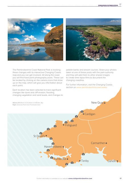
The <strong>Pembrokeshire</strong> Coast National Park is tracking<br />
these changes with its interactive Changing Coasts<br />
map and you can get involved. All along the coast<br />
you will find fixed point photography posts. These can<br />
be located by clicking on the camera icons that show<br />
up on the map, which will give you information about<br />
each point.<br />
Each location has been selected to track significant<br />
changes like dune and cliff erosion, flooding,<br />
changing vegetation and sand levels, and changes to<br />
pebble banks and stream courses. Share your photos<br />
taken at one of these posts with the park authority<br />
and they will add them to other shared images<br />
to create time-lapse films to document the<br />
changing coastline.<br />
For further information, visit the Changing Coasts<br />
section on www.pembrokeshirecoast.wales<br />
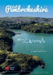
Above Left: Beach at Druidston in St Brides Bay<br />
Right: Greenala Point near Freshwater East<br />
Further information is available on our website www.visitpembrokeshire.com<br />
17