You also want an ePaper? Increase the reach of your titles
YUMPU automatically turns print PDFs into web optimized ePapers that Google loves.
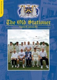
T h e O l d S t a t i o n e r - N o 7 8<br />
right. Slaidburn is up the hill and gives the impression and<br />
even more so on a wet grey day of a very dour place with very<br />
dark almost black buildings in the centre. There are two roads<br />
north, one passed about two miles back on the right which<br />
goes to Clapham crossing the Stocks Reservoir, and the other<br />
is a right turn in the centre of Slaidburn going to High<br />
Bentham and Ingleton. High Bentham has a cattle market<br />
which operates from about four o'clock and on into the<br />
evening, contrary to most markets. I discovered this when I<br />
stayed on a farm just outside Ingleton not far from Westhouse<br />
a few years ago. These two roads are passing through wild<br />
country, much of it treeless moorland with little forest which<br />
belies its name and reaching 8-900 feet at the highest points<br />
and little evidence of good grassland. This is a really different<br />
landscape to the Carboniferous Limestone country further<br />
east on the other side of the A65.<br />
The B6478 turns more or less south at Slaidburn towards<br />
Clitheroe. Before following this route, it is worth taking the<br />
minor road due west to Dunsop Bridge which is an attractive<br />
village right beside the River Hodder and the River Dunsop<br />
itself. Here there is the village store and teashop which on the<br />
occasion I was there provided good fare for walker, cyclist and<br />
motorist; a good place to tarry a while on a fine day!<br />
Puddleducks is the name of this cafe in the heart of the<br />
Trough of Bowland with its duck filled village green.<br />
Interestingly from here is the other wild road over Bowland<br />
going in a west north west direction climbing all the time to<br />
the highest point at Westfield House with a viewpoint before<br />
a steep drop to the village of Quernmore (the name of a road<br />
near Stationers'), the River Conder and Lancaster.<br />
Let us return to Slaidburn to continue our journey to<br />
Waddington which is a very attractive village with a stream<br />
flowing through the centre following the road from north to<br />
south with a charming bridge and green. There is a village pub<br />
and cafe in the main street. No great distance is Clitheroe, a<br />
very pleasant town in the Ribble Valley with a Norman castle<br />
overlooking the town. This is a bustling town which serves<br />
this whole area. Two places of interest further downstream are<br />
Ribchester and Whalley with its abbey, founded by Cistercians.<br />
The main route back north east is the A59 which joins<br />
Preston to York via Skipton and Harrogate, a very attractive<br />
route through some very pleasant scenery. The Ribble Valley<br />
here separates the Bowland Forest from the highland of<br />
Pendle Hill to the east at a height of 1827 feet. The return<br />
from Clitheroe can be made through Chatburn and a visit to<br />
Sawley Abbey and Bolton by Bowland, another very attractive<br />
village on the west side of the Ribble which has a teashop in<br />
the main street. From Bolton by Bowland one can return to<br />
Settle along the A59 to Gisburn, taking a left turn on the<br />
A682, following the Ribble upstream or following the minor<br />
road to Holden and returning to Wigglesworth. This sortie<br />
into the Forest of Bowland is not on most peoples agenda but<br />
it is well worth a visit for two or three days. Ed<br />
Waddington<br />
40