

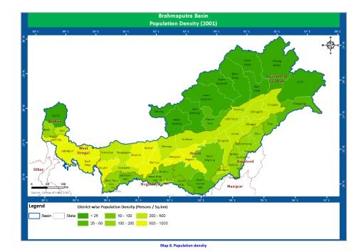
Brahamaputra Basin

Create successful ePaper yourself
Turn your PDF publications into a flip-book with our unique Google optimized e-Paper software.
<strong>Brahamaputra</strong> <strong>Basin</strong><br />
b) Assam - Dispur, northern Cachar hills and Karbi Anglong districts.<br />
c) Meghalaya - Eastern and western garo Hills, Jaintia Hills and eastern and western Khasi<br />
hills.<br />
d) Nagaland -Kohima, Mon, Mokokchung, Phek, Tuensang, Wokha and Zunheboto districts<br />
The agro-climate of the region is characterised by warm summers and cool winters. The mean<br />
annual precipitation varies from 2000 to 3000 mm which exceeds the PET demand in most of the<br />
months in a year, excepting the period of seasonal deficit. Length of growing period > 270 days.The<br />
area represents Udic soil moisture regime. The soil temperature regime varies from Hyperthermic in<br />
valleys to Thermic in higher topographic positions.The major soil formations in the area include<br />
shallow to deep, loamy, red and lateritic and red and yellow soils.The natural vegetation comprises<br />
wet evergreen and tropical moist deciduous forests. Jhum cultivation is common.Other major crops<br />
cultivated in this region are Rice, millets, potato, maize and sesame. Hilly terraces are used for<br />
plantation crops, such as tea, coffee, rubber and horticulture crops, like oranges, pineapple, etc.<br />
ii) Hot subhumid (moist) to humid (inclusion of perhumid) eco-regions with alluvial-derived soils<br />
(Agro-ecoregion - 15): Physiologically these agro-ecoregion comprising the plains pf the<br />
Brahmaputra River, covering parts of the States of Assam and West Bengal including the<br />
southern pockets of assam. States and districts under this ecoregion area.<br />
Assam - Cachar (Silchar), Darrang, Dibrugarh, Dhubri, Golaghat, Goalpara, Jorhat,<br />
Kamrup, Karimganj, non-tarai parts of Kokrajhar, Barpeta and Nalbari, Lakhimpur<br />
(north), Nalbari, Sibsagar and Sonitpur districs.<br />
b. West Bengal - Jalpaiguri (non-Tarai parts), Kochbehar.<br />
The climate of the area is characterised by hot summers and mild to moderately cool winters. The<br />
mean annual rainfall ranges from 1400-2000 mm, potential evapotranspiration is 1000–1400 mm.<br />
The length of growing period (LPG) > 210 days. The soil moisture and temperature regimes are udicustic<br />
(to Udic) and Hyperthermis, respectively. The common soil-scapes of the area are represented<br />
by level to very gently sloping Haplaquepts, Haplaqualfs, Dystrochrepts, Eutrochrepts, Fluvaquents,<br />
and Hapludalfs.The natural vegetation comprises tropical moist and dry deciduous forests. In view of<br />
the high rainfall, the cropping system is rice based. The main crops of rainy season (Kharif) grown<br />
under rainfed condition are rice and jute.In northern foothills of eastern Himalayas, plantation crops,<br />
such as tea and horticultural cropslike pineapple, citrus and banana are grown under favourable<br />
climatic conditions. Rice, jute, pulses, oilseeds (mustard) are grown on storesd/residual soil moisture<br />
in Rabi season.<br />
iii) Warm perhumid ecoregion with red and lateritic soils (Agro-ecoregion - 16): Physiologically<br />
the eastern Himalayan agro-ecoregion encompasses northern hilly parts of West Bengal,<br />
northern parts of Assam, Arunachal Pradesh and Sikkim states. The region occupies an area of<br />
9.6 M. ha, represensting 2.9% of the total geographical area of the country. States and Districts<br />
under this ecoregion area)<br />
Arunachal Pradesh - Dibang Valley, eastern and western parts of Kameng, Lohit, easten<br />
Siang, western Siang, lower and upper subansiri districts.<br />
b) Assam -Tarai parts of Barpeta, Darrang, Kokrajhar and Nalbari districts.<br />
c) Sikkim - Eastern and western parts of Sikkim.<br />
d) West Bengal - Darjeeling and Tarai part of Jalpaiguri districts.<br />
www.india-wris.nrsc.gov.in<br />
22