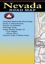
Delaware Water Gap National Recreation Area (National Geographic Trails Illustrated Map)
Delaware Water Gap National Recreation Area (National Geographic Trails Illustrated Map)
Delaware Water Gap National Recreation Area (National Geographic Trails Illustrated Map)

Create successful ePaper yourself
Turn your PDF publications into a flip-book with our unique Google optimized e-Paper software.
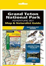
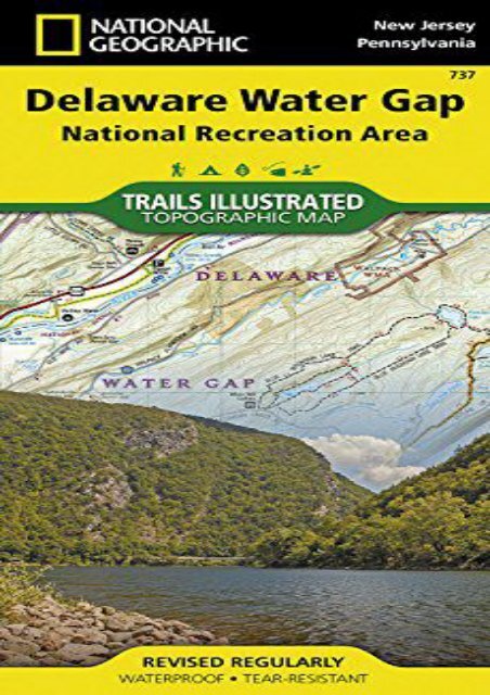
<strong>Delaware</strong> <strong>Water</strong> <strong>Gap</strong> <strong>National</strong> <strong>Recreation</strong> <strong>Area</strong> (<strong>National</strong> <strong>Geographic</strong> <strong>Trails</strong> <strong>Illustrated</strong> <strong>Map</strong>) (<strong>National</strong> <strong>Geographic</strong> <strong>Map</strong>s - <strong>Trails</strong> <strong>Illustrated</strong>) • <strong>Water</strong>proof • Tear-Resistant • Topographic <strong>Map</strong>Explore and discover new wonders with <strong>National</strong> <strong>Geographic</strong> s <strong>Trails</strong> <strong>Illustrated</strong> map of <strong>Delaware</strong> <strong>Water</strong> <strong>Gap</strong> <strong>National</strong> <strong>Recreation</strong> <strong>Area</strong>. Created in partnership with local land management agencies, this expertly researched map delivers unmatched detail and helpful information for paddlers, anglers, hikers, and other adventurers looking to explore the 70,000-acre park. The area s unique terrain, with low-forested mountains and 1,000-foot deep water gap, is the map s core feature, with detailed elevation contours, shaded relief, vegetation, and water features. Some of the key areas of interest included are Middle <strong>Delaware</strong> River; High Point, Swartswood, and Kittatinny Valley state parks; and Stillwater Natural <strong>Area</strong>. With miles of mapped trails including portions of the Appalachian, Liberty <strong>Gap</strong>, and Joseph M. McDade trails, this map can guide you off the beaten path and back again. Trail mileage between intersections will help you choose the path that’s right for you. River mileage and rapids on the Middle <strong>Delaware</strong> River are noted for those exploring by boat. Hiking, biking, and horse trails, along with major and secondary roads, are clearly distinguished. Boundaries for park<br />
lands, wilderness, and protected areas are color-coded and easy to discern. Some of the many recreation features shown include campgrounds, climbing areas, boat ramps, canoe access, and scenic areas. A trail chart and featured trails summary, as well as handy activity and waterfalls charts are included as well. Every <strong>Trails</strong> <strong>Illustrated</strong> map is printed on "Backcountry Tough" waterproof, tear-resistant paper. A full UTM grid is printed on the map to aid with GPS navigation.Other features found on this map include: Coolbaugh, <strong>Delaware</strong> <strong>Water</strong> <strong>Gap</strong>, East Stroudsburg, High Point, Kittatinny Mountain, Neversink River, Swartswood Lake.<strong>Map</strong> Scale = 1:40,000Sheet Size = 37.75" x 25.5"Folded Size = 4.25" x 9.25"<br />
<strong>Delaware</strong> <strong>Water</strong> <strong>Gap</strong> <strong>National</strong> <strong>Recreation</strong> <strong>Area</strong> (<strong>National</strong><br />
<strong>Geographic</strong> <strong>Trails</strong> <strong>Illustrated</strong> <strong>Map</strong>)
Product details<br />
● Author : <strong>National</strong> <strong>Geographic</strong> <strong>Map</strong>s - <strong>Trails</strong><br />
<strong>Illustrated</strong><br />
●<br />
Pages : 2 pages<br />
● Publisher : <strong>National</strong> <strong>Geographic</strong> <strong>Map</strong>s 2013-<br />
05-31<br />
●<br />
●<br />
●<br />
Language : English<br />
ISBN-10 : 1566956293<br />
ISBN-13 : 9781566956291
<strong>Delaware</strong> <strong>Water</strong> <strong>Gap</strong> <strong>National</strong> <strong>Recreation</strong> <strong>Area</strong><br />
(<strong>National</strong> <strong>Geographic</strong> <strong>Trails</strong> <strong>Illustrated</strong> <strong>Map</strong>)