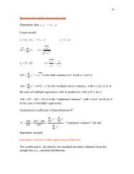
chapter - Atmospheric and Oceanic Science
chapter - Atmospheric and Oceanic Science
chapter - Atmospheric and Oceanic Science

Create successful ePaper yourself
Turn your PDF publications into a flip-book with our unique Google optimized e-Paper software.
Physiography <strong>and</strong> Hydrology<br />
Table 4.4 shows the characteristics of some tributaries of the Paraguay River.<br />
Table 4.4. Characteristics of main tributaries of the Paraguay River<br />
Sub-basin Station<br />
Pilcomayo<br />
Fortín Nuevo<br />
Pilcomayo<br />
The Pilcomayo River sub-basin (Comisión Trinacional para el desarrollo de la<br />
cuenca del Río Pilcomayo WWWeb) is shared by Argentina, Bolivia <strong>and</strong> Paraguay.<br />
Its sources are in the Bolivian plateau, in a mountainous area that extends from<br />
Sucre (to the North) up to La Quiaca (to the South), <strong>and</strong> runs toward the Southeast<br />
through a series of plains up to its outlet at the Paraguay River. This basin is characterized<br />
by its topographical as well as lithological, edaphic, hydrological, climatic,<br />
physiographical <strong>and</strong> population contrasts.<br />
The Bermejo River sub-basin (Comisión Binacional para el Desarrollo de la<br />
Alta Cuenca del Río Bermejo y el Río Gr<strong>and</strong>e de Tarija WWWeb) is located in the<br />
southern end of Bolivia <strong>and</strong> in the North of Argentina has 123000 km 2 of surface,<br />
with more than 1300 km. The basin of the Bermejo River is divided in two well differentiated<br />
areas: the high basin, where the climatic conditions determine a great<br />
variability in vegetation, <strong>and</strong> the low basin extremely plane topography <strong>and</strong> with<br />
dry forests in the West <strong>and</strong> the prevalence of humid l<strong>and</strong>s <strong>and</strong> forests in gallery to<br />
the East.<br />
The rivers of the basin present a rainfall control with a season variability very<br />
well defined, reaching 85% of runoff during Summer <strong>and</strong> low waters between April<br />
<strong>and</strong> September.<br />
4.4.3. The Uruguay River Sub-basin<br />
The sub-basin of the Uruguay River has an area of total drainage of 365000<br />
km 2 <strong>and</strong> has its source in the convergence of the Pelotas <strong>and</strong> Peixe rivers, which<br />
have their origin in the Serra do Mar <strong>and</strong> Geral, at almost 2000 masl. The Uruguay<br />
River ends in the La Plata River, 2200 km. The hydrological regime of the Uruguay<br />
River is very irregular. The Uruguay River is the only big river of the La Plata system<br />
that is not tributary of the Paraná. Although its basin is bigger than that of the<br />
Iguazu, both share the same features that their large discharges can be caused by<br />
53<br />
Drainage Area Mean Annual<br />
(km 2 ) Volume (m 3 /seg)<br />
130.000 153<br />
Bermejo El Colorado 65.735 396<br />
[Comisión Binacional para el Desarrollo de la Alta Cuenca del Río Bermejo y el Río Gr<strong>and</strong>e de Tarija WWWeb, Comisión<br />
Trinacional para el desarrollo de la cuenca del Río Pilcomayo WWWeb]