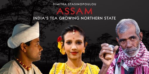
ASSAM, INDIA'S TEA GROWING NORTHERN STATE

You also want an ePaper? Increase the reach of your titles
YUMPU automatically turns print PDFs into web optimized ePapers that Google loves.
DIMITRA STASINOPOULOU<br />
<strong>ASSAM</strong><br />
INDIA’S <strong>TEA</strong> <strong>GROWING</strong> <strong>NORTHERN</strong> <strong>STATE</strong>
<strong>ASSAM</strong>
<strong>ASSAM</strong> <strong>STATE</strong><br />
Assam is the biggest of the Seven Sister<br />
States in the Northeastern part of India. It<br />
is comprised mostly of the valleys of Brahmaputra<br />
and Barak. Assam and the rest<br />
of the States are connected to the rest of<br />
the country via the Siliguri Corridor or<br />
the Chicken’s Neck, a 22 km small strip of<br />
land in West Bengal. Its other name is the<br />
Gateway to the Northeast, as it is the main<br />
connection to reach the other states in<br />
the NE part of the country. The State also<br />
shares an international border with Bhutan<br />
and Bangladesh.<br />
The Assamese landscape is a picturesque<br />
golden-green vista of jigsaw-like rice fields<br />
and tea estates, framed in the distance by<br />
the blue mountains of Arunachal in the<br />
north and the highlands of Meghalaya and<br />
Nagaland to the south. Despite certain<br />
linguistic and cultural overlaps with<br />
people in neighboring West Bengal and<br />
Orissa, Assam is proudly sovereign about<br />
its identity. Despite numerous invasions,<br />
mostly by the Muslim rulers, no western<br />
power ruled Assam until the arrival of the<br />
British. Though the Munghals made seventeen<br />
attempts to invade, they were never<br />
successful. The gamosa (a red-and-white<br />
scarf worn around the neck by men) and<br />
the mekhola sador (the traditional dress<br />
for women) are visible proclamations of<br />
regional costume and identity.<br />
Shaped roughly like a Y laid on its side, is<br />
a land of plains and river valleys. The State<br />
has three principal physical regions: the<br />
Brahmaputra River Valley in the north, the<br />
Barak River valley in the south, and the<br />
hilly region between Meghalaya to the<br />
west, and Nagaland and Manipur to the<br />
east, in the south-central part of the State.<br />
Of those regions, the Brahmaputra River<br />
valley is the largest.<br />
The people of the plains of the Brahmaputra<br />
and Barak valleys are mainly of Indo-<br />
Iranian ancestry. By the time of their arrival<br />
in the region, however, the local Aryan<br />
peoples had become intermixed with<br />
Asiatic peoples.<br />
The Ahom people, who arrived in the region<br />
from mainland Southeast Asia during the<br />
13 th century, ultimately stem from Yunnan<br />
province of southern China. A significant<br />
minority of the population consists of<br />
rural indigenous peoples who fall outside<br />
the Indian caste system; as such, they are<br />
officially designated as Scheduled Tribes.<br />
The Boro constitute the largest of these<br />
groups. Most of the Scheduled Tribes live<br />
in the south-central hill region and are of<br />
Asiatic descent.<br />
Assamese, an Indo-Aryan language, is<br />
the official and principal language of the<br />
State, and an unbroken record of Assamese<br />
literary history is traceable from the<br />
14 th century. Tibeto-Burman languages<br />
are spoken by most of the Scheduled<br />
Tribes, although the Khasi people speak an<br />
Austroasiatic tongue; some groups have<br />
adopted Assamese as their first language.<br />
The people in the Barak valley in southern<br />
Assam mostly speak Bengali (also called<br />
Bangla), which, like Assamese, is an Indo-<br />
Aryan language.<br />
About two-thirds of the Assamese are<br />
Hindus, the majority of whom follow<br />
Vaishnavism, which venerates the deity<br />
Vishnu. Roughly one-fourth of the population<br />
practices Islam, most Muslims being<br />
settlers from Bangladesh or converts from<br />
the lower strata of Hindu society. Although<br />
many of the Scheduled Tribes have
converted to Christianity, some continue<br />
to practice traditional local religions.<br />
Cultural life<br />
The cultural life of Assam is interwoven<br />
with the activities of a number of cultural<br />
institutions and religious centers, such as<br />
the satra (seat of a religious head known as<br />
the satradhikar) and namghar (prayer hall).<br />
Satras in Assam have been looking after<br />
the religious and social well-being of the<br />
Hindu population since the 15 th century.<br />
The Assamese people observe all the pan-<br />
Indian religious festivals, but their most<br />
important celebrations are the three Bihu<br />
festivals. Originally agricultural festivals,<br />
they are observed with great enthusiasm<br />
irrespective of caste, creed, and religious<br />
affinity.<br />
Weaving is another important aspect of<br />
the cultural life of the people of Assam,<br />
particularly the women. Nearly every<br />
Assamese household, irrespective of<br />
caste, creed, and social status, has at least<br />
one loom, and most women are expected<br />
to be skilled in producing fine silk and<br />
cotton cloths.<br />
Legend and History of Assam<br />
The State had different names before<br />
becoming known as Assam. The oldest<br />
name known is Pragjyotisha, it was found<br />
from Sanskrit records and supposedly<br />
covered the entire Brahmaputra Valley.<br />
This name was also mentioned in the epics<br />
of the Mahabharata and the Ramayana.<br />
Later, the name Kamrupa came up, which<br />
supposedly covered the Western part<br />
of the state. This name was found in an<br />
inscription of Samudra Gupta and from the<br />
records of Hiuen Tsang, a Chinese pilgrim.<br />
The name Assam was not even in use in<br />
the region until the Ahoms came to it. The<br />
Ahoms are a Shan tribe from Burma, they<br />
crossed the Patkai Range and conquered<br />
Assam. Other evidences state that the<br />
name Assam has some relations to the Tai<br />
and the Mongoloid people, mostly from<br />
other countries in Southeast Asia. In fact,<br />
the Thai and Siamese people are referred<br />
to as Shan, a variation of Syam, but<br />
pronounced with an n as Burmese words<br />
ending in ‘m’ are pronounced with an ‘n’.<br />
Syam was later changed to Asam, Ahom,<br />
Aham, Ahomiya and Axomiya.<br />
Historically, from the Ancient Era during<br />
350 AD, when Assam was referred to as<br />
Pragjyotisha and Kamrupa, it has been<br />
conquered by different dynasties. Salasthamba<br />
of the Mlechchha Dynasty ruled the<br />
region from 655 AD to 990 AD.<br />
In the Colonial Era, there was a surge of<br />
tea plantations in Assam. However, this<br />
was also the time when the first Anglo-<br />
Burmese War ensued in 1824. The war<br />
ended in 1826, after the Treaty of Yandabo<br />
was established. The treaty lasted until<br />
1838 until the British annexed Assam.<br />
Assam was first separated from Bengal<br />
during the year 1874. It was then known<br />
as the Assam Chief Commissionership.<br />
In 1905, it was established as a part of<br />
the new province of Eastern Bengal and<br />
Assam. It was only in 1912 that it became<br />
the Assam Province. In the year 1970,<br />
Assam was separated into several states to<br />
fulfil the national aspirations of the tribal<br />
people living in it.<br />
Assam State symbol
DIBRUGARH<br />
<strong>NORTHERN</strong> <strong>ASSAM</strong>
HISTORY OF THE <strong>TEA</strong> IN INDIA<br />
“The tea cultivation in India begun in<br />
the nineteenth century by the British, in<br />
an attempt to break Chinese monopoly,<br />
however, has accelerated to the point<br />
that today India is listed as the world’s<br />
leading producer, ahead of China and<br />
the teas of Assam and Darjeeling are<br />
world famous. However, because Indians<br />
average half a cup daily on per capita<br />
basis, fully 70 percent of India’s immense<br />
crop is consumed locally. The British,<br />
“using Chinese seeds, plus Chinese<br />
planting and cultivating techniques,<br />
launched a tea industry by offering land<br />
in Assam to any European who agreed<br />
to cultivate tea for export.”<br />
In the early 1820s, the British East India<br />
Company began large-scale production<br />
of tea in Assam, India, of a tea variety<br />
traditionally brewed by the Singpho<br />
people. In 1826, the British East India<br />
Company took over the region from<br />
the Ahom. In 1837, the first English tea<br />
garden was established in Upper Assam;<br />
in 1840, the Assam Tea Company began<br />
the commercial production of tea in<br />
the region, run by indentured servitude<br />
of the local inhabitants. Beginning<br />
in the 1850s, the tea industry rapidly<br />
expanded, consuming vast tracts of land<br />
for tea plantations. By the turn of the<br />
century, Assam became the leading tea<br />
producing region in the world. Tea was<br />
originally only consumed by Anglicized<br />
Indians, and it was not until the 1920s<br />
that tea grew widely popular in India.<br />
Prior to the British, the plant was used<br />
for medicinal purposes.<br />
Research shows that tea is indigenous<br />
to eastern and northern India, and was<br />
cultivated and consumed there for thousands<br />
of years. Consumption of tea in<br />
India was first clearly documented in<br />
the Ramayana (750-500 BCE). For the<br />
next thousand years, documentation of<br />
tea in India was lost in history. Records<br />
re-emerge during the first century CE,<br />
with stories of the Buddhist monks<br />
Bodhidharma and Gan Lu, and their<br />
involvement with tea.<br />
Tea cultivation in India has somewhat<br />
ambiguous origins. Though the extent of<br />
the popularity of tea in Ancient India is<br />
unknown, it is known that the tea plant<br />
was a wild plant in India that was indeed<br />
brewed by local inhabitants of different<br />
regions. The Singpho tribe and the<br />
Khamti tribe, inhabitants of the regions<br />
where the Camellia sinensis plant grew<br />
native, have been consuming tea since<br />
the 12 th century. It is also possible that<br />
tea may have been used under another<br />
name, it was perhaps better known as<br />
“Soma” in Indian mythology.<br />
The practice of Ayurveda has resulted in<br />
a long-standing tradition of herbal teas.<br />
Traditional Indian kitchens have long<br />
utilized the medicinal benefits offered by<br />
various plants and spices and traditionally,<br />
teas made with these plant leaves<br />
or spices have been in use for centuries<br />
for maladies ranging from the serious to<br />
the trifling. Tea is also mixed with these<br />
traditional herbs. The taste of chai (sweet<br />
and milky) helps disguise the stronger<br />
and more bitter flavors of some of the<br />
medicinal additives, while other, more<br />
pleasant flavors such as cardamom and<br />
ginger add a pleasing flavor and aroma<br />
to the tea along with health benefits.
MAJULI ISLAND<br />
<strong>NORTHERN</strong> <strong>ASSAM</strong>
MĀJULI ISLAND<br />
Mājuli is the biggest river island in the world,<br />
formed by the Brahmaputra River in Assam<br />
and also the 1 st island district of the country.<br />
The island had a total area of 1,250 km 2 at the<br />
beginning of the 20th century, but having lost<br />
significantly to erosion it now has an area of<br />
only 352 km 2 . However it is recognized by Guinness<br />
Book of World Records as World’s Largest<br />
River Island. Majuli is the nerve centre of neo-<br />
Vaishnavite culture and has been included in<br />
the World Heritage Sites of Unesco. Home to an<br />
estimated 160,000 people of different ethnic<br />
groups, the island is an assembly constituency<br />
reserved for scheduled tribes.<br />
Originally, the island was a long, narrow piece<br />
of land called Majoli (land in the middle of<br />
two parallel rivers) that had the Brahmaputra<br />
flowing in the north and the Burhidihing<br />
flowing in the south, till they met at Lakhu.<br />
The dwellers of Mājuli are mostly of the Mising<br />
tribes from Arunachal Pradesh who immigrated<br />
here centuries ago. The island has 144<br />
villages with a population of over 150,000. The<br />
only mode of association to the outside world<br />
is through a ferry service which operates six<br />
times a day. The inhabitants are expert navigators<br />
by boat; their expertise is most visible<br />
during the monsoon season when they navigate<br />
the turbulent waters of the Brahmaputra.<br />
The main industry is agriculture, with paddy<br />
being the chief crop. Mājuli has a rich and<br />
diverse agricultural tradition, with as many as<br />
100 varieties of rice grown, all without pesticides<br />
or artificial fertilizers. Fishing, dairying,<br />
pottery, handloom and boat-making are other<br />
important economic activities. Handloom is a<br />
major occupation among the distaff population<br />
of the villages. Weaving is exquisite and<br />
intricate with the use of a variety of colors and<br />
textures of cotton and silk. The locals speak in<br />
the Mising and Assamese languages.<br />
Mājuli has been the cultural capital of Assamese<br />
civilisation since the 16 th century; based<br />
on written records describing the visit of Srimanta<br />
Sankardeva - a 16 th century social reformer.<br />
Sankardeva, a pioneer of the medieval-age<br />
neo-Vaishnavite movement, preached a monotheist<br />
form of Hinduism called Vaishnavism<br />
and established monasteries and hermitages<br />
known as satra on the islet. The island soon<br />
became the leading center of Vaishavinism<br />
with the establishment of these satras.<br />
The satras set up preserve antiques like<br />
weapons, utensils, jewellery and other items of<br />
cultural significance. Pottery is made in Mājuli<br />
from beaten clay and burnt in driftwood fired<br />
kilns in the same mode carried out by the<br />
peoples of the ancient Harrappan Civilisation.<br />
Sociologists have stressed the preservation<br />
of these unique peoples, whose culture and<br />
dance forms are untouched by modernism.<br />
Kamalabari Satra: The Kamalabari Satra,<br />
founded by Bedulapadma Ata in 1595, is<br />
a centre of art, cultural, literature and classical<br />
studies on the island. Kamala means<br />
orange and bari means garden, hence Kamalabri<br />
means Orange Garden. Its branch the<br />
Uttar Kamalabari Satra has performed cultural<br />
programmes of the Satria Art all around the<br />
country and abroad.<br />
Auniati Satra: Founded by Niranjan Pathakdeva<br />
in 1653, the satra is famous for the “Paalnaam”<br />
and Apsara Dances and also its extensive<br />
assortment of ancient Assamese artfacts,<br />
utensils, jewellery and handicrafts. It also has<br />
a hundred and twenty five disciples and over<br />
seven hundred thousand followers worldwide.<br />
Its name was derived from Auni Paan, a<br />
kind of betel creeper plant found locally in the<br />
town and Ati which means elevated place. The<br />
presiding deity here is Lord Krishna, which is<br />
referred to as Govinda.<br />
Shamaguri Satra: The satra is famous for the<br />
mask making in India.
KAMALABARI SATRA
SHAMAGURI SATRA
AUNIATI SATRA
JORHAT & SIVASAGAR<br />
<strong>NORTHERN</strong> <strong>ASSAM</strong>
JORHAT - SIVASAGAR<br />
Jorhat, famously known as the ‘Tea<br />
capital of the world’ thanks to the innumerable<br />
number of tea plantations<br />
here, is located in Upper Assam and is<br />
a major urban center of the State. It<br />
also has historical significance as one<br />
of the capitals of the Ahom dynasty,<br />
which ruled Assam for close to six<br />
centuries before the colonial era, and<br />
home to many historical monuments<br />
of Assamese culture. This town was a<br />
flourishing and commercial metropolis<br />
but was completely destroyed by<br />
a series of Burmese invasions of Assam<br />
between 1817 and the arrival of the<br />
British force, in the year 1824.<br />
The British Rule, though not free from<br />
rebellions and revolutions, contributed<br />
to the reemergence of this historical<br />
town. In 1885, a narrow gauge railway,<br />
Jorhat Provincial Railway, became<br />
operational. In time, this contributed<br />
to the rapid growth of the tea industry.<br />
Although, the Civil Sub-division under<br />
Sivasagar at Jorhat was formed in<br />
1869, it was declared the administrative<br />
headquarters of the undivided<br />
Sivasagar district in 1911. Surrounded<br />
by lush and verdant tea gardens and<br />
numerous wetlands and rivers it acts<br />
as a gateway to upper Assam and to<br />
the state of Nagaland. In the north of<br />
the district, the Brahmaputra River<br />
forms the largest riverine island of the<br />
world, the Majuli.<br />
The cultural diversities which prevailed<br />
in Jorhat nearly a century ago has<br />
inspired the people to participate in<br />
cultural activities through the decades<br />
and as a result Jorhat has been able to<br />
produce many creative writers, musician,<br />
actors, historians and journalists,<br />
terming Jorhat “The Cultural Capital of<br />
Assam”.<br />
Sivasagar, ”the Ocean of Lord Shiva”, is<br />
a town in Upper Assam. It lies on the<br />
Dikhu River, a tributary of the Brahmaputra<br />
River, about 50 km northeast<br />
of Jorhat and was the capital of the<br />
Ahom Kingdom from 1699 to 1788.<br />
The Tai-speaking Ahoms came to the<br />
area from Yunnan province, China, in<br />
the 13 th century. The Ahoms ruled<br />
Assam for six centuries, until their<br />
kingdom fell to the Burmese in 1819<br />
and their ruling class was all but wiped<br />
out. The province was liberated by the<br />
British in 1825.<br />
Assam, in fact, derives its name from<br />
the Ahom dynasty which held such<br />
undisputed way in the east that even<br />
the Mughal rulers, who had extended<br />
their dominance over most of the<br />
northern parts of the subcontinent,<br />
could not make inroads into Ahom<br />
territory.<br />
This town’s main feature is the water<br />
body from which it takes its name. This<br />
is a 1.04 km 2 tank, also known as the<br />
Borpukhuri, which is at a higher elevation<br />
than the rest of the town, with<br />
three temples,”Dol”s in Assamese, built<br />
in 1734, on its banks. Of these temples,<br />
the most prominent is the Sivadol,<br />
standing tall at 32m. The other temples<br />
are the Vishnudol and Devidol.
KAZIRANGA PARK<br />
<strong>NORTHERN</strong> <strong>ASSAM</strong>
KAZIRANGA NATIONAL PARK<br />
<strong>NORTHERN</strong> <strong>ASSAM</strong><br />
Kaziranga National Park, a Unesco World Heritage Site, is a national park in the Golaghat and Nagaon districts<br />
of the state of Assam, India. Located on the edge of the Eastern Himalaya biodiversity hotspot, the park<br />
combines high species diversity and visibility. Kaziranga is a vast expanse of tall elephant grass, marshland,<br />
and dense tropical moist broadleaf forests, criss-crossed by four major rivers, including the Brahmaputra.<br />
The sanctuary, hosts two-thirds of the world’s great one-horned rhinoceroses. Listed as a vulnerable species,<br />
the large mammal is primarily found in parts of north-eastern India and in protected areas in Nepal, where<br />
populations are confined to the riverine grasslands in the foothills of the Himalayas. Weighing between<br />
2260 kg and 3000 kg, it is the fourth largest land animal and has a single horn, which measures 20 cm to 57<br />
cm in length. Today, about 3,000 Rhinos live in the wild, 2000 of which are found in Assam’s Kaziranga alone.<br />
Kaziranga is also home to the highest density of tigers among protected in the world, and was declared a<br />
Tiger Reserve in 2006 as well as large breeding populations of elephants, wild water buffalo, swamp deer<br />
and is an important bird area.<br />
The history of Kaziranga as a protected area can be traced back to 1904, when Baroness Mary Curzon, the<br />
wife of the Viceroy of India, Lord Curzon of Kedleston, visited the area. After failing to see a single rhinoceros,<br />
for which the area was renowned, she persuaded her husband to take urgent measures to protect the<br />
dwindling species which he did by initiating planning for their protection. On 1 June 1905, the Kaziranga<br />
Proposed Reserve Forest was created with an area of 232 km 2 and over the next years the park was extended<br />
to a total of 430 km 2 . Although the etymology of the name Kaziranga is not certain, there exist a number of<br />
possible explanations derived from local legends and records. According to one legend, a girl named Ranga,<br />
from a nearby village, and a youth named Kazi, from Karbi Anglong, fell in love. This match was not acceptable<br />
to their families, and the couple disappeared into the forest, never to be seen again, and the forest was<br />
named after them. According to another legend, Srimanta Sankardeva, the sixteenth century Vaisnava saintscholar,<br />
once blessed a childless couple, Kazi and Rangai, and asked them to dig a big pond in the region so<br />
that their name would live on.<br />
The park experiences three seasons: summer, monsoon, and winter. The rainy monsoon season lasts from<br />
June to September, and is responsible for most of Kaziranga’s annual rainfall of 2,220 mm. During the peak<br />
months of July and August, three-fourths of the western region of the park is submerged, due to the rising<br />
water level of the Brahmaputra. The flooding causes most animals to migrate to elevated and forested regions<br />
outside the southern border of the park, such as the Karbi Hills.
KAZIRANGA VILLAGES<br />
<strong>NORTHERN</strong> <strong>ASSAM</strong>
BRAHMAPUTRA RIVER<br />
<strong>NORTHERN</strong> <strong>ASSAM</strong>
BRAHMAPUTRA RIVER - The only male river of India<br />
The Brahmaputra River (named as the<br />
Son of the Creator of the Cosmos, in<br />
Hindu mythology) is one of the holiest<br />
rivers of the World and possibly, the only<br />
river which is considered holy by four<br />
religions : Hindus, Buddhists, Jains and<br />
Bonpas.<br />
Not only is it a fabled holy river, but it is<br />
also one of the last mysteries solved by<br />
the Royal Geographical Society, when<br />
the origin of this river was traced from<br />
the glacial waters of the Mansarovar Lake<br />
(called a lake formed from the minds of<br />
the Gods), but whose ending was not<br />
known and was confused to be draining<br />
into the Irrawaddy River in Burma or,<br />
the ending was seen in Bengal, but the<br />
origin was not known, for three centuries<br />
of explorations.<br />
The lake is located at the foot of Mount<br />
Kailash, which has been the mythical<br />
home of the Gods and was one of the<br />
most hidden mountains of the world,<br />
protected to the North by the deserts<br />
of Gobi and Taklamakhan, while, to the<br />
South by the highest of the Himalayan<br />
Ranges. It was discovered that from this<br />
lake emerged four great rivers, with the<br />
Indus flowing to the North, the Sutluj<br />
to the West, the Karnali flowing as one<br />
off the main tributaries into the Holy<br />
Ganges and finally, to the east was the<br />
Brahmaputra.<br />
Draining nearly 40% of the snow melt of<br />
the great water towers of the Himalayas,<br />
this is a mighty river which in Western<br />
Tibet is called the Horse River, in Central<br />
Tibet is called the Tsangpo or, simply the<br />
river. In the plains of the valley of Assam,<br />
its great spread is seen in all its glory, as<br />
the Brahmaputra. Its narrow part is 3 km<br />
while its widest 40, and when it floods<br />
it rises by over 8 meters and spreads<br />
another 20 km.<br />
The environment of the Brahmaputra<br />
floodplains in Assam have been<br />
described as the Brahmaputra Valley<br />
semi-evergreen forests ecoregion.<br />
The Ganges-Brahmaputra system has<br />
the third greatest average discharge of<br />
the world’s rivers —roughly 30,770m 3<br />
per second; approximately 19,800 cubic<br />
meters per second of the total is supplied<br />
by the Brahmaputra alone.<br />
Another important feature of the river<br />
is its tendency to flood. The quantity<br />
of water carried by the Brahmaputra in<br />
India and Bangladesh is enormous. The<br />
river valley in Assam is enclosed by hill<br />
ranges on the north, east, and south and<br />
receives more than 2,540 mm of rainfall<br />
annually.<br />
Extensive flooding is virtually an annual<br />
occurrence in the Brahmaputra valley<br />
during the summer monsoon. In addition,<br />
tidal surges accompanying tropical<br />
cyclones sweeping inland from the<br />
Bay of Bengal periodically bring great<br />
destruction to the delta region. One<br />
such storm—the Ganges-Brahmaputra<br />
delta cyclone of November 1970—<br />
caused an estimated 300,000 to 500,000<br />
deaths and inundated a vast area. In<br />
the 21 st century the delta has also been<br />
affected by rising sea levels as a result of<br />
global warming.
INDIA - <strong>ASSAM</strong>, DECEMBER 2016