

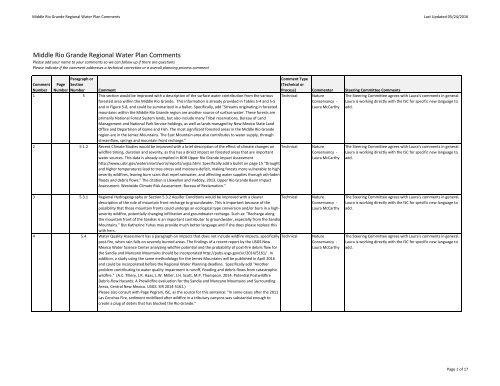
Middle Rio Grande Regional Water Plan
2iUWd5b
2iUWd5b

Create successful ePaper yourself
Turn your PDF publications into a flip-book with our unique Google optimized e-Paper software.
<strong>Middle</strong> <strong>Rio</strong> <strong>Grande</strong> <strong>Regional</strong> <strong>Water</strong> <strong>Plan</strong> Comments Last Updated 05/24/2016<br />
<strong>Middle</strong> <strong>Rio</strong> <strong>Grande</strong> <strong>Regional</strong> <strong>Water</strong> <strong>Plan</strong> Comments<br />
Please add your name to your comments so we can follow up if there are questions<br />
Please indicate if the comment addresses a technical correction or a overall planning process comment<br />
Comment Page<br />
Paragraph or<br />
Section<br />
Number Number Number Comment<br />
1 5 This section would be improved with a description of the surface water contribution from the various<br />
forested area within the <strong>Middle</strong> <strong>Rio</strong> <strong>Grande</strong>. This information is already provided in Tables 5‐4 and 5‐5<br />
and in Figure 5‐8, and could be summarized in a bullet. Specifically, add "Streams originating in forested<br />
mountains within the <strong>Middle</strong> <strong>Rio</strong> <strong>Grande</strong> region are another source of surface water. These forests are<br />
primarily National Forest System lands, but also include many Tribal reservations, Bureau of Land<br />
Management and National Park Service holdings, as well as lands managed by New Mexico State Land<br />
Office and Departmen of Game and Fish. The most significant forested areas in the <strong>Middle</strong> <strong>Rio</strong> <strong>Grande</strong><br />
region are in the Jemez Mountains. The East Mountain area also contributes to water supply, through<br />
streamflow, springs and mountain front recharge."<br />
Comment Type<br />
(Technical or<br />
Process) Commenter Steering Committee Comments<br />
Technical<br />
2 5.1.2 Recent Climate Studies would be improved with a brief description of the effect of climate changes on<br />
wildfire timing, duration and severity, as this has a direct impact on forested areas that are important<br />
water sources. This data is already compiled in BOR Upper <strong>Rio</strong> <strong>Grande</strong> Impact Assessment<br />
http://www.usbr.gov/watersmart/wcra/reports/urgia.html. Specifically add a bullet on page 15 "Drought<br />
and higher temperatures lead to tree‐stress and moisture‐deficit, making forests more vulnerable to highseverity<br />
wildfires, leaving burn scars that repel rainwater, and affecting water supplies thorugh ash‐laden<br />
floods and debris flows." The citation is Llewellyn and Vaddey, 2013. Upper <strong>Rio</strong> <strong>Grande</strong> Basin Impact<br />
Assessment: Westwide Climate Risk Assessment. Bureau of Reclamation."<br />
Technical<br />
Nature<br />
Conservancy ‐<br />
Laura McCarthy<br />
Nature<br />
Conservancy ‐<br />
Laura McCarthy<br />
The Steering Committee agrees with Laura's comments in general.<br />
Laura is working directly with the ISC for specific new language to<br />
add.<br />
The Steering Committee agrees with Laura's comments in general.<br />
Laura is working directly with the ISC for specific new language to<br />
add.<br />
3 5.3.1 <strong>Regional</strong> Hydrogeography or Section 5.3.2 Aquifer Conditions would be improved with a clearer<br />
description of the role of mountain front recharge to groundwater. This is important because of the<br />
possibility that these mountain fronts could undergo an ecological type conversion and/or burn in a highseverity<br />
wildfire, potentially changing infiltration and groundwater recharge. Such as: "Recharge along<br />
the mountain front of the Sandias is an important contributor to groundwater, especially from the Sandia<br />
Mountains." But Katherine Yuhas may provide much better language and if she does please replace this<br />
with hers.<br />
Technical<br />
4 5.4 <strong>Water</strong> Quality Assessment has a paragraph on impacts that does not include wildfire impacts, specifically Technical<br />
post‐fire, when rain falls on severely burned areas. The findings of a recent report by the USGS New<br />
Mexico <strong>Water</strong> Science Center analyzing wildfire potential and the probability of post‐fire debris flow for<br />
the Sandia and Manzano Mountains should be incorporated http://pubs.usgs.gov/sir/2014/5161/ . In<br />
addition, a study using the same methodology for the Jemez Mountains will be published in April 2016<br />
and could be incorporated before the <strong>Regional</strong> <strong>Water</strong> <strong>Plan</strong>ning deadline. Specifically add "Another<br />
problem contributing to water quality impairment is runoff, flooding and debris flows from catastrophic<br />
wildfire." (A.C. Tillery, J.R. Haas, L.W. Miller, J.H. Scott, M.P. Thompson. 2014. Potential Postwildfire<br />
Debris‐flow Hazards: A Prewildfire evaluation for the Sandia and Manzano Mountains and Surrounding<br />
Areas, Central New Mexico. USGS. SIR 2014‐5161.)<br />
Please also consult with Page Pegram, ISC, as the source for this sentence: "In some cases after the 2011<br />
Las Conchas Fire, sediment mobilized after wildfire in a tributary canyons was substantial enough to<br />
create a plug of debris that has blocked the <strong>Rio</strong> <strong>Grande</strong>."<br />
Nature<br />
Conservancy ‐<br />
Laura McCarthy<br />
Nature<br />
Conservancy ‐<br />
Laura McCarthy<br />
The Steering Committee agrees with Laura's comments in general.<br />
Laura is working directly with the ISC for specific new language to<br />
add.<br />
The Steering Committee agrees with Laura's comments in general.<br />
Laura is working directly with the ISC for specific new language to<br />
add.<br />
Page 1 of 17