JaxReady_EPG_2016

Create successful ePaper yourself
Turn your PDF publications into a flip-book with our unique Google optimized e-Paper software.
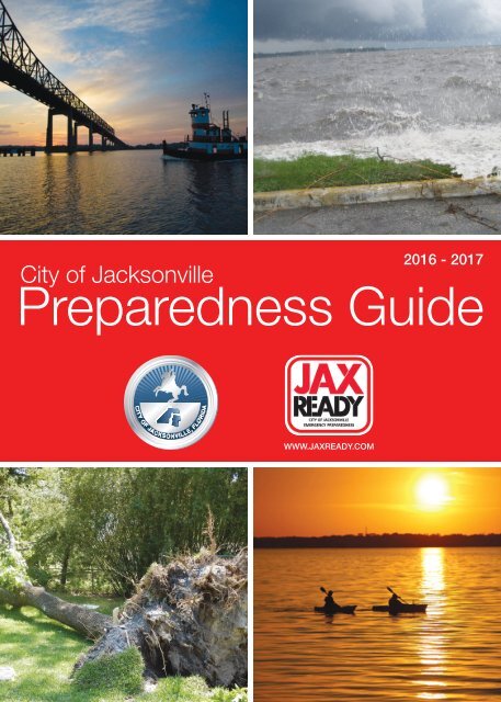
<strong>2016</strong> - 2017<br />
City of Jacksonville<br />
Preparedness Guide<br />
WWW.JAXREADY.COM
Message from the Mayor<br />
Dear Citizens,<br />
Improving public safety remains a top priority for me. I am committed to<br />
demonstrating this priority by working closely with law enforcement, first<br />
responders and community leaders to improve safety for the citizens of<br />
Jacksonville.<br />
Preparing for an emergency is an important facet of public safety. Having<br />
a plan in place for your home and family, as well as taking the necessary<br />
precautions in the event of an emergency can save lives. Natural disasters,<br />
fires, medical emergencies, storms, flooding and evacuations often occur<br />
without warning. The time to make a safety plan is now.<br />
This City of Jacksonville’s Preparedness Guide provides an overview<br />
of various situations that can occur, along with tips and step-by-step<br />
instructions for being better prepared. Knowing what to do before, during and<br />
after an emergency is critical. Seconds count when our safety is at risk.<br />
Your safety is important. By utilizing the safety measures outlined in this<br />
guide, Jacksonville residents can stay <strong>JaxReady</strong>!<br />
Sincerely,<br />
Lenny Curry<br />
Mayor<br />
<strong>2016</strong>-2017 Preparedness Guide Team Contributors<br />
Emergency Preparedness Director – Steven Woodard<br />
Emergency Preparedness Deputy Director – Todd Smith<br />
Public Affairs Director – Marsha Oliver<br />
Editors – John Shaw, Steven Woodard, Scott Cordero, Todd Smith<br />
Content Editors –Megan Graham, Angela Enyedi, Kate Guillet<br />
Creative Director and Design – Erich Belk and Lagniappe Media<br />
Maps – Roger Charity, Hien Lam<br />
Contributors – Scott Cordero, James Croft, Sheri Webber,<br />
Karen Feagins, Steven Millican, Ray Edmond, Dave Ford,<br />
Alberto Martinez, Fred Rogers, Doug Lang<br />
This Guide was funded by a Department of Homeland Security Grant.<br />
Emergency Preparedness Division<br />
Jacksonville Fire and Rescue Department<br />
515 N. Julia Street<br />
Jacksonville, Florida 32202<br />
904-255-3110<br />
1 City of Jacksonville
Know the Hazards<br />
Watch vs. Warning<br />
The National Weather Service<br />
(NWS) issues weather watches<br />
and warnings for the protection<br />
of life and property.<br />
A Watch means…<br />
Caution! Be Alert!<br />
Conditions are favorable for bad<br />
weather. Monitor the latest weather<br />
forecast!<br />
A Warning means…<br />
Get to Safety! Take ACTION!<br />
The bad weather is imminent. Seek<br />
appropriate shelter from the hazard.<br />
Thunderstorms<br />
Thunderstorms can develop all months of the year in<br />
Jacksonville, and are most frequent in late spring through<br />
early fall. All thunderstorms have potentially deadly<br />
lightning. When thunder roars, go indoors!<br />
Severe Thunderstorm Warning<br />
A Severe Thunderstorm Warning is issued when a<br />
thunderstorm is expected to produce large hail one inch<br />
in diameter or greater and or is expected to produce<br />
dangerous wind gusts of 58 mph or greater.<br />
Tornadoes and Waterspouts<br />
Strong to severe thunderstorms can produce tornadoes<br />
or waterspouts, which are tornadoes over water. A<br />
Tornado Warning is issued when NWS meteorologists<br />
determine a tornado is likely by using radar or when a<br />
tornado is sighted. Go to the lowest floor of a building,<br />
away from windows. Crouch down and cover your head!<br />
Tropical Storm<br />
Sustained winds of 39-73 mph<br />
Watch: Conditions possible within 48 hours<br />
Warning: Conditions expected within 36 hours<br />
Hurricane<br />
Sustained winds of 74 mph or greater<br />
Watch: Conditions possible within 48 hours<br />
Warning: Conditions expected within 36 hours<br />
Cold Weather<br />
Freeze Warning:<br />
Issued when the temperature falls<br />
to 32ºF or lower for at least 2 hours.<br />
Hard Freeze Warning:<br />
Issued when the temperature falls<br />
to 27ºF or lower for at least 2 hours.<br />
Wind Chill Advisory:<br />
Issued when wind is 10 mph or<br />
greater for at least 4 hours and the<br />
wind chill is between 6ºF and 20ºF.<br />
Protect the 4 Ps:<br />
1. People<br />
2. Plants<br />
3. Pets<br />
4. Pipes<br />
Warm Weather<br />
Heat Advisory:<br />
Issued when the heat index is<br />
expected to be between 108ºF and<br />
112ºF.<br />
Excessive Heat Warning:<br />
Issued when the heat index is<br />
expected to be 113ºF or greater.<br />
Wildfires are common and most<br />
probable April through June.<br />
Learn more under “Wildfires” at<br />
floridaforestservice.com.<br />
Help protect your home<br />
from Wildfires!<br />
• Create a 30 ft. defensible space<br />
• Mow grass regularly<br />
• Prune tree limbs 10-15 ft. high<br />
• Clear out gutters<br />
City of Jacksonville<br />
2
Flooding<br />
Locally heavy rainfall that causes minor temporary flooding of low<br />
lying areas is common from showers and thunderstorms. A flood<br />
warning will be issued when flood waters threaten life or property.<br />
Flooding Facts<br />
• One foot of flowing water will move a small car.<br />
• More than half of flooding deaths occur in vehicles.<br />
Types of Flooding Fresh Water Rainfall Coastal River & Estuary Storm Surge<br />
Vulnerable areas<br />
(not exclusive):<br />
• All areas are subject<br />
to heavy rainfall<br />
flooding<br />
• Most prone areas<br />
include Riverside,<br />
San Marco, and 8th<br />
Street in Jacksonville<br />
• Areas near McCoys<br />
Creek, Hogan Creek,<br />
and Moncrief Creek<br />
• Jacksonville Beach<br />
• Coastal locations<br />
including<br />
Jacksonville Beach,<br />
Atlantic Beach, and<br />
Neptune Beach<br />
• Where beach erosion<br />
is most common<br />
during high tide<br />
• Waterfront interests<br />
including those<br />
along beaches,<br />
Intracoastal<br />
Waterway, St.<br />
Johns River, and<br />
its tributaries, and<br />
marshes<br />
• Coastal and<br />
intracoastal<br />
communities<br />
• Communities near<br />
inland rivers and<br />
creeks including the<br />
the St. Marys, Trout,<br />
Ortega, and St.<br />
Johns Rivers<br />
• Communities near<br />
Julington Creek<br />
Situation that may<br />
cause the flooding<br />
Sources of information<br />
• Poor drainage areas<br />
• Slow moving<br />
showers and<br />
thunderstorms<br />
• Long bands of<br />
showers and storms<br />
Radar Imagery:<br />
radar.weather.gov<br />
Potential Rainfall:<br />
wpc.noaa.gov<br />
• Strong and<br />
persistent onshore<br />
fl o w<br />
• Higher than normal<br />
astronomical tides<br />
Tide Information:<br />
tidesandcurrents.noaa.<br />
gov<br />
Weather Information:<br />
weather.gov/jax<br />
• Above normal rainfall<br />
combined with high<br />
astronomical tides<br />
• Tropical system<br />
Monitor Rivers:<br />
water.weather.gov<br />
• Tropical system<br />
• Strong storm system<br />
over the Atlantic<br />
Ocean (non-tropical)<br />
National Hurricane<br />
Center:<br />
nhc.noaa.gov<br />
Potential Storm Surge Map<br />
The Potential Storm Surge Flooding Map represents storm surge<br />
heights that a person should prepare for before a storm. The map<br />
shows a reasonable estimate of worst case scenario flooding of<br />
normally dry land at particular locations due to storm surge.<br />
Storm Surge is an abnormal rise of water generated by a<br />
storm, over and above the predicated astronomical tides. If<br />
storm surge occurs at the same time as astronomical high tide,<br />
then the resulting inland water can cause extreme flooding.<br />
Storm surge is the greatest<br />
threat to life and property from<br />
a tropical storm or hurricane!<br />
3 City of Jacksonville<br />
Atlantic Beach<br />
Jacksonville<br />
Neptune Beach<br />
Jacksonville Beach<br />
• Created when a hurricane watch or warning is<br />
issued for any portion of U.S. Gulf or East Coast.<br />
• Subject to change with each new full advisory<br />
package, about every 6 hours.
Evacuations<br />
Primary Evacuation Routes<br />
When an evacuation is ordered, I-95 and I-10 will be used to take you<br />
away from the storm. Beach residents and visitors can use Wonderwood<br />
Expressway, Atlantic Blvd., Beach Blvd., and J. Turner Butler Blvd. toward I-95<br />
and I-10. Evacuation routes will be crowded as individuals from neighboring<br />
counties will be traveling through the area. Prepare to leave early.<br />
Knowing your evacuation zone and evacuation route is critical to your safety. It allows<br />
you to evacuate when the time comes. Be sure to understand the risks associated with<br />
hurricanes and follow the instructions from local emergency preparedness officials. Plan<br />
your evacuation route ahead of time and leave early. The primary evacuation routes may<br />
be crowded. Have cash and a full tank of gas before leaving.<br />
You can find your evacuation zone on the<br />
JAXREADY app or at www.jaxready.com<br />
City of Jacksonville<br />
4
Making Informed Decisions<br />
Tropical cyclone monitoring is important throughout the year, not just during hurricane season. Hurricane<br />
season is June 1 to November 30 but storms can form in other months. The National Hurricane center (NHC)<br />
provides the official tropical cyclone outlooks and official forecasts that can be viewed at www.hurricanes.gov.<br />
Storm Track and Intensity<br />
Once a tropical storm or hurricane develops,<br />
the NHC will issue forecasts, including a 5-day<br />
and 3-day forecast track.<br />
When you are in the 5-day<br />
Tropical Cyclone Track Forecast Cone<br />
Gas and service your vehicles.<br />
Inspect and secure mobile home tie-downs.<br />
Listen frequently to radio, TV, or NOAA Weather Radio<br />
for status and forecasts of the storm’s progress.<br />
Store lawn furniture and other loose, light weight<br />
objects, such as garbage cans and garden tools.<br />
Purchase materials to board up windows (if shutters do<br />
not exist) and begin boarding up your home.<br />
TAPE PROVIDES NO PROTECTION!<br />
Visit www.hurricanes.gov for<br />
storm tracks and intensities.<br />
Potential Local Impacts<br />
The local National Weather Service<br />
compliments the NHC forecast with potential<br />
local storm impacts to help users prepare<br />
accordingly.<br />
Local Potential<br />
Impact graphics will<br />
be created for the<br />
following hazards:<br />
• Wind<br />
• Storm Surge<br />
• Tornadoes<br />
• Flooding Rainfall<br />
When you are in the 3-day<br />
Tropical Cyclone Track Forecast Cone<br />
Double check your emergency supply kit.<br />
If your plans are to evacuate, make arrangements, book<br />
reservations, and pack your emergency supply kit and<br />
valuables in your car.<br />
Evacuate immediately if told to do so.<br />
Hurricane or Tropical Storm Watch is Issued<br />
Fill your vehicle’s gas tank.<br />
Get cash, secure papers and valuables,<br />
and refill medication.<br />
If you plan on evacuating, make final preparations to<br />
secure your home so you can leave as soon as an<br />
evacuation order is issued.<br />
Visit weather.gov/jax for local impacts.<br />
When A Hurricane or Tropical Storm Warning is Issued<br />
Final Actions if Leaving<br />
Turn off propane tanks.<br />
Unplug small appliances.<br />
Empty the refrigerator and freezer.<br />
Turn off utilities, if advised to do so.<br />
Lock home securely.<br />
Take pets with you.<br />
Final Actions if Staying<br />
Close storm shutters, board up remaining<br />
doors and windows, and brace garage doors.<br />
Do not use tape on windows!<br />
Lower water level in pools by one foot.<br />
Turn refrigerator or freezer to coldest setting<br />
and open only if necessary.<br />
Be prepared to turn off utilities.<br />
Identify a safe room such as an interior<br />
bathroom with no windows, or a closet.<br />
5 City of Jacksonville
Disaster Facts<br />
Most homeowners insurance will<br />
not cover my flood damages.<br />
Flood damages are usually not covered under a<br />
homeowners insurance policy. All homeowners should<br />
consider purchasing federal flood insurance. Learn<br />
more at www.floodsmart.gov/floodsmart<br />
You cannot wait until a tropical cyclone<br />
is a threat to get flood insurance.<br />
New and existing homeowner policies cannot be<br />
written or modified once a storm impacts the Gulf of<br />
Mexico or western Atlantic. Flood insurance must be<br />
purchased at least 30 days prior to this event.<br />
I only rent, but I still need insurance.<br />
A landlord does not provide insurance for a tenant’s<br />
personal property. Prepare for the possibility of<br />
damage or loss of your personal property by obtaining<br />
flood insurance and renters’ insurance, which can<br />
help replace your damaged items.<br />
If you do not live in a flood zone<br />
you still need flood insurance.<br />
Any home could be flooded by concentrated rainfall<br />
and inadequate drainage systems, or by hurricane<br />
storm surge.<br />
Overpasses should not be used<br />
to shelter during a tornado.<br />
Overpasses funnel tornadic winds, increasing them<br />
up to 25%. These areas should be avoided. If you<br />
cannot get to a substantial building, get out of your<br />
car, lie flat in a nearby ditch and cover your head.<br />
Even though it is not raining or there<br />
are no clouds overhead, lightning is still<br />
possible.<br />
Lightning often strikes more than three miles away<br />
from the center of the thunderstorm, far outside the<br />
rain or thunderstorm cloud. “Bolts from the blue” can<br />
strike 10 to 15 miles from the thunderstorm.<br />
Emergency responders may not always<br />
be able to assist me during a disaster if<br />
there is an emergency.<br />
Emergency responders may have difficulty reaching<br />
you during a disaster. Many roads could be blocked<br />
by high water or debris.<br />
Mobile homes should not<br />
be used as shelters.<br />
Mobile homes must never be used as a shelter since<br />
they can become unsafe with winds even below<br />
hurricane strength. If you live in a mobile home,<br />
check tie-downs for rust and breakage and evacuate<br />
when told to do so by authorities. Ask your park<br />
management what plans are in place for sheltering.<br />
City of Jacksonville<br />
6
Get A Plan<br />
Family Plan<br />
<br />
Consider that family members might be away from<br />
home, at work or in school.<br />
<br />
Determine an evacuation route and a backup route<br />
in case of traffic.<br />
<br />
Create a family communication plan with an<br />
emergency contact list.<br />
<br />
Determine what you will do if separated.<br />
<br />
Create a disaster supply kit.<br />
<br />
Mobile home residents should have a safe shelter<br />
plan.<br />
<br />
Register those with special needs with the City of<br />
Jacksonville Emergency Preparedness Division. See<br />
Page 9.<br />
<br />
Have adequate and updated health insurance for<br />
your kids. Check www.floridakidcare.org for more<br />
information.<br />
Marine Preparation<br />
<br />
Check with the manufacturer for the proper way to<br />
secure your boat during a storm.<br />
<br />
Purchase necessary hurricane materials such as<br />
additional mooring lines, crew anchors, fenders,<br />
fender boards, chafing gear, and anchors.<br />
<br />
Do not moor parallel to the shore. Receding tides<br />
often capsize boats in this type of anchorage.<br />
<br />
Safe storm moorings should consist of rope in good<br />
condition sufficient diameter and length, with at<br />
least three or four substantial anchor points.<br />
Business Preparation<br />
<br />
Identify and protect vital records. Backup and store<br />
key files offsite.<br />
<br />
Protect electronic equipment from possible water<br />
damage.<br />
<br />
Have extra cash and your checkbook in case extra<br />
money is needed after the storm.<br />
<br />
Develop a 24-hour emergency contact list with<br />
phone numbers of key employees.<br />
<br />
Set up telephone numbers for employees to check<br />
in and receive company information.<br />
Pet Plan<br />
<br />
Create a pet preparedness kit with medications,<br />
medical records, leashes, current photos of pets,<br />
food, water, bowls, cat litter, manual can opener, pet<br />
bed, pet carrier, ID collar, and toys.<br />
<br />
Have a list of boarding facilities and vets who can<br />
shelter animals during an emergency.<br />
Livestock Preparation<br />
<br />
Ensure all animals have some form of identification<br />
and evacuate animals whenever possible.<br />
<br />
Make available vehicles and trailers needed for<br />
transporting and supporting each type of animal<br />
along with experienced handlers and drivers.<br />
<br />
Ensure destinations have food, water, veterinary<br />
care, and handling equipment.<br />
<br />
If evacuation is not possible, animal owners must<br />
decide whether to move large animals.<br />
Home Preparation<br />
<br />
Replace or repair broken or damaged fences.<br />
<br />
Inspect the roof for loose tiles, shingles, or debris.<br />
Consider replacing old or damaged shingles with<br />
new ones rated for hurricane force winds.<br />
<br />
Clear loose and clogged rain gutters and<br />
downspouts and adjust downspouts so water<br />
drains away from the house.<br />
<br />
Reinforce garage doors and tracks or replace with a<br />
hurricane tested door.<br />
<br />
Reinforce double entry doors with heavy duty foot<br />
and dead bolts.<br />
<br />
Use a security dead bolt with a one inch minimum<br />
bolt length.<br />
<br />
If possible, install rated hurricane shutters and<br />
inspect existing shutters. Detailed instructions on<br />
boarding up windows can be found at:<br />
www.flash.org/peril_hurricanes.php.<br />
<br />
Prepare a detailed written and or photographic<br />
inventory of your home’s contents and store it in a<br />
safe place with your policy.<br />
<br />
Remove any dead or hanging trees or branches.<br />
<br />
Establish a temporary location for business<br />
operations in case your facility is damaged.<br />
<br />
Give employees enough time to secure their homes<br />
and prepare their families.<br />
7 City of Jacksonville
Get A Kit<br />
Disaster<br />
Supply Kit<br />
How much water do I need for my family?<br />
• Make sure you have enough food and water for 7 days.<br />
• Have at least 1 gallon of water per person per day for drinking, sanitation, and food preparation.<br />
• How many gallons of water my family needs = 7 x (number of people)<br />
• For a more comprehensive list please visit www.ready.gov/kit.<br />
City of Jacksonville<br />
8
Services for Special Needs Clients<br />
A special needs client is someone medically dependent on electricity for life support equipment,<br />
and or requires observation, has a chronic condition that requires assistance, needs assistance<br />
with medications, takes medications that must be refrigerated, is an Alzheimer’s or Dementia<br />
patient, or has a contagious health condition that requires precautions and isolation.<br />
General Population<br />
Shelters<br />
General population shelters are<br />
open to everyone and are filled<br />
on a first-come, first-served<br />
basis.<br />
Pet-Friendly Shelters<br />
Pet-friendly shelters provide<br />
shelter to people and their pets.<br />
Owners are required to care for<br />
their pets. Only household pets<br />
are allowed, including dogs,<br />
cats, ferrets, hamsters, and<br />
small rabbits. Reptiles are not<br />
allowed.<br />
Special Needs Shelters<br />
Special Needs shelters are for<br />
people with special medical<br />
needs who should pre-register.<br />
Limited medical staff will be<br />
available to provide emergency<br />
medical assistance.<br />
Shelter Information<br />
The City of Jacksonville Emergency Preparedness Division<br />
will announce the opening of shelters through television,<br />
radio, social media, and on the JAXREADY App. Shelters are<br />
intended to be last resorts for residents whose homes are<br />
unsafe. Residents are expected to bring their emergency<br />
supply kit to the shelter, including sleeping bags and pillows.<br />
If you decide to go to a shelter, secure your home and, if time<br />
permits, eat something before leaving. There is very little<br />
privacy in a shelter, and the conditions may be crowded.<br />
Any person that meets the special needs criteria and plans to go<br />
to a shelter during an evacuation should pre-register by calling,<br />
mailing or faxing the Special Needs Registration Form to the City<br />
of Jacksonville Emergency Preparedness Division.<br />
Mail:<br />
Fax: 904-630-0600<br />
Phone: 904-255-3110<br />
Jacksonville Fire and Rescue Department<br />
Emergency Preparedness Division<br />
515 N. Julia St., 4th Floor<br />
Jacksonville, FL 32202<br />
Completing the Registration Form<br />
• Download the Special Needs Registration Form at<br />
www.jaxready.com.<br />
• Complete all the medical questions.<br />
• Please write legibly.<br />
• If transportation is needed, complete that section.<br />
• Remember to list a contact number.<br />
• List only prescription medications.<br />
• Complete one form per person.<br />
• Include your apartment or unit number.<br />
Transportation<br />
If you cannot get to a pre-designated bus stop to go to a shelter, you should<br />
pre-register with the City of Jacksonville Emergency Preparedness Division.<br />
9 City of Jacksonville
Returning Home and Reporting Damage<br />
Returning Home<br />
• Have a form of identification with your current address.<br />
• Make sure local officials have declared it safe to re-enter your community.<br />
• Do not walk in or drive through flood waters.<br />
• Check food and water for contamination. If in doubt, throw it out.<br />
• Before entering your home, examine the outside of the structure for damaged power lines, broken gas lines,<br />
foundation cracks, or any other damage. Do not enter buildings surrounded by water.<br />
• Do not use plumbing, sewage, and or water lines if they are damaged.<br />
• If you see live wires, smell natural gas or propane, or hear a hissing noise, leave immediately and call 9–1–1.<br />
• If your home was flooded, it might be contaminated with mold or dangerous chemicals.<br />
• Wear protective clothing and be cautious when performing clean-up.<br />
• Never use a generator, camp stove, or grill inside of your home. Operate them only outside and in a<br />
well- ventilated area.<br />
• Repair your household screens to prevent mosquito bites.<br />
• Contact your insurance company to report any damage. Photograph and document damages for insurance<br />
claims.<br />
• Open doors and windows to ventilate and dry the building.<br />
National Weather Service Jacksonville<br />
1-800-499-1594 ext. 1<br />
Call directly, as soon as safely possible,<br />
to report any of the following:<br />
• Hail (any size)<br />
• Tornadoes and waterspouts<br />
• Wind gusts near 60 mph or greater<br />
• Wind damage (trees down, power lines down,<br />
structural damage)<br />
• Significant flooding (water approaching structures,<br />
streets blocked by high water)<br />
weather.gov/jax<br />
REPORTING STORM DAMAGE<br />
CALL 904–630–CITY (2489)<br />
Provide information about dangerous conditions in your area.<br />
Be a Proactive Weather Watcher<br />
• Check the Forecast<br />
• Monitor the Radar<br />
• Scan the Sky<br />
• When Thunder Roars, Go Indoors<br />
Rebuild Responsibly<br />
• Make sure all contractors are licensed and insured.<br />
• Obtain necessary building permits from the City of<br />
Jacksonville Building Inspection Division. For more<br />
information call 904-630-1100.<br />
• Call 8-1-1 before digging, to avoid utility and gas lines.<br />
City of Jacksonville<br />
10
Kids Zone<br />
How can kids help prepare for severe weather?<br />
• Help pick up small things lying around your yard, like toys or<br />
games, and bring them inside.<br />
• Make an emergency backpack to keep with you during the storm<br />
including things like: closed-toe shoes, a sweatshirt, water,<br />
snacks, a radio, a flashlight, extra batteries, adhesive bandages,<br />
a favorite stuffed animal, and a cell phone with charger if you<br />
have one.<br />
• Talk to your family about your family disaster plan.<br />
Word Search<br />
Find the words listed below. Words can be up, down, backwards, or diagonal<br />
VISIT KIDSGETAPLAN.COM<br />
FOR GAMES, INFO,<br />
STORIES AND MORE!<br />
DISASTER<br />
FOG<br />
PREPARE<br />
THUNDERSTORM<br />
FLOOD<br />
KIT<br />
SURGE<br />
WIND<br />
PLAN<br />
LIGHTNING<br />
EVACUATION<br />
HURRICANE<br />
SHELTER<br />
WILDFIRE<br />
HAZARD<br />
TORNADO<br />
RAINFALL<br />
RADIO<br />
Little Scientist Experiment<br />
Estimate how far lightning is away from you.<br />
1. Watch for a flash of lightning.<br />
2. Once you see lightning, count the number of seconds until you hear thunder.<br />
3. Divide that number by 5.<br />
4. The answer is an estimate of how many miles away the lightning is from you.<br />
No place outside<br />
is safe during a<br />
thunderstorm!<br />
11 City of Jacksonville
Military Information<br />
Using Accountability and Assessment Systems<br />
Following a declared disaster, all military active duty, civilian employees and their<br />
family members are required to log into their respective web-based Accountability and<br />
Assessment System to muster, identify their new location, and provide updated contact<br />
information. If your family was affected by a disaster, complete a Needs Assessment.<br />
A Family Support Representative will contact you.<br />
Muster Instructions for Army, Navy,<br />
Air Force, and Coast Guard<br />
1. Upon reporting to your new unit or if any of your<br />
information changes, login to your Accountability<br />
and Assessments System and update it.<br />
2. During an emergency or displacement, proceed to<br />
your designated safe haven as directed.<br />
3. Once danger has passed and you have arrived at<br />
your safe haven, log into your system website and<br />
muster. Contact your chain of command regarding<br />
your safety. If you cannot log-in, report to your<br />
chain-of-command via any available means of<br />
communication or call the applicable helpdesk<br />
for assistance. (USCG personnel respond to alert<br />
message and provide status).<br />
4. Complete the needs assessment in the applicable<br />
system website. Continue efforts to muster until<br />
accounted for:<br />
• Army (ADPAAS) at https://adpaas.army.mil<br />
or Helpdesk: 1-800-833-6622<br />
• Navy (NFAAS) at https://www.navyfamily.navy.mil<br />
or NFAAS Helpdesk: 1-877-414-5358<br />
• Air Force (AFPAAS) at https://afpaas.af.mil<br />
or AFPAAS Helpdesk: 1-800-525-0102<br />
• Coast Guard (CGPAAS) at https://cgpaas.uscg.<br />
mil or CGPAAS Helpdesk: 1-866-946-9183<br />
Muster Instructions for the Marine<br />
Corps<br />
1. Prior to departing, login to MOL at https://www.mol.<br />
usmc.mil and update your information.<br />
2. During an emergency or displacement, proceed<br />
to your designated safe haven as required by<br />
evacuation protocol. Once you arrive at your safe<br />
haven, log-in to MOL and select the applicable<br />
disaster event code, accountability code, and adjust<br />
the planned location address. Contact your chain of<br />
command let them know of your safety.<br />
3. After storm passage, upon termination of the<br />
accountability requirement and return to permanent<br />
residence, the Marine will select the ‘000’ disaster<br />
event code and update the planned location<br />
address if applicable.<br />
Navy & Marines<br />
• Ready Navy: ready.navy.mil<br />
• Ready Marine Corps: ready.marines.mil<br />
• Navy Personnel Command Emergency Coordination<br />
Center: 1-877-414-5358<br />
• DON Civilians, Dependents Helpline: 1-877-689-2722<br />
• Individual Augmentee Family Helpline: 1-877-364-4302<br />
• Navy and Marine Corps Relief Society: 361-961-3482<br />
www.nmcrs.org/<br />
• N.S. Mayport Info: 904-270-5401<br />
• N.A.S. Jacksonville Info: 1-800-849-6024<br />
• N.S.B. Kings Bay Info: 912-573-4513<br />
• Marine Corps Support Facility Blount Island Information<br />
Line: 904-714-6290<br />
Coast Guard Sector JAX<br />
& National Guard<br />
• Coast Guard Mutual Assistance: www.cgmahq.org or<br />
904-564-7592<br />
• Coast Guard Sector Jacksonville Officer of the Day:<br />
904-564-7592 or 904-564-7500<br />
• Florida National Guard Family Programs: www.fl.ng.mil<br />
or 1-800-226-0360<br />
• National Guard Bureau Family Program Hotline:<br />
1-888-777-7731<br />
• Florida Army National Guard, Headquarters,<br />
St. Augustine Information Line: 904-823-0364<br />
• Florida Air National Guard, 125th Fighter Wing Officer<br />
of the Day: 904-741-7030<br />
• TRICARE (www.tricare.mil)<br />
• South Region: www.humana-military.com 1-800-444-5445<br />
• North Region: www.hnfs.com, 1-877-874-2273<br />
• West Region: www.uhcmilitarywest.com 1-877-988-9378<br />
Army & Air Force<br />
• Ready Army: acsim.army.mil/readyarmy/ra_adpaas.htm<br />
• Ready Air Force: www.beready.af.mil<br />
• Army Well-Being Division Helpline: 1-800-833-6622<br />
• Air Force Personnel Center: www.afpc.af.mil/main/<br />
welcome.asp or 1-800-525-0102<br />
• Army Emergency Relief: www.aerhq.org<br />
• Army and Air Force Mutual Aid Society: www.aafmaa.com<br />
City of Jacksonville<br />
12
Emergency Notifications<br />
Wireless Emergency Alert (WEA) Messages are sent by<br />
authorized government agencies, including the National<br />
Weather Service (NWS), to alert people to specific<br />
hazards through their mobile devices.<br />
WEA Messages include:<br />
• Hurricane Warnings<br />
• Tornado Warnings<br />
• Flash Flood Warnings<br />
• Extreme Wind Warnings<br />
NOAA All Hazards Weather Radio broadcasts<br />
weather forecast, watch and warning information<br />
24 hours a day. Program your radio to the<br />
Jacksonville Transmitter frequency: 162.550 MHz<br />
Note: CodeRED ® will not disclose<br />
or sell contact information.<br />
5 Reasons to Register for CodeRED ®<br />
Emergency Notifications<br />
1. Stay informed during an emergency.<br />
2. Alerts are based on the location you give.<br />
3. More than just weather warnings!<br />
4. Lifesaving information.<br />
5. No landline, no problem! CodeRED ® goes to your<br />
mobile device via text message and phone call.<br />
Sign up today at www.jaxready.com.<br />
The Florida Public Radio Emergency Network (FPREN) will<br />
communicate critical emergency information via radio and Florida<br />
Storms mobile app during times of crisis. In the First Coast area, tune to<br />
89.9 WJCT-FM for information before, during, and after an emergency.<br />
If you must evacuate, signage on the state’s interstate highways will let<br />
you know the frequency of the FPREN public radio station in each area.<br />
No matter where you are in Florida, you will have the information you<br />
need to stay safe and prepared.<br />
Are you following us on social media?<br />
City of Jacksonville Emergency Preparedness Division:<br />
facebook.com/<strong>JaxReady</strong><br />
@<strong>JaxReady</strong><br />
National Weather Service Jacksonville:<br />
facebook.com/NWSJacksonville<br />
@NWSJacksonville<br />
13 City of Jacksonville
Contact Information and Apps<br />
JAXREADY App for<br />
Evacuation Information<br />
• Learn your evacuation zone.<br />
• See if the Emergency<br />
Operations Center (EOC) is<br />
activated.<br />
• View open shelter<br />
information.<br />
• See the fire danger level.<br />
Available for iOS and Android<br />
FEMA App for Local<br />
Severe Weather Alerts<br />
Receive timely alerts from<br />
your local National Weather<br />
Service (NWS), including<br />
severe weather watches and<br />
warnings via the free FEMA<br />
mobile app.<br />
Go to the below site on your<br />
mobile device to install:<br />
fema.gov/mobile-app<br />
National Weather Service (NWS)<br />
Phone Tool for Local Forecasts & Radar<br />
• Get NWS “app” functionality on your cell phone.<br />
• Visit mobile.weather.gov on your Smart Phone or<br />
web-enabled device.<br />
• Add the site to your home screen (or bookmark) to<br />
access weather data for your location of choice!<br />
Important Contact Information<br />
City of Jacksonville 904-630-CITY (2489)<br />
JEA 904-665-6000<br />
Florida Power & Light 1-800-468-8243<br />
Beaches Energy Services 904-247-6171<br />
Jacksonville Transit<br />
Authority (JTA)<br />
904-630-3100<br />
Traffic Information 511<br />
United Way of<br />
Northeast Florida<br />
211<br />
Salvation Army 904-356-8641<br />
City of Jacksonville<br />
Emergency<br />
Preparedness Division<br />
Northeast Florida<br />
Red Cross<br />
Baker County Emergency<br />
Management<br />
Clay County Emergency<br />
Management<br />
Nassau County Emergency<br />
Management<br />
St. Johns County<br />
Emergency Management<br />
Florida Emergency<br />
Information Hotline<br />
National Weather Service<br />
Jacksonville<br />
904-255-3110<br />
904-358-8091<br />
904-259-6111<br />
904-284-7703<br />
904-548-0900<br />
904-824-5550<br />
1-800-342-3557<br />
904-741-4311<br />
City of Jacksonville<br />
14
Zone A<br />
Most vulnerable. First to be evacuated along with mobile and manufactured homes.<br />
Zone B , Zone C , Zone D , and Zone E<br />
Will be evacuated with increasing storm intensification if deemed necessary.<br />
Zone F<br />
Areas that experience river or rainfall flooding. Can be evacuated at any time.<br />
EVACUATION ZONES