Suolo - 2003 - A Field Guide to the Soil-landscapes of the Piemon
Suolo - 2003 - A Field Guide to the Soil-landscapes of the Piemon
Suolo - 2003 - A Field Guide to the Soil-landscapes of the Piemon

You also want an ePaper? Increase the reach of your titles
YUMPU automatically turns print PDFs into web optimized ePapers that Google loves.
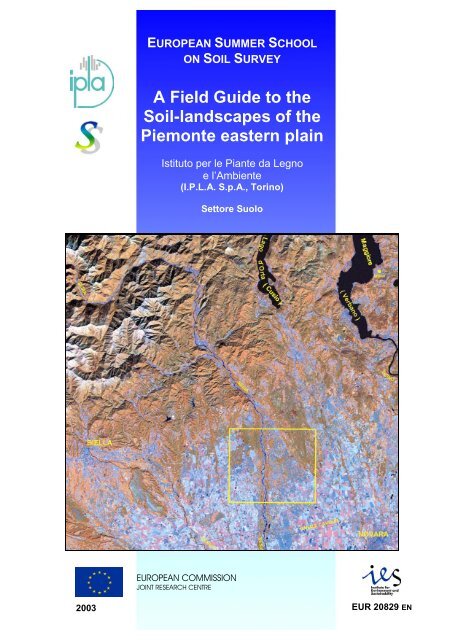
European Summer School on <strong>Soil</strong> Survey<br />
EUROPEAN SUMMER SCHOOL<br />
ON SOIL SURVEY<br />
A <strong>Field</strong> <strong>Guide</strong> <strong>to</strong> <strong>the</strong><br />
<strong>Soil</strong>-<strong>landscapes</strong> <strong>of</strong> <strong>the</strong><br />
<strong>Piemon</strong>te eastern plain<br />
Istitu<strong>to</strong> per le Piante da Legno<br />
e l’Ambiente<br />
(I.P.L.A. S.p.A., Torino)<br />
Set<strong>to</strong>re <strong>Suolo</strong><br />
EUROPEAN COMMISSION<br />
JOINT RESEARCH CENTRE<br />
<strong>2003</strong><br />
A <strong>Field</strong> <strong>Guide</strong> <strong>to</strong> <strong>the</strong> <strong>Soil</strong>-<strong>landscapes</strong> <strong>of</strong> <strong>the</strong> <strong>Piemon</strong>te eastern plain EUR 20829 EN
European Summer School on <strong>Soil</strong> Survey<br />
A <strong>Field</strong> <strong>Guide</strong> <strong>to</strong> <strong>the</strong> <strong>Soil</strong>-<strong>landscapes</strong> <strong>of</strong> <strong>the</strong> <strong>Piemon</strong>te eastern plain
European Summer School on <strong>Soil</strong> Survey<br />
A <strong>Field</strong> <strong>Guide</strong> <strong>to</strong> <strong>the</strong> <strong>Soil</strong>-<strong>landscapes</strong> <strong>of</strong> <strong>the</strong> <strong>Piemon</strong>te eastern plain
European Summer School on <strong>Soil</strong> Survey<br />
This document may be cited as follows:<br />
F Fabio Petrella<br />
Petrella, F., Piazzi, M., Martalò, P., Rober<strong>to</strong>, P., Giannetti, F., Alliani, N., Ancarani, V., Nicoli, G.,<br />
Salandin, R. & Filippi, N. (<strong>2003</strong>). A <strong>Field</strong> <strong>Guide</strong> <strong>to</strong> <strong>the</strong> <strong>Soil</strong>-<strong>landscapes</strong> <strong>of</strong> <strong>the</strong> <strong>Piemon</strong>te eastern plain.<br />
European <strong>Soil</strong> Bureau Research Report No.14, EUR 20829 EN, 33pp. Office for Official Publications <strong>of</strong> <strong>the</strong><br />
European Communities, Luxembourg.<br />
The following <strong>Soil</strong> Staff technicians have collaborated:<br />
Fabio Petrella <strong>Soil</strong> survey, classification and preparation <strong>of</strong> text. <strong>Field</strong> trip organisation<br />
Mauro Piazzi Technical Coordina<strong>to</strong>r<br />
Paolo Martalò <strong>Field</strong> organisation<br />
Paolo Rober<strong>to</strong> <strong>Field</strong> organisation<br />
Fabio Giannetti Satellite image interpretation<br />
Nicoletta Alliani Labora<strong>to</strong>ry analysis<br />
Vanessa Ancarani Labora<strong>to</strong>ry analysis<br />
Giuseppina Nicoli Car<strong>to</strong>graphic design<br />
Rober<strong>to</strong> Salandin General coordination. Interpretation <strong>of</strong> <strong>Soil</strong> Resources<br />
Nicola Filippi – Detached National Expert, JRC Ispra<br />
COVER PICTURE<br />
SATELLITE IMAGE OF THE EASTERN PIEMONTE PLAIN, ITALY<br />
A <strong>Field</strong> <strong>Guide</strong> <strong>to</strong> <strong>the</strong> <strong>Soil</strong>-<strong>landscapes</strong> <strong>of</strong> <strong>the</strong> <strong>Piemon</strong>te eastern plain
European Summer School on <strong>Soil</strong> Survey<br />
EUROPEAN SUMMER SCHOOL<br />
ON SOIL SURVEY<br />
A <strong>Field</strong> <strong>Guide</strong> <strong>to</strong> <strong>the</strong><br />
<strong>Soil</strong>-<strong>landscapes</strong> <strong>of</strong> <strong>the</strong><br />
<strong>Piemon</strong>te eastern plain<br />
Istitu<strong>to</strong> per le Piante da Legno<br />
e l’Ambiente<br />
(I.P.L.A. S.p.A., Torino)<br />
Set<strong>to</strong>re <strong>Suolo</strong><br />
A <strong>Field</strong> <strong>Guide</strong> <strong>to</strong> <strong>the</strong> <strong>Soil</strong>-<strong>landscapes</strong> <strong>of</strong> <strong>the</strong> <strong>Piemon</strong>te eastern plain
European Summer School on <strong>Soil</strong> Survey<br />
Mission <strong>of</strong> <strong>the</strong> JRC<br />
The mission <strong>of</strong> <strong>the</strong> Institute <strong>of</strong> Environment and Sustainability is <strong>to</strong> provide scientific and technical support<br />
<strong>to</strong> EU strategies for <strong>the</strong> protection <strong>of</strong> <strong>the</strong> environment and sustainable development. Employing an<br />
integrated approach <strong>to</strong> <strong>the</strong> investigation <strong>of</strong> air, water and soil contaminants, its goals are sustainable<br />
management <strong>of</strong> water resources, protection and maintenance <strong>of</strong> drinking waters, good functioning <strong>of</strong><br />
aquatic ecosystems and good ecological quality <strong>of</strong> surface waters.<br />
Legal Notice<br />
Nei<strong>the</strong>r <strong>the</strong> European Commission nor any person<br />
acting on behalf <strong>of</strong> <strong>the</strong> Commission is responsible for<br />
<strong>the</strong> use, which might be made <strong>of</strong> <strong>the</strong> following information.<br />
A great deal <strong>of</strong> additional information on <strong>the</strong><br />
European Union is available on <strong>the</strong> Internet.<br />
It can be accessed through <strong>the</strong> Europa server<br />
(http://europa.eu.int)<br />
EUR 20829 EN<br />
© European Communities, <strong>2003</strong><br />
Reproduction is authorised provided <strong>the</strong> source is acknowledged<br />
Printed in Italy<br />
A <strong>Field</strong> <strong>Guide</strong> <strong>to</strong> <strong>the</strong> <strong>Soil</strong>-<strong>landscapes</strong> <strong>of</strong> <strong>the</strong> <strong>Piemon</strong>te eastern plain
European Summer School on <strong>Soil</strong> Survey<br />
Table <strong>of</strong> contents<br />
1 The soil-<strong>landscapes</strong> <strong>of</strong> <strong>the</strong> <strong>Piemon</strong>te eastern plain ................................................1<br />
2 Geological and geomorphological characteristics .................................................5<br />
3 Land cover.................................................................................................................7<br />
4 STOP 1: The River Sesia Nor<strong>the</strong>rn Plain.............................................................13<br />
4.1 The Landscape...................................................................................................13<br />
4.2 <strong>Soil</strong>s in general ..................................................................................................14<br />
4.3 Towards a Thematic Strategy for <strong>Soil</strong> Protection .............................................15<br />
4.4 The representative soil pr<strong>of</strong>ile...........................................................................15<br />
4.5 Pr<strong>of</strong>ile <strong>of</strong> S<strong>to</strong>p 1 ................................................................................................16<br />
5 STOP 2: The River Sesia Sou<strong>the</strong>rn Plain.............................................................18<br />
5.1 The Landscape...................................................................................................18<br />
5.2 <strong>Soil</strong>s in general ..................................................................................................18<br />
5.3 Towards a Thematic Strategy for <strong>Soil</strong> Protection .............................................19<br />
5.4 The representative soil pr<strong>of</strong>ile...........................................................................19<br />
5.5 Pr<strong>of</strong>ile <strong>of</strong> S<strong>to</strong>p 2 ................................................................................................20<br />
6 STOP 3: The Old Terraces (Novara hills)............................................................22<br />
6.1 The Landscape...................................................................................................22<br />
6.2 <strong>Soil</strong>s in general ..................................................................................................24<br />
6.3 Towards a Thematic Strategy for <strong>Soil</strong> Protection .............................................25<br />
6.4 The representative soil pr<strong>of</strong>ile...........................................................................26<br />
6.5 Pr<strong>of</strong>ile <strong>of</strong> S<strong>to</strong>p 3 ................................................................................................27<br />
7 The physical and chemical analysis ......................................................................32<br />
8 References ...............................................................................................................32<br />
European <strong>Soil</strong> Bureau Research Reports.............................................................34<br />
A <strong>Field</strong> <strong>Guide</strong> <strong>to</strong> <strong>the</strong> <strong>Soil</strong>-<strong>landscapes</strong> <strong>of</strong> <strong>the</strong> <strong>Piemon</strong>te eastern plain
European Summer School on <strong>Soil</strong> Survey<br />
A <strong>Field</strong> <strong>Guide</strong> <strong>to</strong> <strong>the</strong> <strong>Soil</strong>-<strong>landscapes</strong> <strong>of</strong> <strong>the</strong> <strong>Piemon</strong>te eastern plain
TESTO BIANCO Tes<strong>to</strong> bianco<br />
European Summer School on <strong>Soil</strong> Survey<br />
A <strong>Field</strong> <strong>Guide</strong> <strong>to</strong> <strong>the</strong> <strong>Soil</strong>-<strong>landscapes</strong> <strong>of</strong> <strong>the</strong> <strong>Piemon</strong>te eastern plain
European Summer School on <strong>Soil</strong> Survey<br />
A <strong>Field</strong> <strong>Guide</strong> <strong>to</strong> <strong>the</strong> <strong>Soil</strong>-<strong>landscapes</strong> <strong>of</strong> <strong>the</strong> <strong>Piemon</strong>te eastern plain
European Summer School on <strong>Soil</strong> Survey<br />
1 The soil-<strong>landscapes</strong> <strong>of</strong> <strong>the</strong> <strong>Piemon</strong>te eastern plain<br />
The area (Figures 1 and 2) is very representative <strong>of</strong> <strong>the</strong> <strong>Piemon</strong>te landscape features, in<br />
particular <strong>of</strong> <strong>the</strong> complex morphologies, typical <strong>of</strong> <strong>the</strong> valleys exits, where old terraces<br />
and actual plains cross, forming characteristic physiographic patterns.<br />
Pedogenetic fac<strong>to</strong>rs pose interesting problems <strong>of</strong> soil interpretation, with high spatial<br />
variability in a relative small area.<br />
Within few kilometres, an west-east chrono-<strong>to</strong>posequence crosses <strong>the</strong> area from <strong>the</strong> Sesia<br />
bed <strong>to</strong> Novara ‘hills’, built on, across <strong>the</strong> geological eras, <strong>the</strong> oldest fluvioglacial deposits<br />
as far as <strong>the</strong> most recent Sesia alluvium.<br />
Also <strong>the</strong> soil cover reflects this variability, <strong>of</strong>fering a good alternation <strong>of</strong> natural wood<br />
<strong>landscapes</strong>, harmoniously merged in<strong>to</strong> <strong>the</strong> agricultural field patterns <strong>of</strong> rice-growing and<br />
vineyards.<br />
These are <strong>the</strong> reasons why <strong>the</strong> <strong>Soil</strong> Staff <strong>of</strong> <strong>the</strong> Forestry and Environment Institute<br />
(IPLAspa, Turin) has chosen this area a study window for <strong>the</strong> realisation <strong>of</strong> <strong>the</strong> <strong>Piemon</strong>te<br />
soil map in a scale1:250,000, on <strong>the</strong> behalf <strong>of</strong> <strong>the</strong> regional administration, in <strong>the</strong> national<br />
framework <strong>of</strong> <strong>the</strong> Italian soil map at <strong>the</strong> same scale.<br />
A <strong>Field</strong> <strong>Guide</strong> <strong>to</strong> <strong>the</strong> <strong>Soil</strong>-<strong>landscapes</strong> <strong>of</strong> <strong>the</strong> <strong>Piemon</strong>te eastern plain 1
1 S<strong>to</strong>p 1:<br />
å<br />
Sesia Plain<br />
Sizzano area<br />
2<br />
å<br />
S<strong>to</strong>p 2:<br />
Sesia Plain<br />
Briona area<br />
3 S<strong>to</strong>p 3:<br />
å<br />
Old Terraces<br />
Barengo area<br />
å<br />
1<br />
3<br />
å<br />
2<br />
å<br />
The Topographic Map used for<br />
<strong>the</strong> Carthography is derived from <strong>the</strong><br />
"Atlante Stradale d'Italia" (1:200.000 Scale)<br />
published by Touring Club Italiano.<br />
Figure 1. Geographic location <strong>of</strong> <strong>the</strong> field trip and study sites
Lago Lago<br />
Lago<br />
Maggiore Maggiore<br />
d`Orta<br />
Ispra<br />
SESIA<br />
( Cusio Cusio )<br />
( Verbano )<br />
TICINO<br />
SESIA<br />
BIELLA<br />
1<br />
å<br />
3<br />
å<br />
2<br />
å<br />
CANALE CAVOUR<br />
CERVO<br />
SESIA<br />
L. di Viverone<br />
NOVARA<br />
ELVO<br />
Figure 2. Study window representation by remote sensing data<br />
VERCELLI<br />
CANALE CAVOUR<br />
SESIA
European Summer School on <strong>Soil</strong> Survey<br />
4<br />
A <strong>Field</strong> <strong>Guide</strong> <strong>to</strong> <strong>the</strong> <strong>Soil</strong>-<strong>landscapes</strong> <strong>of</strong> <strong>the</strong> <strong>Piemon</strong>te eastern plain
European Summer School on <strong>Soil</strong> Survey<br />
2 Geological and geomorphological characteristics<br />
This is a high plain area, characterised by strips <strong>of</strong> old terraces, residuals <strong>of</strong> <strong>the</strong> great<br />
cones made by fluvial-glacial material formed at <strong>the</strong> mouth <strong>of</strong> <strong>the</strong> Alpine valleys, during<br />
<strong>the</strong> Quaternary cold periods.<br />
The material <strong>of</strong> <strong>the</strong> highest terrace is attributable <strong>to</strong> <strong>the</strong> fluvial-glacial Mindel and is<br />
composed by very altered coarse gravelly alluvial. The intermediate terrace is constituted<br />
by more recent pebbly and gravelly material that is attributable <strong>to</strong> Riss and Wurm. The<br />
actual level <strong>of</strong> <strong>the</strong> plain is attributable only <strong>to</strong> Wurm and is characterised by coarse<br />
material, which becomes finer in proportion with <strong>the</strong> distance from <strong>the</strong> valleys mouth in<strong>to</strong><br />
<strong>the</strong> plain (Figure 3).<br />
Figure 3. The image, derived from <strong>the</strong> Terrain Digital Model, shows <strong>the</strong> relief<br />
characteristics <strong>of</strong> <strong>the</strong> study area.<br />
A <strong>Field</strong> <strong>Guide</strong> <strong>to</strong> <strong>the</strong> <strong>Soil</strong>-<strong>landscapes</strong> <strong>of</strong> <strong>the</strong> <strong>Piemon</strong>te eastern plain 5
European Summer School on <strong>Soil</strong> Survey<br />
6<br />
A <strong>Field</strong> <strong>Guide</strong> <strong>to</strong> <strong>the</strong> <strong>Soil</strong>-<strong>landscapes</strong> <strong>of</strong> <strong>the</strong> <strong>Piemon</strong>te eastern plain
European Summer School on <strong>Soil</strong> Survey<br />
3 Land cover<br />
In Figure 4 it is possible <strong>to</strong> see <strong>the</strong> general characteristics <strong>of</strong> <strong>the</strong> area, as it appears on <strong>the</strong><br />
image from LANDSAT 5 <strong>the</strong> 8 th <strong>of</strong> August 1998. This is represented so that <strong>the</strong><br />
wavelength <strong>of</strong> <strong>the</strong> Near Infrared (NIR) is brought <strong>to</strong> <strong>the</strong> Red Channel, that <strong>of</strong> <strong>the</strong> Short<br />
Wavelength Infrared <strong>to</strong> <strong>the</strong> Green Channel, and <strong>the</strong> Visible Red <strong>to</strong> <strong>the</strong> Blue Channel. By<br />
<strong>the</strong> combination <strong>of</strong> <strong>the</strong>se wavelengths it is possible <strong>to</strong> select <strong>the</strong> areas with vegetation<br />
represented by brown and brown-reddish (wood and shrubs) or orange and red (sown and<br />
grass field).<br />
In <strong>the</strong> image <strong>the</strong> presence <strong>of</strong> different landscape patterns it is clearly visible, from <strong>the</strong><br />
brown-greenish large bands <strong>of</strong> woods and shrubs along <strong>the</strong> old terraces, <strong>to</strong> <strong>the</strong> blue <strong>of</strong> <strong>the</strong><br />
urbanised areas, expanded continuously along <strong>the</strong> road axis, and <strong>the</strong> pink-red <strong>of</strong> <strong>the</strong> rice<br />
fields in <strong>the</strong> sou<strong>the</strong>rn area.<br />
Figure 4. Image from LANDSAT 5 (08/08/98)<br />
A <strong>Field</strong> <strong>Guide</strong> <strong>to</strong> <strong>the</strong> <strong>Soil</strong>-<strong>landscapes</strong> <strong>of</strong> <strong>the</strong> <strong>Piemon</strong>te eastern plain 7
Luvisols (WRB, 1998)<br />
Alfisols (USDA, 1998)<br />
A1<br />
A2<br />
A4<br />
Highly developed soils, loamy or finer textures, low permeable,<br />
with a strongly structured reddish-brown argillic horizon, <strong>to</strong>ngues<br />
or fragipans. They are mainly located on old terraces.<br />
(WRB, 1998: Pr<strong>of</strong>ondi-Albic Luvisols, Albic Luvisols;<br />
USDA, 1998: Typic Paleudalfs, Fragic Paleudalfs).<br />
Highly developed soils, loamy or finer textures, low permeable,<br />
with a strongly structured greyish-brown argillic horizon, <strong>to</strong>ngues<br />
or fragipans. They are mainly located on old terraces.<br />
(WRB, 1998: Albi-Epigleyic Luvisols;<br />
USDA, 1998: Typic Fragiaqualfs, Fragic Epiaqualfs).<br />
Hydromorphic, poorly drained, developed soils with an argillic<br />
horizon, scarcely recognisable because <strong>of</strong> <strong>the</strong> greyish colour <strong>of</strong><br />
reduced iron depletions.<br />
(WRB, 1998: Epigleyic Luvisols; USDA, 1998: Typic Epiaqualfs).<br />
Cambisols (WRB, 1998)<br />
Inceptisols (USDA, 1998)<br />
B1<br />
B3<br />
Fluvisols (WRB, 1998)<br />
Entisols (USDA, 1998)<br />
C1<br />
Deep, well drained, scarcely developed soils, with a moderately<br />
structured altered horizon. Rooting and workability are without<br />
limitations.<br />
(WRB, 1998: Dystri-Fluvic Cambisols, Dystric Cambisols;<br />
USDA, 1998: Fluventic Humic Dystrochrepts, Fluventic<br />
Dystrochrepts).<br />
Gravelly, scarcely altered soils, with a weakly structured altered<br />
horizon. Gravels, within 50 cm, limit rooting and workability.<br />
(WRB, 1998: Dystri-Episkeletic Cambisols, Episkeleti-Fluvic<br />
Cambisols;<br />
USDA, 1998: Lithic Humic Dystrochrepts, Lithic Dystrochrepts).<br />
Deep, well drained, not developed alluvial soils, without altered<br />
horizon. No limits <strong>of</strong> rooting and workability.<br />
(WRB, 1998: Dystric Fluvisols, Dystri-Humic Fluvisols;<br />
USDA, 1998: Umbric Udifluvents, Typic Udifluvents).<br />
Deep, well drained, not developed alluvial soils, without altered<br />
C3<br />
horizon. Gravels, within 50 cm, limit rooting and workability.<br />
(WRB, 1998: Episkeleti-Humic Fluvisols, Episkeletic Fluvisols;<br />
USDA, 1998: Umbric Udifluvents, Typic Udifluvents).<br />
1å<br />
S<strong>to</strong>p 1: Sesia Plain - Humi-Fluvic Cambisol (Hyperdystric)<br />
2<br />
å S<strong>to</strong>p 2: Sesia Plain - Hyperdystri-Stagnic Cambisol<br />
3å<br />
S<strong>to</strong>p 3: Old Terraces - Pr<strong>of</strong>ondi-Albic Luvisol<br />
Figure 5. Legend <strong>of</strong> <strong>Soil</strong> Map 1:250.000 scale
o<br />
d<br />
C1<br />
B6<br />
B6<br />
Forno<br />
RR<br />
RR B6<br />
C1<br />
Gravellona Toce<br />
VERBANIA<br />
Casale Corte Cerro<br />
B6<br />
C6<br />
M<br />
Carc<strong>of</strong>oro C6<br />
B6<br />
Massiola<br />
B6<br />
Rimella<br />
Valstrona B6<br />
astallone<br />
Loreglia<br />
Baveno<br />
B6 C6<br />
A8<br />
Isola Bella<br />
C6<br />
Fobello<br />
Rima S.Giuseppe<br />
B6<br />
C6<br />
Germagno<br />
Cervat<strong>to</strong><br />
IL MOTTARONE B6<br />
B6<br />
C6<br />
Stresa<br />
Omegna C6<br />
Quarna sopra Agrano<br />
C6<br />
A8<br />
B6 Quarna sot<strong>to</strong><br />
Gignese<br />
C6<br />
Rimasco P.zo TRACCIORA<br />
Sabbia<br />
Brovello Carpugnino<br />
A8<br />
A8<br />
RR<br />
Nonio<br />
Cravagliana<br />
Camasco<br />
B6<br />
Belgirate<br />
B6<br />
A8<br />
bia<br />
Rossa<br />
Vocca<br />
Cesara<br />
A8 B6<br />
B6<br />
B6<br />
C6<br />
Bocciole<strong>to</strong><br />
Lesa<br />
Armeno<br />
Mollia<br />
Sovazza<br />
B6<br />
C6<br />
Balmuccia<br />
Varallo B6<br />
Pettenasco<br />
Massino Visconti<br />
Arola<br />
B6<br />
Nebbiuno<br />
B6 Camper<strong>to</strong>gno<br />
B6 Civiasco<br />
Pellino<br />
Miasino<br />
Scopa<br />
BEC D`OVAGA B6<br />
Pella B6 Orta S.Giulio<br />
A8<br />
B6<br />
A8<br />
Pisano<br />
C3<br />
Mad.na del Sasso<br />
A8<br />
A8Ameno<br />
B6 Colazza B6<br />
6<br />
A8 C3<br />
GhevioMeina<br />
Scopello<br />
B6 B6<br />
Rassa Piode Pila<br />
S.Maurizio d'Opaglio<br />
B6<br />
B6<br />
C6<br />
Breia<br />
Quarona<br />
Bolzano N.se<br />
A1 Pogno<br />
Invorio<br />
Arona<br />
Cellio<br />
Oleggio Castello<br />
A8<br />
A1 Gozzano Paruzzaro C3<br />
M.CAMPARIENT<br />
Soriso<br />
B6<br />
A1<br />
Briga N.se<br />
Il L.Ne<br />
Valduggia<br />
A8<br />
B6<br />
A1<br />
Gargallo<br />
Dormellet<strong>to</strong> B6<br />
I BO<br />
BORGOSESIA<br />
Postua<br />
B3<br />
A8<br />
B6<br />
B6<br />
C1<br />
M.FENERA<br />
R<br />
B6<br />
A1<br />
A1<br />
Comignago<br />
Gattico C3 Castellet<strong>to</strong> C3 so<br />
C6<br />
Ailoche Guardabosone C6<br />
B6<br />
C6<br />
Vergano N.se<br />
Borgomanero B1<br />
Caprile<br />
Maggiora<br />
Veruno<br />
Coggiola<br />
Serravalle Sesia<br />
B6<br />
A1<br />
Borgo Ticino<br />
Crevacuore<br />
a<br />
B6<br />
C3<br />
B3<br />
Grignasco<br />
A1<br />
Portula Pray<br />
A8 Boca<br />
Piane<br />
Cureggio<br />
Agrate ConturbiaB1<br />
Trivero A8<br />
Sesia<br />
ampiglia Cervo<br />
B3<br />
A1<br />
Bogogno<br />
6B6<br />
Quittengo<br />
A8<br />
Cavallirio<br />
Varallo Pomb C 3<br />
B6<br />
Sostegno<br />
Divignano<br />
lo Cervo<br />
Camandona Mosso S.Maria<br />
C6<br />
A1<br />
Pra<strong>to</strong> Sesia<br />
Cressa<br />
Veglio Pis<strong>to</strong>lesa<br />
B3<br />
Pombia<br />
Valle Mosso<br />
A8 Soprana<br />
Fontane<strong>to</strong> d'Agogna<br />
Callabiana<br />
Romagnano Sesia<br />
B1<br />
Tavigliano<br />
Mezzana Curino<br />
Suno<br />
Marano Tici<br />
Sagliano M.ca Selve Marcone<br />
Mortigliengo<br />
Lozzolo<br />
A1<br />
Miagliano A1 Pettinengo Strona<br />
Villa del Bosco<br />
C3<br />
Andorno Micca Valle S.Nicolao Casapinta<br />
A8<br />
Gattinara<br />
Mezzomerico<br />
A8<br />
A1<br />
Roasio<br />
C3<br />
Crosa<br />
Cavaglio d'Agogna<br />
Bioglio Vallanzengo<br />
Mombello Brusnengo<br />
Cavagliet<strong>to</strong><br />
Tollegno Zumaglia<br />
Lessona Masserano<br />
Oleggio<br />
Pralungo Ternengo<br />
Piat<strong>to</strong><br />
A8<br />
Vaprio d'AgognaB1<br />
A8<br />
Ghemme<br />
A1<br />
A1 A8<br />
B1<br />
ollone C3<br />
Ronco B.se Quaregna<br />
A1 A1<br />
BIELLA Valdengo Cossa<strong>to</strong><br />
1 Sizzano<br />
å<br />
B1 Barengo<br />
Momo<br />
Occhieppo Sup.<br />
Cerre<strong>to</strong> Castello A1<br />
3<br />
o<br />
Vigliano B.se<br />
å<br />
Bellinzago N<br />
A1<br />
B3<br />
Occhieppo Inf.<br />
A2<br />
B1<br />
Lenta<br />
B1 Fara N.se<br />
Alzate<br />
Peschiere<br />
B1<br />
burzano<br />
Gaglianico<br />
Briona<br />
B3 Ponderano<br />
Rovasenda<br />
onticello<br />
Candelo<br />
Carpignano Sesia2<br />
B3<br />
Castellengo<br />
Ghislarengo å<br />
Sologno<br />
Sandigliano<br />
A2<br />
B3<br />
Mongrando<br />
A1<br />
A1<br />
Castellet<strong>to</strong> Cervo<br />
Sillavengo<br />
Benna<br />
Caltignaga<br />
Borriana<br />
A1<br />
C3<br />
Castellazzo N.se<br />
B2 B3<br />
B2<br />
B2 Verrone<br />
Mottalciata<br />
B1 S.Giacomo V.se<br />
Cam<br />
biena<br />
Massazza<br />
Arborio Landiona<br />
C3 C3<br />
A2<br />
Zanga<br />
Gifflenga<br />
Mandello Vitta<br />
C1<br />
A4<br />
Nibbia<br />
Villanova B.se<br />
B1<br />
Casaleggio Novara<br />
6<br />
Buronzo<br />
Vicolungo<br />
Cerrione<br />
Magnano<br />
Vigellio<br />
C.se<br />
A8<br />
Balocco<br />
Recet<strong>to</strong><br />
B1<br />
Zimone<br />
Greggio<br />
Biandrate<br />
Piverone<br />
Arro<br />
S.Pietro Mosezzo<br />
B6Salussola<br />
B1<br />
B3<br />
L. di Bertignano<br />
Villarboit<br />
S.Nazzaro C1 Sesia<br />
B1<br />
D6<br />
Casalbeltrame<br />
Viverone Dorzano<br />
Albano V.se<br />
NOVARA<br />
F1 Roppolo<br />
A1<br />
Formigliana<br />
Torrione Quartara<br />
L. di Viverone<br />
A1<br />
imo Rottaro F1<br />
Cavaglià<br />
Carisio B1<br />
B2 Ponzana<br />
F1<br />
Lumellogno<br />
Casanova Elvo Oldenico<br />
A8<br />
Collobiano<br />
Casalvolone<br />
A1 A3<br />
ano C.se B6<br />
Cameriano<br />
DEL MONTE<br />
B2<br />
B1<br />
Villata<br />
B2<br />
Gar<br />
B6 C1<br />
B2<br />
A3 Quin<strong>to</strong> V.se<br />
Monticello<br />
A5<br />
A4<br />
C1<br />
omasino Alice Castello<br />
B2<br />
C1<br />
Santhià<br />
Olcenengo<br />
Nibbiola<br />
B2<br />
B1<br />
Caresanablot<br />
A3<br />
B6<br />
Borgo d'Ale<br />
S.Germano V.se<br />
Casalino<br />
Granozzo con Monticello A3<br />
Borgo Vercelli<br />
Maglione<br />
A5<br />
Maglione<br />
B3<br />
Tronzano V.se<br />
Capriasco<br />
vello<br />
A3 Figure 6. Study window in <strong>the</strong> <strong>Piemon</strong>te <strong>Soil</strong> Map 1:250.000 scale<br />
A5<br />
B1<br />
B2<br />
llo<br />
Crova<br />
Salasco<br />
N.11 VERCELLI<br />
A3<br />
Vinzaglio C2<br />
B1<br />
Bianzè<br />
Sali V.se<br />
C1<br />
Cigliano<br />
Bo<br />
B1 Larizzate Cappuccini<br />
A3<br />
Venaria<br />
Casino Castellazzo<br />
Lignana<br />
Livorno Ferraris<br />
C.na Molinet<strong>to</strong><br />
Prarolo<br />
Nonai<br />
gna<br />
gna<br />
iolana<br />
igliano igliano<br />
d i<br />
d i<br />
Se<br />
O rop a<br />
iolana<br />
Se<br />
N.144<br />
Iv rea<br />
rm<br />
en<br />
en<br />
Sorba<br />
Dolca<br />
Sessera<br />
Olobbia<br />
N.593<br />
z a<br />
z a<br />
SE SIA<br />
Egua<br />
Elvo<br />
Elvo<br />
S<br />
n n a a<br />
o tr<br />
N.143<br />
Il Navilot<strong>to</strong><br />
Serm e<br />
Serm e<br />
N.232<br />
A 21<br />
nz a<br />
Barbina<br />
Chiebbia<br />
Chiebbia<br />
N.143<br />
N.11<br />
Comba di Valmala<br />
Comba di Valmala<br />
Confienzo<br />
A 4<br />
Canale Depretis<br />
N.299<br />
Croso Gavala<br />
Cerv o<br />
a<br />
Stron<br />
Strona<br />
N.232<br />
CANALE CAVOUR<br />
di Postu a<br />
D u<br />
N.142<br />
Os<strong>to</strong>la<br />
g<br />
Mastallone<br />
Mastallone<br />
gi a<br />
gi a<br />
Trio gna<br />
Sabbiola<br />
Elvo<br />
G u arab ione<br />
la<br />
B aa gnoo<br />
S.Giorgio<br />
P asc one<br />
Sesse ra<br />
N.230<br />
R<br />
R<br />
gia<br />
g<br />
A 26/4<br />
tron tron<br />
S<br />
del<br />
a<br />
Rovasenda<br />
Rovasenda<br />
rch ese<br />
a M<br />
m<br />
O di<br />
Rialone<br />
Cervo<br />
S tron<br />
Rovasenda<br />
e gn a<br />
e gn a<br />
S tron<br />
Fiumetta<br />
Valduggia<br />
a di di<br />
Colompasso<br />
Roggia<br />
M archiazza<br />
lagna<br />
o<br />
M<br />
SESIA<br />
d el<br />
d el<br />
o<br />
Roccia<br />
arch archeseese<br />
M<br />
A 4<br />
Naviglio di Ivrea<br />
N.455<br />
N.594<br />
C e<br />
o o<br />
Lag<br />
`O rta<br />
`O rta<br />
SE SIA<br />
rv o<br />
S<br />
Stron<br />
Stron<br />
( Cusio Cusio )<br />
iz zone<br />
di<br />
a<br />
Pescone<br />
S S trona trona<br />
egna<br />
Om<br />
Bonda<br />
di Bri ona<br />
N.299<br />
Ondella<br />
Ondella<br />
Agogn a<br />
Agogn a<br />
N.31<br />
S<br />
N.33<br />
Rio della Valle<br />
Selva<br />
Airola<br />
Tessera<br />
izzo ne<br />
izzo ne<br />
Rio della Valle<br />
A 26<br />
Airola<br />
a<br />
Spess<br />
Erno<br />
Agogna<br />
a<br />
Vever<br />
Lirone<br />
Rese<br />
Ern o<br />
A CAN LE CAVOUR<br />
SESIA<br />
Agogna<br />
N.142<br />
A 26<br />
Ern o<br />
( Verbano )<br />
N.229<br />
Lago Lago<br />
Terdoppio Novarese<br />
Agogna<br />
N.11<br />
M aggiore<br />
M aggiore<br />
N.33<br />
Agamo<br />
N.299<br />
Ri<strong>to</strong><br />
Ri<strong>to</strong><br />
Agogna<br />
A 26/8<br />
N.32<br />
T<br />
Canale<br />
IC<br />
Arbogna<br />
INO<br />
Regi<br />
Regi<br />
CANALE<br />
N.211
European Summer School on <strong>Soil</strong> Survey<br />
10<br />
A <strong>Field</strong> <strong>Guide</strong> <strong>to</strong> <strong>the</strong> <strong>Soil</strong>-<strong>landscapes</strong> <strong>of</strong> <strong>the</strong> <strong>Piemon</strong>te eastern plain
250<br />
A SCALA 1:50.000 SECONDO LA CARTA TECNICA<br />
SOIL MAP 1:250.000<br />
<strong>Soil</strong>-<strong>landscapes</strong> study window<br />
LOCALIZZAZIONE IN AMBITO REGIONALE DEL FOGLIO<br />
019 020<br />
035 036<br />
051 052 # 053<br />
VB<br />
071 072 073 074<br />
091 092 BI 093 094<br />
#<br />
# 095<br />
NO<br />
112 113 114 115 116 NO 117<br />
152 #<br />
#<br />
132<br />
VC<br />
133 134 135 136 137 138<br />
TO<br />
153 154 155 156 157 158 159<br />
171 172 173 174<br />
AT AL<br />
175 # 176#<br />
177 178<br />
189 190 191 192 193 194 195 196<br />
207 208 209 CN 210 211 212 213 214<br />
224 225<br />
#<br />
226 227 228<br />
242 243 244 245<br />
AGRICULTURE DEPARTMENT<br />
NOVARA PLAIN<br />
1:50.000 SCALE<br />
U1036<br />
WRB, 1998: Pr<strong>of</strong>ondi-Albic Luvisols, Albic Luvisols;<br />
USDA, 1998: Typic Paleudalfs, Fragic Paleudalfs.<br />
U1035 WRB, 1998: Dystric Fluvisols, Dystri-Humic Fluvisols,<br />
Episkeleti-Fluvic Cambisols, Dystri-Fluvic Cambisols;<br />
USDA, 1998: Umbric Udifluvents, Typic Udifluvents.<br />
S.Nicolo'<br />
U1040<br />
WRB, 1998: Dystri-Fluvic Cambisols, Dystric Cambisols,<br />
Dystri-Episkeletic Cambisols, Episkeleti-Fluvic Cambisols;<br />
USDA, 1998: Fluventic Humic Dystrochrepts,<br />
Fluventic Dystrochrepts.<br />
# 1 S<strong>to</strong>p 1: Sesia Plain - Humi-Fluvic Cambisol<br />
(Hyperdystric)<br />
S<strong>to</strong>p 2: Sesia Plain - Hyperdystri-Stagnic Cambisol<br />
# 2 S<strong>to</strong>p 3: Old Terraces - Pr<strong>of</strong>ondi-Albic Luvisol<br />
Note:<br />
La legenda costituisce un'elaborazione sintetica della legenda standard della<br />
CARTA DEI SUOLI a scala 1:50.000, a cui si rimanda per la completa definizione delle<br />
classi dei Suoli.<br />
Le sigle di colore rosso presenti in carta ( U1029 ) identificano le Unità Car<strong>to</strong>grafiche di <strong>Suolo</strong>.<br />
La fonte dei dati per il fondo <strong>to</strong>pografico è la CTRN - Servizio Car<strong>to</strong>grafico Regione <strong>Piemon</strong>te.<br />
0<br />
V I G N O L E<br />
Rio<br />
V A L G I O L O<br />
U1036<br />
C.<strong>to</strong> Barbavara Mandria<br />
C.na Aurora<br />
V A L L E R A C E<br />
250<br />
250<br />
250<br />
Fornace<br />
Ghemme<br />
250<br />
StradaperFara<br />
della<br />
D I G H E M M E<br />
B O S C O<br />
250<br />
250250<br />
C.lo<br />
Fornace<br />
250<br />
Torrente<br />
250<br />
Ghemme<br />
S.Sebastiano (rov.e)<br />
Santuario di Rado<br />
250<br />
250<br />
B A R A G G I O N E<br />
Valle<br />
B A R A G G I A<br />
Strona<br />
C.na Carita'<br />
C.<strong>to</strong> Furno<br />
250<br />
B O S C O D I<br />
250<br />
Co<strong>to</strong>nif.o Crespi<br />
R.gia<br />
B O S C O D E L R E<br />
S.Clemente<br />
B A R A G G I O N E<br />
S I Z Z A N O<br />
250<br />
Mora<br />
Lazzaret<strong>to</strong><br />
Catanea C.na<br />
Fosso<br />
Marchese<br />
250<br />
S.Giorgio (Rov.e)<br />
S.Paolo Podere<br />
250<br />
del<br />
250<br />
del<br />
Re<br />
250<br />
250<br />
250<br />
S.An<strong>to</strong>nio<br />
A26<br />
FIUME<br />
Roggia<br />
250<br />
250<br />
U1036<br />
250<br />
250<br />
S.Bar<strong>to</strong>lomeo<br />
250<br />
250<br />
250<br />
250<br />
Rog.a<br />
250<br />
250<br />
250<br />
l'Assunta<br />
Torrente<br />
Sizzano<br />
S.Giuseppe<br />
#<br />
Oriale<br />
F.so della Valle Sorca<br />
250<br />
P I A N O N E<br />
R O C C O L O<br />
P A L A N C H I N A<br />
Can<strong>to</strong>rina<br />
Gattinara<br />
250<br />
la Mola<br />
Colombarolo C.na<br />
250<br />
250<br />
250<br />
250250<br />
Roggia<br />
Font.na Marcia<br />
S.S.<br />
Selvabella C.na<br />
F.so<br />
250<br />
1<br />
Santhia<br />
#<br />
3<br />
250<br />
250<br />
250<br />
N O C C H E<br />
Cascinet<strong>to</strong><br />
B O S C O P I A N E<br />
B O S C O<br />
Marchesa C.<strong>to</strong> della<br />
R.gia Mora<br />
C.na Nuova<br />
C.na Colombara<br />
Cascinetta<br />
Tre C.na Confini<br />
C.na Ferrera<br />
la<br />
(N.594)<br />
C.lo<br />
U1041<br />
250<br />
250<br />
250<br />
250<br />
Colombera d'Anselmin<br />
250<br />
U1037 U1036<br />
U1042<br />
SESIA<br />
Molinara<br />
250<br />
U1036<br />
250<br />
250<br />
Campasso C.na<br />
F.S.<br />
250<br />
250<br />
250<br />
250<br />
V E C C H I O<br />
Remme<br />
250<br />
250<br />
250<br />
C.lo<br />
Torrente<br />
del C.na Bosco<br />
S.Giulio<br />
B A R A G G I A D I L<br />
250<br />
250<br />
250<br />
U1035<br />
U1038<br />
250<br />
Riseria Negri<br />
Ist.o S.Gerolamo<br />
Novarese Fara<br />
Cavet<strong>to</strong><br />
V E R S O R E L L A<br />
S.Eugenio<br />
la Pieve<br />
C.na delle Monache<br />
V A L<br />
C E R E S O L E<br />
VALLE DEI RONCATI<br />
Strona<br />
200 200<br />
F.so<br />
Noca<br />
Cast.o Miglio<br />
C.na S<strong>to</strong>ppani<br />
Trivulzio<br />
Comunita' C.na<br />
200<br />
200<br />
200<br />
S.Maria<br />
Cantina Sociale<br />
RONCATI<br />
Camorina<br />
Rog.a<br />
Cavet<strong>to</strong> Trioulzio<br />
Modello<br />
Lenta<br />
Campagna Mad.na di<br />
U1029 U1030 C.<strong>to</strong> del Medico<br />
U1031 U1032 U1034<br />
il Riale<br />
200<br />
dell'Avvoca<strong>to</strong><br />
Roggia<br />
200<br />
VALLEDEI<br />
Strona T.<br />
Roggia<br />
Bonino<br />
200<br />
U1036<br />
Mad.na dei Campi<br />
Caccetta<br />
Cavo<br />
Rio<br />
C.del Guardiacaccia<br />
Serb.i<br />
C.na del Giardino<br />
Rio<br />
C.na Marchiazza<br />
Mora<br />
Briona<br />
Rog.a<br />
Cascinetta<br />
C.na Dardanona<br />
C.na Grande<br />
#<br />
2<br />
Cavo<br />
Font.naConte Trivulzio<br />
Cavallero<br />
C.na Mazzoni<br />
Mad.na delle Grazie<br />
Carpignano Sesia<br />
SESIA<br />
Pista Ficusello<br />
Piumerro<br />
Orcorio<br />
Torrente<br />
Figure 7. <strong>Soil</strong> Map 1:250.000<br />
200<br />
Dondoglio<br />
C.na delle Monache<br />
C.na Belvedere<br />
C.na Salera<br />
Ladro<br />
Cavo<br />
Cavo<br />
C.Cantu'<br />
S.Rocco<br />
Carpignano Sesia<br />
S.Agata<br />
FIUME<br />
Piccolo<br />
NUOVA<br />
BARAGGIA<br />
Bissone<br />
Marchiazza<br />
U1040<br />
Can<strong>to</strong>rina<br />
Cavo<br />
Ladro<br />
Paltana<br />
S.Apollinare<br />
200<br />
U1033<br />
Mad.na dell'Orio<br />
Cascinetta<br />
Prati<br />
C.na Gallinetta<br />
Cavo<br />
Imp.<strong>to</strong> ghiaia estrazione e sabbia<br />
Ghislarengo<br />
Cavo dei<br />
Cavo<br />
C.<strong>to</strong> della Briglia<br />
U1043<br />
C.na Regina<br />
C.na Goretta<br />
C.na Gorettina<br />
C.na Usellina<br />
C.na Bianca<br />
U1039<br />
Ladro<br />
C.na Massima<br />
Comune<br />
C.na Bellaria<br />
C.na Dolcenea<br />
C.na Ronchet<strong>to</strong><br />
C.na Cravera<br />
-di sopra<br />
C.na Ronchi-<br />
-di sot<strong>to</strong><br />
Molinara<br />
Sillavengo<br />
Roggia<br />
Faisina<br />
Rog.a<br />
Dondoglio<br />
U1043<br />
C.na Cappelletti<br />
C.na Fizzotti<br />
C.na Collobie<br />
C.na Ligorina<br />
S.Germano<br />
S.Graio<br />
C.ne Gianotti<br />
Cavo<br />
Castellazzo Novarese<br />
Cavo<br />
Font.na<br />
Molinara<br />
Busca<br />
C.na dei Confini<br />
C.na Moranza C.na Livelli C.na S.Giacomo<br />
C.na Tacita<br />
C.na Baraggiola<br />
C.na S.An<strong>to</strong>nio<br />
S.Rocco<br />
Camodea S.Maria di<br />
dell'Ospedale<br />
C.na Biola<br />
Font.na<br />
Farlenga<br />
Camannone<br />
C.na Galoppa C.na Val<strong>to</strong>ppo<br />
Roggia<br />
Roggia<br />
R. Orcorio<br />
C.na S.Felice<br />
Grande<br />
C.na Flecchia<br />
C.na Gagliarda<br />
Gagliarda<br />
Biraga<br />
Rog.a<br />
Pennino C.na Baraggione<br />
Morina Font.na<br />
SESIA<br />
la<br />
C.na del Cervo<br />
Boggione<br />
Viogna<br />
Rog.a<br />
Cavo<br />
C.Sciarea di sopra<br />
C.na Cerro<br />
Colombano<br />
Parucca<br />
DI<br />
C.na Val<strong>to</strong>ppina<br />
la Casera<br />
S.Lorenzo<br />
200<br />
FIUME<br />
BAREGGIASOPRA<br />
C.na C.na Taverna Speranza<br />
C.na Eurosia<br />
C.Sciarea di sot<strong>to</strong><br />
Roggia<br />
Torrente<br />
C.na Mezzano<br />
Font.na Cavazzola<br />
Arborio<br />
Landiona<br />
Castagnea<br />
C.na Vit<strong>to</strong>na<br />
C.na Belvedere<br />
C.Bossolina<br />
Marchiazza<br />
1000 2000 3000 4000 5000 m<br />
1500 m<br />
september 2002
European Summer School on <strong>Soil</strong> Survey<br />
12<br />
A <strong>Field</strong> <strong>Guide</strong> <strong>to</strong> <strong>the</strong> <strong>Soil</strong>-<strong>landscapes</strong> <strong>of</strong> <strong>the</strong> <strong>Piemon</strong>te eastern plain
European Summer School on <strong>Soil</strong> Survey<br />
4 STOP 1: The River Sesia Nor<strong>the</strong>rn Plain<br />
4.1 The Landscape<br />
The area is almost triangular, with vertices in<strong>to</strong> <strong>the</strong> urban centres <strong>of</strong> Ghemme, Briona and<br />
Carpignano Sesia. It has <strong>the</strong> river Sesia as <strong>the</strong> western limit and <strong>the</strong> old terrace slope as<br />
<strong>the</strong> eastern limit. The soils are developed from recent deposits (Wurm) <strong>of</strong> <strong>the</strong> river Sesia,<br />
constituted by sands and gravels.<br />
Agricultural uses in this area are limited by climatic and pedological characteristics.<br />
The presence <strong>of</strong> cold winds from <strong>the</strong> Sesia high valley reduces <strong>the</strong> possibilities <strong>of</strong> maize<br />
production <strong>to</strong> late cultivars and s<strong>to</strong>ps rice-growing. High permeability and diffuse<br />
presence <strong>of</strong> gravel and coarse sands also in <strong>the</strong> pr<strong>of</strong>ile head reduce available water<br />
capacities and <strong>of</strong>ten workability is conditioned. Intensive cereal production and also<br />
forage yields are not pr<strong>of</strong>itable.<br />
Mixed woodland is diffuse, both along <strong>the</strong> riverbanks and in <strong>the</strong> middle <strong>of</strong> <strong>the</strong> plain<br />
(Versorella woods), where locust-trees are dominant but, more sporadically, oak, chestnut<br />
and maple are also present. Poplar cultivation is very common, especially on <strong>the</strong> most<br />
recent alluvial deposits. Orchards and vineyards, witness <strong>of</strong> an ancient frame <strong>of</strong> rural<br />
arrangements, are scattered all over <strong>the</strong> landscape.<br />
The weak altimetrical gradient has a north-south direction, due <strong>to</strong> <strong>the</strong> Sesia alluvial cone.<br />
The most characteristic landscape element is <strong>the</strong> absence <strong>of</strong> a homogeneous rural pattern<br />
and, consequently, a discontinuity in <strong>the</strong> field arrangements and in <strong>the</strong> pedo-landscape<br />
units. The highway traces this appearance, cutting <strong>the</strong> plain in<strong>to</strong> two parts.<br />
Ano<strong>the</strong>r negative fac<strong>to</strong>r is <strong>the</strong> chaotic urbanisation <strong>of</strong> <strong>the</strong> main urban centres, especially<br />
Carpignano Sesia, but also, in general, <strong>the</strong> diffuse presence <strong>of</strong> industrial settlements<br />
scattered on <strong>the</strong> land.<br />
Also relevant is <strong>the</strong> network <strong>of</strong> canals drawing water from Sesia River for irrigation, even<br />
where <strong>the</strong>se systems are not completely in working order, because <strong>of</strong> lack <strong>of</strong> maintenance.<br />
A large band <strong>of</strong> locust-tree woods covers <strong>the</strong> eastern artificial bank <strong>of</strong> <strong>the</strong> Sesia River;<br />
<strong>the</strong>se trees grow vigorously on fine sands, included among coarser deposits, and are<br />
supplied by shallow groundwater. This area, called Scimbla park, extends from Ghemme<br />
<strong>to</strong> Carpignano. It constitutes an important landscape that is now protected.<br />
A <strong>Field</strong> <strong>Guide</strong> <strong>to</strong> <strong>the</strong> <strong>Soil</strong>-<strong>landscapes</strong> <strong>of</strong> <strong>the</strong> <strong>Piemon</strong>te eastern plain 13
European Summer School on <strong>Soil</strong> Survey<br />
4.2 General description <strong>of</strong> <strong>the</strong> soils<br />
Along <strong>the</strong> Sesia river, under <strong>the</strong> most recent alluvia, Humic Fluvisols, Skeletic Fluvisols<br />
and Skeleti-Humic Fluvisols (WRB, 1998) are present. Under woodland it is also possible<br />
<strong>to</strong> find Skeleti-Umbric Fluvisols (WRB, 1998).<br />
In <strong>the</strong> part <strong>of</strong> <strong>the</strong> plain more distant from <strong>the</strong> river, better developed soils are present: <strong>the</strong><br />
Fluvic Cambisol (WRB, 1998), and, in some gravelly areas, <strong>the</strong> Skeleti-Fluvic Cambisol<br />
(WRB, 1998). Some o<strong>the</strong>r soils are characterised by a dark epipedon, rich in organic<br />
matter, so that <strong>the</strong> proposed classification can be Humi-Fluvic Cambisol according <strong>to</strong><br />
‘Lecture Notes on <strong>the</strong> Major <strong>Soil</strong>s <strong>of</strong> <strong>the</strong> World’ (FAO, World <strong>Soil</strong> Resources Report # 94,<br />
2001).<br />
According <strong>to</strong> <strong>the</strong> U.S. <strong>Soil</strong> Taxonomy <strong>the</strong> soils are: Typic Udifluvent, coarse-loamy,<br />
mixed, non-acid, mesic (USDA, 1998), with umbric, gravelly and sandy phases; and<br />
Fluventic Dystrudept, coarse-loamy, mixed, nonacid, mesic with humic, gravelly and<br />
sandy phases (USDA, 1998).<br />
The main soil characteristics are:<br />
• sandy texture<br />
• contact with a gravelly substratum in average within 1 meter<br />
• acidification <strong>of</strong> <strong>to</strong>psoil with some weak illuviation <strong>of</strong> Fe-organic complex, in case<br />
<strong>of</strong> humic epipedon, such as a B layer can be definied<br />
• presence <strong>of</strong> an intermittent gravel layer <strong>of</strong> few centimetres among <strong>the</strong> sandy<br />
horizons<br />
These elements are all limiting fac<strong>to</strong>rs for agriculture, which is <strong>of</strong>ten restricted <strong>to</strong> poplar<br />
cultivation, especially on <strong>the</strong> most recent alluvium. At one time, woods would have<br />
covered all <strong>the</strong> land and it possible <strong>to</strong> deduct from this <strong>the</strong> presence <strong>of</strong> an intermittent<br />
organic layer <strong>of</strong> few centimetres thickness, which sometimes appears buried by some<br />
decimetres <strong>of</strong> sandy deposits from <strong>the</strong> very recent Sesia floods.<br />
14<br />
A <strong>Field</strong> <strong>Guide</strong> <strong>to</strong> <strong>the</strong> <strong>Soil</strong>-<strong>landscapes</strong> <strong>of</strong> <strong>the</strong> <strong>Piemon</strong>te eastern plain
European Summer School on <strong>Soil</strong> Survey<br />
Today powerful agricultural machines can plough without <strong>to</strong>o many difficulties in<strong>to</strong><br />
gravelly <strong>to</strong>psoils, so that it is possible <strong>to</strong> exploit <strong>the</strong> fertility residues <strong>of</strong> <strong>the</strong>se humic<br />
layers, which also contribute <strong>to</strong> a higher available water capacity.<br />
In any case <strong>the</strong> percentages <strong>of</strong> coarse particles in <strong>the</strong> texture fine fraction are very high, so<br />
<strong>the</strong> permeability remains very high and AWC low: <strong>the</strong>se fac<strong>to</strong>rs are greatly limiting <strong>the</strong><br />
Land Capability <strong>of</strong> this area.<br />
4.3 Towards a Thematic Strategy for <strong>Soil</strong> Protection<br />
With regard <strong>to</strong> <strong>the</strong> <strong>of</strong>ficial Communication <strong>of</strong> <strong>the</strong> Commission <strong>of</strong> <strong>the</strong> European<br />
Communities ‘Towards a Thematic Strategy for <strong>Soil</strong> Protection’ (Brussels, 16.4.2002<br />
COM(2002) 179 final), it is now appropriate <strong>to</strong> calculate <strong>the</strong> <strong>to</strong>tal area <strong>of</strong> <strong>the</strong> kinds <strong>of</strong> soil<br />
(see IPLA <strong>Soil</strong> Maps) that have been lost forever, in <strong>the</strong> last 40-50 years, because <strong>of</strong> <strong>the</strong><br />
urban settlements <strong>of</strong> Romagnano Sesia, Gattinara, Ghemme, Carpignano Sesia, Fara and<br />
Sizzano.<br />
This urbanisation has not taken account <strong>of</strong> <strong>the</strong> productivity <strong>of</strong> <strong>the</strong>se soils, that have been<br />
assessed as class II according <strong>to</strong> a methodology similar <strong>to</strong> <strong>the</strong> USDA Land Capability<br />
Classification.<br />
In spite <strong>of</strong> good water availability, <strong>the</strong>se soils show a different distribution <strong>of</strong> subsurface<br />
gravels through <strong>the</strong> irregular growth <strong>of</strong> maize stems, especially where ancient river<br />
courses cross <strong>the</strong> fields. This means that <strong>the</strong>ir potential capacity <strong>to</strong> protect groundwater<br />
from pollution is low or very low. Because <strong>of</strong> superficial erosion, due <strong>to</strong> <strong>the</strong> area<br />
morphology (alluvial cone), <strong>the</strong>re should be a reduction in <strong>the</strong> cultivation <strong>of</strong> crops that<br />
leave <strong>the</strong> soil bare for many months thus exposing it <strong>to</strong> <strong>the</strong> erosive effects <strong>of</strong> heavy rains.<br />
The importance at this time <strong>of</strong> not reducing organic matter in this type <strong>of</strong> soil, and instead<br />
maintaining or increasing it, can be solved by taking in<strong>to</strong> consideration that soil carbon<br />
content depends on <strong>the</strong> amount <strong>of</strong> erosion taking place and, indirectly, on cropping<br />
systems that do not leave <strong>the</strong> ground bare after harvesting, as has been <strong>the</strong> case in many<br />
<strong>of</strong> our soils during <strong>the</strong> past 30-40 years. This trend is more and more significant since <strong>the</strong><br />
EC Directives have reduced cattle breeding and consequently <strong>the</strong> possibility <strong>to</strong> practise<br />
spreading <strong>of</strong> organic manures.<br />
According <strong>to</strong> <strong>the</strong>se views, this kind <strong>of</strong> soil could be better utilised if reconverted <strong>to</strong><br />
grassland: a choice that would reduce greenhouse gas emissions (according <strong>to</strong> Kyo<strong>to</strong><br />
pro<strong>to</strong>col) and add value by recreating ancient <strong>landscapes</strong>.<br />
4.4 The representative soil pr<strong>of</strong>ile<br />
The representative soil pr<strong>of</strong>ile comprises <strong>the</strong> following horizon sequence: Ap-Bw-C1-C2<br />
The <strong>to</strong>psoil is a brown sandy-loam in texture with evidence <strong>of</strong> a significant amount <strong>of</strong><br />
organic matter, probably due <strong>to</strong> woodland cover in <strong>the</strong> recent past. Gravel content in <strong>the</strong><br />
upper horizon is such that it is not a limitation for mechanised agriculture, is superficial<br />
(30 cm) in any case.<br />
In <strong>the</strong> underlying layer, gravel content is also low, texture is still sandy-loam, but <strong>the</strong><br />
Munsell colour is olive-brown, <strong>the</strong> sign <strong>of</strong> progressive impoverishment <strong>of</strong> organic matter.<br />
Rooting is still good. The weak blocky structure and <strong>the</strong> brown colour are signs <strong>of</strong> a Bw<br />
horizon.<br />
A <strong>Field</strong> <strong>Guide</strong> <strong>to</strong> <strong>the</strong> <strong>Soil</strong>-<strong>landscapes</strong> <strong>of</strong> <strong>the</strong> <strong>Piemon</strong>te eastern plain 15
European Summer School on <strong>Soil</strong> Survey<br />
The first C horizon starts where some hydromorphic features are visible (mottling and Fe-<br />
Mn masses), maybe due <strong>to</strong> waterlogging in <strong>the</strong> past. In <strong>the</strong> second C horizon <strong>the</strong>re is an<br />
high percentage <strong>of</strong> coarse sand, so that it can be called 2C, even if <strong>the</strong> discontinuity is not<br />
clear, and most probably being grey-coloured it is <strong>the</strong> oldest deposit <strong>of</strong> Sesia River.<br />
4.5 Pr<strong>of</strong>ile <strong>of</strong> S<strong>to</strong>p 1<br />
Pr<strong>of</strong>ile code: PIEM0402<br />
Classifications:<br />
Humi-Fluvic Cambisol (Hyperdystric) (WRB; 1998; ‘Lecture Notes on <strong>the</strong> Major<br />
<strong>Soil</strong>s <strong>of</strong> The World’, FAO, World <strong>Soil</strong> Resources Report # 94, 2001)<br />
Fluventic Dystrudept, coarse-loamy, mixed, nonacid, mesic (USDA, 1998),<br />
Horizon designations: Ap-Bw- C-2C<br />
Diagnostic horizons: Ochric, Cambic, Fluvic<br />
Location: Fontana Marcia (Sizzano, NO)<br />
Pho<strong>to</strong>graph taken in a pr<strong>of</strong>ile 50 m away from <strong>the</strong> described and analysed soil<br />
Physiography: middle <strong>of</strong> a fluvial plain<br />
Elevation: 228 m slm<br />
Drainage: well drained<br />
Groundwater: not far from <strong>the</strong> surface<br />
Land Use: soya<br />
Parent Material: fluvio-glacial Wurm<br />
Ap: 0 <strong>to</strong> 30 cm; moist; brown (10YR4/3); sandy-loam; 3 percent medium and coarse<br />
pebbles; cloddy structure; few fine macropores; few fine roots; firm; very weakly<br />
cemented; non-sticky; slightly plastic; noncalcareous; abrupt linear boundary.<br />
Bw: 30 <strong>to</strong> 50 cm; moist; light olive brown (2.5Y5/4) with light olive brown (2.5Y5/3);<br />
sandy-loam; 3 percent medium and coarse pebbles; weak medium subangular blocky<br />
structure, common fine macropores; few fine roots; firm; very weakly cemented; nonsticky;<br />
non-plastic; noncalcareous; clear, wavy boundary.<br />
C1: 50 <strong>to</strong> 85 cm; moist; light yellowish brown (2.5Y6/4) with olive brown (2.5Y5/3);<br />
faint common medium yellowish brown (10YR5/4) mottles; massive structure; medium<br />
common macropores; few fine roots; firm; very weakly cemented; non-sticky; nonplastic;<br />
noncalcareous; few fine Fe-Mn masses on <strong>the</strong> primary particles; gradual wavy<br />
boundary.<br />
C2: 85 <strong>to</strong> 130 cm; moist; grayish brown (2.5Y5/2) with light olive gray (5Y6/2); sandy;<br />
20 percent medium and coarse pebbles; single grain structure; friable; extremely weakly<br />
cemented; non-sticky; non-plastic; noncalcareous; unknown boundary.<br />
16<br />
A <strong>Field</strong> <strong>Guide</strong> <strong>to</strong> <strong>the</strong> <strong>Soil</strong>-<strong>landscapes</strong> <strong>of</strong> <strong>the</strong> <strong>Piemon</strong>te eastern plain
European Summer School on <strong>Soil</strong> Survey<br />
Pho<strong>to</strong> by courtesy <strong>of</strong> Erika Micheli<br />
Horizon Ap Bw C1 C2<br />
Depth cm 30 20 35 45<br />
pH in H 2 O 5,4 5,6 5,8 6,2<br />
Gravel % 2 2 2 15<br />
CaCO 3 % 0 0 0 0<br />
Coarse sand % 7,2 10,9 5,5 78,2<br />
Fine sand % 45,7 53,9 61,5 17,6<br />
Coarse silt % 16,3 13,3 13,4 2,1<br />
Fine silt % 23,9 16,9 14,0 0,0<br />
Clay % 6,9 5,1 5,6 2,1<br />
Organic carbon % 1,76 0,69 0,06 0,04<br />
Total nitrogen % 0,17 n.d. n.d. n.d.<br />
C/N 10,2 n.d. n.d. n.d.<br />
Organic matter % 3,03 1,18 0,10 0,06<br />
C.S.C. meq/100g 15,2 8,5 n.d. 4,4<br />
Ca meq/100g 1,19 0,58 n.d. 0,26<br />
Mg meq/100g 0,17 0,31 n.d. 0,06<br />
K meq/100g 0,22 0,31 n.d. 0,28<br />
Basic saturation% 10 14 n.d. 14<br />
P available mg/Kg 65 n.d. n.d. n.d.<br />
A <strong>Field</strong> <strong>Guide</strong> <strong>to</strong> <strong>the</strong> <strong>Soil</strong>-<strong>landscapes</strong> <strong>of</strong> <strong>the</strong> <strong>Piemon</strong>te eastern plain 17
European Summer School on <strong>Soil</strong> Survey<br />
5 STOP 2: The River Sesia Sou<strong>the</strong>rn Plain<br />
5.1 The Landscape<br />
In <strong>the</strong> sou<strong>the</strong>rn area <strong>of</strong> <strong>the</strong> Sesia plain, <strong>the</strong> landscape is characterised by <strong>the</strong> dominance <strong>of</strong><br />
intensive rice-growing, which is very pr<strong>of</strong>itable, even if it is not located on <strong>the</strong> most<br />
suitable soils. The nor<strong>the</strong>rn limit <strong>of</strong> this cultivation in <strong>the</strong> area is <strong>the</strong> axis Carpignano<br />
Sesia – Briona: beyond it, <strong>the</strong> high Sesia plain does not have favourable pedoclimatic<br />
features.<br />
This plain is flat, and a definitive ancient Sesia passage is almost blocked by <strong>the</strong><br />
arrangement <strong>of</strong> <strong>the</strong> rice chambers. On <strong>the</strong> western margin near Sesia River <strong>the</strong> traditional<br />
landscape is characterised by poplars and a land use <strong>of</strong> maize-grass rotation, but ricechambers<br />
have constructed as far as <strong>the</strong> riverbanks, also on <strong>the</strong> most sandy soils.<br />
On <strong>the</strong> eastern margin near <strong>the</strong> old terraces, <strong>the</strong> passage <strong>of</strong> a stream, Strona, coming from<br />
<strong>the</strong> narrow valleys inside <strong>the</strong> terraces, and a large canal for irrigation are <strong>the</strong> main agents<br />
<strong>of</strong> morphological change in <strong>the</strong> area. Here it is possible <strong>to</strong> find soils with finer textures,<br />
perhaps <strong>the</strong> sign <strong>of</strong> a more developed pedogenesis. In any case this area has <strong>the</strong> highest<br />
rice yields and <strong>the</strong> lowest water consumption for irrigation.<br />
5.2 General description <strong>of</strong> <strong>the</strong> soils<br />
Most <strong>of</strong> <strong>the</strong> soils, comprising sandy-gravelly alluvia from <strong>the</strong> Sesia River, have been<br />
significantly changed due <strong>to</strong> <strong>the</strong> construction <strong>of</strong> rice fields (chambers). The original soil<br />
type is <strong>the</strong> Dystric Fluvisol (WRB, 1998), which has acquired redoximorphic features for<br />
artificial gley conditions, so that it can be classified as a Dystri-Stagnic Fluvisol (WRB,<br />
1998). In U.S. <strong>Soil</strong> Taxonomy <strong>the</strong>se soils are Typic Udifluvent, sandy, mixed, nonacid,<br />
mesic and <strong>the</strong> anthraquic and oxyaquic phases.<br />
18<br />
A <strong>Field</strong> <strong>Guide</strong> <strong>to</strong> <strong>the</strong> <strong>Soil</strong>-<strong>landscapes</strong> <strong>of</strong> <strong>the</strong> <strong>Piemon</strong>te eastern plain
European Summer School on <strong>Soil</strong> Survey<br />
A strip <strong>of</strong> less gravelly soils, from Briona <strong>to</strong> Castellazzo, has finer coarse-loamy texture,<br />
with higher water capacities. In <strong>the</strong> pr<strong>of</strong>ile at STOP 2 a cambic horizon in contact with<br />
altered pebbles is recognisable. Groundwater, introduced by irrigation water for ricegrowing,<br />
produces redoximorphic features such that <strong>the</strong> provisional classification is<br />
Dystri-Stagnic Cambisol (WRB, 1998).<br />
Along <strong>the</strong> Sesia valley, <strong>the</strong> most recent alluvia, Humic Fluvisols, Skeletic Fluvisols and<br />
Skeleti-Humic Fluvisols (WRB, 1998) also occur. Under woodland cover, it is also<br />
possible <strong>to</strong> find Skeleti-Umbric Fluvisols (WRB, 1998).<br />
5.3 Towards a Thematic Strategy for <strong>Soil</strong> Protection<br />
The soil pr<strong>of</strong>ile examined, which is under poplar trees, is not much different from <strong>the</strong><br />
pr<strong>of</strong>ile at STOP1 concerning <strong>the</strong> key-productive, environmental and socio-cultural<br />
functions.<br />
This soil has been under rice but was planted with poplar trees, probably because <strong>of</strong> its<br />
marginality: <strong>the</strong>refore <strong>the</strong> negative effects on <strong>the</strong> original landscape and <strong>the</strong> <strong>to</strong>psoil,<br />
typical <strong>of</strong> rice growing areas, are no longer evident. Never<strong>the</strong>less we should emphasise<br />
that <strong>the</strong> submersion irrigation techniques used for rice growing require a perfect levelling<br />
<strong>of</strong> <strong>the</strong> field by very large movements <strong>of</strong> earth material. This brings <strong>to</strong> <strong>the</strong> fore o<strong>the</strong>r<br />
concerns about soil protection, for example ‘how much <strong>of</strong> this kind <strong>of</strong> soil, around this<br />
site, is still used for rice-growing?’<br />
The pr<strong>of</strong>ile excavation shows <strong>the</strong> proximity <strong>of</strong> <strong>the</strong> rice-fields through a groundwater level<br />
that is higher than <strong>the</strong> natural water table <strong>of</strong> this area. Therefore, if <strong>the</strong> rice-field water<br />
contributes initially <strong>to</strong> increasing <strong>the</strong> groundwater level, this is an indication that <strong>to</strong><br />
maintain submersion <strong>of</strong> <strong>the</strong> field very large amounts <strong>of</strong> irrigation water will be needed,<br />
because <strong>of</strong> high soil permeability.<br />
In calculating <strong>the</strong> exact costs and energy balances, <strong>the</strong> importance <strong>of</strong> water resources now<br />
becomes evident. Water infiltration, intensive leaching, and consequent soil fertility loss,<br />
cause eutrification in <strong>the</strong> underlying groundwater. Moreover <strong>the</strong> pollution <strong>of</strong> deep and<br />
surface waters by pesticides and herbicides is ano<strong>the</strong>r serious problem that must be<br />
considered.<br />
Finally, by observing <strong>the</strong> soil cover, in this case a poplar-grove, it is also possible <strong>to</strong><br />
evaluate <strong>the</strong> Land Suitability for this cultivation. Ten years after planting, <strong>the</strong> productive<br />
results are very modest and confirm <strong>the</strong> evaluation criteria, defined by IPLA <strong>Soil</strong> Sec<strong>to</strong>r<br />
along its long experience in <strong>Piemon</strong>te, about <strong>the</strong> pedological requirements for a good<br />
cultivation <strong>of</strong> poplar trees.<br />
5.4 The representative soil pr<strong>of</strong>ile<br />
It comprises <strong>the</strong> following sequence <strong>of</strong> layers: Ap-Bw-BC-C1-C2<br />
The <strong>to</strong>psoil is characterised by sandy-loam texture and by olive brown Munsell colour. A<br />
low pH is probably due <strong>to</strong> acidification under aquic conditions induced by rice-growing.<br />
The subsoil is characterised by <strong>the</strong> presence <strong>of</strong> mottles and an evidently altered B layer<br />
with yellowish brown and brown Munsell colours and a subangular blocky structure. The<br />
depth and quantity <strong>of</strong> hydromorphic features is very variable and depends on <strong>the</strong> net <strong>of</strong><br />
irrigation channels and relative groundwater.<br />
A <strong>Field</strong> <strong>Guide</strong> <strong>to</strong> <strong>the</strong> <strong>Soil</strong>-<strong>landscapes</strong> <strong>of</strong> <strong>the</strong> <strong>Piemon</strong>te eastern plain 19
European Summer School on <strong>Soil</strong> Survey<br />
5.5 Pr<strong>of</strong>ile <strong>of</strong> S<strong>to</strong>p 2<br />
Pr<strong>of</strong>ile code: PIEM0458<br />
Classifications:<br />
Hyperdystri-Stagnic Cambisol (WRB; 1998)<br />
Oxyaquic Dystrudept, coarse-loamy over sandy-skeletal, mixed, nonacid, mesic<br />
(USDA, 1998),<br />
Horizon designations: Ap - Bw - BC – C1 – C2.<br />
Diagnostic horizons: Cambic, Stagnic<br />
Location: C. S.Martino (Briona, NO)<br />
Pho<strong>to</strong>graph taken in a pr<strong>of</strong>ile 25m away from <strong>the</strong> described and analysed soil<br />
Physiography: middle <strong>of</strong> a fluvial plain<br />
Elevation: 190 m slm<br />
Drainage: well drained<br />
Groundwater: not far from <strong>the</strong> surface<br />
Land Use: poplar<br />
Parent Material: fluvio-glacial Wurm<br />
Ap: 0 <strong>to</strong> 40 cm; moist; olive brown (10YR4/4); sandy-loam; 10 percent medium and<br />
coarse pebbles; cloddy structure; few fine macropores; common fine roots; friable;<br />
noncemented; slightly-sticky; slightly plastic; noncalcareous; clear linear boundary.<br />
Bw: 40 <strong>to</strong> 65 cm; moist; yellowish brown (10YR5/6) with brown (10YRY5/3); sandyloam;<br />
12 percent coarse pebbles; weak medium subangular blocky structure, common<br />
fine macropores; few fine roots; friable; noncemented; slightly-sticky; slightly-plastic;<br />
noncalcareous; clear, linear boundary.<br />
BC: 65 <strong>to</strong> 100 cm; moist; light olive brown (2.5Y5/6) with yellowish brown (10YR5/8);<br />
sandy-loam; 20 percent coarse pebbles; single grain structure; very few fine roots; very<br />
friable, noncemented; non-sticky; non-plastic; noncalcareous; abrupt, linear boundary.<br />
C1: 100 <strong>to</strong> 130 cm; moist; olive (5Y4/3) with olive gray (5Y4/2); faint common fine light<br />
olive brown (2.5Y5/6) mottles; sandy; 65 percent coarse pebbles; single grain structure;<br />
very friable, non-cemented; non-sticky; non-plastic; noncalcareous; abrupt, linear<br />
boundary<br />
C2: 130 <strong>to</strong> 150 cm; moist; olive gray (5Y4/2) with olive (5Y5/3); sandy; 65 percent<br />
coarse pebbles; single grain structure; very friable, noncemented; non-sticky; non-plastic;<br />
noncalcareous; unknown boundary.<br />
20<br />
A <strong>Field</strong> <strong>Guide</strong> <strong>to</strong> <strong>the</strong> <strong>Soil</strong>-<strong>landscapes</strong> <strong>of</strong> <strong>the</strong> <strong>Piemon</strong>te eastern plain
European Summer School on <strong>Soil</strong> Survey<br />
Pho<strong>to</strong> by courtesy <strong>of</strong> Erika Micheli,<br />
Horizon Ap Bw C<br />
Depth cm 40 25 30<br />
pH in H 2O 4,4 5,8 5,6<br />
CaCO 3 % 0,0 0,0 0,0<br />
Coarse sand. % 8,7 7,9 69,2<br />
Fine sand.% 47,3 46,8 22,7<br />
Total sand% 56,0 54,8 91,8<br />
Coarse silt % 16,3 16,1 2,3<br />
Fine silt % 19,5 21,0 3,2<br />
Total silt % 35,8 37,1 5,4<br />
Clay % 8,2 8,2 2,7<br />
Organic carbon % 1,69 0,95 0,13<br />
Organic matter % 2,91 1,64 0,23<br />
Total nitrogen % 0,14 n.d. n.d.<br />
C/N 11,9 n.d. n.d.<br />
Cation Exchange Capacity<br />
(meq/100g)<br />
11,2 12,5 12,1<br />
Exchangeable Ca (meq/100g) 1,25 4,15 3,00<br />
Exchangeable Mg (meq/100g) 0,25 0,92 0,75<br />
Exchangeable K (meq/100g) 0,08 0,20 0,23<br />
Basic Saturation % 5 44 41<br />
Available Phosphorus<br />
(meq/100g)<br />
22 n.d. n.d.<br />
A <strong>Field</strong> <strong>Guide</strong> <strong>to</strong> <strong>the</strong> <strong>Soil</strong>-<strong>landscapes</strong> <strong>of</strong> <strong>the</strong> <strong>Piemon</strong>te eastern plain 21
European Summer School on <strong>Soil</strong> Survey<br />
6 STOP 3: The Old Terraces (Novara hills)<br />
6.1 The Landscape<br />
The landscape <strong>of</strong> <strong>the</strong> old terraces is most typical <strong>of</strong> <strong>the</strong> area, as it represents many aspects<br />
<strong>of</strong> <strong>the</strong> natural environment <strong>of</strong> “Baraggia” - <strong>the</strong> hornbeam and oak woods and <strong>the</strong> moor.<br />
In <strong>the</strong> field trip area, a Mindelian terrace shows a wavy morphology, with deeply cut and<br />
eroded surfaces, crossed by streams and small valleys, winding up through steep slopes.<br />
In <strong>the</strong> natural landscape grape growing, <strong>the</strong> most important agricultural activity <strong>of</strong> this<br />
area is harmoniously included.<br />
In <strong>the</strong> recent past, vineyards almost entirely covered <strong>the</strong> terrace western slope. This is <strong>the</strong><br />
best site, influenced by a favourable exposure and better soil conditions, for high quality<br />
grapes production.<br />
Nowadays <strong>the</strong> vineyard cultivation area is decreasing both on <strong>the</strong> <strong>to</strong>p and on <strong>the</strong> slope.<br />
Significant fragmentation <strong>of</strong> land holdings is one <strong>of</strong> <strong>the</strong> economic constraints for wine<br />
growing that needs <strong>to</strong> be on larger farms work with bigger processing plants if <strong>the</strong> activity<br />
is <strong>to</strong> compete adequately in <strong>the</strong> markets <strong>of</strong> <strong>to</strong>day.<br />
Anyway a good potential <strong>of</strong> high quality wine production is based on <strong>the</strong> well-known<br />
‘Ghemme’ trademark, which has been classified as a wine <strong>of</strong> ‘Denomination <strong>of</strong><br />
Controlled and Guaranteed Origin’.<br />
22<br />
A <strong>Field</strong> <strong>Guide</strong> <strong>to</strong> <strong>the</strong> <strong>Soil</strong>-<strong>landscapes</strong> <strong>of</strong> <strong>the</strong> <strong>Piemon</strong>te eastern plain
European Summer School on <strong>Soil</strong> Survey<br />
On <strong>the</strong> western terrace, <strong>the</strong> anthropic effects due <strong>to</strong> <strong>the</strong> agricultural activity are evident. A<br />
network <strong>of</strong> rural roads permits entry <strong>to</strong> <strong>the</strong> vineyards spread throughout <strong>the</strong> area.<br />
Woodlands are found especially on <strong>the</strong> slopes <strong>to</strong>wards <strong>the</strong> Strona river and woody<br />
vegetation invades <strong>the</strong> waste lands.<br />
On <strong>the</strong> middle and eastern terraces <strong>the</strong> land use is more diverse with <strong>the</strong> typical vegetation<br />
<strong>of</strong> Baraggia and less intensive grape growing. This is because <strong>the</strong> wine is not <strong>of</strong> highquality<br />
because <strong>of</strong> less favourable climatic and soil conditions. In addition <strong>the</strong>se areas are<br />
fur<strong>the</strong>r away from <strong>the</strong> farms and urban centres.<br />
Some pine stands, planted in <strong>the</strong> seventies as fast growing tree cultivation, can also be<br />
found.<br />
A <strong>Field</strong> <strong>Guide</strong> <strong>to</strong> <strong>the</strong> <strong>Soil</strong>-<strong>landscapes</strong> <strong>of</strong> <strong>the</strong> <strong>Piemon</strong>te eastern plain 23
European Summer School on <strong>Soil</strong> Survey<br />
6.2 General description <strong>of</strong> <strong>the</strong> soils<br />
From <strong>the</strong> geological point <strong>of</strong> view, <strong>the</strong> soil parent material is attributable <strong>to</strong> <strong>the</strong> Mindel<br />
fluvio-glacial alluvium, according <strong>to</strong> FG.43 <strong>of</strong> <strong>the</strong> Geological Map <strong>of</strong> Italy.<br />
From <strong>the</strong> field surveys <strong>of</strong> <strong>the</strong> old terraces which are 25-40 m above <strong>the</strong> plain, a paleosoil,<br />
with an average depth <strong>of</strong> 3 m., developed over gravelly layers comprising very altered<br />
pebbles and cemented by sandy materials, has been identified.<br />
The basic diagnostic characteristic is <strong>the</strong> presence <strong>of</strong> an argic (argillic) horizon (a s<strong>to</strong>rage<br />
<strong>of</strong> illuvial clay) and <strong>the</strong> relative steadfastness <strong>of</strong> clay percentage with <strong>the</strong> increase <strong>of</strong><br />
depth.<br />
Ano<strong>the</strong>r diagnostic feature is <strong>the</strong> presence <strong>of</strong> an albic horizon with high colour value and<br />
a low chroma (Munsell), <strong>the</strong> sign <strong>of</strong> a depleted layer overlaying an illuviation horizon.<br />
The most common soil type, under woodland cover, is Pr<strong>of</strong>ondi-Albic Luvisol (WRB,<br />
1998); in some cases a cemented layer, classified as fragipan, is described in <strong>the</strong> soil<br />
pr<strong>of</strong>ile, but is not used <strong>to</strong> classify <strong>the</strong> soils as <strong>the</strong> WRB classification system does not<br />
include it in <strong>the</strong> Luvisols qualifiers list.<br />
According <strong>to</strong> USDA (1998), <strong>the</strong>se soils are classified as Typic Paleudalfs, fine-silty,<br />
mixed, nonacid, mesic and Fragic Paleudalfs, fine-silty, mixed, nonacid, mesic)<br />
In <strong>the</strong> first meter, <strong>the</strong>se soils are very rich in silt, so that <strong>the</strong>ir properties are not suitable<br />
for agriculture. High resistance, <strong>to</strong>ughness, plasticity and stickiness, and low permeability<br />
are characteristic.<br />
These properties create many difficulties for cultivation and unfortunately <strong>the</strong>re are few<br />
o<strong>the</strong>r possibilities for agricultural use. Only grape growing can be developed, and not<br />
everywhere, as an alternative <strong>to</strong> <strong>the</strong> ‘Baraggia’ vegetation.<br />
24<br />
A <strong>Field</strong> <strong>Guide</strong> <strong>to</strong> <strong>the</strong> <strong>Soil</strong>-<strong>landscapes</strong> <strong>of</strong> <strong>the</strong> <strong>Piemon</strong>te eastern plain
European Summer School on <strong>Soil</strong> Survey<br />
Also vineyards, which are traditionally planted in <strong>the</strong> <strong>Piemon</strong>te clayey soils, are affected<br />
by stagnant water in this kind <strong>of</strong> paleosoil, and <strong>the</strong>refore <strong>the</strong> quantity and quality <strong>of</strong><br />
grapes are reduced.<br />
Different pedological situation are described in <strong>the</strong> slopes where gravels are brought <strong>to</strong><br />
<strong>the</strong> surface and paleosoils are mixed in<strong>to</strong> colluvia with <strong>the</strong> coarser gravelly substratum.<br />
Where on slopes woodlands are found, <strong>the</strong> soils develop in<strong>to</strong> Cambisols (WRB, 1998),<br />
starting from <strong>the</strong> eroded argic horizon. In <strong>the</strong> case <strong>of</strong> <strong>the</strong> vineyards, tillage and consequent<br />
erosion continuously move <strong>the</strong> soils preventing fur<strong>the</strong>r development from Regosols<br />
(WRB, 1998).<br />
In this last case, conditions for soil aeration and drainage, from which roots can benefit,<br />
are better even if steep slopes can hinder tillage operations.<br />
6.3 Towards a Thematic Strategy for <strong>Soil</strong> Protection<br />
<strong>Soil</strong> conservation in <strong>the</strong> more fertile <strong>Piemon</strong>te areas has been one <strong>of</strong> <strong>the</strong> main activities <strong>of</strong><br />
IPLA <strong>Soil</strong> Sec<strong>to</strong>r, but, while <strong>the</strong> best soils on <strong>the</strong> plains have been lost <strong>to</strong> urbanisation,<br />
this very old soil has survived almost un<strong>to</strong>uched.<br />
The morphology <strong>of</strong> <strong>the</strong> alluvial terraces and residual edges <strong>of</strong> <strong>the</strong> larger and old Padana<br />
plain, where this soil developed, has been preserved from complete removal by river<br />
erosion, because it is protected by its position in <strong>the</strong> landscape.<br />
The low soil fertility has always been well known and has resulted in this area being<br />
excluded from use for settlements and main roads. Covered by mixed deciduous woods<br />
this land was only put in<strong>to</strong> cultivation at <strong>the</strong> end <strong>of</strong> <strong>the</strong> seventeenth century.<br />
In spite <strong>of</strong> serious soil limitations, farmers have developed wine growing according <strong>to</strong><br />
local needs, creating a tradition, which survives <strong>to</strong>day even if it is very much reduced. In<br />
addition, despite <strong>the</strong> soil being suitable <strong>to</strong> forage crops for feeding <strong>to</strong> beef cattle, <strong>the</strong><br />
present market support schemes are aimed at reducing beef production.<br />
A <strong>Field</strong> <strong>Guide</strong> <strong>to</strong> <strong>the</strong> <strong>Soil</strong>-<strong>landscapes</strong> <strong>of</strong> <strong>the</strong> <strong>Piemon</strong>te eastern plain 25
European Summer School on <strong>Soil</strong> Survey<br />
For several decades, cultivation on this land has reduced and untilled (fallow) fields are<br />
now increasing, after some alternative solutions have failed. In particular during <strong>the</strong><br />
1960s, vineyards were substituted by fast growing non-native conifer plantations, when<br />
<strong>the</strong> environmental protection culture was still latent.<br />
It is now paradoxical <strong>to</strong> see that on <strong>the</strong> one hand <strong>the</strong> best and fertile soils, on <strong>the</strong><br />
underlying plain, have been continuously lost <strong>to</strong> agriculture whilst on <strong>the</strong> o<strong>the</strong>r hand, land<br />
planners do not choose <strong>the</strong> less fertile and non-irrigated land, characterised by this site,<br />
for development. The planning process has missed <strong>the</strong> opportunity <strong>of</strong> greatly reducing or<br />
s<strong>to</strong>pping <strong>the</strong> sacrifice <strong>of</strong> productive areas.<br />
The most recent lost opportunity was <strong>the</strong> construction <strong>of</strong> <strong>the</strong> new Simplon mo<strong>to</strong>r-way in<br />
<strong>the</strong> direction <strong>of</strong> <strong>the</strong> lakes and in<strong>to</strong> <strong>the</strong> Ossola valley, that has taken away more productive<br />
soils, and missed a more panoramic route. An alternative route would also have been<br />
safer because <strong>of</strong> a lower risk <strong>of</strong> thick fog and a lower risk <strong>of</strong> groundwater contamination<br />
in case <strong>of</strong> accidents involving <strong>the</strong> transport <strong>of</strong> <strong>to</strong>xic materials. A integrated rational<br />
transport policy would have taken <strong>the</strong>se considerations in<strong>to</strong> account.<br />
With respect <strong>to</strong> <strong>the</strong> EC guidelines for good agricultural practice for sustainable<br />
development, <strong>the</strong> considerations above suggest a new perspective is needed for <strong>the</strong> role <strong>of</strong><br />
agriculture in environmental protection. Accordingly, <strong>the</strong> land where ‘STOP3-type’ soils<br />
are dominant, which occupy >200,000 ha in <strong>Piemon</strong>te, could make a significant<br />
contribution <strong>to</strong> <strong>the</strong> greenhouse gases reduction, by facilitating <strong>the</strong> conversion <strong>to</strong><br />
permanent grassland, <strong>to</strong>ge<strong>the</strong>r with valuable wood production.<br />
6.4 The representative soil pr<strong>of</strong>ile<br />
It comprises <strong>the</strong> following sequence: Ap-A/E-E/B-Bt1-Bt2-Bt3-Btc1-Btc2<br />
In <strong>the</strong> first meter, <strong>the</strong>re are three silty-loam horizons, which can be attributed <strong>to</strong> two kinds<br />
<strong>of</strong> geo-pedological processes: loess deposition and clay illuviation.<br />
Trenching for vineyard plantation mixing soil layers, so that reading <strong>of</strong> <strong>the</strong> head pr<strong>of</strong>ile is<br />
now more difficult and, consequently, also sampling and interpretation.<br />
Clay illuviation and formation <strong>of</strong> red clayey layers, rich in iron-manganese nodules, are<br />
more evident in <strong>the</strong> bot<strong>to</strong>m <strong>of</strong> <strong>the</strong> pr<strong>of</strong>ile, which can reach 3m before contact with <strong>the</strong><br />
much altered gravelly substratum.<br />
Clay illuviation has followed a multiphase path, as well shown in <strong>the</strong> micromorphological<br />
images <strong>of</strong> <strong>the</strong> Bt layers reported after <strong>the</strong> pr<strong>of</strong>ile description.<br />
26<br />
A <strong>Field</strong> <strong>Guide</strong> <strong>to</strong> <strong>the</strong> <strong>Soil</strong>-<strong>landscapes</strong> <strong>of</strong> <strong>the</strong> <strong>Piemon</strong>te eastern plain
European Summer School on <strong>Soil</strong> Survey<br />
6.5 Pr<strong>of</strong>ile <strong>of</strong> S<strong>to</strong>p 3<br />
Pr<strong>of</strong>ile code: PIEM0415<br />
Classifications:<br />
Pr<strong>of</strong>ondi-Albic Luvisol (Cutanic) (WRB, 1998)<br />
Typic Paleudalf, fine-silty, mixed, nonacid, mesic (USDA, 1998)<br />
Horizon designations: Ap – A/E - EB – Bt1 – Bt2– Bt3 –Btc1 – Btc2<br />
Diagnostic horizons: Albic, Argic<br />
Location: Pianone (Barengo, NO)<br />
Pho<strong>to</strong>graph taken in a pr<strong>of</strong>ile 150 m away from <strong>the</strong> described and analysed soil<br />
Physiography: <strong>to</strong>p <strong>of</strong> old terrace<br />
Elevation: 250 m slm<br />
Drainage: somewhat poorly drained<br />
Groundwater: deep<br />
Land Use: vineyards<br />
Parent Material: fluvio-glacial Mindel<br />
Ap: 0 <strong>to</strong> 30 cm; moist; light olive brown (2,5Y 5/3); with olive brown (2,5Y 4/4); siltyloam;<br />
cloddy structure; few fine macropores; common fine roots; friable, slightly sticky,<br />
slightly plastic; noncalcareous; abrupt smooth boundary.<br />
A/E: 30 <strong>to</strong> 50 cm; moist; olive yellow (2,5Y 6/6); with light yellowish brown (2,5Y 6/4);<br />
common medium faint olive yellow (2,5Y 6/8) mottles; silty-loam; moderate coarse subangular<br />
blocky structure; common fine macropores; common fine roots; friable; slightly<br />
sticky; slightly plastic; noncalcareous; common medium iron-manganese concretions;<br />
wavy clear boundary.<br />
E/B: 50 <strong>to</strong> 90 cm; moist; light gray (2,5Y 7/2); with brownish yellow (10YR 6/6);<br />
common medium faint brownish yellow (10YR 6/8) mottles, with brown (7,5YR 4/4);<br />
silty-loam; strong medium angular blocky structure; common medium macropores, few<br />
fine roots; friable; moderately sticky; moderately plastic; noncalcareous; common fine<br />
iron-manganese concretions; few clay coats on primary particles; clear irregular<br />
boundary.<br />
Bt1: 90 <strong>to</strong> 160 cm; moist; olive yellow (2,5Y 6/6); brown (7,5YR 4/4) peds; common fine<br />
diffuse yellow (10YR 7/8) mottles, with reddish yellow (7,5YR 6/8); loamy; strong<br />
medium angular blocky structure; common fine macropores, few fine roots; firm;<br />
moderately sticky; moderately plastic; noncalcareous; common fine iron-manganese<br />
nodules; common clay coats on primary particles; clear wavy boundary.<br />
Bt2: 160 <strong>to</strong> 180 cm; moist; light grey (10YR 7/2) with yellow (10YR 7/8); brown (7,5YR<br />
4/4) peds; clay-loam; massive structure; firm; moderately sticky; moderately plastic;<br />
noncalcareous; common fine iron-manganese nodules; few clay coats on primary<br />
particles; gradual wavy boundary.<br />
A <strong>Field</strong> <strong>Guide</strong> <strong>to</strong> <strong>the</strong> <strong>Soil</strong>-<strong>landscapes</strong> <strong>of</strong> <strong>the</strong> <strong>Piemon</strong>te eastern plain 27
European Summer School on <strong>Soil</strong> Survey<br />
Bt3: 180 <strong>to</strong> 210 cm; moist; pale yellow (2,5Y 7/4); dark yellowish brown (10YR 4/6)<br />
peds; common fine faint brownish yellow (10YR 6/8) mottles; clay-loam, moderate very<br />
coarse prismatic columnar structure; firm; moderately sticky; moderately plastic;<br />
noncalcareous; common fine iron-manganese nodules; common clay coats on primary<br />
particles; gradual wavy boundary.<br />
Btc1: 210 <strong>to</strong> 240 cm; moist; olive brown (2,5Y 4/4); with yellowish brown (10YR 5/6);<br />
brown (7,5YR 4/4) peds; common fine faint brownish yellow (10YR 6/8) mottles, with<br />
yellow (10YR 7/8); and strong brown (7,5YR 5/8); clay-loam; weak medium prismatic<br />
columnar structure; firm; moderately sticky; moderately plastic; noncalcareous; many<br />
medium iron-manganese nodules; common clay coats on primary particles; gradual wavy<br />
boundary.<br />
Btc2: 240 - 300 cm; moist; yellowish red (5YR 4/6); with reddish grey (5YR 5/2); reddish<br />
brown (5YR 4/4) peds; clay-loam; strong medium angular blocky; firm; moderately<br />
sticky; moderately plastic; noncalcareous; many coarse iron-manganese nodules; many<br />
clay coats on primary particles; unknown boundary.<br />
Pho<strong>to</strong> by courtesy <strong>of</strong> Erika Micheli<br />
28<br />
A <strong>Field</strong> <strong>Guide</strong> <strong>to</strong> <strong>the</strong> <strong>Soil</strong>-<strong>landscapes</strong> <strong>of</strong> <strong>the</strong> <strong>Piemon</strong>te eastern plain
European Summer School on <strong>Soil</strong> Survey<br />
Horizon Ap1 Ap2 E Bt Btc1 Btc2<br />
Depth cm 10 20 30 40 60 20<br />
pH in H 2 O 5,5 6,0 6,2 6,2 6,9 6,9<br />
Gravel % 0 0 0 0 0 0<br />
CaCO 3 % 0,0 0,0 0,0 0,0 0,0 0,0<br />
Coarse sand % 3,4 3,5 3,8 3,4 5,4 11,7<br />
Fine sand % 23,6 21,9 24,0 22,6 20,2 22,5<br />
Coarse silt % 25,1 28,0 25,8 24,8 16,7 12,3<br />
Fine silt % 31,6 27,4 26,5 26,2 21,2 17,6<br />
Clay % 16,4 19,2 19,9 23,0 36,5 35,8<br />
Organic carbon % 1,46 0,39 0,50 0,36 0,18 0,26<br />
Total nitrogen % 0,15 n.d. n.d. n.d. n.d. n.d.<br />
C/N 10,0 n.d. n.d. n.d. n.d. n.d.<br />
Organic matter % 2,50 0,67 0,86 0,63 0,32 0,45<br />
C.S.C. meq/100g 9,77 6,54 8,23 11,67 20,46 20,20<br />
Ca meq/100g 2,75 2,15 1,95 3,70 8,25 8,75<br />
Mg meq/100g 0,50 0,67 1,17 3,42 6,08 5,75<br />
K meq/100g 0,31 0,03 0,04 0,04 0,04 0,04<br />
Basic saturation% 36 44 38 61 70 72<br />
P available mg/Kg 38 n.d. n.d. n.d. n.d. n.d.<br />
Micromorphologic analysis<br />
In <strong>the</strong> following double images in polarised light (crossed Nicols) and normal light<br />
(parallel Nicols), it is possible <strong>to</strong> see <strong>the</strong> pores (dark areas in polarised light) with <strong>the</strong><br />
deposition <strong>of</strong> translocated clay on <strong>the</strong> walls. The redder <strong>the</strong> skin <strong>the</strong> older it is. Many<br />
gradations <strong>of</strong> red colour are visible, <strong>the</strong> orange and yellow skins being <strong>the</strong> most recent. In<br />
polarised light white spots are crystal minerals.<br />
A <strong>Field</strong> <strong>Guide</strong> <strong>to</strong> <strong>the</strong> <strong>Soil</strong>-<strong>landscapes</strong> <strong>of</strong> <strong>the</strong> <strong>Piemon</strong>te eastern plain 29
European Summer School on <strong>Soil</strong> Survey<br />
Thin section <strong>of</strong> a Bt layer in normal light (parallel Nicols)<br />
Thin section <strong>of</strong> a Bt layer in polarised light (crossed Nicols)<br />
30<br />
A <strong>Field</strong> <strong>Guide</strong> <strong>to</strong> <strong>the</strong> <strong>Soil</strong>-<strong>landscapes</strong> <strong>of</strong> <strong>the</strong> <strong>Piemon</strong>te eastern plain
European Summer School on <strong>Soil</strong> Survey<br />
Zooming in<strong>to</strong> a thin section <strong>of</strong> a Bt layer under normal light (parallel Nicols)<br />
Zooming in<strong>to</strong> a thin section <strong>of</strong> a Bt layer under polarised light (crossed Nicols)<br />
A <strong>Field</strong> <strong>Guide</strong> <strong>to</strong> <strong>the</strong> <strong>Soil</strong>-<strong>landscapes</strong> <strong>of</strong> <strong>the</strong> <strong>Piemon</strong>te eastern plain 31
European Summer School on <strong>Soil</strong> Survey<br />
7 The physical and chemical analysis<br />
The analytical work was carried out according <strong>to</strong> <strong>the</strong> following phases:<br />
1. Drying <strong>of</strong> <strong>the</strong> soil samples from <strong>the</strong> field surveys and sieving at 2 and 0.5 mm.<br />
2. The <strong>to</strong>psoils and diagnostic horizons have been analysed for:<br />
• Particle-size analyses by pipet method<br />
• pH by potentiometric measure in soil dilution<br />
• calcium carbonate by gas volumetric method (Dietrich-Fruehling)<br />
• cation exchange capacity in BaCl2 at pH 8.2<br />
• exchangeable calcium in barium and a<strong>to</strong>mic absorption<br />
• exchangeable magnesium in barium and a<strong>to</strong>mic absorption<br />
• exchangeable potassium in barium and a<strong>to</strong>mic absorption<br />
• organic carbon by acid-dichromate digestion (Walkley-Black).<br />
Samples <strong>of</strong> <strong>to</strong>psoils have also been analysed for <strong>to</strong>tal nitrogen, by Kieldhal digestion, and<br />
absorbable phosphorus, by Olsen method. On <strong>the</strong> argillic horizons a micromorphological<br />
analysis was performed by thin sections and chemical determination <strong>of</strong> Fe forms by<br />
dithionite-citrate and oxalate extraction.<br />
8 References<br />
IPLA, 1982. The <strong>Piemon</strong>te land use capability classification, Edition l'équipe, Turin.<br />
IPLA, 2002. <strong>Field</strong>book for soil survey and description, not published.<br />
Munsell, 1992. <strong>Soil</strong> color chart. Macbeth, New York.<br />
Carraro F., Bor<strong>to</strong>lami G., Sacchi R., 1967. Notes for <strong>the</strong> Geological Map <strong>of</strong> Italy, 1:100,000.<br />
Fg.43, Roma.<br />
USDA, NRCS. 1998. Keys <strong>to</strong> <strong>Soil</strong> Taxonomy. Eighth edition.<br />
<strong>Soil</strong> Survey Division Staff USDA, 1993. <strong>Soil</strong> survey manual. U.S. Government Printing Office.<br />
World Reference Base for <strong>Soil</strong> Resources, FAO, 1998<br />
Official soil analytical chemical methods, National Pedological Observa<strong>to</strong>ry, Rome, 1994<br />
USDA, 1972. <strong>Soil</strong> survey labora<strong>to</strong>ry methods and procedures for collecting samples. <strong>Soil</strong><br />
Conservation Service. Washing<strong>to</strong>n DC.<br />
<strong>Soil</strong> Conservation Service, 1984. Procedures for collecting soil samples and method <strong>of</strong> analysis<br />
for soil survey. USDA.<br />
32<br />
A <strong>Field</strong> <strong>Guide</strong> <strong>to</strong> <strong>the</strong> <strong>Soil</strong>-<strong>landscapes</strong> <strong>of</strong> <strong>the</strong> <strong>Piemon</strong>te eastern plain
European <strong>Soil</strong> Bureau Research Reports<br />
No.1 European Land Information Systems for Agro-environmental Moni<strong>to</strong>ring. D. King, R.J.A. Jones and<br />
A.J. Thomasson (eds). EUR 16232 EN, 284pp. (1995). Office for <strong>the</strong> Official Publications <strong>of</strong> <strong>the</strong><br />
European Communities, Luxembourg.<br />
No.2 <strong>Soil</strong> Databases <strong>to</strong> support sustainable development. C. Le Bas and M. Jamagne (eds). EUR 16371<br />
EN 149pp. (1996). Office for Official Publications <strong>of</strong> <strong>the</strong> European Communities, Luxembourg.<br />
No.3 The use <strong>of</strong> pedotransfer in soil hydrology research in Europe. A. Bruand, O. Duval, H.Wösten and<br />
A. Lilly (eds). EUR 17307 EN 211pp. (1997). Office for Official Publications <strong>of</strong> <strong>the</strong> European<br />
Communities, Luxembourg.<br />
No.4 Land Information Systems: Developments for planning <strong>the</strong> sustainable use <strong>of</strong> land resources. H.J.<br />
Heineke, W. Eckelmann, A.J. Thomasson, R.J.A. Jones, L. Montanarella and B. Buckley (eds). EUR<br />
17729 EN 546pp. (1998). Office for Official Publications <strong>of</strong> <strong>the</strong> European Communities,<br />
Luxembourg.<br />
No.5 Georeferenced <strong>Soil</strong> Database for Europe: Manual <strong>of</strong> Procedures Version 1.0. European <strong>Soil</strong> Bureau,<br />
Scientific Committee. EUR 18092 EN 184pp. (1998). Office for Official Publications <strong>of</strong> <strong>the</strong><br />
European Communities, Luxembourg.<br />
No.6 <strong>Soil</strong> Resources <strong>of</strong> Europe. P. Bullock, R.J.A. Jones and L. Montanarella (eds). EUR 18991 EN<br />
202pp. (1999). Office for Official Publications <strong>of</strong> <strong>the</strong> European Communities, Luxembourg.<br />
No.7 <strong>Soil</strong> Classification 2001. Erika Micheli, Freddy O. Nachtergaele, Robert J.A. Jones & Luca<br />
Montanarella. (2002). EUR 20398 EN, 248pp. Office for Official Publications <strong>of</strong> <strong>the</strong> European<br />
Communities, Luxembourg.<br />
No.8 <strong>Soil</strong> Geographical Database for Eurasia & The Mediterranean: Instructions <strong>Guide</strong> for Elaboration at<br />
scale 1:1,000,000. Version 4.0. J.J. Lambert, J. Daroussin, M. Eimberck, C. Le Bas, M. Jamagne, D.<br />
King & L. Montanarella. (<strong>2003</strong>). EUR 20422 EN, 64pp. Office for Official Publications <strong>of</strong> <strong>the</strong><br />
European Communities, Luxembourg.<br />
No.9 <strong>Soil</strong> Resources <strong>of</strong> Europe: incorporating EU Candidate Countries. P. Bullock, R.J.A. Jones & L.<br />
Montanarella (eds). (<strong>2003</strong>). EUR 20559 EN [In Press] Office for Official Publications <strong>of</strong> <strong>the</strong><br />
European Communities, Luxembourg.<br />
No.10 Land Degradation. L. Montanarella and R.J.A. Jones (eds). (<strong>2003</strong>). EUR 20688 EN, 324pp. Office<br />
for Official Publications <strong>of</strong> <strong>the</strong> European Communities, Luxembourg.<br />
No.11 <strong>Soil</strong> erosion risk in Italy: a revised USLE approach. M. Grimm, R.J.A. Jones, E. Rusco & L.<br />
Montanarella. (<strong>2003</strong>). EUR 20677 EN, 23pp. Office for Official Publications <strong>of</strong> <strong>the</strong> European<br />
Communities, Luxembourg.<br />
No.12 Validation <strong>of</strong> soil erosion risk assessements in Italy. A.J.J. Van Rompaey, P. Bazz<strong>of</strong>fi, R.J.A. Jones,<br />
L. Montanarella & G. Govers. (<strong>2003</strong>). EUR 20676 EN. 25pp. Office for Official Publications <strong>of</strong> <strong>the</strong><br />
European Communities, Luxembourg.<br />
No.13 Validation <strong>of</strong> soil erosion estimates at European scale. A.J.J. Van Rompaey, V. Vieillefont, R.J.A.<br />
Jones, L. Montanarella, G. Verstraeten, P. Bazz<strong>of</strong>fi, T. Dostal, J.Krasa, J. Devente, J. Poesen.<br />
(<strong>2003</strong>). EUR 20827 EN, 24pp. Office for Official Publications <strong>of</strong> <strong>the</strong> European Communities,<br />
Luxembourg<br />
No.14 <strong>Field</strong> <strong>Guide</strong> <strong>to</strong> <strong>the</strong> <strong>Soil</strong>-<strong>landscapes</strong> <strong>of</strong> <strong>the</strong> <strong>Piemon</strong>te eastern plain F. Petrella, M. Piazzi, P. Martalò, P.<br />
Rober<strong>to</strong>, F. Giannetti, N. Alliani, V. Ancarani, G. Nicoli, R. Salandin, & N. Filippi. (<strong>2003</strong>). EUR<br />
20829 EN, 33pp. Office for Official Publications <strong>of</strong> <strong>the</strong> European Communities, Luxembourg.
Mission <strong>of</strong> <strong>the</strong> JRC<br />
The mission <strong>of</strong> <strong>the</strong> Institute <strong>of</strong> Environment and Sustainability is <strong>to</strong> provide scientific and<br />
technical support <strong>to</strong> EU strategies for <strong>the</strong> protection <strong>of</strong> <strong>the</strong> environment and sustainable<br />
development. Employing an integrated approach <strong>to</strong> <strong>the</strong> investigation <strong>of</strong> air, water and soil<br />
contaminants, its goals are sustainable management <strong>of</strong> water resources, protection and<br />
maintenance <strong>of</strong> drinking waters, good functioning <strong>of</strong> aquatic ecosystems and good ecological<br />
quality <strong>of</strong> surface waters.