

EAST ANGLIAN ARCHAEOLOGY
EAA_Report_104
EAA_Report_104

Create successful ePaper yourself
Turn your PDF publications into a flip-book with our unique Google optimized e-Paper software.
<strong>EAST</strong> <strong>ANGLIAN</strong> <strong>ARCHAEOLOGY</strong>
This volume is dedicated to the memory of John<br />
Hurst, 1927-2003, who did so much to further the<br />
study of medieval rural settlement archaeology in<br />
Britain.<br />
Without the inspiration provided by his example, the<br />
excavation of the medieval villages at Thuxton,<br />
Grenstein and North Elmham in Norfolk would not<br />
have taken place, nor would the many earthwork<br />
surveys embodied in this report.<br />
(PW-M)
Earthworks of<br />
Norfolk<br />
by Brian Cushion and<br />
Alan Davison<br />
with an editorial by<br />
Peter Waue-Marlins<br />
East Anglian Archaeology<br />
Report No. 104, 2003<br />
Archaeology and Environment<br />
Norfolk Museums and Archaeology Service
<strong>EAST</strong> <strong>ANGLIAN</strong> <strong>ARCHAEOLOGY</strong><br />
REPORT NO.l04<br />
Published by<br />
Archaeology and Environment Division<br />
Norfolk Museums and Archaeology Service<br />
Uni on House<br />
Gressenhall<br />
Dereham<br />
Norfolk NR20 4DR<br />
in conjunction with<br />
ALGAO <strong>EAST</strong><br />
Editor: Peter Wade-Martins<br />
Managing Editor: Jenn y Glazebrook<br />
Editorial Sub-committee:<br />
Brian Ayers, Archaeology and Environment Officer, Norfolk Museums and Archaeology Service<br />
David Buckley, County Archaeologist, Essex Planning Department<br />
Keith Wade, Archaeological Service Manager, Suffolk County Council<br />
Peter Wade-Martins<br />
Stanley West<br />
Set in Times Roman by Jenny Glazebrook using Corel VenturaTM<br />
Printed by Witley Press Ltd., Hunstanton, Norfolk<br />
© <strong>ARCHAEOLOGY</strong> AND ENVIRONMENT DIVISION,<br />
NORFOLK MUSEUMS AND <strong>ARCHAEOLOGY</strong> SERVICE<br />
ISBN 0 905594 38 X<br />
For details of East Anglian Archaeology, see last page<br />
This volume is published with the aid of a grant fro m English Heritage<br />
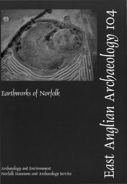
Cover photograph:<br />
Horsford Castle, a small motte and bailey.<br />
Photo by Derek A. Edwards (ref: TG 2015/ACT)
Contents<br />
List of Plates vi Wighton 83<br />
List of Figures vii Wilby 86<br />
Contributors X Wood Norton 87<br />
Acknowledgements<br />
X<br />
Summary/Resume/Zusammenfassung<br />
X<br />
Editorial xi<br />
Manorial and Isolated Sites<br />
As hill<br />
88<br />
89<br />
Introduction<br />
Attleborough 90<br />
By laugh 92<br />
Romano-British Sites 4<br />
Hilgay 5<br />
Hockwold 5<br />
Claxton Castle 92<br />
Crimplesham 94<br />
Dersingham 94<br />
East Harling 97<br />
Eccles 97<br />
Elsing 98<br />
Medieval and Later Settlement Remains 9 Fulmodeston 100<br />
An mer 10 Gay ton 102<br />
Arminghall 13 Great Cressingham 103<br />
Babingley 14 Gunthorpe 105<br />
Barton Bendish 16 Hales Hall 106<br />
Beachamwell 19 Harling Thorpe 106<br />
Bixley 19 Hilgay 109<br />
Brinton 22 Horningtoft Ill<br />
Carleton Forehoe 22 Ingworth 112<br />
Cranworth 25 Little Appleton 114<br />
Deopham 26 Little Dunham 115<br />
Dersingham 28 Lyng 116<br />
Dun ton 29 Middleton Towers 117<br />
East Walton 31 North Elmham 119<br />
Egmere 33 Pan worth 120<br />
Ellingham 35 Seething 120<br />
Gateley 35 She! ton 123<br />
God wick 38 South Creake 125<br />
Great Breckles 40 Tharston and Tasburgh 126<br />
Great Cressingham 40 Tibenham 128<br />
Great Dunham 41 Warham 129<br />
Great Palgrave 42 Wood Norton 130<br />
Great Walsingham 44<br />
Harpley 45 Monastic Sites 131<br />
Hempton<br />
4o Binham Priory 131<br />
Hingham 47 Burnham Norton Friary 133<br />
Hoe 47 Carbrooke Commandery 133<br />
Hough ton 48 Castle Acre Priory 136<br />
Houghton-on-the-Hill 52 Coxford Priory 138<br />
Little Bittering 52 Flitcham Priory 138<br />
Little Massingham 55<br />
Hempton Priory 143<br />
Mattishall 56 Langley Abbey 143<br />
North Elmham 58<br />
Marham Abbey 146<br />
Pudding Norton 59 North Creake Abbey 148<br />
Roudham 62 St Benet's Abbey 148<br />
Rougham 62 Shouldham Priory 151<br />
Scoulton 66 Wendling Abbey 153<br />
Shotesham 67 West Acre Priory 155<br />
Shouldham 69 West Dereham Abbey 156<br />
Tattersett 71<br />
Wormegay Priory 158<br />
Thuxton 73 Wymondham Abbey 160<br />
Waterden 74<br />
West Acre 76<br />
West Barsham 78 Castles 162<br />
West Raynham 81 Baconsthorpe 163<br />
West Tofts 83 Castle Acre 165<br />
V
Castle Rising 166 Ridge and Furrow 199<br />
Den ton 168 Hilgay 201<br />
Hautbois 169 Middleton 202<br />
Hors ford 170 Ryston 204<br />
Hun worth 172 Stow Bardolph 205<br />
Middleton 172 Stradsett 207<br />
Mileham 173 Tottenhill 207<br />
New Buckenham 175<br />
Old Buckenham 178<br />
Red Castle, Thetford 180 Parks and Gardens 209<br />
Thetford 180 Boo ton 209<br />
Weeting 183 Docking 210<br />
Wormegay 184 Gillingham 210<br />
Wymondham 186 Great Melton 213<br />
Hilborough 215<br />
Fishponds, Water Meadows and Oyster Pits 187<br />
Kimberley 215<br />
Kirby Cane 2 19<br />
Bodney 187 Melton Constable 221<br />
Bradenham 188 Narborough 221<br />
Broomsthorpe 189 Ox borough 224<br />
Buckenham Tofts and Lynford 190 Raveningham 227<br />
Castle Acre 193 Tacolneston 227<br />
Heacham 194 West Acre 229<br />
West Lexham 197 Bibliography 231<br />
West Tofts 198 Index, by Ann Hudson 236<br />
List of Plates<br />
Romano-British earthworks XIII Shotesham St Mary: moated platform,<br />
I Hockwold: primarily medieval hollow way and early parkland features.<br />
earthworks with Romano-British features TM 2398/Y/DXP 10 67<br />
in the foreground. CUCAP AEX 10 6 XIV Shouldham, various earthworks east of<br />
the present village. TF 6708/L/EU 1 69<br />
Medieval and Later Settlement Remains XV Waterden deserted medieval village, the<br />
II Arminghall: shrunken village features earthworks in the foreground have since<br />
looking north. TG 2504/J/AHB 16 13 been levelled. CUCAP AMU 77 74<br />
Ill Babingley deserted medieval village: XVI West Acre, earthworks seen from the<br />
hollow way, enclosures and ridge and south-east. TF 7815/AT/CV 10 76<br />
furrow. TF 6726/P/ARO 18 15 XVII West Barsham, enigmatic earthworks<br />
IV Barton Bendish: Blind Lane and from the south-west. TF 9033/K/ AEA 28 78<br />
enclosures. TF 71 06/F/ ATZ 13 16 XVIII West Raynham, hollow way with<br />
V Bixley deserted medieval village. TG associated features and field boundaries.<br />
2504/R/ ATT 28 20 TF 8725/ABH/DPS 2 81<br />
VI Dunton deserted medieval village. TF XIX Wighton, medieval settlement earthworks<br />
8830/D/ALY 1 29 east of the village. TF 9440/ABD/FZH 11 84<br />
VII Godwick deserted medieval vi llage: XX Wood Norton, evidence of shrinkage.<br />
church tower, hollow ways and TG 0127/K/ASG 30 87<br />
enclosures. TF/9022/S/ ALX 17 38<br />
VIII Great Palgrave, hollow way and Manorial sites and isolated settlements<br />
enclosures. CUCAP AAQ 68 43 XXI Attleborough: moated platforms, one of<br />
IX Little Bittering: church with associated which must be the site of the Little<br />
moat, possible moated platform and Rectory. TM 0294/A/ATW 1 90<br />
tofts. CUCAP BLP 12 53 XXII Dersingham: the probable site of<br />
X Pudding Norton deserted medieval Pakenham's manor south-west of the<br />
village. CUCAP AQS 45 59 church. TF 6930/C/UU7 95<br />
XI Pudding Norton, 1946 RAF vertical XXIII Fulmodeston: 1946 RAF vertical.<br />
6139 3E/TUDIUK50 (Part) 61 TG 93/TF9930/ A 39/TUD/UK50 lOO<br />
XII Roudham deserted medieval village, XXIV Gayton: West Manor site with the edge<br />
1946 RAF vertical 3G/TUD/UK 59 5132 of the former common and remains of<br />
and5133 64 ridge and furrow. TF 7119/C/ AFY 9 102<br />
vi
XXV Horningtoft: oval moated site with XLI Mileham Castle: motte and inner bailey,<br />
entrance and flanking enclosures.<br />
with outer bailey and moated enclosure<br />
9423/E/AQP 18 Ill clearly visible. TF 9119/ ADF/DPR 4 175<br />
XXVI lngworth: manorial site with other XLII New Buckenham Castle, the moated<br />
features. CUCAP AQK 21 113 ringwork and remains of baileys.<br />
XXVTI Middleton Towers: moated site with TM 0890/C/ AEY 10 177<br />
XXVIII<br />
associated earthworks including XLIII Old Buckenham Castle and parchmarks<br />
fishponds. TF 6717 IL/ AVF 12 11 7 of the priory. TM 0798/Z/ ATA 3 178<br />
South Creake: probable site of Beaufours XLIV Thetford Castle, viewed from the north.<br />
manor, much altered. TF 8536/B/AAN5 125 TL 8782/ AV /GCA 11 182<br />
XLV Weeting Castle: a moated fo1tified manor<br />
Monastic Sites house. TL 7789/J/DVC 12 183<br />
XXIX Carbrooke, the site of the Commandery, XLVI Wormegay Castle from the west showing<br />
partly moated with fishponds and<br />
diversion of road. TF 65111 AA/EV8 185<br />
enclosures visible. TF 9502/M/ATU 7 135<br />
XXX Castle Acre under snow, the Priory<br />
Fishponds and Floated Water Meadows<br />
within its precinct. CUCAP AXA 65 136<br />
XIVTT r::~stle Acre water meadows, with the<br />
XXXI Langley Abbey, the northern earthworks.<br />
castle also visible. TF 8215/C/JCW 6 193<br />
TG 3602/Y/ARK 15 145<br />
XLVIII Heacham, possible oyster-fattening pits.<br />
XXXII Marham Abbey, remains of the church<br />
TF 6638/W/UU5 195<br />
lie within a garden. TF 7009/AF/DV 8 147<br />
XLIX West Lexham water meadows in 1946.<br />
XXXIII St Benet's Abbey: well-preserved<br />
TF81/TF8316/A 39/TUD/UKlOO/Part II<br />
fishponds, the gatehouse and remains of<br />
5089 197<br />
the church. TG 3815/K/AGW 11 151<br />
XXXIV Wendling Abbey, vertical photograph<br />
Ridge and Furrow<br />
showing parchmarks. TF 9312/R/GKH 9 153<br />
XXXV West Acre Priory: hollow way and<br />
L Hilgay, ridge and fuiTow. TL 6197/B/-<br />
enclosures, site of priory church and<br />
CUCAP RC8 EB260 200<br />
associated buildings. TF 7815/RIAUG 10 155<br />
LI Ryston, ridge and fmTow close to the<br />
XXXVI Wormegay Priory, the trapezoidal moat church. CUCAP BRX 103 204<br />
and fishponds. TF 6512/M/AST 15 159 Lll Stradsett, part of the ridge and furrow.<br />
xxxvn Wymondham Abbey: surviving church, TF 6605/G/OGQ7 208<br />
associated earthworks and parchmarks<br />
from the south. AAF 194117 161 Parks and Gardens<br />
LIII Great Melton: the park from the west<br />
Castles showing hollow ways. TG 1306!X!HEE 22 213<br />
XXXVIII Baconsthorpe Castle, elaborate house LIV Kimberley: view from the east showing<br />
within moat, and later mere, gatehouse<br />
the moated site and part of a probable<br />
and formal garden. TG 1238/P/ASJ 26 162 water garden. TG 0704/N/ATU 12 216<br />
XXXIX Castle Rising, seen from the south-east. LV Kirby Cane: RAF 1945 vertical showing<br />
TF 1624/ACS/GAQ 2 167 the rows of trees. TM 39/TM 3639/B 219<br />
XL Horsford Castle: si mple motte and bailey LVI Oxborough: garden earthworks near the<br />
castle. TG 2015/ACE/HHQ 15 171 moat. TF 7401/AZ/DXJl 225<br />
List of Figures<br />
Fig. I Location of earthwork surveys included Fig.5 Arminghall, shrinkage of medieval<br />
in this volume, with sub-regional<br />
village and later roadways and<br />
divisions after Darby (1952) and enclosures. Scale 1 :2,500 12<br />
Williamson (1993). Scale 1:400,000 2 Fig.6 Babingley, part of deserted village with<br />
ridge and fwTow. Scale 1 :2,500 14<br />
Romano-British earthworks Fig.7 Barton Bendish, roadway and<br />
Fig.2 Hilgay, probable Romano-British enclosures. Scale I :2,500 17<br />
enclosures. Scale I :2,500 4 Fig.8 Beachamwell All Saints, deserted<br />
Fig.3 Hockwold~ Romano-British enclosures settlement around church. Scale 1 :2,500 18<br />
south of medieval shrinkage. Scale Fig.9 Bixley, deserted medieval village. Scale<br />
1:2,500 7 1:2,500 21<br />
Fig.lO Brinton, scattered settlement and<br />
Medieval and Later Settlement Remains<br />
enclosures south-west of village. Scale<br />
Fig.4 Anmer, displaced village within the park. 1:2,500 2:)<br />
Scale 1 :2,500 11<br />
vii
Fig.ll Carleton Forehoe, common-edge Fig.43 Scoulton, common-edge settlement.<br />
shrinkage. Scale 1 :2,500 24 Scale 1 :2,500 66<br />
Fig.l2 Cranworth, possible common-edge Fig.44 Shotesham St Mary, remnant of deserted<br />
settlement. Scale 1:2,500 25 medieval vi llage with early parkland<br />
Fig. l3 Deopham, common-edge shrinkage. enclosures. Scale 1:2,500 68<br />
Scale 1 :2,500 26 Fig.45 Shouldham, tofts and varied features.<br />
Fig.14 Deopham, common-edge shrinkage. Scale 1 :2,500 70<br />
Scale 1 :2,500 27 Fig.46 Tattersett, deserted settlement around the<br />
Fig.l5 Dersingham, shrinkage of medieval site of St Andrew's church .Scale 1:2,500 71<br />
village. Scale 1 :2,500 28 Fig.47 Tattersett, settlement north-west of All<br />
Fig.l6 Dunton, deserted medieval village. Scale Saints' church.Scale 1:2,500 72<br />
1:2,500 30 Fig.48 Thuxton, remnant of deserted medieval<br />
Fig.l7 East Walton, former medieval settlement. vi llage. Scale 1:2,500 73<br />
Scale 1 :2,500 32 Fig.49 Waterden, remnant of deserted medieval<br />
Fig. l 8 East Walton, common-edge shrinkage. village. Scale 1:2,500 75<br />
Scale 1 :2,500 33 Fig.50 West Acre, eastern extension of village.<br />
Fig.l9 Egmere, deserted medieval village. Scale Scale 1 :2,500 77<br />
1:2,500 34 Fig.5l West Bars ham, village and manorial<br />
Fig.20 Ellingham, riverine extension of vi llage. features. Scale 1 :2,500 79<br />
Scale 1 :2,500 36 Fig.52 West Raynham, post-medieval<br />
Fig.21 Gateley, probable medieval enclosures. emparkment of settlement and<br />
Scale 1 :2,.500 37 enclosures. Scale 1 :2,500 80<br />
Fig.22 Godwick, deserted medieval village with Fig.53 West Tofts, remnant of deserted<br />
17th-century hall. Scale 1:2,500 39 medieval village. Scale 1:2,500 82<br />
Fig.23 Great Breckles, settlement near the Fig.54 Wighton, detached portion of medieval<br />
church . Scale 1:2,500 40 settlement. Scale 1 :2,500 83<br />
Fig.24 Great Cressingham, shrinkage at Fig.55 Wilby, former northern extension of<br />
southern end of vi llage. Scale 1:2,500 41 village. Scale 1:2,500 85<br />
Fig.25 Great Dunham, shrinkage north of Fig.56 Wood Norton, shrinkage of eastern<br />
church of village. Scale 1:2,500 42 vi llage extension. Scale 1:2,500 86<br />
Fig.26<br />
Great Palgrave, deserted medieval<br />
village. Scale 1 :2,500 43 Manorial sites and isolated settlements<br />
Fig.27 Great Walsingham, tofts and enclosures. Fig. 57 Ashill, manorial site with roadway and<br />
Scale 1:2,500 44 other enclosures. Scale 1:2,500 88<br />
Fig.28 Harpley, former medieval settlement and Fig.58 Attleborough, Little Rectory manor.<br />
enclosures. Scale 1:2,500 45 Scale 1 :2,500 91<br />
Fig.29 Hempton, former church and Fig.59 By laugh, detached portion of deserted<br />
surrounding earth works. Scale 1:2,500 46 medieval vi llage. Scale 1:2,500 91<br />
Fig.30 Hingham, common-edge enclosures. Fig.60 Claxton, major manorial site with other<br />
Scale 1 :2,500 47 enclosures. Scale 1:2,500 93<br />
Fig.3 1 Hoe, extensive shrinkage and enclosures. Fig.61 Crimplesham, part of a manorial site.<br />
Scale 1 :2,500 49 Scale 1 :2,500
Fig.73 Horningtoft, major manorial site. Scale Castles<br />
1:2,500 110 Fig.105 Baconsthorpe, an impressive fortified<br />
Fig.74 Ingworth, manorial site. Scale 1:2,500 112 manor house. Scale 1:2000 164<br />
Fig.75 Little Appleton, isolated portion of a Fig. 106 Castle Acre, major earth works with<br />
deserted medieval settlement. Scale associated town ditch. Scale I :2,500 165<br />
1:2,500 114 Fig.107 Castle Rising, major earth works<br />
Fig.76 Little Dunham, remnants of a manorial surrounding keep. Scale 1:2,500 166<br />
site with enclosures. Scale 1:2,500 115 Fig.108 Denton, a small motte and bailey with a<br />
Fig.77 Lyng, manorial site with fishponds. Scale detached enclosure. Scale 1:2,500 168<br />
1:2,500 116 Fig.l09 Hautbois, limited remains of a fortified<br />
Fig.78 Middleton Towers, major manorial site mauur house. Scale 1 :2, UO 169<br />
with adjacent tofts. Scale I :2,500 118 Fig.llO Hors ford, a small motte and bailey. Scale<br />
Fig.79 North Elmham, site of Bishop's Palace.<br />
1:2,500 170<br />
Scale 1 :2,500 119<br />
Fig.l11 Hunworth, a small ringwork. Scale<br />
Fig.80 Panworth, common-edge settlement on<br />
1:2,500 172<br />
site of Domesday vill. Scale 1:2,500 121<br />
Fig.112 Middleton, a motte with archaeological<br />
Fig.81 Seething, limited manorial remains with<br />
evidence for a bailey. Scale I :2,500 173<br />
a pound. Scale 1 :2,500 122<br />
Fig.113 Mileham, ringwork complex surrounding<br />
Fig.82 Shelton, major manorial complex. Scale<br />
keep, with enclosure. Scale 1:2,500<br />
1:2,500 124<br />
174<br />
Fig.83 South Creake, site of manor with<br />
Fig. l14 New Buckenham, a developed ringwork<br />
settlement earthworks. Scale 1 :2,500 126<br />
with baileys and park. Scale 1:2,500 176<br />
Fig.84 Tharstonffasburgh, moat with hill-top<br />
Fig.115 Old Buckenham, castle superseded by<br />
chapel site. Scale 1:2,500 127 monastic house. Scale 1 :2,500 179<br />
Fig.85 Tibenham, moat and fishpond. Scale Fig.116 Thetford, Red Castle, ringwork with<br />
1:2,500 128 archaeological evidence for a small<br />
Fig.86 Warham, major manorial complex. Scale bailey. Scale 1:2,500 180<br />
1:2,500 129 Fig.117 Thetford, a medieval motte within adapted<br />
Fig.87 Wood Norton, unusually complete Iron Age earth works. Scale 1:2,500 181<br />
manorial site. Scale I :2,500 130 Fig.118 Weeting, a moated fortified manor house.<br />
Scale I :2,500 182<br />
Monastic Sites Fig. 119 Wormegay, a significant motte and<br />
Fig.88 Bin ham Priory. Scale I :2,500 132 bailey. Scale I :2,500 184<br />
Fig.89 Burnham Norton Carmelite Friary. Scale Fig.l20 Wymondham, a small ringwork . Scale<br />
1:2,500 133 1:2,500 186<br />
Fig.90 Carbrooke Commandery, Knights<br />
Hospitallers' site with adjacent<br />
Fishponds and Floated Water Meadows<br />
enclosures. Scale I :2,500 134 Fig.121 Bodney, fishponds associated with a<br />
Fig.91 Castle Acre Priory. Scale I :2,500 137 former manor house. Scale 1 :2,500 188<br />
Fig.92 Cox ford Priory. Scale 1 :2,500 139 Fig.122 Bradenham, a fishpond complex. Scale<br />
Fig.93 Flitcham Priory, limited monastic 1:2,500 189<br />
remains with evidence of medieval tofts. Fig.l23 Broomsthorpe, fishponds associated with<br />
Scale 1 :2,500 140-1 a former manor. Scale 1 :2,500 189<br />
Fig.94 Hempton Priory, monastic site overlain Fig. 124 Buckenham Tnft8, floated water<br />
by farm$tead. Scale 1 :2,500 142 meadows of varied form. Scale 1 :2,500 190<br />
Fig.95 Langley Abbey. Scale 1 :2,500 144 Fig.l25 Lynford, floated water meadows of<br />
Fig.96 Marham Abbey. Scale I :2,500 146<br />
varied form. Scale 1 :2,500 191<br />
Fig.97 North Creake Abbey. Scale 1 :2,500 149<br />
Fig.126 Castle Acre, reconstruction of extensive<br />
Fig.98 St Benet's Abbey, outstanding monastic<br />
floated water meadows. Scale 1:4,000 192<br />
complex. Scale 1:2000 150<br />
Fig.127 Heacham, probable shellfish ponds.<br />
Fig.99 Shouldham Priory, peripheral remains of<br />
Scale I :2,500 194<br />
a Gilbertine site. Scale 1:2,500 !52<br />
Fig. l28 West Lexham, floated water meadows.<br />
Fig. lOO Wendling Abbey. Scale 1:2,500 !53<br />
Scale 1:5,000<br />
Fig.101 West Acre Priory, a large complex<br />
196<br />
monastic precinct. Scale 1:2,500<br />
Fig.129<br />
154<br />
West Tofts, part-surviving floated water<br />
Fig.102 West Dereham Abbey, peripheral<br />
meadows. Scale 1:5,000 198<br />
features of a monastic site and<br />
post-dissolution house. Scale I :2,500 157<br />
Ridge and Furrow<br />
Fig. l03 Wormegay Priory, limited monastic Fig. l 30 Hilgay, extensive ridge and furrow west<br />
remains with well-preserved fi shponds. of the village. Scale I :5 ,000 201<br />
Scale 1:2,500 158 Fig. l31 Hilgay, vestiges of ridge and furrow near<br />
Fig. 104 Wymondham Abbey. Scale 1 :2,500 160 Wood Hall. Scale I :5,000 202<br />
Fig.l32 Middleton, tofts with ridge and furrow.<br />
Scale I :2,500 203<br />
Fig. l33 Ryston, ridge and furrow near the<br />
church. Scale I :2,500 205<br />
ix
Fig.134 Stow Bardolph, ridge and furrow at the Fig.143 Kirby Cane, parkland development on a<br />
south end of the parish. Scale 1:2,500 206 medieval si te. Scale 1:2,500 220<br />
Fig.135 Stradsett, well-preserved ridge and Fig.144 Melton Constable, earthworks including<br />
furrow west of the park. Scale 1:5,000 207 park boundary. Scale 1 :2,500 222<br />
Fig.136 Tottenhill, survi ving small area of ridge Fig.145 Narborough, parkland incorporating<br />
and furrow. Scale 1 :5,000 208 multi-period features. Scale 1 :2,500 223<br />
Fig.146 Oxborough, garden earthworks south of<br />
Parks and Gardens the hall. Scale 1:2,500 224<br />
Fig.137 Booton, garden earth works. Scale 1:2,500 209 Fig.l47 Raveningham, former enclosures and<br />
Fig.138 Docking, roadways and enclosures road ways within the park. Scale 1 :5;000 226<br />
within the park. Scale 1 :2,500 2 I 1 Fig.148 Tacolneston, late park incorporating<br />
Fig.139 Gillingham, a roadway and enclosures changes in design, medieval tofts and<br />
south of the hall. Scale I :2,500 212 possible ridge and furrow. Scale I :2,500 228<br />
Fig.140 Great Melton, roadways and medieval Fig.149 West Acre High House, park development<br />
enclosures. Scale 1 :2,500 214 incorporating garden features, pre-park<br />
Fig.l4l Hilborough, roadways and medieval enclosures, possible ridge and furrow<br />
enclosures. Scale I :2,500 2 17 and brick kilns. Scale 1:5,000 230<br />
Fig. 142 Kimberley, late medieval manorial site<br />
with extensive surrounding features.<br />
Scale 1 :2,500 218<br />
List of Contributors<br />
Brian Cushion<br />
Archaeological Surveyor<br />
Alan Davison, MA, FSA Scot<br />
Landscape Archaeologist<br />
Acknowledgements<br />
The authors wish to thank all those landowners who<br />
allowed their property to be surveyed and Helen Paterson<br />
for facilitating access to many of the sites. The advice and<br />
comment on the earthwork surveys and descriptions by Dr<br />
Andrew Rogerson was much appreciated. The staff of the<br />
Norfolk Record Office are thanked for producing the<br />
many documents and maps examined during the course of<br />
the survey, so also is Mrs Christine Hiskey, Archi vist at<br />
the Holkham Estate, for her help.<br />
All of the line drawings are by Brian Cushion, except<br />
Figs 32, 33, 80 and 126 (T. Williamson); Fig. 35 (A.<br />
Rogerson and S. Ashley) and Figs 98; 105 (Royal<br />
Commission). The photographs were provided by the<br />
Norfolk Air Photographs Library and were taken by Derek<br />
Edwards, except PI. XXXVII (Eileen Horne); and Pis XI,<br />
XII, XXIII, XLIX and LV which are 1946 RAF<br />
photographs, reproduced with the permission of the<br />
Controller of Her Majesty's Stationary Office. Pis I,<br />
VIII- X, XV, XXVI, XXX, L and LI are provided by the<br />
Cambridge University Collection of Air Photographs<br />
(CUCAP), and reproduced by kind permission.<br />
Summary<br />
This volume represents a corpus of most of the best<br />
preserved earth works known to exist in Norfolk grassland.<br />
With each site plan there is a descriptive text and a<br />
summary of the available documentary evidence.<br />
The settlement earthworks are almost entirely<br />
medieval and include deserted villages and the more<br />
numerous shrunken settlements as well as manorial sites<br />
where more than a single moated platform survives.<br />
Monastic sites and castles where, in some instances,<br />
additional earthworks have been found, form two<br />
important sections. Water features include some fishponds<br />
together with plans of Norfolk's few water meadows.<br />
Ridge and furrow, another rarity in the county, also<br />
appears and the survey ends with a selection of parkland<br />
earth works.<br />
X
Resume<br />
Ce vol ume represente un corpus forme par la plupart des<br />
ouvrages en terre les mieux preservees de la region des<br />
prairies du Norfolk. Chaque plan du site est accompagne<br />
d'un texte descriptif et d'un resume des preuves<br />
documentaires disponibles.<br />
Les ouvrages en terre du site sont presque tous de<br />
l'epoque medievale. lis comprennent des villages<br />
abandonnes et un nombre pi us important d' implantations<br />
reduites ainsi que des sites seigneuriaux ou subsistent<br />
quelques plates-formes fossoyees. Deux ensembles<br />
importants sont formes par des sites monastiques et des<br />
chateaux ou plusieurs ouvrages en terre ont ete<br />
decouvertes. On trouve egalement quelques etangs ainsi<br />
que les plans de plusieurs prairies humides du Norfolk.<br />
La presence de sommets et d'etendues basses, que !'on<br />
rencontre rarement dans le comte est egalement<br />
mentionnee. Enfin, !'etude se termine par un choix<br />
d'ouvrages en terre integrees a des espaces verts.<br />
(Traduction: Didier Don)<br />
Zusammenfassung<br />
In diesem Band sind die meisten der besterhaltenen<br />
Erdwerke zusammengestellt, deren Existenz im Grasland<br />
Norfolks bekannt ist. Zu jedem Lageplan findet sich ein<br />
beschreibender Text und eine Zusammenfassung der<br />
vorhandenen dokumentarischen Belege.<br />
Die auf Siedlungen zurlickgehenden Erdwerke<br />
stammen fast glinzlich aus dem Mittelalter. Zu ihnen<br />
zlihlen Ortswlistungen und, in groBerer Zahl, abgegangene<br />
Siedlungen und groBere Anwesen, von denen mehr librig<br />
ist als nur eine von Grliben umgebene Plattform. Zwei<br />
wichtige Abschnitte formen Klosteranlagen und Burgen,<br />
bei denen in einigen Fallen zuslitzliche Erdwerke gefunden<br />
wurden. Unter den Wasser aufweisenden Strukturen sind<br />
e1mge Fischteiche und Grundrisse der wenigen<br />
Wasserwiesen Norfolks zu finden. Ebenso aufgeflihrt sind<br />
Wolblicker, eine weitere Seltenheit in der Grafschaft.<br />
Abgeschlossen wird die Obersicht mit einer Auswahl an<br />
Erdwerken, die aus Parklandschaften hervorgingen.<br />
(Ubersetzung: Gerlinde Krug)<br />
Editorial<br />
by Peter Wade-Martins<br />
This volume represents the results of a six-year study of<br />
the earth works of Norfolk. The project started in 1994 as<br />
part of a wider monument conservation initiative which<br />
was designed to identify and safeguard all of the county's<br />
most significant surviving earthwork archaeology. The<br />
results published here demonstrate for the first time an<br />
extraordinary richness of earthwork monuments even in a<br />
county where there has been such intensive cultivation.<br />
Even quite well known sites like Castle Acre Priory<br />
(ppl36-7) and Langley Abbey (ppl43-5), as well as lesser<br />
known ones like An mer deserted village (pp 10-11 ), have<br />
been found to be more intact and more extensive than was<br />
previously realised.<br />
Norfolk has been greatly affected by agricultural<br />
change and land improvements since the late 18th century.<br />
Then, the enclosure of the commons was often accompanied<br />
by widespread reorganisation of the field systems. In some<br />
parishes this led to major landscape changes, with<br />
marginal land being brought into cultivation. After this<br />
great period of improvement, change in the countryside<br />
was more gradual until the drive for increased food<br />
production in and after the Second World War. Of the<br />
hedgerows in Norfolk in 1945, only 55% remained by<br />
1970. The ploughing up of grassland, assisted by<br />
government subsidies to increase the acreage in cereals,<br />
brought about unprecedented change. Most of the<br />
earthworks lost then went without record unless they<br />
happened to show well on the RAF 1946 air photographs<br />
or were seen and photographed by that remarkable<br />
Cambridge air photographer, J.K. St Joseph. By the time<br />
Derek Edwards started the Norfolk Archaeological Unit's<br />
air photography programme in 1973, destruction had<br />
slowed, although it continued well into the 1980s.<br />
With the change in farming subsidies and the move<br />
towards conservation in the countryside, it is now time to<br />
take stock, identify what remains and develop policies and<br />
programmes which will ensure the conservation and better<br />
appreciation of this most important part of the county's<br />
heritage.<br />
Norfolk's own earthwork conservation programme<br />
began in August 1990 with the establishment of the<br />
Norfolk Monument Management Project (NMMP). The<br />
aim of the project has been to visit and assess every<br />
significant earthwork in the county, whether or not it is<br />
already legally protected by scheduling. From 1990 up<br />
until March 2000 some 450 sites were visited by the<br />
project officer, Helen Paterson, and it is hoped that the<br />
whole county will have been covered by the end of 2002.<br />
The range of monuments visited includes deserted<br />
vi llages, fishponds, moated sites, burial mounds, castles<br />
and monasteries.<br />
By February 2002 forty-seven legally binding grantaided<br />
Section 1'1 Agreements had been s1gned w1th<br />
landowners or tenants. Dossiers containing earthwork<br />
XI
pl ans, air photographs and site descriptions are assembled<br />
and presented to the farmers as part of the ongoing<br />
management di scussions. While the academi c value of the<br />
data assembled on these sites is important, it is also<br />
recognised that the earthwork pl ans provide a yardsti ck<br />
against which the success of monument conservation can<br />
be measured for years to come.<br />
Under the NMMP, fundi ng for up to 100% of the<br />
capital costs of stock fe ncing, scrub clearance, tree fe lling<br />
and initial rabbit control can be fo llowed by annual<br />
payments calculated by the hectare to maintain the<br />
benefits of the in itial works. Tax-free lump sum pay ments<br />
are made at the commencement. The Agreements usually<br />
last for five years, and they can be renewed thereafter.<br />
In many instances sites are being well managed<br />
already, and owners are willing to undertake<br />
improvements without grant aid. In these cases a non-legal<br />
management statement is frequentl y signed. T hi s provides<br />
a record of the understanding about site management<br />
reached during the project officer's vi sit. To date 185<br />
owners have willingly signed these statements. Over 70<br />
owners have preferred not to sign but have given instead<br />
a verbal undertaking to provide beneficial management. A<br />
more detail ed summary of the progress of thi s project can<br />
be found in Paterson and Wade-Martins (1999), and a<br />
more up-to-date account is due to be publi shed (Paterson<br />
and Wade-Martins forthcoming).<br />
The initial selection of sites to be surveyed for the<br />
Norfolk Earthworks Survey was made by Helen Paterson<br />
after trawling through the county Sites and Monuments<br />
Record and the Norfolk Air Photographs Library. Once<br />
identified, the earthworks were then assessed on the<br />
ground by Brian Cushion and the better preserved and<br />
more complete examples were recorded - usuall y at a<br />
scale of I: 1 ,000.<br />
The detailed analysis of the air photographs and all the<br />
survey work was carried out with great dedication and<br />
with very limited resources by Brian Cushion, a fo rmer<br />
Ordnance Survey surveyor, who single-handedl y recorded<br />
most of the sites illustrated in this volume. Alan Davison,<br />
a landscape and documentary hi stori an who had already<br />
published notable fieldwalking and documentary research<br />
in the county (Dav ison et al. 1988; Davison 1990; Dav ison<br />
1994; Dav ison et al. 1993; Rogerson et al. 1997), joined<br />
the project in its later stages. The surveys were compared<br />
with earl y Ordnance Survey maps, Bryant's and Faden's<br />
printed maps of Norfolk (Bryant 1826; Faden 1797), all<br />
the relevant manuscript maps, particularly the Tithe and<br />
Enclosure Maps, and the other local documentary<br />
sources.<br />
By incorporating into th is volume some prev iously<br />
published pl ans (Cushi on 1994, 29; 1995, 35; 1996, 40;<br />
1997, 32-33 ; 1998, 44; 1999, 347; C ushion and Dav ison<br />
1997, 494-7; Cushi on et al. 1982; Davison et al. 1988,8,<br />
6 1; Davison wi th Cushion 1999, 208; Rogerson et al.<br />
1997, 28; Wade-Martins P. 1980a, 25; Wade-Martins, S.<br />
and Williamson 1994, 28), the authors have assembled a<br />
virtuall y complete corpus of the county's most signi ficant<br />
earthwork archaeology. Not included here are prehi storic<br />
burial mounds (already studied in Lawson et al. 198 1 and<br />
Lawson 1986), Iron Age forts (described and di scussed by<br />
Davies et al. 1992), linear earthworks (discussed in<br />
Wade-Martins 1974) and moats (i n many cases adequately<br />
recorded on Ordnance Survey maps and also recorded and<br />
di scussed in Dollin 1986).<br />
T hi s volume does not contain plans of all the sites<br />
surveyed under the Norfolk Earthwork Survey. A further<br />
sixty- th ree sites were recorded, but the sites were not<br />
sufficiently sign ificant to justify publication. Brian Cushion's<br />
reports and plans of all the sites surveyed are avail abl e for<br />
study in the County Sites and Monuments Record.<br />
One justifiable criticism of this volume might be that<br />
these surveys are presented largely out of context; they<br />
often appear removed from the known archaeology and<br />
the landscapes around them. Further pl ans and maps could<br />
have been produced showing recorded s u1face finds,<br />
cropmarks and other landscape features, particul arl y<br />
greens and commons. However, this option had to be<br />
rejected at an earl y stage on grounds of cost because the<br />
Rroject was funded with very limited resources. Readers<br />
are therefore advised to study these plans alongside the<br />
relevant large-scale Ordnance Survey maps and the<br />
printed versions of Faden 'sand Bryant's maps of Norfolk<br />
(Faden 1797; Bryant 1826).<br />
Most of the earthworks located in thi s survey were in<br />
grassland. It may well be that there are significant<br />
earth works still to be d iscovered in the county, particul arly<br />
in woodl and, and it is hoped that the project can be<br />
fo llowed by another which ensures that there is a thorough<br />
search for earthworks in Norfolk woodlands. Sample<br />
searches of areas of the conifer fo rests in Breckland have<br />
already revealed several well -preserved round barrows<br />
and many boundary banks not previ ously recogni sed.<br />
More extensive searches of both these comparatively<br />
recent pl antations and the older deciduous woodlands are<br />
likely to produce worth while results. Not until all the<br />
woodl and in the county has been full y examined can we<br />
say that our record of the county's earthworks is complete.<br />
The information in this volume is particul arly relevant<br />
to the publicati on of the Monuments at Risk Survey of<br />
England (Darvi ll and Fulton 1995). In the strategy<br />
document published with th is report English Heritage<br />
made a number of commitments, including the following:<br />
to maintain support for the Monument Protection<br />
Programme (for site scheduling), and<br />
to target the work of the Monument Protecti on<br />
Programme to take account of the regions with the<br />
hi ghest levels of monument loss (South East), regions<br />
with hi ghest levels of reported risk (West Midlands<br />
and North West), and monument forms hi therto<br />
subject to the heaviest casualty rates (large single<br />
monuments and fi eld systems).<br />
Sites in thi s volume clearl y qualify for extra English<br />
Heritage effort, being in the South East.<br />
It can be said that Norfolk has led the way in developing<br />
an integrated approach to earthwork conservation, involving<br />
a very detail ed assessment of all the surviving evidence<br />
and then linking that to conservation measures. It is to be<br />
hoped that English Heritage wi ll fo llow the conservati on<br />
process to its logical conclusion and consider scheduling<br />
most of the monuments illustrated here, although at the<br />
moment onl y some 40% have legal protecti on.<br />
Despite the considerabl e loss during the post-war<br />
years, the amount of information whi ch has survived has<br />
surprised all those who have been in volved in the project.<br />
Now that the countryside has entered a period of more<br />
stable and sustainabl e management, let us hope that most,<br />
if not all , of the earth works of Norfolk can endure for<br />
future generations to enjoy.<br />
XII
Introduction<br />
(Fig. I)<br />
N01folk is, and has been, an essentially arable county. The<br />
only general exceptions have been the floors of river<br />
valleys and the marshes around the coast and the lower<br />
Bure, Yare and Waveney valleys. Areas safe from the<br />
plough for many years ultimately went under cultivation<br />
particularly during the Napoleonic Wars and the<br />
emergencies of 1914-18 and 1939-45. They included<br />
commons still shown intact on Faden's map of Norfolk<br />
(1797), areas of heathland and even parts of the Acle<br />
marshlands taken into cultivation since the Second World<br />
War.<br />
Norfolk is also a county of villages. From the high point<br />
of the 13th and 14th centuries rural population has declined<br />
and many villages listed in the Domesday Survey of 1086<br />
have either shrunk or, in some cases, disappeared. Many of<br />
the vacant sites have been ploughed as few of the dwellings<br />
consisted of materials which would offer prolonged<br />
resistance to the cultivator. It has been suggested that the<br />
additional fertility of house sites with their gardens and<br />
crofts may have provided an additional incentive to plough.<br />
In the 1970s, the Norfolk Archaeological Rescue<br />
Group and the Norfolk Archaeological Unit initiated a<br />
project to investigate and record sites of some of the known<br />
deserted villages which then remained at least partially<br />
intact. The results of these surveys were published in East<br />
Anglian Archaeology (Cushion et al. 1982; Davison et al.<br />
EJgg). lt is significant that while this work was being<br />
undertaken one site was destroyed, another was found to<br />
have been destroyed earlier and one has subsequently been<br />
partially ploughed despite its status as a scheduled<br />
monument.<br />
Later in vestigation using aerial photography followed<br />
by ground inspection revealed that, despite the centuries of<br />
destruction, many more areas of earthworks remained. In<br />
the light of this, a new recording programme of mapping<br />
and describing these sites was organised by the Field<br />
Archaeology lJIVISion of Norfolk Museums Service from<br />
1994 to 2000. As a part of this project all pieces of related<br />
work were reviewed. Many of these consisted of surveys<br />
of moated sites carried out by the late Bert Dollin and<br />
published in the reports of the Moated Sites Research<br />
Group in the 1970s. Other surveys included, most notably,<br />
the work of Dr Tom Williamson of the University of East<br />
Anglia. The total number of sites examined up to the year<br />
2000 was over 300 and included castles, monastic sites,<br />
manorial sites, deserted villages, shrunken villages,<br />
parkland features, ridge and furrow, fishponds and water<br />
meadows, as well as other smaller features:<br />
With such a surprisingly wide range of subjects it<br />
seemed appropriate to make a selection of the more notable<br />
sites and to publish each of them with a brief account and<br />
its documentary background.<br />
It was decided to exclude sites which were prehistoric<br />
and to dispense with moats unless they had additional<br />
features associated with them. It has to be remembered that<br />
many isolated moats not considered here probably had<br />
associated features, now long gone, and are not really a<br />
separate group. Hilgay and Hockwold have medieval<br />
earthworks but are thought to include Romano-British<br />
features. Apart from these exceptions the remainder of the<br />
sites are mostly medieval. There are some post-medieval<br />
examples, mainly in parkland which, nevertheless, iuduJe<br />
features of a fossilised medieval landscape. A number of<br />
post-medieval water meadows have also been surveyed.<br />
Deserted vi ll ages with good earthworks which have<br />
already appeared in East Anf?lian Archaeology (Cushion et<br />
al. 1982; Davison et al. 1988) are republished here in<br />
summary, as is the survey of Hautbois Castle by Dollin<br />
( 1986) and the surveys of Baconsthorpe Castle and St<br />
Benet's Abbey by the Royal Commission of Historical<br />
Monuments (Everson and Wilson-North 2002). Two sites,<br />
Bixley and Godwick, are represented by fresh surveys<br />
containing additional information. The great majority of<br />
the sites presented here are published for the first time.<br />
Most sites have been surveyed at a scale of I: I ,000 and<br />
reduced for publication to I :2,500 and this publication is<br />
an attempt to bring together in one volume detailed surveys<br />
of all significant earthwork monuments in the county, with<br />
the exceptions already stated. The purpose is to provide a<br />
source of information tor further research as well as a<br />
record of the present condition of the earthworks, thus<br />
giving a yardstick against which their future conservation<br />
may be measured.<br />
The accompanying accounts have been divided equally<br />
as far as possible between an abbreviaLeJ Jescripliou of Lhe<br />
earthworks and a brief summary of the documentary<br />
evidence. The latter has proved more difficult since it has<br />
depended on the nature of the documents accessible and<br />
has to respect the limitations of space in the volume. More<br />
detailed descriptions of the earth works can be found in the<br />
County Sites and Monuments Record (henceforth SMR).<br />
The following general practice has been adhered to.<br />
Where previous full treatment exists in East Anglian<br />
Archaeology, the Victoria County History, or Norfolk<br />
Archaeology, there is jusl a reference lo Lhe work allhe euJ<br />
of the account. Where additional information has been<br />
acquired, or where a particular emphasis has been deemed<br />
necessary, a more specific reference is given at the<br />
appropriate point.<br />
Where an entirely new site has a key source such as a<br />
field book or an early map allowing a relatively easy<br />
reconstruction of the past landscape, the documentary<br />
account will be based primarily on that and all necessary<br />
references given. However, this rarely happens and<br />
conclusions of a more general nature may be infe1Ted from<br />
a variety of sources. Changes in the status of a settlement<br />
from 1086 (Domesday Book) to 1676 (The Compton<br />
Census) can be portrayed but the flesh is absent from the<br />
bones.<br />
Domesday Book, for example, is an enigmatic<br />
document with many obscurities and needs to be used with<br />
discretion. Ellingham, in 1086, was awarded one line about<br />
five sokemen, with 15 acres, half a plough team and a<br />
church supported by 24 acres, the whole being treated<br />
under Stockton. There must have been much more; the
N<br />
Location of sites<br />
0 10<br />
R<br />
Kilometres<br />
Romano-British<br />
Silt Fen<br />
~<br />
/<br />
/<br />
/<br />
~<br />
e I T<br />
I<br />
I +<br />
I T e I<br />
I<br />
I<br />
· ~<br />
.I<br />
\<br />
Q.)<br />
1 m<br />
\<br />
\<br />
I<br />
I<br />
I<br />
I "0<br />
I C::<br />
1 • eo<br />
I 1 •• C:: m<br />
\ Q.)<br />
\ + ~<br />
~<br />
I.<br />
I<br />
I<br />
I<br />
I<br />
~ - ~<br />
+ /<br />
'Y I<br />
•<br />
•<br />
/<br />
I<br />
T 1<br />
I"'<br />
I<br />
/ p<br />
I<br />
/<br />
I 'Y<br />
\ / •<br />
\ I<br />
I<br />
' .....- + "' ,)...< ............. G ,<br />
--""" /<br />
\ ' ',<br />
\ \ I<br />
) ,.,<br />
.•. R<br />
Peat Fen<br />
,-, I<br />
~"<br />
/<br />
I<br />
I<br />
I<br />
\<br />
'<br />
T Medieval and later settlement<br />
remains<br />
• Manorial and isolated<br />
settlements<br />
+ Monastic .. Fish ponds<br />
p<br />
+<br />
•<br />
T<br />
+<br />
+<br />
T T<br />
• T<br />
Good Sands T ~<br />
..<br />
T<br />
p<br />
T<br />
..<br />
+• +•=-<br />
+'YT<br />
-<br />
..<br />
-- -----~ ..<br />
T<br />
I<br />
I<br />
1 -y<br />
/<br />
.. + // ••<br />
.. // ..<br />
...<br />
/<br />
/<br />
/<br />
/<br />
•<br />
I<br />
I<br />
I<br />
I<br />
I<br />
I<br />
T l<br />
• •<br />
I<br />
--l.. ..... ,<br />
p \<br />
..<br />
..<br />
• •<br />
•<br />
Mid Norfolk<br />
\<br />
\<br />
\<br />
'<br />
' \<br />
I<br />
I G<br />
•<br />
•<br />
Loams<br />
•<br />
I<br />
I<br />
I<br />
I<br />
I<br />
\<br />
I<br />
p •<br />
/<br />
\<br />
/<br />
~ I<br />
I.<br />
T<br />
\<br />
I<br />
I<br />
I<br />
•<br />
I 'Y<br />
I<br />
\<br />
+<br />
. I<br />
....<br />
I<br />
'<br />
I<br />
,.<br />
' ....<br />
I<br />
..<br />
-- .....<br />
p<br />
---- I<br />
\<br />
\ •<br />
.. ..<br />
' >-...<br />
// .....<br />
/<br />
/<br />
/<br />
•<br />
.. '<br />
/<br />
/<br />
• ""------+<br />
T<br />
+ . /<br />
T ..._ 'Y<br />
' I<br />
......<br />
p<br />
' ----~<br />
I<br />
' ' ..,<br />
' ' __ ... ~<br />
'('<br />
•<br />
•"" Breckland<br />
~ ..<br />
••<br />
I<br />
I<br />
I<br />
I<br />
I<br />
\<br />
\<br />
\<br />
\<br />
\<br />
\<br />
I<br />
I<br />
I<br />
I<br />
I<br />
I<br />
+<br />
.....-,<br />
I ..... \<br />
I<br />
I<br />
I<br />
\<br />
...... --....... '<br />
I ', I<br />
.. ',•<br />
........ +<br />
...... - ...... 'J... ............ ___ /<br />
• Castles Floated water meadows<br />
G Gardens<br />
""<br />
Figure 1 Location of earthwork surveys included in this volume, with sub-regional divisions after Darby (1952) and Williamson (1993). Scale 1:400,000<br />
..<br />
..<br />
•<br />
'•\<br />
•' I<br />
e l<br />
I<br />
I<br />
•<br />
..<br />
p •<br />
+•<br />
• •<br />
South Norfolk<br />
• •<br />
. .... ___ ,--,<br />
•<br />
p<br />
p<br />
• Ridge and furrow<br />
P<br />
Parks<br />
Broad land
church is the only feature of archaeological significance<br />
mentioned. In other cases, the Domesday account is very<br />
full. Taxation figures levied at differing rates also present<br />
hidden pitfalls. A recent publication by the Public Record<br />
Office Lay Taxes in England and Wales 1188-1688<br />
(Jurkowski et al. 1998) gives some welcome insight into<br />
the complexities of such returns. They, however, deal<br />
solely with lay persons. Throughout the medieval period<br />
exemptions to these taxes were granted to ecclesiastical<br />
persons and the lands and chattels in their charge. The use<br />
of such sources, though necessary, gives only the barest<br />
outline and may conceal much of great interest. It should<br />
be noted that more satisfactory documentary evidence, in<br />
the shape mainly of field books or dragges, is absent for<br />
many parishes in the eastern half of the county. Though<br />
there are exceptions, this may be because estates there seem<br />
to have been smaller than those in many parts of the west.<br />
'l'he sites have been subdivided into groups according<br />
to their nature: Romano-British Sites, Medieval and Later<br />
Settlement Remains, Manorial and Isolated Sites,<br />
Monastic Sites, Castles, Ridge and Furrow, Fishponds and<br />
Water Meadows, Parks and Gardens. Each group is<br />
preceded by a separate introduction discussing them in<br />
detail and placing them in relationship to the county as a<br />
whole. A glance at Figure 1 shows the distribution of sites<br />
within the county and reveals sub-regional inequalities.<br />
There is a belt of sites bordering Fen land but that area itself<br />
has few significant earthworks. The major concentration<br />
lies in a north-to-south band across the county coinciding<br />
rough! y with the soils developed on the chalky boulder clay<br />
and chalky glacial deposits of the Good Sands and Mid<br />
Norfolk areas, noticeably thinning out on the sandy<br />
Breckland soils and in the extreme north-west. Eastern and<br />
north-eastern Norfolk are poorly represented. This does not<br />
appear to be a reflection of soil types necessarily so much<br />
as of some other factor, possibly past agricultural practice.<br />
3
HILGAY<br />
SMR 4455<br />
"' 0<br />
0<br />
i<br />
: · ,::: : t T t t t 't t To<br />
.......... ::: J :~'(~: 5<br />
. )X[C\\':D<br />
:: ::!::::'//::: :::;<br />
+ 298000<br />
"' 0<br />
0<br />
,...·.·::J·::<br />
. .. ~<br />
6<br />
·.::--··'.·<br />
:•<br />
~~~~,.~::[ . -<br />
0 50<br />
100<br />
Metres<br />
After M Mathews 1988<br />
Figure 2 Hilgay, probable Romano-British enclosures. Scale 1:2,500<br />
4
Romano-British Sites<br />
Few examples of Romano-British earthworks remain, as<br />
might be expected, given the lapse of time since the ending<br />
of the Roman occupation and the arable nature of the<br />
county. However, before the Fens suffered intensive postwar<br />
ploughing, earth works of Romano-British settlements<br />
were a feature of the landscape (Phillips (ed) 1970, IV;<br />
Silvester 1988a, 195). Particularly notable were those at<br />
Flaggrass and Grandford House near March, at Hacconby<br />
Drove near Bourne, at Weston Fen south-east of Spalding<br />
and at Cottenham and at Willingham Middle Fen to the<br />
north of Cambridge (Phillips (ed) 11)70, 221, pi. lV; 197,<br />
pi. V; 263, pi. XI; 282, pi. X; 206, pi. XXI). These were all<br />
ploughed in the post-war period and only a few isolated<br />
fragments survive in any of the Fen land counties.<br />
One possible site is the small area of earthworks at<br />
Hilgay interpreted by Silvester (Silvester 1988b, 195) as<br />
the remains of a farmstead with attached fields of pasture<br />
and with small circular features which are probably<br />
Romano-British but which some believe to be medieval.<br />
Finds of late 3rd- or 4th-century pottery from the site<br />
appear to confirm the general Romano-British origin.<br />
The second area is at Hockwold on the margins of<br />
Fenland on a tongue of the fen extending eastwards<br />
towards Brandon. This is known to be a rich area of<br />
Romano-British activity, with important finds made in the<br />
locality, including a villa at Feltwell, temple sites in<br />
Hockwold and buildings in Weeting (Gurney 1986, 2;<br />
Uregory 11)82, 370). The earthworks here are composite,<br />
those near the road are medieval in origin and surface finds<br />
of pottery support this. On the lower ground further south,<br />
approaching the modern Cut Off Channel which has<br />
truncated them, are earthworks of Romano-British origin;<br />
here pottery finds include both Iron Age and Romano-<br />
British material. These two sites are rare and important<br />
survivals which warrant particular care and protection.<br />
llilgay SMR 4455, TL G40 981<br />
(Fig. 2)<br />
The remains are of a small Romano-British farmstead<br />
consisting of enclosures with small raised platforms<br />
suggesting buildings. Small ditched circular features of<br />
uncertain purpose are also present.<br />
Hilgay lies about 5km south of Downham Market on a<br />
former island in the Fen land which it shares with the village<br />
of Southery. The earth works are on the eastern side of the<br />
island on sloping ground close to the River Wissey. They<br />
are bisected by a relatively modern hedge and ditch.<br />
The earthworks consist of several small nearrectangular<br />
shallow ditched enclosures. The focus of the<br />
site is in two enclosures, one to the east, large and<br />
rectangular (1), the other further to the west and much<br />
smaller (2). Each has a small raised platform in its northeast<br />
corner. Further to the east of these is a third (3) which<br />
appears subdivided, the northern portion raised above the<br />
southern one. There are also two small ditched circles to<br />
the north (4 and 5); the more northerly one has a slightly<br />
raised interior.<br />
One large enclosure lies to the north of the smaller<br />
western one (?.) and there are others, more or less intact,<br />
attached to the south of the main group. It appears that the<br />
construction of the modern hedge and ditch has probably<br />
destroyed some linkage between the surviving features.<br />
Finds made from molehills, particularly from a<br />
mounded area (6) some 30m south of the main enclosure,<br />
suggest Romano-British occupation in the area.<br />
It seems likely that this is the remnant of a small<br />
Romano-British farmstead, and the raised platforms within<br />
the three central enclosures probably represent the sites of<br />
buildings placed above ground that was seasonally damp.<br />
The other enclosures are likely to be surrounding<br />
paddocks.<br />
The two small ditched circles are of particular interest.<br />
A number of features of this kind have been noted<br />
previously at various sites in Fenland and their dating has<br />
been disputed, some have dated them as medieval (Hall<br />
1978, 27; Wilson 1978, 45 ; Lawson et al. 1981, 30). These<br />
ones i!ppear Romano-British. They may may have served<br />
as stack stands for grain or hay, the shallow circular ditches<br />
serving as drainage channels. An alternative use may have<br />
been to store peat (Christ-ie and Rose 1987, 184).<br />
It is, of course, possible that the origin of these<br />
earthworks, as a whole, may be medieval. However, the<br />
form and location strongly support the earlier date.<br />
Hockwold SMR 5357 and 5461, TL 728 877<br />
(PI. I, Fig. 3)<br />
The remains of rectangular ditched enclosures are of<br />
Romano-British date and are overshadowed by extensive<br />
medieval earthworks to the north.<br />
Hockwold-cum-Wilton lies about 6km west ofBrandon on<br />
the north bank of the Little Ouse and on the edge of<br />
Fenland. The present village forms a continuous<br />
east-to-west street with two churches, one at the Wilton<br />
(eastern) end and one, Hockwold, at the western end. The<br />
two parishes have been linked since the time of Domesday<br />
(Brown (ed) 1984, 8,34;35) and were taxed as one under<br />
Wilton in 1334 (Glasscock 1975, 204).<br />
The earth works lie south of Hockwold and north of the<br />
Cut Off Channel. Those in the northern area, Site 5357,<br />
show considerable variation in form, indicating differing<br />
origins, but are essentially of former medieval settlement.<br />
In the north-eastern portion, a curving length of probable<br />
hollow way (1) divides as it heads south and has an<br />
indeterminate northern end, possibly partly infilled. A<br />
north-to-south ditched trackway (2) has a separate section<br />
to the south, probably originally associated with it. Both<br />
have some links to (1) forming incomplete enclosures.<br />
Further incomplete sub-rectangles exist to the east. Southeast<br />
of (1) is a large rhomboidal enclosure (3) containing<br />
three depressions, almost certainly fishponds. 'The Lilacs'<br />
5
Plate I Hockwold: primarily medieval earthworks with Romano-British features in the foreground. CUCAP AEX 10<br />
(Photography by Cambridge University Collection of Air Photographs)<br />
has remains of a moat (4) possibly extending round the<br />
outbuildings, while a depression (5) to the south has three<br />
deeper pits within it. To the west, a north-to-south linear<br />
feature (6) of varied form was probably an access trackway<br />
to the south and also formed part of an outer enclosure to<br />
'The Lilacs' along with (I) and (2).<br />
The north-westerly portion has an extensive system of<br />
ramifying ditches, a former roadside ditch (7) and many<br />
small pits. The whole of this northern area appears to have<br />
been bounded to the south by a long curving ditch (8) from<br />
which roughly parallel ditches extend southwards. 'The<br />
Lilacs' is the successor of a former significant farmstead,<br />
possibly manorial. The incomplete enclosures east and<br />
west probably represent tofts facing two roads. The<br />
southern area, truncated by the Cut Off Channel, is more<br />
regular in character. The western portion has vestiges of<br />
small rectangular ditched enclosures at its southern end.<br />
The eastern section, Site 5461, has a reversed L-shaped<br />
rai sed area (9) and two truncated rectangular enclosures.<br />
To the north are less clearly-defined features<br />
(Wade-Martins (ed) 1987, 42).<br />
Scattered finds suggest that the southern area is<br />
Romano-British, with Iron Age and even Beaker material.<br />
Finds from the northern part have been medieval. When<br />
similar earthworks west of Station Road were ploughed in<br />
the 1970s large quantities ofRomano-British material were<br />
recovered. This suggests that the surviving earthworks are<br />
part of a larger Romano-British fen-edge settlement.<br />
Although this medieval fen-edge village was<br />
prosperous it was allowed a 20.8% reduction on its Lay<br />
Subsidy payment in 1449 (Hudson 1895, 274). A<br />
16th-century survey (NRO Rudling and Co 18111/1971)<br />
gives further evidence of decline particularly in Hockwold.<br />
In Church Street, seven out of fifteen messuages were<br />
described as 'void'; elsewhere there was other evidence of<br />
change or decline with ways stopped up. The decline of the<br />
Hockwold portion of the settlement seems to have<br />
continued; there were 173 communicants in 1603 and 154<br />
in 1676, whereas Wilton showed a slight increase<br />
(Whiteman 1986, 209-1 0). There appears little doubt that<br />
the earthworks in the north represent part of this<br />
deterioration. The Romano-British earthworks are part of<br />
a more extensive spread of fen-edge settlement in<br />
neighbouring Feltwell and Wilton (Gurney 1986).<br />
6
HOCKWOLD<br />
SMR 5357 & 5461<br />
~, I 1 1 '<br />
·.. ~ ';...<br />
·. ~· .. '::'. ~ ~~ :;<br />
~<br />
-...]<br />
:0<br />
0<br />
"' a.<br />
"'::7<br />
,1\~<br />
:<br />
~~ \<br />
.. "<br />
~= ~l~<br />
---<br />
:}t.<br />
,11&- ~{::<br />
7JL'V<br />
.... :'<br />
,,_<br />
::<br />
:<br />
•'<br />
,,''",..6-<br />
";Jl\\\\"<br />
:: ~ • > > I • > ><br />
:,.,, · r~<br />
: ..:~. , ~ ,<br />
-:~<br />
.... :.<br />
~ :·.<br />
' ..<br />
a·:<br />
5357<br />
The Lilacs<br />
___. 2 }J<br />
.- 11 JJu 7td-Ji-,nnc-.-:-,,•·~•·••rtniintn•,-- N~; : ; 1<br />
: ~ : :~· ::: 2<br />
··.....<br />
·. - ..,,r...<br />
,•'<br />
~'IT\' • ;~~<br />
~~ .<br />
,,,~,..<br />
~ ~ \..<br />
- ... l~n' ...<br />
:l:~;~r~! ;l,_.:,,~,~w~~.:·.·:.::g·<br />
.r.-<br />
~~~<br />
,u.t..<br />
·}<br />
~~<br />
..,\"<br />
::::<br />
~r~<br />
, ... ";~·~.·.:'.: ..... .. ~<br />
...... : . .... __,,,... --<br />
/1'-<br />
,,,~ ,,r.. \,,, . , ,,1'' ' '';~. ·.. ::: ~l.; ,,<br />
:... =:,:, ... ~.~ .. :~'~\'- ~·· ·• •J. •4 11~ ...... :.. \ ~ ~ .......,,,, ....<br />
:: :: ~ , , ,~<br />
',, ·.. \\ \\ ::: ~~~~<br />
r;::;-~t ,,), \l<br />
~,,,,,: .. == ~~<br />
..-;,,,,, j<br />
- ..<br />
~ E<br />
- ......<br />
:::<br />
...<br />
··'''"''''''"....<br />
,,,;<br />
: ~J\Ll \' ~ / ...-·\~ .::-":..~ :::; "'''' "'ll~ ::;<br />
..-.-... m;;~·;:::;~:~>.-. ~~:; /:;'""o ;,~ g~<br />
~··: -;.~;~:>' \. ~ :. .......... \\\ ;; ... ..<br />
, .... '~"'"' "·!''/',, ::::<br />
~~ 1l~ g ,.(::':
Medieval and Later Settlement Remains<br />
It is now over 40 years since Keith Alii son published a list<br />
of Norfolk Deserted ('Lost') Villages (Allison 1955,<br />
116-162) drawing attention for the first time to what has<br />
since become recognised as commonplace. Since then<br />
there has been further research and his list has received<br />
additions and deletions. The most notable additions are<br />
Bixley, Anmer, Dunton and Tattersett, while those omitted<br />
include Petygards (now shown to have been a<br />
common-edge hamlet of Sporle), Keburn (entirely<br />
fictitious, Keburna is Ickburgh, the site mentioned in<br />
Bromehill is Otringhithe) and Norton (actually Wretton,<br />
not recorded in Domesday), (Davison 1982, 102-07; 1985,<br />
33,10; 1990, 5,27; Dymond 1998, 161-168).<br />
As work has progressed it has become increasingly<br />
difficult to continue to maintain this list. Much of the<br />
pioneer work done by Canon Foster in Lincolnshire,<br />
W.G.Hoskins in Leicestershire and Maurice Beresford in<br />
the Midlands and Yorkshire was carried out in areas where<br />
nucleated settlements are numerous.<br />
In Norfolk such settlements certainly existed but<br />
methods have to be modified to allow for the peculiarities<br />
of the overall pattern in which migratory dispersal of<br />
medieval settlement around greens and commons is<br />
frequent, especially in eastern and southern Norfolk. This<br />
movement began early in the 12th century and sometimes<br />
resulted in the abandonment of an original site near the<br />
church which remained in isolation. Subsequent decline in<br />
population brought variations 6n the theme of desertion;<br />
sometimes the relatively new satellite disappeared,<br />
sometimes the original was depopulated. Large villages<br />
lost limbs and developed gaps in surviving streets. Work<br />
carried out in the Launditch hundred (Wade-Martins<br />
1980b ), in various parts of Norfolk (Davison 1990; 1994,<br />
57-59; 1995, 160-184; Davison with Cushion 1999,<br />
257-274) and in the parishes of Barton Bendish and<br />
Fransham (Rogerson 1995; Rogerson et al. 1997) has<br />
revealed something of the complexity of rural settlement<br />
in the county.<br />
All this contrasts markedly with the classic desertions<br />
portrayed by Beresford and others in nucleated settlements<br />
such as Wharram Percy (E.Riding; Beresford 1954, pl.l),<br />
Whatborough (Leics.; Beresford 1954, pl.5), East Lilling<br />
(W.Riding; Beresford 1954, 32- 33) or South Middleton<br />
(Northumberland; Beresford and Hurst 1971, p1.15). These<br />
are not common in Norfolk, Pudding Norton being one of<br />
the few examples which can be confidently cited.<br />
The more usual Norfolk settlement type is<br />
comparatively small and variable in shape and in the more<br />
easterly parts of the county it becomes even more varied in<br />
form with straggling limbs and isolated clusters. They have<br />
some superficial similarities with the dispersed settlements<br />
found at Hanbury (Worcs; Dyer 1991) or on the higher<br />
grounds of the Chilterns (Lewis et al. 1997, 127), but have,<br />
not surprisingly more in common with the dispersed<br />
pattern of Felsham in Suffolk (Taylor 1983, 180). The<br />
subsequent modifications brought about by a variety of<br />
causes pose even greater variations. Coupled with this are<br />
instances where the rise of commercial activity, mainly in<br />
the form of markets, has caused the migration of a<br />
settlement to a site around the centre of the new activity. It<br />
was not possible to sustain the division between 'deserted'<br />
and 'shrunken' settlements simply because it was<br />
impracticable, in such a varied and complex situation, to<br />
draw a clear distinction between them and it was necessary<br />
to take into account the various shifts in settlement which<br />
have occurred.<br />
One of Allison's major contributions was to isolate two<br />
chief causes of desertion in Norfolk; the late medieval/<br />
early post-medieval activities of sheep-rearing landlords<br />
and the later enthusiasm for landscaped parks. Since then<br />
it has become apparent that desertions of the first kind<br />
began earlier and extended later than was immediately<br />
obvious and were quite often more complex than<br />
previously thought. Emparking often happened on sites<br />
already substantially deserted.<br />
Of the fifty or so cases selected here, Waterden,<br />
Godwick, Egmere and Pudding Norton seem to be, in<br />
general, good examples of late medieval/early<br />
post-medievallandlord action, while Rougham, a remnant<br />
of a vanished limb of an existing village, is a case of<br />
desertion resulting from a series of events. Bixley is an<br />
interesting case; details of the cause of desertion are lacking<br />
but the plan suggests a dispersed form prior to the event.<br />
Whether this was the original shape or whether it represents<br />
a later degeneration from an earlier concentration is<br />
unknown. Thuxton is an amalgamation of two separately<br />
named Domesday vills and is the only site selected here,<br />
apart from North Elmham, which has been partly<br />
excavated. Little Bittering, never large, declined rapidly in<br />
the medieval period from unknown causes while Great<br />
Palgrave may have been an example of medieval decline<br />
because of the earlier actions of a sheep-rearing lord. West<br />
Raynham is an examplr. of pmt-mf'rlif'val shrinkage while<br />
Anmer, which probably experienced some medieval<br />
decline was displaced by early 19th-century emparking.<br />
Houghton is a well-known example of displacement by<br />
em parking 111 the I ~th century, though some of the<br />
earthworks may have already been abandoned.<br />
Beachamwell All Saints and Tattersett are deserted<br />
parts of what had been multi-parish or multi-focal<br />
settlements. Shotesham St Mary, formerly considered a<br />
deserted village, is a particularly complicated case. It once<br />
contained three parish churches of which only one remains<br />
and the most obvious site contains little that is medieval<br />
having been occupied by an early park. Recent work has<br />
shown that the now-vanished village survived as commonedge<br />
settlement in 1650 only to disappear later. Shouldham<br />
is an example of a shift away from the original site to a new<br />
one around a market place. Whether this occurred at once,<br />
or whether it was the result of gradual drift over one or two<br />
generations remains to be di scovered.<br />
Houghton-on-the-Hill suffered considerable decline in<br />
the 15th century and did not recover. Roudham, though<br />
declining in the medieval period survived in restricted form<br />
until the mid 18th century when it appears to have<br />
succumbed to purchasing-in by the landlord, the ultimate<br />
9
event in a long process of decay, often inexplicable, since<br />
the Middle Ages. Dunton, recently considered, is<br />
apparently an instance of the slow decline of a settlement<br />
over a lengthy period for no identifiable cause. West Tofts<br />
is a special case, a place which had remained.quite sta?Ie<br />
throughout the medieval and early post-medteval penod<br />
but was partially emparked in the 18th century and finally,<br />
when the hall had gone, largely depopulated by the<br />
creation, in 1942, of the Stanford Training Area.<br />
Many of the remaining sites are examples of parts. of<br />
surviving villages which have gone or are cases of outlymg<br />
satellites which have disappeared. It is by no means easy<br />
to venture upon a date or cause of the abandonment, thou~h<br />
general inferences may be drawn from the economtc<br />
fluctuations of the parent settlement. In some cases, these<br />
earthwork areas are quite extensive; Wilby appears as a<br />
northern portion of the main village while the case of East<br />
Walton involves an extension and a common-edge<br />
development.<br />
It should be remembered that earthwork remains<br />
represent only the visible proportio.n of the aban~oned<br />
settlements in the county. Norfolk ts arable and m the<br />
eastern parts in particular sites ~re often completely<br />
obliterated as surface features, leavmg concentratiOns of<br />
pottery as almost the only evidence of their exi~tence.<br />
Examples of such deserted sites can be seen at Mannmgton<br />
and Wolterton in South Erpingham, Ashby, Oby and<br />
Herringby in Flegg, and Ho! verston south-east of Norwich.<br />
Wickmere has a centre abandoned in favour of a<br />
common-edge site, as has Heckingham which has become<br />
scattered, while the deserted sites around Hates Green are<br />
former common-edge settlements (Allison 1957, 142-154;<br />
Davison 1990, 21-22; 1995, 160-184; 1991, 30).<br />
The selected distribution of earthworks is interesting.<br />
The majority, save Bixley, Shotesham St Mary, Ellingham<br />
and Arminghall are in the western half of the county,<br />
though some, like Thuxton, are more centrally placed. Of<br />
these, Arminghall is strangely enigmatic, consisting more<br />
of marked roadways than of noticeable settlement.<br />
Ellingham has part of a vanished medieval settlement<br />
located alongside riverine pastures.<br />
The reason for the greater western survival of<br />
earth works is unclear though there are a few factors which<br />
may go some way towards explaining it. The first is the<br />
greater frequency of settlements which approach the<br />
nuclear form as opposed to dispersed settlement. The<br />
second is that the western sites lie within the sheep-corn<br />
area of husbandry as recorded by a 17th-century writer<br />
(Allison 1957, 13). .<br />
In the east, in the wood pasture area, converttble<br />
husbandry (the ploughing of grassland for short periods of<br />
cultivation before restoring it to sown grass) and the more<br />
dispersed form of settlement may account in part. for t.he<br />
difference. Dispersed settlements may have found tt easter<br />
to adapt to changing circumstances than the more<br />
concentrated village forms. Nevertheless, shrinkage of<br />
settlement, from whatever cause, is something found<br />
throughout the county.<br />
Anmer SMR 3514, 30492 (part); TF 738 293<br />
(Fig.4)<br />
The former village, with tofts and a manorial site, was<br />
emparked in the early 19th century. Old roads and field<br />
boundaries lie to the south.<br />
Anmer lies about 17km north-east of King's Lynn where<br />
the Good Sands border on soils of the chalk escarpment.<br />
The parish takes Peddars' Way as its eastern boundary.<br />
From map evidence (Faden 1797; OS 1st Edition c.1824<br />
with later additions) it is clear that changes to Anmer are<br />
relatively recent. The earth works in the northern part of the<br />
park, especially north of the Hall, represent the remains of<br />
the 18th-century village street (1) partly obscured by the<br />
driveway and, to the north of it, vestiges of tofts, building<br />
platforms, boundary banks and ditches, apparently eroded<br />
by ploughing. North-west of the church similar features<br />
(2), approached from the west by another hollow way (3),<br />
appear more likely to represent a large property.<br />
West of the church, the street (I) becomes a substantial<br />
hollow way c. 2m deep where it turns to the south before<br />
merging with the present road. South of the Hall is a series<br />
of subdued banks marking probable pre-park field<br />
boundaries, with two possible roadways, one hollow (4),<br />
the other a shallow-ditched causeway-bank (5). A third,<br />
very sh01t linear ridge (6) east of the Hall may be the .remains<br />
of another way (Cushion 1994, 27-29). A substanttal dttch<br />
(7) denotes the park boundary in the south.<br />
Anmer (OE Aened +mere- 'duckpool'; Mills 1991,<br />
I 0; Gelling 1984, 26) had a recorded Domesday population<br />
of twenty-one; sheep figured prominently in the economy<br />
and salt pans implied some coastal right (Brown (ed) 1984,<br />
5,2. 8,31 ). Evidence from Subsidy returns (Hudson 1895,<br />
271-2) shows that by 1334 An mer was relatively small and,<br />
in 1449, had received a larger-than-average reduction of<br />
tax. In 1517 it was reported that 100 acres had been laid<br />
down as pasture for sheep (Leadam 1893, 194-5). In 1603<br />
there were fifty-four communicants; in 1676 there were<br />
sixty-three (Whiteman 1986, 228). In the 1664 Hearth Tax<br />
there were thirty-two hearths in thirteen charged households<br />
(Frankel and Seaman 1983, 30). Fortunately surveys made<br />
in 1600(NROMC40n484x7;ANW/S/2/16)and 1679(NRO<br />
MC 40/52 485 x 7) describe the village at this period. In<br />
1600 An mer was a village of about seventeen houses, one of<br />
them a shepherd's together with the rectory and the 'sites'<br />
of two manor houses. In 1679 it was, perhaps, a little larger.<br />
According to the surveys the houses were disposed on<br />
either side of the street with the rectory south of the church<br />
and with the site of Castle Hall manor to the east of it. The<br />
other manorial site, Anmer Hall, was north-west of the<br />
church and the earth works (2) west of the pond probably<br />
mark its position. The building of the Georgian Hall may<br />
have obliterated sites south of the street including Castle<br />
Hall. In 1679 one of the houses recorded was that of James<br />
Couldham who had been charged for eight hearths in 1664.<br />
A series of Road Orders, particularly in 1782 (NRO RO<br />
Book 1) and 1793 (NRO RO Bk 3) shows how a later<br />
Couldham obtained the diversions of roads entering the street<br />
from north and south. In 1803 (NRO RO Bk 9) the<br />
enlargement of the park northwards was accomplished<br />
enclosing the church within it. The plan accompanying this<br />
order shows that the churchyard had been bounded by roads<br />
on all sides in the old village. The Road Orders confirm the<br />
identification of features in the park as roads.<br />
10
'<br />
AN MER<br />
SMR 3514 & 30492(part)<br />
-<br />
i<br />
\Lii ll•<br />
~-''<br />
:·<br />
:.~ ~ ,\ ~ ,' ,' ,' ~ . -<br />
,1,<br />
._,":. ... ,', ,.-,,,<br />
... ' ' 1<br />
I' •'~<br />
'... ' ''' '' ' ' ' ' ...' ... ,,..<br />
f 1 \ \ \\' \\\ \ \ ' ', 3 I •l!:-\1 f lff '<br />
', ' '<br />
·:'.'•<br />
1<br />
' ' ' \l~;·;·,",",': ,:<br />
1<br />
1 I I .. \ I \ I \I \I ~ • ~lf_,/711 11 11 , : · :~'<br />
~:.:. : ~:::_<br />
. . ,,... ,. ·,· ·: '; .<br />
, ..<br />
\~~·· .. ·;:.'.![ ::<br />
2 I"<br />
I<br />
I<br />
{~f~<br />
I J J J<br />
. ''<br />
! ! : : ~ l,l .' ,' I I I I 1 1<br />
~~~ 1,,,,, \<br />
,,~ .... "'''""<br />
,I I I\ I I I I ' \<br />
', , ,··" '"'"" ill\11 "'"'"" "'' ·" '' "· _, .<br />
':" "" \ 111\\'11 "' '"':'·""""" '""" ,]_,'·' ' ' ' ' ·''<br />
·· . ~ - \\\\\\\\\\\\\\<br />
·:= ~~<br />
'' I\ \ ,<br />
I<br />
I I I I<br />
"' -.-<br />
·.'-<br />
I<br />
1_,.<br />
/ 1 /l):c~<br />
·· ··· ·.<br />
;,' -.::t<br />
,'/........ ~ "''-<br />
...<br />
~ .,,;,<br />
.<br />
:'··:- -..........<br />
·, · ...... ::<br />
~·(-<br />
' I/_<br />
.,, ....<br />
I /<br />
I<br />
•. •. :. , ,>~,;:<br />
' I t t : · :~ •:<br />
--.<br />
~<br />
.. -<br />
···.- ~ ... ' ~'<br />
r<br />
;~.<br />
.'~ .<br />
- ...,<br />
- I I I<br />
.,..<br />
_,,<br />
::;, ... .... ~.<br />
J .:·<br />
,• -<br />
;.,,..<br />
•' - \.<br />
__ 4 . .<br />
Q<br />
6 ~<br />
'"l'" ·,<br />
'.._7., I I<br />
........ , \ ...<br />
1 1 I I<br />
t
ARMINGHALL<br />
SMR 6098 & 9877<br />
"'<br />
"' "'<br />
0 "'<br />
0<br />
Dr a in<br />
+ 30
Plate II Arminghall: shrunken village features looking north. TG 2504/J/AHB 16<br />
Arminghall SMR 6098, 9877; TG 254 045<br />
(PI. 11, Fig.S)<br />
Marked hollow ways and enclosures, including possible<br />
tofts, lie near the boundary of two villages, one of them,<br />
Bixley, deserted.<br />
Arminghall is a small village immediately south-east of<br />
Norwich, formerly separate but now within the modern<br />
parish of Bixley. The earth works lie between the inhabited<br />
area and B 1332 Norwich-to-Bungay road and are di vided<br />
north-to-south by the former parish boundary between<br />
Arminghall and Bixley. The western, Arminghall, part is<br />
characterised by a distinct curving hollow way (1 ),<br />
extending north-eastwards from the part-moated Hall site<br />
(SMR 6098). Small enclosures to its east (2) may have<br />
ori ginally been tofts and cl oses. A sharp eastward turn in<br />
the roadway links it to another north-to-south hollow way<br />
(3) which the old parish boundary fo llows; the boundary is<br />
marked by a hedge and ditch further south . In the extreme<br />
south, a ditch (4) represents the rear boundary of former<br />
tofts.<br />
The eastern Bixley section is linked to (3) by a<br />
shallower hollow way (5), broken by the gardens of<br />
Meadow Cottages and seen to the south as a very sharp<br />
hollow way ( 6). East of the cottages, a fragment of roadway<br />
(7) links with the fo rmer village of Bixley (pp19-21).<br />
Fragments of toft or close boundaries straddle the drive to<br />
them. Further subdivision to the south of the cottages<br />
represents probable post-medieval field boundaries.<br />
Arminghal l, in the hands of Norwich Cathedral Priory<br />
in 1334, made the smallest payment, apart from neighbouring<br />
Bixley, to the Lay Subsidy but was al lowed no reduction<br />
in 1449. However, only a limited amount of church<br />
property was liable for taxation so the village was not<br />
necessarily as small as figures suggest (Hudson 1895, 271 ;<br />
Glasscock 1975, XVII-XX). By the 17th century much<br />
shrinkage had certainly occurred; the 1664 Hearth Tax was<br />
exacted on only eleven households (Frankel and Seaman<br />
1983,45) while in 1676 there were forty-two communicants<br />
(Whiteman 1986, 217).<br />
A map of 1779 (NRO DCN 127/6) shows a landscape<br />
much enclosed and the hall as a three-gabled building<br />
facing south onto a common but with no moat. The curving<br />
roadway (1) leading northwards is shown as a road turning<br />
sharply to join a road called Dead Man's Lane following<br />
the parish boundary. The field within the curve of the road<br />
was Home Close, the smaller features facing it were a<br />
hempyard and three pightles.<br />
Earlier documentary evidence suggests a landscape of<br />
contraction, early enclosure and many roads. An undated<br />
terrier (NRO NRS 13169 37 F12) refers to Beckles Way.<br />
A court book (NRO MS 12819 31 F 1) mentions at least<br />
eight roads of which the common way from Arminghall to<br />
Bixley (1572), Saffron Lane (1573) (c.f Lower Saffron<br />
Pightle, 1779) and Bungay Way ( 1606), deleted in favour<br />
of Newgate Way wi th Dead Man's Grave nearb y, appear<br />
relevant to the earth works. Some of the enclosures mapped<br />
in 1779 appear to have been in existence for some time.<br />
Arminghal l presents a picture of a small contracting<br />
settlement with relatively earl y enclosure and with a<br />
changing road system. Dead Man's Lane, not shown on a<br />
map of 1813 (NRO DCN 127/22), was probably a procession<br />
way. The western roadway with its sharp bend survi ved<br />
until 18 13 at least. The eastern one looks suspiciously like<br />
an earlier alignment of the Norwich-to-Bungay road.<br />
13
BABINGLEY<br />
SMR 3257<br />
: 't 1 1 \I 1 '<br />
: ' ' , I : I ~ I ', '<br />
' ~ .<br />
........ ,, ,,,,,, ... ·<br />
' ', 1 ~ 1 ', I ',<br />
. ·. \ ·~ ·. ·. ·.:<br />
•'<br />
'r tl! ll 1111 I<br />
' . ' .<br />
' ' ' ' ·-<br />
'<br />
I I 1-<br />
I I I_<br />
I I_<br />
I,<br />
2<br />
"'<br />
0<br />
"'<br />
0<br />
0<br />
50 100<br />
Metres<br />
BRC 1995<br />
Figure 6 Babingley, part of deserted village with ridge and furrow. Scale 1:2,500<br />
Babingley SMR 3257, TF 670 261<br />
(PI. Ill, Fig.6)<br />
A surviving fragment of a deserted medieval village<br />
includes a hollow way, a moated site, enclosures and ridge<br />
and furro w.<br />
Babingley is a deserted medieval vi ll age about 8.5km<br />
north-east of King's Lynn. Because of coastal accretion it<br />
is now about 6km inland but it may have seen the maritime<br />
activity suggested by Havengate Lane in Castle Rising<br />
further up the Babingley River.<br />
The earth works lie to the south and west of the moated<br />
Hall Farm and extend southwards to the edge of the former<br />
estuary. A prominent feature is the ditched causeway (1) of<br />
a former road. To the south-east of it are two substantial<br />
ditched enclosures (2,3); a long narrow incision (4) in the<br />
south of (:J) may have been a dock. The remaining features<br />
are ridge and furrow on three distinct alignments. The moat<br />
is considered to be much altered.<br />
14
Plate III Babingley deserted medieval village: hollow way, enclosures and ridge and furrow. TF 6726/P/ARO 18<br />
Babingley may have been an early Christian site; its<br />
ruined church of St Feli x, 200m west of the earth works, is<br />
the only one so dedicated in Norfolk and there is a<br />
suggestion th at Felix founded a church there (Williamson<br />
1993, 144). Fieldwalking in the early 1980s revealed a<br />
strong concentration of Middle Saxon pottery around the<br />
churchyard (Moralee 1982-3, 7-12), while Late Sax on and<br />
medieval pottery has been found at various times over a<br />
broader area, including medieval sherds on the earth works.<br />
Domesday Babingley was substantial with a recorded<br />
population of about seventy and there was a flourishing salt<br />
production (Brown (ed) 1984, 29,3. 34,1.). In 1334 only<br />
nine places in all Freebridge Hundred paid more to the Lay<br />
Subsidy; only one of those (other than the Lynns) was<br />
outside Fenland (Hudson 1895, 271-2). No relief was<br />
given after the Black Death but by 1449 Babingley had<br />
suffered decline; the reduction of 2 I .4% all owed on the<br />
Subsidy payment was the seventh largest in Freebridge<br />
(Hudson 1895, 271-2).<br />
The 1517 Inquiry reported 86 acres converted to pasture<br />
and one house decayed (A IIison 1955. 143). In 1602 the<br />
church was greatl y decayed, the inhabitants few and the<br />
chieflandowner, Cobbe, was said to be responsible (Alii son<br />
1955, 142). In 1603 there were only eight communicants,<br />
with eleven in 1676 (Whiteman 1986, 144).<br />
A survey of 1610-11 based on one of 1593 (BM Stowe<br />
765; trans. NRO MC 1086/1 MS 34045) conflicts with this,<br />
describing a landscape with six or seven named streets.<br />
References are made to land of 'diverse men ' north of the<br />
church and to messuages east of Paternoster Lane, location<br />
unknown. However, Woodethorpes, a messuage and croft<br />
was decayed. Of three manors named the sites of only two<br />
are menti oned; all three were held by the Cobbe family.<br />
West Hall , the moated site on the plan, was said to be west<br />
of Butler's Cross, a junction 500m to the east of the<br />
ea11hworks, while Butlers is the isolated moated site 300m<br />
to the east of the surveyed area. The causewayed road on<br />
the pl an is named as Bradgate Way and led westwards to<br />
the church. The map of Ri sing Chace (1588) shows only<br />
the church and Butler's Cross (A IIison 1955, 143);<br />
however, this may have illustrated features solely relevant<br />
to the Chace.<br />
Evidence gathered in 1956-8 led to the conclusion that<br />
a deserted village had been, perhaps, re-settled in the 17th<br />
century with some survival into the 19th (Hurst 1961 ,<br />
332-42) and th is is reflected in the reduced structure of the<br />
church (Batcock 199 1, 83-88).<br />
15
Plate IV Barton Bendish: Blind Lane and enclosures from the west. TF 7106/F/ATZ 13<br />
Barton Bendish SMR 18851, TF 718 061<br />
(PI. IV, Fig.7)<br />
A remnant of a hollow way with tofts and enclosures<br />
provides evidence of post-medieval shrinkage.<br />
Barton Bendish lies about lOkm east-north-east of<br />
Downham Market just beyond the north-western margin of<br />
Breckland. Much of the parish is well-drained upland but<br />
at the southern end there are peat-filled valleys draining to<br />
the Wissey. Until 1929 the Devil's Dyke (Bichamditch)<br />
served as the eastern parish boundary. The main village is<br />
close to the north-western corner of the parish, and, in<br />
medieval times, contained three parish churches, St<br />
Mary's, All Saints' and St Andrew's and a chapel of St<br />
John. A separate common-edge settlement, Eastmoor,<br />
grew up in medieval times in the south-east of the parish.<br />
Barton Bendish has been the subject of a recentlypublished<br />
parish study (Rogerson et al. 1997).<br />
The earth works lie at the north-eastern end of the main<br />
village to the west of Abbey Farm. A hollow way (1), partly<br />
cut by a pit, runs from south-west to north-east and is<br />
flanked by three ditched enclosures to the north. These are<br />
probably toft sites and there are more rectangular ditched<br />
closes to the north (2). The earth works south of the way are<br />
much less evident because of ploughing.<br />
Documentary evidence allows identification of the<br />
hollow way as Blind Lane, a name still in use in the early<br />
17th century. It originally formed part of an elongated<br />
settlement about 1.5km long with only one side street.<br />
Field walking evidence suggests a Middle Saxon core of the<br />
village near St Mary's at the western end of the settlement<br />
with a second site developing in Late Saxon times near St<br />
Andrew's. In medieval times the inhabited area grew<br />
eastwards and Barton Bendish became one of the more<br />
prosperous places in its hundred. It maintained its standing<br />
through the troubled 14th and 15th centuries though some<br />
decline occurred. A 17th-century survey mentions gaps in<br />
the village street which may once have supported buildings<br />
and there are definite references to decayed tenements and<br />
evidence of losses west of St Mary's.<br />
Fieldwalking finds support the picture of shrinkage<br />
from and abandonment within the area established in the<br />
medieval period. All Saints' church, close to St Andrew's,<br />
was demolished in the 18th century and a comparison of<br />
the survey with the modern map reveals other subsequent<br />
losses.<br />
The earthworks, medieval in origin, are visible<br />
evidence of settlement contraction (Rogerson et al. 1987,<br />
1-66; 1997, 1-76).<br />
16
~<br />
N<br />
T<br />
BARTON BENDISH<br />
SMR 18851<br />
~;~ ~<br />
,, ......<br />
.... ,-...<br />
.... .....<br />
"'"<br />
11<br />
11<br />
-;..<br />
-;... .. ...... ,, .. ,,,~<br />
:.: ~:... .... -<br />
,,, ...... ,..... ... .... ,,.\\\\\\~<br />
~~)>. ~:\\'.'.y· · · ··.\ ·.<br />
";~':;;~'::~~~::'' \\<br />
'/ ··:~:.<br />
.<br />
'<br />
.<br />
..<br />
' '<br />
'<br />
' '<br />
' '<br />
----<br />
A~~-~~y ::~ J \\\<br />
/<br />
'<br />
'.,<br />
\ ,. \<br />
\-- ::-::::-. \<br />
~ \<br />
---<br />
'<br />
___. ')<br />
BRC 1983<br />
Figure 7 Barton Bendish, roadway and enclosures. Scale 1 :2,500<br />
17
BEACHAMWELL ALL SAINTS .<br />
SMR 2635<br />
\\1 111\\,<br />
'-..lll l / ~<br />
HOAT<br />
'K,<br />
;··' 2'. '· .<br />
. .. ..<br />
~t t f 1 f I t \ t 11 · ~ ~'·<br />
T<br />
c:~~~ -:_:<br />
CHURCH<br />
:...<br />
,.. +-4 \\I I \ \ · -4\o'-<br />
._,,,,,,,,, ,. ,,<br />
..<br />
:::· -411·<br />
/;I<br />
·.: ~: :·n :: r J<br />
. '<br />
'''\' -~@·,:.~·:<br />
~ ' '<br />
- '<br />
,'<br />
(:·~ -~-----.......<br />
·.<br />
-<br />
I 1 1 1 1 ;~~ :<br />
: '~ #.,<br />
;;LJ<br />
~<br />
N<br />
t<br />
I I 11 I 1"<br />
4 : .<br />
,__<br />
00<br />
.. ,<br />
...<br />
- ' r '/<br />
../ J 1 J<br />
..... ''~'<br />
-,'"<br />
..<br />
~/:::n:: : ~1\: : . .. ·-<br />
F:.. -<br />
-.. -:<br />
~ .. - "',<br />
.,<br />
''<br />
_, • ..,' 1 J l I<br />
' I I .....<br />
J I I 1 ':<br />
I<br />
.\ 1 J I I~<br />
..!.. ~ \ \. "'<br />
'1 · .<br />
..<br />
~ ' 1 ..<br />
'-/:::: :·:. ~{~ ... "·-<br />
0 50 100<br />
HETRES<br />
150<br />
200<br />
1<br />
BRC 1979<br />
~<br />
.. .. ..<br />
~<br />
..... ' .. ' '<br />
Figure 8 Beachamwell All Saints, dese1ted settlement around church. Scale 1 :2,500
Beachamwell All Saints' SMR 2635, TF 750 046<br />
(Fig.8)<br />
A sinuous hollow way is flanked by a ruined church and<br />
probable tofts.<br />
Beachamwell is about 8km south-west of Swaftham and<br />
lies on the north-western margin ofBreckland. The village<br />
was formerly very much larger and was divided into three<br />
parishes, of which only one church, St Mary's, remains<br />
intact. The earth works are to the south of the present village<br />
around the ruined All Saints' church. The site straddles a<br />
sinuous linear depression (1) indicating a roadway which<br />
led southwards to the deserted vi llage of Caldecote. To the<br />
west of this hollow way the church stands within a<br />
discernible churchyard. Two possible building platforms<br />
(2 and 3) lie north of it. Two groups of tofts (4 and 5)<br />
survive to the east of the hollow way.<br />
From the earthworks and surrounding grassland many<br />
medieval sherds have been recovered together with some<br />
Late Saxon and Romano-British wares. Some 350m<br />
east-north-east of the church is a large ploughed-over<br />
moated platform. Finds from land north, west and<br />
north-east of the earthworks show that the site was much<br />
larger with evidence of Middle and Late Saxon activity.<br />
The portion ofBeachamwell around All Saints' church<br />
seems to have been called 'Well' in early medieval times.<br />
Later, the three parishes appear to have been sometimes<br />
named distinctly. That of the surviving church was known<br />
as 'Bicham St Mary', All Saints' parish as 'Bichamwell'<br />
and the third parish, St John's, was 'Little Bicham'. All<br />
Saints' was near the southern end of a crescent-shaped<br />
inhabited area proved by fieldwalking.<br />
By 1334 the Lay Subsidy list shows that the settlement<br />
was treated as one unit called 'Bychamwell' and was one<br />
of only sixty places in Norfolk charged £ 10 or more.<br />
Figures for 1449 show only sli ght decline (Hudson 1895,<br />
286). Of the several medieval manors, the ploughed-over<br />
moat can be plausibly identified as Well Hall. Will requests<br />
in the 16th century suggest that burials at All Saints' were<br />
few and that scarcely any occurred at St John's. St Mary's<br />
had become the centre of the surviving vi llage. The reasons<br />
for the contraction remain unknown.<br />
A Faculty of 1721 (NRO FCB/1559(b)) recorded the<br />
ruinous state of All Saints' and stated that there were only<br />
seven families left in the parish. These attended St Mary's<br />
church which was near and convenient. It also said that All<br />
Saints' had been dilapidated for 33 years. It is interesting<br />
that the Tithe Map of All Saints' (1845, NRO El) showed<br />
that some houses around St Mary's were actually in All<br />
Saints' parish so the Faculty did not exaggerate. Before All<br />
Saints' became dilapidated it may have served as little more<br />
than a private chapel for the Athow family who repaired it<br />
in 1612 and whose arms were on the western gable. Parts<br />
of the walls of the church were 12th-century and when they<br />
collapsed in 1989, part of a Late Saxon cross was found in<br />
the rubble (Gurney 1990, 108).<br />
Beachamwell had 224 communicants in 1603 but only<br />
123 in 1676 (Whiteman 1986, 210). A map of 1766 shows<br />
on ly a few buildings near All Saints' with the vi ll age<br />
grouped around St Mary's in a vaguely planned form; the<br />
landscape was largely enclosed apart from a large warren<br />
to the north (Davison et al. 1988, 3-17).<br />
Bixley SMR 9660, TG 260 049<br />
(PI. V, Fig.9)<br />
Th e earthworks of a scattered deserted medieval<br />
settlement.<br />
Bixley li es 3km south-east of Norwich on a fertile,<br />
well-drained boulder clay plateau between theTas and Yare<br />
valleys. The surviving earth works lie in four pastures close<br />
to and mainly east of the church of St Wandregeselius, a<br />
dedication said to be unique in England.<br />
A former course of the Norwich-to-Bungay road (1)<br />
runs past the western side of the churchyard. To the east of<br />
this is another north-to-south road in part infilled (2) the<br />
remainder still marked by a hollow way (3). A short<br />
partially infilled way (4) south of the church links the two.<br />
Another road (5) extends south-westwards from the<br />
church. A further north-to-south roadway (6) can be seen<br />
in the eastern field where features are particularly<br />
well-preserved and an obvious group of tofts lies on either<br />
side of this. Other tofts lay south-east and north-east of the<br />
church with a remnant of another near Park Cottages.<br />
Ploughing and infilling have reduced some features in the<br />
north field since 1966 when they were first surveyed<br />
(Cushion et al. 1982, 91-2); on the new plan these are<br />
shown by pecked lines. Dredging from the ponds has<br />
caused other minor changes (Wade-Martins (ed) 1999, 58).<br />
The documentary evidence for this, the most extensive<br />
deserted village site in eastern Norfolk, is sparse. Bixley<br />
(Biskele 1086, from OE Byxe 'box'; Schram 1961 , 146)<br />
may mean a clearing or pasture associated with box trees<br />
and thus indicate a relatively late settlement. Domesday, in<br />
five entries, records a total population of twenty-seven and<br />
a half including four and a half freemen and thirteen<br />
sokemen. There was a church. Slight increase in plough<br />
teams since 1066 suggests that it was flourishing, and<br />
freemen from Bramerton were added to make up the manor<br />
(Brown (ed) 1984, 9,32;42;45; 114; 66,8 1)<br />
In 1334 Bixley contributed the lowest total of its<br />
hundred, its payment being well below the average.<br />
However, it was allowed no reduction in 1449 nor was it<br />
exempt from the parish tax in 1428. Only very small<br />
numbers of people paid the Lay Subsidies in 1524 and<br />
1581. Few Bixley wills were recorded after 1400. There<br />
were rwenty-five communicants in 1603 aut! llti1ly-five<br />
and a Non-conformist in 1676 (Whiteman 1986, 201). The<br />
Hearth Tax of 1664 was charged on twenty-nine hearths;<br />
fifteen of these belonged to Sir Edward Ward, two others<br />
paid for five and four respectively and there were four other<br />
houses charged (Frankel and Seaman 1983, 42).<br />
The Wards li ved in the Hall built about 1565-70. It<br />
stood well to the south of the village site. Faden (1797)<br />
showed the Bungay road close to the church and the Hall<br />
standing within a park.<br />
Limited fieldwalking in 1997 on the north field yielded<br />
finds of Late Sax on and medieval dates on the areas of the<br />
tofts and the road line, but pottery was markedly absent<br />
near the ch urch. Apart from the 15th-century tower little<br />
early fabric of the church remains. The scattered settlement<br />
pattern may represent some degree of late dispersal or may<br />
show a series of scattered farmsteads reflecting the rather<br />
large proportion of freemen and sokemen in the earliest<br />
record. The reasons for decay on such an apparently<br />
favourable site remain obscure (Cushion et al. 1982,<br />
93-4).<br />
19
Plate V Bixley deserted medieval village: earthworks seen from the west. TO 2504/R/ATT 28<br />
20
305100 +<br />
0><br />
~<br />
0<br />
0<br />
BIXLEY<br />
SMR 9660<br />
0 50 100<br />
Metre s<br />
:$<br />
- l l l l l<br />
~<br />
l l \I •<br />
I<br />
I<br />
I<br />
I<br />
'<br />
_.,<br />
·,,<br />
I<br />
I<br />
~ I I , I<br />
2<br />
---e~<br />
I<br />
/<br />
/<br />
' '<br />
' I<br />
I<br />
.<br />
' ~<br />
I<br />
I<br />
I ._.1<br />
1 "<br />
.. --- / :<br />
··--- 0 !<br />
..,. / I'<br />
1<br />
.. ,,, •• , • • I<br />
I<br />
I<br />
I<br />
1/<br />
I~<br />
I<br />
I<br />
'-<br />
·''•.<br />
111111/ I 1, I<br />
: ,_1 j I l I I I I<br />
,llj<br />
' ,: ·<br />
• 'J j i /,;'<br />
' '<br />
>·\<br />
\lJ_.·.<br />
..<br />
,, J ,<br />
,,<br />
:i J<br />
'I ,~<br />
\\''<br />
·.,'.. ,,,,, ,<br />
-<br />
---<br />
. ',,· ~--:-..<br />
CiSl<br />
i<br />
= Pylon<br />
Former leaturea aho wn<br />
on the 196 6 plan<br />
(I\ I " , , ,'<br />
N<br />
.. : · '· ·<br />
·· ···'·'·'·'·'·'·'·'·'·'··..·..·<br />
..:.<br />
... \. \ '~ "...... .. ....... ..... <br />
-~ . . . . ,•<br />
. >'' \ ' i ~ : ... '<br />
.: '.... 1. '"·,' .. ...<br />
·'''·<br />
"<br />
• • • .1'..11'<br />
~<br />
Church<br />
4<br />
\ ~ ~ '<br />
\ \<br />
.....<br />
....<br />
-<br />
..,;. ,' -<br />
.,\';':\\\\\\"'.::_::::: :': '... -.\·..<br />
I; ..;,' -<br />
l·l., ' r''' ,, ..:.<br />
I I \ \.,<br />
I . , \...,<br />
I ·~<br />
:·.3:<br />
.·, ' ,<br />
.... .. ' ' '' \'.\ \ \~<br />
. '' ' ','.'.'. .....<br />
,. IT ':: \ \ \ ' ~<br />
. - -<br />
. . ~<br />
··- ·....<br />
.<br />
-~<br />
:._<br />
~~·? .·~~-:-• I 1 t ~ ', ', ', '' I ' '·' " _..<br />
- -· :·'·.-\<br />
....:·:.'. '·:.\~ .' ~ ~ 0) ~ \,,·:<br />
;·.·'-. .<br />
$<br />
::: .. ··-" ... \\ ..<br />
' - ..<br />
.. : .. "" ,: :, ", ,,, a:,,'' .<br />
•. ,; ,-, ; ... : · ... "' " ' JlJJ/::: ... ' '•. .· .. .<br />
a "¥ A>. ":.•·. -- : I I I ' • • ,<br />
Pond - , ·. -<br />
........ ,, ,, ,,,<br />
-··· '<br />
• ·~ ' , •, ', ' , ', ', ~ ~ : ' ~ I<br />
1<br />
~ l l I l t ~.-..'<br />
' J<br />
~ . . :; : ; ; ~ ::<br />
·'':.<br />
: ·. ·. ·. ~ ·.: ~ .-<br />
.. ' '· '<br />
.- .:-'' ' '<br />
~ ·' . ,<br />
Figure 9 Bixley, deserted medieval vi llage. Scale I :2,500<br />
: ·: ·. ·. ~ ; ~ ... ...<br />
BRC 1996
Brinton SMR 29585, TG 035 352<br />
(Fig.lO)<br />
Complex earthworks include tofts, a roadway and a<br />
possible moated platform.<br />
Brinton is a small village about 5km south-west of Holt.<br />
The site continues south-westwards from the existing<br />
curving linear settlement to the south and west of a small<br />
valley. It is within the angle formed by the roads to<br />
Gunthorpe and Briningham and close to the parish<br />
boundary.<br />
The site is a fairly confused area, now cut by the modern<br />
course of a stream with linking drains. There is a hollow<br />
way (1) crossing the valley; to the south of it are two<br />
enclosures (2,3) close to the Gunthorpe road and a straight<br />
ditch (4) with a pronounced eastern edge.<br />
To the north of the hollow way is a complicated pattern<br />
offeatures dominated by a small moated platform (5) (17m<br />
x 16m) now cut in two by the stream. The moat is linked<br />
to a gently curving ditch (6), possibly marking an outer<br />
enclosure, and is joined by a ditch from the road. A possible<br />
outflow channel (7), very degraded, leaves the north-east<br />
corner of the curving ditch. Finally, in the extreme north of<br />
the site, a small brick and f!int building stands within a<br />
terraced enclosure subdivided by two depressions.<br />
From Domesday onwards (Brown (ed) 1984, 10,8)<br />
where it appears briefly as an outlier ofThomage, Brinton<br />
has a somewhat obscure history, appearing to be a small<br />
village with no apparent period of decline (Hudson 1895,<br />
280; Sheail 1968), with an increasing number of people in<br />
the 17th century (Whiteman 1986, 226-7) and without a<br />
notably large house (Frankel and Seaman 1983, 45).<br />
A field book of 1618 (NRO MS 18623/155 726 x 3)<br />
unfortunately covers parts of Brinton within the manor of<br />
Thornage and deals with areas in the north of the parish,<br />
referring to lands west of Gunthorpe Way and south-east<br />
by Briningham Way. The same is true of a map of 1780<br />
(NRO MC 37/149 482 x 5). Nothing can be safely<br />
identified with the earth works. Faden ( 1797) shows a road<br />
crossing the site, apparently the hollow way, and thi s<br />
appears as a field boundary in 1818 (NRO Ha yes and Storr<br />
18).<br />
The Enclosure Map of 1807 (NRO C/Sca 2/53) shows<br />
the enclosure to the north with two buildings described as<br />
a messuage and buildings, still shown as existing on<br />
Bryant's map (1826) and on the 1st Edition of the OS<br />
One-Inch map. Finds made on site indicate a medieval<br />
origin but the site remains largely a mystery.<br />
Carleton Forehoe SMR 29608, TG 095 058<br />
(Fig.l1)<br />
Earth works of an apparent common-edge extension of the<br />
surviving settlement.<br />
Carleton Forehoe is a small rectangular former parish<br />
4.5km north-west of Wymondham. It faced<br />
south-eastwards onto the River Tiffey and is now part of<br />
Kimberley. 'Forehoe' refers to tumuli; one of them,<br />
Forehoe Hill, which lay, according to Blomefield (1739, I,<br />
652), in a field on the south side of the road from Norwich<br />
to Hingham, was the place where the Hundred met.<br />
The earthworks are to the north-west of Low Road<br />
which was the boundary of Low Common on the 1766<br />
Enclosure Award (NRO C/Sca 2/65). They lie in three<br />
areas, interspersed with marshy natural spring-fed<br />
depressions. The most easterly one ( 1) consists of rather<br />
subdued enclosure boundaries and depressions. The central<br />
area contains firmer evidence of medieval settlement.<br />
There is a boundary ditch (2) which may mark the edge of<br />
the former common and, facing it, three abutting ditched<br />
enclosures. The eastern enclosure has some building<br />
evidence (3). The western field has few easily identifiable<br />
features, although one may be a possible sinuous<br />
continuation of the common edge (4).<br />
Fieldwalking has produced a thin spread of medieval<br />
pottery over the surveyed areas, particularly the central toft<br />
and also on an unsurveyed ploughed area still further to the<br />
west, not shown on the plan.<br />
Carleton Forehoe appears not to have undergone any<br />
major setbacks. Of modest size, it seems to have persisted<br />
quite successfully showing only slow decline over the<br />
centuries. In 1676, for example, it had sixty-four<br />
communicants as against the figure of seventy-six in 1603<br />
(Whiteman 1986, 206). The 1st Edition One-Inch OS map<br />
of 1838 shows two buildings on the site which are no longer<br />
there.<br />
A deed of 1490 (NRO Phi/80 577 x 1) records a<br />
messuage with another to the west, land to the east and<br />
north, and common to the south which probably refers to<br />
this area. A later document, probably of the 17th century<br />
(NRO Woodhouse 2P/34), is a schedule of abuttals of a<br />
messuage and 56 acres of land in forty-three pieces. From<br />
this it appears that there were two areas of common in<br />
Carleton Forehoe, one of them being on higher ground near<br />
the boundary of Barnham Broom to the north-west. The<br />
abuttals of the messuage, however, suggest that it faced<br />
south onto the Low Common and had other messuages to<br />
the east and west. These cannot be identified with certainty<br />
as they may refer to areas still under occupation. It would<br />
appear that this particular area developed, perhaps, as a part<br />
of a common-edge extension to the original body of the<br />
village which lay to the west near the church.<br />
22
..<br />
0<br />
0<br />
"' 2<br />
335400 +<br />
BRINTON<br />
SMR 29585<br />
t<br />
·.<br />
.:/?:::<br />
.• : 4<br />
0<br />
50 100<br />
MetrAs<br />
BRC 1998<br />
Figure l 0 Brinton, scattered settlement and enclosures south-west of village. Scale l :2,500<br />
23
'<br />
CARLETON FOREHOE<br />
SMR 29608<br />
+308000<br />
.,<br />
"' 0<br />
"' 0<br />
0<br />
....<br />
... ...<br />
.......... '.<br />
'<br />
·.<br />
''-1(\\''·<br />
,'.' ·'''....<br />
~\1,, , ·, . ',,',,, .<br />
~ ',' '\ \ \, \ \ I ,·, ',·,' • '<br />
~ ' ~ '\ ...... ~ .~. \ .<br />
. .<br />
•• ,1'<br />
. ·<br />
•• , ; •• ," --...llll.t....._ \<br />
·~~ \ -<br />
..) ~<br />
'<br />
"' 0<br />
"'<br />
0<br />
"' 0<br />
+ 305600<br />
0 50 100<br />
Metres<br />
Figure 11 Carleton Forehoe, common-edge shrinkage. Scale I :2,500<br />
BRC 1997<br />
24
306000 +<br />
"'<br />
0<br />
0<br />
CRANWORTH<br />
SMR 25910<br />
Cranworth SMR 25910, TF 988 058<br />
(Fig.12)<br />
An intriguing survival of apparent medieval date, which is<br />
possibly part of Letton deserted medieval village or a relic<br />
of the vanished Swathing.<br />
. ... . •, .....<br />
.'· .<br />
·· .....<br />
... ·.<br />
.· .. ~·:, ,..;....;. .. :: :: u~ ....,!,<br />
. . ~ . : : : ~ : :<br />
·. ·. ·.: ..<br />
305600 +<br />
Dale Farm<br />
0 50<br />
Metres<br />
100<br />
BRC 1996<br />
Figure 12 Cranworth, possible common-edge<br />
settlement. Scale 1 :2,500<br />
rranworth is a scattered village about 13km<br />
west-north-west of Wymondham; it is now united with the<br />
former parishes of Wood Rising, Southburgh and Letton,<br />
the last being deserled. The earth works are 1 km<br />
north-north-east of the church and lie across lhe foiHit::I<br />
boundary with Letton which appears as an east-to-west<br />
linear bank ( 1 ). To the north of it is a meadow with a series<br />
of rectangular enclosures, partly truncated by a relatively<br />
modem hedge to the east. A raised area in the north-east<br />
corner (2) may be the site of a building but there is no<br />
surface evidence for this. The enclosures are bounded by<br />
ditches, some of them with banks. There is some evidence<br />
of infilling of a former depression (3).<br />
The field to the south of the parish boundary has a<br />
hollow way (4) about llm wide and 0.6m deep partially<br />
followed by the modem drive which diverges from it to<br />
reach the farmhouse. South of the divergence the way is<br />
partly blocked by a gateway access ramp (5) before<br />
continuing as a hollow way with flanking ditches.<br />
The identity of these earthworks is obscure; pottery<br />
found to the east of the northern field suggests a medieval<br />
origin. The Domesday entries fur lhis hundred show a very<br />
complicated pattern of settlement with a number of places<br />
which have since disappeared. One, Swathing (Suatinga),<br />
was associated with Cranworth and Letton; William de<br />
Swathing was a lord in Letton and Rising with Cranworth<br />
in 1316 (Blake 1952, 285). In 1086 Cranworth and<br />
Swathing were of about equal size; by 1334 Swathing was<br />
unmentioned and its location has been a matter for<br />
speculation since. Its association with Cranworth and<br />
Letton has been supported by Blomefield (1775, V, 1176):<br />
'a town many centuries passed, destroyed and depopulated<br />
and the lands belonging to it now included in the townships<br />
of Cranworth and Letton' . The arms of the Swathings were<br />
in Cranworth church and they presented to the living there<br />
(Blomefield 1775, V, 1179-80).<br />
As the earth works straddle the old parish boundary it is<br />
tempting to suggest a connection with Sw:~thine; . A<br />
stronger possibility is that the northern part represents a<br />
remnant of a medieval common-edge settlement on High<br />
Common. The earthworks lay in the deserted parish of<br />
Letton and a building was shown here in 1783 (Davison et<br />
al. 1988, 44). The hollow way in the southern part was an<br />
access way to Dale Farm or a predecessor.<br />
25
"' 0<br />
"' 0<br />
0<br />
+ 301100<br />
DEOPHAM<br />
SMR 21116<br />
Track<br />
. . . . . . . . ' ' ~... 1 :<br />
....<br />
.<br />
.... .. ::::: :.. >. ::: :_ ·.::: :::: :·.<br />
' . ' . ~ ~ ·. --<br />
.... , ~ ... . -.' .~ ..... , , .' ...<br />
-..:: ·~' :. I ' ' ~ ~~. '. '. '. :-:<br />
- . .<br />
~ -\ 1 I I t) • ·= \ I I I I I: :' • '2' • ' ' I I I I I J,; I~ • •<br />
....<br />
' •t I 01 ..<br />
·.. ··d::' ' '~,. : -<br />
• • • I IF •<br />
• • ~ I I ' "...- _.. , 1 1 \ •<br />
~- .: " . .. • , , '<br />
.. ..·..·., \11,, , ,,,,,·r.,<br />
: .. ~<br />
1 1 1 \ I I I I i t<br />
1<br />
~- -;.I 1 1 1 0 1 , ._ I I I I I I I I j ,.<br />
·.·.·,I I I\': r- ?'' •<br />
- ~'')'-<br />
' '. ~<br />
.. ..... .. . .<br />
.....11"<br />
.,_1 11 I I Ill I 1 1 I !" -" • •'<br />
::'''' 0 0 :: : :::: : : : .-, 1 I I 0 0 I I I I 1 o 1 1 1 1 0 1 1 1 I I l l I 11 lll i ll \ !I<br />
.. .. .. ... 3<br />
+ 300900<br />
"' 0<br />
"' g<br />
0 50 100<br />
Metres BRC 1997<br />
Figure 13 Deopham, common-edge shrinkage. Scale 1 :2,500<br />
Deopham SMR 21116, 2960; TG 056 010, 041 006<br />
(Figs 13, 14)<br />
Two groups of medieval earthworks which were on the<br />
margins of the former Low Common.<br />
Deopham is a large straggling vi ll age about 7km<br />
south-west of Wymondham: at present it extends almost<br />
3km from north to south. The earth works are in two groups,<br />
widely separated, at the n011hem end of the village.<br />
The first (SMR 2 111 6) is qui te small and lies to the<br />
north-east of the village. It consists of a number of<br />
earth works lying between two east-to-west features. These<br />
features represent former field boundaries shown on<br />
relatively recent maps and may not be older than the late<br />
18th century. The northern one ( 1) has a less clear scarp (2)<br />
to the south of it, probably representing an older boundary.<br />
Between this and the southernmost boundary (3) are at least<br />
six irregul arly subdi vided enclosures separated by ditches<br />
with two probable building platforms (4,5) in the eastern<br />
one. Less convincing features in the western enclosures<br />
may represent other buildings. Medieval and Late<br />
Medieval Transitional pottery has been found .<br />
The second site (SMR 2960) is much more extensive<br />
and lies to the south-west of Crown Farm. It is a series of<br />
ditched enclosures on a gently north-fac ing slope to the<br />
south-east of Sea Mere. The site has been subjected to some<br />
pl oughing and reseeding which has led to subduing and<br />
truncation of some features. It is divided by six main<br />
enclosure boundaries (1-6) still seen on early 19th-century<br />
maps. Subdividing features suggest the whole layout may<br />
be a good deal earli er. The most significant are in the<br />
extreme western enclosure where medieval pottery occurs<br />
on an incomplete ditched platform (7). Medieval pottery<br />
has also been found in the next two more easterly<br />
enclosures where there are also probable earlier features.<br />
North-west of Crown Farm next to a track is a small raised<br />
area (8) on which early post-medieval pottery occurs<br />
(Cushion 1997, 32).<br />
Field evidence suggests that these sites date originally<br />
from the medieval period but there is unfortunately no real<br />
documentary evidence from that time. A relatively hi gh<br />
contri bution to the 1334 Lay Subsidy was reduced in 1449<br />
by 28.6% (Hudson 1895, 278-9). Some further decline<br />
may have happened by 1524/5 (S heail 1968): on the other<br />
hand 1676 communicant figures suggest recovery<br />
(Whiteman 1986, 206-08).<br />
Faden's Map (1797) shows a number of commons still<br />
in ex istence in the parish; Deopham Stolland to the<br />
south-west, Hookwood Common to the south and the large<br />
Low Common to the north. Both sites appear to have been<br />
close to the edge of Low Common, but with Crown Farm<br />
shown in isolation. The Enclosure Map of 18 14 (NRO<br />
C/Sca2/86) shows the northern and southern field<br />
26
0><br />
0<br />
"' 0><br />
0<br />
0<br />
+ 300800<br />
DEOPHAM<br />
SMR 2960<br />
t<br />
1\<br />
~- .. ·<br />
V/ .<br />
t>_ .. · .. ····' .<br />
.· ,.<br />
; . ·<br />
e·.·.<br />
. . . .<br />
\<br />
N<br />
-.J<br />
\f'o '•,.<br />
Q{,.'b' " ,.~<br />
"l -,\<br />
/<br />
0><br />
0<br />
"' 0><br />
0<br />
0<br />
._·, ...... _ ..<br />
-.: ·. · ..<br />
0 50 100<br />
Metres<br />
Figure 14 Deopham, common-edge shrinkage. Scale 1:2,500<br />
BRC 1998
DERSINGHAM<br />
SMR 17436<br />
4<br />
t<br />
... :·'' ' ' ...<br />
~ - : ··::<br />
~ I I I \ 1 1 1 ~ t I I : ..,..' ·., 1 , ' I f -~<br />
' : . ·. :- .<br />
-·"<br />
,·· I/ " . /<br />
- '<br />
...<br />
-<br />
: ' '; ' ' . ~,_._ .<br />
-·· •,,<br />
.. '.~ .<br />
3<br />
I<br />
' r r<br />
I ! I I I I I ! ! ! ! '~<br />
,_<br />
0 50<br />
100<br />
Metres<br />
BRC 1995<br />
Figure 15 Dersingham, shrinkage of medieval village. Scale I :2,500<br />
boundaries on SMR 211 16 and the remnant of a moat to<br />
the north-east of Crown Farm beyond the surveyed area on<br />
SMR 2960. Here inegular linear water features are shown<br />
instead of the modern drain: some field boundaries shown<br />
now appear as earthworks.<br />
The Tithe Map of 1843 (NRO DNffA 743) shows the<br />
southern boundary on SMR 2 1116 quite clearly with an<br />
arable Long Pightle to the south of it, the remainder being<br />
pasture. On the other site Crown Farm is shown, but the<br />
moat, also mapped by Bryant ( 1826), is not depicted. The<br />
linear ditches are all shown as field boundaries but the<br />
modern drain is not visible. One enclosure was said to be<br />
arable, the two most westerly and the easternmost<br />
enclosures were woodland; the one crossed by the modern<br />
track was pasture.<br />
These relatively modern maps explai n the more recent<br />
earthworks quite well. The northern field boundary on<br />
SMR 2 111 6 appears to have replaced an earli er irregular<br />
common-edge boundary close to the south . The<br />
approximate boundary of the common on SMR 2960 is<br />
shown by the modern drain.<br />
It appears likely that the abandonment of these sites was<br />
the result of adj ustment within the parish as, in addition to<br />
Crown Farm near SMR 2960, modern settlement survives<br />
near SMR 21116.<br />
Dersingham SMR 17436, TF 695 304<br />
(Fig. 15)<br />
A deserted eastward extension of the village was probably<br />
associated with a former manor.<br />
Dersingham is a large village about 13km north-east of<br />
King's Lynn. It seems likely from the evidence of the Tithe<br />
Map (NRO DNffA 274) that by the early 19th century, at<br />
least, the vi llage had partly drifted away from a possible<br />
early nucleus around the church and to the west of it, to<br />
develop a common-edge fringing settlement to the<br />
north-west. It is clear from the earthworks described here<br />
that medieval settlement also extended well to the east of<br />
the church.<br />
The earth works lie east of Manor Farm and the church<br />
in grassland between the Shernborne Road and a steeply<br />
incised stream. The major feature is a building range with<br />
subdi visions (1); it is about 33m north-to-south and about<br />
5m wide and there are signs of possible other buildings<br />
nearby. The visible remains of walls include fragments of<br />
carstone, limestone and medieval bricks. To the west of it<br />
is a complete enclosure (2) with banks and ditches, whi le<br />
to the east is an obvious boundary which appears linked to<br />
28
Plate VI Dunton deserted medieval village, seen from the south-west. TF 8830/D/ALY I<br />
the western limit of an incomplete enclosure (3). The<br />
south-east of the area has been disfigured by the remains<br />
of more recent carstone pits, truncating enclosures ( 4)<br />
facing onto Shernborne Road. War-time ploughing has<br />
degraded many features including incomplete enclosures<br />
to the south of the building outlines.<br />
From surface evidence it is clear that the features are in<br />
part, at least, medieval as a substantial quantity of pottery<br />
of that period was collected. The Tithe Map shows Snoring<br />
Hall Close on the north side of the Shernborne Road and<br />
this coincides closely with the site of the medieval manor<br />
of Snoring Hall still indicated on modern maps by scanty<br />
remains of a moat. A field book of 1692 (NRO MC 40/54<br />
485 x 7) mentions Snoring Hall, Snoring Hall Close and<br />
Snoring Hall Dike in describing this area, confirming the<br />
later maps. The earthworks lie on the opposite side of the<br />
road and may have been associated with the manor,<br />
possibly the forerunner of Manor Farm.<br />
Dunton SMR 17329, TF 880 302<br />
(PI. VI, Fig.l6)<br />
The earthworks are of a deserted medieval village<br />
diminished by slow wastage.<br />
Dun ton lies about 4km west of Fakenham; it has a roughly<br />
rectangular parish based on the River Wensum and<br />
includes Doughton, a lost hamlet nearer the river.<br />
The earthworks are in south-sloping meadows around<br />
the church and Dun ton Farm on either side of the street. To<br />
the north-west of the church are flint masonry outlines of<br />
buildings (1) which appear intact on pre-1939 OS maps,<br />
while neighbouring features appear as fie ld boundaries. A<br />
small east-to-west depression (2) north of the church may<br />
be an earlier churchyard boundary. South of the church are<br />
earthworks including old field boundaries, possible<br />
remnants of tofts, and pits indicati ng multi-period activity.<br />
To the east of the street two sali ent features are a welldefined<br />
ditch (3) separating a featureless area to the north<br />
from earthworks to the south ; it corresponds with a<br />
boundary shown on older OS maps. The other is a marked<br />
29
DUNTON<br />
SMR 17329<br />
(<br />
t<br />
''<br />
.<br />
3. ..<br />
~ .<br />
~ .<br />
~ ' '<br />
}>.,<br />
\l1l11' ~<br />
~ .::<br />
- ~ I I f ,<br />
~<br />
Church<br />
...;, ...<br />
- .. ' ' J ' 1<br />
:.'. '~~ ~ ~ :~·:·:. : : .'.'ruo---~--l<br />
. ". ~··<br />
' ' • .. ... ~ I ~ \, I<br />
-' ''""''''"'"' .I J I '- I I 1 I 1 I I I I I I I 1 1 t 3 I I I I I I '.•' l<br />
1<br />
1,1 [<br />
'<br />
J I I J J t ,t' 1<br />
It'<br />
',,' ,<br />
-.- .''<br />
0 I /<br />
; , t 1 I ' , ...... ~ \:.<br />
' ~ I ~ \<br />
': / ,_ - .<br />
o 1.. - -:-·. ', ',: :: :5:: ', ', I<br />
~"\ I ~<br />
0<br />
0<br />
50<br />
100<br />
150<br />
Metres<br />
Figure 16 Dunton, deserted medieval village. Scale 1:2,500<br />
BRC 1992<br />
30
hollow way ( 4) extending north-eastwards and passing a<br />
fenced enclosure containing remains of post-medieval<br />
cottages which may lie on the southern remnant of a toft.<br />
Other linear features to the west suggest possible tofts,<br />
although the southern portions, cut by a modern drain,<br />
appear more complicated. Building remains exist on the<br />
north side of a ditch (5) which was probably the northern<br />
edge of a continuation of the hollow way.<br />
Dunton with Doughton, in medieval times appears to<br />
have been quite stable judging by its Lay Subsidy payment<br />
in 1334. It was allowed a reduction of 14.6% to the 1449<br />
payment, quite modest compared with reductions allowed<br />
neighbouring settlements (Hudson 1895, 273). Some loss<br />
may be attributable to the Black Death as three clergy were<br />
installed between 8th April and lOth July in 1349 to the<br />
church of Dunton with the chapel of Doughton (Pobst<br />
1996, 85, 89, 114).<br />
A field book, dated on internal evidence to the early<br />
16th century (Holkham MS, Vol 3, Bundle 5, 65), lists<br />
thirty-one messuages and six cottages, all apparently<br />
occupied, and sixteen messuages described as unoccupied.<br />
There was also a grange and a barn. There is no direct<br />
reference to the church or to the chapel. The latter<br />
disappeared probably in the 14th century (Batcock 1991 ,<br />
54). The unoccupied buildings suggest contracting<br />
settlement and the overall description indicates a northern<br />
cluster of nine messuages with two empty ones; a main<br />
group of eleven messuages, including the parsonage, one<br />
cottage, a barn and six empty ones; and a southern group<br />
near a riverine Dun ton Common of eleven messuages, five<br />
cottages and eight empty messuages, probably in the<br />
vicinity of Dough ton.<br />
It appears that the parsonage was immediately north of<br />
the Dunton church path and there were four messuages<br />
nearby together with an empty one and a number of minor<br />
enclosures including an orchard. This seems to describe<br />
some of the earthworks near the church. Other entries in<br />
this group record messuages associated with Dunton<br />
Common which may refer to earth works on the eastern side<br />
of the road where Faden ( 1797) shows a small embayment<br />
of the common approaching the street.<br />
Slow decline continued; there were seventy<br />
communicants in 1603 and sixty-two in 1676 (Whiteman<br />
1986, 212) while the Hearth Tax of 1666 recorded sixteen<br />
taxable households with thirty-seven hearths. A rate list of<br />
1643 names seventeen people (NRO HMN 6/380 772 x 6).<br />
A map by Biedermann dated 1781 shows a very small<br />
settlement much diminished with earthwork areas depicted<br />
as pasture; the hollow way to the east of the street was<br />
shown petering out eastwards (Holkham MS). Faden<br />
shows the common surviving, the Hall where Dun ton Farm<br />
now stands, a few other buildings near the church, and the<br />
hollow way continuing as a road towards Sculthorpe. This<br />
is repeated by Bryant (1826) who does not show any<br />
common land, and on the OS One-Inch 1st Edition.<br />
East Walton SMR 30996, 31091; TF 740 167,<br />
749 153<br />
(Figs 17, 18)<br />
The earth works are of a northern expansion of the village<br />
along a drove road with a second group of common-edge<br />
features to the south.<br />
East Walton is a shrunken village about 14.5km east-southeast<br />
of King's Lynn and about 8km west-north-west of<br />
Castle Acre. It is situated between the chalk escarpment to<br />
the east and an important area of periglacial features on<br />
Walton Common to the west. Decline of the settlement is<br />
shown by the ruins of St Andrew's church abandoned in<br />
the 15th or 16th century (Batcock 1991, 52).<br />
Earthworks immediately south of St Mary's church<br />
may include a manorial site while to the north a series of<br />
rectilinear field boundaries extend from the present road<br />
westwards towards the common. A slight element of<br />
settlement in this area is not convincing.<br />
Site 30996 consists of a series of sub-rectangular and<br />
rectilinear enclosures, themselves subdivided, which<br />
extend from a northern boundary of banks and ditches (I)<br />
to front south onto Common Lane. Existing buildings may<br />
be the remains of a linear settlement. The central portion<br />
has lhe besl surviviug eudosures, with a raised area (2)<br />
close to the road possibly including building foundations.<br />
Features (3), (4) and (5) may be further building sites.<br />
While the remains of a series of tofts may be the original<br />
earthworks, it is possible that later superimpositions of<br />
farmsteads may best explain the complex features<br />
surrounding the sites of buildings. The western parts<br />
extend into the area of periglacial features which must have<br />
presented difficulties for settlement and suggest that<br />
pressure on land must have been quite marked.<br />
Site 31091 lies at Summer End along the northern edge<br />
of a common and consists of up to five tofts facing south.<br />
An internal boundary ditch (1) is shown on the Tithe Map<br />
( 1840) as dividing the area into two unequal portions, To<br />
the west of this, two ditches (2,3) run from north to south<br />
and there are short ditches linking them with the divide. To<br />
the east, two more complex earthworks appear to contain<br />
building platforms; the more westerly has three (4,5,6) and<br />
the easternmost has one (7) with signs of foundations.<br />
Pottery finds support a medieval origin for these<br />
earthworks.<br />
East Walton in 1086 was in an area of moderate<br />
population density whem sheep were numerous (Darby<br />
1952). By 1334 the region was assesseci at £20-29 per sq.<br />
mile (Glasscock 1975, XXVII) but East Walton was<br />
granted a 21 % reduction on Lay Subsidy payment in 1449.<br />
The earlier medieval prosperity probably explains the<br />
devel0pment of the Common Lane area and possibly the<br />
move to Summer Common.<br />
Two surveys of East Walton (NRO BIR/26 and BIR/27<br />
396 x 7) include references to commons or pastures such<br />
as Walton Common next to Bilney Fen; those near to<br />
Walton Slack; 'over the Welles' against the common<br />
spring; others next to Thorpe Brook, one called Reed Acre<br />
and yet another 'next the common called the Wroe', a clear<br />
reference to the angular projection of Walton Common<br />
towards Bilney. The Drove mentioned with these commons<br />
may well be Common Lane along which part of the village<br />
grew.<br />
The surveys, one dated 1593, the other probably 16th<br />
century, record a field called Emenhow or Southmore in<br />
which there was a Southmore Crofts furlong next to the<br />
common of South More. 'Summer' is an obvious modern<br />
corruption. Southmore Street is also mentioned together<br />
with messuages and probably relates to these earthworks.<br />
One survey (BIR/26) refers to a manorial site here, the<br />
other describes it without comment and it cannot be clearly<br />
identified.<br />
31
<strong>EAST</strong> WALTON<br />
VJ<br />
N<br />
~<br />
"'<br />
~<br />
0<br />
0<br />
3 16800 +<br />
=:::::;:1 : ,' . . ' . ... ' ...... _<br />
1 \'<br />
. •' ....<br />
. - -<br />
\\:=- . . . . . . - -~ . S ·<br />
- -<br />
, , \ .....<br />
!l l , o<br />
-·<br />
'·<br />
SMR 30996<br />
' .. ·::. ·:.: ·::.·.<br />
·;,'<br />
. .. •''''<br />
~· ..,,.::..·.·.:.:: 'C r'- Pond<br />
::::.:::: :' ' ·_.,_.. ~···-... -···"' .<br />
.:·. -!:<br />
4 ·:. ;,'<br />
·::<br />
. ·.::<br />
.'. '._-,·.:,·.:.:-:.:.: '<br />
- . -<br />
.. 4 · . .. , .<br />
' '.,-<br />
; ' ':-.{~0~·\<br />
.. ·::>-.. ·.<br />
. . ~ ..<br />
.. ~-<br />
~<br />
,,:7 ·, •_:_{~ · _-(·'<br />
.-..!• .';'' '•• '<br />
••'"• ..<br />
3 16600 +<br />
~<br />
"'<br />
~<br />
0<br />
0<br />
· .. .. ··· ..<br />
0 50 100<br />
Metres<br />
BRC 1994<br />
Figure 17 East Walton, former medieval settlement. Scale 1 :2,500
~<br />
..<br />
0<br />
0<br />
315500+<br />
t<br />
<strong>EAST</strong> WALTON<br />
/<br />
SMR 31091<br />
315300 +<br />
~<br />
..<br />
0<br />
0<br />
- '<br />
....... ' ! r ,<br />
Summer End Common<br />
0 50 100<br />
Metres BRC 1996<br />
Figure 18 East Walton, common-edge shrinkage. Scale 1:2,500<br />
Egmere SMR 1955, TF 895 375<br />
(Fig.19)<br />
The earthworks lie in three fields linked by hollow ways<br />
and dominated by the ruins of a church.<br />
Egmere lies about 8km north-north-west ofFakenham near<br />
the head of a seasonally dry valley draining southwards<br />
towards Waterden. The surviving earthworks are in three<br />
fields but the site is dominated by the ruined St Edmund's<br />
church standing on a knoll with street lines flanking its<br />
north-western and eastern sides (Batcock 1991, 134-136).<br />
The first of these (1) continues as a linear depression on<br />
arable land and crosses the valley, being traceable<br />
afterwards as a soil mark in arable land to the west. On the<br />
valley-floor is a short length of hollow way (2) leading<br />
south with the remains of tofts at the intersection. The pond<br />
here is probably a later feature and the southerly road now<br />
holds a watercourse. The road linking church and valley<br />
floor followed the boundary with Waterden; fieldwalking<br />
revealed medieval occupation on its northern side only.<br />
Medieval pottery also occurs, with some evidence of<br />
Middle and Late Saxon activity, on the arable to the west<br />
of the valley. To the south of the church features appear to<br />
be associated with a roadway (3) and a manor farm shown<br />
on maps of 1797 and 1807 respectively. Pit digging has<br />
added confusion here.<br />
The area north of the modem road is enigmatic, a<br />
well-defined hollow way (4) with flanking ditches being<br />
the only obvious feature. To the west is what appears to be<br />
a series of enclosures, possibly medieval, without evidence<br />
of settlement. Again, gravel or marl pits have introduced<br />
complications (Cushion et al. 1982, 84-7).<br />
Egmere (Ecga's Pond - Gelling 1984, 26, 278) is<br />
reliably recorded twice before 1086. The Bishop of<br />
Elmham bequeathed land there between 1035 and 1040<br />
while a list of holdings of Bury Abbey (1044-1065)<br />
included stock at 'Eggemere' (Hart 1966, 82, 91; Sawyer<br />
1968, 417). In 1086 the greatest part of Egmere was held<br />
by the Bishop of Thetford and seemed to have suffered<br />
some decline, as had a smaller holding of the King (Brown<br />
(ed) 1984, 1,36; 8,117; 10,11).<br />
In paying the Lay Subsidy of 1332 Egmere was linked<br />
with Quarles now also deserted; between them they<br />
mustered thirty-one named contributors. In 1334 the two<br />
paid a sum ninth in order of size in a hundred of fifteen<br />
places. There was no reduction in payment after the Black<br />
33
''<br />
.. ,<br />
.. .. .. ~<br />
' '.<br />
', 1 .·<br />
~}>:-:::, '~~<br />
', .·<br />
........ ...5' ··:: ,'<br />
. :'1:\\': .<br />
'.<br />
......<br />
.·<br />
·\J/<br />
' "'.~-....~.~.. ...'<br />
.. , I ,,<br />
::: .... , 1 ''\ '' ~ "'<br />
.•<br />
\,' '\ ;/~ ..<br />
.... .. '' ...<br />
./ •..'1 ,,....<br />
/<br />
....-<br />
::·''!\'\\'<br />
.. .. I<br />
,' : ..../)\\\<br />
l ~ \<br />
,.. ,. V~<br />
' •:' .,-.,'' I I 1 - :::: ~<br />
/ . -·.,
Death, seemingly the village was in reasonably good heart.<br />
However, in 1428 Egmere had less than ten households<br />
and, with Quarles, was allowed a 40% reduction in the Lay<br />
Subsidy payment of 1449. 1t is thus interesting that the fine<br />
church tower is of the 14th century. The decline seems to<br />
have begun in the 15th century.<br />
By the 1550s the church had been partly demolished,<br />
the lead looted and the largest bell sent to the coast for<br />
export. The parson was one of the culprits. In 1602 decay<br />
and profanation of the church was blamed on Sir Nicholas<br />
13acon, the lord, and Thomas Bostock, the incumbent<br />
(AIIison 1955, 147; Cushion et al. 1982, 84-7). Bostock<br />
was also rector of Blofield, 30 miles away, in 1592/3<br />
(S mith and Baker 1990, Yol 2, 234).<br />
Ellingham SMR 30620, TM 379 914<br />
(Fig.20)<br />
The earthworks are of a medieval riverine extension of the<br />
village.<br />
Ellingham is in the Waveney valley about 3.5km north-east<br />
of Bungay. Broadly-based on the valley floor, it has a<br />
narrow and curiously attenuated extension<br />
north-westwards as far as the boundary of Loddon. The<br />
present settlement straggles over a considerable area north<br />
of the isolated church and includes some development<br />
astride the Kirby Cane boundary, l km north-west of the<br />
site.<br />
The earth works are in the extreme south-eastern corner<br />
of the parish, close to the parish boundary, and consist of a<br />
series of sub-rectangular ditched enclosures and tofts on<br />
the edge of the flood plain, spread over three fields . A<br />
meandering scarp (1) Lm in height corresponds with the<br />
edge of the common on the Enclosure Map of 1806 (NRO<br />
C/Sca 2/102). An old ditched causeway (2) runs south to<br />
the common edge in the central field. In the western field<br />
there are five enclosures, one cut in two by a more modern<br />
ditch (3). One of these (4) still existed in 1806, approached<br />
from the present causeway, and may represent the last<br />
phase of pre-grassland use. The central field is subdivided<br />
by ditches into enclosures two of which have possible<br />
building sites (5 and 6). The eastern field includes an area<br />
(7) shown as common in 1806 together with an enclosure<br />
of rhombic form (g) in the south-west, also shown then.<br />
The boundary of this last feature cuts into a platform<br />
yielding medieval pottery and late medieval tiles.<br />
Ploughing in the western and eastern fields has subdued<br />
some features (Cushion 1997, 32).<br />
There is no sign of any marked decay in the standing of<br />
the parish. The Domesday record (Brown ( ed) 1984, 1.239)<br />
mentions a church and it may be assumed that the original<br />
settlement was near the present building which is close to<br />
a crossing place of the ri ver. 14th- and 15th-century<br />
taxation lists suggest a village of moderate prosperity<br />
(Hudson 1895, 269) with no great evidence of decline, as<br />
do the communicant figures for 1603 (106) and 1676 (108)<br />
(Whiteman 1986, 201).<br />
There is no indication as to the form.. of the settlement<br />
in medieval times but it might reasonably be assumed that<br />
early medieval population increases may have resulted in<br />
a spread along the edges of the riverside common pasture<br />
in keeping with known river valley sites at Scale in the<br />
Waveney valley and West Harling in the Thet. This is borne<br />
out by the discovery of medieval pottery at a number of<br />
points on the site. At some suhsequent period these sites<br />
were abandoned to farmland and the population became<br />
centred at various points to the north along the main<br />
Bungay-to-Beccles road (A 143) with a mill and a farm<br />
near the isolated church.<br />
Gateley SMR 12160, TF 958 240<br />
(Fig.21)<br />
An enigmatic cluster of earthworks near the<br />
17th/18th-century hall which is detached from the village;<br />
some may be parkland relics.<br />
Gateley is a small village in central Norfolk about 11.5km<br />
north-north-west of East Dereham and about 4km<br />
north-west of North Elmham. The earthworks are in<br />
grassland north of Gateley Hall and consist of a linear<br />
de pression (1) aligned from north-north-east to<br />
south-south-west with enclosures (2,3) on its south-eastern<br />
side. Faint north-to-south ridging on the other side of the<br />
depression was once more extensive and may represent<br />
ridge and furrow, probably post-medieval as it is too<br />
straight to be convincingly medieval. Shallow quarrying<br />
may be responsible for surface irregularities within Lhe<br />
enclosures. West of the Hall a causeway marks a former<br />
track or road while a curious near-rectangular platform (4)<br />
may be a forgotten parkland feature. The linear depress ion<br />
(1) has narrow stretches with limited flat surfaces and is<br />
reminiscent of a drain although it is probably a partially<br />
infilled hollow way.<br />
Gateley seems to have had a normal existence from<br />
Domesday onwards and it is almost impossible to say, from<br />
the lack of documentary evidence, what these features may<br />
be. The Hearth Tax relums fUI lGGO and 1GGG show<br />
fourteen or fifteen households charged in Gateley, the<br />
largest having eight hearths (Frankel and Seaman 1983, 57;<br />
Seaman ( ed) 1988, 26). It is tempting to see this<br />
eight-hearth house of Mr Henry Lancaster 'and j for old<br />
Couldhams' of 1666 as a forerunner of the present hall but<br />
proof is absent. The hall itself, somewhat detached from<br />
the village, has an 18th-century facade but includes a<br />
17th-century part and some of the earth works may be relics<br />
of associated landscaping or gardens (Cozens-Hardy 1961 ,<br />
179- 180; Pevsner and Wilson 1999, 352).<br />
35
~<br />
0<br />
0<br />
+ 291600<br />
ELLINGHAM<br />
SMR30620<br />
Dairy Farm<br />
I I J 1 I 1 I'<br />
......<br />
:::I I I ,• ' I I I<br />
-. .'. '.<br />
. .,<br />
t<br />
• : 1 I I , -<br />
... .. I j<br />
\.#)<br />
0\<br />
''' 1 I 771 I I I I I 'T 1 r r\ ,<br />
Tr,,,,,<br />
11<br />
/<br />
~;:<br />
- ~<br />
' ' ' ' ~<br />
::3<br />
'\I 1 I I I I ' I._"" -<br />
I I , r ,,, ,,, , I'<br />
. .. ,,,,,,, ,,,<br />
... - _,, J 1 J l l I<br />
~ • .<br />
1 ~ ...<br />
''''""'':<br />
"'I I I I ~ /,:- , . ''':,<br />
4<br />
' ' ·. ·. :~<br />
I I I J J 1 \ ...<br />
: 5<br />
'''",, ,.' ...<br />
.. ::_;·_: ·. ·. : :; ,·~ ·. ..: :<br />
j f ~' '' ~ /'' '' ''.<br />
•. .<br />
'·:.2· .<br />
1 1 1 1 1'\<br />
::' ~~<br />
... - ' .<br />
8<br />
... '''<br />
,, , 1 ' , .. ,, ...<br />
". :·. : ..... :.·.:<br />
Drain<br />
,. ,, \I I 1<br />
•' '' I Ill-<br />
.. . . '•<br />
. ,, ' ........ .<br />
. . ··· ·· ·· ····· ··<br />
.. ',_.'. ·.' '.<br />
+ 29 1300<br />
"'<br />
~<br />
~<br />
0<br />
0 50 100<br />
Metres<br />
Figure 20 Ellingham, riverine extension of village. Scale 1:2,500<br />
BRC 1997
GATELEY<br />
SMR 11929<br />
~ ·,,<br />
.,• ••<br />
\\ I \ I \ \ I I I I \ I I .:- ,•'·•: -'' . . "<br />
' , \ 1 \ \ \ \ I I - • : . : ..<br />
\• I \ I \ \ I\ \ I 1 ::: .,, ·,_<br />
\\ \ \ \ \ \ \ - ~ ''<br />
\', \ I \ \ \ \ I \ I :: .• · •<br />
\• \ I\ I \ \ \ \ \ \ \ I :: '•.' ' . ·' :<br />
•:, I \ \ I \ I I ::<br />
•\ I \ \ \ \ \ I \ ,.. ·'~<br />
\\I 1 1 \ \ \ I : 1':, , , • .-<br />
\' ~ \ \ \ \ \ \ \ : : I I I I I •<br />
\• \ \ \ \ \ \ :: . '<br />
'~\ \ \ \ \ \ ;. ',,,<br />
\' \ \ \ \ •. ,'<br />
•:, \ \I\ ••·,·<br />
'',\ ,. ......<br />
\' \ ..........<br />
'\:"·<br />
' -~~~~~~~--<br />
. \>·--;::-~-<br />
.; ......... --, •,<br />
::t~. \~:--<br />
,, "... '<br />
11 .. ... \<br />
11<br />
11<br />
,,<br />
Gateley Hall<br />
,, '<br />
',~...........<br />
. ...<br />
~-:: ..·: ~' \-<br />
" :·<br />
... ; \ ~ \<br />
0<br />
60 100<br />
Metres<br />
BRC 1996<br />
Figure 21 Gateley, probable medieval enclosures. Scale 1:2,500<br />
37
Plate VII Godwick deserted medieval vill age: church tower, hollow ways and enclosures. TF/9022/S/ALX 17<br />
Godwick, Tittleshall SMR 1104, TF 904 220<br />
(PI. VII, Fig.22)<br />
Extensive earthworks are of the deserted medieval village<br />
with later changes imposed by the post-medieval building<br />
of a hall and barn and more recent farm buildings.<br />
The site lies within Tittleshall parish, about 5km north-east<br />
of Litcham, on heavy wet land on the flat boulder clay<br />
plateau. The surviving earthworks, among the most<br />
impressive in the county, include a hollow way ( I ) which<br />
represents the main street, once part of a way linking<br />
Tittleshall and Whissonsett. Two others ran south from the<br />
main street and the church tower stands within the angle<br />
made by one of them. Only faint outlines of the rest of the<br />
church remain but the boundaries of the churchyard are<br />
di stinct.<br />
Set back from the main street on either side were near<br />
parallel ditches (2,3). These were the rear toft boundaries,<br />
and the often fragmentary banks and ditches joining them<br />
to the street represent property divisions. Seven tofts<br />
survive north of the street as earth works and about four to<br />
the south, one of the latter still with platforms and<br />
depressions (4) which almost certainly represent buildings<br />
marked on a map of 1596. Others have been obliterated by<br />
later developments. T hese include the changes made by the<br />
building of a 16th-century hall and, still later, a<br />
17th-century barn and the di gging of various clay pits, as<br />
well as more modem farm buildings.<br />
The near-rectangular pattern of earth works around the<br />
hall in the eastern part of the village were, on the evidence<br />
of late 16th- and early 17th-century maps, laid out in the<br />
17th century and may represent formal gardens and<br />
orchards. Depressions (5) and a mound south-east of the<br />
Hall may represent the position of buildings shown on<br />
18th- and early 19th-century maps. The barn was built<br />
across the line of the street (Cushion et al. 1982, 59-63), a<br />
si ight hollow way sti 11 seen to the east, while a former drive<br />
(6) to the hall also crossed the hollow way. Earthworks to<br />
the north of the barn include some field boundaries<br />
recorded in 1596, while south-east of the farm very<br />
eni gmatic earthworks include incomplete enclosures and<br />
the channel of a former natural watercourse (7) leading to<br />
a possible degraded fishpond complex (8). A semi -natural<br />
scarp (9) may have been in pm1 the eastern edge of a<br />
millpond shown on the 1596 map in the extreme north-east<br />
corner of the site (Wade-Martins (ed) 1987, 41). The<br />
remains of the mill dam, since destroyed, are recorded on<br />
an earli er survey. The mill is depicted on the map of 1596<br />
(Wade-Martins 1982, 60,61).<br />
38
GODWICK<br />
SMR 11 04<br />
"' !·.:.<br />
.. ·<br />
0 50 100<br />
32 1700 +<br />
"'
\<br />
..<br />
0<br />
., "'<br />
"'<br />
0<br />
+ 294600<br />
+ 294400<br />
..<br />
0<br />
"' .,<br />
"'<br />
0<br />
Church<br />
';~<br />
~<br />
. I<br />
'/... .<br />
' p .... ..<br />
· ....... :~ ~.: .. _<br />
: ,,, 2 ~~ ... :>"<br />
.. ., ;<br />
'.· ·.·.<br />
.·<br />
'. · .4<br />
GREAT BRECKLES<br />
SMR 11929<br />
.·. :· ... : .. ::<br />
0. • ..<br />
....<br />
~ ~ ' ' ·. : : : ·. ·. : ·. : ·. :<br />
0 50 100<br />
Metres<br />
Figure 23 Great Breckles, settlement near the church.<br />
Scale 1:2,500<br />
..<br />
:f.:~·<br />
i<br />
.~ ·~.:: : '. . ..<br />
Gardens<br />
of<br />
BRC 1996<br />
The 'wick' element in the name suggests a farm<br />
concerned mainly with grazing; in this case one on damp<br />
clay land (Williamson 1993, 89). Godwick in 1086 had a<br />
small recorded population compared with Tittleshall.<br />
Numbers of taxpayers in 1327, 1332 and 1377 only just<br />
reach double figures. The Lay Subsidy contribution in<br />
1334 was 24s compared with the average payment of 6ls<br />
lld made by six neighbours (AIIison 1955, 128). The<br />
reduction to the Lay Subsidy payment allowed in 1449 was<br />
almost 28%, one of the highest in the Launditch hundred.<br />
Godwick had less than ten households in 1428. A survey<br />
of 1508 lists eleven out of eighteen messuages north of the<br />
street as being 'void'. A survey of 1588 mentions further<br />
empty messuages. The map of 1596 shows the<br />
16th-century hall and three remaining dwellings besides<br />
the church. Documentary evidence shows that enclosure<br />
and consolidation of holdings had been practised by certain<br />
tenants as well as the Lord of the Manor. It seems likely<br />
that God wick was included in the communicant returns for<br />
Tittleshall in 1603 and 1676; the benefices were united in<br />
1630 (Whiteman 1986, 225).<br />
The hall was demolished in about 1962; the present<br />
farm buildings are of the 19th century. In 1981 part of the<br />
church tower collapsed. The surviving portion suggests a<br />
Norman origin for the church with some 13th- and<br />
14th-century alterations. It seems that a 17th-century<br />
rebuilding of the tower was intended to preserve it as a folly<br />
(Cushion et al. 1982, 63-67; Batcock 1991, 136-138) .<br />
Great Breckles SMR 11929, TL 960 945<br />
(Fig.23)<br />
Surviving features between the church and the hall were<br />
abandoned in favour of common-edge sites.<br />
Breckles Magna is about 8km west of Attleborough and<br />
7 .5km south-east of Watton and is now within Stow Bedon<br />
on the eastern margin of Breckland. Breckles Parva is a<br />
neighbouring deserted site near Shropham Hall in<br />
Shropham.<br />
The earthworks lie between St Margaret's church and<br />
the grounds of.Breckles Hall , a 16th-century house built<br />
for the Woodhouse family (Pevsner 1962, 96). A hollow<br />
way (1) c. lm deep runs from the direction of the Hall<br />
towards the north end of the churchyard and there are<br />
ditched enclosures on either side. Those to the south are<br />
connected to irregular enclosures (2,3) and depressions<br />
fronting the B 1111 to the west which are likely settlement<br />
sites. Medieval pottery has been found, mainly to the south<br />
of the hollow way, but the enclosures either side of it appear<br />
to be fields rather than tofts.<br />
The earliest reference to Breckles is in Domesday<br />
which has seven entries for 'Breccles', the total recorded<br />
population was twenty-seven (Brown (ed) 1984, 1, 5; 7; 9;<br />
10; 137. 9, 123. 22, 22). The chu ~ch has a round tower in<br />
which Pevsner ( 1962, 95) saw possible 11th-century work.<br />
The village gave its name to the Deanery of Breccles,<br />
perhaps an indication of early status.<br />
By 1334 Breckles was one of the smallest contributors<br />
to the Lay Subsidy in Wayland Hundred. All the<br />
settlements in the hundred were allowed reductions in<br />
1449; Breckles with a 14.2% reduction had the fifth largest<br />
(Hudson 1895, 287). Thereafter, though small, it appears<br />
to have held its own. In 1603 it had fifty-two communicants<br />
and three recusants; the number of communicants was<br />
forty-three in 1676 (Whiteman 1986, 227) suggesting<br />
totals of about ninety and seventy. The Hearth Tax list for<br />
1664 appears incomplete; the Hall appears to have escaped<br />
and the seven named householders mustered only eight<br />
hearths among them (Frankel and Seaman 1983, 120).<br />
A map of 1757 (NRO BAR 32 Harvey) shows some<br />
twenty buildings, the majority spaced in an arc along the<br />
edge ofBreckles Common to the south-west which fringed<br />
the southern boundary of the parish. This common lay<br />
along the course of a stream carrying the outflow from<br />
Hockham Mere. Besides the Hall, a building stood opposite<br />
the church and another lay to the south of that. Hall Farm<br />
bordered the common further south again. Only one<br />
surveyed feature (4) corresponds to close boundaries of<br />
1757. The three buildings nearest the church and west of<br />
what is now the B 1111 and part of the earthwork sites could<br />
be a lingering survival of an original village site abandoned<br />
in favour of a common-edge location to the south-west.<br />
Great Cressingham SMR 31839, TF 844 016<br />
(Fig.24)<br />
Earthworks lying .to the west of the village are probably<br />
associated with the medieval Strawhall manor.<br />
Great Cressingham lies about 7km west of Watton. The<br />
earthworks lie to the west of the present village on the<br />
western bank of the Wissey. A series of at least six medieval<br />
tofts extends from a well-defined hollow way (1)<br />
south-eastwards to the edge of the flood plain of the River<br />
Wissey. There is some subdivision within the ditched<br />
enclosures with at least two building platforms, including<br />
one (2) bounded by a shallow spring-fed ditch which could<br />
be a later insertion into the tofts. Over forty sherds of<br />
mainly medieval pottery have been found on the surface.<br />
Medieval Great Cressingham was a large village with<br />
several manors, a church and a chapel of St George<br />
(formerly a church). Part of the village was in the hands of<br />
the Cathedral Priory of Norwich (Priory Manor, later<br />
Collins). The rest had a rather complicated pattern of<br />
manorial holdings which, after various changes, became<br />
known as Hockham's, Rysley's and Glosbridge. A further<br />
manor was known as Streethall, Streathall or Strawhall;<br />
this was added to the preceding three by purchases in 1540.<br />
Glosbridge manor has been identified in a detached<br />
position to the south-west of the village (Davison 1994,<br />
67,73). It seems likely that Streethall was closer to the<br />
village but lay some distance from the present southern<br />
end, since, in 1647 (NRO PD 131183), a description of a<br />
piece of land south of Cley Way or Water End Street ended<br />
'in this lies the site of the manor of Straw hall' . Earlier in<br />
1563, a court roll presentation for not scouring a ditch at<br />
Strawhall Close and Waterend Field was recorded.<br />
Similarly, in 1566, the common drain at the east side of<br />
Strawhall Close was not scoured. It seems from these that<br />
the earth works are most likely to have been associated with<br />
this manor.<br />
40
GT CRESSINGHAM<br />
SMR 31839<br />
r<br />
'<br />
. -''<br />
. ~<br />
... ''<br />
• • ,1 1<br />
'<br />
- ..::::.::·<br />
........_::.,,- 50 100<br />
Metres<br />
BRC 1996<br />
Figure 24 Great Cressingham, shrin kage at southern end of village. Scale l :2,500<br />
Great Dunham SMR 4194, TF 872 148<br />
(Fig.25)<br />
Confusing earthworks are probably part of a commonedge<br />
development with some possible garden features to<br />
the south.<br />
Great Dunham is a village 8km north-east of Swaffham.<br />
The earth works lie to the west of Church Farm and extend<br />
northwards from the gardens of the Old Rectory where the<br />
church of St Mary stood until the mid 16th century<br />
(Batcock 199 1, 54). They present a confusing picture and<br />
it seems that much modification has occurred. In the north<br />
is a fragment of a curving hollow way or substantial former<br />
roadside ditch (l) which disappears southwards; it has a<br />
rectangul ar enclosure (2), slightly subdi vided, to the<br />
south-west. To the south the scene is complicated. There<br />
are vestiges of brick walls, indicating buildings and/or<br />
yards, with the central of three ponds part-revetted with<br />
similar bricks. Further west is an area (3) where infi ll ing<br />
occurred after 1965, which explains many irregular<br />
features.<br />
To the south-west a ridge (4) now cut by a ditch at its<br />
eastern end may have been the remains of a road leading<br />
to fields. Incomplete enclosure boundaries and amorphous<br />
irregularities exist to the south, possibly remnants of tofts<br />
and closes or gardens associated with the Old Rectory. The<br />
only remaining thing of note is the ' moated platform' (5)<br />
opposite Church Farm which, because of its size, is<br />
unli kely to have been occupied.<br />
Great and Little Dunham were not separated in 1086.<br />
Of the three entries, two can be all ocated to Great Dunham;<br />
the larger was an outlier ofMileham with half a market, the<br />
smaller one was reckoned with Necton. It was scarcely<br />
larger than Little Dunham. By 1334 its status had altered<br />
with the place occupying sixth positi on in the hundred and<br />
from then on it appears to have maintained its standing,<br />
despite a 12.7% decline in 1449 (Hudson 1895, 276-7) and<br />
the loss of its second church. Unfortunately there seems to<br />
41
"' '::<br />
"' 0<br />
0<br />
315000 +<br />
' ' ...<br />
"• ' I I<br />
: : : : ',<br />
I 1 1<br />
. ; : ~<br />
"' '::<br />
"' 0<br />
0<br />
GT DUNHAM<br />
SMR 4194<br />
North Street<br />
:~:::: : : : : : : ::. '• ~<br />
...<br />
i<br />
2<br />
· :······<br />
··.'<br />
', I I' 11 ,: 1<br />
314700 +<br />
0 50<br />
Metres<br />
tOO<br />
BRC t994<br />
Figure 25 Great Dun ham, shrinkage of village north of<br />
church. Scale l :2,500<br />
be little documentary evidence of individual plots. There<br />
is (NRO MS 12831 31 E5) a reference to a piece divided<br />
by a ditch which abutted on Northyard Grene at a place<br />
called Botilde Croft but this and another piece abutting<br />
north-east on the common pasture, is too vague for<br />
certainty.<br />
Faden's map (1797) shows a large sweep of Dunham<br />
Common extending from the site on the plan around to the<br />
east, south-east and south of the village. From this it is clear<br />
that the area is to some extent a common-edge feature with<br />
the northern hollow way representing the rounded edge of<br />
the common shown by Faden. It is possible that this area<br />
was abandoned at the same time as St Mary's church,<br />
undergoing substantial alterations over the years.<br />
Great Palgrave (Pagrave), Sporle SMR 1058,<br />
TF 834 122<br />
(PI. VIII, Fig.26)<br />
The remains of a deserted settlement include a hollow way<br />
and tofts and a moat with associated features.<br />
Great Palgrave lies about 3km north-east of Swaffham on<br />
a small spur separating two valleys leading towards the<br />
Nar. With Little Palgrave to the north, also deserted, it is<br />
within Sporle-with-Palgrave parish.<br />
Two areas of earth works survive. A small group of tofts<br />
(I) lies north of the road and west of the farm. A large area<br />
to the south consists of a hollow way (2) with flanking<br />
ditches and five tofts on its western side. The western<br />
flanking ditch has been truncated by extraction and the<br />
modern track. Of two moated sites one, north-west of the<br />
farm, has associated outer earthworks. The other, to the<br />
north of the present house, has no trace of a southern arm<br />
and has lost a western one. Aerial photographs ( 1946) show<br />
that earth works east, west and south-west of the farm have<br />
since been removed (Cushion et al. 1982, 78-80).<br />
Palgrave ('Pagrava') was first recorded in Domesday;<br />
of three entries the most significant described it as an<br />
outlier of the King's land in Sporle, as were parts of the<br />
Acres and Pickenhams. Distinguishing the Palgraves from<br />
each other and from Sporle in documents is difficult. Little<br />
Palgrave had a church by 1157 but none is recorded for<br />
Great Palgrave. There were two manors in Great Palgrave,<br />
East Hall and Wood Hall . A late 13th- or early 14th-century<br />
cmtulary of Sporle (NRO MS 18199) records a grant by<br />
William de Wudehall to William de Larling, who held East<br />
Hall, of, among other property, two 'vivaria' with<br />
fishponds. The Woodhalls also granted their messuage,<br />
buildings and outbuildings to de Larling. Another charter<br />
records the lord of Sporle as granting William de Larling<br />
another messuage in Palgrave with two fishponds next to<br />
it as well as land. These charters probably relate to the<br />
moated sites. The Tithe Map of Sporle-with-Palgrave<br />
shows Dam Close north-east of the present farm, a probable<br />
reference to fisheries (NRO 378).<br />
When Palgrave was deserted is unclear. The<br />
14th-century Register of Coxford Priory records a free<br />
tenant in 'Pagrave' between two other messuages (NRO<br />
Bradfer-Lawrence lb/1). In 1339 William de Esthal le was<br />
taxed as a producer of wool suggesting that he had large<br />
flocks. In 1381 insurgent peasants looted 400 sheep from<br />
John de Pagrave as well as stealing property and causing<br />
damage valued at £100 (Reid in Cornford et al. 1984,<br />
20-21). This may indicate some motive such as response<br />
to landlord oppression rather than mere theft. By 1517 a<br />
manor in Palgrave, in decay, had been completely laid to<br />
pasture (Leadam 1892-3, 205).<br />
A survey of Sporle dated 1598 contains little to suggest<br />
that Great Palgrave still existed and mid 17th-century<br />
documents describe only a landscape of farms and farm<br />
buildings there. With so little evidence it is only possible<br />
to suppose that Great Palgrave declined after the 14th<br />
century, in part, at least, because of large-scale sheep<br />
farming (Cushion et al. 1982, 80-83).<br />
42
GREAT PALGRAVE<br />
SMR 1058<br />
\<br />
\ \<br />
~ ', t ' ' : ' ' • : ' l' ' I' • I '. ~ J 1 I<br />
t<br />
I r r<br />
0 50 100 150<br />
Metres<br />
Figure 26 Great Pal grave, deserted medieval village. Scale I :2,500<br />
1976<br />
Plate VIII Great Palgrave, hollow way and enclosures from the south.<br />
CUCAPAAQ68<br />
(Photography by Cambridge University Collection of Air Photographs)<br />
43
GT WALSINGHAM<br />
SMR 30697 & 11951 (Part)<br />
..<br />
0<br />
"'<br />
0<br />
+ 337600<br />
Berry Hall<br />
•• ,<br />
,,, _,,,,, ~\ ~<br />
~ 0 1la<br />
- ~ . ,,,,~: ~::<br />
1 1 I 1 "' .... .._\\ft,..<br />
• • • ~ f '_f: :"'! }~<br />
: ,: ,:::: ~~1 ' ~'/~(::; ;::.t' -<br />
.:· -..' 'r ,,,,.... ,2 ~ / Disused Pit '<br />
I! r ': ~... . 2 j '-. /<br />
,,,,,;'''''''' 2 1! ---... /<br />
,,,,~,, '''n' 2 ·.__,;<br />
' ,,<br />
r .,,,,<br />
I /J I; -;, :: :::\•,,,:,,,, _:<br />
11<br />
~ :: t//tr·r·--/<br />
..... ..... ,,,,,,: ~ ,,,,,,Jtt?-<br />
···.''r,1, ~ :;/; 1 11;;;<br />
11<br />
::: ... -:""[~,,' ~ ,,,,,,<br />
t<br />
Wal ~' 7 I<br />
( Eaatgate Farm<br />
+ 337400 .::::;<br />
..<br />
"'<br />
0<br />
0<br />
.$ '.,<br />
-....<br />
-......<br />
2<br />
/ Disused<br />
0 50<br />
100<br />
Metres<br />
SRC 1994<br />
Figure 27 Great Walsingham, tofts and enclosures. Scale 1:2,500<br />
Great Walsingham SMR 30697, 11951 ,<br />
TF942 375<br />
(Fig.27)<br />
Rather confusing earthworks are partly explained but were<br />
much altered by later activity.<br />
Great Walsingham is about 8km north-north-east of<br />
Fakenham. The 'Great' is now a thing of past time. Little<br />
Walsingham has been the larger settlement for many<br />
centuries, beginning to grow at the middle of the 12th<br />
century when the Priory of Austin Canons was founded and<br />
the cult of the Virgin Mary became established there.<br />
The earthworks lie in grassland between the Ri ver<br />
Stiffkey and Eastgate Farm. The major features are a series<br />
of rectilinear enclosures on either side of a linear<br />
depression (1) which has a spring at its southern end. There<br />
is a square enclosure (2) to the south-east bounded on the<br />
north and west by terraced banks, on the east by the road<br />
and by a fragment of hollow way and a ditch on the south.<br />
Two cottages have been built here and a length of flint<br />
walling was exposed during work on a driveway.<br />
In the north, on the far side of the linear depression, is<br />
another platform (3), rather uneven, on which there is a flint<br />
masonry pillar with knapped surfaces, and an L-shaped flint<br />
wall evident at ground level. There is the remnant of a culvert<br />
across the depression with a slight hollow way extending<br />
eastwards to a small disused pit. Other features in the area<br />
include a number of ditched enclosures and a substantial<br />
bank (4) which has been cut by the linear depression.<br />
The Enclosure Map of 1808 (NRO C/Sca 2/312) shows<br />
a building standing where the flint walling was revealed<br />
during driveway construction; the building now standing<br />
to the south was not there then. Also shown on the site of<br />
Berry Hall on the far side of the river was a moat and<br />
associated water features; these are opposite the features<br />
on the northern platform (3) which may have been the site<br />
of an entrance gate although there is no visible evidence<br />
for a bridge.<br />
An 18th-century field book (NRO MS 186231156 726<br />
x 3) gives a detailed account of Great Walsingham although<br />
hardly any of the names of roads and fields appear to have<br />
survived. However, part of the description of the North<br />
Field does seem to describe the areaoftheearthworks. This<br />
records a cottage abutting north on Briggate and another<br />
two cottages and a messuage apparently abutting east on<br />
Southgate. These two 'gates' or roads appear to be the two<br />
roads shown on the plan. Possibly the messuage was on the<br />
site of the revealed wall facing the eastern road. The others<br />
are probably masked by present-day buildings.<br />
Apart from this little else seems to relate to the various<br />
ditches or enclosures. It appears that by the 18th century<br />
many features had already disappeared.<br />
44
HARPLEY<br />
SMR 3544<br />
I<br />
"'<br />
~<br />
0<br />
326100 +<br />
.·.<br />
·.·:.· ..<br />
·.·:.· ..<br />
· .:.<br />
.. ··:·..,''<br />
.<br />
····f-<br />
. ..<br />
·.·<br />
'<br />
,''<br />
' '<br />
.,- ,''<br />
.,- ' '<br />
~ ,. ....<br />
~ ;:::.<br />
/' ..-<br />
/'<br />
.. "'<br />
325800 +<br />
8<br />
Metres<br />
BRC 1991<br />
Figure 28 Harpley, former medieval settlement and enclosures. Scale 1 :2,500<br />
Harpley SMR 3544, TF 786 260<br />
(Fig.28)<br />
Enclosures west of the surviving village were abandoned<br />
at some time and no documentary evidence for them<br />
appears to exist.<br />
Harpley is a village about 17 .5km north-east of King's<br />
Lynn. The earth works lie on the western side of the village<br />
in former parkland belonging to Harpley Hall. The site has<br />
been, in its western and southern parts, ploughed and<br />
reseeded since 1946 subduing features there.<br />
The most prominent feature is a still pronounced bank<br />
(1) which narrows considerably in its northern extent<br />
where it is flanked by a western shallow ditch. In the<br />
northern part of the site much more survives. A<br />
well-marked enclosure (2) possibly representing a small<br />
farmstead faces onto two existing roads and is bounded by<br />
a double bank to the south-west and a terraced bank to the<br />
45
HEM PT ON<br />
SMR 7120<br />
r r r<br />
r<br />
r r, , ·:,·;<br />
3<br />
. ';; ' ,: •<br />
r<br />
Disused Pit<br />
0 50 100<br />
Metres<br />
BRC 1994<br />
Figure 29 Hempton, former church and surrounding earth works. Scale 1 :2,500<br />
south-east; within it are two small enclosures which display<br />
no evidence of buildings. To the east a short length of<br />
possible hollow way divides the remaining features. At its<br />
entrance is a small platform (3) with about 6m of flint and<br />
stone masonry. To the north of the hollow way is another<br />
platform (4) (c.5m x 7m). These two comparatively small<br />
items may have been parkland features probably inserted<br />
into an area of former tofts.<br />
Harpley seems to have been of moderate size<br />
throughout its career. The population in medieval times<br />
appears to have altered little with only a 9.6% decline<br />
shown in 1449 (Hudson 1895, 271-2) and about thirty-five<br />
contributors in 1524/5 (Sheail 1968). However, an<br />
unusually large acreage was reported as being converted to<br />
grass in 1517 (Leadam 1893, II, 188, 190). A map of the<br />
Estate of John Raven, Esq., dated 1839, shows the area of<br />
the earthworks as being occupied by two pieces of land.<br />
Most of the features lay in a small enclosure called 'The<br />
Old Wood'; the other remains were in a large featureless<br />
piece called 'The Meadow' but no other information was<br />
given. The only details shown were the pond opposite Hall<br />
Farm and the house (NRO BRA 705/1 716 x 2).<br />
It looks as though the earth works were probably remains<br />
of part of the village abandoned at some unknown date.<br />
Hempton SMR 7120, TF 907 294<br />
(Fig.29)<br />
Earthworks include a vanished church and an incomplete<br />
moated enclosure, possibly abandoned at the Dissolution.<br />
modem times it has had something of the character of a<br />
suburb of its larger neighbour.<br />
The earthworks lie on the north side of the road to<br />
Shereford at a little distance to the west of the present<br />
settlement. The site slopes gently towards the floodplain of<br />
the river and has been truncated by the construction of a<br />
railway, now abandoned. A fragment of flint masonry<br />
marks the position of St Andrew's church but no<br />
convincing building outline remains. A shallow depression<br />
on the western side may indicate a churchyard boundary,<br />
and a small hollow way (1) might represent an entrance<br />
path. The major feature is an incompletely moated<br />
enclosure (2); the L-shaped moat appears to be linked to a<br />
large subdivided pond (3). Further enclosures lie to the east<br />
(4). QuaiTying in the extreme south-west (5) as well as the<br />
larger marked pit has disfigured the remains.<br />
The manorofHempton was held, with the Rectory with<br />
other rights, by Hempton Priory. When Dissolution came<br />
in 1534 the Priory manor and Rectory were acquired by Sir<br />
William Fermour, a notable flockmaster (Doubleday and<br />
Page 1906, II, 381). The church was still standing in 1552<br />
(Waiters 1945, 171).<br />
Batcock's suggestion (1991, 12,53) that Hempton was<br />
deserted possibly because of the proximity ofFakenham is<br />
mistaken. In 1666 nineteen persons were charged for a total<br />
of fifty hearths; there were several substantial houses,<br />
including that 'at ye Abby' (Seaman (ed) 1988, 39) and<br />
there were seventy-nine communicants in 1676 (Whiteman<br />
1986, 224). It seems likely that the church and probable<br />
manorial site were abandoned, post-Dissolution, when<br />
they passed into lay hands and that activity in Hempton<br />
drifted eastwards to the road leading to Fakenham market.<br />
Hempton is a village immediately to the south-west of<br />
Fakenham and separated from it by the River Wensum. In<br />
46
"'<br />
0<br />
0<br />
0<br />
0<br />
+301800<br />
HINGHAM<br />
SMR 33856<br />
t<br />
Pond<br />
~: .., ..<br />
0<br />
"'<br />
0<br />
0<br />
0<br />
- --<br />
/<br />
.,. ::<br />
-' f l , 1 1/;. • 1 1 1 1 I I I T •::<br />
-'' '.<br />
, \ l l C'" :: ; : :::., 1 .. :: ·. . , -<br />
;:''I I r r r::r r 2 '-<br />
:: :: rr'l rrrll'":<br />
- " •• ' I ..- ~<br />
Drain<br />
\ 1 ' ~ 1 , , . ...<br />
:: ....... \"... ...<br />
....... ~
e remains of tofts backed by a boundary ditch (2). This<br />
ditch extends southwards to form a boundary, first to a<br />
wood, and then to further toft-like features (3) in the central<br />
fi eld. To the east of the ditch the remainder of the fi eld is<br />
marked by a banked part-enclosure (4) extending to the<br />
easternmost fi eld. In the eastern field there are two apparent<br />
hollow ways. The southernmost (5) is aligned to pass<br />
between church and Hall ; the other (6) leads away from it<br />
in a northerly direction. The remainder of the field is<br />
marked by banks and ditches of probable old fi eld<br />
boundaries.<br />
Described by Blomefi eld (1795, V, 1062) as only a<br />
hamlet of East Dereham, Hoe seems to have been a<br />
settlement of substance, despite its status as a chapelry. In<br />
1334 it contributed the eighth largest payment in Launditch<br />
Hundred to the Lay Subsidy and was allowed no reducti on<br />
in 1449 (Hudson 1895, 276- 77). Its subsequent fo rtunes<br />
are not easy to ascertain as it was considered with Dereham<br />
or with neighbouring Dillington, but there were eighty-five<br />
communicants there in 1676 (Whiteman 1986, 225). There<br />
is no obvious sign which could account for the apparent<br />
contraction suggested by the earthworks.<br />
There were references (Blomefi eld 1775, V, 1062;<br />
NRO MC 25417/22 682 x 7) in 1609 and 1615 to the<br />
watermill and house with adjoining osier ground and a<br />
fi shery from the mill to the Chapel Mill which may refer<br />
to this area. A map of 1773 (NRO MS 4532) shows th at<br />
the tofts of the central fi eld lay in Home Meadow while the<br />
area beyond the boundary ditch formed part of Dead mans<br />
Close. A building within an oddl y-shaped enclosure stood<br />
in Home Meadow fac ing onto the road and can be<br />
associated parti all y with some features on the plan.<br />
The north-western field was shown as property of John<br />
Lam be; a member of this family was lord of the manor in<br />
1845 (White 1845, 335) and it is thus possible that the moat<br />
may mark a manorial site. However, the Grounds fa mil y<br />
were also important landowners then and in 1773, and a<br />
three-limbed moat, no longer visible, was shown on the<br />
enclosure map of 1811 north of the hall (NRO CICA 1132).<br />
The southern hollow way in the eastern fi eld was shown as<br />
a former road running between the church and the Hall on<br />
Faden 's map ( 1797) and in 1811 , but had been reali gned to<br />
its present course by the 1830s. The linked road had<br />
become a fi eld boundary by 18 11 and appears to have been<br />
replaced by the present road to the east.<br />
Houghton SMR 28476 and 3543, TF 794 290<br />
(Figs 32,33)<br />
A well-known emparked village: the surviving northern<br />
portion consists of a hollow way with tofts and enclosures,<br />
the southern part, which still existed near the church in the<br />
18th century, has been largely obliterated. Other f eatures<br />
include a probable park boundary and farmstead and<br />
various parkland developments.<br />
Houghton is an em parked and relocated village about 12km<br />
west of Fakenham. The earth works of the medieval vill age<br />
(S MR 28476) li e within the park, north-east of the hall , and<br />
consist of a sinuous holl ow way ( I) fl anked on both sides<br />
by enclosures, some undoubtedl y representing tofts and cut<br />
by the north dri ve. On the western side two parallel banks<br />
reach almost to the remains of another bank (2) extending<br />
north-north-west. The hollow way extends northwards to<br />
interrupt a partly banked scarp (3) which, together with<br />
other earthworks (4) to the south of it, probably represent<br />
an early park boundary and associated features, possibly a<br />
farmstead. There are also vague vestiges of earth works<br />
near the church (SMR 3543).<br />
Other earthworks shown include four parallel banks<br />
(5), obvious parkl and boundary features including a<br />
roadway, a great cutting (SMR 3542) extending southsouth-eastwards<br />
from a position in front of the Hall, and a<br />
huge mound covering an ice-house (SMR 3523); this and<br />
other mounds for tree clumps were composed of spoil from<br />
the cutting. A barrow (SMR 3522) is also located here.<br />
Houghton was an outlier of Rudham in 1086 with a<br />
recorded population of at least fourteen (Brown ( ed) 1984,<br />
8, 108). By 1316 the Walpole famil y and Castle Acre priory<br />
peld it (Blake 1952, 273). In 1334 the vill age contributed<br />
£6 to the Lay Subsidy, the second largest total out of<br />
twenty-two from the hundred. In 1449 it was all owed a<br />
reduction of 11.1 %, the average fo r the hundred being<br />
about 17% (Hudson 1895, 273). A tithe list for 1578-9<br />
(Yax ley 1988b, 84) lists eighty-two persons, a minimum<br />
level of population, probabl y excluding young children,<br />
indicating modest prosperity. In 1666 Sir Edward Walpole<br />
was charged for eighteen hearths 'and for hi s new building<br />
3' with two added in the margin ; seventeen others were<br />
charged for thirty-one hearths between them (Seaman (ed)<br />
1988, 39). In 1676 there were eighty communicants<br />
(Whiteman 1986, 2 12). This gives some indication of the<br />
standing of the old vill age.<br />
A park was probably created in the late 17th century<br />
(Williamson 1998, 40) and is shown on a map of 1719 and,<br />
with some extension, on one of 1720 (Houghton Hall<br />
Archi ve Maps 2,1; Yaxley 1988b, 86,87). The vill age was<br />
shown south of the park, ranged along an east-to-west street<br />
near the church. There was no indication of anything on the<br />
site of the hollow way to the north. Sir Robert Walpole<br />
began building a new hall to the east of the old one in 1721<br />
and work continued until the mid-1730s (Yaxley 1988b,<br />
84). The park was expanded to the south and east and a new<br />
settlement, New Houghton, repl aced it outside the park. In<br />
1731 a visitor described how 'Sir Robert has removed<br />
about 20 houses of the Vi ll age to a considerable distance<br />
and he proposes to remove the rest. The new Building they<br />
call New Town' (Markham 1984, 88).<br />
The church was left standing isolated in the middle of<br />
open parkland and ' landscaped' in fashionable gothick<br />
mode (Yaxley 1994, 46-50).<br />
The park contains numerous relict fi eld boundari es,<br />
headl ands and hollow ways, together with others of more<br />
modern and Second Worl d War date. The great cutti ng was<br />
opened in the 1740s to improve the vista from the hall but<br />
was, it seems, abandoned incomplete in 1743 when Sir<br />
Robert died (Williamson pers. comm.).<br />
T he hollow way and its associated features must<br />
represent part of the old village which, if not already<br />
abandoned, must have been removed when the first park<br />
was made.<br />
48
HOUGHTON PARK<br />
SMR 30463<br />
~:<br />
J<br />
:: ,.\ 11\IJ,<br />
i<br />
.....<br />
'• .. ,<br />
:: ........................ .<br />
-···:;:·:.·:::::: --:::.::::.::::::::.;, ...<br />
/,' i' ...<br />
', , ........<br />
, /I<br />
'<br />
' I ' l I<br />
I'<br />
I<br />
'<br />
I<br />
'IJIJ J I I I/<br />
I I' I I I I/<br />
I I I J,l I I I I<br />
I lt<br />
I I,,,<br />
'',,, ,,,,<br />
Ul<br />
0<br />
Ji<br />
1<br />
Ji lll I 'Il l lllllllJi l l<br />
' ' !T 1 r 1 r r 1 r r r r r! r r r r r r,<br />
1<br />
::::::.:: ..<br />
I I I I I I<br />
,:;.,,<br />
SMR 3522<br />
1<br />
r \\\ / j ->;
HOUGHTON<br />
SMR 28476<br />
r<br />
~<br />
- ~<br />
-::::<br />
--<br />
..:·::<br />
-:::<br />
''''''r<br />
::<br />
::<br />
--<br />
:;<br />
::<br />
::<br />
1; J 1 I<br />
lfr I;<br />
I I<br />
I<br />
I/ /I<br />
/,;<br />
I<br />
I<br />
0<br />
metres<br />
100<br />
T Williamson 1999<br />
Figure 33 Houghton, northern section of deserted medieval village. Scale l :5,000<br />
51
Houghton-on-the-Hill, North Pickenham<br />
SMR 4630, TF 869 055<br />
(Fig.34)<br />
A tiny survival of a deserted medieval village consists of a<br />
branched hollow way and former tofts or enclosures.<br />
Houghton-on-the-Hill is within the parish of North<br />
Pickenham about 6km south-east of Swaffham. The site<br />
lies in pasture north of the church and slopes gently<br />
north-westwards. The earthworks consist of a hollow way<br />
(1) up to 1.5m deep which extends northwards and is<br />
overdeepened by a pit at one point (2) where a branch heads<br />
eastwards towards arable land. To the west of the way are<br />
ditched or scarped enclosures probably representing<br />
former tofts or closes. The one on the eastern side opposite<br />
the church is said to have been the site of the rectory. The<br />
full extent of the settled area remains unknown as no<br />
systematic fieldwalking has yet been undertaken.<br />
Houghton (OE hoh +tun; Gelling 1984, 167) appears<br />
to mean 'settlement or farm on a spur', an appropriate<br />
description in this instance. Unfortunately, the earliest<br />
documentary reference, in Domesday, merely records a<br />
freeman with 16 acres valued at 16d (Brown (ed) 1984,<br />
21 ,15). To the Lay Subsidies of 1327 and 1332<br />
respectively, eighteen and seventeen inhabitants of<br />
Houghton contributed (AIIison 1955, 150). In 1334<br />
Houghton's contribution was one of the lowest in the<br />
hundred, although it paid slightly more than South<br />
Pickenham and only a little less than North Pickenham. It<br />
received no relief after the Black Death but was allowed a<br />
reduction of 26% in 1449 suggesting a major loss over the<br />
intervening century. Contributions to the 1524/25 Subsidy<br />
imply that there was no significant recovery (Sheail 1968).<br />
There were fifteen communicants in 1603 and eighteen in<br />
1676 (Whiteman 1986, 209). The 1664 Hearth Tax<br />
recorded seven individuals charged for fourteen hearths,<br />
seven of them in one household (Frankel and Seaman 1983,<br />
87).<br />
Some details of this tenuous survival of a community<br />
appear in manor court entries made between 1625 and 1696<br />
(NRO NNAS 5784, 5785 18D1). Courts were held at<br />
infrequent intervals with the homage numbering only three<br />
or four jurors and with repetitive transactions concerning<br />
only the same small number of properties. Roads<br />
mentioned were Drove Way, Foxhole Way, Watton Way,<br />
Swynesgate and Spring Way. There was a feature called<br />
'fyshpitt', a Guildhall Croft mentioned in 1630, and a<br />
watermill in 1684. The fields appear to have remained at<br />
least partially open. Blomefield mentions St Mary's Gild<br />
as existing in 1497. He also recorded that, in his day,<br />
Houghton comprised 'only a farm or two and a cottage or<br />
two' (Blomefield 1769, Ill, 450-51).<br />
The living was united with North Pickenham in 1715<br />
but the church remained in use until c. 1945. The nave is<br />
of the 11th century, the tower of the 15th and the chancel<br />
of the 18th (Batcock 1991, 51). Recent discoveries of very<br />
important wall-paintings in the church dated to about 1090<br />
may point to an earlier phase of some significance for<br />
Houghton. It was a victim of later medieval decline but<br />
specific details remain unknown.<br />
HOUGHTON ON THE HILL<br />
~ t<br />
+ 305600 I<br />
'•'<br />
' •<br />
+ 305400<br />
I<br />
0<br />
SMR 4630<br />
·- '<br />
...<br />
=- ; \ J jj I I 1 I '•<br />
--<br />
50<br />
Metres<br />
3<br />
Track<br />
Church<br />
100<br />
SRC 1995<br />
Figure 34 Houghton-on-the-Hill, remnant of deserted<br />
medieval village. Scale 1:2,500<br />
Little Bittering, Beeston with Bittering<br />
SMR 7266, TF 937 176<br />
(PI. IX, Fig.35)<br />
A moat and outer enclosure, a row of tofts with another<br />
moated platform and a third moat are the remains of one<br />
of the least documented deserted medieval settlements in<br />
Norfolk.<br />
Little Bittering is a very small deserted village located on<br />
gravel soils 2.5km south-east of Mileham and to the north<br />
of the line of a major east-to-west Roman road.<br />
The present east-to-west road through the site seems to<br />
follow the line of a medieval road which Faden ( 1797)<br />
showed entering a V-shaped piece of common land to the<br />
west. The small church of Sts Peter and Paul mainly dates<br />
to the 12th and 13th centuries and lies to the south of the<br />
road. To the north, abutting the road is a moat linked with<br />
the remains of a now destroyed large outer enclosure (1 ) to<br />
the east, which appears to have linked with the churchyard.<br />
Both moated platform and enclosure were entered from the<br />
east. Traces of the road through the enclosure are visible in<br />
the ploughsoil.<br />
52
Plate IX Little Bittering: the church with an associated moat, a possible moated platform and tofts. CUCAP BLP 12<br />
(Photography by Cambridge University Collection of Air Photographs)<br />
Up to eight tofts, somewhat damaged by later drainage<br />
ditches, lie to the north of the street; one of the tofts contains<br />
what appears to be a small moated platform (2). The<br />
mounds and hollows in the extreme east of the site (3) are<br />
considered natural undulations. There are the remains of<br />
another moat (SMR 1055) near Manor Farm house with<br />
cropmark evidence for an outer enclosure with a building.<br />
Documentary evidence for Little Bittering is slight;<br />
Domesday entries for 'Britringa' may include Great<br />
Bittering, now absorbed within Gressenhall , and they are<br />
indistinguishable in some other records. By the 14th<br />
century Little Bittering was lumped together with nearby<br />
Beeston and again its indi vidual status is concealed.<br />
However, in 1428 it was exempt from the parish tax as it<br />
had fewer than ten households. A list of contributors to the<br />
1543 Subsidy revealed only two names. In 1603 there were<br />
nine communicants in the parish; the total had risen to<br />
fourteen by 1676 (Whiteman 1986, 224). The Hearth Tax<br />
of 1664 was levied on just four households for fourteen<br />
hearths (Frankel and Seaman 1983, 62).<br />
It seems obvious that this settlement, with its obscure<br />
history, was never more than a tiny place (Cushion et al.<br />
1982, 94-99), yet the earthworks are still largely intact.<br />
53
LITTLE BITTERING<br />
T<br />
SMR 7266<br />
,,....<br />
~<br />
~<br />
...<br />
. •' ,: ,: ~<br />
_. ~ .·: .<br />
.. I<br />
·::.I<br />
\ I I I 3 I I<br />
I \ I •. \<br />
I I' •. -<br />
I I • .. '-<br />
11\\1/11\···-''<br />
I -<br />
. ': >: ::· . .' : :.'· ·:, ·::.::": :·:'::: '' .-.<br />
-;,-<br />
Vl<br />
~<br />
cropmarks<br />
I'<br />
-::-:.<br />
. :-.:.% 2 ~ :S I<br />
tf<br />
::;,::·::;":~£f:,:: .. ~{~I ~. ' . / \<br />
1<br />
'-- , .-;- ,,,,,,.::- 1 I --1 : 'I<br />
I I' I :: ?:~·.<br />
. ·~~. -- -<br />
·.·:._:... , .. " .• x::·: /~. ... .:- .. ·· o
LITTLE MASSINGHAM<br />
SMR 25139<br />
Church<br />
t<br />
, • '<br />
... ... ...<br />
4 :_::<br />
+ 323900<br />
"' ;;!<br />
0<br />
0<br />
/<br />
.<br />
.<br />
.<br />
0 50 100<br />
Metres<br />
BRC 1994<br />
Figure 36 Little Massingham, settlement site near the church. Scale 1:2,500<br />
Little Massingham SMR 25139, TF 793 240<br />
(Fig.36)<br />
Undocumented earthworks near the church are probably<br />
medieval in origin, but with later modifications including<br />
conversion to parkland.<br />
Little Massingham is a small village roughly equidistant<br />
between King's Lynn and Fakenham and about l.5km<br />
north of Great Massingham. The earth works lie in parkland<br />
opposite the church on the southern side of the village<br />
street.<br />
The major feature is a large rectangul ar enclosure (l)<br />
directly opposite the church and extending eastwards,<br />
ditched on its eastern and pmtly on its western sides and<br />
embanked to the south. It is subdivided by a north-to-south<br />
bank with the western half containing irregular banks,<br />
platforms and depressions. An L-shaped section of flint<br />
masonry (2) is probably the south-western corner of a<br />
building and there is a scattering of brick fragments nearby.<br />
A section of a flint-lined well is also present. To the west<br />
is another enclosure with a short length of hollow way (3)<br />
leading to it, while to the south is a well-defined bank ( 4)<br />
extending southwards.<br />
It seems quite likely that the earthworks are medieval.<br />
This is supported by the presence of medieval brick<br />
fragments and a few sherds of pottery. They probably date<br />
from a period of 14th to 15th-century decline. The house<br />
within the major enclosure appears to have been of some<br />
substance and being opposite the church may have been<br />
manorial. As the site lies within parkland this seems likely.<br />
Little Massingham is not easily separated from its<br />
larger neighbour Great Massingham as they were simply<br />
called 'Massingham' in Domesday Book. The implication<br />
here is that the Domesday surveyors may have seen it as<br />
part of a large extended settlement only separated<br />
subsequently. By the medieval period the settlements were<br />
considered separate. In 1334 it contributed one of the<br />
55
smaller totals to the Lay Subsidy, the sum being<br />
twenty-seventh in order of diminishing size out of<br />
thirty-four places. In 1449 it was allowed a large reducti on<br />
of 25% in its payment (Hudson 1895, 871-2); this was the<br />
third highest percentage for the hundred and implies a quite<br />
severe reduction in prosperity. The position seems not to<br />
have improved to any marked extent. In 1603 there were<br />
seventy-six communicants dwindling to fifty-nine with a<br />
Dissenter and a Papist in 1676 (Whi teman 1986, 229). The<br />
pi cture thus obtained is of a settlement whi ch persisted but<br />
at no great level of prosperity.<br />
The sole avail able map is the Ti the Map of 1838 (NRO<br />
DNffA 29) which is singul arl y uninformati ve; however a<br />
later Altered Apporti onment map shows a featureless area<br />
with a small enclosure immediately south-west of the<br />
church.<br />
.. "' 0<br />
"' 0<br />
+311100<br />
MATTISHALL<br />
SMR 33882<br />
Former<br />
i<br />
Mattishall SMR 33882, 29473, TG 042 110,<br />
034110<br />
(Figs 37 ,38)<br />
Two areas of earthworks, the second of them distant f rom<br />
the village and near Old Hall Farm, probably associated<br />
with the edges of common land. Some features may be<br />
comparatively recent.<br />
Matti shall is a substanti al village about 11 km north-west<br />
of Wymondham and 6.5 km south-east of Dereham. It is a<br />
compact settlement with some rather straggling westward<br />
development and it now includes the formerly separate<br />
pari sh of Mattishall Burgh to the north.<br />
The earth works are in two areas. The fi rst (SMR 33882:<br />
Fig.37) is to the west of the vill age centre and just to the<br />
north-west of Ivy House Farm. It consists of a group of<br />
ditched enclosures which has suffered some degradation<br />
through infilling. There is a north-facing scarp (!) which<br />
marks the edge of a former common. There are two ponds<br />
which appear to be linked by a sinuous drain. To the west<br />
of this is a cruciform pattern of ditched enclosures,<br />
bounded by a ditch (2) to the south. To the east is another<br />
ditched enclosure (3).<br />
The second group (SMR 29473: Fig.38) lies further to<br />
the west near Old Hall Farm and consists of incomplete<br />
ditched enclosures to the north-west of the farm buildings.<br />
Some earthworks(1) near the Barn may be the sites of<br />
former buildings, while the ditch (2) to the east is a<br />
probable former common boundary. Further to the northwest<br />
is a somewhat confusing group of features, including<br />
redundant ditches (3) probably contemporary with the<br />
present fi eld boundaries . To the west is a ditch (4) which<br />
has a sinuous western arm and has been partly obliterated;<br />
within it are what seem to be two small encl osures (5,6).<br />
~ ey ond that, to the west again and linked to it by a di tch,<br />
IS a well-defin ed bank and ditch (7) with a spread bank<br />
further north .<br />
In 1334 Mattishall was pay ing the third highest<br />
contribution to the Lay Subsidy in Midford Hundred after<br />
East Dereham and Shipdham but was allowed a reducti on<br />
of 20.7% on its 1449 pay ment (Hudson 1895, 274). This<br />
may be taken as a sign of some medieval decline. After this<br />
the vi ll age appears to have retained its status with<br />
substantial numbers of communicants in 1603 and 1676<br />
(Whiteman 1986, 207). On neither of the sites has any<br />
medi eval pottery been found but it is quite probable th at<br />
..<br />
0 "'<br />
+310900<br />
"' 0<br />
0<br />
50<br />
Metres<br />
100<br />
Ivy House Farm<br />
Figure 37 Mattishall , common-edge enclosures.<br />
Scale I :2,500<br />
BRC 1998<br />
they date from a 14th-century high-water mark of<br />
populati on.<br />
The first area was close to the southern edge of West<br />
Green, a common shown on a map of 1783 (NRO FX<br />
26311 ) and an Enciosure Map of 1803 (NRO C/Sca 2/1 94).<br />
Its boundary seems to have been the north-facing scarp.<br />
The Enclosure Map does show a pond in the centre of the<br />
area, though shaped differentl y. The Tithe Map shows no<br />
ponds but reveals that the vague earth works at the southern<br />
edges mark the boundaries of two small woods (NRO<br />
DNffA 195). It also shows that the piece was called Lower<br />
Harl estones. A famil y of that name li ved in Mattishall in<br />
the 1550s and 1560s; one gave two houses and other<br />
property to the poor (NRO NCC Ingold 2 19).<br />
The second area (SMR 29473) was also marginal to<br />
common land; the probable common boundary on the pl an<br />
relates quite closely to the actual feature shown in 1783 and<br />
1803. Two of the small probable enclosures to the<br />
north-west are shown in 1783 and 1803 while the remains<br />
of two others still exist. The central earthworks near the<br />
pond pre-date the two maps cited; the laroe ditch with the<br />
. b<br />
smuous western arm may be a surv ival of features related<br />
to the Old Hall. The most westerl y features are shown on<br />
the two earl y maps. The Tithe Map shows fi eld boundaries<br />
which are close to the modern ones. A vertical RAF air<br />
photograph (3GffUD/UK 52 Part 11 13 January 1946<br />
5009) shows that many features have been degraded by<br />
infil ling.<br />
56
MATTISHALL<br />
SMR 29473<br />
"' 0<br />
~<br />
0<br />
0<br />
+ 311100<br />
t<br />
'•.<br />
7 .. ::·_:<br />
' '<br />
.>.· '<br />
.-~~:·~~~ ; ... : : :<br />
'<br />
'<br />
•' I '<br />
. ,<br />
I<br />
,,,<br />
' ~ .... -_<br />
4 ~ . .. ..<br />
_<br />
..... ~ . ·--<br />
::. '/::.,~.~....':::::<br />
:. .· ...<br />
I<br />
''.<br />
Old Hall Farm<br />
Features transposed<br />
from 1946 RAF AP<br />
0 50 100<br />
Metres<br />
BRC 1998<br />
Figure 38 Mattishall, common-edge encl osures. Scale l :2,500<br />
57
North Elmham SMR 1013, TF 987 215<br />
(Fig.39)<br />
The remains of an entire street, partly excavated in<br />
1967-72. It was probably abandoned by the 17th century<br />
and was later emparked.<br />
North Elmham lies about 8km north of Dereham. A large<br />
village even today, it served in the 11th century as the seat<br />
of the diocese. The earth works of a complete street lay in<br />
the park to the west of the present main street; the northern<br />
part was removed by archaeological excavation in 1967-72<br />
(Wade-Martins 1980a).<br />
The main feature of the site is a hollow way (1) which<br />
leaves the existing street just north of the Town Beck and<br />
rejoins the line of the main street to the west of the<br />
earthworks of the cathedral or chapel. It has been<br />
interrupted by a causeway crossing it and carrying the drive<br />
to the hall.<br />
On either side of the hollow way are the sites of<br />
buildings; the building platforms on the eastern side, some<br />
situated within toft boundaries, though quite impressive,<br />
are less regular and rather heavily pitted. A short length of<br />
track connecting the hollow way with the existing street<br />
occupied roughly the position of the modern drive and has<br />
been obscured by it. To the west of the hollow way the<br />
earthworks are less obvious; they are marked by a<br />
featureless raised platform (2), virtually continuous, and<br />
bounded to the west by the remains of a bank or scarp. To<br />
the south-west are further scarps of uncertain origin.<br />
The site is unusual in being partly excavated with a<br />
thorough investigation of its documentary background<br />
(Yaxley 1980, 517-625). Thus more than is customary is<br />
known about it.<br />
Excavation has shown that the earliest levels were of<br />
Middle Saxon date and at the northern end of the site. Late<br />
Saxon occupation grew until the Domesday survey<br />
revealed that North Elmham was a very large village<br />
though its loss of cathedral status shows that it was<br />
essentially rural (Yaxley 1980, 317). The earth works on the<br />
plan are those of the late medieval village.<br />
The hollow way was known as Walsingham Way and<br />
continued northwards past the cathedral site. In 1454 it was<br />
one of three streets, the others bei ng the surviving road and<br />
the vanished Rectory Road lying to the east of the church<br />
(Wade-Martins 1980a, 231). The short length of<br />
connecting road actually crossed Walsingham Way and, as<br />
Lawndgate, now visible only on aerial photographs,<br />
continued westwards towards the Old Park (Wade- Martins<br />
1980a, 17). North of this road, on the western side, there<br />
were three messuages and four cottages and to the south<br />
four messuages and one cottage. North of it on the eastern<br />
side were two messuages and seven cottages; to the south<br />
were four messuages and two cottages. At the northern end<br />
ofWalsingham Way and between it and the Bishop's manor<br />
or cathedral was a market place which overlay portions of<br />
the earlier settlement and a cemetery (Wade-Martins<br />
1980a, 23 ; Yaxley 1980, 534-536).<br />
It seems likely that the majority of the sites on<br />
Walsingham Way were abandoned by the 17th century, By<br />
the time of enclosure in 1831 the road remained without a<br />
sign of settlement (Wade-Martins 1980a, 21 ,22) and<br />
Lawndgate had vanished, probably when the present park<br />
was first constructed. Walsingham Way (and Rectory<br />
Park<br />
NORTH ELMHAM<br />
"'<br />
, 1 1 1<br />
Limits of excavations<br />
L------.J ' '<br />
SMR 1013<br />
~- ·. :<br />
2<br />
:.~ . :<br />
:~ :..··~ ...<br />
:::: ·····<br />
0 50 100<br />
Metres<br />
After KW & PW-M 1966<br />
Figure 39 North Elmham, former village street.<br />
Scale 1:2,500<br />
Road) were closed by a Road Order in 1829 and the present<br />
street remained to carry traffic northward (Wade-Martins<br />
1980a, 21).<br />
i<br />
58
Plate X Pudding Norton deserted village, from the north-west. CUCAP AQS 45<br />
(Photography by Cambridge University Collection of Air Photographs)<br />
Pudding Norton SMR 7111, TF 924 277<br />
(Pis X, XI, Fig.40)<br />
Probably the best example of a 'nucleated' deserted<br />
medieval village to be seen in N01jolk with a classic<br />
association with a well-known family ofjlockmasters.<br />
Pudding Norton survives still as a parish south of<br />
Fakenham, one of a cluster of deserted or shrunken places<br />
another of which, Testerton, is now part of the parish. The<br />
site is on a gentle east-facing slope inclining towards a<br />
north-flowing stream. The ruin of St Margaret's church<br />
dominates the earth works (Batcock 1991 , 142-144 ). These<br />
consist of a street line, now largely followed by a farm<br />
track, which divides in two at the south end of the field.<br />
There are two side lanes. One lies south of the churchyard<br />
( 1 ), the other (2), further north, opens out eastwards.<br />
Long straight banks, former toft boundaries, run back<br />
from the street; thirteen to the east and nine to the west. Six<br />
appear to have signs of buildings and in some there are<br />
access gaps from the street. The central group east of the<br />
street is irregular, those further away are more uniform in<br />
shape suggesting a planned layout of unknown date. Two<br />
possible small moated platforms existed until recently.<br />
Ae1 ial vhotographs suggest that the earth works formerly<br />
extended north of the farm. Pudding Norton Hall is of<br />
18th-century date with a modern facade (Cushion et al.<br />
1982, 42-5; Wade-Martins (ed) 1987, 40).<br />
Pudding Norton, on Domesday evidence, was part of<br />
an estate dominated by Fakenham. It was small but a<br />
church was recorded. Thereafter little firm evidence<br />
appears available. Its Subsidy payment in 1334 was the<br />
lowest in its hundred but no reduction in tax was allowed<br />
thereafter and it was not exempt from the parish tax of 1428<br />
suggesting that, though small, it had a stable existence.<br />
Wills show that there were gilds of St Margaret and St<br />
Katherine pointing to an active community.<br />
A Lay Subsidy of 1543 (PRO E 179 150/310) shows<br />
that Sir William Fermour was the major landholder and<br />
contributed most of the sum collected. Living at East<br />
Barsham, he was the son of Sir Henry who was one of the<br />
greatest tlockmasters in the county (Allison 1958,<br />
97-100). He presented clergy to the living in 1532 and<br />
1549 and, by acquiring Hempton Priory Manor in 1545,<br />
59
PUDDING NORTON<br />
SMR 7111<br />
......... ..............<br />
t<br />
: . : . : ... ,', : : ~:: : : . : ::: .' .. : ... :<br />
............... :: .....::•=· ···· .... ' ... ... ;;:·:·;<br />
~·' o I ' o ':-<br />
~ . '., ..<br />
·, ... ·.. ·. •. ·.: ·:: :<br />
: Moat s<br />
·· ·· ·· ······.<br />
··: ····.:. ·.:.:.:.:.:.::.: .:<br />
........... .... .. .............. .. . .<br />
·. ·.·.·. ·.·.· .<br />
- ;<br />
• •• • •• 0 ••••<br />
;:I:::II:IIJ::'.<br />
'<br />
. ·, ~ .<br />
': ..<br />
:: ,'. : : :. ·. ~: ..<br />
Church<br />
a~ .......<br />
111\ 111 11 1 1 11 1 1<br />
11 \1111 1 11111 111'<br />
. . . . . ' '<br />
::::: :.· ... ... .<br />
. .. '. . . . . . . . . . . .<br />
0 50 100<br />
Metres<br />
After KW & PW-M 1!l65<br />
Figure 40 Pudding Norton, deserted medieval village. Scale 1:2,500<br />
60
Plate XI Pudding Norton, 1946 RAF vertical, looking south, showing earthworks north of the farm buildings, since destroyed.<br />
RAF 6139 3EffUDJUK50 (Pa1t)<br />
seems to have had extensive control of the village. After<br />
his death, his improvident nephew sold off many manors<br />
(Smith 1974, 199) and Pudding Norton came into other<br />
hands.<br />
By 1602 the church was decayed and those responsible<br />
were unknown. The new lords were recusants and this<br />
offers a partial explanation of the decay (Cushion et al.<br />
1982, 47-48; Davison et al. 1988, 100; Davison 1996,<br />
51- 3). Although there is no absolute evidence, it seems<br />
likely, given the known activities of Sir Henry Fermour at<br />
nearby Thorpland (Ailison 1955, 159) that he or his son<br />
had some responsibility for the demise of this village.<br />
61
Roudham SMR 1057, TL 959 872<br />
(PI. XII, Fig.41)<br />
The most extensive area of earthworks to be found in a<br />
Breckland deserted village; one which finally declined in<br />
the 18th century.<br />
Roudham lies about 9.5km north-east of Thetford on the<br />
eastern edge of Breckland. The village earth works extend<br />
for almost 1km on the southern and western flanks of an<br />
ill-drained basin, containing deep fen peat, which could<br />
well have been a mere.<br />
The western portion near the church consists of a series<br />
of enclosures, often subdivided. T hose north of the church<br />
have a north- to-south alignment with an L-shaped building<br />
outline ( 1) being notable. These may have cut through part<br />
of a series of tofts still seen to the north-west. They extend<br />
south-westwards from the fen edge, marked by a curving<br />
ditch (2), to the former medieval road to Illington. The<br />
central area includes a moat to the north of the hall , with<br />
some flint reverting on its internal bank and with its<br />
south-west corner obliterated by a farm road. Another<br />
moated enclosure (3) to the north-west has an outer<br />
enclosure extending northwards onto the lower ground,<br />
and a possible causeway approaching it from the south.<br />
Linear forms to the west may represent further boundary<br />
features of the manorial complex.<br />
The lawns to the south-west of the hall have enclosure<br />
boundaries which could be those of tofts, while to the southeast<br />
there are two hollow ways (4 and 5) with remnants of<br />
associated enclosures linking and flanking them and<br />
extending into what is now arable land. Considerable<br />
quantities of medieval pottery have been found on the<br />
earthworks, particularly in the western portion, as well as<br />
on adjacent arable land. Fieldwalking suggests th at areas<br />
to the east and west of the earth works were once occupied<br />
as was that immediately south of the church (Cushion et<br />
al. 1982, 48-59; Wade-Martins (ed) 1987, 8).<br />
Roudham in medieval times was divided between two<br />
manors: Westacre (held by the Priory) and New Hall. After<br />
the Dissolution they were united in 1584 when the owner<br />
of Westacre manor purchased New Hall. Lay Subsidy<br />
figures for 1334 show a settlement more prosperous than<br />
places in central Breckland but poorer than its<br />
neighbours on richer soils to the east. Figures for 1449<br />
show a serious decline (Cushion et al. 1982, 54-59).<br />
Afterwards some stability was maintained. In the early<br />
16th century Westacre manor had nineteen tenants (Cui<br />
Dd 8.42) while, in about 1580, other sources suggest at<br />
least thirty heads of families in the village. In 1603 there<br />
were eighty-six communicants declining to sixty-three in<br />
1676 (Whiteman 1986, 206).<br />
The Hearth Tax of 1672 recorded fourteen taxable<br />
households (one empty) and eleven discharged (PRO<br />
E179/154/697; 26708). By 1750 purchasing-in had taken<br />
place and by the 1770s all that remained was the ruined<br />
church, Hall Farm, one other farm, an inn and some newl y<br />
built cottages. Ogilby's road map (1675) shows Roudham<br />
Church 'ye Hall' and a 'row of houses', the latter pl aced in<br />
a position roughly matching concentrations of late pottery<br />
discovered by fieldwalking.<br />
The church was destroyed by fire in 1734. The original<br />
building probably dated before 1200, but a small early<br />
13th-century church was lengthened and widened and a<br />
tower porch built on the southern side in the 14th century.<br />
In the 15th century the chancel was rebuilt to the same<br />
width as the nave.<br />
Rougham SMR 3673, TF 825 207<br />
(Fig.42)<br />
A deserted area of an extsttng village consists of the<br />
remains of two streets and associated lofts and enclosures,<br />
modified by later activity to the east.<br />
Rougham is about 13km north of Swaffham and 16km<br />
south-west of Fakenham. It li es on the southern margin of<br />
the Good Sands region of the county. The existing village<br />
lies on either side of the main street with the church and<br />
hall near its northern end. The remains of a small park lie<br />
on its north-western flank and in pasture beyond that again<br />
are the surviving earthworks.<br />
The earthworks are most distinct at the western end<br />
where there are two well -marked broad hollow ways (I ,2)<br />
which appear to converge eastwards. T he more southerl y<br />
one can be traced westwards into a plantation and has five<br />
truncated toft boundary banks on its southern side. The area<br />
between the two hollow ways is divided into four by three<br />
boundary banks; two of the divisions have what appear to<br />
be smaller enclosures at their northern ends.<br />
The eastern section of the earthworks begins where a<br />
complex deeply-cut channel (3) breaks across the ends of<br />
the hollow ways. Beyond that is a possible combination of<br />
the two ways into one less convincing linear hollow (4).<br />
The area is much disturbed by quarry pits, one water-filled,<br />
and by channels for brick works in the wood to the north<br />
which itself may have been imposed on possible 18thcentury<br />
fish ponds constructed by Roger N01th. Foundations<br />
of buildings can be detected, notably beside what may be<br />
a road (5) coming from the south. Many features here are<br />
probabl y post-medieval.<br />
Further east, to the west of the present hall, is the site<br />
of an earlier house. The hollow (6) may represent part of<br />
garden landscapin g associated with this house as has been<br />
discussed in some detail by Tom Williamson ( 1996,<br />
275-290; 1998, 28-30, 271-273; Wade-Martins (ed)<br />
1999, 59).<br />
Documentary evidence shows that the present street<br />
was the core of the medieval village. Archaeological<br />
evidence suggests that the area of the earth works was first<br />
occupied c. 1100 and also shows that they are only a small<br />
part of a large western extension ofRougham. The southern<br />
hollow way, Hildemere Gate, led to further settlement areas<br />
in the two arable fields to the west. The northern one,<br />
Massingham Gate or Overgate, had a green called<br />
Brad mere Green to the north of it. The green had settlement<br />
on both sides with a manorial site, Green Hall, at the<br />
south-east corner near the pond (Broadmere).<br />
Rougham underwent economic decline in the period<br />
between 1334 and 1449, being a llowed a 27.3% reduction<br />
in Subsidy payment. In 1349 there was a flurry of land<br />
transactions, many of them concerning the lord, John Reed,<br />
who had a reputation as a grasping man of wealth and who<br />
was targeted by rebellious peasants in 1381. He seems to<br />
have been keeping large flocks of sheep. Soon after the<br />
events of 138 1 Reed continued the enlargement of his<br />
demesne and thi s may coincide with the abandonment of<br />
western parts of the village. In 1517 (Leadam 1893, 176)<br />
62
ROUDHAM<br />
SMR 1057<br />
'' .<br />
~ ".,,. .·.. ,<br />
•,<br />
•,<br />
·.<br />
,•,<br />
' '<br />
' '<br />
' '<br />
...<br />
•.<br />
-<br />
.... -<br />
'•<br />
'•<br />
'·<br />
, -_<br />
.· .... ~<br />
~ I 1 t I '· ',<br />
''<br />
•.<br />
•,<br />
.. "·....<br />
... " ... ..<br />
,'<br />
' ' ' ~ ~' I I I t<br />
''<br />
·. ·.. ' ·: ~;<br />
• •• : . • .._._ r, :, 1 -<br />
_... £·.·····<br />
• -- l ... __ , -<br />
... f •'<br />
:: 1 "I<br />
_ \I I/.--<br />
"'J . ... _<br />
- \ I '<br />
\ \<br />
. '<br />
- r 1 1 ,<br />
t t t '<br />
'' '<br />
r r r r r r r r:- •, ~-<br />
I 1 1 1 1 ·•·<br />
, '<br />
..... j •• •'<br />
\<br />
--<br />
\ \ ' ''<br />
-·.<br />
'<br />
'<br />
'<br />
;...<br />
... 1 ,,.<br />
-<br />
.. : :<br />
~, .. ,<br />
'•<br />
'<br />
. \<br />
_/\<br />
To East Harllng<br />
0 50 100<br />
METRES<br />
!50<br />
A. D., G.F g, B.C. 7977<br />
Figure 41 Roudham, d ese rted medieval vi llage. Scale 1:2,500<br />
63
Plate XII Roudham deserted medieval village, 1946 RAF vertical showing earthworks.<br />
RAF 3GffUD/UK 59 5132 and 5133 composite<br />
William Yelverton, a later lord, converted 200 acres of<br />
arable in Rougham to sheep pasture; a document of 1511<br />
describes pastures which appear to cover the area of the<br />
earthworks. The absence of any significant quantity of<br />
pottery later than 1400 from that area seems to support this<br />
view.<br />
64
0<br />
ROUGHAM<br />
SMR 3673<br />
0\<br />
lJl<br />
0<br />
320800 +<br />
01<br />
CD<br />
"' 0<br />
0<br />
0<br />
. >·:.:·,:', :::<br />
: .. ·:<br />
,\.,.,.<br />
,,<br />
-..<br />
'":> ........<br />
0<br />
:: ::: .. ~~··<br />
.: !:: :: ~:~ ~ ~ .. :! .. ': ~ ~<br />
:? ::· :·.·~ :..<br />
··<br />
t~'.·"' ;:~ .,_..... ::>:I.~~t :·tr .··......<br />
../::-i.':·. ;·· ..··..... ,... j ...<br />
iCL. _... 1 ::x·p; ~:;K ,:;·:_.;/t······:~· ·· ··<br />
.. ~i·~~··· ··-3 ··~::2~· .•.<br />
... jt.<br />
.... , .....<br />
:,: .•<br />
:·.. ~ ...·<br />
0<br />
-- ~<br />
) .r - #'l'\.<br />
· 5 :L .· ·~ /1 , ..:--<br />
. ..-).: {:\~A~<br />
·-<br />
,_<br />
,, -<br />
J~";- 1 ~--<br />
0<br />
~<br />
, ' r r .::··<br />
:;;<br />
0<br />
0<br />
Pond<br />
--::<br />
' 'ld0:::<br />
.. , .., i' ..<br />
,' 1 r ;·· , , :. // ...<br />
',~·. ~ 1<br />
'~---- ·:. __:.·:<br />
j\ .. ...-- ~·;<br />
•.:, /j j ,',. ::<br />
~<br />
'r/l<br />
·:: :..;:· ..<br />
., J T f • ~ •<br />
·. ,,, ... .... . ·.<br />
' '\.,<br />
f'::.>,<br />
: · .. :::::·. ·. ·.·.·. ·. ·.·.·.<br />
.,.<br />
:.:<br />
: .. ..<br />
......<br />
...<br />
.. ~ ..<br />
·.·.· ..<br />
t<br />
.·. ··~--<br />
320600+<br />
01<br />
CD<br />
"' 0<br />
0<br />
•;: ; ; o I I I I o o o o 1 , , , , , , • , , , , , , , , . ;.<br />
l\\'1'1 ••••••• •• •••..•••••• • .••.. . ••···<br />
6<br />
0 50 100<br />
Metres<br />
Figure 42 Rougham, western extension of village. Scale 1:2,500<br />
After A Davison 1984
..<br />
"'<br />
g<br />
301400 +<br />
SCOULTON<br />
SMR 17695<br />
f<br />
.. \1'<br />
. , ..<br />
' ~ ""' ~ ~ I I I I 3 I 1 1 1 I I ' .<br />
. - -<br />
.-. :. :::,•,·, ~; ::
Plate XIII Shotesham St Mary viewed from the west: moated platform surrounded by trees, a hollow way and early<br />
parkland features. TM 2398/Y/DXP 10<br />
Shotesham St Mary SMR 5391, TM 236 988<br />
(PI. XIII, Fig.44)<br />
A probable medieval site with a surviving moat; most other<br />
features have been obliterated by a late medieval/early<br />
post-medieval park with later subdivisions.<br />
Shotesham lies about 9.5km south-south-east of Norwich<br />
on either side of a small valley draining into theTas. The<br />
present village, dominated by All Saints' church, is on the<br />
eastern side of the valley. The deserted area is on higher<br />
ground to the west of the valley and includes three parish<br />
churches, St Martin's (ruined), St Botolph's (foundations<br />
only) and St Mary's (still in use).<br />
The earthworks are in the vicinity of St Mary's<br />
surrounding a circular moat, within which is the Old Hall,<br />
probably the remnant of a larger building of 16th-century<br />
date with much later modification, (Pevsner 1962, 314;<br />
Pevsner and Wilson 1999, 650). Between the moat and St<br />
Mary's church and to the north-west of it are features which<br />
may be equated with the sites of vanished buildings. To the<br />
north of the church is a possible hollow way ( 1). To the<br />
west of it is a well-defined ditch (2) with a bank on its<br />
eastern side and to the west of that two enclosures, just<br />
possibly tofts, and former field boundaries. To the west of<br />
the moat is a ridge (3), possibly a tenace walk into gardens,<br />
extending to the sinuous former field boundary (4). To the<br />
south-west and south is a marked hollow way (5), part of<br />
a road which linked Shotesham Mill and St Martin's church<br />
which, in ruins, is a striking feature (Wade-Martins (ed)<br />
1987, 48). Some earthworks, now vanished, were noted<br />
and Late Saxon pottery found near St Botolph's church<br />
(Smith D. 1969, 173, 175-6).<br />
'Shotesham' has a complex history beginning with<br />
Domesday which refers to 'the other Shotesham' indicating<br />
some duality. Of the three churches on the west side of the<br />
valley, St Botolph (probably pre-Conquest; Hart 1966, 93)<br />
was united with St Mary in 1311 and in 1428 St Mary and<br />
St Martin (pre-Conquest; Hart 1966, 93) each had less than<br />
ten households. Decline recorded for Shotesham as a whole<br />
in 1449 (22%) may have been on the western side. In 1517<br />
Shotesham St Mary had 60 acres of land enclosed, the<br />
tenants being deprived of shack (grazing after harvest;<br />
Allison 1955, 135, 156-7; Smith D. 1969, 170-185).<br />
Although pottery finds near St Mary's suggest early<br />
settlement, a map of 1650 (NRO FEL 1 077) shows the<br />
manor house within a circular moat and St Mary's church<br />
with three buildings enclosing a courtyard between them.<br />
A small building still surviving by the church was possibly<br />
a dovehouse (NRO DN/TA 588). All , save St Martin's, lay<br />
within a circular park divided into enclosures also shown,<br />
with further subdivisions, on a map of 1721 (NRO FEL<br />
1079). Earthworks east of the hall are related to the<br />
buildings which had vanished by 1721; most other features<br />
are associated with the park.<br />
67
m<br />
..<br />
'"'<br />
0<br />
0<br />
+ 299000<br />
SHOTESHAM<br />
SMR 5391<br />
Drain<br />
f<br />
~~ •:; l,l,l I 11 t ~--:. ..........<br />
. ' .. . ' ·, '• .<br />
.. . ' . '.<br />
/<br />
'<br />
. :,·<br />
2<br />
.Q/<br />
;<br />
0<br />
iO<br />
~ -<br />
... ,·<br />
·..._,,,<br />
"''•.~<br />
.· .. ' :' .: : ~ -~<br />
,,,·,; . .<br />
,. ' 11 1 I 11' 1111':::<br />
.... . ,,,,,,,.<br />
. '·<br />
'''<br />
0\<br />
00<br />
.~,, ,<br />
'<br />
"''.',,,,<br />
'. :/.~,,<br />
·..",,<br />
..,,,,<br />
I I:~ 1'<br />
4<br />
'11' .. .. .... .. ""<br />
.;t 1 1 I 11 1 ~ ~ I I 11 I I I<br />
-:-.·:.=<br />
+ 298700<br />
~<br />
0<br />
0<br />
., .. ,,,, ...<br />
~. ' / ,.,<br />
I,,,,,,.... . ,, 'I . I!;,~<br />
' I I 5 //<br />
I I ///<br />
I J I I 1///<br />
',<br />
~\11!/<br />
.._,_ /_,<br />
.....<br />
/ /<br />
'J '<br />
' '<br />
St Martin's<br />
Church<br />
(ruin)<br />
0 50<br />
100<br />
Me1res<br />
SRC 1999<br />
Aft e r K W ade 1966<br />
Figure 44 Shotesham St Mary, remnant of deserted medieval village with early parkland enclosures. Scale 1:2,500
Plate XIV Shouldham, various earth works east of the present village. TP 6708/L/EU 1<br />
The map of 1650 shows that the site is that of an early<br />
park which appears to have obliterated most signs of<br />
medieval activity. It also reveals that Shotesham St Mary,<br />
a shifted vi ll age, was not deserted; twenty-one buildings<br />
faced Reddmarsh Common by the Tas, two more, one of<br />
them a mill, lay within the common and there were eight<br />
facing Bates Greene south-east of the hall. In 1731<br />
Shotesham was acquired by the Fell owes family. The first<br />
owner's son, Robert, employed Sir John Soane to relocate<br />
the hall in 1784. The Reddmarsh site seems to have been<br />
within a new park created soon after and must have been<br />
removed then, a case of very late desertion.<br />
Shouldham SMR 4283, TF 680 089<br />
(PI. XIV, Fig.45)<br />
Tofts facing Eastgate Street, hollow ways, enclosures and<br />
possible ridge and furrow result from a shift westwards to<br />
a market place.<br />
Shouldham lies about 12km south-south-east of King's<br />
Lynn and 14km west of Swaffham. The present settlement<br />
forms an irregular loop based on Eastgate and Westgate<br />
Streets surrounding an open area. There is a small former<br />
market place on the south-eastern side; the surviving parish<br />
church (All Saints') is isolated to the east while the site of<br />
the Gilbertine Priory lies· to. the north-east of the vi llage.<br />
The earthworks lie between Eastgate Street and the<br />
church. Those in the north-western part of the plan ( 1)<br />
appear to have been associated with four properties facing<br />
onto Eastgate Street. To the east of them, beyond a low<br />
bank, is a featureless area. This northern section is flanked<br />
to the south by a shallow hollow way (2), sti ll shown as a<br />
road on the 1st Edition One-Inch map. To the south of this<br />
is a rather enigmatic ditched causeway (3) leading east<br />
from Colt's Hall, and an area of banked and ditched<br />
enclosures (4) partly terraced, with drainage ditches to the<br />
west. There is a small area of subdued ridge and furrow (5)<br />
in the south-east corner of the site.<br />
Domesday entries for Shouldham (Brown (ed) 1984<br />
21 ,7. 31 ,22.) as distinct from Carbo is (Shouldham) Thorpe<br />
(Brown (ed) 1984, 21,8. 31,23. 66, 14.) suggest a settlement<br />
pattern already somewhat complicated. One holding, that<br />
of Reynold, formerly Thorkell 's, had a recorded population<br />
of twenty-seven. The others, formerly Aethelgyth 's but, in<br />
1086, Ralph Baynard's, were described as 'Shouldham',<br />
with two churches and a population of thirty-one, and 'the<br />
other Shouldham', also with thirty-one.<br />
Fieldwalking in 1976177 around the sites of the two<br />
churches (Smallwood 1977, 23-25) revealed Middle<br />
Saxon, Late Saxon and medieval pottery, suggesting an<br />
69
SHOULDHAM<br />
SMR 4283<br />
+ 309100<br />
g:<br />
§<br />
I J I j J ~ \' ' ': ~I IJ_,.<br />
..,,,<br />
_. \<br />
I I I 1 ...<br />
Colt's Hall<br />
..:<br />
~ ~ :<br />
. . . :~~·:-<br />
·. ~J0<br />
.•·' ' ''1\' \1/lt,II IJ I I ll lff I T r i,'.' • .<br />
: ~ .·.<br />
.. . . ~~~<br />
''''I l ',, ·.. 3 I ' '' I I'' I '' I'.',.,.<br />
_\L J I j 1 I ' _. 1 ''' I I I • ' ' • ' ,<br />
t 11 I I I I T I I I I I 1 I J 1 1 1 1 1 '' 1// :·~<br />
~,:. :.~ l,l: 111 Ill I I I I J 1 l j I 11111 -:::.:<br />
1, · -·<br />
=~~~ : ·.':,':.:,:<br />
..... .<br />
-/I'~_.·<br />
Church<br />
"' 0><br />
§<br />
+ 308800<br />
-..<br />
, ..<br />
.-, , 'r • •, ' 'I I I I 1 ~<br />
.. '<br />
:I Ill 1: ~ 1 , I<br />
1<br />
I<br />
---- ---<br />
5<br />
0 50<br />
100<br />
Metres<br />
Figure 45 Shouldham, tofts and varied features. Scale 1 :2,500<br />
BRC 1996<br />
abandoned focus of settlement. The establishment of a<br />
market (Dymond 1993, 77) appears to have resulted in a<br />
westward movement of settlement and it seems likely that<br />
the earth works may represent part of the abandoned area.<br />
The area is described in a field book of 1633 by William<br />
Hayward (NRO 2495 232 x). The shallow hollow way is<br />
identifiable as 'the church lane called the Beerway'. To the<br />
north of it the features fronting Eastgate are shown to have<br />
been two pightles and an orchard. To the east of them was<br />
a close of pasture with some wood called Olkyard and the<br />
remainder of the featureless area was then a close called<br />
Batchelors. Colt's ('capital messuage') and four tenements<br />
and yards are recorded facing onto t' 1e street and market<br />
place as now. Colt's seems to have extended eastwards to<br />
the south of the Beerway. The remaining earthworks are<br />
described as Alder Carr (western part, 6.75 acres) and a<br />
close of wood called Appletons (5.5 acres).<br />
70
TA TTERSETT ST AN DREW<br />
SMR 2373<br />
0 50 100 150<br />
BAC1992<br />
Metres<br />
Figure 46 Tattersett, deserted settlement around the site of St Andrew's church. Scale 1:2,500<br />
A 16th-century survey, made for the Mildmays who<br />
gained the Priory estate after the Dissolution, mentions<br />
Bachelers as being formerly the site of tenement Bachelers<br />
but with only a barn by then. Appletons Close was<br />
described as having a 'regia via' to the north as well as the<br />
south and west, and demesne land to the east. This and other<br />
descriptions of land in this area south of the former Priory<br />
suggest that some changes took place after the 16th century.<br />
St Margaret's church, to the south of All Saints', was<br />
abandoned in the 16th century (Batcock 1991, 54).<br />
The 13.5% reduction to the Lay Subsidy payment<br />
allowed in 1449 suggests that some contraction as well as<br />
movement may have been involved (Hudson 1895, 285-6).<br />
TattersettSMR 2373, 22443; TF853 287,850292<br />
(Figs 46,47)<br />
Two areas of earthworks in an abandoned part of the<br />
village which survives, in name at least, to the north. The<br />
southern one is associated with the foundations of a church<br />
and a ploughed-out moat; the northern one with a<br />
surviving isolated church and another moated platform.<br />
Tattersett is on a terrace on the eastern side of the Tat valley,<br />
about 9.5km west of Fakenham. The present village lies<br />
almost entirely north of the old course of the A148. The<br />
earthworks lie to the south of the road and are overlooked<br />
by the isolated All Saints' church. There are two groups of<br />
features separated by an arable field within which medieval<br />
pottery has been found (Cushion and Davison 1997, 492).<br />
71
Manor Farm<br />
TA TTERSETT ALL SAINTS<br />
SMR 22443<br />
...<br />
' ' .<br />
_. '<br />
" '1<br />
/<br />
t<br />
0<br />
50 100 150<br />
Metres<br />
Figure 47 Tattersett, settlement north-west of All Saint's church. Scale 1:2,500<br />
8RC 1992<br />
The southern group (SMR 2373) has a well-defined<br />
road-line (1), partly hollow, partly terraced. To the east of<br />
it are the foundations of St Andrew's church within a<br />
banked enclosure, on the eastern side of which is a short<br />
hollow way (2). To the west are banks and ditches with<br />
some possible toft sites. In the north-western corner of the<br />
group is a fragment of a moated platform (3) largely<br />
destroyed by ploughing.<br />
All Saints' dominates the northern group (SMR<br />
22443). A hollow way (1) links it with the vicinity of<br />
Manor Farm and is continued north-westwards as the<br />
modern village street; one possible toft (2) lies on its<br />
southern flank. To the south of the hollow way is a<br />
well-defined moated enclosure linked by !eats to the river<br />
channel.<br />
There were two churches recorded in 1086 (Brown (ed)<br />
1984, 8, 110) thus suggesting the dual nature of the place.<br />
By the late 12th century the Pinkenys were lords but they<br />
appear to have divided their holdings at various times and<br />
it is thus easy to visualise more than one site of manorial<br />
status. Coxford charters mention land in Tattersett and<br />
Sengham, said to be next to Tattersett village, and refer to<br />
features near All Saints' and the bridge. Other documents<br />
mention Sengham Street.<br />
Ecclesiastical tax lists of 1254 and 1291 record the two<br />
churches as being in Tattersett and of no great difference<br />
in valuation. However, St Andrew's parish was exempt<br />
from tax in 1428 as it had less than ten households; the<br />
village as a whole was all owed a reduction of over 15% in<br />
payment to the 1449 Lay Subsidy. Decline at the southern<br />
end of the settlement could account for this, at least in part.<br />
St Andrew's church had been given to Castle Acre Priory<br />
by one ofthe Pinkenys and it is likely that the church finally<br />
became disused at the Reformation.<br />
Documents referring to the 'field of Sengham' show<br />
that it lay at the northern end of the village and it is possible<br />
that the survivin g part ofTattersett is in reality the street or<br />
hamlet of Sengham (Cushion and Davison 1997,<br />
492-505).<br />
72
THUXTON<br />
SMR 8842<br />
a><br />
0<br />
~<br />
0<br />
0<br />
+ 307900 t<br />
0<br />
...<br />
50 100<br />
Metres<br />
After P W - M 1Afl4<br />
Figure 48 Thuxton, remnant of deserted medieval village. Scale 1 :2,500<br />
Thuxton, Garvestone SMR 8842, TG 038 078<br />
(Fig.48)<br />
One of the f ew excavated sites in Norfolk; the plan shows<br />
a street and adjoining tofts, all that remains of this village<br />
which almost certainly resulted from the amalgamation of<br />
two settlements in early medieval times.<br />
Thuxton is midway between Wymondham and East<br />
Dereham on a plateau drained by the Yare and is now within<br />
Garvestone. The earthworks, largely removed by<br />
ploughing and levelling in 1962-63, lay on higher ground<br />
north-east of the church. The complete outline of the<br />
medieval village has been recovered using aerial<br />
photographs (Butler and Wade-Martins 1989, figs 4,5; pi.<br />
1). The plans in that report should be used to put Fig.20 in<br />
context.<br />
A wide street with flanking ditches ran roughly<br />
east-to-west through the village; a short straight road<br />
similarly ditched led northwards to the outer enclosure of<br />
a moated site at the east end of the village. To the west, a<br />
group of thirteen tofts lay on either side of the street. Earlier<br />
ploughing had, at some time, obliterated features in the<br />
neighbouring area to the west, but beyond it, a second<br />
cluster of earthworks survived until they were largely<br />
destroyed in the 1960s. Twelve tofts on either side of the<br />
street had gone, but up to four remain to the south of the<br />
street west of Rookery Farm. Another moated site to the<br />
north of this survived complete in 1845. A third moat, long<br />
ploughed over, lay near the church on the edge of marshy<br />
riverine meadows SOOm to the south. Thuxton is one of<br />
only two deserted villages in Norfolk which have been<br />
partly excavated, the other being Grenstein (Wade-Martins<br />
1980b, 93-161; (ed) 1987, 43).<br />
Thuxton was originally two places, THUR(E)STUNA<br />
orTORUESTUNA and TURSTANESTUNA (Brown (ed)<br />
1984, 1,86. 8,81. 9,134. 15,21. 66,26.), with the church in<br />
Thurestuna. It was not until c. 1300 that they were called<br />
Thuxton. In 1316 there were three principal landholders,<br />
possibly matching the three moats. Small in 1334, it<br />
received quite a high relief after the Black Death, the Rector<br />
dying in 1349. By 1379 it had declined further and it was<br />
allowed a high percentage reduction to the Lay Subsidy<br />
payment in 1449. Communicant numbers in the 17th<br />
century point to a total population of about sixty-five<br />
(Whiteman 1986, 207) and Hearth Tax returns suggest that<br />
they were of yeoman status (Frankel and Seaman 1983,<br />
66).<br />
Faden (1797) shows a small cluster of houses near the<br />
church with two farms further from the river. Various<br />
suggestions can be made about the disposition of the<br />
original settlements and these are outlined by Butler and<br />
Wade-Martins ( 1989). The changing structure of the<br />
church echoes the fortunes of the village. The earliest fabric<br />
is c. 1100 with considerable enlargement early in the 13th<br />
century with a south aisle and threefold enlargement of the<br />
whole building. After some additional work in the 15th<br />
century the south aisle later decayed and was demolished<br />
in 1757.<br />
73
Plate XV Waterden deserted medieval village seen from the west: the earthworks in the foreground have since been<br />
levelled. CUCAP AMU 77 (Photography by Cambridge University Collection of Air Photographs)<br />
Waterden SMR 1071 , TF 887 362<br />
(PI. XV, Fig.49)<br />
Neighbouring the deserted village of Egmere, these<br />
earth works are centred on a former green with later<br />
modifications due to a post-medieval hall and pond-digging.<br />
Waterden was the southernmost of a group of three<br />
abandoned settlements, the others bein g Quarles and<br />
Egmere. It lay in a valley to the north-west of Waterden<br />
Farm, east of South Creake and about 7km north-west of<br />
Fakenh am. Only a part of the earthworks remain as, in<br />
about 1966, the western portion was levell ed. However,<br />
recording was carri ed out so enabling a complete pl an of<br />
the site to be made.<br />
The main street can be seen as a hollow way (1) to the<br />
east of three ponds. It led north-eastwards to a green where<br />
three other roads converged (2,3 and 4); pond-digging has<br />
destroyed most of the green but it is shown on a map of<br />
171 3/14 by Halsey. The main street (4) continued<br />
north-east from the green, along the line of the existing<br />
farm road, with six tofts facing it on the eastern side with<br />
a boundary ditch at their rear. Further to the south, to the<br />
east of the ponds, there were probably three more tofts. To<br />
the west of the green there are earthworks of about three<br />
tofts while further north are some whi ch mark the site of<br />
the later Hall (5). The Hall, apparentl y of about 1600, is<br />
shown as a sketch o n Halsey's map. A barn of this date<br />
survives among the buildings of Waterden Farm; these<br />
were compl eted by 1784 (Wade-Martins, S. 1980, 143--4)<br />
and the ponds are probabl y contemporary. To the north of<br />
the Hall , incomplete enclosures west of the street are<br />
probabl y tofts (Wade-Martins (ed) 1999, 6 1).<br />
In 1086 Waterden was in the hands of one lord ; after a<br />
succession of medi eval lords it was sold in 1483 to the<br />
Sefoul es who held much property in north-west Norfolk.<br />
At the close of the 16th century it was bought by Sir Edward<br />
Coke and it has remained with the fa mil y ever since. In<br />
1334 Waterden paid a very small contribution to the Lay<br />
Subsidy and, although it received no reduction after the<br />
Black Death , it was allowed a drastic reducti on of over 31%<br />
on its payment in 1449 when the average for its six<br />
neighbours was onl y 19%. However, unlike Egmere and<br />
Quarl es, it had more than ten households in 1428. It must<br />
have suffered some severe setback in prosperity in the late<br />
14th or earl y 15th centuries so that by 1603 there were<br />
about twenty communicants and sixteen in 1676, among<br />
whom a solitary household from Egmere was numbered<br />
(Whiteman 1986, 2 12,225n).<br />
It seems like ly that the last houses may have<br />
di sappeared fin all y in the 17th century during the times of<br />
the later Sefoules or Sir Edward Coke.<br />
74
\ ....<br />
,. , , .. ·.· ·<br />
., .. •"''<br />
.,, ...<br />
~l j ' . ~. :<br />
WATERDEN<br />
SMR 1071<br />
/<br />
- -;·:: ; :.<br />
: : :·.<br />
I f f f f I I ' I I r 1 r r<br />
-.J<br />
Vl<br />
~ .<br />
1 1 1 '-<br />
I<br />
,,: · - ,· : · ·'<br />
I<br />
I'<br />
2 - I I I I I I I 1<br />
I I / 1<br />
I<br />
I<br />
1<br />
I l f/ /• r I '<br />
I I I I I<br />
I I I 1 , t t t T I l i t I ~<br />
' '<br />
_:; l r r r1~ r<br />
1<br />
1 , l i 'd<br />
''<br />
I I I<br />
............ I ' ~ \ \ • I l \ I I ( \ • • 'I \ I \ I l i ~ . _l . ' . l /.<br />
~r - ': :><br />
/ ., /.<br />
' ,,<br />
j<br />
1<br />
I<br />
I<br />
1<br />
-: -. . ·j·:f·.: ::<br />
: ~ ·, ' :'!.::,:'' • I<br />
.-;.··<br />
;; ,'<br />
. /<br />
~~<br />
'<br />
/<br />
3<br />
\<br />
~,<br />
' ''<br />
,, .. ,.<br />
o I o I •<br />
·"r' ; I<br />
; ~_{ I/<br />
l ~ - • • • •• / / : -<br />
'. ' , "-, ,. ,. , . , . , ., . ,., ! ! .?:: .'<br />
" I, I I I 1 1 I I<br />
', .<br />
•'<br />
V 10 50 100<br />
METRES<br />
P W·M I(.W & B.C. 1966 8 1976<br />
Figure 49 Waterden, remnant of deserted medi eval village. Scale 1:2,500
Plate XVI West Acre earth works, seen from the south-east. TF 7815/ AT/CV 10<br />
West Acre SMR 29470, TF 785 155<br />
(PI. XVI, Fig.50)<br />
Eastern tofts of the village, probably abandoned by the end<br />
of the 16th century at the latest.<br />
West Acre is a small village in theNar valley about 2.5km<br />
west of Castle Acre. The earthworks lie between Warren<br />
Farm and the existing vi llage in 4.5ha of south-sloping<br />
grassland on the north bank of the Nar.<br />
The most striking features are at the western end<br />
between two abandoned chalk pits. They consist of a<br />
well-marked probable building platform (1) abutting an<br />
enclosure with a frontage of 40m on the road. To the south,<br />
in the same enclosure, is a second ramp-like platform (2)<br />
raised above the vall ey floor where there is a substantial<br />
ditch (3) draining into the river. The boundaries of the<br />
eastern chalk pit appear to respect property divisions; thi s<br />
could indicate near-contemporary quarrying. The<br />
easternmost earthworks include several small buildincr<br />
out I i nes, some of them ( 4,5) carrying footings of brick, fl in~<br />
and ashlar. Further features here include the remains of an<br />
old river channel and what may be part of a former garden<br />
of Warren Farm.<br />
Medieval West Acre declined comparatively little<br />
between 1334 and 1449; in the latter year it was all owed a<br />
reduction of payment to the Lay Subsidy of onl y 7.7%.<br />
Only five places in Freebridge Hundred were all owed<br />
lesser reductions: Tilney, Terrington and Walsoken, all<br />
wealthy Fenland settlements; Grimston, which had a<br />
flourishing pottery industry, and Castle Ri si ng (Hudson<br />
1895, 27 1-72). The presence of the Priory probably helped<br />
to boost the village economy. It seems likely from this that<br />
abandonment of this site has a later origin.<br />
A survey dated 1432 (NRO BIR/1 396 x 2) mentions<br />
s~ve ra l properties which fronted on a 'regia via' (king's<br />
highway) to the north and which had the river or land close<br />
by to the south. Property descriptions which seem to fit the<br />
easternmost group fairly closely are those of Robert<br />
Randes who had Calkpityard with the river to the south, a<br />
messuage to the east, the 'regia via' to the north, an empty<br />
messuage to the west (also abutting south on the ri ver) wi th<br />
a messuage held by Robert Hoo to the north of it (also<br />
abutting on the road). Also in this general area was the<br />
property of a full er (Robert Nabbes) with a fulling mill and<br />
da_m n ea rb~; this may have been further east. The fulling<br />
mill was still recorded in a survey of 1598 (NRO BIR/4<br />
396 x 2). Also recorded in this survey were twelve empty<br />
messuages on Estgate, probably including these<br />
earth works.<br />
Finds of pottery confirm medi eval activity in this area<br />
while the occurrence of Thetford-type ware on the<br />
western most features suggest earlier occupation there.<br />
76
~<br />
"'<br />
~<br />
0<br />
0<br />
3 15600 +<br />
WEST ACRE<br />
SMR 29470<br />
r<br />
--.l<br />
--.l<br />
"0<br />
"<br />
0<br />
a:<br />
~<br />
0<br />
-'<br />
Q<br />
Q<br />
Chalk Prt<br />
Q<br />
... ,.0:1111111 '''' '·' ::<br />
..._\ t,<br />
,,,, ,,,.,,.·<br />
, ' ' '~ I I \ ~<br />
-_: ~ 2<br />
/! '.-<br />
·.-< 3<br />
,, ........ '':,,!<br />
- Former ', •<br />
r;,er ''<br />
('~ It<br />
·~ ~., .<br />
Garden of<br />
Warren Farm<br />
I ~ \<br />
31 5 400 +<br />
~<br />
"'<br />
~<br />
g<br />
l<br />
"~<br />
0 50 100<br />
Metres<br />
Figure 50 West Acre, eastern extension of village. Scale 1 :2,500<br />
BRC 1995
Plate XVII West Barsham, enigmatic earthworks seen from the south-west. TF 9033/K/AEA 28<br />
West Barsham SMR 2115, TF 905 335<br />
(PI. XVII, Fig.5 1)<br />
A puzzling and extensive site comprising roadways and<br />
enclosures for which there is virtually no documentary<br />
evidence, though a medieval presence is clear.<br />
The Bars hams are three small settlements about 4km north<br />
of Fakenham; this is the most westerl y. The earthworks are<br />
almost 1 km in length and lie east and south of West<br />
Barsham Hall, straddling a tributary, culverted in part, of<br />
the Stiffkey Ri ver.<br />
The easternmost feature is a hollow way (I ) extending<br />
south from a surviving track and ending south-east of<br />
Meadow House. Two ways are linked to thi s; one (2) led<br />
towards the church, the other (3), more northerly and<br />
interrupted by the lake, extends across the vall ey south of<br />
the hall. The former course of the cui verted stream ( 4) is to<br />
the east of Meadow House where there is also a teJTaced<br />
enclos ure (5) with a western entrance, possibly a garden<br />
when Meadow House was the manorial site.<br />
A marked linear depression (6) to the west of the stream<br />
is possibly a hollow way; it is crossed by a depression (7)<br />
which extends across the valley to reach the southern end<br />
of the first ho llow way. The linear depression (6) continues<br />
south to link with another (8) running east to west and has<br />
a boundary bank and ditch lying c. 40 m to the west (9);<br />
between the depression and the bank are two small possible<br />
tofts (10).<br />
There is a possible enclosure ( 11 ), much degraded, west<br />
of the pond and another to the north-east while to the southwest<br />
is a curious banked enclosure (12) which has been<br />
interpreted by Edwin Rose as a knot garden (Wade-Martins<br />
(ed) 1987, 64). To the south of this is a fragmentary ditch<br />
( 13) which crosses the area and breaks the line of a terraced<br />
scarp (14). Other features in the extreme south include an<br />
east-facing scarp overlooking the remnant of the early<br />
watercourse and a fl at-topped mound (15).<br />
This is a very pro blematic site. Domesday does not<br />
di stin gui sh between the three Barshams. One of the three<br />
churches mentioned had a large acreage and may have been<br />
a minster. West Barsham, with surviving early features,<br />
may have been the church in question (Pevsner and Wilson<br />
78
"'<br />
8<br />
g<br />
333900 +<br />
WEST BARSHAM<br />
SMR 2115<br />
r<br />
:::::::·<br />
West Barsham Hall<br />
-.)<br />
\0<br />
· :::<br />
::.<br />
.. ·.,,·<br />
~ : _:\ I I '<br />
\<br />
... (' {<br />
.:::<br />
·"<br />
. --.<br />
\\\''<br />
,\\'<br />
:<br />
Ctuch<br />
~<br />
4 _..<br />
.Ci . ,,<br />
:,. :· ·~<br />
."'I•<br />
,. '<br />
'<br />
'<br />
_\ }'·,·::::~.---<br />
5<br />
::: ~· ~ .<br />
- -.<br />
~.: :<br />
·- --· .··<br />
...<br />
._:; ·<br />
-- :---... .<br />
·' 11111~_ ....<br />
.. 1 1<br />
,'<br />
::<br />
.. ,\'<br />
'-o_<br />
, • ... 1 J l l<br />
.~ .. ";;..<br />
//''' :1 :~ :,..<br />
2"<br />
9: :'<br />
'~ :·-::-· )':.~: ;;:J:.,::.::::<br />
6:: :<br />
- ·...<br />
,,T;<br />
.' 1 r •<br />
: . ~;. ',·1.,,,;,,,• f<br />
"• :: ,''<br />
,,,<br />
..... c<br />
........:<br />
... '''·<br />
:::,.t,....<br />
,,,<br />
-~:::-.. /::·:: ~·:.·::( ''<br />
i'l "'\. · •• 1<br />
I I L\" .. :·· ..<br />
, .. .<br />
···l\ .... . .<br />
.··· :- ..<br />
: =~·';-," : ; : ' :, :~ 'I •<br />
:: 12<br />
:: ' ' ~ ::<br />
(-:/ '/''<br />
·.;:·.:::·; ..-:·<br />
.,,,<br />
. ·.~,/<br />
:':,' ,, '\.::''';·-=<br />
.,../I , _.. ·, ,·' ••<br />
\\ 1 1~- .:<br />
,11;_,, .. ~ -<br />
:: 15 "'~· --- '<br />
/IIJ\'-'<br />
.. ,,.· '<br />
,...... ' ' .· '<br />
..... '' \ ', ..<br />
,,<br />
....... ''<br />
,' .·..·...·<br />
333100 +<br />
13<br />
' •,<br />
.:· 11<br />
-~~
WEST RA YNHAM<br />
SMR 17449<br />
. ..<br />
·. .<br />
. ~ ..<br />
. . .<br />
. ·.<br />
~<br />
"' g<br />
325500 +<br />
~ ..<br />
(ruin)<br />
t I I I'-= j ~~<br />
~..... ..= ~-<br />
West Raynham<br />
325300<br />
~<br />
0 "'<br />
0<br />
Cross Gr8«<<br />
0 50 100<br />
Metres<br />
BRC 1994<br />
Figure 52 West Raynham, post-medieval emparkment of settlement and enclosures. Scale 1:2,500<br />
1999, 761-62). West Barsham seems to have survived the<br />
medieval period but underwent some decline thereafter<br />
(Sheaill968; Whiteman 1986, 212).<br />
The earliest evidence, other than the church, is Meadow<br />
House, a fragment of an early 17th-century building. Map<br />
evidence is provided by Faden ( 1797) and the Tithe Map<br />
(1844; NRO DNffA 913). They show the north-eastern<br />
track extending further south, so explaining the hollow<br />
way. The road leading towards the church appears on Faden<br />
and the 1st Edition OS One-Inch map. The Meadow House<br />
was 'The Hall' in 1844, the present hall being completed<br />
in 1921 (Pevsner and Wilson 1999, 762). The Tithe Map<br />
shows the stream already regulated and culverted, though<br />
the lake and central pond appear later. The apparent<br />
absence of early documents makes further certainty<br />
impossible. Medieval pottery found on both sides of the<br />
stream indicates a presence though features of that date are<br />
limited to a few possible tofts while some broader<br />
depressions suggest roadways.<br />
Much of the southern part of the site could be manorial<br />
while it is clear from the numerous features and from<br />
possible cropmarks not shown on the plan, that much<br />
unrecorded activity has occurred.<br />
80
Plate XVIII West Raynham, hollow way with associated features and field boundaries, looking south.<br />
TF 8725/ABH/DPS 2<br />
West Raynham SMR 17449, TF 875 254<br />
(PI. XVIII, Fig.52)<br />
The earthworks represent desertion near the church and a<br />
former eastward extension of the village abandorted in<br />
post-medieval times when, together with enclosures to the<br />
north, it became part of East Raynham 's parklund.<br />
The Raynhams, South, East and West, are a group of<br />
vi !I ages about 7 .5km south-west of Fakenham. The<br />
earth works lie within 9.5ha of parkland between the vi llage<br />
of West Raynham and a lake near St Mary's church, East<br />
Raynham. They are in three fairly distinct groups. Those<br />
in the west (1) appear to be related to the ruined St<br />
Margaret's church and the surviving inhabited areas of<br />
West Raynham. The second consists of sub-rectangular<br />
features on either side of a linear depression or hollow way<br />
(2) lying within an avenue of trees which runs up to<br />
Raynham Hall. The third is a series of banked and ditched<br />
linear features (3), possibly field boundaries and tracks.<br />
Domesday entries for the three Raynhams are often<br />
indistinguishable and reflect considerable manorial<br />
complexity. By the 16th century, however, the lands were<br />
all in the hands of the Townshends. It is clear from the<br />
reduction in payment to the Lay Subsidy allowed in 1449<br />
that West Raynham had declined, as its reduction of just<br />
over 36% was the second largest among the seventeen<br />
places asked to pay less (Hudson 1895, 273). By the 16th<br />
century it seems to have been less prosperous than East<br />
Raynham (Sheail 1968).<br />
It has been shown that in the 16th century there was a<br />
considerable reduction in the number of tenants on arable<br />
land in West Raynham (Stride 1989, 308-18). The changes<br />
began between 1530 and 1570 when some tenants appear<br />
to have been enlarging holdings by amalgamation with<br />
others. The trend continued at a reduced pace until 1633 at<br />
least and possibly 1667. The demesne increased markedly<br />
showing that the Townshends were in the forefront of these<br />
changes. Further unification of lands in West Raynham by<br />
purchase was also taking place in the 1720s (Rosenhei m<br />
1989, 144).<br />
A map by Thomas Waterman dated 1617 (NRO BL 33)<br />
shows that part of the area of the earthworks was sti ll<br />
inhabited then. The hollow way appears to be the road<br />
marked 'regia via'; it left the eastern apex of the triangular<br />
Cross Green which had curving sides. The 'regia via' had<br />
buildings on either flank; the earthworks show some signs<br />
of these. In 1621 this public road led across a bridge into<br />
East Raynham and along the avenue leading to Raynham<br />
Hall (Williamson and Taigel 1991, 86). Some of the<br />
westerl y group of earthworks seem to have been crofts<br />
attached to houses on the eastern side of the green while<br />
those of the third group were tracks and field boundaries.<br />
An area east of St Margaret's church was labelled 'Rectory<br />
81
g:<br />
~<br />
8<br />
293200 +<br />
WEST TOFTS<br />
SMR 5148, 5149 & 31035<br />
,1!,<br />
0<br />
~·;t .. "',.<br />
'' ' / , 1 1, , , :-.<br />
3 I I I I \<br />
0<br />
l..qke<br />
t<br />
.................. ;:-_,<br />
. ,•,<br />
·.··<br />
·'. '. ·. ~.<br />
~ - ' '<br />
• I i<br />
··~,<br />
· ::- '<br />
5 149<br />
·',<br />
00<br />
N<br />
~<br />
Remains of former ~<br />
Rectory outbuikfings<br />
. '<br />
'·.~~--~,,<br />
1 I<br />
'• ' •<br />
','''\,_~<br />
2<br />
.,<br />
' '<br />
' .<br />
0<br />
' ',-:_, ,<br />
~- ',~'--''<br />
'.<br />
'-~~'-<br />
',',',<br />
• , ,'.<br />
'--,-_, ______ ' ,- "~ i f<br />
292900 +<br />
~<br />
8<br />
Cluch<br />
''\--...' - _.·· ::'<br />
'''\::: ,_ -
voc(ato) Old Churchyard '. Faden ( 1797) shows the<br />
eastward road apparently dive1ted southwards around a<br />
western extension of Raynham Park; this must have<br />
happened when the lake was dug in 1724 (Williamson and<br />
Taigel 1991, 88). St Margaret's church was abandoned<br />
about 1735 (Batcock 1991, 123 ).<br />
The abandonment of thi s portion of West Raynham was<br />
not the resul t of medieval contraction but a product of<br />
post-medieval landscape changes.<br />
West Tofts SMR 5148, 5149, 31035; TL 836 930<br />
(Fig.53)<br />
A medieval moated platform and scanty relics of a deserted<br />
medieval village which was later emparked and finally<br />
absorbed into the Stanta military area in 1942.<br />
West Tofts lies within Breckland in a small tributary valley<br />
draining westwards to the Wi ssey. It is just over lOkm<br />
north-north-west of Thetford in the modem civi l parish of<br />
Lynford.<br />
The earth works are to the north and east of the church.<br />
The most obvious feature is a moated pl atform (SMR 5148)<br />
draining northwards to a lake which once formed part of<br />
the landscaped grounds of the fo rmer Hall. The entrance to<br />
the platform may have been from the west; the present<br />
entrance on the south side is modern . Vegetation obscures<br />
the surface.<br />
Unobtrusive earth works east of the moat (SMR 3 1035)<br />
may be related to it. One sinuous depression (I), part of a<br />
U-shaped enclosure, may have been a I eat, since degraded,<br />
feeding the moat. Further subdued features (SMR 51 49)<br />
north of the church probably represent a part of the<br />
medieval village, where linear banks form the remain s of<br />
property boundaries. A probable extracti on pit (2), some<br />
19th -century parkland features in the far west (3) and the<br />
fo undations of rectory outbuildings are superimposed on<br />
these features.<br />
Domesday suggests an average settlement comparable<br />
with other Breckland vi li s. By 1346 (Feudal Aids III, 392)<br />
there were three landholders, Belets, Cas tons and de Toftes.<br />
Stability seems to have been mai nta ined fro m the 14th to<br />
the 16th centuries (Hudson 1895, 274; Sheai l 1968) and<br />
judging by the numbers of communicants in the 17th<br />
century, West Tofts was flourishi ng in comparison with its<br />
neighbours, some of which were virtuall y extinct<br />
(Whi teman 1986, 209-210). In 1664 John Jermyn, with<br />
nine hearths, headed the eighteen householders who paid<br />
the Hearth Tax in 1664 (Frankel and Seaman 1983, 4 1 ). A<br />
later landholder, Payne Galway, resided within a park then<br />
generall y south of the church and had a reputation as an<br />
agricultural improver (Dymond 1985, 226; Sussams 1995,<br />
109).<br />
Blomefield (1 739, I, 547) suggested that the moated<br />
site was the seat of the Cas tons. The earth works to the west<br />
of thi s had been depopul ated by the late 18th century and<br />
incorporated into the park. T he hall later became the<br />
rectory. In 1720 a curious burial was fo und in wet ground<br />
near the moat during the di ggin g of a drainage ditch. Thi s<br />
has been suggested as a possible Bronze Age bog burial<br />
(Clarke 1960, 7 1-2; Turner and Scaife 1995, 2 12).<br />
The remaining parts of the village east of the<br />
earth works were cleared in 1942 to create a military<br />
training area, a late and unusual desertion.<br />
340 500 +<br />
"' f<br />
8<br />
0<br />
WIG HT ON<br />
SMR 1850<br />
~ 4 .... -<br />
....: -::.. -<br />
,.. ............<br />
. ·. ·.<br />
: ' ', ' ' 'T I ~<br />
~....<br />
....<br />
..... -::.<br />
50<br />
. < :..... .. ~:·' ..'''..<br />
•• ·:- .;· ·. 3<br />
.• :)}\}~: :, :·. :<br />
.... : ...<br />
--- .. ...<br />
-' ':. : ' ' .' '<br />
.. .<br />
-, ... ' . ' ' ' ..<br />
,:<br />
: . ,' ,' . ·.<br />
; -''""<br />
.,. ·. ',: : : : : : .' .' ·.: :""<br />
· . .-::.: . .:-<br />
·:. :;·-.·~
Plate XIX Wighton, medieval settlement earth works east of the village seen from the north-east.<br />
TF 9440/ ABD/FZH 11<br />
The features are in grassland on a low river terrace and<br />
include at least six enclosures which back onto the flood<br />
pl ain and face a rather sinuous linear boundary (1) to the<br />
east. The most northerly of these have sli ght east-to-west<br />
internal ridges, while two to the south have slight raised<br />
areas within. To the north also the eastern boundary<br />
becomes more marked, developing into a ditch, possibly a<br />
former road (2).<br />
To the north of these enclosures some features are<br />
eni gmatic and marred by spoil from dredging. The most<br />
obvious is a large probably truncated ditched (3) enclosure<br />
with a bank to the west broadening into a wide ridge in its<br />
northern section. To the north and west of this are vari ous<br />
banks extending onto the flood plain; some may be related<br />
to an old river crossing and the location of a mill (SMR<br />
15208). Medieval pottery has been recovered from the<br />
edges of the large enclosure described last and from the<br />
four most southerl y ones (Cushion 1995, 35-6).<br />
In 1334 Wighton, together with Holkham, was, in Lay<br />
terms, one of two most prosperous settlements in the<br />
hundred, a position retained in 1449 (Hudson 1895,<br />
281-2). This suggests a place of some size. It remained<br />
large in 1524/5 though Little Walsingham and Wells were<br />
bi gger (S heail 1968).<br />
Some evidence comes fro m a Court Book of 1577 to<br />
1593 (Holkham MSS, Vol 3, Bundle 3, 49). The few details<br />
suggest a village which was, by then, largely associated<br />
with the west bank. However, there are references to<br />
features on the east bank. In 1582 there was an entry<br />
referring to lands and tenements in Wighton east of the<br />
ri ver. Another concerned a capital messuage and a large<br />
acreage in the vill and east field but here the messuage was<br />
probably on the west bank. There were several references<br />
to the road from Wighton to Warham; a piece of land next<br />
Stowehill abutted on this road to the south. There are<br />
references to Stowe, Stowe Way (or Sty) and Stowe Crofte.<br />
Peasegrene lay to the south of this road. One named street<br />
which is not identifiable is Upgate on which there was a<br />
messuage with half an acre: it is tempting to see this as an<br />
alternative name for the Warham road but there is no other<br />
evidence to support it.<br />
Halsey's map (1736, Holkham 29) shows the whole<br />
area. It was divided into thirteen small pastures drai ning<br />
naturally into the winding ri ver; there were no buildings<br />
and the boundaries do not appear related to the earth works.<br />
The road broadened into Dobbs Common, a feature still<br />
shown by Fad en ( 1797). Bryant ( 1826) shows a<br />
straightened ri ver and, like Faden, a group of buildings to<br />
the south of the earthworks, but no Dobbs Common. The<br />
Tithe Map of 1840 (NRO 2 18) has modified ditches<br />
differing from the modern pattern , possibly reflecting some<br />
northern features, and the dwelling with outbuildings and<br />
yards.<br />
It appears that the earthworks are medieval and had<br />
largely been abandoned by 1577: some late 18th -century<br />
settlement then occurred to the south.<br />
84
WILBy<br />
SMR 31185 & 31186<br />
0 "'<br />
g "' "'<br />
29Jooo +<br />
j \<br />
"<br />
.. .....<br />
::<br />
''• ....<br />
·.-<br />
·-<br />
;t',·.<br />
3<br />
!<br />
Drain<br />
' ' .<br />
0<br />
Q<br />
' Pond<br />
1<br />
,· -.... __.<br />
Drain<br />
' .' . . : '' 2 //<br />
\ ' -·, ' \ I I , / ,, '.<br />
.,. '- -<br />
.........<br />
I // '-<br />
'\, ·•<br />
.<br />
1 I I I · I 1 :<br />
: '-<br />
'.<br />
290>oo +<br />
0<br />
"'<br />
g "'<br />
= :::'::<br />
- - - ~ -<br />
-- -- /\'<br />
~ so 1oo<br />
~<br />
Wilby Hall Farm Buildings<br />
BRc 1995<br />
85
Wilby, Quidenham SMR 31185, 31186;<br />
TM 031 908<br />
(Fig.55)<br />
A hollow way and associated enclosures to the north of the<br />
surviving village are associated with one of the manors and<br />
have evidence of at least Late Saxon origins.<br />
Wilby, a shrunken settlement now within Quidenham<br />
parish, lies about 5km south of Attleborough; th e<br />
earth works are at the northern end of the village.<br />
A gently si nuous hollow way (1) extends for almost<br />
500m north-westwards from the precinctofWilby Hall and<br />
is only interrupted where it is carried into a~a bl e ~ a nd and<br />
a small wood midway along its course. A senes of m e gul ar<br />
enclosures, probably the sites of tofts, are visible in<br />
grassland west of the way and are mostly ditched or<br />
scarped, several being truncated by arable land to the w~st.<br />
To the east ofthe major roadway is a linked meandenng<br />
hollow way (2) which diminishes eastwards. This appears<br />
to have served some irregular ditched enclosures, one of<br />
which may have extended into the wood. The featureless<br />
southern portion of the eastern field has been levelled by<br />
ploughing in the recent past. The rather vague features ~~<br />
the north-western field which is known as Washp1t<br />
Meadow appear to represent enclosures but have been<br />
marred by an extraction pit (3) and the construction of a<br />
sheep dip attached to the pond.<br />
These earthworks are part of the shrunken village of<br />
Wilby; the survi ving nucleus lies around the church 800m<br />
to the south. Wilby Hall is a 17th-century house standing<br />
within the remains of a medieval moat. Wilby experi enced<br />
some decline in the later medieval period and this may have<br />
initiated the abandonment of the northward extension.<br />
There were two manors in medieval Wilby: Wilby Hall<br />
and Beck Hall. A survey dated 16 19 but incorporating an<br />
earlier account of about 1566 (CUL Buxton MSS, Box 93,<br />
Book 36) and dealing with the southern part of the village<br />
mentions a moated manorial site in decay. This appears to<br />
relate to a second moated site, now largely ploughed over,<br />
which lies between the present Wilby Hall and the vi ll age.<br />
The manors were unified in the 17th century when<br />
Robert Wilton of Beck Hall purchased the other manor.<br />
William Hayward's map of Hargham in 1629 (NRO MC<br />
-16811 P153B) shows the northern part of Wilby as lands of<br />
Beck Hall. The earthworks thus seem to have been<br />
associated with Beck Hall and it is probable that Wilby Hall<br />
stands on the site of medieval Beck Hall. The hollow way<br />
probably led to Hargham. .<br />
Fieldwalking on the western ploughed-out portions of<br />
crofts yielded not only much medieval but also Late Saxon<br />
pottery suggesting that the area was o~cupied by that da_te.<br />
A few sherds of Middle Sax on pottery md1cate some ear her<br />
acti vity. Medieval and Late Medieval Transitional pottery<br />
found within the copse north of the junction of the hollow<br />
ways shows that this conceals part of the occupied area<br />
(Davison with Cushion 1999, 257-274).<br />
WOOD NORTON<br />
SMR 33886<br />
"' 0<br />
.~I I.::<br />
. ·. ·. ·. ", ~ .. ;<br />
t<br />
-<br />
_..,.... .. .' ! '. '.'·'·' .'.'-~ ·. :~<br />
327800 +<br />
"' 0<br />
...,<br />
0<br />
0<br />
0 50 100<br />
Metres<br />
Cromes Barn<br />
Figure 56 Wood Norton, shrinkage of eastern village extension. Scale 1:2,500<br />
BRC 1999<br />
86
Plate XX Wood Norton, evidence of shrinkage seen from the north-west. TG 0127 /K/ ASG 30<br />
Wood Norton SMR 33886, TG 019 279<br />
(PI. XX, Fig.56)<br />
Some rather enigmatic earth works east of the village with<br />
evidence of late-surviving settlement probably represent<br />
part of the final contraction of a medieval village.<br />
Wood Norton is a shrunken vill age about 5km east-southeast<br />
of Fakenham. The earth works lie about 800m east of<br />
the church on either side of a small stream on the northern<br />
side of the Foulsham Road which formerly also led to<br />
Norton Common.<br />
They consist of a series of incomplete enclosures in the<br />
westem half of the site corresponding, in part, to cottages<br />
and closes shown on the Enclosure map of 1811. The<br />
best-defined feature is a marked linear depression ( I )<br />
extending from the road almost to the northern boundary.<br />
To the west of it are the remains of four rectilinear<br />
enclosures marked by interrupted ditches, scarps or banks.<br />
To the east of the linear depression are only remn ants<br />
of enclosures; one of these (2) was, unti I 1842 at least, the<br />
site of a cottage near the road. A south-facing scarp (3),<br />
almost parallel with the northern boundary, is the southern<br />
edge of a track shown in 18 11. To the east again features<br />
are even less di stinct. A curving ditch (4) and a small<br />
near-rectangular ditched pl atform (5) opposite Cromes<br />
Bam may be medieval.<br />
Alterations made to improve drainage and some<br />
post-war levelling have confused the earlier layout.<br />
Domesday records a church in Wood Norton but by the<br />
medieval period there were two, All Saints and St Peter's.<br />
The settlement certainly did not suffer excessively in the<br />
14th century as it was allowed only a 7.8% reduction to the<br />
Lay Subsidy in 1449, the average for Eynesford Hundred<br />
being 19.5 % (Hudson 1895, 282-3). Subsequent details<br />
indicate a general degree of stability in the 16th and 17th<br />
centuries. In 1603 there were ninety communicants and this<br />
had ri sen to 125 in 1676 when there were also forty-two<br />
Dissenters (Whiteman 1986, 222), while in 1664<br />
twenty-seven households were charged for sixty-nine<br />
hearths, only one house hav ing as many as six (Frankel and<br />
Seaman 1983, 19).<br />
Some contraction may be detectable in the<br />
abandonment of St Peter's church in the 16th century<br />
(Batcock 1991, 52) and the consolidation of the manors<br />
with the decl ine of outlying Lyng Hall, but this was no more<br />
than that experienced by many smaller Norfolk settlements<br />
after the 14th century.<br />
The evidence gathered from the Enclosure Map (NRO<br />
C/Sca 21152) and the Tithe Map of 1842 (NRO DN/TA<br />
642) suggests that settlement lingered on the Foulsham<br />
Road site until relatively recentl y but by the time of the<br />
later map changes were occurring. It appears that the<br />
earthworks witness the final stage of contraction of a<br />
medieval settl ement pattem.<br />
87
+303500<br />
::<br />
§<br />
-' ~<br />
_....<br />
0<br />
0<br />
~ ,_<br />
'\<br />
t<br />
)____,______<br />
11<br />
-.<br />
.._ ; f I ' •'<br />
Moat Farm<br />
AS HILL<br />
SMR 4711<br />
0<br />
0 -<br />
. '\<br />
0<br />
50<br />
Motreo<br />
100<br />
' : ·. ~<br />
·s .............. "' .::<br />
:. Pond < .. .. ·..<br />
··...... · - . =.<br />
::. _. •,,.:::.<br />
·.,<br />
\<br />
\<br />
\<br />
\<br />
\ .<br />
\ '· .·•.<br />
e: "'<br />
0<br />
"'<br />
0<br />
+ 303000<br />
Figure 57 Ashill, manorial site with roadway and other<br />
enclosures. Scale I :2,500<br />
0<br />
88<br />
BAC 1995
Manorial Earthworks and other Isolated Sites<br />
Manorial earthworks and other isolated sites are a<br />
particularly interesting and varied group. Once again many<br />
appear to be located in what has been described as the area<br />
of sheep-corn husbandry in the west. it has to be admitted<br />
that although some sites such as Shelton, Gayton and<br />
Warham Hates are clearly manorial, there remains a<br />
number where the distinction has to be subjective or<br />
arguable. In the case of Kimberley where there is clearly a<br />
manorial site with attendant earthworks, it could also be<br />
legitimate to include it, as has been done here, in the section<br />
on parkland features.<br />
Manorial sites such as East Harling, Ashill, Middleton<br />
Towers, South Creake, Little Dunham and Seething are<br />
extremely variable in nature. In certain instances, South<br />
Creake and Seething for example, the signs are almost<br />
vestigial and are better supported by documentary evidence<br />
than by field survival. East Harling is clearly manorial but<br />
is a thoroughly confusing site while Ashill, Middleton<br />
Towers, Horningtoft, Lyng Hall in Wood Norton and Lyng<br />
itself are clear-cut cases. Manorial sites are usually<br />
associated with the existence of moats but not many of the<br />
moated examples cited here are drawn from the area of<br />
boulder clay where they are most numerous (Rogerson<br />
1993, 67). Whereas the boulder clay, being water-retentive,<br />
offered many sites where water was easily available or<br />
where the drainage afforded by a moat was necessary, of<br />
the sites considered here, most are located close to a stream<br />
where water was obtainable.<br />
Many of these si tes are of interest from the point of view<br />
of location though their origin is sometimes obscure<br />
through lack of documentation. They include Harling<br />
Thorpe which is well-documented and which was in<br />
existence at the time of Domesday as a separate manor long<br />
since vanished; Thorpe Street itself, an outlying part of<br />
West Harling, finall y disappeared with the rest of that<br />
vi ll age in the early 18th century. Seething has what appears<br />
to be the earthwork of a circular pound. Others such as<br />
By laugh, which has no real documentation, Gunthorpe and<br />
Crimplesham which are relatively obscure, and Little<br />
Appleton, Panworth and Ingworth which pose difficulties<br />
in interpretation, are nevertheless intriguing.<br />
Ashill SMR 4711, TF 877 033<br />
(Fig.57)<br />
A moated manorial site, a hollow way and other features<br />
are associated with the edge of the former Low Common.<br />
Ashill is a substantial vill age about 7 .5km south-east of<br />
Swaffham. The earthworks lie about l.5km south-west of<br />
the present vi llage centre. The most notable is a large<br />
trapezoidal moated platform 51 m by 4lm by 35m, without<br />
any obvious building outlines. The moat itself remains<br />
substantial and is sti ll used, in part, by a minor watercourse;<br />
there is no sign of an entrance to the platform. A ditch to<br />
the east appears to be linked northward with a marked<br />
hollow way (l), between 11m and 15m in width. After the<br />
junction of the two the ditch narrows to become a si nuous<br />
depression (2), its uneven floor suggesting infilling. Small<br />
enclosures exist to the west and north-east of the moat, the<br />
latter having irregul arities which are probably the result of<br />
ploughing or dumping of spoil.<br />
The narrow extension of the ditch leads no11h through<br />
a wooJ Lu r ur111 parl of Lhe eastern boundary of the gardens<br />
of Moat Farm and there is a linked remnant of another<br />
depression (3) leading east. It is possible that the gardens<br />
once had an eastern extension. The remaining subdued<br />
earthworks to the north-east and north of Moat Farm are<br />
remnants of subdivisions of possible medieval tofts or<br />
closes; some are shown as rectilinear enclosures on 1965<br />
air photographs.<br />
The moat was on the south-western edge of Low<br />
Common in 1785 (Reid 1979, 172 citing the Enclosure<br />
Award of 1785) with a roatlway leading off the common<br />
immediately to the north ( 1) and the edge of the common<br />
curving away northwards (2). What remains to be<br />
determined is the identity of the moat.<br />
In 1086 Ashi ll was two distinct places: Ashill and<br />
Panworth (Brown (ed) 1984, 2 1,16;17. 51;5). In medieval<br />
times these had become Ashill ali as Uphall Manor and<br />
Pan worth Manor, well to the east.<br />
A survey of 1418 (NRO HMN7/252 772 x 5) of Ashill<br />
manor shows that the village was a straggling settlement.<br />
References to Goosemere and Gooscroft can be related to<br />
Goose Green at the north end of the vi llage and the church,<br />
surely in its present position, is mentioned together with a<br />
Markaunt Place abutting on Market Gate. The manorial site<br />
is unmentioned. The present Uphall Grange on the borders<br />
of Houghton-on-the-Hill is suggestive but a map of 1786<br />
(NRO PD 584/87) shows a roughly circular water feature<br />
in a Moat Close about 640m south-east of the Grange<br />
which may well have been the manorial site. There was a<br />
third manor, Collards, Gaynes and Mannocks, originating<br />
c. 1282 and united with Ashi ll by 1547 and it seems likely<br />
that this was the moated platform. The earthworks to the<br />
north suggest common-edge activity which probably<br />
disappeared with the amalgamation of the manors, late<br />
medieval population decline and the attraction of a<br />
probable market to the north-east.<br />
89
Plate XXI Attleborough: moated platforms, one of which must be the site of the Little Rectory. TM 0294/ AI ATW 1<br />
Attleborough SMR 20087, TM 023 947<br />
(PI. XXI, Fig.58)<br />
Two moated platforms, one of which must be that of the<br />
Little Rectory at West Carr.<br />
The earth works lie to the west of Attleborough town within<br />
the parish. The site is divided into two roughly equal<br />
portions by one of the headwaters of the River Thet; each<br />
contains a rectangular moated enclosure. The southern part<br />
has within it the larger of the two moated platforms (I); it<br />
measures 37m x 31 m and is slightly higher on its southern<br />
side, suggesting a more likely position for a building. The<br />
southern arm of the moat has two short depressions leading<br />
south from it. The eastern one has a small rhomboidal<br />
structure (2) on its eastern flank, possibly a building<br />
platform. The moat is apparently without a visible entrance<br />
but an outlet !eat, heavily silted, is at its north-western<br />
corner. There are possible inlet !eats at its north-eastern<br />
corner but they may have been altered by the dumping of<br />
spoil. One may have fed a possible fishpond (3).<br />
The second moat (4) is much smaller in scale with an<br />
itTegular interior (22m x 21 m) and has an entrance<br />
causeway on its southern side. There are !eats linking the<br />
eastern and western arms with two roughly parallel ditches,<br />
one on either side of the moat. The westerly of these (5) is<br />
well-defined and extends south to the stream. The other (6)<br />
does not reach the stream but is linked, at its northern end,<br />
to a boundary ditch extending east to the road.<br />
The bank alongside the stream on its northern side is<br />
spoil from dredging.<br />
These were identified only in 1984 from the air<br />
(Wade-Martins (ed) 1987, 38). The name of the farm<br />
immediately to the south-west is West Carr Farm and this<br />
gives an important clue as to the possible origin of at least<br />
one of the moated platforms.<br />
The somewhat confusing Domesday entries for<br />
Attleborough, including one entitled 'The Other<br />
Attleborough' (Brown (ed) 1984, 50,6,7: 59,1) seems to<br />
have been resolved into four major manors in medieval<br />
times (Plasset, Baconsthorpe, Chancelers and Mortimers).<br />
In addition there were two small rectorial holdings. The<br />
larger, the Great Rectory Manor, was two parts of the<br />
Rectory; the other, Little Rectory Manor, accounted for the<br />
remaining portion. Blomefield reported that the first was<br />
on the south side of the church. Of the Little Rectory Manor<br />
he stated that 'the Scite is now down, the Close in which it<br />
stood, contains 3 acres and is all that remains of ancient<br />
demesnes' . He also refetTed to this as 'commonly called<br />
West Ker' (Blomefield 1739, I, 340-367; 354, 355).<br />
It seems likely that these earth works are the 'Scite now<br />
down' though which of the two moated platforms is the<br />
Little Rectory remains open to speculation. The larger of<br />
the two is the obvious choice which leaves the second<br />
unexplained. It may have been an earlier abandoned site or<br />
possibly some form of secure place for the Rector's stock<br />
or other property. Presumably a bridging point over the<br />
stream has been lost.<br />
90
ATTLEBOROUGH<br />
SMR 20087<br />
"'<br />
~<br />
"' 0<br />
0<br />
+ 294800<br />
-<br />
':: :',:f. 1<br />
\ 1 l ' T I 1 ' .._~p: 6<br />
..<br />
+ 294600<br />
"' 0<br />
~'<br />
"' g<br />
0 50<br />
Metres<br />
100<br />
Figure 58 Attleborough, Little Rectory manor. Scale 1:2,500<br />
BRC 1999<br />
318000 +<br />
0 "'<br />
"' 0<br />
0<br />
BY LAUGH<br />
SMR 21076<br />
t<br />
"' 0<br />
~<br />
0<br />
0<br />
317900 +<br />
.. . . ·.: .·.: .·.: .·.:. .:.· ... :· .-<br />
3<br />
... · · ... ....<br />
0<br />
..:'<br />
J l<br />
l , :· : · · •••<br />
• • 1 ' • :: : ~ •<br />
.. · . . .<br />
·· ·:·.·:·:·::·:::::... \(.._'<br />
50<br />
100<br />
Metres<br />
Figure 59 By laugh, detached portion of deserted medieval vi llage. Scale 1:2,500<br />
BRC 1996<br />
91
Bylaugh SMR 21076, TG 026 179<br />
(Fig.59)<br />
Undocumented earth works, probably medieval, associated<br />
with pastures by the Wensum and detached from the<br />
deserted medieval village of Bylaugh.<br />
This isolated site lies on a gravel terrace on the northern<br />
side of the flood plain of the River Wensum, 600m from<br />
the nearest existing settlement within the parish, but only<br />
300m from Castle Farm in Swanton Morley, on the<br />
opposite bank of the river.<br />
The earthworks comprise a trapezoidal ditched<br />
enclosure (1) abutting the flood plain with a slight internal<br />
bank in the south-western corner and a raised building<br />
platform against the eastern arm. It is approached by a<br />
causeway from the higher land to the north and has a more<br />
prominent ditched causeway (2) to its east and other<br />
truncated ditched enclosures (3) to the west. A few sherds<br />
of pottery occurring on the surface suggest a medieval<br />
origin for the site.<br />
It has not been possible to achieve precise identification<br />
of the features but they appear to be an outlying remnant<br />
of the deserted medieval vi ll age of Bylaugh (Allison<br />
1955,145). It seems likely that they represent an early<br />
medieval expansion of the village, taking a linear form<br />
facing onto riverine pasture. In 1449, after the general<br />
economic decline of the preceding century, Bylaugh was<br />
allowed a reduction in payment of 28.6% compared with<br />
the average for the hundred of 19.6% (Hudson 1895,<br />
282-3).<br />
Thereafter, Bylaugh seems to have gone into gradual<br />
decline. A map of 1581 by Ralph Agas (NRO Hayes and<br />
Storr, 9/6/87, map 98) shows a landscape, mainly of<br />
Sparham, already partly enclosed. The Hearth Tax for 1664<br />
recorded seventeen persons chargeable for fifty-one<br />
hearths; sixteen were charged to Henry Bedingfield Esq.<br />
(Frankel and Seaman 1983, 21). These figures suggest that<br />
Bylaugh had not changed greatly in status since 1500. By<br />
the end of the 18th century however, the vi ll age had<br />
declined considerably. Nathaniel Kent's valuation of<br />
By laugh (1789) (NRO MS 20757 A, 172x) records three<br />
farms. Faden (1797) shows only a scattering of buildings<br />
close to the present clusters while a sequence of maps,<br />
18th-century or undated (NRO, NRS 4040,4041,4062),<br />
shows a landscape largely enclosed. The Tithe Map ( 1840)<br />
shows only Bylaugh Hall (Old Hall Farm), the church, a<br />
second farm and four cottages with gardens, and a barn and<br />
a yard near the church.<br />
At what point the earthworks were abandoned remains<br />
an open question but it is likely to have been before 1500.<br />
The original vil lage site remains unknown but it may have<br />
been near the church.<br />
Claxton Castle SMR 10304, TG 334 037<br />
(Fig.60)<br />
A very elaborate manorial site which has been much<br />
disfigured and has earth works, probably associated, to the<br />
south.<br />
Claxton is a village on the southern side of the Yare va ll ey<br />
11 .5km south-east of the centre of Norwich. The castle is<br />
at the west end of the vi ll age.<br />
Only fragments of masonry (1,2) survive from the<br />
castle, not easy to interpret. Around these are remaining<br />
portions of a roughly circular moat (3) shown on the<br />
Enclosure Map, much disfigured by infilling or by<br />
conversion to a drain; precise identification of this feature<br />
is difficult. To the north of the manor are very shallow<br />
ridges and scarps, one of recent origin; the remainder are<br />
not necessarily associated with the castle.<br />
To the south of the road are various earth works not easy<br />
to understand. It is possible that these are the remains of some<br />
form of outer enclosure marked by a linear ditch (4), altered<br />
for drainage, to the east, a pond-like depression (5) and a more<br />
obvious ditch-like feature (6) to the west divided by a modem<br />
farrn track. Within this is a level area (7) bounded on the north<br />
by a shallow ditch. There is insufficient evidence to say that<br />
this is an outer enclosure for the moat, as recently proposed<br />
(Liddiard 2000, 116), since the easternmost ditch may<br />
simply be the boundary of a medieval toft fronting onto the<br />
road, and the level ground may be a natural knoll.<br />
To the west again are various features, most notably a<br />
sinuous ridge (8) whose shape suggests a headland with a<br />
fragment of a further bank to the east and a possible<br />
degraded causeway (9) to the north-west. However, the<br />
area is too low-lying to be seen as medieval arable land.<br />
Claxton, according to Domesday, was held in 1086 by<br />
two men, Roger Bigot and Godric the Steward in several<br />
portions (Brown (ed) 1984, 9, 53; 56; 59. 12, 20; 22.).<br />
Blomefield states that the manor came into the hands of the<br />
Kerdistons (1775, V, 1112). William de Kerdiston was<br />
holding the manor together with Ashby in 1316 (B iake<br />
1952, 284) and the other parts of Claxton were acquired by<br />
1326. In 1339 William de Kerdiston obtained licence to<br />
crenellate his manor house and, in the following year,<br />
received a charter for a weekly market and an annual<br />
five-day fair. In 1379-80 his son completed work on the<br />
castle (Biomefield 1775, V, 1112).<br />
The Kerdistons sold the manor in 1446 and it eventually<br />
passed to the Gawdys. Sir Robert Gawdy was living here in<br />
1624 (B iomefield 1775, V, 1112). At some point in the late<br />
17th century the present house, altered in the 19th century,<br />
replaced the castle (Pevsner and Wilson 1999, 264).<br />
The Enclosure Map (NRO PC 6/2 [P 133B]) of 1812<br />
shows that there has been much alteration of the site since.<br />
There was almost a complete moat with a nan·ow entrance to<br />
the south and a larger interruption to the north suggesting<br />
that the house had been constructed on an infilled part of<br />
the moat. This was repeated on the Tithe Map of 1846 (NRO<br />
ON/TA 919).To the north lay Mulberry Marsh. Of the ground<br />
opposite, Faden ( 1797) shows the western part as woodland.<br />
The farm track has apparently superseded a more sinuous<br />
version shown on the 1812 map and this may explain some<br />
earthworks while others relate to boundaries shown then.<br />
It is obvious that much has happened to the site since 1906,<br />
mainly in the extension of buildings (Rudd 1906, 86-93).<br />
92
'• I<br />
CLAXTON<br />
SMR 10304<br />
~==========================================~D~r;a~in~==================~~<br />
7<br />
000900<br />
t<br />
Claxton Manor<br />
I<br />
E<br />
I<br />
Cl)<br />
' ~<br />
. . ~<br />
// ......1'<br />
/ 6 /<br />
/,, /t I<br />
··; I I<br />
7<br />
'<br />
' I 1 _,.<br />
0<br />
50 100<br />
Metres<br />
+ 303500<br />
~ ~1~<br />
"'<br />
"' g<br />
Figure 60 Claxton, major manorial site with other enclosures. Scale I :2,500<br />
93
+ 302400<br />
"' ':<br />
"' 0<br />
0<br />
CRIMPLESHAM<br />
SMR 29793<br />
Faden (1797) is uninformative about the area but<br />
Bryant ( 1826) does show Coldha1 n Farm and the road<br />
continuing past it towards neighbouring vi ll ages to the<br />
south. The One-Inch I st Edition Ordnance Survey map<br />
also shows this road and structures corresponding to the<br />
present bui lding and the building pl atforms on either side.<br />
Since the 19th century the site has become even more<br />
isolated with the destruction of its southern road link.<br />
The Tithe Map gives additional supporting evidence<br />
with the names of fields in the vicinity of the site -<br />
'Coldhams' (three), 'Great Coldhams' and 'Grass<br />
Coldhams' . This, together with the occurrence of medieval<br />
pottery on this peripheral site, indicate that the earthworks<br />
are part of the medieval manor of Coldhams.<br />
Dersingham SMR 1579, TF 692 302<br />
(PI. XXII, Fig.62)<br />
"' 1:.<br />
0<br />
0<br />
+ 302200<br />
0<br />
0<br />
50 100<br />
Metres<br />
Figure 61 Crimplesham, part of a manorial site.<br />
Scale 1 :2,500<br />
Crimplesham SMR 29793, TF 646 023<br />
(Fig.61)<br />
BRC 1996<br />
A hollow way and building platforms represent the<br />
probable site of Coldhams manor.<br />
Crimplesham is about 4km east of Down ham Market. The<br />
site lies in an isolated position about I.Skm south of the<br />
village in a V -shaped sali ent of the parish.<br />
The earthworks survive in pasture to the south of<br />
Coldham's Farm. The chief feature is a length of hollow<br />
way (1) extending south from the farm and turning eastwards<br />
before petering out beyond the pond. A scarp which<br />
begins as the northern rim of the hollow way turns<br />
northwards and forms the western edge of another possible<br />
roadway (2). To the east of this are two degraded building<br />
platforms (3,4), the former a likely barn. To the west of the<br />
hollow way is an inverted L-shaped ditch of some width;<br />
the area within this (5) has some irregular ridges of uncertain<br />
origin, possibly spoil. This moat-like feature is completed<br />
by narrower drains on its western and southern sides.<br />
In 1086 Crimplesham was held by Rainald in three<br />
distinct parts with additional amounts held by freemen.<br />
This points to a likely initial dispersal of the settlement<br />
which was maintained in medieval times (Feudal Aids lll,<br />
400, 5 10). Blomefield ( 1775, IV, 73-6) gives an account<br />
of the manors which, at the Dissolution, came into the<br />
hands of the Derham family. He named them as<br />
Crimpleshams, Talbots, Coldhams and Wesenhams. Of<br />
these there is now very little documentary evidence apart<br />
from Coldhams, the sole surviving name on the 1839 Tithe<br />
Map (NRO E 6). This shows Coldhams Lane running south<br />
from the village to the site.<br />
A surviving moated site within the village may be that of<br />
Pakenhams manor, with part of West Hall Yard to the west.<br />
Dersingham is a large village about l3km north-east of<br />
King's Lynn with a parish which extends from the Peddars'<br />
Way in the east to the coastal marshes in the west. Though<br />
a major part of the modern village is located on either side<br />
of the Hunstanton road, the Tithe Map (NRO DNffA 274)<br />
shows that this is a modern development on old common<br />
land and that the original vi ll age was centred to the east.<br />
The earth works lie in this eastern part of the village.<br />
The major feature of the site is an L-shaped moat fed<br />
from both north and south and with an entrance on the<br />
northern arm. It encloses a level inner platform ( l) with no<br />
obvious building remains. A substantial bank (2) to the<br />
south divides it from enclosures on lower ground where a<br />
series of linear ridges and depressions (3) appear to be<br />
associated with various types of water management rather<br />
than ridge and furrow. To the west of the moat there is an<br />
exterior parallel ditch and shall ow bank, part of an<br />
enclosure linked possibly to a prominent east-to-west bank<br />
(4). Remains of a modern sheepwash (5) lie close to Manor<br />
Road. The whole site lies to the south-west of the church.<br />
Dersingham in 1086 was a prosperous settlement with<br />
a total recorded population of 116 of which 36 were<br />
freemen (Brown (ed) 1984, 29,4; 34,2; 66,87). There were<br />
two landholders, Peter de Valognes and Eudo. From these,<br />
according to Blomefield ( 1775, IV, 509), the two major<br />
manors were derived, Pakenhams and West Hall. Other<br />
medieval manors were Gelham Hall, originating out of<br />
Pakenhams, Brook Hall out of West Hall, and Snoring Hall.<br />
The earthworks appear to be the only visible survival<br />
of a manorial site in the village. Unfortunately surviving<br />
records give very few clues as to its identity. A terrier of<br />
the 15th century (NRO PO 6031195) gives some information:<br />
a pasture called West Hall Yard was next to the manor of<br />
Pakenham Hall. It al so states that a pasture called Dennyscroft<br />
lay in West Hall Yard next to the manor of Brook Hall. This<br />
suggests that the two original manor houses lay close to one<br />
another and that a third was close by. Another document of<br />
1499/LSOO(NRO PO 603/197) mentions a property in Upgate<br />
to the east of Pakenham Hall. Upgate may have been a name<br />
for Manor Road. On this admittedly slender evidence<br />
there is a reasonable probability that the moat was that of<br />
Pakenhams Manor. The other earthworks to the west may<br />
be associated with it or have been part of West Hall Yard.<br />
94
Plate XXII Dersingham, the probable site of Pakenhams manor south-west of the church. The apparent 'moat' to the<br />
south-east, although surveyed, proved unconvincing. TF 6930/CIUU7<br />
DERSINGHAM<br />
"' lll<br />
§<br />
+ 330300<br />
SMR 1579<br />
+ 330100<br />
§<br />
"'<br />
0 50 100<br />
Me1res BRC 1995<br />
Figure 62 Dersingham, manorial site and other earth works. Scale I :2,500<br />
95
<strong>EAST</strong> HARLING<br />
SMR 6029<br />
a> "'<br />
"' 0<br />
0<br />
286900 +<br />
.!': -::.<br />
;.: :' .<br />
::3<br />
·.··.<br />
' .• , , 1<br />
'\.<br />
ora in<br />
!!.:::::==.~~; ··· \j<br />
// \t&.Ct!l 0<br />
::<br />
C o n • ~-.... ~~. a t i o n<br />
1<br />
9<br />
~~·<br />
· ~~~ '': ~ -- ~- __..3--1 ::' 1 1 1 1 I 1 t<br />
grass l a nd<br />
, · / --~ ---- - -- I I I<br />
··, .·· .•'-'-- I <br />
a><br />
"' 0<br />
0<br />
, .. ........:_··..<br />
:~\ -<br />
.... ,,. .... -<br />
....,, .. ·: , _, ...<br />
Vineyard<br />
@<br />
I ~··"~<br />
~ .-<br />
0 .t.<br />
0 50 100<br />
Metrae<br />
Figure 63 East Harling, medieval and post-medieval manorial sites. Scale 1:2,500<br />
BRC 1996
East Harling Hall SMR 6029, TL 992 868<br />
(Fig.63)<br />
A very confusing site which includes a moated enclosure,<br />
the site of East Harling Hall, built c. 1490, possible<br />
fishponds and other features.<br />
East Harling is a large vi ll age, formerly a market centre,<br />
about 12.5km east-north-east ofThetford. The earthworks<br />
lie close to the church and a crossing-place of the Thet, on<br />
a terrace above the flood plam.<br />
The somewhat confusing earth works can be considered<br />
in three groupings. The first is close to Waterways Farm<br />
and embodies masonry fragments assumed to be associated<br />
with East Harling Hall. Two sections of brick walling are<br />
visible on a north-to-south alignment; between them is a<br />
U-shapcd flint outline ( 1) which is part of a medieval<br />
structure. A further excavated length of wall (2) lies to the<br />
north-east of this and has been proved to extend south and<br />
west almost certainly forming the north-east of an<br />
enclosure, probably a kitchen garden. These features<br />
probably lay within a moat, marked now by a pond and an<br />
L-shaped depression, at its north-western corner.<br />
The second group lies beyond a linear bank (3) to the<br />
west, close to the Thet. They consist of a platform ( 4) at the<br />
northern end of a ridge. To the west are two other raised<br />
areas, one of them (5) triangular. Considerable quantities<br />
of medieval pottery and roof ti les indicate a signi fic.11nt<br />
building as part of this complex.<br />
The third group is the most easterly. The most<br />
impressive feature is a moated enclosure (6) with raised<br />
internal areas. To the north is another enclosure which has<br />
degraded internal depressions (7,8), likely to have been<br />
fishponds. Other slight platforms and depressions exist to<br />
the east of the two enclosures and are bounded by the<br />
remains of a ditch.<br />
Between the two moated sites is an area of conservation<br />
grassland north of the remains of a linear pond (9); there<br />
are only slight traces of earthworks within this area.<br />
Recent resistivity surveys in the eastern areas have<br />
shown evidence of enclosures, ditches, walls and buildings<br />
(Gurney and Penn 1998, 198, 211) the latter within the<br />
kitchen garden.<br />
The early manorial history of East Harling was<br />
complicated by divided inheritance which caused a<br />
separation of holdings. One at least appears to have been<br />
outside the main village at Hill Harling. The manors were<br />
eventually united by inheritance, marriage or purchase and<br />
became known as 'Harling cum membris' and were<br />
eventually purchased by the Lovells (Blomefield 1739, I,<br />
213-218).<br />
According to Blomefield, Sir Thomas Lovell 'built<br />
East Harling-hall, on the Tower of which his arms sti ll<br />
remain, and a brass bust of hi s own likeness surrounded<br />
with the Garter' . One of the last Lovells, to spite his<br />
brother, all owed the house to decay and when he died in<br />
1693 the only course left was to sell it (Blomefield 1739,<br />
I, 219).<br />
A particular of 1705 (NRO MS 6689) gives a brief<br />
description of the hall at about this time. Harling Hall<br />
yards, gardens and orchards and ' Parke ground' were said<br />
to encompass 40 acres. The township stood on a 'Pleasant<br />
River upon which stands a watermill '. The watermi ll<br />
occupied a position west of the hall where a modern<br />
building remains. The hall is shown in 'The Prospect of<br />
East Harling Hall' (NRO Rye MS Vol VI; Rye 1889);<br />
appearing as a large rambling structure with a substantial<br />
gatehouse. There were two eastern wings of differing<br />
builds and a much smaller western one. Faden (1797)<br />
shows the seat of Revd Mr Wright standing on the site but<br />
it is not clear whether this was the original building. Bryant<br />
(1826) shows nothing on the site.<br />
The masonry is most likely part of the Lovells' Hall,<br />
although the Prospect indicates a much larger building than<br />
can be ascertained from the surface details. The other moat<br />
may have been one of the other manors or, more credibly,<br />
that of an earlier lord. The western earthworks may be in<br />
the position of an early watermill, although the size of the<br />
raised areas could indicate the hall, in which case the<br />
masonry would be more likely to have been an earlier<br />
house, re-used in part as a gatehouse. The linear bank is a<br />
field boundary of 1804 (NRO C/Sca 21145). The Tithe Map<br />
(NRO ON/TA 869) shows parts of the area as common and<br />
makes no mention of the hall. Further geophysical work is<br />
expected to assist in interpreting the ground features.<br />
Eccles SMR 10794, TM 024 889<br />
(Fig.64)<br />
A manorial site which was once Episcopal, long since<br />
abandoned within a village now markedly scattered but<br />
which was still substantial in the 17th century.<br />
Eccles is a small settlement, much shrunken and scattered,<br />
lying about 15km north-east of Thetford and 6km<br />
south-west of Attleborough. The site is south-east of the<br />
church and to the north of Manor Farm.<br />
The earthworks consist of a moated platform (1) with<br />
well-defined internal edges except to the east. It has a large<br />
depression in the north-western corner, with a small island<br />
within it, and a shallow L-shaped central scarp, possibly<br />
indicating the position of a building. A curving ditch (2)<br />
best seen on aerial photographs, linked to the north-western<br />
arm, may be a former edge of the carr to the north, whi le<br />
to the north of the moat is a ridge parallel to it.<br />
To the west and south of the moat are the remains of<br />
two abutting ditd1e
.<br />
289 100 +<br />
"' 0<br />
"' 0<br />
0<br />
ECCLES<br />
SMR 10794<br />
The Carr 0 )<br />
~~ -<br />
_.1\ llu_<br />
0<br />
i<br />
.,, ,"<br />
..., __<br />
- =-= ------- - ~<br />
. . . ~<br />
. "' ~~ . .<br />
"' 0<br />
"' 0<br />
0<br />
288800 +<br />
::''...<br />
., -;,1l ' ' ' •,.. ___ , __<br />
~ '"~ '~--<br />
~ ~ Manor Farm<br />
0 50<br />
100<br />
Metres<br />
Figure 64 Eccles, Quidenham, Bishop's manor. Scale l :2,500<br />
BRC 1999<br />
and I577(Smith, Baker andKenny 1979, 98, 99, 197, 23 1,<br />
260). It seems that Bacon leased the manor in 1586 to<br />
George Nunne Gent. (NRO MS 4527 A 299 x 5) and that it<br />
was still in Bacon's hands some time after 1604 when he<br />
received a petition from the 'poore town' of Eccles, signed<br />
by twelve people, complaining that his farmers, John and<br />
Robert James, were ploughing the heath (NRO MC 57 I/ I 5<br />
778 X 4).<br />
A map of 1733 (NRO MC 168/4) shows a main vill age<br />
with about forty buildings with the church and other<br />
buildings at Overy and on common edges, but no sign of<br />
the manor house. The position of the earthwork was named<br />
as Court Yard without internal details. Blomefield (I 739,<br />
I, 274, 276) described the site as being 'now quite ruinated;<br />
the motes Foundations etc. may be seen in the Low<br />
Meadows about a furlong or more SE of the church'. His<br />
distance appears inaccurate. He also said that the vill age<br />
was ' much decreased fo r some time by the Lord's<br />
purchas ing many of the cottages and small tenements'.<br />
This th rows some doubt on the dating of the map of 1733.<br />
It seems li kely that the manorial site graduall y became<br />
derelict during the late 16th and I 7th centuries.<br />
Elsing SMR 3009, TG 040 160<br />
(Fig.65)<br />
A long-standing manorial site with a roadway and a pond<br />
which has experienced much later change.<br />
El sing is a village about 7 km north-east ofDereham. Elsing<br />
Hall is close to the pari sh boundary over 1 km south-west<br />
of the church.<br />
The parkland earth works lie in. the area surrounding the<br />
medieval moated site. T he hall itself can be dated to the<br />
period 1436-1577 but it was heavily restored in 1852 by<br />
Thomas Jekyll. Of earlier structures, some foundations of<br />
a flint and brick gatehouse (1) and the remains of flint<br />
bastions and a western curtain wall (2) still survive. The moat,<br />
the southern arm of whi ch has been considerabl y altered,<br />
is fed by a I eat from the main stream and the outflow feeds<br />
a large rectangular fishpond before rejoining the stream.<br />
The most notable earthwork is to the south-west where<br />
a length of hollow way (3) leaves Hall Road in a westerl y<br />
di rection. To the north-east and east of the hall is a rather<br />
confusing seri es of s li ght linear depressions and banks<br />
98
316200 +<br />
"'<br />
..<br />
0<br />
"'<br />
0<br />
0<br />
ELSING<br />
SMR 3009<br />
t<br />
::~~<br />
..<br />
:>:· ... ~ ...... ': ...<br />
./;;:/''"",,, ,_,._,:,:;:~::~~'o,:;:: ·_ ,,<br />
~ : ::::,,,<br />
•... ~ ..""...,...... ... j •<br />
... ~-...... ...... .._1,<br />
.'''''··<br />
... ··-<br />
5<br />
\0<br />
\0<br />
., ,,<br />
' ',<br />
' •·<br />
~ ~ " I<br />
I I I I It' •<br />
1 1 I 1// ,·,.1,.,••<br />
1 1 JJ 'r,', ; ,•,: I 4 J I ,<br />
! I I I 1 t T f f 1 I I ; I •, ' ' ' ' ' • • . • ' "<br />
: •• ,,,, ,,,3<br />
""'" """"/<br />
' " "":.· .~:.·~/<br />
/<br />
/("'e65<br />
Elsing, manorial site with small park. Scale 1:2,500<br />
0 50 100<br />
Metres<br />
BAG 1999
which are not easily explicable unless they represent<br />
previous park boundaries and road alignments.<br />
To the north-west of the Hall are what appears to be a<br />
short length of hollow way (4), more pronounced on its<br />
western side, and other features to the west including an L-<br />
shaped scarp and a low north-to-south bank. Immediately<br />
north-east of the moat is a levelled square (5) which may<br />
mark a former tennis court (Wade-Martins (ed) 1987, 71).<br />
Elsing has always been held as one manor since before<br />
1066; in 1086 a church was recorded (Brown (ed) 1984,<br />
8,6.). After then it passed through various female heirs until<br />
the 14th century, when one of them married Sir Hugh de<br />
Hastings who built a new church and who was granted a<br />
market and two fairs (Blomefield 1775, IV, 372; Dymond<br />
1993, 77). In the 16th century a Hastings heiress married<br />
William Brown whose family retained the lordship until<br />
the early 18th century. In 1664 Thomas Brown Esquire was<br />
charged for twenty hearths (Frankel and Brown 1983, 21).<br />
It is obvious that this site was the home of successive<br />
generations and families.<br />
A park appears to have been in existence by 1797 when<br />
Faden shows it bounded on the south-west by a track now<br />
represented by the hollow way. The Enclosure Map of 1849<br />
(NRO C/Sca 2/106) shows this track as 'footpath stopped<br />
up' . This map shows the moat and the fishpond with the<br />
house approached by a less direct track which went further<br />
north-west before bending back to cross the moat. This<br />
appears to explain the traces of the hollow way there.<br />
Various buildings called the 'Stackyard' and 'Barn and<br />
yards' on the Tithe Map of 1842 (NRO DN/TA 653) lay to<br />
the west of this trackway; these probably explain the<br />
L-shaped scarp and the north-to-south bank.<br />
Both maps show Hall Road screened by plantations<br />
which extend to the stream and the southern margin of the<br />
moat, thus obscuring the features mapped there. The Tithe<br />
Map refers to the fishpond as the 'Garden Moat'; the<br />
meadow to the south of it was called 'Dovehouse Meadow'<br />
doubtless recording the site of a vanished manorial<br />
perquisite.<br />
Fulmodeston SMR 1068, TF 989 299<br />
(PI. XXIII, Fig.66)<br />
The site of the medieval manor of Fulmodeston faces south<br />
onto a former common and is somewhat distant from the<br />
original village.<br />
Fulmodeston is a scattered village 7km east of Fakenham.<br />
The parish includes Croxton, a small settlement with a<br />
ruined chapel, and, to the south-west, the probable site of<br />
Clipston, a Domesday vill. The earthworks lie south of<br />
Manor Farm at the extreme southern edge of the parish on<br />
the boundary with Stibbard.<br />
They consist of a moated enclosure (1), almost<br />
rectangular, with a modern water-course incised within its<br />
southern arm, and a slight entrance causeway on its<br />
northern one. Its eastern arm has been disturbed by nearby<br />
ploughing and has a shallow depression (2) leading into it<br />
from the east. A hollow way (3) approaches the moat from<br />
the north-east and is joined by a narrow linear depression<br />
(4) from the nmth-west which is part-banked, indicating a<br />
probable enclosure boundary. To the south of this and west<br />
of the moat are what appear to be enclosures crossed by a<br />
ditch which seems later. Immediately to the west of the<br />
moat are some vague features of uncertain origin.<br />
It is clear from field evidence, bricks, tiles and medieval<br />
pottery, that the moated platform is of medieval origin.<br />
Aerial photographs of 1946 show that the remaining<br />
features are part of a complex extending eastwards into<br />
arable land where cropmarks are now visible.<br />
Fulmodeston was entered in the Domesday Book as one<br />
holding. The manor which was held by the Grancourts in<br />
early medieval times, was taken by the Crown in the 15th<br />
century and remained with it until James I granted it to<br />
Edward Coke. It has remained in Coke hands ever since<br />
(Blomefield 1769, Ill, 784-5).<br />
The Enclosure Map of 1810 (NRO C/Sca2/ 125) shows<br />
the area, including the most westerly field named Brick<br />
Plate XXIII Fulmodeston, 1946 RAF vertical of the manorial site. TG 93/TF9930/ A 39/TUD/UKSO<br />
100
FULMODESTON<br />
SMR 1068<br />
330000<br />
. •: 3 . ·.-·<br />
·. -<br />
t<br />
I ;<br />
I/<br />
I<br />
/<br />
/I<br />
I<br />
I<br />
I<br />
• I ( .,_ • ~<br />
I<br />
I<br />
•<br />
I .<br />
'>:· '<br />
329700<br />
0 50 100<br />
Metres BRC 1995<br />
Figure 66 Fulmodeston, manorial site with roadway. Scale 1:2,500<br />
Kiln Close. The land belonged to Thomas William Coke<br />
(N RO Hayes and Storr 67). A brick kiln and associated<br />
extraction of clay may explain some features west of the<br />
moat. Two other maps, the Tithe Map of 1837 (NRO<br />
DN!TA 5) and another of 1844 (NRO Ha yes and Storr 69)<br />
show an L-shaped pool of water in Church Close to the<br />
north of the church which is 300m north-north-east of che<br />
moat but show nothing of the earthworks. Both reveal the<br />
owner of the earthworks area as the (Coke) Earl of<br />
Leicester.<br />
Although it is possible that the pool in Church Close<br />
may be a remnant of an early moat, the bulk of the map<br />
evidence points to this site as being that of the medieval<br />
manor of Fulmodeston. Its position as shown by Faden<br />
(1797) and the Enclosure Map of Stibbard (NRO C/Sca<br />
2/125) was a little unusual facing south onto the common<br />
of Stibbard Green but the Manor House (Bryant 1826),<br />
now Manor Farm, supports the identification .<br />
101
Plate XXIV Gayton, West Manor site with the edge of the former common and remains of ridge and furrow.<br />
TF 7119/C/AFY 9<br />
Gayton SMR 3748, TF 719 195<br />
(PI. XXIV, Fig.67)<br />
The site of West Manor faces south onto a former common<br />
with enclosures and traces of ridge and furrow.<br />
Gayton is a village about 10km east of King's Lynn. The<br />
earth works, a scheduled site, are at the western end of the<br />
village in three fields north of the Bll45. They consist of<br />
a number of ditched enclosures, most prominent in the<br />
central field. A possible hollow way (I) leads northwards<br />
to a complicated group of earthworks including apparent<br />
building platforms (2). The earthworks are bounded to the<br />
south by a sinuous ditch (3) denoting the edge of common<br />
land enclosed in 1813 (NRO C/Sca 2/129). Slight remnants<br />
of ridge and furrow lie to the north (4); this juxtaposition<br />
of settlement earthworks and ridge and furrow is rare in<br />
Norfolk (Cushion 1996, 40; Wade-Martins (ed) 1999, 60).<br />
Gayton has a confused manorial history in 1086<br />
(Brown (ed) 1984, 8,23-24. 18,1. 19,7. 23,13. 66,23) and<br />
this continued into medieval times (Feudal Aids Ill,<br />
522-23, 450, 581). Blomefield (1775, IV, 538-44)<br />
believed that the de Gaytons who held East Hall were<br />
descended from one of the Domesday sub-tenants; this<br />
manor may have been near the present hall at the east end<br />
of the village.<br />
In the 16th century Thomas Thursby, lord of Gayton<br />
manor, was accused of enclosing wastes and commons in<br />
Gayton and elsewhere. It is clear from a damaged map of<br />
1726 and a corresponding field book (NRO Bradfer-<br />
Lawrence 41/4; BIR/190) that much enclosure had taken<br />
place within Gayton, much of it dating back to at least 1671.<br />
The map shows the area of the earthworks partly within<br />
fields called Bushey Close and West Hall Close; the field<br />
book calls the first West Hall Bushey Close and mentions<br />
other West Hall Closes of three, four and five acres no<br />
longer visible on the damaged map.<br />
A series of Court Books for Gayton West Hall alias<br />
Gaytons beginning in 1629 (NRO MF/X/129/8) shows that<br />
in the period of the map and field book the manor was held<br />
by the Raven family; Blomefield records that in 1730 West<br />
Hall was held by Mr Raven, an attorney of Burnham,<br />
suggesting the lord was no longer resident. The Court Book<br />
shows the Rolfe family acting as bailiffs. The boundary<br />
ditch seems to correspond closely with features shown in<br />
1726 and 1797 (Faden). It seems therefore that this is the<br />
former manorial site of West Hall facing south onto a<br />
common, with open fields to the north.<br />
102
GAYTON<br />
319700+<br />
2l<br />
SMR 3748<br />
~<br />
·<br />
·. ·. : : : : : : :<br />
. .· I I<br />
I I<br />
I I I<br />
I I \ I I<br />
I I<br />
I I<br />
I I \ I I<br />
\ \ \<br />
I I I<br />
I I I I \ \<br />
I I I I I \<br />
I<br />
I<br />
I I<br />
I I I \ I \I<br />
I I<br />
I 4<br />
I<br />
I I<br />
I I I I I I\<br />
I I<br />
I I<br />
I I<br />
I I I I I \I<br />
I I<br />
I I I I<br />
I I I<br />
I I I<br />
I I I I I I I<br />
I I I<br />
'<br />
l ~ \. L 'l , : ' • .. • •<br />
. . '_ \<br />
. ' '. '. '. ~ . . . .<br />
. ... ..<br />
~ ,..<br />
' :'·: ·.·<br />
f<br />
:::<br />
.· .·<br />
~: :..._,' \<br />
... . ·. ·• ~ ..·,·,·><br />
... ·<br />
.. ··<br />
.·• • • • • ' ' ..... ::1::<br />
2<br />
.:· ::•:; ,:,. • I I' ·,. \<br />
.. .. , , ' '. . '<br />
...... ,."'.<br />
-::· _... ..<br />
t : , ~ J l ~<br />
• • • : :" '>! ! :';; .~::: ; ; ; ; ; ; : : : •• ·
GT CRESSINGHAM<br />
SMR 4687 4688 & 31848<br />
0><br />
.. "'<br />
0<br />
"'<br />
0<br />
+ 302200<br />
r<br />
:.:~·))]'"· ••<br />
. .<br />
Pond<br />
. : .........<br />
. ~~ t'<br />
Site 31848<br />
..t- Q .. :<br />
•'<br />
Q<br />
0 0<br />
0<br />
• '<br />
+<br />
0<br />
· ' .'<br />
Q<br />
/4<br />
3<br />
·,,.<br />
_,,";.:.. .. ~ .-.} ~.-.:: ..:~.: :~:.;.:,:~:.-:.:..''<br />
~ . 0<br />
0 . 2<br />
0<br />
)<br />
..<br />
'<br />
... ...<br />
_: ..·:.:::<br />
10 :· ..<br />
'<br />
- . -<br />
" ' . j•l \ '<br />
..<br />
+30 1800<br />
"' 0><br />
"' g<br />
12<br />
......<br />
...<br />
·.<br />
Street Farm<br />
0 50 100<br />
Metres<br />
BRC 1996<br />
Figure 68 Great Cressingham, manorial sites with vi llage shrinkage. Scale l :2,500<br />
104
0 "'<br />
0<br />
"' 0<br />
0<br />
335500 +<br />
GUNTHORPE<br />
SMR 3195<br />
. ·. . . ~<br />
·.·.·<br />
:: ..<br />
335:;oo+<br />
"' 0<br />
0<br />
"' 0<br />
0<br />
0 50 100<br />
Metres<br />
BRC 1998<br />
Figure 69 Gunthorpe, probable manorial site with fishponds. Scale 1:2,500<br />
By the 13th century there were five manorial holdings<br />
in Great Cressingham. They were the Priory Manor<br />
(formerly the Bishop's), Hockham's, Rysleys, Strehall and<br />
Glosbridge. Strehall manor lay further south near Water<br />
End while Glosbridge lay well to the west (Davison 1994,<br />
73). The identities of the moated sites and associated<br />
earthworks are somewhat problematic. 'Hockham's' and<br />
' Rysleys' manors had been united at the end of the 15th<br />
century. Hockhams survives on the Tithe Map as a field<br />
name to the north-easl of the ex1sting moated site. The<br />
identity of the latter is likely to lie, therefore, between<br />
Rysleys and Priory manors.<br />
A map of 1801 (NR 0 C/CA l/14) showed the Dean and<br />
Chapter holding north of the road as extending from an old<br />
roadway (2) to the south-west boundary of the modem<br />
sewage works. In 1801 the moated site was owned by the<br />
Chutes of South Pickenham. Some confusion may have<br />
begun when the Jenney family leased the Priory manor in<br />
1524. The house on the moat bears the initials of John<br />
Jenney and Elizabeth Spring, his wife; from this house they<br />
controlled most of Cressingham when John inherited the<br />
other four manors from his grandmother. It may thus be the<br />
inherited Rysley manor house in which John and his<br />
successors li ved.<br />
This seems to be confirmed by the statement, in 1647,<br />
(NRO PD 131183) 'The church has the site of the manor<br />
called ye Priory with barns built theron lying between ye<br />
tenement of Edmund Wolwerd, Christopher Jeny Gent and<br />
John Wace ....... on the south or southeage the common<br />
called Mill more (but anciently called Deerbought) in pt and<br />
an orchd or pitle'. From the same source it is clear that Hall<br />
or Priory meadow had the street to the east, the site of Priory<br />
manor and Saffron or Barley Close to the west, Deerbought<br />
Common in part on the north and a common near the<br />
Townbridge to the south. It seems from this that Priory<br />
Manor lay to the south of Jenney's house and that its site<br />
seems partly obliterated by the sewage farm. It would have<br />
been logical for the Jenney ~ to live on a si le they inherited<br />
rather than on leased land.<br />
Gunthorpe SMR 3195, TG 010 354<br />
(Fig.69)<br />
A manorial site withfishponds lies in adesertedpartofthe<br />
village which has apparently shifted well to the south.<br />
Gunthorpe is a village about 7.5km south-west ofHolt. The<br />
present village is linear in form on the southern side of a<br />
subsidiary valley of the River Glaven, with the church<br />
isolated on an interfluve to the north. The earthworks are<br />
in another side valley about 200m north-west of the church.<br />
The major feature of the earthworks is a moated<br />
enclosure (1) with an irregular interior. Linked to it are at<br />
least two fi shponds (2,3) and all are linked in turn to a<br />
former watercourse (4) which has been replaced by the<br />
present stream which cuts the most easterly pond (3). This<br />
pond has a well-defined eastern bank which is prominent<br />
105
enough to appear to be a dam across the lowest part of the<br />
valley, continuing upslope to the south. Further fragments<br />
of possible ponds are located north, west and south of pond<br />
(2). A shallow curving ditch (5) may form part of an outer<br />
enclosure for the moat. A straight ditch (6) in the<br />
south-eastern portion of the site appears to be a later feature<br />
cutting two slight earlier subdivisions.<br />
From 1086 onwards to the late 17th century Gunthorpe<br />
seems to have been a comparatively stable community with<br />
no undue calamities befalling it (Brown (ed) 1984, 1,28,30;<br />
34, 13; Hudson 1895, 280; Whiteman 1986, 226; Frankel<br />
and Seaman 1983, 46). In the late 15th century, for<br />
exampl e, the manor of Binham Priory had between<br />
twenty-one and thirty tenants (NRO MC 619/1 782 x 6).<br />
In medieval times the King's holding became Avenels<br />
manor; after the Dissolution the Priory manor passed into<br />
the hands of the Church Commissioners.<br />
Court Books (NRO MS 19724 Z 1 J) and Court Rolls<br />
(NRO CHC 101423a-c) exist but appear to give no clue as<br />
to the identity of the earthworks. From the description it<br />
would seem that they are manorial but which manor is<br />
uncertain. Their position relatively close to the isolated<br />
church is suggestive,_particularly as the present vil lage is<br />
located very near the parish boundary in a salient, and the<br />
moat may have been the site of Avenels.<br />
The Enclosure Map of 1831 (NRO C/Sca 2/137) and<br />
the Tithe Map (NRO DN/TA 92) of 1840 give little<br />
information. The area was already enclosed by 1831 and<br />
was known as Bul fer Meadow with Jarvis Meadow to the<br />
south-west and Long Meadow and part of the common to<br />
the west. Gunthorpe appears, superficially, to be an<br />
example of a vi ll age which has moved from an earlier site<br />
but there is no firm documentary evidence and, as yet, no<br />
archaeological evidence to support thi s.<br />
Hales Hall, Loddon SMR 1053, TM 369 960<br />
(Fig.70)<br />
An unusual moated manorial site which lies on the edge of<br />
Hales Green. The domestic buildings and barn survive with<br />
possible gardens to the west, associated enclosures and a<br />
hollow way.<br />
Hales Hall, despite its name, is in Loddon parish and about<br />
2.75km south-south-east of the town. It is located at the<br />
south-western corner of Hates Green, about one-third of<br />
which is in Loddon parish.<br />
The surviving portion of Hales Hall consists of a<br />
restored northern courtyard range (l), including a gateway,<br />
formerly part of a mansion which had disappeared by the<br />
19th century. On the southern side of the courtyard, and<br />
linked to it by a contemporary wall pierced by a gateway,<br />
is the magnificent brick barn. The Hall itself lay on the<br />
western side of the yard within a moat of which the northern<br />
arm, centrally infilled, and much of the eastern remain . The<br />
western arm is infilled although a west-facing scarp (2)<br />
may be the edge of .an outer bank. The position of the<br />
southern arm is not readily interpreted, but a slight northfacing<br />
scarp (4) may be a remnant of the outer edge.<br />
Foundations of walls (3) are visible on the pl atform<br />
together with the remains of two octagonal corner towers.<br />
The moated platform is divided north-to-south by a<br />
central scarp (5) suggesting a garden terrace; the lower<br />
section is woodland. The wood is surrounded by a narrow<br />
ditch while a broader ditch extends westwards from the<br />
north-western corner of the moat. Slight earth works in the<br />
western part of the wood surveyed in 1982 are not<br />
convincing although further linear features were noticeable<br />
on 1946 aerial photographs to the west and n01th, before<br />
subsequent ploughing.<br />
To the south-east of the barn are other earth works. An<br />
east-to-west hollow way (6) crosses the area and there is<br />
one ditched enclosure to the north of it. To the south are<br />
vestiges of two more ditched enclosures, one ditch<br />
containing a pond; the surfaces of these are irregular and<br />
there are signs of possible later disturbance over the whole<br />
area. To the north of the entrance to the Hall is another<br />
ditched enclosure (7) facing the Green while the remains<br />
of an outer moat lie just to the east of the courtyard range.<br />
To the north-east of the complex are two ditched enclosures<br />
(8) on what was medieval common, one abutting a pond<br />
and reportedly the site of a cottage, although this is not<br />
confirmed by any early map (Wade-Martins (ed) 1987, 62).<br />
The existing remnant of Hales Hall is that of a late<br />
medieval building, by Sir James Hobart, on an earlier<br />
medieval site named from the de Hales fam il y. Roger de<br />
Hales and his father Waiter, acqui red much land in the<br />
Hundreds ofLoddon and Clavering in the late 12th century<br />
and, it seems, built a house on the site of the present Hall.<br />
Nearby was a deer park, the outline of part of which is still<br />
clearly visible on maps. There are also references to a<br />
chapel of St Andrew close by the park. Fieldwalking has<br />
shown that by the 13th century both sides of Hales Green<br />
were quite densely populated.<br />
Much ofLoddon passed into the hands of the Mowbray<br />
Dukes of Norfolk and when the last Duke of that family<br />
died in 1476, the title passed to Sir John Howard. James<br />
Hobart, as steward to both, was in a good position to<br />
acquire Hales Hall in 1478 and began rebuilding soon after.<br />
In the 1640s the Hobarts sold the manor and the house<br />
separately; the house was probably demolished in the 18th<br />
century.<br />
The site of the Hall appears to include fragments of a<br />
formal garden to the west. The area south and south-east<br />
of the barn is problematic and may be related to the earlier<br />
Hall. There are no obvious signs of buildings and only one<br />
sherd of medieval pottery has been recorded there (Davison<br />
with Fenner 1990).<br />
Harling Thorpe SMR 6087, TL 946 841<br />
(Fig.7 1)<br />
An obliterated manorial site with a hollow way and<br />
earthworks of former tofts to the east, and possible signs<br />
of water management to the west.<br />
West Harling is a deserted medieval village now within the<br />
civil parish of Harling. In addition to the core settlement near<br />
All Saints' church, West Harling included the important<br />
Middle Saxon site of Middle Harling absorbed in the early<br />
16th century (Rogerson 1995), as well as a number of<br />
detached street settlements of which Thorpe was one.<br />
The earthworks lie in two meadows on either side of<br />
Thorpe Farm; the eastern one is virtually divided in two by<br />
Thorpe Cottages and gardens. In this eastern area a hollow<br />
way (l) runs roughly from west to east and is interrupted<br />
by the cottages. The easternmost section has four probable<br />
toft sites facing south onto the way and backing onto the<br />
106
"'<br />
"'<br />
0><br />
0<br />
0<br />
296200 +<br />
HALES HALL<br />
LODDON<br />
SMR 1053<br />
..<br />
~ ..... '<br />
i<br />
Cl<br />
{;: ..... ~<br />
"''······ ·············~.;··<br />
· ..<br />
-0<br />
\~,<br />
Hales Green<br />
295900 +<br />
"'<br />
0><br />
0<br />
0<br />
0<br />
50 100<br />
BRC 1999<br />
Metres Af1er 8 & BWD 1982<br />
Figure 70 Hales, medieval and late medieval manor. Scale 1 :2,500<br />
flood plain of the Thet. To the west of the cottages the way<br />
appears to have been joined by another (2) from the south.<br />
A broad depression or drove (3) leads onto the flood plain.<br />
West of the farmhouse the major features are a parallel<br />
series of ridges and depressions (4) of which the<br />
easternmost is lin ked to the flood plain. As they are straight<br />
and on very low ground they are probably the remains of<br />
some system of water management. A small length of<br />
masonry (m), often stated to be remains of a church, is on<br />
a site more appropriate for a watermi ll , and a millstone has<br />
been reported found nearby.<br />
This part of Harling was listed as one of the five<br />
'Herlinga' entries in Domesday with a recorded population<br />
of eight, a carucate of arable land and some meadow land.<br />
In the 14th century it was held by the Hakefords and later<br />
in that century by the Secfords. Subsequently the manor<br />
was known as Hackfords or Seckfords and was added by<br />
purchase to the others in West Harling in 1564. There are<br />
documentary references to a watermill in Harling Thorpe<br />
in the 15th century. A description in 1495 of a messuage in<br />
Thorpe shows it as lying between Thorpe Fen to the north<br />
and field land to the south and there are references to the<br />
'street called Thorpe' from the late 15th century up to 1709,<br />
including some to messuages and hemplands. By that time,<br />
according to Blomefield (1739, I, 202), the manor house<br />
had been long gone, it probably stood near Thorpe Farm.<br />
By 1737 a new lord, Richard Gipps, whose memorial<br />
bust is in the chancel of All Saints', had reduced the number<br />
of dwellings in West Harling through systematic purchase<br />
and so, by then, the street of Thorpe had virtually<br />
di sappeared to be replaced by one of the three farms of the<br />
West Harling estate.<br />
A quantity of medieval pottery has been found on the<br />
site together with some post-medieval pieces. lt is clear that<br />
this site, certainly in existence in 1066, must be seen as a<br />
hamlet or manorial cluster and not as a village. It is of a<br />
linear form developed in BreckJand valleys as population<br />
expanded in early medieval times (Davison 1980, 295-306;<br />
1983, 329-336; Cushion and Davison 1991 , 207-211).<br />
107
HARLING THORPE<br />
SMR 6087<br />
f<br />
0<br />
00<br />
\JiAlilJJ~ 1JIJ11 ~· •.'"<br />
'' '',,''''> I "'-:..:.<br />
:. :.; ~ .\<br />
{ f<br />
... ·~....... -........... ·~ .. ·-=-~ ~ ..\ .. ~<br />
·· ..:--.:·-.:--.···.\ \\::~<br />
'\?-'· .. :\>\:\<br />
/<br />
'<br />
'<br />
t<br />
' ,<br />
..........<br />
,,<br />
/ \<br />
\<br />
~ ,-,-,,<br />
·~::\~<br />
,, ,,<br />
,, 'J<br />
,\./I<br />
I I<br />
'I<br />
\~, Q<br />
11<br />
,, ,,<br />
-t<br />
11<br />
I '<br />
0 -<br />
Q<br />
\<br />
\<br />
\<br />
/<br />
/,..,.. ... "'<br />
\<br />
\<br />
I<br />
I<br />
I<br />
I<br />
/<br />
,, ,,<br />
I'<br />
\\ .t '<br />
I'<br />
,,<br />
'<br />
'<br />
,I<br />
,,<br />
,I<br />
I'<br />
~<br />
'•'<br />
",,~ ,~,,,,<br />
~~\ Q ' I /<br />
'• '- //<br />
,111>' ,11 11 1//<br />
\I<br />
•I<br />
11<br />
I'<br />
~" ..-;.- .-'<br />
.... ...._, ..<br />
11\\\, ..<br />
\ I 'I ; ~ I<br />
........ :'....,1\"<br />
-<br />
.... ''~... 3 .........<br />
.._ ... :. ..<br />
J' · ·: :<br />
- -:.. .....<br />
....,\.~,,~ . .......,.,.,.·... \q,\••' ..<br />
. , , :/s~<br />
.._I j ~ ... ~ :<br />
.... ::: :!;\"I I ' r' t ,,\ 1 i' J.,,<br />
.- ...... ,,,_ \\ .. ,, ' ' ' ' '' I I I\ -<br />
\ \-.. \<br />
.<br />
"<br />
"ln\\\.·•''\1\11\ .- \ '\.... L _ _ _ __ _<br />
\ '.:_,, .Ill<br />
······ J\ \\ :<br />
,•' \\\\\<br />
I<br />
' '....>\\ /1<br />
,\.\, /<br />
·'<br />
- :::~---<br />
'', ---<br />
) ~ ---::::::.--<br />
_, .... .C,/ --:.:.::--<br />
\';:::-::>-<br />
\ \ ,"''..--- /' /<br />
I<br />
\,"' ,/<br />
,, ,,<br />
,, t,<br />
\\,, r,<br />
/:/<br />
,, ,, ,,<br />
,,<br />
,, ,,<br />
1 V '<br />
/;,'<br />
\ ' ,.. / / I'<br />
: I<br />
-:::---<br />
m<br />
t<br />
masonry<br />
Thorpe<br />
Cottages<br />
~<br />
\ ..... ____ _<br />
~::·:· :;lfi,<br />
- • . • .... ,~ \ L/_..<br />
o Metres 100<br />
- - . -<br />
© B CUSHION 1990<br />
Figure 71 Harling Thorpe, isolated street of deserted medieval vi llage. Scale 1:2,500
"' Cl<br />
.,<br />
...<br />
0<br />
0<br />
+ 298700<br />
HILGAY<br />
SMR 4454<br />
i<br />
0<br />
50 100<br />
+ 296500<br />
"' Cl Metres BRC 1999<br />
.,<br />
...<br />
0<br />
0<br />
Figure 72 Hilgay, complex manori al si te. Scale 1:2,500<br />
Hilgay SMR 4454, TL 626 98o<br />
(Fig.72)<br />
Earth works of a probable moated site of the manor of the<br />
Abbey of Ramsey Lie together with associated enclosures,<br />
possible fishponds and a small ditched feature.<br />
On the northern margin of this former Fenland island<br />
5 .5km south of Downham Market is this complex gr~)Up of<br />
earth works. The main feature is a large rectangular moated<br />
enclosure (1), with the moat pa1tly water-filled and an<br />
outlet leat from the north-western corner. The preseul<br />
entrance at the western end of the southern arm is not a<br />
convincing original position, but there is a shallowing of<br />
the moat central to the eastern arm which may be the<br />
original way in. There is some indication of embanking on<br />
the northern side of the platform and externall y to the north<br />
and north-east. On the southern portion of the platform<br />
some slight linear ridges may well represent a period of<br />
cultivation. One sherd of medieval pottery and a few brick<br />
fragments have been noted from the platform.<br />
Extending eastwards from the north-east corner of the<br />
moat is a gently-curving ditch (2) which links with a<br />
junction of existing drains and a straight north-to-south<br />
ditch (3). These features delineate the westernmost of three<br />
contiguous enclosures bounded to the south by the track.<br />
This enclosure is at a slightly higher level than those to the<br />
east and may once have been divided centrall y by a<br />
north-to-south depression ( 4 ). The western portion<br />
contains two ponds, the southernmost (5) linked to the<br />
south-east corner of the moat. The eastern portion has a<br />
small rectangular moated enclosure (6), with a western<br />
entrance. This m~y have held a building, possibly a<br />
dovecote.<br />
To the south are three depressions, the northernmost<br />
being the best-defined, which were possibly fishponds.<br />
The two enclosures to the east are separated by a gently<br />
curving north-to-south ditch (7). To the west, a slight ditch<br />
parallel to and east of (3) suggests a flanking ditch of a<br />
possible trackway, while a narrow easl-lu-west pond is<br />
central. The easternmost enclosure has two ponds, possibly<br />
lin ked originally, at a different orientation to other features,<br />
possibly also fishponrls (W~rle -M artins (ed) 1999, 57).<br />
Domesday Book shows that a number of landowners<br />
held land in Hilgay (Brown (ed) 1984, 1,2 10. 8,17. 9,230.<br />
14,3. 15,2. 16,1. 66,7.). Of them all only one could be<br />
considered really important, Ramsey Abbey which held<br />
two carucates (240 acres) of arable. In 1316 the landowners<br />
were said to be the Abbot of Ramsey, the Abbot of St<br />
Edmundsbury and Earl Warenne (B lake 1952, 266). The St<br />
Edmundsbury lands, 58 acres, were assessed in Southery<br />
in 1086 suggesting that this holding lay predominantly in<br />
the south of the parish near Southery. It seems likely that<br />
Ramsey Abbey held the lion 's share of the island.<br />
Furthermore it held a carucate at Snore in Fordham on the<br />
opposite bank of the Wissey to the earth works (Brown (ed)<br />
1984, 16,2.) now the site of Snore Hall.<br />
It is likely, therefore, that the earth works may be the site<br />
of the Ramsey manor though ultimate proof is lacking. A<br />
15th-century register of the Abbey (NRO Hare 2 232 x)<br />
makes scant reference to Hilgay although it is well attested<br />
in the Middle Ages (Si lvester 1991 , 46).<br />
109
HORNINGTOFT<br />
SMR 7168<br />
..<br />
"'<br />
0<br />
0<br />
+ 323500<br />
Dis used gravel pit<br />
0 50 100<br />
Metres<br />
Figure 73 Horningtoft, major manorial site. Scale 1:2,500<br />
BRC 1994<br />
110
Pl ate XXV Horningtoft, oval moated site with entrance and fl anking enclosures within the remnant of an enclosing<br />
bank and ditch. 9423/E/AQP 18<br />
Horningtoft SMR 7168, TF 942 233<br />
(PI. XXV, Fig.73)<br />
An impressive oval muated site has a grand entrance with<br />
side enclosures and outer yards, all partially enclosed by<br />
remains of a bank and ditch.<br />
Horningtoft is a small village about 7km south-south-west<br />
of Fakenham. The earth works li e to the east of the village<br />
and consist of an incomplete oval moated enclosure (1 )<br />
with its eastern limit defined by a ditch 6m to 8m in wictth<br />
with a partiall y spread internal bank. The western entrance<br />
causeway (2) spans a deeper section of the moat. Gravel<br />
P:x traction has destroyed the moat to the north while the<br />
southem part is indeterminate; a channel (3) leadmg south<br />
from the moat may indicate some form of extension.<br />
Within the moated enclosure are straight grassy banks,<br />
possibly walls, while a lower area contains a well.<br />
An impressive approach to the moated site was along<br />
an entrance roadway ( 4) fl anked by yards of varying forms.<br />
There are also two pits which may be contemporary with<br />
the manori al site, although they have been used as overfl<br />
ows for surface water from the road.<br />
To the north is a substantial ditch (5) between banks,<br />
partl y destroyed by gravel working and joined by another<br />
from the west. A boundary bank has an external ditch,<br />
in filled to the north, but deepened as a roadside ditch. The<br />
southern part of this feature (7), aligned north-west to<br />
south-east, fo ll ows the course of a Roman road from<br />
Billingford to Toftrees (Wade-Martins 1977, 1-3) the bank<br />
possibly being part of the agger.<br />
The most easterl y well-defin ed earth work is a narrow<br />
ditch (8) which does join the boundary bank at a pit while<br />
sli ght linear features lo Ll1e east may include a trackway. In<br />
the extreme north-east is a length of boundary bank (9) on<br />
a different alignment to that further west.<br />
Horningtoft, in 1086, was held by Godric as custodian<br />
for the King and was linked with Kipton (Chiptuna), being<br />
valued, taxed and measured with it (Brown (ed) 1984,<br />
I ,77). As Kipton is generall y held to be in Weasenham<br />
(Allison 1955, 151 ) some distance to the west this introduces<br />
an earl y complication. The holding passed to the Earl of<br />
Richmond and by 1290 was held by Nicholas de Castello<br />
as half a knight's fee from Robert de Tateshale (Blomefield<br />
1775, V, 1021). From then on the de Castello famil y held<br />
Horningtoft throughout the 14th century unLil alleast 1428<br />
(Feudal Aids Ill, 416, 455, 540, 595). In 1462 a certain<br />
Humphrey Castell was lord, presumably an anglicisation<br />
of the name, and the family
INGWORTH<br />
SMR 7403<br />
f<br />
9<br />
Cubltt's Carr<br />
Parish boundary · · · · ·<br />
0 50 100<br />
Metres<br />
BRC 1999<br />
After B &BWD 1982<br />
Figure 74 Ingworth, manorial site. The features in grey appear to be natural or quarry features. Scale 1:2,500<br />
Ingworth SMR 7403, TG 199 290<br />
(PI. XXVI, Fig.74)<br />
A very complicated site which has suffered from quarrying<br />
and which contains at least one partially moated platform<br />
and several degraded enclosures.<br />
Ingworth is a small vi ll age in the Bure valley about 2.5km<br />
north of Aylsham. The earthworks lie in Hall Meadow in<br />
the extreme south-eastern corner of the parish and actuall y<br />
extend across the boundary into Ay lsham.<br />
The earthworks are very confusing. There are features<br />
which are undoubtedly medieval and others which are<br />
fairly obviously later, together with sti ll more which appear<br />
natural. The plan attempts to di stinguish between those of<br />
presumed archaeological interest and those with more<br />
irregular patterns which appear to be natural or quarry<br />
features- these being depicted in grey.<br />
The northernmost feature is a ridge with a distinct<br />
north-facing scarp (1), used partly as a field trackway. To<br />
the south of it are a number of sub-rectangular enclosures<br />
of varying definition. The first of these (2) is separated<br />
from (3) by a linear depression which may have been a wide<br />
drai n or, perhaps, a hollow way leading south towards a<br />
part-moated platform (7). The remaining enclosures (4,5,6)<br />
are bounded by drains, two of them (4,6) have vague<br />
internal features. To the west of them is a large pond.<br />
The platform (7) has two moated boundaries, the<br />
northern one and part of the western arm. The southern<br />
edge overlooks the flood plain and the eastern one is a<br />
broad flat depression. There are no convincing features<br />
which might be construed as former buildings on the<br />
platform. Another platform (8) is within Ingworth but is<br />
less defined though some function asssociated with the<br />
manorial site is likely. It is fed by a degraded possible !eat<br />
from the south-east corner of (6).<br />
112
Plate XXVI Ingworth, a manorial site with other confusing features. CUCAP AQK 21<br />
(Photography by Cambridge University Collection of Air Photographs)<br />
Within Ay I sham is a north-to-south trackway and to the<br />
east again is part of an enclosure (9) or a natural feature.<br />
Over much of the field a system of drains has been imposed<br />
on the features and various pits appear to have been dug.<br />
In 1086 Ingworth was in two parts, the most important<br />
of which was held by Reynald Fitzlvo (Brown (ed) 1984,<br />
2 1,33). This afterwards came to the Crown and was, in the<br />
reign of Edward I, passed to the de Ingworth family. By<br />
1316 it had been split in two halves, one to Henry de Coleby<br />
and one to Peter de Brampton (Blake 1952, 274).<br />
Subsequently, in 1342, the two portions were reunited. In<br />
1365 the manor was sold to George Felbrigg and so passed<br />
to the Windham fam il y (Biomefield 1769, Ill, 612-13).<br />
There is a description of the manorial site dated 1444<br />
quoted by Mason (1872-3, II, Aylsham parish) ' .... and the<br />
sayd Ryver extend itself further unto the Manner of Sir<br />
John of Colby Knight... .. and there begyn a certain olde<br />
Dyke and extend unto one Mote in the said Manner, and<br />
from that Dyke goeth straight forth beyond the said<br />
Mote .... unto a poste where ye gates of ye said AI ice were<br />
sett, and there be a certain common way which ledeth unto<br />
Erpingham Sygate'.<br />
The Enclosure Map (NRO C/Sca 2/109) of 1812 calls<br />
the area Hall Meadow as does the Tithe Map of 1839 (NRO<br />
ON/TA 193), both maps show it as property of the<br />
Windhams. There is no record in either of common land to<br />
the north, though Faden (1797) does suggest it. In 1812<br />
Hall Meadow was approached from the north-west by a<br />
pri vate road called 'Clarks Green Lane' . This might<br />
account for the northern trackway (1); alternatively this<br />
may have been a common boundary.<br />
113
LITTLE APPLETON<br />
SMR 3501<br />
+ 327200<br />
r<br />
'<br />
' '<br />
' '<br />
\<br />
' '<br />
' ' ' ' '<br />
_, ··.·<br />
' ,'<br />
' ·, . ,•'<br />
,• '<br />
4 '<br />
+ 326900<br />
.· ~.<br />
I<br />
'<br />
' ' '<br />
' '<br />
50 100<br />
Metres BRC 1995<br />
Figure 75 Little Appleton, isolated portion of a deserted medieval settlement Scale l :2,500<br />
Little Appleton, Flitcham SMR 3501, 1F710 270<br />
(Fig.75)<br />
An interesting site within Appleton; the earth works appear<br />
to be related to comparatively recent buildings but are<br />
almost certainly superimposed on medieval activity.<br />
Little Appleton lies about 500m east-south-east of the<br />
ruined Appleton church; Appleton is a deserted medieval<br />
vi llage now united with Flitcham about l 3km north-east of<br />
King's Lynn. Little Appleton is on a low spur with a stream<br />
to the north and consists of a hollow way ( 1) with truncated<br />
banks and ditches representing former enclosures. At least<br />
two raised platforms (2,3) are probably sites of buildings.<br />
A series of faint and incomplete linear depressions and<br />
ridges in the south-western part of the site may be remnants<br />
of ridge and furrow (4). Limited surface finds suggest<br />
medieval activity on this site although most earthworks<br />
west of (1) appear post-medieval.<br />
114
"'<br />
0<br />
0<br />
+313100<br />
t<br />
LITTLE DUNHAM<br />
SMR 11351<br />
..<br />
'._\ '- \\I<br />
.<br />
''" , ' ::.\:. , ..<br />
-~; .. ::.:: (!:' '":; ·''' :''' ,,:, .......... i::~ ' .<br />
~J;<br />
...... : ~' \', ~: -: ~·<br />
;<br />
;<br />
;<br />
'<br />
...<br />
. -<br />
. ..<br />
-~ .<br />
..<br />
+ 31 2800<br />
"'<br />
0<br />
0<br />
0 50<br />
100<br />
Metres SRC 1995<br />
Figure 76 Little Dun ham, remnants of a manorial site with enclosures. Scale I :2,500<br />
The identities of some ot the bu!ldmg platforms are<br />
suggested by Faden (1797) and the Ordnance Survey 1st<br />
Edition map (c. 1824 with later additions) which show<br />
buildings. The 1st Edition names the cluster 'Little<br />
Appleton' . An undated book of farm plans (NRO Ha yes<br />
and Storr 9/6/1987 135) shows Little Appleton Farm. Some<br />
of the features shown seem to accord with the earth works<br />
on the plan. Land to the west of the farm is shown as<br />
belonging to Edward Paston and this suggests an 18th- or<br />
early 19th-century date for the book. A map of 1617 but<br />
based on a survey of 1595 (NRO BRA 2524/6) shows a<br />
house with three other buildings arranged around a<br />
courtyard in this position.<br />
In 1086 two distinct holdings were recorded in<br />
Appleton, one, the larger. was held by Roger Bigot, the<br />
other by Peter de Valognes. According to Blomefield<br />
(1775, IV, 464-7) the larger eventually came to the Pas tons<br />
who built a hall c. 1596. The other was di vided, part going<br />
to Flitcham Priory. By the 17th century Appleton had<br />
declined to a mere handful of people (Whiteman 1986, 228)<br />
and the church had 'greatly decayed' (Allisou 19.37, 142).<br />
Blomefield recorded four or five houses and a ruined<br />
church. It seems likely that the two farms recorded by<br />
White in 1845 (White 1845, 585) probably broadly<br />
represent the two Domesday holdings and that Little<br />
Appleton, being one of them and closer to Flitcham, may<br />
have occupied part of the Valognes holding.<br />
Little Dunham SMR 1135 1, TF 863 129<br />
(Fig.76)<br />
The earth works were encircled by common land in the 18th<br />
century and were later partially emparked. A manor house<br />
probably stood to the west of the church.<br />
Little Dunham is a small village about 5.75km north-east<br />
of Swaffham. The earth works lie in a pasture immediately<br />
west and south-west of the church with other features in<br />
pasture surrounding the church and the Old Rectory.<br />
115
LYNG<br />
SMR 12303<br />
t<br />
0><br />
0<br />
0><br />
"' 0<br />
0<br />
+ 318200<br />
+318100<br />
0><br />
1;l<br />
"' 0<br />
0<br />
0 50 100<br />
Metres<br />
Figure 77 Lyng, manorial site with fishponds. Scale I :2,500 BRC 2000<br />
The area west and south-west of the church is<br />
subdivided by a well-defined linear depression (1) flanked<br />
by a bank to the south which leads towards the west front<br />
of the church suggesting a possible pathway. At its western<br />
end the northern bank suggests a former roadside<br />
boundary. To the south a wide shall ow depression lies<br />
parallel to the present roadside bank and ditch; the partially<br />
embanked pond cuts into this showing them to be of<br />
different periods.<br />
The southern boundary of the field has a well-defined<br />
scarp (2) roughly parallel to the Sporle Road; this may be<br />
a pre-enclosure roadside boundary. In the southern half of<br />
this field the most prominent features are irregular<br />
depressions and scarps in the eastern portion. There is no<br />
obvious pattern and there appears to have been some recent<br />
infilling from the evidence of a 1946 aerial photograph.<br />
Some pits may have been dug for clay.<br />
South of the church the southern boundary bank crosses<br />
the present drive to link with a ditched causeway (3)<br />
leading towards the Old Rectory; there is a small<br />
rectangular enclosure to the west of this. To the north of the<br />
house are relics of former garden features.<br />
Faden (1797) shows Little Dunham church and its<br />
immediate surroundings completely encircled by common<br />
land; this must be the Dunham Moore or Common<br />
mentioned in 17th-century Court Rolls (NRO CHC<br />
101423). The earthworks were part of the encircled area.<br />
Bryant ( 1826) shows that the common had been enclosed;<br />
this took place in 1796 (Carthew 1877-9, 89,98). Bryant<br />
shows a small park around the Old Rectory and a much<br />
larger one further to the east at Dun ham Lodge. According<br />
to Carthew (1877-9, 89) the Lodge was built in 1784-5 by<br />
a Mr Parry 'on a hi ghly elevated plot'. The Tithe Map of<br />
1838 (NRO DNffA 64) names the area to the west and<br />
south-west of the church as 'part of Manor Close' but does<br />
not show the causeway leading to the Old Rectory.<br />
A plan (NRO Road Order Nox 18, No I) dated 1849<br />
shows that the railway necessitated a re-routing of a<br />
footpath now forming the northern boundary of the area on<br />
the earthwork plan.<br />
Medieval records show that the manor in those days<br />
was held by the fami li es of de Ryvers and de Dunham<br />
(Feudal Aids III, 416, 454, 539, 595); it can be assumed<br />
that a manor house then stood near the church and that<br />
Manor Close may have been its site. Medieval pottery from<br />
the edges of two of the pits further enhances this<br />
interpretation.<br />
Lyng SMR 12303, TG 071 181<br />
(Fig.77)<br />
One of the best-documented earth works, this is the site of<br />
Lyng manor, with two further enclosures, one with<br />
fishponds, to the west.<br />
Lyng is a village in the Wensum valley about 9km<br />
north-east of East Dereham. The site lies about 300m<br />
north-north-east of the church abutting the flood plain of<br />
the river.<br />
The earth works consist of three enclosures bounded on<br />
the north by a scarp (1) and ditch marking the edge of the<br />
flood plain. The easternmost enclosure (2) is sub-rectangular<br />
with a clearly defined entrance on its substantial western<br />
side. To the south of the entrance is some brick revetting<br />
(3), probably medieval. East of this are outlines of<br />
buildings including one represented by a depression. The<br />
116
Plate XXVII Middleton Towers, moated site with associated earthworks including fishponds. TF 6717/L/AVF 12<br />
southern edge is less clear. There is a marked south-facing<br />
scarp providing an edge to the platform but the moat<br />
extends further south and there is a mound ( 4) beyond the<br />
scarp which may represent a corner turret. The eastern<br />
boundary is also broken by an entrance leading onto a<br />
semi-circular ditched projection (5); this ditch continues<br />
north to cut across the corner of the enclosure.<br />
The central enclosure (6} has a large sub-rectangular<br />
depression within it and is bounded to the west by a ditch<br />
with a bulbous southern end. Access was probably at its<br />
south-western corner. The western enclosure (7) contains<br />
two depressions connected by !eats to a minor stream to the<br />
west; though irregular they may have been fishponds. Til ~ s<br />
dating trom the 13th century were found on this site in the<br />
1940s.<br />
Lyng, in 1086, was one holding of three carucates (360<br />
acres) of land on the demesne, with a further 24 acres held<br />
by five sokemen (Brown (ed) 1984, 4,29). According to<br />
Blomefield (1775, IV, 406) the earlier medieval lords were<br />
of the Cheyney family; various descendants had parts of<br />
the manor but by 1316 it was held by Sir Alexander de<br />
Clavering (Blake 1952, 276). His widow made over the<br />
manor to Sir Waiter de Norwyc (NRO Phi/204 577 x 3) in<br />
1320. It appears to be his son, Sir John de Norwyc, who<br />
obtained a licence to crenellate here and at Mettingham<br />
(Suffolk) in 1342 or 1344 and the last of the family passed<br />
the manor of Lyng to the College of Mettingham in 1373<br />
(Blomefield IV, 1775, 407; Martin 1999, 24).<br />
An agreement between the Master of the College of<br />
Mettingham and Robert de Mauteby, lord of Sparham,<br />
concerning fisheries at Lyng provides an unusually clear<br />
identification of the earthworks (NRO MC 1950/1 899 x<br />
3). Mauteby was claiming free fishing in a new stream<br />
belonging to the Master which ran from the west head of<br />
Kydholm or Turnepool to the Master's watermill at Lyng<br />
below the manor of Lyng south and an alder grove north.<br />
The Master claimed free fi shing in an old stream from the<br />
same point in Kydholm to an old ditch below Sparham<br />
manor and Sparham common north and east and an alder<br />
grove in Lyng south and west. The dispute was resolved by<br />
the Master obtaining the fishery in the new stream and<br />
Mauteby having that of the old one. This happened at a date<br />
before Aprill417 when Mautebydied (NRO Phi/54 578 x 2).<br />
The Tithe Map (NRO DN/TA 570) shows no earthworks<br />
but names the ar~a to the north of the ri vcr as<br />
'Kidhams'; the parish boundary leaves the river following<br />
a minor watercourse (the old river) to include this area near<br />
to Sparham Hall and rejoins the river near the site of a mill.<br />
The earth works are thus those of Lyng manor.<br />
Middleton Towers SMR 3393, 3395; TF 670 175<br />
(PI. XXVII, Fig.78)<br />
A complete moat surrounds a large house partly of<br />
15th-century date with an outer enclosure encompassing<br />
fishponds, some elaborate enclosures and at least one<br />
possible toft.<br />
Middleton Towers lies about 1.75km north-east of<br />
Middleton village and about 4.75km south-east of King's<br />
Lynn. The major earthwork is the complete moat<br />
SUITOunding the present house partly of the 15th century,<br />
both designated SMR 3393. The remaining earth works are<br />
SMR 3395 where there is a probably contemporary outer<br />
117
"' 0><br />
0><br />
"' 0<br />
0<br />
317700 +<br />
MIDDLETON<br />
SMR 3393 & 3395<br />
': : : : : :' :· : : : ~ :.... : : : ', ·. : : :. : : : ~ : : :..<br />
'<br />
~ ' , 't ' '' :• t' I', ' .•<br />
... ..<br />
\<br />
···.',i,l,l,liliJi I il l 11 It I l<br />
Moat "<br />
I<br />
. ·,,. . .:·. 4<br />
. •'" ··:<br />
••• ' . 1,. - :<br />
t<br />
~<br />
~<br />
g<br />
""<br />
c.<br />
·--<br />
· - 1<br />
·--<br />
- ·- - ·-<br />
- ·-<br />
- I ' -<br />
I '<br />
..<br />
.. . . ·.·, , . , .<br />
'•.<br />
' ' : ' .<br />
, : :. I I 1 ~ -<br />
.. ~ . ' I I I 1 J ._-<br />
' .. ..<br />
1::-.<br />
: : : ~<br />
. ''• '<br />
.. ' , .<br />
. . •,<br />
· . • . . ·' ·' ·' · '· !.I 1 \><br />
·~ ... -~:,\\'1'1'1' ,\ll: ~<br />
I ' ;<br />
ll f i Jrr I I ll,.-<br />
.. ~~ I j J ! j I j I • ' (<br />
3<br />
!"<br />
I<br />
·.: -<br />
5<br />
317300 +<br />
"' 0><br />
0 "'<br />
0<br />
I<br />
I<br />
0<br />
...<br />
1<br />
• : }:' I I ; ·) .. ,' , •<br />
·.'.' .'.':: I '.<br />
I<br />
I<br />
50 100<br />
Metres<br />
Figure 78 Middleton Towers, major manorial site with adjacent tofts. Scale 1:2,500<br />
I<br />
I<br />
BRC 1995<br />
enclosure (I), 225m east-to-west and 120m north-to-south,<br />
particularly well marked to the west. To the east of the moat<br />
are depressions (2), probably fis hponds, with a chan nel<br />
leading south. Other features within this enclosure to the<br />
south of the moat are remnants of post-medieval gardens.<br />
To the east of the enclosure is a series of recti linear<br />
ditched enclosures, aligned north-to-south. Of these onl y<br />
the small toft-l ike enclosure (3) in the south-east corner<br />
looks convincing as a settlement site. Two raised areas (4)<br />
in the north-west are on a spur of land and are possibly<br />
related to the house; they may include a dovecote site.<br />
South of Tower Lane some surviving grassland shows<br />
banked and ditched enclosures. One (5), now truncated by<br />
cottage gardens, may be a remnant of a toft (Wade-Martins<br />
(ed) 1999, 67).<br />
The Scales fami ly held one of the manors ofMiddleton<br />
in the time of King Stephen (1135-54), one of his forbears<br />
having inherited by right of his wife. The manor became<br />
known as Scales Hall Manor. About 1150 one of the fami ly<br />
founded the Priory of Blackborough to the south of the<br />
vi ll age and it seems li kely that a fine moat, now covered in<br />
dense vegetation, may have been the initial site of the<br />
Scales manor there (Silvester 1988, 129).<br />
The fortunes of the fam ily were enhanced from time to<br />
time by distinguished individuals and fortunate marriages,<br />
gradually acquiring other manors in Middleton. In 1305 an<br />
118
NORTH ELMHAM<br />
SMR 1014<br />
t<br />
:::: --<br />
- ::: :: --<br />
Metres<br />
SRC 1996<br />
Figure 79 North Elmham, site of Rishop's Palace. Scale 1:2,500<br />
Inquisition Post-Mortem (Cal. Inq. P-M. IV, 220) records<br />
that Robert de Scales had held a capital messuage, a<br />
windmi ll , watermill, 260 acres of arable, 69 acres of<br />
meadow, lO acres of pasture with rushes, 5 acres of wood<br />
and an acre of turbary in Middleton. Another of 1369 (Cal.<br />
Inq. P-M. XII, 401) shows their increasing dominance of<br />
the village: Sir Robert Scales died seised of two-thirds of<br />
a manor, including a deer park, one-third of another manor,<br />
a manor called 'le Caste! halle' (Middleton Mount) and 40<br />
acres of arable helrl from Castle Rising. A later member of<br />
the family was Seneschal of Normandy who, after the loss<br />
of French territories, met a violent end in the Wars of the<br />
Roses. It was he who built the house at Tower F.nd which<br />
Mit.ldleton Mount and expressed the family's<br />
~eplaccd<br />
1mportance.<br />
There is a map (Yates 1981 , 75) prepared for hearings<br />
in Star Chamber for a dispute c. 1550 over the ownership<br />
of the Salt Fen. Though crude it shows the road past the<br />
Towers, known as Holle Lane or Calseye (causeway),<br />
crossing the bridge with a sty lised Tower complete with<br />
machicolations standing in 'The Tower medowes' which<br />
spanned the stream or brook. Three houses were shown<br />
standing to the south. An illustration of the Tower before<br />
19th-century building showed it in a ruinous condition and<br />
the present structure, dating mainly from c. 1860 and c.<br />
1900, incorporates the 15th-century brick gatehouse, with<br />
a small fragment of contemporary masonry to the north of<br />
the house.<br />
North Elmham SMR 1014, TF 989 216<br />
(Fig.79)<br />
A very large moated enclosure, with traces of an outer<br />
enclosure to the east, surrounds a smaller one in which the<br />
remnant of the chapel stands.<br />
North Elmham is a large village about 8km north of East<br />
Dereham. Before 1071 it was the location of the seat of the<br />
Bishops of East Angli a. The site is at the north end of the<br />
and contains the remains of a building thought<br />
vi~l~ge<br />
ongmally to be thM of the Cathedral uul now considered<br />
by many to be a later Episcopal Chapel (Heywood 1982,<br />
1-10).<br />
The earthworks consist of a large moated enclosure<br />
with a smaller one in its south-west corner enclosing the<br />
remains of the chapel. The southern arm of the major<br />
enclosure has been partially destroyed by houses and<br />
gardens. The original connecting link (I) between the two<br />
enclosures appears to have lain north-west of the chapel.<br />
Within the larger one are a somewhat degraded mound (2)<br />
at the north-western corner which may be the remains of a<br />
prospect mound, an L-shaped scarp (3) which may<br />
represent part of a building, and an infilled well to the<br />
south.<br />
There are two causeway entrances; that on the northern<br />
side is less convincing as an original feature than that on<br />
the east which led into an outer enclosure. This feature is<br />
now represented by a fragment of an enclosing ditch ( 4);<br />
much of the remaining outline is visible on aerial<br />
photographs as a soil mark (Wade-Martins 1980a, pis<br />
V-VIII; (ed) 1987, 50).<br />
119
The site is of early significance as that of the late 11thcentury<br />
Bishop's seat. Whether the building was of wood<br />
(Heywood 1982, 1-10; Fernie 1983, 178) or of stone is<br />
arguable (Batcock 1991, fiche 6:E6). A Saxon cemetery<br />
nearby, partly excavated, bears witness to its presence<br />
(Wade-Martins 1980a, 185- 195). The alternative suggestion<br />
is that it post-dates the transference of the see to Thetford<br />
in 1071 and is merely an Episcopal Chapel built between<br />
1094-1119 by Bishop Herbert de Losinga.<br />
The building appears to have remained in use as a<br />
domestic chapel by the bishops until Bishop Despencer,<br />
having obtained licence to crenellate, fortified the site<br />
c.1387. It is not clear what had happened to the site before<br />
that date; it is probable that the manor house of the early<br />
medieval bishops stood near; it is possible that the chapel<br />
building had already been converted to secular use.<br />
Despencer certainly modified the building considerably for<br />
use as a house and seems to have been responsible for<br />
lay ing out two moated enclosures as well as the outer<br />
bailey. This, apart from the short length and cropmarks<br />
which show its eastern limit, is indistinct but it must have<br />
linked with the inner enclosure (Wade-Martins 1980a,<br />
fig.9, 23) possibly protecting the entrances. The prospect<br />
mound would have afforded good views of the<br />
surroundings, possibly of the chase.<br />
A survey of 1454 makes no mention of the building or<br />
its yards. It was sti ll used as a meeting place for manorial<br />
courts in 1535 but the house may have been no longer<br />
habitable. By 1561 the building was used as a quarry for<br />
repairs to the parish church and by 1568 the site was leased<br />
with the proviso that it should revert to pasture. The ditches<br />
were refened to in numerous abuttals from 1464 onwards<br />
and, in this way, influenced the form of the northern part<br />
of the village (Yaxley 1980, 597-600).<br />
The site, owned by the diocese of Norwich, is in the<br />
Guardianship of Engli sh Heritage.<br />
Panworth, Ashill SMR 4708, TF 897 048<br />
(Fig.80)<br />
The former site of Panworth Hall is identifiable in the<br />
north-west corner; the remainder of the earthworks<br />
include field boundaries, a hollow way, a headland bank<br />
and two possible tofts but because of continued occupation<br />
little definite can be said.<br />
Panworth is a small farm settlement in a curious<br />
north-eastern panhandle extension of the parish of Ashill,<br />
about 7km south-east of Swaffham. It was listed in 1955<br />
as a deserted medieval village in its own right (Allison<br />
1955, 154).<br />
The earthworks in pastures near Panworth Hall Farm<br />
are the suggested site of this settlement. The features,<br />
however, appear to be of varied origins. The two ponds and<br />
a linear depression associated with the fence running<br />
south-west (unmapped because it is so obscured by dense<br />
scrub) mark the course of the earthwork known as the<br />
Panworth Ditch, of probable Early Saxon date (Wade-<br />
Martins 1974, 32-34). The northern pond is a remnant of<br />
a moat which, in 1581 , surrounded Pan worth Hall (NRO<br />
MS 21123 179 x 4). This was demolished and replaced by<br />
existing buildings or their forerunners. Earthworks (1)<br />
correspond to the hall site; some of the farm buildings may<br />
have survived into the 19th century while other earth works<br />
nearby include possible fishponds (2) and earthwork banks<br />
(3-5) shown as field boundaries in 1581.<br />
In the eastern field in 1581 , a dovecote stood near the<br />
slight earthworks (6) with common land further east; the<br />
complex bank and ditch (7) and its northern continuation<br />
seem to represent the common edge, while the hollow way<br />
(8) probably marks a track across the common. Its line<br />
continues as a soil mark in the arable further east. The low<br />
bank (9) with a ditch on its crest may be a headland bank.<br />
Other banks and ditches ( 10, 11 ) appear as field<br />
boundaries on later maps (NRO NRS 21176 (undated 18th<br />
century); NRO PD 548/87 ( 1786) and NRO PO 548/27<br />
(1813)) and thus appear post-medieval. The hollow way<br />
(12) was omitted in 1581 but may be medieval as may be<br />
features (13,14). The two earthworks which relate to the<br />
medieval landscape are enclosures ( 15) and possibly (16)<br />
which may represent tofts on the common edge with crofts<br />
extending west (Williamson pers. comm.).<br />
In 1086 Panworth had a recorded population of<br />
twenty-two (twenty-five in 1066). It had, with a portion of<br />
Ashill, been in the hands of Harold in 1066 but was<br />
possessed by Reynold after the Conquest. Ashill, by<br />
comparison, had a recorded population of forty-five in<br />
1086 (Brown (ed) 1984, 21,16, 17; 51,5). Panworth did not<br />
achieve parochial status but remained a manor within<br />
Ashill, staying separate from the other manors in the<br />
village. It is, therefore, not a deserted medieval village.<br />
The map of 1581 shows it as a very limited settlement,<br />
the manor house being surrounded by closes named<br />
Asheyarde, The Okeyard, The Oke Close and the<br />
Dovehowse, the latter with a building like a house upon it.<br />
There was one other building shown named as C larke's<br />
tenement.<br />
Later maps (NRO NRS 21176 and PO 548/87 of 1786)<br />
display a different anangement of farm buildings in similar<br />
fashion but the Tithe Map of 1841 (NRO ON/TA 432)<br />
shows a considerable alteration. This probably reflects the<br />
rebuilding by Holkham Estate between 1813 and 1818. The<br />
farm house in the 1870s was described as being brick faced<br />
with flint and covered with blue pantiles with two good<br />
sitting rooms, kitchens, dairies, five bedrooms and servants<br />
rooms (Wade-Martins S. 1980, 146-7).<br />
Seething SMR 10442, 10443; TM 321 979<br />
(Fig.81)<br />
The southern field contains earth works which are probably<br />
part of the hall site with possible fishponds. The northern<br />
one has a common-edge boundary and a circular feature,<br />
possibly a pound.<br />
Seething is a compact vi ll age about 14km south-east of<br />
Norwich. The earthworks are in two fields at the<br />
north-eastern end of the linear settlement. The northern<br />
one, SMR 10442, consists of four ditched enclosures, the<br />
two western most ones abutting on a ditch, with an entrance<br />
causeway, roughly parallel to the present street. Of the four<br />
enclosures the north-western one is most clearly preserved<br />
and has on its eastern edge a distinct ring ditch (1) 15m in<br />
diameter. The eastern boundary is clearly associated with<br />
this feature. In the south-western corner of the field is a<br />
large bulbous depression which continues into the garden<br />
to the south and may be associated with the 'Old Hall' .<br />
120
N<br />
><br />
PANWORTH<br />
SMR 4708<br />
""'~,~~~<br />
-\J..<br />
,,,"'~,\....\.<br />
12 ,,,' ,,• u" ~ , ,....<br />
,,""' \\\. \. -"''...<br />
...<br />
,,,, \\ ;,,<br />
\J'<br />
~' ,,,'.' ,0'\\\•,, ~ 1 J~ ,,<br />
,.. '\\" - ~/,,,<br />
• \<br />
'<br />
''<br />
""',;<br />
..-::;"'<br />
''<br />
"""<br />
12<br />
'" " ,,<br />
,,""'""; I I I t ' 1\\ '.•'" \\' > ...'"" I 11 I/! I 'C• .;, ' \ \\'' \\\\<br />
\\\\\ • I<br />
\\\ ~~<br />
\ ' X<br />
"..-... ,.....<br />
"l\\<br />
' ' '<br />
11 ~<br />
'' .. ''<br />
\,..." ..<br />
, '<br />
~ ..,:;<br />
~ .....<br />
.,,<br />
,, "' "<br />
' · ·~:::::··· ,•''<br />
'"s:3- ,,\\ ... ~· .................<br />
-· .·,~~~·<br />
,., _.. . .., ....<br />
,,.,, ,.... , ................<br />
::::: -/';-·· ....<br />
Pond v ,,,, •' .· ·S-.\\' 10<br />
lj\\\ '<br />
-<br />
,,,.,,•' ''/', -.;., :--' , ..<br />
'• '"''' •' ••/'r '' ' 8 , '<br />
I I If<br />
1•/,'/, ,,<br />
"'' \\<br />
·-;:., ,''<br />
'\., '':. 15 '' ,::·::::;~~;:~)~~?~;"'<br />
,<br />
',', _,, ,, '<br />
'•,'/ ·:;., "" ·-:-. ,.;,•-:•' ''0 \<br />
'-:':- ' ' -~~- '.' ,., ',•; > .,,,' " '-;h-.<br />
~ / ·.-, ,,',' '/, ,':-' ', ..<br />
.,.<br />
,,~<br />
........ ~,,..<br />
, \ T 1, .::; ........... \\\'<br />
::: ~\\' ..... ,J.\.\<br />
!'.t,J.\.\' ", ...<br />
...... ... ...<br />
:: \.\.<br />
...... ...,.,....<br />
\.\. --;:..<br />
·'<br />
,'.'<br />
..:> ~<br />
\<br />
0<br />
metres<br />
100<br />
', ......<br />
Figure 80 Pan worth, common-edge settlement on site of Domesday vill. Scale 1:2,500<br />
T Williamson 1999
SEETHING<br />
SMR 1 0442 & SMR 1 0443<br />
0><br />
~<br />
0<br />
0<br />
0<br />
298100 +<br />
.::; '<br />
SMR _:f0.'142<br />
~ -- .. i' : ~ : :<br />
~ - ~:'.' ~.':' ·''.' ~'.'!'. ' : '.' ~ '.' !'.' ,,,:::<br />
: . ~· . ' , , .<br />
•,<br />
=:
The southern field, SMR 10443, contains a building<br />
platform (2), c. 22m by 9m, with an exposed fragment of<br />
brickwork, probably medieval, on its eastern side. To the<br />
south-east are two shallow degraded depressions (3),<br />
possibly remnants of fishponds. The remainder of the field<br />
contains various depressions and channels, some forming<br />
incomplete enclosures.<br />
Seething in 1086 had a recorded population of about<br />
seventy-one of whom there were thirty-five freemen and<br />
twelve sokemen and there was more than one church<br />
(Brown (ed) 1984, 1,230. 6,5. 9,25 ;51;62;69;169; 171.<br />
47,5;7). In 1334 it paid the fourth largest sum to the Lay<br />
Subsidy in the Hundred of Loddon, but was allowed a<br />
reduction of 21.6% in its 1449 payment (Hudson 1895,<br />
269). This agrees with a statement made by Blomefield,<br />
quoting a deed of 1361, in which the Abbots of Sibton were<br />
freed from responsibility for a chantry chapel in Seething<br />
because the deaths of free tenants and villeins had wasted<br />
the lands which were meant to support the chantry<br />
(Blomefield 1775, V, 1158). The Cistercian house ofSibton<br />
had a grange in Seething (Denney ( ed) 1960, 115) and some<br />
land was also held by the Hospital of St Giles in Norwich<br />
(Rawcliffe 1995, 113, 125). Seething seems to have<br />
continued without further serious mishap to the present<br />
day.<br />
Some indications as to the identity of these earth works<br />
can be obtained from relatively modem maps. The<br />
Enclosure Map (NRO C/Sca 2/260) of 1814 shows the<br />
church standing on Church Green and this extended<br />
southwards along the presenl street. Its boundary appears<br />
as the western ditch, with an entrance causeway, on SMR<br />
10442. The whole field was called Pound Close in 1814<br />
and on the Tithe Map of 1838 (NRO 526), suggesting an<br />
origin for the ring ditch which is so well-preserved and is<br />
in sympathy with the boundary of the north-western<br />
enclosure. If this was a pound, the remains are unique in<br />
Norfolk. The bulbous depression was the northern end of<br />
a water feature shown in 1838.<br />
Faden's map (1797) has the linear common extending<br />
south to Tubgate and beyond and shows not only Seething<br />
Hall in a small park north of the church but also 'Old Hall'<br />
ih roughly the position tor SMR 10443. Bryant, in 1826,<br />
also has 'Scite of the Hall' here. It seems very likely that<br />
the building remains on the platform were part of this hall<br />
and that some at least of the other features there were<br />
gardens and enclosures associated with it; the name in<br />
1838, Dove House Meadow, supports this.<br />
Shelton SMR 10175, 10182; TM 228 905<br />
(Fig.82)<br />
Earthworks include a fine double-moated site with<br />
fishponds together with an irregularly shaped feature,<br />
partly water-filled, which may be a second moat.<br />
Shelton is a scattered village 17km south of Norwich. The<br />
major earthworks are associated with the present Hall<br />
while a second site lies to the south-east.<br />
The most significant feature (SMR 10175) is the<br />
double-moated site of the hall. The existing late 18th- or<br />
early 19th-century building replaced a house of c. 1490<br />
which stood within the square moat. Some fragments of<br />
masonry survive in a corner tower (1) and in revetting of<br />
the moat. To the south-west is another moat, roughly<br />
rectangular and subdivided by a ditch. A long red-brick<br />
barn to the north-east of the moats is also of the late 15th<br />
century. Some ponds to the north-west are the remains of<br />
former fishponds.<br />
North-west and north-east of the moats is a series of<br />
ditched enclosures and linear features, separated by a drain<br />
which divides two distinct alignments. One ditch (2)<br />
encompasses the fishpond and is aligned as if<br />
contemporary with the moat. The north-western group<br />
includes a mound (3) near which medieval roof tiles have<br />
been found, and a discordantly superimposed postmedieval<br />
track. Some of the north-eastern features which<br />
are very subdued may be medieval in origin.<br />
To the south-east site 10182 is more enigmatic. The<br />
major feature is a long water-filled depression described as<br />
a moat on Ordnance Survey maps, and linked to the stream.<br />
There are various linking ditches, including two ponds,<br />
outlining a strangely-shaped enclosure (4), not entirely<br />
convincing. There are also raised areas outside this which<br />
may include building platforms, but there is no supporting<br />
evidence.<br />
A bank and ditch (5) may link the two sites: it appears<br />
similar to one north-west of the hall (6) and they may be<br />
parts of a common outer enclosure or park boundary<br />
(Cushion 1998, 44).<br />
In 1086 there were two lords of Shelton: Roger Bigot<br />
with the largest part and Robert son of Corbucion (Brown<br />
(ed) 1984, 9,98; 216. 35 ,13). According to Blomefield<br />
(1769, III, 174) these holdings became the manors of<br />
Overhall and Netherhall respectively. In medieval times the<br />
dominant lords were the Sheltons who acquired both<br />
manors (Feudal Aids Ill, 411 ,477,527,585-6). It was the<br />
Sheltons who built the hall in c. 1490; its appearance was<br />
described in later days by Blomefield (3, 1 RI):<br />
'There was a grand antique manse or manor house<br />
here, built by Sir Ralf Shelton, in a square form, with<br />
an outside wall embattled, and a turret at each corner,<br />
moated in, with a grand gate space at the entrance, and<br />
with a turret at each corner of it. In the windows and<br />
ceilings were many coats of the matches of the<br />
Sheltons etr.. hut thl7' whole is now ruinated. The<br />
demeans and the park etc. were sold by the Sheltons<br />
from the manor, as I am informed, to Sir Rob.<br />
Houghton, Knt, Serjeant-at-Law'.<br />
An illustration of the old hall (NRO Rye MS 17,<br />
VI,114) has been published (Finch 1996, 91-92). Latterly<br />
the Sheltons appear to have lived at Carrow Abbey and,<br />
perhaps, at Barningham in Suffolk. The old hall was<br />
demolished in the 1720s by a new owner (Finch 1996, 94).<br />
There is some evidence from the Tithe Map of 1838 (NRO<br />
DN/TA 25). The naming of two enclosures, Great Dove<br />
House Meadow and Little Dove House Meadow, may<br />
explain the presence of medieval roof tiles around the<br />
mound, and the roughly rectangular moat is described as<br />
an orchard.<br />
No evidence is available for Site 10182. It is just<br />
possible that it may have been the site of an earlier medieval<br />
forerunner of Site 10175. Another faint possibility is that<br />
it may have been Netherhall, obsolete by the amalgamation<br />
of the manors.<br />
123
~<br />
.. "'<br />
0<br />
0<br />
+ 290800<br />
SHELTON<br />
SMR 10175 & 10182<br />
t<br />
...<br />
. , .\1 ,<br />
_;)}-·····'<br />
.... ..:.. ~<br />
.. .... .........<br />
,' .......<br />
.. .. ,,<br />
.... ........<br />
' ·'<br />
' .... '.~·<br />
2 ' . ··::::}·: ~~:{/'''····· ...<br />
" ·.::-. / f\ ··. : 4 ..,. •. ;' SMR10182 .-'<br />
.'/,::.·.:.:·,,,.,\.:ii',''',;_ ~·;: ...:':: ..' ·y :::·;; ·:: ·,''.·..<br />
+ 290200<br />
0><br />
~<br />
0><br />
0<br />
0<br />
.,,.,<br />
.. I,,<br />
0 50 100<br />
Metres BRC 1998<br />
Figure 82 She! ton, major manorial complex. Scale 1:2,500
Plate XXVIII South Creake, probable site of Beau fours manor, much altered. TF 8536/B/ AAN5<br />
South Creake SMR 1017, TF 857 362<br />
(PI. XXVIII, Fig.83)<br />
An area which has undergone much change and which<br />
includes the site of Beaufours manor.<br />
South Creake is about 9km north-west of Fakenham. The<br />
earth works lie to the south-east of the church in a small area<br />
completely surrounded by roads. The Ri ver Bum fl ows<br />
northwards in a regul ated channel at the east side of the<br />
area. Two fo rmer channels, one ori gin al and irregul ar (1),<br />
the other artificial (2), cross the site. To the east of these is<br />
a well-defined bank; to the west of them three depressions,<br />
two of them bounded westwards by another bank (3).<br />
In the north-western corner is an incomplete bui lding<br />
outline (4) with some flint masonry, bounded to the south<br />
by a drain linked to the straighter of the abandoned<br />
channels. South of this is a possible trackway (5) between<br />
the remains of enclosures. A further bank in the south-west<br />
corner and the remnant of a pl atform (6) with some flint<br />
masonry in the south survive on the remainder of the site.<br />
A map of c. l630 (NRO BL 35) shows thi s area with the<br />
stream in its origin al irregul ar channel. To the east of it the<br />
area is simply marked 'Scite of Manor of Boffhouse' with<br />
a single house facing south onto a triangular widening of<br />
the roadway. There were two medieval manors in South<br />
Creake, apart from the holding of the Abbey of North<br />
Creake; they were Roses and Beaufours. 'Boffhouse' is<br />
clearl y a corruption. T he remainder of the earthwork area<br />
was divided unequally by a way called 'Beresty '. To the<br />
east of it was Barretts Close with the pond at the north end.<br />
To the west of it were two houses, one in the north-west<br />
corner and one facing south onto Westgate. Kirkegate<br />
bounded the area to the north and Lertamer Way to the west.<br />
The two houses appear to account for the two buildings<br />
noted in the survey although New Road is a rea lignment of<br />
Lertamer Way and the north-western pond is new.<br />
It is clear that changes had already occurred by 1630 as<br />
there was li ttle sign of Beaufours manor. Attempts to<br />
reconstruct earlier features from older documents give<br />
some features. A survey of 1464 (Holkham MSS Vol 3,<br />
Bundle 5, 82) menti ons messuages faci ng south onto<br />
Westgate which may refer to this area. T he names of roads<br />
125
SOUTH CREAKE<br />
SMR 1017<br />
"' a><br />
"'<br />
g<br />
336300+<br />
1<br />
To Church<br />
... -..-<br />
_.. :.<br />
-<br />
::;._£ ,:.. .·<br />
. • / I , ••<br />
· ... ' .... ·~,, ... -<br />
_.. --<br />
-:~~ .~. \\\ ~ ~ .~ ~ -..-<br />
-~·.-:, ~ ....<br />
u·:.·.·<br />
Pond · :<br />
.. '<br />
Bluestone Farm<br />
336000 +<br />
"' a><br />
0 "'<br />
0<br />
0<br />
50 100<br />
Metres BRC 1994<br />
Figure 83 South Creake, site of manor with settlement earthworks. Scale 1:2,500<br />
do not concur easi ly with those of 1630; various messuages<br />
were said to abut west on Beresty and east on Medylgrene<br />
and, or, Beresgate. A survey of 1475 (Holkham MSS Vol<br />
3, Bundle 2, 22) states that the furlong beginning at<br />
Westgate alias Fletgate and abutting on the Beck and<br />
stretching from Beresgate in the east and Beresty to the<br />
west is omitted.<br />
Faden ( 1797), Bryant (1826) and the OS One-Inch First<br />
Edition all show buildings in the south-west corner and the<br />
latter also has a building in the south-east It is likely that<br />
a site in the centre of a village would receive much<br />
alteration, much of it unrecorded, over the years.<br />
Tharston and Tasburgh SMR 9976, 9977;<br />
TM 193 959<br />
(Fig.84)<br />
A moated platform with two probable fishponds lies to the<br />
east in Tasburgh and is probably Boylands manor. In<br />
Tharston little sign survives of We/hams manor or its free<br />
chapel.<br />
Tharston and Tasburgh are neighbouring villages about<br />
13km south-south-east of Norwich, separated by a small<br />
tributary of the River Tas.<br />
The site in Tharston (9976) known as Chapel Hill is<br />
probably a natural feature. There is a record here of<br />
discoveries of skeletons and pottery, probably medieval, in<br />
1897. The earth works recorded now consist of an enclosure<br />
(1) marked by an outward-facing scarp except for the<br />
south-west boundary which is inward-facing. There is a<br />
subdividing ridge running east to west within the<br />
126
THARSTON SMR9976<br />
&<br />
T ASBURGH SMR9977<br />
"'<br />
~<br />
g<br />
+ 296000<br />
i<br />
Chapel Hill<br />
- .....<br />
: ,: Tl 1 1 ~I I : 2 ~<br />
1 .. · ~-<br />
Monument~· ' .. . -<br />
"'<br />
~<br />
0<br />
0<br />
Old Chapel Farm<br />
0<br />
50 100<br />
Metres SRC 1997<br />
Figure 84 Tharston and Tasburgh, moat with hill-top chapel site. Scale 1:2,500<br />
enclosure. To the east of the enclosure is a lyncher (2) which<br />
may have been a trackway. At the north end ofthe enclosure<br />
is a pit linked to a ditch.<br />
The ditch is the likely inlet !eat to the moat (9977)<br />
which is the major site on the Tasburgh side of the parish<br />
boundary. The platform within the moat measures 37m<br />
north to south and 17m east to west, with some masonry<br />
(3) visible at the southern end, and the moat itself is about<br />
lOm wide. The eastern arm contains some water. To the<br />
north of the moat are two depressions ( 4) which may have<br />
been fishponds. To the east of it is a near-rectangular raised<br />
enclosure (5) while to the north-west is a much smaller<br />
platform (6) which may have supported a building. The<br />
parish boundary runs north-west to south-east through the<br />
sites, following, in part, the lyncher (2) with Chapel Hill to<br />
the west and the moat in Tasburgh to the east (Cushion<br />
1997, 33).<br />
The site in Tharston was first noticed in 1897 when<br />
human remains and pottery were discovered (Norfolk<br />
Arch. Mise. 1906, 79-81); these were probably medieval<br />
but some Romano-British finds came to li ght then and in<br />
subsequent years. Blomefield says that Welholmes or<br />
Welhams manor in Stratton had its original site near Holm<br />
Hill in Tharston. To this original manorial site belonged a<br />
free chapel dedicated to St Giles and called Holme or<br />
Welho1mes Chapel (Blomefield 1739, I, 204). Holm Hill is<br />
an old name for Chapel Hill (Addington 1982, 101, 111 ).<br />
This description of the chapel may account for the presence<br />
of a possible medieval graveyard and certainly explains the<br />
name 'Chapel Hill' recorded on the Tithe Map (NRO<br />
DNfTA 390).<br />
It appears probable that the moated site within Tasburgh<br />
is that of Uphall or Boy lands manor, said by Blomefield<br />
( 1739, Ill, 139) to be the capital manor of Tasburgh. In<br />
1289, according to him, William de Narford was allowed<br />
free passage under Sir Richard de Boy lands' courtyard and<br />
his chapel of St Michael to his alder carr. Blomefield said<br />
that this chapel was for the use of the family. As alder carr<br />
occurs in river valleys on wet land this fits, to some extent,<br />
the position of the moated site. Addington (1982, 107, 111 )<br />
placed Boy lands manor here.<br />
It is likely, therefore, that, as Addington pointed out,<br />
there were two chapels, one on either side of the parish<br />
boundary, a situation which has led to a certain amount of<br />
confusion over siting and dedication.<br />
127
TIBENHAM<br />
SMR 29577<br />
t<br />
~<br />
0<br />
0<br />
289500+<br />
289300 +<br />
~<br />
0<br />
0<br />
0<br />
50 100<br />
Metres<br />
Figure 85 Tibenham, moat and fishpond. Scale 1:2,500<br />
BRC 1993<br />
Tibenham SMR 29577, TM 115 894<br />
(Fig.85)<br />
The site of Tateshalles manor survives with a probable<br />
fishpond and an approach way.<br />
Tibenham is a village about lOkm south-east of<br />
Attleborough on the south bank of the headwaters of the<br />
River Tas. The earthworks lie by the side of the stream at<br />
the northern end of the parish.<br />
The main feature of the site is a D-shaped moated<br />
enclosure (1) with the straight arm of the moat on its<br />
southern side. The enclosure is uneven with a platform in<br />
the south-eastern corner and an embankment, cut in two<br />
places, around the remaining portions. Pottery sherds<br />
found within the enclosure confirm the site as medieval. A<br />
broad channel, partly em banked on its north side, leads into<br />
the southern arm of the moat from the west and continues<br />
on its eastern side, ending in a probable fishpond (2). A<br />
natTOW ditch (3) enters the junction of the channel with the<br />
moat coming from the south-east.<br />
To the east of this and south of the moat is an area of<br />
further earth works which appears to include two platforms<br />
(4,5) and a possible approach roadway (6). The fishpond is<br />
partly embanked on both sides; that on the northern side is<br />
continued around the eastern side of the moat where it is<br />
cut by a ditch leading east.<br />
Tibenham has ten entries in Domesday Book (Brown<br />
(ed) 1984, 4,56. 9,98;217;223;226. 14,39. 17,65. 29,7;10.<br />
66,107.). The major entry was that of Eudo, said by<br />
Blomefield to have been the ancestor of the Tateshalles<br />
who held it in the Middle Ages (1769, Ill, 187).<br />
In 1316 the manor of the Tateshalles was held by John<br />
de Orreby (B lake 1952, 282).lt later passed, in the time of<br />
Richard II, to the Cliftons and so went subsequently with<br />
Buckenham Castle. In 1649 Sir Philip Knyvett had it<br />
valued; that of the 'scite of the Hall etc' was said to be £93<br />
- 15-0 per annum. The site of the Hall, known as Tibenham<br />
Hall ali as Orrebys, Tatersales cum Carleton, was a quarter<br />
of a mile north-west of the church (B iomefield 1769, Ill,<br />
187). Blomefield's distance is rather more than 440 yards<br />
in practice but his direction is correct for this earthwork.<br />
The Enclosure Map names a building nearby as Old<br />
Hall and the bridge carrying the road to Carleton Rode was,<br />
and still is, Old Hall Bridge (NRO C/Sca 2/300) but no sign<br />
of the earth works is evident. According to Blomefield there<br />
was said to have been a chapel at Old Hall which was<br />
staffed by the Canons of Old Buckenham, 'but I have not<br />
met with any certain Account of it' (B iomefield 1769, Ill,<br />
187).<br />
128
WARHAM<br />
SMR 1886<br />
+ 341700<br />
+ 341400<br />
Figure 86 Warham, major manorial complex. Scale 1:2,500<br />
BRC 1995<br />
Warham SMR 1886, TF 957 416<br />
(Fig.86)<br />
A well-documented manorial site lies on the boundary of<br />
War ham.<br />
Warham is a vi ll age about 3.5km south-east of Wells. The<br />
earthworks lie in grassland on the margin of the parish of<br />
All Saints with some soil markings extending across the<br />
stream into Stiffkey.<br />
The partial moat encloses incomplete ground-level<br />
building outlines (1) of flint and late medieval brick as well<br />
as a mound with much loose flint. Flint and brick revetting<br />
is also visible along much of the western and southern arms<br />
of the moat and suggest the platform was not rectangular.<br />
The western arm of the moat turns north-westwards and<br />
soil marks to the north point to an irregular platform<br />
destroyed by the cutting of the present stream.<br />
To the south of the platform are two possible<br />
enclosures, the more southerly one (2) has signs of<br />
structures and may have been open to the south-east. The<br />
northern one (3) has been disfigured by a modem drain and<br />
may have been complete. Also visible here are the remains<br />
of linear terraces (4) damaged by quarrying, one of which<br />
may have been an entrance to the manor. To the south-west<br />
is a terraced area (5). To the south-east, beyond a modem<br />
drain, are two enclosures with evidence of subdivision; the<br />
western one (6) has a southern boundary bank which<br />
extends westwards across the drain. Shallow channels (7)<br />
denote modern drains.<br />
A field book of 1588 (Holkham MSS, Yol3, Bundle 1,<br />
2) reveals that this was the si te of Hales Manor, one of three<br />
medieval manors in Warham. The description given is of<br />
the site of the manor called Hales Hall with meadows, yards<br />
(or gardens) and an alder carr attached to it and estimated<br />
at 12 acres in extent. It lay between the common pasture of<br />
Warham in part and abutted to the north on the stream<br />
flowing from the watermill at Binham. It abutted to the<br />
south on the road from Binham to Wells. To the west was<br />
an enclosure called Hall Close divided into four pightles<br />
totalling about 15 acres and lying between the road and<br />
Cockesfordmedow to the north. This meadow of 3 acres<br />
129
lay to the north of Hall Close and had the stream to the<br />
north, a pool in Hales manor to the east and the manorial<br />
watermill on the Stiffkey River to the west. There had been<br />
a bridge called Hallbrigge to the west.<br />
There had already been changes to the course of the<br />
stream by 1588. There is a casual reference to a piece which<br />
was described as being part of the old river which was used<br />
in common by Warham tenants. It is not clear whether the<br />
parish boundary has been redrawn when the stream was<br />
finally regulated, but it looks very likely, putting part of the<br />
manorial site within Stiffkey.<br />
The Tithe Map for Warham All Saints dated 1838<br />
(N RO 16) shows the area divided into four pieces, two of<br />
them called 'Hales' and 'Long Hales'. To the west was a<br />
drove and beyond that 'Brick Kiln Close', a name<br />
suggesting a possible explanation for quarrying.<br />
0><br />
0<br />
0<br />
0<br />
329000 +<br />
WOOD NORTON<br />
LYNG HALL<br />
SMR 3085<br />
Wood Norton SMR 3085, TG 012 289<br />
(Fig.87)<br />
Earthworks of a complicated manorial site almost<br />
completely embanked, consisting of a probable house<br />
platform, two associ"ated yards or gardens and possible<br />
fishponds.<br />
Wood Norton is a village about 9.5km east-south-east of<br />
Fakenham. The earth works li e to the north of the vill age at<br />
the southern end of a lengthy salient extending north from<br />
the main body of the parish.<br />
The features are clothed by a thick wood. There is a<br />
quadrilateral moated enclosure (1), apparentl y approached<br />
from the south-west. To the south-east of it are two attached<br />
moated areas. The smaller of them to the east (2) is<br />
separated from (1) by a bank and has an entrance, probably<br />
modem, on its south-western corner leading from a more<br />
irregular area (3) to the south. This again seems to be linked<br />
by a narrow entrance to the approach to the main enclosure<br />
(1). To the north and north-east are three depressions; the<br />
smallest (4) is linked to the moat, the others are separated<br />
from it and each other by embankments. There is a small<br />
depression in (5), on one of two slightly drier areas abutting<br />
the eastern boundary.<br />
There is a large embankment, widest in the north, which<br />
surrounds all the features with the exception of the southern<br />
side. It is broken by a continuation of the eastern boundary<br />
bank of (5). Central to the southern side of enclosure (3)<br />
are two exterior flanking ridges separated by a narrow gap;<br />
this may represent an entrance. A slight ditch leaves<br />
south-eastwards from this and an irregular depression (6)<br />
70m to the west was probably a clay pit.<br />
Blomefield (1775, V, 452) records that this earthwork<br />
was the manor granted to Alice de Luton during the reign<br />
of Henry Ill when it was known as Luton fee. It afterwards<br />
passed to the Gerbridge family by 1286-87. John<br />
Gerbridge presented to the living of All Saints' church by<br />
the right of this manor in 1310 and 1321. 'John Gerberge'<br />
was shown as a landowner in Wood Norton in the Nomina<br />
Yillarum of 1316 (Blake 1952, 276). In 1359 the Bishop<br />
acted as guardian of Roger Gerbridge as lord of Ling Hall;<br />
0><br />
0<br />
0<br />
0<br />
0 50 100<br />
Metres<br />
BRC 2000<br />
Figure 87 Wood Norton, unusually complete manorial<br />
site. Scale 1:2,500<br />
this was the first mention of the name by which it is now<br />
known. The Gerbridges appear to have held the manor until<br />
at least 1402-03 but thereafter it passed into other hands.<br />
Wood Norton had two medieval churches, All Saints'<br />
and St Peter's, the latter in the gift of another manor. St<br />
Peter's was abandoned early in the 16th century (Batcock<br />
1991 , 52) and it may be that this saw the decline of Lyng<br />
Hall with the consolidation of the manors.<br />
The Enclosure Map of 1813 (NRO C/Sca 2/152) and<br />
the Tithe Map (NRO DN/TA 642) of 1842 both show the<br />
area of the earth works without internal detail; it was called<br />
Lyng Hall Wood on the Tithe Map.<br />
It seems likely that the quadrilateral enclosure was the<br />
inhabited site with other yards and gardens nearby. Some<br />
at least of the em banked depressions probably were, or held<br />
fishponds and there is seasonal water in the ditches. No sign<br />
of buildings is evident.<br />
130
Monastic Sites<br />
Although Norfolk's monasteries have frequently been<br />
examined historically and architecturally, less attention has<br />
been paid to their earth works. The following series of plans<br />
is an attempt to redress this omission, the only exception<br />
being Coxford Priory which has been published recently<br />
(Cushion and Davison 1997, 497) and is reproduced here<br />
with an abbreviated text for the sake of completeness. The<br />
extensive earth works of West Acre Priory, Langley Abbey<br />
and Marham Abbey have been appreciated and fully<br />
surveyed for the first time and the earthworks associated<br />
with the well-known Castle Acre Priory have been shown<br />
to be much more extensive. Carbrooke Commandery and<br />
Burnham Norton Friary are two other sites of which<br />
relatively clearly-integrated plans now exist.<br />
Some of the remaining sites are less open to<br />
interpretation. Wendling Abbey, Wormegay Priory, West<br />
Dereham Abbey, Hempton Priory and Flitcham Priory as<br />
well as Shouldham Priory have all undergone drastic<br />
post-Dissolution modifications. At West Dereham<br />
fishponds appear to be medieval but little else is visible<br />
above ground. At Shouldham some earth works survive but<br />
their purpose is unclear. Wendling, Hempton and Flitcham<br />
have all been adapted, the last being very severely altered.<br />
The sites are a cross-section of the monastic orders.<br />
Binham, the remarkable St Benet's and Wymondham were<br />
Benedictine while Castle Acre was Cluniac. North Creake,<br />
Wormegay, Flitcham, West Acre, Coxford and Hempton<br />
were all foundations of the popular Augustinian Order of<br />
Black Canons. West Dereham, Langley and Wendling were<br />
of Premonstratensian White Canons. Of the others,<br />
Shouldham was of the purely English Gilbertine Order, a<br />
dual house for men and women; Marham was for<br />
Cistercian nuns, a double rarity for Norfolk, as East Anglia<br />
was not favoured by the Cistercians who sought wilder<br />
places and were reluctant to accept women. Carbrooke<br />
Commandery was one of the most important centres of the<br />
Knights Hospitallers in England. Burnham Norton was a<br />
house of Carmelite Friars and the only Friary with<br />
remaining earthworks. This is because of its rural setting.<br />
Friars, unlike other orders, were, ideally, mendicants<br />
(beggars) who were not allowed to possess lands beyond<br />
the sites of their houses and therefore sought to congregate<br />
in larger towns where there was an audience for preaching<br />
and where there were opportunities to attract offerings.<br />
After the Dissolution most urban sites were quickly cleared<br />
and used for other purposes; Burnham, on the edge of<br />
Burnham Market, has survived to a greater extent.<br />
Binham Priory SMR 2081, TF 982 400<br />
(Fig.88)<br />
An intriguing site which is detached from the existing<br />
village with the building still partly in use as a parish<br />
church. Speculations about the original site of the village<br />
are not supported by any documentary evidence.<br />
Binham is a village in north Norfolk about 7.5km<br />
south-east of Wells-next-the-Sea. The Priory lies on the<br />
north-western edge of the village centre, on the eastern side<br />
of Warham Road (Westgate). The nave of the Benedictine<br />
Priory church remains in use as the parish church while the<br />
excavated and displayed ruins of the chancel, transepts and<br />
conventual buildings owned by the Norfolk<br />
Archaeological Trust are in English Heritage<br />
Guardianship.<br />
Outside the Guardianship area are the remains of the<br />
gatehouse and some l80m of the flint-built precinct wall<br />
to the south and outlines of three buildings (1,2,3).<br />
Earthworks south-east of the church include a marked<br />
scarp (4) which like other scarps and banks nearby,<br />
probably represents an enclosure boundary; a parchmark<br />
extension (5) of the rere-dorter lies within this group. The<br />
large pond is probably post-medieval despite the presence<br />
of some medieval masonry and may have been a mill-pond.<br />
On the north side of the stream subdued channels and banks<br />
appear to be remains of an abandoned water-course (6), and<br />
fi shponds while the probable site of a watermill (7) is<br />
approached by a causeway (8) from the north. Vague<br />
features to the north-west (9) are of uncertain origin<br />
(Wade-Martins (ed) 1987, 33). The precinct willl is ohvious<br />
by the Warham Road and the Langham Road probably<br />
marks the eastern boundary. The northern precinct limit is<br />
less certain as it may have extended north of the old course<br />
of the stream.<br />
In I 086 Bin ham was held by Peter de Valognes; a<br />
population of thirty-four was recorded a.1d there were<br />
references to a mill and a manor hall but no church was<br />
mentioned. It seems unlikely that there was no place of<br />
worship. Valognes and his wife founded the Priory,<br />
subordinate to St Albans Abbey; it may have been in<br />
existence hy 1093. A confirmatory charter (NRO MC<br />
6 19/l) records the grant of the church of St Mary, Binham<br />
and all the manor. Henry I granted a Wednesday market and<br />
the right to an annual four-day fair in March (Doubleday<br />
and Page 1906, U, 343-46). The market was out of use by<br />
the 17th century but the market place with its preaching<br />
cross remains an open space in the centre of the vi ll age<br />
(Dymond 1993, 77).<br />
Binham may have moved to this focus from an earlier<br />
centre, possibly a linear position along Westgate of which<br />
Warham Road may be a survival. If that were so the Priory<br />
may have been built over part of the original village with<br />
its church replacing a predecessor. There is, however, no<br />
archaeological evidence to support this suggestion. The<br />
rights of the parishioners to use the nave of the Priory for<br />
their own worship were stated clearly in 1432 when they<br />
were granted permission to hang a large bell at the<br />
gable-end provided that it did not disturb the monks'<br />
devotions (NRO MS 9253 802 BRA26). When, in 1541 ,<br />
Thomas Paston was granted the houses, buildings, barns,<br />
stables, dovehouse, yards, orchards and gardens within the<br />
Priory precinct (no mill or fishponds were mentioned) the<br />
parish retained that part of the church in which they had<br />
rights (NRO MS 2854 3 c 6).<br />
131
BINHAM PRIORY<br />
SMR 2081<br />
r<br />
,·,-'/I I I'.<br />
1 I'<br />
I I\ \<br />
I''<br />
~<br />
~<br />
~<br />
"'-<br />
............. ,,,\~:::: 4<br />
0'''. ·:<br />
'<br />
+ 33 9800<br />
., "'<br />
8 '"<br />
0<br />
L<br />
50<br />
I<br />
Metre a<br />
100<br />
I<br />
BRC 1996<br />
Figlire 88 Bin ham Priory. Scale 1:2,500<br />
132
BURNHAM NORTON<br />
SMR 1738<br />
Osier Carr<br />
3 "'/1 I I<br />
Q<br />
,··. Pond<br />
I 1 .r'/ I J ) j J j j j j J J l 1 , ~ ''-<br />
' I I I I' J. l I I 1 1 l l 5 1 1 I I t ' :<br />
I 1 1 1 1 1 1 1 1 I I<br />
r<br />
4<br />
Medieval masonry<br />
Parchmarlta and<br />
proJected wal<br />
algnmente<br />
This friary was founded in 1241 by Sir William<br />
Calthorp and Sir Ralph Hemenhall. In 1298 they were<br />
licensed to enlarge the house by incorporating a rood
CARBROOKE<br />
302500<br />
SMR 8814 & 31424<br />
i<br />
11<br />
1 I ! 1<br />
i i i;<br />
12 •.<br />
SMR 31424<br />
Church<br />
14 '' \ ' :<br />
::~i\ \' ' -:<br />
:~, ' ' ' ,, ~~<br />
.-<br />
'<br />
Wood Fann<br />
SMR 8814<br />
. .. ' ' '' '<br />
0 50 100<br />
Metres<br />
BRC 1995<br />
Figure 90 Carbrooke Commandery, Knights Hospitallers' site with adj acent enclosures. Scale 1:2,500<br />
buildings were recorded to the south of the school as<br />
parchmarks on the plan prior to the excavation.<br />
The probable northern and eastern boundary of the<br />
precinct is a substantial ditch (10). To the north-east of it is<br />
Site 3 1424. The northern part of this has been modified by<br />
the construction of cycle tracks, largely ignored on the plan.<br />
The northern area has a small banked enclosure (ll)<br />
abutting a bank forming the southern boundary of a<br />
l34
Plate XXTX C.arhrooke: the si te of the Commandery, partly moated with fi shponds and enclosures visible.<br />
TF 9502/M/i\TU 7<br />
rectilinear encl osure, otherwise still hedged. These faced<br />
eastwards onto an old road shown by Faden (1797); the<br />
slight ditch (12) extending south possibly marks the line of<br />
this.<br />
Two boundary features link lu lite uuilli-east corner of<br />
the supposed Commandery precinct, the east-to-west<br />
section (13) bounding a seri es of more interesting<br />
enclosures to the south OnP. ( 14) a huts the precinct and is<br />
approached from the south by a strip of land crossed by a<br />
more recent drain leading from a frequently water-fi lled<br />
depression central to the area. Other smaller encl osures are<br />
to the east, with irregul ar undulations nearer Wood Farm<br />
being possibly related to former buildings and small ponds.<br />
The foundation is credited to Maud, Countess of Clare<br />
who, in 1182, gave the Knights the advowson of the church<br />
and that of Little Carbrooke, now deserted, together with<br />
her manor in Carbrooke. It was dedicated to St John the<br />
Baptist ('of Jerusalem') and had a chapel. Initially there<br />
was a Knight and two brethren who had charge of twelve<br />
poor people (Doubleday and Page 1906, II, 423-5; Puddy<br />
196 1).<br />
In 1338 a return showed that the annual value was over<br />
£ 192 and that land in Carbrooke, Costessey and Bawburgh<br />
was farmed by them. Besides the manor and gardens there<br />
were 426 acres (172.4ha) of land, 15 acres (6ha) of<br />
meadow, 24 acres (9.7ha) of pasture, two windmills and a<br />
dovecote in the manor of Carbrooke. Most significant is<br />
the tall y of persons which may account for the size of the<br />
establishment. There were a Preceptor and two brethren,<br />
the vicar of Carbrooke and his servant, two stipendiary<br />
secular chaplains saying masses for the founder's soul, four<br />
clerks to collect the offerings of the district, the twelve poor<br />
pcrson3, eight Gervants of the house and orr~
Plate XXX Castle Acre under snow, the Priory within its precinct, from the south-west. CUCAP AXA 65<br />
(Photography by Cambridge University Collection of Air Photographs)<br />
Castle Acre Priory SMR 4096, TF 815 148<br />
(PI. XXX, Fig.91)<br />
The familiar ruins of this Cluniac site are shown<br />
surrounded by previously unmapped earth works within the<br />
precinct wall, revealing much more extensive remains.<br />
The extensive ruins of the Cluniac Priory of Castle Acre<br />
are among the best-preserved monastic remains in Norfolk.<br />
However, some features within the area under English<br />
Heritage Guardianship remain as earthworks while,<br />
beyond, a much larger range of features lies within the<br />
precinct wall to the east and south-east of the upstanding<br />
ruins. The precinct wall follows Priory Road in the north<br />
and South Acre Road to the east, while fragmentary<br />
remains exist beside the River Nar to the south.<br />
Within the Guardianship area the well-defined scarped<br />
enclosure ofthe lay folks cemetery ( 1) lies north of the nave<br />
and to the west of it are traces of a former entrance way (2).<br />
To the west of the monastery low banks and platforms (3)<br />
with a fragment of masonry indicate further buildings,<br />
possibly remains of guest-houses.<br />
In the outer grassland the northern sector has been<br />
rendered almost featureless by past ploughing. A small<br />
standing building in the north-east corner may have served<br />
as a pilgrims' chapel (4). The remaining area is divided by<br />
a well-marked channel (5) diverted from the River Nar<br />
further east which marks a former leat serving the reredorter<br />
and kitchens.<br />
To the north of this channel several enclosures have<br />
been truncated by the excavation of the major buildings,<br />
one of them being the monks' cemetery (6). An irregular<br />
alignment of scarps and banks running north-to-south<br />
separates them from other enclosures and small building<br />
platforms; surface finds of building materials and medieval<br />
pottery have been made on some. South of the channel the<br />
main features are a series of north-south depressions (7)<br />
which may be remnants of fishponds, one reaching the<br />
southern precinct boundary, and a U-shaped ditch (8)<br />
enclosing an area of indeterminate depressions, the ditch<br />
being probably post-medieval (Wilcox 1980, 231-276;<br />
Wade-Martins (ed) 1999, 45).<br />
William de Warenne, before 1088, established the<br />
Cluniac order here, giving them the parish church. How far<br />
the Warenne holding in Domesday 'Acre' refened to the<br />
planned Norman settlement or its predecessor is not<br />
known. The position of the church in 1086 is unknown, the<br />
present building outside the planned town has nothing<br />
before c. 1300 and may be on a newer site (Pevsner and<br />
Wilson 1999, 242).<br />
136
CASTLE ACRE PRIORY<br />
SMR 4096<br />
~<br />
"' ;;;<br />
0<br />
0<br />
315000 +<br />
,, . ..., '1<br />
, ,,,,,,,,, , , '\"1/,<br />
--:;;____ • ' •\lllliil\ 111 -::: -<br />
11 I I I I ll; f 1' l. : '... "1 \ '-<br />
'<br />
1<br />
,,,,, , ' ~···' i_.~ :, ,<br />
\ I l 11 1 1 11 1 , •<br />
1<br />
._ ..,...<br />
.. ... . . '.'<br />
···.· :· ···.··. ··.·<br />
:.·;,<br />
.. ,,..<br />
..... ,, , , ,~ :<br />
11 1 1 } I I I I,--: ,,~!;'.<br />
.. .....<br />
'\ ~~ ,,, ~ .<br />
:,:\I I ?., . ,,f,~ \.. \~~ ··:<br />
.. , ,...<br />
,,_<br />
. .... ,::<br />
-,-<br />
I I I I I I 1 '''•<br />
• IT I/ i·r 1 I I ::.,~<br />
'.· ' I J I I l 1 I I<br />
r ,'<br />
·, .<br />
I i o,, I t t ',<br />
t , t I I f<br />
',,.·<br />
''•'''<br />
.. .<br />
LEGEND<br />
a Nave<br />
f Oorter<br />
b Quire<br />
g Re re Dorter<br />
c Chapter House<br />
h Infirmary<br />
d Cloister<br />
i Priors Lodgings<br />
e Frater<br />
k Granar y etc<br />
0 50<br />
100<br />
Metres<br />
BRC 19 95<br />
Figure 91 Castle Acre Priory. Scale 1 :2,500<br />
It is not easy to visualise the first Priory within the<br />
first-stage castle (Coact and Streeten 1982, 138-301) as it<br />
is accepted that the castle only reached its final form in<br />
stages beginning c. 1140. A later confirmatory charter gave<br />
the Priory a new site on two orchards and the culti vated<br />
ground between it and the town. (Doubleday and Page<br />
1906, II, 356).<br />
In 1401 the Priory obtained an indulgence for penitents<br />
to encourage pilgrims to contribute financially to the<br />
church. This may have made possible the building of the<br />
gatehouse and a new Prior's lodging c. 1500. Dissolution<br />
occurred in 1537 when there were ten monks and the Prior.<br />
The Prior's lodgings were used in later centuries as a<br />
farmhouse so preserving this building relatively intact.<br />
137
Coxford Priory, East Rudham SMR 3632,<br />
TF 847 291<br />
(Fig.92)<br />
An extensive site with scanty upstanding buildings, recently<br />
planned for the first time.<br />
The site of Cox ford Priory lies on the western side of the<br />
River Tat with a broad area of fen to the south. The priory<br />
precinct is uncertain apart from about LOOm of flint walling<br />
by the road south of Abbey Farm.<br />
The major upstanding fragments are the remains of the<br />
nave and chancel of the priory church, but outlines of parts<br />
of the western and eastern wings of the cloister are visible<br />
in an irregular area of earthworks to the south subjected to<br />
considerable robbing and di sturbance. A virtually<br />
complete building outline (1) lies to the south-west within<br />
what was a partially moated inner court, while outside to<br />
the north are outlines of two significant ranges, one ali gned<br />
east-to-west (2), the other north-to-south (3). At the<br />
north-west corner of the moat are the remains of a bridge<br />
(4).<br />
To the west of the moat are one fragment of a small<br />
building (5) and a broad east-to-west ridge (6), probably<br />
representing a further building range.<br />
The south-west of the complex contains a series of<br />
fishponds (7) with a channel (8) leading south-east,<br />
probably outside the precinct, and re-appearing south of the<br />
present watercourse; this may have formed the southern<br />
boundary of the inner court. An enigmatic banked and<br />
ditched enclosure (9) lies on lower ground to the south-east,<br />
while to the east of the claustra! range there are a boundary<br />
ditch and a possible east-to-west causeway. Further<br />
incomplete boundary channels exist to the north of the<br />
main ranges while, in the extreme north, a building outline<br />
is probably part of the medieval settlement of Coxford<br />
(SMR 29830) (Wade-Martins (ed) 1999, 52).<br />
Coxford Priory was a house of Augustinian Canons<br />
founded c. 1140. It grew from a community of priests on<br />
an earlier site near East Rudham church which moved to<br />
Coxford when a new one was given by John de Cheney.<br />
His charter (NRO DN/Sun 8) refers to a mill, a fishpond,<br />
Caldewellwang, and the land between it and the water of<br />
Tattersett, all Ketellesmerewang and Noremerewang and a<br />
foldsoke for 300 sheep 'infra Penigsti'. Another charter<br />
concerned a ditch separating the priory from Broomthorpe<br />
Common to the south.<br />
'Wang' (ON vangr) is a portion of a field or enclosure<br />
(Field 1972, 274) hence Caldewellwang could mean 'the<br />
field or enclosure with a cold well', probably referring to<br />
the land around Mary Bone's Well (?Marie la Bonne)<br />
which is a vigorous chalk spring. The two other fields may<br />
refer to the actual site of the priory; Penigsti lay somewhere<br />
to the north-west.<br />
The priory received many benefactions including the<br />
gift of the churches Df East and West Rudham and, when<br />
dissolved, had rents in forty-four parishes, five manors and<br />
eleven churches; there were then a prior and nine canons<br />
remaining. A hospital of St Andrew, founded c. 1181 by<br />
Harvey Belet, was under the governance of the priory but<br />
stood outside the precinct, probably close to the bridging<br />
point on the Tat, (Saunders 1910, 284-370; Cushion and<br />
Davison 1997, 492-505).<br />
Flitcham Priory SMR 3492, TF 734 265<br />
(Fig.93)<br />
The remains of the Augustinian Priory are probably<br />
overlain by the farmhouse and buildings; the remainder of<br />
the site is complicated by ditches and depressions, some at<br />
least a product of more recent drainage or landscaping.<br />
Flitcham lies about 13km north-east of King's Lynn on the<br />
northern side of the Babingley River. The earth works are<br />
to the south-east of the village, around Abbey Farm, and<br />
cover c. 23ha. They present an involved pattern made more<br />
complicated by changes to the part spring-fed drainage<br />
system, and include features unlikely to be associated with<br />
the Priory.<br />
The most impressive earthworks are nearest the farm,<br />
with medieval masonry inside the house suggesting it and<br />
the buildings overlie the church and major conventual<br />
structures. A major feature is a broad shallow linear<br />
depression (1) which once extended south of the present<br />
river channel. To the west of it, various banks and ditches<br />
may mark old field boundaries, while in the north-west a<br />
bank (2) is the rear boundary of tofts abutting a road to the<br />
north. To the east of (1) the surface is complicated by<br />
ditches and depressions including a rectangular pond (3).<br />
South of the farm, by the river bank, is the flint masonry<br />
outline (4) of a rectangular building. A fragment of<br />
masonry, associated with a scarp (5) and parchmarks seen<br />
in air photographs, lies to the north. To the east of the farm<br />
the most obvious feature is a linear depression (6)<br />
extending southwards and linking with another depression<br />
(7) which links to the main landscaped pond to the west.<br />
Further subdivision to the east is mostly incomplete, with<br />
a possible precinct wall position indicated by a bank (8),<br />
parallel to the present road.<br />
The Augustinian Priory was founded early in the reign<br />
of Henry Ill and became a cell of Walsingham. Sometimes<br />
called the Priory of St Mary ad fontes ('at the springs') it<br />
was never very large; there were six canons in 1370. In<br />
1514 the barns and other buildings needed repair, farming<br />
was neglected and there were debts. It was dissolved in<br />
1538 (Doubleday and Page 1906, II, 380- 81). In 1517 it<br />
was found that the Priors ofFlitcham and Walsingham had<br />
been among landowners converting arable to pasture in<br />
Flitcham and that fifteen houses were decayed (Leadam<br />
1892-3, 6; 270, 7; 189). The possible former tofts already<br />
noted may be evidence of this.<br />
An early 17th-century map (NRO NRS MS 4290)<br />
shows a large house, in part the present farmhouse, facing<br />
north onto a courtyard which had entrance by a porch or<br />
gatehouse to an outer enclosure. This had a small building<br />
with a tower-like structure in the north-west corner; a gate<br />
opened onto a road. The area between house and river is<br />
blank. The road past the house was Massingham Way<br />
which branched southwards from from Houghton Way and<br />
by a right-angled turn immedi ately north of the farm led<br />
past the house before curving south-eastwards across the<br />
valley near 'Scite of Barnestones' (in 1655 'The<br />
Springhead'). Two linked buildings to the westofthe house<br />
formed an east-to-west range, two more lay in a<br />
north-to-south range to the south-west, possibly the present<br />
main barn. Two small buildings are shown in an enclosure<br />
to the north-west and two dotted rectangular outlines lay<br />
within the curve of Massingham Way.<br />
138
COXFORD PRIORY<br />
SMR 3632<br />
Abbey Farm<br />
~<br />
\ '•<br />
,, '<br />
-VJ<br />
\0<br />
j<br />
I '<br />
,,<br />
" '<br />
--'<br />
'<br />
/<br />
,, ,,f,"'_,<br />
~ .. ,...., ...... :- _,<br />
....... .::''.-\·.. '\ .... ,., ~<br />
, :. ...... ......<br />
,..,- / l \ ... J \\ \ 11//·::'<br />
..-<br />
"',f-<br />
,... :?4, ; I L=J<br />
~: -~ \.I ,<br />
'r''''<br />
.. '\ ~ \ 1 \ \<br />
r-,<br />
\·~ ~ H :<br />
, \ t L• ·.... ,_' ·,-<br />
·-<br />
\ ' ,_'<br />
' ' 3 fl.~~<br />
:-''''''·•·........<br />
' ,.<br />
' '<br />
r--t<br />
-.,· ·'·<br />
... : ! t ..... ,\ ~ \'<br />
2<br />
r - -- - - - --,.--,----.,<br />
I I I I<br />
' 'e·' £ l I .... 1 I 1 I \I I I I I ~-<br />
' t t t ' ,::_ ' •,, ' \ I 1 I 1 I /<br />
L - - - - -- - - s-f~ -,-;;, J<br />
~ ,,<br />
\/ I I<br />
,..."~~~ ...... :·: ~. ~ ·.<br />
I\:_<br />
-, :5<br />
;,,..... : \ I I / J 1 : ~ \ ~<br />
......<br />
'<br />
' - ,' .. "<br />
\\ \<br />
'<br />
l<br />
~------4<br />
':<br />
: ... ..'<br />
I<br />
........ .......... \ ... • • : 'a'9 - ··, .. =,'".:_o.,.<br />
... ,,, , r ... ....... : \ I'-'.! ... t Church t==O~<br />
r r r ' ... • ~- .. ,, - '<br />
:- \ l J J. J. I l ' r, , .. : rJ.., t-,-,..,, ·;{ .. \, ' I I<br />
~ J J 4 1 r ...., ..., J.. ~ ~ ---1-.... r ' "" I ~<br />
- .:; ,, _7 ~: j ;- ~ J:·:- .: ;';::f! _j<br />
- /~I I : r I! ' r 1 ' ' - y ~ r .J::, ,.....-, \"- ' •••• , -- r<br />
_. f \ \ ' r f r f f f I I j I ( ....,... ).. - -1_'- ~~ -,IJ - I ..) D, :<br />
1 ~ I I I j 1 f f TT\ ,.. 1 "" , -,· t I ~ I<br />
... ~,1Tf ! 11 11111 1 1 ! -- 'fr~r'-JI : ·~, ;\ :/_' I<br />
1 I I/ J f f ,- f f I I I<br />
IJ ll ( f tff ::~/ 17/<br />
::l ~-<br />
,.,._:'; r--\<br />
;,.. :-<br />
/' .!~'-~<br />
f 1 J I f ----~----- I<br />
& 'JTT'r<br />
' ' • J I I I ' ' ' , , ..-: ' ~ / : I 1 / 1-,-<br />
/ I I<br />
r. r I I I I I ' I ' ~ I I I::::_ ...<br />
' I ,f ~ / ,<br />
I ·: . ~ , / .......<br />
'. 8 / :-<br />
-<br />
~ 1 l \<br />
Stream<br />
ft 1'' ,, ',,, ' ' ,~"""'"' "'''''' ~<br />
',.'<br />
r r \<br />
,'<br />
I I ~ I I ' • • ' • ' ' • ' •<br />
I li l ilililll Il l ,I • '<br />
.. •, ', : ·. ·. ·. ', ', ', '.:,: •, ·. ', ', ',: ', '<br />
... , ·.<br />
T<br />
.... "'·<br />
9<br />
: ! ~<br />
100 150<br />
Metres<br />
Figure 92 Coxford Priory. Scale 1 :2,500<br />
BRC 1992
FLITCHAM PRIORY<br />
SMR 3492<br />
"' ....<br />
N<br />
0><br />
0<br />
0<br />
+ 326600 Playing Field<br />
''',<br />
..., ' ' ' ' ' ' '<br />
''<br />
' '<br />
Abbey Farm<br />
''<br />
''<br />
,•'<br />
''<br />
\ \<br />
'\<br />
\ ' '. ~ ._.<br />
\ \ ..<br />
\ .<br />
...·· ' 'f / ' •<br />
....... ,.,,;. ~\ \\\\ \\<br />
.··:· . ..<br />
- --.....<br />
-.. .: \ .<br />
-- 1 -<br />
, t T I 1<br />
·.<br />
,.. '~..... :I '<br />
·---->-- '\_\·<br />
.~ ..<br />
-:..... .... _· ' .<br />
- ~ - - . ~ ,·.'<br />
... ~ ,,,, ,,)~. , , t 1::<br />
... \··.''' ... ,,':<br />
' .. ~ -::;.~:;:,.}.-.:::'\-._·. '' , "'~ ·,'<br />
.· \\<br />
1''<br />
, . '. ·. '. ·.:<br />
''<br />
' • ' .<br />
,•<br />
····· ··<br />
•' ::\' 1 \I,:<br />
'1 1 Y l T f<br />
', ''<br />
I<br />
0 50 100<br />
Metres<br />
Figure 93 Flitcham Priory, limited monastic remains with evidence of medieval tofts. Scale 1:2,500<br />
140
HEMPTON PRIORY<br />
"'<br />
"' g<br />
3 29 100 +<br />
r<br />
SMR 7110<br />
Spring<br />
.-<br />
4<br />
~ --\'''•.<br />
:: ic:i -.,<br />
- . .._ __ _;<br />
I 1 1 I<br />
Spring<br />
:-<br />
··~''-::<br />
,, ., ,·, 2 4 -<br />
::<br />
'<br />
' '<br />
''<br />
\'<br />
I I<br />
I I<br />
Hampton<br />
Green<br />
I<br />
I<br />
I<br />
8<br />
, .. ··,<br />
6 :<br />
~<br />
:,,.. ., '.'', ..''!I,,,<br />
::: ,. . ··- ',•'.'· ''·<br />
' .~...._.... ~ ''<br />
,-- . .. ,<br />
.,, .....<br />
' ;; ~ , ~ ~,':'! ' ;'; -,_,_:' .'' ': ' ':' ' ' '<br />
I IT / flr;/ l J j t 111 _ ~ ~ 7-, ::,, :::<br />
'I I I l I J I 1<br />
'// I l I I! I 1 '- r11 liT'. ·.1 i I '<br />
\ I IJ I J J lj ,/' · ~ g ' I I rr I lr trr r I<br />
\~ ==- ·' 111 11 1 11ill j j 11111 '<br />
,-:;. ..._ l.. '( ·'''<br />
la> .....,. ·-..<br />
--:.-<br />
~-::. ',,,<br />
~ -<br />
-:::1 o:::<br />
:: - -<br />
.·<br />
LEGEND<br />
Walls & metalllng<br />
Mediev al<br />
19th/20th c<br />
Abbey Farm features in 1905<br />
shown thus<br />
328700 +<br />
"' c;;<br />
g<br />
0 50<br />
100<br />
Metres<br />
BRC 1994<br />
Figure 94 Hempton Priory, monastic site overl ain by farmstead. Scale 1:2,500<br />
142
A map of 1655 (NRO MS 4293) shows the main house<br />
with an apparently different distribution of satellite<br />
buildings, including one by the river-bank. A 'Provision<br />
Lane' seems to match the western linear depression (1) on<br />
the plan, with 'Rye Close' to its west. 'Conyvere' was an<br />
area north-west of the farm.<br />
A map dated 1728-44 (NRO MS 4295) shows yet<br />
another arrangement of buildings. Massingham Way is<br />
called 'The Lane' and an apparent curving track is shown<br />
leading from the right-angled bend to the river. Provision<br />
Lane is not shown. A round pool is shown south-east of the<br />
farm; this and a second near the river may have been<br />
replaced by the existing ponds.<br />
Faden ( 1797) still shows Massingham Way; by the<br />
1820s it had been replaced by a direct link to the village. If<br />
the maps are reliable they witness periodic remodelling and<br />
disturbance of the site, but few details can be matched to<br />
the earthworks. This suggests that many features to the<br />
south-west of the farm may pre-date the maps and be of<br />
monastic origin, but no convincing layout of monastic<br />
buildings is indicated here or to the south of the farmhouse.<br />
Hemp ton Priory SMR 7110, TF 916 289<br />
(Fig.94)<br />
The site of the Augustinian Priory has probably been<br />
covered by later farm buildings. Post-medieval f eatures<br />
complicate the area.<br />
This triangular site lies in grassland between Hempton<br />
Green to the west and a north-flowing tributary of the<br />
Wensum to the east. It is at the eastern end of Hempton<br />
village. The northern part of the area has seen much<br />
change: Faden (1797) shows a Bridewell; the Ordnance<br />
Survey 1st Edition, Abbey Farm and Bryant (1826) a<br />
windmill as well. The farm, demolished in 1969, has<br />
obliterated many older features.<br />
The surface remains of Abbey Farm correspond with<br />
details shown on the 25" Ordnance Survey map of 1905<br />
and are indicated on the plan. Some of them can be assumed<br />
to cover the major monastic buildings. Some buildings may<br />
contain reused flints, while the former farmhouse is<br />
indicated by depressions ( 1 ). The major medieval remnants<br />
are building fragments (2) to the north-east of the<br />
farmhouse, including a south-eastern corner buttress. Most<br />
notable is a large mound (3) with a ramp, it is likely that<br />
this marks Bryant's mill but it may have had an earlier use.<br />
Some features, notably aT-shaped wall to the north (4) and<br />
a length of wall to the south of the farmhouse may be<br />
medieval (5). The latter leads to two possible fishponds,<br />
the more northerly of which has undergone partial infilling;<br />
they are linked by !eats to the stream.<br />
Remnants of a building (6) to the west of the ponds<br />
appear to be an isolated building, probably agricultural.<br />
To the south again are ditched enclosures at various<br />
levels and a piece of flint wall suggests a building (7). The<br />
precinct wall survives by the road to the west (8) showing<br />
that the area within was part of the Priory. The most<br />
noticeable features are an east-to-west linear depression (9)<br />
and a crescentic ridge (10); these may be post-medieval.<br />
Hempton Priory, founded as a hospital before 1135,<br />
became an Augustinian Priory c.l200. The original<br />
founders were Roger de St Martin and Richard Ward, Ward<br />
subsequently becoming an Augustinian canon and prior.<br />
The priory stood at the end of a dam or 'causey' linking<br />
Fakenham with Hempton and was sometimes known as<br />
Dammesende. The endowment included the Rectory and<br />
manor of Hempton and by 1291 it had interests in forty<br />
parishes; despite this, its income then was only just over<br />
£29. It had two fairs and extensive rights of sheep<br />
pasturage, a market and a watermill.<br />
In 1200 it was granted a fair on Whit Tuesday at the<br />
causeway to Fakenham. In 1302 the priory was licensed to<br />
bring back a watercourse which used to run through the<br />
priory to its old channel.<br />
The priory was never strong and on surrender in 1534<br />
there were only three canons and the prior. In 1546 the site,<br />
manor and Rectory were all granted to Sir William Fermour<br />
and his wife; Fermour was a flockmaster who lived at East<br />
Barsham (Doubleday and Page 1906, 11. 381-83).<br />
Langley Abbey SMR 10344, TG 362 028<br />
(PI. XXXI, Fig.95)<br />
The substantial site of the Abbey is isolated beside the flood<br />
plain of the Yare. The upstanding portions are within the<br />
remains of a moat crossed by a gateway leading to a road<br />
approaching the inner court. Building outlines and<br />
probable fishponds are also present.<br />
Langley is a scattered settlement about 14km south-east of<br />
Norwich; the remains of the Abbey are some 2km north of<br />
the church, fringing the flood plain of the Yare.<br />
The survey shows a considerable complex of features<br />
within the precinct surrounding the church and other major<br />
buildings which were excavated in the early 20th century<br />
(Erwood 1923, 175-234).<br />
The precinct boundary is well-defined by a moat (1) to<br />
the north-west, south-west, where some infill has occurred<br />
and south-east, with subdued earth works and neighbouring<br />
cropmarks showing that it continued onto a gravel terrace<br />
further to the north-east, beyond the present boundary. The<br />
major entrance (2) lies to the north-west coming from an<br />
area shown as common in 1797 (Faden). Interrupting the<br />
moat, it leads by a banked roadway (3) towards the inner<br />
court gatehouse ( 4 ). This roadway is flanked by rectangular<br />
enclosures and partial building outlines (5,6,7). One<br />
boundary (8) extends via a pond-like depression to form<br />
one side of a causeway leading onto marshes further east.<br />
Enclosures and probable fishp9nds (9) lie to the north-east<br />
and east of the major buildings, with two substantial<br />
building outlines to the south and south-east (10) on the<br />
edge of a terrace.<br />
Langley Abbey was founded in 1195 by Sir Robert<br />
FitzRoger Helke, the colonising canons coming from<br />
Alnwick. The Premonstratensian Order favoured relatively<br />
isolated sites and this fulfils this condition on the edge of<br />
a gravel spread fringing marshland. Prosperous at first,<br />
with a Tuesday market and an annual fair, it began to face<br />
difficulties from flooding in the stormy late 13th century<br />
and sought help from the Pope in 1343. Despite these<br />
difficulties a licence to build and crenellate a belfry was<br />
obtained in 1346.<br />
Towards the close of the 15th century Visitations<br />
revealed laxity, indiscipline and serious debt. In 1536 there<br />
were six canons and twenty-one servants when the abbey<br />
was dissolved and the buildings were said to be ruinous and<br />
in decay.<br />
143
LANGLEY ABBEY<br />
SMR10344<br />
~--, . ,, ... .. ~ ·<br />
"'<br />
"'<br />
0 ,, ,, '<br />
........<br />
0<br />
,, ......'<br />
303100+<br />
"' ' \ j<br />
,,'' '\.'" · ( ·~,-:...<br />
.· ~~<br />
.. ,,,z, -..' ,''<br />
........<br />
..,, :::: : ....'<br />
~ '\-~ ~<br />
·. :n;.-,~ ··-:;:::<br />
.1' ..... ,. .. ..<br />
·:< ··,\· ~<br />
\ '<br />
,"'>, ..<br />
\<br />
' '<br />
·,<br />
- t<br />
Area Investigated In 1921 Is<br />
delineated by dashed lines<br />
302700+<br />
"'<br />
"'<br />
0<br />
0<br />
'<br />
,' '<br />
,' .... "...<br />
,,',-..'<br />
·.'<br />
-..." ,' ·.' .,<br />
'<br />
, ' \1'1\'<br />
''<br />
• '<br />
. '<br />
''<br />
•'<br />
. ''<br />
,.<br />
,,,\.<br />
...._, \<br />
-~ .. :·'<br />
' , J ~<br />
/":- ·: :~: ......... r( :.... :- .-;~ -<br />
~( ·::, ~ \ \. '<br />
,.· ...! \ \·· .••,<br />
... ·:<br />
~.':: :· ·:<br />
r ~ .. " - -·s··<br />
1 • · r -·.<br />
_; ~ .\~.\<br />
.. ·\ .:<br />
'\ \<br />
t<br />
.. ·<br />
''-'-'-'·'''<br />
~<br />
·._<br />
.· . ;~ · ·· ·~~<br />
~<br />
.r \ \ ~ \ l I 1 ,<br />
··:·, : ............ \·~...·''!'<br />
'<br />
.. ; \ ' ' '<br />
' ''<br />
I, ...._'<br />
I I \ \ \ '\<br />
I I -....r---<br />
. ·. '-<br />
' -<br />
~ ' .<br />
...<br />
.E<br />
l<br />
0<br />
a<br />
0<br />
tk:Q'*-e<br />
~<br />
'<br />
'<br />
0 50<br />
Metres<br />
~ ---z - ~~-<br />
-....._...,_ "'~"'"; 8<br />
''&si<br />
BRC 1996<br />
Figure 95 Langley Abbey. Scale I :2,500
Plate XXXI Langley Abbey, the northern earthworks viewed from the south-east. TG 3602/Y/ARK 15<br />
A survey in 1575 by John Goodwyn (Erwood 1923,<br />
175-234) described the site as having on its eastern side a<br />
'flete .. ... . called Percolis'; to its west the common of<br />
Langley Green, a manorial messuage and meadows and<br />
another flete next to a common causeway leading to<br />
Grenemarshe; on its northern side the ri ver flowing from<br />
Norwich to Yarmouth and, on the southern side, common<br />
pasture. 'Percolis' may be Langley Dike. The surviving<br />
standing buildings have been identified as the Cellarium<br />
and part of the Gatehouse and a stable with other fragments<br />
of the cloister, chapter house and sacristy. North of the<br />
cloister faint outlines of the church remain. Fishponds in<br />
this situation could easily have been maintained by<br />
ground-water percolation.<br />
145
309900 +<br />
~<br />
§<br />
'>/··., ···..., ,, MAR~:RM4~~BEY<br />
·· ·······<br />
Abbey House<br />
r<br />
I<br />
"'<br />
~<br />
309700 +<br />
0 50 100<br />
Metres<br />
Figure 96 Marham Abbey. Scale 1 :2,500<br />
BRC 1995<br />
Marham Abbey SMR 4483, TF 706 097<br />
(PI. XXXII, Fig.96)<br />
The only major Cistercian house in Norfolk, also, uniquely,<br />
of Nuns; the outlines of the cloisters together with those of<br />
other buildings are in grassland next to the scanty<br />
upstanding remains of church and parlour.<br />
Marham lies in west Norfolk about 12.75km south-west of<br />
King's Lynn. The site of the abbey is to the west of the<br />
village street and the survivor of two parish churches, Holy<br />
Trinity, St Andrew's having been abandoned in the 16th<br />
century (Batcock 1991 , 54).<br />
The remains are of particular interest; among the best<br />
of the smaller houses in the county, it is the only major<br />
Cistercian house (Doubleday and Page 1906, II, 370). They<br />
are chiefly in grassland but the south wall of the nave of<br />
the Abbey church (1) and three sides of the parl our (2)<br />
adjoining to the west are in the grounds of Abbey House.<br />
The nave wall has two complete circular windows, one<br />
quatrefoil, one sex foil , and the remains of another.<br />
To the south of these is a group of grass-covered<br />
building outlines about I m in height which represent the<br />
claustra! range (3), with remains of further buildings<br />
adjoining to the south. Two other groups of building<br />
outlines can be seen to the west. The larger (4), possibly<br />
the infirmary, is U-shaped and open, apart from a wall, to<br />
the east. The smaller one (5) appears to be subdivided.<br />
Between these and the remains of church and cloister<br />
is an incomplete ditched earthwork enclosure (6) with a<br />
shallow channel joining the northern arm. This appears to<br />
have been an inlet. The north-east corner of the enclosure<br />
appears truncated by the claustra! range suggesting it is a<br />
possible earlier feature. Within the enclosure is a<br />
n011h-to-south depression, subdivided twice, which may<br />
have been a fishpond complex; it is linked to the outer ditch<br />
at both ends. Other earthworks include a pit (7), possibly<br />
for clunch and probably not contemporary; a possible<br />
former roadside boundary ditch and bank (8); a former<br />
(modem) sheepwash (9) and a low pl atform (10) between<br />
ditches of unknown age and purpose (Wade-Martins (ed)<br />
1999, 49).<br />
Marham Abbey was founded in 1249 by a widow,<br />
Isabell a Countess of Arundel, who endowed it with her<br />
lands and the manor and services in Marham. The<br />
foundation was unique in that it was intended at the outset<br />
as a Cistercian Abbey (Thompson, S. 1991 , 96) under the<br />
initial guidance of the Abbot of Waverley, a male<br />
Cistercian house in Surrey. The Nunnery was allowed to<br />
have burials and services said by their priest in their own<br />
church and to prove wills of those dying within the<br />
precinct.<br />
The abbey seems never to have been very wealthy; in<br />
1291 it was excused from contributing to payments<br />
because its endowments were small and its value in 1535<br />
was just over £39. At the Dissolution there were an abbess<br />
and eight nuns.<br />
146
Plate XXXII Marham Abbey: scanty remains of the church lie within a garden but the remainder of the earth works<br />
are clearly visible. TF 7009/AF/DV 8<br />
147
North Creake Abbey SMR 1953, TF 856 394<br />
(Fig.97)<br />
Earthworks surrounding the remains of the Augustinian<br />
Abbey consist mainly of enclosures and channels.<br />
North Creake is a substantial vi ll age about 10km<br />
north-west of Fakenham in the valley of the Bum. The<br />
remains of the abbey lie to the north of the village on the<br />
boundary with Bumham Thorpe.<br />
The earthworks lie in meadows to the north and south<br />
of the remains of the Abbey church and the adjoining<br />
farmstead which has a walled garden marking the cloister.<br />
They consist largely of linear channels corresponding to<br />
former watercourses. To the south is an incomplete<br />
trapezoidal enclosure bounded by modem drains to the<br />
west (1) and north (2) and an old channel to the east (3).<br />
The northern drain occupies part of a ditch which extended<br />
further west and linked eastwards with the old channel.<br />
Within the enclosure are two broad channels linking the<br />
western drain with the Bum. Another old channel (4) lies<br />
still further to the east. Between the enclosure and the farm<br />
is another ditch (5).<br />
North of the abbey are more varied but subdued<br />
earthworks including a raised area with brickwork<br />
suggesting an old bridge (6). A series of eastward-facing<br />
scarps form apparent extensions to a narrow channel and<br />
mark the former course of the Burn (7) which can be linked<br />
with a fossil meander and cutoff (8) on the opposite bank.<br />
A sub-rectangular enclosure (9) lies within a larger one<br />
formed by a ditch (10) to the west, an east-to-west linear<br />
feature ( 11) to the north and the present river and roadway<br />
east and south. The ultimate western boundary (12) is a<br />
degraded bank and scarp while north of the linear feature<br />
is a slightly more prominent curving ditch. Dredgings<br />
dumped on the western bank of the Burn may have<br />
obliterated remains of fishponds.<br />
The first religious building on this site was a chapel<br />
dedicated to the Blessed Virgin and founded in 1206 by<br />
Alice de Nerford on 40 acres called Lingerescroft. In 1217<br />
Sir Robert, her husband, founded a hospital nearby, with<br />
40 acres more, dedicated to St Bartholomew in<br />
thanksgiving for a decisive naval victory over the French<br />
(Rodger 1997, 55). In 1227 the master and brethren of the<br />
hospital, with Dame Alice's consent, became Augustinian<br />
canons. At about this time Henry Ill granted the new priory<br />
the right to hold four an nual fairs and in 1231, becoming<br />
its patron, made it an abbey. In 1484, hav ing suffered a<br />
disastrous fire, the buildings were curtailed. In 1506 the<br />
abbot died, the last victim of an epidemic and the<br />
monastery was dissolved (Carthew 1879a, 152-68;<br />
Bedingfeld (ed) 1966, XV-XVI, XXI; Bedingfeld and<br />
Gilyard-Beer 1970).<br />
An 18th-century copy of a map of c. 1600 (NRO NRS<br />
3503) shows the abbey remains and farm buildings in an<br />
inner precinct. To the south the Burn ran in the old straight<br />
channel to the precinct wall and then turned west before<br />
following its present course through the farmstead. The<br />
ditch partly occupied by a drain and the ditch to the north<br />
were field boundaries. In the northern field the Burn<br />
followed its fo rmer course and to the west the boundary of<br />
this field was a trackway while the curving ditch to the<br />
north was the limit of the outer precinct. Dovehouse<br />
Meadow, to the east of the Burn, had a building standing<br />
upon it. In 1812 the Burn north of the abbey was as c. 1600,<br />
but to the south it appeared to have been moved further east<br />
and then diverted north-westwards to reach the inner<br />
precinct wall (NRO MS 18623/36 365 x 3).<br />
St Benet's Abbey, Horning SMR 5199,<br />
TG 383 156<br />
(PI. XXXIII, Fig.98)<br />
Impressive earthworks surround the site of the church and<br />
conventual buildings, all enclosed within a perimeter<br />
ditch, and include numerous fishponds. They are<br />
approached by a causeway from the north-west leading to<br />
the remains of a gatehouse.<br />
St Benet's Abbey lies in an eastward extension of the parish<br />
of Homing which is about 12km north-east of Norwich.<br />
The isolated site is on a low island in riverine marshes on<br />
the north bank of the River Bure.<br />
The D-shaped precinct is defined by a water-filled ditch<br />
fed from the Bure, possibly a former meander; the entry<br />
near the gatehouse from a causeway running across the<br />
marshes being obscured by infilling. A bank inside the<br />
ditch contains remains of a wall. Licence to crenellate was<br />
granted in 1327; besides protection the ditch aided the<br />
drainage and supplied water for fishponds.<br />
An inner court is defined by ditches or banks (a) to (c)<br />
and (d) and from there to the river or possibly westward by<br />
(e). Rectangular foundations on (d) may be those of a gate<br />
or tower. Within are the scanty remains of the church; the<br />
north wall of the nave remains; the unusually narrow form<br />
suggests a rebuilding on earlier foundations. The<br />
remainder, apart from the north transept, has largely fallen<br />
or is marked by tUJf banks and mounds. Earth works to the<br />
south mark the positions of conventual buildings, most<br />
notably the sunken rectangles of (g) and (h), the first being<br />
possibly remnants of the cloister.<br />
An outer court surrounds the inner on the landward<br />
side. The rectangular gatehouse has arched gateways on its<br />
north-western and south-eastern sides but lost an upper<br />
storey in the 18th century when a drainage mill was built.<br />
The scoop wheel for this mill is visible on Stark's<br />
engraving (Stark 1834). A possible dock lay to the<br />
south-west. To the east is a spectacular group of fishponds,<br />
still water-filled, while to the south of them are possible<br />
further ponds enclosing three rectangular platforms.<br />
The remainder of the periphery consists of a series of<br />
enclosures (I to 10); several of these (I ,3,5,6? 7,9 and 10)<br />
include water features, probably fishponds of varying<br />
forms, others ( 1,2 and 3) are crossed by I eats and there are<br />
signs of buildings on (4), possibly a dovecote or viewing<br />
point in the north-west corner, and (5) and (9). Some of<br />
these enclosures may be gardens, others the sites of farm<br />
buildings.<br />
The riverside was also marked by a wall, some remains<br />
of which are now beneath the water. The most notable<br />
earthwork here is that of the Chequers Inn demolished by<br />
1907. It was approached by a track U) from the gatehouse<br />
passing a depression (m) which was a lined pond or<br />
undercroft. Other buildings edged the waterfront; one (t) to<br />
the south-east of the Chequers may have been next to a<br />
jetty, and there were two more ponds. This area handled the<br />
river traffic which supplied the monastery (Wade-Martins<br />
(ed) 1987, 36; 1999, 48).<br />
148
NORTH CREAKE ABBEY<br />
.~J I ~:\:::.~~ \<br />
\\\ \ r··-. >,,,,,,~<br />
1 \ n<br />
·- -?\<br />
\ ~ h _.:!<br />
c: ::<br />
~ :: 7 . :'<br />
Ill • . :<br />
% :: .<br />
i<br />
.. ., ..<br />
:::::: :: ::::: ::::::: :·.:::::···'<br />
.:: :: ::::::: '.;
...... , " '""".<br />
GN<br />
· . · --~~.....'.<br />
. ..<br />
.·.-,..<br />
,!~ .. f •<br />
- - ~~<br />
.... .......<br />
......... .<br />
1 , 11 ,l :~ ~ .' '• .. : ' "1.' .. ~ .I ''' I I I;~ l'~L ···~ · '. '; Q .... .. ..J ~~~~~:t .... """"'' ,,,<br />
EN CLOSURE 2<br />
···...... :::·.·:: :;: ·.·.... '<br />
·~~ ~ ··:::;>~ """"""ii i·:,;;,,:;.: .<br />
'::; -; :::: ::. •. • ' 1111 1 .::-,u , 1'1Hiill l/U II Ioi illil liUIIHUUI 1 1iiiU III~ :::. "JIIII i ll l _.-..<br />
1111<br />
~·~~ HillliiiUIUlllll"";~ ::~~ ~//,'n: ::~ : :~: : !!;;.;.:~~ ~~u;.tll llll11 1 1i 111111111111111111111 ~ 1 ..<br />
:: //1~\''j1 1111 1u ''' ' ,, , ,, ,.' . ; , , ' ·-•• ~,." ... ,..<br />
~ .. '"""""'""""'""'"'"' '"' ;;~~;~ .. ' • ' ' ·~,=~' ·······~~~:':~ ' ',;: .~:. \<br />
+<br />
)··? \ '..· . ·. ·~ ' .... ~<br />
'•• ., ·-::..· : ·~ ".. < · · ·= ·~~·-:-.... .._<br />
b :··'+<br />
.• -.:::::.:·:::<br />
.·:::·.:.·:.-<br />
+<br />
0<br />
:;:<br />
rJ<br />
+ 315400<br />
Figure 98 St Benet's Abbey, outstanding monasti c complex. Scale 1:2,000 150<br />
#~<br />
~<br />
RCHM<br />
ENGLAND
Plate XXXIII St Benet's Abbey, showing the well-preserved fishponds, the gatehouse and remains of the church.<br />
TG 3815/K/AGW 11<br />
This isolated marsh land place is typical of one chosen<br />
as a pre-Danish monastic site with its accent on solitude<br />
rather than acessibility, though this is tradition and not<br />
certainty. At some point in the lOth century the site was<br />
re-established but it was not until c. 1020 that Cnut,<br />
attracted by the monastery, refounded it as a Benedictine<br />
abbey. By 1046 it had three manors and twenty-eight<br />
dependent churches. It figures, with sixty-five entries, as a<br />
substantial Domesday landholder.<br />
Although it had numerous holdings in the medieval<br />
period, it had only two small dependent houses. One was<br />
Rumburgh priory but this became a cell of St Mary's, York<br />
early in the 12th century. The other was the neighbouring<br />
Hospital of St James, founded in 1153, with a subordinate<br />
at Great Hautbois, founded c.1235. The number of monks<br />
of St Benet's remained quite constant, varying from the low<br />
to mid twenties until the end. However, there must have<br />
been a substantial number of lay people in attendance.<br />
The abbey had the solitary distinction in England of not<br />
being dissolved. In 1530 the King made Bishop Rugge<br />
Abbot with all its properties in exchange for those of the<br />
Bishopric. The Bishop was required to retain a prior and<br />
twelve monks to maintain services but by 1540 the last<br />
monk left and Rugge had stripped the Abbey. The precinct<br />
was plundered for building materials and the site was let<br />
out to farm. The survey published here was carried out by<br />
the Royal Commission on Hi storical Monuments in<br />
October 1994.<br />
Shouldham Priory SMR 4255, TF 679 094<br />
(Fig.99)<br />
Much of this Gilbertine house is concealed by Abbey Farm<br />
or is visible as extensive soil markings; these earthworks<br />
seem to consist of enclosures and ditches with possible<br />
fishponds and are rather problematic.<br />
Shouldham Priory lies to the north of the village of<br />
Shouldham which is about 12krn south-east of King's Lynn.<br />
Much of the priory is concealed beneath the farm buildings<br />
or is visible only as soil marks to the north-east and north of<br />
the farm (Green 1992, 30,31; Wade-Martins (ed) 1999, 50).<br />
It was established as a house of the Gilbertine Order for canons<br />
and nuns and was the only one in Norfolk. The few earth works<br />
lie to the south of this complex and have been subjected to<br />
some modern disturbance.<br />
151
SHOULDHAM PRIORY<br />
SMR 4255<br />
~ AbbeyFarm<br />
........... + 309500<br />
- g:<br />
~ - ....<br />
- "' 0<br />
-- 0<br />
..,_I I I \ \ :..{'/jlJ-:<br />
-"' 6 ~<br />
/ I 1 I 1 ' 1 1 1 ..... := ,' 1<br />
~ :<br />
. '' .'<br />
• • ~ ~ : : : • ·~ : : .. • 0 • • •<br />
.·<br />
i<br />
: ·. ·•<br />
. }" _.<br />
... ~ - _.<br />
. '·~ : ~ : - .· .· ~ ·.:<br />
:·.7.:::: - . ........ -- ~ ...<br />
·,11 ..... '• ·:· · ~:..:: ,2,,;· 1:_,\, ll 1 1 I 1 I<br />
; , ' ; / j 11 1 1 1 1 1 1 1 .~ ·_, I I I I I I ' I ',.<br />
: : \ l l I I I I l I I l l '.I~<br />
- 'o<br />
1 ' :<br />
~<br />
"' 0<br />
0<br />
+ 309300<br />
' ' '<br />
8<br />
0<br />
50 100<br />
Metres BRC 1996<br />
Figure 99 Shouldham Priory, peripheral remains of a Gilbertine site. Scale 1:2,500<br />
The dominant feature is a marked north-to-south<br />
channel ( 1) dividing the area and becoming less remarkable<br />
further south. To the east of it are two rectangular<br />
enclosures separated by a ditch (2) which has been<br />
disturbed by modern activities. A former farm building has<br />
intruded on the more northerly one. To the north of these<br />
is a remnant of a third enclosure (3) much disturbed and<br />
partly obscured by farm buildings.<br />
To the west of the central ditch are two other enclosures<br />
cut by a modern drain. They are separated by an east-to-west<br />
ditch (4) which extends westwards to a distinct bank which<br />
appears to mark an old boundary (5), possibly the edge of<br />
a roadway leading n01thwards and eastwards to approach<br />
the priory. The n01thern one has a mound (6) marking the<br />
site of a building. Both include depressions which may<br />
represent former ponds, one (7) being linked to the main<br />
ditch by a short channel. Both also are marked by shall ow<br />
internal ditches. The southernmost feature (8), a slight<br />
east-to-west linear depression, appears on the line of a<br />
Roman road, the cross-section of which was noticed further<br />
west in the edge of a ditch (Wade-Martins (ed) 1999, 50).<br />
Shouldham Priory was founded c. 1190 by Geoffrey<br />
FitzPiers, Earl of Essex. The foundation charter endowed<br />
it with the manor of Shouldham and the two parish<br />
churches of All Saints and St Margaret. By 1291 it had an<br />
annual income of over £207 and held property in London<br />
and in twenty-six Norfolk parishes. However in 1392, it<br />
was valued at200 marks (over£133) having suffered losses<br />
to its properties by fire, a gale, and river and sea floods.<br />
When surrendered in 1538 there were a prior, sub-prior,<br />
eight canons and a prioress, sub-prioress and five nuns<br />
(Doubleday and Page 1906, II, 412-14).<br />
It remained with the Crown until 1553 when it was sold<br />
to Thomas Mildmay. Surveys made in his day and in those<br />
of Sir John Hare, his successor, give very few details of the<br />
priory, refeJTed to as 'The Abbey'. The earliest, made at<br />
some time after 1553 (NRO Hare 2497) mentions only the<br />
'Abby Grene'; one dated 1633 made by William Hayward<br />
lists the 'Site of the Ab by', the 'Ab by lane', 'Abby field'<br />
and 'Ab by Greene'. The Abbey Green was common<br />
pasture and lay north and west of the site and the Abbey<br />
field to the south and east (NRO Hare 2495). It is clear that<br />
apart from the western entry already noticed there was<br />
another leading to the priory from the two churches to the<br />
south-east. The earthworks do not appear to be described<br />
and must have been part of the site though their function is<br />
unknown. The possible ponds seem unusual in view of the<br />
numbers elsewhere on the priory site.<br />
152
WENDLING ABBEY<br />
SMR 7281<br />
"'<br />
..<br />
WEST ACRE PRIORY<br />
SMR 3881 & 16580<br />
,,, 5<br />
,•' ·~<br />
;;.~:::::>'.<br />
,,,<br />
:.•<br />
I<br />
315200 +<br />
<br />
-~\.\11,<br />
·\"" "\"\\\<br />
~:\" \ \\<br />
..•.. :. ,.<br />
' ..... \ ~~,.~\ ..<br />
' \<br />
LEGEND<br />
Medieval Ma ~ onr y<br />
Drainage ditches transposed from APs<br />
-:<br />
...<br />
314600+<br />
~<br />
...<br />
"' 0<br />
0<br />
'<br />
' ~<br />
o< 0 ,-,A<br />
~~'Q<br />
..._o<br />
0<br />
50<br />
Metres<br />
Figure 101 West Acre Priory, a large and complex monastic precinct. Scale I :2,500<br />
100<br />
BRC 1994
Plate XXXV West Acre Priory, view from the north-east showing a hollow way and enclosures together with the site<br />
of the priory church and associated buildings. TF78151R/AUG 10<br />
West Acre Priory SMR 3881, 16580; TF 782 150<br />
(PI. XXXV, Fig.l01)<br />
A large precinct in which the Augustinian house survives<br />
as irregular mounds but some upstanding walls and<br />
buildings remain. Probable village earth works, fishponds<br />
and a hollow way are notable.<br />
The precinct of the Augustinian Priory, straddling theNar,<br />
contains some 30ha; unlike those of the Cluniac Priory of<br />
Castle Acre upstream (ppl36-7), only scant remains of the<br />
buildings are visible above ground.<br />
The church and immediate surroundings were<br />
excavated and interpreted in the 1920s (Fairweather and<br />
Bradfer-Lawrence 1929, 359-94) and are represented by<br />
the cluster of earthworks north-east of Abbey Farm.<br />
Important survivals within the precinct are the barn and,<br />
south of the river, the upstanding ruins of a building of<br />
unknown purpose. The precinct boundary is most<br />
evident in the south-east where flint and ashlar masonry<br />
is clearly visible; elsewhere it follows existing roads<br />
apart from a length near the 14th-century gatehouse and<br />
the parish church.<br />
Earthworks south of the Nar fall into three groups. In<br />
the extreme south-east are interrupted lengths of a linear<br />
depression (1); it .joins a deeper linear feature (2) and<br />
extends to the valley floor. To the east of this is a small<br />
sub-rectangular mound with a surrounding bank<br />
interpreted as a possible Iron Age square barrow (SMR<br />
16580).<br />
In the south-western corner are ridges, banks and<br />
ditches with a short length of milsonry (3) on one scarp. On<br />
the valley floor opposite the conventual earthworks are<br />
depressions of various sizes and forms, one water-filled<br />
being one of a pair of fishponds together with a building<br />
(4) outlined on a causeway leading to the river.<br />
North of the river and east of the churchyard is a<br />
probable hollow way (5) with three small banked<br />
enclosures on its northern flank. Near the river are two<br />
large depressions (6,7), the latter water-filled, both with<br />
leats leading to the river, again probable fishponds.<br />
South-west of the barn is a circular mound (8) at the west<br />
end of a shallow causeway; this may have been a millmound.<br />
The priory was founded by Olivet, priest of Acre, who<br />
formed a community following the Augustinian rule<br />
around the church of West Acre. In the early 12th century<br />
Ralph de Tosny endowed the community and the priory<br />
church and buildings were constructed (Vincent 1993,<br />
490). The surviving portions of the priory church show<br />
Norman and Early English characteristics (Pevsner 1962,<br />
371).<br />
There is little firm evidence about the nature of features<br />
in the precinct. A way which used to pass through the midst<br />
of the priory-court was diverted outside in about 1208<br />
155
(Biomefield 1775, IV, 749-53). This might refer to the<br />
modified hollow way (2) in the south-east of the precinct;<br />
it appears to have led towards a fording point on the Nar<br />
and a footpath just outside the precinct wall reaches the<br />
same ford. Another possibility is the short hollow way east<br />
of the churchyard, but this looks more like a back way to<br />
properties on its northern flank perhaps taken into the<br />
precinct. It is also possible that the old way through the<br />
midst of the priory-court was diverted to become Sandy<br />
Lane.<br />
In 1343 the Priory was licenced to enlarge its ' manse'<br />
by enclosing two acres of common in Custhorpe (south of<br />
the river) in exchange for two acres of pasture (Cal. Patent<br />
Rolls 1343, 5). This might refer to the upstanding building<br />
south of the river but Pevsner (1962, 372) dates it c. 1400;<br />
it does show that enlargement of the precinct did occur. The<br />
enigmatic features in its south-western corner may have<br />
formed part of the hamlet of Custhorpe.<br />
The medieval watermills recorded (NRO BIR/1 396 x<br />
2) were apparently outside the precinct. Some of the<br />
depressions in the valley floor were undoubtedly fishponds<br />
though other works may have been for osiers or alders.<br />
However, in 1494 the Bishop's visitation criticised the<br />
sub-prior for devoting too much time to rearing swans on<br />
the water near the priory, sending them as presents to<br />
important persons without profit to the House (Doubleday<br />
and Page 1906, 11, 402). This implies something more<br />
extensive and enclosed than the river channel.<br />
In 1537 only eight canons and the Prior signed the<br />
surrender. In 1538 it was granted to the Duchess of<br />
Richmond and, after her death it reverted to Sir Thomas<br />
Gresham. In 1577 it was reported that his agents were<br />
selling freestone from West or Castle Acre at 20d the load<br />
(Smith, Baker and Kenny 1979, 251 ).<br />
West Dereham Abbey SMR 4396, TF 663 003<br />
(Fig.l02)<br />
Earthworks lying to the south of the Abbey site<br />
(Premonstratensian) have now largely vanished. Possible<br />
fishponds lie within a pattern of ditches and linear<br />
depressions, some of them probably comparatively<br />
modern. The ditch surrounding the site may be<br />
17th-century.<br />
West Dereham is a straggling village about 5km south-east<br />
of Downham Market and the abbey site is about 1.5km<br />
south-south-east of the parish church. The site is enclosed<br />
within a large rectangular ditch. Aerial photographs have<br />
revealed the outlines of the abbey buildings although<br />
virtually nothing remains above ground. The cropmarks of<br />
the monastic church are obscured but a buttressed<br />
gatehouse and a probable barn are clearly visible to the<br />
north. Other buildings include probable cloisters and a<br />
chapter house; an infirmary lies to the east. A detached<br />
building outline to the south has been identified as a<br />
rere-dorter (Edwards 1978, 89-92; see also Wade-Martins<br />
(ed) 1987, 34; Green 1992, 46).<br />
To the south are the earth works not previously planned.<br />
The most northerly is an isolated near-rectangular<br />
depression (1) within which is a figure-of-eight system of<br />
ditches. To the south of it is a complicated pattern of<br />
ditches, some probably modern, linear depressions and<br />
what may be former fishponds. The pond within a hollow<br />
is linked seasonally with a drain but is at the northern end<br />
of a broad linear feature (2) leading south with a westward<br />
link. There is a lengthy sinuous channel (3) east of the pond<br />
linked by a !eat to smaller ponds to the west. A large dry,<br />
partly infilled depression (4) lies in the north-eastern corner<br />
and is linked to another linear one. These appear to be<br />
fishponds. The south-eastern area has a series of<br />
sub-parallel linear troughs (5) too widely separated to be<br />
ridge and furrow.<br />
The abbey was founded in 1188 for Premonstratensian<br />
Canons. They were known as White Canons and were more<br />
austere than the Black Augustinian order, having a<br />
preference for remote sites. They were granted a weekly<br />
market in 1199 and a three-day annual fair. In 1285 they<br />
were allowed to enlarge their site on the western side at the<br />
end of their close called Fishecroft. In 1535 the annual<br />
value was over £228; it appears to have been a well-run<br />
house and the Abbot received a substantial pension<br />
(Doubleday and Page 1906,11, 414-18).<br />
At the Dissolution it came to Thomas Dereham with<br />
possessions including 'the fishery in the waters of West<br />
Dereham'; this may refer to the Wissey. Blomefield (1775,<br />
IV, 80- 93) described the gatehouse as still standing,<br />
brick-built, embattled, with an octagonal tower at each<br />
corner. Blomefield says that on each side a later Sir Thomas<br />
Dereham built a wing with a quadrangle and a cloister to<br />
the south. This probably refers to an inner gatehouse since<br />
aerial photographs show no sign of a later building near<br />
what is clearly a gatehouse to the north (Edwards 1978,<br />
plate 19).<br />
The only evidence for the southern earthworks is the<br />
1850 Tithe Map (NRO DNfTA E8). This shows the main<br />
features on the survey. The northern depression was a<br />
simple pond while several drains, particularly the western,<br />
eastern and southern ones, are shown as field boundaries<br />
only. This may indicate subsequent dredging. The southern<br />
pond was not linked to the present drain. Of other<br />
depressions, linear or otherwise, there is no indication on<br />
the Tithe Map; each division being simply described as part<br />
of the lawn. It might be assumed that some at least were<br />
medieval fishponds, but some may well be associated with<br />
the later mansion. The ditch surrounding the whole site<br />
incorporating both the cropmarks and the earthworks was<br />
designated 'The Moat' . It is not possible to say whether this<br />
was an original feature or a name applied to later work.<br />
There is a strong possibility that this was constructed by<br />
Dereham to surround his 17th-century house.<br />
156
WEST DEREHAM ABBEY<br />
SMR 4396<br />
11 I TTJ 1 fT fiT<br />
"'<br />
"'<br />
0<br />
0<br />
-'<br />
4<br />
- ·'' I ' . \ I I : .<br />
:- ~ · ,' ,· ;:..-: : : : :: ~<br />
-' '<br />
_- . ,, , ,,,,, ,· ·,,, .:.,,, .<br />
: ,I 1 I 11 . .. 1 I 0 0 I L' Il l o 010<br />
- _,,<br />
- "<br />
- - fl<br />
_ : rr<br />
- : _rJ<br />
- ... r r<br />
~ - -r r<br />
:.... .,,<br />
• - 11<br />
- :: :r 1<br />
- _,,<br />
'•'<br />
-' ' ~<br />
"'<br />
:; : ;<br />
' ' I ~.-.:<br />
300200 +<br />
"' 0<br />
0<br />
......<br />
l I I I I<br />
5<br />
I I I!<br />
.. . ..<br />
",,<br />
"<br />
Drain<br />
0<br />
50<br />
100<br />
Metres<br />
BRC 1996<br />
Figure 102 West Dereham Abbey, peripheral features of a monastic site and post-dissolution house. Scale 1:2,500<br />
157
WORMEGAY PRIORY<br />
SMR 3456<br />
+ 312BOO<br />
i<br />
••, / J / / ,,,,,,,<br />
: -/<br />
- ::__.<br />
/ / / / /<br />
J<br />
, , 1 r " Bri ck ...,~ :::::;<br />
:: ' '"' "'\ J I / T T I '•:: =--<br />
1<br />
I<br />
- --<br />
~ • == :/~ - Brick<br />
·--<br />
... ·.. ' -<br />
... - ......... ..<br />
- 1 I , , , :::., 4 l _. T t I 1 t':::: '-...,'"'<br />
-:. ~' tr, I I J I I i '" ...,""<br />
- _,./. ';.... _.·. . p' ........<br />
r :::- ,, .. :::: ,'<br />
·- ~;··.<br />
- ....{,,, , ,,;.<br />
-<br />
11'j.<br />
,,,, ':::: ........<br />
...<br />
-- :. ... ,' ' i i I \" 2 ! / f '- ,'<br />
~ . ' ' ' r r ' . ' ' I J J I .......<br />
J,, ,., .......<br />
+ 312500<br />
~<br />
0 50 100<br />
M etres<br />
BRC 1996<br />
Figure 103 Wormegay Priory, limited monastic remains with well-preserved fis hponds. Scale I :2,500<br />
Wormegay Priory SMR 3456, TF 652 126<br />
(PI. XXXVI, Fig 103)<br />
Of this somewhat unsuccessful Augustinian house nothing<br />
can be seen; the earth works consist of a moat lying to the<br />
east of a system of depressions, channels and ridges<br />
comprising the fishponds.<br />
Wormegay Priory is almost !km north-east of Wormegay<br />
Castle and village. No visible upstanding remains exist but<br />
there are some 4ha of earthworks. The most prominent<br />
feature is a large trapezoidal moat enclosin g the hi ghest<br />
pmt of the site. Within this, modern farm buildings existed<br />
unti I the 1960s and some foundations of these can sti 11 be<br />
seen, (1) possibly incorporating an earli er structure. The<br />
moat is well-defined and contai ns water seasonall y; the<br />
western arm and part of the southern one are 2m deep and<br />
over ISm wide. The remainder of the southern limb has<br />
been degraded by infilling and the original entrance was<br />
probably there (2). T he eastern and northern arms are<br />
narrower and are used by a modern drain. Some masonry<br />
is visible at three points on the edge of the western limb.<br />
To the west li e the earthworks of a rectilinear network<br />
of depressions, channels and ridges interpreted as a system<br />
of fishponds. Infilling and ploughing have obliterated some<br />
detail, especiall y along what appears to have been a<br />
southern boundary bank and ditch (3) and also to the north.<br />
Several of the channels within the area appear to be linked<br />
to the western limb of the moat and it is possible that this<br />
intricate pattern may not have been created at once but may<br />
be the outcome of additions and modifications over a<br />
peri od of time.<br />
T he history of the priory is obscure. Until recently it<br />
was believed to have been founded by William de Warenne<br />
158
Plate XXXVI Wormegay Priory, the trapezoidal moat and fishponds. TF 6512/M/ AST 15<br />
at some time between 1189 and 1209 (Doubleday and Page<br />
1906, II, 407). However it is now known that it was<br />
established at least fifteen years earlier. Henry II 's<br />
confirmation charter, dated early in July 1175, describes it<br />
as the church of Sts Mary and John at nearby Setchey and<br />
a fair was licensed to be held for the Canons on Holy Cross<br />
Day and the two days following. The obligation to minister<br />
to needs of a house already built to support thirteen lepers<br />
was also stated; this was a common form of development<br />
for an Augustinian house and must refer to the Wormegay<br />
site. The founder was Reginald de Warenne and, as this was<br />
a confirmatory charter, the original foundation must have<br />
been between 1166, when he succeeded to the barony, and<br />
1175 (Vincent 1999, 307-312).<br />
The priory was never wealthy; in 1291 it was valued at<br />
over £37 but in 1324 the Exchequer Barons investigated a<br />
claim from the priory that it held its lands in free alms and<br />
was therefore exempt from payments. Eventually because<br />
of extreme poverty, it was annexed in 1468 to the<br />
neighbouring Augustinian house at Pentney and was for<br />
the remainder of its time valued with that priory.<br />
Blomefield recorded (1775, IV, 213) that there were, in his<br />
day, no visible remains to be seen.<br />
159
WYMONDHAM ABBEY<br />
SMR 9437<br />
301600 +<br />
0 "'<br />
"' 0<br />
0<br />
i<br />
' •,<br />
r<br />
0><br />
0<br />
"' 0<br />
0<br />
301300+<br />
0<br />
50 100<br />
Metres<br />
BRC 1999<br />
After H Wallis 1993<br />
Figure 104 Wymondham Abbey. Scale 1:2,500<br />
Wymondham Abbey SMR 9437, TG 107 014<br />
(PI. XXXVII, Fig.104)<br />
The earth works lie to the south of the present churchyard<br />
and include some of the conventual buildings and others<br />
which are unexplained.<br />
The abbey lies on the south-western margin of<br />
Wymondham. The parish church is virtually all that<br />
remains of a Benedictine monastery which shared its<br />
church with the town . The original Norman church had a<br />
central tower separating nave and chancel, transepts, twin<br />
western towers, a chancel with apsidal end, two aisles and<br />
apsidal chapels east of the transepts. The conventual<br />
buildings lay to the south. Later the western towers were<br />
demolished and a new one was added from 1448 onwards.<br />
A new crossing tower had already been built about 1400<br />
(Pevsner 1962, 393; Margeson, Seiller and Rogerson 1994,<br />
51; Pevsner and Wilson 1999, 792-7).<br />
After the Reformation the nave of the church continued<br />
to serve as parish church, much of the remainder being<br />
removed except for the central tower ( 1) which remains as<br />
a shell. Fragments of walls immediately to the east<br />
represent the locations of a Lady Chapel (2), St Andrew's<br />
Chapel (3) and the chapter house (4). The eastern end of<br />
the chapter house still stands to nearly its full height. The<br />
remainder of the conventual buildings lie to the south in a<br />
field extending to the River Tiffey. A straight ditch (5),<br />
probably of 19th-century origin, cuts through the cloister.<br />
Two fragments of flint masonry (6) represent part of the<br />
south wall of the refectory which formed the range to the<br />
south of the cloister. Other building positions capable of<br />
identification include the rere-dorter (7) and the infirmary<br />
(8).<br />
Parchmarks on aerial photographs give a much clearer<br />
impression of these buildings, as well as three other<br />
isolated structures further south, but the thick long grass<br />
makes ground identification very difficult. Of the three<br />
additional structures, the western most (9) is a low platform<br />
with a southern boundary wall still visible. The central one<br />
(10) is a sunken outline with additional depressions to the<br />
north-west, positioned to the west of a curving ditch which<br />
160
Plate XXXVII Wymondham Abbey, the surviving church, associated earlhworks and parchmarks from the south.<br />
AAF194/17 Photo by Eileen Horne 27 July 1979, copyright Aerial Archaeology<br />
broadens into a pond-like feature to the north. The<br />
easternmost structure (11) is an almost completely<br />
subdivided building outline, abutting the scarp which is<br />
part of the natural bluff overlooking the river. It is close to<br />
the point where a broad depression (12), extending from<br />
the north-eastern boundary of the field, reaches the river.<br />
This separates the area uf buildings from the more even<br />
south-eastern part of the site where some incomplete<br />
subdivision is noted. No convincing earthworks of<br />
fishponds are seen, although the likeliest location is within<br />
the depression north of (10) (Wade-Martins (ed) 1987, 35).<br />
A priory was founded here in the reign of Henry I by<br />
William de Albini as a cell of St Albans. As part of his<br />
benefaction he granted lands before the church doors. to<br />
gain privacy, obtaining royal licence to divert a highway<br />
for this purpose.<br />
The priory was faced with two major problems. The<br />
first was its relationship with St Albans which insisted on<br />
imposing priors despite the foundation charter's stipulation<br />
to the contrary. The second was with the townspeople<br />
whose original church had been replaced by the Priory<br />
church. Neither problem was completely resolved until the<br />
15th century; by then the church was formally divided,<br />
while the Pope granted the monastery abbey status in 1448.<br />
By 1500 the number of monks had sunk to eleven but<br />
Visitations of 1520 and 1526 showed that conditions in the<br />
abbey were much improved. The abbot and ten monks<br />
subscribed to the King's supremacy (Doubleday and Page<br />
1906, II, 336-343).<br />
A Road Order of 1826 (NRO Road Order Box 11, No<br />
11) shows that the original western road was much closer<br />
to the church buildings while the ha-ha separating the<br />
abbey and the meadow containing the earth works was dug<br />
only in 1834.<br />
161
Plate XXXVIII Baconsthorpe Castle, the elaborate house within its moated enclosure is shown together with the later<br />
mere, outer gatehouse and formal garden. TG 1238/P/ASJ 26<br />
162
Castles<br />
Castles are a post-Conquest feature of Norfolk and were<br />
not constructed after the 15th century. The most obvious<br />
example, Norwich, has not been considered here. The only<br />
royal castle in the county, its earth works are now virtually<br />
confined to the matte on which the surviving keep slauus,<br />
subsequent developments in town life having removed all<br />
other features. For that reason it has been excluded from<br />
thi s study pending the results of the Castle Mall and other<br />
excavations. The matte within the Roman fort at Burgh<br />
Castle, formerly in Suffolk, though an interesting site, has<br />
also been omitted as surface remains are so slight. The<br />
castles recorded here embrace a range of forms from the<br />
earliest to the latest, where earthworks survive.<br />
Thetford Castle, a tall conical matte, is located within<br />
the remains of an Iron Age promontory fort, modified to<br />
form a bailey, which guarded crossings of the Little Ouse<br />
and Thet, one of the major routeways into Norfolk. Others<br />
of the same form but of less signi ficance are those at<br />
Middleton, which once had a small bailey, Wormegay<br />
which survived as the head of an Honour and guarded the<br />
entry to its Fen island, Horsford near Norwich, and Den ton ,<br />
di scovered in woodland in the 1 Yth century, very small and<br />
with no obvious strategic importance. The other early form<br />
of castle, the ringwork , is represented by Red Castle,<br />
Thetford, which once had a bailey and guarded another ford<br />
on the Little Ouse, and by Wymondham and Hunworth,<br />
rel atively simple structures with no known hi story. Most<br />
of these were of the first generation of castle building,<br />
apparently soon abandoned and in one or two cases, largely<br />
forgotten.<br />
Mileham, whose hi story is little known, is an<br />
interesting structure with a stone keep on a low matte with<br />
a bailey, all surrounded by a circular ringwork. There is<br />
also a rectangular earthwork of uncertain date attached.<br />
Old Buckenham, unusually, was destroyed to house an<br />
Augustinian Priory and was replaced by New Buckenham<br />
which has a circular keep set within a ringwork with an<br />
outer bailey. Subsequent heighleniug and the burial of a<br />
gatehouse saw the creation of a bai ley to the west with a<br />
new gatehouse giving access. Both sites have been<br />
re-examined and interesting additional features have come<br />
to li ght at New Buckenham.<br />
Castle Acre and Castle Rising have seen varying<br />
amounts of excavation which have shown that assumptions<br />
based on visible surface evidence may be completely wrong.<br />
Castle Acre revealed continuing improvement of defences<br />
from a fairly simple stone building within a palisaded bank<br />
and ditch with a gatehouse, to a stone keep within a walled<br />
enclosure and with an outer bailey. Castle Ri sing shows<br />
establishment at the expense of an earlier inhabited area<br />
and subsequent development up to the mid-14th century.<br />
Recent work by Robert Liddiard has suggested that they<br />
may have been in a medieval ' landscape of lordship'<br />
designed to impress as much as withstand attack.<br />
The last group are not, properly speaking, castles in the<br />
true sense of the word so much as fortified manor houses<br />
whose owners were granted a licence to crenellate. Weeting<br />
is a very early example of the type and stands within a<br />
clearly-defined moat. Great Hautbois is much less fami li ar<br />
and has undergone much destruction and alteration so that<br />
comparatively little is known of the site. Baconsthorpe<br />
Castle is really a late medi eval fortified hall subsequently<br />
extended and partially converted before final abandonment<br />
and is much better known. Licence to crenell ate was<br />
obtained after the house was built and was largely a status<br />
symbol.<br />
Norfolk is not well-endowed with castles; it was distant<br />
from any invasion shore and from any major north-to-south<br />
route and this, coupled with the flat landscape, meant that<br />
their construction was not necessary or particularly easy.<br />
Of those considered here, the two Thetford castles were in<br />
the most obvious strategic location. Middleton was of less<br />
salient value in this respect; it does command an entry from<br />
the west but could equall y well have been designed to<br />
protect the property of its lord. Wormegay had an administrative<br />
as well as a limited local strategic value, Horsford<br />
and Denton seem to have been of local significance only<br />
as were Hunworth and Wymondham. The development of<br />
Castle Acre on the Peddars' Way was gradual while Old<br />
Buckenham, New Buckenham and Castle Rising mark<br />
stages in the rising prominence of the d' Albini family.<br />
Baconsthorpe Castle SMR 6561, TG 121 381<br />
(PI. XXXVIII, Fig.105)<br />
A nationally important site, a sham defensive structure set<br />
within a later 15th-century designed landscape.<br />
Baconsthorpe is a village about 4.5km south-east of Holt;<br />
the castle is on lower ground roughly 1km to the north. The<br />
remains of the castle (l) lie within a moat, the southern and<br />
western arms of which appear largely unaltered. It is<br />
probable that the northern arm is later, the moated pl atform<br />
having been enlarged northwards in c. 1480--1504 while<br />
the mere to the cast, dredged out and re-created in 1972,<br />
may be an addition to the moat. The D-shaped apron to the<br />
east appears to be an addition to the enclosure.<br />
Surviving buildings on the platform include a mid<br />
15th-century gatehouse (2), the south-western portion of<br />
the curtain wall of the same period and the late 15th or early<br />
16th century remainder of the walling together with a<br />
roofless building (3) in the south-eastern corner. A late<br />
16th-century outer gatehouse (4) stands beyond the moat<br />
to the south and was inhabited until 1920.<br />
The earthworks beyond the moated area are extensive<br />
and include the retaining dam (5) to the north of the moat<br />
and the north-eastern edge of the mere, beyond which is<br />
the dry channel of the stream diverted to the recreated mere<br />
in 1972. To the south-east of the mere are the remains of<br />
dams (6) whi ch may have formed a pool or planned vista<br />
visible fro m the castle.<br />
To the east of the outer gatehouse and south of the mere<br />
is a quadrilateral area bounded on the west by a low<br />
degraded scarp (7) and on the east and south-east by the<br />
stream. Within this is a central pond, rectangular in shape,<br />
163
BACONSTHORPE<br />
CASTLE<br />
SMR 6561<br />
,:~,":-·\•'\ ' ,,,, .. ··········<br />
~~--<br />
:~ ~<br />
\\<br />
-~~ \-<br />
\<br />
\<br />
~<br />
RCHM<br />
(NGLAND<br />
\'<br />
't }\<br />
\ •., ,.<br />
\<br />
..._____ \<br />
Metres<br />
0<br />
0<br />
feet<br />
•oo 050<br />
500<br />
Figure l05 Baconsthorpe, an impressive fortified manor house. Scale 1:2,000<br />
a possible viewing platform and raised walks indicating a<br />
formal garden. It is possible that the southern scarped edge<br />
of the garden may have acted as a dam to form an<br />
ornamental pool while a further feature (8) to the south of<br />
the present track may have been a causeway.<br />
To the west of the outer gatehouse are a 16th-century<br />
barn and the degraded scarps bounding two former<br />
enclosures (9), the northernmost one in alignment with the<br />
north arm of the moat (Wade-Martins (ed) 1987, 60).<br />
Known simply as Thorpe (Torp) in 1086 (Brown (ed)<br />
1984, 9, 177; 33,2) the village later added that of a major<br />
landholder to its name. The Bacons sold their estate in<br />
Baconsthorpe to William Heydon in c. 1400. The Heydons<br />
had been associated with the county since 1221. Leland<br />
(Chandler 1993, 315) records th at William began to acqui re<br />
land and that his son John, a noted lawyer, began to build<br />
the facade of a new manor house at Baconsthorpe but died<br />
before it was completed . Blomefi eld (1769, Ill, 709)<br />
recorded that Sir Henry Heydon (son of John ; died 1504)<br />
built the Hall and described it as 'a spacious sumptuous pile<br />
(built) entirely from the ground except the tower (which<br />
was built by hi s father) in the space of six years' . It is<br />
possible that it took longer than this. A dragge of 1506<br />
(NRO NRS 23369 Z99) records two manorial sites in<br />
Baconsthorpe quite simply as 'Site of Heydon's manor<br />
with all the closes and woods adjacent to it' and 'Site of<br />
the manor of Heydons called Wood hall with all the closes<br />
adjacent' (translation). The first is the 'castle', the other the<br />
preceding manor.<br />
A licence to crenellate was obtai ned in 156 1, possibl y<br />
at the time of the building of the outer gatehouse and court<br />
It was a status symbol and not a serious fortification of the<br />
164
house. At the same time licence to empark 1440 acres<br />
around the village was obtained and this may be the time<br />
at which the formal gardens were built; little convincing<br />
sign of the park remains. The family flourished both locally<br />
and nationally, building Heydon Hall in Saxlingham in c.<br />
1550 but began to lose ground, especially in the Civil War,<br />
and to sell lands in Baconsthorpe. By 1653 Baconsthorpe<br />
Castle began to be destroyed, a contract for its demolition<br />
being signed by Sir William Heydon in 1654. Blomefield<br />
( 1769, Ill, 711 ) says 'the chief part of the hall was pulled<br />
down in 1650, that which is now standing was the tower or<br />
Gatehouse'. Since then agriculture, sporting interests,<br />
dumping and dredging have all had their influence on the<br />
features which remain (Everson and Wilson-North 2002).<br />
The site is in the Guardianship of English Heritage. It<br />
is a nationally important site which bridges the gap<br />
between landscapes of the early 15th century and those of<br />
the early 17th century.<br />
CASTLE ACRE CASTLE<br />
SMR 3449<br />
Castle Acre SMR 3449, TF 819 151<br />
(Fig.106)<br />
An elaborate set of earthworks which enclose the final<br />
development of the castle, consisting of two wards and with<br />
three gatehouses.<br />
Castle Acre is a large village, about 20km east-south-east<br />
of King's Lynn and 5.75km north of Swaffham. The village<br />
is dominated by the reuutanls of a large castle, in the<br />
Guardianship of English Heritage overlooking the crossing<br />
of the River Nar by a Roman road, the Peddars Way.<br />
The remains of the castle include a roughly circular<br />
upper ward (I) with a rectangular lower ward (2) to the<br />
south-east. To the east of the upper ward is a triangular<br />
outwork or barbican (3), with a small semi-circular outer<br />
embanked area ( 4) protecting the entrance. The upper ward<br />
is surrounded by a deep ditch, and there is an inner bank<br />
surmounted by the remains of a curtain wall. Within it are<br />
the excavated remains of a masonry building. The lower<br />
ward also has a surrounding ditch and bank with a few<br />
rernnanrs of a wall crowning it. Within the lower w~rd are<br />
the outlines, so far unexcavated, of three buildings. There<br />
are the remains of three gatehouses; one defending the<br />
upper ward. the other two commanding access from the<br />
town (5) and the barbican (6).<br />
To the west of the castle are the remaining portions of<br />
a large bank, Dyke Hills, and ditch, most complete on its<br />
western and southern sides, which enclosed a planned town<br />
of c. 4.25ha, the gridded street pattern being aligned on<br />
Bailey Street. There was a wall on the bank with gates on<br />
the northern and southern sides. The northern gate survives<br />
with stubs of the wall on either side and there is a small<br />
piece of walling (7) blocking the castle ditch at the<br />
south-western angle of the lower ward. The southern gate<br />
was demolished in the 18th century. Excavation has shown<br />
that the northern part of the ditch has been concealed under<br />
Stocks Green (Leah 1993, 505) but the north-eastern corner<br />
(8) can be seen where it joins the castle ditch. Pales Green<br />
may have been the original market place within this<br />
planned town (Wade-Martins (ed) 1987, 30; 1999, 43).<br />
It would appear that the de Warennes remodelled their<br />
holding in Castle Acre previously held by Toki , a Saxon<br />
freeman (Brown (ed) 1984, 8,22), establishing a castle and<br />
a priory here. Excavation of the castle carried out between<br />
0 50 100<br />
Metres<br />
BRC 2000<br />
After M L.eAh<br />
Figure 106 Castle Acre, major earthworks with<br />
associated town ditch. Scale 1:2,500<br />
1972 and 1977 has revealed a more complicated structural<br />
history than was expected (Coad and Streeten 1982,<br />
. 138-301). The initial building has been described as i!lMgr:-<br />
stone two-storeyed country house, divided internally in<br />
two and surrounded by a ringwork entered by a gatehouse,<br />
a surprisingly weak fortification . Subsequently the outer<br />
walls were thickened and the structure increased in height,<br />
the original ground floor was buried and became a<br />
basement. This was soon modified by the thickening of the<br />
interior wall and the demolition of the southern half of the<br />
building leaving a tall narrow keep. This and the raising of<br />
the curtain wall was done in the 1140s or 1150s. Later,<br />
occupation of this part was largely abandoned in favour of<br />
buildings in the lower ward (Kenyon 1990, 49-51). The<br />
'country house' description is disputed by Thompson who<br />
prefers the term 'proto-keep' (Thompson, M.W. 1991 , 72).<br />
The castle continued to be important into the 13th<br />
century with royal visits recorded, but by the end of the<br />
14th century it was neglected and had become derelict. The<br />
town, through which Peddars Way had been diverted,<br />
seems to have declined at about this time as it was allowed<br />
a 40% reduction on its contribution to the 1449 Lay<br />
Subsidy (Hudson 1895, 272). However it continued to hold<br />
markets into the 17th century (Dymond 1993, 77) and has<br />
remained a large vi llage, the centre of which has moved<br />
north to Stocks Green and beyond, leaving the planned area<br />
outside Bailey Street sparsely built over.<br />
165
01<br />
"' -1><br />
0<br />
0<br />
324700+<br />
CASTLE RISING<br />
SMR 3307<br />
324500 +<br />
01<br />
"' -1><br />
0<br />
0<br />
0 50 100<br />
Metres<br />
BRC 1999<br />
After Morley & Gurney<br />
EAA 1997<br />
Figure 107 Castle Rising, major earth works surrounding a surviving keep. Scale 1:2,500<br />
Castle Rising SMR 3307, TF 666 245<br />
(PI. XXXIX, Fig.l07)<br />
The earth works consist of an oval area bounded by a bank<br />
and ditch with two outworks, the largest to the east.<br />
Castle Rising is a village about 6.5km north-east of King's<br />
Lynn and about the same distance from the modern<br />
shoreline to the west. It is also about lkm south of the<br />
Babingley River which probably gave access to the sea.<br />
Castle Rising achieved borough status in the 13th century<br />
(Beresford and Finberg 1973, 139), has elements of<br />
planning discernible in its layout, but declined despite<br />
sending two members to Parliament until 1832 (Dymond<br />
1985, 163).<br />
The castle stands on a spur overlooking the village to<br />
the north and coast!ll marshland to the west. Surviving<br />
buildings within the earth works include the remains of an<br />
11th-century church, a rectangular keep, and, to the south,<br />
the foundations of buildings erected during the residence<br />
of Queen Isabella ( 1331-'iR). Later buildings in this area<br />
were also identified during excavations in 1970-76, and a<br />
report of these and later excavations in 1987 has now been<br />
published, along with a much fuller analytical description<br />
and an historical background (Morley and Gurney 1997).<br />
There is also a 12th-century gatehouse commanding<br />
entrance to the inner ward from the east.<br />
The earth works consist of an ovoid area surrounded by<br />
a massive bank and a ditch. To the east, and protecting the<br />
entrance, is a rectangular outwork consisting of a high bank<br />
with an external ditch. A ramped causeway gave entrance<br />
from the north. A smaller outwork, also rectangular, lies to<br />
the west where a less impressive bank and ditch enclose a<br />
platform raised above present ground level. Excavation has<br />
shown that the earthworks of the inner ward were<br />
heightened and the ditch deepened, probably c. 1200.<br />
Material dug was also used to raise the western platform<br />
and the eastern enclosure. Slight earthworks, probably<br />
dating from an early phase of castle-building, can be seen<br />
to the south of the western enclosure (Wade-Martins (ed)<br />
1987, 31).<br />
Earthworks and stone keep have been shown by<br />
excavation to be of roughly the same date. Traces of Saxo-<br />
Norman settlement beneath the castle (Morley and Gurney<br />
1997, 11 ), together with the remains of the 11th-century<br />
church, suggest that the original Rising, recorded in<br />
Domesday as a prosperous outlier of Snettisham (Brown<br />
(ed) 1984, 2,4), was removed when the castle was built.<br />
166
Plate XXXIX Castle Rising, seen from the south-east. TF 1624/ACS/GAQ 2<br />
That the Norman church of St Lawrence in the village was<br />
built within the plan·ned layout of the new settlement as a<br />
replacement for the earlier building is a familiar assertion.<br />
However, an alternative suggestion is that the church<br />
within the castle appears to have been built as a chapel to<br />
St Lawrence c. 1100, thus making the surviving village<br />
earlier than the removed portion which could have been a<br />
Late Saxon expansion southwards (Morley and Gurney<br />
1997, 133). The castle was built by William d' Albini after<br />
his marriage to Henry I's widow and was a manifestation<br />
of his power and standing. The last d' Albini died in 1243<br />
after which the castle passed to another family by marriage.<br />
In 1327 it was conveyed to the Crown and soon after<br />
became the home of Is a bell a of France, Edward II's Queen.<br />
She lived there in some state and was a heavy drain on the<br />
purses ofthe burgesses ofLynn (McKisack 1959, 102). The<br />
castle had been granted to the Duchy of Cornwall; after her<br />
death it was held by the Black Prince who authorised work<br />
to be carried out and it was maintained until the early 16th<br />
century when, in 1544, it was granted to the Duke of<br />
Norfolk. It passed into the guardianship of the State in 1958<br />
(Brown 1989, 81-2) and is now in the care of English<br />
Heritage.<br />
167
..<br />
0<br />
0<br />
0><br />
"' 0><br />
+ 289500<br />
DENTON CASTLE<br />
SMR 11047<br />
.. . ..<br />
.. ·<br />
3<br />
.. .<br />
i<br />
,•'<br />
·~\l)P o nd<br />
-;:;.<br />
-;:;.<br />
/I\<br />
Hangman' s Hill<br />
0<br />
50<br />
100<br />
Metres<br />
BAC 1999<br />
Alter HW 1993<br />
Figure 108 Denton, a small motte and bailey with a detached enclosure. Scale 1:2,500<br />
Denton Castle SMR 11047, TM 265 895<br />
(Fig. 108)<br />
A very small matte and bailey with the scanty remains of a<br />
large detached enclosure to the north-east, levelled since<br />
1884 when it was banked and ditched; little can be said of<br />
the history of this site.<br />
Denton is a straggling village about 6km south-west of<br />
Bungay. The castle lies in the north-western angle of the<br />
parish near Darrow Green almost 2km fro m the present<br />
village. It was di scovered in Darrow or Deerhaugh Wood<br />
in 1850 and, after the wood was felled in the 1860s, was<br />
first examined and planned in 1884 (East Anglian Notes<br />
and Queries I, 89; Manning 1884, 335).<br />
The castle is small, the motte measuring only 40m in<br />
diameter with a ditch 1 Om in width. It has a substantial<br />
raised rim, up to 2m above the centre which is only 1m<br />
above the surrounding field level, and which may be the<br />
supporting bank of an oval wooden keep, entered at first<br />
floor level. A possible entrance (1) is to the north-west and<br />
is directly onto the motte, somewhat strangely, suggesting<br />
it is a later feature. The small horseshoe-shaped bailey to<br />
the east measures 65 m north to south and 35m east to west<br />
and has an internal bank 1m in height, except where it joins<br />
the motte ditch. Access was by an original entrance (2) to<br />
the east.<br />
A scrub-covered regular mound to the east, known as<br />
Hangman's Hill, appears to be spoil from the nearby pond,<br />
while another mound further east has an L-shaped<br />
seasonally water-filled depression to the south and east.<br />
To the north of Hangman's Hill are the slight remains<br />
of a trapezoidal enclosure (3) measuring at maximum 80m<br />
by 41 m. It was shown in 1884 (Manning 1884) as a banked<br />
enclosure with an external ditch, and has been levelled<br />
since. Part of the eastern field boundary has a length of<br />
internal bank ( 4), possibly a surviving section of a medieval<br />
wood bank (Wade-Martins (ed) 1999, 40).<br />
The history of this castle is obscure. It seems li kely that<br />
it was built on a holding which had belonged to Aelfric in<br />
1066 but had passed to Eudo after the Conquest (Brown<br />
(ed) 1984, 1,220. 29,6). It became the manor of Denton<br />
with Topcroft which also extended into Alburgh. It is<br />
possible that the castle was built by the d' Albinis who rose<br />
to prominence in the reign of William 11. Their great days<br />
were under Henry I and by 1107 they had made their main<br />
stronghold at Old Buckenham, so that Denton may have<br />
been abandoned soon afterwards.<br />
The site seems oddly-chosen. It is on hi gh ground but<br />
in the north-west of the parish well away from the village<br />
and surviving roads. However the estate extended into<br />
Topcroft and Alburgh; it was close to a linear green linked<br />
to others in Denton, Alburgh and beyond. The main<br />
crossing-places of the Waveney were at Bungay and<br />
Wainford, and Denton is distant from these. The reasons<br />
for building Denton castle must remain unknown. The<br />
district was prosperous in 1086 (Darby 1952, 11 3, 117) and<br />
in 1334 (Hudson 1895, 276) and it may have been<br />
considered advisable to safeguard assets here. It is possible<br />
that the reign of Stephen ( 1135- 54) may have seen its<br />
construction.<br />
The use of the alternative name 'Deerhaugh' in 1884<br />
can be traced back to 1589 (NRO Frere Ms II/2-20) when<br />
a demesne wood called 'Derehaghe' was said to contain 80<br />
168
acres; no mention of a castle was made. The old name may<br />
be derived from OE 'deor' meaning 'animal' or 'beast',<br />
usually a deer. The other part could be OE 'haga', a hedge<br />
or enclosure or ON 'hagi', grazing enclosure or pasture.<br />
Other possibilities include OE 'hagen' or 'haegen'<br />
(enclosure) which is found only in Middle English as a<br />
park, or ON ' hegn' meaning a grove or hedge (Smith 1956,<br />
25, 130-31, 215, 221). 'Enclosure where deer are found'<br />
or a deer park seems appropriate. A deer park may have<br />
been associated with the castle or created after the castle<br />
had become disused. In 1257 Henry Ill granted rights of<br />
free warren to the lord on his Norfolk estates and this may<br />
give a date for the construction of the vanished enclosure<br />
and the abandonment of the castle, after which it became<br />
woodland. The site is now the property of the National<br />
Trust.<br />
HAUTBOIS CASTLE<br />
COLT! SHALL<br />
SMR 7679<br />
Hautbois Castle, Coltishall SMR 7679,<br />
TG 261 203<br />
(Fig.109)<br />
The much altered site of a fortified manor house rather<br />
than a castle which is not well-documented and of which<br />
only foundations remain.<br />
Great Hautbois is a deserted medieval vi llage now lying<br />
within Coltishall about 11.5km north-east of Norwich. The<br />
si tP. of the castle or fortified house is to the west of a minor<br />
road on raised ground on the flood plain of the Bure. The<br />
site is a sub-rectangular platform, 60m by 30m, with<br />
remains of buildings on the higher northern section ( 1 ), and<br />
a yard to the south (2).<br />
The castle was approached from the north. A map of<br />
1671 (Dollin 1986, 268-70) shows a roadway continuing<br />
from the church and passing to the west of the castle,<br />
although access into the castle was from the north-east. The<br />
original survey made in 1983, (Dollin 1986, 268-70)<br />
showed a causeway with low-lying ground to the west,<br />
approaching from the north. Much earth-moving has<br />
occurred since and only one side of the causeway (3) now<br />
exists, overlooking a smaller low-lying area (4) to the west.<br />
A section of masonry previously recorded at the northern<br />
end of the causeway has also been destroyed, along with a<br />
section a few metres outside the main entrance causeway<br />
(5) to the platform. This latter section of masonry has been<br />
suggested as part of a probable drawbridge, but the moat<br />
must have been considerably wider than now.<br />
The area to the east of the platform has been suggested<br />
as an outer bailey, but no convincing evidence for this is<br />
apparent, especially as some former drains have been<br />
infilled. The causeway entrance is revetted, with<br />
substantial terminal flint bastions splayed outwards, while<br />
the revetting continues on each internal side of the<br />
platform. A small fragment of masonry west of the entrance<br />
may be part of a building. The north-western and<br />
north-eastern edges of the platform have lengths of flint<br />
masonry, the former having buttresses keyed to the wall,<br />
the latter with an incomplete building outline (6). The yard<br />
at a lower level to the south, separated from the higher level<br />
by a very shall ow slope, has no identifiable internal<br />
features apart from the revetting on its eastern edge. This<br />
is the only side of the platform which can justifiably be<br />
described as moated, as the others descend to the marshes<br />
of the flood plain. A roadway shown continuing to the river<br />
"'<br />
"' 0<br />
"' 0<br />
320200 +<br />
0 50 100<br />
Metres<br />
one tooo<br />
Figure 109 Hautbois, limited remains of a fortified<br />
manor house. Scale 1 :2,500<br />
past the castle in 1671 is unlikely to have been an<br />
all-weather access. Some amorphous mounds (7) exist to<br />
the south but are not very convincing as contemporary<br />
features; they may well represent later dumping.<br />
The manor of Hautbois (Hobwisse - meadow with<br />
tussocks; Schram 1961 , 149) was in two parts. One was<br />
held from St Benet's Abbey by the de Hautbois family.<br />
They were responsible for the foundation of a hospice for<br />
travellers and poor people, dedicated to St Mary the Virgin,<br />
sited north of the ruined church. The church was dedicated<br />
to the Assumption of the Blessed Virgin but had relics of<br />
St Theobald which attracted pilgrims. The other part was<br />
held by the Bainards who, in 1312, built Hautbois Castle.<br />
Licence to crenellate was granted in 1313. The manor then<br />
consisted of nine messuages, seven cottages, 131 acres of<br />
land, 20 acres of meadow, 4 of alder carr, a free fishery and<br />
1.5 acres called Dovehouse Yard. The manor was<br />
subsequently linked with Horsford and, by 1671, with<br />
Horstead over the river.<br />
A survey of 1613 (NRO Aylsham Collection 54)<br />
records 'one piece of ffennye grounde wherein it seemeth<br />
hath bin a castle for part of the wales are yett there'. It<br />
mentions that the ground was reasonable but could be<br />
improved by ditching. A map of the manor dated 1671<br />
shows 'The Manor of Haughtboys Magna' about 600m<br />
north of the castle on the edge of a common. This probably<br />
represents a replacement for the castle (Dollin 1986,<br />
268-270).<br />
169
HORSFORD CASTLE<br />
SMR 8001<br />
i<br />
+ 315600<br />
"' ,.,<br />
0<br />
...<br />
0<br />
0<br />
0<br />
50 100<br />
Metres<br />
BRC 1999<br />
Figure 110 Horsford, a small motte and bail ey. Scale I :2,500<br />
Horsford Castle SMR 8001, TG 205 157<br />
(PI. XL, Fig.110)<br />
A small matte and bailey castle of which the bailey has been<br />
partly disfigured by fairly recent ploughing; it had a large<br />
medieval park attached.<br />
The castle li es east of Horsford vi ll age, about 7km<br />
north-west of the centre of Norwich. The castle stands on<br />
low ground to the south of a small stream flowing<br />
eastwards to the Bure and consists of a circular motte on<br />
the northern side of a horseshoe-shaped bailey.<br />
The features, now under pasture, were reduced by<br />
ploughing in 1987 when the bailey was ploughed as far as<br />
its inner slope, despite the fact that it was scheduled as an<br />
Ancient Monument.· The motte, c. 33 m in diameter, is no<br />
longer much higher ( 1.5m to 2m) than the banks of the<br />
bailey and is surrounded by a ditch much degraded on its<br />
south-eastern flank where it meets the bailey ditch. On top<br />
of the motte is an L-shaped ridge and scarp suggesting<br />
some form of structure there, perhaps a stone keep.<br />
The bailey meas ures 82m from east to west and is<br />
bounded by an embankment and surrounded by a ditch c.<br />
1 m deep and generall y lOm wide. The onl y feature seen<br />
within the bailey on air photographs obtained before<br />
ploughing is a small semi-circular depression possibly<br />
representing the approaches to a bridge lin king it to the<br />
motte where there were also indications of footi ngs of a<br />
barbican (Wade-Martins (ed) 1987, 29). No obvious access<br />
into the bailey has been identified.<br />
In 1086 Horsford was part of the lands of Robert Mal et<br />
(Brown (ed) 1984, 7, 16) lord of Eye in Suffolk. Horsford<br />
was held from him by Wa iter de Cadomo (B lomefield<br />
1775, V, 1355). Malet had a castle at Eye in 1086 (Rumble<br />
(ed) 1986, 18, 1) and it seems possible th at de Cadomo<br />
fo ll owed suit at Horsford. According to Blomefield,<br />
Camden, in Brittania ( 161 0), recorded it as overgrown with<br />
bushes and briars and that it had a large park or chase<br />
around it, sometimes referred to as ' the forest of Horsford '.<br />
This park was recorded in 13 10 as being 100 acres, with<br />
deer and va lued at 10s annually in underwood and herbage<br />
(Barrett-Lennard 1904, 267-93).<br />
170
Plate XL Horsfoni, si mple motte and bailey castle seen here from the south-east. TG 2015/ACE/HHQ 15<br />
There is some reference to the park in an arbitration of<br />
1563 (NRO NRS 10381 25 A6) between members of the<br />
Graye family in which rights to take forty loads of,wood<br />
annually, to hunt and to hawk, and to have a free buck and<br />
doe are mentioned. An inquiry of 1579 shows that Black<br />
Heath and the Old Park were identical and that people of<br />
nearby parishes claimed rights there.<br />
Early maps give limited information about the castle<br />
and park. A map of 1773 (NOR 48 BCH) shows an area of<br />
over 206 acres labelled 'Great Park' with Black Heath on<br />
its northern and western sides but no castle. The outline of<br />
the park was roughly rectangular with the western side<br />
running north to south and marked by a line of trees. The<br />
northern one, slightly sinuous, ran from west to east as did<br />
the southern boundary which was partly lined by trees at<br />
intervals. The eastern side was less regular and possibly<br />
encroached upon by two enclosures called 'Great Park<br />
Meadows', again outlined by trees at intervals. The<br />
Enclosure Map of 1802 (NRO C/Sca 2/170, 171) shows a<br />
comparable area labelled 'old enclosures' but no castle. A<br />
map of 1830 (NRO Ay lsham Collection 792) has a<br />
crudely-drawn illustration of the castle showing motte and<br />
bailey correctly but the Tithe Map (NRO DN/TA 591)<br />
shows nothing although it names a field 'Castle Hill<br />
Meadow' .<br />
Blomefield (1775, V, 1357-8) described it as enclosed<br />
by a circular moat, the keep about 50 feet from the moat<br />
and surrounded by another moat. The area on top was, he<br />
thought, too small for a large building. In the time of Henry<br />
VIII the chase still had deer, but in Blomefield's time, there<br />
was onl y 'a naked heath of 900 acres'.<br />
171
Hunworth Castle, Stody SMR 1059, TG 072 352<br />
(Fig.lll)<br />
A simple ringwork about whose history nothing is known.<br />
Hun worth li es about 3.5km south-south-west of Holt and<br />
is a small village now included in the Civil Parish of Stody.<br />
The ringwork lies on a wooded spur overlooking the village<br />
which is to the south-west, and commanding two crossings<br />
of the River Glaven. The slopes to the south, south-east and<br />
south-west of the ringwork are steep, declining to the<br />
meander below with the ringwork slopes merging with the<br />
natural ones, but the northern approach is more gentle.<br />
The ringwork is about lOOm in diameter and is on the<br />
highest point of the spur. It consists of a circular enclosure<br />
of c. 50m in diameter surrounded by a bank and ditch, most<br />
prominent on its northern side, with a less pronounced and<br />
intermittent counterscarp bank. The entrance, probably<br />
original, is on the north-western side and consists of a<br />
hollowed causeway over the ditch with corresponding gaps<br />
in the two banks (Green and Taylor 1966). The central area<br />
slopes gently northwards with the inner bank a maximum<br />
of l.5m in height on the eastern side. The eastern side of<br />
the outer bank has been altered by a straight field boundary.<br />
Little is known about this fortification. The village has<br />
always been small and has· not attracted any particular<br />
notice from the time of Domesday ( I 086) onwards. Much<br />
of what is known about the castle was discovered during a<br />
limited excavation in 1965. The inner face of the bank on<br />
the eastern side was examined; some signs of a timber<br />
revetment were found together with the remains of a turf<br />
bank. On the north side of the enclosure the ditch was<br />
originally about 2.9m in depth, had a flat bottom of about<br />
3.3m width and had very steep sides. Rapid infilling had<br />
taken place suggesting only a brief period of use. No<br />
datable evidence was recovered (Green and Taylor 1966).<br />
The most probable periods of construction were soon<br />
after the Conquest and the 12th-century period of anarchy<br />
under King Stephen when many unlicensed castles were<br />
reported (Garmonsway 1953, 264; Clark 1970, 55).<br />
Domesday Book shows that the vi ll age was split among<br />
three landholders; the King, Count Alan of Richmond, and<br />
Waiter Giffard, none of whom held much land. However<br />
in neighbouring Stody there was a considerable holding by<br />
Ranulph, brother of Ilger (Brown (ed) 1984, 1,23; 4,2 1;<br />
25,22; 36,7), but none of these seems responsible for the<br />
ringwork.<br />
There is no certain documentary evidence concerning<br />
the ringwork although there is a possible oblique reference<br />
to it in Tothill furlong, recorded in a survey made in<br />
1598-99 (NRO NRS 1630 32 C 7) where 'tot' (a look-out<br />
place) and 'tot'hill furlong would imply a furlong on or<br />
near a look-out hill (Gelling 1978, 146-7; Field 1972,<br />
235-6). Maps reveal little of note. A map of 1726 (NRO<br />
NRS 21385) shows only a vaguely drawn hilly area while<br />
the Tithe Map of 1838 (NRO DNffA 370) marks a piece<br />
of woodland called Castle Hill with rough hachuring but<br />
no convincing shape. Bryant (1826) shows Castle Hill<br />
Wood but Faden (1797) and the OS One-Ir.ch lst Edition<br />
appear to ignore the site.<br />
HUNWORTH CASTLE<br />
Cl<br />
0<br />
....<br />
"' 0<br />
0<br />
335300 +<br />
0<br />
STODY<br />
SMR 1059<br />
50 100<br />
Metres<br />
i<br />
BRC 1999<br />
Figure lll Hun worth, a small ringwork. Scale l :2,500<br />
Middleton Mount SMR 3394, TF 661 164<br />
(Fig.ll2)<br />
The surviving motte of a motte and bailey castle; little is<br />
known of its history and it was abandoned in medieval times.<br />
Middleton is about 6.5km south-east of King's Lynn.<br />
Blomefield recorded this merely as 'an high mount, grown<br />
over with bushes, which seems to have been some place of<br />
strength and moment in ancient days' (Blomefield 1775,<br />
V, 653). It is obvious that its purpose had been forgotten.<br />
The almost circular motte stands lOm high, with an<br />
additional 3m-deep encircling ditch, llm wide. The total<br />
di ameter between outer ditch banks is 59 m. A former field<br />
boundary bank ( I) to the west, a pit (2) to the north, linked<br />
by a high-level leat to the motte ditch, and another smaller<br />
pit (3) to the south within a slight terraced depression are<br />
thought to be of post-medieval origin. Excavation by<br />
Andrew Rogerson in 1994 has shown that there had been<br />
a small bailey to the east, long since obliterated<br />
(Wade-Martins (ed) 1999, 41). The site now stands within<br />
a new housing estate and the area of the bailey has been left<br />
as a public open space within the development.<br />
The motte stands above the 30m contour with marshy<br />
ground to the north, south and west. It probably had a<br />
strategic function in guarding the approach from the west<br />
but it is likely that its main purpose was to safeguard<br />
172
MIDDLETON MOUNT<br />
SMR 3394<br />
Mileham Castle SMR 7230, TF 916 194<br />
(PI. XLI, Fig.ll3)<br />
0 50 100<br />
Metres<br />
BRC 1993<br />
Figure 112 Middleton, a motte with archaeological<br />
evidence for a bailey. Scale 1 :2,500<br />
property. It may well have beeu constructed just after the<br />
Conquest, but there is also the possibility that the anarchy<br />
of Stephen's reign may have proved an incentive.<br />
Offour Domesday tenants-in-chief, William de Ecouis<br />
seems the most likely to have built this castle; the other<br />
lords de Montfort and Count Alan had sub-tenants and the<br />
third: the Abbey of St Edmundsbury, seems to have been<br />
of limited significance (Brown (ed) 1984, 4,45. 14,5.<br />
19,4,6. 23, 11.). The holding of de Ecouis eventually came,<br />
through marriage, to the Honour of Clare and is traceable,<br />
through medieval times, as Castle Hall manor (Cal. Inq.<br />
Post-mortem VII, 337). The manor of de Montfort came,<br />
in the time of Stephen and Henry II, inro the hauJs uf LIIe<br />
de Scales family and became known as Scales Hall manor;<br />
they became prominent in Middleton by a series of<br />
advantageous marria g~s and through distinguished<br />
individuals. An Inquisition of 1134 (Cal. Inq. Post-mortem<br />
XII, 401) lists the holdings of the Scales family in<br />
Middleton and elsewhere; prominent were two-thirds of a<br />
manor, including a deer park, which was part of the Honour<br />
ofHaughley, and a manor of ' le Castelhalle', held of Clare.<br />
By this time they had become the major landholders in<br />
Middleton and, in the 15th century, one of the family built<br />
the large moated house at Tower End. The old castle, or<br />
whatever building succeeded it, would soon have been<br />
abandoned and largely forgotten.<br />
There are two references in the early 18th century<br />
(NRO Church Comm. 164349 and 21843/3 T38A) to<br />
Mountshill or Mount Hill, but Faden ( 1797) does not show<br />
it. An Enclosure Map of 1814 (NRO C/Sca 2) shows the<br />
mount as a scrub-covered sugar-loaf feature but avoids<br />
naming it. White's Directory of 1845 refers to the Tower<br />
as the Castle but does not mention the Mount, and the 1st<br />
Edition Ordnance Survey map does not show it.<br />
t<br />
The considerable earthworks of an impressive castle<br />
consist of a matte and bailey surrounded by an outer<br />
ringwork; a large rectangular moated manorial site<br />
opposite may be part of the original structure.<br />
In 1086 Mileham was a place of unusual significance. The<br />
King's holding, previously that of Archbishop Stigand,<br />
consisted of 10 carucates (about 1200 acres) ot land and<br />
had a recorded population of 107. With outlying estates in<br />
Litcham and Dunham it was valued at the large sum of £60.<br />
Its influence went much further as twenty other places in<br />
the county were linked to it either by inclusive valuation or<br />
by some degree of soke jurisdiction. Most of these were<br />
near Mileham but three were in north-east Norfolk and<br />
there was also a small part of Thetford (Brown (ed) 1984,<br />
1,80;212;214;2 17;232. 4,8. 8,69-70. 9,80. 10,5 ;53. 13,17.<br />
15,15. 20,7-9. 21,19. 31,39-40. 34,5-6. 66,25;38).<br />
The castle consists of a motte and bailey with,<br />
unusually, a surrounding circular ringwork or outer bailey<br />
c. 200m in diameter. The motte has rather irregular flanks<br />
but is essentially circular with the remains of a ISm square<br />
flint tower( I), presumably a keep. A fragment of flint wall<br />
(2), 30m to the east, abuts the incomplete motte ditch where<br />
it shallows and narrows. A ramp running due south from<br />
the top of the motte may indicate a bridge to the outer<br />
bailey. The inner bailey has a signific~nt internal bank up<br />
to 2m high to the west of a ramp where two flint masonry<br />
fragments (3) indicate a likely bridge across the ditch<br />
which is ISm to 18m wide, and is seasonally water-filled.<br />
This access leads from a segment of the outer bailey (4),<br />
150m in length, which has an internal bank broken at the<br />
present entrance (5) and also further east, as well as by a<br />
triangular depression at its western end. The remainder of<br />
the ringwork or outer bailey, except for a portion in the<br />
north-east now part of a garden, has an incomplete broad<br />
low internal bank. There are two depressions to the<br />
south-east, one linked to the inner bailey ditch. To the<br />
north-west there 1s a substantial dill:h liuk.iug LIIe JiLchcs of<br />
the inner and outer baileys. The outer ditch has been much<br />
reduced in size, often being little more than a drain<br />
alongside a hedge (C~rthew 1879b, 10-16).<br />
The village street runs very close to the earthwork and<br />
the importance of Mileham may have been the reason for<br />
the building of the castle. On the opposite side is a large<br />
rectangular moat with a degraded internal bank. Within<br />
this, where some subdividing features including drainage<br />
ditches are notable, is the site of the medieval Burgh wood<br />
Manor and the modern Burwood Hall. This feature is<br />
apparently misleading as it looks as though it was part of<br />
the castle; some unpublished excavations by M.Taylor in<br />
1969 (SMR 7230) revealed medieval pottery of 12thcentury<br />
date under the bank on the east side. The<br />
earth works of this outer enclosure seem to have extended<br />
across the road, thus controtling traffic along what was a<br />
major roadway (Wade-Martins (ed) 1999, 42).<br />
Count Alan of Brittany was William I's son-in-law and<br />
Mileham was passed to him at some time after the<br />
Conquest. It seems very likely that he or hi s heirs began to<br />
build the castle. By 1316 the Earl of Arundel, Edmund<br />
Fitzalan, held the Honour of Mileham. An Inquisition<br />
Post-Mortem of 1302 (Cal. Tnq. P-M IV, )3) mentions a<br />
173
319600 +<br />
01<br />
"'<br />
01<br />
0<br />
0<br />
MILEHAM CASTLE<br />
SMR 7230<br />
t<br />
01<br />
"'<br />
01<br />
0<br />
0<br />
3 19200 +<br />
0 50 100<br />
Metres<br />
BRC 1999<br />
Figure 113 Mileham, a ringwork complex surTounding a keep, with an attached rectangular enclosure. Scale 1:2,500<br />
174
Plate XLI Mileham Castle: the motte and inner bailey are partly hidden by trees but·the outer bailey and moated<br />
enclosure north of the road are clearly visible. TF 9119/ ADF/DPR 4<br />
capital messuage in Mileham, 242 acres of arable, 4 acres<br />
of meadow, 4 acres of pasture, together with herbage and<br />
underwood in the park, two windmills and a watermill as<br />
well as rents. The capital messuage could refer to the manor<br />
house rather than the castle. The Fitzalans had holdings<br />
elsewhere in England and it may be that Mileham was seen<br />
by them as less important and so was allowed to decline. It<br />
was mentioned in 1154 when King Stephen acquired it for<br />
a short time, with the manor, in exchange for property<br />
elsewhere in the county (Brown 1989, 158).<br />
New Buckenham Castle SMR 9200, TM 083 904<br />
(PI. XLII, Fig.ll4)<br />
Earthworks consist of a nzoated ringwork with a large<br />
eastern bailey, replaced by a newer gatehouse and smaller<br />
bailey to the south- west and accompanied by intriguing<br />
additional features.<br />
The castle is situated in Old Buckenham parish<br />
immediately to the west of the planned medieval town of<br />
New Buckenham. It lies about 6km south-east of<br />
Attleborough.<br />
The castle consists of a moated ringwork 175m in<br />
diameter, including a water-filled ditch. There is a massive<br />
internal bank probably raised when the new bailey (5) was<br />
added, almost burying the original gatehouse which was on<br />
the eastern side of the ringwork (Manning 1892, 137-142;<br />
Renn 1961, 232-5; Margeson, Seillerand Rogerson 1994,<br />
88). The circular keep (1) is divided by a cross-wall and<br />
has outer walls about 3.7m thick. To the east are the remains<br />
of a horseshoe-shaped outer bailey (2) with a widelyspread<br />
inner bank; the surrounding ditch is not wellpreserved<br />
having been ploughed and reseeded in 1993. The<br />
eastern gatehouse (3) was abandoned in the 13th century<br />
and a new one (4) was built on the south-western side. This<br />
gave access to a new bailey to the south-west. Air<br />
photographs show (PI. XLII) that this was a small barbicanlike<br />
enclosure (5) protecting the new entrance, with the<br />
surrounding ditch visible as a cropmark apart fro m the<br />
south-western portion, marked by a water-filled ditch. A<br />
further area to the south-east near St Mary's chapel may<br />
have been a separate enclosure. The chapel is of the 12th<br />
century and originally served castle and town before the<br />
existing church was built.<br />
Beyond the ditch is a substanti al bank (6) which may<br />
have been a park boundary, while still further beyond, and<br />
partly beside the road, is another bank (7). In the damp area<br />
within the banks is an incomplete ditched enclosure (8)<br />
with internal depressions, possibly fishponds. There was a<br />
'little park' in 1306 and an alder-holt (Cal. Close Rolls<br />
1302-7, 475). The ditches and banks (6,7) may be park<br />
175
+ 290550<br />
0><br />
g<br />
NEW BUCKENHAM<br />
CASTLE<br />
0<br />
0<br />
SMR 9200<br />
• • I \ ~"' ....<br />
. . \ \\'<br />
~ ... ~ ' \ '''<br />
,1/,_<br />
~l'<br />
.....<br />
:' ., ;::~~;· ; ;J·,· ;: .. .<br />
·· ········ .. ....... ........... .<br />
,,,,, ,,, ,, , ,,11 1,<br />
. ~ , ,, '.,..<br />
' '' ·:.. ,,\~<br />
2<br />
f<br />
'-1<br />
0\<br />
~ .-:: ~<br />
.. : 8<br />
= •<br />
·-:::: \\\ '\ \."<br />
~<br />
'\.,'-.. ::: '-."\.,"<br />
\ \\ ,' '-,.. ···<br />
I \ \ \ <br />
0<br />
0<br />
0<br />
+ 290200<br />
/<br />
'/1;;<br />
0 50<br />
I<br />
100<br />
Metres<br />
F;g"" 114 New B"cke,ham, a developed ri"gwock with baileys '"d pru-k. Scale 1•2,500<br />
BRC 1999
Pl ate XLII New Buckenham Castle. The moated ringwork is surrounded by trees, the remains of the origin al outer<br />
bailey and the later south-western bailey are visible. TM 0890/C/AEY 10<br />
boundaries; the area was 'Carr Meadow' in 1841 (NRO<br />
MC 343/62) and the channels in (8) may have supplied<br />
water to the alder-holt rather than to fis hponds,<br />
unmentioned in 1306 (Wade-Marti ns (ed) 1987, 32). A<br />
map dated 1597 (NRO MC 22/ 11 ) shows an area of wood<br />
pasture north-west of the castle as 'Parke'. It was bounded<br />
to the south-west by 'Procession Lane' and to the<br />
north-east by the lane leading north-west from New<br />
Buckenham church.<br />
The castle was built as a replacement for an earlier<br />
structure in Old Buckenham by William d ' Albini and was<br />
completed by about 1146 in the reign of King Stephen<br />
(Beresford and St Joseph 1979, 226). The site lay beside<br />
the road which led from Bury St Edmunds to Norwich and<br />
had obvious strategic and commercial significance. The<br />
distance fro m the village of Old Buckenham (about 2km)<br />
may well have led to the foundati on of the town of New<br />
Buckenham in about 11 70 (Beresford and Finberg 1973,<br />
140), formed by the abstraction of about 360 acres of limd<br />
from neighbouring Banham and Carleton Rode (Beresford<br />
and St Joseph 1979, 226). Clearly the town was intended<br />
to depend largely on trade and it lay within its own town<br />
ditch, scarcely growing beyond it. The chapel of St Mary<br />
served the town in earlier days and the later church was<br />
founded by Sir Robert de Tateshale.<br />
The castle was acquired by the Knyvett family by<br />
marriage with a Clifton heiress. W hen the last male Clifton<br />
died, his nephew John Knyvett succeeded after much legal<br />
and factual wrangling and after the eventual Yorkist victory<br />
in 1461. Apart from a brief period in the 1480s the Knyvetts<br />
remained in possession -not without legal challengeuntil<br />
an impoveri shed recusant sold the remains of the<br />
castle in 1649 (Schofield (ed) 1949, 130; Yi rgoe 1992,<br />
1- 14, 249- 278). Soon afterwards it was demolished.<br />
177
Plate XLIII Old Buckenham: a corner of the presumed site of the castle is visible, together with part of the outer<br />
bailey and parch marks of the priory. TM 0798/Z/ ATA 3<br />
Old Buckenham Castle and Priory SMR 9202,<br />
TM 072 925<br />
(PI. XLIII, Fig.115)<br />
The site of the original castle of Buckenham was<br />
abandoned and s;,bsequently altered by the building of an<br />
Augustinian priory on or near the site; interpretation is<br />
therefore not easy.<br />
This site of castle and priory lies about 3.75km south-east<br />
of Attleborough on the north-eastern edge of Old<br />
Buckenham village. To the north-east are the signs of a<br />
medieval deer park (Yaxley 1993, 54).<br />
The site of the castle is an oblong moated enclosure<br />
aligned south-west to north-east, on the north-eastern side<br />
of the priory (1). This enclosure measures llOm by 55m<br />
has rounded corners and a substantial internal bank, only<br />
broken at the entrance, probably original, on the<br />
south-western arm. This is considered to be the inner<br />
bailey, although no evidence of buildings has been<br />
recorded. The substantial outer enclosure to the south-west<br />
and south-east is roughly L-shaped and has been bisected<br />
this century by the channel with a sluice. The present<br />
enclosure to the south-east of ( 1) has a very broad arm<br />
alongside the road, wider than that further to the<br />
south-west. Irregular mounds here may be spoil from this<br />
but the only other major point of note is a series of<br />
depressions (2) indicating springs in an otherwise gently<br />
undulating interior.<br />
To the south-west, the remainder of what may have<br />
been an outer bailey consists of aT -shaped enclosure, with<br />
the head of the T overlapping the inner bailey; This<br />
enclosure is bounded by a moat (3), the south-western arm<br />
being partly infi lled. The north-western portion has farm<br />
buildings and yards post-dating the medieval structures,<br />
but north-east of these is a partly-infilled depression (4)<br />
with a narrow !eat into the outer moat to the north-west.<br />
This is part of a pond, possibly for fish, rather than part of<br />
an enclosing feature.<br />
The priory remains are within the outer bailey and<br />
consist of a lump of flint masonry (5) indicating a<br />
north-east crossing pier, with parchmarks of the north<br />
transept and part of the choir. Air photographs show marks<br />
indicating more of the church outline and a cloister to the<br />
north (PI. XLIII), with surrounding ranges. A small mound<br />
to the south of the masonry would seem to be close to the<br />
south aisle. A shallow linear depression lies to the south<br />
between two curving remnants of banks, possibly<br />
originally copse boundaries. The L-shaped farmhouse (6)<br />
with some early post-medieval features may represent the<br />
prior's quarters.<br />
178
OLD BUCKENHAM<br />
CASTLE & PRIORY<br />
SMR 9202<br />
________ ___.. ...... '<br />
i<br />
..,.<br />
0<br />
"'<br />
0<br />
0<br />
292600 +<br />
\~ ....... ............. \<br />
5<br />
..,.<br />
0 "'<br />
0<br />
0<br />
0<br />
0<br />
50 100<br />
Metres<br />
BRC 1999<br />
Figure 115 Old Buckenham, abandoned castle superseded by a monastic house. Scale 1:2,500<br />
The d' Albinis built the castle in the late 11th century.<br />
The family was established in East Anglia by William II.<br />
It is possible that their early fortress was at Denton but by<br />
1107 they were at Old Buckenham. Marriage of the second<br />
William d' Albini to the widow of Henry I saw the building<br />
of Castle Rising and the abandonment of this castle for<br />
New Buckenham (Brown 1989, 80).<br />
The site of the castle together with its materials were<br />
given to the Augustinian canons c. 1146 as well as 80 acres<br />
of land, woods and meadows and the two parish churches<br />
of All Saints' and St Andrews and there were many<br />
subsequent benefactions. Its annual value at Dissolution<br />
was said to be over £143 (Doubleday and Page 1906, II,<br />
376-8). Sir Edmund Knyvett obtained the lease of the<br />
priory and demesne.<br />
Blomefield reported (1739, I, 261) an old sewer arch<br />
on the site of the castle and said that the walls of the church<br />
were 'quite down, but the foundations may be easily<br />
traced'. It had a tower ' in the midst'.<br />
179
"' 0<br />
0<br />
0<br />
283100 +<br />
0<br />
THETFORD<br />
RED CASTLE<br />
SMR 5746<br />
50<br />
Metres<br />
100<br />
BRC 1999<br />
Figure 116 Thetford Red Castle, ringwork with<br />
archaeological evidence for a small bailey. Scale I :2,500<br />
Red Castle, Thetford SMR 5746, TL 860 830<br />
(Fig. 11 6)<br />
An early medieval ring work which once had a small bailey,<br />
built to guard the western entrance to the town as well as<br />
a f ord on the Little Ouse.<br />
Red Castle lies about 700m from the original centre of<br />
Thetfo rd on the southern side of the Brandon Road which<br />
leads westwards. It is astride the western end of the line of<br />
the Late Saxon bank and ditch which had formed the town's<br />
defences.<br />
The survivi ng earth works consist of the southern<br />
two-thirds of a near-circular raised enclosure, 80m in<br />
di ameter. An internal bank survives, up to 0.6m hi gh and<br />
well spread, as does the western porti on of a 2m deep<br />
surrounding ditch. Extracti on pits have destroyed the<br />
northern portion of the ringwork, while road<br />
improvements, including work in 1966 (Rogerson and<br />
Dallas 1984, 63) have caused further degradation.<br />
Documentary evidence fo r this castle is lacking. Martin<br />
(1779, 9-10) speaks of it as an earthwork on the Suffolk<br />
side lying near Ditchingford whi ch was an ancient passage<br />
over the river. The 'ditch' may re fer to the town ditch which<br />
approached the river near this point (Knocker 1967, 121).<br />
According to Blomefield (1739, I, 407) the castle belonged<br />
to, and was in the fee of, Earl Warenne.<br />
Much of what is known about the site is supplied by<br />
archaeological excavation . Knocker's excavation revealed<br />
that there was much earli er activity dating from<br />
Romano-British, Earl y, Middle and Late Saxon times. This<br />
and similar finds further to the west 111ay indicate an earli er<br />
nucleus ofThetfo rd . The castl e was not onl y erected across<br />
the Late Saxon town ditch but also around the remains of<br />
a Late Saxon church whi ch may have been disused by the<br />
time the earthwork was built. Alternati vely, it may have<br />
continued in use as a church or as part of the defences fo r<br />
some time afterwards. Later excavati ons in 1964 and 1966<br />
suggested that a further ditch bifurcated from the main one<br />
and extended to the west of the earthwork (Rogerson and<br />
Dall as 1984, 62-3). Excavations in 1988-9 revealed the<br />
ex istence of a small bail ey to the east of the ringwork<br />
(Andrews 1995, 68-9).<br />
The likelihood is that the earthwork was constructed<br />
about 1146 during the anarchy of King Stephen's re ign. It<br />
guarded the western entrance to the town as well as the<br />
crossing place known as Inselford (Martin 's Ditchingford)<br />
which probably lay a little further downstream where the<br />
river terrace on the north bank approaches the river. A road<br />
reached the vicinity of Red Castle from the south, cutting<br />
across the Brandon Road, and making its way on the north<br />
bank of the ri ver to a pl ace called Potter's Cross (Dall as<br />
1993, 206-07). This emphasises the importance of the<br />
location .<br />
The pit dug at some point on the north-western side of<br />
the castle may possibly be the result of the sand-digging<br />
referred to by Martin ( 1779, 68) when describing a site on<br />
the Brandon Road or, in part, the result of Martin 's<br />
excavation there, referred to by Blomefi eld ( 1739, I, 378).<br />
Thetford Castle SMR 5747, TL 874 828<br />
(PI. XLIV, Fig. 117)<br />
An elaborate Norman adaptation of an Iron Age<br />
promontory f ort of which a substantial part remains but<br />
little is otherwise known.<br />
Thetford Castle lies on the north bank of the Thet in the<br />
south-eastern quarter of the town. It commanded the<br />
crossing-place of the lcknield Way over the rivers Thet and<br />
Little Ouse, now marked by the Nuns' Bridges. It is also<br />
close to another crossing of the Thet further upstream near<br />
Melford Bridge.<br />
The earth works are dominated by a circular chalk matte<br />
of about 80m in di ameter standing some 25m above the<br />
bailey which parti all y surrounded it. The top has a di ameter<br />
of 20m with a 2m high bank around the rim, with a gap on<br />
the western side. A 3m deep ditch surrounds the matte, with<br />
two causeways of unknown date crossing it in the<br />
north-east and south-east. Remn ants of the bailey to the<br />
east have chalk extraction pits which have left irregular<br />
depressions. To the south and west urban development has<br />
encroached upon the fo rmer bailey and destroyed part of<br />
the outer bank of the ditch.<br />
To the north , the outer bank of the matte ditch forms<br />
part of a substantial double bank and ditch earthwork which<br />
was the northern boundary of the bailey. A narrow<br />
causeway cuts these features whi ch are truncated by further<br />
extraction pits and buildings to the west (Davies and<br />
Gregory 1992, 1). The inner ditch is 4m deep with a 6m<br />
high bank to its south, while the outer ditch, partl y infilled<br />
to the north-east, is up to 2.5m deep with a 3.5m bank. The<br />
north-eastern section also shows signs of disturbance<br />
producing an irregul ar form (Wade-Martins (ed) 1987, 15).<br />
180
"' Cl><br />
.....<br />
"' 0<br />
0<br />
+ 283000<br />
THETFORD CASTLE<br />
SMR 5747<br />
t<br />
+ 282700<br />
"' Cl><br />
.....<br />
"' 0<br />
0<br />
0 50 100<br />
Metres<br />
BRC 1999<br />
Figure 117 Thetford, a medievalmutte within adapted Iron Age earth works. Scale I :2,500<br />
Occasional finds oflron Age date have been made since<br />
the 18th century and have drawn attention to the possibility<br />
of an earlier fortification on this site. Excavations carried<br />
out in 1962 by Rainbird Clarke showed that the original<br />
double banks and ditches were of the Iron Age. The<br />
Norman motte and bailey was an adaptation of earlier<br />
defences. The excavation demonstrated that there was no<br />
sign of a structure on the motte and further investigation in<br />
1985 showed that the original Iron Age fort was open to<br />
the south and south-east, relying on a meander loop of the<br />
Thet for protection. It was thus a promontory fort, not a<br />
complete enclosure. It is probable that an earlier course of<br />
the Thet brought it closer to the south-eastern wing of the<br />
defences than it is today (Davies and Gregory 1992,<br />
28-30).<br />
The Iron Age fort is one of several such features, most<br />
of them in the north-west of Norfolk. Thetford's position<br />
is idiosyncratic in this respect being isolated in the<br />
south-west of the county. However, its position guarding<br />
the Icknield Way crossing is reinforced by further<br />
discoveries of Iron Age activity to the north-west close to<br />
the Icknield Way on Gallows Hill. Here a high status large<br />
Iron Age large enclosure was excavated in 1980-82 at<br />
Fison Way (Gregory 1992). To the south at Barnham in<br />
Suffolk there was also a small double-ditched rectangular<br />
enclosure (Dymond and Martin 1988, 32).<br />
The Norman castle was not royal but seems to have<br />
been erected by Roger Bigot or, possibly, by Ralph Guader<br />
before his rebellion in 1075. The purpose is not clear; it<br />
may have been built as protection against William I, or to<br />
subdue the town, or simply as a recognition of its strategic<br />
value (Davies and Gregory 1992, 1 ). It has, however, also<br />
been suggested (Everson and Jecock 2000, 103-4) that it<br />
may have been a royal or Warenne creation reflecting<br />
181
Plate XLIV Thetford Castle, viewed from the north. TL 8782/AV/GCA 11<br />
William I's interest in a very important centre. Its date has<br />
been suggested as some time between 1086 and 1088<br />
(Renn 1968, 321 ). It does not seem to have figured in any<br />
way in recorded history and its end is obscure. A castle,<br />
probably this one, was demolished in 1172-3 according to<br />
Pipe Roll evidence, though this may have referred to the<br />
ringwork at Red Castle (p. l80). The market extended into<br />
the southern portion of the castle and by the early 13th<br />
century there were houses and the Chapel of St Mary in the<br />
Bailey there. By the late 14th century at least there was a<br />
Castle Mill (Dallas 1993, 195-6).<br />
289200 +<br />
WEETING CASTLE<br />
SMR 5626<br />
~<br />
0 "'<br />
t<br />
~<br />
"' 0<br />
289100 +<br />
0 50<br />
Metres<br />
BRC 1999<br />
Figure 118 Weeting, a moated fortified manor house.<br />
Scale 1 :2,500<br />
182
Plate XLV Weeting, the fortified manor house with the church of St Mary in the background<br />
Weeting Castle SMR 5626, TL 778 891<br />
(PI. XLV, Fig.ll8)<br />
This is not a castle but a manor house of considerable<br />
standing surrounded by a moated enclosure.<br />
Weeting Castle lies on the eastern edge of the village of<br />
Weeting about 2.5km north-north-east of Brandon. The<br />
earthwork consists of a moated enclosure, roughly<br />
trapezoidal, 80m from north to south, 56m at the northern<br />
end and 51 m at its southern end. The moat is of variable<br />
width and is seasonally water-filled but there is a causeway<br />
at the north-western angle which may have been made to<br />
afford access to an ice-house. There are brick culverts of<br />
modem construction ( 1,2) which indicate inlet and outlet<br />
channels. An embayment (3) may mark the presence of an<br />
earlier feature of the same type.<br />
Within the enclosure are the remains of a medieval hall<br />
house standing in the midst of the southern half. The<br />
building is rectangular and contains a central aisled hall<br />
with service rooms to the north and a three-storeyed tower<br />
to the south. A narrower range extends southwards from<br />
the tower and was probably two storeys high. The northern<br />
wall of the service area is marked by an earthern bank over<br />
masonry foundations. North of this was a courtyard and<br />
north of that again the kitchens, separate from the main<br />
building to reduce fire risk. These are no longer visible on<br />
the surface (McGee and Perkins 1985).<br />
Weeting Castle is a high-status manor house rilther than<br />
a castle. The major part ofWeeting was held by de Warenne<br />
in 1086 (Brown (ed) 1984, 8,44) and the de Plaiz family<br />
held it from them in the early 12th century. They remained<br />
there until the late 14th century when, through marriage, it<br />
passed to the Howards. It is considered likely that the<br />
building was first erected about 1180 and was subsequently<br />
altered and added to. The moat is about 80m east-south-east<br />
of the surviving church of St Mary and roughly 430m<br />
north-north-east of the site of All Saints'. Limited<br />
excavation in 1964 suggested that there had been earlier<br />
activity - the remains of three ditches dated by<br />
Saxo-Norman pottery were found buried beneath the<br />
existing structure (McGee and Perkins 1985).<br />
The ice-house is made of brick and covered by an<br />
earthern mound and has a northern entrance. It is probably<br />
of the 18th century and may have been associated with<br />
Weeting Hall, now demolished, in the grounds of which the<br />
moated site once stood.<br />
Weeting Castle, referred to as 'Weeting Hall' in 1274<br />
(McGee and Perkins 1885), is a very fine early example of<br />
a standard medieval house plan and deserves greater<br />
recognition as such (Sussams 1996, 95).<br />
The site is now in the Guardianship ot English Heritage.<br />
183
WORMEGA Y CASTLE<br />
SMR 3455<br />
....<br />
. . . • '. 1 ••<br />
.. . . ..<br />
t<br />
I I '<br />
.,.' ., ~ '<br />
: 4 :::::<br />
'11'<br />
311600+<br />
01<br />
m<br />
01<br />
())<br />
0<br />
0<br />
0<br />
50<br />
100<br />
Metres<br />
BRC 2000<br />
Figure 119 Wormegay, a significant matte and bailey. Scale 1:2,500<br />
Wormegay Castle SMR 3455, TF 659 117<br />
(PI. XLVI, Fig.l19)<br />
A matte and bailey castle of some substance stood on an<br />
insular site built over the line of a street which has been<br />
diverted round the bailey.<br />
Blomefield wrote (1775, IV, 214) 'Wormegay is environed<br />
with water and low grounds, fens and marshes; the chief<br />
and most safe entrance is by a causey on the west side,<br />
where, on the right hand, stood formerly a castle'. His<br />
description is still quite valid as Wormegay stands on a<br />
former island about 8.75km south-south-east of King's<br />
Lynn with theNar and its marshy ground to the north and<br />
lowlying peat-covered lands elsewhere. The castle,<br />
consisting of an earthen matte and bailey, commands what<br />
is obviously the entry from the west, and the roadway has<br />
been diverted around the bailey (Wade-Martins (ed) 1999,<br />
39). The pre-castle alignment of this way can still be traced<br />
west of the castle where it appears as a ridge of soil and<br />
gravel about 12m wide on the low ground.<br />
The matte is an oval mound 5m in height surrounded<br />
by a narrow berm and matte ditch, considerably degraded<br />
along its length adjoining the bailey. The summit of the<br />
matte has a raised rim in the south-west and a platform and<br />
ridges in the east suggesting structures flanking an entrance<br />
where the matte slope is irregular. The bailey is partly<br />
internally banked, with an original entrance (1) in the east,<br />
the entrance close to the house being modern. The bailey<br />
ditch has been much disturbed to the south of the entrance<br />
and also where it meets the northern motte ditch. Features<br />
inside the bailey include at least one building platform (2)<br />
abutting the northern rim, two more possible platforms (3)<br />
further west and one ( 4) central to the southern half, as well<br />
as a central ridge (5) which may represent part of an access<br />
way to the motte. A scarp (6) and slight ditch to the east of<br />
the entrance may represent the southern flanking ditch of<br />
the original roadway before diversion.<br />
The village to the east apparently post-dates the castle.<br />
The church stands well clear to the east of the village and<br />
this could be the original centre of settlement on the island<br />
judging by evidence from surface finds (Silvester 1988,<br />
146-48). To the west of the castle are several channels all<br />
of them replacing an earlier natural meandering<br />
watercourse.<br />
In 1086 Hermer de Ferrieres held Wormegay (Brown<br />
(ed) 1984, 13,4. 66,3.) and he, or one of his probable<br />
descendants, the Warennes and Bardolfs, built this castle<br />
on the most easi ly defensible site on the island. They held<br />
it as the head of an Honour or Barony clustered mainly in<br />
184
Plate XLVI Wormegay Castle from the west, showiug Ll1t: diversion of the road. TF 6511/AA/EV8<br />
west Norfolk but with outliers in the rest of the county and<br />
also in north Suffolk (Pounds 1990, 132). By the time the<br />
Bardolfs ceased to hold it in about 1408, the castle had lost<br />
its significance and when the manor came to the Crown in<br />
1537 it had long been disused. In 1544 'le halle yarde' , the<br />
'Mylle Pyngell', 'le ley' and the Park were granted to John<br />
Dethick but the hall could refer to another site within the<br />
Park which lay to the north of the church (NRO MS 3726).<br />
An undated survey, probably of the 18th century, (NRO<br />
MS 3770) mentions 'one piece of land called the Castle<br />
Yard with a hill in it called Castle Hill'. The stream to the<br />
west of the castle was called the 'Myll Load' and was a<br />
forerunner of the present channels.<br />
185
Wymondham Moot Hill SMR 9438, TG 125 018<br />
(Fig.120)<br />
Nothing is known about the purpose or the builder of this<br />
ring work which stands at some distance from the town.<br />
WYMONDHAM<br />
MOOT HILL<br />
SMR 9438<br />
Wymondham Moot Hill lies about 1.5km north-east of the<br />
centre ofWymondham very close to the railway line within<br />
a wood called Gristle Wood.<br />
The earthwork is an oval ringwork measuring 150m on<br />
its longer north-north-west to south-south-east ax is and<br />
130m on its east-north-east to west-south-west axis. An<br />
outer ditch which is between 15m and 18m in width and<br />
about 3m deep is partially wet. There is an entrance 0<br />
causeway in the north-west which is lower than the interior<br />
and exterior surfaces. There is an inner bank about 1.7m in<br />
height, flat on top, which appears only as a very slight<br />
feature in the north. A small break in this bank on the<br />
eastern side appears to be recent and may be related to the<br />
irregular pond nearby, possibly as a drainage outlet. The<br />
outer edge of the surrounding ditch is broken by a teat<br />
leading into the ditch alongside the railway; this ditch<br />
has disfigured the outer slope of the ringwork ditch on<br />
this side.<br />
This earthwork is a mystery. It was probably an early<br />
ringwork fortification, soon abandoned and apparently<br />
forgotten. It stands well clear of the centre of medieval<br />
Wymondham and at no particular vantage point, and the<br />
ground is somewhat boggy today. However, in shape and<br />
in the position of the entrance it does bear a fairly close<br />
resemblence to the similar structure at Hunworth (p.172).<br />
In 1086 Wymondham was recorded (Brown (ed) 1984,<br />
1,215) as having been held by Archbishop Stigand before<br />
1066 but was then in the charge of William de Noyers on<br />
behalf of the King. Later medieval Wymondham was<br />
divided among a complicated system of manors; of these<br />
Grishaugh manor was almost certainly a descendant or<br />
remainder of the original great manor (Barringer et al. (eds)<br />
1993, 2). The ringwork may date from the early post-<br />
Conquest years or more probably, the anarchy of Stephen 's<br />
reign . Sue!} structures could be speedily and cheaply built<br />
(Kenyan 1990, 5-8; Pounds 1990, 52) and soon<br />
abandoned.<br />
The name of the wood in which the feature stands,<br />
Gristle Wood, is a corruption of Grishaugh Wood,<br />
associated with Grishaugh manor (Blomefield 1739, I,<br />
720; Barringer et al. (eds) 1993, 12). 'Moot' is almost<br />
0<br />
50 100<br />
Metres<br />
BRC 1999<br />
Figure 120 Wymondham, a small ringwork. Scale<br />
1:2,500<br />
certainly a corruption of ' moat'; the alternative, a meetingplace,<br />
is unlikely as the meeting-place for Forehoe was near<br />
Carleton Forehoe.<br />
There is no sign of Moot Hill on Faden (1797) or Bryant<br />
(1826); the 1st Edition Ordnance Survey One-Inch map<br />
shows it as a 'camp' in Gristle Wood. The Enclosure Map<br />
of 1806 (NRO C/Sca 2/345) and the Tithe Map of 1841<br />
(NRO DN/TA 448) show the feature but without an<br />
entrance.<br />
186
Fishponds, Water Meadows and Oyster Pits<br />
This section is devoted to features depending on the use of<br />
water. Fishponds have been a well-known feature of many<br />
sites both manorial and monastic. On monastic sites<br />
included in this volume those at Coxford, Wesl Acre,<br />
Wormegay (PI. XXXVI), Shouldham and St Benet's (PI.<br />
XXXIII) are clearly recognisable even after the passage of<br />
time while others are now less easily distinguishable. On<br />
manorial sites survival is less obvious, probably because a<br />
fishpond may be adapted and altered for subsequent uses.<br />
Some examples of varying certainty may be observed on<br />
or near manorial sites at Gunthorpe, Shelton, Miuult:lon<br />
Towers (PI. XXVII), Lyng and Dersingham while<br />
existence at East Harling and Seething is problematic. At<br />
Kimberley they may have been subsumed by later<br />
modification as a water garden or ornamental lake.<br />
The sites shown here are those which now appear to<br />
stand alone. Those at Broomsthorpe are clearly recognisable<br />
without any other earthworks remaining from a former<br />
manorial site, while the marked site at Bodney has only<br />
vestiges of the manor which it once served. Bradenham is<br />
slightly controversial; it could be a manorial site with<br />
fishponds or, as preferred, simply an elaborate system of<br />
ponds.<br />
Fishponds are a manifestation of the medieval<br />
consumption of freshwater fish, partly for religious<br />
purposes, partly to vary the diet. The Household Book of<br />
Dame Alice de Bryene; 1412-13 (Redstone 1931) shows<br />
that well-to-do households could acquire substantial<br />
quantities of sea fish, salted or dried as well as fresh, crabs<br />
and shrimps and supplies of oysters and whelks, the latter<br />
brought by a groom with two horses from Colchester. Apart<br />
from an occasional mention of eels, presumably<br />
freshwater, there is no reference to river or pond fish . Dame<br />
Alice lived at Acton, near Sudbury in Suffolk, quite tar<br />
inland. Nevertheless, it is obvious that much freshwater<br />
fish was consumed, and not just in medieval England but<br />
in post-medieval lillles as well (Aston 1982, 266 -280). It<br />
should be remembered that at least as late as the . early<br />
1700s, Roger North, resident at Rougham in Norfolk, not<br />
only wrote a treatise on fishponds (North 1713) but was<br />
constructing them at Rougham. Their remains,<br />
unfortunately, appear to have been partly destroyed by a<br />
later brickworks in a wood to the north of the earth works<br />
of the shrunken village (pp62, 64-5).<br />
Water meadows are a fairly recently recognised feature<br />
in Norfolk, although the site at Castle Acre is easily<br />
distinguishable (Wade-Martins, S. and Williamson 1994,<br />
20-37). Others have been noticed in the past but have been<br />
mistakenly identified as ridge and furrow, despite their<br />
presence on the flood plain areas of river valleys. Late in<br />
archaeological terms, they were a limited success in<br />
Norfolk. They seem to have fallen into decay and been<br />
forgotten . The remains of water meadows in the Wissey<br />
valley and near West Tofts are shown here, with the<br />
addition of the first survey of the group at West Lexham<br />
which provides an interesting contrast with those<br />
downstream at Castle Acre.<br />
The purpose of water meadows was to cover the<br />
pastures with water through the winter months. As the<br />
water was moving, the chances of freezing were reduced<br />
and the ground would remain wllfm and moist, so giving<br />
earlier spring growth. Such systems were expensive to<br />
install, the Norfolk climate was more severe than areas<br />
further west and south and root crops for winter feed were<br />
available, so few experiments were made. The construction<br />
of systems seems to have been a feature of the larger estates<br />
of the western part of the county which had sufficient<br />
resources to cover the cost of installation (Wade-Martins<br />
S. and Williamson 1994, 20-37).<br />
For the sake of convenience the curious features at<br />
Heacham are also included here. Although there must be<br />
some uncertainty about their use, they are water features<br />
which were probably for rearing oysters. Again,<br />
undocumented, their purpose and existence seem to have<br />
been forgotten.<br />
Bodney SMR 5044, TL 829 986<br />
(Fig.l21)<br />
Three distinct fishponds survive near a former manor<br />
house in a valley subject to many changes of river channels.<br />
Bodney is a deserted medieval village about 9km<br />
west-south-west of Watton. The fishponds lie south-west<br />
of the church beside what is clearly the former course of a<br />
river which has been recently recut to supply landscaped<br />
ponds further south. A few metres to the north are two other<br />
features; the remains of a moat (1) (marked erroneously as<br />
a fishpond on some maps) and, to the south-east of it, the<br />
earthworks and foundations of a later building (2) with<br />
those of a walled garden (3) to the west.<br />
The fishponds lie in woodland a few metres to the east<br />
of a west-facing scarp which marks the eastern edge of the<br />
tloodplain and an earlier watercourse. They are three in<br />
number, the largest to the south and the smallest in lhe<br />
middle of a slightly curving line. The northern one has been<br />
slightly infilled and has signs of a !eat to the watercourse.<br />
The fishponds appear to have been part of a manorial<br />
complex to the north. The Tithe Map of 1842 (NRO 578)<br />
shows a three-armed moat; the present feature has been<br />
heavily infilled giving only a western arm and a remnant<br />
of a northern one. Examination has shown the remains of<br />
a southern arm while it is probable that an eastern limb has<br />
been infilled. This would seem likely to have been the site<br />
of the manor held by the de Montforts and their successors.<br />
The building to the south appears to have been constructed<br />
at some later time after the manors were united and was<br />
described as 'a large convenient old house built of clunch,<br />
stone etc., with good gardens and walks adjoining to the<br />
river side' (Blomefield 1769, Ill, 372). At some point in<br />
the 19th century this old house was taken down and a large<br />
farmhouse to the south replaced it. A map (private<br />
possession) shows this building extending northwards into<br />
what is now the cottage gardens and this may have caused<br />
the infilling of the eastern limb of the moat.<br />
187
BODNEY<br />
SMR 5044<br />
further south (Faden 1797). The present Watton Brook<br />
joins the Wissey much further north. The united stream<br />
then leaves its old bed and fo llows that of the Watton Brook<br />
as far as the road bridge to the north of this site before using<br />
a new straight channel.<br />
Bradenham SMR 8720, TF 946 085<br />
(Fig.122)<br />
A slightly controversial site: current thinking makes this<br />
the site of fishponds although there is a persistent<br />
alternative suggestion of a moated manor.<br />
>-<br />
Ql<br />
~ "'<br />
Q;<br />
><br />
a:<br />
298500 +<br />
01<br />
CO<br />
"' CO<br />
"' 0<br />
0<br />
0<br />
0<br />
0<br />
E<br />
~I<br />
?E<br />
-- ~<br />
:: ~l ,,:<br />
;: ; ~ Fishponds<br />
- - -<br />
: ";-ll~<br />
=~,,~<br />
..... - -::.<br />
Bradenham, formerly East and West Bradenham, lies about<br />
7km north of Watton; the fishponds are about 1.5km east<br />
of the village, close to Manor Farm. They are situated<br />
athwart the headwaters of the River Wissey which flows<br />
westwards. They form an irregular quadrilateral<br />
surrounded by a bank and ditch. The stream enters the<br />
south-eastern ditch and flows along the north-easterly side<br />
before turning into the north-western one from which it<br />
resumes its course. The southern arm is largely dry apart<br />
from the south-western corner where some water, probably<br />
seasonal, remains. The internal bank, at most 1 m high, is<br />
unbroken except for a lowering at the south-east corner<br />
where temporary access has been made to the interior.<br />
Within it, at the north-western end, is a low north-west<br />
facing scarp or berm (1), inside which are three<br />
depressions, one entire (2).<br />
A steep-sided ditch (3), outside and parallel to the<br />
north-western side of the main enclosure, and separated<br />
from it by a steep bank, is probably a later development.<br />
However, the Ordnance Survey report suggests this may<br />
have been a contemporary outer linear pond. Central to the<br />
southern arm, a shallow depression (4) approaches from<br />
the south. This may have been an original access way.<br />
There is no doubt that the earth works represent a deliberate<br />
diversion of the Wissey in medieval times.<br />
There were three medieval manors in East Bradenham<br />
(Biomefield 1769, Ill, 452-57), Huntingfield HaJI,<br />
Hammonds and East Bradenham. It is the latter which<br />
50 100<br />
appears to occupy the site of Manor Farm and to which the<br />
fishponds belong.<br />
Metres BRC 1989/99<br />
Corbridge's map of 1732 (NRO MS9315 7B9 BRA 26)<br />
Figure 121 Bodney, fishponds associated with a former<br />
manor house. Scale 1 :2,500<br />
It is not known when the fishponds were constructed<br />
but it seems clear that it was at some medieval date.<br />
Thetford Priory obtained the manor of Bodney by 1453<br />
(Blomefield 1769, Ill, 371). An agreement in 1500<br />
between the Priory and the lord of Langford over<br />
intercommoning refers to a boundary 'begynnyng at a close<br />
called fyshpondyke on the south part of the common of<br />
Bodney' (NRO Phillips 574 578 x 3). Presumably this is<br />
an oblique reference to this set of ponds.<br />
There has been much alteration in the courses of the<br />
rivers. Armstrong commented 'this water, on the melting<br />
of a great fall of snow, or heavy rains, is very dangerous<br />
and to be cautiously avoided' (Armstrong 1781, VI, 5-6).<br />
The drain next the ponds is a former course of the Watton<br />
Brook; the drain followed by the parish boundary further<br />
west is an old course of the Wissey. Their old junction was<br />
marks the feature quite accurately with the stream<br />
following its present course. It calls it 'The Mote etc.' and<br />
shows a row of trees growing on its south-western and<br />
south-eastern sides. The Enclosure Map of 1800 shows<br />
only a vague outline of the area of the feature (NRO C/Sca<br />
2/48). The Tithe Map of 1839 (NRO ON/TA 42) shows it<br />
in correct outline, entirely wooded and called 'The<br />
Rookery', possibly referring to the then current denizens<br />
of the wood. Current Ordnance Survey maps show the<br />
features as fishponds, ignoring Corbridge's description.<br />
The eastern portion is higher and drier and might have been<br />
an earlier house site. However, the internal bank of the<br />
entire feature would be unusual for an inhabited site and<br />
there is no visible entrance to the platform so that the<br />
balance of later opinion favours identification as<br />
fishponds.<br />
188
"' CO<br />
....<br />
"' 0<br />
0<br />
308600 +<br />
BRA DEN HAM<br />
SMR 8720<br />
308400 +<br />
CO<br />
"' ....<br />
"' 0<br />
0<br />
0 50 100<br />
Metres BRC 1999<br />
Figure 122 Bradenham, a fishpond complex. Scale 1:2,500<br />
Broomsthorpe SMR 12317, TP 851 284<br />
(Fig. 123)<br />
There is documentary evidence referring to fishponds in<br />
medieval times near the site of a former manor house.<br />
Broomsthorpe is a deserted medieval village about 7km<br />
west of Fakenham; it now forms part of the civil parish of<br />
East R udham.<br />
The fishponds lie in a group of four on the floor of the<br />
valley of the River Tat immediately south-east of<br />
Broomsthorpe Hall. Three are parallel and of the same<br />
dimensions (25m x 9m). The fourth lies at the western ends<br />
of the three at right angles to them. It measures 45m by<br />
16m, is less regular in form and is linked to the<br />
southern most of the others by a !eat.<br />
Broomsthorpe was always a small place though it once<br />
had a church and still had more than ten households in<br />
1428. In 1410-11 William de Pinkeneye had a messuage,<br />
land and marsh there wi th twelve tenants.<br />
There appears to be a reference to the fishponds or some<br />
fore-runner in Charter 219 of the Cox ford Priory Cartulary.<br />
It concerns turbary next to William de Pinkeneye's<br />
stagnum (pond) below his house on its southern side.<br />
Another charter (2 17) refers to 13 acres of land next to<br />
Pinkeneye's house on its southern side extending down to<br />
the head of a causeway and to the ri ver separati ng<br />
Broomsthorpe and Tattersett. This seems to place the sites<br />
of the manor house and fishponds with reasonable<br />
precision. (Cushion and Davison 1997, 500-501, 504).<br />
BROOMSTHORPE FISHPONDS<br />
SMR 12317<br />
::<br />
0 50 100 150<br />
Metres<br />
BRC 1992<br />
Figure 123 Broomsthorpe, fishponds associated with a<br />
former manor. Scale 1 :2,500<br />
189
BUCKENHAM TOFTS<br />
SMR 5090<br />
FLOATED WATER MEADOWS<br />
. ~r<br />
'':::':.<br />
''':'' ',~:..·'"'""'' ·<br />
,. :· .<br />
_:.:;::;_:@._':i~--<br />
0 50 100<br />
BRC 1996<br />
Figure 124 Buckenham Tofts, floated water meadows of varied form. Scale 1:2,500<br />
Buckenham Tofts and Lynford SMR 5090,<br />
31242; TL 824 948, 814 944<br />
(Figs 124, 125)<br />
Late 18th or early 19th-century water meadows in the<br />
Wissey valley, part of a campaign of landscape<br />
improvements carried out by neighbouring landowners.<br />
The features are in two distinct areas of the Wissey valley<br />
some 9km north-east of Brandon. The most easterly of the<br />
two is within the former parish of Buckenham Tofts, now<br />
within Stanford Civil Parish; the other is downstream<br />
within the parish of Lynford.<br />
The Buckenham Tofts site is close to a bend in the<br />
Wissey and consists of a series of channels, many of them<br />
linked to drains on either side of a causeway (1) running<br />
east to west. Other channels are grouped in the north-east<br />
(2) and to the west (3 ). Various incomplete feeder channels<br />
can be seen with one to the south (4) linking to the main<br />
group. The area of the whole site is about 1.75ha and has<br />
been subject to some later disruption which has destroyed<br />
some linkages. The precise methods of drainage and water<br />
distribution are unclear; there is no obvious evidence for<br />
culverts or sluices.<br />
The second site is about 1km downstream and is larger<br />
being about 7ha in extent although the surviving features<br />
are limited to about 3ha. There are three separate areas of<br />
ridges and drains differing in form and preservation. The<br />
most northerly area (1) consists of fourteen north-to-south<br />
ridges separated by channels. To the east of it is a<br />
north-to-south drain (2) which turns westward to the<br />
western boundary of the field. To the east of this is a second<br />
group of channels (3), the southernmost sections of which<br />
are still capable of carrying water. The third group of<br />
features (4) lies to the west and is slightly curved; there are<br />
about six surviving channels. Subsequent use of the field<br />
for pig-rearing may have caused obliteration of some<br />
features.<br />
Arthur Young (1804, 396) mentions that Mr Lucas had<br />
'done a meadow of eight acres .... at Lyndford'. The<br />
reference follows an account of the activities of Payne<br />
Galway at West Tofts where Young thought that the flow<br />
of water was insufficiently swift to be successful. He also<br />
considered that the flow at Lynford might be equally<br />
disappointing.<br />
Payne Galway had been working with neighbouring<br />
landowners, the Petres at Buckenham Tofts and the<br />
Nelthorpes at Lynford, to improve the local landscape with<br />
a programme of road alterations and plantations. Floated<br />
water meadows appear to havefitted in with this. Mr Lucas<br />
had succeeded the Nelthorpes at Lynford in 1804 (Wade-<br />
Martins, S. and Williamson 1994, 22).<br />
As with the water meadows at West Tofts, these can be<br />
fairly securely dated to the end of the 18th or beginning<br />
of the 19th centuries. It seems likely that the same<br />
engineer was responsible for all these works. The site at<br />
Buckenham Tofts was first recorded in 1971 by Rainbird<br />
Clarke who thought they might be the remains of<br />
medieval ridge and furrow. Ground inspection and<br />
recording by the Norfolk Archaeological Unit has<br />
id en ti fied them as water meadows. The Lynford meadows<br />
were identified from RAF aerial photographs (1069/UK<br />
1634 9 July 1946 5346) in 1995 during the Breck1and<br />
Archaeological Survey.<br />
190
LYNFORD<br />
SMR 31242<br />
FLOATED WATER MEADOWS<br />
+ 294500<br />
/<br />
,' ,'<br />
0<br />
50 100<br />
Figure 125 Lynford, floated water meadows of varied form. Scale 1:2,500<br />
BRC 1996<br />
191
===-== Principal carrier<br />
--+- Carrier<br />
CASTLE ACRE<br />
Floated Water Meadows<br />
SMR 31189<br />
..... ....... Carrier: line Inferred<br />
= Sluice or hatch<br />
0<br />
I<br />
0<br />
metres<br />
yards<br />
100<br />
I I<br />
100<br />
\<br />
T Williamson 1993<br />
Figure 126 Castle Acre, reconstruction of extensive floated water meadows, Scale 1:4,000<br />
192
Plate XLVII Castle Acre water meadows seen from the south-west, with the castle also visible. TF 8215/C/JCW 6<br />
Castle Acre SMR 31189, TF 825 152<br />
(PI. XLVII, Fig. 126)<br />
The best-known example of water meadows in Norfolk; the<br />
system seems to have survived until the beginning of the<br />
20th century.<br />
The water-meadows at Castle Acre lie in the Nar .valley<br />
immediately to the south-east of the village. They cover an<br />
area of almost 12ha (30 acres) (Wade-Martins (eJ ) 1999,<br />
80). The system is di vided into blocks of ridges or 'panes',<br />
and the sluices are of brick and direct the water along<br />
channels and through tunnels. The sluices can still be seen<br />
as concentrations of brick rubble. The channels are less<br />
easily detected as the ground has been used for grazing<br />
cattle in the years si nce the system went out of use. The<br />
accompanyi ng plan shows the complete system as<br />
interpreted from the surviving features and fully described<br />
by Susanna Wade-Martins and Tom Williamson (Wade-<br />
Martins S. and Williamson 1994, 20-37).<br />
Water was taken out of theNar at Newton and led along<br />
the side of the flood plain to two sluices (1,2) which<br />
directed water in three directions. Water continuing along<br />
the main channel reached another sluice (3) which directed<br />
some water across an aqueduct to irrigate seven groups of<br />
panes. The main carrier ran west and then south to feed<br />
three blocks, then crossed the river on an aqueduct (4) to<br />
feed further groups. There is some indication that one<br />
section of the main channel at the southern end of its course<br />
runs uphill and must have relied on valley-side springs<br />
which no longer flow. In all twenty groups of ridges were<br />
watered.<br />
Castle Acre is part of the Holkham Estate and had, in<br />
the early 19th century, a tenant called Thomas Purdey who<br />
took over the farm here in 1808. He had earlier irrigated<br />
land at Houghton St Giles which he had showed Arthur<br />
Young in the early 1800s. The details of the contruction at<br />
Castle Acre are not available in the estate archi ves because<br />
it was the tenant and not the Estate who was responsible<br />
for the work. Some costs are shuwu as reimbursements in<br />
the estate records, including allowances for bricks, some<br />
of which must have been for the construction of weirs and<br />
sluices. In 1812 Purdey was allowed a sum of money for<br />
lime for the water-meadows. In 1810 he was awarded a<br />
sil ver teapot, basin and cream ewer for irrigating 12ha.<br />
It seems that the system remained in use until the early<br />
20th century when the tenant abandoned fl oating. This was<br />
probably the longest surviving system in the county and is<br />
the best preserved in theNar valley. Its success, like those<br />
of other eastern examples, was inhibited probably by the<br />
gentl e topography and the climatic limitations. The water<br />
flowing over the surface of the ground was not warm<br />
enough to raise the ground temperature and so the<br />
improvement in early grass production was insufficient.<br />
193
"'<br />
'" ...<br />
0<br />
0<br />
339000 +<br />
HEACHAM<br />
SMR 1460<br />
·: ~7... :• 0:<br />
t<br />
"'<br />
~<br />
0<br />
0<br />
338800 +<br />
0<br />
50 100<br />
Metres BRC 1998<br />
Figure 127 Heacham, probable shellfish ponds. Scale 1:2,500<br />
Heacham SMR 1460, TF 667 389<br />
(PI. XLVIII, Fig.127)<br />
A very singular group of earthworks apparently unique<br />
within the county; they are tentatively identified as oyster<br />
pits.<br />
The earthworks lie about 1.7km north-west of Heacham<br />
church and 400m from the Hunstanton boundary in an area<br />
of rough grazing bounded on the east by a silted-up tidal<br />
creek.<br />
The earthworks are limited on the west by a boundary<br />
scarp (A) of varying height, an interrupted scarp (D) on the<br />
east and a ditch (F) to the south. A more recent drain (B)<br />
cuts across this last feature. Within these limits the features<br />
consist of a series of near-rectangular depressions, some of<br />
them embanked, generally of 6 to 8m in width and 10 to<br />
20m in length. They are arranged in groups which are<br />
linked by channels which eventually lead either to the<br />
former tidal creek to the east (ponds 12-27) or, in the case<br />
of the north-westerly group (ponds 1- 11), probably<br />
originally to the western but later to the southern boundary<br />
ditch. Another group (28-37) is aligned on this ditch, each<br />
having a I eat connecting it to the channel. Two of these have<br />
been truncated by the later ditch. A possible land drain (E)<br />
appears to have intruded upon the site to the north and there<br />
are five possible depressions to the east, one incomplete,<br />
which have no links with the system. A slight scarp (C) is<br />
the remnant of a drain.<br />
These features were identified from RAF aerial<br />
photographs (l06GIUK 1571 7 June 1946 3105) and<br />
tentatively identified as abandoned salt pans on former salt<br />
marsh. However, recent ground investigation failed to find<br />
any of the sal tern mounds normally seen near sites where<br />
salt was produced.<br />
The site proved similar to known oyster fattening pits<br />
identified at various places on the coast of Essex (Essex<br />
Sites and Monuments Record). Map evidence for their<br />
existence at Heacham is slender. An early map of<br />
1592/1623 (NRO L'Estrange OB2/0C2) shows the area as<br />
common. An Enclosure map of 1781 (NRO L'Estrange<br />
EP4) shows the area with some irregular enclosures on<br />
either side of the tidal creek which extends west cutting<br />
across a 'New Sea Bank'. 8y 1820 an Estate map (NRO<br />
MF/RO 490/8) shows the southern boundary ditch which<br />
suggests that the oyster pits associated with it may be<br />
post-1781.<br />
Documentary evidence for an oyster fishery at<br />
Heacham is patchy. In 1875 the first specific· mention of<br />
Heacham was made in a Report on the Fisheries of Norfolk<br />
(Buckland 1875). The oyster and mussel fishery at King's<br />
Lynn had been prosperous three years previously but had<br />
decayed to such an extent that it had been closed for three<br />
years. Oysters were recorded as fattening in the Wash at a<br />
few sites, one of which was grounds at Heacham Harbour.<br />
It seems that mussel fisheries were always more popular<br />
although in 1895 oyster pits were noted at Blakeney,<br />
Burn ham Overy Staithe, Brancaster Staithe and Wells. The<br />
arrangement of many pits at Heacham suggests that they<br />
depended on tidal inflow and therefore would have been in<br />
use before the construction of the sea bank of 1781<br />
(Cushion 1999, 346-350).<br />
194
Plate XLVIII Heacham, possible oyster-fattening pits. TF 663~/W/UU.)<br />
195
WEST LEXHAM<br />
Floated Water Meadows<br />
SMR 4063<br />
t<br />
-\0<br />
0\<br />
S ..... Siuice<br />
P ..... Pond<br />
+ 316700<br />
01<br />
"'<br />
01<br />
0<br />
0<br />
0 100 200<br />
Metres<br />
BRC 2000<br />
Figure 128 West Lexham, floated water meadows. Scale 1:5,000
Plate XLIX West Lex ham water meadows in 1946. TF81ffF83 I 6/ A 39ffUD/UK 1 00/Part 11 5089<br />
West Lexham SMR 4063, TF 839 170<br />
(PI. XLIX, Fig.128)<br />
These water meadows are less well-known than those at<br />
Castle Acre. They lie upstream in theNar valley and make<br />
an interesting contrast.<br />
West Lexham is a shrunken village in theNar valley about<br />
8.5km north-north-east of Swaffham. The remains of the<br />
water meadows extend 1km downstream from West<br />
Lexham Hall. There may have been further features to the<br />
east but 1946 photographic evidence is faint and later<br />
construction of a lake has destroyed the signs. The<br />
survivincr portions are in three parts separated by roads.<br />
The ~astern section is a series of channels aligned<br />
north-east to south-west draining into the river, partly<br />
obscured by modern ponds. Some feeder channels (1,2)<br />
appear to survive. South of the river is a probable brick<br />
sluice with linear channels, one of which (3) seems aligned<br />
on a former channel downstream.<br />
The Nar is sluiced at eastern and western ends of the<br />
lake to provide a head of water. The western one fed partly<br />
into a hydraulic ram ( 4) (SMR 4066) and partly into a main<br />
channel (5) one arm of which formed an aqueduct (6) across<br />
the river, the other (7) continuing west. The aqueduct<br />
appears to be joined by (3) and feeds into (8) whil~ it r:nay<br />
also have supplied (9) which fed the panes drammg mto<br />
the river. After joining, the two are linked to a stream (10).<br />
The third section has been partly destroyed by road<br />
widening. A sluice on the Nar provided water for (11 )<br />
which supplied the southern part of this system while<br />
receiving water draining from (7) to the north. Three<br />
sluices controlled flow southwards; the broader channels<br />
(12) are wider because of stagnation. South of theNar arc<br />
more panes fed by (13) the source of which is uncertain.<br />
This is one of a series of schemes laid out in the early<br />
19th century under Holkham Estate patronage (Wade-<br />
Martins S. and Williamson 1994, 20-37). It was part of a<br />
second phase of interest after 1803 when a prize was<br />
offered to whoever could convert the largest area of waste<br />
or unimproved meadows into water meadows.<br />
The West Lexham meadows were designed by John<br />
'Strata' Smith on the farm of John Beck and constructed<br />
between 1803 and 1806 (S mith 1806). They were paid for<br />
by Coke who received a gold medal from the Board of<br />
Agriculture in 1806 for the scheme. Further work was<br />
undertaken downstream in Castle Acre in 1812 and<br />
upstream at East Lexham by F.W.Keppel in 1806:<br />
The work at West Lexham is commemorated 111 one of<br />
the three scenes depicted on the monument to Coke's<br />
memory in Holkham Park in 1842 (Bacon c. 1850).<br />
Although they are not so easy to interpret or to see as<br />
the better-known and more obvious series downstream at<br />
Castle Acre, the West Lexham water meadows afford an<br />
interesting comparison.<br />
197
WEST TOFTS<br />
Floated Water Meadows<br />
SMR31157<br />
Metres BRC 2000<br />
Figure 129 West Tofts, part-surviving floated water meadows. Scale 1:5,000<br />
West Tofts SMR 31157, TL 832 934<br />
(Fig.l29)<br />
Constructed about the same time as those in the Wissey<br />
valley to the north, these water meadows were mentioned<br />
as the work of Payne Galway by Arthur Young in 1804.<br />
These earth works are close to the deserted village of West<br />
Tofts, just over lOkm north-north-west of Thetford, at TL<br />
833 934 in a tributary valley of the River Wissey. They<br />
consist of a series of banks or panes and ditches laid out in<br />
two distinct patterns on either side of a wide canalisation<br />
of the natural stream which crosses the area diagonally.<br />
This feature, although it may have helped to retain water,<br />
may have been a survival of earlier landscaping around the<br />
vanished hall some 500m to the south-east.<br />
Water was brought by the construction of a complicated<br />
series of !eats and sluices which led in from the nearest<br />
convenient supply in the River Wissey. The ditches carried<br />
the water around the site and drained out through brick<br />
culverts, one of which still survives. The eastern area (1)<br />
consists of a series of parallel banks and ditches on an<br />
east-to-west alignment with outlet ditches at regular<br />
intervals. The second area to the south-west (2) has a<br />
herringbone pattern with a central drain or carrier of water·<br />
a few small panes (3) are parallel to the southern boundar/<br />
A third area (4), now levelled and ploughed and where<br />
details have been transposed from aerial photographs, lay<br />
further to the west and followed a similar pattern to the first<br />
(Sussams 1995).<br />
The water meadows can be approximately dated to the<br />
late 18th century. Arthur Young (1804, 396) mentioned that<br />
Mr Payne Galway had watered 20 acres at 'Tofts' having<br />
employed Mr Brooks, a gentleman ' well skilled in the<br />
Gloucestershire method'. Young thought the improvement<br />
might be 'exceedingly great' but had doubts about the<br />
method used. He thought the panes too flat so making<br />
movement of the water too slow.<br />
It is possible that the differing patterns reflect the order<br />
of construction; as the exercise was essentially an<br />
experiment in irrigation, the differing forms may reflect<br />
thi s. The names of the meadows may support this.; in 1845<br />
First Water Meadow was the one south of the central canal<br />
Second Water Meadow was the one to the north, while th~<br />
third was the Far Water Meadow (NRO DNffA 866). The<br />
central channel was called 'The Lake' which supports the<br />
suggestion that it was an earlier park landscape feature.<br />
198
Ridge and Furrow<br />
The distribution of ridge and furrow in Norfolk has invoked<br />
much interest in recent years. Compared with the Midland<br />
counties where survival is widespread, Norfolk has very<br />
little. Either it has been destroyed or it has never been more<br />
than very limited in exlent.<br />
The most convincing examples are in the western part<br />
of the county, the best preserved areas being those at<br />
Babingley, Middleton, Tottenhill, Stow Bardolph,<br />
Stradsett, Ryston and Hilgay. Their survival here appears<br />
to be a matter of local incident rather than any particular<br />
influence of soil , although something might be said about<br />
situation in the cases of Hilgay and Babingley.<br />
There have been attempts to identify ridge and furrow<br />
elsewhere in Norfolk. One certain case was at the deserted<br />
village of Caldecote in Oxborough (Wade-Martins P.<br />
1980b, plate VIII) but the site was levelled in 1959. It was<br />
particularly interesting in that Caldecote is on the sandy<br />
Breckland soils. One argument has been that ridge and<br />
furrow could only survive on heavier soils; Caldecote<br />
suggests that this was not so. The discovery during<br />
archaeological excavation of ridge and furrow under a<br />
layer of blown sand at West Stow in the Suffolk Breckland<br />
(West 1985, I, 10) and the further example from Brandon<br />
Warren quoted by Liddiard (1999, 4) confirm this.<br />
In addition to the sites c.onsidered here, areas of ridge<br />
and furrow are certainly present at the deserted medieval<br />
village of Babingley (PI. Ill) and at the manorial site at<br />
Gayton (PI. XXIV) and some faint traces may be present<br />
at West Acre High House, Shouldharn and, possibly, at<br />
Tacolneston. This last possibility is interesting as it is in the<br />
eastern part of the county where little other convincing<br />
evidence has yet been presented. The interpretation of<br />
earthworks at Kirby Cane as ridge and furrow (Silvester<br />
1989, 282; Williamson 1998, 147, 152; Liddiard 1999, 4)<br />
has been largely r~jected in this volume where it is<br />
suggested that they may be ridges produced in connection<br />
with the planting of hazel bushes (p.219).<br />
The topic of ridge and furrow in Norfolk was first<br />
discussed by Silvester (1989, 280-296) in au aJ Licle which<br />
outlined the difficulties of interpreting from aerial<br />
photography and noted the distinct western bias of the<br />
examples recognised in the county. In his paper, Silvester<br />
differentiated between the wood pasture of south-east<br />
Norfolk and the sheep-corn husbandry of the remainder<br />
and speculated on the possible effects of the later enclosure<br />
in the west on the survival of ridges.<br />
The absence of ridge and furrow from parklands in<br />
eastern Norfolk might be explained by events in the lapse<br />
of time before the park was created. If, Silvester argued,<br />
drainage was the reason for ridge and furrow, why was it<br />
present on sandy soils in Breckland and absent from the<br />
heavier soil in central Norfolk? He concluded that the west<br />
Norfolk examples must be survivals of an extension of<br />
Midland practice eastward into the county. Open or<br />
common fields of the Midlands seemed to be associated<br />
with ridge and furrow; the influence of the variety of<br />
common field systems in eastern parts of Norfolk has yet<br />
to be determined. He also provided a list of possible sites<br />
based on aerial photography; some of these he<br />
acknowledged as 'possible'. One of these at Harling<br />
Thorpe has si nce been mapped (Cushion and Davison<br />
1991 , 207-211); it is on the flood plain, the ridges are<br />
straight Rnrl it appears to be some form of water<br />
management. Another at Kilverstone Hall seems to consist<br />
of property boundaries running down to and across the<br />
flood plain (Davison et al. 1988, 29).<br />
If, as Silvester argues, the variety of field systems has<br />
a bearing, it is possible that study of early post-medieval<br />
field books may help. The picture of East Anglian field<br />
systems they reveal, admittedly late, is variable in terms of<br />
numbers of fields and 'furlongs' of varying size suggesting<br />
that these were terms more of convenience than of practical<br />
significance. Individual holdings varied in size and there<br />
were many closes within the fields. Ridges or 'riggs' are<br />
rarely mentioned; perhaps significantly these terms make<br />
an appearance in the west at Barton Bendish, Ryston and<br />
Stradsett. However, the fact that ridge and furrow certainly<br />
existed as late as 1589 in the south-east is shown by a field<br />
book entry which refers to a field in Denton which had four<br />
'riggs' at its west end and three at its east end (NRO Frere<br />
MSS Il/2-20).<br />
The overall picture is of a confusing pattern in a state<br />
of fluctuation but which suggests differences from the<br />
conventional view of the three-field Midland system and<br />
within the county itself. Bruce Camp bell has shown that in<br />
the Flegg area there was intensive medieval agriculture<br />
(Campbell 1981 , 18-30) ll nrl it is quite likely Lhal Lhis<br />
microculture would lead to changes in the farming<br />
landscape. The early enclosure of south-eastern parts of<br />
Norfolk may have had similar influences.<br />
The form of the ridges shown in the plans is reasonably<br />
straight. The characteristic shape of the Midland ridge is a<br />
shallow reversed S though those mapped in Leicestershire<br />
do not always conform (Hartley 1987). The question uflhe<br />
age of the ridges must come into consideration. The<br />
argument that the curve of the S was the result of a team of<br />
oxen turning easi ly on the headlllnrl does not appear to hold<br />
good for straight ridges. This may be explained by the<br />
introduction of the superior traction offered by the horse to<br />
plough teams (Rowley (ed) 1981, 17, 122). This may have<br />
come earlier in East Anglia. Finds of horse bones from<br />
medieval Grenstein show that horses were present in<br />
numbers and not apparently as a source of food but of<br />
traction (Wade-Martins P. 1980b, 158) although at<br />
Thuxton, though they were important, it was argued that<br />
their small size was against use in ploughing (Butler and<br />
Wade-Martins 1989,33, 54).<br />
A further consideration is the type of plough formerly<br />
in use and the methods of ploughing employed. Ridging<br />
would have become pronounced with continued ploughing<br />
inwards to the centre (Mitchell 1954, 109-110). Inward<br />
ploughing followed by a reversal of direction outwards in<br />
a subsequent year would remove the tendency to ridging.<br />
A recent article by Robert Liddiard ( 1999, 1-6) puts the<br />
absence of ridge and furrow in the heavier eastern lands<br />
partly down to cross-ploughing or stitching, associated<br />
199
Plate L Hilgay, ridge and furrow. TL 6197/B/- CUCAP RC8 EB260<br />
(Photography by Cambridge University Collection of Air Photographs)<br />
with enclosed areas which produced a flattened surface. He<br />
attaches more importance to the growth in underdrainage<br />
on heavier lands which rendered ridging for drainage as<br />
superfluous. The 18th-century progress of underdrainage<br />
has been considerably underestimated. It did not require<br />
the introduction of drainage tiles but relied on networks of<br />
parallel trenches filled with brushwood cut across the fields<br />
and subsequently covered (Wade-Martins S. and<br />
Williamson 1999, 61-67). The examples cited by Liddiard<br />
(1999, 4) as exhibiting the former presence of ridge and<br />
furrow in south Norfolk are unconvincing despite the<br />
validity of much of his argument. The four ridges at Kirby<br />
Cane appear to be associated with tree-planting (p.219).<br />
The 'ridge and furrow' at Tibenham which he also<br />
mentions seems to have been a causeway leading to a<br />
common-edge farmstead across a former linear green, a<br />
type still shown in numbers by Faden in 1797.<br />
The examples cited in this volume are almost entirely<br />
from the west of Norfolk, the sole possible exception being<br />
the case of Tacolneston (pp227-8 in Parks and Gardens).<br />
It is too early to say that other possibilities will not be found<br />
in the east and south; further research may well provide<br />
cases there which will broaden the debate.<br />
200
Hilgay SMR 24136, 24137; TL618 978,629 972<br />
(PI. L, Figs 130, 131)<br />
HILGAY<br />
SMR 241376<br />
The two portions of ridge and furrow comprise the most<br />
extensive areas of the kind surviving in Norfolk.<br />
J<br />
Hilgay is the northern portion of a large island in the<br />
Norfolk Fenland about 5.5km south ofDownham Market.<br />
There are two areas of ridge and furrow surviving. The<br />
most extensive and best preserved is SMR 24136 which is<br />
a large area to the south-west of the built-up landscape. It<br />
is bordered by Steel's Drove in the north, the A10 and Cross<br />
Drove to the west and south-west and the Ely Road to the<br />
south-east. Much of the eastern boundary consists of a<br />
well-defined headland. Most of the ridges are aligned<br />
roughly from east to west but those in the south-east,<br />
separated by a marked headland bank (1), are on a<br />
north-to-south alignment.<br />
It is in the portion up to the boundary hedge (2) that the<br />
ridges are best preserved and exhibit more curvature, with<br />
their south-western margins marked by a ditch. The<br />
east-to-west ridges vary in height, those in the section<br />
immediately north of (2) being most subdued. The northern<br />
section has suffered encroachment and some disturbance<br />
in the north-east corner, while one area further south<br />
appears to have been levelled by more recent ploughing.<br />
Modem drainage ditches (3) have been cut across several<br />
areas, while earlier east-to-west field boundary ditches<br />
following furrows are marked by thicker dashes in the<br />
central areas.<br />
The second area of ridge and furrow is SMR 34137<br />
south of Wood Hall and consists of three separate portions<br />
which are the best remaining parts of a more extensive area<br />
barely visible in perfect light and surface conditions. The<br />
most southerly group (1) is the most striking, exhibiting<br />
some curvature. That to the north-east (2) has narrower<br />
ridges which appear straight while the remaining area (3)<br />
is rather fragmentary and variable in height and direction.<br />
The soils near Wood Hall are on the better-drained part<br />
of the island and have been described as sandy<br />
glacio-fluvial drift. The larger area of ridge and furrow to<br />
the south-west of the village is on sandy and peaty soils<br />
(Soil Survey 1:100000 map). This area slopes down to the<br />
fen to the west. Silvester (1989, 290) attributes its survival<br />
to the natural slope and the inhibited drainage coupled with<br />
the spring line which renders the edge of the island<br />
unattractive for settlement. The direction of most of the<br />
ridge and furrow here is downslope thus aidi ng drainage so<br />
it is easier to offer an explanation for the presence and<br />
survival of this group of earth works.<br />
Hilgay is lacking in accessible documentary evidence<br />
for the medieval period (S ilvester 1991 , 45-47). However,<br />
all the islands of Fenland to the west have had ridge and<br />
furrow like the Midlands sti ll further to the west and as<br />
Hilgay was formerly a holding of Ramsey Abbey, itself on<br />
a fen island (Darby 1940, 53), it would be logical for similar<br />
methods of cultivation to be carried out on the island of<br />
Hilgay.<br />
~ - - ---<br />
----·!..--- - --_:-__ _<br />
_- _-_-_- ~ ;_3=.=:-~===-=--<br />
-_-_--- - - - -<br />
- ------<br />
-------- - - - --.:--- 4<br />
~?}~~~2-<br />
-::.::_j2'7-~ /__ ---:-: - ---<br />
+ 297400<br />
"'<br />
8 "'<br />
0 50<br />
Metres<br />
BRC 1996<br />
Figure 130 Hilgay, extensive ridge and furrow west of<br />
the village. Scale I :5,000<br />
t<br />
!<br />
201
"' 0><br />
"' 0><br />
0<br />
0<br />
+ 297400<br />
+ 297000<br />
"'<br />
0><br />
"' 0><br />
0<br />
0<br />
,, ,,<br />
,. •' ,,<br />
"•'<br />
•' ,, ,,<br />
S'<br />
HILGAY<br />
SMR 24137<br />
IJ<br />
Wood Hall<br />
-·\\ - I<br />
:_:_ ·:,\ , , ' : I f<br />
.. •' I<br />
:_: '\'. I<br />
·.: \'. 11 I<br />
.. \\ I 11<br />
:: .. :.. 11 11<br />
I / I . I '\'. 1 1 1 1 1<br />
I I I I : f3 \;, 11111<br />
I/ I I 11 1 1-:.: .. 1 1 11 I 1 1 11 1 1<br />
I I I I I I I ·::.~ I I Ill I I i I 11<br />
I I I I I 11 ',\1 Ill I I 11 I 2<br />
I 11 I 11 111·:,.,1 11 11111111 ',<br />
I I 1 1 1/ 1 1 1 1 I<br />
1 11 I<br />
1 1 I;:. 1 1 1 1 1 1 1 1 1 1 1 1 1 1 1 1: 1<br />
I I I .... ~ I I 11111 111 I 11<br />
I I I 1 1 1 't~ 11 I 1 1 1 I I 1 1<br />
, ?' I 1 1<br />
1 I I 11 1<br />
1 1<br />
1 1<br />
1 I I 1<br />
I I \-, I 1 I 1 1 1 1 1 1 1 1 1 1 1 1 1 11 1 1<br />
f", Drain \\ I I 1 1 1 I 1 1 1 1 1 1 I J 1 1 I I 1 I<br />
:7__'.::::::=::::::::::::.: :: : ,, I 1 1 I<br />
- ~ - "~== =r
MIDDLETON<br />
SMR 18547 & 31613<br />
* 8<br />
3 16300 +<br />
West Hal Farm<br />
l'o !r~(~<br />
t<br />
N<br />
0<br />
VJ<br />
.,_<br />
..... "' . ·a·<br />
~<br />
./I /<br />
I<br />
.... , __ ,-<br />
-~ : 2<br />
·:):.<br />
- r<br />
--= 1 ~ ..<br />
'•,,\___·<br />
~- ··:.' .. '- ·..... ' • ':' • ; ' ' '.'.'.'•"•.,., .... ...:·: - . ': I<br />
\': ,. 1. ,' )~l"·' ·\-'j<br />
-: ' . ~'
Plate LI Ryston, ridge and furrow close to the church. CUCAP BRX 103<br />
(Photography by Cambridge University Collection of Air Photographs)<br />
Ryston SMR 2453, TF 622 017<br />
(PI. Ll, Fig.133)<br />
Ridge and furrow survives in grassland near the church of<br />
this deserted medieval village.<br />
Ryston is a depopulated village about 1.5km south-southeast<br />
of Down ham Market. The earth works are in grassland<br />
to the north and south of the church at the north-west angle<br />
of Ryston Park. The parish boundary is very close to the<br />
western end of the church and some of the features are in<br />
Denver.<br />
The field north of the road has as its eastern boundary<br />
a linear north-to-south depression ( 1), clearly a hollow<br />
way; this is called 'Lynne Way' on a map of 1635 (Private<br />
possession, Ryston Hall). The area west of this has ridge<br />
and furrow truncated to the south and bounded by a marked<br />
headland (2) to the north. To the north of this is another<br />
area which includes, at its west end, short lengths of ridge<br />
and fun·ow. The central enclosure (3), separate in 1635, is<br />
bounded by scarps and ditches and is probably a toft with<br />
a house site at its southern end. To the west is more<br />
incomplete ridge and furrow.<br />
South of the church are more features. The most<br />
significant is incomplete ridge and furrow, but also present<br />
are the possible former boundary of the churchyard ( 4) and<br />
a causeway (5) across the stream, possibly with<br />
landscaping depressions on either side (Wade-Martins (ed)<br />
1987, 56).<br />
Two field books (NRO PRA 361 379 x 5, 16th century,<br />
and PRA 362 379 x 5 of 1586) give an adequate picture of<br />
Ryston in early post-medieval times and, with the map of<br />
1635, explain some of the earthworks. These documents<br />
show quite clearly that the village had disappeared, most<br />
houses being in Roxham with a hall existing in roughly the<br />
present position in Ryston.<br />
The land north of the church and west ofLynn Way was<br />
part of Church Croft furlong in Ryston Field and was<br />
divided into thirteen strips with three ' mere balks' and a<br />
row of wood. The most easterly ten lands or riggs, as they<br />
were called, had a holt of elm trees at the southern end<br />
which may account for the blank area in its south-eastern<br />
corner. The area suggested as being a toft is unidentifiable<br />
and is probably later. Some of the pieces belonging to the<br />
demesne were 'grown with wood' and the more westerly<br />
ones abutted on the church wall. The lands to the north of<br />
this furlong are remains ofUphouse Furlong in which Lynn<br />
Way is said to occupy four ridges. The field books are quite<br />
clear in distinguishing pieces of land with acreages and the<br />
'lands' or 'riggs' of which they were composed.<br />
South of the church were Great and Little Church Broke<br />
and Church Close. In 1586 Church Close sided west on the<br />
other two and north on the churchyard and Church or<br />
Market Way. The causeway is a more recent former entry<br />
to the hall.<br />
204
301800 +<br />
'·" 0><br />
~<br />
0<br />
0<br />
. ' - I I<br />
. ' 'I I ;; - I I<br />
l;ll;;/~''~ ,i~·::.<br />
j<br />
__ t 1:<br />
."- !;,, . ··'·<br />
I I<br />
....... ~ \ 1' I;/,__._. T'. T ·· /<br />
• ' . - I<br />
.... -....'"<br />
~<br />
~:<br />
. -<br />
I<br />
"' ~<br />
0<br />
0<br />
0<br />
301600 +<br />
I<br />
I<br />
I<br />
I .<br />
I 1 I<br />
I I I<br />
I I I<br />
I I<br />
RYSTON<br />
SMR 2453<br />
. : .. . i ... . -~ ·. ! ....... n: .:i:,:,:,:,: .,. :.· ." · t<br />
I I 1: .. 11111111 1" 1" ;;;;;.:.;, ..<br />
I<br />
'I<br />
I<br />
I<br />
I<br />
I 1 1.: :: 1 11\ 1 1 1: 1 1 1\1 1 1 1'i'''''''''''·' ·'··=·· . .<br />
I I 1: -- ~:: ..... _<br />
:: l.J. J. I 11 1 1 I I I I . • 1.: :::: ;;, ; ,,:<br />
.., _,I I I I I I I ~~ I ~~ I I ..<br />
I I ::_:.:;: ,:,··r.::·i!_',': :.:J_; 11 I I\ I : I :.:<br />
·_.··~ :I .. . . .·: ;.
"'<br />
0<br />
0<br />
+ 305400<br />
5rOW BARDOLPH<br />
SMR25344<br />
N<br />
0<br />
0'1<br />
......... ',<br />
'<br />
Church Wood<br />
i<br />
',,:·, '<br />
--= ~ Drain<br />
Spring Wood<br />
Sl<br />
','._',,, I I I 11 11 I I : ------- JJ c ---.IL<br />
' ' I I I I I . -'- - - ' '<br />
I ',', ,, I I 1 I I I ;- 1 ·-- : - - - - - - --- - - - "<br />
-<br />
I I 1',', I I I 1 I : -i- -- - - -- - - - - - - ::_._ .... -<br />
I ',',,, 1 I I .: ·:- - - -=_- - - - - - - - - - - ;; ,, ; ': - - - - - - - - -<br />
I I I I I 1 ,, 1 I . -- - - - - - - , ,- ,- ·, · - - - ----- ..-<br />
1 1 1','..:-, I ---::._- - -- _--- - _-- - -: :-~ ::· -- _ _ - - -- _ _ /<br />
1 I I I ';:, I • • :; - - - - - - - -- - - - - : ;-f-4 :: -- - - - - -- I I<br />
I I I I I I I 1'..:-, .·::·::•,. ...-;-,:,;-- - --- - ---: :- " .. ,..- ·. --- - - ---- ..::·.<br />
'.::::..... • •• • ••<br />
I ·: ~ • ••••-;--- -- ,, ' . . ,,, ' · · · ··· · · - - &!···<br />
I<br />
I I I I I I I - 2o o.--- .... _.,._., .. ,,.,,;;-;,::-; - -::__- - i i-e - "·/ "" .• ·' ·.·:.· ,.,. "'''.-"'' ............ - - - .'·' l<br />
I I - u·-:o'oooooooo, : o,,~;~~ ~~~;~;;_::t:~L ~~~~ -~ ~-~~~~~ -~· :-·':/}':<br />
"'<br />
0<br />
0<br />
+ 305200<br />
Forme r Pari 1h Bound ary -- ------::~:.-...:.<br />
--:::::::-~<br />
~ .............. --<br />
.... ~...___<br />
0 50 100<br />
... __<br />
..................... ::::·<br />
Metres BRC 1997<br />
Figure 134 Stow Bardolph, ridge and furrow at the south end of the parish. Scale 1:2,500
"' 0<br />
0<br />
0<br />
305600 +<br />
305100 +<br />
"'<br />
"' ""<br />
0<br />
0<br />
0 BRC 1996<br />
STRADSETT<br />
0<br />
SMR17492<br />
,, ..<br />
11 · ..<br />
I I ·:. I \<br />
, ... -:. \I<br />
.. 11<br />
.. \\<br />
'' .<br />
50 100<br />
Metres<br />
I<br />
I<br />
I<br />
I<br />
\<br />
\<br />
\<br />
~· · · · ·\ -·... \<br />
Figure 135 Stradsett, well-preserved ridge and furrow<br />
west of the park. Scale 1:2,500<br />
Stradsett SMR 17492, TF 662 054<br />
(Pl. LII, Fig.l35)<br />
A well-marked area of ridge and furrow, the best remaining<br />
example in a parish where fainter traces survive elsewhere.<br />
Stradsett is about 5.75km north-east ofDownham Market.<br />
The village was emparked in the early 19th century having<br />
already been substantially altered by engrossment and<br />
piecemeal enclosure (Williamson 1998, 281).<br />
The earthworks lie about 0.6km south-west of the<br />
church and consist of the remains of variously-aligned<br />
ridge and furrow. The area is bounded to the east by the<br />
A134 Thetford to King's Lynn road, to the north by a way<br />
leading to The Grove, by a sinuous boundary to the west,<br />
and is roughly triangular in shape.<br />
The northern portion has impressive remains of ridge<br />
and furrow. Headlands form a rough T-shape with the head<br />
of the T facing west. There are north-north-west to southsouth-east<br />
ridges to the north of it, a large area of ridges to<br />
the south running west-south-west to north-north-east, and<br />
t<br />
a few ridges to the west of the head of the T on a slightly<br />
different north-north-west to south-south-east alignment.<br />
The southern portion of the area is much less distinct<br />
with only vestiges of ridge and furrow surviving. A scarp<br />
(1), possibly the remains of a boundary, marks roughly the<br />
southern limit of the best -preserved area. To the immediate<br />
south are scraps of ridges and a ditch. A further scarp (2)<br />
may be a remnant of a headland and between it and a more<br />
pronounced headland (3) to the south are a few more ridges<br />
similarly aligned.<br />
There is a series of maps dating from the mid-17th<br />
century to 181 G at Sttadsell Hall which covers many of the<br />
changes to the landscape which have occurred and which<br />
give clues to the nature of this area. However, a map (NRO<br />
BL 14/54) of 1689 illustrates a field book of Stradsett of<br />
the same year (NRO BL Xc/19). In 1689 the landscape was<br />
in a state of transition. The field book records changes in<br />
which enclosures are listed as being formerly parts of<br />
named furlongs. 'Riggs' or ridges are also mentioned in a<br />
way which suggests that at least they were part of recent<br />
memory.<br />
In 1689 the A 134 was known as 'Lynn Way', the way<br />
to the Grove did not exist and the sinuous western boundary<br />
was 'Magdalen Lane' . No hint of ridge and furrow is shown<br />
or mentioned; presumably it was of no immediate<br />
significance or it represented the recent past. The sideways<br />
T was a boundary, to the north of which was the newly<br />
enclosed 'Oat Close' formerly parts of Highgate and<br />
Footacre furlongs. To the south and between it and<br />
probably the southern scarp lay 'Tylelath Crofts'. The most<br />
southerly remaining portion is more confusing as a large<br />
rectangular enclosure has been superimposed on what was<br />
there previously; this was 'Mere Pytles' with small<br />
unnamed areas to the north and west. The southem<br />
boundary of this enclosure appears to have been the<br />
pronounced headland with the remainder now occupied by<br />
woodland.<br />
RAF air photographs (106G/UK 1606 27 June 1946<br />
1332) show further ridge and furrow in the park; some<br />
areas survive but are much more subdued.<br />
Tottenhill SMR 14426, TF 636 104<br />
(Fig.l36)<br />
The rather forlorn remnant of a larger area surviving in<br />
1946; in 1776 there were many more in the district.<br />
Tottenhill lies on the north-eastern edge of Fen land about<br />
9.5km south-south-east of King's Lynn . The earthworks<br />
are of ridge and furrow and cover 1.9ha in a small field at<br />
Thieves Bridge beside the AlO.<br />
The ridges lie in two differing alignments within the<br />
field . In the northernmost portion they are arranged in a<br />
north-to-south orientation and are truncated by the hedge<br />
to the north. They are 5.5m to 6m in width and 0.2m high<br />
and are straight.<br />
The second group lies in an east-to-west orientation and<br />
varies in width and in their curved form. The six<br />
northernmost ridges are similar to those in the northern<br />
group and are terminated westwards for the most part by a<br />
narrow ditch. The four central ridges are steeper and fu ller<br />
and extend beyond this ditch. The four southern most ridges<br />
are slightly wider and curve more sharply westwards.<br />
207
Plate LII Stradsett, part of the ridge and furrow seen from the south-east. TF 6605/G/OGQ7<br />
The western edges of the complete series of ridges are<br />
variable in form and difficult to interpret. The<br />
north-to-south group is limited to the west by a curving<br />
bank but this becomes vaguer and apparently di sturbed<br />
further south.<br />
Documentary evidence for field systems in Tottenhill<br />
is lacking and so it is not possible to attach any specific<br />
identification to this relic of open fields. The earliest maps,<br />
Faden of 1797 and Bryant of 1826, are uninformative.<br />
The earliest definite reference to this area is an RAF<br />
aerial photograph of 1946 (TF 61/TF 6410/ A) which shows<br />
this and other neighbouring areas of ridge and furrow.<br />
These are shown on a map by Silvester (1988a, fig. 104)<br />
and are commented upon in a later article (Silvester 1989,<br />
291). The present site is all that remains of these. At<br />
Wallington, a little to the south-west, Arthur Young noted,<br />
in June 1776, that there were many 'high broad ridges' in<br />
this area spreading over a great tract of country; many of<br />
the furrows were then 12 inches deep in water so ridge and<br />
furrow 200 years ago was more apparent in this area which<br />
has more water-retentive heavy soil (Young 1804, 190).<br />
TOTTENHILL<br />
SMR14426<br />
0 50<br />
L.L..."--'--'-'<br />
Metr.es<br />
BRC 1997<br />
Figure 136 Tottenhill, small surviving area of ridge and<br />
furrow. Scale 1:5,000<br />
208
Parks and Gardens<br />
Parks and gardens have been comparatively lately<br />
recognised as earthworks in Norfolk in their own right.<br />
Much work on the subject has been carried out by Anthea<br />
Taigel and Tom Williamson and reference should be made<br />
to their publications (Williamson and Tlligel (eds) 1990;<br />
1991; Williamson 1998) for descriptions and details of<br />
many sites in Norfolk.<br />
Houghton could be considered the classic case of<br />
parkland creation. Its development has been outlined by<br />
David Yaxley (1988b) and, more recently, by Tom<br />
Williamson (1998, 47-59; 248-25 1). Because of the<br />
survival of the old village earthworks within the park, a<br />
plan of the site has been included in an earlier section of<br />
this volume (pp50-51) and attention has been confined to<br />
that.<br />
The examples selected here are, in some cases,<br />
extensions of Williamson's and Taigel's work, others are<br />
new examples. West Acre High House is a good instance<br />
of an extended survey; not only does it include the site of<br />
the original house and probable garden but it adds other<br />
features in the surrounding park. These range from an<br />
18th-century brick kiln and signs of 18th-century<br />
enclosures to what may be ridge and furrow, possibly<br />
medieval in origin. Other examples of extended surveys<br />
include Great Melton and especially Hilborough where<br />
much additional information has been added.<br />
Tacolneston Park is an example of a new study which<br />
includes an assortment of the features that can be preserved<br />
within a park which has grown unobtrusively since the last<br />
years of the 18th century. They range from roads and<br />
enclosures of probable medieval date and ridge and furrow,<br />
possibly of similar origin, to post-medieval house sites and<br />
various modifications of the later park landscape.<br />
Kimberley could, perhaps, be considered a manorial<br />
site, but the extensive and complicated earthworks beyond<br />
the confines of the moated platform make it more<br />
appropriate in a parkland context.<br />
Gillingham deals with the part of the park which has<br />
earthworks which repay mapping; Docking is an<br />
interesting study which incorporates medieval features,<br />
medieval and post-medieval roadways and enclosures, as<br />
well as later features culminating in Second World War<br />
relics. Kirby Cane offers some new interpretations of<br />
features already recorded while Booton Hall Gardens is a<br />
curiously unsatisfactory site; the earthworks obviously<br />
precede the documentation and, though not inconsiderable,<br />
remain an unexplained vestige of what may have been a<br />
more extensive feature. Narborough has been previously<br />
overlooked but the survey shows a variety of features of<br />
differing dates in somewhat confusing fashion, well worth<br />
the investigation.<br />
Booton SMR 7437, TG 116 225<br />
(Fig. l 37)<br />
Earth works of a garden of probable 17th-century date are<br />
separated from the house by a later ha-ha. A roadway south<br />
of the garden is even earlier.<br />
Boo ton is a scattered village about 1 km east of Reepham<br />
with a church isolated still further to the east. The hall lies<br />
midway between the two. The earth works lie south of the<br />
hall and to the east of the driveway leauing to it. The most<br />
prominent feature is a ha-ha ( I) with a steeper northern<br />
edge. It is crossed by a modern causeway in front of the<br />
house and has three southern embayments. At the western<br />
end a shallow depression continues to the north-west. A<br />
tennis court has been constructed to the east altering the<br />
southern bank.<br />
To the south is a rectangular feature (2) terraced into<br />
the gentle northward slope, partially ernbanked on the east,<br />
and bounded to the north by a terrace or pathway. To the<br />
west is a sub-rectangular platform (3) and to the south is a<br />
"' 0<br />
0<br />
+322600<br />
+ 322400<br />
" 0<br />
0<br />
0<br />
BOOT ON<br />
SMR 7437<br />
50<br />
t<br />
Metres<br />
TW & BRC 1999<br />
Figure 137 Booton, garden earthworks. Scale 1:2,500<br />
209
oundary ditch (4) which turns north to be truncated by the<br />
tennis court. From this a broad depression (5) leads<br />
southwards and forks into two lesser diverging depressions<br />
which reach the road. To the east is a large almost circular<br />
pit of unknown purpose.<br />
Booton Hall is a 17th-century building modified a<br />
century later and lying in a hollow facing gently sloping<br />
land. Faden (1797) shows a small park but Bryant (1826)<br />
has a much restricted area as park to the south and west of<br />
the house; a more westerly area claimed as park by Faden<br />
is excluded.<br />
The first detailed map of the site dated 1819 (NRO<br />
THS9 386 x 4) and the Tithe Map of 1839 (NRO DNffA<br />
380) show the whole ha-ha, without embayments,<br />
separating the house from the gardens and the park, both<br />
maps refer to the area under pasture to the south as 'The<br />
Lawn'. By 1839, the area to the west, pasture in 1819, had<br />
become arable. The embayments may thus be features<br />
datable to a period after 1839.<br />
The area to the south of the ha-ha, which may be of early<br />
19th-century date, appears to contain remnants of an earlier<br />
elaborate garden whose southern boundary was the ditch<br />
to the platform and terraced square whose purpose, in the<br />
absence of documentation, must remain obscure. The<br />
northern terrace or possible pathway appears discordant<br />
and may be a late feature superimposed.<br />
The north-to-south linear depression is enigmatic also.<br />
It is almost wide enough to be a hollow way leading to the<br />
hall. If so it must be an entrance earlier than the garden<br />
features which must be, at least, of the 18th century. The<br />
lesser curving depressions linked to it are also rather<br />
puzzling; the map of 1839 and later OS maps show them<br />
as bounding a small roadside copse, not shown in 1819.<br />
Originally owned by the Layer family in the late 16th<br />
century, the hall was purchased in 1713 by the El wins who<br />
continued to live there until the 1940s. It is probable that<br />
18th-century changes to the garden and park landscape<br />
occurred at the same general time as those to the house, but<br />
that is only speculation (Williamson 1998, 138-9, 223-4).<br />
Docking SMR 15003, 30502; TF 767 367<br />
(Fig.l38)<br />
This park contains many features, including parts of a<br />
street with probable tofts, former enclosures and a<br />
rectilinear pattern of roads fossilized when the park was<br />
created.<br />
Docking is a large village about 10km south-east of<br />
Hunstanton. The park and hall lie immediately south of the<br />
main east-to-west street; the park has been progressively<br />
enlarged since the 18th century.<br />
The major earthworks consist of former roadways<br />
which have been absorbed within the park and become<br />
disused. One (1), partly hollow and partly terraced, runs<br />
southwards from Hall Farm towards London Pond and<br />
thereafter divides in two. From London Pond roads<br />
extended westwards and eastwards (2), the latter more<br />
pronounced with distance from the pond, before reaching<br />
a crossroads and continuing eastwards as a terraced<br />
roadway (3) to Mill Lane where a surviving road provided<br />
a further link to the east. Another roadway ( 4), embanked<br />
on its western side, crosses the east-to-west road and<br />
continues south to the edge of the park.<br />
Within this framework are other features. From the<br />
western road north of London Pond the remains of another<br />
road (5) lead towards the hall, with a short length of<br />
terraced trackway leading off to the south. Two complete<br />
enclosures (6,7), almost certainly tofts, lie on either side of<br />
this road, facing west onto the road leading to London<br />
Pond. Some of the other enclosures within the park may<br />
well be post-medieval sub-divisions, but some are likely<br />
medieval enclosures. One slightly curving. broad ridge (8)<br />
is a more convincing medieval feature, possibly a headland<br />
or an important boundary. (The two sites, SMR 30778 and<br />
30780, relate to military buildings of the Second World<br />
War.)<br />
Finds made suggest that there was Late Saxon and<br />
medieval activity immediately south of Hall Farm, on both<br />
sides of the north-to-south road. Two other areas showed<br />
significant activity. One south of the hall produced Late<br />
Saxon and medieval finds, the other, to the south of it, was<br />
less productive, but included a sherd oflpswich-type ware.<br />
The finds suggested that parts of the park were once<br />
within the settled area of the village since displaced<br />
northwards. A survey of probable 17th-century date (NRO<br />
NRS 26991 180 x 5) gives no indication of a park, but<br />
mentions roads clearly leaving the southern side of the<br />
'mydd strete'. Docking Hall was built in 1612 after the<br />
estate was purchased in 1597 (Williamson 1998, 228). A<br />
map of 1756 (NRO MF/RO 468/2) shows the hall with an<br />
orchard to the west and a garden and orchard to the south;<br />
there were enclosed pastures to the south again, some of<br />
them identifiable as earthworks.<br />
Faden ( 1797) shows that a small park had been created<br />
bounded on the south by an east-to-west road with a<br />
five-way road junction at the south-east corner and an<br />
irregular branching of fo ur ways at the south-west margin.<br />
The park then was bounded by the three major mapped<br />
road ways (1 ,2,4 ). North-to-south portions of this road<br />
pattern are broadly identifiable in the 17th-century survey.<br />
By 1802 plans were afoot to extend the park (Williamson<br />
1998, 228).<br />
A road order (NRO C/Sce l/11) of 1832 closed the<br />
western and southern roads. The Enclosure Map of 1862<br />
(NRO C/Sca 2/96) shows the other roads as stopped and<br />
names the two north-to-south roads as London Lane (west)<br />
and Wandhams Lane (east). Wandhams Lane continued as<br />
Rudham Road, while the easterly projection of the west-toeast<br />
road to Mill Lane was Back Lane.<br />
Gillingham SMR 30504, TM 414 921<br />
(Fig.139)<br />
A confusing piece of parkland which probably includes a<br />
medieval hollow way, sets of ditches, an old park boundary<br />
and other features overlying medieval settlement no longer<br />
visible.<br />
The present parish contains the sites of two deserted<br />
medieval villages, Winston and Windell, of which little<br />
appears to remain. The existing vi llage is about 1.5km<br />
north-west of Beccles with the hall and park to the<br />
north-east. The surveyed earth works are to the south of the<br />
hall in the southern half of a park in which two medieval<br />
churches are situated to the west of the hall, one in ruins.<br />
In the northern half of the park, slight earthwork evidence<br />
for former road ways is noted but not recorded here.<br />
210
Hall Farm<br />
~<br />
~<br />
0<br />
0<br />
JJsaoo +<br />
.<br />
·.<br />
..<br />
:;<br />
._<br />
..<br />
lllll \'.·.<br />
6<br />
····· ·······.<br />
'' T '~<br />
. . ";,I:'<br />
7<br />
" ,<br />
' ,,, ', ,,<br />
·... '•'<br />
'' '' '.'.. ..<br />
'. ... I I I •<br />
,'<br />
..<br />
·· ···· ······<br />
. ·.<br />
0<br />
... . . . ...<br />
I I I I I 1 I I I I<br />
s~\<br />
\.:<br />
···: ·<br />
~\1. 1'<br />
• • ' . ' ' ' 1 , ·~ •• •• :....... • •<br />
~ l l l ~ l I ....,... ~\ f.(_.<br />
..<br />
~<br />
"' 0<br />
0<br />
+ 292200<br />
GILLINGHAM<br />
SMR 30504<br />
t<br />
Lake<br />
. , , ,<br />
~ I I '<br />
. . , '<br />
I I I<br />
I ••<br />
1_: .<br />
·~ . ..<br />
::·....<br />
.. ...<br />
. ..<br />
........<br />
-;._s<br />
·', ....<br />
·:. 2 ·:.<br />
4<br />
Pottery concentration<br />
..<br />
+ 291900<br />
"' 0<br />
0<br />
0<br />
50<br />
100<br />
Metres BRC 1998<br />
Figure 139 Gillingham, a roaqway and enclosures south of the hall. Scale 1:2,500<br />
The main feature of the planned earth works is a broad<br />
hollow way (1), the western end seemingly terminated by<br />
a north-to-south ditch, the eastern end with its southern<br />
boundary truncated by arable land. To the north of the<br />
hollow way are three pairs of parallel ditches, the western<br />
and eastern ones (2,3) being similarly aligned. One of the<br />
first pair almost links with a kink in the hollow way. The<br />
central pair (4) are differently aligned, apparently on the<br />
south wing of the 16th or 17th-century hall, and have had<br />
their northern ends recently infilled. They are later than (3)<br />
since the easternmost one of the pair cuts across the<br />
westernmost one of (3) before turning east to form the<br />
northern edge of an enclosure with an irregular ditch (5) as<br />
its eastern boundary. Further east a north-to-south bank (6)<br />
marks a former park boundary, with its southern end<br />
bisecting a platform where medieval bricks occur in quantity.<br />
To the south of the hollow way, further west, is a<br />
degraded park boundary ditch (7), while the westernmost<br />
feature is a terraced path (8), banked to the east, marking<br />
the line of a former drive to the hall.<br />
Faden ( 1797) shows a small park mostly to the south of<br />
the hall extending south to features (1), (6) and (7); and also<br />
the unrecorded roads and the churches outside the park to<br />
tbe north and west respectively. The park is also shown on<br />
landscaping plans of 1812 (NRO MF/RO 336/8), while<br />
soon afterwards a Road Order terminated the roads to the<br />
north and west of the hall, incorporating them and the<br />
churches into the park (Williamson 1998, 236). The Tithe<br />
Map of 1839 (NRO DN/TA 829) shows a canal south of<br />
the hall; this was enlarged in the 1980s to form the present<br />
lake.<br />
The hollow way (1) is too wide to have been a park<br />
boundary and was probably a medieval road. Medieval<br />
pottery has been found on the mapped earth works near the<br />
southern end of the lake and in arable land to the south-east<br />
of the site as well as near the churches, indicating medieval<br />
settlement These facts, together with the position of the<br />
churches, suggest that the park conceals a medieval site,<br />
abandoned in favour of a more southerly position on the<br />
terrace of the Waveney.<br />
212
Plate LIII Great Melton: the park from the west showing hollow ways. TG 1306/X/HEE 22<br />
Great Melton SMR 21294, TG 137 062<br />
(PI. LIII, Fig.l40)<br />
The surviving portion of a large park of the late 18th<br />
century which includes former roadways, tofts and various<br />
other features.<br />
Great Melton is a scattered settlement about 6km north-east<br />
ofWymondham. The remains of the park (SMR 30505) lie<br />
to the west of the two churches, one of them ruined, and<br />
the park contains features which are probably substantially<br />
medieval.<br />
The most obvious earthwork is a hollow way (1)<br />
running north-eastwards from the junction of two roads to<br />
the edge of Church Plantation. Linked to this at its southern<br />
end are the remains of another hollow way (2) leading<br />
towards the site of the early 17th-century Hall (SMR 9277);<br />
this has been cut by a clay pit. To the west of it is a small<br />
ditched enclosure (3), probably a toft, and to the south of<br />
this a short length of ditch and flanking bank. Construction<br />
of a bowling green and cricket pitch has removed parts of<br />
other features including a ditched causeway ( 4) and a ridge<br />
(5) leading towards an 18th-century dovecote. Also in this<br />
portion of the park is an impressive complex feature (6)<br />
possibly incorporating a trackway, boundary and headland<br />
bank.<br />
A most striking complex linear feature (7), obviously<br />
another hollow way, runs from the vicinity of the churches<br />
we ~ twards and appears linked to thP. nnP. coming from the<br />
south-west. Near the junction is an L-shaped ditch (8),<br />
probably the boundary of a toft. Within Church Plantation<br />
are two ditched enclosures. The northern one (9) faces onto<br />
the hollow way but its eastern edge is uncertain. The second<br />
(10), where much medieval pottery occurs, has been<br />
reduced by road construction. Other features within the<br />
wood include a linear depression linked to the junction of<br />
the hollow ways, possibly an old boundary of sites near the<br />
church, and an unlinked narrow depression to the east.<br />
Faden's map (1797) shows a park in existence west of<br />
the churches. The northern portion, or 'North Lawn', is<br />
now under the plough; the surviving 'South Lawn'<br />
contains the earth works. The park appears to be of the late<br />
18th century, though ornamental grounds east of the hall<br />
may have been earlier (Williamson 1998, 263).<br />
Various Road Orders indicate changes leading to the<br />
final form of the park. One dated 1776 (NRO C/Sce 2/Box<br />
1, No 9) showed the extinction of the road leading from the<br />
present road bifurcation towards the hall in favour of one<br />
circling further west. Another dated 1777 (NRO C/Sce<br />
2/Box l, No 17) showed the suppression of the road<br />
running north-east to Church Plantation as well as the eastto-west<br />
road which it joined. Other identifiable features are<br />
213
N<br />
-~<br />
"' w<br />
8<br />
+ 306300<br />
+ 306000<br />
"'<br />
~<br />
.... ········<br />
·- ::::;·<br />
5<br />
...<br />
Cricket Ground<br />
:,:..<br />
,, ,~ ·..·:<br />
:: 0:. ,,.·'"'''<br />
:\ ~, ., '{: _.,'~<br />
~\!~ .: ;: ~= :: lt'\'<br />
~il~ ... : ·:.~~ -<br />
.,r , _<br />
GREAT MELTON<br />
SMR 21294<br />
-------- -------------:: : ::::: ::: __ -<br />
....:<br />
,.'• :, ··. @""· '•, ...,,_,.,,,,,>·.,<br />
0 ''•,,;·,, .;·-.,". I" . " 0 ·, ->)ill!,;, , '··•:·.,<br />
@] fJ,'.' :: ."<br />
............ "'""· """"' ,· ·........<br />
€><br />
:: ';; ;<br />
~ ~',' ; ; ; ; ;<br />
;; :: /, ::, : :;:_: :::. :: :: ':·.,,J 0 ·······>,,,,"'•· ....... .<br />
,,,,,,'''' ·.."''''·>-.';-' "'"'"""'" ' ' ' ' ' ' ' ' ' ...."'-""...<br />
'·l!\:/':-.<br />
.. ·.... "~ ~<br />
\§) /,>--··<br />
·.,, ·,,, ,.··,,J<br />
'''' . ~ ''I •''' ,,•'<br />
''' . I I ' ' '._,,•''<br />
~-.:····· 11 . •. • ~>::·' '<br />
\:/,'' ', .. 'I ' ·' ,, '<br />
'''; :.:. ::~;>_,,, , : · : : -"'::' •'''<br />
''' ·>"•. I I ,.··, ,,•'''<br />
''' 0 . 'I I ,, ,,<br />
~<br />
'<br />
: ':!:' : ::·: : :~ ;-~<br />
; { ___ , ,,~:.-···<br />
.... "• "••. ~ 1 I I I I\\\\ n \ \ 11, ,',,'<br />
..... ...:....:...:,.. · ·<br />
' ,.<br />
...............<br />
.---->~.::> ..<br />
,•<br />
,•<br />
•'<br />
, , r,''\\\1\\•,\\\\<br />
0 50 100<br />
't ,, ,,<br />
',,<br />
- ,' ·· .. ·.. ···... ,,,,,, ,,,,,, -<br />
_//::<br />
....<br />
0<br />
::.~ :~}:",; :·>:~ :.~ : iit::;:;;!-':':: :::: ' .<br />
t<br />
-<br />
.: ...........<br />
0<br />
:<br />
:<br />
:<br />
:<br />
~ ~-"
the short length of ditch and bank which was a field<br />
boundary in 1818 (NRO C/Sca 2/195) and the ridge leading<br />
towards the dovecote which was a path (NRO NRS 4129).<br />
Peverell's manor, with which the advowson of All<br />
Saints' church was linked, was described as being east of<br />
the church in 1610 (NRO EVL 182118); it had houses,<br />
barns, stables, yards, orchards and gardens attached (NRO<br />
EVL 182119). The second document describes also two<br />
' Playne Closes', one abutting northwards on the way from<br />
the church to Barford, and the other abutting east on the<br />
way from Bawburgh to Wymondham. The road to Barford<br />
was probably the east-to-west hollow way; the second, a<br />
road past the church shown by aerial photography<br />
continuing south into arable land. It is a possibility that an<br />
early site of Peverell's manor was in the wooded area<br />
within the park and that, by 1610, it was on a fresh site, but<br />
that is mere speculation.<br />
Hilborough SMR 30511, TF 826 002<br />
(Fig.l41)<br />
A large park which incorporates hollow ways, probable<br />
tofts, ponds and unexplained banks and ditches; probably<br />
an extension of a smaller park already in existence in the<br />
17th century.<br />
Hilborough is a village about 15km north-north-east of<br />
Brandon. The park lies east of the village and north of the<br />
church.<br />
The major feature is a hollow way ( 1) beginning<br />
south-west of the church and curving north-westwards to<br />
reach the Al065; jt has been partly obliterated by a large<br />
pit. A smaller pathway (2) links this roadway with the track<br />
leading to the mill. A causeway (3) flanked by a ditch to<br />
the south of (1) crosses it and continues north across the<br />
stream roughly parallel with the A 1065. To the east of the<br />
causeway, limited by a bank (4), are the remains of a<br />
property, while further west is an enclosure (5) yielding<br />
medieval and post-medieval pottery.<br />
To the west of the church, a well-defined hollow way<br />
(6) extends northwards but becomes less distinct north of<br />
the stream where it is partly obscured by banks and ditches.<br />
Two depressions, one containing a pond, are linked to<br />
these. East of the pond is a spread bank (7) which becomes<br />
less definite as it turns northwards. It is interrupted by two<br />
possible access ways, the larger (8) being a broader ridge.<br />
The bank is linked by a ridge to the garden boundary and<br />
also to a small rectangular enclosure (9), the most definite<br />
of a number of vaguer features to the west from which<br />
medieval pottery has been collected.<br />
Outside the park is a length of hollow way ( 1 0) and an<br />
enclosure. To the east of the church within the park are two<br />
small oval ditched enclosures, probably modem (11).<br />
Beyond the park near the mill is an irregular raised area,<br />
part of which may be spoil, on which Middle Saxon and<br />
medieval pottery occurs ( 12).<br />
A field book of 1627 (NRO Hare 4385 213 x 5) refers<br />
to a highway west of the church with a tenement and yard<br />
further north abutting in turn northwards on the manor<br />
house. A marginal note includes the manor house with five<br />
other pieces in 'The Parke 40 acres' . As the park is<br />
mentioned in the main text elsewhere it is a contemporary<br />
feature. Within the park the field book stated that there were<br />
two fishponds. It is possible that (6) may have led north to<br />
the manor house with the two hollows, one sti ll a pond, to<br />
the east. The existence of this park appears much earlier<br />
than the date of c. l760 suggested by Williamson (1998,<br />
150, 242). The hollow way may also have served as an<br />
earlier way to the later hall.<br />
Other features survived until the 19th century. A Road<br />
Order of 1819 (NRO C/Sce 2/Box 8, No 2) shows the ways<br />
(1) and (3) still in service while (2) was a loop linking (1)<br />
with the way to the mill. The road from Bodney Bridge<br />
entered the mill track slightly east of (3). The hollow way<br />
(1) continued across the line of the A1065 into a vanished<br />
back lane which joined Westgate Street further west. A<br />
Road Order dated 1837 (NRO C/Sce 2/Box 16, No 6)<br />
shows that (1) and (3) were to be closed and replaced by<br />
the present course of the Al065 north of its junction with<br />
( 1). The Bodney Bridge road was diverted westwards after<br />
1845.<br />
The earthworks north-east of the hall are remains of<br />
medieval tofts facing onto the road; one listed in 1626 was<br />
'The Swan', a probable forerunner of the present inn while<br />
the hollow way (10) is shown by Faden (1797).<br />
Kimberley SMR 8918, 30466(part); TG 075 041<br />
(PI. LIV, Fig.l42)<br />
A complex set of earthworks within part of a large park<br />
containing the moated remains of a hall with outer yards<br />
and enclosures and what are almost certainly water<br />
gardens together with roadways linking hall and church<br />
and a part of a hollow way.<br />
Kimberley is a small village 4.5km north-west of<br />
Wymondham: a considerable portion ofthe parish is within<br />
Kimberley Park. The earth works are in the park and extend<br />
eastwards from the church to the easternmost of two woods<br />
known as 'The Clumps'.<br />
The outstanding earthwork (SMR 8918) is a substantial<br />
moat surrounding the remains of a late medieval Hall. The<br />
northern entrance is modem, the original entry was by a<br />
bridge in the centre of the southern arm. There were inlet<br />
and outlet !eats to west and east (1 and 2). Similarly-aligned<br />
enclosures to the south (3), somewhat degraded, and a<br />
terraced roadway (4) from the west appear related to the<br />
hall. To the south-east of the moat is a series of<br />
sub-rectangular enclosures (5)separafed from those to the<br />
west by a later hollow way (6). Two later features, a postmedieval<br />
field boundary (7) and a former drive (8) to the<br />
present hall to the north-west, are imposed on this group.<br />
The hollow way (6) has been blocked and diverted as a<br />
channel into a series of depressions (9) now largely in<br />
woodland. These surround a banked oval depression (10),<br />
recently partially dredged with the spoil left as a pile in the<br />
middle. These features were retained by a now incomplete<br />
embankment or dam ( 11 ). To the north-east a much smaller<br />
rectangular depression (12), almost completely embanked,<br />
forms an island within the remnant of a larger depression.<br />
These may be interpreted as remains of water gardens<br />
linked to the moat (Taylor et al. 1990, 155-157), with some<br />
features almost certainly fishponds. A ditch (13) to the<br />
north-east marks the outer limit of the earthworks and<br />
served as a later enclosure boundary (NRO C/Sca 2/65).<br />
To the west are other features in partly ploughed and<br />
re-seeded grassland within the park (SMR 30466, part).<br />
West of the moat is a depression, partly water-filled, but<br />
215
Plate LIV Kimberley viewed from the east, showing the moated site with other earth works including part of a<br />
probable water garden in the foreground. TG 0704/N/ATU 12<br />
the major remaining features are fragments of possible<br />
roadways leading from the church. The most southerly of<br />
these (14), with a bank serving as a possible park boundary,<br />
reappears as a causeway further east. The northerly one<br />
(15), is partially ploughed out. North of the church is a<br />
length of hollow way (16) which was a public road in 1766<br />
(NRO C/Sca 2/65), while a ditch (17) linking with it is<br />
probably part of a toft boundary.<br />
There are several surveys of Kimberley which throw<br />
some light on these features. A 15th- or 16th-century field<br />
book (NRO Kim 1/7/13) gives a description of the area<br />
around the hall. A large enclosed park extended east of the<br />
churchyard and contained the site of the manor called<br />
Kimberley Hall alias Wodehouses with buildings, gardens,<br />
a moat, pools of water, pastures, woods and other things<br />
pertaining to it. Another field book dated 1622 (NRO Kim<br />
1/7118) varies the description of the hall. It was situated in<br />
a park of 300 acre.s of pasture enclosed by palings and<br />
consisted of buildings, gardens and yards with pools and<br />
fisheries within the park. This does seem to refer to the<br />
features thought to be water gardens.<br />
The church stood on the edge of Church or Carrow<br />
Green in the 16th century (NRO Kim 1/7/13) and this field<br />
book describes messuages around the green and near the<br />
church. It also mentions Hall Lane, described as an old road<br />
now in the park, and a New Way. It seems likely that one<br />
at least of these may correspbnd with a roadway shown on<br />
the plan.<br />
This Kimberley Hall replaced a medieval moat in<br />
Fastolfe Wood in the south of the present park, and was in<br />
turn abandoned and demolished in 1659 when the<br />
Wodehouse family moved to Downham Manor in<br />
Wymondham parish. Eventually, in 1712, work was begun<br />
on the core of the present Kimberley Hall, 700 metres north<br />
of the site shown on the plan (Williamson 1998, 81- 83,<br />
148, 152, 256-258).<br />
216
"'<br />
~<br />
"' g<br />
300600+<br />
i<br />
HILBOROUGH<br />
SMR 30511<br />
' •,<br />
9<br />
: 7<br />
:."· ..<br />
. ::6.:<br />
,, .,,<br />
I I I ,',• ' • : : J I l I '<br />
1 1 I o, 1,<br />
~ , ' ; ; :; ~·:~<br />
~ : :. : : : : : . : :<br />
.... ...,<br />
......<br />
... .... \ ..<br />
::<br />
IS '<br />
'<br />
... .<br />
.. ,,,,,,,,. ····· ·· ·<br />
7<br />
12<br />
: .. ,,.<br />
299900 +<br />
"'<br />
g<br />
0<br />
50 100<br />
L-L-L-L-L-L-------~<br />
Metres<br />
Figure 141 Hilborough, roadways and medieval enclosures. Scale 1:2,500<br />
BRC 2000<br />
217
+ 304400<br />
0 .... •<br />
8 .::.: ::;[): ::.:·<br />
:<br />
.,,, . . ,,<br />
:<br />
.'!!I f •<br />
.,<br />
I~-''<br />
j l<br />
'I<br />
r r r'<br />
J 15<br />
J J J<br />
r r r I J J J<br />
r 1 J 1<br />
I r r<br />
J J J<br />
r r r r I J J<br />
I I I ( ·;<br />
':: r<br />
·:::::<br />
SMR 8918 & 30466(part)<br />
Park Farm<br />
:::: : ::::::;:<br />
: ; ; : :::r r<br />
KIMBERLEY<br />
t<br />
0<br />
14<br />
- . -<br />
"'.til l li ... , ...<br />
... ·<br />
... '-:... ..<br />
..•<br />
The Clumps<br />
3<br />
- . .<br />
.. ~. ..<br />
"'<br />
~<br />
g<br />
+ 303900<br />
~<br />
/<br />
/<br />
/<br />
/<br />
/<br />
' ' .<br />
' '<br />
0<br />
0 50<br />
100<br />
Metres<br />
BRC 1998<br />
Figure 142 Kimberley, late medieval manorial site with extensive surrounding features. Scale 1:2,500<br />
218
Plate LV Kirby Cane: RAF 1945 vertical showing the four rows of trees. TM 39ffM3639/B<br />
Kirby Cane SMR 10690, 29792; TM 371 940<br />
(PI. LV, Fig.l43)<br />
A somewhat enigmatir. park which contains old field<br />
boundaries, a probable former road line, possible tofts<br />
near the church and a very odd group of features in the<br />
west, probably ridges introduced for tree planting.<br />
Kirby Cane is a dispersed settlement about 6km north-east<br />
of Bungay. Most of the population is now located<br />
peripherally leaving the hall in ils park in isolation near the<br />
church.<br />
The mapped area includes SMR 10690 covering the<br />
hall, gardens, ponds and grassland features immediately to<br />
the west, thought to be remnants of a moated site. FeaLUres<br />
here include the remains of an apparent hollow way (I)<br />
south of the hall gardens while the area south-west of the<br />
hall, 'Moat Yard ' on the Tithe Map of 1840 (NRO DN!TA<br />
207), appears enclosed by a double ditch to the west (2)<br />
and two linear depressions (3) to the south. Within it is<br />
another ditch.<br />
In the remainder of the park is a variety of features. One<br />
of these is a curving north-to-south ditch (4) which was the<br />
park boundary on Faden (1797) and on the Tithe Map. A<br />
major bank (5) extends eastwards from this to cross a large<br />
ridge (6) which runs from south-west to north-east. At the<br />
crossing a short ridge extends south. At its north-eastern<br />
end the long ridge is rather disturbed, but turns east and is<br />
terminated by a more recent ha-ha; south of it is a ditched<br />
enclosure (7) with an internal bank reinforcing its southern<br />
arm.<br />
In the far west is a curious feature: four straight parallel<br />
ridges (8) running south-south-west to north-north-east,<br />
neatly interrupted at almost the half-way point.<br />
The church was mentioned in 1 ORo (Brown (ed) 1984,<br />
14,41) but the village may have been dispersed as by 1202<br />
there was certainly a now vanished place called Erwellstun<br />
in the north-west (Dodwelll950, 176; Davison et al. 1990,<br />
57). In the 17th century a hall was built with sixteen hearths<br />
(Williamson 1998, 258; Frankel and Seaman 1983, 8), the<br />
kernel of the present hall.<br />
Many earthworks are related to features shown on the<br />
Enclosure Map of 1806 (NRO C/Sca 2/102) and the Tithe<br />
Map, but others are interpreted speculatively. Moat Yards<br />
was an enclosure in 1840; both maps show buildings in the<br />
southern portion. The two ponds have changed; the eastern<br />
one now curtailed and the northern one bulbous. Only the<br />
name suggests a moat. The long ridge (6) appears a<br />
continuation of the western part of Old Bungay Road; the<br />
eastern part may well be a diversion. The enclosure near<br />
the northern end of this ridge may be a medieval toft but<br />
nothing supports this; the area east of the modern drive is<br />
featureless on the Enclosure Map.<br />
The four interrupted ridges have been interpreted as<br />
ridge and furrow (Silvester 1989, 292; Williamson 1998,<br />
147, 150, 258; Liddiard 1999, 1-6). They lay in an arable<br />
field in 1840: medieval features would not have survived.<br />
The area only came into the park after 1869. Aerial<br />
photographs (TM 39ffH 3693/B of 1946) show rows of<br />
trees on the alignment and a post-war eyewitness<br />
mentioned hazels growing on the ridge tops. A more viable<br />
suggestion is that the straight ridges were 19th-century<br />
features raised to contain rows of hazel trees, hence their<br />
regularity. Williamson's plan (1998,147) shows them as<br />
curved and does not reveal the interruption.<br />
219
Melton Constable SMR 30287 (prut), TG 030 315<br />
(Fig.144)<br />
This is a park which has undergone much alteration and<br />
in which features have become heavily degraded. Some can<br />
be related to a 17th-century map, others may be medieval<br />
or the remains of a later forma/layout.<br />
Melton Constable lies about 1l.5km east-north-east of<br />
Fakenham. The modern settlement was a creation of the<br />
Midland and Great Northern Railway and is largely in the<br />
medieval parish of Burgh Parva, now included in Melton<br />
Constable. The original village Jay to the south, probably<br />
close to the church to the south-west of which is a moat.<br />
The hall lies to the west.<br />
The earthworks are to the south of the hall in the<br />
remains of the park and are part of the area shown by<br />
Williamson (1998, 26, 109). The major features are a<br />
sinuous north-to-south ditch (1) and a linked ditch (2)<br />
extending east. The first of these has two short lengths of<br />
internal bank and a partially parallel scarp or ditch lies to<br />
the west. Near the junction of the two are features probably<br />
older, including a pronounced scarp, which may be<br />
fragments of enclosures or tofts. Another ditch (3) ending<br />
in a gentle west-facing scarp extends north-westwards<br />
from the vicinity of the junction; it is joined by another<br />
ditch leading northwards. A broad depression leads<br />
south-west from the junction.<br />
To the west is an isolated north-to-south ditch (4). To<br />
the south-east lies an area of possible hollow ways and<br />
enclosures, notably a short length of a possible hollow way<br />
(5) and a north-facing scarp (6). A small mound (7) with<br />
masonry and a small pool to the north seems to be a relic<br />
of a formal layout.<br />
Many amorphous undulations are not shown here; they<br />
may be natural or the remains of features destroyed by<br />
earth-moving.<br />
An indication of the identity of some earthworks can be<br />
obtained from a copy, dated 1732, of a map of 1674 (NRO<br />
Hayes and Storr Nos 82, 83, M3, M4; Williamson 1998,<br />
26). This shows that the long sinuous north-to-south ditch<br />
coincides with the position of the eastern park boundary,<br />
while the ditch extending eastwards marks the southern<br />
limit of The Lawn in which the moat was located. As the<br />
earth works around the junction of these two appear to be<br />
earlier, it must be assumed that they are probably medieval.<br />
The other area of possible hollow ways and enclosures has<br />
also been suggested as one of medieval settlement<br />
(Williamson 1998, !52) but their heavy degradation makes<br />
their status uncertain. It seems possible that later park<br />
development by Brown involved much earth-moving and<br />
levelling (Williamson 1998, 152-154, 262).<br />
The church nearby has Norman work (Pevsner and<br />
Wilson 1999, 6ll) and the Domesday record suggests a<br />
substantial settlement with a recorded population of<br />
thirty-four (Brown (ed) 1984, 10, 58). This holding<br />
eventually passed to the Astleys (Blomefield 1775, V,<br />
941-45) who c.l670 replaced the late medieval manor<br />
house which, presumably had succeeded the moated site.<br />
The progressive development of the hall and the park<br />
would have removed most medieval features.<br />
Narborough SMR 3905,3937, 32794; TF750 129<br />
(Fig.l45)<br />
A previously unsurveyed park which incorporates an Early<br />
Saxon earthwork, two former entrance ways to the hall,<br />
various unexplained banks and ditches and a short hollow<br />
way together with three enclosures, overlying some<br />
medieval occupation.<br />
Narborough lies in theNar valley about 14.5km south-east<br />
of King's Lyon, the 'borough' part of the name referring to<br />
the Iron Age fort just to the north-east of the plan. The park,<br />
mainly to the south of the hall, is on the north-eastern side<br />
of the main village street and exhibits an often confusing<br />
series of earthworks of which some are almost certainly<br />
medieval but with later superimposition.<br />
The northern fragment of the Bichamditch (3937) of<br />
possible Early Saxon date is the earliest feature. It survives<br />
as a west-facing scarp l.5m in heigltl aud 21 Om in length,<br />
before turning eastwards and becoming indistinct. An<br />
east-to-west scarp, probably of a much later field boundary<br />
lies to the east, as does an ice-house (3905) of<br />
reddish-yellow brick, partly collapsed.<br />
The western earthworks (32794) have the more<br />
confusing features although the most obvious is a ridge (l)<br />
originally linking the hall and church as shown on the 1st<br />
Edition Ordnance Survey Map. The remains of a shallow<br />
ditch and scarp (2) lie further east, and with the southern<br />
section of (3), here a scarp, form the remnants of another<br />
drive on the same map. At its southern end is a short parallel<br />
scarp to the west while the northern end is a bank which<br />
crosses (1), suggesting these different sections of (3) may<br />
not be contemporary. A short depression (4) in the form of<br />
a possible hollow way, extends south-east from the<br />
north-west corner of the park, but is truncated by a ridge<br />
and scarp (5) extending east to a ditch (6). These Lwo form<br />
the only rectangular pattern of features in this varied area.<br />
To the south-east is a series of three contiguous but<br />
incomplete rectangular enclosures. They are bounded by<br />
east-facing scarps (7), substantially subdued by the cricket<br />
field. A short hollow way (8) separates the northern one<br />
from the others. The eastern scarps and the Bichamditch<br />
appear aligned on the hall.<br />
Iron Age, Late Saxon and medieval pottery has been<br />
found over the earth works, with a dense scatter of mainly<br />
medieval sherds in the north-west, indicaLiug Lhal su1ue<br />
features may be medieval enclosures taken into the park.<br />
A single holding in 1086 was divided between the de<br />
Narburghs and the holders of Graces Manor. By 1461<br />
Pentney priory held Graces while the Spelmans had<br />
acquired the de Narburgh manor (NRO MC ll94/l 807 x<br />
8). Among thirty-nine messuages, a house, the churchyard<br />
and a mill listed then, two messuages are significantly<br />
described: one abutted west on the way leading to Henry<br />
Spelman's manor; the other abutted on the close of the<br />
manor. Nearby was a dovehouse in a three-acre close. The<br />
manorial land was divided into four fields. Threhowfeld<br />
Jay against Narford and included references to 'le Burgh',<br />
'le Burghdyke', 'Borowefelde' and 'Longdyke'; the last<br />
appeared to serve as the eastern boundary of Mydelfelde.<br />
The Burgh and Longdyke (Bichamditch) are clearly<br />
identifiable. Unidentifiable but also mentioned was<br />
'Wyldyke'.<br />
At the Dissolution the Spelmans obtained the Pentney<br />
holding. Blomefield recorded that the mansion erected by<br />
221
MEL TON CONSTABLE<br />
SMR 30287 (part)<br />
0 "'<br />
"'<br />
0<br />
0<br />
331800+<br />
Hall gardens<br />
t<br />
.·.<br />
· ..<br />
..·<br />
..-::...<br />
~ ·.·.· ..... ..<br />
..... ...<br />
1:.:<br />
. : ::: : : ·~:: : ...<br />
. . , 5 .<br />
'~ ;<br />
::'"/ f,T._,', ' '<br />
, r J 1 , ..... _-<br />
p<br />
7<br />
·,,,<br />
·• ..<br />
... ,,, .<br />
-'1,<br />
......... ····."'J,<br />
~\, \ J I 1 1\'::::<br />
:.:.·.~_,I .<br />
'•·:·· .... ',, ,·.,,,.<br />
... .. .. .. .... { ......<br />
:: 1<br />
331400 +<br />
"' 0<br />
"' 0<br />
0<br />
0 50<br />
100<br />
Metres<br />
BRC 2000<br />
Figure 144 Melton Constable, confused earth works including a 17th-century park boundary. Scale 1:2,500<br />
222
NARBOROUGH<br />
Lodge --- - - __<br />
-' \,..---=-- .. ,<br />
~ - -- --~------<br />
... -... -_-4-:-----<br />
-._: a<br />
•• : • • 1 ••••• '. ~<br />
... -.· -.. 6<br />
SMR 3905, 3937 & 32794<br />
_,<br />
2<br />
--~<br />
__-/ Hall \<br />
....... "' \<br />
- -- ---- ~ ____ J<br />
'-'.,<br />
-. "<br />
~<br />
t<br />
2:<br />
.. ·. ·.. .<br />
• I ,-<br />
3 -<br />
+ 312800<br />
..<br />
"' _,<br />
8<br />
... '~<br />
r<br />
; -<br />
1 } ~.<br />
a , .-<br />
' ~ I l l I<br />
' I -<br />
I<br />
I<br />
I<br />
I<br />
I • '<br />
1 • •·· · · · ·.<br />
. . . ,\ ' ' ' '<br />
I<br />
\<br />
\<br />
\<br />
\<br />
\<br />
Cricket Field<br />
' ' - ' .:; _____ __ _<br />
- ' ' ' \<br />
\<br />
I<br />
I ,,., ....<br />
: ·:·: f · :. 'l •••••• •<br />
"' g:<br />
.,<br />
3<br />
- "-<br />
- "' 0<br />
I<br />
I<br />
I<br />
I<br />
I<br />
I<br />
I<br />
I<br />
I<br />
I<br />
/<br />
- ~<br />
I<br />
/<br />
- \ 1 '1<br />
- _ \' ' / lcehouoe<br />
~---- ~ .--<br />
?;,\{:<br />
0<br />
50<br />
Metres<br />
BRC 1997<br />
Figure 145 Narborough, parkland incorporating multi-peri od features. Scale I :2,500<br />
223
01<br />
..,<br />
...<br />
0<br />
0<br />
301300 +<br />
OXBOROUGH<br />
SMR 30479<br />
301000 +<br />
01<br />
..,<br />
...<br />
0<br />
0<br />
0 50 100<br />
Metres<br />
Figure 146 Ox borough, garden earth works south of the hall. Scale 1:2,500<br />
SRC 1999<br />
Judge Spelman temp. Henry VIII was about a furlong east<br />
of the church and had had a moat about it(Biomefield 1769,<br />
Ill, 462), possibly a replacement of an earlier moated site.<br />
In 1664 Moundford Spelman was taxed for fourteen<br />
hearths (Frankel and Seaman 1983, 85). Blomefield (1769,<br />
Ill, 461) mentions a survey of that time describing<br />
enclosures called Lower, Middle and Upper Burrow. The<br />
last abutted north on Middle Burrow, east on the field,<br />
south by the Old Nursery and west on the Hall-Walk. Was<br />
the Hall-Walk the alignment west of Bichamditch and the<br />
east-to-west bank the boundary of Upper Burrow?<br />
Faden ( 1797) apparently shows no park in Narborough<br />
but by 1826 Bryant has a large park there; it seems from<br />
this that it dates from the early 19th century.<br />
Oxborough SMR 30479, TF 742 011<br />
(PI. LVI, Fig.l46)<br />
Garden earthworks associated with a late medieval<br />
mock-fortified house include the area known as 'The<br />
Quarters' in 1722, later garden features and a former<br />
channel of the Gadder.<br />
Oxborough is a village dominated by the hall about 13km<br />
east-south-easr of Down ham Market. The village now lies<br />
north-east of the hall together with the largely<br />
Perpendicular church of St John the Evangelist. An earlier<br />
church, St Mary Magdalen, is in ruins about I km southsouth-west<br />
(Batcock 1991 , 52) and it is possible that a shift<br />
of the settlement to its present position occurred at some<br />
time.<br />
Licence to crenellate was obtained in 1482 by Sir<br />
Edmund Bedingfield who may already have begun to build<br />
the hall. Despite the size of the moat and the battlemented<br />
appearance, it is a late medieval mock fortified palace. By<br />
224
Plate LVI Oxborough, garden earthworks near the western arm of the Hall moat. TF 7401/AZ/DXJI<br />
1722, according to an existing map, there were elaborate<br />
gardens around the hall, including an area south-west of<br />
the moat known as 'The Quarters' with 'The Walks' on the<br />
far side of the River Gadder; this stream had at that time<br />
two channels.<br />
Subsequently, in 1775, the southern range of the hall<br />
shown in 1722 was demolished, presumably to improve the<br />
view southwards from the building. In 1797 Faden showed<br />
a small park around the house extending southwards and<br />
touching a large plantation to the south-east. Further<br />
expansion of the park followed the redirection of a western<br />
road in 1837 and the stopping of one to the east in 1844. In<br />
1862, the southern range was replaced so enclosing the<br />
courtyard once again (Williamson 1998, 140-142, 266-7;<br />
Pevsner and Wilson 1999, 584).<br />
The garden earth works survive in grassland to the south<br />
of the hall. They were surveyed originally by members of<br />
the University of East Anglia and the plan offered here is<br />
an augmented and slightly amended version of their work.<br />
A south-west-facing scarp and bank ( I) just inside the<br />
boundary appears to be the eastern edge of a track leading<br />
to an Osier Pightle shown in 1722. A broad shallow scarp<br />
(2) was not identifiable then and may be partly natural<br />
although a small platform at its south-eastern end could be<br />
a building of 1722.<br />
To the south in 1722 was 'The Quarters' and this now<br />
appears as a sub-rectangular banked and scarped area<br />
bounded by flat-topped banks (3) on the north-west and<br />
south-east and a scarp (4) to the south-west and south.<br />
Within these bounds is a fragmentary curving flat-topped<br />
ridge best preserved in its western segment; degraded, this<br />
has been interpreted as a circular garden feature, possibly<br />
inserted after 1722 (5). A clear curving ridge cutting across<br />
'The Quarters' , is the line of a 19th-century drainage pipe<br />
(6).<br />
The Gadder has been diverted further south since 1722<br />
and a fragment of a channel (7) and various scarps (8) are<br />
probably remains of the two channels shown then. The<br />
amorphous scarps further south are probably natural<br />
(Williamson 1998, 140-142, 266-7).<br />
225
"'<br />
CD<br />
....<br />
0<br />
0<br />
296800 +<br />
.··<br />
r<br />
L<br />
RAVENINGHAM<br />
SMR 30484<br />
i<br />
0<br />
,, ,,<br />
··. ·.<br />
·: .. ! ·: _.4·· ......<br />
....<br />
·':<br />
-:_"<br />
..:··:<br />
ffJ/Pond<br />
7 .<br />
0<br />
296000 +<br />
CD<br />
"' ....<br />
8<br />
11 ',,<br />
11..' ....<br />
11 ~<br />
::·- £ \~<br />
"<br />
~·.·: ·.<br />
0 100<br />
200<br />
Metres<br />
Figure 147 Raveningham, former enclosures and road ways within the park. Scale 1:5,000 BRC 2000<br />
226
Raveningham SMR 30484, TM 398 963<br />
(Fig.l47)<br />
A park which includes old .field boundaries dating from the<br />
17th century, a large rectangular medieval moat and<br />
former roadways.<br />
Raveningham is a scattered settlement about 6.5km<br />
north-west of Beccles and 4km south-east of Loddon.<br />
Church and hall lie within a park roughly central to the<br />
parish and there is no alternative focus.<br />
The earthworks within the park are largely old<br />
boundaries and roadways shown on a map of 1632 in<br />
private hands. A tracing of part of this map has been<br />
published (Williamson 1998, 145). The on ly obvious<br />
medieval features are the rectangular moat (SMR 10535)<br />
and the church. Close to the moat are three ponds, slightly<br />
altered since 1632, one of which, to the south-east, may<br />
have been a fishpond. Close by also are three field<br />
boundaries, one a bank (1 ) and two which are ditches (2,3),<br />
shown clearly on the map of 1632.<br />
The large enclosure to the east of these is still partly<br />
detectable with the remains of a roadway (4) along its<br />
eastern side leading to the church. This enclosure was<br />
divided into four by two internal banks (5,6). To the east<br />
again are remains of boundaries of the northern portion of<br />
a wedge-shaped field between converging roadways (4,7).<br />
To the north-west of the church is a roadway (8) on the<br />
edge of the park; to the north-east are a group of features<br />
partially identifiable in 1632. An east-to-west bank (9) is<br />
more modem.<br />
Domesday, with twelve entries for Raveningham<br />
(Brown (ed) 1984, 1,204,240; 6,7; 9,108; 10,47; 20,36; 31,<br />
10, 15; 50, 12; 65, l'l; 66,98), suggests that it may originally<br />
have been a scattered settlement which included at least<br />
one named satellite, Sudwoda or South wood (Davison with<br />
Fenner 1990, 62).<br />
One family, the Castells, became prominent later and<br />
an heiress married Sir Edmund Bacon in 1735. Since then<br />
the Bacon family has held the estate (Biomefield 1775, IV,<br />
262-63).<br />
In the last century before the Bacons the area was one<br />
of largely enclosed lands. It is not certain that the moated<br />
site was still the seat of the family; it is marked 'Situs man er<br />
tie Raveningham' which may mean abandonment,<br />
although two buildings and a cross (or chapel) are shown.<br />
Another building lay to the east of the nearest pond. Further<br />
buildings lay north of the church; the curved ridge<br />
north-east of the church is spoil from the early 20th-century<br />
creation of a terrace. Church Close to the south of it was<br />
crossed from north to south by Beare Way acting as a<br />
subdivision. Its eastern side was marked by a road passing<br />
from north of the church to the south. 'An Olde Way' left<br />
this to the south-east and in the apex of the junction stood<br />
a 'Guide Hall '.<br />
The Bacons built the present hall in the late 18th century<br />
(Pevsner and Wilson 1999, 599) and the road past the<br />
church was closed in 1783 (NRO C/Sce 1/Road Order Box<br />
2, No 10).<br />
Tacolneston SMR 32307, TM 139 953<br />
(Fig.l48)<br />
A previously unmapped park which includes medieval<br />
features in the form of a roadway flanked by tofts and with<br />
ridge and furrow surviving to the north- unusual in this<br />
part of the county. Also present are f eatures produced<br />
during the evolution of the park.<br />
Tacolneston is a village about 7km south-south-east of<br />
Wymondham. The hall is north-west of the village and just<br />
over lkm west of the church. The surrounding parkland is<br />
largely enclosed by plantations.<br />
To the south-east, beyond the stream, are ditched<br />
enclosures, either tofts or closes, extending southwards to<br />
a scarp (1) marking an earlier line of Hall Road. Another<br />
scarp (2), of uneven form, prohllhly n~presenting another<br />
roadway, marks the northern boundary of these enclosures.<br />
A pond is the eastern boundary of a small ditched enclosure<br />
and there is also a banked circular enclosure (3) to the<br />
south-east and another, oval in shape, in Hospital Wood.<br />
The area east of the drive has faint ridge and furrow<br />
bounded by a subdued remnant of a possible headland to<br />
the north and to the east by a drain ( 4) which is cut by a<br />
ring ditch. Other features include a platform (5) apparently<br />
aligned with the moat and the drive and, to the south, a<br />
rather disturbed enclosure (6) which includes a brickwork<br />
base.<br />
West of the drive are various features. ln the south-east<br />
corner are two scarps, one of them forming the end of a<br />
substantial north-to-south linear feature (7) which includes<br />
a broad ridge and two ditches, a possible causeway or<br />
boundary. In the north are the remains of a curving<br />
causeway (8). The western portion of the field is dominated<br />
by another causeway (9) more prominent in the north,<br />
which crosses an east-to-west ditch. There are four circular<br />
platforms of varying size, the largest breaking the line of<br />
the causeway.<br />
Blomefield gives no definite information about the hall<br />
( 1769, III, 107) which is said to date from the time of Queen<br />
Anne (Pevsner and Wilson 1999, 691). The partial moat is<br />
probably later. There is little firm evidence about the<br />
growth of the park which is not mentioned by Blomefield<br />
or shown by Faden (1797) who descnbed the hall as the<br />
seat of 'Revd Tho. Warren'. Bryant (1826) shows some<br />
surrounding plantations. The Ordnance Survey One-Inch<br />
1st Edition (1836-7) shows enclosures to the north and<br />
south-west, probably plantations, and, to the east of the<br />
present lodge, two buildings separated by a track. The Tithe<br />
Map (NRO DN/TA 894 of 1845) shows these buildings<br />
which correspond with the small ditched enclosures near<br />
the pond and the disturbed area with some brickwork. The<br />
eastern boundary of the three enclosures to the south is<br />
shown. The ringed embankments here and in Hospital<br />
Wood and the ring ditch to the north are woodland clumps<br />
on the 1 :2500 map of 1906.<br />
West of the drive the northern portion west of the<br />
modem drain was pasture in 1845, the southern part arable,<br />
thus explaining the degradation of the southern part of the<br />
causeway. The four circular platforms shown were<br />
woodland clumps in 1906 while the curved causeway to<br />
the north was the remnant of a back entrance. The<br />
north-to-south causeway by the Lodge was a woodland<br />
boundary in 1836.<br />
227
It seems that the park preserves remnants of tofts,<br />
road ways and ridge and furrow of the medieval landscape,<br />
borne out by the presence of medieval pottery on adjacent<br />
arable land, as well as evidence of the evolution of the park<br />
landscape.<br />
West Acre SMR 3887,3888,29824, 31636;<br />
TF 795 178<br />
(Fig.l49)<br />
A very interesting area of parkland incorporating garden<br />
remains contemporary with an earlier house, early<br />
18th-century field boundaries, 18th-century brick kilns,<br />
possible ridge and furrow, access roads of various dates<br />
and other features.<br />
High House, with its associated parkland, lies in the<br />
northern part of West Acre which is 7.75km north-west of<br />
Swaffham. The grassland surrounding the present mansion<br />
exhibits a variety of features representing phases in the<br />
development of the landscape.<br />
To the south of the House there are two lengths of<br />
boundary ditch ( 1,2) while a flint-faced ha-ha (3) marks the<br />
edge of woodland to the west. On the eastern side, beyond<br />
another boundary ditch (4) a sinuous linear depression (5),<br />
probably a hollow way, appears to follow the parish<br />
boundary. Other features mark the bounds of old<br />
enclosures, or tracks leading to them or abandoned<br />
driveways to the House sites. To the east of the house are<br />
remains of brick kilns close to an irregularly-shaped pit.<br />
To the north of the House features are more complex.<br />
Close to the building is a curious three-sided banked<br />
enclosure (6) open to the south. A rectangular parchmark<br />
has been recorded within it and an abandoned roadway<br />
leading towards it is represented by a broad ridge (7). Close<br />
by to the north-east, is a series of scarps and depressions<br />
aligned north-to-south. Beyond these are what appear to be<br />
boundaries of old enclosures.<br />
To the west is a system of ditches, scarps and ridges (8)<br />
which extends, in part, beyond the modern road to Home<br />
Farm. The grassland to the north of the road contains a<br />
number of confusing features including a pit and a linear<br />
scarp and ridge (9) leading from the cottages, while the<br />
faint remains of what may be ridge and furrow occupy the<br />
northern portion. Further possible faint ridge and furrow<br />
lies north of Home Farm.<br />
West Acre Priory site and manor passed at the<br />
Dissolution to the Duchess of Richmond and later to Sir<br />
Thomas Gresham. Eventually, West Acre was purchased<br />
by Sir Edward Barkham in 1621. Barkham 'had a large<br />
manor-house or hall in this parish called High-House<br />
which he built. This being ruinous etc., Edward Spelman<br />
Esq., late lord, built a very curious and stately pile near the<br />
scite of the Old Hall ' (Blomefield 1775, IV, 749-53). A<br />
map of 1726 of the manor of High House (NRO BL 14/28)<br />
shows the old house slight! y to the north of the present site.<br />
North of the present site a rectangular feature<br />
corresponding to the earthwork (6) described above was<br />
shown, possibly a raised terrace walk overlooking a<br />
parterre with a central fountain (Williamson and Taigel<br />
1991 , 98-100). Buildings shown nearby on the map match<br />
the scarps and depressions shown on the plan.<br />
Some of the features in the southern and eastern areas<br />
of the park are identifiable as enclosure boundaries of 1726,<br />
notably those of Sand-Pitt Close (1 0). The brick kilns may<br />
be those mentioned in a lease to High House Farm in 1763<br />
(NRO BIR/191).<br />
Faden's map (1797) shows the southern boundary of<br />
the park following the boundary ditches (1,2), with the<br />
western boundary following a causeway to the west of ( 1 0).<br />
Comparison with the Ordnance Survey 1st Edition<br />
One-Inch map (c. 1824, with later additions) indicates<br />
extensions of the park. It is possible that some features may<br />
pre-date the first High House. The 1726 map records Park<br />
Brecks and Park Closes and a Lodge Hill Breck beyond the<br />
limits of the park; they may refer to an earlier hunting park<br />
(Yaxley 1993, 55).<br />
Medieval pottery has not been found on arable land near<br />
the ridge and furrow; this absence points to either medieval<br />
sheep-grazing or post-medieval agriculture. Large flocks<br />
at Stowborough and Wyken recorded in Priory accounts<br />
(CUL Dd 8.42) between 1507 and 1510 may have been<br />
grazed on open heathland here; Stowburrough Closes in<br />
1726 lay to the west of the park.<br />
228
TACOLNESTON<br />
SMR 32307<br />
"' c;;<br />
8<br />
295500 +<br />
~<br />
i<br />
N<br />
N<br />
\0<br />
: ',': ·:: ·:: ·:: ·. : ·,: ::::: : :: ::: ::: :.: .: ::; :: : ::<br />
- g.<br />
.···<br />
0<br />
...<br />
·' ,,<br />
... ,,<br />
,, ,, ,,<br />
•'<br />
\\,<br />
''<br />
\<br />
8 \<br />
. '<br />
\\<br />
5<br />
... , '' \\\\'<br />
\\<br />
\\ '' \<br />
\\<br />
\ \\<br />
'<br />
' '<br />
.\<br />
'<br />
'' ... ,,<br />
''<br />
-7 ~ ....·:;"'\ \\<br />
_- ;,: ::~ \\<br />
''.<br />
''<br />
'' ' '' ' '. ;·· .. ::'"\<br />
1 I I \I \I ·:.<br />
I I I \\ ·. .<br />
I I I 1 ·.<br />
I I I \ I \ ":·.<br />
I ' I I I I I .>.<br />
I ' I I I I I :·,·.. ·.·'<br />
I I I I I I ·.: .'.: . ,<br />
I I I ·. '<br />
I I I I I ·: :<br />
I I I I .·<br />
I I I I I I I I ::<br />
I I I I I I I I : ..<br />
I I I I I I I I ::<br />
1<br />
1<br />
I I I I I :. 4<br />
I I I I I I ::<br />
I I I I I I I :·<br />
I I I I I I 0:<br />
I I I I ::<br />
~~o====:~; =~o~L~o~====<br />
::: :.. ·.<br />
~=~=-=~}.-:;~~:·,\<br />
\\ ~~ .. e;;;;;~~<br />
·•.<br />
-·- ~--.. ·<br />
.;<br />
... ··:.::.:::.·.!\<br />
- . '<br />
6<br />
' .<br />
' ' ~<br />
',,<br />
I \ I '<br />
SbWim - ,,.. '. \ , ,<br />
..<br />
·..<br />
··-::.·-~··.. .· •<br />
'~::.·~<br />
··-:.:::::\~~~~1<br />
·.<br />
···'·<br />
..::.<br />
p~o<br />
'• ~ ~ \ \<br />
0<br />
; '<br />
I I :; : I \ ~ \' \ 2 O .\<br />
.<br />
::1,._<br />
'··<br />
'; :. I 1 t ' ~<br />
: :::,· .·: :'. :;:•, , 1 I L , , ~<br />
0 HoapltaJ Wood<br />
''<br />
295100 +<br />
"'<br />
~<br />
8<br />
0 50 100<br />
Me1rea<br />
'•,<br />
-~-::~::::·: ·:·• ;.,,,,:, 0<br />
Figure 148 Tacolneston, late park incorporating changes in design, medieval tofts and possible ridge and furrow. Scale 1:2,500<br />
------ ------- ,,,, ~<br />
' ··· · -.::::.~<br />
,_<br />
BRC 1997
WEST ACRE<br />
"' ....<br />
Cl><br />
<br />
- ......<br />
.....,,. ,...<br />
I ~ " "<br />
:t~~~<br />
"j. J \'\ ~ ~ I > ol.. : \ I, •, '. \ !<br />
~ \ \ \ .. \ \ ~ ~ ·.n.: . ., .<br />
·..·<br />
... ~ ·<br />
... .•<br />
5 ... .<br />
··.·<br />
.. .<br />
.·>.<br />
..<br />
· ~<br />
:§<br />
. o<br />
. Ill<br />
. .c<br />
. -~<br />
...<br />
·.·-· r:<br />
·'<br />
:; 1 : 1 11\1 ; ;<br />
~ ..<br />
' ,·<br />
, ·.<br />
'<br />
.:.:<br />
....<br />
:'<br />
; ; :::: ::<br />
\ ~<br />
1: ;<br />
0<br />
~ 0 : ' : 0 : 0 : 0 : 0 : 0 : 0 ~ 0 i I i 0 _i 1<br />
. . . ·. .·. : .·. :. : :·.:<br />
...<br />
N<br />
V.)<br />
0<br />
0<br />
+ 317200<br />
"' ....<br />
Cl><br />
Bibliography<br />
Adding ton, S., 1982<br />
' Landscape and Settlements in South Norfolk',<br />
Norfolk Archaeol. 38, 97-139<br />
Brown, P. (ed),<br />
1984<br />
Domesday Book: Norfolk, 2 Vols (Chichester,<br />
Phillimore)<br />
Allison, K.J. 1955<br />
Allison, K.J. 19.17<br />
Allison, K.J. 1958<br />
Andrews, P. 1995<br />
Armstrong, M.J.<br />
1781<br />
Aston, M.A. 1982<br />
'The Lost Vi llages of Norfolk' , Norfolk Archaeol.<br />
3 1, 11 6-162<br />
'The Sheep-Corn Husbandry of Norfolk in the<br />
Sixteenth and Seventeenth Centuries', Agric. Hist.<br />
Rev. 5, 12-30<br />
' Flock Management in th e Sixteenth a nd<br />
Seventeenth Centuries', Econ. H ist. Rev. 2nd<br />
Series, 11 , 98-112<br />
Excavations at Redcastle Furze, Thet{ord<br />
1988-89, E. Ang1ian Archaeol. 72<br />
History and Antiquities of the County of NOJfolk,<br />
10 Vols (Norwich)<br />
'Aspects of fishpond co nst ruction and<br />
maintenance in the 16th and 17th centuries wi th<br />
special reference to Worcestershire' in Slater, T.R.<br />
and Jarvis, P.J ., Field and Forest: An Historical<br />
Geography of Warwickshire and Worcestershire,<br />
257-280 (Norwich, Geo Books)<br />
Brown, R.A., 1989<br />
Bryant, A. , 1826<br />
Buckland, F., 1875<br />
Bulwer Revd J.,<br />
1859<br />
Huller, L. and<br />
Wade-Martins, P.,<br />
1989<br />
Butler, R.M., 1961<br />
Calendar of Close Rolls<br />
Calendar of Inquisitions Post Mortem<br />
Calendar of Patent Rolls<br />
Castles from the Air (Cambridge U ni versi ty Press)<br />
Map of Norfolk, reprinted 1998 w ith an<br />
introduction and analysis by J.C. Barringer, (Larks<br />
Press)<br />
A Report on the Fisheries of Norfolk, orderedby<br />
the House of Commons<br />
'Plan of Wendling Abbey' , Norfolk Archaeol. 5,<br />
38-40<br />
The Deserted Village of Thuxton, Norfolk, E.<br />
Anglian Archaeol. 46<br />
'Wendling Abbey, a note on the site' , Norfolk<br />
Archaeol. 32, 226-229<br />
Bacon, R.N.,<br />
c. 1850<br />
Barrett-Lennard, T.<br />
1904<br />
Narrative of the Proceedings regarding the<br />
erection of the l.eic.,srer Memorial, Norwich<br />
Mercury Office<br />
'Some Account of the Manor or Castle of<br />
Hors ford' , Norfolk Archaeol. 15, 267-293<br />
Campbell, B. , 1981<br />
Carthew, G.A.,<br />
1877-79<br />
'The Extent and Layout of Commonfields in<br />
Eastern Norfolk' , Norfolk Archaeol. 38, 15- 32<br />
The Hundred of Launditch and deanery ofBrisley<br />
in the County of Norfolk. Evidences and<br />
topographical notes, 3 Vols (Norwich)<br />
Barringer, J.C.,<br />
Fowle, R. and<br />
Spicer, S . (eds),<br />
1993<br />
Batcock, N. , 1991<br />
Bedingfeld, A.L.,<br />
(ed) 1966<br />
Bedingfeld, A.L.<br />
and Gi1yard-Beer,<br />
R., 1970<br />
'vVy mondham in the 17th Century, (WF.A<br />
Wymondham Branch)<br />
Th e Ruined and Disused Churches of NOJfolk , E.<br />
Anglian Archaeol. 51<br />
A Cartulary ofCreake Abbey, Norfolk Rec. Soc.,<br />
Vol35<br />
Creake Abbey, NOJfolk (Min. Works Guide)<br />
Carthew, G.A.,<br />
1879a<br />
Carthew, G.A.,<br />
1879 b<br />
Chandler, J ., 1993<br />
Christie, P. and<br />
Rose, P., 1987<br />
Clark, C., 1970<br />
'North Creake Al.Jbey' Norfolk Archaeol. 7,<br />
153-68<br />
'On Earth works at Mileham' NOJfolkArchaeol. 8,<br />
10-16<br />
John Le land 's Itinerary, Travels in Tudor England<br />
(Stroud, Alan Sutton)<br />
'Davidstow Moor, Corn wall : the medieval and<br />
later sites. War-time excavations by C.R.Croft<br />
Andrew 1941-2', Cornish Archaeol. 26, 163-195<br />
The Peterborough Chronicle I 070-1154 (Oxford)<br />
Beresford, M., 1954 The Lost Villag es of England (Londo n,<br />
Lutterworth)<br />
Beresford, M. and<br />
Hurst, J., 1971<br />
Beresford, M.W.<br />
and Finberg,<br />
H.P.R., 1973<br />
Beresford, M.W.<br />
and St. Joseph,<br />
J.K., 1979<br />
Binns, A., 1989<br />
Blake, W.J.,<br />
1951-52<br />
Blomefield, F.,<br />
1739-75<br />
Deserted Medieval Villages<br />
Lutterworth)<br />
(London,<br />
English Medieval Boroughs: a Handlist (Newton<br />
Abbot, David and Charles)<br />
Medieval England, an Aerial Survey, (2nd edition,<br />
Cambridge University Press)<br />
Dedications of Monastic Houses in England and<br />
Wales 1066- 1216 (Woodbridge, Boydell Press)<br />
' Norfolk Manorial Lords in 1316', Norfolk<br />
Archaeol. 30, 232-261, 263-286<br />
An Essay Towards a Topographical History of the<br />
County ofNorfolk, contd. by C. Parkin, I st editi on,<br />
5 Vol s<br />
Clarke, R.R., 1960<br />
Coad, J.G. and<br />
Streeten, A.D.F.,<br />
1982<br />
Coke, T.W. , 1803<br />
Cornford, B.<br />
Edwards, W.F.<br />
Leake, G .F. and<br />
Reid, A.W. , 1984<br />
Cozens-Hardy, B.,<br />
196 1<br />
Cushion, B., 1994<br />
Cushion, B., 1995<br />
Cushion, B., 1996<br />
East Anglia, (London, Thames and Hudson)<br />
' Excavations at Castle Acre Castle, Norfolk<br />
1972-77; country house and castle of the Norman<br />
earls of Surrey' , Archaeol. J. 139, 138-301<br />
Annals of Agriculture XXXIX<br />
The Rising of 1381 in Norfolk, (Norfolk Research<br />
Committee)<br />
'Some Norfolk Halls ', Norfolk Archaeol. 32,<br />
163-208<br />
'An Earthwork Survey of An mer, Norfolk',<br />
Medieval Settlement Research Group 9, 27-29<br />
' Wighton, Norfolk ' , Medieval Seulement<br />
Research Group 10, 35-36.<br />
'Gayton', Medieval Settlement Research Group<br />
11 , 40<br />
231
Cushion, B. and<br />
Davison, A., 1997<br />
Cushion, B., 1997<br />
Cushion, B., 1998<br />
Cushion, B., 1999<br />
Cushion, B. and<br />
Davison, A., 199 1<br />
Cushion, B.,<br />
Davison, A.,<br />
Fenner, G .,<br />
Goldsmith, R.,<br />
Knight, J., Virgoe,<br />
N., Wade, K. and<br />
Wade-Martins, P.<br />
1982<br />
Dallas, C., 1993<br />
'A G roup of Earth works in the Tat Valley',<br />
Norfolk Archaeol. 42, 492-505<br />
'Tharston/Tasburgh, Ellingham, Deopham',<br />
Medieval Settlement Research Group 12, 32-33<br />
'Shelton', Medieval Settlement Research Group,<br />
13,43-44<br />
'Heacham; Earthwork Vesti ges of Norfolk's<br />
Oyster Industry', Norfolk Archaeol. 43, 346-350<br />
'The Earth works at Harling Thorpe', Norfolk<br />
Archaeol. 41 , 207-2 11<br />
Some Deserted Village Sites in Norfolk, E.<br />
Anglian Archaeol. 14, 40-101<br />
Excavations in Theiford by B.K.Davison between<br />
1964 and i 970, E. Angli an Archaeol. 62<br />
Davison, A.,<br />
Green, B., and<br />
Milligan, B., 1993<br />
Davison, A.,<br />
Cushion, B.,<br />
Fenner, G ., Fenner,<br />
A., Reid, A., Wade-<br />
Martins, P. and<br />
Yaxley, D., 1988<br />
Denney, A.H. (ed),<br />
1960<br />
Dodwell, B. (ed),<br />
1950<br />
Dollin, W. , 1986<br />
Doubleday H .A.<br />
and Page, W. (eds),<br />
1901-D6<br />
Dyer, C. , 199 1<br />
lllington: a study of a Breckland parish. and its<br />
Anglo-Saxon Ceme1ery, E. Anglian Archaeol. 63<br />
Six Deserted Villages in Norfolk, E. Anglian<br />
Archaeol. 44<br />
The Sibton Abbey Estates, Suffolk Records<br />
Society 11<br />
Feet of Fines for the County of Norfolk 1198-<br />
1202, Pipe Roll Society 27<br />
'Moated Sites in North-East Norfolk', NO/folk<br />
Archaeol. 39, 262-277<br />
Victoria History of the County of Norfolk, 2 Vols<br />
(Norwich)<br />
Hanbury: Settlement and Society in a Woodland<br />
Landscape, Dept. Local Hist. Occ. Pap. (Leicester<br />
University Press)<br />
Darby, H.C., 1940<br />
Th e Medieval Fenland (Cambridge University<br />
Press)<br />
Dymond,D., 1985<br />
The Norfolk Landscape (London, Hodder and<br />
Stoughton)<br />
Darby, H.C., 1952<br />
Darvi ll , T. and<br />
Fulton, A. , 1998<br />
Davies, J.A.,<br />
Gregory, T., 1992<br />
The Domesday Geography of Eastern England<br />
(Cambridge University Press)<br />
The Monuments at Risk Survey of England i 995<br />
(Engli sh Heritage)<br />
' Excavations at Thetford Castle, Norfolk, 1962<br />
and 1985-6', in Davies et al. The iron Age Forts<br />
of Norfolk, E. Anglian Archaeol. 54, 1-28<br />
Dymond, D., 1993<br />
Dymond, D., 1998<br />
Dymond, D. and<br />
Martin, E., 1988<br />
' Medieval and Later Markets' in Wade-Martins<br />
(ed) An Historical Atlas of Norfolk, 76-77<br />
(Norfolk Museums Service)<br />
'A Misplaced Domesday Vill : Otringhythe and<br />
Bromehill' , NO/folk Archaeol. 43, 161-168<br />
An Historical Atlas of Suffolk, (1st edition, Suffolk<br />
County Council/Suffo lk Inst. Archaeol. Hist.)<br />
Davies, J.A.,<br />
Gregory, T. ,<br />
Lawson, A.,<br />
Rickett, R., and<br />
Rogerson, A. , 1992<br />
Th e iron Age Forts of NO/folk, E. Anglian<br />
Archaeol. 54<br />
East Anglian Notes and Queries I , 1860 (Lowestoft)<br />
Edwards, D., 1978<br />
'The Air Photographs Collection of the Norfolk<br />
Archaeological Unit: Third Report', E. Anglian<br />
Archaeol. 8, 87-105<br />
Davison, A., 1980<br />
'West Harling; a Village and its Disappearance',<br />
Norfolk Arc/weal. 37, 295-306<br />
Erwood, E.C.E.,<br />
1923<br />
'The Premonstratensian Abbey of Langley',<br />
NorfolkArchaeol. 2 1, 175-234<br />
Davison, A., 1982<br />
Davison, A., 1983<br />
Davison, A., 1985<br />
Davison, A., 1990<br />
Davison, A., 1991<br />
Davison, A., 1994<br />
Davison, A., 1995<br />
'Petygards and the Medieval Hamlet of Cotes', E.<br />
Anglian Archaeol. 14, 102-107<br />
'The Distribution of Medieval Settlement in West<br />
Harling', Norfolk Archaeol. 38, 329-336<br />
'Keburn', Medieval Village Research Group 33,<br />
10<br />
'Norton', Medieval Settlement Research Group 5,<br />
27<br />
'Holverston', Medieval Settlement Research<br />
Group 6, 30<br />
'The Field Archaeology of Bodney and the Stanta<br />
Extension', Norfolk Archaeol. 42, 57-79<br />
'The Field Archaeology of the Mannington and<br />
Wolterton Estates', Norfolk Archaeol. 42,<br />
160-184<br />
E verson, P. and<br />
Wil so ~1-North, R. ,<br />
2002<br />
Everson, P. and<br />
Jecock, M., 2000<br />
Faden, W. , 1797<br />
Fairweather, F.H.<br />
and<br />
Bradfer-Lawrence,<br />
H.L., 1929<br />
Fernie, E., 1983<br />
Feudal Aids Volume Ill<br />
'The Earth works', in Dallas, C. and Sherlock, D.<br />
Baconsthorpe Castle, Excavations and Finds<br />
i 95i-72, E. Anglian Archaeol. 102, 32-35<br />
'Castle Hill and the early medieval development<br />
of Thetford in Norfolk' in Pattison, P., Field, D.<br />
and Ainsworth, S., (eds), Patterns of th ~ Past,<br />
Essays in Landscape Archaeology for<br />
Christopher Taylor (Oxford, Oxbow Books)<br />
Map of Norfolk, reprinted 1989 w ith a n<br />
introducti on by J .C. BatTinger, (Larks Press)<br />
'The Priory of St Mary and A ll Saints, Westacre,<br />
and excavations upon its site', Norfolk Archaeol.<br />
23,359-94<br />
Th e Architecture of the Anglo-Saxons (London,<br />
Bats ford)<br />
Davison, A., 1996<br />
Davison, A. with<br />
Cushi on, B., 1999<br />
Davison, A. with<br />
Fenner, A., 1990<br />
Deserted Villages in NOJfolk (Poppy land)<br />
'The Archaeology of the Hargham Estate',<br />
NO/folk Archaeo/.43, 257-274<br />
The Evolution of Settlement in Three Parishes in<br />
South-East NOJfolk, E. Anglian Archaeol. 49<br />
Field, J., 1972<br />
Finch, J., 1996<br />
English Field Names (Newton Abbot, David and<br />
Charles)<br />
'Fragments of ambition: the monument of the<br />
Shelton family at Shelton, Norfolk' in Rawcliffe,<br />
C., Virgoe, R. and Wilson, R. (eds), Counties and<br />
Communities, Essays on East Anglian History<br />
232
Frankel, M.S. and<br />
Seaman, P.J. (eds),<br />
1983<br />
presented to Ha ssell Smith, 85-96 (Centre of East<br />
Angli an Studies, U ni versi ty of East Anglia)<br />
NO/folk Hearth Tax Assessment, Michaelmas<br />
1664, Norfolk Genealogy IS<br />
Lawson, A.J.,<br />
Martin, E.A. and<br />
Priddy, D., 198 1<br />
The Barrows of East Anglia, E. Ang lian Archaeol.<br />
12<br />
Lawson, A.J., 1986 Barrow Excavations in Norfolk 1950-82, E.<br />
Angli an Archaeol. 29<br />
Garmonsway, G.N.<br />
1953<br />
Gelling, M. , 1978<br />
Gelling, M., 1984<br />
The Anglo-Saxon Chronicle (tra ns; London,<br />
Dent))<br />
Signposts to the Past (London, Dent)<br />
Place-Names in the Landscape (London, Dent)<br />
Leadam, I.S.,<br />
1892/3<br />
Leah, M., 1993<br />
' The Inquis iti o n of 1517, inclosures and<br />
evictions', Trans. Royal Hist. Soc. New Series VI<br />
167-314; VII 127- 299<br />
'Excavations and Watching Brief at Castle Acre<br />
1985-86', Norfolk Archaeol. 41 ,494-507<br />
Glasscock, R.E.,<br />
1975<br />
Th e Lay Subsidy of 1334, Records of Social and<br />
Economic Hi sto ry, New Seri es 11 (Oxford<br />
Uni versity Press)<br />
Leah, M. , 1994<br />
The Late Saxon and Medieval Pottery Industry of<br />
Grimston, Norfolk: Excavations I962-92, E.<br />
Anglian Archaeol. 64<br />
Green, B. and<br />
Taylor, M ., 1966<br />
Trial Excavation on an Earthwork at Castle Hill,<br />
Hunworth, Norfolk (unpubl. report, Norfolk SMR<br />
1059)<br />
Lewis, C. ,<br />
Mitche ii -Fox, P.<br />
and Dyer, C., 1997<br />
Village, Hamlet and Field (Manchester Uni versity<br />
Press)<br />
Green, J.P., 1992<br />
Gregory, T., 1982<br />
Medieval Monasteries ( London, Leicester<br />
University Press)<br />
'Romano-British Settlement in West Norfolk and<br />
on the Norfolk Fen-Edge', in Mills, D. (ed) The<br />
Romano-British Countryside, Studies in Rural<br />
Settlement and Economy Brit. Archaeol. Rep.<br />
British Series 103(ii)<br />
Liddiard, R. , 1999<br />
Liddiard, R., 2000<br />
'The distribution of ridge and furrow in East<br />
Anglia: ploughing practice and subsequent land<br />
use', Agr. Hist. Rev. 47, !--{)<br />
Landscapes of Lordship; Norman Castles and the<br />
Countryside in Medieval Norfolk I066-I200,<br />
Brit. Archaeol. Rep. 309<br />
Gregory, T., 1992<br />
Excavations in Thetford 1980-82 Fisons Way, 2<br />
Vols, E. Anglian Archaeol. 53<br />
Manning, Revd<br />
C.R., 1884<br />
'Notice of Earth works at Darrow Wood', Norfolk<br />
Archaeol. 10, 335<br />
Gurney, D., 1986<br />
Settlement, Religion and industry on the Roman<br />
Fen-Edge, Norfolk, E. Anglian Archaeol. 31<br />
Manning, Revd<br />
C.R., 1892<br />
'Buckenham Castl e ' , No rfolk Archaeol. 11 ,<br />
137-142<br />
Gurney, D. (ed),<br />
1990<br />
Gurney, D. (ed),<br />
1993<br />
Gurney, D. and<br />
Penn, K. (eds),<br />
1998<br />
Hall, D.N., 1978<br />
'Excavati ons and Surveys in Norfolk 1989',<br />
Norfolk Archaeol. 41 , 107-112<br />
' Excavations and Surveys in Norfolk 1992' ,<br />
NorfolkArchaeol. 41 , 522-532<br />
'Excavations and Surveys in Norfolk 1997' ,<br />
Norfolk Archaeol. 43, 193-2 11<br />
'Elm: a field survey' , Proc. Cambridge Antiq. Soc.<br />
68, 2 1-42<br />
Margeson, S.,<br />
Sei llier, F. and<br />
Rogerson, A. , 1994<br />
Markham, S. , 1984<br />
Mmtin, E., 1999<br />
The Normans in Norfolk (Norfo lk Museums<br />
Service)<br />
John Loveday ofCaversham, 17II- 1789: the Life<br />
and Times of an Eighteenth-Century Onlooker<br />
(Salisbury, Michael Russel)<br />
'Medieval Castles' in Dymond, D. and Martin,<br />
E.(eds), An Historical Atlas of Suffolk, (revised<br />
edition; Suffolk County Councii/Suffolk Inst.<br />
Archaeol. Hist.)<br />
Hart, C.R., 1966<br />
Ilartlcy, R.f'., 1987<br />
The Early Charters of Eastern England (Leicester<br />
University Press)<br />
The Med ieval Earthworks of North East<br />
Leicestershire, (Leicester Museums)<br />
Martin, T. , 1779<br />
Mason, R.H., 1872-3 History of Norfolk<br />
The History of the Town of Thetford in the<br />
Counties of Norfolk and Suffolk from the earliest<br />
accounts to the present time (John Nichols)<br />
Heywood, S. , 1982<br />
'The Ruined Church at North Elmham', J. Brit.<br />
Archaeol. Ass. 135, 1- 10<br />
McGee, C. and<br />
Perkins, J. , 1985<br />
Weeting Castle, (English Heritage Archive<br />
Report)<br />
Hudson, W. , 1895<br />
'The assessment of the townships of the County<br />
of Norfolk for the King's tenths and fifteenths, as<br />
settled in 1334', NorfolkArchaeol. 12, 243-297<br />
McKisack, M.,<br />
1959<br />
Th e Fourteenth Century, I 307-1399, Oxford<br />
Hi story of England (Oxford University Press)<br />
Hurst, J.G., 1961<br />
'Seventeenth-century Cottages at Babing ley,<br />
Norfolk' , NorfolkArchaeol. 32, 332-342<br />
Mills, A. D ., 1991<br />
A Dictionary of English Place-Names (Oxford<br />
Uni versity Press)<br />
Jurkowski , M.,<br />
Smith, C.L. and<br />
Crook, D., 1998<br />
Kenyon, J.R., 1990<br />
Lay Taxes in England and Wales 1188-1688,<br />
Public Record Office Publications Handbook 31<br />
(Kew)<br />
Medieval Fortifications (Leicester U ni versity<br />
Press)<br />
Mitchell, J.B ., 1954<br />
Moralee, J.,<br />
198211983<br />
Historical Geography (London, English<br />
University Press)<br />
' Bab ingley and the Beginnings of Christianity in<br />
East Anglia', NA RG News 3 1, 7-11 and NA RG<br />
News 33, 12<br />
Knocker, G., 1967<br />
'Excavations at Red Castle, Thetford', No rfolk<br />
Archaeol. 34, 119-186<br />
Morley, B. and<br />
Gurney, D., 1997<br />
Castle Rising Castle, Norfolk, E. Anglian<br />
Archaeol. 81<br />
Larking, Revd<br />
L.B., (ed) 1857<br />
' Report of Prior Philip de Tham to the Grand<br />
Master Elyan de Vi llanova' in Th e Hospitallers in<br />
England, 1338, Camden Series, 8 1-83<br />
Norfolk Archaeological Miscellany, 1906, 79- 8 1<br />
North, R., 17 13<br />
A discourse of.fish and fish ponds (London)<br />
233
Paterson, H. and<br />
Wade-Martins, P.<br />
1999<br />
Paterson, H. and<br />
Wade-Martins, P.<br />
forthcomi ng<br />
' Monument conservati o n in Norfolk : the<br />
mo nume nt management proj ect and othe r<br />
schemes', in Grenvi lle, J. (ed) Managing the<br />
Historic Rural Landscape, 137- 147<br />
' Field monument conservati on in Norfolk', in<br />
Middleton, B. (ed) Archaeology and the Rural<br />
Environment<br />
Rumble, A. (ed),<br />
1986<br />
Rye, W., 1889<br />
Saunders, H.W.,<br />
1910<br />
Domesday Book: Suffolk, 2 Vols(Chi c hester,<br />
Phi ll imore)<br />
Catalogue of Fifty of the Norfolk Manuscript sin<br />
the Library of Mr Waiter Rye<br />
'A History of Cox ford Priory', No rfolk Archaeol.<br />
17,284-370<br />
Pevsner, N., 1962<br />
The Buildings of England; North-west and South<br />
Norfolk (London, Penguin Books)<br />
Saunders, H.W. ,<br />
1930<br />
An Introduction to the Rolls of Norwich Cathedral<br />
Priory (Norwich, Jarrolds)<br />
Pevsner, N. and<br />
Wilson, B., 1997<br />
Pevsner, N. and<br />
Wi lson, B., 1999<br />
Phillips, C.W. (ed),<br />
1970<br />
Th e Buildings of England Norfolk 1: Norwich and<br />
North-East, (2nd edition; London, Penguin<br />
Books)<br />
The Buildings of England, Norfolk If: North -West<br />
and South, (2nd edition ; London, Penguin Books)<br />
The Fenland in Roman Tim es, Roy. Geogr. Soc.<br />
Res. Series 5<br />
Sawyer, P.H. , 1968<br />
Schofi eld, B.(ed),<br />
1949<br />
Schram, O.K., 196 1<br />
An.glo-Saxon. Charters, an Annotated List and<br />
Bibliography (London, Royal Historical Soc.)<br />
Th e Knyveu Letters 1620- 24 (London; Constable)<br />
' Place-Names' in Briers, F. (ed) Norwich and its<br />
Region, British Association for the Advancement<br />
of Science, 1,4 1- 149<br />
Pobst, Phyllis E.,<br />
(ed) 1996, 2000<br />
Th e Register of William Bateman 1344-55, T he<br />
Canterbury and York Soc. 84 and 90<br />
Seaman, P. (ed),<br />
1988<br />
Norfolk and Norwich Hearth Tax Assessme/11,<br />
Lady Day 1666, Norfolk Genealogy XX<br />
Pounds, N.J.G.,<br />
1990<br />
Puddy, E., 1961<br />
Rackham, 0., 1986<br />
Rawcliffe, C., 1995<br />
Redstone, V.B .,<br />
193 1<br />
Reid, A.W. , 1979<br />
Renn, D.F., 1961<br />
Renn, D.F., 1968<br />
Rodger, N.A.M.,<br />
1997<br />
Rogerson, A., 1993<br />
Rogerson, A., 1995<br />
Rogerson, A. and<br />
Dallas, C. , 1984<br />
Rogerson, A.,<br />
As hley, S.J.,<br />
Williams, P., and<br />
Harris, A., 1987<br />
The Medieval Castle in England and Wales<br />
(Cambridge Uni versity Press)<br />
A Short History of the Order of the Hospital ofSt<br />
John of Jerusaleni in Norfolk (Dereham)<br />
The History of the Countryside (London, Dent)<br />
The Hospitals of Medieval Norwich, Studies in<br />
East Anglian History 2, (Centre of East Anglian<br />
Studies, University of East Anglia)<br />
Household Book of Dame Alice de Bryene<br />
1412-13, (S uffolk Institute of Archaeology and<br />
Natural History)<br />
'The Process of Parliamentary Enclosure m<br />
Ash ill', N01folk Archaeol. 37, 169-177<br />
' The Keep o f New Buckenham', NO/folk<br />
Arc/weal. 32, 232-5<br />
Norman Castles in Britain (London)<br />
The Safeguard of the Sea, A Naval History of<br />
Britain 660-1649 (London, Harper Collins)<br />
'Moated S ites ' in Wade-Martins P. (ed) An<br />
Historical Atlas of NO/folk, 66-67<br />
A Late Neolithic, Saxon and Medieval Site at<br />
Middle Harling, Norfolk, E. Ang lian Archaeol. 74<br />
Excavations in Thetford 1948-59and 1973-80. E.<br />
Anglian Archaeol. 22<br />
Th ree Norman Churches in NO!folk, E. Anglian<br />
Archaeol. 32<br />
Sheail, J. , 1968<br />
Sil vester, R. , 1988a<br />
Sil vester, R. , l988b<br />
Sil vester, R. , 1989<br />
Si lvester,R., 1991<br />
Sire, H.J.A., 1994<br />
'The Regional distri bution of wealth in England<br />
as indicated in the 1524/5 lay subsidy returns'<br />
(unpub. PhD thesis London Univ.)<br />
Th e Fenland Project Number 3, Norfolk Survey,<br />
Marsh/and and Nar Valley, E. Anglian Archaeol.<br />
45<br />
'Settlement earthworks at Hilgay and the ring<br />
ditches in the silt fens ', Norfolk Archaeol. 40,<br />
194-198<br />
'Ridge and Furrow in Norfolk', No!folkArchaeol.<br />
40, 286--296<br />
The Fenland Project Number 4, Norfolk Survey;<br />
The Wissey Embayment and Fen Causeway, E.<br />
Anglian Archaeol. 52<br />
Th e Knights of Malta (London, Yale University<br />
Press)<br />
Small wood, J., 1977 'Shouldham Report' NARG News 11 , 23-26<br />
Smith, A.H., 1956<br />
Smith, A.H., 1974<br />
Smith, A.H. and<br />
Baker, G.M.,<br />
1979-90<br />
Smith, D., 1969<br />
English Place Name Elements, Eng. Place-Name<br />
Soc. Vo ls 25, 26<br />
County and Court (Oxford Uni versity Press)<br />
The Papers of Nathan iel Bacon of Stijjkey, Vols I<br />
(with R.W.Kenny), 11 , III, IV (edited by<br />
V.Morgan, J.Key and B.Taylor) (Centre of East<br />
Anglian Studies, University of East Anglia)<br />
'A Preli minary Report on the Deserted Village of<br />
Shotesham St Mary, Henstead Hundred in the<br />
Cou nt y of Norfolk , England', Gwynned J.<br />
170- 185 (Pennsy lva nia, Gwy nned Mercy<br />
College)<br />
Rogerson, A.,<br />
Davison, A.,<br />
Pritchard, D. and<br />
Si lvester, R., 1997<br />
Rosenheim, James<br />
M., 1989<br />
Rowley, T. (ed).,<br />
198 1<br />
Barton Ben.dish and Caldecote: .fieldwork in<br />
south-west Norfolk, E. Anglian Archaeol. 80<br />
The Town shends of Raynham (Connecticut ,<br />
Wesleyan Uni versity Press)<br />
The Origins of Open-Field Agriculture (London,<br />
Croom Helm)<br />
Smith, W., 1806<br />
Stark, J ., 1834<br />
Stride, K.B., 1989<br />
Obser vations on the Ut ility, Form and<br />
Management of Water Meadows (Norwich)<br />
Scenery of the rivers of No1folk, comprising the<br />
Yare, the Waveney, and the Bure ... with historical<br />
and geological descriptions (Norwich)<br />
'Engrossi ng in S heep-Corn-Cha lk Areas:<br />
Evidence in Norfolk ', Norfolk Archaeol. 40,<br />
308-3 18<br />
Rudd, W.R., 1906<br />
'Claxton Castle', No!folk Antiq.Miscellany, 2nd<br />
Series I, 86--96<br />
Sussams, K. , 1995<br />
West Tofts Floated Water Meadows (unpubl.<br />
report, Norfolk SMR 3 11 57)<br />
234
Sussams, K., 1996 The Breckland Archaeological Survey /994-6,<br />
(S uffolk County Council)<br />
370-378; 3 1, 200-210, 233-98: 33, 63-85,<br />
216-235,457-490<br />
Taylor, C., 1983<br />
Taylor, C.,<br />
Everson, P. and<br />
Wilson-North, R. ,<br />
1990<br />
T hompson. M.W. ,<br />
199 1<br />
Thompson, S., 1991<br />
Village and Fa rmstead (London, Phi lip)<br />
'Bodia m Castle, S ussex', Medieval Archaeol.<br />
155-157<br />
Th e Rise of the Castle (Cambridge Uni versity<br />
Press)<br />
Women Religious (Oxford University Press)<br />
West, S., 1985<br />
West Stow, Th e Anglo-Sa.xon Village, E. Angl ian<br />
Archaeol. 24<br />
White's Directory of Norfolk 1845, (reprinted 1969; David and Charles)<br />
W hi teman, A., 1986 Th e Compton Census of 1676, British Academy<br />
Rec. Soc. Econ. Hi st. New Series X (Oxford<br />
University Press)<br />
Wi lcox, R. , 1980<br />
'Castle Acre Priory excavations 1972-76',<br />
Norfolk Archaeol. 37, 23 1-276<br />
Turner, R.C. and<br />
Scaife, R.G. (eds),<br />
1995<br />
Bog Bodies, New D iscoveries and New<br />
Perspectives (British Museum Press)<br />
Will iamson, T. and<br />
Taigel, A. (eds),<br />
1990<br />
Gardens in NOJfolk, (Centre of East Anglian<br />
Studies, University of East Anglia)<br />
Vincent, N., 1993<br />
' The Foundation of Wes t Ac re Priory<br />
( 1102-1126)', N01jolk Archaeol. 4 1, 490-94<br />
Wi lli amson, T. and<br />
Taigel, A., 199 1<br />
'Some Earl y Geometric Gardens in Norfolk', J.<br />
Garden History 11 , I and 2<br />
Vincent, N., 1999<br />
'The Foundation of Wormegay Priory', Norfolk<br />
Archaeol. 43,307-312<br />
Williamson, T.,<br />
1993<br />
Th e Origins of N01jolk (Manchester University<br />
Press)<br />
Virgoe, R., 1992<br />
Wade-Martins, P. ,<br />
1974<br />
'The Earlier Knyveus: the Ri se of a Norfolk<br />
Gentry fami ly', N01jolk Archaeol. 4 1, 1-14,<br />
249-278<br />
'The Linear Earth works of West Norfolk', Norfolk<br />
Archaeol. 36, 23-38<br />
Williamson, T.,<br />
1996<br />
' Roger North at Rougham: a lost house and its<br />
landscape ' in Rawcli ffe, C., Virgoe, R. and<br />
Wilson, R. (eds), Counties and Communities,<br />
Essays on East Anglian History, presented to<br />
Hassell Smith (Centre of East Angli an Studies,<br />
University of East Anglia)<br />
Wade-Martins, P.,<br />
1977<br />
Wade-Martins, P. ,<br />
1980a<br />
Wade-Martins, P.,<br />
1980b<br />
Wade-Martins, P.<br />
(ed.), 1987/1999<br />
Wade-Martins, S.,<br />
1980<br />
Wade-Martins, S.<br />
and Williamson, T. ,<br />
1994<br />
'A Roman Road between Billingford and<br />
Toflrees', in E. Anglian Archai!ol. 5, 1-3<br />
Excavations in North Elmham Park 1967-1972,<br />
E. Angli an Archaeol. 9, 2 Vols<br />
Village Sites in Launditch Hundred, E. Anglian<br />
Archaeol. 10<br />
Noifolk From Th e Air I, If (Norfolk Museums<br />
Service)<br />
A Great Estate at Work (Cambridge University<br />
Press)<br />
'Floated Water Meadows in Norfolk, a Misplaced<br />
Innovation', Agric. Hist. Rev. 42, 20-37<br />
Williamson, T. ,<br />
1998<br />
Wi lson, D.R., 1978<br />
Yates, E.M ., 198 1<br />
Yax ley, D., 1980<br />
Yaxley, D., 1988a<br />
Yax ley, D., 1988b<br />
Th e Archaeology of the Landscape Park, Garden<br />
design in N01jolk, England, c. /680-1840, Brit.<br />
Archaeol. Rep. 268<br />
'Groups of Circles in th e S ilt Fens', Proc.<br />
Cambridge Antiq. Soc. 68, 43-46<br />
'The Dispute of the Salt Fen', Norfolk Archaeol.<br />
38, 73-78<br />
' Buildings' and 'The Documentary Evidence' in<br />
Wade-Martins, P., Excavations in North Elmham<br />
Park 1967-1972, E. Angli an Archaeol. 9<br />
The Priors' Manor-Houses (Larks Press)<br />
'Houghton' in Davison, A. et al. Six Deserted<br />
Villages in Notfolk, E. Anglian Archaeol. 44<br />
Wade-Martins, S.<br />
and Williamson, T. ,<br />
1999<br />
Waiters, H.B.,<br />
1938-1965<br />
Roots of Change, Farming and the Landscape in<br />
East Anglia, c./700-1870, Agric. Hist.Rev.<br />
Supplementary Series 2 (British Agricultural<br />
History Soc.)<br />
'Inventories of Norfolk Church Goods (1552)'<br />
Norfolk Archaeol. 26, 248-70; 27, 97-144,<br />
263-89, 385-416; 28, 7-22, 89-106, 138-80,<br />
2 17-228; 30, 75-87, 160-167, 2 13-2 19,<br />
Yaxley, D., 1993<br />
Yaxley, D., 1994<br />
Young, A. , 1804<br />
' Medieval Deer-Parks' in Wade-Martins, P. (ed),<br />
An Historical Atlas of Norfolk, 54-55<br />
'The Tower of Hough ton St Martin Church',<br />
Annual Bulletin, Noifolk Archaeo/. and Hist. Res.<br />
Group 3, 46-50<br />
General View of the Agriculture of the County of<br />
Norfolk, (reprinted 1969; David and Charles)<br />
235
Index<br />
Notes: A page number in italic type indicates an illustration on or facing<br />
that page. A page number in bold type indicates a main site entry. Places<br />
are in Norfolk un less otherwise stated.<br />
Acre, West see West Acre<br />
Acton (Suffolk) 187<br />
Aelfric 168<br />
Aethelgyth 69<br />
Agas, Ralph 92<br />
agriculture xi, I, 9, 10<br />
see also ridge and furrow<br />
Alan, Count (of Brittany/Richmond) 172, 173<br />
Albini famil y 161, 163, 167, 168, 179<br />
Albini, William d' 167, 177, 179<br />
Alburgh 168<br />
Alnwick Abbey (Northumb) 143<br />
Anmer 9, 10, 11<br />
Appleton 114, 115<br />
see also Little Appleton<br />
Arminghall 10, 12- 13, 13<br />
Arundel, Edmund Fitzalan, Earl of 173<br />
Arundel, Isabella, Countess of 146<br />
Ashby 10, 92<br />
Ashill 88, 89, 89, 120<br />
see also Pan worth<br />
Astley fami ly 22 1<br />
Athow fami ly 19<br />
Attleborough 90-1, 90<br />
Augustinian Canons 13 1<br />
see also Cox ford Priory; Flitcham, Priory; Hempton, Priory; North<br />
Creake Abbey; Old Buckenham, Priory; West Acre, Priory;<br />
Wormegay, Priory<br />
Ay lsham 11 2- 13<br />
Babingley, settlement remains 14- 15, 14-15<br />
ridge and furrow 14, 14- 15, 199<br />
Bacon family 164, 227<br />
Bacon, Nathaniel 97-8<br />
Bacon, Sir Nicholas (fl 1559) 97<br />
Bacon, Sir Nicholas (fl 1602) 35<br />
Baconsthorpe Castl e 162, 163, 163-5, 164<br />
gardens 162, 164, 165<br />
Bainard fa mily 169<br />
Banham 177<br />
Bardolf family 184-5<br />
Barkham, Sir Edward 228<br />
Barnham (Suffolk) 181<br />
Barningham (Suffolk) 123<br />
Barsham see East Bars ham; West Barsham<br />
Barton Bendish 9, 16- 17, 16, 199<br />
Bawburgh 135<br />
Baynard, Ralph 69<br />
Beachamwell All Saints 9, 18, 19<br />
Beaufours manor 125-6<br />
Beck, John 197<br />
Bedingfi eld, Si r Edmund 224<br />
Bedingfi eld, Henry 92<br />
Beeston with Bittering see Little Bittering<br />
Belet famil y 83<br />
Belet, Harvey 138<br />
Benedictine Order 131<br />
see also Binham Priory; St Benet's Abbey; Wymondham, Abbey<br />
Bichamditch see Devil's Dyke<br />
Bigot, Roger 92, 115, 123, 18 1<br />
Binham Priory 13 1, 131, 132<br />
estates 106<br />
Bittering see Great Bittering; Little Bittering<br />
Bixley 9, 10, 13, 19, 20- 1<br />
see also Arminghall<br />
Black Prince see Edward, the Black Prince<br />
Blackborough Priory 11 8, 202<br />
Blakeney 194<br />
Friary 133<br />
Blofield 35<br />
Bodney 187, 187-8, 188<br />
Booton 209, 209, 209- 10<br />
Bostock, Thomas 35<br />
Boylands, Sir Richard de 127<br />
Boylands manor 126-7<br />
Bradenham 187, 188, 189<br />
Bramerton 19<br />
Brampton, Peter de 11 3<br />
Brancaster Staithe 194<br />
Brandon Warren (Suffolk) 199<br />
Breckles Magna see Great Breckles<br />
Breckles Parva 40<br />
Brinton 22, 23<br />
Brittany, Count of see AI an<br />
Bromehill 9<br />
Brooks, __ 198<br />
Broomsthorpe 187, 189, 189<br />
Brown family lOO<br />
Bryene, Dame Alice de 187<br />
Buckenham see New Buckenham; Old Buckenham<br />
Buckenham Tofts / 90, 190<br />
Burgh Castle 163<br />
Burgh Parva 221<br />
Burnham, attorney of 102<br />
Burnham Market 133<br />
Burnham Norton Friary 131, 133, 133<br />
Burnham Overy Staithe 194<br />
Bury St Edmunds (S uffolk), Abbey of St Edmundsbury, estates 33,<br />
109, 173<br />
Bylaugh 89, 91, 92<br />
Cadomo, Waiter de 170<br />
Caldecote see Ox borough<br />
Calthorp, Jane 133<br />
Calthorp, Sir William 133<br />
Carbrooke Commandery 13 1, 133-5, 134-5<br />
fis hponds 133, 135<br />
Carleton Forehoe 22, 24, 186<br />
Carleton Rode 177<br />
Carmelite Friars 131, 133<br />
Carr, West see West Carr<br />
Carrow Abbey see Norwich<br />
Castell famil y 227<br />
Castell o famil y I ll<br />
Castle Acre<br />
Castle 137, 163, 165, 165<br />
Priory 131, 136-7, 136-7<br />
estates 48, 72<br />
stone from !56<br />
water meadows 187, 192-3, 193, 197<br />
Castle Ri sing 14, 76, 119, 166-7<br />
Castle 163, 166-7, 166-7, 179<br />
castles 163-86<br />
Caston family 83<br />
Cheney, John de 138<br />
Cheyney family 11 7<br />
Chute fa mily 105<br />
Cistercian Order 13 1, 146<br />
Clare, Maud, Countess of 135<br />
Clare, Honour of 173<br />
Clavering, Sir Alexander de 11 7<br />
Clavering Hundred 106<br />
Clax ton Castle 92, 93<br />
Clifton fami ly 128, 177<br />
Clipston 100<br />
Cluniac Order 131<br />
see also Castle Acre, Priory<br />
Cnut, King 15 1<br />
Cobbe family 15<br />
Coke famil y, later Earl s of Leicester 74, 100, 101<br />
Coke, Thomas, l st Earl of Leicester 197<br />
Colchester (Essex), whelks from 187<br />
Coldhams manor 94<br />
Coleby family 11 3<br />
Coltishall see Great Hautbois; Hautbois Castle<br />
Cornwall, Duchy of 167<br />
236
Costessey 135<br />
Couldham family 10, 35<br />
Coxford Priory 131 , 138, 139<br />
estates 42, 72<br />
fishponds 138, 187, 189<br />
Cranworth 25, 25<br />
Creake see North Creake; South Creake<br />
crenellate, licences to 163<br />
Cressingham, Great see Great Cressingham<br />
Crimplesham 89, 94, 94<br />
Cromwell, Thomas 133<br />
Crown estates<br />
Domesday 33, 42, 172, 173, 186<br />
12th-14th cent llJ, 167, 175<br />
15th-17th cent 100, 152, 167<br />
Croxton LOO<br />
Custhorpe 156<br />
de, personal names beginning with, see under second element<br />
Denton<br />
Castle 163, 168, 168-9, 179<br />
ridge and furrow 199<br />
Denver 204<br />
Deopham 26-7, 26-8<br />
Dereham (Derham) family 94, 156<br />
Dereham, East see East Dereham<br />
Dereham, West see West Dereham<br />
Dersingham<br />
manorial site 94, 95, 187<br />
fishponds 187<br />
settlement remains 28, 28-9<br />
deserted villages see villages, deserted and shrunken<br />
Despencer, Henry, Bishop of Norwich 120<br />
Dethick, John 185<br />
Devil's Dyke (Bichamditch) 16, 221, 224<br />
Dillington 48<br />
Docking 209, 210, 21J<br />
documentary evidence, types of l-3<br />
Domesday Book, as documentary source 1-3<br />
Doughton 29, 31<br />
Dunham family 116<br />
OunhHm 173<br />
see also Great Dunham; Little Dunham<br />
Dunton 9, 10, 29-30, 29-31<br />
East Barsham 59, 78, 143<br />
East Bradenham see Bradenham<br />
East Dereham 56<br />
see also Hoe<br />
East Harling, East Harling Hall 89, 96, 97<br />
fishponds 97, 187<br />
East Lex ham 197<br />
East Raynham, Raynham Park 81, 83<br />
East Walton 10, 31, 32-3<br />
East and West Rudham 48, 138<br />
see also Broomsthorpe; Cox ford Priory<br />
Eastmoor 16<br />
Eccles 97-8, 98<br />
Ecouis, William de 173<br />
Edward, the Black Prince 167<br />
Egmere 9, 33-5, 34, 74<br />
Ellingham 1-3, 10, 35, 36<br />
Elmham<br />
Bishops of 33, 58, 11 9-20<br />
see also North Elmham<br />
Elsing<br />
manorial site 98-100, 99<br />
fishpond 98, 100<br />
park 98-100, 99<br />
Elwin family 210<br />
emparking see parks<br />
Erpingham, South see South Erpingham<br />
Essex, Earls of see FitzPiers<br />
Esthalle, William de 42<br />
Eudo 94, 128, 168<br />
Eye (Suffolk) 170<br />
Eynesford Hundred 87<br />
Fakenham 59<br />
see also Hempton<br />
farming see agriculture<br />
Felbrigg, George 113<br />
Felix (d 647) 15<br />
Fellowes fami ly 69<br />
Felsham (S uffolk) 9<br />
Feltwell 5, 6, 153<br />
Fermour, Sir Henry 59, 61<br />
Fermour, Sir William 46, 59-61, 143<br />
Ferrieres, Hermer de 184<br />
fis hponds 131, 187-98<br />
see also Carbrooke Commandery; Cox ford Priory; East Harling;<br />
Elsing; Great Cressingham; Gunthorpe; Hilgay; Kimberley; Lyng;<br />
Middleton; Rougham; St Benet's Abbey; Seething; Shelton;<br />
Shouldha111, TaslJUtgh, Tiueuhaut; West At:re; West Dereham<br />
Abbey; Wood Norton; Worrnegay<br />
Fitzalan family 175<br />
Fitzalan, Edmund, Earl of Arundel 173<br />
Fitzlvo, Reynald 11 3<br />
FitzPiers, Geoffrey, Earl of Essex 152<br />
Flegg<br />
agriculture 199<br />
settlement remains 10<br />
Flitcham<br />
Priory 131, 138-43, 140-1<br />
estates 115<br />
see also Little Appleton<br />
Fordham 109<br />
Fransham 9, 153<br />
Freebridge Hundred 15, 76<br />
friaries 131 , 133<br />
Fulmodeston 100 I , 100-1<br />
Galway, Payne 83, 190, 198<br />
gardens see parks and gardens<br />
Garvestone see Thuxton<br />
Gateley<br />
parkland relics 35<br />
settlement remains 35, 37<br />
Gawdy fami ly 92<br />
Gayton family 102<br />
Gayton, manorial site 102-3, 102<br />
ridge and furrow 102, 102-3, 199<br />
Gerbridge fami ly 130<br />
Giffard, Waiter 172<br />
Gilbertine Order 131<br />
see also Shouldham, Priory<br />
Gillingham 209, 210-12, 212<br />
Gipps, Richard 107<br />
Godric the Steward 92, Ill<br />
Godwick 9, 38-9, 38-40<br />
Goodwyn, John 145<br />
Grancourt family 100<br />
Graye fami ly 171<br />
Great Bittering 53<br />
Great Breckles 40, 40<br />
Great Cressingham<br />
manorial site 103-5, 104<br />
fishponds 103<br />
settlement remains 40, 41<br />
Great Dunham 41-2, 42<br />
Great Hautbois 151, 169<br />
see also Hautbois Castle<br />
Great Massingham 55<br />
Great Melton 209,213-14,213-15<br />
Great Palgrave (Pagrave) 9, 42, 43<br />
Great Walsingham 44, 44<br />
Grenstein 73, 199<br />
Gresham, Sir Richard 133<br />
Gresham, Sir Thomas 156, 228<br />
Gressenhall 53<br />
Grounds family 48<br />
Guader, Ralph 18 1<br />
Gunthorpe, manorial site 89, 105, 105-6<br />
fishponds 105-6, 105, 187<br />
Hakeford family 107<br />
Hales fami ly 106<br />
Hales Green<br />
Hales Hall 106, 107<br />
gardens 106<br />
237
settlement remains 10<br />
Hanbury (Worcs) 9<br />
Hare, Sir John 152<br />
Hargham 86<br />
Harlestone family 56<br />
Harling see East Harling; Harling Thorpe; Middle Harling; West<br />
Harling<br />
Harli ng Thorpe 89, 106-7, 108, 199<br />
Harold, King 120<br />
Harpley 45, 45-6<br />
Hastings family lOO<br />
Haughley, Honour of 173<br />
Hautbois fam ily 169<br />
Hautbois, Great see Great Hautbois<br />
Hautbois Castle 163, 169, 169<br />
Hayward, William 70, 86, 152, 205<br />
Heacham 187, 194-5, 194<br />
Heckingham lO<br />
Helke, Sir Robert FitzRoger 143<br />
Hemenhall, Sir Ralph 133<br />
Hempton<br />
Priory 46, 59, 131, 142, 143<br />
settlement remains 46, 46<br />
Henry Ill, King 148, 169<br />
Henry VIII, King !53<br />
Herringby 10<br />
Heydon family 164-5<br />
Hilborough 209, 215, 217<br />
Hil gay<br />
manorial site 109, 109<br />
fishponds 109<br />
ridge and furrow 199, 200-2, 201<br />
Romano-British si te 4, 5, 5<br />
Hingham 47, 47<br />
Hobart famil y l 06<br />
Hockwold 5, 5-6, 6-7<br />
Hoe 47-8,49<br />
Holkham 84<br />
estate 120, 193, 197<br />
Holkham Park, Coke monument 197<br />
Holme, Abbey of St Benet 97<br />
Holverston 10<br />
Hoo, Robert 76<br />
Homing see St Benet's Abbey<br />
Horningtoft 89, JJ O-JJ , 111<br />
Horsford 169<br />
Castle 163, 170- 1, 170-1<br />
park 170- 1<br />
Horstead 169<br />
Hospitallers see Knights Hospitallers<br />
Houghton, Sir Robert 123<br />
Houghton<br />
park 9, 48, 50, 209<br />
settlement remains 9, 48, 50- 1<br />
Houghton-on-the-Hill 9, 52, 52<br />
Houghton St Gi les 193<br />
Howard family 183<br />
Howard, Sir Joh n 106<br />
Hunworth Castle 1 63~ 172, 172, 186<br />
lckburgh 9<br />
lngworth family 11 3<br />
Ingworth 89, ll2- 13, 112-13<br />
Isabella of France, Queen (w of Edward U) 166, 167<br />
James, John and Robert 98<br />
Jekyll, Thomas 98<br />
Jenney fami ly 105<br />
Jermyn, John 83<br />
Keburn 9<br />
Kent, Nathaniel 92<br />
Keppel, F.W. 197<br />
Kerdiston fami ly 92<br />
Kil verstone Hall 199<br />
Kimberley<br />
manorial site 89, 209, 215-16, 216, 218<br />
fishponds 187,215<br />
see also Carleton Forehoe<br />
King's Lynn 167, 194<br />
Kipton Ill<br />
Kirby Cane 199, 200, 209, 219-20, 219<br />
Knights Hospitallers 13 1, 133-5<br />
Knyvett famil y 177<br />
Knyvett, Sir Edmund 179<br />
Knyvett, Sir Philip 128<br />
Lambe family 48<br />
Lancaster, Henry 35<br />
Langford 188<br />
Langley Abbey 13 1, 143-5, 144-5<br />
Larling, William de 42<br />
Launditch hundred 9, 40, 48<br />
Layer fami ly 2 10<br />
Leicester, Earls of see Coke<br />
Letton 25<br />
Lexham see East Lexham; West Lexham<br />
Litcham 173<br />
Little Appleton 89, JJ 4, 114-15<br />
Little Bittering 9, 52-3, 53-4<br />
Little Carbrooke 135<br />
Little Dunham 41 , 89, JJ 5, 115-16<br />
Little Massingham 55, 55-6<br />
Little Palgrave 42<br />
Little Walsingham 44, 84<br />
Walsingham Priory 44, 138<br />
Loddon see Hales Green<br />
Loddon Hundred 106, 123<br />
Losinga, Herbert de, Bishop of Norwich 120<br />
Lovel l fami ly 97<br />
Lucas, __ 190<br />
Luton, Alice de 130<br />
Lynford 190, 191<br />
see also West Tofts<br />
Lyng<br />
manorial site 89, ll6, 116-17, 187<br />
fi shponds JJ6, 11 7, 187<br />
Lyng Ha ll see Wood Norton<br />
Malet, Robert 170<br />
Mannington lO<br />
manorial sites 89-1 30, 163, 187, 199<br />
see also Kimberley<br />
Marham Abbey 13 1, 146-7, 146<br />
Massingham see Great Massingham; Little Massingham<br />
Mattishall 56-7, 56<br />
Mauteby, Robert de 11 7<br />
Melton, Great see Great Melton<br />
Melton Constable 221, 222<br />
Mettingham (Suffolk) 117<br />
Middle Harling 106<br />
Middleton<br />
Middleton Mount 11 9, 163, 172-3, 173<br />
Middleton Towers 89, JJ 7- 18, 117-19<br />
fi shponds ll7, 11 8, 187<br />
ridge and furrow 199, 202, 203<br />
Midford Hundred 56<br />
Mildmay fami ly 71<br />
Mildmay, Thomas !52<br />
Mi leham 41<br />
Castle 163, 173-5, 174-5<br />
moated sites I, 89, 163<br />
monastic sites 13 1-61, 187<br />
see also Old Buckenham<br />
Montfort fami ly 187<br />
Montfort, Hugh de 173<br />
Mowbray family, Dukes of Norfolk 106<br />
Nabbes, Robert 76<br />
Narborough 209, 221-4, 223<br />
Narburgh fa mily 221<br />
Narford, William de 127<br />
Necton 4 1<br />
Nelthorpe fami ly 190<br />
Nerford, Sir Robert and A lice de 148<br />
New Buckenham Castle 128, 163, 175-7, 176-7<br />
Newton 193<br />
Norfolk, Dukes of 106, 167<br />
North, Roger 62, 187<br />
North Creake Abbey 131, 148, 149<br />
estates 125<br />
238
North Elmham<br />
moated enclosure 11 9, 119-20<br />
settlement remains 9, 58, 58<br />
North Pickenham 52<br />
see also Houghton-on-the-Hill<br />
Norton 9<br />
Norwich<br />
Bishops of 120, 130<br />
see also Rugge<br />
Carrow Abbey 123<br />
Castle 163<br />
Cathedral Priory, estates 13, 40, 105<br />
Hospital of St Giles, estates 123<br />
Norwyc fa mil y 11 7<br />
Noyers, Will iam de 186<br />
Nu nne, George 98<br />
Oby 10<br />
Old Buckenham<br />
Castle 163, 168, 178-9, 178-9<br />
Priory 128, 178-9, 178-9<br />
see also New Buckenham<br />
Olive! (priest of Acre) 155<br />
Orreby, John de 128<br />
Otringhithe 9<br />
Ox borough<br />
Caldecote 19, 199<br />
Hall 224-5, 224-5<br />
Oxford, Christ Church, estates 153<br />
oyster pits 187, 194<br />
Pakenhams manor 94<br />
Palgrave see Great Palgrave; Little Palgrave<br />
Panworth 89, 120, 121<br />
parks and gardens 9, 10, 209-28<br />
see also Baconsthorpe Castle; East Raynham; Elsing; Gateley;<br />
Hales Green; Horsford ; Houghton; Shotesham St Mary; West Tofts<br />
Parry, __ 11 6<br />
Paston family 115<br />
Paston, Thomas 13 1<br />
Pentney Priory 159<br />
estates 221<br />
Petre family 190<br />
Petygards 9<br />
Pickenham see North Pickenham; South Pickenham<br />
Pinkeneye, William de 189<br />
Pinkeny family 72<br />
Plaiz family 183<br />
pounds, earthworks indicating 89, 120-3, /22<br />
Premonstratensian C:anons 111<br />
see also Langley Abbey; Wendling Abbey; West Dereham Abbey<br />
Pudding Norton 9, 59-61, 59-61<br />
Purdey, Thomas 193<br />
Quarles 33-5, 74 .<br />
Quidenham see Wilby<br />
Rainald 94<br />
Ramsey Abbey (Cambs), estates 109, 20 1<br />
Randes, Robert 76<br />
Ranulph, brother of Ilger 172<br />
Raven fami ly 102<br />
Raven, John 46<br />
Raveningham 226, 227<br />
Raynham see East Raynham; West Raynham<br />
Red Castle see Thetford<br />
Reed, John 62<br />
Reynold 69, 120<br />
Richmond, Count of see Alan<br />
Ri chmond, Duchess of 156, 228<br />
Richmond, Earl of 111<br />
ridge and furrow 199-208<br />
see also Babingley; Gayton; Shouldham; Tacolneston; West Acre<br />
Robert son of Corbucion 123<br />
Rolfe family 102<br />
Romano-British sites 5-6<br />
Roudham 9-10, 62,63-4<br />
Rougham<br />
fishponds 62, 187<br />
settlement remains 9, 62-4, 65<br />
Rox ham 204<br />
Rudham see East and West Rudham<br />
Rugge, William, Bishop of Norwich 97, 15 1<br />
Rumburgh Priory (S uffolk) 151<br />
Ryston 199,204-5, 204<br />
Ryvers fami ly 116<br />
St Albans Abbey (Herts) 131, 16 1<br />
St Benet's Abbey 13 1, 148-51, 150- 1<br />
estates 169<br />
fis hponds 148, 151, 187<br />
St Edmundsbury see Bury St Edmunds<br />
St Martin, Roger de 143<br />
Saxlingham 165<br />
Scales fami ly 11 8- 19, 173<br />
Seaming 153<br />
Scoulton 47, 66, 66<br />
Secford fami I y 1 07<br />
Seething, manorial site 89, 120-3, 122<br />
fis hponds 123, 187<br />
Sefoule family 74<br />
Sengham 72<br />
Setchey 159<br />
settlement remains, medieval and later 9-87, 199<br />
sheep-rearing, as cause of desertion 9<br />
shellfish ponds see oyster pits<br />
Shelton fami ly 123<br />
Shelton, manorial site 123, 124<br />
fi shponds 123, 187<br />
Shotesham St Mary<br />
park 67-8, 67-9<br />
settlement remains 9, 10, 67-8, 67-9<br />
Shouldham<br />
Priory 69, 131, 151-2, /52<br />
estate 71<br />
fis hponds 152, 187<br />
ridge and furrow 69, 199<br />
settlement remains 9, 69-70, 69-71<br />
Shropham 40<br />
Sibton Abbey (S uffo lk) 123<br />
Smith, John 'Strata' 197<br />
Snettisham 166<br />
Soane, Sir John 69<br />
South Creake 89, 125-6, 125-6<br />
South Erpingham 10<br />
South Pickenham 52, 105<br />
Southburgh 25<br />
Southery 109<br />
Sparham 92, 117<br />
Spelman fami ly 22 1-4, 22R<br />
Sporle 9,42<br />
see also Great Palgrave<br />
Spring, Elizabeth 105<br />
Stanford<br />
Stanford Training Area 10, 83<br />
see also Buckenham Tofts<br />
Stephen, King 175<br />
Stibbard 100, 101<br />
Stiffkey 129, 130<br />
Stigand, Archbishop 173, 186<br />
Stockton 1<br />
Stody 172<br />
see also Hunworth Castle<br />
Stow Bardolph 199, 205,206<br />
Stow Bedon see Great Breckles<br />
Stradsett 199, 207-8, 207<br />
Stratton 127<br />
Swathing family 25<br />
Swathing 25<br />
Tacolneston Park 209, 227-8, 229<br />
ridge and furrow 199, 200, 227-8, 229<br />
Tasburgh, manori al site 126-7, 127<br />
fishponds 127<br />
Tateshale (Tateshalle) fam il y 111 , 128, 177<br />
Tateshalles manor 128<br />
Tattersett 9, 71-2, 71-2<br />
taxation records, as documentary source 3<br />
Testerton 59<br />
Tharston 126-7, 127<br />
239
Thetford<br />
Bishops of 33, 97, 120<br />
Castle 163, 180-2, 181-2<br />
estates in 173<br />
Priory, estates 188<br />
Red Castle 163, 180, 180, 182<br />
Thorke ll 69<br />
Thornage 22<br />
Thorpe see Harling Thorpe<br />
Thursby, Thomas 102<br />
Thuxton, settlement remains 9, 10, 73, 73, 199<br />
Tibenham, manori al site 128, 128, 200<br />
fi shpond 128, 128<br />
Tittleshall 40<br />
see also God wick<br />
Toftes family 83<br />
Tofts, West see West Tofts<br />
Toki 165<br />
Topcroft 168<br />
Tosny, Ralph de 155<br />
Tottenhill 199,207-8, 208<br />
Townshend family 8 1<br />
Yalognes, Peter de 94, 11 5, 131<br />
vi llages, deserted and shrunken l , 9- 10, 199<br />
Wace, John 105<br />
Wallington 208<br />
Walpole fami ly 48<br />
Walsingham, Great see Great Walsingham<br />
Walsingham Priory see Little Walsingham<br />
Walton, East see East Walton<br />
Ward family 19<br />
Ward, Richard 143<br />
Warenne family (later Earls Warenne) 109, 158-9, 165, 180, 18 1, 184<br />
Warenne, William de (d 1088) 136, 183<br />
Warham 129, 129-30<br />
Warren, Revd Thomas 227<br />
water meadows 187-98<br />
Waterden 9, 74-5, 74<br />
Waterman, Thomas 81<br />
Waverley Abbey (Surrey) 146<br />
Way land Hundred 40<br />
Weasenham Ill<br />
Weeting<br />
Castle 163, 183, 183<br />
Romano-British site 5<br />
Welhams manor 126-7<br />
Wells-next-the-Sea 84, 194<br />
Wendling, William de 153<br />
Wendling Abbey 131 , 153, 153<br />
West Acre<br />
High House 209, 228, 230<br />
ridge and furrow 199, 228, 230<br />
Priory 76, 131 , 154-5, 155-6, 228<br />
estates 62<br />
fi shponds 155, 156, 187<br />
settlement remai ns 76-7, 76<br />
West Barsham 78-9, 78-80<br />
West Bradenham see Bradenham<br />
West Carr 90<br />
West Dereham Abbey 13 1, 156, 157<br />
fi shponds 156<br />
West Harling 35, 89, 106-7<br />
West Lexham 187, 196-7, 197<br />
West Ray nham 9, 80- 1, 81-3<br />
West Rudham see East and West Rudham<br />
West Stow (S uffolk) 199<br />
West Tofts<br />
park 83<br />
settlement remains 10, 82, 83<br />
water meadows 187, 190, 198, 198<br />
Wickmere 10<br />
Wighton 83-4, 83-4<br />
Wilby 10, 85, 86<br />
William I, King 181<br />
Wilton, Robert 86<br />
Wi lton 5, 6<br />
Wimbotsham 205<br />
Windell 210<br />
Windham family 11 3<br />
Winston 210<br />
Wodehouse family 216<br />
Wolsey, Thomas, Cardinal 153<br />
Wolterton 10<br />
Wol werd, Edmund 105<br />
Wood Norton<br />
Lyng Hall, manorial site 87, 89, 130, 130<br />
fi shponds 130<br />
settlement remains 86-7, 87<br />
Wood Ri sing 25<br />
Woodhall fami ly 42<br />
Woodhouse fami ly 40<br />
Wormegay<br />
Castle 163, 184-5, 184-5<br />
Priory 131, 158-9, 158-9<br />
fi shponds 158, 158-9, 187<br />
Wretton 9<br />
Wright, Revd __ 97<br />
Wymondham<br />
Abbey 13 1, / 60- / , 160-1<br />
Downham Manor 2 16<br />
Moot Hill 163, 186, 186<br />
Yelverto n, William 64<br />
York, St Mary's Abbey 151<br />
Young, Arthur 190, 193, 198, 208<br />
240
East Anglian Archaeology No.48, 1989 Suffolk: West Stow, Suffolk: The Prehistoric and<br />
Romano-British Occupations<br />
is a serial publication sponsored by the Scole Archaeological Committee.<br />
No.49, 1990 Norfolk: The Evolution of Settlement in Three<br />
Norfolk, Suffolk and Essex Archaeology Services, the Norwich Survey<br />
Parishes in South-East Norfolk<br />
and the Fen land Project all contribute volumes to the series. it is the main<br />
No. 50, 1993 Proceedings of the Flatlands and Wetlands Conference<br />
vehicle for publishing final reports on archaeological excavations and<br />
No.51 , 1991 Norfolk: The Ruined and Disused Churches of Norfolk<br />
surveys in the region. For information about titles in the series, visit<br />
No.52, 1991 Norfolk: The Fenland Project No. 4, The Wissey<br />
www.eaareports.org.uk. Reports can be obtained from:<br />
Embayment and Fen Causeway<br />
Phi! McMichael, Essex County Council Archaeology Section No. 53, 1991 Norfolk: Excavations in Thetford, 1980-82, Fison Way<br />
Fairfield Court, Fairfield Road, Braintree, Essex CM7 3YQ No. 54, 1992 Norfolk: The Iron Age Forts of Norfolk<br />
or directly from the organisation publishing a particular volume. No.55, 1992 Lincolnshire: The Fenland Project No.5: Lincolnshire<br />
Reports available so far:<br />
Survey, The South-West Fens<br />
No.56, 1992<br />
No. I, 1975 Suffolk: various papers<br />
Cambridgeshire: The Fen land Project No.6: The<br />
No.2, 1976 Norfolk: various papers<br />
South-Western Cambridgeshire Fens<br />
No.3, 1977 Suffolk: various papers<br />
No.57, 1993 Norfolk and Lincolnshire: Excavations at Redgate Hill<br />
No.4, 1976 Norfolk: Late Saxon town ofThetford<br />
Hunstanton; and Tattershall Thorpe<br />
No.5, 1977 Norfolk: various papers on Roman sites<br />
No.58, 1993 Norwich: Households: The Medieval and Post-Medieval<br />
No.6, 1977 Norfolk: Spong Hill Anglo-Saxon cemetery, Part I<br />
Finds from Norwich Survey Excavations 1971- 1978<br />
No.7, 1978 Norfolk: Bergh Apton Anglo-Saxon cemetery<br />
No.59, 1993 Fenland: The South-West Fen Dyke Survey Project<br />
No.8, 1978 Norfolk: various papers<br />
1982-86<br />
No.9, 1980 Norfolk: North Elmham Park<br />
No.60, 1993 Norfolk: Caister-on-Sea: Excavations by Charles<br />
No.IO, 1980 Norfolk: village sites in Launditch Hundred Green, 1951-55<br />
No. I!, 1981 Norfolk: Spong Hill, Part ll: Catalogue of Cremations<br />
No.61 , 1993 Fen land: The Fen land Project No.7: Excavations in<br />
No.l2, 198 1 The barrows of East Anglia Peterborough and the Lower Welland Valley 1960-1969<br />
No.l3, 1981 Norwich: Eighteen centuries of pottery from Norwich No.62, 1993 Norfolk: Excavations in Thetford by B.K. Davison,<br />
No.l4, 1982 Norfolk: various papers between 1964 and 1970<br />
No.l5, 1982 Norwich: Excavations in Norwich 1971-1978; Part I No.63, 1993 Norfolk: Illington: A Study of a Breckland Parish and<br />
No.I6, 1982 Norfolk: Beaker domestic sites in the Fen-edge and its Anglo-Saxon Cemetery<br />
East Anglia No.64, 1994 Norfolk: The Late Saxon and Medieval Pottery<br />
No.l7, 1983 Norfolk: Waterfront excavations and Thetford-type Industry of Grimston: Excavations 1962- 92<br />
Ware production, Norwich<br />
No.65, 1993 Suffolk: Settlements on Hill-tops: Seven Prehistoric<br />
No.i8, 1983 Norfolk: The archaeology of Witton Sites in Suffolk<br />
No.l9, 1983 Norfolk: Two post-medieval earthenware pottery No.66, 1993 Lincolnshire: The Fenland Project No.8: Lincolnshire<br />
groups from Fulmodeston<br />
Survey, the Northern Fen-Edge<br />
No.20, 1983 Norfolk: Burgh Castle: excavation by Charles Green, No.67, 1994 Norfolk: Spong Hill , Part V: Catalogue of Cremations<br />
1958--UI No.68, 1994 Norfolk· F.xc.avations at Fishergate. Norwich 1985<br />
No.21 , 1984 Norfolk: Spong Hill, Part ill: Catalogue of Inhumations No.69, 1994 Norfolk: Spong Hill, Part VIII: The Cremations<br />
No.22, 1984 Norfolk: Excavations in Thetford, 1948-59 and I 973-80 No.70, 1994 Fenland: The Fenland Project No.9: Flandrian<br />
No.23, 1985 Norfolk: Excavations at Brancaster 1974 and 1977 Environmental Change in Fenland<br />
No.24, 1985 Suffolk: West Stow, the Anglo-Saxon village No.71, 1995 Essex: The Archaeology of the Essex Coast Vol.I: The<br />
No.25, 1985 Essex: Excavations by Mr H.P.Cooper on the Roman Hullbridge Survey Project<br />
site at Hill Farm, Gestingthorpe, Essex No.72, 1995 No1folk: Excavations at Rcdcastle Furze, Thetford, 1988-9<br />
No.26, 1985 Norwich: Excavations in Norwich 1971-78; Part Il No.73, 1995 Norfolk: Spong Hill, Part VII: iron Age, Roman and<br />
No.27, 1985 Cambridgeshire: The Fen land Project No.!: Early Saxon Settlement<br />
Archaeology and Environment in the Lower Welland No.74, 1995 Norfolk: A Late Neolithic, Saxon and Medieval Site at<br />
Valley<br />
Middle Harling<br />
No.28, 1985 Norfolk: Excavations within the north-east bailey of No.75, 1995 Essex: North Shoebury: Settlement and Economy in<br />
Norwich Castle, 1978<br />
South-east Essex 1500-AD1500<br />
No.29, 1986 Norfolk: Barrow excavations in Norfolk, 1950-82 No.76, 1996 Nene Valley: Orton Hall Farm: A Roman and Early<br />
No.30, 1986 Norfolk: Excavations at Thornham, Warham, Wighton Anglo-Saxon Farmstead<br />
and Caistor St Edmund, Norfolk No.77, 1996 Norfolk: Barrow Excavations in Norfolk, 1984-88<br />
No.31, 1986 Norfolk: Settlement, religion and industry on the No.78, 1996 Norfolk:The Fenland Project No. I!: The Wissey<br />
Fen-edge; three Romano-British sites in Norfolk<br />
Embayment: Evidence for pre-lron Age Occupation<br />
No.32. 1987 Norfolk: Three Norman Churches in Norfolk No.79, 1996 Cambridgeshire: The Fenland Project No.10:<br />
No.33, 1987 Essex : Excavation of a Crop mark Enclosure Complex CaJIIUI it.lges!Jiu:: Su1 vey, the Isle of Ely and Wisbcch<br />
at Woodham Waiter, Essex, 1976 and An Assessment No.80, 1997 Norfolk: Barton Bendish and Caldecote: fieldwork in<br />
of Excavated Enclosures in Essex<br />
south-west Norfolk<br />
No.34, 1987 Norfolk: Spong Hill, Part IV: Catalogue of Cremations No.81 , 1997 Norfolk: Castle Rising Castle<br />
No.35, 1987 Cambridgeshire: The Fenland Project No.2: Fenland No.82, 1998 Essex: Archaeology and the Landscape in the Lower<br />
Landscapes and Settlement, Peterborough-March<br />
Blackwater Valley<br />
No.36, 1987 Norfolk: The Anglo-Saxon Cemetery at Morningthorpe No.83, 1998 Essex: Excavations south of Chignall Roman Villa 1977-81<br />
No.37, 1987 Norfolk: Excavations at St Martin-at-Palace Plain, No.84, 1998 Suffolk: A Corpus of Anglo-Saxon Material<br />
Norwich, 1981 No.85, 1998 Suffolk: Towards a Landscape History of Walsham le<br />
No.38, 1987 Suffolk: The Anglo-Saxon Cemetery at Westgarth Willows<br />
Gardens, Bury St Edmunds No.86, 1998 Essex: Excavations at the Orsett 'Cock' Enclosure<br />
No.39, 1988 Norfolk: Spong Hill, Part VI: Occupation during the No.87, 1999 Norfolk: Excavations in Thetford, North of the River,<br />
7th-2nd millennia BC 1989- 90<br />
No.40, 1988 Suffolk: Burgh: The Iron Age and Roman Enclosure No.88, 1999 Essex: Excavations at Ivy Chimneys, Witham 1978-83<br />
No.41 , 1988 Essex: Excavations at Great Dunmow, Essex: a No.89, 1999 Lincolnshire: Salterns: Excavations at Helpringham,<br />
Romano-British small town in the Trinovantian<br />
Ho I beach St Johns and Bicker Haven<br />
Civitas<br />
No.90, 1999 Essex:The Archaeology of Ardleigh, Excavations<br />
No.42, 1988 Essex: Archaeology and Environment in South Essex, 1955-80<br />
Rescue Archaeology along the Gray's By-pass 1979-80 No.91 , 2000 Norfolk: Excavations on the Norwich Southern Bypass,<br />
No.43, 1988 Essex: Excavation at the North Ring, Mucking, Essex: 1989-91 Part I Bixley, Caistor St Edmund, Trowse<br />
A Late Bronze Age Enclosure<br />
No.92, 2000 Norfolk: Excavations on the Norwich Southern Bypass,<br />
No.44, 1988 Norfolk: Six Deserted Vi llages in Norfolk 1989-91 Part II Harford Farm Anglo-Saxon Cemetery<br />
No.45, 1988 Norfolk: The Fenland Project No. 3: Marshland and No.93, 2001 Norfolk: Excavations on the Snettisham Bypass, 1989<br />
theNar Valley, Norfolk No.94, 2001 Lincolnshire: Excavations at Billingborough, 1975-8<br />
No.46, 1989 Norfolk: The Deserted Medieval Village ofThuxton No.95, 2001 Suffolk: Snape Anglo-Saxon Cemetery: Excavations<br />
No.47, 1989 Suffolk: West Stow: Early Anglo-Saxon Animal Husbandry and Surveys<br />
241
No.96, 2001 Norfolk: Two Medieval Churches in Norfolk<br />
No.97, 2001 Cambridgeshire: Monument 97, Orton Longueville<br />
No.98, 2002 Essex: Excavations at Little Oakley, 195 1-78<br />
No.99, 2002 Norfolk: Excavati ons at Melford Meadows,<br />
Brettenham, 1994<br />
No. lOO, 2002 Norwich: Excavations in Norwich 1971 -78, Part lll<br />
No.10 l , 2002 Norfolk: Medieval Armorial Horse Furniture in<br />
Norfolk<br />
No. l02, 2002 Norfolk: Baconsthorpe Castle, Excavations and Fi nds,<br />
1951 - 1972<br />
No.l03, 2003 Cambridgeshire: Wardy Hill Ringwork, Coveney, Ely<br />
No.104, 2003 Norfolk: Earth works of Norfolk<br />
242