City profile Batticaloa Municipal Council - UN HABITAT
City profile Batticaloa Municipal Council - UN HABITAT
City profile Batticaloa Municipal Council - UN HABITAT

You also want an ePaper? Increase the reach of your titles
YUMPU automatically turns print PDFs into web optimized ePapers that Google loves.
Prepared By:<br />
Faulty of Architecture<br />
University of Moratuwa<br />
For:<br />
<strong>UN</strong><strong>HABITAT</strong><br />
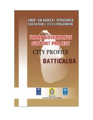
CITY PROFILE<br />
BATTICALOA M<strong>UN</strong>ICIPAL CO<strong>UN</strong>CIL
EXECUTIVE SUMMARY<br />
<strong>City</strong> <strong>profile</strong><br />
<strong>Batticaloa</strong> <strong>Municipal</strong> <strong>Council</strong><br />
This city <strong>profile</strong> report provides a detailed look at the people, places and conditions within the administrative boundaries of <strong>Batticaloa</strong><br />
<strong>Municipal</strong> <strong>Council</strong>. This provides useful information on physical features and characteristics of the area, historical evolution of the city,<br />
demographics, finances and economics, real estate and other factors which may impact the quality of life of the people. <strong>Batticaloa</strong> is a<br />
city which is surrounded by Indian Ocean and Lagoon. This city has great history and it’s a multi cultural city. Kallady Bridge and Dutch<br />
Fort of <strong>Batticaloa</strong> are enhancing the historical important of the area. Even though Tamils are the majority within <strong>Batticaloa</strong> <strong>Municipal</strong><br />
<strong>Council</strong> Area Muslims and Burgers are living with harmony. Different types of legends say various reasons to the evolution of the name<br />
of <strong>Batticaloa</strong>. <strong>Batticaloa</strong> has night time population of nearly 80,000 and its serves to 3,000 commuters per day. Majority of the labour<br />
force within the area are employed in government sector while several people involve in fishing in Sea and Lagoon of the <strong>Batticaloa</strong>.<br />
<strong>Batticaloa</strong> <strong>Municipal</strong> <strong>Council</strong> Area having characteristics of dry zone. Tsunami, floods and cyclones are the major natural disasters which<br />
are affecting the area. Tsunami devastation has taken nearly the lives of 40,000 innocent people. Considering the infrastructure facilities<br />
within the <strong>Batticaloa</strong> <strong>Municipal</strong> <strong>Council</strong> area it is very obvious that ongoing development projects will improve the present conditions of<br />
them. This city has famous schools which are having good reputation in whole Eastern Province and these schools accommodate large<br />
number of out station students every year. Medical faculty of the Eastern University also located within the city. Location of these<br />
academic institutions is playing a major role in the economy of the city. Last three decades <strong>Batticaloa</strong> was severely affected due to war in<br />
the Sri Lanka. Due to the dawn of the peace in the country in 2009 people of the <strong>Batticaloa</strong> can be able to enjoy the peaceful atmosphere<br />
as other citizens of Sri Lanka. This peaceful environment persuades investors, donors and non- governmental organizations to work with<br />
the government to rebuilt <strong>Batticaloa</strong> as one of the major city in Sri Lanka. People of <strong>Batticaloa</strong> are expecting that this fruitful situation<br />
bring more development opportunities to the area and will attract more population towards <strong>Batticaloa</strong> <strong>Municipal</strong> <strong>Council</strong> Area.<br />
2 | P a g e
ABBREVIATIONS<br />
ADB : Asian Development bank<br />
CTB : Ceylon Transportation Board<br />
DS : Divisional Secretariat<br />
LA : Local Authorities<br />
MC : <strong>Municipal</strong> <strong>Council</strong><br />
NWSDB : National Water Supply and Drainage Board<br />
<strong>City</strong> <strong>profile</strong><br />
<strong>Batticaloa</strong> <strong>Municipal</strong> <strong>Council</strong><br />
3 | P a g e
CONTENTS<br />
Executive Summary<br />
Abbreviations<br />
Table of Content<br />
List of figures, tables and charts<br />
CHAPTER 01: INTRODUCTION<br />
<strong>City</strong> <strong>profile</strong><br />
<strong>Batticaloa</strong> <strong>Municipal</strong> <strong>Council</strong><br />
1.1. Key Physical features and Characteristics ...................................................................................................................................................................................................................... 16<br />
1.2. Historical Evolution of the <strong>City</strong> ........................................................................................................................................................................................................................................... 17<br />
1.3. Social Structure and Demography ..................................................................................................................................................................................................................................... 19<br />
1.4. Economic Structure of the area ........................................................................................................................................................................................................................................... 19<br />
1.5. Administrative Aspect of the Area ..................................................................................................................................................................................................................................... 19<br />
1.6. Spatial form .................................................................................................................................................................................................................................................................................... 20<br />
CHAPTER 02: POPULATION CHARACTERISTICS<br />
Overview ......................................................................................................................................................................................................................................................................................... 22<br />
2.1. Size, growth and density .......................................................................................................................................................................................................................................................... 22<br />
2.2. Age composition .......................................................................................................................................................................................................................................................................... 25<br />
4 | P a g e
<strong>City</strong> <strong>profile</strong><br />
<strong>Batticaloa</strong> <strong>Municipal</strong> <strong>Council</strong><br />
2.3. Ethnic and religious composition ....................................................................................................................................................................................................................................... 26<br />
2.4. School attendence ....................................................................................................................................................................................................................................................................... 27<br />
2.5. Labor Force and Dependent population .......................................................................................................................................................................................................................... 27<br />
2.6. Employment status and unemployment......................................................................................................................................................................................................................... 28<br />
CHAPTER 03: ENVIRONMENTAL SETTING<br />
Overview ................................................................................................................................................................................................................................................................................................. 30<br />
3.1. Climatic condition .............................................................................................................................................................................................................................................................................. 30<br />
3.1.1. Temperature ................................................................................................................................................................................................................................................................................. 31<br />
3.1.2. Rainfall ............................................................................................................................................................................................................................................................................................. 33<br />
3.1.3. Relative humidity and wind patterns ............................................................................................................................................................................................................................... 34<br />
3.2. Water ......................................................................................................................................................................................................................................................................................................... 36<br />
3.2.1. <strong>Batticaloa</strong> lagoon ........................................................................................................................................................................................................................................................................ 37<br />
3.2.1.1 The problems and issues which lagoon has faced ............................................................................................................................................................................................. 38<br />
3.2.2. Marshy land of <strong>Batticaloa</strong> ....................................................................................................................................................................................................................................................... 40<br />
3.2.1.1. Problems and issues which marshy land has faced .......................................................................................................................................................................................... 40<br />
3.2.3. Coastal areas.................................................................................................................................................................................................................................................................................. 41<br />
3.3. Land ........................................................................................................................................................................................................................................................................................................... 43<br />
5 | P a g e
<strong>City</strong> <strong>profile</strong><br />
<strong>Batticaloa</strong> <strong>Municipal</strong> <strong>Council</strong><br />
3.4. Culture & historic heritage ............................................................................................................................................................................................................................................................ 45<br />
3.4.1. Legend of singing fish in batticaloa .................................................................................................................................................................................................................................. 45<br />
3.4.2. Dutch fort in batticaloa............................................................................................................................................................................................................................................................ 46<br />
3.5. Environmental hazards .................................................................................................................................................................................................................................................................... 47<br />
3.5.1. Tsunami in 2004 .......................................................................................................................................................................................................................................................................... 48<br />
3.5.2. Floods ................................................................................................................................................................................................................................................................................................ 49<br />
3.5.3. Cyclones .......................................................................................................................................................................................................................................................................................... 51<br />
CHAPTER 04: DEVELOPMENT SETTING<br />
Overview ............................................................................................................................................................................................................................................................................................... 53<br />
4.1. Physical Infrastructure ..................................................................................................................................................................................................................................................................... 53<br />
4.1.1. Transportation .............................................................................................................................................................................................................................................................................. 53<br />
4.1.2. Energy .............................................................................................................................................................................................................................................................................................. 56<br />
4.1.3. Water supply and drainage ............................................................................................................................................................................................................................................ 58<br />
4.1.4. Solid waste management ........................................................................................................................................................................................................................................................ 59<br />
4.2. Social infrastructure .......................................................................................................................................................................................................................................................................... 61<br />
4.2.1. Education ........................................................................................................................................................................................................................................................................................ 61<br />
4.2.2. Health ............................................................................................................................................................................................................................................................................................... 62<br />
6 | P a g e
<strong>City</strong> <strong>profile</strong><br />
<strong>Batticaloa</strong> <strong>Municipal</strong> <strong>Council</strong><br />
4.2.3. Leisure and recreation ............................................................................................................................................................................................................................................................. 65<br />
4.2.4. Religious centers ......................................................................................................................................................................................................................................................................... 66<br />
4.2.5. Other community facilities ................................................................................................................................................................................................................................................... 67<br />
4.3. Agricultural sector ............................................................................................................................................................................................................................................................................. 68<br />
4.3.1. Agriculture .................................................................................................................................................................................................................................................................................... 68<br />
4.3.2. Livestock ......................................................................................................................................................................................................................................................................................... 71<br />
4.3.3. Fisheries ........................................................................................................................................................................................................................................................................................... 72<br />
4.4. Industrial sector ................................................................................................................................................................................................................................................................................... 74<br />
4.5. Service sector ......................................................................................................................................................................................................................................................................................... 75<br />
CHAPTER 05: MANAGEMENT SETTING<br />
Overview .......................................................................................................................................................................................................................................................................................................... 79<br />
5.1. <strong>City</strong> Management Structure .......................................................................................................................................................................................................................................................... 79<br />
5.1.1. <strong>Batticaloa</strong> <strong>Municipal</strong> <strong>Council</strong> ............................................................................................................................................................................................................................................... 79<br />
5.1.1.1. The Organization Structure .......................................................................................................................................................................................................................................... 80<br />
5.1.1.2. Services Offered by the <strong>Municipal</strong> <strong>Council</strong> .......................................................................................................................................................................................................... 81<br />
5.1.1.3. Budget - 2010 ........................................................................................................................................................................................................................................................................ 82<br />
5.1.2. <strong>Batticaloa</strong> Divisional Secretariat Division Office ........................................................................................................................................................................................................ 84<br />
7 | P a g e
<strong>City</strong> <strong>profile</strong><br />
<strong>Batticaloa</strong> <strong>Municipal</strong> <strong>Council</strong><br />
5.1.2.1. Services Offered by the Divisional Secretariat Office ...................................................................................................................................................................................... 85<br />
5.2. Other stakehoders ............................................................................................................................................................................................................................................................................... 88<br />
5.2.1. Public Sector .................................................................................................................................................................................................................................................................................. 88<br />
5.2.2. Popular Sector .............................................................................................................................................................................................................................................................................. 90<br />
CHAPTER 06: SWOT ANALYSIS 91<br />
Annexure<br />
8 | P a g e
LIST OF FIGURES, CHARTS AND TABLES<br />
<strong>City</strong> <strong>profile</strong><br />
<strong>Batticaloa</strong> <strong>Municipal</strong> <strong>Council</strong><br />
Figure 1: Location of <strong>Batticaloa</strong> MC Area ...................................................................................................................................................................................................................................... 16<br />
Figure 2: Figure – ground map of the <strong>Batticaloa</strong> MC ............................................................................................................................................................................................................... 20<br />
Figure 3: Population Density by G.N Division .............................................................................................................................................................................................................................. 24<br />
Figure 4: Temperature variation from 1998 – 2007 .................................................................................................................................................................................................................. 32<br />
Figure 5: Inland water bodies in <strong>Batticaloa</strong> MC area ................................................................................................................................................................................................................ 36<br />
Figure 6: In land water bodies in the region ................................................................................................................................................................................................................................. 36<br />
Figure 7: <strong>Batticaloa</strong> lagoon..................................................................................................................................................................................................................................................................... 38<br />
Figure 8: Marshy land of <strong>Batticaloa</strong> ................................................................................................................................................................................................................................................... 40<br />
Figure 9: Coastal belt of <strong>Batticaloa</strong> .................................................................................................................................................................................................................................................... 42<br />
Figure 10: Land use map of <strong>Batticaloa</strong> MC-1983 ........................................................................................................................................................................................................................ 44<br />
Figure 11: Kallady Bridge ....................................................................................................................................................................................................................................................................... 45<br />
Figure 12: Arch bridge way at the entrance point to the <strong>Municipal</strong>ity ........................................................................................................................................................................... 45<br />
Figure 13: Satellite image of the Dutch fort .................................................................................................................................................................................................................................. 46<br />
Figure 14: One entrance to Kachcheri in <strong>Batticaloa</strong> fort ........................................................................................................................................................................................................ 47<br />
Figure 15: Tsunami affected areas & relocation lands in <strong>Batticaloa</strong> district ................................................................................................................................................................ 48<br />
Figure 16: Property damages (above) and the damages to fishing boats due to Tsunami in 2004 ................................................................................................................... 49<br />
9 | P a g e
<strong>City</strong> <strong>profile</strong><br />
<strong>Batticaloa</strong> <strong>Municipal</strong> <strong>Council</strong><br />
Figure 17: Floods in <strong>Batticaloa</strong> ............................................................................................................................................................................................................................................................. 49<br />
Figure 18: <strong>Batticaloa</strong> flood situation - 2007 ........................................................................................................................................................................................................... 50<br />
Figure 19: Road Network of <strong>Batticaloa</strong> MC area ......................................................................................................................................................................................................................... 54<br />
Figure 20: Main bus terminal of <strong>Batticaloa</strong> city .......................................................................................................................................................................................................................... 55<br />
Figure 21: Railway station of <strong>Batticaloa</strong> city ................................................................................................................................................................................................................................. 55<br />
Figure 22 : St. Michaels College, <strong>Batticaloa</strong> ................................................................................................................................................................................................................................... 61<br />
Figure 23: Faculty of healthcare sciences - Eastern University ........................................................................................................................................................................................... 62<br />
Figure 24: Teaching Hospital - <strong>Batticaloa</strong> ...................................................................................................................................................................................................................................... 63<br />
Figure 25: Children Park in the city .................................................................................................................................................................................................................................................. 65<br />
Figure 26: senior citizens Park in the city ....................................................................................................................................................................................................................................... 65<br />
Figure 27: Webber Stadium, <strong>Batticaloa</strong> ............................................................................................................................................................................................................................................ 65<br />
Figure 28: Some of the religious centers in the <strong>Batticaloa</strong> city ........................................................................................................................................................................................... 66<br />
Figure 29: Public Library in <strong>Batticaloa</strong> city ................................................................................................................................................................................................................................... 67<br />
Figure 30: Post office in <strong>Batticaloa</strong> <strong>City</strong> ........................................................................................................................................................................................................................................... 67<br />
Figure 31: Organization chart of the <strong>Batticaloa</strong> MC ................................................................................................................................................................................................................. 80<br />
Figure 32: Some of the services offered by the <strong>Batticaloa</strong> <strong>Municipal</strong> council ............................................................................................................................................................. 81<br />
10 | P a g e
Chart 1: Gender Composition – 2008<br />
Chart 2: Temperature variations in the region - 2007<br />
Chart 3: Population growth pattern<br />
Chart 5: Ethnic Composition in <strong>Batticaloa</strong> MC – 2008<br />
Chart 6: Religious Composition in <strong>Batticaloa</strong> MC – 2008<br />
Chart 7: School attendance – 2008<br />
Chart 8: % of labor force & Dependent population – 2008<br />
Chart 9: Distribution of Population by Sector of Employment in 2008<br />
Chart 10: Temperature variations in the region - 2007<br />
Chart 11: Change of rainfall (mm) – 1996 to 2004<br />
Chart 12: Change of relative humidity levels day-night times in 2007<br />
Chart 13: Land use pattern – 2006<br />
Chart 14: Source of lighting in <strong>Batticaloa</strong> MC area– 2008<br />
Chart 15: Source of lighting in <strong>Batticaloa</strong> MC area– 2008<br />
Chart 16: Source of Drinking water – 2008<br />
<strong>City</strong> <strong>profile</strong><br />
<strong>Batticaloa</strong> <strong>Municipal</strong> <strong>Council</strong><br />
11 | P a g e
Chart 17: People engaged with fishing activities 2003 – 2008<br />
Chart 18: Dry fish production coastal fisheries from 2002 - 2008<br />
Chart 19: Fresh fish production coastal fisheries from 2001 - 2008<br />
Chart 20: Revenue Estimate for 2010<br />
Chart 21: Expenditure Estimate for 2010<br />
Table 1: Population predictions<br />
Table 2: Age composition in 2008<br />
Table 3: Temperature variations in the region - 2007<br />
Table 4: Change of rainfall (mm) – 1998 to 2007<br />
Table 5: Change of relative humidity levels day-night times in 2007<br />
Table 6: Basic climatic information<br />
Table 7: Resource distribution pattern in coastal zone - 2008<br />
Table 8: Land use allocation in <strong>Batticaloa</strong> MC area – 2006<br />
Table 9: Details of the A and B class roads<br />
Table 10: Frequency of Bus Transportation in <strong>Batticaloa</strong> city<br />
Table 11: Trains from <strong>Batticaloa</strong> to Colombo<br />
<strong>City</strong> <strong>profile</strong><br />
<strong>Batticaloa</strong> <strong>Municipal</strong> <strong>Council</strong><br />
12 | P a g e
Table 12: Petroleum products consumption from 2005- 2007 in <strong>Batticaloa</strong> MC Area<br />
Table 13: Electricity consumption by various activities within the <strong>Batticaloa</strong> city<br />
Table 14: Solid waste generation from 1985 – 2004 in <strong>Batticaloa</strong> MC Area<br />
Table 15: Composition of solid waste in 2007<br />
Table 16: Human resource strength of the Teaching hospital – <strong>Batticaloa</strong> in 2006<br />
Table 17: Patient recorded by the illness in 2008<br />
Table 18: Targeted and achieved production during the period of 2003 – 2007<br />
Table 19: Paddy extent targeted, gross extent sown, gross extent harvested net extent harvested and production – Maha 2006/2007<br />
Table 20: Production of chilli and red onions during the 2003- 2007<br />
Table 21: Vegetable production during the above period (2005-2007)<br />
Table 22: Live stock population in 2008<br />
Table 23: Production of coastal and lagoon fishing in 2008<br />
Table 24: People engaged with fishing activities 2003 – 2008<br />
Table 25: Number of High and low polluting industries in the area in 2008<br />
Table 26: Financial transactions by Bank of Ceylon and People’s Bank in the area in 2008<br />
Table 27: Details of Enterprises in <strong>Batticaloa</strong> city - 2009<br />
Table 28: Revenue Estimate for 2010<br />
<strong>City</strong> <strong>profile</strong><br />
<strong>Batticaloa</strong> <strong>Municipal</strong> <strong>Council</strong><br />
13 | P a g e
Table 29: Expenditure Estimate for 2010<br />
Table 30: List of GN divisions in <strong>Batticaloa</strong> Divisional Secretariat area<br />
<strong>City</strong> <strong>profile</strong><br />
<strong>Batticaloa</strong> <strong>Municipal</strong> <strong>Council</strong><br />
14 | P a g e
<strong>City</strong> <strong>profile</strong><br />
<strong>Batticaloa</strong> <strong>Municipal</strong> <strong>Council</strong><br />
CHAPTER 01<br />
INTRODUCTION<br />
15 | P a g e
1.1. KEY PHYSICAL FEATURES AND CHARACTERISTICS<br />
<strong>Batticaloa</strong> is a prominent city in Sri Lanka which is located in the Eastern<br />
Province of the country. According to the Global Positioning system<br />
coordinates the city is located in 580824.828 M, North and 598832.632 M East.<br />
The <strong>Batticaloa</strong> city is surrounded by Eravur Pattu Pradeshiya Saba from North<br />
and the East by Bay of Bengal. The south of the city is surrounded by the<br />
Kattankudy Urban <strong>Council</strong> and on the West by <strong>Batticaloa</strong> lagoon which<br />
separates the Manmunai West Divisional Secretariat division and Manmunai<br />
North Divisional Secretariat division. The Eastern side of the city is sandy and<br />
the Western side is sandy and gravel. The city is flat with the exception of<br />
Puliyantivu which is a little higher than the rest of the area. The city is<br />
between 1.20 M and 4.0 M above M.S.L. with scrub jungle and mangrove on<br />
the Northern side bordering the lagoon. The annual rainfall is from 864 mm<br />
and 3081 mm brought by the seasonal North – East monsoon and inter<br />
monsoon. The rainy season is between October and January. The temperature<br />
is recorded between 25 ° C and 36 ° C. <strong>Batticaloa</strong> <strong>Municipal</strong> <strong>Council</strong> limit<br />
coincides with the Manmunai North D.S. Division.<br />
Figure 1: Location of <strong>Batticaloa</strong> MC Area<br />
<strong>City</strong> <strong>profile</strong><br />
<strong>Batticaloa</strong> <strong>Municipal</strong> <strong>Council</strong><br />
16 | P a g e
<strong>Batticaloa</strong> is the provincial capital of the Eastern province of Sri Lanka. It is also the seat of the Eastern University of Sri Lanka.<br />
<strong>City</strong> <strong>profile</strong><br />
<strong>Batticaloa</strong> <strong>Municipal</strong> <strong>Council</strong><br />
The city has the beauty of the spit of land masses separated from the mainland by the brackish lagoon and small islands lies in the midst<br />
of the lagoon which traverses through the district extending 73.5 km. to Verugal in the North from <strong>Batticaloa</strong> city and also extending<br />
from the city 35.2 km. from the South up to Thuraineelavanai. Many bridges are built across the lagoon connecting the landmasses and<br />
the islands. The largest island is called Pullianthivu which the metropolitan place of the city. The bridge of all is Lady Manning Bridge<br />
located at Kallady, which is the main access path to the city from the southern places of the district. This bridge is also famous for<br />
singing fishes which was considered musical sounds heard in the Kallady lagoon in the full moon day. A priest named Father Lang<br />
recorded this musical charm and broadcast it in the 1960s over the SLBC (Sri Lanka Broadcasting Cooperation). <strong>Batticaloa</strong> beaches are<br />
sandy and located along 4 km shoreline in the city and further extend through the neighbouring places. Kallady beach, the popular<br />
serene beachfront where large numbers of people gather in the city.<br />
1.2. HISTORICAL EVOLUTION OF THE CITY<br />
According to the ‚Wikipedia, the free encyclopaedia‛ it states that the earliest historical artefacts of the city are a Dagaba from the<br />
Ruhuna kingdom of King Kavantissa (1st century BC). Also it was found a Dutch fort built in the seventeenth century. Many<br />
archaeological sites dating to pre-Christian times have been found in this region. Thus Lankavihara, Roththei (Roththa) temple,<br />
Kinnaragala, Rahathgala (Shanthamalai), Veheragalkanda (Pulukunai), eluvamulla (Pullumuilai), and Taaththon Kovil, are some sites<br />
identified and listed by the Government archaeological survey. Many towns of the area show toponymic evidence, as well as evidence<br />
from stone inscriptions, of ancient sites related to 'Seruvavila' and other Buddhist shrines of the area. Although a large number of<br />
ancient historical sites have been identified, archaeological excavations and detailed studies have been very limited. A map of the<br />
17 | P a g e
<strong>City</strong> <strong>profile</strong><br />
<strong>Batticaloa</strong> <strong>Municipal</strong> <strong>Council</strong><br />
Buddhist sites in the eastern coastal belt near <strong>Batticaloa</strong> and extending towards Trincomalee has been given in a "Buddhist Times"<br />
publication.<br />
Some of the publications go in to explain that <strong>Batticaloa</strong> was under the Ruhunu, Polonnaruwa kingdom at various stages subsequently<br />
the area came under the governance of Portuguese after they invade the east coast of Ceylon. Also it says before Portuguese landed to<br />
the east of the country ‚Puliyanthivu was the heart of the city and it was a brick built fortress of ‚Puliyamaran‛ a governor appointed by<br />
king ‚Suhathiran‛ who was the king ruled the region between Verugal Ganga & Manikka Ganaga which is currently known as the two<br />
regions of <strong>Batticaloa</strong> and Trincomalee of eastern province. In 1622 the Portuguese destroyed the brick fortress and built a clay fortress<br />
but when Dutch invade the region they destroyed the fortress constructed by Portuguese and built a stone fortress which can be seen<br />
even today in Puliyantivu and many government departments and even the District Secretariat are currently located.<br />
There is an interesting story behind getting the name of the city as <strong>Batticaloa</strong>.<br />
According to the ‚Wikipidea the Free Encyclopaedia‛ <strong>Batticaloa</strong> is a Portuguese derivation. Some sources cite the original name of the<br />
region being the Sinhalese "Mudda Kalapuwa" (translation: Mud Lagoon). This is assumed to have been adapted by the later Tamil<br />
settlers. According to Mattakallappu Manmiyam (மட்டக்களப்பு மான்மியம்) the word Mattakkallpu consists Tamil words<br />
"Mattu"(மட்டு) means honey or Matta-derived from "Mattam"(மட்டம்) means (Flat) and geographical name KaLappu. Mukkuwa<br />
named this place as KaLappu-Mattam or boundary of lagoon later it became Matta-Kallappu or Flat Lagoon. Similarly the Mattu-<br />
Kallppu or "Confluence of Honey River" became Mattakkallppu.<br />
18 | P a g e
1.3. SOCIAL STRUCTURE AND DEMOGRAPHY<br />
<strong>City</strong> <strong>profile</strong><br />
<strong>Batticaloa</strong> <strong>Municipal</strong> <strong>Council</strong><br />
The social structure of the <strong>Batticaloa</strong> MC area mainly consist with a majority of Tamil population which is recorded 89% according to<br />
the Resource Profile of Manmunai North Divisional Secretary, 2008. Also according to the same source of information it is recorded that<br />
5% of Burgers and another 5% of Muslims are living within the municipal limits of <strong>Batticaloa</strong>. The detail demographic <strong>profile</strong> of the<br />
<strong>Batticaloa</strong> MC is explained in the Chapter 02.<br />
1.4. ECONOMIC STRUCTURE OF THE AREA<br />
Total night time population of the area is recorded as 78983, while floating population of around 3000 are daily coming to <strong>Batticaloa</strong><br />
town to fulfill their requirements such as administrative, health and education. Apart from that deep sea fishing and lagoon fishing are<br />
among the key elements of the economic base of the area. Tourism, poultry industry, coconut plantations and dairy products can be<br />
identified as the other economic activities that are dominant in <strong>Batticaloa</strong> municipal council area.<br />
1.5. ADMINISTRATIVE ASPECT OF THE AREA<br />
Basically the administration of the city area is governed under the <strong>Batticaloa</strong> <strong>Municipal</strong> council and as well as Manmunai South<br />
Divisional secretariat, All the <strong>Batticaloa</strong> is under the regime of Eastern provincial council.<br />
19 | P a g e
1.6. SPATIAL FORM<br />
Spatial form of the city explains how the built environment of the city is<br />
distributed among the space available for the city; accordingly the following<br />
map elaborated how the special form has been distributed in the city limits.<br />
The white patches in the map explains the built up area of the within the city<br />
limit.<br />
Figure 2: Figure – ground map of the <strong>Batticaloa</strong> MC<br />
<strong>City</strong> <strong>profile</strong><br />
<strong>Batticaloa</strong> <strong>Municipal</strong> <strong>Council</strong><br />
20 | P a g e
<strong>City</strong> <strong>profile</strong><br />
<strong>Batticaloa</strong> <strong>Municipal</strong> <strong>Council</strong><br />
CHAPTER 02<br />
POPULATION CHARACTERISTICS<br />
21 | P a g e
OVERVIEW<br />
<strong>City</strong> <strong>profile</strong><br />
<strong>Batticaloa</strong> <strong>Municipal</strong> <strong>Council</strong><br />
Population characteristics namely, size, growth pattern, density, age - sex composition, ethnic and religious compositions, school<br />
attendance, labor force participations and occupation pattern and employment status are discussed in this chapter.<br />
Census and Statistics Department of Sri Lanka does not conduct the 2001 all island census in Eastern and Northern Province areas due to<br />
the conflict situations. Therefore the resource <strong>profile</strong> prepared by the Manmunai North D.S. office in 2008 is used as the major source of<br />
information in presenting the population characteristics of the area in this city <strong>profile</strong>.<br />
With the end of 30 year conflict, significant change in population characteristics and movement is expected in coming years. Those<br />
possible changes are not addressed in this document due to the unavailability of updated data bases.<br />
2.1. SIZE, GROWTH AND DENSITY<br />
According to Manmunai North divisional secretariat of <strong>Batticaloa</strong> District, 89758<br />
persons are living in <strong>Batticaloa</strong> MC Area in 2008. Further 23145 families live in<br />
there, with a majority of female population (Chart 01). Since 2006, statistics are<br />
showing a significant change in the population growth pattern (Chart 02).<br />
Population distribution by G.N Divisions within the <strong>Municipal</strong>ity is given in<br />
annexure 01 – population characteristics.<br />
Gender composition - 2008<br />
Female<br />
52%<br />
Male<br />
48%<br />
Chart 1: Gender Composition – 2008<br />
Source: Resource Profile, Manmunai North D.S.<br />
22 | P a g e
According to Exponential growth model Population a prediction, population growth<br />
rate was calculated as 1.005% for the <strong>Batticaloa</strong> <strong>Municipal</strong>ity area. Comparatively,<br />
<strong>Batticaloa</strong> district recorded a 2.49% population growth rate (Brief Preliminary Report,<br />
UDA, 2004). Population projections showed that, there will be more than hundred<br />
thousand of population by 2020 (table 1 & chart 3).<br />
Population<br />
120,000<br />
100,000<br />
80,000<br />
60,000<br />
40,000<br />
20,000<br />
0<br />
Chart 3: Population growth pattern<br />
85370<br />
87351<br />
<strong>City</strong> <strong>profile</strong><br />
<strong>Batticaloa</strong> <strong>Municipal</strong> <strong>Council</strong><br />
POPULATION GROWTH PATTERN Chart 2: population growth pattern (2004 - 2008)<br />
86960<br />
89191<br />
89758<br />
Source: Resource Profile, Manmunai North D.S.<br />
Year Predicted Population<br />
2010 91,571<br />
2015 96,266<br />
2020 101,202<br />
2025 106,391<br />
2030 111,845<br />
Table 1: Population predictions<br />
23 | P a g e
Population density of Baticaloa <strong>Municipal</strong>ity was 2466 persons per Square<br />
Kilometer by year 2008. The highest population density is recorded from<br />
the Koolavady, Iruthayapuram central, Mamangam and Koolavady East<br />
G.N divisions, while lowest population density is recorded from the<br />
Thiraimadu, Thiruperunthurai, Sathurukondan, Palameenmadu and<br />
Navalady G.N divisions. The population density by G.N divisions is<br />
illustrated in figure 01. Further information is available in annexure<br />
01 – population characteristics.<br />
Figure 3: Population Density by G.N Division<br />
<strong>City</strong> <strong>profile</strong><br />
<strong>Batticaloa</strong> <strong>Municipal</strong> <strong>Council</strong><br />
24 | P a g e
2.2. AGE COMPOSITION<br />
<strong>City</strong> <strong>profile</strong><br />
<strong>Batticaloa</strong> <strong>Municipal</strong> <strong>Council</strong><br />
Age composition of the <strong>Batticaloa</strong> MC area is given in the table 02. According to that majority of the population (23%) is belong to age<br />
group (30-49) while second major age group is between (19-29).Age structure of the population by G.N division is given in annexure 01 –<br />
population characteristics.<br />
Age Group Population in 2008 Percentage (%)<br />
Bellow 1 2012 2%<br />
1-4 5764 6%<br />
5-9 7232 8%<br />
10-14 8245 9%<br />
15-18 9609 11%<br />
19-29 15759 18%<br />
30-49 20758 23%<br />
50-59 11789 13%<br />
Above 60 8590 10%<br />
Total 89758 100%<br />
Table 2: Age composition in 2008<br />
Source: Resource Profile, Manmunai North D.S.<br />
25 | P a g e
2.3. ETHNIC AND RELIGIOUS COMPOSITION<br />
The Ethnic and Religious composition of population in <strong>Batticaloa</strong> <strong>Municipal</strong>ity is shown in chart 04 and 05.<br />
According to statistics 89% of the population is Tamil, while Burgers<br />
and Muslims recorded as 5% each. Majority of the population are<br />
Hindus. Significant percentages of Islamic population are also living<br />
in <strong>Batticaloa</strong> <strong>Municipal</strong> council area. Ethnic and religious<br />
composition information on GN wise is given in annexure 01 –<br />
population characteristics.<br />
Muslims<br />
5%<br />
Religous Composition - 2008<br />
Other Christian Others<br />
0% 1%<br />
Roman<br />
Catholics<br />
23%<br />
Buddhist<br />
0%<br />
Hindus<br />
71%<br />
Indian Tamils<br />
0%<br />
Ethnic Composition - 2008<br />
Muslims<br />
Burgers<br />
5%<br />
5%<br />
Others<br />
1%<br />
Tamils<br />
89%<br />
<strong>City</strong> <strong>profile</strong><br />
<strong>Batticaloa</strong> <strong>Municipal</strong> <strong>Council</strong><br />
Chart 5: Ethnic Composition in <strong>Batticaloa</strong> MC - 2008<br />
Chart 6: Religious Composition in <strong>Batticaloa</strong> MC - 2008<br />
Source: Resource Profile, Manmunai North D.S.<br />
Source: Resource Profile, Manmunai North D.S.<br />
26 | P a g e
2.4. SCHOOL ATTENDENCE<br />
28 % of the total population in the municipal area is falls within the<br />
category of school going age population in 2008.<br />
The distribution of the School going population in <strong>Municipal</strong>ity is given in<br />
chart 06 and further illustrations are available in annexure 01 – population<br />
characteristics. Accordingly 5 % of the school going age population is not<br />
schooling.<br />
2.5. LABOR FORCE AND DEPENDENT POPULATION<br />
Population who are within the age group of 15-59 is defined as the labor<br />
force while Child dependency and Aged dependency population are<br />
defined as age group of 0-14 and age group of over 60 respectively. Chart<br />
07 is showing the % of labor force and dependency population (child and<br />
aged) in <strong>Batticaloa</strong> MC area. Accordingly 36% of the total population can<br />
be identified as the depended population, while 64% of the total<br />
population alls within the category of labor force.<br />
10%<br />
26%<br />
8%<br />
10%<br />
5%<br />
64%<br />
77%<br />
<strong>City</strong> <strong>profile</strong><br />
<strong>Batticaloa</strong> <strong>Municipal</strong> <strong>Council</strong><br />
Bellow O/L<br />
O/L<br />
A/L<br />
Not Schooling<br />
Chart 7: School attendance – 2008<br />
Source: Resource Profile, Manmunai North D.S.<br />
Labor Force<br />
Child Dependancy<br />
Rate<br />
Aged Dependancy<br />
Rate<br />
Chart 8: % of labor force & Dependent population – 2008<br />
Source: Resource Profile, Manmunai North D.S.<br />
27 | P a g e
2.6. EMPLOYMENT STATUS AND <strong>UN</strong>EMPLOYMENT<br />
Population (No. of Families) by sector of employment in<br />
<strong>Batticaloa</strong> <strong>Municipal</strong>ity in 2008 is given in chart 08.<br />
Statistics reflects that majority of the families are working as<br />
labors (21%) while 19% of the families are engaged in<br />
Government sector. Other dominant sectors of employment are<br />
identified as fishery and private sector, where percentages stand as<br />
9% and 7% respectively.<br />
Apart from above major sectors of employment, considerable<br />
amount of the families are engaged in Business, Carpentry, Mason<br />
and Agricultural sector activities.<br />
According to statistics in 2007, 12 % of unemployed population<br />
are living in the MC are while 42 % of Samurdhi recipient are recorded in <strong>Batticaloa</strong> MC are in 2008.<br />
Other<br />
Carpentry<br />
Mason<br />
Fisheries<br />
Agriculture<br />
Labor<br />
Small …<br />
Business<br />
Private<br />
Co-operation<br />
W.a.O.P<br />
Gove.Pen<br />
Government<br />
337<br />
412<br />
658<br />
841<br />
1192<br />
1179<br />
1335<br />
1273<br />
1272<br />
1542<br />
1968<br />
<strong>City</strong> <strong>profile</strong><br />
<strong>Batticaloa</strong> <strong>Municipal</strong> <strong>Council</strong><br />
4392<br />
0 1000 2000 3000 4000 5000<br />
4764<br />
Chart 9: Distribution of Population by Sector of Employment in 2008<br />
Source: Resource Profile, Manmunai North D.S.<br />
28 | P a g e
<strong>City</strong> <strong>profile</strong><br />
<strong>Batticaloa</strong> <strong>Municipal</strong> <strong>Council</strong><br />
CHAPTER 03<br />
ENVIRONMENTAL SETTING<br />
29 | P a g e
OVERVIEW<br />
<strong>City</strong> <strong>profile</strong><br />
<strong>Batticaloa</strong> <strong>Municipal</strong> <strong>Council</strong><br />
<strong>Batticaloa</strong> is one of the famous coastal towns in North Eastern coastal belt of Sri Lanka. In Sinhala this area call as ‚Madakalapuwa‛; that<br />
means ‘Muddy lagoon’. It explains about a town surrounded by a lagoon. Therefore the lagoon and the coastal belt are considered as the<br />
key elements of the natural environmental setting of the area.<br />
Environmental setting can be further discussed as the natural recourses and natural hazards. Water resources, air, land, which includes<br />
natural vegetation, wild life areas, special ecologies and cultural and historic heritage, fall under the natural resources category.<br />
Tsunami, floods and cyclones are discussed here as the natural hazards in the area.<br />
First half of this chapter discuss about the natural environmental attributes in brief and explain about the above mentioned elements<br />
later.<br />
3.1. CLIMATIC CONDITION<br />
Basic understanding about the climate condition of a given region can be derived by looking at the rainfall patterns, temperature<br />
variations, humidity levels and wind patterns.<br />
30 | P a g e
3.1.1. TEMPERATURE<br />
<strong>City</strong> <strong>profile</strong><br />
<strong>Batticaloa</strong> <strong>Municipal</strong> <strong>Council</strong><br />
This region experiences very frequent, intensive rainfall with relatively high temperature. The highest average daily temperature<br />
recorded ranges between 34.3 0 degrees centigrade in July to 28.4 0 degrees centigrade in January. From January to July <strong>Batticaloa</strong> city<br />
experiences severe dry weather, during which period the relatively humidity also goes down.<br />
Temperature variations during the year 2007 are illustrated in chart 09 and table 03. Further temperature variations during 1998 – 2007<br />
are shown in chart 10.<br />
Chart 10: Temperature variations in the region - 2007<br />
Source: Metrological Department, Sri Lanka<br />
31 | P a g e
Months Temperature 0 C Mean<br />
Max.<br />
Figure 4: Temperature variation from 1998 – 2007<br />
Source: Meteorology Department 2007<br />
<strong>City</strong> <strong>profile</strong><br />
<strong>Batticaloa</strong> <strong>Municipal</strong> <strong>Council</strong><br />
Temperature 0 C Mean<br />
Min.<br />
January 28.4 24.0<br />
February 29.2 24.0<br />
March 30.2 23.2<br />
April 31.3 25.1<br />
May 33.8 26.0<br />
June 33.6 25.9<br />
July 34.3 25.5<br />
August 33.2 24.8<br />
September 33.8 25.2<br />
October 32.0 24.2<br />
November 30.3 24.0<br />
December 28.6 23.7<br />
Table 3: Temperature variations in the region - 2007<br />
Source: Meteorology Department 2007<br />
32 | P a g e
3.1.2. RAINFALL<br />
Chart 11: Change of rainfall (mm) – 1996 to 2004<br />
Source: Meteorology Department, 2007<br />
<strong>City</strong> <strong>profile</strong><br />
<strong>Batticaloa</strong> <strong>Municipal</strong> <strong>Council</strong><br />
According to the available climatic information highest rain fall experiences 487.2mm in December and the lowest is 11.4mm in May.<br />
This part of the country generally gets the rain from the North- East monsoons during November – February. A variation in the rainfall<br />
pattern (mm) during the period of 1996 – 2004 is shown in chart 11. Apart from 1998, region has been getting a annual rainfall over<br />
1500mm throughout the year. Further, change of rainfall patterns during the period of 1998 – 2007 on each month is given in table 04.<br />
It shows a drastic reduction of rainfall during<br />
November- December in 2007.<br />
Months 1998 1999 2000 2001 2002 2003 2004 2005 2006 2007<br />
January 154.4 388.5 381.8 349.5 198.3 384.9 153.6 163.5 267.6 170.1<br />
February 7.5 171.4 213.6 145.4 191.5 180 130.7 29.6 162.3 157.5<br />
March 20.6 - 152.9 - 8.5 89.3 80.8 50.3 27.3 16.9<br />
April 20.8 114.1 2.5 62.2 82.6 17.8 30.2 96.5 10.7 233.3<br />
May 97.9 41.9 32 29.6 115.7 31 88.3 13.8 24.3 11.4<br />
June 5 6.6 93.4 90.6 5.6 87.5 15.5 - 1.7 67.7<br />
July 57.7 25.7 - 100.7 29.7 39.3 6.6 9.1 0.1 101.3<br />
August 17.9 2.8 15.8 - 2.2 31.8 2.3 38.2 18.3 104.4<br />
September 13.8 73.5 104.7 16.1 - 80 328.6 74.8 15.8 16.2<br />
October 133 201 57.9 158.1 81.5 111.6 387.4 135.5 183 124.7<br />
November 255.5 463.6 544.6 253.2 380.7 722.2 444.5 408.7 281.1 79.5<br />
December 226.3 501.2 422.2 430.9 774.5 83.1 926.2 203.2 314.1 487.2<br />
Total 1010.4 1990.3 2021.4 1636.3 1870.8 1858.5 2594.7 1223.2 1306.3 1570.2<br />
Table 4: Change of rainfall (mm) – 1998 to 2007<br />
Source: Meteorology Department, 2007<br />
33 | P a g e
3.1.3. RELATIVE HUMIDITY AND WIND PATTERNS<br />
<strong>City</strong> <strong>profile</strong><br />
<strong>Batticaloa</strong> <strong>Municipal</strong> <strong>Council</strong><br />
Relative humidity can be stated as one of the factors that determines the temperature levels of an area. Composition of water vapors in<br />
the atmosphere is shown in the humidity levels. Relative humidity level changes on day and night times on month wise in 2007 are<br />
shown in table 05 and chart 11. Accordingly relatively high % of humidity levels is recorded at night times. Higher % of humidity levels<br />
are recorded in the month of December in the same year.<br />
Month Relative<br />
Humidity %<br />
Day<br />
Relative<br />
Humidity %<br />
Night<br />
January 76 82<br />
February 76 86<br />
March 73 87<br />
April 78 90<br />
May 69 85<br />
June 67 83<br />
July 65 80<br />
August 70 84<br />
September 67 83<br />
October 72 88<br />
November 76 89<br />
December 83 91<br />
Table 5: Change of relative humidity levels day-night times in 2007<br />
Source: Meteorology Department, 2007<br />
.<br />
Chart 12: Change of relative humidity levels day-night times in 2007<br />
Source: Meteorology Department, 2007<br />
34 | P a g e
<strong>City</strong> <strong>profile</strong><br />
<strong>Batticaloa</strong> <strong>Municipal</strong> <strong>Council</strong><br />
Information about strong winds is not recorded in <strong>Batticaloa</strong> town area recently. The highest day time wind speed is recorded as 8.6<br />
km/ph in January and it has gradually decreased to 0.3 km/ph in September.<br />
Climate condition of the region is summarized and shown in table 06.<br />
Table 6: Basic climatic information<br />
Source: Meteorology Department<br />
35 | P a g e
3.2. WATER<br />
According to statistics, 4.73 % of the total land area of the <strong>Batticaloa</strong> MC is<br />
covered by large inland water bodies. Three lagoons are located in the<br />
<strong>Batticaloa</strong> district and largest lagoon is the <strong>Batticaloa</strong> lagoon. <strong>Batticaloa</strong> town<br />
area is surrounded by the <strong>Batticaloa</strong> lagoon.<br />
Figure 6: In land water bodies in the region<br />
<strong>City</strong> <strong>profile</strong><br />
<strong>Batticaloa</strong> <strong>Municipal</strong> <strong>Council</strong><br />
36 | P a g e
3.2.1. BATTICALOA LAGOON<br />
As mentioned above, three major lagoons are located in <strong>Batticaloa</strong> district..<br />
Namely:<br />
� <strong>Batticaloa</strong> lagoon,<br />
� Valaichchenai Lagoon and<br />
� Vakari Lagoon.<br />
Among them, <strong>Batticaloa</strong> lagoon is the largest lagoon in <strong>Batticaloa</strong> District. It is a<br />
very large estuarine lagoon not only in <strong>Batticaloa</strong> District but also in eastern Sri<br />
Lanka. <strong>Batticaloa</strong> town is located between the Indian Ocean and the lagoon.<br />
Lagoon situated in the east coast of Sri Lanka with the total area of approximately<br />
11,500 ha of water Surface area of the lagoon is about 141.18 square kilometers<br />
(54.5 sq mi). And maximum depth of the lagoon is approximately 4 meters (13 ft).<br />
Length of the lagoon is 56 Km. Long and narrow physical character of the lagoon<br />
makes it a distinct geographical feature in the region. Numbers of small rivers are<br />
feeding the fresh water to the <strong>Batticaloa</strong> lagoon.<br />
<strong>City</strong> <strong>profile</strong><br />
<strong>Batticaloa</strong> <strong>Municipal</strong> <strong>Council</strong><br />
Figure 6: <strong>Batticaloa</strong> lagoon<br />
37 | P a g e
There are several islands within the <strong>Batticaloa</strong> Lagoon, namely: Puliayantheevu, Buffalo Island and<br />
Bone Island. Many bridges are built across the lagoon connecting the landmasses and the islands.<br />
This lagoon extends up to Eravur (in <strong>Batticaloa</strong> district) from the north and up to Kalmunai (in<br />
Ampara district) from the south.<br />
Lagoon opens in to the sea at two points. One in the southern end of the lagoon at Kallar and the other<br />
is midway of the lagoon at Palameenmadu which is close to the <strong>Batticaloa</strong> town. Both are narrow and<br />
<strong>City</strong> <strong>profile</strong><br />
<strong>Batticaloa</strong> <strong>Municipal</strong> <strong>Council</strong><br />
approximately 200 m wide. The width of the water flow at their openings varies with the seasons. During the dry seasons the width of the<br />
bar mouth of the lagoon decreases and gradually it get closed with the onset of the north east monsoon which piles up the sand bar by<br />
the end of dry season. Later with the rains and with the lagoon mouth closed.<br />
3.2.1.1 THE PROBLEMS AND ISSUES WHICH LAGOON HAS FACED<br />
Chanel blocking due to sand bars<br />
� <strong>Batticaloa</strong> lagoon is conected to the sea by two narrow channels, one at <strong>Batticaloa</strong> and the other at Periyakallar. During the dry<br />
season these channels are blocked by sand bars.<br />
Figure 7: <strong>Batticaloa</strong> lagoon<br />
38 | P a g e
Illegal prawn farming activities<br />
<strong>City</strong> <strong>profile</strong><br />
<strong>Batticaloa</strong> <strong>Municipal</strong> <strong>Council</strong><br />
� At Thiruperunthurai area there about 15 illegal prawn farms are functioning along the lagoon shore and each of them are<br />
around 1 acre & 6 feet deep. For all the ponds in the farms, water pumped from the lagoon and after using that waste water is<br />
discharge to the lagoon. With these activities lagoon is get polluted due to the chemicals that were used for farming.<br />
Liquid waste disposal activities<br />
� <strong>Batticaloa</strong> town area is located very close to the lagoon. Thus the population density around the lagoon is recorded as very high.<br />
There are number of eating houses (Kitchens) around the lagoon and all of their liquid waste directly discharged to the lagoon.<br />
� On the other hand most of the houses located around the lagoon also discharged their normal waste in to the lagoon.<br />
� Slaughterhouses in Urani area also discharging several untreated biotic wastes to the lagoon. That includes animals’ blood fluid,<br />
urine, saliva, blood etc…<br />
Solid waste disposal activities<br />
� Most of the industries, trades and commercial places that are located around the lagoon dispose their solid waste in to the lagoon.<br />
� Kaththankudi <strong>Municipal</strong> <strong>Council</strong> also dumps their daily garbage along the lagoon shore and this is recognized as one of the<br />
threats to the lagoon.<br />
39 | P a g e
3.2.2. MARSHY LAND OF BATTICALOA<br />
30 – 50 hectare of land in Sathurukondan, <strong>Batticaloa</strong> has covered with marshes. It spreads along the<br />
both side of the A-15 road and with a length about 6 Km. Marshy lands are rich with bio diversity<br />
and several mangrove varieties have grown in there. Dominated mangroves varieties of this marshy<br />
land are:<br />
� Tillai (Excoecaria agallocha)<br />
� Kanna (Avicennia officinalis)<br />
� Kinnai (Sonarasia Caseolaris)<br />
� Kandal (Rizopohara Mucronata)<br />
� Xylocarpus Grantum.<br />
<strong>City</strong> <strong>profile</strong><br />
<strong>Batticaloa</strong> <strong>Municipal</strong> <strong>Council</strong><br />
This area is famous as a migrant bird sanctuary. Drastic reduction of migrant bird population is observed over the years due to the<br />
destruction of mangroves. Roots of mangroves function as a habitat for juvenile period of prawn, crab and organic matters with rich eco<br />
system feed for younger fish.<br />
3.2.1.1. PROBLEMS AND ISSUES WHICH MARSHY LAND HAS FACED<br />
Major threat for the marshy land is the destruction of mangroves for the purpose of security reasons, fuel wood, fishing, etc…. These<br />
destructions are leading to some of the other issues that are mentioned below.<br />
Figure 8: Marshy land of <strong>Batticaloa</strong><br />
40 | P a g e
<strong>City</strong> <strong>profile</strong><br />
<strong>Batticaloa</strong> <strong>Municipal</strong> <strong>Council</strong><br />
� Breeding places for prawn and crab are being destroyed and this leads to remarkable reduction in production of prawn and crab.<br />
� Reduction of the arrival of migrant birds affects on the tourist activities associated with the area and will also threatened the<br />
possibilities of possibly emerging eco tourism activities in the area.<br />
� Loss of bio diversity.<br />
� Eco system which have rich organic matter being destroyed.<br />
� Loss of natural green spaces.<br />
3.2.3. COASTAL AREAS<br />
<strong>Batticaloa</strong> beaches are sandy and located along 4 km<br />
shoreline in the city and further extend through the<br />
neighboring places.<br />
Kallady beach is one of the popular beaches in the city.<br />
This heavenly beach together with other popular<br />
beaches in the region, namely: Pasikudah and<br />
Kalkudah have been molested. Pasikudah is a bay<br />
protected from the ocean. The significance of<br />
Pasikudah is that its bed is flat and sandy and has a<br />
pleasant effect on the feet. This can be experienced up to<br />
Total Number of coastal GN divisions 9<br />
Length of the coastal belt (km) 12.1<br />
No: of families live in the coastal zone<br />
Under the buffer zone 53<br />
Between the buffer zone and 300m 1075<br />
Green belt plantation type Casuarinas Coccus nusifera<br />
Plantation area (ha.) 67<br />
Plantation organization Forest Department,<br />
Carritas,(EHED), Mandru<br />
Table 7: Resource distribution pattern in coastal zone - 2008<br />
Source: Coast Conservation Department, Planning, Kachcheri<br />
41 | P a g e
nearly 150 to 200 meters from the shore. Pasikudah is an ideal location for<br />
those who wish to learn swimming. Pasikudah is in perfect harmony with<br />
its stunning natural setting on the island's eastern tip. With its atmosphere<br />
of rarefied tranquility, it is a place for relaxation and renewal.<br />
Figure 9: Coastal belt of <strong>Batticaloa</strong><br />
<strong>City</strong> <strong>profile</strong><br />
<strong>Batticaloa</strong> <strong>Municipal</strong> <strong>Council</strong><br />
42 | P a g e
3.3. LAND<br />
<strong>Batticaloa</strong> city has spread entire Manmunai North Divisional Secretariat<br />
division and entire area is highly built up area. Most of the residential land<br />
uses are located throughout the city. The following table presents the<br />
overall pattern of land use in the <strong>Batticaloa</strong> town (Manmunai North) area<br />
and is further explained by the chart.<br />
According to the above table, out total area of 7509 sq.km or 24.37 % is<br />
build up and rest of land 5679 sq.km or 75.63 % is underdeveloped. The<br />
largest share of the undeveloped area is contributed by agricultural land<br />
which amount to 43 %, followed by barren land 15 %, inland water 14 %<br />
each and range land 3 %.<br />
The large extent of agricultural area consists of homesteads and<br />
cultivations classified as paddy, coconut, highland, perennial crops,<br />
permanent crops, and cashew Plantation new and existing. 15% out total<br />
land area is barren land and that lands have more potential for use to future<br />
developments of the area. In <strong>Batticaloa</strong> town area there is no more forest<br />
lands and 90sq.km or 1.19% total land area consists with mangrove<br />
<strong>City</strong> <strong>profile</strong><br />
<strong>Batticaloa</strong> <strong>Municipal</strong> <strong>Council</strong><br />
Land Use Category Sq. Km %<br />
Urban Land Buildup Land 1830 24.37076<br />
Agriculture<br />
Land<br />
Homesteads 980 13.05101<br />
Paddy 744 9.90811<br />
Highland 112 1.491543<br />
Perennial Crops 20 0.266347<br />
Permanent Crops 180 2.397123<br />
Coconut 610 8.123585<br />
Cashew - New Plantation 115 1.531496<br />
Cashew - Existing Extent 350 4.661073<br />
Sparely used land 90 1.198562<br />
Forest Land Dry Monsoon Forest 0<br />
Wet Monsoon Forest 0<br />
Forest Plantation 0<br />
Range Land Scrub Land 110 1.464909<br />
Grass Land 90 1.198562<br />
Wet Land Mangroves 90 1.198562<br />
Water 1083 14.42269<br />
Barren Land 1105 14.71567<br />
TOTAL 7509 100<br />
Table 8: Land use allocation in <strong>Batticaloa</strong> MC area – 2006<br />
Source: <strong>Batticaloa</strong> <strong>Municipal</strong> council<br />
0<br />
0<br />
0<br />
43 | P a g e
plantation.<br />
The totals buildup area of 1830sq. km amounting to 24.37% of the total<br />
area serves the residential, commercial and trade needs of 89787 people.<br />
This means 2466 persons per sq.km. land under residential use is mostly<br />
around the town center and in low income settlements.<br />
Inaland water<br />
14%<br />
Range land<br />
3%<br />
Barren land<br />
15%<br />
Chart 13: Land use pattern – 2006<br />
Source: <strong>Batticaloa</strong> <strong>Municipal</strong> council<br />
Urban Land<br />
25%<br />
Agriculturel<br />
land<br />
43%<br />
Figure 10: Land use map of<br />
<strong>Batticaloa</strong> MC-1983<br />
<strong>City</strong> <strong>profile</strong><br />
<strong>Batticaloa</strong> <strong>Municipal</strong> <strong>Council</strong><br />
Map 3.1.3.1 Land use map of <strong>Batticaloa</strong><br />
44 | P a g e
3.4. CULTURE & HISTORIC HERITAGE<br />
As most of the coastal cities of Sri Lanka <strong>Batticaloa</strong> also has got influence from colonization<br />
and it is emboss in cultural and historical heritages of the area.<br />
This city was discovered by portages and they located one of their ports in <strong>Batticaloa</strong>.<br />
Another significant feature of the area is legend of singing fish.<br />
3.4.1. LEGEND OF SINGING FISH IN BATTICALOA<br />
<strong>Batticaloa</strong> is famous for its singing fish - The musical sounds are heard in the lagoon near the<br />
Kallady Lady Manning bridge when the night is lit by a near full moon and minimal wind. A<br />
priest named Father Lang recorded this musical charm and broadcast it in the 1960s over the<br />
SLBC (Sri Lanka Broadcasting Cooperation).<br />
Most of the people who live in and out of the area have get influence from this legend of<br />
singing fish. When enter to the area there is a arched gate way that has design with that<br />
<strong>City</strong> <strong>profile</strong><br />
<strong>Batticaloa</strong> <strong>Municipal</strong> <strong>Council</strong><br />
Figure 11: Kallady Bridge<br />
Figure 12: Arch bridge way at the entrance point to the <strong>Municipal</strong>ity<br />
45 | P a g e
statues of singing fish and in town area also there are number of statues which exhibit that particular story of singing fish.<br />
<strong>City</strong> <strong>profile</strong><br />
<strong>Batticaloa</strong> <strong>Municipal</strong> <strong>Council</strong><br />
In the introduction to <strong>Batticaloa</strong>nia, the title given to the bibliography of <strong>Batticaloa</strong> that has been compiled by S. J. Selvarajah is the<br />
following lines... "<strong>Batticaloa</strong> is famous for its singing fish. The musical sounds are heard in the lagoon near the Kallady Lady Manning<br />
Bridge at night when the moon is nearest to the full and there is not much wind."<br />
Not only that there some number of songs and lyrics in both Sinhala and Tamil languages also based on legend of singing fish.<br />
3.4.2. DUTCH FORT IN BATTICALOA<br />
The Portuguese initially came to Sri Lanka in 1501 as traders, but they stayed in<br />
occupation of the Maritime Provinces by force of arms until they were expelled by<br />
the Dutch in 1638. <strong>Batticaloa</strong> port was built by the Portuguese in 1628 under the<br />
command of Admiral Joris Van Spilbergen, on the 31 May 1602, the first Dutch<br />
ships that visited Ceylon anchored off the port of <strong>Batticaloa</strong> and that port was the<br />
first to be captured by the Dutch (18 May 1638).<br />
It’s the most picturesque of the small Dutch fort of Sri Lanka; it’s situated in an<br />
island, still in good condition.<br />
Figure 13: Satellite image of the Dutch fort<br />
46 | P a g e
It is a rectangular shaped fort with bastions on the four corners. The emblem of the Dutch<br />
East India Company (VOC) is still above the fort’s entrance. The lagoon borders on the north<br />
and east with a moat on the west and part of the south sides.<br />
At present days within the fort there are several local governmental administrative offices<br />
(<strong>Batticaloa</strong> Kachcheri) along with the monument stone for the original Dutch church that<br />
was built here in the mid 18th century.<br />
3.5. ENVIRONMENTAL HAZARDS<br />
<strong>City</strong> <strong>profile</strong><br />
<strong>Batticaloa</strong> <strong>Municipal</strong> <strong>Council</strong><br />
Environmental hazards are events (‚disasters‛), primarily arising from the physical environment, which endanger the lives, health and<br />
livelihoods of urban populations. They can kill and maim people, destroy resources and property, and disrupt economic networks and<br />
social services. In many cities, at least some of these disastrous events – flood, cyclone, storm, and tsunami – are all too familiar.<br />
<strong>Batticaloa</strong> has faced number of floods, cyclones and tsunami.<br />
Figure 14: One entrance to Kachcheri in<br />
<strong>Batticaloa</strong> fort<br />
47 | P a g e
3.5.1. TS<strong>UN</strong>AMI IN 2004<br />
Whole <strong>Batticaloa</strong> district was highly affected from tsunami in 26 th December<br />
2004 and it has taken lives of about 35,000 persons. As well as it displaced<br />
about 450,000 in the district.<br />
In <strong>Batticaloa</strong> town area approximately 2800 lives and 9400 properties were<br />
fully and partially damaged and lost.<br />
Mostly fisheries communities who lived closed to the sea got highly affected<br />
and several of them displaced. Most of the displaced persons were located in<br />
schools, religious places and other buildings and subsequently re-located in<br />
camps to allow public services to resume.<br />
Tsunami disaster busted most of the physical infrastructures of the area such<br />
as road net work, electricity net work, bridges and etc.<br />
Figure 15: Tsunami affected areas & relocation lands in <strong>Batticaloa</strong><br />
district<br />
Source - UDA<br />
<strong>City</strong> <strong>profile</strong><br />
<strong>Batticaloa</strong> <strong>Municipal</strong> <strong>Council</strong><br />
48 | P a g e
Not only that most of fisheries settlements and their fishing equipments including boats, beach-<br />
seine. Other hand it had been destroyed fishing infrastructure such as harbors, anchorages and<br />
landing sites and services including Ministry of fisheries infrastructure located close to the sea also<br />
suffered.<br />
3.5.2. FLOODS<br />
The entire district of <strong>Batticaloa</strong> has been affected by floods due to heavy rain. In many places the<br />
roads are under water and some western areas are virtually inaccessible by land. This has<br />
happened in many times; year 2000, 2005, 2006, and 2007. In 27 th December 2007 the flooding<br />
affected over one-quarter of a million people.<br />
Figure 16: Property damages (above) and the damages to fishing<br />
boats due to Tsunami in 2004<br />
During the first two days of the rains, the main affected areas were limited to 4 divisions in the<br />
central region of <strong>Batticaloa</strong> District, resulting in the displacement of 375 people.<br />
<strong>City</strong> <strong>profile</strong><br />
<strong>Batticaloa</strong> <strong>Municipal</strong> <strong>Council</strong><br />
Figure 17: Floods in <strong>Batticaloa</strong><br />
49 | P a g e
<strong>City</strong> <strong>profile</strong><br />
<strong>Batticaloa</strong> <strong>Municipal</strong> <strong>Council</strong><br />
Due to floods it cause to having large patches of polluted stagnant water in low-lying areas in <strong>Batticaloa</strong>, and it occurred debris, mud,<br />
garbage & scorched vegetation strewn everywhere. Sanitation of the area also highly affected from floods, because most of wells in area<br />
destroyed or become saline.<br />
‘<br />
Figure 18: <strong>Batticaloa</strong> flood situation - 2007 Sources: Disaster Management Center <strong>Batticaloa</strong> Compiled By: <strong>UN</strong> OCHA<br />
50 | P a g e
3.5.3. CYCLONES<br />
<strong>City</strong> <strong>profile</strong><br />
<strong>Batticaloa</strong> <strong>Municipal</strong> <strong>Council</strong><br />
In 1978 there was a cyclone situation and <strong>Batticaloa</strong> city had been badly affected from that. It caused severe damages to the area. Due to<br />
this hundreds were died and injured, thousands of properties got damaged, and many of the agricultural lands were abandoned. Details<br />
of the damage caused by this cyclone are not available with the National Disaster Management Center or any other agency.<br />
Further thousands were died and injured, agricultural activities were disturbed, deep sea fishing, and lagoon fishing was curtailed due to<br />
the conflict situation in the region since 1983. This had caused a massive damage to the area.<br />
51 | P a g e
<strong>City</strong> <strong>profile</strong><br />
<strong>Batticaloa</strong> <strong>Municipal</strong> <strong>Council</strong><br />
CHAPTER 04<br />
DEVELOPMENT SETTING<br />
52 | P a g e
OVERVIEW<br />
<strong>City</strong> <strong>profile</strong><br />
<strong>Batticaloa</strong> <strong>Municipal</strong> <strong>Council</strong><br />
Basically the development requirements such as the Physical infrastructure and social infrastructure facilities are discussed in the first<br />
half of this chapter. Development activities in the <strong>Batticaloa</strong> <strong>Municipal</strong> <strong>Council</strong> area are discussed in the latter as the Agriculture Sector,<br />
Industrial Sector and the Service Sector. There the activity sectors and the resource consumption and the development contributions of<br />
these sectors are discussed together with the associated problems and prospects of each sector.<br />
4.1. PHYSICAL INFRASTRUCTURE<br />
Roads and transportation, electricity, telecommunication and solid waste management can be considered as the physical infrastructure.<br />
After the conflict situation in the Northern – Eastern area, most of the infrastructure developments are taking a place in the area.<br />
4.1.1. TRANSPORTATION<br />
Roads can be considered as a vital catalyst to boost the development in any particular given area. Basically roads can be classified as A<br />
class, B class and C class roads. A and B class roads are classified as National and Regional roads which links provinces and districts<br />
respectively.<br />
53 | P a g e
Details of A and B class roads, which are running through the <strong>Batticaloa</strong><br />
municipal council area, are given in table 09. Colombo - Ratnapura – Wellwaya<br />
- <strong>Batticaloa</strong> roads connects the <strong>Batticaloa</strong> municipal council area with the<br />
Colombo city.<br />
C class roads are maintained by the <strong>Batticaloa</strong> municipal council. Details of<br />
major C class roads are given in the annexure.<br />
Name of Roads Class & Length of Roads<br />
Route No in km<br />
<strong>Batticaloa</strong> Thirukondiyadimadu Trinco<br />
Road. 0.00 - 78.02 km<br />
A - 015 0.00 - to 9.65 km<br />
Colombo Ratnapura Wellwaya <strong>Batticaloa</strong><br />
Road. 392.60 - 427.35 km<br />
A - 004 427.35 - to 421.50<br />
Approach Road to Railway Station,<br />
<strong>Batticaloa</strong>. 0 - 1.20 km<br />
B - 030 0.00 - to 1.20<br />
Bar Road 0.00 - 4.67 km B - 46 0.00 - 4.67<br />
Lake Road No 01, 0 - 0.90 km B - 250 0.00 - 0.90<br />
Munai Sreet 0 - 43 km B - 298 0.00 - 0.43<br />
Old Road No 7.76 km B - 337 0.00 - 3.10<br />
Urani Road 0.3.22 km B - 433 0.00 - 3.22<br />
Lioyds Avenue 0 - 0.42 km B - 543 0.00 - 0.42<br />
Lady Manninng Drive 0 - 1.00 km B - 542 0.00 - 1.00<br />
Table 9: Details of the A and B class roads Source: Resource <strong>profile</strong>, 2008<br />
<strong>City</strong> <strong>profile</strong><br />
<strong>Batticaloa</strong> <strong>Municipal</strong> <strong>Council</strong><br />
Figure 19: Road Network of <strong>Batticaloa</strong> MC area<br />
Source: Survey Department, 1986<br />
54 | P a g e
Apart from that <strong>Batticaloa</strong> railway station can be considered as a important element in the<br />
transportation system of the area. Generally it takes 12 hours to travel from <strong>Batticaloa</strong> to Colombo.<br />
Frequency of the bus services in <strong>Batticaloa</strong> municipal area and details about the train services are<br />
shown in table 09 and table 10 respectively.<br />
From To Frequency<br />
<strong>Batticaloa</strong> Town Valachchani every 1/2 hour<br />
<strong>Batticaloa</strong> Town Kaduruwella 3 times per day<br />
<strong>Batticaloa</strong> Town Colombo 5 times per day<br />
<strong>Batticaloa</strong> Town Kalmuni Every 1/2 hour<br />
<strong>Batticaloa</strong> Town Akkaraipatthu Every 1 hour<br />
<strong>Batticaloa</strong> Town Vaunia, Mannar, Badulla, Kandy, Jaffna 1 bus per day<br />
<strong>Batticaloa</strong> Town <strong>Batticaloa</strong> Hospital Every 15 minutes<br />
<strong>Batticaloa</strong> Town Muyathuwarm Every 4 hrs<br />
<strong>Batticaloa</strong> Town Thirimadu 2 buses per day<br />
Table 10: Frequency of Bus Transportation in <strong>Batticaloa</strong> city<br />
From To Departing time Arrival time<br />
<strong>Batticaloa</strong> Colombo 6.00 am<br />
<strong>Batticaloa</strong> Colombo 11.00 am<br />
<strong>Batticaloa</strong> Colombo 5.50 pm<br />
<strong>Batticaloa</strong> Colombo 8.10 pm(Express train)<br />
Table 11: Trains from <strong>Batticaloa</strong> to Colombo<br />
<strong>City</strong> <strong>profile</strong><br />
<strong>Batticaloa</strong> <strong>Municipal</strong> <strong>Council</strong><br />
Figure 20: Main bus terminal of<br />
<strong>Batticaloa</strong> city<br />
Figure 21: Railway station of <strong>Batticaloa</strong> city<br />
55 | P a g e
<strong>City</strong> <strong>profile</strong><br />
<strong>Batticaloa</strong> <strong>Municipal</strong> <strong>Council</strong><br />
It is charged Rs. 450/= per person to travel from <strong>Batticaloa</strong> to Colombo in private buses. But it cost only Rs. 230/= in CTB buses. In<br />
travelling in train it’ll cost only 230/= per person in normal trains. In the express train it is 320/=.<br />
Apart from that it is observed that Motor cycles are playing a key role in transportation sector in the area. When observing the traffic<br />
congestion, some what congestion is found during the working hours at Lady Manning Bridge and Koddaimunai bridge in<br />
Pulliyantheevu areas.<br />
4.1.2. ENERGY<br />
When analysing the energy consumption pattern by households in the area, it is found that majority of the families (84%) are using<br />
electricity as their major source of lighting. Further 48% out of the total families live in the area are using fire wood as their major<br />
source used for cooking purposes.<br />
38%<br />
12%<br />
2%<br />
48%<br />
Firee wood Gas Kerosene Other<br />
1% 10%<br />
5%<br />
84%<br />
Electricity Solar Kerosene Other Sources<br />
Chart 14: Source of lighting in <strong>Batticaloa</strong> MC area– 2008<br />
Chart 15: Source of lighting in <strong>Batticaloa</strong> MC area– 2008<br />
Source: Resource <strong>profile</strong>, 2008<br />
Source: Resource <strong>profile</strong>, 2008<br />
56 | P a g e
Petroleum products consumed during the period of 2005 – 2007 is given below:<br />
Year Petrol (Ltrs) Diesel (Ltrs.) Kerosene (Ltrs.)<br />
2005 1448700 2471700 640200<br />
2006 1449900 2642600 640800<br />
2007 1449950 2742520 640950<br />
2008 14349700 25715485 7871700<br />
Table 12: Petroleum products consumption from 2005- 2007 in <strong>Batticaloa</strong> MC Area<br />
Source: Ceylon Petroleum Corporation, <strong>Batticaloa</strong>.<br />
Apart from that there are rural electrification schemes in the area. In 2008, 1991 families got benefited from such schemes.<br />
Units consumed by various activities in 2008 are as follows:<br />
Activity Number of units consumed<br />
House holds 45100<br />
Industries 3000<br />
Commercial activities 18500<br />
Street lightings 1738<br />
Table 13: Electricity consumption by various activities within the <strong>Batticaloa</strong> city<br />
Source: Resource <strong>profile</strong> 2008<br />
Accordingly it shown that higher number of units is consumed by the residential activities of the area.<br />
<strong>City</strong> <strong>profile</strong><br />
<strong>Batticaloa</strong> <strong>Municipal</strong> <strong>Council</strong><br />
57 | P a g e
4.1.3. WATER SUPPLY AND DRAINAGE<br />
<strong>City</strong> <strong>profile</strong><br />
<strong>Batticaloa</strong> <strong>Municipal</strong> <strong>Council</strong><br />
The municipality provides water supply to Tirupernthurai, a drought hit area within the municipal limits. Its not provides by the<br />
National Water Supply and Drainage Board. 40ft height overhead tank is constructed to supply water to approximately 125 houses.<br />
Water bought from bowsers of the council from <strong>Municipal</strong> well at Uranie, which is located 3km from the site where the tank is<br />
accommodated.<br />
When look at the drinking facilities of the area, it is found that 77% of<br />
the houses in the area getting water from protected wells. Only 11% of<br />
the total households in the area are getting pipe boarn water.<br />
Non availability of pure drinking water in certain areas: <strong>Batticaloa</strong> city,<br />
Pulliyanthevu, Koddamunai and Thiruperunthunai, is a serious<br />
problem to be considered. Those areas depend on the water supply of<br />
NWSDB. Further Puthur, Thimilatheevu, Manthevu, Valaiyiravu,<br />
Sethukudha and Pillaiyaradi area received limited supply of water<br />
during the dry season.<br />
Following reasons had been identified as the causes for the water problem in the area.<br />
7%<br />
3%<br />
11%<br />
2%<br />
77%<br />
Protected Wells Public Wells Tube Wells<br />
Pipe boarn water Other ways<br />
� The nature of the soil, where most of the ground being rocky and gravel: therefore the water table is low.<br />
� Settlements are encroaching the wetlands: thus it reduces the rain water absorption capacity<br />
Chart 16: Source of Drinking water – 2008<br />
Source: Resource <strong>profile</strong>, 2008<br />
58 | P a g e
<strong>City</strong> <strong>profile</strong><br />
<strong>Batticaloa</strong> <strong>Municipal</strong> <strong>Council</strong><br />
<strong>Batticaloa</strong> water supply scheme as started in 1917 and renovated in 1962. 18% of the households in the city received the water from<br />
NWSDB. The numbers increased after the Tsunami in 2004. NWSDB provide 15000m 3 of water daily to the city using pipe lines.<br />
ADB had initiated a large scale irrigation development project in the area. This will ensure 50000m 3 of treated water from Unnichai<br />
irrigation tank to the people in <strong>Batticaloa</strong> city, Thalankudha, Kattankudi on the south of <strong>Batticaloa</strong> and Chenkalady - Eravur on the<br />
north of <strong>Batticaloa</strong>. But still there are concerns from the locals in Unnichai area about the drinking water problem that they are facing<br />
through out the area, which they believed that the above project is not going to address.<br />
Present drainage system of the area is 10 years old. No renovation or improvement had done over the last few decays. In certain areas<br />
there is no drainage system. This leads to the stagnation of water and flash floods during the rainy seasons. Breeding of mosquitos, bad<br />
odour, disturbances to the vehicle movements and environmental pollution can be stated as some of the other problems associated with<br />
the poor drainage system. There are proposals to upgrade and reconstruct the drainage system of the area with the funding of ADB.<br />
4.1.4. SOLID WASTE MANAGEMENT<br />
Solid waste management has been recognized as a problem, as it is a problem for the most of the MC’s in Sri Lanka. Migration from<br />
rural areas to the municipal area leads resulted in increasing the amount<br />
of solid waste generated in the area.<br />
Table 14: Solid waste generation from 1985 – 2004 in <strong>Batticaloa</strong> MC Area<br />
Source: <strong>Batticaloa</strong> <strong>Municipal</strong> <strong>Council</strong><br />
Year Amount (Metric Tons)<br />
1985 30<br />
1990 40<br />
1995 51<br />
2000 58<br />
2002 60<br />
2004 80<br />
59 | P a g e
<strong>City</strong> <strong>profile</strong><br />
<strong>Batticaloa</strong> <strong>Municipal</strong> <strong>Council</strong><br />
Presently available man power includes 07 PHIs, 10 supervisors and 86 labours. Apart from that 4 four wheel tractors, 2 two wheel<br />
tractors, 4 hand carts and 1 bicycle cart is available as the vehicles for solid waste collection and transportation. Wastes collected daily<br />
are dumped at Thiruperunthurai dumping pits which were artificially created, by the removal of gravel in an extent of 15 hectare of<br />
land. The depth of the land is around 25-30 feet. It is also reported that this area is prone to air pollution, water pollution – due to the<br />
ground water contamination- , land pollution and a perfect breeding place for mosquitoes and flies. Since the MC do not having any<br />
alternative lands within the municipality, the particular area will be the only site to dispose the waste and make use as land fill site for<br />
future. It can be used for another 25 years or so. Due to the lack of proper waste collection system, solid waste disposal is becoming a<br />
serious thereat to the city.<br />
Bad management practices such as dumping domestic waste and garbage on streets, open areas, water logging areas with out<br />
considerations of the community make the solid waste management harder. <strong>Batticaloa</strong> municipal council has started community<br />
education and awareness programme to improve the<br />
commitments of the community to keep the city clean.<br />
Composition of garbage collected in <strong>Batticaloa</strong> municipal<br />
council area is shown in table 15.<br />
There are no recycling programs in the city. But there is an<br />
opportunity to recycle paper at Valachenai paper factory. This<br />
can be done if only the waste is segregated successfully.<br />
Item %<br />
Short term degradable 45.59<br />
Long term degradable 9.59<br />
Paper 14.44<br />
Polythene and Plastic 8.6<br />
Metal 2.29<br />
Wood 17.29<br />
Glass 2.2<br />
Table 15: Composition of solid waste in 2007<br />
Source: <strong>Batticaloa</strong> MC<br />
60 | P a g e
4.2. SOCIAL INFRASTRUCTURE<br />
Education, health, library, community facilities, parks and playgrounds (recreational spaces) can be discussed under the social<br />
infrastructure facilities of the area.<br />
4.2.1. EDUCATION<br />
There are seven nationally recognized A/B type schools are located in the MC area. Those are:<br />
� BT/Vincent girls high School<br />
� BT/Methodist central college<br />
� BT/Michaels college<br />
� BT/ST.Ceciliyas girls M.V<br />
� BT/Hindu college<br />
� BT/Sivanantha vidyalayam<br />
� BT/Vivekanantha girls vidyalayam<br />
According to the statistics in 2008, 11895 students are studying at above mentioned schools. Apart from the 1<br />
A/B type schools, 5 1C type schools, 16 type11 schools and 9 type111 schools are located in the <strong>Batticaloa</strong><br />
<strong>Municipal</strong> council area. Teacher- student ratio of type 1A/B schools is 1:23. Above ratio in the MC area is 1: 19.<br />
<strong>City</strong> <strong>profile</strong><br />
<strong>Batticaloa</strong> <strong>Municipal</strong> <strong>Council</strong><br />
Figure 22 : St. Michaels College, <strong>Batticaloa</strong><br />
61 | P a g e
Section of the Eastern university of Sri Lanka and Vipula music and dance University<br />
are identified as the tertiary level education institutions located in the area. Those<br />
institutions are also contributing to the economic base of the municipality.<br />
4.2.2. HEALTH<br />
According to the <strong>Batticaloa</strong> district hospital statistics, in 2006 health indicators of the area are stands as follows:<br />
Crude birth rate : 24.2<br />
Crude death rate : 5.6<br />
Infant mortality rate : 14.02<br />
Figure 23: Faculty of healthcare sciences - Eastern University<br />
<strong>City</strong> <strong>profile</strong><br />
<strong>Batticaloa</strong> <strong>Municipal</strong> <strong>Council</strong><br />
It is found that lack of data pertaining to health matters as a constraint in judging the health condition of the people in the area.<br />
As far as the health related infrastructure is concerned, five major hospitals are located in the area.<br />
62 | P a g e
Namely those are:<br />
� Teaching Hospital <strong>Batticaloa</strong>.<br />
� C.D. Koddamunai<br />
� R.H. Palameenmadu<br />
� Ayurvedic Central Dispensory Kallady<br />
� Ayurvedic Central Dispensory Manchanthoduwai<br />
Categories Cadre Strength Present Cadre Vacancies<br />
M.OO 129 54<br />
Dental Surgeon 7 …<br />
Accountant 1 …<br />
A.O 1 …<br />
N.OO 321 248<br />
R.M.O 1 …<br />
MLT 14 6<br />
Pharmacist 16 6<br />
Physiotherapist 3 5<br />
Radiographer 6 4<br />
ECG Recordist 4 2<br />
PHI 1<br />
Clerks 30 …<br />
FHO 35 …<br />
Attendants 71 49<br />
<strong>City</strong> <strong>profile</strong><br />
<strong>Batticaloa</strong> <strong>Municipal</strong> <strong>Council</strong><br />
Figure 24: Teaching Hospital - <strong>Batticaloa</strong><br />
Table 16: Human resource strength of the<br />
Teaching hospital – <strong>Batticaloa</strong> in 2006<br />
Source: Teaching hospital – <strong>Batticaloa</strong><br />
63 | P a g e
<strong>City</strong> <strong>profile</strong><br />
<strong>Batticaloa</strong> <strong>Municipal</strong> <strong>Council</strong><br />
<strong>Batticaloa</strong> teaching hospital is having a bed strength f 800. Staff strength of the hospital is stated as follows: It suggests that there is a<br />
shortage of some staff in the hospital. Only one PHI is attached to the <strong>Batticaloa</strong> teaching hospital. Cadre strengths of other health<br />
institutions are explain in the annexure.<br />
65,758 patients got indoor- treatments from the <strong>Batticaloa</strong> teaching hospital in ear 2007. The numbers were recorded as 64843 in 2008.<br />
As far as the number of outdoor treated patients are concerned, 156867 patients in 2007 and 145495 patients in 2008.<br />
According to the MOH, <strong>Batticaloa</strong> in 2006, 2600 patient<br />
got treatments at the Palameenamadu rural hospital.<br />
38611 outdoor patients were recorded in year 2007.<br />
Number of outdoor patients in 2008 was 2600.<br />
Incidences where people got treatment notable diseases<br />
are also recorded.90 patient got treatments for the<br />
dengue fever in 2008. Further 72 patients got treated for<br />
Dysentery which indicates the problems pertaining to<br />
polluted water. In added to the above 36 meningitis<br />
patients and 23 typhoid patients are recorded from the<br />
<strong>Batticaloa</strong> MC area.<br />
Indicator No. of Patients<br />
Dengue 90<br />
Tuberculosis 18<br />
Diphtheria …<br />
Whooping Cough …<br />
Dysentery 72<br />
Rabies 6<br />
Measles …<br />
Viral Hepatitis 30<br />
Malaria 3<br />
Meningitis 36<br />
Typhoid 23<br />
Tutanus 3<br />
Checkentox 7<br />
Guillainbarre syndrne 6<br />
Food Poison 14<br />
Encephalitis 18<br />
Leptospirosis 14<br />
Table 17: Patient recorded by the illness in 2008 Source: MOH, <strong>Batticaloa</strong><br />
64 | P a g e
4.2.3. LEISURE AND RECREATION<br />
25 sports clubs are registered in the area. It indicates the tendency of the youth to engage in<br />
the sports activities.<br />
Webber stadium is the major stadium located in the area. It is maintained by the council at<br />
an annual cost of Rs.500, 000.<br />
Apart from that there are 10 community halls, 10 children playgrounds and 7 other play<br />
grounds are located in the municipality area.<br />
Figure 26: senior citizens Park in the city<br />
<strong>City</strong> <strong>profile</strong><br />
<strong>Batticaloa</strong> <strong>Municipal</strong> <strong>Council</strong><br />
Figure 25: Children Park in the city<br />
Figure 27: Webber Stadium, <strong>Batticaloa</strong><br />
65 | P a g e
4.2.4. Religious centers<br />
Basically the <strong>Batticaloa</strong> is a multi – religious city. Hindus are the dominant religious group in the<br />
MC area. Islamist comes the second while Christians come next. There are Buddhists in the area as<br />
well. Religious places for all most all religious groups are located in the <strong>Batticaloa</strong> MC area.<br />
Aanipanthy Sri Sithivinaagar Temple, Sri Mamangeswara Temple and Kannaki Amman Temple at<br />
Thandavenveli were some of the religious places that were built at the ancient times. I added to<br />
that St. Mary’s Cathedral in Puliyantivu and the Catholic Church at Thandavenveli built by Rev.<br />
Joseph Vaz, who came during the portugese era are still remain in the area.<br />
<strong>City</strong> <strong>profile</strong><br />
<strong>Batticaloa</strong> <strong>Municipal</strong> <strong>Council</strong><br />
Figure 28: Some of the religious centers in the <strong>Batticaloa</strong> city<br />
66 | P a g e
4.2.5. OTHER COMM<strong>UN</strong>ITY FACILITIES<br />
There are two public libraries in the <strong>Batticaloa</strong> MC area. One at Puliyanthivu and the<br />
other a Kallady. The library at Puliyanthivu has an auditorium opened very recently. It<br />
comprise of a reference section, lending section and a reading section. Students from the<br />
city schools, scholars and professionals use this library. Wide range of various fields is<br />
available for public in this library. The library at Kallady has a reading section and a<br />
reference section. Apart from these two libraries, several other libraries are in functioning<br />
in the city, which only equipped with reading sections.<br />
Well equipped post office is also located in the <strong>Batticaloa</strong> MC area.<br />
<strong>City</strong> <strong>profile</strong><br />
<strong>Batticaloa</strong> <strong>Municipal</strong> <strong>Council</strong><br />
Figure 29: Public Library in <strong>Batticaloa</strong> city<br />
Figure 30: Post office in <strong>Batticaloa</strong> <strong>City</strong><br />
67 | P a g e
4.3. AGRICULTURAL SECTOR<br />
4.3.1. AGRICULTURE<br />
<strong>City</strong> <strong>profile</strong><br />
<strong>Batticaloa</strong> <strong>Municipal</strong> <strong>Council</strong><br />
Paddy, coconut plantations and the some highland crop cultivations contributing to the agriculture sector of the area. Paddy cultivation<br />
is identified as one of the prime activities in the area. Targeted and achieved production during the period of 2003 – 2007 is as follows:<br />
Details Maha<br />
2002/2003<br />
Yala<br />
2003<br />
Maha<br />
2003/2004<br />
Yala<br />
2004<br />
Maha<br />
2004/2005<br />
Yala<br />
2005<br />
Maha<br />
2005/2006<br />
Yala<br />
2006<br />
Maha<br />
2006/2007<br />
Target (Ac) 17 880 17 830 17 541.5 17 510.4 42<br />
Achievement<br />
Extent (Ac)<br />
Total<br />
Production<br />
(kg)<br />
Yala 2007<br />
502 16 830 15 830 15 510.7 17 206.56 17<br />
50.4 2241 47.2 2241 47.2 1338 53.5 393415110 4576411<br />
Table 18: Targeted and achieved production during the period of 2003 – 2007<br />
Source: Statistical Branch, Kachcheri<br />
As sown in the above table, there is a drastic increase in the production during the Maha season (2006/07) and Yala 2007 seasons. Paddy<br />
extent targeted, gross extent sown, gross extent harvested net extent harvested and production – Maha 2006/2007 is shown in table 19.<br />
Accordingly highest net harvested was recorded from Thiruperunthurai and Veechikalmunai GN division areas respectively.<br />
68 | P a g e
G.N. Division Target Extent (Ha) Gross Extent Sown<br />
(Ac)<br />
Gross Extent<br />
Harvested (Ac)<br />
Net Extent Harvested<br />
(Ha)<br />
<strong>City</strong> <strong>profile</strong><br />
<strong>Batticaloa</strong> <strong>Municipal</strong> <strong>Council</strong><br />
Estimated Production<br />
(Kg)<br />
Sathurukondan 2.43 6 6 214.31 669718.74<br />
Kokkuvil 32.78 81 81 2893.18 9041202.95<br />
Thimilathivu 71.35 176.3 135.3 4832.69 15102157.53<br />
Thiruperunthurai 80.66 199.3 179.3 6404.3 20013428.27<br />
Veechikalmunai 13.27 32.8 3108 111012.58 346914306<br />
Puthunagar 6.07 15 15 535.77 1674296.84<br />
Table 19: Paddy extent targeted, gross extent sown, gross extent harvested net extent harvested and production – Maha 2006/2007<br />
Further the production of chilli and red onions during the 2003- 2007 can be presented as follows:<br />
Source: Statistical Branch, Kachcheri<br />
Crops Maha 2003/04 Yala 2004 Maha 2004/05 Yala 2005 Maha 2005/06 Yala 2006 Yala 2007<br />
01. Chilly<br />
Targeted Extent (Ha) 5 3 2 1 3 4<br />
Achievement (Ha) 5 3 2 1 3 4<br />
Estimated Production<br />
(Mt)Kg<br />
02. Red Onion<br />
4570 2286 1828 762 2742 3048 4.138<br />
Targeted Extent (Ha) 16 13 8 10 4 10<br />
Achievement (Ha) 16 13 8 10 4 10<br />
Estimated Production<br />
(Mt)Kg<br />
8180 66042 4060 50800 20320 50800 0.25<br />
Table 20: Production of chilli and red onions during the 2003- 2007 Source: Statistical Branch, Kachcheri<br />
69 | P a g e
Vegetable production during the above period (2005-2007) is as follows:<br />
Crops Target<br />
Extent<br />
(Ha)<br />
Achievement<br />
(Ha)<br />
2005 2006 2007<br />
Estimated<br />
Production<br />
(Ha)<br />
Target<br />
Extent<br />
(Ha)<br />
Achievement<br />
(Ha)<br />
Estimated<br />
Production<br />
(Ha)kg<br />
Target<br />
Extent<br />
(Ha)<br />
Achievement<br />
(Ha)<br />
<strong>City</strong> <strong>profile</strong><br />
<strong>Batticaloa</strong> <strong>Municipal</strong> <strong>Council</strong><br />
Estimated<br />
Production<br />
(Ha)kg<br />
Tomato 2 2 5448 2 2 5448 4 4 2724<br />
Cabbage 0.42<br />
Bankdakka 5 5 13620 5 5 13620 7 7 2724<br />
Lufa 0.575<br />
Snake Gourd 3 3 6810 3 3 6810 5 5 2270<br />
Bitter Gourd 4 4 10896 2 2 5448 0.995<br />
Pumpkin 1 1 1816 1 1 1816 4.75<br />
Brinjal 6 6 21792 8 8 21792 8 8 3632<br />
Ash Plantain 15 15 34050 14 14 31780<br />
Sweet Potato 1 1 1270 2 2 2540<br />
Table 21: Vegetable production during the above period (2005-2007)<br />
Source: Statistical Branch, Kachcheri<br />
As far as the coconut plantation is concerned there was 1664 acres in 2003. There are 5 Palma rah products training centres engaged in<br />
training 75 persons in 2003. The board received income of Rs. 1,266,000.00 by sale of Palma rah products the same year.<br />
70 | P a g e
4.3.2. LIVESTOCK<br />
<strong>City</strong> <strong>profile</strong><br />
<strong>Batticaloa</strong> <strong>Municipal</strong> <strong>Council</strong><br />
Livestock sector also contribute to the economy of the area. Dairy farming and slaughtering are associated industries with this activity.<br />
Livestock population in 2008 is given in the table 22.<br />
Type Number<br />
Neat cattle<br />
Milk cows 2320<br />
Other cows 813<br />
Bulls 615<br />
Calves 712<br />
Buffaloes<br />
Milk cows 33<br />
Other cows 35<br />
Type Number<br />
Goats 1532<br />
Sheep 24<br />
Pigs 40<br />
Poultry cock bird 1600<br />
Lying hen 1700<br />
Hens 4502<br />
Chicks 25000<br />
Ducks 320<br />
Table 22: Live stock population in 2008<br />
Source: Statistical Branch, Kachcheri<br />
In year 2007, 432974 litres of milk was collected at the Thimilaithivu milk collecting district of the municipality area.<br />
There are certain problems associated with the live stock activities in the area. Some of the slaughter houses that are located near by to<br />
the lagoon, after slaughtering discharged all the remaining to the septic tanks which are ultimately connected with the lagoon.<br />
71 | P a g e
4.3.3. FISHERIES<br />
<strong>City</strong> <strong>profile</strong><br />
<strong>Batticaloa</strong> <strong>Municipal</strong> <strong>Council</strong><br />
According to the statistics n 2008, 3511 families are depending on the fishery industry that heavily relies on the lagoon. Further<br />
according to the statistics 3751 persons are directly engaged in the fishery sector activities.<br />
18 fisheries co-operative societies found in the area. There are 16 fishing centres in the <strong>Batticaloa</strong> <strong>Municipal</strong> council area. Number of in-<br />
boat engine fishing crafts increased from 2 to 40 during the period from 2001 to 2008. Simultaneously the number of out-boat fishing<br />
crafts increased from 38 to 252 during the same period.<br />
21 farmers are engaged in prawn culture in 21 hectares in periphery of the city.<br />
1783 lagoon fisherman and 1232 deep sea fisherman occupy 36 villages in the<br />
city. The total production of coastal and lagoon fishing is as follows:<br />
There are some environmental hazards associated with the prawn farming<br />
industry. There are about 15 illegal farms functioning at Thiruperunthurai<br />
Type Amount (kg)<br />
Crab 87769<br />
Sea Fish 4524224<br />
Lagoon fish 923308<br />
prawn 125395<br />
Lobsters 2900<br />
Table 23: Production of coastal and lagoon fishing in 2008<br />
Source: Statistical Branch, Kachcheri<br />
are along the lagoon shore. Each farm is around 1 acre in extent and 6ft deep. Water for the ponds is pumped from the lagoon and then<br />
discharged back into the lagoon after use without any treatment. Here the use of chemicals during the growth period, such as prawn<br />
foods, dolomite and calcium carbonate. When the effluent is discharged in to the lagoon, these chemicals are also mixed and discharged.<br />
72 | P a g e
Year Fishing<br />
families<br />
4<br />
2<br />
0<br />
Fishing<br />
population<br />
Dry fish production coastal fisheries from 2002 -<br />
2008<br />
2002 2003 2004 2005 2006 2007 2008<br />
Production (Mt. Tons)<br />
Active<br />
fisherman<br />
2003 3151 10510 3200<br />
2004 3812 13417 4321<br />
2005 3501 11915 3744<br />
2006 3501 11915 3744<br />
2007 3511 12004 3751<br />
2008 2114 14405 4873<br />
Table 24: People engaged with fishing activities 2003 – 2008<br />
Source: Regional Agriculture Extension Office, <strong>Batticaloa</strong><br />
16000<br />
14000<br />
12000<br />
10000<br />
8000<br />
6000<br />
4000<br />
2000<br />
0<br />
2003 2004 2005 2006 2007 2008<br />
Fresh fish production and the dry fish production in 16 fishing centres of the area from 2001 to 2008 are as follows:<br />
Chart 18: Dry fish production coastal fisheries from 2002 - 2008<br />
Source: Regional Agriculture Extension Office, <strong>Batticaloa</strong><br />
6000<br />
4000<br />
2000<br />
0<br />
<strong>City</strong> <strong>profile</strong><br />
<strong>Batticaloa</strong> <strong>Municipal</strong> <strong>Council</strong><br />
Fishing families<br />
Fishing population<br />
Active fisherman<br />
Chart 17: People engaged with fishing activities 2003 – 2008<br />
Source: Regional Agriculture Extension Office, <strong>Batticaloa</strong>.<br />
Fresh fish production in coastal fisheries 2001-2008<br />
2001 2002 2003 2004 2005 2006 2007 2008<br />
Production (Mt. tons)<br />
Chart 19: Fresh fish production coastal fisheries from 2001 - 2008<br />
Source: Regional Agriculture Extension Office, <strong>Batticaloa</strong><br />
73 | P a g e
4.4. INDUSTRIAL SECTOR<br />
<strong>City</strong> <strong>profile</strong><br />
<strong>Batticaloa</strong> <strong>Municipal</strong> <strong>Council</strong><br />
Numbers of industries (small / cottage/ micro/ self employed and large scale) are located in the area. According to the Department of<br />
Industrial in <strong>Batticaloa</strong> MC, value of the production of small / cottage/ micro/ self employed was recorded as Rs. 770,102.00.<br />
Classification of industries by its possibility to pollute the environment can be given as follows:<br />
High polluting industries Low polluting industries<br />
Name of the industry Number of industries<br />
Vehicle service station 6<br />
Plastic factory 1<br />
Fibre glass factory 1<br />
Petroleum whole sale Depot 1<br />
Government poultry farm 1<br />
Table 25: Number of High and low polluting industries in the area in 2008<br />
Source: Department of Industries, <strong>Batticaloa</strong><br />
Name of the industry Number of industries<br />
Saw mills 15<br />
Grinding mills 11<br />
Restaurants 6<br />
Hotels 5<br />
Eating houses 11<br />
Bakeries 19<br />
Rice mills - Wet process 6<br />
Rice mills - Dry process 6<br />
Press 7<br />
Garage 56<br />
Garment factory 1<br />
Metal crusher 3<br />
Poultry farms 14<br />
Filling station 6<br />
74 | P a g e
4.5. SERVICE SECTOR<br />
Basically the service sector of the MC area relies on the commercial activities of the town and the tourism activities.<br />
<strong>City</strong> <strong>profile</strong><br />
<strong>Batticaloa</strong> <strong>Municipal</strong> <strong>Council</strong><br />
<strong>Batticaloa</strong> city has a floating population of about 3000 together with the night time population coming to the Teaching Hospital, DS<br />
office, other departments and also for shopping purposes. Further the location of health unit of the Eastern University and the Music &<br />
Dance University facilitate the urban agglomeration of the city. In addition to that the nationally recognized schools and the banks –<br />
which fulfil the financial requirements of the people-, are acting as agents of urban agglomeration. Apart from that the reputed firms<br />
located in the city satisfy the various other needs of the people. Branches of the banks located in the <strong>Batticaloa</strong> MC area are:<br />
� PEOPLES Bank – 2 branches<br />
� Bank of Ceylon – 2 branches<br />
� H N B<br />
� Seylan Bank<br />
� Commercial Bank<br />
� N S B<br />
� Sampath Bank<br />
� Lanka Puthira<br />
� SANASA<br />
75 | P a g e
<strong>City</strong> <strong>profile</strong><br />
<strong>Batticaloa</strong> <strong>Municipal</strong> <strong>Council</strong><br />
Apart from that there is a rural co-operative bank in Kottamunai GN area. According to the transactions in 2008, there were 2249<br />
account holders with a total deposit of Rs. 3455328.<br />
Financial transactions by Bank of Ceylon and People’s Bank in the area in 2008 are as follows:<br />
Name of<br />
Banks<br />
Bank of<br />
Ceylon<br />
Peoples<br />
Bank<br />
No. of<br />
Current<br />
A/C<br />
Deposits<br />
Average<br />
Savings<br />
Deposits<br />
(Millions)<br />
Pawning<br />
Advance<br />
(Millions)<br />
Agriculture<br />
Loan<br />
(Millions)<br />
Agriculture<br />
Loan<br />
Recovery<br />
(Millions)<br />
Industries<br />
Loan<br />
(Millions)<br />
Industries<br />
Loan<br />
Recovery<br />
(Millions)<br />
Other Loan<br />
(Millions)<br />
Other Loan<br />
Recovery<br />
(Millions)<br />
176 38.865 428.80 2.47 0.268 … … 55.567 12.231<br />
64.4 342.5 252.6 11.5 1.5 … … 395 20<br />
Employment figures in the <strong>Batticaloa</strong> city constitute as follows:<br />
Government Service : 5479<br />
Non – Government Service : 572<br />
Private Sector : 1202<br />
Table 26: Financial transactions by Bank of Ceylon and People’s Bank in the area in 2008<br />
Source: Resource <strong>profile</strong>, 2008<br />
As far as the tourist sector is concerned more than 25 hotels catering the needs of the tourists, among which five are approved by the<br />
tourist board.<br />
76 | P a g e
<strong>City</strong> <strong>profile</strong><br />
<strong>Batticaloa</strong> <strong>Municipal</strong> <strong>Council</strong><br />
There are 1287 recorded enterprises in the area, which include: 311 groceries, 54 tea boutiques, 33 cool spots, 38 cycle repair centres and<br />
48 textile shops.<br />
Type of Business Total<br />
Groceries 311<br />
Tea Boutique 54<br />
Jewellery 50<br />
Textiles 48<br />
Tailoring 39<br />
Cycle Repair 38<br />
Saloon 37<br />
Communication 36<br />
Video Recording 34<br />
Cool Spots 33<br />
Fancy Items Sales 31<br />
Vegetable Sales 30<br />
Gold Smith Work Shops 22<br />
Bakery 20<br />
Type of Business Total<br />
Welding Works 19<br />
Fruits Sale 17<br />
Liquor Shop 17<br />
Eating Houses 15<br />
Garage 14<br />
Rice Sale 14<br />
Shoe Sale 14<br />
Hardware 13<br />
Sawn Timber Sales 13<br />
Concrete Products Sale 11<br />
Grinding Mill 11<br />
Pharmacy 11<br />
Bicycle Parts 10<br />
Cellular Phone Sales 10<br />
Electric Tools Shop 10<br />
Table 27: Details of Enterprises in <strong>Batticaloa</strong> city - 2009<br />
Source: <strong>Batticaloa</strong> <strong>Municipal</strong> <strong>Council</strong><br />
77 | P a g e
<strong>City</strong> <strong>profile</strong><br />
<strong>Batticaloa</strong> <strong>Municipal</strong> <strong>Council</strong><br />
CHAPTER 05<br />
MANAGEMENT SETTING<br />
78 | P a g e
OVERVIEW<br />
<strong>City</strong> <strong>profile</strong><br />
<strong>Batticaloa</strong> <strong>Municipal</strong> <strong>Council</strong><br />
The management setting of the <strong>Batticaloa</strong> <strong>Municipal</strong>ity area can be identified in two ways. First one is management through the<br />
institutions and organizations directly involved in managing the urban development overall in the city, i.e. <strong>Batticaloa</strong> <strong>Municipal</strong> <strong>Council</strong>,<br />
Manmunai North Divisional secretariat division Office. And the other party is organizations and institutions indirectly involved in<br />
managing the urban development overall in the city i.e. many public, private organizations NGOs, CBOs etc.<br />
5.1. CITY MANAGEMENT STRUCTURE<br />
This section elaborate, the management through the institutions and organizations directly involved in managing the urban<br />
development overall in the city.<br />
5.1.1. BATTICALOA M<strong>UN</strong>ICIPAL CO<strong>UN</strong>CIL<br />
From 1884 to 1932, the Administration was under the local board of <strong>Batticaloa</strong>. <strong>Batticaloa</strong> city was managed by a local board with a few<br />
wards. In 1944 Revision of wards were increasing the number to 10.The area of the Urban <strong>Council</strong> was expanded in 1956 and another 04<br />
wards were added. The Urban <strong>Council</strong> was upgraded into a <strong>Municipal</strong> <strong>Council</strong> in 1967 with the amalgamation of Manmunai North –<br />
East (Northern Portion) village council and the number of wards was increased up to 19 wards. The <strong>Municipal</strong> <strong>Council</strong> was further<br />
extended in 1988 with the amalgamation of Valaieravu Pradeshiya Saba area and the extent of the <strong>Council</strong> is 75.09 sq.Km. of which 10.83<br />
sq.km. are lagoon and small ponds.<br />
79 | P a g e
<strong>City</strong> <strong>profile</strong><br />
<strong>Batticaloa</strong> <strong>Municipal</strong> <strong>Council</strong><br />
The <strong>Municipal</strong> <strong>Council</strong> was dissolved in 1974 and the administration came under special commissioner. There after till 1994 the<br />
<strong>Municipal</strong> administration was in the hands of Special Commissioners. In 1994 local elections were held and Mr. Chelliyan<br />
Perinpanayagam was elected Mayor. The <strong>Council</strong> was again dissolved on 31.03.1999. After 09 years, on 10 th March 2008, <strong>Municipal</strong><br />
<strong>Council</strong> Election was held. After that newly elected representatives are supporting with the administration and development of city.<br />
5.1.1.1. THE ORGANIZATION STRUCTURE<br />
The organizational structure of the <strong>Batticaloa</strong> <strong>Municipal</strong> <strong>Council</strong> is basically as follows.<br />
Figure 31: Organization chart of the <strong>Batticaloa</strong> MC<br />
80 | P a g e
5.1.1.2. SERVICES OFFERED BY THE M<strong>UN</strong>ICIPAL CO<strong>UN</strong>CIL<br />
1. Construction and Maintenance of roads and drains within the municipality<br />
2. Construction and Maintenance of <strong>Municipal</strong> culverts and bridges<br />
3. Construction and Maintenance of <strong>Municipal</strong> buildings<br />
4. Water supply for Thiruperunthurai<br />
5. Maintenance of municipal fixed assets i.e. cemetery, community centres, markets, health facilities,<br />
reading rooms<br />
6. Issuing development permits for buildings and lands, certificate of conformity<br />
7. Pre-school Management<br />
8. Carryout and give assistance for many development projects such as Housing projects,<br />
opening senior citizen park, Shramadana, slum project, Gamaneguma project, <strong>UN</strong>DP &<br />
NECORD project and so on.<br />
<strong>City</strong> <strong>profile</strong><br />
<strong>Batticaloa</strong> <strong>Municipal</strong> <strong>Council</strong><br />
Figure 32: Some of the services offered by the <strong>Batticaloa</strong> <strong>Municipal</strong> council<br />
81 | P a g e
5.1.1.3. BUDGET - 2010<br />
<strong>City</strong> <strong>profile</strong><br />
<strong>Batticaloa</strong> <strong>Municipal</strong> <strong>Council</strong><br />
Revenue of the <strong>Municipal</strong> <strong>Council</strong> consists with main two sections that are Re-currents revenue and the capital grants. According to the<br />
revenue estimation 2010 of the municipal council, revenue details are as follows.<br />
Revenue Details Amount Rs.<br />
Rate & Taxes 16,300,000<br />
Rent 14,895,100<br />
License 4,530,100<br />
Fees for service 6,475,100<br />
Warrant cost, Fine & Penalties 1,350,100<br />
Other Revenue 13,640,000<br />
Revenue Grant 108,865,062<br />
Total Re-Current Revenue 166,055,462<br />
Total Capital Grants 64,600,000<br />
Total Revenue 230,655,462<br />
Table 28: Revenue Estimate for 2010<br />
Source: <strong>Batticaloa</strong> <strong>Municipal</strong> <strong>Council</strong><br />
Chart 20: Revenue Estimate for 2010<br />
Source: <strong>Batticaloa</strong> <strong>Municipal</strong> <strong>Council</strong><br />
82 | P a g e
<strong>City</strong> <strong>profile</strong><br />
<strong>Batticaloa</strong> <strong>Municipal</strong> <strong>Council</strong><br />
Expenditure of the <strong>Municipal</strong> <strong>Council</strong> consists with main two sections that is Re-currents Expenditure and the capital expenditure.<br />
According to the Expenditure estimation 2010 of the municipal council, Expenditure details are as follows.<br />
Expenditure Details Amount Rs.<br />
Personal Emoluments 122,256,990<br />
Travelling Expenses 590,700<br />
Supplies and Requisites 13,919,800<br />
Repairs & Maintenance of Capital Assets 8,878,100<br />
Transportation, Communication & Utility<br />
Services<br />
5,898,800<br />
Interest Payment, Dividends 100<br />
Grants Contribution and subsidies 778,300<br />
Pensions, Retirement Benefits & Gratuities 3,732,500<br />
Total Re-Current Expenditure 156,055,290<br />
Capital Expenditure 71,500,000<br />
Rehabilitation Fund 3,100,000<br />
Total Capital Expenditure 74,600,000<br />
Total Expenditure 230,655,290<br />
Table 29: Expenditure Estimate for 2010<br />
Source: <strong>Batticaloa</strong> <strong>Municipal</strong> <strong>Council</strong><br />
Chart 21: Expenditure Estimate for 2010<br />
Source: <strong>Batticaloa</strong> <strong>Municipal</strong> <strong>Council</strong><br />
83 | P a g e
5.1.2. BATTICALOA DIVISIONAL SECRETARIAT DIVISION OFFICE<br />
<strong>City</strong> <strong>profile</strong><br />
<strong>Batticaloa</strong> <strong>Municipal</strong> <strong>Council</strong><br />
In <strong>Batticaloa</strong> District there are 13 Divisional Secretariat divisions. From those DS divisions <strong>Batticaloa</strong> <strong>Municipal</strong> <strong>Council</strong> Area boundary<br />
lies right round the boundary of Manmunai North DS Division. There 48 Grama Niladarie Divisions under the Manmunai North DS<br />
Division as following table shows.<br />
No G.N.Division No G.N.Division<br />
1 Manchanthoduvai North 25 Veddukadu<br />
2 Manchanthoduvai South 26 Kokkuvil<br />
3 Navatkudah 27 Sathurukkondan<br />
4 Navatkudah East 28 Karuveppankerny<br />
5 Navatkudah South 29 Peri Urany<br />
6 Kallady 30 Panichayady<br />
7 Kallady Veloor 31 Iruthayapuram West<br />
8 Kallady Uppodai 32 Sinna Urani<br />
9 Nochimunai 33 Jayanthipuram<br />
10 Navalady 34 Iruthayapuram Central<br />
11 Kallady Muhathuwaram 35 Thandavanvely<br />
12 Thiruchenthur 36 Arasady<br />
No G.N.Division No G.N.Division<br />
13 Dutch Bar 37 Thamaraikerny<br />
14 Amirthakaly 38 Koddaimunai<br />
15 Mamangam 39 Periya Uppodai<br />
16 Iruthyapuram East 40 Puliyantivu East<br />
17 Palameenmadu 41 Puliyantivu West<br />
18 Punnaicholai 42 Puliyantivu Central<br />
19 Thirai Madu 43 Puliyantivu South<br />
20 Koolavady 44 Thimilaitivu<br />
21 Gnanasuriyam Square 45 Thirupperunthurai<br />
22 Barathi Puram 46 Veechukkalmunai<br />
23 Koolavady East 47 Puthur<br />
24 Thisaveerasingam Squre 48 Sethukkudah<br />
Table 10: List of GN divisions in <strong>Batticaloa</strong> Divisional Secretariat area<br />
84 | P a g e
5.1.2.1. SERVICES OFFERED BY THE DIVISIONAL SECRETARIAT OFFICE<br />
Most of the Administrative functions of the <strong>Municipal</strong> area are handed by the DS office.<br />
01. Issue of Licenses/Recommendations<br />
02. Issuing of Certificates / Core Signatures<br />
03. Registration or Recommendation for same<br />
04. Donations/Subsidies Payment or Recommend for same<br />
05. Direct Participating Dividends<br />
06. Mediation<br />
07. Social Services Development<br />
08. Economic Development Services<br />
09. Coordinating Services<br />
<strong>City</strong> <strong>profile</strong><br />
<strong>Batticaloa</strong> <strong>Municipal</strong> <strong>Council</strong><br />
The Manmunai north DS division office has prepared a five year Proposed Work Plan including all the new proposed projects for 2009 –<br />
2013 for effective service delivery. Those projects can be categorised as follows.<br />
85 | P a g e
01. AGRICULTURE<br />
1.1. Other Majer Irrigation<br />
1.2. Minor Irrigation<br />
1.3. Forestry Development<br />
1.4. Field & Export Crops Development<br />
1.5. Livestock Developments<br />
1.6. Fisheries Development<br />
1.7. Plantation<br />
02. INDUSTRIES, TOURISM, TRADE<br />
03. HUMAN SETTLEMENTS<br />
2.1. Rural & Small Scale Enterprises<br />
3.1. Housing & Constructions<br />
3.2. Urban Infrastructure<br />
3.3. Environmental Management<br />
3.4. Water Supply & Sanitation<br />
<strong>City</strong> <strong>profile</strong><br />
<strong>Batticaloa</strong> <strong>Municipal</strong> <strong>Council</strong><br />
86 | P a g e
4.0 ECONAMIC INFRASTUCTURE<br />
05. TRANSPORT<br />
4.1. Reconstruction & Rehabilitation<br />
5.1 Roads<br />
06. SOCIAL INFRASTRUCTURE<br />
6.1. Education<br />
6.2. Health<br />
6.3. Social welfare & Cultural services<br />
07. ADMINISTRATIVE OVER HEADS<br />
7.1. Strengthening of District administration<br />
<strong>City</strong> <strong>profile</strong><br />
<strong>Batticaloa</strong> <strong>Municipal</strong> <strong>Council</strong><br />
87 | P a g e
5.2. OTHER STAKEHODERS<br />
<strong>City</strong> <strong>profile</strong><br />
<strong>Batticaloa</strong> <strong>Municipal</strong> <strong>Council</strong><br />
As discussed at the beginning of the chapter this particular section focuses on organizations and institutions who indirectly involve in<br />
managing the urban development overall in the city. Those institutions can be classified mainly in three ways i.e. Public Sector, Popular<br />
Sector, Private Sector.<br />
5.2.1. PUBLIC SECTOR<br />
Public sector means all the local, municipal governments, regional or provincial governments, central or national government, and also<br />
other public sector organizations. But as discussion was already made on the <strong>Batticaloa</strong> <strong>Municipal</strong> <strong>Council</strong> and the Divisional secretariat<br />
office, this section will discuss about the other public sector organizations.<br />
Urban Development Authority is one of the major bodies in managing the urban development of the <strong>Batticaloa</strong> <strong>Municipal</strong>ity area.<br />
Currently the authority is mainly focusing on the tourism development of the area. With that consideration Passikuda Tourism<br />
Development plan is major proposed development for the popular Passikuda beach area. Main government stakeholders of that project<br />
will be UDA, Coast Conservation Department, National Water Supply and Drainage Board and Road Development Authority.<br />
Ministry of Nation Building & Estate Infrastructure Development is another important public sector governing body for <strong>Batticaloa</strong><br />
<strong>Municipal</strong>ity area. This is important to <strong>Batticaloa</strong> in two ways. One is the implementation of Gama Neguma programme- 2010.<br />
Currently there are 31 projects under the Gama Neguma Programme within the <strong>Batticaloa</strong> <strong>Municipal</strong>ity area. And the other hand Re-<br />
awakening project also affect to these area as it is implementing district level to <strong>Batticaloa</strong> district. Under that re-awakening project,<br />
many sub projects consists for four components.<br />
88 | P a g e
1. Village rehabilitation and development<br />
2. Essential rehabilitation & improvement to selected major irrigation schemes<br />
3. Cluster level livelihood support activities<br />
4. Institution capacity building and project implementation support<br />
<strong>City</strong> <strong>profile</strong><br />
<strong>Batticaloa</strong> <strong>Municipal</strong> <strong>Council</strong><br />
If the consideration is given to the project of TAARP and NECCDEP (Tsunami Affected Area Rehabilitation Project and North East<br />
Coastal Community Development Project) many government departments play a vital role as implementation partners of the project by<br />
providing many services. This TAARP and NECCDEP are operating in four levels as village level, Divisional level, district level,<br />
Provincial level. In those projects main implementation partners are,<br />
� Department of Rural Development<br />
� Department of Agriculture<br />
� Department of Agrarian Development<br />
� Department of Animal production and Health<br />
� Department of Small Industries<br />
� Department of Co-operative Development<br />
� Department of Fisheries<br />
89 | P a g e
<strong>City</strong> <strong>profile</strong><br />
<strong>Batticaloa</strong> <strong>Municipal</strong> <strong>Council</strong><br />
Other than these there are many other public sector organizations that are helping for the development of the area such as Road<br />
Development Authority, Coast Conservation Department, National Water Supply and Drainage Board is doing two water supply projects,<br />
so on.<br />
Also some of those organizations may not support directly but it may be through collaboration with other party or a funding agency.<br />
Projects such as post tsunami rehabilitation & management programme and the post tsunami livelihood support & partnership which<br />
was implemented by Ministry of Fisheries and Aquatic Resources (MFAR) and it was funded by International Fund for Agricultural<br />
Development (IFAD) to <strong>Batticaloa</strong> district.<br />
5.2.2. POPULAR SECTOR<br />
Here the popular sector or the community sector means all the Non Governmental Organizations (NGOs), Community-Based<br />
Organizations (CBOs), Private Voluntary Organizations (PVOs).<br />
The Non Governmental Organizations (NGOs) in <strong>Batticaloa</strong> MC Area play main role for the development and the management of the<br />
area. This situation is not only to the <strong>Batticaloa</strong> MC area but also many parts of the northern and Eastern province of the country. Some<br />
of the main NGOs that are contributing for the development of the area are as <strong>UN</strong>OP, <strong>UN</strong>ICEF, <strong>UN</strong>DP, USAID, CARE International Sri<br />
Lanka, Help Age Sri Lanka, Sewa Lanka, Oxfam Australia, SHADOW etc. Most of the NGOs engage on housing development projects,<br />
livelihood development project, and skill development projects and so on.<br />
90 | P a g e
<strong>City</strong> <strong>profile</strong><br />
<strong>Batticaloa</strong> <strong>Municipal</strong> <strong>Council</strong><br />
CHAPTER 06<br />
SWOT ANALYSIS<br />
91 | P a g e
LOCATION, LAND AND THE CLIMATE<br />
STRENGTHS<br />
� Located close to the sea, facilitate the fishery industry and sandy beaches enhances the scenic value of the city<br />
� Flat terrain of the MC area facilitates the growth of the city.<br />
� Links with Colombo via A 004 road.<br />
� 15% of the land remains untouched. Thus it can be well planned in terms of the future development of the<br />
area.<br />
� Around 46% of ‘GREEN AREAS’ exist in <strong>Batticaloa</strong> MC area – 43% of agricultural and 3% of the natural<br />
vegetation –<br />
� This region experiences very frequent, intensive rainfall with relatively high temperature. (Average<br />
temperature of 32 0 C and annual rainfall of 200mm)<br />
� 30 – 50 hectare of land in Sathurukondan, <strong>Batticaloa</strong> has covered with marshes. It spreads along the<br />
both side of the A-15 road and with a length about 6 Km. Marshy lands are rich with bio diversity.<br />
WEAKNESSES<br />
� Vulnerable for hazards such as seasonal floods, Tsunami and Cyclones due to the location of the municipality.<br />
� The nature of the soil, where most of the ground being rocky and gravel: therefore the water table is low.<br />
<strong>City</strong> <strong>profile</strong><br />
<strong>Batticaloa</strong> <strong>Municipal</strong> <strong>Council</strong><br />
92 | P a g e
OPPORT<strong>UN</strong>ITIES<br />
� Projects that are implemented to attract the tourist to places such as Pasikudah will facilitate the tourist<br />
THREATS<br />
attraction for the MC areas as well<br />
� Major threat for the marshy land is the destruction of mangroves for the purpose of security reasons, fuel wood,<br />
fishing, etc… This leads to some of the other problems such as:<br />
� Breeding places for prawn and crab are being destroyed and this leads to remarkable<br />
reduction in production of prawn and crab.<br />
� Reduction of the arrival of migrant birds affects on the tourist activities associated with the<br />
area and will also threatened the possibilities of possibly emerging eco tourism activities in<br />
the area.<br />
� Loss of bio diversity.<br />
� Eco system which have rich organic matter being destroyed.<br />
� Loss of natural green spaces.<br />
<strong>City</strong> <strong>profile</strong><br />
<strong>Batticaloa</strong> <strong>Municipal</strong> <strong>Council</strong><br />
93 | P a g e
POPULATION, CULTURE AND HISTORICAL HERRITAGE<br />
STRENGTHS<br />
� Healthy population growth rate of 1.005%. : Thus the population will reach the level of 100,000 with in<br />
the next 10 years<br />
� 65% of the population are with in the age group for the labour force: positive sign in terms of the<br />
future economic development of the area<br />
� Multi - racial and multi - religious society : This enhances the cultural value of the society<br />
� Historical legends and historically important places enhance the value of the city. ex: Signing fish in<br />
Kallady bridge, Dutch fort in <strong>Batticaloa</strong><br />
� Relatively good teacher – student ratio of 1:23.<br />
� 25 sports clubs are registered in the area. It indicates the tendency of the youth to engage in the sports<br />
activities.<br />
� Webber stadium is the major stadium located in the area.<br />
� Apart from that there are 10 community halls, 10 children playgrounds and 7 other play grounds are<br />
located in the municipality area.<br />
<strong>City</strong> <strong>profile</strong><br />
<strong>Batticaloa</strong> <strong>Municipal</strong> <strong>Council</strong><br />
94 | P a g e
WEAKNESSES<br />
� 5- 10% of school age group population are not schooling<br />
� 12% of the labour force population are unemployed<br />
� High infant mortality rate of 14%<br />
� 42% of the population of the area are obtaining the Samurdhi. : Financial issues faced by the population is<br />
indicated here.<br />
OPPORT<strong>UN</strong>ITIES<br />
<strong>City</strong> <strong>profile</strong><br />
<strong>Batticaloa</strong> <strong>Municipal</strong> <strong>Council</strong><br />
� Government programs such as ‘gama neguma’ will assist the community development in the area. Further welfare programs<br />
THREATS<br />
such as Samurdhi also helpful to the people.<br />
� Land mine unclear areas are prohibiting the access of locals to certain areas.<br />
95 | P a g e
HYDROLOGICAL SYSTEM<br />
STRENGTHS<br />
� <strong>Batticaloa</strong> town is surrounded by the <strong>Batticaloa</strong> lagoon<br />
� Functioning of natural eco systems<br />
� Enhances the scenic value of the area<br />
� Act as a natural cooling system for the city<br />
� Support the fishing industry – ultimately the economic base of the area<br />
� Total length of 12.km falls with in the <strong>Batticaloa</strong> MC arrea<br />
WEAKNESSES<br />
� <strong>Batticaloa</strong> lagoon channels are blocked with sand bars<br />
OPPORT<strong>UN</strong>ITIES<br />
� Green belt plantation of 67ha. By the Forest Department.<br />
� Lagoon bank and coastal development projects initiated by the NGOS and Government institutions.<br />
<strong>City</strong> <strong>profile</strong><br />
<strong>Batticaloa</strong> <strong>Municipal</strong> <strong>Council</strong><br />
96 | P a g e
THREATS<br />
� Illegal prawn farming activities are polluting the lagoon<br />
� Illegal slaughterhouses in Urani area are discharging its waste to the lagoon<br />
� Discharge of solid and toxic waste to the lagoon<br />
<strong>City</strong> <strong>profile</strong><br />
<strong>Batticaloa</strong> <strong>Municipal</strong> <strong>Council</strong><br />
97 | P a g e
TRANSPORTATION SYSTEM AND INFRASTRUCTURE NETWORKS<br />
STRENGTHS<br />
� Location of railway station<br />
� Locational of nationally important schools and universities<br />
� Location of a Teaching Hospital together with five other hospitals with in the municipal council area<br />
WEAKNESSES<br />
� Less frequency in transportation facilities<br />
� Lack of larger power generation projects to ensure 100% electricity.<br />
� Non availability of pure drinking water in certain areas: <strong>Batticaloa</strong> city, Pulliyanthevu, Koddamunai and<br />
Thiruperunthunai.<br />
� Very old drainage system.<br />
� Lack of resources to tackle the solid waste problem of the municipality<br />
� Significant numbers of water born disease cases are reported.<br />
<strong>City</strong> <strong>profile</strong><br />
<strong>Batticaloa</strong> <strong>Municipal</strong> <strong>Council</strong><br />
98 | P a g e
OPPORT<strong>UN</strong>ITIES<br />
� ADB had initiated a large scale irrigation development project in the area to provide 50000m 3 water to the<br />
municipal area.<br />
� Road development through the ‘Gama Neguma’ and ‘Maga Neguma’ programs of the Governmente<br />
� Opportunity to initiate paper recycling programs at Valachenai paper factory<br />
THREATS<br />
- No such threats are recorded under this section -<br />
<strong>City</strong> <strong>profile</strong><br />
<strong>Batticaloa</strong> <strong>Municipal</strong> <strong>Council</strong><br />
99 | P a g e
ECONOMIC BASES<br />
STRENGTHS<br />
� Considerable in the production of paddy cultivation during the Yala/Maha season of 2006/07.<br />
� Increase in both fresh and dry fish productions in 2007/08.<br />
WEAKNESSES<br />
� Lack of modern fishing equipments for the fisherman in the area. Further lack of awareness among the<br />
fisherman about modern fishing methods result in low fish production.<br />
OPPORT<strong>UN</strong>ITIES<br />
� Numbers of banks are located with in the municipal council area. This will facilitate the financial transactions<br />
the businesses in the area.<br />
� Effective revenue collection programs will strengthen the city management activities of the local authority.<br />
� Engage of NGO strengthen the development activities carried out by the public sector organizations in the area.<br />
THREATS<br />
� There are possible threats on the environment due to illegal fishing and prawn farming activities.<br />
<strong>City</strong> <strong>profile</strong><br />
<strong>Batticaloa</strong> <strong>Municipal</strong> <strong>Council</strong><br />
100 | P a g e
<strong>City</strong> <strong>profile</strong><br />
<strong>Batticaloa</strong> <strong>Municipal</strong> <strong>Council</strong><br />
101 | P a g e