
Create successful ePaper yourself
Turn your PDF publications into a flip-book with our unique Google optimized e-Paper software.
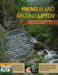
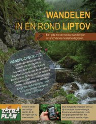
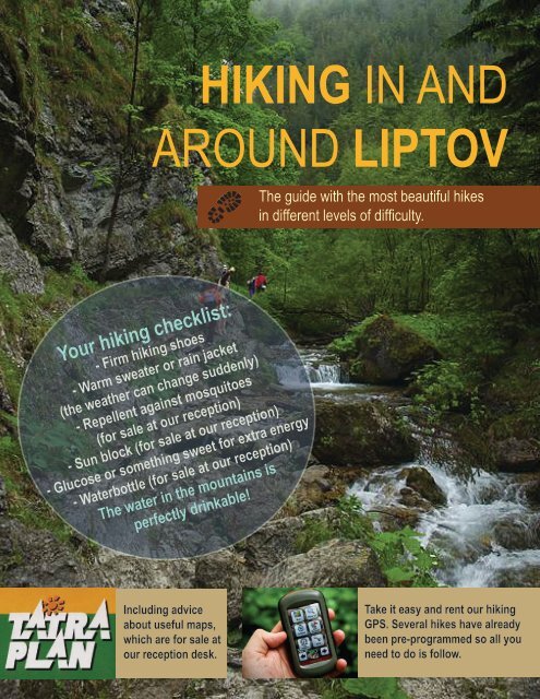
HIKING IN AND<br />
AROUND LIPTOV<br />
The guide with the most beautiful hikes<br />
<strong>in</strong> different levels of difficulty.<br />
Your hik<strong>in</strong>g checklist:<br />
- Firm hik<strong>in</strong>g shoes<br />
- Warm sweater or ra<strong>in</strong> jacket<br />
(the weather can change suddenly)<br />
- Repellent aga<strong>in</strong>st mosquitoes<br />
(for sale at our reception)<br />
- Sun block (for sale at our reception)<br />
- Glucose or someth<strong>in</strong>g sweet for extra energy<br />
- Waterbottle (for sale at our reception)<br />
The water <strong>in</strong> the mounta<strong>in</strong>s is<br />
perfectly dr<strong>in</strong>kable!<br />
Includ<strong>in</strong>g advice<br />
about useful maps,<br />
which are for sale at<br />
our reception desk.<br />
Take it easy <strong>and</strong> rent our hik<strong>in</strong>g<br />
GPS. Several hikes have already<br />
been pre-programmed so all you<br />
need to do is follow.
THE HIGHEST TOPS OF THE LOW TATRA<br />
You reach the highest tops of the Low Tatra Mounta<strong>in</strong>s Biela by Púť cable cars. From here you can take<br />
wonderful hikes or just enjoy the view.<br />
Naamloze laag<br />
Tatra plan 5003<br />
“Nízke Tatry”<br />
DIRECTIONS TO THE START OF THE HIKE<br />
w 9.7 km<br />
Directions from Malatíny-Stredné<br />
From Sojka resort, take a left turn onto route 18.<br />
Malatíny to Jasná Nízke Tatry,<br />
r 105 m. s 980 m. 2:55<br />
Demänovská Dol<strong>in</strong>a<br />
After about 5 km you follow a slight turn to the left onto the ramp to<br />
Malatíny-Stredné Malatíny<br />
Poprad. Enter onto the turnpike E50. After about 13 km you take the first<br />
Jasná Nízke Tatry,<br />
exit <strong>Liptov</strong>ský Mikuláš. Then, take the first exit on the roundabout Demänovská Dol<strong>in</strong>a onto<br />
road 584 <strong>in</strong> the direction of Demänová/Jasná. You drive w<strong>and</strong>el<strong>in</strong>g through the<br />
Demänová valley (where you can f<strong>in</strong>d beautiful caves) <strong>and</strong> after about 14<br />
km you arrive at ski station Biela Púť. Before you pass the lake, turn left<br />
onto park<strong>in</strong>g lot P2 <strong>and</strong> park your car <strong>in</strong> front of the box office.<br />
CABLE CARS<br />
Buy a ticket at the box office (return ticket, or just one way up). Keep<br />
<strong>in</strong> m<strong>in</strong>d there’s a 2 euro deposit on the cards so return them on your<br />
way back. There are three legs on the way up to Chopok. You start <strong>in</strong> a<br />
four-seater. After this, you walk to the tw<strong>in</strong>l<strong>in</strong>er (ski car on rails), which is<br />
operated just like an elevator. This second leg ends up at Priehyba. From<br />
here a Funitel cable car departs to Chopok every 30 m<strong>in</strong>. You can have a<br />
dr<strong>in</strong>k with a beautiful view at the bar while you wait. Up on Chopok you<br />
have several options.<br />
Cable cars to Chopok<br />
The cable cars go every 30 m<strong>in</strong>. Check the time schedule,<br />
especially the depart<strong>in</strong>g time of the last cable car. Ask for more<br />
<strong>in</strong>formation <strong>and</strong> the up-to-date time schedule at our reception desk.<br />
Ticket: adult/reduced/child retour €18/15/13; up €15/12/10; down<br />
€13/11/9<br />
HIKE UP TO THE TOP OF CHOPOK<br />
You can walk up to the top of Chopok <strong>in</strong> 10 m<strong>in</strong>utes. It looks like a<br />
molehill <strong>and</strong> with its 2,024 m. it is the second highest top of the Low<br />
Tatra. Slightly lower, on 2,000 m, st<strong>and</strong>s the mounta<strong>in</strong> hut Kamenná<br />
Chata where you can have a meal <strong>and</strong> a dr<strong>in</strong>k. Follow<strong>in</strong>g the blue<br />
hik<strong>in</strong>g trail you can descend underneath the cable cars. At Luková,<br />
where you got on the Funitel, you take a left onto the red trail. Turn<br />
right when you arrive at the cross<strong>in</strong>g with the blue trail <strong>and</strong> follow<br />
the blue trail to Vrbické Pleso. From hare you take the yellow trail,<br />
back to Biela Púť.<br />
Vrbické Pleso
HIKE UP TO THE TOP OF ĎUMBIER<br />
From Chopok (2,024 m.) it´s a 4.5 km walk to the highest po<strong>in</strong>t of<br />
the Low Tatra: Ďumbier (2,043 m.). Subsequently, you can return<br />
the same way you came there, or follow the green trail down.<br />
Then you take the red trail to Luková <strong>and</strong> cont<strong>in</strong>ue as described<br />
above.<br />
HIKE VIA DEREŠE<br />
If it’s your first visit to Chopok, we recommend you try this hike.<br />
Start<strong>in</strong>g at the mounta<strong>in</strong> hut you take a beautiful 3.5 hour walk<br />
down. Follow the red trail <strong>in</strong> the direction of Dereše.<br />
w 1.4 km r 35 m. s 85 m. 0:25<br />
After one hour you arrive at Sedlo Poľany. From here you follow the<br />
yellow trail down. The first part is a zigzag path with loose stones.<br />
Gradually you come <strong>in</strong>to the thicket that turns <strong>in</strong>to forest. After an<br />
hour you arrive at Tri Vody, where several mounta<strong>in</strong> streams come<br />
together.<br />
w 2.2 km r 0 m. s 465 m. 0:55<br />
Top of Ďumbier<br />
Tri Vody<br />
Follow the yellow trail until you arrive at Mikulášska Chata.<br />
w 2.5 km r 0 m. s 240 m. 0:40<br />
Frome there you follow the path <strong>around</strong> the photogenic glacier lake<br />
Vrbické Pleso. At the bridge you exit the forest <strong>and</strong> arrive at Hotel<br />
Gr<strong>and</strong>. From here you follow the asphalt road to Biela Púť. You<br />
pass an artificial lake that serves as a collect<strong>in</strong>g bas<strong>in</strong>.<br />
w 0.9 km r 20 m. s 35 m. 0:15
CANYON HIKE<br />
This diverse trip is everyone’s favourite <strong>and</strong><br />
suitable for the whole family. You walk through<br />
three completely different l<strong>and</strong>scapes.<br />
Tatra plan 5008<br />
“Chočské Vrchy”<br />
For this walk you don’t need to br<strong>in</strong>g a lunch pack. Penzión<br />
Borovec <strong>in</strong> Veľké Borové serves small dishes <strong>and</strong> dr<strong>in</strong>ks.<br />
w 16.2 km r 670 m. s 670 m. 4:45<br />
DIRECTIONS TO THE START OF THE HIKE<br />
From Sojka resort take a left onto route 18.<br />
Follow the signs to Bešeňová (B) <strong>and</strong> keep<br />
go<strong>in</strong>g straight so you exit Bešeňová. After<br />
about 8 km you turn left to the village of<br />
Prosiek (D). Park your car on the park<strong>in</strong>g<br />
lot at the end of the village. Dur<strong>in</strong>g the high<br />
season the municipality ask a park<strong>in</strong>g fee.<br />
THE HIKE<br />
Prosiecka dol<strong>in</strong>a (640) - Velké Borové (820)<br />
Follow the blue trail. The first part of the<br />
hike passes through a l<strong>and</strong>scape of cliffs<br />
<strong>and</strong> a small river, via a few cha<strong>in</strong>s <strong>and</strong><br />
ladders. In case there have been showers,<br />
you’ll have to jump over en couple of rivers.<br />
After about 1.5 hour of walk<strong>in</strong>g you arrive at a highl<strong>and</strong> with the second type of<br />
l<strong>and</strong>scape. Keep follow<strong>in</strong>g the blue trail until you arrive at the village Veľké Borové.<br />
At the end of this village, along the blue trail, you’ll f<strong>in</strong>d Penzión Borovec where you<br />
can eat a soup or dr<strong>in</strong>k a beer.<br />
w 6.7 km r 325 m. s 145 m. 1:55<br />
Velké Borové (820) - Kvačianska dol<strong>in</strong>a (650)<br />
After a short break you cont<strong>in</strong>ue on the blue trail, pass<strong>in</strong>g the third type of<br />
l<strong>and</strong>scape. The path goes down here until you arrive at the watermills, after about<br />
45 m<strong>in</strong>. This part of the hike goes along a quiet path <strong>in</strong> thick woodl<strong>and</strong>. After you<br />
have visited the watermills, keep follow<strong>in</strong>g the blue path (on the right side, steeply<br />
up, when you come back from the watermills). Then turn right onto the red trail to<br />
the village of Kvačany. Local brewery Brontvai (about 750 m <strong>in</strong>to the village passed<br />
the park<strong>in</strong>g <strong>in</strong> Kvačany, on the right side, house number 88) serves their own beer<br />
<strong>and</strong> small dishes.<br />
w 4.7 km r 135 m. s 305 m. 1:25<br />
Velké Borové
Kvačianska dol<strong>in</strong>a, ústie (650) – Prosiecka dol<strong>in</strong>a (640)<br />
From Kvačany you turn right <strong>and</strong> follow the yellow trail,<br />
back to the park<strong>in</strong>g lot <strong>in</strong> Prosiek. M<strong>in</strong>d that the yellow trail<br />
starts just passed the park<strong>in</strong>g on the right side, across<br />
from the state farm. The mark<strong>in</strong>gs are not very clear. This<br />
last part of the hike takes about one hour, via the edge of<br />
the forest over pastures with beautiful views of reservoir<br />
<strong>Liptov</strong>ská Mara here <strong>and</strong> there.<br />
w 4.8 km r 210 m. s 220 m. 1:25<br />
Kvačianska dol<strong>in</strong>a<br />
Oblazy<br />
Prosiecka dol<strong>in</strong>a<br />
Brewery Brontvai
GREAT<br />
C H O Č<br />
This is, without a doubt, the mounta<strong>in</strong>top with the most panoramic<br />
view. Locals have made it a tradition to hike to the top on 31st of<br />
December, strengthened by tea <strong>and</strong> rum.<br />
Tatra plan 5008<br />
“Chočské Vrchy”<br />
It is good to take someth<strong>in</strong>g do eat <strong>and</strong> dr<strong>in</strong>k<br />
with you. Order a lunchbox at least one day<br />
beforeh<strong>and</strong> at our reception desk.<br />
DIRECTIONS TO THE START OF THE HIKE<br />
From Sojka resort, turn left onto route 18 <strong>in</strong><br />
the direction of Ružomberok. In Ružomberok,<br />
cont<strong>in</strong>ue straight on until you reach the cross<strong>in</strong>g<br />
with road 59. Turn right onto road 59 <strong>in</strong> the<br />
direction of Dolný Kubín. After 5 km you turn<br />
right to the village of Valaská Dubová. Park your<br />
car at the church.<br />
THE HIKE<br />
Valaská Dubová (658) - Stredná Poľana (1248)<br />
Follow the blue trail until you arrive at the<br />
cross<strong>in</strong>g with the green trail, after about 1,5<br />
hour. On this pasture you will f<strong>in</strong>d the shed<br />
“Hotel Choč” where you can take a rest. A<br />
geocache is hidden <strong>in</strong> the exterior of this<br />
“hotel”. If you leave someth<strong>in</strong>g beh<strong>in</strong>d <strong>in</strong> this<br />
treasure chest, you can take a small souvenir<br />
with you.<br />
w 3.1 km r 590 m. s 0 m. 1:40<br />
w 11.4 km r 1,047 m. s 1047 m. 5:10<br />
Stredná Poľana<br />
Stredná Poľana (1248) - Veľký Choč (1611)<br />
Follow the green trail to the top of Veľký Choč.<br />
This takes about one hour. If the weather is<br />
good, you’ll have the most beautiful view of<br />
<strong>Liptov</strong>, maybe of whole Slovakia. You can look<br />
<strong>around</strong> <strong>in</strong> 360 degrees.<br />
w 1,7 km r 350 m. s 0 m. 1:00
Veľký Choč (1611) - Drapáč (1154)<br />
Take the red trail to the west until you cross the green trail,<br />
after about 45 m<strong>in</strong>. turn right onto the green trail. Another<br />
option is to take the same way down as you came up. In this<br />
case, your hike will be 40 m<strong>in</strong>utes shorter.<br />
Great Choč<br />
w 1.7 km r 0 m. s 457 m. 0:55<br />
Drapáč (1154) - Stredná Poľana (1248)<br />
After 1.5 hour you arrive at the same pasture as on the way<br />
up, with “Hotel Choč”.<br />
w 1.1 km r 105 m. s 0 m. 0:25<br />
Stredná Poľana (1248) - Valaská Dubová (658)<br />
From here you follow the blue trail back to Valaská Dubová.<br />
w 3.1 km r 0 m. s 590 m. 1:10<br />
As a reward you can have a dr<strong>in</strong>k <strong>in</strong> Jánošíková Krčma.<br />
Jánošík (the Slovak Rob<strong>in</strong> Hood) was caught here after<br />
be<strong>in</strong>g betrayed.<br />
View from Great Choč <strong>in</strong> the w<strong>in</strong>ter<br />
In this tavern they caught Juraj Jánošík, <strong>in</strong> the year<br />
1713. He was betrayed by an old witch <strong>and</strong> her<br />
daughter Žofa for 200 ducats.