Population, territory and sustainable development
The purpose of this document is to provide an overview of current trends, contexts and issues in the spheres of population, territory and sustainable development and examine their public policy implications. Three themes run through the report. The first two are laid out in the empirical chapters (III through X); the third is taken up in the closing chapter. Using the most recent data available (including censuses conducted in the 2010s), the first theme describes and tracks location and spatial mobility patterns for the population of Latin America, focusing on certain kinds of territory. The second explores the linkages between these patterns and sustainable development in different kinds of territory in Latin America and the Caribbean. The third offers considerations and policy proposals for fostering a consistent, synergistic relationship between population location and spatial mobility, on the one hand, and sustainable development, on the other, in the kinds of territory studied.
The purpose of this document is to provide an overview of current trends, contexts and issues in the spheres of population, territory and sustainable development and examine their public policy implications. Three themes run through the report. The first two are laid out in the empirical chapters (III through X); the third is taken up in the closing chapter. Using the most recent data available (including censuses conducted in the 2010s), the first theme describes and tracks location and spatial mobility patterns for the population of Latin America, focusing on certain kinds of territory. The second explores the linkages between these patterns and sustainable development in different kinds of territory in Latin America and the Caribbean. The third offers considerations and policy proposals for fostering a consistent, synergistic relationship between population location and spatial mobility, on the one hand, and sustainable development, on the other, in the kinds of territory studied.
You also want an ePaper? Increase the reach of your titles
YUMPU automatically turns print PDFs into web optimized ePapers that Google loves.
103<br />
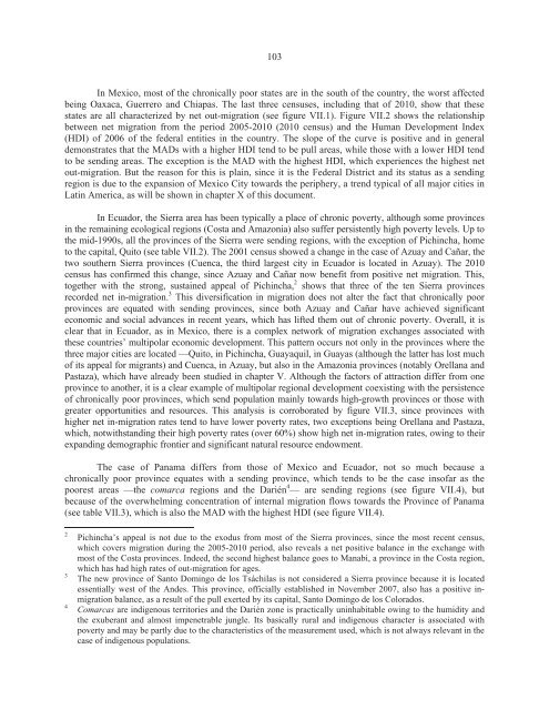
In Mexico, most of the chronically poor states are in the south of the country, the worst affected<br />
being Oaxaca, Guerrero <strong>and</strong> Chiapas. The last three censuses, including that of 2010, show that these<br />
states are all characterized by net out-migration (see figure VII.1). Figure VII.2 shows the relationship<br />
between net migration from the period 2005-2010 (2010 census) <strong>and</strong> the Human Development Index<br />
(HDI) of 2006 of the federal entities in the country. The slope of the curve is positive <strong>and</strong> in general<br />
demonstrates that the MADs with a higher HDI tend to be pull areas, while those with a lower HDI tend<br />
to be sending areas. The exception is the MAD with the highest HDI, which experiences the highest net<br />
out-migration. But the reason for this is plain, since it is the Federal District <strong>and</strong> its status as a sending<br />
region is due to the expansion of Mexico City towards the periphery, a trend typical of all major cities in<br />
Latin America, as will be shown in chapter X of this document.<br />
In Ecuador, the Sierra area has been typically a place of chronic poverty, although some provinces<br />
in the remaining ecological regions (Costa <strong>and</strong> Amazonia) also suffer persistently high poverty levels. Up to<br />
the mid-1990s, all the provinces of the Sierra were sending regions, with the exception of Pichincha, home<br />
to the capital, Quito (see table VII.2). The 2001 census showed a change in the case of Azuay <strong>and</strong> Cañar, the<br />
two southern Sierra provinces (Cuenca, the third largest city in Ecuador is located in Azuay). The 2010<br />
census has confirmed this change, since Azuay <strong>and</strong> Cañar now benefit from positive net migration. This,<br />
together with the strong, sustained appeal of Pichincha, 2 shows that three of the ten Sierra provinces<br />
recorded net in-migration. 3 This diversification in migration does not alter the fact that chronically poor<br />
provinces are equated with sending provinces, since both Azuay <strong>and</strong> Cañar have achieved significant<br />
economic <strong>and</strong> social advances in recent years, which has lifted them out of chronic poverty. Overall, it is<br />
clear that in Ecuador, as in Mexico, there is a complex network of migration exchanges associated with<br />
these countries’ multipolar economic <strong>development</strong>. This pattern occurs not only in the provinces where the<br />
three major cities are located —Quito, in Pichincha, Guayaquil, in Guayas (although the latter has lost much<br />
of its appeal for migrants) <strong>and</strong> Cuenca, in Azuay, but also in the Amazonia provinces (notably Orellana <strong>and</strong><br />
Pastaza), which have already been studied in chapter V. Although the factors of attraction differ from one<br />
province to another, it is a clear example of multipolar regional <strong>development</strong> coexisting with the persistence<br />
of chronically poor provinces, which send population mainly towards high-growth provinces or those with<br />
greater opportunities <strong>and</strong> resources. This analysis is corroborated by figure VII.3, since provinces with<br />
higher net in-migration rates tend to have lower poverty rates, two exceptions being Orellana <strong>and</strong> Pastaza,<br />
which, notwithst<strong>and</strong>ing their high poverty rates (over 60%) show high net in-migration rates, owing to their<br />
exp<strong>and</strong>ing demographic frontier <strong>and</strong> significant natural resource endowment.<br />
The case of Panama differs from those of Mexico <strong>and</strong> Ecuador, not so much because a<br />
chronically poor province equates with a sending province, which tends to be the case insofar as the<br />
poorest areas —the comarca regions <strong>and</strong> the Darién 4 — are sending regions (see figure VII.4), but<br />
because of the overwhelming concentration of internal migration flows towards the Province of Panama<br />
(see table VII.3), which is also the MAD with the highest HDI (see figure VII.4).<br />
2<br />
3<br />
4<br />
Pichincha’s appeal is not due to the exodus from most of the Sierra provinces, since the most recent census,<br />
which covers migration during the 2005-2010 period, also reveals a net positive balance in the exchange with<br />
most of the Costa provinces. Indeed, the second highest balance goes to Manabi, a province in the Costa region,<br />
which has had high rates of out-migration for ages.<br />
The new province of Santo Domingo de los Tsáchilas is not considered a Sierra province because it is located<br />
essentially west of the Andes. This province, officially established in November 2007, also has a positive inmigration<br />
balance, as a result of the pull exerted by its capital, Santo Domingo de los Colorados.<br />
Comarcas are indigenous territories <strong>and</strong> the Darién zone is practically uninhabitable owing to the humidity <strong>and</strong><br />
the exuberant <strong>and</strong> almost impenetrable jungle. Its basically rural <strong>and</strong> indigenous character is associated with<br />
poverty <strong>and</strong> may be partly due to the characteristics of the measurement used, which is not always relevant in the<br />
case of indigenous populations.


