

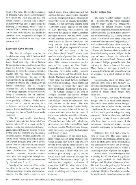
Lava cascade in Thunderbolt Distributary of Labyrinth Cave system
report
report

Create successful ePaper yourself
Turn your PDF publications into a flip-book with our unique Google optimized e-Paper software.
level <strong>of</strong> the tube. The southern entrance<br />
<strong>of</strong> St<strong>in</strong>k<strong>in</strong>g <strong>Cave</strong> shows approximately<br />
how much the cave passage has collapsed<br />
laterally. The ma<strong>in</strong> tube is a fairly<br />
uniform 9ft wide until it approaches the<br />
St<strong>in</strong>k<strong>in</strong>g <strong>Cave</strong> collapse, where it flares to<br />
a width <strong>of</strong> 39 ft. Many th<strong>in</strong> l<strong>in</strong><strong>in</strong>gs <strong>of</strong> lava<br />
can be seen <strong>in</strong> the alcoves just <strong>in</strong>side the<br />
entrance arch; progressive collapse <strong>of</strong><br />
these shells resulted <strong>in</strong> the very wide<br />
entrance arch.<br />
Labyr<strong>in</strong>th <strong>Cave</strong> System<br />
The l<strong>in</strong>e <strong>of</strong> collapse trenches (or<br />
breakdowns) along which Indian Well<br />
and Sent<strong>in</strong>el <strong>Cave</strong> lie <strong>in</strong>tersects the <strong>Cave</strong><br />
Loop Road area (fig. 14) at Natural<br />
Bridge and cont<strong>in</strong>ues northeast past Ovis<br />
<strong>Cave</strong> for 2,100 ft. There, the tube that<br />
collapsed to form the collapse trenches<br />
divides <strong>in</strong>to two major distributaries.<br />
Look<strong>in</strong>g downstream, the one on the<br />
right appears to be the larger <strong>of</strong> the two.<br />
It extends northeast and is marked by an<br />
almost cont<strong>in</strong>uous l<strong>in</strong>e <strong>of</strong> collapse<br />
trenches for 1,250 ft. Farther northeast,<br />
a few large segments <strong>of</strong> its ro<strong>of</strong> survive<br />
along a cont<strong>in</strong>u<strong>in</strong>g l<strong>in</strong>e <strong>of</strong> trenches.<br />
Sent<strong>in</strong>el <strong>Cave</strong>, which consists <strong>of</strong> at least<br />
three partially collapsed feeder tubes<br />
stacked one on top <strong>of</strong> another, is a<br />
ro<strong>of</strong>ed-over section <strong>of</strong> this distributary<br />
<strong>system</strong>. Indian Well is the next cave that<br />
<strong>in</strong>terrupts the l<strong>in</strong>e <strong>of</strong> breakdowns to the<br />
northeast.<br />
The left and smaller distributary<br />
(which divides <strong>in</strong>to the Labyr<strong>in</strong>th <strong>Cave</strong><br />
<strong>system</strong>) takes <strong>of</strong>f on a more northerly<br />
course. Unlike the Sent<strong>in</strong>el distributary,<br />
additional distributaries diverge from it.<br />
By the time this northern l<strong>in</strong>e <strong>of</strong> collapse<br />
trenches, natural bridges, and partly collapsed<br />
caves reaches the northern end <strong>of</strong><br />
the Garden Bridges area 900 ft downstream<br />
from its junction with the Sent<strong>in</strong>el<br />
distributary, it has subdivided <strong>in</strong>to six<br />
major distributaries. Most <strong>of</strong> these<br />
branches, however, ma<strong>in</strong>ta<strong>in</strong> connections<br />
with their neighbors through secondary<br />
distributaries and crossovers (see<br />
fig. 14 and map 2, pl. 1).<br />
Nearly all this network <strong>of</strong> lava tubes<br />
lies close to the surface and many ro<strong>of</strong><br />
collapse open<strong>in</strong>gs provide additional entrances.<br />
To the early explorers who<br />
lacked maps, these <strong>in</strong>terconnected but<br />
outward-fann<strong>in</strong>g underground passages<br />
seemed a complicated maze, although <strong>in</strong><br />
reality they form an orderly distributary<br />
pattern. It is not surpris<strong>in</strong>g that the name<br />
"Labyr<strong>in</strong>th <strong>Cave</strong>s" appears <strong>in</strong> the notes<br />
<strong>of</strong> J.D. Howard, who explored and<br />
measured the length <strong>of</strong> many Labyr<strong>in</strong>th<br />
passages between 1918 and 1933. Some<br />
<strong>of</strong> the Labyr<strong>in</strong>th System caves, however,<br />
were known to Native Americans and<br />
early settlers long before Howard's<br />
work. E.L. Hopk<strong>in</strong>s explored Chocolate<br />
<strong>Cave</strong> <strong>in</strong> 1892 and named it for the<br />
chocolate-colored "mud," which coats<br />
ro<strong>of</strong> and walls <strong>of</strong> parts <strong>of</strong> this cave dur<strong>in</strong>g<br />
the period <strong>of</strong> snowmelt or after heavy<br />
ra<strong>in</strong>s. Other names <strong>in</strong> common use for<br />
parts <strong>of</strong> this <strong>system</strong> are Blue Grotto,<br />
Garden Bridges, Golden Dome, Hopk<strong>in</strong>s<br />
Chocolate <strong>Cave</strong> (also called Hopk<strong>in</strong>s<br />
Chocolate Cup), and <strong>Thunderbolt</strong>. <strong>Lava</strong><br />
Brook, Mushpot, and Arch are the Labyr<strong>in</strong>th<br />
tubes that reach farthest northeast<br />
before fill<strong>in</strong>g with lava. These names and<br />
the features to which they apply are<br />
shown on figure 14 and maps 1 and 2 (pl.<br />
1). The Garden Bridges is an area <strong>of</strong><br />
collapse trenches and natural bridges<br />
from which the Hopk<strong>in</strong>s Chocolate <strong>Cave</strong><br />
and Golden Dome Distributaries split<br />
and fan out to the north. The true<br />
Labyr<strong>in</strong>th area lies east <strong>of</strong> Garden Bridges<br />
where the name Labyr<strong>in</strong>th is used <strong>in</strong><br />
a more restricted sense for the maze <strong>of</strong><br />
<strong>in</strong>terconnected tubes on different levels.<br />
F<strong>in</strong>ally, two very long distributaries<br />
(<strong>Thunderbolt</strong> and Labyr<strong>in</strong>th), which carried<br />
a small part <strong>of</strong> the reunited lava flood<br />
northeast <strong>in</strong>to the Mushpot-<strong>Lava</strong> Brook<br />
Arch <strong>Cave</strong> area, complete the Labyr<strong>in</strong>th<br />
distributary <strong>system</strong>.<br />
The divergence <strong>of</strong> the ma<strong>in</strong> Labyr<strong>in</strong>th<br />
feeder <strong>in</strong>to six large branches lies<br />
with<strong>in</strong> an area only 650 ft long and 150<br />
ft wide. From here the tubes fan out to the<br />
north and northeast (fig. 14). The tube <strong>in</strong><br />
Arch <strong>Cave</strong> that is filled with lava (see<br />
northeast part <strong>of</strong> map 1, pl. 1) can be<br />
traced south and southwest through the<br />
<strong>Thunderbolt</strong> <strong>Distributary</strong> (map 2, pl. 1)<br />
and <strong>in</strong>to the Labyr<strong>in</strong>th, a distance <strong>of</strong><br />
more than 3, 800 ft. Most tubes <strong>of</strong> the<br />
Labyr<strong>in</strong>th, however, are <strong>in</strong>accessible<br />
due to lava fill<strong>in</strong>g and collapse over short<br />
distances.<br />
Garden Bridges Area<br />
The name "Garden Bridges" (map 2,<br />
pl. 1) is applied to the region characterized<br />
by many large oval breakdowns<br />
separated by natural bridges, with<strong>in</strong><br />
which the orig<strong>in</strong>al Labyr<strong>in</strong>th parent tube<br />
subdivided <strong>in</strong>to six ma<strong>in</strong> tubes and several<br />
m<strong>in</strong>or ones (fig. 21). Dur<strong>in</strong>g the time<br />
s<strong>in</strong>ce lava dra<strong>in</strong>ed from these tubes, the<br />
weak ro<strong>of</strong> above most <strong>of</strong> the junctions, as<br />
well as above wide parts <strong>of</strong> the tubes, has<br />
collapsed. The result is many large oval<br />
collapse pits between short stretches <strong>of</strong><br />
lava tube form<strong>in</strong>g natural bridges. At the<br />
ends <strong>of</strong> some collapse pits, debris has<br />
piled up to ground level. Between such<br />
pits natural bridges probably exist, but<br />
entrance to them is blocked by talus.<br />
Many, however, are open; a climb over<br />
a loose pile <strong>of</strong> talus will generally reveal<br />
an entrance to a short section <strong>of</strong> lava<br />
tube.<br />
Geologically, most <strong>of</strong> these short<br />
sections show only a few primary features<br />
because their floors are littered with<br />
collapse blocks, and their ro<strong>of</strong>s are<br />
scarred <strong>in</strong> places where blocks have<br />
fallen out.<br />
To a biologist, however, the Garden<br />
Bridges area is <strong>of</strong> much more <strong>in</strong>terest.<br />
The small caves under natural bridges,<br />
the loose piles <strong>of</strong> talus blocks, and the<br />
countless nooks and crannies <strong>in</strong> the cave<br />
ro<strong>of</strong> and walls provide refuge for many<br />
mammals. Birds are abundant, and there<br />
is a greater variety <strong>of</strong> <strong>in</strong>sects and arachnids<br />
here than <strong>in</strong> most areas <strong>of</strong> the<br />
monument. Lizards and snakes, too, are<br />
attracted to this area by the abundance <strong>of</strong><br />
food.<br />
Botanists, too, will f<strong>in</strong>d a wide variety<br />
<strong>of</strong> plant life. The large range <strong>of</strong><br />
temperature and humidity, from the cool<br />
moist air <strong>of</strong> the caves to the burn<strong>in</strong>g heat<br />
and desiccation on top <strong>of</strong> the lava bridges,<br />
produces microclimates to which a<br />
surpris<strong>in</strong>g variety <strong>of</strong> plants has adapted.<br />
Access to the Garden Bridges is from<br />
a park<strong>in</strong>g lot <strong>of</strong>f the <strong>Cave</strong> Loop Road,<br />
with signs marked for both Garden<br />
Bridges and Hopk<strong>in</strong>s Chocolate <strong>Cave</strong>.<br />
The trail from the park<strong>in</strong>g lot forks: the<br />
left (north) fork goes to a stairway that<br />
leads <strong>in</strong>to Hopk<strong>in</strong>s Chocolate lava tube;<br />
the right (south) branch cont<strong>in</strong>ues on the<br />
20 Selected <strong>Cave</strong>s and <strong>Lava</strong>-Tube Systems, <strong>Lava</strong> Beds National Monument, California


