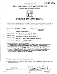
V - Missouri Department of Natural Resources
V - Missouri Department of Natural Resources
V - Missouri Department of Natural Resources

You also want an ePaper? Increase the reach of your titles
YUMPU automatically turns print PDFs into web optimized ePapers that Google loves.
(figs. 5 and 6). Of the 200 homes flooded by the Little Platte River, 46 were destroyed or so<br />
severely damaged that they were condemned or razed. The flood damaged 67 business places,S<br />
churches and church properties, the high school, the city water supply pumping stations, the<br />
sanitary lagoon, and various other municipal properties. The telephone exchange was out <strong>of</strong><br />
service for 4 days.<br />
Castile Creek, which enters the Platte River from the east between One Hundred and Two and<br />
Little Platte Rivers, also experienced flooding. Rainfall for the period July 17-20 ranged<br />
from 8 to 14 inches over the basin. Jenkins Branch, a tributary to Castile Creek, experienced<br />
a stage 2.5 feet higher than the previous highest stage in 15 years <strong>of</strong> record at the stream<br />
gaging station at Gower.<br />
Gtove Creek, a tributary to the Platte River below Castile Creek, flooded the town <strong>of</strong><br />
Edgerton (pop. 449) on the night <strong>of</strong> July 19, causing extensive damage (fig. 7). The area<br />
drained by Grove Creek was in the center <strong>of</strong> one <strong>of</strong> the storm cells where over 20 inches <strong>of</strong><br />
rainfall was reported. The flood pr<strong>of</strong>ile <strong>of</strong> Platte River (pl. 3) indicates that tributaries<br />
in the vicinity <strong>of</strong> Edgerton contributed large amounts <strong>of</strong> floodwater to the Platte River. Twelve<br />
homes, about 25 automobiles, and 3 bridges were destroyed in Edgerton.<br />
On the main stem <strong>of</strong> the Platte River disastrous flooding occurred from Rochester to the<br />
river's mouth. At various points downstream from Edgerton the flood crest reached elevations<br />
9 feet higher than the previous highest known flood <strong>of</strong> June 1947 (pl. 3). The towns <strong>of</strong> Agency,<br />
Tracy, and Farley were inundated as the river rose to a record crest <strong>of</strong> 35.05 feet at the stream·<br />
gaging station near Agency. The crest was 4.6 feet above the previous record stage <strong>of</strong> 30.46<br />
feet recorded in June 1947. Records at this station have been collected since May 1924. Approx<br />
imately 85 percent <strong>of</strong> the town <strong>of</strong> Agency (pop. 240) was inundated (fig. 8). Thirty-three resi<br />
dences and one mobile home were flooded, and 13 <strong>of</strong> the residences have been abandoned since the<br />
flood. Two churches and the Post Office were severely damaged. The business district <strong>of</strong> Agency,<br />
which has been subjected to many floods, suffered only moderate losses.<br />
Farther downstream, Interstate Highway 29 was overtopped and traffic stopped near Platte<br />
City. At Tracy (pop. 208), about one mile downstream from Interstate Highway 29 on Highway 92.<br />
about one· third <strong>of</strong> the residential area was flooded by the Platte River (fig. 9). Water depths<br />
reached about 15 feet in the lower sections <strong>of</strong> the town inundating 24 dwellings, 6 mobile homes,<br />
2 churches, 6 business places, and the Platte County Fairgrounds. About 90 persons were forced<br />
to leave their homes and many <strong>of</strong> them were unable to remove their furniture and personal belong<br />
ings. Highway 92, west <strong>of</strong> the community. was closed for about 4 days.<br />
23