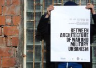
SNIPER ALLEY MILITARY URBANISM OF THE BESIEGED SARAJEVO
sniper alley: military urbanism of the besieged sarajevo - Between ...
sniper alley: military urbanism of the besieged sarajevo - Between ...

Create successful ePaper yourself
Turn your PDF publications into a flip-book with our unique Google optimized e-Paper software.
<strong>SNIPER</strong> <strong>ALLEY</strong>: <strong>MILITARY</strong> <strong>URBANISM</strong> <strong>OF</strong> <strong>THE</strong> <strong>BESIEGED</strong> <strong>SARAJEVO</strong><br />
Mirjana Ristic, The University of Melbourne, risticm@unimelb.edu.au<br />
Sarajevo Survival Map 1992-1996<br />
Source: FAMA, 1996
Map of Bosnia and Herzegovina 1996<br />
Source: CIA Factbook
Ozren mountain<br />
<strong>SARAJEVO</strong><br />
Miljacka River<br />
Igman mountain<br />
Trebevic mountain<br />
0 km<br />
5<br />
Location and Geography of Sarajevo<br />
Source: wikimapia.org, modified by the Author,<br />
2011
Map of the Ottoman Sarajevo,<br />
Source: Author 2011<br />
0 metres 250<br />
█ Islamic buildings<br />
█ Orthodox buildings<br />
█ Catholic buildings<br />
█ Jewish buildings<br />
Panorama of the Ottoman Sarajevo,<br />
Source: Bublin 1999
Map of the Austro-Hungarian Sarajevo, Source: Author 2011<br />
0 metres 500<br />
█ Islamic buildings<br />
█ Orthodox buildings<br />
█ Catholic buildings<br />
█ Jewish buildings<br />
█ Bosnian public buildings<br />
Austro-Hungarian Sarajevo Source: Bublin 1999
0 km<br />
2.5<br />
Map of Sarajevo from 1945 to today, Source: Author 2011<br />
█ Islamic buildings<br />
█ Orthodox buildings<br />
█ Catholic buildings<br />
█ Jewish buildings<br />
█ Bosnian of Yugoslavian<br />
public buildings
Socialist Sarajevo city centre, Source: Author 2008<br />
Socialist Sarajevo residential suburbs, Source: Bublin 1999
WOG poster, Sarajevo 1984, Source: Author 2010<br />
WOG opening ceremony, Sarajevo, 1984, Source: Bublin 1999
Graffiti nearby Sarajevo International Airport, 1992-1996, Source:<br />
http://blansh.files.wordpress.com/2010/04/welcome-to-sarajevo.jpg<br />
Destruction of Sarajevo, 1992-1996, Source: Straus 2006
● 5<br />
● 3<br />
● 4<br />
● 1<br />
● 2<br />
Map of the siege of Sarajevo, Source: Google map modified by the Author according to Rujanac 2003
Spiky Rock<br />
Žuč Hill<br />
AT<br />
OT<br />
M<br />
ST<br />
Grbavica<br />
Zlatište Hill<br />
Nedžarići<br />
Sarajevo Airport<br />
Siege line<br />
Snipers positions and reach<br />
0 km<br />
2.5<br />
Snipers’ positions and reach, Source: Author 2011
Snipers' positions, Source: Author 2008
Siege line<br />
Areas visible to snipers<br />
0 km<br />
2.5<br />
Exposure of Sarajevo cityscape to snipers, Source: Author 2011
Snipers' view of Socialist (up) and Austro-<br />
Hungarian Towns, Source: Author 2008
Siege line<br />
Areas visible to snipers<br />
Sniper Alley<br />
Sniper Alley, Source: Author 2011<br />
0 km<br />
2.5
Graffiti at the western end of Sniper Alley,<br />
Source: http://that-unsound.blogspot.com/2008_06_01_archive.html<br />
“Watch out sniper” signs at corners of Sniper Alley,<br />
Source: http://that-unsound.blogspot.com/2008_06_01_archive.html
█ The main east-west traffic artery<br />
█ East-west boulevards<br />
█ North-south transverse streets<br />
Pre-war Sarajevo street network, Source: Author 2011<br />
0 km<br />
2.5
Siege line<br />
Distribution & Intensity of Fear<br />
█ The main east-west traffic artery<br />
█ East-west boulevards<br />
█ North-south transverse streets<br />
Sniping violence in Sarajevo 1992-1996, Source: Author 2011 0 km<br />
2.5
Siege line<br />
█ The main east-west traffic artery<br />
█ East-west boulevards<br />
█ North-south transverse streets<br />
The effect of sniping on urban connections in Sarajevo 1992-1996, Source: Author 2011 0 km<br />
2.5
Siege line<br />
Distribution & Intensity of Fear<br />
Sniper Alley<br />
Disconnected urban zones<br />
Disconnection of Sarajevo as a result of sniping, 1992-1996, Source: Author 2011 0 km<br />
2.5
THANK YOU!
(left) A poster on a façade in the city centre promoting the Olympic Games in Sarajevo 1984, Source: Author 2010<br />
(right) Opening ceremony of the Olympic Games, Sarajevo, 1984 (Source: Bublin 1999: 110)
(rleft) Graffiti on a façade nearby the International Airport during the siege of Sarajevo 1992-1996, Source:<br />
http://blansh.files.wordpress.com/2010/04/welcome-to-sarajevo.jpg<br />
(left) Destruction of Socialist-period Sarajevo, Source: Straus 2006