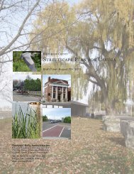
Hagersville Streetscape Plan
Hagersville Streetscape Plan - Haldimand County
Hagersville Streetscape Plan - Haldimand County

Create successful ePaper yourself
Turn your PDF publications into a flip-book with our unique Google optimized e-Paper software.
Historical Context 1<br />
The land that Haldimand County now occupies was acquired by<br />
treaty in 1832. By 1850 Haldimand had county status, with the<br />
local government centred in Cayuga. Settlement of <strong>Hagersville</strong><br />
began in the early 1840s. The settlement was named after Charles<br />
Hager, who in 1846 purchased 120 acres of land from Samuel<br />
Jarvis, the Secretary‐Registrar of Upper Canada at the time.<br />
The initiating factor for the settlement of <strong>Hagersville</strong> was the<br />
construction of the road linking Hamilton to Port Dover which<br />
began in 1839 (eventually named the Hamilton‐Port Dover Road<br />
and ultimately in the general location of the current Highway 6).<br />
This “<strong>Plan</strong>k Road”, made of large wooden planks, opened up the<br />
wilderness that would become <strong>Hagersville</strong> to settlement and<br />
agriculture. What is now the King Street and Main Street<br />
intersection was a toll location along the route that featured large<br />
oak toll gates.<br />
<strong>Hagersville</strong> originated as a service centre at the intersection of<br />
Indian Line (King Street) and <strong>Plan</strong>k Road (Main Street), featuring<br />
an assortment of general stores, accommodations, and a post<br />
office, among other uses. <strong>Hagersville</strong> prospered and grew<br />
significantly with the establishment of the Canada South Railway<br />
in 1870 and the Hamilton Lake Railway in 1873. These advances<br />
resulted in <strong>Hagersville</strong> becoming a permanent service centre and<br />
growing settlement. The farmers market began in 1892 in<br />
generally what is its current location.<br />
1 Summary presented in Historical Context and images are from “Down<br />
Memory Lane: A Glimpse of <strong>Hagersville</strong>’s Past” by Don Brown, 1992.<br />
<strong>Hagersville</strong> <strong>Streetscape</strong> <strong>Plan</strong><br />
Page 14