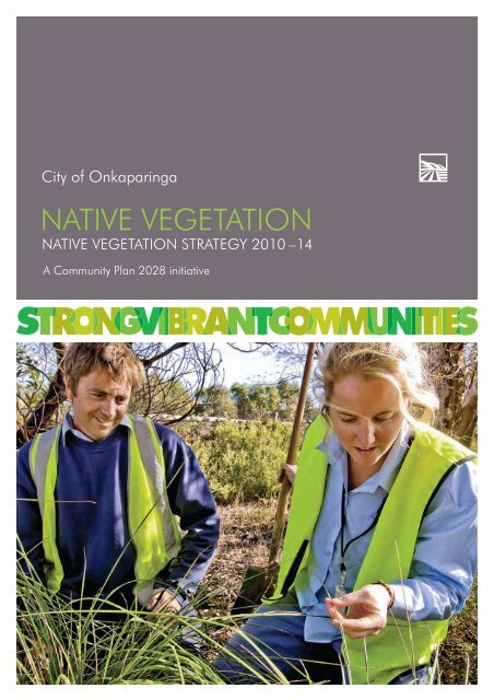
NATIVE VEGETATION
Native Vegetation Strategy - City of Onkaparinga
Native Vegetation Strategy - City of Onkaparinga
- No tags were found...

Create successful ePaper yourself
Turn your PDF publications into a flip-book with our unique Google optimized e-Paper software.
City of Onkaparinga<br />
<strong>NATIVE</strong> <strong>VEGETATION</strong><br />
<strong>NATIVE</strong> <strong>VEGETATION</strong> STRATEGY 2010 –14<br />
A Community Plan 2028 initiative
native vegetation strategy<br />
A Community Plan 2028 initiative<br />
2
Contents<br />
MAYOR’S INTRODUCTION ........................................................ 4<br />
PURPOSE OF THE <strong>NATIVE</strong> <strong>VEGETATION</strong> STRATEGY 2010 –14 ........................5<br />
WHAT IS BIODIVERSITY? ............................................................ 6<br />
OUR LANDSCAPE ................................................................... 7<br />
CURRENT <strong>VEGETATION</strong> MANAGEMENT .........................................10<br />
CITY OF ONKAPARINGA MANAGED <strong>NATIVE</strong> <strong>VEGETATION</strong> SITES ..............12<br />
OUR ACHIEVEMENTS ..............................................................14<br />
LINKS TO REGIONAL, STATE AND FEDERAL PLANNING .........................16<br />
LINKS TO WIDER COUNCIL PLANNING ..........................................17<br />
POLICY PRINCIPLES ................................................................18<br />
OUR ROLE .........................................................................20<br />
STRATEGY 1: Conserving natural areas ........................................23<br />
STRATEGY 2: Connecting habitats ..............................................27<br />
STRATEGY 3: Responding to climate change ...................................30<br />
STRATEGY 4: Integrating fi re risk management .................................33<br />
STRATEGY 5: Improving urban biodiversity .....................................35<br />
STRATEGY 6: Engaging the community and building knowledge ..............38<br />
GLOSSARY .........................................................................42<br />
REFERENCES .......................................................................45<br />
ATTACHMENT 1: Descriptions of vegetation groups ...............................46<br />
ATTACHMENT 2: Central Lofty Landscape .........................................48<br />
ATTACHMENT 3: Foothills and Hills Face Landscape ..............................52<br />
ATTACHMENT 4: Willunga Basin Landscape ......................................57<br />
ATTACHMENT 5: Southern Adelaide Coastline Landscape ........................63<br />
ATTACHMENT 6: City of Onkaparinga managed native vegetation sites .........68<br />
ATTACHMENT 7: Related plans and legislation ....................................70<br />
ATTACHMENT 8: Threatened species and ecological communities ...............74<br />
3
native vegetation strategy<br />
A Community Plan 2028 initiative<br />
MAYOR’S INTRODUCTION<br />
The native vegetation of our<br />
region helps to provide us<br />
with our unique sense of<br />
place and is an important<br />
part of our natural heritage.<br />
In our region we have a<br />
wide range of habitats<br />
that have grown to refl ect<br />
the features of the land,<br />
including the stringybark<br />
forests of the range, the red gums and sedges<br />
of our waterways and the coastal vegetation of<br />
our cliffs and dune systems.<br />
Our fl ora and fauna continues to face<br />
challenges. Like most of the Adelaide and Mt<br />
Lofty Ranges region, the City of Onkaparinga<br />
has been extensively cleared for both agriculture<br />
and urban development with only 9% still<br />
covered in native vegetation. What remains<br />
is vulnerable to the threats posed by human<br />
activities, including the spread of weeds,<br />
uncontrolled recreation, risk of fi re, and<br />
changes in our climate.<br />
The Native Vegetation Strategy is our response<br />
to these threats and details what Council will be<br />
doing over the next fi ve years to both conserve<br />
and improve our local biodiversity, in particular<br />
with the 490 hectares of native vegetation that<br />
we manage. Our work includes managing<br />
weeds and disease, replacement planting and<br />
improving our knowledge about how species<br />
might adapt to changes in climate. We also<br />
seek to address the climate change threat of<br />
carbon emissions through revegetation with our<br />
local species.<br />
We share this responsibility with government<br />
agencies and the hundreds of volunteers that<br />
continue to work on Council land, within the<br />
conservation areas owned by State Government<br />
and on their own private properties. Together we<br />
will continue to improve our local biodiversity<br />
and to encourage our natural heritage to live<br />
and evolve.<br />
4
PURPOSE OF THE <strong>NATIVE</strong> <strong>VEGETATION</strong><br />
STRATEGY 2010 –14<br />
Mayor Lorraine Rosenberg<br />
This plan outlines the City of Onkaparinga’s<br />
biodiversity priorities and actions for the next<br />
fi ve years with a focus on the management<br />
of remnant vegetation, and the revegetation<br />
of land that we manage. This includes<br />
considering the links between native vegetation<br />
and native fauna.<br />
The Native Vegetation Strategy 2010 – 14<br />
is our local response to the national and<br />
global issue of a decline in biodiversity. The<br />
relationship between this plan and wider<br />
government and council planning is presented<br />
on page 14 and 15.<br />
HOODED PLOVERS<br />
Adult Hooded Plover<br />
Photo by Glenn Ehmke<br />
These small birds spend their entire lives on our sandy beaches<br />
and, due to their poor success at breeding, their numbers are<br />
declining. Nationally, the Hooded Plover is threatened with<br />
extinction and in South Australia it is listed as vulnerable. There<br />
are less than 30 nesting pairs of Hooded Plovers in the Fleurieu<br />
region.<br />
Each spring and summer when the beach is at its busiest, pairs<br />
of birds lay their eggs directly on the beach in a shallow nest<br />
scrape. When the adults incubate the eggs they are very prone to disturbance, leaving the<br />
well camoufl aged nest when a person or animal approaches to keep the location hidden.<br />
For as long as the person or animal is in the area, the parents will remain off the nest. When<br />
the eggs are left unattended they can overheat, be eaten by a predator or be stepped on.<br />
Hooded Plover chicks have a low chance of survival.<br />
For one month after hatching they cannot fl y. They need<br />
to feed by the water’s edge but, because they are easily<br />
frightened, they spend a lot of time hiding which can lead<br />
to starvation.<br />
The City of Onkaparinga is assisting the Adelaide and<br />
Mt Lofty Ranges Natural Resource Management Board<br />
to manage the human impacts to the birds during their<br />
breeding season through a Hooded Plover Recovery Plan.<br />
Hooded Plover chick hiding<br />
next to cuttle fish<br />
Photo by Glenn Ehmke<br />
5
native vegetation strategy<br />
A Community Plan 2028 initiative<br />
WHAT IS BIODIVERSITY?<br />
Biodiversity is the diversity of life in all its forms<br />
across the planet. It ranges from large scale<br />
ecosystems to the different species of fl ora and<br />
fauna, and to genetic differences between<br />
individuals of the same species. These three<br />
levels work together to create the complexity<br />
of life on earth.<br />
Biodiversity is not static but is constantly<br />
changing. It is increased by genetic change<br />
and evolutionary processes and reduced by<br />
processes such as habitat degradation, a<br />
decline in fl ora and fauna, and the extinction<br />
of species. Diversity in all its forms (genetic,<br />
species and ecosystem) is a critical factor in the<br />
resilience of an area and its ability to respond<br />
to signifi cant changes such as fi re, food, climate<br />
and human impacts. Diversity is the key to<br />
maintaining viable populations of our native<br />
fl ora and fauna.<br />
Australia is a signatory to the International<br />
Convention on Biodiversity which recognises<br />
both the importance of conservation and the<br />
recovery of threatened species. In the most<br />
recent State of the Environment Report (2008)<br />
the number of vulnerable and endangered<br />
plants, animals and ecological communities in<br />
South Australia was found to be increasing, and<br />
peri-urban areas were said to be particularly<br />
vulnerable due to the pressures of housing and<br />
other changes in land use. 1<br />
6<br />
Hart Rd Wetland, Aldinga Beach<br />
1<br />
Environment Protection Authority (2008) State of the Environment Report
OUR LANDSCAPE<br />
The landscape of our region is highly diverse,<br />
covering an area of 51,800 ha at the southern<br />
end of the Adelaide and Mt Lofty Ranges region.<br />
Our western boundary is 31 km of coastline<br />
including open beaches, reefs, dunes and cliff<br />
formations. Extending inland from the coast are<br />
the Noarlunga and Willunga plains which gently<br />
rise up to the foothills of the Southern Mt Lofty<br />
Ranges. The highest point is 420 metres above<br />
sea level at Coromandel East.<br />
Nine signifi cant catchments and riverine systems<br />
carry large volumes of water from the ranges to<br />
the coast, especially during the winter months.<br />
The City of Onkaparinga’s northern boundary<br />
is defi ned in part by the Sturt and Field Rivers<br />
and through its centre fl ows the Onkaparinga<br />
River. Other signifi cant riverine systems in the<br />
region include Christie Creek, Pedler Creek,<br />
Maslin Creek, Pt Willunga Creek, Washpool<br />
and Sellicks Creek.<br />
Prior to European settlement<br />
Before 1836, the landscape in the City of<br />
Onkaparinga refl ected the natural features<br />
of the plains, foothills, estuaries and coastal<br />
lagoons. These landforms supported a diverse<br />
range of native fauna including the platypus<br />
which was found in the Onkaparinga River.<br />
The diversity of vegetation and landforms<br />
provided a continuous mosaic of different<br />
vegetation communities that provided essential<br />
resources such as food, water and shelter. It<br />
also enabled fauna species to move freely<br />
throughout their range, to disperse and take<br />
refuge from events such as bushfi re and<br />
fl ooding.<br />
The vegetation communities were diverse and<br />
included the Stringybark forests of the upper<br />
ranges, Grey Box Woodlands of the foothills,<br />
River Red Gum forests along watercourses,<br />
Mallee Box Grassy Woodlands of the plains<br />
and Samphire swamps within sheltered tidal<br />
areas and estuaries. For a full description of<br />
our vegetation communities, see Attachment 1.<br />
The Kaurna people managed this landscape<br />
before Europeans arrived, and moved through<br />
their land as the season and their tradition<br />
allowed. Some traded in karko (ochre) and met<br />
together at signifi cant places. Clothed in cured<br />
hides which were often prepared at a site near<br />
Rekarung (the Aldinga Scrub), they lived in wodli<br />
which were simple summer housing of branch<br />
and leaf and more substantial winter structures<br />
moulded of grass and earth. Their diet was rich<br />
and diverse, built from the fl ora and fauna that<br />
surrounded them.<br />
Vegetation clearance<br />
and modification<br />
Resembling the majority of the Adelaide and<br />
Mount Lofty Ranges region, the vegetation of<br />
our council area has been heavily cleared for<br />
agriculture, urban and coastal development.<br />
Throughout the entire council region only<br />
9% of our original vegetation remains,<br />
existing as small fragmented islands of<br />
habitat in a highly modified landscape.<br />
The larger patches of remnant vegetation are<br />
owned by state government authorities, much<br />
of which is under protected public ownership<br />
including the Onkaparinga National Park,<br />
Aldinga Scrub Conservation Park and Scott<br />
Creek Conservation Park. The protected<br />
watershed areas of Mount Bold and Happy<br />
Valley Reservoirs also contain signifi cant<br />
areas of native vegetation. See Map 1<br />
Native Vegetation Cover by Ownership.<br />
7
native vegetation strategy<br />
A Community Plan 2028 initiative<br />
OUR LANDSCAPE<br />
With the alteration of the landscape, the<br />
distribution and abundance of native species<br />
has also inevitably changed. Some native<br />
species have adapted to urban environments<br />
and expanded their range including the possum<br />
and the western grey kangaroo. Others have<br />
declined and become threatened or extinct<br />
causing a fl ow-on effect to other species. For<br />
example the stiff white spider orchid relies on<br />
the native bee for pollination, and a decline in<br />
the number of native bees is a major reason<br />
why the orchid is now a threatened species.<br />
Our remaining vegetation<br />
If we are to effectively conserve the native<br />
vegetation on our land we need to both<br />
understand what it was like originally, and<br />
what we have now. It can be seen from Map 1<br />
that the remaining vegetation is not evenly<br />
distributed with the areas that were more<br />
suitable for agriculture extensively cleared prior<br />
to the 1940s. Typically these were areas with<br />
fertile soils and fl at or undulating land that<br />
contained grasslands and grassy woodlands,<br />
dominated by native grasses, daisies and<br />
lilies and occasional trees such as eucalypts<br />
and sheoaks.<br />
The grasslands in particular were preferentially<br />
cleared to the extent that today only 5% of<br />
the pre-European vegetation remains on the<br />
fl atter plains area. In comparison, steeper, less<br />
accessible terrain with less fertile soils has 26%<br />
of its pre-European vegetation remaining.<br />
8
MAP 1<br />
MAP 1
native vegetation strategy<br />
A Community Plan 2028 initiative<br />
CURRENT <strong>NATIVE</strong> <strong>VEGETATION</strong><br />
MANAGEMENT<br />
The vulnerability of our remaining native<br />
vegetation requires that we address threats<br />
and improve the condition and resilience<br />
of our remnants. Current threats include<br />
habit fragmentation, weed and feral animal<br />
infestation, uncontrolled access, drought and<br />
clearance for fi re management.<br />
We will actively manage the remnant vegetation<br />
on our land by gaining knowledge about<br />
the type of vegetation and the condition it is<br />
in, developing management plans for active<br />
restoration in degraded areas and providing<br />
adequate resources for ongoing maintenance<br />
and monitoring.<br />
Strategies of restoration<br />
Our approach to active restoration is based on<br />
the following planning framework:<br />
1 To maintain the condition of habitats that<br />
remain in good condition, or are largely<br />
unmodifi ed (including remnants). It is much<br />
easier and cheaper to avoid the effects of<br />
degradation than it is to try and reverse them.<br />
2 To improve the condition of habitats that are<br />
degraded or that have been modifi ed.<br />
Sub-regional landscapes<br />
To assist with planning and priority setting<br />
at a regional scale, some state plans have<br />
divided the Adelaide and Mt Lofty Ranges into<br />
sub-regional landscapes according to their<br />
soils, geological landforms and pre-European<br />
vegetation patterns. This landscape mapping is<br />
a useful guide to analysing our diverse region<br />
including the existing vegetation, the threats to<br />
remnant vegetation and the opportunities for<br />
revegetation.<br />
In applying this tool, the City of Onkaparinga<br />
is divided into the following sub regional<br />
landscapes, see Map 2 Sub-regional<br />
landscapes:<br />
›› Central Lofty Landscape – 3,122 ha<br />
›› Hills Face/Foothills Landscape – 8,518 ha<br />
›› Willunga Basin Landscape – 38,342 ha<br />
›› Southern Adelaide Coastline Landscape –<br />
1,818 ha<br />
For a comprehensive description of each<br />
sub-region, see Attachments 2 – 5.<br />
3 To reconstruct habitat elements that have<br />
been lost, using revegetation and assisted<br />
regeneration. 2<br />
10<br />
2<br />
Department of Environment & Heritage (2009) Informing Biodiversity Conservation for Adelaide and the Mount Lofty Ranges
MAP 2<br />
MAP 2<br />
MAP 2<br />
Subregions are defined by the Department of Environment &<br />
Natural Resources according to their landscape characteristics of<br />
soils, geological landforms and patterns of pre-European vegetation.
native vegetation strategy<br />
A Community Plan 2028 initiative<br />
CITY OF ONKAPARINGA MANAGED<br />
<strong>NATIVE</strong> <strong>VEGETATION</strong> SITES<br />
The City of Onkaparinga currently manages<br />
491 ha of remnant vegetation within<br />
48 biodiversity reserves and 560 km<br />
of remnant vegetation within its roadside<br />
verges (see Map 3 City of Onkaparinga<br />
Managed Sites).<br />
Areas that contain large areas of remnant<br />
vegetation include:<br />
›› Tangari Regional Reserve, Woodcroft<br />
– 98.3 ha<br />
›› Piggott Range Rd Reserve, Onkaparinga Hills<br />
– 33.5 ha<br />
›› Lonsdale Reserve, Christie Creek – 23.7 ha<br />
It is interesting to note that, of the remnant<br />
vegetation managed by the City of<br />
Onkaparinga, approximately 210.6 ha or<br />
44% is found within the extensively cleared<br />
Willunga Basin region. The signifi cance of<br />
these landholdings cannot be underestimated<br />
and highlights the importance of our ongoing<br />
commitment to manage and conserve our<br />
remaining native vegetation.<br />
For a full list of reserves being actively managed<br />
for biodiversity conservation, see Attachment 6.<br />
›› South Port Noarlunga Dunes – 31.2 ha<br />
12
MAP 3<br />
MAP 3<br />
MAP 3
native vegetation strategy<br />
A Community Plan 2028 initiative<br />
OUR ACHIEVEMENTS<br />
Our management of remnant native<br />
vegetation has improved through:<br />
›› the creation of a dedicated Biodiversity Unit to<br />
manage areas of remnant vegetation in our<br />
reserves, with specialised skills in revegetation,<br />
weed and erosion control, volunteer<br />
management and education<br />
›› the preparation and implementation of Native<br />
Vegetation Management Plans for 13 larger<br />
sites and annual work plans for a further 63<br />
sites to prioritise works and ensure that our<br />
resources are used for the greatest impact<br />
›› continuing to expand the Roadside Marker<br />
System which alerts staff, contractors and the<br />
public to areas of signifi cant native vegetation.<br />
Markers have been installed at 95 roadside<br />
native vegetation sites, totalling 89 km<br />
›› working with the state government to<br />
revegetate the Coast to Vines Rail Trail, Port<br />
Noarlunga dunes, Sellicks Beach foreshore,<br />
Hart Road Wetland at Aldinga Beach,<br />
Sauerbier Creek at Aberfoyle Park and Tangari<br />
Regional Park at Woodcroft through the<br />
Million Trees Program<br />
›› integrating local species within our landscape<br />
designs in streetscapes, formal gardens and<br />
water sensitive design projects<br />
›› altering broad-acre slashing regimes to<br />
encourage the regeneration of native grasses<br />
and increase the amount of habitat and food<br />
sources for butterfl ies and other invertebrate<br />
species.<br />
›› the removal of woody weeds such as olives<br />
and boneseed that compete with native<br />
vegetation as well as create a fi re risk<br />
›› combining resources with other agencies<br />
to deliver revegetation and weed control<br />
programs on the ground. In 2009/10, a total<br />
of $100 000 was received from the Adelaide<br />
Mount Lofty Ranges Natural Resource<br />
Management Board and the Department for<br />
Environment and Heritage.<br />
Our areas of native vegetation have<br />
increased through:<br />
›› planting over 400,000 seedlings at Pedler<br />
Creek Reserve, Sellicks Creek and community<br />
sites including Willunga Creek, Silver Sands<br />
Coastal Reserve and Weymouth Oval<br />
Tawny Frogmouth in an Aldinga Beach backyard<br />
14
OUR ACHIEVEMENTS<br />
Our support for the community<br />
continues through:<br />
›› our 53 community sites (see page 41, Map<br />
4 Community Sites) where volunteers work<br />
to restore and improve areas of bush or<br />
coastal vegetation with technical, planning<br />
and fi nancial assistance from the City of<br />
Onkaparinga, Trees For Life and the Adelaide<br />
and Mt Lofty Ranges Natural Resources<br />
Management Board<br />
›› community planting events that encourage a<br />
hands-on experience at sites including South<br />
Port Noarlunga Dunes, Thalassa Reserve in<br />
Aberfoyle Park and Hart Road Wetland at<br />
Aldinga Beach<br />
›› distributing $36,848 since 2006 to community<br />
groups and schools for revegetation projects<br />
through the Environmental Grants program.<br />
Our knowledge of biodiversity has<br />
grown through surveying and mapping:<br />
›› 491 hectares of remnant vegetation within<br />
48 council reserves (see Map 3 City of<br />
Onkaparinga Sites) including plant species<br />
and vegetation communities, allowing us to<br />
compare the current vegetation to the original<br />
vegetation that was found prior to European<br />
settlement<br />
›› environmental weeds along 1200 km of<br />
roadsides, enabling us to prioritise our weed<br />
control programs starting with sites adjacent<br />
to conservation areas.<br />
Biodiversity Team members inspecting a patch of<br />
the regionally threatened Teucrium racemosum<br />
(Grey Germander) found growing within a degraded<br />
Willunga Plains roadside<br />
15
LINKS TO REGIONAL, STATE<br />
& FEDERAL PLANNING<br />
Our local response to biodiversity refl ects the global, national, state and regional priorities that<br />
have been identifi ed in the following legislation, strategies and associated regional plans. For a<br />
full description of these plans see Attachment 7.<br />
International agreements<br />
International Convention on Biological Diversity 1992<br />
Agreements and Convention on Migratory Species<br />
Federal legislation<br />
Environment Protection and Biodiversity Conservation Act (1999)<br />
Federal government plans<br />
Australia’s Biodiversity Conservation<br />
Strategy 2010-2020<br />
National Recovery Plans<br />
for Threatened Species<br />
Weeds of National Signifi cance &<br />
Threat Abatement Plans<br />
State legislation<br />
Native<br />
Vegetation Act<br />
1991<br />
Development<br />
Act 1993<br />
Natural<br />
Resource<br />
Management<br />
Act 2004<br />
Fire and<br />
Emergency<br />
Services Act<br />
2005<br />
Coast<br />
Protection Act<br />
1972<br />
Crown Lands<br />
Act 1929<br />
South Australian Government plans<br />
State Natural<br />
Resources<br />
Management Plan<br />
2006<br />
No Species Loss –<br />
a nature conservation<br />
strategy for South<br />
Australia 2007-2017<br />
The AMLNRM<br />
Board’s Investment Plan<br />
2009/10 -2011/12<br />
Nature Links –<br />
Cape Borda to Barossa<br />
NatureLink<br />
Regional planning<br />
Informing Biodiversity<br />
Conservation for the<br />
Adelaide and Mt Lofty<br />
Ranges Region SA (2010)<br />
Regional Recovery Plan<br />
2009-2014: threatened<br />
species and ecological<br />
communities of Adelaide &<br />
the Mt Lofty Ranges of SA<br />
A Biodiversity Investment<br />
Plan for Urban Adelaide<br />
2008-2011<br />
Metropolitan Adelaide<br />
and Northern Coastal<br />
Action Plan<br />
16<br />
City of Onkaparinga Native Vegetation Strategy 2010 –14
LINKS TO WIDER COUNCIL PLANNING<br />
Community Plan 2028<br />
Desired outcome 2028 ‘Biodiversity is protected and restored’<br />
Native Vegetation Strategy 2010 –14<br />
Conserving<br />
natural areas<br />
Connecting<br />
habitats<br />
Responding<br />
to climate<br />
changes<br />
Integrating<br />
fi re risk<br />
management<br />
Improving<br />
urban<br />
biodiversity<br />
Engaging<br />
community<br />
Building and<br />
learning<br />
knowledge<br />
Related council planning<br />
Climate<br />
Change<br />
Strategy<br />
Vegetation<br />
Management<br />
Plans<br />
Native<br />
Vegetation<br />
Inventory<br />
Coastal Action<br />
Plan<br />
Tree Strategy<br />
(under<br />
development)<br />
Waterproofi ng<br />
the South<br />
Christies Creek,<br />
Onkaparinga<br />
Estuary & Field<br />
River plans<br />
Native Regional Vegetation Planning Stategy<br />
2010 –14<br />
›› Details strategies and actions to protect and<br />
restore native vegetation on land managed by<br />
the council<br />
›› Targets council activities (planning, design,<br />
service provision) that have an effect on fl ora,<br />
fauna and ecological communities<br />
›› Provides a reference for project and capital<br />
works planning over the next fi ve years<br />
Planting guidelines<br />
›› Details suitable plant species – natives and<br />
exotics for each suburb in the council area<br />
›› Planting selection refl ects the landscape,<br />
character and environmental values of<br />
each suburb<br />
›› Informs the design process for projects that<br />
require landscaping and planting schemes<br />
›› Provides a reference for implementing actions<br />
in the Tree Strategy (under development),<br />
Recreation Open Space Strategy, Recreation<br />
Trails Network and Native Vegetation Strategy<br />
17
native vegetation strategy<br />
A Community Plan 2028 initiative<br />
POLICY PRINCIPLES<br />
The Native Vegetation Strategy 2010 –14 is<br />
underpinned by the following policy principles<br />
that help to guide and clarify our decisionmaking:<br />
Native vegetation priorities<br />
and planning<br />
›› Native vegetation planning is most effective<br />
when considering the landscape as a whole<br />
including conservation areas, agricultural and<br />
urban landscapes.<br />
›› The protection and restoration of native<br />
vegetation is achieved most effectively through<br />
cooperation with the community, private<br />
industry and other relevant government<br />
agencies.<br />
›› The effective management of native vegetation<br />
assets requires ongoing maintenance and<br />
project proposals that refl ect these costs.<br />
›› Native vegetation planning is based on<br />
science and evidence-based research,<br />
and is informed by the analysis undertaken<br />
by government agencies.<br />
Management<br />
›› The highest conservation priority is the<br />
protection and continued maintenance of<br />
existing remnant vegetation on land under<br />
our own care and control.<br />
›› Conservation areas require active<br />
management. ‘Active management’ requires<br />
the setting of a biodiversity goal that is specifi c<br />
to the site, and the delivery of on-ground<br />
works to a level that achieves this goal. 3<br />
›› Effective native vegetation protection requires<br />
identifying, understanding, preventing and<br />
reducing threatening processes.<br />
›› Monitoring outcomes rather than activity is<br />
the most effective way to measure the success<br />
of management programs.<br />
›› Native vegetation corridors, linkages between<br />
remnants and stepping stones allow the<br />
movement of local fl ora and fauna and<br />
improves a species ability to adapt and<br />
evolve.<br />
Revegetation<br />
›› The revegetation of open space should seek to<br />
enhance existing remnants through buffer<br />
plantings and/or the creation of corridors.<br />
Land use planning<br />
›› The principles of the Development Plan will<br />
refl ect the policy principles of this strategy,<br />
and areas of high biodiversity value should be<br />
zoned to provide protection from development<br />
and changes in land use.<br />
Land acquisition, disposal<br />
and transfer<br />
›› Conservation is a legitimate land use.<br />
›› Council land with conservation values should<br />
only be sold or transferred to others where the<br />
transfer will result in long-term conservation<br />
benefits (eg transfers to the State National<br />
Parks System or Heritage Agreements).<br />
Independent advice will be sought to<br />
determine existing biodiversity value.<br />
18<br />
3<br />
DEH (June 2009) Regional Recovery Plan 2009-2014 for threatened species and ecological communities of Adelaide and the Mt Lofty<br />
Ranges of SA
POLICY PRINCIPLES<br />
›› The consideration of native vegetation value<br />
will include remnant mature trees as they<br />
provide critical habitat such as nesting hollows<br />
for Australian birds and most tree-living<br />
animals.<br />
›› We only consider the purchase of strategic<br />
native vegetation sites when all other<br />
options have been fully explored (eg<br />
heritage agreements, land management<br />
agreements). If purchasing land, state or<br />
federal government agencies or groups will<br />
be approached for fi nancial and/or in-kind<br />
support.<br />
Private land<br />
›› We will support conservation and revegetation<br />
on private land primarily through:<br />
– the Environmental Grants and Awards<br />
program<br />
– cooperation with programs delivered<br />
through other levels of government<br />
and agencies such as natural resource<br />
management boards<br />
– the provision of information to help guide<br />
investment, such as strategic revegetation<br />
priorities and vegetation data.<br />
Fire management<br />
›› Fire risk assessments include the evaluation<br />
and documentation of the risk of reducing<br />
biodiversity value, including damage to<br />
remnant trees and understorey.<br />
›› When reducing the fuel load in vegetated<br />
areas, we aim to minimise harm to native<br />
vegetation. Our fuel reduction methods<br />
will be site-specifi c and appropriate to the<br />
signifi cance of the vegetation and proximity<br />
to people or property.<br />
›› Prescribed burning may be used if justifi ed<br />
for ecological and/or or fuel reduction<br />
purposes and should be consistent with the<br />
Ecological Fire Management Guidelines (in<br />
preparation by DENR). Consequences of the<br />
burn such as increasing the prevalence of<br />
weeds or acacias are considered.<br />
Open space and recreation<br />
›› Major park redevelopments and trails<br />
will follow a planting design that includes<br />
consideration of biodiversity, habitat, weed<br />
potential and fi re risk.<br />
›› The provision, design and management of<br />
open space will seek to reduce the impact of<br />
uncontrolled activities on biodiversity areas<br />
eg horse-riding, mountain-bike riding and<br />
walking.<br />
›› The design of open space within land<br />
divisions will include sites of high biodiversity<br />
value or the creation of new natural landscape<br />
or habitat areas as part of their open space<br />
allocation.<br />
Community involvement<br />
›› We recognise the importance of engaging<br />
with the community in the management of<br />
biodiversity.<br />
›› The involvement of volunteers on our land<br />
provides a balance of on-ground achievement<br />
and educational outcomes.<br />
19
native vegetation strategy<br />
A Community Plan 2028 initiative<br />
OUR ROLE<br />
The City of Onkaparinga is one of many<br />
agencies and groups involved in the<br />
conservation of biodiversity in our region.<br />
The following role statements outline the areas<br />
where we have a clear responsibility to act.<br />
Leadership<br />
›› We identify strategic land parcels to create<br />
buffers to existing remnant vegetation, connect<br />
existing habitats or to protect threatened<br />
species.<br />
›› We monitor state and regional research<br />
and methodologies to inform Councils role,<br />
decision-making and operations.<br />
›› We support and monitor climate change<br />
research on ecosystems and species and<br />
their ability to adapt to a changing climate.<br />
›› We integrate biodiversity outcomes into<br />
bushfi re management planning, open space,<br />
active and passive recreation and water<br />
management projects.<br />
›› We inspire custodianship for local biodiversity<br />
assets through community planting events,<br />
information about threatened species, and<br />
through publishing stories from volunteers.<br />
Owner/custodian<br />
›› We protect remnant vegetation and improve<br />
and monitor biodiversity outcomes on land<br />
under our care and control through vegetation<br />
surveys, the roadside and reserve marker<br />
system, vegetation management plans,<br />
revegetation projects, linear trails, wetlands,<br />
carbon sequestration initiatives and weed and<br />
disease control programs.<br />
›› When designing and maintaining open space<br />
and roadsides we consider both the protection<br />
and restoration of biodiversity and the<br />
reduction of fi re risk.<br />
›› We comply with relevant legislation and codes<br />
of practice.<br />
Regulatory<br />
›› We will apply land use planning and<br />
development controls that protect remnant<br />
vegetation.<br />
›› We will enforce where mandated and make<br />
others aware of relevant legislation eg<br />
Development Act, Local Government Act,<br />
Environment Protection and Biodiversity<br />
Conservation Act, Native Vegetation Act,<br />
Natural Resources Management Act and the<br />
Fire and Emergency Services Act.<br />
Information provider<br />
›› We provide information to the community<br />
on fl ora and fauna on Council-owned<br />
land through interpretive signage, and by<br />
distributing information from other agencies<br />
on our website and at events.<br />
›› We provide data from vegetation surveys to<br />
other agencies to inform their decision-making<br />
and strengthen opportunities for collaboration.<br />
›› We provide a link for groups to external<br />
funding assistance and relevant networks.<br />
›› We provide staff training in plant identifi cation<br />
and weed control methods.<br />
20
OUR ROLE<br />
Advocate<br />
We advocate to state government for improved<br />
biodiversity controls in the Development Plan<br />
and for improved biodiversity on land owned<br />
by state government and private landholders.<br />
This includes the sites of major housing<br />
developments.<br />
Facilitator/initiator<br />
We join or bring together agencies, groups and<br />
individuals to collectively resolve biodiversity<br />
issues including vegetation clearance, fi re<br />
management, data gathering or weed and<br />
pest control.<br />
Part funder<br />
We contribute funds for biodiversity projects<br />
through the Environmental Grants & Awards<br />
program and provide support to targeted<br />
projects and programs in conjunction with<br />
other providers.<br />
Direct service provider<br />
We undertake services, capital works and<br />
projects that incorporate biodiversity outcomes<br />
in accordance with our adopted service levels,<br />
plans and strategic directions.<br />
Agent<br />
We provide a service on behalf of another<br />
party that funds the service when the funding<br />
conditions are consistent with our strategic<br />
directions.<br />
21
OUR STRATEGY<br />
Goal<br />
Community Plan Desired Outcome 2028: Biological diversity is protected and restored<br />
Supported by Policy Principles<br />
Strategy Strategy Strategy Strategy<br />
Connecting<br />
habitats<br />
Expanding, linking<br />
and buffering<br />
existing areas<br />
of remnant<br />
vegetation<br />
Responding<br />
to climate<br />
change<br />
Enabling species<br />
to adapt to<br />
a changing<br />
environment and<br />
sequestering<br />
carbon<br />
Integrating<br />
fire risk<br />
Integrating<br />
fire risk<br />
management<br />
with biodiversity<br />
outcomes<br />
Improving<br />
urban<br />
diversity<br />
Integrating<br />
natural areas<br />
into urban<br />
open space<br />
Actions<br />
including roles and performance measures<br />
Strategy<br />
Engaging the<br />
community<br />
and building<br />
knowledge<br />
Inspiring,<br />
supporting and<br />
informing the<br />
community<br />
22<br />
Strategy<br />
Conserving<br />
natural<br />
areas<br />
Protecting and<br />
actively managing<br />
remnant<br />
ecosystems<br />
and threatened<br />
species
STRATEGY 1 – conserving natural areas<br />
Objective<br />
Protecting and actively managing remnant<br />
native ecosystems and threatened species.<br />
Our naturally occurring ecosystems cannot<br />
be replaced so it is critical to conserve and<br />
manage what remains along our coastline<br />
and in our foothills and riverine environments.<br />
Key issues<br />
›› Our remaining remnants of native vegetation<br />
exist as islands separated by a mix of land<br />
uses such as agriculture, horticulture, roads<br />
and housing.<br />
›› The fragmented nature of these remnants<br />
makes them more vulnerable to threats such<br />
as weeds, feral animals, drought and plant<br />
diseases. It also limits the ability of some<br />
fauna to escape a fi re or to breed more widely<br />
within their own species and therefore create a<br />
more robust population.<br />
›› Planned urban growth places further pressure<br />
on the peri-urban land around townships and<br />
land adjacent to the coast.<br />
Threatened ecological communities<br />
and species<br />
Sometimes intervention is needed that focuses<br />
on a particular species or ecological community<br />
that is threatened at either a national, state or<br />
regional level.<br />
Ecological communities<br />
The Grey Box (Eucalyptus microcarpa)<br />
and Grassy Woodlands and Derived Native<br />
Grasslands of South-eastern Australia<br />
have been listed as endangered under the<br />
Environment Protection and Biodiversity<br />
Conservation Act 1999. Examples locally<br />
include Tangari Regional Park. There are<br />
also 12 ecological communities in our<br />
region threatened at the state and regional<br />
level including Mallee Box woodland<br />
(Eucalyptus porosa) found in Aldinga Scrub<br />
Conservation Park.<br />
The Chaffy Saw-sedge (Gahnia fillum)<br />
Sedgeland is the only threatened ecological<br />
community found on council land at Aldinga<br />
Beach and Port Noarlunga and along 1.2 km<br />
of council roadside. Variations of threatened<br />
ecological communities are also found on<br />
council land, in particular Grey Box Grassy<br />
Woodlands (Eucalyptus microcarpa) and Mallee<br />
Box Woodlands (Eucalyptus porosa).<br />
For further details on threatened ecological<br />
communities from our region see Attachment 8.<br />
Species - Flora<br />
The Pink-lip Spider-Orchid (Caledenia behrii)<br />
and Stiff White Spider Orchid (Caladenia rigida)<br />
are both nationally endangered. A further six<br />
threatened fl ora species have been identifi ed<br />
as of critical conservation priority 4 within our<br />
reserves, including the Australian Broomrape<br />
(Orobranche cernua var. Australiana). We<br />
have been working with South Port Noarlunga<br />
Coastcare to encourage the regeneration<br />
of Orobranche in the dune system through<br />
eradicating threats such as the highly invasive<br />
Pyp Grass weed.<br />
4<br />
Ibid.<br />
23
native vegetation strategy<br />
A Community Plan 2028 initiative<br />
STRATEGY 1 – conserving natural areas<br />
Species - Fauna<br />
Information on fauna is limited to some of<br />
the larger council reserves and anecdotal<br />
information, however a number of threatened<br />
fauna species are known to be present including<br />
the Black-chinned Honeyeater (see page 29),<br />
Southern Brown Bandicoot, Tawny Frogmouth<br />
and the Yellow-tailed Black-Cockatoo.<br />
We will continue to:<br />
›› develop annual work plans and undertake<br />
on-ground works within 48 reserves that<br />
contain 491 ha of remnant vegetation<br />
›› manage 560 km of roadside remnant<br />
vegetation in partnership with the Adelaide Mt<br />
Lofty Ranges Natural Resource Management<br />
Board. Work includes remnant protection<br />
works within 95 Roadside Marker System<br />
sites (pictured) and the targeted control of<br />
signifi cant environmental weeds<br />
›› fund the Native Vegetation Advisory Service<br />
which advises staff on the habitat value and<br />
presence of native vegetation, particularly<br />
as part of project scoping, development<br />
assessment, property management and<br />
compliance issues<br />
›› collaborate with volunteer groups across<br />
53 community sites where volunteers work to<br />
restore and improve areas of bush or coastal<br />
vegetation<br />
›› provide training opportunities for teams<br />
of young unemployed people in the<br />
environmental management fi eld through<br />
supporting Australian Government programs<br />
such as National Green Jobs Corps<br />
›› monitor national legislative requirements<br />
relating to threatened species via the<br />
Environment Protection and Biodiversity<br />
Conservation Act (1999) and ensure that<br />
council practices are consistent with this Act.<br />
›› identify and address threats to biodiversity<br />
including the management of environmental<br />
weeds, fuel loads and unauthorised access<br />
24
CONSERVING NATURAL AREAS<br />
Twenty (2028) Five (2014)<br />
Desired outcome Our role Our action<br />
STRATEGIES<br />
Actively manage<br />
100% of remnant<br />
vegetation for<br />
biodiversity<br />
conservation on<br />
land under our<br />
care and control.<br />
• Owner/<br />
custodian<br />
• Owner/<br />
custodian<br />
A.1<br />
A.2<br />
›› Maintain and improve the condition of 491 ha of<br />
remnant vegetation that is currently managed within<br />
48 biodiversity reserves.<br />
›› Improve plant diversity and restore missing structural<br />
layers within currently managed biodiversity reserves<br />
through undertaking selective enhancement plantings<br />
on 344.7 ha including:<br />
• Tangari Regional Park, Woodcroft<br />
• Woodland Ridge, Aberfoyle Park<br />
• Sauerbier Creek, Aberfoyle Park<br />
• McHarg Reserve, Happy Valley<br />
• Glenloth Reserve, Happy Valley<br />
• Cherry Gardens Cemetery<br />
• Ochre Point, Moana<br />
• South Port Noarlunga Dunes<br />
• Pedler Creek Reserve, Seaford<br />
• Sellicks Beach Coastal Reserve.<br />
• Owner/<br />
custodian<br />
A.3<br />
›› Prepare vegetation management plans to identify<br />
and prioritise works within Sauerbier Creek, Aberfoyle<br />
Park, South Port Noarlunga Dunes, Port Noarlunga,<br />
Christies Creek Reserve, Lonsdale, Blewitt Springs<br />
Reserve, Blewitt Springs and McHarg Reserve,<br />
Happy Valley.<br />
• Leadership<br />
• Owner/<br />
custodian<br />
A.4 ›› Review state and national Threatened Species<br />
Recovery Plans to inform management of land<br />
owned by the council.<br />
• Leadership<br />
• Owner/<br />
custodian<br />
• Leadership<br />
• Owner/<br />
custodian<br />
A.5<br />
A.6<br />
›› Develop a seed bank and plant propagation area to<br />
assist with the securing of local genetic plant material.<br />
›› Implement a Phytophthora Management Plan based<br />
on the DENR Phytophthora Management Guidelines<br />
(2006).<br />
25
native vegetation strategy<br />
A Community Plan 2028 initiative<br />
CONSERVING NATURAL AREAS<br />
Protecting and actively managing remnant native ecosystems and threatened species<br />
Twenty (2028) Five (2014)<br />
Desired outcome Our role Our action<br />
STRATEGIES<br />
Provided protection<br />
for remnant<br />
vegetation under<br />
the Development<br />
Plan.<br />
Native vegetation<br />
can be easily<br />
identifi ed in<br />
reserves and on<br />
roadsides.<br />
• Regulator<br />
• Leadership<br />
A.7<br />
A.8<br />
›› Review the council-wide natural resource<br />
management provisions to ensure that remnant<br />
vegetation is protected.<br />
›› Conduct a native vegetation assessment on<br />
developments that are likely to impact on biodiversity,<br />
including those over 20 allotments in size.<br />
›› Provide development assessment staff with training<br />
on the value of biodiversity, threats to biodiversity<br />
and basic native vegetation identifi cation.<br />
›› Install standardised vegetation markers to defi ne<br />
the extent of remnant vegetation within City of<br />
Onkaparinga biodiversity reserves.<br />
›› Expand the number of sites managed through the<br />
roadside marker system as recommended by the<br />
Roadside Vegetation Survey undertaken in 2008.<br />
26<br />
State, regional and local targets<br />
City of Onkaparinga Community Wellbeing<br />
Monitor<br />
›› Areas of signifi cance under the council’s control<br />
and active care and management.<br />
›› Number of Bush for Life sites.<br />
Federal Department for Environment, Water,<br />
Heritage and the Arts<br />
The federal government’s top priority is the<br />
protection of ecosystems that currently have less<br />
than 10% of their area protected as part of<br />
conservation area.<br />
Department of Environment and<br />
Natural Resources<br />
›› Actively managing 100% of remnant native<br />
vegetation for biodiversity in the Adelaide<br />
and Mt Lofty Ranges region, by 2030.<br />
›› Increase the proportion of under-represented<br />
ecological communities in the protected area<br />
network, by 2030.<br />
The Adelaide & Mt Lofty Ranges Natural<br />
Resource Management Board (2008)<br />
3 year targets<br />
›› Council development plans amended to<br />
incorporate NRM objectives.<br />
›› Active management of 4500 hectares of<br />
native vegetation in formal conservation areas.<br />
›› 2,500 hectares of native vegetation on private<br />
land being actively managed.<br />
›› 20 new in-perpetuity conservation covenants<br />
(including Heritage Agreements) signed over<br />
200 ha.<br />
›› Management plans developed and implemented<br />
for priority pest species.
STRATEGY 2 – connecting habitats<br />
Objective<br />
Expanding, linking and buffering existing<br />
areas of remnant vegetation.<br />
Our approach to reconstructing habitat is to<br />
rebuild the elements that have been lost. We<br />
do this by revegetating and, in some areas,<br />
assisting plants to naturally regenerate by<br />
removing threats such as weeds and modifying<br />
mowing practices. When re-planting, we aim<br />
to re-establish:<br />
›› buffer areas to protect existing remnants<br />
›› connecting areas to restore connectivity<br />
›› specific habitats lost through preferential<br />
clearance patterns, and large scale habitat.<br />
We will continue to:<br />
›› manage 55 ha of revegetation across 31 sites<br />
including wetlands, creeklines, cliff stability,<br />
reserves and roadsides<br />
›› seek revegetation opportunities as part of<br />
the development of recreational trails such<br />
as the Coast to Vines Trail, construction of<br />
wetlands and restoration works including Hart<br />
Road wetland, Sellicks Creek and cliff stability<br />
projects<br />
›› participate in biodiversity planning initiatives<br />
including Naturelinks, Scott Creek Mt Bold<br />
Biodiversity Committee and the Onkaparinga<br />
Estuary Rehabilitation Steering Group<br />
›› work with the Department of Environment &<br />
Heritage Urban Forest Million Trees Program<br />
and the AMLR NRM Coastal and Catchment<br />
Programs to develop, fund and deliver<br />
revegetation projects.<br />
27
native vegetation strategy<br />
A Community Plan 2028 initiative<br />
CONNECTING HABITATS<br />
Twenty (2028) Five (2014)<br />
Desired outcome Our role Our action<br />
STRATEGIES<br />
Buffer areas<br />
established<br />
around remnant<br />
vegetation that has<br />
available land.<br />
Native vegetation<br />
areas established<br />
within new<br />
subdivisions.<br />
• Leadership<br />
• Initiator/<br />
Facilitator<br />
• Owner/<br />
custodian<br />
• Owner/<br />
custodian<br />
B.1<br />
B.2<br />
›› Reconstruct habitats in 52.7 ha of open space reserves<br />
adjacent to remnant vegetation to act as a buffer and<br />
to increase the overall area of native vegetation.<br />
›› Priority will be given to threatened vegetation<br />
associations such as Gahnia fi lum Sedgeland and<br />
grey box woodlands as well as preferentially cleared<br />
vegetation groups such as grassy woodlands.<br />
›› Revegetation and management of remnant vegetation<br />
(where it exists) in 11 new parcels of open space,<br />
and water-sensitive design sites contained within<br />
land divisions (57.6 ha).<br />
B.3 ›› Develop plant selection guidelines for maintenance<br />
staff working in open space that adjoins remnant<br />
vegetation, biodiversity reserves and creeklines to<br />
ensure that trees and understorey plants are replaced<br />
with locally indigenous species.<br />
Improved native<br />
vegetation in<br />
riparian areas.<br />
• Owner/<br />
custodian<br />
• Leadership<br />
B.4<br />
B.5<br />
›› Revegetate wetland areas created as part of Water<br />
Proofi ng the South stage 1 & 2.<br />
›› Apply for State funding for the development of linear<br />
trails and revegetation.<br />
B.6<br />
›› Manage new coastal cliff stability and erosion sites at<br />
Moana, Port Noarlunga and Maslin Beach.<br />
Private landholders<br />
are providing links to<br />
remnant vegetation<br />
through restoring or<br />
revegetating on their<br />
property.<br />
• Initiator/<br />
Facilitator<br />
B.7<br />
B.8<br />
›› Work with the McLaren Vale Grape, Wine and Tourism<br />
Association to encourage the revegetation and<br />
restoration of remnant vegetation in vineyards.<br />
›› Work in partnership with AMLR NRM offi cers to<br />
encourage rural landholders adjoining council<br />
biodiversity reserves to undertake works on their land<br />
to reduce impacts to and buffer remnant vegetation<br />
on public land.<br />
28
CONNECTING HABITATS<br />
State, regional and local targets<br />
State Strategic Plan<br />
By 2010 have fi ve well-established biodiversity<br />
corridors aimed at maximising ecological outcomes<br />
particularly in the face of climate change<br />
30 Year Plan for Greater Adelaide<br />
›› Increase the extent of functional ecosystems (coastal,<br />
estuarine, terrestrial and riparian) to 30% of the<br />
region, excluding urban areas.<br />
›› Develop waterway linear parks along Pedler Creek,<br />
Onkaparinga River, Port Willunga Creek, Christies<br />
Creek and Field River by 2036.<br />
›› Developing a coastal linear park from Sellicks<br />
Beach to North Haven by 2020.<br />
Department of Environment and<br />
Natural Resources<br />
Conservation targets for the Adelaide and Mt Lofty<br />
Ranges region:<br />
›› An increase in the extent of native vegetation<br />
cover in the AMLR. This will be achieved through<br />
reconstruction of over 54,000 ha of native<br />
vegetation by 2030, in accordance with defi ned<br />
restoration priorities for each landscape of the<br />
AMLR. This will increase the native cover of the<br />
region from 13% to 19%.<br />
The Adelaide and Mt Lofty Region Natural<br />
Resource Management Board<br />
3 year target: 440 hectares of functional ecosystems<br />
reconstructed in priority areas.<br />
BLACK-CHINNED HONEYEATER MELITHREPTUS GULARIS GULARIS<br />
In South Australia the Black-chinned Honeyeater is considered<br />
vulnerable, with its range limited to two main areas around the<br />
Mt Lofty Ranges and in the South East.<br />
The population in the Mt Lofty Ranges has experienced a dramatic<br />
decline in both distribution and abundance in recent decades.<br />
Threats include a lack of large areas that provide suitable habitat<br />
due to clearance of native vegetation. They are also under threat from the invasion of pest<br />
plants and animals as well as competition or aggressive behaviour of other birds such as<br />
the New Holland Honeyeaters.<br />
They are often found high up in a canopy of large eucalypts, and also like the silver<br />
banksias (Banksia marginata) and native pines (Callitris gracillis). They have a strong<br />
churring call and live in small communal groups, moving in response to the fl owering<br />
cycles of their food plants and the availability of insects.<br />
While the Black-chinned Honeyeater has disappeared from some areas, recent surveys have<br />
confi rmed that they are breeding around Morphett Vale with a high percentage of sightings<br />
also in Happy Valley, Woodcroft and Sturt Gorge. They seem to be favouring our urban<br />
parks, patches of remnant vegetation and scattered trees which highlights the importance of<br />
actively managing these habitats.<br />
29
native vegetation strategy<br />
A Community Plan 2028 initiative<br />
STRATEGY 3 – responding to climate change<br />
Objective<br />
Enabling species to adapt to a changing<br />
environment and sequestering carbon.<br />
Key issues<br />
›› In biological terms, the Adelaide and Mt<br />
Lofty Ranges region is considered a relatively<br />
isolated cool and humid temperate island,<br />
and there is evidence that such areas are<br />
highly vulnerable to rapid environmental<br />
change.<br />
›› There is an urgent need for a better<br />
understanding of the climate change<br />
impacts, risks and vulnerabilities of our<br />
region in relation to how our fl ora, fauna<br />
and ecological communities will adapt to this<br />
change. Current threats to biodiversity such<br />
as habit fragmentation, weed infestation,<br />
urbanisation, drought and fi re will be<br />
compounded by changes in temperature<br />
and rainfall in ways we do not currently<br />
understand.<br />
Carbon sinks<br />
›› Revegetating land, forestry or growing<br />
crops is a means of storing carbon,<br />
sometimes referred to as biosequestration<br />
or carbon sinks.<br />
›› In South Australia a strong trend in large<br />
scale biosequestration in land use change<br />
and forestry has meant that the natural<br />
resource sector (including agriculture) has<br />
gone from being a net emitter of greenhouse<br />
gas emissions (1.67 million tonnes CO2e<br />
in 1990) to a signifi cant sink in (3.2 million<br />
tonnes CO2e sink in 2002). An increase<br />
in commercial forest plantations and<br />
revegetation activities has contributed to<br />
this trend.<br />
›› While growing trees and other vegetation<br />
can reduce carbon, the primary carbon<br />
reduction goals of the City of Onkaparinga<br />
are to reduce energy use and increase the<br />
use of renewable energy. However, if multiple<br />
local benefi ts can be achieved through large<br />
plantings such as increased biodiversity,<br />
reduced erosion, recreational opportunities<br />
and increased amenity, then carbon sinks<br />
remain an important initiative to pursue.<br />
We will continue to:<br />
›› monitor scientifi c research about climate<br />
change projections and impacts<br />
›› implement works on the foreshore to mitigate<br />
erosion and gullying impacts as an outcome<br />
of the Climate Change Impacts on Coastal<br />
Lands Report (2007)<br />
›› implement the Climate Change Strategy.<br />
30
STRATEGY 3 – responding to climate change<br />
How will our flora and fauna adapt to climate change?<br />
Our remnant vegetation, and the fauna<br />
that lives within it, are confi ned to small and<br />
fragmented areas, making them vulnerable to<br />
weed infestation, erosion and the changes in<br />
temperature and rainfall regimes that result from<br />
drought and climate.<br />
It is important that our long-term planning<br />
does not assume that the future climate and<br />
distribution of natural resources will be the same<br />
as they have been over the last century. 5<br />
Professor Barry Brook, biologist and climate<br />
scientist at the University of Adelaide is working<br />
with a team of researchers and the City of<br />
Onkaparinga to determine the future impacts of<br />
climate change on two distinct areas of South<br />
Australia – the arid lands, and the Adelaide and<br />
Mt Lofty Ranges region.<br />
Using current and historical data on selected<br />
species, this project is developing modelling<br />
that can:<br />
›› reveal habitats of high conservation priority<br />
›› inform ecological restoration – by identifying<br />
sites and communities that will benefi t most<br />
from present rehabilitation efforts, and those<br />
which may be too diffi cult to maintain.<br />
Collectively, this will ensure as many species<br />
as possible are able to survive in refuge areas<br />
or move into new areas to adapt to future<br />
environmental and landscape change. 6<br />
This research is partly funded by the council and<br />
the Australian Research Council and will form<br />
part of a global initiative to better forecast the<br />
impact of future climate and land use changes<br />
on biodiversity.<br />
5<br />
East Meets West NatureLink Plan Implementing South Australia’s Strategic Plan<br />
6<br />
University of Adelaide ARC Proposal: Planning for a transformed future: Modelling synergistic climate change and land use<br />
impacts on biodiversity<br />
31
native vegetation strategy<br />
A Community Plan 2028 initiative<br />
RESPONDING TO CLIMATE CHANGE<br />
Twenty (2028) Five (2014)<br />
Desired outcome Our role Our action<br />
STRATEGIES<br />
An increase in the<br />
resilience of our<br />
ecosystems and<br />
species to adapt to<br />
climate change.<br />
A carbon offset<br />
program operating<br />
that delivers<br />
local biodiversity<br />
benefi ts.<br />
• Leadership<br />
• Part Funder<br />
• Leadership<br />
C.1<br />
C.2<br />
›› Identify the adaptation needs of keystone fl ora and<br />
fauna species and the implications for land use and<br />
biodiversity planning in cooperation with Adelaide<br />
University.<br />
›› To develop a local biodiversity planting program<br />
that combines biodiversity and carbon sequestration<br />
outcomes and meets accreditation standards.<br />
State, regional and local targets<br />
State Strategic Plan<br />
›› Achieve the Kyoto target by limiting the state’s<br />
greenhouse gas emissions to 108% of 1990 levels<br />
during 2008 –12, as a fi rst step towards reducing<br />
emissions by 60% by 2050.<br />
Department of Environment and Natural<br />
Resources<br />
›› NatureLinks target of ‘have fi ve well established<br />
biodiversity corridors aimed at maximising<br />
ecological outcomes particularly in the face of<br />
climate change, by 2010’<br />
32
STRATEGY 4 – integrating<br />
fi re risk management<br />
Objective<br />
Integrating fire risk management with<br />
biodiversity outcomes.<br />
Key issues<br />
›› Community perception has been heightened<br />
to the potential danger of vegetation close to<br />
property. Requests to the council for vegetation<br />
clearance have tripled in the 2009/10 fi re<br />
season.<br />
›› The risk to property and life in the event of a<br />
bushfi re is very real for residents living in a<br />
bushfi re zone. We seek to minimise the risk of<br />
fi re in two main ways–to reduce fuel load on<br />
its own land, and to advise residents of fuel<br />
reduction strategies on their own properties.<br />
The council also has the authorisation to<br />
issue fi nes to landowners if properties are<br />
not adequately maintained to reduce fi re<br />
risk, however the Country Fire Service is<br />
the primary agency responsible for fi re<br />
management, community education and fi re<br />
ban advice.<br />
›› In the wake of the Black Saturday Royal<br />
Commission, there have been changes to<br />
the state legislation that governs vegetation<br />
clearance.<br />
approval of the CFS Chief Offi cer, and this<br />
area could exceed 50m depending on the<br />
fuel type and slope.<br />
›› While the changes to the Native Vegetation<br />
Act ‘allow’ clearing however they do not<br />
require clearing.<br />
›› While the term ‘clearance’ is often thought<br />
to be the removal of all vegetation, the intent<br />
of the legislation is to minimise fi re risk by<br />
reducing the fuel load. This can be done by<br />
various techniques including the selective<br />
removal of native vegetation, the eradication<br />
of woody or grassy weeds, or the selective<br />
removal of low tree limbs.<br />
We will continue to:<br />
›› focus on the reduction of grassy and woody<br />
weeds (including olives and boneseed) to<br />
encourage the regeneration of biodiversity<br />
and the reduction of fi re risk<br />
›› ensure that a 20 metre ‘clearance’ is included<br />
around housing and public facilities in new<br />
housing areas. This may include roads,<br />
grassed areas or other barriers to fi re.<br />
›› A property owner can now reduce, modify<br />
or remove any native vegetation within 20m<br />
of a prescribed building without approval. 7,8<br />
Clearance beyond 20m of a prescribed<br />
building is also allowed subject to the written<br />
7<br />
Prescribed building – permanently fi xed to the ground, has obtained development consent, may be in the course of construction,<br />
dwellings, hotels, motels, schools, offi ce buildings, shops, restaurants, service stations, storage buildings, laboratories, factories,<br />
hospitals, private garages, carports and sheds.<br />
8<br />
The exception is the clearance of a Signifi cant Tree (Regulations under the Development Act) which still requires approval from the<br />
council.<br />
33
native vegetation strategy<br />
A Community Plan 2028 initiative<br />
INTEGRATING FIRE RISK MANAGEMENT<br />
Twenty (2028) Five (2014)<br />
Desired outcome Our role Our action<br />
STRATEGIES<br />
A reduction in<br />
the risk of fi re<br />
on council land<br />
with remnant and<br />
native vegetation<br />
that is adjacent to<br />
properties.<br />
The community<br />
takes responsibility<br />
and is informed<br />
about how to<br />
effectively reduce<br />
fi re risk on their<br />
property.<br />
• Owner/<br />
custodian<br />
• Leadership<br />
D.1<br />
D.2<br />
›› Assess council land for potential fi re risk and<br />
develop a response specifi c to each site based on<br />
risk and the signifi cance of the vegetation.<br />
›› Develop and implement management strategies for<br />
roadside vegetation that consider fi re risk and the<br />
conservation rating and condition of the vegetation.<br />
›› Deliver a consistent message to the community on<br />
methods to reduce fuel load that reduce the threat<br />
to signifi cant vegetation.<br />
34<br />
Native vegetation and bushfire on council land<br />
We aim to achieve complementary outcomes<br />
wherever possible through our fi re risk and<br />
vegetation management programs. For example,<br />
by removing olive trees one is removing both a<br />
fl ammable threat and an environmental weed<br />
so, in combining the funding and expertise in<br />
both vegetation management and fi re risk, more<br />
can be achieved.<br />
As a result of changes to both the Native<br />
Vegetation Act (1991) and the Fire and<br />
Emergency Services Act (2005), we have<br />
reviewed our approach to fi re safety and<br />
vegetation management, with our bushfi re risk<br />
mapping helping us to identify the broad areas<br />
within our area that are considered a high<br />
fi re risk. Within the high-risk areas, there are<br />
2050 council-owned sites of which 500 were<br />
identifi ed for an on-site assessment.<br />
These assessments were conducted by a bushfi re<br />
safety offi cer and a biodiversity technical offi cer,<br />
with land adjacent to infrastructure considered<br />
a high priority for fuel management. The risk<br />
assessments have enabled the signifi cance<br />
and the condition of the vegetation to be<br />
established. This then helps us to decide on the<br />
response that will be the most effective while<br />
minimising the harm to our fl ora and fauna.<br />
Education on fuel management is considered to<br />
be critical because, while vegetation is one form<br />
of fi re risk, in some circumstances concerns<br />
about nearby vegetation may be less important<br />
than the storage of any fl ammable material<br />
adjacent to the house or shed.<br />
It is important that all land owners including<br />
this council, take responsibility for reducing<br />
fi re risk and that the action taken is based on<br />
an assessment of the actual, rather than the<br />
perceived, risk. For this reason, risk assessments<br />
are being undertaken on a site-by-site basis.
STRATEGY 5 – improving urban biodiversity<br />
Objective<br />
Integrating natural areas into urban<br />
open spaces<br />
Natural environments provide an opportunity<br />
to maintain our natural heritage, and a space<br />
where people can interact with, and receive<br />
the benefi ts from nature. As the pressure for<br />
urbanisation continues and higher density<br />
developments are encouraged in some parts<br />
of the city, the provision of green space and<br />
nature experiences becomes of even greater<br />
importance.<br />
By developing pockets of nature in Adelaide’s<br />
parks and gardens we can achieve multiple<br />
benefi ts – conserving biodiversity, reducing<br />
water consumption, enabling enjoyment<br />
from interacting with nature and importantly,<br />
developing a local sense of place.<br />
Key issues<br />
›› An estimated 97.3% of the pre-European<br />
settlement vegetation of the Adelaide Plains<br />
has been removed as our urban area has<br />
expanded. Of the vegetation that remains,<br />
75% of it consists of mangroves and coastal<br />
samphire communities. 9<br />
›› Before this development and clearing, the<br />
Adelaide Plains supported 21 vegetation types<br />
ranging from open forests and woodlands to<br />
coastal dunes and salt marshes.<br />
›› Over 725 species of native plants and 177<br />
species of bird are known to have occurred<br />
across Adelaide with 140 (19%) now locally<br />
extinct and another 393 (54%) rare or<br />
threatened.<br />
›› Much of our current urban fl ora and fauna<br />
is introduced species. Apart from birds,<br />
native animals are rare in our suburbs. A few<br />
such as brush-tailed possums, blue-tongued<br />
and shingle-back lizards, geckos and the<br />
occasional brown snake have adapted to<br />
urban life. However many of the original plant<br />
and animal species are no longer found, or<br />
only occur in much smaller and fragmented<br />
populations. 10<br />
›› South Australia is the most suburbanised state<br />
in Australia with approximately 80% of people<br />
living in metropolitan Adelaide.<br />
Parks and open space provide an accessible<br />
alternative for interaction with nature and a<br />
landscape in which the natural heritage of the<br />
plains can be restored. 11<br />
Our public spaces are subject to many<br />
competing needs other than revegetation,<br />
including formal or informal sports fi elds, picnic<br />
areas, events, bike paths and public buildings.<br />
The integration of nature into the design of<br />
parks needs to consider these activities as part<br />
of the design.<br />
9<br />
Urban Biodiversity Unit for the Dept of Heritage, A biodiversity investment plan for urban Adelaide 2008 – 2011<br />
10<br />
Urban Biodiversity Unit website: Backyards for Wildlife<br />
11<br />
Dreschler Z in Daniels C, Tait C Adelaide Nature of a City: the ecology of a dynamic city from 1836 to 2036<br />
35
native vegetation strategy<br />
A Community Plan 2028 initiative<br />
IMPROVING URBAN BIODIVERSITY<br />
Twenty (2028) Five (2014)<br />
Desired outcome Our role Our action<br />
STRATEGIES<br />
Major housing<br />
developments<br />
protect existing<br />
biodiversity and<br />
create new natural<br />
spaces and habitat<br />
areas.<br />
Parks and open<br />
spaces provide<br />
natural spaces<br />
for people and<br />
habitat for local<br />
fl ora and fauna.<br />
• Initiator/<br />
Facilitator<br />
• Information<br />
provider<br />
• Owner/<br />
custodian<br />
E.1<br />
E.2<br />
E.3<br />
›› Assess future urban land release areas for existing<br />
remnant vegetation and future revegetation priorities.<br />
›› Develop a landscaping package for prospective<br />
developers that encourages the integration of<br />
biodiversity into developments eg buffer zones, use<br />
of local species, and integrating existing remnant<br />
vegetation into the design.<br />
›› Incorporate biodiversity and natural spaces into<br />
existing parks and open space.<br />
State, regional and local targets<br />
The Adelaide & Mt Lofty Ranges NRM Board<br />
›› Revegetation and threat abatement undertaken in<br />
20 high priority urban locations supported.<br />
36
native vegetation strategy<br />
A Community Plan 2028 initiative<br />
STRATEGY 6 – engaging the community<br />
and building knowledge<br />
Objective<br />
Inspiring, supporting and informing<br />
the community.<br />
Our enthusiasm in restoring our native<br />
vegetation is evident in the number of sites<br />
where volunteers give freely of their time and<br />
energy (see page 41, Map 4 Community Sites),<br />
and in the private properties where owners have<br />
sought legislative protection for the vegetation<br />
on their land through heritage agreements.<br />
The protection and restoration of biodiversity<br />
is a responsibility of government, the private<br />
sector and the community. It requires our<br />
collective commitment and cooperation. The<br />
more informed and educated we are, the more<br />
effective our response will be.<br />
We will continue to:<br />
›› support the 53 community groups who work<br />
to revegetate and care for areas of signifi cant<br />
biodiversity through developing work plans<br />
and giving fi nancial support and advice<br />
›› continue to deliver the Environment<br />
Grants & Awards program which allocates<br />
$20,700 annually to community groups and<br />
individuals, many of which undertake work<br />
related to biodiversity<br />
›› Provide information on the website from the<br />
Urban Biodiversity Unit of DENR and other<br />
agencies on backyard biodiversity, local plants<br />
species and where to purchase them.<br />
There are a number of agencies that work with<br />
private landowners and volunteers including<br />
Trees for Life, the Adelaide and Mt Lofty Ranges<br />
Natural Resources Management Board,<br />
Greening Australia and the Urban Biodiversity<br />
Unit. We will continue to work with these<br />
groups that provide education and support for<br />
our community to ensure that services are met<br />
without being duplicated.<br />
38
ENGAGING THE COMMUNITY AND BUILDING KNOWLEDGE<br />
Twenty (2028) Five (2014)<br />
Desired outcome Our role Our action<br />
STRATEGIES<br />
The community<br />
is aware of the<br />
signifi cance of<br />
local plants and<br />
areas of habitat,<br />
the threats that<br />
they can help<br />
alleviate, and how<br />
to get involved in<br />
local groups.<br />
Private landholders<br />
are creating<br />
buffers or<br />
providing habitat<br />
areas that connect<br />
existing patches of<br />
vegetation.<br />
• Information<br />
provider<br />
• Initiator/<br />
Facilitator<br />
• Information<br />
provider<br />
F.1<br />
F.2<br />
F.3<br />
›› Operate bus tours of signifi cant biodiversity<br />
project sites<br />
›› Engage local groups and residents and include<br />
biodiversity information in the annual Sustainable<br />
Living Expo.<br />
›› Design, establish and promote locally indigenous<br />
gardens on suitable council land, in particular at<br />
community centres and libraries.<br />
›› Identify private landholders with property in or<br />
adjacent to areas of biodiversity signifi cance. Work<br />
with the AMLR NRM Board to alleviate threats on their<br />
property and contribute to buffering or connecting<br />
vegetation.<br />
Information on<br />
the condition and<br />
state of biodiversity<br />
is shared between<br />
groups.<br />
• Leadership<br />
• Information<br />
provider<br />
F.4<br />
›› Develop and promote a digital information system<br />
that provides data on fl ora and fauna on council<br />
land to agencies and the community.<br />
The condition and<br />
state of biodiversity<br />
is known.<br />
• Leadership<br />
F.5<br />
›› Ensure native vegetation and fauna data is captured<br />
through fi eld assessments, planning, site visits,<br />
surveys, photos and opportunistic sightings.<br />
State, regional and local targets<br />
AMLR NRM 3 year target<br />
›› An increase in the number of people who<br />
volunteer to improve the management of our<br />
natural resources.<br />
39
native vegetation strategy<br />
A Community Plan 2028 initiative<br />
THE IMPORTANCE OF GREY BOX (EUCALYPTUS MICROCARPA)<br />
Grey Box Woodlands can be found from<br />
Burnside through to Sellicks Beach, growing<br />
on both the foothills and the plains. They were<br />
preferentially cleared from our urban landscape<br />
historically because the fertile soils they grow<br />
on, and more recently because of their close<br />
proximity to residential development. There<br />
is now less than 8% of Adelaide’s Grey Box<br />
remaining and the Australian Government<br />
listed Grey Box Woodlands as a nationally<br />
endangered ecological community in April<br />
2010.<br />
Contained within these woodlands are plant,<br />
bird, reptile and insect species that rely on this<br />
vegetation community for their ongoing survival. This includes some of Adelaide’s declining<br />
bird populations such as the Black-chinned Honeyeater and Crested Shrike-tit.<br />
The widely spaced Grey Box trees provide just the right amount of light and shade for over<br />
100 native grass, herb, lily and orchid species to grow beneath their canopies. As weeds<br />
encroach into these areas the growing conditions change, and many of the remaining<br />
patches are heavily infested with weeds such as olives which reduce the plant diversity<br />
substantially.<br />
The City of Onkaparinga manages signifi cant areas of Grey Box Woodland in a diverse<br />
range of sites. These include Tangari Regional Park at Woodcroft, Piggot Range Road in the<br />
Onkaparinga Hills, Christies Creek Reserve at Lonsdale and Sauerbier Creek in Aberfoyle<br />
Park. Activities in these areas include weed control and bush regeneration techniques.<br />
40
MAP 4
native vegetation strategy<br />
A Community Plan 2028 initiative<br />
GLOSSARY 12<br />
Active management is on-ground<br />
management undertaken at a level suffi cient<br />
to achieve the defi ned goals for improving<br />
the condition of biodiversity of a site or a<br />
wider area.<br />
Biodiversity refers to the variability among<br />
living organisms from all sources (including<br />
terrestrial, marine and other aquatic ecosystems<br />
and the ecological complexes of which they are<br />
part) and includes diversity within species and<br />
between species and diversity of ecosystems.<br />
Biosequestation is the process of capturing<br />
and storing carbon in living organisms such as<br />
plants and algae.<br />
Buffers are areas that directly surround patches<br />
of vegetation and are often revegetated.<br />
Carbon sequestration refers to the process of<br />
removing carbon dioxide from the atmosphere<br />
and storing it in another location (called a<br />
carbon sink).<br />
Carbon sinks are natural or man-made means<br />
of storing carbon and include forestry and other<br />
plantations.<br />
Coastal vegetation is found along cliffs and<br />
dunes and in sheltered tidal zones. These plants<br />
have adapted to tolerate wind, salt, sandy soils<br />
and eroded cliff-tops.<br />
Connecting areas refers to areas between<br />
fragments or patches.<br />
Connectivity is the location and spatial<br />
distribution of natural areas in the landscape<br />
that will allow species and populations to<br />
access food, breeding sites and shelter, increase<br />
habitat availability and facilitate dispersal and<br />
migration, and enable ecological processes<br />
to occur such as evolution, water movement<br />
and fi re.<br />
In fragmented landscapes, connectivity is most<br />
likely to occur where there are a series of close<br />
habitat areas arranged like ‘stepping stones’.<br />
Conservation clusters are multi-property<br />
sites that are actively managed for biodiversity.<br />
Sites encompass private and public lands and<br />
provide a buffer around protected areas such<br />
as conservation zones.<br />
Ecological communities are a group of<br />
species that interact with each other and<br />
are adapted to particular conditions of soil,<br />
topography, water availability and climate.<br />
These communities need all of their different<br />
components to survive.<br />
Ecosystems are a biological community<br />
of interacting organisms and their physical<br />
environment.<br />
Exotic species are introduced species from<br />
outside of Australia.<br />
Fragments are restricted areas of habitat<br />
within a variety of other land uses.<br />
Grassy Woodland is typically dominated<br />
by scattered eucalypts with an abundance<br />
of grasses, sedges, scattered shrubs and<br />
herbaceous species such as daisies and lilies.<br />
The tree density is variable but, with around<br />
30 trees per hectare, there are open areas<br />
without a canopy. In higher rainfall areas tree<br />
density may be higher, resulting in woodlands<br />
that resemble forests. Grassy Woodlands<br />
contain a very high diversity of native plant<br />
species, which is particularly noticeable in<br />
spring when wildfl owers emerge from between<br />
tussocks of grass.<br />
42<br />
12<br />
No Species Loss, a Nature Conservation Strategy for South Australia 2007-2017, Caring for Country Business Plan 2010/2011,<br />
Regional Recovery Plan 2009-2014 for threatened species and ecological communities of Adelaide and the Mt Lofty Ranges of SA,<br />
Native Vegetation Act (1999), EPBC Act (1999).
GLOSSARY<br />
Heathy Woodland has a dense understorey<br />
and mid-storey of low small-leaved shrubs.<br />
Most Heathy Woodland is dominated by<br />
eucalypts (often stringybarks), although some<br />
is dominated by native pines.<br />
Indigenous species are locally naturally<br />
occurring species that are genetically distinct.<br />
Keystone species are species that play a<br />
critical role in maintaining the structure of an<br />
ecological community and whose impact on the<br />
community is greater than that which would be<br />
expected based on their number.<br />
Landscape scale refers to planning,<br />
implementation or reporting which incorporates<br />
areas larger than individual sites, properties or<br />
habitats, and often includes a mix of different<br />
vegetation types and landforms ranging across<br />
several sub-catchments or environmental areas.<br />
Landscape scale projects involve groups of<br />
landholders which support the development<br />
of biodiversity conservation plans and<br />
management arrangements across their<br />
properties.<br />
Local provenance plants are grown from seed<br />
that is collected from plants growing near the<br />
planting site in similar environmental situations.<br />
Planting local provenance plants increases the<br />
success of revegetation projects, as the plants<br />
are genetically adapted to local conditions and<br />
the risk of disrupting the local fl ora gene pool is<br />
minimised.<br />
Native vegetation is defi ned by the Native<br />
Vegetation Act as a plant of a species<br />
indigenous to South Australia. This covers the<br />
full range of naturally occurring native plants,<br />
from tall trees to small ground covers, native<br />
grasses, wetland plants such as reeds and<br />
rushes, and marine plants. The plants may<br />
comprise natural bushland or they may be<br />
isolated plants in a modifi ed setting, such as<br />
single trees in pastured paddocks.<br />
Passive recreation areas are generally open<br />
spaces that have minimal development and<br />
allow unstructured or informal activities to occur.<br />
Patches are areas of least modifi ed habitat<br />
surrounded by more modifi ed habitat.<br />
Relictual landscapes have been extensively<br />
cleared and heavily modifi ed, and have<br />
less than 10% of pre-European vegetation<br />
remaining.<br />
Reconstruction of habitat or ecosystems using<br />
revegetation and/or assisted regeneration. This<br />
could include the re-establishment of buffers to<br />
protect existing remnants, the re-establishment<br />
of corridors to restore connectivity, the reestablishment<br />
of specifi c habitats lost through<br />
preferential clearance patterns, and large-scale<br />
habitat re-establishment.<br />
Remnant vegetation refers to small areas of<br />
native plant communities around which most<br />
or all of the original native vegetation has<br />
been cleared. These remnants are a valuable<br />
refuge and habitat corridor for native plants and<br />
animals. Remnant trees are isolated native trees<br />
that can form important habitat, particularly for<br />
their breeding and nesting hollows.<br />
Resilience is the capacity of an ecosystem to<br />
tolerate disturbance without collapsing into a<br />
qualitatively different state. A resilient ecosystem<br />
can withstand shocks and rebuild itself when<br />
necessary.<br />
Riparian vegetation is found along watercourses<br />
and on fl ood plains and usually refl ects<br />
the better soils and moist conditions that are<br />
found in these lower parts of the landscape.<br />
In the City of Onkaparinga, the steeper slopes<br />
and ridges of the foothills are dominated by tall<br />
43
native vegetation strategy<br />
A Community Plan 2028 initiative<br />
GLOSSARY<br />
open forests of Candlebarks, Manna Gums,<br />
Swamp Gums, Blackwoods and Stringybarks.<br />
Along the drainage lines, Red Gums dominate,<br />
with a more open vegetation and some open<br />
grassy patches in the understorey.<br />
Threats are activities or processes that have<br />
caused, are causing or may cause the<br />
destruction, degradation and/or impairment<br />
to a site, habitat or ecosystem.<br />
Weeds are plants that require intervention<br />
to reduce their effects on the economy, the<br />
environment, human health and amenity.<br />
Abbreviations<br />
AMLR NRM<br />
CFS<br />
DEH<br />
Adelaide & Mt Lofty Ranges Natural Resources Management Board<br />
Country Fire Service<br />
The former Department of Environment and Heritage<br />
DENR Department of Environment and Natural Resources (replaced DEH July 2010)<br />
EPBC Act Environment Protection and Biodiversity Conservation Act 1999<br />
44
REFERENCES<br />
Adelaide and Mount Lofty Ranges Natural<br />
Resources Management Board (2008). Creating<br />
A Sustainable Future. An Integrated Natural<br />
Resources Management Plan for the Adelaide<br />
and Mount Lofty Ranges Region, Vol A.<br />
Adelaide and Mount Lofty Ranges Natural<br />
Resources Management Board (2009).<br />
Metropolitan Adelaide and Northern Coastal<br />
Action Plan<br />
Australian Museum (December 2009) What is<br />
Biodiversity? australianmuseum.net.au/2010-<br />
International-Year-of-Biodiversity<br />
Byron Shire Council (2004) Byron Biodiversity<br />
Conservation Strategy<br />
City of Burnside Biodiversity Strategy: Nature<br />
Conservation in an urbanised landscape<br />
City of Joondalup Biodiversity Action Plan<br />
2009-2019<br />
City of Onkaparinga Climate Change<br />
Discussion Paper<br />
City of Onkaparinga website, Environment<br />
Profi le: Pre-European Flora and Fauna http:<br />
//www.onkaparingacity.com/environment/<br />
european.asp<br />
Daniels C, Tait C Adelaide Nature of a City: the<br />
ecology of a dynamic city from 1836 to 2036<br />
Department of Water, Land and Biodiversity<br />
Conservation (2006). State Natural Resources<br />
Management Plan 2006.<br />
Department for Environment and Heritage<br />
Informing Biodiversity Conservation for Adelaide<br />
and the Mount Lofty Ranges SA: priorities,<br />
strategies and targets<br />
Department for Environment and Heritage<br />
(2008) No Species Loss, A Nature Conservation<br />
Strategy for South Australia 2007-2017<br />
Department for Environment and Heritage (June<br />
2009) Regional Recovery Plan 2009-2014 for<br />
threatened species and ecological communities<br />
of Adelaide and the Mt Lofty Ranges of SA<br />
Department for Environment and Heritage<br />
(2009) East Meets West Plan: Naturelinks<br />
Department of Environment Land & Water<br />
Biodiversity State of the Environment 2006:<br />
Theme commentary; Steven Cork, Land &<br />
Water Australia and CSIRO<br />
http://www.environment.gov.au/soe/2006/<br />
publications/commentaries/biodiversity/<br />
utilisation.html<br />
Department of the Environment, Water,<br />
Heritage and the Arts: Biodiversity http://<br />
www.environment.gov.au/biodiversity/hotspots/<br />
index.html<br />
Department of Planning and Local Government<br />
(2009) 30 Year Plan for Greater Adelaide<br />
Department Water Land Biodiversity (Feb 2009)<br />
Management of Native Vegetation to Reduce the<br />
Impact of Bushfire<br />
Environment Protection Authority (2008) State<br />
of the Environment Report<br />
Government of South Australia (2007) East<br />
Meets West NatureLink Plan<br />
Shire of Yarra Ranges (2008) Environment<br />
Strategy Policy Directions<br />
South Australian Government, South Australia’s<br />
Strategic Plan.<br />
Urban Biodiversity Unit website: Backyards for<br />
Wildlife http://www.backyards4wildlife.com.au/<br />
index.php?page=adelaide-s-biodiversity<br />
Urban Biodiversity Unit for the Department of<br />
Heritage, A biodiversity investment plan for<br />
urban Adelaide 2008 – 2011<br />
University of Adelaide ARC Proposal: Planning<br />
for a transformed future: Modelling synergistic<br />
climate change and land use impacts on<br />
biodiversity<br />
45
native vegetation strategy<br />
A Community Plan 2028 initiative<br />
ATTACHMENT 1 – Descriptions of<br />
vegetation groups 13<br />
<strong>VEGETATION</strong><br />
GROUP<br />
Grassland<br />
Grassy<br />
Woodland<br />
Heathy<br />
Woodland<br />
Heathy Open<br />
Forest<br />
Shrubland<br />
Mallee<br />
Riparian<br />
DESCRIPTION<br />
A native grassland is dominated by native grasses and herbs, with few<br />
or no trees. All grasslands in the Adelaide and Mount Lofty Ranges<br />
Region are tussock grasslands, having discrete clumps or tussocks of<br />
grasses, herbs or sedges.<br />
Grassy Woodlands are woodlands with an understorey dominated<br />
by grasses, herbaceous species (eg daisies, lilies) and sedges, a<br />
scattered shrub layer and a discontinuous tree layer. The over-storey<br />
is typically dominated by eucalypts.<br />
Similar to Heathy Open Forest, Heathy Woodland has a dense understorey<br />
and mid-storey of a variety of low small-leaved (sclerophyllous)<br />
shrubs. These layers have high structural diversity, but contain fewer<br />
species than grassy woodlands.<br />
Heathy Open Forest has a canopy dominated by eucalypts, and a<br />
dense understorey comprising many species of low shrubs, generally<br />
with small sclerophyllous hard leaves.<br />
Shrubland is vegetation with an open to very dense layer of shrubs<br />
up to 2m in height, with few or no trees. Shrubland types in the<br />
AMLR include coastal chenopod shrublands, low-rainfall open plains<br />
shrublands, and high-rainfall sclerophyllous shrublands.<br />
Mallee is a term used to describe vegetation with low,<br />
characteristically multi-stemmed trees. Mallee may have a grassy<br />
or shrubby understorey, or a mixture of both. The type of understorey<br />
is dependent upon soil and rainfall patterns.<br />
Riparian vegetation is vegetation found along watercourses and on<br />
fl ood plains. Riparian zones represent transition areas between land<br />
and water. The natural vegetation of these areas usually refl ects<br />
the better soils and moist conditions found in the lower parts of<br />
the landscape.<br />
AREA AND<br />
DISTRIBUTION*<br />
5%. Located on<br />
plains either side<br />
of the spine of the<br />
AMLR.<br />
37%. Widespread.<br />
Wide arc either side<br />
of spine of AMLR,<br />
and on good soils<br />
in ranges.<br />
15%. Widespread.<br />
Spine of AMLR,<br />
Fleurieu Peninsula.<br />
7%. High-rainfall<br />
areas, central spine<br />
of AMLR.<br />
2%. Restricted.<br />
Northern Adelaide<br />
Coastline, Northern<br />
Adelaide Plains,<br />
Fleurieu Peninsula.<br />
2%. Peripheral.<br />
Northern and<br />
eastern boundaries<br />
of region. Some<br />
coastal.<br />
15%. Widespread.<br />
Restricted to riparian<br />
zones.<br />
46<br />
13<br />
Department for Environment and Heritage (June 2009) Regional Recovery Plan 2009-2014 for threatened species and<br />
ecological communities of Adelaide and the Mt Lofty Ranges of SA, adapted from the Draft AMLR Biodiversity Strategy<br />
* Area as a percentage of total remnant vegetation. Note, this fi gure should be treated with care. Mapping of grassy ecosystems<br />
is particularly problematic.
ATTACHMENT 1 – Descriptions of<br />
vegetation groups<br />
<strong>VEGETATION</strong><br />
GROUP<br />
Wetland<br />
Coastal<br />
DESCRIPTION<br />
A number of wetland types are found in the AMLR, including<br />
freshwater wetlands especially in the lower Fleurieu Peninsula,<br />
and seasonal wetlands of the Adelaide Plains. Freshwater wetland<br />
vegetation in the AMLR is shrub-dominated and typically very<br />
dense. Note that estuarine creeks particularly of the south coast<br />
are considered under ‘Coastal’; Red Gum Wetlands along creeks<br />
featuring waterholes with fringing reeds are considered under<br />
‘Riparian’.<br />
Coastal vegetation is vegetation that is subject to the infl uences<br />
of coastal environments.<br />
AREA AND<br />
DISTRIBUTION*<br />
2%. Restricted.<br />
Primarily Fleurieu<br />
Peninsula and<br />
Adelaide Plains.<br />
native vegetation strategy<br />
A Community Plan 2028 initiative<br />
ATTACHMENT 2 – Central Lofty Landscape of the<br />
Adelaide and Mount Lofty Ranges 14<br />
undulating crests. Gentle slopes and fl ats, broad<br />
elongate valleys and rolling low hills, dissected<br />
by watercourses and narrow creek fl ats.<br />
Land use<br />
Major land use: peri-urban<br />
Minor land use: grazing, horticulture and<br />
conservation.<br />
Pre-European vegetation<br />
Dominated by heathy forest (40%) and riparian<br />
vegetation (33%). Other vegetation types<br />
include grassy woodland (14%) and heathy<br />
woodland (13%).<br />
Landscape modification and clearance<br />
patterns<br />
The Central Lofty landscape is classifi ed as<br />
‘fragmented’. Within the Mount Lofty Ranges<br />
region 18,500 ha of pre-European vegetation<br />
remains (26%).<br />
Area and landforms<br />
The Central Lofty Landscape covers an area of<br />
71,833 ha representing 9.2% of the Adelaide<br />
and Mt Lofty Ranges region.<br />
3,122 ha of the Central Lofty Landscape<br />
is located within the City of Onkaparinga,<br />
representing approximately 7% of the total<br />
council region.<br />
The Central Lofty landscape is identifi ed as the<br />
high elevation central divide of the Mt Lofty<br />
Ranges. It contains dissected escarpments,<br />
precipitous cliffs, deep narrow gorges, steep<br />
to moderately steep slopes and rises with<br />
Half of the pre-European vegetation was cleared<br />
prior to the 1940s. Clearance was selective<br />
towards good soils, with a disproportionate loss<br />
of grassy woodland and riparian vegetation.<br />
Only 14% of the pre-European extent of Grassy<br />
woodland, and 20% of riparian vegetation<br />
remains compared to over 30% of the original<br />
extent of heathy vegetation types.<br />
Remnant vegetation and conservation<br />
protection<br />
Remnant vegetation is dominated by heathy<br />
woodland, with this vegetation type comprising<br />
almost 50% of the remnant vegetation in the<br />
landscape, followed by riparian at 25%.<br />
48<br />
14<br />
Adapted from: Department for Environment and Heritage, Informing Biodiversity Conservation for the Adelaide and Mt Lofty Ranges<br />
Region South Australia; Urban Biodiversity Unit for the Department of Heritage, A biodiversity investment plan for urban Adelaide<br />
2008 – 2011; City of Onkaparinga Native Vegetation Inventory.
ATTACHMENT 2 – Central Lofty Landscape of the<br />
Adelaide and Mount Lofty Ranges<br />
Protection of remnant vegetation is relatively<br />
proportioned across the vegetation groups.<br />
There are signifi cant amounts of remnant<br />
vegetation on public land (not legislatively<br />
protected) which is managed by SA Water.<br />
Ecological communities of conservation<br />
significance<br />
Ecological communities of conservation<br />
signifi cance that were identifi ed within the<br />
Mt Lofty Region and can be found within the<br />
Central Lofty sub region are:<br />
›› Leptospermum lanigerum Closed Shrubland<br />
›› Eucalyptus ovata +/- E.viminalis ssp.<br />
cygnetensis +/- E.camaldulensis var.<br />
camaldulensis Low Woodland<br />
›› Eucalyptus viminalis ssp. cygnetensis and/or<br />
E.viminalis ssp. viminalis Woodland<br />
›› Eucalyptus fasiculosa +/- E.leucoxylon<br />
Heathy Woodland<br />
Flora of conservation significance<br />
Seven fl ora species listed as nationally<br />
threatened under the Environment Protection<br />
and Biodiversity Conservation (EPBC) Act 1999,<br />
are found within the Central Lofty sub-regional<br />
landscape.<br />
46 fl ora species considered threatened within<br />
the Mount Lofty Ranges region are found within<br />
the Central Lofty sub-regional landscape.<br />
Flora priorities (very high priorities only)<br />
›› Corybas dentatus<br />
›› Ghania radula<br />
›› Gratiola pumilo<br />
›› Haloragis myriocarpa<br />
›› Helichrysum rutidolepis<br />
›› Lycopodium deuterodensum<br />
›› Pratia puberula<br />
›› Psilotum nudum<br />
›› Thelymitra circumsepta<br />
›› Todea barbara<br />
›› Wurmbea uniflora<br />
Fauna of conservation significance<br />
49 fauna species considered threatened within<br />
the Mount Lofty Ranges region 15 are found<br />
within the Central Lofty sub-regional landscape.<br />
Fauna priorities (very high and high<br />
priorities only)<br />
›› Bassian Thrush<br />
›› Beautiful Firetail<br />
›› Black-chinned Honeyeater<br />
›› Brown Toadlet<br />
›› Bush-banded Rail<br />
›› Chestnut-rumped Heath-wren<br />
›› Crested Shrike-tit<br />
›› Cunningham’s Skink<br />
›› Eastern Water Skink<br />
›› Heath Goanna<br />
15<br />
Department for Environment and Heritage (June 2009) Regional Recovery Plan 2009-2014 for threatened species and ecological<br />
communities of Adelaide and the Mt Lofty Ranges of SA<br />
49
native vegetation strategy<br />
A Community Plan 2028 initiative<br />
ATTACHMENT 2 – Central Lofty Landscape of the<br />
Adelaide & Mount Lofty Ranges<br />
›› Lewin’s Rail<br />
›› Pygmy Copperhead<br />
›› Scarlet Robin<br />
›› Southern Brown Bandicoot<br />
›› Tiger Snake<br />
›› Yellow-tailed Black-Cockatoo<br />
City of Onkaparinga profile<br />
Council reserves – remnant vegetation<br />
The City of Onkaparinga currently manages<br />
7 ha of remnant vegetation within the Cherry<br />
Gardens Cemetery Reserve.<br />
The dominant broad vegetation group within<br />
this reserve is:<br />
›› Heathy Woodland – 5 ha<br />
The most dominant ecological communities<br />
within City of Onkaparinga reserves in the<br />
Central Lofty landscape are:<br />
›› Eucalyptus obliqua, E. cosmophylla<br />
Heathy Low Woodland – 3.2 ha<br />
›› Eucalyptus obliqua, E. cosmophylla<br />
Heathy Low Open Woodland – 1.3 ha<br />
›› Eucalyptus fasiculosa, E. cosmophylla<br />
Heathy Low Woodland – .48 ha<br />
Ecological communities of conservation<br />
significance within City of Onkaparinga<br />
reserves:<br />
None recorded.<br />
Council roadsides – remnant vegetation<br />
The City of Onkaparinga own a total 70 km of<br />
roadsides within the Central Lofty sub-region<br />
and 56 km of these roadsides contain the<br />
following broad vegetation groups:<br />
›› Heathy Woodland – 37 km<br />
›› Grassy Woodland – 15 km<br />
›› Heathy Forest – 2 km<br />
›› Shrubland – 2 km<br />
The most dominant ecological communities<br />
within City of Onkaparinga roadsides in the<br />
Central Lofty landscape are:<br />
›› Eucalyptus obliqua Heathy Woodland<br />
–12 km<br />
›› Eucalyptus obliqua +/- E. cosmophylla +/-<br />
E. camaldulensis var. camaldulensis +/- E.<br />
fasciculosa Heathy Woodland – 8 km<br />
›› Eucalyptus leucoxylon ssp. leucoxylon, E.<br />
fasciculosa +/- E. viminalis ssp. cygnetensis<br />
Grassy Woodland – 8 km<br />
›› Eucalyptus obliqua, E. fasciculosa +/-<br />
E. leucoxylon ssp. leucoxylon +/- E. viminalis<br />
ssp. cygnetensis +/- Pinus radiata<br />
Heathy Woodland – 9 km<br />
Ecological communities of conservation<br />
significance within City of Onkaparinga<br />
roadsides:<br />
None recorded.<br />
56 km of roadside native vegetation is<br />
incorporated into our roadside marker<br />
system program.<br />
50
ATTACHMENT 2 – Central Lofty Landscape of the<br />
Adelaide and Mount Lofty Ranges<br />
Unmade road reserves<br />
Survey information of remnant native vegetation<br />
on council – owned unmade road reserves<br />
is not comprehensive enough to allow for<br />
a full analysis as part of the current native<br />
vegetation mapping project. The data available<br />
is outdated, incomplete and captured using<br />
inconsistent survey methods.<br />
Flora of conservation significance within<br />
council reserves, roadside reserves and<br />
unmade road reserves<br />
One priority fl ora species has been recorded<br />
within City of Onkaparinga Reserves:<br />
›› Juncus amabilis<br />
Habitat reconstruction/<br />
revegetation<br />
Current City of Onkaparinga projects<br />
We do not currently manage any habitat<br />
reconstruction/revegetation projects within the<br />
Central Lofty sub-region.<br />
Potential City of Onkaparinga projects<br />
Habitat reconstruction projects in this region<br />
could focus on:<br />
›› the reconstruction of disproportionately<br />
cleared grassy and riparian habitat to provide<br />
resources for species dependant on them and<br />
to increase indigenous vegetation cover to<br />
greater than 30% of the landscape<br />
›› the reconstruction of disproportionately<br />
cleared grassy and riparian habitat to<br />
increase remnant size<br />
›› the reconstruction of disproportionately<br />
cleared grassy and riparian habitat to<br />
buffer and connect existing vegetation<br />
›› buffering riparian zones<br />
›› enhancement plantings within existing<br />
remnants that have limited natural<br />
regeneration potential to restore the<br />
pre-European structure and diversity.<br />
Enhancement planting opportunity:<br />
Cherry Gardens Cemetery – 1.3 ha Eucalyptus<br />
obliqua, E.cosmophylla Heathy Low Open<br />
Woodland.<br />
51
native vegetation strategy<br />
A Community Plan 2028 initiative<br />
ATTACHMENT 3 – Foothills and Hills Face<br />
Landscape of the Adelaide and Mount Lofty Ranges 15<br />
Land use<br />
Major land use: peri-urban development<br />
Minor land use: grazing, viticulture,<br />
conservation.<br />
Pre-European vegetation<br />
Almost half of the landscape (47%) was covered<br />
with Grassy Woodland, including Box Grassy<br />
Woodlands which were common among the<br />
foothills. Other common vegetation types were<br />
Riparian (27%), Heathy Woodland (16%) and<br />
Heathy Forest (10%).<br />
Landscape modification and<br />
clearance patterns<br />
This subregion is considered ‘fragmented’.<br />
Within the Mt Lofty Ranges region 6,837 ha<br />
of pre-European vegetation remains (27%).<br />
Area and landforms<br />
The Foothills and Hills Face Landscape covers<br />
an area of 2,588 ha, representing 3.3% of the<br />
Adelaide and Mt Lofty Ranges region.<br />
8,518 ha of the Foothills and Hills Face<br />
Landscape is located within the City of<br />
Onkaparinga, representing 16% of the<br />
total council region.<br />
The Foothills and Hills Face landscape is<br />
identifi ed as steep low hills, sandy ridges<br />
and dissected slopes (north).<br />
Many areas in the foothills were cleared prior<br />
to the 1940s. Clearance was selective towards<br />
the fertile soils with vegetation on steep hills<br />
and escarpments cleared less extensively than<br />
other vegetation. Almost half (44%) of the pre-<br />
European extent of Heathy Forest remains as<br />
remnant vegetation. All other vegetation types<br />
were over 70% cleared.<br />
Remnant vegetation and conservation<br />
protection<br />
This sub-region is dominated by Grassy<br />
Woodland (40%), followed by Riparian at nearly<br />
30%. Vegetation types such as Heathy Forest<br />
were less cleared and are now more dominant<br />
than they were historically, with 17% remaining.<br />
52<br />
15<br />
Adapted from: Department for Environment and Heritage, Informing Biodiversity Conservation for Adelaide and the Mount Lofty<br />
Ranges; Urban Biodiversity Unit for the Department of Heritage, A biodiversity investment plan for urban Adelaide 2008 – 2011;<br />
City of Onkaparinga Native Vegetation Inventory.
ATTACHMENT 3 – Foothills and Hills Face<br />
Landscape of the Adelaide and Mount Lofty Ranges<br />
Protection of remnant vegetation on protected<br />
public land is equally represented by Grassy<br />
Woodland and Heathy Forest. However, the<br />
pre-European dominant Grassy Woodlands are<br />
proportionately not well protected on public<br />
lands. Signifi cant amounts of Grassy Woodlands<br />
remain in unprotected public lands.<br />
Ecological communities of conservation<br />
significance<br />
Grey Box (Eucalyptus microcapra) Grassy<br />
Woodlands was listed as a nationally threatened<br />
Ecological Community under the Environment<br />
Protection and Biodiversity Conservation (EPBC)<br />
Act in April 2010.<br />
Ecological communities of conservation<br />
signifi cance that were identifi ed within the<br />
Mt Lofty Region and can be found within the<br />
Foothills Hills Face sub region are:<br />
›› Banksia marginata Grassy Low Woodland<br />
›› Eucalyptus microcarpa Grassy Low Woodland<br />
›› Eucalyptus viminalis ssp cygnetensis and / or<br />
E.viminalis ssp viminalis Woodland<br />
›› Eucalyptus fasciculosa +/- E.leucoxylon Heathy<br />
Woodland<br />
›› Allocasuarina verticillata Grassy Low<br />
Woodland<br />
Flora of conservation significance<br />
8 fl ora species that are listed as nationally<br />
threatened under the EPBC Act are found<br />
within the Foothills and Hills Face sub-regional<br />
landscape.<br />
39 fl ora species considered threatened within<br />
the Mount Lofty Ranges region 16 are found<br />
within the Foothills and Hills Face sub-regional<br />
landscape. Five of these species are endemic<br />
to the foothills and the majority of these<br />
species have a preference for Grassy<br />
Woodlands, Heathy Woodlands and Wetlands.<br />
Flora priorities (very high and high<br />
priorities only)<br />
›› Brachyscome diversfolia<br />
›› Caledenia behrii<br />
›› Caledenia gladiolata<br />
›› Caledenia rigida<br />
›› Diuris brevifolia<br />
›› Glycine tabacina<br />
›› Helichrysum rutidolepis<br />
›› Lagenophora gracillis<br />
›› Mazus pumilio<br />
›› Oreomyrrhis eriopoda<br />
›› Prasophyllum occultans<br />
›› Pratia puberula<br />
›› Psilotum nudum<br />
›› Pterostylis cucullata ssp. sylvicola<br />
›› Ranunculus papulentus<br />
›› Schoenus discifer<br />
›› Thelymitra cyanapicata<br />
›› Todea barbara<br />
›› Utricularia lateriflora<br />
16<br />
Department for Environment and Heritage (June 2009) Regional Recovery Plan 2009-2014 for threatened species and ecological<br />
communities of Adelaide and the Mt Lofty Ranges of SA<br />
53
native vegetation strategy<br />
A Community Plan 2028 initiative<br />
ATTACHMENT 3 – Foothills and Hills Face<br />
Landscape of the Adelaide and Mount Lofty Ranges<br />
54<br />
›› Veronica derwentiana ssp.homa.<br />
›› Viola betonicifolia ssp. betonicifolia<br />
›› Wurmbea uniflora<br />
Fauna of conservation significance<br />
44 fauna species considered threatened within<br />
the Mount Lofty Ranges region are found<br />
within the Foothills and Hills Face sub-regional<br />
landscape These species display a preference<br />
for Grassy and Heathy Woodlands.<br />
Fauna Priorities (Very high and high<br />
priorities only)<br />
›› Black-chinned Honeyeater<br />
›› Brown Toadlet<br />
›› Chestnut-rumped Heath-wren<br />
›› Cunningham’s Skink<br />
›› Eastern Water Skink<br />
›› Lewin’s Rail<br />
›› Southern Brown Bandicoot<br />
›› Yellow-tailed Black-Cockatoo<br />
City of Onkaparinga profile<br />
Council reserves – remnant vegetation<br />
The City of Onkaparinga currently manages<br />
24.2 ha of remnant vegetation within 2 reserves<br />
in the Foothills and Hills Face sub region for<br />
conservation purposes. These are:<br />
›› Woodland Ridge Reserve – 2.2 ha<br />
›› McHarg Reserve – 22 ha<br />
The dominant broad vegetation groups<br />
found within these reserves are:<br />
›› Grassy Woodland – 13.3 ha<br />
›› Riparian – 10.9 ha<br />
The most dominant ecological communities<br />
found within the 2 reserves are:<br />
›› Eucalyptus leucoxylon, E.camaldulensis Grassy<br />
Woodland – 8.4 ha<br />
›› Acacia pycnantha, Olea europaea tall<br />
Shrubland – 3.9 ha<br />
›› Eucalyptus camaldulensis Woodland – 3.6 ha<br />
›› Eucalyptus leucoxylon Grassy open Woodland<br />
– 3.3 ha<br />
Ecological communities of conservation<br />
significance within City of Onkaparinga<br />
reserves<br />
›› Eucalyptus microcapra Grassy Woodlands<br />
– 1.5 ha, a Nationally Threatened Ecological<br />
Community under the EPBC Act 1999.<br />
Council roadsides – remnant vegetation<br />
The City of Onkaparinga owns 197 km of<br />
roadsides within the Foothills and Hills Face<br />
sub-region and 157.4 km of this roadside<br />
contains the following broad vegetation groups:<br />
›› Grassy Woodland – 105 km<br />
›› Heathy Woodland – 23.5 km<br />
›› Riparian – 15 km<br />
›› Heathy Forest – 13.9 km<br />
The most dominant ecological communities<br />
within City of Onkaparinga roadsides in the<br />
Foothills and Hills Face landscape are:<br />
›› Eucalyptus camaldulensis var. camaldulensis<br />
Grassy Woodland – 15.8 km<br />
›› Eucalyptus leucoxylon ssp. Leucoxylon
ATTACHMENT 3 – Foothills and Hills Face<br />
Landscape of the Adelaide and Mount Lofty Ranges<br />
Grassy Woodland – 11.9 km<br />
›› Eucalyptus camaldulensis var. camaldulensis<br />
+/- E. leucoxylon ssp. leucoxylon +/- E.<br />
fasciculosa +/- E. cosmophylla Grassy<br />
Woodland – 11.2 km<br />
›› Eucalyptus obliqua +/- E. cosmophylla +/-<br />
E. camaldulensis var. camaldulensis +/- E.<br />
fasciculosa Heathy Woodland – 10.7 km<br />
Ecological communities of conservation<br />
signifi cance within City of Onkaparinga<br />
roadsides:<br />
›› Eucalyptus microcapra Grassy Woodlands, a<br />
Nationally Threatened Ecological Community<br />
under the EPBC Act 1999.<br />
7 km of roadside remnant vegetation is<br />
incorporated into our roadside marker<br />
system program.<br />
Council unmade road reserves<br />
Survey information of remnant native vegetation<br />
on council owned unmade road reserves<br />
is not comprehensive enough to allow for<br />
a full analysis as part of the current native<br />
vegetation mapping project. The data available<br />
is outdated, incomplete and captured using<br />
inconsistent survey methods.<br />
Flora of conservation significance within<br />
council reserves, roadside reserves and<br />
unmade road reserves<br />
Three priority fl ora species have been recorded<br />
within City of Onkaparinga unmade roadside<br />
reserves:<br />
›› Caledenia behrii<br />
›› Caledenia rigida<br />
Habitat reconstruction/<br />
revegetation<br />
Current City of Onkaparinga projects<br />
The City of Onkaparinga does not currently<br />
manage any habitat reconstruction/revegetation<br />
projects within the Foothills/Hillsface sub-region.<br />
Potential City of Onkaparinga projects<br />
Habitat reconstruction projects in this region<br />
would focus on:<br />
›› the reconstruction of disproportionately<br />
cleared grassy habitat to provide resources for<br />
species dependant on them and to increase<br />
indigenous vegetation cover to greater than<br />
30% of the landscape<br />
›› the reconstruction of disproportionately<br />
cleared grassy habitat to increase remnant size<br />
›› the reconstruction of disproportionately<br />
cleared grassy habitat to buffer and connect<br />
existing vegetation<br />
›› buffering riparian zones<br />
›› enhancement plantings within existing<br />
remnants that have limited natural<br />
regeneration potential to restore the<br />
pre-European structure and diversity.<br />
Enhancement planting opportunities<br />
Two sites totalling 24 ha require selective<br />
remnant enhancement plantings to increase<br />
existing plant diversity and restore missing<br />
structural layers:<br />
›› McHarg Reserve<br />
›› Woodland Ridge Reserve.<br />
›› Diuris behrii<br />
55
native vegetation strategy<br />
A Community Plan 2028 initiative<br />
ATTACHMENT 3 – Foothills and Hills Face<br />
Landscape of the Adelaide and Mount Lofty Ranges<br />
The major ecological communities that could be<br />
established through enhancement plantings are:<br />
›› E.camaldulensis +/- E.leucoxylon Woodland<br />
– 8.4 ha<br />
Riparian opportunities<br />
›› Onkaparinga River within Clarendon township<br />
›› Sauerbier Creek at Aberfoyle Park<br />
›› Eucalyptus leucoxylon, E.camaldulensis Grassy<br />
Woodland – 6.6 ha<br />
›› Eucalyptus leucoxylon +/- E.microcarpa<br />
Grassy Woodland – 6.4 ha<br />
›› Eucalyptus microcarpa Grassy Woodland<br />
– 1.5 ha<br />
56
ATTACHMENT 4 – Willunga Basin Landscape<br />
of the Adelaide and Mount Lofty Ranges 17<br />
Land use<br />
Major land use: grazing on modifi ed pastures<br />
Minor land use: urban, viticulture, horticulture.<br />
Pre-European vegetation<br />
Dominated by Grassy Woodland (70%). Other<br />
vegetation types include Heathy Woodland<br />
(16%), Riparian (9%) and small areas of<br />
Shrubland (2%) and Grassland (2%).<br />
Landscape modification and clearance<br />
patterns<br />
The Willunga Basin landscape is classifi ed<br />
as ‘relictual’. Within the Mount Lofty Ranges<br />
region 2,970 ha of pre-European vegetation<br />
remains (5%).<br />
Areas and landforms<br />
The Willunga Basin Landscape covers an area<br />
of 55,422 ha, representing 7.1% of the Mount<br />
Lofty Ranges Region.<br />
38.342 ha of the Willunga Basin Landscape<br />
is located within the City of Onkaparinga.<br />
This represents approximately 74% of the total<br />
council region.<br />
The Willunga Basin Landscape is identifi ed as<br />
undulating steep slopes, undulating rises and<br />
hills, dissected escarpments, steep rocky hills<br />
and hillslopes.<br />
Much of this landscape was cleared prior<br />
to the 1940s for agricultural development.<br />
All vegetation types have been at least 90%<br />
cleared. Clearance was selective towards Grassy<br />
Woodlands (96% cleared). Other vegetation<br />
types including Riparian, Shrubland and Heathy<br />
Woodland were approximately 90% cleared.<br />
Remnant vegetation and conservation<br />
protection<br />
Within the Willunga Basin Landscape, remnant<br />
vegetation is dominated by Grassy Woodland<br />
(48%), with Heathy Woodland (31%) and<br />
Riparian vegetation (16%) also represented.<br />
Protection of remnant vegetation on public land<br />
which is legislatively designated for conservation<br />
comprises 25% of the remnant vegetation and<br />
11% for public land that is not designated for<br />
conservation.<br />
17<br />
Adapted from: Department for Environment and Heritage, Informing Biodiversity Conservation for Adelaide and the Mount Lofty<br />
Ranges; Urban Biodiversity Unit for the Department of Heritage, A biodiversity investment plan for urban Adelaide 2008 – 2011; City<br />
of Onkaparinga Native Vegetation Inventory.<br />
57
native vegetation strategy<br />
A Community Plan 2028 initiative<br />
ATTACHMENT 4 – Willunga Basin Landscape<br />
of the Adelaide and Mount Lofty Ranges<br />
Ecological communities of<br />
conservation significance<br />
Grey Box (Eucalyptus microcapra) Grassy<br />
Woodlands is now listed as a nationally<br />
threatened Ecological Community under<br />
the Environment Protection and Biodiversity<br />
Conservation (EPBC) Act 1999.<br />
Ecological communities of conservation<br />
signifi cance that were identifi ed within the<br />
Mt Lofty Region and can be found within the<br />
Willunga Basin sub region are:<br />
›› Eucalyptus porosa Woodland<br />
›› Gahnia filum Sedgelands<br />
›› Banksia marginata Grassy Low Woodland<br />
›› Eucalyptus microcarpa Grassy Low Woodland<br />
›› Eucalyptus fasiculosa +/- E.leucoxylon<br />
Heathy Woodland<br />
›› Allocasuarina verticillata<br />
Grassy Low Woodland<br />
Flora of conservation significance<br />
Five fl ora species are listed as nationally<br />
threatened under the EPBC Act 1999 are<br />
found within the Willunga Basin sub-regional<br />
landscape.<br />
Seventeen fl ora species considered threatened<br />
within the Mount Lofty Ranges region are<br />
found within the Willunga Basin sub-regional<br />
landscape. One of these species is endemic to<br />
the Willunga Basin and has a preference for<br />
Grassy Woodlands.<br />
Flora priorities<br />
›› Adiantum capillus-veneris<br />
›› Caledenia behrii<br />
›› Carrea eburnea<br />
›› Corybas unguiculatus<br />
›› Cullen parvum<br />
›› Diuris behrii<br />
›› Eleocharis atricha<br />
›› Euphrasia collina ssp. osbornii<br />
›› Glycine latrobeana<br />
›› Helichrysum rutidolepis<br />
›› Maireana decalvans<br />
›› Montia fontana ssp. chondrosperma<br />
›› Prasophyllum occultans<br />
›› Prasophyllum pallidum<br />
›› Pterostylis cucullata ssp. sylvicola<br />
›› Pterostylis curta<br />
›› Schoenus latelaminatus<br />
Fauna of conservation significance<br />
Fifty fauna species considered threatened<br />
within the Mount Lofty Ranges region 18 are<br />
found within the Willunga Basin sub-regional<br />
landscape. These species display a preference<br />
for Grassy and Heathy Woodlands.<br />
58<br />
18<br />
Department for Environment and Heritage (June 2009) Regional Recovery Plan 2009-2014 for threatened species and ecological<br />
communities of Adelaide and the Mt Lofty Ranges of SA
ATTACHMENT 4 – Willunga Basin Landscape<br />
of the Adelaide and Mount Lofty Ranges<br />
Fauna priorities (Very high and high<br />
priorities only)<br />
›› Australian Bittern<br />
›› Baillon’s Crake<br />
›› Beautiful Firetail<br />
›› Black-chinned Honeyeater<br />
›› Bush-banded Rail<br />
›› Crested Shrike-tit<br />
›› Cunningham’s Skink<br />
›› Eastern Water Skink<br />
›› Five-lined Earless Dragon<br />
›› Lewin’s Rail<br />
›› Orange-bellied Parrot<br />
›› Southern Brown Bandicoot<br />
›› Spotless Crake<br />
›› Spotted Quail-thrush<br />
›› Tawny Frogmouth<br />
›› Yellow-tailed Black-Cockatoo<br />
›› Zebra Finch<br />
City of Onkaparinga profile<br />
Council reserves – remnant vegetation<br />
The City of Onkaparinga currently manages<br />
210.6 ha of remnant vegetation within 28<br />
reserves located within the Willunga Basin sub<br />
region for conservation purposes. The major<br />
reserves are:<br />
›› Tangari Regional Reserve – 98.3 ha<br />
›› Pedler Creek Reserve – 48.9 ha<br />
›› Piggott Range Rd Reserve – 33.5 ha<br />
›› Christies Creek Reserve – 23.7 ha<br />
The dominant broad vegetation groups<br />
found within the 28 reserves are:<br />
›› Grassy Woodland – 127.1 ha<br />
›› Riparian – 54.1 ha<br />
›› Heathy Woodland 14.7 ha<br />
›› Grassland – 9.7 ha<br />
›› Wetland – 2.9 ha<br />
›› Sheltered Tidal – 1.6 ha<br />
›› Shrubland – .5 ha<br />
The most dominant ecological communities<br />
found within the 28 reserves are:<br />
›› Eucalyptus microcarpa +/-Allocasuarina<br />
verticillata Grassy Woodland – 35.5 ha<br />
›› Eucalyptus microcarpa Grassy Woodland<br />
– 31 ha<br />
›› Eucalyptus camaldulensis Open Woodland<br />
– 21 ha<br />
›› Eucalyptus porosa, Allocasuarina verticillata<br />
Grassy Open Woodland – 15.4 ha<br />
59
native vegetation strategy<br />
A Community Plan 2028 initiative<br />
ATTACHMENT 4 – Willunga Basin Landscape<br />
of the Adelaide and Mount Lofty Ranges<br />
›› Eucalyptus microcarpa +/-Eucalyptus<br />
camaldulensis Grassy Woodland – 15.4 ha<br />
Ecological communities of conservation<br />
significance within City of Onkaparinga<br />
reserves:<br />
›› Eucalyptus microcapra Grassy Woodlands –<br />
115.9 ha is a listed as a nationally threatened<br />
ecological community under the EPBC Act<br />
1999.<br />
Council roadsides – remnant vegetation<br />
The City of Onkaparinga owns a total 819 km<br />
of roadsides within the Willunga Basin subregion<br />
and 341 km of this roadside contains<br />
native vegetation from the following broad<br />
vegetation groups:<br />
›› Grassy Woodland – 287 km<br />
›› Heathy Woodland – 48 km<br />
›› Riparian – 5.6 km<br />
›› Grassland – 0.7 km<br />
›› Shrubland – 0.5 km.<br />
The most dominant ecological communities<br />
within City of Onkaparinga roadsides in the<br />
Willunga Basin are:<br />
›› Eucalyptus microcarpa Grassy Woodland<br />
– 38 km<br />
›› Eucalyptus camaldulensis var. camaldulensis<br />
Grassy Woodland – 30 km<br />
›› Eucalyptus porosa +/- E. fasciculosa +/- E.<br />
leucoxylon ssp. leucoxylon Grassy Woodland<br />
– 29 km<br />
›› Eucalyptus leucoxylon ssp. leucoxylon<br />
Grassy Woodland – 24 km.<br />
Ecological communities of conservation<br />
significance within City of Onkaparinga<br />
roadsides:<br />
›› Eucalyptus microcapra Grassy Woodlands –<br />
(Nationally Threatened Ecological Community<br />
under the EPBC Act 1999).<br />
24 km of roadside vegetation is incorporated<br />
into the roadside marker system.<br />
Council unmade road reserves<br />
Survey information of remnant native vegetation<br />
on council owned unmade road reserves<br />
is not comprehensive enough to allow for<br />
a full analysis as part of the current native<br />
vegetation mapping project. The data available<br />
is outdated, incomplete and captured using<br />
inconsistent survey methods.<br />
Flora of conservation significance<br />
Two priority fl ora species has been recorded<br />
within City of Onkaparinga reserves:<br />
›› Dianella longifolia var. grandis<br />
›› Cullen parvum<br />
One priority fl ora species has been recorded<br />
within City of Onkaparinga roadsides:<br />
›› Oleria pannosa ssp. pannosa<br />
60
ATTACHMENT 4 – Willunga Basin Landscape<br />
of the Adelaide and Mount Lofty Ranges<br />
Habitat reconstruction/<br />
revegetation<br />
Current City of Onkaparinga projects<br />
Council currently manages or works in<br />
partnership with community groups to<br />
implement 26 habitat reconstruction,<br />
revegetation or landscaping projects totalling<br />
47 ha within the Willunga Basin sub-region<br />
including:<br />
›› Hart Rd Wetland – 17 ha<br />
›› McLaren Flat Wetland – 4.8 ha<br />
›› Christie Creek, Hunter Road Christies Beach<br />
– 1.6 ha<br />
›› Christie Creek Biodiversity Site, Marston Dr,<br />
Morphett Vale – 1 ha<br />
›› Ernest Crescent Wetland Reserve (Woodcroft)<br />
– .6 ha<br />
›› Frank Smith Wetland Reserve, Coromandel<br />
Valley – .5 ha<br />
›› Willunga, Wirra Creek Wetland Reserve<br />
– 1.8 ha.<br />
Potential City of Onkaparinga projects<br />
Habitat reconstruction projects in this region<br />
will focus on:<br />
›› the reconstruction of buffering vegetation to<br />
increase remnant size<br />
›› ensuring that development and landuse are<br />
managed and that remnants are buffered<br />
›› reconstructing habitat for promotional and<br />
educational purposes in the community<br />
›› buffering riparian zones<br />
›› enhancement plantings within existing<br />
remnants that have limited natural<br />
regeneration potential to restore the<br />
pre-European structure and diversity.<br />
Enhancement planting opportunities<br />
Twenty one sites require selective remnant<br />
enhancement plantings to increase existing plant<br />
diversity and restore missing structural layers. A<br />
total of 109.9 ha of existing remnant requires<br />
enhancement planting.<br />
Major enhancement planting opportunities are:<br />
›› Tangari Regional Reserve – 41.2 ha<br />
›› Pedler Creek Reserve – 17.4 ha<br />
›› Sauerbier Creek – 7.9 ha<br />
›› Glenloth Reserve – 4.8 ha.<br />
The major ecological communities that could be<br />
established through enhancement plantings are:<br />
›› Eucalyptus microcarpa +/- Allocasuarina<br />
verticillata Grassy Woodland – 17.2 ha<br />
›› Eucalyptus camaldulensis Woodland<br />
– 16.8 ha<br />
›› Eucalyptus microcarpa Grassy Woodland<br />
– 15.7 ha<br />
›› Eucalyptus camaldulensis Open Woodland –<br />
12.3 ha.<br />
61
native vegetation strategy<br />
A Community Plan 2028 initiative<br />
ATTACHMENT 4 – Willunga Basin Landscape<br />
of the Adelaide and Mount Lofty Ranges<br />
Buffer planting opportunities<br />
There is 42.8 ha of open space adjacent<br />
to remnant vegetation that is available<br />
to reconstruct pre-European vegetation<br />
communities. This would act as a vegetative<br />
buffer as well as increasing overall native<br />
vegetation cover.<br />
The following broad vegetation groups would<br />
be established through buffer planting:<br />
›› Grassy Woodland – 23 ha<br />
›› Riparian – 13.4 ha<br />
›› Sheltered Tidal – 3 ha<br />
›› Heathy Woodland – 3.2 ha<br />
Major buffer planting opportunities are:<br />
›› Onkaparinga Estuary – 12.4 ha<br />
›› Pedler Creek Reserve – 12.4 ha<br />
›› Kangarilla Landfi ll Reserve – 6.4 ha<br />
›› Lonsdale Landfi ll Reserve – 6 ha<br />
›› Coast to Vines Trail – 1.6 ha.<br />
The major ecological communities that can be<br />
established through buffer plantings are:<br />
›› Eucalyptus porosa, Melaleuca lanceolata +/-<br />
Pittosporum angustifolium Low Open Grassy<br />
Woodland – 16.2 ha<br />
›› Eucalyptus camaldulensis Open Woodland<br />
– 8 ha<br />
Riparian opportunities<br />
›› Pedler Creek within the McLaren Vale township<br />
and lower reaches at Seaford Heights<br />
›› Lower reaches of Willunga Creek at Port<br />
Willunga/Aldinga<br />
›› Maslin Creek and its tributaries within the<br />
Willunga township<br />
›› Lower Reaches of the Onkaparinga River<br />
and estuary<br />
›› Christies Creek and tributaries within the<br />
residential areas<br />
›› Field River and tributaries<br />
›› Sauerbier Creek at Aberfoyle Park<br />
›› Sturt River.<br />
62
ATTACHMENT 5 – Southern Adelaide Coastline<br />
Landscape of the Adelaide and Mount Lofty Ranges 19<br />
Land use<br />
Conservation is the major land use along<br />
our coastline.<br />
Pre-European vegetation<br />
Coastal vegetation was dominated by cliffs,<br />
both sheltered (15%) and exposed (11%),<br />
with sheltered dunes (8%) and exposed dunes<br />
(6%) also present. Terrestrial vegetation in<br />
the hinterland adjacent to coastal areas was<br />
dominated by Grassy Woodland (40%) and<br />
Heathy Woodland (10%). Wetland vegetation<br />
covered approximately 3%.<br />
Landscape modification and<br />
clearance patterns<br />
The Southern Adelaide Coastline landscape is<br />
classifi ed as ‘fragmented’. Within the Mount<br />
Lofty Ranges region 2,059 ha of pre-European<br />
vegetation remains (22%).<br />
Area and landforms<br />
The Southern Adelaide Coastline Landscape<br />
covers an area of 9,328 ha, representing<br />
1.2% of the Adelaide and Mount Lofty Ranges<br />
region. It is made up of undulating rises,<br />
steep to precipitous hillslopes and coastal<br />
cliffs, localised coastal fl ats and low sandy<br />
rises, and the undulating coastal plain<br />
surrounding Cape Jervis.<br />
1,818 ha of this area is located within the<br />
City of Onkaparinga (pictured), representing<br />
around 3% of our region.<br />
Some parts of this landscape were cleared<br />
shortly after European settlement. Clearance<br />
was selective towards sheltered cliffs (90%<br />
cleared), sheltered dunes (79% cleared)<br />
and exposed dunes (80% cleared). Exposed<br />
cliffs were only 35% cleared. Hinterland<br />
areas were also cleared selectively towards<br />
Grassy Woodlands (95% cleared) and Heathy<br />
Woodlands at a much lower rate (37% cleared).<br />
Remnant vegetation and<br />
conservation protection<br />
Within the Southern Adelaide Coastline<br />
Landscape, remnant vegetation comprises<br />
coastal vegetation and hinterland vegetation.<br />
The most dominant vegetation types include<br />
19<br />
Adapted from: Department for Environment and Heritage, Informing Biodiversity Conservation for Adelaide and the Mount Lofty<br />
Ranges; Urban Biodiversity Unit for the Department of Heritage, A biodiversity investment plan for urban Adelaide 2008 – 2011; City<br />
of Onkaparinga Native Vegetation Inventory.<br />
63
native vegetation strategy<br />
A Community Plan 2028 initiative<br />
ATTACHMENT 5 – Southern Adelaide Coastline<br />
Landscape of the Adelaide and Mount Lofty Ranges<br />
exposed cliff vegetation (33% remnant<br />
vegetation) and heathy woodland (28%), along<br />
with sheltered cliff (7%), sheltered dune (8%)<br />
and exposed dune (5%).<br />
Protection of remnant vegetation on public land<br />
which is legislatively designated for conservation<br />
comprises 69% of the remnant vegetation and<br />
17% for public land that is not designated for<br />
conservation.<br />
Ecological communities of<br />
conservation significance<br />
Grey Box (Eucalyptus microcapra) Grassy<br />
Woodlands was listed as a nationally threatened<br />
ecological community under the EPBC Act in<br />
April 2010.<br />
Ecological communities of conservation<br />
signifi cance that were identifi ed within the<br />
Mt Lofty Region and can be found within the<br />
Southern Adelaide Coastline sub-region are:<br />
›› Eucalyptus porosa Woodland<br />
›› Freshwater Wetlands<br />
›› Gahnia filum Sedgelands<br />
›› Melaleuca halmaturorum<br />
Shrubland/Low Open Forest<br />
Flora of conservation significance<br />
One fl ora species found within the Southern<br />
Adelaide Coastline sub-regional landscape is<br />
listed as nationally threatened under the EPBC<br />
Act 1999.<br />
The following 16 fl ora species that are considered<br />
threatened within the Mount Lofty Ranges<br />
region are found within the Southern Adelaide<br />
Coastline sub-regional landscape. Seven of<br />
these species are endemic to the Southern<br />
Adelaide Coastline and have a preference for<br />
coastal areas.<br />
Flora priorities<br />
›› Asterolasia muricata<br />
›› Austrostipa echinata<br />
›› Calendenia valida<br />
›› Calochilus cupreus<br />
›› Carrea eburnea<br />
›› Corybas expansus<br />
›› Dampiera lanceolata var. intermedia<br />
›› Daviesia pectinata<br />
›› Euphrasia collina ssp. osbornii<br />
›› Logania minor<br />
›› Olearia pannosa ssp. pannosa<br />
›› Orobranche cernua var. australiana<br />
›› Podolepis muelleri<br />
›› Phyllanthus striaticaulis<br />
›› Prostanthera chlorantha<br />
›› Spyridium coactilifolium<br />
Fauna of conservation significance<br />
40 fauna species that are considered threatened<br />
within the Mount Lofty Ranges region 20 are<br />
found within the Southern Adelaide Coastline<br />
sub-regional landscape.<br />
These species have a preference for Grassy<br />
and Heathy Woodlands.<br />
64<br />
20<br />
Department for Environment and Heritage (June 2009) Regional Recovery Plan 2009-2014 for threatened species and ecological<br />
communities of Adelaide and the Mt Lofty Ranges of SA
ATTACHMENT 5 – Southern Adelaide Coastline<br />
Landscape of the Adelaide and Mount Lofty Ranges<br />
Fauna priorities (very high and high<br />
priorities only)<br />
›› Australian Bittern<br />
›› Beautiful Firetail<br />
›› Black-chinned Honeyeater<br />
›› Brown Quail<br />
›› Chestnut-rumped Heath-wren<br />
›› Cunningham’s Skink<br />
›› Southern Emu-wren<br />
City of Onkaparinga profile<br />
Council reserves – remnant vegetation<br />
The City of Onkaparinga currently manages<br />
249.5 ha of remnant vegetation in this region<br />
for conservation purposes. Major reserves are:<br />
›› Port Noarlunga Dunes – 31.2 ha<br />
›› Onkaparinga Estuary – 23.2 ha<br />
›› Ochre Point, Moana – 19.6 ha<br />
›› Silver Sands Coastal Reserve – 12.7 ha<br />
The dominant broad vegetation groups<br />
found in the coastal reserves are:<br />
›› Sheltered Cliff – 140.8 ha<br />
›› Sheltered Dune – 69 ha<br />
›› Sheltered Tidal – 32 ha<br />
›› Shrubland – 2.7 ha<br />
›› Riparian – 2.5 ha<br />
›› Wetland – 2.5 ha<br />
The most dominant ecological communities<br />
found within the coastal reserves are:<br />
›› Nitraria billardierei Atriplex paludosa +/-<br />
Rhagodia candolleana Low Shrubland<br />
– 22.8 ha<br />
›› Olearia axillaris Leucopogon parviflorus<br />
+/- Acacia longifolia var.sophorae<br />
Shrubland –19 ha<br />
›› Beyeria lechenaultii+/-Pomaderris<br />
paniculosa+/-Acrotriche patula<br />
Shrubland – 13.9 ha<br />
›› Sarcocornia quinqueflora Halosarcia spp.<br />
Sclerostegia arbuscula Low Closed Samphire<br />
Shrubland – 10.8 ha.<br />
Ecological communities of conservation<br />
significance within City of Onkaparinga<br />
reserves:<br />
›› Gahnia filum Sedgelands – 1.8 ha.<br />
Ecological communities of conservation<br />
significance within City of Onkaparinga<br />
reserves:<br />
›› Gahnia filum Sedgelands – 1.8 ha.<br />
Council roadsides – remnant vegetation<br />
The City of Onkaparinga own a total 13 km<br />
of roadsides within the Southern Adelaide<br />
Coastline sub-region and 5.3 km of this<br />
roadside contains the following broad<br />
vegetation groups:<br />
›› Heathy Woodland – 2.7 km<br />
›› Sheltered Dune – 1.4 km<br />
›› Wetland – 1.2 km.<br />
65
native vegetation strategy<br />
A Community Plan 2028 initiative<br />
ATTACHMENT 5 – Southern Adelaide Coastline<br />
Landscape of the Adelaide and Mount Lofty Ranges<br />
The most dominant ecological communities<br />
found within the coastal reserves are:<br />
›› Eucalyptus fasciculosa Heathy Woodland<br />
– 2.7 km<br />
›› Eucalyptus fasciculosa Woodland – 1.4 km<br />
›› Gahnia filum Sedgeland – 1.2 km.<br />
Ecological communities of conservation<br />
significance within City of Onkaparinga<br />
roadsides:<br />
›› Gahnia filum Sedgelands – 1.2 km.<br />
2 km of roadside vegetation is incorporated<br />
into our RMS program.<br />
Unmade road reserves – remnant<br />
vegetation<br />
Survey information of remnant native vegetation<br />
on council – owned unmade road reserves<br />
is not comprehensive enough to allow for<br />
a full analysis as part of the current native<br />
vegetation mapping project. The data available<br />
is outdated, incomplete and captured using<br />
inconsistent survey methods.<br />
Flora of conservation significance:<br />
›› Orobranche cernua var. australiana.<br />
Habitat reconstruction/<br />
revegetation<br />
Current City of Onkaparinga projects<br />
This currently manages or works in partnership<br />
with community groups to implement habitat<br />
reconstruction, revegetation, landscaping<br />
projects within the Southern Adelaide Coastline<br />
sub-region including:<br />
›› Sellicks Creek and Foreshore Access Reserve<br />
›› Palmer St Beach Access<br />
›› Maslins Beach esplanade<br />
›› Moana Sands Coastal Reserve<br />
›› Port Noarlunga Dunes<br />
›› Graham Rabbet Reserve<br />
›› Pioneer Reserve<br />
›› Cliff stability plantings at Maslins Beach,<br />
Moana, Port Noarlunga<br />
›› Esplanade amenity plantings at Aldinga<br />
Beach, Port Willunga, Moana, Port Noarlunga<br />
and O’Sullivans Beach.<br />
Potential City of Onkaparinga projects<br />
Potential City of Onkaparinga managed<br />
habitat reconstruction projects in this region<br />
will focus on:<br />
›› the reconstruction of disproportionately<br />
cleared sheltered cliffs and sheltered dune<br />
habitat to provide resources for species<br />
dependant on them<br />
66
ATTACHMENT 5 – Southern Adelaide Coastline<br />
Landscape of the Adelaide and Mount Lofty Ranges<br />
›› the reconstruction of disproportionately<br />
cleared sheltered cliffs and sheltered dune<br />
habitat to increase remnant size<br />
›› the reconstruction of disproportionately<br />
cleared sheltered cliffs and sheltered dune<br />
habitat to buffer and connect existing<br />
vegetation<br />
›› enhancement plantings within existing<br />
remnants that have limited natural<br />
regeneration potential to restore the<br />
pre-European structure and diversity.<br />
Enhancement planting opportunities<br />
20 sites require selective remnant enhancement<br />
plantings to increase existing plant diversity and<br />
restore missing structural layers. A total of<br />
209.5 ha of existing remnant requires<br />
enhancement planting:<br />
›› Ochre Point – 19.6 ha<br />
The following vegetation groups would be<br />
established through buffer planting:<br />
›› Sheltered Dune – .29 ha<br />
›› Sheltered Tidal – 3.7 ha<br />
›› Shrubland – 5.9 ha.<br />
The ecological communities that could be<br />
established through buffer plantings are:<br />
›› Nitraria billadierei, Atriplex paludosa +/-<br />
Rhagodia candolleana Shrubland – 5.9 ha<br />
›› Gahnia filum Sedgeland – .27 ha<br />
›› Sarcocornia spp, Halosarcia spp<br />
Low Samphire Shrubland – 3.4 ha<br />
›› Olearia axillaris, Acacia longifolia<br />
var.sophorae Shrubland – .29 ha.<br />
›› Port Noarlunga Dunes – 21.1 ha<br />
›› Sellicks Beach – 18.9 ha<br />
The major ecological communities that can be<br />
established through enhancement plantings are:<br />
›› Olearia axillaris Leucopogon parviflorus<br />
+/-Acacia longifolia var.sophorae<br />
Shrubland – 16.5 ha<br />
›› Beyeria lechenaultii+/-Pomaderris<br />
paniculosa+/-Acrotriche patula<br />
Shrubland – 13.9 ha<br />
Buffer planting<br />
There is 9.9 ha of open space adjacent<br />
to remnant vegetation that is available<br />
to reconstruct pre-European vegetation<br />
communities. This would act as a<br />
vegetative buffer and increase overall<br />
native vegetation cover.<br />
67
native vegetation strategy<br />
A Community Plan 2028 initiative<br />
ATTACHMENT 6 – City of Onkaparinga<br />
managed native vegetation sites<br />
RESERVE NAME HA SUB-REGIONAL LANDSCAPE<br />
68<br />
Cherry Gardens Cemetery Reserve 7 ha Central Lofty<br />
Woodland Ridge Reserve 2.2 ha Foothills and Hills Face<br />
McHarg Reserve 22 ha Foothills and Hills Face<br />
Sauerbier Creek Reserve, Aberfoyle Park 8.5 ha Willunga Basin<br />
Pedler Creek Reserve, Seaford Rise 48 ha Willunga Basin<br />
Blewitt Springs Reserve 3.9 ha Willunga Basin<br />
Glenloth Reserve, Happy Valley 4.8 ha Willunga Basin<br />
Piggott Range Road Reserve, Onkaparinga Hills 33.5 ha Willunga Basin<br />
Pimpala Reserve, Morphett Vale (Heritage Agreement<br />
Area) 6.3 ha Willunga Basin<br />
Christies Creek (West of Trainline) 23.7 ha Willunga Basin<br />
Mandilla Reserve 2 ha Willunga Basin<br />
Tangari Regional Park, Woodcroft 98.3 ha Willunga Basin<br />
Tarnnannga Reserve, Morphett Vale (Christies Ck) 4.3 ha Willunga Basin<br />
Panalatinga Environmental Reserve, Fraser Ave, Happy<br />
Valley 3.2 ha Willunga Basin<br />
Christie Creek Reserve, Lonsdale 6.2 ha Willunga Basin<br />
Topaz Reserve, Flagstaff Hill 1 ha Willunga Basin<br />
Vines Creekline, Woodcroft 5.8 ha Willunga Basin<br />
Lonsdale Landfill Reserve 10.8 ha Willunga Basin<br />
Shannon Reserve 0.4 ha Willunga Basin<br />
Coast to Vines Trail (McLaren Vale) 4.5 ha Willunga Basin<br />
Willunga Courthouse Reserve 1.7 ha Willunga Basin<br />
Happy Valley Lifestyle Village (Open Space) 3.6 ha Willunga Basin<br />
River Road, Noarlunga Downs 17.8 ha Willunga Basin<br />
York Drive 1.2 ha Willunga Basin<br />
Amery Road Roadsides, Blewitt Springs<br />
Not yet<br />
surveyed Willunga Basin<br />
Kangarilla Landfill Reserve 11.6 ha Willunga Basin<br />
California/Branson Road<br />
Not yet<br />
surveyed Willunga Basin<br />
Farnsworth Drive Reserve, Plover Patch, Morphett Vale 3 ha Willunga Basin<br />
Anne Street Reserve .05 ha Willunga Basin<br />
Jimmy Watson Reserve, Woodcroft 2.9 ha Willunga Basin
ATTACHMENT 6 – City of Onkaparinga<br />
managed native vegetation sites<br />
RESERVE NAME HA SUB-REGIONAL LANDSCAPE<br />
COASTAL RESERVES<br />
Onkaparinga Estuary (council owned) 39.9 ha Southern Coastline<br />
Port Noarlunga South/Seaford 16.62 ha Southern Coastline<br />
Moana 0.66 ha Southern Coastline<br />
Moana Sands Conservation Park (foredune) 4.4 ha Southern Coastline<br />
Moana South Cliffs 19 ha Southern Coastline<br />
Ochre Point 19.66 ha Southern Coastline<br />
Maslin Beach (Quarry to Maslin Creek, estuary) 16.84 ha Southern Coastline<br />
Maslin Beach South (from Maslin Creek to Blanche<br />
Point)<br />
18.29 ha Southern Coastline<br />
Port Willunga (Blanche Point to Anchor Tce) 19.95 ha Southern Coastline<br />
Port Willunga (Anchor Tce to Butterworth Rd) 15.14 ha Southern Coastline<br />
Aldinga Beach (Butterworth Rd to Wattle Av) 21.12 ha Southern Coastline<br />
Silver Sands (Wattle Av to Loongana Rd) 13.1 ha Southern Coastline<br />
Sellicks Beach North (Loongana Rd to Sellicks Creek) 14.4 ha Southern Coastline<br />
Sellicks Beach (Sellicks Creek to council boundary) 26 ha Southern Coastline<br />
Tingira Reserve, O’Sullivan Beach 12.8 ha Southern Coastline<br />
Christies Beach (Gulfview Rd to Witton Bluff) 3.01 ha Southern Coastline<br />
Port Noarlunga 1.25 ha Southern Coastline<br />
Port Noarlunga Dunes and samphire 32.3 ha Southern Coastline<br />
TOTAL AREA OF BIODIVERSITY RESERVES 634.14<br />
69
native vegetation strategy<br />
A Community Plan 2028 initiative<br />
Attachment 7 – Related plans and legislation<br />
International agreements<br />
International Convention on Biological<br />
Diversity 1992<br />
Australia is a signatory to the Convention on<br />
Biological Diversity. The primary aims of the<br />
convention are the conservation and sustainable<br />
use of biological diversity. The convention<br />
emphasises the need for in situ conservation<br />
measures and promotes the recovery of<br />
threatened species. The main implementation<br />
tool for the convention is the National Strategy<br />
for the Conservation of Australia’s Biodiversity.<br />
Agreements and Convention on<br />
Migratory Species<br />
Some of the bird species within the City of<br />
Onkaparinga region are migratory. The following<br />
bilateral agreements provide a formal<br />
framework for the conservation of migratory<br />
birds of the East Asian – Australasian Flyway.<br />
All migratory bird species listed in these bilateral<br />
agreements are protected in Australia as<br />
matters of national environmental signifi cance<br />
under the EPBC Act.<br />
›› Japan Australia Migratory Bird Agreement<br />
(JAMBA)<br />
›› China Australia Migratory Bird Agreement<br />
(CAMBA)<br />
›› Republic of Korea Australia Migratory Bird<br />
Agreement (ROKAMBA)<br />
Federal government plans and<br />
legislation<br />
Environment Protection and Biodiversity<br />
Conservation Act 1999 (EPBC Act)<br />
The EPBC is the Australian Government’s<br />
central piece of environmental legislation. It<br />
provides a legal framework to protect and<br />
manage nationally and internationally important<br />
fl ora, fauna, ecological communities, wetlands,<br />
migratory species and heritage areas. The states<br />
and territories have responsibility for matters<br />
of state and local signifi cance, in SA under the<br />
South Australian National Parks and Wildlife<br />
Act 1972.<br />
Australia’s Biodiversity Conservation<br />
Strategy 2010-2020<br />
This plan sets out broad priorities that seek to<br />
build ecosystem resilience through creating<br />
conservation linkages, protecting threatened<br />
and endangered species, establishing a<br />
national framework for conservation outside<br />
of designated reserves, building data-sets and<br />
implementing an ongoing national campaign<br />
for biodiversity education. The plan identifi es<br />
local government through its contribution to<br />
the development of local biodiversity plans,<br />
monitoring and reporting and through its role in<br />
local and regional planning.<br />
The Vegetation Strategy 2010-2014 applies the<br />
approach contained in the national strategy that<br />
seeks to build connectivity around core habitats<br />
including reserves and strengthen the resilience<br />
of landscapes. This includes managing patches<br />
of remnant vegetation outside of reserves<br />
that can serve as stepping stones and linear<br />
corridors to aid the movement of species.<br />
70
Attachment 7 – Related plans and legislation<br />
The following plans are implemented under<br />
the framework of the national Biodiversity<br />
Conservation Strategy:<br />
›› national recovery plans for nationally listed<br />
threatened species<br />
›› Australian Weeds Strategy (2007)<br />
›› threat abatement plans for weeds of national<br />
signifi cance.<br />
South Australian legislation<br />
Natural Resources Management<br />
Act 2004<br />
This Act provides the legislative framework for<br />
the sustainable and integrated management<br />
of the state’s natural resources. Key regulatory<br />
functions of the NRM Act include the ability<br />
to control water use through prescription,<br />
allocations and restrictions (eg groundwater at<br />
McLaren Vale), and the requirement to control<br />
pest plants and animals and any activities that<br />
might result in land degradation. A ‘duty of<br />
care’ ensures that there is a environmental<br />
and civil obligation to take reasonable steps<br />
to prevent land and water degradation, and<br />
prosecution for negligence is possible under<br />
this Act.<br />
Native Vegetation Act 1991<br />
The Native Vegetation Act covers both private<br />
and public land and is designed to prevent<br />
the broad scale clearance of native vegetation<br />
for agriculture and urban development. The<br />
Act includes the provision of incentives and<br />
assistance to landowners for the preservation,<br />
enhancement and management of native<br />
vegetation. Native Vegetation Regulations<br />
(2003) set out circumstances in which native<br />
vegetation may be cleared without the<br />
need for specifi c consent from the Native<br />
Vegetation Council and also specify the<br />
need for the establishment of offset planting<br />
in some situations.<br />
Development Act 1993<br />
Development within an area of intact native<br />
vegetation is subject to the regulations of<br />
the Native Vegetation Act and planning<br />
authorities are required to refer certain types<br />
of development applications such as land<br />
subdivision to other agencies, including the<br />
Native Vegetation Council, for specialist advice.<br />
The Coast Protection Board establishes whether<br />
land and any development on it is likely to<br />
affect, or be affected by, coastal processes<br />
including storm surge fl ooding and short or<br />
long-term changes in the coastline’s position.<br />
The board can recommend that development<br />
applications along the coast be rejected if, for<br />
example, the development impinges on the<br />
conservation of coastal, estuarine and marine<br />
habitats.<br />
Fire and Emergency Services Act 2005<br />
This Act provides for the South Australian Fire<br />
and Emergency Services Commission and its<br />
role in the governance, strategic and policy<br />
aspects of the emergency services sector. This<br />
includes the prevention, control and suppression<br />
of fi res and the handling of certain emergency<br />
situations.<br />
Environment Protection Act 1993<br />
The State’s Environment Protection Act 1993<br />
is administered by the Environment Protection<br />
Authority to provide for the protection of the<br />
environment, control actions that will or might<br />
result in pollution and prepare the State of<br />
Environment Report.<br />
71
native vegetation strategy<br />
A Community Plan 2028 initiative<br />
Attachment 7 – Related plans and legislation<br />
Coast Protection Act 1972<br />
The State’s Coast Protection Act 1972 is<br />
administered by the Department for Environment<br />
and Heritage to protect the coast from erosion,<br />
deterioration, pollution or misuse on both<br />
private and public land and to engage in<br />
environmental restoration. The Coast Protection<br />
Board is the primary authority and prescribed<br />
body in South Australia managing coastal<br />
protection issues and providing advice on<br />
coastal development.<br />
Crown Lands Act 1929<br />
The state’s Crown Lands Act 1929 regulates<br />
the use of Crown land under the care of local<br />
government (eg cemetery reserves, water<br />
reserves, stone reserves and parklands).<br />
Numerous sub-populations of threatened<br />
species occur on Crown Land Act reserves.<br />
Crown land under the care of local government<br />
can be proclaimed as Conservation Reserves<br />
under the Crown Lands Act and managed for<br />
biodiversity conservation purposes.<br />
South Australian<br />
Government Plans<br />
State Natural Resources Management<br />
plan 2006<br />
This is the guiding document for natural resource<br />
management in South Australia. The<br />
NRM Council is established under the NRM Act<br />
2004 and acts as a peak advisory body, with<br />
eight regionally based community-driven NRM<br />
Boards. Each regional NRM Board is required<br />
to prepare a regional NRM Plan and associated<br />
investment strategies that establish the priority<br />
projects for funding.<br />
Creating a Sustainable Future Volume<br />
C – the Board’s Investment Plan<br />
2010/2011-2012/2013 – Adelaide<br />
& Mt Lofty Ranges Natural Resources<br />
Management Board<br />
This plan provides an outline of how the board<br />
proposes to invest funds collected through the<br />
NRM Levy and other sources over the next three<br />
years. The programs address targets that include<br />
stormwater quality, stormwater harvesting,<br />
ecosystem restoration and community<br />
participation.<br />
Nature Links – Cape Borda to<br />
Barossa NatureLink<br />
NatureLinks aims to create fi ve discrete<br />
biodiversity corridors strategically located<br />
across the State. The City of Onkaparinga<br />
region falls within the Cape Borda to Barossa<br />
NatureLink which ranges from the western edge<br />
of Kangaroo Island, north-east across Backstairs<br />
Passage, and north through the Adelaide region<br />
to the Barossa Valley.<br />
The purpose of NatureLinks is to integrate<br />
biodiversity considerations into planning<br />
processes and to address habitat fragmentation<br />
through building partnerships and community<br />
engagement. NatureLinks is led by the<br />
Department of Environment and Natural<br />
Resources in partnership with regional<br />
natural resource management boards and<br />
the Department of Primary Industries and<br />
Resources SA.<br />
72
Attachment 7 – Related plans and legislation<br />
No Species Loss - a nature conservation<br />
strategy for South Australia 2007-2017<br />
seeks to fulfi ll South Australia’s role in<br />
implementing Australia’s international<br />
biodiversity commitments. The overall aim is to<br />
not lose any more species in South Australia,<br />
on land, in rivers, creeks, lakes, estuaries or the<br />
sea. Nature Links supports the implementation<br />
of No Species Loss on the ground.<br />
Adelaide and Mt Lofty Ranges<br />
Regional Plans<br />
Informing Biodiversity Conservation for<br />
Adelaide and the Mount Lofty Ranges<br />
SA: Priorities, Strategies and Targets.<br />
The strategy proposes landscape restoration<br />
based on an analysis of the landscape<br />
that includes pre-European vegetation and<br />
vegetation modifi cation patterns. The City of<br />
Onkaparinga has collated data that enables a<br />
similar analysis which is contained in the Native<br />
Vegetation Strategy 2010–14, Attachments 2–5.<br />
Regional Recovery Plan 2009-2014<br />
for threatened species and ecological<br />
communities of Adelaide and the Mt<br />
Lofty Ranges of SA (June 2009)<br />
This document guides regional investment of<br />
threatened species projects, incorporating 200<br />
priority plant, bird, mammal, reptile, amphibian<br />
and freshwater fi sh species, and a number of<br />
ecological communities at risk in the region.<br />
The long-term aim of the plan is to reduce the<br />
probability of threatened species and ecological<br />
communities of the AMLR region becoming<br />
extinct in the wild, and to maximise the viability<br />
of individual species. Priority species on land<br />
managed by the City of Onkaparinga have<br />
been identifi ed in Attachments 2 – 5, 8 of the<br />
Native Vegetation Strategy 2010 –14.<br />
A Biodiversity Investment Plan<br />
for Urban Adelaide 2008-2011 –<br />
Urban Biodiversity Unit<br />
Identifi es opportunities for undertaking<br />
high priority restoration works in Adelaide’s<br />
urban area. Finds key locations and sites for<br />
undertaking remnant vegetation management<br />
or revegetation and guides investment that will<br />
contribute to state conservation targets and<br />
help protect the habitats and species of highest<br />
conservation priority. The timeframe aligns<br />
with the AMLR NRM Board (2008) Creating<br />
a Sustainable Future Volume C – the Board’s<br />
Investment Plan.<br />
Metropolitan Adelaide and Northern<br />
Coastal Action Plan – Adelaide &<br />
Mt Lofty Ranges Natural Resource<br />
Management Board<br />
This plan provides a detailed review of the state<br />
of the coastal environment from Port Wakefi eld<br />
to Sellicks Beach, including the identifi cation of<br />
threats, and recommendations for conservation<br />
priorities within each council area. The City<br />
of Onkaparinga is working with the NRM<br />
Board and local groups on planting projects<br />
and addressing threats within the coastal zone<br />
such as weeds, pest animals and uncontrolled<br />
access.<br />
73
native vegetation strategy<br />
A Community Plan 2028 initiative<br />
ATTACHMENT 8 – Threatened species<br />
and ecological communities<br />
National and state threatened species<br />
Flora and fauna species are listed as threatened<br />
at a national level under the Environment<br />
Protection and Biodiversity Conservation Act<br />
1999 (EPBC Act) or at a state level under the<br />
South Australian National Parks and Wildlife<br />
Act 1972 (NPW Act). The EPBC Act lists species<br />
as Critically Endangered, Endangered or<br />
Vulnerable and the NPW Act lists species as<br />
Endangered (Schedule 7), Vulnerable (Schedule<br />
8) or Rare (Schedule 9).<br />
Regional threatened communities<br />
and species<br />
Priority ecological communities that are<br />
threatened within the Adelaide and Mount<br />
Lofty Ranges and represented within our region<br />
include:<br />
›› Banksia marginata Grassy Low Woodland<br />
›› Allocasuarina verticillata Grassy Low<br />
Woodland<br />
›› Eucalyptus microcarpa Grassy Low Woodland<br />
›› Themeda triandra =/- Danthonia spp<br />
Tussock Grassland<br />
›› Callitris preissii +/- E.leucoxylon Grassy Low<br />
Woodland<br />
›› Eucalyptus viminalis ssp. cygnetensis and/or<br />
E.viminalis ssp. viminalis Woodland<br />
›› Eucalyptus ovata +/- E.viminalis ssp.<br />
cygnetensis +/- E.camaldulensis var.<br />
camaldulensis Low Woodland<br />
›› Eucalyptus porosa Woodland<br />
74
ATTACHMENT 8 – Threatened species<br />
and ecological communities<br />
›› Eucalyptus viminalis ssp. cygnetensis and/or<br />
E.viminalis ssp. viminalis Woodland<br />
›› Eucalyptus fasiculosa +/- E.leucoxylon<br />
Heathy Woodland<br />
›› Freshwater Wetlands<br />
›› Gahnia fillum Sedgeland<br />
Flora and fauna species of conservation<br />
significance<br />
The following species of fl ora and fauna are<br />
considered threatened and have been identifi ed<br />
as a priority in the Adelaide and Mount Lofty<br />
Ranges Region.<br />
›› Melaleuca halmaturorum Shrubland/Low<br />
Open Forest<br />
›› Leptospermum lanigerum Closed Shrubland<br />
SUBREGION<br />
NO. OF<br />
THREATENED<br />
FAUNA SPECIES<br />
NO. OF<br />
THREATENED<br />
FLORA SPECIES<br />
THREATENED FLORA SPECIES<br />
RECORDED IN COUNCIL RESERVES<br />
Central Lofty 49 46<br />
›› Jointed Twig Rush<br />
Juncus amabilis<br />
Hills Face/<br />
Foothills<br />
44 39<br />
›› Pink-lipped Spider Orchid<br />
Caledenia behrii<br />
›› White Spider Orchid<br />
Caledenia rigida<br />
›› Behr’s Cowslip Orchid<br />
Diuris behrii<br />
Willunga Basin 50 17<br />
›› Pale Flax Lily<br />
Dianella longifolia var.grandis<br />
›› Small Scurf-pea<br />
Cullen parvum<br />
›› Silver Daisy Bush<br />
Olearia pannosa ssp. pannosa<br />
Southern<br />
Adelaide<br />
Coastline<br />
40 16<br />
›› Australian broomrape<br />
Orobranche cernua var.<br />
australiana<br />
75
www.onkaparingacity.com