CAERT-THRESOOR
Aflevering / Issue 2 - Caert-Thresoor
Aflevering / Issue 2 - Caert-Thresoor
- No tags were found...

You also want an ePaper? Increase the reach of your titles
YUMPU automatically turns print PDFs into web optimized ePapers that Google loves.
JS'/ÖAY'<br />
ÜJJVVM w<br />
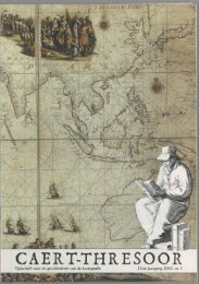
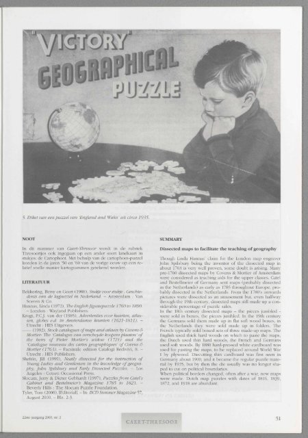
5. Etiket van een puzzel van 'England and Wales' uit circa 1935.<br />
NOOT<br />
In dit nummer van Caert-Thresoor wordt in de rubriek<br />
Thresoortjes ook ingegaan op een ander soort landkaart in<br />
stukjes: de Cartophoot. Met behulp van de cartophoot-puzzel<br />
konden in de jaren '50 en '60 van de vorige eeuw op een relatief<br />
snelle manier kartogrammen getekend worden.<br />
LITERATUUR<br />
Bekkering, Betsy en Geert (1988), Stukje voor stukje : Geschiedenis<br />
van de legpuzzel in Nederland. - Amsterdam : Van<br />
Soeren & Co.<br />
Hannas, Linda (1972), The English Jigsaupuzzle 1760 to 1890.<br />
- London : Wayland Publishers.<br />
Krogt, P.CJ. van der (1985), Advertenties voor kaarten, atlassen,<br />
globes e.d. in Amsterdamse kranten (1621-1811). -<br />
Utrecht : HES Uitgevers.<br />
(1992), Stock catalogues of maps and atlases by Covens &<br />
Mortier: The 'Catalogus van verscheyde koopereplaaten' of<br />
the heirs of Pieter Mortier's widow (1721) and the<br />
'Catalogue nouveau des cartes géographiques' of Covens &<br />
Mortier (1763). - Facsimile edition Catalogi Redivivi, 8. -<br />
Utrecht : HES Publishers.<br />
Shefrin, Jill (1999), Neatly dissected for the instruction of<br />
Young Ladies and Gentlemen in the knowledge of geography,<br />
John Spilsbury and Early Dissected Puzzles. - Los<br />
Angeles : Cotsen Occasional Press.<br />
Slocum, Jerry & Dieter Gebhardt (1997), Puzzles from Catel's<br />
Cabinet and Bestelmeier's Magazine 1785 to 1823- -<br />
Beverly Hills : The Slocum Puzzle Foundation.<br />
Tyler, Tom (2000), [Editorial]. - In: BCD Summer Magazine 57,<br />
August 2000. - Biz. 2-3.<br />
SUMMARY<br />
Dissected maps to facilitate the teaching of geography<br />
Though Linda Hannas' claim for the London map engraver<br />
John Spilsbury being the inventor of the dissected map in<br />
about 1763 is veiy well proven, some doubt is arising. Many<br />
pre-1760 dissected maps by Covens & Mortier of Amsterdam<br />
were considered as teaching aids for the upper classes. Catel<br />
and Bestellmeier of Germany sent maps (probably dissected<br />
in the Netherlands) as early as 1785 throughout Europe, probably<br />
dissected in the Netherlands. From the 1780's onwards<br />
pictures were dissected as an amusement but, even halfway<br />
through the 19th century, dissected maps still made up a considerable<br />
percentage of puzzle sales.<br />
In the 18th century dissected maps - the pieces jumbled -<br />
were sold in boxes, the pieces jumbled. In the 19th century<br />
the Germans sold them made up in flat soft wood boxes, in<br />
the Netherlands they were sold made up in folders. The<br />
French typically sold boxed sets of three made-up maps. The<br />
English used thick hard woods on which to paste the maps,<br />
the Dutch used thin hard woods, the French and Germans<br />
used soft woods. By 1880 hard-pressed white cardboard was<br />
used for pasting the maps, to be replaced around World War<br />
I by plywood. Diecutting thin cardboard was first seen in<br />
Germany about 1900, and it became the regular puzzle material<br />
by 1935; but by then the die usually was no longer shaped<br />
to cut on political boundaries.<br />
When political borders changed, often after a war, new maps<br />
were made. Dutch map puzzles with dates of 1816, 1839,<br />
1872, and 1918 are abundant.<br />
22ste jaargang 2003, nr. 2<br />
<strong>CAERT</strong>-<strong>THRESOOR</strong><br />
51