(2 2 3) (2010-2011 Bahar Dönemi) Ders Sorumlusu - Jeoloji Bilgi ...
(2 2 3) (2010-2011 Bahar Dönemi) Ders Sorumlusu - Jeoloji Bilgi ...
(2 2 3) (2010-2011 Bahar Dönemi) Ders Sorumlusu - Jeoloji Bilgi ...
- No tags were found...

You also want an ePaper? Increase the reach of your titles
YUMPU automatically turns print PDFs into web optimized ePapers that Google loves.
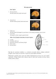
JEO 498 11.03.2008<br />
6.2. ĐLGĐLĐ TANIMLAMALAR<br />
DEM: The word elevation emphasizes the measurement of height above a datum and<br />
the absolute altitude or elevation of the points in the model. DEM as a term is in<br />
widespread use in the US, generally refers to the creation of a regular array of<br />
elevations, normally squares or a hexagon pattern over the terrain.<br />
DHM: This is a less commonly used term with the same meaning as the DEM since<br />
the word elevation and height are normally regarded as synonymous. The term seems<br />
to have generated in Germany.<br />
DGM: This term seems to lay its emphasis on a digital model of the solid surface of<br />
the Earth. The term seems to have generated in UK.<br />
DTM: A more complex concept involving not only height and elevations but also<br />
other GIS features such as rivers and ridge lines. Moreover, DTM may also include<br />
derived data about the terrain such as slope, aspect, and visibility. In a narrow sense, a<br />
DTM represents terrain relief. In its general form, a DTM is considered by most people<br />
to include both planimetric and terrain relief data.<br />
M.E.